

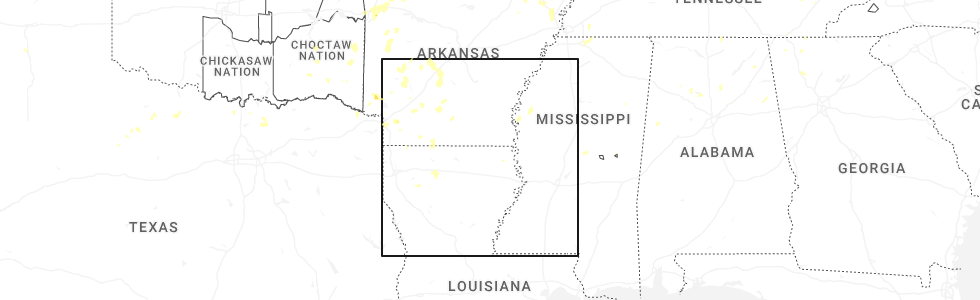
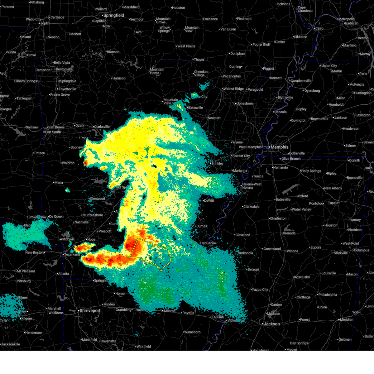
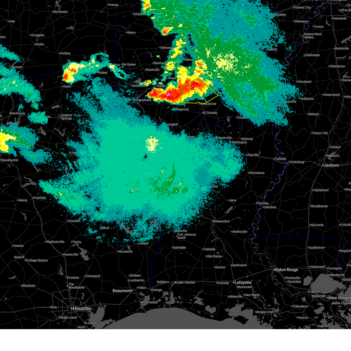
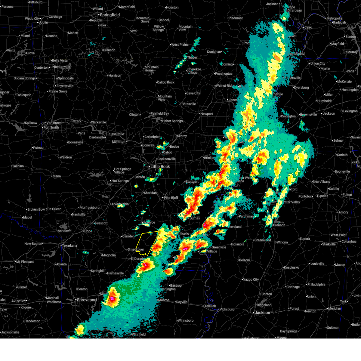
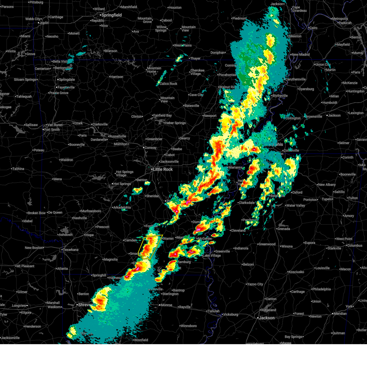
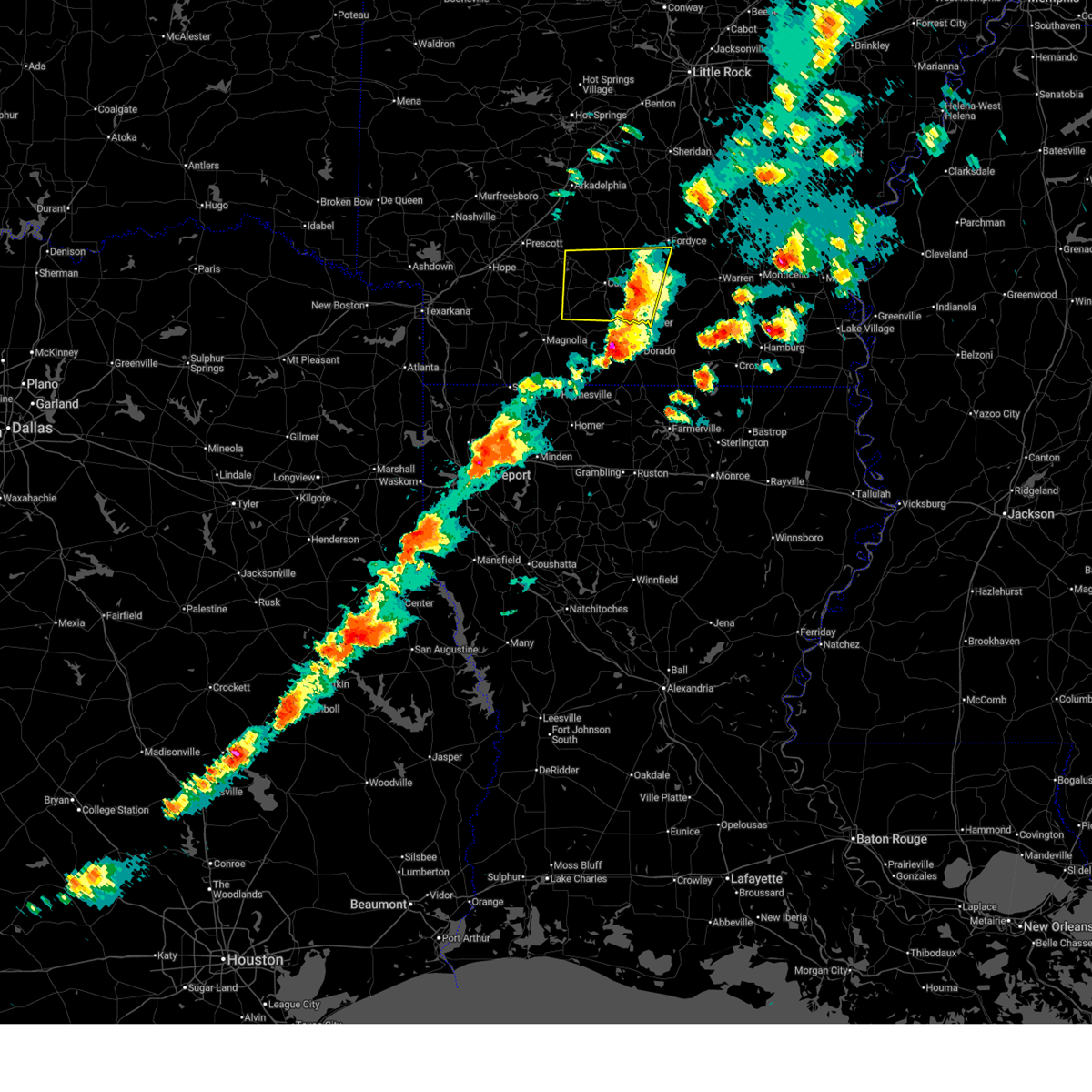
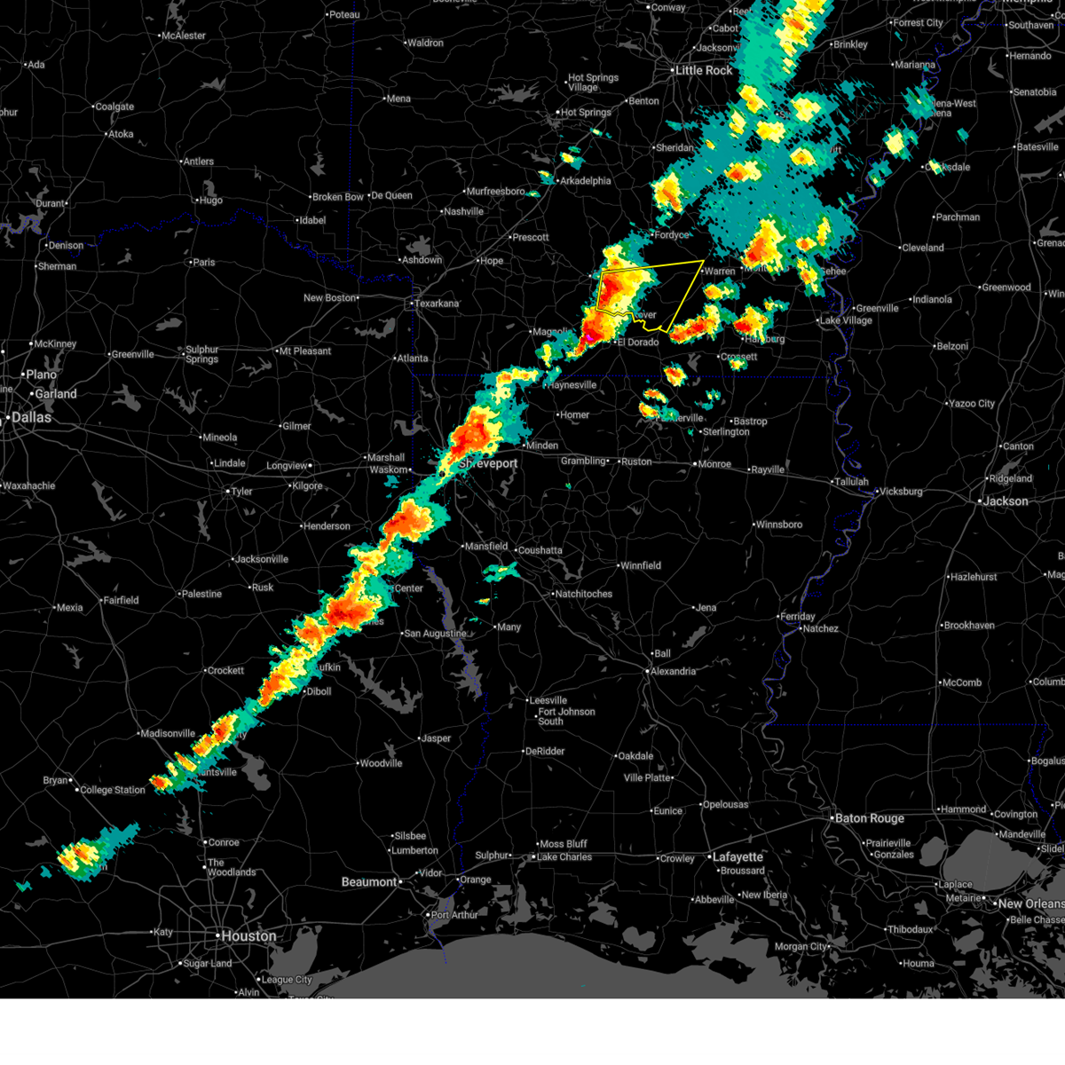
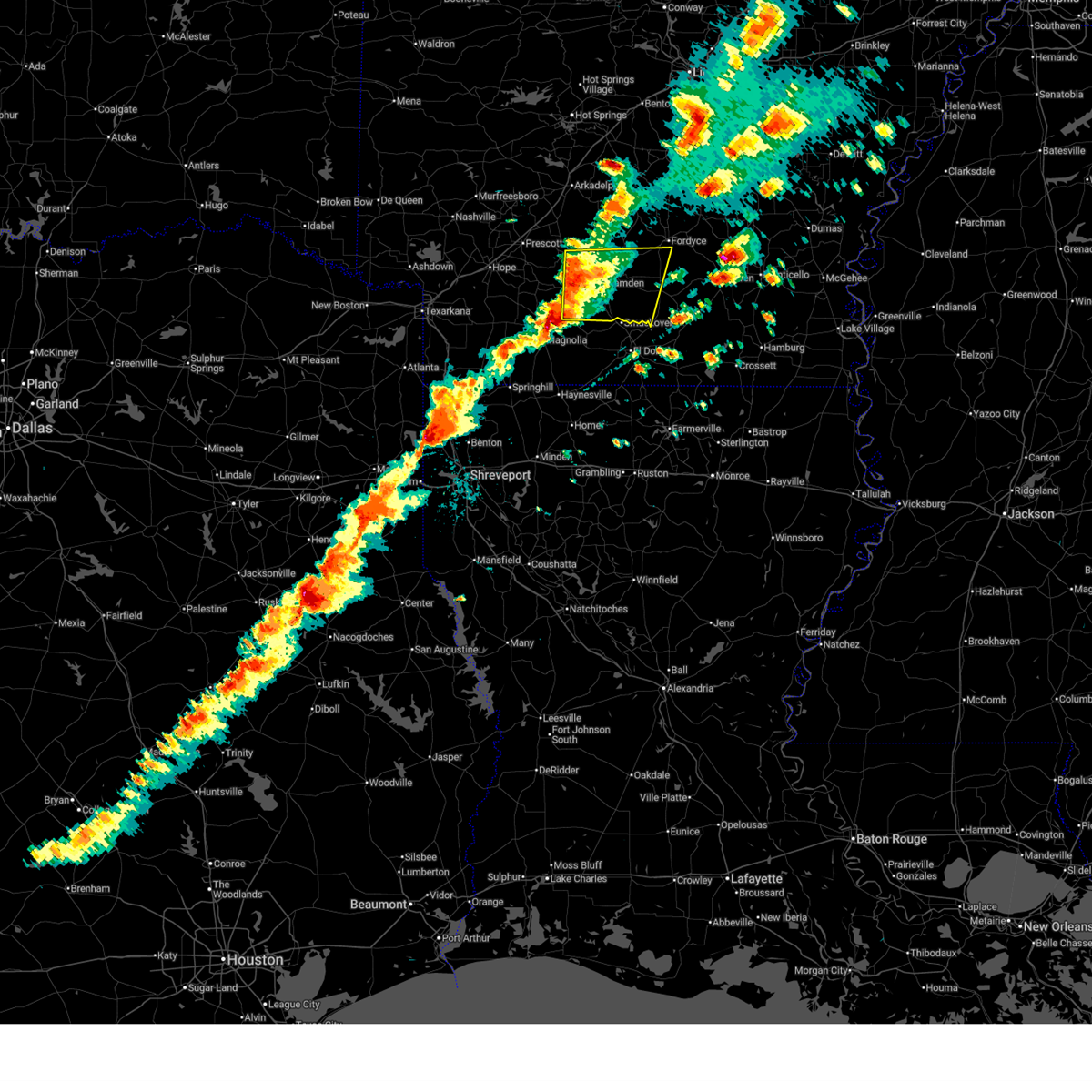
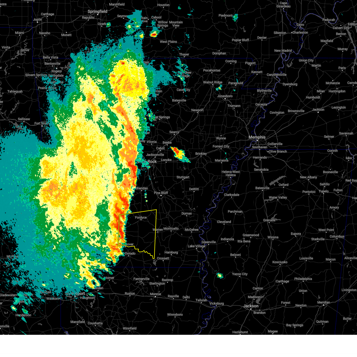
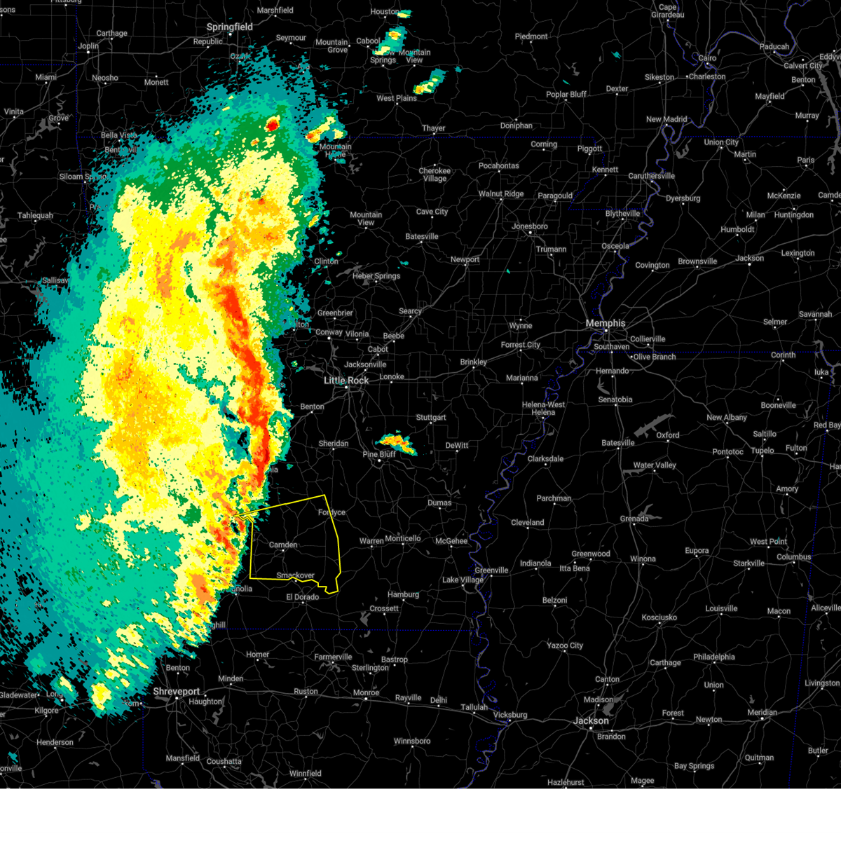
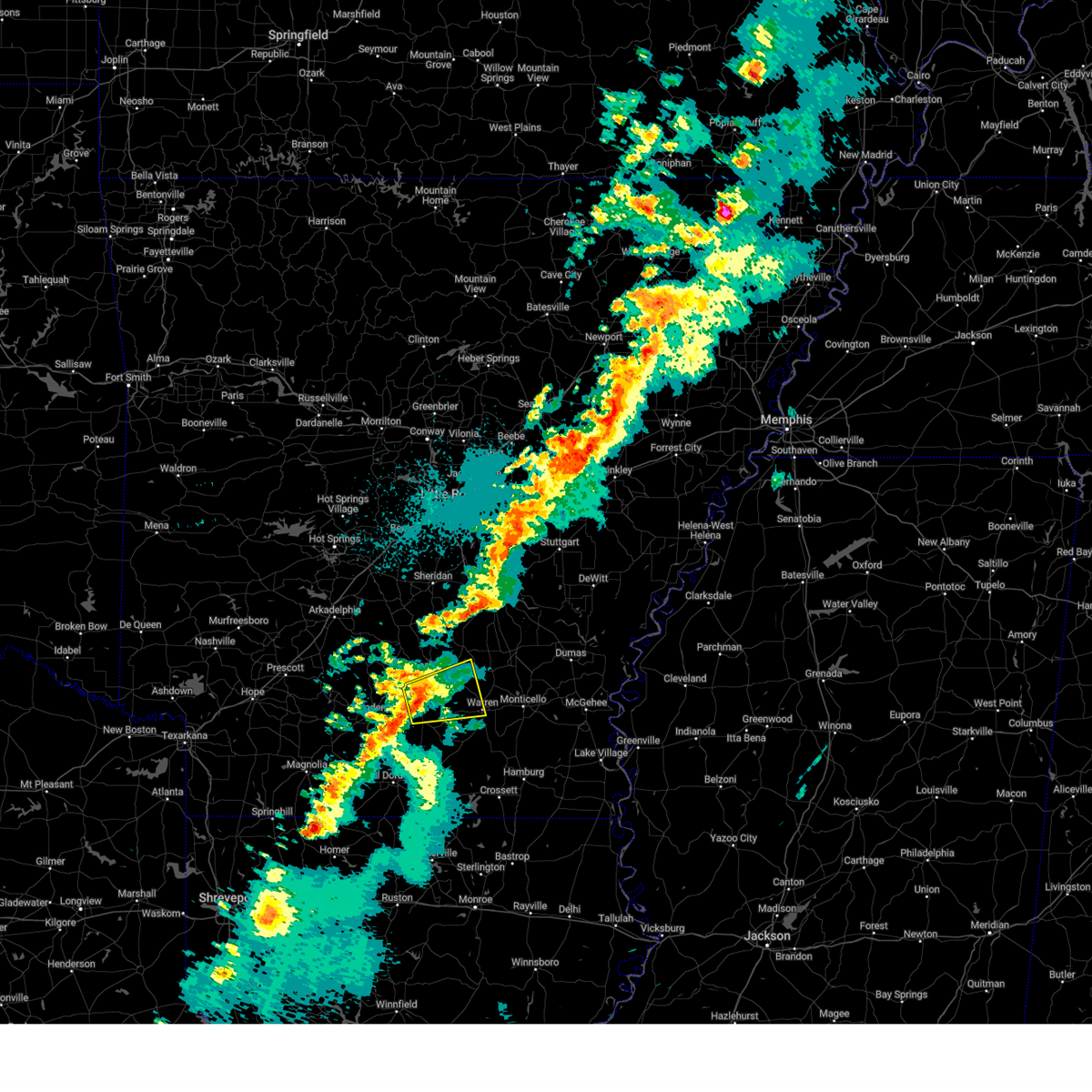
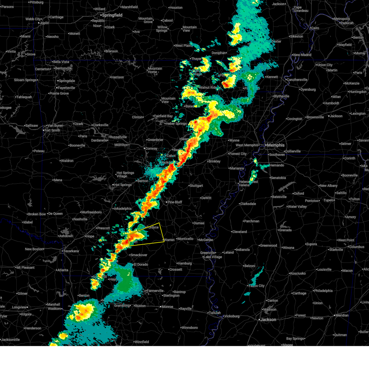
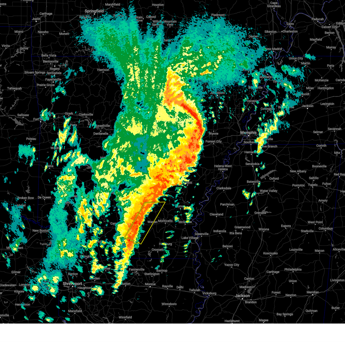
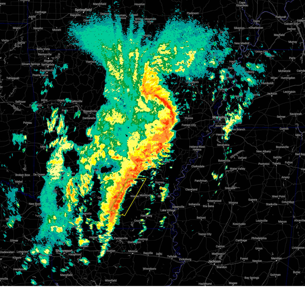
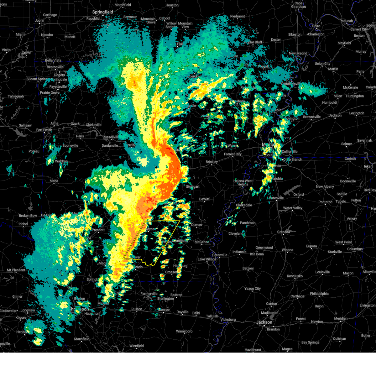
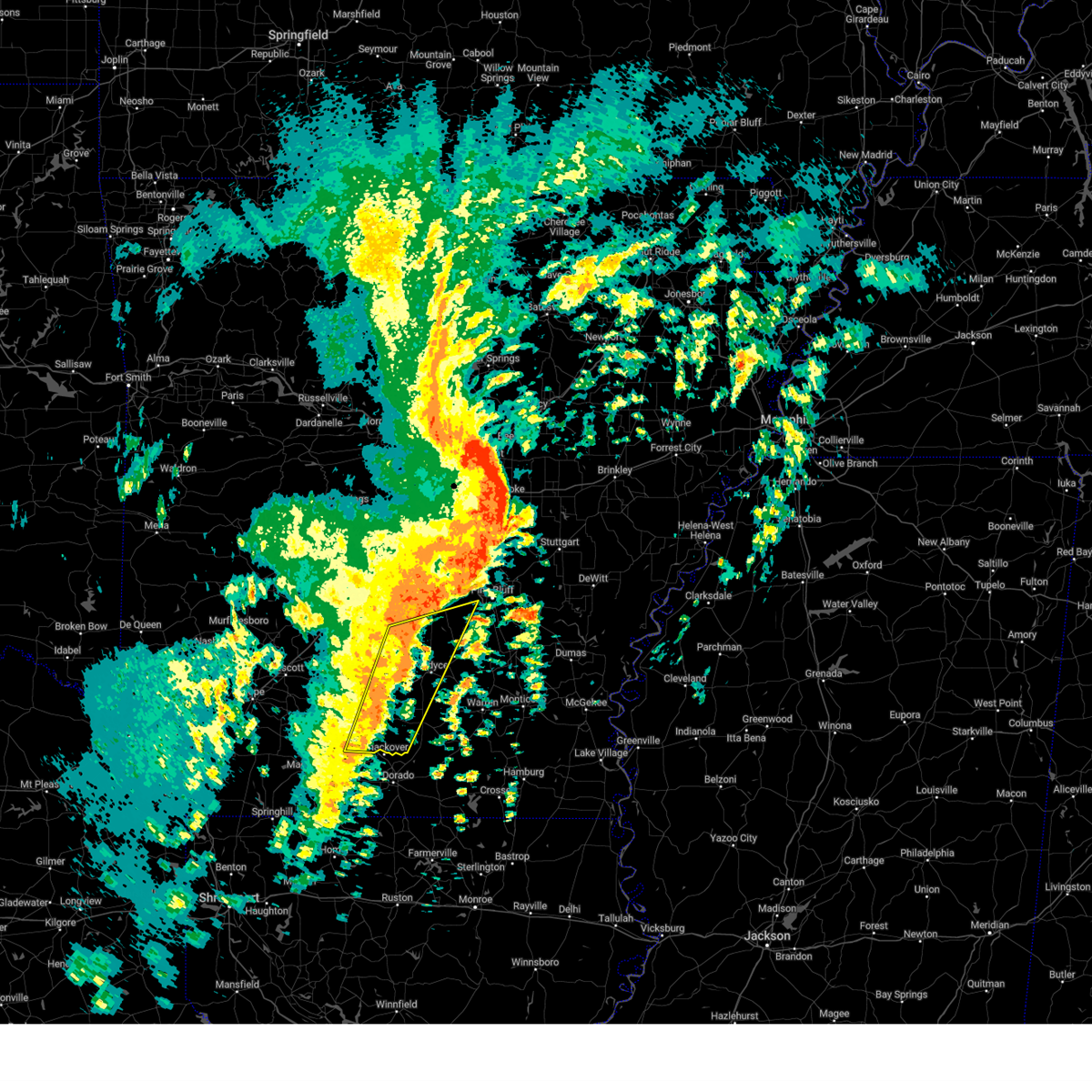
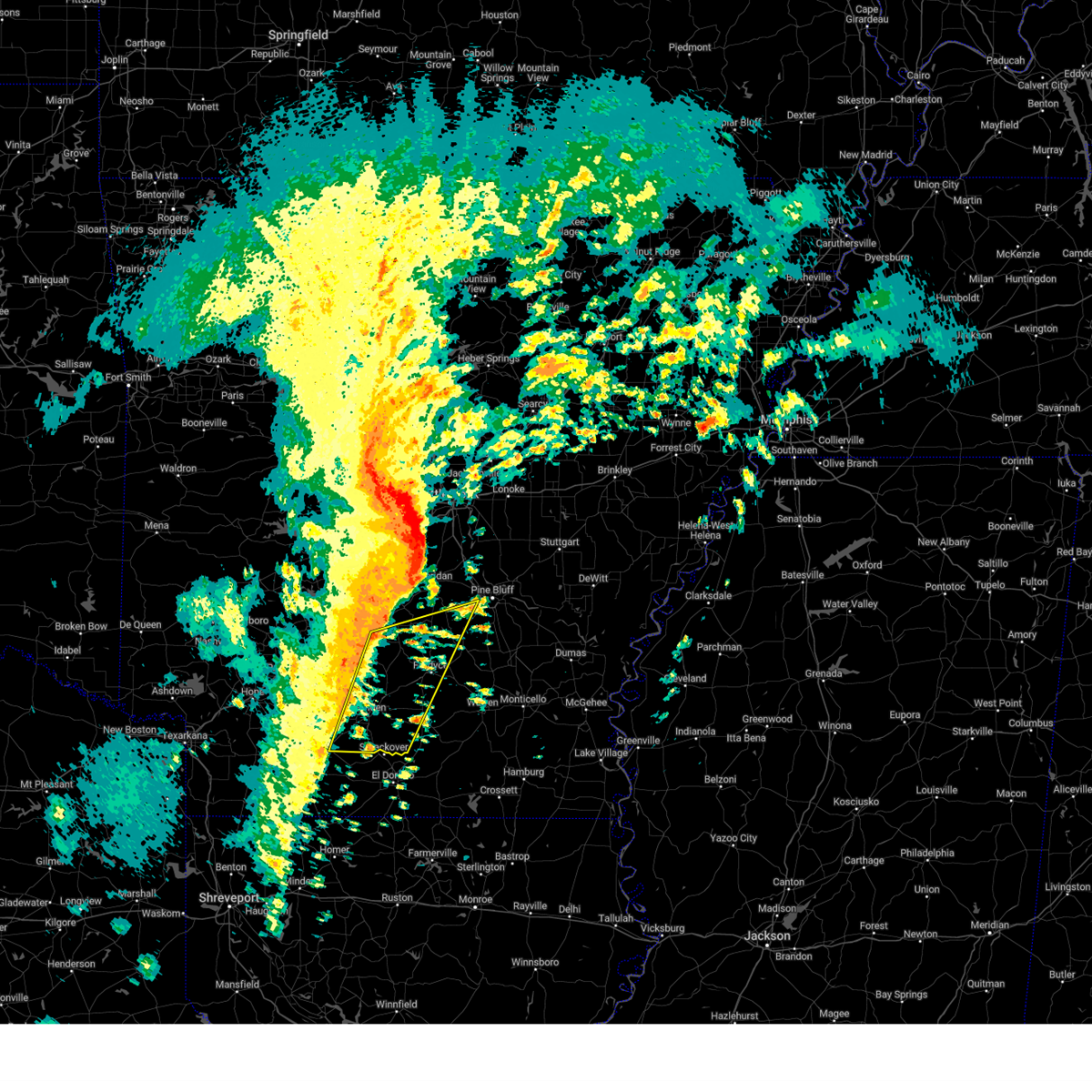
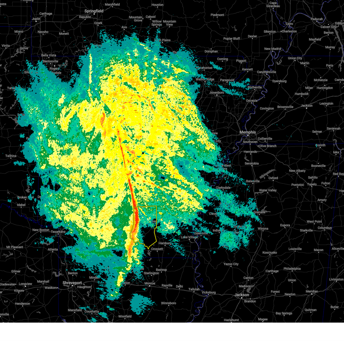
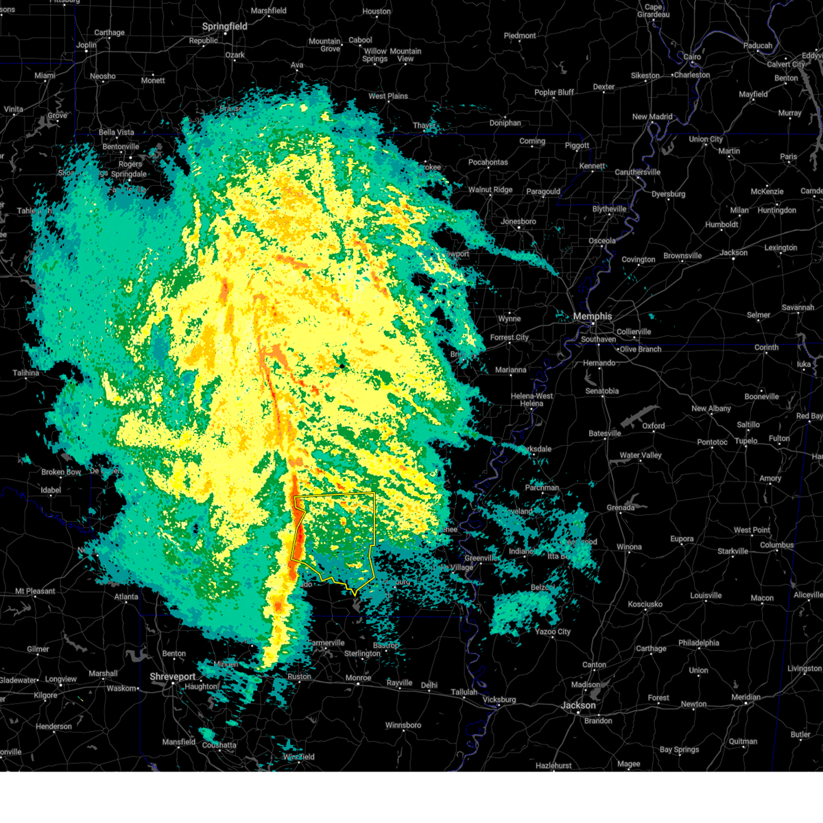
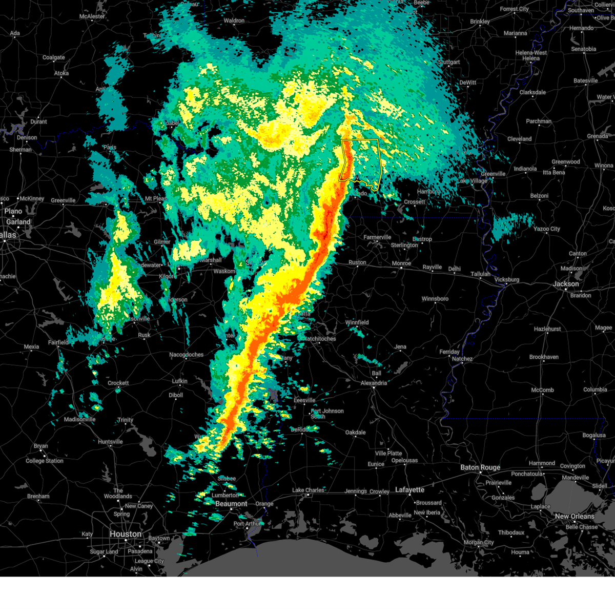
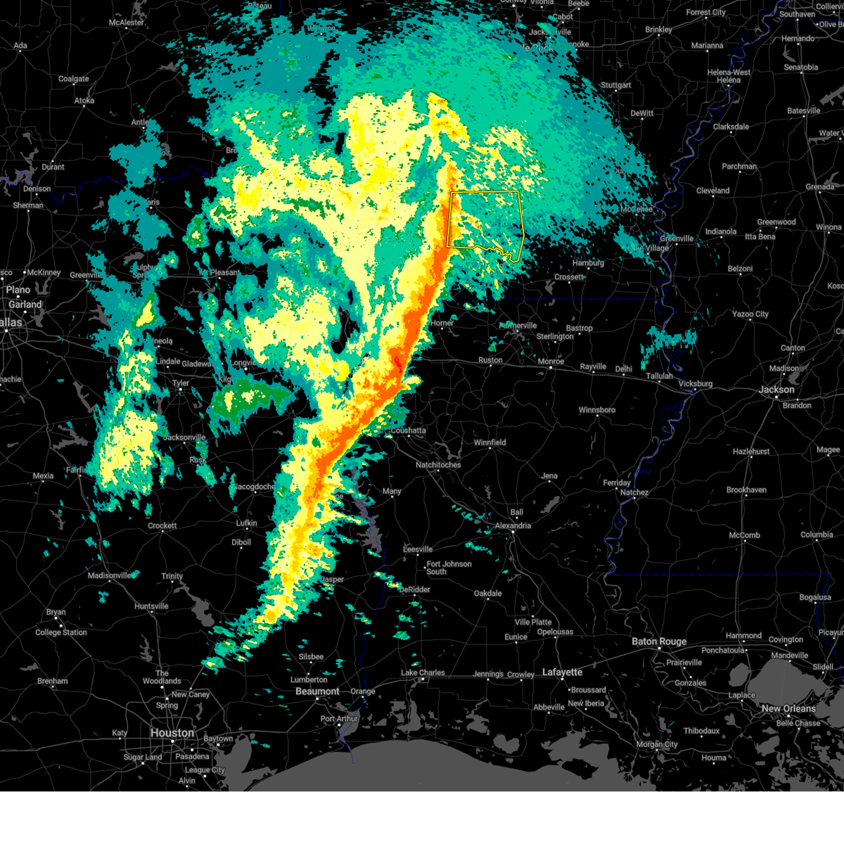
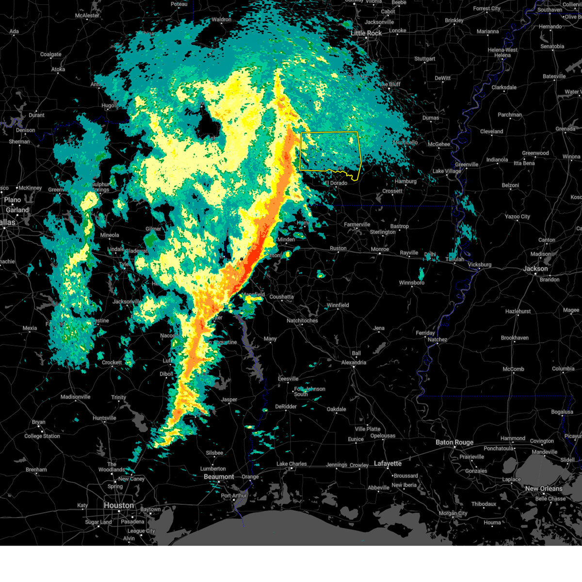
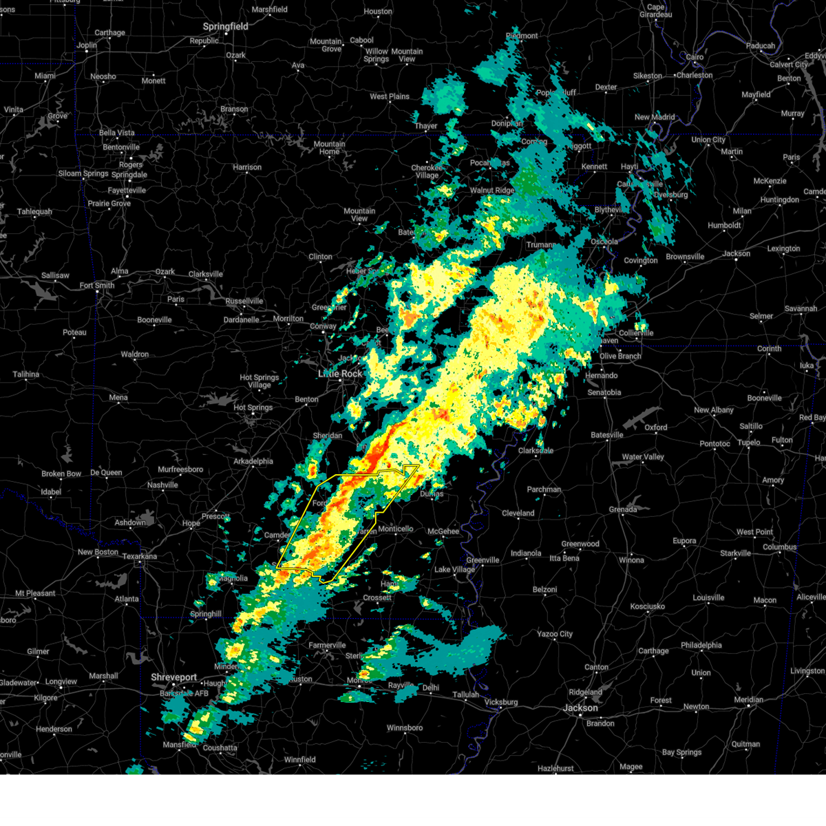
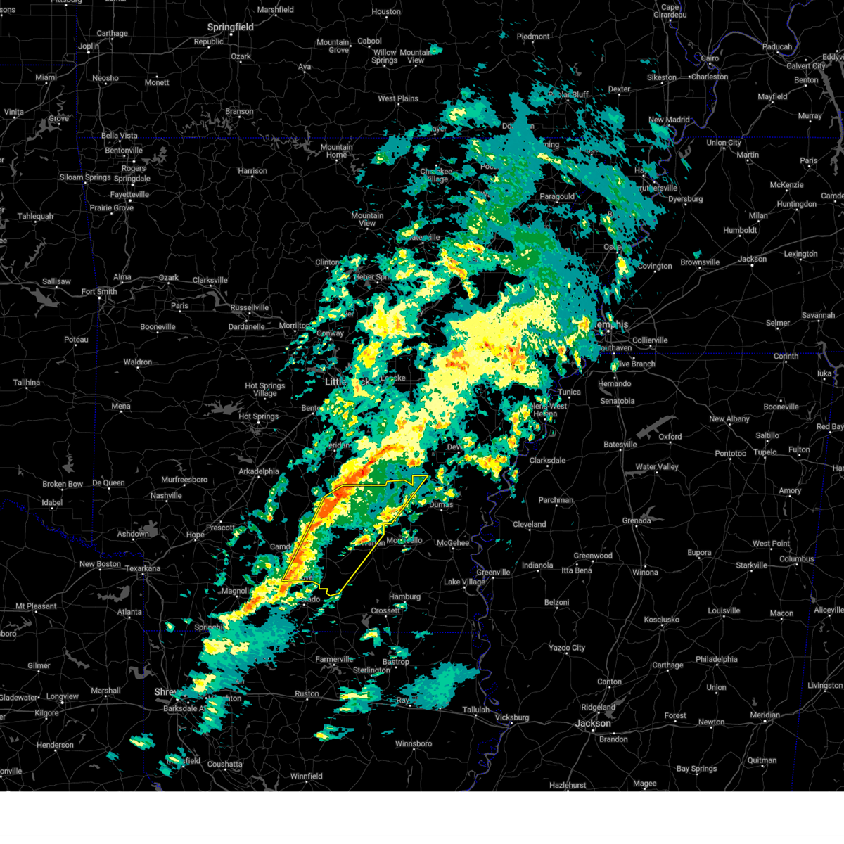
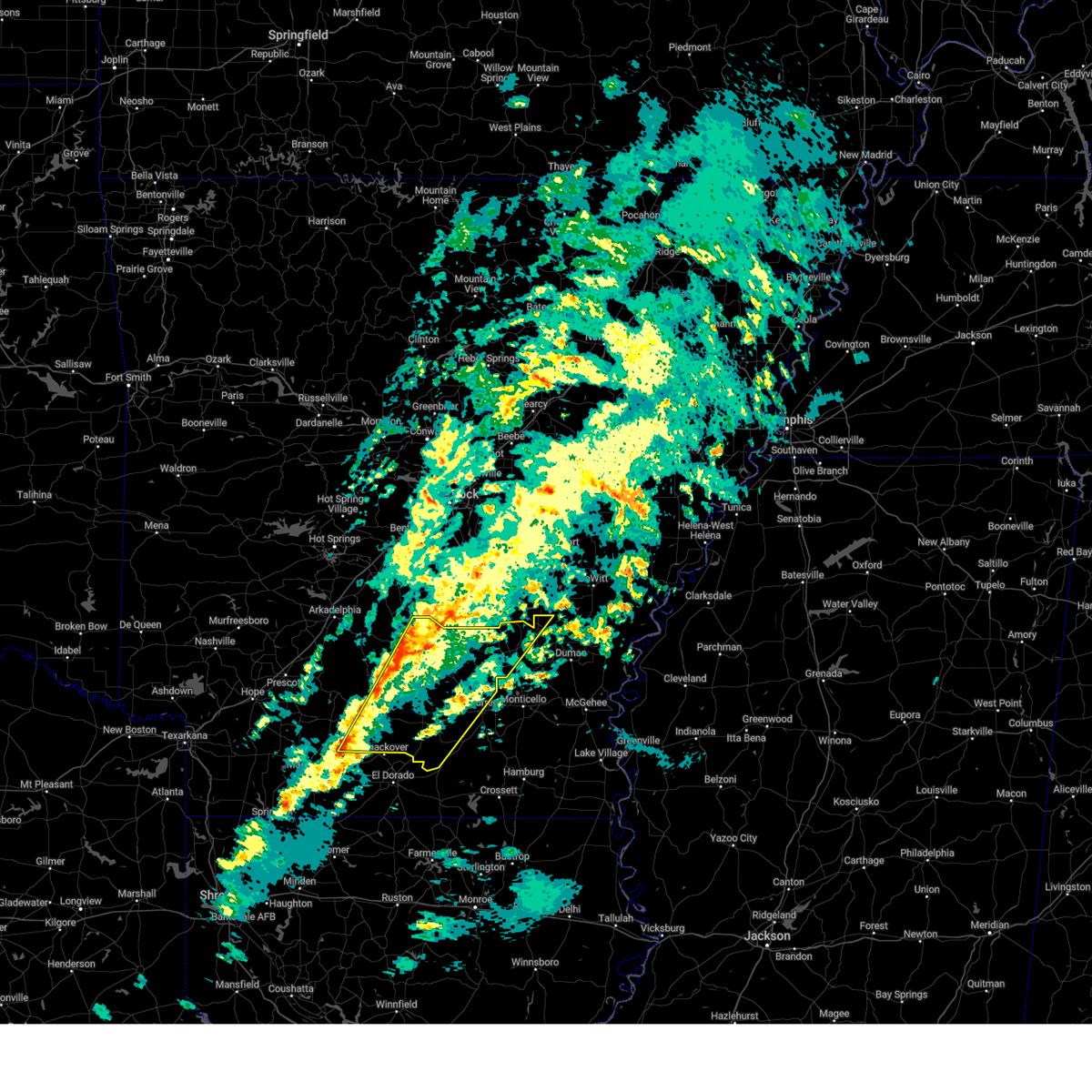
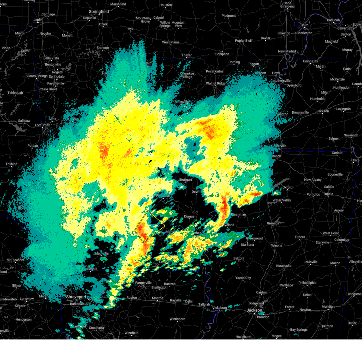
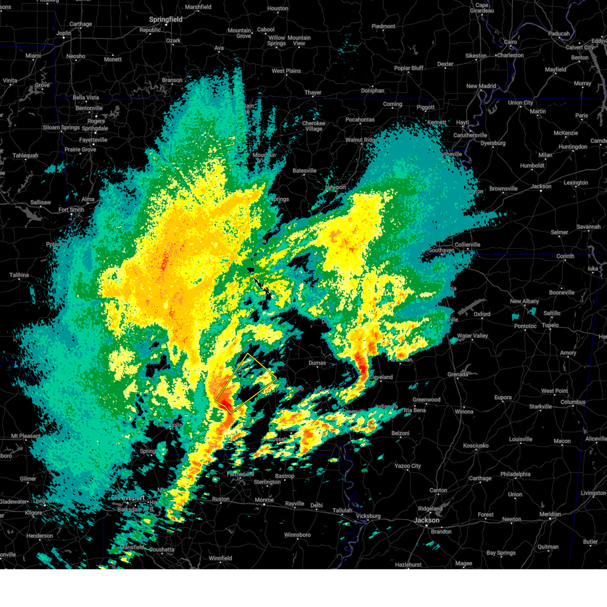
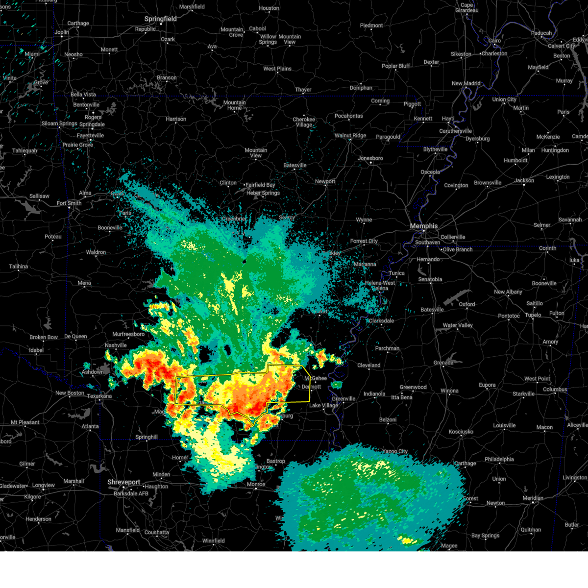
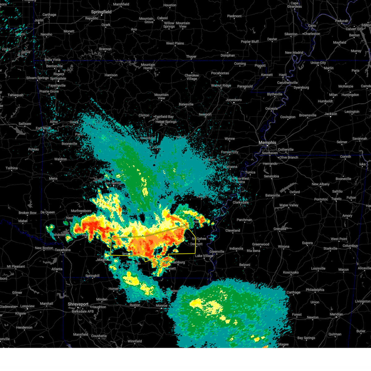
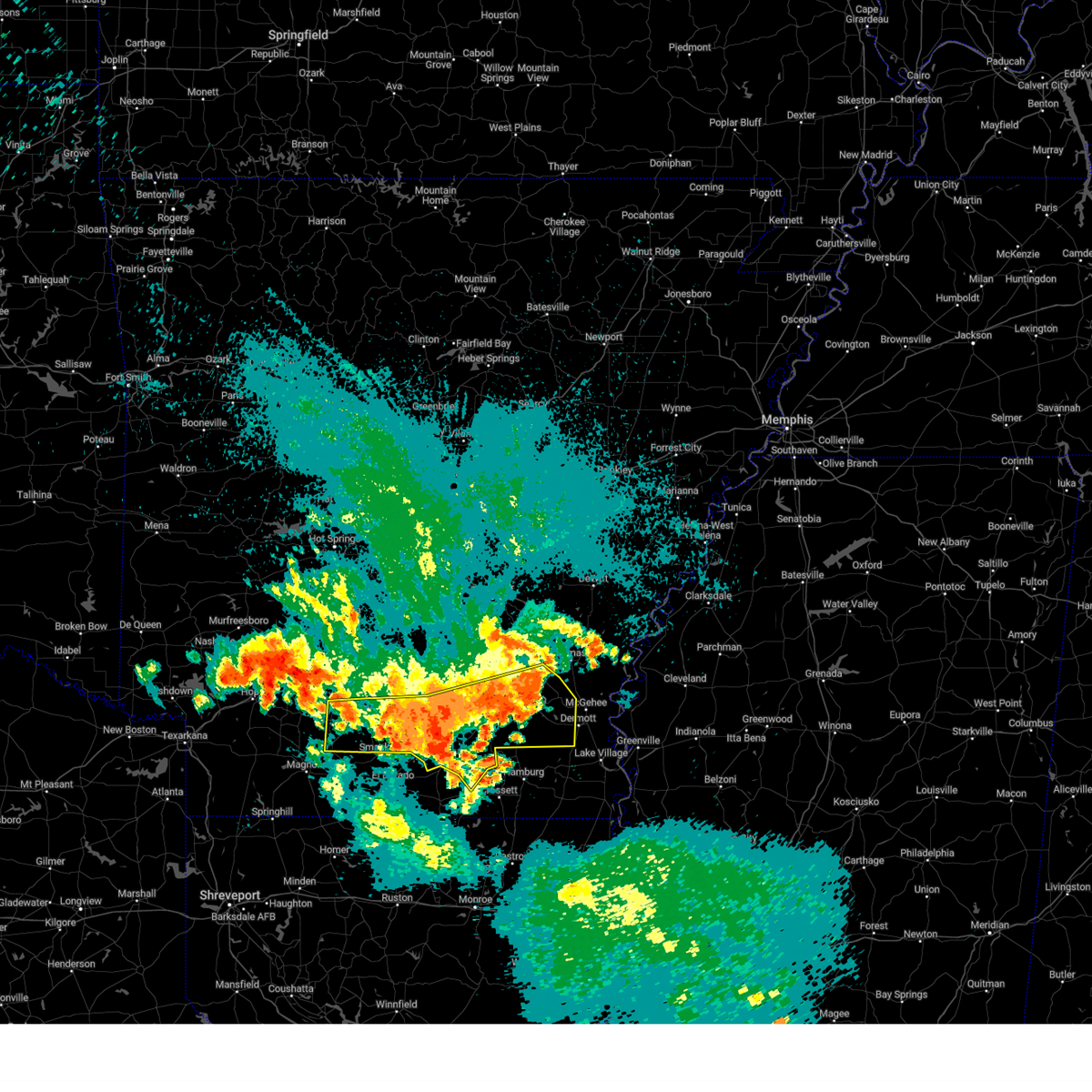
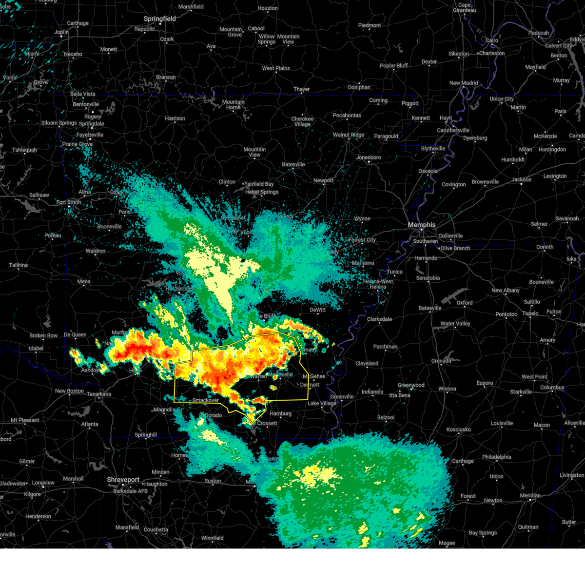
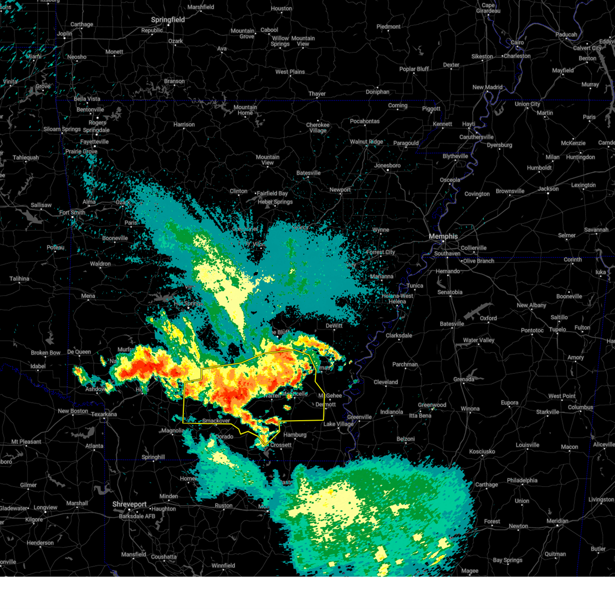
Hail Map for Hampton, AR
The Hampton, AR area has had 8 reports of on-the-ground hail by trained spotters, and has been under severe weather warnings 11 times during the past 12 months. Doppler radar has detected hail at or near Hampton, AR on 69 occasions, including 2 occasions during the past year.
| Name: | Hampton, AR |
| Where Located: | 61.3 miles NNW of Bastrop, LA |
| Map: | Google Map for Hampton, AR |
| Population: | 1324 |
| Housing Units: | 687 |
| More Info: | Search Google for Hampton, AR |
1
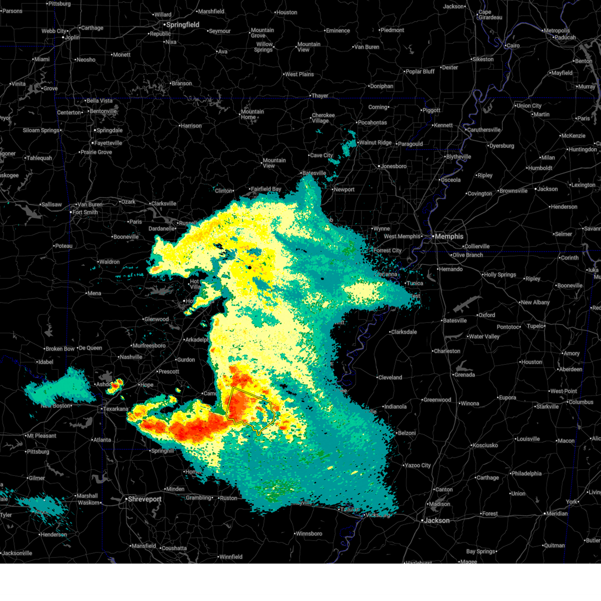
The Top Recent Hail Date for Hampton, AR is Thursday, July 31, 2025 (25th out of 69)
Hail and Wind Damage Spotted near Hampton, AR
| Date / Time | Report Details |
|---|---|
| 4/26/2026 2:01 AM CDT |
 At 200 am cdt, severe thunderstorms were located along a line extending from near hilo to near moro bay state park to near lawson, moving southeast at 35 mph (radar indicated). Hazards include 60 mph wind gusts. Expect damage to roofs, siding, and trees. Locations impacted include, hampton, hermitage, harrell, ingalls, hilo, moro bay state park, hampton municipal airport, moro bay, lanark, banks, artesian, farmville, johnsonville, blanchton, vick, gravelridge, mt olive in bradley county, marsden, jersey, sumpter,. At 200 am cdt, severe thunderstorms were located along a line extending from near hilo to near moro bay state park to near lawson, moving southeast at 35 mph (radar indicated). Hazards include 60 mph wind gusts. Expect damage to roofs, siding, and trees. Locations impacted include, hampton, hermitage, harrell, ingalls, hilo, moro bay state park, hampton municipal airport, moro bay, lanark, banks, artesian, farmville, johnsonville, blanchton, vick, gravelridge, mt olive in bradley county, marsden, jersey, sumpter,.
|
| 4/26/2026 1:49 AM CDT |
 At 148 am cdt, severe thunderstorms were located along a line extending from near harrell to near calion to el dorado, moving southeast at 30 mph (radar indicated). Hazards include 60 mph wind gusts. Expect damage to roofs, siding, and trees. Locations impacted include, hampton, hermitage, harrell, ingalls, hilo, hampton municipal airport, moro bay, moro bay state park, lanark, banks, artesian, delhi, farmville, millers bluff, johnsonville, locust bayou, vick, gravelridge, woodberry, mt olive in bradley county,. At 148 am cdt, severe thunderstorms were located along a line extending from near harrell to near calion to el dorado, moving southeast at 30 mph (radar indicated). Hazards include 60 mph wind gusts. Expect damage to roofs, siding, and trees. Locations impacted include, hampton, hermitage, harrell, ingalls, hilo, hampton municipal airport, moro bay, moro bay state park, lanark, banks, artesian, delhi, farmville, millers bluff, johnsonville, locust bayou, vick, gravelridge, woodberry, mt olive in bradley county,.
|
| 4/26/2026 1:35 AM CDT |
 At 135 am cdt, severe thunderstorms were located along a line extending from near hampton municipal airport to calion to near lisbon, moving southeast at 40 mph (radar indicated). Hazards include 60 mph wind gusts. Expect damage to roofs, siding, and trees. Locations impacted include, hampton, hermitage, harrell, ingalls, hilo, hampton municipal airport, moro bay, moro bay state park, lanark, banks, artesian, delhi, farmville, millers bluff, johnsonville, locust bayou, vick, gravelridge, woodberry, mt olive in bradley county,. At 135 am cdt, severe thunderstorms were located along a line extending from near hampton municipal airport to calion to near lisbon, moving southeast at 40 mph (radar indicated). Hazards include 60 mph wind gusts. Expect damage to roofs, siding, and trees. Locations impacted include, hampton, hermitage, harrell, ingalls, hilo, hampton municipal airport, moro bay, moro bay state park, lanark, banks, artesian, delhi, farmville, millers bluff, johnsonville, locust bayou, vick, gravelridge, woodberry, mt olive in bradley county,.
|
| 4/26/2026 1:25 AM CDT |
 Svrlzk the national weather service in little rock has issued a * severe thunderstorm warning for, bradley county in southeastern arkansas, calhoun county in southwestern arkansas, southeastern ouachita county in southwestern arkansas, * until 215 am cdt. * at 124 am cdt, severe thunderstorms were located along a line extending from 8 miles south of highland industrial park to near smackover to near lisbon, moving southeast at 35 mph (radar indicated). Hazards include 60 mph wind gusts. expect damage to roofs, siding, and trees Svrlzk the national weather service in little rock has issued a * severe thunderstorm warning for, bradley county in southeastern arkansas, calhoun county in southwestern arkansas, southeastern ouachita county in southwestern arkansas, * until 215 am cdt. * at 124 am cdt, severe thunderstorms were located along a line extending from 8 miles south of highland industrial park to near smackover to near lisbon, moving southeast at 35 mph (radar indicated). Hazards include 60 mph wind gusts. expect damage to roofs, siding, and trees
|
| 4/26/2026 12:44 AM CDT |
 Svrlzk the national weather service in little rock has issued a * severe thunderstorm warning for, central calhoun county in southwestern arkansas, ouachita county in southwestern arkansas, * until 130 am cdt. * at 1244 am cdt, severe thunderstorms were located along a line extending from near camden to 6 miles west of stephens, moving southeast at 30 mph (radar indicated). Hazards include 60 mph wind gusts and penny size hail. expect damage to roofs, siding, and trees Svrlzk the national weather service in little rock has issued a * severe thunderstorm warning for, central calhoun county in southwestern arkansas, ouachita county in southwestern arkansas, * until 130 am cdt. * at 1244 am cdt, severe thunderstorms were located along a line extending from near camden to 6 miles west of stephens, moving southeast at 30 mph (radar indicated). Hazards include 60 mph wind gusts and penny size hail. expect damage to roofs, siding, and trees
|
| 3/15/2026 7:10 PM CDT |
 The storm which prompted the warning has weakened below severe limits, and has exited the warned area. therefore, the warning will be allowed to expire. a tornado watch remains in effect until 900 pm cdt for southeastern and southwestern arkansas. The storm which prompted the warning has weakened below severe limits, and has exited the warned area. therefore, the warning will be allowed to expire. a tornado watch remains in effect until 900 pm cdt for southeastern and southwestern arkansas.
|
| 3/15/2026 6:52 PM CDT |
 At 651 pm cdt, a severe thunderstorm was located near harrell, or 7 miles east of hampton, moving east at 40 mph (radar indicated). Hazards include 60 mph wind gusts and penny size hail. Expect damage to roofs, siding, and trees. Locations impacted include, warren, hampton, calion, harrell, hilo, moro bay state park, hampton municipal airport, moro bay, lanark, banks, tinsman, artesian, farmville, mckinney, gravelridge, jersey,. At 651 pm cdt, a severe thunderstorm was located near harrell, or 7 miles east of hampton, moving east at 40 mph (radar indicated). Hazards include 60 mph wind gusts and penny size hail. Expect damage to roofs, siding, and trees. Locations impacted include, warren, hampton, calion, harrell, hilo, moro bay state park, hampton municipal airport, moro bay, lanark, banks, tinsman, artesian, farmville, mckinney, gravelridge, jersey,.
|
| 3/15/2026 6:52 PM CDT |
 the severe thunderstorm warning has been cancelled and is no longer in effect the severe thunderstorm warning has been cancelled and is no longer in effect
|
| 3/15/2026 6:28 PM CDT |
 A tornado watch remains in effect until 900 pm cdt for southwestern arkansas. remember, a severe thunderstorm warning still remains in effect for calhoun county until 715 pm cdt. A tornado watch remains in effect until 900 pm cdt for southwestern arkansas. remember, a severe thunderstorm warning still remains in effect for calhoun county until 715 pm cdt.
|
| 3/15/2026 6:25 PM CDT |
 Svrlzk the national weather service in little rock has issued a * severe thunderstorm warning for, northwestern bradley county in southeastern arkansas, calhoun county in southwestern arkansas, southeastern ouachita county in southwestern arkansas, * until 715 pm cdt. * at 625 pm cdt, a severe thunderstorm was located 8 miles south of highland industrial park, or 10 miles north of smackover, moving east at 40 mph (radar indicated). Hazards include 60 mph wind gusts and penny size hail. expect damage to roofs, siding, and trees Svrlzk the national weather service in little rock has issued a * severe thunderstorm warning for, northwestern bradley county in southeastern arkansas, calhoun county in southwestern arkansas, southeastern ouachita county in southwestern arkansas, * until 715 pm cdt. * at 625 pm cdt, a severe thunderstorm was located 8 miles south of highland industrial park, or 10 miles north of smackover, moving east at 40 mph (radar indicated). Hazards include 60 mph wind gusts and penny size hail. expect damage to roofs, siding, and trees
|
| 3/15/2026 5:47 PM CDT |
 Svrlzk the national weather service in little rock has issued a * severe thunderstorm warning for, central calhoun county in southwestern arkansas, ouachita county in southwestern arkansas, * until 630 pm cdt. * at 547 pm cdt, severe thunderstorms were located along a line extending from near chidester to near stephens, moving east at 40 mph (radar indicated). Hazards include 60 mph wind gusts. expect damage to roofs, siding, and trees Svrlzk the national weather service in little rock has issued a * severe thunderstorm warning for, central calhoun county in southwestern arkansas, ouachita county in southwestern arkansas, * until 630 pm cdt. * at 547 pm cdt, severe thunderstorms were located along a line extending from near chidester to near stephens, moving east at 40 mph (radar indicated). Hazards include 60 mph wind gusts. expect damage to roofs, siding, and trees
|
| 4/30/2025 5:25 PM CDT |
 Svrlzk the national weather service in little rock has issued a * severe thunderstorm warning for, bradley county in southeastern arkansas, central cleveland county in southeastern arkansas, calhoun county in southwestern arkansas, southern dallas county in southwestern arkansas, eastern ouachita county in southwestern arkansas, * until 630 pm cdt. * at 524 pm cdt, severe thunderstorms were located along a line extending from 7 miles east of sparkman to near louann, moving east at 35 mph (radar indicated). Hazards include 60 mph wind gusts. expect damage to roofs, siding, and trees Svrlzk the national weather service in little rock has issued a * severe thunderstorm warning for, bradley county in southeastern arkansas, central cleveland county in southeastern arkansas, calhoun county in southwestern arkansas, southern dallas county in southwestern arkansas, eastern ouachita county in southwestern arkansas, * until 630 pm cdt. * at 524 pm cdt, severe thunderstorms were located along a line extending from 7 miles east of sparkman to near louann, moving east at 35 mph (radar indicated). Hazards include 60 mph wind gusts. expect damage to roofs, siding, and trees
|
| 4/30/2025 4:32 PM CDT |
 Svrlzk the national weather service in little rock has issued a * severe thunderstorm warning for, southeastern clark county in southwestern arkansas, calhoun county in southwestern arkansas, southern dallas county in southwestern arkansas, ouachita county in southwestern arkansas, * until 530 pm cdt. * at 431 pm cdt, a severe thunderstorm was located near rosston, or 17 miles north of mcneil, moving northeast at 50 mph (radar indicated). Hazards include 60 mph wind gusts. expect damage to roofs, siding, and trees Svrlzk the national weather service in little rock has issued a * severe thunderstorm warning for, southeastern clark county in southwestern arkansas, calhoun county in southwestern arkansas, southern dallas county in southwestern arkansas, ouachita county in southwestern arkansas, * until 530 pm cdt. * at 431 pm cdt, a severe thunderstorm was located near rosston, or 17 miles north of mcneil, moving northeast at 50 mph (radar indicated). Hazards include 60 mph wind gusts. expect damage to roofs, siding, and trees
|
| 4/20/2025 9:07 PM CDT |
 At 906 pm cdt, a severe thunderstorm was located 8 miles southeast of harlow, or 8 miles north of hampton, moving east at 25 mph (radar indicated). Hazards include 60 mph wind gusts and quarter size hail. Hail damage to vehicles is expected. expect wind damage to roofs, siding, and trees. Locations impacted include, chambersville, ellisville, weeks, mt elba, tipton, warren, harlow, thornton, mckinney, orlando, marks mill state park, hebron, woodberry, banks, new edinburg, tinsman, hampton, fordyce,. At 906 pm cdt, a severe thunderstorm was located 8 miles southeast of harlow, or 8 miles north of hampton, moving east at 25 mph (radar indicated). Hazards include 60 mph wind gusts and quarter size hail. Hail damage to vehicles is expected. expect wind damage to roofs, siding, and trees. Locations impacted include, chambersville, ellisville, weeks, mt elba, tipton, warren, harlow, thornton, mckinney, orlando, marks mill state park, hebron, woodberry, banks, new edinburg, tinsman, hampton, fordyce,.
|
| 4/20/2025 9:07 PM CDT |
 the severe thunderstorm warning has been cancelled and is no longer in effect the severe thunderstorm warning has been cancelled and is no longer in effect
|
| 4/20/2025 8:42 PM CDT |
 Svrlzk the national weather service in little rock has issued a * severe thunderstorm warning for, northern bradley county in southeastern arkansas, south central cleveland county in southeastern arkansas, northern calhoun county in southwestern arkansas, southeastern dallas county in southwestern arkansas, east central ouachita county in southwestern arkansas, * until 930 pm cdt. * at 841 pm cdt, a severe thunderstorm was located over highland industrial park, or 11 miles east of camden, moving east at 35 mph (radar indicated). Hazards include 60 mph wind gusts and quarter size hail. Hail damage to vehicles is expected. Expect wind damage to roofs, siding, and trees. Svrlzk the national weather service in little rock has issued a * severe thunderstorm warning for, northern bradley county in southeastern arkansas, south central cleveland county in southeastern arkansas, northern calhoun county in southwestern arkansas, southeastern dallas county in southwestern arkansas, east central ouachita county in southwestern arkansas, * until 930 pm cdt. * at 841 pm cdt, a severe thunderstorm was located over highland industrial park, or 11 miles east of camden, moving east at 35 mph (radar indicated). Hazards include 60 mph wind gusts and quarter size hail. Hail damage to vehicles is expected. Expect wind damage to roofs, siding, and trees.
|
| 4/5/2025 12:26 PM CDT |
 The storms which prompted the warning have weakened below severe limits, and no longer pose an immediate threat to life or property. therefore, the warning will be allowed to expire. a tornado watch remains in effect until 700 pm cdt for southeastern and southwestern arkansas. The storms which prompted the warning have weakened below severe limits, and no longer pose an immediate threat to life or property. therefore, the warning will be allowed to expire. a tornado watch remains in effect until 700 pm cdt for southeastern and southwestern arkansas.
|
| 4/5/2025 12:15 PM CDT |
 At 1215 pm cdt, severe thunderstorms were located along a line extending from near rison to near harrell, moving northeast at 50 mph (radar indicated). Hazards include 60 mph wind gusts. Expect damage to roofs, siding, and trees. Locations impacted include, feenyville, farmville, ellisville, hilo, cornerville, millers bluff, palmyra, mckinney, hampton municipal airport, hebron, gravelridge, woodberry, banks, kingsland, star city, new edinburg, moro bay, jersey, rye, glendale in lincoln county,. At 1215 pm cdt, severe thunderstorms were located along a line extending from near rison to near harrell, moving northeast at 50 mph (radar indicated). Hazards include 60 mph wind gusts. Expect damage to roofs, siding, and trees. Locations impacted include, feenyville, farmville, ellisville, hilo, cornerville, millers bluff, palmyra, mckinney, hampton municipal airport, hebron, gravelridge, woodberry, banks, kingsland, star city, new edinburg, moro bay, jersey, rye, glendale in lincoln county,.
|
| 4/5/2025 11:42 AM CDT |
 Svrlzk the national weather service in little rock has issued a * severe thunderstorm warning for, northwestern bradley county in southeastern arkansas, cleveland county in southeastern arkansas, calhoun county in southwestern arkansas, southeastern dallas county in southwestern arkansas, eastern ouachita county in southwestern arkansas, northwestern drew county in southeastern arkansas, southwestern lincoln county in southeastern arkansas, * until 1230 pm cdt. * at 1141 am cdt, severe thunderstorms were located along a line extending from 8 miles northwest of fordyce to near cullendale, moving east at 45 mph (radar indicated). Hazards include 60 mph wind gusts and quarter size hail. Hail damage to vehicles is expected. Expect wind damage to roofs, siding, and trees. Svrlzk the national weather service in little rock has issued a * severe thunderstorm warning for, northwestern bradley county in southeastern arkansas, cleveland county in southeastern arkansas, calhoun county in southwestern arkansas, southeastern dallas county in southwestern arkansas, eastern ouachita county in southwestern arkansas, northwestern drew county in southeastern arkansas, southwestern lincoln county in southeastern arkansas, * until 1230 pm cdt. * at 1141 am cdt, severe thunderstorms were located along a line extending from 8 miles northwest of fordyce to near cullendale, moving east at 45 mph (radar indicated). Hazards include 60 mph wind gusts and quarter size hail. Hail damage to vehicles is expected. Expect wind damage to roofs, siding, and trees.
|
| 4/5/2025 11:30 AM CDT |
 the severe thunderstorm warning has been cancelled and is no longer in effect the severe thunderstorm warning has been cancelled and is no longer in effect
|
| 4/5/2025 11:30 AM CDT |
 At 1129 am cdt, severe thunderstorms were located along a line extending from 6 miles west of lamont to near louann, moving east at 35 mph (radar indicated). Hazards include 60 mph wind gusts and penny size hail. Expect damage to roofs, siding, and trees. Locations impacted include, delhi, cullendale, east camden, harmony grove, lamont, millers bluff, frenchport, elliot, locust bayou, fairview in ouachita county, carthage, warner, standard umpstead, harlow, thornton, hopeville, staves, sulphur springs, ivan, woodberry,. At 1129 am cdt, severe thunderstorms were located along a line extending from 6 miles west of lamont to near louann, moving east at 35 mph (radar indicated). Hazards include 60 mph wind gusts and penny size hail. Expect damage to roofs, siding, and trees. Locations impacted include, delhi, cullendale, east camden, harmony grove, lamont, millers bluff, frenchport, elliot, locust bayou, fairview in ouachita county, carthage, warner, standard umpstead, harlow, thornton, hopeville, staves, sulphur springs, ivan, woodberry,.
|
| 4/5/2025 11:04 AM CDT |
 Svrlzk the national weather service in little rock has issued a * severe thunderstorm warning for, northwestern cleveland county in southeastern arkansas, southeastern clark county in southwestern arkansas, southeastern grant county in central arkansas, central calhoun county in southwestern arkansas, dallas county in southwestern arkansas, ouachita county in southwestern arkansas, southwestern jefferson county in southeastern arkansas, * until 1145 am cdt. * at 1103 am cdt, severe thunderstorms were located along a line extending from 6 miles west of carthage to near stephens, moving east at 35 mph (radar indicated). Hazards include 60 mph wind gusts and penny size hail. expect damage to roofs, siding, and trees Svrlzk the national weather service in little rock has issued a * severe thunderstorm warning for, northwestern cleveland county in southeastern arkansas, southeastern clark county in southwestern arkansas, southeastern grant county in central arkansas, central calhoun county in southwestern arkansas, dallas county in southwestern arkansas, ouachita county in southwestern arkansas, southwestern jefferson county in southeastern arkansas, * until 1145 am cdt. * at 1103 am cdt, severe thunderstorms were located along a line extending from 6 miles west of carthage to near stephens, moving east at 35 mph (radar indicated). Hazards include 60 mph wind gusts and penny size hail. expect damage to roofs, siding, and trees
|
| 3/4/2025 10:47 AM CST |
 At 1046 am cst, severe thunderstorms were located along a line extending from near fordyce to near ellisville to near calion, moving east at 45 mph (radar indicated). Hazards include 60 mph wind gusts and penny size hail. Expect damage to roofs, siding, and trees. Locations impacted include, ingalls, carmel, farmville, ellisville, hilo, hermitage, johnsonville, warren, mckinney, vick, hampton municipal airport, hebron, gravelridge, mt olive in bradley county, banks, kingsland, new edinburg, moro bay, jersey, sumpter,. At 1046 am cst, severe thunderstorms were located along a line extending from near fordyce to near ellisville to near calion, moving east at 45 mph (radar indicated). Hazards include 60 mph wind gusts and penny size hail. Expect damage to roofs, siding, and trees. Locations impacted include, ingalls, carmel, farmville, ellisville, hilo, hermitage, johnsonville, warren, mckinney, vick, hampton municipal airport, hebron, gravelridge, mt olive in bradley county, banks, kingsland, new edinburg, moro bay, jersey, sumpter,.
|
| 3/4/2025 10:30 AM CST |
 Svrlzk the national weather service in little rock has issued a * severe thunderstorm warning for, bradley county in southeastern arkansas, southern cleveland county in southeastern arkansas, calhoun county in southwestern arkansas, southeastern dallas county in southwestern arkansas, * until 1130 am cst. * at 1029 am cst, severe thunderstorms were located along a line extending from 10 miles west of fordyce to 8 miles east of camden to near norphlet, moving east at 45 mph (radar indicated). Hazards include 60 mph wind gusts and penny size hail. expect damage to roofs, siding, and trees Svrlzk the national weather service in little rock has issued a * severe thunderstorm warning for, bradley county in southeastern arkansas, southern cleveland county in southeastern arkansas, calhoun county in southwestern arkansas, southeastern dallas county in southwestern arkansas, * until 1130 am cst. * at 1029 am cst, severe thunderstorms were located along a line extending from 10 miles west of fordyce to 8 miles east of camden to near norphlet, moving east at 45 mph (radar indicated). Hazards include 60 mph wind gusts and penny size hail. expect damage to roofs, siding, and trees
|
| 3/4/2025 10:18 AM CST |
 At 1017 am cst, severe thunderstorms were located along a line extending from 8 miles northwest of bearden to 7 miles northeast of louann to 6 miles west of el dorado, moving east at 50 mph (radar indicated). Hazards include 60 mph wind gusts and penny size hail. Expect damage to roofs, siding, and trees. Locations impacted include, delhi, east camden, harmony grove, millers bluff, frenchport, locust bayou, warner, standard umpstead, harlow, thornton, hampton municipal airport, woodberry, millville, chambersville, highland industrial park, eagle mills, kirkland, cross roads in ouachita county, louann, hampton,. At 1017 am cst, severe thunderstorms were located along a line extending from 8 miles northwest of bearden to 7 miles northeast of louann to 6 miles west of el dorado, moving east at 50 mph (radar indicated). Hazards include 60 mph wind gusts and penny size hail. Expect damage to roofs, siding, and trees. Locations impacted include, delhi, east camden, harmony grove, millers bluff, frenchport, locust bayou, warner, standard umpstead, harlow, thornton, hampton municipal airport, woodberry, millville, chambersville, highland industrial park, eagle mills, kirkland, cross roads in ouachita county, louann, hampton,.
|
| 3/4/2025 10:02 AM CST |
 At 1001 am cst, severe thunderstorms were located along a line extending from 8 miles south of sparkman to 2 miles west of camden to near emerson, moving east at 50 mph (radar indicated). Hazards include 60 mph wind gusts and penny size hail. Expect damage to roofs, siding, and trees. Locations impacted include, delhi, cullendale, east camden, harmony grove, millers bluff, frenchport, elliot, locust bayou, fairview in ouachita county, warner, standard umpstead, harlow, thornton, hampton municipal airport, woodberry, millville, buena vista, camden, chambersville, highland industrial park,. At 1001 am cst, severe thunderstorms were located along a line extending from 8 miles south of sparkman to 2 miles west of camden to near emerson, moving east at 50 mph (radar indicated). Hazards include 60 mph wind gusts and penny size hail. Expect damage to roofs, siding, and trees. Locations impacted include, delhi, cullendale, east camden, harmony grove, millers bluff, frenchport, elliot, locust bayou, fairview in ouachita county, warner, standard umpstead, harlow, thornton, hampton municipal airport, woodberry, millville, buena vista, camden, chambersville, highland industrial park,.
|
| 3/4/2025 9:37 AM CST |
 Svrlzk the national weather service in little rock has issued a * severe thunderstorm warning for, calhoun county in southwestern arkansas, ouachita county in southwestern arkansas, * until 1030 am cst. * at 937 am cst, severe thunderstorms were located along a line extending from near whelen springs to 7 miles southeast of willisville to 6 miles west of emerson, moving east at 55 mph (radar indicated). Hazards include 60 mph wind gusts and penny size hail. expect damage to roofs, siding, and trees Svrlzk the national weather service in little rock has issued a * severe thunderstorm warning for, calhoun county in southwestern arkansas, ouachita county in southwestern arkansas, * until 1030 am cst. * at 937 am cst, severe thunderstorms were located along a line extending from near whelen springs to 7 miles southeast of willisville to 6 miles west of emerson, moving east at 55 mph (radar indicated). Hazards include 60 mph wind gusts and penny size hail. expect damage to roofs, siding, and trees
|
| 1/5/2025 1:04 PM CST |
 the severe thunderstorm warning has been cancelled and is no longer in effect the severe thunderstorm warning has been cancelled and is no longer in effect
|
| 1/5/2025 12:40 PM CST |
 At 1239 pm cst, severe thunderstorms were located along a line extending from near kedron to near smackover, moving east at 60 mph (radar indicated). Hazards include 60 mph wind gusts and penny size hail. Expect damage to roofs, siding, and trees. Locations impacted include, warren, fordyce, star city, rison, hampton, bearden, calion, grady, kingsland, thornton, harrell, louann, whitefield, hampton municipal airport, moro bay, weeks, woodville, tipton, herbine, nebo,. At 1239 pm cst, severe thunderstorms were located along a line extending from near kedron to near smackover, moving east at 60 mph (radar indicated). Hazards include 60 mph wind gusts and penny size hail. Expect damage to roofs, siding, and trees. Locations impacted include, warren, fordyce, star city, rison, hampton, bearden, calion, grady, kingsland, thornton, harrell, louann, whitefield, hampton municipal airport, moro bay, weeks, woodville, tipton, herbine, nebo,.
|
| 1/5/2025 12:24 PM CST |
 Svrlzk the national weather service in little rock has issued a * severe thunderstorm warning for, northwestern bradley county in southeastern arkansas, cleveland county in southeastern arkansas, calhoun county in southwestern arkansas, eastern dallas county in southwestern arkansas, central ouachita county in southwestern arkansas, western lincoln county in southeastern arkansas, * until 115 pm cst. * at 1224 pm cst, severe thunderstorms were located along a line extending from 8 miles east of carthage to near louann, moving east at 50 mph (radar indicated). Hazards include 60 mph wind gusts. expect damage to roofs, siding, and trees Svrlzk the national weather service in little rock has issued a * severe thunderstorm warning for, northwestern bradley county in southeastern arkansas, cleveland county in southeastern arkansas, calhoun county in southwestern arkansas, eastern dallas county in southwestern arkansas, central ouachita county in southwestern arkansas, western lincoln county in southeastern arkansas, * until 115 pm cst. * at 1224 pm cst, severe thunderstorms were located along a line extending from 8 miles east of carthage to near louann, moving east at 50 mph (radar indicated). Hazards include 60 mph wind gusts. expect damage to roofs, siding, and trees
|
| 12/28/2024 1:15 PM CST |
 At 114 pm cst, a severe thunderstorm was located near ellisville, or 8 miles northeast of hampton, moving northeast at 50 mph (radar indicated). Hazards include 60 mph wind gusts. Expect damage to roofs, siding, and trees. Locations impacted include, fordyce, hampton, kingsland, thornton, harrell, ellisville, weeks, mt elba, tipton, marks mill state park, hebron, banks, tinsman, chambersville, mckinney, orlando, new edinburg,. At 114 pm cst, a severe thunderstorm was located near ellisville, or 8 miles northeast of hampton, moving northeast at 50 mph (radar indicated). Hazards include 60 mph wind gusts. Expect damage to roofs, siding, and trees. Locations impacted include, fordyce, hampton, kingsland, thornton, harrell, ellisville, weeks, mt elba, tipton, marks mill state park, hebron, banks, tinsman, chambersville, mckinney, orlando, new edinburg,.
|
| 12/28/2024 1:07 PM CST | Quarter sized hail reported 0.2 miles SSE of Hampton, AR, a public report of quarter sized hail to the hampton police department which fell on the north side of hampton along highway 167. |
| 12/28/2024 1:01 PM CST |
 Svrlzk the national weather service in little rock has issued a * severe thunderstorm warning for, northwestern bradley county in southeastern arkansas, southwestern cleveland county in southeastern arkansas, northern calhoun county in southwestern arkansas, southeastern dallas county in southwestern arkansas, * until 145 pm cst. * at 101 pm cst, a severe thunderstorm was located near hampton, moving northeast at 50 mph (radar indicated). Hazards include 60 mph wind gusts and quarter size hail. Hail damage to vehicles is expected. Expect wind damage to roofs, siding, and trees. Svrlzk the national weather service in little rock has issued a * severe thunderstorm warning for, northwestern bradley county in southeastern arkansas, southwestern cleveland county in southeastern arkansas, northern calhoun county in southwestern arkansas, southeastern dallas county in southwestern arkansas, * until 145 pm cst. * at 101 pm cst, a severe thunderstorm was located near hampton, moving northeast at 50 mph (radar indicated). Hazards include 60 mph wind gusts and quarter size hail. Hail damage to vehicles is expected. Expect wind damage to roofs, siding, and trees.
|
| 8/18/2024 10:35 PM CDT |
 At 1035 pm cdt, severe thunderstorms were located along a line extending from 8 miles east of monticello to near ingalls to near lisbon, moving southeast at 60 mph (radar indicated). Hazards include 60 mph wind gusts. Expect damage to roofs, siding, and trees. Locations impacted include, camden, monticello, warren, hampton, stephens, hermitage, wilmar, harrell, louann, ingalls, plantersville, hampton municipal airport, moro bay, weeks, poison springs state park, cullendale, ellisville, hilo, ladelle, green hill,. At 1035 pm cdt, severe thunderstorms were located along a line extending from 8 miles east of monticello to near ingalls to near lisbon, moving southeast at 60 mph (radar indicated). Hazards include 60 mph wind gusts. Expect damage to roofs, siding, and trees. Locations impacted include, camden, monticello, warren, hampton, stephens, hermitage, wilmar, harrell, louann, ingalls, plantersville, hampton municipal airport, moro bay, weeks, poison springs state park, cullendale, ellisville, hilo, ladelle, green hill,.
|
| 8/18/2024 10:35 PM CDT |
 the severe thunderstorm warning has been cancelled and is no longer in effect the severe thunderstorm warning has been cancelled and is no longer in effect
|
| 8/18/2024 10:30 PM CDT |
 At 1030 pm cdt, severe thunderstorms were located along a line extending from 7 miles east of monticello to ingalls to near lisbon, moving southeast at 60 mph (radar indicated). Hazards include 60 mph wind gusts. Expect damage to roofs, siding, and trees. Locations impacted include, camden, monticello, warren, hampton, stephens, hermitage, wilmar, harrell, louann, ingalls, plantersville, hampton municipal airport, moro bay, weeks, poison springs state park, cullendale, ellisville, hilo, ladelle, green hill,. At 1030 pm cdt, severe thunderstorms were located along a line extending from 7 miles east of monticello to ingalls to near lisbon, moving southeast at 60 mph (radar indicated). Hazards include 60 mph wind gusts. Expect damage to roofs, siding, and trees. Locations impacted include, camden, monticello, warren, hampton, stephens, hermitage, wilmar, harrell, louann, ingalls, plantersville, hampton municipal airport, moro bay, weeks, poison springs state park, cullendale, ellisville, hilo, ladelle, green hill,.
|
| 8/18/2024 10:30 PM CDT |
 the severe thunderstorm warning has been cancelled and is no longer in effect the severe thunderstorm warning has been cancelled and is no longer in effect
|
| 8/18/2024 10:20 PM CDT |
 the severe thunderstorm warning has been cancelled and is no longer in effect the severe thunderstorm warning has been cancelled and is no longer in effect
|
| 8/18/2024 10:20 PM CDT |
 At 1020 pm cdt, severe thunderstorms were located along a line extending from 8 miles northeast of monticello to hermitage to near louann, moving south at 60 mph (radar indicated). Hazards include 60 mph wind gusts. Expect damage to roofs, siding, and trees. Locations impacted include, camden, monticello, warren, fordyce, star city, rison, hampton, bearden, stephens, hermitage, wilmar, grady, kingsland, sparkman, thornton, chidester, harrell, louann, whitefield, weeks,. At 1020 pm cdt, severe thunderstorms were located along a line extending from 8 miles northeast of monticello to hermitage to near louann, moving south at 60 mph (radar indicated). Hazards include 60 mph wind gusts. Expect damage to roofs, siding, and trees. Locations impacted include, camden, monticello, warren, fordyce, star city, rison, hampton, bearden, stephens, hermitage, wilmar, grady, kingsland, sparkman, thornton, chidester, harrell, louann, whitefield, weeks,.
|
| 8/18/2024 10:10 PM CDT |
 At 1010 pm cdt, severe thunderstorms were located along a line extending from near cane creek state park to near lanark to 7 miles east of stephens, moving south at 50 mph (radar indicated). Hazards include 70 mph wind gusts and nickel size hail. Expect considerable tree damage. damage is likely to mobile homes, roofs, and outbuildings. Locations impacted include, camden, monticello, warren, fordyce, star city, rison, hampton, bearden, stephens, hermitage, wilmar, grady, kingsland, sparkman, thornton, chidester, harrell, louann, whelen springs, whitefield,. At 1010 pm cdt, severe thunderstorms were located along a line extending from near cane creek state park to near lanark to 7 miles east of stephens, moving south at 50 mph (radar indicated). Hazards include 70 mph wind gusts and nickel size hail. Expect considerable tree damage. damage is likely to mobile homes, roofs, and outbuildings. Locations impacted include, camden, monticello, warren, fordyce, star city, rison, hampton, bearden, stephens, hermitage, wilmar, grady, kingsland, sparkman, thornton, chidester, harrell, louann, whelen springs, whitefield,.
|
| 8/18/2024 9:54 PM CDT |
 Svrlzk the national weather service in little rock has issued a * severe thunderstorm warning for, bradley county in southeastern arkansas, cleveland county in southeastern arkansas, southeastern clark county in southwestern arkansas, west central desha county in southeastern arkansas, calhoun county in southwestern arkansas, southern dallas county in southwestern arkansas, ouachita county in southwestern arkansas, drew county in southeastern arkansas, southwestern jefferson county in southeastern arkansas, lincoln county in southeastern arkansas, * until 1045 pm cdt. * at 953 pm cdt, severe thunderstorms were located along a line extending from 6 miles northwest of feenyville to near fordyce to near bluff city, moving southeast at 60 mph (radar indicated). Hazards include 70 mph wind gusts and nickel size hail. Expect considerable tree damage. Damage is likely to mobile homes, roofs, and outbuildings. Svrlzk the national weather service in little rock has issued a * severe thunderstorm warning for, bradley county in southeastern arkansas, cleveland county in southeastern arkansas, southeastern clark county in southwestern arkansas, west central desha county in southeastern arkansas, calhoun county in southwestern arkansas, southern dallas county in southwestern arkansas, ouachita county in southwestern arkansas, drew county in southeastern arkansas, southwestern jefferson county in southeastern arkansas, lincoln county in southeastern arkansas, * until 1045 pm cdt. * at 953 pm cdt, severe thunderstorms were located along a line extending from 6 miles northwest of feenyville to near fordyce to near bluff city, moving southeast at 60 mph (radar indicated). Hazards include 70 mph wind gusts and nickel size hail. Expect considerable tree damage. Damage is likely to mobile homes, roofs, and outbuildings.
|
| 4/28/2024 8:59 PM CDT |
 Svrlzk the national weather service in little rock has issued a * severe thunderstorm warning for, central bradley county in southeastern arkansas, southwestern cleveland county in southeastern arkansas, southeastern clark county in southwestern arkansas, calhoun county in southwestern arkansas, dallas county in southwestern arkansas, northern ouachita county in southwestern arkansas, * until 930 pm cdt. * at 858 pm cdt, severe thunderstorms were located along a line extending from near willisville to 6 miles east of stephens to near louann to near el dorado, moving northeast at 50 mph (radar indicated). Hazards include 60 mph wind gusts and quarter size hail. Hail damage to vehicles is expected. Expect wind damage to roofs, siding, and trees. Svrlzk the national weather service in little rock has issued a * severe thunderstorm warning for, central bradley county in southeastern arkansas, southwestern cleveland county in southeastern arkansas, southeastern clark county in southwestern arkansas, calhoun county in southwestern arkansas, dallas county in southwestern arkansas, northern ouachita county in southwestern arkansas, * until 930 pm cdt. * at 858 pm cdt, severe thunderstorms were located along a line extending from near willisville to 6 miles east of stephens to near louann to near el dorado, moving northeast at 50 mph (radar indicated). Hazards include 60 mph wind gusts and quarter size hail. Hail damage to vehicles is expected. Expect wind damage to roofs, siding, and trees.
|
| 4/28/2024 8:18 PM CDT |
 Svrlzk the national weather service in little rock has issued a * severe thunderstorm warning for, southeastern clark county in southwestern arkansas, calhoun county in southwestern arkansas, southwestern dallas county in southwestern arkansas, ouachita county in southwestern arkansas, * until 900 pm cdt. * at 818 pm cdt, severe thunderstorms were located along a line extending from 7 miles southwest of bodcaw to near village to near atlanta to near homer, moving northeast at 50 mph (radar indicated). Hazards include 60 mph wind gusts and quarter size hail. Hail damage to vehicles is expected. Expect wind damage to roofs, siding, and trees. Svrlzk the national weather service in little rock has issued a * severe thunderstorm warning for, southeastern clark county in southwestern arkansas, calhoun county in southwestern arkansas, southwestern dallas county in southwestern arkansas, ouachita county in southwestern arkansas, * until 900 pm cdt. * at 818 pm cdt, severe thunderstorms were located along a line extending from 7 miles southwest of bodcaw to near village to near atlanta to near homer, moving northeast at 50 mph (radar indicated). Hazards include 60 mph wind gusts and quarter size hail. Hail damage to vehicles is expected. Expect wind damage to roofs, siding, and trees.
|
| 3/4/2024 3:00 PM CST |
 At 259 pm cst, a severe thunderstorm was located 7 miles northeast of calion, or 9 miles south of hampton, moving east at 15 mph (radar indicated). Hazards include quarter size hail. Damage to vehicles is expected. Locations impacted include, hampton, artesian,. At 259 pm cst, a severe thunderstorm was located 7 miles northeast of calion, or 9 miles south of hampton, moving east at 15 mph (radar indicated). Hazards include quarter size hail. Damage to vehicles is expected. Locations impacted include, hampton, artesian,.
|
| 3/4/2024 2:43 PM CST |
 Svrlzk the national weather service in little rock has issued a * severe thunderstorm warning for, west central bradley county in southeastern arkansas, southeastern calhoun county in southwestern arkansas, southeastern ouachita county in southwestern arkansas, * until 330 pm cst. * at 243 pm cst, a severe thunderstorm was located over calion, or 7 miles northeast of norphlet, moving east at 15 mph (radar indicated). Hazards include quarter size hail. damage to vehicles is expected Svrlzk the national weather service in little rock has issued a * severe thunderstorm warning for, west central bradley county in southeastern arkansas, southeastern calhoun county in southwestern arkansas, southeastern ouachita county in southwestern arkansas, * until 330 pm cst. * at 243 pm cst, a severe thunderstorm was located over calion, or 7 miles northeast of norphlet, moving east at 15 mph (radar indicated). Hazards include quarter size hail. damage to vehicles is expected
|
| 9/7/2023 12:21 PM CDT |
 At 1221 pm cdt, a severe thunderstorm was located 8 miles southwest of hampton municipal airport, or 8 miles southwest of hampton, moving southeast at 35 mph (radar indicated). Hazards include 60 mph wind gusts and quarter size hail. Hail damage to vehicles is expected. expect wind damage to roofs, siding, and trees. locations impacted include, hampton, hampton municipal airport, highland industrial park, artesian, delhi, locust bayou, hail threat, radar indicated max hail size, 1. 00 in wind threat, radar indicated max wind gust, 60 mph. At 1221 pm cdt, a severe thunderstorm was located 8 miles southwest of hampton municipal airport, or 8 miles southwest of hampton, moving southeast at 35 mph (radar indicated). Hazards include 60 mph wind gusts and quarter size hail. Hail damage to vehicles is expected. expect wind damage to roofs, siding, and trees. locations impacted include, hampton, hampton municipal airport, highland industrial park, artesian, delhi, locust bayou, hail threat, radar indicated max hail size, 1. 00 in wind threat, radar indicated max wind gust, 60 mph.
|
| 9/7/2023 12:09 PM CDT |
 At 1209 pm cdt, a severe thunderstorm was located near cullendale, or 8 miles southeast of camden, moving southeast at 30 mph (radar indicated). Hazards include 60 mph wind gusts and quarter size hail. Hail damage to vehicles is expected. expect wind damage to roofs, siding, and trees. locations impacted include, camden, hampton, cullendale, hampton municipal airport, highland industrial park, east camden, artesian, delhi, fairview in ouachita county, locust bayou, harmony grove, hail threat, radar indicated max hail size, 1. 00 in wind threat, radar indicated max wind gust, 60 mph. At 1209 pm cdt, a severe thunderstorm was located near cullendale, or 8 miles southeast of camden, moving southeast at 30 mph (radar indicated). Hazards include 60 mph wind gusts and quarter size hail. Hail damage to vehicles is expected. expect wind damage to roofs, siding, and trees. locations impacted include, camden, hampton, cullendale, hampton municipal airport, highland industrial park, east camden, artesian, delhi, fairview in ouachita county, locust bayou, harmony grove, hail threat, radar indicated max hail size, 1. 00 in wind threat, radar indicated max wind gust, 60 mph.
|
| 9/7/2023 12:01 PM CDT |
 At 1201 pm cdt, a severe thunderstorm was located near cullendale, or near camden, moving southeast at 30 mph (radar indicated). Hazards include 60 mph wind gusts and quarter size hail. Hail damage to vehicles is expected. expect wind damage to roofs, siding, and trees. locations impacted include, camden, hampton, louann, cullendale, hampton municipal airport, highland industrial park, east camden, artesian, delhi, kirkland, harmony grove, millers bluff, frenchport, elliot, cross roads in ouachita county, fairview in ouachita county, locust bayou, warner, standard umpstead, hail threat, radar indicated max hail size, 1. 00 in wind threat, radar indicated max wind gust, 60 mph. At 1201 pm cdt, a severe thunderstorm was located near cullendale, or near camden, moving southeast at 30 mph (radar indicated). Hazards include 60 mph wind gusts and quarter size hail. Hail damage to vehicles is expected. expect wind damage to roofs, siding, and trees. locations impacted include, camden, hampton, louann, cullendale, hampton municipal airport, highland industrial park, east camden, artesian, delhi, kirkland, harmony grove, millers bluff, frenchport, elliot, cross roads in ouachita county, fairview in ouachita county, locust bayou, warner, standard umpstead, hail threat, radar indicated max hail size, 1. 00 in wind threat, radar indicated max wind gust, 60 mph.
|
| 9/7/2023 11:44 AM CDT |
 At 1144 am cdt, a severe thunderstorm was located near camden, moving southeast at 30 mph (radar indicated). Hazards include 60 mph wind gusts and quarter size hail. Hail damage to vehicles is expected. Expect wind damage to roofs, siding, and trees. At 1144 am cdt, a severe thunderstorm was located near camden, moving southeast at 30 mph (radar indicated). Hazards include 60 mph wind gusts and quarter size hail. Hail damage to vehicles is expected. Expect wind damage to roofs, siding, and trees.
|
| 7/16/2023 4:07 PM CDT |
 The severe thunderstorm warning for southwestern bradley, southern calhoun and southern ouachita counties will expire at 415 pm cdt, the storms which prompted the warning have weakened below severe limits, and no longer pose an immediate threat to life or property. therefore, the warning will be allowed to expire. however gusty winds and heavy rain are still possible with these thunderstorms. The severe thunderstorm warning for southwestern bradley, southern calhoun and southern ouachita counties will expire at 415 pm cdt, the storms which prompted the warning have weakened below severe limits, and no longer pose an immediate threat to life or property. therefore, the warning will be allowed to expire. however gusty winds and heavy rain are still possible with these thunderstorms.
|
| 7/16/2023 3:35 PM CDT |
 At 335 pm cdt, severe thunderstorms were located along a line extending from stephens to near bernice, moving east at 45 mph (radar indicated). Hazards include 60 mph wind gusts and penny size hail. expect damage to roofs, siding, and trees At 335 pm cdt, severe thunderstorms were located along a line extending from stephens to near bernice, moving east at 45 mph (radar indicated). Hazards include 60 mph wind gusts and penny size hail. expect damage to roofs, siding, and trees
|
| 6/26/2023 2:31 AM CDT |
 At 231 am cdt, severe thunderstorms were located along a line extending from thornton to 8 miles southwest of poison springs state park, moving southeast at 40 mph (radar indicated). Hazards include 60 mph wind gusts and quarter size hail. Hail damage to vehicles is expected. Expect wind damage to roofs, siding, and trees. At 231 am cdt, severe thunderstorms were located along a line extending from thornton to 8 miles southwest of poison springs state park, moving southeast at 40 mph (radar indicated). Hazards include 60 mph wind gusts and quarter size hail. Hail damage to vehicles is expected. Expect wind damage to roofs, siding, and trees.
|
| 6/18/2023 5:31 AM CDT |
 At 531 am cdt, severe thunderstorms were located along a line extending from near willisville to near mcneil to near macedonia, moving east at 40 mph (radar indicated). Hazards include 60 mph wind gusts and penny size hail. expect damage to roofs, siding, and trees At 531 am cdt, severe thunderstorms were located along a line extending from near willisville to near mcneil to near macedonia, moving east at 40 mph (radar indicated). Hazards include 60 mph wind gusts and penny size hail. expect damage to roofs, siding, and trees
|
| 6/18/2023 2:47 AM CDT |
 At 247 am cdt, severe thunderstorms were located along a line extending from near carthage to near fordyce to near hampton municipal airport, moving east at 60 mph (radar indicated). Hazards include 70 mph wind gusts and penny size hail. Expect considerable tree damage. damage is likely to mobile homes, roofs, and outbuildings. locations impacted include, warren, fordyce, rison, hampton, hermitage, kingsland, thornton, carthage, harrell, ingalls, ellisville, hilo, lamont, hampton municipal airport, hebron, kedron, weeks, mt elba, tipton, marks mill state park, thunderstorm damage threat, considerable hail threat, radar indicated max hail size, 0. 75 in wind threat, radar indicated max wind gust, 70 mph. At 247 am cdt, severe thunderstorms were located along a line extending from near carthage to near fordyce to near hampton municipal airport, moving east at 60 mph (radar indicated). Hazards include 70 mph wind gusts and penny size hail. Expect considerable tree damage. damage is likely to mobile homes, roofs, and outbuildings. locations impacted include, warren, fordyce, rison, hampton, hermitage, kingsland, thornton, carthage, harrell, ingalls, ellisville, hilo, lamont, hampton municipal airport, hebron, kedron, weeks, mt elba, tipton, marks mill state park, thunderstorm damage threat, considerable hail threat, radar indicated max hail size, 0. 75 in wind threat, radar indicated max wind gust, 70 mph.
|
| 6/18/2023 2:36 AM CDT |
 At 235 am cdt, severe thunderstorms were located along a line extending from 6 miles southwest of leola to near thornton to 10 miles northeast of smackover, moving east at 60 mph (radar indicated). Hazards include 70 mph wind gusts and penny size hail. Expect considerable tree damage. damage is likely to mobile homes, roofs, and outbuildings. locations impacted include, warren, fordyce, rison, hampton, bearden, hermitage, kingsland, thornton, carthage, harrell, louann, ingalls, hampton municipal airport, weeks, tipton, herbine, ellisville, hilo, lamont, harlow, thunderstorm damage threat, considerable hail threat, radar indicated max hail size, 0. 75 in wind threat, radar indicated max wind gust, 70 mph. At 235 am cdt, severe thunderstorms were located along a line extending from 6 miles southwest of leola to near thornton to 10 miles northeast of smackover, moving east at 60 mph (radar indicated). Hazards include 70 mph wind gusts and penny size hail. Expect considerable tree damage. damage is likely to mobile homes, roofs, and outbuildings. locations impacted include, warren, fordyce, rison, hampton, bearden, hermitage, kingsland, thornton, carthage, harrell, louann, ingalls, hampton municipal airport, weeks, tipton, herbine, ellisville, hilo, lamont, harlow, thunderstorm damage threat, considerable hail threat, radar indicated max hail size, 0. 75 in wind threat, radar indicated max wind gust, 70 mph.
|
| 6/18/2023 2:15 AM CDT |
 At 214 am cdt, severe thunderstorms were located along a line extending from arkadelphia to 8 miles northeast of chidester to 6 miles north of stephens, moving east at 60 mph (radar indicated). Hazards include 70 mph wind gusts and penny size hail. Expect considerable tree damage. Damage is likely to mobile homes, roofs, and outbuildings. At 214 am cdt, severe thunderstorms were located along a line extending from arkadelphia to 8 miles northeast of chidester to 6 miles north of stephens, moving east at 60 mph (radar indicated). Hazards include 70 mph wind gusts and penny size hail. Expect considerable tree damage. Damage is likely to mobile homes, roofs, and outbuildings.
|
| 6/18/2023 1:59 AM CDT |
 At 158 am cdt, severe thunderstorms were located along a line extending from near carthage to near thornton to hampton municipal airport, moving east at 40 mph (radar indicated). Hazards include 60 mph wind gusts and penny size hail. Expect damage to roofs, siding, and trees. locations impacted include, pine bluff, warren, fordyce, rison, hampton, bearden, hermitage, wilmar, kingsland, thornton, carthage, harrell, ingalls, hampton municipal airport, moro bay, weeks, tipton, herbine, ellisville, hilo, hail threat, radar indicated max hail size, 0. 75 in wind threat, radar indicated max wind gust, 60 mph. At 158 am cdt, severe thunderstorms were located along a line extending from near carthage to near thornton to hampton municipal airport, moving east at 40 mph (radar indicated). Hazards include 60 mph wind gusts and penny size hail. Expect damage to roofs, siding, and trees. locations impacted include, pine bluff, warren, fordyce, rison, hampton, bearden, hermitage, wilmar, kingsland, thornton, carthage, harrell, ingalls, hampton municipal airport, moro bay, weeks, tipton, herbine, ellisville, hilo, hail threat, radar indicated max hail size, 0. 75 in wind threat, radar indicated max wind gust, 60 mph.
|
| 6/18/2023 1:36 AM CDT |
 At 136 am cdt, severe thunderstorms were located along a line extending from 7 miles northeast of sparkman to 9 miles northwest of bearden to 6 miles southwest of highland industrial park, moving east at 50 mph (radar indicated). Hazards include 60 mph wind gusts and penny size hail. expect damage to roofs, siding, and trees At 136 am cdt, severe thunderstorms were located along a line extending from 7 miles northeast of sparkman to 9 miles northwest of bearden to 6 miles southwest of highland industrial park, moving east at 50 mph (radar indicated). Hazards include 60 mph wind gusts and penny size hail. expect damage to roofs, siding, and trees
|
| 6/14/2023 6:38 PM CDT |
 At 638 pm cdt, a severe thunderstorm was located near cullendale, or 8 miles southeast of camden, moving east at 35 mph (radar indicated). Hazards include 60 mph wind gusts and quarter size hail. Hail damage to vehicles is expected. Expect wind damage to roofs, siding, and trees. At 638 pm cdt, a severe thunderstorm was located near cullendale, or 8 miles southeast of camden, moving east at 35 mph (radar indicated). Hazards include 60 mph wind gusts and quarter size hail. Hail damage to vehicles is expected. Expect wind damage to roofs, siding, and trees.
|
| 6/14/2023 6:26 PM CDT |
 At 626 pm cdt, a severe thunderstorm was located 8 miles west of hampton, moving east at 50 mph. this storm has a history of producing quarter sized hail, most recently in and near camden (public). Hazards include 60 mph wind gusts and quarter size hail. Hail damage to vehicles is expected. expect wind damage to roofs, siding, and trees. locations impacted include, hampton, harrell, hampton municipal airport, highland industrial park, tinsman, artesian, delhi, woodberry, millers bluff, cross roads in ouachita county, locust bayou, hail threat, observed max hail size, 1. 00 in wind threat, radar indicated max wind gust, 60 mph. At 626 pm cdt, a severe thunderstorm was located 8 miles west of hampton, moving east at 50 mph. this storm has a history of producing quarter sized hail, most recently in and near camden (public). Hazards include 60 mph wind gusts and quarter size hail. Hail damage to vehicles is expected. expect wind damage to roofs, siding, and trees. locations impacted include, hampton, harrell, hampton municipal airport, highland industrial park, tinsman, artesian, delhi, woodberry, millers bluff, cross roads in ouachita county, locust bayou, hail threat, observed max hail size, 1. 00 in wind threat, radar indicated max wind gust, 60 mph.
|
| 6/14/2023 6:14 PM CDT |
 At 614 pm cdt, a severe thunderstorm was located 7 miles south of poison springs state park, or 7 miles southwest of camden, moving east at 50 mph (radar indicated). Hazards include 60 mph wind gusts and quarter size hail. Hail damage to vehicles is expected. expect wind damage to roofs, siding, and trees. locations impacted include, camden, hampton, harrell, cullendale, highland industrial park, ellisville, hampton municipal airport, east camden, tinsman, artesian, delhi, harmony grove, millers bluff, frenchport, elliot, cross roads in ouachita county, fairview in ouachita county, locust bayou, warner, woodberry, hail threat, radar indicated max hail size, 1. 00 in wind threat, radar indicated max wind gust, 60 mph. At 614 pm cdt, a severe thunderstorm was located 7 miles south of poison springs state park, or 7 miles southwest of camden, moving east at 50 mph (radar indicated). Hazards include 60 mph wind gusts and quarter size hail. Hail damage to vehicles is expected. expect wind damage to roofs, siding, and trees. locations impacted include, camden, hampton, harrell, cullendale, highland industrial park, ellisville, hampton municipal airport, east camden, tinsman, artesian, delhi, harmony grove, millers bluff, frenchport, elliot, cross roads in ouachita county, fairview in ouachita county, locust bayou, warner, woodberry, hail threat, radar indicated max hail size, 1. 00 in wind threat, radar indicated max wind gust, 60 mph.
|
| 6/14/2023 5:53 PM CDT |
 At 553 pm cdt, a severe thunderstorm was located 8 miles north of stephens, or 14 miles northeast of mcneil, moving east at 55 mph (radar indicated). Hazards include 60 mph wind gusts and quarter size hail. Hail damage to vehicles is expected. Expect wind damage to roofs, siding, and trees. At 553 pm cdt, a severe thunderstorm was located 8 miles north of stephens, or 14 miles northeast of mcneil, moving east at 55 mph (radar indicated). Hazards include 60 mph wind gusts and quarter size hail. Hail damage to vehicles is expected. Expect wind damage to roofs, siding, and trees.
|
| 6/13/2023 9:28 PM CDT |
 At 927 pm cdt, a severe thunderstorm was located near poison springs state park, or 9 miles northwest of camden, moving east at 50 mph (radar indicated). Hazards include quarter size hail. damage to vehicles is expected At 927 pm cdt, a severe thunderstorm was located near poison springs state park, or 9 miles northwest of camden, moving east at 50 mph (radar indicated). Hazards include quarter size hail. damage to vehicles is expected
|
| 6/11/2023 11:51 PM CDT |
 At 1151 pm cdt, a severe thunderstorm was located near hampton municipal airport, or near hampton, moving southeast at 25 mph (radar indicated). Hazards include 60 mph wind gusts and quarter size hail. Hail damage to vehicles is expected. Expect wind damage to roofs, siding, and trees. At 1151 pm cdt, a severe thunderstorm was located near hampton municipal airport, or near hampton, moving southeast at 25 mph (radar indicated). Hazards include 60 mph wind gusts and quarter size hail. Hail damage to vehicles is expected. Expect wind damage to roofs, siding, and trees.
|
| 4/15/2023 6:11 PM CDT |
 At 611 pm cdt, a severe thunderstorm was located near smackover, moving east at 35 mph (radar indicated). Hazards include 60 mph wind gusts and quarter size hail. Hail damage to vehicles is expected. expect wind damage to roofs, siding, and trees. locations impacted include, hampton, louann, artesian, standard umpstead, delhi, kirkland, millers bluff, frenchport, elliot, cross roads in ouachita county, hail threat, radar indicated max hail size, 1. 00 in wind threat, radar indicated max wind gust, 60 mph. At 611 pm cdt, a severe thunderstorm was located near smackover, moving east at 35 mph (radar indicated). Hazards include 60 mph wind gusts and quarter size hail. Hail damage to vehicles is expected. expect wind damage to roofs, siding, and trees. locations impacted include, hampton, louann, artesian, standard umpstead, delhi, kirkland, millers bluff, frenchport, elliot, cross roads in ouachita county, hail threat, radar indicated max hail size, 1. 00 in wind threat, radar indicated max wind gust, 60 mph.
|
| 4/15/2023 5:47 PM CDT |
 At 546 pm cdt, a severe thunderstorm was located near cullendale, or 7 miles southwest of camden, moving east at 30 mph (radar indicated). Hazards include 60 mph wind gusts and quarter size hail. Hail damage to vehicles is expected. Expect wind damage to roofs, siding, and trees. At 546 pm cdt, a severe thunderstorm was located near cullendale, or 7 miles southwest of camden, moving east at 30 mph (radar indicated). Hazards include 60 mph wind gusts and quarter size hail. Hail damage to vehicles is expected. Expect wind damage to roofs, siding, and trees.
|
| 3/12/2023 1:04 AM CDT |
 At 1204 am cst, severe thunderstorms were located along a line extending from merrisach lake to near rohwer to near dermott to ladelle, moving east at 55 mph (radar indicated). Hazards include 60 mph wind gusts and quarter size hail. Hail damage to vehicles is expected. expect wind damage to roofs, siding, and trees. locations impacted include, monticello, warren, dumas, dermott, rosedale, hampton, rohwer, gould, hermitage, gillett, wilmar, arkansas city, mitchellville, harrell, tillar, watson, winchester, ingalls, lucca landing, hampton municipal airport, hail threat, radar indicated max hail size, 1. 00 in wind threat, radar indicated max wind gust, 60 mph. At 1204 am cst, severe thunderstorms were located along a line extending from merrisach lake to near rohwer to near dermott to ladelle, moving east at 55 mph (radar indicated). Hazards include 60 mph wind gusts and quarter size hail. Hail damage to vehicles is expected. expect wind damage to roofs, siding, and trees. locations impacted include, monticello, warren, dumas, dermott, rosedale, hampton, rohwer, gould, hermitage, gillett, wilmar, arkansas city, mitchellville, harrell, tillar, watson, winchester, ingalls, lucca landing, hampton municipal airport, hail threat, radar indicated max hail size, 1. 00 in wind threat, radar indicated max wind gust, 60 mph.
|
| 3/12/2023 12:49 AM CDT |
 At 1148 pm cst, severe thunderstorms were located along a line extending from douglas to near winchester to near monticello to 7 miles east of hermitage, moving east at 55 mph (radar indicated). Hazards include 60 mph wind gusts and quarter size hail. Hail damage to vehicles is expected. expect wind damage to roofs, siding, and trees. locations impacted include, camden, monticello, warren, dumas, dermott, rosedale, hampton, rohwer, gould, hermitage, gillett, wilmar, grady, arkansas city, mitchellville, harrell, tillar, watson, winchester, ingalls, hail threat, radar indicated max hail size, 1. 00 in wind threat, radar indicated max wind gust, 60 mph. At 1148 pm cst, severe thunderstorms were located along a line extending from douglas to near winchester to near monticello to 7 miles east of hermitage, moving east at 55 mph (radar indicated). Hazards include 60 mph wind gusts and quarter size hail. Hail damage to vehicles is expected. expect wind damage to roofs, siding, and trees. locations impacted include, camden, monticello, warren, dumas, dermott, rosedale, hampton, rohwer, gould, hermitage, gillett, wilmar, grady, arkansas city, mitchellville, harrell, tillar, watson, winchester, ingalls, hail threat, radar indicated max hail size, 1. 00 in wind threat, radar indicated max wind gust, 60 mph.
|
| 3/12/2023 12:27 AM CDT |
 At 1127 pm cst, a severe thunderstorm was located near harrell, or near hampton, moving east at 40 mph (radar indicated). Hazards include 60 mph wind gusts and half dollar size hail. Hail damage to vehicles is expected. expect wind damage to roofs, siding, and trees. locations impacted include, camden, warren, hampton, harrell, highland industrial park, ellisville, weeks, hampton municipal airport, lanark, east camden, banks, tinsman, artesian, delhi, farmville, locust bayou, orlando, woodberry, new edinburg, jersey, hail threat, radar indicated max hail size, 1. 25 in wind threat, radar indicated max wind gust, 60 mph. At 1127 pm cst, a severe thunderstorm was located near harrell, or near hampton, moving east at 40 mph (radar indicated). Hazards include 60 mph wind gusts and half dollar size hail. Hail damage to vehicles is expected. expect wind damage to roofs, siding, and trees. locations impacted include, camden, warren, hampton, harrell, highland industrial park, ellisville, weeks, hampton municipal airport, lanark, east camden, banks, tinsman, artesian, delhi, farmville, locust bayou, orlando, woodberry, new edinburg, jersey, hail threat, radar indicated max hail size, 1. 25 in wind threat, radar indicated max wind gust, 60 mph.
|
| 3/12/2023 12:25 AM CDT |
 At 1125 pm cst, severe thunderstorms were located along a line extending from cottondale to near star city to near warren to 6 miles north of harrell, moving east at 55 mph (radar indicated). Hazards include 60 mph wind gusts and quarter size hail. Hail damage to vehicles is expected. Expect wind damage to roofs, siding, and trees. At 1125 pm cst, severe thunderstorms were located along a line extending from cottondale to near star city to near warren to 6 miles north of harrell, moving east at 55 mph (radar indicated). Hazards include 60 mph wind gusts and quarter size hail. Hail damage to vehicles is expected. Expect wind damage to roofs, siding, and trees.
|
| 3/12/2023 12:02 AM CDT |
 At 1102 pm cst, a severe thunderstorm was located near bearden, or 13 miles northeast of camden, moving east at 40 mph (radar indicated). Hazards include 60 mph wind gusts and half dollar size hail. Hail damage to vehicles is expected. Expect wind damage to roofs, siding, and trees. At 1102 pm cst, a severe thunderstorm was located near bearden, or 13 miles northeast of camden, moving east at 40 mph (radar indicated). Hazards include 60 mph wind gusts and half dollar size hail. Hail damage to vehicles is expected. Expect wind damage to roofs, siding, and trees.
|
| 3/3/2023 12:45 AM CST |
 At 1244 am cst, severe thunderstorms were located along a line extending from prattsville to near carthage to 7 miles northwest of louann, moving east at 40 mph (radar indicated). Hazards include 60 mph wind gusts and penny size hail. expect damage to roofs, siding, and trees At 1244 am cst, severe thunderstorms were located along a line extending from prattsville to near carthage to 7 miles northwest of louann, moving east at 40 mph (radar indicated). Hazards include 60 mph wind gusts and penny size hail. expect damage to roofs, siding, and trees
|
| 1/18/2023 12:21 PM CST |
 The severe thunderstorm warning for calhoun, southeastern dallas and southeastern ouachita counties will expire at 1230 pm cst, the storm which prompted the warning has weakened below severe limits, and no longer poses an immediate threat to life or property. therefore, the warning will be allowed to expire. a tornado watch remains in effect until 400 pm cst for southeastern and southwestern arkansas. The severe thunderstorm warning for calhoun, southeastern dallas and southeastern ouachita counties will expire at 1230 pm cst, the storm which prompted the warning has weakened below severe limits, and no longer poses an immediate threat to life or property. therefore, the warning will be allowed to expire. a tornado watch remains in effect until 400 pm cst for southeastern and southwestern arkansas.
|
| 1/18/2023 12:13 PM CST |
 At 1213 pm cst, a severe thunderstorm capable of producing a tornado was located near hampton, moving northeast at 35 mph (radar indicated rotation). Hazards include tornado. Flying debris will be dangerous to those caught without shelter. mobile homes will be damaged or destroyed. damage to roofs, windows, and vehicles will a tornado watch remains in effect until 400 pm cst for southeastern and southwestern arkansas. occur. tree damage is likely. Locations impacted include, hampton, ellisville, tinsman, woodberry,. At 1213 pm cst, a severe thunderstorm capable of producing a tornado was located near hampton, moving northeast at 35 mph (radar indicated rotation). Hazards include tornado. Flying debris will be dangerous to those caught without shelter. mobile homes will be damaged or destroyed. damage to roofs, windows, and vehicles will a tornado watch remains in effect until 400 pm cst for southeastern and southwestern arkansas. occur. tree damage is likely. Locations impacted include, hampton, ellisville, tinsman, woodberry,.
|
| 1/18/2023 12:09 PM CST |
 At 1209 pm cst, a severe thunderstorm was located near highland industrial park, or 8 miles west of hampton, moving northeast at 35 mph (radar indicated). Hazards include 60 mph wind gusts and penny size hail. Expect damage to roofs, siding, and trees. Locations impacted include, fordyce, hampton, bearden, thornton, highland industrial park, ellisville, harlow, hampton municipal airport, tinsman, delhi, chambersville, locust bayou, woodberry,. At 1209 pm cst, a severe thunderstorm was located near highland industrial park, or 8 miles west of hampton, moving northeast at 35 mph (radar indicated). Hazards include 60 mph wind gusts and penny size hail. Expect damage to roofs, siding, and trees. Locations impacted include, fordyce, hampton, bearden, thornton, highland industrial park, ellisville, harlow, hampton municipal airport, tinsman, delhi, chambersville, locust bayou, woodberry,.
|
| 1/18/2023 12:08 PM CST |
 At 1207 pm cst, a severe thunderstorm capable of producing a tornado was located 8 miles west of hampton, moving northeast at 35 mph (radar indicated rotation). Hazards include tornado. Flying debris will be dangerous to those caught without shelter. mobile homes will be damaged or destroyed. damage to roofs, windows, and vehicles will occur. tree damage is likely. Locations impacted include, hampton, ellisville, tinsman, woodberry, delhi, locust bayou,. At 1207 pm cst, a severe thunderstorm capable of producing a tornado was located 8 miles west of hampton, moving northeast at 35 mph (radar indicated rotation). Hazards include tornado. Flying debris will be dangerous to those caught without shelter. mobile homes will be damaged or destroyed. damage to roofs, windows, and vehicles will occur. tree damage is likely. Locations impacted include, hampton, ellisville, tinsman, woodberry, delhi, locust bayou,.
|
| 1/18/2023 12:01 PM CST |
 At 1201 pm cst, a severe thunderstorm capable of producing a tornado was located 9 miles south of highland industrial park, or 10 miles north of smackover, moving northeast at 35 mph (radar indicated rotation). Hazards include tornado. Flying debris will be dangerous to those caught without shelter. mobile homes will be damaged or destroyed. damage to roofs, windows, and vehicles will occur. Tree damage is likely. At 1201 pm cst, a severe thunderstorm capable of producing a tornado was located 9 miles south of highland industrial park, or 10 miles north of smackover, moving northeast at 35 mph (radar indicated rotation). Hazards include tornado. Flying debris will be dangerous to those caught without shelter. mobile homes will be damaged or destroyed. damage to roofs, windows, and vehicles will occur. Tree damage is likely.
|
| 1/18/2023 12:01 PM CST |
 At 1201 pm cst, a severe thunderstorm was located near highland industrial park, or 10 miles east of camden, moving northeast at 40 mph (radar indicated). Hazards include 60 mph wind gusts and penny size hail. Expect damage to roofs, siding, and trees. Locations impacted include, fordyce, hampton, bearden, thornton, louann, highland industrial park, ellisville, harlow, hampton municipal airport, east camden, tinsman, delhi, chambersville, frenchport, cross roads in ouachita county, locust bayou, hopeville, woodberry, millville,. At 1201 pm cst, a severe thunderstorm was located near highland industrial park, or 10 miles east of camden, moving northeast at 40 mph (radar indicated). Hazards include 60 mph wind gusts and penny size hail. Expect damage to roofs, siding, and trees. Locations impacted include, fordyce, hampton, bearden, thornton, louann, highland industrial park, ellisville, harlow, hampton municipal airport, east camden, tinsman, delhi, chambersville, frenchport, cross roads in ouachita county, locust bayou, hopeville, woodberry, millville,.
|
| 1/18/2023 11:45 AM CST |
 At 1144 am cst, a severe thunderstorm was located near louann, or 7 miles northwest of smackover, moving northeast at 40 mph (radar indicated). Hazards include 60 mph wind gusts and quarter size hail. Hail damage to vehicles is expected. Expect wind damage to roofs, siding, and trees. At 1144 am cst, a severe thunderstorm was located near louann, or 7 miles northwest of smackover, moving northeast at 40 mph (radar indicated). Hazards include 60 mph wind gusts and quarter size hail. Hail damage to vehicles is expected. Expect wind damage to roofs, siding, and trees.
|
| 12/13/2022 7:37 PM CST |
 At 737 pm cst, a severe thunderstorm was located over harrell, or near hampton, moving northeast at 45 mph (radar indicated). Hazards include 60 mph wind gusts and quarter size hail. Hail damage to vehicles is expected. Expect wind damage to roofs, siding, and trees. At 737 pm cst, a severe thunderstorm was located over harrell, or near hampton, moving northeast at 45 mph (radar indicated). Hazards include 60 mph wind gusts and quarter size hail. Hail damage to vehicles is expected. Expect wind damage to roofs, siding, and trees.
|
| 12/13/2022 5:29 PM CST | Trees down near the intersection of highways 274 and 16 in calhoun county AR, 5 miles S of Hampton, AR |
| 12/13/2022 5:09 PM CST |
 At 509 pm cst, a severe thunderstorm was located near cullendale, or near camden, moving northeast at 40 mph (radar indicated). Hazards include 60 mph wind gusts. Expect damage to roofs, siding, and trees. locations impacted include, camden, fordyce, hampton, bearden, thornton, harrell, cullendale, ellisville, harlow, hampton municipal airport, highland industrial park, lanark, east camden, banks, tinsman, delhi, harmony grove, frenchport, elliot, fairview in ouachita county, hail threat, radar indicated max hail size, <. 75 in wind threat, radar indicated max wind gust, 60 mph. At 509 pm cst, a severe thunderstorm was located near cullendale, or near camden, moving northeast at 40 mph (radar indicated). Hazards include 60 mph wind gusts. Expect damage to roofs, siding, and trees. locations impacted include, camden, fordyce, hampton, bearden, thornton, harrell, cullendale, ellisville, harlow, hampton municipal airport, highland industrial park, lanark, east camden, banks, tinsman, delhi, harmony grove, frenchport, elliot, fairview in ouachita county, hail threat, radar indicated max hail size, <. 75 in wind threat, radar indicated max wind gust, 60 mph.
|
| 12/13/2022 4:59 PM CST |
 At 459 pm cst, a severe thunderstorm was located over cullendale, or near camden, moving northeast at 45 mph (radar indicated). Hazards include 60 mph wind gusts and penny size hail. expect damage to roofs, siding, and trees At 459 pm cst, a severe thunderstorm was located over cullendale, or near camden, moving northeast at 45 mph (radar indicated). Hazards include 60 mph wind gusts and penny size hail. expect damage to roofs, siding, and trees
|
| 12/13/2022 4:46 PM CST |
 At 445 pm cst, a severe thunderstorm was located 8 miles east of stephens, or 10 miles southwest of camden, moving northeast at 45 mph (radar indicated). Hazards include 60 mph wind gusts and quarter size hail. Hail damage to vehicles is expected. expect wind damage to roofs, siding, and trees. locations impacted include, camden, hampton, stephens, louann, cullendale, highland industrial park, hampton municipal airport, east camden, artesian, delhi, kirkland, harmony grove, millers bluff, frenchport, elliot, cross roads in ouachita county, fairview in ouachita county, locust bayou, warner, standard umpstead, hail threat, radar indicated max hail size, 1. 00 in wind threat, radar indicated max wind gust, 60 mph. At 445 pm cst, a severe thunderstorm was located 8 miles east of stephens, or 10 miles southwest of camden, moving northeast at 45 mph (radar indicated). Hazards include 60 mph wind gusts and quarter size hail. Hail damage to vehicles is expected. expect wind damage to roofs, siding, and trees. locations impacted include, camden, hampton, stephens, louann, cullendale, highland industrial park, hampton municipal airport, east camden, artesian, delhi, kirkland, harmony grove, millers bluff, frenchport, elliot, cross roads in ouachita county, fairview in ouachita county, locust bayou, warner, standard umpstead, hail threat, radar indicated max hail size, 1. 00 in wind threat, radar indicated max wind gust, 60 mph.
|
| 12/13/2022 4:42 PM CST |
 At 442 pm cst, a severe thunderstorm was located near stephens, or 13 miles southwest of camden, moving northeast at 45 mph (radar indicated). Hazards include 60 mph wind gusts. Expect damage to roofs, siding, and trees. locations impacted include, camden, hampton, stephens, louann, cullendale, highland industrial park, hampton municipal airport, east camden, artesian, delhi, kirkland, harmony grove, millers bluff, frenchport, elliot, cross roads in ouachita county, fairview in ouachita county, locust bayou, warner, standard umpstead, hail threat, radar indicated max hail size, <. 75 in wind threat, radar indicated max wind gust, 60 mph. At 442 pm cst, a severe thunderstorm was located near stephens, or 13 miles southwest of camden, moving northeast at 45 mph (radar indicated). Hazards include 60 mph wind gusts. Expect damage to roofs, siding, and trees. locations impacted include, camden, hampton, stephens, louann, cullendale, highland industrial park, hampton municipal airport, east camden, artesian, delhi, kirkland, harmony grove, millers bluff, frenchport, elliot, cross roads in ouachita county, fairview in ouachita county, locust bayou, warner, standard umpstead, hail threat, radar indicated max hail size, <. 75 in wind threat, radar indicated max wind gust, 60 mph.
|
| 12/13/2022 4:35 PM CST |
 At 435 pm cst, a severe thunderstorm was located over stephens, or 9 miles east of mcneil, moving northeast at 45 mph (radar indicated). Hazards include 60 mph wind gusts. Expect damage to roofs, siding, and trees. locations impacted include, camden, hampton, stephens, louann, cullendale, highland industrial park, hampton municipal airport, east camden, artesian, delhi, kirkland, harmony grove, millers bluff, frenchport, elliot, cross roads in ouachita county, fairview in ouachita county, troy, locust bayou, warner, hail threat, radar indicated max hail size, <. 75 in wind threat, radar indicated max wind gust, 60 mph. At 435 pm cst, a severe thunderstorm was located over stephens, or 9 miles east of mcneil, moving northeast at 45 mph (radar indicated). Hazards include 60 mph wind gusts. Expect damage to roofs, siding, and trees. locations impacted include, camden, hampton, stephens, louann, cullendale, highland industrial park, hampton municipal airport, east camden, artesian, delhi, kirkland, harmony grove, millers bluff, frenchport, elliot, cross roads in ouachita county, fairview in ouachita county, troy, locust bayou, warner, hail threat, radar indicated max hail size, <. 75 in wind threat, radar indicated max wind gust, 60 mph.
|
| 12/13/2022 4:22 PM CST |
 At 421 pm cst, severe thunderstorms were located along a line extending from mcneil to magnolia to near macedonia, moving northeast at 45 mph (radar indicated). Hazards include 60 mph wind gusts. expect damage to roofs, siding, and trees At 421 pm cst, severe thunderstorms were located along a line extending from mcneil to magnolia to near macedonia, moving northeast at 45 mph (radar indicated). Hazards include 60 mph wind gusts. expect damage to roofs, siding, and trees
|
| 11/29/2022 6:05 PM CST | Ping Pong Ball sized hail reported 9.4 miles SW of Hampton, AR |
| 11/29/2022 5:52 PM CST |
 At 552 pm cst, a severe thunderstorm was located near norphlet, moving northeast at 50 mph (radar indicated). Hazards include 60 mph wind gusts and quarter size hail. Hail damage to vehicles is expected. Expect wind damage to roofs, siding, and trees. At 552 pm cst, a severe thunderstorm was located near norphlet, moving northeast at 50 mph (radar indicated). Hazards include 60 mph wind gusts and quarter size hail. Hail damage to vehicles is expected. Expect wind damage to roofs, siding, and trees.
|
| 11/5/2022 12:01 AM CDT |
 At 1200 am cdt, severe thunderstorms were located along a line extending from 8 miles southeast of carthage to 7 miles north of calion, and are nearly stationary (radar indicated). Hazards include 60 mph wind gusts and penny size hail. Expect damage to roofs, siding, and trees. locations impacted include, pine bluff, warren, fordyce, rison, hampton, hermitage, kingsland, thornton, harrell, ingalls, ellisville, hilo, lamont, hampton municipal airport, hebron, moro bay, kedron, weeks, mt elba, moro bay state park, hail threat, radar indicated max hail size, 0. 75 in wind threat, radar indicated max wind gust, 60 mph. At 1200 am cdt, severe thunderstorms were located along a line extending from 8 miles southeast of carthage to 7 miles north of calion, and are nearly stationary (radar indicated). Hazards include 60 mph wind gusts and penny size hail. Expect damage to roofs, siding, and trees. locations impacted include, pine bluff, warren, fordyce, rison, hampton, hermitage, kingsland, thornton, harrell, ingalls, ellisville, hilo, lamont, hampton municipal airport, hebron, moro bay, kedron, weeks, mt elba, moro bay state park, hail threat, radar indicated max hail size, 0. 75 in wind threat, radar indicated max wind gust, 60 mph.
|
| 11/4/2022 11:30 PM CDT |
 At 1129 pm cdt, severe thunderstorms were located along a line extending from 8 miles southeast of carthage to 6 miles north of calion, moving east at 15 mph (radar indicated). Hazards include 60 mph wind gusts and penny size hail. expect damage to roofs, siding, and trees At 1129 pm cdt, severe thunderstorms were located along a line extending from 8 miles southeast of carthage to 6 miles north of calion, moving east at 15 mph (radar indicated). Hazards include 60 mph wind gusts and penny size hail. expect damage to roofs, siding, and trees
|
| 10/12/2022 9:14 PM CDT |
 At 914 pm cdt, a severe thunderstorm was located near cullendale, or near camden, moving southeast at 50 mph (radar indicated). Hazards include 60 mph wind gusts and quarter size hail. Hail damage to vehicles is expected. Expect wind damage to roofs, siding, and trees. At 914 pm cdt, a severe thunderstorm was located near cullendale, or near camden, moving southeast at 50 mph (radar indicated). Hazards include 60 mph wind gusts and quarter size hail. Hail damage to vehicles is expected. Expect wind damage to roofs, siding, and trees.
|
| 10/12/2022 9:01 PM CDT |
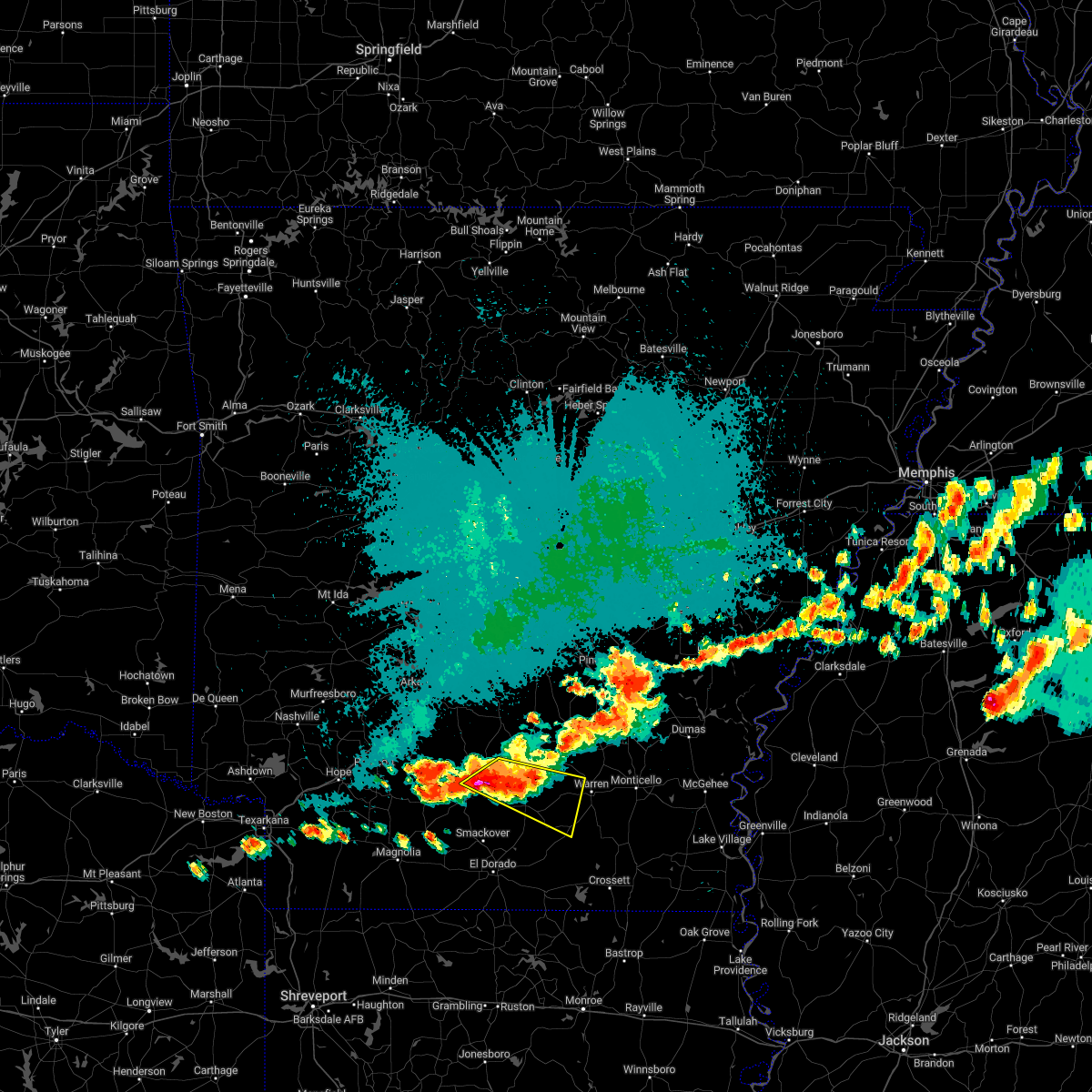 At 901 pm cdt, a severe thunderstorm was located over lanark, or 9 miles west of warren, moving east at 45 mph (radar indicated). Hazards include ping pong ball size hail and 60 mph wind gusts. People and animals outdoors will be injured. expect hail damage to roofs, siding, windows, and vehicles. expect wind damage to roofs, siding, and trees. locations impacted include, hampton, bearden, hermitage, harrell, highland industrial park, ellisville, weeks, harlow, hampton municipal airport, lanark, east camden, banks, tinsman, farmville, eagle mills, harmony grove, warner, gravelridge, woodberry, millville, hail threat, radar indicated max hail size, 1. 50 in wind threat, radar indicated max wind gust, 60 mph. At 901 pm cdt, a severe thunderstorm was located over lanark, or 9 miles west of warren, moving east at 45 mph (radar indicated). Hazards include ping pong ball size hail and 60 mph wind gusts. People and animals outdoors will be injured. expect hail damage to roofs, siding, windows, and vehicles. expect wind damage to roofs, siding, and trees. locations impacted include, hampton, bearden, hermitage, harrell, highland industrial park, ellisville, weeks, harlow, hampton municipal airport, lanark, east camden, banks, tinsman, farmville, eagle mills, harmony grove, warner, gravelridge, woodberry, millville, hail threat, radar indicated max hail size, 1. 50 in wind threat, radar indicated max wind gust, 60 mph.
|
| 10/12/2022 8:53 PM CDT |
 At 852 pm cdt, a severe thunderstorm was located near harrell, or 7 miles northeast of hampton, moving east at 45 mph (radar indicated). Hazards include 60 mph wind gusts and quarter size hail. Hail damage to vehicles is expected. expect wind damage to roofs, siding, and trees. locations impacted include, hampton, bearden, hermitage, harrell, highland industrial park, ellisville, weeks, harlow, hampton municipal airport, lanark, east camden, banks, tinsman, amy, farmville, eagle mills, harmony grove, warner, gravelridge, woodberry, hail threat, radar indicated max hail size, 1. 00 in wind threat, radar indicated max wind gust, 60 mph. At 852 pm cdt, a severe thunderstorm was located near harrell, or 7 miles northeast of hampton, moving east at 45 mph (radar indicated). Hazards include 60 mph wind gusts and quarter size hail. Hail damage to vehicles is expected. expect wind damage to roofs, siding, and trees. locations impacted include, hampton, bearden, hermitage, harrell, highland industrial park, ellisville, weeks, harlow, hampton municipal airport, lanark, east camden, banks, tinsman, amy, farmville, eagle mills, harmony grove, warner, gravelridge, woodberry, hail threat, radar indicated max hail size, 1. 00 in wind threat, radar indicated max wind gust, 60 mph.
|
| 10/12/2022 8:28 PM CDT |
 At 827 pm cdt, a severe thunderstorm was located near bearden, or 13 miles northeast of camden, moving southeast at 45 mph (radar indicated). Hazards include 60 mph wind gusts and quarter size hail. Hail damage to vehicles is expected. Expect wind damage to roofs, siding, and trees. At 827 pm cdt, a severe thunderstorm was located near bearden, or 13 miles northeast of camden, moving southeast at 45 mph (radar indicated). Hazards include 60 mph wind gusts and quarter size hail. Hail damage to vehicles is expected. Expect wind damage to roofs, siding, and trees.
|
| 10/12/2022 5:28 PM CDT |
 At 527 pm cdt, a severe thunderstorm was located over hampton municipal airport, or near hampton, moving southeast at 25 mph (radar indicated). Hazards include 60 mph wind gusts and half dollar size hail. Hail damage to vehicles is expected. Expect wind damage to roofs, siding, and trees. At 527 pm cdt, a severe thunderstorm was located over hampton municipal airport, or near hampton, moving southeast at 25 mph (radar indicated). Hazards include 60 mph wind gusts and half dollar size hail. Hail damage to vehicles is expected. Expect wind damage to roofs, siding, and trees.
|
| 10/12/2022 5:19 PM CDT |
 At 518 pm cdt, a severe thunderstorm was located near hilo, or 11 miles southeast of hampton, moving southeast at 40 mph (radar indicated). Hazards include ping pong ball size hail and 60 mph wind gusts. People and animals outdoors will be injured. expect hail damage to roofs, siding, windows, and vehicles. expect wind damage to roofs, siding, and trees. locations impacted include, hampton, harrell, hampton municipal airport, lanark, banks, woodberry, jersey, hail threat, radar indicated max hail size, 1. 50 in wind threat, radar indicated max wind gust, 60 mph. At 518 pm cdt, a severe thunderstorm was located near hilo, or 11 miles southeast of hampton, moving southeast at 40 mph (radar indicated). Hazards include ping pong ball size hail and 60 mph wind gusts. People and animals outdoors will be injured. expect hail damage to roofs, siding, windows, and vehicles. expect wind damage to roofs, siding, and trees. locations impacted include, hampton, harrell, hampton municipal airport, lanark, banks, woodberry, jersey, hail threat, radar indicated max hail size, 1. 50 in wind threat, radar indicated max wind gust, 60 mph.
|
| 10/12/2022 5:08 PM CDT |
 At 508 pm cdt, a severe thunderstorm was located over harrell, or near hampton, moving southeast at 40 mph (radar indicated). Hazards include 60 mph wind gusts and quarter size hail. Hail damage to vehicles is expected. expect wind damage to roofs, siding, and trees. locations impacted include, hampton, harrell, hampton municipal airport, lanark, banks, woodberry, jersey, locust bayou, hail threat, radar indicated max hail size, 1. 00 in wind threat, radar indicated max wind gust, 60 mph. At 508 pm cdt, a severe thunderstorm was located over harrell, or near hampton, moving southeast at 40 mph (radar indicated). Hazards include 60 mph wind gusts and quarter size hail. Hail damage to vehicles is expected. expect wind damage to roofs, siding, and trees. locations impacted include, hampton, harrell, hampton municipal airport, lanark, banks, woodberry, jersey, locust bayou, hail threat, radar indicated max hail size, 1. 00 in wind threat, radar indicated max wind gust, 60 mph.
|
| 10/12/2022 4:42 PM CDT |
 At 441 pm cdt, a severe thunderstorm was located over highland industrial park, or 9 miles east of camden, moving southeast at 40 mph (radar indicated). Hazards include 60 mph wind gusts and quarter size hail. Hail damage to vehicles is expected. Expect wind damage to roofs, siding, and trees. At 441 pm cdt, a severe thunderstorm was located over highland industrial park, or 9 miles east of camden, moving southeast at 40 mph (radar indicated). Hazards include 60 mph wind gusts and quarter size hail. Hail damage to vehicles is expected. Expect wind damage to roofs, siding, and trees.
|
| 7/21/2022 5:22 PM CDT |
 At 521 pm cdt, severe thunderstorms were located from near warren to near hampton to near hopeville. these storms are nearly stationary (radar indicated). Hazards include 60 mph wind gusts and quarter size hail. Hail damage to vehicles is expected. Expect wind damage to roofs, siding, and trees. At 521 pm cdt, severe thunderstorms were located from near warren to near hampton to near hopeville. these storms are nearly stationary (radar indicated). Hazards include 60 mph wind gusts and quarter size hail. Hail damage to vehicles is expected. Expect wind damage to roofs, siding, and trees.
|
| 6/10/2022 8:37 AM CDT |
 At 837 am cdt, a severe thunderstorm was located near harrell, or 10 miles southeast of hampton, moving southeast at 55 mph (radar indicated). Hazards include 60 mph wind gusts. expect damage to roofs, siding, and trees At 837 am cdt, a severe thunderstorm was located near harrell, or 10 miles southeast of hampton, moving southeast at 55 mph (radar indicated). Hazards include 60 mph wind gusts. expect damage to roofs, siding, and trees
|
| 6/10/2022 7:55 AM CDT |
 At 755 am cdt, a severe thunderstorm was located 7 miles south of sparkman, or 16 miles north of camden, moving southeast at 60 mph (radar indicated). Hazards include 60 mph wind gusts. expect damage to roofs, siding, and trees At 755 am cdt, a severe thunderstorm was located 7 miles south of sparkman, or 16 miles north of camden, moving southeast at 60 mph (radar indicated). Hazards include 60 mph wind gusts. expect damage to roofs, siding, and trees
|
| 5/21/2022 11:37 PM CDT |
 At 1137 pm cdt, severe thunderstorms were located along a line extending from near gillett to 10 miles southwest of mills to near warren to near harrell to cullendale, moving southeast at 30 mph (radar indicated). Hazards include 60 mph wind gusts and penny size hail. Expect damage to roofs, siding, and trees. locations impacted include, camden, monticello, warren, dumas, star city, hampton, rohwer, bearden, stephens, gould, hermitage, gillett, wilmar, calion, grady, thornton, mitchellville, chidester, harrell, tillar, hail threat, radar indicated max hail size, 0. 75 in wind threat, radar indicated max wind gust, 60 mph. At 1137 pm cdt, severe thunderstorms were located along a line extending from near gillett to 10 miles southwest of mills to near warren to near harrell to cullendale, moving southeast at 30 mph (radar indicated). Hazards include 60 mph wind gusts and penny size hail. Expect damage to roofs, siding, and trees. locations impacted include, camden, monticello, warren, dumas, star city, hampton, rohwer, bearden, stephens, gould, hermitage, gillett, wilmar, calion, grady, thornton, mitchellville, chidester, harrell, tillar, hail threat, radar indicated max hail size, 0. 75 in wind threat, radar indicated max wind gust, 60 mph.
|
| 5/21/2022 11:05 PM CDT |
 At 1104 pm cdt, severe thunderstorms were located along a line extending from 9 miles southwest of almyra to near nebo to near hebron to near harlow to near chidester, moving southeast at 30 mph (radar indicated). Hazards include 60 mph wind gusts and quarter size hail. Hail damage to vehicles is expected. Expect wind damage to roofs, siding, and trees. At 1104 pm cdt, severe thunderstorms were located along a line extending from 9 miles southwest of almyra to near nebo to near hebron to near harlow to near chidester, moving southeast at 30 mph (radar indicated). Hazards include 60 mph wind gusts and quarter size hail. Hail damage to vehicles is expected. Expect wind damage to roofs, siding, and trees.
|
| 5/15/2022 6:38 PM CDT |
 The severe thunderstorm warning for southeastern cleveland, northern bradley, northeastern calhoun and northwestern drew counties will expire at 645 pm cdt, the storms which prompted the warning are exiting into areas to the south. therefore, the warning will be allowed to expire. a severe thunderstorm watch remains in effect until 900 pm cdt for southeastern and southwestern arkansas. &&. The severe thunderstorm warning for southeastern cleveland, northern bradley, northeastern calhoun and northwestern drew counties will expire at 645 pm cdt, the storms which prompted the warning are exiting into areas to the south. therefore, the warning will be allowed to expire. a severe thunderstorm watch remains in effect until 900 pm cdt for southeastern and southwestern arkansas. &&.
|
| 5/15/2022 6:16 PM CDT |
 At 616 pm cdt, severe thunderstorms were located along a line extending from near monticello to near warren to near hampton, moving southeast at 40 mph (radar indicated). Hazards include 60 mph wind gusts and penny size hail. Expect damage to roofs, siding, and trees. locations impacted include, warren, hampton, hermitage, wilmar, harrell, weeks, brandon, hampton municipal airport, lanark, banks, tinsman, farmville, orlando, gravelridge, woodberry, rock springs, rye, carmel, hail threat, radar indicated max hail size, 0. 75 in wind threat, radar indicated max wind gust, 60 mph. At 616 pm cdt, severe thunderstorms were located along a line extending from near monticello to near warren to near hampton, moving southeast at 40 mph (radar indicated). Hazards include 60 mph wind gusts and penny size hail. Expect damage to roofs, siding, and trees. locations impacted include, warren, hampton, hermitage, wilmar, harrell, weeks, brandon, hampton municipal airport, lanark, banks, tinsman, farmville, orlando, gravelridge, woodberry, rock springs, rye, carmel, hail threat, radar indicated max hail size, 0. 75 in wind threat, radar indicated max wind gust, 60 mph.
|
| 5/15/2022 5:47 PM CDT |
 At 546 pm cdt, severe thunderstorms were located along a line extending from near toledo to tipton to near bearden, moving southeast at 40 mph (radar indicated). Hazards include 60 mph wind gusts and penny size hail. expect damage to roofs, siding, and trees At 546 pm cdt, severe thunderstorms were located along a line extending from near toledo to tipton to near bearden, moving southeast at 40 mph (radar indicated). Hazards include 60 mph wind gusts and penny size hail. expect damage to roofs, siding, and trees
|
| 4/17/2022 2:28 PM CDT |
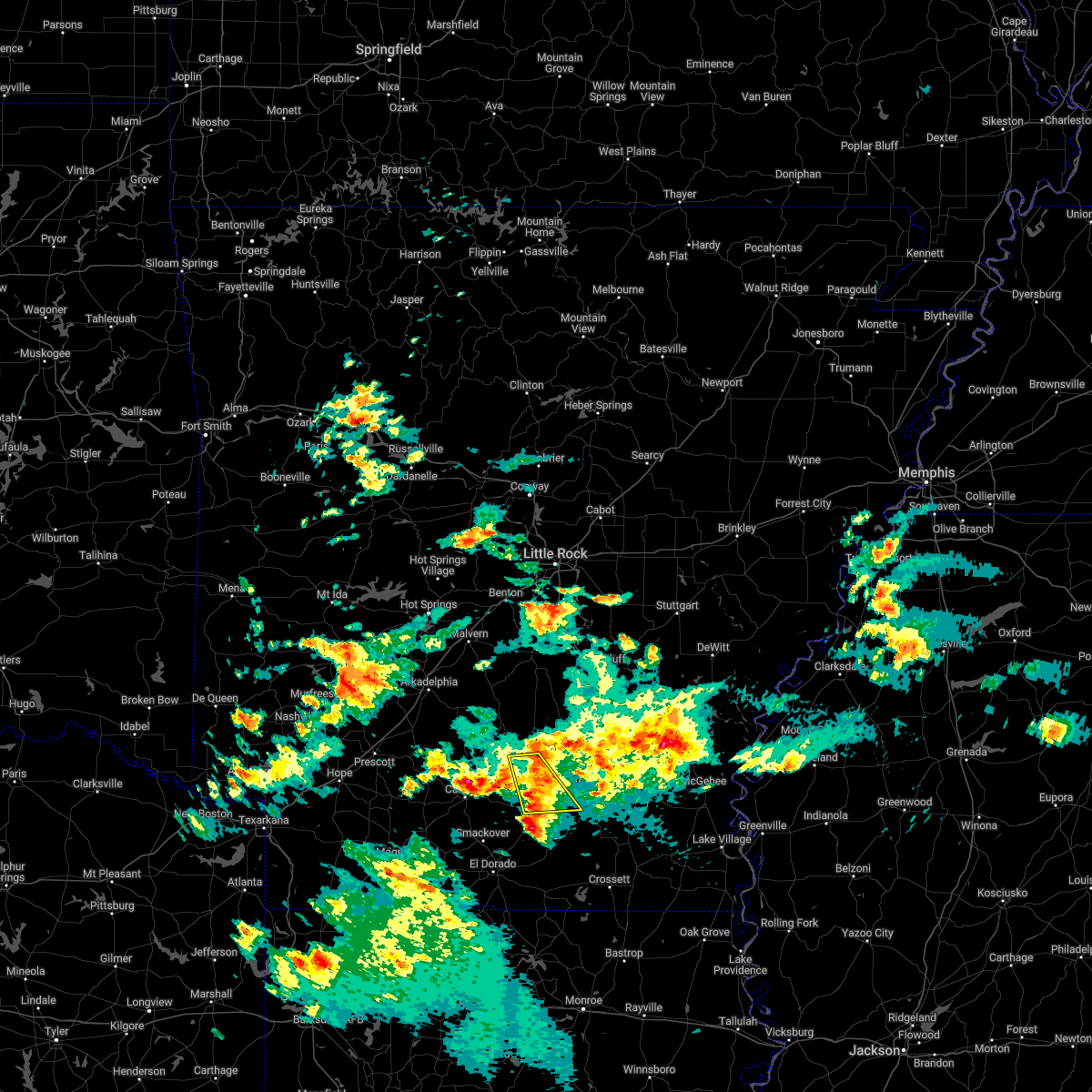 At 227 pm cdt, severe thunderstorms were located along a line extending from near fordyce to near harrell, moving east at 35 mph (radar indicated). Hazards include quarter size hail. Damage to vehicles is expected. locations impacted include, hampton, thornton, harrell, hampton municipal airport, ellisville, lanark, banks, tinsman, chambersville, hopeville, farmville, hail threat, radar indicated max hail size, 1. 00 in wind threat, radar indicated max wind gust, <50 mph. At 227 pm cdt, severe thunderstorms were located along a line extending from near fordyce to near harrell, moving east at 35 mph (radar indicated). Hazards include quarter size hail. Damage to vehicles is expected. locations impacted include, hampton, thornton, harrell, hampton municipal airport, ellisville, lanark, banks, tinsman, chambersville, hopeville, farmville, hail threat, radar indicated max hail size, 1. 00 in wind threat, radar indicated max wind gust, <50 mph.
|
| 4/17/2022 1:57 PM CDT |
 At 157 pm cdt, severe thunderstorms were located along a line extending from 8 miles northwest of highland industrial park to 8 miles west of hampton, moving east at 35 mph (radar indicated). Hazards include quarter size hail. damage to vehicles is expected At 157 pm cdt, severe thunderstorms were located along a line extending from 8 miles northwest of highland industrial park to 8 miles west of hampton, moving east at 35 mph (radar indicated). Hazards include quarter size hail. damage to vehicles is expected
|
| 4/16/2022 9:21 AM CDT |
 At 921 am cdt, a severe thunderstorm was located over hermitage, or 12 miles southwest of warren, moving east at 35 mph (radar indicated). Hazards include 60 mph wind gusts and half dollar size hail. Hail damage to vehicles is expected. expect wind damage to roofs, siding, and trees. Locations impacted include, warren, hampton, hermitage, wilmar, harrell, ingalls, weeks, hilo, hampton municipal airport, lanark, banks, tinsman, carmel, farmville, johnsonville, vick, valley, gravelridge, mt olive in bradley county, marsden,. At 921 am cdt, a severe thunderstorm was located over hermitage, or 12 miles southwest of warren, moving east at 35 mph (radar indicated). Hazards include 60 mph wind gusts and half dollar size hail. Hail damage to vehicles is expected. expect wind damage to roofs, siding, and trees. Locations impacted include, warren, hampton, hermitage, wilmar, harrell, ingalls, weeks, hilo, hampton municipal airport, lanark, banks, tinsman, carmel, farmville, johnsonville, vick, valley, gravelridge, mt olive in bradley county, marsden,.
|
| 4/16/2022 9:02 AM CDT |
 At 902 am cdt, a severe thunderstorm was located over lanark, or 9 miles east of hampton, moving east at 30 mph (radar indicated). Hazards include 60 mph wind gusts and quarter size hail. Hail damage to vehicles is expected. expect wind damage to roofs, siding, and trees. locations impacted include, hampton, harrell, hampton municipal airport, weeks, lanark, banks, tinsman, farmville, hail threat, radar indicated max hail size, 1. 00 in wind threat, radar indicated max wind gust, 60 mph. At 902 am cdt, a severe thunderstorm was located over lanark, or 9 miles east of hampton, moving east at 30 mph (radar indicated). Hazards include 60 mph wind gusts and quarter size hail. Hail damage to vehicles is expected. expect wind damage to roofs, siding, and trees. locations impacted include, hampton, harrell, hampton municipal airport, weeks, lanark, banks, tinsman, farmville, hail threat, radar indicated max hail size, 1. 00 in wind threat, radar indicated max wind gust, 60 mph.
|
| 4/16/2022 9:01 AM CDT |
 At 901 am cdt, a severe thunderstorm was located near lanark, or 8 miles east of hampton, moving east at 35 mph (radar indicated). Hazards include 60 mph wind gusts and quarter size hail. Hail damage to vehicles is expected. Expect wind damage to roofs, siding, and trees. At 901 am cdt, a severe thunderstorm was located near lanark, or 8 miles east of hampton, moving east at 35 mph (radar indicated). Hazards include 60 mph wind gusts and quarter size hail. Hail damage to vehicles is expected. Expect wind damage to roofs, siding, and trees.
|
| 4/16/2022 8:31 AM CDT |
 At 831 am cdt, a severe thunderstorm was located 7 miles north of hampton, moving east at 30 mph (radar indicated). Hazards include 60 mph wind gusts and quarter size hail. Hail damage to vehicles is expected. Expect wind damage to roofs, siding, and trees. At 831 am cdt, a severe thunderstorm was located 7 miles north of hampton, moving east at 30 mph (radar indicated). Hazards include 60 mph wind gusts and quarter size hail. Hail damage to vehicles is expected. Expect wind damage to roofs, siding, and trees.
|
| 4/16/2022 7:51 AM CDT |
 At 751 am cdt, severe thunderstorms were located along a line extending from 7 miles southeast of harlow to 7 miles east of hermitage, moving northeast at 25 mph (radar indicated). Hazards include 60 mph wind gusts and quarter size hail. Hail damage to vehicles is expected. expect wind damage to roofs, siding, and trees. locations impacted include, hampton, hermitage, harrell, ingalls, hilo, hampton municipal airport, lanark, banks, tinsman, artesian, farmville, valley, gravelridge, woodberry, mt olive in bradley county, jersey, sumpter, hail threat, radar indicated max hail size, 1. 00 in wind threat, radar indicated max wind gust, 60 mph. At 751 am cdt, severe thunderstorms were located along a line extending from 7 miles southeast of harlow to 7 miles east of hermitage, moving northeast at 25 mph (radar indicated). Hazards include 60 mph wind gusts and quarter size hail. Hail damage to vehicles is expected. expect wind damage to roofs, siding, and trees. locations impacted include, hampton, hermitage, harrell, ingalls, hilo, hampton municipal airport, lanark, banks, tinsman, artesian, farmville, valley, gravelridge, woodberry, mt olive in bradley county, jersey, sumpter, hail threat, radar indicated max hail size, 1. 00 in wind threat, radar indicated max wind gust, 60 mph.
|
| 4/16/2022 7:17 AM CDT |
 At 717 am cdt, severe thunderstorms were located along a line extending from near highland industrial park to hilo, moving northeast at 25 mph (radar indicated). Hazards include 60 mph wind gusts and quarter size hail. Hail damage to vehicles is expected. Expect wind damage to roofs, siding, and trees. At 717 am cdt, severe thunderstorms were located along a line extending from near highland industrial park to hilo, moving northeast at 25 mph (radar indicated). Hazards include 60 mph wind gusts and quarter size hail. Hail damage to vehicles is expected. Expect wind damage to roofs, siding, and trees.
|
| 4/13/2022 4:05 PM CDT |
 At 404 pm cdt, severe thunderstorms were located along a line extending from near thornton to near hampton to near norphlet, moving east at 60 mph (radar indicated). Hazards include 60 mph wind gusts and penny size hail. expect damage to roofs, siding, and trees At 404 pm cdt, severe thunderstorms were located along a line extending from near thornton to near hampton to near norphlet, moving east at 60 mph (radar indicated). Hazards include 60 mph wind gusts and penny size hail. expect damage to roofs, siding, and trees
|
| 4/13/2022 4:05 PM CDT |
 The national weather service in little rock has issued a * severe thunderstorm warning for. southeastern cleveland county in southeastern arkansas. bradley county in southeastern arkansas. calhoun county in southwestern arkansas. Drew county in southeastern arkansas. The national weather service in little rock has issued a * severe thunderstorm warning for. southeastern cleveland county in southeastern arkansas. bradley county in southeastern arkansas. calhoun county in southwestern arkansas. Drew county in southeastern arkansas.
|
| 3/7/2022 1:11 AM CST |
 At 111 am cst, a severe thunderstorm capable of producing a tornado was located near hampton, moving northeast at 50 mph (radar indicated rotation). Hazards include tornado. Flying debris will be dangerous to those caught without shelter. mobile homes will be damaged or destroyed. damage to roofs, windows, and vehicles will occur. tree damage is likely. Locations impacted include, hampton, harrell, hampton municipal airport, ellisville, lanark, banks, tinsman, woodberry,. At 111 am cst, a severe thunderstorm capable of producing a tornado was located near hampton, moving northeast at 50 mph (radar indicated rotation). Hazards include tornado. Flying debris will be dangerous to those caught without shelter. mobile homes will be damaged or destroyed. damage to roofs, windows, and vehicles will occur. tree damage is likely. Locations impacted include, hampton, harrell, hampton municipal airport, ellisville, lanark, banks, tinsman, woodberry,.
|
| 3/7/2022 1:04 AM CST |
 At 103 am cst, a severe thunderstorm capable of producing a tornado was located near hampton, moving northeast at 40 mph (radar indicated rotation). Hazards include tornado. Flying debris will be dangerous to those caught without shelter. mobile homes will be damaged or destroyed. damage to roofs, windows, and vehicles will occur. Tree damage is likely. At 103 am cst, a severe thunderstorm capable of producing a tornado was located near hampton, moving northeast at 40 mph (radar indicated rotation). Hazards include tornado. Flying debris will be dangerous to those caught without shelter. mobile homes will be damaged or destroyed. damage to roofs, windows, and vehicles will occur. Tree damage is likely.
|
| 12/29/2021 1:38 PM CST |
 At 137 pm cst, a severe thunderstorm was located near calion, or 9 miles northeast of norphlet, moving northeast at 35 mph (radar indicated). Hazards include 60 mph wind gusts and quarter size hail. Hail damage to vehicles is expected. Expect wind damage to roofs, siding, and trees. At 137 pm cst, a severe thunderstorm was located near calion, or 9 miles northeast of norphlet, moving northeast at 35 mph (radar indicated). Hazards include 60 mph wind gusts and quarter size hail. Hail damage to vehicles is expected. Expect wind damage to roofs, siding, and trees.
|
| 9/21/2021 2:00 PM CDT |
 At 200 pm cdt, a severe thunderstorm was located over cullendale, or near camden, moving east at 30 mph (radar indicated). Hazards include 60 mph wind gusts and quarter size hail. Hail damage to vehicles is expected. expect wind damage to roofs, siding, and trees. locations impacted include, camden, hampton, louann, cullendale, hampton municipal airport, delhi, kirkland, millers bluff, frenchport, elliot, cross roads in ouachita county, fairview in ouachita county, locust bayou, standard umpstead, woodberry, hail threat, radar indicated max hail size, 1. 00 in wind threat, radar indicated max wind gust, 60 mph. At 200 pm cdt, a severe thunderstorm was located over cullendale, or near camden, moving east at 30 mph (radar indicated). Hazards include 60 mph wind gusts and quarter size hail. Hail damage to vehicles is expected. expect wind damage to roofs, siding, and trees. locations impacted include, camden, hampton, louann, cullendale, hampton municipal airport, delhi, kirkland, millers bluff, frenchport, elliot, cross roads in ouachita county, fairview in ouachita county, locust bayou, standard umpstead, woodberry, hail threat, radar indicated max hail size, 1. 00 in wind threat, radar indicated max wind gust, 60 mph.
|
| 9/21/2021 1:42 PM CDT |
 At 141 pm cdt, a severe thunderstorm was located near camden, moving east at 30 mph (radar indicated). Hazards include 60 mph wind gusts and quarter size hail. Hail damage to vehicles is expected. Expect wind damage to roofs, siding, and trees. At 141 pm cdt, a severe thunderstorm was located near camden, moving east at 30 mph (radar indicated). Hazards include 60 mph wind gusts and quarter size hail. Hail damage to vehicles is expected. Expect wind damage to roofs, siding, and trees.
|
| 9/1/2021 4:45 PM CDT |
 At 445 pm cdt, a severe thunderstorm was located near hampton municipal airport, or near hampton, moving south at 35 mph (radar indicated). Hazards include 60 mph wind gusts and penny size hail. Expect damage to roofs, siding, and trees. locations impacted include, hampton, bearden, thornton, harlow, hampton municipal airport, highland industrial park, artesian, delhi, hopeville, woodberry, locust bayou, millville, hail threat, radar indicated max hail size, 0. 75 in wind threat, radar indicated max wind gust, 60 mph. At 445 pm cdt, a severe thunderstorm was located near hampton municipal airport, or near hampton, moving south at 35 mph (radar indicated). Hazards include 60 mph wind gusts and penny size hail. Expect damage to roofs, siding, and trees. locations impacted include, hampton, bearden, thornton, harlow, hampton municipal airport, highland industrial park, artesian, delhi, hopeville, woodberry, locust bayou, millville, hail threat, radar indicated max hail size, 0. 75 in wind threat, radar indicated max wind gust, 60 mph.
|
| 9/1/2021 4:16 PM CDT |
 At 415 pm cdt, a severe thunderstorm was located near harlow, or 8 miles west of fordyce, moving south at 35 mph (radar indicated). Hazards include 60 mph wind gusts and penny size hail. expect damage to roofs, siding, and trees At 415 pm cdt, a severe thunderstorm was located near harlow, or 8 miles west of fordyce, moving south at 35 mph (radar indicated). Hazards include 60 mph wind gusts and penny size hail. expect damage to roofs, siding, and trees
|
| 6/7/2021 5:04 PM CDT |
 At 504 pm cdt, severe thunderstorms were located along a line extending from near carthage to near fordyce to near weeks to near hilo, moving north at 50 mph (radar indicated). Hazards include 60 mph wind gusts. expect damage to roofs, siding, and trees At 504 pm cdt, severe thunderstorms were located along a line extending from near carthage to near fordyce to near weeks to near hilo, moving north at 50 mph (radar indicated). Hazards include 60 mph wind gusts. expect damage to roofs, siding, and trees
|
| 6/7/2021 4:54 PM CDT |
 At 454 pm cdt, severe thunderstorms were located along a line extending from near highland industrial park to near hilo, moving northeast at 45 mph (radar indicated). Hazards include 60 mph wind gusts. Expect damage to roofs, siding, and trees. Locations impacted include, warren, fordyce, hampton, hermitage, calion, thornton, harrell, ingalls, hilo, ellisville, hampton municipal airport, moro bay, highland industrial park, weeks, moro bay state park, tipton, marks mill state park, lanark, banks, tinsman,. At 454 pm cdt, severe thunderstorms were located along a line extending from near highland industrial park to near hilo, moving northeast at 45 mph (radar indicated). Hazards include 60 mph wind gusts. Expect damage to roofs, siding, and trees. Locations impacted include, warren, fordyce, hampton, hermitage, calion, thornton, harrell, ingalls, hilo, ellisville, hampton municipal airport, moro bay, highland industrial park, weeks, moro bay state park, tipton, marks mill state park, lanark, banks, tinsman,.
|
| 6/7/2021 4:38 PM CDT |
 The tornado warning for southeastern calhoun and southeastern ouachita counties will expire at 445 pm cdt, the storm which prompted the warning has weakened below severe limits, and no longer appears capable of producing a tornado. therefore, the warning will be allowed to expire. however gusty winds and heavy rain are still possible with this thunderstorm. a severe thunderstorm watch remains in effect until 700 pm cdt for southwestern arkansas. The tornado warning for southeastern calhoun and southeastern ouachita counties will expire at 445 pm cdt, the storm which prompted the warning has weakened below severe limits, and no longer appears capable of producing a tornado. therefore, the warning will be allowed to expire. however gusty winds and heavy rain are still possible with this thunderstorm. a severe thunderstorm watch remains in effect until 700 pm cdt for southwestern arkansas.
|
| 6/7/2021 4:35 PM CDT |
 At 435 pm cdt, severe thunderstorms were located along a line extending from near cullendale to near moro bay, moving northeast at 40 mph (radar indicated). Hazards include 60 mph wind gusts. expect damage to roofs, siding, and trees At 435 pm cdt, severe thunderstorms were located along a line extending from near cullendale to near moro bay, moving northeast at 40 mph (radar indicated). Hazards include 60 mph wind gusts. expect damage to roofs, siding, and trees
|
| 6/7/2021 4:29 PM CDT |
 At 415 pm cdt, a severe thunderstorm capable of producing a tornado was located over calion, or near norphlet, moving northeast at 20 mph (radar indicated rotation). Hazards include tornado. Flying debris will be dangerous to those caught without shelter. mobile homes will be damaged or destroyed. damage to roofs, windows, and vehicles will occur. Tree damage is likely. At 415 pm cdt, a severe thunderstorm capable of producing a tornado was located over calion, or near norphlet, moving northeast at 20 mph (radar indicated rotation). Hazards include tornado. Flying debris will be dangerous to those caught without shelter. mobile homes will be damaged or destroyed. damage to roofs, windows, and vehicles will occur. Tree damage is likely.
|
| 6/7/2021 4:15 PM CDT |
 At 415 pm cdt, a severe thunderstorm capable of producing a tornado was located over calion, or near norphlet, moving northeast at 20 mph (radar indicated rotation). Hazards include tornado. Flying debris will be dangerous to those caught without shelter. mobile homes will be damaged or destroyed. damage to roofs, windows, and vehicles will occur. Tree damage is likely. At 415 pm cdt, a severe thunderstorm capable of producing a tornado was located over calion, or near norphlet, moving northeast at 20 mph (radar indicated rotation). Hazards include tornado. Flying debris will be dangerous to those caught without shelter. mobile homes will be damaged or destroyed. damage to roofs, windows, and vehicles will occur. Tree damage is likely.
|
| 6/7/2021 3:55 PM CDT |
 At 354 pm cdt, a severe thunderstorm capable of producing a tornado was located 8 miles northeast of smackover, moving northeast at 15 mph (radar indicated rotation). Hazards include tornado. Flying debris will be dangerous to those caught without shelter. mobile homes will be damaged or destroyed. damage to roofs, windows, and vehicles will occur. tree damage is likely. Locations impacted include, hampton, hampton municipal airport, highland industrial park, delhi, locust bayou,. At 354 pm cdt, a severe thunderstorm capable of producing a tornado was located 8 miles northeast of smackover, moving northeast at 15 mph (radar indicated rotation). Hazards include tornado. Flying debris will be dangerous to those caught without shelter. mobile homes will be damaged or destroyed. damage to roofs, windows, and vehicles will occur. tree damage is likely. Locations impacted include, hampton, hampton municipal airport, highland industrial park, delhi, locust bayou,.
|
| 6/7/2021 3:43 PM CDT |
 At 343 pm cdt, a severe thunderstorm capable of producing a tornado was located near smackover, moving northeast at 15 mph (radar indicated rotation). Hazards include tornado. Flying debris will be dangerous to those caught without shelter. mobile homes will be damaged or destroyed. damage to roofs, windows, and vehicles will occur. Tree damage is likely. At 343 pm cdt, a severe thunderstorm capable of producing a tornado was located near smackover, moving northeast at 15 mph (radar indicated rotation). Hazards include tornado. Flying debris will be dangerous to those caught without shelter. mobile homes will be damaged or destroyed. damage to roofs, windows, and vehicles will occur. Tree damage is likely.
|
| 5/9/2021 6:39 PM CDT |
 At 631 pm cdt, a severe thunderstorm was located near harrell, or near hampton, and is nearly stationary (radar indicated). Hazards include 60 mph wind gusts and quarter size hail. Hail damage to vehicles is expected. expect wind damage to roofs, siding, and trees. Locations impacted include, hampton, hermitage, harrell, ingalls, hilo, moro bay state park, hampton municipal airport, lanark, moro bay, artesian, carmel, farmville, johnsonville, vick, gravelridge, mt olive in bradley county, marsden, jersey, sumpter,. At 631 pm cdt, a severe thunderstorm was located near harrell, or near hampton, and is nearly stationary (radar indicated). Hazards include 60 mph wind gusts and quarter size hail. Hail damage to vehicles is expected. expect wind damage to roofs, siding, and trees. Locations impacted include, hampton, hermitage, harrell, ingalls, hilo, moro bay state park, hampton municipal airport, lanark, moro bay, artesian, carmel, farmville, johnsonville, vick, gravelridge, mt olive in bradley county, marsden, jersey, sumpter,.
|
| 5/9/2021 6:32 PM CDT |
 At 631 pm cdt, a severe thunderstorm was located near harrell, or near hampton, and is nearly stationary (radar indicated). Hazards include 60 mph wind gusts and quarter size hail. Hail damage to vehicles is expected. expect wind damage to roofs, siding, and trees. Locations impacted include, hampton, hermitage, harrell, ingalls, hilo, moro bay state park, hampton municipal airport, lanark, moro bay, artesian, carmel, farmville, johnsonville, vick, gravelridge, mt olive in bradley county, marsden, jersey, sumpter,. At 631 pm cdt, a severe thunderstorm was located near harrell, or near hampton, and is nearly stationary (radar indicated). Hazards include 60 mph wind gusts and quarter size hail. Hail damage to vehicles is expected. expect wind damage to roofs, siding, and trees. Locations impacted include, hampton, hermitage, harrell, ingalls, hilo, moro bay state park, hampton municipal airport, lanark, moro bay, artesian, carmel, farmville, johnsonville, vick, gravelridge, mt olive in bradley county, marsden, jersey, sumpter,.
|
| 5/9/2021 6:23 PM CDT |
 At 621 pm cdt, a severe thunderstorm was located near hampton municipal airport, or near hampton, moving east at 35 mph (radar indicated). Hazards include 60 mph wind gusts and quarter size hail. Hail damage to vehicles is expected. Expect wind damage to roofs, siding, and trees. At 621 pm cdt, a severe thunderstorm was located near hampton municipal airport, or near hampton, moving east at 35 mph (radar indicated). Hazards include 60 mph wind gusts and quarter size hail. Hail damage to vehicles is expected. Expect wind damage to roofs, siding, and trees.
|
| 5/9/2021 6:07 PM CDT |
 At 606 pm cdt, a severe thunderstorm was located near cullendale, or 7 miles east of camden, moving east at 35 mph (radar indicated). Hazards include 60 mph wind gusts and half dollar size hail. Hail damage to vehicles is expected. expect wind damage to roofs, siding, and trees. this storm has produced half dollar size hail. Locations impacted include, camden, hampton, hermitage, harrell, highland industrial park, weeks, hampton municipal airport, lanark, east camden, banks, tinsman, delhi, farmville, harmony grove, locust bayou, warner, woodberry, frenchport,. At 606 pm cdt, a severe thunderstorm was located near cullendale, or 7 miles east of camden, moving east at 35 mph (radar indicated). Hazards include 60 mph wind gusts and half dollar size hail. Hail damage to vehicles is expected. expect wind damage to roofs, siding, and trees. this storm has produced half dollar size hail. Locations impacted include, camden, hampton, hermitage, harrell, highland industrial park, weeks, hampton municipal airport, lanark, east camden, banks, tinsman, delhi, farmville, harmony grove, locust bayou, warner, woodberry, frenchport,.
|
| 5/9/2021 5:42 PM CDT |
 At 541 pm cdt, a severe thunderstorm was located near poison springs state park, or 9 miles west of camden, moving east at 30 mph (radar indicated). Hazards include 60 mph wind gusts and quarter size hail. Hail damage to vehicles is expected. Expect wind damage to roofs, siding, and trees. At 541 pm cdt, a severe thunderstorm was located near poison springs state park, or 9 miles west of camden, moving east at 30 mph (radar indicated). Hazards include 60 mph wind gusts and quarter size hail. Hail damage to vehicles is expected. Expect wind damage to roofs, siding, and trees.
|
| 4/10/2021 1:14 AM CDT |
 At 113 am cdt, severe thunderstorms were located along a line extending from 6 miles north of kingsland to hilo to near strong, moving east at 65 mph. this storm has a history of producing 60 mph wind gusts, most recently in camden (radar indicated). Hazards include 60 mph wind gusts and quarter size hail. Hail damage to vehicles is expected. expect wind damage to roofs, siding, and trees. Locations impacted include, warren, fordyce, rison, hampton, hermitage, calion, kingsland, thornton, carthage, harrell, ingalls, hampton municipal airport, moro bay, weeks, tipton, herbine, hilo, ellisville, harlow, hebron,. At 113 am cdt, severe thunderstorms were located along a line extending from 6 miles north of kingsland to hilo to near strong, moving east at 65 mph. this storm has a history of producing 60 mph wind gusts, most recently in camden (radar indicated). Hazards include 60 mph wind gusts and quarter size hail. Hail damage to vehicles is expected. expect wind damage to roofs, siding, and trees. Locations impacted include, warren, fordyce, rison, hampton, hermitage, calion, kingsland, thornton, carthage, harrell, ingalls, hampton municipal airport, moro bay, weeks, tipton, herbine, hilo, ellisville, harlow, hebron,.
|
| 4/10/2021 12:57 AM CDT |
 At 1254 am cdt, severe thunderstorms were located along a line extending from carthage southward to millers bluff, moving east at 60 mph. this storm has a history of producing 60 mph wind gusts recently in the town of camden (radar indicated). Hazards include 60 mph wind gusts and quarter size hail. Hail damage to vehicles is expected. Expect wind damage to roofs, siding, and trees. At 1254 am cdt, severe thunderstorms were located along a line extending from carthage southward to millers bluff, moving east at 60 mph. this storm has a history of producing 60 mph wind gusts recently in the town of camden (radar indicated). Hazards include 60 mph wind gusts and quarter size hail. Hail damage to vehicles is expected. Expect wind damage to roofs, siding, and trees.
|
| 4/9/2021 3:48 PM CDT |
 At 347 pm cdt, severe thunderstorms were located along a line extending from ellisville to near lanark, moving east at 40 mph (trained weather spotters). Hazards include 70 mph wind gusts and ping pong ball size hail. People and animals outdoors will be injured. expect hail damage to roofs, siding, windows, and vehicles. expect considerable tree damage. wind damage is also likely to mobile homes, roofs, and outbuildings. Locations impacted include, fordyce, hampton, hermitage, thornton, harrell, ingalls, hilo, ellisville, harlow, hampton municipal airport, hebron, moro bay, weeks, moro bay state park, tipton, marks mill state park, lanark, banks, tinsman, artesian,. At 347 pm cdt, severe thunderstorms were located along a line extending from ellisville to near lanark, moving east at 40 mph (trained weather spotters). Hazards include 70 mph wind gusts and ping pong ball size hail. People and animals outdoors will be injured. expect hail damage to roofs, siding, windows, and vehicles. expect considerable tree damage. wind damage is also likely to mobile homes, roofs, and outbuildings. Locations impacted include, fordyce, hampton, hermitage, thornton, harrell, ingalls, hilo, ellisville, harlow, hampton municipal airport, hebron, moro bay, weeks, moro bay state park, tipton, marks mill state park, lanark, banks, tinsman, artesian,.
|
| 4/9/2021 3:42 PM CDT |
 At 337 pm cdt, severe thunderstorms were located along a line extending from near ellisville to harrell, moving east at 60 mph (radar indicated). Hazards include 70 mph wind gusts and ping pong ball size hail. People and animals outdoors will be injured. expect hail damage to roofs, siding, windows, and vehicles. expect considerable tree damage. wind damage is also likely to mobile homes, roofs, and outbuildings. Locations impacted include, camden, fordyce, hampton, bearden, hermitage, thornton, harrell, louann, ingalls, cullendale, hilo, ellisville, harlow, hampton municipal airport, hebron, moro bay, highland industrial park, weeks, moro bay state park, tipton,. At 337 pm cdt, severe thunderstorms were located along a line extending from near ellisville to harrell, moving east at 60 mph (radar indicated). Hazards include 70 mph wind gusts and ping pong ball size hail. People and animals outdoors will be injured. expect hail damage to roofs, siding, windows, and vehicles. expect considerable tree damage. wind damage is also likely to mobile homes, roofs, and outbuildings. Locations impacted include, camden, fordyce, hampton, bearden, hermitage, thornton, harrell, louann, ingalls, cullendale, hilo, ellisville, harlow, hampton municipal airport, hebron, moro bay, highland industrial park, weeks, moro bay state park, tipton,.
|
| 4/9/2021 3:38 PM CDT |
 At 337 pm cdt, severe thunderstorms were located along a line extending from near ellisville to harrell, moving east at 60 mph (radar indicated). Hazards include 70 mph wind gusts and ping pong ball size hail. People and animals outdoors will be injured. expect hail damage to roofs, siding, windows, and vehicles. expect considerable tree damage. wind damage is also likely to mobile homes, roofs, and outbuildings. Locations impacted include, camden, fordyce, hampton, bearden, hermitage, thornton, harrell, louann, ingalls, cullendale, hilo, ellisville, harlow, hampton municipal airport, hebron, moro bay, highland industrial park, weeks, moro bay state park, tipton,. At 337 pm cdt, severe thunderstorms were located along a line extending from near ellisville to harrell, moving east at 60 mph (radar indicated). Hazards include 70 mph wind gusts and ping pong ball size hail. People and animals outdoors will be injured. expect hail damage to roofs, siding, windows, and vehicles. expect considerable tree damage. wind damage is also likely to mobile homes, roofs, and outbuildings. Locations impacted include, camden, fordyce, hampton, bearden, hermitage, thornton, harrell, louann, ingalls, cullendale, hilo, ellisville, harlow, hampton municipal airport, hebron, moro bay, highland industrial park, weeks, moro bay state park, tipton,.
|
| 4/9/2021 3:31 PM CDT | A tree was uprooted and fell on a hous in calhoun county AR, 3 miles E of Hampton, AR |
| 4/9/2021 3:09 PM CDT |
 At 309 pm cdt, severe thunderstorms were located along a line extending from near highland industrial park to near wesson, moving east at 40 mph (radar indicated). Hazards include ping pong ball size hail and 60 mph wind gusts. People and animals outdoors will be injured. expect hail damage to roofs, siding, windows, and vehicles. Expect wind damage to roofs, siding, and trees. At 309 pm cdt, severe thunderstorms were located along a line extending from near highland industrial park to near wesson, moving east at 40 mph (radar indicated). Hazards include ping pong ball size hail and 60 mph wind gusts. People and animals outdoors will be injured. expect hail damage to roofs, siding, windows, and vehicles. Expect wind damage to roofs, siding, and trees.
|
| 4/7/2021 2:30 PM CDT |
 At 230 pm cdt, severe thunderstorms were located along a line extending from 8 miles east of chidester to near highland industrial park to 7 miles west of hampton, moving northeast at 45 mph (radar indicated). Hazards include 60 mph wind gusts and quarter size hail. Hail damage to vehicles is expected. expect wind damage to roofs, siding, and trees. Locations impacted include, fordyce, hampton, bearden, kingsland, thornton, ellisville, harlow, hampton municipal airport, hebron, highland industrial park, weeks, tipton, marks mill state park, east camden, banks, tinsman, amy, delhi, harmony grove, locust bayou,. At 230 pm cdt, severe thunderstorms were located along a line extending from 8 miles east of chidester to near highland industrial park to 7 miles west of hampton, moving northeast at 45 mph (radar indicated). Hazards include 60 mph wind gusts and quarter size hail. Hail damage to vehicles is expected. expect wind damage to roofs, siding, and trees. Locations impacted include, fordyce, hampton, bearden, kingsland, thornton, ellisville, harlow, hampton municipal airport, hebron, highland industrial park, weeks, tipton, marks mill state park, east camden, banks, tinsman, amy, delhi, harmony grove, locust bayou,.
|
| 4/7/2021 2:18 PM CDT |
 At 217 pm cdt, severe thunderstorms were located along a line extending from poison springs state park to camden to near smackover, moving northeast at 45 mph (radar indicated). Hazards include 60 mph wind gusts and quarter size hail. Hail damage to vehicles is expected. Expect wind damage to roofs, siding, and trees. At 217 pm cdt, severe thunderstorms were located along a line extending from poison springs state park to camden to near smackover, moving northeast at 45 mph (radar indicated). Hazards include 60 mph wind gusts and quarter size hail. Hail damage to vehicles is expected. Expect wind damage to roofs, siding, and trees.
|
| 3/27/2021 9:32 PM CDT |
 At 931 pm cdt, a severe thunderstorm capable of producing a tornado was located near hampton, moving east at 40 mph (radar indicated rotation). Hazards include tornado. Flying debris will be dangerous to those caught without shelter. mobile homes will be damaged or destroyed. damage to roofs, windows, and vehicles will occur. Tree damage is likely. At 931 pm cdt, a severe thunderstorm capable of producing a tornado was located near hampton, moving east at 40 mph (radar indicated rotation). Hazards include tornado. Flying debris will be dangerous to those caught without shelter. mobile homes will be damaged or destroyed. damage to roofs, windows, and vehicles will occur. Tree damage is likely.
|
| 3/27/2021 9:26 PM CDT |
 At 926 pm cdt, a severe thunderstorm was located near hampton, moving east at 35 mph (radar indicated). Hazards include 60 mph wind gusts and half dollar size hail. Hail damage to vehicles is expected. expect wind damage to roofs, siding, and trees. Locations impacted include, hampton, harrell, hampton municipal airport, ellisville, lanark, highland industrial park, banks, tinsman, delhi, woodberry, locust bayou,. At 926 pm cdt, a severe thunderstorm was located near hampton, moving east at 35 mph (radar indicated). Hazards include 60 mph wind gusts and half dollar size hail. Hail damage to vehicles is expected. expect wind damage to roofs, siding, and trees. Locations impacted include, hampton, harrell, hampton municipal airport, ellisville, lanark, highland industrial park, banks, tinsman, delhi, woodberry, locust bayou,.
|
| 3/27/2021 9:08 PM CDT |
 The national weather service in little rock has issued a * severe thunderstorm warning for. northwestern bradley county in southeastern arkansas. calhoun county in southwestern arkansas. southeastern ouachita county in southwestern arkansas. Until 1015 pm cdt. The national weather service in little rock has issued a * severe thunderstorm warning for. northwestern bradley county in southeastern arkansas. calhoun county in southwestern arkansas. southeastern ouachita county in southwestern arkansas. Until 1015 pm cdt.
|
| 3/27/2021 7:40 PM CDT |
 At 740 pm cdt, a severe thunderstorm capable of producing a tornado was located near hampton, moving east at 40 mph (radar indicated rotation). Hazards include tornado and half dollar size hail. Flying debris will be dangerous to those caught without shelter. mobile homes will be damaged or destroyed. damage to roofs, windows, and vehicles will occur. tree damage is likely. Locations impacted include, hampton, ellisville, banks, tinsman, woodberry, chambersville,. At 740 pm cdt, a severe thunderstorm capable of producing a tornado was located near hampton, moving east at 40 mph (radar indicated rotation). Hazards include tornado and half dollar size hail. Flying debris will be dangerous to those caught without shelter. mobile homes will be damaged or destroyed. damage to roofs, windows, and vehicles will occur. tree damage is likely. Locations impacted include, hampton, ellisville, banks, tinsman, woodberry, chambersville,.
|
| 3/27/2021 7:34 PM CDT |
 At 732 pm cdt, a severe thunderstorm capable of producing a tornado was located near hampton, moving east at 40 mph (radar indicated rotation). Hazards include tornado and half dollar size hail. Flying debris will be dangerous to those caught without shelter. mobile homes will be damaged or destroyed. damage to roofs, windows, and vehicles will occur. tree damage is likely. Locations impacted include, hampton, hampton municipal airport, highland industrial park, ellisville, east camden, banks, tinsman, chambersville, woodberry, locust bayou, eagle mills, harmony grove,. At 732 pm cdt, a severe thunderstorm capable of producing a tornado was located near hampton, moving east at 40 mph (radar indicated rotation). Hazards include tornado and half dollar size hail. Flying debris will be dangerous to those caught without shelter. mobile homes will be damaged or destroyed. damage to roofs, windows, and vehicles will occur. tree damage is likely. Locations impacted include, hampton, hampton municipal airport, highland industrial park, ellisville, east camden, banks, tinsman, chambersville, woodberry, locust bayou, eagle mills, harmony grove,.
|
| 3/27/2021 7:25 PM CDT |
 At 724 pm cdt, a severe thunderstorm capable of producing a tornado was located near highland industrial park, or 10 miles west of hampton, moving east at 45 mph (radar indicated rotation). Hazards include tornado and ping pong ball size hail. Flying debris will be dangerous to those caught without shelter. mobile homes will be damaged or destroyed. damage to roofs, windows, and vehicles will occur. Tree damage is likely. At 724 pm cdt, a severe thunderstorm capable of producing a tornado was located near highland industrial park, or 10 miles west of hampton, moving east at 45 mph (radar indicated rotation). Hazards include tornado and ping pong ball size hail. Flying debris will be dangerous to those caught without shelter. mobile homes will be damaged or destroyed. damage to roofs, windows, and vehicles will occur. Tree damage is likely.
|
| 3/27/2021 7:12 PM CDT |
 At 711 pm cdt, a severe thunderstorm was located over cullendale, or over camden, moving northeast at 55 mph (radar indicated). Hazards include ping pong ball size hail and 60 mph wind gusts. People and animals outdoors will be injured. expect hail damage to roofs, siding, windows, and vehicles. Expect wind damage to roofs, siding, and trees. At 711 pm cdt, a severe thunderstorm was located over cullendale, or over camden, moving northeast at 55 mph (radar indicated). Hazards include ping pong ball size hail and 60 mph wind gusts. People and animals outdoors will be injured. expect hail damage to roofs, siding, windows, and vehicles. Expect wind damage to roofs, siding, and trees.
|
| 3/17/2021 1:27 AM CDT |
 The severe thunderstorm warning for bradley, south central cleveland, northeastern calhoun and southwestern drew counties will expire at 130 am cdt, the storms which prompted the warning have weakened below severe limits, and no longer pose an immediate threat to life or property. therefore, the warning will be allowed to expire. however heavy rain is still possible with these thunderstorms. The severe thunderstorm warning for bradley, south central cleveland, northeastern calhoun and southwestern drew counties will expire at 130 am cdt, the storms which prompted the warning have weakened below severe limits, and no longer pose an immediate threat to life or property. therefore, the warning will be allowed to expire. however heavy rain is still possible with these thunderstorms.
|
| 3/17/2021 1:11 AM CDT |
 At 111 am cdt, severe thunderstorms were located along a line extending from near harrell to 8 miles northeast of ingalls, moving northeast at 35 mph (radar indicated). Hazards include ping pong ball size hail and 60 mph wind gusts. People and animals outdoors will be injured. expect hail damage to roofs, siding, windows, and vehicles. expect wind damage to roofs, siding, and trees. Locations impacted include, monticello, warren, hampton, hermitage, wilmar, harrell, green hill, ingalls, weeks, ellisville, hampton municipal airport, lanark, banks, tinsman, new hope in drew county, carmel, farmville, johnsonville, valley, gravelridge,. At 111 am cdt, severe thunderstorms were located along a line extending from near harrell to 8 miles northeast of ingalls, moving northeast at 35 mph (radar indicated). Hazards include ping pong ball size hail and 60 mph wind gusts. People and animals outdoors will be injured. expect hail damage to roofs, siding, windows, and vehicles. expect wind damage to roofs, siding, and trees. Locations impacted include, monticello, warren, hampton, hermitage, wilmar, harrell, green hill, ingalls, weeks, ellisville, hampton municipal airport, lanark, banks, tinsman, new hope in drew county, carmel, farmville, johnsonville, valley, gravelridge,.
|
| 3/17/2021 1:05 AM CDT |
 At 105 am cdt, severe thunderstorms were located along a line extending from 6 miles northeast of calion to near ingalls, moving northeast at 35 mph (radar indicated). Hazards include 60 mph wind gusts and quarter size hail. Hail damage to vehicles is expected. expect wind damage to roofs, siding, and trees. Locations impacted include, monticello, warren, hampton, hermitage, wilmar, harrell, ingalls, hilo, ellisville, hampton municipal airport, green hill, weeks, lanark, highland industrial park, banks, tinsman, artesian, delhi, carmel, farmville,. At 105 am cdt, severe thunderstorms were located along a line extending from 6 miles northeast of calion to near ingalls, moving northeast at 35 mph (radar indicated). Hazards include 60 mph wind gusts and quarter size hail. Hail damage to vehicles is expected. expect wind damage to roofs, siding, and trees. Locations impacted include, monticello, warren, hampton, hermitage, wilmar, harrell, ingalls, hilo, ellisville, hampton municipal airport, green hill, weeks, lanark, highland industrial park, banks, tinsman, artesian, delhi, carmel, farmville,.
|
| 3/17/2021 12:34 AM CDT |
 At 1234 am cdt, severe thunderstorms were located along a line extending from wesson to near strong, moving northeast at 30 mph (radar indicated). Hazards include 60 mph wind gusts and quarter size hail. Hail damage to vehicles is expected. Expect wind damage to roofs, siding, and trees. At 1234 am cdt, severe thunderstorms were located along a line extending from wesson to near strong, moving northeast at 30 mph (radar indicated). Hazards include 60 mph wind gusts and quarter size hail. Hail damage to vehicles is expected. Expect wind damage to roofs, siding, and trees.
|
| 2/25/2021 11:58 PM CST |
 The severe thunderstorm warning for northwestern bradley, southeastern clark, calhoun, southwestern dallas and central ouachita counties will expire at midnight cst, the storms which prompted the warning have weakened below severe limits, and no longer pose an immediate threat to life or property. therefore, the warning will be allowed to expire. The severe thunderstorm warning for northwestern bradley, southeastern clark, calhoun, southwestern dallas and central ouachita counties will expire at midnight cst, the storms which prompted the warning have weakened below severe limits, and no longer pose an immediate threat to life or property. therefore, the warning will be allowed to expire.
|
| 2/25/2021 11:52 PM CST |
 At 1151 pm cst, severe thunderstorms were located along a line extending from 7 miles northeast of chidester to near cullendale to near mount holly, moving east at 60 mph (radar indicated). Hazards include 60 mph wind gusts and quarter size hail. Hail damage to vehicles is expected. expect wind damage to roofs, siding, and trees. Locations impacted include, camden, hampton, bearden, thornton, harrell, louann, cullendale, harlow, hampton municipal airport, highland industrial park, east camden, tinsman, amy, artesian, delhi, harmony grove, ouachita, millers bluff, frenchport, elliot,. At 1151 pm cst, severe thunderstorms were located along a line extending from 7 miles northeast of chidester to near cullendale to near mount holly, moving east at 60 mph (radar indicated). Hazards include 60 mph wind gusts and quarter size hail. Hail damage to vehicles is expected. expect wind damage to roofs, siding, and trees. Locations impacted include, camden, hampton, bearden, thornton, harrell, louann, cullendale, harlow, hampton municipal airport, highland industrial park, east camden, tinsman, amy, artesian, delhi, harmony grove, ouachita, millers bluff, frenchport, elliot,.
|
| 2/25/2021 11:43 PM CST |
 At 1123 pm cst, severe thunderstorms were located along a line extending from 6 miles south of prescott to 6 miles east of willisville to near smithland, moving east at 60 mph (radar indicated). Hazards include 60 mph wind gusts and quarter size hail. Hail damage to vehicles is expected. Expect wind damage to roofs, siding, and trees. At 1123 pm cst, severe thunderstorms were located along a line extending from 6 miles south of prescott to 6 miles east of willisville to near smithland, moving east at 60 mph (radar indicated). Hazards include 60 mph wind gusts and quarter size hail. Hail damage to vehicles is expected. Expect wind damage to roofs, siding, and trees.
|
| 2/25/2021 11:23 PM CST |
 At 1123 pm cst, severe thunderstorms were located along a line extending from 6 miles south of prescott to 6 miles east of willisville to near smithland, moving east at 60 mph (radar indicated). Hazards include 60 mph wind gusts and quarter size hail. Hail damage to vehicles is expected. Expect wind damage to roofs, siding, and trees. At 1123 pm cst, severe thunderstorms were located along a line extending from 6 miles south of prescott to 6 miles east of willisville to near smithland, moving east at 60 mph (radar indicated). Hazards include 60 mph wind gusts and quarter size hail. Hail damage to vehicles is expected. Expect wind damage to roofs, siding, and trees.
|
| 4/29/2020 12:46 AM CDT |
 At 1244 am cdt, severe thunderstorms were located along a line extending from near cane creek state park to 6 miles southeast of hebron to near hampton to near hampton municipal airport, moving southeast at 40 mph (radar indicated). Hazards include 60 mph wind gusts and quarter size hail. Hail damage to vehicles is expected. expect wind damage to roofs, siding, and trees. Locations impacted include, warren, fordyce, star city, rison, hampton, bearden, kingsland, thornton, harrell, plantersville, hampton municipal airport, weeks, tipton, herbine, feenyville, ellisville, harlow, hebron, highland industrial park, brandon,. At 1244 am cdt, severe thunderstorms were located along a line extending from near cane creek state park to 6 miles southeast of hebron to near hampton to near hampton municipal airport, moving southeast at 40 mph (radar indicated). Hazards include 60 mph wind gusts and quarter size hail. Hail damage to vehicles is expected. expect wind damage to roofs, siding, and trees. Locations impacted include, warren, fordyce, star city, rison, hampton, bearden, kingsland, thornton, harrell, plantersville, hampton municipal airport, weeks, tipton, herbine, feenyville, ellisville, harlow, hebron, highland industrial park, brandon,.
|
| 4/29/2020 12:26 AM CDT |
 At 1226 am cdt, severe thunderstorms were located along a line extending from near feenyville to kingsland to near bearden to near highland industrial park to near louann, moving southeast at 35 mph (radar indicated). Hazards include 60 mph wind gusts and quarter size hail. Hail damage to vehicles is expected. expect wind damage to roofs, siding, and trees. Locations impacted include, camden, warren, fordyce, star city, rison, hampton, bearden, stephens, kingsland, thornton, chidester, harrell, plantersville, hampton municipal airport, weeks, tipton, herbine, poison springs state park, feenyville, cullendale,. At 1226 am cdt, severe thunderstorms were located along a line extending from near feenyville to kingsland to near bearden to near highland industrial park to near louann, moving southeast at 35 mph (radar indicated). Hazards include 60 mph wind gusts and quarter size hail. Hail damage to vehicles is expected. expect wind damage to roofs, siding, and trees. Locations impacted include, camden, warren, fordyce, star city, rison, hampton, bearden, stephens, kingsland, thornton, chidester, harrell, plantersville, hampton municipal airport, weeks, tipton, herbine, poison springs state park, feenyville, cullendale,.
|
| 4/28/2020 11:55 PM CDT |
 At 1155 pm cdt, severe thunderstorms were located along a line extending from near lamont to near carthage to near sparkman to near beirne, moving southeast at 35 mph (radar indicated). Hazards include 60 mph wind gusts and quarter size hail. Hail damage to vehicles is expected. Expect wind damage to roofs, siding, and trees. At 1155 pm cdt, severe thunderstorms were located along a line extending from near lamont to near carthage to near sparkman to near beirne, moving southeast at 35 mph (radar indicated). Hazards include 60 mph wind gusts and quarter size hail. Hail damage to vehicles is expected. Expect wind damage to roofs, siding, and trees.
|
| 4/12/2020 7:56 PM CDT |
 At 756 pm cdt, a severe thunderstorm was located over harrell, or near hampton, moving east at 60 mph (radar indicated). Hazards include 70 mph wind gusts and ping pong ball size hail. People and animals outdoors will be injured. expect hail damage to roofs, siding, windows, and vehicles. expect considerable tree damage. Wind damage is also likely to mobile homes, roofs, and outbuildings. At 756 pm cdt, a severe thunderstorm was located over harrell, or near hampton, moving east at 60 mph (radar indicated). Hazards include 70 mph wind gusts and ping pong ball size hail. People and animals outdoors will be injured. expect hail damage to roofs, siding, windows, and vehicles. expect considerable tree damage. Wind damage is also likely to mobile homes, roofs, and outbuildings.
|
| 4/12/2020 7:55 PM CDT | Downed trees caused portions of highway 274 to be blocke in calhoun county AR, 9.9 miles SW of Hampton, AR |
| 4/12/2020 7:52 PM CDT | Ping Pong Ball sized hail reported 1.2 miles N of Hampton, AR, social media report of ping pong ball sized hail. |
| 4/12/2020 7:41 PM CDT |
 At 740 pm cdt, a severe thunderstorm was located 9 miles northeast of smackover, moving east at 60 mph (radar indicated). Hazards include golf ball size hail and 60 mph wind gusts. People and animals outdoors will be injured. expect hail damage to roofs, siding, windows, and vehicles. expect wind damage to roofs, siding, and trees. Locations impacted include, hampton, harrell, hampton municipal airport, tinsman, artesian, delhi, standard umpstead, woodberry, millers bluff, jersey, locust bayou,. At 740 pm cdt, a severe thunderstorm was located 9 miles northeast of smackover, moving east at 60 mph (radar indicated). Hazards include golf ball size hail and 60 mph wind gusts. People and animals outdoors will be injured. expect hail damage to roofs, siding, windows, and vehicles. expect wind damage to roofs, siding, and trees. Locations impacted include, hampton, harrell, hampton municipal airport, tinsman, artesian, delhi, standard umpstead, woodberry, millers bluff, jersey, locust bayou,.
|
| 4/12/2020 7:18 PM CDT |
 At 717 pm cdt, a severe thunderstorm was located over stephens, or 10 miles northeast of mcneil, moving east at 50 mph (radar indicated). Hazards include 60 mph wind gusts and quarter size hail. Hail damage to vehicles is expected. Expect wind damage to roofs, siding, and trees. At 717 pm cdt, a severe thunderstorm was located over stephens, or 10 miles northeast of mcneil, moving east at 50 mph (radar indicated). Hazards include 60 mph wind gusts and quarter size hail. Hail damage to vehicles is expected. Expect wind damage to roofs, siding, and trees.
|
| 1/11/2020 1:31 AM CST |
 At 130 am cst, severe thunderstorms were located along a line extending from near kedron to marks mill state park to near hampton to near louann, moving east at 25 mph (radar indicated). Hazards include 60 mph wind gusts. expect damage to roofs, siding, and trees At 130 am cst, severe thunderstorms were located along a line extending from near kedron to marks mill state park to near hampton to near louann, moving east at 25 mph (radar indicated). Hazards include 60 mph wind gusts. expect damage to roofs, siding, and trees
|
| 1/11/2020 12:44 AM CST |
 At 1243 am cst, severe thunderstorms were located along a line extending from 6 miles east of carthage to near harlow to near highland industrial park to stephens, moving east at 15 mph (radar indicated). Hazards include 60 mph wind gusts. expect damage to roofs, siding, and trees At 1243 am cst, severe thunderstorms were located along a line extending from 6 miles east of carthage to near harlow to near highland industrial park to stephens, moving east at 15 mph (radar indicated). Hazards include 60 mph wind gusts. expect damage to roofs, siding, and trees
|
| 11/30/2019 12:21 PM CST |
 At 1221 pm cst, a severe thunderstorm was located near harrell, or near hampton, moving northeast at 65 mph (radar indicated). Hazards include 60 mph wind gusts and quarter size hail. Hail damage to vehicles is expected. Expect wind damage to roofs, siding, and trees. At 1221 pm cst, a severe thunderstorm was located near harrell, or near hampton, moving northeast at 65 mph (radar indicated). Hazards include 60 mph wind gusts and quarter size hail. Hail damage to vehicles is expected. Expect wind damage to roofs, siding, and trees.
|
| 10/21/2019 5:32 AM CDT |
 At 532 am cdt, severe thunderstorms were located along a line extending from near feenyville to near harrell, moving east at 50 mph (radar indicated). Hazards include 60 mph wind gusts. Expect damage to roofs, siding, and trees. Locations impacted include, rison, hampton, kingsland, harrell, weeks, ellisville, mt elba, tipton, hampton municipal airport, marks mill state park, hebron, toledo, herbine, banks, tinsman, artesian, millers bluff, standard umpstead, calmer, orlando,. At 532 am cdt, severe thunderstorms were located along a line extending from near feenyville to near harrell, moving east at 50 mph (radar indicated). Hazards include 60 mph wind gusts. Expect damage to roofs, siding, and trees. Locations impacted include, rison, hampton, kingsland, harrell, weeks, ellisville, mt elba, tipton, hampton municipal airport, marks mill state park, hebron, toledo, herbine, banks, tinsman, artesian, millers bluff, standard umpstead, calmer, orlando,.
|
| 10/21/2019 5:21 AM CDT |
 At 521 am cdt, severe thunderstorms were located along a line extending from near toledo to 7 miles north of calion, moving east at 55 mph (radar indicated). Hazards include 60 mph wind gusts. Expect damage to roofs, siding, and trees. Locations impacted include, fordyce, rison, hampton, kingsland, thornton, harrell, louann, ellisville, harlow, hampton municipal airport, hebron, weeks, mt elba, tipton, marks mill state park, toledo, herbine, highland industrial park, banks, tinsman,. At 521 am cdt, severe thunderstorms were located along a line extending from near toledo to 7 miles north of calion, moving east at 55 mph (radar indicated). Hazards include 60 mph wind gusts. Expect damage to roofs, siding, and trees. Locations impacted include, fordyce, rison, hampton, kingsland, thornton, harrell, louann, ellisville, harlow, hampton municipal airport, hebron, weeks, mt elba, tipton, marks mill state park, toledo, herbine, highland industrial park, banks, tinsman,.
|
| 10/21/2019 4:54 AM CDT |
 At 454 am cdt, severe thunderstorms were located along a line extending from near sparkman to near willisville, moving east at 50 mph (radar indicated). Hazards include 60 mph wind gusts. expect damage to roofs, siding, and trees At 454 am cdt, severe thunderstorms were located along a line extending from near sparkman to near willisville, moving east at 50 mph (radar indicated). Hazards include 60 mph wind gusts. expect damage to roofs, siding, and trees
|
| 7/16/2019 6:48 AM CDT |
 At 648 am cdt, severe thunderstorms were located along a line extending from 11 miles north of harlow to near highland industrial park to near camden, moving east at 30 mph (radar indicated). Hazards include 60 mph wind gusts. Expect damage to roofs, siding, and trees. Locations impacted include, camden, fordyce, hampton, bearden, kingsland, thornton, ellisville, harlow, hampton municipal airport, highland industrial park, tipton, poison springs state park, east camden, amy, harmony grove, locust bayou, warner, hopeville, ivan, woodberry,. At 648 am cdt, severe thunderstorms were located along a line extending from 11 miles north of harlow to near highland industrial park to near camden, moving east at 30 mph (radar indicated). Hazards include 60 mph wind gusts. Expect damage to roofs, siding, and trees. Locations impacted include, camden, fordyce, hampton, bearden, kingsland, thornton, ellisville, harlow, hampton municipal airport, highland industrial park, tipton, poison springs state park, east camden, amy, harmony grove, locust bayou, warner, hopeville, ivan, woodberry,.
|
| 7/16/2019 6:27 AM CDT |
 At 627 am cdt, severe thunderstorms were located along a line extending from near sparkman to 8 miles north of camden to poison springs state park, moving east at 30 mph (radar indicated). Hazards include 60 mph wind gusts. expect damage to roofs, siding, and trees At 627 am cdt, severe thunderstorms were located along a line extending from near sparkman to 8 miles north of camden to poison springs state park, moving east at 30 mph (radar indicated). Hazards include 60 mph wind gusts. expect damage to roofs, siding, and trees
|
| 6/19/2019 8:47 PM CDT |
 At 847 pm cdt, severe thunderstorms were located along a line extending from 8 miles north of camden to near cullendale to near mount holly, moving east at 65 mph. these are very dangerous storms (radar indicated). Hazards include 80 mph wind gusts and nickel size hail. Flying debris will be dangerous to those caught without shelter. mobile homes will be heavily damaged. expect considerable damage to roofs, windows, and vehicles. Extensive tree damage and power outages are likely. At 847 pm cdt, severe thunderstorms were located along a line extending from 8 miles north of camden to near cullendale to near mount holly, moving east at 65 mph. these are very dangerous storms (radar indicated). Hazards include 80 mph wind gusts and nickel size hail. Flying debris will be dangerous to those caught without shelter. mobile homes will be heavily damaged. expect considerable damage to roofs, windows, and vehicles. Extensive tree damage and power outages are likely.
|
| 5/8/2019 5:22 PM CDT |
 At 522 pm cdt, a severe thunderstorm was located near harrell, or 9 miles southeast of hampton, moving east at 50 mph (radar indicated). Hazards include 60 mph wind gusts. expect damage to roofs, siding, and trees At 522 pm cdt, a severe thunderstorm was located near harrell, or 9 miles southeast of hampton, moving east at 50 mph (radar indicated). Hazards include 60 mph wind gusts. expect damage to roofs, siding, and trees
|
| 5/8/2019 5:16 PM CDT |
 At 516 pm cdt, a severe thunderstorm was located near hampton municipal airport, or near hampton, moving northeast at 55 mph (radar indicated). Hazards include 60 mph wind gusts. Expect damage to roofs, siding, and trees. Locations impacted include, hampton, harrell, hampton municipal airport, highland industrial park, artesian, woodberry,. At 516 pm cdt, a severe thunderstorm was located near hampton municipal airport, or near hampton, moving northeast at 55 mph (radar indicated). Hazards include 60 mph wind gusts. Expect damage to roofs, siding, and trees. Locations impacted include, hampton, harrell, hampton municipal airport, highland industrial park, artesian, woodberry,.
|
| 5/8/2019 4:56 PM CDT |
 At 456 pm cdt, a severe thunderstorm was located over smackover, moving northeast at 55 mph (radar indicated). Hazards include 60 mph wind gusts. expect damage to roofs, siding, and trees At 456 pm cdt, a severe thunderstorm was located over smackover, moving northeast at 55 mph (radar indicated). Hazards include 60 mph wind gusts. expect damage to roofs, siding, and trees
|
| 3/14/2019 6:10 AM CDT |
 At 609 am cdt, a severe thunderstorm was located near hilo, or 13 miles southeast of hampton, moving northeast at 55 mph (radar indicated). Hazards include 60 mph wind gusts and nickel size hail. expect damage to roofs, siding, and trees At 609 am cdt, a severe thunderstorm was located near hilo, or 13 miles southeast of hampton, moving northeast at 55 mph (radar indicated). Hazards include 60 mph wind gusts and nickel size hail. expect damage to roofs, siding, and trees
|
| 12/14/2018 6:28 AM CST |
 At 628 am cst, a severe thunderstorm was located 8 miles northeast of smackover, moving northeast at 35 mph (radar indicated). Hazards include quarter size hail. damage to vehicles is expected At 628 am cst, a severe thunderstorm was located 8 miles northeast of smackover, moving northeast at 35 mph (radar indicated). Hazards include quarter size hail. damage to vehicles is expected
|
| 6/22/2018 1:54 PM CDT |
 At 153 pm cdt, a severe thunderstorm was located near hampton municipal airport, or near hampton, moving east at 30 mph (radar indicated). Hazards include ping pong ball size hail and 60 mph wind gusts. People and animals outdoors will be injured. expect hail damage to roofs, siding, windows, and vehicles. expect wind damage to roofs, siding, and trees. Locations impacted include, hampton, harrell, hampton municipal airport, artesian, jersey,. At 153 pm cdt, a severe thunderstorm was located near hampton municipal airport, or near hampton, moving east at 30 mph (radar indicated). Hazards include ping pong ball size hail and 60 mph wind gusts. People and animals outdoors will be injured. expect hail damage to roofs, siding, windows, and vehicles. expect wind damage to roofs, siding, and trees. Locations impacted include, hampton, harrell, hampton municipal airport, artesian, jersey,.
|
| 6/22/2018 1:45 PM CDT |
 At 145 pm cdt, a severe thunderstorm was located 8 miles west of hampton, moving east at 30 mph (radar indicated). Hazards include ping pong ball size hail and 60 mph wind gusts. People and animals outdoors will be injured. expect hail damage to roofs, siding, windows, and vehicles. Expect wind damage to roofs, siding, and trees. At 145 pm cdt, a severe thunderstorm was located 8 miles west of hampton, moving east at 30 mph (radar indicated). Hazards include ping pong ball size hail and 60 mph wind gusts. People and animals outdoors will be injured. expect hail damage to roofs, siding, windows, and vehicles. Expect wind damage to roofs, siding, and trees.
|
| 6/22/2018 1:32 PM CDT |
 At 132 pm cdt, a severe thunderstorm was located near hampton municipal airport, or near hampton, moving east at 30 mph (radar indicated). Hazards include 60 mph wind gusts and half dollar size hail. Hail damage to vehicles is expected. expect wind damage to roofs, siding, and trees. Locations impacted include, hampton, hampton municipal airport, delhi,. At 132 pm cdt, a severe thunderstorm was located near hampton municipal airport, or near hampton, moving east at 30 mph (radar indicated). Hazards include 60 mph wind gusts and half dollar size hail. Hail damage to vehicles is expected. expect wind damage to roofs, siding, and trees. Locations impacted include, hampton, hampton municipal airport, delhi,.
|
| 6/22/2018 1:22 PM CDT |
 At 122 pm cdt, a severe thunderstorm was located 8 miles south of highland industrial park, or 10 miles west of hampton, moving east at 30 mph (radar indicated). Hazards include 60 mph wind gusts and half dollar size hail. Hail damage to vehicles is expected. expect wind damage to roofs, siding, and trees. Locations impacted include, hampton, harrell, hampton municipal airport, woodberry, delhi, locust bayou,. At 122 pm cdt, a severe thunderstorm was located 8 miles south of highland industrial park, or 10 miles west of hampton, moving east at 30 mph (radar indicated). Hazards include 60 mph wind gusts and half dollar size hail. Hail damage to vehicles is expected. expect wind damage to roofs, siding, and trees. Locations impacted include, hampton, harrell, hampton municipal airport, woodberry, delhi, locust bayou,.
|
| 6/22/2018 1:14 PM CDT |
 At 114 pm cdt, a severe thunderstorm was located near cullendale, or 7 miles east of camden, moving east at 30 mph (radar indicated). Hazards include 60 mph wind gusts and half dollar size hail. Hail damage to vehicles is expected. Expect wind damage to roofs, siding, and trees. At 114 pm cdt, a severe thunderstorm was located near cullendale, or 7 miles east of camden, moving east at 30 mph (radar indicated). Hazards include 60 mph wind gusts and half dollar size hail. Hail damage to vehicles is expected. Expect wind damage to roofs, siding, and trees.
|
| 6/22/2018 8:56 AM CDT |
 At 855 am cdt, a severe thunderstorm was located near moro bay, or 14 miles east of norphlet, moving southeast at 30 mph (law enforcement). Hazards include 70 mph wind gusts and quarter size hail. Hail damage to vehicles is expected. expect considerable tree damage. wind damage is also likely to mobile homes, roofs, and outbuildings. Locations impacted include, hampton, hermitage, harrell, ingalls, hilo, moro bay state park, hampton municipal airport, moro bay, artesian, delhi, johnsonville, blanchton, vick, gravelridge, woodberry, marsden, jersey,. At 855 am cdt, a severe thunderstorm was located near moro bay, or 14 miles east of norphlet, moving southeast at 30 mph (law enforcement). Hazards include 70 mph wind gusts and quarter size hail. Hail damage to vehicles is expected. expect considerable tree damage. wind damage is also likely to mobile homes, roofs, and outbuildings. Locations impacted include, hampton, hermitage, harrell, ingalls, hilo, moro bay state park, hampton municipal airport, moro bay, artesian, delhi, johnsonville, blanchton, vick, gravelridge, woodberry, marsden, jersey,.
|
| 6/22/2018 8:52 AM CDT |
 At 852 am cdt, a severe thunderstorm was located near moro bay, or 14 miles south of hampton, moving southeast at 30 mph (law enforcement). Hazards include 70 mph wind gusts and penny size hail. Expect considerable tree damage. damage is likely to mobile homes, roofs, and outbuildings. Locations impacted include, hampton, hermitage, harrell, ingalls, hilo, moro bay state park, hampton municipal airport, moro bay, artesian, delhi, johnsonville, blanchton, vick, gravelridge, woodberry, marsden, jersey,. At 852 am cdt, a severe thunderstorm was located near moro bay, or 14 miles south of hampton, moving southeast at 30 mph (law enforcement). Hazards include 70 mph wind gusts and penny size hail. Expect considerable tree damage. damage is likely to mobile homes, roofs, and outbuildings. Locations impacted include, hampton, hermitage, harrell, ingalls, hilo, moro bay state park, hampton municipal airport, moro bay, artesian, delhi, johnsonville, blanchton, vick, gravelridge, woodberry, marsden, jersey,.
|
| 6/22/2018 8:38 AM CDT |
 At 838 am cdt, a severe thunderstorm was located 7 miles southwest of hampton municipal airport, or 7 miles southwest of hampton, moving southeast at 30 mph (radar indicated). Hazards include 70 mph wind gusts and penny size hail. Expect considerable tree damage. Damage is likely to mobile homes, roofs, and outbuildings. At 838 am cdt, a severe thunderstorm was located 7 miles southwest of hampton municipal airport, or 7 miles southwest of hampton, moving southeast at 30 mph (radar indicated). Hazards include 70 mph wind gusts and penny size hail. Expect considerable tree damage. Damage is likely to mobile homes, roofs, and outbuildings.
|
| 6/22/2018 6:26 AM CDT |
 The severe thunderstorm warning for southeastern calhoun county will expire at 630 am cdt, the storm which prompted the warning has weakened below severe limits, and no longer poses an immediate threat to life or property. therefore, the warning will be allowed to expire. however gusty winds and torrential downpours are still possible with this thunderstorm. The severe thunderstorm warning for southeastern calhoun county will expire at 630 am cdt, the storm which prompted the warning has weakened below severe limits, and no longer poses an immediate threat to life or property. therefore, the warning will be allowed to expire. however gusty winds and torrential downpours are still possible with this thunderstorm.
|
| 6/22/2018 6:22 AM CDT |
 At 621 am cdt, a severe thunderstorm was located 7 miles northeast of calion, or 8 miles south of hampton, moving southeast at 35 mph (radar indicated). Hazards include 60 mph wind gusts. Expect damage to roofs, siding, and trees. Locations impacted include, hampton, harrell, hampton municipal airport, artesian, woodberry,. At 621 am cdt, a severe thunderstorm was located 7 miles northeast of calion, or 8 miles south of hampton, moving southeast at 35 mph (radar indicated). Hazards include 60 mph wind gusts. Expect damage to roofs, siding, and trees. Locations impacted include, hampton, harrell, hampton municipal airport, artesian, woodberry,.
|
| 6/22/2018 6:03 AM CDT |
 At 541 am cdt, a severe thunderstorm was located over highland industrial park, or 8 miles northeast of camden, moving southeast at 25 mph (radar indicated). Hazards include 60 mph wind gusts and penny size hail. expect damage to roofs, siding, and trees At 541 am cdt, a severe thunderstorm was located over highland industrial park, or 8 miles northeast of camden, moving southeast at 25 mph (radar indicated). Hazards include 60 mph wind gusts and penny size hail. expect damage to roofs, siding, and trees
|
| 6/22/2018 5:42 AM CDT |
 At 541 am cdt, a severe thunderstorm was located over highland industrial park, or 8 miles northeast of camden, moving southeast at 25 mph (radar indicated). Hazards include 60 mph wind gusts and penny size hail. expect damage to roofs, siding, and trees At 541 am cdt, a severe thunderstorm was located over highland industrial park, or 8 miles northeast of camden, moving southeast at 25 mph (radar indicated). Hazards include 60 mph wind gusts and penny size hail. expect damage to roofs, siding, and trees
|
| 5/15/2018 4:30 PM CDT |
 At 430 pm cdt, a severe thunderstorm was located 9 miles west of hampton, moving east at 15 mph (radar indicated). Hazards include 60 mph wind gusts and nickel size hail. expect damage to roofs, siding, and trees At 430 pm cdt, a severe thunderstorm was located 9 miles west of hampton, moving east at 15 mph (radar indicated). Hazards include 60 mph wind gusts and nickel size hail. expect damage to roofs, siding, and trees
|
| 4/14/2018 2:16 AM CDT |
 At 216 am cdt, a severe thunderstorm capable of producing a tornado was located 7 miles northwest of moro bay, or 10 miles south of hampton, moving northeast at 60 mph (radar indicated rotation). Hazards include tornado. Flying debris will be dangerous to those caught without shelter. mobile homes will be damaged or destroyed. damage to roofs, windows, and vehicles will occur. tree damage is likely. Locations impacted include, hampton, hermitage, harrell, hilo, moro bay state park, hampton municipal airport, lanark, moro bay, banks, tinsman, artesian, farmville, gravelridge, jersey,. At 216 am cdt, a severe thunderstorm capable of producing a tornado was located 7 miles northwest of moro bay, or 10 miles south of hampton, moving northeast at 60 mph (radar indicated rotation). Hazards include tornado. Flying debris will be dangerous to those caught without shelter. mobile homes will be damaged or destroyed. damage to roofs, windows, and vehicles will occur. tree damage is likely. Locations impacted include, hampton, hermitage, harrell, hilo, moro bay state park, hampton municipal airport, lanark, moro bay, banks, tinsman, artesian, farmville, gravelridge, jersey,.
|
| 4/14/2018 2:08 AM CDT |
 At 207 am cdt, an area of severe thunderstorms capable of producing tornadoes was located near calion, or 9 miles east of norphlet, moving northeast at 50 mph (radar indicated rotation). Hazards include tornado. Flying debris will be dangerous to those caught without shelter. mobile homes will be damaged or destroyed. damage to roofs, windows, and vehicles will occur. Tree damage is likely. At 207 am cdt, an area of severe thunderstorms capable of producing tornadoes was located near calion, or 9 miles east of norphlet, moving northeast at 50 mph (radar indicated rotation). Hazards include tornado. Flying debris will be dangerous to those caught without shelter. mobile homes will be damaged or destroyed. damage to roofs, windows, and vehicles will occur. Tree damage is likely.
|
| 11/3/2017 3:32 PM CDT |
 At 332 pm cdt, a severe thunderstorm was located over highland industrial park, or 9 miles northeast of camden, moving east at 20 mph (law enforcement). Hazards include golf ball size hail and 60 mph wind gusts. People and animals outdoors will be injured. expect hail damage to roofs, siding, windows, and vehicles. expect wind damage to roofs, siding, and trees. Locations impacted include, camden, bearden, harlow, highland industrial park, east camden, warner, hopeville, eagle mills, harmony grove, woodberry, millville, locust bayou,. At 332 pm cdt, a severe thunderstorm was located over highland industrial park, or 9 miles northeast of camden, moving east at 20 mph (law enforcement). Hazards include golf ball size hail and 60 mph wind gusts. People and animals outdoors will be injured. expect hail damage to roofs, siding, windows, and vehicles. expect wind damage to roofs, siding, and trees. Locations impacted include, camden, bearden, harlow, highland industrial park, east camden, warner, hopeville, eagle mills, harmony grove, woodberry, millville, locust bayou,.
|
| 11/3/2017 3:16 PM CDT |
 At 316 pm cdt, a severe thunderstorm was located near camden, moving east at 20 mph (radar indicated). Hazards include 60 mph wind gusts and quarter size hail. Hail damage to vehicles is expected. Expect wind damage to roofs, siding, and trees. At 316 pm cdt, a severe thunderstorm was located near camden, moving east at 20 mph (radar indicated). Hazards include 60 mph wind gusts and quarter size hail. Hail damage to vehicles is expected. Expect wind damage to roofs, siding, and trees.
|
| 8/11/2017 3:30 PM CDT |
 At 330 pm cdt, a severe thunderstorm was located over hampton municipal airport, or over hampton, moving southeast at 40 mph (radar indicated). Hazards include 60 mph wind gusts and quarter size hail. Hail damage to vehicles is expected. expect wind damage to roofs, siding, and trees. Locations impacted include, camden, hampton, harrell, cullendale, highland industrial park, hampton municipal airport, lanark, east camden, delhi, millers bluff, cross roads in ouachita county, frenchport, locust bayou, standard umpstead, woodberry,. At 330 pm cdt, a severe thunderstorm was located over hampton municipal airport, or over hampton, moving southeast at 40 mph (radar indicated). Hazards include 60 mph wind gusts and quarter size hail. Hail damage to vehicles is expected. expect wind damage to roofs, siding, and trees. Locations impacted include, camden, hampton, harrell, cullendale, highland industrial park, hampton municipal airport, lanark, east camden, delhi, millers bluff, cross roads in ouachita county, frenchport, locust bayou, standard umpstead, woodberry,.
|
| 8/11/2017 3:03 PM CDT |
 At 303 pm cdt, a severe thunderstorm was located near highland industrial park, or 8 miles northeast of camden, moving southeast at 40 mph (radar indicated). Hazards include 60 mph wind gusts and quarter size hail. Hail damage to vehicles is expected. Expect wind damage to roofs, siding, and trees. At 303 pm cdt, a severe thunderstorm was located near highland industrial park, or 8 miles northeast of camden, moving southeast at 40 mph (radar indicated). Hazards include 60 mph wind gusts and quarter size hail. Hail damage to vehicles is expected. Expect wind damage to roofs, siding, and trees.
|
| 7/14/2017 2:54 PM CDT |
 At 253 pm cdt, a severe thunderstorm was located near bearden, or 14 miles northeast of camden, moving southeast at 20 mph (radar indicated). Hazards include 60 mph wind gusts and quarter size hail. Hail damage to vehicles is expected. Expect wind damage to roofs, siding, and trees. At 253 pm cdt, a severe thunderstorm was located near bearden, or 14 miles northeast of camden, moving southeast at 20 mph (radar indicated). Hazards include 60 mph wind gusts and quarter size hail. Hail damage to vehicles is expected. Expect wind damage to roofs, siding, and trees.
|
| 5/21/2017 3:01 AM CDT |
 At 300 am cdt, a cluster of severe thunderstorms was located over harrell, or near hampton, moving northeast at 40 mph (radar indicated). Hazards include 60 mph wind gusts and quarter size hail. Hail damage to vehicles is expected. Expect wind damage to roofs, siding, and trees. At 300 am cdt, a cluster of severe thunderstorms was located over harrell, or near hampton, moving northeast at 40 mph (radar indicated). Hazards include 60 mph wind gusts and quarter size hail. Hail damage to vehicles is expected. Expect wind damage to roofs, siding, and trees.
|
| 5/21/2017 1:30 AM CDT |
 At 129 am cdt, a severe thunderstorm was located 8 miles southwest of camden, moving northeast at 30 mph (radar indicated). Hazards include half dollar size hail. damage to vehicles is expected At 129 am cdt, a severe thunderstorm was located 8 miles southwest of camden, moving northeast at 30 mph (radar indicated). Hazards include half dollar size hail. damage to vehicles is expected
|
| 4/29/2017 6:33 PM CDT |
 At 633 pm cdt, a severe thunderstorm was located over harrell, or near hampton, moving northeast at 35 mph (radar indicated). Hazards include 60 mph wind gusts and half dollar size hail. Hail damage to vehicles is expected. expect wind damage to roofs, siding, and trees. Locations impacted include, hampton, harrell, hampton municipal airport, lanark, banks, tinsman, farmville, woodberry,. At 633 pm cdt, a severe thunderstorm was located over harrell, or near hampton, moving northeast at 35 mph (radar indicated). Hazards include 60 mph wind gusts and half dollar size hail. Hail damage to vehicles is expected. expect wind damage to roofs, siding, and trees. Locations impacted include, hampton, harrell, hampton municipal airport, lanark, banks, tinsman, farmville, woodberry,.
|
| 4/29/2017 6:28 PM CDT | Quarter sized hail reported 0.2 miles SSE of Hampton, AR, quarter size hail in hampton. |
| 4/29/2017 5:57 PM CDT |
 At 556 pm cdt, a severe thunderstorm was located over norphlet, moving northeast at 35 mph (radar indicated). Hazards include 60 mph wind gusts and quarter size hail. Hail damage to vehicles is expected. Expect wind damage to roofs, siding, and trees. At 556 pm cdt, a severe thunderstorm was located over norphlet, moving northeast at 35 mph (radar indicated). Hazards include 60 mph wind gusts and quarter size hail. Hail damage to vehicles is expected. Expect wind damage to roofs, siding, and trees.
|
| 4/29/2017 4:30 PM CDT |
 At 430 pm cdt, severe thunderstorms were located along a line extending from near norphlet to near crossett, moving northeast at 25 mph (radar indicated). Hazards include 60 mph wind gusts. expect damage to roofs, siding, and trees At 430 pm cdt, severe thunderstorms were located along a line extending from near norphlet to near crossett, moving northeast at 25 mph (radar indicated). Hazards include 60 mph wind gusts. expect damage to roofs, siding, and trees
|
| 4/26/2017 5:09 PM CDT |
 At 509 pm cdt, a severe thunderstorm was located over hampton, moving east at 45 mph (radar indicated). Hazards include 60 mph wind gusts and penny size hail. Expect damage to roofs, siding, and trees. Locations impacted include, warren, hampton, harrell, weeks, ellisville, hampton municipal airport, lanark, herbine, banks, tinsman, farmville, orlando, pansy, woodberry, new edinburg, rye, carmel, a tornado watch remains in effect until 1100 pm cdt for southeastern and southwestern arkansas. At 509 pm cdt, a severe thunderstorm was located over hampton, moving east at 45 mph (radar indicated). Hazards include 60 mph wind gusts and penny size hail. Expect damage to roofs, siding, and trees. Locations impacted include, warren, hampton, harrell, weeks, ellisville, hampton municipal airport, lanark, herbine, banks, tinsman, farmville, orlando, pansy, woodberry, new edinburg, rye, carmel, a tornado watch remains in effect until 1100 pm cdt for southeastern and southwestern arkansas.
|
| 4/26/2017 5:04 PM CDT |
 At 503 pm cdt, a severe thunderstorm was located over hampton, moving northeast at 65 mph (radar indicated). Hazards include 60 mph wind gusts and penny size hail. expect damage to roofs, siding, and trees At 503 pm cdt, a severe thunderstorm was located over hampton, moving northeast at 65 mph (radar indicated). Hazards include 60 mph wind gusts and penny size hail. expect damage to roofs, siding, and trees
|
| 4/26/2017 4:18 PM CDT |
 At 418 pm cdt, severe thunderstorms were located along a line extending from poison springs state park to 6 miles southwest of camden to near stephens, moving northeast at 45 mph (radar indicated). Hazards include 60 mph wind gusts and penny size hail. expect damage to roofs, siding, and trees At 418 pm cdt, severe thunderstorms were located along a line extending from poison springs state park to 6 miles southwest of camden to near stephens, moving northeast at 45 mph (radar indicated). Hazards include 60 mph wind gusts and penny size hail. expect damage to roofs, siding, and trees
|
| 4/2/2017 4:10 PM CDT |
 At 409 pm cdt, severe thunderstorms were located along a line extending from near hampton municipal airport to 9 miles northeast of lapile to 11 miles southeast of huttig, moving east at 55 mph (radar indicated). Hazards include 60 mph wind gusts and quarter size hail. Hail damage to vehicles is expected. expect wind damage to roofs, siding, and trees. Locations impacted include, monticello, warren, hampton, hermitage, wilmar, harrell, ingalls, hilo, hampton municipal airport, moro bay, ladelle, green hill, weeks, moro bay state park, lanark, highland industrial park, prairie grove, banks, tinsman, carmel,. At 409 pm cdt, severe thunderstorms were located along a line extending from near hampton municipal airport to 9 miles northeast of lapile to 11 miles southeast of huttig, moving east at 55 mph (radar indicated). Hazards include 60 mph wind gusts and quarter size hail. Hail damage to vehicles is expected. expect wind damage to roofs, siding, and trees. Locations impacted include, monticello, warren, hampton, hermitage, wilmar, harrell, ingalls, hilo, hampton municipal airport, moro bay, ladelle, green hill, weeks, moro bay state park, lanark, highland industrial park, prairie grove, banks, tinsman, carmel,.
|
| 4/2/2017 3:41 PM CDT |
 At 340 pm cdt, severe thunderstorms were located along a line extending from near mount holly to 6 miles south of el dorado to 7 miles west of farmerville, moving east at 55 mph (radar indicated). Hazards include 60 mph wind gusts and quarter size hail. Hail damage to vehicles is expected. Expect wind damage to roofs, siding, and trees. At 340 pm cdt, severe thunderstorms were located along a line extending from near mount holly to 6 miles south of el dorado to 7 miles west of farmerville, moving east at 55 mph (radar indicated). Hazards include 60 mph wind gusts and quarter size hail. Hail damage to vehicles is expected. Expect wind damage to roofs, siding, and trees.
|
| 1/21/2017 8:05 PM CST |
 At 805 pm cst, severe thunderstorms were located along a line extending from 6 miles north of hampton to near ellisville to lanark to ingalls, moving northeast at 40 mph (radar indicated). Hazards include 70 mph wind gusts and nickel size hail. Expect considerable tree damage. Damage is likely to mobile homes, roofs, and outbuildings. At 805 pm cst, severe thunderstorms were located along a line extending from 6 miles north of hampton to near ellisville to lanark to ingalls, moving northeast at 40 mph (radar indicated). Hazards include 70 mph wind gusts and nickel size hail. Expect considerable tree damage. Damage is likely to mobile homes, roofs, and outbuildings.
|
| 1/21/2017 7:53 PM CST |
 At 753 pm cst, severe thunderstorms were located along a line extending from 6 miles west of hampton to harrell to near moro bay to near hilo, moving northeast at 50 mph (radar indicated). Hazards include 70 mph wind gusts and quarter size hail. Hail damage to vehicles is expected. expect considerable tree damage. wind damage is also likely to mobile homes, roofs, and outbuildings. locations impacted include, warren, hampton, hermitage, harrell, ingalls, lanark, weeks, green hill, ellisville, hilo, moro bay state park, hampton municipal airport, moro bay, highland industrial park, banks, tinsman, artesian, sumpter, carmel, johnsonville, a tornado watch remains in effect until 900 pm cst for southwestern arkansas. A tornado watch also remains in effect until 300 am cst for southeastern arkansas. At 753 pm cst, severe thunderstorms were located along a line extending from 6 miles west of hampton to harrell to near moro bay to near hilo, moving northeast at 50 mph (radar indicated). Hazards include 70 mph wind gusts and quarter size hail. Hail damage to vehicles is expected. expect considerable tree damage. wind damage is also likely to mobile homes, roofs, and outbuildings. locations impacted include, warren, hampton, hermitage, harrell, ingalls, lanark, weeks, green hill, ellisville, hilo, moro bay state park, hampton municipal airport, moro bay, highland industrial park, banks, tinsman, artesian, sumpter, carmel, johnsonville, a tornado watch remains in effect until 900 pm cst for southwestern arkansas. A tornado watch also remains in effect until 300 am cst for southeastern arkansas.
|
| 1/21/2017 7:42 PM CST |
 At 742 pm cst, severe thunderstorms were located along a line extending from 8 miles northeast of smackover to 6 miles north of calion to near moro bay to near urbana, moving northeast at 40 mph (radar indicated). Hazards include 60 mph wind gusts and quarter size hail. Hail damage to vehicles is expected. expect wind damage to roofs, siding, and trees. Locations impacted include, warren, hampton, hermitage, calion, harrell, ingalls, lanark, weeks, green hill, ellisville, hilo, moro bay state park, hampton municipal airport, moro bay, highland industrial park, banks, tinsman, artesian, millers bluff, sumpter, a tornado watch remains in effect until 900 pm cst for southeastern and southwestern arkansas. At 742 pm cst, severe thunderstorms were located along a line extending from 8 miles northeast of smackover to 6 miles north of calion to near moro bay to near urbana, moving northeast at 40 mph (radar indicated). Hazards include 60 mph wind gusts and quarter size hail. Hail damage to vehicles is expected. expect wind damage to roofs, siding, and trees. Locations impacted include, warren, hampton, hermitage, calion, harrell, ingalls, lanark, weeks, green hill, ellisville, hilo, moro bay state park, hampton municipal airport, moro bay, highland industrial park, banks, tinsman, artesian, millers bluff, sumpter, a tornado watch remains in effect until 900 pm cst for southeastern and southwestern arkansas.
|
| 1/21/2017 7:25 PM CST |
 At 724 pm cst, severe thunderstorms were located along a line extending from near louann to near calion to near moro bay to 7 miles southwest of urbana, moving northeast at 40 mph (radar indicated). Hazards include 60 mph wind gusts and quarter size hail. Hail damage to vehicles is expected. Expect wind damage to roofs, siding, and trees. At 724 pm cst, severe thunderstorms were located along a line extending from near louann to near calion to near moro bay to 7 miles southwest of urbana, moving northeast at 40 mph (radar indicated). Hazards include 60 mph wind gusts and quarter size hail. Hail damage to vehicles is expected. Expect wind damage to roofs, siding, and trees.
|
| 7/14/2016 7:04 PM CDT |
 At 703 pm cdt, a severe thunderstorm was located 7 miles northwest of moro bay, or 9 miles south of hampton, moving southeast at 40 mph (trained weather spotters). Hazards include 60 mph wind gusts. Expect damage to roofs. siding. and trees. ouachita county officials reported trees downed by thunderstorm winds throughout the county. Locations impacted include, hampton, hermitage, harrell, louann, ingalls, hilo, moro bay state park, hampton municipal airport, moro bay, artesian, millers bluff, frenchport, kirkland, standard umpstead, cross roads in ouachita county, johnsonville, blanchton, woodberry, locust bayou, vick,. At 703 pm cdt, a severe thunderstorm was located 7 miles northwest of moro bay, or 9 miles south of hampton, moving southeast at 40 mph (trained weather spotters). Hazards include 60 mph wind gusts. Expect damage to roofs. siding. and trees. ouachita county officials reported trees downed by thunderstorm winds throughout the county. Locations impacted include, hampton, hermitage, harrell, louann, ingalls, hilo, moro bay state park, hampton municipal airport, moro bay, artesian, millers bluff, frenchport, kirkland, standard umpstead, cross roads in ouachita county, johnsonville, blanchton, woodberry, locust bayou, vick,.
|
| 7/14/2016 6:35 PM CDT |
 At 634 pm cdt, a severe thunderstorm was located near highland industrial park, or near camden, moving southeast at 30 mph (radar indicated). Hazards include 60 mph wind gusts. Expect damage to roofs. siding. And trees. At 634 pm cdt, a severe thunderstorm was located near highland industrial park, or near camden, moving southeast at 30 mph (radar indicated). Hazards include 60 mph wind gusts. Expect damage to roofs. siding. And trees.
|
| 5/12/2016 2:17 PM CDT |
 At 216 pm cdt, a severe thunderstorm was located near highland industrial park, or 9 miles west of hampton, moving southeast at 25 mph (radar indicated). Hazards include 60 mph wind gusts and quarter size hail. Hail damage to vehicles is expected. Expect wind damage to roofs, siding, and trees. At 216 pm cdt, a severe thunderstorm was located near highland industrial park, or 9 miles west of hampton, moving southeast at 25 mph (radar indicated). Hazards include 60 mph wind gusts and quarter size hail. Hail damage to vehicles is expected. Expect wind damage to roofs, siding, and trees.
|
| 4/11/2016 1:29 PM CDT |
 At 126 pm cdt, severe thunderstorms were located along a line extending from near chidester to near cullendale to near village, moving east at 50 mph (radar indicated). Hazards include 70 mph wind gusts and nickel size hail. Expect considerable tree damage. damage is likely to mobile homes, roofs, and outbuildings. Locations impacted include, camden, hampton, bearden, stephens, thornton, chidester, harrell, louann, poison springs state, highland industrial , cullendale, harlow, hampton municipal ai, east camden, amy, artesian, millers bluff, warner, frenchport, millville,. At 126 pm cdt, severe thunderstorms were located along a line extending from near chidester to near cullendale to near village, moving east at 50 mph (radar indicated). Hazards include 70 mph wind gusts and nickel size hail. Expect considerable tree damage. damage is likely to mobile homes, roofs, and outbuildings. Locations impacted include, camden, hampton, bearden, stephens, thornton, chidester, harrell, louann, poison springs state, highland industrial , cullendale, harlow, hampton municipal ai, east camden, amy, artesian, millers bluff, warner, frenchport, millville,.
|
| 4/11/2016 1:10 PM CDT |
 At 110 pm cdt, severe thunderstorms were located along a line extending from near bluff city to 7 miles east of willisville to magnolia, moving east at 50 mph (radar indicated). Hazards include 70 mph wind gusts and nickel size hail. Expect considerable tree damage. Damage is likely to mobile homes, roofs, and outbuildings. At 110 pm cdt, severe thunderstorms were located along a line extending from near bluff city to 7 miles east of willisville to magnolia, moving east at 50 mph (radar indicated). Hazards include 70 mph wind gusts and nickel size hail. Expect considerable tree damage. Damage is likely to mobile homes, roofs, and outbuildings.
|
| 3/13/2016 7:35 PM CDT |
 At 735 pm cdt, a severe thunderstorm was located near harrell, or near hampton, moving northeast at 30 mph (radar indicated). Hazards include 70 mph wind gusts and quarter size hail. Hail damage to vehicles is expected. expect considerable tree damage. Wind damage is also likely to mobile homes, roofs, and outbuildings. At 735 pm cdt, a severe thunderstorm was located near harrell, or near hampton, moving northeast at 30 mph (radar indicated). Hazards include 70 mph wind gusts and quarter size hail. Hail damage to vehicles is expected. expect considerable tree damage. Wind damage is also likely to mobile homes, roofs, and outbuildings.
|
| 3/13/2016 7:20 PM CDT | Quarter sized hail reported 0.2 miles SSE of Hampton, AR |
| 3/13/2016 6:44 PM CDT |
 At 644 pm cdt, a severe thunderstorm was located near lisbon, or 9 miles southwest of smackover, moving northeast at 30 mph (radar indicated). Hazards include 70 mph wind gusts and quarter size hail. Hail damage to vehicles is expected. expect considerable tree damage. Wind damage is also likely to mobile homes, roofs, and outbuildings. At 644 pm cdt, a severe thunderstorm was located near lisbon, or 9 miles southwest of smackover, moving northeast at 30 mph (radar indicated). Hazards include 70 mph wind gusts and quarter size hail. Hail damage to vehicles is expected. expect considerable tree damage. Wind damage is also likely to mobile homes, roofs, and outbuildings.
|
| 12/27/2015 4:15 PM CST |
 At 414 pm cst, a severe thunderstorm capable of producing a tornado was located 3 miles northwest of hampton, moving north at 35 mph (radar indicated rotation). Hazards include tornado and quarter size hail. Flying debris will be dangerous to those caught without shelter. mobile homes will be damaged or destroyed. damage to roofs, windows, and vehicles will occur. tree damage is likely. this dangerous storm will be near, thornton around 445 pm cst. fordyce around 500 pm cst. Other locations impacted by this tornadic thunderstorm include woodberry, chambersville and hopeville. At 414 pm cst, a severe thunderstorm capable of producing a tornado was located 3 miles northwest of hampton, moving north at 35 mph (radar indicated rotation). Hazards include tornado and quarter size hail. Flying debris will be dangerous to those caught without shelter. mobile homes will be damaged or destroyed. damage to roofs, windows, and vehicles will occur. tree damage is likely. this dangerous storm will be near, thornton around 445 pm cst. fordyce around 500 pm cst. Other locations impacted by this tornadic thunderstorm include woodberry, chambersville and hopeville.
|
| 12/27/2015 4:12 PM CST |
 At 411 pm cst, a severe thunderstorm capable of producing a tornado was located 4 miles west of hampton, moving north at 35 mph (radar indicated rotation). Hazards include tornado and quarter size hail. Flying debris will be dangerous to those caught without shelter. mobile homes will be damaged or destroyed. damage to roofs, windows, and vehicles will occur. tree damage is likely. this dangerous storm will be near, woodberry around 420 pm cst. At 411 pm cst, a severe thunderstorm capable of producing a tornado was located 4 miles west of hampton, moving north at 35 mph (radar indicated rotation). Hazards include tornado and quarter size hail. Flying debris will be dangerous to those caught without shelter. mobile homes will be damaged or destroyed. damage to roofs, windows, and vehicles will occur. tree damage is likely. this dangerous storm will be near, woodberry around 420 pm cst.
|
| 12/27/2015 4:05 PM CST | Emergency managers reported structural damage to house around little bay roa in calhoun county AR, 1.8 miles E of Hampton, AR |
| 12/27/2015 4:02 PM CST |
 A tornado warning remains in effect until 430 pm cst for central calhoun county. at 400 pm cst. a severe thunderstorm capable of producing a tornado was located 7 miles southwest of hampton. moving northeast at 35 mph. hazard. Tornado. A tornado warning remains in effect until 430 pm cst for central calhoun county. at 400 pm cst. a severe thunderstorm capable of producing a tornado was located 7 miles southwest of hampton. moving northeast at 35 mph. hazard. Tornado.
|
| 12/27/2015 3:43 PM CST |
 At 343 pm cst, a severe thunderstorm capable of producing a tornado was located over norphlet, moving north at 30 mph (radar indicated rotation). Hazards include tornado. Flying debris will be dangerous to those caught without shelter. mobile homes will be damaged or destroyed. damage to roofs, windows, and vehicles will occur. tree damage is likely. this dangerous storm will be near, hampton and hampton municipal airport around 415 pm cst. Other locations impacted by this tornadic thunderstorm include millers bluff, woodberry, locust bayou, delhi and standard umpstead. At 343 pm cst, a severe thunderstorm capable of producing a tornado was located over norphlet, moving north at 30 mph (radar indicated rotation). Hazards include tornado. Flying debris will be dangerous to those caught without shelter. mobile homes will be damaged or destroyed. damage to roofs, windows, and vehicles will occur. tree damage is likely. this dangerous storm will be near, hampton and hampton municipal airport around 415 pm cst. Other locations impacted by this tornadic thunderstorm include millers bluff, woodberry, locust bayou, delhi and standard umpstead.
|
| 12/27/2015 3:37 PM CST |
 The national weather service in little rock has issued a * severe thunderstorm warning for. southwestern calhoun county in southwestern arkansas. southeastern ouachita county in southwestern arkansas. until 400 pm cst * at 336 pm cst. A severe thunderstorm was located over norphlet. The national weather service in little rock has issued a * severe thunderstorm warning for. southwestern calhoun county in southwestern arkansas. southeastern ouachita county in southwestern arkansas. until 400 pm cst * at 336 pm cst. A severe thunderstorm was located over norphlet.
|
| 12/13/2015 12:10 PM CST |
 The severe thunderstorm warning for calhoun, western bradley, dallas, southwestern grant, northeastern ouachita and southeastern hot spring counties will expire at 1215 pm cst, the warning will be allowed to expire. however gusty winds and heavy rain are still possible with these thunderstorms. The severe thunderstorm warning for calhoun, western bradley, dallas, southwestern grant, northeastern ouachita and southeastern hot spring counties will expire at 1215 pm cst, the warning will be allowed to expire. however gusty winds and heavy rain are still possible with these thunderstorms.
|
| 12/13/2015 11:56 AM CST |
 At 1155 am cst, severe thunderstorms were located along a line extending from 8 miles southwest of leola to near calion, moving northeast at 30 mph (radar indicated). Hazards include 60 mph wind gusts. Expect damage to roofs. siding. and trees. Locations impacted include, fordyce, hampton, bearden, leola, thornton, carthage, harrell, jenkins ferry state park, ellisville, dogwood, hilo, thiel, harlow, moro bay state park, hampton municipal airport, moro bay, tinsman, artesian, ramsey and willow. At 1155 am cst, severe thunderstorms were located along a line extending from 8 miles southwest of leola to near calion, moving northeast at 30 mph (radar indicated). Hazards include 60 mph wind gusts. Expect damage to roofs. siding. and trees. Locations impacted include, fordyce, hampton, bearden, leola, thornton, carthage, harrell, jenkins ferry state park, ellisville, dogwood, hilo, thiel, harlow, moro bay state park, hampton municipal airport, moro bay, tinsman, artesian, ramsey and willow.
|
| 12/13/2015 11:37 AM CST |
 At 1137 am cst, severe thunderstorms were located along a line extending from 10 miles north of sparkman to near norphlet, moving northeast at 30 mph (radar indicated). Hazards include 60 mph wind gusts. Expect damage to roofs. siding. And trees. At 1137 am cst, severe thunderstorms were located along a line extending from 10 miles north of sparkman to near norphlet, moving northeast at 30 mph (radar indicated). Hazards include 60 mph wind gusts. Expect damage to roofs. siding. And trees.
|
| 9/2/2015 3:35 PM CDT |
 The severe thunderstorm warning for northeastern calhoun and northwestern bradley counties will expire at 345 pm cdt, the storm which prompted the warning has weakened below severe limits, and no longer pose an immediate threat to life or property. therefore the warning will be allowed to expire. however gusty winds and heavy rain are still possible with this thunderstorm. The severe thunderstorm warning for northeastern calhoun and northwestern bradley counties will expire at 345 pm cdt, the storm which prompted the warning has weakened below severe limits, and no longer pose an immediate threat to life or property. therefore the warning will be allowed to expire. however gusty winds and heavy rain are still possible with this thunderstorm.
|
| 9/2/2015 3:13 PM CDT |
 At 313 pm cdt, a severe thunderstorm was located near ellisville, or 8 miles northeast of hampton, moving northwest at 10 mph (radar indicated). Hazards include 60 mph wind gusts and nickel size hail. Expect damage to roofs. Siding and trees. At 313 pm cdt, a severe thunderstorm was located near ellisville, or 8 miles northeast of hampton, moving northwest at 10 mph (radar indicated). Hazards include 60 mph wind gusts and nickel size hail. Expect damage to roofs. Siding and trees.
|
| 7/3/2015 3:21 PM CDT |
 The severe thunderstorm warning for southern calhoun and central bradley counties will expire at 330 pm cdt, the storm which prompted the warning has weakened below severe limits, and no longer poses an immediate threat to life or property. however, gusty winds and heavy rain are still possible with this thunderstorm. The severe thunderstorm warning for southern calhoun and central bradley counties will expire at 330 pm cdt, the storm which prompted the warning has weakened below severe limits, and no longer poses an immediate threat to life or property. however, gusty winds and heavy rain are still possible with this thunderstorm.
|
| 7/3/2015 2:47 PM CDT |
 At 246 pm cdt, a severe thunderstorm was located 5 miles south of hampton muni arpt, and moving east at 45 mph (radar indicated). Hazards include 60 mph wind gusts and penny size hail. Expect damage to roofs. Siding and trees. At 246 pm cdt, a severe thunderstorm was located 5 miles south of hampton muni arpt, and moving east at 45 mph (radar indicated). Hazards include 60 mph wind gusts and penny size hail. Expect damage to roofs. Siding and trees.
|
| 5/26/2015 10:59 PM CDT | At 1057 pm cdt, severe thunderstorms were located along a line extending from hampton to lanark, and moving north at 20 mph (radar indicated). Hazards include 60 mph wind gusts and quarter size hail. Hail damage to vehicles is expected. Expect wind damage to roofs, siding and trees. |
| 5/26/2015 10:44 PM CDT | At 1041 pm cdt, severe thunderstorms were located along a line extending from 7 miles southwest of hampton muni arpt to hilo, and moving northeast at 20 mph (radar indicated). Hazards include 60 mph wind gusts and quarter size hail. Hail damage to vehicles is expected. Expect wind damage to roofs, siding and trees. |
| 5/25/2015 8:24 PM CDT | At 820 pm cdt, severe thunderstorms were located along a line extending from 7 miles southeast of sparkman to 8 miles east of stephens, and moving northeast at 45 mph (radar indicated). Hazards include 60 mph wind gusts and penny size hail. Expect damage to roofs. Siding and trees. |
| 5/25/2015 7:57 PM CDT | At 754 pm cdt, severe thunderstorms were located along a line extending from sparkman to 5 miles west of louann, and moving northeast at 50 mph (radar indicated). Hazards include 60 mph wind gusts and quarter size hail. Hail damage to vehicles is expected. Expect wind damage to roofs, siding and trees. |
| 5/25/2015 6:53 PM CDT | At 643 pm cdt, a severe thunderstorm was located 5 miles northwest of moro bay, and moving north at 45 mph (radar indicated). Hazards include 60 mph wind gusts and quarter size hail. Hail damage to vehicles is expected. Expect wind damage to roofs, siding and trees. |
| 5/25/2015 6:36 PM CDT | At 632 pm cdt, a severe thunderstorm was located 6 miles southwest of moro bay state park, and moving north at 45 mph. another storm was located 10 miles west of artesian, and may become severe (radar indicated). Hazards include 60 mph wind gusts and quarter size hail. Hail damage to vehicles is expected. Expect wind damage to roofs, siding and trees. |
| 5/24/2015 3:19 PM CDT | At 316 pm cdt, severe thunderstorms were located along a line extending from thornton to harrell to hilo, and moving northeast at 45 mph (radar indicated). Hazards include 60 mph wind gusts and penny size hail. Expect damage to roofs. Siding and trees. |
| 4/24/2015 9:49 PM CDT | At 945 pm cdt, severe thunderstorms were located along a line extending from 7 miles northwest of feenyville to mt elba to hampton, and moving east at 40 mph (radar indicated). Hazards include 60 mph wind gusts and nickel size hail. Expect damage to roofs. Siding and trees. |
| 4/24/2015 9:26 PM CDT | At 922 pm cdt, severe thunderstorms were located along a line extending from grays lake to 5 miles southwest of highland indstrl pk, and moving east at 55 mph (radar indicated). Hazards include 60 mph wind gusts and nickel size hail. Expect damage to roofs. Siding and trees. |
| 4/9/2015 6:54 PM CDT | The severe thunderstorm warning for southeastern ouachita. south central cleveland. central calhoun and northwestern bradley counties will expire at 700 pm cdt. the storm which prompted the warning has weakened below severe limits. And no longer poses an immediate threat to life or property. |
| 4/9/2015 6:14 PM CDT | The national weather service in little rock has issued a * severe thunderstorm warning for. northwestern bradley county in southeast arkansas. central calhoun county in southwest arkansas. south central cleveland county in southeast arkansas. Southeastern ouachita county in southwest arkansas. |
| 6/28/2014 5:26 PM CDT | Tree down across county road 62 north of hampto in calhoun county AR, 5.7 miles S of Hampton, AR |
| 4/4/2014 12:40 AM CDT | Many trees and powerlines down around hampto in calhoun county AR, 0.2 miles SSE of Hampton, AR |
| 4/27/2013 7:02 PM CDT | Quarter sized hail reported 5.4 miles SW of Hampton, AR |
| 6/12/2012 1:00 AM CDT | Limbs were blown dow in calhoun county AR, 7.7 miles ENE of Hampton, AR |
| 1/1/0001 12:00 AM | Half Dollar sized hail reported 7.9 miles SSW of Hampton, AR |
| 1/1/0001 12:00 AM | Thunderstorm wind knocked down a tree on county road 20. road was impassable for short period of tim in calhoun county AR, 8 miles NE of Hampton, AR |
| 1/1/0001 12:00 AM | Trees and power lines reported down along co rd 2 in calhoun county AR, 4.6 miles N of Hampton, AR |
| 1/1/0001 12:00 AM | Trees were blown dow in calhoun county AR, 5.5 miles ESE of Hampton, AR |
| 1/1/0001 12:00 AM | Quarter sized hail reported 9.4 miles N of Hampton, AR |
Hail Maps for Hampton, AR
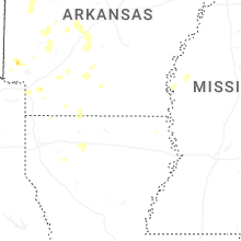
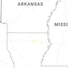
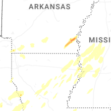


Connect with Interactive Hail Maps