

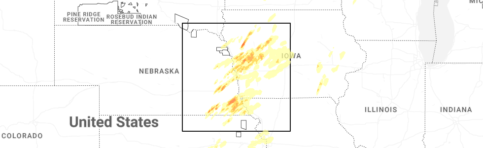
Hail Map for Hancock, IA
The Hancock, IA area has had 3 reports of on-the-ground hail by trained spotters, and has been under severe weather warnings 54 times during the past 12 months. Doppler radar has detected hail at or near Hancock, IA on 84 occasions, including 4 occasions during the past year.
| Name: | Hancock, IA |
| Where Located: | 31.3 miles ENE of Omaha, NE |
| Map: | Google Map for Hancock, IA |
| Population: | 196 |
| Housing Units: | 95 |
| More Info: | Search Google for Hancock, IA |
1
The Top Recent Hail Date for Hancock, IA is Thursday, April 23, 2026 (11th out of 84)
Hail and Wind Damage Spotted near Hancock, IA
| Date / Time | Report Details |
|---|---|
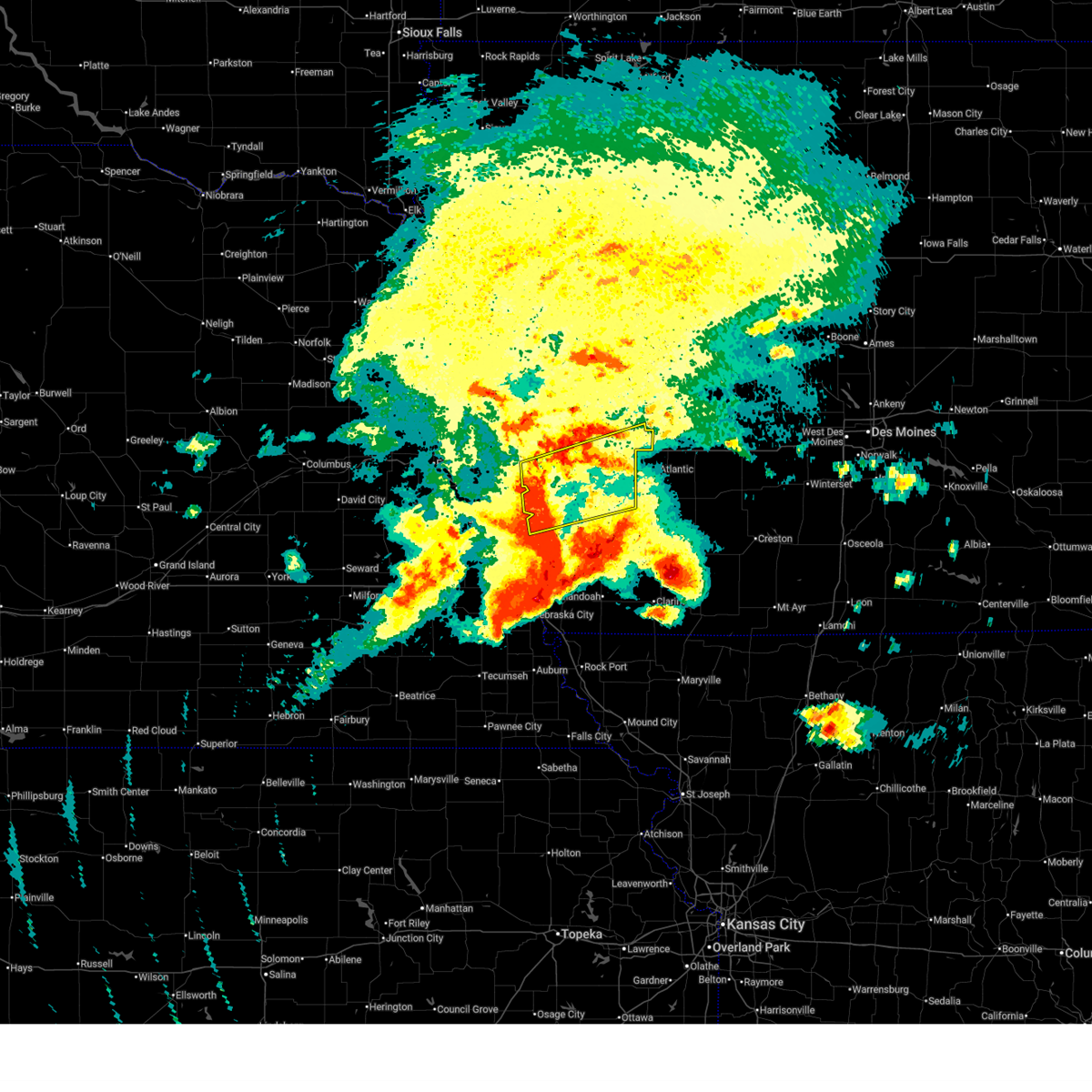
| 6/13/2026 9:25 AM CDT |
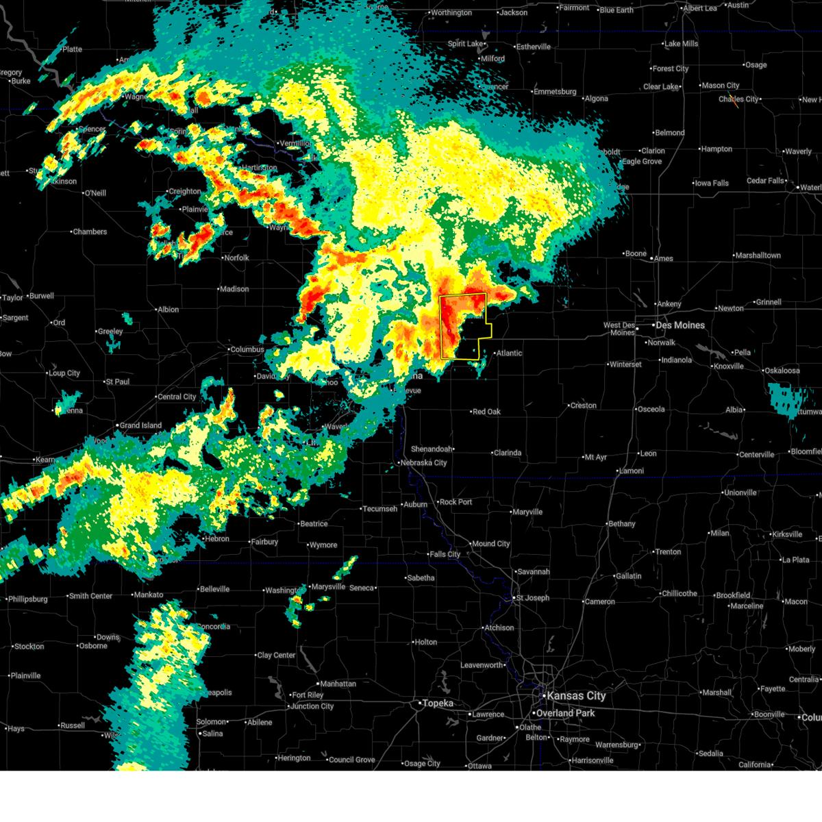
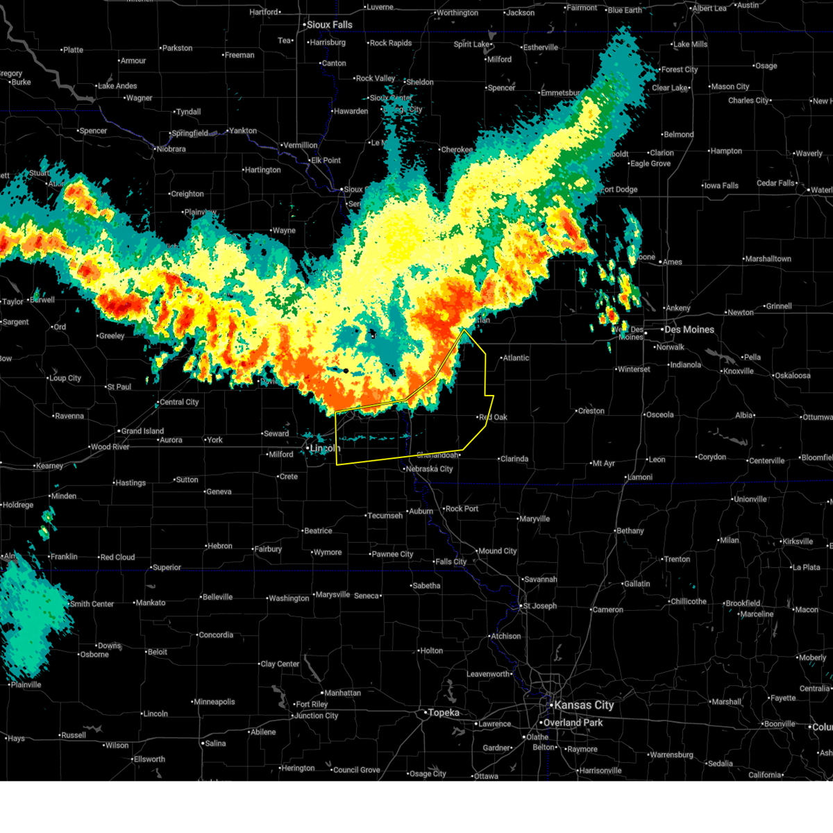
 At 925 am cdt, severe thunderstorms were located along a line extending from 2 miles southeast of hancock to 2 miles northwest of elliott to 5 miles northwest of red oak, moving east at 50 mph (radar indicated. this storm has a history of 60 mph winds and quarter size hail). Hazards include 60 mph wind gusts and quarter size hail. Hail damage to vehicles is expected. expect wind damage to roofs, siding, and trees. Locations impacted include, red oak, elliott, grant and stanton. At 925 am cdt, severe thunderstorms were located along a line extending from 2 miles southeast of hancock to 2 miles northwest of elliott to 5 miles northwest of red oak, moving east at 50 mph (radar indicated. this storm has a history of 60 mph winds and quarter size hail). Hazards include 60 mph wind gusts and quarter size hail. Hail damage to vehicles is expected. expect wind damage to roofs, siding, and trees. Locations impacted include, red oak, elliott, grant and stanton.
|
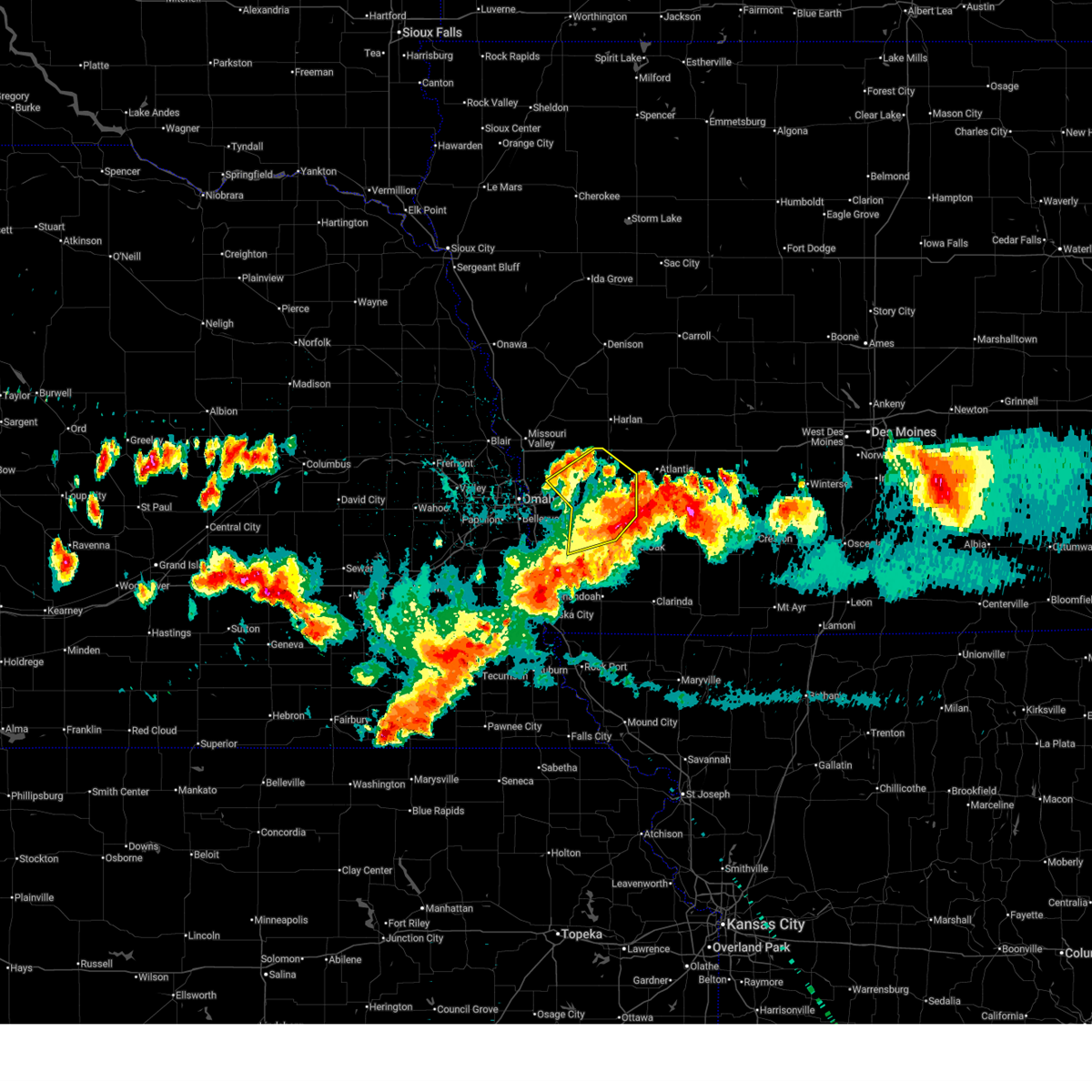
| 6/13/2026 9:06 AM CDT |
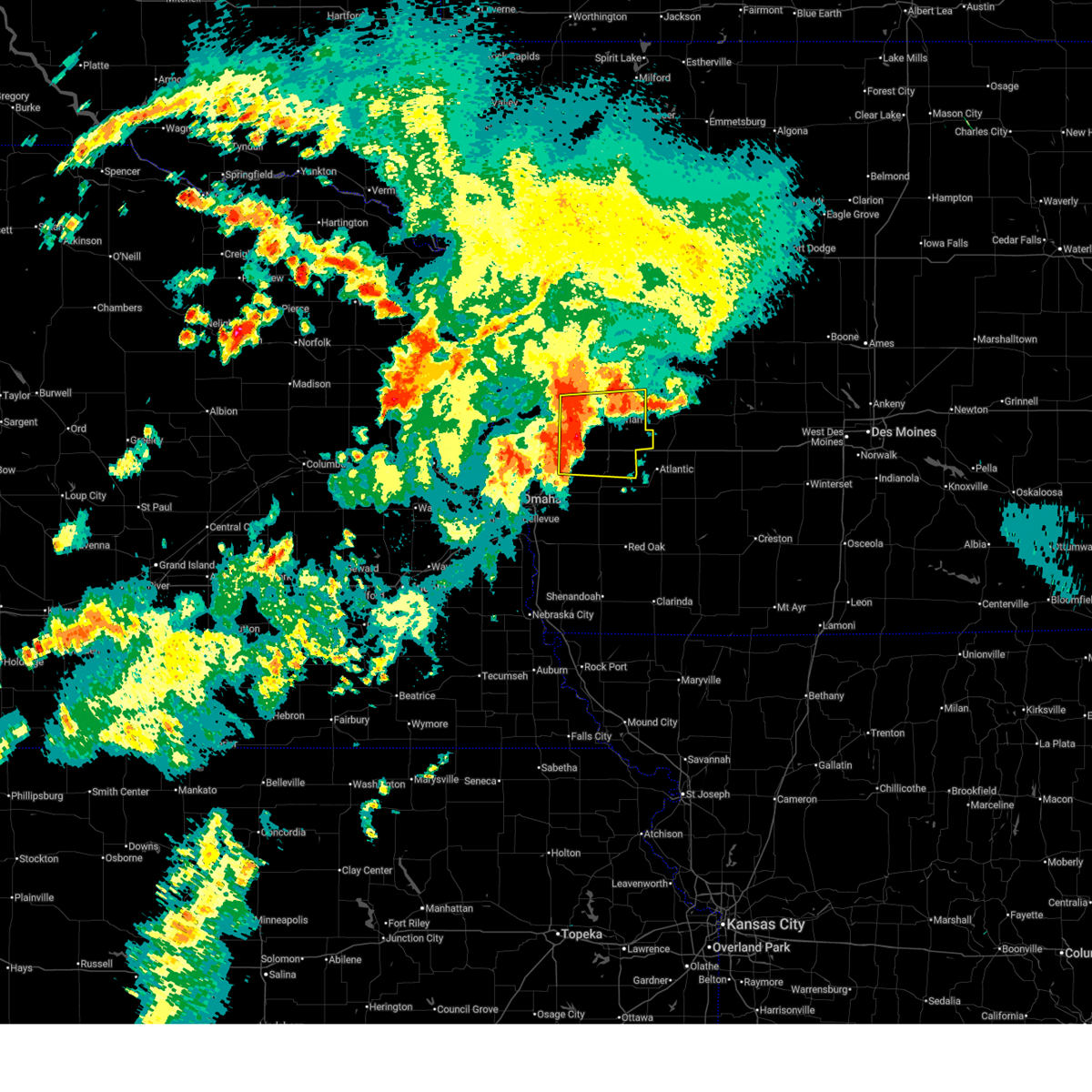
 Svroax the national weather service in omaha has issued a * severe thunderstorm warning for, montgomery county in southwestern iowa, southeastern mills county in southwestern iowa, eastern pottawattamie county in southwestern iowa, * until 945 am cdt. * at 906 am cdt, severe thunderstorms were located along a line extending from 4 miles east of underwood to 2 miles west of macedonia to 3 miles southeast of silver city, moving east at 50 mph (numerous reports of 55-60 mph winds were relayed from omaha, in addition to quarter size hail). Hazards include 60 mph wind gusts and quarter size hail. Hail damage to vehicles is expected. expect wind damage to roofs, siding, and trees. severe thunderstorms will be near, hancock around 915 am cdt. elliott around 920 am cdt. red oak around 925 am cdt. Other locations in the path of these severe thunderstorms include grant and stanton. Svroax the national weather service in omaha has issued a * severe thunderstorm warning for, montgomery county in southwestern iowa, southeastern mills county in southwestern iowa, eastern pottawattamie county in southwestern iowa, * until 945 am cdt. * at 906 am cdt, severe thunderstorms were located along a line extending from 4 miles east of underwood to 2 miles west of macedonia to 3 miles southeast of silver city, moving east at 50 mph (numerous reports of 55-60 mph winds were relayed from omaha, in addition to quarter size hail). Hazards include 60 mph wind gusts and quarter size hail. Hail damage to vehicles is expected. expect wind damage to roofs, siding, and trees. severe thunderstorms will be near, hancock around 915 am cdt. elliott around 920 am cdt. red oak around 925 am cdt. Other locations in the path of these severe thunderstorms include grant and stanton.
|
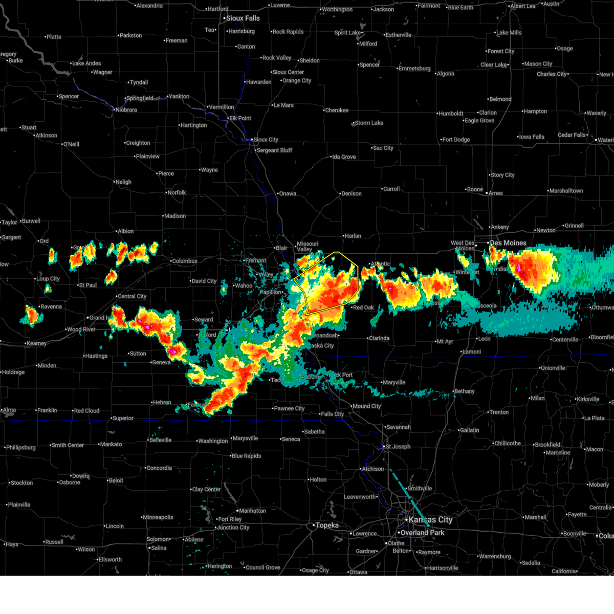
| 6/11/2026 5:55 AM CDT |
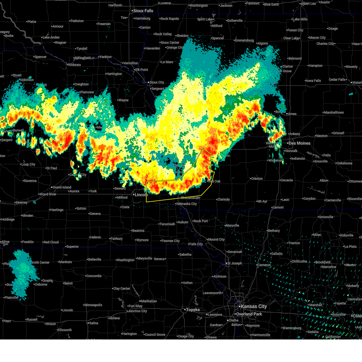
 At 553 am cdt, severe thunderstorms were located along a line extending from 2 miles southwest of minden to 2 miles west of macedonia, moving east at 55 mph (at 547 am, public mesonet stations near silver city reported winds gusting to 70 mph). Hazards include 70 mph wind gusts and quarter size hail. Hail damage to vehicles is expected. expect considerable tree damage. wind damage is also likely to mobile homes, roofs, and outbuildings. these severe storms will be near, oakland, avoca, carson, shelby, and hancock around 600 am cdt. other locations in the path of these severe thunderstorms include walnut. This includes interstate 80 in iowa between mile markers 14 and 48. At 553 am cdt, severe thunderstorms were located along a line extending from 2 miles southwest of minden to 2 miles west of macedonia, moving east at 55 mph (at 547 am, public mesonet stations near silver city reported winds gusting to 70 mph). Hazards include 70 mph wind gusts and quarter size hail. Hail damage to vehicles is expected. expect considerable tree damage. wind damage is also likely to mobile homes, roofs, and outbuildings. these severe storms will be near, oakland, avoca, carson, shelby, and hancock around 600 am cdt. other locations in the path of these severe thunderstorms include walnut. This includes interstate 80 in iowa between mile markers 14 and 48.
|
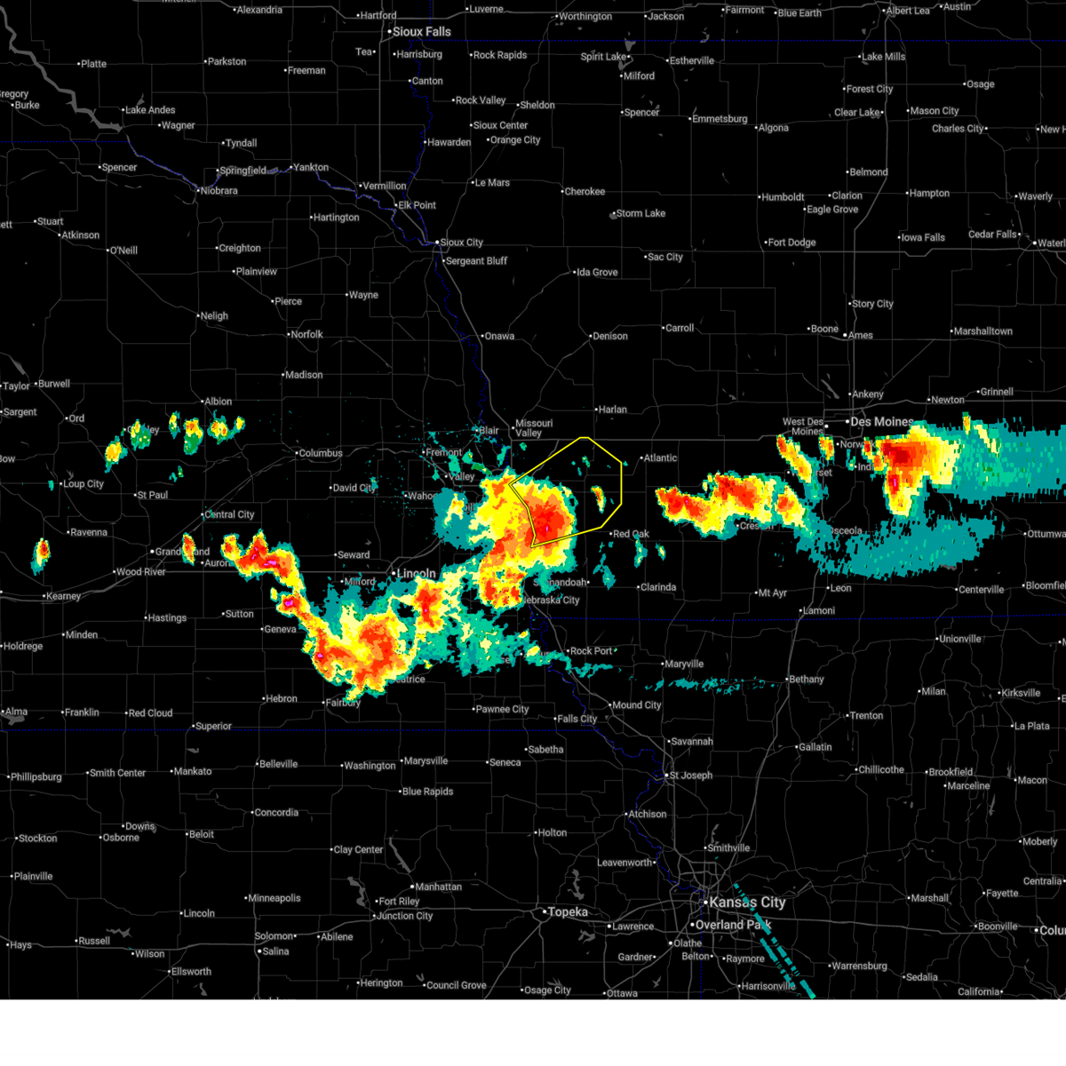
| 6/11/2026 5:46 AM CDT |
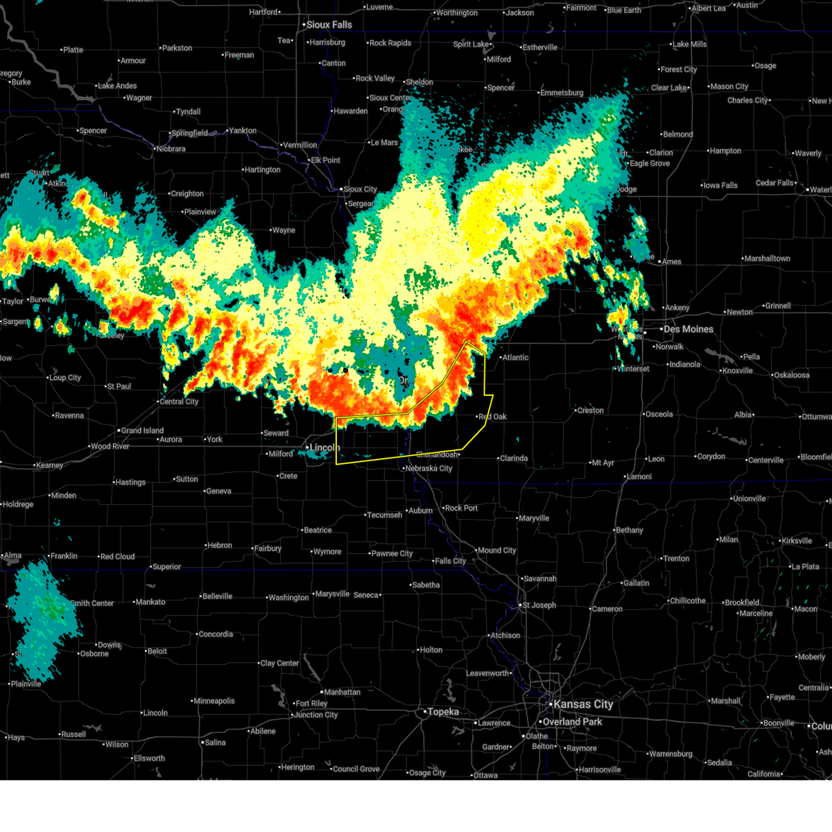
 Svroax the national weather service in omaha has issued a * severe thunderstorm warning for, northwestern mills county in southwestern iowa, pottawattamie county in southwestern iowa, southeastern harrison county in southwestern iowa, southeastern shelby county in southwestern iowa, * until 630 am cdt. * at 545 am cdt, severe thunderstorms were located along a line extending from near underwood to 4 miles northeast of silver city, moving east at 55 mph (radar indicated). Hazards include 70 mph wind gusts and quarter size hail. Hail damage to vehicles is expected. expect considerable tree damage. wind damage is also likely to mobile homes, roofs, and outbuildings. severe thunderstorms will be near, neola, carson, minden, and macedonia around 550 am cdt. oakland, shelby, and hancock around 555 am cdt. avoca around 600 am cdt. walnut around 605 am cdt. this includes the following highways, interstate 29 between mile markers 39 and 52, between mile markers 54 and 56, and between mile markers 61 and 66. Interstate 80 in iowa between mile markers 3 and 48. Svroax the national weather service in omaha has issued a * severe thunderstorm warning for, northwestern mills county in southwestern iowa, pottawattamie county in southwestern iowa, southeastern harrison county in southwestern iowa, southeastern shelby county in southwestern iowa, * until 630 am cdt. * at 545 am cdt, severe thunderstorms were located along a line extending from near underwood to 4 miles northeast of silver city, moving east at 55 mph (radar indicated). Hazards include 70 mph wind gusts and quarter size hail. Hail damage to vehicles is expected. expect considerable tree damage. wind damage is also likely to mobile homes, roofs, and outbuildings. severe thunderstorms will be near, neola, carson, minden, and macedonia around 550 am cdt. oakland, shelby, and hancock around 555 am cdt. avoca around 600 am cdt. walnut around 605 am cdt. this includes the following highways, interstate 29 between mile markers 39 and 52, between mile markers 54 and 56, and between mile markers 61 and 66. Interstate 80 in iowa between mile markers 3 and 48.
|
| 6/5/2026 11:14 PM CDT |
 The storms which prompted the warning have moved out of the area. therefore, the warning will be allowed to expire. however, small hail, gusty winds and heavy rain are still possible with these thunderstorms. a severe thunderstorm watch remains in effect until midnight cdt for southwestern iowa. remember, a severe thunderstorm warning still remains in effect for montgomery and southeastern mills counties until 1145 pm cdt. The storms which prompted the warning have moved out of the area. therefore, the warning will be allowed to expire. however, small hail, gusty winds and heavy rain are still possible with these thunderstorms. a severe thunderstorm watch remains in effect until midnight cdt for southwestern iowa. remember, a severe thunderstorm warning still remains in effect for montgomery and southeastern mills counties until 1145 pm cdt.
|
| 6/5/2026 10:56 PM CDT |
 At 1055 pm cdt, severe thunderstorms were located along a line extending from near hancock to 5 miles northwest of griswold to 2 miles north of elliott to 6 miles north of red oak, moving northeast at 30 mph (weather instrument measurement. at 1054 pm cdt, a wind gust of 69 mph was reported 6 miles west of macedonia). Hazards include golf ball size hail and 70 mph wind gusts. People and animals outdoors will be injured. expect hail damage to roofs, siding, windows, and vehicles. expect considerable tree damage. wind damage is also likely to mobile homes, roofs, and outbuildings. these severe thunderstorms will remain over mainly rural areas of northwestern montgomery, northeastern mills and eastern pottawattamie counties, including the following locations, old town park, botna bend park, mcclelland, farm creek public wildlife area, and weston. This includes interstate 80 in iowa between mile markers 14 and 17, and between mile markers 34 and 37. At 1055 pm cdt, severe thunderstorms were located along a line extending from near hancock to 5 miles northwest of griswold to 2 miles north of elliott to 6 miles north of red oak, moving northeast at 30 mph (weather instrument measurement. at 1054 pm cdt, a wind gust of 69 mph was reported 6 miles west of macedonia). Hazards include golf ball size hail and 70 mph wind gusts. People and animals outdoors will be injured. expect hail damage to roofs, siding, windows, and vehicles. expect considerable tree damage. wind damage is also likely to mobile homes, roofs, and outbuildings. these severe thunderstorms will remain over mainly rural areas of northwestern montgomery, northeastern mills and eastern pottawattamie counties, including the following locations, old town park, botna bend park, mcclelland, farm creek public wildlife area, and weston. This includes interstate 80 in iowa between mile markers 14 and 17, and between mile markers 34 and 37.
|
| 6/5/2026 10:54 PM CDT |
 At 1053 pm cdt, severe thunderstorms were located along a line extending from 2 miles south of hancock to 5 miles northwest of griswold to 2 miles northwest of elliott to 6 miles northwest of red oak, moving east at 50 mph (weather instrument measurement. at 1048 pm cdt, a wind gust of 69 mph was measured 6 miles west of macedonia). Hazards include golf ball size hail and 70 mph wind gusts. People and animals outdoors will be injured. expect hail damage to roofs, siding, windows, and vehicles. expect considerable tree damage. wind damage is also likely to mobile homes, roofs, and outbuildings. these severe thunderstorms will remain over mainly rural areas of northwestern montgomery, eastern mills and pottawattamie counties, including the following locations, old town park, botna bend park, weston, farm creek public wildlife area, mcclelland, mineola, and narrows river park. people attending pottawattamie county public health in focus should seek safe shelter immediately! this includes the following highways, interstate 29 between mile markers 45 and 50, and between mile markers 54 and 56. Interstate 80 in iowa between mile markers 3 and 17, and between mile markers 34 and 37. At 1053 pm cdt, severe thunderstorms were located along a line extending from 2 miles south of hancock to 5 miles northwest of griswold to 2 miles northwest of elliott to 6 miles northwest of red oak, moving east at 50 mph (weather instrument measurement. at 1048 pm cdt, a wind gust of 69 mph was measured 6 miles west of macedonia). Hazards include golf ball size hail and 70 mph wind gusts. People and animals outdoors will be injured. expect hail damage to roofs, siding, windows, and vehicles. expect considerable tree damage. wind damage is also likely to mobile homes, roofs, and outbuildings. these severe thunderstorms will remain over mainly rural areas of northwestern montgomery, eastern mills and pottawattamie counties, including the following locations, old town park, botna bend park, weston, farm creek public wildlife area, mcclelland, mineola, and narrows river park. people attending pottawattamie county public health in focus should seek safe shelter immediately! this includes the following highways, interstate 29 between mile markers 45 and 50, and between mile markers 54 and 56. Interstate 80 in iowa between mile markers 3 and 17, and between mile markers 34 and 37.
|
| 6/5/2026 10:30 PM CDT |
 At 1029 pm cdt, severe thunderstorms were located along a line extending from 3 miles east of council bluffs airport to 4 miles southeast of treynor to 4 miles north of hastings to near malvern, moving east at 25 mph (weather instrument measurement. at 1024 pm cdt, a 64 mph wind gust was observed 3 miles south of glenwood). Hazards include golf ball size hail and 70 mph wind gusts. People and animals outdoors will be injured. expect hail damage to roofs, siding, windows, and vehicles. expect considerable tree damage. wind damage is also likely to mobile homes, roofs, and outbuildings. these severe storms will be near, malvern, treynor, macedonia, henderson, and hastings around 1035 pm cdt. carson around 1040 pm cdt. other locations in the path of these severe thunderstorms include oakland and hancock. people attending pottawattamie county public health in focus should seek safe shelter immediately! this includes the following highways, interstate 29 between mile markers 45 and 50, and between mile markers 54 and 56. Interstate 80 in iowa between mile markers 3 and 17, and between mile markers 34 and 37. At 1029 pm cdt, severe thunderstorms were located along a line extending from 3 miles east of council bluffs airport to 4 miles southeast of treynor to 4 miles north of hastings to near malvern, moving east at 25 mph (weather instrument measurement. at 1024 pm cdt, a 64 mph wind gust was observed 3 miles south of glenwood). Hazards include golf ball size hail and 70 mph wind gusts. People and animals outdoors will be injured. expect hail damage to roofs, siding, windows, and vehicles. expect considerable tree damage. wind damage is also likely to mobile homes, roofs, and outbuildings. these severe storms will be near, malvern, treynor, macedonia, henderson, and hastings around 1035 pm cdt. carson around 1040 pm cdt. other locations in the path of these severe thunderstorms include oakland and hancock. people attending pottawattamie county public health in focus should seek safe shelter immediately! this includes the following highways, interstate 29 between mile markers 45 and 50, and between mile markers 54 and 56. Interstate 80 in iowa between mile markers 3 and 17, and between mile markers 34 and 37.
|
| 6/5/2026 10:20 PM CDT |
 Svroax the national weather service in omaha has issued a * severe thunderstorm warning for, northwestern montgomery county in southwestern iowa, eastern mills county in southwestern iowa, pottawattamie county in southwestern iowa, * until 1115 pm cdt. * at 1019 pm cdt, severe thunderstorms were located along a line extending from council bluffs to 3 miles north of silver city to 3 miles north of malvern to 4 miles southeast of glenwood, moving northeast at 35 mph (radar indicated). Hazards include ping pong ball size hail and 60 mph wind gusts. People and animals outdoors will be injured. expect hail damage to roofs, siding, windows, and vehicles. expect wind damage to roofs, siding, and trees. severe thunderstorms will be near, malvern, treynor, hastings, and council bluffs airport around 1025 pm cdt. henderson around 1030 pm cdt. carson and macedonia around 1035 pm cdt. other locations in the path of these severe thunderstorms include oakland and hancock. people attending pottawattamie county public health in focus should seek safe shelter immediately! this includes the following highways, interstate 29 between mile markers 45 and 50, and between mile markers 54 and 56. Interstate 80 in iowa between mile markers 3 and 17, and between mile markers 34 and 37. Svroax the national weather service in omaha has issued a * severe thunderstorm warning for, northwestern montgomery county in southwestern iowa, eastern mills county in southwestern iowa, pottawattamie county in southwestern iowa, * until 1115 pm cdt. * at 1019 pm cdt, severe thunderstorms were located along a line extending from council bluffs to 3 miles north of silver city to 3 miles north of malvern to 4 miles southeast of glenwood, moving northeast at 35 mph (radar indicated). Hazards include ping pong ball size hail and 60 mph wind gusts. People and animals outdoors will be injured. expect hail damage to roofs, siding, windows, and vehicles. expect wind damage to roofs, siding, and trees. severe thunderstorms will be near, malvern, treynor, hastings, and council bluffs airport around 1025 pm cdt. henderson around 1030 pm cdt. carson and macedonia around 1035 pm cdt. other locations in the path of these severe thunderstorms include oakland and hancock. people attending pottawattamie county public health in focus should seek safe shelter immediately! this includes the following highways, interstate 29 between mile markers 45 and 50, and between mile markers 54 and 56. Interstate 80 in iowa between mile markers 3 and 17, and between mile markers 34 and 37.
|
| 6/1/2026 2:21 AM CDT |
 At 220 am cdt, a severe thunderstorm was located 3 miles northeast of oakland, or 17 miles west of atlantic, moving southeast at 15 mph (radar indicated). Hazards include 60 mph wind gusts and quarter size hail. Hail damage to vehicles is expected. expect wind damage to roofs, siding, and trees. This severe thunderstorm will remain over mainly rural areas of east central pottawattamie county. At 220 am cdt, a severe thunderstorm was located 3 miles northeast of oakland, or 17 miles west of atlantic, moving southeast at 15 mph (radar indicated). Hazards include 60 mph wind gusts and quarter size hail. Hail damage to vehicles is expected. expect wind damage to roofs, siding, and trees. This severe thunderstorm will remain over mainly rural areas of east central pottawattamie county.
|
| 6/1/2026 2:07 AM CDT |
 At 207 am cdt, a severe thunderstorm was located over oakland, or 19 miles west of atlantic, moving southeast at 20 mph (radar indicated). Hazards include ping pong ball size hail and 60 mph wind gusts. People and animals outdoors will be injured. expect hail damage to roofs, siding, windows, and vehicles. expect wind damage to roofs, siding, and trees. This severe thunderstorm will remain over mainly rural areas of east central pottawattamie county. At 207 am cdt, a severe thunderstorm was located over oakland, or 19 miles west of atlantic, moving southeast at 20 mph (radar indicated). Hazards include ping pong ball size hail and 60 mph wind gusts. People and animals outdoors will be injured. expect hail damage to roofs, siding, windows, and vehicles. expect wind damage to roofs, siding, and trees. This severe thunderstorm will remain over mainly rural areas of east central pottawattamie county.
|
| 6/1/2026 1:47 AM CDT |
 At 147 am cdt, a severe thunderstorm was located 5 miles west of hancock, or 19 miles south of harlan, moving southeast at 20 mph (radar indicated). Hazards include two inch hail and 60 mph wind gusts. People and animals outdoors will be injured. expect hail damage to roofs, siding, windows, and vehicles. expect wind damage to roofs, siding, and trees. This severe storm will be near, oakland and hancock around 155 am cdt. At 147 am cdt, a severe thunderstorm was located 5 miles west of hancock, or 19 miles south of harlan, moving southeast at 20 mph (radar indicated). Hazards include two inch hail and 60 mph wind gusts. People and animals outdoors will be injured. expect hail damage to roofs, siding, windows, and vehicles. expect wind damage to roofs, siding, and trees. This severe storm will be near, oakland and hancock around 155 am cdt.
|
| 5/17/2026 9:24 PM CDT |
 At 923 pm cdt, severe thunderstorms were located along a line extending from 4 miles northeast of irwin to 5 miles east of walnut to 4 miles northwest of griswold, moving east at 45 mph (at 916 pm, a public mesonet station reported 60 mph in oakland, iowa). Hazards include 60 mph wind gusts. Expect damage to roofs, siding, and trees. locations impacted include, harlan, oakland, avoca, treynor, carson, walnut, shelby, minden, earling, irwin, defiance, macedonia, panama, hancock, portsmouth, westphalia, tennant, kirkman, old town park, and prairie rose state park. This includes interstate 80 in iowa between mile markers 29 and 48. At 923 pm cdt, severe thunderstorms were located along a line extending from 4 miles northeast of irwin to 5 miles east of walnut to 4 miles northwest of griswold, moving east at 45 mph (at 916 pm, a public mesonet station reported 60 mph in oakland, iowa). Hazards include 60 mph wind gusts. Expect damage to roofs, siding, and trees. locations impacted include, harlan, oakland, avoca, treynor, carson, walnut, shelby, minden, earling, irwin, defiance, macedonia, panama, hancock, portsmouth, westphalia, tennant, kirkman, old town park, and prairie rose state park. This includes interstate 80 in iowa between mile markers 29 and 48.
|
| 5/17/2026 9:17 PM CDT |
 At 916 pm cdt, severe thunderstorms were located along a line extending from near irwin to 2 miles southeast of walnut to 6 miles east of carson, moving east at 45 mph (radar indicated). Hazards include 60 mph wind gusts. Expect damage to roofs, siding, and trees. locations impacted include, eastern council bluffs, harlan, oakland, avoca, treynor, underwood, neola, carson, walnut, shelby, minden, earling, irwin, persia, defiance, macedonia, panama, hancock, council bluffs airport, and portsmouth. this includes the following highways, interstate 29 near mile marker 43. Interstate 80 in iowa between mile markers 8 and 48. At 916 pm cdt, severe thunderstorms were located along a line extending from near irwin to 2 miles southeast of walnut to 6 miles east of carson, moving east at 45 mph (radar indicated). Hazards include 60 mph wind gusts. Expect damage to roofs, siding, and trees. locations impacted include, eastern council bluffs, harlan, oakland, avoca, treynor, underwood, neola, carson, walnut, shelby, minden, earling, irwin, persia, defiance, macedonia, panama, hancock, council bluffs airport, and portsmouth. this includes the following highways, interstate 29 near mile marker 43. Interstate 80 in iowa between mile markers 8 and 48.
|
| 5/17/2026 8:56 PM CDT |
 Svroax the national weather service in omaha has issued a * severe thunderstorm warning for, southeastern monona county in west central iowa, pottawattamie county in southwestern iowa, eastern harrison county in southwestern iowa, shelby county in southwestern iowa, * until 1000 pm cdt. * at 856 pm cdt, severe thunderstorms were located along a line extending from near panama to 4 miles west of hancock to 4 miles southeast of treynor, moving east at 45 mph (radar indicated. this storm has a history of 60 to 70 mph winds). Hazards include 70 mph wind gusts and penny size hail. Expect considerable tree damage. Damage is likely to mobile homes, roofs, and outbuildings. Svroax the national weather service in omaha has issued a * severe thunderstorm warning for, southeastern monona county in west central iowa, pottawattamie county in southwestern iowa, eastern harrison county in southwestern iowa, shelby county in southwestern iowa, * until 1000 pm cdt. * at 856 pm cdt, severe thunderstorms were located along a line extending from near panama to 4 miles west of hancock to 4 miles southeast of treynor, moving east at 45 mph (radar indicated. this storm has a history of 60 to 70 mph winds). Hazards include 70 mph wind gusts and penny size hail. Expect considerable tree damage. Damage is likely to mobile homes, roofs, and outbuildings.
|
| 5/17/2026 8:33 PM CDT |
 At 832 pm cdt, severe thunderstorms were located along a line extending from 2 miles north of logan to 4 miles southeast of crescent to plattsmouth, moving east at 45 mph (at 827 pm, eppley airfield reported a gust of 63 mph). Hazards include 70 mph wind gusts and quarter size hail. Hail damage to vehicles is expected. expect considerable tree damage. wind damage is also likely to mobile homes, roofs, and outbuildings. locations impacted include, eastern council bluffs, plattsmouth, glenwood, underwood, pacific junction, council bluffs airport, treynor, neola, persia, silver city, minden, malvern, shelby, oakland, avoca, carson, macedonia, hancock, henderson, hastings and harlan. people attending fricke field, the omaha cinco de mayo celebration, papillion lavista south high school, werner park, and tal anderson field should seek safe shelter immediately! this includes the following highways, interstate 29 between mile markers 25 and 77. interstate 80 in iowa between mile markers 1 and 43. Interstate 80 in nebraska between mile markers 437 and 454. At 832 pm cdt, severe thunderstorms were located along a line extending from 2 miles north of logan to 4 miles southeast of crescent to plattsmouth, moving east at 45 mph (at 827 pm, eppley airfield reported a gust of 63 mph). Hazards include 70 mph wind gusts and quarter size hail. Hail damage to vehicles is expected. expect considerable tree damage. wind damage is also likely to mobile homes, roofs, and outbuildings. locations impacted include, eastern council bluffs, plattsmouth, glenwood, underwood, pacific junction, council bluffs airport, treynor, neola, persia, silver city, minden, malvern, shelby, oakland, avoca, carson, macedonia, hancock, henderson, hastings and harlan. people attending fricke field, the omaha cinco de mayo celebration, papillion lavista south high school, werner park, and tal anderson field should seek safe shelter immediately! this includes the following highways, interstate 29 between mile markers 25 and 77. interstate 80 in iowa between mile markers 1 and 43. Interstate 80 in nebraska between mile markers 437 and 454.
|
| 5/17/2026 8:11 PM CDT |
 Svroax the national weather service in omaha has issued a * severe thunderstorm warning for, mills county in southwestern iowa, pottawattamie county in southwestern iowa, southern harrison county in southwestern iowa, southwestern shelby county in southwestern iowa, sarpy county in east central nebraska, southeastern washington county in east central nebraska, eastern douglas county in east central nebraska, eastern cass county in southeastern nebraska, * until 915 pm cdt. * at 810 pm cdt, severe thunderstorms were located along a line extending from 3 miles west of modale to omaha to 4 miles south of louisville, moving east at 45 mph (these storms have a history of producing 60 mph winds or greater and quarter sized hail). Hazards include 70 mph wind gusts and quarter size hail. Hail damage to vehicles is expected. expect considerable tree damage. wind damage is also likely to mobile homes, roofs, and outbuildings. severe thunderstorms will be near, omaha, council bluffs, bellevue, papillion, ralston, offutt afb, la vista, carter lake, missouri valley, and fort calhoun around 815 pm cdt. crescent around 820 pm cdt. plattsmouth around 825 pm cdt. pacific junction and council bluffs airport around 830 pm cdt. other locations in the path of these severe thunderstorms include glenwood, underwood, neola, treynor, minden, persia, silver city, malvern and shelby. people attending fricke field, the omaha cinco de mayo celebration, papillion lavista south high school, werner park, and tal anderson field should seek safe shelter immediately! this includes the following highways, interstate 29 between mile markers 25 and 77. interstate 80 in iowa between mile markers 1 and 43. Interstate 80 in nebraska between mile markers 437 and 454. Svroax the national weather service in omaha has issued a * severe thunderstorm warning for, mills county in southwestern iowa, pottawattamie county in southwestern iowa, southern harrison county in southwestern iowa, southwestern shelby county in southwestern iowa, sarpy county in east central nebraska, southeastern washington county in east central nebraska, eastern douglas county in east central nebraska, eastern cass county in southeastern nebraska, * until 915 pm cdt. * at 810 pm cdt, severe thunderstorms were located along a line extending from 3 miles west of modale to omaha to 4 miles south of louisville, moving east at 45 mph (these storms have a history of producing 60 mph winds or greater and quarter sized hail). Hazards include 70 mph wind gusts and quarter size hail. Hail damage to vehicles is expected. expect considerable tree damage. wind damage is also likely to mobile homes, roofs, and outbuildings. severe thunderstorms will be near, omaha, council bluffs, bellevue, papillion, ralston, offutt afb, la vista, carter lake, missouri valley, and fort calhoun around 815 pm cdt. crescent around 820 pm cdt. plattsmouth around 825 pm cdt. pacific junction and council bluffs airport around 830 pm cdt. other locations in the path of these severe thunderstorms include glenwood, underwood, neola, treynor, minden, persia, silver city, malvern and shelby. people attending fricke field, the omaha cinco de mayo celebration, papillion lavista south high school, werner park, and tal anderson field should seek safe shelter immediately! this includes the following highways, interstate 29 between mile markers 25 and 77. interstate 80 in iowa between mile markers 1 and 43. Interstate 80 in nebraska between mile markers 437 and 454.
|
| 4/23/2026 4:50 PM CDT |
 At 449 pm cdt, severe thunderstorms were located along a line extending from near avoca to 2 miles northeast of oakland to near carson, moving east at 35 mph (emergency management report of quarter sized hail 5 miles northwest of oakland at 4:48 pm). Hazards include 60 mph wind gusts and half dollar size hail. Hail damage to vehicles is expected. expect wind damage to roofs, siding, and trees. locations impacted include, oakland, avoca, treynor, carson, walnut, shelby, minden, macedonia, hancock, old town park, prairie rose state park, farm creek public wildlife area, botna bend park, nishna bend recreation area, and elk horn creek recreation area. This includes interstate 80 in iowa between mile markers 31 and 48. At 449 pm cdt, severe thunderstorms were located along a line extending from near avoca to 2 miles northeast of oakland to near carson, moving east at 35 mph (emergency management report of quarter sized hail 5 miles northwest of oakland at 4:48 pm). Hazards include 60 mph wind gusts and half dollar size hail. Hail damage to vehicles is expected. expect wind damage to roofs, siding, and trees. locations impacted include, oakland, avoca, treynor, carson, walnut, shelby, minden, macedonia, hancock, old town park, prairie rose state park, farm creek public wildlife area, botna bend park, nishna bend recreation area, and elk horn creek recreation area. This includes interstate 80 in iowa between mile markers 31 and 48.
|
| 4/23/2026 4:20 PM CDT |
 Svroax the national weather service in omaha has issued a * severe thunderstorm warning for, pottawattamie county in southwestern iowa, southeastern shelby county in southwestern iowa, * until 515 pm cdt. * at 419 pm cdt, severe thunderstorms were located along a line extending from 2 miles northeast of underwood to 4 miles northwest of treynor to 6 miles northwest of silver city, moving east at 35 mph (radar indicated. this storm has a history of producing severe hail). Hazards include 60 mph wind gusts and half dollar size hail. Hail damage to vehicles is expected. expect wind damage to roofs, siding, and trees. severe thunderstorms will be near, treynor, neola, and minden around 425 pm cdt. shelby around 435 pm cdt. other locations in the path of these severe thunderstorms include oakland, carson, hancock, avoca, macedonia and walnut. this includes the following highways, interstate 29 between mile markers 43 and 45. Interstate 80 in iowa between mile markers 5 and 23, and between mile markers 31 and 48. Svroax the national weather service in omaha has issued a * severe thunderstorm warning for, pottawattamie county in southwestern iowa, southeastern shelby county in southwestern iowa, * until 515 pm cdt. * at 419 pm cdt, severe thunderstorms were located along a line extending from 2 miles northeast of underwood to 4 miles northwest of treynor to 6 miles northwest of silver city, moving east at 35 mph (radar indicated. this storm has a history of producing severe hail). Hazards include 60 mph wind gusts and half dollar size hail. Hail damage to vehicles is expected. expect wind damage to roofs, siding, and trees. severe thunderstorms will be near, treynor, neola, and minden around 425 pm cdt. shelby around 435 pm cdt. other locations in the path of these severe thunderstorms include oakland, carson, hancock, avoca, macedonia and walnut. this includes the following highways, interstate 29 between mile markers 43 and 45. Interstate 80 in iowa between mile markers 5 and 23, and between mile markers 31 and 48.
|
| 8/9/2025 7:27 AM CDT |
 The storms which prompted the warning have weakened below severe limits, and no longer pose an immediate threat to life or property. therefore, the warning will be allowed to expire. however, small hail is still possible with these thunderstorms. a severe thunderstorm watch remains in effect until 800 am cdt for southwestern iowa. The storms which prompted the warning have weakened below severe limits, and no longer pose an immediate threat to life or property. therefore, the warning will be allowed to expire. however, small hail is still possible with these thunderstorms. a severe thunderstorm watch remains in effect until 800 am cdt for southwestern iowa.
|
| 8/9/2025 7:16 AM CDT |
 At 716 am cdt, severe thunderstorms were located along a line extending from 3 miles south of persia to 5 miles west of hancock to 3 miles east of treynor, moving northeast at 35 mph (radar indicated). Hazards include 60 mph wind gusts. Expect damage to roofs, siding, and trees. Locations impacted include, oakland, walnut, hancock, and botna bend park. At 716 am cdt, severe thunderstorms were located along a line extending from 3 miles south of persia to 5 miles west of hancock to 3 miles east of treynor, moving northeast at 35 mph (radar indicated). Hazards include 60 mph wind gusts. Expect damage to roofs, siding, and trees. Locations impacted include, oakland, walnut, hancock, and botna bend park.
|
| 8/9/2025 7:16 AM CDT |
 the severe thunderstorm warning has been cancelled and is no longer in effect the severe thunderstorm warning has been cancelled and is no longer in effect
|
| 8/9/2025 7:07 AM CDT |
 At 707 am cdt, severe thunderstorms were located along a line extending from 3 miles north of neola to 5 miles south of minden to 2 miles south of treynor, moving northeast at 40 mph (radar indicated). Hazards include 60 mph wind gusts and quarter size hail. Hail damage to vehicles is expected. expect wind damage to roofs, siding, and trees. Locations impacted include, treynor, oakland, carson, hancock, avoca, macedonia and walnut. At 707 am cdt, severe thunderstorms were located along a line extending from 3 miles north of neola to 5 miles south of minden to 2 miles south of treynor, moving northeast at 40 mph (radar indicated). Hazards include 60 mph wind gusts and quarter size hail. Hail damage to vehicles is expected. expect wind damage to roofs, siding, and trees. Locations impacted include, treynor, oakland, carson, hancock, avoca, macedonia and walnut.
|
| 8/9/2025 7:07 AM CDT |
 the severe thunderstorm warning has been cancelled and is no longer in effect the severe thunderstorm warning has been cancelled and is no longer in effect
|
| 8/9/2025 6:44 AM CDT |
 Svroax the national weather service in omaha has issued a * severe thunderstorm warning for, western montgomery county in southwestern iowa, mills county in southwestern iowa, pottawattamie county in southwestern iowa, northeastern sarpy county in east central nebraska, eastern douglas county in east central nebraska, northeastern cass county in southeastern nebraska, * until 730 am cdt. * at 644 am cdt, severe thunderstorms were located along a line extending from 4 miles north of crescent to 3 miles north of council bluffs airport to 5 miles east of offutt afb, moving northeast at 45 mph (radar indicated). Hazards include 60 mph wind gusts and quarter size hail. Hail damage to vehicles is expected. expect wind damage to roofs, siding, and trees. severe thunderstorms will be near, underwood and council bluffs airport around 650 am cdt. treynor around 655 am cdt. silver city around 700 am cdt. other locations in the path of these severe thunderstorms include oakland, carson, macedonia and hancock. this includes the following highways, interstate 29 between mile markers 32 and 63. interstate 80 in iowa between mile markers 1 and 20. Interstate 80 in nebraska between mile markers 450 and 454. Svroax the national weather service in omaha has issued a * severe thunderstorm warning for, western montgomery county in southwestern iowa, mills county in southwestern iowa, pottawattamie county in southwestern iowa, northeastern sarpy county in east central nebraska, eastern douglas county in east central nebraska, northeastern cass county in southeastern nebraska, * until 730 am cdt. * at 644 am cdt, severe thunderstorms were located along a line extending from 4 miles north of crescent to 3 miles north of council bluffs airport to 5 miles east of offutt afb, moving northeast at 45 mph (radar indicated). Hazards include 60 mph wind gusts and quarter size hail. Hail damage to vehicles is expected. expect wind damage to roofs, siding, and trees. severe thunderstorms will be near, underwood and council bluffs airport around 650 am cdt. treynor around 655 am cdt. silver city around 700 am cdt. other locations in the path of these severe thunderstorms include oakland, carson, macedonia and hancock. this includes the following highways, interstate 29 between mile markers 32 and 63. interstate 80 in iowa between mile markers 1 and 20. Interstate 80 in nebraska between mile markers 450 and 454.
|
| 8/9/2025 6:29 AM CDT |
 At 624 am cdt, severe thunderstorms were located along a line extending from 2 miles southeast of tekamah to 7 miles southeast of missouri valley to 4 miles northwest of silver city, moving northeast at 50 mph. these are destructive storms for the omaha metro into washington, harrison, and pottawattamie counties (public. multiple reports of 60 to 80 mph winds have been reported in the omaha metro north through blair). Hazards include 80 mph wind gusts and quarter size hail. Flying debris will be dangerous to those caught without shelter. mobile homes will be heavily damaged. expect considerable damage to roofs, windows, and vehicles. extensive tree damage and power outages are likely. Locations impacted include, logan, treynor, underwood, neola, mondamin, magnolia, little sioux, minden, persia, pisgah, oakland, woodbine, carson, shelby and hancock. At 624 am cdt, severe thunderstorms were located along a line extending from 2 miles southeast of tekamah to 7 miles southeast of missouri valley to 4 miles northwest of silver city, moving northeast at 50 mph. these are destructive storms for the omaha metro into washington, harrison, and pottawattamie counties (public. multiple reports of 60 to 80 mph winds have been reported in the omaha metro north through blair). Hazards include 80 mph wind gusts and quarter size hail. Flying debris will be dangerous to those caught without shelter. mobile homes will be heavily damaged. expect considerable damage to roofs, windows, and vehicles. extensive tree damage and power outages are likely. Locations impacted include, logan, treynor, underwood, neola, mondamin, magnolia, little sioux, minden, persia, pisgah, oakland, woodbine, carson, shelby and hancock.
|
| 8/9/2025 6:04 AM CDT |
 Svroax the national weather service in omaha has issued a * severe thunderstorm warning for, south central monona county in west central iowa, northwestern mills county in southwestern iowa, pottawattamie county in southwestern iowa, harrison county in southwestern iowa, southwestern shelby county in southwestern iowa, sarpy county in east central nebraska, southeastern burt county in east central nebraska, washington county in east central nebraska, southeastern dodge county in east central nebraska, douglas county in east central nebraska, northeastern saunders county in east central nebraska, * until 645 am cdt. * at 603 am cdt, severe thunderstorms were located along a line extending from 4 miles north of arlington to omaha to 4 miles northwest of plattsmouth, moving east at 50 mph. these are destructive storms for the omaha-council bluffs metro area (radar indicated). Hazards include 80 mph wind gusts. Flying debris will be dangerous to those caught without shelter. mobile homes will be heavily damaged. expect considerable damage to roofs, windows, and vehicles. extensive tree damage and power outages are likely. severe thunderstorms will be near, eastern omaha, council bluffs, bellevue, blair, offutt afb, carter lake, fort calhoun, crescent, kennard, and eppley airfield around 610 am cdt. council bluffs airport around 615 am cdt. missouri valley and modale around 620 am cdt. other locations in the path of these severe thunderstorms include treynor, underwood, neola, logan, carson and minden. this includes the following highways, interstate 29 between mile markers 42 and 97. interstate 80 in iowa between mile markers 1 and 37. Interstate 80 in nebraska between mile markers 428 and 454. Svroax the national weather service in omaha has issued a * severe thunderstorm warning for, south central monona county in west central iowa, northwestern mills county in southwestern iowa, pottawattamie county in southwestern iowa, harrison county in southwestern iowa, southwestern shelby county in southwestern iowa, sarpy county in east central nebraska, southeastern burt county in east central nebraska, washington county in east central nebraska, southeastern dodge county in east central nebraska, douglas county in east central nebraska, northeastern saunders county in east central nebraska, * until 645 am cdt. * at 603 am cdt, severe thunderstorms were located along a line extending from 4 miles north of arlington to omaha to 4 miles northwest of plattsmouth, moving east at 50 mph. these are destructive storms for the omaha-council bluffs metro area (radar indicated). Hazards include 80 mph wind gusts. Flying debris will be dangerous to those caught without shelter. mobile homes will be heavily damaged. expect considerable damage to roofs, windows, and vehicles. extensive tree damage and power outages are likely. severe thunderstorms will be near, eastern omaha, council bluffs, bellevue, blair, offutt afb, carter lake, fort calhoun, crescent, kennard, and eppley airfield around 610 am cdt. council bluffs airport around 615 am cdt. missouri valley and modale around 620 am cdt. other locations in the path of these severe thunderstorms include treynor, underwood, neola, logan, carson and minden. this includes the following highways, interstate 29 between mile markers 42 and 97. interstate 80 in iowa between mile markers 1 and 37. Interstate 80 in nebraska between mile markers 428 and 454.
|
| 7/30/2025 12:44 AM CDT |
 the severe thunderstorm warning has been cancelled and is no longer in effect the severe thunderstorm warning has been cancelled and is no longer in effect
|
| 7/30/2025 12:17 AM CDT |
 Svroax the national weather service in omaha has issued a * severe thunderstorm warning for, eastern pottawattamie county in southwestern iowa, southeastern harrison county in southwestern iowa, shelby county in southwestern iowa, * until 115 am cdt. * at 1217 am cdt, severe thunderstorms were located along a line extending from 5 miles northeast of irwin to 3 miles east of persia, moving southeast at 25 mph (radar indicated). Hazards include 60 mph wind gusts. Expect damage to roofs, siding, and trees. severe thunderstorms will be near, harlan and shelby around 1220 am cdt. avoca around 1230 am cdt. walnut around 1235 am cdt. other locations in the path of these severe thunderstorms include hancock. This includes interstate 80 in iowa between mile markers 29 and 48. Svroax the national weather service in omaha has issued a * severe thunderstorm warning for, eastern pottawattamie county in southwestern iowa, southeastern harrison county in southwestern iowa, shelby county in southwestern iowa, * until 115 am cdt. * at 1217 am cdt, severe thunderstorms were located along a line extending from 5 miles northeast of irwin to 3 miles east of persia, moving southeast at 25 mph (radar indicated). Hazards include 60 mph wind gusts. Expect damage to roofs, siding, and trees. severe thunderstorms will be near, harlan and shelby around 1220 am cdt. avoca around 1230 am cdt. walnut around 1235 am cdt. other locations in the path of these severe thunderstorms include hancock. This includes interstate 80 in iowa between mile markers 29 and 48.
|
| 7/28/2025 4:02 AM CDT |
 the severe thunderstorm warning has been cancelled and is no longer in effect the severe thunderstorm warning has been cancelled and is no longer in effect
|
| 7/28/2025 3:56 AM CDT |
 At 356 am cdt, severe thunderstorms were located along a line extending from elliott to 3 miles northeast of tabor, moving southeast at 40 mph (public weather stations are reporting wind gusts up to 55 mph). Hazards include 60 mph wind gusts. Expect damage to roofs, siding, and trees. Locations impacted include, red oak, emerson, elliott, randolph and stanton. At 356 am cdt, severe thunderstorms were located along a line extending from elliott to 3 miles northeast of tabor, moving southeast at 40 mph (public weather stations are reporting wind gusts up to 55 mph). Hazards include 60 mph wind gusts. Expect damage to roofs, siding, and trees. Locations impacted include, red oak, emerson, elliott, randolph and stanton.
|
| 7/28/2025 3:38 AM CDT |
 Svroax the national weather service in omaha has issued a * severe thunderstorm warning for, northeastern fremont county in southwestern iowa, montgomery county in southwestern iowa, mills county in southwestern iowa, eastern pottawattamie county in southwestern iowa, northwestern page county in southwestern iowa, * until 430 am cdt. * at 338 am cdt, severe thunderstorms were located along a line extending from 7 miles northwest of griswold to near glenwood, moving southeast at 40 mph (radar indicated). Hazards include 60 mph wind gusts. Expect damage to roofs, siding, and trees. severe thunderstorms will be near, malvern, henderson, and hastings around 345 am cdt. tabor, emerson, and elliott around 350 am cdt. red oak and randolph around 355 am cdt. other locations in the path of these severe thunderstorms include stanton. this includes the following highways, interstate 29 between mile markers 32 and 35. Interstate 80 in iowa near mile marker 48. Svroax the national weather service in omaha has issued a * severe thunderstorm warning for, northeastern fremont county in southwestern iowa, montgomery county in southwestern iowa, mills county in southwestern iowa, eastern pottawattamie county in southwestern iowa, northwestern page county in southwestern iowa, * until 430 am cdt. * at 338 am cdt, severe thunderstorms were located along a line extending from 7 miles northwest of griswold to near glenwood, moving southeast at 40 mph (radar indicated). Hazards include 60 mph wind gusts. Expect damage to roofs, siding, and trees. severe thunderstorms will be near, malvern, henderson, and hastings around 345 am cdt. tabor, emerson, and elliott around 350 am cdt. red oak and randolph around 355 am cdt. other locations in the path of these severe thunderstorms include stanton. this includes the following highways, interstate 29 between mile markers 32 and 35. Interstate 80 in iowa near mile marker 48.
|
| 7/16/2025 12:54 AM CDT |
 The storms which prompted the warning have weakened below severe limits, and no longer pose an immediate threat to life or property. therefore, the warning will be allowed to expire. however, gusty winds are still possible with these thunderstorms. a severe thunderstorm watch remains in effect until 300 am cdt for southwestern iowa, and southeastern and east central nebraska. The storms which prompted the warning have weakened below severe limits, and no longer pose an immediate threat to life or property. therefore, the warning will be allowed to expire. however, gusty winds are still possible with these thunderstorms. a severe thunderstorm watch remains in effect until 300 am cdt for southwestern iowa, and southeastern and east central nebraska.
|
| 7/16/2025 12:39 AM CDT |
 the severe thunderstorm warning has been cancelled and is no longer in effect the severe thunderstorm warning has been cancelled and is no longer in effect
|
| 7/16/2025 12:39 AM CDT |
 At 1239 am cdt, severe thunderstorms were located along a line extending from 4 miles northwest of walnut to 3 miles southeast of pacific junction to 4 miles east of sterling, moving east at 40 mph (weather instrument measurement). Hazards include 60 mph wind gusts. Expect damage to roofs, siding, and trees. locations impacted include, council bluffs, bellevue, nebraska city, tecumseh, offutt afb, plattsmouth, glenwood, syracuse, oakland, malvern, weeping water, tabor, treynor, underwood, neola, carson, walnut, shelby, minden, and adams. People attending mills county fairgrounds should seek safe shelter immediately!. At 1239 am cdt, severe thunderstorms were located along a line extending from 4 miles northwest of walnut to 3 miles southeast of pacific junction to 4 miles east of sterling, moving east at 40 mph (weather instrument measurement). Hazards include 60 mph wind gusts. Expect damage to roofs, siding, and trees. locations impacted include, council bluffs, bellevue, nebraska city, tecumseh, offutt afb, plattsmouth, glenwood, syracuse, oakland, malvern, weeping water, tabor, treynor, underwood, neola, carson, walnut, shelby, minden, and adams. People attending mills county fairgrounds should seek safe shelter immediately!.
|
| 7/16/2025 12:28 AM CDT |
 At 1227 am cdt, severe thunderstorms were located along a line extending from 3 miles northeast of shelby to near plattsmouth to 2 miles northwest of sterling, moving east at 40 mph (weather instrument measurement). Hazards include 60 mph wind gusts. Expect damage to roofs, siding, and trees. locations impacted include, glenwood, syracuse, oakland, avoca, treynor, walnut, pacific junction, cook, silver city, union, malvern, tabor, carson, macedonia, lorton, nebraska city, talmage, henderson and hastings. People attending mills county fairgrounds should seek safe shelter immediately!. At 1227 am cdt, severe thunderstorms were located along a line extending from 3 miles northeast of shelby to near plattsmouth to 2 miles northwest of sterling, moving east at 40 mph (weather instrument measurement). Hazards include 60 mph wind gusts. Expect damage to roofs, siding, and trees. locations impacted include, glenwood, syracuse, oakland, avoca, treynor, walnut, pacific junction, cook, silver city, union, malvern, tabor, carson, macedonia, lorton, nebraska city, talmage, henderson and hastings. People attending mills county fairgrounds should seek safe shelter immediately!.
|
| 7/16/2025 12:28 AM CDT |
 the severe thunderstorm warning has been cancelled and is no longer in effect the severe thunderstorm warning has been cancelled and is no longer in effect
|
| 7/16/2025 12:13 AM CDT |
 Svroax the national weather service in omaha has issued a * severe thunderstorm warning for, western fremont county in southwestern iowa, mills county in southwestern iowa, pottawattamie county in southwestern iowa, sarpy county in east central nebraska, southeastern lancaster county in southeastern nebraska, johnson county in southeastern nebraska, otoe county in southeastern nebraska, douglas county in east central nebraska, eastern saline county in southeastern nebraska, southeastern saunders county in east central nebraska, northeastern gage county in southeastern nebraska, cass county in southeastern nebraska, * until 100 am cdt. * at 1212 am cdt, severe thunderstorms were located along a line extending from near persia to 4 miles southeast of cedar creek to 3 miles southeast of firth, moving east at 40 mph (weather instrument measurement). Hazards include 70 mph wind gusts. Expect considerable tree damage. damage is likely to mobile homes, roofs, and outbuildings. severe thunderstorms will be near, offutt afb, plattsmouth, syracuse, treynor, shelby, minden, adams, sterling, pacific junction, and murray around 1220 am cdt. glenwood, avoca, silver city, and union around 1225 am cdt. oakland, hancock, and dunbar around 1230 am cdt. other locations in the path of these severe thunderstorms include malvern, carson, walnut, cook, macedonia, lorton, nebraska city, tabor, talmage, henderson and hastings. people attending mills county fairgrounds should seek safe shelter immediately! this includes the following highways, interstate 29 between mile markers 7 and 71. interstate 80 in iowa between mile markers 1 and 48. Interstate 80 in nebraska between mile markers 407 and 454. Svroax the national weather service in omaha has issued a * severe thunderstorm warning for, western fremont county in southwestern iowa, mills county in southwestern iowa, pottawattamie county in southwestern iowa, sarpy county in east central nebraska, southeastern lancaster county in southeastern nebraska, johnson county in southeastern nebraska, otoe county in southeastern nebraska, douglas county in east central nebraska, eastern saline county in southeastern nebraska, southeastern saunders county in east central nebraska, northeastern gage county in southeastern nebraska, cass county in southeastern nebraska, * until 100 am cdt. * at 1212 am cdt, severe thunderstorms were located along a line extending from near persia to 4 miles southeast of cedar creek to 3 miles southeast of firth, moving east at 40 mph (weather instrument measurement). Hazards include 70 mph wind gusts. Expect considerable tree damage. damage is likely to mobile homes, roofs, and outbuildings. severe thunderstorms will be near, offutt afb, plattsmouth, syracuse, treynor, shelby, minden, adams, sterling, pacific junction, and murray around 1220 am cdt. glenwood, avoca, silver city, and union around 1225 am cdt. oakland, hancock, and dunbar around 1230 am cdt. other locations in the path of these severe thunderstorms include malvern, carson, walnut, cook, macedonia, lorton, nebraska city, tabor, talmage, henderson and hastings. people attending mills county fairgrounds should seek safe shelter immediately! this includes the following highways, interstate 29 between mile markers 7 and 71. interstate 80 in iowa between mile markers 1 and 48. Interstate 80 in nebraska between mile markers 407 and 454.
|
| 7/10/2025 11:21 PM CDT |
 The storms which prompted the warning have moved out of the area. therefore, the warning will be allowed to expire. a severe thunderstorm watch remains in effect until 200 am cdt for southwestern iowa. to report severe weather, contact your nearest law enforcement agency. they will relay your report to the national weather service omaha. The storms which prompted the warning have moved out of the area. therefore, the warning will be allowed to expire. a severe thunderstorm watch remains in effect until 200 am cdt for southwestern iowa. to report severe weather, contact your nearest law enforcement agency. they will relay your report to the national weather service omaha.
|
| 7/10/2025 10:51 PM CDT |
 At 1051 pm cdt, severe thunderstorms were located along a line extending from near harlan to near walnut to 3 miles east of avoca, moving east at 30 mph (at 1050 pm, knhr recorded a gust of 68 mph). Hazards include 70 mph wind gusts and quarter size hail. Hail damage to vehicles is expected. expect considerable tree damage. wind damage is also likely to mobile homes, roofs, and outbuildings. Locations impacted include, harlan, avoca, walnut, earling, irwin, hancock, westphalia, kirkman, prairie rose state park, botna bend park, nishna bend recreation area, elk horn creek recreation area, and jacksonville. At 1051 pm cdt, severe thunderstorms were located along a line extending from near harlan to near walnut to 3 miles east of avoca, moving east at 30 mph (at 1050 pm, knhr recorded a gust of 68 mph). Hazards include 70 mph wind gusts and quarter size hail. Hail damage to vehicles is expected. expect considerable tree damage. wind damage is also likely to mobile homes, roofs, and outbuildings. Locations impacted include, harlan, avoca, walnut, earling, irwin, hancock, westphalia, kirkman, prairie rose state park, botna bend park, nishna bend recreation area, elk horn creek recreation area, and jacksonville.
|
| 7/10/2025 10:42 PM CDT |
 At 1042 pm cdt, severe thunderstorms were located along a line extending from 2 miles west of harlan to 5 miles west of walnut to avoca, moving east at 30 mph (radar indicated). Hazards include 60 mph wind gusts and quarter size hail. Hail damage to vehicles is expected. expect wind damage to roofs, siding, and trees. Locations impacted include, harlan and walnut. At 1042 pm cdt, severe thunderstorms were located along a line extending from 2 miles west of harlan to 5 miles west of walnut to avoca, moving east at 30 mph (radar indicated). Hazards include 60 mph wind gusts and quarter size hail. Hail damage to vehicles is expected. expect wind damage to roofs, siding, and trees. Locations impacted include, harlan and walnut.
|
| 7/10/2025 10:42 PM CDT |
 the severe thunderstorm warning has been cancelled and is no longer in effect the severe thunderstorm warning has been cancelled and is no longer in effect
|
| 7/10/2025 10:26 PM CDT |
 Svroax the national weather service in omaha has issued a * severe thunderstorm warning for, northeastern pottawattamie county in southwestern iowa, southeastern harrison county in southwestern iowa, shelby county in southwestern iowa, * until 1130 pm cdt. * at 1025 pm cdt, severe thunderstorms were located along a line extending from 4 miles southwest of panama to 3 miles southeast of persia to 2 miles north of minden, moving east at 30 mph (radar indicated). Hazards include 60 mph wind gusts. Expect damage to roofs, siding, and trees. severe thunderstorms will be near, shelby and panama around 1030 pm cdt. harlan around 1035 pm cdt. avoca around 1040 pm cdt. other locations in the path of these severe thunderstorms include walnut. This includes interstate 80 in iowa between mile markers 20 and 48. Svroax the national weather service in omaha has issued a * severe thunderstorm warning for, northeastern pottawattamie county in southwestern iowa, southeastern harrison county in southwestern iowa, shelby county in southwestern iowa, * until 1130 pm cdt. * at 1025 pm cdt, severe thunderstorms were located along a line extending from 4 miles southwest of panama to 3 miles southeast of persia to 2 miles north of minden, moving east at 30 mph (radar indicated). Hazards include 60 mph wind gusts. Expect damage to roofs, siding, and trees. severe thunderstorms will be near, shelby and panama around 1030 pm cdt. harlan around 1035 pm cdt. avoca around 1040 pm cdt. other locations in the path of these severe thunderstorms include walnut. This includes interstate 80 in iowa between mile markers 20 and 48.
|
| 7/7/2025 11:13 PM CDT |
 The storms which prompted the warning have weakened below severe limits, and no longer pose an immediate threat to life or property. therefore, the warning will be allowed to expire. however, gusty winds up to 50 to 55 mph are still possible with these thunderstorms. a severe thunderstorm watch remains in effect until 400 am cdt for southwestern iowa, and southeastern and east central nebraska. The storms which prompted the warning have weakened below severe limits, and no longer pose an immediate threat to life or property. therefore, the warning will be allowed to expire. however, gusty winds up to 50 to 55 mph are still possible with these thunderstorms. a severe thunderstorm watch remains in effect until 400 am cdt for southwestern iowa, and southeastern and east central nebraska.
|
| 7/7/2025 11:02 PM CDT |
 the severe thunderstorm warning has been cancelled and is no longer in effect the severe thunderstorm warning has been cancelled and is no longer in effect
|
| 7/7/2025 11:02 PM CDT |
 At 1101 pm cdt, severe thunderstorms were located along a line extending from 5 miles northwest of griswold to 3 miles east of emerson to randolph to 2 miles northwest of avoca, moving southeast at 35 mph (radar indicated). Hazards include 60 mph wind gusts and penny size hail. Expect damage to roofs, siding, and trees. these severe storms will be near, red oak, elliott, avoca, union, nehawka, and randolph around 1105 pm cdt. Other locations in the path of these severe thunderstorms include essex. At 1101 pm cdt, severe thunderstorms were located along a line extending from 5 miles northwest of griswold to 3 miles east of emerson to randolph to 2 miles northwest of avoca, moving southeast at 35 mph (radar indicated). Hazards include 60 mph wind gusts and penny size hail. Expect damage to roofs, siding, and trees. these severe storms will be near, red oak, elliott, avoca, union, nehawka, and randolph around 1105 pm cdt. Other locations in the path of these severe thunderstorms include essex.
|
| 7/7/2025 10:47 PM CDT |
 At 1046 pm cdt, severe thunderstorms were located along a line extending from 7 miles east of oakland to emerson to 2 miles east of tabor to 4 miles southeast of elmwood, moving southeast at 45 mph (radar indicated). Hazards include 60 mph wind gusts and penny size hail. Expect damage to roofs, siding, and trees. these severe storms will be near, red oak, emerson, avoca, union, nehawka, and randolph around 1050 pm cdt. Other locations in the path of these severe thunderstorms include elliott and essex. At 1046 pm cdt, severe thunderstorms were located along a line extending from 7 miles east of oakland to emerson to 2 miles east of tabor to 4 miles southeast of elmwood, moving southeast at 45 mph (radar indicated). Hazards include 60 mph wind gusts and penny size hail. Expect damage to roofs, siding, and trees. these severe storms will be near, red oak, emerson, avoca, union, nehawka, and randolph around 1050 pm cdt. Other locations in the path of these severe thunderstorms include elliott and essex.
|
| 7/7/2025 10:34 PM CDT |
 Svroax the national weather service in omaha has issued a * severe thunderstorm warning for, northern fremont county in southwestern iowa, western montgomery county in southwestern iowa, mills county in southwestern iowa, eastern pottawattamie county in southwestern iowa, northwestern page county in southwestern iowa, south central shelby county in southwestern iowa, southern sarpy county in east central nebraska, northwestern otoe county in southeastern nebraska, southeastern saunders county in east central nebraska, cass county in southeastern nebraska, * until 1115 pm cdt. * at 1034 pm cdt, severe thunderstorms were located along a line extending from 2 miles northeast of hancock to 2 miles southwest of henderson to 5 miles south of glenwood to murdock, moving southeast at 45 mph (radar indicated). Hazards include 60 mph wind gusts and penny size hail. Expect damage to roofs, siding, and trees. severe thunderstorms will be near, malvern, weeping water, tabor, murray, emerson, nehawka, henderson, randolph, hastings, and beaver lake around 1040 pm cdt. avoca and union around 1045 pm cdt. red oak and elliott around 1050 pm cdt. other locations in the path of these severe thunderstorms include essex. this includes the following highways, interstate 29 between mile markers 15 and 39. interstate 80 in iowa between mile markers 37 and 43. Interstate 80 in nebraska between mile markers 415 and 430. Svroax the national weather service in omaha has issued a * severe thunderstorm warning for, northern fremont county in southwestern iowa, western montgomery county in southwestern iowa, mills county in southwestern iowa, eastern pottawattamie county in southwestern iowa, northwestern page county in southwestern iowa, south central shelby county in southwestern iowa, southern sarpy county in east central nebraska, northwestern otoe county in southeastern nebraska, southeastern saunders county in east central nebraska, cass county in southeastern nebraska, * until 1115 pm cdt. * at 1034 pm cdt, severe thunderstorms were located along a line extending from 2 miles northeast of hancock to 2 miles southwest of henderson to 5 miles south of glenwood to murdock, moving southeast at 45 mph (radar indicated). Hazards include 60 mph wind gusts and penny size hail. Expect damage to roofs, siding, and trees. severe thunderstorms will be near, malvern, weeping water, tabor, murray, emerson, nehawka, henderson, randolph, hastings, and beaver lake around 1040 pm cdt. avoca and union around 1045 pm cdt. red oak and elliott around 1050 pm cdt. other locations in the path of these severe thunderstorms include essex. this includes the following highways, interstate 29 between mile markers 15 and 39. interstate 80 in iowa between mile markers 37 and 43. Interstate 80 in nebraska between mile markers 415 and 430.
|
| 7/7/2025 10:26 PM CDT |
 the severe thunderstorm warning has been cancelled and is no longer in effect the severe thunderstorm warning has been cancelled and is no longer in effect
|
| 7/7/2025 10:26 PM CDT |
 At 1025 pm cdt, severe thunderstorms were located along a line extending from 2 miles northwest of hancock to 2 miles north of pacific junction to 4 miles north of murdock, moving southeast at 45 mph (radar indicated). Hazards include 60 mph wind gusts and penny size hail. Expect damage to roofs, siding, and trees. these severe storms will be near, plattsmouth, glenwood, oakland, malvern, louisville, carson, pacific junction, murray, macedonia, and silver city around 1030 pm cdt. Henderson around 1035 pm cdt. At 1025 pm cdt, severe thunderstorms were located along a line extending from 2 miles northwest of hancock to 2 miles north of pacific junction to 4 miles north of murdock, moving southeast at 45 mph (radar indicated). Hazards include 60 mph wind gusts and penny size hail. Expect damage to roofs, siding, and trees. these severe storms will be near, plattsmouth, glenwood, oakland, malvern, louisville, carson, pacific junction, murray, macedonia, and silver city around 1030 pm cdt. Henderson around 1035 pm cdt.
|
| 7/7/2025 10:15 PM CDT |
 At 1014 pm cdt, severe thunderstorms were located along a line extending from 2 miles west of shelby to near bellevue to 3 miles northwest of ashland, moving southeast at 45 mph (radar indicated). Hazards include 60 mph wind gusts and penny size hail. Expect damage to roofs, siding, and trees. these severe storms will be near, bellevue, offutt afb, plattsmouth, glenwood, ashland, springfield, avoca, louisville, treynor, and cedar creek around 1020 pm cdt. oakland, carson, pacific junction, silver city, and murdock around 1025 pm cdt. Other locations in the path of these severe thunderstorms include malvern, murray, macedonia, henderson and beaver lake. At 1014 pm cdt, severe thunderstorms were located along a line extending from 2 miles west of shelby to near bellevue to 3 miles northwest of ashland, moving southeast at 45 mph (radar indicated). Hazards include 60 mph wind gusts and penny size hail. Expect damage to roofs, siding, and trees. these severe storms will be near, bellevue, offutt afb, plattsmouth, glenwood, ashland, springfield, avoca, louisville, treynor, and cedar creek around 1020 pm cdt. oakland, carson, pacific junction, silver city, and murdock around 1025 pm cdt. Other locations in the path of these severe thunderstorms include malvern, murray, macedonia, henderson and beaver lake.
|
| 7/7/2025 10:15 PM CDT |
 the severe thunderstorm warning has been cancelled and is no longer in effect the severe thunderstorm warning has been cancelled and is no longer in effect
|
| 7/7/2025 10:09 PM CDT |
 At 1009 pm cdt, severe thunderstorms were located along a line extending from 3 miles south of persia to omaha to 5 miles southeast of ithaca, moving southeast at 45 mph (radar indicated). Hazards include 60 mph wind gusts and nickel size hail. Expect damage to roofs, siding, and trees. these severe storms will be near, southeastern council bluffs, bellevue, papillion, gretna, offutt afb, ashland, springfield, shelby, minden, and cedar creek around 1015 pm cdt. Other locations in the path of these severe thunderstorms include plattsmouth, glenwood, avoca, louisville, treynor, hancock, oakland, carson, pacific junction, silver city, malvern, murray, macedonia, henderson and beaver lake. At 1009 pm cdt, severe thunderstorms were located along a line extending from 3 miles south of persia to omaha to 5 miles southeast of ithaca, moving southeast at 45 mph (radar indicated). Hazards include 60 mph wind gusts and nickel size hail. Expect damage to roofs, siding, and trees. these severe storms will be near, southeastern council bluffs, bellevue, papillion, gretna, offutt afb, ashland, springfield, shelby, minden, and cedar creek around 1015 pm cdt. Other locations in the path of these severe thunderstorms include plattsmouth, glenwood, avoca, louisville, treynor, hancock, oakland, carson, pacific junction, silver city, malvern, murray, macedonia, henderson and beaver lake.
|
| 7/7/2025 9:57 PM CDT |
 Svroax the national weather service in omaha has issued a * severe thunderstorm warning for, mills county in southwestern iowa, pottawattamie county in southwestern iowa, southeastern harrison county in southwestern iowa, southwestern shelby county in southwestern iowa, sarpy county in east central nebraska, southeastern washington county in east central nebraska, northeastern lancaster county in southeastern nebraska, douglas county in east central nebraska, southeastern saunders county in east central nebraska, central cass county in southeastern nebraska, * until 1045 pm cdt. * at 956 pm cdt, severe thunderstorms were located along a line extending from 3 miles south of persia to omaha to near wahoo, moving southeast at 45 mph (radar indicated). Hazards include 60 mph wind gusts and quarter size hail. Hail damage to vehicles is expected. expect wind damage to roofs, siding, and trees. severe thunderstorms will be near, omaha, council bluffs, bellevue, ralston, gretna, boys town, elkhorn, millard, la vista, and carter lake around 1000 pm cdt. papillion, walnut creek recreation area, and council bluffs airport around 1005 pm cdt. offutt afb, ashland, springfield, treynor, and hancock around 1010 pm cdt. oakland, louisville, and cedar creek around 1015 pm cdt. other locations in the path of these severe thunderstorms include plattsmouth, glenwood, carson, pacific junction, macedonia, silver city, murdock, henderson, malvern, murray and beaver lake. this includes the following highways, interstate 29 between mile markers 29 and 77. interstate 80 in iowa between mile markers 1 and 46. Interstate 80 in nebraska between mile markers 418 and 454. Svroax the national weather service in omaha has issued a * severe thunderstorm warning for, mills county in southwestern iowa, pottawattamie county in southwestern iowa, southeastern harrison county in southwestern iowa, southwestern shelby county in southwestern iowa, sarpy county in east central nebraska, southeastern washington county in east central nebraska, northeastern lancaster county in southeastern nebraska, douglas county in east central nebraska, southeastern saunders county in east central nebraska, central cass county in southeastern nebraska, * until 1045 pm cdt. * at 956 pm cdt, severe thunderstorms were located along a line extending from 3 miles south of persia to omaha to near wahoo, moving southeast at 45 mph (radar indicated). Hazards include 60 mph wind gusts and quarter size hail. Hail damage to vehicles is expected. expect wind damage to roofs, siding, and trees. severe thunderstorms will be near, omaha, council bluffs, bellevue, ralston, gretna, boys town, elkhorn, millard, la vista, and carter lake around 1000 pm cdt. papillion, walnut creek recreation area, and council bluffs airport around 1005 pm cdt. offutt afb, ashland, springfield, treynor, and hancock around 1010 pm cdt. oakland, louisville, and cedar creek around 1015 pm cdt. other locations in the path of these severe thunderstorms include plattsmouth, glenwood, carson, pacific junction, macedonia, silver city, murdock, henderson, malvern, murray and beaver lake. this includes the following highways, interstate 29 between mile markers 29 and 77. interstate 80 in iowa between mile markers 1 and 46. Interstate 80 in nebraska between mile markers 418 and 454.
|
| 4/24/2025 7:03 PM CDT |
 the severe thunderstorm warning has been cancelled and is no longer in effect the severe thunderstorm warning has been cancelled and is no longer in effect
|
| 4/24/2025 6:57 PM CDT |
 At 656 pm cdt, a severe thunderstorm was located near hancock, or 16 miles south of harlan, moving northeast at 25 mph (radar indicated). Hazards include 60 mph wind gusts and nickel size hail. Expect damage to roofs, siding, and trees. This severe storm will be near, avoca around 700 pm cdt. At 656 pm cdt, a severe thunderstorm was located near hancock, or 16 miles south of harlan, moving northeast at 25 mph (radar indicated). Hazards include 60 mph wind gusts and nickel size hail. Expect damage to roofs, siding, and trees. This severe storm will be near, avoca around 700 pm cdt.
|
| 4/24/2025 6:40 PM CDT |
 Svroax the national weather service in omaha has issued a * severe thunderstorm warning for, northeastern pottawattamie county in southwestern iowa, * until 715 pm cdt. * at 640 pm cdt, a severe thunderstorm was located 4 miles northwest of oakland, or 21 miles east of council bluffs, moving northeast at 25 mph (radar indicated). Hazards include 60 mph wind gusts and quarter size hail. Hail damage to vehicles is expected. expect wind damage to roofs, siding, and trees. this severe thunderstorm will be near, hancock around 645 pm cdt. avoca around 700 pm cdt. This includes interstate 80 in iowa between mile markers 34 and 48. Svroax the national weather service in omaha has issued a * severe thunderstorm warning for, northeastern pottawattamie county in southwestern iowa, * until 715 pm cdt. * at 640 pm cdt, a severe thunderstorm was located 4 miles northwest of oakland, or 21 miles east of council bluffs, moving northeast at 25 mph (radar indicated). Hazards include 60 mph wind gusts and quarter size hail. Hail damage to vehicles is expected. expect wind damage to roofs, siding, and trees. this severe thunderstorm will be near, hancock around 645 pm cdt. avoca around 700 pm cdt. This includes interstate 80 in iowa between mile markers 34 and 48.
|
| 4/21/2025 11:32 PM CDT |
 the severe thunderstorm warning has been cancelled and is no longer in effect the severe thunderstorm warning has been cancelled and is no longer in effect
|
| 4/21/2025 11:27 PM CDT |
 the severe thunderstorm warning has been cancelled and is no longer in effect the severe thunderstorm warning has been cancelled and is no longer in effect
|
| 4/21/2025 11:27 PM CDT |
 At 1127 pm cdt, a severe thunderstorm was located 3 miles southeast of neola, or 19 miles northeast of council bluffs, moving east at 40 mph (radar indicated). Hazards include quarter size hail. Damage to vehicles is expected. this severe storm will be near, shelby around 1135 pm cdt. hancock around 1140 pm cdt. Other locations impacted by this severe thunderstorm include arrowhead park. At 1127 pm cdt, a severe thunderstorm was located 3 miles southeast of neola, or 19 miles northeast of council bluffs, moving east at 40 mph (radar indicated). Hazards include quarter size hail. Damage to vehicles is expected. this severe storm will be near, shelby around 1135 pm cdt. hancock around 1140 pm cdt. Other locations impacted by this severe thunderstorm include arrowhead park.
|
| 4/21/2025 11:18 PM CDT |
 At 1117 pm cdt, a severe thunderstorm was located 4 miles south of minden, or 20 miles northeast of council bluffs, moving east at 45 mph (radar indicated. this storm has a history of producing quarter to half dollar sized hail). Hazards include quarter size hail. Damage to vehicles is expected. this severe storm will be near, hancock around 1125 pm cdt. Other locations impacted by this severe thunderstorm include weston, mcclelland, and arrowhead park. At 1117 pm cdt, a severe thunderstorm was located 4 miles south of minden, or 20 miles northeast of council bluffs, moving east at 45 mph (radar indicated. this storm has a history of producing quarter to half dollar sized hail). Hazards include quarter size hail. Damage to vehicles is expected. this severe storm will be near, hancock around 1125 pm cdt. Other locations impacted by this severe thunderstorm include weston, mcclelland, and arrowhead park.
|
| 4/21/2025 11:10 PM CDT |
 At 1110 pm cdt, a severe thunderstorm was located near underwood, or 16 miles northeast of council bluffs, moving east at 45 mph (public. at 1104 pm ping pong ball sized hail was reported near 42nd and sorensen parkway in omaha). Hazards include ping pong ball size hail. People and animals outdoors will be injured. expect damage to roofs, siding, windows, and vehicles. this severe storm will be near, neola and minden around 1115 pm cdt. hancock around 1125 pm cdt. Other locations impacted by this severe thunderstorm include weston, mcclelland, and arrowhead park. At 1110 pm cdt, a severe thunderstorm was located near underwood, or 16 miles northeast of council bluffs, moving east at 45 mph (public. at 1104 pm ping pong ball sized hail was reported near 42nd and sorensen parkway in omaha). Hazards include ping pong ball size hail. People and animals outdoors will be injured. expect damage to roofs, siding, windows, and vehicles. this severe storm will be near, neola and minden around 1115 pm cdt. hancock around 1125 pm cdt. Other locations impacted by this severe thunderstorm include weston, mcclelland, and arrowhead park.
|
| 4/21/2025 11:02 PM CDT |
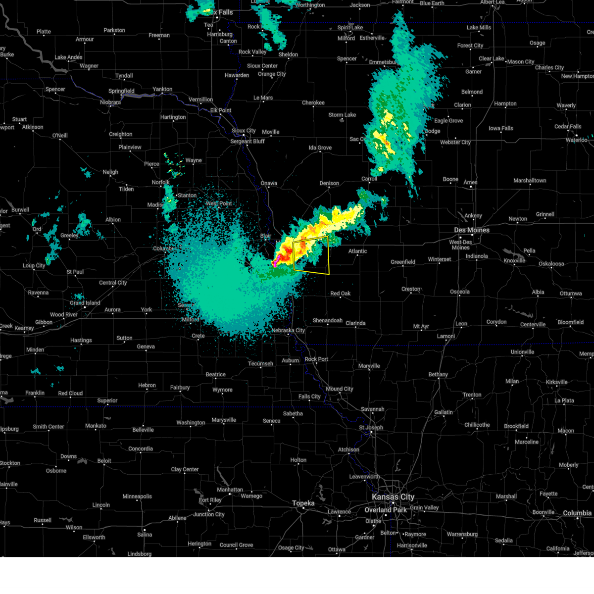 Svroax the national weather service in omaha has issued a * severe thunderstorm warning for, central pottawattamie county in southwestern iowa, southeastern harrison county in southwestern iowa, southwestern shelby county in southwestern iowa, * until 1145 pm cdt. * at 1101 pm cdt, a severe thunderstorm was located 5 miles southwest of underwood, or 8 miles northeast of council bluffs, moving east at 45 mph (public. at 1052 pm, half dollar sized hail was reported near blair high road and interstate 680 in omaha). Hazards include ping pong ball size hail. People and animals outdoors will be injured. expect damage to roofs, siding, windows, and vehicles. this severe thunderstorm will be near, underwood around 1105 pm cdt. oakland around 1120 pm cdt. hancock around 1125 pm cdt. other locations impacted by this severe thunderstorm include weston, mcclelland, and arrowhead park. This includes interstate 80 in iowa between mile markers 8 and 37. Svroax the national weather service in omaha has issued a * severe thunderstorm warning for, central pottawattamie county in southwestern iowa, southeastern harrison county in southwestern iowa, southwestern shelby county in southwestern iowa, * until 1145 pm cdt. * at 1101 pm cdt, a severe thunderstorm was located 5 miles southwest of underwood, or 8 miles northeast of council bluffs, moving east at 45 mph (public. at 1052 pm, half dollar sized hail was reported near blair high road and interstate 680 in omaha). Hazards include ping pong ball size hail. People and animals outdoors will be injured. expect damage to roofs, siding, windows, and vehicles. this severe thunderstorm will be near, underwood around 1105 pm cdt. oakland around 1120 pm cdt. hancock around 1125 pm cdt. other locations impacted by this severe thunderstorm include weston, mcclelland, and arrowhead park. This includes interstate 80 in iowa between mile markers 8 and 37.
|
| 4/17/2025 8:18 PM CDT |
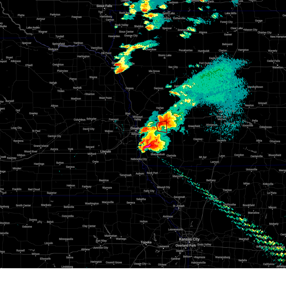 At 818 pm cdt, a severe thunderstorm capable of producing a tornado was located 3 miles east of oakland, or 17 miles west of atlantic, moving east at 25 mph (radar indicated rotation). Hazards include tornado and baseball size hail. Flying debris will be dangerous to those caught without shelter. mobile homes will be damaged or destroyed. damage to roofs, windows, and vehicles will occur. tree damage is likely. This tornadic thunderstorm will remain over mainly rural areas of east central pottawattamie county, including the following locations, botna bend park. At 818 pm cdt, a severe thunderstorm capable of producing a tornado was located 3 miles east of oakland, or 17 miles west of atlantic, moving east at 25 mph (radar indicated rotation). Hazards include tornado and baseball size hail. Flying debris will be dangerous to those caught without shelter. mobile homes will be damaged or destroyed. damage to roofs, windows, and vehicles will occur. tree damage is likely. This tornadic thunderstorm will remain over mainly rural areas of east central pottawattamie county, including the following locations, botna bend park.
|
| 4/17/2025 8:18 PM CDT |
 At 817 pm cdt, a severe thunderstorm was located over oakland, or 21 miles west of atlantic, moving east at 25 mph. this is a destructive storm for hancock, iowa (emergency management). Hazards include baseball size hail and 70 mph wind gusts. People and animals outdoors will be severely injured. expect shattered windows, extensive damage to roofs, siding, and vehicles. This severe thunderstorm will remain over mainly rural areas of northeastern pottawattamie county, including the following locations, botna bend park. At 817 pm cdt, a severe thunderstorm was located over oakland, or 21 miles west of atlantic, moving east at 25 mph. this is a destructive storm for hancock, iowa (emergency management). Hazards include baseball size hail and 70 mph wind gusts. People and animals outdoors will be severely injured. expect shattered windows, extensive damage to roofs, siding, and vehicles. This severe thunderstorm will remain over mainly rural areas of northeastern pottawattamie county, including the following locations, botna bend park.
|
| 4/17/2025 8:09 PM CDT |
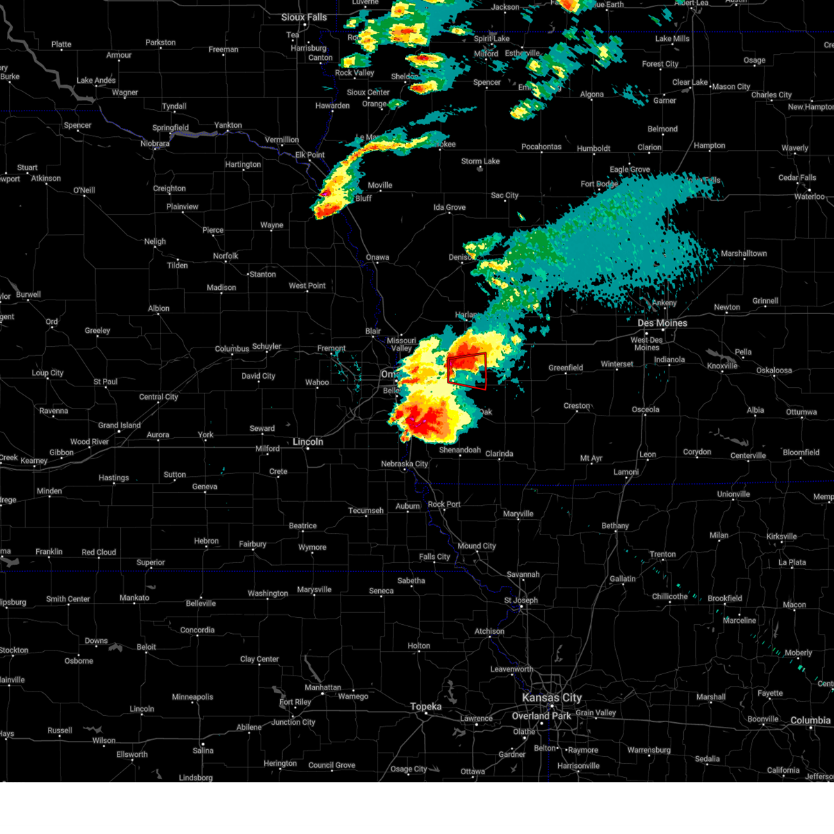 At 809 pm cdt, a severe thunderstorm capable of producing a tornado was located over oakland, or 21 miles west of atlantic, moving east at 25 mph (radar indicated rotation). Hazards include tornado and baseball size hail. Flying debris will be dangerous to those caught without shelter. mobile homes will be damaged or destroyed. damage to roofs, windows, and vehicles will occur. tree damage is likely. This dangerous storm will be near, oakland around 815 pm cdt. At 809 pm cdt, a severe thunderstorm capable of producing a tornado was located over oakland, or 21 miles west of atlantic, moving east at 25 mph (radar indicated rotation). Hazards include tornado and baseball size hail. Flying debris will be dangerous to those caught without shelter. mobile homes will be damaged or destroyed. damage to roofs, windows, and vehicles will occur. tree damage is likely. This dangerous storm will be near, oakland around 815 pm cdt.
|
| 4/17/2025 8:09 PM CDT |
 At 808 pm cdt, a severe thunderstorm was located 3 miles west of oakland, or 20 miles east of council bluffs, moving east at 25 mph. this is a destructive storm for oakland and hancock, iowa (emergency management). Hazards include baseball size hail and 70 mph wind gusts. People and animals outdoors will be severely injured. expect shattered windows, extensive damage to roofs, siding, and vehicles. This severe storm will be near, oakland around 815 pm cdt. At 808 pm cdt, a severe thunderstorm was located 3 miles west of oakland, or 20 miles east of council bluffs, moving east at 25 mph. this is a destructive storm for oakland and hancock, iowa (emergency management). Hazards include baseball size hail and 70 mph wind gusts. People and animals outdoors will be severely injured. expect shattered windows, extensive damage to roofs, siding, and vehicles. This severe storm will be near, oakland around 815 pm cdt.
|
| 4/17/2025 8:08 PM CDT | Golf Ball sized hail reported 0.3 miles E of Hancock, IA |
| 4/17/2025 8:03 PM CDT |
 At 803 pm cdt, a severe thunderstorm capable of producing a tornado was located 3 miles west of oakland, or 20 miles east of council bluffs, moving east at 25 mph (radar indicated rotation). Hazards include tornado and baseball size hail. Flying debris will be dangerous to those caught without shelter. mobile homes will be damaged or destroyed. damage to roofs, windows, and vehicles will occur. tree damage is likely. This dangerous storm will be near, oakland around 810 pm cdt. At 803 pm cdt, a severe thunderstorm capable of producing a tornado was located 3 miles west of oakland, or 20 miles east of council bluffs, moving east at 25 mph (radar indicated rotation). Hazards include tornado and baseball size hail. Flying debris will be dangerous to those caught without shelter. mobile homes will be damaged or destroyed. damage to roofs, windows, and vehicles will occur. tree damage is likely. This dangerous storm will be near, oakland around 810 pm cdt.
|
| 4/17/2025 8:01 PM CDT |
 At 800 pm cdt, a severe thunderstorm was located 6 miles northeast of treynor, or 17 miles east of council bluffs, moving east at 25 mph. this is a destructive storm for hancock, oakland, and walnut, iowa (emergency management). Hazards include baseball size hail and 70 mph wind gusts. People and animals outdoors will be severely injured. expect shattered windows, extensive damage to roofs, siding, and vehicles. this severe storm will be near, oakland around 805 pm cdt. Other locations in the path of this severe thunderstorm include carson. At 800 pm cdt, a severe thunderstorm was located 6 miles northeast of treynor, or 17 miles east of council bluffs, moving east at 25 mph. this is a destructive storm for hancock, oakland, and walnut, iowa (emergency management). Hazards include baseball size hail and 70 mph wind gusts. People and animals outdoors will be severely injured. expect shattered windows, extensive damage to roofs, siding, and vehicles. this severe storm will be near, oakland around 805 pm cdt. Other locations in the path of this severe thunderstorm include carson.
|
| 4/17/2025 7:56 PM CDT |
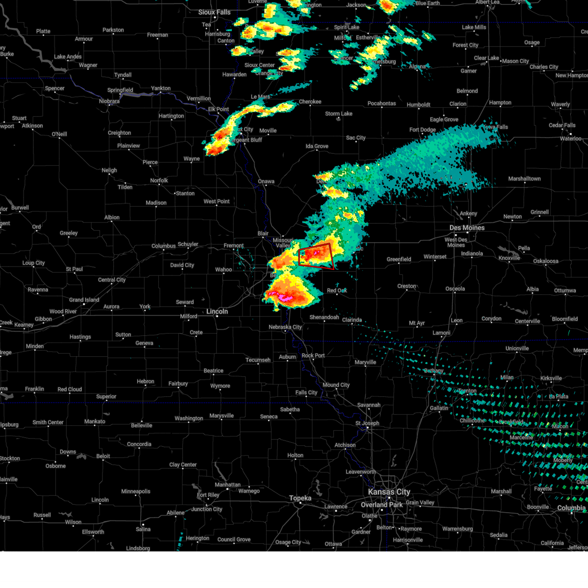 The tornado warning that was previously in effect has been reissued for pottawattamie county and is in effect until 8:45 pm. please refer to that bulletin for the latest severe weather information. a tornado watch remains in effect until midnight cdt for southwestern iowa. The tornado warning that was previously in effect has been reissued for pottawattamie county and is in effect until 8:45 pm. please refer to that bulletin for the latest severe weather information. a tornado watch remains in effect until midnight cdt for southwestern iowa.
|
| 4/17/2025 7:54 PM CDT |
 Toroax the national weather service in omaha has issued a * tornado warning for, southeastern pottawattamie county in southwestern iowa, * until 845 pm cdt. * at 754 pm cdt, a severe thunderstorm capable of producing a tornado was located 6 miles northeast of treynor, or 16 miles east of council bluffs, moving east at 25 mph (radar indicated rotation). Hazards include tornado and baseball size hail. Flying debris will be dangerous to those caught without shelter. mobile homes will be damaged or destroyed. damage to roofs, windows, and vehicles will occur. tree damage is likely. This dangerous storm will be near, oakland around 800 pm cdt. Toroax the national weather service in omaha has issued a * tornado warning for, southeastern pottawattamie county in southwestern iowa, * until 845 pm cdt. * at 754 pm cdt, a severe thunderstorm capable of producing a tornado was located 6 miles northeast of treynor, or 16 miles east of council bluffs, moving east at 25 mph (radar indicated rotation). Hazards include tornado and baseball size hail. Flying debris will be dangerous to those caught without shelter. mobile homes will be damaged or destroyed. damage to roofs, windows, and vehicles will occur. tree damage is likely. This dangerous storm will be near, oakland around 800 pm cdt.
|
| 4/17/2025 7:50 PM CDT |
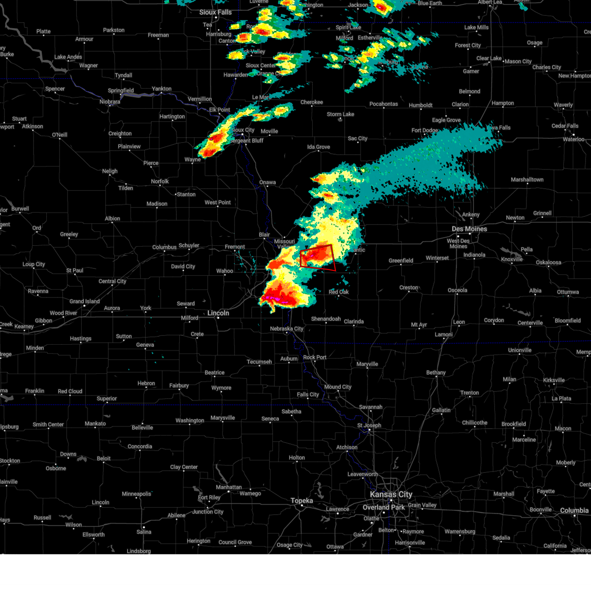 At 750 pm cdt, a severe thunderstorm capable of producing a tornado was located 6 miles southeast of underwood, or 16 miles northeast of council bluffs, moving east at 35 mph (radar indicated rotation). Hazards include tornado and baseball size hail. Flying debris will be dangerous to those caught without shelter. mobile homes will be damaged or destroyed. damage to roofs, windows, and vehicles will occur. tree damage is likely. Locations impacted include, oakland, avoca, underwood, hancock, mcclelland, botna bend park, and arrowhead park. At 750 pm cdt, a severe thunderstorm capable of producing a tornado was located 6 miles southeast of underwood, or 16 miles northeast of council bluffs, moving east at 35 mph (radar indicated rotation). Hazards include tornado and baseball size hail. Flying debris will be dangerous to those caught without shelter. mobile homes will be damaged or destroyed. damage to roofs, windows, and vehicles will occur. tree damage is likely. Locations impacted include, oakland, avoca, underwood, hancock, mcclelland, botna bend park, and arrowhead park.
|
| 4/17/2025 7:49 PM CDT |
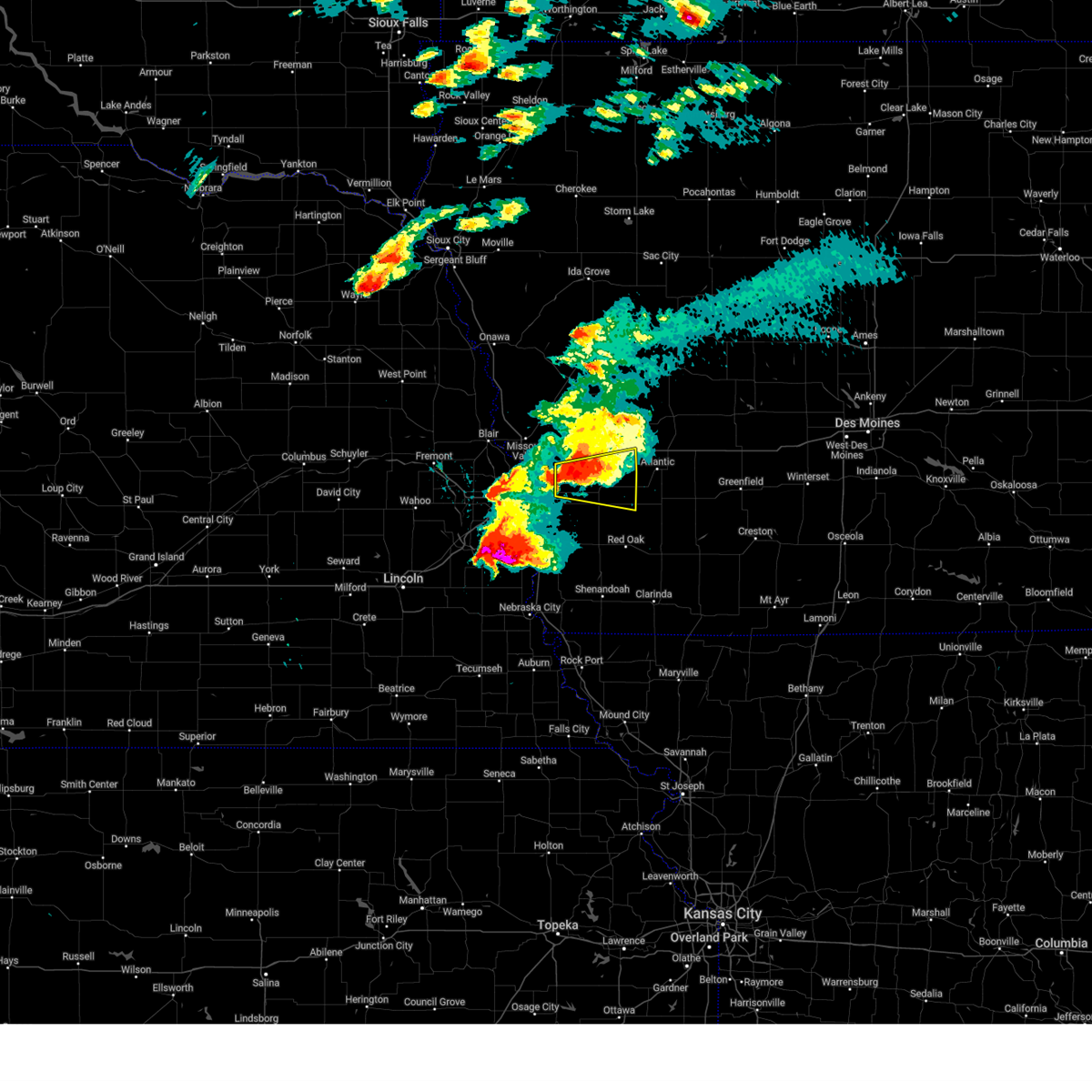 Svroax the national weather service in omaha has issued a * severe thunderstorm warning for, eastern pottawattamie county in southwestern iowa, * until 845 pm cdt. * at 748 pm cdt, a severe thunderstorm was located 5 miles southeast of underwood, or 13 miles northeast of council bluffs, moving east at 25 mph. this is a destructive storm for underwood, hancock and walnut iowa (emergency management). Hazards include baseball size hail and 70 mph wind gusts. People and animals outdoors will be severely injured. expect shattered windows, extensive damage to roofs, siding, and vehicles. this severe thunderstorm will be near, oakland around 805 pm cdt. other locations in the path of this severe thunderstorm include carson. This includes interstate 80 in iowa between mile markers 17 and 23, and between mile markers 46 and 48. Svroax the national weather service in omaha has issued a * severe thunderstorm warning for, eastern pottawattamie county in southwestern iowa, * until 845 pm cdt. * at 748 pm cdt, a severe thunderstorm was located 5 miles southeast of underwood, or 13 miles northeast of council bluffs, moving east at 25 mph. this is a destructive storm for underwood, hancock and walnut iowa (emergency management). Hazards include baseball size hail and 70 mph wind gusts. People and animals outdoors will be severely injured. expect shattered windows, extensive damage to roofs, siding, and vehicles. this severe thunderstorm will be near, oakland around 805 pm cdt. other locations in the path of this severe thunderstorm include carson. This includes interstate 80 in iowa between mile markers 17 and 23, and between mile markers 46 and 48.
|
| 4/17/2025 7:39 PM CDT |
 the tornado warning has been cancelled and is no longer in effect the tornado warning has been cancelled and is no longer in effect
|
| 4/17/2025 7:39 PM CDT |
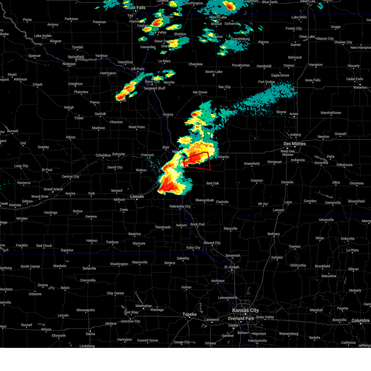 At 739 pm cdt, a severe thunderstorm capable of producing a tornado was located 3 miles south of underwood, or 10 miles northeast of council bluffs, moving east at 30 mph (radar indicated rotation). Hazards include tornado and baseball size hail. Flying debris will be dangerous to those caught without shelter. mobile homes will be damaged or destroyed. damage to roofs, windows, and vehicles will occur. tree damage is likely. Locations impacted include, oakland and hancock. At 739 pm cdt, a severe thunderstorm capable of producing a tornado was located 3 miles south of underwood, or 10 miles northeast of council bluffs, moving east at 30 mph (radar indicated rotation). Hazards include tornado and baseball size hail. Flying debris will be dangerous to those caught without shelter. mobile homes will be damaged or destroyed. damage to roofs, windows, and vehicles will occur. tree damage is likely. Locations impacted include, oakland and hancock.
|
| 4/17/2025 7:33 PM CDT |
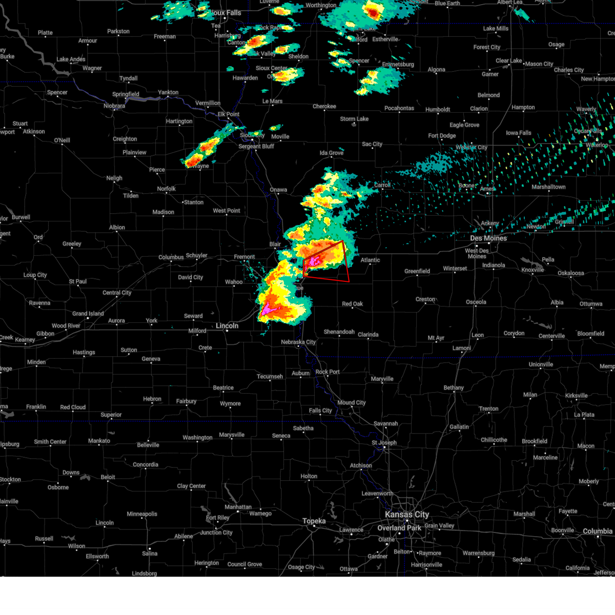 At 732 pm cdt, a severe thunderstorm capable of producing a tornado was located near underwood, or 16 miles northeast of council bluffs, moving east at 35 mph (radar indicated rotation). Hazards include tornado and baseball size hail. Flying debris will be dangerous to those caught without shelter. mobile homes will be damaged or destroyed. damage to roofs, windows, and vehicles will occur. tree damage is likely. this dangerous storm will be near, neola and minden around 740 pm cdt. Other locations in the path of this tornadic thunderstorm include shelby, avoca and hancock. At 732 pm cdt, a severe thunderstorm capable of producing a tornado was located near underwood, or 16 miles northeast of council bluffs, moving east at 35 mph (radar indicated rotation). Hazards include tornado and baseball size hail. Flying debris will be dangerous to those caught without shelter. mobile homes will be damaged or destroyed. damage to roofs, windows, and vehicles will occur. tree damage is likely. this dangerous storm will be near, neola and minden around 740 pm cdt. Other locations in the path of this tornadic thunderstorm include shelby, avoca and hancock.
|
| 4/17/2025 7:29 PM CDT |
 At 728 pm cdt, a severe thunderstorm capable of producing a tornado was located 3 miles northwest of underwood, or 14 miles northeast of council bluffs, moving east at 35 mph (radar indicated rotation). Hazards include tornado and tennis ball size hail. Flying debris will be dangerous to those caught without shelter. mobile homes will be damaged or destroyed. damage to roofs, windows, and vehicles will occur. tree damage is likely. this dangerous storm will be near, underwood and neola around 735 pm cdt. minden around 740 pm cdt. Other locations in the path of this tornadic thunderstorm include shelby. At 728 pm cdt, a severe thunderstorm capable of producing a tornado was located 3 miles northwest of underwood, or 14 miles northeast of council bluffs, moving east at 35 mph (radar indicated rotation). Hazards include tornado and tennis ball size hail. Flying debris will be dangerous to those caught without shelter. mobile homes will be damaged or destroyed. damage to roofs, windows, and vehicles will occur. tree damage is likely. this dangerous storm will be near, underwood and neola around 735 pm cdt. minden around 740 pm cdt. Other locations in the path of this tornadic thunderstorm include shelby.
|
| 4/17/2025 7:23 PM CDT |
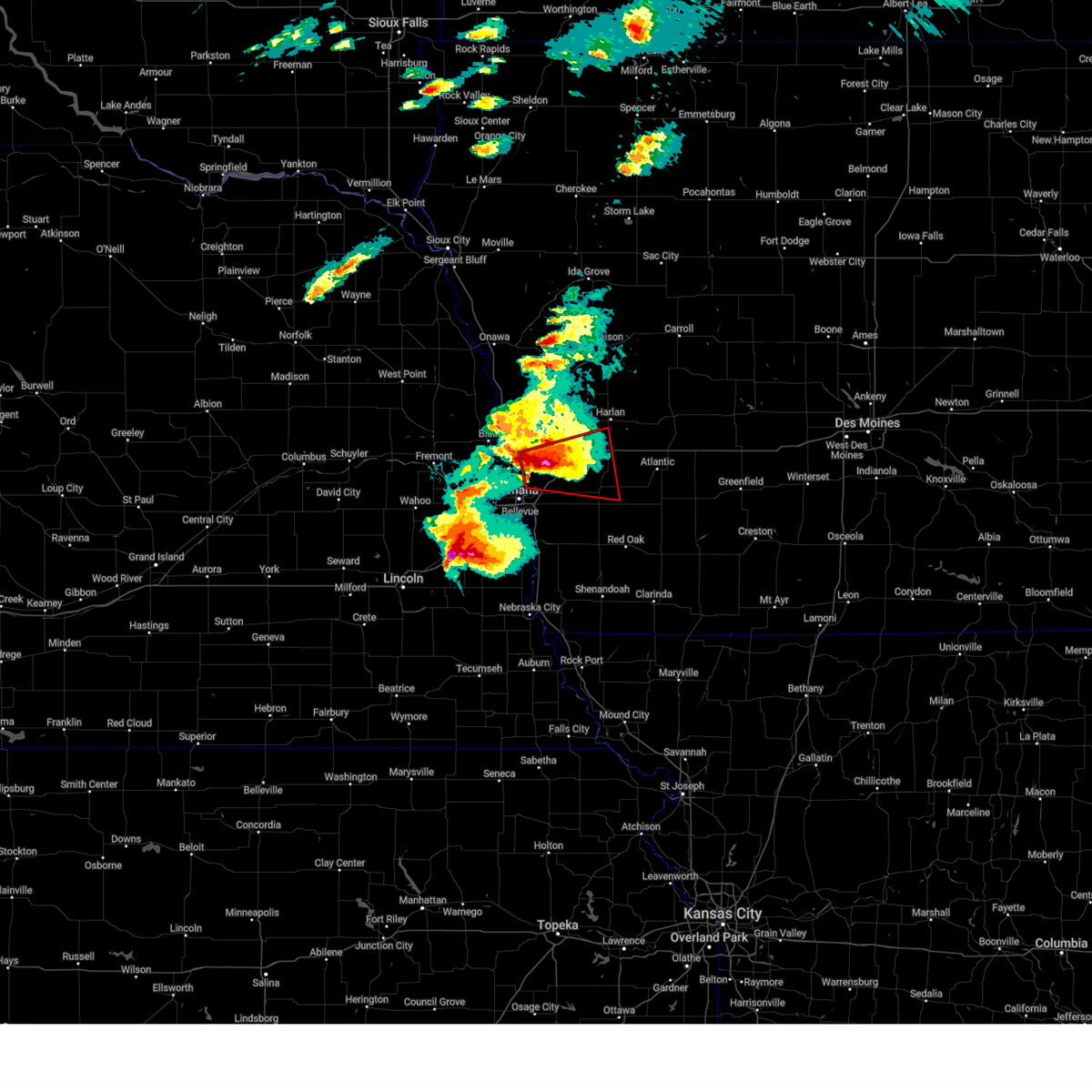 Toroax the national weather service in omaha has issued a * tornado warning for, northern pottawattamie county in southwestern iowa, southeastern harrison county in southwestern iowa, southwestern shelby county in southwestern iowa, * until 800 pm cdt. * at 723 pm cdt, a severe thunderstorm capable of producing a tornado was located 4 miles northeast of crescent, or 12 miles north of council bluffs, moving east at 35 mph (radar indicated rotation). Hazards include tornado and tennis ball size hail. Flying debris will be dangerous to those caught without shelter. mobile homes will be damaged or destroyed. damage to roofs, windows, and vehicles will occur. tree damage is likely. this dangerous storm will be near, underwood and neola around 730 pm cdt. minden around 740 pm cdt. Other locations in the path of this tornadic thunderstorm include shelby. Toroax the national weather service in omaha has issued a * tornado warning for, northern pottawattamie county in southwestern iowa, southeastern harrison county in southwestern iowa, southwestern shelby county in southwestern iowa, * until 800 pm cdt. * at 723 pm cdt, a severe thunderstorm capable of producing a tornado was located 4 miles northeast of crescent, or 12 miles north of council bluffs, moving east at 35 mph (radar indicated rotation). Hazards include tornado and tennis ball size hail. Flying debris will be dangerous to those caught without shelter. mobile homes will be damaged or destroyed. damage to roofs, windows, and vehicles will occur. tree damage is likely. this dangerous storm will be near, underwood and neola around 730 pm cdt. minden around 740 pm cdt. Other locations in the path of this tornadic thunderstorm include shelby.
|
| 4/2/2025 12:32 AM CDT |
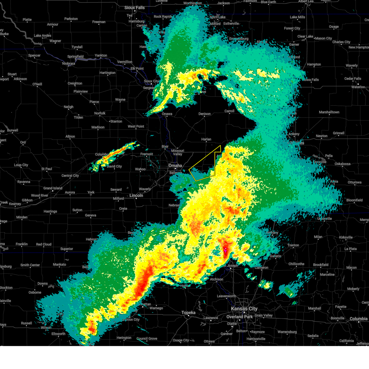 the severe thunderstorm warning has been cancelled and is no longer in effect the severe thunderstorm warning has been cancelled and is no longer in effect
|
| 4/2/2025 12:05 AM CDT |
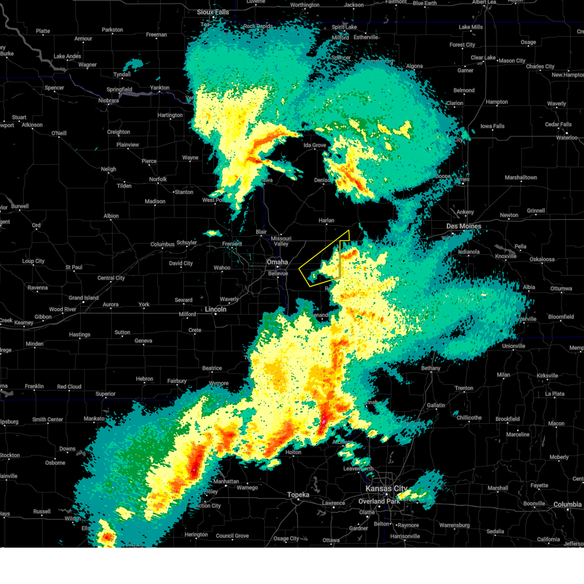 Svroax the national weather service in omaha has issued a * severe thunderstorm warning for, northwestern montgomery county in southwestern iowa, northeastern mills county in southwestern iowa, eastern pottawattamie county in southwestern iowa, southeastern shelby county in southwestern iowa, * until 1245 am cdt. * at 1203 am cdt, a severe thunderstorm was located 5 miles east of hancock, or 12 miles west of atlantic, moving northeast at 55 mph (public. several reports of 60 to 70 mph winds have been received with the decaying thunderstorms in the area). Hazards include 60 mph wind gusts. expect damage to roofs, siding, and trees Svroax the national weather service in omaha has issued a * severe thunderstorm warning for, northwestern montgomery county in southwestern iowa, northeastern mills county in southwestern iowa, eastern pottawattamie county in southwestern iowa, southeastern shelby county in southwestern iowa, * until 1245 am cdt. * at 1203 am cdt, a severe thunderstorm was located 5 miles east of hancock, or 12 miles west of atlantic, moving northeast at 55 mph (public. several reports of 60 to 70 mph winds have been received with the decaying thunderstorms in the area). Hazards include 60 mph wind gusts. expect damage to roofs, siding, and trees
|
| 3/14/2025 5:29 PM CDT |
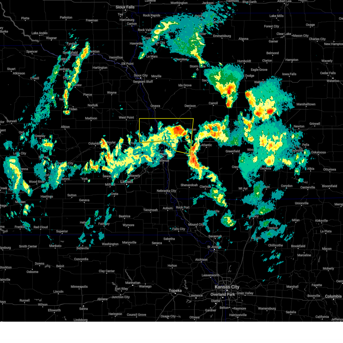 At 528 pm cdt, severe thunderstorms were located along a line extending from 4 miles southeast of uehling to 3 miles north of mondamin to harlan, moving north at 45 mph (radar indicated). Hazards include 60 mph wind gusts and quarter size hail. Hail damage to vehicles is expected. expect wind damage to roofs, siding, and trees. Locations impacted include, missouri valley, modale, hancock, oakland, willow lake recreation area, botna bend park, summit lake state recreation area, tennant, nishna bend recreation area, little sioux, pisgah, panama, neola, defiance, schaben park, historical village welcome center, earling, herman, underwood, and persia. At 528 pm cdt, severe thunderstorms were located along a line extending from 4 miles southeast of uehling to 3 miles north of mondamin to harlan, moving north at 45 mph (radar indicated). Hazards include 60 mph wind gusts and quarter size hail. Hail damage to vehicles is expected. expect wind damage to roofs, siding, and trees. Locations impacted include, missouri valley, modale, hancock, oakland, willow lake recreation area, botna bend park, summit lake state recreation area, tennant, nishna bend recreation area, little sioux, pisgah, panama, neola, defiance, schaben park, historical village welcome center, earling, herman, underwood, and persia.
|
| 3/14/2025 5:14 PM CDT |
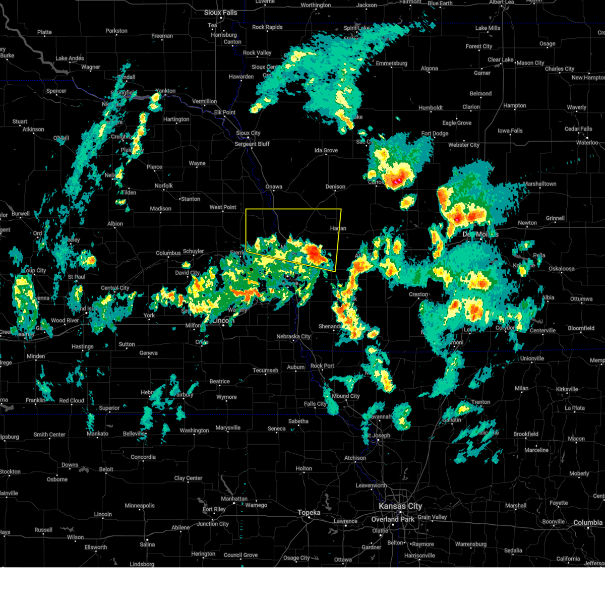 Svroax the national weather service in omaha has issued a * severe thunderstorm warning for, northern pottawattamie county in southwestern iowa, harrison county in southwestern iowa, western shelby county in southwestern iowa, southeastern burt county in east central nebraska, washington county in east central nebraska, * until 600 pm cdt. * at 513 pm cdt, severe thunderstorms were located along a line extending from 4 miles northeast of nickerson to near modale to 2 miles south of avoca, moving north at 35 mph (radar indicated). Hazards include 60 mph wind gusts and quarter size hail. Hail damage to vehicles is expected. Expect wind damage to roofs, siding, and trees. Svroax the national weather service in omaha has issued a * severe thunderstorm warning for, northern pottawattamie county in southwestern iowa, harrison county in southwestern iowa, western shelby county in southwestern iowa, southeastern burt county in east central nebraska, washington county in east central nebraska, * until 600 pm cdt. * at 513 pm cdt, severe thunderstorms were located along a line extending from 4 miles northeast of nickerson to near modale to 2 miles south of avoca, moving north at 35 mph (radar indicated). Hazards include 60 mph wind gusts and quarter size hail. Hail damage to vehicles is expected. Expect wind damage to roofs, siding, and trees.
|
| 3/14/2025 4:59 PM CDT |
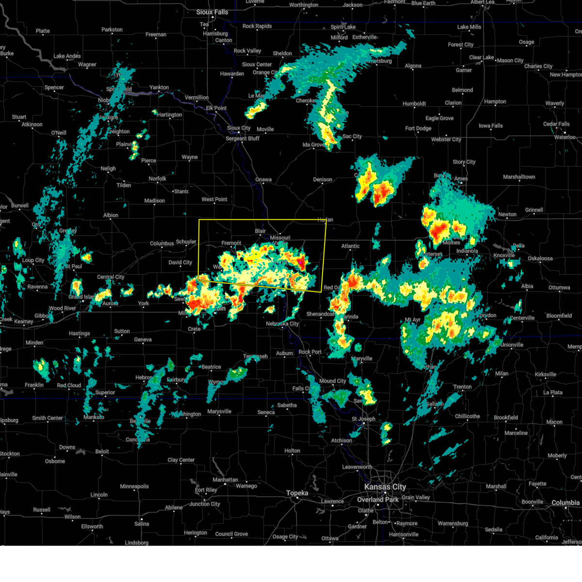 At 458 pm cdt, severe thunderstorms were located along a line extending from 2 miles southwest of north bend to 2 miles west of fort calhoun to near oakland, moving north at 55 mph (weather instrument measurement. at 4:48 pm, a 62 mph wind gust was reported at omaha eppley field). Hazards include 60 mph wind gusts and nickel size hail. Expect damage to roofs, siding, and trees. Locations impacted include, two rivers state recreation area, millard, council bluffs airport, florence, tennant, ralston, inglewood, nishna bend recreation area, winslow, czechland lake, arlington, historical village welcome center, narrows river park, underwood, benson, standing bear lake, glenwood, magnolia, emerson, and woodcliff. At 458 pm cdt, severe thunderstorms were located along a line extending from 2 miles southwest of north bend to 2 miles west of fort calhoun to near oakland, moving north at 55 mph (weather instrument measurement. at 4:48 pm, a 62 mph wind gust was reported at omaha eppley field). Hazards include 60 mph wind gusts and nickel size hail. Expect damage to roofs, siding, and trees. Locations impacted include, two rivers state recreation area, millard, council bluffs airport, florence, tennant, ralston, inglewood, nishna bend recreation area, winslow, czechland lake, arlington, historical village welcome center, narrows river park, underwood, benson, standing bear lake, glenwood, magnolia, emerson, and woodcliff.
|
| 3/14/2025 4:48 PM CDT |
 At 448 pm cdt, severe thunderstorms were located along a line extending from 3 miles southwest of prague to 2 miles north of standing bear lake to 3 miles east of oakland, moving north at 55 mph (radar indicated). Hazards include 60 mph wind gusts and nickel size hail. Expect damage to roofs, siding, and trees. Locations impacted include, two rivers state recreation area, millard, council bluffs airport, florence, tennant, ralston, inglewood, nishna bend recreation area, winslow, czechland lake, arlington, historical village welcome center, narrows river park, underwood, benson, standing bear lake, glenwood, magnolia, emerson, and woodcliff. At 448 pm cdt, severe thunderstorms were located along a line extending from 3 miles southwest of prague to 2 miles north of standing bear lake to 3 miles east of oakland, moving north at 55 mph (radar indicated). Hazards include 60 mph wind gusts and nickel size hail. Expect damage to roofs, siding, and trees. Locations impacted include, two rivers state recreation area, millard, council bluffs airport, florence, tennant, ralston, inglewood, nishna bend recreation area, winslow, czechland lake, arlington, historical village welcome center, narrows river park, underwood, benson, standing bear lake, glenwood, magnolia, emerson, and woodcliff.
|
| 3/14/2025 4:38 PM CDT |
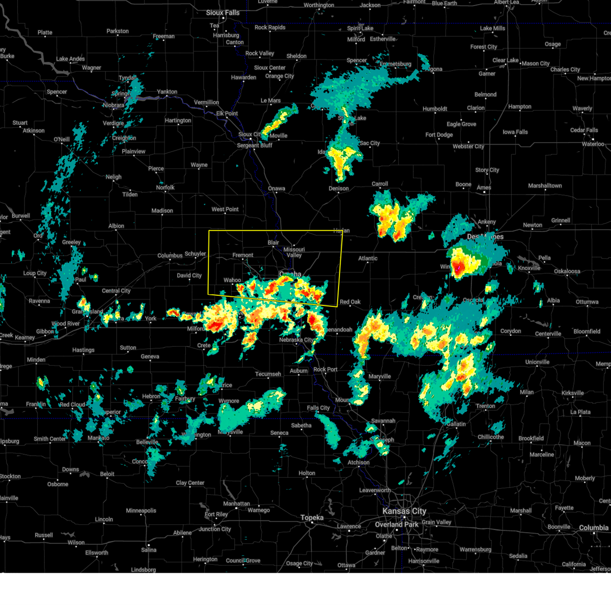 At 438 pm cdt, severe thunderstorms were located along a line extending from malmo to 2 miles southeast of carson, moving north at 50 mph (radar indicated). Hazards include 60 mph wind gusts and nickel size hail. Expect damage to roofs, siding, and trees. Locations impacted include, two rivers state recreation area, millard, council bluffs airport, florence, tennant, ralston, inglewood, nishna bend recreation area, winslow, czechland lake, arlington, historical village welcome center, narrows river park, underwood, benson, standing bear lake, glenwood, magnolia, emerson, and woodcliff. At 438 pm cdt, severe thunderstorms were located along a line extending from malmo to 2 miles southeast of carson, moving north at 50 mph (radar indicated). Hazards include 60 mph wind gusts and nickel size hail. Expect damage to roofs, siding, and trees. Locations impacted include, two rivers state recreation area, millard, council bluffs airport, florence, tennant, ralston, inglewood, nishna bend recreation area, winslow, czechland lake, arlington, historical village welcome center, narrows river park, underwood, benson, standing bear lake, glenwood, magnolia, emerson, and woodcliff.
|
| 3/14/2025 4:24 PM CDT |
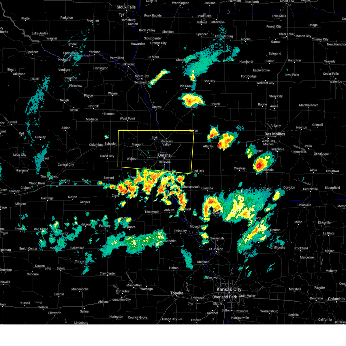 Svroax the national weather service in omaha has issued a * severe thunderstorm warning for, west central montgomery county in southwestern iowa, northern mills county in southwestern iowa, pottawattamie county in southwestern iowa, southern harrison county in southwestern iowa, southwestern shelby county in southwestern iowa, sarpy county in east central nebraska, south central burt county in east central nebraska, washington county in east central nebraska, dodge county in east central nebraska, douglas county in east central nebraska, saunders county in east central nebraska, * until 515 pm cdt. * at 424 pm cdt, severe thunderstorms were located along a line extending from 5 miles south of weston to 2 miles northeast of emerson, moving north at 55 mph (radar indicated). Hazards include 60 mph wind gusts and nickel size hail. expect damage to roofs, siding, and trees Svroax the national weather service in omaha has issued a * severe thunderstorm warning for, west central montgomery county in southwestern iowa, northern mills county in southwestern iowa, pottawattamie county in southwestern iowa, southern harrison county in southwestern iowa, southwestern shelby county in southwestern iowa, sarpy county in east central nebraska, south central burt county in east central nebraska, washington county in east central nebraska, dodge county in east central nebraska, douglas county in east central nebraska, saunders county in east central nebraska, * until 515 pm cdt. * at 424 pm cdt, severe thunderstorms were located along a line extending from 5 miles south of weston to 2 miles northeast of emerson, moving north at 55 mph (radar indicated). Hazards include 60 mph wind gusts and nickel size hail. expect damage to roofs, siding, and trees
|
| 7/31/2024 7:09 PM CDT |
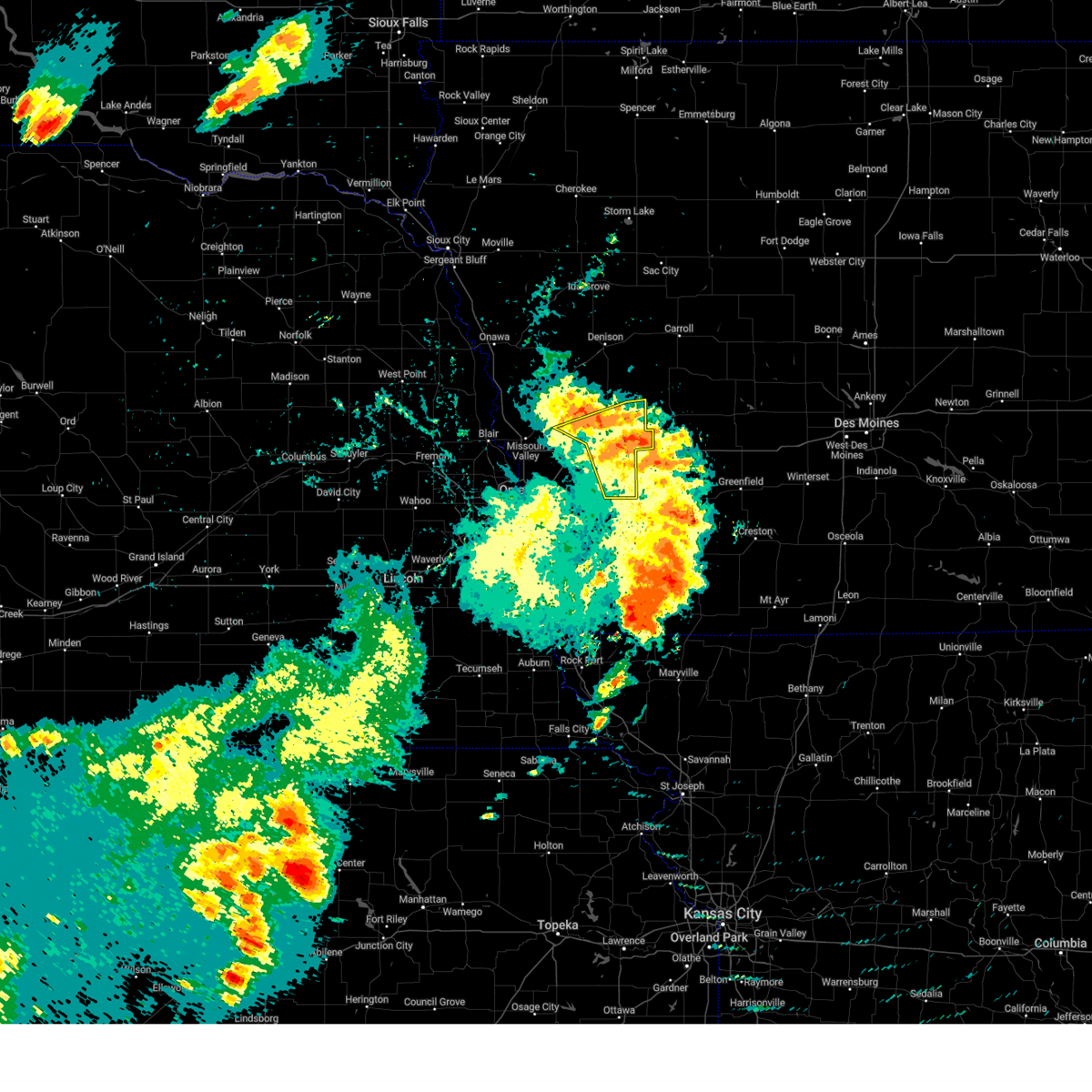 At 708 pm cdt, severe thunderstorms were located along a line extending from 4 miles west of audubon to 19 miles northeast of walnut to 9 miles northeast of atlantic, moving east at 50 mph (radar indicated. these storms have a history of producing widespread wind damage). Hazards include 60 mph wind gusts. Expect damage to roofs, siding, and trees. Locations impacted include, harlan, oakland, avoca, walnut, shelby, persia, hancock, portsmouth, tennant, kirkman, prairie rose state park, botna bend park, nishna bend recreation area, elk horn creek recreation area, and jacksonville. At 708 pm cdt, severe thunderstorms were located along a line extending from 4 miles west of audubon to 19 miles northeast of walnut to 9 miles northeast of atlantic, moving east at 50 mph (radar indicated. these storms have a history of producing widespread wind damage). Hazards include 60 mph wind gusts. Expect damage to roofs, siding, and trees. Locations impacted include, harlan, oakland, avoca, walnut, shelby, persia, hancock, portsmouth, tennant, kirkman, prairie rose state park, botna bend park, nishna bend recreation area, elk horn creek recreation area, and jacksonville.
|
| 7/31/2024 6:14 PM CDT |
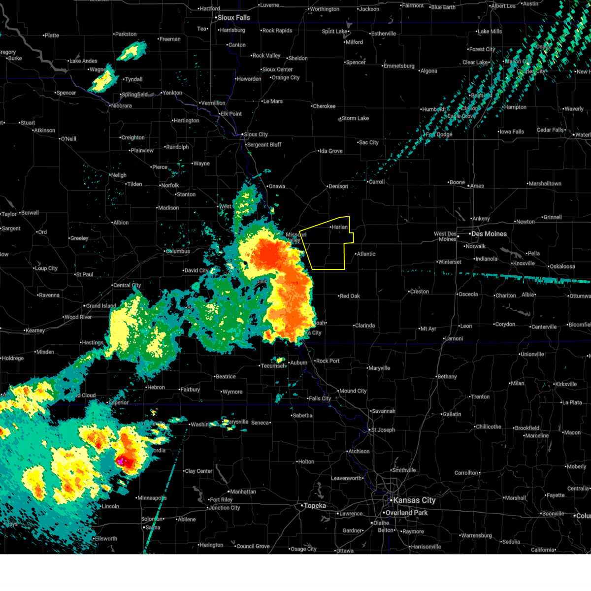 Svroax the national weather service in omaha has issued a * severe thunderstorm warning for, northeastern pottawattamie county in southwestern iowa, southeastern harrison county in southwestern iowa, southern shelby county in southwestern iowa, * until 715 pm cdt. * at 612 pm cdt, severe thunderstorms were located along a line extending from 6 miles southeast of missouri valley to near underwood to near treynor, moving east at 50 mph. these are destructive storms for persia, harlan, hancock, neola, minden, avoca, oakland, and other nearby areas (weather instrument measurement. at 605 pm a 90 mph wind gust was observed at the omaha airport. widespread damage to trees, powerlines, structures, and cars has also been reported). Hazards include 90 mph wind gusts. You are in a life-threatening situation. flying debris may be deadly to those caught without shelter. mobile homes will be heavily damaged or destroyed. homes and businesses will have substantial roof and window damage. Expect extensive tree damage and power outages. Svroax the national weather service in omaha has issued a * severe thunderstorm warning for, northeastern pottawattamie county in southwestern iowa, southeastern harrison county in southwestern iowa, southern shelby county in southwestern iowa, * until 715 pm cdt. * at 612 pm cdt, severe thunderstorms were located along a line extending from 6 miles southeast of missouri valley to near underwood to near treynor, moving east at 50 mph. these are destructive storms for persia, harlan, hancock, neola, minden, avoca, oakland, and other nearby areas (weather instrument measurement. at 605 pm a 90 mph wind gust was observed at the omaha airport. widespread damage to trees, powerlines, structures, and cars has also been reported). Hazards include 90 mph wind gusts. You are in a life-threatening situation. flying debris may be deadly to those caught without shelter. mobile homes will be heavily damaged or destroyed. homes and businesses will have substantial roof and window damage. Expect extensive tree damage and power outages.
|
| 6/25/2024 10:21 PM CDT |
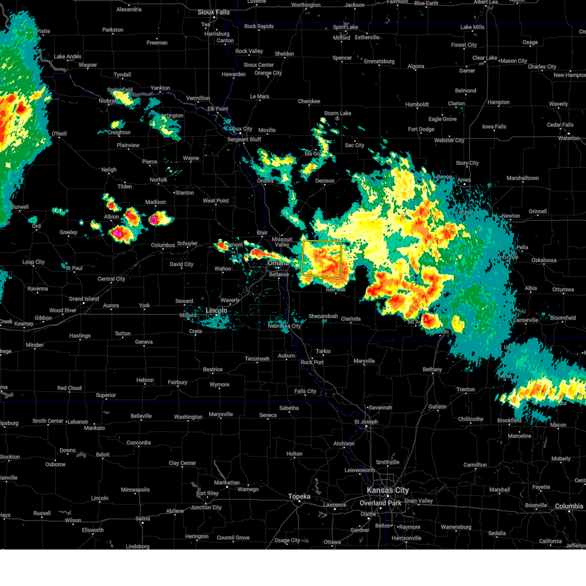 At 1021 pm cdt, a severe thunderstorm was located 5 miles south of atlantic, moving east at 50 mph (public). Hazards include 60 mph wind gusts. Expect damage to roofs, siding, and trees. Locations impacted include, oakland, avoca, treynor, neola, carson, walnut, shelby, minden, macedonia, hancock, old town park, farm creek public wildlife area, botna bend park, and arrowhead park. At 1021 pm cdt, a severe thunderstorm was located 5 miles south of atlantic, moving east at 50 mph (public). Hazards include 60 mph wind gusts. Expect damage to roofs, siding, and trees. Locations impacted include, oakland, avoca, treynor, neola, carson, walnut, shelby, minden, macedonia, hancock, old town park, farm creek public wildlife area, botna bend park, and arrowhead park.
|
| 6/25/2024 10:21 PM CDT |
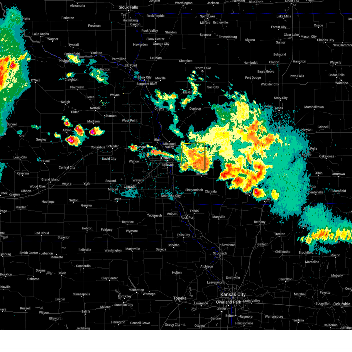 At 1020 pm cdt, a severe thunderstorm was located 4 miles southwest of atlantic, moving east at 50 mph (public). Hazards include 60 mph wind gusts. Expect damage to roofs, siding, and trees. Locations impacted include, oakland, avoca, treynor, neola, carson, walnut, shelby, minden, elliott, macedonia, hancock, old town park, farm creek public wildlife area, botna bend park, and arrowhead park. At 1020 pm cdt, a severe thunderstorm was located 4 miles southwest of atlantic, moving east at 50 mph (public). Hazards include 60 mph wind gusts. Expect damage to roofs, siding, and trees. Locations impacted include, oakland, avoca, treynor, neola, carson, walnut, shelby, minden, elliott, macedonia, hancock, old town park, farm creek public wildlife area, botna bend park, and arrowhead park.
|
| 6/25/2024 10:09 PM CDT |
 At 1008 pm cdt, a severe thunderstorm was located 6 miles southeast of hancock, or 13 miles west of atlantic, moving east at 50 mph (public). Hazards include 70 mph wind gusts. Expect considerable tree damage. damage is likely to mobile homes, roofs, and outbuildings. Locations impacted include, council bluffs, oakland, avoca, treynor, underwood, neola, carson, walnut, shelby, crescent, minden, macedonia, hancock, council bluffs airport, mcclelland, old town park, farm creek public wildlife area, botna bend park, weston, and arrowhead park. At 1008 pm cdt, a severe thunderstorm was located 6 miles southeast of hancock, or 13 miles west of atlantic, moving east at 50 mph (public). Hazards include 70 mph wind gusts. Expect considerable tree damage. damage is likely to mobile homes, roofs, and outbuildings. Locations impacted include, council bluffs, oakland, avoca, treynor, underwood, neola, carson, walnut, shelby, crescent, minden, macedonia, hancock, council bluffs airport, mcclelland, old town park, farm creek public wildlife area, botna bend park, weston, and arrowhead park.
|
| 6/25/2024 10:08 PM CDT |
 At 1007 pm cdt, a severe thunderstorm was located 4 miles southeast of hancock, or 15 miles west of atlantic, moving east at 50 mph (public). Hazards include 70 mph wind gusts. Expect considerable tree damage. damage is likely to mobile homes, roofs, and outbuildings. Locations impacted include, council bluffs, oakland, avoca, treynor, underwood, neola, carson, walnut, shelby, crescent, minden, elliott, macedonia, hancock, council bluffs airport, mcclelland, old town park, lake manawa state park, farm creek public wildlife area, and botna bend park. At 1007 pm cdt, a severe thunderstorm was located 4 miles southeast of hancock, or 15 miles west of atlantic, moving east at 50 mph (public). Hazards include 70 mph wind gusts. Expect considerable tree damage. damage is likely to mobile homes, roofs, and outbuildings. Locations impacted include, council bluffs, oakland, avoca, treynor, underwood, neola, carson, walnut, shelby, crescent, minden, elliott, macedonia, hancock, council bluffs airport, mcclelland, old town park, lake manawa state park, farm creek public wildlife area, and botna bend park.
|
| 6/25/2024 9:52 PM CDT |
 At 950 pm cdt, a severe thunderstorm was located 5 miles southeast of underwood, or 16 miles northeast of council bluffs, moving east at 50 mph. this is a destructive storm for pottawattamie county (weather instrument measurement). Hazards include 90 mph wind gusts and quarter size hail. You are in a life-threatening situation. flying debris may be deadly to those caught without shelter. mobile homes will be heavily damaged or destroyed. homes and businesses will have substantial roof and window damage. expect extensive tree damage and power outages. Locations impacted include, council bluffs, oakland, avoca, treynor, underwood, neola, carson, walnut, shelby, crescent, minden, elliott, macedonia, hancock, council bluffs airport, mcclelland, old town park, lake manawa state park, farm creek public wildlife area, and botna bend park. At 950 pm cdt, a severe thunderstorm was located 5 miles southeast of underwood, or 16 miles northeast of council bluffs, moving east at 50 mph. this is a destructive storm for pottawattamie county (weather instrument measurement). Hazards include 90 mph wind gusts and quarter size hail. You are in a life-threatening situation. flying debris may be deadly to those caught without shelter. mobile homes will be heavily damaged or destroyed. homes and businesses will have substantial roof and window damage. expect extensive tree damage and power outages. Locations impacted include, council bluffs, oakland, avoca, treynor, underwood, neola, carson, walnut, shelby, crescent, minden, elliott, macedonia, hancock, council bluffs airport, mcclelland, old town park, lake manawa state park, farm creek public wildlife area, and botna bend park.
|
| 6/25/2024 9:45 PM CDT |
 Svroax the national weather service in omaha has issued a * severe thunderstorm warning for, northern montgomery county in southwestern iowa, northeastern mills county in southwestern iowa, pottawattamie county in southwestern iowa, southeastern harrison county in southwestern iowa, southeastern shelby county in southwestern iowa, * until 1030 pm cdt. * at 944 pm cdt, a severe thunderstorm was located near underwood, or 11 miles northeast of council bluffs, moving east at 50 mph. this is a destructive storm for council bluffs and surrounding areas (weather instrument measurement. at 938 pm, a 90 mph wind gusts was reported at omaha eppley field). Hazards include 90 mph wind gusts and quarter size hail. You are in a life-threatening situation. flying debris may be deadly to those caught without shelter. mobile homes will be heavily damaged or destroyed. homes and businesses will have substantial roof and window damage. Expect extensive tree damage and power outages. Svroax the national weather service in omaha has issued a * severe thunderstorm warning for, northern montgomery county in southwestern iowa, northeastern mills county in southwestern iowa, pottawattamie county in southwestern iowa, southeastern harrison county in southwestern iowa, southeastern shelby county in southwestern iowa, * until 1030 pm cdt. * at 944 pm cdt, a severe thunderstorm was located near underwood, or 11 miles northeast of council bluffs, moving east at 50 mph. this is a destructive storm for council bluffs and surrounding areas (weather instrument measurement. at 938 pm, a 90 mph wind gusts was reported at omaha eppley field). Hazards include 90 mph wind gusts and quarter size hail. You are in a life-threatening situation. flying debris may be deadly to those caught without shelter. mobile homes will be heavily damaged or destroyed. homes and businesses will have substantial roof and window damage. Expect extensive tree damage and power outages.
|
| 6/25/2024 9:39 PM CDT |
 Svroax the national weather service in omaha has issued a * severe thunderstorm warning for, pottawattamie county in southwestern iowa, * until 1030 pm cdt. * at 938 pm cdt, a severe thunderstorm was located 4 miles east of crescent, or 8 miles northeast of council bluffs, moving east at 50 mph (radar indicated). Hazards include 60 mph wind gusts and quarter size hail. Hail damage to vehicles is expected. Expect wind damage to roofs, siding, and trees. Svroax the national weather service in omaha has issued a * severe thunderstorm warning for, pottawattamie county in southwestern iowa, * until 1030 pm cdt. * at 938 pm cdt, a severe thunderstorm was located 4 miles east of crescent, or 8 miles northeast of council bluffs, moving east at 50 mph (radar indicated). Hazards include 60 mph wind gusts and quarter size hail. Hail damage to vehicles is expected. Expect wind damage to roofs, siding, and trees.
|
| 6/25/2024 8:34 PM CDT |
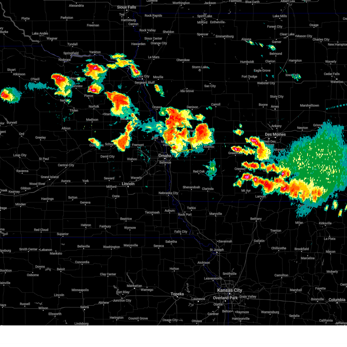 At 833 pm cdt, a cluster of severe thunderstorms was located 3 miles northwest of harlan, moving east at 25 mph (radar indicated). Hazards include 60 mph wind gusts and quarter size hail. Hail damage to vehicles is expected. expect wind damage to roofs, siding, and trees. Locations impacted include, missouri valley, logan, woodbine, underwood, neola, shelby, minden, persia, hancock, magnolia, portsmouth, tennant, arrowhead park, historical village welcome center, and botna bend park. At 833 pm cdt, a cluster of severe thunderstorms was located 3 miles northwest of harlan, moving east at 25 mph (radar indicated). Hazards include 60 mph wind gusts and quarter size hail. Hail damage to vehicles is expected. expect wind damage to roofs, siding, and trees. Locations impacted include, missouri valley, logan, woodbine, underwood, neola, shelby, minden, persia, hancock, magnolia, portsmouth, tennant, arrowhead park, historical village welcome center, and botna bend park.
|
| 6/25/2024 8:11 PM CDT |
 Svroax the national weather service in omaha has issued a * severe thunderstorm warning for, northwestern pottawattamie county in southwestern iowa, southern harrison county in southwestern iowa, southwestern shelby county in southwestern iowa, * until 915 pm cdt. * at 810 pm cdt, a cluster of severe thunderstorms was located near persia, or 12 miles west of harlan, moving east at 25 mph (radar indicated). Hazards include ping pong ball size hail and 60 mph wind gusts. People and animals outdoors will be injured. expect hail damage to roofs, siding, windows, and vehicles. Expect wind damage to roofs, siding, and trees. Svroax the national weather service in omaha has issued a * severe thunderstorm warning for, northwestern pottawattamie county in southwestern iowa, southern harrison county in southwestern iowa, southwestern shelby county in southwestern iowa, * until 915 pm cdt. * at 810 pm cdt, a cluster of severe thunderstorms was located near persia, or 12 miles west of harlan, moving east at 25 mph (radar indicated). Hazards include ping pong ball size hail and 60 mph wind gusts. People and animals outdoors will be injured. expect hail damage to roofs, siding, windows, and vehicles. Expect wind damage to roofs, siding, and trees.
|
| 6/25/2024 7:37 PM CDT |
 Svroax the national weather service in omaha has issued a * severe thunderstorm warning for, northeastern pottawattamie county in southwestern iowa, southern shelby county in southwestern iowa, * until 830 pm cdt. * at 736 pm cdt, a severe thunderstorm was located near shelby, or 10 miles south of harlan, moving northeast at 30 mph (trained weather spotters. this storm has a history of producing 2 inch diameter hail just north of neola). Hazards include two inch hail and 60 mph wind gusts. People and animals outdoors will be injured. expect hail damage to roofs, siding, windows, and vehicles. Expect wind damage to roofs, siding, and trees. Svroax the national weather service in omaha has issued a * severe thunderstorm warning for, northeastern pottawattamie county in southwestern iowa, southern shelby county in southwestern iowa, * until 830 pm cdt. * at 736 pm cdt, a severe thunderstorm was located near shelby, or 10 miles south of harlan, moving northeast at 30 mph (trained weather spotters. this storm has a history of producing 2 inch diameter hail just north of neola). Hazards include two inch hail and 60 mph wind gusts. People and animals outdoors will be injured. expect hail damage to roofs, siding, windows, and vehicles. Expect wind damage to roofs, siding, and trees.
|
| 6/15/2024 8:44 PM CDT |
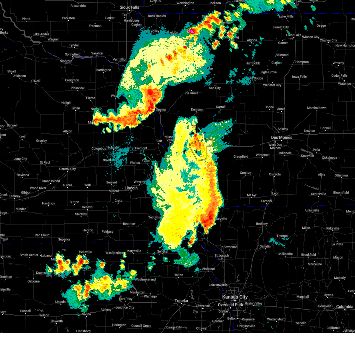 The storms which prompted the warning have weakened below severe limits, and no longer pose an immediate threat to life or property. therefore, the warning will be allowed to expire. a tornado watch remains in effect until 1000 pm cdt for southwestern iowa. a severe thunderstorm watch remains in effect until 200 am cdt for southwestern iowa. The storms which prompted the warning have weakened below severe limits, and no longer pose an immediate threat to life or property. therefore, the warning will be allowed to expire. a tornado watch remains in effect until 1000 pm cdt for southwestern iowa. a severe thunderstorm watch remains in effect until 200 am cdt for southwestern iowa.
|
| 6/15/2024 8:32 PM CDT |
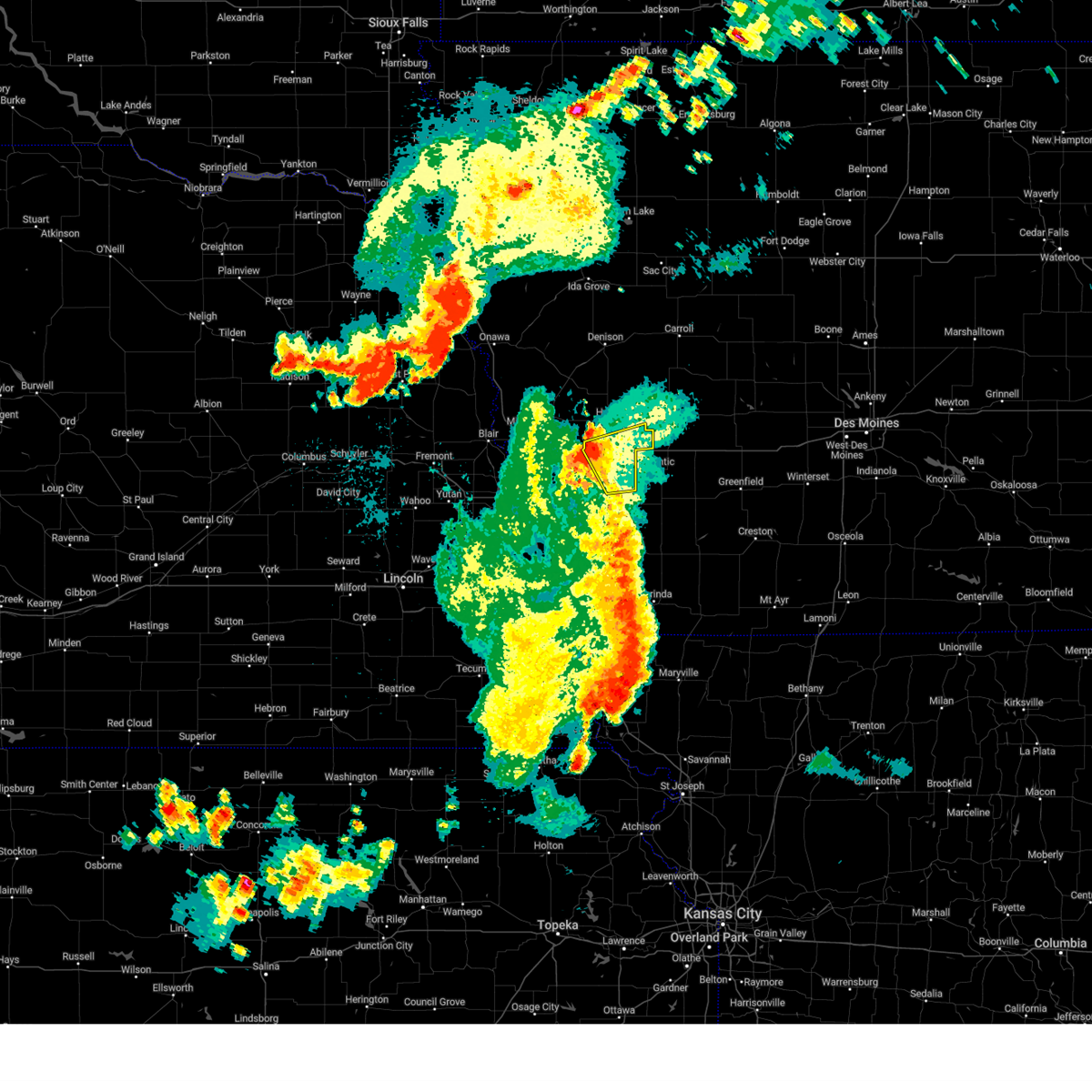 At 832 pm cdt, severe thunderstorms were located along a line extending from 9 miles east of walnut to near atlantic, moving east at 45 mph (radar indicated). Hazards include 60 mph wind gusts. Expect damage to roofs, siding, and trees. locations impacted include, avoca, walnut, shelby, hancock, botna bend park, nishna bend recreation area, elk horn creek recreation area, and prairie rose state park. People attending city of walnut should seek safe shelter immediately!. At 832 pm cdt, severe thunderstorms were located along a line extending from 9 miles east of walnut to near atlantic, moving east at 45 mph (radar indicated). Hazards include 60 mph wind gusts. Expect damage to roofs, siding, and trees. locations impacted include, avoca, walnut, shelby, hancock, botna bend park, nishna bend recreation area, elk horn creek recreation area, and prairie rose state park. People attending city of walnut should seek safe shelter immediately!.
|
| 6/15/2024 8:32 PM CDT |
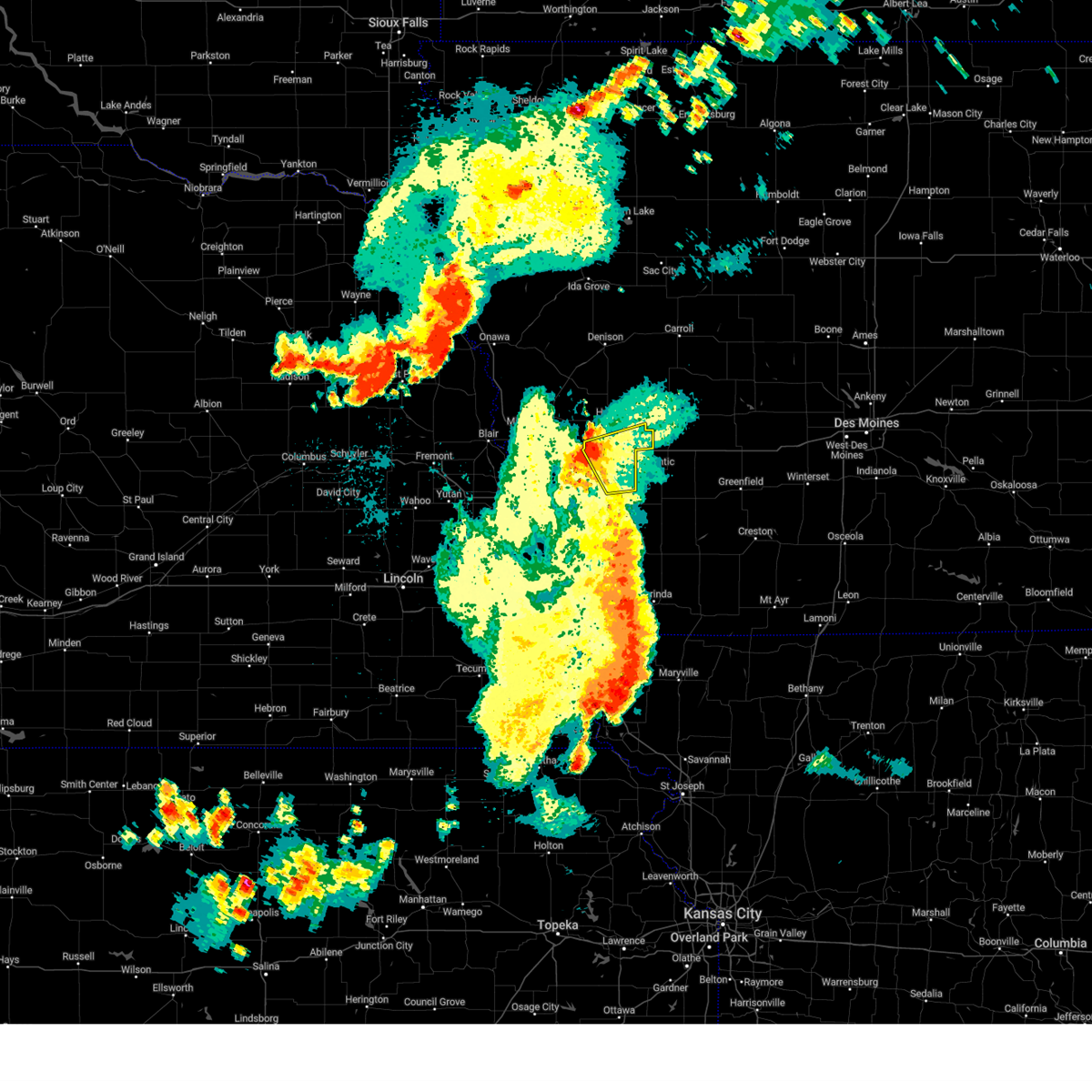 the severe thunderstorm warning has been cancelled and is no longer in effect the severe thunderstorm warning has been cancelled and is no longer in effect
|
| 6/15/2024 8:19 PM CDT |
 At 819 pm cdt, severe thunderstorms were located along a line extending from 4 miles south of walnut to 7 miles north of griswold, moving east at 45 mph (radar indicated). Hazards include 60 mph wind gusts. Expect damage to roofs, siding, and trees. locations impacted include, oakland, avoca, neola, walnut, shelby, minden, hancock, botna bend park, prairie rose state park, nishna bend recreation area, elk horn creek recreation area, and arrowhead park. People attending city of walnut should seek safe shelter immediately!. At 819 pm cdt, severe thunderstorms were located along a line extending from 4 miles south of walnut to 7 miles north of griswold, moving east at 45 mph (radar indicated). Hazards include 60 mph wind gusts. Expect damage to roofs, siding, and trees. locations impacted include, oakland, avoca, neola, walnut, shelby, minden, hancock, botna bend park, prairie rose state park, nishna bend recreation area, elk horn creek recreation area, and arrowhead park. People attending city of walnut should seek safe shelter immediately!.
|
| 6/15/2024 7:58 PM CDT |
 At 758 pm cdt, severe thunderstorms were located along a line extending from 6 miles northwest of oakland to 4 miles northwest of carson, moving east at 45 mph (radar indicated). Hazards include 60 mph wind gusts. Expect damage to roofs, siding, and trees. locations impacted include, oakland, avoca, underwood, neola, walnut, shelby, minden, hancock, mcclelland, prairie rose state park, botna bend park, nishna bend recreation area, elk horn creek recreation area, and arrowhead park. People attending city of walnut should seek safe shelter immediately!. At 758 pm cdt, severe thunderstorms were located along a line extending from 6 miles northwest of oakland to 4 miles northwest of carson, moving east at 45 mph (radar indicated). Hazards include 60 mph wind gusts. Expect damage to roofs, siding, and trees. locations impacted include, oakland, avoca, underwood, neola, walnut, shelby, minden, hancock, mcclelland, prairie rose state park, botna bend park, nishna bend recreation area, elk horn creek recreation area, and arrowhead park. People attending city of walnut should seek safe shelter immediately!.
|
| 6/15/2024 7:50 PM CDT |
 Svroax the national weather service in omaha has issued a * severe thunderstorm warning for, pottawattamie county in southwestern iowa, southeastern harrison county in southwestern iowa, southeastern shelby county in southwestern iowa, * until 845 pm cdt. * at 750 pm cdt, severe thunderstorms were located along a line extending from 5 miles southeast of underwood to 2 miles northeast of treynor, moving east at 45 mph (radar indicated). Hazards include 60 mph wind gusts. expect damage to roofs, siding, and trees Svroax the national weather service in omaha has issued a * severe thunderstorm warning for, pottawattamie county in southwestern iowa, southeastern harrison county in southwestern iowa, southeastern shelby county in southwestern iowa, * until 845 pm cdt. * at 750 pm cdt, severe thunderstorms were located along a line extending from 5 miles southeast of underwood to 2 miles northeast of treynor, moving east at 45 mph (radar indicated). Hazards include 60 mph wind gusts. expect damage to roofs, siding, and trees
|
| 6/12/2024 9:17 PM CDT |
 the severe thunderstorm warning has been cancelled and is no longer in effect the severe thunderstorm warning has been cancelled and is no longer in effect
|
| 6/12/2024 9:12 PM CDT |
 At 912 pm cdt, a severe thunderstorm was located 3 miles north of neola, or 17 miles southwest of harlan, moving southeast at 30 mph (radar indicated). Hazards include 60 mph wind gusts and quarter size hail. Hail damage to vehicles is expected. expect wind damage to roofs, siding, and trees. Locations impacted include, logan, oakland, neola, shelby, minden, persia, hancock, botna bend park, and arrowhead park. At 912 pm cdt, a severe thunderstorm was located 3 miles north of neola, or 17 miles southwest of harlan, moving southeast at 30 mph (radar indicated). Hazards include 60 mph wind gusts and quarter size hail. Hail damage to vehicles is expected. expect wind damage to roofs, siding, and trees. Locations impacted include, logan, oakland, neola, shelby, minden, persia, hancock, botna bend park, and arrowhead park.
|
| 6/12/2024 9:07 PM CDT |
 Svroax the national weather service in omaha has issued a * severe thunderstorm warning for, eastern pottawattamie county in southwestern iowa, southeastern harrison county in southwestern iowa, southwestern shelby county in southwestern iowa, * until 945 pm cdt. * at 907 pm cdt, a severe thunderstorm was located 4 miles southwest of persia, or 18 miles southwest of harlan, moving southeast at 30 mph (radar indicated). Hazards include ping pong ball size hail and 60 mph wind gusts. People and animals outdoors will be injured. expect hail damage to roofs, siding, windows, and vehicles. Expect wind damage to roofs, siding, and trees. Svroax the national weather service in omaha has issued a * severe thunderstorm warning for, eastern pottawattamie county in southwestern iowa, southeastern harrison county in southwestern iowa, southwestern shelby county in southwestern iowa, * until 945 pm cdt. * at 907 pm cdt, a severe thunderstorm was located 4 miles southwest of persia, or 18 miles southwest of harlan, moving southeast at 30 mph (radar indicated). Hazards include ping pong ball size hail and 60 mph wind gusts. People and animals outdoors will be injured. expect hail damage to roofs, siding, windows, and vehicles. Expect wind damage to roofs, siding, and trees.
|
| 5/24/2024 3:24 AM CDT |
 At 323 am cdt, severe thunderstorms were located along a line extending from 4 miles northwest of defiance to 6 miles south of irwin to 3 miles west of elliott to 4 miles southeast of riverton, moving east at 55 mph (radar indicated). Hazards include 70 mph wind gusts and quarter size hail. Hail damage to vehicles is expected. expect considerable tree damage. wind damage is also likely to mobile homes, roofs, and outbuildings. Locations impacted include, red oak, clarinda, harlan, shenandoah, oakland, avoca, villisca, hamburg, malvern, sidney, carson, essex, walnut, stanton, shelby, farragut, emerson, earling, elliott, and irwin. At 323 am cdt, severe thunderstorms were located along a line extending from 4 miles northwest of defiance to 6 miles south of irwin to 3 miles west of elliott to 4 miles southeast of riverton, moving east at 55 mph (radar indicated). Hazards include 70 mph wind gusts and quarter size hail. Hail damage to vehicles is expected. expect considerable tree damage. wind damage is also likely to mobile homes, roofs, and outbuildings. Locations impacted include, red oak, clarinda, harlan, shenandoah, oakland, avoca, villisca, hamburg, malvern, sidney, carson, essex, walnut, stanton, shelby, farragut, emerson, earling, elliott, and irwin.
|
| 5/24/2024 3:24 AM CDT |
 the severe thunderstorm warning has been cancelled and is no longer in effect the severe thunderstorm warning has been cancelled and is no longer in effect
|
| 5/24/2024 3:07 AM CDT |
 Svroax the national weather service in omaha has issued a * severe thunderstorm warning for, fremont county in southwestern iowa, montgomery county in southwestern iowa, mills county in southwestern iowa, pottawattamie county in southwestern iowa, eastern harrison county in southwestern iowa, page county in southwestern iowa, shelby county in southwestern iowa, * until 345 am cdt. * at 307 am cdt, severe thunderstorms were located along a line extending from near dunlap to 5 miles southeast of panama to 3 miles southwest of henderson to 5 miles west of hamburg, moving east at 55 mph (radar indicated). Hazards include 70 mph wind gusts and quarter size hail. Hail damage to vehicles is expected. expect considerable tree damage. Wind damage is also likely to mobile homes, roofs, and outbuildings. Svroax the national weather service in omaha has issued a * severe thunderstorm warning for, fremont county in southwestern iowa, montgomery county in southwestern iowa, mills county in southwestern iowa, pottawattamie county in southwestern iowa, eastern harrison county in southwestern iowa, page county in southwestern iowa, shelby county in southwestern iowa, * until 345 am cdt. * at 307 am cdt, severe thunderstorms were located along a line extending from near dunlap to 5 miles southeast of panama to 3 miles southwest of henderson to 5 miles west of hamburg, moving east at 55 mph (radar indicated). Hazards include 70 mph wind gusts and quarter size hail. Hail damage to vehicles is expected. expect considerable tree damage. Wind damage is also likely to mobile homes, roofs, and outbuildings.
|
| 5/24/2024 2:51 AM CDT |
 At 250 am cdt, severe thunderstorms were located along a line extending from 3 miles northwest of woodbine to 3 miles northwest of neola to 4 miles south of union, moving east at 60 mph (radar indicated). Hazards include 70 mph wind gusts and quarter size hail. Hail damage to vehicles is expected. expect considerable tree damage. wind damage is also likely to mobile homes, roofs, and outbuildings. Locations impacted include, omaha, council bluffs, bellevue, papillion, blair, ralston, red oak, harlan, boys town, offutt afb, la vista, plattsmouth, glenwood, shenandoah, carter lake, missouri valley, logan, springfield, oakland, and woodbine. At 250 am cdt, severe thunderstorms were located along a line extending from 3 miles northwest of woodbine to 3 miles northwest of neola to 4 miles south of union, moving east at 60 mph (radar indicated). Hazards include 70 mph wind gusts and quarter size hail. Hail damage to vehicles is expected. expect considerable tree damage. wind damage is also likely to mobile homes, roofs, and outbuildings. Locations impacted include, omaha, council bluffs, bellevue, papillion, blair, ralston, red oak, harlan, boys town, offutt afb, la vista, plattsmouth, glenwood, shenandoah, carter lake, missouri valley, logan, springfield, oakland, and woodbine.
|
| 5/24/2024 2:51 AM CDT |
 the severe thunderstorm warning has been cancelled and is no longer in effect the severe thunderstorm warning has been cancelled and is no longer in effect
|
| 5/24/2024 2:28 AM CDT |
 Svroax the national weather service in omaha has issued a * severe thunderstorm warning for, western montgomery county in southwestern iowa, mills county in southwestern iowa, shelby county in southwestern iowa, northern fremont county in southwestern iowa, pottawattamie county in southwestern iowa, harrison county in southwestern iowa, northwestern page county in southwestern iowa, southeastern burt county in east central nebraska, east central lancaster county in southeastern nebraska, douglas county in east central nebraska, southeastern saunders county in east central nebraska, sarpy county in east central nebraska, washington county in east central nebraska, northwestern otoe county in southeastern nebraska, cass county in southeastern nebraska, * until 315 am cdt. * at 228 am cdt, severe thunderstorms were located along a line extending from 4 miles southeast of tekamah to near fort calhoun to 3 miles north of unadilla, moving east at 60 mph (radar indicated). Hazards include 70 mph wind gusts and quarter size hail. Hail damage to vehicles is expected. expect considerable tree damage. Wind damage is also likely to mobile homes, roofs, and outbuildings. Svroax the national weather service in omaha has issued a * severe thunderstorm warning for, western montgomery county in southwestern iowa, mills county in southwestern iowa, shelby county in southwestern iowa, northern fremont county in southwestern iowa, pottawattamie county in southwestern iowa, harrison county in southwestern iowa, northwestern page county in southwestern iowa, southeastern burt county in east central nebraska, east central lancaster county in southeastern nebraska, douglas county in east central nebraska, southeastern saunders county in east central nebraska, sarpy county in east central nebraska, washington county in east central nebraska, northwestern otoe county in southeastern nebraska, cass county in southeastern nebraska, * until 315 am cdt. * at 228 am cdt, severe thunderstorms were located along a line extending from 4 miles southeast of tekamah to near fort calhoun to 3 miles north of unadilla, moving east at 60 mph (radar indicated). Hazards include 70 mph wind gusts and quarter size hail. Hail damage to vehicles is expected. expect considerable tree damage. Wind damage is also likely to mobile homes, roofs, and outbuildings.
|
| 5/21/2024 2:54 PM CDT |
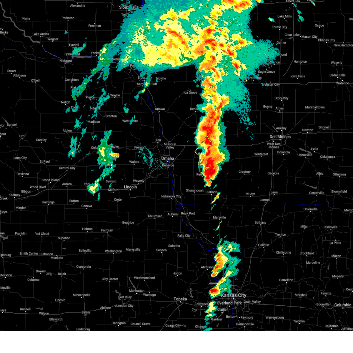 The storm which prompted the warning has weakened below severe limits, and has exited the warned area. therefore, the warning will be allowed to expire. a tornado watch remains in effect until 500 pm cdt for southwestern iowa. to report severe weather, contact your nearest law enforcement agency. they will relay your report to the national weather service omaha. The storm which prompted the warning has weakened below severe limits, and has exited the warned area. therefore, the warning will be allowed to expire. a tornado watch remains in effect until 500 pm cdt for southwestern iowa. to report severe weather, contact your nearest law enforcement agency. they will relay your report to the national weather service omaha.
|
| 5/21/2024 2:42 PM CDT |
 the severe thunderstorm warning has been cancelled and is no longer in effect the severe thunderstorm warning has been cancelled and is no longer in effect
|
| 5/21/2024 2:42 PM CDT |
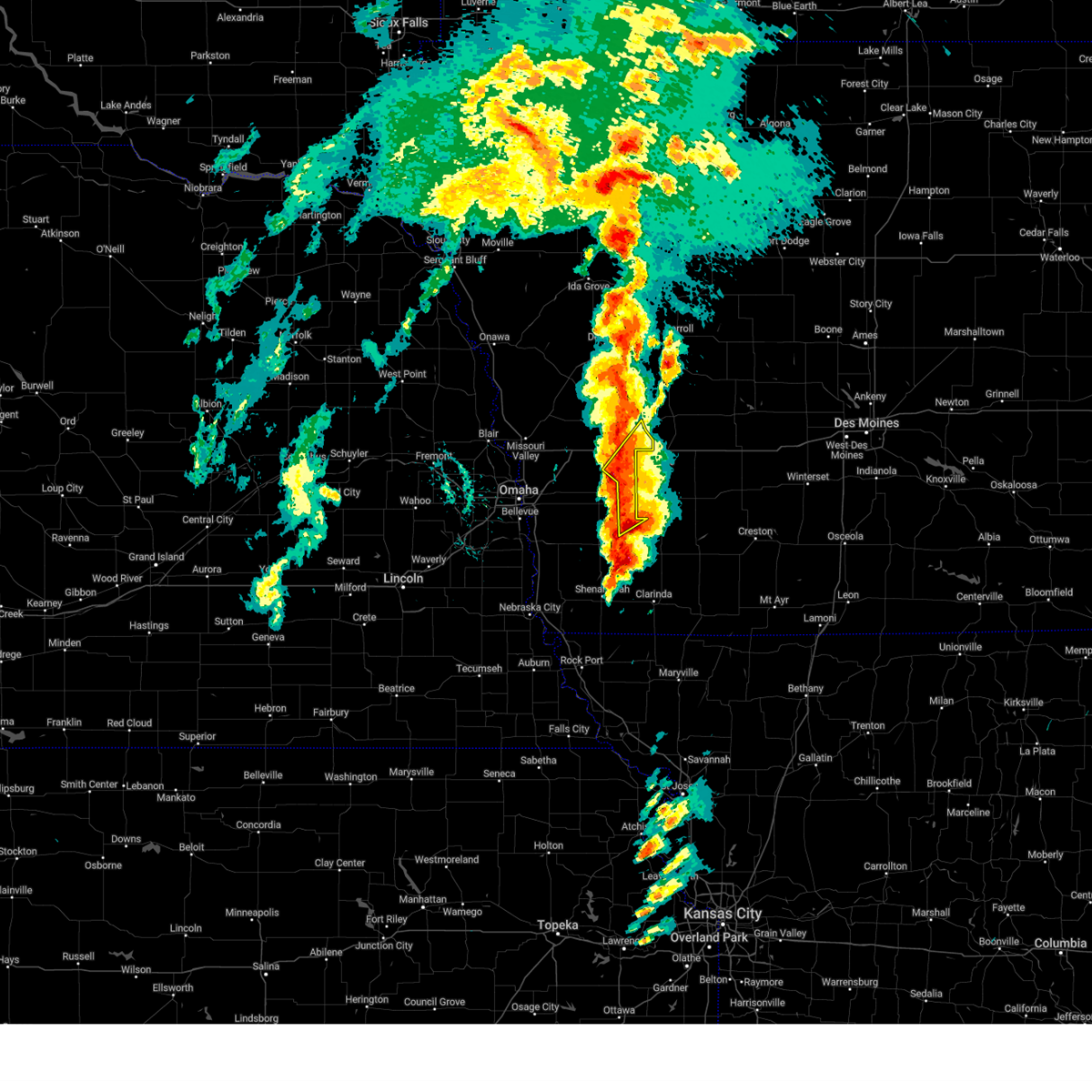 At 242 pm cdt, a severe thunderstorm was located 7 miles north of griswold, or 9 miles southwest of atlantic, moving northeast at 55 mph (radar indicated). Hazards include 60 mph wind gusts and half dollar size hail. Hail damage to vehicles is expected. expect wind damage to roofs, siding, and trees. Locations impacted include, walnut, elliott, hancock, botna bend park, and elk horn creek recreation area. At 242 pm cdt, a severe thunderstorm was located 7 miles north of griswold, or 9 miles southwest of atlantic, moving northeast at 55 mph (radar indicated). Hazards include 60 mph wind gusts and half dollar size hail. Hail damage to vehicles is expected. expect wind damage to roofs, siding, and trees. Locations impacted include, walnut, elliott, hancock, botna bend park, and elk horn creek recreation area.
|
| 5/21/2024 2:22 PM CDT |
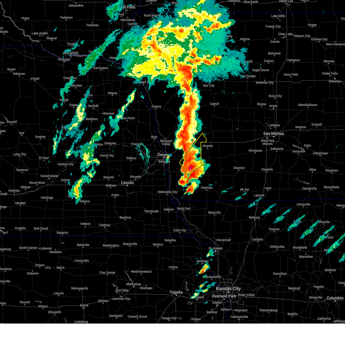 At 222 pm cdt, a severe thunderstorm was located near henderson, or 10 miles northwest of red oak, moving northeast at 50 mph (radar indicated). Hazards include 60 mph wind gusts and half dollar size hail. Hail damage to vehicles is expected. expect wind damage to roofs, siding, and trees. Locations impacted include, oakland, carson, walnut, emerson, elliott, macedonia, hancock, henderson, botna bend park, old town park, farm creek public wildlife area, and elk horn creek recreation area. At 222 pm cdt, a severe thunderstorm was located near henderson, or 10 miles northwest of red oak, moving northeast at 50 mph (radar indicated). Hazards include 60 mph wind gusts and half dollar size hail. Hail damage to vehicles is expected. expect wind damage to roofs, siding, and trees. Locations impacted include, oakland, carson, walnut, emerson, elliott, macedonia, hancock, henderson, botna bend park, old town park, farm creek public wildlife area, and elk horn creek recreation area.
|
| 5/21/2024 2:10 PM CDT |
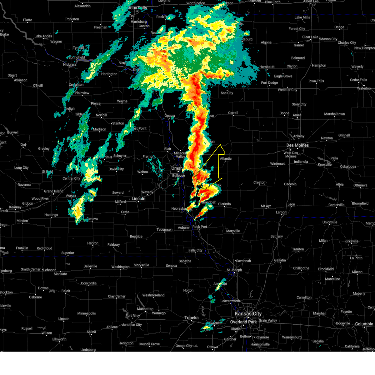 Svroax the national weather service in omaha has issued a * severe thunderstorm warning for, northwestern montgomery county in southwestern iowa, northeastern mills county in southwestern iowa, eastern pottawattamie county in southwestern iowa, southeastern shelby county in southwestern iowa, * until 300 pm cdt. * at 210 pm cdt, a severe thunderstorm was located 4 miles west of macedonia, or 18 miles east of council bluffs, moving northeast at 50 mph (radar indicated). Hazards include 60 mph wind gusts and half dollar size hail. Hail damage to vehicles is expected. Expect wind damage to roofs, siding, and trees. Svroax the national weather service in omaha has issued a * severe thunderstorm warning for, northwestern montgomery county in southwestern iowa, northeastern mills county in southwestern iowa, eastern pottawattamie county in southwestern iowa, southeastern shelby county in southwestern iowa, * until 300 pm cdt. * at 210 pm cdt, a severe thunderstorm was located 4 miles west of macedonia, or 18 miles east of council bluffs, moving northeast at 50 mph (radar indicated). Hazards include 60 mph wind gusts and half dollar size hail. Hail damage to vehicles is expected. Expect wind damage to roofs, siding, and trees.
|
| 5/21/2024 6:15 AM CDT |
 Svroax the national weather service in omaha has issued a * severe thunderstorm warning for, northwestern montgomery county in southwestern iowa, northern mills county in southwestern iowa, pottawattamie county in southwestern iowa, southern harrison county in southwestern iowa, shelby county in southwestern iowa, sarpy county in east central nebraska, southeastern washington county in east central nebraska, eastern douglas county in east central nebraska, north central cass county in southeastern nebraska, * until 700 am cdt. * at 614 am cdt, severe thunderstorms were located along a line extending from 2 miles southwest of modale to near walnut creek recreation area, moving east at 60 mph (radar indicated). Hazards include golf ball size hail and 60 mph wind gusts. People and animals outdoors will be injured. expect hail damage to roofs, siding, windows, and vehicles. Expect wind damage to roofs, siding, and trees. Svroax the national weather service in omaha has issued a * severe thunderstorm warning for, northwestern montgomery county in southwestern iowa, northern mills county in southwestern iowa, pottawattamie county in southwestern iowa, southern harrison county in southwestern iowa, shelby county in southwestern iowa, sarpy county in east central nebraska, southeastern washington county in east central nebraska, eastern douglas county in east central nebraska, north central cass county in southeastern nebraska, * until 700 am cdt. * at 614 am cdt, severe thunderstorms were located along a line extending from 2 miles southwest of modale to near walnut creek recreation area, moving east at 60 mph (radar indicated). Hazards include golf ball size hail and 60 mph wind gusts. People and animals outdoors will be injured. expect hail damage to roofs, siding, windows, and vehicles. Expect wind damage to roofs, siding, and trees.
|
| 5/21/2024 1:44 AM CDT |
 Svroax the national weather service in omaha has issued a * severe thunderstorm warning for, northeastern pottawattamie county in southwestern iowa, shelby county in southwestern iowa, * until 245 am cdt. * at 143 am cdt, a severe thunderstorm was located 4 miles southeast of harlan, moving northeast at 25 mph (radar indicated). Hazards include 60 mph wind gusts and quarter size hail. Hail damage to vehicles is expected. Expect wind damage to roofs, siding, and trees. Svroax the national weather service in omaha has issued a * severe thunderstorm warning for, northeastern pottawattamie county in southwestern iowa, shelby county in southwestern iowa, * until 245 am cdt. * at 143 am cdt, a severe thunderstorm was located 4 miles southeast of harlan, moving northeast at 25 mph (radar indicated). Hazards include 60 mph wind gusts and quarter size hail. Hail damage to vehicles is expected. Expect wind damage to roofs, siding, and trees.
|
| 5/20/2024 11:42 PM CDT |
 At 1141 pm cdt, severe thunderstorms were located along a line extending from logan to 3 miles northwest of neola to near underwood, moving northeast at 40 mph (radar indicated. this line of storms has a history of producing a 69 mph wind gust at the blair airport). Hazards include 60 mph wind gusts and quarter size hail. Hail damage to vehicles is expected. expect wind damage to roofs, siding, and trees. locations impacted include, logan, avoca, woodbine, underwood, neola, shelby, minden, persia, panama, hancock, magnolia, portsmouth, mcclelland, tennant, botna bend park, weston, arrowhead park, and historical village welcome center. People attending minden tornado cleanup should seek safe shelter immediately!. At 1141 pm cdt, severe thunderstorms were located along a line extending from logan to 3 miles northwest of neola to near underwood, moving northeast at 40 mph (radar indicated. this line of storms has a history of producing a 69 mph wind gust at the blair airport). Hazards include 60 mph wind gusts and quarter size hail. Hail damage to vehicles is expected. expect wind damage to roofs, siding, and trees. locations impacted include, logan, avoca, woodbine, underwood, neola, shelby, minden, persia, panama, hancock, magnolia, portsmouth, mcclelland, tennant, botna bend park, weston, arrowhead park, and historical village welcome center. People attending minden tornado cleanup should seek safe shelter immediately!.
|
| 5/20/2024 11:35 PM CDT |
 Svroax the national weather service in omaha has issued a * severe thunderstorm warning for, northeastern pottawattamie county in southwestern iowa, southeastern harrison county in southwestern iowa, southwestern shelby county in southwestern iowa, * until 1215 am cdt. * at 1135 pm cdt, severe thunderstorms were located along a line extending from 3 miles southwest of logan to 6 miles west of neola to 4 miles southwest of underwood, moving northeast at 45 mph (radar indicated. this storm has a history of producing a 69 mph gust at the blair airport). Hazards include 70 mph wind gusts and quarter size hail. Hail damage to vehicles is expected. expect considerable tree damage. Wind damage is also likely to mobile homes, roofs, and outbuildings. Svroax the national weather service in omaha has issued a * severe thunderstorm warning for, northeastern pottawattamie county in southwestern iowa, southeastern harrison county in southwestern iowa, southwestern shelby county in southwestern iowa, * until 1215 am cdt. * at 1135 pm cdt, severe thunderstorms were located along a line extending from 3 miles southwest of logan to 6 miles west of neola to 4 miles southwest of underwood, moving northeast at 45 mph (radar indicated. this storm has a history of producing a 69 mph gust at the blair airport). Hazards include 70 mph wind gusts and quarter size hail. Hail damage to vehicles is expected. expect considerable tree damage. Wind damage is also likely to mobile homes, roofs, and outbuildings.
|
| 5/6/2024 9:08 PM CDT |
 Svroax the national weather service in omaha has issued a * severe thunderstorm warning for, northwestern montgomery county in southwestern iowa, eastern pottawattamie county in southwestern iowa, shelby county in southwestern iowa, * until 1015 pm cdt. * at 907 pm cdt, severe thunderstorms were located along a line extending from 5 miles east of missouri valley to 5 miles northeast of treynor to 5 miles east of randolph, moving northeast at 50 mph (public weather stations measured wind gusts of 65 mph north of council bluffs. this storm has a history of tree and powerline damage). Hazards include 70 mph wind gusts and quarter size hail. Hail damage to vehicles is expected. expect considerable tree damage. wind damage is also likely to mobile homes, roofs, and outbuildings. severe thunderstorms will be near, oakland, shelby, and hancock around 915 pm cdt. red oak and avoca around 920 pm cdt. harlan, walnut, elliott, and panama around 930 pm cdt. earling around 935 pm cdt. defiance around 940 pm cdt. irwin around 945 pm cdt. other locations impacted by these severe thunderstorms include botna bend park, tennant, manteno recreation area, prairie rose state park, nishna bend recreation area, farm creek public wildlife area, kirkman, portsmouth, elk horn creek recreation area, and jacksonville. This includes interstate 80 in iowa between mile markers 34 and 48. Svroax the national weather service in omaha has issued a * severe thunderstorm warning for, northwestern montgomery county in southwestern iowa, eastern pottawattamie county in southwestern iowa, shelby county in southwestern iowa, * until 1015 pm cdt. * at 907 pm cdt, severe thunderstorms were located along a line extending from 5 miles east of missouri valley to 5 miles northeast of treynor to 5 miles east of randolph, moving northeast at 50 mph (public weather stations measured wind gusts of 65 mph north of council bluffs. this storm has a history of tree and powerline damage). Hazards include 70 mph wind gusts and quarter size hail. Hail damage to vehicles is expected. expect considerable tree damage. wind damage is also likely to mobile homes, roofs, and outbuildings. severe thunderstorms will be near, oakland, shelby, and hancock around 915 pm cdt. red oak and avoca around 920 pm cdt. harlan, walnut, elliott, and panama around 930 pm cdt. earling around 935 pm cdt. defiance around 940 pm cdt. irwin around 945 pm cdt. other locations impacted by these severe thunderstorms include botna bend park, tennant, manteno recreation area, prairie rose state park, nishna bend recreation area, farm creek public wildlife area, kirkman, portsmouth, elk horn creek recreation area, and jacksonville. This includes interstate 80 in iowa between mile markers 34 and 48.
|
| 4/26/2024 7:08 PM CDT |
 Toroax the national weather service in omaha has issued a * tornado warning for, northeastern pottawattamie county in southwestern iowa, eastern shelby county in southwestern iowa, * until 800 pm cdt. * at 708 pm cdt, a severe thunderstorm capable of producing a tornado was located near minden, or 15 miles southwest of harlan, moving northeast at 60 mph (radar indicated rotation). Hazards include tornado and quarter size hail. Flying debris will be dangerous to those caught without shelter. mobile homes will be damaged or destroyed. damage to roofs, windows, and vehicles will occur. tree damage is likely. this dangerous storm will be near, avoca and shelby around 715 pm cdt. Harlan around 720 pm cdt. Toroax the national weather service in omaha has issued a * tornado warning for, northeastern pottawattamie county in southwestern iowa, eastern shelby county in southwestern iowa, * until 800 pm cdt. * at 708 pm cdt, a severe thunderstorm capable of producing a tornado was located near minden, or 15 miles southwest of harlan, moving northeast at 60 mph (radar indicated rotation). Hazards include tornado and quarter size hail. Flying debris will be dangerous to those caught without shelter. mobile homes will be damaged or destroyed. damage to roofs, windows, and vehicles will occur. tree damage is likely. this dangerous storm will be near, avoca and shelby around 715 pm cdt. Harlan around 720 pm cdt.
|
| 8/2/2023 2:52 AM CDT |
 At 252 am cdt, a severe thunderstorm was located 3 miles west of hancock, or 18 miles south of harlan, moving southeast at 15 mph (radar indicated). Hazards include 60 mph wind gusts and quarter size hail. Hail damage to vehicles is expected. expect wind damage to roofs, siding, and trees. locations impacted include, avoca, walnut, shelby, minden, hancock, and botna bend park. hail threat, radar indicated max hail size, 1. 00 in wind threat, radar indicated max wind gust, 60 mph. At 252 am cdt, a severe thunderstorm was located 3 miles west of hancock, or 18 miles south of harlan, moving southeast at 15 mph (radar indicated). Hazards include 60 mph wind gusts and quarter size hail. Hail damage to vehicles is expected. expect wind damage to roofs, siding, and trees. locations impacted include, avoca, walnut, shelby, minden, hancock, and botna bend park. hail threat, radar indicated max hail size, 1. 00 in wind threat, radar indicated max wind gust, 60 mph.
|
| 8/2/2023 2:26 AM CDT |
 At 226 am cdt, a severe thunderstorm was located near minden, or 15 miles southwest of harlan, moving east at 20 mph (radar indicated). Hazards include 60 mph wind gusts and quarter size hail. Hail damage to vehicles is expected. Expect wind damage to roofs, siding, and trees. At 226 am cdt, a severe thunderstorm was located near minden, or 15 miles southwest of harlan, moving east at 20 mph (radar indicated). Hazards include 60 mph wind gusts and quarter size hail. Hail damage to vehicles is expected. Expect wind damage to roofs, siding, and trees.
|
| 7/24/2023 5:18 AM CDT |
 At 518 am cdt, severe thunderstorms were located along a line extending from 5 miles southeast of panama to 2 miles south of minden, moving southeast at 75 mph (radar indicated). Hazards include 70 mph wind gusts. Expect considerable tree damage. damage is likely to mobile homes, roofs, and outbuildings. severe thunderstorms will be near, avoca and hancock around 525 am cdt. oakland and walnut around 530 am cdt. people attending pottawattamie county fairgrounds in avoca should seek safe shelter immediately! this includes interstate 80 in iowa between mile markers 29 and 48. thunderstorm damage threat, considerable hail threat, radar indicated max hail size, <. 75 in wind threat, radar indicated max wind gust, 70 mph. At 518 am cdt, severe thunderstorms were located along a line extending from 5 miles southeast of panama to 2 miles south of minden, moving southeast at 75 mph (radar indicated). Hazards include 70 mph wind gusts. Expect considerable tree damage. damage is likely to mobile homes, roofs, and outbuildings. severe thunderstorms will be near, avoca and hancock around 525 am cdt. oakland and walnut around 530 am cdt. people attending pottawattamie county fairgrounds in avoca should seek safe shelter immediately! this includes interstate 80 in iowa between mile markers 29 and 48. thunderstorm damage threat, considerable hail threat, radar indicated max hail size, <. 75 in wind threat, radar indicated max wind gust, 70 mph.
|
| 7/17/2023 2:21 AM CDT |
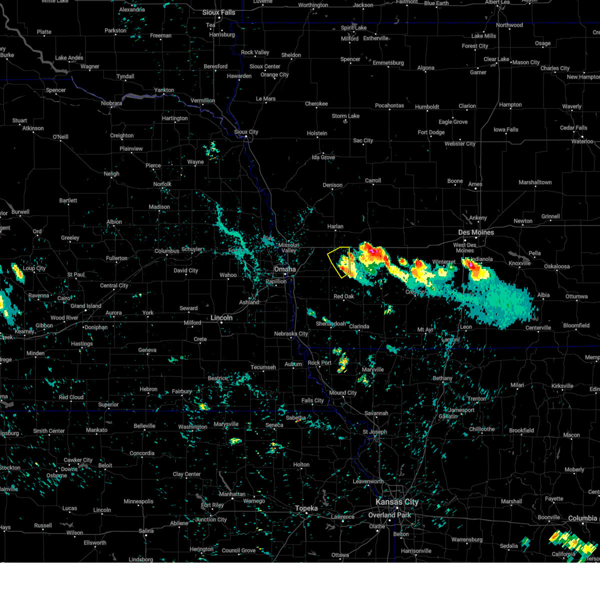 The severe thunderstorm warning for northeastern pottawattamie county will expire at 230 am cdt, the storm which prompted the warning has weakened below severe limits, and no longer poses an immediate threat to life or property. therefore, the warning will be allowed to expire. however small hail is still possible with this thunderstorm. The severe thunderstorm warning for northeastern pottawattamie county will expire at 230 am cdt, the storm which prompted the warning has weakened below severe limits, and no longer poses an immediate threat to life or property. therefore, the warning will be allowed to expire. however small hail is still possible with this thunderstorm.
|
| 7/17/2023 2:11 AM CDT |
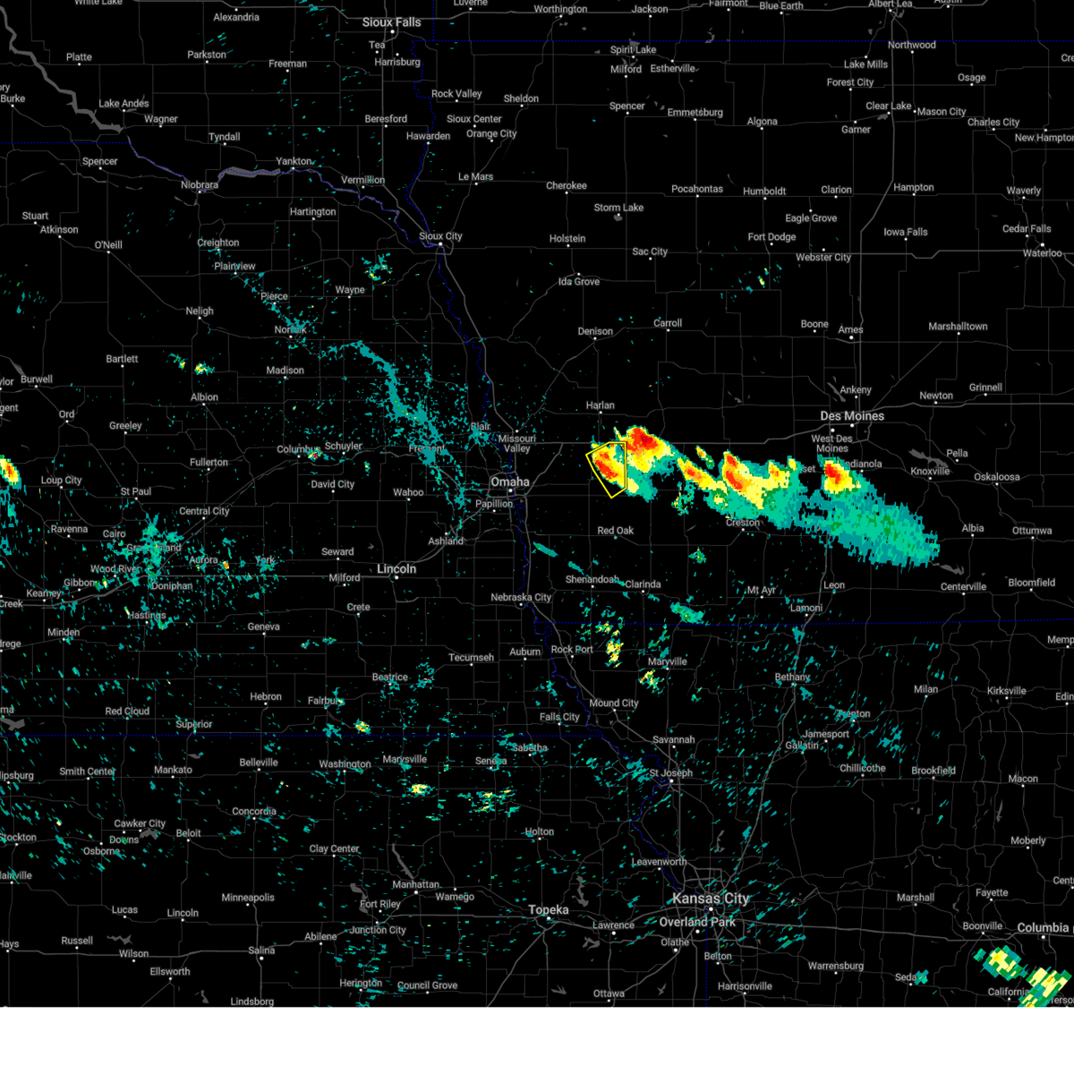 At 210 am cdt, a severe thunderstorm was located 7 miles northwest of griswold, or 12 miles southwest of atlantic, moving southeast at 35 mph (radar indicated). Hazards include 60 mph wind gusts and quarter size hail. Hail damage to vehicles is expected. expect wind damage to roofs, siding, and trees. this severe thunderstorm will remain over mainly rural areas of northeastern pottawattamie county, including the following locations, botna bend park. hail threat, radar indicated max hail size, 1. 00 in wind threat, radar indicated max wind gust, 60 mph. At 210 am cdt, a severe thunderstorm was located 7 miles northwest of griswold, or 12 miles southwest of atlantic, moving southeast at 35 mph (radar indicated). Hazards include 60 mph wind gusts and quarter size hail. Hail damage to vehicles is expected. expect wind damage to roofs, siding, and trees. this severe thunderstorm will remain over mainly rural areas of northeastern pottawattamie county, including the following locations, botna bend park. hail threat, radar indicated max hail size, 1. 00 in wind threat, radar indicated max wind gust, 60 mph.
|
| 7/17/2023 2:04 AM CDT |
 At 204 am cdt, a severe thunderstorm was located 4 miles southeast of hancock, or 14 miles west of atlantic, moving southeast at 35 mph (radar indicated). Hazards include 60 mph wind gusts and quarter size hail. Hail damage to vehicles is expected. expect wind damage to roofs, siding, and trees. this severe thunderstorm will remain over mainly rural areas of northeastern pottawattamie and southeastern shelby counties, including the following locations, botna bend park. hail threat, radar indicated max hail size, 1. 00 in wind threat, radar indicated max wind gust, 60 mph. At 204 am cdt, a severe thunderstorm was located 4 miles southeast of hancock, or 14 miles west of atlantic, moving southeast at 35 mph (radar indicated). Hazards include 60 mph wind gusts and quarter size hail. Hail damage to vehicles is expected. expect wind damage to roofs, siding, and trees. this severe thunderstorm will remain over mainly rural areas of northeastern pottawattamie and southeastern shelby counties, including the following locations, botna bend park. hail threat, radar indicated max hail size, 1. 00 in wind threat, radar indicated max wind gust, 60 mph.
|
| 7/17/2023 1:57 AM CDT |
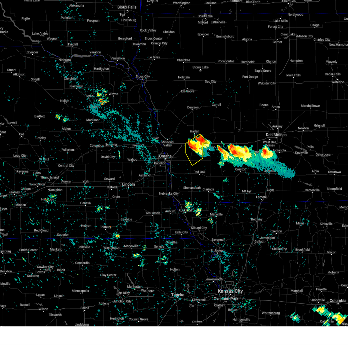 At 157 am cdt, a severe thunderstorm was located 3 miles southeast of avoca, or 14 miles south of harlan, moving southeast at 35 mph (radar indicated). Hazards include 60 mph wind gusts and quarter size hail. Hail damage to vehicles is expected. expect wind damage to roofs, siding, and trees. this severe thunderstorm will remain over mainly rural areas of eastern pottawattamie and southeastern shelby counties, including the following locations, botna bend park, prairie rose state park, nishna bend recreation area and farm creek public wildlife area. hail threat, radar indicated max hail size, 1. 00 in wind threat, radar indicated max wind gust, 60 mph. At 157 am cdt, a severe thunderstorm was located 3 miles southeast of avoca, or 14 miles south of harlan, moving southeast at 35 mph (radar indicated). Hazards include 60 mph wind gusts and quarter size hail. Hail damage to vehicles is expected. expect wind damage to roofs, siding, and trees. this severe thunderstorm will remain over mainly rural areas of eastern pottawattamie and southeastern shelby counties, including the following locations, botna bend park, prairie rose state park, nishna bend recreation area and farm creek public wildlife area. hail threat, radar indicated max hail size, 1. 00 in wind threat, radar indicated max wind gust, 60 mph.
|
| 7/17/2023 1:40 AM CDT |
 At 139 am cdt, a severe thunderstorm was located 4 miles north of shelby, or 7 miles southwest of harlan, moving southeast at 35 mph (radar indicated). Hazards include 60 mph wind gusts and quarter size hail. Hail damage to vehicles is expected. expect wind damage to roofs, siding, and trees. this severe thunderstorm will be near, avoca around 150 am cdt. other locations in the path of this severe thunderstorm include walnut and hancock. this includes interstate 80 in iowa between mile markers 29 and 48. hail threat, radar indicated max hail size, 1. 00 in wind threat, radar indicated max wind gust, 60 mph. At 139 am cdt, a severe thunderstorm was located 4 miles north of shelby, or 7 miles southwest of harlan, moving southeast at 35 mph (radar indicated). Hazards include 60 mph wind gusts and quarter size hail. Hail damage to vehicles is expected. expect wind damage to roofs, siding, and trees. this severe thunderstorm will be near, avoca around 150 am cdt. other locations in the path of this severe thunderstorm include walnut and hancock. this includes interstate 80 in iowa between mile markers 29 and 48. hail threat, radar indicated max hail size, 1. 00 in wind threat, radar indicated max wind gust, 60 mph.
|
| 7/12/2023 6:50 AM CDT |
 At 650 am cdt, severe thunderstorms were located along a line extending from 2 miles east of audubon to 6 miles south of atlantic to 2 miles south of randolph to 2 miles north of unadilla, moving southeast at 65 mph (public). Hazards include 70 mph wind gusts. Expect considerable tree damage. damage is likely to mobile homes, roofs, and outbuildings. locations impacted include, eastern omaha, lincoln, council bluffs, bellevue, papillion, red oak, harlan, gretna, offutt afb, la vista, plattsmouth, glenwood, carter lake, waverly, syracuse, springfield, oakland, malvern, sidney and louisville. people attending westfair amphitheater should seek safe shelter immediately! thunderstorm damage threat, considerable hail threat, radar indicated max hail size, <. 75 in wind threat, observed max wind gust, 70 mph. At 650 am cdt, severe thunderstorms were located along a line extending from 2 miles east of audubon to 6 miles south of atlantic to 2 miles south of randolph to 2 miles north of unadilla, moving southeast at 65 mph (public). Hazards include 70 mph wind gusts. Expect considerable tree damage. damage is likely to mobile homes, roofs, and outbuildings. locations impacted include, eastern omaha, lincoln, council bluffs, bellevue, papillion, red oak, harlan, gretna, offutt afb, la vista, plattsmouth, glenwood, carter lake, waverly, syracuse, springfield, oakland, malvern, sidney and louisville. people attending westfair amphitheater should seek safe shelter immediately! thunderstorm damage threat, considerable hail threat, radar indicated max hail size, <. 75 in wind threat, observed max wind gust, 70 mph.
|
| 7/12/2023 6:33 AM CDT |
 At 633 am cdt, severe thunderstorms were located along a line extending from 3 miles northeast of irwin to 4 miles southeast of avoca to 2 miles southeast of plattsmouth to 3 miles north of walton, moving southeast at 65 mph (weather instrument measurement). Hazards include 70 mph wind gusts. Expect considerable tree damage. damage is likely to mobile homes, roofs, and outbuildings. locations impacted include, tabor, elmwood, sidney, unadilla, randolph and syracuse. people attending westfair amphitheater should seek safe shelter immediately! thunderstorm damage threat, considerable hail threat, radar indicated max hail size, <. 75 in wind threat, observed max wind gust, 70 mph. At 633 am cdt, severe thunderstorms were located along a line extending from 3 miles northeast of irwin to 4 miles southeast of avoca to 2 miles southeast of plattsmouth to 3 miles north of walton, moving southeast at 65 mph (weather instrument measurement). Hazards include 70 mph wind gusts. Expect considerable tree damage. damage is likely to mobile homes, roofs, and outbuildings. locations impacted include, tabor, elmwood, sidney, unadilla, randolph and syracuse. people attending westfair amphitheater should seek safe shelter immediately! thunderstorm damage threat, considerable hail threat, radar indicated max hail size, <. 75 in wind threat, observed max wind gust, 70 mph.
|
| 7/12/2023 6:16 AM CDT |
 At 616 am cdt, severe thunderstorms were located along a line extending from near persia to 4 miles west of neola to 2 miles north of florence, moving southeast at 65 mph (radar indicated). Hazards include 80 mph wind gusts. Flying debris will be dangerous to those caught without shelter. mobile homes will be heavily damaged. expect considerable damage to roofs, windows, and vehicles. extensive tree damage and power outages are likely. locations impacted include, underwood, neola, persia, shelby, minden, avoca and hancock. thunderstorm damage threat, destructive hail threat, radar indicated max hail size, <. 75 in wind threat, observed max wind gust, 80 mph. At 616 am cdt, severe thunderstorms were located along a line extending from near persia to 4 miles west of neola to 2 miles north of florence, moving southeast at 65 mph (radar indicated). Hazards include 80 mph wind gusts. Flying debris will be dangerous to those caught without shelter. mobile homes will be heavily damaged. expect considerable damage to roofs, windows, and vehicles. extensive tree damage and power outages are likely. locations impacted include, underwood, neola, persia, shelby, minden, avoca and hancock. thunderstorm damage threat, destructive hail threat, radar indicated max hail size, <. 75 in wind threat, observed max wind gust, 80 mph.
|
| 7/12/2023 6:15 AM CDT |
 At 614 am cdt, severe thunderstorms were located along a line extending from 3 miles north of persia to 6 miles northwest of neola to 4 miles north of florence, moving east at 65 mph. these are destructive storms for portions of harrison, shelby, and pottawattamie counties (radar indicated). Hazards include 80 mph wind gusts. Flying debris will be dangerous to those caught without shelter. mobile homes will be heavily damaged. expect considerable damage to roofs, windows, and vehicles. extensive tree damage and power outages are likely. severe thunderstorms will be near, neola and persia around 620 am cdt. minden around 625 am cdt. harlan and shelby around 630 am cdt. other locations in the path of these severe thunderstorms include avoca and hancock. this includes the following highways, interstate 29 between mile markers 63 and 79. interstate 80 in iowa between mile markers 14 and 40. thunderstorm damage threat, destructive hail threat, radar indicated max hail size, <. 75 in wind threat, radar indicated max wind gust, 80 mph. At 614 am cdt, severe thunderstorms were located along a line extending from 3 miles north of persia to 6 miles northwest of neola to 4 miles north of florence, moving east at 65 mph. these are destructive storms for portions of harrison, shelby, and pottawattamie counties (radar indicated). Hazards include 80 mph wind gusts. Flying debris will be dangerous to those caught without shelter. mobile homes will be heavily damaged. expect considerable damage to roofs, windows, and vehicles. extensive tree damage and power outages are likely. severe thunderstorms will be near, neola and persia around 620 am cdt. minden around 625 am cdt. harlan and shelby around 630 am cdt. other locations in the path of these severe thunderstorms include avoca and hancock. this includes the following highways, interstate 29 between mile markers 63 and 79. interstate 80 in iowa between mile markers 14 and 40. thunderstorm damage threat, destructive hail threat, radar indicated max hail size, <. 75 in wind threat, radar indicated max wind gust, 80 mph.
|
| 7/12/2023 6:05 AM CDT |
 At 605 am cdt, severe thunderstorms were located along a line extending from 2 miles east of ute to near logan to 5 miles southeast of yutan to 2 miles southwest of dwight, moving southeast at 65 mph (weather instrument measurement). Hazards include 70 mph wind gusts. Expect considerable tree damage. damage is likely to mobile homes, roofs, and outbuildings. severe thunderstorms will be near, gretna, millard, logan, ute and zorinsky lake around 610 am cdt. springfield, neola, valparaiso, persia, prairie queen recreation area, wehrspann lake, walnut creek recreation area and chalco around 615 am cdt. papillion, louisville, shelby, minden, cedar creek, malcolm and raymond around 620 am cdt. bellevue, offutt afb, avoca, defiance, davey and lincoln airport around 625 am cdt. other locations in the path of these severe thunderstorms include lincoln, plattsmouth, waverly, walnut, murray, irwin, hancock, beaver lake, holmes lake park, pacific junction, walton, tabor, eagle, bennet, elmwood and palmyra. people attending westfair amphitheater should seek safe shelter immediately! this includes the following highways, interstate 29 between mile markers 15 and 82. interstate 80 in iowa between mile markers 1 and 48. interstate 80 in nebraska between mile markers 382 and 454. thunderstorm damage threat, considerable hail threat, radar indicated max hail size, <. 75 in wind threat, observed max wind gust, 70 mph. At 605 am cdt, severe thunderstorms were located along a line extending from 2 miles east of ute to near logan to 5 miles southeast of yutan to 2 miles southwest of dwight, moving southeast at 65 mph (weather instrument measurement). Hazards include 70 mph wind gusts. Expect considerable tree damage. damage is likely to mobile homes, roofs, and outbuildings. severe thunderstorms will be near, gretna, millard, logan, ute and zorinsky lake around 610 am cdt. springfield, neola, valparaiso, persia, prairie queen recreation area, wehrspann lake, walnut creek recreation area and chalco around 615 am cdt. papillion, louisville, shelby, minden, cedar creek, malcolm and raymond around 620 am cdt. bellevue, offutt afb, avoca, defiance, davey and lincoln airport around 625 am cdt. other locations in the path of these severe thunderstorms include lincoln, plattsmouth, waverly, walnut, murray, irwin, hancock, beaver lake, holmes lake park, pacific junction, walton, tabor, eagle, bennet, elmwood and palmyra. people attending westfair amphitheater should seek safe shelter immediately! this includes the following highways, interstate 29 between mile markers 15 and 82. interstate 80 in iowa between mile markers 1 and 48. interstate 80 in nebraska between mile markers 382 and 454. thunderstorm damage threat, considerable hail threat, radar indicated max hail size, <. 75 in wind threat, observed max wind gust, 70 mph.
|
| 7/12/2023 5:50 AM CDT |
 At 549 am cdt, severe thunderstorms were located along a line extending from 2 miles southwest of little sioux to 2 miles southeast of herman to near nickerson, moving southeast at 65 mph. these are destructive storms for blair, and portions of harrison, shelby, and pottawattamie counties (radar indicated). Hazards include 80 mph wind gusts. Flying debris will be dangerous to those caught without shelter. mobile homes will be heavily damaged. expect considerable damage to roofs, windows, and vehicles. extensive tree damage and power outages are likely. severe thunderstorms will be near, blair, mondamin and little sioux around 555 am cdt. modale and magnolia around 600 am cdt. missouri valley, logan and woodbine around 605 am cdt. other locations in the path of these severe thunderstorms include fort calhoun, persia, underwood, neola, crescent, shelby, minden, avoca and hancock. this includes the following highways, interstate 29 between mile markers 66 and 97. interstate 80 in iowa between mile markers 14 and 40. thunderstorm damage threat, destructive hail threat, radar indicated max hail size, <. 75 in wind threat, observed max wind gust, 80 mph. At 549 am cdt, severe thunderstorms were located along a line extending from 2 miles southwest of little sioux to 2 miles southeast of herman to near nickerson, moving southeast at 65 mph. these are destructive storms for blair, and portions of harrison, shelby, and pottawattamie counties (radar indicated). Hazards include 80 mph wind gusts. Flying debris will be dangerous to those caught without shelter. mobile homes will be heavily damaged. expect considerable damage to roofs, windows, and vehicles. extensive tree damage and power outages are likely. severe thunderstorms will be near, blair, mondamin and little sioux around 555 am cdt. modale and magnolia around 600 am cdt. missouri valley, logan and woodbine around 605 am cdt. other locations in the path of these severe thunderstorms include fort calhoun, persia, underwood, neola, crescent, shelby, minden, avoca and hancock. this includes the following highways, interstate 29 between mile markers 66 and 97. interstate 80 in iowa between mile markers 14 and 40. thunderstorm damage threat, destructive hail threat, radar indicated max hail size, <. 75 in wind threat, observed max wind gust, 80 mph.
|
| 6/29/2023 8:26 AM CDT |
 The severe thunderstorm warning for eastern fremont, montgomery, eastern mills, pottawattamie and page counties will expire at 830 am cdt, the storms which prompted the warning have moved out of the area. therefore, the warning will be allowed to expire. remember, a severe thunderstorm warning still remains in effect for fremont, mills, montgomery, page, and pottawattamie counties until 845 am cdt. The severe thunderstorm warning for eastern fremont, montgomery, eastern mills, pottawattamie and page counties will expire at 830 am cdt, the storms which prompted the warning have moved out of the area. therefore, the warning will be allowed to expire. remember, a severe thunderstorm warning still remains in effect for fremont, mills, montgomery, page, and pottawattamie counties until 845 am cdt.
|
| 6/29/2023 8:14 AM CDT |
 At 814 am cdt, severe thunderstorms were located along a line extending from minden to 3 miles southeast of coin, moving east at 40 mph (radar indicated). Hazards include 60 mph wind gusts and penny size hail. Expect damage to roofs, siding, and trees. locations impacted include, college springs, hancock, shambaugh, braddyville, clarinda, avoca and walnut. hail threat, radar indicated max hail size, 0. 75 in wind threat, observed max wind gust, 60 mph. At 814 am cdt, severe thunderstorms were located along a line extending from minden to 3 miles southeast of coin, moving east at 40 mph (radar indicated). Hazards include 60 mph wind gusts and penny size hail. Expect damage to roofs, siding, and trees. locations impacted include, college springs, hancock, shambaugh, braddyville, clarinda, avoca and walnut. hail threat, radar indicated max hail size, 0. 75 in wind threat, observed max wind gust, 60 mph.
|
| 6/29/2023 7:51 AM CDT |
 At 750 am cdt, severe thunderstorms were located along a line extending from 3 miles north of crescent to 8 miles southeast of riverton, moving east at 40 mph (radar indicated). Hazards include 60 mph wind gusts and penny size hail. Expect damage to roofs, siding, and trees. severe thunderstorms will be near, underwood around 800 am cdt. neola, coin and blanchard around 810 am cdt. other locations in the path of these severe thunderstorms include minden, shelby, college springs, hancock, shambaugh, braddyville, clarinda, avoca and walnut. this includes the following highways, interstate 29 between mile markers 43 and 48, near mile marker 56, and between mile markers 61 and 71. interstate 80 in iowa between mile markers 3 and 48. hail threat, radar indicated max hail size, 0. 75 in wind threat, observed max wind gust, 60 mph. At 750 am cdt, severe thunderstorms were located along a line extending from 3 miles north of crescent to 8 miles southeast of riverton, moving east at 40 mph (radar indicated). Hazards include 60 mph wind gusts and penny size hail. Expect damage to roofs, siding, and trees. severe thunderstorms will be near, underwood around 800 am cdt. neola, coin and blanchard around 810 am cdt. other locations in the path of these severe thunderstorms include minden, shelby, college springs, hancock, shambaugh, braddyville, clarinda, avoca and walnut. this includes the following highways, interstate 29 between mile markers 43 and 48, near mile marker 56, and between mile markers 61 and 71. interstate 80 in iowa between mile markers 3 and 48. hail threat, radar indicated max hail size, 0. 75 in wind threat, observed max wind gust, 60 mph.
|
| 5/7/2023 10:51 PM CDT |
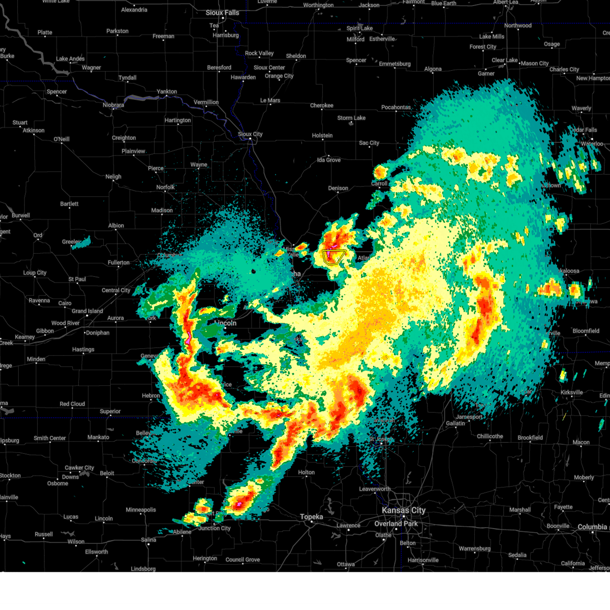 At 1051 pm cdt, a severe thunderstorm was located over shelby, or 10 miles southwest of harlan, moving northeast at 20 mph (radar indicated). Hazards include 60 mph wind gusts and quarter size hail. Hail damage to vehicles is expected. expect wind damage to roofs, siding, and trees. locations impacted include, avoca, shelby, hancock and botna bend park. hail threat, radar indicated max hail size, 1. 00 in wind threat, radar indicated max wind gust, 60 mph. At 1051 pm cdt, a severe thunderstorm was located over shelby, or 10 miles southwest of harlan, moving northeast at 20 mph (radar indicated). Hazards include 60 mph wind gusts and quarter size hail. Hail damage to vehicles is expected. expect wind damage to roofs, siding, and trees. locations impacted include, avoca, shelby, hancock and botna bend park. hail threat, radar indicated max hail size, 1. 00 in wind threat, radar indicated max wind gust, 60 mph.
|
| 5/7/2023 10:31 PM CDT |
 At 1031 pm cdt, a severe thunderstorm was located near minden, or 14 miles southwest of harlan, moving northeast at 20 mph (public. at 1013 pm, half dollar size hail was reported in mcclelland). Hazards include 60 mph wind gusts and half dollar size hail. Hail damage to vehicles is expected. expect wind damage to roofs, siding, and trees. locations impacted include, shelby. hail threat, observed max hail size, 1. 25 in wind threat, radar indicated max wind gust, 60 mph. At 1031 pm cdt, a severe thunderstorm was located near minden, or 14 miles southwest of harlan, moving northeast at 20 mph (public. at 1013 pm, half dollar size hail was reported in mcclelland). Hazards include 60 mph wind gusts and half dollar size hail. Hail damage to vehicles is expected. expect wind damage to roofs, siding, and trees. locations impacted include, shelby. hail threat, observed max hail size, 1. 25 in wind threat, radar indicated max wind gust, 60 mph.
|
| 5/7/2023 10:18 PM CDT |
 At 1018 pm cdt, a severe thunderstorm was located over minden, or 18 miles southwest of harlan, moving northeast at 25 mph (radar indicated). Hazards include ping pong ball size hail and 60 mph wind gusts. People and animals outdoors will be injured. expect hail damage to roofs, siding, windows, and vehicles. expect wind damage to roofs, siding, and trees. locations impacted include, shelby and avoca. hail threat, radar indicated max hail size, 1. 50 in wind threat, radar indicated max wind gust, 60 mph. At 1018 pm cdt, a severe thunderstorm was located over minden, or 18 miles southwest of harlan, moving northeast at 25 mph (radar indicated). Hazards include ping pong ball size hail and 60 mph wind gusts. People and animals outdoors will be injured. expect hail damage to roofs, siding, windows, and vehicles. expect wind damage to roofs, siding, and trees. locations impacted include, shelby and avoca. hail threat, radar indicated max hail size, 1. 50 in wind threat, radar indicated max wind gust, 60 mph.
|
| 5/7/2023 10:15 PM CDT |
 At 1015 pm cdt, a severe thunderstorm was located over neola, or 19 miles northeast of council bluffs, moving northeast at 20 mph (radar indicated). Hazards include ping pong ball size hail and 60 mph wind gusts. People and animals outdoors will be injured. expect hail damage to roofs, siding, windows, and vehicles. expect wind damage to roofs, siding, and trees. this severe thunderstorm will be near, minden around 1025 pm cdt. other locations in the path of this severe thunderstorm include shelby. this includes interstate 80 in iowa between mile markers 17 and 40. hail threat, radar indicated max hail size, 1. 50 in wind threat, radar indicated max wind gust, 60 mph. At 1015 pm cdt, a severe thunderstorm was located over neola, or 19 miles northeast of council bluffs, moving northeast at 20 mph (radar indicated). Hazards include ping pong ball size hail and 60 mph wind gusts. People and animals outdoors will be injured. expect hail damage to roofs, siding, windows, and vehicles. expect wind damage to roofs, siding, and trees. this severe thunderstorm will be near, minden around 1025 pm cdt. other locations in the path of this severe thunderstorm include shelby. this includes interstate 80 in iowa between mile markers 17 and 40. hail threat, radar indicated max hail size, 1. 50 in wind threat, radar indicated max wind gust, 60 mph.
|
| 5/7/2023 10:06 PM CDT |
 At 1006 pm cdt, a severe thunderstorm was located 3 miles east of underwood, or 15 miles northeast of council bluffs, moving northeast at 25 mph (radar indicated). Hazards include 60 mph wind gusts and quarter size hail. Hail damage to vehicles is expected. expect wind damage to roofs, siding, and trees. this severe thunderstorm will be near, neola around 1010 pm cdt. minden around 1020 pm cdt. other locations in the path of this severe thunderstorm include shelby, hancock and avoca. this includes interstate 80 in iowa between mile markers 14 and 43. hail threat, radar indicated max hail size, 1. 00 in wind threat, radar indicated max wind gust, 60 mph. At 1006 pm cdt, a severe thunderstorm was located 3 miles east of underwood, or 15 miles northeast of council bluffs, moving northeast at 25 mph (radar indicated). Hazards include 60 mph wind gusts and quarter size hail. Hail damage to vehicles is expected. expect wind damage to roofs, siding, and trees. this severe thunderstorm will be near, neola around 1010 pm cdt. minden around 1020 pm cdt. other locations in the path of this severe thunderstorm include shelby, hancock and avoca. this includes interstate 80 in iowa between mile markers 14 and 43. hail threat, radar indicated max hail size, 1. 00 in wind threat, radar indicated max wind gust, 60 mph.
|
| 5/7/2023 10:01 PM CDT |
 At 1001 pm cdt, a severe thunderstorm was located 8 miles east of hancock, or 10 miles west of atlantic, moving east at 25 mph (public. these storms have a history of producing quarter sized hail near walnut). Hazards include 60 mph wind gusts and quarter size hail. Hail damage to vehicles is expected. expect wind damage to roofs, siding, and trees. this severe thunderstorm will remain over mainly rural areas of eastern pottawattamie county, including the following locations, botna bend park and farm creek public wildlife area. hail threat, radar indicated max hail size, 1. 00 in wind threat, radar indicated max wind gust, 60 mph. At 1001 pm cdt, a severe thunderstorm was located 8 miles east of hancock, or 10 miles west of atlantic, moving east at 25 mph (public. these storms have a history of producing quarter sized hail near walnut). Hazards include 60 mph wind gusts and quarter size hail. Hail damage to vehicles is expected. expect wind damage to roofs, siding, and trees. this severe thunderstorm will remain over mainly rural areas of eastern pottawattamie county, including the following locations, botna bend park and farm creek public wildlife area. hail threat, radar indicated max hail size, 1. 00 in wind threat, radar indicated max wind gust, 60 mph.
|
| 5/7/2023 9:52 PM CDT |
 At 951 pm cdt, a severe thunderstorm was located 7 miles southeast of hancock, or 13 miles west of atlantic, moving east at 25 mph (public. at 949 pm quarter size hail was reported in walnut). Hazards include 60 mph wind gusts and quarter size hail. Hail damage to vehicles is expected. expect wind damage to roofs, siding, and trees. this severe thunderstorm will remain over mainly rural areas of eastern pottawattamie county, including the following locations, botna bend park, old town park and farm creek public wildlife area. hail threat, radar indicated max hail size, 1. 00 in wind threat, radar indicated max wind gust, 60 mph. At 951 pm cdt, a severe thunderstorm was located 7 miles southeast of hancock, or 13 miles west of atlantic, moving east at 25 mph (public. at 949 pm quarter size hail was reported in walnut). Hazards include 60 mph wind gusts and quarter size hail. Hail damage to vehicles is expected. expect wind damage to roofs, siding, and trees. this severe thunderstorm will remain over mainly rural areas of eastern pottawattamie county, including the following locations, botna bend park, old town park and farm creek public wildlife area. hail threat, radar indicated max hail size, 1. 00 in wind threat, radar indicated max wind gust, 60 mph.
|
| 5/7/2023 9:36 PM CDT |
 At 935 pm cdt, a severe thunderstorm was located 5 miles southeast of oakland, or 17 miles southwest of atlantic, moving east at 30 mph. a second severe thunderstorm was located between avoca and walnut (radar indicated). Hazards include 60 mph wind gusts and quarter size hail. Hail damage to vehicles is expected. expect wind damage to roofs, siding, and trees. this severe thunderstorm will remain over mainly rural areas of eastern pottawattamie county, including the following locations, botna bend park, old town park and farm creek public wildlife area. this includes interstate 80 in iowa between mile markers 43 and 48. hail threat, radar indicated max hail size, 1. 00 in wind threat, radar indicated max wind gust, 60 mph. At 935 pm cdt, a severe thunderstorm was located 5 miles southeast of oakland, or 17 miles southwest of atlantic, moving east at 30 mph. a second severe thunderstorm was located between avoca and walnut (radar indicated). Hazards include 60 mph wind gusts and quarter size hail. Hail damage to vehicles is expected. expect wind damage to roofs, siding, and trees. this severe thunderstorm will remain over mainly rural areas of eastern pottawattamie county, including the following locations, botna bend park, old town park and farm creek public wildlife area. this includes interstate 80 in iowa between mile markers 43 and 48. hail threat, radar indicated max hail size, 1. 00 in wind threat, radar indicated max wind gust, 60 mph.
|
| 4/19/2023 7:50 PM CDT |
 The severe thunderstorm warning for northeastern pottawattamie and shelby counties will expire at 800 pm cdt, the storm which prompted the warning has weakened below severe limits, and has exited the warned area. therefore, the warning will be allowed to expire. a tornado watch remains in effect until 1100 pm cdt for southwestern iowa. to report severe weather, contact your nearest law enforcement agency. they will relay your report to the national weather service omaha. The severe thunderstorm warning for northeastern pottawattamie and shelby counties will expire at 800 pm cdt, the storm which prompted the warning has weakened below severe limits, and has exited the warned area. therefore, the warning will be allowed to expire. a tornado watch remains in effect until 1100 pm cdt for southwestern iowa. to report severe weather, contact your nearest law enforcement agency. they will relay your report to the national weather service omaha.
|
| 4/19/2023 7:11 PM CDT |
 At 710 pm cdt, a severe thunderstorm was located 4 miles south of shelby, or 15 miles southwest of harlan, moving northeast at 55 mph (radar indicated). Hazards include 60 mph wind gusts and half dollar size hail. Hail damage to vehicles is expected. expect wind damage to roofs, siding, and trees. this severe thunderstorm will be near, avoca around 720 pm cdt. harlan around 730 pm cdt. other locations in the path of this severe thunderstorm include irwin. this includes interstate 80 in iowa between mile markers 31 and 48. hail threat, radar indicated max hail size, 1. 25 in wind threat, radar indicated max wind gust, 60 mph. At 710 pm cdt, a severe thunderstorm was located 4 miles south of shelby, or 15 miles southwest of harlan, moving northeast at 55 mph (radar indicated). Hazards include 60 mph wind gusts and half dollar size hail. Hail damage to vehicles is expected. expect wind damage to roofs, siding, and trees. this severe thunderstorm will be near, avoca around 720 pm cdt. harlan around 730 pm cdt. other locations in the path of this severe thunderstorm include irwin. this includes interstate 80 in iowa between mile markers 31 and 48. hail threat, radar indicated max hail size, 1. 25 in wind threat, radar indicated max wind gust, 60 mph.
|
| 4/14/2023 9:26 PM CDT |
 The severe thunderstorm warning for eastern pottawattamie county will expire at 930 pm cdt, the storm which prompted the warning has weakened below severe limits, and has mostly exited the warned area. therefore, the warning will be allowed to expire. however small hail and gusty winds are still possible with this thunderstorm. a severe thunderstorm watch remains in effect until midnight cdt for southwestern iowa. The severe thunderstorm warning for eastern pottawattamie county will expire at 930 pm cdt, the storm which prompted the warning has weakened below severe limits, and has mostly exited the warned area. therefore, the warning will be allowed to expire. however small hail and gusty winds are still possible with this thunderstorm. a severe thunderstorm watch remains in effect until midnight cdt for southwestern iowa.
|
| 4/14/2023 8:36 PM CDT |
 At 836 pm cdt, a severe thunderstorm was located near treynor, or 15 miles east of council bluffs, moving northeast at 40 mph (radar indicated). Hazards include 60 mph wind gusts and quarter size hail. Hail damage to vehicles is expected. expect wind damage to roofs, siding, and trees. this severe thunderstorm will be near, carson around 845 pm cdt. oakland around 850 pm cdt. other locations in the path of this severe thunderstorm include hancock, shelby, avoca and walnut. this includes interstate 80 in iowa between mile markers 34 and 48. hail threat, radar indicated max hail size, 1. 00 in wind threat, radar indicated max wind gust, 60 mph. At 836 pm cdt, a severe thunderstorm was located near treynor, or 15 miles east of council bluffs, moving northeast at 40 mph (radar indicated). Hazards include 60 mph wind gusts and quarter size hail. Hail damage to vehicles is expected. expect wind damage to roofs, siding, and trees. this severe thunderstorm will be near, carson around 845 pm cdt. oakland around 850 pm cdt. other locations in the path of this severe thunderstorm include hancock, shelby, avoca and walnut. this includes interstate 80 in iowa between mile markers 34 and 48. hail threat, radar indicated max hail size, 1. 00 in wind threat, radar indicated max wind gust, 60 mph.
|
| 9/17/2022 9:10 PM CDT | Estimated 70 mph or stronger wind gust with pea size hail. time estimated based on rada in pottawattamie county IA, 5 miles E of Hancock, IA |
| 8/19/2022 3:03 PM CDT |
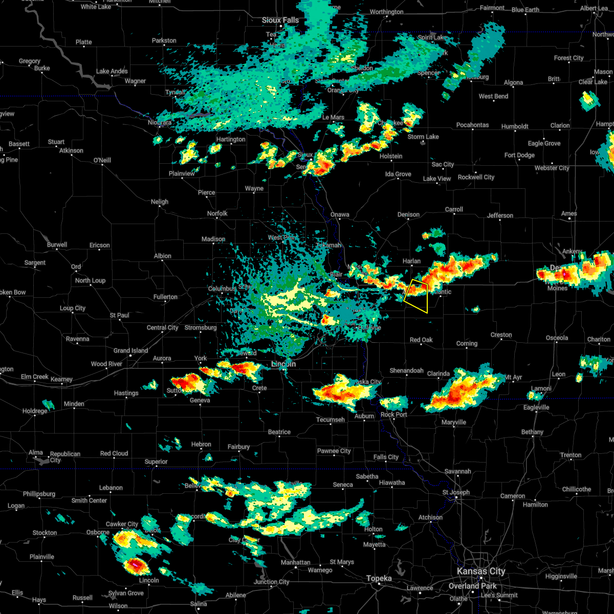 At 303 pm cdt, a severe thunderstorm was located 4 miles southeast of avoca, or 13 miles west of atlantic, moving east at 25 mph (radar indicated). Hazards include 60 mph wind gusts and quarter size hail. Hail damage to vehicles is expected. expect wind damage to roofs, siding, and trees. this severe thunderstorm will remain over mainly rural areas of northeastern pottawattamie and south central shelby counties, including the following locations, botna bend park. this includes interstate 80 in iowa between mile markers 40 and 48. hail threat, radar indicated max hail size, 1. 00 in wind threat, radar indicated max wind gust, 60 mph. At 303 pm cdt, a severe thunderstorm was located 4 miles southeast of avoca, or 13 miles west of atlantic, moving east at 25 mph (radar indicated). Hazards include 60 mph wind gusts and quarter size hail. Hail damage to vehicles is expected. expect wind damage to roofs, siding, and trees. this severe thunderstorm will remain over mainly rural areas of northeastern pottawattamie and south central shelby counties, including the following locations, botna bend park. this includes interstate 80 in iowa between mile markers 40 and 48. hail threat, radar indicated max hail size, 1. 00 in wind threat, radar indicated max wind gust, 60 mph.
|
| 7/23/2022 9:10 PM CDT |
 At 906 pm cdt, severe thunderstorms were located along a line extending from 3 miles southeast of irwin to 10 miles east of harlan to 4 miles east of walnut, moving east at 60 mph (emergency management. at 903 pm, 63 mph winds were observed at the harland airport. these storms also have a history of producing damaging winds across harrison county). Hazards include 70 mph wind gusts. Expect considerable tree damage. damage is likely to mobile homes, roofs, and outbuildings. these severe thunderstorms will remain over mainly rural areas of northeastern pottawattamie and shelby counties, including the following locations, botna bend park, tennant, manteno recreation area, prairie rose state park, nishna bend recreation area, kirkman, portsmouth, elk horn creek recreation area, jacksonville and westphalia. people attending east pottawattamie county fair grounds should seek safe shelter immediately! thunderstorm damage threat, considerable hail threat, radar indicated max hail size, <. 75 in wind threat, observed max wind gust, 70 mph. At 906 pm cdt, severe thunderstorms were located along a line extending from 3 miles southeast of irwin to 10 miles east of harlan to 4 miles east of walnut, moving east at 60 mph (emergency management. at 903 pm, 63 mph winds were observed at the harland airport. these storms also have a history of producing damaging winds across harrison county). Hazards include 70 mph wind gusts. Expect considerable tree damage. damage is likely to mobile homes, roofs, and outbuildings. these severe thunderstorms will remain over mainly rural areas of northeastern pottawattamie and shelby counties, including the following locations, botna bend park, tennant, manteno recreation area, prairie rose state park, nishna bend recreation area, kirkman, portsmouth, elk horn creek recreation area, jacksonville and westphalia. people attending east pottawattamie county fair grounds should seek safe shelter immediately! thunderstorm damage threat, considerable hail threat, radar indicated max hail size, <. 75 in wind threat, observed max wind gust, 70 mph.
|
| 7/23/2022 8:38 PM CDT |
 At 836 pm cdt, severe thunderstorms were located along a line extending from 2 miles north of woodbine to 6 miles east of logan to 5 miles northwest of neola, moving east at 60 mph. these are destructive storms for shelby, tennant, and harlan (emergency management. these storms have a history of producing an 87 mph wind gust in craig, ne, and a 74 mph wind gust in tekamah, ne). Hazards include 80 mph wind gusts. Flying debris will be dangerous to those caught without shelter. mobile homes will be heavily damaged. expect considerable damage to roofs, windows, and vehicles. extensive tree damage and power outages are likely. severe thunderstorms will be near, shelby, earling and panama around 850 pm cdt. harlan, avoca, defiance and hancock around 855 pm cdt. other locations in the path of these severe thunderstorms include walnut and irwin. people attending east pottawattamie county fair grounds should seek safe shelter immediately! this includes interstate 80 in iowa between mile markers 34 and 48. thunderstorm damage threat, destructive hail threat, radar indicated max hail size, <. 75 in wind threat, observed max wind gust, 80 mph. At 836 pm cdt, severe thunderstorms were located along a line extending from 2 miles north of woodbine to 6 miles east of logan to 5 miles northwest of neola, moving east at 60 mph. these are destructive storms for shelby, tennant, and harlan (emergency management. these storms have a history of producing an 87 mph wind gust in craig, ne, and a 74 mph wind gust in tekamah, ne). Hazards include 80 mph wind gusts. Flying debris will be dangerous to those caught without shelter. mobile homes will be heavily damaged. expect considerable damage to roofs, windows, and vehicles. extensive tree damage and power outages are likely. severe thunderstorms will be near, shelby, earling and panama around 850 pm cdt. harlan, avoca, defiance and hancock around 855 pm cdt. other locations in the path of these severe thunderstorms include walnut and irwin. people attending east pottawattamie county fair grounds should seek safe shelter immediately! this includes interstate 80 in iowa between mile markers 34 and 48. thunderstorm damage threat, destructive hail threat, radar indicated max hail size, <. 75 in wind threat, observed max wind gust, 80 mph.
|
| 6/15/2022 12:40 AM CDT |
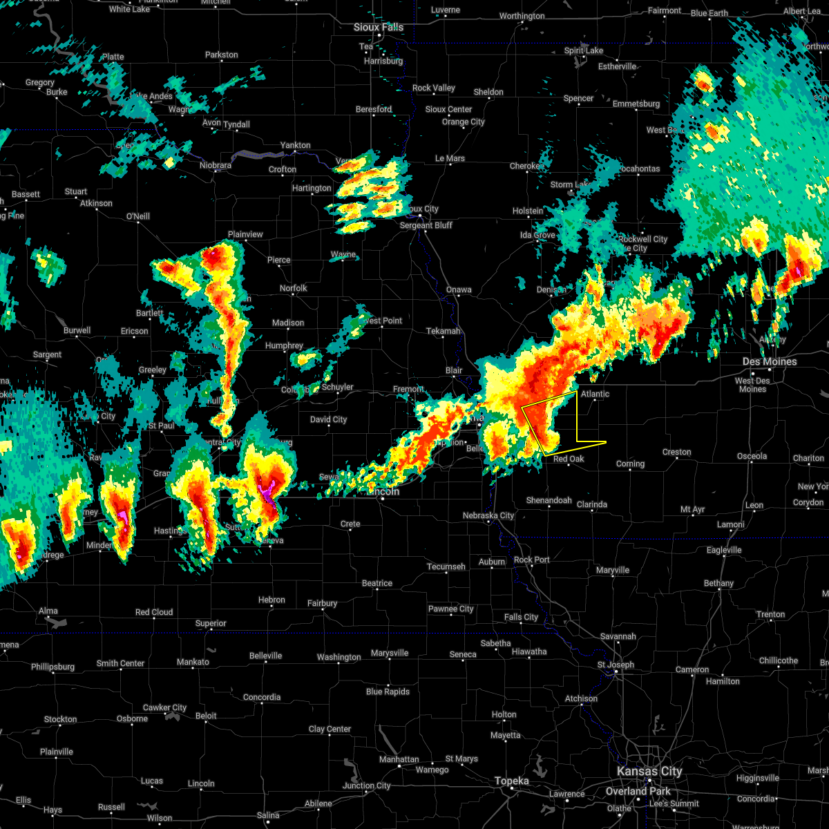 At 1240 am cdt, a severe thunderstorm was located near carson, or 17 miles northwest of red oak, moving east at 55 mph (radar indicated). Hazards include 70 mph wind gusts and quarter size hail. Hail damage to vehicles is expected. expect considerable tree damage. wind damage is also likely to mobile homes, roofs, and outbuildings. this severe thunderstorm will remain over mainly rural areas of northern montgomery, northeastern mills and southeastern pottawattamie counties, including the following locations, botna bend park, old town park and farm creek public wildlife area. thunderstorm damage threat, considerable hail threat, radar indicated max hail size, 1. 00 in wind threat, radar indicated max wind gust, 70 mph. At 1240 am cdt, a severe thunderstorm was located near carson, or 17 miles northwest of red oak, moving east at 55 mph (radar indicated). Hazards include 70 mph wind gusts and quarter size hail. Hail damage to vehicles is expected. expect considerable tree damage. wind damage is also likely to mobile homes, roofs, and outbuildings. this severe thunderstorm will remain over mainly rural areas of northern montgomery, northeastern mills and southeastern pottawattamie counties, including the following locations, botna bend park, old town park and farm creek public wildlife area. thunderstorm damage threat, considerable hail threat, radar indicated max hail size, 1. 00 in wind threat, radar indicated max wind gust, 70 mph.
|
| 6/15/2022 12:34 AM CDT |
 At 1233 am cdt, a severe thunderstorm was located 4 miles southeast of henderson, or 9 miles northwest of red oak, moving east at 40 mph. this is a destructive storm for northwestern montgomery, northeastern mills and southeastern pottawattamie counties, (radar indicated). Hazards include 80 mph wind gusts and half dollar size hail. Flying debris will be dangerous to those caught without shelter. mobile homes will be heavily damaged. expect considerable damage to roofs, windows, and vehicles. extensive tree damage and power outages are likely. Locations impacted include, red oak, oakland, malvern, treynor, carson, emerson, elliott, macedonia, hancock, henderson, hastings, mcclelland, old town park, farm creek public wildlife area, botna bend park and weston. At 1233 am cdt, a severe thunderstorm was located 4 miles southeast of henderson, or 9 miles northwest of red oak, moving east at 40 mph. this is a destructive storm for northwestern montgomery, northeastern mills and southeastern pottawattamie counties, (radar indicated). Hazards include 80 mph wind gusts and half dollar size hail. Flying debris will be dangerous to those caught without shelter. mobile homes will be heavily damaged. expect considerable damage to roofs, windows, and vehicles. extensive tree damage and power outages are likely. Locations impacted include, red oak, oakland, malvern, treynor, carson, emerson, elliott, macedonia, hancock, henderson, hastings, mcclelland, old town park, farm creek public wildlife area, botna bend park and weston.
|
| 6/15/2022 12:30 AM CDT |
 At 1229 am cdt, a severe thunderstorm was located 4 miles south of henderson, or 10 miles northwest of red oak, moving east at 40 mph. this is a destructive storm for northwestern montgomery, northeastern mills and southeastern pottawattamie counties (radar indicated). Hazards include 80 mph wind gusts and nickel size hail. Flying debris will be dangerous to those caught without shelter. mobile homes will be heavily damaged. expect considerable damage to roofs, windows, and vehicles. extensive tree damage and power outages are likely. Locations impacted include, red oak, oakland, malvern, treynor, carson, emerson, elliott, macedonia, hancock, henderson, hastings, mcclelland, old town park, farm creek public wildlife area, botna bend park and weston. At 1229 am cdt, a severe thunderstorm was located 4 miles south of henderson, or 10 miles northwest of red oak, moving east at 40 mph. this is a destructive storm for northwestern montgomery, northeastern mills and southeastern pottawattamie counties (radar indicated). Hazards include 80 mph wind gusts and nickel size hail. Flying debris will be dangerous to those caught without shelter. mobile homes will be heavily damaged. expect considerable damage to roofs, windows, and vehicles. extensive tree damage and power outages are likely. Locations impacted include, red oak, oakland, malvern, treynor, carson, emerson, elliott, macedonia, hancock, henderson, hastings, mcclelland, old town park, farm creek public wildlife area, botna bend park and weston.
|
| 6/15/2022 12:20 AM CDT |
 At 1219 am cdt, a severe thunderstorm was located 3 miles northwest of hastings, or 16 miles west of red oak, moving east at 40 mph. this is a destructive storm for western montgomery, mills and southeastern pottawattamie counties, (radar indicated). Hazards include 80 mph wind gusts and nickel size hail. Flying debris will be dangerous to those caught without shelter. mobile homes will be heavily damaged. expect considerable damage to roofs, windows, and vehicles. extensive tree damage and power outages are likely. locations impacted include, emerson, henderson, red oak and elliott. thunderstorm damage threat, destructive hail threat, radar indicated max hail size, 0. 88 in wind threat, radar indicated max wind gust, 80 mph. At 1219 am cdt, a severe thunderstorm was located 3 miles northwest of hastings, or 16 miles west of red oak, moving east at 40 mph. this is a destructive storm for western montgomery, mills and southeastern pottawattamie counties, (radar indicated). Hazards include 80 mph wind gusts and nickel size hail. Flying debris will be dangerous to those caught without shelter. mobile homes will be heavily damaged. expect considerable damage to roofs, windows, and vehicles. extensive tree damage and power outages are likely. locations impacted include, emerson, henderson, red oak and elliott. thunderstorm damage threat, destructive hail threat, radar indicated max hail size, 0. 88 in wind threat, radar indicated max wind gust, 80 mph.
|
| 6/15/2022 12:02 AM CDT |
 At 1201 am cdt, a severe thunderstorm was located over pacific junction, or 10 miles southeast of offutt afb, moving east at 40 mph. this is a destructive storm for northern fremont county in southwestern iowa, western montgomery county in southwestern iowa, mills county in southwestern iowa, southern pottawattamie county in southwestern iowa, northwestern page county in southwestern iowa (radar indicated). Hazards include 80 mph wind gusts and nickel size hail. Flying debris will be dangerous to those caught without shelter. mobile homes will be heavily damaged. expect considerable damage to roofs, windows, and vehicles. extensive tree damage and power outages are likely. this severe thunderstorm will be near, glenwood around 1205 am cdt. malvern and silver city around 1215 am cdt. other locations in the path of this severe thunderstorm include hastings, emerson, henderson, red oak and elliott. this includes the following highways, interstate 29 between mile markers 24 and 37. interstate 80 in iowa between mile markers 8 and 14. thunderstorm damage threat, destructive hail threat, radar indicated max hail size, 0. 88 in wind threat, radar indicated max wind gust, 80 mph. At 1201 am cdt, a severe thunderstorm was located over pacific junction, or 10 miles southeast of offutt afb, moving east at 40 mph. this is a destructive storm for northern fremont county in southwestern iowa, western montgomery county in southwestern iowa, mills county in southwestern iowa, southern pottawattamie county in southwestern iowa, northwestern page county in southwestern iowa (radar indicated). Hazards include 80 mph wind gusts and nickel size hail. Flying debris will be dangerous to those caught without shelter. mobile homes will be heavily damaged. expect considerable damage to roofs, windows, and vehicles. extensive tree damage and power outages are likely. this severe thunderstorm will be near, glenwood around 1205 am cdt. malvern and silver city around 1215 am cdt. other locations in the path of this severe thunderstorm include hastings, emerson, henderson, red oak and elliott. this includes the following highways, interstate 29 between mile markers 24 and 37. interstate 80 in iowa between mile markers 8 and 14. thunderstorm damage threat, destructive hail threat, radar indicated max hail size, 0. 88 in wind threat, radar indicated max wind gust, 80 mph.
|
| 4/23/2022 5:38 AM CDT |
 At 537 am cdt, a severe thunderstorm was located 5 miles northwest of oakland, or 22 miles west of atlantic, moving northeast at 65 mph (radar indicated). Hazards include 60 mph wind gusts and quarter size hail. Hail damage to vehicles is expected. expect wind damage to roofs, siding, and trees. locations impacted include, avoca and harlan. hail threat, radar indicated max hail size, 1. 00 in wind threat, radar indicated max wind gust, 60 mph. At 537 am cdt, a severe thunderstorm was located 5 miles northwest of oakland, or 22 miles west of atlantic, moving northeast at 65 mph (radar indicated). Hazards include 60 mph wind gusts and quarter size hail. Hail damage to vehicles is expected. expect wind damage to roofs, siding, and trees. locations impacted include, avoca and harlan. hail threat, radar indicated max hail size, 1. 00 in wind threat, radar indicated max wind gust, 60 mph.
|
| 4/23/2022 5:27 AM CDT |
 At 526 am cdt, a severe thunderstorm was located over treynor, or 22 miles east of omaha, moving northeast at 65 mph (radar indicated). Hazards include 60 mph wind gusts and quarter size hail. Hail damage to vehicles is expected. expect wind damage to roofs, siding, and trees. this severe thunderstorm will be near, minden around 540 am cdt. avoca and shelby around 545 am cdt. other locations in the path of this severe thunderstorm include harlan. this includes the following highways, interstate 29 between mile markers 47 and 48. interstate 80 in iowa between mile markers 5 and 43. hail threat, radar indicated max hail size, 1. 00 in wind threat, radar indicated max wind gust, 60 mph. At 526 am cdt, a severe thunderstorm was located over treynor, or 22 miles east of omaha, moving northeast at 65 mph (radar indicated). Hazards include 60 mph wind gusts and quarter size hail. Hail damage to vehicles is expected. expect wind damage to roofs, siding, and trees. this severe thunderstorm will be near, minden around 540 am cdt. avoca and shelby around 545 am cdt. other locations in the path of this severe thunderstorm include harlan. this includes the following highways, interstate 29 between mile markers 47 and 48. interstate 80 in iowa between mile markers 5 and 43. hail threat, radar indicated max hail size, 1. 00 in wind threat, radar indicated max wind gust, 60 mph.
|
| 4/12/2022 9:25 PM CDT |
 At 925 pm cdt, severe thunderstorms were located along a line extending from 5 miles west of atlantic to 6 miles southeast of macedonia to near sidney, moving east at 45 mph (radar indicated). Hazards include 60 mph wind gusts. Expect damage to roofs, siding, and trees. severe thunderstorms will be near, red oak around 930 pm cdt. elliott around 935 pm cdt. shenandoah around 940 pm cdt. other locations in the path of these severe thunderstorms include essex, coin and clarinda. this includes interstate 29 between mile markers 1 and 24. hail threat, radar indicated max hail size, <. 75 in wind threat, observed max wind gust, 60 mph. At 925 pm cdt, severe thunderstorms were located along a line extending from 5 miles west of atlantic to 6 miles southeast of macedonia to near sidney, moving east at 45 mph (radar indicated). Hazards include 60 mph wind gusts. Expect damage to roofs, siding, and trees. severe thunderstorms will be near, red oak around 930 pm cdt. elliott around 935 pm cdt. shenandoah around 940 pm cdt. other locations in the path of these severe thunderstorms include essex, coin and clarinda. this includes interstate 29 between mile markers 1 and 24. hail threat, radar indicated max hail size, <. 75 in wind threat, observed max wind gust, 60 mph.
|
| 4/12/2022 9:17 PM CDT |
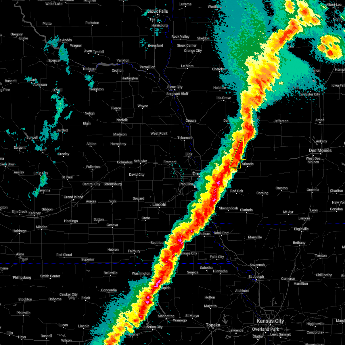 At 917 pm cdt, severe thunderstorms were located along a line extending from 4 miles southeast of manning to 6 miles northeast of oakland, moving east at 35 mph (radar indicated). Hazards include 70 mph wind gusts. Expect considerable tree damage. damage is likely to mobile homes, roofs, and outbuildings. these severe thunderstorms will remain over mainly rural areas of northeastern pottawattamie and eastern shelby counties, including the following locations, botna bend park, prairie rose state park, hancock and elk horn creek recreation area. this includes interstate 80 in iowa between mile markers 43 and 48. thunderstorm damage threat, considerable hail threat, radar indicated max hail size, <. 75 in wind threat, radar indicated max wind gust, 70 mph. At 917 pm cdt, severe thunderstorms were located along a line extending from 4 miles southeast of manning to 6 miles northeast of oakland, moving east at 35 mph (radar indicated). Hazards include 70 mph wind gusts. Expect considerable tree damage. damage is likely to mobile homes, roofs, and outbuildings. these severe thunderstorms will remain over mainly rural areas of northeastern pottawattamie and eastern shelby counties, including the following locations, botna bend park, prairie rose state park, hancock and elk horn creek recreation area. this includes interstate 80 in iowa between mile markers 43 and 48. thunderstorm damage threat, considerable hail threat, radar indicated max hail size, <. 75 in wind threat, radar indicated max wind gust, 70 mph.
|
| 4/12/2022 9:01 PM CDT |
 At 901 pm cdt, severe thunderstorms were located along a line extending from 4 miles north of oakland to 7 miles north of malvern to near nebraska city, moving east at 40 mph (radar indicated). Hazards include 70 mph wind gusts. Expect considerable tree damage. damage is likely to mobile homes, roofs, and outbuildings. locations impacted include, oakland, emerson, macedonia, sidney, red oak, farragut, elliott, shenandoah and essex. thunderstorm damage threat, considerable hail threat, radar indicated max hail size, <. 75 in wind threat, radar indicated max wind gust, 70 mph. At 901 pm cdt, severe thunderstorms were located along a line extending from 4 miles north of oakland to 7 miles north of malvern to near nebraska city, moving east at 40 mph (radar indicated). Hazards include 70 mph wind gusts. Expect considerable tree damage. damage is likely to mobile homes, roofs, and outbuildings. locations impacted include, oakland, emerson, macedonia, sidney, red oak, farragut, elliott, shenandoah and essex. thunderstorm damage threat, considerable hail threat, radar indicated max hail size, <. 75 in wind threat, radar indicated max wind gust, 70 mph.
|
| 4/12/2022 8:59 PM CDT |
 At 858 pm cdt, severe thunderstorms were located along a line extending from 5 miles south of black hawk lake to 5 miles southwest of avoca, moving east at 40 mph (radar indicated). Hazards include 70 mph wind gusts and penny size hail. Expect considerable tree damage. damage is likely to mobile homes, roofs, and outbuildings. these severe thunderstorms will remain over mainly rural areas of northeastern pottawattamie, southeastern harrison and shelby counties, including the following locations, botna bend park, tennant, prairie rose state park, nishna bend recreation area, panama, hancock, kirkman, elk horn creek recreation area, arrowhead park and westphalia. thunderstorm damage threat, considerable hail threat, radar indicated max hail size, 0. 75 in wind threat, radar indicated max wind gust, 70 mph. At 858 pm cdt, severe thunderstorms were located along a line extending from 5 miles south of black hawk lake to 5 miles southwest of avoca, moving east at 40 mph (radar indicated). Hazards include 70 mph wind gusts and penny size hail. Expect considerable tree damage. damage is likely to mobile homes, roofs, and outbuildings. these severe thunderstorms will remain over mainly rural areas of northeastern pottawattamie, southeastern harrison and shelby counties, including the following locations, botna bend park, tennant, prairie rose state park, nishna bend recreation area, panama, hancock, kirkman, elk horn creek recreation area, arrowhead park and westphalia. thunderstorm damage threat, considerable hail threat, radar indicated max hail size, 0. 75 in wind threat, radar indicated max wind gust, 70 mph.
|
| 4/12/2022 8:53 PM CDT |
 At 851 pm cdt, severe thunderstorms were located along a line extending from 6 miles southwest of black hawk lake to 6 miles southeast of minden, moving east at 40 mph (radar indicated). Hazards include 70 mph wind gusts and penny size hail. Expect considerable tree damage. damage is likely to mobile homes, roofs, and outbuildings. severe thunderstorms will be near, walnut around 910 pm cdt. this includes the following highways, interstate 29 between mile markers 66 and 72. interstate 80 in iowa between mile markers 20 and 48. thunderstorm damage threat, considerable hail threat, radar indicated max hail size, 0. 75 in wind threat, radar indicated max wind gust, 70 mph. At 851 pm cdt, severe thunderstorms were located along a line extending from 6 miles southwest of black hawk lake to 6 miles southeast of minden, moving east at 40 mph (radar indicated). Hazards include 70 mph wind gusts and penny size hail. Expect considerable tree damage. damage is likely to mobile homes, roofs, and outbuildings. severe thunderstorms will be near, walnut around 910 pm cdt. this includes the following highways, interstate 29 between mile markers 66 and 72. interstate 80 in iowa between mile markers 20 and 48. thunderstorm damage threat, considerable hail threat, radar indicated max hail size, 0. 75 in wind threat, radar indicated max wind gust, 70 mph.
|
| 4/12/2022 8:34 PM CDT |
 At 834 pm cdt, severe thunderstorms were located along a line extending from underwood to near offutt afb to 5 miles north of syracuse, moving east at 45 mph (radar indicated). Hazards include 70 mph wind gusts and penny size hail. Expect considerable tree damage. damage is likely to mobile homes, roofs, and outbuildings. severe thunderstorms will be near, underwood and pacific junction around 840 pm cdt. glenwood around 845 pm cdt. nehawka around 850 pm cdt. other locations in the path of these severe thunderstorms include oakland, malvern, union, emerson, macedonia, sidney, red oak, farragut and elliott. this includes the following highways, interstate 29 between mile markers 12 and 63. interstate 80 in iowa between mile markers 1 and 17. interstate 80 in nebraska between mile markers 448 and 454. thunderstorm damage threat, considerable hail threat, radar indicated max hail size, 0. 75 in wind threat, radar indicated max wind gust, 70 mph. At 834 pm cdt, severe thunderstorms were located along a line extending from underwood to near offutt afb to 5 miles north of syracuse, moving east at 45 mph (radar indicated). Hazards include 70 mph wind gusts and penny size hail. Expect considerable tree damage. damage is likely to mobile homes, roofs, and outbuildings. severe thunderstorms will be near, underwood and pacific junction around 840 pm cdt. glenwood around 845 pm cdt. nehawka around 850 pm cdt. other locations in the path of these severe thunderstorms include oakland, malvern, union, emerson, macedonia, sidney, red oak, farragut and elliott. this includes the following highways, interstate 29 between mile markers 12 and 63. interstate 80 in iowa between mile markers 1 and 17. interstate 80 in nebraska between mile markers 448 and 454. thunderstorm damage threat, considerable hail threat, radar indicated max hail size, 0. 75 in wind threat, radar indicated max wind gust, 70 mph.
|
| 4/12/2022 8:31 PM CDT |
 At 830 pm cdt, severe thunderstorms were located along a line extending from 5 miles south of odebolt to 4 miles southwest of minden, moving east at 55 mph (radar indicated). Hazards include 70 mph wind gusts and nickel size hail. Expect considerable tree damage. damage is likely to mobile homes, roofs, and outbuildings. locations impacted include, harlan, missouri valley, logan, avoca, underwood, walnut, shelby, minden, earling, irwin, persia, defiance, woodbine, dunlap, neola, panama, hancock, portsmouth, westphalia and tennant. thunderstorm damage threat, considerable hail threat, radar indicated max hail size, 0. 88 in wind threat, radar indicated max wind gust, 70 mph. At 830 pm cdt, severe thunderstorms were located along a line extending from 5 miles south of odebolt to 4 miles southwest of minden, moving east at 55 mph (radar indicated). Hazards include 70 mph wind gusts and nickel size hail. Expect considerable tree damage. damage is likely to mobile homes, roofs, and outbuildings. locations impacted include, harlan, missouri valley, logan, avoca, underwood, walnut, shelby, minden, earling, irwin, persia, defiance, woodbine, dunlap, neola, panama, hancock, portsmouth, westphalia and tennant. thunderstorm damage threat, considerable hail threat, radar indicated max hail size, 0. 88 in wind threat, radar indicated max wind gust, 70 mph.
|
| 4/12/2022 8:04 PM CDT |
 At 804 pm cdt, severe thunderstorms were located along a line extending from near danbury to 4 miles south of fort calhoun, moving east at 55 mph (radar indicated). Hazards include 70 mph wind gusts and nickel size hail. Expect considerable tree damage. Damage is likely to mobile homes, roofs, and outbuildings. At 804 pm cdt, severe thunderstorms were located along a line extending from near danbury to 4 miles south of fort calhoun, moving east at 55 mph (radar indicated). Hazards include 70 mph wind gusts and nickel size hail. Expect considerable tree damage. Damage is likely to mobile homes, roofs, and outbuildings.
|
| 12/15/2021 4:46 PM CST |
 At 446 pm cst, a severe thunderstorm capable of producing a tornado was located 8 miles east of oakland, or 12 miles west of atlantic, moving northeast at 85 mph (radar indicated rotation). Hazards include tornado. Flying debris will be dangerous to those caught without shelter. mobile homes will be damaged or destroyed. damage to roofs, windows, and vehicles will occur. tree damage is likely. This dangerous storm will be near, walnut around 455 pm cst. At 446 pm cst, a severe thunderstorm capable of producing a tornado was located 8 miles east of oakland, or 12 miles west of atlantic, moving northeast at 85 mph (radar indicated rotation). Hazards include tornado. Flying debris will be dangerous to those caught without shelter. mobile homes will be damaged or destroyed. damage to roofs, windows, and vehicles will occur. tree damage is likely. This dangerous storm will be near, walnut around 455 pm cst.
|
| 12/15/2021 4:42 PM CST |
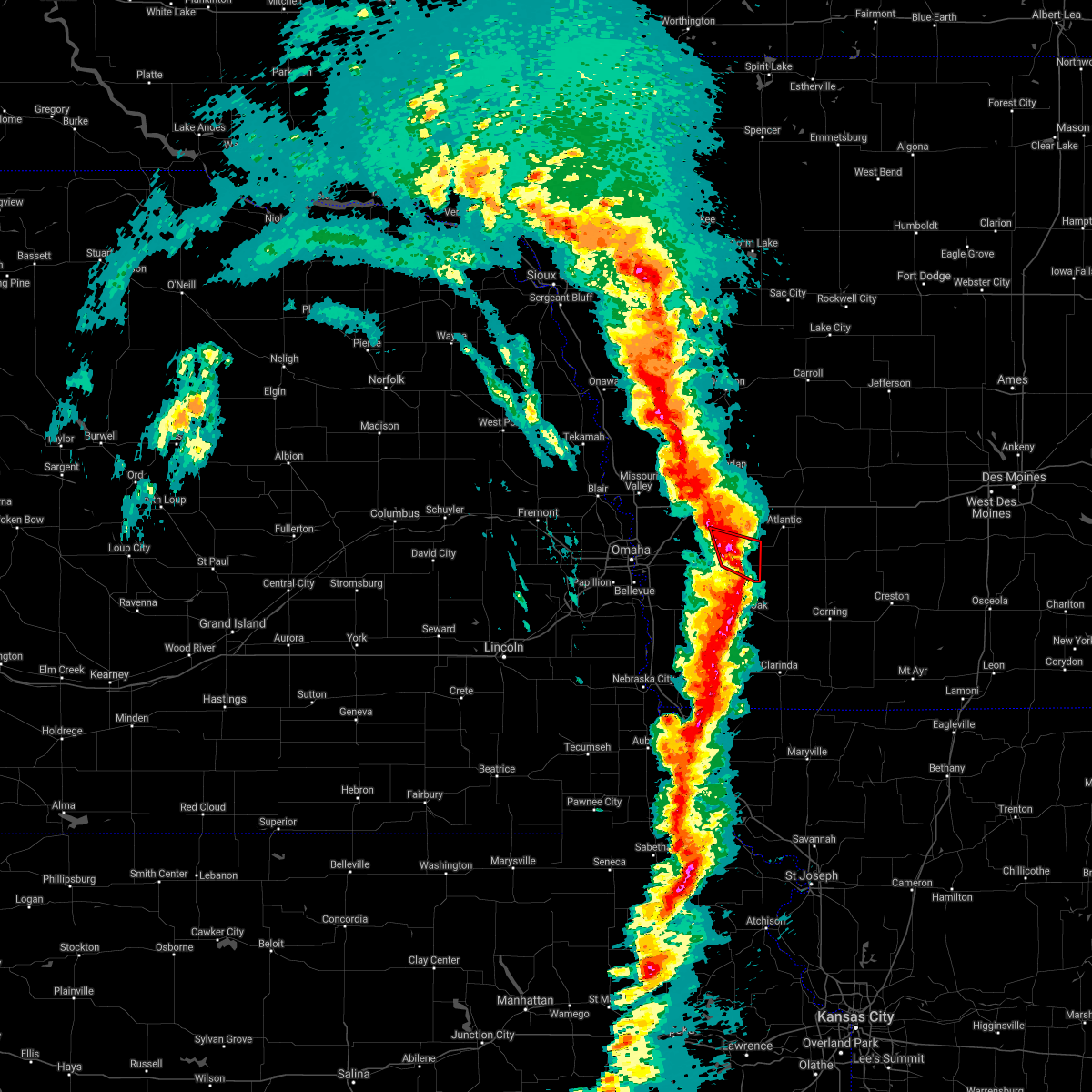 At 442 pm cst, a severe thunderstorm capable of producing a tornado was located 6 miles northwest of griswold, or 15 miles southwest of atlantic, moving northeast at 80 mph (radar indicated rotation). Hazards include tornado. Flying debris will be dangerous to those caught without shelter. mobile homes will be damaged or destroyed. damage to roofs, windows, and vehicles will occur. tree damage is likely. Locations impacted include, oakland and farm creek public wildlife area. At 442 pm cst, a severe thunderstorm capable of producing a tornado was located 6 miles northwest of griswold, or 15 miles southwest of atlantic, moving northeast at 80 mph (radar indicated rotation). Hazards include tornado. Flying debris will be dangerous to those caught without shelter. mobile homes will be damaged or destroyed. damage to roofs, windows, and vehicles will occur. tree damage is likely. Locations impacted include, oakland and farm creek public wildlife area.
|
| 12/15/2021 3:55 PM CST |
 At 354 pm cst, severe thunderstorms were located along a line extending from near waterloo to 5 miles northeast of summerfield, moving east at 75 mph. these are destructive storms (trained weather spotters). Hazards include 90 mph wind gusts. You are in a life-threatening situation. flying debris may be deadly to those caught without shelter. mobile homes will be heavily damaged or destroyed. homes and businesses will have substantial roof and window damage. Expect extensive tree damage and power outages. At 354 pm cst, severe thunderstorms were located along a line extending from near waterloo to 5 miles northeast of summerfield, moving east at 75 mph. these are destructive storms (trained weather spotters). Hazards include 90 mph wind gusts. You are in a life-threatening situation. flying debris may be deadly to those caught without shelter. mobile homes will be heavily damaged or destroyed. homes and businesses will have substantial roof and window damage. Expect extensive tree damage and power outages.
|
| 7/30/2021 8:28 PM CDT | Ping Pong Ball sized hail reported 0.2 miles W of Hancock, IA, storm spotter reporting ping pong sized hail. also noted a broken window. |
| 7/30/2021 8:28 PM CDT | Corrects previous tstm wnd gst report from hancock. storm spotter report of tree branches down in the area. estimated wind gusts up to 60 mp in pottawattamie county IA, 0.2 miles W of Hancock, IA |
| 7/30/2021 8:25 PM CDT | Em relaying a report of trees and powerlines down off of 380th s in pottawattamie county IA, 5 miles E of Hancock, IA |
| 7/30/2021 8:25 PM CDT | Trained spotter reported several trees 1-2 feet in diameter dow in pottawattamie county IA, 0.2 miles W of Hancock, IA |
| 7/30/2021 8:25 PM CDT |
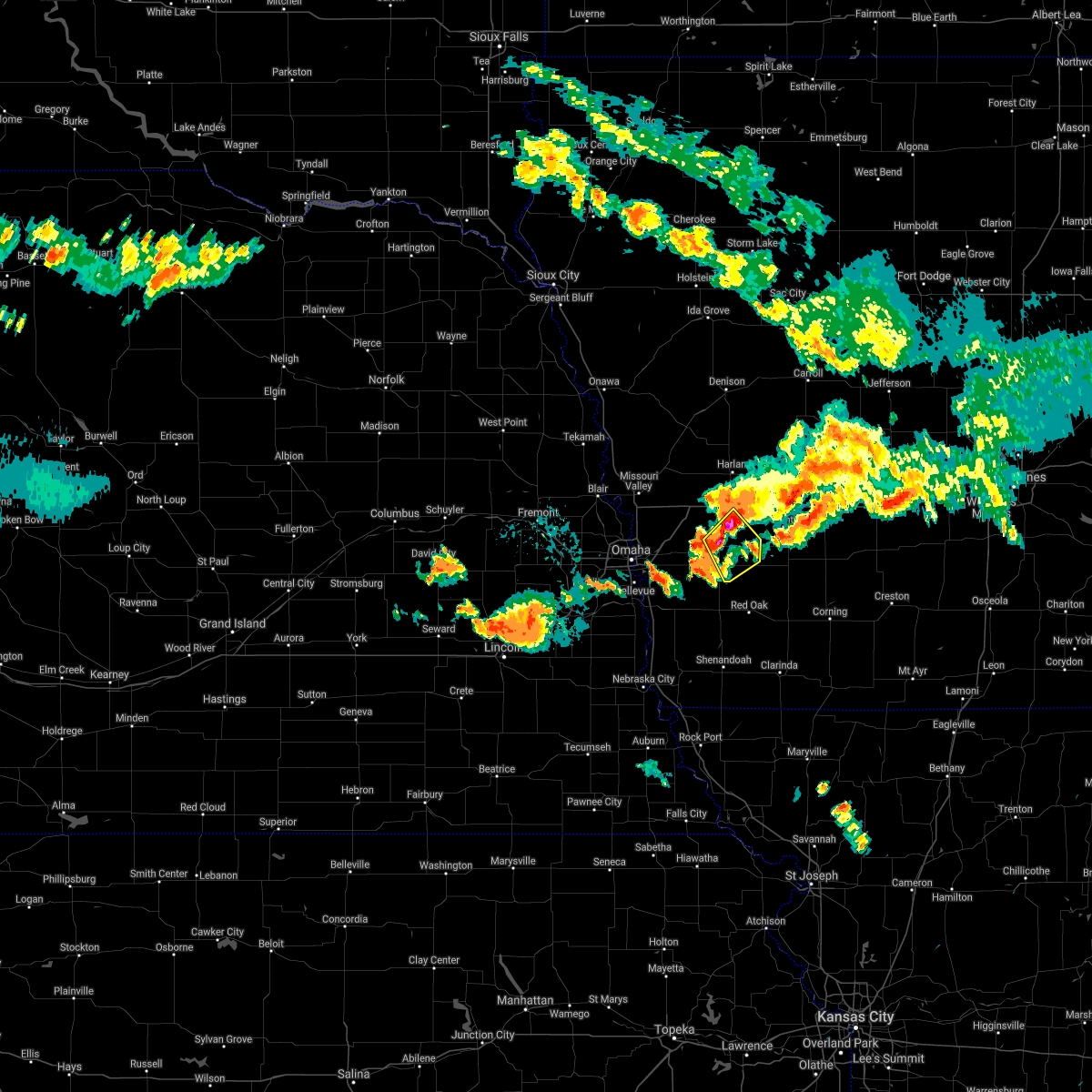 At 825 pm cdt, a severe thunderstorm was located over oakland, or 20 miles west of atlantic, moving southeast at 40 mph (radar indicated). Hazards include ping pong ball size hail and 60 mph wind gusts. People and animals outdoors will be injured. expect hail damage to roofs, siding, windows, and vehicles. expect wind damage to roofs, siding, and trees. Locations impacted include, carson. At 825 pm cdt, a severe thunderstorm was located over oakland, or 20 miles west of atlantic, moving southeast at 40 mph (radar indicated). Hazards include ping pong ball size hail and 60 mph wind gusts. People and animals outdoors will be injured. expect hail damage to roofs, siding, windows, and vehicles. expect wind damage to roofs, siding, and trees. Locations impacted include, carson.
|
| 7/30/2021 8:12 PM CDT |
 At 812 pm cdt, a severe thunderstorm was located near minden, or 24 miles west of atlantic, moving southeast at 40 mph (radar indicated). Hazards include ping pong ball size hail and 60 mph wind gusts. People and animals outdoors will be injured. expect hail damage to roofs, siding, windows, and vehicles. expect wind damage to roofs, siding, and trees. this severe thunderstorm will be near, oakland around 830 pm cdt. other locations in the path of this severe thunderstorm include carson. This includes interstate 80 in iowa between mile markers 31 and 40. At 812 pm cdt, a severe thunderstorm was located near minden, or 24 miles west of atlantic, moving southeast at 40 mph (radar indicated). Hazards include ping pong ball size hail and 60 mph wind gusts. People and animals outdoors will be injured. expect hail damage to roofs, siding, windows, and vehicles. expect wind damage to roofs, siding, and trees. this severe thunderstorm will be near, oakland around 830 pm cdt. other locations in the path of this severe thunderstorm include carson. This includes interstate 80 in iowa between mile markers 31 and 40.
|
| 7/10/2021 12:13 AM CDT |
 At 1213 am cdt, severe thunderstorms were located along a line extending from near underwood to 4 miles west of elliott, moving south at 30 mph (radar indicated). Hazards include 65 mph wind gusts. Expect damage to roofs, siding, and trees. severe thunderstorms will be near, northeastern council bluffs and red oak around 1225 am cdt. other locations in the path of these severe thunderstorms include emerson, glenwood and pacific junction. this includes the following highways, interstate 29 between mile markers 25 and 32. Interstate 80 in iowa between mile markers 8 and 20. At 1213 am cdt, severe thunderstorms were located along a line extending from near underwood to 4 miles west of elliott, moving south at 30 mph (radar indicated). Hazards include 65 mph wind gusts. Expect damage to roofs, siding, and trees. severe thunderstorms will be near, northeastern council bluffs and red oak around 1225 am cdt. other locations in the path of these severe thunderstorms include emerson, glenwood and pacific junction. this includes the following highways, interstate 29 between mile markers 25 and 32. Interstate 80 in iowa between mile markers 8 and 20.
|
| 7/9/2021 11:30 PM CDT |
 At 1130 pm cdt, severe thunderstorms were located along a line extending from 6 miles north of underwood to 4 miles east of walnut, moving south at 35 mph (radar indicated). Hazards include 65 mph wind gusts and penny size hail. Expect damage to roofs, siding, and trees. severe thunderstorms will be near, walnut around 1135 pm cdt. other locations in the path of these severe thunderstorms include treynor and elliott. This includes interstate 80 in iowa between mile markers 8 and 48. At 1130 pm cdt, severe thunderstorms were located along a line extending from 6 miles north of underwood to 4 miles east of walnut, moving south at 35 mph (radar indicated). Hazards include 65 mph wind gusts and penny size hail. Expect damage to roofs, siding, and trees. severe thunderstorms will be near, walnut around 1135 pm cdt. other locations in the path of these severe thunderstorms include treynor and elliott. This includes interstate 80 in iowa between mile markers 8 and 48.
|
| 6/18/2021 11:29 PM CDT |
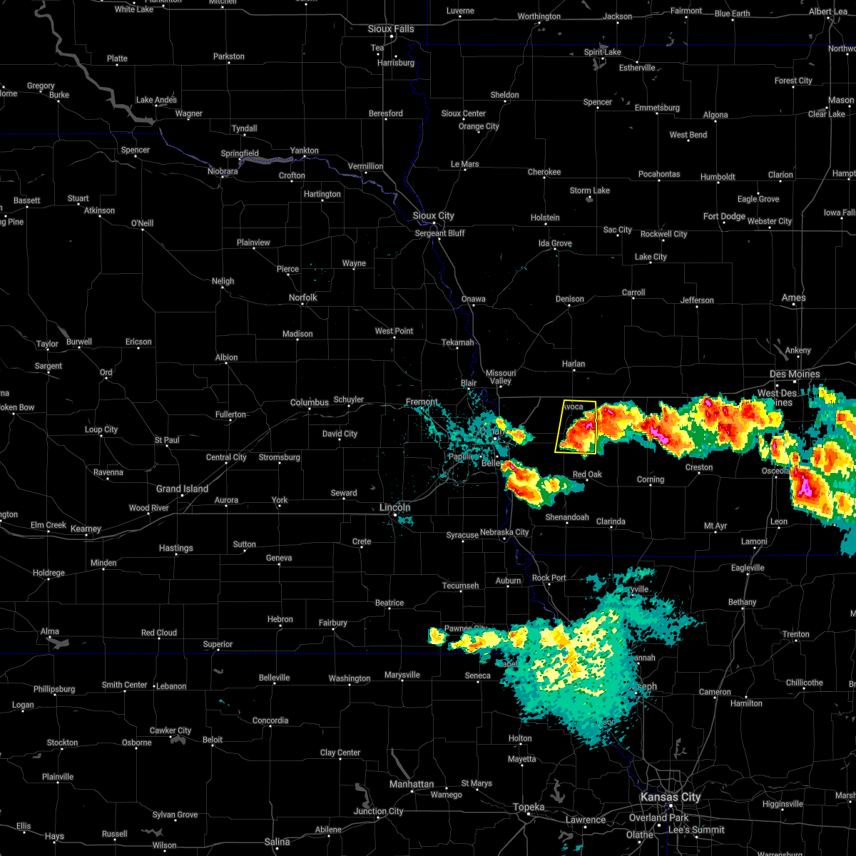 At 1128 pm cdt, a severe thunderstorm was located 5 miles east of oakland, or 15 miles southwest of atlantic, moving east at 25 mph (radar indicated). Hazards include golf ball size hail and 60 mph wind gusts. People and animals outdoors will be injured. expect hail damage to roofs, siding, windows, and vehicles. expect wind damage to roofs, siding, and trees. Locations impacted include, oakland, avoca, carson, macedonia, hancock, botna bend park, old town park and farm creek public wildlife area. At 1128 pm cdt, a severe thunderstorm was located 5 miles east of oakland, or 15 miles southwest of atlantic, moving east at 25 mph (radar indicated). Hazards include golf ball size hail and 60 mph wind gusts. People and animals outdoors will be injured. expect hail damage to roofs, siding, windows, and vehicles. expect wind damage to roofs, siding, and trees. Locations impacted include, oakland, avoca, carson, macedonia, hancock, botna bend park, old town park and farm creek public wildlife area.
|
| 6/18/2021 11:18 PM CDT |
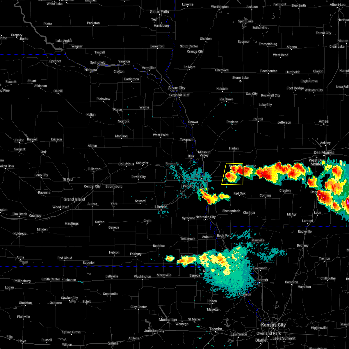 At 1117 pm cdt, a severe thunderstorm was located over oakland, or 19 miles west of atlantic, moving east at 35 mph. another severe storm was located east of hancock, also moving east at 35 mph (radar indicated). Hazards include 60 mph wind gusts and half dollar size hail. Hail damage to vehicles is expected. expect wind damage to roofs, siding, and trees. Locations impacted include, oakland, avoca, carson, macedonia, hancock, botna bend park, old town park and farm creek public wildlife area. At 1117 pm cdt, a severe thunderstorm was located over oakland, or 19 miles west of atlantic, moving east at 35 mph. another severe storm was located east of hancock, also moving east at 35 mph (radar indicated). Hazards include 60 mph wind gusts and half dollar size hail. Hail damage to vehicles is expected. expect wind damage to roofs, siding, and trees. Locations impacted include, oakland, avoca, carson, macedonia, hancock, botna bend park, old town park and farm creek public wildlife area.
|
| 6/18/2021 11:07 PM CDT |
 At 1105 pm cdt, a severe thunderstorm was located 6 miles northeast of oakland, or 15 miles west of atlantic, moving east at 25 mph (radar indicated). Hazards include 60 mph wind gusts and quarter size hail. Hail damage to vehicles is expected. expect wind damage to roofs, siding, and trees. This severe thunderstorm will remain over mainly rural areas of eastern pottawattamie county, including the following locations, botna bend park, old town park, hancock and farm creek public wildlife area. At 1105 pm cdt, a severe thunderstorm was located 6 miles northeast of oakland, or 15 miles west of atlantic, moving east at 25 mph (radar indicated). Hazards include 60 mph wind gusts and quarter size hail. Hail damage to vehicles is expected. expect wind damage to roofs, siding, and trees. This severe thunderstorm will remain over mainly rural areas of eastern pottawattamie county, including the following locations, botna bend park, old town park, hancock and farm creek public wildlife area.
|
| 10/11/2020 11:17 PM CDT |
 At 1117 pm cdt, severe thunderstorms were located along a line extending from near atlantic to 7 miles west of blanchard, moving east at 50 mph (trained weather spotters). Hazards include 65 mph wind gusts. Expect damage to roofs, siding, and trees. Locations impacted include, red oak, clarinda, shenandoah, oakland, villisca, carson, essex, stanton, farragut, emerson, elliott, macedonia, coin, college springs, hancock, shambaugh, henderson, braddyville, grant and yorktown. At 1117 pm cdt, severe thunderstorms were located along a line extending from near atlantic to 7 miles west of blanchard, moving east at 50 mph (trained weather spotters). Hazards include 65 mph wind gusts. Expect damage to roofs, siding, and trees. Locations impacted include, red oak, clarinda, shenandoah, oakland, villisca, carson, essex, stanton, farragut, emerson, elliott, macedonia, coin, college springs, hancock, shambaugh, henderson, braddyville, grant and yorktown.
|
| 10/11/2020 10:59 PM CDT |
 At 1059 pm cdt, severe thunderstorms were located along a line extending from 5 miles northeast of oakland to hamburg, moving east at 50 mph (radar indicated). Hazards include 65 mph wind gusts. expect damage to roofs, siding, and trees At 1059 pm cdt, severe thunderstorms were located along a line extending from 5 miles northeast of oakland to hamburg, moving east at 50 mph (radar indicated). Hazards include 65 mph wind gusts. expect damage to roofs, siding, and trees
|
| 8/10/2020 9:35 AM CDT |
 At 934 am cdt, severe thunderstorms were located along a line extending from 5 miles east of irwin to near macedonia, moving east at 55 mph (trained weather spotters. and automated weather stations have reported widespread tree damage and wind gusts of 60 to 70 mph). Hazards include 65 mph wind gusts. Expect damage to roofs, siding, and trees. these severe thunderstorms will remain over mainly rural areas of eastern pottawattamie and shelby counties, including the following locations, botna bend park, tennant, old town park, prairie rose state park, nishna bend recreation area, farm creek public wildlife area, hancock, kirkman, elk horn creek recreation area and westphalia. This includes interstate 80 in iowa between mile markers 34 and 48. At 934 am cdt, severe thunderstorms were located along a line extending from 5 miles east of irwin to near macedonia, moving east at 55 mph (trained weather spotters. and automated weather stations have reported widespread tree damage and wind gusts of 60 to 70 mph). Hazards include 65 mph wind gusts. Expect damage to roofs, siding, and trees. these severe thunderstorms will remain over mainly rural areas of eastern pottawattamie and shelby counties, including the following locations, botna bend park, tennant, old town park, prairie rose state park, nishna bend recreation area, farm creek public wildlife area, hancock, kirkman, elk horn creek recreation area and westphalia. This includes interstate 80 in iowa between mile markers 34 and 48.
|
| 8/10/2020 9:09 AM CDT |
 At 908 am cdt, severe thunderstorms were located along a line extending from near dunlap to 5 miles north of underwood to bellevue, moving east at 60 mph (trained weather spotters and automated weather systems have measured winds of 55 to 75 mph with this storm. the strongest winds within this warning will be over shelby county). Hazards include 65 mph wind gusts. Expect damage to roofs, siding, and trees. severe thunderstorms will be near, minden and earling around 915 am cdt. shelby and defiance around 920 am cdt. oakland, avoca and irwin around 925 am cdt. other locations impacted by these severe thunderstorms include old town park, prairie rose state park, farm creek public wildlife area, mcclelland, hancock, botna bend park, tennant, manteno recreation area, nishna bend recreation area and panama. This includes interstate 80 in iowa between mile markers 31 and 48. At 908 am cdt, severe thunderstorms were located along a line extending from near dunlap to 5 miles north of underwood to bellevue, moving east at 60 mph (trained weather spotters and automated weather systems have measured winds of 55 to 75 mph with this storm. the strongest winds within this warning will be over shelby county). Hazards include 65 mph wind gusts. Expect damage to roofs, siding, and trees. severe thunderstorms will be near, minden and earling around 915 am cdt. shelby and defiance around 920 am cdt. oakland, avoca and irwin around 925 am cdt. other locations impacted by these severe thunderstorms include old town park, prairie rose state park, farm creek public wildlife area, mcclelland, hancock, botna bend park, tennant, manteno recreation area, nishna bend recreation area and panama. This includes interstate 80 in iowa between mile markers 31 and 48.
|
| 6/5/2020 7:37 PM CDT |
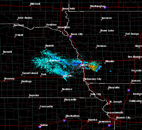 The severe thunderstorm warning for central pottawattamie county will expire at 745 pm cdt, the storm which prompted the warning has moved out of the area. therefore, the warning will be allowed to expire. however small hail and heavy rain are still possible with this thunderstorm. The severe thunderstorm warning for central pottawattamie county will expire at 745 pm cdt, the storm which prompted the warning has moved out of the area. therefore, the warning will be allowed to expire. however small hail and heavy rain are still possible with this thunderstorm.
|
| 6/5/2020 7:26 PM CDT |
 At 726 pm cdt, a severe thunderstorm was located over treynor, or 23 miles east of omaha, moving northeast at 10 mph (public). Hazards include 60 mph wind gusts and half dollar size hail. Hail damage to vehicles is expected. expect wind damage to roofs, siding, and trees. Locations impacted include, oakland, carson, hancock and mcclelland. At 726 pm cdt, a severe thunderstorm was located over treynor, or 23 miles east of omaha, moving northeast at 10 mph (public). Hazards include 60 mph wind gusts and half dollar size hail. Hail damage to vehicles is expected. expect wind damage to roofs, siding, and trees. Locations impacted include, oakland, carson, hancock and mcclelland.
|
| 6/5/2020 7:07 PM CDT |
 At 707 pm cdt, a severe thunderstorm was located near treynor, or 22 miles east of omaha, moving east at 10 mph (radar indicated). Hazards include 60 mph wind gusts and quarter size hail. Hail damage to vehicles is expected. expect wind damage to roofs, siding, and trees. Locations impacted include, oakland, carson, hancock and mcclelland. At 707 pm cdt, a severe thunderstorm was located near treynor, or 22 miles east of omaha, moving east at 10 mph (radar indicated). Hazards include 60 mph wind gusts and quarter size hail. Hail damage to vehicles is expected. expect wind damage to roofs, siding, and trees. Locations impacted include, oakland, carson, hancock and mcclelland.
|
| 6/5/2020 6:56 PM CDT |
 At 656 pm cdt, a severe thunderstorm was located near treynor, or 22 miles east of omaha, moving northeast at 10 mph (radar indicated). Hazards include 60 mph wind gusts and quarter size hail. Hail damage to vehicles is expected. Expect wind damage to roofs, siding, and trees. At 656 pm cdt, a severe thunderstorm was located near treynor, or 22 miles east of omaha, moving northeast at 10 mph (radar indicated). Hazards include 60 mph wind gusts and quarter size hail. Hail damage to vehicles is expected. Expect wind damage to roofs, siding, and trees.
|
| 5/24/2020 5:38 AM CDT |
 At 538 am cdt, severe thunderstorms were located along a line extending from 7 miles southwest of earling to 5 miles west of minden to near bellevue, moving southeast at 30 mph (radar indicated). Hazards include 60 mph wind gusts. expect damage to roofs, siding, and trees At 538 am cdt, severe thunderstorms were located along a line extending from 7 miles southwest of earling to 5 miles west of minden to near bellevue, moving southeast at 30 mph (radar indicated). Hazards include 60 mph wind gusts. expect damage to roofs, siding, and trees
|
| 5/24/2020 5:12 AM CDT |
 At 512 am cdt, severe thunderstorms were located along a line extending from 4 miles west of logan to fort calhoun to elkhorn, moving southeast at 30 mph (radar indicated). Hazards include 70 mph wind gusts. Expect considerable tree damage. Damage is likely to mobile homes, roofs, and outbuildings. At 512 am cdt, severe thunderstorms were located along a line extending from 4 miles west of logan to fort calhoun to elkhorn, moving southeast at 30 mph (radar indicated). Hazards include 70 mph wind gusts. Expect considerable tree damage. Damage is likely to mobile homes, roofs, and outbuildings.
|
| 9/24/2019 10:21 PM CDT |
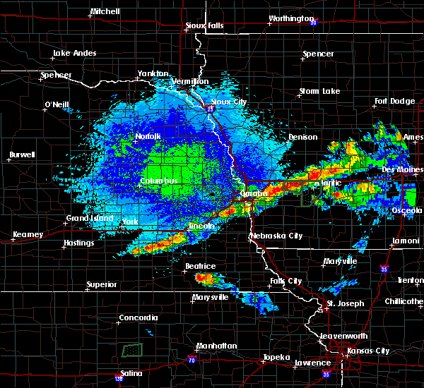 The national weather service in omaha has issued a * severe thunderstorm warning for. northeastern pottawattamie county in southwestern iowa. until 1045 pm cdt. At 1021 pm cdt, a severe thunderstorm was located 5 miles southwest of avoca, or 19 miles west of atlantic, moving east at 40 mph. The national weather service in omaha has issued a * severe thunderstorm warning for. northeastern pottawattamie county in southwestern iowa. until 1045 pm cdt. At 1021 pm cdt, a severe thunderstorm was located 5 miles southwest of avoca, or 19 miles west of atlantic, moving east at 40 mph.
|
| 9/24/2019 8:27 PM CDT |
 The severe thunderstorm warning for northeastern pottawattamie and southeastern shelby counties will expire at 830 pm cdt, the storm which prompted the warning has weakened below severe limits, and no longer poses an immediate threat to life or property. therefore, the warning will be allowed to expire. however penny size hail is still possible with this thunderstorm. a tornado watch remains in effect until midnight cdt for southwestern iowa. The severe thunderstorm warning for northeastern pottawattamie and southeastern shelby counties will expire at 830 pm cdt, the storm which prompted the warning has weakened below severe limits, and no longer poses an immediate threat to life or property. therefore, the warning will be allowed to expire. however penny size hail is still possible with this thunderstorm. a tornado watch remains in effect until midnight cdt for southwestern iowa.
|
| 9/24/2019 8:16 PM CDT |
 At 816 pm cdt, a severe thunderstorm was located over walnut, or 9 miles northwest of atlantic, moving east at 25 mph. another severe thunderstorm was located over avoca, also moving east at 25 mph (radar indicated). Hazards include quarter size hail. Damage to vehicles is expected. locations impacted include, avoca, walnut, hancock and botna bend park. This includes interstate 80 in iowa between mile markers 40 and 48. At 816 pm cdt, a severe thunderstorm was located over walnut, or 9 miles northwest of atlantic, moving east at 25 mph. another severe thunderstorm was located over avoca, also moving east at 25 mph (radar indicated). Hazards include quarter size hail. Damage to vehicles is expected. locations impacted include, avoca, walnut, hancock and botna bend park. This includes interstate 80 in iowa between mile markers 40 and 48.
|
| 9/24/2019 7:59 PM CDT |
 The national weather service in omaha has issued a * severe thunderstorm warning for. northeastern pottawattamie county in southwestern iowa. southeastern shelby county in southwestern iowa. until 830 pm cdt. At 757 pm cdt, a severe thunderstorm was located over avoca, or 15. The national weather service in omaha has issued a * severe thunderstorm warning for. northeastern pottawattamie county in southwestern iowa. southeastern shelby county in southwestern iowa. until 830 pm cdt. At 757 pm cdt, a severe thunderstorm was located over avoca, or 15.
|
| 9/24/2019 7:53 PM CDT |
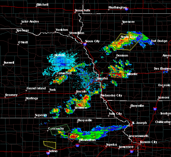 At 753 pm cdt, a severe thunderstorm capable of producing a tornado was located over avoca, or 16 miles west of atlantic, moving east at 30 mph (radar indicated rotation). Hazards include tornado and half dollar size hail. Flying debris will be dangerous to those caught without shelter. mobile homes will be damaged or destroyed. damage to roofs, windows, and vehicles will occur. tree damage is likely. this dangerous storm will be near, walnut around 805 pm cdt. Other locations impacted by this tornadic thunderstorm include botna bend park and hancock. At 753 pm cdt, a severe thunderstorm capable of producing a tornado was located over avoca, or 16 miles west of atlantic, moving east at 30 mph (radar indicated rotation). Hazards include tornado and half dollar size hail. Flying debris will be dangerous to those caught without shelter. mobile homes will be damaged or destroyed. damage to roofs, windows, and vehicles will occur. tree damage is likely. this dangerous storm will be near, walnut around 805 pm cdt. Other locations impacted by this tornadic thunderstorm include botna bend park and hancock.
|
| 9/24/2019 7:48 PM CDT |
 At 747 pm cdt, a severe thunderstorm capable of producing a tornado was located near avoca, or 18 miles west of atlantic, moving east at 30 mph (radar indicated rotation). Hazards include tornado and half dollar size hail. Flying debris will be dangerous to those caught without shelter. mobile homes will be damaged or destroyed. damage to roofs, windows, and vehicles will occur. tree damage is likely. this dangerous storm will be near, walnut around 805 pm cdt. Other locations impacted by this tornadic thunderstorm include botna bend park and hancock. At 747 pm cdt, a severe thunderstorm capable of producing a tornado was located near avoca, or 18 miles west of atlantic, moving east at 30 mph (radar indicated rotation). Hazards include tornado and half dollar size hail. Flying debris will be dangerous to those caught without shelter. mobile homes will be damaged or destroyed. damage to roofs, windows, and vehicles will occur. tree damage is likely. this dangerous storm will be near, walnut around 805 pm cdt. Other locations impacted by this tornadic thunderstorm include botna bend park and hancock.
|
| 9/24/2019 7:37 PM CDT |
 At 737 pm cdt, a severe thunderstorm capable of producing a tornado was located near shelby, or 22 miles west of atlantic, moving east at 35 mph (radar indicated rotation). Hazards include tornado and golf ball size hail. Flying debris will be dangerous to those caught without shelter. mobile homes will be damaged or destroyed. damage to roofs, windows, and vehicles will occur. tree damage is likely. this dangerous storm will be near, avoca around 750 pm cdt. walnut around 800 pm cdt. Other locations impacted by this tornadic thunderstorm include botna bend park and hancock. At 737 pm cdt, a severe thunderstorm capable of producing a tornado was located near shelby, or 22 miles west of atlantic, moving east at 35 mph (radar indicated rotation). Hazards include tornado and golf ball size hail. Flying debris will be dangerous to those caught without shelter. mobile homes will be damaged or destroyed. damage to roofs, windows, and vehicles will occur. tree damage is likely. this dangerous storm will be near, avoca around 750 pm cdt. walnut around 800 pm cdt. Other locations impacted by this tornadic thunderstorm include botna bend park and hancock.
|
| 9/24/2019 7:35 PM CDT |
 At 735 pm cdt, a severe thunderstorm was located over shelby, or 22 miles west of atlantic, moving east at 35 mph (radar indicated). Hazards include quarter size hail. damage to vehicles is expected At 735 pm cdt, a severe thunderstorm was located over shelby, or 22 miles west of atlantic, moving east at 35 mph (radar indicated). Hazards include quarter size hail. damage to vehicles is expected
|
| 7/3/2019 2:56 PM CDT |
 The severe thunderstorm warning for northeastern pottawattamie and southeastern shelby counties will expire at 300 pm cdt, the storm which prompted the warning has weakened below severe limits, and has exited the warned area. therefore, the warning will be allowed to expire. The severe thunderstorm warning for northeastern pottawattamie and southeastern shelby counties will expire at 300 pm cdt, the storm which prompted the warning has weakened below severe limits, and has exited the warned area. therefore, the warning will be allowed to expire.
|
| 7/3/2019 2:41 PM CDT |
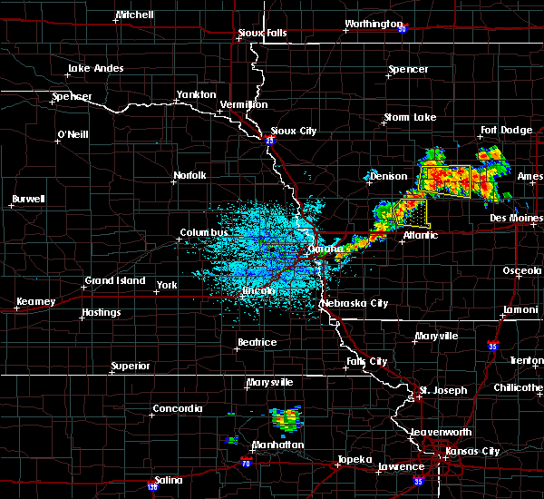 At 241 pm cdt, a severe thunderstorm was located over walnut, or 12 miles northwest of atlantic, moving east at 15 mph (radar indicated). Hazards include 60 mph wind gusts and quarter size hail. Hail damage to vehicles is expected. Expect wind damage to roofs, siding, and trees. At 241 pm cdt, a severe thunderstorm was located over walnut, or 12 miles northwest of atlantic, moving east at 15 mph (radar indicated). Hazards include 60 mph wind gusts and quarter size hail. Hail damage to vehicles is expected. Expect wind damage to roofs, siding, and trees.
|
| 5/28/2019 4:55 AM CDT |
 At 455 am cdt, a severe thunderstorm was located near treynor, or 18 miles east of omaha, moving east at 40 mph (trained weather spotters). Hazards include 60 mph wind gusts and quarter size hail. Hail damage to vehicles is expected. Expect wind damage to roofs, siding, and trees. At 455 am cdt, a severe thunderstorm was located near treynor, or 18 miles east of omaha, moving east at 40 mph (trained weather spotters). Hazards include 60 mph wind gusts and quarter size hail. Hail damage to vehicles is expected. Expect wind damage to roofs, siding, and trees.
|
| 7/4/2018 10:23 PM CDT |
 At 1022 pm cdt, severe thunderstorms were located along a line extending from near minden to offutt afb, moving east at 30 mph (radar indicated). Hazards include 60 mph wind gusts. Expect damage to roofs, siding, and trees. locations impacted include, omaha, council bluffs, bellevue, la vista, ralston, oakland, treynor, underwood, minden, offutt afb, carter lake, neola, crescent, hancock, mcclelland, lake manawa state park, botna bend park, hitchcock nature center, arrowhead park and narrows river park. this includes the following highways, interstate 29 between mile markers 37 and 68. interstate 80 in iowa between mile markers 1 and 29. Interstate 80 in nebraska between mile markers 448 and 454. At 1022 pm cdt, severe thunderstorms were located along a line extending from near minden to offutt afb, moving east at 30 mph (radar indicated). Hazards include 60 mph wind gusts. Expect damage to roofs, siding, and trees. locations impacted include, omaha, council bluffs, bellevue, la vista, ralston, oakland, treynor, underwood, minden, offutt afb, carter lake, neola, crescent, hancock, mcclelland, lake manawa state park, botna bend park, hitchcock nature center, arrowhead park and narrows river park. this includes the following highways, interstate 29 between mile markers 37 and 68. interstate 80 in iowa between mile markers 1 and 29. Interstate 80 in nebraska between mile markers 448 and 454.
|
| 7/4/2018 10:18 PM CDT |
 At 1017 pm cdt, severe thunderstorms were located along a line extending from near minden to near bellevue, moving east at 35 mph (radar indicated). Hazards include 60 mph wind gusts. Expect damage to roofs, siding, and trees. locations impacted include, omaha, council bluffs, bellevue, la vista, ralston, oakland, treynor, underwood, minden, offutt afb, carter lake, neola, crescent, hancock, mcclelland, lake manawa state park, botna bend park, hitchcock nature center, arrowhead park and narrows river park. this includes the following highways, interstate 29 between mile markers 37 and 68. interstate 80 in iowa between mile markers 1 and 29. Interstate 80 in nebraska between mile markers 448 and 454. At 1017 pm cdt, severe thunderstorms were located along a line extending from near minden to near bellevue, moving east at 35 mph (radar indicated). Hazards include 60 mph wind gusts. Expect damage to roofs, siding, and trees. locations impacted include, omaha, council bluffs, bellevue, la vista, ralston, oakland, treynor, underwood, minden, offutt afb, carter lake, neola, crescent, hancock, mcclelland, lake manawa state park, botna bend park, hitchcock nature center, arrowhead park and narrows river park. this includes the following highways, interstate 29 between mile markers 37 and 68. interstate 80 in iowa between mile markers 1 and 29. Interstate 80 in nebraska between mile markers 448 and 454.
|
| 7/4/2018 10:13 PM CDT |
 At 1012 pm cdt, severe thunderstorms were located along a line extending from near minden to near papillion, moving east at 30 mph (radar indicated). Hazards include 60 mph wind gusts. Expect damage to roofs, siding, and trees. Locations impacted include, omaha, council bluffs, bellevue, papillion, la vista, ralston, oakland, treynor, underwood, minden, elkhorn, offutt afb, carter lake, bennington, neola, boys town, crescent, hancock, mcclelland and lake manawa state park. At 1012 pm cdt, severe thunderstorms were located along a line extending from near minden to near papillion, moving east at 30 mph (radar indicated). Hazards include 60 mph wind gusts. Expect damage to roofs, siding, and trees. Locations impacted include, omaha, council bluffs, bellevue, papillion, la vista, ralston, oakland, treynor, underwood, minden, elkhorn, offutt afb, carter lake, bennington, neola, boys town, crescent, hancock, mcclelland and lake manawa state park.
|
| 7/4/2018 10:07 PM CDT |
 At 1007 pm cdt, severe thunderstorms were located along a line extending from near minden to omaha, moving east at 40 mph (radar indicated). Hazards include 60 mph wind gusts. Expect damage to roofs, siding, and trees. Locations impacted include, omaha, council bluffs, bellevue, papillion, la vista, ralston, oakland, treynor, underwood, minden, elkhorn, offutt afb, carter lake, bennington, neola, boys town, crescent, hancock, mcclelland and lake manawa state park. At 1007 pm cdt, severe thunderstorms were located along a line extending from near minden to omaha, moving east at 40 mph (radar indicated). Hazards include 60 mph wind gusts. Expect damage to roofs, siding, and trees. Locations impacted include, omaha, council bluffs, bellevue, papillion, la vista, ralston, oakland, treynor, underwood, minden, elkhorn, offutt afb, carter lake, bennington, neola, boys town, crescent, hancock, mcclelland and lake manawa state park.
|
| 7/4/2018 10:02 PM CDT |
 At 1002 pm cdt, severe thunderstorms were located along a line extending from 3 miles southwest of persia to 3 miles north of millard, moving east at 35 mph (radar indicated). Hazards include 60 mph wind gusts. Expect damage to roofs, siding, and trees. Locations impacted include, omaha, council bluffs, bellevue, papillion, la vista, ralston, oakland, treynor, underwood, minden, elkhorn, offutt afb, carter lake, bennington, neola, boys town, crescent, hancock, mcclelland and lake manawa state park. At 1002 pm cdt, severe thunderstorms were located along a line extending from 3 miles southwest of persia to 3 miles north of millard, moving east at 35 mph (radar indicated). Hazards include 60 mph wind gusts. Expect damage to roofs, siding, and trees. Locations impacted include, omaha, council bluffs, bellevue, papillion, la vista, ralston, oakland, treynor, underwood, minden, elkhorn, offutt afb, carter lake, bennington, neola, boys town, crescent, hancock, mcclelland and lake manawa state park.
|
| 7/4/2018 9:53 PM CDT |
 At 953 pm cdt, severe thunderstorms were located along a line extending from 7 miles west of persia to near elkhorn, moving southeast at 25 mph (radar indicated). Hazards include 60 mph wind gusts. Expect damage to roofs, siding, and trees. Locations impacted include, omaha, council bluffs, bellevue, papillion, la vista, ralston, oakland, treynor, underwood, minden, elkhorn, offutt afb, carter lake, bennington, neola, boys town, crescent, hancock, mcclelland and lake manawa state park. At 953 pm cdt, severe thunderstorms were located along a line extending from 7 miles west of persia to near elkhorn, moving southeast at 25 mph (radar indicated). Hazards include 60 mph wind gusts. Expect damage to roofs, siding, and trees. Locations impacted include, omaha, council bluffs, bellevue, papillion, la vista, ralston, oakland, treynor, underwood, minden, elkhorn, offutt afb, carter lake, bennington, neola, boys town, crescent, hancock, mcclelland and lake manawa state park.
|
| 7/4/2018 9:45 PM CDT |
 The national weather service in omaha has issued a * severe thunderstorm warning for. northwestern mills county in southwestern iowa. pottawattamie county in southwestern iowa. south central harrison county in southwestern iowa. Northeastern sarpy county in east central nebraska. The national weather service in omaha has issued a * severe thunderstorm warning for. northwestern mills county in southwestern iowa. pottawattamie county in southwestern iowa. south central harrison county in southwestern iowa. Northeastern sarpy county in east central nebraska.
|
| 7/4/2018 9:45 PM CDT |
 At 945 pm cdt, severe thunderstorms were located along a line extending from 7 miles west of earling to near waterloo, moving east at 35 mph (radar indicated). Hazards include 60 mph wind gusts. expect damage to roofs, siding, and trees At 945 pm cdt, severe thunderstorms were located along a line extending from 7 miles west of earling to near waterloo, moving east at 35 mph (radar indicated). Hazards include 60 mph wind gusts. expect damage to roofs, siding, and trees
|
| 6/18/2018 7:27 PM CDT |
 The severe thunderstorm warning for northeastern pottawattamie and shelby counties will expire at 730 pm cdt, the storms which prompted the warning have weakened slightly. therefore, the warning will be allowed to expire at this time. gusty winds to around 50 mph and heavy rain will still be possible with these thunderstorms. a severe thunderstorm watch remains in effect until 1000 pm cdt for southwestern iowa. The severe thunderstorm warning for northeastern pottawattamie and shelby counties will expire at 730 pm cdt, the storms which prompted the warning have weakened slightly. therefore, the warning will be allowed to expire at this time. gusty winds to around 50 mph and heavy rain will still be possible with these thunderstorms. a severe thunderstorm watch remains in effect until 1000 pm cdt for southwestern iowa.
|
| 6/18/2018 7:18 PM CDT |
 At 717 pm cdt, severe thunderstorms were located along a line extending from 7 miles southwest of earling to 5 miles south of avoca, moving east at 20 mph (radar indicated). Hazards include 60 mph wind gusts. Expect damage to roofs, siding, and trees. locations impacted include, harlan, avoca, walnut, shelby, earling, irwin, defiance, panama, hancock, portsmouth, westphalia, tennant, kirkman, prairie rose state park, botna bend park, manteno recreation area and nishna bend recreation area. the strongest winds appeared to be near tennant and moving toward harlan. This includes interstate 80 in iowa between mile markers 31 and 48. At 717 pm cdt, severe thunderstorms were located along a line extending from 7 miles southwest of earling to 5 miles south of avoca, moving east at 20 mph (radar indicated). Hazards include 60 mph wind gusts. Expect damage to roofs, siding, and trees. locations impacted include, harlan, avoca, walnut, shelby, earling, irwin, defiance, panama, hancock, portsmouth, westphalia, tennant, kirkman, prairie rose state park, botna bend park, manteno recreation area and nishna bend recreation area. the strongest winds appeared to be near tennant and moving toward harlan. This includes interstate 80 in iowa between mile markers 31 and 48.
|
| 6/18/2018 7:09 PM CDT |
 At 708 pm cdt, severe thunderstorms were located along a line extending from 9 miles south of dunlap to 6 miles northwest of oakland, moving northeast at 15 mph (radar indicated). Hazards include 60 mph wind gusts and penny size hail. Expect damage to roofs, siding, and trees. locations impacted include, harlan, avoca, walnut, shelby, minden, earling, irwin, persia, defiance, woodbine, dunlap, neola, panama, hancock, portsmouth, westphalia, tennant, kirkman, prairie rose state park and botna bend park. the strongest winds are expected near tennant and portsmouth. This includes interstate 80 in iowa between mile markers 23 and 48. At 708 pm cdt, severe thunderstorms were located along a line extending from 9 miles south of dunlap to 6 miles northwest of oakland, moving northeast at 15 mph (radar indicated). Hazards include 60 mph wind gusts and penny size hail. Expect damage to roofs, siding, and trees. locations impacted include, harlan, avoca, walnut, shelby, minden, earling, irwin, persia, defiance, woodbine, dunlap, neola, panama, hancock, portsmouth, westphalia, tennant, kirkman, prairie rose state park and botna bend park. the strongest winds are expected near tennant and portsmouth. This includes interstate 80 in iowa between mile markers 23 and 48.
|
| 6/18/2018 7:02 PM CDT |
 At 702 pm cdt, severe thunderstorms were located along a line extending from 8 miles south of dunlap to 6 miles west of oakland, moving east at 20 mph (radar indicated). Hazards include 60 mph wind gusts and penny size hail. Expect damage to roofs, siding, and trees. locations impacted include, harlan, avoca, walnut, shelby, minden, earling, irwin, persia, defiance, woodbine, dunlap, neola, panama, hancock, portsmouth, westphalia, tennant, kirkman, prairie rose state park and botna bend park. This includes interstate 80 in iowa between mile markers 23 and 48. At 702 pm cdt, severe thunderstorms were located along a line extending from 8 miles south of dunlap to 6 miles west of oakland, moving east at 20 mph (radar indicated). Hazards include 60 mph wind gusts and penny size hail. Expect damage to roofs, siding, and trees. locations impacted include, harlan, avoca, walnut, shelby, minden, earling, irwin, persia, defiance, woodbine, dunlap, neola, panama, hancock, portsmouth, westphalia, tennant, kirkman, prairie rose state park and botna bend park. This includes interstate 80 in iowa between mile markers 23 and 48.
|
| 6/18/2018 6:56 PM CDT |
 At 656 pm cdt, severe thunderstorms were located along a line extending from 9 miles north of persia to near shelby, moving northeast at 35 mph (radar indicated). Hazards include 60 mph wind gusts and penny size hail. Expect damage to roofs, siding, and trees. locations impacted include, harlan, avoca, walnut, shelby, minden, earling, irwin, persia, defiance, woodbine, dunlap, neola, panama, hancock, portsmouth, westphalia, tennant, kirkman, prairie rose state park and botna bend park. This includes interstate 80 in iowa between mile markers 23 and 48. At 656 pm cdt, severe thunderstorms were located along a line extending from 9 miles north of persia to near shelby, moving northeast at 35 mph (radar indicated). Hazards include 60 mph wind gusts and penny size hail. Expect damage to roofs, siding, and trees. locations impacted include, harlan, avoca, walnut, shelby, minden, earling, irwin, persia, defiance, woodbine, dunlap, neola, panama, hancock, portsmouth, westphalia, tennant, kirkman, prairie rose state park and botna bend park. This includes interstate 80 in iowa between mile markers 23 and 48.
|
| 6/18/2018 6:47 PM CDT |
 At 647 pm cdt, severe thunderstorms were located along a line extending from 6 miles northeast of logan to minden, moving northeast at 45 mph (radar indicated). Hazards include 60 mph wind gusts and penny size hail. expect damage to roofs, siding, and trees At 647 pm cdt, severe thunderstorms were located along a line extending from 6 miles northeast of logan to minden, moving northeast at 45 mph (radar indicated). Hazards include 60 mph wind gusts and penny size hail. expect damage to roofs, siding, and trees
|
| 6/11/2018 6:28 PM CDT |
 At 628 pm cdt, a severe thunderstorm was located near oakland, or 17 miles southwest of atlantic, moving northeast at 10 mph (radar indicated). Hazards include 60 mph wind gusts and quarter size hail. Hail damage to vehicles is expected. Expect wind damage to roofs, siding, and trees. At 628 pm cdt, a severe thunderstorm was located near oakland, or 17 miles southwest of atlantic, moving northeast at 10 mph (radar indicated). Hazards include 60 mph wind gusts and quarter size hail. Hail damage to vehicles is expected. Expect wind damage to roofs, siding, and trees.
|
| 6/11/2018 6:14 PM CDT |
 At 614 pm cdt, a severe thunderstorm was located 4 miles east of oakland, or 16 miles southwest of atlantic, moving northeast at 20 mph (radar indicated). Hazards include 60 mph wind gusts and quarter size hail. Hail damage to vehicles is expected. expect wind damage to roofs, siding, and trees. locations impacted include, avoca, walnut, shelby, hancock and botna bend park. this includes interstate 80 in iowa between mile markers 31 and 46. A tornado watch remains in effect until 1100 pm cdt for southwestern iowa. At 614 pm cdt, a severe thunderstorm was located 4 miles east of oakland, or 16 miles southwest of atlantic, moving northeast at 20 mph (radar indicated). Hazards include 60 mph wind gusts and quarter size hail. Hail damage to vehicles is expected. expect wind damage to roofs, siding, and trees. locations impacted include, avoca, walnut, shelby, hancock and botna bend park. this includes interstate 80 in iowa between mile markers 31 and 46. A tornado watch remains in effect until 1100 pm cdt for southwestern iowa.
|
| 6/11/2018 5:53 PM CDT |
 At 552 pm cdt, severe thunderstorms were located along a line extending from near shelby to near elliott, moving northeast at 30 mph (radar indicated). Hazards include 60 mph wind gusts and quarter size hail. Hail damage to vehicles is expected. expect wind damage to roofs, siding, and trees. locations impacted include, avoca, walnut, shelby, hancock, botna bend park and nishna bend recreation area. this includes interstate 80 in iowa between mile markers 31 and 46. A tornado watch remains in effect until 1100 pm cdt for southwestern iowa. At 552 pm cdt, severe thunderstorms were located along a line extending from near shelby to near elliott, moving northeast at 30 mph (radar indicated). Hazards include 60 mph wind gusts and quarter size hail. Hail damage to vehicles is expected. expect wind damage to roofs, siding, and trees. locations impacted include, avoca, walnut, shelby, hancock, botna bend park and nishna bend recreation area. this includes interstate 80 in iowa between mile markers 31 and 46. A tornado watch remains in effect until 1100 pm cdt for southwestern iowa.
|
| 6/11/2018 5:46 PM CDT |
 At 546 pm cdt, severe thunderstorms were located along a line extending from near shelby to near elliott, moving northeast at 30 mph (radar indicated). Hazards include 60 mph wind gusts and quarter size hail. Hail damage to vehicles is expected. Expect wind damage to roofs, siding, and trees. At 546 pm cdt, severe thunderstorms were located along a line extending from near shelby to near elliott, moving northeast at 30 mph (radar indicated). Hazards include 60 mph wind gusts and quarter size hail. Hail damage to vehicles is expected. Expect wind damage to roofs, siding, and trees.
|
| 6/9/2018 4:37 AM CDT |
 The severe thunderstorm warning for northern fremont, montgomery, mills, pottawattamie, southeastern harrison, southern shelby and northwestern page counties will expire at 445 am cdt, the storms which prompted the warning have weakened below severe limits, and no longer pose an immediate threat to life or property. therefore, the warning will be allowed to expire. however gusty winds are still possible with these thunderstorms. The severe thunderstorm warning for northern fremont, montgomery, mills, pottawattamie, southeastern harrison, southern shelby and northwestern page counties will expire at 445 am cdt, the storms which prompted the warning have weakened below severe limits, and no longer pose an immediate threat to life or property. therefore, the warning will be allowed to expire. however gusty winds are still possible with these thunderstorms.
|
| 6/9/2018 4:15 AM CDT |
 At 415 am cdt, severe thunderstorms were located along a line extending from 3 miles northwest of minden to 9 miles northeast of union, moving east at 40 mph (radar indicated). Hazards include 60 mph wind gusts. expect damage to roofs, siding, and trees At 415 am cdt, severe thunderstorms were located along a line extending from 3 miles northwest of minden to 9 miles northeast of union, moving east at 40 mph (radar indicated). Hazards include 60 mph wind gusts. expect damage to roofs, siding, and trees
|
| 6/2/2018 12:54 AM CDT |
 At 1254 am cdt, severe thunderstorms were located along a line extending from near underwood to near pacific junction, moving east at 40 mph (trained weather spotters have reported tree damage in several parts of omaha). Hazards include 60 mph wind gusts. Expect damage to roofs, siding, and trees. locations impacted include, council bluffs, bellevue, plattsmouth, glenwood, oakland, malvern, treynor, underwood, carson, pacific junction, emerson, macedonia, offutt afb, silver city, hancock, henderson, hastings, mcclelland, old town park and lake manawa state park. this includes the following highways, interstate 29 between mile markers 29 and 48. Interstate 80 in iowa between mile markers 3 and 17. At 1254 am cdt, severe thunderstorms were located along a line extending from near underwood to near pacific junction, moving east at 40 mph (trained weather spotters have reported tree damage in several parts of omaha). Hazards include 60 mph wind gusts. Expect damage to roofs, siding, and trees. locations impacted include, council bluffs, bellevue, plattsmouth, glenwood, oakland, malvern, treynor, underwood, carson, pacific junction, emerson, macedonia, offutt afb, silver city, hancock, henderson, hastings, mcclelland, old town park and lake manawa state park. this includes the following highways, interstate 29 between mile markers 29 and 48. Interstate 80 in iowa between mile markers 3 and 17.
|
| 6/2/2018 12:41 AM CDT |
 At 1240 am cdt, severe thunderstorms were located along a line extending from 8 miles west of underwood to 4 miles west of plattsmouth, moving east at 40 mph (trained weather spotters have reported tree damage, power outages, and winds up to 65 mph in omaha and surrounding areas). Hazards include 60 mph wind gusts and nickel size hail. Expect damage to roofs, siding, and trees. locations impacted include, omaha, council bluffs, bellevue, papillion, la vista, plattsmouth, ralston, glenwood, springfield, oakland, malvern, louisville, treynor, underwood, carson, pacific junction, emerson, cedar creek, macedonia and offutt afb. people attending heartland of america park should seek safe shelter immediately! this includes the following highways, interstate 29 between mile markers 29 and 61. interstate 80 in iowa between mile markers 1 and 17. Interstate 80 in nebraska between mile markers 437 and 454. At 1240 am cdt, severe thunderstorms were located along a line extending from 8 miles west of underwood to 4 miles west of plattsmouth, moving east at 40 mph (trained weather spotters have reported tree damage, power outages, and winds up to 65 mph in omaha and surrounding areas). Hazards include 60 mph wind gusts and nickel size hail. Expect damage to roofs, siding, and trees. locations impacted include, omaha, council bluffs, bellevue, papillion, la vista, plattsmouth, ralston, glenwood, springfield, oakland, malvern, louisville, treynor, underwood, carson, pacific junction, emerson, cedar creek, macedonia and offutt afb. people attending heartland of america park should seek safe shelter immediately! this includes the following highways, interstate 29 between mile markers 29 and 61. interstate 80 in iowa between mile markers 1 and 17. Interstate 80 in nebraska between mile markers 437 and 454.
|
| 6/2/2018 12:19 AM CDT |
 At 1219 am cdt, a severe thunderstorm was located over springfield, or 13 miles southwest of omaha, moving east at 55 mph (radar indicated). Hazards include 60 mph wind gusts and nickel size hail. expect damage to roofs, siding, and trees At 1219 am cdt, a severe thunderstorm was located over springfield, or 13 miles southwest of omaha, moving east at 55 mph (radar indicated). Hazards include 60 mph wind gusts and nickel size hail. expect damage to roofs, siding, and trees
|
| 4/13/2018 5:11 PM CDT |
 At 510 pm cdt, severe thunderstorms were located along a line extending from near avoca to 4 miles west of malvern, moving north northeast at 45 mph (radar indicated). Hazards include 60 mph wind gusts and half dollar size hail. Hail damage to vehicles is expected. expect wind damage to roofs, siding, and trees. locations impacted include, oakland, avoca, malvern, treynor, carson, walnut, macedonia, silver city, hancock, henderson, botna bend park and old town park. this includes the following highways, highway 34 in iowa between mile markers 11 and 20. highway 59 in iowa between mile markers 44 and 66. interstate 80 in iowa between mile markers 37 and 46. A tornado watch remains in effect until 900 pm cdt for southwestern iowa. At 510 pm cdt, severe thunderstorms were located along a line extending from near avoca to 4 miles west of malvern, moving north northeast at 45 mph (radar indicated). Hazards include 60 mph wind gusts and half dollar size hail. Hail damage to vehicles is expected. expect wind damage to roofs, siding, and trees. locations impacted include, oakland, avoca, malvern, treynor, carson, walnut, macedonia, silver city, hancock, henderson, botna bend park and old town park. this includes the following highways, highway 34 in iowa between mile markers 11 and 20. highway 59 in iowa between mile markers 44 and 66. interstate 80 in iowa between mile markers 37 and 46. A tornado watch remains in effect until 900 pm cdt for southwestern iowa.
|
| 4/13/2018 4:47 PM CDT |
 At 447 pm cdt, a severe thunderstorm was located 6 miles southwest of macedonia, or 29 miles east of omaha, moving northeast at 55 mph (radar indicated). Hazards include 60 mph wind gusts and half dollar size hail. Hail damage to vehicles is expected. Expect wind damage to roofs, siding, and trees. At 447 pm cdt, a severe thunderstorm was located 6 miles southwest of macedonia, or 29 miles east of omaha, moving northeast at 55 mph (radar indicated). Hazards include 60 mph wind gusts and half dollar size hail. Hail damage to vehicles is expected. Expect wind damage to roofs, siding, and trees.
|
| 4/13/2018 4:36 PM CDT |
 At 435 pm cdt, a severe thunderstorm was located near walnut, or 10 miles west of atlantic, moving northeast at 50 mph. additional strong to severe storms were located near hancock and 8 miles east of oakland (radar indicated). Hazards include 60 mph wind gusts and half dollar size hail. Hail damage to vehicles is expected. expect wind damage to roofs, siding, and trees. locations impacted include, oakland, avoca, walnut, hancock, botna bend park, prairie rose state park and elk horn creek recreation area. this includes the following highways, highway 59 in iowa between mile markers 52 and 64. interstate 80 in iowa between mile markers 40 and 48. A tornado watch remains in effect until 900 pm cdt for southwestern iowa. At 435 pm cdt, a severe thunderstorm was located near walnut, or 10 miles west of atlantic, moving northeast at 50 mph. additional strong to severe storms were located near hancock and 8 miles east of oakland (radar indicated). Hazards include 60 mph wind gusts and half dollar size hail. Hail damage to vehicles is expected. expect wind damage to roofs, siding, and trees. locations impacted include, oakland, avoca, walnut, hancock, botna bend park, prairie rose state park and elk horn creek recreation area. this includes the following highways, highway 59 in iowa between mile markers 52 and 64. interstate 80 in iowa between mile markers 40 and 48. A tornado watch remains in effect until 900 pm cdt for southwestern iowa.
|
| 4/13/2018 4:24 PM CDT |
 At 424 pm cdt, a severe thunderstorm was located 7 miles northeast of oakland, or 13 miles west of atlantic, moving north at 55 mph (trained weather spotters reported hail up to 2 inches in diameter near henderson with this storm). Hazards include two inch hail and 60 mph wind gusts. People and animals outdoors will be injured. expect hail damage to roofs, siding, windows, and vehicles. Expect wind damage to roofs, siding, and trees. At 424 pm cdt, a severe thunderstorm was located 7 miles northeast of oakland, or 13 miles west of atlantic, moving north at 55 mph (trained weather spotters reported hail up to 2 inches in diameter near henderson with this storm). Hazards include two inch hail and 60 mph wind gusts. People and animals outdoors will be injured. expect hail damage to roofs, siding, windows, and vehicles. Expect wind damage to roofs, siding, and trees.
|
| 4/13/2018 4:15 PM CDT |
 At 400 pm cdt, a severe thunderstorm was located 7 miles south of avoca, or 14 miles west of atlantic, moving northeast at 40 mph. a second severe storm was located near carson, also moving northeast at 40 mph (trained weather spotters reported ping pong ball size hail in oakland with this storm at 353 pm). Hazards include golf ball size hail and 60 mph wind gusts. People and animals outdoors will be injured. expect hail damage to roofs, siding, windows, and vehicles. expect wind damage to roofs, siding, and trees. locations impacted include, harlan, oakland, avoca, carson, walnut, hancock, botna bend park, prairie rose state park, nishna bend recreation area and elk horn creek recreation area. this includes the following highways, highway 59 in iowa between mile markers 48 and 73. interstate 80 in iowa between mile markers 37 and 48. A tornado watch remains in effect until 900 pm cdt for southwestern iowa. At 400 pm cdt, a severe thunderstorm was located 7 miles south of avoca, or 14 miles west of atlantic, moving northeast at 40 mph. a second severe storm was located near carson, also moving northeast at 40 mph (trained weather spotters reported ping pong ball size hail in oakland with this storm at 353 pm). Hazards include golf ball size hail and 60 mph wind gusts. People and animals outdoors will be injured. expect hail damage to roofs, siding, windows, and vehicles. expect wind damage to roofs, siding, and trees. locations impacted include, harlan, oakland, avoca, carson, walnut, hancock, botna bend park, prairie rose state park, nishna bend recreation area and elk horn creek recreation area. this includes the following highways, highway 59 in iowa between mile markers 48 and 73. interstate 80 in iowa between mile markers 37 and 48. A tornado watch remains in effect until 900 pm cdt for southwestern iowa.
|
| 4/13/2018 4:01 PM CDT |
 At 400 pm cdt, a severe thunderstorm was located 7 miles south of avoca, or 14 miles west of atlantic, moving northeast at 40 mph. a second severe storm was located near carson, also moving northeast at 40 mph (trained weather spotters reported ping pong ball size hail in oakland with this storm at 353 pm). Hazards include golf ball size hail and 60 mph wind gusts. People and animals outdoors will be injured. expect hail damage to roofs, siding, windows, and vehicles. expect wind damage to roofs, siding, and trees. locations impacted include, harlan, oakland, avoca, carson, walnut, hancock, botna bend park, prairie rose state park, nishna bend recreation area and elk horn creek recreation area. this includes the following highways, highway 59 in iowa between mile markers 48 and 73. interstate 80 in iowa between mile markers 37 and 48. A tornado watch remains in effect until 900 pm cdt for southwestern iowa. At 400 pm cdt, a severe thunderstorm was located 7 miles south of avoca, or 14 miles west of atlantic, moving northeast at 40 mph. a second severe storm was located near carson, also moving northeast at 40 mph (trained weather spotters reported ping pong ball size hail in oakland with this storm at 353 pm). Hazards include golf ball size hail and 60 mph wind gusts. People and animals outdoors will be injured. expect hail damage to roofs, siding, windows, and vehicles. expect wind damage to roofs, siding, and trees. locations impacted include, harlan, oakland, avoca, carson, walnut, hancock, botna bend park, prairie rose state park, nishna bend recreation area and elk horn creek recreation area. this includes the following highways, highway 59 in iowa between mile markers 48 and 73. interstate 80 in iowa between mile markers 37 and 48. A tornado watch remains in effect until 900 pm cdt for southwestern iowa.
|
| 4/13/2018 3:52 PM CDT |
 At 351 pm cdt, a severe thunderstorm was located near oakland, or 18 miles west of atlantic, moving north at 45 mph. this replaces the tornado warning previously in effect for this storm (radar indicated). Hazards include golf ball size hail and 60 mph wind gusts. People and animals outdoors will be injured. expect hail damage to roofs, siding, windows, and vehicles. Expect wind damage to roofs, siding, and trees. At 351 pm cdt, a severe thunderstorm was located near oakland, or 18 miles west of atlantic, moving north at 45 mph. this replaces the tornado warning previously in effect for this storm (radar indicated). Hazards include golf ball size hail and 60 mph wind gusts. People and animals outdoors will be injured. expect hail damage to roofs, siding, windows, and vehicles. Expect wind damage to roofs, siding, and trees.
|
| 4/13/2018 3:48 PM CDT |
 At 348 pm cdt, a severe thunderstorm was located over avoca, or 17 miles west of atlantic, moving northeast at 45 mph (radar indicated). Hazards include quarter size hail. Damage to vehicles is expected. locations impacted include, harlan, avoca, walnut, hancock, botna bend park, prairie rose state park and nishna bend recreation area. this includes the following highways, highway 59 in iowa between mile markers 61 and 73. interstate 80 in iowa between mile markers 37 and 48. A tornado watch remains in effect until 900 pm cdt for southwestern iowa. At 348 pm cdt, a severe thunderstorm was located over avoca, or 17 miles west of atlantic, moving northeast at 45 mph (radar indicated). Hazards include quarter size hail. Damage to vehicles is expected. locations impacted include, harlan, avoca, walnut, hancock, botna bend park, prairie rose state park and nishna bend recreation area. this includes the following highways, highway 59 in iowa between mile markers 61 and 73. interstate 80 in iowa between mile markers 37 and 48. A tornado watch remains in effect until 900 pm cdt for southwestern iowa.
|
| 4/13/2018 3:33 PM CDT |
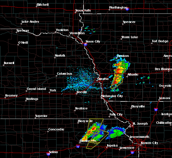 At 333 pm cdt, a severe thunderstorm was located near macedonia, or 27 miles southwest of atlantic, moving northeast at 40 mph (radar indicated). Hazards include ping pong ball size hail and 60 mph wind gusts. People and animals outdoors will be injured. expect hail damage to roofs, siding, windows, and vehicles. expect wind damage to roofs, siding, and trees. locations impacted include, oakland, carson, macedonia, hancock, henderson, botna bend park, old town park and farm creek public wildlife area. this includes highway 59 in iowa between mile markers 37 and 58. A tornado watch remains in effect until 900 pm cdt for southwestern iowa. At 333 pm cdt, a severe thunderstorm was located near macedonia, or 27 miles southwest of atlantic, moving northeast at 40 mph (radar indicated). Hazards include ping pong ball size hail and 60 mph wind gusts. People and animals outdoors will be injured. expect hail damage to roofs, siding, windows, and vehicles. expect wind damage to roofs, siding, and trees. locations impacted include, oakland, carson, macedonia, hancock, henderson, botna bend park, old town park and farm creek public wildlife area. this includes highway 59 in iowa between mile markers 37 and 58. A tornado watch remains in effect until 900 pm cdt for southwestern iowa.
|
| 4/13/2018 3:27 PM CDT |
 At 326 pm cdt, a severe thunderstorm was located 5 miles southwest of avoca, or 19 miles west of atlantic, moving northeast at 45 mph (radar indicated). Hazards include half dollar size hail. damage to vehicles is expected At 326 pm cdt, a severe thunderstorm was located 5 miles southwest of avoca, or 19 miles west of atlantic, moving northeast at 45 mph (radar indicated). Hazards include half dollar size hail. damage to vehicles is expected
|
| 4/13/2018 3:24 PM CDT |
 At 324 pm cdt, a severe thunderstorm was located over avoca, or 18 miles northwest of atlantic, moving northeast at 45 mph. a second severe storm was located near hancock, also moving northeast at 45 mph (radar indicated. trained spotters reported nickel size hail in avoca. larger hail is likely with this storm). Hazards include half dollar size hail. Damage to vehicles is expected. locations impacted include, harlan, avoca, walnut, shelby, hancock, tennant, botna bend park, prairie rose state park, nishna bend recreation area and elk horn creek recreation area. this includes the following highways, highway 59 in iowa between mile markers 55 and 73. interstate 80 in iowa between mile markers 34 and 48. A tornado watch remains in effect until 900 pm cdt for southwestern iowa. At 324 pm cdt, a severe thunderstorm was located over avoca, or 18 miles northwest of atlantic, moving northeast at 45 mph. a second severe storm was located near hancock, also moving northeast at 45 mph (radar indicated. trained spotters reported nickel size hail in avoca. larger hail is likely with this storm). Hazards include half dollar size hail. Damage to vehicles is expected. locations impacted include, harlan, avoca, walnut, shelby, hancock, tennant, botna bend park, prairie rose state park, nishna bend recreation area and elk horn creek recreation area. this includes the following highways, highway 59 in iowa between mile markers 55 and 73. interstate 80 in iowa between mile markers 34 and 48. A tornado watch remains in effect until 900 pm cdt for southwestern iowa.
|
| 4/13/2018 3:22 PM CDT |
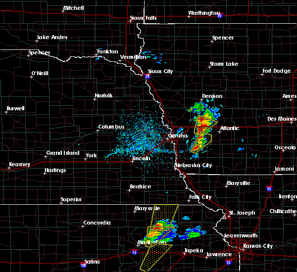 At 322 pm cdt, a severe thunderstorm was located 4 miles northwest of emerson, or 31 miles southeast of omaha, moving northeast at 40 mph (radar indicated). Hazards include 60 mph wind gusts and half dollar size hail. Hail damage to vehicles is expected. Expect wind damage to roofs, siding, and trees. At 322 pm cdt, a severe thunderstorm was located 4 miles northwest of emerson, or 31 miles southeast of omaha, moving northeast at 40 mph (radar indicated). Hazards include 60 mph wind gusts and half dollar size hail. Hail damage to vehicles is expected. Expect wind damage to roofs, siding, and trees.
|
| 4/13/2018 3:12 PM CDT |
 At 312 pm cdt, a severe thunderstorm was located near avoca, or 18 miles west of atlantic, moving northeast at 50 mph (radar indicated). Hazards include half dollar size hail. Damage to vehicles is expected. locations impacted include, harlan, avoca, walnut, shelby, hancock, tennant, botna bend park, prairie rose state park, nishna bend recreation area and elk horn creek recreation area. this includes the following highways, highway 59 in iowa between mile markers 55 and 73. interstate 80 in iowa between mile markers 34 and 48. A tornado watch remains in effect until 900 pm cdt for southwestern iowa. At 312 pm cdt, a severe thunderstorm was located near avoca, or 18 miles west of atlantic, moving northeast at 50 mph (radar indicated). Hazards include half dollar size hail. Damage to vehicles is expected. locations impacted include, harlan, avoca, walnut, shelby, hancock, tennant, botna bend park, prairie rose state park, nishna bend recreation area and elk horn creek recreation area. this includes the following highways, highway 59 in iowa between mile markers 55 and 73. interstate 80 in iowa between mile markers 34 and 48. A tornado watch remains in effect until 900 pm cdt for southwestern iowa.
|
| 4/13/2018 3:01 PM CDT |
 At 301 pm cdt, a severe thunderstorm was located near oakland, or 22 miles west of atlantic, moving northeast at 50 mph (radar indicated). Hazards include half dollar size hail. damage to vehicles is expected At 301 pm cdt, a severe thunderstorm was located near oakland, or 22 miles west of atlantic, moving northeast at 50 mph (radar indicated). Hazards include half dollar size hail. damage to vehicles is expected
|
| 9/16/2017 9:14 PM CDT |
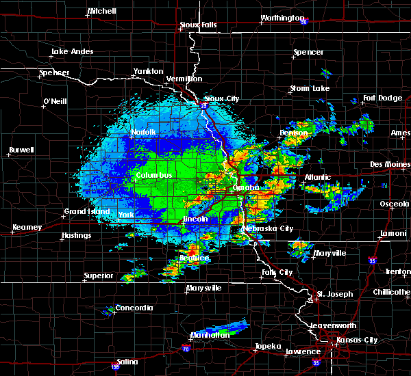 At 913 pm cdt, a severe thunderstorm was located near carson, or 26 miles southwest of atlantic, moving northeast at 15 mph (radar indicated). Hazards include quarter size hail. Damage to vehicles is expected. locations impacted include, oakland, carson, macedonia, hancock, old town park and farm creek public wildlife area. This includes highway 59 in iowa between mile markers 41 and 58. At 913 pm cdt, a severe thunderstorm was located near carson, or 26 miles southwest of atlantic, moving northeast at 15 mph (radar indicated). Hazards include quarter size hail. Damage to vehicles is expected. locations impacted include, oakland, carson, macedonia, hancock, old town park and farm creek public wildlife area. This includes highway 59 in iowa between mile markers 41 and 58.
|
| 9/16/2017 9:07 PM CDT |
 At 906 pm cdt, a severe thunderstorm was located 4 miles west of carson, or 26 miles east of omaha, moving northeast at 20 mph (radar indicated). Hazards include quarter size hail. Damage to vehicles is expected. locations impacted include, oakland, treynor, carson, macedonia, hancock, botna bend park, old town park and farm creek public wildlife area. This includes highway 59 in iowa between mile markers 41 and 58. At 906 pm cdt, a severe thunderstorm was located 4 miles west of carson, or 26 miles east of omaha, moving northeast at 20 mph (radar indicated). Hazards include quarter size hail. Damage to vehicles is expected. locations impacted include, oakland, treynor, carson, macedonia, hancock, botna bend park, old town park and farm creek public wildlife area. This includes highway 59 in iowa between mile markers 41 and 58.
|
| 9/16/2017 8:58 PM CDT |
 At 858 pm cdt, a severe thunderstorm was located near treynor, or 23 miles east of omaha, moving northeast at 15 mph (radar indicated). Hazards include quarter size hail. damage to vehicles is expected At 858 pm cdt, a severe thunderstorm was located near treynor, or 23 miles east of omaha, moving northeast at 15 mph (radar indicated). Hazards include quarter size hail. damage to vehicles is expected
|
| 6/29/2017 4:46 PM CDT |
 At 946 pm cdt, severe thunderstorms were located along a line extending from 3 miles west of persia to near minden to near underwood to council bluffs, moving east at 40 mph (radar indicated). Hazards include ping pong ball size hail and 60 mph wind gusts. People and animals outdoors will be injured. expect hail damage to roofs, siding, windows, and vehicles. Expect wind damage to roofs, siding, and trees. At 946 pm cdt, severe thunderstorms were located along a line extending from 3 miles west of persia to near minden to near underwood to council bluffs, moving east at 40 mph (radar indicated). Hazards include ping pong ball size hail and 60 mph wind gusts. People and animals outdoors will be injured. expect hail damage to roofs, siding, windows, and vehicles. Expect wind damage to roofs, siding, and trees.
|
| 6/29/2017 4:45 PM CDT |
 At 945 pm cdt, severe thunderstorms were located along a line extending from 6 miles southeast of logan to 4 miles west of minden to 5 miles southwest of underwood to omaha, moving east at 470 mph (radar indicated). Hazards include ping pong ball size hail and 60 mph wind gusts. People and animals outdoors will be injured. expect hail damage to roofs, siding, windows, and vehicles. Expect wind damage to roofs, siding, and trees. At 945 pm cdt, severe thunderstorms were located along a line extending from 6 miles southeast of logan to 4 miles west of minden to 5 miles southwest of underwood to omaha, moving east at 470 mph (radar indicated). Hazards include ping pong ball size hail and 60 mph wind gusts. People and animals outdoors will be injured. expect hail damage to roofs, siding, windows, and vehicles. Expect wind damage to roofs, siding, and trees.
|
| 6/16/2017 8:43 PM CDT |
 At 842 pm cdt, severe thunderstorms were located along a line extending from 4 miles southwest of manning to 3 miles northwest of elliott to near farragut to 4 miles west of lorton, moving southeast at 40 mph (radar indicated). Hazards include 70 mph wind gusts. Expect considerable tree damage. Damage is likely to mobile homes, roofs, and outbuildings. At 842 pm cdt, severe thunderstorms were located along a line extending from 4 miles southwest of manning to 3 miles northwest of elliott to near farragut to 4 miles west of lorton, moving southeast at 40 mph (radar indicated). Hazards include 70 mph wind gusts. Expect considerable tree damage. Damage is likely to mobile homes, roofs, and outbuildings.
|
| 6/16/2017 8:14 PM CDT |
 At 814 pm cdt, severe thunderstorms were located along a line extending from 5 miles east of persia to treynor to 3 miles southeast of pacific junction to 4 miles southwest of elmwood, moving southeast at 45 mph. these are very dangerous storms (radar indicated). Hazards include 80 mph wind gusts. Flying debris will be dangerous to those caught without shelter. mobile homes will be heavily damaged. expect considerable damage to roofs, windows, and vehicles. Extensive tree damage and power outages are likely. At 814 pm cdt, severe thunderstorms were located along a line extending from 5 miles east of persia to treynor to 3 miles southeast of pacific junction to 4 miles southwest of elmwood, moving southeast at 45 mph. these are very dangerous storms (radar indicated). Hazards include 80 mph wind gusts. Flying debris will be dangerous to those caught without shelter. mobile homes will be heavily damaged. expect considerable damage to roofs, windows, and vehicles. Extensive tree damage and power outages are likely.
|
| 6/12/2017 6:59 PM CDT |
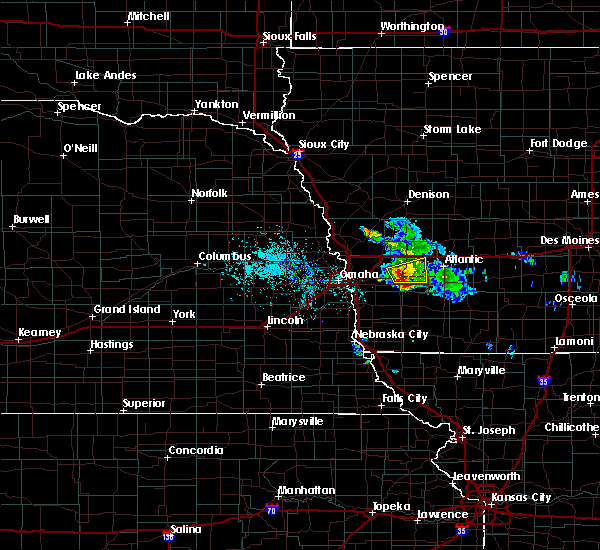 At 643 pm cdt, a severe thunderstorm was located 4 miles west of oakland, or 25 miles west of atlantic, moving northeast at 20 mph (radar indicated). Hazards include ping pong ball size hail and 60 mph wind gusts. People and animals outdoors will be injured. expect hail damage to roofs, siding, windows, and vehicles. Expect wind damage to roofs, siding, and trees. At 643 pm cdt, a severe thunderstorm was located 4 miles west of oakland, or 25 miles west of atlantic, moving northeast at 20 mph (radar indicated). Hazards include ping pong ball size hail and 60 mph wind gusts. People and animals outdoors will be injured. expect hail damage to roofs, siding, windows, and vehicles. Expect wind damage to roofs, siding, and trees.
|
| 6/12/2017 6:44 PM CDT |
 At 643 pm cdt, a severe thunderstorm was located 4 miles west of oakland, or 25 miles west of atlantic, moving northeast at 20 mph (radar indicated). Hazards include ping pong ball size hail and 60 mph wind gusts. People and animals outdoors will be injured. expect hail damage to roofs, siding, windows, and vehicles. Expect wind damage to roofs, siding, and trees. At 643 pm cdt, a severe thunderstorm was located 4 miles west of oakland, or 25 miles west of atlantic, moving northeast at 20 mph (radar indicated). Hazards include ping pong ball size hail and 60 mph wind gusts. People and animals outdoors will be injured. expect hail damage to roofs, siding, windows, and vehicles. Expect wind damage to roofs, siding, and trees.
|
| 5/16/2017 10:26 PM CDT |
 The severe thunderstorm warning for northwestern montgomery, northeastern mills and eastern pottawattamie counties will expire at 1030 pm cdt, the storm which prompted the warning has weakened below severe limits, and has exited the warned area. therefore, the warning will be allowed to expire. however gusty winds are still possible with this thunderstorm. a severe thunderstorm watch remains in effect until midnight cdt for southwestern iowa. The severe thunderstorm warning for northwestern montgomery, northeastern mills and eastern pottawattamie counties will expire at 1030 pm cdt, the storm which prompted the warning has weakened below severe limits, and has exited the warned area. therefore, the warning will be allowed to expire. however gusty winds are still possible with this thunderstorm. a severe thunderstorm watch remains in effect until midnight cdt for southwestern iowa.
|
| 5/16/2017 10:21 PM CDT |
 At 1020 pm cdt, a severe thunderstorm was located near griswold, or 14 miles southwest of atlantic, moving east at 45 mph (radar indicated). Hazards include 60 mph wind gusts and nickel size hail. Expect damage to roofs, siding, and trees. Locations impacted include, oakland, avoca, carson, walnut, shelby, minden, elliott, macedonia, neola, hancock, henderson, old town park, farm creek public wildlife area, botna bend park and arrowhead park. At 1020 pm cdt, a severe thunderstorm was located near griswold, or 14 miles southwest of atlantic, moving east at 45 mph (radar indicated). Hazards include 60 mph wind gusts and nickel size hail. Expect damage to roofs, siding, and trees. Locations impacted include, oakland, avoca, carson, walnut, shelby, minden, elliott, macedonia, neola, hancock, henderson, old town park, farm creek public wildlife area, botna bend park and arrowhead park.
|
| 5/16/2017 10:15 PM CDT |
 At 1015 pm cdt, a severe thunderstorm was located 7 miles northwest of griswold, or 15 miles southwest of atlantic, moving northeast at 35 mph (radar indicated). Hazards include 60 mph wind gusts and nickel size hail. Expect damage to roofs, siding, and trees. locations impacted include, oakland, avoca, carson, walnut, shelby, minden, elliott, macedonia, neola, hancock, henderson, old town park, farm creek public wildlife area, botna bend park and arrowhead park. this includes the following highways, highway 59 in iowa between mile markers 34 and 66. Interstate 80 in iowa near mile marker 23, and between mile markers 34 and 48. At 1015 pm cdt, a severe thunderstorm was located 7 miles northwest of griswold, or 15 miles southwest of atlantic, moving northeast at 35 mph (radar indicated). Hazards include 60 mph wind gusts and nickel size hail. Expect damage to roofs, siding, and trees. locations impacted include, oakland, avoca, carson, walnut, shelby, minden, elliott, macedonia, neola, hancock, henderson, old town park, farm creek public wildlife area, botna bend park and arrowhead park. this includes the following highways, highway 59 in iowa between mile markers 34 and 66. Interstate 80 in iowa near mile marker 23, and between mile markers 34 and 48.
|
| 5/16/2017 10:08 PM CDT |
 At 1007 pm cdt, a severe thunderstorm was located 5 miles east of oakland, or 16 miles southwest of atlantic, moving east at 40 mph (radar indicated). Hazards include 60 mph wind gusts and nickel size hail. Expect damage to roofs, siding, and trees. Locations impacted include, oakland, avoca, carson, walnut, shelby, minden, elliott, macedonia, neola, hancock, henderson, old town park, farm creek public wildlife area, botna bend park and arrowhead park. At 1007 pm cdt, a severe thunderstorm was located 5 miles east of oakland, or 16 miles southwest of atlantic, moving east at 40 mph (radar indicated). Hazards include 60 mph wind gusts and nickel size hail. Expect damage to roofs, siding, and trees. Locations impacted include, oakland, avoca, carson, walnut, shelby, minden, elliott, macedonia, neola, hancock, henderson, old town park, farm creek public wildlife area, botna bend park and arrowhead park.
|
| 5/16/2017 10:03 PM CDT |
 At 1002 pm cdt, a severe thunderstorm was located near oakland, or 20 miles southwest of atlantic, moving east at 40 mph (radar indicated). Hazards include 60 mph wind gusts and nickel size hail. Expect damage to roofs, siding, and trees. Locations impacted include, oakland, avoca, treynor, underwood, carson, walnut, shelby, minden, elliott, macedonia, neola, hancock, henderson, old town park, farm creek public wildlife area, botna bend park and arrowhead park. At 1002 pm cdt, a severe thunderstorm was located near oakland, or 20 miles southwest of atlantic, moving east at 40 mph (radar indicated). Hazards include 60 mph wind gusts and nickel size hail. Expect damage to roofs, siding, and trees. Locations impacted include, oakland, avoca, treynor, underwood, carson, walnut, shelby, minden, elliott, macedonia, neola, hancock, henderson, old town park, farm creek public wildlife area, botna bend park and arrowhead park.
|
| 5/16/2017 9:53 PM CDT |
 At 953 pm cdt, a severe thunderstorm was located 4 miles northwest of carson, or 26 miles east of omaha, moving northeast at 50 mph (radar indicated). Hazards include 60 mph wind gusts and nickel size hail. expect damage to roofs, siding, and trees At 953 pm cdt, a severe thunderstorm was located 4 miles northwest of carson, or 26 miles east of omaha, moving northeast at 50 mph (radar indicated). Hazards include 60 mph wind gusts and nickel size hail. expect damage to roofs, siding, and trees
|
| 5/16/2017 7:53 PM CDT |
 At 753 pm cdt, severe thunderstorms were located along a line extending from near walnut to 5 miles southeast of macedonia, moving east at 30 mph (radar indicated). Hazards include 60 mph wind gusts and quarter size hail. Hail damage to vehicles is expected. expect wind damage to roofs, siding, and trees. locations impacted include, oakland, avoca, treynor, carson, walnut, shelby, minden, elliott, macedonia, silver city, hancock, henderson, old town park, farm creek public wildlife area and botna bend park. this includes the following highways, highway 59 in iowa between mile markers 37 and 66. Interstate 80 in iowa between mile markers 29 and 48. At 753 pm cdt, severe thunderstorms were located along a line extending from near walnut to 5 miles southeast of macedonia, moving east at 30 mph (radar indicated). Hazards include 60 mph wind gusts and quarter size hail. Hail damage to vehicles is expected. expect wind damage to roofs, siding, and trees. locations impacted include, oakland, avoca, treynor, carson, walnut, shelby, minden, elliott, macedonia, silver city, hancock, henderson, old town park, farm creek public wildlife area and botna bend park. this includes the following highways, highway 59 in iowa between mile markers 37 and 66. Interstate 80 in iowa between mile markers 29 and 48.
|
| 5/16/2017 7:39 PM CDT |
 At 738 pm cdt, severe thunderstorms were located along a line extending from walnut to 5 miles north of emerson, moving east at 25 mph. hail was possible with the storm near silver city (radar indicated). Hazards include 60 mph wind gusts and quarter size hail. Hail damage to vehicles is expected. expect wind damage to roofs, siding, and trees. locations impacted include, oakland, avoca, treynor, carson, walnut, shelby, minden, elliott, macedonia, silver city, hancock, henderson, old town park, farm creek public wildlife area and botna bend park. this includes the following highways, highway 59 in iowa between mile markers 34 and 66. Interstate 80 in iowa between mile markers 29 and 48. At 738 pm cdt, severe thunderstorms were located along a line extending from walnut to 5 miles north of emerson, moving east at 25 mph. hail was possible with the storm near silver city (radar indicated). Hazards include 60 mph wind gusts and quarter size hail. Hail damage to vehicles is expected. expect wind damage to roofs, siding, and trees. locations impacted include, oakland, avoca, treynor, carson, walnut, shelby, minden, elliott, macedonia, silver city, hancock, henderson, old town park, farm creek public wildlife area and botna bend park. this includes the following highways, highway 59 in iowa between mile markers 34 and 66. Interstate 80 in iowa between mile markers 29 and 48.
|
| 5/16/2017 7:27 PM CDT |
 The severe thunderstorm warning for northwestern montgomery. mills and pottawattamie counties will expire at 730 pm cdt. this warning will be allowed to expire. a new warning has been issued and extends until 815 pm. A severe thunderstorm watch remains in effect until midnight cdt for southwestern iowa. The severe thunderstorm warning for northwestern montgomery. mills and pottawattamie counties will expire at 730 pm cdt. this warning will be allowed to expire. a new warning has been issued and extends until 815 pm. A severe thunderstorm watch remains in effect until midnight cdt for southwestern iowa.
|
| 5/16/2017 7:18 PM CDT |
 At 717 pm cdt, severe thunderstorms were located along a line extending from near avoca to 7 miles north of malvern, moving east at 40 mph. these are very dangerous storms (radar indicated). Hazards include 80 mph wind gusts. Flying debris will be dangerous to those caught without shelter. mobile homes will be heavily damaged. expect considerable damage to roofs, windows, and vehicles. Extensive tree damage and power outages are likely. At 717 pm cdt, severe thunderstorms were located along a line extending from near avoca to 7 miles north of malvern, moving east at 40 mph. these are very dangerous storms (radar indicated). Hazards include 80 mph wind gusts. Flying debris will be dangerous to those caught without shelter. mobile homes will be heavily damaged. expect considerable damage to roofs, windows, and vehicles. Extensive tree damage and power outages are likely.
|
| 5/16/2017 7:13 PM CDT |
 At 712 pm cdt, severe thunderstorms were located along a line extending from shelby to near oakland to 7 miles north of malvern, moving east at 55 mph. the strongest winds were near minden and hancok. these are very dangerous storms (radar indicated). Hazards include 80 mph wind gusts and quarter size hail. Flying debris will be dangerous to those caught without shelter. mobile homes will be heavily damaged. expect considerable damage to roofs, windows, and vehicles. extensive tree damage and power outages are likely. Locations impacted include, eastern council bluffs, red oak, glenwood, oakland, avoca, malvern, treynor, underwood, carson, shelby, minden, pacific junction, emerson, macedonia, neola, silver city, hancock, henderson, hastings and mcclelland. At 712 pm cdt, severe thunderstorms were located along a line extending from shelby to near oakland to 7 miles north of malvern, moving east at 55 mph. the strongest winds were near minden and hancok. these are very dangerous storms (radar indicated). Hazards include 80 mph wind gusts and quarter size hail. Flying debris will be dangerous to those caught without shelter. mobile homes will be heavily damaged. expect considerable damage to roofs, windows, and vehicles. extensive tree damage and power outages are likely. Locations impacted include, eastern council bluffs, red oak, glenwood, oakland, avoca, malvern, treynor, underwood, carson, shelby, minden, pacific junction, emerson, macedonia, neola, silver city, hancock, henderson, hastings and mcclelland.
|
| 5/16/2017 7:03 PM CDT |
 At 702 pm cdt, severe thunderstorms were located along a line extending from 4 miles northwest of minden to 4 miles northeast of treynor to 3 miles northeast of glenwood, moving east at 50 mph. the strongest winds were near neola and underwood, possibly near 80 mph. these are very dangerous storms (radar indicated). Hazards include 80 mph wind gusts and half dollar size hail. Flying debris will be dangerous to those caught without shelter. mobile homes will be heavily damaged. expect considerable damage to roofs, windows, and vehicles. extensive tree damage and power outages are likely. Locations impacted include, eastern council bluffs, red oak, glenwood, oakland, avoca, malvern, treynor, underwood, carson, shelby, minden, pacific junction, emerson, macedonia, neola, silver city, hancock, henderson, hastings and mcclelland. At 702 pm cdt, severe thunderstorms were located along a line extending from 4 miles northwest of minden to 4 miles northeast of treynor to 3 miles northeast of glenwood, moving east at 50 mph. the strongest winds were near neola and underwood, possibly near 80 mph. these are very dangerous storms (radar indicated). Hazards include 80 mph wind gusts and half dollar size hail. Flying debris will be dangerous to those caught without shelter. mobile homes will be heavily damaged. expect considerable damage to roofs, windows, and vehicles. extensive tree damage and power outages are likely. Locations impacted include, eastern council bluffs, red oak, glenwood, oakland, avoca, malvern, treynor, underwood, carson, shelby, minden, pacific junction, emerson, macedonia, neola, silver city, hancock, henderson, hastings and mcclelland.
|
| 5/16/2017 6:53 PM CDT |
 At 652 pm cdt, severe thunderstorms were located along a line extending from 8 miles southeast of missouri valley to 4 miles northwest of treynor to glenwood, moving east at 50 mph (radar indicated). Hazards include 70 mph wind gusts and half dollar size hail. Hail damage to vehicles is expected. expect considerable tree damage. wind damage is also likely to mobile homes, roofs, and outbuildings. Locations impacted include, eastern council bluffs, red oak, glenwood, oakland, avoca, malvern, treynor, underwood, carson, shelby, minden, pacific junction, emerson, macedonia, neola, silver city, hancock, henderson, hastings and mcclelland. At 652 pm cdt, severe thunderstorms were located along a line extending from 8 miles southeast of missouri valley to 4 miles northwest of treynor to glenwood, moving east at 50 mph (radar indicated). Hazards include 70 mph wind gusts and half dollar size hail. Hail damage to vehicles is expected. expect considerable tree damage. wind damage is also likely to mobile homes, roofs, and outbuildings. Locations impacted include, eastern council bluffs, red oak, glenwood, oakland, avoca, malvern, treynor, underwood, carson, shelby, minden, pacific junction, emerson, macedonia, neola, silver city, hancock, henderson, hastings and mcclelland.
|
| 5/16/2017 6:43 PM CDT |
 At 643 pm cdt, severe thunderstorms were located along a line extending from 6 miles southeast of missouri valley to pacific junction, moving east at 50 mph (radar indicated). Hazards include 70 mph wind gusts and half dollar size hail. Hail damage to vehicles is expected. expect considerable tree damage. Wind damage is also likely to mobile homes, roofs, and outbuildings. At 643 pm cdt, severe thunderstorms were located along a line extending from 6 miles southeast of missouri valley to pacific junction, moving east at 50 mph (radar indicated). Hazards include 70 mph wind gusts and half dollar size hail. Hail damage to vehicles is expected. expect considerable tree damage. Wind damage is also likely to mobile homes, roofs, and outbuildings.
|
| 3/6/2017 4:25 PM CST |
 The severe thunderstorm warning for pottawattamie, eastern harrison and shelby counties will expire at 430 pm cst, the storm which prompted the warning has weakened below severe limits, and no longer poses an immediate threat to life or property. therefore, the warning will be allowed to expire. however small hail and gusty winds are still possible with this thunderstorm. a tornado watch remains in effect until 1000 pm cst for southwestern iowa. The severe thunderstorm warning for pottawattamie, eastern harrison and shelby counties will expire at 430 pm cst, the storm which prompted the warning has weakened below severe limits, and no longer poses an immediate threat to life or property. therefore, the warning will be allowed to expire. however small hail and gusty winds are still possible with this thunderstorm. a tornado watch remains in effect until 1000 pm cst for southwestern iowa.
|
| 3/6/2017 4:13 PM CST |
 At 412 pm cst, a severe thunderstorm was located 5 miles south of defiance, or 18 miles south of denison, moving northeast at 60 mph (radar indicated). Hazards include 60 mph wind gusts and quarter size hail. Hail damage to vehicles is expected. expect wind damage to roofs, siding, and trees. locations impacted include, eastern council bluffs, harlan, oakland, avoca, treynor, underwood, carson, walnut, shelby, minden, earling, irwin, persia, defiance, macedonia, neola, panama, hancock, portsmouth and mcclelland. this includes the following highways, highway 59 in iowa between mile markers 44 and 89. interstate 29 between mile markers 47 and 48. interstate 80 in iowa between mile markers 4 and 46. A tornado watch remains in effect until 1000 pm cst for southwestern iowa. At 412 pm cst, a severe thunderstorm was located 5 miles south of defiance, or 18 miles south of denison, moving northeast at 60 mph (radar indicated). Hazards include 60 mph wind gusts and quarter size hail. Hail damage to vehicles is expected. expect wind damage to roofs, siding, and trees. locations impacted include, eastern council bluffs, harlan, oakland, avoca, treynor, underwood, carson, walnut, shelby, minden, earling, irwin, persia, defiance, macedonia, neola, panama, hancock, portsmouth and mcclelland. this includes the following highways, highway 59 in iowa between mile markers 44 and 89. interstate 29 between mile markers 47 and 48. interstate 80 in iowa between mile markers 4 and 46. A tornado watch remains in effect until 1000 pm cst for southwestern iowa.
|
| 3/6/2017 4:02 PM CST |
 At 402 pm cst, a severe thunderstorm was located 7 miles northeast of persia, or 25 miles south of denison, moving northeast at 60 mph (radar indicated). Hazards include 60 mph wind gusts and quarter size hail. Hail damage to vehicles is expected. Expect wind damage to roofs, siding, and trees. At 402 pm cst, a severe thunderstorm was located 7 miles northeast of persia, or 25 miles south of denison, moving northeast at 60 mph (radar indicated). Hazards include 60 mph wind gusts and quarter size hail. Hail damage to vehicles is expected. Expect wind damage to roofs, siding, and trees.
|
| 8/23/2016 11:00 PM CDT |
 At 1100 pm cdt, severe thunderstorms were located along a line extending from 4 miles west of audubon to near atlantic to 6 miles west of griswold, moving east at 55 mph (radar indicated). Hazards include 60 mph wind gusts. Expect damage to roofs. siding. and trees. locations impacted include, harlan, oakland, avoca, treynor, carson, walnut, macedonia, hancock, farm creek public wildlife area, nishna bend recreation area, botna bend park, old town park, elk horn creek recreation area and prairie rose state park. this includes the following highways, highway 59 in iowa between mile markers 41 and 73. Interstate 80 in iowa between mile markers 37 and 48. At 1100 pm cdt, severe thunderstorms were located along a line extending from 4 miles west of audubon to near atlantic to 6 miles west of griswold, moving east at 55 mph (radar indicated). Hazards include 60 mph wind gusts. Expect damage to roofs. siding. and trees. locations impacted include, harlan, oakland, avoca, treynor, carson, walnut, macedonia, hancock, farm creek public wildlife area, nishna bend recreation area, botna bend park, old town park, elk horn creek recreation area and prairie rose state park. this includes the following highways, highway 59 in iowa between mile markers 41 and 73. Interstate 80 in iowa between mile markers 37 and 48.
|
| 8/23/2016 10:42 PM CDT |
 At 1042 pm cdt, severe thunderstorms were located along a line extending from harlan to 6 miles northeast of oakland to 4 miles south of treynor, moving east at 55 mph (radar indicated). Hazards include 60 mph wind gusts. Expect damage to roofs. siding. and trees. locations impacted include, northeastern council bluffs, harlan, oakland, avoca, treynor, underwood, carson, walnut, shelby, minden, persia, macedonia, neola, hancock, portsmouth, mcclelland, tennant, arrowhead park, farm creek public wildlife area and nishna bend recreation area. this includes the following highways, highway 59 in iowa between mile markers 41 and 73. Interstate 80 in iowa between mile markers 8 and 48. At 1042 pm cdt, severe thunderstorms were located along a line extending from harlan to 6 miles northeast of oakland to 4 miles south of treynor, moving east at 55 mph (radar indicated). Hazards include 60 mph wind gusts. Expect damage to roofs. siding. and trees. locations impacted include, northeastern council bluffs, harlan, oakland, avoca, treynor, underwood, carson, walnut, shelby, minden, persia, macedonia, neola, hancock, portsmouth, mcclelland, tennant, arrowhead park, farm creek public wildlife area and nishna bend recreation area. this includes the following highways, highway 59 in iowa between mile markers 41 and 73. Interstate 80 in iowa between mile markers 8 and 48.
|
| 8/23/2016 10:27 PM CDT |
 At 1027 pm cdt, severe thunderstorms were located along a line extending from 6 miles west of harlan to 4 miles southwest of avoca to 7 miles southwest of treynor, moving east at 25 mph (radar indicated). Hazards include 70 mph wind gusts. Expect considerable tree damage. Damage is likely to mobile homes, roofs, and outbuildings. At 1027 pm cdt, severe thunderstorms were located along a line extending from 6 miles west of harlan to 4 miles southwest of avoca to 7 miles southwest of treynor, moving east at 25 mph (radar indicated). Hazards include 70 mph wind gusts. Expect considerable tree damage. Damage is likely to mobile homes, roofs, and outbuildings.
|
| 8/23/2016 10:11 PM CDT |
 At 1011 pm cdt, severe thunderstorms were located along a line extending from near shelby to 4 miles east of cedar creek, moving east at 40 mph (radar indicated). Hazards include 70 mph wind gusts. Expect considerable tree damage. damage is likely to mobile homes, roofs, and outbuildings. locations impacted include, omaha, council bluffs, bellevue, papillion, la vista, ralston, gretna, springfield, avoca, treynor, underwood, shelby, minden, millard, offutt afb, carter lake, neola, boys town, crescent and silver city. this includes the following highways, highway 59 in iowa between mile markers 61 and 64. highway 75 in nebraska between mile markers 79 and 99. interstate 29 between mile markers 39 and 72. interstate 80 in iowa between mile markers 1 and 34. Interstate 80 in nebraska between mile markers 432 and 454. At 1011 pm cdt, severe thunderstorms were located along a line extending from near shelby to 4 miles east of cedar creek, moving east at 40 mph (radar indicated). Hazards include 70 mph wind gusts. Expect considerable tree damage. damage is likely to mobile homes, roofs, and outbuildings. locations impacted include, omaha, council bluffs, bellevue, papillion, la vista, ralston, gretna, springfield, avoca, treynor, underwood, shelby, minden, millard, offutt afb, carter lake, neola, boys town, crescent and silver city. this includes the following highways, highway 59 in iowa between mile markers 61 and 64. highway 75 in nebraska between mile markers 79 and 99. interstate 29 between mile markers 39 and 72. interstate 80 in iowa between mile markers 1 and 34. Interstate 80 in nebraska between mile markers 432 and 454.
|
| 8/23/2016 10:01 PM CDT |
 At 1001 pm cdt, severe thunderstorms were located along a line extending from 3 miles southwest of persia to near springfield, moving east at 40 mph (radar indicated). Hazards include 60 mph wind gusts. Expect damage to roofs. siding. And trees. At 1001 pm cdt, severe thunderstorms were located along a line extending from 3 miles southwest of persia to near springfield, moving east at 40 mph (radar indicated). Hazards include 60 mph wind gusts. Expect damage to roofs. siding. And trees.
|
| 8/23/2016 10:01 PM CDT |
 The national weather service in omaha has issued a * severe thunderstorm warning for. southwestern shelby county in southwestern iowa. southeastern harrison county in southwestern iowa. northwestern mills county in southwestern iowa. Pottawattamie county in southwestern iowa. The national weather service in omaha has issued a * severe thunderstorm warning for. southwestern shelby county in southwestern iowa. southeastern harrison county in southwestern iowa. northwestern mills county in southwestern iowa. Pottawattamie county in southwestern iowa.
|
| 8/11/2016 10:51 PM CDT |
 At 1050 pm cdt, severe thunderstorms were located along a line extending from near walnut to 3 miles east of griswold to 5 miles northeast of stanton, moving northeast at 45 mph. strong outflow winds extended back behind the main line of storms (radar indicated). Hazards include 60 mph wind gusts. Expect damage to roofs. siding. and trees. locations impacted include, oakland, carson, emerson, elliott, macedonia, hancock, henderson, grant, farm creek public wildlife area and botna bend park. this includes the following highways, highway 34 in iowa between mile markers 27 and 33. Highway 59 in iowa between mile markers 31 and 61. At 1050 pm cdt, severe thunderstorms were located along a line extending from near walnut to 3 miles east of griswold to 5 miles northeast of stanton, moving northeast at 45 mph. strong outflow winds extended back behind the main line of storms (radar indicated). Hazards include 60 mph wind gusts. Expect damage to roofs. siding. and trees. locations impacted include, oakland, carson, emerson, elliott, macedonia, hancock, henderson, grant, farm creek public wildlife area and botna bend park. this includes the following highways, highway 34 in iowa between mile markers 27 and 33. Highway 59 in iowa between mile markers 31 and 61.
|
| 8/11/2016 10:37 PM CDT |
 At 1036 pm cdt, severe thunderstorms were located along a line extending from 4 miles southeast of walnut to 4 miles southeast of griswold to near stanton, moving east at 40 mph (radar indicated). Hazards include 60 mph wind gusts. Expect damage to roofs. siding. and trees. locations impacted include, oakland, carson, walnut, emerson, elliott, macedonia, hancock, henderson, grant, farm creek public wildlife area, botna bend park and old town park. this includes the following highways, highway 34 in iowa between mile markers 27 and 33. Highway 59 in iowa between mile markers 31 and 61. At 1036 pm cdt, severe thunderstorms were located along a line extending from 4 miles southeast of walnut to 4 miles southeast of griswold to near stanton, moving east at 40 mph (radar indicated). Hazards include 60 mph wind gusts. Expect damage to roofs. siding. and trees. locations impacted include, oakland, carson, walnut, emerson, elliott, macedonia, hancock, henderson, grant, farm creek public wildlife area, botna bend park and old town park. this includes the following highways, highway 34 in iowa between mile markers 27 and 33. Highway 59 in iowa between mile markers 31 and 61.
|
| 8/11/2016 10:28 PM CDT |
 At 1027 pm cdt, severe thunderstorms were located along a line extending from 6 miles south of walnut to near elliott to 3 miles southeast of red oak, moving east at 45 mph (radar indicated). Hazards include 60 mph wind gusts. Expect damage to roofs. siding. and trees. locations impacted include, oakland, carson, walnut, emerson, elliott, macedonia, hancock, henderson, grant, farm creek public wildlife area, botna bend park and old town park. this includes the following highways, highway 34 in iowa between mile markers 27 and 33. Highway 59 in iowa between mile markers 31 and 61. At 1027 pm cdt, severe thunderstorms were located along a line extending from 6 miles south of walnut to near elliott to 3 miles southeast of red oak, moving east at 45 mph (radar indicated). Hazards include 60 mph wind gusts. Expect damage to roofs. siding. and trees. locations impacted include, oakland, carson, walnut, emerson, elliott, macedonia, hancock, henderson, grant, farm creek public wildlife area, botna bend park and old town park. this includes the following highways, highway 34 in iowa between mile markers 27 and 33. Highway 59 in iowa between mile markers 31 and 61.
|
| 8/11/2016 10:17 PM CDT |
 At 1017 pm cdt, severe thunderstorms were located along a line extending from near oakland to 5 miles east of macedonia to 4 miles southeast of emerson, moving east at 40 mph (radar indicated). Hazards include 60 mph wind gusts. Expect damage to roofs. siding. and trees. locations impacted include, red oak, oakland, treynor, carson, walnut, emerson, elliott, macedonia, hancock, henderson, hastings, mcclelland, grant, farm creek public wildlife area, botna bend park and old town park. this includes the following highways, highway 34 in iowa between mile markers 20 and 33. highway 59 in iowa between mile markers 31 and 61. Interstate 80 in iowa near mile marker 14. At 1017 pm cdt, severe thunderstorms were located along a line extending from near oakland to 5 miles east of macedonia to 4 miles southeast of emerson, moving east at 40 mph (radar indicated). Hazards include 60 mph wind gusts. Expect damage to roofs. siding. and trees. locations impacted include, red oak, oakland, treynor, carson, walnut, emerson, elliott, macedonia, hancock, henderson, hastings, mcclelland, grant, farm creek public wildlife area, botna bend park and old town park. this includes the following highways, highway 34 in iowa between mile markers 20 and 33. highway 59 in iowa between mile markers 31 and 61. Interstate 80 in iowa near mile marker 14.
|
| 8/11/2016 10:10 PM CDT |
 At 1010 pm cdt, severe thunderstorms were located along a line extending from 5 miles northwest of oakland to near macedonia to 3 miles south of emerson, moving east at 45 mph (radar indicated). Hazards include 60 mph wind gusts. Expect damage to roofs. siding. and trees. locations impacted include, red oak, oakland, treynor, carson, walnut, emerson, elliott, macedonia, hancock, henderson, hastings, mcclelland, grant, farm creek public wildlife area, botna bend park and old town park. this includes the following highways, highway 34 in iowa between mile markers 20 and 33. highway 59 in iowa between mile markers 31 and 61. Interstate 80 in iowa near mile marker 14. At 1010 pm cdt, severe thunderstorms were located along a line extending from 5 miles northwest of oakland to near macedonia to 3 miles south of emerson, moving east at 45 mph (radar indicated). Hazards include 60 mph wind gusts. Expect damage to roofs. siding. and trees. locations impacted include, red oak, oakland, treynor, carson, walnut, emerson, elliott, macedonia, hancock, henderson, hastings, mcclelland, grant, farm creek public wildlife area, botna bend park and old town park. this includes the following highways, highway 34 in iowa between mile markers 20 and 33. highway 59 in iowa between mile markers 31 and 61. Interstate 80 in iowa near mile marker 14.
|
| 8/11/2016 10:02 PM CDT |
 At 1001 pm cdt, a severe thunderstorm was located over treynor, or 22 miles east of omaha, moving east at 40 mph (radar indicated). Hazards include 60 mph wind gusts. Expect damage to roofs. siding. And trees. At 1001 pm cdt, a severe thunderstorm was located over treynor, or 22 miles east of omaha, moving east at 40 mph (radar indicated). Hazards include 60 mph wind gusts. Expect damage to roofs. siding. And trees.
|
| 7/18/2016 12:53 AM CDT |
 At 1252 am cdt, a severe thunderstorm was located over carson, or 25 miles southwest of atlantic, moving northeast at 25 mph (radar indicated). Hazards include 60 mph wind gusts and quarter size hail. Hail damage to vehicles is expected. expect wind damage to roofs, siding, and trees. locations impacted include, oakland, treynor, carson, macedonia, silver city, hancock, farm creek public wildlife area, botna bend park and old town park. This includes highway 59 in iowa between mile markers 41 and 58. At 1252 am cdt, a severe thunderstorm was located over carson, or 25 miles southwest of atlantic, moving northeast at 25 mph (radar indicated). Hazards include 60 mph wind gusts and quarter size hail. Hail damage to vehicles is expected. expect wind damage to roofs, siding, and trees. locations impacted include, oakland, treynor, carson, macedonia, silver city, hancock, farm creek public wildlife area, botna bend park and old town park. This includes highway 59 in iowa between mile markers 41 and 58.
|
| 7/18/2016 12:41 AM CDT |
 At 1241 am cdt, a severe thunderstorm was located 4 miles east of treynor, or 25 miles east of omaha, moving east at 40 mph (radar indicated). Hazards include 60 mph wind gusts and quarter size hail. Hail damage to vehicles is expected. expect wind damage to roofs, siding, and trees. locations impacted include, northeastern council bluffs, oakland, treynor, underwood, carson, macedonia, crescent, silver city, hancock, mcclelland, farm creek public wildlife area, botna bend park and old town park. this includes the following highways, highway 59 in iowa between mile markers 41 and 58. Interstate 80 in iowa between mile markers 8 and 17. At 1241 am cdt, a severe thunderstorm was located 4 miles east of treynor, or 25 miles east of omaha, moving east at 40 mph (radar indicated). Hazards include 60 mph wind gusts and quarter size hail. Hail damage to vehicles is expected. expect wind damage to roofs, siding, and trees. locations impacted include, northeastern council bluffs, oakland, treynor, underwood, carson, macedonia, crescent, silver city, hancock, mcclelland, farm creek public wildlife area, botna bend park and old town park. this includes the following highways, highway 59 in iowa between mile markers 41 and 58. Interstate 80 in iowa between mile markers 8 and 17.
|
| 7/18/2016 12:30 AM CDT |
 At 1230 am cdt, a severe thunderstorm was located 4 miles southeast of council bluffs, or 12 miles east of omaha, moving northeast at 25 mph (radar indicated). Hazards include 60 mph wind gusts and quarter size hail. Hail damage to vehicles is expected. Expect wind damage to roofs, siding, and trees. At 1230 am cdt, a severe thunderstorm was located 4 miles southeast of council bluffs, or 12 miles east of omaha, moving northeast at 25 mph (radar indicated). Hazards include 60 mph wind gusts and quarter size hail. Hail damage to vehicles is expected. Expect wind damage to roofs, siding, and trees.
|
| 5/30/2016 4:57 PM CDT |
 At 456 pm cdt, a severe thunderstorm was located 4 miles southeast of oakland, or 17 miles southwest of atlantic, moving north at 20 mph (radar indicated). Hazards include 60 mph wind gusts and quarter size hail. Hail damage to vehicles is expected. expect wind damage to roofs, siding and trees. locations impacted include, farm creek public wildlife area. This includes highway 59 in iowa near mile marker 58. At 456 pm cdt, a severe thunderstorm was located 4 miles southeast of oakland, or 17 miles southwest of atlantic, moving north at 20 mph (radar indicated). Hazards include 60 mph wind gusts and quarter size hail. Hail damage to vehicles is expected. expect wind damage to roofs, siding and trees. locations impacted include, farm creek public wildlife area. This includes highway 59 in iowa near mile marker 58.
|
| 5/30/2016 4:50 PM CDT |
 At 450 pm cdt, a severe thunderstorm was located 4 miles east of carson, or 19 miles southwest of atlantic, moving north at 20 mph (radar indicated). Hazards include 60 mph wind gusts and quarter size hail. Hail damage to vehicles is expected. Expect wind damage to roofs, siding and trees. At 450 pm cdt, a severe thunderstorm was located 4 miles east of carson, or 19 miles southwest of atlantic, moving north at 20 mph (radar indicated). Hazards include 60 mph wind gusts and quarter size hail. Hail damage to vehicles is expected. Expect wind damage to roofs, siding and trees.
|
| 7/24/2015 7:55 PM CDT |
 At 755 pm cdt, severe thunderstorms were located along a line extending from near oakland to near glenwood, moving east at 25 mph (radar indicated). Hazards include 60 mph wind gusts. Expect damage to roofs. siding and trees. Locations impacted include, oakland, treynor, carson, emerson, macedonia, silver city, hancock, henderson, hastings, farm creek public wildlife area and old town park. At 755 pm cdt, severe thunderstorms were located along a line extending from near oakland to near glenwood, moving east at 25 mph (radar indicated). Hazards include 60 mph wind gusts. Expect damage to roofs. siding and trees. Locations impacted include, oakland, treynor, carson, emerson, macedonia, silver city, hancock, henderson, hastings, farm creek public wildlife area and old town park.
|
| 7/24/2015 7:49 PM CDT |
 At 749 pm cdt, severe thunderstorms were located along a line extending from near oakland to near glenwood, moving east at 25 mph (radar indicated). Hazards include 60 mph wind gusts. Expect damage to roofs. Siding and trees. At 749 pm cdt, severe thunderstorms were located along a line extending from near oakland to near glenwood, moving east at 25 mph (radar indicated). Hazards include 60 mph wind gusts. Expect damage to roofs. Siding and trees.
|
| 1/1/0001 12:00 AM | Quarter sized hail reported 0.2 miles W of Hancock, IA, hail lasted 10 minutes. |
Hail Maps for Hancock, IA

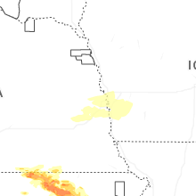
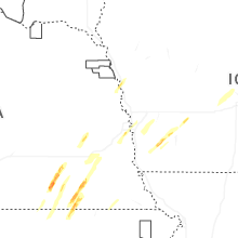
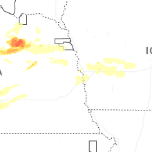
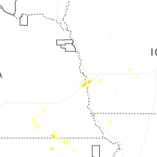


Connect with Interactive Hail Maps