

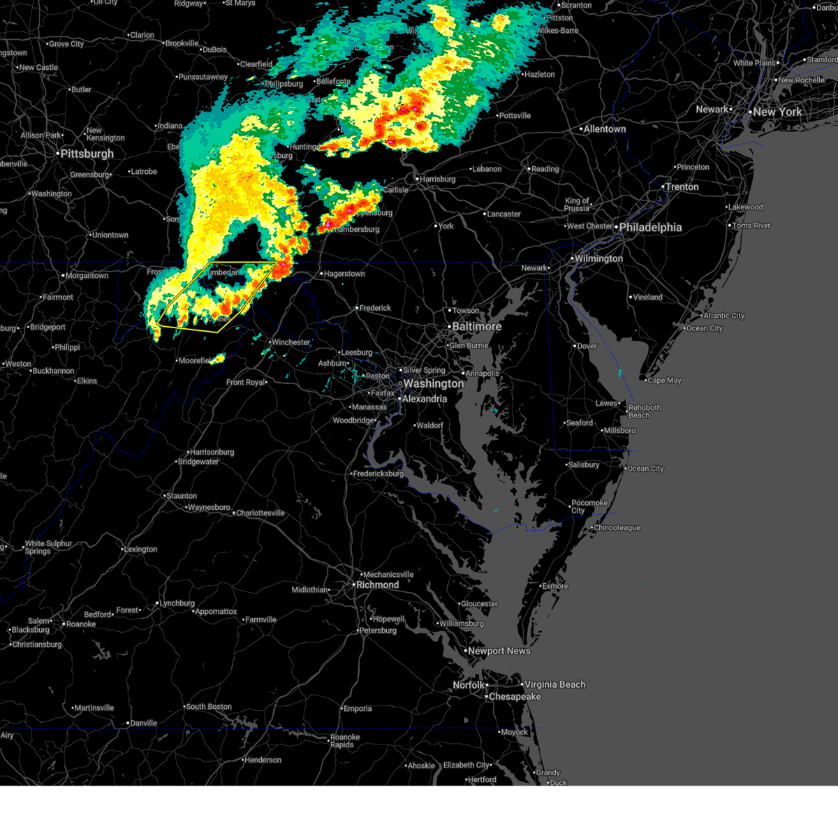
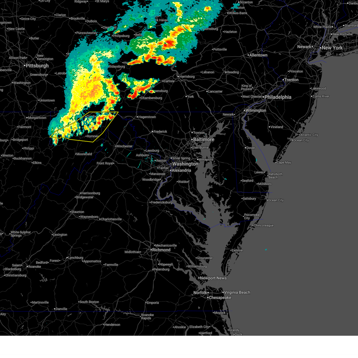
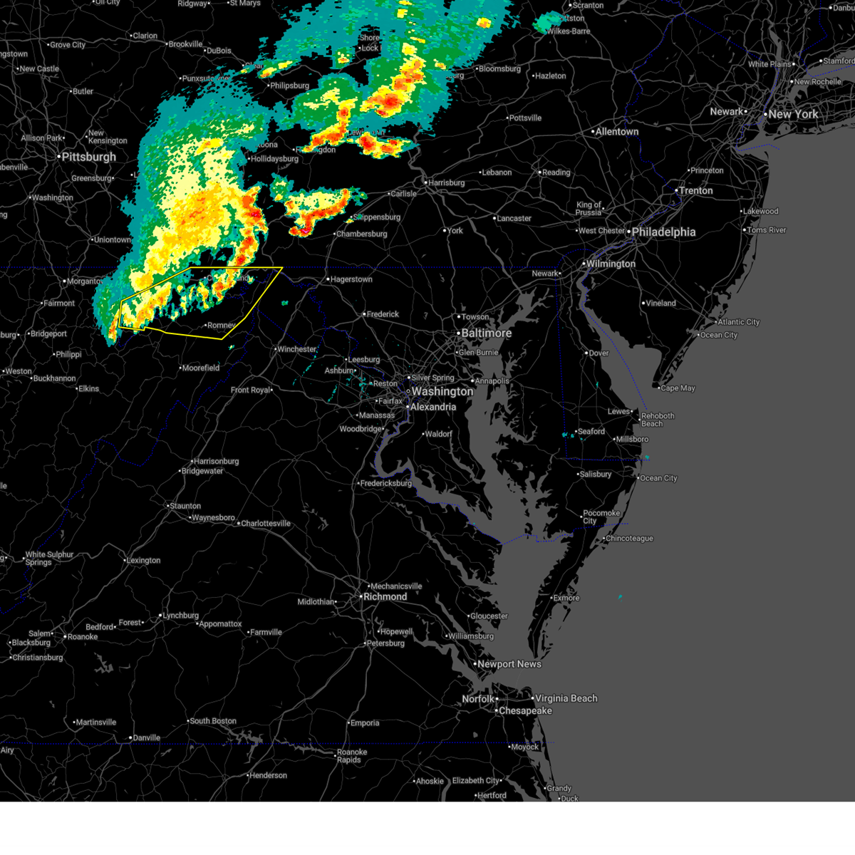
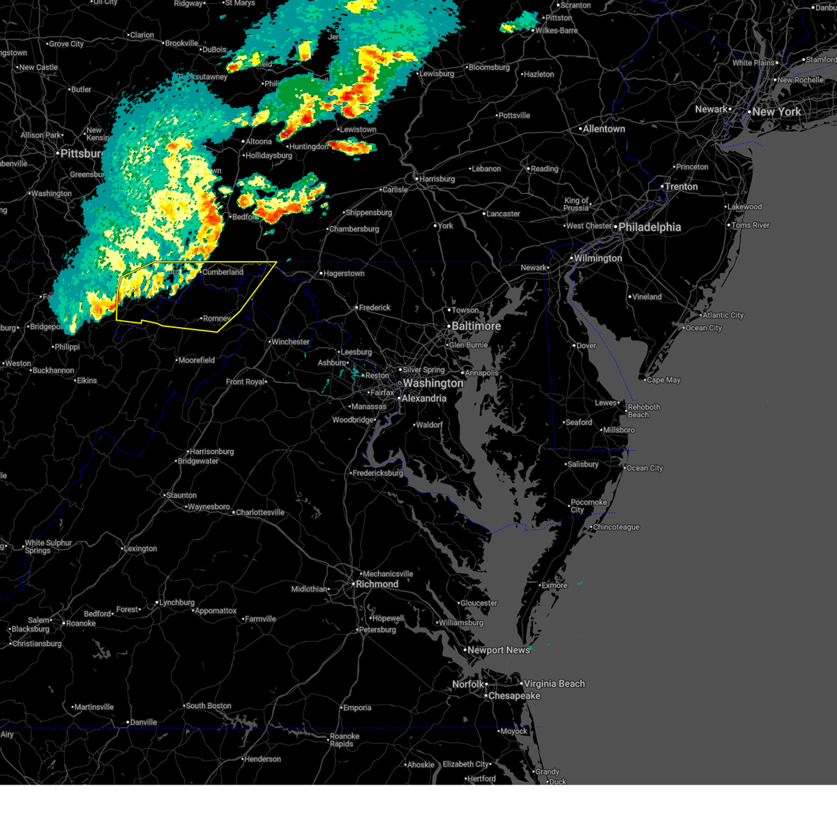
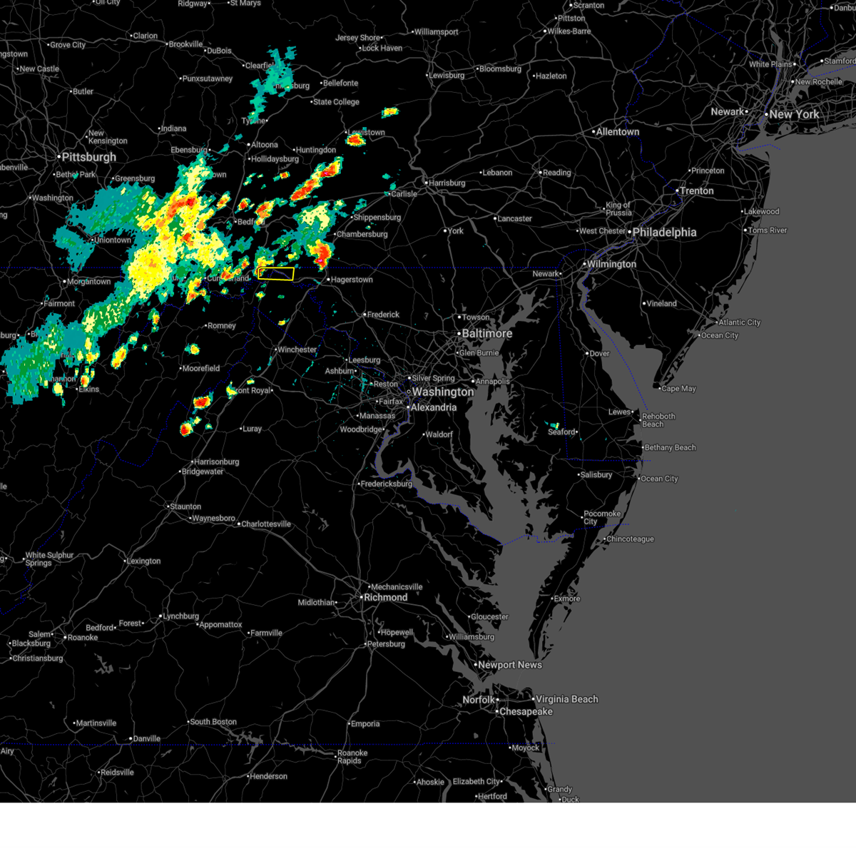
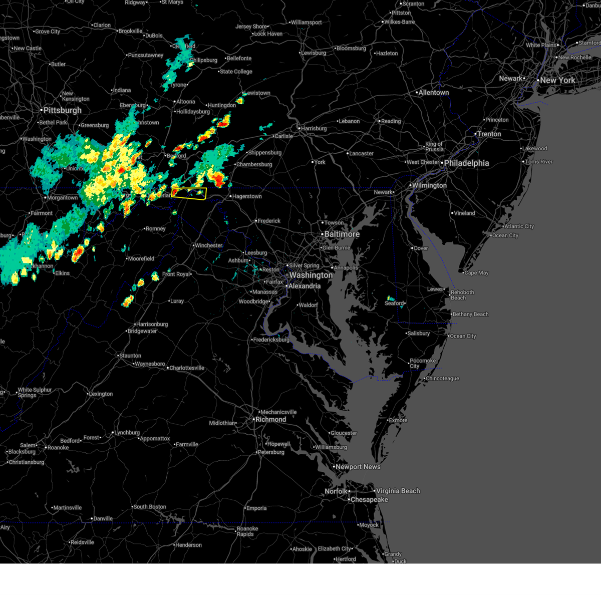
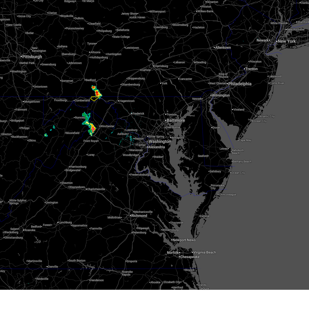
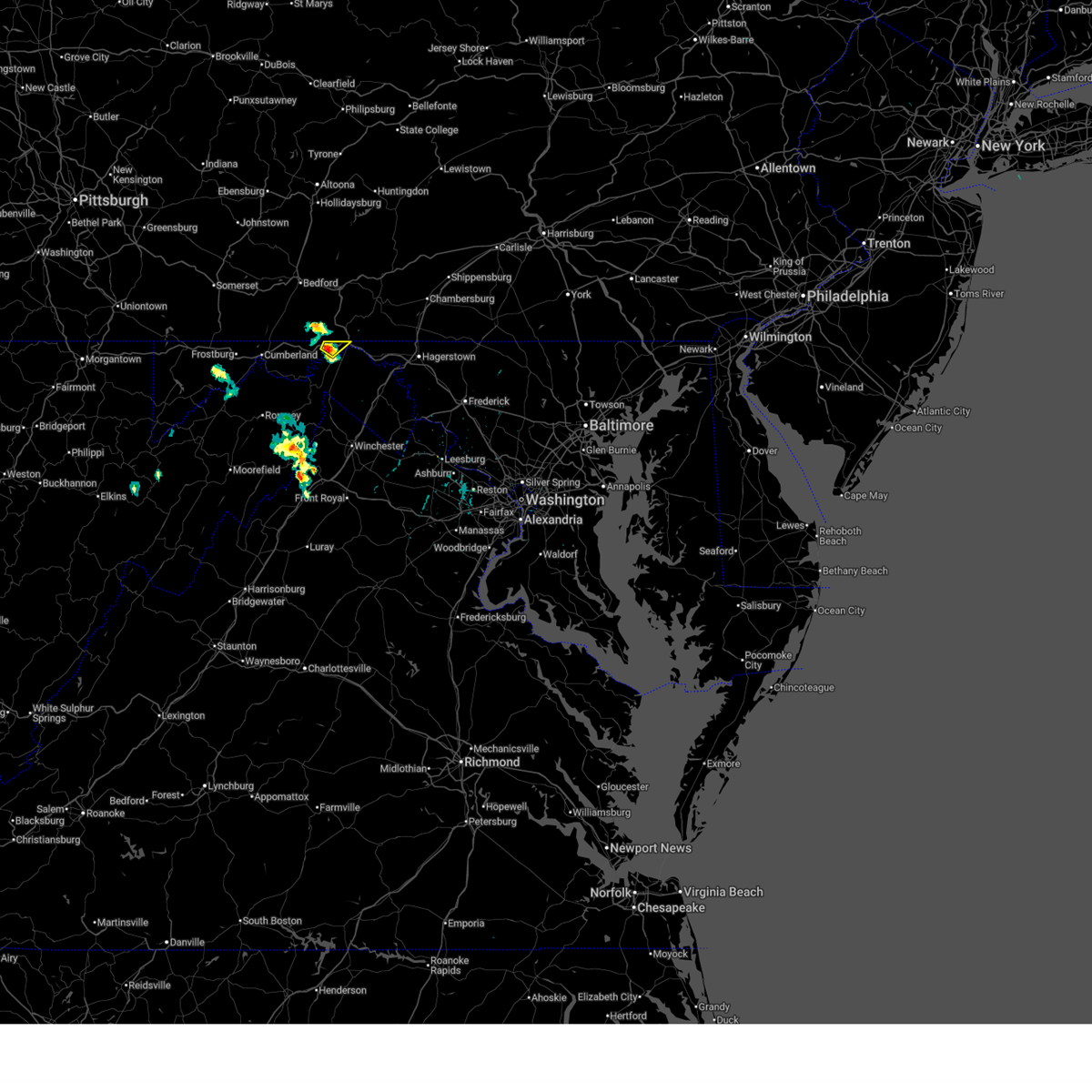
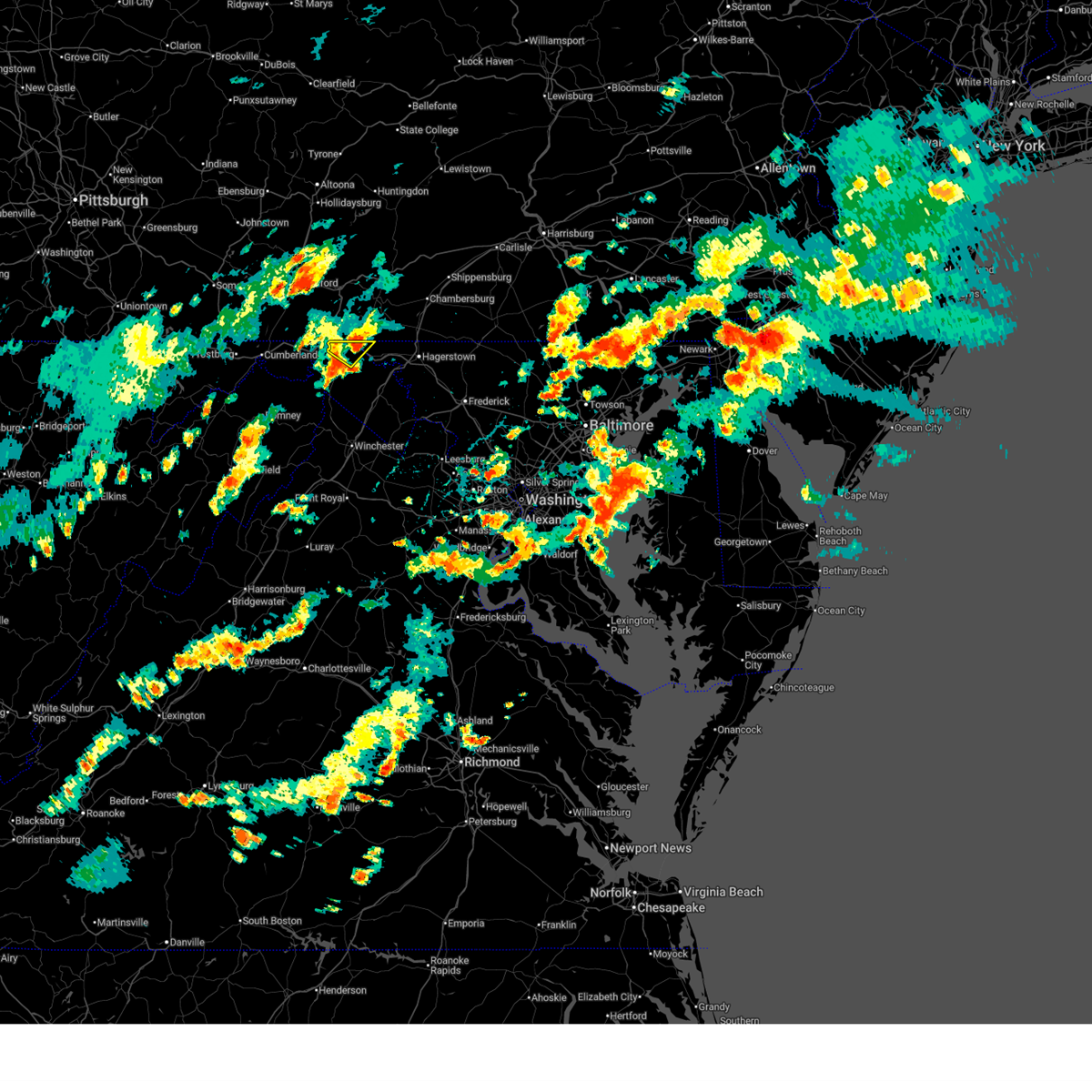
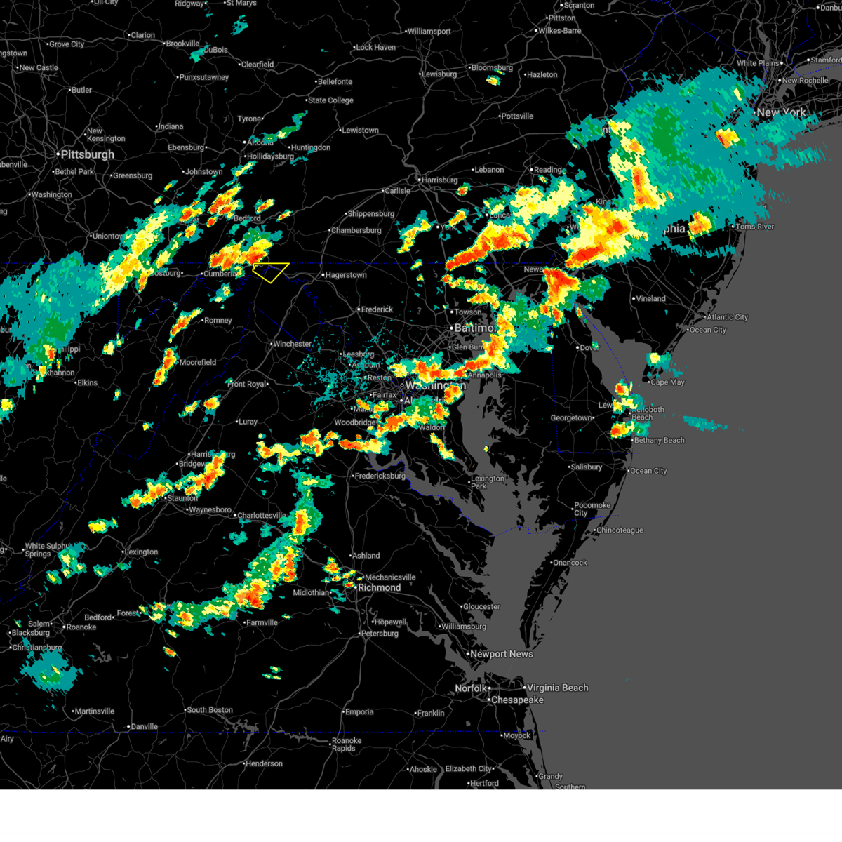
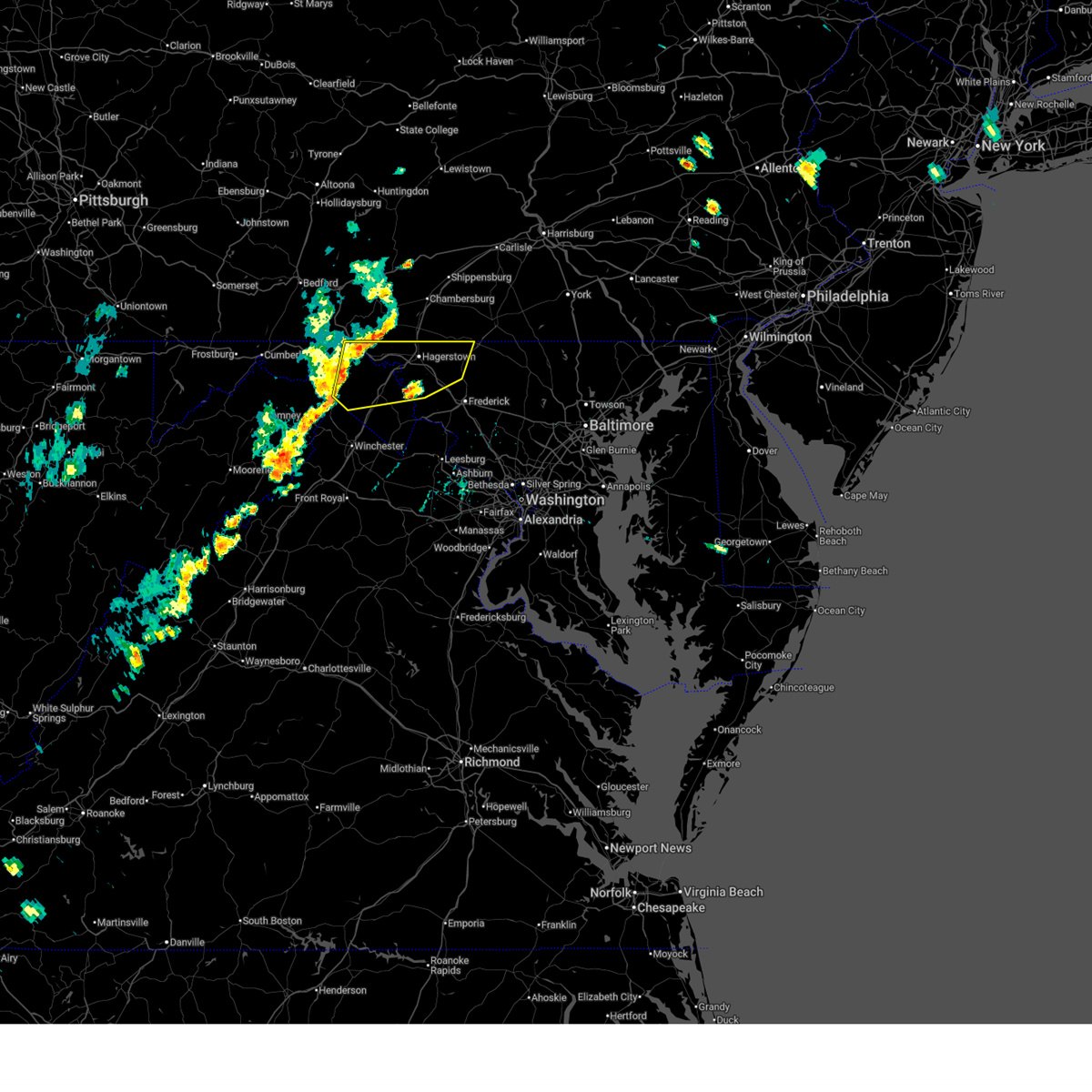
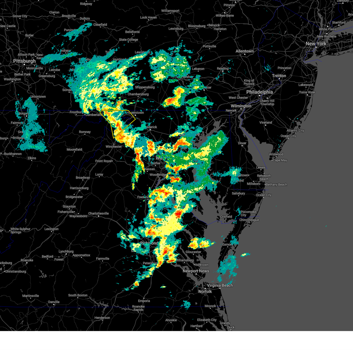
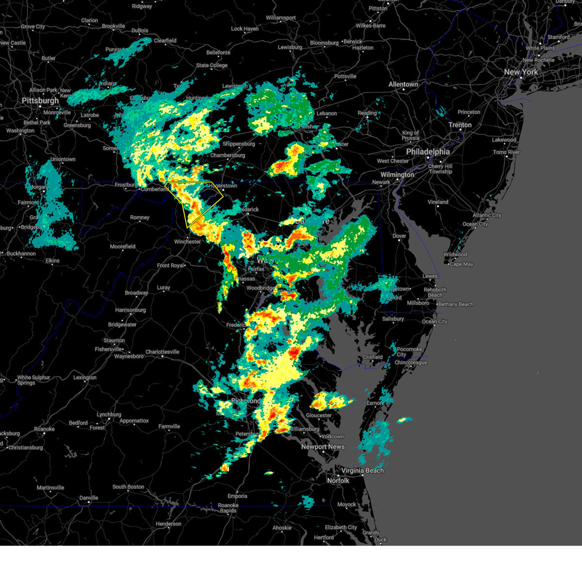
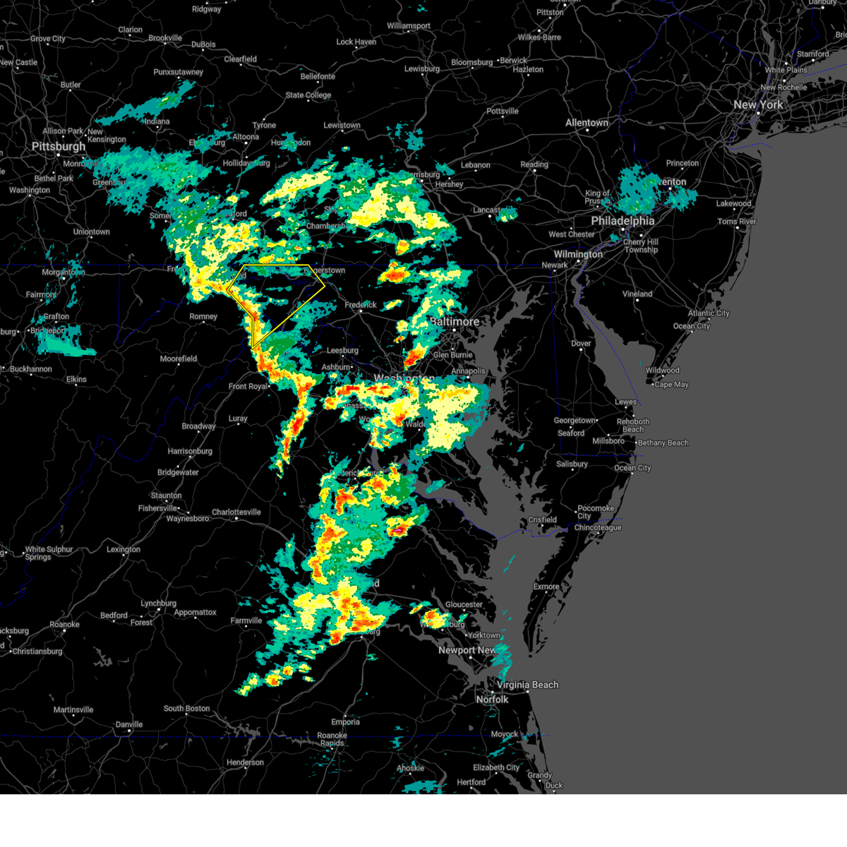
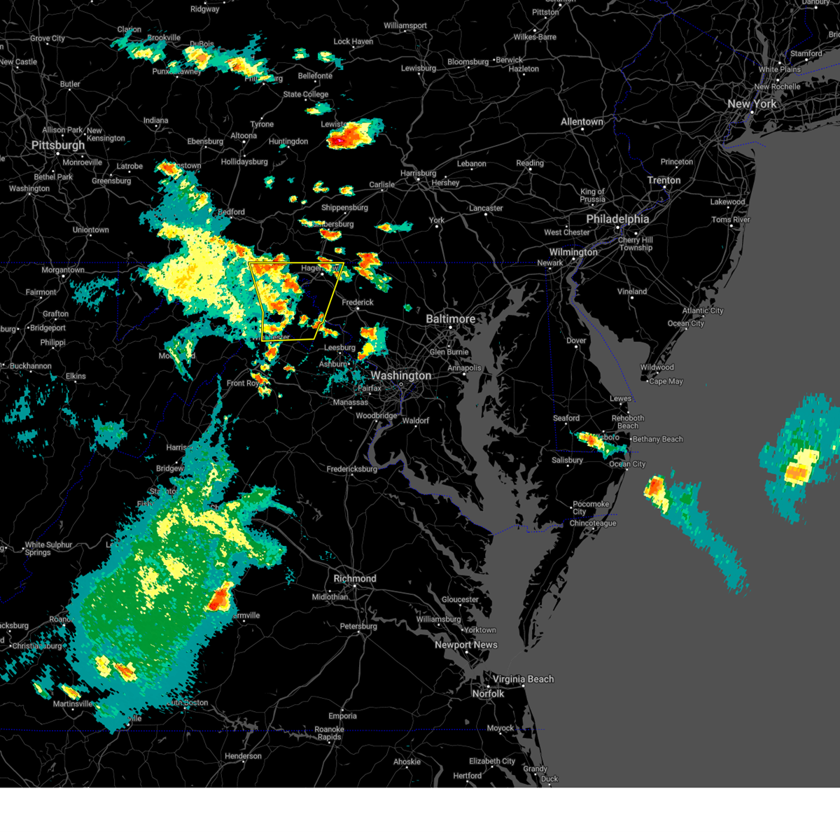
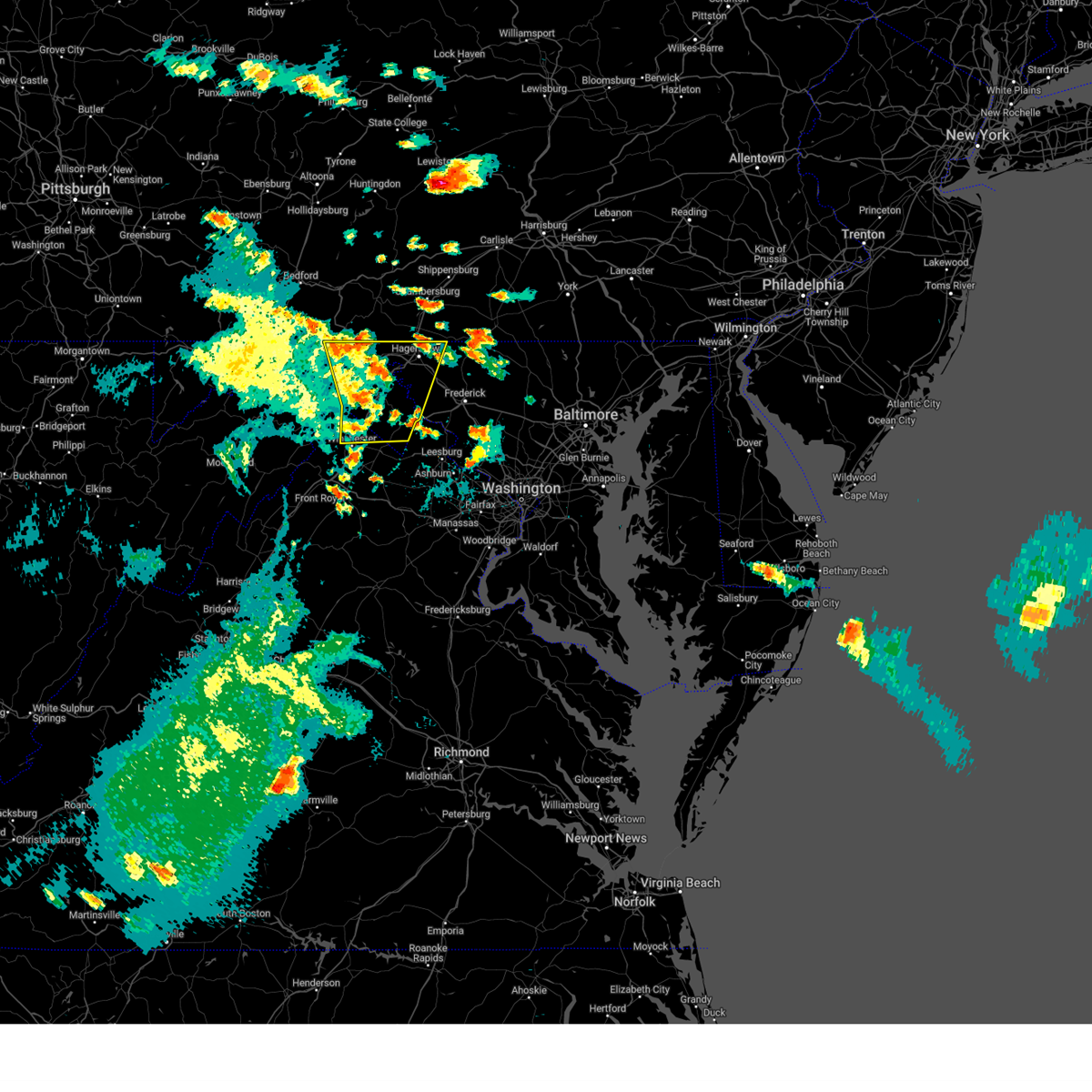
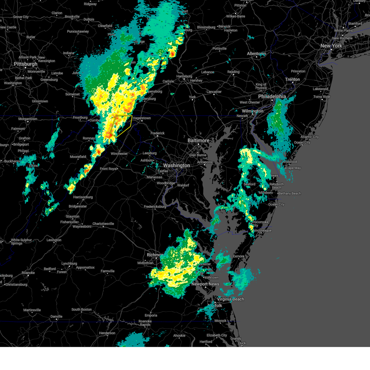
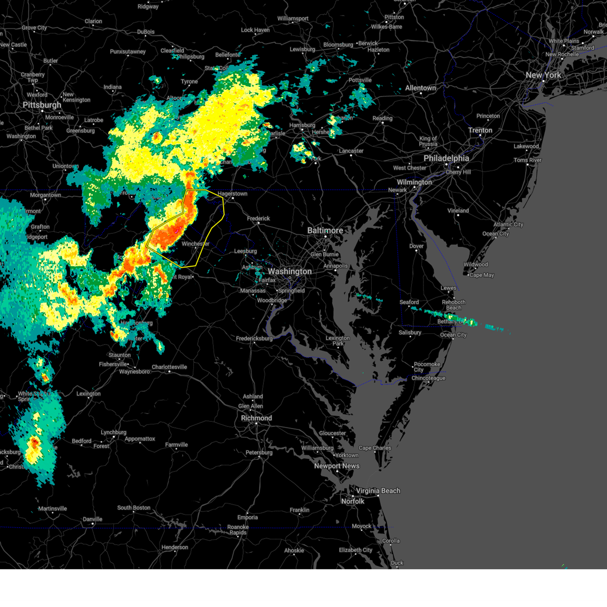
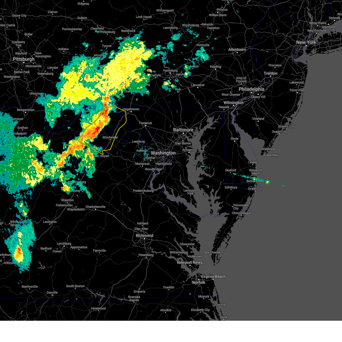
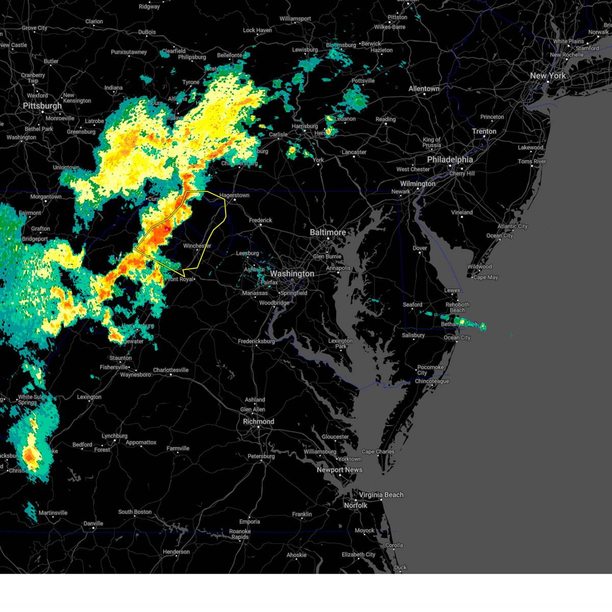
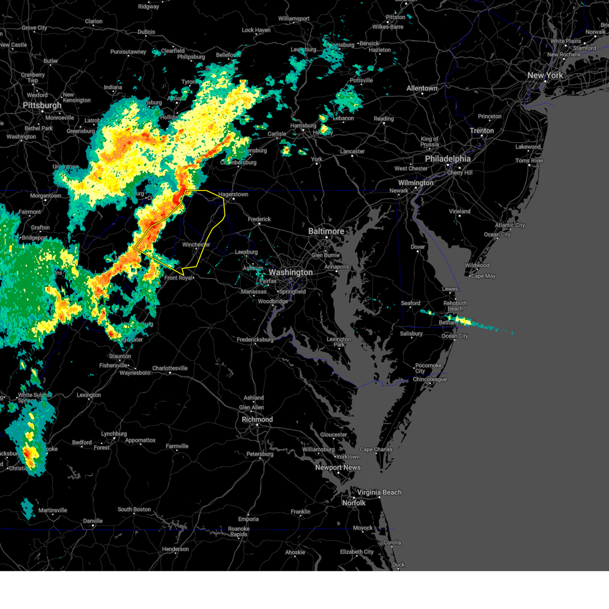
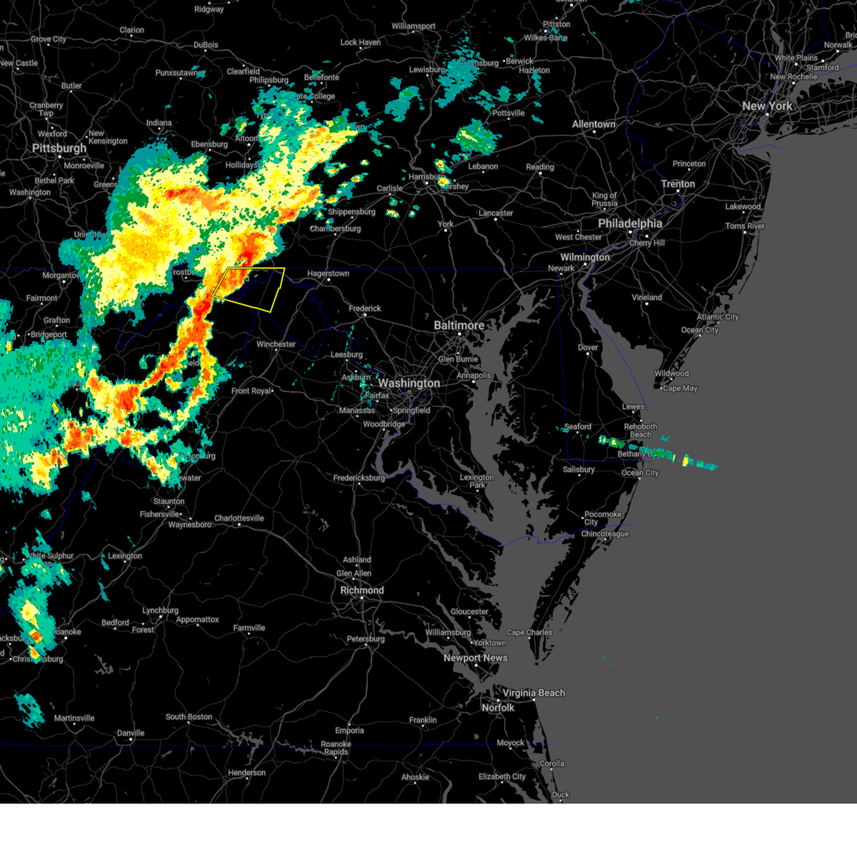
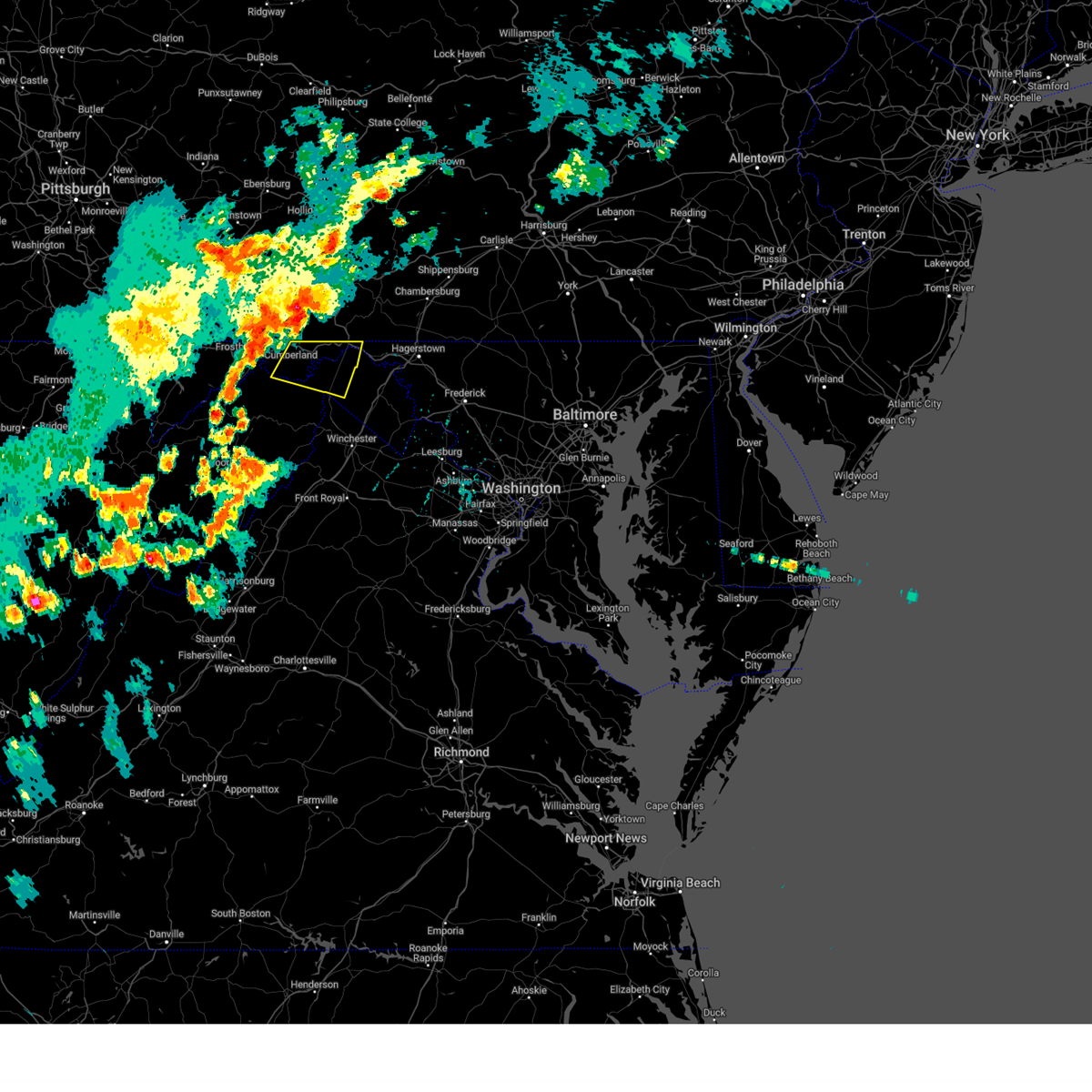
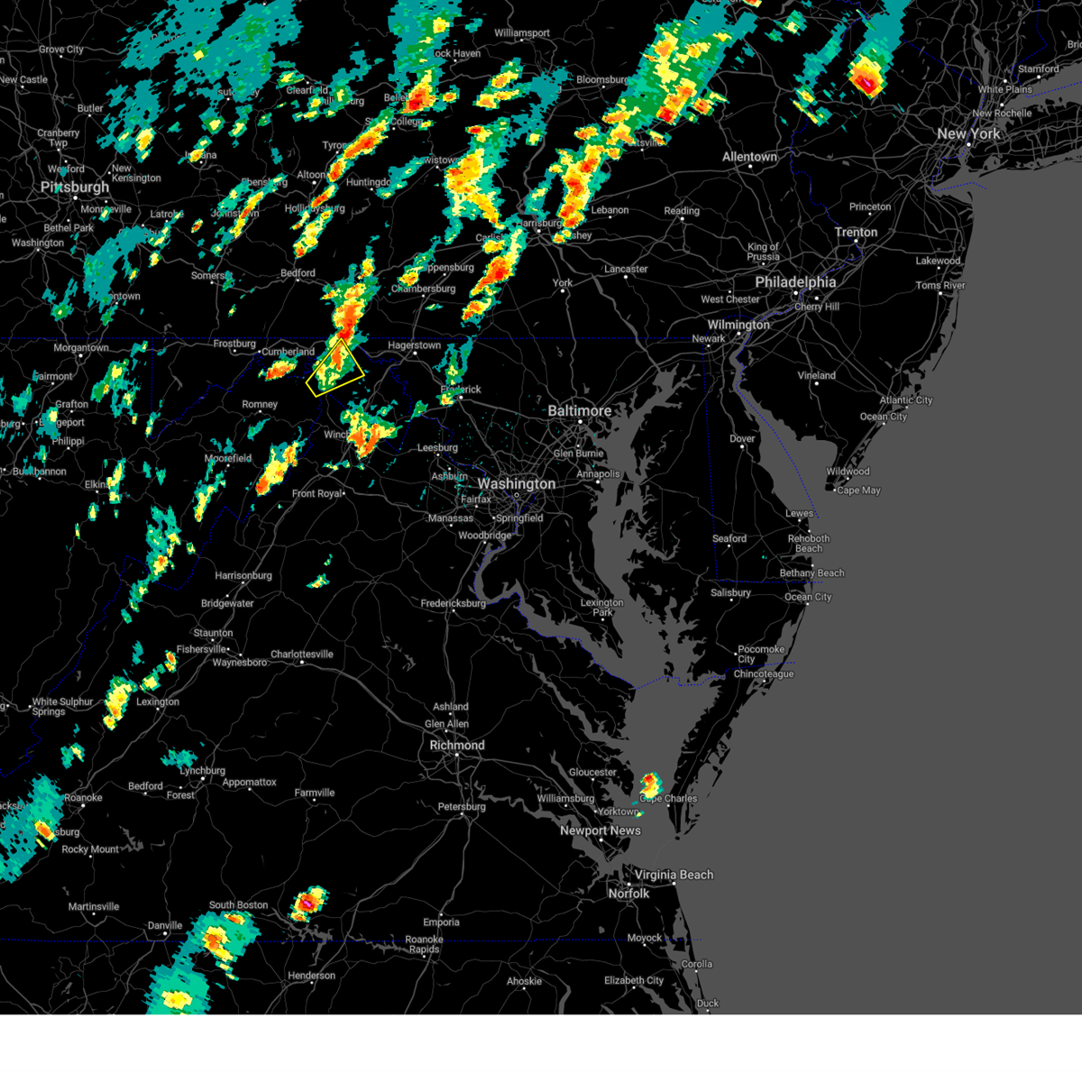
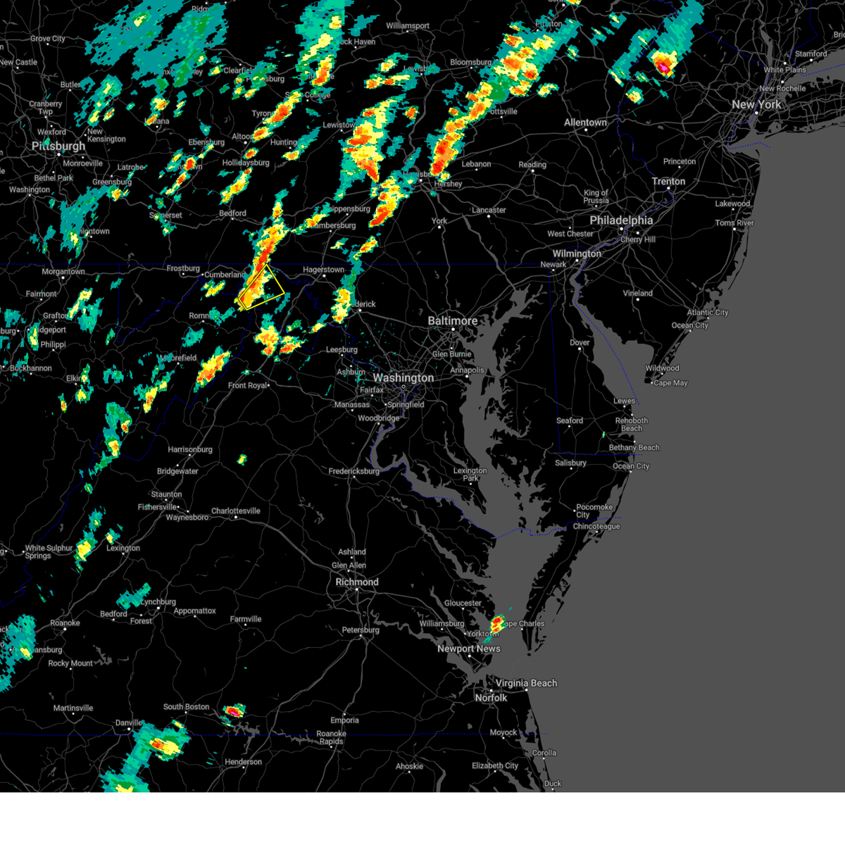
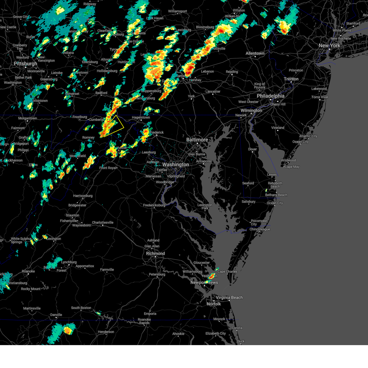
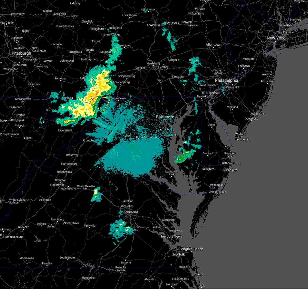
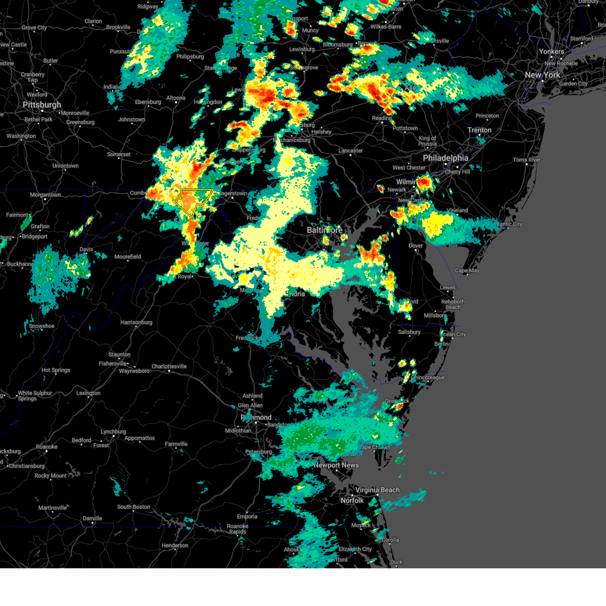
Hail Map for Hancock, MD
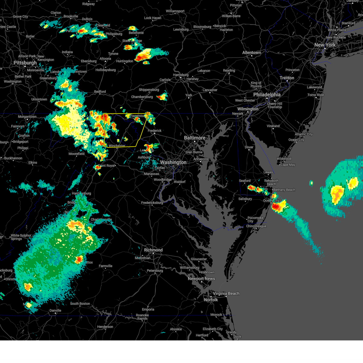
The Hancock, MD area has had 7 reports of on-the-ground hail by trained spotters, and has been under severe weather warnings 13 times during the past 12 months. Doppler radar has detected hail at or near Hancock, MD on 41 occasions, including 5 occasions during the past year.
| Name: | Hancock, MD |
| Where Located: | 77 miles SSW of State College, PA |
| Map: | Google Map for Hancock, MD |
| Population: | 1545 |
| Housing Units: | 821 |
| More Info: | Search Google for Hancock, MD |
2
The Top Recent Hail Date for Hancock, MD is Saturday, July 26, 2025 (8th out of 41)
Hail and Wind Damage Spotted near Hancock, MD
| Date / Time | Report Details |
|---|---|
| 6/11/2026 6:45 PM EDT |
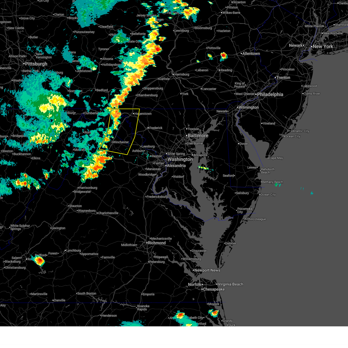 Svrlwx the national weather service in sterling virginia has issued a * severe thunderstorm warning for, washington county in north central maryland, southwestern frederick county in north central maryland, northwestern loudoun county in northern virginia, northeastern shenandoah county in northwestern virginia, frederick county in northwestern virginia, north central warren county in northwestern virginia, clarke county in northwestern virginia, north central fauquier county in northern virginia, the city of winchester in northwestern virginia, jefferson county in the panhandle of west virginia, eastern morgan county in the panhandle of west virginia, berkeley county in the panhandle of west virginia, * until 730 pm edt. * at 645 pm edt, severe thunderstorms were located along a line extending from near hancock to 7 miles west of inwood to near star tannery, moving east at 35 mph (radar indicated). Hazards include 60 mph wind gusts. Damaging winds will cause some trees and large branches to fall. this could injure those outdoors, as well as damage homes and vehicles. roadways may become blocked by downed trees. localized power outages are possible. Unsecured light objects may become projectiles. Svrlwx the national weather service in sterling virginia has issued a * severe thunderstorm warning for, washington county in north central maryland, southwestern frederick county in north central maryland, northwestern loudoun county in northern virginia, northeastern shenandoah county in northwestern virginia, frederick county in northwestern virginia, north central warren county in northwestern virginia, clarke county in northwestern virginia, north central fauquier county in northern virginia, the city of winchester in northwestern virginia, jefferson county in the panhandle of west virginia, eastern morgan county in the panhandle of west virginia, berkeley county in the panhandle of west virginia, * until 730 pm edt. * at 645 pm edt, severe thunderstorms were located along a line extending from near hancock to 7 miles west of inwood to near star tannery, moving east at 35 mph (radar indicated). Hazards include 60 mph wind gusts. Damaging winds will cause some trees and large branches to fall. this could injure those outdoors, as well as damage homes and vehicles. roadways may become blocked by downed trees. localized power outages are possible. Unsecured light objects may become projectiles.
|
| 6/11/2026 6:40 PM EDT | A tree was down down along martinsburg roa in morgan county WV, 4.8 miles NNW of Hancock, MD |
| 6/11/2026 6:33 PM EDT |
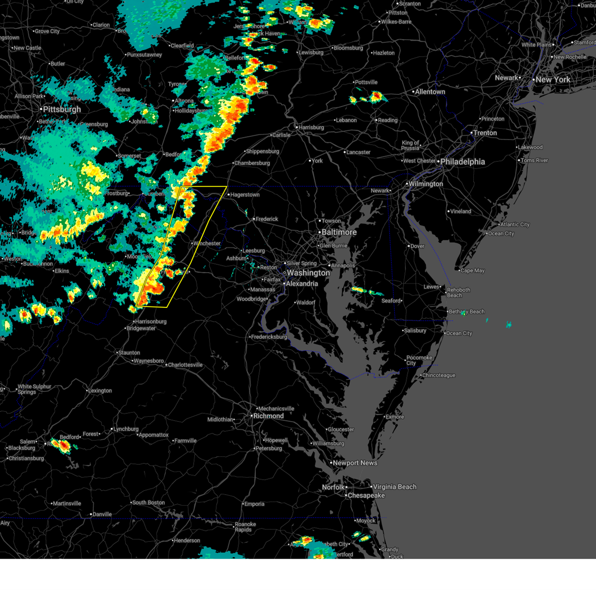 At 632 pm edt, severe thunderstorms were located along a line extending from near hancock to near star tannery to near timberville, moving east at 30 mph (radar indicated). Hazards include 60 mph wind gusts. Damaging winds will cause some trees and large branches to fall. this could injure those outdoors, as well as damage homes and vehicles. roadways may become blocked by downed trees. localized power outages are possible. unsecured light objects may become projectiles. Locations impacted include, winchester, martinsburg, strasburg, woodstock, hancock, millwood pike, luray, broadway, inwood, timberville, wilson-conococheague, williamsport, mount jackson, stephens city, stanley, berkeley springs, star tannery, basye-bryce mountain, berkeley, and maugansville. At 632 pm edt, severe thunderstorms were located along a line extending from near hancock to near star tannery to near timberville, moving east at 30 mph (radar indicated). Hazards include 60 mph wind gusts. Damaging winds will cause some trees and large branches to fall. this could injure those outdoors, as well as damage homes and vehicles. roadways may become blocked by downed trees. localized power outages are possible. unsecured light objects may become projectiles. Locations impacted include, winchester, martinsburg, strasburg, woodstock, hancock, millwood pike, luray, broadway, inwood, timberville, wilson-conococheague, williamsport, mount jackson, stephens city, stanley, berkeley springs, star tannery, basye-bryce mountain, berkeley, and maugansville.
|
| 6/11/2026 6:15 PM EDT |
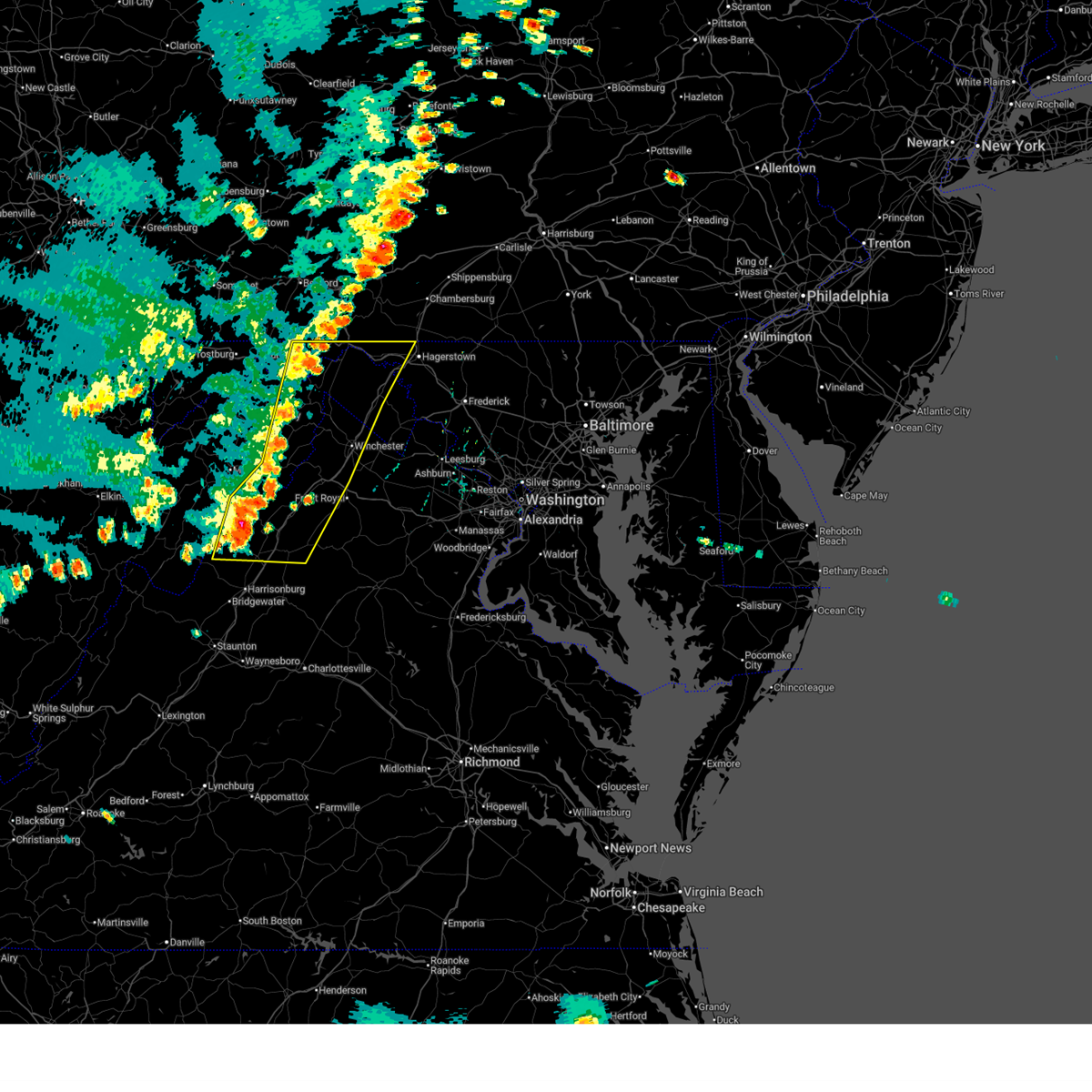 Svrlwx the national weather service in sterling virginia has issued a * severe thunderstorm warning for, northwestern washington county in north central maryland, northeastern allegany county in western maryland, shenandoah county in northwestern virginia, frederick county in northwestern virginia, northern rockingham county in western virginia, western warren county in northwestern virginia, northern page county in northwestern virginia, the city of winchester in northwestern virginia, morgan county in the panhandle of west virginia, central hardy county in eastern west virginia, berkeley county in the panhandle of west virginia, hampshire county in eastern west virginia, * until 645 pm edt. * at 615 pm edt, severe thunderstorms were located along a line extending from near barnes gap to near wardensville to 6 miles northwest of broadway, moving east at 35 mph (radar indicated). Hazards include 60 mph wind gusts. Damaging winds will cause some trees and large branches to fall. this could injure those outdoors, as well as damage homes and vehicles. roadways may become blocked by downed trees. localized power outages are possible. Unsecured light objects may become projectiles. Svrlwx the national weather service in sterling virginia has issued a * severe thunderstorm warning for, northwestern washington county in north central maryland, northeastern allegany county in western maryland, shenandoah county in northwestern virginia, frederick county in northwestern virginia, northern rockingham county in western virginia, western warren county in northwestern virginia, northern page county in northwestern virginia, the city of winchester in northwestern virginia, morgan county in the panhandle of west virginia, central hardy county in eastern west virginia, berkeley county in the panhandle of west virginia, hampshire county in eastern west virginia, * until 645 pm edt. * at 615 pm edt, severe thunderstorms were located along a line extending from near barnes gap to near wardensville to 6 miles northwest of broadway, moving east at 35 mph (radar indicated). Hazards include 60 mph wind gusts. Damaging winds will cause some trees and large branches to fall. this could injure those outdoors, as well as damage homes and vehicles. roadways may become blocked by downed trees. localized power outages are possible. Unsecured light objects may become projectiles.
|
| 6/6/2026 4:50 PM EDT |
 At 449 pm edt, severe thunderstorms were located along a line extending from 8 miles west of wilson-conococheague to near greenwood to 13 miles northwest of winchester, moving east at 60 mph (radar indicated). Hazards include 60 mph wind gusts. Damaging winds will cause some trees and large branches to fall. this could injure those outdoors, as well as damage homes and vehicles. roadways may become blocked by downed trees. localized power outages are possible. unsecured light objects may become projectiles. Locations impacted include, cumberland, keyser, romney, hancock, bel air, paw paw, fort ashby, berkeley springs, ridgeley, cresaptown, potomac park, wiley ford, rawlings, springfield, great cacapon, green spring, burlington, flintstone, oldtown, and spring gap. At 449 pm edt, severe thunderstorms were located along a line extending from 8 miles west of wilson-conococheague to near greenwood to 13 miles northwest of winchester, moving east at 60 mph (radar indicated). Hazards include 60 mph wind gusts. Damaging winds will cause some trees and large branches to fall. this could injure those outdoors, as well as damage homes and vehicles. roadways may become blocked by downed trees. localized power outages are possible. unsecured light objects may become projectiles. Locations impacted include, cumberland, keyser, romney, hancock, bel air, paw paw, fort ashby, berkeley springs, ridgeley, cresaptown, potomac park, wiley ford, rawlings, springfield, great cacapon, green spring, burlington, flintstone, oldtown, and spring gap.
|
| 6/6/2026 4:44 PM EDT | Several calls for trees down along river road in different location in morgan county WV, 3.4 miles WNW of Hancock, MD |
| 6/6/2026 4:35 PM EDT | Trees dow in fulton county PA, 4.1 miles SSE of Hancock, MD |
| 6/6/2026 4:35 PM EDT |
 At 435 pm edt, severe thunderstorms were located along a line extending from near hancock to near greenwood to 11 miles east of romney, moving east at 60 mph (radar indicated). Hazards include 60 mph wind gusts. Damaging winds will cause some trees and large branches to fall. this could injure those outdoors, as well as damage homes and vehicles. roadways may become blocked by downed trees. localized power outages are possible. unsecured light objects may become projectiles. Locations impacted include, cumberland, keyser, mountain lake park, westernport, romney, hancock, bel air, paw paw, la vale, fort ashby, lonaconing, piedmont, berkeley springs, loch lynn heights, deer park, elk garden, kitzmiller, ridgeley, cresaptown, and potomac park. At 435 pm edt, severe thunderstorms were located along a line extending from near hancock to near greenwood to 11 miles east of romney, moving east at 60 mph (radar indicated). Hazards include 60 mph wind gusts. Damaging winds will cause some trees and large branches to fall. this could injure those outdoors, as well as damage homes and vehicles. roadways may become blocked by downed trees. localized power outages are possible. unsecured light objects may become projectiles. Locations impacted include, cumberland, keyser, mountain lake park, westernport, romney, hancock, bel air, paw paw, la vale, fort ashby, lonaconing, piedmont, berkeley springs, loch lynn heights, deer park, elk garden, kitzmiller, ridgeley, cresaptown, and potomac park.
|
| 6/6/2026 4:23 PM EDT |
 At 423 pm edt, severe thunderstorms were located along a line extending from near barnes gap to paw paw to near romney, moving east at 60 mph (radar indicated). Hazards include 60 mph wind gusts. Damaging winds will cause some trees and large branches to fall. this could injure those outdoors, as well as damage homes and vehicles. roadways may become blocked by downed trees. localized power outages are possible. unsecured light objects may become projectiles. Locations impacted include, cumberland, frostburg, keyser, mountain lake park, oakland, westernport, romney, hancock, bel air, paw paw, la vale, fort ashby, lonaconing, piedmont, berkeley springs, loch lynn heights, deer park, elk garden, kitzmiller, and ridgeley. At 423 pm edt, severe thunderstorms were located along a line extending from near barnes gap to paw paw to near romney, moving east at 60 mph (radar indicated). Hazards include 60 mph wind gusts. Damaging winds will cause some trees and large branches to fall. this could injure those outdoors, as well as damage homes and vehicles. roadways may become blocked by downed trees. localized power outages are possible. unsecured light objects may become projectiles. Locations impacted include, cumberland, frostburg, keyser, mountain lake park, oakland, westernport, romney, hancock, bel air, paw paw, la vale, fort ashby, lonaconing, piedmont, berkeley springs, loch lynn heights, deer park, elk garden, kitzmiller, and ridgeley.
|
| 6/6/2026 4:05 PM EDT |
 Svrlwx the national weather service in sterling virginia has issued a * severe thunderstorm warning for, northwestern washington county in north central maryland, allegany county in western maryland, garrett county in western maryland, northern frederick county in northwestern virginia, northwestern morgan county in the panhandle of west virginia, mineral county in eastern west virginia, northern hampshire county in eastern west virginia, * until 500 pm edt. * at 404 pm edt, severe thunderstorms were located along a line extending from near lake gordon to near ridgeley to near keyser, moving east at 60 mph (radar indicated). Hazards include 60 mph wind gusts. Damaging winds will cause some trees and large branches to fall. this could injure those outdoors, as well as damage homes and vehicles. roadways may become blocked by downed trees. localized power outages are possible. Unsecured light objects may become projectiles. Svrlwx the national weather service in sterling virginia has issued a * severe thunderstorm warning for, northwestern washington county in north central maryland, allegany county in western maryland, garrett county in western maryland, northern frederick county in northwestern virginia, northwestern morgan county in the panhandle of west virginia, mineral county in eastern west virginia, northern hampshire county in eastern west virginia, * until 500 pm edt. * at 404 pm edt, severe thunderstorms were located along a line extending from near lake gordon to near ridgeley to near keyser, moving east at 60 mph (radar indicated). Hazards include 60 mph wind gusts. Damaging winds will cause some trees and large branches to fall. this could injure those outdoors, as well as damage homes and vehicles. roadways may become blocked by downed trees. localized power outages are possible. Unsecured light objects may become projectiles.
|
| 5/20/2026 1:53 PM EDT |
 At 153 pm edt, a severe thunderstorm was located near hancock, moving east at 25 mph (radar indicated). Hazards include 60 mph wind gusts. Damaging winds will cause some trees and large branches to fall. this could injure those outdoors, as well as damage homes and vehicles. roadways may become blocked by downed trees. localized power outages are possible. unsecured light objects may become projectiles. Locations impacted include, hancock, pecktonville, forest park, and sleepy creek. At 153 pm edt, a severe thunderstorm was located near hancock, moving east at 25 mph (radar indicated). Hazards include 60 mph wind gusts. Damaging winds will cause some trees and large branches to fall. this could injure those outdoors, as well as damage homes and vehicles. roadways may become blocked by downed trees. localized power outages are possible. unsecured light objects may become projectiles. Locations impacted include, hancock, pecktonville, forest park, and sleepy creek.
|
| 5/20/2026 1:37 PM EDT |
 Svrlwx the national weather service in sterling virginia has issued a * severe thunderstorm warning for, northwestern washington county in north central maryland, northeastern allegany county in western maryland, northeastern morgan county in the panhandle of west virginia, * until 215 pm edt. * at 137 pm edt, a severe thunderstorm was located near barnes gap, or 10 miles west of hancock, moving east at 25 mph (radar indicated). Hazards include 60 mph wind gusts. Damaging winds will cause some trees and large branches to fall. this could injure those outdoors, as well as damage homes and vehicles. roadways may become blocked by downed trees. localized power outages are possible. Unsecured light objects may become projectiles. Svrlwx the national weather service in sterling virginia has issued a * severe thunderstorm warning for, northwestern washington county in north central maryland, northeastern allegany county in western maryland, northeastern morgan county in the panhandle of west virginia, * until 215 pm edt. * at 137 pm edt, a severe thunderstorm was located near barnes gap, or 10 miles west of hancock, moving east at 25 mph (radar indicated). Hazards include 60 mph wind gusts. Damaging winds will cause some trees and large branches to fall. this could injure those outdoors, as well as damage homes and vehicles. roadways may become blocked by downed trees. localized power outages are possible. Unsecured light objects may become projectiles.
|
| 5/18/2026 5:28 PM EDT |
 The storm which prompted the warning has moved out of the area. therefore, the warning will be allowed to expire. to report severe weather, contact your nearest law enforcement agency. they will relay your report to the national weather service sterling virginia. The storm which prompted the warning has moved out of the area. therefore, the warning will be allowed to expire. to report severe weather, contact your nearest law enforcement agency. they will relay your report to the national weather service sterling virginia.
|
| 5/18/2026 5:16 PM EDT | Multiple trees down on high germany road and bottenfield roa in washington county MD, 6.6 miles E of Hancock, MD |
| 5/18/2026 5:10 PM EDT |
 Svrlwx the national weather service in sterling virginia has issued a * severe thunderstorm warning for, western washington county in north central maryland, eastern allegany county in western maryland, * until 530 pm edt. * at 510 pm edt, a severe thunderstorm was located near barnes gap, or near hancock, moving northeast at 30 mph (radar indicated). Hazards include 60 mph wind gusts. Damaging winds will cause some trees and large branches to fall. this could injure those outdoors, as well as damage homes and vehicles. roadways may become blocked by downed trees. localized power outages are possible. Unsecured light objects may become projectiles. Svrlwx the national weather service in sterling virginia has issued a * severe thunderstorm warning for, western washington county in north central maryland, eastern allegany county in western maryland, * until 530 pm edt. * at 510 pm edt, a severe thunderstorm was located near barnes gap, or near hancock, moving northeast at 30 mph (radar indicated). Hazards include 60 mph wind gusts. Damaging winds will cause some trees and large branches to fall. this could injure those outdoors, as well as damage homes and vehicles. roadways may become blocked by downed trees. localized power outages are possible. Unsecured light objects may become projectiles.
|
| 11/5/2025 8:33 PM EST | Multiple reports of trees and wires down from hancock to clear springs in washington county MD, 0.4 miles NW of Hancock, MD |
| 7/31/2025 3:10 PM EDT |
 The storm which prompted the warning has weakened below severe limits, and no longer poses an immediate threat to life or property. therefore, the warning will be allowed to expire. however, heavy rain is still possible with this thunderstorm. a severe thunderstorm watch remains in effect until 800 pm edt for western and north central maryland, and the panhandle of west virginia. The storm which prompted the warning has weakened below severe limits, and no longer poses an immediate threat to life or property. therefore, the warning will be allowed to expire. however, heavy rain is still possible with this thunderstorm. a severe thunderstorm watch remains in effect until 800 pm edt for western and north central maryland, and the panhandle of west virginia.
|
| 7/31/2025 3:00 PM EDT | A few trees were down around hancoc in washington county MD, 0.5 miles SSE of Hancock, MD |
| 7/31/2025 2:42 PM EDT |
 Svrlwx the national weather service in sterling virginia has issued a * severe thunderstorm warning for, northwestern washington county in north central maryland, eastern allegany county in western maryland, northeastern morgan county in the panhandle of west virginia, * until 315 pm edt. * at 241 pm edt, a severe thunderstorm was located near hancock, moving southeast at 20 mph (radar indicated). Hazards include 60 mph wind gusts. Damaging winds will cause some trees and large branches to fall. this could injure those outdoors, as well as damage homes and vehicles. roadways may become blocked by downed trees. localized power outages are possible. Unsecured light objects may become projectiles. Svrlwx the national weather service in sterling virginia has issued a * severe thunderstorm warning for, northwestern washington county in north central maryland, eastern allegany county in western maryland, northeastern morgan county in the panhandle of west virginia, * until 315 pm edt. * at 241 pm edt, a severe thunderstorm was located near hancock, moving southeast at 20 mph (radar indicated). Hazards include 60 mph wind gusts. Damaging winds will cause some trees and large branches to fall. this could injure those outdoors, as well as damage homes and vehicles. roadways may become blocked by downed trees. localized power outages are possible. Unsecured light objects may become projectiles.
|
| 6/19/2025 1:44 PM EDT |
 Svrlwx the national weather service in sterling virginia has issued a * severe thunderstorm warning for, washington county in north central maryland, northwestern frederick county in north central maryland, northeastern jefferson county in the panhandle of west virginia, central morgan county in the panhandle of west virginia, berkeley county in the panhandle of west virginia, * until 245 pm edt. * at 144 pm edt, a severe thunderstorm was located 7 miles northeast of greenwood, moving east at 50 mph (radar indicated). Hazards include 60 mph wind gusts. Damaging winds will cause some trees and large branches to fall. this could injure those outdoors, as well as damage homes and vehicles. roadways may become blocked by downed trees. localized power outages are possible. Unsecured light objects may become projectiles. Svrlwx the national weather service in sterling virginia has issued a * severe thunderstorm warning for, washington county in north central maryland, northwestern frederick county in north central maryland, northeastern jefferson county in the panhandle of west virginia, central morgan county in the panhandle of west virginia, berkeley county in the panhandle of west virginia, * until 245 pm edt. * at 144 pm edt, a severe thunderstorm was located 7 miles northeast of greenwood, moving east at 50 mph (radar indicated). Hazards include 60 mph wind gusts. Damaging winds will cause some trees and large branches to fall. this could injure those outdoors, as well as damage homes and vehicles. roadways may become blocked by downed trees. localized power outages are possible. Unsecured light objects may become projectiles.
|
| 5/30/2025 7:34 PM EDT |
 the severe thunderstorm warning has been cancelled and is no longer in effect the severe thunderstorm warning has been cancelled and is no longer in effect
|
| 5/30/2025 7:34 PM EDT |
 At 734 pm edt, severe thunderstorms were located along a line extending from near inglesmith to 7 miles southeast of berkeley springs to near inwood, moving northeast at 30 mph (radar indicated). Hazards include 60 mph wind gusts. Damaging winds will cause some trees and large branches to fall. this could injure those outdoors, as well as damage homes and vehicles. roadways may become blocked by downed trees. localized power outages are possible. unsecured light objects may become projectiles. Locations impacted include, johnsons mill, tomahawk, johnsontown, berkeley springs, martinsburg, valley view, berkeley, hancock, spohrs crossroads, wilson-conococheague, big spring, great cacapon, big pool, halfway, arden, falling waters, smith crossroads, jones springs, williamsport, and new hope. At 734 pm edt, severe thunderstorms were located along a line extending from near inglesmith to 7 miles southeast of berkeley springs to near inwood, moving northeast at 30 mph (radar indicated). Hazards include 60 mph wind gusts. Damaging winds will cause some trees and large branches to fall. this could injure those outdoors, as well as damage homes and vehicles. roadways may become blocked by downed trees. localized power outages are possible. unsecured light objects may become projectiles. Locations impacted include, johnsons mill, tomahawk, johnsontown, berkeley springs, martinsburg, valley view, berkeley, hancock, spohrs crossroads, wilson-conococheague, big spring, great cacapon, big pool, halfway, arden, falling waters, smith crossroads, jones springs, williamsport, and new hope.
|
| 5/30/2025 7:05 PM EDT |
 Svrlwx the national weather service in sterling virginia has issued a * severe thunderstorm warning for, northwestern washington county in north central maryland, northeastern allegany county in western maryland, northeastern frederick county in northwestern virginia, morgan county in the panhandle of west virginia, berkeley county in the panhandle of west virginia, northeastern hampshire county in eastern west virginia, * until 800 pm edt. * at 704 pm edt, severe thunderstorms were located along a line extending from paw paw to near greenwood to 9 miles northwest of winchester, moving northeast at 30 mph (radar indicated). Hazards include 60 mph wind gusts. Damaging winds will cause some trees and large branches to fall. this could injure those outdoors, as well as damage homes and vehicles. roadways may become blocked by downed trees. localized power outages are possible. Unsecured light objects may become projectiles. Svrlwx the national weather service in sterling virginia has issued a * severe thunderstorm warning for, northwestern washington county in north central maryland, northeastern allegany county in western maryland, northeastern frederick county in northwestern virginia, morgan county in the panhandle of west virginia, berkeley county in the panhandle of west virginia, northeastern hampshire county in eastern west virginia, * until 800 pm edt. * at 704 pm edt, severe thunderstorms were located along a line extending from paw paw to near greenwood to 9 miles northwest of winchester, moving northeast at 30 mph (radar indicated). Hazards include 60 mph wind gusts. Damaging winds will cause some trees and large branches to fall. this could injure those outdoors, as well as damage homes and vehicles. roadways may become blocked by downed trees. localized power outages are possible. Unsecured light objects may become projectiles.
|
| 5/16/2025 4:17 PM EDT |
 At 417 pm edt, severe thunderstorms were located along a line extending from near hancock to 7 miles north of martinsburg to 6 miles southwest of inwood, moving east at 45 mph (law enforcement reported trees down in eastern allegany county in maryland). Hazards include 60 mph wind gusts and quarter size hail. Damaging winds will cause some trees and large branches to fall. this could injure those outdoors, as well as damage homes and vehicles. roadways may become blocked by downed trees. localized power outages are possible. unsecured light objects may become projectiles. Locations impacted include, winebrenners cross, municipal stadium, johnsontown, valley view, berkeley, ridgeway, oakland, big spring, fairplay, bridgeport, keedysville, robinwood, san mar, pleasantville, falling waters, jones springs, williamsport, albin, millville, and new hope. At 417 pm edt, severe thunderstorms were located along a line extending from near hancock to 7 miles north of martinsburg to 6 miles southwest of inwood, moving east at 45 mph (law enforcement reported trees down in eastern allegany county in maryland). Hazards include 60 mph wind gusts and quarter size hail. Damaging winds will cause some trees and large branches to fall. this could injure those outdoors, as well as damage homes and vehicles. roadways may become blocked by downed trees. localized power outages are possible. unsecured light objects may become projectiles. Locations impacted include, winebrenners cross, municipal stadium, johnsontown, valley view, berkeley, ridgeway, oakland, big spring, fairplay, bridgeport, keedysville, robinwood, san mar, pleasantville, falling waters, jones springs, williamsport, albin, millville, and new hope.
|
| 5/16/2025 4:17 PM EDT |
 the severe thunderstorm warning has been cancelled and is no longer in effect the severe thunderstorm warning has been cancelled and is no longer in effect
|
| 5/16/2025 3:53 PM EDT |
 Svrlwx the national weather service in sterling virginia has issued a * severe thunderstorm warning for, washington county in north central maryland, northeastern allegany county in western maryland, central frederick county in northwestern virginia, north central clarke county in northwestern virginia, the northwestern city of winchester in northwestern virginia, jefferson county in the panhandle of west virginia, morgan county in the panhandle of west virginia, berkeley county in the panhandle of west virginia, east central hampshire county in eastern west virginia, * until 445 pm edt. * at 353 pm edt, severe thunderstorms were located along a line extending from near barnes gap to near greenwood to 12 miles north of star tannery, moving east at 50 mph (radar indicated). Hazards include 60 mph wind gusts and quarter size hail. Damaging winds will cause some trees and large branches to fall. this could injure those outdoors, as well as damage homes and vehicles. roadways may become blocked by downed trees. localized power outages are possible. Unsecured light objects may become projectiles. Svrlwx the national weather service in sterling virginia has issued a * severe thunderstorm warning for, washington county in north central maryland, northeastern allegany county in western maryland, central frederick county in northwestern virginia, north central clarke county in northwestern virginia, the northwestern city of winchester in northwestern virginia, jefferson county in the panhandle of west virginia, morgan county in the panhandle of west virginia, berkeley county in the panhandle of west virginia, east central hampshire county in eastern west virginia, * until 445 pm edt. * at 353 pm edt, severe thunderstorms were located along a line extending from near barnes gap to near greenwood to 12 miles north of star tannery, moving east at 50 mph (radar indicated). Hazards include 60 mph wind gusts and quarter size hail. Damaging winds will cause some trees and large branches to fall. this could injure those outdoors, as well as damage homes and vehicles. roadways may become blocked by downed trees. localized power outages are possible. Unsecured light objects may become projectiles.
|
| 4/19/2025 9:39 PM EDT |
 Svrlwx the national weather service in sterling virginia has issued a * severe thunderstorm warning for, northeastern washington county in north central maryland, northeastern morgan county in the panhandle of west virginia, northeastern berkeley county in the panhandle of west virginia, * until 1015 pm edt. * at 938 pm edt, a severe thunderstorm was located over hancock, moving east at 75 mph (observation from cumberland regional airport). Hazards include 60 mph wind gusts. Damaging winds will cause some trees and large branches to fall. this could injure those outdoors, as well as damage homes and vehicles. roadways may become blocked by downed trees. localized power outages are possible. Unsecured light objects may become projectiles. Svrlwx the national weather service in sterling virginia has issued a * severe thunderstorm warning for, northeastern washington county in north central maryland, northeastern morgan county in the panhandle of west virginia, northeastern berkeley county in the panhandle of west virginia, * until 1015 pm edt. * at 938 pm edt, a severe thunderstorm was located over hancock, moving east at 75 mph (observation from cumberland regional airport). Hazards include 60 mph wind gusts. Damaging winds will cause some trees and large branches to fall. this could injure those outdoors, as well as damage homes and vehicles. roadways may become blocked by downed trees. localized power outages are possible. Unsecured light objects may become projectiles.
|
| 4/19/2025 9:18 PM EDT |
 Svrlwx the national weather service in sterling virginia has issued a * severe thunderstorm warning for, northwestern washington county in north central maryland, northeastern allegany county in western maryland, northwestern morgan county in the panhandle of west virginia, * until 945 pm edt. * at 917 pm edt, a severe thunderstorm was located 8 miles southeast of lake gordon, or 11 miles northwest of paw paw, moving east at 75 mph (observation at cumberland regional airport). Hazards include 60 mph wind gusts. Damaging winds will cause some trees and large branches to fall. this could injure those outdoors, as well as damage homes and vehicles. roadways may become blocked by downed trees. localized power outages are possible. Unsecured light objects may become projectiles. Svrlwx the national weather service in sterling virginia has issued a * severe thunderstorm warning for, northwestern washington county in north central maryland, northeastern allegany county in western maryland, northwestern morgan county in the panhandle of west virginia, * until 945 pm edt. * at 917 pm edt, a severe thunderstorm was located 8 miles southeast of lake gordon, or 11 miles northwest of paw paw, moving east at 75 mph (observation at cumberland regional airport). Hazards include 60 mph wind gusts. Damaging winds will cause some trees and large branches to fall. this could injure those outdoors, as well as damage homes and vehicles. roadways may become blocked by downed trees. localized power outages are possible. Unsecured light objects may become projectiles.
|
| 3/16/2025 5:25 PM EDT |
 the severe thunderstorm warning has been cancelled and is no longer in effect the severe thunderstorm warning has been cancelled and is no longer in effect
|
| 3/16/2025 5:12 PM EDT |
 At 512 pm edt, severe thunderstorms were located along a line extending from near hancock to 8 miles south of berkeley springs to near greenwood, moving northeast at 60 mph (radar indicated). Hazards include 60 mph wind gusts. Damaging winds will cause some trees and large branches to fall. this could injure those outdoors, as well as damage homes and vehicles. roadways may become blocked by downed trees. localized power outages are possible. unsecured light objects may become projectiles. Locations impacted include, johnsons mill, tomahawk, johnsontown, berkeley springs, valley view, hancock, spohrs crossroads, oakland, rock gap, big spring, big pool, smith crossroads, jones springs, unger, new hope, pecktonville, shady grove, cherry run, omps, and greenwood. At 512 pm edt, severe thunderstorms were located along a line extending from near hancock to 8 miles south of berkeley springs to near greenwood, moving northeast at 60 mph (radar indicated). Hazards include 60 mph wind gusts. Damaging winds will cause some trees and large branches to fall. this could injure those outdoors, as well as damage homes and vehicles. roadways may become blocked by downed trees. localized power outages are possible. unsecured light objects may become projectiles. Locations impacted include, johnsons mill, tomahawk, johnsontown, berkeley springs, valley view, hancock, spohrs crossroads, oakland, rock gap, big spring, big pool, smith crossroads, jones springs, unger, new hope, pecktonville, shady grove, cherry run, omps, and greenwood.
|
| 3/16/2025 5:12 PM EDT |
 the severe thunderstorm warning has been cancelled and is no longer in effect the severe thunderstorm warning has been cancelled and is no longer in effect
|
| 3/16/2025 4:57 PM EDT |
 the severe thunderstorm warning has been cancelled and is no longer in effect the severe thunderstorm warning has been cancelled and is no longer in effect
|
| 3/16/2025 4:54 PM EDT |
 Svrlwx the national weather service in sterling virginia has issued a * severe thunderstorm warning for, northwestern washington county in north central maryland, east central allegany county in western maryland, north central frederick county in northwestern virginia, morgan county in the panhandle of west virginia, northwestern berkeley county in the panhandle of west virginia, northeastern hampshire county in eastern west virginia, * until 545 pm edt. * at 454 pm edt, severe thunderstorms were located along a line extending from near paw paw to 14 miles southwest of greenwood to 8 miles northeast of wardensville, moving northeast at 40 mph (radar indicated). Hazards include 60 mph wind gusts. Damaging winds will cause some trees and large branches to fall. this could injure those outdoors, as well as damage homes and vehicles. roadways may become blocked by downed trees. localized power outages are possible. Unsecured light objects may become projectiles. Svrlwx the national weather service in sterling virginia has issued a * severe thunderstorm warning for, northwestern washington county in north central maryland, east central allegany county in western maryland, north central frederick county in northwestern virginia, morgan county in the panhandle of west virginia, northwestern berkeley county in the panhandle of west virginia, northeastern hampshire county in eastern west virginia, * until 545 pm edt. * at 454 pm edt, severe thunderstorms were located along a line extending from near paw paw to 14 miles southwest of greenwood to 8 miles northeast of wardensville, moving northeast at 40 mph (radar indicated). Hazards include 60 mph wind gusts. Damaging winds will cause some trees and large branches to fall. this could injure those outdoors, as well as damage homes and vehicles. roadways may become blocked by downed trees. localized power outages are possible. Unsecured light objects may become projectiles.
|
| 3/16/2025 4:24 PM EDT |
 Svrlwx the national weather service in sterling virginia has issued a * severe thunderstorm warning for, northwestern washington county in north central maryland, northeastern allegany county in western maryland, northwestern morgan county in the panhandle of west virginia, northeastern hampshire county in eastern west virginia, * until 515 pm edt. * at 424 pm edt, a severe thunderstorm was located near romney, moving northeast at 65 mph (radar indicated). Hazards include 60 mph wind gusts and quarter size hail. Damaging winds will cause some trees and large branches to fall. this could injure those outdoors, as well as damage homes and vehicles. roadways may become blocked by downed trees. localized power outages are possible. Unsecured light objects may become projectiles. Svrlwx the national weather service in sterling virginia has issued a * severe thunderstorm warning for, northwestern washington county in north central maryland, northeastern allegany county in western maryland, northwestern morgan county in the panhandle of west virginia, northeastern hampshire county in eastern west virginia, * until 515 pm edt. * at 424 pm edt, a severe thunderstorm was located near romney, moving northeast at 65 mph (radar indicated). Hazards include 60 mph wind gusts and quarter size hail. Damaging winds will cause some trees and large branches to fall. this could injure those outdoors, as well as damage homes and vehicles. roadways may become blocked by downed trees. localized power outages are possible. Unsecured light objects may become projectiles.
|
| 8/31/2024 5:03 PM EDT |
 At 502 pm edt, severe thunderstorms were located along a line extending from near berkeley springs to 6 miles west of martinsburg to 8 miles northwest of winchester to 7 miles north of star tannery, moving southeast at 40 mph (radar indicated). Hazards include 70 mph wind gusts. Damaging winds will cause some trees and large branches to fall. this could injure those outdoors, as well as damage homes and vehicles. roadways may become blocked by downed trees. localized power outages are possible. unsecured light objects may become projectiles. Locations impacted include, winchester, martinsburg, strasburg, hancock, millwood pike, inwood, wilson-conococheague, stephens city, berkeley springs, star tannery, berkeley, middletown, falling waters, great cacapon, clear spring, capon bridge, hedgesville, pecktonville, big spring, and big pool. At 502 pm edt, severe thunderstorms were located along a line extending from near berkeley springs to 6 miles west of martinsburg to 8 miles northwest of winchester to 7 miles north of star tannery, moving southeast at 40 mph (radar indicated). Hazards include 70 mph wind gusts. Damaging winds will cause some trees and large branches to fall. this could injure those outdoors, as well as damage homes and vehicles. roadways may become blocked by downed trees. localized power outages are possible. unsecured light objects may become projectiles. Locations impacted include, winchester, martinsburg, strasburg, hancock, millwood pike, inwood, wilson-conococheague, stephens city, berkeley springs, star tannery, berkeley, middletown, falling waters, great cacapon, clear spring, capon bridge, hedgesville, pecktonville, big spring, and big pool.
|
| 8/31/2024 4:53 PM EDT |
 At 453 pm edt, severe thunderstorms were located along a line extending from berkeley springs to near greenwood to 14 miles south of paw paw to 7 miles north of wardensville, moving southeast at 30 mph (radar indicated). Hazards include 70 mph wind gusts and quarter size hail. Damaging winds will cause some trees and large branches to fall. this could injure those outdoors, as well as damage homes and vehicles. roadways may become blocked by downed trees. localized power outages are possible. unsecured light objects may become projectiles. Locations impacted include, winchester, martinsburg, strasburg, hancock, millwood pike, inwood, wilson-conococheague, stephens city, berkeley springs, wardensville, star tannery, berkeley, middletown, falling waters, great cacapon, clear spring, capon bridge, hedgesville, pecktonville, and big spring. At 453 pm edt, severe thunderstorms were located along a line extending from berkeley springs to near greenwood to 14 miles south of paw paw to 7 miles north of wardensville, moving southeast at 30 mph (radar indicated). Hazards include 70 mph wind gusts and quarter size hail. Damaging winds will cause some trees and large branches to fall. this could injure those outdoors, as well as damage homes and vehicles. roadways may become blocked by downed trees. localized power outages are possible. unsecured light objects may become projectiles. Locations impacted include, winchester, martinsburg, strasburg, hancock, millwood pike, inwood, wilson-conococheague, stephens city, berkeley springs, wardensville, star tannery, berkeley, middletown, falling waters, great cacapon, clear spring, capon bridge, hedgesville, pecktonville, and big spring.
|
| 8/31/2024 4:44 PM EDT |
 At 444 pm edt, severe thunderstorms were located along a line extending from near berkeley springs to near greenwood to 10 miles south of paw paw to 10 miles north of wardensville, moving southeast at 35 mph (radar indicated). Hazards include 70 mph wind gusts and quarter size hail. Damaging winds will cause some trees and large branches to fall. this could injure those outdoors, as well as damage homes and vehicles. roadways may become blocked by downed trees. localized power outages are possible. unsecured light objects may become projectiles. Locations impacted include, winchester, martinsburg, strasburg, romney, hancock, millwood pike, inwood, wilson-conococheague, stephens city, berkeley springs, wardensville, star tannery, berkeley, middletown, falling waters, great cacapon, clear spring, capon bridge, hedgesville, and pecktonville. At 444 pm edt, severe thunderstorms were located along a line extending from near berkeley springs to near greenwood to 10 miles south of paw paw to 10 miles north of wardensville, moving southeast at 35 mph (radar indicated). Hazards include 70 mph wind gusts and quarter size hail. Damaging winds will cause some trees and large branches to fall. this could injure those outdoors, as well as damage homes and vehicles. roadways may become blocked by downed trees. localized power outages are possible. unsecured light objects may become projectiles. Locations impacted include, winchester, martinsburg, strasburg, romney, hancock, millwood pike, inwood, wilson-conococheague, stephens city, berkeley springs, wardensville, star tannery, berkeley, middletown, falling waters, great cacapon, clear spring, capon bridge, hedgesville, and pecktonville.
|
| 8/31/2024 4:37 PM EDT |
 Svrlwx the national weather service in sterling virginia has issued a * severe thunderstorm warning for, northwestern washington county in north central maryland, northeastern shenandoah county in northwestern virginia, frederick county in northwestern virginia, the city of winchester in northwestern virginia, morgan county in the panhandle of west virginia, northeastern hardy county in eastern west virginia, berkeley county in the panhandle of west virginia, hampshire county in eastern west virginia, * until 515 pm edt. * at 437 pm edt, severe thunderstorms were located along a line extending from near barnes gap to near greenwood to 7 miles south of paw paw to 9 miles southeast of romney, moving southeast at 35 mph (radar indicated). Hazards include 70 mph wind gusts. Damaging winds will cause some trees and large branches to fall. this could injure those outdoors, as well as damage homes and vehicles. roadways may become blocked by downed trees. localized power outages are possible. Unsecured light objects may become projectiles. Svrlwx the national weather service in sterling virginia has issued a * severe thunderstorm warning for, northwestern washington county in north central maryland, northeastern shenandoah county in northwestern virginia, frederick county in northwestern virginia, the city of winchester in northwestern virginia, morgan county in the panhandle of west virginia, northeastern hardy county in eastern west virginia, berkeley county in the panhandle of west virginia, hampshire county in eastern west virginia, * until 515 pm edt. * at 437 pm edt, severe thunderstorms were located along a line extending from near barnes gap to near greenwood to 7 miles south of paw paw to 9 miles southeast of romney, moving southeast at 35 mph (radar indicated). Hazards include 70 mph wind gusts. Damaging winds will cause some trees and large branches to fall. this could injure those outdoors, as well as damage homes and vehicles. roadways may become blocked by downed trees. localized power outages are possible. Unsecured light objects may become projectiles.
|
| 8/31/2024 4:31 PM EDT |
 At 431 pm edt, a severe thunderstorm was located near berkeley springs, or 7 miles northeast of paw paw, moving southeast at 25 mph (radar indicated). Hazards include 70 mph wind gusts. Damaging winds will cause some trees and large branches to fall. this could injure those outdoors, as well as damage homes and vehicles. roadways may become blocked by downed trees. localized power outages are possible. unsecured light objects may become projectiles. Locations impacted include, hancock, paw paw, greenwood, berkeley springs, great cacapon, green spring, oldtown, little orleans, johnsons mill, valley view, fishers bridge, spohrs crossroads, pumpkin center, oakland, rock gap, smith crossroads, new hope, shady grove, omps, and lineburg. At 431 pm edt, a severe thunderstorm was located near berkeley springs, or 7 miles northeast of paw paw, moving southeast at 25 mph (radar indicated). Hazards include 70 mph wind gusts. Damaging winds will cause some trees and large branches to fall. this could injure those outdoors, as well as damage homes and vehicles. roadways may become blocked by downed trees. localized power outages are possible. unsecured light objects may become projectiles. Locations impacted include, hancock, paw paw, greenwood, berkeley springs, great cacapon, green spring, oldtown, little orleans, johnsons mill, valley view, fishers bridge, spohrs crossroads, pumpkin center, oakland, rock gap, smith crossroads, new hope, shady grove, omps, and lineburg.
|
| 8/31/2024 4:20 PM EDT |
 At 420 pm edt, a severe thunderstorm was located near paw paw, moving east at 30 mph (radar indicated). Hazards include 70 mph wind gusts. Damaging winds will cause some trees and large branches to fall. this could injure those outdoors, as well as damage homes and vehicles. roadways may become blocked by downed trees. localized power outages are possible. unsecured light objects may become projectiles. Locations impacted include, hancock, paw paw, greenwood, berkeley springs, great cacapon, green spring, flintstone, oldtown, little orleans, johnsons mill, valley view, fishers bridge, spohrs crossroads, pumpkin center, oakland, rock gap, smith crossroads, new hope, shady grove, and omps. At 420 pm edt, a severe thunderstorm was located near paw paw, moving east at 30 mph (radar indicated). Hazards include 70 mph wind gusts. Damaging winds will cause some trees and large branches to fall. this could injure those outdoors, as well as damage homes and vehicles. roadways may become blocked by downed trees. localized power outages are possible. unsecured light objects may become projectiles. Locations impacted include, hancock, paw paw, greenwood, berkeley springs, great cacapon, green spring, flintstone, oldtown, little orleans, johnsons mill, valley view, fishers bridge, spohrs crossroads, pumpkin center, oakland, rock gap, smith crossroads, new hope, shady grove, and omps.
|
| 8/31/2024 4:01 PM EDT |
 Svrlwx the national weather service in sterling virginia has issued a * severe thunderstorm warning for, northwestern washington county in north central maryland, northeastern allegany county in western maryland, morgan county in the panhandle of west virginia, northeastern mineral county in eastern west virginia, northeastern hampshire county in eastern west virginia, * until 445 pm edt. * at 401 pm edt, severe thunderstorms were located along a line extending from near inglesmith to 9 miles southeast of lake gordon to ridgeley, moving southeast at 25 mph (radar indicated). Hazards include 60 mph wind gusts. Damaging winds will cause some trees and large branches to fall. this could injure those outdoors, as well as damage homes and vehicles. roadways may become blocked by downed trees. localized power outages are possible. Unsecured light objects may become projectiles. Svrlwx the national weather service in sterling virginia has issued a * severe thunderstorm warning for, northwestern washington county in north central maryland, northeastern allegany county in western maryland, morgan county in the panhandle of west virginia, northeastern mineral county in eastern west virginia, northeastern hampshire county in eastern west virginia, * until 445 pm edt. * at 401 pm edt, severe thunderstorms were located along a line extending from near inglesmith to 9 miles southeast of lake gordon to ridgeley, moving southeast at 25 mph (radar indicated). Hazards include 60 mph wind gusts. Damaging winds will cause some trees and large branches to fall. this could injure those outdoors, as well as damage homes and vehicles. roadways may become blocked by downed trees. localized power outages are possible. Unsecured light objects may become projectiles.
|
| 8/3/2024 2:10 PM EDT |
 the severe thunderstorm warning has been cancelled and is no longer in effect the severe thunderstorm warning has been cancelled and is no longer in effect
|
| 8/3/2024 2:01 PM EDT |
 At 201 pm edt, a severe thunderstorm was located near paw paw, moving northeast at 20 mph (radar indicated). Hazards include 60 mph wind gusts. Damaging winds will cause some trees and large branches to fall. this could injure those outdoors, as well as damage homes and vehicles. roadways may become blocked by downed trees. localized power outages are possible. unsecured light objects may become projectiles. Locations impacted include, hancock, berkeley springs, great cacapon, johnsons mill, omps, valley view, fishers bridge, spohrs crossroads, oakland, rock gap, stotlers crossroads, highland ridge, largent, smith crossroads, berryville, new hope, shady grove, and ridge. At 201 pm edt, a severe thunderstorm was located near paw paw, moving northeast at 20 mph (radar indicated). Hazards include 60 mph wind gusts. Damaging winds will cause some trees and large branches to fall. this could injure those outdoors, as well as damage homes and vehicles. roadways may become blocked by downed trees. localized power outages are possible. unsecured light objects may become projectiles. Locations impacted include, hancock, berkeley springs, great cacapon, johnsons mill, omps, valley view, fishers bridge, spohrs crossroads, oakland, rock gap, stotlers crossroads, highland ridge, largent, smith crossroads, berryville, new hope, shady grove, and ridge.
|
| 8/3/2024 1:47 PM EDT |
 Svrlwx the national weather service in sterling virginia has issued a * severe thunderstorm warning for, northwestern washington county in north central maryland, northern frederick county in northwestern virginia, morgan county in the panhandle of west virginia, northwestern berkeley county in the panhandle of west virginia, northeastern hampshire county in eastern west virginia, * until 230 pm edt. * at 146 pm edt, a severe thunderstorm was located near paw paw, moving northeast at 25 mph (radar indicated). Hazards include 60 mph wind gusts. Damaging winds will cause some trees and large branches to fall. this could injure those outdoors, as well as damage homes and vehicles. roadways may become blocked by downed trees. localized power outages are possible. Unsecured light objects may become projectiles. Svrlwx the national weather service in sterling virginia has issued a * severe thunderstorm warning for, northwestern washington county in north central maryland, northern frederick county in northwestern virginia, morgan county in the panhandle of west virginia, northwestern berkeley county in the panhandle of west virginia, northeastern hampshire county in eastern west virginia, * until 230 pm edt. * at 146 pm edt, a severe thunderstorm was located near paw paw, moving northeast at 25 mph (radar indicated). Hazards include 60 mph wind gusts. Damaging winds will cause some trees and large branches to fall. this could injure those outdoors, as well as damage homes and vehicles. roadways may become blocked by downed trees. localized power outages are possible. Unsecured light objects may become projectiles.
|
| 7/20/2024 7:15 PM EDT |
 The storm which prompted the warning has weakened below severe limits, and no longer poses an immediate threat to life or property. therefore, the warning has been allowed to expire. to report severe weather, contact your nearest law enforcement agency. they will relay your report to the national weather service sterling virginia. The storm which prompted the warning has weakened below severe limits, and no longer poses an immediate threat to life or property. therefore, the warning has been allowed to expire. to report severe weather, contact your nearest law enforcement agency. they will relay your report to the national weather service sterling virginia.
|
| 7/20/2024 7:04 PM EDT |
 At 704 pm edt, a severe thunderstorm was located near berkeley springs, or 8 miles southwest of hancock, moving south at 15 mph (radar indicated). Hazards include 60 mph wind gusts. Damaging winds will cause some trees and large branches to fall. this could injure those outdoors, as well as damage homes and vehicles. roadways may become blocked by downed trees. localized power outages are possible. unsecured light objects may become projectiles. Locations impacted include, hancock, berkeley springs, great cacapon, little orleans, johnsons mill, cherry run, lineburg, valley view, fishers bridge, spohrs crossroads, spruce pine hollow, rock gap, smith crossroads, berryville, new hope, and shady grove. At 704 pm edt, a severe thunderstorm was located near berkeley springs, or 8 miles southwest of hancock, moving south at 15 mph (radar indicated). Hazards include 60 mph wind gusts. Damaging winds will cause some trees and large branches to fall. this could injure those outdoors, as well as damage homes and vehicles. roadways may become blocked by downed trees. localized power outages are possible. unsecured light objects may become projectiles. Locations impacted include, hancock, berkeley springs, great cacapon, little orleans, johnsons mill, cherry run, lineburg, valley view, fishers bridge, spohrs crossroads, spruce pine hollow, rock gap, smith crossroads, berryville, new hope, and shady grove.
|
| 7/20/2024 6:39 PM EDT |
 At 639 pm edt, a severe thunderstorm was located near berkeley springs, or near hancock, moving southeast at 20 mph (radar indicated). Hazards include 60 mph wind gusts. Damaging winds will cause some trees and large branches to fall. this could injure those outdoors, as well as damage homes and vehicles. roadways may become blocked by downed trees. localized power outages are possible. unsecured light objects may become projectiles. Locations impacted include, hancock, berkeley springs, great cacapon, pecktonville, big pool, little orleans, johnsons mill, cherry run, lineburg, valley view, fishers bridge, spohrs crossroads, spruce pine hollow, rock gap, forest park, bellegrove, smith crossroads, berryville, new hope, and sleepy creek. At 639 pm edt, a severe thunderstorm was located near berkeley springs, or near hancock, moving southeast at 20 mph (radar indicated). Hazards include 60 mph wind gusts. Damaging winds will cause some trees and large branches to fall. this could injure those outdoors, as well as damage homes and vehicles. roadways may become blocked by downed trees. localized power outages are possible. unsecured light objects may become projectiles. Locations impacted include, hancock, berkeley springs, great cacapon, pecktonville, big pool, little orleans, johnsons mill, cherry run, lineburg, valley view, fishers bridge, spohrs crossroads, spruce pine hollow, rock gap, forest park, bellegrove, smith crossroads, berryville, new hope, and sleepy creek.
|
| 7/20/2024 6:30 PM EDT |
 Svrlwx the national weather service in sterling virginia has issued a * severe thunderstorm warning for, northwestern washington county in north central maryland, northeastern allegany county in western maryland, northern morgan county in the panhandle of west virginia, * until 715 pm edt. * at 629 pm edt, a severe thunderstorm was located near barnes gap, or near hancock, moving southeast at 20 mph (radar indicated). Hazards include 60 mph wind gusts. Damaging winds will cause some trees and large branches to fall. this could injure those outdoors, as well as damage homes and vehicles. roadways may become blocked by downed trees. localized power outages are possible. Unsecured light objects may become projectiles. Svrlwx the national weather service in sterling virginia has issued a * severe thunderstorm warning for, northwestern washington county in north central maryland, northeastern allegany county in western maryland, northern morgan county in the panhandle of west virginia, * until 715 pm edt. * at 629 pm edt, a severe thunderstorm was located near barnes gap, or near hancock, moving southeast at 20 mph (radar indicated). Hazards include 60 mph wind gusts. Damaging winds will cause some trees and large branches to fall. this could injure those outdoors, as well as damage homes and vehicles. roadways may become blocked by downed trees. localized power outages are possible. Unsecured light objects may become projectiles.
|
| 5/29/2024 5:16 PM EDT |
 At 516 pm edt, a severe thunderstorm was located near hancock, moving east at 30 mph (trained weather spotters). Hazards include 60 mph wind gusts and quarter size hail. Damaging winds will cause some trees and large branches to fall. this could injure those outdoors, as well as damage homes and vehicles. roadways may become blocked by downed trees. localized power outages are possible. unsecured light objects may become projectiles. Locations impacted include, hancock, falling waters, clear spring, pecktonville, big spring, big pool, cherry run, johnsontown, spohrs crossroads, spruce pine hollow, new hope, sleepy creek, and shady grove. At 516 pm edt, a severe thunderstorm was located near hancock, moving east at 30 mph (trained weather spotters). Hazards include 60 mph wind gusts and quarter size hail. Damaging winds will cause some trees and large branches to fall. this could injure those outdoors, as well as damage homes and vehicles. roadways may become blocked by downed trees. localized power outages are possible. unsecured light objects may become projectiles. Locations impacted include, hancock, falling waters, clear spring, pecktonville, big spring, big pool, cherry run, johnsontown, spohrs crossroads, spruce pine hollow, new hope, sleepy creek, and shady grove.
|
| 5/29/2024 5:06 PM EDT |
 the severe thunderstorm warning has been cancelled and is no longer in effect the severe thunderstorm warning has been cancelled and is no longer in effect
|
| 5/29/2024 5:06 PM EDT |
 At 506 pm edt, a severe thunderstorm was located over berkeley springs, or near hancock, moving east at 30 mph (radar indicated). Hazards include 60 mph wind gusts and quarter size hail. Damaging winds will cause some trees and large branches to fall. this could injure those outdoors, as well as damage homes and vehicles. roadways may become blocked by downed trees. localized power outages are possible. unsecured light objects may become projectiles. Locations impacted include, hancock, berkeley springs, falling waters, great cacapon, clear spring, pecktonville, big spring, big pool, cherry run, johnsontown, lineburg, spohrs crossroads, spruce pine hollow, forest park, berryville, new hope, sleepy creek, and shady grove. At 506 pm edt, a severe thunderstorm was located over berkeley springs, or near hancock, moving east at 30 mph (radar indicated). Hazards include 60 mph wind gusts and quarter size hail. Damaging winds will cause some trees and large branches to fall. this could injure those outdoors, as well as damage homes and vehicles. roadways may become blocked by downed trees. localized power outages are possible. unsecured light objects may become projectiles. Locations impacted include, hancock, berkeley springs, falling waters, great cacapon, clear spring, pecktonville, big spring, big pool, cherry run, johnsontown, lineburg, spohrs crossroads, spruce pine hollow, forest park, berryville, new hope, sleepy creek, and shady grove.
|
| 5/29/2024 4:55 PM EDT |
 Svrlwx the national weather service in sterling virginia has issued a * severe thunderstorm warning for, northwestern washington county in north central maryland, northeastern allegany county in western maryland, northern morgan county in the panhandle of west virginia, northeastern berkeley county in the panhandle of west virginia, * until 545 pm edt. * at 455 pm edt, a severe thunderstorm was located near berkeley springs, or 8 miles southwest of hancock, moving east at 30 mph (radar indicated). Hazards include 60 mph wind gusts and quarter size hail. Damaging winds will cause some trees and large branches to fall. this could injure those outdoors, as well as damage homes and vehicles. roadways may become blocked by downed trees. localized power outages are possible. Unsecured light objects may become projectiles. Svrlwx the national weather service in sterling virginia has issued a * severe thunderstorm warning for, northwestern washington county in north central maryland, northeastern allegany county in western maryland, northern morgan county in the panhandle of west virginia, northeastern berkeley county in the panhandle of west virginia, * until 545 pm edt. * at 455 pm edt, a severe thunderstorm was located near berkeley springs, or 8 miles southwest of hancock, moving east at 30 mph (radar indicated). Hazards include 60 mph wind gusts and quarter size hail. Damaging winds will cause some trees and large branches to fall. this could injure those outdoors, as well as damage homes and vehicles. roadways may become blocked by downed trees. localized power outages are possible. Unsecured light objects may become projectiles.
|
| 5/26/2024 10:21 PM EDT |
 At 1019 pm edt, severe thunderstorms were located along a line extending from near needmore to 8 miles north of martinsburg to near ranson to near berryville, moving east at 40 mph (radar indicated). Hazards include 60 mph wind gusts. Damaging winds will cause some trees and large branches to fall. this could injure those outdoors, as well as damage homes and vehicles. roadways may become blocked by downed trees. localized power outages are possible. unsecured light objects may become projectiles. Locations impacted include, hagerstown, winchester, martinsburg, charles town, shepherdstown, hancock, millwood pike, purcellville, ranson, berryville, inwood, wilson-conococheague, williamsport, round hill, harpers ferry, corporation of ranson, kearneysville, delaplane, bluemont, and saint james. At 1019 pm edt, severe thunderstorms were located along a line extending from near needmore to 8 miles north of martinsburg to near ranson to near berryville, moving east at 40 mph (radar indicated). Hazards include 60 mph wind gusts. Damaging winds will cause some trees and large branches to fall. this could injure those outdoors, as well as damage homes and vehicles. roadways may become blocked by downed trees. localized power outages are possible. unsecured light objects may become projectiles. Locations impacted include, hagerstown, winchester, martinsburg, charles town, shepherdstown, hancock, millwood pike, purcellville, ranson, berryville, inwood, wilson-conococheague, williamsport, round hill, harpers ferry, corporation of ranson, kearneysville, delaplane, bluemont, and saint james.
|
| 5/26/2024 10:21 PM EDT |
 the severe thunderstorm warning has been cancelled and is no longer in effect the severe thunderstorm warning has been cancelled and is no longer in effect
|
| 5/26/2024 9:56 PM EDT |
 Svrlwx the national weather service in sterling virginia has issued a * severe thunderstorm warning for, washington county in north central maryland, western frederick county in north central maryland, northeastern allegany county in western maryland, northwestern loudoun county in northern virginia, eastern frederick county in northwestern virginia, north central rappahannock county in northwestern virginia, northwestern fauquier county in northern virginia, northeastern warren county in northwestern virginia, clarke county in northwestern virginia, the city of winchester in northwestern virginia, jefferson county in the panhandle of west virginia, morgan county in the panhandle of west virginia, berkeley county in the panhandle of west virginia, * until 1045 pm edt. * at 956 pm edt, severe thunderstorms were located along a line extending from near barnes gap to greenwood to near winchester to near front royal, moving northeast at 40 mph (radar indicated). Hazards include 60 mph wind gusts. Damaging winds will cause some trees and large branches to fall. this could injure those outdoors, as well as damage homes and vehicles. roadways may become blocked by downed trees. localized power outages are possible. Unsecured light objects may become projectiles. Svrlwx the national weather service in sterling virginia has issued a * severe thunderstorm warning for, washington county in north central maryland, western frederick county in north central maryland, northeastern allegany county in western maryland, northwestern loudoun county in northern virginia, eastern frederick county in northwestern virginia, north central rappahannock county in northwestern virginia, northwestern fauquier county in northern virginia, northeastern warren county in northwestern virginia, clarke county in northwestern virginia, the city of winchester in northwestern virginia, jefferson county in the panhandle of west virginia, morgan county in the panhandle of west virginia, berkeley county in the panhandle of west virginia, * until 1045 pm edt. * at 956 pm edt, severe thunderstorms were located along a line extending from near barnes gap to greenwood to near winchester to near front royal, moving northeast at 40 mph (radar indicated). Hazards include 60 mph wind gusts. Damaging winds will cause some trees and large branches to fall. this could injure those outdoors, as well as damage homes and vehicles. roadways may become blocked by downed trees. localized power outages are possible. Unsecured light objects may become projectiles.
|
| 5/26/2024 9:52 PM EDT |
 At 952 pm edt, severe thunderstorms were located along a line extending from barnes gap to near greenwood to near stephens city to 9 miles northeast of sperryville to 8 miles northwest of spotsylvania, moving east at 35 mph (radar indicated). Hazards include 60 mph wind gusts. Damaging winds will cause some trees and large branches to fall. this could injure those outdoors, as well as damage homes and vehicles. roadways may become blocked by downed trees. localized power outages are possible. unsecured light objects may become projectiles. Locations impacted include, winchester, fredericksburg, culpeper, front royal, warrenton, hancock, paw paw, millwood pike, bealeton, inwood, stephens city, berkeley springs, delaplane, linden, massaponax, hume, spotsylvania, falmouth, marshall, and middletown. At 952 pm edt, severe thunderstorms were located along a line extending from barnes gap to near greenwood to near stephens city to 9 miles northeast of sperryville to 8 miles northwest of spotsylvania, moving east at 35 mph (radar indicated). Hazards include 60 mph wind gusts. Damaging winds will cause some trees and large branches to fall. this could injure those outdoors, as well as damage homes and vehicles. roadways may become blocked by downed trees. localized power outages are possible. unsecured light objects may become projectiles. Locations impacted include, winchester, fredericksburg, culpeper, front royal, warrenton, hancock, paw paw, millwood pike, bealeton, inwood, stephens city, berkeley springs, delaplane, linden, massaponax, hume, spotsylvania, falmouth, marshall, and middletown.
|
| 5/26/2024 9:52 PM EDT |
 the severe thunderstorm warning has been cancelled and is no longer in effect the severe thunderstorm warning has been cancelled and is no longer in effect
|
| 5/26/2024 9:05 PM EDT |
 Svrlwx the national weather service in sterling virginia has issued a * severe thunderstorm warning for, northwestern washington county in north central maryland, northeastern allegany county in western maryland, southwestern stafford county in northern virginia, southwestern loudoun county in northern virginia, northeastern shenandoah county in northwestern virginia, frederick county in northwestern virginia, orange county in central virginia, the city of fredericksburg in central virginia, rappahannock county in northwestern virginia, central fauquier county in northern virginia, culpeper county in northern virginia, central madison county in northwestern virginia, warren county in northwestern virginia, western clarke county in northwestern virginia, northeastern page county in northwestern virginia, the city of winchester in northwestern virginia, spotsylvania county in central virginia, west central jefferson county in the panhandle of west virginia, morgan county in the panhandle of west virginia, northeastern mineral county in eastern west virginia, northeastern hardy county in eastern west virginia, western berkeley county in the panhandle of west virginia, hampshire county in eastern west virginia, * until 1000 pm edt. * at 905 pm edt, severe thunderstorms were located along a line extending from near la vale to 6 miles south of romney to 6 miles north of basye-bryce mountain to near mount jackson to 6 miles north of boswells tavern, moving east at 35 mph (radar indicated). Hazards include 60 mph wind gusts. Damaging winds will cause some trees and large branches to fall. this could injure those outdoors, as well as damage homes and vehicles. roadways may become blocked by downed trees. localized power outages are possible. Unsecured light objects may become projectiles. Svrlwx the national weather service in sterling virginia has issued a * severe thunderstorm warning for, northwestern washington county in north central maryland, northeastern allegany county in western maryland, southwestern stafford county in northern virginia, southwestern loudoun county in northern virginia, northeastern shenandoah county in northwestern virginia, frederick county in northwestern virginia, orange county in central virginia, the city of fredericksburg in central virginia, rappahannock county in northwestern virginia, central fauquier county in northern virginia, culpeper county in northern virginia, central madison county in northwestern virginia, warren county in northwestern virginia, western clarke county in northwestern virginia, northeastern page county in northwestern virginia, the city of winchester in northwestern virginia, spotsylvania county in central virginia, west central jefferson county in the panhandle of west virginia, morgan county in the panhandle of west virginia, northeastern mineral county in eastern west virginia, northeastern hardy county in eastern west virginia, western berkeley county in the panhandle of west virginia, hampshire county in eastern west virginia, * until 1000 pm edt. * at 905 pm edt, severe thunderstorms were located along a line extending from near la vale to 6 miles south of romney to 6 miles north of basye-bryce mountain to near mount jackson to 6 miles north of boswells tavern, moving east at 35 mph (radar indicated). Hazards include 60 mph wind gusts. Damaging winds will cause some trees and large branches to fall. this could injure those outdoors, as well as damage homes and vehicles. roadways may become blocked by downed trees. localized power outages are possible. Unsecured light objects may become projectiles.
|
| 5/11/2024 9:33 PM EDT |
 At 933 pm edt, a severe thunderstorm was located over berkeley springs, or near hancock, moving east at 30 mph (radar indicated). Hazards include 60 mph wind gusts. Damaging winds will cause some trees and large branches to fall. this could injure those outdoors, as well as damage homes and vehicles. roadways may become blocked by downed trees. localized power outages are possible. unsecured light objects may become projectiles. Locations impacted include, hancock, berkeley springs, great cacapon, clear spring, hedgesville, pecktonville, big spring, big pool, johnsons mill, cherry run, tomahawk, johnsontown, valley view, spohrs crossroads, spruce pine hollow, highland ridge, smith crossroads, jones springs, berryville, and new hope. At 933 pm edt, a severe thunderstorm was located over berkeley springs, or near hancock, moving east at 30 mph (radar indicated). Hazards include 60 mph wind gusts. Damaging winds will cause some trees and large branches to fall. this could injure those outdoors, as well as damage homes and vehicles. roadways may become blocked by downed trees. localized power outages are possible. unsecured light objects may become projectiles. Locations impacted include, hancock, berkeley springs, great cacapon, clear spring, hedgesville, pecktonville, big spring, big pool, johnsons mill, cherry run, tomahawk, johnsontown, valley view, spohrs crossroads, spruce pine hollow, highland ridge, smith crossroads, jones springs, berryville, and new hope.
|
| 5/11/2024 9:22 PM EDT |
 Svrlwx the national weather service in sterling virginia has issued a * severe thunderstorm warning for, western washington county in north central maryland, northern morgan county in the panhandle of west virginia, northwestern berkeley county in the panhandle of west virginia, * until 945 pm edt. * at 922 pm edt, a severe thunderstorm was located near berkeley springs, or 7 miles southwest of hancock, moving east at 30 mph (radar indicated). Hazards include 60 mph wind gusts. Damaging winds will cause some trees and large branches to fall. this could injure those outdoors, as well as damage homes and vehicles. roadways may become blocked by downed trees. localized power outages are possible. Unsecured light objects may become projectiles. Svrlwx the national weather service in sterling virginia has issued a * severe thunderstorm warning for, western washington county in north central maryland, northern morgan county in the panhandle of west virginia, northwestern berkeley county in the panhandle of west virginia, * until 945 pm edt. * at 922 pm edt, a severe thunderstorm was located near berkeley springs, or 7 miles southwest of hancock, moving east at 30 mph (radar indicated). Hazards include 60 mph wind gusts. Damaging winds will cause some trees and large branches to fall. this could injure those outdoors, as well as damage homes and vehicles. roadways may become blocked by downed trees. localized power outages are possible. Unsecured light objects may become projectiles.
|
| 9/9/2023 6:23 PM EDT |
 The severe thunderstorm warning for northwestern washington and morgan counties will expire at 630 pm edt, the storms which prompted the warning have weakened below severe limits, and have exited the warned area. therefore, the warning will be allowed to expire. a severe thunderstorm watch remains in effect until 1100 pm edt for north central maryland, and the panhandle of west virginia. to report severe weather, contact your nearest law enforcement agency. they will relay your report to the national weather service sterling virginia. The severe thunderstorm warning for northwestern washington and morgan counties will expire at 630 pm edt, the storms which prompted the warning have weakened below severe limits, and have exited the warned area. therefore, the warning will be allowed to expire. a severe thunderstorm watch remains in effect until 1100 pm edt for north central maryland, and the panhandle of west virginia. to report severe weather, contact your nearest law enforcement agency. they will relay your report to the national weather service sterling virginia.
|
| 9/9/2023 6:23 PM EDT |
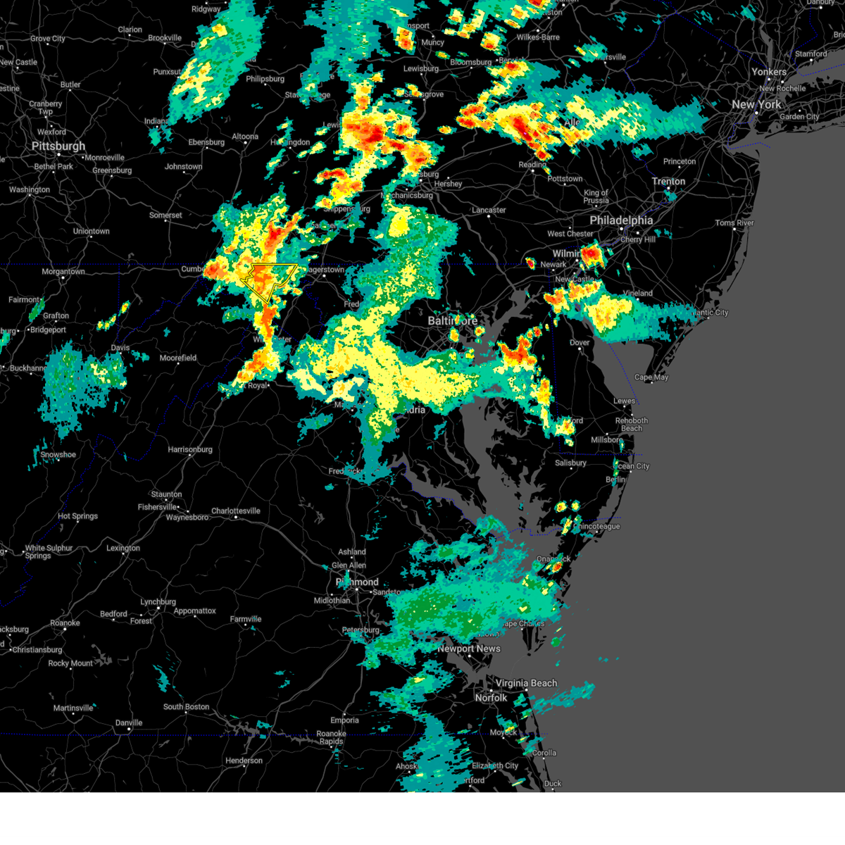 The severe thunderstorm warning for northwestern washington and morgan counties will expire at 630 pm edt, the storms which prompted the warning have weakened below severe limits, and have exited the warned area. therefore, the warning will be allowed to expire. a severe thunderstorm watch remains in effect until 1100 pm edt for north central maryland, and the panhandle of west virginia. to report severe weather, contact your nearest law enforcement agency. they will relay your report to the national weather service sterling virginia. The severe thunderstorm warning for northwestern washington and morgan counties will expire at 630 pm edt, the storms which prompted the warning have weakened below severe limits, and have exited the warned area. therefore, the warning will be allowed to expire. a severe thunderstorm watch remains in effect until 1100 pm edt for north central maryland, and the panhandle of west virginia. to report severe weather, contact your nearest law enforcement agency. they will relay your report to the national weather service sterling virginia.
|
| 9/9/2023 6:20 PM EDT | Two reports for trees and wires down in between hancock and pecktonvill in washington county MD, 1.4 miles W of Hancock, MD |
| 9/9/2023 6:13 PM EDT |
 At 613 pm edt, severe thunderstorms were located along a line extending from near hancock to near paw paw, moving northeast at 10 mph (radar indicated). Hazards include 60 mph wind gusts. Damaging winds will cause some trees and large branches to fall. this could injure those outdoors, as well as damage homes and vehicles. roadways may become blocked by downed trees. localized power outages are possible. unsecured light objects may become projectiles. locations impacted include, hancock, berkeley springs, great cacapon, pecktonville, johnsons mill, cherry run, valley view, spohrs crossroads, spruce pine hollow, rock gap, stotlers crossroads, highland ridge, forest park, smith crossroads, berryville, new hope, sleepy creek, and shady grove. hail threat, radar indicated max hail size, <. 75 in wind threat, radar indicated max wind gust, 60 mph. At 613 pm edt, severe thunderstorms were located along a line extending from near hancock to near paw paw, moving northeast at 10 mph (radar indicated). Hazards include 60 mph wind gusts. Damaging winds will cause some trees and large branches to fall. this could injure those outdoors, as well as damage homes and vehicles. roadways may become blocked by downed trees. localized power outages are possible. unsecured light objects may become projectiles. locations impacted include, hancock, berkeley springs, great cacapon, pecktonville, johnsons mill, cherry run, valley view, spohrs crossroads, spruce pine hollow, rock gap, stotlers crossroads, highland ridge, forest park, smith crossroads, berryville, new hope, sleepy creek, and shady grove. hail threat, radar indicated max hail size, <. 75 in wind threat, radar indicated max wind gust, 60 mph.
|
| 9/9/2023 6:13 PM EDT |
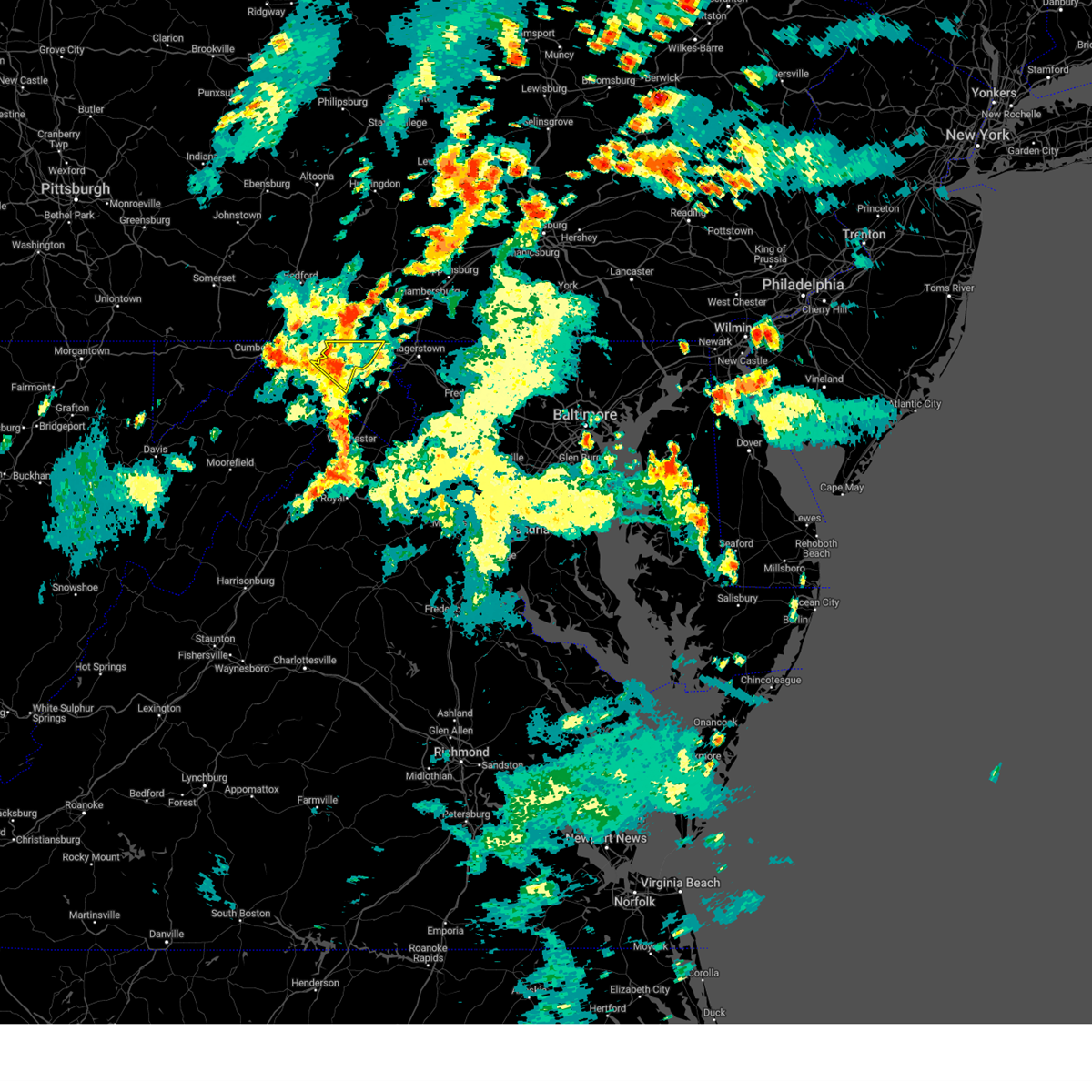 At 613 pm edt, severe thunderstorms were located along a line extending from near hancock to near paw paw, moving northeast at 10 mph (radar indicated). Hazards include 60 mph wind gusts. Damaging winds will cause some trees and large branches to fall. this could injure those outdoors, as well as damage homes and vehicles. roadways may become blocked by downed trees. localized power outages are possible. unsecured light objects may become projectiles. locations impacted include, hancock, berkeley springs, great cacapon, pecktonville, johnsons mill, cherry run, valley view, spohrs crossroads, spruce pine hollow, rock gap, stotlers crossroads, highland ridge, forest park, smith crossroads, berryville, new hope, sleepy creek, and shady grove. hail threat, radar indicated max hail size, <. 75 in wind threat, radar indicated max wind gust, 60 mph. At 613 pm edt, severe thunderstorms were located along a line extending from near hancock to near paw paw, moving northeast at 10 mph (radar indicated). Hazards include 60 mph wind gusts. Damaging winds will cause some trees and large branches to fall. this could injure those outdoors, as well as damage homes and vehicles. roadways may become blocked by downed trees. localized power outages are possible. unsecured light objects may become projectiles. locations impacted include, hancock, berkeley springs, great cacapon, pecktonville, johnsons mill, cherry run, valley view, spohrs crossroads, spruce pine hollow, rock gap, stotlers crossroads, highland ridge, forest park, smith crossroads, berryville, new hope, sleepy creek, and shady grove. hail threat, radar indicated max hail size, <. 75 in wind threat, radar indicated max wind gust, 60 mph.
|
| 9/9/2023 6:00 PM EDT |
 At 600 pm edt, severe thunderstorms were located along a line extending from near hancock to near paw paw, moving northeast at 10 mph (radar indicated). Hazards include 60 mph wind gusts. Damaging winds will cause some trees and large branches to fall. this could injure those outdoors, as well as damage homes and vehicles. roadways may become blocked by downed trees. localized power outages are possible. Unsecured light objects may become projectiles. At 600 pm edt, severe thunderstorms were located along a line extending from near hancock to near paw paw, moving northeast at 10 mph (radar indicated). Hazards include 60 mph wind gusts. Damaging winds will cause some trees and large branches to fall. this could injure those outdoors, as well as damage homes and vehicles. roadways may become blocked by downed trees. localized power outages are possible. Unsecured light objects may become projectiles.
|
| 9/9/2023 6:00 PM EDT |
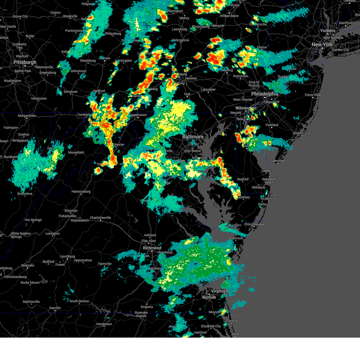 At 600 pm edt, severe thunderstorms were located along a line extending from near hancock to near paw paw, moving northeast at 10 mph (radar indicated). Hazards include 60 mph wind gusts. Damaging winds will cause some trees and large branches to fall. this could injure those outdoors, as well as damage homes and vehicles. roadways may become blocked by downed trees. localized power outages are possible. Unsecured light objects may become projectiles. At 600 pm edt, severe thunderstorms were located along a line extending from near hancock to near paw paw, moving northeast at 10 mph (radar indicated). Hazards include 60 mph wind gusts. Damaging winds will cause some trees and large branches to fall. this could injure those outdoors, as well as damage homes and vehicles. roadways may become blocked by downed trees. localized power outages are possible. Unsecured light objects may become projectiles.
|
| 8/7/2023 3:17 PM EDT |
 At 316 pm edt, severe thunderstorms were located along a line extending from near hancock to 6 miles south of paw paw, moving east at 20 mph (radar indicated). Hazards include 60 mph wind gusts and quarter size hail. Damaging winds will cause some trees and large branches to fall. this could injure those outdoors, as well as damage homes and vehicles. roadways may become blocked by downed trees. localized power outages are possible. Unsecured light objects may become projectiles. At 316 pm edt, severe thunderstorms were located along a line extending from near hancock to 6 miles south of paw paw, moving east at 20 mph (radar indicated). Hazards include 60 mph wind gusts and quarter size hail. Damaging winds will cause some trees and large branches to fall. this could injure those outdoors, as well as damage homes and vehicles. roadways may become blocked by downed trees. localized power outages are possible. Unsecured light objects may become projectiles.
|
| 8/7/2023 3:17 PM EDT |
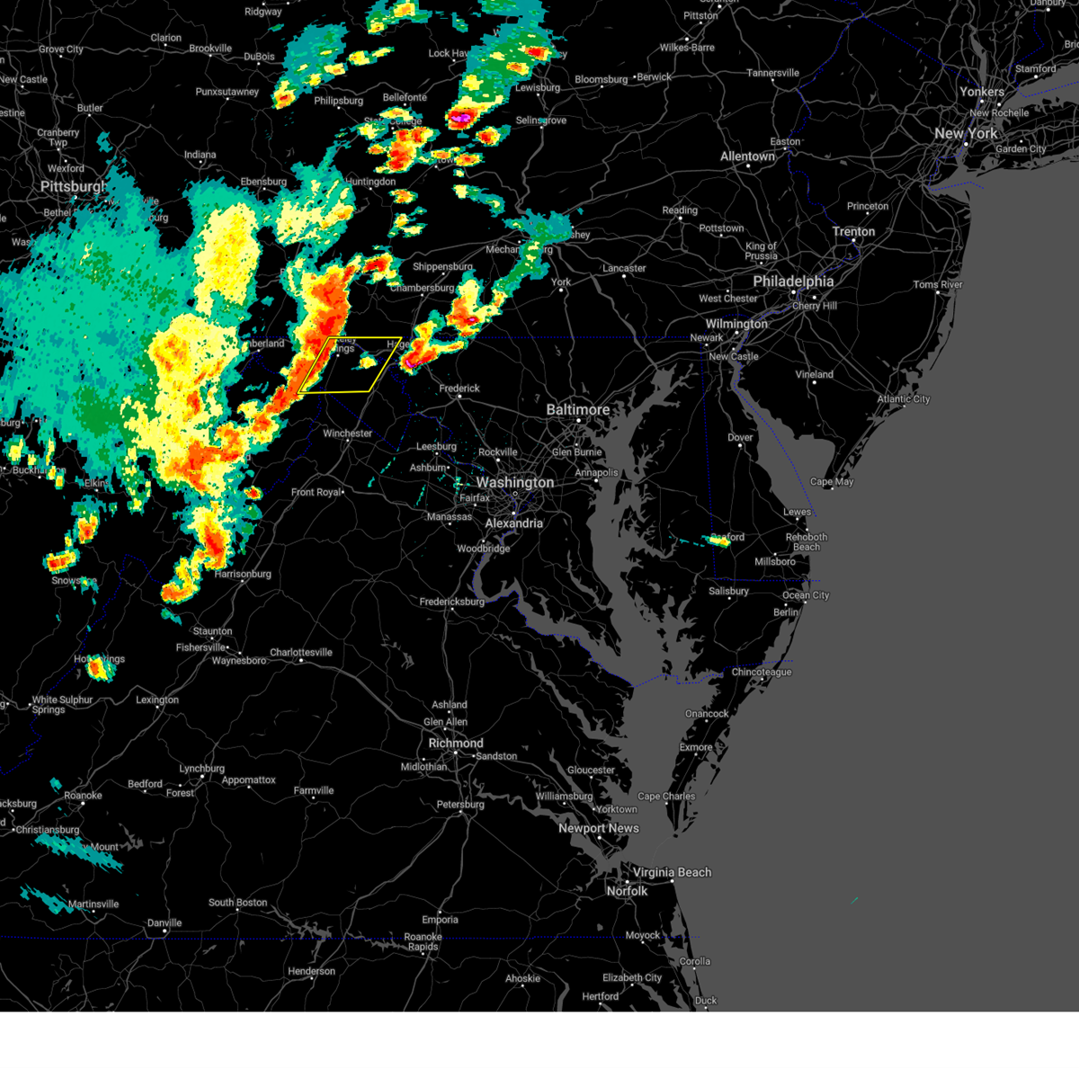 At 316 pm edt, severe thunderstorms were located along a line extending from near hancock to 6 miles south of paw paw, moving east at 20 mph (radar indicated). Hazards include 60 mph wind gusts and quarter size hail. Damaging winds will cause some trees and large branches to fall. this could injure those outdoors, as well as damage homes and vehicles. roadways may become blocked by downed trees. localized power outages are possible. Unsecured light objects may become projectiles. At 316 pm edt, severe thunderstorms were located along a line extending from near hancock to 6 miles south of paw paw, moving east at 20 mph (radar indicated). Hazards include 60 mph wind gusts and quarter size hail. Damaging winds will cause some trees and large branches to fall. this could injure those outdoors, as well as damage homes and vehicles. roadways may become blocked by downed trees. localized power outages are possible. Unsecured light objects may become projectiles.
|
| 8/7/2023 3:09 PM EDT | 911 center reports trees down on mallard run roa in fulton county PA, 5.5 miles SE of Hancock, MD |
| 8/7/2023 2:29 PM EDT |
 At 228 pm edt, severe thunderstorms were located along a line extending from lake gordon to near fort ashby to 6 miles east of keyser, moving east at 50 mph (emergency management has reported substantial wind damage across garrett and western allegheny counties). Hazards include 70 mph wind gusts and quarter size hail. Damaging winds will cause some trees and large branches to fall. this could injure those outdoors, as well as damage homes and vehicles. roadways may become blocked by downed trees. localized power outages are possible. Unsecured light objects may become projectiles. At 228 pm edt, severe thunderstorms were located along a line extending from lake gordon to near fort ashby to 6 miles east of keyser, moving east at 50 mph (emergency management has reported substantial wind damage across garrett and western allegheny counties). Hazards include 70 mph wind gusts and quarter size hail. Damaging winds will cause some trees and large branches to fall. this could injure those outdoors, as well as damage homes and vehicles. roadways may become blocked by downed trees. localized power outages are possible. Unsecured light objects may become projectiles.
|
| 8/7/2023 1:41 PM EDT |
 At 141 pm edt, a severe thunderstorm was located near claylick, or 11 miles east of hancock, moving northeast at 35 mph (radar indicated). Hazards include golf ball size hail and 60 mph wind gusts. Expect wind damage to trees and power lines. hail is large enough to dent and damage vehicles. some hail damage to roofs, siding, and windows is possible. locations impacted include, hagerstown, hancock, fountainhead-orchard hills, paramount-long meadow, wilson-conococheague, long meadow, maugansville, leitersburg, clear spring, pecktonville, ringgold, big spring, big pool, middleburg, cherry run, johnsontown, warrenton, spruce pine hollow and sleepy creek. thunderstorm damage threat, considerable hail threat, radar indicated max hail size, 1. 75 in wind threat, radar indicated max wind gust, 60 mph. At 141 pm edt, a severe thunderstorm was located near claylick, or 11 miles east of hancock, moving northeast at 35 mph (radar indicated). Hazards include golf ball size hail and 60 mph wind gusts. Expect wind damage to trees and power lines. hail is large enough to dent and damage vehicles. some hail damage to roofs, siding, and windows is possible. locations impacted include, hagerstown, hancock, fountainhead-orchard hills, paramount-long meadow, wilson-conococheague, long meadow, maugansville, leitersburg, clear spring, pecktonville, ringgold, big spring, big pool, middleburg, cherry run, johnsontown, warrenton, spruce pine hollow and sleepy creek. thunderstorm damage threat, considerable hail threat, radar indicated max hail size, 1. 75 in wind threat, radar indicated max wind gust, 60 mph.
|
| 8/7/2023 1:39 PM EDT |
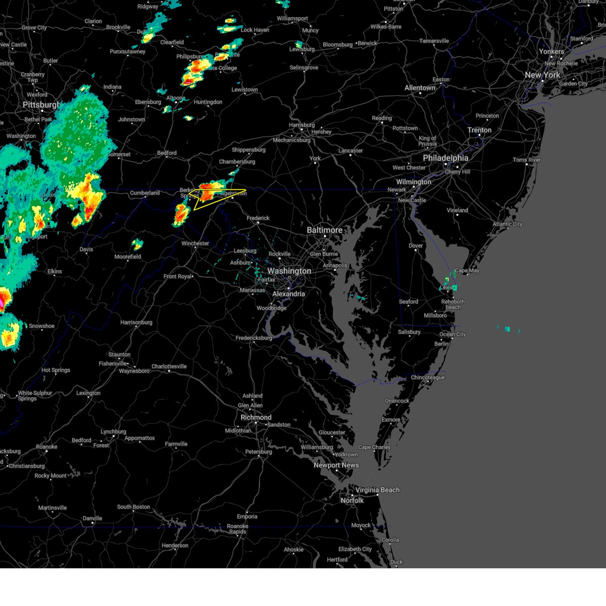 At 139 pm edt, a severe thunderstorm was located 7 miles southwest of claylick, or 9 miles east of hancock, moving northeast at 30 mph (radar indicated). Hazards include 60 mph wind gusts and quarter size hail. Damaging winds will cause some trees and large branches to fall. this could injure those outdoors, as well as damage homes and vehicles. roadways may become blocked by downed trees. localized power outages are possible. unsecured light objects may become projectiles. locations impacted include, hagerstown, hancock, fountainhead-orchard hills, paramount-long meadow, wilson-conococheague, long meadow, maugansville, leitersburg, clear spring, pecktonville, ringgold, big spring, big pool, middleburg, cherry run, johnsontown, warrenton, spruce pine hollow and sleepy creek. hail threat, radar indicated max hail size, 1. 00 in wind threat, radar indicated max wind gust, 60 mph. At 139 pm edt, a severe thunderstorm was located 7 miles southwest of claylick, or 9 miles east of hancock, moving northeast at 30 mph (radar indicated). Hazards include 60 mph wind gusts and quarter size hail. Damaging winds will cause some trees and large branches to fall. this could injure those outdoors, as well as damage homes and vehicles. roadways may become blocked by downed trees. localized power outages are possible. unsecured light objects may become projectiles. locations impacted include, hagerstown, hancock, fountainhead-orchard hills, paramount-long meadow, wilson-conococheague, long meadow, maugansville, leitersburg, clear spring, pecktonville, ringgold, big spring, big pool, middleburg, cherry run, johnsontown, warrenton, spruce pine hollow and sleepy creek. hail threat, radar indicated max hail size, 1. 00 in wind threat, radar indicated max wind gust, 60 mph.
|
| 8/7/2023 1:39 PM EDT |
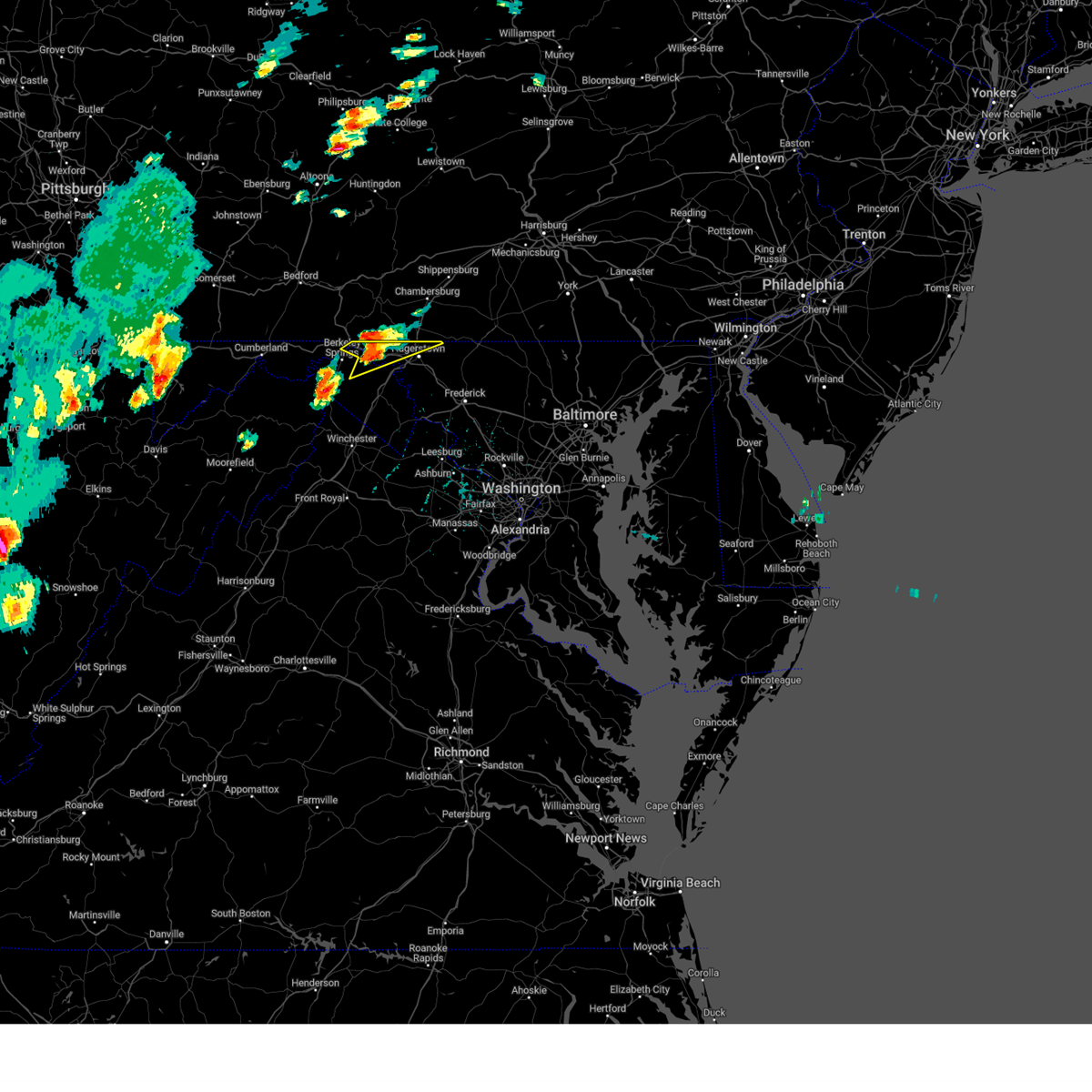 At 139 pm edt, a severe thunderstorm was located 7 miles southwest of claylick, or 9 miles east of hancock, moving northeast at 30 mph (radar indicated). Hazards include 60 mph wind gusts and quarter size hail. Damaging winds will cause some trees and large branches to fall. this could injure those outdoors, as well as damage homes and vehicles. roadways may become blocked by downed trees. localized power outages are possible. unsecured light objects may become projectiles. locations impacted include, hagerstown, hancock, fountainhead-orchard hills, paramount-long meadow, wilson-conococheague, long meadow, maugansville, leitersburg, clear spring, pecktonville, ringgold, big spring, big pool, middleburg, cherry run, johnsontown, warrenton, spruce pine hollow and sleepy creek. hail threat, radar indicated max hail size, 1. 00 in wind threat, radar indicated max wind gust, 60 mph. At 139 pm edt, a severe thunderstorm was located 7 miles southwest of claylick, or 9 miles east of hancock, moving northeast at 30 mph (radar indicated). Hazards include 60 mph wind gusts and quarter size hail. Damaging winds will cause some trees and large branches to fall. this could injure those outdoors, as well as damage homes and vehicles. roadways may become blocked by downed trees. localized power outages are possible. unsecured light objects may become projectiles. locations impacted include, hagerstown, hancock, fountainhead-orchard hills, paramount-long meadow, wilson-conococheague, long meadow, maugansville, leitersburg, clear spring, pecktonville, ringgold, big spring, big pool, middleburg, cherry run, johnsontown, warrenton, spruce pine hollow and sleepy creek. hail threat, radar indicated max hail size, 1. 00 in wind threat, radar indicated max wind gust, 60 mph.
|
| 8/7/2023 1:14 PM EDT |
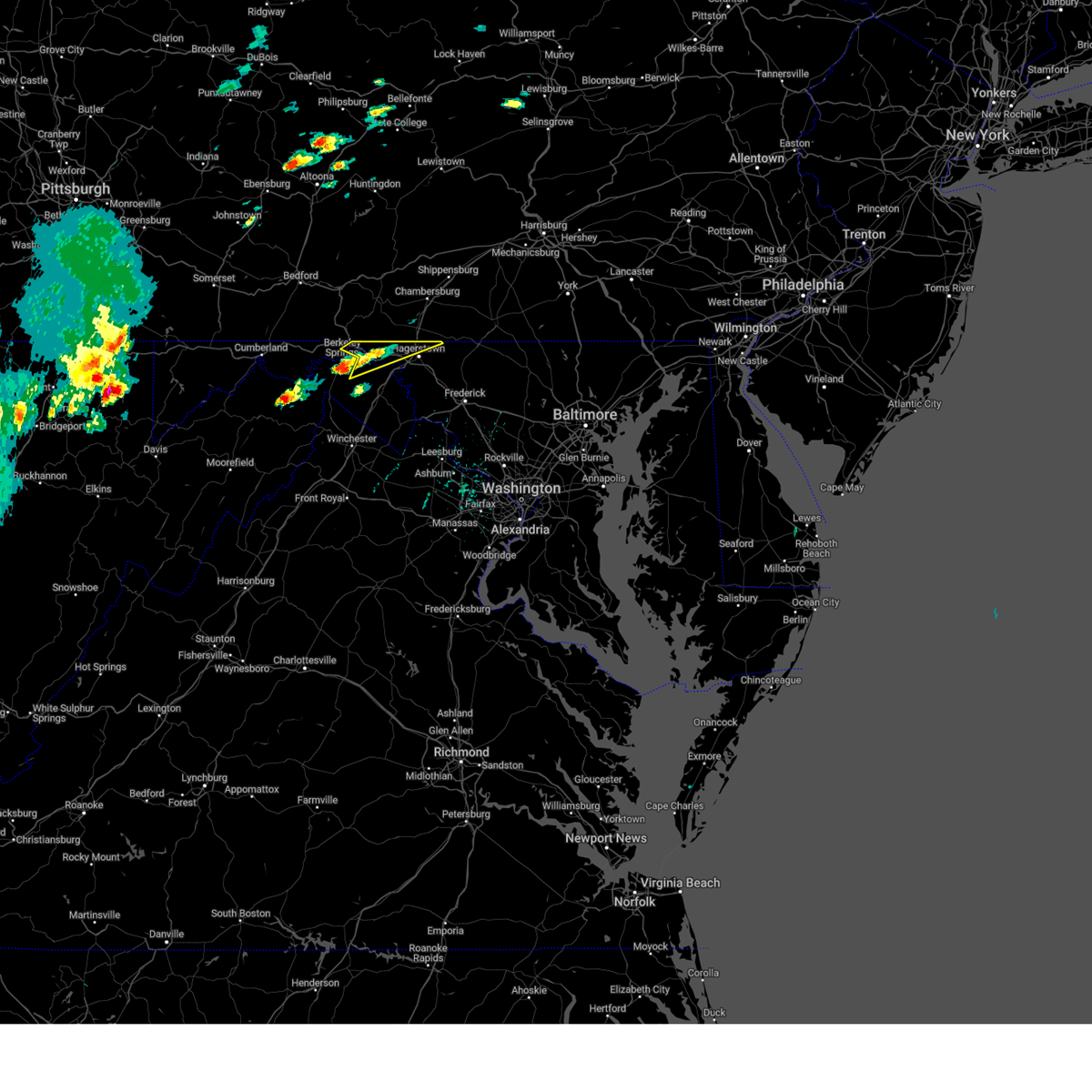 At 113 pm edt, a severe thunderstorm was located over berkeley springs, or 7 miles south of hancock, moving northeast at 35 mph (radar indicated). Hazards include 60 mph wind gusts and quarter size hail. Damaging winds will cause some trees and large branches to fall. this could injure those outdoors, as well as damage homes and vehicles. roadways may become blocked by downed trees. localized power outages are possible. Unsecured light objects may become projectiles. At 113 pm edt, a severe thunderstorm was located over berkeley springs, or 7 miles south of hancock, moving northeast at 35 mph (radar indicated). Hazards include 60 mph wind gusts and quarter size hail. Damaging winds will cause some trees and large branches to fall. this could injure those outdoors, as well as damage homes and vehicles. roadways may become blocked by downed trees. localized power outages are possible. Unsecured light objects may become projectiles.
|
| 8/7/2023 1:14 PM EDT |
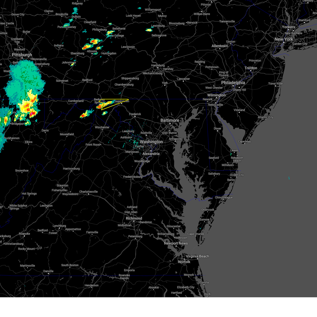 At 113 pm edt, a severe thunderstorm was located over berkeley springs, or 7 miles south of hancock, moving northeast at 35 mph (radar indicated). Hazards include 60 mph wind gusts and quarter size hail. Damaging winds will cause some trees and large branches to fall. this could injure those outdoors, as well as damage homes and vehicles. roadways may become blocked by downed trees. localized power outages are possible. Unsecured light objects may become projectiles. At 113 pm edt, a severe thunderstorm was located over berkeley springs, or 7 miles south of hancock, moving northeast at 35 mph (radar indicated). Hazards include 60 mph wind gusts and quarter size hail. Damaging winds will cause some trees and large branches to fall. this could injure those outdoors, as well as damage homes and vehicles. roadways may become blocked by downed trees. localized power outages are possible. Unsecured light objects may become projectiles.
|
| 7/15/2023 9:04 PM EDT |
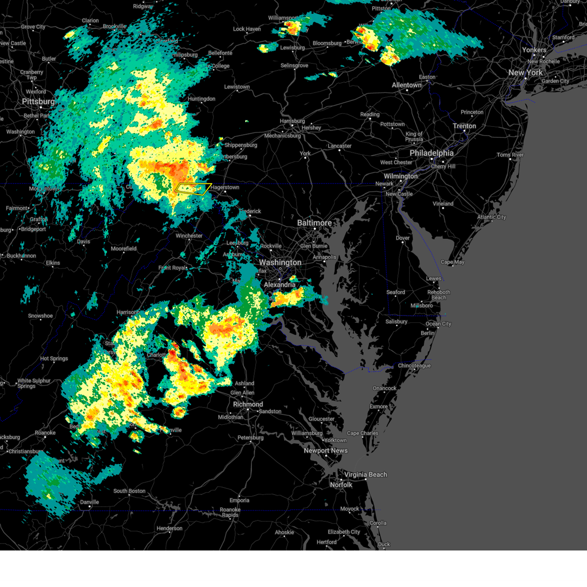 At 904 pm edt, severe thunderstorms were located along a line extending from near big cove tannery to fountainhead-orchard hills, moving northeast at 45 mph (radar indicated). Hazards include 60 mph wind gusts. Damaging winds will cause some trees and large branches to fall. this could injure those outdoors, as well as damage homes and vehicles. roadways may become blocked by downed trees. localized power outages are possible. unsecured light objects may become projectiles. locations impacted include, hancock, pecktonville, big pool, cherry run, spohrs crossroads, spruce pine hollow, sleepy creek and shady grove. hail threat, radar indicated max hail size, <. 75 in wind threat, radar indicated max wind gust, 60 mph. At 904 pm edt, severe thunderstorms were located along a line extending from near big cove tannery to fountainhead-orchard hills, moving northeast at 45 mph (radar indicated). Hazards include 60 mph wind gusts. Damaging winds will cause some trees and large branches to fall. this could injure those outdoors, as well as damage homes and vehicles. roadways may become blocked by downed trees. localized power outages are possible. unsecured light objects may become projectiles. locations impacted include, hancock, pecktonville, big pool, cherry run, spohrs crossroads, spruce pine hollow, sleepy creek and shady grove. hail threat, radar indicated max hail size, <. 75 in wind threat, radar indicated max wind gust, 60 mph.
|
| 7/15/2023 9:04 PM EDT |
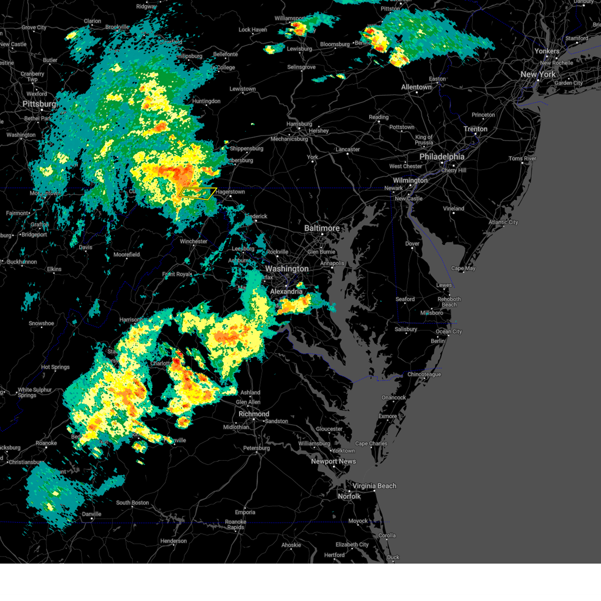 At 904 pm edt, severe thunderstorms were located along a line extending from near big cove tannery to fountainhead-orchard hills, moving northeast at 45 mph (radar indicated). Hazards include 60 mph wind gusts. Damaging winds will cause some trees and large branches to fall. this could injure those outdoors, as well as damage homes and vehicles. roadways may become blocked by downed trees. localized power outages are possible. unsecured light objects may become projectiles. locations impacted include, hancock, pecktonville, big pool, cherry run, spohrs crossroads, spruce pine hollow, sleepy creek and shady grove. hail threat, radar indicated max hail size, <. 75 in wind threat, radar indicated max wind gust, 60 mph. At 904 pm edt, severe thunderstorms were located along a line extending from near big cove tannery to fountainhead-orchard hills, moving northeast at 45 mph (radar indicated). Hazards include 60 mph wind gusts. Damaging winds will cause some trees and large branches to fall. this could injure those outdoors, as well as damage homes and vehicles. roadways may become blocked by downed trees. localized power outages are possible. unsecured light objects may become projectiles. locations impacted include, hancock, pecktonville, big pool, cherry run, spohrs crossroads, spruce pine hollow, sleepy creek and shady grove. hail threat, radar indicated max hail size, <. 75 in wind threat, radar indicated max wind gust, 60 mph.
|
| 7/15/2023 8:45 PM EDT | Tree down on tollgate ridge road near the state lin in washington county MD, 1.2 miles SSW of Hancock, MD |
| 7/15/2023 8:31 PM EDT |
 At 831 pm edt, severe thunderstorms were located along a line extending from near paw paw to near martinsburg, moving northeast at 45 mph (radar indicated). Hazards include 60 mph wind gusts. Damaging winds will cause some trees and large branches to fall. this could injure those outdoors, as well as damage homes and vehicles. roadways may become blocked by downed trees. localized power outages are possible. Unsecured light objects may become projectiles. At 831 pm edt, severe thunderstorms were located along a line extending from near paw paw to near martinsburg, moving northeast at 45 mph (radar indicated). Hazards include 60 mph wind gusts. Damaging winds will cause some trees and large branches to fall. this could injure those outdoors, as well as damage homes and vehicles. roadways may become blocked by downed trees. localized power outages are possible. Unsecured light objects may become projectiles.
|
| 7/15/2023 8:31 PM EDT |
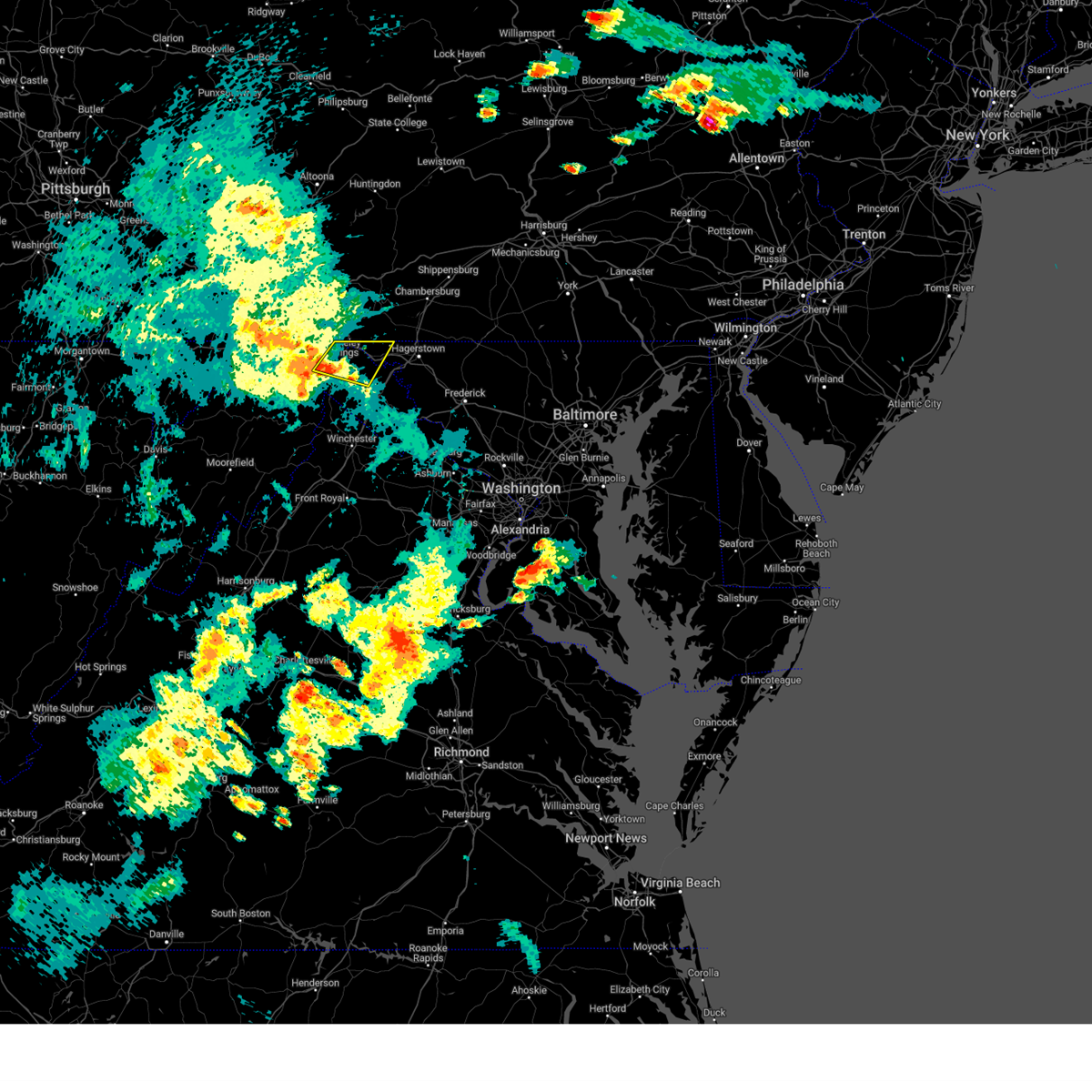 At 831 pm edt, severe thunderstorms were located along a line extending from near paw paw to near martinsburg, moving northeast at 45 mph (radar indicated). Hazards include 60 mph wind gusts. Damaging winds will cause some trees and large branches to fall. this could injure those outdoors, as well as damage homes and vehicles. roadways may become blocked by downed trees. localized power outages are possible. Unsecured light objects may become projectiles. At 831 pm edt, severe thunderstorms were located along a line extending from near paw paw to near martinsburg, moving northeast at 45 mph (radar indicated). Hazards include 60 mph wind gusts. Damaging winds will cause some trees and large branches to fall. this could injure those outdoors, as well as damage homes and vehicles. roadways may become blocked by downed trees. localized power outages are possible. Unsecured light objects may become projectiles.
|
| 6/26/2023 5:49 PM EDT |
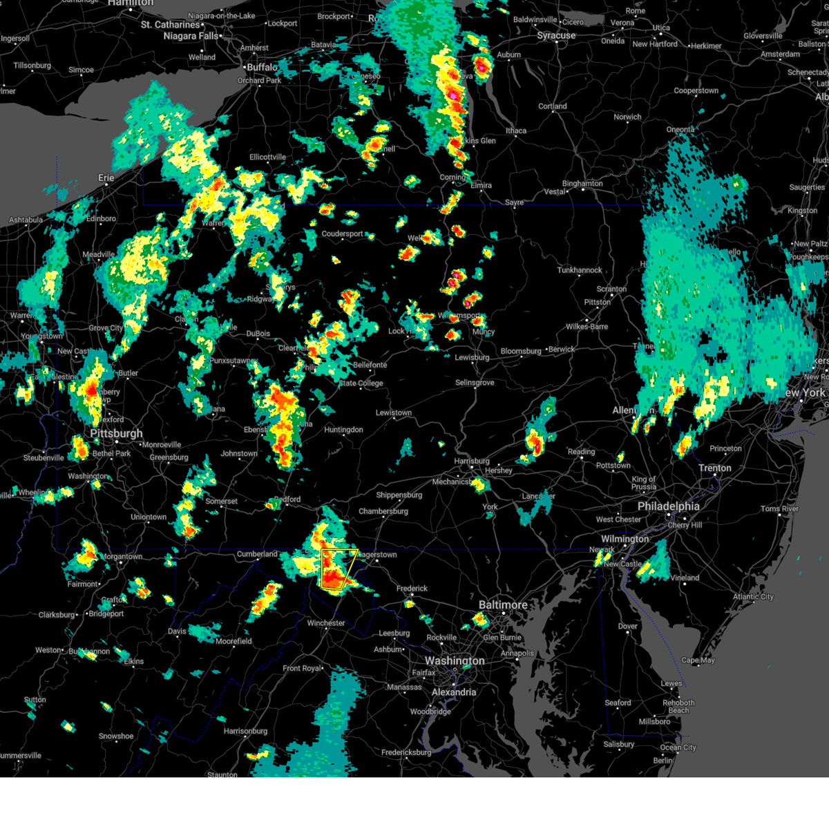 At 548 pm edt, a severe thunderstorm was located near berkeley springs, or 8 miles northeast of greenwood, moving northeast at 15 mph (radar indicated). Hazards include 60 mph wind gusts and half dollar size hail. Damaging winds will cause some trees and large branches to fall. this could injure those outdoors, as well as damage homes and vehicles. roadways may become blocked by downed trees. localized power outages are possible. unsecured light objects may become projectiles. locations impacted include, hancock, clear spring, hedgesville, pecktonville, big spring, big pool, johnsons mill, cherry run, tomahawk, johnsontown, spohrs crossroads, spruce pine hollow, jones springs, new hope, sleepy creek, shady grove and highland ridge. hail threat, radar indicated max hail size, 1. 25 in wind threat, radar indicated max wind gust, 60 mph. At 548 pm edt, a severe thunderstorm was located near berkeley springs, or 8 miles northeast of greenwood, moving northeast at 15 mph (radar indicated). Hazards include 60 mph wind gusts and half dollar size hail. Damaging winds will cause some trees and large branches to fall. this could injure those outdoors, as well as damage homes and vehicles. roadways may become blocked by downed trees. localized power outages are possible. unsecured light objects may become projectiles. locations impacted include, hancock, clear spring, hedgesville, pecktonville, big spring, big pool, johnsons mill, cherry run, tomahawk, johnsontown, spohrs crossroads, spruce pine hollow, jones springs, new hope, sleepy creek, shady grove and highland ridge. hail threat, radar indicated max hail size, 1. 25 in wind threat, radar indicated max wind gust, 60 mph.
|
| 6/26/2023 5:42 PM EDT | Morgan county 911 center reports tree down on 1600 block of culp road. time estimated from rada in morgan county WV, 2.7 miles NNW of Hancock, MD |
| 6/26/2023 5:42 PM EDT | Morgan county 911 center reports tree down on 2300 block of pious ridge road. time estimated from rada in morgan county WV, 3 miles N of Hancock, MD |
| 6/26/2023 5:28 PM EDT |
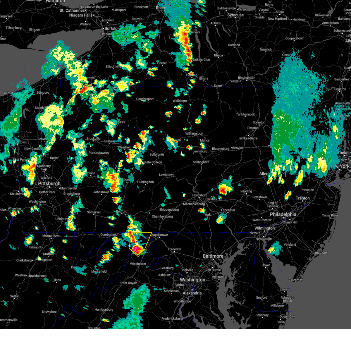 At 528 pm edt, a severe thunderstorm was located near greenwood, moving northeast at 15 mph (radar indicated). Hazards include 60 mph wind gusts and half dollar size hail. Damaging winds will cause some trees and large branches to fall. this could injure those outdoors, as well as damage homes and vehicles. roadways may become blocked by downed trees. localized power outages are possible. Unsecured light objects may become projectiles. At 528 pm edt, a severe thunderstorm was located near greenwood, moving northeast at 15 mph (radar indicated). Hazards include 60 mph wind gusts and half dollar size hail. Damaging winds will cause some trees and large branches to fall. this could injure those outdoors, as well as damage homes and vehicles. roadways may become blocked by downed trees. localized power outages are possible. Unsecured light objects may become projectiles.
|
| 6/26/2023 5:28 PM EDT |
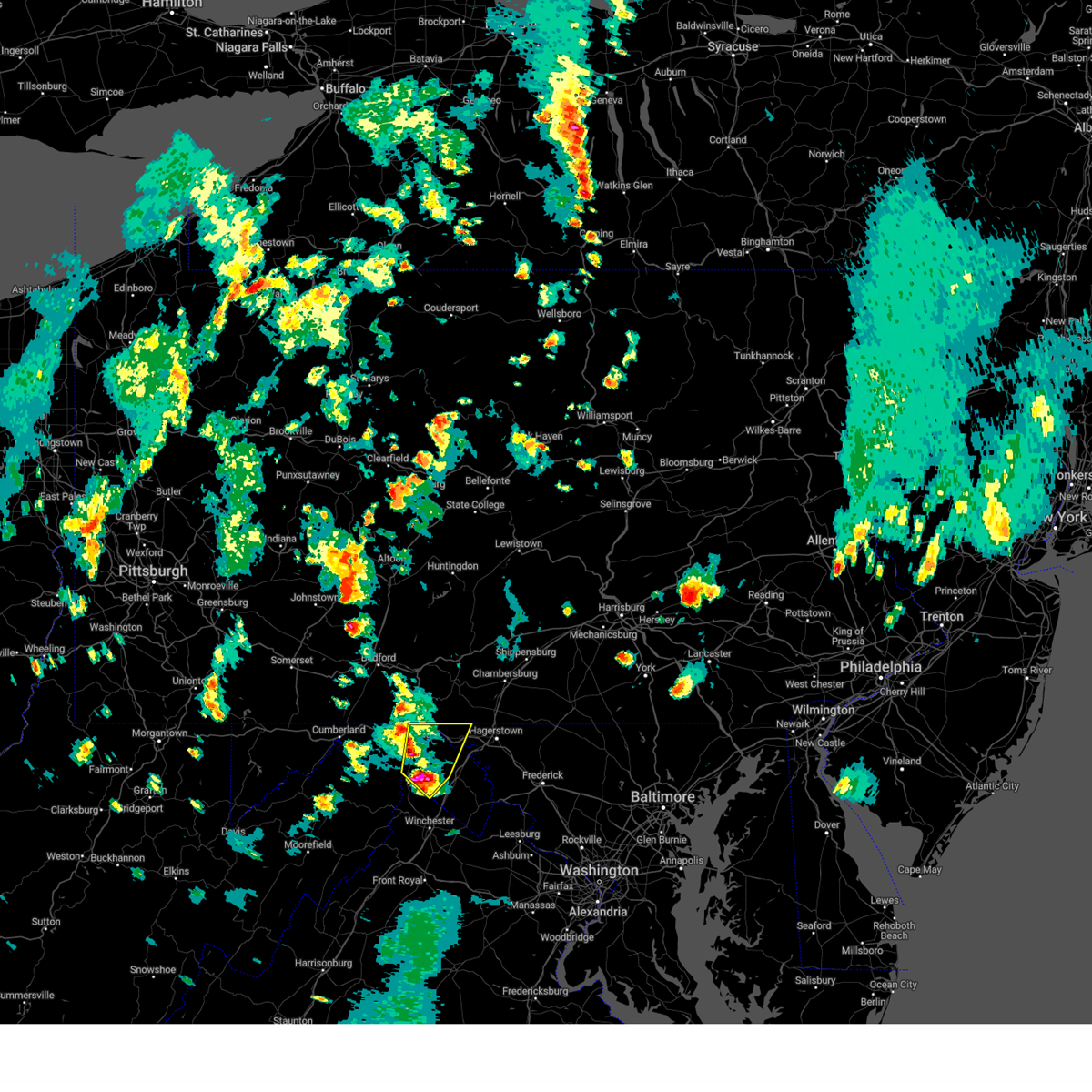 At 528 pm edt, a severe thunderstorm was located near greenwood, moving northeast at 15 mph (radar indicated). Hazards include 60 mph wind gusts and half dollar size hail. Damaging winds will cause some trees and large branches to fall. this could injure those outdoors, as well as damage homes and vehicles. roadways may become blocked by downed trees. localized power outages are possible. Unsecured light objects may become projectiles. At 528 pm edt, a severe thunderstorm was located near greenwood, moving northeast at 15 mph (radar indicated). Hazards include 60 mph wind gusts and half dollar size hail. Damaging winds will cause some trees and large branches to fall. this could injure those outdoors, as well as damage homes and vehicles. roadways may become blocked by downed trees. localized power outages are possible. Unsecured light objects may become projectiles.
|
| 7/23/2022 6:27 PM EDT |
 At 626 pm edt, a severe thunderstorm was located near hancock, moving northeast at 35 mph (radar indicated). Hazards include 60 mph wind gusts and quarter size hail. Damaging winds will cause some trees and large branches to fall. this could injure those outdoors, as well as damage homes and vehicles. roadways may become blocked by downed trees. localized power outages are possible. unsecured light objects may become projectiles. locations impacted include, hancock, berkeley springs, pecktonville, johnsons mill, cherry run, spohrs crossroads, new hope, spruce pine hollow, sleepy creek and shady grove. hail threat, radar indicated max hail size, 1. 00 in wind threat, radar indicated max wind gust, 60 mph. At 626 pm edt, a severe thunderstorm was located near hancock, moving northeast at 35 mph (radar indicated). Hazards include 60 mph wind gusts and quarter size hail. Damaging winds will cause some trees and large branches to fall. this could injure those outdoors, as well as damage homes and vehicles. roadways may become blocked by downed trees. localized power outages are possible. unsecured light objects may become projectiles. locations impacted include, hancock, berkeley springs, pecktonville, johnsons mill, cherry run, spohrs crossroads, new hope, spruce pine hollow, sleepy creek and shady grove. hail threat, radar indicated max hail size, 1. 00 in wind threat, radar indicated max wind gust, 60 mph.
|
| 7/23/2022 6:27 PM EDT |
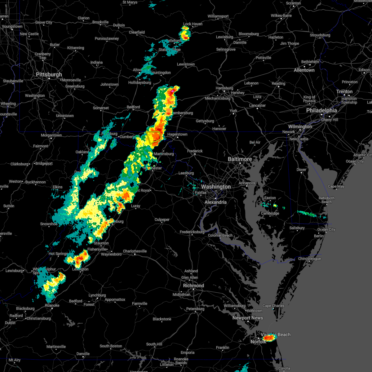 At 626 pm edt, a severe thunderstorm was located near hancock, moving northeast at 35 mph (radar indicated). Hazards include 60 mph wind gusts and quarter size hail. Damaging winds will cause some trees and large branches to fall. this could injure those outdoors, as well as damage homes and vehicles. roadways may become blocked by downed trees. localized power outages are possible. unsecured light objects may become projectiles. locations impacted include, hancock, berkeley springs, pecktonville, johnsons mill, cherry run, spohrs crossroads, new hope, spruce pine hollow, sleepy creek and shady grove. hail threat, radar indicated max hail size, 1. 00 in wind threat, radar indicated max wind gust, 60 mph. At 626 pm edt, a severe thunderstorm was located near hancock, moving northeast at 35 mph (radar indicated). Hazards include 60 mph wind gusts and quarter size hail. Damaging winds will cause some trees and large branches to fall. this could injure those outdoors, as well as damage homes and vehicles. roadways may become blocked by downed trees. localized power outages are possible. unsecured light objects may become projectiles. locations impacted include, hancock, berkeley springs, pecktonville, johnsons mill, cherry run, spohrs crossroads, new hope, spruce pine hollow, sleepy creek and shady grove. hail threat, radar indicated max hail size, 1. 00 in wind threat, radar indicated max wind gust, 60 mph.
|
| 7/23/2022 6:16 PM EDT | Tree down on i-70 near millstone roa in washington county MD, 3.2 miles WNW of Hancock, MD |
| 7/23/2022 6:15 PM EDT |
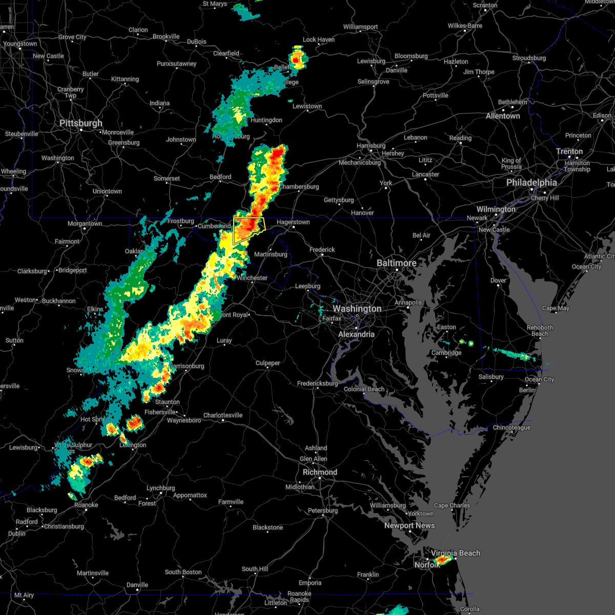 At 614 pm edt, a severe thunderstorm was located over berkeley springs, or near hancock, moving northeast at 35 mph (radar indicated). Hazards include 60 mph wind gusts and quarter size hail. Damaging winds will cause some trees and large branches to fall. this could injure those outdoors, as well as damage homes and vehicles. roadways may become blocked by downed trees. localized power outages are possible. unsecured light objects may become projectiles. locations impacted include, hancock, berkeley springs, great cacapon, pecktonville, johnsons mill, cherry run, lineburg, valley view, fishers bridge, spohrs crossroads, spruce pine hollow, rock gap, forest park, bellegrove, smith crossroads, berryville, new hope, sleepy creek and shady grove. hail threat, radar indicated max hail size, 1. 00 in wind threat, radar indicated max wind gust, 60 mph. At 614 pm edt, a severe thunderstorm was located over berkeley springs, or near hancock, moving northeast at 35 mph (radar indicated). Hazards include 60 mph wind gusts and quarter size hail. Damaging winds will cause some trees and large branches to fall. this could injure those outdoors, as well as damage homes and vehicles. roadways may become blocked by downed trees. localized power outages are possible. unsecured light objects may become projectiles. locations impacted include, hancock, berkeley springs, great cacapon, pecktonville, johnsons mill, cherry run, lineburg, valley view, fishers bridge, spohrs crossroads, spruce pine hollow, rock gap, forest park, bellegrove, smith crossroads, berryville, new hope, sleepy creek and shady grove. hail threat, radar indicated max hail size, 1. 00 in wind threat, radar indicated max wind gust, 60 mph.
|
| 7/23/2022 6:12 PM EDT | Main street in hancock closed due to downed trees... branches... and wires. additional trees down just outside of hancoc in washington county MD, 0.4 miles NW of Hancock, MD |
| 7/23/2022 6:12 PM EDT | Trees down on river road... hancock road... fairview drive... and pious ridge roa in morgan county WV, 1 miles N of Hancock, MD |
| 7/23/2022 6:07 PM EDT | A tree blew down near hancock rd and river r in morgan county WV, 1.2 miles NE of Hancock, MD |
| 7/23/2022 5:55 PM EDT |
 At 555 pm edt, a severe thunderstorm was located near paw paw, moving northeast at 35 mph (radar indicated). Hazards include 60 mph wind gusts and quarter size hail. Damaging winds will cause some trees and large branches to fall. this could injure those outdoors, as well as damage homes and vehicles. roadways may become blocked by downed trees. localized power outages are possible. Unsecured light objects may become projectiles. At 555 pm edt, a severe thunderstorm was located near paw paw, moving northeast at 35 mph (radar indicated). Hazards include 60 mph wind gusts and quarter size hail. Damaging winds will cause some trees and large branches to fall. this could injure those outdoors, as well as damage homes and vehicles. roadways may become blocked by downed trees. localized power outages are possible. Unsecured light objects may become projectiles.
|
| 7/12/2022 3:18 PM EDT |
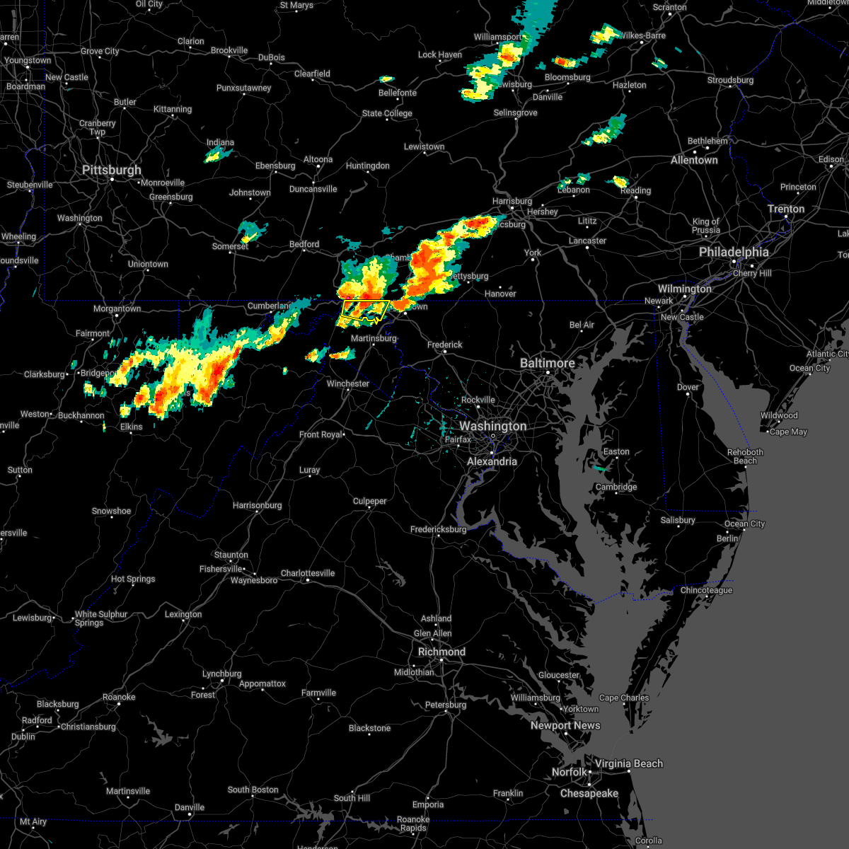 At 318 pm edt, a severe thunderstorm was located over hancock, moving east at 40 mph (radar indicated). Hazards include 60 mph wind gusts and quarter size hail. Damaging winds will cause some trees and large branches to fall. this could injure those outdoors, as well as damage homes and vehicles. roadways may become blocked by downed trees. localized power outages are possible. unsecured light objects may become projectiles. locations impacted include, hancock, clear spring, pecktonville, big spring, big pool, cherry run, spohrs crossroads, spruce pine hollow, sleepy creek and shady grove. hail threat, radar indicated max hail size, 1. 00 in wind threat, radar indicated max wind gust, 60 mph. At 318 pm edt, a severe thunderstorm was located over hancock, moving east at 40 mph (radar indicated). Hazards include 60 mph wind gusts and quarter size hail. Damaging winds will cause some trees and large branches to fall. this could injure those outdoors, as well as damage homes and vehicles. roadways may become blocked by downed trees. localized power outages are possible. unsecured light objects may become projectiles. locations impacted include, hancock, clear spring, pecktonville, big spring, big pool, cherry run, spohrs crossroads, spruce pine hollow, sleepy creek and shady grove. hail threat, radar indicated max hail size, 1. 00 in wind threat, radar indicated max wind gust, 60 mph.
|
| 7/12/2022 3:18 PM EDT |
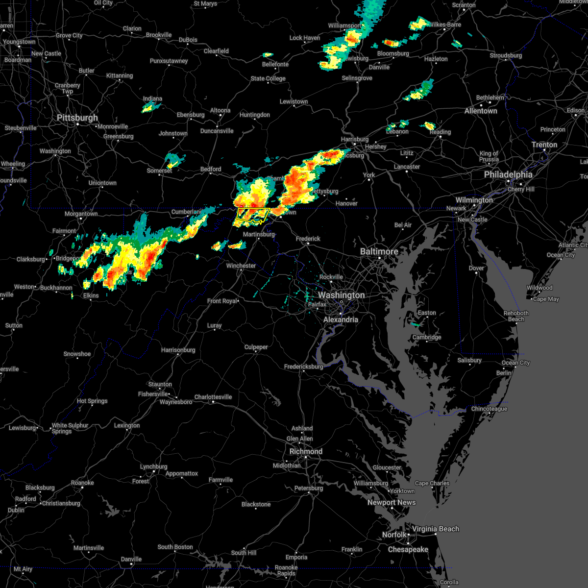 At 318 pm edt, a severe thunderstorm was located over hancock, moving east at 40 mph (radar indicated). Hazards include 60 mph wind gusts and quarter size hail. Damaging winds will cause some trees and large branches to fall. this could injure those outdoors, as well as damage homes and vehicles. roadways may become blocked by downed trees. localized power outages are possible. unsecured light objects may become projectiles. locations impacted include, hancock, clear spring, pecktonville, big spring, big pool, cherry run, spohrs crossroads, spruce pine hollow, sleepy creek and shady grove. hail threat, radar indicated max hail size, 1. 00 in wind threat, radar indicated max wind gust, 60 mph. At 318 pm edt, a severe thunderstorm was located over hancock, moving east at 40 mph (radar indicated). Hazards include 60 mph wind gusts and quarter size hail. Damaging winds will cause some trees and large branches to fall. this could injure those outdoors, as well as damage homes and vehicles. roadways may become blocked by downed trees. localized power outages are possible. unsecured light objects may become projectiles. locations impacted include, hancock, clear spring, pecktonville, big spring, big pool, cherry run, spohrs crossroads, spruce pine hollow, sleepy creek and shady grove. hail threat, radar indicated max hail size, 1. 00 in wind threat, radar indicated max wind gust, 60 mph.
|
| 7/12/2022 3:11 PM EDT |
 At 310 pm edt, a severe thunderstorm was located near hancock, moving east at 40 mph (radar indicated). Hazards include 60 mph wind gusts and quarter size hail. Damaging winds will cause some trees and large branches to fall. this could injure those outdoors, as well as damage homes and vehicles. roadways may become blocked by downed trees. localized power outages are possible. unsecured light objects may become projectiles. locations impacted include, hancock, clear spring, pecktonville, big spring, big pool, cherry run, forest park, spohrs crossroads, spruce pine hollow, sleepy creek and shady grove. hail threat, radar indicated max hail size, 1. 00 in wind threat, radar indicated max wind gust, 60 mph. At 310 pm edt, a severe thunderstorm was located near hancock, moving east at 40 mph (radar indicated). Hazards include 60 mph wind gusts and quarter size hail. Damaging winds will cause some trees and large branches to fall. this could injure those outdoors, as well as damage homes and vehicles. roadways may become blocked by downed trees. localized power outages are possible. unsecured light objects may become projectiles. locations impacted include, hancock, clear spring, pecktonville, big spring, big pool, cherry run, forest park, spohrs crossroads, spruce pine hollow, sleepy creek and shady grove. hail threat, radar indicated max hail size, 1. 00 in wind threat, radar indicated max wind gust, 60 mph.
|
| 7/12/2022 3:11 PM EDT |
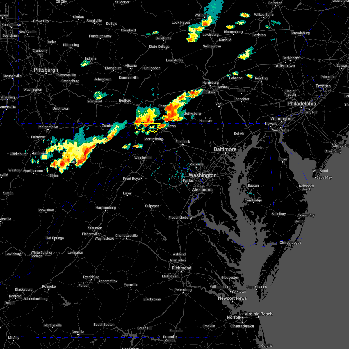 At 310 pm edt, a severe thunderstorm was located near hancock, moving east at 40 mph (radar indicated). Hazards include 60 mph wind gusts and quarter size hail. Damaging winds will cause some trees and large branches to fall. this could injure those outdoors, as well as damage homes and vehicles. roadways may become blocked by downed trees. localized power outages are possible. unsecured light objects may become projectiles. locations impacted include, hancock, clear spring, pecktonville, big spring, big pool, cherry run, forest park, spohrs crossroads, spruce pine hollow, sleepy creek and shady grove. hail threat, radar indicated max hail size, 1. 00 in wind threat, radar indicated max wind gust, 60 mph. At 310 pm edt, a severe thunderstorm was located near hancock, moving east at 40 mph (radar indicated). Hazards include 60 mph wind gusts and quarter size hail. Damaging winds will cause some trees and large branches to fall. this could injure those outdoors, as well as damage homes and vehicles. roadways may become blocked by downed trees. localized power outages are possible. unsecured light objects may become projectiles. locations impacted include, hancock, clear spring, pecktonville, big spring, big pool, cherry run, forest park, spohrs crossroads, spruce pine hollow, sleepy creek and shady grove. hail threat, radar indicated max hail size, 1. 00 in wind threat, radar indicated max wind gust, 60 mph.
|
| 7/12/2022 3:00 PM EDT |
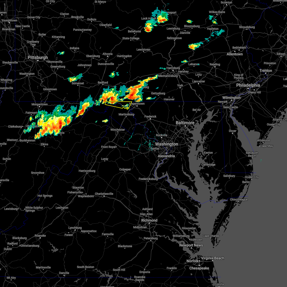 At 300 pm edt, a severe thunderstorm was located over barnes gap, or 11 miles west of hancock, moving east at 40 mph (radar indicated). Hazards include 60 mph wind gusts and quarter size hail. Damaging winds will cause some trees and large branches to fall. this could injure those outdoors, as well as damage homes and vehicles. roadways may become blocked by downed trees. localized power outages are possible. Unsecured light objects may become projectiles. At 300 pm edt, a severe thunderstorm was located over barnes gap, or 11 miles west of hancock, moving east at 40 mph (radar indicated). Hazards include 60 mph wind gusts and quarter size hail. Damaging winds will cause some trees and large branches to fall. this could injure those outdoors, as well as damage homes and vehicles. roadways may become blocked by downed trees. localized power outages are possible. Unsecured light objects may become projectiles.
|
| 7/12/2022 3:00 PM EDT |
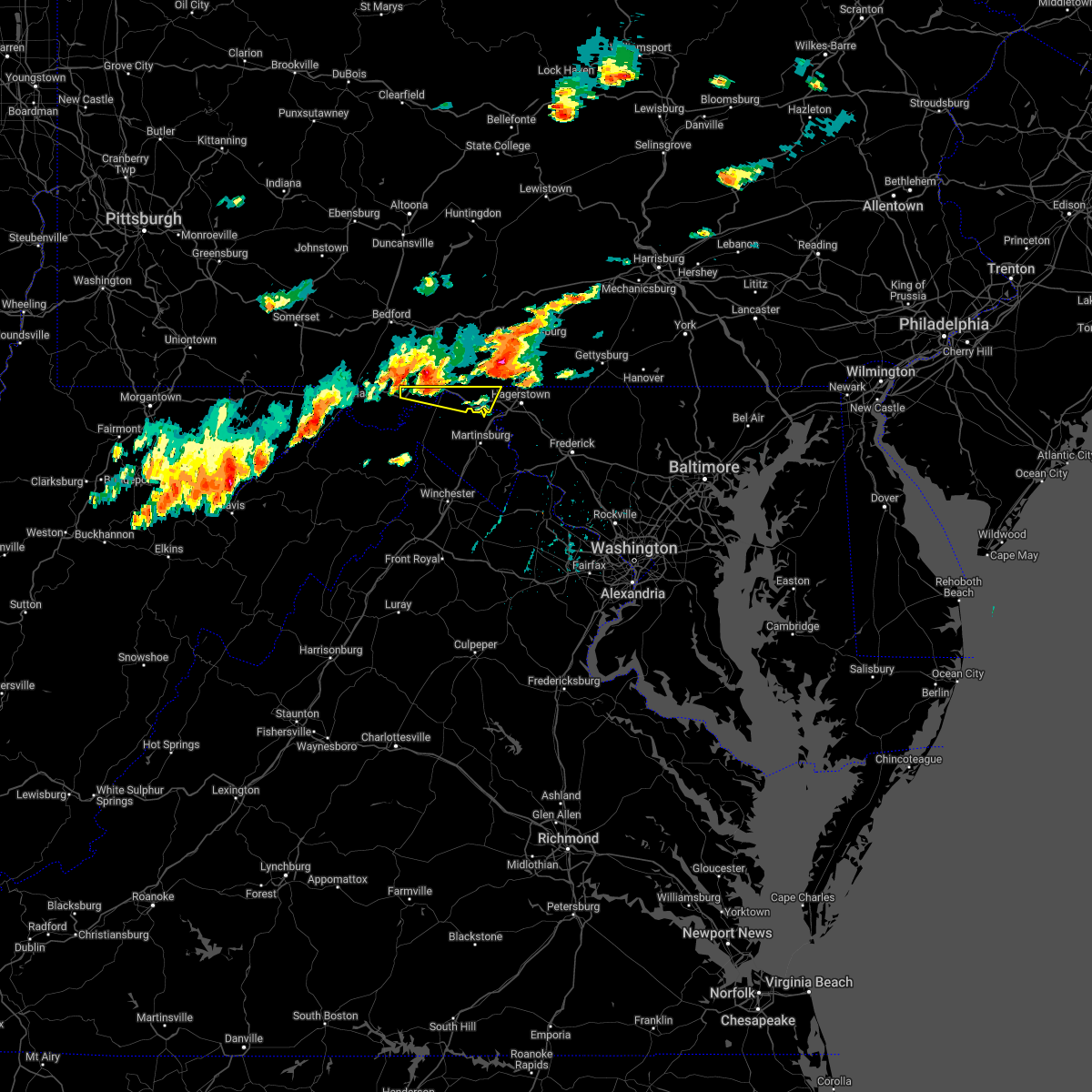 At 300 pm edt, a severe thunderstorm was located over barnes gap, or 11 miles west of hancock, moving east at 40 mph (radar indicated). Hazards include 60 mph wind gusts and quarter size hail. Damaging winds will cause some trees and large branches to fall. this could injure those outdoors, as well as damage homes and vehicles. roadways may become blocked by downed trees. localized power outages are possible. Unsecured light objects may become projectiles. At 300 pm edt, a severe thunderstorm was located over barnes gap, or 11 miles west of hancock, moving east at 40 mph (radar indicated). Hazards include 60 mph wind gusts and quarter size hail. Damaging winds will cause some trees and large branches to fall. this could injure those outdoors, as well as damage homes and vehicles. roadways may become blocked by downed trees. localized power outages are possible. Unsecured light objects may become projectiles.
|
| 7/12/2022 2:57 PM EDT | Tree and wires down in the 3400 block of western pik in washington county MD, 4.4 miles E of Hancock, MD |
| 7/12/2022 2:55 PM EDT | Corrects previous tstm wnd dmg report (time) from 2 ese barnes gap. trees down blocking buck valley roa in fulton county PA, 7.6 miles ESE of Hancock, MD |
| 7/12/2022 2:45 PM EDT | Trees down blocking buck valley roa in fulton county PA, 7.6 miles ESE of Hancock, MD |
| 6/22/2022 7:46 PM EDT |
 At 746 pm edt, severe thunderstorms were located along a line extending from berkeley springs to 6 miles east of cumberland, moving south at 45 mph (radar indicated). Hazards include 60 mph wind gusts and quarter size hail. Damaging winds will cause some trees and large branches to fall. this could injure those outdoors, as well as damage homes and vehicles. roadways may become blocked by downed trees. localized power outages are possible. unsecured light objects may become projectiles. locations impacted include, romney, hancock, paw paw, greenwood, berkeley springs, springfield, great cacapon, green spring, flintstone, oldtown, little orleans, johnsons mill, valley view, fishers bridge, spohrs crossroads, pumpkin center, oakland, rock gap, bloomery and points. hail threat, radar indicated max hail size, 1. 00 in wind threat, radar indicated max wind gust, 60 mph. At 746 pm edt, severe thunderstorms were located along a line extending from berkeley springs to 6 miles east of cumberland, moving south at 45 mph (radar indicated). Hazards include 60 mph wind gusts and quarter size hail. Damaging winds will cause some trees and large branches to fall. this could injure those outdoors, as well as damage homes and vehicles. roadways may become blocked by downed trees. localized power outages are possible. unsecured light objects may become projectiles. locations impacted include, romney, hancock, paw paw, greenwood, berkeley springs, springfield, great cacapon, green spring, flintstone, oldtown, little orleans, johnsons mill, valley view, fishers bridge, spohrs crossroads, pumpkin center, oakland, rock gap, bloomery and points. hail threat, radar indicated max hail size, 1. 00 in wind threat, radar indicated max wind gust, 60 mph.
|
| 6/22/2022 7:29 PM EDT |
 At 729 pm edt, severe thunderstorms were located along a line extending from near warfordsburg to near lake gordon, moving south at 45 mph (radar indicated). Hazards include 60 mph wind gusts and quarter size hail. Damaging winds will cause some trees and large branches to fall. this could injure those outdoors, as well as damage homes and vehicles. roadways may become blocked by downed trees. localized power outages are possible. Unsecured light objects may become projectiles. At 729 pm edt, severe thunderstorms were located along a line extending from near warfordsburg to near lake gordon, moving south at 45 mph (radar indicated). Hazards include 60 mph wind gusts and quarter size hail. Damaging winds will cause some trees and large branches to fall. this could injure those outdoors, as well as damage homes and vehicles. roadways may become blocked by downed trees. localized power outages are possible. Unsecured light objects may become projectiles.
|
| 6/14/2022 4:01 AM EDT |
 At 401 am edt, severe thunderstorms were located along a line extending from near big cove tannery to 8 miles west of wilson-conococheague to martinsburg to near inwood, moving east at 25 mph (radar indicated). Hazards include 60 mph wind gusts and quarter size hail. Damaging winds will cause some trees and large branches to fall. this could injure those outdoors, as well as damage homes and vehicles. roadways may become blocked by downed trees. localized power outages are possible. Unsecured light objects may become projectiles. At 401 am edt, severe thunderstorms were located along a line extending from near big cove tannery to 8 miles west of wilson-conococheague to martinsburg to near inwood, moving east at 25 mph (radar indicated). Hazards include 60 mph wind gusts and quarter size hail. Damaging winds will cause some trees and large branches to fall. this could injure those outdoors, as well as damage homes and vehicles. roadways may become blocked by downed trees. localized power outages are possible. Unsecured light objects may become projectiles.
|
| 6/8/2022 5:39 PM EDT |
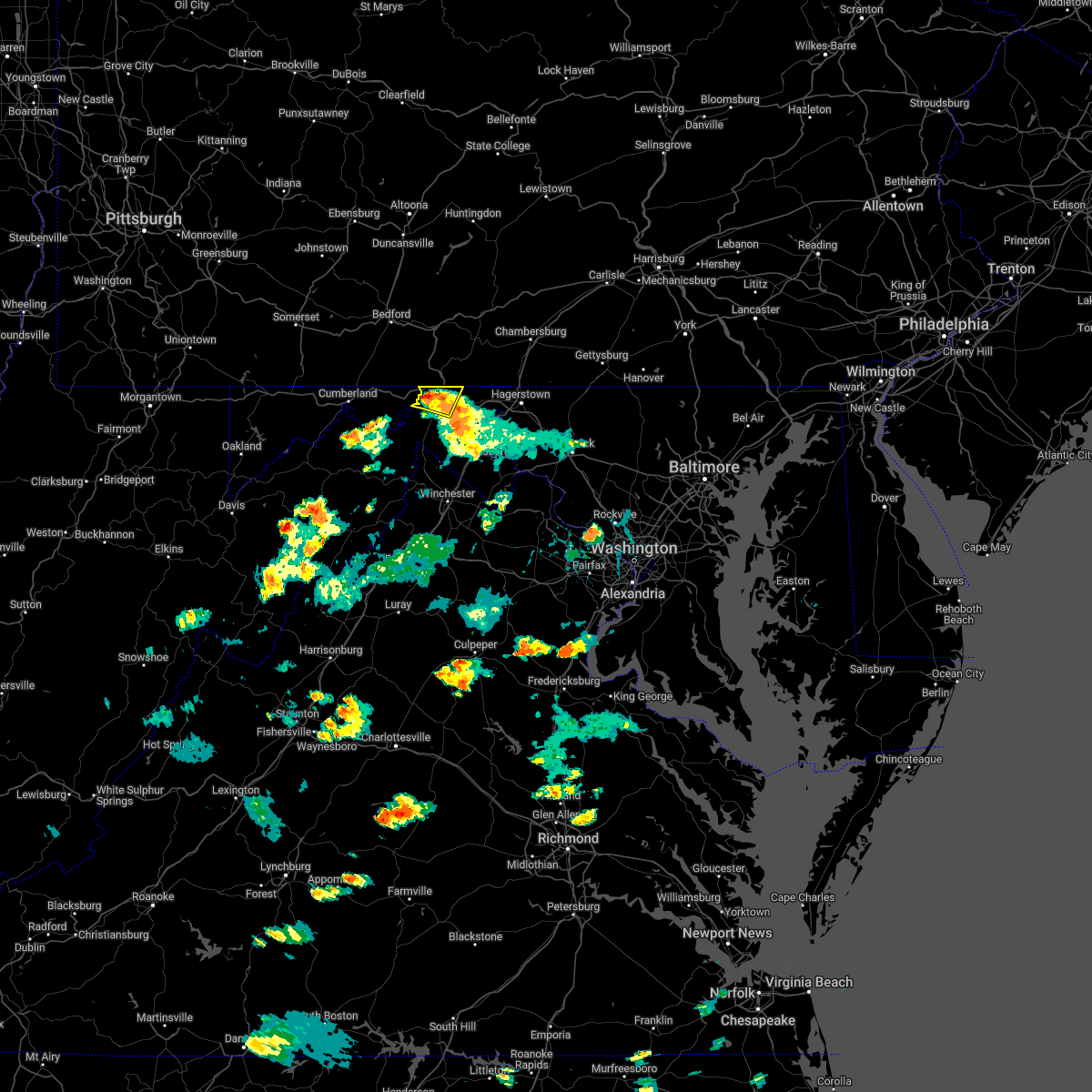 At 538 pm edt, a severe thunderstorm was located near hancock, moving north at 25 mph (radar indicated). Hazards include 60 mph wind gusts and quarter size hail. Damaging winds will cause some trees and large branches to fall. this could injure those outdoors, as well as damage homes and vehicles. roadways may become blocked by downed trees. localized power outages are possible. unsecured light objects may become projectiles. locations impacted include, hancock, berkeley springs, great cacapon, forest park, lineburg, berryville, spohrs crossroads, new hope and shady grove. hail threat, radar indicated max hail size, 1. 00 in wind threat, radar indicated max wind gust, 60 mph. At 538 pm edt, a severe thunderstorm was located near hancock, moving north at 25 mph (radar indicated). Hazards include 60 mph wind gusts and quarter size hail. Damaging winds will cause some trees and large branches to fall. this could injure those outdoors, as well as damage homes and vehicles. roadways may become blocked by downed trees. localized power outages are possible. unsecured light objects may become projectiles. locations impacted include, hancock, berkeley springs, great cacapon, forest park, lineburg, berryville, spohrs crossroads, new hope and shady grove. hail threat, radar indicated max hail size, 1. 00 in wind threat, radar indicated max wind gust, 60 mph.
|
| 6/8/2022 5:39 PM EDT |
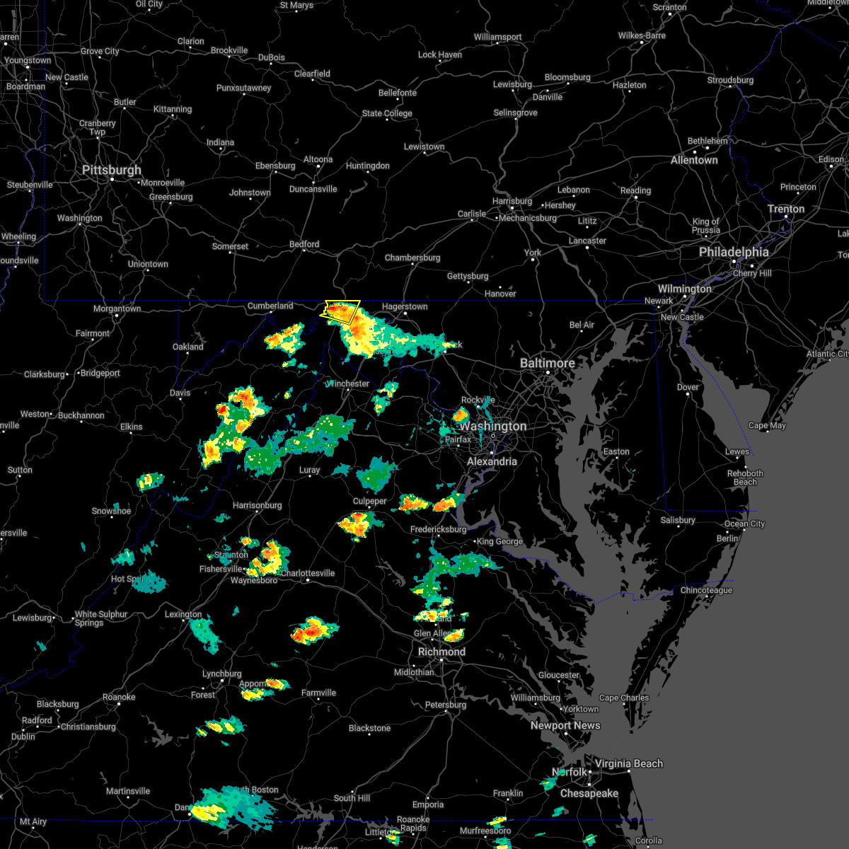 At 538 pm edt, a severe thunderstorm was located near hancock, moving north at 25 mph (radar indicated). Hazards include 60 mph wind gusts and quarter size hail. Damaging winds will cause some trees and large branches to fall. this could injure those outdoors, as well as damage homes and vehicles. roadways may become blocked by downed trees. localized power outages are possible. unsecured light objects may become projectiles. locations impacted include, hancock, berkeley springs, great cacapon, forest park, lineburg, berryville, spohrs crossroads, new hope and shady grove. hail threat, radar indicated max hail size, 1. 00 in wind threat, radar indicated max wind gust, 60 mph. At 538 pm edt, a severe thunderstorm was located near hancock, moving north at 25 mph (radar indicated). Hazards include 60 mph wind gusts and quarter size hail. Damaging winds will cause some trees and large branches to fall. this could injure those outdoors, as well as damage homes and vehicles. roadways may become blocked by downed trees. localized power outages are possible. unsecured light objects may become projectiles. locations impacted include, hancock, berkeley springs, great cacapon, forest park, lineburg, berryville, spohrs crossroads, new hope and shady grove. hail threat, radar indicated max hail size, 1. 00 in wind threat, radar indicated max wind gust, 60 mph.
|
| 6/8/2022 5:20 PM EDT |
 At 520 pm edt, a severe thunderstorm was located near berkeley springs, or 9 miles northeast of paw paw, moving north at 25 mph (radar indicated). Hazards include quarter size hail. some hail damage to agriculture is expected At 520 pm edt, a severe thunderstorm was located near berkeley springs, or 9 miles northeast of paw paw, moving north at 25 mph (radar indicated). Hazards include quarter size hail. some hail damage to agriculture is expected
|
| 6/8/2022 5:20 PM EDT |
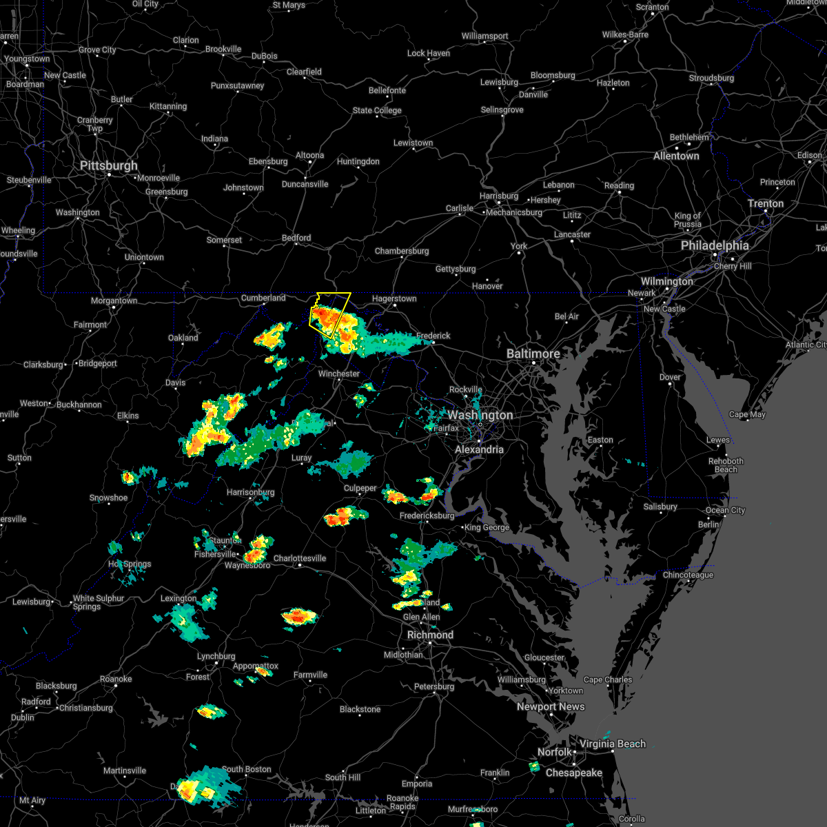 At 520 pm edt, a severe thunderstorm was located near berkeley springs, or 9 miles northeast of paw paw, moving north at 25 mph (radar indicated). Hazards include quarter size hail. some hail damage to agriculture is expected At 520 pm edt, a severe thunderstorm was located near berkeley springs, or 9 miles northeast of paw paw, moving north at 25 mph (radar indicated). Hazards include quarter size hail. some hail damage to agriculture is expected
|
| 5/20/2022 12:53 PM EDT |
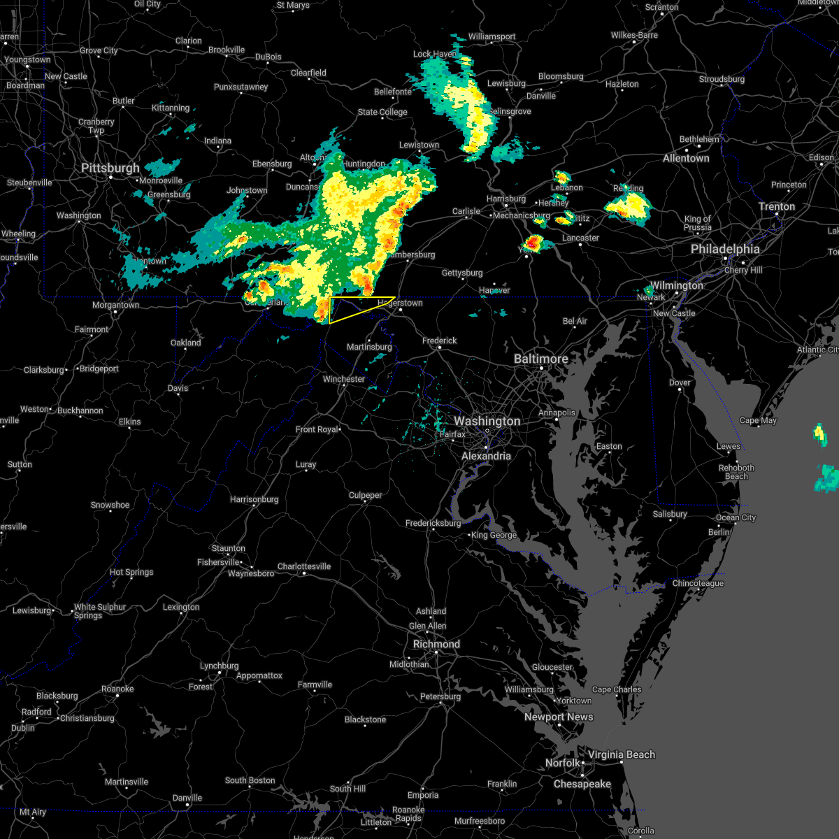 At 1253 pm edt, severe thunderstorms were located along a line extending from near hancock to near berkeley springs, moving east at 45 mph (radar indicated). Hazards include 60 mph wind gusts and quarter size hail. Damaging winds will cause some trees and large branches to fall. this could injure those outdoors, as well as damage homes and vehicles. roadways may become blocked by downed trees. localized power outages are possible. Unsecured light objects may become projectiles. At 1253 pm edt, severe thunderstorms were located along a line extending from near hancock to near berkeley springs, moving east at 45 mph (radar indicated). Hazards include 60 mph wind gusts and quarter size hail. Damaging winds will cause some trees and large branches to fall. this could injure those outdoors, as well as damage homes and vehicles. roadways may become blocked by downed trees. localized power outages are possible. Unsecured light objects may become projectiles.
|
| 5/20/2022 12:49 PM EDT |
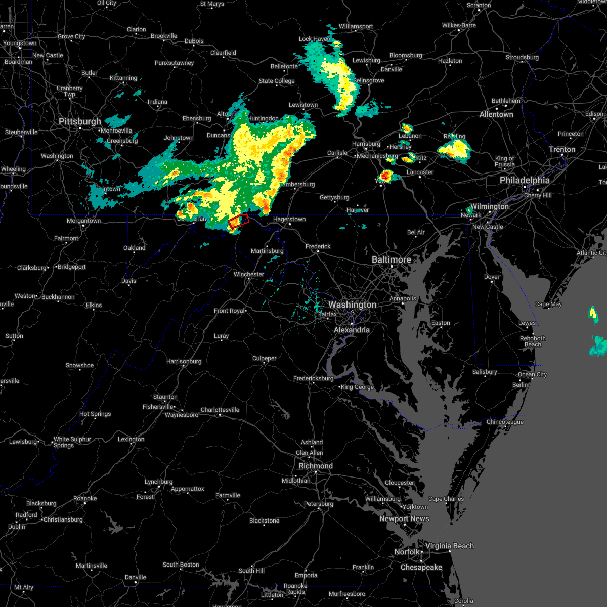 At 1248 pm edt, a severe thunderstorm capable of producing a tornado was located over hancock, moving east at 55 mph (radar indicated rotation). Hazards include tornado and quarter size hail. For those in the direct path of a tornado touchdown, flying debris will be dangerous to those caught without shelter. damage to roofs, siding, and windows may occur. mobile homes may be damaged or destroyed. tree damage is likely. This tornadic thunderstorm will remain over mainly rural areas of northwestern washington, eastern allegany and north central morgan counties, including the following locations, lineburg. At 1248 pm edt, a severe thunderstorm capable of producing a tornado was located over hancock, moving east at 55 mph (radar indicated rotation). Hazards include tornado and quarter size hail. For those in the direct path of a tornado touchdown, flying debris will be dangerous to those caught without shelter. damage to roofs, siding, and windows may occur. mobile homes may be damaged or destroyed. tree damage is likely. This tornadic thunderstorm will remain over mainly rural areas of northwestern washington, eastern allegany and north central morgan counties, including the following locations, lineburg.
|
| 5/20/2022 12:47 PM EDT |
 At 1247 pm edt, severe thunderstorms were located along a line extending from near hancock to near paw paw, moving east at 45 mph (radar indicated). Hazards include 60 mph wind gusts and quarter size hail. Damaging winds will cause some trees and large branches to fall. this could injure those outdoors, as well as damage homes and vehicles. roadways may become blocked by downed trees. localized power outages are possible. unsecured light objects may become projectiles. Locations impacted include, hancock, berkeley springs, great cacapon, little orleans, forest park, lineburg, bellegrove, berryville, green ridge and magnolia. At 1247 pm edt, severe thunderstorms were located along a line extending from near hancock to near paw paw, moving east at 45 mph (radar indicated). Hazards include 60 mph wind gusts and quarter size hail. Damaging winds will cause some trees and large branches to fall. this could injure those outdoors, as well as damage homes and vehicles. roadways may become blocked by downed trees. localized power outages are possible. unsecured light objects may become projectiles. Locations impacted include, hancock, berkeley springs, great cacapon, little orleans, forest park, lineburg, bellegrove, berryville, green ridge and magnolia.
|
| 5/20/2022 12:41 PM EDT |
 At 1240 pm edt, a severe thunderstorm capable of producing a tornado was located near barnes gap, or 9 miles west of hancock, moving east at 50 mph (radar indicated rotation). Hazards include tornado and quarter size hail. For those in the direct path of a tornado touchdown, flying debris will be dangerous to those caught without shelter. damage to roofs, siding, and windows may occur. mobile homes may be damaged or destroyed. tree damage is likely. this dangerous storm will be near, hancock around 1255 pm edt. Other locations impacted by this tornadic thunderstorm include little orleans, lineburg and green ridge. At 1240 pm edt, a severe thunderstorm capable of producing a tornado was located near barnes gap, or 9 miles west of hancock, moving east at 50 mph (radar indicated rotation). Hazards include tornado and quarter size hail. For those in the direct path of a tornado touchdown, flying debris will be dangerous to those caught without shelter. damage to roofs, siding, and windows may occur. mobile homes may be damaged or destroyed. tree damage is likely. this dangerous storm will be near, hancock around 1255 pm edt. Other locations impacted by this tornadic thunderstorm include little orleans, lineburg and green ridge.
|
| 5/20/2022 12:38 PM EDT |
 At 1238 pm edt, severe thunderstorms were located along a line extending from near warfordsburg to 7 miles east of fort ashby, moving east at 45 mph (radar indicated). Hazards include 60 mph wind gusts and quarter size hail. Damaging winds will cause some trees and large branches to fall. this could injure those outdoors, as well as damage homes and vehicles. roadways may become blocked by downed trees. localized power outages are possible. unsecured light objects may become projectiles. Locations impacted include, hancock, berkeley springs, great cacapon, little orleans, forest park, lineburg, bellegrove, berryville, green ridge and magnolia. At 1238 pm edt, severe thunderstorms were located along a line extending from near warfordsburg to 7 miles east of fort ashby, moving east at 45 mph (radar indicated). Hazards include 60 mph wind gusts and quarter size hail. Damaging winds will cause some trees and large branches to fall. this could injure those outdoors, as well as damage homes and vehicles. roadways may become blocked by downed trees. localized power outages are possible. unsecured light objects may become projectiles. Locations impacted include, hancock, berkeley springs, great cacapon, little orleans, forest park, lineburg, bellegrove, berryville, green ridge and magnolia.
|
| 5/20/2022 12:22 PM EDT |
 At 1221 pm edt, severe thunderstorms were located along a line extending from near inglesmith to near fort ashby, moving east at 45 mph (radar indicated). Hazards include 60 mph wind gusts and quarter size hail. Damaging winds will cause some trees and large branches to fall. this could injure those outdoors, as well as damage homes and vehicles. roadways may become blocked by downed trees. localized power outages are possible. unsecured light objects may become projectiles. Locations impacted include, hancock, paw paw, fort ashby, berkeley springs, great cacapon, green spring, oldtown, spring gap, little orleans, patterson creek, lineburg, short gap, wagoner, pumpkin center, north branch, magnolia, forest park, bellegrove, berryville and levels. At 1221 pm edt, severe thunderstorms were located along a line extending from near inglesmith to near fort ashby, moving east at 45 mph (radar indicated). Hazards include 60 mph wind gusts and quarter size hail. Damaging winds will cause some trees and large branches to fall. this could injure those outdoors, as well as damage homes and vehicles. roadways may become blocked by downed trees. localized power outages are possible. unsecured light objects may become projectiles. Locations impacted include, hancock, paw paw, fort ashby, berkeley springs, great cacapon, green spring, oldtown, spring gap, little orleans, patterson creek, lineburg, short gap, wagoner, pumpkin center, north branch, magnolia, forest park, bellegrove, berryville and levels.
|
| 5/20/2022 12:09 PM EDT |
 At 1208 pm edt, severe thunderstorms were located along a line extending from near lake gordon to westernport, moving east at 45 mph (radar indicated). Hazards include 60 mph wind gusts and quarter size hail. Damaging winds will cause some trees and large branches to fall. this could injure those outdoors, as well as damage homes and vehicles. roadways may become blocked by downed trees. localized power outages are possible. Unsecured light objects may become projectiles. At 1208 pm edt, severe thunderstorms were located along a line extending from near lake gordon to westernport, moving east at 45 mph (radar indicated). Hazards include 60 mph wind gusts and quarter size hail. Damaging winds will cause some trees and large branches to fall. this could injure those outdoors, as well as damage homes and vehicles. roadways may become blocked by downed trees. localized power outages are possible. Unsecured light objects may become projectiles.
|
| 8/25/2021 10:17 PM EDT | Tree down at the intersectino of national pike and mountain r in washington county MD, 6.6 miles E of Hancock, MD |
| 8/13/2021 5:40 PM EDT | Tree down at mile mark 1 on east-west highwa in washington county MD, 6.6 miles E of Hancock, MD |
| 8/13/2021 1:43 PM EDT |
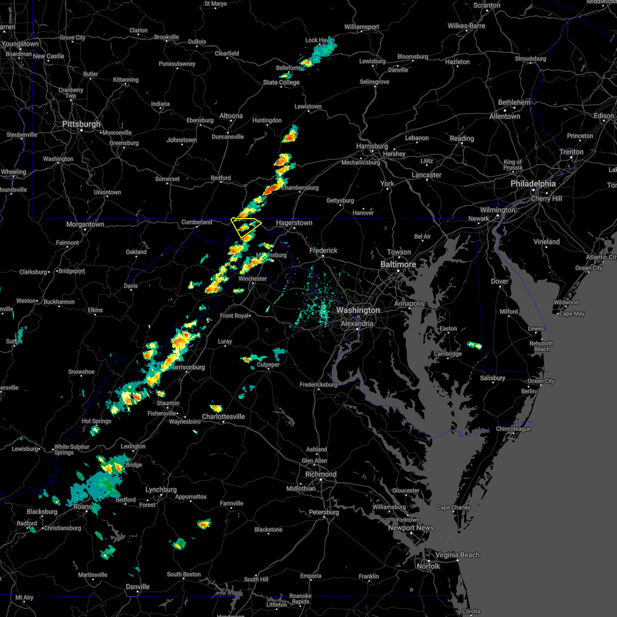 At 143 pm edt, a severe thunderstorm was located near barnes gap, or near hancock, moving southeast at 10 mph (radar indicated). Hazards include 60 mph wind gusts and quarter size hail. Damaging winds will cause some trees and large branches to fall. this could injure those outdoors, as well as damage homes and vehicles. roadways may become blocked by downed trees. localized power outages are possible. Unsecured light objects may become projectiles. At 143 pm edt, a severe thunderstorm was located near barnes gap, or near hancock, moving southeast at 10 mph (radar indicated). Hazards include 60 mph wind gusts and quarter size hail. Damaging winds will cause some trees and large branches to fall. this could injure those outdoors, as well as damage homes and vehicles. roadways may become blocked by downed trees. localized power outages are possible. Unsecured light objects may become projectiles.
|
| 8/13/2021 1:43 PM EDT |
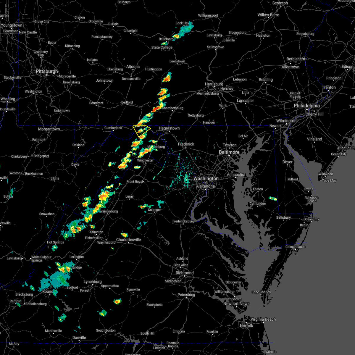 At 143 pm edt, a severe thunderstorm was located near barnes gap, or near hancock, moving southeast at 10 mph (radar indicated). Hazards include 60 mph wind gusts and quarter size hail. Damaging winds will cause some trees and large branches to fall. this could injure those outdoors, as well as damage homes and vehicles. roadways may become blocked by downed trees. localized power outages are possible. Unsecured light objects may become projectiles. At 143 pm edt, a severe thunderstorm was located near barnes gap, or near hancock, moving southeast at 10 mph (radar indicated). Hazards include 60 mph wind gusts and quarter size hail. Damaging winds will cause some trees and large branches to fall. this could injure those outdoors, as well as damage homes and vehicles. roadways may become blocked by downed trees. localized power outages are possible. Unsecured light objects may become projectiles.
|
| 8/11/2021 4:34 PM EDT |
 At 434 pm edt, severe thunderstorms were located along a line extending from 8 miles southwest of claylick to near paw paw, moving southeast at 25 mph (radar indicated). Hazards include 60 mph wind gusts. Damaging winds will cause some trees and large branches to fall. this could injure those outdoors, as well as damage homes and vehicles. roadways may become blocked by downed trees. localized power outages are possible. Unsecured light objects may become projectiles. At 434 pm edt, severe thunderstorms were located along a line extending from 8 miles southwest of claylick to near paw paw, moving southeast at 25 mph (radar indicated). Hazards include 60 mph wind gusts. Damaging winds will cause some trees and large branches to fall. this could injure those outdoors, as well as damage homes and vehicles. roadways may become blocked by downed trees. localized power outages are possible. Unsecured light objects may become projectiles.
|
| 8/11/2021 4:34 PM EDT |
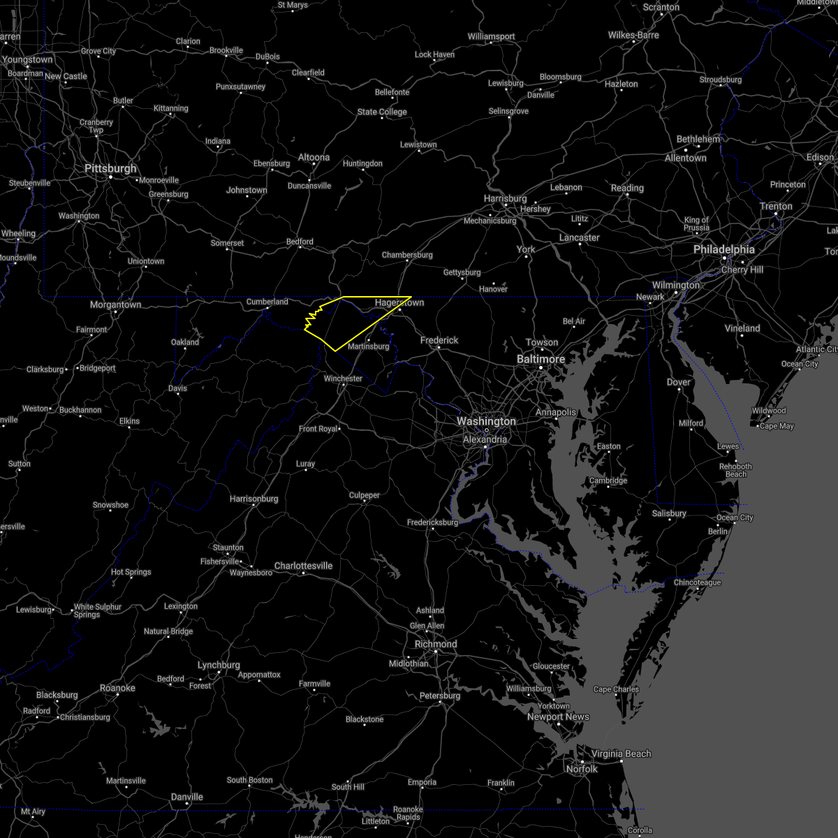 At 434 pm edt, severe thunderstorms were located along a line extending from 8 miles southwest of claylick to near paw paw, moving southeast at 25 mph (radar indicated). Hazards include 60 mph wind gusts. Damaging winds will cause some trees and large branches to fall. this could injure those outdoors, as well as damage homes and vehicles. roadways may become blocked by downed trees. localized power outages are possible. Unsecured light objects may become projectiles. At 434 pm edt, severe thunderstorms were located along a line extending from 8 miles southwest of claylick to near paw paw, moving southeast at 25 mph (radar indicated). Hazards include 60 mph wind gusts. Damaging winds will cause some trees and large branches to fall. this could injure those outdoors, as well as damage homes and vehicles. roadways may become blocked by downed trees. localized power outages are possible. Unsecured light objects may become projectiles.
|
| 7/26/2021 3:24 PM EDT |
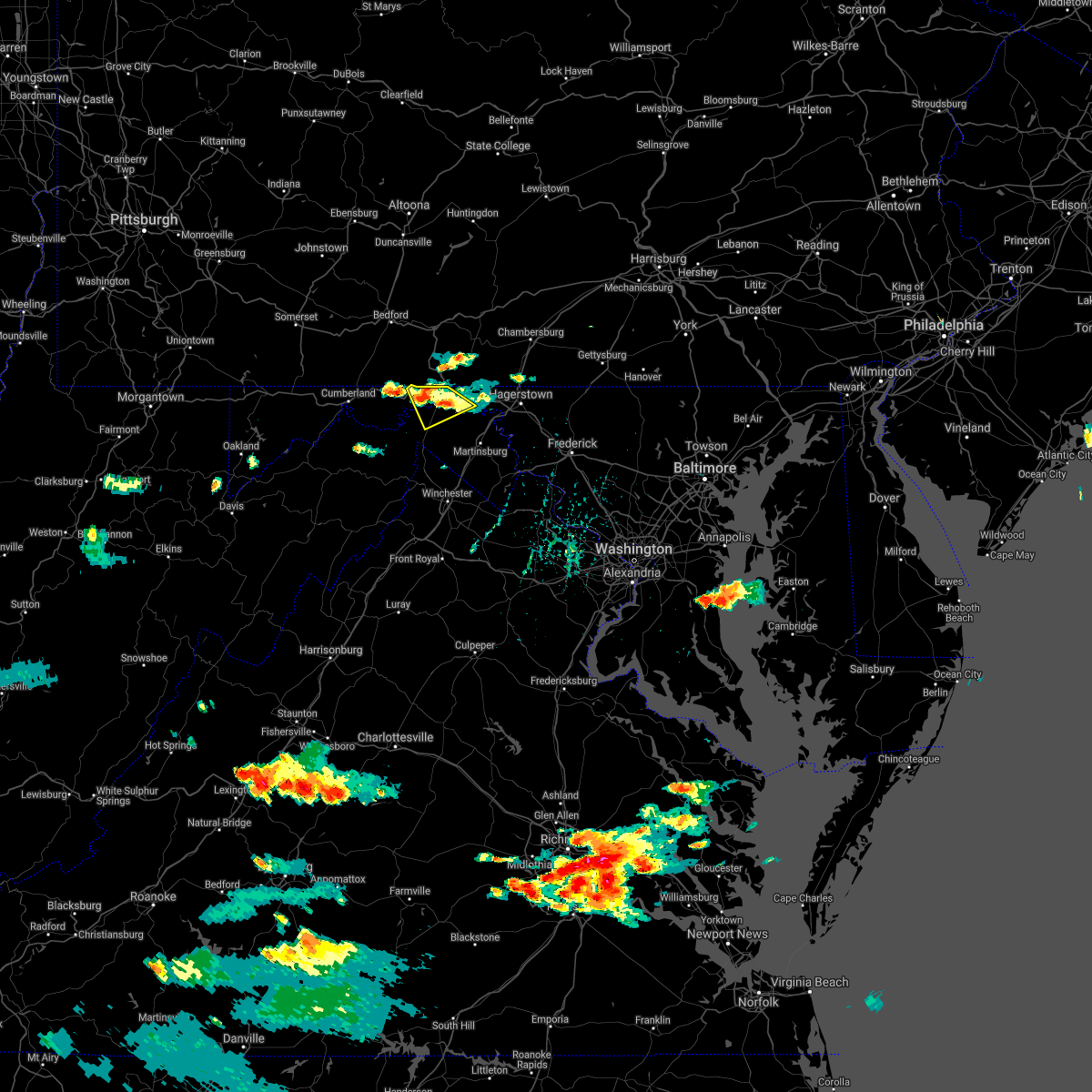 The severe thunderstorm warning for northwestern washington, northeastern allegany, northeastern morgan and north central berkeley counties will expire at 330 pm edt, the storm which prompted the warning has weakened below severe limits, and no longer poses an immediate threat to life or property. therefore, the warning will be allowed to expire. however gusty winds and heavy rain are still possible with this thunderstorm. to report severe weather, contact your nearest law enforcement agency. they will relay your report to the national weather service sterling virginia. The severe thunderstorm warning for northwestern washington, northeastern allegany, northeastern morgan and north central berkeley counties will expire at 330 pm edt, the storm which prompted the warning has weakened below severe limits, and no longer poses an immediate threat to life or property. therefore, the warning will be allowed to expire. however gusty winds and heavy rain are still possible with this thunderstorm. to report severe weather, contact your nearest law enforcement agency. they will relay your report to the national weather service sterling virginia.
|
| 7/26/2021 3:24 PM EDT |
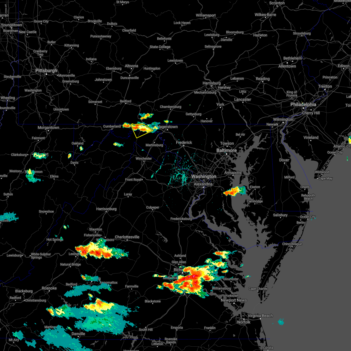 The severe thunderstorm warning for northwestern washington, northeastern allegany, northeastern morgan and north central berkeley counties will expire at 330 pm edt, the storm which prompted the warning has weakened below severe limits, and no longer poses an immediate threat to life or property. therefore, the warning will be allowed to expire. however gusty winds and heavy rain are still possible with this thunderstorm. to report severe weather, contact your nearest law enforcement agency. they will relay your report to the national weather service sterling virginia. The severe thunderstorm warning for northwestern washington, northeastern allegany, northeastern morgan and north central berkeley counties will expire at 330 pm edt, the storm which prompted the warning has weakened below severe limits, and no longer poses an immediate threat to life or property. therefore, the warning will be allowed to expire. however gusty winds and heavy rain are still possible with this thunderstorm. to report severe weather, contact your nearest law enforcement agency. they will relay your report to the national weather service sterling virginia.
|
| 7/26/2021 3:05 PM EDT |
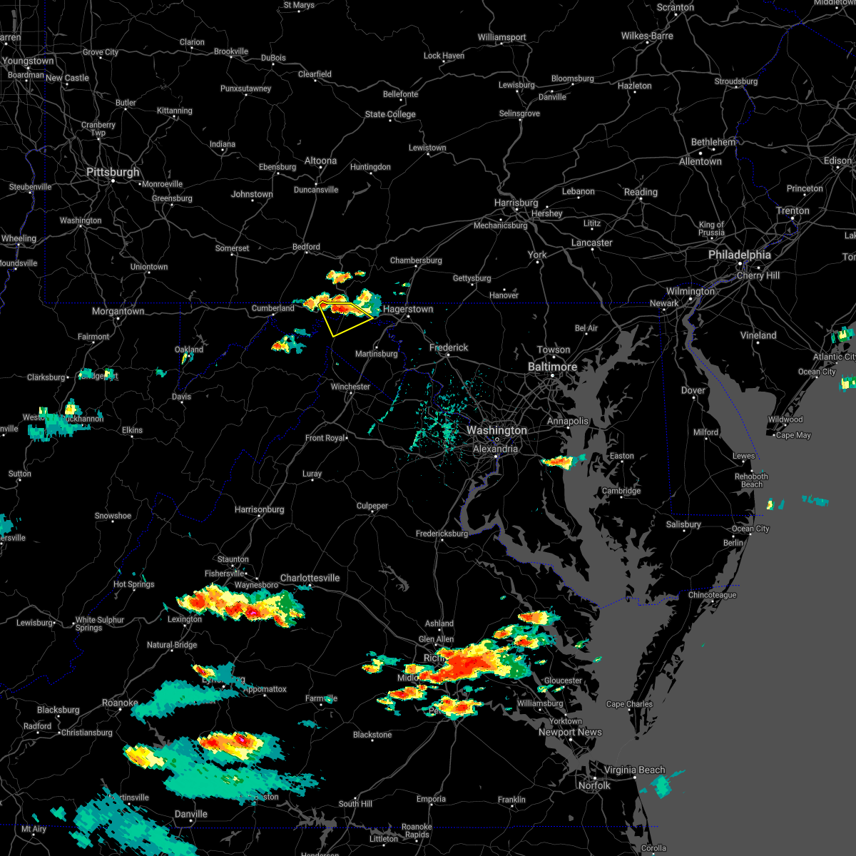 At 305 pm edt, a severe thunderstorm was located near hancock, moving southeast at 10 mph (radar indicated). Hazards include 60 mph wind gusts and half dollar size hail. Damaging winds will cause some trees and large branches to fall. this could injure those outdoors, as well as damage homes and vehicles. roadways may become blocked by downed trees. localized power outages are possible. unsecured light objects may become projectiles. Locations impacted include, hancock, berkeley springs, great cacapon, pecktonville, big pool, johnsons mill, cherry run, lineburg, valley view, spohrs crossroads, spruce pine hollow, rock gap, forest park, bellegrove, smith crossroads, berryville, new hope, sleepy creek and shady grove. At 305 pm edt, a severe thunderstorm was located near hancock, moving southeast at 10 mph (radar indicated). Hazards include 60 mph wind gusts and half dollar size hail. Damaging winds will cause some trees and large branches to fall. this could injure those outdoors, as well as damage homes and vehicles. roadways may become blocked by downed trees. localized power outages are possible. unsecured light objects may become projectiles. Locations impacted include, hancock, berkeley springs, great cacapon, pecktonville, big pool, johnsons mill, cherry run, lineburg, valley view, spohrs crossroads, spruce pine hollow, rock gap, forest park, bellegrove, smith crossroads, berryville, new hope, sleepy creek and shady grove.
|
| 7/26/2021 2:52 PM EDT |
 At 252 pm edt, a severe thunderstorm was located near barnes gap, or near hancock, moving southeast at 10 mph (radar indicated). Hazards include 60 mph wind gusts and half dollar size hail. Damaging winds will cause some trees and large branches to fall. this could injure those outdoors, as well as damage homes and vehicles. roadways may become blocked by downed trees. localized power outages are possible. Unsecured light objects may become projectiles. At 252 pm edt, a severe thunderstorm was located near barnes gap, or near hancock, moving southeast at 10 mph (radar indicated). Hazards include 60 mph wind gusts and half dollar size hail. Damaging winds will cause some trees and large branches to fall. this could injure those outdoors, as well as damage homes and vehicles. roadways may become blocked by downed trees. localized power outages are possible. Unsecured light objects may become projectiles.
|
| 7/26/2021 2:52 PM EDT |
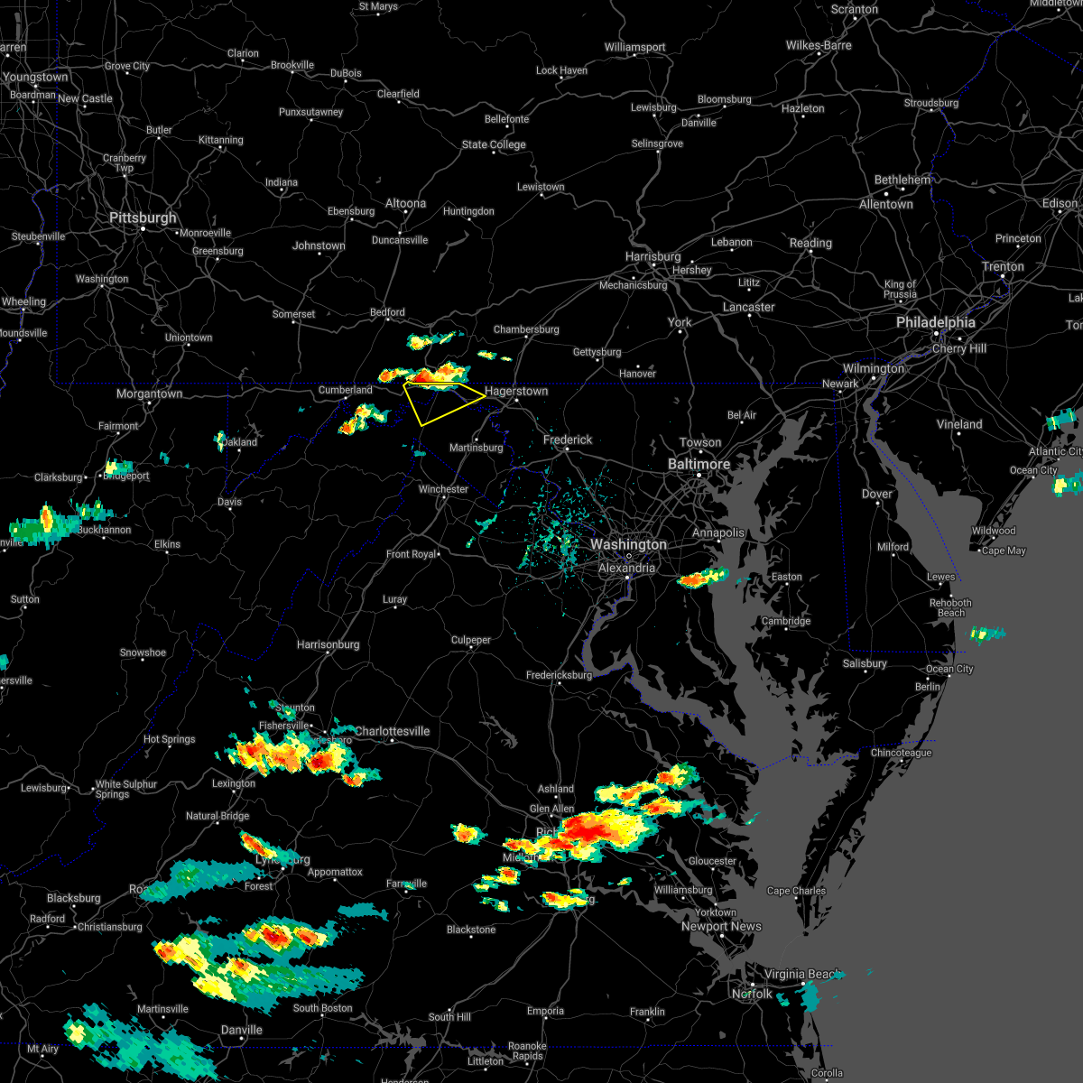 At 252 pm edt, a severe thunderstorm was located near barnes gap, or near hancock, moving southeast at 10 mph (radar indicated). Hazards include 60 mph wind gusts and half dollar size hail. Damaging winds will cause some trees and large branches to fall. this could injure those outdoors, as well as damage homes and vehicles. roadways may become blocked by downed trees. localized power outages are possible. Unsecured light objects may become projectiles. At 252 pm edt, a severe thunderstorm was located near barnes gap, or near hancock, moving southeast at 10 mph (radar indicated). Hazards include 60 mph wind gusts and half dollar size hail. Damaging winds will cause some trees and large branches to fall. this could injure those outdoors, as well as damage homes and vehicles. roadways may become blocked by downed trees. localized power outages are possible. Unsecured light objects may become projectiles.
|
| 7/11/2021 8:47 PM EDT |
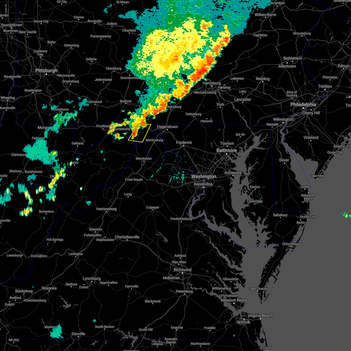 At 847 pm edt, severe thunderstorms were located along a line extending from near hancock to near paw paw, moving east at 20 mph (radar indicated). Hazards include 70 mph wind gusts and ping pong ball size hail. Damaging winds will cause some trees and large branches to fall. this could injure those outdoors, as well as damage homes and vehicles. roadways may become blocked by downed trees. localized power outages are possible. unsecured light objects may become projectiles. Locations impacted include, hancock, berkeley springs, great cacapon, johnsons mill, omps, valley view, fishers bridge, spohrs crossroads, oakland, spruce pine hollow, rock gap, stotlers crossroads, highland ridge, smith crossroads, berryville, new hope, sleepy creek and shady grove. At 847 pm edt, severe thunderstorms were located along a line extending from near hancock to near paw paw, moving east at 20 mph (radar indicated). Hazards include 70 mph wind gusts and ping pong ball size hail. Damaging winds will cause some trees and large branches to fall. this could injure those outdoors, as well as damage homes and vehicles. roadways may become blocked by downed trees. localized power outages are possible. unsecured light objects may become projectiles. Locations impacted include, hancock, berkeley springs, great cacapon, johnsons mill, omps, valley view, fishers bridge, spohrs crossroads, oakland, spruce pine hollow, rock gap, stotlers crossroads, highland ridge, smith crossroads, berryville, new hope, sleepy creek and shady grove.
|
| 7/11/2021 8:40 PM EDT | Tree down on us 522 at river road in morgan county WV, 1.2 miles NE of Hancock, MD |
| 7/11/2021 8:40 PM EDT | Tree down on us 522 at high street in washington county MD, 0.8 miles ENE of Hancock, MD |
| 7/11/2021 8:40 PM EDT | Wires down on baptist roa in washington county MD, 0.3 miles NNE of Hancock, MD |
| 7/11/2021 8:40 PM EDT |
 At 840 pm edt, severe thunderstorms were located along a line extending from warfordsburg to near paw paw, moving east at 20 mph (radar indicated). Hazards include 70 mph wind gusts and quarter size hail. Damaging winds will cause some trees and large branches to fall. this could injure those outdoors, as well as damage homes and vehicles. roadways may become blocked by downed trees. localized power outages are possible. unsecured light objects may become projectiles. Locations impacted include, hancock, berkeley springs, great cacapon, johnsons mill, omps, valley view, fishers bridge, spohrs crossroads, oakland, spruce pine hollow, rock gap, stotlers crossroads, highland ridge, smith crossroads, berryville, new hope, sleepy creek and shady grove. At 840 pm edt, severe thunderstorms were located along a line extending from warfordsburg to near paw paw, moving east at 20 mph (radar indicated). Hazards include 70 mph wind gusts and quarter size hail. Damaging winds will cause some trees and large branches to fall. this could injure those outdoors, as well as damage homes and vehicles. roadways may become blocked by downed trees. localized power outages are possible. unsecured light objects may become projectiles. Locations impacted include, hancock, berkeley springs, great cacapon, johnsons mill, omps, valley view, fishers bridge, spohrs crossroads, oakland, spruce pine hollow, rock gap, stotlers crossroads, highland ridge, smith crossroads, berryville, new hope, sleepy creek and shady grove.
|
| 7/11/2021 8:40 PM EDT |
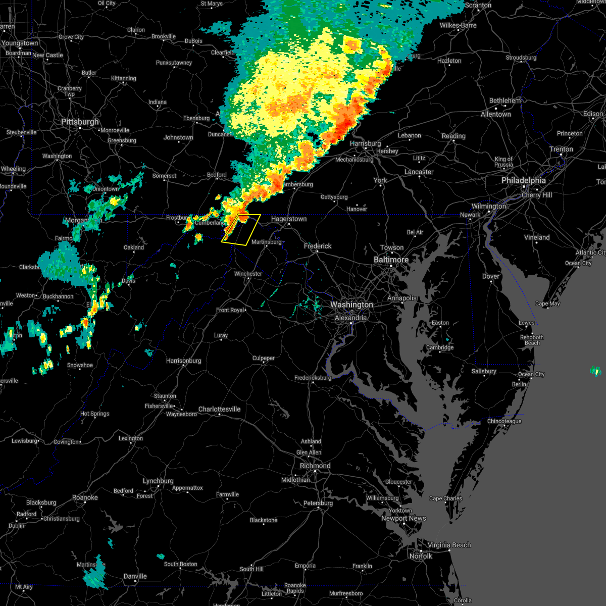 At 840 pm edt, severe thunderstorms were located along a line extending from warfordsburg to near paw paw, moving east at 20 mph (radar indicated). Hazards include 70 mph wind gusts and quarter size hail. Damaging winds will cause some trees and large branches to fall. this could injure those outdoors, as well as damage homes and vehicles. roadways may become blocked by downed trees. localized power outages are possible. unsecured light objects may become projectiles. Locations impacted include, hancock, berkeley springs, great cacapon, johnsons mill, omps, valley view, fishers bridge, spohrs crossroads, oakland, spruce pine hollow, rock gap, stotlers crossroads, highland ridge, smith crossroads, berryville, new hope, sleepy creek and shady grove. At 840 pm edt, severe thunderstorms were located along a line extending from warfordsburg to near paw paw, moving east at 20 mph (radar indicated). Hazards include 70 mph wind gusts and quarter size hail. Damaging winds will cause some trees and large branches to fall. this could injure those outdoors, as well as damage homes and vehicles. roadways may become blocked by downed trees. localized power outages are possible. unsecured light objects may become projectiles. Locations impacted include, hancock, berkeley springs, great cacapon, johnsons mill, omps, valley view, fishers bridge, spohrs crossroads, oakland, spruce pine hollow, rock gap, stotlers crossroads, highland ridge, smith crossroads, berryville, new hope, sleepy creek and shady grove.
|
| 7/11/2021 8:28 PM EDT |
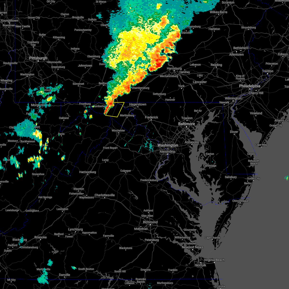 At 828 pm edt, severe thunderstorms were located along a line extending from near warfordsburg to paw paw, moving east at 20 mph (radar indicated). Hazards include 60 mph wind gusts and quarter size hail. Damaging winds will cause some trees and large branches to fall. this could injure those outdoors, as well as damage homes and vehicles. roadways may become blocked by downed trees. localized power outages are possible. Unsecured light objects may become projectiles. At 828 pm edt, severe thunderstorms were located along a line extending from near warfordsburg to paw paw, moving east at 20 mph (radar indicated). Hazards include 60 mph wind gusts and quarter size hail. Damaging winds will cause some trees and large branches to fall. this could injure those outdoors, as well as damage homes and vehicles. roadways may become blocked by downed trees. localized power outages are possible. Unsecured light objects may become projectiles.
|
| 6/21/2021 3:57 PM EDT | Tree and branches down on cover street near north pennsylvania avenu in washington county MD, 0.3 miles NNE of Hancock, MD |
| 6/21/2021 3:54 PM EDT |
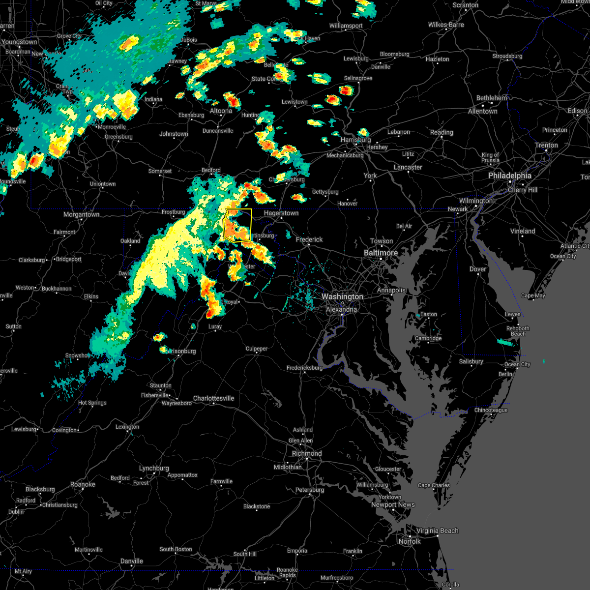 At 354 pm edt, severe thunderstorms were located along a line extending from near warfordsburg to near greenwood, moving east at 45 mph (law enforcement reported numerous trees down in allegany county). Hazards include 60 mph wind gusts. Damaging winds will cause some trees and large branches to fall. this could injure those outdoors, as well as damage homes and vehicles. roadways may become blocked by downed trees. localized power outages are possible. unsecured light objects may become projectiles. Locations impacted include, hancock, greenwood, berkeley springs, great cacapon, pecktonville, johnsons mill, valley view, fishers bridge, spohrs crossroads, oakland, rock gap, smith crossroads, jones springs, unger, new hope, shady grove, omps, lineburg, spruce pine hollow and stotlers crossroads. At 354 pm edt, severe thunderstorms were located along a line extending from near warfordsburg to near greenwood, moving east at 45 mph (law enforcement reported numerous trees down in allegany county). Hazards include 60 mph wind gusts. Damaging winds will cause some trees and large branches to fall. this could injure those outdoors, as well as damage homes and vehicles. roadways may become blocked by downed trees. localized power outages are possible. unsecured light objects may become projectiles. Locations impacted include, hancock, greenwood, berkeley springs, great cacapon, pecktonville, johnsons mill, valley view, fishers bridge, spohrs crossroads, oakland, rock gap, smith crossroads, jones springs, unger, new hope, shady grove, omps, lineburg, spruce pine hollow and stotlers crossroads.
|
| 6/21/2021 3:33 PM EDT |
 At 333 pm edt, severe thunderstorms were located along a line extending from 7 miles southeast of lake gordon to 9 miles southwest of paw paw, moving northeast at 35 mph (law enforcement reported multiple trees down in mineral county). Hazards include 60 mph wind gusts. Damaging winds will cause some trees and large branches to fall. this could injure those outdoors, as well as damage homes and vehicles. roadways may become blocked by downed trees. localized power outages are possible. Unsecured light objects may become projectiles. At 333 pm edt, severe thunderstorms were located along a line extending from 7 miles southeast of lake gordon to 9 miles southwest of paw paw, moving northeast at 35 mph (law enforcement reported multiple trees down in mineral county). Hazards include 60 mph wind gusts. Damaging winds will cause some trees and large branches to fall. this could injure those outdoors, as well as damage homes and vehicles. roadways may become blocked by downed trees. localized power outages are possible. Unsecured light objects may become projectiles.
|
| 5/26/2021 7:35 PM EDT | Roof partially blown off barn in the 14000 block of weller road. a couple of trees also blew dow in washington county MD, 5.2 miles W of Hancock, MD |
| 11/15/2020 5:21 PM EST |
 At 519 pm est, gradient winds from a passing cold front will continue to produce sporadic gusts around and above 60 mph (radar indicated). Hazards include 60 mph wind gusts. Damaging gradient winds will cause some trees and large branches to fall. this could injure those outdoors, as well as damage homes and vehicles. roadways may become blocked by downed trees. localized power outages are possible. unsecured light objects may become projectiles. Locations impacted include, cumberland, frostburg, keyser, westernport, romney, hancock, bel air, paw paw, bayard, la vale, fort ashby, lonaconing, piedmont, berkeley springs, elk garden, kitzmiller, ridgeley, cresaptown, potomac park and wiley ford. At 519 pm est, gradient winds from a passing cold front will continue to produce sporadic gusts around and above 60 mph (radar indicated). Hazards include 60 mph wind gusts. Damaging gradient winds will cause some trees and large branches to fall. this could injure those outdoors, as well as damage homes and vehicles. roadways may become blocked by downed trees. localized power outages are possible. unsecured light objects may become projectiles. Locations impacted include, cumberland, frostburg, keyser, westernport, romney, hancock, bel air, paw paw, bayard, la vale, fort ashby, lonaconing, piedmont, berkeley springs, elk garden, kitzmiller, ridgeley, cresaptown, potomac park and wiley ford.
|
| 11/15/2020 4:58 PM EST |
 At 456 pm est, gradient winds from a passing cold front were located along a line extending from near frostburg to near thomas, moving east at 35 mph (radar indicated). Hazards include 60 mph wind gusts. Damaging gradint winds from a passing cold front will cause some trees and large branches to fall. this could injure those outdoors, as well as damage homes and vehicles. roadways may become blocked by downed trees. localized power outages are possible. Unsecured light objects may become projectiles. At 456 pm est, gradient winds from a passing cold front were located along a line extending from near frostburg to near thomas, moving east at 35 mph (radar indicated). Hazards include 60 mph wind gusts. Damaging gradint winds from a passing cold front will cause some trees and large branches to fall. this could injure those outdoors, as well as damage homes and vehicles. roadways may become blocked by downed trees. localized power outages are possible. Unsecured light objects may become projectiles.
|
| 8/25/2020 4:36 PM EDT |
 At 436 pm edt, severe thunderstorms were located along a line extending from near inglesmith to near la vale, moving southeast at 25 mph (radar indicated). Hazards include 60 mph wind gusts and quarter size hail. Damaging winds will cause some trees and large branches to fall. this could injure those outdoors, as well as damage homes and vehicles. roadways may become blocked by downed trees. localized power outages are possible. unsecured light objects may become projectiles. Locations impacted include, cumberland, hancock, paw paw, berkeley springs, ellerslie, corriganville, great cacapon, flintstone, pecktonville, little orleans, johnsons mill, valley view, spohrs crossroads, fishers bridge, pumpkin center, oakland, rock gap, wolfe mill, smith crossroads and new hope. At 436 pm edt, severe thunderstorms were located along a line extending from near inglesmith to near la vale, moving southeast at 25 mph (radar indicated). Hazards include 60 mph wind gusts and quarter size hail. Damaging winds will cause some trees and large branches to fall. this could injure those outdoors, as well as damage homes and vehicles. roadways may become blocked by downed trees. localized power outages are possible. unsecured light objects may become projectiles. Locations impacted include, cumberland, hancock, paw paw, berkeley springs, ellerslie, corriganville, great cacapon, flintstone, pecktonville, little orleans, johnsons mill, valley view, spohrs crossroads, fishers bridge, pumpkin center, oakland, rock gap, wolfe mill, smith crossroads and new hope.
|
| 8/25/2020 4:12 PM EDT |
 At 411 pm edt, a severe thunderstorm was located near lake gordon, or 13 miles north of cumberland, moving southeast at 30 mph (radar indicated). Hazards include 60 mph wind gusts and quarter size hail. Damaging winds will cause some trees and large branches to fall. this could injure those outdoors, as well as damage homes and vehicles. roadways may become blocked by downed trees. localized power outages are possible. Unsecured light objects may become projectiles. At 411 pm edt, a severe thunderstorm was located near lake gordon, or 13 miles north of cumberland, moving southeast at 30 mph (radar indicated). Hazards include 60 mph wind gusts and quarter size hail. Damaging winds will cause some trees and large branches to fall. this could injure those outdoors, as well as damage homes and vehicles. roadways may become blocked by downed trees. localized power outages are possible. Unsecured light objects may become projectiles.
|
| 8/1/2020 8:29 PM EDT |
 At 829 pm edt, a severe thunderstorm was located near berkeley springs, or near hancock, moving east at 15 mph (radar indicated). Hazards include 60 mph wind gusts. Damaging winds will cause some trees and large branches to fall. this could injure those outdoors, as well as damage homes and vehicles. roadways may become blocked by downed trees. localized power outages are possible. Unsecured light objects may become projectiles. At 829 pm edt, a severe thunderstorm was located near berkeley springs, or near hancock, moving east at 15 mph (radar indicated). Hazards include 60 mph wind gusts. Damaging winds will cause some trees and large branches to fall. this could injure those outdoors, as well as damage homes and vehicles. roadways may become blocked by downed trees. localized power outages are possible. Unsecured light objects may become projectiles.
|
| 8/1/2020 8:15 PM EDT |
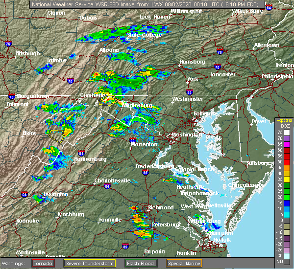 At 814 pm edt, a severe thunderstorm was located over berkeley springs, or near hancock, moving east at 20 mph (radar indicated). Hazards include 60 mph wind gusts. Damaging winds will cause some trees and large branches to fall. this could injure those outdoors, as well as damage homes and vehicles. roadways may become blocked by downed trees. localized power outages are possible. unsecured light objects may become projectiles. Locations impacted include, hancock, berkeley springs, great cacapon, valley view, berryville, spohrs crossroads, new hope, spruce pine hollow and shady grove. At 814 pm edt, a severe thunderstorm was located over berkeley springs, or near hancock, moving east at 20 mph (radar indicated). Hazards include 60 mph wind gusts. Damaging winds will cause some trees and large branches to fall. this could injure those outdoors, as well as damage homes and vehicles. roadways may become blocked by downed trees. localized power outages are possible. unsecured light objects may become projectiles. Locations impacted include, hancock, berkeley springs, great cacapon, valley view, berryville, spohrs crossroads, new hope, spruce pine hollow and shady grove.
|
| 8/1/2020 7:49 PM EDT |
 At 738 pm edt, a severe thunderstorm was located near paw paw, moving east at 20 mph (radar indicated). Hazards include 60 mph wind gusts. Damaging winds will cause some trees and large branches to fall. this could injure those outdoors, as well as damage homes and vehicles. roadways may become blocked by downed trees. localized power outages are possible. Unsecured light objects may become projectiles. At 738 pm edt, a severe thunderstorm was located near paw paw, moving east at 20 mph (radar indicated). Hazards include 60 mph wind gusts. Damaging winds will cause some trees and large branches to fall. this could injure those outdoors, as well as damage homes and vehicles. roadways may become blocked by downed trees. localized power outages are possible. Unsecured light objects may become projectiles.
|
| 8/1/2020 7:49 PM EDT |
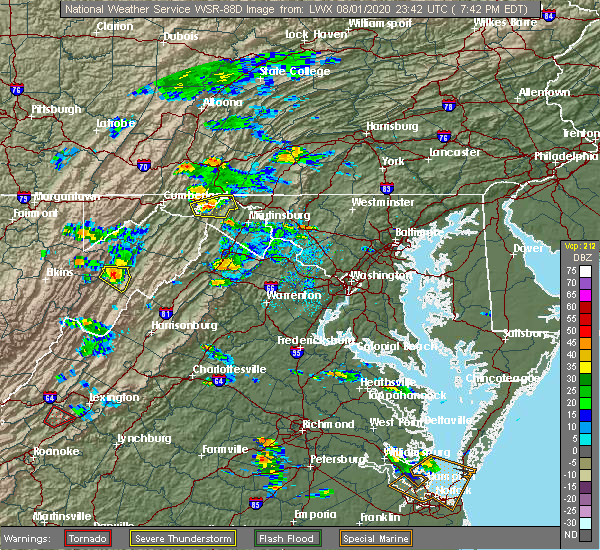 At 749 pm edt, a severe thunderstorm was located near berkeley springs, or 9 miles northeast of paw paw, moving east at 20 mph (radar indicated). Hazards include 60 mph wind gusts. Damaging winds will cause some trees and large branches to fall. this could injure those outdoors, as well as damage homes and vehicles. roadways may become blocked by downed trees. localized power outages are possible. unsecured light objects may become projectiles. Locations impacted include, hancock, berkeley springs, great cacapon, johnsons mill, lineburg, valley view, spohrs crossroads, spruce pine hollow, highland ridge, smith crossroads, berryville, new hope and shady grove. At 749 pm edt, a severe thunderstorm was located near berkeley springs, or 9 miles northeast of paw paw, moving east at 20 mph (radar indicated). Hazards include 60 mph wind gusts. Damaging winds will cause some trees and large branches to fall. this could injure those outdoors, as well as damage homes and vehicles. roadways may become blocked by downed trees. localized power outages are possible. unsecured light objects may become projectiles. Locations impacted include, hancock, berkeley springs, great cacapon, johnsons mill, lineburg, valley view, spohrs crossroads, spruce pine hollow, highland ridge, smith crossroads, berryville, new hope and shady grove.
|
| 8/1/2020 7:40 PM EDT |
 At 738 pm edt, a severe thunderstorm was located near paw paw, moving east at 20 mph (radar indicated). Hazards include 60 mph wind gusts. Damaging winds will cause some trees and large branches to fall. this could injure those outdoors, as well as damage homes and vehicles. roadways may become blocked by downed trees. localized power outages are possible. Unsecured light objects may become projectiles. At 738 pm edt, a severe thunderstorm was located near paw paw, moving east at 20 mph (radar indicated). Hazards include 60 mph wind gusts. Damaging winds will cause some trees and large branches to fall. this could injure those outdoors, as well as damage homes and vehicles. roadways may become blocked by downed trees. localized power outages are possible. Unsecured light objects may become projectiles.
|
| 7/21/2020 4:42 PM EDT |
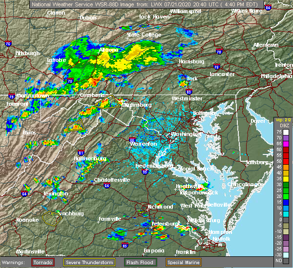 At 442 pm edt, a severe thunderstorm was located over berkeley springs, or near hancock, moving northeast at 25 mph (radar indicated). Hazards include 60 mph wind gusts and quarter size hail. Damaging winds will cause some trees and large branches to fall. this could injure those outdoors, as well as damage homes and vehicles. roadways may become blocked by downed trees. localized power outages are possible. unsecured light objects may become projectiles. Locations impacted include, hancock, berkeley springs, great cacapon, valley view, berryville, spohrs crossroads, new hope, spruce pine hollow and shady grove. At 442 pm edt, a severe thunderstorm was located over berkeley springs, or near hancock, moving northeast at 25 mph (radar indicated). Hazards include 60 mph wind gusts and quarter size hail. Damaging winds will cause some trees and large branches to fall. this could injure those outdoors, as well as damage homes and vehicles. roadways may become blocked by downed trees. localized power outages are possible. unsecured light objects may become projectiles. Locations impacted include, hancock, berkeley springs, great cacapon, valley view, berryville, spohrs crossroads, new hope, spruce pine hollow and shady grove.
|
| 7/21/2020 4:42 PM EDT |
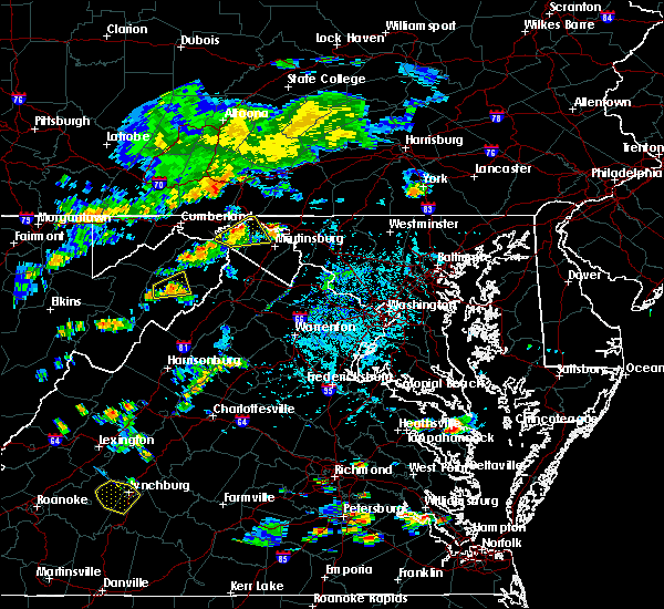 At 442 pm edt, a severe thunderstorm was located over berkeley springs, or near hancock, moving northeast at 25 mph (radar indicated). Hazards include 60 mph wind gusts and quarter size hail. Damaging winds will cause some trees and large branches to fall. this could injure those outdoors, as well as damage homes and vehicles. roadways may become blocked by downed trees. localized power outages are possible. unsecured light objects may become projectiles. Locations impacted include, hancock, berkeley springs, great cacapon, valley view, berryville, spohrs crossroads, new hope, spruce pine hollow and shady grove. At 442 pm edt, a severe thunderstorm was located over berkeley springs, or near hancock, moving northeast at 25 mph (radar indicated). Hazards include 60 mph wind gusts and quarter size hail. Damaging winds will cause some trees and large branches to fall. this could injure those outdoors, as well as damage homes and vehicles. roadways may become blocked by downed trees. localized power outages are possible. unsecured light objects may become projectiles. Locations impacted include, hancock, berkeley springs, great cacapon, valley view, berryville, spohrs crossroads, new hope, spruce pine hollow and shady grove.
|
| 7/21/2020 4:26 PM EDT |
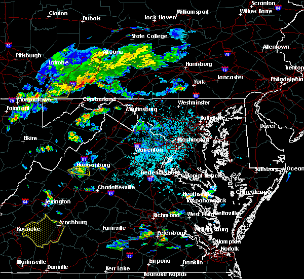 At 426 pm edt, a severe thunderstorm was located near paw paw, moving northeast at 20 mph (radar indicated). Hazards include 60 mph wind gusts and quarter size hail. Damaging winds will cause some trees and large branches to fall. this could injure those outdoors, as well as damage homes and vehicles. roadways may become blocked by downed trees. localized power outages are possible. Unsecured light objects may become projectiles. At 426 pm edt, a severe thunderstorm was located near paw paw, moving northeast at 20 mph (radar indicated). Hazards include 60 mph wind gusts and quarter size hail. Damaging winds will cause some trees and large branches to fall. this could injure those outdoors, as well as damage homes and vehicles. roadways may become blocked by downed trees. localized power outages are possible. Unsecured light objects may become projectiles.
|
| 6/22/2020 4:07 PM EDT |
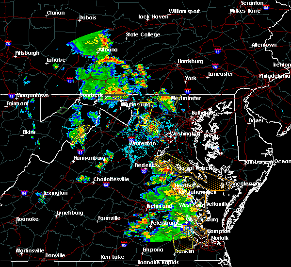 The severe thunderstorm warning for northwestern washington, northeastern morgan and northern berkeley counties will expire at 415 pm edt, the storms which prompted the warning have moved out of the area. therefore, the warning will be allowed to expire. The severe thunderstorm warning for northwestern washington, northeastern morgan and northern berkeley counties will expire at 415 pm edt, the storms which prompted the warning have moved out of the area. therefore, the warning will be allowed to expire.
|
| 6/22/2020 3:48 PM EDT |
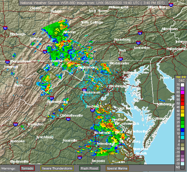 At 347 pm edt, severe thunderstorms were located along a line extending from near warfordsburg to hancock to 6 miles west of wilson-conococheague, moving northeast at 20 mph (radar indicated). Hazards include 60 mph wind gusts and quarter size hail. Damaging winds will cause some trees and large branches to fall. this could injure those outdoors, as well as damage homes and vehicles. roadways may become blocked by downed trees. localized power outages are possible. unsecured light objects may become projectiles. Locations impacted include, hancock, berkeley springs, pecktonville, big pool, cherry run, spohrs crossroads, spruce pine hollow, sleepy creek and shady grove. At 347 pm edt, severe thunderstorms were located along a line extending from near warfordsburg to hancock to 6 miles west of wilson-conococheague, moving northeast at 20 mph (radar indicated). Hazards include 60 mph wind gusts and quarter size hail. Damaging winds will cause some trees and large branches to fall. this could injure those outdoors, as well as damage homes and vehicles. roadways may become blocked by downed trees. localized power outages are possible. unsecured light objects may become projectiles. Locations impacted include, hancock, berkeley springs, pecktonville, big pool, cherry run, spohrs crossroads, spruce pine hollow, sleepy creek and shady grove.
|
| 6/22/2020 3:42 PM EDT | Tree down on creek roa in washington county MD, 1.3 miles ESE of Hancock, MD |
| 6/22/2020 3:27 PM EDT |
 At 326 pm edt, severe thunderstorms were located along a line extending from near barnes gap to berkeley springs to near greenwood, moving northeast at 20 mph (radar indicated). Hazards include 60 mph wind gusts and quarter size hail. Damaging winds will cause some trees and large branches to fall. this could injure those outdoors, as well as damage homes and vehicles. roadways may become blocked by downed trees. localized power outages are possible. Unsecured light objects may become projectiles. At 326 pm edt, severe thunderstorms were located along a line extending from near barnes gap to berkeley springs to near greenwood, moving northeast at 20 mph (radar indicated). Hazards include 60 mph wind gusts and quarter size hail. Damaging winds will cause some trees and large branches to fall. this could injure those outdoors, as well as damage homes and vehicles. roadways may become blocked by downed trees. localized power outages are possible. Unsecured light objects may become projectiles.
|
| 6/10/2020 3:25 PM EDT |
 At 325 pm edt, a severe thunderstorm was located near paw paw, moving northeast at 20 mph (radar indicated). Hazards include 60 mph wind gusts and quarter size hail. Damaging winds will cause some trees and large branches to fall. this could injure those outdoors, as well as damage homes and vehicles. roadways may become blocked by downed trees. localized power outages are possible. unsecured light objects may become projectiles. Locations impacted include, hancock, paw paw, berkeley springs, great cacapon, little orleans, forest park, lineburg, bellegrove, berryville, fishers bridge, green ridge and magnolia. At 325 pm edt, a severe thunderstorm was located near paw paw, moving northeast at 20 mph (radar indicated). Hazards include 60 mph wind gusts and quarter size hail. Damaging winds will cause some trees and large branches to fall. this could injure those outdoors, as well as damage homes and vehicles. roadways may become blocked by downed trees. localized power outages are possible. unsecured light objects may become projectiles. Locations impacted include, hancock, paw paw, berkeley springs, great cacapon, little orleans, forest park, lineburg, bellegrove, berryville, fishers bridge, green ridge and magnolia.
|
| 6/10/2020 3:12 PM EDT |
 At 312 pm edt, a severe thunderstorm was located over paw paw, moving northeast at 20 mph (radar indicated). Hazards include 60 mph wind gusts and quarter size hail. Damaging winds will cause some trees and large branches to fall. this could injure those outdoors, as well as damage homes and vehicles. roadways may become blocked by downed trees. localized power outages are possible. Unsecured light objects may become projectiles. At 312 pm edt, a severe thunderstorm was located over paw paw, moving northeast at 20 mph (radar indicated). Hazards include 60 mph wind gusts and quarter size hail. Damaging winds will cause some trees and large branches to fall. this could injure those outdoors, as well as damage homes and vehicles. roadways may become blocked by downed trees. localized power outages are possible. Unsecured light objects may become projectiles.
|
| 6/4/2020 6:05 PM EDT |
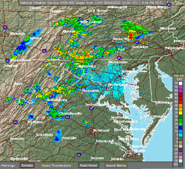 The severe thunderstorm warning for northwestern washington, northeastern morgan and north central berkeley counties will expire at 615 pm edt, the storm which prompted the warning has moved out of the area. therefore, the warning will be allowed to expire. a severe thunderstorm watch remains in effect until 1000 pm edt for north central maryland, and the panhandle of west virginia. The severe thunderstorm warning for northwestern washington, northeastern morgan and north central berkeley counties will expire at 615 pm edt, the storm which prompted the warning has moved out of the area. therefore, the warning will be allowed to expire. a severe thunderstorm watch remains in effect until 1000 pm edt for north central maryland, and the panhandle of west virginia.
|
| 6/4/2020 5:40 PM EDT |
 At 539 pm edt, a severe thunderstorm was located near berkeley springs, or near hancock, moving northeast at 35 mph (emergency management received reports of trees down near great cacapon). Hazards include 60 mph wind gusts and quarter size hail. Damaging winds will cause some trees and large branches to fall. this could injure those outdoors, as well as damage homes and vehicles. roadways may become blocked by downed trees. localized power outages are possible. Unsecured light objects may become projectiles. At 539 pm edt, a severe thunderstorm was located near berkeley springs, or near hancock, moving northeast at 35 mph (emergency management received reports of trees down near great cacapon). Hazards include 60 mph wind gusts and quarter size hail. Damaging winds will cause some trees and large branches to fall. this could injure those outdoors, as well as damage homes and vehicles. roadways may become blocked by downed trees. localized power outages are possible. Unsecured light objects may become projectiles.
|
| 6/4/2020 5:40 PM EDT |
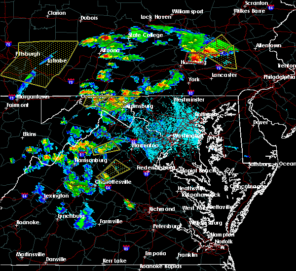 At 539 pm edt, a severe thunderstorm was located near berkeley springs, or near hancock, moving northeast at 35 mph (emergency management received reports of trees down near great cacapon). Hazards include 60 mph wind gusts and quarter size hail. Damaging winds will cause some trees and large branches to fall. this could injure those outdoors, as well as damage homes and vehicles. roadways may become blocked by downed trees. localized power outages are possible. Unsecured light objects may become projectiles. At 539 pm edt, a severe thunderstorm was located near berkeley springs, or near hancock, moving northeast at 35 mph (emergency management received reports of trees down near great cacapon). Hazards include 60 mph wind gusts and quarter size hail. Damaging winds will cause some trees and large branches to fall. this could injure those outdoors, as well as damage homes and vehicles. roadways may become blocked by downed trees. localized power outages are possible. Unsecured light objects may become projectiles.
|
| 6/4/2020 5:23 PM EDT |
 At 522 pm edt, a cluster of severe thunderstorms was located near berkeley springs, or 8 miles northwest of greenwood, moving northeast at 30 mph (radar indicated). Hazards include 60 mph wind gusts and quarter size hail. Damaging winds will cause some trees and large branches to fall. this could injure those outdoors, as well as damage homes and vehicles. roadways may become blocked by downed trees. localized power outages are possible. unsecured light objects may become projectiles. Locations impacted include, hancock, berkeley springs, great cacapon, hedgesville, big pool, little orleans, johnsons mill, tomahawk, johnsontown, valley view, spohrs crossroads, fishers bridge, oakland, rock gap, smith crossroads, jones springs, new hope, shady grove, cherry run and omps. At 522 pm edt, a cluster of severe thunderstorms was located near berkeley springs, or 8 miles northwest of greenwood, moving northeast at 30 mph (radar indicated). Hazards include 60 mph wind gusts and quarter size hail. Damaging winds will cause some trees and large branches to fall. this could injure those outdoors, as well as damage homes and vehicles. roadways may become blocked by downed trees. localized power outages are possible. unsecured light objects may become projectiles. Locations impacted include, hancock, berkeley springs, great cacapon, hedgesville, big pool, little orleans, johnsons mill, tomahawk, johnsontown, valley view, spohrs crossroads, fishers bridge, oakland, rock gap, smith crossroads, jones springs, new hope, shady grove, cherry run and omps.
|
| 6/4/2020 5:11 PM EDT |
 At 510 pm edt, a cluster of severe thunderstorm was located 2 miles east of paw paw, moving northeast at 30 mph (radar indicated). Hazards include 60 mph wind gusts and quarter size hail. Damaging winds will cause some trees and large branches to fall. this could injure those outdoors, as well as damage homes and vehicles. roadways may become blocked by downed trees. localized power outages are possible. unsecured light objects may become projectiles. Locations impacted include, hancock, paw paw, greenwood, berkeley springs, great cacapon, hedgesville, big pool, little orleans, johnsons mill, tomahawk, johnsontown, valley view, spohrs crossroads, fishers bridge, oakland, rock gap, smith crossroads, jones springs, unger and new hope. At 510 pm edt, a cluster of severe thunderstorm was located 2 miles east of paw paw, moving northeast at 30 mph (radar indicated). Hazards include 60 mph wind gusts and quarter size hail. Damaging winds will cause some trees and large branches to fall. this could injure those outdoors, as well as damage homes and vehicles. roadways may become blocked by downed trees. localized power outages are possible. unsecured light objects may become projectiles. Locations impacted include, hancock, paw paw, greenwood, berkeley springs, great cacapon, hedgesville, big pool, little orleans, johnsons mill, tomahawk, johnsontown, valley view, spohrs crossroads, fishers bridge, oakland, rock gap, smith crossroads, jones springs, unger and new hope.
|
| 6/4/2020 5:05 PM EDT |
 At 504 pm edt, a cluster of severe thunderstorms was located near paw paw, moving northeast at 30 mph (radar indicated). Hazards include 60 mph wind gusts. Damaging winds will cause some trees and large branches to fall. this could injure those outdoors, as well as damage homes and vehicles. roadways may become blocked by downed trees. localized power outages are possible. Unsecured light objects may become projectiles. At 504 pm edt, a cluster of severe thunderstorms was located near paw paw, moving northeast at 30 mph (radar indicated). Hazards include 60 mph wind gusts. Damaging winds will cause some trees and large branches to fall. this could injure those outdoors, as well as damage homes and vehicles. roadways may become blocked by downed trees. localized power outages are possible. Unsecured light objects may become projectiles.
|
| 4/8/2020 2:50 AM EDT |
 At 250 am edt, severe thunderstorms were located along a line extending from near saluvia to near warfordsburg to 6 miles southwest of inglesmith, moving southeast at 55 mph (radar indicated). Hazards include 60 mph wind gusts. Damaging winds will cause some trees and large branches to fall. this could injure those outdoors, as well as damage homes and vehicles. roadways may become blocked by downed trees. localized power outages are possible. Unsecured light objects may become projectiles. At 250 am edt, severe thunderstorms were located along a line extending from near saluvia to near warfordsburg to 6 miles southwest of inglesmith, moving southeast at 55 mph (radar indicated). Hazards include 60 mph wind gusts. Damaging winds will cause some trees and large branches to fall. this could injure those outdoors, as well as damage homes and vehicles. roadways may become blocked by downed trees. localized power outages are possible. Unsecured light objects may become projectiles.
|
| 3/3/2020 10:30 PM EST | Multiple downed trees in the hancock area in washington county MD, 0.5 miles SSE of Hancock, MD |
| 3/3/2020 10:26 PM EST |
 At 1026 pm est, severe thunderstorms were located along a line extending from 6 miles southwest of claylick to 11 miles southeast of romney, moving east at 75 mph (emergency management). Hazards include 60 mph wind gusts. Damaging winds will cause some trees and large branches to fall. this could injure those outdoors, as well as damage homes and vehicles. roadways may become blocked by downed trees. localized power outages are possible. Unsecured light objects may become projectiles. At 1026 pm est, severe thunderstorms were located along a line extending from 6 miles southwest of claylick to 11 miles southeast of romney, moving east at 75 mph (emergency management). Hazards include 60 mph wind gusts. Damaging winds will cause some trees and large branches to fall. this could injure those outdoors, as well as damage homes and vehicles. roadways may become blocked by downed trees. localized power outages are possible. Unsecured light objects may become projectiles.
|
| 3/3/2020 10:18 PM EST |
 At 1018 pm est, severe thunderstorms were located along a line extending from near berkeley springs to near romney, moving east at 55 mph (trained weather spotters). Hazards include 60 mph wind gusts. Damaging winds will cause some trees and large branches to fall. this could injure those outdoors, as well as damage homes and vehicles. roadways may become blocked by downed trees. localized power outages are possible. unsecured light objects may become projectiles. Locations impacted include, romney, hancock, paw paw, greenwood, wilson-conococheague, fort ashby, berkeley springs, maugansville, springfield, great cacapon, clear spring, capon bridge, hedgesville, green spring, pecktonville, oldtown, big spring, big pool, middleburg and little orleans. At 1018 pm est, severe thunderstorms were located along a line extending from near berkeley springs to near romney, moving east at 55 mph (trained weather spotters). Hazards include 60 mph wind gusts. Damaging winds will cause some trees and large branches to fall. this could injure those outdoors, as well as damage homes and vehicles. roadways may become blocked by downed trees. localized power outages are possible. unsecured light objects may become projectiles. Locations impacted include, romney, hancock, paw paw, greenwood, wilson-conococheague, fort ashby, berkeley springs, maugansville, springfield, great cacapon, clear spring, capon bridge, hedgesville, green spring, pecktonville, oldtown, big spring, big pool, middleburg and little orleans.
|
| 3/3/2020 10:03 PM EST |
 At 1003 pm est, severe thunderstorms were located along a line extending from 6 miles southwest of inglesmith to near keyser, moving east at 55 mph (trained weather spotters). Hazards include 60 mph wind gusts. Damaging winds will cause some trees and large branches to fall. this could injure those outdoors, as well as damage homes and vehicles. roadways may become blocked by downed trees. localized power outages are possible. Unsecured light objects may become projectiles. At 1003 pm est, severe thunderstorms were located along a line extending from 6 miles southwest of inglesmith to near keyser, moving east at 55 mph (trained weather spotters). Hazards include 60 mph wind gusts. Damaging winds will cause some trees and large branches to fall. this could injure those outdoors, as well as damage homes and vehicles. roadways may become blocked by downed trees. localized power outages are possible. Unsecured light objects may become projectiles.
|
| 6/29/2019 9:18 PM EDT |
 At 917 pm edt, severe thunderstorms were located along a line extending from near williamsport to near greenwood, moving southeast at 25 mph (radar indicated). Hazards include 60 mph wind gusts. Damaging winds will cause some trees and large branches to fall. this could injure those outdoors, as well as damage homes and vehicles. roadways may become blocked by downed trees. localized power outages are possible. Unsecured light objects may become projectiles. At 917 pm edt, severe thunderstorms were located along a line extending from near williamsport to near greenwood, moving southeast at 25 mph (radar indicated). Hazards include 60 mph wind gusts. Damaging winds will cause some trees and large branches to fall. this could injure those outdoors, as well as damage homes and vehicles. roadways may become blocked by downed trees. localized power outages are possible. Unsecured light objects may become projectiles.
|
| 6/29/2019 8:57 PM EDT |
 A severe thunderstorm warning remains in effect until 915 pm edt for northwestern washington and morgan counties. at 857 pm edt, severe thunderstorms were located along a line extending from near berkeley springs to near paw paw, moving southeast at 30 mph. hazard. 60 mph wind gusts. A severe thunderstorm warning remains in effect until 915 pm edt for northwestern washington and morgan counties. at 857 pm edt, severe thunderstorms were located along a line extending from near berkeley springs to near paw paw, moving southeast at 30 mph. hazard. 60 mph wind gusts.
|
| 6/29/2019 8:57 PM EDT |
 At 847 pm edt, severe thunderstorms were located along a line extending from near hancock to 6 miles northeast of paw paw, moving southeast at 30 mph (radar indicated). Hazards include 60 mph wind gusts. Damaging winds will cause some trees and large branches to fall. this could injure those outdoors, as well as damage homes and vehicles. roadways may become blocked by downed trees. localized power outages are possible. unsecured light objects may become projectiles. Locations impacted include, hancock, paw paw, greenwood, berkeley springs, great cacapon, pecktonville, big pool, little orleans, johnsons mill, valley view, spohrs crossroads, fishers bridge, oakland, rock gap, smith crossroads, unger, new hope, shady grove, cherry run and omps. At 847 pm edt, severe thunderstorms were located along a line extending from near hancock to 6 miles northeast of paw paw, moving southeast at 30 mph (radar indicated). Hazards include 60 mph wind gusts. Damaging winds will cause some trees and large branches to fall. this could injure those outdoors, as well as damage homes and vehicles. roadways may become blocked by downed trees. localized power outages are possible. unsecured light objects may become projectiles. Locations impacted include, hancock, paw paw, greenwood, berkeley springs, great cacapon, pecktonville, big pool, little orleans, johnsons mill, valley view, spohrs crossroads, fishers bridge, oakland, rock gap, smith crossroads, unger, new hope, shady grove, cherry run and omps.
|
| 6/29/2019 8:47 PM EDT |
 At 847 pm edt, severe thunderstorms were located along a line extending from near hancock to 6 miles northeast of paw paw, moving southeast at 30 mph (radar indicated). Hazards include 60 mph wind gusts. Damaging winds will cause some trees and large branches to fall. this could injure those outdoors, as well as damage homes and vehicles. roadways may become blocked by downed trees. localized power outages are possible. unsecured light objects may become projectiles. Locations impacted include, hancock, paw paw, greenwood, berkeley springs, great cacapon, pecktonville, big pool, little orleans, johnsons mill, valley view, spohrs crossroads, fishers bridge, oakland, rock gap, smith crossroads, unger, new hope, shady grove, cherry run and omps. At 847 pm edt, severe thunderstorms were located along a line extending from near hancock to 6 miles northeast of paw paw, moving southeast at 30 mph (radar indicated). Hazards include 60 mph wind gusts. Damaging winds will cause some trees and large branches to fall. this could injure those outdoors, as well as damage homes and vehicles. roadways may become blocked by downed trees. localized power outages are possible. unsecured light objects may become projectiles. Locations impacted include, hancock, paw paw, greenwood, berkeley springs, great cacapon, pecktonville, big pool, little orleans, johnsons mill, valley view, spohrs crossroads, fishers bridge, oakland, rock gap, smith crossroads, unger, new hope, shady grove, cherry run and omps.
|
| 6/29/2019 8:19 PM EDT |
 At 819 pm edt, severe thunderstorms were located along a line extending from 6 miles southwest of clearville to near lake gordon, moving southeast at 30 mph (radar indicated). Hazards include 60 mph wind gusts. Damaging winds will cause some trees and large branches to fall. this could injure those outdoors, as well as damage homes and vehicles. roadways may become blocked by downed trees. localized power outages are possible. Unsecured light objects may become projectiles. At 819 pm edt, severe thunderstorms were located along a line extending from 6 miles southwest of clearville to near lake gordon, moving southeast at 30 mph (radar indicated). Hazards include 60 mph wind gusts. Damaging winds will cause some trees and large branches to fall. this could injure those outdoors, as well as damage homes and vehicles. roadways may become blocked by downed trees. localized power outages are possible. Unsecured light objects may become projectiles.
|
| 6/29/2019 4:38 PM EDT |
 At 437 pm edt, a severe thunderstorm was located over berkeley springs, or near hancock, moving southeast at 25 mph (radar indicated). Hazards include 60 mph wind gusts and quarter size hail. Damaging winds will cause some trees and large branches to fall. this could injure those outdoors, as well as damage homes and vehicles. roadways may become blocked by downed trees. localized power outages are possible. unsecured light objects may become projectiles. Locations impacted include, hancock, berkeley springs, great cacapon, pecktonville, big pool, johnsons mill, cherry run, valley view, spohrs crossroads, spruce pine hollow, stotlers crossroads, highland ridge, smith crossroads, berryville, new hope, sleepy creek and shady grove. At 437 pm edt, a severe thunderstorm was located over berkeley springs, or near hancock, moving southeast at 25 mph (radar indicated). Hazards include 60 mph wind gusts and quarter size hail. Damaging winds will cause some trees and large branches to fall. this could injure those outdoors, as well as damage homes and vehicles. roadways may become blocked by downed trees. localized power outages are possible. unsecured light objects may become projectiles. Locations impacted include, hancock, berkeley springs, great cacapon, pecktonville, big pool, johnsons mill, cherry run, valley view, spohrs crossroads, spruce pine hollow, stotlers crossroads, highland ridge, smith crossroads, berryville, new hope, sleepy creek and shady grove.
|
| 6/29/2019 4:11 PM EDT |
 At 410 pm edt, a severe thunderstorm was located over inglesmith, or 11 miles west of hancock, moving southeast at 25 mph (radar indicated). Hazards include 60 mph wind gusts and quarter size hail. Damaging winds will cause some trees and large branches to fall. this could injure those outdoors, as well as damage homes and vehicles. roadways may become blocked by downed trees. localized power outages are possible. Unsecured light objects may become projectiles. At 410 pm edt, a severe thunderstorm was located over inglesmith, or 11 miles west of hancock, moving southeast at 25 mph (radar indicated). Hazards include 60 mph wind gusts and quarter size hail. Damaging winds will cause some trees and large branches to fall. this could injure those outdoors, as well as damage homes and vehicles. roadways may become blocked by downed trees. localized power outages are possible. Unsecured light objects may become projectiles.
|
| 5/19/2019 2:49 PM EDT |
 At 237 pm edt, a severe thunderstorm was located near berkeley springs, or 8 miles northeast of paw paw, moving northeast at 25 mph (radar indicated). Hazards include 60 mph wind gusts and quarter size hail. Damaging winds will cause some trees and large branches to fall. this could injure those outdoors, as well as damage homes and vehicles. roadways may become blocked by downed trees. localized power outages are possible. unsecured light objects may become projectiles. Locations impacted include, hancock, berkeley springs, great cacapon, pecktonville, little orleans, johnsons mill, lineburg, valley view, spohrs crossroads, fishers bridge, spruce pine hollow, rock gap, forest park, bellegrove, smith crossroads, berryville, new hope, sleepy creek and shady grove. At 237 pm edt, a severe thunderstorm was located near berkeley springs, or 8 miles northeast of paw paw, moving northeast at 25 mph (radar indicated). Hazards include 60 mph wind gusts and quarter size hail. Damaging winds will cause some trees and large branches to fall. this could injure those outdoors, as well as damage homes and vehicles. roadways may become blocked by downed trees. localized power outages are possible. unsecured light objects may become projectiles. Locations impacted include, hancock, berkeley springs, great cacapon, pecktonville, little orleans, johnsons mill, lineburg, valley view, spohrs crossroads, fishers bridge, spruce pine hollow, rock gap, forest park, bellegrove, smith crossroads, berryville, new hope, sleepy creek and shady grove.
|
| 5/19/2019 2:49 PM EDT |
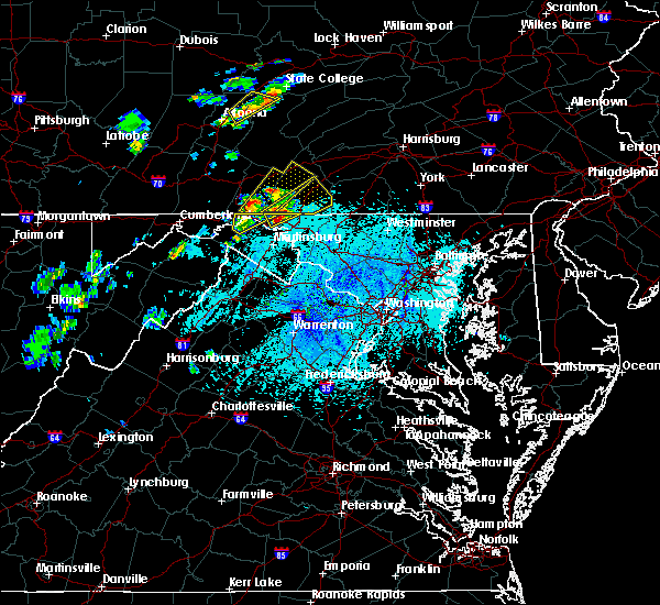 A severe thunderstorm warning remains in effect until 315 pm edt for northwestern washington and northeastern morgan counties. at 248 pm edt, a severe thunderstorm was located over berkeley springs, or near hancock, moving northeast at 25 mph. hazard. 60 mph wind gusts and quarter size hail. source. Radar indicated. A severe thunderstorm warning remains in effect until 315 pm edt for northwestern washington and northeastern morgan counties. at 248 pm edt, a severe thunderstorm was located over berkeley springs, or near hancock, moving northeast at 25 mph. hazard. 60 mph wind gusts and quarter size hail. source. Radar indicated.
|
| 5/19/2019 2:38 PM EDT |
 At 237 pm edt, a severe thunderstorm was located near berkeley springs, or 8 miles northeast of paw paw, moving northeast at 25 mph (radar indicated). Hazards include 60 mph wind gusts and quarter size hail. Damaging winds will cause some trees and large branches to fall. this could injure those outdoors, as well as damage homes and vehicles. roadways may become blocked by downed trees. localized power outages are possible. unsecured light objects may become projectiles. Locations impacted include, hancock, berkeley springs, great cacapon, pecktonville, little orleans, johnsons mill, lineburg, valley view, spohrs crossroads, fishers bridge, spruce pine hollow, rock gap, forest park, bellegrove, smith crossroads, berryville, new hope, sleepy creek and shady grove. At 237 pm edt, a severe thunderstorm was located near berkeley springs, or 8 miles northeast of paw paw, moving northeast at 25 mph (radar indicated). Hazards include 60 mph wind gusts and quarter size hail. Damaging winds will cause some trees and large branches to fall. this could injure those outdoors, as well as damage homes and vehicles. roadways may become blocked by downed trees. localized power outages are possible. unsecured light objects may become projectiles. Locations impacted include, hancock, berkeley springs, great cacapon, pecktonville, little orleans, johnsons mill, lineburg, valley view, spohrs crossroads, fishers bridge, spruce pine hollow, rock gap, forest park, bellegrove, smith crossroads, berryville, new hope, sleepy creek and shady grove.
|
| 5/19/2019 2:38 PM EDT |
 At 223 pm edt, a severe thunderstorm was located over paw paw, moving northeast at 25 mph (radar indicated). Hazards include 60 mph wind gusts and quarter size hail. Damaging winds will cause some trees and large branches to fall. this could injure those outdoors, as well as damage homes and vehicles. roadways may become blocked by downed trees. localized power outages are possible. Unsecured light objects may become projectiles. At 223 pm edt, a severe thunderstorm was located over paw paw, moving northeast at 25 mph (radar indicated). Hazards include 60 mph wind gusts and quarter size hail. Damaging winds will cause some trees and large branches to fall. this could injure those outdoors, as well as damage homes and vehicles. roadways may become blocked by downed trees. localized power outages are possible. Unsecured light objects may become projectiles.
|
| 5/19/2019 2:23 PM EDT |
 At 223 pm edt, a severe thunderstorm was located over paw paw, moving northeast at 25 mph (radar indicated). Hazards include 60 mph wind gusts and quarter size hail. Damaging winds will cause some trees and large branches to fall. this could injure those outdoors, as well as damage homes and vehicles. roadways may become blocked by downed trees. localized power outages are possible. Unsecured light objects may become projectiles. At 223 pm edt, a severe thunderstorm was located over paw paw, moving northeast at 25 mph (radar indicated). Hazards include 60 mph wind gusts and quarter size hail. Damaging winds will cause some trees and large branches to fall. this could injure those outdoors, as well as damage homes and vehicles. roadways may become blocked by downed trees. localized power outages are possible. Unsecured light objects may become projectiles.
|
| 4/19/2019 6:27 PM EDT |
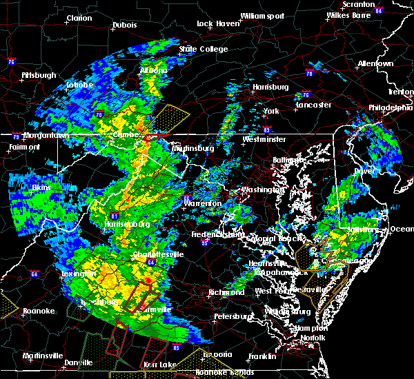 At 626 pm edt, a severe thunderstorm capable of producing a tornado was located over hancock, moving northeast at 40 mph (radar indicated rotation). Hazards include tornado. For those in the direct path of a tornado touchdown, flying debris will be dangerous to those caught without shelter. damage to roofs, siding, and windows may occur. mobile homes may be damaged or destroyed. tree damage is likely. this dangerous storm will be near, hancock around 630 pm edt. Other locations impacted by this tornadic thunderstorm include forest park. At 626 pm edt, a severe thunderstorm capable of producing a tornado was located over hancock, moving northeast at 40 mph (radar indicated rotation). Hazards include tornado. For those in the direct path of a tornado touchdown, flying debris will be dangerous to those caught without shelter. damage to roofs, siding, and windows may occur. mobile homes may be damaged or destroyed. tree damage is likely. this dangerous storm will be near, hancock around 630 pm edt. Other locations impacted by this tornadic thunderstorm include forest park.
|
| 4/19/2019 6:15 PM EDT |
 At 615 pm edt, a severe thunderstorm capable of producing a tornado was located near berkeley springs, or 9 miles southwest of hancock, moving northeast at 35 mph (radar indicated rotation). Hazards include tornado. For those in the direct path of a tornado touchdown, flying debris will be dangerous to those caught without shelter. damage to roofs, siding, and windows may occur. mobile homes may be damaged or destroyed. tree damage is likely. this dangerous storm will be near, berkeley springs around 620 pm edt. hancock around 630 pm edt. Other locations impacted by this tornadic thunderstorm include great cacapon, forest park, lineburg, berryville, spohrs crossroads, sleepy creek, shady grove, fishers bridge, little orleans and pecktonville. At 615 pm edt, a severe thunderstorm capable of producing a tornado was located near berkeley springs, or 9 miles southwest of hancock, moving northeast at 35 mph (radar indicated rotation). Hazards include tornado. For those in the direct path of a tornado touchdown, flying debris will be dangerous to those caught without shelter. damage to roofs, siding, and windows may occur. mobile homes may be damaged or destroyed. tree damage is likely. this dangerous storm will be near, berkeley springs around 620 pm edt. hancock around 630 pm edt. Other locations impacted by this tornadic thunderstorm include great cacapon, forest park, lineburg, berryville, spohrs crossroads, sleepy creek, shady grove, fishers bridge, little orleans and pecktonville.
|
| 4/14/2019 11:26 PM EDT |
 At 1126 pm edt, severe thunderstorms were located along a line extending from near barnes gap to near romney, moving east at 35 mph (radar indicated). Hazards include 60 mph wind gusts. Damaging winds will cause some trees and large branches to fall. this could injure those outdoors, as well as damage homes and vehicles. roadways may become blocked by downed trees. localized power outages are possible. unsecured light objects may become projectiles. Locations impacted include, romney, hancock, paw paw, greenwood, berkeley springs, springfield, great cacapon, capon bridge, green spring, pecktonville, oldtown, big pool, little orleans, yellow spring, valley view, fishers bridge, pumpkin center, oakland, delray and unger. At 1126 pm edt, severe thunderstorms were located along a line extending from near barnes gap to near romney, moving east at 35 mph (radar indicated). Hazards include 60 mph wind gusts. Damaging winds will cause some trees and large branches to fall. this could injure those outdoors, as well as damage homes and vehicles. roadways may become blocked by downed trees. localized power outages are possible. unsecured light objects may become projectiles. Locations impacted include, romney, hancock, paw paw, greenwood, berkeley springs, springfield, great cacapon, capon bridge, green spring, pecktonville, oldtown, big pool, little orleans, yellow spring, valley view, fishers bridge, pumpkin center, oakland, delray and unger.
|
| 4/14/2019 10:56 PM EDT |
 At 1056 pm edt, severe thunderstorms were located along a line extending from 9 miles east of cumberland to 8 miles north of moorefield, moving east at 60 mph (radar indicated). Hazards include 60 mph wind gusts. Damaging winds will cause some trees and large branches to fall. this could injure those outdoors, as well as damage homes and vehicles. roadways may become blocked by downed trees. localized power outages are possible. Unsecured light objects may become projectiles. At 1056 pm edt, severe thunderstorms were located along a line extending from 9 miles east of cumberland to 8 miles north of moorefield, moving east at 60 mph (radar indicated). Hazards include 60 mph wind gusts. Damaging winds will cause some trees and large branches to fall. this could injure those outdoors, as well as damage homes and vehicles. roadways may become blocked by downed trees. localized power outages are possible. Unsecured light objects may become projectiles.
|
| 4/12/2019 5:29 PM EDT |
 At 528 pm edt, a severe thunderstorm was located near lake gordon, or near cumberland, moving northeast at 70 mph (radar indicated). Hazards include 60 mph wind gusts. Damaging winds will cause some trees and large branches to fall. this could injure those outdoors, as well as damage homes and vehicles. roadways may become blocked by downed trees. localized power outages are possible. unsecured light objects may become projectiles. Locations impacted include, cumberland, hancock, la vale, fort ashby, ridgeley, cresaptown, potomac park, wiley ford, green spring, flintstone, oldtown, spring gap, little orleans, patterson creek, lineburg, pleasant valley, short gap, wagoner, pumpkin center and north branch. At 528 pm edt, a severe thunderstorm was located near lake gordon, or near cumberland, moving northeast at 70 mph (radar indicated). Hazards include 60 mph wind gusts. Damaging winds will cause some trees and large branches to fall. this could injure those outdoors, as well as damage homes and vehicles. roadways may become blocked by downed trees. localized power outages are possible. unsecured light objects may become projectiles. Locations impacted include, cumberland, hancock, la vale, fort ashby, ridgeley, cresaptown, potomac park, wiley ford, green spring, flintstone, oldtown, spring gap, little orleans, patterson creek, lineburg, pleasant valley, short gap, wagoner, pumpkin center and north branch.
|
| 4/12/2019 5:16 PM EDT |
 At 516 pm edt, a severe thunderstorm was located over fort ashby, or near bel air, moving northeast at 60 mph (radar indicated). Hazards include 60 mph wind gusts. Damaging winds will cause some trees and large branches to fall. this could injure those outdoors, as well as damage homes and vehicles. roadways may become blocked by downed trees. localized power outages are possible. Unsecured light objects may become projectiles. At 516 pm edt, a severe thunderstorm was located over fort ashby, or near bel air, moving northeast at 60 mph (radar indicated). Hazards include 60 mph wind gusts. Damaging winds will cause some trees and large branches to fall. this could injure those outdoors, as well as damage homes and vehicles. roadways may become blocked by downed trees. localized power outages are possible. Unsecured light objects may become projectiles.
|
| 8/21/2018 4:22 PM EDT |
 The severe thunderstorm warning for northwestern washington and northeastern allegany counties will expire at 430 pm edt, the storms which prompted the warning have weakened below severe limits, and no longer pose an immediate threat to life or property. therefore the warning will be allowed to expire. a severe thunderstorm watch remains in effect until 1000 pm edt for western and north central maryland, and the panhandle of west virginia. The severe thunderstorm warning for northwestern washington and northeastern allegany counties will expire at 430 pm edt, the storms which prompted the warning have weakened below severe limits, and no longer pose an immediate threat to life or property. therefore the warning will be allowed to expire. a severe thunderstorm watch remains in effect until 1000 pm edt for western and north central maryland, and the panhandle of west virginia.
|
| 8/21/2018 4:06 PM EDT |
 At 406 pm edt, severe thunderstorms were located along a line extending from clearville to 7 miles north of paw paw, moving northeast at 45 mph (radar indicated). Hazards include 60 mph wind gusts and quarter size hail. Damaging winds will cause some trees and large branches to fall. this could injure those outdoors, as well as damage homes and vehicles. roadways may become blocked by downed trees. localized power outages are possible. unsecured light objects may become projectiles. Locations impacted include, hancock, little orleans, bellegrove and forest park. At 406 pm edt, severe thunderstorms were located along a line extending from clearville to 7 miles north of paw paw, moving northeast at 45 mph (radar indicated). Hazards include 60 mph wind gusts and quarter size hail. Damaging winds will cause some trees and large branches to fall. this could injure those outdoors, as well as damage homes and vehicles. roadways may become blocked by downed trees. localized power outages are possible. unsecured light objects may become projectiles. Locations impacted include, hancock, little orleans, bellegrove and forest park.
|
| 8/21/2018 3:43 PM EDT |
 At 342 pm edt, severe thunderstorms were located along a line extending from lake gordon to fort ashby, moving northeast at 45 mph (radar indicated). Hazards include 60 mph wind gusts and quarter size hail. Damaging winds will cause some trees and large branches to fall. this could injure those outdoors, as well as damage homes and vehicles. roadways may become blocked by downed trees. localized power outages are possible. Unsecured light objects may become projectiles. At 342 pm edt, severe thunderstorms were located along a line extending from lake gordon to fort ashby, moving northeast at 45 mph (radar indicated). Hazards include 60 mph wind gusts and quarter size hail. Damaging winds will cause some trees and large branches to fall. this could injure those outdoors, as well as damage homes and vehicles. roadways may become blocked by downed trees. localized power outages are possible. Unsecured light objects may become projectiles.
|
| 8/8/2018 8:36 PM EDT |
 The severe thunderstorm warning for northwestern washington and north central morgan counties will expire at 845 pm edt, the storm which prompted the warning has moved out of the area. therefore the warning will be allowed to expire. The severe thunderstorm warning for northwestern washington and north central morgan counties will expire at 845 pm edt, the storm which prompted the warning has moved out of the area. therefore the warning will be allowed to expire.
|
| 8/8/2018 8:30 PM EDT |
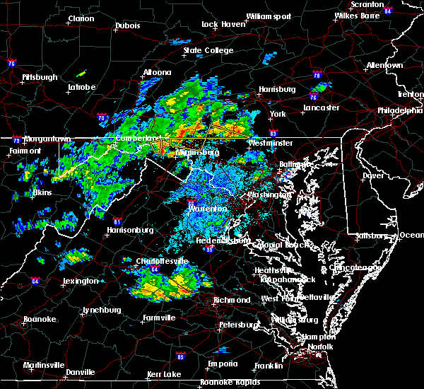 At 829 pm edt, a severe thunderstorm was located over berkeley springs, or 8 miles south of hancock, moving east at 20 mph (radar indicated). Hazards include 60 mph wind gusts. Damaging winds will cause some trees and large branches to fall. this could injure those outdoors, as well as damage homes and vehicles. roadways may become blocked by downed trees. localized power outages are possible. unsecured light objects may become projectiles. Locations impacted include, berkeley springs, great cacapon, johnsons mill, highland ridge, valley view, smith crossroads, berryville and new hope. At 829 pm edt, a severe thunderstorm was located over berkeley springs, or 8 miles south of hancock, moving east at 20 mph (radar indicated). Hazards include 60 mph wind gusts. Damaging winds will cause some trees and large branches to fall. this could injure those outdoors, as well as damage homes and vehicles. roadways may become blocked by downed trees. localized power outages are possible. unsecured light objects may become projectiles. Locations impacted include, berkeley springs, great cacapon, johnsons mill, highland ridge, valley view, smith crossroads, berryville and new hope.
|
| 8/8/2018 8:15 PM EDT |
 At 815 pm edt, a severe thunderstorm was located near berkeley springs, or 7 miles northeast of paw paw, moving east at 20 mph (radar indicated). Hazards include 60 mph wind gusts and quarter size hail. Damaging winds will cause some trees and large branches to fall. this could injure those outdoors, as well as damage homes and vehicles. roadways may become blocked by downed trees. localized power outages are possible. unsecured light objects may become projectiles. Locations impacted include, berkeley springs, great cacapon, little orleans, johnsons mill, highland ridge, lineburg, valley view, smith crossroads, berryville, new hope and green ridge. At 815 pm edt, a severe thunderstorm was located near berkeley springs, or 7 miles northeast of paw paw, moving east at 20 mph (radar indicated). Hazards include 60 mph wind gusts and quarter size hail. Damaging winds will cause some trees and large branches to fall. this could injure those outdoors, as well as damage homes and vehicles. roadways may become blocked by downed trees. localized power outages are possible. unsecured light objects may become projectiles. Locations impacted include, berkeley springs, great cacapon, little orleans, johnsons mill, highland ridge, lineburg, valley view, smith crossroads, berryville, new hope and green ridge.
|
| 8/8/2018 8:05 PM EDT |
 At 804 pm edt, a severe thunderstorm was located near paw paw, moving east at 25 mph (radar indicated). Hazards include 60 mph wind gusts and quarter size hail. Damaging winds will cause some trees and large branches to fall. this could injure those outdoors, as well as damage homes and vehicles. roadways may become blocked by downed trees. localized power outages are possible. Unsecured light objects may become projectiles. At 804 pm edt, a severe thunderstorm was located near paw paw, moving east at 25 mph (radar indicated). Hazards include 60 mph wind gusts and quarter size hail. Damaging winds will cause some trees and large branches to fall. this could injure those outdoors, as well as damage homes and vehicles. roadways may become blocked by downed trees. localized power outages are possible. Unsecured light objects may become projectiles.
|
| 8/7/2018 4:35 PM EDT |
 The severe thunderstorm warning for northwestern washington, east central allegany, morgan and northwestern berkeley counties will expire at 445 pm edt, the storms which prompted the warning have weakened below severe limits, and no longer pose an immediate threat to life or property. therefore the warning will be allowed to expire. however heavy rain is still possible with these thunderstorms. The severe thunderstorm warning for northwestern washington, east central allegany, morgan and northwestern berkeley counties will expire at 445 pm edt, the storms which prompted the warning have weakened below severe limits, and no longer pose an immediate threat to life or property. therefore the warning will be allowed to expire. however heavy rain is still possible with these thunderstorms.
|
| 8/7/2018 4:18 PM EDT |
 At 418 pm edt, severe thunderstorms were located along a line extending from near warfordsburg to near berkeley springs to near paw paw, moving east at 30 mph (radar indicated). Hazards include 60 mph wind gusts and quarter size hail. Damaging winds will cause some trees and large branches to fall. this could injure those outdoors, as well as damage homes and vehicles. roadways may become blocked by downed trees. localized power outages are possible. unsecured light objects may become projectiles. Locations impacted include, hancock, berkeley springs, great cacapon, pecktonville, big pool, johnsons mill, tomahawk, johnsontown, valley view, fishers bridge, spohrs crossroads, rock gap, smith crossroads, jones springs, new hope, shady grove, cherry run, omps, spruce pine hollow and stotlers crossroads. At 418 pm edt, severe thunderstorms were located along a line extending from near warfordsburg to near berkeley springs to near paw paw, moving east at 30 mph (radar indicated). Hazards include 60 mph wind gusts and quarter size hail. Damaging winds will cause some trees and large branches to fall. this could injure those outdoors, as well as damage homes and vehicles. roadways may become blocked by downed trees. localized power outages are possible. unsecured light objects may become projectiles. Locations impacted include, hancock, berkeley springs, great cacapon, pecktonville, big pool, johnsons mill, tomahawk, johnsontown, valley view, fishers bridge, spohrs crossroads, rock gap, smith crossroads, jones springs, new hope, shady grove, cherry run, omps, spruce pine hollow and stotlers crossroads.
|
| 8/7/2018 4:18 PM EDT |
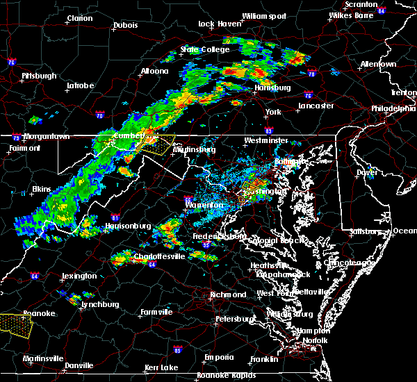 At 418 pm edt, severe thunderstorms were located along a line extending from near warfordsburg to near berkeley springs to near paw paw, moving east at 30 mph (radar indicated). Hazards include 60 mph wind gusts and quarter size hail. Damaging winds will cause some trees and large branches to fall. this could injure those outdoors, as well as damage homes and vehicles. roadways may become blocked by downed trees. localized power outages are possible. unsecured light objects may become projectiles. Locations impacted include, hancock, berkeley springs, great cacapon, pecktonville, big pool, johnsons mill, tomahawk, johnsontown, valley view, fishers bridge, spohrs crossroads, rock gap, smith crossroads, jones springs, new hope, shady grove, cherry run, omps, spruce pine hollow and stotlers crossroads. At 418 pm edt, severe thunderstorms were located along a line extending from near warfordsburg to near berkeley springs to near paw paw, moving east at 30 mph (radar indicated). Hazards include 60 mph wind gusts and quarter size hail. Damaging winds will cause some trees and large branches to fall. this could injure those outdoors, as well as damage homes and vehicles. roadways may become blocked by downed trees. localized power outages are possible. unsecured light objects may become projectiles. Locations impacted include, hancock, berkeley springs, great cacapon, pecktonville, big pool, johnsons mill, tomahawk, johnsontown, valley view, fishers bridge, spohrs crossroads, rock gap, smith crossroads, jones springs, new hope, shady grove, cherry run, omps, spruce pine hollow and stotlers crossroads.
|
| 8/7/2018 4:15 PM EDT | Poles down along western pike in washington county MD, 3.4 miles E of Hancock, MD |
| 8/7/2018 4:06 PM EDT |
 The national weather service in sterling virginia has issued a * severe thunderstorm warning for. northwestern washington county in north central maryland. northeastern allegany county in western maryland. morgan county in the panhandle of west virginia. Northwestern berkeley county in the panhandle of west virginia. The national weather service in sterling virginia has issued a * severe thunderstorm warning for. northwestern washington county in north central maryland. northeastern allegany county in western maryland. morgan county in the panhandle of west virginia. Northwestern berkeley county in the panhandle of west virginia.
|
| 8/7/2018 4:06 PM EDT |
 At 406 pm edt, severe thunderstorms were located along a line extending from barnes gap to 7 miles west of berkeley springs to paw paw, moving east at 30 mph (radar indicated). Hazards include 60 mph wind gusts and quarter size hail. Damaging winds will cause some trees and large branches to fall. this could injure those outdoors, as well as damage homes and vehicles. roadways may become blocked by downed trees. localized power outages are possible. Unsecured light objects may become projectiles. At 406 pm edt, severe thunderstorms were located along a line extending from barnes gap to 7 miles west of berkeley springs to paw paw, moving east at 30 mph (radar indicated). Hazards include 60 mph wind gusts and quarter size hail. Damaging winds will cause some trees and large branches to fall. this could injure those outdoors, as well as damage homes and vehicles. roadways may become blocked by downed trees. localized power outages are possible. Unsecured light objects may become projectiles.
|
| 6/20/2018 5:16 PM EDT |
 At 516 pm edt, severe thunderstorms were located along a line extending from near hancock to 6 miles southwest of berkeley springs to 8 miles southwest of paw paw, moving southeast at 30 mph (radar indicated). Hazards include 60 mph wind gusts. Damaging winds will cause some trees and large branches to fall. this could injure those outdoors, as well as damage homes and vehicles. roadways may become blocked by downed trees. localized power outages are possible. unsecured light objects may become projectiles. Locations impacted include, hagerstown, martinsburg, hancock, paw paw, greenwood, fountainhead-orchard hills, inwood, wilson-conococheague, williamsport, berkeley springs, berkeley, halfway, maugansville, falling waters, springfield, clear spring, capon bridge, hedgesville, pecktonville and big spring. At 516 pm edt, severe thunderstorms were located along a line extending from near hancock to 6 miles southwest of berkeley springs to 8 miles southwest of paw paw, moving southeast at 30 mph (radar indicated). Hazards include 60 mph wind gusts. Damaging winds will cause some trees and large branches to fall. this could injure those outdoors, as well as damage homes and vehicles. roadways may become blocked by downed trees. localized power outages are possible. unsecured light objects may become projectiles. Locations impacted include, hagerstown, martinsburg, hancock, paw paw, greenwood, fountainhead-orchard hills, inwood, wilson-conococheague, williamsport, berkeley springs, berkeley, halfway, maugansville, falling waters, springfield, clear spring, capon bridge, hedgesville, pecktonville and big spring.
|
| 6/20/2018 4:59 PM EDT |
 At 459 pm edt, severe thunderstorms were located along a line extending from near warfordsburg to 7 miles northeast of paw paw to near fort ashby, moving southeast at 30 mph (radar indicated). Hazards include 60 mph wind gusts. Damaging winds will cause some trees and large branches to fall. this could injure those outdoors, as well as damage homes and vehicles. roadways may become blocked by downed trees. localized power outages are possible. Unsecured light objects may become projectiles. At 459 pm edt, severe thunderstorms were located along a line extending from near warfordsburg to 7 miles northeast of paw paw to near fort ashby, moving southeast at 30 mph (radar indicated). Hazards include 60 mph wind gusts. Damaging winds will cause some trees and large branches to fall. this could injure those outdoors, as well as damage homes and vehicles. roadways may become blocked by downed trees. localized power outages are possible. Unsecured light objects may become projectiles.
|
| 6/13/2018 10:57 PM EDT |
 The severe thunderstorm warning for northwestern washington, northeastern allegany and northwestern morgan counties will expire at 1100 pm edt, the storms which prompted the warning have weakened below severe limits, and no longer pose an immediate threat to life or property. therefore the warning will be allowed to expire. however gusty winds are still possible with these thunderstorms. The severe thunderstorm warning for northwestern washington, northeastern allegany and northwestern morgan counties will expire at 1100 pm edt, the storms which prompted the warning have weakened below severe limits, and no longer pose an immediate threat to life or property. therefore the warning will be allowed to expire. however gusty winds are still possible with these thunderstorms.
|
| 6/13/2018 10:50 PM EDT |
 At 1050 pm edt, severe thunderstorms were located along a line extending from 9 miles southeast of lake gordon to near barnes gap to near locust grove, moving southeast at 35 mph. tree damage has been reported with this line of storms in somerset county pennsylvania (radar indicated). Hazards include 60 mph wind gusts. Damaging winds will cause some trees and large branches to fall. this could injure those outdoors, as well as damage homes and vehicles. roadways may become blocked by downed trees. localized power outages are possible. unsecured light objects may become projectiles. Locations impacted include, hancock, great cacapon, little orleans, bellegrove, forest park and lineburg. At 1050 pm edt, severe thunderstorms were located along a line extending from 9 miles southeast of lake gordon to near barnes gap to near locust grove, moving southeast at 35 mph. tree damage has been reported with this line of storms in somerset county pennsylvania (radar indicated). Hazards include 60 mph wind gusts. Damaging winds will cause some trees and large branches to fall. this could injure those outdoors, as well as damage homes and vehicles. roadways may become blocked by downed trees. localized power outages are possible. unsecured light objects may become projectiles. Locations impacted include, hancock, great cacapon, little orleans, bellegrove, forest park and lineburg.
|
| 6/13/2018 10:43 PM EDT |
 At 1041 pm edt, severe thunderstorms were located along a line extending from lake gordon to 7 miles west of inglesmith to near locust grove, moving southeast at 30 mph. tree damage has been reported with this line of storms in somerset county pennsylvania (radar indicated). Hazards include 60 mph wind gusts. Damaging winds will cause some trees and large branches to fall. this could injure those outdoors, as well as damage homes and vehicles. roadways may become blocked by downed trees. localized power outages are possible. unsecured light objects may become projectiles. Locations impacted include, hancock, great cacapon, flintstone, little orleans, forest park, lineburg, pleasant valley, bellegrove and pumpkin center. At 1041 pm edt, severe thunderstorms were located along a line extending from lake gordon to 7 miles west of inglesmith to near locust grove, moving southeast at 30 mph. tree damage has been reported with this line of storms in somerset county pennsylvania (radar indicated). Hazards include 60 mph wind gusts. Damaging winds will cause some trees and large branches to fall. this could injure those outdoors, as well as damage homes and vehicles. roadways may become blocked by downed trees. localized power outages are possible. unsecured light objects may become projectiles. Locations impacted include, hancock, great cacapon, flintstone, little orleans, forest park, lineburg, pleasant valley, bellegrove and pumpkin center.
|
| 6/13/2018 10:33 PM EDT |
 At 1033 pm edt, severe thunderstorms were located along a line extending from lake gordon to 10 miles west of inglesmith to near clearville, moving southeast at 30 mph (radar indicated). Hazards include 60 mph wind gusts. Damaging winds will cause some trees and large branches to fall. this could injure those outdoors, as well as damage homes and vehicles. roadways may become blocked by downed trees. localized power outages are possible. Unsecured light objects may become projectiles. At 1033 pm edt, severe thunderstorms were located along a line extending from lake gordon to 10 miles west of inglesmith to near clearville, moving southeast at 30 mph (radar indicated). Hazards include 60 mph wind gusts. Damaging winds will cause some trees and large branches to fall. this could injure those outdoors, as well as damage homes and vehicles. roadways may become blocked by downed trees. localized power outages are possible. Unsecured light objects may become projectiles.
|
| 5/14/2018 4:28 PM EDT |
 At 428 pm edt, a severe thunderstorm was located near berkeley springs, or 9 miles southwest of hancock, moving southeast at 30 mph (radar indicated). Hazards include golf ball size hail and 60 mph wind gusts. Expect wind damage to trees and power lines. hail is large enough to dent and damage vehicles. some hail damage to roofs, siding, and windows is possible. Locations impacted include, martinsburg, greenwood, inwood, berkeley springs, berkeley, falling waters, great cacapon, hedgesville, pecktonville, big spring, big pool, little orleans, johnsons mill, tomahawk, johnsontown, valley view, fishers bridge, spohrs crossroads, bunker hill and oakland. At 428 pm edt, a severe thunderstorm was located near berkeley springs, or 9 miles southwest of hancock, moving southeast at 30 mph (radar indicated). Hazards include golf ball size hail and 60 mph wind gusts. Expect wind damage to trees and power lines. hail is large enough to dent and damage vehicles. some hail damage to roofs, siding, and windows is possible. Locations impacted include, martinsburg, greenwood, inwood, berkeley springs, berkeley, falling waters, great cacapon, hedgesville, pecktonville, big spring, big pool, little orleans, johnsons mill, tomahawk, johnsontown, valley view, fishers bridge, spohrs crossroads, bunker hill and oakland.
|
| 5/14/2018 4:19 PM EDT |
 At 418 pm edt, a severe thunderstorm was located 7 miles west of berkeley springs, or 7 miles northeast of paw paw, moving southeast at 30 mph (radar indicated). Hazards include 60 mph wind gusts and half dollar size hail. Damaging winds will cause some trees and large branches to fall. this could injure those outdoors, as well as damage homes and vehicles. roadways may become blocked by downed trees. localized power outages are possible. Unsecured light objects may become projectiles. At 418 pm edt, a severe thunderstorm was located 7 miles west of berkeley springs, or 7 miles northeast of paw paw, moving southeast at 30 mph (radar indicated). Hazards include 60 mph wind gusts and half dollar size hail. Damaging winds will cause some trees and large branches to fall. this could injure those outdoors, as well as damage homes and vehicles. roadways may become blocked by downed trees. localized power outages are possible. Unsecured light objects may become projectiles.
|
| 5/14/2018 4:19 PM EDT |
 The national weather service in sterling virginia has issued a * severe thunderstorm warning for. northwestern washington county in north central maryland. northeastern allegany county in western maryland. morgan county in the panhandle of west virginia. Berkeley county in the panhandle of west virginia. The national weather service in sterling virginia has issued a * severe thunderstorm warning for. northwestern washington county in north central maryland. northeastern allegany county in western maryland. morgan county in the panhandle of west virginia. Berkeley county in the panhandle of west virginia.
|
| 5/13/2018 7:17 PM EDT |
 At 717 pm edt, a severe thunderstorm was located near hancock, moving southeast at 30 mph (radar indicated). Hazards include quarter to golf ball size hail and 60 mph wind gusts. Damaging winds will cause some trees and large branches to fall. this could injure those outdoors, as well as damage homes and vehicles. roadways may become blocked by downed trees. localized power outages are possible. unsecured light objects may become projectiles. Locations impacted include, martinsburg, hancock, williamsport, saint james, berkeley, falling waters, fairplay, clear spring, hedgesville, pecktonville, big spring, big pool, cherry run, tomahawk, johnsontown, spruce pine hollow, arden, jones springs and sleepy creek. At 717 pm edt, a severe thunderstorm was located near hancock, moving southeast at 30 mph (radar indicated). Hazards include quarter to golf ball size hail and 60 mph wind gusts. Damaging winds will cause some trees and large branches to fall. this could injure those outdoors, as well as damage homes and vehicles. roadways may become blocked by downed trees. localized power outages are possible. unsecured light objects may become projectiles. Locations impacted include, martinsburg, hancock, williamsport, saint james, berkeley, falling waters, fairplay, clear spring, hedgesville, pecktonville, big spring, big pool, cherry run, tomahawk, johnsontown, spruce pine hollow, arden, jones springs and sleepy creek.
|
| 5/13/2018 7:17 PM EDT |
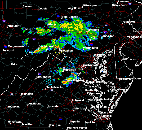 At 717 pm edt, a severe thunderstorm was located near hancock, moving southeast at 30 mph (radar indicated). Hazards include quarter to golf ball size hail and 60 mph wind gusts. Damaging winds will cause some trees and large branches to fall. this could injure those outdoors, as well as damage homes and vehicles. roadways may become blocked by downed trees. localized power outages are possible. unsecured light objects may become projectiles. Locations impacted include, martinsburg, hancock, williamsport, saint james, berkeley, falling waters, fairplay, clear spring, hedgesville, pecktonville, big spring, big pool, cherry run, tomahawk, johnsontown, spruce pine hollow, arden, jones springs and sleepy creek. At 717 pm edt, a severe thunderstorm was located near hancock, moving southeast at 30 mph (radar indicated). Hazards include quarter to golf ball size hail and 60 mph wind gusts. Damaging winds will cause some trees and large branches to fall. this could injure those outdoors, as well as damage homes and vehicles. roadways may become blocked by downed trees. localized power outages are possible. unsecured light objects may become projectiles. Locations impacted include, martinsburg, hancock, williamsport, saint james, berkeley, falling waters, fairplay, clear spring, hedgesville, pecktonville, big spring, big pool, cherry run, tomahawk, johnsontown, spruce pine hollow, arden, jones springs and sleepy creek.
|
| 5/13/2018 7:15 PM EDT | Golf Ball sized hail reported 3 miles W of Hancock, MD |
| 5/13/2018 7:11 PM EDT |
 At 711 pm edt, severe thunderstorms were located along a line extending from hancock to near berkeley springs, moving southeast at 30 mph (radar indicated). Hazards include quarter to golf ball size hail and 60 mph wind gusts. Damaging winds will cause some trees and large branches to fall. this could injure those outdoors, as well as damage homes and vehicles. roadways may become blocked by downed trees. localized power outages are possible. unsecured light objects may become projectiles. Locations impacted include, martinsburg, hancock, inwood, williamsport, berkeley springs, saint james, berkeley, falling waters, fairplay, clear spring, hedgesville, pecktonville, big spring, big pool, johnsons mill, tomahawk, johnsontown, valley view, spohrs crossroads and arden. At 711 pm edt, severe thunderstorms were located along a line extending from hancock to near berkeley springs, moving southeast at 30 mph (radar indicated). Hazards include quarter to golf ball size hail and 60 mph wind gusts. Damaging winds will cause some trees and large branches to fall. this could injure those outdoors, as well as damage homes and vehicles. roadways may become blocked by downed trees. localized power outages are possible. unsecured light objects may become projectiles. Locations impacted include, martinsburg, hancock, inwood, williamsport, berkeley springs, saint james, berkeley, falling waters, fairplay, clear spring, hedgesville, pecktonville, big spring, big pool, johnsons mill, tomahawk, johnsontown, valley view, spohrs crossroads and arden.
|
| 5/13/2018 7:11 PM EDT |
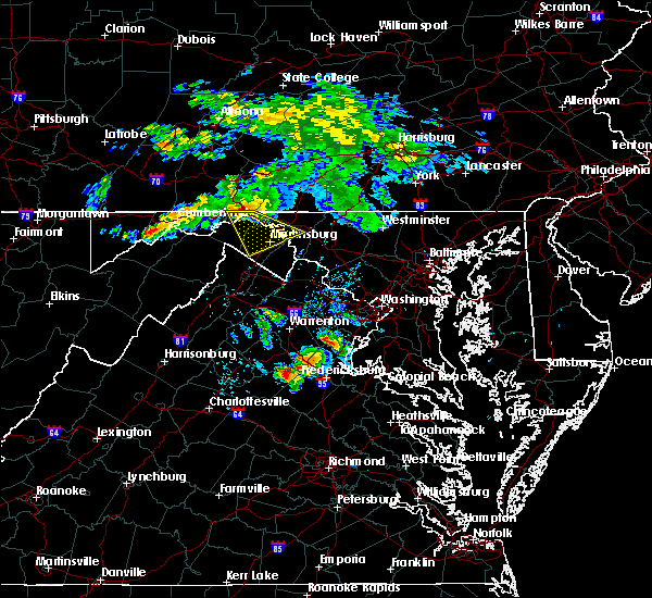 At 711 pm edt, severe thunderstorms were located along a line extending from hancock to near berkeley springs, moving southeast at 30 mph (radar indicated). Hazards include quarter to golf ball size hail and 60 mph wind gusts. Damaging winds will cause some trees and large branches to fall. this could injure those outdoors, as well as damage homes and vehicles. roadways may become blocked by downed trees. localized power outages are possible. unsecured light objects may become projectiles. Locations impacted include, martinsburg, hancock, inwood, williamsport, berkeley springs, saint james, berkeley, falling waters, fairplay, clear spring, hedgesville, pecktonville, big spring, big pool, johnsons mill, tomahawk, johnsontown, valley view, spohrs crossroads and arden. At 711 pm edt, severe thunderstorms were located along a line extending from hancock to near berkeley springs, moving southeast at 30 mph (radar indicated). Hazards include quarter to golf ball size hail and 60 mph wind gusts. Damaging winds will cause some trees and large branches to fall. this could injure those outdoors, as well as damage homes and vehicles. roadways may become blocked by downed trees. localized power outages are possible. unsecured light objects may become projectiles. Locations impacted include, martinsburg, hancock, inwood, williamsport, berkeley springs, saint james, berkeley, falling waters, fairplay, clear spring, hedgesville, pecktonville, big spring, big pool, johnsons mill, tomahawk, johnsontown, valley view, spohrs crossroads and arden.
|
| 5/13/2018 7:02 PM EDT |
 At 702 pm edt, severe thunderstorms were located along a line extending from near hancock to near barnes gap, moving southeast at 30 mph (radar indicated). Hazards include 60 mph wind gusts and quarter size hail. Damaging winds will cause some trees and large branches to fall. this could injure those outdoors, as well as damage homes and vehicles. roadways may become blocked by downed trees. localized power outages are possible. unsecured light objects may become projectiles. Locations impacted include, martinsburg, hancock, inwood, williamsport, berkeley springs, saint james, berkeley, falling waters, fairplay, great cacapon, clear spring, hedgesville, pecktonville, big spring, big pool, johnsons mill, tomahawk, johnsontown, valley view and spohrs crossroads. At 702 pm edt, severe thunderstorms were located along a line extending from near hancock to near barnes gap, moving southeast at 30 mph (radar indicated). Hazards include 60 mph wind gusts and quarter size hail. Damaging winds will cause some trees and large branches to fall. this could injure those outdoors, as well as damage homes and vehicles. roadways may become blocked by downed trees. localized power outages are possible. unsecured light objects may become projectiles. Locations impacted include, martinsburg, hancock, inwood, williamsport, berkeley springs, saint james, berkeley, falling waters, fairplay, great cacapon, clear spring, hedgesville, pecktonville, big spring, big pool, johnsons mill, tomahawk, johnsontown, valley view and spohrs crossroads.
|
| 5/13/2018 7:02 PM EDT |
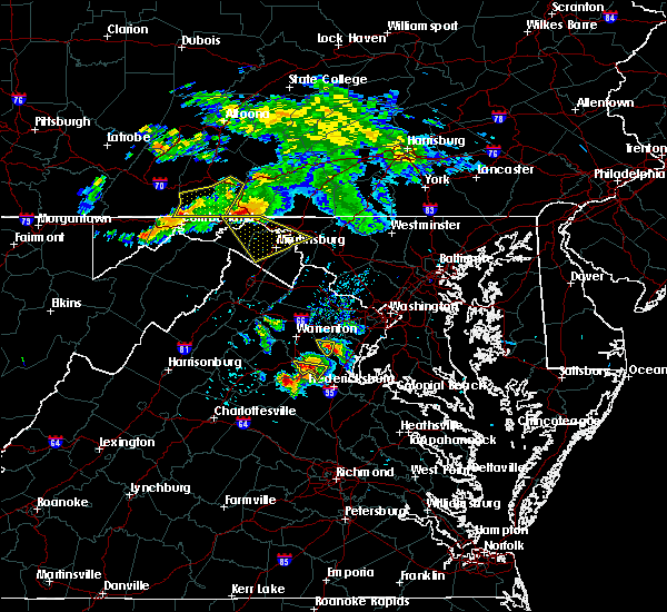 At 650 pm edt, severe thunderstorms were located along a line extending from near barnes gap to near inglesmith, moving southeast at 30 mph (radar indicated). Hazards include 60 mph wind gusts and quarter size hail. Damaging winds will cause some trees and large branches to fall. this could injure those outdoors, as well as damage homes and vehicles. roadways may become blocked by downed trees. localized power outages are possible. Unsecured light objects may become projectiles. At 650 pm edt, severe thunderstorms were located along a line extending from near barnes gap to near inglesmith, moving southeast at 30 mph (radar indicated). Hazards include 60 mph wind gusts and quarter size hail. Damaging winds will cause some trees and large branches to fall. this could injure those outdoors, as well as damage homes and vehicles. roadways may become blocked by downed trees. localized power outages are possible. Unsecured light objects may become projectiles.
|
| 5/13/2018 6:51 PM EDT |
 At 651 pm edt, severe thunderstorms were located along a line extending from near warfordsburg to 6 miles southwest of barnes gap, moving southeast at 40 mph (radar indicated). Hazards include 60 mph wind gusts and quarter size hail. Damaging winds will cause some trees and large branches to fall. this could injure those outdoors, as well as damage homes and vehicles. roadways may become blocked by downed trees. localized power outages are possible. unsecured light objects may become projectiles. Locations impacted include, hancock, paw paw, greenwood, berkeley springs, great cacapon, flintstone, pecktonville, big pool, little orleans, johnsons mill, valley view, fishers bridge, spohrs crossroads, oakland, rock gap, smith crossroads, unger, new hope, shady grove and cherry run. At 651 pm edt, severe thunderstorms were located along a line extending from near warfordsburg to 6 miles southwest of barnes gap, moving southeast at 40 mph (radar indicated). Hazards include 60 mph wind gusts and quarter size hail. Damaging winds will cause some trees and large branches to fall. this could injure those outdoors, as well as damage homes and vehicles. roadways may become blocked by downed trees. localized power outages are possible. unsecured light objects may become projectiles. Locations impacted include, hancock, paw paw, greenwood, berkeley springs, great cacapon, flintstone, pecktonville, big pool, little orleans, johnsons mill, valley view, fishers bridge, spohrs crossroads, oakland, rock gap, smith crossroads, unger, new hope, shady grove and cherry run.
|
| 5/13/2018 6:50 PM EDT |
 At 650 pm edt, severe thunderstorms were located along a line extending from near barnes gap to near inglesmith, moving southeast at 30 mph (radar indicated). Hazards include 60 mph wind gusts and quarter size hail. Damaging winds will cause some trees and large branches to fall. this could injure those outdoors, as well as damage homes and vehicles. roadways may become blocked by downed trees. localized power outages are possible. Unsecured light objects may become projectiles. At 650 pm edt, severe thunderstorms were located along a line extending from near barnes gap to near inglesmith, moving southeast at 30 mph (radar indicated). Hazards include 60 mph wind gusts and quarter size hail. Damaging winds will cause some trees and large branches to fall. this could injure those outdoors, as well as damage homes and vehicles. roadways may become blocked by downed trees. localized power outages are possible. Unsecured light objects may become projectiles.
|
| 5/13/2018 6:19 PM EDT |
 At 619 pm edt, severe thunderstorms were located along a line extending from near buffalo mills to near lake gordon, moving southeast at 40 mph (radar indicated). Hazards include 60 to 75 mph wind gusts and quarter size hail. Damaging winds will cause some trees and large branches to fall. this could injure those outdoors, as well as damage homes and vehicles. roadways may become blocked by downed trees. localized power outages are possible. unsecured light objects may become projectiles. Locations impacted include, cumberland, hancock, paw paw, greenwood, berkeley springs, ellerslie, corriganville, great cacapon, clear spring, flintstone, pecktonville, big spring, big pool, little orleans, johnsons mill, valley view, fishers bridge, spohrs crossroads, pumpkin center and oakland. At 619 pm edt, severe thunderstorms were located along a line extending from near buffalo mills to near lake gordon, moving southeast at 40 mph (radar indicated). Hazards include 60 to 75 mph wind gusts and quarter size hail. Damaging winds will cause some trees and large branches to fall. this could injure those outdoors, as well as damage homes and vehicles. roadways may become blocked by downed trees. localized power outages are possible. unsecured light objects may become projectiles. Locations impacted include, cumberland, hancock, paw paw, greenwood, berkeley springs, ellerslie, corriganville, great cacapon, clear spring, flintstone, pecktonville, big spring, big pool, little orleans, johnsons mill, valley view, fishers bridge, spohrs crossroads, pumpkin center and oakland.
|
| 5/13/2018 6:05 PM EDT |
 The national weather service in sterling virginia has issued a * severe thunderstorm warning for. northwestern washington county in north central maryland. northeastern allegany county in western maryland. morgan county in the panhandle of west virginia. Until 700 pm edt. The national weather service in sterling virginia has issued a * severe thunderstorm warning for. northwestern washington county in north central maryland. northeastern allegany county in western maryland. morgan county in the panhandle of west virginia. Until 700 pm edt.
|
| 5/13/2018 6:05 PM EDT |
 At 605 pm edt, severe thunderstorms were located along a line extending from near buffalo mills to 6 miles east of berlin, moving southeast at 40 mph (radar indicated). Hazards include damaging wind gusts of 60 to 75 mph wind gusts and quarter size hail. Damaging winds will cause some trees and large branches to fall. this could injure those outdoors, as well as damage homes and vehicles. roadways may become blocked by downed trees. localized power outages are possible. Unsecured light objects may become projectiles. At 605 pm edt, severe thunderstorms were located along a line extending from near buffalo mills to 6 miles east of berlin, moving southeast at 40 mph (radar indicated). Hazards include damaging wind gusts of 60 to 75 mph wind gusts and quarter size hail. Damaging winds will cause some trees and large branches to fall. this could injure those outdoors, as well as damage homes and vehicles. roadways may become blocked by downed trees. localized power outages are possible. Unsecured light objects may become projectiles.
|
| 9/5/2017 3:10 PM EDT |
 At 310 pm edt, severe thunderstorms were located along a line extending from near hancock to 9 miles northwest of winchester, moving east at 45 mph (radar indicated). Hazards include 70 mph wind gusts and quarter size hail. Damaging winds will cause some trees and large branches to fall. this could injure those outdoors, as well as damage homes and vehicles. roadways may become blocked by downed trees. localized power outages are possible. unsecured light objects may become projectiles. Locations impacted include, winchester, martinsburg, hancock, millwood pike, inwood, wilson-conococheague, berkeley springs, berkeley, falling waters, clear spring, capon bridge, hedgesville, pecktonville, big spring, big pool, johnsontown, valley view, ridgeway, oakland and cross junction. At 310 pm edt, severe thunderstorms were located along a line extending from near hancock to 9 miles northwest of winchester, moving east at 45 mph (radar indicated). Hazards include 70 mph wind gusts and quarter size hail. Damaging winds will cause some trees and large branches to fall. this could injure those outdoors, as well as damage homes and vehicles. roadways may become blocked by downed trees. localized power outages are possible. unsecured light objects may become projectiles. Locations impacted include, winchester, martinsburg, hancock, millwood pike, inwood, wilson-conococheague, berkeley springs, berkeley, falling waters, clear spring, capon bridge, hedgesville, pecktonville, big spring, big pool, johnsontown, valley view, ridgeway, oakland and cross junction.
|
| 9/5/2017 3:02 PM EDT | A tree was down along fairview driv in morgan county WV, 3.1 miles NNE of Hancock, MD |
| 9/5/2017 2:55 PM EDT |
 At 254 pm edt, severe thunderstorms were located along a line extending from near barnes gap to 10 miles southeast of romney, moving southeast at 30 mph (radar indicated). Hazards include 70 mph wind gusts and quarter size hail. Damaging winds will cause some trees and large branches to fall. this could injure those outdoors, as well as damage homes and vehicles. roadways may become blocked by downed trees. localized power outages are possible. unsecured light objects may become projectiles. Locations impacted include, winchester, martinsburg, hancock, millwood pike, inwood, wilson-conococheague, berkeley springs, berkeley, falling waters, great cacapon, clear spring, capon bridge, hedgesville, pecktonville, big spring, big pool, johnsontown, valley view, ridgeway and fishers bridge. At 254 pm edt, severe thunderstorms were located along a line extending from near barnes gap to 10 miles southeast of romney, moving southeast at 30 mph (radar indicated). Hazards include 70 mph wind gusts and quarter size hail. Damaging winds will cause some trees and large branches to fall. this could injure those outdoors, as well as damage homes and vehicles. roadways may become blocked by downed trees. localized power outages are possible. unsecured light objects may become projectiles. Locations impacted include, winchester, martinsburg, hancock, millwood pike, inwood, wilson-conococheague, berkeley springs, berkeley, falling waters, great cacapon, clear spring, capon bridge, hedgesville, pecktonville, big spring, big pool, johnsontown, valley view, ridgeway and fishers bridge.
|
| 9/5/2017 2:49 PM EDT |
 At 248 pm edt, severe thunderstorms were located along a line extending from near barnes gap to 10 miles southeast of romney, moving southeast at 30 mph (radar indicated). Hazards include 60 mph wind gusts and quarter size hail. Damaging winds will cause some trees and large branches to fall. this could injure those outdoors, as well as damage homes and vehicles. roadways may become blocked by downed trees. localized power outages are possible. Unsecured light objects may become projectiles. At 248 pm edt, severe thunderstorms were located along a line extending from near barnes gap to 10 miles southeast of romney, moving southeast at 30 mph (radar indicated). Hazards include 60 mph wind gusts and quarter size hail. Damaging winds will cause some trees and large branches to fall. this could injure those outdoors, as well as damage homes and vehicles. roadways may become blocked by downed trees. localized power outages are possible. Unsecured light objects may become projectiles.
|
| 9/5/2017 2:38 PM EDT |
 At 238 pm edt, severe thunderstorms were located along a line extending from inglesmith to 7 miles southeast of fort ashby, moving east at 25 mph (radar indicated). Hazards include 60 mph wind gusts. Damaging winds will cause some trees and large branches to fall. this could injure those outdoors, as well as damage homes and vehicles. roadways may become blocked by downed trees. localized power outages are possible. Unsecured light objects may become projectiles. At 238 pm edt, severe thunderstorms were located along a line extending from inglesmith to 7 miles southeast of fort ashby, moving east at 25 mph (radar indicated). Hazards include 60 mph wind gusts. Damaging winds will cause some trees and large branches to fall. this could injure those outdoors, as well as damage homes and vehicles. roadways may become blocked by downed trees. localized power outages are possible. Unsecured light objects may become projectiles.
|
| 8/12/2017 3:46 PM EDT |
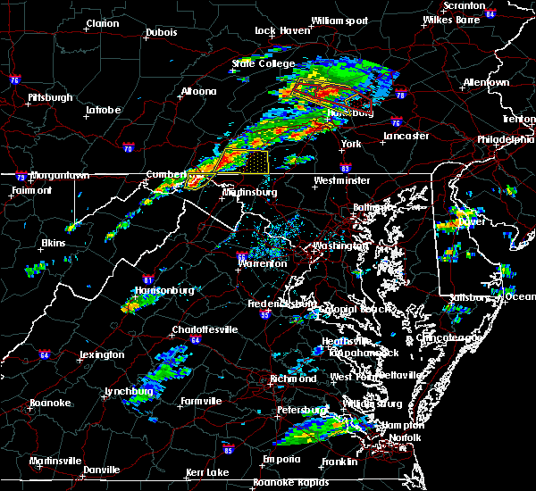 At 346 pm edt, a severe thunderstorm was located over berkeley springs, or near hancock, moving east at 20 mph (radar indicated). Hazards include ping pong ball size hail and 60 mph wind gusts. Damaging winds will cause some trees and large branches to fall. this could injure those outdoors, as well as damage homes and vehicles. roadways may become blocked by downed trees. localized power outages are possible. unsecured light objects may become projectiles. Locations impacted include, hancock, berkeley springs, great cacapon, johnsons mill, valley view, spohrs crossroads, spruce pine hollow, forest park, smith crossroads, berryville, new hope, sleepy creek and shady grove. At 346 pm edt, a severe thunderstorm was located over berkeley springs, or near hancock, moving east at 20 mph (radar indicated). Hazards include ping pong ball size hail and 60 mph wind gusts. Damaging winds will cause some trees and large branches to fall. this could injure those outdoors, as well as damage homes and vehicles. roadways may become blocked by downed trees. localized power outages are possible. unsecured light objects may become projectiles. Locations impacted include, hancock, berkeley springs, great cacapon, johnsons mill, valley view, spohrs crossroads, spruce pine hollow, forest park, smith crossroads, berryville, new hope, sleepy creek and shady grove.
|
| 8/12/2017 3:44 PM EDT |
 At 343 pm edt, a severe thunderstorm was located near berkeley springs, or near hancock, moving east at 20 mph (radar indicated). Hazards include 60 mph wind gusts and quarter size hail. Damaging winds will cause some trees and large branches to fall. this could injure those outdoors, as well as damage homes and vehicles. roadways may become blocked by downed trees. localized power outages are possible. unsecured light objects may become projectiles. Locations impacted include, hancock, berkeley springs, great cacapon, johnsons mill, valley view, spohrs crossroads, spruce pine hollow, forest park, smith crossroads, berryville, new hope, sleepy creek and shady grove. At 343 pm edt, a severe thunderstorm was located near berkeley springs, or near hancock, moving east at 20 mph (radar indicated). Hazards include 60 mph wind gusts and quarter size hail. Damaging winds will cause some trees and large branches to fall. this could injure those outdoors, as well as damage homes and vehicles. roadways may become blocked by downed trees. localized power outages are possible. unsecured light objects may become projectiles. Locations impacted include, hancock, berkeley springs, great cacapon, johnsons mill, valley view, spohrs crossroads, spruce pine hollow, forest park, smith crossroads, berryville, new hope, sleepy creek and shady grove.
|
| 8/12/2017 3:36 PM EDT |
 At 335 pm edt, a severe thunderstorm was located near berkeley springs, or 9 miles southwest of hancock, moving east at 30 mph (radar indicated). Hazards include 60 mph wind gusts and quarter size hail. Damaging winds will cause some trees and large branches to fall. this could injure those outdoors, as well as damage homes and vehicles. roadways may become blocked by downed trees. localized power outages are possible. unsecured light objects may become projectiles. Locations impacted include, hancock, berkeley springs, great cacapon, little orleans, johnsons mill, lineburg, valley view, spohrs crossroads, spruce pine hollow, forest park, bellegrove, smith crossroads, berryville, new hope, green ridge, sleepy creek and shady grove. At 335 pm edt, a severe thunderstorm was located near berkeley springs, or 9 miles southwest of hancock, moving east at 30 mph (radar indicated). Hazards include 60 mph wind gusts and quarter size hail. Damaging winds will cause some trees and large branches to fall. this could injure those outdoors, as well as damage homes and vehicles. roadways may become blocked by downed trees. localized power outages are possible. unsecured light objects may become projectiles. Locations impacted include, hancock, berkeley springs, great cacapon, little orleans, johnsons mill, lineburg, valley view, spohrs crossroads, spruce pine hollow, forest park, bellegrove, smith crossroads, berryville, new hope, green ridge, sleepy creek and shady grove.
|
| 8/12/2017 3:26 PM EDT |
 At 325 pm edt, severe thunderstorms were located along a line extending from barnes gap to 7 miles south of inglesmith to 6 miles northwest of paw paw, moving east at 20 mph (radar indicated). Hazards include 60 mph wind gusts. Damaging winds will cause some trees and large branches to fall. this could injure those outdoors, as well as damage homes and vehicles. roadways may become blocked by downed trees. localized power outages are possible. Unsecured light objects may become projectiles. At 325 pm edt, severe thunderstorms were located along a line extending from barnes gap to 7 miles south of inglesmith to 6 miles northwest of paw paw, moving east at 20 mph (radar indicated). Hazards include 60 mph wind gusts. Damaging winds will cause some trees and large branches to fall. this could injure those outdoors, as well as damage homes and vehicles. roadways may become blocked by downed trees. localized power outages are possible. Unsecured light objects may become projectiles.
|
| 8/4/2017 6:12 PM EDT |
 At 612 pm edt, a severe thunderstorm was located over big cove tannery, or 11 miles northeast of hancock, moving northeast at 35 mph (radar indicated). Hazards include 60 mph wind gusts. Damaging winds will cause some trees and large branches to fall. this could injure those outdoors, as well as damage homes and vehicles. roadways may become blocked by downed trees. localized power outages are possible. unsecured light objects may become projectiles. Locations impacted include, hancock. At 612 pm edt, a severe thunderstorm was located over big cove tannery, or 11 miles northeast of hancock, moving northeast at 35 mph (radar indicated). Hazards include 60 mph wind gusts. Damaging winds will cause some trees and large branches to fall. this could injure those outdoors, as well as damage homes and vehicles. roadways may become blocked by downed trees. localized power outages are possible. unsecured light objects may become projectiles. Locations impacted include, hancock.
|
| 8/4/2017 6:12 PM EDT |
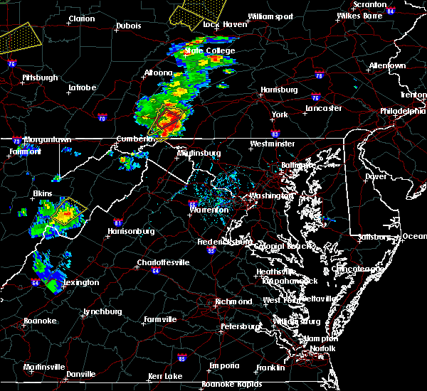 At 612 pm edt, a severe thunderstorm was located over big cove tannery, or 11 miles northeast of hancock, moving northeast at 35 mph (radar indicated). Hazards include 60 mph wind gusts. Damaging winds will cause some trees and large branches to fall. this could injure those outdoors, as well as damage homes and vehicles. roadways may become blocked by downed trees. localized power outages are possible. unsecured light objects may become projectiles. Locations impacted include, hancock. At 612 pm edt, a severe thunderstorm was located over big cove tannery, or 11 miles northeast of hancock, moving northeast at 35 mph (radar indicated). Hazards include 60 mph wind gusts. Damaging winds will cause some trees and large branches to fall. this could injure those outdoors, as well as damage homes and vehicles. roadways may become blocked by downed trees. localized power outages are possible. unsecured light objects may become projectiles. Locations impacted include, hancock.
|
| 8/4/2017 6:02 PM EDT |
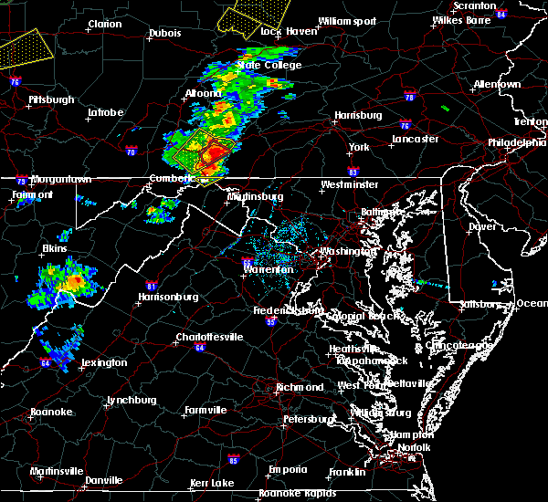 At 602 pm edt, a severe thunderstorm was located near warfordsburg, or near hancock, moving northeast at 35 mph (radar indicated). Hazards include 60 mph wind gusts. Damaging winds will cause some trees and large branches to fall. this could injure those outdoors, as well as damage homes and vehicles. roadways may become blocked by downed trees. localized power outages are possible. unsecured light objects may become projectiles. Locations impacted include, hancock. At 602 pm edt, a severe thunderstorm was located near warfordsburg, or near hancock, moving northeast at 35 mph (radar indicated). Hazards include 60 mph wind gusts. Damaging winds will cause some trees and large branches to fall. this could injure those outdoors, as well as damage homes and vehicles. roadways may become blocked by downed trees. localized power outages are possible. unsecured light objects may become projectiles. Locations impacted include, hancock.
|
| 8/4/2017 5:49 PM EDT |
 At 549 pm edt, a severe thunderstorm was located over berkeley springs, or near hancock, moving northeast at 35 mph (radar indicated). Hazards include 60 mph wind gusts. Damaging winds will cause some trees and large branches to fall. this could injure those outdoors, as well as damage homes and vehicles. roadways may become blocked by downed trees. localized power outages are possible. Unsecured light objects may become projectiles. At 549 pm edt, a severe thunderstorm was located over berkeley springs, or near hancock, moving northeast at 35 mph (radar indicated). Hazards include 60 mph wind gusts. Damaging winds will cause some trees and large branches to fall. this could injure those outdoors, as well as damage homes and vehicles. roadways may become blocked by downed trees. localized power outages are possible. Unsecured light objects may become projectiles.
|
| 3/1/2017 12:30 PM EST |
 At 1230 pm est, severe thunderstorms were located along a line extending from near berkeley springs to near wardensville, moving east at 60 mph (radar indicated). Hazards include 60 mph wind gusts. Damaging winds will cause some trees and large branches to fall. this could injure those outdoors, as well as damage homes and vehicles. roadways may become blocked by downed trees. localized power outages are possible. unsecured light objects may become projectiles. Locations impacted include, winchester, martinsburg, strasburg, hancock, paw paw, millwood pike, inwood, stephens city, berkeley springs, wardensville, star tannery, middletown, great cacapon, clear spring, capon bridge, hedgesville, pecktonville, big spring, big pool and little orleans. At 1230 pm est, severe thunderstorms were located along a line extending from near berkeley springs to near wardensville, moving east at 60 mph (radar indicated). Hazards include 60 mph wind gusts. Damaging winds will cause some trees and large branches to fall. this could injure those outdoors, as well as damage homes and vehicles. roadways may become blocked by downed trees. localized power outages are possible. unsecured light objects may become projectiles. Locations impacted include, winchester, martinsburg, strasburg, hancock, paw paw, millwood pike, inwood, stephens city, berkeley springs, wardensville, star tannery, middletown, great cacapon, clear spring, capon bridge, hedgesville, pecktonville, big spring, big pool and little orleans.
|
| 3/1/2017 12:12 PM EST |
 At 1212 pm est, severe thunderstorms were located along a line extending from 8 miles northeast of lake gordon to 7 miles west of wardensville, moving east at 50 mph (radar indicated). Hazards include 60 mph wind gusts. Damaging winds will cause some trees and large branches to fall. this could injure those outdoors, as well as damage homes and vehicles. roadways may become blocked by downed trees. localized power outages are possible. Unsecured light objects may become projectiles. At 1212 pm est, severe thunderstorms were located along a line extending from 8 miles northeast of lake gordon to 7 miles west of wardensville, moving east at 50 mph (radar indicated). Hazards include 60 mph wind gusts. Damaging winds will cause some trees and large branches to fall. this could injure those outdoors, as well as damage homes and vehicles. roadways may become blocked by downed trees. localized power outages are possible. Unsecured light objects may become projectiles.
|
| 2/12/2017 9:35 PM EST | Tree down blocking one lane of eb i-70 in washington county MD, 0.8 miles ESE of Hancock, MD |
| 2/12/2017 9:26 PM EST |
 At 925 pm est, severe thunderstorms were located along a line extending from 6 miles southwest of clearville to westernport to near grafton, moving east at 45 mph (radar indicated). Hazards include 60 mph wind gusts. Damaging winds will cause some trees and large branches to fall. this could injure those outdoors, as well as damage homes and vehicles. roadways may become blocked by downed trees. localized power outages are possible. unsecured light objects may become projectiles. Locations impacted include, cumberland, frostburg, keyser, westernport, romney, hancock, bel air, paw paw, bayard, la vale, fort ashby, lonaconing, piedmont, berkeley springs, elk garden, kitzmiller, ridgeley, cresaptown, potomac park and wiley ford. At 925 pm est, severe thunderstorms were located along a line extending from 6 miles southwest of clearville to westernport to near grafton, moving east at 45 mph (radar indicated). Hazards include 60 mph wind gusts. Damaging winds will cause some trees and large branches to fall. this could injure those outdoors, as well as damage homes and vehicles. roadways may become blocked by downed trees. localized power outages are possible. unsecured light objects may become projectiles. Locations impacted include, cumberland, frostburg, keyser, westernport, romney, hancock, bel air, paw paw, bayard, la vale, fort ashby, lonaconing, piedmont, berkeley springs, elk garden, kitzmiller, ridgeley, cresaptown, potomac park and wiley ford.
|
| 2/12/2017 9:00 PM EST |
 At 900 pm est, severe thunderstorms were located along a line extending from near buffalo mills to near bittinger to near enterprise, moving southeast at 45 mph (radar indicated). Hazards include 60 mph wind gusts. Damaging winds will cause some trees and large branches to fall. this could injure those outdoors, as well as damage homes and vehicles. roadways may become blocked by downed trees. localized power outages are possible. Unsecured light objects may become projectiles. At 900 pm est, severe thunderstorms were located along a line extending from near buffalo mills to near bittinger to near enterprise, moving southeast at 45 mph (radar indicated). Hazards include 60 mph wind gusts. Damaging winds will cause some trees and large branches to fall. this could injure those outdoors, as well as damage homes and vehicles. roadways may become blocked by downed trees. localized power outages are possible. Unsecured light objects may become projectiles.
|
| 8/16/2016 1:35 PM EDT | Trees down on powerlines near intersection of creek road and limestone road in washington county MD, 0.8 miles ENE of Hancock, MD |
| 8/13/2016 7:26 PM EDT |
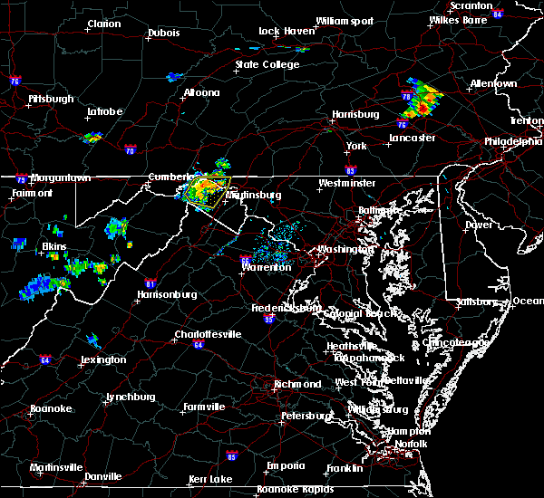 At 725 pm edt, a severe thunderstorm was located 9 miles southeast of hancock, moving northeast at 40 mph (radar indicated). Hazards include 60 mph wind gusts. Damaging winds will cause some trees and large branches to fall. this could injure those outdoors, as well as damage homes and vehicles. roadways may become blocked by downed trees. localized power outages are possible. Unsecured light objects may become projectiles. At 725 pm edt, a severe thunderstorm was located 9 miles southeast of hancock, moving northeast at 40 mph (radar indicated). Hazards include 60 mph wind gusts. Damaging winds will cause some trees and large branches to fall. this could injure those outdoors, as well as damage homes and vehicles. roadways may become blocked by downed trees. localized power outages are possible. Unsecured light objects may become projectiles.
|
| 8/13/2016 7:11 PM EDT |
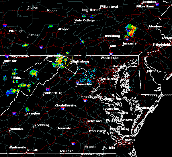 At 710 pm edt, severe thunderstorms were located along a line extending from hancock to near berkeley springs to near greenwood, moving northeast at 35 mph (radar indicated). Hazards include 60 mph wind gusts. Damaging winds will cause some trees and large branches to fall. this could injure those outdoors, as well as damage homes and vehicles. roadways may become blocked by downed trees. localized power outages are possible. unsecured light objects may become projectiles. Locations impacted include, hancock, greenwood, berkeley springs, great cacapon, clear spring, hedgesville, pecktonville, big spring, big pool, cherry run, spruce pine hollow, new hope, berryville, fishers bridge, ridge, shady grove, omps, jones springs, valley view and johnsons mill. At 710 pm edt, severe thunderstorms were located along a line extending from hancock to near berkeley springs to near greenwood, moving northeast at 35 mph (radar indicated). Hazards include 60 mph wind gusts. Damaging winds will cause some trees and large branches to fall. this could injure those outdoors, as well as damage homes and vehicles. roadways may become blocked by downed trees. localized power outages are possible. unsecured light objects may become projectiles. Locations impacted include, hancock, greenwood, berkeley springs, great cacapon, clear spring, hedgesville, pecktonville, big spring, big pool, cherry run, spruce pine hollow, new hope, berryville, fishers bridge, ridge, shady grove, omps, jones springs, valley view and johnsons mill.
|
| 8/13/2016 6:58 PM EDT |
 At 658 pm edt, severe thunderstorms were located along a line extending from near berkeley springs to near paw paw to 14 miles southwest of greenwood, moving northeast at 30 mph (radar indicated). Hazards include 60 mph wind gusts. Damaging winds will cause some trees and large branches to fall. this could injure those outdoors, as well as damage homes and vehicles. roadways may become blocked by downed trees. localized power outages are possible. Unsecured light objects may become projectiles. At 658 pm edt, severe thunderstorms were located along a line extending from near berkeley springs to near paw paw to 14 miles southwest of greenwood, moving northeast at 30 mph (radar indicated). Hazards include 60 mph wind gusts. Damaging winds will cause some trees and large branches to fall. this could injure those outdoors, as well as damage homes and vehicles. roadways may become blocked by downed trees. localized power outages are possible. Unsecured light objects may become projectiles.
|
| 6/21/2016 1:09 PM EDT |
 At 109 pm edt, a severe thunderstorm was located near ridgeley, or near bel air, moving southeast at 25 mph (radar indicated). Hazards include 60 mph wind gusts and quarter size hail. Damaging winds will cause some trees and large branches to fall. this could injure those outdoors, as well as damage homes and vehicles. roadways may become blocked by downed trees. localized power outages are possible. unsecured light objects may become projectiles. Locations impacted include, cumberland, frostburg, hancock, bel air, paw paw, greenwood, la vale, fort ashby, lonaconing, berkeley springs, ridgeley, cresaptown, potomac park, wiley ford, eckhart mines, rawlings, midland, great cacapon, midlothian and green spring. At 109 pm edt, a severe thunderstorm was located near ridgeley, or near bel air, moving southeast at 25 mph (radar indicated). Hazards include 60 mph wind gusts and quarter size hail. Damaging winds will cause some trees and large branches to fall. this could injure those outdoors, as well as damage homes and vehicles. roadways may become blocked by downed trees. localized power outages are possible. unsecured light objects may become projectiles. Locations impacted include, cumberland, frostburg, hancock, bel air, paw paw, greenwood, la vale, fort ashby, lonaconing, berkeley springs, ridgeley, cresaptown, potomac park, wiley ford, eckhart mines, rawlings, midland, great cacapon, midlothian and green spring.
|
| 6/21/2016 12:50 PM EDT |
 At 1249 pm edt, a severe thunderstorm was located over frostburg, moving southeast at 25 mph (radar indicated). Hazards include 60 mph wind gusts. Damaging winds will cause some trees and large branches to fall. this could injure those outdoors, as well as damage homes and vehicles. roadways may become blocked by downed trees. localized power outages are possible. Unsecured light objects may become projectiles. At 1249 pm edt, a severe thunderstorm was located over frostburg, moving southeast at 25 mph (radar indicated). Hazards include 60 mph wind gusts. Damaging winds will cause some trees and large branches to fall. this could injure those outdoors, as well as damage homes and vehicles. roadways may become blocked by downed trees. localized power outages are possible. Unsecured light objects may become projectiles.
|
| 6/21/2016 12:01 PM EDT |
 At 1201 pm edt, severe thunderstorms were located along a line extending from marion to warfordsburg, moving southeast at 25 mph (radar indicated). Hazards include 60 mph wind gusts. Damaging winds will cause some trees and large branches to fall. this could injure those outdoors, as well as damage homes and vehicles. roadways may become blocked by downed trees. localized power outages are possible. Unsecured light objects may become projectiles. At 1201 pm edt, severe thunderstorms were located along a line extending from marion to warfordsburg, moving southeast at 25 mph (radar indicated). Hazards include 60 mph wind gusts. Damaging winds will cause some trees and large branches to fall. this could injure those outdoors, as well as damage homes and vehicles. roadways may become blocked by downed trees. localized power outages are possible. Unsecured light objects may become projectiles.
|
| 6/16/2016 6:39 PM EDT |
 At 639 pm edt, severe thunderstorms were located along a line extending from 7 miles southeast of lake gordon to 6 miles southeast of fort ashby to near rough run to 12 miles west of brandywine, moving southeast at 40 mph (radar indicated). Hazards include 60 mph wind gusts and quarter size hail. Damaging winds will cause some trees and large branches to fall. this could injure those outdoors, as well as damage homes and vehicles. roadways may become blocked by downed trees. localized power outages are possible. unsecured light objects may become projectiles. Locations impacted include, cumberland, moorefield, petersburg, romney, hancock, paw paw, brandywine, rough run, fort ashby, berkeley springs, ridgeley, upper tract, mathias, potomac park, wiley ford, franklin, springfield, great cacapon, capon bridge and green spring. At 639 pm edt, severe thunderstorms were located along a line extending from 7 miles southeast of lake gordon to 6 miles southeast of fort ashby to near rough run to 12 miles west of brandywine, moving southeast at 40 mph (radar indicated). Hazards include 60 mph wind gusts and quarter size hail. Damaging winds will cause some trees and large branches to fall. this could injure those outdoors, as well as damage homes and vehicles. roadways may become blocked by downed trees. localized power outages are possible. unsecured light objects may become projectiles. Locations impacted include, cumberland, moorefield, petersburg, romney, hancock, paw paw, brandywine, rough run, fort ashby, berkeley springs, ridgeley, upper tract, mathias, potomac park, wiley ford, franklin, springfield, great cacapon, capon bridge and green spring.
|
| 6/16/2016 6:01 PM EDT |
 At 600 pm edt, severe thunderstorms were located along a line extending from near frostburg to westernport to near bayard to near dailey, moving southeast at 45 mph (radar indicated). Hazards include 60 mph wind gusts and quarter size hail. Damaging winds will cause some trees and large branches to fall. this could injure those outdoors, as well as damage homes and vehicles. roadways may become blocked by downed trees. localized power outages are possible. Unsecured light objects may become projectiles. At 600 pm edt, severe thunderstorms were located along a line extending from near frostburg to westernport to near bayard to near dailey, moving southeast at 45 mph (radar indicated). Hazards include 60 mph wind gusts and quarter size hail. Damaging winds will cause some trees and large branches to fall. this could injure those outdoors, as well as damage homes and vehicles. roadways may become blocked by downed trees. localized power outages are possible. Unsecured light objects may become projectiles.
|
| 6/16/2016 3:57 PM EDT | A few trees were reported down in the hancock are in washington county MD, 0.4 miles NW of Hancock, MD |
| 6/16/2016 3:52 PM EDT |
 At 352 pm edt, a severe thunderstorm was located near berkeley springs, or 8 miles west of hancock, moving southeast at 30 mph (radar indicated). Hazards include two inch hail and 70 mph wind gusts. Expect wind damage to trees and power lines. hail is large enough to dent and damage vehicles. some hail damage to roofs, siding, and windows is possible. Locations impacted include, hancock, greenwood, wilson-conococheague, berkeley springs, great cacapon, clear spring, hedgesville, pecktonville, big spring, big pool, little orleans, cherry run, glengary, spruce pine hollow, new hope, forest park, berryville, fishers bridge, ridge and shady grove. At 352 pm edt, a severe thunderstorm was located near berkeley springs, or 8 miles west of hancock, moving southeast at 30 mph (radar indicated). Hazards include two inch hail and 70 mph wind gusts. Expect wind damage to trees and power lines. hail is large enough to dent and damage vehicles. some hail damage to roofs, siding, and windows is possible. Locations impacted include, hancock, greenwood, wilson-conococheague, berkeley springs, great cacapon, clear spring, hedgesville, pecktonville, big spring, big pool, little orleans, cherry run, glengary, spruce pine hollow, new hope, forest park, berryville, fishers bridge, ridge and shady grove.
|
| 6/16/2016 3:48 PM EDT | Ping Pong Ball sized hail reported 8.2 miles E of Hancock, MD |
| 6/16/2016 3:41 PM EDT |
 At 341 pm edt, a severe thunderstorm was located over inglesmith, or 11 miles west of hancock, moving southeast at 30 mph (radar indicated). Hazards include two inch hail and 70 mph wind gusts. Expect wind damage to trees and power lines. hail is large enough to dent and damage vehicles. some hail damage to roofs, siding, and windows is possible. Locations impacted include, hancock, paw paw, greenwood, wilson-conococheague, berkeley springs, great cacapon, clear spring, hedgesville, pecktonville, big spring, big pool, little orleans, gainesboro, cherry run, glengary, spruce pine hollow, new hope, forest park, berryville and fishers bridge. At 341 pm edt, a severe thunderstorm was located over inglesmith, or 11 miles west of hancock, moving southeast at 30 mph (radar indicated). Hazards include two inch hail and 70 mph wind gusts. Expect wind damage to trees and power lines. hail is large enough to dent and damage vehicles. some hail damage to roofs, siding, and windows is possible. Locations impacted include, hancock, paw paw, greenwood, wilson-conococheague, berkeley springs, great cacapon, clear spring, hedgesville, pecktonville, big spring, big pool, little orleans, gainesboro, cherry run, glengary, spruce pine hollow, new hope, forest park, berryville and fishers bridge.
|
| 6/16/2016 3:38 PM EDT |
 At 337 pm edt, a severe thunderstorm capable of producing a tornado was located over barnes gap, or 10 miles west of hancock, moving southeast at 30 mph (radar indicated rotation). Hazards include tornado and ping pong ball size hail. For those in the direct path of a tornado touchdown. flying debris will be dangerous to those caught without shelter. damage to roofs, siding, and windows may occur. mobile homes may be damaged or destroyed. tree damage is likely. this dangerous storm will be near, hancock around 350 pm edt. berkeley springs around 355 pm edt. Other locations impacted by this tornadic thunderstorm include johnsons mill, cherry run, spruce pine hollow, great cacapon, smith crossroads, new hope, highland ridge, forest park, berryville and fishers bridge. At 337 pm edt, a severe thunderstorm capable of producing a tornado was located over barnes gap, or 10 miles west of hancock, moving southeast at 30 mph (radar indicated rotation). Hazards include tornado and ping pong ball size hail. For those in the direct path of a tornado touchdown. flying debris will be dangerous to those caught without shelter. damage to roofs, siding, and windows may occur. mobile homes may be damaged or destroyed. tree damage is likely. this dangerous storm will be near, hancock around 350 pm edt. berkeley springs around 355 pm edt. Other locations impacted by this tornadic thunderstorm include johnsons mill, cherry run, spruce pine hollow, great cacapon, smith crossroads, new hope, highland ridge, forest park, berryville and fishers bridge.
|
| 6/16/2016 3:25 PM EDT |
 At 325 pm edt, a severe thunderstorm was located 7 miles northwest of inglesmith, or 13 miles south of bedford, moving southeast at 30 mph (radar indicated). Hazards include 70 mph wind gusts and half dollar size hail. Damaging winds will cause some trees and large branches to fall. this could injure those outdoors, as well as damage homes and vehicles. roadways may become blocked by downed trees. localized power outages are possible. unsecured light objects may become projectiles. Locations impacted include, hancock, paw paw, greenwood, wilson-conococheague, berkeley springs, great cacapon, clear spring, hedgesville, flintstone, pecktonville, big spring, big pool, little orleans, gainesboro, glengary, new hope, forest park, jones springs, valley view and bellegrove. At 325 pm edt, a severe thunderstorm was located 7 miles northwest of inglesmith, or 13 miles south of bedford, moving southeast at 30 mph (radar indicated). Hazards include 70 mph wind gusts and half dollar size hail. Damaging winds will cause some trees and large branches to fall. this could injure those outdoors, as well as damage homes and vehicles. roadways may become blocked by downed trees. localized power outages are possible. unsecured light objects may become projectiles. Locations impacted include, hancock, paw paw, greenwood, wilson-conococheague, berkeley springs, great cacapon, clear spring, hedgesville, flintstone, pecktonville, big spring, big pool, little orleans, gainesboro, glengary, new hope, forest park, jones springs, valley view and bellegrove.
|
| 6/16/2016 3:11 PM EDT |
 At 311 pm edt, doppler radar indicated a severe thunderstorm capable of producing half dollar size hail and destructive winds in excess of 70 mph. this storm was located near buffalo mills, or 12 miles southwest of bedford, and moving southeast at 30 mph. At 311 pm edt, doppler radar indicated a severe thunderstorm capable of producing half dollar size hail and destructive winds in excess of 70 mph. this storm was located near buffalo mills, or 12 miles southwest of bedford, and moving southeast at 30 mph.
|
| 8/4/2015 2:01 AM EDT |
 At 200 am edt, doppler radar indicated a severe thunderstorm capable of producing quarter size hail and damaging winds in excess of 60 mph. this storm was located over hancock, moving east at 30 mph. locations impacted include, hagerstown, hancock, wilson-conococheague, clear spring, sleepy creek, pecktonville, warrenton and halfway. At 200 am edt, doppler radar indicated a severe thunderstorm capable of producing quarter size hail and damaging winds in excess of 60 mph. this storm was located over hancock, moving east at 30 mph. locations impacted include, hagerstown, hancock, wilson-conococheague, clear spring, sleepy creek, pecktonville, warrenton and halfway.
|
| 8/4/2015 1:52 AM EDT |
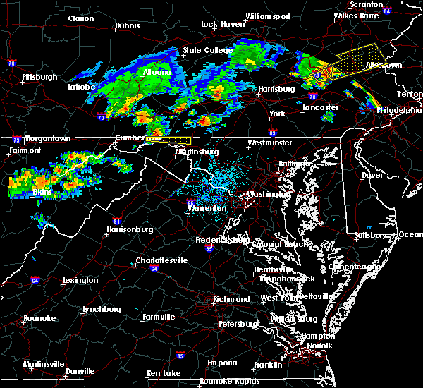 At 152 am edt, doppler radar indicated a severe thunderstorm capable of producing quarter size hail and damaging winds in excess of 60 mph. this storm was located over hancock, and moving east at 50 mph. At 152 am edt, doppler radar indicated a severe thunderstorm capable of producing quarter size hail and damaging winds in excess of 60 mph. this storm was located over hancock, and moving east at 50 mph.
|
| 7/14/2015 5:40 PM EDT |
 The severe thunderstorm warning for northwestern washington, northern frederick, northwestern berkeley and morgan counties will expire at 545 pm edt, the storm which prompted the warning has weakened below severe limits, and no longer poses an immediate threat to life or property. therefore the warning will be allowed to expire. The severe thunderstorm warning for northwestern washington, northern frederick, northwestern berkeley and morgan counties will expire at 545 pm edt, the storm which prompted the warning has weakened below severe limits, and no longer poses an immediate threat to life or property. therefore the warning will be allowed to expire.
|
| 7/14/2015 5:40 PM EDT |
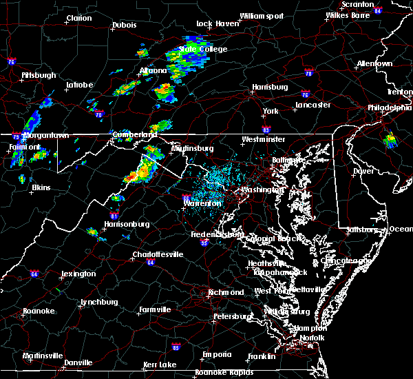 The severe thunderstorm warning for northwestern washington, northern frederick, northwestern berkeley and morgan counties will expire at 545 pm edt, the storm which prompted the warning has weakened below severe limits, and no longer poses an immediate threat to life or property. therefore the warning will be allowed to expire. The severe thunderstorm warning for northwestern washington, northern frederick, northwestern berkeley and morgan counties will expire at 545 pm edt, the storm which prompted the warning has weakened below severe limits, and no longer poses an immediate threat to life or property. therefore the warning will be allowed to expire.
|
| 7/14/2015 5:33 PM EDT |
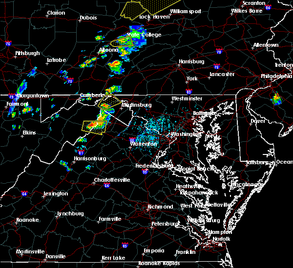 At 532 pm edt, doppler radar indicated quarter size hail and damaging winds in excess of 60 mph. this storm was located near greenwood, moving northeast at 30 mph. locations impacted include, hancock, berkeley springs, hedgesville, johnsons mill, cherry run, spruce pine hollow, great cacapon, smith crossroads, tomahawk, new hope, highland ridge, big pool, berryville, fishers bridge, ridge, shady grove, omps, valley view, stotlers crossroads and spohrs crossroads. At 532 pm edt, doppler radar indicated quarter size hail and damaging winds in excess of 60 mph. this storm was located near greenwood, moving northeast at 30 mph. locations impacted include, hancock, berkeley springs, hedgesville, johnsons mill, cherry run, spruce pine hollow, great cacapon, smith crossroads, tomahawk, new hope, highland ridge, big pool, berryville, fishers bridge, ridge, shady grove, omps, valley view, stotlers crossroads and spohrs crossroads.
|
| 7/14/2015 5:33 PM EDT |
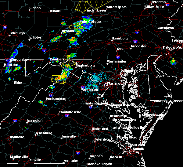 At 532 pm edt, doppler radar indicated quarter size hail and damaging winds in excess of 60 mph. this storm was located near greenwood, moving northeast at 30 mph. locations impacted include, hancock, berkeley springs, hedgesville, johnsons mill, cherry run, spruce pine hollow, great cacapon, smith crossroads, tomahawk, new hope, highland ridge, big pool, berryville, fishers bridge, ridge, shady grove, omps, valley view, stotlers crossroads and spohrs crossroads. At 532 pm edt, doppler radar indicated quarter size hail and damaging winds in excess of 60 mph. this storm was located near greenwood, moving northeast at 30 mph. locations impacted include, hancock, berkeley springs, hedgesville, johnsons mill, cherry run, spruce pine hollow, great cacapon, smith crossroads, tomahawk, new hope, highland ridge, big pool, berryville, fishers bridge, ridge, shady grove, omps, valley view, stotlers crossroads and spohrs crossroads.
|
| 7/14/2015 5:16 PM EDT |
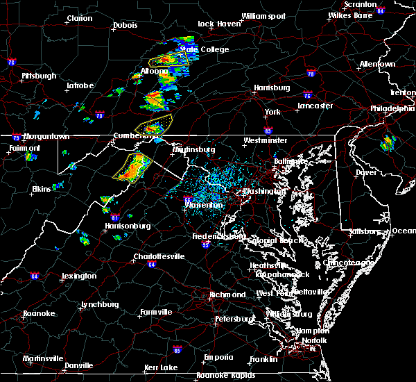 At 515 pm edt, doppler radar indicated a severe thunderstorm capable of producing damaging winds in excess of 60 mph. this storm was located near paw paw, and moving northeast at 30 mph. At 515 pm edt, doppler radar indicated a severe thunderstorm capable of producing damaging winds in excess of 60 mph. this storm was located near paw paw, and moving northeast at 30 mph.
|
| 7/14/2015 5:16 PM EDT |
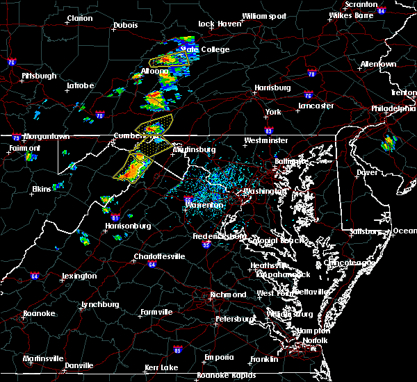 At 515 pm edt, doppler radar indicated a severe thunderstorm capable of producing damaging winds in excess of 60 mph. this storm was located near paw paw, and moving northeast at 30 mph. At 515 pm edt, doppler radar indicated a severe thunderstorm capable of producing damaging winds in excess of 60 mph. this storm was located near paw paw, and moving northeast at 30 mph.
|
| 4/20/2015 8:24 PM EDT | At 824 pm edt, doppler radar indicated a line of severe thunderstorms capable of producing damaging winds in excess of 60 mph. these storms were located along a line extending from near warfordsburg to near sleepy creek to 6 miles southeast of spruce pine hollow, and moving northeast at 25 mph. |
| 4/20/2015 8:24 PM EDT | At 824 pm edt, doppler radar indicated a line of severe thunderstorms capable of producing damaging winds in excess of 60 mph. these storms were located along a line extending from near warfordsburg to near sleepy creek to 6 miles southeast of spruce pine hollow, and moving northeast at 25 mph. |
| 4/20/2015 7:27 PM EDT | At 726 pm edt, doppler radar indicated a severe thunderstorm capable of producing quarter size hail and damaging winds in excess of 60 mph. this storm was located near largent, moving northeast at 45 mph. locations impacted include, spruce pine hollow, fishers bridge, new hope in morgan county, valley view, largent, spohrs crossroads, sleepy creek, rock gap, berkeley springs, paw paw, levels, berryville in morgan county, magnolia in morgan county, forest park, shady grove in morgan county, lineburg, bellegrove, slanesville, hancock in morgan county and great cacapon. a tornado watch remains in effect until 1000 pm edt for northwestern maryland and eastern west virginia. |
| 4/20/2015 7:27 PM EDT | At 726 pm edt, doppler radar indicated a severe thunderstorm capable of producing quarter size hail and damaging winds in excess of 60 mph. this storm was located near largent, moving northeast at 45 mph. locations impacted include, spruce pine hollow, fishers bridge, new hope in morgan county, valley view, largent, spohrs crossroads, sleepy creek, rock gap, berkeley springs, paw paw, levels, berryville in morgan county, magnolia in morgan county, forest park, shady grove in morgan county, lineburg, bellegrove, slanesville, hancock in morgan county and great cacapon. a tornado watch remains in effect until 1000 pm edt for northwestern maryland and eastern west virginia. |
| 4/20/2015 7:16 PM EDT | At 716 pm edt, doppler radar indicated a severe thunderstorm capable of producing quarter size hail and damaging winds in excess of 60 mph. this storm was located near romney, and moving northeast at 35 mph. |
| 4/20/2015 7:16 PM EDT | At 716 pm edt, doppler radar indicated a severe thunderstorm capable of producing quarter size hail and damaging winds in excess of 60 mph. this storm was located near romney, and moving northeast at 35 mph. |
| 4/20/2015 7:16 PM EDT | At 716 pm edt, doppler radar indicated a severe thunderstorm capable of producing quarter size hail and damaging winds in excess of 60 mph. this storm was located near romney, and moving northeast at 35 mph. |
| 4/20/2015 7:09 PM EDT | At 709 pm edt, doppler radar indicated a severe thunderstorm capable of producing quarter size hail and damaging winds in excess of 60 mph. this storm was located near fishers bridge, and moving northeast at 40 mph. |
| 4/20/2015 7:09 PM EDT | At 709 pm edt, doppler radar indicated a severe thunderstorm capable of producing quarter size hail and damaging winds in excess of 60 mph. this storm was located near fishers bridge, and moving northeast at 40 mph. |
| 4/20/2015 7:08 PM EDT | At 707 pm edt, trained weather spotters reported a severe thunderstorm producing quarter size hail and damaging winds in excess of 60 mph. this storm was located over berkeley springs, or near spohrs crossroads, moving northeast at 40 mph. one inch hail has been reported just west of berkeley springs. locations impacted include, new hope in morgan county, valley view, spohrs crossroads, berkeley springs, shady grove in morgan county, berryville in morgan county, hancock in morgan county, hancock in washington county, great cacapon and smith crossroads. a tornado watch remains in effect until 1000 pm edt for north central maryland and central west virginia. |
| 4/20/2015 7:08 PM EDT | At 707 pm edt, trained weather spotters reported a severe thunderstorm producing quarter size hail and damaging winds in excess of 60 mph. this storm was located over berkeley springs, or near spohrs crossroads, moving northeast at 40 mph. one inch hail has been reported just west of berkeley springs. locations impacted include, new hope in morgan county, valley view, spohrs crossroads, berkeley springs, shady grove in morgan county, berryville in morgan county, hancock in morgan county, hancock in washington county, great cacapon and smith crossroads. a tornado watch remains in effect until 1000 pm edt for north central maryland and central west virginia. |
| 4/20/2015 6:59 PM EDT | At 659 pm edt, doppler radar indicated a severe thunderstorm capable of producing quarter size hail and damaging winds in excess of 60 mph. this storm was located near valley view, and moving northeast at 45 mph. |
| 4/20/2015 6:59 PM EDT | At 659 pm edt, doppler radar indicated a severe thunderstorm capable of producing quarter size hail and damaging winds in excess of 60 mph. this storm was located near valley view, and moving northeast at 45 mph. |
| 6/8/2014 7:23 PM EDT | Trees down near the intersection of river road and pious ridge road in morgan county WV, 1 miles N of Hancock, MD |
| 5/22/2013 5:41 PM EDT | Quarter sized hail reported 4.2 miles WNW of Hancock, MD |
| 5/22/2013 5:38 PM EDT | Quarter sized hail reported 1.4 miles W of Hancock, MD, quarter sized hail on pennsylvania ave in hancock |
| 5/22/2013 5:30 PM EDT | Quarter sized hail reported 3.1 miles NNE of Hancock, MD |
| 7/8/2012 3:19 PM EDT | Powerlines down on potomac r in morgan county WV, 4.5 miles NW of Hancock, MD |
| 8/19/2011 4:03 PM EDT | Quarter sized hail reported 5.7 miles W of Hancock, MD, quarter size hail |
| 1/1/0001 12:00 AM | Several large trees down and numerous large branches down for a two mile stretch of river road in vicinity of river road and culp roa in morgan county WV, 2.2 miles WNW of Hancock, MD |
| 5/26/2011 6:45 PM EDT | Trees down and report of building collapsed in fulton county PA, 3.3 miles SSE of Hancock, MD |
| 5/26/2011 6:00 PM EDT | Numerous trees and wires down county wide with some road closures in fulton county PA, 3.3 miles SSE of Hancock, MD |
| 5/26/2011 5:11 PM EDT | Baseball sized hail reported 7.1 miles E of Hancock, MD |
Hail Maps for Hancock, MD
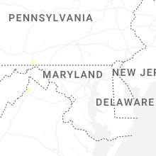
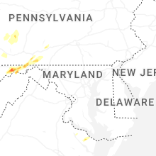


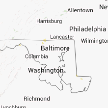


Connect with Interactive Hail Maps