

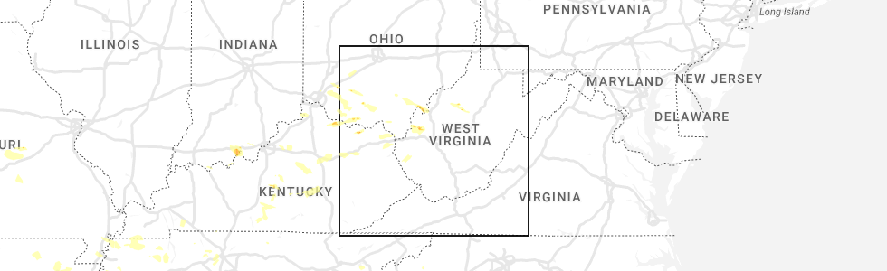
Hail Map for Hanging Rock, OH
The Hanging Rock, OH area has had 0 reports of on-the-ground hail by trained spotters, and has been under severe weather warnings 11 times during the past 12 months. Doppler radar has detected hail at or near Hanging Rock, OH on 42 occasions, including 1 occasion during the past year.
| Name: | Hanging Rock, OH |
| Where Located: | 60.8 miles WNW of Charleston, WV |
| Map: | Google Map for Hanging Rock, OH |
| Population: | 221 |
| Housing Units: | 102 |
| More Info: | Search Google for Hanging Rock, OH |
0
The Top Recent Hail Date for Hanging Rock, OH is Tuesday, July 18, 2023 (24th out of 42)
Hail and Wind Damage Spotted near Hanging Rock, OH
| Date / Time | Report Details |
|---|---|
| 4/2/2024 10:15 AM EDT |
 At 1014 am edt, severe thunderstorms were located along a line extending from near lake vesuvius to stark, moving east at 60 mph (radar indicated). Hazards include 60 mph wind gusts. Expect damage to roofs, siding, and trees. Locations impacted include, ashland, ironton, grayson, coal grove, cannonsburg, lake vesuvius, grayson lake state park, catlettsburg, greenup, princess, coalton, denton, greenbo lake, oldtown, naples, rush, flatwoods, south point, russell, and raceland. At 1014 am edt, severe thunderstorms were located along a line extending from near lake vesuvius to stark, moving east at 60 mph (radar indicated). Hazards include 60 mph wind gusts. Expect damage to roofs, siding, and trees. Locations impacted include, ashland, ironton, grayson, coal grove, cannonsburg, lake vesuvius, grayson lake state park, catlettsburg, greenup, princess, coalton, denton, greenbo lake, oldtown, naples, rush, flatwoods, south point, russell, and raceland.
|
| 4/2/2024 10:00 AM EDT |
 At 959 am edt, severe thunderstorms were located along a line extending from letitia to brandy, moving east at 60 mph (radar indicated). Hazards include 60 mph wind gusts. Expect damage to roofs, siding, and trees. Locations impacted include, ashland, ironton, grayson, coal grove, olive hill, cannonsburg, lake vesuvius, grayson lake state park, carter caves state park, catlettsburg, greenup, princess, coalton, denton, gesling, greenbo lake, oldtown, naples, rush, and load. At 959 am edt, severe thunderstorms were located along a line extending from letitia to brandy, moving east at 60 mph (radar indicated). Hazards include 60 mph wind gusts. Expect damage to roofs, siding, and trees. Locations impacted include, ashland, ironton, grayson, coal grove, olive hill, cannonsburg, lake vesuvius, grayson lake state park, carter caves state park, catlettsburg, greenup, princess, coalton, denton, gesling, greenbo lake, oldtown, naples, rush, and load.
|
| 4/2/2024 9:49 AM EDT |
 Svrrlx the national weather service in charleston west virginia has issued a * severe thunderstorm warning for, central boyd county in northeastern kentucky, greenup county in northeastern kentucky, carter county in northeastern kentucky, southern lawrence county in southeastern ohio, * until 1030 am edt. * at 949 am edt, severe thunderstorms were located along a line extending from near vanceburg to owingsville, moving east at 60 mph (radar indicated). Hazards include 60 mph wind gusts. expect damage to roofs, siding, and trees Svrrlx the national weather service in charleston west virginia has issued a * severe thunderstorm warning for, central boyd county in northeastern kentucky, greenup county in northeastern kentucky, carter county in northeastern kentucky, southern lawrence county in southeastern ohio, * until 1030 am edt. * at 949 am edt, severe thunderstorms were located along a line extending from near vanceburg to owingsville, moving east at 60 mph (radar indicated). Hazards include 60 mph wind gusts. expect damage to roofs, siding, and trees
|
| 2/28/2024 3:50 AM EST |
 Svrrlx the national weather service in charleston west virginia has issued a * severe thunderstorm warning for, northeastern boyd county in northeastern kentucky, southeastern greenup county in northeastern kentucky, southern gallia county in southeastern ohio, lawrence county in southeastern ohio, southwestern mason county in western west virginia, northern cabell county in central west virginia, west central putnam county in western west virginia, northern wayne county in western west virginia, * until 415 am est. * at 349 am est, a severe thunderstorm was located over ashland, moving northeast at 70 mph (radar indicated). Hazards include 60 mph wind gusts. expect damage to roofs, siding, and trees Svrrlx the national weather service in charleston west virginia has issued a * severe thunderstorm warning for, northeastern boyd county in northeastern kentucky, southeastern greenup county in northeastern kentucky, southern gallia county in southeastern ohio, lawrence county in southeastern ohio, southwestern mason county in western west virginia, northern cabell county in central west virginia, west central putnam county in western west virginia, northern wayne county in western west virginia, * until 415 am est. * at 349 am est, a severe thunderstorm was located over ashland, moving northeast at 70 mph (radar indicated). Hazards include 60 mph wind gusts. expect damage to roofs, siding, and trees
|
| 8/7/2023 2:27 PM EDT |
 The severe thunderstorm warning for southern greenup, northwestern carter and western lawrence counties will expire at 230 pm edt, the storm which prompted the warning has moved out of the area. therefore, the warning will be allowed to expire. a tornado watch remains in effect until 600 pm edt for northeastern kentucky, and southeastern ohio. The severe thunderstorm warning for southern greenup, northwestern carter and western lawrence counties will expire at 230 pm edt, the storm which prompted the warning has moved out of the area. therefore, the warning will be allowed to expire. a tornado watch remains in effect until 600 pm edt for northeastern kentucky, and southeastern ohio.
|
| 8/7/2023 2:05 PM EDT |
 At 205 pm edt, a severe thunderstorm was located over greenbo lake, or 9 miles north of grayson, moving east at 80 mph (radar indicated). Hazards include 60 mph wind gusts and quarter size hail. Hail damage to vehicles is expected. Expect wind damage to roofs, siding, and trees. At 205 pm edt, a severe thunderstorm was located over greenbo lake, or 9 miles north of grayson, moving east at 80 mph (radar indicated). Hazards include 60 mph wind gusts and quarter size hail. Hail damage to vehicles is expected. Expect wind damage to roofs, siding, and trees.
|
| 7/28/2023 1:46 PM EDT |
 At 146 pm edt, a severe thunderstorm was located near grayson, moving southeast at 45 mph (radar indicated). Hazards include 60 mph wind gusts. expect damage to roofs, siding, and trees At 146 pm edt, a severe thunderstorm was located near grayson, moving southeast at 45 mph (radar indicated). Hazards include 60 mph wind gusts. expect damage to roofs, siding, and trees
|
| 3/3/2023 5:00 PM EST |
 At 459 pm est, a line of severe thunderstorms was located near lake vesuvius, moving northeast at 60 mph (radar indicated). Hazards include 60 mph wind gusts. Expect damage to roofs, siding, and trees. locations impacted include, huntington, ashland, ironton, coal grove, lake vesuvius, ceredo, gallia, south point, vernon, waterloo, burlington, aid, hanging rock and pedro. hail threat, radar indicated max hail size, <. 75 in wind threat, radar indicated max wind gust, 60 mph. At 459 pm est, a line of severe thunderstorms was located near lake vesuvius, moving northeast at 60 mph (radar indicated). Hazards include 60 mph wind gusts. Expect damage to roofs, siding, and trees. locations impacted include, huntington, ashland, ironton, coal grove, lake vesuvius, ceredo, gallia, south point, vernon, waterloo, burlington, aid, hanging rock and pedro. hail threat, radar indicated max hail size, <. 75 in wind threat, radar indicated max wind gust, 60 mph.
|
| 3/3/2023 4:46 PM EST |
 At 445 pm est, a severe thunderstorm was located near greenup, or near ironton, moving east at 60 mph (radar indicated). Hazards include 60 mph wind gusts. expect damage to roofs, siding, and trees At 445 pm est, a severe thunderstorm was located near greenup, or near ironton, moving east at 60 mph (radar indicated). Hazards include 60 mph wind gusts. expect damage to roofs, siding, and trees
|
| 3/3/2023 4:25 PM EST |
 At 424 pm est, a severe thunderstorm was located near grayson, moving east at 60 mph (radar indicated). Hazards include 60 mph wind gusts. Expect damage to roofs, siding, and trees. locations impacted include, ashland, grayson, olive hill, blaine, cannonsburg, grayson lake state park, yatesville lake state park, carter caves state park, greenup, webbville, princess, coalton, denton, gesling, greenbo lake, oldtown, naples, martha, rush and load. hail threat, radar indicated max hail size, <. 75 in wind threat, radar indicated max wind gust, 60 mph. At 424 pm est, a severe thunderstorm was located near grayson, moving east at 60 mph (radar indicated). Hazards include 60 mph wind gusts. Expect damage to roofs, siding, and trees. locations impacted include, ashland, grayson, olive hill, blaine, cannonsburg, grayson lake state park, yatesville lake state park, carter caves state park, greenup, webbville, princess, coalton, denton, gesling, greenbo lake, oldtown, naples, martha, rush and load. hail threat, radar indicated max hail size, <. 75 in wind threat, radar indicated max wind gust, 60 mph.
|
| 3/3/2023 4:07 PM EST |
 At 406 pm est, a severe thunderstorm was located over grayson, moving east at 60 mph (radar indicated). Hazards include 60 mph wind gusts. expect damage to roofs, siding, and trees At 406 pm est, a severe thunderstorm was located over grayson, moving east at 60 mph (radar indicated). Hazards include 60 mph wind gusts. expect damage to roofs, siding, and trees
|
| 10/12/2022 5:00 PM EDT |
 At 500 pm edt, a severe thunderstorm was located over naples, or near cannonsburg, moving northeast at 30 mph (radar indicated). Hazards include 60 mph wind gusts and quarter size hail. Hail damage to vehicles is expected. Expect wind damage to roofs, siding, and trees. At 500 pm edt, a severe thunderstorm was located over naples, or near cannonsburg, moving northeast at 30 mph (radar indicated). Hazards include 60 mph wind gusts and quarter size hail. Hail damage to vehicles is expected. Expect wind damage to roofs, siding, and trees.
|
| 7/6/2022 5:15 PM EDT |
 At 514 pm edt, severe thunderstorms were located along a line extending from 6 miles northeast of oak hill to near lake vesuvius to naples, moving east at 50 mph (radar indicated). Hazards include 60 mph wind gusts. expect damage to roofs, siding, and trees At 514 pm edt, severe thunderstorms were located along a line extending from 6 miles northeast of oak hill to near lake vesuvius to naples, moving east at 50 mph (radar indicated). Hazards include 60 mph wind gusts. expect damage to roofs, siding, and trees
|
| 7/6/2022 5:07 PM EDT |
 At 506 pm edt, severe thunderstorms were located along a line extending from 7 miles north of clarktown to 6 miles southwest of letitia to goddard, and are nearly stationary (radar indicated). Hazards include 60 mph wind gusts and penny size hail. Expect damage to roofs, siding, and trees. locations impacted include, ashland, ironton, jackson, grayson, coal grove, olive hill, oak hill, rio grande, lake vesuvius, carter caves state park, grayson lake state park, greenup, coalton, gesling, greenbo lake, oldtown, naples, load, letitia and gallia. hail threat, radar indicated max hail size, 0. 75 in wind threat, radar indicated max wind gust, 60 mph. At 506 pm edt, severe thunderstorms were located along a line extending from 7 miles north of clarktown to 6 miles southwest of letitia to goddard, and are nearly stationary (radar indicated). Hazards include 60 mph wind gusts and penny size hail. Expect damage to roofs, siding, and trees. locations impacted include, ashland, ironton, jackson, grayson, coal grove, olive hill, oak hill, rio grande, lake vesuvius, carter caves state park, grayson lake state park, greenup, coalton, gesling, greenbo lake, oldtown, naples, load, letitia and gallia. hail threat, radar indicated max hail size, 0. 75 in wind threat, radar indicated max wind gust, 60 mph.
|
| 7/6/2022 4:48 PM EDT |
 At 446 pm edt, severe thunderstorms were located along a line extending from 7 miles north of clarktown to 6 miles southwest of letitia to goddard, moving southeast at 35 mph (radar indicated). Hazards include 60 mph wind gusts and penny size hail. expect damage to roofs, siding, and trees At 446 pm edt, severe thunderstorms were located along a line extending from 7 miles north of clarktown to 6 miles southwest of letitia to goddard, moving southeast at 35 mph (radar indicated). Hazards include 60 mph wind gusts and penny size hail. expect damage to roofs, siding, and trees
|
| 6/22/2022 6:52 PM EDT |
 At 652 pm edt, severe thunderstorms were located along a line extending from near clarktown to stoops, moving south at 45 mph (radar indicated). Hazards include 60 mph wind gusts. expect damage to roofs, siding, and trees At 652 pm edt, severe thunderstorms were located along a line extending from near clarktown to stoops, moving south at 45 mph (radar indicated). Hazards include 60 mph wind gusts. expect damage to roofs, siding, and trees
|
| 6/17/2022 1:51 PM EDT |
 At 151 pm edt, severe thunderstorms were located along a line extending from near south webster to near vanceburg, moving east at 50 mph (radar indicated). Hazards include 60 mph wind gusts. expect damage to roofs, siding, and trees At 151 pm edt, severe thunderstorms were located along a line extending from near south webster to near vanceburg, moving east at 50 mph (radar indicated). Hazards include 60 mph wind gusts. expect damage to roofs, siding, and trees
|
| 6/13/2021 4:32 PM EDT |
 At 431 pm edt, severe thunderstorms were located along a line extending from 8 miles northwest of letitia to 6 miles northeast of franklin furnace, moving south at 20 mph (radar indicated). Hazards include 60 mph wind gusts and penny size hail. Expect damage to roofs, siding, and trees. Locations impacted include, ironton, greenup, load, letitia, flatwoods, russell, vernon, raceland, worthington, south shore, wurtland, hanging rock, brushart, grays branch and pedro. At 431 pm edt, severe thunderstorms were located along a line extending from 8 miles northwest of letitia to 6 miles northeast of franklin furnace, moving south at 20 mph (radar indicated). Hazards include 60 mph wind gusts and penny size hail. Expect damage to roofs, siding, and trees. Locations impacted include, ironton, greenup, load, letitia, flatwoods, russell, vernon, raceland, worthington, south shore, wurtland, hanging rock, brushart, grays branch and pedro.
|
| 6/13/2021 4:09 PM EDT |
 At 409 pm edt, severe thunderstorms were located along a line extending from 11 miles southwest of lucasville to near south webster, moving southeast at 25 mph (radar indicated). Hazards include 60 mph wind gusts and quarter size hail. Hail damage to vehicles is expected. Expect wind damage to roofs, siding, and trees. At 409 pm edt, severe thunderstorms were located along a line extending from 11 miles southwest of lucasville to near south webster, moving southeast at 25 mph (radar indicated). Hazards include 60 mph wind gusts and quarter size hail. Hail damage to vehicles is expected. Expect wind damage to roofs, siding, and trees.
|
| 8/3/2020 10:55 PM EDT |
 The severe thunderstorm warning for central greenup and west central lawrence counties will expire at 1100 pm edt, the storm which prompted the warning has weakened below severe limits, and no longer poses an immediate threat to life or property. therefore, the warning will be allowed to expire. The severe thunderstorm warning for central greenup and west central lawrence counties will expire at 1100 pm edt, the storm which prompted the warning has weakened below severe limits, and no longer poses an immediate threat to life or property. therefore, the warning will be allowed to expire.
|
| 8/3/2020 10:28 PM EDT |
 At 1027 pm edt, a severe thunderstorm was located near load, or 11 miles south of portsmouth, moving east at 20 mph (radar indicated). Hazards include 60 mph wind gusts and penny size hail. expect damage to roofs, siding, and trees At 1027 pm edt, a severe thunderstorm was located near load, or 11 miles south of portsmouth, moving east at 20 mph (radar indicated). Hazards include 60 mph wind gusts and penny size hail. expect damage to roofs, siding, and trees
|
| 8/1/2020 4:18 PM EDT |
 At 417 pm edt, severe thunderstorms were located along a line extending from near clarktown to near south webster to ashland, moving northeast at 40 mph (radar indicated). Hazards include 60 mph wind gusts and penny size hail. Expect damage to roofs, siding, and trees. Locations impacted include, ashland, ironton, jackson, coal grove, oak hill, lake vesuvius, gallia, vernon, worthington, hanging rock, mabee, petersburg and pedro. At 417 pm edt, severe thunderstorms were located along a line extending from near clarktown to near south webster to ashland, moving northeast at 40 mph (radar indicated). Hazards include 60 mph wind gusts and penny size hail. Expect damage to roofs, siding, and trees. Locations impacted include, ashland, ironton, jackson, coal grove, oak hill, lake vesuvius, gallia, vernon, worthington, hanging rock, mabee, petersburg and pedro.
|
| 8/1/2020 3:58 PM EDT |
 At 358 pm edt, severe thunderstorms were located along a line extending from south shore to near greenup to near rush, moving northeast at 40 mph (radar indicated). Hazards include 60 mph wind gusts and penny size hail. expect damage to roofs, siding, and trees At 358 pm edt, severe thunderstorms were located along a line extending from south shore to near greenup to near rush, moving northeast at 40 mph (radar indicated). Hazards include 60 mph wind gusts and penny size hail. expect damage to roofs, siding, and trees
|
| 6/10/2020 8:58 PM EDT |
 The severe thunderstorm warning for northern boyd, southeastern greenup, east central carter, gallia, southeastern jackson, lawrence and northwestern cabell counties will expire at 900 pm edt, the storms which prompted the warning have weakened below severe limits, and no longer pose an immediate threat to life or property. therefore, the warning will be allowed to expire. however gusty winds are still possible with these thunderstorms. a severe thunderstorm watch remains in effect until 100 am edt for northeastern kentucky, southeastern ohio, and central and western west virginia. to report severe weather, contact your nearest law enforcement agency. they will relay your report to the national weather service charleston west virginia. remember, a tornado warning still remains in effect for gallia county until 9 15 pm edt. The severe thunderstorm warning for northern boyd, southeastern greenup, east central carter, gallia, southeastern jackson, lawrence and northwestern cabell counties will expire at 900 pm edt, the storms which prompted the warning have weakened below severe limits, and no longer pose an immediate threat to life or property. therefore, the warning will be allowed to expire. however gusty winds are still possible with these thunderstorms. a severe thunderstorm watch remains in effect until 100 am edt for northeastern kentucky, southeastern ohio, and central and western west virginia. to report severe weather, contact your nearest law enforcement agency. they will relay your report to the national weather service charleston west virginia. remember, a tornado warning still remains in effect for gallia county until 9 15 pm edt.
|
| 6/10/2020 8:35 PM EDT |
 At 835 pm edt, a severe thunderstorm capable of producing a tornado was located near ironton, moving northeast at 40 mph (radar indicated rotation). Hazards include tornado. Flying debris will be dangerous to those caught without shelter. mobile homes will be damaged or destroyed. damage to roofs, windows, and vehicles will occur. tree damage is likely. this dangerous storm will be near, ironton around 840 pm edt. lake vesuvius around 850 pm edt. Other locations impacted by this tornadic thunderstorm include raceland, russell, flatwoods, worthington, pedro, hanging rock and bellefonte. At 835 pm edt, a severe thunderstorm capable of producing a tornado was located near ironton, moving northeast at 40 mph (radar indicated rotation). Hazards include tornado. Flying debris will be dangerous to those caught without shelter. mobile homes will be damaged or destroyed. damage to roofs, windows, and vehicles will occur. tree damage is likely. this dangerous storm will be near, ironton around 840 pm edt. lake vesuvius around 850 pm edt. Other locations impacted by this tornadic thunderstorm include raceland, russell, flatwoods, worthington, pedro, hanging rock and bellefonte.
|
| 6/10/2020 8:24 PM EDT |
 At 824 pm edt, severe thunderstorms were located along a line extending from rio grande to near lake vesuvius to near oldtown, moving northeast at 40 mph (radar indicated). Hazards include 60 mph wind gusts and quarter size hail. Hail damage to vehicles is expected. expect wind damage to roofs, siding, and trees. Locations impacted include, huntington, ashland, ironton, grayson, gallipolis, coal grove, oak hill, rio grande, chesapeake, cannonsburg, lake vesuvius, kenova, catlettsburg, ceredo, princess, coalton, naples, gallia, flatwoods and south point. At 824 pm edt, severe thunderstorms were located along a line extending from rio grande to near lake vesuvius to near oldtown, moving northeast at 40 mph (radar indicated). Hazards include 60 mph wind gusts and quarter size hail. Hail damage to vehicles is expected. expect wind damage to roofs, siding, and trees. Locations impacted include, huntington, ashland, ironton, grayson, gallipolis, coal grove, oak hill, rio grande, chesapeake, cannonsburg, lake vesuvius, kenova, catlettsburg, ceredo, princess, coalton, naples, gallia, flatwoods and south point.
|
| 6/10/2020 7:59 PM EDT |
 At 758 pm edt, severe thunderstorms were located along a line extending from near south webster to near greenbo lake to near olive hill, moving northeast at 45 mph (radar indicated). Hazards include 70 mph wind gusts and half dollar size hail. Hail damage to vehicles is expected. expect considerable tree damage. Wind damage is also likely to mobile homes, roofs, and outbuildings. At 758 pm edt, severe thunderstorms were located along a line extending from near south webster to near greenbo lake to near olive hill, moving northeast at 45 mph (radar indicated). Hazards include 70 mph wind gusts and half dollar size hail. Hail damage to vehicles is expected. expect considerable tree damage. Wind damage is also likely to mobile homes, roofs, and outbuildings.
|
| 6/10/2020 7:36 PM EDT |
 At 736 pm edt, severe thunderstorms were located along a line extending from near mcarthur to 7 miles northeast of oak hill to near lake vesuvius, moving northeast at 50 mph (radar indicated). Hazards include 60 mph wind gusts. Expect damage to roofs, siding, and trees. Locations impacted include, athens, ironton, jackson, wellston, oak hill, rio grande, albany, rutland, lake vesuvius, greenup, gesling, greenbo lake, load, letitia, gallia, carter, flatwoods, russell, vernon and waterloo. At 736 pm edt, severe thunderstorms were located along a line extending from near mcarthur to 7 miles northeast of oak hill to near lake vesuvius, moving northeast at 50 mph (radar indicated). Hazards include 60 mph wind gusts. Expect damage to roofs, siding, and trees. Locations impacted include, athens, ironton, jackson, wellston, oak hill, rio grande, albany, rutland, lake vesuvius, greenup, gesling, greenbo lake, load, letitia, gallia, carter, flatwoods, russell, vernon and waterloo.
|
| 6/10/2020 6:48 PM EDT |
 At 647 pm edt, severe thunderstorms were located along a line extending from 7 miles northwest of lucasville to 7 miles west of south shore to near head of grassy, moving northeast at 50 mph (radar indicated). Hazards include 60 mph wind gusts. expect damage to roofs, siding, and trees At 647 pm edt, severe thunderstorms were located along a line extending from 7 miles northwest of lucasville to 7 miles west of south shore to near head of grassy, moving northeast at 50 mph (radar indicated). Hazards include 60 mph wind gusts. expect damage to roofs, siding, and trees
|
| 4/9/2020 12:29 AM EDT |
 At 1228 am edt, severe thunderstorms were located along a line extending from 8 miles south of oak hill to culver, moving southeast at 65 mph (radar indicated). Hazards include 70 mph wind gusts and penny size hail. Expect considerable tree damage. damage is likely to mobile homes, roofs, and outbuildings. Locations impacted include, ashland, ironton, grayson, gallipolis, coal grove, cannonsburg, lake vesuvius, kenova, catlettsburg, greenup, princess, coalton, denton, oldtown, naples, rush, flatwoods, south point, russell and vernon. At 1228 am edt, severe thunderstorms were located along a line extending from 8 miles south of oak hill to culver, moving southeast at 65 mph (radar indicated). Hazards include 70 mph wind gusts and penny size hail. Expect considerable tree damage. damage is likely to mobile homes, roofs, and outbuildings. Locations impacted include, ashland, ironton, grayson, gallipolis, coal grove, cannonsburg, lake vesuvius, kenova, catlettsburg, greenup, princess, coalton, denton, oldtown, naples, rush, flatwoods, south point, russell and vernon.
|
| 4/9/2020 12:12 AM EDT |
 At 1212 am edt, severe thunderstorms were located along a line extending from near jackson to near olive hill, moving east at 60 mph (radar indicated). Hazards include 70 mph wind gusts and penny size hail. Expect considerable tree damage. damage is likely to mobile homes, roofs, and outbuildings. Locations impacted include, ashland, ironton, jackson, wellston, grayson, gallipolis, coal grove, olive hill, cannonsburg, lake vesuvius, carter caves state park, kenova, catlettsburg, greenup, coalton, denton, gesling, greenbo lake, oldtown and load. At 1212 am edt, severe thunderstorms were located along a line extending from near jackson to near olive hill, moving east at 60 mph (radar indicated). Hazards include 70 mph wind gusts and penny size hail. Expect considerable tree damage. damage is likely to mobile homes, roofs, and outbuildings. Locations impacted include, ashland, ironton, jackson, wellston, grayson, gallipolis, coal grove, olive hill, cannonsburg, lake vesuvius, carter caves state park, kenova, catlettsburg, greenup, coalton, denton, gesling, greenbo lake, oldtown and load.
|
| 4/8/2020 11:52 PM EDT |
 At 1151 pm edt, severe thunderstorms were located along a line extending from 10 miles west of lucasville to 8 miles southwest of vanceburg to ewington, moving southeast at 65 mph (radar indicated). Hazards include 70 mph wind gusts and penny size hail. Expect considerable tree damage. Damage is likely to mobile homes, roofs, and outbuildings. At 1151 pm edt, severe thunderstorms were located along a line extending from 10 miles west of lucasville to 8 miles southwest of vanceburg to ewington, moving southeast at 65 mph (radar indicated). Hazards include 70 mph wind gusts and penny size hail. Expect considerable tree damage. Damage is likely to mobile homes, roofs, and outbuildings.
|
| 4/8/2020 2:01 PM EDT |
 At 159 pm edt, severe thunderstorms were located along a line extending from near greenup to 9 miles north of proctorville, moving southeast at 30 mph (radar indicated). Hazards include 60 mph wind gusts and quarter size hail. Hail damage to vehicles is expected. Expect wind damage to roofs, siding, and trees. At 159 pm edt, severe thunderstorms were located along a line extending from near greenup to 9 miles north of proctorville, moving southeast at 30 mph (radar indicated). Hazards include 60 mph wind gusts and quarter size hail. Hail damage to vehicles is expected. Expect wind damage to roofs, siding, and trees.
|
| 1/11/2020 2:55 PM EST |
 At 255 pm est, severe thunderstorms were located along a line extending from new boston to grayson, moving east at 55 mph (radar indicated). Hazards include 60 mph wind gusts. Expect damage to roofs, siding, and trees. Locations impacted include, ashland, ironton, grayson, coal grove, oak hill, cannonsburg, lake vesuvius, grayson lake state park, greenup, princess, coalton, denton, greenbo lake, oldtown, naples, rush, load, letitia, flatwoods and russell. At 255 pm est, severe thunderstorms were located along a line extending from new boston to grayson, moving east at 55 mph (radar indicated). Hazards include 60 mph wind gusts. Expect damage to roofs, siding, and trees. Locations impacted include, ashland, ironton, grayson, coal grove, oak hill, cannonsburg, lake vesuvius, grayson lake state park, greenup, princess, coalton, denton, greenbo lake, oldtown, naples, rush, load, letitia, flatwoods and russell.
|
| 1/11/2020 2:43 PM EST |
 At 243 pm est, severe thunderstorms were located along a line extending from near letitia to near olive hill, moving east at 50 mph (radar indicated). Hazards include 60 mph wind gusts. expect damage to roofs, siding, and trees At 243 pm est, severe thunderstorms were located along a line extending from near letitia to near olive hill, moving east at 50 mph (radar indicated). Hazards include 60 mph wind gusts. expect damage to roofs, siding, and trees
|
| 6/16/2019 8:22 PM EDT |
 At 822 pm edt, severe thunderstorms were located along a line extending from near franklin furnace to near cannonsburg to near martha, moving east at 30 mph (radar indicated). Hazards include 60 mph wind gusts and quarter size hail. Hail damage to vehicles is expected. expect wind damage to roofs, siding, and trees. Locations impacted include, huntington, ashland, ironton, grayson, louisa, coal grove, wayne, chesapeake, proctorville, blaine, beech fork state park, cannonsburg, lake vesuvius, yatesville lake state park, barboursville, kenova, catlettsburg, ceredo, fort gay and coalton. At 822 pm edt, severe thunderstorms were located along a line extending from near franklin furnace to near cannonsburg to near martha, moving east at 30 mph (radar indicated). Hazards include 60 mph wind gusts and quarter size hail. Hail damage to vehicles is expected. expect wind damage to roofs, siding, and trees. Locations impacted include, huntington, ashland, ironton, grayson, louisa, coal grove, wayne, chesapeake, proctorville, blaine, beech fork state park, cannonsburg, lake vesuvius, yatesville lake state park, barboursville, kenova, catlettsburg, ceredo, fort gay and coalton.
|
| 6/16/2019 7:59 PM EDT |
 At 759 pm edt, severe thunderstorms were located along a line extending from near letitia to near grayson to near little sandy, moving east at 30 mph (radar indicated). Hazards include 60 mph wind gusts and quarter size hail. Hail damage to vehicles is expected. Expect wind damage to roofs, siding, and trees. At 759 pm edt, severe thunderstorms were located along a line extending from near letitia to near grayson to near little sandy, moving east at 30 mph (radar indicated). Hazards include 60 mph wind gusts and quarter size hail. Hail damage to vehicles is expected. Expect wind damage to roofs, siding, and trees.
|
| 6/16/2019 1:27 PM EDT |
 At 126 pm edt, a severe thunderstorm was located over naples, or near ironton, moving east at 40 mph (radar indicated). Hazards include 60 mph wind gusts and nickel size hail. expect damage to roofs, siding, and trees At 126 pm edt, a severe thunderstorm was located over naples, or near ironton, moving east at 40 mph (radar indicated). Hazards include 60 mph wind gusts and nickel size hail. expect damage to roofs, siding, and trees
|
| 6/2/2019 1:26 PM EDT |
 At 126 pm edt, a severe thunderstorm was located over ironton, moving southeast at 25 mph (radar indicated). Hazards include 65 mph wind gusts and half dollar size hail. Hail damage to vehicles is expected. Expect wind damage to roofs, siding, and trees. At 126 pm edt, a severe thunderstorm was located over ironton, moving southeast at 25 mph (radar indicated). Hazards include 65 mph wind gusts and half dollar size hail. Hail damage to vehicles is expected. Expect wind damage to roofs, siding, and trees.
|
| 5/29/2019 11:36 AM EDT |
 At 1136 am edt, a severe thunderstorm was located near south shore, or near portsmouth, moving east at 40 mph (radar indicated). Hazards include 60 mph wind gusts and quarter size hail. Hail damage to vehicles is expected. Expect wind damage to roofs, siding, and trees. At 1136 am edt, a severe thunderstorm was located near south shore, or near portsmouth, moving east at 40 mph (radar indicated). Hazards include 60 mph wind gusts and quarter size hail. Hail damage to vehicles is expected. Expect wind damage to roofs, siding, and trees.
|
| 3/15/2019 12:45 AM EDT |
 At 1245 am edt, a severe thunderstorm was located near ironton, moving northeast at 65 mph (radar indicated). Hazards include 60 mph wind gusts. expect damage to roofs, siding, and trees At 1245 am edt, a severe thunderstorm was located near ironton, moving northeast at 65 mph (radar indicated). Hazards include 60 mph wind gusts. expect damage to roofs, siding, and trees
|
| 9/2/2018 4:26 PM EDT |
 At 426 pm edt, a severe thunderstorm was located over naples, or near cannonsburg, and is nearly stationary (radar indicated). Hazards include 60 mph wind gusts and quarter size hail. Minor hail damage to vehicles is possible. expect wind damage to trees and power lines, resulting in some power outages. Locations impacted include, greenup, naples, flatwoods, russell, raceland, worthington, wurtland, bellefonte and hanging rock. At 426 pm edt, a severe thunderstorm was located over naples, or near cannonsburg, and is nearly stationary (radar indicated). Hazards include 60 mph wind gusts and quarter size hail. Minor hail damage to vehicles is possible. expect wind damage to trees and power lines, resulting in some power outages. Locations impacted include, greenup, naples, flatwoods, russell, raceland, worthington, wurtland, bellefonte and hanging rock.
|
| 9/2/2018 4:08 PM EDT |
 At 408 pm edt, a severe thunderstorm was located over naples, or near cannonsburg, and is nearly stationary (radar indicated). Hazards include 60 mph wind gusts and quarter size hail. Minor hail damage to vehicles is possible. Expect wind damage to trees and power lines, resulting in some power outages. At 408 pm edt, a severe thunderstorm was located over naples, or near cannonsburg, and is nearly stationary (radar indicated). Hazards include 60 mph wind gusts and quarter size hail. Minor hail damage to vehicles is possible. Expect wind damage to trees and power lines, resulting in some power outages.
|
| 7/2/2018 7:38 PM EDT |
 The severe thunderstorm warning for western gallia, southern jackson and central lawrence counties will expire at 745 pm edt, the storm which prompted the warning has weakened below severe limits, and no longer poses an immediate threat to life or property. therefore, the warning will be allowed to expire. however heavy rain is still possible with this thunderstorm. The severe thunderstorm warning for western gallia, southern jackson and central lawrence counties will expire at 745 pm edt, the storm which prompted the warning has weakened below severe limits, and no longer poses an immediate threat to life or property. therefore, the warning will be allowed to expire. however heavy rain is still possible with this thunderstorm.
|
| 7/2/2018 7:14 PM EDT |
 At 714 pm edt, a severe thunderstorm was located near south webster, or 8 miles southwest of oak hill, moving southeast at 10 mph (radar indicated). Hazards include 60 mph wind gusts. Expect damage to roofs, siding, and trees. Locations impacted include, ironton, coal grove, oak hill, rio grande, lake vesuvius, gallia, russell, vernon, waterloo, hanging rock, mabee, petersburg, gage, pedro and centerpoint. At 714 pm edt, a severe thunderstorm was located near south webster, or 8 miles southwest of oak hill, moving southeast at 10 mph (radar indicated). Hazards include 60 mph wind gusts. Expect damage to roofs, siding, and trees. Locations impacted include, ironton, coal grove, oak hill, rio grande, lake vesuvius, gallia, russell, vernon, waterloo, hanging rock, mabee, petersburg, gage, pedro and centerpoint.
|
| 7/2/2018 6:44 PM EDT |
 At 644 pm edt, a severe thunderstorm was located near clarktown, or near wheelersburg, moving southeast at 15 mph (radar indicated). Hazards include 60 mph wind gusts. expect damage to roofs, siding, and trees At 644 pm edt, a severe thunderstorm was located near clarktown, or near wheelersburg, moving southeast at 15 mph (radar indicated). Hazards include 60 mph wind gusts. expect damage to roofs, siding, and trees
|
| 6/13/2018 9:49 PM EDT |
 At 948 pm edt, a severe thunderstorm was located over lake vesuvius, moving southeast at 20 mph (radar indicated). Hazards include 60 mph wind gusts. Expect damage to roofs, siding, and trees. Locations impacted include, ironton, lake vesuvius, hanging rock and pedro. At 948 pm edt, a severe thunderstorm was located over lake vesuvius, moving southeast at 20 mph (radar indicated). Hazards include 60 mph wind gusts. Expect damage to roofs, siding, and trees. Locations impacted include, ironton, lake vesuvius, hanging rock and pedro.
|
| 6/13/2018 9:30 PM EDT |
 At 930 pm edt, a severe thunderstorm was located near wheelersburg, moving southeast at 20 mph (radar indicated). Hazards include 60 mph wind gusts and quarter size hail. Hail damage to vehicles is expected. Expect wind damage to roofs, siding, and trees. At 930 pm edt, a severe thunderstorm was located near wheelersburg, moving southeast at 20 mph (radar indicated). Hazards include 60 mph wind gusts and quarter size hail. Hail damage to vehicles is expected. Expect wind damage to roofs, siding, and trees.
|
| 5/21/2018 6:25 PM EDT |
 At 625 pm edt, a severe thunderstorm was located over oldtown, or 8 miles north of grayson, moving north at 15 mph (radar indicated). Hazards include 60 mph wind gusts and quarter size hail. Hail damage to vehicles is expected. Expect wind damage to roofs, siding, and trees. At 625 pm edt, a severe thunderstorm was located over oldtown, or 8 miles north of grayson, moving north at 15 mph (radar indicated). Hazards include 60 mph wind gusts and quarter size hail. Hail damage to vehicles is expected. Expect wind damage to roofs, siding, and trees.
|
| 1/22/2018 11:49 PM EST |
 At 1149 pm est, severe thunderstorms were located along a line extending from ironton to near rush, moving northeast at 65 mph (radar indicated). Hazards include 60 mph wind gusts and quarter size hail. Hail damage to vehicles is expected. Expect wind damage to roofs, siding, and trees. At 1149 pm est, severe thunderstorms were located along a line extending from ironton to near rush, moving northeast at 65 mph (radar indicated). Hazards include 60 mph wind gusts and quarter size hail. Hail damage to vehicles is expected. Expect wind damage to roofs, siding, and trees.
|
| 7/7/2017 8:46 PM EDT |
 At 846 pm edt, severe thunderstorms were located along a line extending from near racine to near rush, moving southeast at 35 mph (radar indicated). Hazards include 60 mph wind gusts and nickel size hail. expect damage to roofs, siding, and trees At 846 pm edt, severe thunderstorms were located along a line extending from near racine to near rush, moving southeast at 35 mph (radar indicated). Hazards include 60 mph wind gusts and nickel size hail. expect damage to roofs, siding, and trees
|
| 7/7/2017 8:32 PM EDT |
 At 832 pm edt, severe thunderstorms were located along a line extending from new haven to near oldtown, moving southeast at 25 mph (radar indicated). Hazards include 60 mph wind gusts and nickel size hail. Expect damage to roofs, siding, and trees. locations impacted include, ashland, ironton, point pleasant, grayson, gallipolis, coal grove, pomeroy, olive hill, rio grande, chesapeake, racine, rutland, cannonsburg, lake vesuvius, carter caves state park, kenova, catlettsburg, new haven, ceredo and greenup. This includes interstate 64 in kentucky between mile markers 151 and 190. At 832 pm edt, severe thunderstorms were located along a line extending from new haven to near oldtown, moving southeast at 25 mph (radar indicated). Hazards include 60 mph wind gusts and nickel size hail. Expect damage to roofs, siding, and trees. locations impacted include, ashland, ironton, point pleasant, grayson, gallipolis, coal grove, pomeroy, olive hill, rio grande, chesapeake, racine, rutland, cannonsburg, lake vesuvius, carter caves state park, kenova, catlettsburg, new haven, ceredo and greenup. This includes interstate 64 in kentucky between mile markers 151 and 190.
|
| 7/7/2017 8:16 PM EDT |
 At 816 pm edt, severe thunderstorms were located along a line extending from near pomeroy to near load, moving southeast at 30 mph (radar indicated). Hazards include 60 mph wind gusts and nickel size hail. Expect damage to roofs, siding, and trees. locations impacted include, ashland, portsmouth, ironton, jackson, wellston, point pleasant, grayson, gallipolis, coal grove, pomeroy, olive hill, oak hill, rio grande, chesapeake, racine, rutland, cannonsburg, lake vesuvius, carter caves state park and kenova. This includes interstate 64 in kentucky between mile markers 151 and 190. At 816 pm edt, severe thunderstorms were located along a line extending from near pomeroy to near load, moving southeast at 30 mph (radar indicated). Hazards include 60 mph wind gusts and nickel size hail. Expect damage to roofs, siding, and trees. locations impacted include, ashland, portsmouth, ironton, jackson, wellston, point pleasant, grayson, gallipolis, coal grove, pomeroy, olive hill, oak hill, rio grande, chesapeake, racine, rutland, cannonsburg, lake vesuvius, carter caves state park and kenova. This includes interstate 64 in kentucky between mile markers 151 and 190.
|
| 7/7/2017 7:47 PM EDT |
 At 747 pm edt, severe thunderstorms were located along a line extending from 8 miles south of chesterhill to near vanceburg, moving southeast at 30 mph (radar indicated). Hazards include 60 mph wind gusts and nickel size hail. expect damage to roofs, siding, and trees At 747 pm edt, severe thunderstorms were located along a line extending from 8 miles south of chesterhill to near vanceburg, moving southeast at 30 mph (radar indicated). Hazards include 60 mph wind gusts and nickel size hail. expect damage to roofs, siding, and trees
|
| 5/24/2017 8:06 PM EDT |
 At 805 pm edt, a thunderstorm capable of producing a tornado was located over ironton, moving northeast at 30 mph (radar indicated rotation). Hazards include tornado. Flying debris will be dangerous to those caught without shelter. mobile homes will be damaged or destroyed. damage to roofs, windows, and vehicles will occur. tree damage is likely. this dangerous storm will be near, lake vesuvius around 820 pm edt. other locations impacted by this tornadic thunderstorm include raceland, russell, flatwoods, worthington, pedro, bellefonte and hanging rock. At 805 pm edt, a thunderstorm capable of producing a tornado was located over ironton, moving northeast at 30 mph (radar indicated rotation). Hazards include tornado. Flying debris will be dangerous to those caught without shelter. mobile homes will be damaged or destroyed. damage to roofs, windows, and vehicles will occur. tree damage is likely. this dangerous storm will be near, lake vesuvius around 820 pm edt. other locations impacted by this tornadic thunderstorm include raceland, russell, flatwoods, worthington, pedro, bellefonte and hanging rock.
|
| 4/29/2017 3:38 AM EDT |
 At 338 am edt, a severe thunderstorm was located over coal grove, moving east at 60 mph (radar indicated). Hazards include 60 mph wind gusts and penny size hail. Expect damage to roofs, siding, and trees. locations impacted include, huntington, ashland, ironton, coal grove, chesapeake, proctorville, cannonsburg, lake vesuvius, barboursville, kenova, catlettsburg, ceredo, greenup, princess, coalton, greenbo lake, oldtown, naples, rush and durbin. this includes the following highways, interstate 64 in kentucky between mile markers 174 and 191. Interstate 64 in west virginia between mile markers 1 and 15. At 338 am edt, a severe thunderstorm was located over coal grove, moving east at 60 mph (radar indicated). Hazards include 60 mph wind gusts and penny size hail. Expect damage to roofs, siding, and trees. locations impacted include, huntington, ashland, ironton, coal grove, chesapeake, proctorville, cannonsburg, lake vesuvius, barboursville, kenova, catlettsburg, ceredo, greenup, princess, coalton, greenbo lake, oldtown, naples, rush and durbin. this includes the following highways, interstate 64 in kentucky between mile markers 174 and 191. Interstate 64 in west virginia between mile markers 1 and 15.
|
| 4/29/2017 3:10 AM EDT |
 At 310 am edt, a severe thunderstorm was located 7 miles northeast of camp dix, or 12 miles north of carter caves state park, moving east at 60 mph (radar indicated). Hazards include 60 mph wind gusts and penny size hail. expect damage to roofs, siding, and trees At 310 am edt, a severe thunderstorm was located 7 miles northeast of camp dix, or 12 miles north of carter caves state park, moving east at 60 mph (radar indicated). Hazards include 60 mph wind gusts and penny size hail. expect damage to roofs, siding, and trees
|
| 4/5/2017 10:10 PM EDT |
 The severe thunderstorm warning for boyd, southeastern greenup, east central carter and lawrence counties will expire at 1015 pm edt, the storm which prompted the warning has weakened below severe limits, and no longer pose an immediate threat to life or property. therefore the warning will be allowed to expire. however heavy rain is still possible with this thunderstorm. The severe thunderstorm warning for boyd, southeastern greenup, east central carter and lawrence counties will expire at 1015 pm edt, the storm which prompted the warning has weakened below severe limits, and no longer pose an immediate threat to life or property. therefore the warning will be allowed to expire. however heavy rain is still possible with this thunderstorm.
|
| 4/5/2017 10:00 PM EDT |
 At 959 pm edt, a severe thunderstorm was located over coal grove, moving east at 55 mph (radar indicated). Hazards include 60 mph wind gusts. Expect damage to roofs, siding, and trees. locations impacted include, ashland, ironton, coal grove, cannonsburg, lake vesuvius, kenova, catlettsburg, ceredo, greenup, princess, coalton, greenbo lake, naples, rush, franklin furnace, flatwoods, south point, russell, vernon and raceland. This includes interstate 64 in kentucky between mile markers 179 and 191. At 959 pm edt, a severe thunderstorm was located over coal grove, moving east at 55 mph (radar indicated). Hazards include 60 mph wind gusts. Expect damage to roofs, siding, and trees. locations impacted include, ashland, ironton, coal grove, cannonsburg, lake vesuvius, kenova, catlettsburg, ceredo, greenup, princess, coalton, greenbo lake, naples, rush, franklin furnace, flatwoods, south point, russell, vernon and raceland. This includes interstate 64 in kentucky between mile markers 179 and 191.
|
| 4/5/2017 9:43 PM EDT |
 At 942 pm edt, a severe thunderstorm was located over oldtown, or 7 miles north of grayson, moving east at 55 mph (radar indicated). Hazards include 60 mph wind gusts. expect damage to roofs, siding, and trees At 942 pm edt, a severe thunderstorm was located over oldtown, or 7 miles north of grayson, moving east at 55 mph (radar indicated). Hazards include 60 mph wind gusts. expect damage to roofs, siding, and trees
|
| 3/1/2017 9:05 AM EST |
 At 905 am est, severe thunderstorms were located along a line extending from near lake hope state park to near coal grove, moving east at 55 mph (radar indicated). Hazards include 70 mph wind gusts and half dollar size hail. Hail damage to vehicles is expected. expect considerable tree damage. wind damage is also likely to mobile homes, roofs, and outbuildings. locations impacted include, athens, ashland, ironton, jackson, wellston, point pleasant, gallipolis, coal grove, pomeroy, mcarthur, oak hill, rio grande, albany, rutland, lake vesuvius, mason, gallia, vernon, waterloo and middleport. This includes interstate 64 in west virginia near mile marker 23. At 905 am est, severe thunderstorms were located along a line extending from near lake hope state park to near coal grove, moving east at 55 mph (radar indicated). Hazards include 70 mph wind gusts and half dollar size hail. Hail damage to vehicles is expected. expect considerable tree damage. wind damage is also likely to mobile homes, roofs, and outbuildings. locations impacted include, athens, ashland, ironton, jackson, wellston, point pleasant, gallipolis, coal grove, pomeroy, mcarthur, oak hill, rio grande, albany, rutland, lake vesuvius, mason, gallia, vernon, waterloo and middleport. This includes interstate 64 in west virginia near mile marker 23.
|
| 3/1/2017 8:47 AM EST |
 At 846 am est, severe thunderstorms were located along a line extending from near mcarthur to near greenbo lake, moving east at 55 mph (radar indicated). Hazards include 70 mph wind gusts and half dollar size hail. Hail damage to vehicles is expected. expect considerable tree damage. Wind damage is also likely to mobile homes, roofs, and outbuildings. At 846 am est, severe thunderstorms were located along a line extending from near mcarthur to near greenbo lake, moving east at 55 mph (radar indicated). Hazards include 70 mph wind gusts and half dollar size hail. Hail damage to vehicles is expected. expect considerable tree damage. Wind damage is also likely to mobile homes, roofs, and outbuildings.
|
| 3/1/2017 8:31 AM EST |
 At 831 am est, severe thunderstorms were located along a line extending from piketon to 7 miles southwest of letitia, moving east at 60 mph (radar indicated). Hazards include 70 mph wind gusts and half dollar size hail. Hail damage to vehicles is expected. expect considerable tree damage. wind damage is also likely to mobile homes, roofs, and outbuildings. Locations impacted include, portsmouth, ironton, jackson, wellston, coal grove, oak hill, rio grande, lake vesuvius, new boston, greenup, greenbo lake, load, letitia, franklin furnace, gallia, flatwoods, russell, vernon, waterloo and raceland. At 831 am est, severe thunderstorms were located along a line extending from piketon to 7 miles southwest of letitia, moving east at 60 mph (radar indicated). Hazards include 70 mph wind gusts and half dollar size hail. Hail damage to vehicles is expected. expect considerable tree damage. wind damage is also likely to mobile homes, roofs, and outbuildings. Locations impacted include, portsmouth, ironton, jackson, wellston, coal grove, oak hill, rio grande, lake vesuvius, new boston, greenup, greenbo lake, load, letitia, franklin furnace, gallia, flatwoods, russell, vernon, waterloo and raceland.
|
| 3/1/2017 8:22 AM EST |
 At 821 am est, severe thunderstorms were located along a line extending from near piketon to 8 miles northeast of camp dix, moving east at 60 mph (radar indicated). Hazards include 70 mph wind gusts and half dollar size hail. Hail damage to vehicles is expected. expect considerable tree damage. Wind damage is also likely to mobile homes, roofs, and outbuildings. At 821 am est, severe thunderstorms were located along a line extending from near piketon to 8 miles northeast of camp dix, moving east at 60 mph (radar indicated). Hazards include 70 mph wind gusts and half dollar size hail. Hail damage to vehicles is expected. expect considerable tree damage. Wind damage is also likely to mobile homes, roofs, and outbuildings.
|
| 3/1/2017 6:39 AM EST |
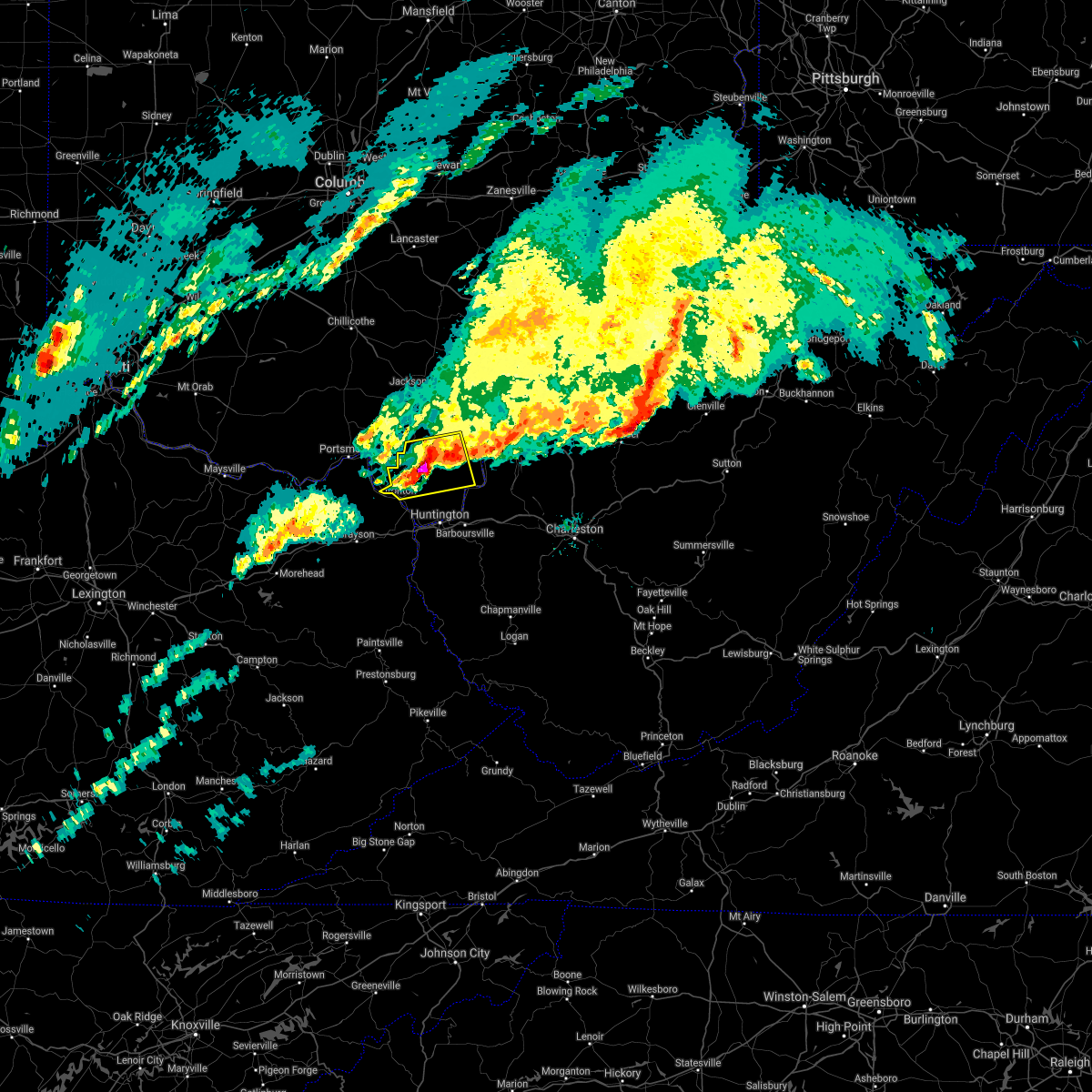 At 638 am est, a severe thunderstorm was located 11 miles northeast of lake vesuvius, moving east at 70 mph (radar indicated). Hazards include golf ball size hail and 70 mph wind gusts. People and animals outdoors will be injured. expect hail damage to roofs, siding, windows, and vehicles. expect considerable tree damage. wind damage is also likely to mobile homes, roofs, and outbuildings. Locations impacted include, ironton, lake vesuvius, vernon, waterloo, aid, crown city, hanging rock, gage and pedro. At 638 am est, a severe thunderstorm was located 11 miles northeast of lake vesuvius, moving east at 70 mph (radar indicated). Hazards include golf ball size hail and 70 mph wind gusts. People and animals outdoors will be injured. expect hail damage to roofs, siding, windows, and vehicles. expect considerable tree damage. wind damage is also likely to mobile homes, roofs, and outbuildings. Locations impacted include, ironton, lake vesuvius, vernon, waterloo, aid, crown city, hanging rock, gage and pedro.
|
| 3/1/2017 6:32 AM EST |
 At 632 am est, a severe thunderstorm was located near lake vesuvius, moving east at 70 mph (radar indicated). Hazards include golf ball size hail and 70 mph wind gusts. People and animals outdoors will be injured. expect hail damage to roofs, siding, windows, and vehicles. expect considerable tree damage. wind damage is also likely to mobile homes, roofs, and outbuildings. Locations impacted include, ironton, lake vesuvius, greenup, greenbo lake, franklin furnace, flatwoods, russell, vernon, waterloo, raceland, worthington, wurtland, aid, crown city, hanging rock, haverhill, gage, grays branch and pedro. At 632 am est, a severe thunderstorm was located near lake vesuvius, moving east at 70 mph (radar indicated). Hazards include golf ball size hail and 70 mph wind gusts. People and animals outdoors will be injured. expect hail damage to roofs, siding, windows, and vehicles. expect considerable tree damage. wind damage is also likely to mobile homes, roofs, and outbuildings. Locations impacted include, ironton, lake vesuvius, greenup, greenbo lake, franklin furnace, flatwoods, russell, vernon, waterloo, raceland, worthington, wurtland, aid, crown city, hanging rock, haverhill, gage, grays branch and pedro.
|
| 3/1/2017 6:12 AM EST |
 At 612 am est, a severe thunderstorm was located over load, or 12 miles south of portsmouth, moving east at 70 mph (radar indicated). Hazards include golf ball size hail and 70 mph wind gusts. People and animals outdoors will be injured. expect hail damage to roofs, siding, windows, and vehicles. expect considerable tree damage. Wind damage is also likely to mobile homes, roofs, and outbuildings. At 612 am est, a severe thunderstorm was located over load, or 12 miles south of portsmouth, moving east at 70 mph (radar indicated). Hazards include golf ball size hail and 70 mph wind gusts. People and animals outdoors will be injured. expect hail damage to roofs, siding, windows, and vehicles. expect considerable tree damage. Wind damage is also likely to mobile homes, roofs, and outbuildings.
|
| 2/25/2017 1:07 AM EST |
 The severe thunderstorm warning for boyd, southeastern greenup, southeastern carter and southwestern lawrence counties will expire at 115 am est, the storms which prompted the warning are moving out of the warned area. therefore the warning will be allowed to expire on time. The severe thunderstorm warning for boyd, southeastern greenup, southeastern carter and southwestern lawrence counties will expire at 115 am est, the storms which prompted the warning are moving out of the warned area. therefore the warning will be allowed to expire on time.
|
| 2/25/2017 12:43 AM EST |
 At 1243 am est, severe thunderstorms were located along a line extending from near carter caves state park to grayson lake state park to isonville, moving northeast at 60 mph (radar indicated). Hazards include 60 mph wind gusts and nickel size hail. expect damage to roofs, siding, and trees At 1243 am est, severe thunderstorms were located along a line extending from near carter caves state park to grayson lake state park to isonville, moving northeast at 60 mph (radar indicated). Hazards include 60 mph wind gusts and nickel size hail. expect damage to roofs, siding, and trees
|
| 12/18/2016 1:53 AM EST |
 The severe thunderstorm warning for northwestern carter, greenup, lawrence, gallia, south central vinton, jackson and west central mason counties will expire at 200 am est, the storm which prompted the warning has weakened below severe limits, and no longer pose an immediate threat to life or property. therefore the warning will be allowed to expire. however gusty winds and heavy rain are still possible with this thunderstorm. The severe thunderstorm warning for northwestern carter, greenup, lawrence, gallia, south central vinton, jackson and west central mason counties will expire at 200 am est, the storm which prompted the warning has weakened below severe limits, and no longer pose an immediate threat to life or property. therefore the warning will be allowed to expire. however gusty winds and heavy rain are still possible with this thunderstorm.
|
| 12/18/2016 1:14 AM EST |
 At 114 am est, a severe thunderstorm was located over letitia, or near portsmouth, moving northeast at 55 mph (radar indicated). Hazards include 60 mph wind gusts. expect damage to roofs, siding, and trees At 114 am est, a severe thunderstorm was located over letitia, or near portsmouth, moving northeast at 55 mph (radar indicated). Hazards include 60 mph wind gusts. expect damage to roofs, siding, and trees
|
| 7/14/2016 4:51 PM EDT |
 The severe thunderstorm warning for greenup, northeastern carter, northern boyd, lawrence, south central gallia and central cabell counties will expire at 500 pm edt, the storm which prompted the warning has moved out of the area. therefore, the warning will be allowed to expire. however gusty winds are still possible with this thunderstorm. The severe thunderstorm warning for greenup, northeastern carter, northern boyd, lawrence, south central gallia and central cabell counties will expire at 500 pm edt, the storm which prompted the warning has moved out of the area. therefore, the warning will be allowed to expire. however gusty winds are still possible with this thunderstorm.
|
| 7/14/2016 4:03 PM EDT |
 At 402 pm edt, a line of severe thunderstorms were located over greenbo lake, or 10 miles north of grayson, moving east at 40 mph (radar indicated). Hazards include 60 mph wind gusts. Expect damage to roofs. siding. And trees. At 402 pm edt, a line of severe thunderstorms were located over greenbo lake, or 10 miles north of grayson, moving east at 40 mph (radar indicated). Hazards include 60 mph wind gusts. Expect damage to roofs. siding. And trees.
|
| 7/8/2016 2:04 PM EDT |
 At 203 pm edt, a severe thunderstorm was located near lake vesuvius, moving east at 45 mph (radar indicated. these storms have a wind damage history along its path). Hazards include 60 mph wind gusts and nickel size hail. Expect damage to roofs, siding, and trees. Locations impacted include, greenup, load, greenbo lake, naples, oldtown, franklin furnace, flatwoods, russell, raceland, worthington, wurtland, hanging rock, warnock and hopewell. At 203 pm edt, a severe thunderstorm was located near lake vesuvius, moving east at 45 mph (radar indicated. these storms have a wind damage history along its path). Hazards include 60 mph wind gusts and nickel size hail. Expect damage to roofs, siding, and trees. Locations impacted include, greenup, load, greenbo lake, naples, oldtown, franklin furnace, flatwoods, russell, raceland, worthington, wurtland, hanging rock, warnock and hopewell.
|
| 7/8/2016 1:34 PM EDT |
 At 134 pm edt, a severe thunderstorm was located near letitia, or 12 miles southwest of portsmouth, moving east at 50 mph (radar indicated). Hazards include 60 mph wind gusts and nickel size hail. Expect damage to roofs. siding. And trees. At 134 pm edt, a severe thunderstorm was located near letitia, or 12 miles southwest of portsmouth, moving east at 50 mph (radar indicated). Hazards include 60 mph wind gusts and nickel size hail. Expect damage to roofs. siding. And trees.
|
| 6/23/2016 6:17 AM EDT |
 At 616 am edt, severe thunderstorms were located along a line extending from near jackson to 9 miles west of lucasville to near tollesboro, moving southeast at 50 mph (radar indicated). Hazards include 60 mph wind gusts. Expect damage to roofs. siding. And trees. At 616 am edt, severe thunderstorms were located along a line extending from near jackson to 9 miles west of lucasville to near tollesboro, moving southeast at 50 mph (radar indicated). Hazards include 60 mph wind gusts. Expect damage to roofs. siding. And trees.
|
| 7/14/2015 5:11 PM EDT |
 At 509 pm edt, doppler radar indicated a line of severe thunderstorms capable of producing damaging winds in excess of 60 mph. these storms were located along a line extending from south shore to near vanceburg to near manchester, and moving southeast at 55 mph. At 509 pm edt, doppler radar indicated a line of severe thunderstorms capable of producing damaging winds in excess of 60 mph. these storms were located along a line extending from south shore to near vanceburg to near manchester, and moving southeast at 55 mph.
|
| 7/14/2015 5:05 PM EDT |
 At 504 pm edt, doppler radar indicated a line of severe thunderstorms capable of producing damaging winds in excess of 60 mph. these storms were located along a line extending from 9 miles northeast of lake vesuvius to near letitia, moving southeast at 45 mph. locations impacted include, portsmouth, ironton, coal grove, lake vesuvius, greenup, load, greenbo lake, letitia, franklin furnace, flatwoods, russell, vernon, waterloo, raceland, worthington, south shore, wurtland, bellefonte, aid and crown city. At 504 pm edt, doppler radar indicated a line of severe thunderstorms capable of producing damaging winds in excess of 60 mph. these storms were located along a line extending from 9 miles northeast of lake vesuvius to near letitia, moving southeast at 45 mph. locations impacted include, portsmouth, ironton, coal grove, lake vesuvius, greenup, load, greenbo lake, letitia, franklin furnace, flatwoods, russell, vernon, waterloo, raceland, worthington, south shore, wurtland, bellefonte, aid and crown city.
|
| 7/14/2015 4:27 PM EDT |
 At 427 pm edt, doppler radar indicated a line of severe thunderstorms capable of producing damaging winds in excess of 60 mph. these storms were located along a line extending from 10 miles northeast of lucasville to near peebles, and moving southeast at 45 mph. At 427 pm edt, doppler radar indicated a line of severe thunderstorms capable of producing damaging winds in excess of 60 mph. these storms were located along a line extending from 10 miles northeast of lucasville to near peebles, and moving southeast at 45 mph.
|
| 7/13/2015 3:37 PM EDT |
 At 335 pm edt, doppler radar indicated a line of severe thunderstorms capable of producing damaging winds in excess of 60 mph. these storms were located along a line extending from near chesapeake to near elliottville, moving southeast at 40 mph. locations impacted include, grayson, olive hill, cannonsburg, carter caves state park, grayson lake state park, rush, gesling, garner, princess, greenbo lake, denton, oldtown, coalton, webbville, naples, flatwoods, russell, raceland, worthington and wurtland. At 335 pm edt, doppler radar indicated a line of severe thunderstorms capable of producing damaging winds in excess of 60 mph. these storms were located along a line extending from near chesapeake to near elliottville, moving southeast at 40 mph. locations impacted include, grayson, olive hill, cannonsburg, carter caves state park, grayson lake state park, rush, gesling, garner, princess, greenbo lake, denton, oldtown, coalton, webbville, naples, flatwoods, russell, raceland, worthington and wurtland.
|
| 7/13/2015 3:22 PM EDT |
 At 321 pm edt, doppler radar indicated a line of severe thunderstorms capable of producing damaging winds in excess of 60 mph. these storms were located along a line extending from near lake vesuvius to near triplett, moving southeast at 45 mph. these severe thunderstorms will remain over mainly rural areas of western boyd, northwestern lawrence, greenup and carter counties, including the following locations, brushart, soldier, globe, carter, hitchins, warnock, raceland, hopewell, worthington and willard. At 321 pm edt, doppler radar indicated a line of severe thunderstorms capable of producing damaging winds in excess of 60 mph. these storms were located along a line extending from near lake vesuvius to near triplett, moving southeast at 45 mph. these severe thunderstorms will remain over mainly rural areas of western boyd, northwestern lawrence, greenup and carter counties, including the following locations, brushart, soldier, globe, carter, hitchins, warnock, raceland, hopewell, worthington and willard.
|
| 7/13/2015 2:39 PM EDT |
 At 238 pm edt, doppler radar indicated a line of severe thunderstorms capable of producing damaging winds in excess of 60 mph. these storms were located along a line extending from 6 miles east of lucasville to near manchester, and moving southeast at 45 mph. * severe thunderstorms will be near, portsmouth around 245 pm edt. new boston around 250 pm edt. olive hill around 330 pm edt. other locations impacted by these severe thunderstorms include south shore, sciotoville, brushart, soldier, grays branch, globe, carter, hitchins, warnock and raceland. At 238 pm edt, doppler radar indicated a line of severe thunderstorms capable of producing damaging winds in excess of 60 mph. these storms were located along a line extending from 6 miles east of lucasville to near manchester, and moving southeast at 45 mph. * severe thunderstorms will be near, portsmouth around 245 pm edt. new boston around 250 pm edt. olive hill around 330 pm edt. other locations impacted by these severe thunderstorms include south shore, sciotoville, brushart, soldier, grays branch, globe, carter, hitchins, warnock and raceland.
|
| 6/29/2015 6:06 PM EDT |
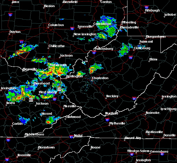 At 604 pm edt, doppler radar indicated a severe thunderstorm capable of producing quarter size hail and destructive winds in excess of 70 mph. this storm was located near lake vesuvius, and moving east at 40 mph. At 604 pm edt, doppler radar indicated a severe thunderstorm capable of producing quarter size hail and destructive winds in excess of 70 mph. this storm was located near lake vesuvius, and moving east at 40 mph.
|
| 6/29/2015 5:30 PM EDT |
 At 530 pm edt, doppler radar indicated a severe thunderstorm capable of producing quarter size hail and damaging winds in excess of 60 mph. this storm was located over greenup, or 11 miles west of ironton, moving east at 20 mph. locations impacted include, ironton, greenup, greenbo lake, naples, franklin furnace, flatwoods, russell, raceland, worthington, wurtland, bellefonte and hanging rock. a tornado watch remains in effect until 900 pm edt for central kentucky and southeastern ohio. At 530 pm edt, doppler radar indicated a severe thunderstorm capable of producing quarter size hail and damaging winds in excess of 60 mph. this storm was located over greenup, or 11 miles west of ironton, moving east at 20 mph. locations impacted include, ironton, greenup, greenbo lake, naples, franklin furnace, flatwoods, russell, raceland, worthington, wurtland, bellefonte and hanging rock. a tornado watch remains in effect until 900 pm edt for central kentucky and southeastern ohio.
|
| 6/29/2015 4:54 PM EDT |
 At 453 pm edt, doppler radar indicated a severe thunderstorm capable of producing quarter size hail and damaging winds in excess of 60 mph. this storm was located 7 miles southwest of letitia, or 14 miles north of carter caves state park, and moving east at 20 mph. At 453 pm edt, doppler radar indicated a severe thunderstorm capable of producing quarter size hail and damaging winds in excess of 60 mph. this storm was located 7 miles southwest of letitia, or 14 miles north of carter caves state park, and moving east at 20 mph.
|
| 6/26/2015 8:19 PM EDT | At 818 pm edt, doppler radar indicated a severe thunderstorm capable of producing half dollar size hail and damaging winds in excess of 60 mph. this storm was located over coal grove, and moving east at 25 mph. |
| 6/26/2015 8:19 PM EDT | At 818 pm edt, doppler radar indicated a severe thunderstorm capable of producing half dollar size hail and damaging winds in excess of 60 mph. this storm was located over coal grove, and moving east at 25 mph. |
| 6/26/2015 8:19 PM EDT | At 818 pm edt, doppler radar indicated a severe thunderstorm capable of producing half dollar size hail and damaging winds in excess of 60 mph. this storm was located over coal grove, and moving east at 25 mph. |
| 5/11/2015 5:17 PM EDT | At 514 pm edt, national weather service doppler radar indicated a severe thunderstorm capable of producing quarter size hail, and damaging winds in excess of 60 mph. this storm was located 12 miles west of carter caves state park, or 11 miles northwest of olive hill, moving east at 35 mph. * other locations in the warning include but are not limited to princess, naples, oldtown, load, greenbo lake, gesling, coalton, catlettsburg and greenup. this will impact the following interstate, i-64 between mile markers 156 and 191 in kentucky. a severe thunderstorm watch remains in effect until 1000 pm edt monday evening for central kentucky and southeast ohio and central west virginia. please report hail or strong wind to the national weather service by calling toll free, 800-401-9535, when you can do so safely. you may also report severe weather by posting your report to the charleston west virginia national weather service facebook page, or by using the twitter hashtag, nwsrlx. |
| 5/11/2015 5:17 PM EDT | At 514 pm edt, national weather service doppler radar indicated a severe thunderstorm capable of producing quarter size hail, and damaging winds in excess of 60 mph. this storm was located 12 miles west of carter caves state park, or 11 miles northwest of olive hill, moving east at 35 mph. * other locations in the warning include but are not limited to princess, naples, oldtown, load, greenbo lake, gesling, coalton, catlettsburg and greenup. this will impact the following interstate, i-64 between mile markers 156 and 191 in kentucky. a severe thunderstorm watch remains in effect until 1000 pm edt monday evening for central kentucky and southeast ohio and central west virginia. please report hail or strong wind to the national weather service by calling toll free, 800-401-9535, when you can do so safely. you may also report severe weather by posting your report to the charleston west virginia national weather service facebook page, or by using the twitter hashtag, nwsrlx. |
| 4/8/2015 1:35 PM EDT | A severe thunderstorm warning remains in effect until 200 pm edt for southern greenup. carter and boyd counties in kentucky. and eastern meigs. lawrence. southern gallia and extreme southeastern athens counties in southeast ohio. and northern wayne. cabell. northern jackson and mason counties in west virginia. at 122 pm edt. National weather service doppler radar continued to. |
| 4/8/2015 1:35 PM EDT | A severe thunderstorm warning remains in effect until 200 pm edt for southern greenup. carter and boyd counties in kentucky. and eastern meigs. lawrence. southern gallia and extreme southeastern athens counties in southeast ohio. and northern wayne. cabell. northern jackson and mason counties in west virginia. at 122 pm edt. National weather service doppler radar continued to. |
| 4/8/2015 1:35 PM EDT | A severe thunderstorm warning remains in effect until 200 pm edt for southern greenup. carter and boyd counties in kentucky. and eastern meigs. lawrence. southern gallia and extreme southeastern athens counties in southeast ohio. and northern wayne. cabell. northern jackson and mason counties in west virginia. at 122 pm edt. National weather service doppler radar continued to. |
| 4/8/2015 12:56 PM EDT | The national weather service in charleston has issued a * severe thunderstorm warning for. boyd county in kentucky. this includes the cities of. cannonsburg. ashland. carter county in kentucky. this includes the cities of. olive hill. Grayson lake state. |
| 4/8/2015 12:56 PM EDT | The national weather service in charleston has issued a * severe thunderstorm warning for. boyd county in kentucky. this includes the cities of. cannonsburg. ashland. carter county in kentucky. this includes the cities of. olive hill. Grayson lake state. |
| 4/8/2015 12:56 PM EDT | The national weather service in charleston has issued a * severe thunderstorm warning for. boyd county in kentucky. this includes the cities of. cannonsburg. ashland. carter county in kentucky. this includes the cities of. olive hill. Grayson lake state. |
| 4/8/2015 12:29 PM EDT | A severe thunderstorm warning remains in effect until 100 pm edt for greenup county in kentucky. and vinton. western meigs. northern lawrence. jackson. gallia and western athens counties in southeast ohio. at 1221 pm edt. National weather service doppler radar continued to indicate a line of severe thunderstorms capable of producing damaging. |
| 4/8/2015 12:29 PM EDT | A severe thunderstorm warning remains in effect until 100 pm edt for greenup county in kentucky. and vinton. western meigs. northern lawrence. jackson. gallia and western athens counties in southeast ohio. at 1221 pm edt. National weather service doppler radar continued to indicate a line of severe thunderstorms capable of producing damaging. |
| 4/8/2015 12:02 PM EDT | The national weather service in charleston has issued a * severe thunderstorm warning for. greenup county in kentucky. western athens county in southeast ohio. this includes the cities of. nelsonville. albany. Gallia county in southeast ohio. |
| 4/8/2015 12:02 PM EDT | The national weather service in charleston has issued a * severe thunderstorm warning for. greenup county in kentucky. western athens county in southeast ohio. this includes the cities of. nelsonville. albany. Gallia county in southeast ohio. |
Hail Maps for Hanging Rock, OH


Connect with Interactive Hail Maps