

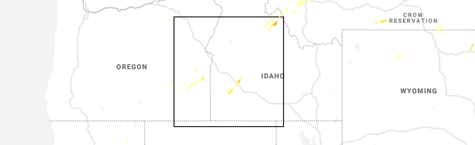
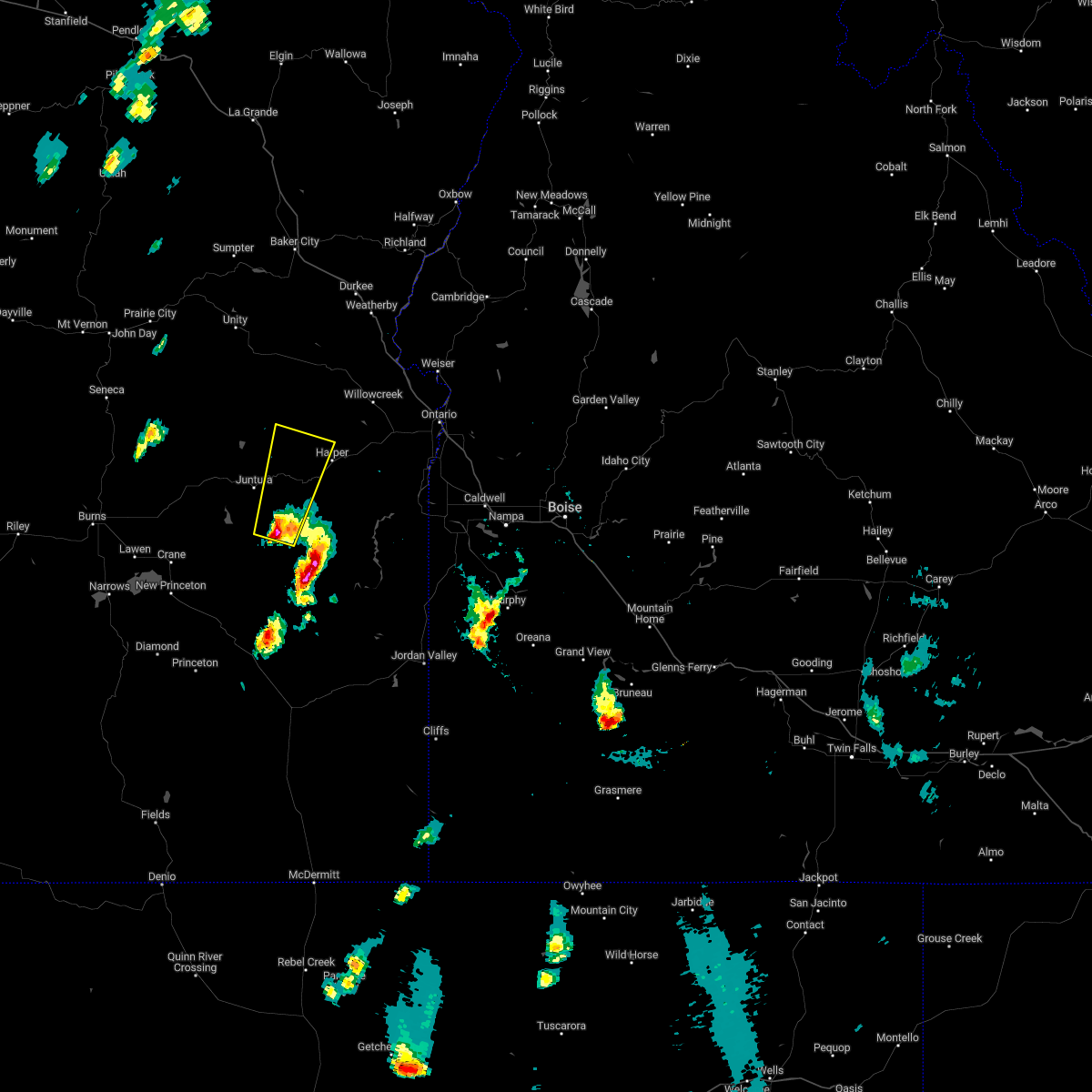
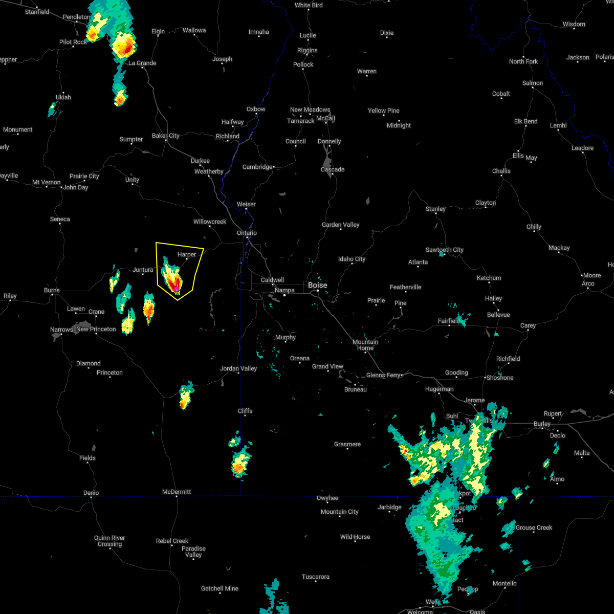
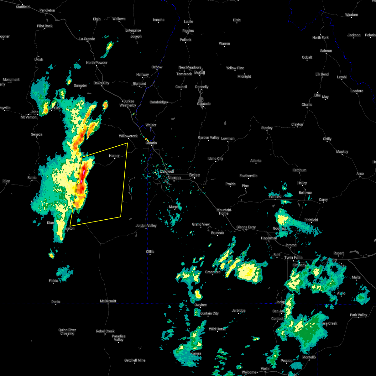
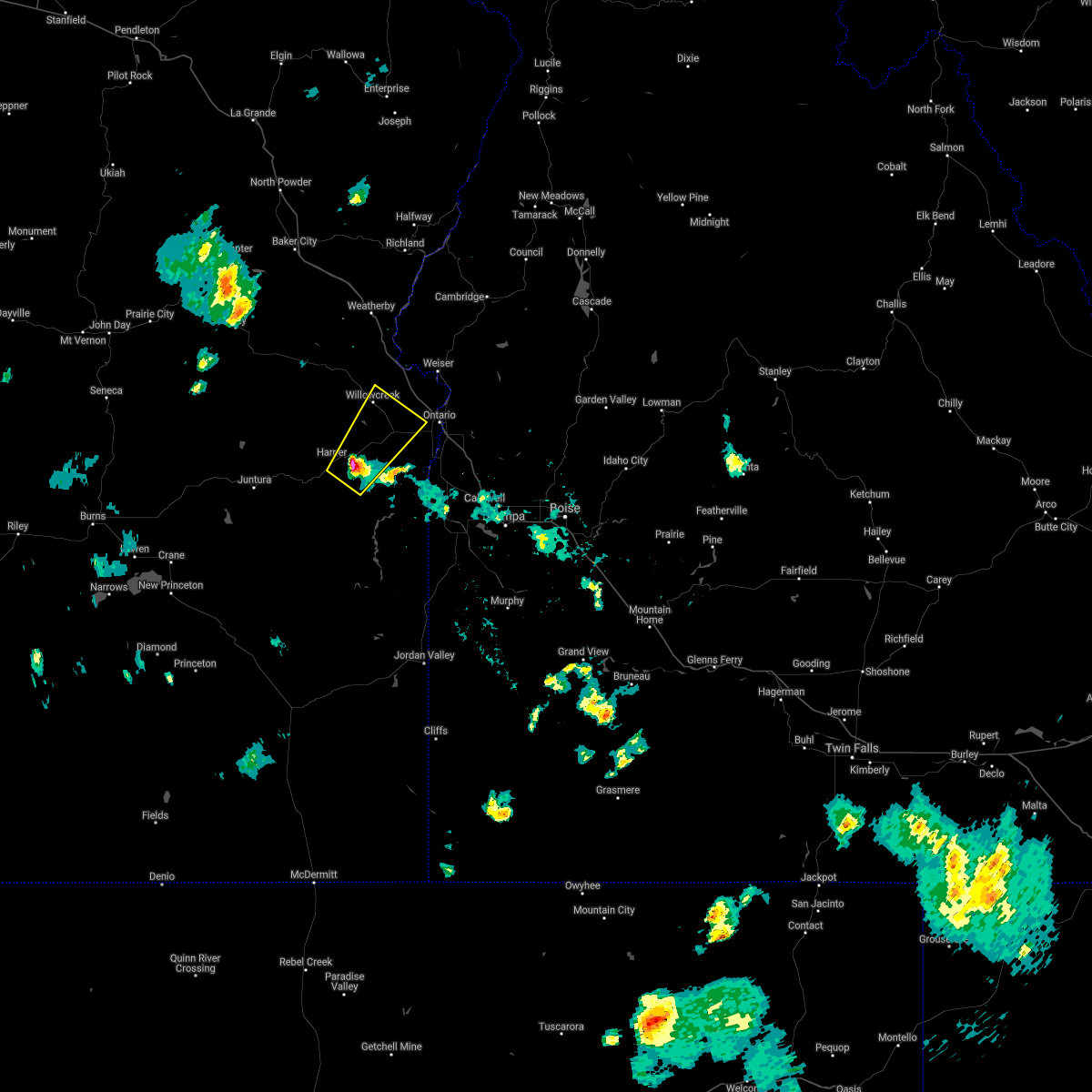
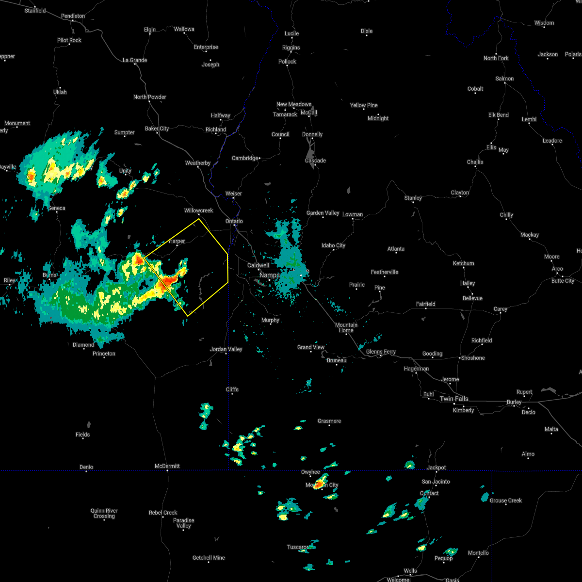
Hail Map for Harper, OR
The Harper, OR area has had 0 reports of on-the-ground hail by trained spotters, and has been under severe weather warnings 1 time during the past 12 months. Doppler radar has detected hail at or near Harper, OR on 1 occasion.
| Name: | Harper, OR |
| Where Located: | 73.6 miles ENE of Burns, OR |
| Map: | Google Map for Harper, OR |
| Population: | 109 |
| Housing Units: | 56 |
| More Info: | Search Google for Harper, OR |
0
The Top Recent Hail Date for Harper, OR is Saturday, August 10, 2019 (1st out of 1)
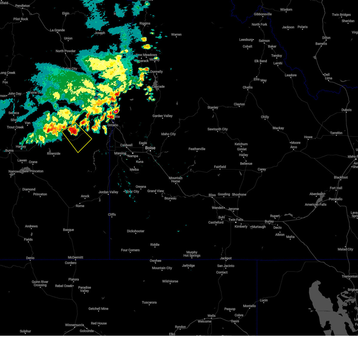
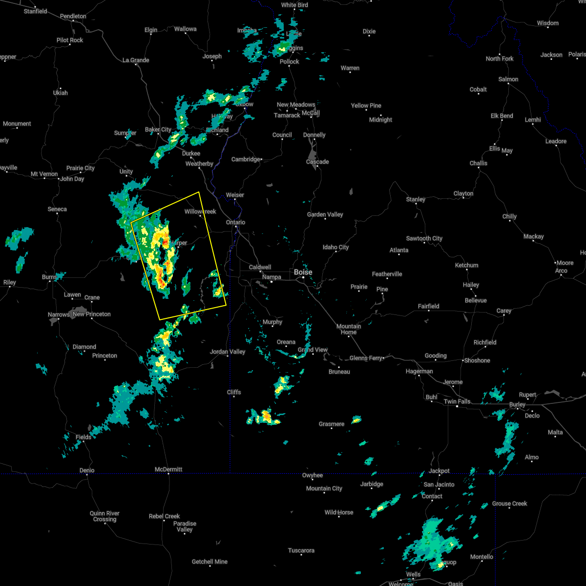
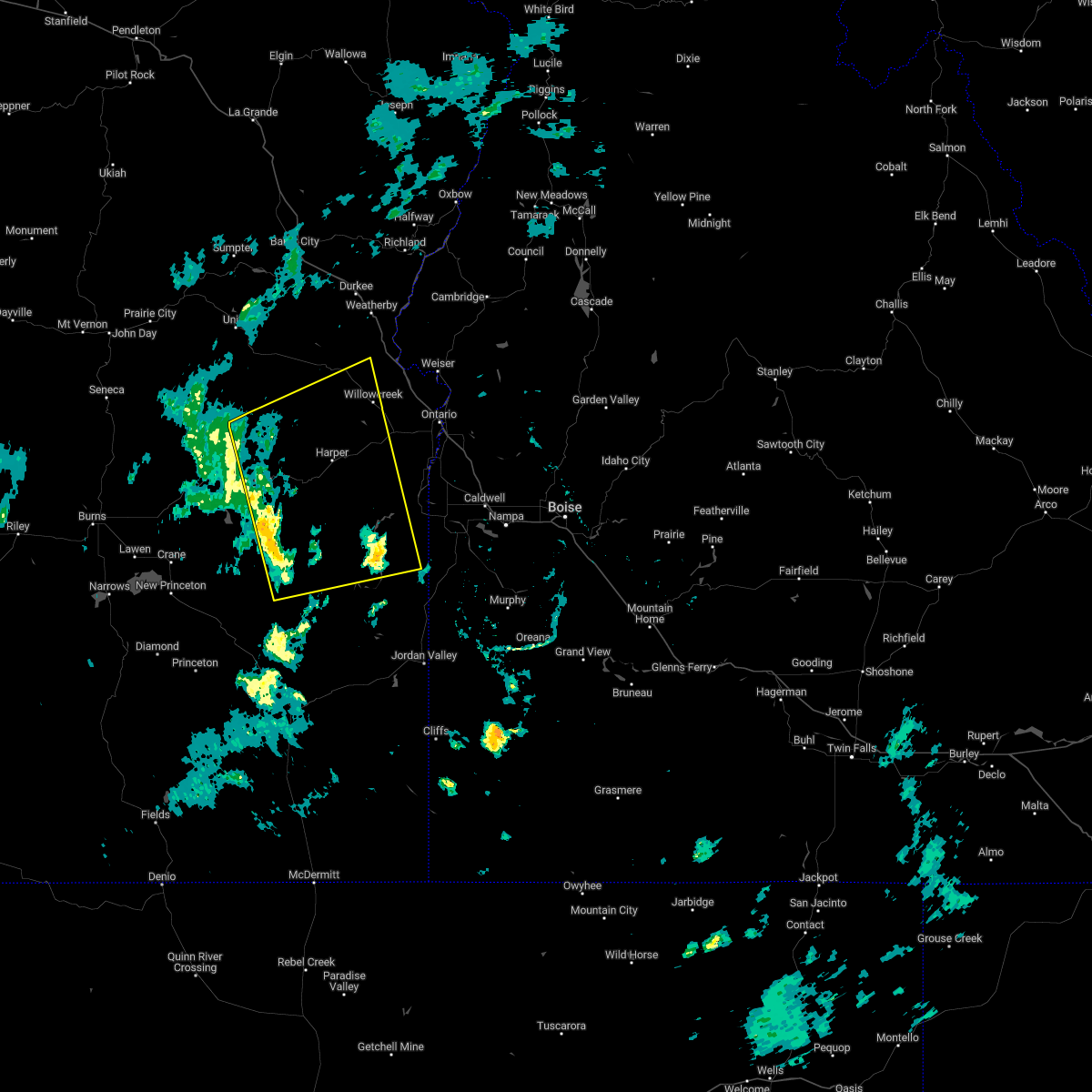
Hail and Wind Damage Spotted near Harper, OR
| Date / Time | Report Details |
|---|---|
| 8/7/2023 3:50 PM MDT |
 At 249 pm pdt, a severe thunderstorm was located near westfall, or 40 miles west of ontario, moving southeast at 10 mph (radar indicated). Hazards include 60 mph wind gusts and quarter size hail. Hail damage to vehicles is expected. expect wind damage to roofs, siding, and trees. this severe thunderstorm will be near, harper around 420 pm mdt. hail threat, radar indicated max hail size, 1. 00 in wind threat, radar indicated max wind gust, 60 mph. At 249 pm pdt, a severe thunderstorm was located near westfall, or 40 miles west of ontario, moving southeast at 10 mph (radar indicated). Hazards include 60 mph wind gusts and quarter size hail. Hail damage to vehicles is expected. expect wind damage to roofs, siding, and trees. this severe thunderstorm will be near, harper around 420 pm mdt. hail threat, radar indicated max hail size, 1. 00 in wind threat, radar indicated max wind gust, 60 mph.
|
| 9/7/2022 6:08 PM MDT |
 At 606 pm mdt/506 pm pdt/, severe thunderstorms were located along a line extending from near brogan to castro ridge, moving east at 60 mph (radar indicated). Hazards include 70 mph wind gusts. Expect considerable tree damage. damage is likely to mobile homes, roofs, and outbuildings. severe thunderstorms will be near, castro ridge, parsnip peak, little grassy reservoir and antelope reservoir around 610 pm mdt. reynolds, south mountain, henley basin and black warrior mountain around 620 pm mdt. weiser, silver city, murphy and melba around 630 pm mdt. payette, ontario, parma and emmett around 640 pm mdt. thunderstorm damage threat, considerable hail threat, radar indicated max hail size, <. 75 in wind threat, radar indicated max wind gust, 70 mph. At 606 pm mdt/506 pm pdt/, severe thunderstorms were located along a line extending from near brogan to castro ridge, moving east at 60 mph (radar indicated). Hazards include 70 mph wind gusts. Expect considerable tree damage. damage is likely to mobile homes, roofs, and outbuildings. severe thunderstorms will be near, castro ridge, parsnip peak, little grassy reservoir and antelope reservoir around 610 pm mdt. reynolds, south mountain, henley basin and black warrior mountain around 620 pm mdt. weiser, silver city, murphy and melba around 630 pm mdt. payette, ontario, parma and emmett around 640 pm mdt. thunderstorm damage threat, considerable hail threat, radar indicated max hail size, <. 75 in wind threat, radar indicated max wind gust, 70 mph.
|
| 9/7/2022 5:46 PM MDT |
 At 445 pm pdt, severe thunderstorms were located along a line extending from near westfall butte to near cedar mountain, moving east at 50 mph (radar indicated). Hazards include 70 mph wind gusts. Expect considerable tree damage. damage is likely to mobile homes, roofs, and outbuildings. these severe storms will be near, knottingham butte and brushy hollow around 550 pm mdt. westfall, harper, buckbrush poison butte and freezeout mountain around 600 pm mdt. pelican point, twin springs campground, little valley and vines hill around 610 pm mdt. brogan, jamieson, succor creek campground and board corral mountain around 620 pm mdt. thunderstorm damage threat, considerable hail threat, radar indicated max hail size, <. 75 in wind threat, observed max wind gust, 70 mph. At 445 pm pdt, severe thunderstorms were located along a line extending from near westfall butte to near cedar mountain, moving east at 50 mph (radar indicated). Hazards include 70 mph wind gusts. Expect considerable tree damage. damage is likely to mobile homes, roofs, and outbuildings. these severe storms will be near, knottingham butte and brushy hollow around 550 pm mdt. westfall, harper, buckbrush poison butte and freezeout mountain around 600 pm mdt. pelican point, twin springs campground, little valley and vines hill around 610 pm mdt. brogan, jamieson, succor creek campground and board corral mountain around 620 pm mdt. thunderstorm damage threat, considerable hail threat, radar indicated max hail size, <. 75 in wind threat, observed max wind gust, 70 mph.
|
| 9/7/2022 5:29 PM MDT |
 At 428 pm pdt, severe thunderstorms were located along a line extending from near castle rock to near crowley, moving east at 45 mph (radar indicated). Hazards include 70 mph wind gusts. Expect considerable tree damage. damage is likely to mobile homes, roofs, and outbuildings. severe thunderstorms will be near, monument peak around 530 pm mdt. westfall butte, copeland butte, jonesboro and red butte around 540 pm mdt. westfall, knottingham butte and brushy hollow around 550 pm mdt. harper, buckbrush poison butte, pelican point and freezeout mountain around 600 pm mdt. brogan, sugarloaf butte, board corral mountain and jamieson around 610 pm mdt. thunderstorm damage threat, considerable hail threat, radar indicated max hail size, <. 75 in wind threat, observed max wind gust, 70 mph. At 428 pm pdt, severe thunderstorms were located along a line extending from near castle rock to near crowley, moving east at 45 mph (radar indicated). Hazards include 70 mph wind gusts. Expect considerable tree damage. damage is likely to mobile homes, roofs, and outbuildings. severe thunderstorms will be near, monument peak around 530 pm mdt. westfall butte, copeland butte, jonesboro and red butte around 540 pm mdt. westfall, knottingham butte and brushy hollow around 550 pm mdt. harper, buckbrush poison butte, pelican point and freezeout mountain around 600 pm mdt. brogan, sugarloaf butte, board corral mountain and jamieson around 610 pm mdt. thunderstorm damage threat, considerable hail threat, radar indicated max hail size, <. 75 in wind threat, observed max wind gust, 70 mph.
|
| 8/10/2022 6:44 PM MDT |
 At 644 pm mdt, a severe thunderstorm was located near monument peak, or 51 miles west of parma, moving north at 30 mph (radar indicated). Hazards include 60 mph wind gusts and quarter size hail. Hail damage to vehicles is expected. expect wind damage to roofs, siding, and trees. this severe thunderstorm will be near, monument peak around 650 pm mdt. jonesboro around 710 pm mdt. westfall butte around 730 pm mdt. hail threat, radar indicated max hail size, 1. 00 in wind threat, radar indicated max wind gust, 60 mph. At 644 pm mdt, a severe thunderstorm was located near monument peak, or 51 miles west of parma, moving north at 30 mph (radar indicated). Hazards include 60 mph wind gusts and quarter size hail. Hail damage to vehicles is expected. expect wind damage to roofs, siding, and trees. this severe thunderstorm will be near, monument peak around 650 pm mdt. jonesboro around 710 pm mdt. westfall butte around 730 pm mdt. hail threat, radar indicated max hail size, 1. 00 in wind threat, radar indicated max wind gust, 60 mph.
|
| 8/10/2022 3:50 PM MDT |
 At 349 pm mdt, a severe thunderstorm was located over vines hill, or 24 miles west of parma, moving northeast at 30 mph (radar indicated). Hazards include 60 mph wind gusts and quarter size hail. Hail damage to vehicles is expected. expect wind damage to roofs, siding, and trees. this severe storm will be near, vines hill, double mountain and shell rock butte around 350 pm mdt. bully creek reservoir, keeney pass and sugarloaf butte around 410 pm mdt. vale and nyssa around 420 pm mdt. hail threat, radar indicated max hail size, 1. 00 in wind threat, radar indicated max wind gust, 60 mph. At 349 pm mdt, a severe thunderstorm was located over vines hill, or 24 miles west of parma, moving northeast at 30 mph (radar indicated). Hazards include 60 mph wind gusts and quarter size hail. Hail damage to vehicles is expected. expect wind damage to roofs, siding, and trees. this severe storm will be near, vines hill, double mountain and shell rock butte around 350 pm mdt. bully creek reservoir, keeney pass and sugarloaf butte around 410 pm mdt. vale and nyssa around 420 pm mdt. hail threat, radar indicated max hail size, 1. 00 in wind threat, radar indicated max wind gust, 60 mph.
|
| 8/10/2022 3:32 PM MDT |
 At 331 pm mdt, a severe thunderstorm was located near harper, or 30 miles west of parma, moving northeast at 30 mph (radar indicated). Hazards include 60 mph wind gusts and half dollar size hail. Hail damage to vehicles is expected. expect wind damage to roofs, siding, and trees. this severe thunderstorm will be near, vines hill, little valley, double mountain and shell rock butte around 350 pm mdt. vale, nyssa, keeney pass and bully creek reservoir around 410 pm mdt. hail threat, radar indicated max hail size, 1. 25 in wind threat, radar indicated max wind gust, 60 mph. At 331 pm mdt, a severe thunderstorm was located near harper, or 30 miles west of parma, moving northeast at 30 mph (radar indicated). Hazards include 60 mph wind gusts and half dollar size hail. Hail damage to vehicles is expected. expect wind damage to roofs, siding, and trees. this severe thunderstorm will be near, vines hill, little valley, double mountain and shell rock butte around 350 pm mdt. vale, nyssa, keeney pass and bully creek reservoir around 410 pm mdt. hail threat, radar indicated max hail size, 1. 25 in wind threat, radar indicated max wind gust, 60 mph.
|
| 8/10/2022 3:07 PM MDT |
 At 307 pm mdt, a severe thunderstorm was located over rufino butte, or 40 miles west of parma, moving northeast at 20 mph (radar indicated). Hazards include 60 mph wind gusts and quarter size hail. Hail damage to vehicles is expected. expect wind damage to roofs, siding, and trees. this severe thunderstorm will be near, freezeout mountain around 320 pm mdt. harper and little valley around 340 pm mdt. hail threat, radar indicated max hail size, 1. 00 in wind threat, radar indicated max wind gust, 60 mph. At 307 pm mdt, a severe thunderstorm was located over rufino butte, or 40 miles west of parma, moving northeast at 20 mph (radar indicated). Hazards include 60 mph wind gusts and quarter size hail. Hail damage to vehicles is expected. expect wind damage to roofs, siding, and trees. this severe thunderstorm will be near, freezeout mountain around 320 pm mdt. harper and little valley around 340 pm mdt. hail threat, radar indicated max hail size, 1. 00 in wind threat, radar indicated max wind gust, 60 mph.
|
| 8/10/2022 2:45 PM MDT | Mesonet station rtfo3 red butt in malheur county OR, 23.8 miles NNE of Harper, OR |
| 9/10/2021 6:39 PM MDT |
 At 639 pm mdt, severe thunderstorms were located along a line extending from near westfall to near twin springs campground to near knottingham butte, moving northeast at 40 mph (radar indicated). Hazards include 60 mph wind gusts and quarter size hail. Hail damage to vehicles is expected. expect wind damage to roofs, siding, and trees. severe thunderstorms will be near, harper and twin springs campground around 640 pm mdt. sugarloaf butte, little valley and vines hill around 650 pm mdt. bully creek reservoir, pelican point, shell rock butte and slocum creek campground around 700 pm mdt. vale, adrian, board corral mountain and keeney pass around 710 pm mdt. wilder, succor creek campground and owyhee around 720 pm mdt. hail threat, radar indicated max hail size, 1. 00 in wind threat, radar indicated max wind gust, 60 mph. At 639 pm mdt, severe thunderstorms were located along a line extending from near westfall to near twin springs campground to near knottingham butte, moving northeast at 40 mph (radar indicated). Hazards include 60 mph wind gusts and quarter size hail. Hail damage to vehicles is expected. expect wind damage to roofs, siding, and trees. severe thunderstorms will be near, harper and twin springs campground around 640 pm mdt. sugarloaf butte, little valley and vines hill around 650 pm mdt. bully creek reservoir, pelican point, shell rock butte and slocum creek campground around 700 pm mdt. vale, adrian, board corral mountain and keeney pass around 710 pm mdt. wilder, succor creek campground and owyhee around 720 pm mdt. hail threat, radar indicated max hail size, 1. 00 in wind threat, radar indicated max wind gust, 60 mph.
|
| 9/10/2021 5:53 PM MDT |
 At 552 pm mdt/452 pm pdt/, severe thunderstorms were located along a line extending from 6 miles northwest of jonesboro to near duck creek butte, moving east at 30 mph (radar indicated). Hazards include 60 mph wind gusts and quarter size hail. Hail damage to vehicles is expected. expect wind damage to roofs, siding, and trees. severe thunderstorms will be near, jonesboro and monument peak around 600 pm mdt. saddle butte and rufino butte around 610 pm mdt. crowley and monumental rock around 620 pm mdt. westfall, sacramento butte, turnbull mountain and freezeout mountain around 630 pm mdt. harper, cedar mountain, iron point and copeland butte around 640 pm mdt. hail threat, radar indicated max hail size, 1. 00 in wind threat, radar indicated max wind gust, 60 mph. At 552 pm mdt/452 pm pdt/, severe thunderstorms were located along a line extending from 6 miles northwest of jonesboro to near duck creek butte, moving east at 30 mph (radar indicated). Hazards include 60 mph wind gusts and quarter size hail. Hail damage to vehicles is expected. expect wind damage to roofs, siding, and trees. severe thunderstorms will be near, jonesboro and monument peak around 600 pm mdt. saddle butte and rufino butte around 610 pm mdt. crowley and monumental rock around 620 pm mdt. westfall, sacramento butte, turnbull mountain and freezeout mountain around 630 pm mdt. harper, cedar mountain, iron point and copeland butte around 640 pm mdt. hail threat, radar indicated max hail size, 1. 00 in wind threat, radar indicated max wind gust, 60 mph.
|
| 8/25/2020 6:53 PM MDT |
 At 653 pm mdt, a severe thunderstorm was located near little valley, or 27 miles west of parma, moving northeast at 25 mph (radar indicated). Hazards include quarter size hail. Damage to vehicles is expected. this severe thunderstorm will be near, little valley around 700 pm mdt. bully creek reservoir around 730 pm mdt. Vale around 740 pm mdt. At 653 pm mdt, a severe thunderstorm was located near little valley, or 27 miles west of parma, moving northeast at 25 mph (radar indicated). Hazards include quarter size hail. Damage to vehicles is expected. this severe thunderstorm will be near, little valley around 700 pm mdt. bully creek reservoir around 730 pm mdt. Vale around 740 pm mdt.
|
| 8/17/2020 4:13 PM MDT |
 At 412 pm mdt, severe thunderstorms were located along a line extending from 7 miles northeast of monument peak to 7 miles northeast of knottingham butte, moving northeast at 40 mph (radar indicated). Hazards include 70 mph wind gusts. Expect considerable tree damage. damage is likely to mobile homes, roofs, and outbuildings. severe thunderstorms will be near, pelican point around 420 pm mdt. twin springs campground around 430 pm mdt. owyhee reservoir and little valley around 440 pm mdt. Vale, adrian around 500 pm mdt. At 412 pm mdt, severe thunderstorms were located along a line extending from 7 miles northeast of monument peak to 7 miles northeast of knottingham butte, moving northeast at 40 mph (radar indicated). Hazards include 70 mph wind gusts. Expect considerable tree damage. damage is likely to mobile homes, roofs, and outbuildings. severe thunderstorms will be near, pelican point around 420 pm mdt. twin springs campground around 430 pm mdt. owyhee reservoir and little valley around 440 pm mdt. Vale, adrian around 500 pm mdt.
|
| 7/2/2013 5:30 PM MDT | Spotter measured thunderstorm downburst wind gust speed to 57 knots with sustains winds of 38 knots from the nnw. no damage noted at this time. main core of storm nw of in malheur county OR, 1.2 miles WSW of Harper, OR |
| 7/2/2013 5:30 PM MDT | Spotter measured thunderstorm downburst wind gust speed to 57 knots with sustains winds of 38 knots from the nnw. no damage noted at this time. main core of storm nw of in malheur county OR, 1.2 miles WSW of Harper, OR |
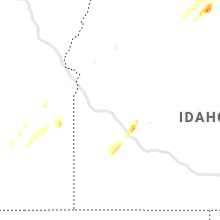
Hail Maps for Harper, OR
Connect with Interactive Hail Maps