

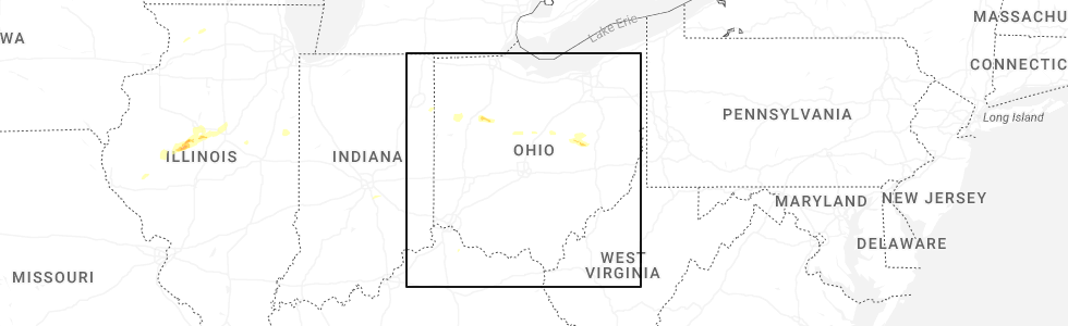
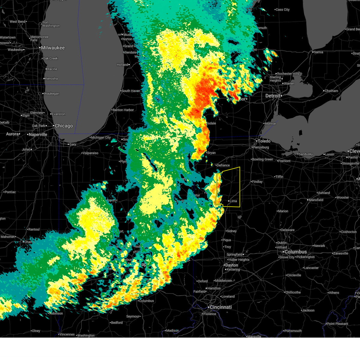
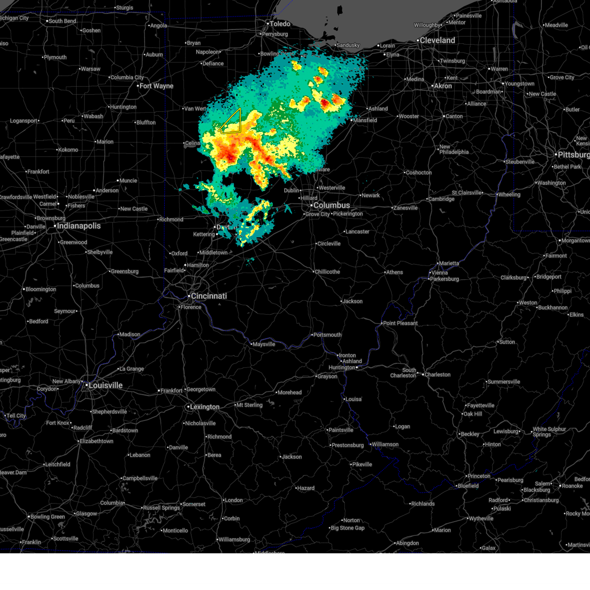
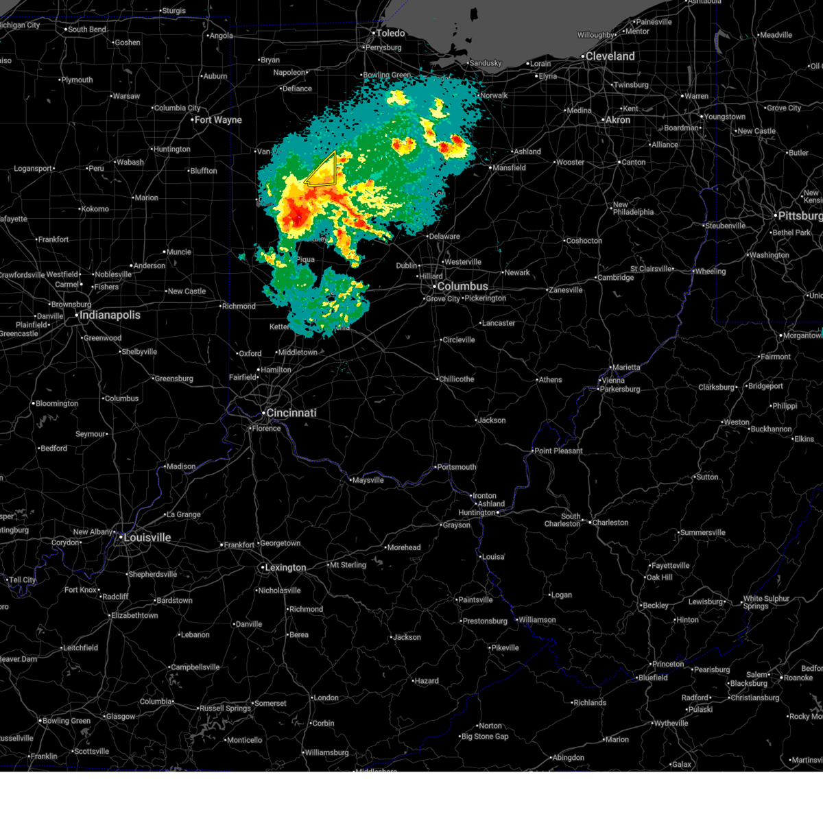
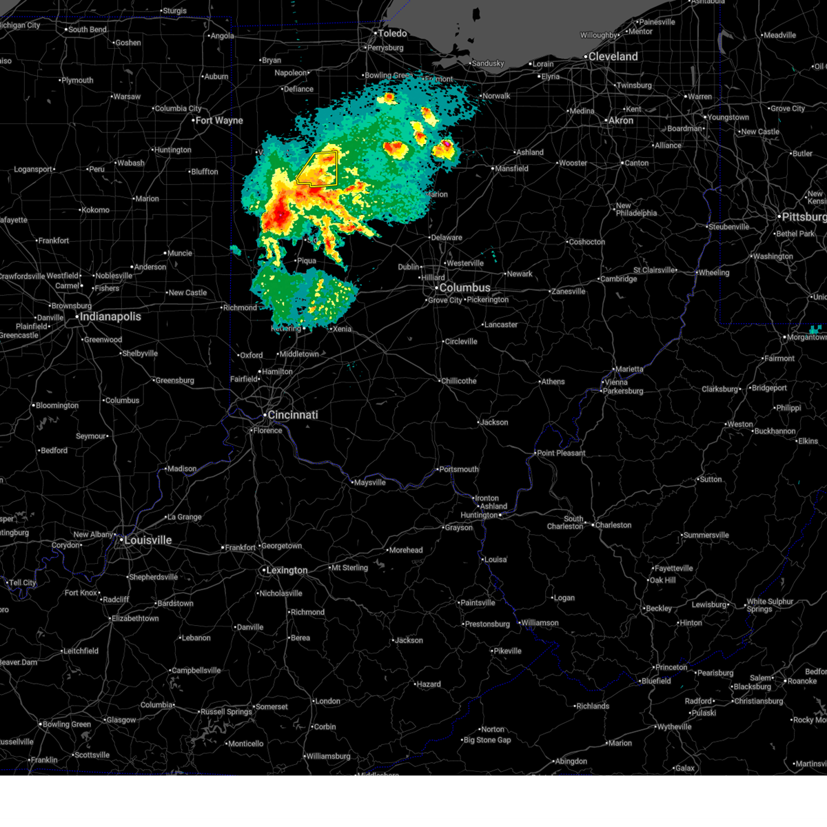
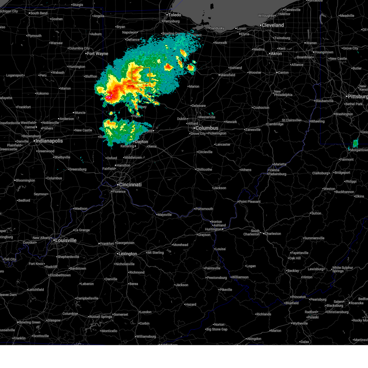
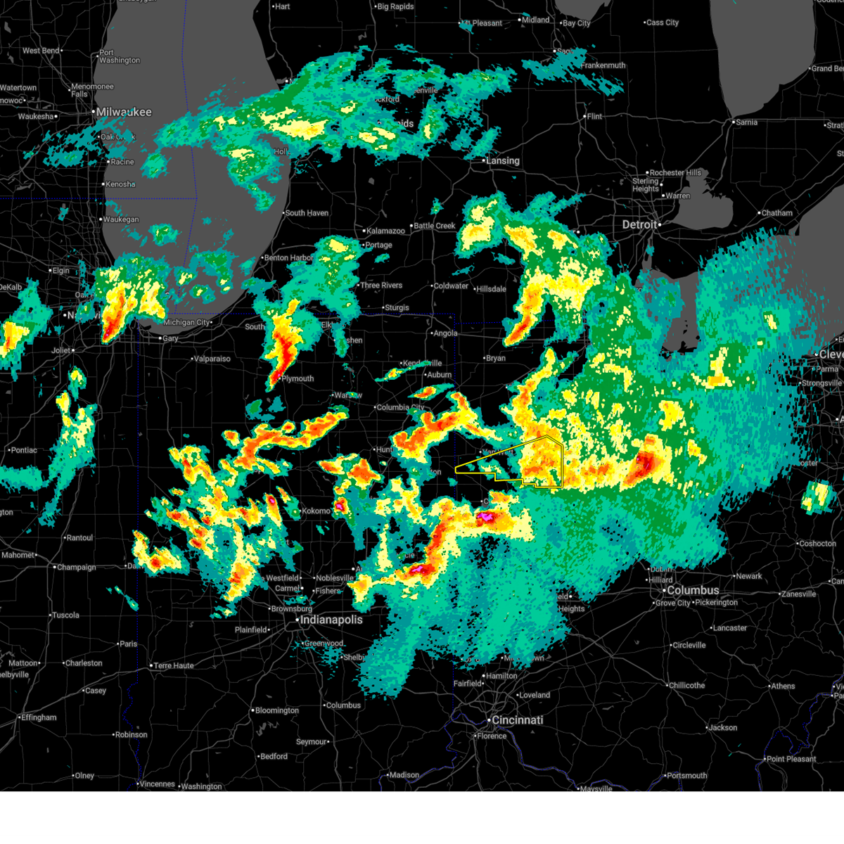
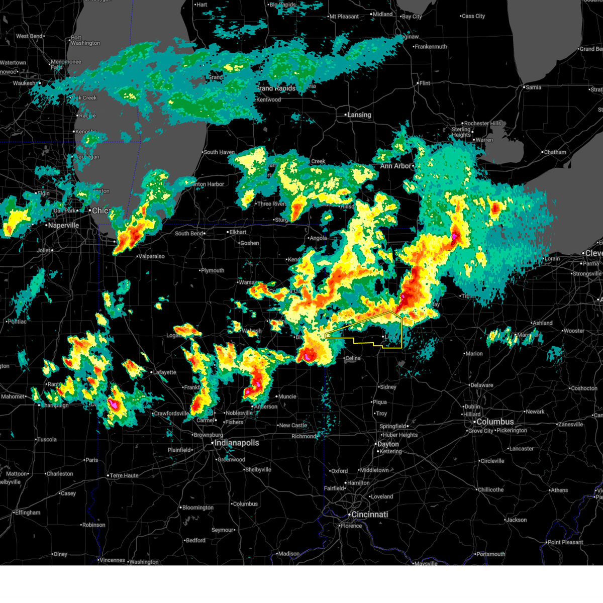
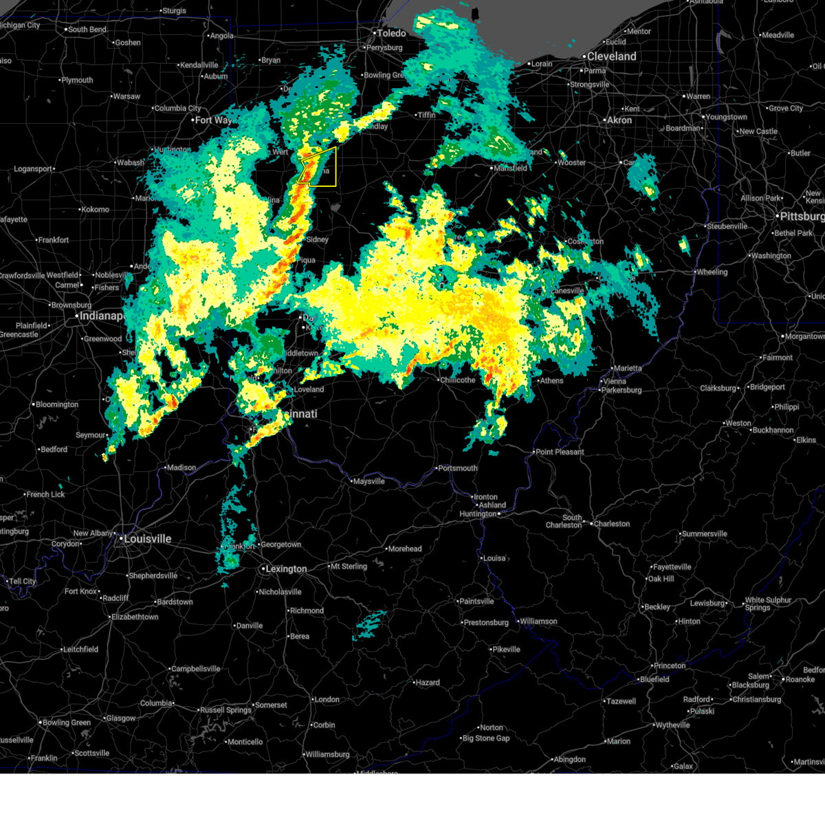
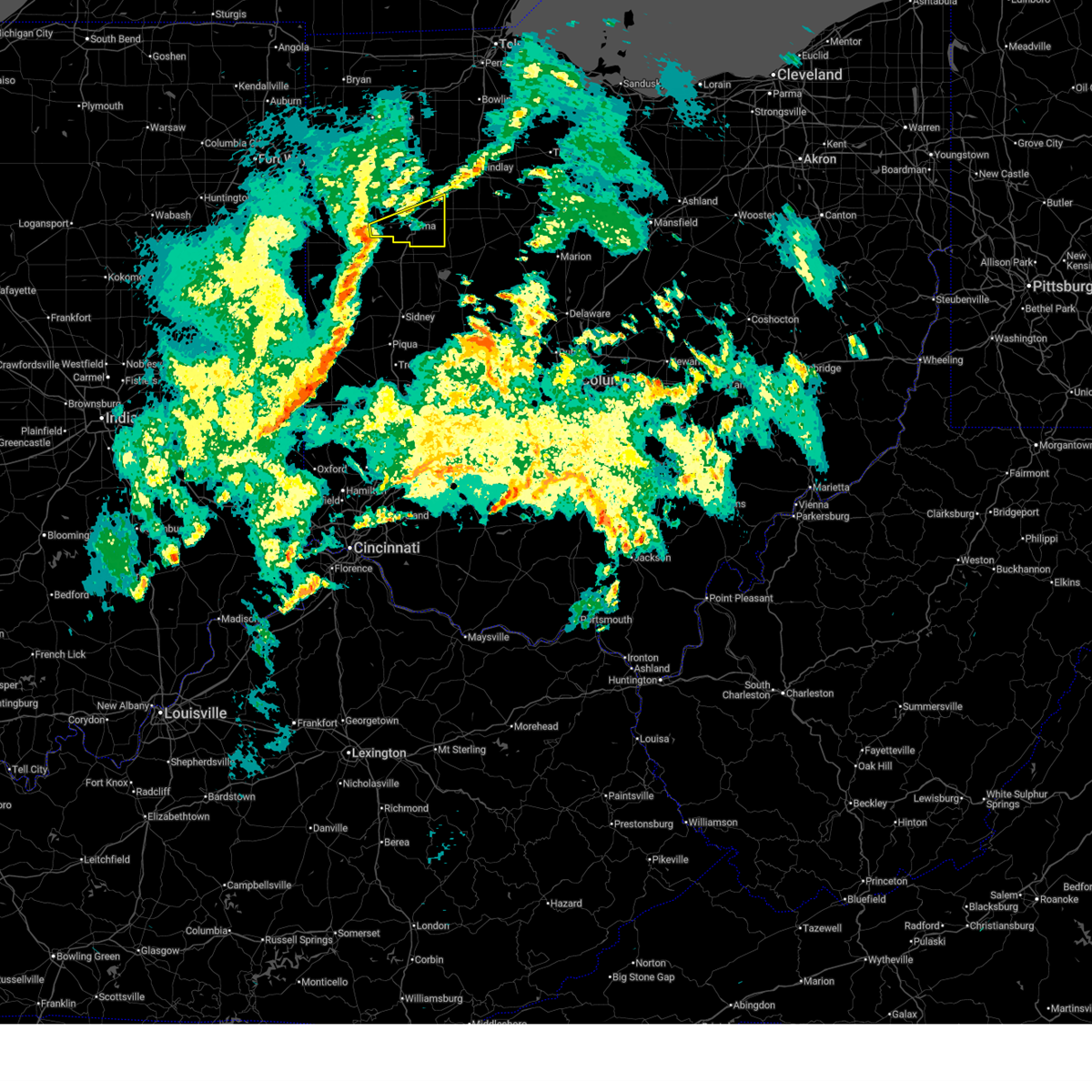
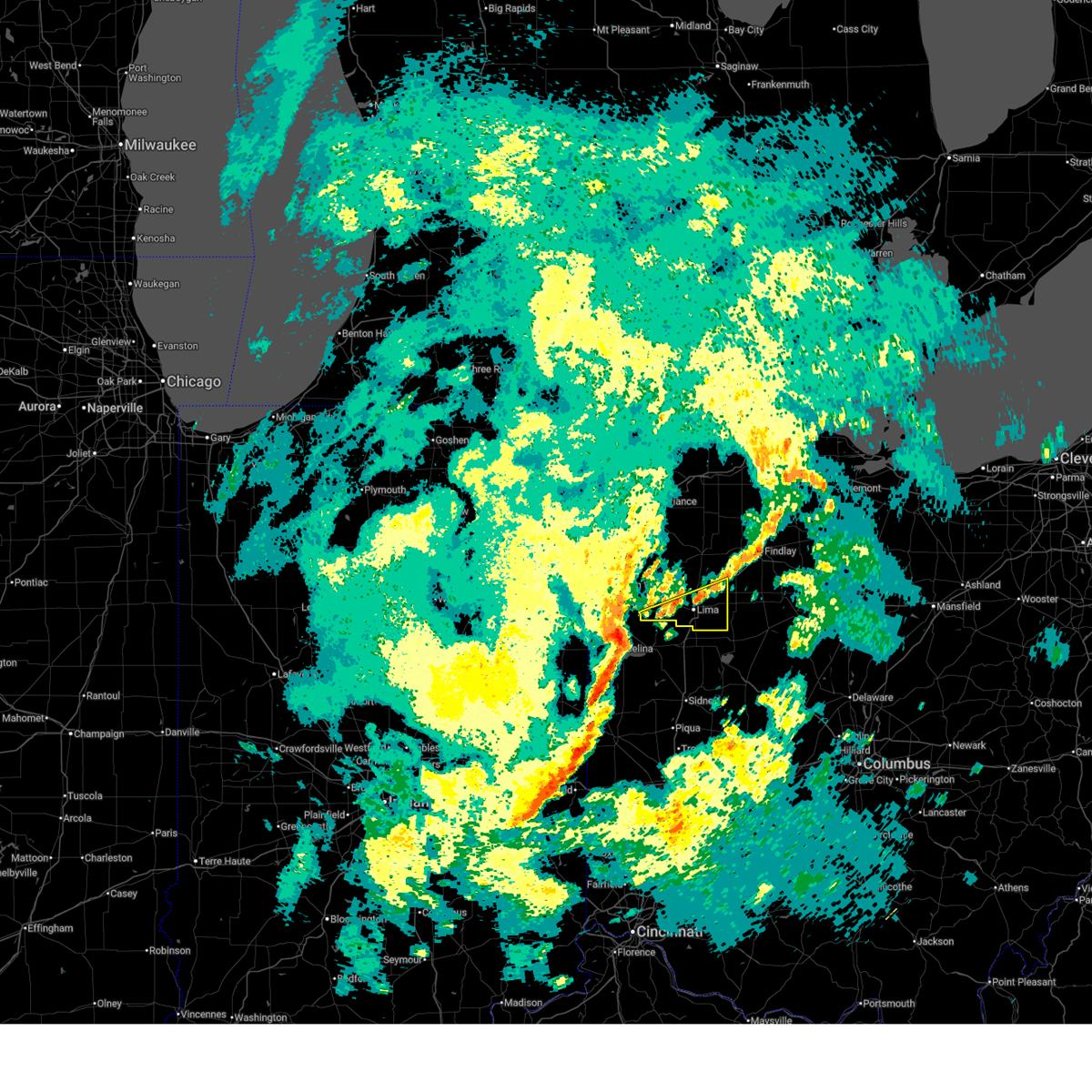
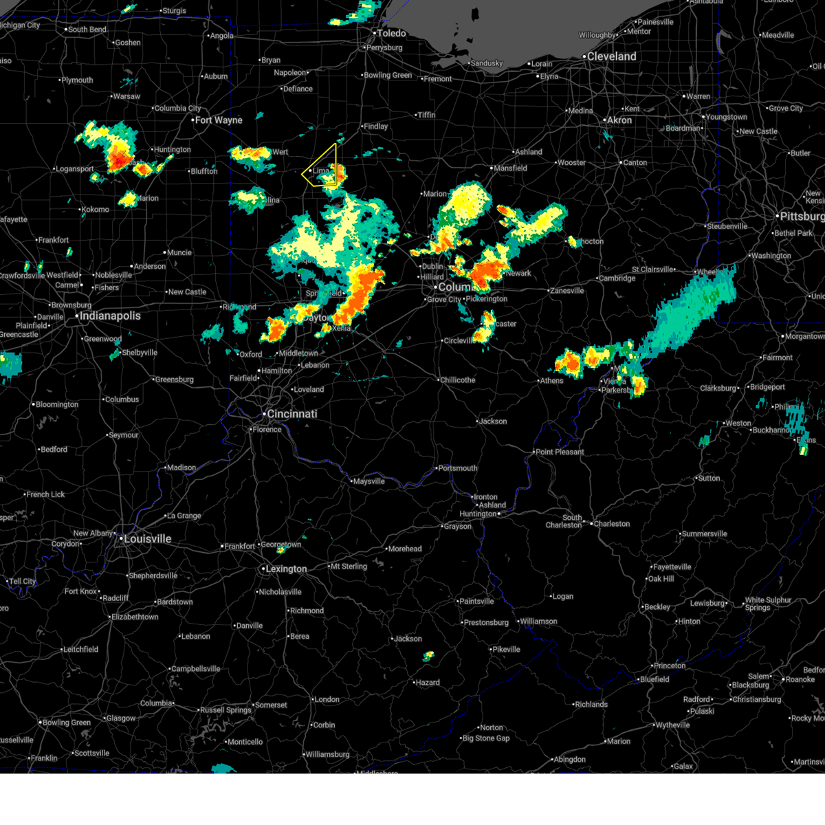
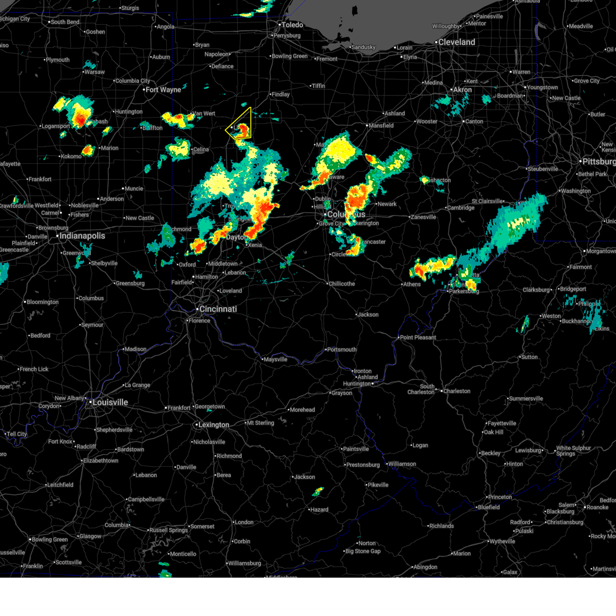
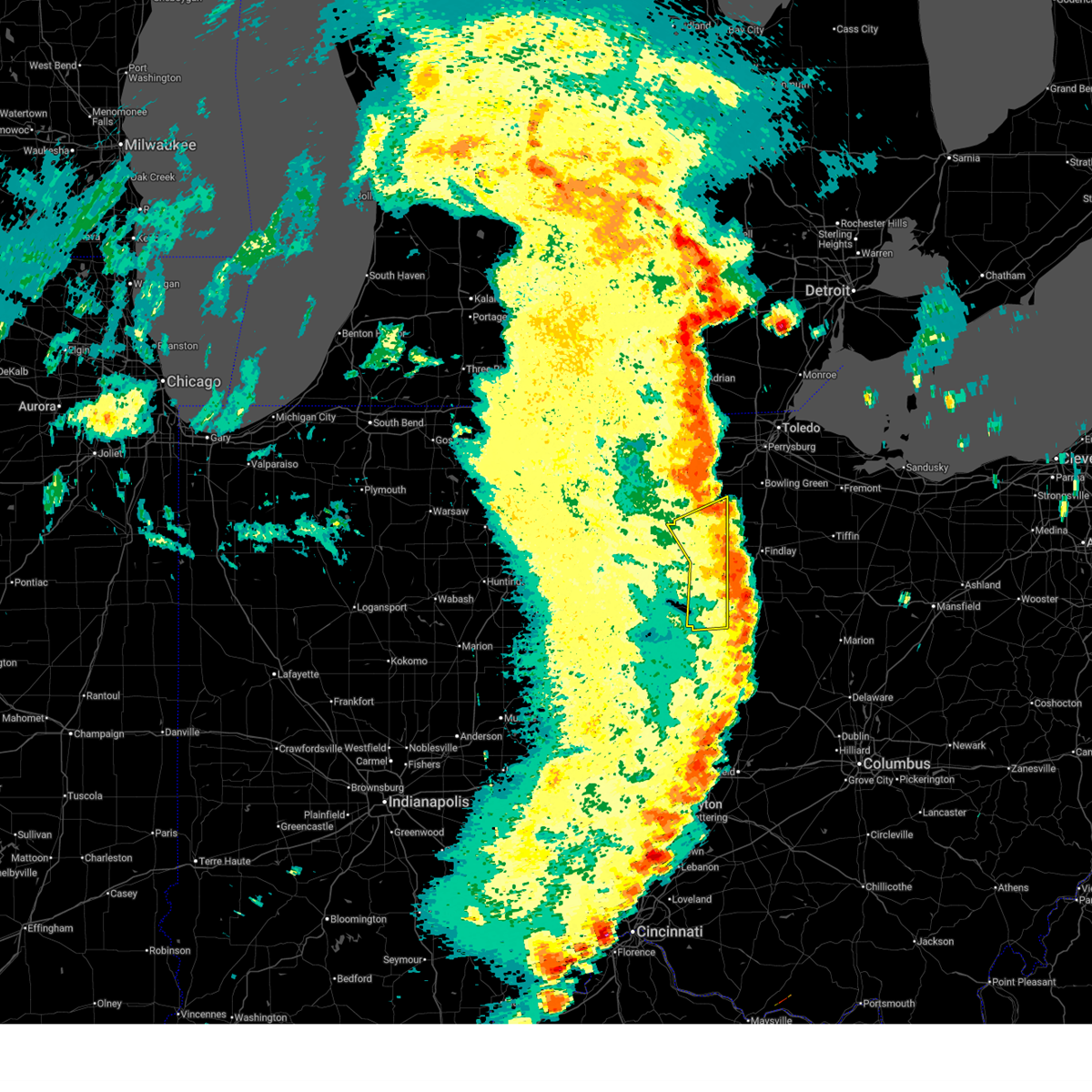
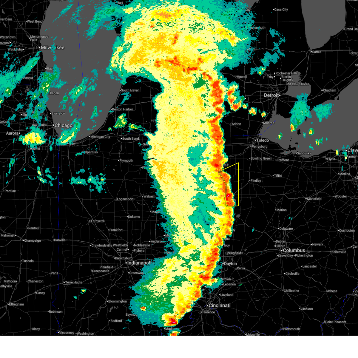
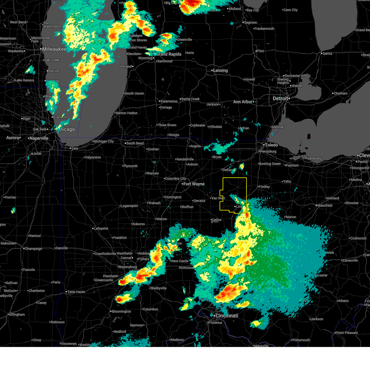
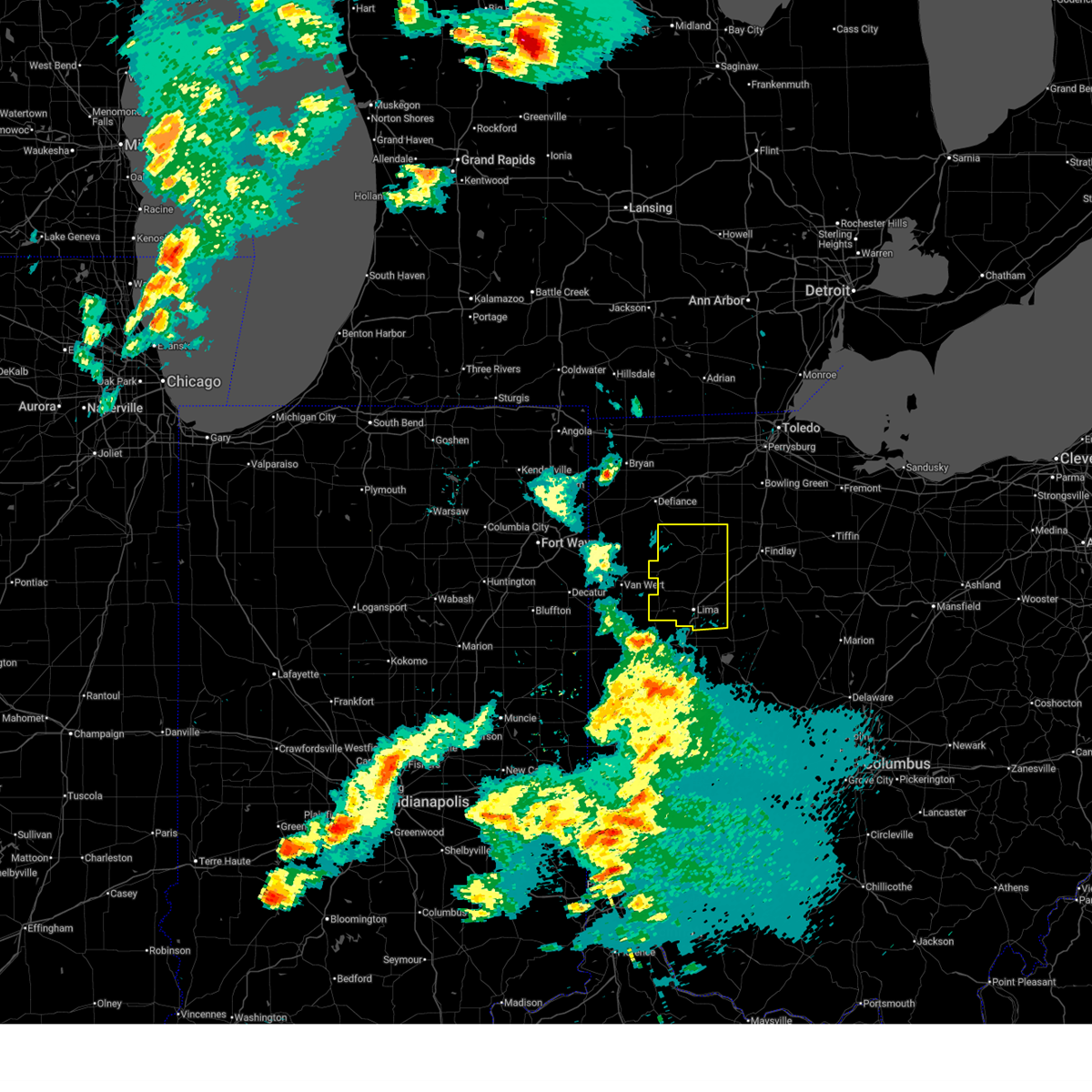
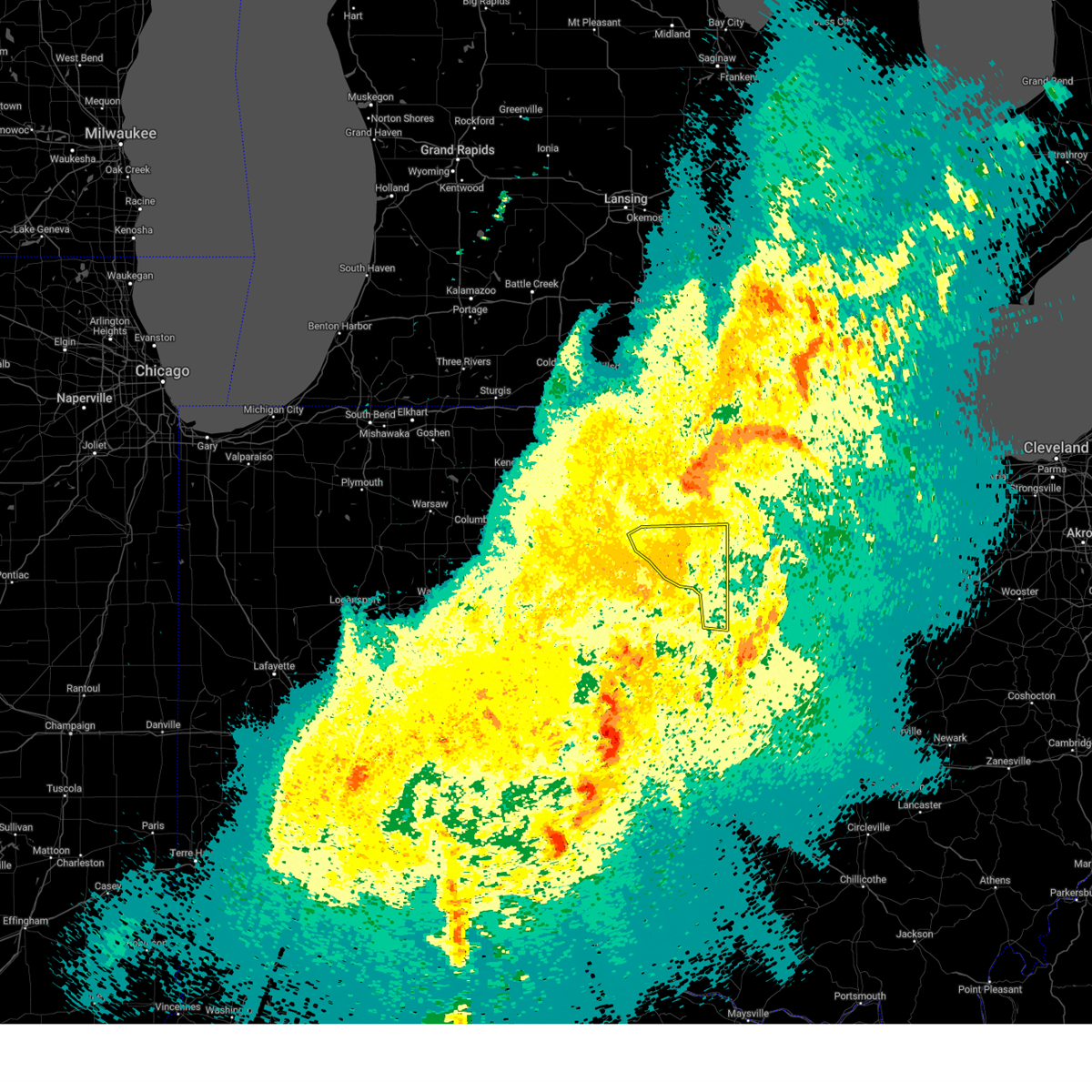
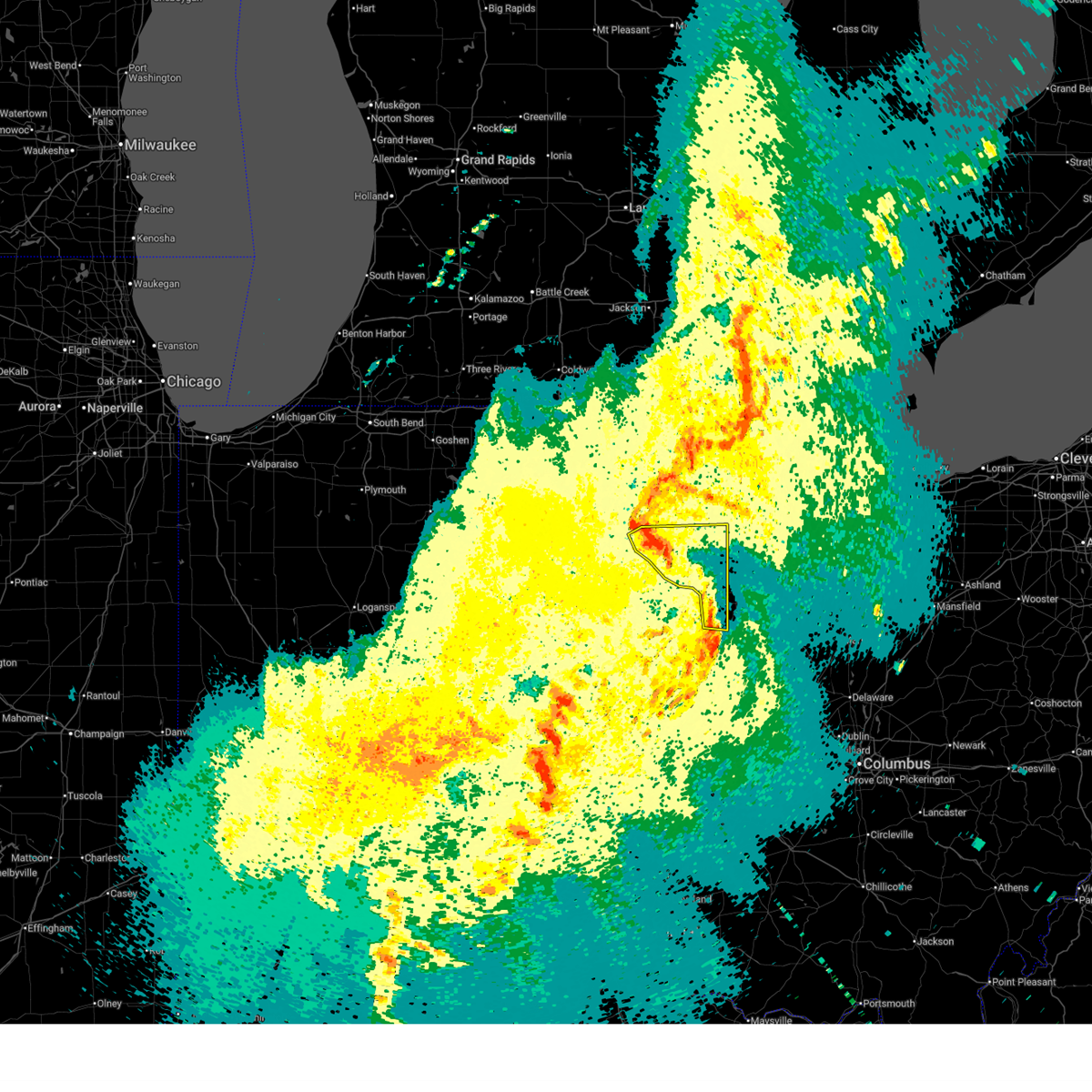
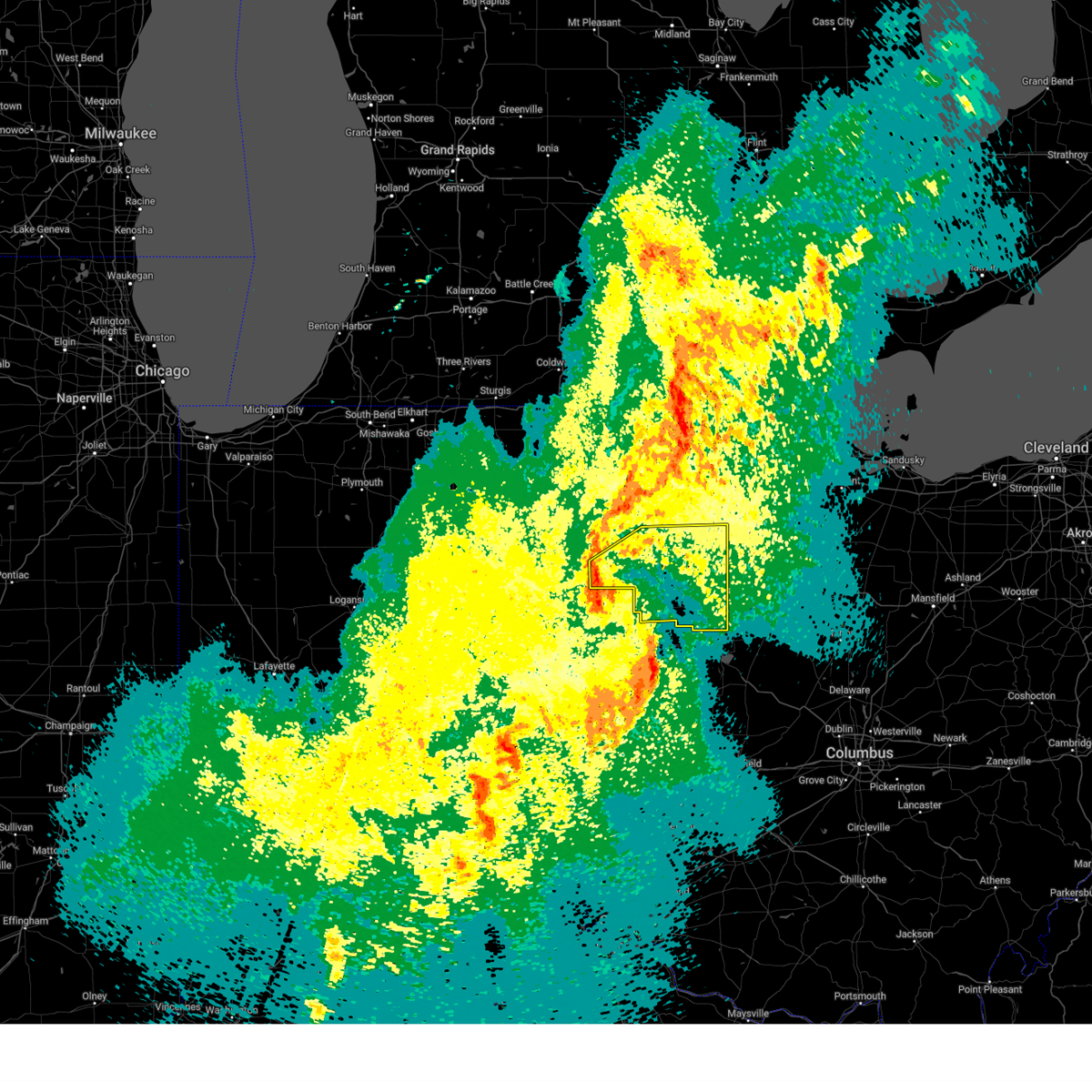
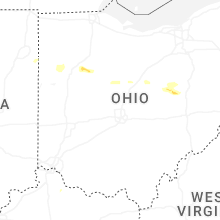
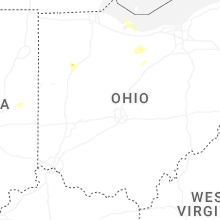
Hail Map for Harrod, OH
The Harrod, OH area has had 2 reports of on-the-ground hail by trained spotters, and has been under severe weather warnings 16 times during the past 12 months. Doppler radar has detected hail at or near Harrod, OH on 33 occasions, including 2 occasions during the past year.
| Name: | Harrod, OH |
| Where Located: | 66.7 miles ESE of Fort Wayne, IN |
| Map: | Google Map for Harrod, OH |
| Population: | 417 |
| Housing Units: | 161 |
| More Info: | Search Google for Harrod, OH |
0
The Top Recent Hail Date for Harrod, OH is Friday, April 3, 2026 (22nd out of 33)
Hail and Wind Damage Spotted near Harrod, OH
| Date / Time | Report Details |
|---|---|
| 7/3/2026 7:51 PM EDT |
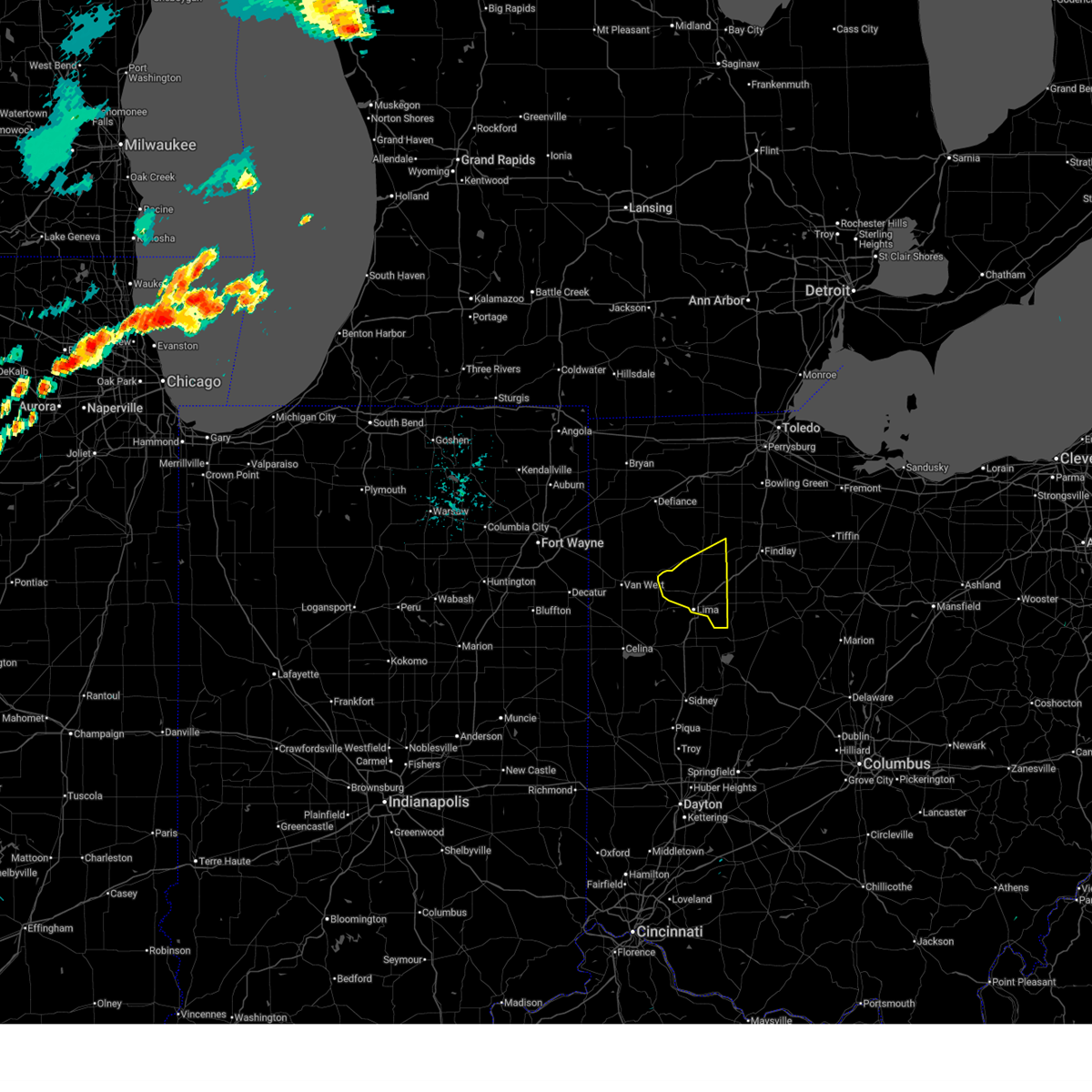 At 750 pm edt, a severe thunderstorm was located over rawson, or 8 miles southwest of findlay, moving east at 30 mph (radar indicated). Hazards include 60 mph wind gusts and quarter size hail. Hail damage to vehicles is expected. expect wind damage to roofs, siding, and trees. locations impacted include, lima, delphos, ottawa, bluffton, columbus grove, elida, kalida, pandora, glandorf, cairo, fort jennings, harrod, beaverdam, gilboa, vaughnsville, westminster, slabtown, rushmore, gomer, and rimer. This includes interstate 75 between mile markers 125 and 141. At 750 pm edt, a severe thunderstorm was located over rawson, or 8 miles southwest of findlay, moving east at 30 mph (radar indicated). Hazards include 60 mph wind gusts and quarter size hail. Hail damage to vehicles is expected. expect wind damage to roofs, siding, and trees. locations impacted include, lima, delphos, ottawa, bluffton, columbus grove, elida, kalida, pandora, glandorf, cairo, fort jennings, harrod, beaverdam, gilboa, vaughnsville, westminster, slabtown, rushmore, gomer, and rimer. This includes interstate 75 between mile markers 125 and 141.
|
| 7/3/2026 7:37 PM EDT |
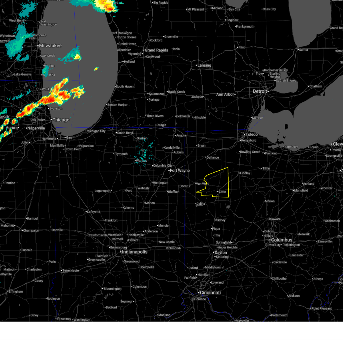 At 736 pm edt, a severe thunderstorm was located over pandora, or near bluffton, moving east at 30 mph (radar indicated). Hazards include 60 mph wind gusts and quarter size hail. Hail damage to vehicles is expected. expect wind damage to roofs, siding, and trees. locations impacted include, lima, delphos, ottawa, bluffton, fort shawnee, spencerville, columbus grove, leipsic, elida, kalida, pandora, glandorf, ottoville, spencerville in allen county, cairo, fort jennings, harrod, beaverdam, gilboa, and elgin. This includes interstate 75 between mile markers 119 and 141. At 736 pm edt, a severe thunderstorm was located over pandora, or near bluffton, moving east at 30 mph (radar indicated). Hazards include 60 mph wind gusts and quarter size hail. Hail damage to vehicles is expected. expect wind damage to roofs, siding, and trees. locations impacted include, lima, delphos, ottawa, bluffton, fort shawnee, spencerville, columbus grove, leipsic, elida, kalida, pandora, glandorf, ottoville, spencerville in allen county, cairo, fort jennings, harrod, beaverdam, gilboa, and elgin. This includes interstate 75 between mile markers 119 and 141.
|
| 7/3/2026 7:12 PM EDT |
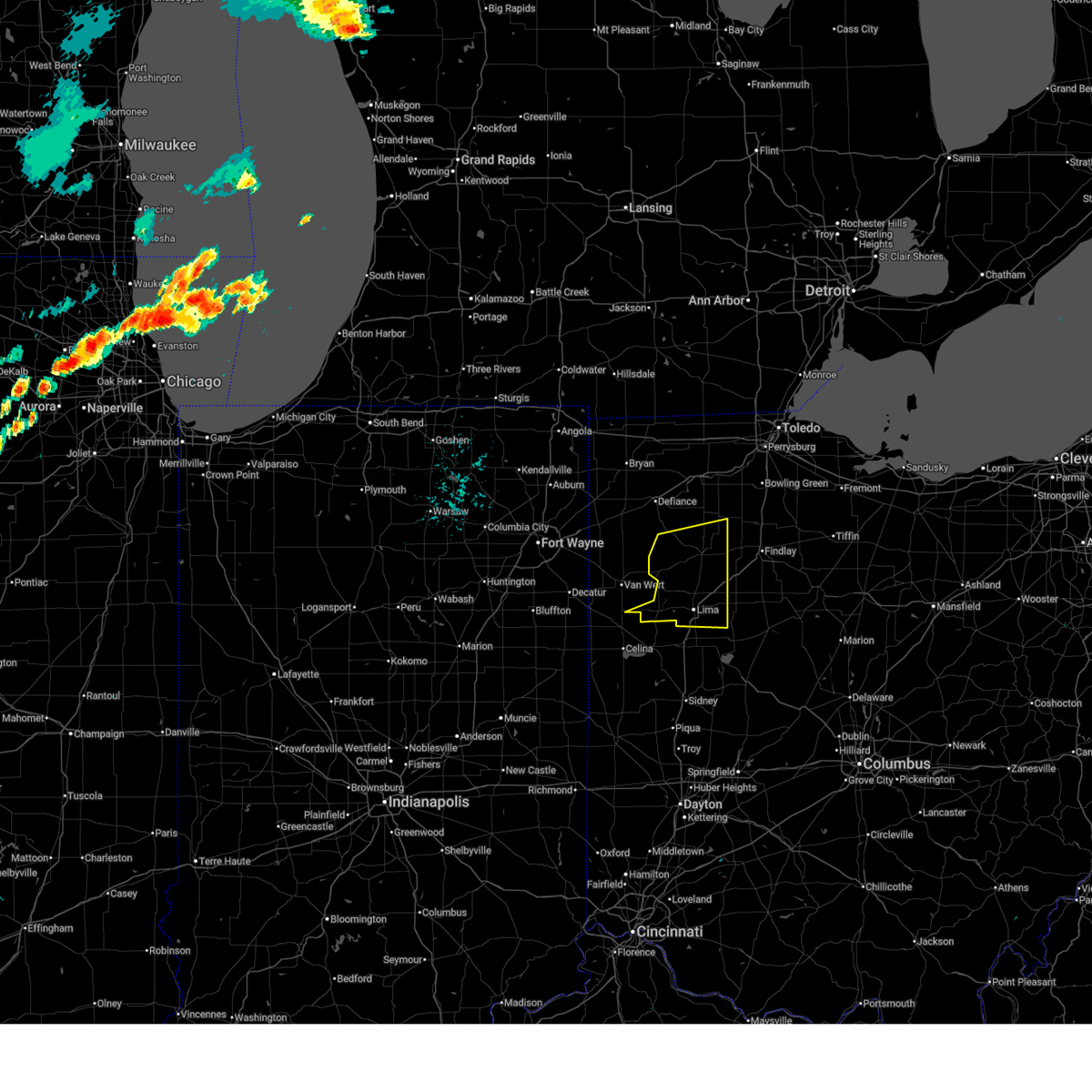 Svriwx the national weather service in northern indiana has issued a * severe thunderstorm warning for, putnam county in west central ohio, southeastern paulding county in west central ohio, southeastern henry county in northwestern ohio, eastern van wert county in west central ohio, allen county in west central ohio, * until 815 pm edt. * at 712 pm edt, a severe thunderstorm was located near columbus grove, or 8 miles southwest of ottawa, moving east at 30 mph (radar indicated). Hazards include 60 mph wind gusts and quarter size hail. Hail damage to vehicles is expected. Expect wind damage to roofs, siding, and trees. Svriwx the national weather service in northern indiana has issued a * severe thunderstorm warning for, putnam county in west central ohio, southeastern paulding county in west central ohio, southeastern henry county in northwestern ohio, eastern van wert county in west central ohio, allen county in west central ohio, * until 815 pm edt. * at 712 pm edt, a severe thunderstorm was located near columbus grove, or 8 miles southwest of ottawa, moving east at 30 mph (radar indicated). Hazards include 60 mph wind gusts and quarter size hail. Hail damage to vehicles is expected. Expect wind damage to roofs, siding, and trees.
|
| 6/11/2026 11:57 PM EDT |
 Svriwx the national weather service in northern indiana has issued a * severe thunderstorm warning for, putnam county in west central ohio, southeastern henry county in northwestern ohio, allen county in west central ohio, * until 1230 am edt. * at 1156 pm edt, severe thunderstorms were located along a line extending from near continental to near kalida to near spencerville, moving northeast at 55 mph (radar indicated). Hazards include 60 mph wind gusts. expect damage to roofs, siding, and trees Svriwx the national weather service in northern indiana has issued a * severe thunderstorm warning for, putnam county in west central ohio, southeastern henry county in northwestern ohio, allen county in west central ohio, * until 1230 am edt. * at 1156 pm edt, severe thunderstorms were located along a line extending from near continental to near kalida to near spencerville, moving northeast at 55 mph (radar indicated). Hazards include 60 mph wind gusts. expect damage to roofs, siding, and trees
|
| 4/14/2026 8:05 PM EDT |
 The storm which prompted the warning has moved out of the area. therefore, the warning will be allowed to expire. The storm which prompted the warning has moved out of the area. therefore, the warning will be allowed to expire.
|
| 4/14/2026 7:59 PM EDT |
 At 758 pm edt, a severe thunderstorm was located near alger, or 8 miles southeast of ada, moving east at 45 mph. this storm has a history of producing greater than 58 mph wind gusts (radar indicated). Hazards include 60 mph wind gusts. Expect damage to roofs, siding, and trees. locations impacted include, lima, fort shawnee, harrod, westminster, yoder, and rousculp. This includes interstate 75 near mile marker 119, and between mile markers 122 and 124. At 758 pm edt, a severe thunderstorm was located near alger, or 8 miles southeast of ada, moving east at 45 mph. this storm has a history of producing greater than 58 mph wind gusts (radar indicated). Hazards include 60 mph wind gusts. Expect damage to roofs, siding, and trees. locations impacted include, lima, fort shawnee, harrod, westminster, yoder, and rousculp. This includes interstate 75 near mile marker 119, and between mile markers 122 and 124.
|
| 4/14/2026 7:49 PM EDT |
 At 749 pm edt, a severe thunderstorm was located over alger, or near ada, moving east at 45 mph. this storm has a history of producing greater than 58 mph wind gusts (radar indicated). Hazards include 60 mph wind gusts. Expect damage to roofs, siding, and trees. locations impacted include, lima, fort shawnee, cairo, harrod, beaverdam, westminster, yoder, hume, slabtown, and rousculp. This includes interstate 75 between mile markers 119 and 138. At 749 pm edt, a severe thunderstorm was located over alger, or near ada, moving east at 45 mph. this storm has a history of producing greater than 58 mph wind gusts (radar indicated). Hazards include 60 mph wind gusts. Expect damage to roofs, siding, and trees. locations impacted include, lima, fort shawnee, cairo, harrod, beaverdam, westminster, yoder, hume, slabtown, and rousculp. This includes interstate 75 between mile markers 119 and 138.
|
| 4/14/2026 7:30 PM EDT |
 Svriwx the national weather service in northern indiana has issued a * severe thunderstorm warning for, allen county in west central ohio, * until 815 pm edt. * at 730 pm edt, a severe thunderstorm was located over lima, moving east at 45 mph (radar indicated). Hazards include 60 mph wind gusts. expect damage to roofs, siding, and trees Svriwx the national weather service in northern indiana has issued a * severe thunderstorm warning for, allen county in west central ohio, * until 815 pm edt. * at 730 pm edt, a severe thunderstorm was located over lima, moving east at 45 mph (radar indicated). Hazards include 60 mph wind gusts. expect damage to roofs, siding, and trees
|
| 3/26/2026 8:21 PM EDT |
 The storms which prompted the warning will move out of the area by 830 pm edt. therefore, the warning will be allowed to expire. however, gusty winds are still possible with these thunderstorms. a tornado watch remains in effect until 1100 pm edt for west central ohio. The storms which prompted the warning will move out of the area by 830 pm edt. therefore, the warning will be allowed to expire. however, gusty winds are still possible with these thunderstorms. a tornado watch remains in effect until 1100 pm edt for west central ohio.
|
| 3/26/2026 7:44 PM EDT |
 Svriwx the national weather service in northern indiana has issued a * severe thunderstorm warning for, southeastern putnam county in west central ohio, southern van wert county in west central ohio, allen county in west central ohio, * until 830 pm edt. * at 744 pm edt, severe thunderstorms were located along a line extending from 6 miles east of monroe to 6 miles southeast of van wert to near columbus grove, moving southeast at 35 mph (emergency management). Hazards include 60 mph wind gusts and penny size hail. expect damage to roofs, siding, and trees Svriwx the national weather service in northern indiana has issued a * severe thunderstorm warning for, southeastern putnam county in west central ohio, southern van wert county in west central ohio, allen county in west central ohio, * until 830 pm edt. * at 744 pm edt, severe thunderstorms were located along a line extending from 6 miles east of monroe to 6 miles southeast of van wert to near columbus grove, moving southeast at 35 mph (emergency management). Hazards include 60 mph wind gusts and penny size hail. expect damage to roofs, siding, and trees
|
| 3/11/2026 10:14 AM EDT |
 At 1014 am edt, a severe thunderstorm was located 7 miles southwest of bluffton, moving northeast at 70 mph (radar indicated). Hazards include 60 mph wind gusts. Expect damage to roofs, siding, and trees. locations impacted include, lima, bluffton, fort shawnee, cairo, harrod, beaverdam, westminster, yoder, hume, slabtown, and rousculp. This includes interstate 75 between mile markers 119 and 141. At 1014 am edt, a severe thunderstorm was located 7 miles southwest of bluffton, moving northeast at 70 mph (radar indicated). Hazards include 60 mph wind gusts. Expect damage to roofs, siding, and trees. locations impacted include, lima, bluffton, fort shawnee, cairo, harrod, beaverdam, westminster, yoder, hume, slabtown, and rousculp. This includes interstate 75 between mile markers 119 and 141.
|
| 3/11/2026 10:03 AM EDT |
 the severe thunderstorm warning has been cancelled and is no longer in effect the severe thunderstorm warning has been cancelled and is no longer in effect
|
| 3/11/2026 10:03 AM EDT |
 At 1002 am edt, a severe thunderstorm was located near elida, or near lima, moving northeast at 70 mph (radar indicated). Hazards include 60 mph wind gusts and penny size hail. Expect damage to roofs, siding, and trees. locations impacted include, lima, bluffton, fort shawnee, spencerville, elida, spencerville in allen county, cairo, harrod, beaverdam, westminster, yoder, conant, hume, slabtown, rousculp, and kemp. This includes interstate 75 between mile markers 119 and 141. At 1002 am edt, a severe thunderstorm was located near elida, or near lima, moving northeast at 70 mph (radar indicated). Hazards include 60 mph wind gusts and penny size hail. Expect damage to roofs, siding, and trees. locations impacted include, lima, bluffton, fort shawnee, spencerville, elida, spencerville in allen county, cairo, harrod, beaverdam, westminster, yoder, conant, hume, slabtown, rousculp, and kemp. This includes interstate 75 between mile markers 119 and 141.
|
| 3/11/2026 9:46 AM EDT |
 Svriwx the national weather service in northern indiana has issued a * severe thunderstorm warning for, southeastern van wert county in west central ohio, allen county in west central ohio, * until 1030 am edt. * at 945 am edt, a severe thunderstorm was located near celina, moving northeast at 70 mph (radar indicated). Hazards include 60 mph wind gusts and penny size hail. expect damage to roofs, siding, and trees Svriwx the national weather service in northern indiana has issued a * severe thunderstorm warning for, southeastern van wert county in west central ohio, allen county in west central ohio, * until 1030 am edt. * at 945 am edt, a severe thunderstorm was located near celina, moving northeast at 70 mph (radar indicated). Hazards include 60 mph wind gusts and penny size hail. expect damage to roofs, siding, and trees
|
| 7/25/2025 5:53 PM EDT |
 The storm which prompted the warning has weakened below severe limits, and is currently exiting the warned area. therefore, the warning will be allowed to expire. The storm which prompted the warning has weakened below severe limits, and is currently exiting the warned area. therefore, the warning will be allowed to expire.
|
| 7/25/2025 5:39 PM EDT |
 Svriwx the national weather service in northern indiana has issued a * severe thunderstorm warning for, eastern allen county in west central ohio, * until 600 pm edt. * at 539 pm edt, a severe thunderstorm was located near bluffton, moving northeast at 55 mph (radar indicated). Hazards include 60 mph wind gusts and quarter size hail. Hail damage to vehicles is expected. Expect wind damage to roofs, siding, and trees. Svriwx the national weather service in northern indiana has issued a * severe thunderstorm warning for, eastern allen county in west central ohio, * until 600 pm edt. * at 539 pm edt, a severe thunderstorm was located near bluffton, moving northeast at 55 mph (radar indicated). Hazards include 60 mph wind gusts and quarter size hail. Hail damage to vehicles is expected. Expect wind damage to roofs, siding, and trees.
|
| 6/18/2025 7:12 PM EDT |
 the severe thunderstorm warning has been cancelled and is no longer in effect the severe thunderstorm warning has been cancelled and is no longer in effect
|
| 6/18/2025 6:53 PM EDT |
 Svriwx the national weather service in northern indiana has issued a * severe thunderstorm warning for, eastern putnam county in west central ohio, southeastern henry county in northwestern ohio, allen county in west central ohio, * until 730 pm edt. * at 653 pm edt, severe thunderstorms were located along a line extending from near holgate to near ottawa to 6 miles east of lima, moving east at 50 mph (radar indicated). Hazards include 60 mph wind gusts. expect damage to roofs, siding, and trees Svriwx the national weather service in northern indiana has issued a * severe thunderstorm warning for, eastern putnam county in west central ohio, southeastern henry county in northwestern ohio, allen county in west central ohio, * until 730 pm edt. * at 653 pm edt, severe thunderstorms were located along a line extending from near holgate to near ottawa to 6 miles east of lima, moving east at 50 mph (radar indicated). Hazards include 60 mph wind gusts. expect damage to roofs, siding, and trees
|
| 5/16/2025 9:11 PM EDT |
 the severe thunderstorm warning has been cancelled and is no longer in effect the severe thunderstorm warning has been cancelled and is no longer in effect
|
| 5/16/2025 8:38 PM EDT |
 Svriwx the national weather service in northern indiana has issued a * severe thunderstorm warning for, putnam county in west central ohio, allen county in west central ohio, * until 945 pm edt. * at 837 pm edt, showers and embedded thunderstorms producing strong wind gusts were located along a line extending from near paulding to near jackson center, moving northeast at 60 mph (broadcast media). Hazards include 70 mph wind gusts. Expect considerable tree damage. Damage is likely to mobile homes, roofs, and outbuildings. Svriwx the national weather service in northern indiana has issued a * severe thunderstorm warning for, putnam county in west central ohio, allen county in west central ohio, * until 945 pm edt. * at 837 pm edt, showers and embedded thunderstorms producing strong wind gusts were located along a line extending from near paulding to near jackson center, moving northeast at 60 mph (broadcast media). Hazards include 70 mph wind gusts. Expect considerable tree damage. Damage is likely to mobile homes, roofs, and outbuildings.
|
| 4/2/2025 11:44 PM EDT |
 the severe thunderstorm warning has been cancelled and is no longer in effect the severe thunderstorm warning has been cancelled and is no longer in effect
|
| 4/2/2025 11:26 PM EDT |
 At 1125 pm edt, severe thunderstorms were located along a line extending from near defiance to near glandorf to 6 miles south of kalida, moving northeast at 65 mph (radar indicated). Hazards include 60 mph wind gusts. Expect damage to roofs, siding, and trees. locations impacted include, ottoville, westminster, columbus grove, pandora, melrose, harrod, charloe, bluffton, west leipsic, rimer, dupont, wisterman, ottawa, vaughnsville, prentiss, leipsic, kieferville, miller city, glandorf, and belmore. This includes interstate 75 between mile markers 130 and 141. At 1125 pm edt, severe thunderstorms were located along a line extending from near defiance to near glandorf to 6 miles south of kalida, moving northeast at 65 mph (radar indicated). Hazards include 60 mph wind gusts. Expect damage to roofs, siding, and trees. locations impacted include, ottoville, westminster, columbus grove, pandora, melrose, harrod, charloe, bluffton, west leipsic, rimer, dupont, wisterman, ottawa, vaughnsville, prentiss, leipsic, kieferville, miller city, glandorf, and belmore. This includes interstate 75 between mile markers 130 and 141.
|
| 4/2/2025 11:26 PM EDT |
 the severe thunderstorm warning has been cancelled and is no longer in effect the severe thunderstorm warning has been cancelled and is no longer in effect
|
| 4/2/2025 11:02 PM EDT |
 the severe thunderstorm warning has been cancelled and is no longer in effect the severe thunderstorm warning has been cancelled and is no longer in effect
|
| 4/2/2025 11:02 PM EDT |
 At 1102 pm edt, severe thunderstorms were located along a line extending from near payne to near van wert to near rockford, moving northeast at 60 mph (radar indicated). Hazards include 70 mph wind gusts. Expect considerable tree damage. damage is likely to mobile homes, roofs, and outbuildings. locations impacted include, elida, ottoville, yoder, westminster, columbus grove, bluffton, cavett, haviland, west leipsic, rimer, latty, dupont, venedocia, convoy, ottawa, wetzel, vaughnsville, kieferville, glandorf, and spencerville in allen county. This includes interstate 75 between mile markers 119 and 141. At 1102 pm edt, severe thunderstorms were located along a line extending from near payne to near van wert to near rockford, moving northeast at 60 mph (radar indicated). Hazards include 70 mph wind gusts. Expect considerable tree damage. damage is likely to mobile homes, roofs, and outbuildings. locations impacted include, elida, ottoville, yoder, westminster, columbus grove, bluffton, cavett, haviland, west leipsic, rimer, latty, dupont, venedocia, convoy, ottawa, wetzel, vaughnsville, kieferville, glandorf, and spencerville in allen county. This includes interstate 75 between mile markers 119 and 141.
|
| 4/2/2025 10:43 PM EDT |
 Svriwx the national weather service in northern indiana has issued a * severe thunderstorm warning for, southeastern allen county in northeastern indiana, northern adams county in northeastern indiana, putnam county in west central ohio, southeastern paulding county in west central ohio, van wert county in west central ohio, allen county in west central ohio, * until midnight edt. * at 1042 pm edt, severe thunderstorms were located along a line extending from near decatur to 6 miles west of rockford to st. henry, moving northeast at 65 mph (radar indicated). Hazards include 70 mph wind gusts. Expect considerable tree damage. Damage is likely to mobile homes, roofs, and outbuildings. Svriwx the national weather service in northern indiana has issued a * severe thunderstorm warning for, southeastern allen county in northeastern indiana, northern adams county in northeastern indiana, putnam county in west central ohio, southeastern paulding county in west central ohio, van wert county in west central ohio, allen county in west central ohio, * until midnight edt. * at 1042 pm edt, severe thunderstorms were located along a line extending from near decatur to 6 miles west of rockford to st. henry, moving northeast at 65 mph (radar indicated). Hazards include 70 mph wind gusts. Expect considerable tree damage. Damage is likely to mobile homes, roofs, and outbuildings.
|
| 4/17/2024 2:45 PM EDT |
 The storms which prompted the warning have are exiting the eastern part of allen county ohio. therefore, the severe thunderstorm warning will be allowed to expire. a tornado watch remains in effect until 700 pm edt for west central ohio. The storms which prompted the warning have are exiting the eastern part of allen county ohio. therefore, the severe thunderstorm warning will be allowed to expire. a tornado watch remains in effect until 700 pm edt for west central ohio.
|
| 4/17/2024 2:22 PM EDT |
 Svriwx the national weather service in northern indiana has issued a * severe thunderstorm warning for, southeastern putnam county in west central ohio, allen county in west central ohio, * until 245 pm edt. * at 221 pm edt, severe thunderstorms were located along a line extending from near columbus grove to near cridersville to botkins, moving east at 30 mph (radar indicated). Hazards include 60 mph wind gusts and penny size hail. expect damage to roofs, siding, and trees Svriwx the national weather service in northern indiana has issued a * severe thunderstorm warning for, southeastern putnam county in west central ohio, allen county in west central ohio, * until 245 pm edt. * at 221 pm edt, severe thunderstorms were located along a line extending from near columbus grove to near cridersville to botkins, moving east at 30 mph (radar indicated). Hazards include 60 mph wind gusts and penny size hail. expect damage to roofs, siding, and trees
|
| 7/20/2023 6:30 PM EDT | Half Dollar sized hail reported 0.2 miles SSW of Harrod, OH |
| 7/20/2023 6:27 PM EDT |
 At 627 pm edt, a severe thunderstorm was located near lima, moving northeast at 40 mph (radar indicated). Hazards include two inch hail and 60 mph wind gusts. People and animals outdoors will be injured. expect hail damage to roofs, siding, windows, and vehicles. Expect wind damage to roofs, siding, and trees. At 627 pm edt, a severe thunderstorm was located near lima, moving northeast at 40 mph (radar indicated). Hazards include two inch hail and 60 mph wind gusts. People and animals outdoors will be injured. expect hail damage to roofs, siding, windows, and vehicles. Expect wind damage to roofs, siding, and trees.
|
| 2/27/2023 3:53 PM EST |
 The severe thunderstorm warning for putnam, eastern van wert and western allen counties will expire at 400 pm est, the storms which prompted the warning havemoved out of the warned area. therefore, the warning will be allowed to expire. a tornado watch remains in effect until 600 pm est for west central ohio. The severe thunderstorm warning for putnam, eastern van wert and western allen counties will expire at 400 pm est, the storms which prompted the warning havemoved out of the warned area. therefore, the warning will be allowed to expire. a tornado watch remains in effect until 600 pm est for west central ohio.
|
| 2/27/2023 3:26 PM EST |
 At 326 pm est, severe thunderstorms were located along a line extending from near ottoville to 6 miles east of ohio city, moving east at 65 mph (radar indicated). Hazards include 60 mph wind gusts. Expect damage to roofs, siding, and trees. severe thunderstorms will be near, ottoville around 330 pm est. delphos, spencerville and spencerville in allen county around 335 pm est. elida and kalida around 340 pm est. lima, ottawa, fort shawnee, columbus grove and glandorf around 345 pm est. pandora around 350 pm est. bluffton around 355 pm est. other locations impacted by these severe thunderstorms include yoder, westminster, harrod, gomer, rushmore, jonestown, rimer, venedocia, elgin and wetzel. this includes interstate 75 between mile markers 119 and 141. hail threat, radar indicated max hail size, <. 75 in wind threat, radar indicated max wind gust, 60 mph. At 326 pm est, severe thunderstorms were located along a line extending from near ottoville to 6 miles east of ohio city, moving east at 65 mph (radar indicated). Hazards include 60 mph wind gusts. Expect damage to roofs, siding, and trees. severe thunderstorms will be near, ottoville around 330 pm est. delphos, spencerville and spencerville in allen county around 335 pm est. elida and kalida around 340 pm est. lima, ottawa, fort shawnee, columbus grove and glandorf around 345 pm est. pandora around 350 pm est. bluffton around 355 pm est. other locations impacted by these severe thunderstorms include yoder, westminster, harrod, gomer, rushmore, jonestown, rimer, venedocia, elgin and wetzel. this includes interstate 75 between mile markers 119 and 141. hail threat, radar indicated max hail size, <. 75 in wind threat, radar indicated max wind gust, 60 mph.
|
| 8/20/2022 3:29 PM EDT |
 At 328 pm edt, a severe thunderstorm was located over ada, moving northeast at 50 mph (radar indicated). Hazards include 70 mph wind gusts. Expect considerable tree damage. Damage is likely to mobile homes, roofs, and outbuildings. At 328 pm edt, a severe thunderstorm was located over ada, moving northeast at 50 mph (radar indicated). Hazards include 70 mph wind gusts. Expect considerable tree damage. Damage is likely to mobile homes, roofs, and outbuildings.
|
| 7/23/2022 10:09 AM EDT |
 At 1009 am edt, severe thunderstorms were located along a line extending from near bluffton to fort shawnee, moving east at 50 mph (radar indicated). Hazards include 60 mph wind gusts. Expect damage to roofs, siding, and trees. locations impacted include, lima, bluffton, fort shawnee, pandora, cairo, harrod, beaverdam, yoder, westminster, hume, slabtown, rousculp and rockport. this includes interstate 75 between mile markers 119 and 141. hail threat, radar indicated max hail size, <. 75 in wind threat, radar indicated max wind gust, 60 mph. At 1009 am edt, severe thunderstorms were located along a line extending from near bluffton to fort shawnee, moving east at 50 mph (radar indicated). Hazards include 60 mph wind gusts. Expect damage to roofs, siding, and trees. locations impacted include, lima, bluffton, fort shawnee, pandora, cairo, harrod, beaverdam, yoder, westminster, hume, slabtown, rousculp and rockport. this includes interstate 75 between mile markers 119 and 141. hail threat, radar indicated max hail size, <. 75 in wind threat, radar indicated max wind gust, 60 mph.
|
| 7/23/2022 9:46 AM EDT |
 At 946 am edt, severe thunderstorms were located along a line extending from near ottoville to near spencerville, moving east at 40 mph (radar indicated). Hazards include 70 mph wind gusts. Expect considerable tree damage. Damage is likely to mobile homes, roofs, and outbuildings. At 946 am edt, severe thunderstorms were located along a line extending from near ottoville to near spencerville, moving east at 40 mph (radar indicated). Hazards include 70 mph wind gusts. Expect considerable tree damage. Damage is likely to mobile homes, roofs, and outbuildings.
|
| 6/13/2022 11:57 PM EDT |
 The severe thunderstorm warning for south central putnam and allen counties will expire at midnight edt, the storms which prompted the warning have moved out of the area. therefore, the warning will be allowed to expire. a severe thunderstorm watch remains in effect until midnight edt for west central ohio. The severe thunderstorm warning for south central putnam and allen counties will expire at midnight edt, the storms which prompted the warning have moved out of the area. therefore, the warning will be allowed to expire. a severe thunderstorm watch remains in effect until midnight edt for west central ohio.
|
| 6/13/2022 11:19 PM EDT |
 At 1119 pm edt, severe thunderstorms were located along a line extending from near delphos to 6 miles west of spencerville, moving southeast at 60 mph. these are destructive storms! (radar indicated). Hazards include 80 mph wind gusts. Flying debris will be dangerous to those caught without shelter. mobile homes will be heavily damaged. expect considerable damage to roofs, windows, and vehicles. Extensive tree damage and power outages are likely. At 1119 pm edt, severe thunderstorms were located along a line extending from near delphos to 6 miles west of spencerville, moving southeast at 60 mph. these are destructive storms! (radar indicated). Hazards include 80 mph wind gusts. Flying debris will be dangerous to those caught without shelter. mobile homes will be heavily damaged. expect considerable damage to roofs, windows, and vehicles. Extensive tree damage and power outages are likely.
|
| 6/13/2022 10:43 PM EDT | Report from mping: shingles blown off roof... small branches downe in allen county OH, 4.3 miles NNW of Harrod, OH |
| 5/21/2022 4:51 PM EDT |
 The severe thunderstorm warning for southeastern allen county will expire at 500 pm edt, the storm which prompted the warning has moved out of the area. therefore, the warning will be allowed to expire. The severe thunderstorm warning for southeastern allen county will expire at 500 pm edt, the storm which prompted the warning has moved out of the area. therefore, the warning will be allowed to expire.
|
| 5/21/2022 4:20 PM EDT |
 At 420 pm edt, a severe thunderstorm was located near alger, or 8 miles east of lima, moving northeast at 40 mph (radar indicated). Hazards include 60 mph wind gusts and quarter size hail. Hail damage to vehicles is expected. Expect wind damage to roofs, siding, and trees. At 420 pm edt, a severe thunderstorm was located near alger, or 8 miles east of lima, moving northeast at 40 mph (radar indicated). Hazards include 60 mph wind gusts and quarter size hail. Hail damage to vehicles is expected. Expect wind damage to roofs, siding, and trees.
|
| 5/3/2022 5:42 PM EDT |
 The severe thunderstorm warning for southeastern allen county will expire at 545 pm edt, the storm which prompted the warning has moved out of the area. therefore, the warning will be allowed to expire. The severe thunderstorm warning for southeastern allen county will expire at 545 pm edt, the storm which prompted the warning has moved out of the area. therefore, the warning will be allowed to expire.
|
| 5/3/2022 5:35 PM EDT |
 At 534 pm edt, a severe thunderstorm was located over rawson, or near bluffton, moving east at 50 mph (radar indicated). Hazards include 60 mph wind gusts. Expect damage to roofs, siding, and trees. this severe thunderstorm will remain over mainly rural areas of southeastern allen county, including the following locations, westminster and harrod. hail threat, radar indicated max hail size, <. 75 in wind threat, radar indicated max wind gust, 60 mph. At 534 pm edt, a severe thunderstorm was located over rawson, or near bluffton, moving east at 50 mph (radar indicated). Hazards include 60 mph wind gusts. Expect damage to roofs, siding, and trees. this severe thunderstorm will remain over mainly rural areas of southeastern allen county, including the following locations, westminster and harrod. hail threat, radar indicated max hail size, <. 75 in wind threat, radar indicated max wind gust, 60 mph.
|
| 5/3/2022 5:11 PM EDT |
 At 510 pm edt, a severe thunderstorm was located near elida, or 8 miles northwest of lima, moving east at 50 mph (radar indicated). Hazards include 70 mph wind gusts. Expect considerable tree damage. damage is likely to mobile homes, roofs, and outbuildings. this severe storm will be near, columbus grove around 520 pm edt. pandora around 525 pm edt. bluffton around 530 pm edt. other locations impacted by this severe thunderstorm include vaughnsville, yoder, westminster, harrod, slabtown, rushmore, gomer, beaverdam, cairo and rimer. this includes interstate 75 between mile markers 121 and 141. thunderstorm damage threat, considerable hail threat, radar indicated max hail size, <. 75 in wind threat, radar indicated max wind gust, 70 mph. At 510 pm edt, a severe thunderstorm was located near elida, or 8 miles northwest of lima, moving east at 50 mph (radar indicated). Hazards include 70 mph wind gusts. Expect considerable tree damage. damage is likely to mobile homes, roofs, and outbuildings. this severe storm will be near, columbus grove around 520 pm edt. pandora around 525 pm edt. bluffton around 530 pm edt. other locations impacted by this severe thunderstorm include vaughnsville, yoder, westminster, harrod, slabtown, rushmore, gomer, beaverdam, cairo and rimer. this includes interstate 75 between mile markers 121 and 141. thunderstorm damage threat, considerable hail threat, radar indicated max hail size, <. 75 in wind threat, radar indicated max wind gust, 70 mph.
|
| 5/3/2022 4:50 PM EDT |
 At 449 pm edt, a severe thunderstorm was located near ohio city, or near van wert, moving east at 50 mph (radar indicated). Hazards include 60 mph wind gusts. Expect damage to roofs, siding, and trees. this severe thunderstorm will be near, spencerville in allen county around 455 pm edt. delphos around 500 pm edt. elida around 510 pm edt. lima around 515 pm edt. columbus grove around 520 pm edt. pandora around 525 pm edt. bluffton around 530 pm edt. other locations impacted by this severe thunderstorm include vaughnsville, yoder, conant, westminster, hume, harrod, slabtown, fort jennings, monticello and rushmore. this includes interstate 75 between mile markers 119 and 141. hail threat, radar indicated max hail size, <. 75 in wind threat, radar indicated max wind gust, 60 mph. At 449 pm edt, a severe thunderstorm was located near ohio city, or near van wert, moving east at 50 mph (radar indicated). Hazards include 60 mph wind gusts. Expect damage to roofs, siding, and trees. this severe thunderstorm will be near, spencerville in allen county around 455 pm edt. delphos around 500 pm edt. elida around 510 pm edt. lima around 515 pm edt. columbus grove around 520 pm edt. pandora around 525 pm edt. bluffton around 530 pm edt. other locations impacted by this severe thunderstorm include vaughnsville, yoder, conant, westminster, hume, harrod, slabtown, fort jennings, monticello and rushmore. this includes interstate 75 between mile markers 119 and 141. hail threat, radar indicated max hail size, <. 75 in wind threat, radar indicated max wind gust, 60 mph.
|
| 3/6/2022 4:39 AM EST |
 The severe thunderstorm warning for southeastern putnam and allen counties will expire at 445 am est, the storms which prompted the warning have moved out of the area. therefore, the warning will be allowed to expire. however gusty winds up to 50 mph are still possible with any lingering rain showers. a severe thunderstorm watch remains in effect until 700 am est for west central ohio. The severe thunderstorm warning for southeastern putnam and allen counties will expire at 445 am est, the storms which prompted the warning have moved out of the area. therefore, the warning will be allowed to expire. however gusty winds up to 50 mph are still possible with any lingering rain showers. a severe thunderstorm watch remains in effect until 700 am est for west central ohio.
|
| 3/6/2022 4:19 AM EST |
 At 418 am est, severe thunderstorms were located along a line extending from near deshler to near pandora to cridersville, moving east at 65 mph (radar indicated). Hazards include 70 mph wind gusts. Expect considerable tree damage. damage is likely to mobile homes, roofs, and outbuildings. locations impacted include, lima, bluffton, fort shawnee, pandora, cairo, harrod, beaverdam, gilboa, yoder, westminster, hume, slabtown, rousculp and rockport. This includes interstate 75 between mile markers 119 and 141. At 418 am est, severe thunderstorms were located along a line extending from near deshler to near pandora to cridersville, moving east at 65 mph (radar indicated). Hazards include 70 mph wind gusts. Expect considerable tree damage. damage is likely to mobile homes, roofs, and outbuildings. locations impacted include, lima, bluffton, fort shawnee, pandora, cairo, harrod, beaverdam, gilboa, yoder, westminster, hume, slabtown, rousculp and rockport. This includes interstate 75 between mile markers 119 and 141.
|
| 3/6/2022 4:00 AM EST |
 At 359 am est, severe thunderstorms were located along a line extending from near holgate to 7 miles northeast of celina, moving east at 80 mph (radar indicated). Hazards include 70 mph wind gusts. Expect considerable tree damage. Damage is likely to mobile homes, roofs, and outbuildings. At 359 am est, severe thunderstorms were located along a line extending from near holgate to 7 miles northeast of celina, moving east at 80 mph (radar indicated). Hazards include 70 mph wind gusts. Expect considerable tree damage. Damage is likely to mobile homes, roofs, and outbuildings.
|
| 8/11/2021 3:31 PM EDT |
 At 330 pm edt, severe thunderstorms were located along a line extending from near weston to near rawson to near alger, moving east at 45 mph (radar indicated). Hazards include 60 mph wind gusts and penny size hail. Expect damage to roofs, siding, and trees. locations impacted include, lima, ottawa, bluffton, fort shawnee, spencerville, columbus grove, leipsic, elida, deshler, pandora, glandorf, spencerville in allen county, hamler, cairo, harrod, beaverdam, west leipsic, gilboa, belmore and yoder. this includes interstate 75 between mile markers 119 and 141. hail threat, radar indicated max hail size, 0. 75 in wind threat, radar indicated max wind gust, 60 mph. At 330 pm edt, severe thunderstorms were located along a line extending from near weston to near rawson to near alger, moving east at 45 mph (radar indicated). Hazards include 60 mph wind gusts and penny size hail. Expect damage to roofs, siding, and trees. locations impacted include, lima, ottawa, bluffton, fort shawnee, spencerville, columbus grove, leipsic, elida, deshler, pandora, glandorf, spencerville in allen county, hamler, cairo, harrod, beaverdam, west leipsic, gilboa, belmore and yoder. this includes interstate 75 between mile markers 119 and 141. hail threat, radar indicated max hail size, 0. 75 in wind threat, radar indicated max wind gust, 60 mph.
|
| 8/11/2021 2:48 PM EDT |
 At 247 pm edt, severe thunderstorms were located along a line extending from near defiance to near continental to 7 miles west of spencerville, moving east at 45 mph (radar indicated). Hazards include 60 mph wind gusts and penny size hail. expect damage to roofs, siding, and trees At 247 pm edt, severe thunderstorms were located along a line extending from near defiance to near continental to 7 miles west of spencerville, moving east at 45 mph (radar indicated). Hazards include 60 mph wind gusts and penny size hail. expect damage to roofs, siding, and trees
|
| 7/10/2020 12:32 PM EDT |
 At 1231 pm edt, severe thunderstorms were located along a line extending from near continental to near spencerville, moving east at 20 mph (radar indicated). Hazards include 60 mph wind gusts. expect damage to roofs, siding, and trees At 1231 pm edt, severe thunderstorms were located along a line extending from near continental to near spencerville, moving east at 20 mph (radar indicated). Hazards include 60 mph wind gusts. expect damage to roofs, siding, and trees
|
| 6/10/2020 5:18 PM EDT | Trees dow in allen county OH, 0.5 miles N of Harrod, OH |
| 6/10/2020 5:17 PM EDT |
 At 517 pm edt, a severe thunderstorm was located near bluffton, moving northeast at 35 mph (radar indicated). Hazards include 60 mph wind gusts and quarter size hail. Hail damage to vehicles is expected. expect wind damage to roofs, siding, and trees. Locations impacted include, lima, bluffton, pandora, harrod, beaverdam, gilboa, yoder, westminster, slabtown, rockport and rousculp. At 517 pm edt, a severe thunderstorm was located near bluffton, moving northeast at 35 mph (radar indicated). Hazards include 60 mph wind gusts and quarter size hail. Hail damage to vehicles is expected. expect wind damage to roofs, siding, and trees. Locations impacted include, lima, bluffton, pandora, harrod, beaverdam, gilboa, yoder, westminster, slabtown, rockport and rousculp.
|
| 6/10/2020 5:01 PM EDT |
 At 500 pm edt, a severe thunderstorm was located near wapakoneta, moving northeast at 65 mph. at 456 pm edt, a 62 mph wind gust was recorded at the wapakoneta airport (radar indicated). Hazards include 60 mph wind gusts and quarter size hail. Hail damage to vehicles is expected. Expect wind damage to roofs, siding, and trees. At 500 pm edt, a severe thunderstorm was located near wapakoneta, moving northeast at 65 mph. at 456 pm edt, a 62 mph wind gust was recorded at the wapakoneta airport (radar indicated). Hazards include 60 mph wind gusts and quarter size hail. Hail damage to vehicles is expected. Expect wind damage to roofs, siding, and trees.
|
| 5/10/2020 3:16 PM EDT |
 At 314 pm edt, severe thunderstorms were located along a line extending from near mccomb to near rawson to near ada to near wapakoneta, moving northeast at 55 mph (radar indicated. at 3:02 pm edt, a 60 mph wind gust was observed at the lima airport). Hazards include 60 mph wind gusts. Expect damage to roofs, siding, and trees. Locations impacted include, lima, delphos, ottawa, bluffton, fort shawnee, spencerville, columbus grove, leipsic, elida, deshler, kalida, pandora, glandorf, ottoville, spencerville in allen county, middle point, cairo, fort jennings, harrod and beaverdam. At 314 pm edt, severe thunderstorms were located along a line extending from near mccomb to near rawson to near ada to near wapakoneta, moving northeast at 55 mph (radar indicated. at 3:02 pm edt, a 60 mph wind gust was observed at the lima airport). Hazards include 60 mph wind gusts. Expect damage to roofs, siding, and trees. Locations impacted include, lima, delphos, ottawa, bluffton, fort shawnee, spencerville, columbus grove, leipsic, elida, deshler, kalida, pandora, glandorf, ottoville, spencerville in allen county, middle point, cairo, fort jennings, harrod and beaverdam.
|
| 5/10/2020 2:46 PM EDT |
 At 245 pm edt, severe thunderstorms were located along a line extending from near ottoville to near elida to near st. marys to 6 miles west of minster, moving northeast at 55 mph (radar indicated). Hazards include 60 mph wind gusts. expect damage to roofs, siding, and trees At 245 pm edt, severe thunderstorms were located along a line extending from near ottoville to near elida to near st. marys to 6 miles west of minster, moving northeast at 55 mph (radar indicated). Hazards include 60 mph wind gusts. expect damage to roofs, siding, and trees
|
| 7/10/2019 8:57 PM EDT |
 At 856 pm edt, a severe thunderstorm was located near lima, moving east at 20 mph. it produced damage in monticello, oh according to an emergency manager in the area (radar indicated). Hazards include 60 mph wind gusts. Expect damage to roofs, siding, and trees. Locations impacted include, lima, fort shawnee, elida, harrod, beaverdam, yoder, westminster, hume, slabtown and rousculp. At 856 pm edt, a severe thunderstorm was located near lima, moving east at 20 mph. it produced damage in monticello, oh according to an emergency manager in the area (radar indicated). Hazards include 60 mph wind gusts. Expect damage to roofs, siding, and trees. Locations impacted include, lima, fort shawnee, elida, harrod, beaverdam, yoder, westminster, hume, slabtown and rousculp.
|
| 7/10/2019 8:32 PM EDT |
 At 832 pm edt, a severe thunderstorm was located near fort shawnee, moving east at 20 mph (radar indicated). Hazards include 60 mph wind gusts and quarter size hail. Hail damage to vehicles is expected. Expect wind damage to roofs, siding, and trees. At 832 pm edt, a severe thunderstorm was located near fort shawnee, moving east at 20 mph (radar indicated). Hazards include 60 mph wind gusts and quarter size hail. Hail damage to vehicles is expected. Expect wind damage to roofs, siding, and trees.
|
| 5/28/2019 5:51 PM EDT |
 At 551 pm edt, a severe thunderstorm was located over waynesfield, or 8 miles east of fort shawnee, moving east at 30 mph (radar indicated). Hazards include 60 mph wind gusts and quarter size hail. Hail damage to vehicles is expected. expect wind damage to roofs, siding, and trees. Locations impacted include, harrod and westminster. At 551 pm edt, a severe thunderstorm was located over waynesfield, or 8 miles east of fort shawnee, moving east at 30 mph (radar indicated). Hazards include 60 mph wind gusts and quarter size hail. Hail damage to vehicles is expected. expect wind damage to roofs, siding, and trees. Locations impacted include, harrod and westminster.
|
| 5/28/2019 5:39 PM EDT |
 At 538 pm edt, a severe thunderstorm was located over cridersville, or near fort shawnee, moving east at 30 mph (trained weather spotters reported half inch sized hail near cridersville at 535 pm edt). Hazards include 60 mph wind gusts and quarter size hail. Hail damage to vehicles is expected. Expect wind damage to roofs, siding, and trees. At 538 pm edt, a severe thunderstorm was located over cridersville, or near fort shawnee, moving east at 30 mph (trained weather spotters reported half inch sized hail near cridersville at 535 pm edt). Hazards include 60 mph wind gusts and quarter size hail. Hail damage to vehicles is expected. Expect wind damage to roofs, siding, and trees.
|
| 5/27/2019 11:10 PM EDT |
 The severe thunderstorm warning for southeastern allen county will expire at 1115 pm edt, the storm which prompted the warning has moved out of the area. therefore, the warning will be allowed to expire. a tornado watch remains in effect until 200 am edt for west central ohio. The severe thunderstorm warning for southeastern allen county will expire at 1115 pm edt, the storm which prompted the warning has moved out of the area. therefore, the warning will be allowed to expire. a tornado watch remains in effect until 200 am edt for west central ohio.
|
| 5/27/2019 10:59 PM EDT |
 At 1059 pm edt, a severe thunderstorm was located near alger, or near ada, moving east at 40 mph (radar indicated). Hazards include 60 mph wind gusts. Expect damage to roofs, siding, and trees. Locations impacted include, harrod and westminster. At 1059 pm edt, a severe thunderstorm was located near alger, or near ada, moving east at 40 mph (radar indicated). Hazards include 60 mph wind gusts. Expect damage to roofs, siding, and trees. Locations impacted include, harrod and westminster.
|
| 5/27/2019 10:45 PM EDT |
 At 1045 pm edt, a severe thunderstorm was located near fort shawnee, moving east at 30 mph (radar indicated). Hazards include 60 mph wind gusts. Expect damage to roofs, siding, and trees. Locations impacted include, lima, fort shawnee, cairo, harrod, beaverdam, yoder, westminster, slabtown, rousculp and hume. At 1045 pm edt, a severe thunderstorm was located near fort shawnee, moving east at 30 mph (radar indicated). Hazards include 60 mph wind gusts. Expect damage to roofs, siding, and trees. Locations impacted include, lima, fort shawnee, cairo, harrod, beaverdam, yoder, westminster, slabtown, rousculp and hume.
|
| 5/27/2019 10:34 PM EDT |
 At 1034 pm edt, a severe thunderstorm was located over fort shawnee, moving east at 40 mph (radar indicated). Hazards include 60 mph wind gusts. Expect damage to roofs, siding, and trees. Locations impacted include, lima, bluffton, fort shawnee, elida, cairo, harrod, beaverdam, yoder, conant, westminster, hume, slabtown, rousculp, rockport and kemp. At 1034 pm edt, a severe thunderstorm was located over fort shawnee, moving east at 40 mph (radar indicated). Hazards include 60 mph wind gusts. Expect damage to roofs, siding, and trees. Locations impacted include, lima, bluffton, fort shawnee, elida, cairo, harrod, beaverdam, yoder, conant, westminster, hume, slabtown, rousculp, rockport and kemp.
|
| 5/27/2019 10:24 PM EDT |
 At 1024 pm edt, a severe thunderstorm was located near spencerville, or near wapakoneta, moving east at 40 mph (radar indicated). Hazards include 60 mph wind gusts. expect damage to roofs, siding, and trees At 1024 pm edt, a severe thunderstorm was located near spencerville, or near wapakoneta, moving east at 40 mph (radar indicated). Hazards include 60 mph wind gusts. expect damage to roofs, siding, and trees
|
| 5/23/2019 6:50 AM EDT |
 The severe thunderstorm warning for eastern putnam and allen counties will expire at 700 am edt, the storms which prompted the warning have moved out of the area. therefore, the warning will be allowed to expire. The severe thunderstorm warning for eastern putnam and allen counties will expire at 700 am edt, the storms which prompted the warning have moved out of the area. therefore, the warning will be allowed to expire.
|
| 5/23/2019 6:38 AM EDT |
 At 637 am edt, severe thunderstorms were located along a line extending from holland to near waterville to weston to fort shawnee, moving northeast at 65 mph (radar indicated). Hazards include 60 mph wind gusts. Expect damage to roofs, siding, and trees. Locations impacted include, lima, ottawa, bluffton, fort shawnee, columbus grove, leipsic, pandora, cairo, harrod, beaverdam, gilboa, belmore, yoder, westminster, hume, slabtown, rousculp and rockport. At 637 am edt, severe thunderstorms were located along a line extending from holland to near waterville to weston to fort shawnee, moving northeast at 65 mph (radar indicated). Hazards include 60 mph wind gusts. Expect damage to roofs, siding, and trees. Locations impacted include, lima, ottawa, bluffton, fort shawnee, columbus grove, leipsic, pandora, cairo, harrod, beaverdam, gilboa, belmore, yoder, westminster, hume, slabtown, rousculp and rockport.
|
| 5/23/2019 6:29 AM EDT |
 At 628 am edt, severe thunderstorms were located along a line extending from near swanton to mcclure to near deshler to near spencerville, moving northeast at 70 mph (radar indicated). Hazards include 60 mph wind gusts. Expect damage to roofs, siding, and trees. Locations impacted include, lima, napoleon, ottawa, bluffton, fort shawnee, spencerville, columbus grove, leipsic, elida, deshler, kalida, liberty center, pandora, glandorf, mcclure, hamler, cairo, harrod, texas and beaverdam. At 628 am edt, severe thunderstorms were located along a line extending from near swanton to mcclure to near deshler to near spencerville, moving northeast at 70 mph (radar indicated). Hazards include 60 mph wind gusts. Expect damage to roofs, siding, and trees. Locations impacted include, lima, napoleon, ottawa, bluffton, fort shawnee, spencerville, columbus grove, leipsic, elida, deshler, kalida, liberty center, pandora, glandorf, mcclure, hamler, cairo, harrod, texas and beaverdam.
|
| 5/23/2019 6:07 AM EDT |
 At 607 am edt, severe thunderstorms were located along a line extending from near archbold to near defiance to near continental to near ohio city, moving northeast at 65 mph (radar indicated). Hazards include 60 mph wind gusts and penny size hail. expect damage to roofs, siding, and trees At 607 am edt, severe thunderstorms were located along a line extending from near archbold to near defiance to near continental to near ohio city, moving northeast at 65 mph (radar indicated). Hazards include 60 mph wind gusts and penny size hail. expect damage to roofs, siding, and trees
|
| 5/17/2019 1:26 AM EDT |
 The severe thunderstorm warning for southern van wert and southern allen counties will expire at 130 am edt, the storms which prompted the warning have weakened below severe limits, and have exited the warned area. therefore, the warning will be allowed to expire. additional thunderstorms are expected overnight with a potential of some hail and locally heavy rainfall. The severe thunderstorm warning for southern van wert and southern allen counties will expire at 130 am edt, the storms which prompted the warning have weakened below severe limits, and have exited the warned area. therefore, the warning will be allowed to expire. additional thunderstorms are expected overnight with a potential of some hail and locally heavy rainfall.
|
| 5/17/2019 1:07 AM EDT |
 At 107 am edt, severe thunderstorms were located along a line extending from near ohio city to near spencerville to 6 miles northwest of alger, moving southeast at 30 mph (radar indicated). Hazards include 60 mph wind gusts. Expect damage to roofs, siding, and trees. Locations impacted include, lima, fort shawnee, spencerville, elida, ohio city, spencerville in allen county, harrod, venedocia, elgin, yoder, conant, westminster, hume, slabtown, monticello, glenmore, rousculp, southworth, dull and abanaka. At 107 am edt, severe thunderstorms were located along a line extending from near ohio city to near spencerville to 6 miles northwest of alger, moving southeast at 30 mph (radar indicated). Hazards include 60 mph wind gusts. Expect damage to roofs, siding, and trees. Locations impacted include, lima, fort shawnee, spencerville, elida, ohio city, spencerville in allen county, harrod, venedocia, elgin, yoder, conant, westminster, hume, slabtown, monticello, glenmore, rousculp, southworth, dull and abanaka.
|
| 5/17/2019 12:47 AM EDT |
 At 1246 am edt, severe thunderstorms were located along a line extending from near ohio city to near spencerville to 6 miles northeast of lima, moving southeast at 30 mph (radar indicated). Hazards include 60 mph wind gusts and penny size hail. expect damage to roofs, siding, and trees At 1246 am edt, severe thunderstorms were located along a line extending from near ohio city to near spencerville to 6 miles northeast of lima, moving southeast at 30 mph (radar indicated). Hazards include 60 mph wind gusts and penny size hail. expect damage to roofs, siding, and trees
|
| 11/5/2017 5:20 PM EDT |
 The severe thunderstorm warning for southeastern allen county will expire at 430 pm est, the storm which prompted the warning has moved out of the area. therefore the warning will be allowed to expire. a tornado watch remains in effect until 700 pm est for west central ohio. The severe thunderstorm warning for southeastern allen county will expire at 430 pm est, the storm which prompted the warning has moved out of the area. therefore the warning will be allowed to expire. a tornado watch remains in effect until 700 pm est for west central ohio.
|
| 11/5/2017 4:57 PM EDT |
 At 357 pm est, a severe thunderstorm was located over cridersville, or near wapakoneta, moving east at 50 mph (radar indicated). Hazards include 60 mph wind gusts. expect damage to roofs, siding, and trees At 357 pm est, a severe thunderstorm was located over cridersville, or near wapakoneta, moving east at 50 mph (radar indicated). Hazards include 60 mph wind gusts. expect damage to roofs, siding, and trees
|
| 7/16/2017 7:01 PM EDT | Quarter sized hail reported 6.3 miles NW of Harrod, OH |
| 6/18/2015 6:25 PM EDT | At 625 pm edt, a severe thunderstorm was located near alger, or near ada, moving east at 35 mph (radar indicated). Hazards include 60 mph wind gusts. Damage to roofs. siding and trees possible. locations impacted include, lafayette, harrod, beaverdam and westminster. This includes interstate 75 between mile markers 134 and 135. |
| 6/18/2015 6:12 PM EDT | At 611 pm edt, a severe thunderstorm was located over lima, moving east at 35 mph (radar indicated). Hazards include 60 mph wind gusts. Expect damage to roofs. Siding and trees. |
| 6/12/2015 1:32 PM EDT |
 At 131 pm edt, a severe thunderstorm was located over elida, or near lima, moving east at 75 mph (radar indicated). Hazards include 60 mph wind gusts. Expect damage to roofs. siding and trees. this severe storm will be near, lima around 135 pm edt. bluffton around 145 pm edt. other locations impacted by this severe thunderstorm include cairo, kemp, rousculp, conant, hume, gomer, slabtown, westminster, southworth and needmore. This includes interstate 75 between mile markers 119 and 141. At 131 pm edt, a severe thunderstorm was located over elida, or near lima, moving east at 75 mph (radar indicated). Hazards include 60 mph wind gusts. Expect damage to roofs. siding and trees. this severe storm will be near, lima around 135 pm edt. bluffton around 145 pm edt. other locations impacted by this severe thunderstorm include cairo, kemp, rousculp, conant, hume, gomer, slabtown, westminster, southworth and needmore. This includes interstate 75 between mile markers 119 and 141.
|
| 6/12/2015 1:24 PM EDT |
 At 123 pm edt, a severe thunderstorm was located near spencerville, or near delphos, moving east at 45 mph (radar indicated). Hazards include 60 mph wind gusts. Expect damage to roofs. siding and trees. this severe storm will be near, fort shawnee, fort shawnee and elida around 140 pm edt. lima around 145 pm edt. other locations impacted by this severe thunderstorm include cairo, elgin, monticello, kemp, rousculp, conant, venedocia, hume, gomer and middle point. This includes interstate 75 between mile markers 119 and 141. At 123 pm edt, a severe thunderstorm was located near spencerville, or near delphos, moving east at 45 mph (radar indicated). Hazards include 60 mph wind gusts. Expect damage to roofs. siding and trees. this severe storm will be near, fort shawnee, fort shawnee and elida around 140 pm edt. lima around 145 pm edt. other locations impacted by this severe thunderstorm include cairo, elgin, monticello, kemp, rousculp, conant, venedocia, hume, gomer and middle point. This includes interstate 75 between mile markers 119 and 141.
|
| 6/12/2015 1:06 PM EDT |
 At 104 pm edt, a severe thunderstorm was located over ohio city, or 7 miles south of van wert, moving east at 50 mph (radar indicated). Hazards include 60 mph wind gusts. Expect damage to roofs. Siding and trees. At 104 pm edt, a severe thunderstorm was located over ohio city, or 7 miles south of van wert, moving east at 50 mph (radar indicated). Hazards include 60 mph wind gusts. Expect damage to roofs. Siding and trees.
|
| 5/26/2015 5:40 PM EDT | The severe thunderstorm warning for allen, southeastern henry and putnam counties will expire at 545 pm edt, the line of storms which prompted the warning has weakened and moved out of the warned area. however, heavy rain is still possible with these thunderstorms. |
| 5/26/2015 5:18 PM EDT | At 515 pm edt, severe thunderstorms were located along a line extending from glandorf to pandora to 5 miles west of ada, and moving northeast at 55 mph (radar indicated). Hazards include 60 mph wind gusts. Expect damage to roofs. siding and trees. Locations impacted include, leipsic, deshler, gilboa, west leipsic, prentiss, gallup and belmore. |
| 5/26/2015 4:59 PM EDT | At 458 pm edt, severe thunderstorms were located along a line extending from ottoville to elida to cridersville, and moving northeast at 55 mph (radar indicated). Hazards include 60 mph wind gusts. Expect damage to roofs. Siding and trees. |
Hail Maps for Harrod, OH


Connect with Interactive Hail Maps