

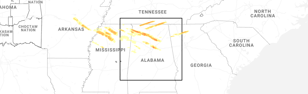
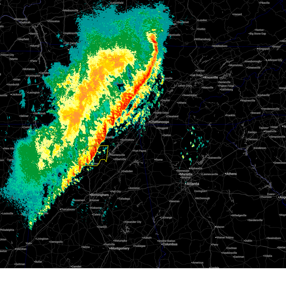
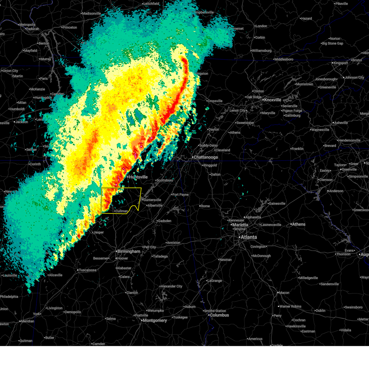
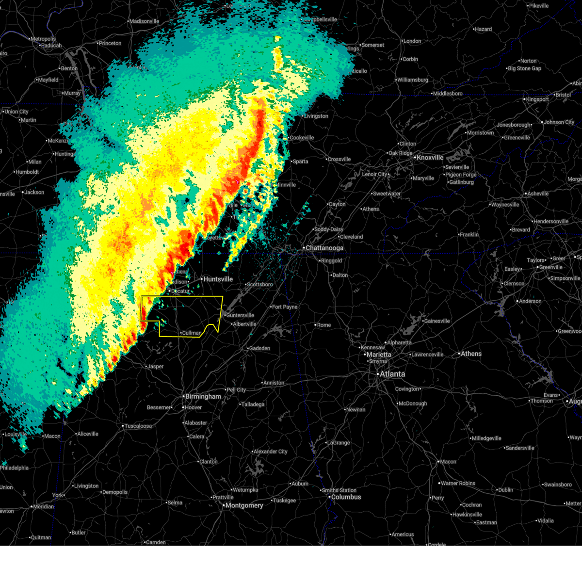
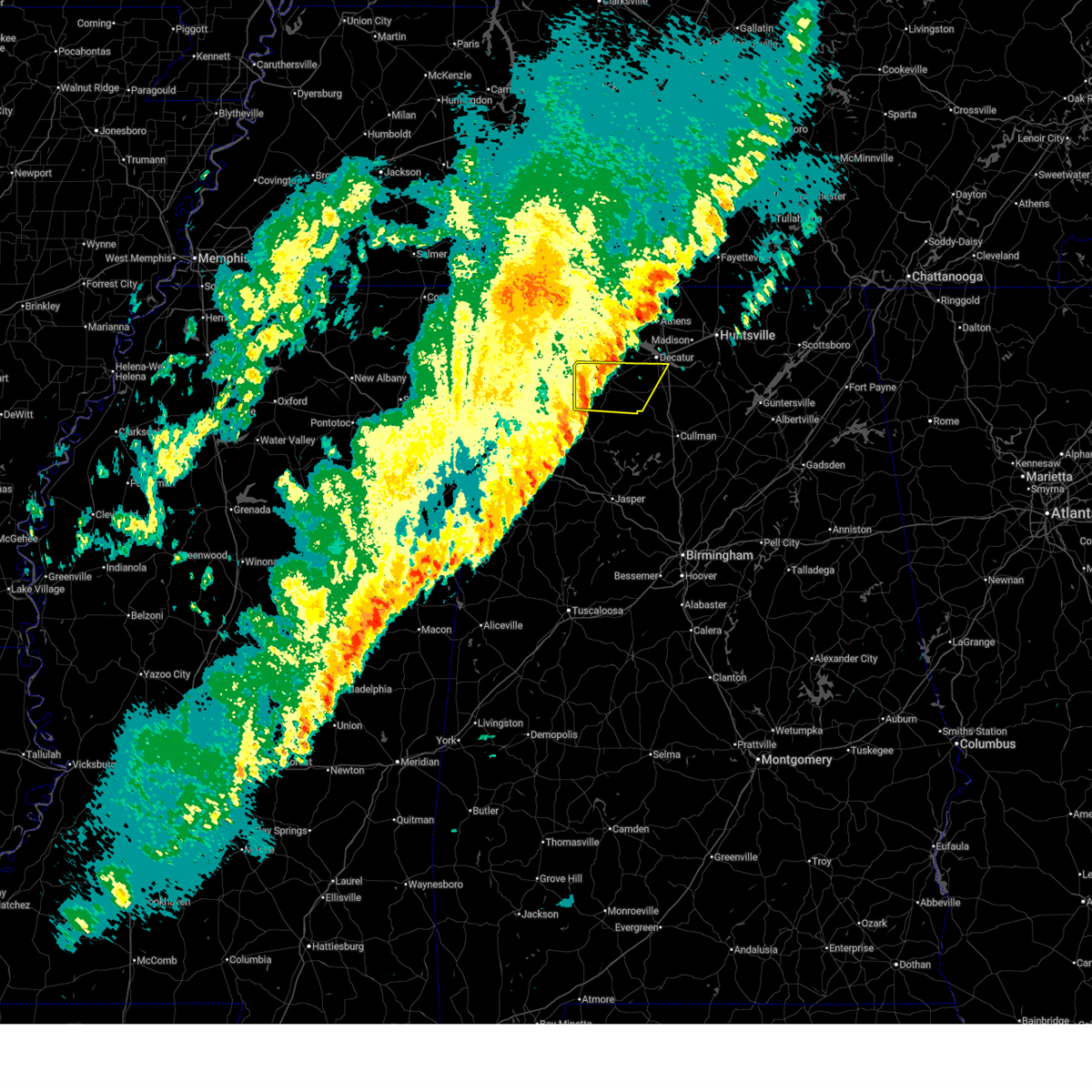
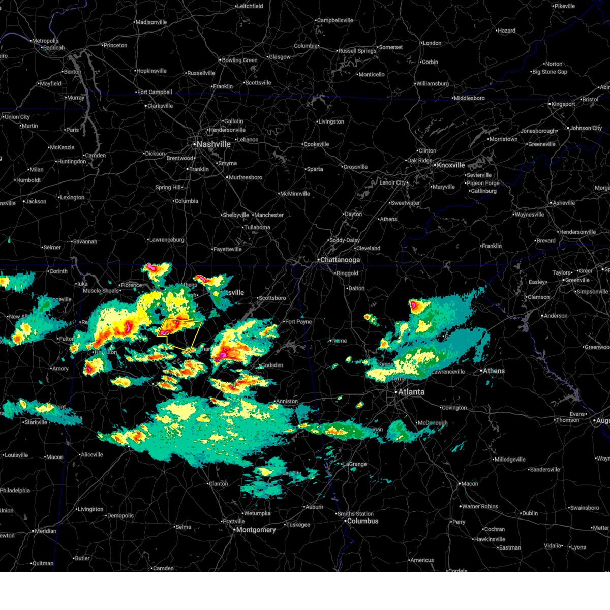
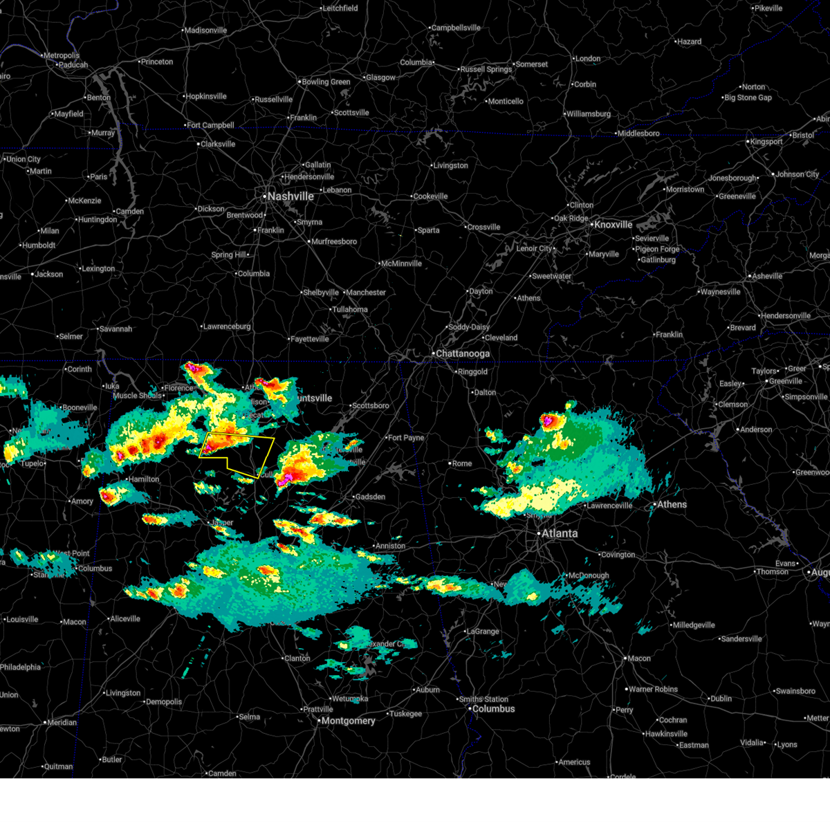
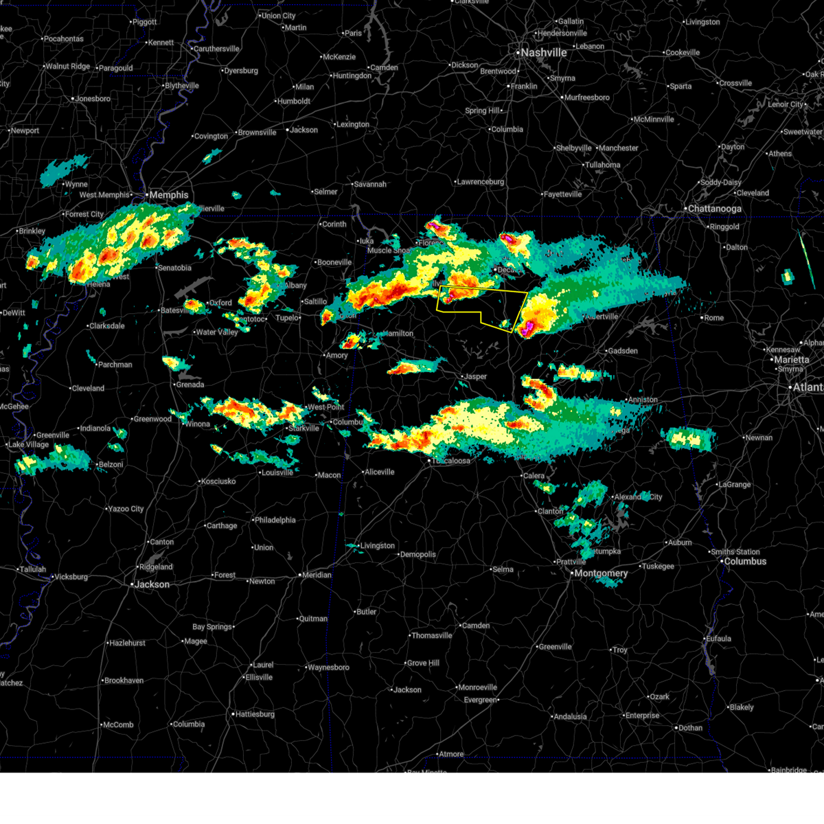
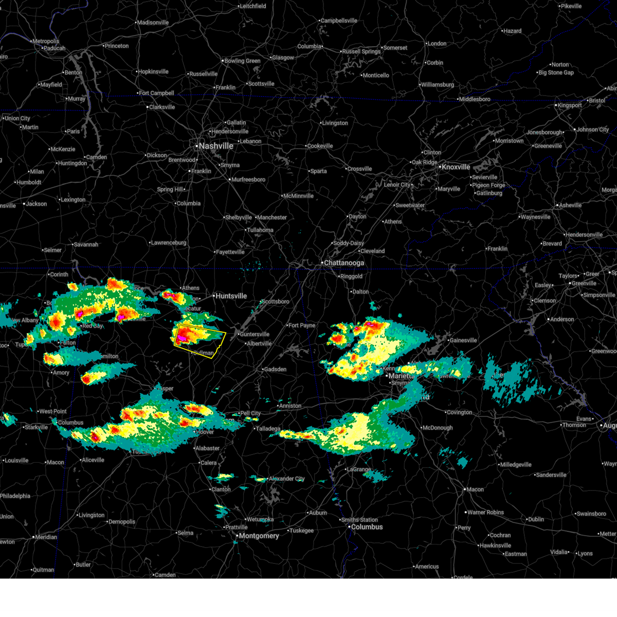
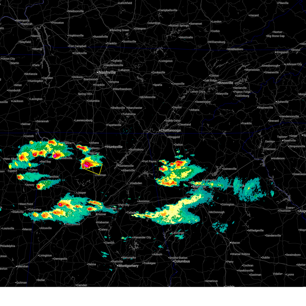
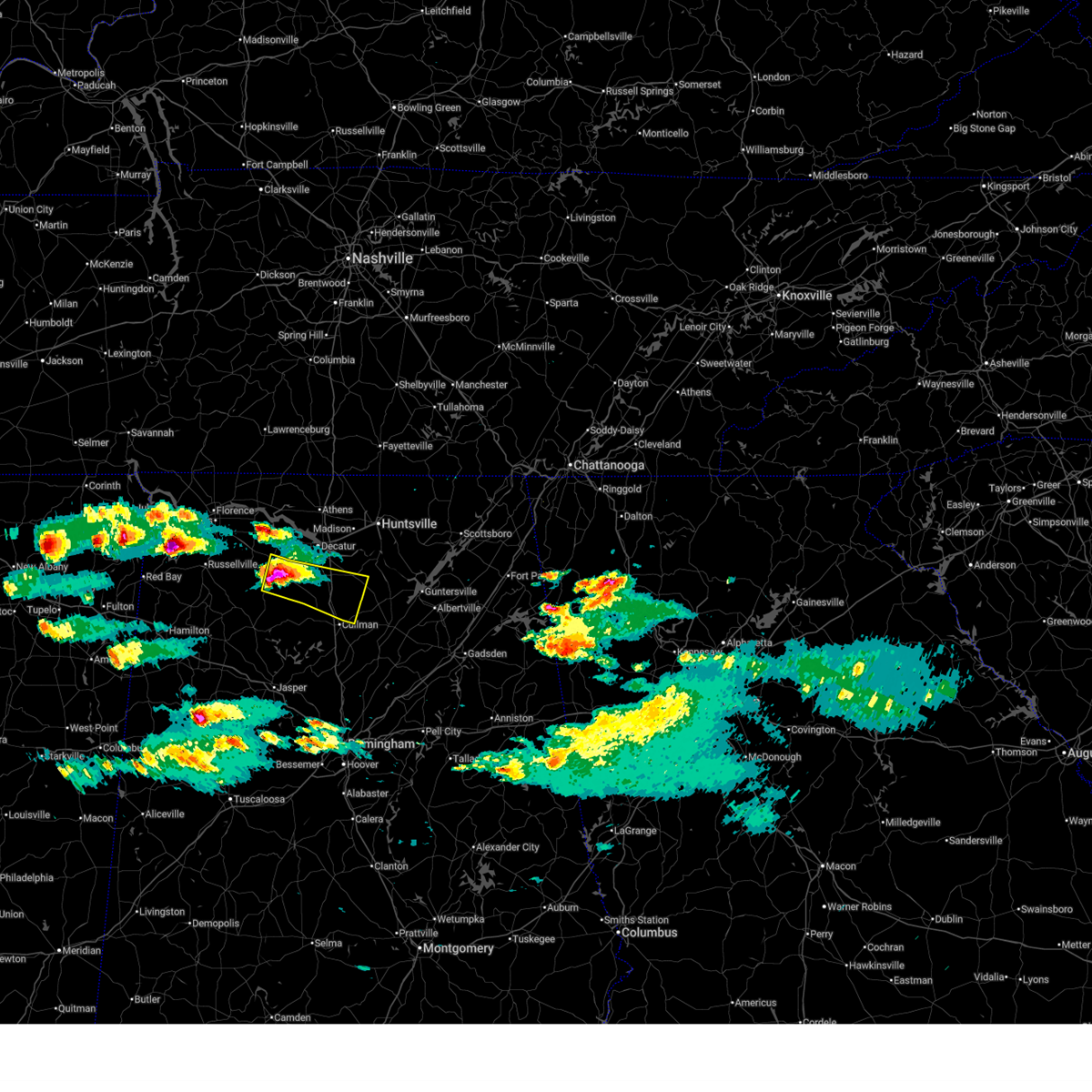
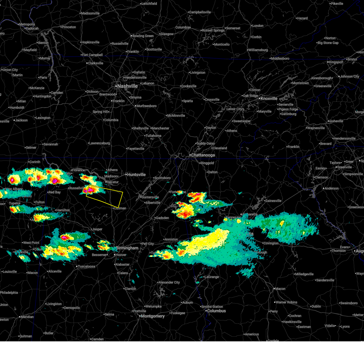
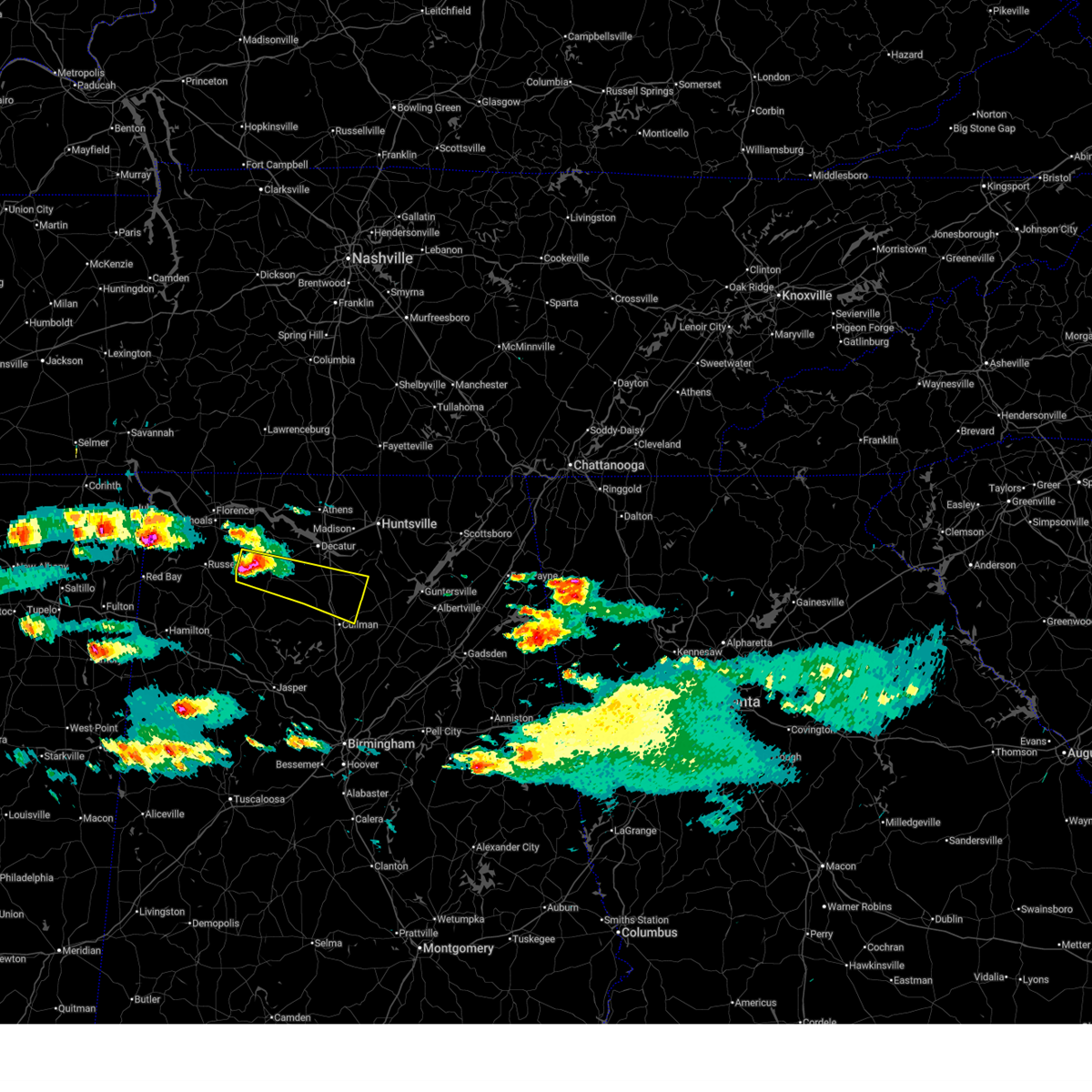
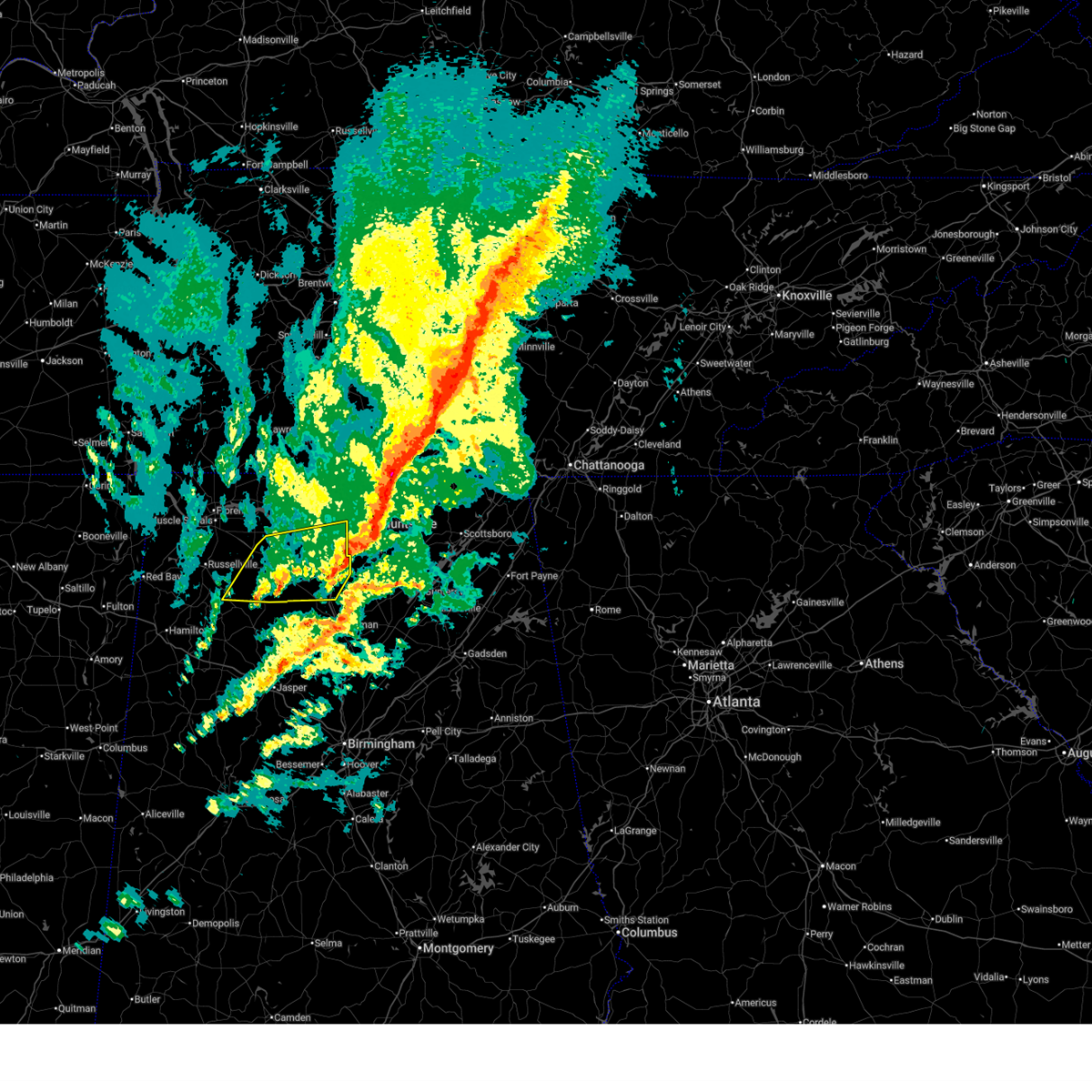
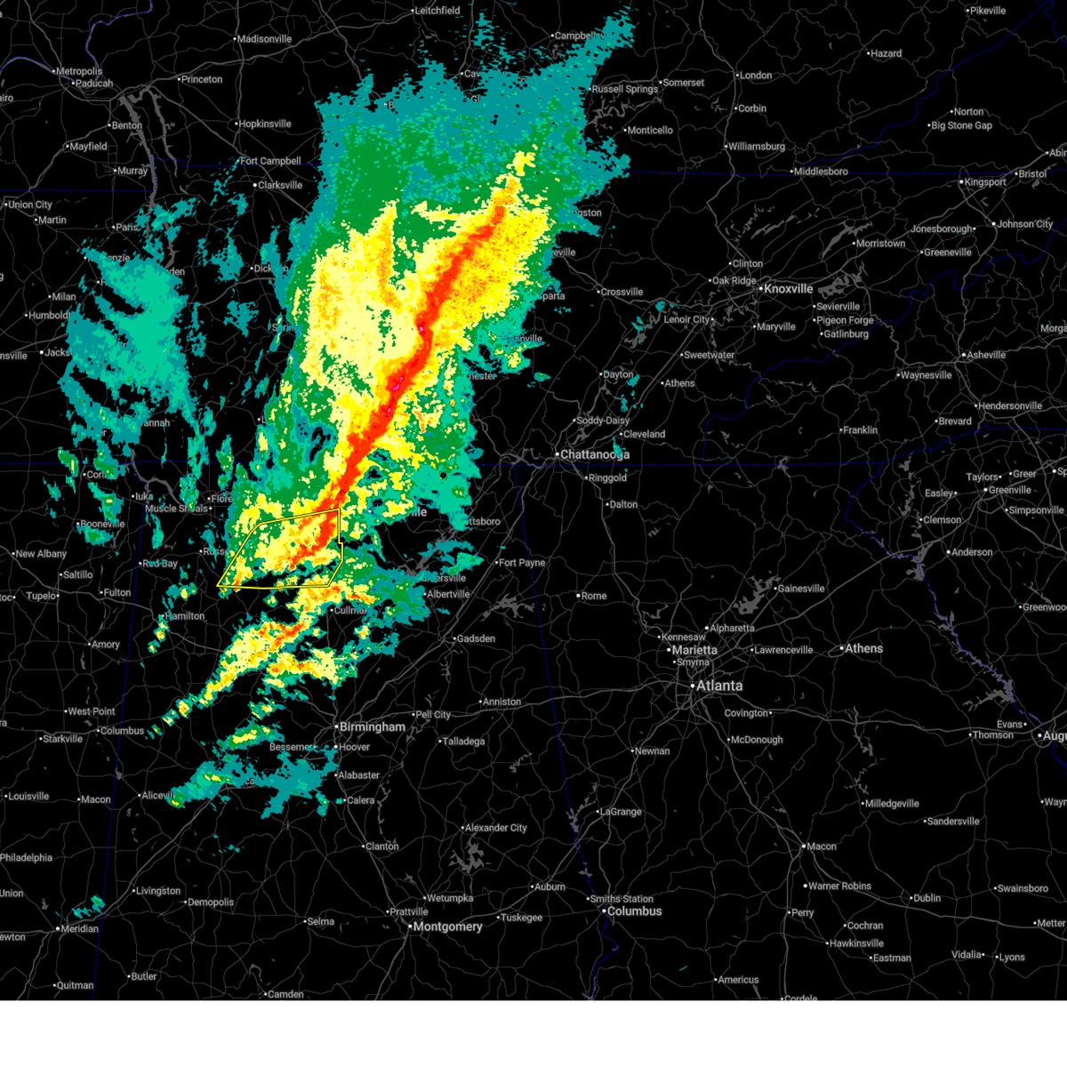
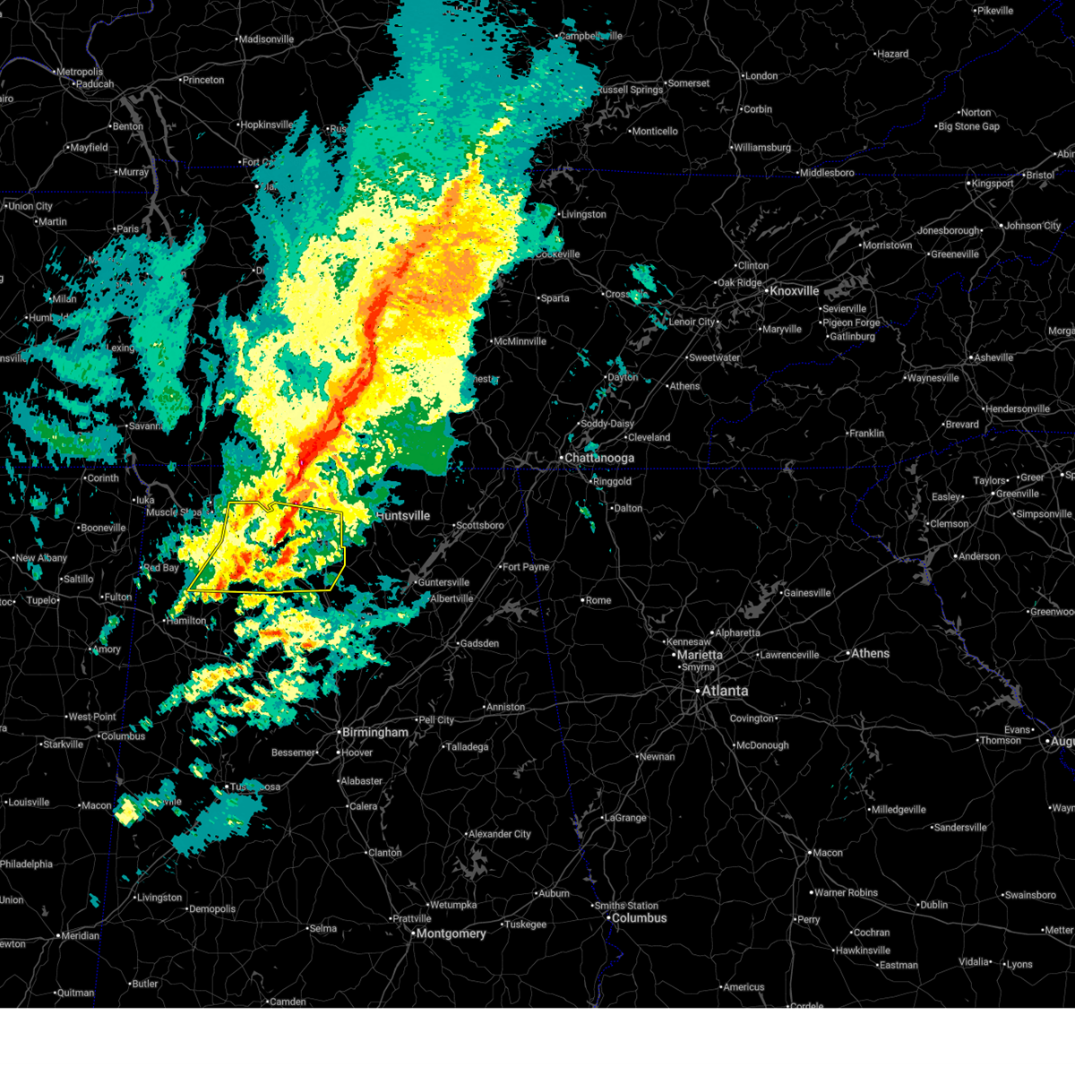
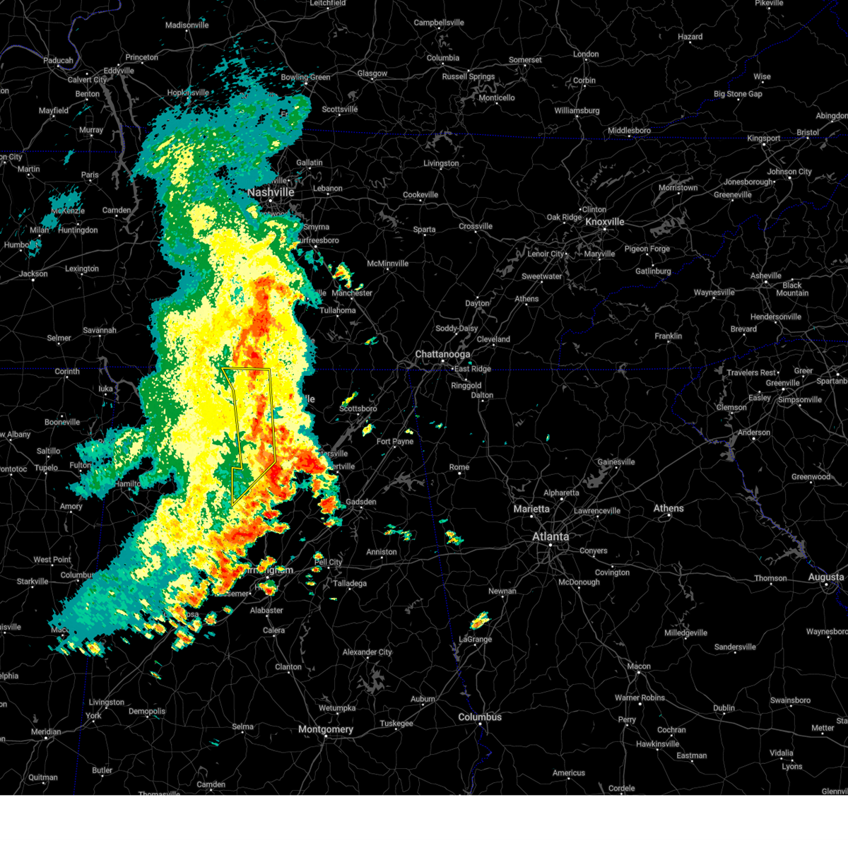
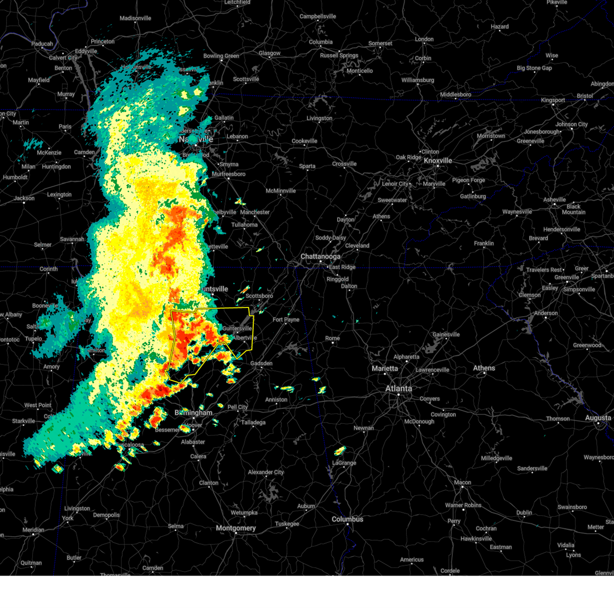
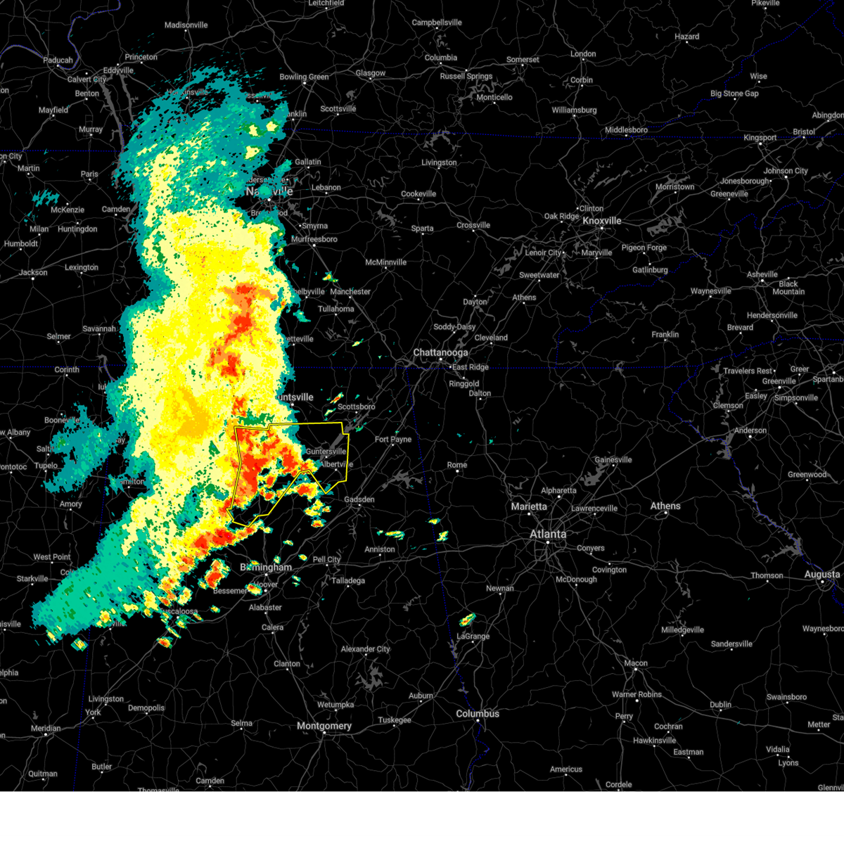
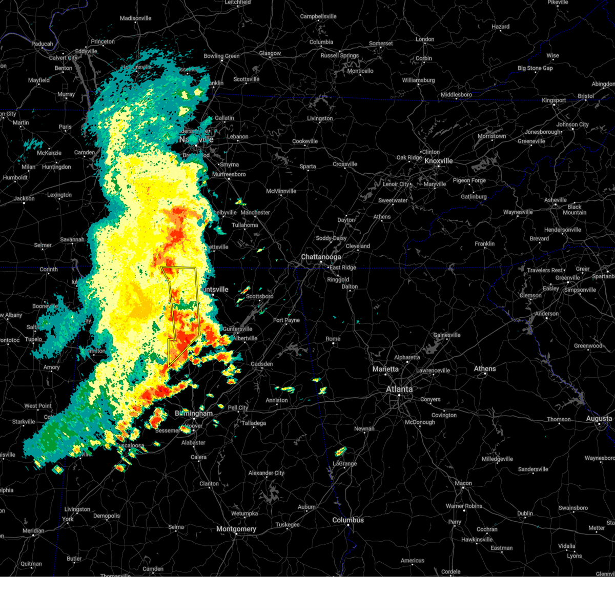
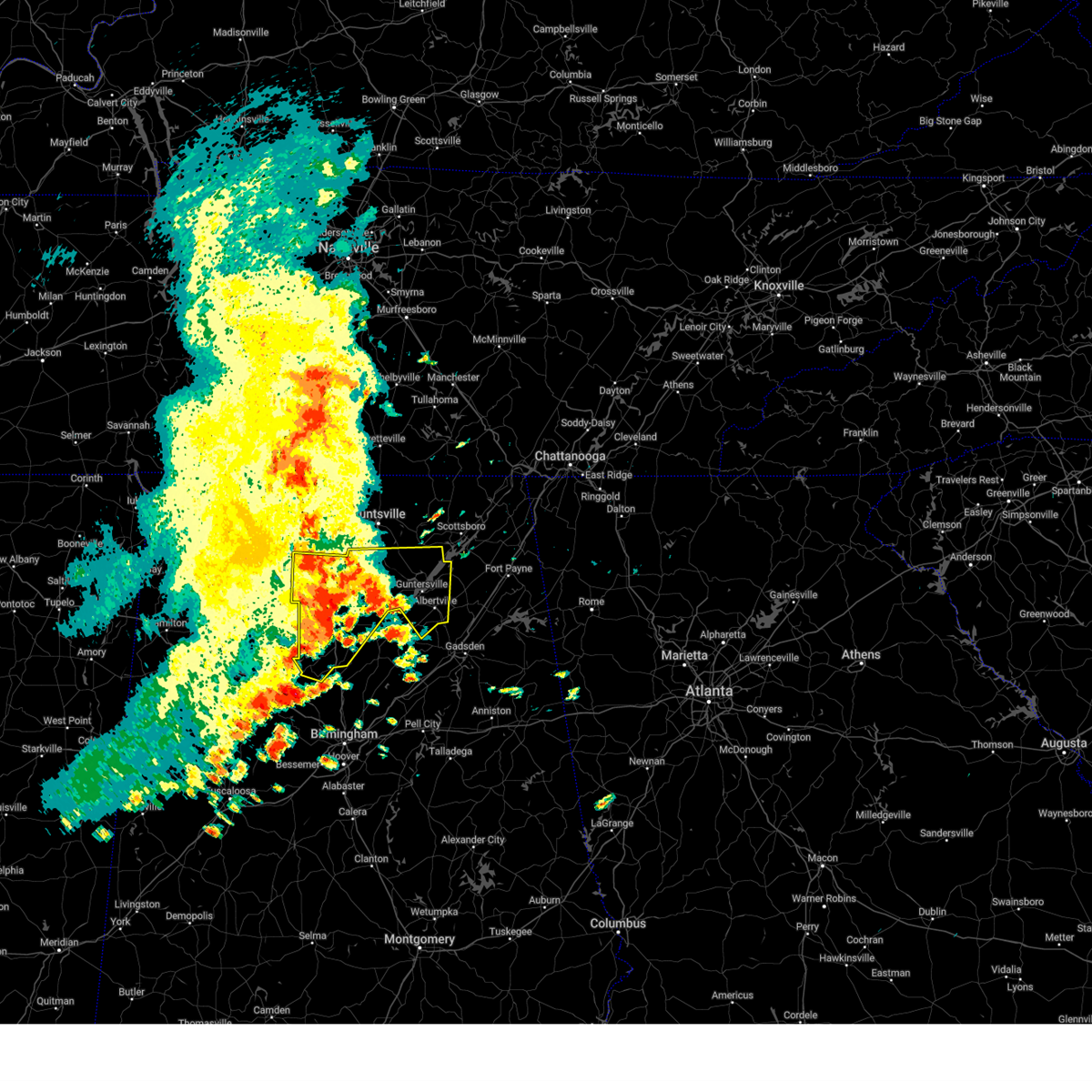
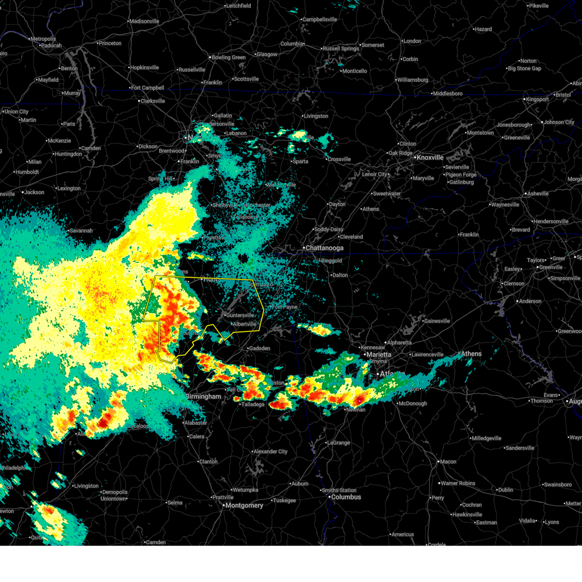
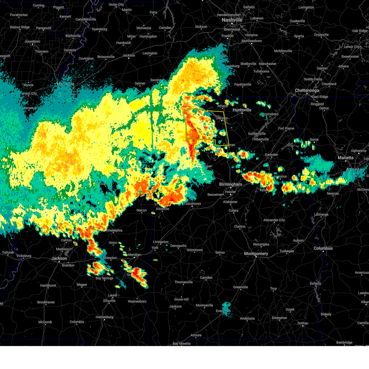
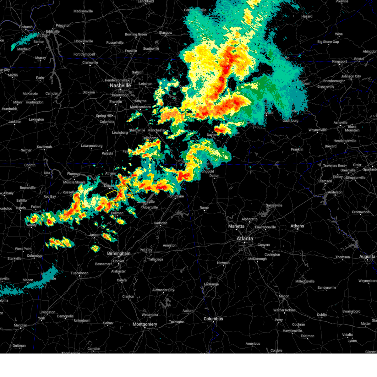
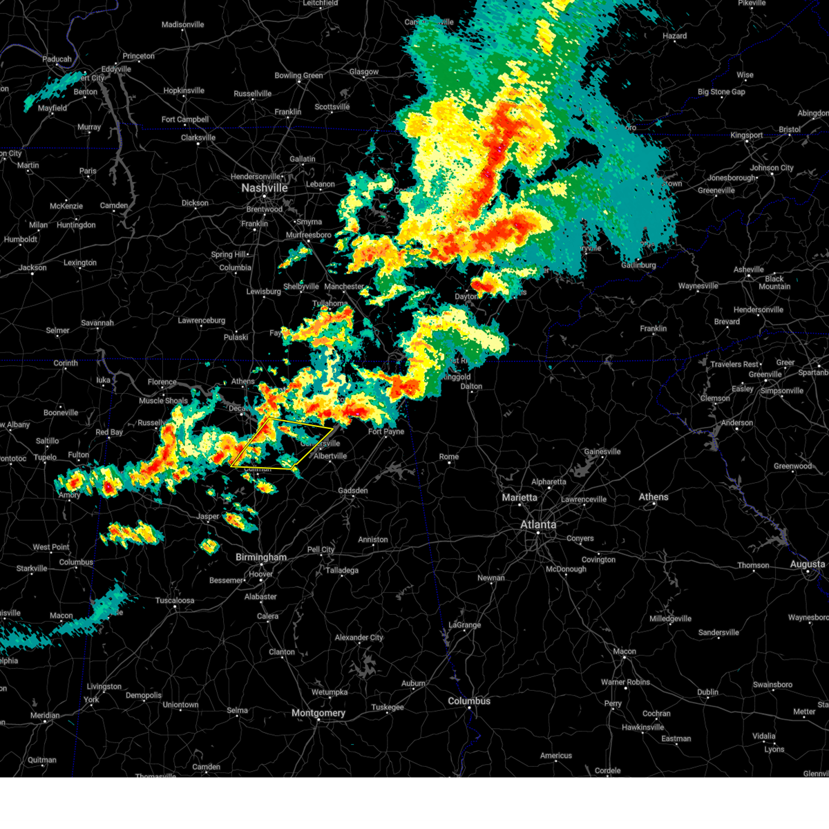
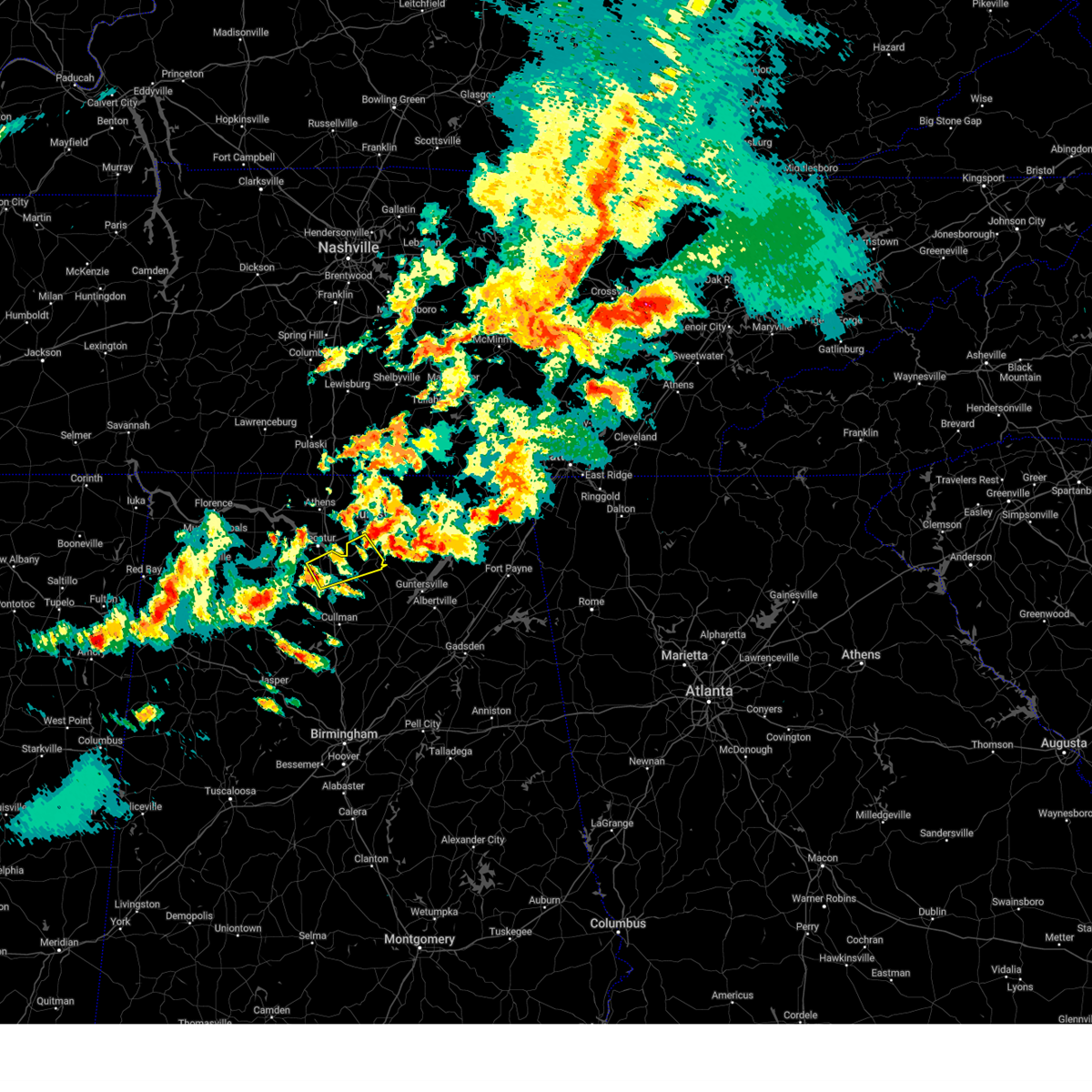
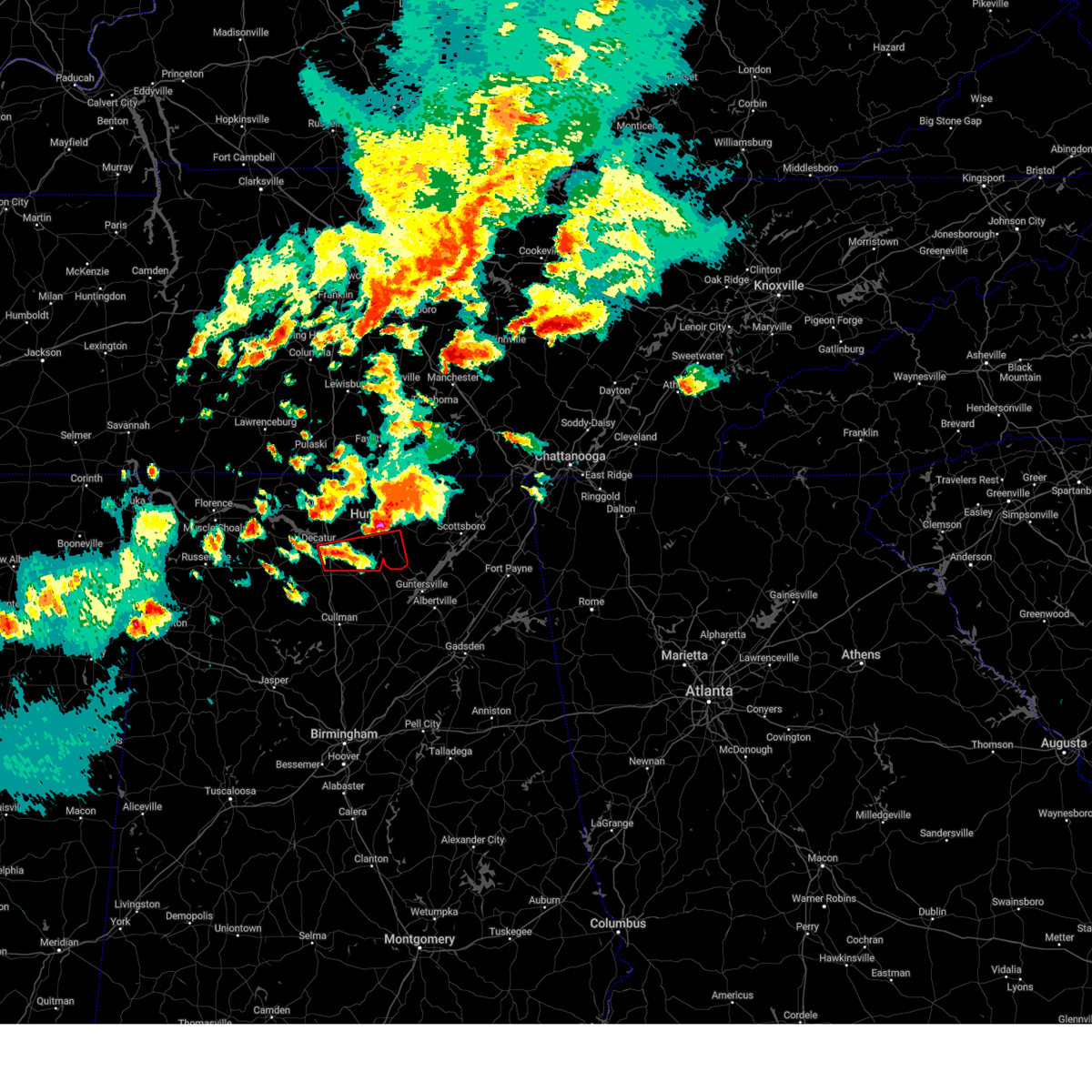
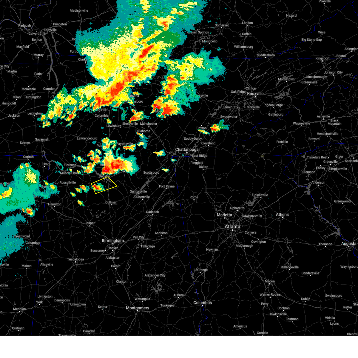
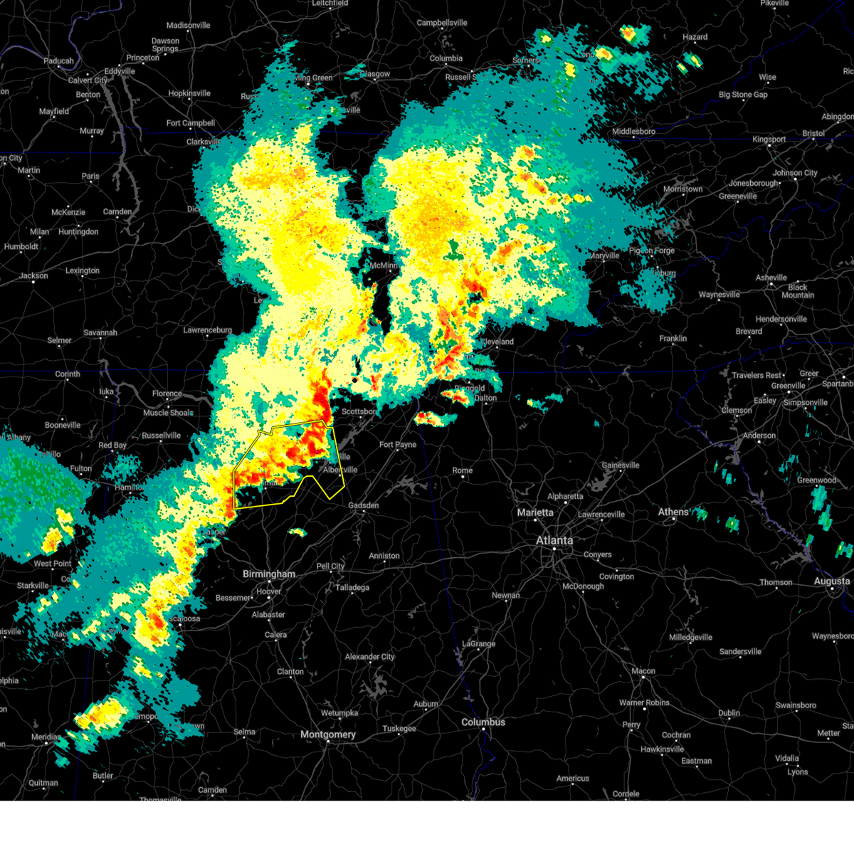
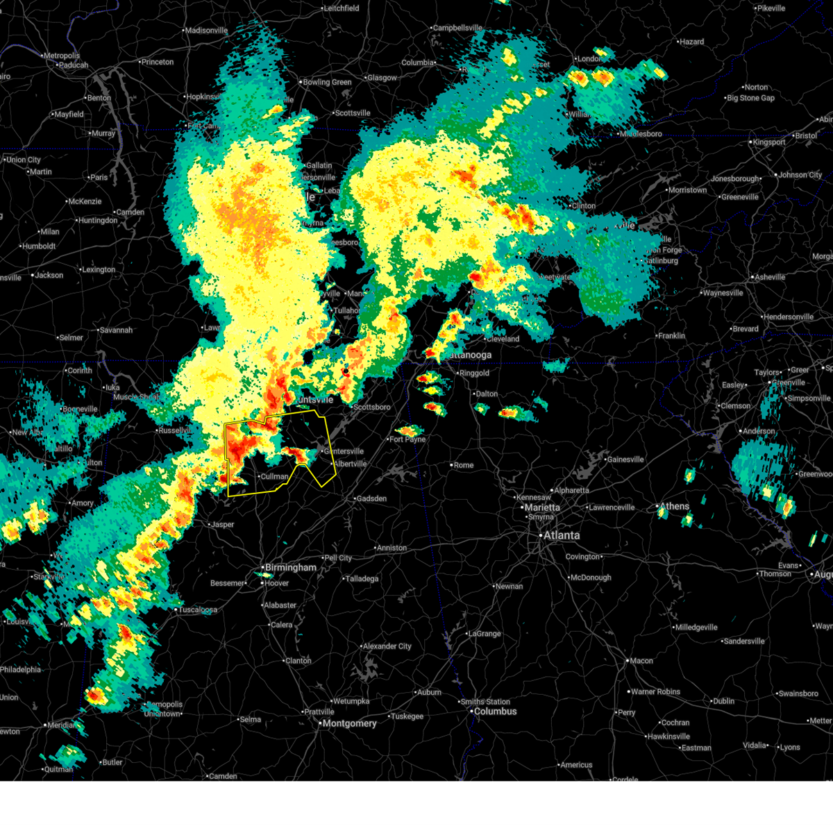
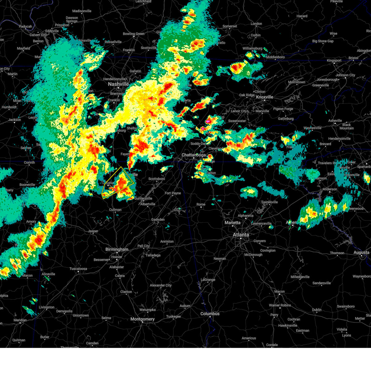
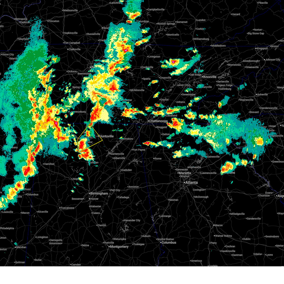
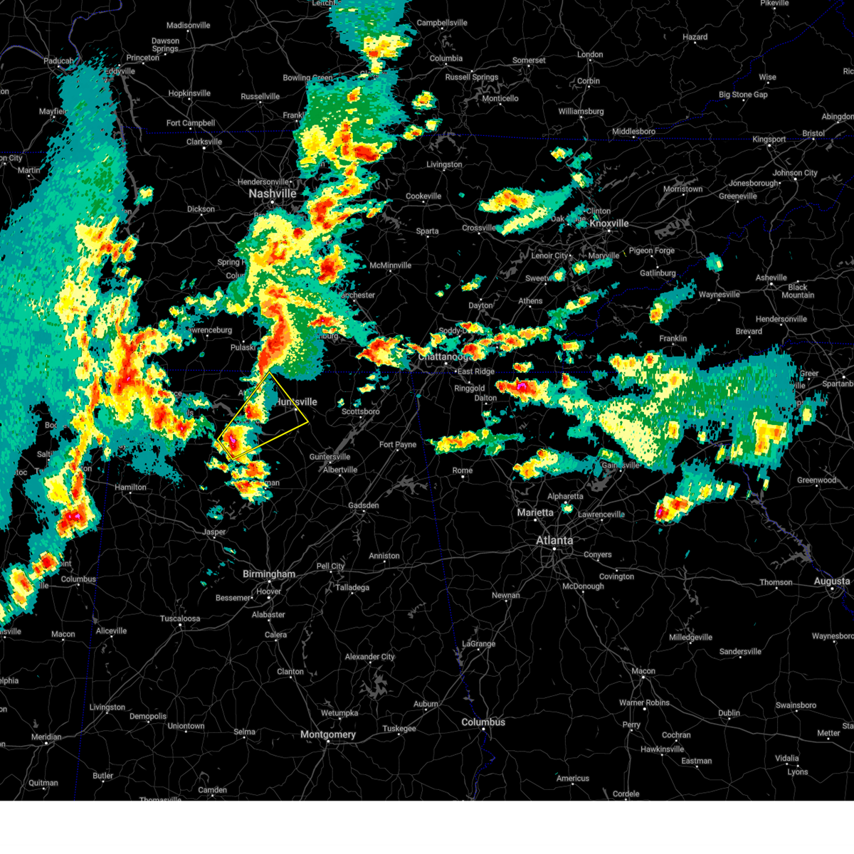
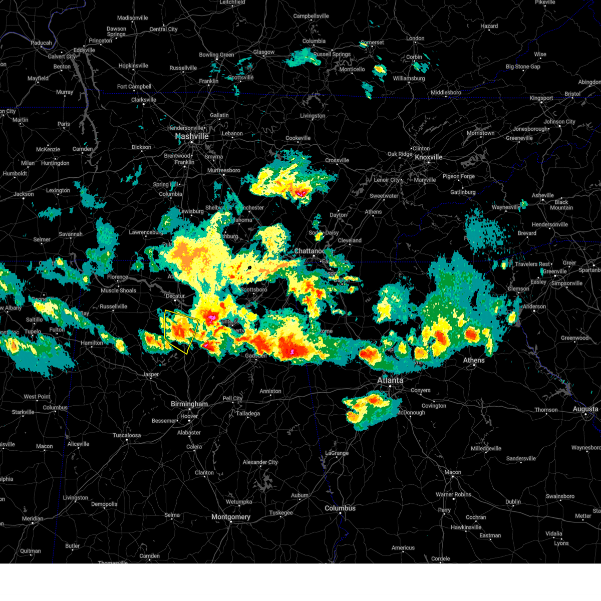
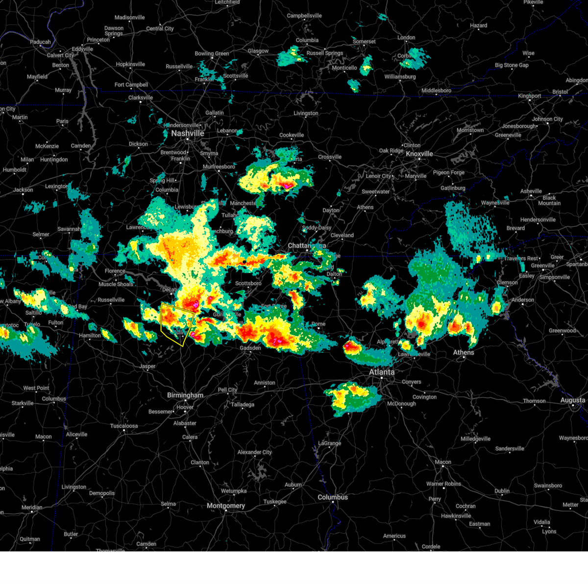
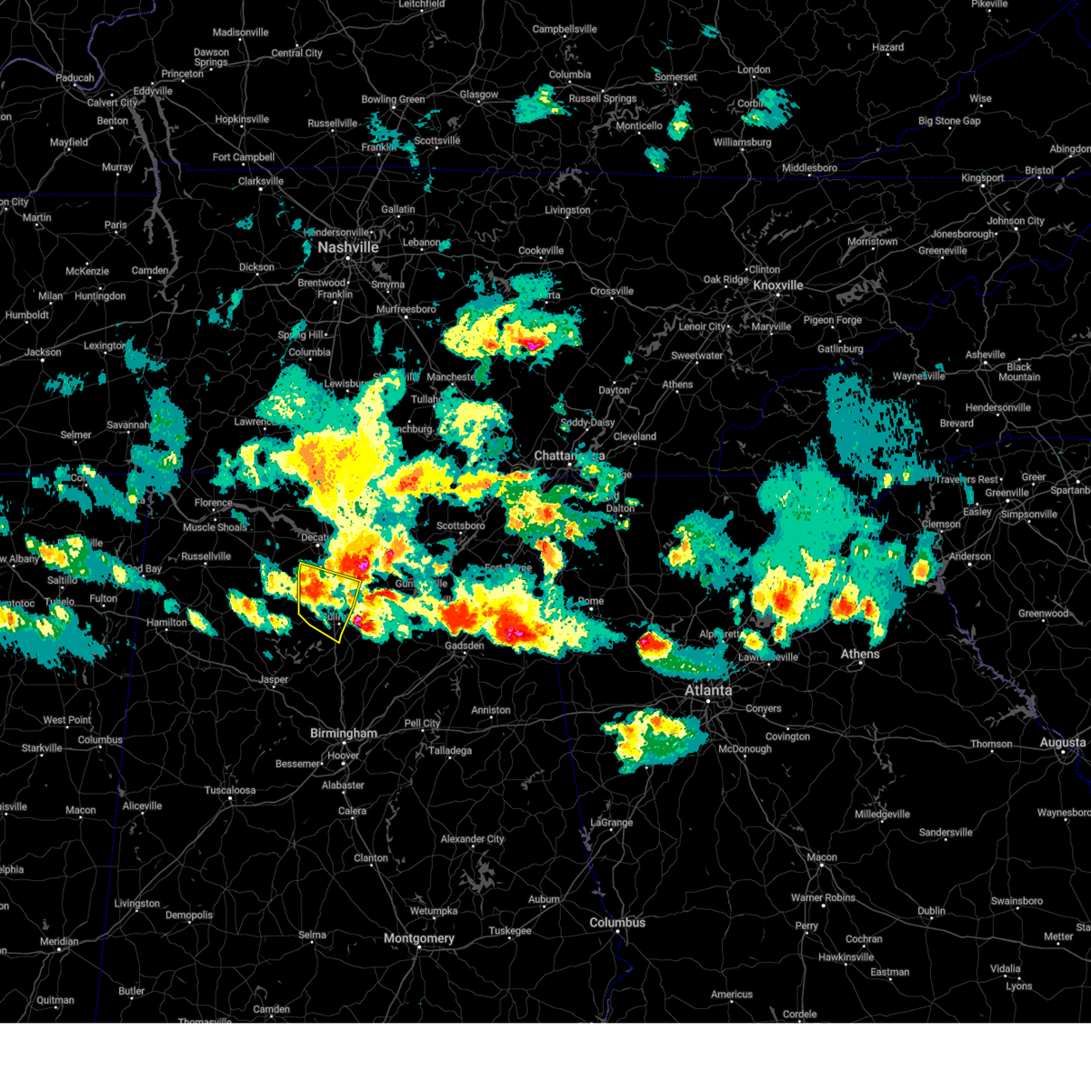
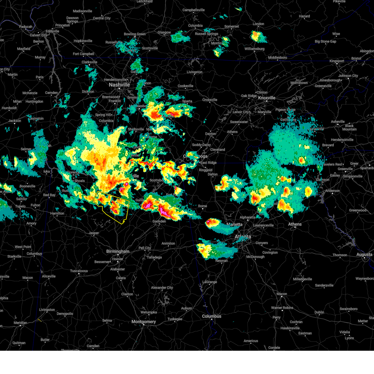
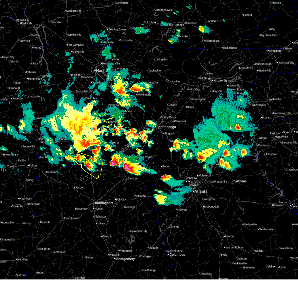
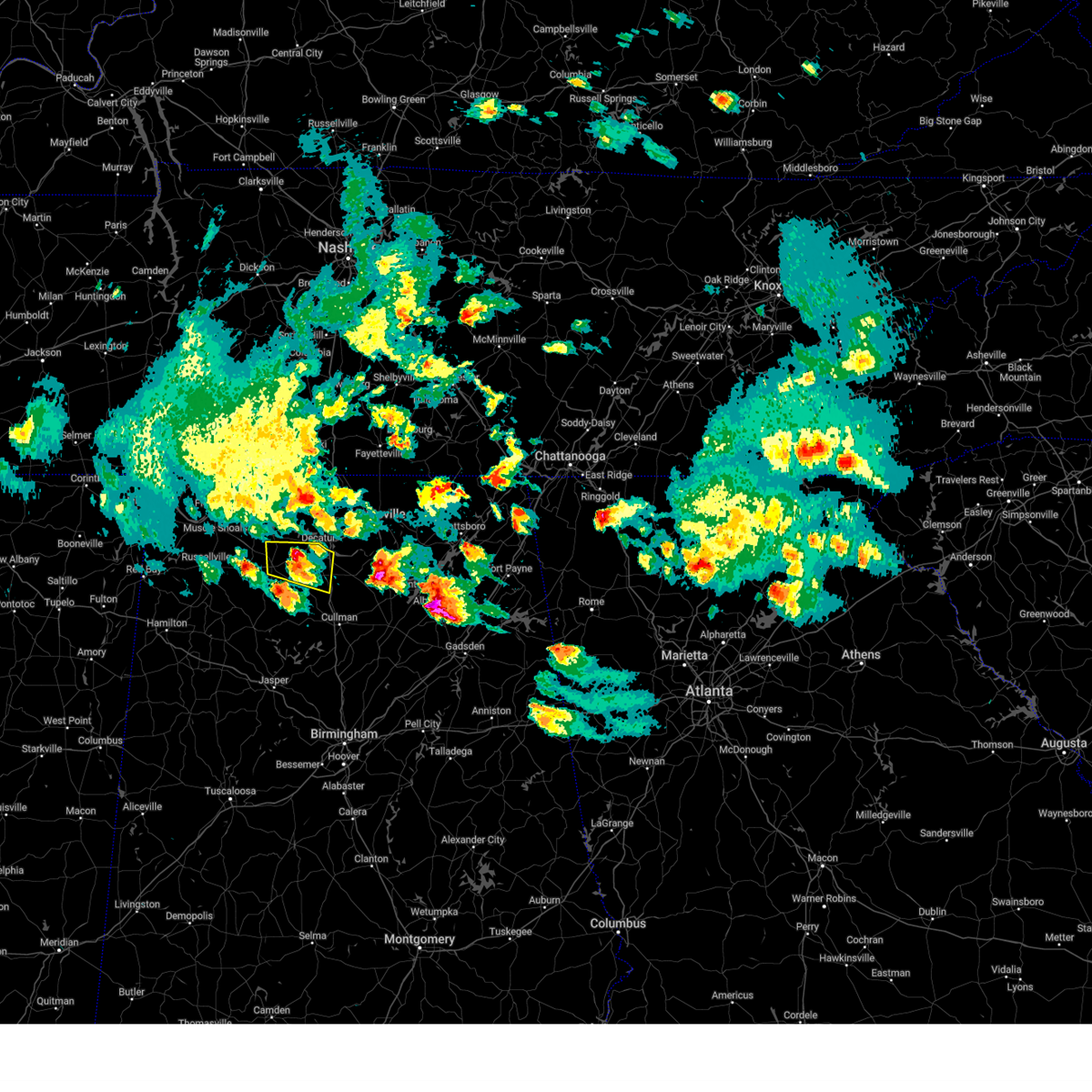
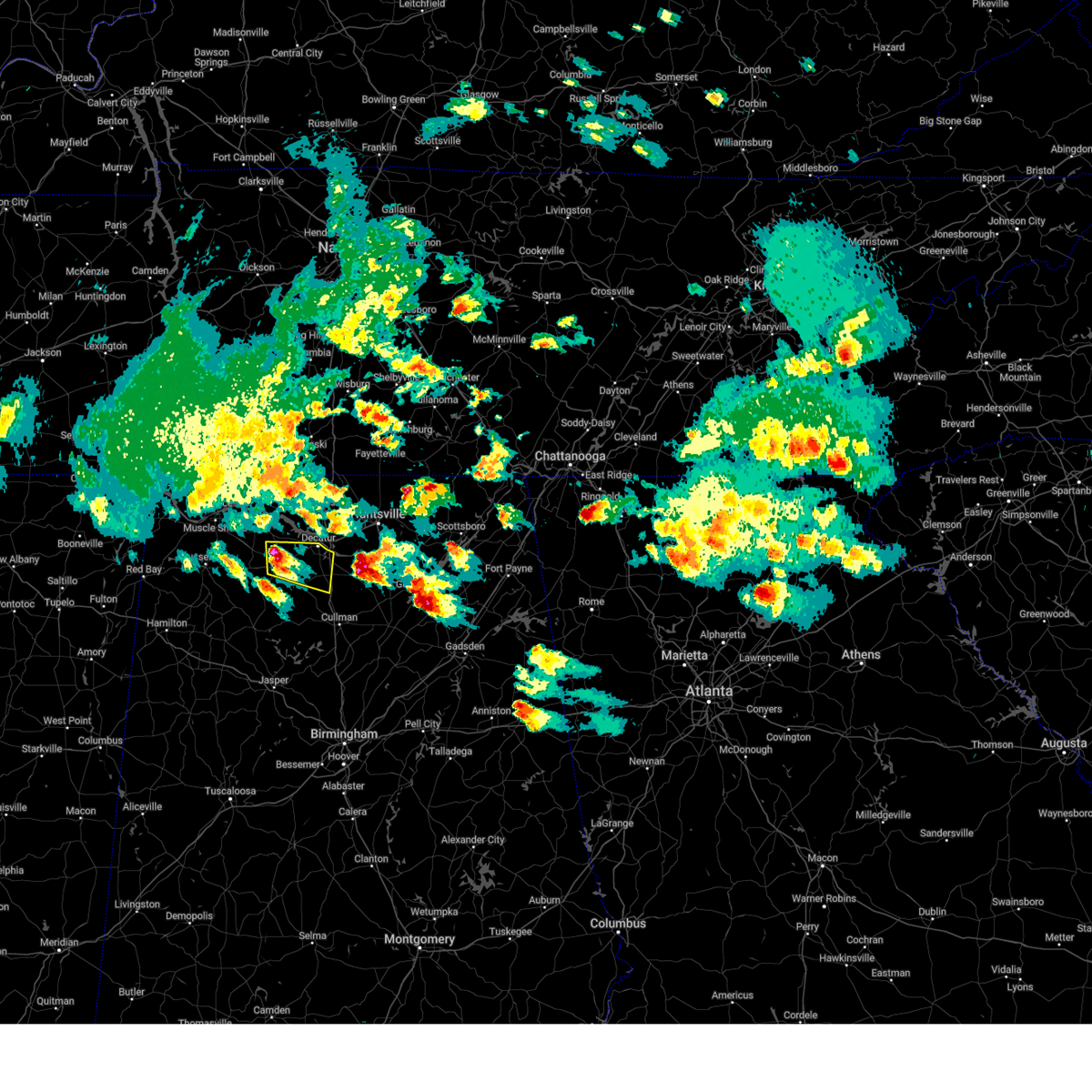
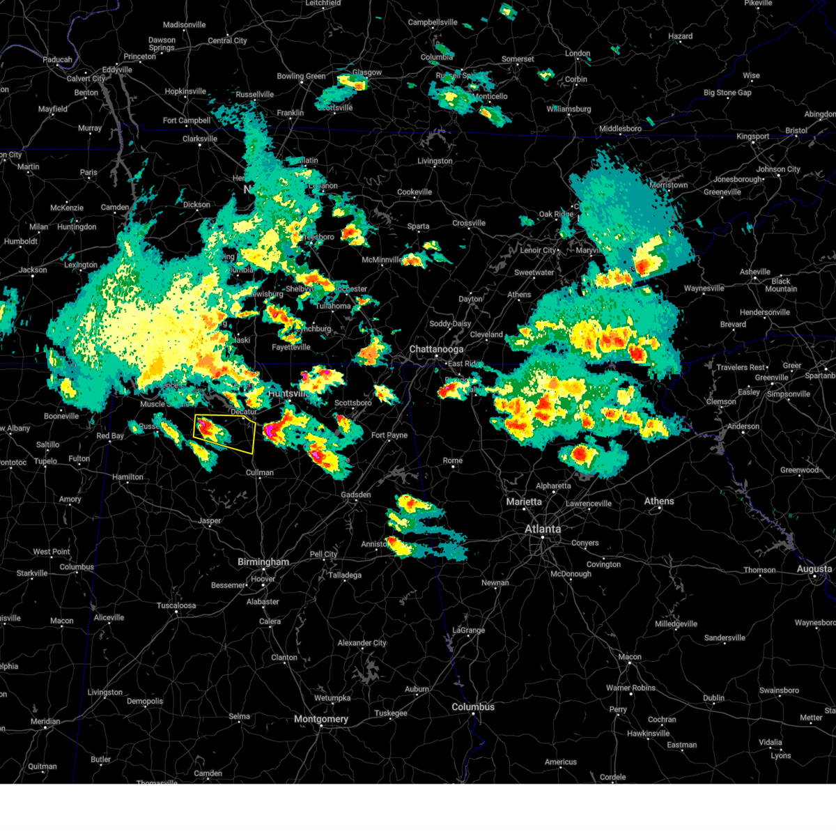
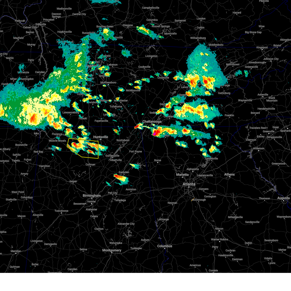
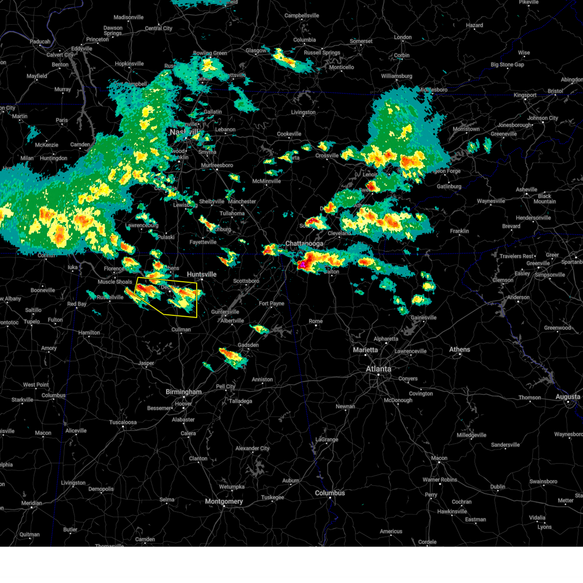
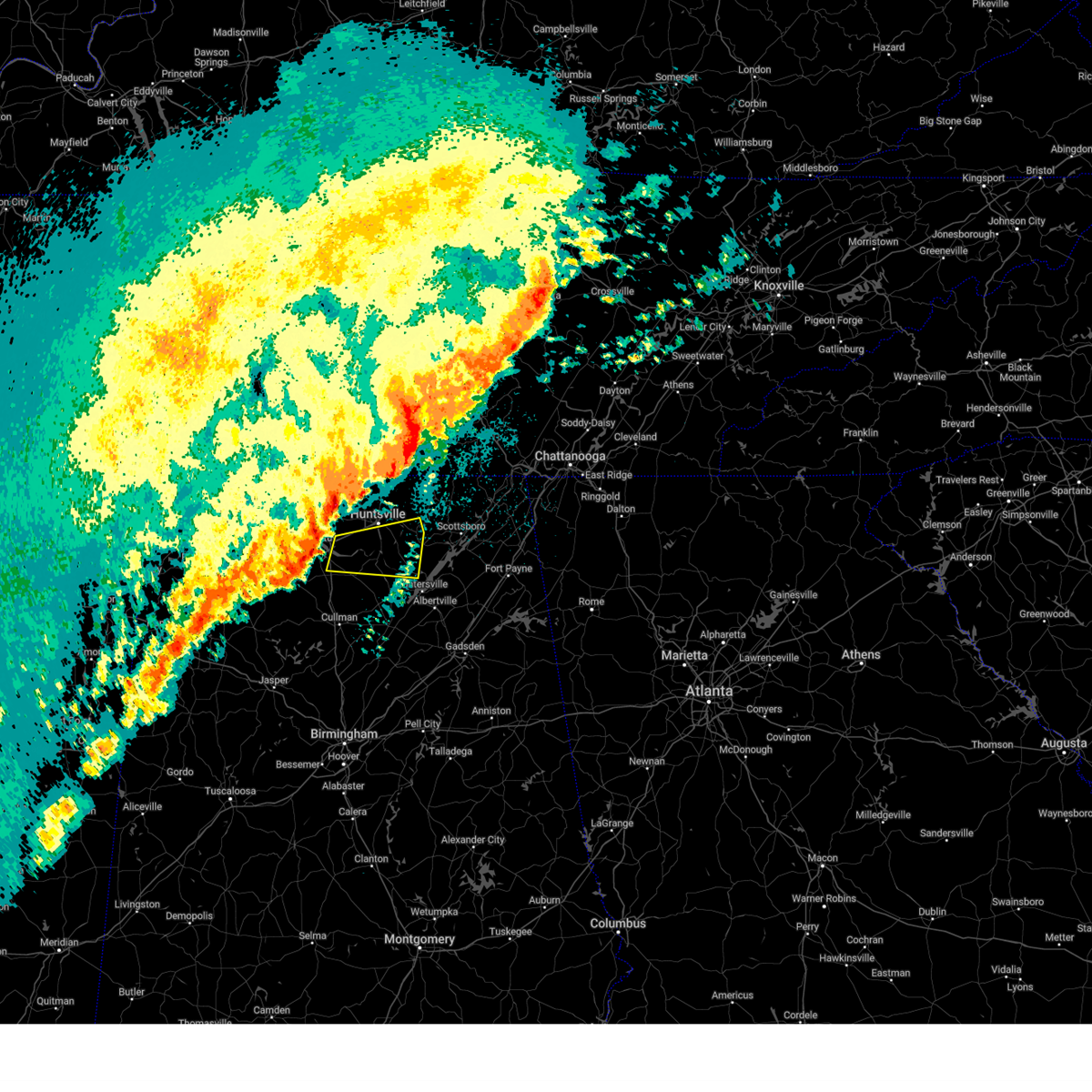
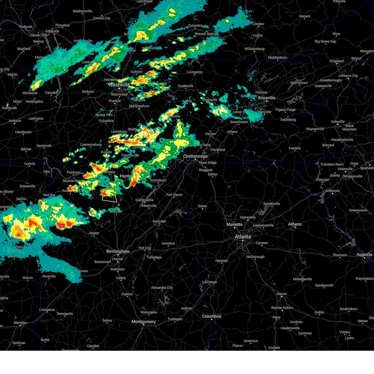
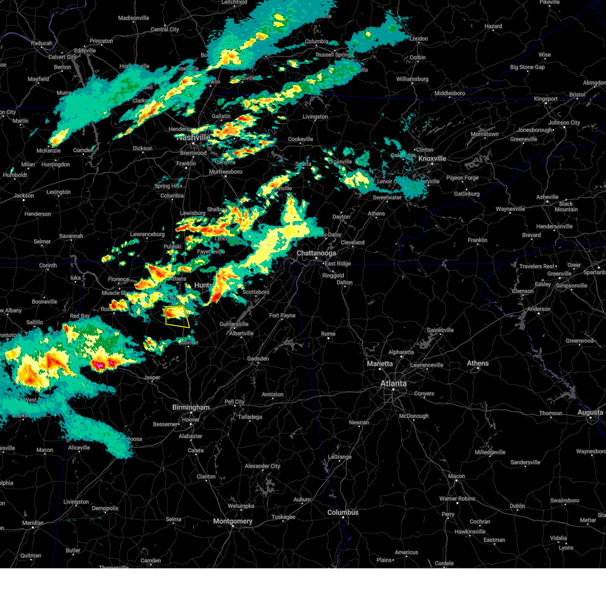
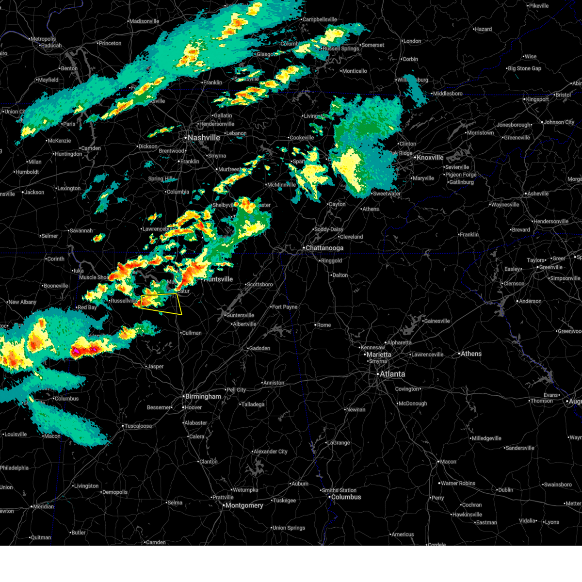
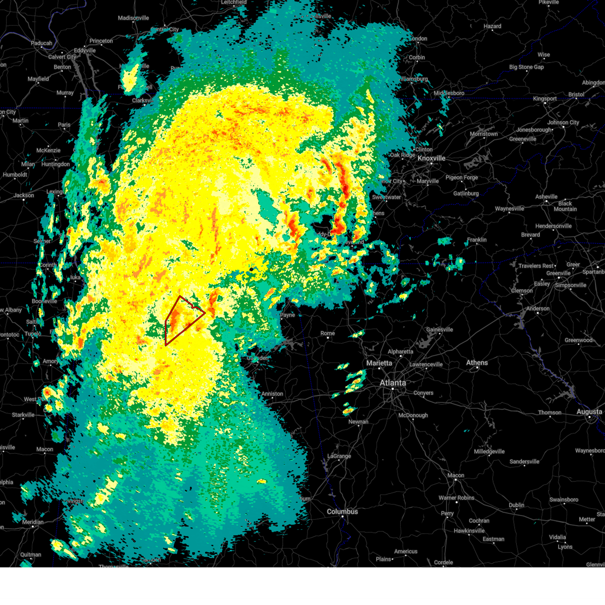
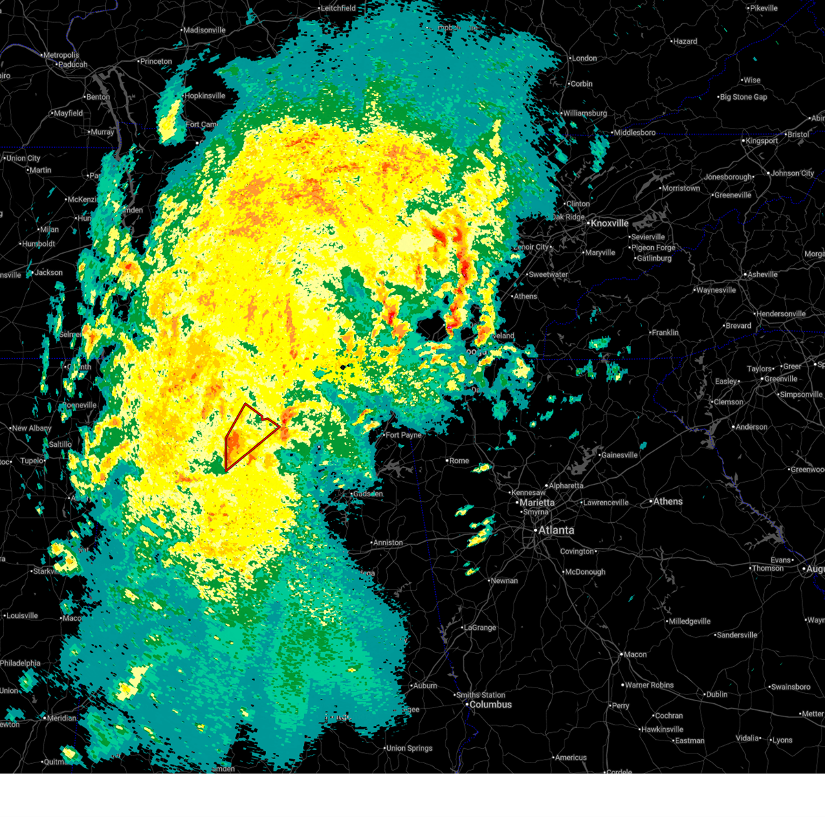
Hail Map for Hartselle, AL
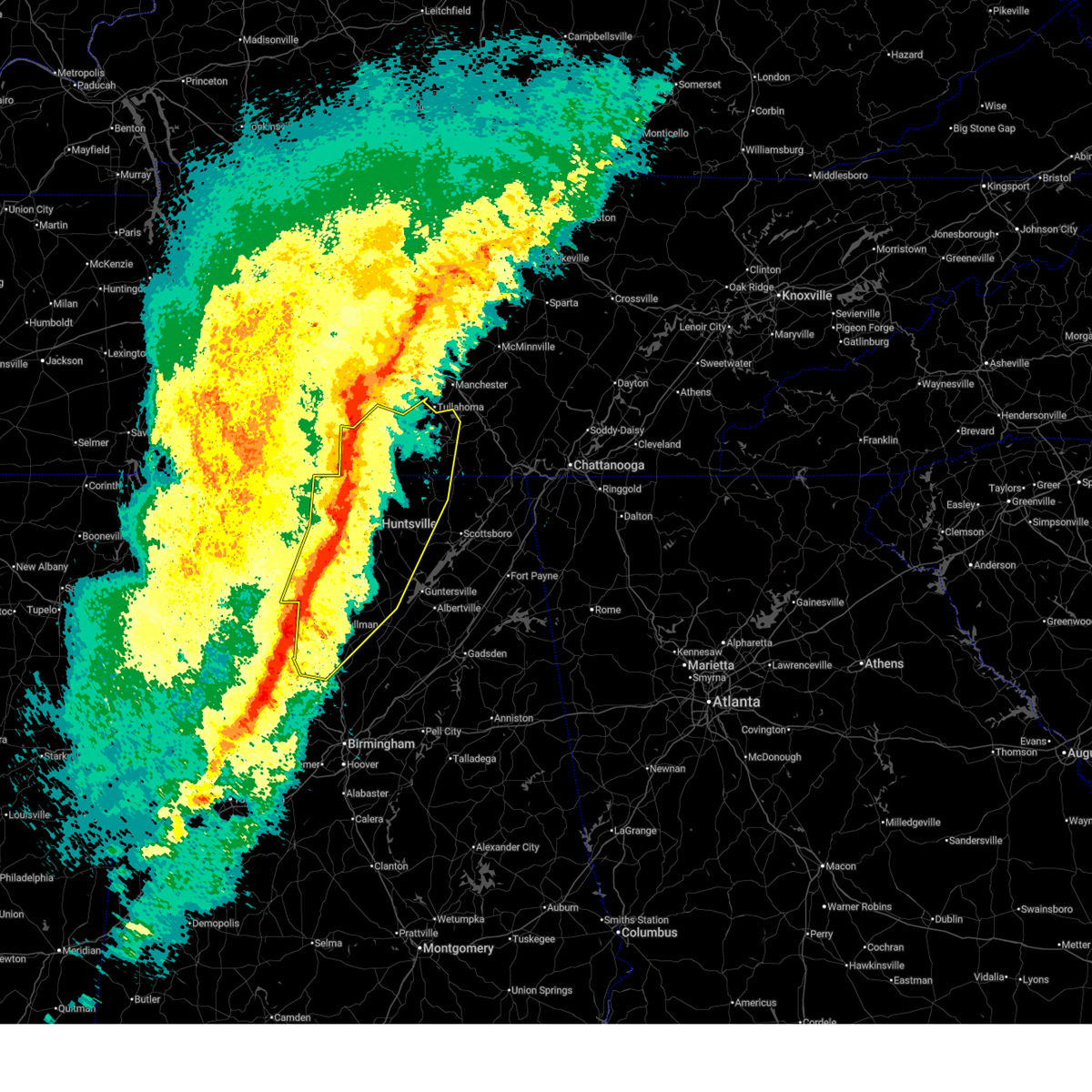
The Hartselle, AL area has had 6 reports of on-the-ground hail by trained spotters, and has been under severe weather warnings 30 times during the past 12 months. Doppler radar has detected hail at or near Hartselle, AL on 71 occasions, including 2 occasions during the past year.
| Name: | Hartselle, AL |
| Where Located: | 48.7 miles ESE of Florence, AL |
| Map: | Google Map for Hartselle, AL |
| Population: | 14255 |
| Housing Units: | 6076 |
| More Info: | Search Google for Hartselle, AL |
2
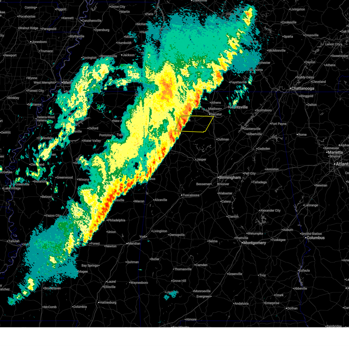
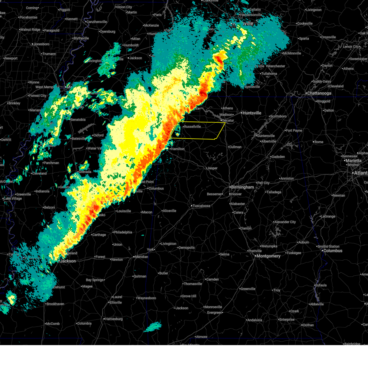
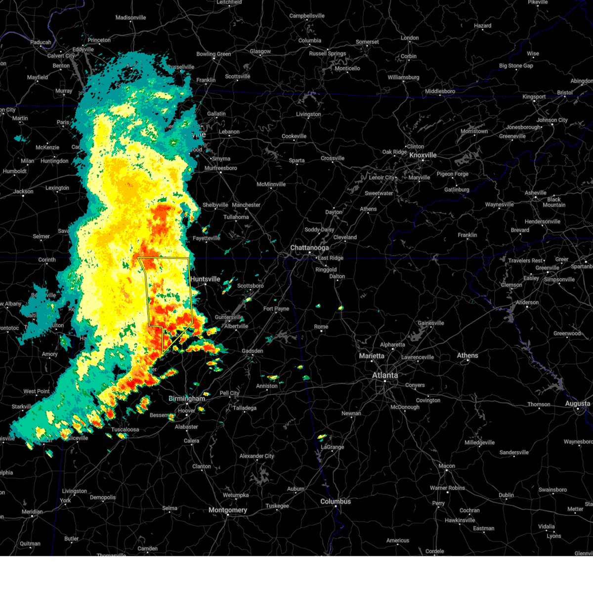
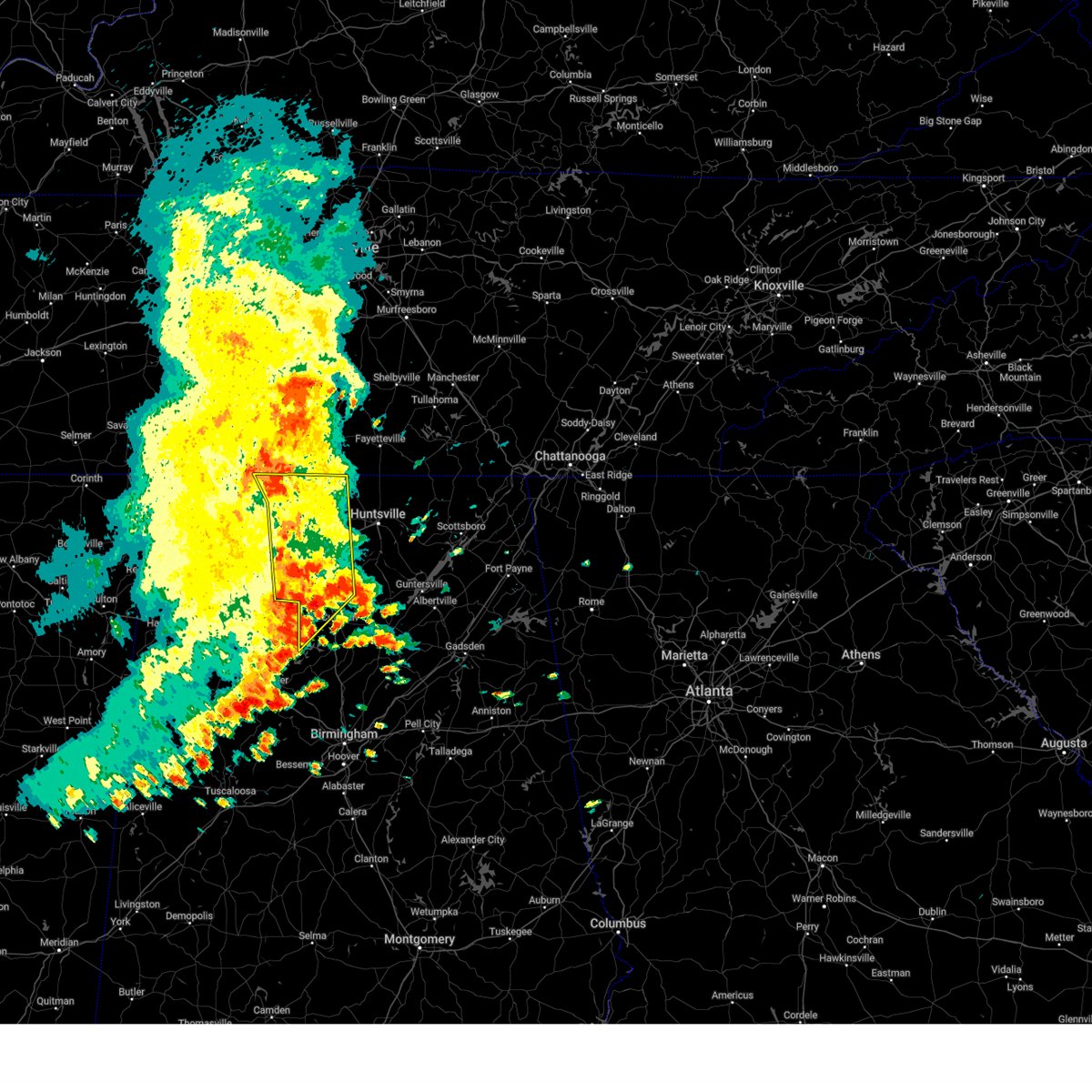
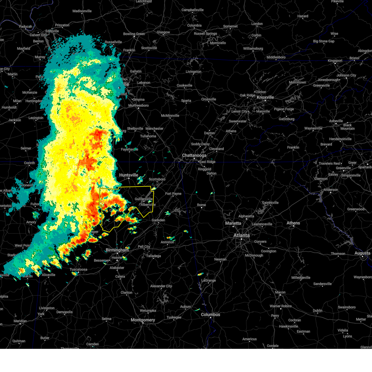
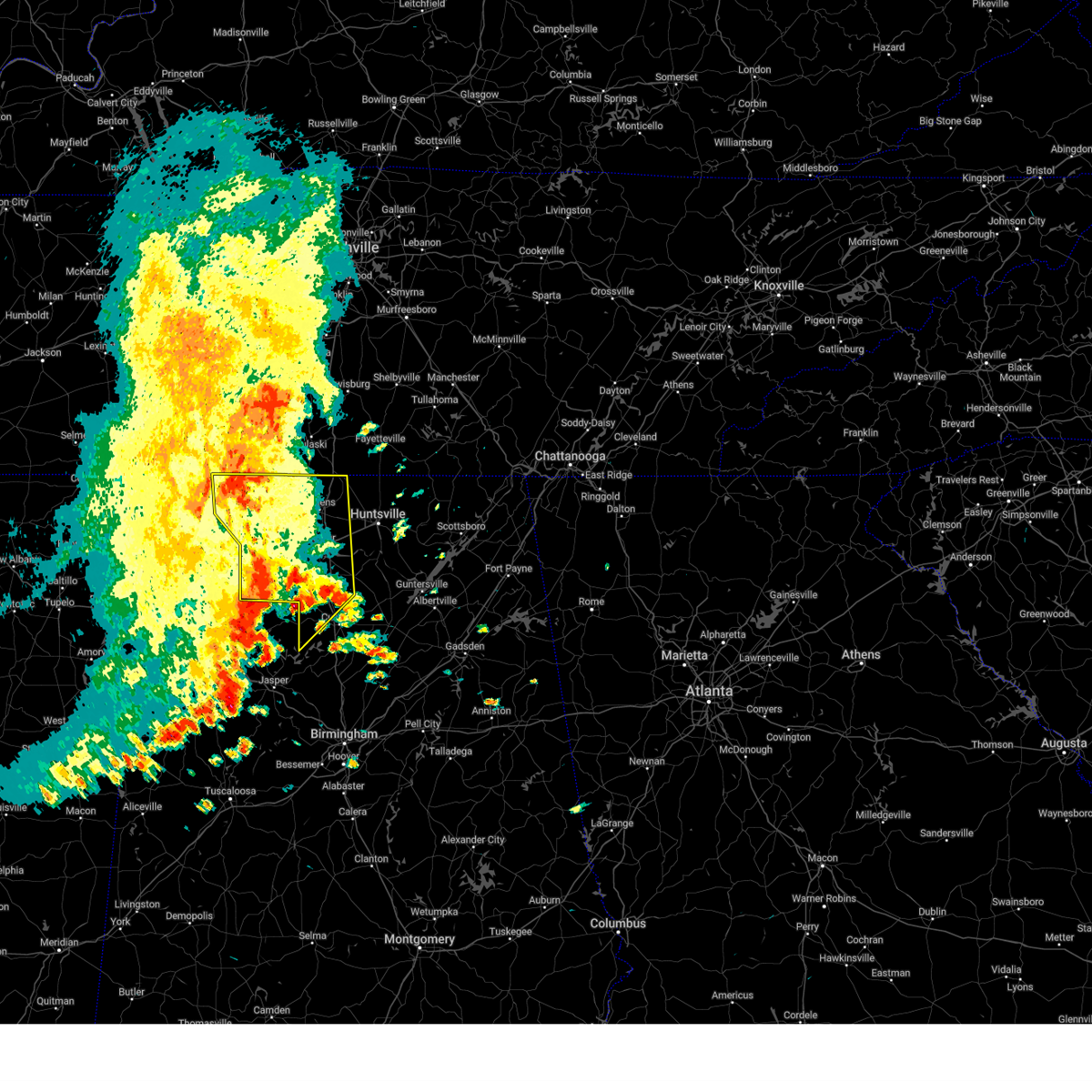
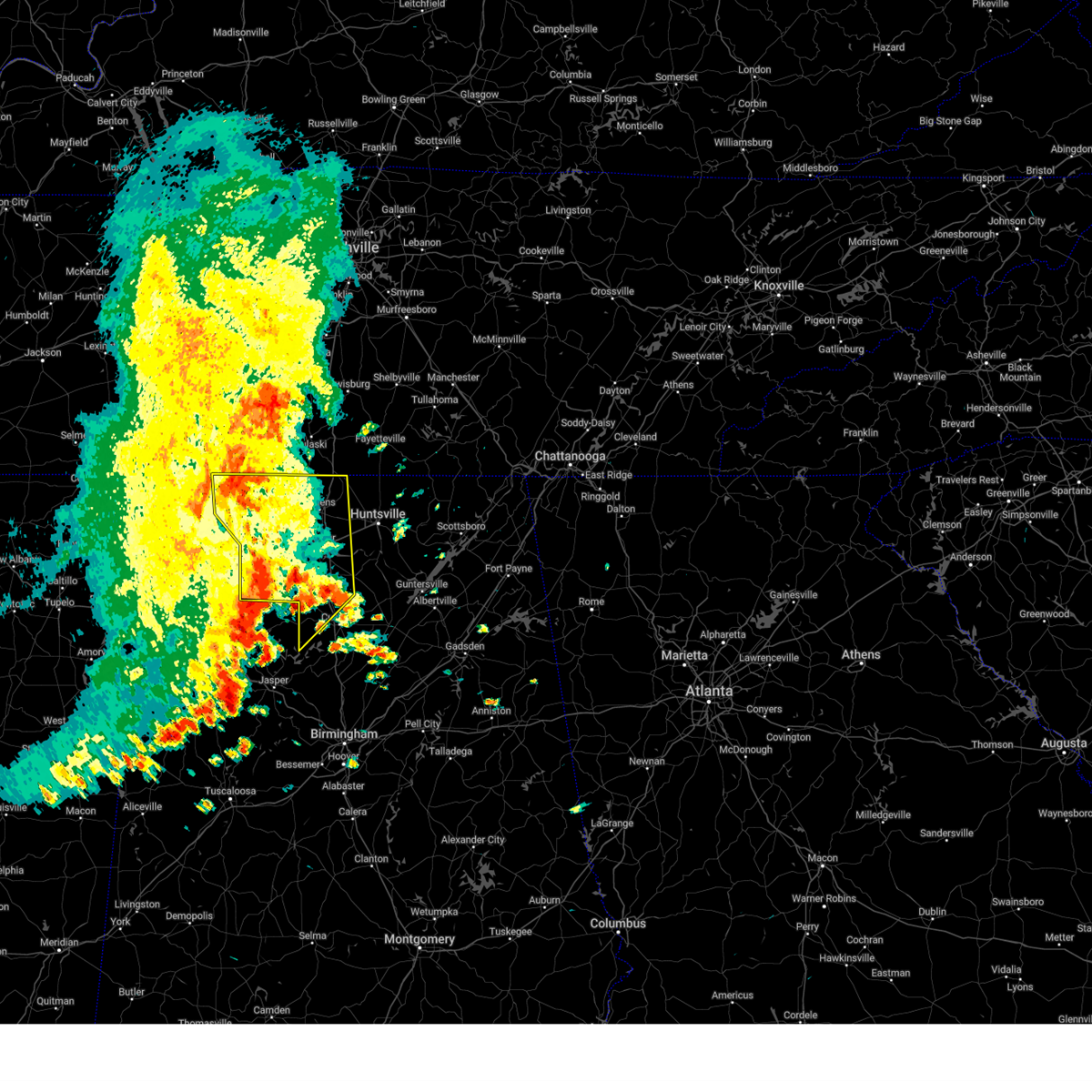
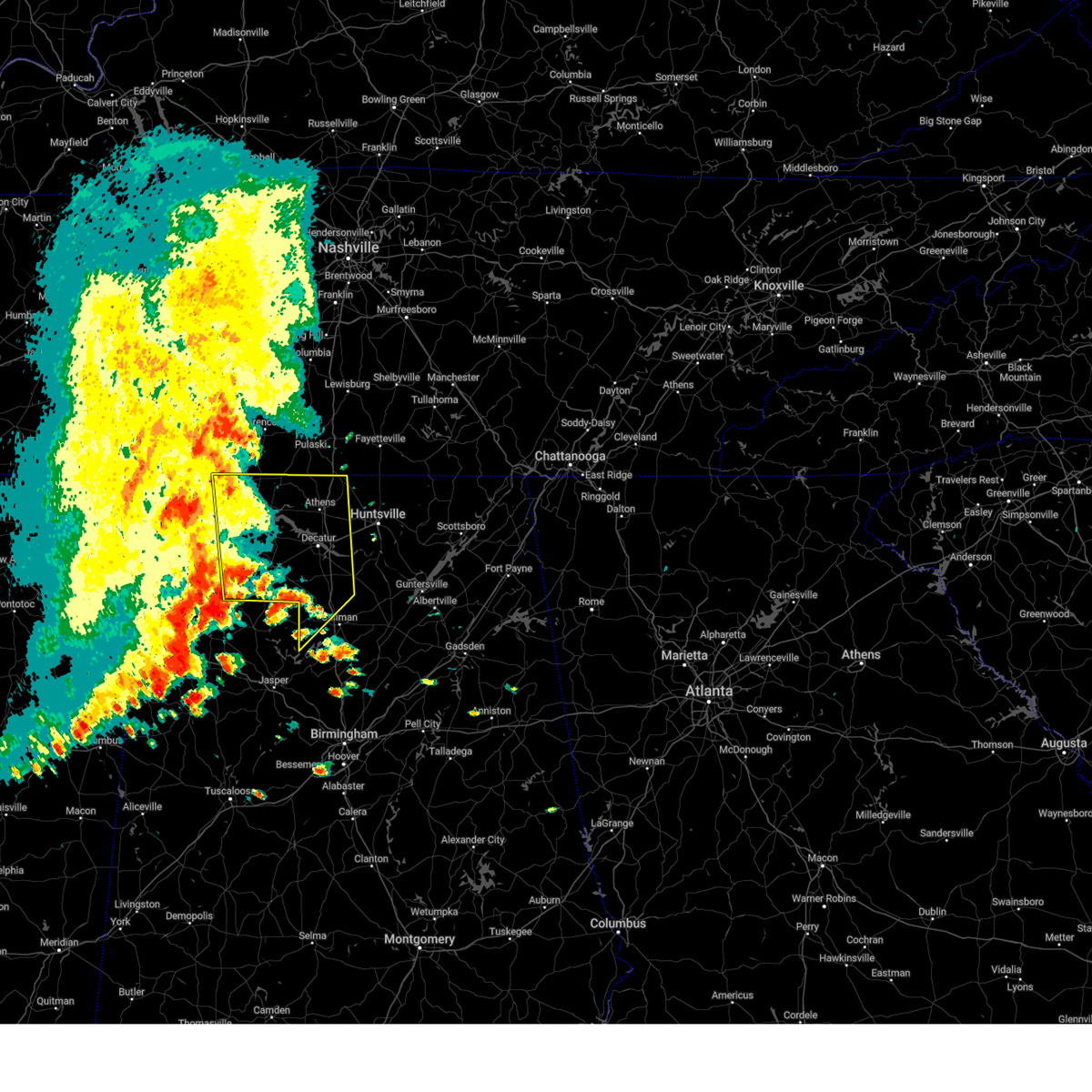
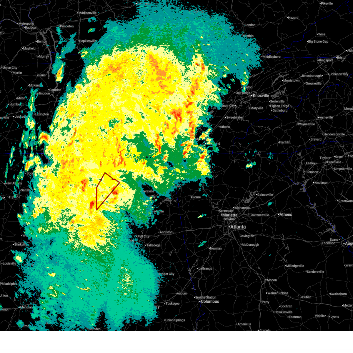
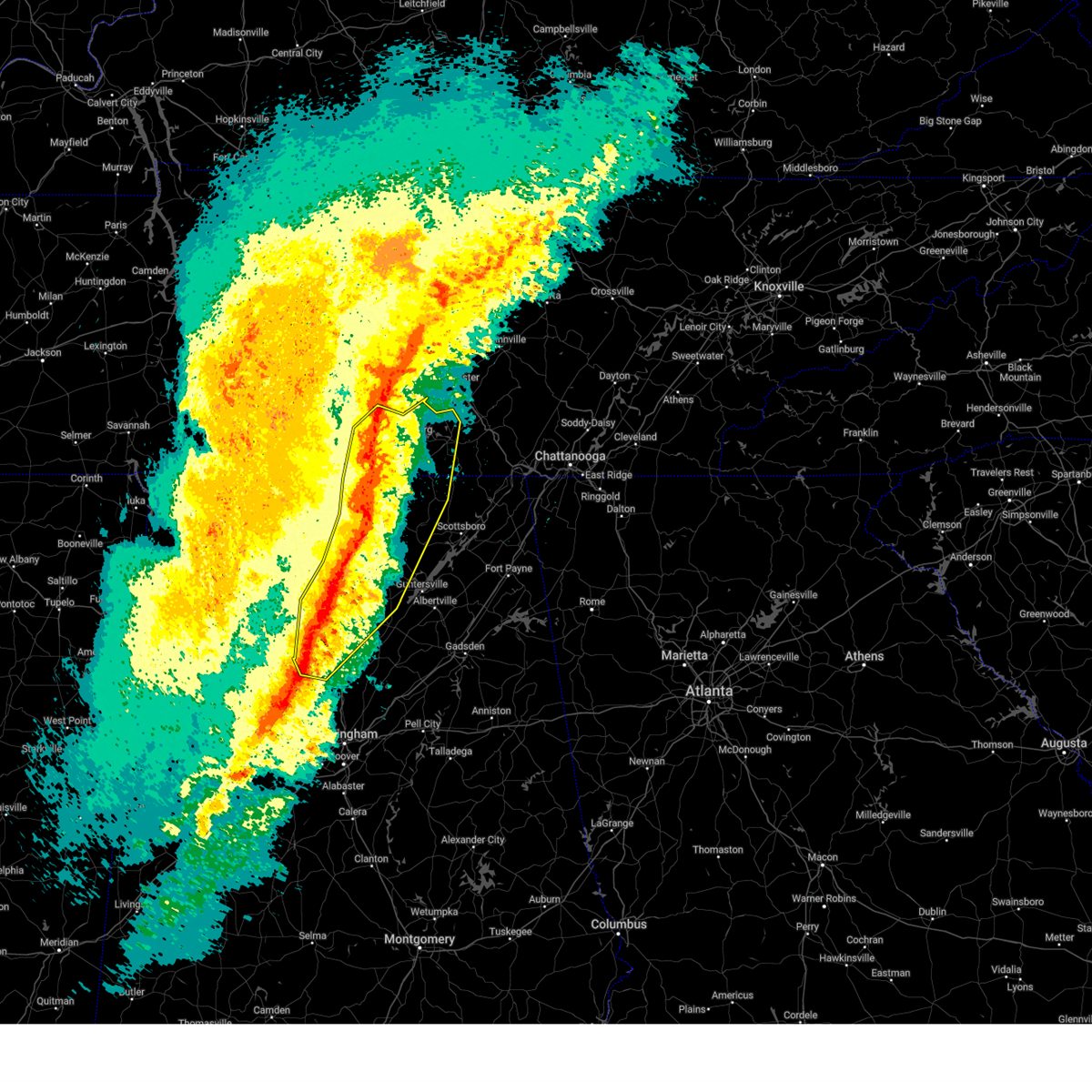
The Top Recent Hail Date for Hartselle, AL is Thursday, February 26, 2026 (12th out of 71)
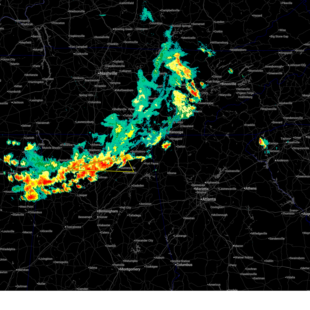
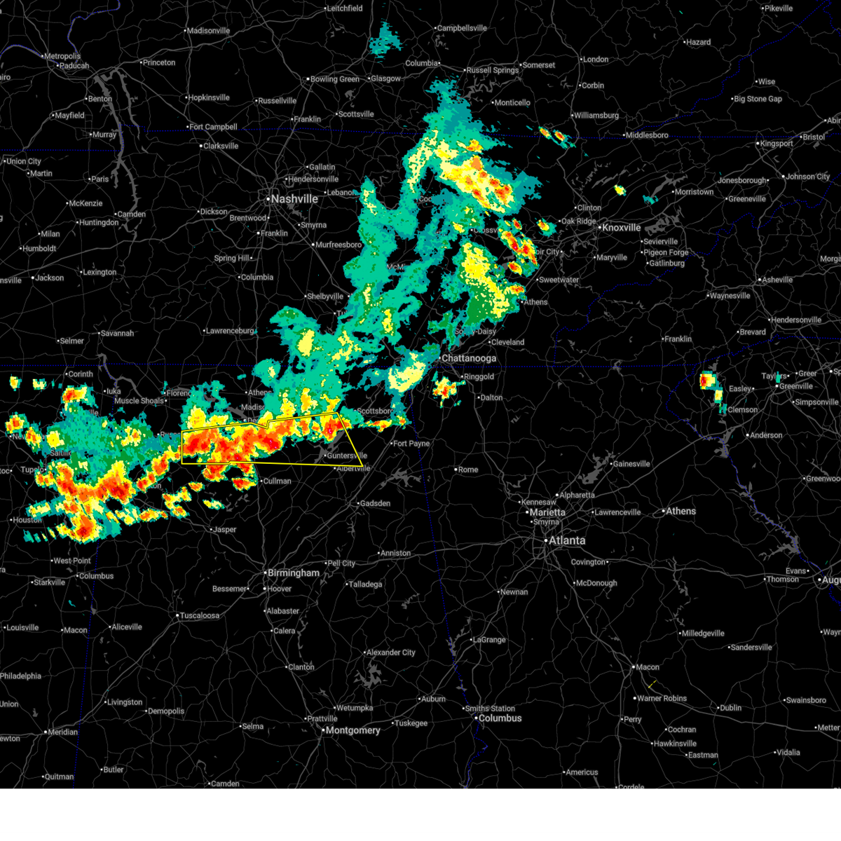
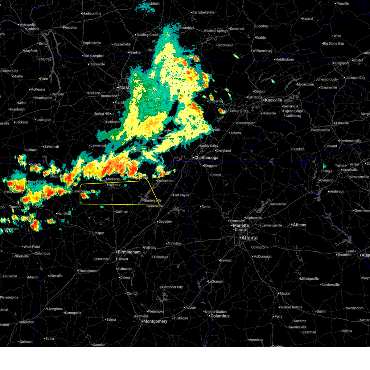
Hail and Wind Damage Spotted near Hartselle, AL
| Date / Time | Report Details |
|---|---|
| 6/1/2026 1:32 PM CDT |
 the severe thunderstorm warning has been cancelled and is no longer in effect the severe thunderstorm warning has been cancelled and is no longer in effect
|
| 6/1/2026 1:32 PM CDT |
 At 131 pm cdt, severe thunderstorms were located along a line extending from 8 miles northwest of geraldine to near poplar springs, moving southeast at 25 mph. there have been numerous reports of trees down area-wide, as well as small hail (emergency management). Hazards include 60 mph wind gusts and nickel size hail. Expect damage to roofs, siding, and trees. Locations impacted include, albertville, hartselle, guntersville, arab, crossville, falkville, grant, geraldine, morgan city, and somerville. At 131 pm cdt, severe thunderstorms were located along a line extending from 8 miles northwest of geraldine to near poplar springs, moving southeast at 25 mph. there have been numerous reports of trees down area-wide, as well as small hail (emergency management). Hazards include 60 mph wind gusts and nickel size hail. Expect damage to roofs, siding, and trees. Locations impacted include, albertville, hartselle, guntersville, arab, crossville, falkville, grant, geraldine, morgan city, and somerville.
|
| 6/1/2026 1:24 PM CDT |
 At 122 pm cdt, severe thunderstorms were located along a line extending from powell to near moulton, moving southeast at 40 mph. ema has reported penny sized hail in grant, al (emergency management). Hazards include 60 mph wind gusts and nickel size hail. Expect damage to roofs, siding, and trees. Locations impacted include, southern huntsville, decatur, albertville, hartselle, guntersville, arab, moulton, redstone arsenal, priceville, and crossville. At 122 pm cdt, severe thunderstorms were located along a line extending from powell to near moulton, moving southeast at 40 mph. ema has reported penny sized hail in grant, al (emergency management). Hazards include 60 mph wind gusts and nickel size hail. Expect damage to roofs, siding, and trees. Locations impacted include, southern huntsville, decatur, albertville, hartselle, guntersville, arab, moulton, redstone arsenal, priceville, and crossville.
|
| 6/1/2026 1:24 PM CDT |
 the severe thunderstorm warning has been cancelled and is no longer in effect the severe thunderstorm warning has been cancelled and is no longer in effect
|
| 6/1/2026 1:17 PM CDT | Tree down causing total blockage to roa in morgan county AL, 5.9 miles SW of Hartselle, AL |
| 6/1/2026 1:17 PM CDT | Tree down blocking the road wa in morgan county AL, 1 miles SSE of Hartselle, AL |
| 6/1/2026 1:16 PM CDT | Tree down blocking right late... and partial blockage to the left lan in morgan county AL, 5.8 miles ESE of Hartselle, AL |
| 6/1/2026 1:08 PM CDT | Large tree across bethel rd ne near intersection of indian hills rd n in morgan county AL, 2 miles SW of Hartselle, AL |
| 6/1/2026 1:06 PM CDT | Tree down on iron man rd... near intersection of wynn wallace r in morgan county AL, 5.8 miles ESE of Hartselle, AL |
| 6/1/2026 1:05 PM CDT | Tree down on south bound lane of i-65... about a mile before 328 exi in morgan county AL, 3.3 miles SW of Hartselle, AL |
| 6/1/2026 1:00 PM CDT | Tree down on 1100 block of bird spring r in morgan county AL, 6.3 miles SE of Hartselle, AL |
| 6/1/2026 12:44 PM CDT |
 Svrhun the national weather service in huntsville alabama has issued a * severe thunderstorm warning for, marshall county in northeastern alabama, southwestern jackson county in northeastern alabama, southern madison county in north central alabama, southeastern limestone county in north central alabama, southwestern dekalb county in northeastern alabama, morgan county in north central alabama, lawrence county in northwestern alabama, * until 145 pm cdt. * at 1243 pm cdt, severe thunderstorms were located along a line extending from near woodville to near littleville, moving southeast at 40 mph (emergency management). Hazards include 60 mph wind gusts and nickel size hail. expect damage to roofs, siding, and trees Svrhun the national weather service in huntsville alabama has issued a * severe thunderstorm warning for, marshall county in northeastern alabama, southwestern jackson county in northeastern alabama, southern madison county in north central alabama, southeastern limestone county in north central alabama, southwestern dekalb county in northeastern alabama, morgan county in north central alabama, lawrence county in northwestern alabama, * until 145 pm cdt. * at 1243 pm cdt, severe thunderstorms were located along a line extending from near woodville to near littleville, moving southeast at 40 mph (emergency management). Hazards include 60 mph wind gusts and nickel size hail. expect damage to roofs, siding, and trees
|
| 3/16/2026 12:41 AM CDT |
 At 1240 am cdt, severe thunderstorms were located along a line extending from near morgan city to 6 miles northwest of good hope, moving east at 30 mph (emergency management). Hazards include 60 mph wind gusts and penny size hail. Expect damage to roofs, siding, and trees. Locations impacted include, cullman, hartselle, arab, priceville, good hope, falkville, holly pond, morgan city, baldwin, and vinemont. At 1240 am cdt, severe thunderstorms were located along a line extending from near morgan city to 6 miles northwest of good hope, moving east at 30 mph (emergency management). Hazards include 60 mph wind gusts and penny size hail. Expect damage to roofs, siding, and trees. Locations impacted include, cullman, hartselle, arab, priceville, good hope, falkville, holly pond, morgan city, baldwin, and vinemont.
|
| 3/16/2026 12:19 AM CDT |
 At 1217 am cdt, severe thunderstorms were located along a line extending from near decatur to near nesmith, moving east at 50 mph (emergency management. severe winds with this storm have downed trees near the wren community on hwy 33 in the bankhead national forest). Hazards include 60 mph wind gusts and penny size hail. Expect damage to roofs, siding, and trees. Locations impacted include, decatur, cullman, hartselle, arab, priceville, good hope, falkville, holly pond, morgan city, and baldwin. At 1217 am cdt, severe thunderstorms were located along a line extending from near decatur to near nesmith, moving east at 50 mph (emergency management. severe winds with this storm have downed trees near the wren community on hwy 33 in the bankhead national forest). Hazards include 60 mph wind gusts and penny size hail. Expect damage to roofs, siding, and trees. Locations impacted include, decatur, cullman, hartselle, arab, priceville, good hope, falkville, holly pond, morgan city, and baldwin.
|
| 3/16/2026 12:19 AM CDT |
 the severe thunderstorm warning has been cancelled and is no longer in effect the severe thunderstorm warning has been cancelled and is no longer in effect
|
| 3/15/2026 11:59 PM CDT |
 Svrhun the national weather service in huntsville alabama has issued a * severe thunderstorm warning for, western marshall county in northeastern alabama, southeastern madison county in north central alabama, northern cullman county in north central alabama, morgan county in north central alabama, southeastern lawrence county in northwestern alabama, * until 115 am cdt. * at 1158 pm cdt, severe thunderstorms were located along a line extending from near moulton to near corinth rec area, moving east at 50 mph (radar indicated). Hazards include 60 mph wind gusts and penny size hail. expect damage to roofs, siding, and trees Svrhun the national weather service in huntsville alabama has issued a * severe thunderstorm warning for, western marshall county in northeastern alabama, southeastern madison county in north central alabama, northern cullman county in north central alabama, morgan county in north central alabama, southeastern lawrence county in northwestern alabama, * until 115 am cdt. * at 1158 pm cdt, severe thunderstorms were located along a line extending from near moulton to near corinth rec area, moving east at 50 mph (radar indicated). Hazards include 60 mph wind gusts and penny size hail. expect damage to roofs, siding, and trees
|
| 3/15/2026 11:46 PM CDT |
 At 1145 pm cdt, severe thunderstorms were located along a line extending from 6 miles northeast of moulton to near ashridge, moving east at 45 mph (radar indicated). Hazards include 60 mph wind gusts and nickel size hail. Expect damage to roofs, siding, and trees. Locations impacted include, decatur, hartselle, moulton, mt hope, chalybeate springs, speake, caddo, basham, wren, and landersville. At 1145 pm cdt, severe thunderstorms were located along a line extending from 6 miles northeast of moulton to near ashridge, moving east at 45 mph (radar indicated). Hazards include 60 mph wind gusts and nickel size hail. Expect damage to roofs, siding, and trees. Locations impacted include, decatur, hartselle, moulton, mt hope, chalybeate springs, speake, caddo, basham, wren, and landersville.
|
| 3/15/2026 11:46 PM CDT |
 the severe thunderstorm warning has been cancelled and is no longer in effect the severe thunderstorm warning has been cancelled and is no longer in effect
|
| 3/15/2026 11:35 PM CDT |
 At 1135 pm cdt, severe thunderstorms were located along a line extending from 6 miles northwest of moulton to near needmore, moving east at 45 mph (radar indicated). Hazards include 60 mph wind gusts and nickel size hail. Expect damage to roofs, siding, and trees. Locations impacted include, decatur, hartselle, moulton, phil campbell, mt hope, chalybeate springs, speake, caddo, basham, and wren. At 1135 pm cdt, severe thunderstorms were located along a line extending from 6 miles northwest of moulton to near needmore, moving east at 45 mph (radar indicated). Hazards include 60 mph wind gusts and nickel size hail. Expect damage to roofs, siding, and trees. Locations impacted include, decatur, hartselle, moulton, phil campbell, mt hope, chalybeate springs, speake, caddo, basham, and wren.
|
| 3/15/2026 11:35 PM CDT |
 the severe thunderstorm warning has been cancelled and is no longer in effect the severe thunderstorm warning has been cancelled and is no longer in effect
|
| 3/15/2026 11:07 PM CDT |
 Svrhun the national weather service in huntsville alabama has issued a * severe thunderstorm warning for, south central colbert county in northwestern alabama, franklin county in northwestern alabama, southwestern morgan county in north central alabama, lawrence county in northwestern alabama, * until midnight cdt. * at 1106 pm cdt, severe thunderstorms were located along a line extending from near littleville to near hackleburg, moving east at 45 mph (radar indicated). Hazards include 60 mph wind gusts and nickel size hail. expect damage to roofs, siding, and trees Svrhun the national weather service in huntsville alabama has issued a * severe thunderstorm warning for, south central colbert county in northwestern alabama, franklin county in northwestern alabama, southwestern morgan county in north central alabama, lawrence county in northwestern alabama, * until midnight cdt. * at 1106 pm cdt, severe thunderstorms were located along a line extending from near littleville to near hackleburg, moving east at 45 mph (radar indicated). Hazards include 60 mph wind gusts and nickel size hail. expect damage to roofs, siding, and trees
|
| 2/26/2026 7:53 PM CST | Half Dollar sized hail reported 0.2 miles SSW of Hartselle, AL |
| 2/26/2026 7:53 PM CST |
 The severe thunderstorm which prompted the warning has weakened. therefore, the warning will be allowed to expire. however, small hail and gusty winds are still possible with this thunderstorm. The severe thunderstorm which prompted the warning has weakened. therefore, the warning will be allowed to expire. however, small hail and gusty winds are still possible with this thunderstorm.
|
| 2/26/2026 7:45 PM CST |
 At 745 pm cst, a severe thunderstorm was located 8 miles east of falkville, or 10 miles east of hartselle, moving east at 25 mph (radar indicated). Hazards include 60 mph wind gusts and quarter size hail. Hail damage to vehicles is expected. expect wind damage to roofs, siding, and trees. Locations impacted include, cullman, hartselle, falkville, baldwin, vinemont, west point, eva, lacon, jones chapel, and battleground. At 745 pm cst, a severe thunderstorm was located 8 miles east of falkville, or 10 miles east of hartselle, moving east at 25 mph (radar indicated). Hazards include 60 mph wind gusts and quarter size hail. Hail damage to vehicles is expected. expect wind damage to roofs, siding, and trees. Locations impacted include, cullman, hartselle, falkville, baldwin, vinemont, west point, eva, lacon, jones chapel, and battleground.
|
| 2/26/2026 7:45 PM CST |
 the severe thunderstorm warning has been cancelled and is no longer in effect the severe thunderstorm warning has been cancelled and is no longer in effect
|
| 2/26/2026 7:24 PM CST |
 At 724 pm cst, a severe thunderstorm was located 7 miles north of sardis, or 11 miles southwest of hartselle, moving east at 30 mph (radar indicated). Hazards include 60 mph wind gusts and quarter size hail. Hail damage to vehicles is expected. expect wind damage to roofs, siding, and trees. Locations impacted include, cullman, hartselle, falkville, baldwin, vinemont, west point, eva, battleground, cole springs, and lacon. At 724 pm cst, a severe thunderstorm was located 7 miles north of sardis, or 11 miles southwest of hartselle, moving east at 30 mph (radar indicated). Hazards include 60 mph wind gusts and quarter size hail. Hail damage to vehicles is expected. expect wind damage to roofs, siding, and trees. Locations impacted include, cullman, hartselle, falkville, baldwin, vinemont, west point, eva, battleground, cole springs, and lacon.
|
| 2/26/2026 7:09 PM CST |
 At 709 pm cst, a severe thunderstorm was located near brushy lake, or 8 miles southeast of moulton, moving east at 35 mph (radar indicated). Hazards include 60 mph wind gusts and quarter size hail. Hail damage to vehicles is expected. expect wind damage to roofs, siding, and trees. Locations impacted include, cullman, hartselle, moulton, falkville, baldwin, vinemont, west point, eva, speake, and wren. At 709 pm cst, a severe thunderstorm was located near brushy lake, or 8 miles southeast of moulton, moving east at 35 mph (radar indicated). Hazards include 60 mph wind gusts and quarter size hail. Hail damage to vehicles is expected. expect wind damage to roofs, siding, and trees. Locations impacted include, cullman, hartselle, moulton, falkville, baldwin, vinemont, west point, eva, speake, and wren.
|
| 2/26/2026 6:56 PM CST |
 Svrhun the national weather service in huntsville alabama has issued a * severe thunderstorm warning for, northwestern cullman county in north central alabama, southwestern morgan county in north central alabama, southern lawrence county in northwestern alabama, * until 800 pm cst. * at 656 pm cst, a severe thunderstorm was located near moulton, moving east at 35 mph (radar indicated). Hazards include 60 mph wind gusts and quarter size hail. Hail damage to vehicles is expected. Expect wind damage to roofs, siding, and trees. Svrhun the national weather service in huntsville alabama has issued a * severe thunderstorm warning for, northwestern cullman county in north central alabama, southwestern morgan county in north central alabama, southern lawrence county in northwestern alabama, * until 800 pm cst. * at 656 pm cst, a severe thunderstorm was located near moulton, moving east at 35 mph (radar indicated). Hazards include 60 mph wind gusts and quarter size hail. Hail damage to vehicles is expected. Expect wind damage to roofs, siding, and trees.
|
| 2/26/2026 6:23 PM CST |
 Svrhun the national weather service in huntsville alabama has issued a * severe thunderstorm warning for, west central marshall county in northeastern alabama, northeastern cullman county in north central alabama, southern morgan county in north central alabama, * until 700 pm cst. * at 623 pm cst, a severe thunderstorm was located near falkville, or 8 miles south of hartselle, moving east at 35 mph (radar indicated). Hazards include 60 mph wind gusts and quarter size hail. Hail damage to vehicles is expected. Expect wind damage to roofs, siding, and trees. Svrhun the national weather service in huntsville alabama has issued a * severe thunderstorm warning for, west central marshall county in northeastern alabama, northeastern cullman county in north central alabama, southern morgan county in north central alabama, * until 700 pm cst. * at 623 pm cst, a severe thunderstorm was located near falkville, or 8 miles south of hartselle, moving east at 35 mph (radar indicated). Hazards include 60 mph wind gusts and quarter size hail. Hail damage to vehicles is expected. Expect wind damage to roofs, siding, and trees.
|
| 2/26/2026 6:14 PM CST |
 At 613 pm cst, a severe thunderstorm was located 8 miles west of falkville, or 8 miles southwest of hartselle, moving southeast at 35 mph (radar indicated). Hazards include 60 mph wind gusts and half dollar size hail. Hail damage to vehicles is expected. expect wind damage to roofs, siding, and trees. Locations impacted include, hartselle, falkville, vinemont, eva, lacon, massey, battleground, and cole springs. At 613 pm cst, a severe thunderstorm was located 8 miles west of falkville, or 8 miles southwest of hartselle, moving southeast at 35 mph (radar indicated). Hazards include 60 mph wind gusts and half dollar size hail. Hail damage to vehicles is expected. expect wind damage to roofs, siding, and trees. Locations impacted include, hartselle, falkville, vinemont, eva, lacon, massey, battleground, and cole springs.
|
| 2/26/2026 6:14 PM CST |
 the severe thunderstorm warning has been cancelled and is no longer in effect the severe thunderstorm warning has been cancelled and is no longer in effect
|
| 2/26/2026 6:06 PM CST | Quarter sized hail reported 8.7 miles ENE of Hartselle, AL, quarter sized hail reported in danville. |
| 2/26/2026 5:50 PM CST |
 At 550 pm cst, a severe thunderstorm was located near moulton, moving east at 30 mph (radar indicated). Hazards include two inch hail and 60 mph wind gusts. People and animals outdoors will be injured. expect hail damage to roofs, siding, windows, and vehicles. expect wind damage to roofs, siding, and trees. Locations impacted include, cullman, hartselle, moulton, falkville, vinemont, somerville, west point, eva, speake, and wren. At 550 pm cst, a severe thunderstorm was located near moulton, moving east at 30 mph (radar indicated). Hazards include two inch hail and 60 mph wind gusts. People and animals outdoors will be injured. expect hail damage to roofs, siding, windows, and vehicles. expect wind damage to roofs, siding, and trees. Locations impacted include, cullman, hartselle, moulton, falkville, vinemont, somerville, west point, eva, speake, and wren.
|
| 2/26/2026 5:44 PM CST |
 At 543 pm cst, a severe thunderstorm was located over moulton, moving east at 35 mph (radar indicated). Hazards include ping pong ball size hail and 60 mph wind gusts. People and animals outdoors will be injured. expect hail damage to roofs, siding, windows, and vehicles. expect wind damage to roofs, siding, and trees. Locations impacted include, hartselle, moulton, falkville, vinemont, somerville, eva, speake, wren, battleground, and cole springs. At 543 pm cst, a severe thunderstorm was located over moulton, moving east at 35 mph (radar indicated). Hazards include ping pong ball size hail and 60 mph wind gusts. People and animals outdoors will be injured. expect hail damage to roofs, siding, windows, and vehicles. expect wind damage to roofs, siding, and trees. Locations impacted include, hartselle, moulton, falkville, vinemont, somerville, eva, speake, wren, battleground, and cole springs.
|
| 2/26/2026 5:29 PM CST |
 Svrhun the national weather service in huntsville alabama has issued a * severe thunderstorm warning for, north central cullman county in north central alabama, southern morgan county in north central alabama, southern lawrence county in northwestern alabama, * until 630 pm cst. * at 529 pm cst, a severe thunderstorm was located 8 miles west of moulton, moving east at 35 mph (radar indicated). Hazards include 60 mph wind gusts and quarter size hail. Hail damage to vehicles is expected. Expect wind damage to roofs, siding, and trees. Svrhun the national weather service in huntsville alabama has issued a * severe thunderstorm warning for, north central cullman county in north central alabama, southern morgan county in north central alabama, southern lawrence county in northwestern alabama, * until 630 pm cst. * at 529 pm cst, a severe thunderstorm was located 8 miles west of moulton, moving east at 35 mph (radar indicated). Hazards include 60 mph wind gusts and quarter size hail. Hail damage to vehicles is expected. Expect wind damage to roofs, siding, and trees.
|
| 12/18/2025 8:20 PM CST | Tree down near longhorn pass st and mountain view rd in hartsell in morgan county AL, 1.1 miles SW of Hartselle, AL |
| 12/18/2025 8:18 PM CST | Tree down at the bridge blocking one lane at the intersection of highway 36 and craze rd in hartsell in morgan county AL, 7 miles ENE of Hartselle, AL |
| 12/18/2025 8:13 PM CST |
 The storms which prompted the warning have weakened below severe limits, and no longer pose an immediate threat to life or property. therefore, the warning will be allowed to expire. however, gusty winds are still possible with these thunderstorms. a tornado watch remains in effect until 900 pm cst for north central and northwestern alabama. The storms which prompted the warning have weakened below severe limits, and no longer pose an immediate threat to life or property. therefore, the warning will be allowed to expire. however, gusty winds are still possible with these thunderstorms. a tornado watch remains in effect until 900 pm cst for north central and northwestern alabama.
|
| 12/18/2025 8:02 PM CST |
 the severe thunderstorm warning has been cancelled and is no longer in effect the severe thunderstorm warning has been cancelled and is no longer in effect
|
| 12/18/2025 8:02 PM CST |
 At 801 pm cst, severe thunderstorms were located along a line extending from near harvest to near huntsville international airport to 7 miles west of brushy lake, moving east at 40 mph. these storms have downed trees and powerlines in lawrence county (emergency management). Hazards include 60 mph wind gusts. Expect damage to roofs, siding, and trees. Locations impacted include, decatur, madison, hartselle, moulton, priceville, trinity, falkville, courtland, tanner, and somerville. At 801 pm cst, severe thunderstorms were located along a line extending from near harvest to near huntsville international airport to 7 miles west of brushy lake, moving east at 40 mph. these storms have downed trees and powerlines in lawrence county (emergency management). Hazards include 60 mph wind gusts. Expect damage to roofs, siding, and trees. Locations impacted include, decatur, madison, hartselle, moulton, priceville, trinity, falkville, courtland, tanner, and somerville.
|
| 12/18/2025 7:30 PM CST |
 Svrhun the national weather service in huntsville alabama has issued a * severe thunderstorm warning for, southern limestone county in north central alabama, southeastern colbert county in northwestern alabama, eastern franklin county in northwestern alabama, morgan county in north central alabama, lawrence county in northwestern alabama, * until 815 pm cst. * at 730 pm cst, severe thunderstorms were located along a line extending from 6 miles west of tanner to 6 miles southwest of trinity to 7 miles north of needmore, moving east at 40 mph (radar indicated). Hazards include 70 mph wind gusts. Expect considerable tree damage. Damage is likely to mobile homes, roofs, and outbuildings. Svrhun the national weather service in huntsville alabama has issued a * severe thunderstorm warning for, southern limestone county in north central alabama, southeastern colbert county in northwestern alabama, eastern franklin county in northwestern alabama, morgan county in north central alabama, lawrence county in northwestern alabama, * until 815 pm cst. * at 730 pm cst, severe thunderstorms were located along a line extending from 6 miles west of tanner to 6 miles southwest of trinity to 7 miles north of needmore, moving east at 40 mph (radar indicated). Hazards include 70 mph wind gusts. Expect considerable tree damage. Damage is likely to mobile homes, roofs, and outbuildings.
|
| 7/30/2025 7:40 PM CDT | Tree downe in morgan county AL, 4.8 miles WNW of Hartselle, AL |
| 7/19/2025 7:03 AM CDT | Tree down across bethel circle. time estimated from rada in morgan county AL, 3.8 miles SW of Hartselle, AL |
| 6/7/2025 2:09 PM CDT |
 The storms which prompted the warning have weakened below severe limits, and have exited the warned area. therefore, the warning will be allowed to expire. a severe thunderstorm watch remains in effect until 600 pm cdt for north central, northeastern and northwestern alabama, and middle tennessee. The storms which prompted the warning have weakened below severe limits, and have exited the warned area. therefore, the warning will be allowed to expire. a severe thunderstorm watch remains in effect until 600 pm cdt for north central, northeastern and northwestern alabama, and middle tennessee.
|
| 6/7/2025 2:05 PM CDT |
 the severe thunderstorm warning has been cancelled and is no longer in effect the severe thunderstorm warning has been cancelled and is no longer in effect
|
| 6/7/2025 2:05 PM CDT |
 At 204 pm cdt, severe thunderstorms were located along a line extending from near priceville to dodge city to near beloit, moving east at 55 mph (emergency management). Hazards include 70 mph wind gusts. Expect considerable tree damage. damage is likely to mobile homes, roofs, and outbuildings. Locations impacted include, southern huntsville, decatur, albertville, cullman, hartselle, boaz, guntersville, arab, redstone arsenal, and hanceville. At 204 pm cdt, severe thunderstorms were located along a line extending from near priceville to dodge city to near beloit, moving east at 55 mph (emergency management). Hazards include 70 mph wind gusts. Expect considerable tree damage. damage is likely to mobile homes, roofs, and outbuildings. Locations impacted include, southern huntsville, decatur, albertville, cullman, hartselle, boaz, guntersville, arab, redstone arsenal, and hanceville.
|
| 6/7/2025 2:04 PM CDT |
 At 204 pm cdt, severe thunderstorms were located along a line extending from near tanner to 7 miles southwest of falkville to near camp mcdowell, moving east at 45 mph (radar indicated). Hazards include 60 mph wind gusts. Expect damage to roofs, siding, and trees. Locations impacted include, decatur, madison, athens, hartselle, priceville, trinity, falkville, ardmore, tanner, and huntsville international airport. At 204 pm cdt, severe thunderstorms were located along a line extending from near tanner to 7 miles southwest of falkville to near camp mcdowell, moving east at 45 mph (radar indicated). Hazards include 60 mph wind gusts. Expect damage to roofs, siding, and trees. Locations impacted include, decatur, madison, athens, hartselle, priceville, trinity, falkville, ardmore, tanner, and huntsville international airport.
|
| 6/7/2025 2:04 PM CDT |
 the severe thunderstorm warning has been cancelled and is no longer in effect the severe thunderstorm warning has been cancelled and is no longer in effect
|
| 6/7/2025 1:55 PM CDT |
 At 154 pm cdt, severe thunderstorms were located along a line extending from near hartselle to 6 miles west of dodge city to parrish, moving east at 55 mph. multiple trees reported down in western cullman (emergency management). Hazards include 70 mph wind gusts. Expect considerable tree damage. damage is likely to mobile homes, roofs, and outbuildings. Locations impacted include, southern huntsville, decatur, albertville, cullman, hartselle, boaz, guntersville, arab, redstone arsenal, and hanceville. At 154 pm cdt, severe thunderstorms were located along a line extending from near hartselle to 6 miles west of dodge city to parrish, moving east at 55 mph. multiple trees reported down in western cullman (emergency management). Hazards include 70 mph wind gusts. Expect considerable tree damage. damage is likely to mobile homes, roofs, and outbuildings. Locations impacted include, southern huntsville, decatur, albertville, cullman, hartselle, boaz, guntersville, arab, redstone arsenal, and hanceville.
|
| 6/7/2025 1:49 PM CDT |
 the severe thunderstorm warning has been cancelled and is no longer in effect the severe thunderstorm warning has been cancelled and is no longer in effect
|
| 6/7/2025 1:49 PM CDT |
 At 148 pm cdt, severe thunderstorms were located along a line extending from near trinity to inmanfield to nauvoo, moving east at 45 mph (radar indicated). Hazards include 60 mph wind gusts. Expect damage to roofs, siding, and trees. Locations impacted include, decatur, madison, athens, hartselle, moulton, priceville, trinity, falkville, rogersville, and ardmore. At 148 pm cdt, severe thunderstorms were located along a line extending from near trinity to inmanfield to nauvoo, moving east at 45 mph (radar indicated). Hazards include 60 mph wind gusts. Expect damage to roofs, siding, and trees. Locations impacted include, decatur, madison, athens, hartselle, moulton, priceville, trinity, falkville, rogersville, and ardmore.
|
| 6/7/2025 1:47 PM CDT |
 Svrhun the national weather service in huntsville alabama has issued a * severe thunderstorm warning for, marshall county in northeastern alabama, southern madison county in north central alabama, cullman county in north central alabama, morgan county in north central alabama, southeastern lawrence county in northwestern alabama, * until 245 pm cdt. * at 147 pm cdt, severe thunderstorms were located along a line extending from 6 miles south of trinity to near smith dam to oakman, moving east at 55 mph (radar indicated). Hazards include 60 mph wind gusts. expect damage to roofs, siding, and trees Svrhun the national weather service in huntsville alabama has issued a * severe thunderstorm warning for, marshall county in northeastern alabama, southern madison county in north central alabama, cullman county in north central alabama, morgan county in north central alabama, southeastern lawrence county in northwestern alabama, * until 245 pm cdt. * at 147 pm cdt, severe thunderstorms were located along a line extending from 6 miles south of trinity to near smith dam to oakman, moving east at 55 mph (radar indicated). Hazards include 60 mph wind gusts. expect damage to roofs, siding, and trees
|
| 6/7/2025 1:36 PM CDT |
 the severe thunderstorm warning has been cancelled and is no longer in effect the severe thunderstorm warning has been cancelled and is no longer in effect
|
| 6/7/2025 1:36 PM CDT |
 At 135 pm cdt, severe thunderstorms were located along a line extending from near courtland to near moreland to eldridge, moving east at 45 mph (radar indicated). Hazards include 60 mph wind gusts. Expect damage to roofs, siding, and trees. Locations impacted include, decatur, madison, florence, athens, hartselle, muscle shoals, moulton, priceville, trinity, and falkville. At 135 pm cdt, severe thunderstorms were located along a line extending from near courtland to near moreland to eldridge, moving east at 45 mph (radar indicated). Hazards include 60 mph wind gusts. Expect damage to roofs, siding, and trees. Locations impacted include, decatur, madison, florence, athens, hartselle, muscle shoals, moulton, priceville, trinity, and falkville.
|
| 6/7/2025 1:08 PM CDT |
 Svrhun the national weather service in huntsville alabama has issued a * severe thunderstorm warning for, west central madison county in north central alabama, limestone county in north central alabama, eastern lauderdale county in northwestern alabama, southeastern colbert county in northwestern alabama, northwestern cullman county in north central alabama, eastern franklin county in northwestern alabama, morgan county in north central alabama, lawrence county in northwestern alabama, * until 215 pm cdt. * at 107 pm cdt, severe thunderstorms were located along a line extending from near littleville to near lake buttahatchee to near bluff, moving east at 45 mph (radar indicated). Hazards include 60 mph wind gusts. expect damage to roofs, siding, and trees Svrhun the national weather service in huntsville alabama has issued a * severe thunderstorm warning for, west central madison county in north central alabama, limestone county in north central alabama, eastern lauderdale county in northwestern alabama, southeastern colbert county in northwestern alabama, northwestern cullman county in north central alabama, eastern franklin county in northwestern alabama, morgan county in north central alabama, lawrence county in northwestern alabama, * until 215 pm cdt. * at 107 pm cdt, severe thunderstorms were located along a line extending from near littleville to near lake buttahatchee to near bluff, moving east at 45 mph (radar indicated). Hazards include 60 mph wind gusts. expect damage to roofs, siding, and trees
|
| 5/25/2025 9:54 PM CDT |
 the severe thunderstorm warning has been cancelled and is no longer in effect the severe thunderstorm warning has been cancelled and is no longer in effect
|
| 5/25/2025 9:54 PM CDT |
 At 953 pm cdt, severe thunderstorms were located along a line extending from near madison to 8 miles southwest of morgan city to near bangor, moving east at 50 mph (radar indicated). Hazards include 60 mph wind gusts. Expect damage to roofs, siding, and trees. Locations impacted include, wilburn, lim rock, valhermoso springs, crane hill, priceville, painter, union grove, rabbit town, whitesburg, and mcville. At 953 pm cdt, severe thunderstorms were located along a line extending from near madison to 8 miles southwest of morgan city to near bangor, moving east at 50 mph (radar indicated). Hazards include 60 mph wind gusts. Expect damage to roofs, siding, and trees. Locations impacted include, wilburn, lim rock, valhermoso springs, crane hill, priceville, painter, union grove, rabbit town, whitesburg, and mcville.
|
| 5/25/2025 9:37 PM CDT |
 Svrhun the national weather service in huntsville alabama has issued a * severe thunderstorm warning for, marshall county in northeastern alabama, southwestern jackson county in northeastern alabama, southern madison county in north central alabama, southern limestone county in north central alabama, southwestern dekalb county in northeastern alabama, cullman county in north central alabama, morgan county in north central alabama, eastern lawrence county in northwestern alabama, * until 1030 pm cdt. * at 937 pm cdt, severe thunderstorms were located along a line extending from near tanner to falkville to near dodge city, moving east at 50 mph (radar indicated). Hazards include 60 mph wind gusts. expect damage to roofs, siding, and trees Svrhun the national weather service in huntsville alabama has issued a * severe thunderstorm warning for, marshall county in northeastern alabama, southwestern jackson county in northeastern alabama, southern madison county in north central alabama, southern limestone county in north central alabama, southwestern dekalb county in northeastern alabama, cullman county in north central alabama, morgan county in north central alabama, eastern lawrence county in northwestern alabama, * until 1030 pm cdt. * at 937 pm cdt, severe thunderstorms were located along a line extending from near tanner to falkville to near dodge city, moving east at 50 mph (radar indicated). Hazards include 60 mph wind gusts. expect damage to roofs, siding, and trees
|
| 5/25/2025 9:28 PM CDT | Morgan county ema reported a tree down along barely bridge rd and perry anders r in morgan county AL, 2.8 miles NNE of Hartselle, AL |
| 5/25/2025 9:22 PM CDT |
 At 922 pm cdt, severe thunderstorms were located along a line extending from 6 miles northwest of moulton to brushy lake, moving east at 35 mph (radar indicated). Hazards include 60 mph wind gusts. Expect damage to roofs, siding, and trees. Locations impacted include, mt hope, trinity, falkville, speake, ne smith, basham, wren, north courtland, landersville, and battleground. At 922 pm cdt, severe thunderstorms were located along a line extending from 6 miles northwest of moulton to brushy lake, moving east at 35 mph (radar indicated). Hazards include 60 mph wind gusts. Expect damage to roofs, siding, and trees. Locations impacted include, mt hope, trinity, falkville, speake, ne smith, basham, wren, north courtland, landersville, and battleground.
|
| 5/25/2025 9:16 PM CDT |
 the severe thunderstorm warning has been cancelled and is no longer in effect the severe thunderstorm warning has been cancelled and is no longer in effect
|
| 5/25/2025 9:16 PM CDT |
 At 915 pm cdt, severe thunderstorms were located along a line extending from 8 miles south of town creek to near brushy lake, moving east at 35 mph. trees and powerlines were reported down in the mount hope area around 912 pm cdt (radar indicated). Hazards include 70 mph wind gusts. Expect considerable tree damage. damage is likely to mobile homes, roofs, and outbuildings. Locations impacted include, mt hope, trinity, falkville, speake, ne smith, basham, wren, north courtland, landersville, and battleground. At 915 pm cdt, severe thunderstorms were located along a line extending from 8 miles south of town creek to near brushy lake, moving east at 35 mph. trees and powerlines were reported down in the mount hope area around 912 pm cdt (radar indicated). Hazards include 70 mph wind gusts. Expect considerable tree damage. damage is likely to mobile homes, roofs, and outbuildings. Locations impacted include, mt hope, trinity, falkville, speake, ne smith, basham, wren, north courtland, landersville, and battleground.
|
| 5/25/2025 8:58 PM CDT |
 Svrhun the national weather service in huntsville alabama has issued a * severe thunderstorm warning for, southwestern limestone county in north central alabama, southeastern colbert county in northwestern alabama, northwestern cullman county in north central alabama, eastern franklin county in northwestern alabama, western morgan county in north central alabama, lawrence county in northwestern alabama, * until 945 pm cdt. * at 858 pm cdt, severe thunderstorms were located along a line extending from near littleville to near ashridge, moving east at 35 mph (radar indicated). Hazards include 70 mph wind gusts. Expect considerable tree damage. Damage is likely to mobile homes, roofs, and outbuildings. Svrhun the national weather service in huntsville alabama has issued a * severe thunderstorm warning for, southwestern limestone county in north central alabama, southeastern colbert county in northwestern alabama, northwestern cullman county in north central alabama, eastern franklin county in northwestern alabama, western morgan county in north central alabama, lawrence county in northwestern alabama, * until 945 pm cdt. * at 858 pm cdt, severe thunderstorms were located along a line extending from near littleville to near ashridge, moving east at 35 mph (radar indicated). Hazards include 70 mph wind gusts. Expect considerable tree damage. Damage is likely to mobile homes, roofs, and outbuildings.
|
| 5/20/2025 8:43 PM CDT |
 the severe thunderstorm warning has been cancelled and is no longer in effect the severe thunderstorm warning has been cancelled and is no longer in effect
|
| 5/20/2025 8:32 PM CDT |
 Svrhun the national weather service in huntsville alabama has issued a * severe thunderstorm warning for, northwestern marshall county in northeastern alabama, southwestern madison county in north central alabama, northern cullman county in north central alabama, southeastern morgan county in north central alabama, * until 900 pm cdt. * at 832 pm cdt, severe thunderstorms were located along a line extending from 7 miles south of triana to 6 miles southwest of falkville, moving east at 40 mph (radar indicated). Hazards include 60 mph wind gusts and quarter size hail. Hail damage to vehicles is expected. Expect wind damage to roofs, siding, and trees. Svrhun the national weather service in huntsville alabama has issued a * severe thunderstorm warning for, northwestern marshall county in northeastern alabama, southwestern madison county in north central alabama, northern cullman county in north central alabama, southeastern morgan county in north central alabama, * until 900 pm cdt. * at 832 pm cdt, severe thunderstorms were located along a line extending from 7 miles south of triana to 6 miles southwest of falkville, moving east at 40 mph (radar indicated). Hazards include 60 mph wind gusts and quarter size hail. Hail damage to vehicles is expected. Expect wind damage to roofs, siding, and trees.
|
| 5/20/2025 8:10 PM CDT | Tree down on a hous in morgan county AL, 5 miles ESE of Hartselle, AL |
| 5/20/2025 8:10 PM CDT | Tree down and road blockag in morgan county AL, 2.5 miles SSE of Hartselle, AL |
| 5/20/2025 8:10 PM CDT | Tree and power lines dow in morgan county AL, 2.8 miles SE of Hartselle, AL |
| 5/20/2025 8:10 PM CDT | Tree down causing a total road blockag in morgan county AL, 3.6 miles SE of Hartselle, AL |
| 5/20/2025 8:08 PM CDT |
 Svrhun the national weather service in huntsville alabama has issued a * severe thunderstorm warning for, southwestern madison county in north central alabama, central morgan county in north central alabama, * until 900 pm cdt. * at 808 pm cdt, a severe thunderstorm was located over hartselle, moving northeast at 35 mph (radar indicated). Hazards include 60 mph wind gusts and quarter size hail. Hail damage to vehicles is expected. Expect wind damage to roofs, siding, and trees. Svrhun the national weather service in huntsville alabama has issued a * severe thunderstorm warning for, southwestern madison county in north central alabama, central morgan county in north central alabama, * until 900 pm cdt. * at 808 pm cdt, a severe thunderstorm was located over hartselle, moving northeast at 35 mph (radar indicated). Hazards include 60 mph wind gusts and quarter size hail. Hail damage to vehicles is expected. Expect wind damage to roofs, siding, and trees.
|
| 5/20/2025 8:00 PM CDT | Tree down and road blockag in morgan county AL, 9.2 miles ENE of Hartselle, AL |
| 5/20/2025 7:01 PM CDT |
 Torhun the national weather service in huntsville alabama has issued a * tornado warning for, southwestern madison county in north central alabama, southeastern limestone county in north central alabama, central morgan county in north central alabama, * until 730 pm cdt. * at 701 pm cdt, a severe thunderstorm capable of producing a tornado was located over priceville, or 7 miles east of decatur, moving east at 45 mph (radar indicated rotation). Hazards include tornado and quarter size hail. Flying debris will be dangerous to those caught without shelter. mobile homes will be damaged or destroyed. damage to roofs, windows, and vehicles will occur. tree damage is likely. this dangerous storm will be near, huntsville international airport and triana around 705 pm cdt. redstone arsenal around 710 pm cdt. huntsville around 720 pm cdt. owens cross roads around 725 pm cdt. Other locations impacted by this tornadic thunderstorm include laceys spring, valhermoso springs, farley, mooresville, hampton cove, whitesburg, and somerville. Torhun the national weather service in huntsville alabama has issued a * tornado warning for, southwestern madison county in north central alabama, southeastern limestone county in north central alabama, central morgan county in north central alabama, * until 730 pm cdt. * at 701 pm cdt, a severe thunderstorm capable of producing a tornado was located over priceville, or 7 miles east of decatur, moving east at 45 mph (radar indicated rotation). Hazards include tornado and quarter size hail. Flying debris will be dangerous to those caught without shelter. mobile homes will be damaged or destroyed. damage to roofs, windows, and vehicles will occur. tree damage is likely. this dangerous storm will be near, huntsville international airport and triana around 705 pm cdt. redstone arsenal around 710 pm cdt. huntsville around 720 pm cdt. owens cross roads around 725 pm cdt. Other locations impacted by this tornadic thunderstorm include laceys spring, valhermoso springs, farley, mooresville, hampton cove, whitesburg, and somerville.
|
| 5/20/2025 6:32 PM CDT |
 Svrhun the national weather service in huntsville alabama has issued a * severe thunderstorm warning for, south central limestone county in north central alabama, northwestern morgan county in north central alabama, southeastern lawrence county in northwestern alabama, * until 700 pm cdt. * at 632 pm cdt, a severe thunderstorm was located 8 miles south of trinity, or 9 miles east of moulton, moving northeast at 35 mph (radar indicated). Hazards include 60 mph wind gusts and quarter size hail. Hail damage to vehicles is expected. Expect wind damage to roofs, siding, and trees. Svrhun the national weather service in huntsville alabama has issued a * severe thunderstorm warning for, south central limestone county in north central alabama, northwestern morgan county in north central alabama, southeastern lawrence county in northwestern alabama, * until 700 pm cdt. * at 632 pm cdt, a severe thunderstorm was located 8 miles south of trinity, or 9 miles east of moulton, moving northeast at 35 mph (radar indicated). Hazards include 60 mph wind gusts and quarter size hail. Hail damage to vehicles is expected. Expect wind damage to roofs, siding, and trees.
|
| 5/20/2025 2:22 PM CDT | A tree knocked down in the roadway. took out several power lines with road completely blocked along lockhart roa in morgan county AL, 3.3 miles WSW of Hartselle, AL |
| 5/2/2025 4:38 PM CDT |
 At 438 pm cdt, a severe thunderstorm was located near morgan city, or 11 miles south of redstone arsenal, moving east at 45 mph. powerlines were reported down near eva, al (public). Hazards include 60 mph wind gusts and quarter size hail. Hail damage to vehicles is expected. expect wind damage to roofs, siding, and trees. Locations impacted include, high point, valhermoso springs, cullman, crane hill, falkville, battleground, lacon, priceville, hartselle, and joppa. At 438 pm cdt, a severe thunderstorm was located near morgan city, or 11 miles south of redstone arsenal, moving east at 45 mph. powerlines were reported down near eva, al (public). Hazards include 60 mph wind gusts and quarter size hail. Hail damage to vehicles is expected. expect wind damage to roofs, siding, and trees. Locations impacted include, high point, valhermoso springs, cullman, crane hill, falkville, battleground, lacon, priceville, hartselle, and joppa.
|
| 5/2/2025 4:38 PM CDT |
 the severe thunderstorm warning has been cancelled and is no longer in effect the severe thunderstorm warning has been cancelled and is no longer in effect
|
| 5/2/2025 4:26 PM CDT |
 A new severe thunderstorm warning has replaced this one. therefore, the warning will be allowed to expire. a severe thunderstorm watch remains in effect until 500 pm cdt for north central and northwestern alabama. a severe thunderstorm watch also remains in effect until 800 pm cdt for north central and northeastern alabama. A new severe thunderstorm warning has replaced this one. therefore, the warning will be allowed to expire. a severe thunderstorm watch remains in effect until 500 pm cdt for north central and northwestern alabama. a severe thunderstorm watch also remains in effect until 800 pm cdt for north central and northeastern alabama.
|
| 5/2/2025 4:14 PM CDT |
 Svrhun the national weather service in huntsville alabama has issued a * severe thunderstorm warning for, marshall county in northeastern alabama, southern madison county in north central alabama, cullman county in north central alabama, morgan county in north central alabama, southeastern lawrence county in northwestern alabama, * until 515 pm cdt. * at 414 pm cdt, a severe thunderstorm was located over falkville, or near hartselle, moving east at 45 mph (radar indicated). Hazards include 60 mph wind gusts and quarter size hail. Hail damage to vehicles is expected. Expect wind damage to roofs, siding, and trees. Svrhun the national weather service in huntsville alabama has issued a * severe thunderstorm warning for, marshall county in northeastern alabama, southern madison county in north central alabama, cullman county in north central alabama, morgan county in north central alabama, southeastern lawrence county in northwestern alabama, * until 515 pm cdt. * at 414 pm cdt, a severe thunderstorm was located over falkville, or near hartselle, moving east at 45 mph (radar indicated). Hazards include 60 mph wind gusts and quarter size hail. Hail damage to vehicles is expected. Expect wind damage to roofs, siding, and trees.
|
| 5/2/2025 4:01 PM CDT |
 At 401 pm cdt, a severe thunderstorm was located over falkville, or near hartselle, moving northeast at 25 mph (emergency management). Hazards include 60 mph wind gusts and quarter size hail. Hail damage to vehicles is expected. expect wind damage to roofs, siding, and trees. Locations impacted include, valhermoso springs, baldwin, falkville, cole springs, battleground, lacon, priceville, hartselle, jones chapel, and west point. At 401 pm cdt, a severe thunderstorm was located over falkville, or near hartselle, moving northeast at 25 mph (emergency management). Hazards include 60 mph wind gusts and quarter size hail. Hail damage to vehicles is expected. expect wind damage to roofs, siding, and trees. Locations impacted include, valhermoso springs, baldwin, falkville, cole springs, battleground, lacon, priceville, hartselle, jones chapel, and west point.
|
| 5/2/2025 3:40 PM CDT |
 At 339 pm cdt, a severe thunderstorm was located 7 miles northeast of sardis, or 11 miles south of hartselle, moving north at 25 mph (emergency management). Hazards include 60 mph wind gusts and quarter size hail. Hail damage to vehicles is expected. expect wind damage to roofs, siding, and trees. Locations impacted include, valhermoso springs, baldwin, falkville, cole springs, battleground, lacon, priceville, hartselle, jones chapel, and west point. At 339 pm cdt, a severe thunderstorm was located 7 miles northeast of sardis, or 11 miles south of hartselle, moving north at 25 mph (emergency management). Hazards include 60 mph wind gusts and quarter size hail. Hail damage to vehicles is expected. expect wind damage to roofs, siding, and trees. Locations impacted include, valhermoso springs, baldwin, falkville, cole springs, battleground, lacon, priceville, hartselle, jones chapel, and west point.
|
| 5/2/2025 3:32 PM CDT |
 Svrhun the national weather service in huntsville alabama has issued a * severe thunderstorm warning for, northwestern cullman county in north central alabama, morgan county in north central alabama, * until 430 pm cdt. * at 332 pm cdt, a severe thunderstorm was located near sardis, or 11 miles west of cullman, moving northeast at 25 mph (radar indicated). Hazards include 60 mph wind gusts and quarter size hail. Hail damage to vehicles is expected. Expect wind damage to roofs, siding, and trees. Svrhun the national weather service in huntsville alabama has issued a * severe thunderstorm warning for, northwestern cullman county in north central alabama, morgan county in north central alabama, * until 430 pm cdt. * at 332 pm cdt, a severe thunderstorm was located near sardis, or 11 miles west of cullman, moving northeast at 25 mph (radar indicated). Hazards include 60 mph wind gusts and quarter size hail. Hail damage to vehicles is expected. Expect wind damage to roofs, siding, and trees.
|
| 5/2/2025 2:58 PM CDT | Quarter sized hail reported 0.2 miles SSW of Hartselle, AL, report relayed by broadcast media. |
| 5/2/2025 2:56 PM CDT |
 At 255 pm cdt, a severe thunderstorm was located over triana, or 7 miles west of redstone arsenal, moving northeast at 25 mph (public). Hazards include quarter size hail. Damage to vehicles is expected. Locations impacted include, madison, belle mina, huntsville, french mill, triana, marshall space flight center, university of alabama in huntsville, mooresville, basham, and redstone arsenal. At 255 pm cdt, a severe thunderstorm was located over triana, or 7 miles west of redstone arsenal, moving northeast at 25 mph (public). Hazards include quarter size hail. Damage to vehicles is expected. Locations impacted include, madison, belle mina, huntsville, french mill, triana, marshall space flight center, university of alabama in huntsville, mooresville, basham, and redstone arsenal.
|
| 5/2/2025 2:22 PM CDT |
 At 221 pm cdt, a severe thunderstorm was located over decatur, moving northeast at 30 mph (public). Hazards include 60 mph wind gusts and quarter size hail. Hail damage to vehicles is expected. expect wind damage to roofs, siding, and trees. Locations impacted include, madison, belle mina, huntsville, french mill, trinity, triana, marshall space flight center, university of alabama in huntsville, mooresville, and athens. At 221 pm cdt, a severe thunderstorm was located over decatur, moving northeast at 30 mph (public). Hazards include 60 mph wind gusts and quarter size hail. Hail damage to vehicles is expected. expect wind damage to roofs, siding, and trees. Locations impacted include, madison, belle mina, huntsville, french mill, trinity, triana, marshall space flight center, university of alabama in huntsville, mooresville, and athens.
|
| 5/2/2025 2:22 PM CDT |
 the severe thunderstorm warning has been cancelled and is no longer in effect the severe thunderstorm warning has been cancelled and is no longer in effect
|
| 5/2/2025 2:08 PM CDT |
 Svrhun the national weather service in huntsville alabama has issued a * severe thunderstorm warning for, southwestern madison county in north central alabama, eastern limestone county in north central alabama, northern morgan county in north central alabama, east central lawrence county in northwestern alabama, * until 315 pm cdt. * at 207 pm cdt, a severe thunderstorm was located near trinity, or 8 miles southwest of decatur, moving northeast at 30 mph (radar indicated). Hazards include 60 mph wind gusts and half dollar size hail. Hail damage to vehicles is expected. Expect wind damage to roofs, siding, and trees. Svrhun the national weather service in huntsville alabama has issued a * severe thunderstorm warning for, southwestern madison county in north central alabama, eastern limestone county in north central alabama, northern morgan county in north central alabama, east central lawrence county in northwestern alabama, * until 315 pm cdt. * at 207 pm cdt, a severe thunderstorm was located near trinity, or 8 miles southwest of decatur, moving northeast at 30 mph (radar indicated). Hazards include 60 mph wind gusts and half dollar size hail. Hail damage to vehicles is expected. Expect wind damage to roofs, siding, and trees.
|
| 4/10/2025 6:54 PM CDT |
 The storm which prompted the warning has weakened below severe limits, and no longer poses an immediate threat to life or property. therefore, the warning will be allowed to expire. a severe thunderstorm watch remains in effect until 1100 pm cdt for north central, northeastern and northwestern alabama. The storm which prompted the warning has weakened below severe limits, and no longer poses an immediate threat to life or property. therefore, the warning will be allowed to expire. a severe thunderstorm watch remains in effect until 1100 pm cdt for north central, northeastern and northwestern alabama.
|
| 4/10/2025 6:43 PM CDT |
 At 643 pm cdt, a severe thunderstorm was located near falkville, or near hartselle, moving southeast at 35 mph (radar indicated). Hazards include 60 mph wind gusts and quarter size hail. Hail damage to vehicles is expected. expect wind damage to roofs, siding, and trees. Locations impacted include, good hope, cullman, baldwin, falkville, cole springs, battleground, eva, lacon, hartselle, and jones chapel. At 643 pm cdt, a severe thunderstorm was located near falkville, or near hartselle, moving southeast at 35 mph (radar indicated). Hazards include 60 mph wind gusts and quarter size hail. Hail damage to vehicles is expected. expect wind damage to roofs, siding, and trees. Locations impacted include, good hope, cullman, baldwin, falkville, cole springs, battleground, eva, lacon, hartselle, and jones chapel.
|
| 4/10/2025 6:43 PM CDT |
 the severe thunderstorm warning has been cancelled and is no longer in effect the severe thunderstorm warning has been cancelled and is no longer in effect
|
| 4/10/2025 6:39 PM CDT | Quarter sized hail reported 0.2 miles SSW of Hartselle, AL, report from mping: quarter (1.00 in.). |
| 4/10/2025 6:25 PM CDT |
 At 623 pm cdt, a severe thunderstorm was located 10 miles north of inmanfield, or 10 miles southeast of moulton, moving southeast at 40 mph (radar indicated. multiple reports of down trees and some powerlines was reported down in southeastern lawrence county). Hazards include 60 mph wind gusts and quarter size hail. Hail damage to vehicles is expected. expect wind damage to roofs, siding, and trees. Locations impacted include, phelan, walter, good hope, cullman, baldwin, falkville, speake, cole springs, battleground, and eva. At 623 pm cdt, a severe thunderstorm was located 10 miles north of inmanfield, or 10 miles southeast of moulton, moving southeast at 40 mph (radar indicated. multiple reports of down trees and some powerlines was reported down in southeastern lawrence county). Hazards include 60 mph wind gusts and quarter size hail. Hail damage to vehicles is expected. expect wind damage to roofs, siding, and trees. Locations impacted include, phelan, walter, good hope, cullman, baldwin, falkville, speake, cole springs, battleground, and eva.
|
| 4/10/2025 6:23 PM CDT | Several trees reported down in the hartselle are in morgan county AL, 0.2 miles SSW of Hartselle, AL |
| 4/10/2025 6:22 PM CDT | Tree on apt building along midway s in morgan county AL, 1.6 miles SSE of Hartselle, AL |
| 4/10/2025 6:18 PM CDT |
 Svrhun the national weather service in huntsville alabama has issued a * severe thunderstorm warning for, northwestern cullman county in north central alabama, southern morgan county in north central alabama, southeastern lawrence county in northwestern alabama, * until 700 pm cdt. * at 618 pm cdt, a severe thunderstorm was located 7 miles southeast of moulton, moving southeast at 40 mph (radar indicated). Hazards include 60 mph wind gusts and quarter size hail. Hail damage to vehicles is expected. Expect wind damage to roofs, siding, and trees. Svrhun the national weather service in huntsville alabama has issued a * severe thunderstorm warning for, northwestern cullman county in north central alabama, southern morgan county in north central alabama, southeastern lawrence county in northwestern alabama, * until 700 pm cdt. * at 618 pm cdt, a severe thunderstorm was located 7 miles southeast of moulton, moving southeast at 40 mph (radar indicated). Hazards include 60 mph wind gusts and quarter size hail. Hail damage to vehicles is expected. Expect wind damage to roofs, siding, and trees.
|
| 4/10/2025 6:00 PM CDT |
 the severe thunderstorm warning has been cancelled and is no longer in effect the severe thunderstorm warning has been cancelled and is no longer in effect
|
| 4/10/2025 5:57 PM CDT | Large tree across the road near morrow and main s in morgan county AL, 1.1 miles SW of Hartselle, AL |
| 4/10/2025 5:49 PM CDT |
 At 549 pm cdt, a severe thunderstorm was located near moulton, moving east at 35 mph (radar indicated). Hazards include 60 mph wind gusts and half dollar size hail. Hail damage to vehicles is expected. expect wind damage to roofs, siding, and trees. Locations impacted include, decatur, priceville, trinity, hartselle, chalybeate springs, moulton, falkville, speake, neel, and caddo. At 549 pm cdt, a severe thunderstorm was located near moulton, moving east at 35 mph (radar indicated). Hazards include 60 mph wind gusts and half dollar size hail. Hail damage to vehicles is expected. expect wind damage to roofs, siding, and trees. Locations impacted include, decatur, priceville, trinity, hartselle, chalybeate springs, moulton, falkville, speake, neel, and caddo.
|
| 4/10/2025 5:45 PM CDT |
 Svrhun the national weather service in huntsville alabama has issued a * severe thunderstorm warning for, western morgan county in north central alabama, east central lawrence county in northwestern alabama, * until 615 pm cdt. * at 544 pm cdt, a severe thunderstorm was located near moulton, moving east at 35 mph (radar indicated). Hazards include 60 mph wind gusts and half dollar size hail. Hail damage to vehicles is expected. Expect wind damage to roofs, siding, and trees. Svrhun the national weather service in huntsville alabama has issued a * severe thunderstorm warning for, western morgan county in north central alabama, east central lawrence county in northwestern alabama, * until 615 pm cdt. * at 544 pm cdt, a severe thunderstorm was located near moulton, moving east at 35 mph (radar indicated). Hazards include 60 mph wind gusts and half dollar size hail. Hail damage to vehicles is expected. Expect wind damage to roofs, siding, and trees.
|
| 4/10/2025 5:00 PM CDT |
 the severe thunderstorm warning has been cancelled and is no longer in effect the severe thunderstorm warning has been cancelled and is no longer in effect
|
| 4/10/2025 4:47 PM CDT |
 Svrhun the national weather service in huntsville alabama has issued a * severe thunderstorm warning for, southwestern madison county in north central alabama, southeastern limestone county in north central alabama, morgan county in north central alabama, northeastern lawrence county in northwestern alabama, * until 530 pm cdt. * at 446 pm cdt, a severe thunderstorm was located over courtland, or 11 miles north of moulton, moving east at 40 mph (radar indicated). Hazards include 60 mph wind gusts and quarter size hail. Hail damage to vehicles is expected. Expect wind damage to roofs, siding, and trees. Svrhun the national weather service in huntsville alabama has issued a * severe thunderstorm warning for, southwestern madison county in north central alabama, southeastern limestone county in north central alabama, morgan county in north central alabama, northeastern lawrence county in northwestern alabama, * until 530 pm cdt. * at 446 pm cdt, a severe thunderstorm was located over courtland, or 11 miles north of moulton, moving east at 40 mph (radar indicated). Hazards include 60 mph wind gusts and quarter size hail. Hail damage to vehicles is expected. Expect wind damage to roofs, siding, and trees.
|
| 4/6/2025 12:34 AM CDT |
 Svrhun the national weather service in huntsville alabama has issued a * severe thunderstorm warning for, northwestern marshall county in northeastern alabama, west central jackson county in northeastern alabama, southern madison county in north central alabama, southeastern limestone county in north central alabama, east central morgan county in north central alabama, * until 130 am cdt. * at 1233 am cdt, a severe thunderstorm was located near priceville, or 8 miles east of decatur, moving east at 30 mph (radar indicated). Hazards include 60 mph wind gusts. expect damage to roofs, siding, and trees Svrhun the national weather service in huntsville alabama has issued a * severe thunderstorm warning for, northwestern marshall county in northeastern alabama, west central jackson county in northeastern alabama, southern madison county in north central alabama, southeastern limestone county in north central alabama, east central morgan county in north central alabama, * until 130 am cdt. * at 1233 am cdt, a severe thunderstorm was located near priceville, or 8 miles east of decatur, moving east at 30 mph (radar indicated). Hazards include 60 mph wind gusts. expect damage to roofs, siding, and trees
|
| 3/23/2025 9:05 PM CDT |
 The storm which prompted the warning has weakened below severe limits, and no longer poses an immediate threat to life or property. therefore, the warning will be allowed to expire. a severe thunderstorm watch remains in effect until midnight cdt for north central and northwestern alabama. The storm which prompted the warning has weakened below severe limits, and no longer poses an immediate threat to life or property. therefore, the warning will be allowed to expire. a severe thunderstorm watch remains in effect until midnight cdt for north central and northwestern alabama.
|
| 3/23/2025 8:55 PM CDT |
 At 855 pm cdt, a severe thunderstorm was located near hartselle, moving east at 40 mph (radar indicated). Hazards include 60 mph wind gusts and quarter size hail. Hail damage to vehicles is expected. expect wind damage to roofs, siding, and trees. Locations impacted include, falkville, neel, priceville, basham, hartselle, and decatur. At 855 pm cdt, a severe thunderstorm was located near hartselle, moving east at 40 mph (radar indicated). Hazards include 60 mph wind gusts and quarter size hail. Hail damage to vehicles is expected. expect wind damage to roofs, siding, and trees. Locations impacted include, falkville, neel, priceville, basham, hartselle, and decatur.
|
| 3/23/2025 8:55 PM CDT |
 the severe thunderstorm warning has been cancelled and is no longer in effect the severe thunderstorm warning has been cancelled and is no longer in effect
|
| 3/23/2025 8:39 PM CDT |
 Svrhun the national weather service in huntsville alabama has issued a * severe thunderstorm warning for, southwestern morgan county in north central alabama, southeastern lawrence county in northwestern alabama, * until 915 pm cdt. * at 839 pm cdt, a severe thunderstorm was located over moulton, moving east at 40 mph (radar indicated). Hazards include 60 mph wind gusts and quarter size hail. Hail damage to vehicles is expected. Expect wind damage to roofs, siding, and trees. Svrhun the national weather service in huntsville alabama has issued a * severe thunderstorm warning for, southwestern morgan county in north central alabama, southeastern lawrence county in northwestern alabama, * until 915 pm cdt. * at 839 pm cdt, a severe thunderstorm was located over moulton, moving east at 40 mph (radar indicated). Hazards include 60 mph wind gusts and quarter size hail. Hail damage to vehicles is expected. Expect wind damage to roofs, siding, and trees.
|
| 3/15/2025 5:58 PM CDT |
 the tornado warning has been cancelled and is no longer in effect the tornado warning has been cancelled and is no longer in effect
|
| 3/15/2025 5:52 PM CDT |
 At 551 pm cdt, a severe thunderstorm capable of producing a tornado was located 7 miles southwest of falkville, or 9 miles southwest of hartselle, moving northeast at 50 mph (radar indicated rotation). Hazards include tornado. Flying debris will be dangerous to those caught without shelter. mobile homes will be damaged or destroyed. damage to roofs, windows, and vehicles will occur. tree damage is likely. this dangerous storm will be near, falkville and hartselle around 555 pm cdt. decatur and priceville around 605 pm cdt. Other locations impacted by this tornadic thunderstorm include lacon, valhermoso springs, mooresville, neel, massey, basham, somerville, and battleground. At 551 pm cdt, a severe thunderstorm capable of producing a tornado was located 7 miles southwest of falkville, or 9 miles southwest of hartselle, moving northeast at 50 mph (radar indicated rotation). Hazards include tornado. Flying debris will be dangerous to those caught without shelter. mobile homes will be damaged or destroyed. damage to roofs, windows, and vehicles will occur. tree damage is likely. this dangerous storm will be near, falkville and hartselle around 555 pm cdt. decatur and priceville around 605 pm cdt. Other locations impacted by this tornadic thunderstorm include lacon, valhermoso springs, mooresville, neel, massey, basham, somerville, and battleground.
|
| 3/15/2025 5:36 PM CDT |
 Torhun the national weather service in huntsville alabama has issued a * tornado warning for, southeastern limestone county in north central alabama, northwestern cullman county in north central alabama, morgan county in north central alabama, * until 615 pm cdt. * at 536 pm cdt, a severe thunderstorm capable of producing a tornado was located over helicon, or near arley, moving northeast at 50 mph (radar indicated rotation). Hazards include tornado. Flying debris will be dangerous to those caught without shelter. mobile homes will be damaged or destroyed. damage to roofs, windows, and vehicles will occur. tree damage is likely. this dangerous storm will be near, falkville and hartselle around 555 pm cdt. decatur and priceville around 605 pm cdt. Other locations impacted by this tornadic thunderstorm include lacon, valhermoso springs, crane hill, jones chapel, mooresville, neel, west point, massey, basham, and somerville. Torhun the national weather service in huntsville alabama has issued a * tornado warning for, southeastern limestone county in north central alabama, northwestern cullman county in north central alabama, morgan county in north central alabama, * until 615 pm cdt. * at 536 pm cdt, a severe thunderstorm capable of producing a tornado was located over helicon, or near arley, moving northeast at 50 mph (radar indicated rotation). Hazards include tornado. Flying debris will be dangerous to those caught without shelter. mobile homes will be damaged or destroyed. damage to roofs, windows, and vehicles will occur. tree damage is likely. this dangerous storm will be near, falkville and hartselle around 555 pm cdt. decatur and priceville around 605 pm cdt. Other locations impacted by this tornadic thunderstorm include lacon, valhermoso springs, crane hill, jones chapel, mooresville, neel, west point, massey, basham, and somerville.
|
| 3/15/2025 4:29 AM CDT |
 Svrhun the national weather service in huntsville alabama has issued a * severe thunderstorm warning for, central marshall county in northeastern alabama, southern madison county in north central alabama, cullman county in north central alabama, morgan county in north central alabama, * until 530 am cdt. * at 429 am cdt, a severe thunderstorm was located over jasper, moving northeast at 70 mph (radar indicated). Hazards include 60 mph wind gusts and quarter size hail. Hail damage to vehicles is expected. Expect wind damage to roofs, siding, and trees. Svrhun the national weather service in huntsville alabama has issued a * severe thunderstorm warning for, central marshall county in northeastern alabama, southern madison county in north central alabama, cullman county in north central alabama, morgan county in north central alabama, * until 530 am cdt. * at 429 am cdt, a severe thunderstorm was located over jasper, moving northeast at 70 mph (radar indicated). Hazards include 60 mph wind gusts and quarter size hail. Hail damage to vehicles is expected. Expect wind damage to roofs, siding, and trees.
|
| 3/4/2025 8:43 PM CST |
 At 842 pm cst, severe thunderstorms were located along a line extending from near hartselle to near dodge city to adamsville, moving east at 50 mph (radar indicated). Hazards include 60 mph wind gusts. Expect damage to roofs, siding, and trees. Locations impacted include, high point, valhermoso springs, cullman, falkville, battleground, lacon, hartselle, painter, joppa, and union grove. At 842 pm cst, severe thunderstorms were located along a line extending from near hartselle to near dodge city to adamsville, moving east at 50 mph (radar indicated). Hazards include 60 mph wind gusts. Expect damage to roofs, siding, and trees. Locations impacted include, high point, valhermoso springs, cullman, falkville, battleground, lacon, hartselle, painter, joppa, and union grove.
|
| 3/4/2025 8:43 PM CST |
 the severe thunderstorm warning has been cancelled and is no longer in effect the severe thunderstorm warning has been cancelled and is no longer in effect
|
| 3/4/2025 8:27 PM CST |
 Svrhun the national weather service in huntsville alabama has issued a * severe thunderstorm warning for, marshall county in northeastern alabama, southwestern dekalb county in northeastern alabama, cullman county in north central alabama, morgan county in north central alabama, southeastern lawrence county in northwestern alabama, * until 930 pm cst. * at 826 pm cst, severe thunderstorms were located along a line extending from 8 miles west of hartselle to near smith dam to 6 miles west of sylvan springs, moving east at 50 mph (radar indicated). Hazards include 60 mph wind gusts. expect damage to roofs, siding, and trees Svrhun the national weather service in huntsville alabama has issued a * severe thunderstorm warning for, marshall county in northeastern alabama, southwestern dekalb county in northeastern alabama, cullman county in north central alabama, morgan county in north central alabama, southeastern lawrence county in northwestern alabama, * until 930 pm cst. * at 826 pm cst, severe thunderstorms were located along a line extending from 8 miles west of hartselle to near smith dam to 6 miles west of sylvan springs, moving east at 50 mph (radar indicated). Hazards include 60 mph wind gusts. expect damage to roofs, siding, and trees
|
| 2/16/2025 12:31 AM CST |
 At 1229 am cst, severe thunderstorms were located along a line extending from 7 miles west of shelbyville to near meridianville to near triana to near smith dam, moving northeast at 65 mph. multiple areas of rotation are present within this line. additionally, there has recently been a confirmed report of a wind gust of 75 mph at huntsville international airport (radar indicated). Hazards include 70 mph wind gusts and quarter size hail. Hail damage to vehicles is expected. expect considerable tree damage. wind damage is also likely to mobile homes, roofs, and outbuildings. Locations impacted include, huntsville, decatur, madison, cullman, hartselle, winchester, arab, fayetteville, moores mill, and meridianville. At 1229 am cst, severe thunderstorms were located along a line extending from 7 miles west of shelbyville to near meridianville to near triana to near smith dam, moving northeast at 65 mph. multiple areas of rotation are present within this line. additionally, there has recently been a confirmed report of a wind gust of 75 mph at huntsville international airport (radar indicated). Hazards include 70 mph wind gusts and quarter size hail. Hail damage to vehicles is expected. expect considerable tree damage. wind damage is also likely to mobile homes, roofs, and outbuildings. Locations impacted include, huntsville, decatur, madison, cullman, hartselle, winchester, arab, fayetteville, moores mill, and meridianville.
|
| 2/16/2025 12:31 AM CST |
 the severe thunderstorm warning has been cancelled and is no longer in effect the severe thunderstorm warning has been cancelled and is no longer in effect
|
| 2/16/2025 12:18 AM CST |
 At 1215 am cst, severe thunderstorms were located along a line extending from lewisburg to near harvest to near hartselle to near camp mcdowell, moving northeast at 65 mph. multiple areas of rotation are present within this line. additionally, there have been confirmed reports of wind gusts of 60-65 mph along county line road in madison and at pryor field in decatur (radar indicated). Hazards include 60 mph wind gusts and quarter size hail. Hail damage to vehicles is expected. expect wind damage to roofs, siding, and trees. Locations impacted include, huntsville, decatur, madison, athens, cullman, hartselle, winchester, arab, fayetteville, and moores mill. At 1215 am cst, severe thunderstorms were located along a line extending from lewisburg to near harvest to near hartselle to near camp mcdowell, moving northeast at 65 mph. multiple areas of rotation are present within this line. additionally, there have been confirmed reports of wind gusts of 60-65 mph along county line road in madison and at pryor field in decatur (radar indicated). Hazards include 60 mph wind gusts and quarter size hail. Hail damage to vehicles is expected. expect wind damage to roofs, siding, and trees. Locations impacted include, huntsville, decatur, madison, athens, cullman, hartselle, winchester, arab, fayetteville, and moores mill.
|
| 2/16/2025 12:04 AM CST |
 Svrhun the national weather service in huntsville alabama has issued a * severe thunderstorm warning for, northwestern marshall county in northeastern alabama, northwestern jackson county in northeastern alabama, madison county in north central alabama, limestone county in north central alabama, cullman county in north central alabama, morgan county in north central alabama, southeastern lawrence county in northwestern alabama, moore county in middle tennessee, lincoln county in middle tennessee, western franklin county in middle tennessee, * until 1245 am cst. * at 1203 am cst, severe thunderstorms were located along a line extending from 11 miles southwest of lewisburg to tanner to 8 miles northeast of brushy lake to near carbon hill, moving northeast at 65 mph. multiple areas of rotation are present within this line. this line of storms has a history of producing wind damage (radar indicated). Hazards include 60 mph wind gusts and quarter size hail. Hail damage to vehicles is expected. Expect wind damage to roofs, siding, and trees. Svrhun the national weather service in huntsville alabama has issued a * severe thunderstorm warning for, northwestern marshall county in northeastern alabama, northwestern jackson county in northeastern alabama, madison county in north central alabama, limestone county in north central alabama, cullman county in north central alabama, morgan county in north central alabama, southeastern lawrence county in northwestern alabama, moore county in middle tennessee, lincoln county in middle tennessee, western franklin county in middle tennessee, * until 1245 am cst. * at 1203 am cst, severe thunderstorms were located along a line extending from 11 miles southwest of lewisburg to tanner to 8 miles northeast of brushy lake to near carbon hill, moving northeast at 65 mph. multiple areas of rotation are present within this line. this line of storms has a history of producing wind damage (radar indicated). Hazards include 60 mph wind gusts and quarter size hail. Hail damage to vehicles is expected. Expect wind damage to roofs, siding, and trees.
|
| 12/28/2024 11:15 PM CST | Power lines down on road at this location (long bottom trailer park).. in morgan county AL, 7.5 miles ESE of Hartselle, AL |
| 12/28/2024 11:03 PM CST |
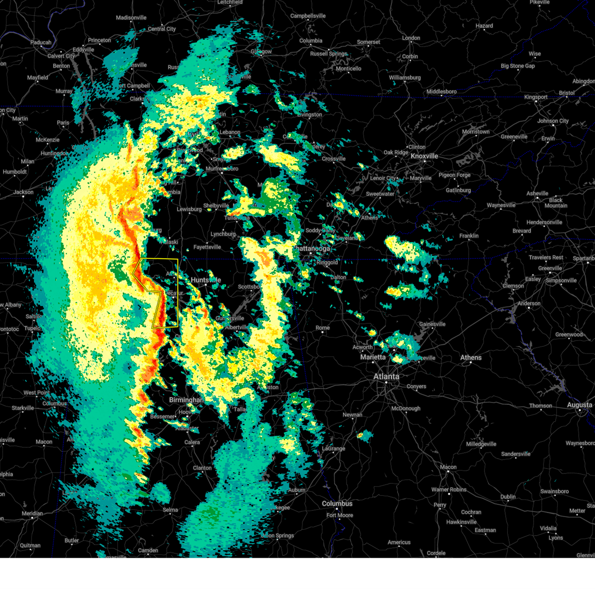 At 1102 pm cst, severe thunderstorms were located along a line extending from near rogersville to 7 miles west of tanner to near decatur, moving northeast at 60 mph. this has a history of causing power outages and wind damage across lawrence county (public). Hazards include 60 mph wind gusts. Expect damage to roofs, siding, and trees. Locations impacted include, decatur, athens, hartselle, trinity, rogersville, lexington, courtland, tanner, north courtland, and elkmont. At 1102 pm cst, severe thunderstorms were located along a line extending from near rogersville to 7 miles west of tanner to near decatur, moving northeast at 60 mph. this has a history of causing power outages and wind damage across lawrence county (public). Hazards include 60 mph wind gusts. Expect damage to roofs, siding, and trees. Locations impacted include, decatur, athens, hartselle, trinity, rogersville, lexington, courtland, tanner, north courtland, and elkmont.
|
| 12/28/2024 11:00 PM CST | Trees down on craze r in morgan county AL, 6.8 miles E of Hartselle, AL |
| 12/28/2024 10:58 PM CST | Trees down on hwy 55 w in danvill in morgan county AL, 6.9 miles NE of Hartselle, AL |
| 12/28/2024 10:54 PM CST |
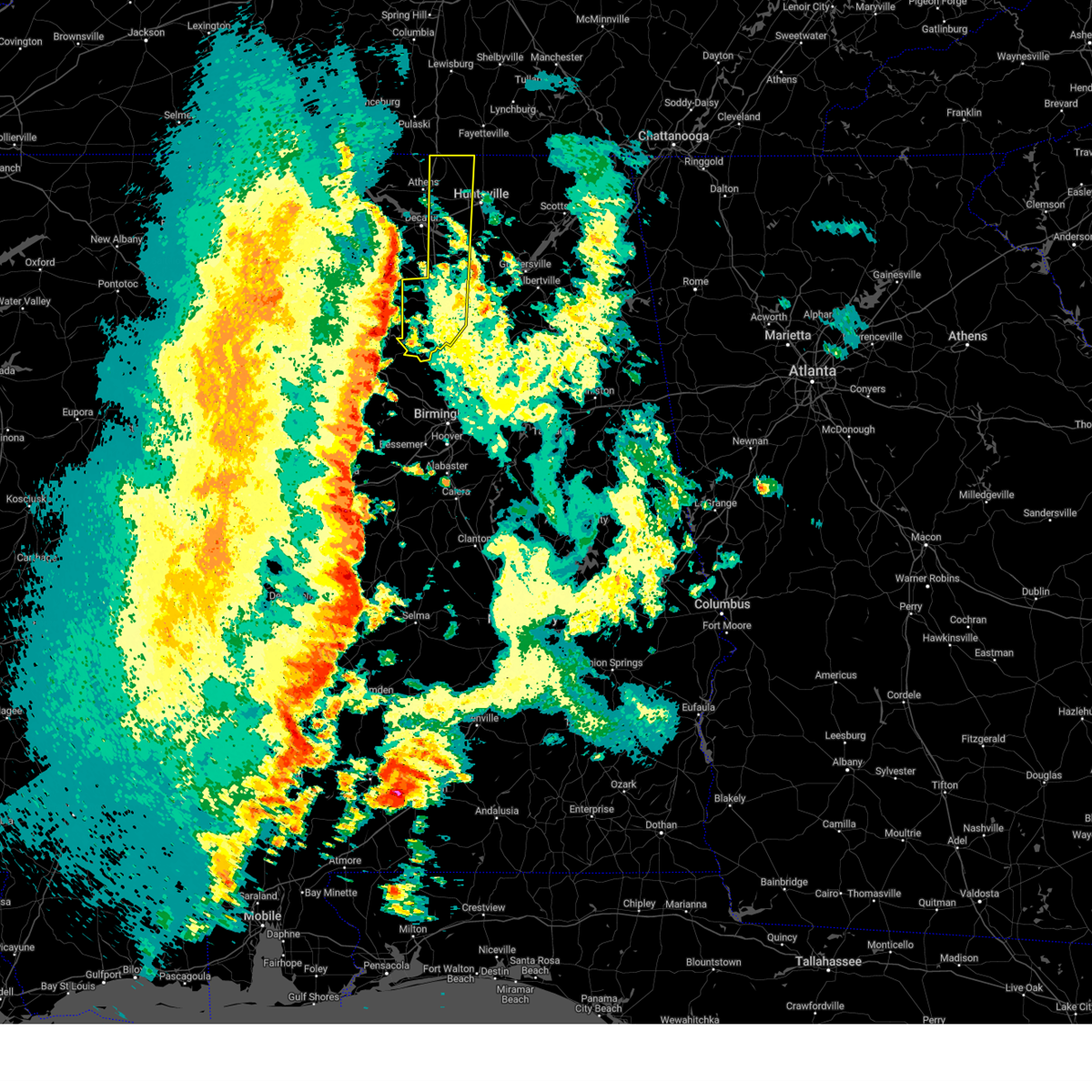 Svrhun the national weather service in huntsville alabama has issued a * severe thunderstorm warning for, western madison county in north central alabama, eastern limestone county in north central alabama, cullman county in north central alabama, southeastern morgan county in north central alabama, * until midnight cst. * at 1054 pm cst, a severe thunderstorm was located over nesmith, or 7 miles northeast of arley, moving east at 50 mph. this line of storms has a history of producing wind damage across northwest alabama (radar indicated). Hazards include 60 mph wind gusts. expect damage to roofs, siding, and trees Svrhun the national weather service in huntsville alabama has issued a * severe thunderstorm warning for, western madison county in north central alabama, eastern limestone county in north central alabama, cullman county in north central alabama, southeastern morgan county in north central alabama, * until midnight cst. * at 1054 pm cst, a severe thunderstorm was located over nesmith, or 7 miles northeast of arley, moving east at 50 mph. this line of storms has a history of producing wind damage across northwest alabama (radar indicated). Hazards include 60 mph wind gusts. expect damage to roofs, siding, and trees
|
| 12/28/2024 10:45 PM CST |
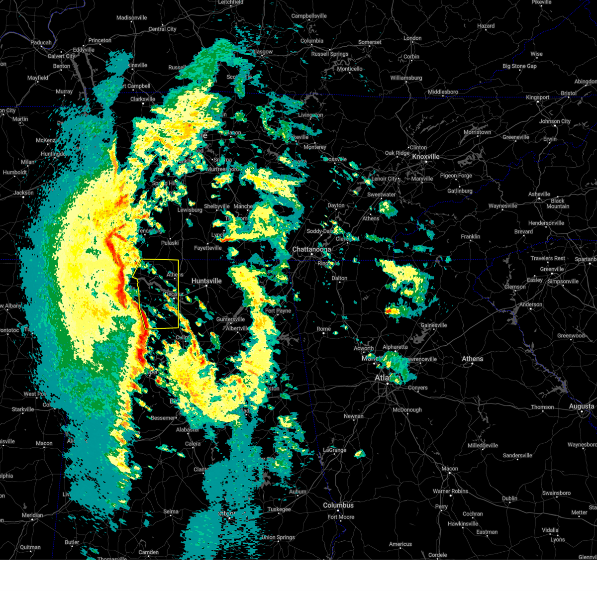 At 1044 pm cst, severe thunderstorms were located along a line extending from near town creek to near moulton to near brushy lake, moving northeast at 60 mph. these storms have a history of producing wind damage across franklin county alabama (public). Hazards include 60 mph wind gusts. Expect damage to roofs, siding, and trees. Locations impacted include, decatur, athens, hartselle, moulton, trinity, rogersville, town creek, lexington, courtland, and tanner. At 1044 pm cst, severe thunderstorms were located along a line extending from near town creek to near moulton to near brushy lake, moving northeast at 60 mph. these storms have a history of producing wind damage across franklin county alabama (public). Hazards include 60 mph wind gusts. Expect damage to roofs, siding, and trees. Locations impacted include, decatur, athens, hartselle, moulton, trinity, rogersville, town creek, lexington, courtland, and tanner.
|
| 12/28/2024 10:32 PM CST |
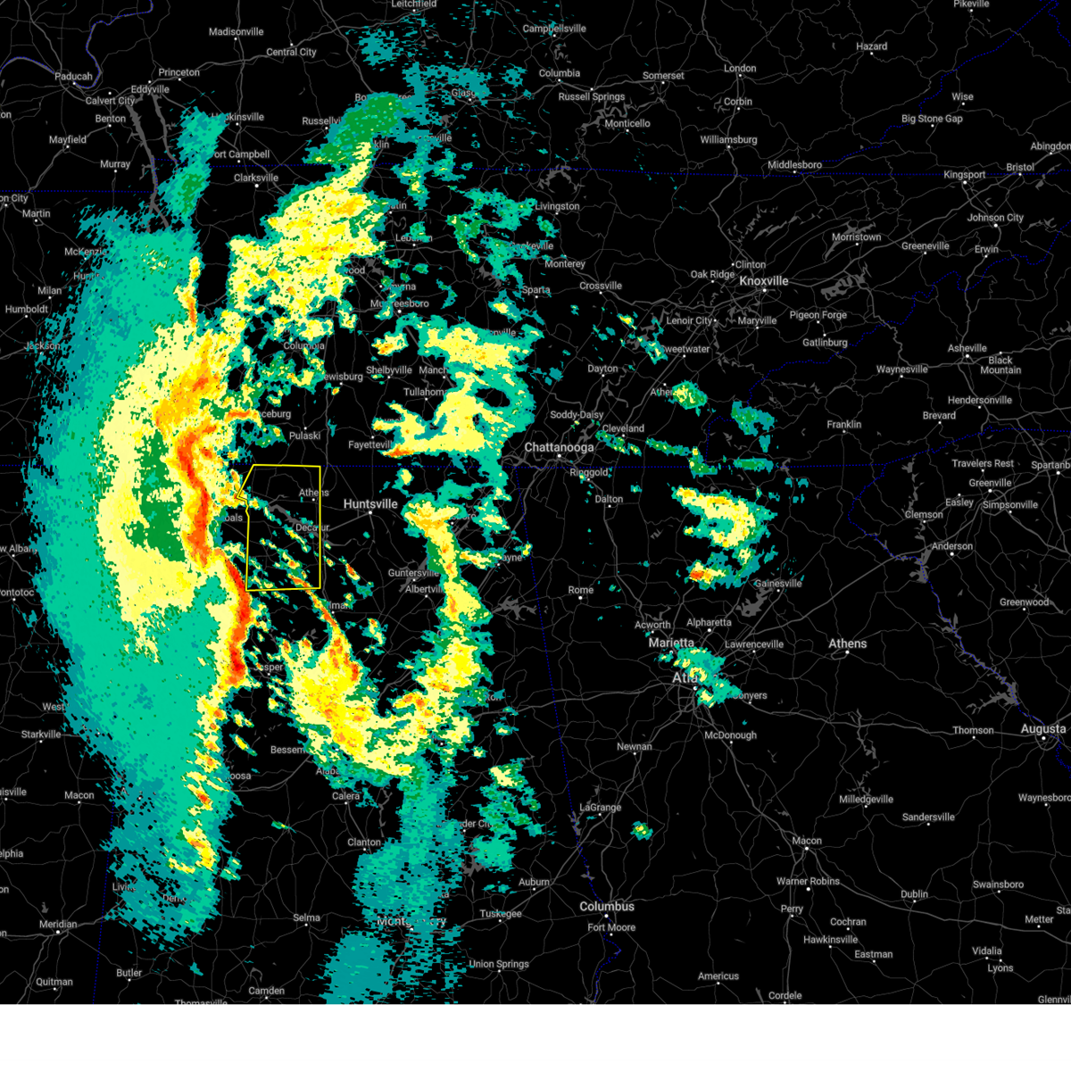 Svrhun the national weather service in huntsville alabama has issued a * severe thunderstorm warning for, central limestone county in north central alabama, eastern lauderdale county in northwestern alabama, western morgan county in north central alabama, lawrence county in northwestern alabama, * until 1130 pm cst. * at 1031 pm cst, a line of severe thunderstorms were located from near littleville to near winston free state barn, moving northeast at 70 mph. this line has a history of producing wind damage across marion county alabama (public). Hazards include 60 mph wind gusts. expect damage to roofs, siding, and trees Svrhun the national weather service in huntsville alabama has issued a * severe thunderstorm warning for, central limestone county in north central alabama, eastern lauderdale county in northwestern alabama, western morgan county in north central alabama, lawrence county in northwestern alabama, * until 1130 pm cst. * at 1031 pm cst, a line of severe thunderstorms were located from near littleville to near winston free state barn, moving northeast at 70 mph. this line has a history of producing wind damage across marion county alabama (public). Hazards include 60 mph wind gusts. expect damage to roofs, siding, and trees
|
| 8/31/2024 2:35 PM CDT |
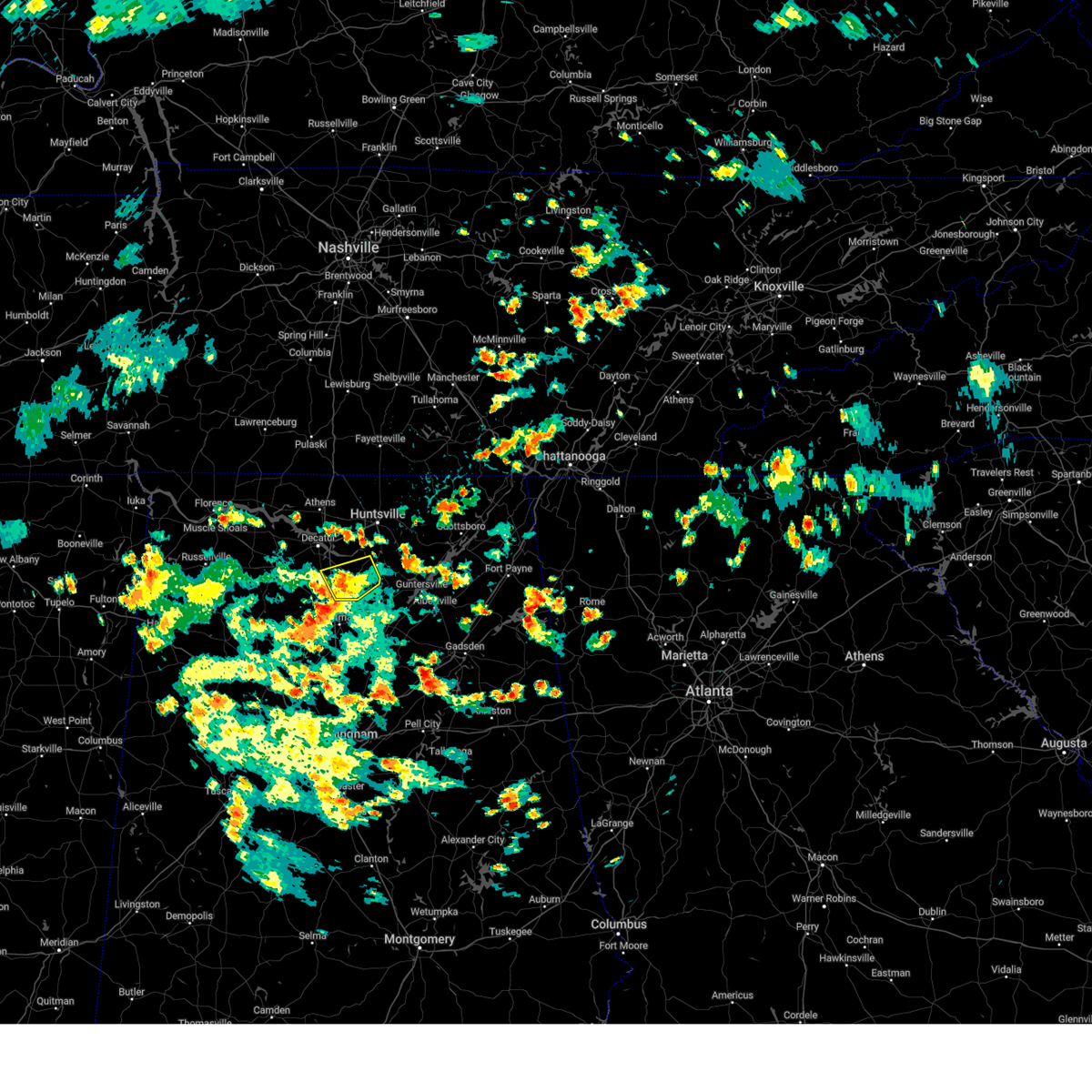 The severe thunderstorm which prompted the warning has weakened. moved out of the warned area. therefore, the warning will be allowed to expire. however, gusty winds and heavy rain are still possible with this thunderstorm. The severe thunderstorm which prompted the warning has weakened. moved out of the warned area. therefore, the warning will be allowed to expire. however, gusty winds and heavy rain are still possible with this thunderstorm.
|
| 8/31/2024 2:24 PM CDT |
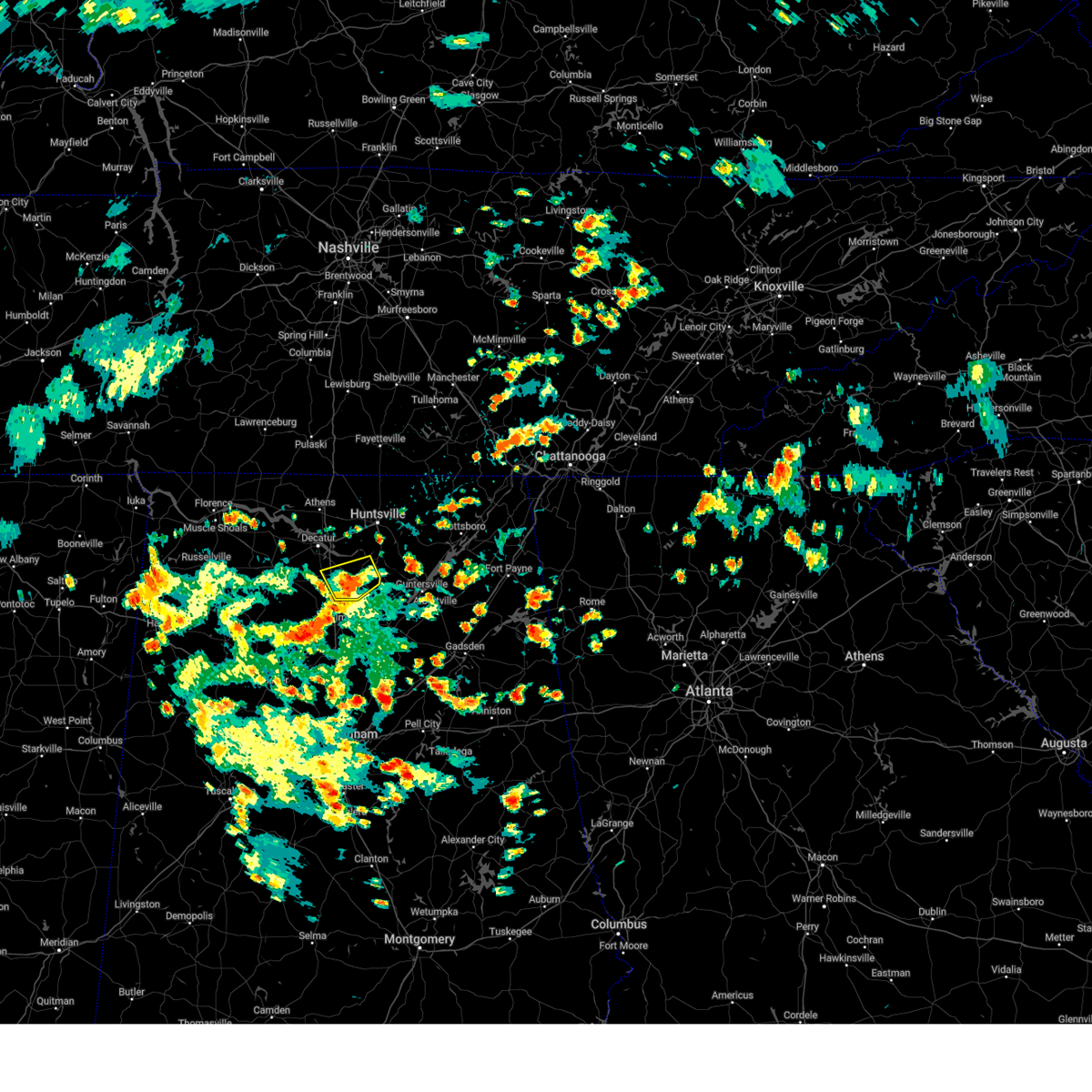 At 223 pm cdt, a severe thunderstorm was located 10 miles east of falkville, or 12 miles east of hartselle, moving southwest at 10 mph (radar indicated). Hazards include 60 mph wind gusts. Expect damage to roofs, siding, and trees. Locations impacted include, hartselle, falkville, somerville, eva, valhermoso springs, florette, and cole springs. At 223 pm cdt, a severe thunderstorm was located 10 miles east of falkville, or 12 miles east of hartselle, moving southwest at 10 mph (radar indicated). Hazards include 60 mph wind gusts. Expect damage to roofs, siding, and trees. Locations impacted include, hartselle, falkville, somerville, eva, valhermoso springs, florette, and cole springs.
|
| 8/31/2024 2:14 PM CDT |
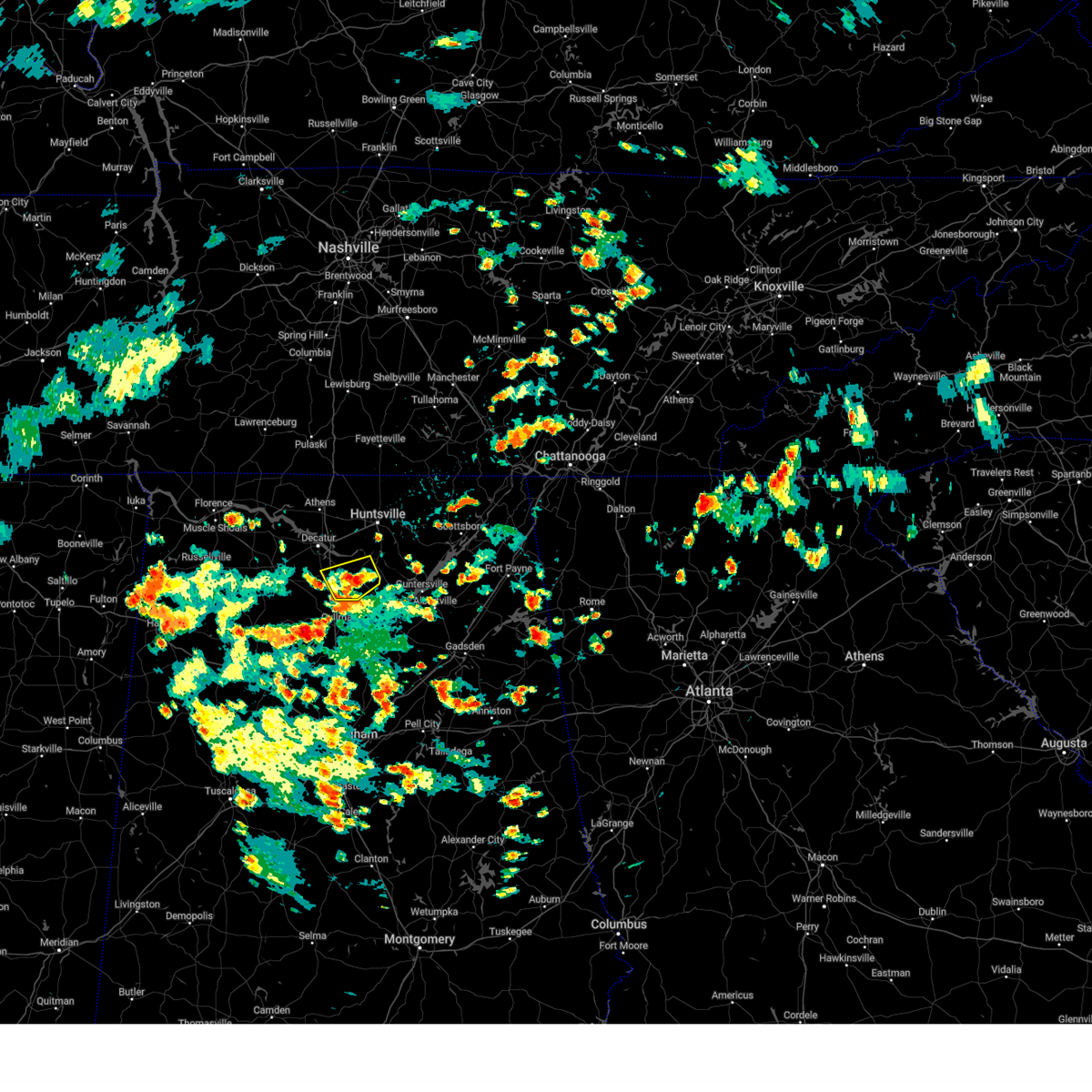 Svrhun the national weather service in huntsville alabama has issued a * severe thunderstorm warning for, southeastern morgan county in north central alabama, * until 245 pm cdt. * at 214 pm cdt, a severe thunderstorm was located 8 miles southwest of morgan city, or 13 miles east of hartselle, moving southwest at 10 mph (radar indicated). Hazards include 60 mph wind gusts. expect damage to roofs, siding, and trees Svrhun the national weather service in huntsville alabama has issued a * severe thunderstorm warning for, southeastern morgan county in north central alabama, * until 245 pm cdt. * at 214 pm cdt, a severe thunderstorm was located 8 miles southwest of morgan city, or 13 miles east of hartselle, moving southwest at 10 mph (radar indicated). Hazards include 60 mph wind gusts. expect damage to roofs, siding, and trees
|
| 8/17/2024 2:59 PM CDT |
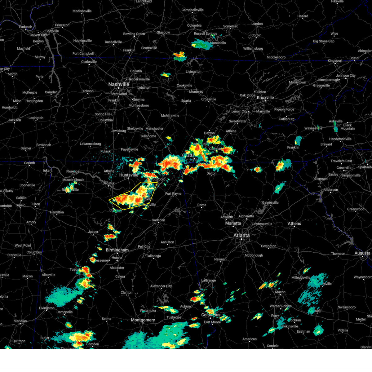 At 258 pm cdt, severe thunderstorms were located along a line extending from near woodville to near guntersville to 6 miles east of falkville, moving east at 25 mph (radar indicated). Hazards include 60 mph wind gusts and quarter size hail. Hail damage to vehicles is expected. expect wind damage to roofs, siding, and trees. Locations impacted include, scottsboro, guntersville, arab, owens cross roads, falkville, grant, woodville, morgan city, baileyton, and eva. At 258 pm cdt, severe thunderstorms were located along a line extending from near woodville to near guntersville to 6 miles east of falkville, moving east at 25 mph (radar indicated). Hazards include 60 mph wind gusts and quarter size hail. Hail damage to vehicles is expected. expect wind damage to roofs, siding, and trees. Locations impacted include, scottsboro, guntersville, arab, owens cross roads, falkville, grant, woodville, morgan city, baileyton, and eva.
|
| 8/17/2024 2:38 PM CDT |
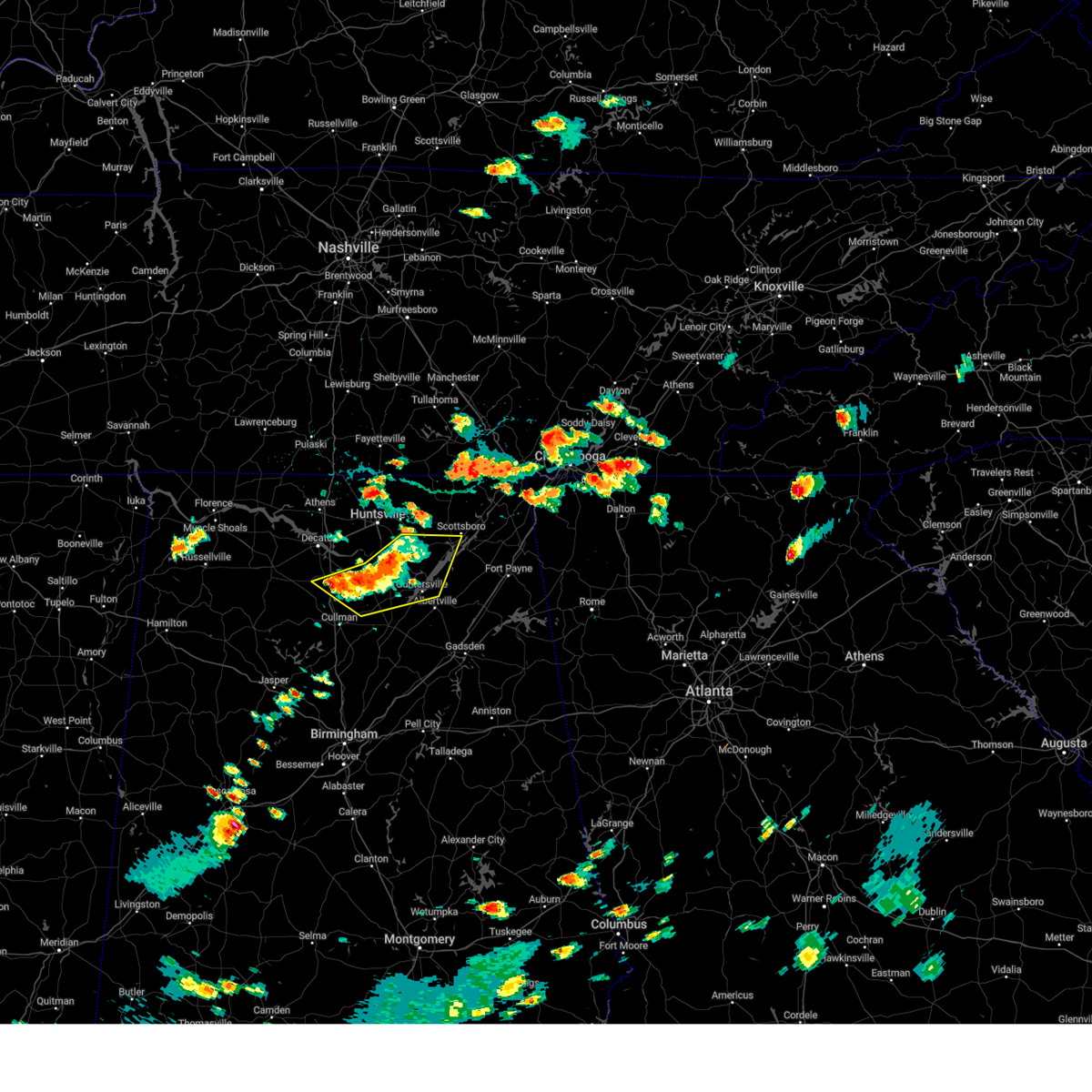 Svrhun the national weather service in huntsville alabama has issued a * severe thunderstorm warning for, marshall county in northeastern alabama, southwestern jackson county in northeastern alabama, southeastern madison county in north central alabama, northeastern cullman county in north central alabama, southern morgan county in north central alabama, * until 330 pm cdt. * at 238 pm cdt, severe thunderstorms were located along a line extending from near owens cross roads to morgan city to falkville, moving east at 20 mph (radar indicated). Hazards include 60 mph wind gusts and quarter size hail. Hail damage to vehicles is expected. Expect wind damage to roofs, siding, and trees. Svrhun the national weather service in huntsville alabama has issued a * severe thunderstorm warning for, marshall county in northeastern alabama, southwestern jackson county in northeastern alabama, southeastern madison county in north central alabama, northeastern cullman county in north central alabama, southern morgan county in north central alabama, * until 330 pm cdt. * at 238 pm cdt, severe thunderstorms were located along a line extending from near owens cross roads to morgan city to falkville, moving east at 20 mph (radar indicated). Hazards include 60 mph wind gusts and quarter size hail. Hail damage to vehicles is expected. Expect wind damage to roofs, siding, and trees.
|
| 8/17/2024 2:26 PM CDT |
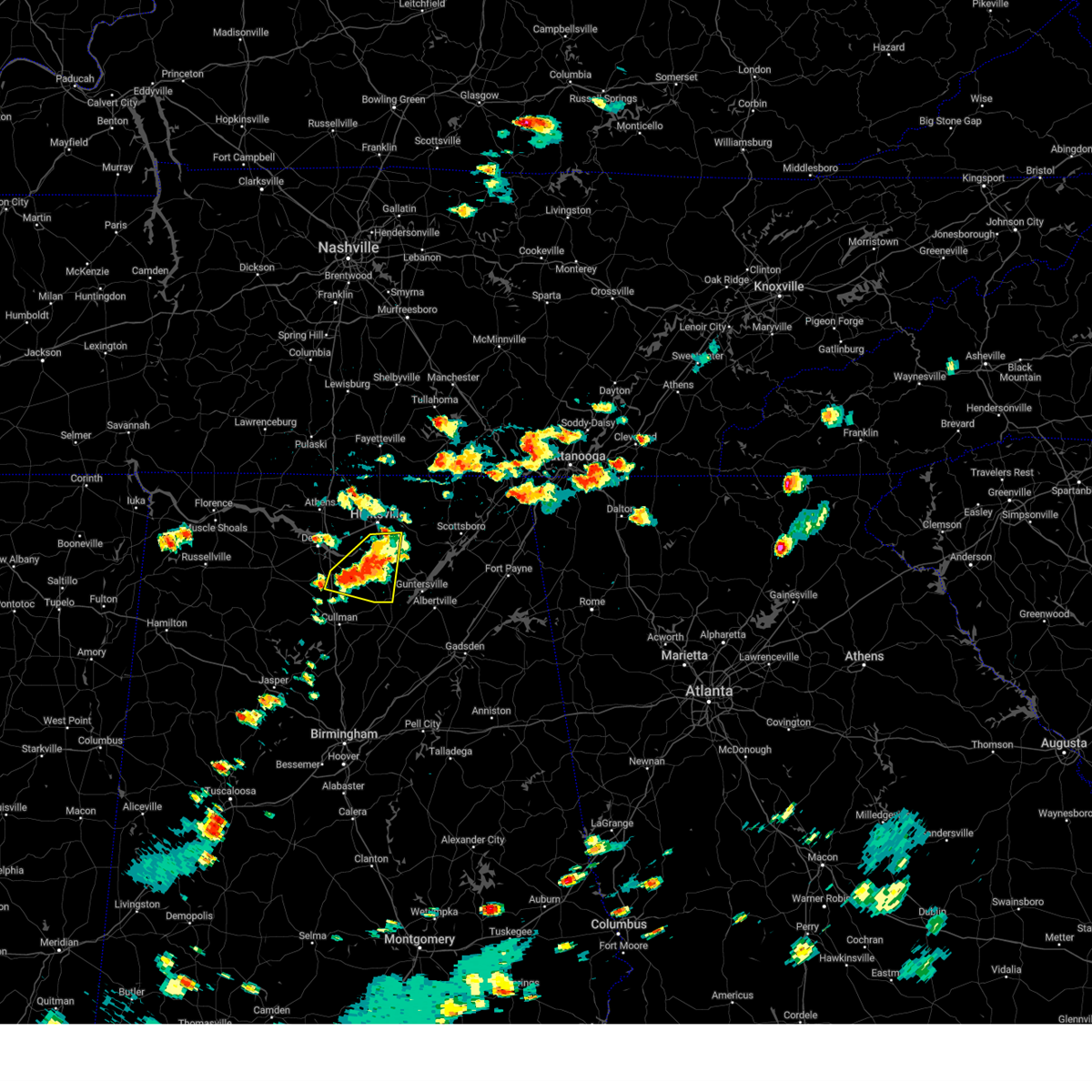 At 226 pm cdt, a severe thunderstorm was located near morgan city, or 9 miles south of redstone arsenal, moving east at 20 mph (radar indicated). Hazards include 60 mph wind gusts and quarter size hail. Hail damage to vehicles is expected. expect wind damage to roofs, siding, and trees. Locations impacted include, southern huntsville, hartselle, arab, redstone arsenal, owens cross roads, falkville, triana, morgan city, somerville, and eva. At 226 pm cdt, a severe thunderstorm was located near morgan city, or 9 miles south of redstone arsenal, moving east at 20 mph (radar indicated). Hazards include 60 mph wind gusts and quarter size hail. Hail damage to vehicles is expected. expect wind damage to roofs, siding, and trees. Locations impacted include, southern huntsville, hartselle, arab, redstone arsenal, owens cross roads, falkville, triana, morgan city, somerville, and eva.
|
| 8/17/2024 2:18 PM CDT |
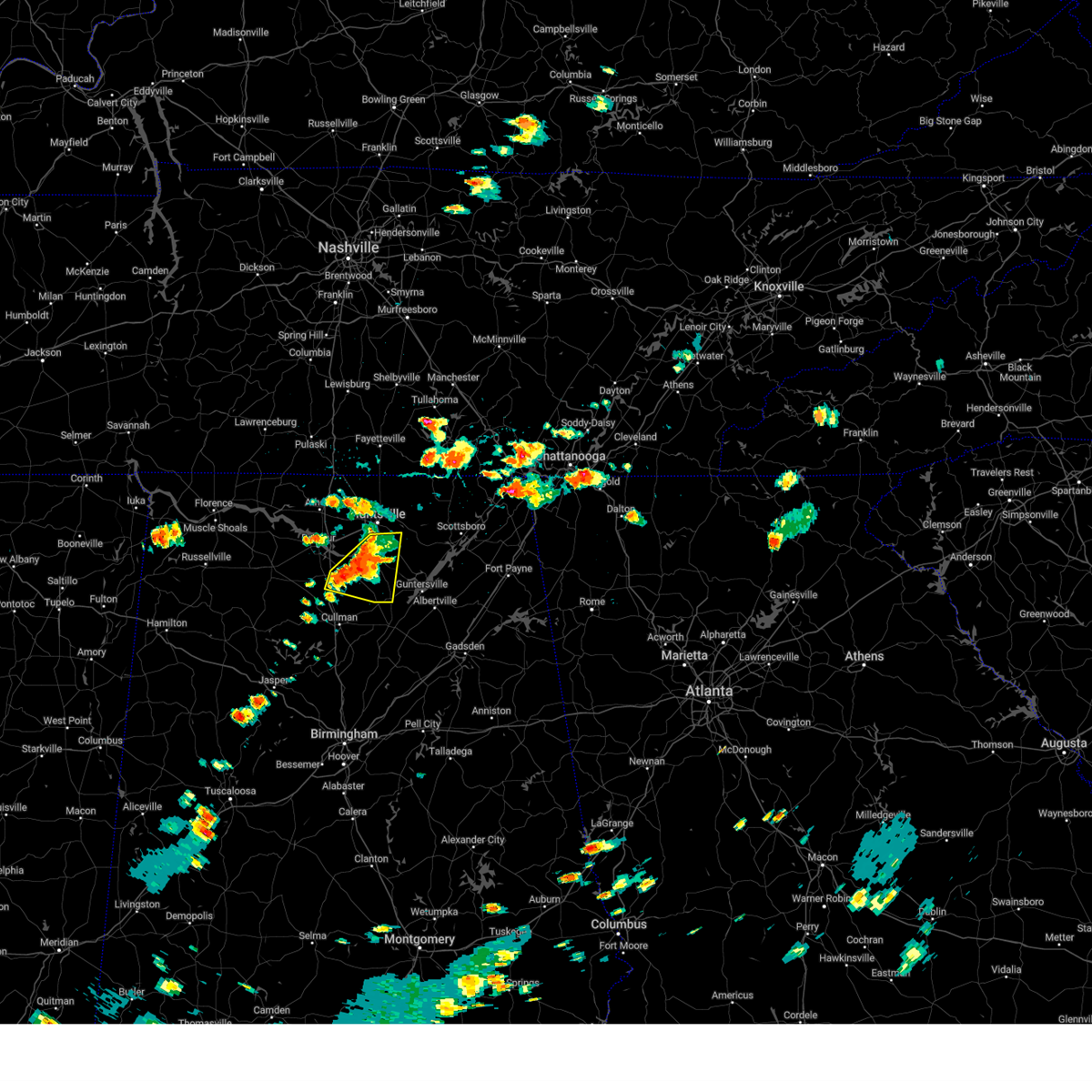 the severe thunderstorm warning has been cancelled and is no longer in effect the severe thunderstorm warning has been cancelled and is no longer in effect
|
| 8/17/2024 2:18 PM CDT |
 At 218 pm cdt, a severe thunderstorm was located 7 miles south of triana, or 10 miles south of redstone arsenal, moving east at 20 mph (radar indicated). Hazards include 60 mph wind gusts and quarter size hail. Hail damage to vehicles is expected. expect wind damage to roofs, siding, and trees. Locations impacted include, southern huntsville, hartselle, arab, redstone arsenal, owens cross roads, falkville, triana, morgan city, somerville, and eva. At 218 pm cdt, a severe thunderstorm was located 7 miles south of triana, or 10 miles south of redstone arsenal, moving east at 20 mph (radar indicated). Hazards include 60 mph wind gusts and quarter size hail. Hail damage to vehicles is expected. expect wind damage to roofs, siding, and trees. Locations impacted include, southern huntsville, hartselle, arab, redstone arsenal, owens cross roads, falkville, triana, morgan city, somerville, and eva.
|
| 8/17/2024 1:59 PM CDT |
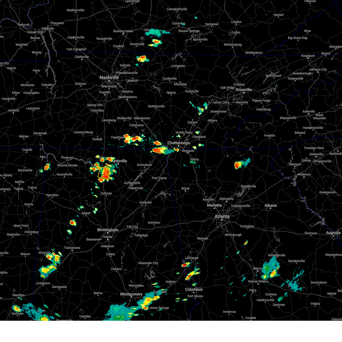 At 158 pm cdt, a severe thunderstorm was located near priceville, or 10 miles northeast of hartselle, moving east at 25 mph (radar indicated). Hazards include 60 mph wind gusts and penny size hail. Expect damage to roofs, siding, and trees. Locations impacted include, decatur, priceville, somerville, mooresville, and belle mina. At 158 pm cdt, a severe thunderstorm was located near priceville, or 10 miles northeast of hartselle, moving east at 25 mph (radar indicated). Hazards include 60 mph wind gusts and penny size hail. Expect damage to roofs, siding, and trees. Locations impacted include, decatur, priceville, somerville, mooresville, and belle mina.
|
| 8/17/2024 1:54 PM CDT |
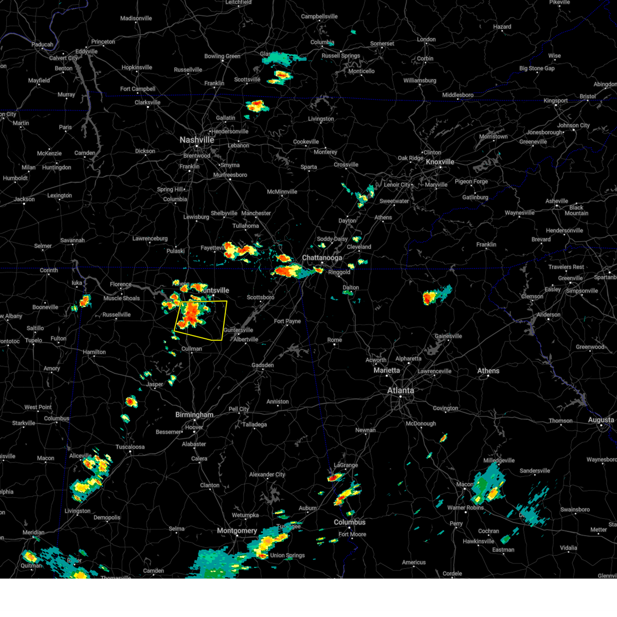 Svrhun the national weather service in huntsville alabama has issued a * severe thunderstorm warning for, west central marshall county in northeastern alabama, southwestern madison county in north central alabama, southeastern limestone county in north central alabama, morgan county in north central alabama, * until 245 pm cdt. * at 154 pm cdt, a severe thunderstorm was located over priceville, or near hartselle, moving east at 20 mph (radar indicated). Hazards include 60 mph wind gusts and penny size hail. expect damage to roofs, siding, and trees Svrhun the national weather service in huntsville alabama has issued a * severe thunderstorm warning for, west central marshall county in northeastern alabama, southwestern madison county in north central alabama, southeastern limestone county in north central alabama, morgan county in north central alabama, * until 245 pm cdt. * at 154 pm cdt, a severe thunderstorm was located over priceville, or near hartselle, moving east at 20 mph (radar indicated). Hazards include 60 mph wind gusts and penny size hail. expect damage to roofs, siding, and trees
|
| 8/17/2024 1:44 PM CDT |
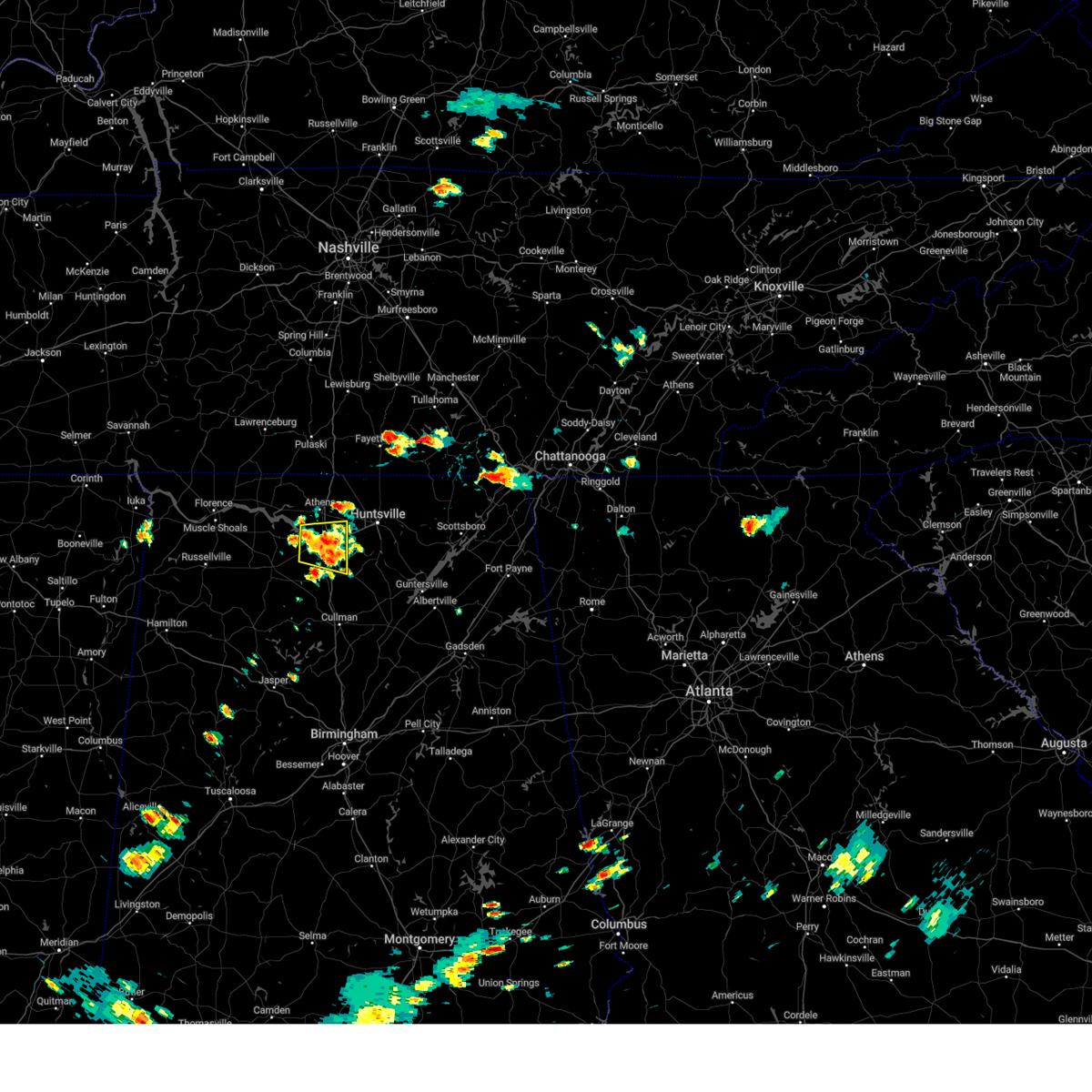 the severe thunderstorm warning has been cancelled and is no longer in effect the severe thunderstorm warning has been cancelled and is no longer in effect
|
| 8/17/2024 1:44 PM CDT |
 At 143 pm cdt, a severe thunderstorm was located near decatur, moving east at 20 mph (radar indicated). Hazards include 60 mph wind gusts and penny size hail. Expect damage to roofs, siding, and trees. Locations impacted include, decatur, madison, priceville, trinity, tanner, somerville, mooresville, belle mina, and basham. At 143 pm cdt, a severe thunderstorm was located near decatur, moving east at 20 mph (radar indicated). Hazards include 60 mph wind gusts and penny size hail. Expect damage to roofs, siding, and trees. Locations impacted include, decatur, madison, priceville, trinity, tanner, somerville, mooresville, belle mina, and basham.
|
| 8/17/2024 1:29 PM CDT |
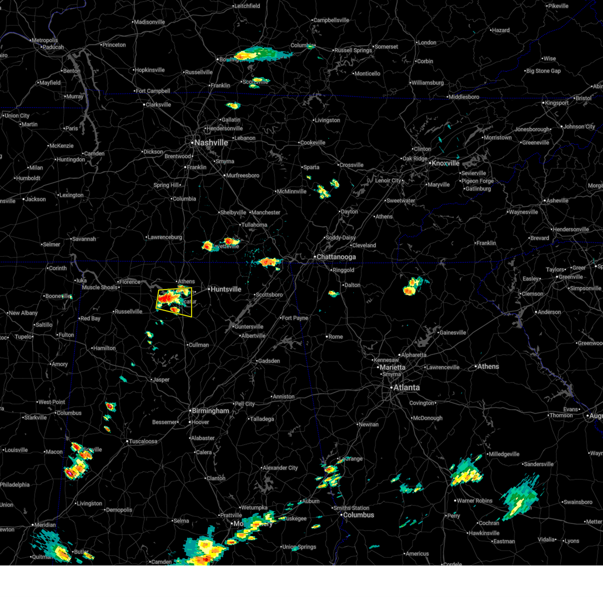 Svrhun the national weather service in huntsville alabama has issued a * severe thunderstorm warning for, southeastern limestone county in north central alabama, northwestern morgan county in north central alabama, northeastern lawrence county in northwestern alabama, * until 215 pm cdt. * at 129 pm cdt, a severe thunderstorm was located over trinity, or near decatur, moving east at 20 mph (radar indicated). Hazards include 60 mph wind gusts and penny size hail. expect damage to roofs, siding, and trees Svrhun the national weather service in huntsville alabama has issued a * severe thunderstorm warning for, southeastern limestone county in north central alabama, northwestern morgan county in north central alabama, northeastern lawrence county in northwestern alabama, * until 215 pm cdt. * at 129 pm cdt, a severe thunderstorm was located over trinity, or near decatur, moving east at 20 mph (radar indicated). Hazards include 60 mph wind gusts and penny size hail. expect damage to roofs, siding, and trees
|
| 7/23/2024 11:40 AM CDT |
 The storm which prompted the warning has weakened below severe limits, and no longer poses an immediate threat to life or property. therefore, the warning will be allowed to expire. however, gusty winds and heavy rain are still possible with this thunderstorm. The storm which prompted the warning has weakened below severe limits, and no longer poses an immediate threat to life or property. therefore, the warning will be allowed to expire. however, gusty winds and heavy rain are still possible with this thunderstorm.
|
| 7/23/2024 11:32 AM CDT |
 the severe thunderstorm warning has been cancelled and is no longer in effect the severe thunderstorm warning has been cancelled and is no longer in effect
|
| 7/23/2024 11:32 AM CDT |
 At 1130 am cdt, a severe thunderstorm was located 6 miles west of hartselle, moving east at 25 mph (radar indicated). Hazards include 60 mph wind gusts. Expect damage to roofs, siding, and trees. Locations impacted include, decatur, hartselle, priceville, somerville, neel, and basham. At 1130 am cdt, a severe thunderstorm was located 6 miles west of hartselle, moving east at 25 mph (radar indicated). Hazards include 60 mph wind gusts. Expect damage to roofs, siding, and trees. Locations impacted include, decatur, hartselle, priceville, somerville, neel, and basham.
|
| 7/23/2024 11:15 AM CDT |
 Svrhun the national weather service in huntsville alabama has issued a * severe thunderstorm warning for, southeastern limestone county in north central alabama, west central morgan county in north central alabama, southeastern lawrence county in northwestern alabama, * until 1145 am cdt. * at 1114 am cdt, a cluster of severe thunderstorms were located 7 miles east of moulton and just south of decatur, moving east at 25 mph (radar indicated). Hazards include 60 mph wind gusts. expect damage to roofs, siding, and trees Svrhun the national weather service in huntsville alabama has issued a * severe thunderstorm warning for, southeastern limestone county in north central alabama, west central morgan county in north central alabama, southeastern lawrence county in northwestern alabama, * until 1145 am cdt. * at 1114 am cdt, a cluster of severe thunderstorms were located 7 miles east of moulton and just south of decatur, moving east at 25 mph (radar indicated). Hazards include 60 mph wind gusts. expect damage to roofs, siding, and trees
|
| 7/23/2024 10:52 AM CDT |
 At 1052 am cdt, a severe thunderstorm was located near trinity, or 7 miles southwest of decatur, moving east at 20 mph (radar indicated). Hazards include 60 mph wind gusts. Expect damage to roofs, siding, and trees. Locations impacted include, decatur, hartselle, neel, and basham. At 1052 am cdt, a severe thunderstorm was located near trinity, or 7 miles southwest of decatur, moving east at 20 mph (radar indicated). Hazards include 60 mph wind gusts. Expect damage to roofs, siding, and trees. Locations impacted include, decatur, hartselle, neel, and basham.
|
| 7/23/2024 10:42 AM CDT |
 At 1042 am cdt, a severe thunderstorm was located near moulton, moving east at 20 mph (radar indicated). Hazards include 60 mph wind gusts. Expect damage to roofs, siding, and trees. Locations impacted include, decatur, hartselle, moulton, trinity, neel, caddo, and basham. At 1042 am cdt, a severe thunderstorm was located near moulton, moving east at 20 mph (radar indicated). Hazards include 60 mph wind gusts. Expect damage to roofs, siding, and trees. Locations impacted include, decatur, hartselle, moulton, trinity, neel, caddo, and basham.
|
| 7/23/2024 10:36 AM CDT |
 Svrhun the national weather service in huntsville alabama has issued a * severe thunderstorm warning for, northwestern morgan county in north central alabama, southeastern lawrence county in northwestern alabama, * until 1100 am cdt. * at 1036 am cdt, a severe thunderstorm was located near moulton, moving east at 20 mph (radar indicated). Hazards include 60 mph wind gusts. expect damage to roofs, siding, and trees Svrhun the national weather service in huntsville alabama has issued a * severe thunderstorm warning for, northwestern morgan county in north central alabama, southeastern lawrence county in northwestern alabama, * until 1100 am cdt. * at 1036 am cdt, a severe thunderstorm was located near moulton, moving east at 20 mph (radar indicated). Hazards include 60 mph wind gusts. expect damage to roofs, siding, and trees
|
| 7/21/2024 7:16 PM CDT |
 The storm which prompted the warning has moved out of the area. therefore, the warning has been allowed to expire. remember, a severe thunderstorm warning still remains in effect for portions or limestone, madison, morgan, and marshall counties until 8 pm. The storm which prompted the warning has moved out of the area. therefore, the warning has been allowed to expire. remember, a severe thunderstorm warning still remains in effect for portions or limestone, madison, morgan, and marshall counties until 8 pm.
|
| 7/21/2024 7:14 PM CDT |
 Svrhun the national weather service in huntsville alabama has issued a * severe thunderstorm warning for, northwestern marshall county in northeastern alabama, southwestern madison county in north central alabama, southeastern limestone county in north central alabama, morgan county in north central alabama, * until 800 pm cdt. * at 713 pm cdt, a severe thunderstorm was located over marshall space flight center, or over redstone arsenal, moving east at 20 mph (radar indicated). Hazards include 60 mph wind gusts and nickel size hail. expect damage to roofs, siding, and trees Svrhun the national weather service in huntsville alabama has issued a * severe thunderstorm warning for, northwestern marshall county in northeastern alabama, southwestern madison county in north central alabama, southeastern limestone county in north central alabama, morgan county in north central alabama, * until 800 pm cdt. * at 713 pm cdt, a severe thunderstorm was located over marshall space flight center, or over redstone arsenal, moving east at 20 mph (radar indicated). Hazards include 60 mph wind gusts and nickel size hail. expect damage to roofs, siding, and trees
|
| 7/21/2024 7:04 PM CDT |
 At 703 pm cdt, a severe thunderstorm was located over northern huntsville, moving northeast at 30 mph (radar indicated). Hazards include 60 mph wind gusts and quarter size hail. Hail damage to vehicles is expected. expect wind damage to roofs, siding, and trees. Locations impacted include, huntsville, decatur, madison, athens, hartselle, redstone arsenal, moores mill, priceville, trinity, and owens cross roads. At 703 pm cdt, a severe thunderstorm was located over northern huntsville, moving northeast at 30 mph (radar indicated). Hazards include 60 mph wind gusts and quarter size hail. Hail damage to vehicles is expected. expect wind damage to roofs, siding, and trees. Locations impacted include, huntsville, decatur, madison, athens, hartselle, redstone arsenal, moores mill, priceville, trinity, and owens cross roads.
|
| 7/21/2024 7:04 PM CDT |
 the severe thunderstorm warning has been cancelled and is no longer in effect the severe thunderstorm warning has been cancelled and is no longer in effect
|
| 7/21/2024 6:27 PM CDT |
 Svrhun the national weather service in huntsville alabama has issued a * severe thunderstorm warning for, northern marshall county in northeastern alabama, west central jackson county in northeastern alabama, madison county in north central alabama, southern limestone county in north central alabama, morgan county in north central alabama, eastern lawrence county in northwestern alabama, * until 715 pm cdt. * at 627 pm cdt, a severe thunderstorm was located near tanner, or 7 miles northeast of decatur, moving northeast at 30 mph (radar indicated). Hazards include 60 mph wind gusts and quarter size hail. Hail damage to vehicles is expected. Expect wind damage to roofs, siding, and trees. Svrhun the national weather service in huntsville alabama has issued a * severe thunderstorm warning for, northern marshall county in northeastern alabama, west central jackson county in northeastern alabama, madison county in north central alabama, southern limestone county in north central alabama, morgan county in north central alabama, eastern lawrence county in northwestern alabama, * until 715 pm cdt. * at 627 pm cdt, a severe thunderstorm was located near tanner, or 7 miles northeast of decatur, moving northeast at 30 mph (radar indicated). Hazards include 60 mph wind gusts and quarter size hail. Hail damage to vehicles is expected. Expect wind damage to roofs, siding, and trees.
|
| 7/17/2024 3:06 PM CDT | Tree reported down along highway 36 and perkins wood roa in morgan county AL, 5.3 miles W of Hartselle, AL |
| 7/17/2024 3:06 PM CDT | Tree reported down along collier drive in hartsell in morgan county AL, 2.3 miles SSE of Hartselle, AL |
| 7/8/2024 7:01 PM CDT |
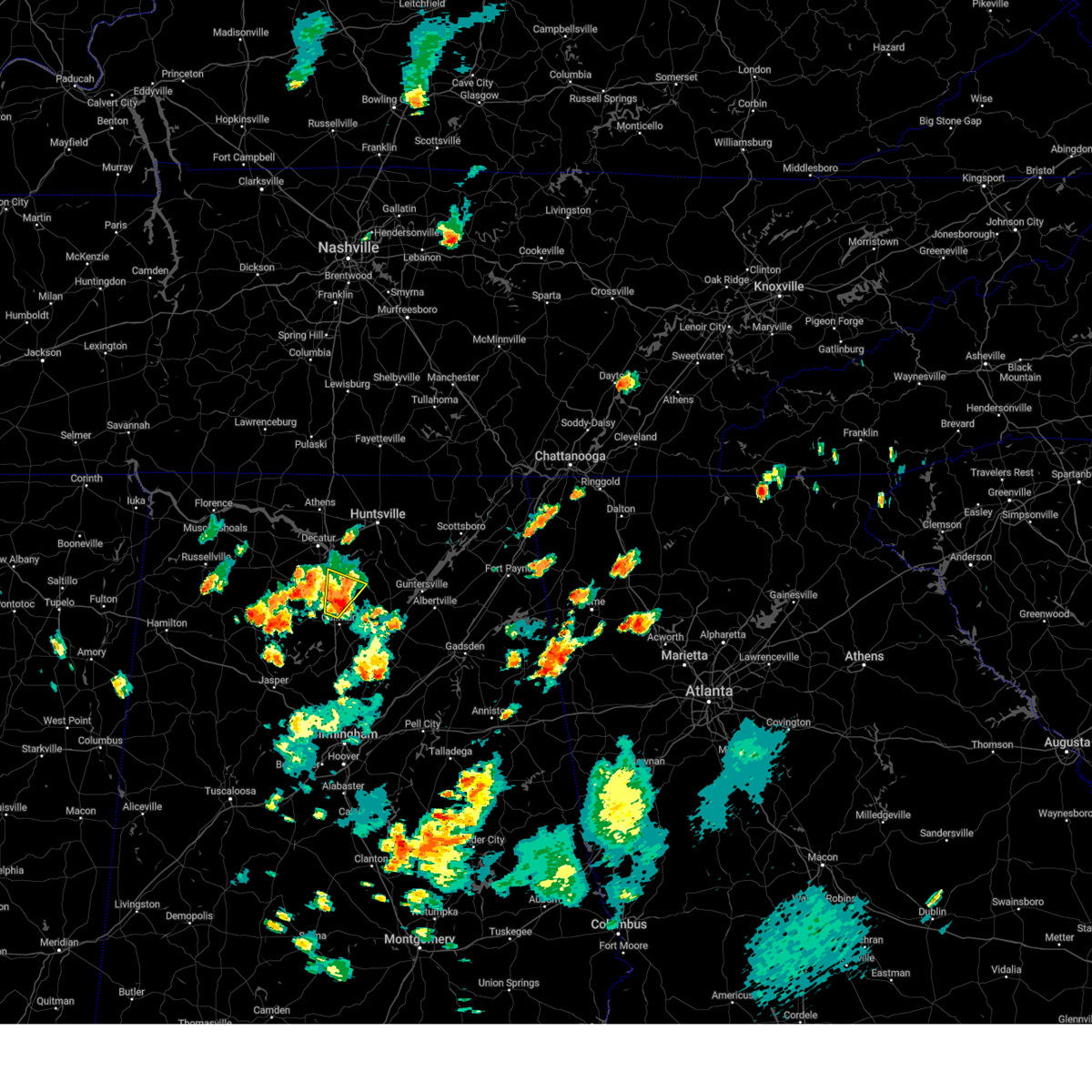 the severe thunderstorm warning has been cancelled and is no longer in effect the severe thunderstorm warning has been cancelled and is no longer in effect
|
| 7/8/2024 6:49 PM CDT |
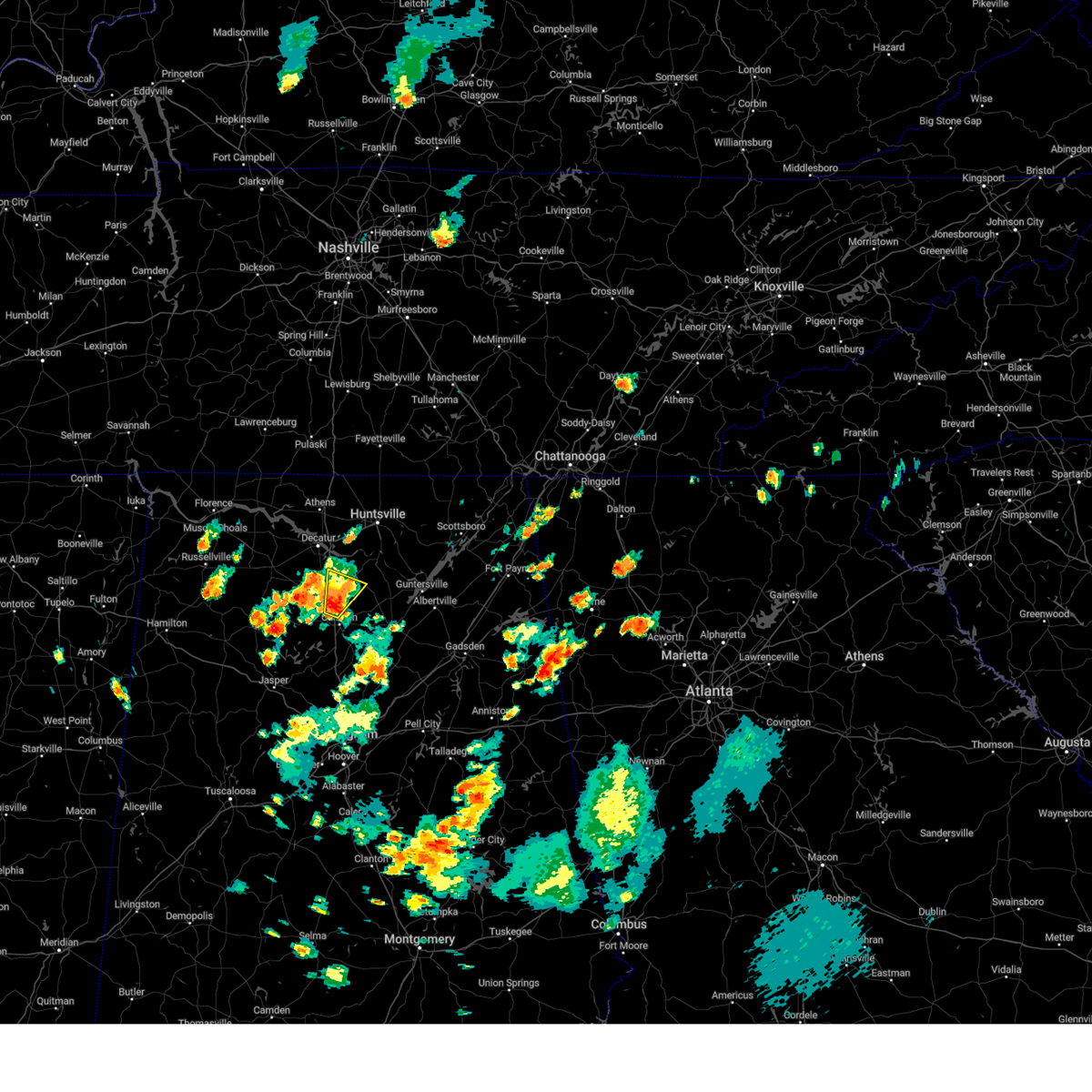 Svrhun the national weather service in huntsville alabama has issued a * severe thunderstorm warning for, north central cullman county in north central alabama, southeastern morgan county in north central alabama, * until 715 pm cdt. * at 649 pm cdt, a severe thunderstorm was located near falkville, or 9 miles southeast of hartselle, moving northeast at 15 mph (radar indicated). Hazards include 60 mph wind gusts and penny size hail. expect damage to roofs, siding, and trees Svrhun the national weather service in huntsville alabama has issued a * severe thunderstorm warning for, north central cullman county in north central alabama, southeastern morgan county in north central alabama, * until 715 pm cdt. * at 649 pm cdt, a severe thunderstorm was located near falkville, or 9 miles southeast of hartselle, moving northeast at 15 mph (radar indicated). Hazards include 60 mph wind gusts and penny size hail. expect damage to roofs, siding, and trees
|
| 6/5/2024 8:44 PM CDT |
 The storm which prompted the warning has weakened below severe limits, and no longer poses an immediate threat to life or property. therefore, the warning will be allowed to expire. however, gusty winds are still possible with this thunderstorm. The storm which prompted the warning has weakened below severe limits, and no longer poses an immediate threat to life or property. therefore, the warning will be allowed to expire. however, gusty winds are still possible with this thunderstorm.
|
| 6/5/2024 8:13 PM CDT | Tree and transformer damage at curry street at highway 31 sw. tree on a car on puckett street sw. a tree and power lines down on sparkman street nw. time estimated by r in morgan county AL, 1 miles SSE of Hartselle, AL |
| 6/5/2024 8:12 PM CDT | A tree limb was blocking the road at tunsel road sw at rustic lane in hartsell in morgan county AL, 1.7 miles ENE of Hartselle, AL |
| 6/5/2024 8:12 PM CDT | A tree down on a patio and possibly a house on cherokee lane nw in hartselle. time esimated by rada in morgan county AL, 1 miles SSE of Hartselle, AL |
| 6/5/2024 8:12 PM CDT | A tree was knocked down in hartselle. location unspecified. time estimated by rada in morgan county AL, 0.2 miles SSW of Hartselle, AL |
| 6/5/2024 8:12 PM CDT | A tree and power lines were knocked down on rocky ford road in hartsell in morgan county AL, 5.3 miles ESE of Hartselle, AL |
| 6/5/2024 7:59 PM CDT |
 The storm which prompted the warning has moved out of the area. therefore, the warning will be allowed to expire. remember, a severe thunderstorm warning still remains in effect for lawrence and morgan county. The storm which prompted the warning has moved out of the area. therefore, the warning will be allowed to expire. remember, a severe thunderstorm warning still remains in effect for lawrence and morgan county.
|
| 6/5/2024 7:55 PM CDT |
 Svrhun the national weather service in huntsville alabama has issued a * severe thunderstorm warning for, west central marshall county in northeastern alabama, cullman county in north central alabama, southern morgan county in north central alabama, * until 845 pm cdt. * at 755 pm cdt, a severe thunderstorm was located over sardis, or 11 miles northeast of arley, moving northeast at 55 mph (radar indicated). Hazards include 60 mph wind gusts. expect damage to roofs, siding, and trees Svrhun the national weather service in huntsville alabama has issued a * severe thunderstorm warning for, west central marshall county in northeastern alabama, cullman county in north central alabama, southern morgan county in north central alabama, * until 845 pm cdt. * at 755 pm cdt, a severe thunderstorm was located over sardis, or 11 miles northeast of arley, moving northeast at 55 mph (radar indicated). Hazards include 60 mph wind gusts. expect damage to roofs, siding, and trees
|
| 6/5/2024 7:22 PM CDT |
 Svrhun the national weather service in huntsville alabama has issued a * severe thunderstorm warning for, southeastern franklin county in northwestern alabama, southwestern morgan county in north central alabama, lawrence county in northwestern alabama, * until 800 pm cdt. * at 722 pm cdt, a severe thunderstorm was located near ashridge, or near haleyville, moving northeast at 55 mph (radar indicated). Hazards include 60 mph wind gusts. expect damage to roofs, siding, and trees Svrhun the national weather service in huntsville alabama has issued a * severe thunderstorm warning for, southeastern franklin county in northwestern alabama, southwestern morgan county in north central alabama, lawrence county in northwestern alabama, * until 800 pm cdt. * at 722 pm cdt, a severe thunderstorm was located near ashridge, or near haleyville, moving northeast at 55 mph (radar indicated). Hazards include 60 mph wind gusts. expect damage to roofs, siding, and trees
|
| 5/27/2024 2:54 AM CDT |
 At 254 am cdt, a severe thunderstorm was located near moulton, moving east at 45 mph. at 254 am emergency management reported multiple trees and powerlines down in north decatur (emergency management). Hazards include 60 mph wind gusts and quarter size hail. Hail damage to vehicles is expected. expect wind damage to roofs, siding, and trees. Locations impacted include, huntsville, decatur, madison, athens, hartselle, moulton, redstone arsenal, meridianville, priceville, and trinity. At 254 am cdt, a severe thunderstorm was located near moulton, moving east at 45 mph. at 254 am emergency management reported multiple trees and powerlines down in north decatur (emergency management). Hazards include 60 mph wind gusts and quarter size hail. Hail damage to vehicles is expected. expect wind damage to roofs, siding, and trees. Locations impacted include, huntsville, decatur, madison, athens, hartselle, moulton, redstone arsenal, meridianville, priceville, and trinity.
|
| 5/27/2024 2:41 AM CDT |
 Svrhun the national weather service in huntsville alabama has issued a * severe thunderstorm warning for, western madison county in north central alabama, southeastern limestone county in north central alabama, northwestern cullman county in north central alabama, eastern franklin county in northwestern alabama, morgan county in north central alabama, lawrence county in northwestern alabama, * until 315 am cdt. * at 240 am cdt, a severe thunderstorm was located 10 miles west of moulton, moving east at 45 mph (radar indicated). Hazards include 60 mph wind gusts and quarter size hail. Hail damage to vehicles is expected. Expect wind damage to roofs, siding, and trees. Svrhun the national weather service in huntsville alabama has issued a * severe thunderstorm warning for, western madison county in north central alabama, southeastern limestone county in north central alabama, northwestern cullman county in north central alabama, eastern franklin county in northwestern alabama, morgan county in north central alabama, lawrence county in northwestern alabama, * until 315 am cdt. * at 240 am cdt, a severe thunderstorm was located 10 miles west of moulton, moving east at 45 mph (radar indicated). Hazards include 60 mph wind gusts and quarter size hail. Hail damage to vehicles is expected. Expect wind damage to roofs, siding, and trees.
|
| 5/27/2024 2:40 AM CDT |
 The storm which prompted the warning has moved out of the area. therefore, the warning will be allowed to expire. a tornado watch remains in effect until 500 am cdt for middle tennessee. a tornado watch also remains in effect until 800 am cdt for north central, northeastern and northwestern alabama. The storm which prompted the warning has moved out of the area. therefore, the warning will be allowed to expire. a tornado watch remains in effect until 500 am cdt for middle tennessee. a tornado watch also remains in effect until 800 am cdt for north central, northeastern and northwestern alabama.
|
| 5/27/2024 2:12 AM CDT |
 The storm which prompted the warning has moved out of the area. therefore, the warning will be allowed to expire. a tornado watch remains in effect until 500 am cdt for middle tennessee. a tornado watch also remains in effect until 800 am cdt for north central, northeastern and northwestern alabama. remember, a severe thunderstorm warning still remains in effect for northeast lawrence and northern morgan counties until 245 am. The storm which prompted the warning has moved out of the area. therefore, the warning will be allowed to expire. a tornado watch remains in effect until 500 am cdt for middle tennessee. a tornado watch also remains in effect until 800 am cdt for north central, northeastern and northwestern alabama. remember, a severe thunderstorm warning still remains in effect for northeast lawrence and northern morgan counties until 245 am.
|
| 5/27/2024 2:08 AM CDT |
 Svrhun the national weather service in huntsville alabama has issued a * severe thunderstorm warning for, western madison county in north central alabama, limestone county in north central alabama, central morgan county in north central alabama, northeastern lawrence county in northwestern alabama, * until 245 am cdt. * at 207 am cdt, a severe thunderstorm was located near courtland, or 10 miles north of moulton, moving east at 55 mph (radar indicated). Hazards include 60 mph wind gusts and quarter size hail. Hail damage to vehicles is expected. Expect wind damage to roofs, siding, and trees. Svrhun the national weather service in huntsville alabama has issued a * severe thunderstorm warning for, western madison county in north central alabama, limestone county in north central alabama, central morgan county in north central alabama, northeastern lawrence county in northwestern alabama, * until 245 am cdt. * at 207 am cdt, a severe thunderstorm was located near courtland, or 10 miles north of moulton, moving east at 55 mph (radar indicated). Hazards include 60 mph wind gusts and quarter size hail. Hail damage to vehicles is expected. Expect wind damage to roofs, siding, and trees.
|
| 5/27/2024 1:49 AM CDT |
 the severe thunderstorm warning has been cancelled and is no longer in effect the severe thunderstorm warning has been cancelled and is no longer in effect
|
| 5/27/2024 1:49 AM CDT |
 At 149 am cdt, a severe thunderstorm was located 7 miles west of moulton, moving east at 50 mph (radar indicated). Hazards include 60 mph wind gusts and quarter size hail. Hail damage to vehicles is expected. expect wind damage to roofs, siding, and trees. Locations impacted include, decatur, hartselle, moulton, trinity, falkville, tanner, hillsboro, mt hope, chalybeate springs, and speake. At 149 am cdt, a severe thunderstorm was located 7 miles west of moulton, moving east at 50 mph (radar indicated). Hazards include 60 mph wind gusts and quarter size hail. Hail damage to vehicles is expected. expect wind damage to roofs, siding, and trees. Locations impacted include, decatur, hartselle, moulton, trinity, falkville, tanner, hillsboro, mt hope, chalybeate springs, and speake.
|
| 5/27/2024 1:31 AM CDT |
 Svrhun the national weather service in huntsville alabama has issued a * severe thunderstorm warning for, south central limestone county in north central alabama, southeastern colbert county in northwestern alabama, northeastern franklin county in northwestern alabama, western morgan county in north central alabama, lawrence county in northwestern alabama, * until 215 am cdt. * at 130 am cdt, a severe thunderstorm was located near russellville, moving east at 50 mph (radar indicated). Hazards include 60 mph wind gusts and quarter size hail. Hail damage to vehicles is expected. Expect wind damage to roofs, siding, and trees. Svrhun the national weather service in huntsville alabama has issued a * severe thunderstorm warning for, south central limestone county in north central alabama, southeastern colbert county in northwestern alabama, northeastern franklin county in northwestern alabama, western morgan county in north central alabama, lawrence county in northwestern alabama, * until 215 am cdt. * at 130 am cdt, a severe thunderstorm was located near russellville, moving east at 50 mph (radar indicated). Hazards include 60 mph wind gusts and quarter size hail. Hail damage to vehicles is expected. Expect wind damage to roofs, siding, and trees.
|
| 5/18/2024 1:25 PM CDT |
 the severe thunderstorm warning has been cancelled and is no longer in effect the severe thunderstorm warning has been cancelled and is no longer in effect
|
| 5/18/2024 1:08 PM CDT |
 Svrhun the national weather service in huntsville alabama has issued a * severe thunderstorm warning for, west central madison county in north central alabama, southeastern limestone county in north central alabama, central morgan county in north central alabama, * until 145 pm cdt. * at 107 pm cdt, a severe thunderstorm was located near priceville, or near hartselle, moving east at 25 mph (radar indicated). Hazards include quarter size hail. damage to vehicles is expected Svrhun the national weather service in huntsville alabama has issued a * severe thunderstorm warning for, west central madison county in north central alabama, southeastern limestone county in north central alabama, central morgan county in north central alabama, * until 145 pm cdt. * at 107 pm cdt, a severe thunderstorm was located near priceville, or near hartselle, moving east at 25 mph (radar indicated). Hazards include quarter size hail. damage to vehicles is expected
|
| 3/15/2024 5:34 AM CDT | Tree down on residence along guy roberts roa in morgan county AL, 3 miles NNE of Hartselle, AL |
| 3/14/2024 11:14 PM CDT |
 Svrhun the national weather service in huntsville alabama has issued a * severe thunderstorm warning for, southeastern limestone county in north central alabama, northwestern morgan county in north central alabama, east central lawrence county in northwestern alabama, * until 1145 pm cdt. * at 1114 pm cdt, a severe thunderstorm was located near trinity, or 7 miles northeast of moulton, moving east at 25 mph (radar indicated). Hazards include 60 mph wind gusts and half dollar size hail. Hail damage to vehicles is expected. Expect wind damage to roofs, siding, and trees. Svrhun the national weather service in huntsville alabama has issued a * severe thunderstorm warning for, southeastern limestone county in north central alabama, northwestern morgan county in north central alabama, east central lawrence county in northwestern alabama, * until 1145 pm cdt. * at 1114 pm cdt, a severe thunderstorm was located near trinity, or 7 miles northeast of moulton, moving east at 25 mph (radar indicated). Hazards include 60 mph wind gusts and half dollar size hail. Hail damage to vehicles is expected. Expect wind damage to roofs, siding, and trees.
|
| 2/28/2024 9:53 AM CST |
 At 953 am cst, a severe thunderstorm was located 8 miles east of moulton, moving east at 65 mph (radar indicated). Hazards include 60 mph wind gusts and quarter size hail. Hail damage to vehicles is expected. expect wind damage to roofs, siding, and trees. Locations impacted include, decatur, hartselle, priceville, falkville, west point, lacon, speake, neel, massey, and bankhead national forest. At 953 am cst, a severe thunderstorm was located 8 miles east of moulton, moving east at 65 mph (radar indicated). Hazards include 60 mph wind gusts and quarter size hail. Hail damage to vehicles is expected. expect wind damage to roofs, siding, and trees. Locations impacted include, decatur, hartselle, priceville, falkville, west point, lacon, speake, neel, massey, and bankhead national forest.
|
| 2/28/2024 9:34 AM CST |
 At 933 am cst, a severe thunderstorm was located 11 miles northeast of needmore, or 13 miles northeast of haleyville, moving east at 65 mph (radar indicated). Hazards include 60 mph wind gusts and quarter size hail. Hail damage to vehicles is expected. expect wind damage to roofs, siding, and trees. Locations impacted include, decatur, hartselle, moulton, priceville, falkville, phil campbell, west point, mt hope, speake, and basham. At 933 am cst, a severe thunderstorm was located 11 miles northeast of needmore, or 13 miles northeast of haleyville, moving east at 65 mph (radar indicated). Hazards include 60 mph wind gusts and quarter size hail. Hail damage to vehicles is expected. expect wind damage to roofs, siding, and trees. Locations impacted include, decatur, hartselle, moulton, priceville, falkville, phil campbell, west point, mt hope, speake, and basham.
|
| 2/28/2024 9:26 AM CST |
 Svrhun the national weather service in huntsville alabama has issued a * severe thunderstorm warning for, northwestern cullman county in north central alabama, eastern franklin county in northwestern alabama, southwestern morgan county in north central alabama, southern lawrence county in northwestern alabama, * until 1015 am cst. * at 926 am cst, a severe thunderstorm was located near phil campbell, or 9 miles southeast of russellville, moving east at 65 mph (radar indicated). Hazards include 60 mph wind gusts and quarter size hail. Hail damage to vehicles is expected. Expect wind damage to roofs, siding, and trees. Svrhun the national weather service in huntsville alabama has issued a * severe thunderstorm warning for, northwestern cullman county in north central alabama, eastern franklin county in northwestern alabama, southwestern morgan county in north central alabama, southern lawrence county in northwestern alabama, * until 1015 am cst. * at 926 am cst, a severe thunderstorm was located near phil campbell, or 9 miles southeast of russellville, moving east at 65 mph (radar indicated). Hazards include 60 mph wind gusts and quarter size hail. Hail damage to vehicles is expected. Expect wind damage to roofs, siding, and trees.
|
| 9/6/2023 8:27 PM CDT | Tree down and unspecified amount of water over the roadwa in lawrence county AL, 9.7 miles E of Hartselle, AL |
| 9/6/2023 8:27 PM CDT | Tree down and unspecified amount of water over the roadwa in lawrence county AL, 9.7 miles E of Hartselle, AL |
| 9/6/2023 7:39 PM CDT |
 The severe thunderstorm warning for southwestern morgan county will expire at 745 pm cdt, the storm which prompted the warning has weakened below severe limits. therefore, the warning will be allowed to expire. however, gusty winds are still possible with this thunderstorm. The severe thunderstorm warning for southwestern morgan county will expire at 745 pm cdt, the storm which prompted the warning has weakened below severe limits. therefore, the warning will be allowed to expire. however, gusty winds are still possible with this thunderstorm.
|
| 9/6/2023 7:33 PM CDT |
 At 733 pm cdt, a severe thunderstorm was located 7 miles southwest of hartselle, moving east at 10 mph (radar indicated). Hazards include 60 mph wind gusts and nickel size hail. Expect damage to roofs, siding, and trees. locations impacted include, hartselle, falkville, lacon, neel, and massey. hail threat, radar indicated max hail size, 0. 88 in wind threat, radar indicated max wind gust, 60 mph. At 733 pm cdt, a severe thunderstorm was located 7 miles southwest of hartselle, moving east at 10 mph (radar indicated). Hazards include 60 mph wind gusts and nickel size hail. Expect damage to roofs, siding, and trees. locations impacted include, hartselle, falkville, lacon, neel, and massey. hail threat, radar indicated max hail size, 0. 88 in wind threat, radar indicated max wind gust, 60 mph.
|
| 9/6/2023 7:13 PM CDT |
 At 712 pm cdt, a severe thunderstorm was located 10 miles west of hartselle, moving east at 10 mph (radar indicated). Hazards include 60 mph wind gusts and nickel size hail. expect damage to roofs, siding, and trees At 712 pm cdt, a severe thunderstorm was located 10 miles west of hartselle, moving east at 10 mph (radar indicated). Hazards include 60 mph wind gusts and nickel size hail. expect damage to roofs, siding, and trees
|
| 8/14/2023 8:19 PM CDT |
 At 819 pm cdt, a severe thunderstorm was located near decatur, moving east at 35 mph (radar indicated). Hazards include 60 mph wind gusts and quarter size hail. Hail damage to vehicles is expected. expect wind damage to roofs, siding, and trees. locations impacted include, decatur, hartselle, priceville, trinity, somerville, mooresville and basham. hail threat, radar indicated max hail size, 1. 00 in wind threat, radar indicated max wind gust, 60 mph. At 819 pm cdt, a severe thunderstorm was located near decatur, moving east at 35 mph (radar indicated). Hazards include 60 mph wind gusts and quarter size hail. Hail damage to vehicles is expected. expect wind damage to roofs, siding, and trees. locations impacted include, decatur, hartselle, priceville, trinity, somerville, mooresville and basham. hail threat, radar indicated max hail size, 1. 00 in wind threat, radar indicated max wind gust, 60 mph.
|
| 8/14/2023 8:18 PM CDT |
 At 817 pm cdt, a severe thunderstorm was located near decatur, moving east at 35 mph (radar indicated). Hazards include 60 mph wind gusts and penny size hail. Expect damage to roofs, siding, and trees. locations impacted include, decatur, hartselle, priceville, trinity, somerville, mooresville and basham. hail threat, radar indicated max hail size, 0. 75 in wind threat, radar indicated max wind gust, 60 mph. At 817 pm cdt, a severe thunderstorm was located near decatur, moving east at 35 mph (radar indicated). Hazards include 60 mph wind gusts and penny size hail. Expect damage to roofs, siding, and trees. locations impacted include, decatur, hartselle, priceville, trinity, somerville, mooresville and basham. hail threat, radar indicated max hail size, 0. 75 in wind threat, radar indicated max wind gust, 60 mph.
|
| 8/14/2023 8:06 PM CDT |
 At 805 pm cdt, a severe thunderstorm was located near trinity, or 8 miles southwest of decatur, moving east at 35 mph (radar indicated). Hazards include 60 mph wind gusts and penny size hail. expect damage to roofs, siding, and trees At 805 pm cdt, a severe thunderstorm was located near trinity, or 8 miles southwest of decatur, moving east at 35 mph (radar indicated). Hazards include 60 mph wind gusts and penny size hail. expect damage to roofs, siding, and trees
|
| 8/13/2023 5:07 PM CDT | Report of a tree down on natural bridge rd completely blocking the road. time estimated from rada in morgan county AL, 5.1 miles SW of Hartselle, AL |
| 8/7/2023 2:27 PM CDT | Trees and a barn were knocked down at new cut road at rb orr road. time estimated by rada in morgan county AL, 4.9 miles ENE of Hartselle, AL |
| 8/7/2023 2:16 PM CDT |
 At 216 pm cdt, a severe thunderstorm was located near hartselle, moving east at 55 mph (radar indicated). Hazards include 60 mph wind gusts. Expect damage to roofs, siding, and trees. locations impacted include, decatur, hartselle, moulton, priceville, falkville, baldwin, somerville, west point, chalybeate springs and speake. hail threat, radar indicated max hail size, <. 75 in wind threat, radar indicated max wind gust, 60 mph. At 216 pm cdt, a severe thunderstorm was located near hartselle, moving east at 55 mph (radar indicated). Hazards include 60 mph wind gusts. Expect damage to roofs, siding, and trees. locations impacted include, decatur, hartselle, moulton, priceville, falkville, baldwin, somerville, west point, chalybeate springs and speake. hail threat, radar indicated max hail size, <. 75 in wind threat, radar indicated max wind gust, 60 mph.
|
| 8/7/2023 1:57 PM CDT |
 At 156 pm cdt, a severe thunderstorm was located over moulton, moving east at 55 mph (radar indicated). Hazards include 60 mph wind gusts. expect damage to roofs, siding, and trees At 156 pm cdt, a severe thunderstorm was located over moulton, moving east at 55 mph (radar indicated). Hazards include 60 mph wind gusts. expect damage to roofs, siding, and trees
|
| 8/6/2023 3:09 PM CDT |
 At 307 pm cdt, severe thunderstorms were located along a line extending from 6 miles northeast of athens to marshall space flight center to 10 miles east of falkville, moving east at 65 mph (emergency management). Hazards include 70 mph wind gusts and quarter size hail. Hail damage to vehicles is expected. expect considerable tree damage. wind damage is also likely to mobile homes, roofs, and outbuildings. locations impacted include, huntsville, decatur, madison, athens, hartselle, arab, moores mill, meridianville, redstone arsenal and hazel green. thunderstorm damage threat, considerable hail threat, radar indicated max hail size, 1. 00 in wind threat, observed max wind gust, 70 mph. At 307 pm cdt, severe thunderstorms were located along a line extending from 6 miles northeast of athens to marshall space flight center to 10 miles east of falkville, moving east at 65 mph (emergency management). Hazards include 70 mph wind gusts and quarter size hail. Hail damage to vehicles is expected. expect considerable tree damage. wind damage is also likely to mobile homes, roofs, and outbuildings. locations impacted include, huntsville, decatur, madison, athens, hartselle, arab, moores mill, meridianville, redstone arsenal and hazel green. thunderstorm damage threat, considerable hail threat, radar indicated max hail size, 1. 00 in wind threat, observed max wind gust, 70 mph.
|
| 8/6/2023 2:58 PM CDT |
 At 256 pm cdt, severe thunderstorms were located along a line extending from near athens to near huntsville international airport to near falkville, moving east at 65 mph (emergency management. at at 240 pm, widespread wind damage was reported in lawrence, morgan, colbert, and franklin county). Hazards include 70 mph wind gusts and quarter size hail. Hail damage to vehicles is expected. expect considerable tree damage. Wind damage is also likely to mobile homes, roofs, and outbuildings. At 256 pm cdt, severe thunderstorms were located along a line extending from near athens to near huntsville international airport to near falkville, moving east at 65 mph (emergency management. at at 240 pm, widespread wind damage was reported in lawrence, morgan, colbert, and franklin county). Hazards include 70 mph wind gusts and quarter size hail. Hail damage to vehicles is expected. expect considerable tree damage. Wind damage is also likely to mobile homes, roofs, and outbuildings.
|
| 8/6/2023 2:55 PM CDT | Trees were knocked down along highway 36. time estimated by rada in morgan county AL, 5.2 miles ENE of Hartselle, AL |
| 8/6/2023 2:51 PM CDT | Power lines were knocked down in the roadway in danville. time estimated by rada in morgan county AL, 8.6 miles E of Hartselle, AL |
| 8/6/2023 2:41 PM CDT |
 At 240 pm cdt, severe thunderstorms were located along a line extending from near rogersville to 7 miles west of trinity to near brushy lake, moving east at 65 mph (emergency management). Hazards include 70 mph wind gusts and quarter size hail. Hail damage to vehicles is expected. expect considerable tree damage. wind damage is also likely to mobile homes, roofs, and outbuildings. locations impacted include, huntsville, decatur, madison, athens, hartselle, moulton, redstone arsenal, priceville, trinity and falkville. thunderstorm damage threat, considerable hail threat, radar indicated max hail size, 1. 00 in wind threat, observed max wind gust, 70 mph. At 240 pm cdt, severe thunderstorms were located along a line extending from near rogersville to 7 miles west of trinity to near brushy lake, moving east at 65 mph (emergency management). Hazards include 70 mph wind gusts and quarter size hail. Hail damage to vehicles is expected. expect considerable tree damage. wind damage is also likely to mobile homes, roofs, and outbuildings. locations impacted include, huntsville, decatur, madison, athens, hartselle, moulton, redstone arsenal, priceville, trinity and falkville. thunderstorm damage threat, considerable hail threat, radar indicated max hail size, 1. 00 in wind threat, observed max wind gust, 70 mph.
|
| 8/6/2023 2:33 PM CDT |
 At 232 pm cdt, severe thunderstorms were located along a line extending from 6 miles northeast of leighton to 6 miles north of moulton to near moreland, moving east at 65 mph (emergency management. at 220 pm, widespread wind damage was reported in both franklin and colbert counties). Hazards include 60 mph wind gusts and quarter size hail. Hail damage to vehicles is expected. Expect wind damage to roofs, siding, and trees. At 232 pm cdt, severe thunderstorms were located along a line extending from 6 miles northeast of leighton to 6 miles north of moulton to near moreland, moving east at 65 mph (emergency management. at 220 pm, widespread wind damage was reported in both franklin and colbert counties). Hazards include 60 mph wind gusts and quarter size hail. Hail damage to vehicles is expected. Expect wind damage to roofs, siding, and trees.
|
| 7/18/2023 5:53 PM CDT |
 At 553 pm cdt, a severe thunderstorm was located over falkville, or near hartselle, moving southeast at 45 mph (radar indicated). Hazards include 60 mph wind gusts and quarter size hail. Hail damage to vehicles is expected. Expect wind damage to roofs, siding, and trees. At 553 pm cdt, a severe thunderstorm was located over falkville, or near hartselle, moving southeast at 45 mph (radar indicated). Hazards include 60 mph wind gusts and quarter size hail. Hail damage to vehicles is expected. Expect wind damage to roofs, siding, and trees.
|
| 7/3/2023 2:30 PM CDT |
 At 229 pm cdt, a severe thunderstorm was located 9 miles west of hartselle, moving east at 30 mph (radar indicated). Hazards include 60 mph wind gusts and quarter size hail. Hail damage to vehicles is expected. expect wind damage to roofs, siding, and trees. locations impacted include, decatur, hartselle, moulton, priceville, falkville, somerville, speake, basham, cole springs and battleground. hail threat, radar indicated max hail size, 1. 00 in wind threat, radar indicated max wind gust, 60 mph. At 229 pm cdt, a severe thunderstorm was located 9 miles west of hartselle, moving east at 30 mph (radar indicated). Hazards include 60 mph wind gusts and quarter size hail. Hail damage to vehicles is expected. expect wind damage to roofs, siding, and trees. locations impacted include, decatur, hartselle, moulton, priceville, falkville, somerville, speake, basham, cole springs and battleground. hail threat, radar indicated max hail size, 1. 00 in wind threat, radar indicated max wind gust, 60 mph.
|
| 7/3/2023 2:12 PM CDT |
 At 212 pm cdt, a severe thunderstorm was located near moulton, moving east at 30 mph (radar indicated). Hazards include 60 mph wind gusts and quarter size hail. Hail damage to vehicles is expected. Expect wind damage to roofs, siding, and trees. At 212 pm cdt, a severe thunderstorm was located near moulton, moving east at 30 mph (radar indicated). Hazards include 60 mph wind gusts and quarter size hail. Hail damage to vehicles is expected. Expect wind damage to roofs, siding, and trees.
|
| 7/3/2023 1:40 PM CDT |
 At 140 pm cdt, a severe thunderstorm was located near triana, or 9 miles southwest of redstone arsenal, moving east at 15 mph (radar indicated). Hazards include 60 mph wind gusts and quarter size hail. Hail damage to vehicles is expected. Expect wind damage to roofs, siding, and trees. At 140 pm cdt, a severe thunderstorm was located near triana, or 9 miles southwest of redstone arsenal, moving east at 15 mph (radar indicated). Hazards include 60 mph wind gusts and quarter size hail. Hail damage to vehicles is expected. Expect wind damage to roofs, siding, and trees.
|
| 7/3/2023 1:37 PM CDT |
 At 137 pm cdt, a severe thunderstorm was located over trinity, or 7 miles west of decatur, moving east at 15 mph (radar indicated). Hazards include 60 mph wind gusts and quarter size hail. Hail damage to vehicles is expected. expect wind damage to roofs, siding, and trees. locations impacted include, decatur, madison, hartselle, moulton, priceville, trinity, tanner, somerville, hillsboro and mooresville. hail threat, radar indicated max hail size, 1. 00 in wind threat, radar indicated max wind gust, 60 mph. At 137 pm cdt, a severe thunderstorm was located over trinity, or 7 miles west of decatur, moving east at 15 mph (radar indicated). Hazards include 60 mph wind gusts and quarter size hail. Hail damage to vehicles is expected. expect wind damage to roofs, siding, and trees. locations impacted include, decatur, madison, hartselle, moulton, priceville, trinity, tanner, somerville, hillsboro and mooresville. hail threat, radar indicated max hail size, 1. 00 in wind threat, radar indicated max wind gust, 60 mph.
|
| 7/3/2023 1:12 PM CDT |
 At 111 pm cdt, a severe thunderstorm was located near trinity, or 8 miles northeast of moulton, moving east at 25 mph (radar indicated). Hazards include 60 mph wind gusts and quarter size hail. Hail damage to vehicles is expected. Expect wind damage to roofs, siding, and trees. At 111 pm cdt, a severe thunderstorm was located near trinity, or 8 miles northeast of moulton, moving east at 25 mph (radar indicated). Hazards include 60 mph wind gusts and quarter size hail. Hail damage to vehicles is expected. Expect wind damage to roofs, siding, and trees.
|
| 7/1/2023 3:17 PM CDT |
 At 316 pm cdt, a severe thunderstorm was located over hartselle, moving east at 25 mph (radar indicated). Hazards include 60 mph wind gusts. Expect damage to roofs, siding, and trees. Locations impacted include, decatur, hartselle, priceville, falkville, somerville, neel, massey and basham. At 316 pm cdt, a severe thunderstorm was located over hartselle, moving east at 25 mph (radar indicated). Hazards include 60 mph wind gusts. Expect damage to roofs, siding, and trees. Locations impacted include, decatur, hartselle, priceville, falkville, somerville, neel, massey and basham.
|
| 7/1/2023 2:39 PM CDT |
 At 239 pm cdt, a severe thunderstorm was located near decatur, moving east at 15 mph (radar indicated). Hazards include 60 mph wind gusts and quarter size hail. Hail damage to vehicles is expected. Expect wind damage to roofs, siding, and trees. At 239 pm cdt, a severe thunderstorm was located near decatur, moving east at 15 mph (radar indicated). Hazards include 60 mph wind gusts and quarter size hail. Hail damage to vehicles is expected. Expect wind damage to roofs, siding, and trees.
|
| 6/25/2023 4:08 PM CDT |
 At 408 pm cdt, a severe thunderstorm was located near priceville, or near hartselle, moving southeast at 30 mph (radar indicated). Hazards include 60 mph wind gusts and quarter size hail. Hail damage to vehicles is expected. Expect wind damage to roofs, siding, and trees. At 408 pm cdt, a severe thunderstorm was located near priceville, or near hartselle, moving southeast at 30 mph (radar indicated). Hazards include 60 mph wind gusts and quarter size hail. Hail damage to vehicles is expected. Expect wind damage to roofs, siding, and trees.
|
| 6/25/2023 3:45 PM CDT |
 At 345 pm cdt, severe thunderstorms were located along a line extending from near guntersville to near arab to 7 miles east of falkville, moving southeast at 20 mph (broadcast media). Hazards include golf ball size hail and 60 mph wind gusts. People and animals outdoors will be injured. expect hail damage to roofs, siding, windows, and vehicles. expect wind damage to roofs, siding, and trees. Locations impacted include, albertville, guntersville, arab, grant, vinemont, somerville, baileyton, eva, union grove and hulaco. At 345 pm cdt, severe thunderstorms were located along a line extending from near guntersville to near arab to 7 miles east of falkville, moving southeast at 20 mph (broadcast media). Hazards include golf ball size hail and 60 mph wind gusts. People and animals outdoors will be injured. expect hail damage to roofs, siding, windows, and vehicles. expect wind damage to roofs, siding, and trees. Locations impacted include, albertville, guntersville, arab, grant, vinemont, somerville, baileyton, eva, union grove and hulaco.
|
| 6/25/2023 3:41 PM CDT |
 At 341 pm cdt, severe thunderstorms were located along a line extending from near guntersville to near arab to 6 miles east of falkville, moving southeast at 20 mph (broadcast media). Hazards include golf ball size hail and 60 mph wind gusts. People and animals outdoors will be injured. expect hail damage to roofs, siding, windows, and vehicles. expect wind damage to roofs, siding, and trees. locations impacted include, albertville, guntersville, arab, grant, vinemont, somerville, baileyton, eva, union grove and hulaco. thunderstorm damage threat, considerable hail threat, observed max hail size, 1. 75 in wind threat, radar indicated max wind gust, 60 mph. At 341 pm cdt, severe thunderstorms were located along a line extending from near guntersville to near arab to 6 miles east of falkville, moving southeast at 20 mph (broadcast media). Hazards include golf ball size hail and 60 mph wind gusts. People and animals outdoors will be injured. expect hail damage to roofs, siding, windows, and vehicles. expect wind damage to roofs, siding, and trees. locations impacted include, albertville, guntersville, arab, grant, vinemont, somerville, baileyton, eva, union grove and hulaco. thunderstorm damage threat, considerable hail threat, observed max hail size, 1. 75 in wind threat, radar indicated max wind gust, 60 mph.
|
| 6/25/2023 3:32 PM CDT |
 At 331 pm cdt, severe thunderstorms were located along a line extending from 6 miles southwest of grant to near morgan city to near falkville, moving southeast at 20 mph (broadcast media). Hazards include golf ball size hail and 60 mph wind gusts. People and animals outdoors will be injured. expect hail damage to roofs, siding, windows, and vehicles. expect wind damage to roofs, siding, and trees. locations impacted include, decatur, albertville, hartselle, guntersville, arab, priceville, owens cross roads, falkville, grant and morgan city. thunderstorm damage threat, considerable hail threat, observed max hail size, 1. 75 in wind threat, radar indicated max wind gust, 60 mph. At 331 pm cdt, severe thunderstorms were located along a line extending from 6 miles southwest of grant to near morgan city to near falkville, moving southeast at 20 mph (broadcast media). Hazards include golf ball size hail and 60 mph wind gusts. People and animals outdoors will be injured. expect hail damage to roofs, siding, windows, and vehicles. expect wind damage to roofs, siding, and trees. locations impacted include, decatur, albertville, hartselle, guntersville, arab, priceville, owens cross roads, falkville, grant and morgan city. thunderstorm damage threat, considerable hail threat, observed max hail size, 1. 75 in wind threat, radar indicated max wind gust, 60 mph.
|
| 6/25/2023 3:26 PM CDT |
 At 326 pm cdt, severe thunderstorms were located along a line extending from 6 miles southwest of grant to near morgan city to near falkville, moving southeast at 20 mph (radar indicated). Hazards include golf ball size hail and 60 mph wind gusts. People and animals outdoors will be injured. expect hail damage to roofs, siding, windows, and vehicles. Expect wind damage to roofs, siding, and trees. At 326 pm cdt, severe thunderstorms were located along a line extending from 6 miles southwest of grant to near morgan city to near falkville, moving southeast at 20 mph (radar indicated). Hazards include golf ball size hail and 60 mph wind gusts. People and animals outdoors will be injured. expect hail damage to roofs, siding, windows, and vehicles. Expect wind damage to roofs, siding, and trees.
|
| 6/25/2023 3:11 PM CDT |
 At 311 pm cdt, a severe thunderstorm was located near priceville, or 9 miles east of hartselle, moving southeast at 20 mph (radar indicated). Hazards include golf ball size hail and 60 mph wind gusts. People and animals outdoors will be injured. expect hail damage to roofs, siding, windows, and vehicles. expect wind damage to roofs, siding, and trees. locations impacted include, decatur, hartselle, priceville, falkville, somerville, eva, valhermoso springs, ryan crossroads, florette and hulaco. thunderstorm damage threat, considerable hail threat, radar indicated max hail size, 1. 75 in wind threat, radar indicated max wind gust, 60 mph. At 311 pm cdt, a severe thunderstorm was located near priceville, or 9 miles east of hartselle, moving southeast at 20 mph (radar indicated). Hazards include golf ball size hail and 60 mph wind gusts. People and animals outdoors will be injured. expect hail damage to roofs, siding, windows, and vehicles. expect wind damage to roofs, siding, and trees. locations impacted include, decatur, hartselle, priceville, falkville, somerville, eva, valhermoso springs, ryan crossroads, florette and hulaco. thunderstorm damage threat, considerable hail threat, radar indicated max hail size, 1. 75 in wind threat, radar indicated max wind gust, 60 mph.
|
| 6/25/2023 2:59 PM CDT |
 At 259 pm cdt, a severe thunderstorm was located near priceville, or 8 miles northeast of hartselle, moving southeast at 20 mph (radar indicated). Hazards include 60 mph wind gusts and half dollar size hail. Hail damage to vehicles is expected. Expect wind damage to roofs, siding, and trees. At 259 pm cdt, a severe thunderstorm was located near priceville, or 8 miles northeast of hartselle, moving southeast at 20 mph (radar indicated). Hazards include 60 mph wind gusts and half dollar size hail. Hail damage to vehicles is expected. Expect wind damage to roofs, siding, and trees.
|
| 6/14/2023 10:51 AM CDT |
 At 1051 am cdt, a severe thunderstorm was located near priceville, or 8 miles northeast of hartselle, moving east at 45 mph. at 1047 am media reported dime size hail with this storm (radar indicated). Hazards include ping pong ball size hail and 60 mph wind gusts. People and animals outdoors will be injured. expect hail damage to roofs, siding, windows, and vehicles. expect wind damage to roofs, siding, and trees. locations impacted include, southern huntsville, decatur, madison, hartselle, redstone arsenal, priceville, owens cross roads, gurley, triana and marshall space flight center. hail threat, radar indicated max hail size, 1. 50 in wind threat, radar indicated max wind gust, 60 mph. At 1051 am cdt, a severe thunderstorm was located near priceville, or 8 miles northeast of hartselle, moving east at 45 mph. at 1047 am media reported dime size hail with this storm (radar indicated). Hazards include ping pong ball size hail and 60 mph wind gusts. People and animals outdoors will be injured. expect hail damage to roofs, siding, windows, and vehicles. expect wind damage to roofs, siding, and trees. locations impacted include, southern huntsville, decatur, madison, hartselle, redstone arsenal, priceville, owens cross roads, gurley, triana and marshall space flight center. hail threat, radar indicated max hail size, 1. 50 in wind threat, radar indicated max wind gust, 60 mph.
|
| 6/14/2023 10:37 AM CDT |
 At 1036 am cdt, a severe thunderstorm was located near decatur, moving east at 45 mph (radar indicated). Hazards include ping pong ball size hail and 60 mph wind gusts. People and animals outdoors will be injured. expect hail damage to roofs, siding, windows, and vehicles. Expect wind damage to roofs, siding, and trees. At 1036 am cdt, a severe thunderstorm was located near decatur, moving east at 45 mph (radar indicated). Hazards include ping pong ball size hail and 60 mph wind gusts. People and animals outdoors will be injured. expect hail damage to roofs, siding, windows, and vehicles. Expect wind damage to roofs, siding, and trees.
|
| 5/16/2023 5:55 PM CDT | Trees and power lines were blow down near the intersection of garrison rd. and targum rd. in hartselle... with reports relayed from ema and broadcast media. specific ti in morgan county AL, 5.7 miles E of Hartselle, AL |
| 5/10/2023 5:52 PM CDT |
 At 552 pm cdt, severe thunderstorms were located along a line extending from near tanner to near priceville, moving northeast at 10 mph (radar indicated). Hazards include 60 mph wind gusts and quarter size hail. Hail damage to vehicles is expected. expect wind damage to roofs, siding, and trees. locations impacted include, decatur, madison, athens, redstone arsenal, priceville, trinity, triana, huntsville international airport, tanner and somerville. hail threat, radar indicated max hail size, 1. 00 in wind threat, radar indicated max wind gust, 60 mph. At 552 pm cdt, severe thunderstorms were located along a line extending from near tanner to near priceville, moving northeast at 10 mph (radar indicated). Hazards include 60 mph wind gusts and quarter size hail. Hail damage to vehicles is expected. expect wind damage to roofs, siding, and trees. locations impacted include, decatur, madison, athens, redstone arsenal, priceville, trinity, triana, huntsville international airport, tanner and somerville. hail threat, radar indicated max hail size, 1. 00 in wind threat, radar indicated max wind gust, 60 mph.
|
| 5/10/2023 5:28 PM CDT |
 At 528 pm cdt, severe thunderstorms were located along a line extending from trinity to 7 miles southeast of priceville, moving northeast at 10 mph (radar indicated). Hazards include 60 mph wind gusts and quarter size hail. Hail damage to vehicles is expected. Expect wind damage to roofs, siding, and trees. At 528 pm cdt, severe thunderstorms were located along a line extending from trinity to 7 miles southeast of priceville, moving northeast at 10 mph (radar indicated). Hazards include 60 mph wind gusts and quarter size hail. Hail damage to vehicles is expected. Expect wind damage to roofs, siding, and trees.
|
| 5/10/2023 5:22 PM CDT |
 At 522 pm cdt, a severe thunderstorm was located over decatur, moving north at 15 mph (radar indicated). Hazards include 60 mph wind gusts and quarter size hail. Hail damage to vehicles is expected. expect wind damage to roofs, siding, and trees. locations impacted include, decatur, hartselle, priceville, trinity, mooresville, neel and basham. hail threat, radar indicated max hail size, 1. 00 in wind threat, radar indicated max wind gust, 60 mph. At 522 pm cdt, a severe thunderstorm was located over decatur, moving north at 15 mph (radar indicated). Hazards include 60 mph wind gusts and quarter size hail. Hail damage to vehicles is expected. expect wind damage to roofs, siding, and trees. locations impacted include, decatur, hartselle, priceville, trinity, mooresville, neel and basham. hail threat, radar indicated max hail size, 1. 00 in wind threat, radar indicated max wind gust, 60 mph.
|
| 5/10/2023 5:06 PM CDT |
 At 506 pm cdt, a severe thunderstorm was located near hartselle, moving northeast at 15 mph (radar indicated). Hazards include 60 mph wind gusts and quarter size hail. Hail damage to vehicles is expected. Expect wind damage to roofs, siding, and trees. At 506 pm cdt, a severe thunderstorm was located near hartselle, moving northeast at 15 mph (radar indicated). Hazards include 60 mph wind gusts and quarter size hail. Hail damage to vehicles is expected. Expect wind damage to roofs, siding, and trees.
|
| 3/25/2023 12:31 AM CDT |
 At 1230 am cdt, a severe thunderstorm capable of producing a tornado was located over priceville, or near hartselle, moving east at 65 mph (radar indicated rotation). Hazards include tornado. Flying debris will be dangerous to those caught without shelter. mobile homes will be damaged or destroyed. damage to roofs, windows, and vehicles will occur. tree damage is likely. this dangerous storm will be near, triana around 1240 am cdt. marshall space flight center around 1245 am cdt. Other locations impacted by this tornadic thunderstorm include basham, laceys spring, somerville, valhermoso springs, farley and whitesburg. At 1230 am cdt, a severe thunderstorm capable of producing a tornado was located over priceville, or near hartselle, moving east at 65 mph (radar indicated rotation). Hazards include tornado. Flying debris will be dangerous to those caught without shelter. mobile homes will be damaged or destroyed. damage to roofs, windows, and vehicles will occur. tree damage is likely. this dangerous storm will be near, triana around 1240 am cdt. marshall space flight center around 1245 am cdt. Other locations impacted by this tornadic thunderstorm include basham, laceys spring, somerville, valhermoso springs, farley and whitesburg.
|
| 3/25/2023 12:21 AM CDT |
 At 1221 am cdt, a severe thunderstorm capable of producing a tornado was located near hartselle, moving east at 65 mph (radar indicated rotation). Hazards include tornado. Flying debris will be dangerous to those caught without shelter. mobile homes will be damaged or destroyed. damage to roofs, windows, and vehicles will occur. tree damage is likely. this dangerous storm will be near, hartselle and falkville around 1225 am cdt. priceville around 1230 am cdt. triana around 1240 am cdt. marshall space flight center around 1245 am cdt. Other locations impacted by this tornadic thunderstorm include laceys spring, valhermoso springs, farley, mooresville, neel, basham, hampton cove, somerville and whitesburg. At 1221 am cdt, a severe thunderstorm capable of producing a tornado was located near hartselle, moving east at 65 mph (radar indicated rotation). Hazards include tornado. Flying debris will be dangerous to those caught without shelter. mobile homes will be damaged or destroyed. damage to roofs, windows, and vehicles will occur. tree damage is likely. this dangerous storm will be near, hartselle and falkville around 1225 am cdt. priceville around 1230 am cdt. triana around 1240 am cdt. marshall space flight center around 1245 am cdt. Other locations impacted by this tornadic thunderstorm include laceys spring, valhermoso springs, farley, mooresville, neel, basham, hampton cove, somerville and whitesburg.
|
| 3/25/2023 12:13 AM CDT |
 At 1213 am cdt, a severe thunderstorm was located near moulton, moving east at 60 mph (radar indicated). Hazards include 60 mph wind gusts. expect damage to roofs, siding, and trees At 1213 am cdt, a severe thunderstorm was located near moulton, moving east at 60 mph (radar indicated). Hazards include 60 mph wind gusts. expect damage to roofs, siding, and trees
|
| 3/3/2023 11:25 AM CST |
 The severe thunderstorm warning for central limestone, western cullman, western morgan and southeastern lawrence counties will expire at 1130 am cst, the storms which prompted the warning have moved out of the area. therefore, the warning will be allowed to expire. however strong to damaging non thunderstorm winds are still possible with these thunderstorms. a tornado watch remains in effect until 100 pm cst for north central and northwestern alabama, and middle tennessee. a tornado watch also remains in effect until 400 pm cst for northeastern alabama. The severe thunderstorm warning for central limestone, western cullman, western morgan and southeastern lawrence counties will expire at 1130 am cst, the storms which prompted the warning have moved out of the area. therefore, the warning will be allowed to expire. however strong to damaging non thunderstorm winds are still possible with these thunderstorms. a tornado watch remains in effect until 100 pm cst for north central and northwestern alabama, and middle tennessee. a tornado watch also remains in effect until 400 pm cst for northeastern alabama.
|
| 3/3/2023 11:22 AM CST |
 At 1121 am cst, severe thunderstorms were located along a line extending from near huntsville international airport to near arley, moving east at 80 mph. decatur has reported a wind gust of 77 mph with this line. these are tornado-like wind speeds! these are destructive storms for north-central and northeast alabama (radar indicated). Hazards include 80 mph wind gusts and quarter size hail. Flying debris will be dangerous to those caught without shelter. mobile homes will be heavily damaged. expect considerable damage to roofs, windows, and vehicles. Extensive tree damage and power outages are likely. At 1121 am cst, severe thunderstorms were located along a line extending from near huntsville international airport to near arley, moving east at 80 mph. decatur has reported a wind gust of 77 mph with this line. these are tornado-like wind speeds! these are destructive storms for north-central and northeast alabama (radar indicated). Hazards include 80 mph wind gusts and quarter size hail. Flying debris will be dangerous to those caught without shelter. mobile homes will be heavily damaged. expect considerable damage to roofs, windows, and vehicles. Extensive tree damage and power outages are likely.
|
| 3/3/2023 11:12 AM CST |
 At 1111 am cst, severe thunderstorms were located along a line extending from lewisburg to near trinity, moving northeast at 75 mph (radar indicated). Hazards include 70 mph wind gusts and quarter size hail. Hail damage to vehicles is expected. expect considerable tree damage. wind damage is also likely to mobile homes, roofs, and outbuildings. locations impacted include, decatur, athens, hartselle, priceville, good hope, trinity, falkville, dodge city, tanner and baldwin. thunderstorm damage threat, considerable hail threat, radar indicated max hail size, 1. 00 in wind threat, radar indicated max wind gust, 70 mph. At 1111 am cst, severe thunderstorms were located along a line extending from lewisburg to near trinity, moving northeast at 75 mph (radar indicated). Hazards include 70 mph wind gusts and quarter size hail. Hail damage to vehicles is expected. expect considerable tree damage. wind damage is also likely to mobile homes, roofs, and outbuildings. locations impacted include, decatur, athens, hartselle, priceville, good hope, trinity, falkville, dodge city, tanner and baldwin. thunderstorm damage threat, considerable hail threat, radar indicated max hail size, 1. 00 in wind threat, radar indicated max wind gust, 70 mph.
|
| 3/3/2023 10:55 AM CST |
 At 1054 am cst, severe thunderstorms were located along a line extending from near pulaski to near moulton, moving northeast at 75 mph. this line of storms have a history of producing wind damage (radar indicated). Hazards include 70 mph wind gusts and quarter size hail. Hail damage to vehicles is expected. expect considerable tree damage. wind damage is also likely to mobile homes, roofs, and outbuildings. locations impacted include, decatur, athens, hartselle, moulton, priceville, good hope, trinity, falkville, rogersville and courtland. thunderstorm damage threat, considerable hail threat, radar indicated max hail size, 1. 00 in wind threat, radar indicated max wind gust, 70 mph. At 1054 am cst, severe thunderstorms were located along a line extending from near pulaski to near moulton, moving northeast at 75 mph. this line of storms have a history of producing wind damage (radar indicated). Hazards include 70 mph wind gusts and quarter size hail. Hail damage to vehicles is expected. expect considerable tree damage. wind damage is also likely to mobile homes, roofs, and outbuildings. locations impacted include, decatur, athens, hartselle, moulton, priceville, good hope, trinity, falkville, rogersville and courtland. thunderstorm damage threat, considerable hail threat, radar indicated max hail size, 1. 00 in wind threat, radar indicated max wind gust, 70 mph.
|
| 3/3/2023 10:29 AM CST |
 At 1028 am cst, severe thunderstorms were located along a line extending from near lexington to near lake buttahatchee, moving northeast at 70 mph. there is widespread tree damage and powerlines down with this line of storms (radar indicated). Hazards include 60 mph wind gusts. expect damage to roofs, siding, and trees At 1028 am cst, severe thunderstorms were located along a line extending from near lexington to near lake buttahatchee, moving northeast at 70 mph. there is widespread tree damage and powerlines down with this line of storms (radar indicated). Hazards include 60 mph wind gusts. expect damage to roofs, siding, and trees
|
| 1/12/2023 8:54 AM CST |
 At 854 am cst, a severe thunderstorm was located near hartselle, moving east at 55 mph (radar indicated). Hazards include 60 mph wind gusts and quarter size hail. Hail damage to vehicles is expected. Expect wind damage to roofs, siding, and trees. At 854 am cst, a severe thunderstorm was located near hartselle, moving east at 55 mph (radar indicated). Hazards include 60 mph wind gusts and quarter size hail. Hail damage to vehicles is expected. Expect wind damage to roofs, siding, and trees.
|
| 1/12/2023 8:46 AM CST |
 At 845 am cst, a severe thunderstorm was located 7 miles northeast of sardis, or 10 miles southwest of hartselle, moving east at 45 mph (radar indicated). Hazards include 60 mph wind gusts and quarter size hail. Hail damage to vehicles is expected. expect wind damage to roofs, siding, and trees. Locations impacted include, decatur, hartselle, priceville, falkville, lacon, neel, massey and cole springs. At 845 am cst, a severe thunderstorm was located 7 miles northeast of sardis, or 10 miles southwest of hartselle, moving east at 45 mph (radar indicated). Hazards include 60 mph wind gusts and quarter size hail. Hail damage to vehicles is expected. expect wind damage to roofs, siding, and trees. Locations impacted include, decatur, hartselle, priceville, falkville, lacon, neel, massey and cole springs.
|
| 1/12/2023 8:27 AM CST |
 At 824 am cst, a severe thunderstorm was located over moreland, or 12 miles northwest of arley, moving east at 45 mph. this storm has a history of producing a tornado. rotation has since weakened, but could intensify again (radar indicated). Hazards include 60 mph wind gusts and quarter size hail. Hail damage to vehicles is expected. Expect wind damage to roofs, siding, and trees. At 824 am cst, a severe thunderstorm was located over moreland, or 12 miles northwest of arley, moving east at 45 mph. this storm has a history of producing a tornado. rotation has since weakened, but could intensify again (radar indicated). Hazards include 60 mph wind gusts and quarter size hail. Hail damage to vehicles is expected. Expect wind damage to roofs, siding, and trees.
|
| 1/12/2023 8:23 AM CST |
 At 822 am cst, a severe thunderstorm capable of producing a tornado was located near trinity, or 9 miles west of decatur, moving northeast at 50 mph (emergency management and weather spotters reported a funnel cloud in moulton). Hazards include tornado and quarter size hail. Flying debris will be dangerous to those caught without shelter. mobile homes will be damaged or destroyed. damage to roofs, windows, and vehicles will occur. tree damage is likely. this dangerous storm will be near, decatur and trinity around 830 am cst. Other locations impacted by this tornadic thunderstorm include neel, caddo, basham, chalybeate springs and hillsboro. At 822 am cst, a severe thunderstorm capable of producing a tornado was located near trinity, or 9 miles west of decatur, moving northeast at 50 mph (emergency management and weather spotters reported a funnel cloud in moulton). Hazards include tornado and quarter size hail. Flying debris will be dangerous to those caught without shelter. mobile homes will be damaged or destroyed. damage to roofs, windows, and vehicles will occur. tree damage is likely. this dangerous storm will be near, decatur and trinity around 830 am cst. Other locations impacted by this tornadic thunderstorm include neel, caddo, basham, chalybeate springs and hillsboro.
|
| 1/12/2023 8:12 AM CST |
 At 811 am cst, a severe thunderstorm capable of producing a tornado was located over moulton, moving northeast at 50 mph (weather spotters reported funnel cloud). Hazards include tornado and quarter size hail. Flying debris will be dangerous to those caught without shelter. mobile homes will be damaged or destroyed. damage to roofs, windows, and vehicles will occur. tree damage is likely. this dangerous storm will be near, decatur and trinity around 830 am cst. Other locations impacted by this tornadic thunderstorm include chalybeate springs, hillsboro, neel, caddo, basham, wren, landersville and bankhead national forest. At 811 am cst, a severe thunderstorm capable of producing a tornado was located over moulton, moving northeast at 50 mph (weather spotters reported funnel cloud). Hazards include tornado and quarter size hail. Flying debris will be dangerous to those caught without shelter. mobile homes will be damaged or destroyed. damage to roofs, windows, and vehicles will occur. tree damage is likely. this dangerous storm will be near, decatur and trinity around 830 am cst. Other locations impacted by this tornadic thunderstorm include chalybeate springs, hillsboro, neel, caddo, basham, wren, landersville and bankhead national forest.
|
| 11/29/2022 3:01 PM CST |
 At 301 pm cst, severe thunderstorms were located along a line extending from near new market to near huntsville to near priceville, moving east at 45 mph (radar indicated). Hazards include 60 mph wind gusts. Expect damage to roofs, siding, and trees. locations impacted include, huntsville, hartselle, redstone arsenal, priceville, owens cross roads, gurley, triana, marshall space flight center, morgan city and huntsville international airport. hail threat, radar indicated max hail size, <. 75 in wind threat, radar indicated max wind gust, 60 mph. At 301 pm cst, severe thunderstorms were located along a line extending from near new market to near huntsville to near priceville, moving east at 45 mph (radar indicated). Hazards include 60 mph wind gusts. Expect damage to roofs, siding, and trees. locations impacted include, huntsville, hartselle, redstone arsenal, priceville, owens cross roads, gurley, triana, marshall space flight center, morgan city and huntsville international airport. hail threat, radar indicated max hail size, <. 75 in wind threat, radar indicated max wind gust, 60 mph.
|
| 11/29/2022 2:46 PM CST |
 At 245 pm cst, severe thunderstorms were located along a line extending from moores mill to marshall space flight center to 6 miles west of hartselle, moving east at 45 mph. spotter at the hsv intermodel center measured gusts of 55 mph (trained weather spotters). Hazards include 60 mph wind gusts. expect damage to roofs, siding, and trees At 245 pm cst, severe thunderstorms were located along a line extending from moores mill to marshall space flight center to 6 miles west of hartselle, moving east at 45 mph. spotter at the hsv intermodel center measured gusts of 55 mph (trained weather spotters). Hazards include 60 mph wind gusts. expect damage to roofs, siding, and trees
|
| 7/9/2022 5:17 PM CDT |
 At 517 pm cdt, a severe thunderstorm was located 7 miles west of hartselle, moving southeast at 30 mph (radar indicated). Hazards include 60 mph wind gusts. Expect damage to roofs, siding, and trees. locations impacted include, decatur, hartselle, priceville, trinity, speake, neel, caddo and basham. hail threat, radar indicated max hail size, <. 75 in wind threat, radar indicated max wind gust, 60 mph. At 517 pm cdt, a severe thunderstorm was located 7 miles west of hartselle, moving southeast at 30 mph (radar indicated). Hazards include 60 mph wind gusts. Expect damage to roofs, siding, and trees. locations impacted include, decatur, hartselle, priceville, trinity, speake, neel, caddo and basham. hail threat, radar indicated max hail size, <. 75 in wind threat, radar indicated max wind gust, 60 mph.
|
| 7/9/2022 5:00 PM CDT |
 At 500 pm cdt, a severe thunderstorm was located over trinity, or 8 miles west of decatur, moving southeast at 30 mph (radar indicated). Hazards include 60 mph wind gusts. expect damage to roofs, siding, and trees At 500 pm cdt, a severe thunderstorm was located over trinity, or 8 miles west of decatur, moving southeast at 30 mph (radar indicated). Hazards include 60 mph wind gusts. expect damage to roofs, siding, and trees
|
| 6/8/2022 6:35 PM CDT |
 The severe thunderstorm warning for west central marshall, northeastern cullman and morgan counties will expire at 645 pm cdt, the storms which prompted the warning have weakened below severe limits. therefore, the warning will be allowed to expire. however gusty winds and heavy rain are still possible with these thunderstorms. a severe thunderstorm watch remains in effect until 1000 pm cdt for north central, northeastern and northwestern alabama. The severe thunderstorm warning for west central marshall, northeastern cullman and morgan counties will expire at 645 pm cdt, the storms which prompted the warning have weakened below severe limits. therefore, the warning will be allowed to expire. however gusty winds and heavy rain are still possible with these thunderstorms. a severe thunderstorm watch remains in effect until 1000 pm cdt for north central, northeastern and northwestern alabama.
|
| 6/8/2022 6:21 PM CDT |
 At 620 pm cdt, severe thunderstorms were located along a line extending from near priceville to near hartselle to near falkville, moving east at 35 mph (radar indicated). Hazards include 60 mph wind gusts. expect damage to roofs, siding, and trees At 620 pm cdt, severe thunderstorms were located along a line extending from near priceville to near hartselle to near falkville, moving east at 35 mph (radar indicated). Hazards include 60 mph wind gusts. expect damage to roofs, siding, and trees
|
| 5/5/2022 9:28 PM CDT |
 At 927 pm cdt, a severe thunderstorm was located near moreland, or 13 miles east of haleyville, moving northeast at 45 mph (radar indicated). Hazards include 60 mph wind gusts and quarter size hail. Hail damage to vehicles is expected. Expect wind damage to roofs, siding, and trees. At 927 pm cdt, a severe thunderstorm was located near moreland, or 13 miles east of haleyville, moving northeast at 45 mph (radar indicated). Hazards include 60 mph wind gusts and quarter size hail. Hail damage to vehicles is expected. Expect wind damage to roofs, siding, and trees.
|
| 4/13/2022 8:22 PM CDT |
 At 822 pm cdt, severe thunderstorms were located along a line extending from 6 miles northeast of ardmore to near athens to 7 miles west of tanner to 6 miles southeast of courtland, moving east at 55 mph (radar indicated). Hazards include 60 mph wind gusts. Expect damage to roofs, siding, and trees. locations impacted include, huntsville, decatur, madison, athens, hartselle, redstone arsenal, meridianville, moores mill, hazel green and priceville. hail threat, radar indicated max hail size, <. 75 in wind threat, radar indicated max wind gust, 60 mph. At 822 pm cdt, severe thunderstorms were located along a line extending from 6 miles northeast of ardmore to near athens to 7 miles west of tanner to 6 miles southeast of courtland, moving east at 55 mph (radar indicated). Hazards include 60 mph wind gusts. Expect damage to roofs, siding, and trees. locations impacted include, huntsville, decatur, madison, athens, hartselle, redstone arsenal, meridianville, moores mill, hazel green and priceville. hail threat, radar indicated max hail size, <. 75 in wind threat, radar indicated max wind gust, 60 mph.
|
| 4/13/2022 8:02 PM CDT |
 At 802 pm cdt, severe thunderstorms were located along a line extending from 14 miles southwest of pulaski to rogersville to town creek to 6 miles east of littleville, moving east at 40 mph (radar indicated). Hazards include 60 mph wind gusts. expect damage to roofs, siding, and trees At 802 pm cdt, severe thunderstorms were located along a line extending from 14 miles southwest of pulaski to rogersville to town creek to 6 miles east of littleville, moving east at 40 mph (radar indicated). Hazards include 60 mph wind gusts. expect damage to roofs, siding, and trees
|
| 3/30/2022 10:26 PM CDT |
 At 1024 pm cdt, severe thunderstorms were located along a line extending from near hazel green to 7 miles southeast of helicon, moving east at 40 mph (radar indicated). Hazards include 60 mph wind gusts. expect damage to roofs, siding, and trees At 1024 pm cdt, severe thunderstorms were located along a line extending from near hazel green to 7 miles southeast of helicon, moving east at 40 mph (radar indicated). Hazards include 60 mph wind gusts. expect damage to roofs, siding, and trees
|
| 3/30/2022 9:27 PM CDT |
 At 926 pm cdt, severe thunderstorms were located along a line extending from pulaski to near poplar springs, moving northeast at 55 mph (radar indicated). Hazards include 60 mph wind gusts. expect damage to roofs, siding, and trees At 926 pm cdt, severe thunderstorms were located along a line extending from pulaski to near poplar springs, moving northeast at 55 mph (radar indicated). Hazards include 60 mph wind gusts. expect damage to roofs, siding, and trees
|
| 3/22/2022 6:25 PM CDT |
 At 624 pm cdt, a severe thunderstorm was located over decatur, moving northeast at 45 mph (radar indicated). Hazards include 60 mph wind gusts and penny size hail. Expect damage to roofs, siding, and trees. locations impacted include, decatur, athens, hartselle, priceville, falkville, tanner, huntsville international airport, somerville, mooresville and belle mina. hail threat, radar indicated max hail size, 0. 75 in wind threat, radar indicated max wind gust, 60 mph. At 624 pm cdt, a severe thunderstorm was located over decatur, moving northeast at 45 mph (radar indicated). Hazards include 60 mph wind gusts and penny size hail. Expect damage to roofs, siding, and trees. locations impacted include, decatur, athens, hartselle, priceville, falkville, tanner, huntsville international airport, somerville, mooresville and belle mina. hail threat, radar indicated max hail size, 0. 75 in wind threat, radar indicated max wind gust, 60 mph.
|
| 3/22/2022 6:10 PM CDT |
 At 610 pm cdt, a severe thunderstorm was located near trinity, or 7 miles southwest of decatur, moving northeast at 45 mph (radar indicated). Hazards include 60 mph wind gusts and penny size hail. Expect damage to roofs, siding, and trees. locations impacted include, decatur, athens, hartselle, priceville, trinity, falkville, tanner, huntsville international airport, somerville and mooresville. hail threat, radar indicated max hail size, 0. 75 in wind threat, radar indicated max wind gust, 60 mph. At 610 pm cdt, a severe thunderstorm was located near trinity, or 7 miles southwest of decatur, moving northeast at 45 mph (radar indicated). Hazards include 60 mph wind gusts and penny size hail. Expect damage to roofs, siding, and trees. locations impacted include, decatur, athens, hartselle, priceville, trinity, falkville, tanner, huntsville international airport, somerville and mooresville. hail threat, radar indicated max hail size, 0. 75 in wind threat, radar indicated max wind gust, 60 mph.
|
| 3/22/2022 5:55 PM CDT |
 The severe thunderstorm warning for eastern lauderdale, limestone, western morgan and lawrence counties will expire at 600 pm cdt, the storms which prompted the warning have weakened below severe limits, and no longer pose an immediate threat to life or property. therefore, the warning will be allowed to expire. however gusty winds and heavy rain are still possible with these thunderstorms. a tornado watch remains in effect until 700 pm cdt for northwestern alabama. a tornado watch also remains in effect until 1100 pm cdt for north central alabama. The severe thunderstorm warning for eastern lauderdale, limestone, western morgan and lawrence counties will expire at 600 pm cdt, the storms which prompted the warning have weakened below severe limits, and no longer pose an immediate threat to life or property. therefore, the warning will be allowed to expire. however gusty winds and heavy rain are still possible with these thunderstorms. a tornado watch remains in effect until 700 pm cdt for northwestern alabama. a tornado watch also remains in effect until 1100 pm cdt for north central alabama.
|
| 3/22/2022 5:54 PM CDT |
 At 553 pm cdt, a severe thunderstorm was located near brushy lake, or 8 miles southeast of moulton, moving northeast at 45 mph. this storm has a broad area of circulation with it and could produce a tornado (radar indicated). Hazards include 60 mph wind gusts and penny size hail. expect damage to roofs, siding, and trees At 553 pm cdt, a severe thunderstorm was located near brushy lake, or 8 miles southeast of moulton, moving northeast at 45 mph. this storm has a broad area of circulation with it and could produce a tornado (radar indicated). Hazards include 60 mph wind gusts and penny size hail. expect damage to roofs, siding, and trees
|
| 3/22/2022 5:41 PM CDT |
 At 540 pm cdt, severe thunderstorms were located along a line extending from 7 miles northeast of lawrenceburg to 10 miles south of pulaski to near tanner, moving northeast at 60 mph (radar indicated). Hazards include 60 mph wind gusts and penny size hail. Expect damage to roofs, siding, and trees. Locations impacted include, decatur, athens, hartselle, moulton, priceville, trinity, falkville, rogersville, ardmore and lexington. At 540 pm cdt, severe thunderstorms were located along a line extending from 7 miles northeast of lawrenceburg to 10 miles south of pulaski to near tanner, moving northeast at 60 mph (radar indicated). Hazards include 60 mph wind gusts and penny size hail. Expect damage to roofs, siding, and trees. Locations impacted include, decatur, athens, hartselle, moulton, priceville, trinity, falkville, rogersville, ardmore and lexington.
|
| 3/22/2022 5:09 PM CDT |
 At 508 pm cdt, severe thunderstorms were located along a line extending from 10 miles north of underwood-petersville to near leighton to 9 miles southwest of moulton, moving northeast at 55 mph. this storm has a history of producing small hail, having several small, broad circulations, and numerous trees are down (radar indicated). Hazards include 60 mph wind gusts and penny size hail. expect damage to roofs, siding, and trees At 508 pm cdt, severe thunderstorms were located along a line extending from 10 miles north of underwood-petersville to near leighton to 9 miles southwest of moulton, moving northeast at 55 mph. this storm has a history of producing small hail, having several small, broad circulations, and numerous trees are down (radar indicated). Hazards include 60 mph wind gusts and penny size hail. expect damage to roofs, siding, and trees
|
| 1/1/2022 7:23 PM CST |
 At 722 pm cst, a severe thunderstorm was located over triana, or near redstone arsenal, moving east at 65 mph (radar indicated). Hazards include 60 mph wind gusts. Expect damage to roofs, siding, and trees. locations impacted include, huntsville, decatur, madison, athens, hartselle, moores mill, redstone arsenal, meridianville, priceville and owens cross roads. hail threat, radar indicated max hail size, <. 75 in wind threat, radar indicated max wind gust, 60 mph. At 722 pm cst, a severe thunderstorm was located over triana, or near redstone arsenal, moving east at 65 mph (radar indicated). Hazards include 60 mph wind gusts. Expect damage to roofs, siding, and trees. locations impacted include, huntsville, decatur, madison, athens, hartselle, moores mill, redstone arsenal, meridianville, priceville and owens cross roads. hail threat, radar indicated max hail size, <. 75 in wind threat, radar indicated max wind gust, 60 mph.
|
| 1/1/2022 6:55 PM CST |
 At 655 pm cst, a severe thunderstorm was located near moulton, moving east at 65 mph (radar indicated). Hazards include 60 mph wind gusts. expect damage to roofs, siding, and trees At 655 pm cst, a severe thunderstorm was located near moulton, moving east at 65 mph (radar indicated). Hazards include 60 mph wind gusts. expect damage to roofs, siding, and trees
|
| 12/11/2021 7:54 AM CST |
 The severe thunderstorm warning for jackson, northwestern marshall, madison, southeastern limestone, northern cullman and morgan counties will expire at 800 am cst, the storms which prompted the warning have weakened below severe limits, and no longer pose an immediate threat to life or property. therefore, the warning will be allowed to expire. a tornado watch remains in effect until 1100 am cst for north central, northeastern and northwestern alabama, and middle tennessee. The severe thunderstorm warning for jackson, northwestern marshall, madison, southeastern limestone, northern cullman and morgan counties will expire at 800 am cst, the storms which prompted the warning have weakened below severe limits, and no longer pose an immediate threat to life or property. therefore, the warning will be allowed to expire. a tornado watch remains in effect until 1100 am cst for north central, northeastern and northwestern alabama, and middle tennessee.
|
| 12/11/2021 7:31 AM CST |
 At 730 am cst, severe thunderstorms were located along a line extending from 6 miles north of skyline to huntsville to near falkville, moving east at 50 mph (radar indicated). Hazards include 60 mph wind gusts. expect damage to roofs, siding, and trees At 730 am cst, severe thunderstorms were located along a line extending from 6 miles north of skyline to huntsville to near falkville, moving east at 50 mph (radar indicated). Hazards include 60 mph wind gusts. expect damage to roofs, siding, and trees
|
| 12/11/2021 7:06 AM CST |
 At 706 am cst, severe thunderstorms were located along a line extending from huntsville to near brushy lake, moving east at 25 mph (law enforcement). Hazards include 60 mph wind gusts. expect damage to roofs, siding, and trees At 706 am cst, severe thunderstorms were located along a line extending from huntsville to near brushy lake, moving east at 25 mph (law enforcement). Hazards include 60 mph wind gusts. expect damage to roofs, siding, and trees
|
| 12/6/2021 9:24 AM CST |
 At 924 am cst, a severe thunderstorm capable of producing a tornado was located near falkville, or 8 miles southeast of hartselle, moving east at 30 mph (radar indicated rotation). Hazards include tornado. Flying debris will be dangerous to those caught without shelter. mobile homes will be damaged or destroyed. damage to roofs, windows, and vehicles will occur. tree damage is likely. Locations impacted include, falkville, eva, ryan crossroads, cole springs and florette. At 924 am cst, a severe thunderstorm capable of producing a tornado was located near falkville, or 8 miles southeast of hartselle, moving east at 30 mph (radar indicated rotation). Hazards include tornado. Flying debris will be dangerous to those caught without shelter. mobile homes will be damaged or destroyed. damage to roofs, windows, and vehicles will occur. tree damage is likely. Locations impacted include, falkville, eva, ryan crossroads, cole springs and florette.
|
| 12/6/2021 9:16 AM CST |
 At 916 am cst, a severe thunderstorm capable of producing a tornado was located over falkville, or near hartselle, moving east at 30 mph (radar indicated rotation). Hazards include tornado. Flying debris will be dangerous to those caught without shelter. mobile homes will be damaged or destroyed. damage to roofs, windows, and vehicles will occur. tree damage is likely. This tornadic thunderstorm will remain over mainly rural areas of southeastern morgan county, including the following locations, ryan crossroads, eva, florette and cole springs. At 916 am cst, a severe thunderstorm capable of producing a tornado was located over falkville, or near hartselle, moving east at 30 mph (radar indicated rotation). Hazards include tornado. Flying debris will be dangerous to those caught without shelter. mobile homes will be damaged or destroyed. damage to roofs, windows, and vehicles will occur. tree damage is likely. This tornadic thunderstorm will remain over mainly rural areas of southeastern morgan county, including the following locations, ryan crossroads, eva, florette and cole springs.
|
| 12/6/2021 9:06 AM CST |
 At 905 am cst, severe thunderstorms were located along a line extending from priceville to near falkville to 6 miles northeast of inmanfield, moving east at 30 mph (radar indicated). Hazards include 60 mph wind gusts. expect damage to roofs, siding, and trees At 905 am cst, severe thunderstorms were located along a line extending from priceville to near falkville to 6 miles northeast of inmanfield, moving east at 30 mph (radar indicated). Hazards include 60 mph wind gusts. expect damage to roofs, siding, and trees
|
| 12/6/2021 9:01 AM CST | Tree down on barkley bridge rd. time estimated from radar dat in morgan county AL, 1.9 miles NNE of Hartselle, AL |
| 7/30/2021 9:57 PM CDT |
 The severe thunderstorm warning for west central morgan and southern lawrence counties will expire at 1000 pm cdt, the storm which prompted the warning has weakened below severe limits, and no longer poses an immediate threat to life or property. therefore, the warning will be allowed to expire. however gusty winds and heavy rain are still possible with this thunderstorm. The severe thunderstorm warning for west central morgan and southern lawrence counties will expire at 1000 pm cdt, the storm which prompted the warning has weakened below severe limits, and no longer poses an immediate threat to life or property. therefore, the warning will be allowed to expire. however gusty winds and heavy rain are still possible with this thunderstorm.
|
| 7/30/2021 9:25 PM CDT |
 At 925 pm cdt, a severe thunderstorm was located near moulton, moving southeast at 30 mph (radar indicated). Hazards include 60 mph wind gusts. expect damage to roofs, siding, and trees At 925 pm cdt, a severe thunderstorm was located near moulton, moving southeast at 30 mph (radar indicated). Hazards include 60 mph wind gusts. expect damage to roofs, siding, and trees
|
| 6/12/2021 1:57 PM CDT |
 At 157 pm cdt, a severe thunderstorm was located near huntsville international airport, or 7 miles east of decatur, moving south at 15 mph (radar indicated). Hazards include 60 mph wind gusts. expect damage to roofs, siding, and trees At 157 pm cdt, a severe thunderstorm was located near huntsville international airport, or 7 miles east of decatur, moving south at 15 mph (radar indicated). Hazards include 60 mph wind gusts. expect damage to roofs, siding, and trees
|
| 5/6/2021 7:01 PM CDT |
 A severe thunderstorm warning remains in effect until 715 pm cdt for jackson. marshall. madison. cullman and southeastern morgan counties. At 659 pm cdt, severe thunderstorms were located along a line extending from 6 miles south of huntland to near morgan city to near nesmith, moving southeast at 50 mph. A severe thunderstorm warning remains in effect until 715 pm cdt for jackson. marshall. madison. cullman and southeastern morgan counties. At 659 pm cdt, severe thunderstorms were located along a line extending from 6 miles south of huntland to near morgan city to near nesmith, moving southeast at 50 mph.
|
| 5/6/2021 6:27 PM CDT |
 At 625 pm cdt, severe thunderstorms were located along a line extending from near hazel green to near priceville to ashridge, moving southeast at 55 mph (emergency management and doppler radar). Hazards include 60 mph wind gusts. expect damage to roofs, siding, and trees At 625 pm cdt, severe thunderstorms were located along a line extending from near hazel green to near priceville to ashridge, moving southeast at 55 mph (emergency management and doppler radar). Hazards include 60 mph wind gusts. expect damage to roofs, siding, and trees
|
| 5/6/2021 6:07 PM CDT |
 At 606 pm cdt, severe thunderstorms were located along a line extending from 8 miles northwest of athens to near courtland to near phil campbell to 8 miles north of weston, moving southeast at 45 mph (emergency management and doppler radar). Hazards include 60 mph wind gusts. Expect damage to roofs, siding, and trees. Locations impacted include, northwestern huntsville, decatur, madison, athens, hartselle, russellville, moulton, meridianville, moores mill and hazel green. At 606 pm cdt, severe thunderstorms were located along a line extending from 8 miles northwest of athens to near courtland to near phil campbell to 8 miles north of weston, moving southeast at 45 mph (emergency management and doppler radar). Hazards include 60 mph wind gusts. Expect damage to roofs, siding, and trees. Locations impacted include, northwestern huntsville, decatur, madison, athens, hartselle, russellville, moulton, meridianville, moores mill and hazel green.
|
| 5/6/2021 5:31 PM CDT |
 At 529 pm cdt, severe thunderstorms were located along a line extending from near loretto to near underwood-petersville to 7 miles east of tishomingo state park to near sandy springs, moving southeast at 45 mph (radar indicated). Hazards include 60 mph wind gusts and nickel size hail. expect damage to roofs, siding, and trees At 529 pm cdt, severe thunderstorms were located along a line extending from near loretto to near underwood-petersville to 7 miles east of tishomingo state park to near sandy springs, moving southeast at 45 mph (radar indicated). Hazards include 60 mph wind gusts and nickel size hail. expect damage to roofs, siding, and trees
|
| 5/4/2021 9:31 AM CDT |
 At 930 am cdt, a severe thunderstorm was located over addison, or 9 miles north of arley, moving east at 45 mph (radar indicated). Hazards include 60 mph wind gusts and penny size hail. expect damage to roofs, siding, and trees At 930 am cdt, a severe thunderstorm was located over addison, or 9 miles north of arley, moving east at 45 mph (radar indicated). Hazards include 60 mph wind gusts and penny size hail. expect damage to roofs, siding, and trees
|
| 5/4/2021 8:56 AM CDT | Tree down on sparkman road near first baptist church in hartsell in morgan county AL, 0.9 miles S of Hartselle, AL |
| 4/9/2021 4:18 PM CDT | Outflow from decaying thunderstorms to the south blew a large tree down on bethel road between walnut grove church and shoal creek road. time estimated by rada in morgan county AL, 4.3 miles SSW of Hartselle, AL |
| 3/28/2021 4:46 AM CDT |
 At 446 am cdt, a severe thunderstorm was located over priceville, or near decatur, moving east at 55 mph (radar indicated). Hazards include 60 mph wind gusts. expect damage to roofs, siding, and trees At 446 am cdt, a severe thunderstorm was located over priceville, or near decatur, moving east at 55 mph (radar indicated). Hazards include 60 mph wind gusts. expect damage to roofs, siding, and trees
|
| 3/28/2021 3:58 AM CDT |
 At 358 am cdt, severe thunderstorms were located along a line extending from 7 miles southwest of harvest to near decatur to 6 miles northwest of brushy lake, moving east at 55 mph (radar indicated). Hazards include 60 mph wind gusts. expect damage to roofs, siding, and trees At 358 am cdt, severe thunderstorms were located along a line extending from 7 miles southwest of harvest to near decatur to 6 miles northwest of brushy lake, moving east at 55 mph (radar indicated). Hazards include 60 mph wind gusts. expect damage to roofs, siding, and trees
|
| 3/28/2021 3:34 AM CDT |
 At 333 am cdt, severe thunderstorms were located along a line extending from 6 miles east of courtland to near moulton to near needmore, moving east at 50 mph (radar indicated). Hazards include 60 mph wind gusts. expect damage to roofs, siding, and trees At 333 am cdt, severe thunderstorms were located along a line extending from 6 miles east of courtland to near moulton to near needmore, moving east at 50 mph (radar indicated). Hazards include 60 mph wind gusts. expect damage to roofs, siding, and trees
|
| 3/27/2021 4:57 PM CDT |
 At 456 pm cdt, a severe thunderstorm was located over moulton, moving northeast at 30 mph (radar indicated). Hazards include 60 mph wind gusts and quarter size hail. Hail damage to vehicles is expected. Expect wind damage to roofs, siding, and trees. At 456 pm cdt, a severe thunderstorm was located over moulton, moving northeast at 30 mph (radar indicated). Hazards include 60 mph wind gusts and quarter size hail. Hail damage to vehicles is expected. Expect wind damage to roofs, siding, and trees.
|
| 8/31/2020 4:49 PM CDT |
 At 448 pm cdt, a severe thunderstorm was located near hartselle, moving east at 20 mph (radar indicated). Hazards include 60 mph wind gusts and penny size hail. expect damage to roofs, siding, and trees At 448 pm cdt, a severe thunderstorm was located near hartselle, moving east at 20 mph (radar indicated). Hazards include 60 mph wind gusts and penny size hail. expect damage to roofs, siding, and trees
|
| 8/31/2020 4:26 PM CDT | Tree downed near the intersection of corsbie st sw and speegle st sw. time estimated from rada in morgan county AL, 0.2 miles SSW of Hartselle, AL |
| 8/28/2020 5:51 PM CDT |
 The tornado warning for northwestern cullman and southwestern morgan counties will expire at 600 pm cdt, the tornado threat has diminished and the tornado warning has been cancelled. however, damaging winds remain likely and a severe thunderstorm warning remains in effect for the area. a tornado watch remains in effect until 800 pm cdt for north central, northeastern and northwestern alabama. The tornado warning for northwestern cullman and southwestern morgan counties will expire at 600 pm cdt, the tornado threat has diminished and the tornado warning has been cancelled. however, damaging winds remain likely and a severe thunderstorm warning remains in effect for the area. a tornado watch remains in effect until 800 pm cdt for north central, northeastern and northwestern alabama.
|
| 8/28/2020 5:49 PM CDT |
 At 549 pm cdt, a severe thunderstorm was located 8 miles southeast of falkville, or 10 miles northeast of cullman, moving east at 45 mph (radar indicated). Hazards include 60 mph wind gusts. expect damage to roofs, siding, and trees At 549 pm cdt, a severe thunderstorm was located 8 miles southeast of falkville, or 10 miles northeast of cullman, moving east at 45 mph (radar indicated). Hazards include 60 mph wind gusts. expect damage to roofs, siding, and trees
|
| 8/28/2020 5:25 PM CDT |
 At 525 pm cdt, a severe thunderstorm capable of producing a tornado was located near sardis, or 13 miles southwest of hartselle, moving east at 30 mph (radar indicated rotation). Hazards include tornado. Flying debris will be dangerous to those caught without shelter. mobile homes will be damaged or destroyed. damage to roofs, windows, and vehicles will occur. Tree damage is likely. At 525 pm cdt, a severe thunderstorm capable of producing a tornado was located near sardis, or 13 miles southwest of hartselle, moving east at 30 mph (radar indicated rotation). Hazards include tornado. Flying debris will be dangerous to those caught without shelter. mobile homes will be damaged or destroyed. damage to roofs, windows, and vehicles will occur. Tree damage is likely.
|
| 8/28/2020 5:13 PM CDT |
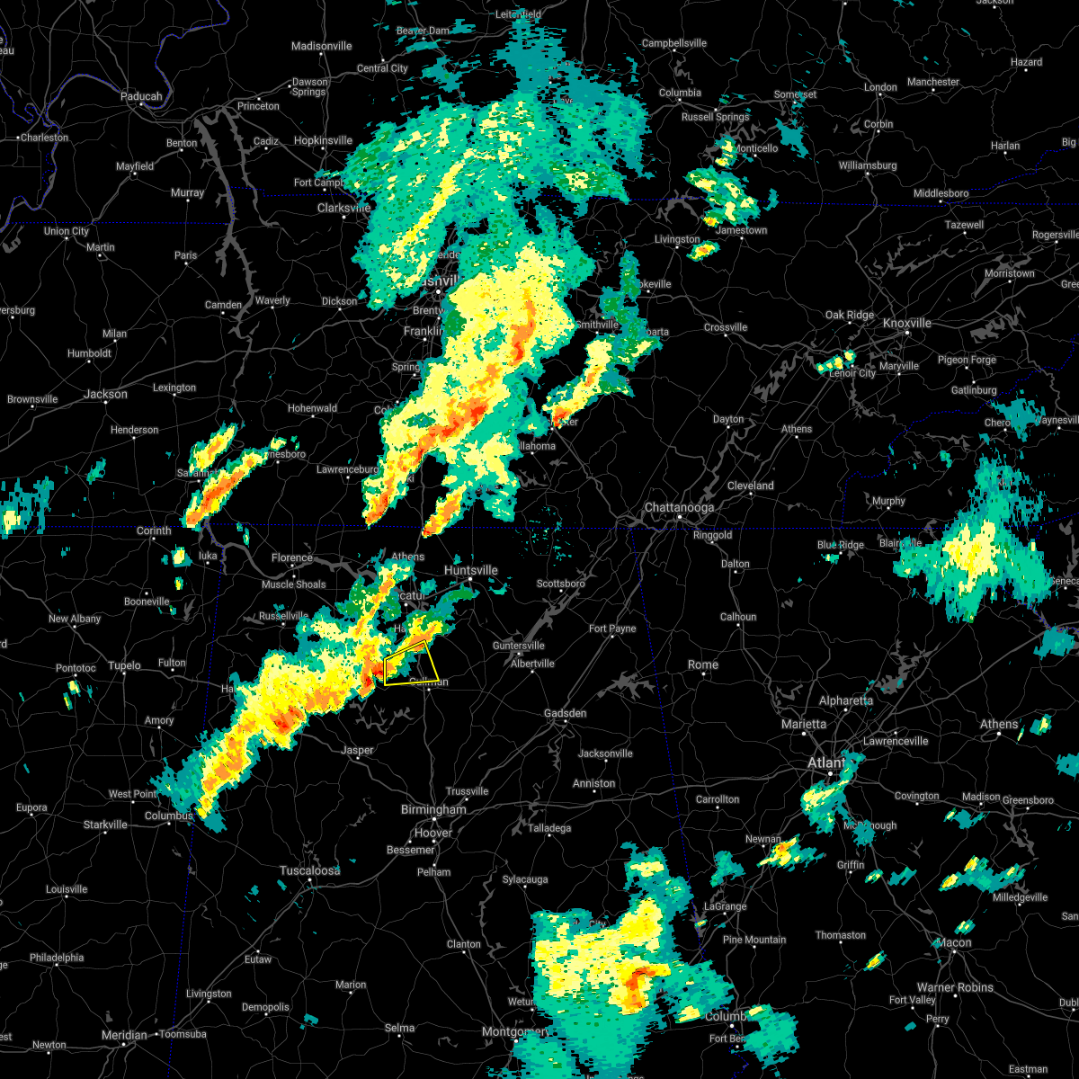 At 513 pm cdt, a severe thunderstorm was located over sardis, or 12 miles north of arley, moving east at 25 mph (radar indicated). Hazards include 60 mph wind gusts. expect damage to roofs, siding, and trees At 513 pm cdt, a severe thunderstorm was located over sardis, or 12 miles north of arley, moving east at 25 mph (radar indicated). Hazards include 60 mph wind gusts. expect damage to roofs, siding, and trees
|
| 8/28/2020 4:55 PM CDT |
 The tornado warning for southwestern morgan county will expire at 500 pm cdt, the storm which prompted the warning has weakened below severe limits, and no longer appears capable of producing a tornado. therefore, the warning will be allowed to expire. a tornado watch remains in effect until 800 pm cdt for north central and northwestern alabama. The tornado warning for southwestern morgan county will expire at 500 pm cdt, the storm which prompted the warning has weakened below severe limits, and no longer appears capable of producing a tornado. therefore, the warning will be allowed to expire. a tornado watch remains in effect until 800 pm cdt for north central and northwestern alabama.
|
| 8/28/2020 4:46 PM CDT |
 At 445 pm cdt, a severe thunderstorm capable of producing a tornado was located near hartselle, moving northeast at 35 mph (radar indicated rotation). Hazards include tornado. Flying debris will be dangerous to those caught without shelter. mobile homes will be damaged or destroyed. damage to roofs, windows, and vehicles will occur. tree damage is likely. Locations impacted include, hartselle, falkville, neel and massey. At 445 pm cdt, a severe thunderstorm capable of producing a tornado was located near hartselle, moving northeast at 35 mph (radar indicated rotation). Hazards include tornado. Flying debris will be dangerous to those caught without shelter. mobile homes will be damaged or destroyed. damage to roofs, windows, and vehicles will occur. tree damage is likely. Locations impacted include, hartselle, falkville, neel and massey.
|
| 8/28/2020 4:39 PM CDT | Lawrence co. ema reports trees down in the speake community near cr20 in lawrence county AL, 11.2 miles ENE of Hartselle, AL |
| 8/28/2020 4:28 PM CDT |
 At 428 pm cdt, a severe thunderstorm capable of producing a tornado was located near brushy lake, or 12 miles southeast of moulton, moving northeast at 35 mph (radar indicated rotation). Hazards include tornado. Flying debris will be dangerous to those caught without shelter. mobile homes will be damaged or destroyed. damage to roofs, windows, and vehicles will occur. Tree damage is likely. At 428 pm cdt, a severe thunderstorm capable of producing a tornado was located near brushy lake, or 12 miles southeast of moulton, moving northeast at 35 mph (radar indicated rotation). Hazards include tornado. Flying debris will be dangerous to those caught without shelter. mobile homes will be damaged or destroyed. damage to roofs, windows, and vehicles will occur. Tree damage is likely.
|
| 8/19/2020 5:36 PM CDT | A large flag pole and large tree limbs down in hartsell in morgan county AL, 0.2 miles SSW of Hartselle, AL |
| 8/19/2020 5:26 PM CDT |
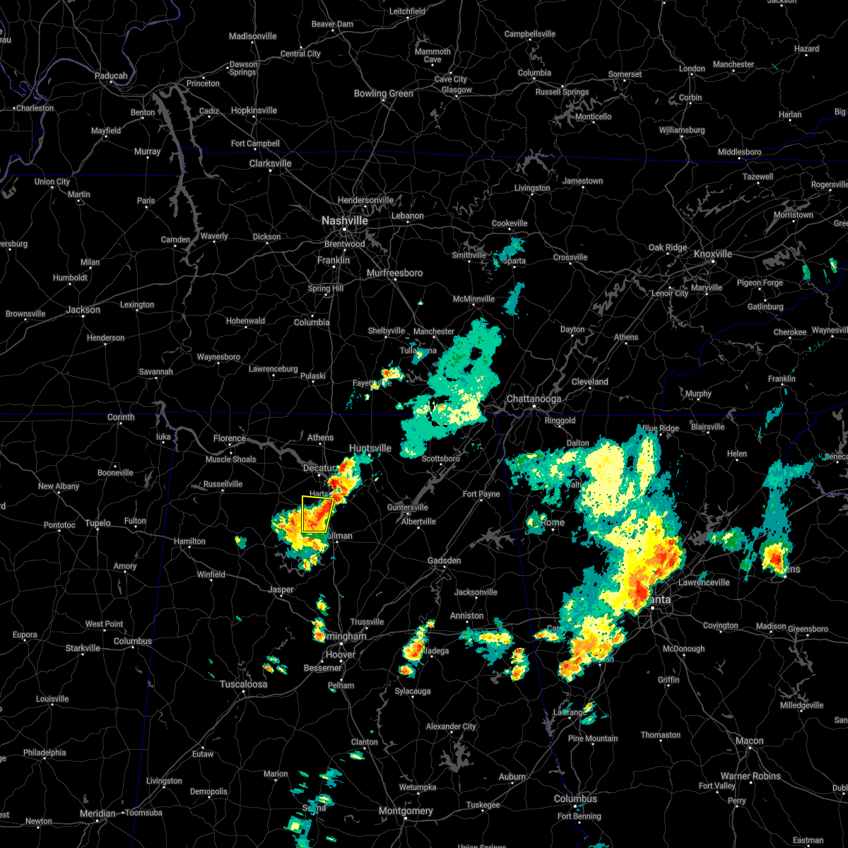 The severe thunderstorm warning for northwestern cullman and southwestern morgan counties will expire at 530 pm cdt, the storm which prompted the warning has weakened below severe limits, and no longer poses an immediate threat to life or property. therefore, the warning will be allowed to expire. however gusty winds and heavy rain are still possible with this thunderstorm. The severe thunderstorm warning for northwestern cullman and southwestern morgan counties will expire at 530 pm cdt, the storm which prompted the warning has weakened below severe limits, and no longer poses an immediate threat to life or property. therefore, the warning will be allowed to expire. however gusty winds and heavy rain are still possible with this thunderstorm.
|
| 8/19/2020 5:02 PM CDT |
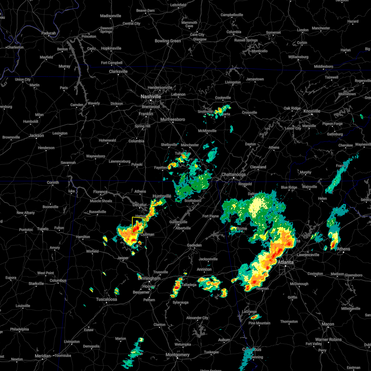 At 502 pm cdt, a severe thunderstorm was located near falkville, or near hartselle, moving north at 5 mph (radar indicated). Hazards include 60 mph wind gusts and nickel size hail. expect damage to roofs, siding, and trees At 502 pm cdt, a severe thunderstorm was located near falkville, or near hartselle, moving north at 5 mph (radar indicated). Hazards include 60 mph wind gusts and nickel size hail. expect damage to roofs, siding, and trees
|
| 7/31/2020 1:59 PM CDT |
 At 159 pm cdt, a severe thunderstorm was located near priceville, or near hartselle, moving northeast at 20 mph (radar indicated). Hazards include 60 mph wind gusts and penny size hail. expect damage to roofs, siding, and trees At 159 pm cdt, a severe thunderstorm was located near priceville, or near hartselle, moving northeast at 20 mph (radar indicated). Hazards include 60 mph wind gusts and penny size hail. expect damage to roofs, siding, and trees
|
| 7/31/2020 1:32 PM CDT |
 At 131 pm cdt, severe thunderstorms were located along a line extending from 9 miles west of hartselle to 6 miles southwest of falkville to 7 miles northeast of sardis, moving northeast at 50 mph (radar indicated). Hazards include 60 mph wind gusts and penny size hail. expect damage to roofs, siding, and trees At 131 pm cdt, severe thunderstorms were located along a line extending from 9 miles west of hartselle to 6 miles southwest of falkville to 7 miles northeast of sardis, moving northeast at 50 mph (radar indicated). Hazards include 60 mph wind gusts and penny size hail. expect damage to roofs, siding, and trees
|
| 6/8/2020 7:11 PM CDT |
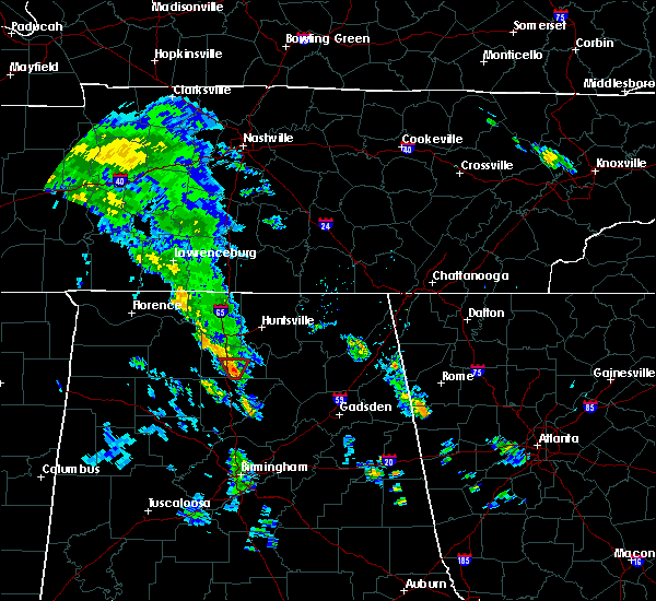 The tornado warning for south central morgan county will expire at 715 pm cdt, the storm which prompted the warning has weakened below severe limits, and no longer appears capable of producing a tornado. therefore, the warning will be allowed to expire. however heavy rain is still possible with this thunderstorm. The tornado warning for south central morgan county will expire at 715 pm cdt, the storm which prompted the warning has weakened below severe limits, and no longer appears capable of producing a tornado. therefore, the warning will be allowed to expire. however heavy rain is still possible with this thunderstorm.
|
| 6/8/2020 7:05 PM CDT |
 At 704 pm cdt, a severe thunderstorm capable of producing a tornado was located near falkville, or 8 miles southeast of hartselle, moving north at 35 mph (radar indicated rotation). Hazards include tornado. Flying debris will be dangerous to those caught without shelter. mobile homes will be damaged or destroyed. damage to roofs, windows, and vehicles will occur. tree damage is likely. Locations impacted include, hartselle, falkville, somerville and cole springs. At 704 pm cdt, a severe thunderstorm capable of producing a tornado was located near falkville, or 8 miles southeast of hartselle, moving north at 35 mph (radar indicated rotation). Hazards include tornado. Flying debris will be dangerous to those caught without shelter. mobile homes will be damaged or destroyed. damage to roofs, windows, and vehicles will occur. tree damage is likely. Locations impacted include, hartselle, falkville, somerville and cole springs.
|
| 6/8/2020 6:59 PM CDT |
 At 659 pm cdt, a severe thunderstorm capable of producing a tornado was located near falkville, moving north at 35 mph (radar indicated rotation). Hazards include tornado. Flying debris will be dangerous to those caught without shelter. mobile homes will be damaged or destroyed. damage to roofs, windows, and vehicles will occur. Tree damage is likely. At 659 pm cdt, a severe thunderstorm capable of producing a tornado was located near falkville, moving north at 35 mph (radar indicated rotation). Hazards include tornado. Flying debris will be dangerous to those caught without shelter. mobile homes will be damaged or destroyed. damage to roofs, windows, and vehicles will occur. Tree damage is likely.
|
| 5/3/2020 5:36 PM CDT |
 At 535 pm cdt, severe thunderstorms were located along a line extending from 7 miles north of sewanee to near new market to near madison, moving southeast at 65 mph. this storm continues to produce widespread wind damage (radar indicated). Hazards include 70 mph wind gusts. Expect considerable tree damage. damage is likely to mobile homes, roofs, and outbuildings. Locations impacted include, huntsville, decatur, madison, athens, scottsboro, winchester, fayetteville, bridgeport, moores mill and meridianville. At 535 pm cdt, severe thunderstorms were located along a line extending from 7 miles north of sewanee to near new market to near madison, moving southeast at 65 mph. this storm continues to produce widespread wind damage (radar indicated). Hazards include 70 mph wind gusts. Expect considerable tree damage. damage is likely to mobile homes, roofs, and outbuildings. Locations impacted include, huntsville, decatur, madison, athens, scottsboro, winchester, fayetteville, bridgeport, moores mill and meridianville.
|
| 5/3/2020 5:23 PM CDT |
 At 522 pm cdt, severe thunderstorms were located along a line extending from near tullahoma to hazel green to near athens, moving southeast at 65 mph. this storm has a history of producing wind damage, most recently in northern limestone and madison county (radar indicated). Hazards include 70 mph wind gusts. Expect considerable tree damage. damage is likely to mobile homes, roofs, and outbuildings. Locations impacted include, huntsville, decatur, madison, athens, scottsboro, winchester, fayetteville, bridgeport, moores mill and meridianville. At 522 pm cdt, severe thunderstorms were located along a line extending from near tullahoma to hazel green to near athens, moving southeast at 65 mph. this storm has a history of producing wind damage, most recently in northern limestone and madison county (radar indicated). Hazards include 70 mph wind gusts. Expect considerable tree damage. damage is likely to mobile homes, roofs, and outbuildings. Locations impacted include, huntsville, decatur, madison, athens, scottsboro, winchester, fayetteville, bridgeport, moores mill and meridianville.
|
| 5/3/2020 5:13 PM CDT |
 At 512 pm cdt, severe thunderstorms were located along a line extending from near tullahoma to near ardmore to 7 miles east of rogersville, moving southeast at 65 mph (radar indicated. this storm has a history of producing wind damage). Hazards include 60 mph wind gusts and penny size hail. expect damage to roofs, siding, and trees At 512 pm cdt, severe thunderstorms were located along a line extending from near tullahoma to near ardmore to 7 miles east of rogersville, moving southeast at 65 mph (radar indicated. this storm has a history of producing wind damage). Hazards include 60 mph wind gusts and penny size hail. expect damage to roofs, siding, and trees
|
| 4/12/2020 8:22 PM CDT |
 At 821 pm cdt, a severe thunderstorm was located near camp mcdowell, or 9 miles northwest of jasper, moving northeast at 55 mph (radar indicated). Hazards include 60 mph wind gusts, possible tornado. expect damage to roofs, siding, and trees At 821 pm cdt, a severe thunderstorm was located near camp mcdowell, or 9 miles northwest of jasper, moving northeast at 55 mph (radar indicated). Hazards include 60 mph wind gusts, possible tornado. expect damage to roofs, siding, and trees
|
| 4/9/2020 2:06 AM CDT |
 The severe thunderstorm warning for southern limestone, western morgan and lawrence counties will expire at 215 am cdt, the storm which prompted the warning has weakened below severe limits, and no longer poses an immediate threat to life or property. therefore, the warning will be allowed to expire. however gusty winds are still possible with this thunderstorm. a severe thunderstorm watch remains in effect until 500 am cdt for north central, northeastern and northwestern alabama, and middle tennessee. additional thunderstorms, some of which may be strong to severe, will still be possible overnight. to report severe weather, contact your nearest law enforcement agency. they will relay your report to the national weather service huntsville alabama. The severe thunderstorm warning for southern limestone, western morgan and lawrence counties will expire at 215 am cdt, the storm which prompted the warning has weakened below severe limits, and no longer poses an immediate threat to life or property. therefore, the warning will be allowed to expire. however gusty winds are still possible with this thunderstorm. a severe thunderstorm watch remains in effect until 500 am cdt for north central, northeastern and northwestern alabama, and middle tennessee. additional thunderstorms, some of which may be strong to severe, will still be possible overnight. to report severe weather, contact your nearest law enforcement agency. they will relay your report to the national weather service huntsville alabama.
|
| 4/9/2020 1:54 AM CDT |
 At 153 am cdt, a severe thunderstorm was located near courtland, or 7 miles north of moulton, moving east at 60 mph (public). Hazards include 60 mph wind gusts and quarter size hail. Hail damage to vehicles is expected. expect wind damage to roofs, siding, and trees. Locations impacted include, decatur, hartselle, moulton, priceville, trinity, town creek, courtland, tanner, north courtland and hillsboro. At 153 am cdt, a severe thunderstorm was located near courtland, or 7 miles north of moulton, moving east at 60 mph (public). Hazards include 60 mph wind gusts and quarter size hail. Hail damage to vehicles is expected. expect wind damage to roofs, siding, and trees. Locations impacted include, decatur, hartselle, moulton, priceville, trinity, town creek, courtland, tanner, north courtland and hillsboro.
|
| 4/9/2020 1:47 AM CDT | Quarter sized hail reported 0.7 miles WSW of Hartselle, AL |
| 4/9/2020 1:39 AM CDT |
 At 138 am cdt, severe thunderstorms were located along a line extending from near triana to near hartselle to near inmanfield, moving east at 45 mph (radar indicated). Hazards include 60 mph wind gusts and quarter size hail. Hail damage to vehicles is expected. Expect wind damage to roofs, siding, and trees. At 138 am cdt, severe thunderstorms were located along a line extending from near triana to near hartselle to near inmanfield, moving east at 45 mph (radar indicated). Hazards include 60 mph wind gusts and quarter size hail. Hail damage to vehicles is expected. Expect wind damage to roofs, siding, and trees.
|
| 4/9/2020 1:35 AM CDT |
 At 133 am cdt, a severe thunderstorm was located over leighton, or near muscle shoals, moving east at 60 mph. this storm has a history of producing quarter to golf ball sized hail (public). Hazards include 60 mph wind gusts and half dollar size hail. Hail damage to vehicles is expected. Expect wind damage to roofs, siding, and trees. At 133 am cdt, a severe thunderstorm was located over leighton, or near muscle shoals, moving east at 60 mph. this storm has a history of producing quarter to golf ball sized hail (public). Hazards include 60 mph wind gusts and half dollar size hail. Hail damage to vehicles is expected. Expect wind damage to roofs, siding, and trees.
|
| 3/29/2020 3:14 AM CDT |
 At 313 am cdt, a severe thunderstorm was located near falkville, or 9 miles southeast of hartselle, moving northeast at 70 mph (radar indicated). Hazards include 60 mph wind gusts and quarter size hail. Hail damage to vehicles is expected. expect wind damage to roofs, siding, and trees. Locations impacted include, southwestern huntsville, decatur, madison, cullman, hartselle, arab, redstone arsenal, hanceville, priceville and good hope. At 313 am cdt, a severe thunderstorm was located near falkville, or 9 miles southeast of hartselle, moving northeast at 70 mph (radar indicated). Hazards include 60 mph wind gusts and quarter size hail. Hail damage to vehicles is expected. expect wind damage to roofs, siding, and trees. Locations impacted include, southwestern huntsville, decatur, madison, cullman, hartselle, arab, redstone arsenal, hanceville, priceville and good hope.
|
| 3/29/2020 2:52 AM CDT |
 At 251 am cdt, a severe thunderstorm was located near arley, moving northeast at 70 mph (radar indicated). Hazards include 60 mph wind gusts and quarter size hail. Hail damage to vehicles is expected. Expect wind damage to roofs, siding, and trees. At 251 am cdt, a severe thunderstorm was located near arley, moving northeast at 70 mph (radar indicated). Hazards include 60 mph wind gusts and quarter size hail. Hail damage to vehicles is expected. Expect wind damage to roofs, siding, and trees.
|
| 1/11/2020 12:52 PM CST | Storage building damaged and house siding damage along tabscott r in morgan county AL, 4.7 miles WSW of Hartselle, AL |
| 1/11/2020 12:50 PM CST | Roof damaged at liberty baptist churc in morgan county AL, 1.9 miles SE of Hartselle, AL |
| 1/11/2020 12:50 PM CST | A storage building was blown off its foundation at this locatio in morgan county AL, 4.7 miles WSW of Hartselle, AL |
| 1/11/2020 12:42 PM CST | Roof was reported blown off of liberty baptist church on lane roa in morgan county AL, 1.9 miles SE of Hartselle, AL |
| 1/11/2020 12:07 PM CST |
 At 1207 pm cst, severe thunderstorms were located along a line extending from near trinity to near nauvoo, moving east at 25 mph (radar indicated). Hazards include 60 mph wind gusts. expect damage to roofs, siding, and trees At 1207 pm cst, severe thunderstorms were located along a line extending from near trinity to near nauvoo, moving east at 25 mph (radar indicated). Hazards include 60 mph wind gusts. expect damage to roofs, siding, and trees
|
| 12/16/2019 6:09 PM CST |
 The severe thunderstorm warning for madison, eastern limestone, central morgan, west central moore and lincoln counties will expire at 615 pm cst, the storms which prompted the warning have moved out of the area. therefore, the warning will be allowed to expire. a tornado watch remains in effect until 1100 pm cst for north central, northeastern and northwestern alabama, and middle tennessee. remember, a severe thunderstorm warning still remains in effect for madison and lincoln counties until 7 pm cst. The severe thunderstorm warning for madison, eastern limestone, central morgan, west central moore and lincoln counties will expire at 615 pm cst, the storms which prompted the warning have moved out of the area. therefore, the warning will be allowed to expire. a tornado watch remains in effect until 1100 pm cst for north central, northeastern and northwestern alabama, and middle tennessee. remember, a severe thunderstorm warning still remains in effect for madison and lincoln counties until 7 pm cst.
|
| 12/16/2019 5:59 PM CST |
 At 559 pm cst, severe thunderstorms were located along a line extending from 7 miles east of petersburg to meridianville to near triana, moving northeast at 70 mph. in capshaw, 70 mph winds were observed (radar indicated). Hazards include 70 mph wind gusts and quarter size hail. Hail damage to vehicles is expected. expect considerable tree damage. wind damage is also likely to mobile homes, roofs, and outbuildings. Locations impacted include, huntsville, decatur, madison, athens, hartselle, fayetteville, moores mill, meridianville, redstone arsenal and hazel green. At 559 pm cst, severe thunderstorms were located along a line extending from 7 miles east of petersburg to meridianville to near triana, moving northeast at 70 mph. in capshaw, 70 mph winds were observed (radar indicated). Hazards include 70 mph wind gusts and quarter size hail. Hail damage to vehicles is expected. expect considerable tree damage. wind damage is also likely to mobile homes, roofs, and outbuildings. Locations impacted include, huntsville, decatur, madison, athens, hartselle, fayetteville, moores mill, meridianville, redstone arsenal and hazel green.
|
| 12/16/2019 5:52 PM CST |
 At 551 pm cst, severe thunderstorms were located along a line extending from near fayetteville to 7 miles west of huntland to huntsville, moving east at 75 mph (radar indicated). Hazards include 60 mph wind gusts and quarter size hail. Hail damage to vehicles is expected. expect wind damage to roofs, siding, and trees. Locations impacted include, huntsville, decatur, madison, athens, hartselle, fayetteville, moores mill, meridianville, redstone arsenal and hazel green. At 551 pm cst, severe thunderstorms were located along a line extending from near fayetteville to 7 miles west of huntland to huntsville, moving east at 75 mph (radar indicated). Hazards include 60 mph wind gusts and quarter size hail. Hail damage to vehicles is expected. expect wind damage to roofs, siding, and trees. Locations impacted include, huntsville, decatur, madison, athens, hartselle, fayetteville, moores mill, meridianville, redstone arsenal and hazel green.
|
| 12/16/2019 5:13 PM CST |
 At 513 pm cst, severe thunderstorms were located along a line extending from lexington to 6 miles east of rogersville to near moulton, moving east at 30 mph (radar indicated). Hazards include 60 mph wind gusts. expect damage to roofs, siding, and trees At 513 pm cst, severe thunderstorms were located along a line extending from lexington to 6 miles east of rogersville to near moulton, moving east at 30 mph (radar indicated). Hazards include 60 mph wind gusts. expect damage to roofs, siding, and trees
|
| 7/13/2019 3:04 PM CDT | Power lines down on rocky ford rd and elbert self rd in morgan county. time estimated based on rada in morgan county AL, 5.3 miles ESE of Hartselle, AL |
| 6/26/2019 10:42 PM CDT |
 At 1042 pm cdt, a severe thunderstorm was located near trinity, or 7 miles southwest of decatur, and is nearly stationary (radar indicated). Hazards include 60 mph wind gusts and quarter to half dollar size hail. Hail damage to vehicles is expected. Expect wind damage to roofs, siding, and trees. At 1042 pm cdt, a severe thunderstorm was located near trinity, or 7 miles southwest of decatur, and is nearly stationary (radar indicated). Hazards include 60 mph wind gusts and quarter to half dollar size hail. Hail damage to vehicles is expected. Expect wind damage to roofs, siding, and trees.
|
| 6/22/2019 2:41 PM CDT |
 At 240 pm cdt, a severe thunderstorm was located near falkville, or 9 miles north of cullman, moving east at 30 mph (radar indicated). Hazards include ping pong ball size hail and 60 mph wind gusts. People and animals outdoors will be injured. expect hail damage to roofs, siding, windows, and vehicles. Expect wind damage to roofs, siding, and trees. At 240 pm cdt, a severe thunderstorm was located near falkville, or 9 miles north of cullman, moving east at 30 mph (radar indicated). Hazards include ping pong ball size hail and 60 mph wind gusts. People and animals outdoors will be injured. expect hail damage to roofs, siding, windows, and vehicles. Expect wind damage to roofs, siding, and trees.
|
| 6/22/2019 2:24 PM CDT |
 The severe thunderstorm warning for southeastern franklin, southwestern morgan and southern lawrence counties will expire at 230 pm cdt, the storms which prompted the warning have weakened below severe limits, and have exited the warned area. therefore, the warning will be allowed to expire. a severe thunderstorm watch remains in effect until 900 pm cdt for north central, northeastern and northwestern alabama. The severe thunderstorm warning for southeastern franklin, southwestern morgan and southern lawrence counties will expire at 230 pm cdt, the storms which prompted the warning have weakened below severe limits, and have exited the warned area. therefore, the warning will be allowed to expire. a severe thunderstorm watch remains in effect until 900 pm cdt for north central, northeastern and northwestern alabama.
|
| 6/22/2019 2:20 PM CDT |
 The severe thunderstorm warning for southeastern limestone, northwestern morgan and east central lawrence counties will expire at 230 pm cdt, the storms which prompted the warning have weakened. therefore, the warning will be allowed to expire. however gusty winds are still possible with these thunderstorms. a severe thunderstorm watch remains in effect until 900 pm cdt for north central, northeastern and northwestern alabama. The severe thunderstorm warning for southeastern limestone, northwestern morgan and east central lawrence counties will expire at 230 pm cdt, the storms which prompted the warning have weakened. therefore, the warning will be allowed to expire. however gusty winds are still possible with these thunderstorms. a severe thunderstorm watch remains in effect until 900 pm cdt for north central, northeastern and northwestern alabama.
|
| 6/22/2019 2:09 PM CDT |
 At 208 pm cdt, severe thunderstorms were located along a line extending from near tanner to near decatur to near speake, moving east at 35 mph (radar indicated). Hazards include 60 mph wind gusts and quarter size hail. Hail damage to vehicles is expected. expect wind damage to roofs, siding, and trees. Locations impacted include, decatur, hartselle, priceville, trinity, mooresville, belle mina, neel, caddo and basham. At 208 pm cdt, severe thunderstorms were located along a line extending from near tanner to near decatur to near speake, moving east at 35 mph (radar indicated). Hazards include 60 mph wind gusts and quarter size hail. Hail damage to vehicles is expected. expect wind damage to roofs, siding, and trees. Locations impacted include, decatur, hartselle, priceville, trinity, mooresville, belle mina, neel, caddo and basham.
|
| 6/22/2019 2:02 PM CDT |
 At 145 pm cdt, severe thunderstorms were located along a line extending from near moulton to 12 miles north of ashridge to near phil campbell, moving east at 40 mph (radar indicated). Hazards include 60 mph wind gusts and quarter size hail. Hail damage to vehicles is expected. Expect wind damage to roofs, siding, and trees. At 145 pm cdt, severe thunderstorms were located along a line extending from near moulton to 12 miles north of ashridge to near phil campbell, moving east at 40 mph (radar indicated). Hazards include 60 mph wind gusts and quarter size hail. Hail damage to vehicles is expected. Expect wind damage to roofs, siding, and trees.
|
| 6/22/2019 1:54 PM CDT |
 At 154 pm cdt, severe thunderstorms were located along a line extending from near tanner to near trinity to 7 miles northeast of moulton, moving southeast at 25 mph (radar indicated). Hazards include 60 mph wind gusts and quarter size hail. Hail damage to vehicles is expected. expect wind damage to roofs, siding, and trees. Locations impacted include, northwestern huntsville, decatur, madison, athens, hartselle, redstone arsenal, priceville, trinity, triana and marshall space flight center. At 154 pm cdt, severe thunderstorms were located along a line extending from near tanner to near trinity to 7 miles northeast of moulton, moving southeast at 25 mph (radar indicated). Hazards include 60 mph wind gusts and quarter size hail. Hail damage to vehicles is expected. expect wind damage to roofs, siding, and trees. Locations impacted include, northwestern huntsville, decatur, madison, athens, hartselle, redstone arsenal, priceville, trinity, triana and marshall space flight center.
|
| 6/22/2019 1:46 PM CDT |
 At 145 pm cdt, severe thunderstorms were located along a line extending from near moulton to 12 miles north of ashridge to near phil campbell, moving east at 40 mph (radar indicated). Hazards include 60 mph wind gusts and quarter size hail. Hail damage to vehicles is expected. Expect wind damage to roofs, siding, and trees. At 145 pm cdt, severe thunderstorms were located along a line extending from near moulton to 12 miles north of ashridge to near phil campbell, moving east at 40 mph (radar indicated). Hazards include 60 mph wind gusts and quarter size hail. Hail damage to vehicles is expected. Expect wind damage to roofs, siding, and trees.
|
| 6/22/2019 1:40 PM CDT |
 At 140 pm cdt, severe thunderstorms were located along a line extending from near athens to 6 miles north of trinity to near moulton, moving east at 30 mph (radar indicated). Hazards include 60 mph wind gusts and quarter size hail. Hail damage to vehicles is expected. Expect wind damage to roofs, siding, and trees. At 140 pm cdt, severe thunderstorms were located along a line extending from near athens to 6 miles north of trinity to near moulton, moving east at 30 mph (radar indicated). Hazards include 60 mph wind gusts and quarter size hail. Hail damage to vehicles is expected. Expect wind damage to roofs, siding, and trees.
|
| 6/21/2019 10:35 PM CDT |
 At 1011 pm cdt, severe thunderstorms were located along a line extending from huntsville to 6 miles east of moulton, moving southeast at 35 mph (radar indicated). Hazards include 60 mph wind gusts. Expect damage to roofs, siding, and trees. Locations impacted include, southern huntsville, decatur, hartselle, redstone arsenal, priceville, owens cross roads, falkville, grant, triana and morgan city. At 1011 pm cdt, severe thunderstorms were located along a line extending from huntsville to 6 miles east of moulton, moving southeast at 35 mph (radar indicated). Hazards include 60 mph wind gusts. Expect damage to roofs, siding, and trees. Locations impacted include, southern huntsville, decatur, hartselle, redstone arsenal, priceville, owens cross roads, falkville, grant, triana and morgan city.
|
| 6/21/2019 10:12 PM CDT |
 At 1011 pm cdt, severe thunderstorms were located along a line extending from huntsville to 6 miles east of moulton, moving southeast at 35 mph (radar indicated). Hazards include 60 mph wind gusts. Expect damage to roofs, siding, and trees. Locations impacted include, southern huntsville, decatur, hartselle, redstone arsenal, priceville, owens cross roads, falkville, grant, triana and morgan city. At 1011 pm cdt, severe thunderstorms were located along a line extending from huntsville to 6 miles east of moulton, moving southeast at 35 mph (radar indicated). Hazards include 60 mph wind gusts. Expect damage to roofs, siding, and trees. Locations impacted include, southern huntsville, decatur, hartselle, redstone arsenal, priceville, owens cross roads, falkville, grant, triana and morgan city.
|
| 6/21/2019 9:53 PM CDT |
 At 953 pm cdt, severe thunderstorms were located along a line extending from near harvest to near courtland, moving southeast at 35 mph. there have been several reports of downed trees and power lines with this line of storms (radar indicated). Hazards include 60 mph wind gusts. expect damage to roofs, siding, and trees At 953 pm cdt, severe thunderstorms were located along a line extending from near harvest to near courtland, moving southeast at 35 mph. there have been several reports of downed trees and power lines with this line of storms (radar indicated). Hazards include 60 mph wind gusts. expect damage to roofs, siding, and trees
|
| 6/20/2019 3:07 AM CDT |
 At 305 am cdt, severe thunderstorms were located along a line extending from near tanner to near warrior, moving east at 40 mph (radar indicated). Hazards include 60 mph wind gusts and quarter size hail. Hail damage to vehicles is expected. expect wind damage to roofs, siding, and trees. Locations impacted include, decatur, cullman, hartselle, hanceville, priceville, good hope, trinity, falkville, holly pond and dodge city. At 305 am cdt, severe thunderstorms were located along a line extending from near tanner to near warrior, moving east at 40 mph (radar indicated). Hazards include 60 mph wind gusts and quarter size hail. Hail damage to vehicles is expected. expect wind damage to roofs, siding, and trees. Locations impacted include, decatur, cullman, hartselle, hanceville, priceville, good hope, trinity, falkville, holly pond and dodge city.
|
| 6/20/2019 2:44 AM CDT |
 At 244 am cdt, severe thunderstorms were located along a line extending from 7 miles north of trinity to near sipsey, moving east at 40 mph (radar indicated). Hazards include 60 mph wind gusts and quarter size hail. Hail damage to vehicles is expected. Expect wind damage to roofs, siding, and trees. At 244 am cdt, severe thunderstorms were located along a line extending from 7 miles north of trinity to near sipsey, moving east at 40 mph (radar indicated). Hazards include 60 mph wind gusts and quarter size hail. Hail damage to vehicles is expected. Expect wind damage to roofs, siding, and trees.
|
| 6/20/2019 2:33 AM CDT |
 At 229 am cdt, severe thunderstorms were located along a line extending from 6 miles northeast of lexington to near addison, moving east at 55 mph. tree damage has been reported with these storms (radar indicated). Hazards include 60 mph wind gusts. Expect damage to roofs, siding, and trees. Locations impacted include, decatur, madison, athens, cullman, hartselle, muscle shoals, moulton, hanceville, priceville and good hope. At 229 am cdt, severe thunderstorms were located along a line extending from 6 miles northeast of lexington to near addison, moving east at 55 mph. tree damage has been reported with these storms (radar indicated). Hazards include 60 mph wind gusts. Expect damage to roofs, siding, and trees. Locations impacted include, decatur, madison, athens, cullman, hartselle, muscle shoals, moulton, hanceville, priceville and good hope.
|
| 6/20/2019 2:03 AM CDT |
 At 202 am cdt, severe thunderstorms were located along a line extending from 9 miles north of underwood-petersville to near haleyville, moving east at 50 mph (radar indicated). Hazards include 60 mph wind gusts. expect damage to roofs, siding, and trees At 202 am cdt, severe thunderstorms were located along a line extending from 9 miles north of underwood-petersville to near haleyville, moving east at 50 mph (radar indicated). Hazards include 60 mph wind gusts. expect damage to roofs, siding, and trees
|
| 4/18/2019 8:24 PM CDT |
 At 823 pm cdt, severe thunderstorms were located along a line extending from near falkville to near good hope, moving east at 35 mph (radar indicated). Hazards include 60 mph wind gusts. Expect damage to roofs, siding, and trees. Locations impacted include, decatur, hartselle, priceville, trinity, falkville, morgan city, somerville, eva, valhermoso springs and basham. At 823 pm cdt, severe thunderstorms were located along a line extending from near falkville to near good hope, moving east at 35 mph (radar indicated). Hazards include 60 mph wind gusts. Expect damage to roofs, siding, and trees. Locations impacted include, decatur, hartselle, priceville, trinity, falkville, morgan city, somerville, eva, valhermoso springs and basham.
|
| 4/18/2019 7:55 PM CDT |
 At 755 pm cdt, severe thunderstorms were located along a line extending from brushy lake to near arley, moving east at 40 mph (radar indicated). Hazards include 60 mph wind gusts. expect damage to roofs, siding, and trees At 755 pm cdt, severe thunderstorms were located along a line extending from brushy lake to near arley, moving east at 40 mph (radar indicated). Hazards include 60 mph wind gusts. expect damage to roofs, siding, and trees
|
| 4/18/2019 7:34 PM CDT |
 At 734 pm cdt, severe thunderstorms were located along a line extending from 11 miles west of moulton to near jasper, moving east at 50 mph (radar indicated). Hazards include 60 mph wind gusts and penny size hail. expect damage to roofs, siding, and trees At 734 pm cdt, severe thunderstorms were located along a line extending from 11 miles west of moulton to near jasper, moving east at 50 mph (radar indicated). Hazards include 60 mph wind gusts and penny size hail. expect damage to roofs, siding, and trees
|
| 4/14/2019 3:27 AM CDT |
 At 326 am cdt, severe thunderstorms were located along a line extending from priceville to arkadelphia, moving east at 30 mph (radar indicated). Hazards include 60 mph wind gusts and quarter size hail. Hail damage to vehicles is expected. Expect wind damage to roofs, siding, and trees. At 326 am cdt, severe thunderstorms were located along a line extending from priceville to arkadelphia, moving east at 30 mph (radar indicated). Hazards include 60 mph wind gusts and quarter size hail. Hail damage to vehicles is expected. Expect wind damage to roofs, siding, and trees.
|
| 4/14/2019 3:19 AM CDT | Multiple trees were reported down and power outages were reported in this are in morgan county AL, 7 miles W of Hartselle, AL |
| 4/14/2019 2:53 AM CDT |
 At 252 am cdt, severe thunderstorms were located along a line extending from near trinity to near smith dam, moving east at 25 mph (radar indicated). Hazards include 60 mph wind gusts and quarter size hail. Hail damage to vehicles is expected. Expect wind damage to roofs, siding, and trees. At 252 am cdt, severe thunderstorms were located along a line extending from near trinity to near smith dam, moving east at 25 mph (radar indicated). Hazards include 60 mph wind gusts and quarter size hail. Hail damage to vehicles is expected. Expect wind damage to roofs, siding, and trees.
|
| 4/7/2019 5:08 PM CDT |
 At 508 pm cdt, a severe thunderstorm was located over falkville, or 7 miles south of hartselle, moving northeast at 20 mph (radar indicated). Hazards include 60 mph wind gusts and quarter size hail. Hail damage to vehicles is expected. Expect wind damage to roofs, siding, and trees. At 508 pm cdt, a severe thunderstorm was located over falkville, or 7 miles south of hartselle, moving northeast at 20 mph (radar indicated). Hazards include 60 mph wind gusts and quarter size hail. Hail damage to vehicles is expected. Expect wind damage to roofs, siding, and trees.
|
| 3/14/2019 3:26 PM CDT |
 At 326 pm cdt, a severe thunderstorm was located near hartselle, moving northeast at 45 mph (radar indicated). Hazards include 60 mph wind gusts. expect damage to roofs, siding, and trees At 326 pm cdt, a severe thunderstorm was located near hartselle, moving northeast at 45 mph (radar indicated). Hazards include 60 mph wind gusts. expect damage to roofs, siding, and trees
|
| 3/14/2019 3:17 PM CDT |
 At 316 pm cdt, a severe thunderstorm was located near priceville, or near hartselle, moving northeast at 45 mph (radar indicated). Hazards include 60 mph wind gusts. Expect damage to roofs, siding, and trees. locations impacted include, decatur, hartselle, priceville, trinity, neel and basham. A tornado watch remains in effect until 700 pm cdt for north central and northwestern alabama. At 316 pm cdt, a severe thunderstorm was located near priceville, or near hartselle, moving northeast at 45 mph (radar indicated). Hazards include 60 mph wind gusts. Expect damage to roofs, siding, and trees. locations impacted include, decatur, hartselle, priceville, trinity, neel and basham. A tornado watch remains in effect until 700 pm cdt for north central and northwestern alabama.
|
| 3/14/2019 2:57 PM CDT |
 At 257 pm cdt, a severe thunderstorm was located 7 miles southeast of moulton, moving northeast at 45 mph (radar indicated). Hazards include 60 mph wind gusts. expect damage to roofs, siding, and trees At 257 pm cdt, a severe thunderstorm was located 7 miles southeast of moulton, moving northeast at 45 mph (radar indicated). Hazards include 60 mph wind gusts. expect damage to roofs, siding, and trees
|
| 3/9/2019 2:59 PM CST |
 At 259 pm cst, a severe thunderstorm was located near triana, or 11 miles northeast of hartselle, moving northeast at 45 mph (radar indicated). Hazards include 60 mph wind gusts. expect damage to roofs, siding, and trees At 259 pm cst, a severe thunderstorm was located near triana, or 11 miles northeast of hartselle, moving northeast at 45 mph (radar indicated). Hazards include 60 mph wind gusts. expect damage to roofs, siding, and trees
|
| 3/9/2019 2:48 PM CST |
 At 247 pm cst, a severe thunderstorm was located near somerville, or 12 miles east of hartselle, moving east at 50 mph (radar indicated). Hazards include 60 mph wind gusts. Expect damage to roofs, siding, and trees. locations impacted include, western huntsville, decatur, madison, hartselle, redstone arsenal, priceville, falkville, triana, marshall space flight center and morgan city. A tornado watch remains in effect until 900 pm cst for north central and northwestern alabama, and middle tennessee. At 247 pm cst, a severe thunderstorm was located near somerville, or 12 miles east of hartselle, moving east at 50 mph (radar indicated). Hazards include 60 mph wind gusts. Expect damage to roofs, siding, and trees. locations impacted include, western huntsville, decatur, madison, hartselle, redstone arsenal, priceville, falkville, triana, marshall space flight center and morgan city. A tornado watch remains in effect until 900 pm cst for north central and northwestern alabama, and middle tennessee.
|
| 3/9/2019 2:29 PM CST |
 At 229 pm cst, a severe thunderstorm was located near hartselle, moving east at 50 mph (radar indicated). Hazards include 60 mph wind gusts. expect damage to roofs, siding, and trees At 229 pm cst, a severe thunderstorm was located near hartselle, moving east at 50 mph (radar indicated). Hazards include 60 mph wind gusts. expect damage to roofs, siding, and trees
|
| 2/23/2019 6:51 PM CST |
 The severe thunderstorm warning for southeastern limestone and central morgan counties will expire at 700 pm cst, the storms which prompted the warning have weakened below severe limits, and no longer pose an immediate threat to life or property. therefore, the warning will be allowed to expire. however gusty winds and heavy rain are still possible with these thunderstorms. a tornado watch remains in effect until 1000 pm cst for north alabama and middle tennessee. The severe thunderstorm warning for southeastern limestone and central morgan counties will expire at 700 pm cst, the storms which prompted the warning have weakened below severe limits, and no longer pose an immediate threat to life or property. therefore, the warning will be allowed to expire. however gusty winds and heavy rain are still possible with these thunderstorms. a tornado watch remains in effect until 1000 pm cst for north alabama and middle tennessee.
|
| 2/23/2019 6:43 PM CST |
 A severe thunderstorm warning remains in effect until 700 pm cst for southeastern limestone and central morgan counties. at 643 pm cst, a severe thunderstorm was located near decatur, moving northeast at 30 mph. hazard. 60 mph wind gusts. source. Radar indicated. A severe thunderstorm warning remains in effect until 700 pm cst for southeastern limestone and central morgan counties. at 643 pm cst, a severe thunderstorm was located near decatur, moving northeast at 30 mph. hazard. 60 mph wind gusts. source. Radar indicated.
|
| 2/23/2019 6:29 PM CST |
 At 629 pm cst, a severe thunderstorm was located 7 miles south of trinity, or 8 miles southwest of decatur, moving northeast at 30 mph (radar indicated). Hazards include 60 mph wind gusts. expect damage to roofs, siding, and trees At 629 pm cst, a severe thunderstorm was located 7 miles south of trinity, or 8 miles southwest of decatur, moving northeast at 30 mph (radar indicated). Hazards include 60 mph wind gusts. expect damage to roofs, siding, and trees
|
| 2/23/2019 3:48 PM CST |
 At 348 pm cst, a severe thunderstorm was located over hartselle, moving northeast at 35 mph (radar indicated). Hazards include 60 mph wind gusts. Expect damage to roofs, siding, and trees. locations impacted include, decatur, madison, hartselle, redstone arsenal, priceville, falkville, triana, huntsville international airport, somerville and mooresville. A tornado watch remains in effect until 1000 pm cst for north central, northeastern and northwestern alabama, and middle tennessee. At 348 pm cst, a severe thunderstorm was located over hartselle, moving northeast at 35 mph (radar indicated). Hazards include 60 mph wind gusts. Expect damage to roofs, siding, and trees. locations impacted include, decatur, madison, hartselle, redstone arsenal, priceville, falkville, triana, huntsville international airport, somerville and mooresville. A tornado watch remains in effect until 1000 pm cst for north central, northeastern and northwestern alabama, and middle tennessee.
|
| 2/23/2019 3:38 PM CST |
 At 337 pm cst, a severe thunderstorm was located near hartselle, moving northeast at 35 mph (radar indicated). Hazards include 60 mph wind gusts. expect damage to roofs, siding, and trees At 337 pm cst, a severe thunderstorm was located near hartselle, moving northeast at 35 mph (radar indicated). Hazards include 60 mph wind gusts. expect damage to roofs, siding, and trees
|
| 11/6/2018 1:54 AM CST |
 At 154 am cst, severe thunderstorms were located along a line extending from 6 miles south of huntland to near falkville, moving east at 50 mph (radar indicated). Hazards include 60 mph wind gusts. expect damage to roofs, siding, and trees At 154 am cst, severe thunderstorms were located along a line extending from 6 miles south of huntland to near falkville, moving east at 50 mph (radar indicated). Hazards include 60 mph wind gusts. expect damage to roofs, siding, and trees
|
| 11/6/2018 1:40 AM CST |
 At 139 am cst, severe thunderstorms were located along a line extending from near harvest to near falkville, moving east at 60 mph (radar indicated). Hazards include 60 mph wind gusts. Expect damage to roofs, siding, and trees. locations impacted include, huntsville, decatur, madison, hartselle, arab, moores mill, redstone arsenal, meridianville, priceville and owens cross roads. A tornado watch remains in effect until 600 am cst for north central, northeastern and northwestern alabama, and middle tennessee. At 139 am cst, severe thunderstorms were located along a line extending from near harvest to near falkville, moving east at 60 mph (radar indicated). Hazards include 60 mph wind gusts. Expect damage to roofs, siding, and trees. locations impacted include, huntsville, decatur, madison, hartselle, arab, moores mill, redstone arsenal, meridianville, priceville and owens cross roads. A tornado watch remains in effect until 600 am cst for north central, northeastern and northwestern alabama, and middle tennessee.
|
| 11/6/2018 1:27 AM CST |
 At 126 am cst, severe thunderstorms were located along a line extending from near athens to 6 miles northeast of sardis, moving east at 60 mph (radar indicated). Hazards include 60 mph wind gusts. expect damage to roofs, siding, and trees At 126 am cst, severe thunderstorms were located along a line extending from near athens to 6 miles northeast of sardis, moving east at 60 mph (radar indicated). Hazards include 60 mph wind gusts. expect damage to roofs, siding, and trees
|
| 11/6/2018 1:15 AM CST |
 At 115 am cst, severe thunderstorms were located along a line extending from 7 miles west of tanner to near brushy lake, moving east at 45 mph (radar indicated). Hazards include 60 mph wind gusts. Expect damage to roofs, siding, and trees. locations impacted include, decatur, athens, hartselle, moulton, trinity, tanner, hillsboro, french mill, coxey and chalybeate springs. A tornado watch remains in effect until 600 am cst for north central and northwestern alabama, and middle tennessee. At 115 am cst, severe thunderstorms were located along a line extending from 7 miles west of tanner to near brushy lake, moving east at 45 mph (radar indicated). Hazards include 60 mph wind gusts. Expect damage to roofs, siding, and trees. locations impacted include, decatur, athens, hartselle, moulton, trinity, tanner, hillsboro, french mill, coxey and chalybeate springs. A tornado watch remains in effect until 600 am cst for north central and northwestern alabama, and middle tennessee.
|
| 11/6/2018 12:56 AM CST |
 At 1255 am cst, severe thunderstorms were located along a line extending from near rogersville to 8 miles northeast of needmore, moving east at 45 mph (radar indicated). Hazards include 60 mph wind gusts. expect damage to roofs, siding, and trees At 1255 am cst, severe thunderstorms were located along a line extending from near rogersville to 8 miles northeast of needmore, moving east at 45 mph (radar indicated). Hazards include 60 mph wind gusts. expect damage to roofs, siding, and trees
|
| 8/16/2018 7:36 PM CDT |
 At 736 pm cdt, severe thunderstorms were located along a line extending from huntsville to 7 miles southeast of marshall space flight center to 6 miles west of morgan city, moving east at 15 mph (radar indicated). Hazards include 60 mph wind gusts. Expect damage to roofs, siding, and trees. Locations impacted include, huntsville, redstone arsenal, owens cross roads, falkville, gurley, triana, alabama a and m university, marshall space flight center, university of alabama in huntsville and morgan city. At 736 pm cdt, severe thunderstorms were located along a line extending from huntsville to 7 miles southeast of marshall space flight center to 6 miles west of morgan city, moving east at 15 mph (radar indicated). Hazards include 60 mph wind gusts. Expect damage to roofs, siding, and trees. Locations impacted include, huntsville, redstone arsenal, owens cross roads, falkville, gurley, triana, alabama a and m university, marshall space flight center, university of alabama in huntsville and morgan city.
|
| 8/16/2018 7:22 PM CDT |
 At 721 pm cdt, severe thunderstorms were located along a line extending from huntsville to near triana to 9 miles west of morgan city, moving northeast at 15 mph (radar indicated). Hazards include 60 mph wind gusts and penny size hail. expect damage to roofs, siding, and trees At 721 pm cdt, severe thunderstorms were located along a line extending from huntsville to near triana to 9 miles west of morgan city, moving northeast at 15 mph (radar indicated). Hazards include 60 mph wind gusts and penny size hail. expect damage to roofs, siding, and trees
|
| 8/16/2018 6:27 PM CDT |
 The severe thunderstorm warning for southeastern limestone, northwestern morgan and southeastern lawrence counties will expire at 630 pm cdt, the storm which prompted the warning has weakened below severe limits, and no longer poses an immediate threat to life or property. therefore, the warning will be allowed to expire. The severe thunderstorm warning for southeastern limestone, northwestern morgan and southeastern lawrence counties will expire at 630 pm cdt, the storm which prompted the warning has weakened below severe limits, and no longer poses an immediate threat to life or property. therefore, the warning will be allowed to expire.
|
| 8/16/2018 6:19 PM CDT |
 At 618 pm cdt, a severe thunderstorm was located over trinity, moving east at 10 mph (radar indicated). Hazards include 60 mph wind gusts. Expect damage to roofs, siding, and trees. Locations impacted include, decatur, athens, hartselle, moulton, priceville, trinity, tanner, somerville, hillsboro and mooresville. At 618 pm cdt, a severe thunderstorm was located over trinity, moving east at 10 mph (radar indicated). Hazards include 60 mph wind gusts. Expect damage to roofs, siding, and trees. Locations impacted include, decatur, athens, hartselle, moulton, priceville, trinity, tanner, somerville, hillsboro and mooresville.
|
| 8/16/2018 6:09 PM CDT | Multiple trees down on danville road and hwy 36. time estimated from rada in morgan county AL, 8.6 miles E of Hartselle, AL |
| 8/16/2018 5:59 PM CDT |
 At 558 pm cdt, a severe thunderstorm was located near courtland or 9 miles north of moulton, moving east at 15 mph (radar indicated). Hazards include 60 mph wind gusts. expect damage to roofs, siding, and trees At 558 pm cdt, a severe thunderstorm was located near courtland or 9 miles north of moulton, moving east at 15 mph (radar indicated). Hazards include 60 mph wind gusts. expect damage to roofs, siding, and trees
|
| 8/16/2018 5:53 PM CDT |
 At 553 pm cdt, a severe thunderstorm was located near courtland, or 8 miles north of moulton, moving east at 15 mph (radar indicated). Hazards include 60 mph wind gusts. expect damage to roofs, siding, and trees At 553 pm cdt, a severe thunderstorm was located near courtland, or 8 miles north of moulton, moving east at 15 mph (radar indicated). Hazards include 60 mph wind gusts. expect damage to roofs, siding, and trees
|
| 6/28/2018 3:25 PM CDT |
 At 324 pm cdt, an area of severe thunderstorms in eastern colbert and franklin counties and lawrence and morgan counties is continuing to move south southeast around 40 to 50 mph (radar indicated). Hazards include 60 mph wind gusts and quarter size hail. Hail damage to vehicles is expected. expect wind damage to roofs, siding, and trees. Locations impacted include, decatur, hartselle, muscle shoals, sheffield, tuscumbia, moulton, priceville, trinity, falkville and town creek. At 324 pm cdt, an area of severe thunderstorms in eastern colbert and franklin counties and lawrence and morgan counties is continuing to move south southeast around 40 to 50 mph (radar indicated). Hazards include 60 mph wind gusts and quarter size hail. Hail damage to vehicles is expected. expect wind damage to roofs, siding, and trees. Locations impacted include, decatur, hartselle, muscle shoals, sheffield, tuscumbia, moulton, priceville, trinity, falkville and town creek.
|
| 6/28/2018 3:03 PM CDT |
 At 303 pm cdt, a severe thunderstorm was located near moulton, moving south at 40 mph (radar indicated). Hazards include 60 mph wind gusts and quarter size hail. Hail damage to vehicles is expected. Expect wind damage to roofs, siding, and trees. At 303 pm cdt, a severe thunderstorm was located near moulton, moving south at 40 mph (radar indicated). Hazards include 60 mph wind gusts and quarter size hail. Hail damage to vehicles is expected. Expect wind damage to roofs, siding, and trees.
|
| 6/28/2018 2:44 PM CDT |
 At 242 pm cdt, an area of severe thunderstorms were located from moulton down to arkadelphia, or 11 miles northeast of sumiton, moving south at 40 mph (radar indicated). Hazards include 60 mph wind gusts and penny size hail. expect damage to roofs, siding, and trees At 242 pm cdt, an area of severe thunderstorms were located from moulton down to arkadelphia, or 11 miles northeast of sumiton, moving south at 40 mph (radar indicated). Hazards include 60 mph wind gusts and penny size hail. expect damage to roofs, siding, and trees
|
| 6/28/2018 2:12 PM CDT |
 At 211 pm cdt, severe thunderstorms were located along a line extending from near gurley to near hartselle, moving southeast at 60 mph (radar indicated). Hazards include 70 mph wind gusts and penny size hail. Expect considerable tree damage. Damage is likely to mobile homes, roofs, and outbuildings. At 211 pm cdt, severe thunderstorms were located along a line extending from near gurley to near hartselle, moving southeast at 60 mph (radar indicated). Hazards include 70 mph wind gusts and penny size hail. Expect considerable tree damage. Damage is likely to mobile homes, roofs, and outbuildings.
|
| 6/28/2018 1:51 PM CDT |
 At 150 pm cdt, severe thunderstorms were located along a line extending from near lynchburg to 6 miles northeast of harvest to 6 miles east of rogersville, moving southeast at 55 mph (radar indicated). Hazards include 70 mph wind gusts and penny size hail. Expect considerable tree damage. Damage is likely to mobile homes, roofs, and outbuildings. At 150 pm cdt, severe thunderstorms were located along a line extending from near lynchburg to 6 miles northeast of harvest to 6 miles east of rogersville, moving southeast at 55 mph (radar indicated). Hazards include 70 mph wind gusts and penny size hail. Expect considerable tree damage. Damage is likely to mobile homes, roofs, and outbuildings.
|
| 6/28/2018 1:05 PM CDT |
 At 104 pm cdt, severe thunderstorms were located along a line extending from near henagar to near grant to near priceville, moving south at 30 mph (radar indicated). Hazards include 70 mph wind gusts and penny size hail. Expect considerable tree damage. Damage is likely to mobile homes, roofs, and outbuildings. At 104 pm cdt, severe thunderstorms were located along a line extending from near henagar to near grant to near priceville, moving south at 30 mph (radar indicated). Hazards include 70 mph wind gusts and penny size hail. Expect considerable tree damage. Damage is likely to mobile homes, roofs, and outbuildings.
|
| 6/22/2018 6:31 PM CDT |
 At 630 pm cdt, a severe thunderstorm was located over hartselle, moving east at 30 mph (radar indicated). Hazards include 60 to 70 mph wind gusts and quarter size hail. Hail damage to vehicles is expected. Expect wind damage to roofs, siding, and trees. At 630 pm cdt, a severe thunderstorm was located over hartselle, moving east at 30 mph (radar indicated). Hazards include 60 to 70 mph wind gusts and quarter size hail. Hail damage to vehicles is expected. Expect wind damage to roofs, siding, and trees.
|
| 6/22/2018 6:06 PM CDT |
 At 605 pm cdt, a severe thunderstorm was located 7 miles northwest of brushy lake, or 7 miles southwest of moulton, moving east at 35 mph (radar indicated). Hazards include 60 mph wind gusts and quarter size hail. Hail damage to vehicles is expected. Expect wind damage to roofs, siding, and trees. At 605 pm cdt, a severe thunderstorm was located 7 miles northwest of brushy lake, or 7 miles southwest of moulton, moving east at 35 mph (radar indicated). Hazards include 60 mph wind gusts and quarter size hail. Hail damage to vehicles is expected. Expect wind damage to roofs, siding, and trees.
|
| 4/14/2018 8:50 AM CDT |
 At 832 am cdt, severe thunderstorms were located along a line extending from 8 miles southeast of rogersville to near moulton, moving east at 40 mph (radar indicated). Hazards include 60 mph wind gusts. expect damage to roofs, siding, and trees At 832 am cdt, severe thunderstorms were located along a line extending from 8 miles southeast of rogersville to near moulton, moving east at 40 mph (radar indicated). Hazards include 60 mph wind gusts. expect damage to roofs, siding, and trees
|
| 4/14/2018 8:32 AM CDT |
 At 832 am cdt, severe thunderstorms were located along a line extending from 8 miles southeast of rogersville to near moulton, moving east at 40 mph (radar indicated). Hazards include 60 mph wind gusts. expect damage to roofs, siding, and trees At 832 am cdt, severe thunderstorms were located along a line extending from 8 miles southeast of rogersville to near moulton, moving east at 40 mph (radar indicated). Hazards include 60 mph wind gusts. expect damage to roofs, siding, and trees
|
| 4/3/2018 10:46 PM CDT |
 At 1045 pm cdt, severe thunderstorms were located along a line extending from near toney to near eva, moving east at 50 mph (emergency management and trained weather spotters. at 1039 pm cdt, the huntsville airport reported a wind gust to 70 mph. at 1029 pm cdt, the decatur airport reported a wind gust to 72 mph). Hazards include 70 mph wind gusts and quarter size hail. Hail damage to vehicles is expected. expect considerable tree damage. wind damage is also likely to mobile homes, roofs, and outbuildings. Locations impacted include, huntsville, decatur, madison, athens, hartselle, arab, moores mill, meridianville, redstone arsenal and hazel green. At 1045 pm cdt, severe thunderstorms were located along a line extending from near toney to near eva, moving east at 50 mph (emergency management and trained weather spotters. at 1039 pm cdt, the huntsville airport reported a wind gust to 70 mph. at 1029 pm cdt, the decatur airport reported a wind gust to 72 mph). Hazards include 70 mph wind gusts and quarter size hail. Hail damage to vehicles is expected. expect considerable tree damage. wind damage is also likely to mobile homes, roofs, and outbuildings. Locations impacted include, huntsville, decatur, madison, athens, hartselle, arab, moores mill, meridianville, redstone arsenal and hazel green.
|
| 4/3/2018 10:37 PM CDT |
 At 1036 pm cdt, severe thunderstorms were located along a line extending from ardmore to near falkville, moving east at 55 mph (public. at 1029 pm cdt, the decatur airport reported a wind gust to 72 mph). Hazards include 70 mph wind gusts and quarter size hail. Hail damage to vehicles is expected. expect considerable tree damage. wind damage is also likely to mobile homes, roofs, and outbuildings. Locations impacted include, huntsville, decatur, madison, athens, hartselle, arab, moores mill, meridianville, redstone arsenal and hazel green. At 1036 pm cdt, severe thunderstorms were located along a line extending from ardmore to near falkville, moving east at 55 mph (public. at 1029 pm cdt, the decatur airport reported a wind gust to 72 mph). Hazards include 70 mph wind gusts and quarter size hail. Hail damage to vehicles is expected. expect considerable tree damage. wind damage is also likely to mobile homes, roofs, and outbuildings. Locations impacted include, huntsville, decatur, madison, athens, hartselle, arab, moores mill, meridianville, redstone arsenal and hazel green.
|
| 4/3/2018 10:29 PM CDT | Kdcu reports a wind gust of 63 kt (72mph in morgan county AL, 2 miles NNW of Hartselle, AL |
| 4/3/2018 10:29 PM CDT |
 At 1028 pm cdt, severe thunderstorms were located along a line extending from 6 miles southeast of pulaski to 8 miles southeast of moulton, moving east at 50 mph (radar indicated). Hazards include 60 mph wind gusts and penny size hail. Expect damage to roofs, siding, and trees. Locations impacted include, decatur, athens, hartselle, moulton, trinity, ardmore, tanner, hillsboro, elkmont and lester. At 1028 pm cdt, severe thunderstorms were located along a line extending from 6 miles southeast of pulaski to 8 miles southeast of moulton, moving east at 50 mph (radar indicated). Hazards include 60 mph wind gusts and penny size hail. Expect damage to roofs, siding, and trees. Locations impacted include, decatur, athens, hartselle, moulton, trinity, ardmore, tanner, hillsboro, elkmont and lester.
|
| 4/3/2018 10:26 PM CDT |
 At 1024 pm cdt, severe thunderstorms were located along a line extending from near elkmont to near inmanfield, moving east at 55 mph (emergency management. this line of storms has produced widespread wind damage across lauderdale and lawrence counties). Hazards include 60 mph wind gusts and quarter size hail. Hail damage to vehicles is expected. Expect wind damage to roofs, siding, and trees. At 1024 pm cdt, severe thunderstorms were located along a line extending from near elkmont to near inmanfield, moving east at 55 mph (emergency management. this line of storms has produced widespread wind damage across lauderdale and lawrence counties). Hazards include 60 mph wind gusts and quarter size hail. Hail damage to vehicles is expected. Expect wind damage to roofs, siding, and trees.
|
| 4/3/2018 10:09 PM CDT |
 At 1008 pm cdt, severe thunderstorms were located along a line extending from 9 miles northeast of lexington to 8 miles northwest of brushy lake, moving east at 50 mph (radar indicated. radar indicated. spotters and emergency managers have reported trees down and power outages across colbert and lauderdale counties, specifically in killen, florence, vina, and waterloo. a 64 miles per hour gust was also recorded at muscle shoals airport earlier in the evening). Hazards include 60 mph wind gusts and penny size hail. Expect damage to roofs, siding, and trees. Locations impacted include, decatur, athens, hartselle, moulton, trinity, rogersville, ardmore, town creek, lexington and courtland. At 1008 pm cdt, severe thunderstorms were located along a line extending from 9 miles northeast of lexington to 8 miles northwest of brushy lake, moving east at 50 mph (radar indicated. radar indicated. spotters and emergency managers have reported trees down and power outages across colbert and lauderdale counties, specifically in killen, florence, vina, and waterloo. a 64 miles per hour gust was also recorded at muscle shoals airport earlier in the evening). Hazards include 60 mph wind gusts and penny size hail. Expect damage to roofs, siding, and trees. Locations impacted include, decatur, athens, hartselle, moulton, trinity, rogersville, ardmore, town creek, lexington and courtland.
|
| 4/3/2018 10:05 PM CDT |
 At 1002 pm cdt, severe thunderstorms were located along a line extending from near lexington to 7 miles north of ashridge, moving east at 50 mph (radar indicated. spotters and emergency managers have reported trees down and power outages across colbert and lauderdale counties, specifically in killen, florence, vina, and waterloo. a 54kt/62mph gust was also recorded at muscle shoals airport earlier in the evening). Hazards include 60 mph wind gusts and penny size hail. expect damage to roofs, siding, and trees At 1002 pm cdt, severe thunderstorms were located along a line extending from near lexington to 7 miles north of ashridge, moving east at 50 mph (radar indicated. spotters and emergency managers have reported trees down and power outages across colbert and lauderdale counties, specifically in killen, florence, vina, and waterloo. a 54kt/62mph gust was also recorded at muscle shoals airport earlier in the evening). Hazards include 60 mph wind gusts and penny size hail. expect damage to roofs, siding, and trees
|
| 3/19/2018 6:54 PM CDT |
 At 653 pm cdt, a severe thunderstorm capable of producing a tornado was located 7 miles northwest of holly pond, or near fairview, moving east at 60 mph (weather spotters reported a funnel cloud near fairview). Hazards include tornado and tennis ball size hail. Flying debris will be dangerous to those caught without shelter. mobile homes will be damaged or destroyed. damage to roofs, windows, and vehicles will occur. tree damage is likely. Locations impacted include, cullman, hartselle, arab, good hope, falkville, holly pond, baldwin, vinemont, baileyton and west point. At 653 pm cdt, a severe thunderstorm capable of producing a tornado was located 7 miles northwest of holly pond, or near fairview, moving east at 60 mph (weather spotters reported a funnel cloud near fairview). Hazards include tornado and tennis ball size hail. Flying debris will be dangerous to those caught without shelter. mobile homes will be damaged or destroyed. damage to roofs, windows, and vehicles will occur. tree damage is likely. Locations impacted include, cullman, hartselle, arab, good hope, falkville, holly pond, baldwin, vinemont, baileyton and west point.
|
| 3/19/2018 6:50 PM CDT |
 At 650 pm cdt, a severe thunderstorm capable of producing a tornado was located near falkville, or 8 miles southeast of hartselle, moving east at 35 mph (radar indicated rotation). Hazards include tornado and tennis ball size hail. Flying debris will be dangerous to those caught without shelter. mobile homes will be damaged or destroyed. damage to roofs, windows, and vehicles will occur. tree damage is likely. Locations impacted include, hartselle, falkville, vinemont, eva, lacon, massey, cole springs and battleground. At 650 pm cdt, a severe thunderstorm capable of producing a tornado was located near falkville, or 8 miles southeast of hartselle, moving east at 35 mph (radar indicated rotation). Hazards include tornado and tennis ball size hail. Flying debris will be dangerous to those caught without shelter. mobile homes will be damaged or destroyed. damage to roofs, windows, and vehicles will occur. tree damage is likely. Locations impacted include, hartselle, falkville, vinemont, eva, lacon, massey, cole springs and battleground.
|
| 3/19/2018 6:48 PM CDT |
 At 647 pm cdt, a severe thunderstorm capable of producing a tornado was located near cullman, moving east at 40 mph (radar indicated rotation). Hazards include tornado and tennis ball size hail. Flying debris will be dangerous to those caught without shelter. mobile homes will be damaged or destroyed. damage to roofs, windows, and vehicles will occur. Tree damage is likely. At 647 pm cdt, a severe thunderstorm capable of producing a tornado was located near cullman, moving east at 40 mph (radar indicated rotation). Hazards include tornado and tennis ball size hail. Flying debris will be dangerous to those caught without shelter. mobile homes will be damaged or destroyed. damage to roofs, windows, and vehicles will occur. Tree damage is likely.
|
| 3/19/2018 6:40 PM CDT |
 At 639 pm cdt, a confirmed tornado was located near battleground on the morgan/cullman county border, moving east at 40 mph (emergency management confirmed tornado). Hazards include damaging tornado and tennis ball size hail. Flying debris will be dangerous to those caught without shelter. mobile homes will be damaged or destroyed. damage to roofs, windows, and vehicles will occur. tree damage is likely. Locations impacted include, decatur, hartselle, priceville, falkville, vinemont, somerville, eva, basham, cole springs and battleground. At 639 pm cdt, a confirmed tornado was located near battleground on the morgan/cullman county border, moving east at 40 mph (emergency management confirmed tornado). Hazards include damaging tornado and tennis ball size hail. Flying debris will be dangerous to those caught without shelter. mobile homes will be damaged or destroyed. damage to roofs, windows, and vehicles will occur. tree damage is likely. Locations impacted include, decatur, hartselle, priceville, falkville, vinemont, somerville, eva, basham, cole springs and battleground.
|
| 3/19/2018 6:38 PM CDT |
 At 637 pm cdt, a confirmed tornado was located near falkville, or 8 miles south of hartselle, moving east at 40 mph (emergency management confirmed tornado). Hazards include damaging tornado and tennis ball size hail. Flying debris will be dangerous to those caught without shelter. mobile homes will be damaged or destroyed. damage to roofs, windows, and vehicles will occur. tree damage is likely. Locations impacted include, decatur, hartselle, priceville, falkville, vinemont, somerville, eva, basham, cole springs and battleground. At 637 pm cdt, a confirmed tornado was located near falkville, or 8 miles south of hartselle, moving east at 40 mph (emergency management confirmed tornado). Hazards include damaging tornado and tennis ball size hail. Flying debris will be dangerous to those caught without shelter. mobile homes will be damaged or destroyed. damage to roofs, windows, and vehicles will occur. tree damage is likely. Locations impacted include, decatur, hartselle, priceville, falkville, vinemont, somerville, eva, basham, cole springs and battleground.
|
| 3/19/2018 6:30 PM CDT | Trees down at the 1400 block of south johnston chapel road south of danville. time estimated from radar. possible tornad in morgan county AL, 8.3 miles ENE of Hartselle, AL |
| 3/19/2018 6:25 PM CDT |
 At 624 pm cdt, a severe thunderstorm capable of producing a tornado was located 9 miles northeast of brushy lake, or 9 miles southeast of moulton, moving east at 35 mph (radar indicated rotation). Hazards include tornado and tennis ball size hail. Flying debris will be dangerous to those caught without shelter. mobile homes will be damaged or destroyed. damage to roofs, windows, and vehicles will occur. Tree damage is likely. At 624 pm cdt, a severe thunderstorm capable of producing a tornado was located 9 miles northeast of brushy lake, or 9 miles southeast of moulton, moving east at 35 mph (radar indicated rotation). Hazards include tornado and tennis ball size hail. Flying debris will be dangerous to those caught without shelter. mobile homes will be damaged or destroyed. damage to roofs, windows, and vehicles will occur. Tree damage is likely.
|
| 11/18/2017 6:01 PM CST |
 At 600 pm cst, severe thunderstorms were located along a line extending from near hazel green to near triana, moving northeast at 45 mph (radar indicated). Hazards include 60 mph wind gusts. expect damage to roofs, siding, and trees At 600 pm cst, severe thunderstorms were located along a line extending from near hazel green to near triana, moving northeast at 45 mph (radar indicated). Hazards include 60 mph wind gusts. expect damage to roofs, siding, and trees
|
| 6/23/2017 2:27 PM CDT | Media reported a trampoline had been lodged into a tree in danvill in morgan county AL, 8.7 miles ENE of Hartselle, AL |
| 6/23/2017 2:25 PM CDT |
 The severe thunderstorm warning for northwestern cullman, southwestern morgan and southeastern lawrence counties will expire at 230 pm cdt, the storm which prompted the warning has weakened below severe limits, and no longer poses an immediate threat to life or property. therefore the warning will be allowed to expire. however gusty winds up to 50 mph are still possible with this thunderstorm. a tornado watch remains in effect until 800 pm cdt for north central, northeastern and northwestern alabama. The severe thunderstorm warning for northwestern cullman, southwestern morgan and southeastern lawrence counties will expire at 230 pm cdt, the storm which prompted the warning has weakened below severe limits, and no longer poses an immediate threat to life or property. therefore the warning will be allowed to expire. however gusty winds up to 50 mph are still possible with this thunderstorm. a tornado watch remains in effect until 800 pm cdt for north central, northeastern and northwestern alabama.
|
| 6/23/2017 2:08 PM CDT |
 At 207 pm cdt, a severe thunderstorm was located 7 miles southeast of moulton, moving northeast at 45 mph (radar indicated). Hazards include 60 mph wind gusts. expect damage to roofs, siding, and trees At 207 pm cdt, a severe thunderstorm was located 7 miles southeast of moulton, moving northeast at 45 mph (radar indicated). Hazards include 60 mph wind gusts. expect damage to roofs, siding, and trees
|
| 6/23/2017 1:56 PM CDT |
 At 155 pm cdt, a severe thunderstorm was located over inmanfield, or 12 miles north of arley, moving northeast at 55 mph (radar indicated). Hazards include 60 mph wind gusts. expect damage to roofs, siding, and trees At 155 pm cdt, a severe thunderstorm was located over inmanfield, or 12 miles north of arley, moving northeast at 55 mph (radar indicated). Hazards include 60 mph wind gusts. expect damage to roofs, siding, and trees
|
| 6/15/2017 1:58 PM CDT |
 At 157 pm cdt, severe thunderstorms were located along a line extending from 6 miles southeast of marshall space flight center to helicon, moving southeast at 20 mph (emergency management reported. at several locations in western morgan county, including hartselle, decatur, and danville, multiple trees have been reported down). Hazards include 60 mph wind gusts. expect damage to roofs, siding, and trees At 157 pm cdt, severe thunderstorms were located along a line extending from 6 miles southeast of marshall space flight center to helicon, moving southeast at 20 mph (emergency management reported. at several locations in western morgan county, including hartselle, decatur, and danville, multiple trees have been reported down). Hazards include 60 mph wind gusts. expect damage to roofs, siding, and trees
|
| 6/15/2017 1:44 PM CDT |
 At 143 pm cdt, severe thunderstorms were located along a line extending from near decatur to near brushy lake, moving east at 40 mph (radar indicated). Hazards include 60 mph wind gusts. Expect damage to roofs, siding, and trees. Locations impacted include, decatur, hartselle, moulton, priceville, trinity, falkville, sardis, somerville, mooresville and speake. At 143 pm cdt, severe thunderstorms were located along a line extending from near decatur to near brushy lake, moving east at 40 mph (radar indicated). Hazards include 60 mph wind gusts. Expect damage to roofs, siding, and trees. Locations impacted include, decatur, hartselle, moulton, priceville, trinity, falkville, sardis, somerville, mooresville and speake.
|
| 6/15/2017 1:42 PM CDT | Multiple trees down in hartselle. time estimated from rada in morgan county AL, 0.2 miles SSW of Hartselle, AL |
| 6/15/2017 1:32 PM CDT |
 At 131 pm cdt, severe thunderstorms were located along a line extending from trinity to near brushy lake, moving east at 40 mph (radar indicated). Hazards include 60 mph wind gusts. expect damage to roofs, siding, and trees At 131 pm cdt, severe thunderstorms were located along a line extending from trinity to near brushy lake, moving east at 40 mph (radar indicated). Hazards include 60 mph wind gusts. expect damage to roofs, siding, and trees
|
| 5/28/2017 2:15 AM CDT |
 At 215 am cdt, severe thunderstorms were located along a line extending from near triana to 6 miles southeast of helicon, moving southeast at 50 mph (radar indicated). Hazards include 60 to 70 mph wind gusts and penny size hail. Expect considerable tree damage. Damage is likely to mobile homes, roofs, and outbuildings. At 215 am cdt, severe thunderstorms were located along a line extending from near triana to 6 miles southeast of helicon, moving southeast at 50 mph (radar indicated). Hazards include 60 to 70 mph wind gusts and penny size hail. Expect considerable tree damage. Damage is likely to mobile homes, roofs, and outbuildings.
|
| 5/28/2017 1:51 AM CDT |
 At 150 am cdt, severe thunderstorms were located along a line extending from near decatur to near ashbank, moving southeast at 55 mph (radar indicated). Hazards include 60 to 70 mph wind gusts and penny size hail. Expect considerable tree damage. Damage is likely to mobile homes, roofs, and outbuildings. At 150 am cdt, severe thunderstorms were located along a line extending from near decatur to near ashbank, moving southeast at 55 mph (radar indicated). Hazards include 60 to 70 mph wind gusts and penny size hail. Expect considerable tree damage. Damage is likely to mobile homes, roofs, and outbuildings.
|
| 4/30/2017 2:11 PM CDT |
 At 210 pm cdt, severe thunderstorms were located along a line extending from near priceville to hanceville, moving northeast at 45 mph (radar indicated). Hazards include 60 mph wind gusts. Expect damage to roofs, siding, and trees. locations impacted include, decatur, cullman, hartselle, hanceville, priceville, good hope, falkville, holly pond, dodge city and baldwin. a tornado watch remains in effect until 700 pm cdt for north central and northwestern alabama. A tornado watch also remains in effect until 700 pm cdt for north central and northeastern alabama, and middle tennessee. At 210 pm cdt, severe thunderstorms were located along a line extending from near priceville to hanceville, moving northeast at 45 mph (radar indicated). Hazards include 60 mph wind gusts. Expect damage to roofs, siding, and trees. locations impacted include, decatur, cullman, hartselle, hanceville, priceville, good hope, falkville, holly pond, dodge city and baldwin. a tornado watch remains in effect until 700 pm cdt for north central and northwestern alabama. A tornado watch also remains in effect until 700 pm cdt for north central and northeastern alabama, and middle tennessee.
|
| 4/30/2017 2:09 PM CDT |
 At 208 pm cdt, a severe thunderstorm capable of producing a tornado was located 2 miles west of vinemont, or 8 miles northwest of cullman, moving northeast at 40 mph (radar indicated rotation). Hazards include tornado. Flying debris will be dangerous to those caught without shelter. mobile homes will be damaged or destroyed. damage to roofs, windows, and vehicles will occur. tree damage is likely. This tornadic thunderstorm will remain over mainly rural areas of north central cullman and southeastern morgan counties, including the following locations: valhermoso springs, cole springs, battleground, eva and lacon. At 208 pm cdt, a severe thunderstorm capable of producing a tornado was located 2 miles west of vinemont, or 8 miles northwest of cullman, moving northeast at 40 mph (radar indicated rotation). Hazards include tornado. Flying debris will be dangerous to those caught without shelter. mobile homes will be damaged or destroyed. damage to roofs, windows, and vehicles will occur. tree damage is likely. This tornadic thunderstorm will remain over mainly rural areas of north central cullman and southeastern morgan counties, including the following locations: valhermoso springs, cole springs, battleground, eva and lacon.
|
| 4/30/2017 1:52 PM CDT |
 At 151 pm cdt, severe thunderstorms were located along a line extending from danville to near arkadelphia, moving northeast at 45 mph (radar indicated). Hazards include 60 mph wind gusts. expect damage to roofs, siding, and trees At 151 pm cdt, severe thunderstorms were located along a line extending from danville to near arkadelphia, moving northeast at 45 mph (radar indicated). Hazards include 60 mph wind gusts. expect damage to roofs, siding, and trees
|
| 3/1/2017 1:48 PM CST |
 At 148 pm cst, a severe thunderstorm was located over falkville, or near hartselle, moving east at 45 mph (radar indicated). Hazards include ping pong ball size hail and 60 mph wind gusts. People and animals outdoors will be injured. expect hail damage to roofs, siding, windows, and vehicles. expect wind damage to roofs, siding, and trees. locations impacted include, hartselle, falkville, morgan city, somerville, eva, valhermoso springs, hulaco, cole springs, battleground and lacon. A tornado watch remains in effect until 600 pm cst for north central, northeastern and northwestern alabama. At 148 pm cst, a severe thunderstorm was located over falkville, or near hartselle, moving east at 45 mph (radar indicated). Hazards include ping pong ball size hail and 60 mph wind gusts. People and animals outdoors will be injured. expect hail damage to roofs, siding, windows, and vehicles. expect wind damage to roofs, siding, and trees. locations impacted include, hartselle, falkville, morgan city, somerville, eva, valhermoso springs, hulaco, cole springs, battleground and lacon. A tornado watch remains in effect until 600 pm cst for north central, northeastern and northwestern alabama.
|
| 3/1/2017 1:39 PM CST |
 At 138 pm cst, a severe thunderstorm was located near falkville, or 7 miles southwest of hartselle, moving east at 50 mph (radar indicated). Hazards include ping pong ball size hail and 60 mph wind gusts. People and animals outdoors will be injured. expect hail damage to roofs, siding, windows, and vehicles. Expect wind damage to roofs, siding, and trees. At 138 pm cst, a severe thunderstorm was located near falkville, or 7 miles southwest of hartselle, moving east at 50 mph (radar indicated). Hazards include ping pong ball size hail and 60 mph wind gusts. People and animals outdoors will be injured. expect hail damage to roofs, siding, windows, and vehicles. Expect wind damage to roofs, siding, and trees.
|
| 2/8/2017 7:24 PM CST |
 The severe thunderstorm warning for southwestern madison, southeastern limestone, central morgan and east central lawrence counties will expire at 730 pm cst, the storm which prompted the warning has weakened below severe limits, and no longer pose an immediate threat to life or property. therefore, the warning will be allowed to expire. however small hail and gusty winds are still possible with this thunderstorm. a severe thunderstorm watch remains in effect until midnight cst for north central, northeastern and northwestern alabama. The severe thunderstorm warning for southwestern madison, southeastern limestone, central morgan and east central lawrence counties will expire at 730 pm cst, the storm which prompted the warning has weakened below severe limits, and no longer pose an immediate threat to life or property. therefore, the warning will be allowed to expire. however small hail and gusty winds are still possible with this thunderstorm. a severe thunderstorm watch remains in effect until midnight cst for north central, northeastern and northwestern alabama.
|
| 2/8/2017 7:19 PM CST |
 At 719 pm cst, a severe thunderstorm was located near falkville, or 7 miles south of hartselle, moving east at 60 mph (radar indicated). Hazards include 60 mph wind gusts and quarter size hail. Hail damage to vehicles is expected. expect wind damage to roofs, siding, and trees. Locations impacted include, hartselle, falkville, vinemont, baileyton, west point, eva, fairview, cole springs, battleground and lacon. At 719 pm cst, a severe thunderstorm was located near falkville, or 7 miles south of hartselle, moving east at 60 mph (radar indicated). Hazards include 60 mph wind gusts and quarter size hail. Hail damage to vehicles is expected. expect wind damage to roofs, siding, and trees. Locations impacted include, hartselle, falkville, vinemont, baileyton, west point, eva, fairview, cole springs, battleground and lacon.
|
| 2/8/2017 7:16 PM CST | In the falkville and new center areas. siding blown off... sheds down... underpinning torn from mobile homes and hail damage. relayed through social media. time estimat in morgan county AL, 4.9 miles WSW of Hartselle, AL |
| 2/8/2017 7:15 PM CST | A barn and shed were destroyed and power lines knocked down on blackwood drive. time estimated by rada in morgan county AL, 4.4 miles WSW of Hartselle, AL |
| 2/8/2017 7:06 PM CST |
 At 705 pm cst, a severe thunderstorm was located over inmanfield, or 14 miles north of arley, moving east at 55 mph (radar indicated). Hazards include 60 mph wind gusts and quarter size hail. Hail damage to vehicles is expected. Expect wind damage to roofs, siding, and trees. At 705 pm cst, a severe thunderstorm was located over inmanfield, or 14 miles north of arley, moving east at 55 mph (radar indicated). Hazards include 60 mph wind gusts and quarter size hail. Hail damage to vehicles is expected. Expect wind damage to roofs, siding, and trees.
|
| 2/8/2017 6:43 PM CST |
 At 642 pm cst, a severe thunderstorm was located near trinity, or 8 miles west of decatur, moving east at 40 mph (radar indicated). Hazards include 60 mph wind gusts and quarter size hail. Hail damage to vehicles is expected. Expect wind damage to roofs, siding, and trees. At 642 pm cst, a severe thunderstorm was located near trinity, or 8 miles west of decatur, moving east at 40 mph (radar indicated). Hazards include 60 mph wind gusts and quarter size hail. Hail damage to vehicles is expected. Expect wind damage to roofs, siding, and trees.
|
| 11/30/2016 1:21 AM CST |
 The severe thunderstorm warning for west central morgan and southern lawrence counties will expire at 130 am cst, the storm which prompted the warning has moved out of the area. therefore the warning will be allowed to expire. a tornado watch remains in effect until 300 am cst for north central and northwestern alabama. The severe thunderstorm warning for west central morgan and southern lawrence counties will expire at 130 am cst, the storm which prompted the warning has moved out of the area. therefore the warning will be allowed to expire. a tornado watch remains in effect until 300 am cst for north central and northwestern alabama.
|
| 11/30/2016 1:21 AM CST |
 At 120 am cst, severe thunderstorms were located along a line extending from huntsville to 6 miles southeast of priceville to near helicon, moving east at 45 mph (radar indicated). Hazards include 60 mph wind gusts. Expect damage to roofs. siding. And trees. At 120 am cst, severe thunderstorms were located along a line extending from huntsville to 6 miles southeast of priceville to near helicon, moving east at 45 mph (radar indicated). Hazards include 60 mph wind gusts. Expect damage to roofs. siding. And trees.
|
| 11/30/2016 1:06 AM CST |
 At 106 am cst, a severe thunderstorm was located over priceville, or 7 miles northeast of hartselle, moving northeast at 50 mph (radar indicated). Hazards include 60 mph wind gusts. Expect damage to roofs. siding. and trees. locations impacted include, huntsville, decatur, madison, athens, hartselle, redstone arsenal, priceville, trinity, triana and huntsville international airport. A tornado watch remains in effect until 300 am cst for north central, northeastern and northwestern alabama, and middle tennessee. At 106 am cst, a severe thunderstorm was located over priceville, or 7 miles northeast of hartselle, moving northeast at 50 mph (radar indicated). Hazards include 60 mph wind gusts. Expect damage to roofs. siding. and trees. locations impacted include, huntsville, decatur, madison, athens, hartselle, redstone arsenal, priceville, trinity, triana and huntsville international airport. A tornado watch remains in effect until 300 am cst for north central, northeastern and northwestern alabama, and middle tennessee.
|
| 11/30/2016 12:55 AM CST |
 At 1255 am cst, a severe thunderstorm was located near hartselle, moving northeast at 40 mph (radar indicated). Hazards include 60 mph wind gusts. Expect damage to roofs. siding. And trees. At 1255 am cst, a severe thunderstorm was located near hartselle, moving northeast at 40 mph (radar indicated). Hazards include 60 mph wind gusts. Expect damage to roofs. siding. And trees.
|
| 11/30/2016 12:50 AM CST |
 At 1249 am cst, a severe thunderstorm was located over ashridge, or 11 miles east of haleyville, moving northeast at 35 mph (radar indicated). Hazards include 60 mph wind gusts. Expect damage to roofs. siding. And trees. At 1249 am cst, a severe thunderstorm was located over ashridge, or 11 miles east of haleyville, moving northeast at 35 mph (radar indicated). Hazards include 60 mph wind gusts. Expect damage to roofs. siding. And trees.
|
| 11/29/2016 10:46 PM CST |
 At 1046 pm cst, a severe thunderstorm capable of producing a tornado was located near falkville, or 9 miles southeast of hartselle, moving northeast at 55 mph (radar indicated rotation). Hazards include tornado. Flying debris will be dangerous to those caught without shelter. mobile homes will be damaged or destroyed. damage to roofs, windows, and vehicles will occur. tree damage is likely. This tornadic thunderstorm will remain over mainly rural areas of southeastern morgan county, including the following locations: cole springs, eva, lacon, valhermoso springs and florette. At 1046 pm cst, a severe thunderstorm capable of producing a tornado was located near falkville, or 9 miles southeast of hartselle, moving northeast at 55 mph (radar indicated rotation). Hazards include tornado. Flying debris will be dangerous to those caught without shelter. mobile homes will be damaged or destroyed. damage to roofs, windows, and vehicles will occur. tree damage is likely. This tornadic thunderstorm will remain over mainly rural areas of southeastern morgan county, including the following locations: cole springs, eva, lacon, valhermoso springs and florette.
|
| 11/29/2016 10:31 PM CST |
 At 1031 pm cst, a severe thunderstorm capable of producing a tornado was located near sardis, or 10 miles northwest of cullman, moving northeast at 55 mph (radar indicated rotation). Hazards include tornado. Flying debris will be dangerous to those caught without shelter. mobile homes will be damaged or destroyed. damage to roofs, windows, and vehicles will occur. tree damage is likely. this dangerous storm will be near, falkville around 1040 pm cst. Other locations impacted by this tornadic thunderstorm include cole springs, eva, lacon, valhermoso springs and florette. At 1031 pm cst, a severe thunderstorm capable of producing a tornado was located near sardis, or 10 miles northwest of cullman, moving northeast at 55 mph (radar indicated rotation). Hazards include tornado. Flying debris will be dangerous to those caught without shelter. mobile homes will be damaged or destroyed. damage to roofs, windows, and vehicles will occur. tree damage is likely. this dangerous storm will be near, falkville around 1040 pm cst. Other locations impacted by this tornadic thunderstorm include cole springs, eva, lacon, valhermoso springs and florette.
|
| 11/29/2016 8:58 PM CST |
 At 858 pm cst, a severe thunderstorm capable of producing a tornado was located over priceville, or near hartselle, moving northeast at 55 mph (radar indicated rotation). Hazards include tornado. Flying debris will be dangerous to those caught without shelter. mobile homes will be damaged or destroyed. damage to roofs, windows, and vehicles will occur. tree damage is likely. this dangerous storm will be near, triana and huntsville international airport around 910 pm cst. madison and redstone arsenal around 920 pm cst. Other locations impacted by this tornadic thunderstorm include belle mina, mooresville, basham and somerville. At 858 pm cst, a severe thunderstorm capable of producing a tornado was located over priceville, or near hartselle, moving northeast at 55 mph (radar indicated rotation). Hazards include tornado. Flying debris will be dangerous to those caught without shelter. mobile homes will be damaged or destroyed. damage to roofs, windows, and vehicles will occur. tree damage is likely. this dangerous storm will be near, triana and huntsville international airport around 910 pm cst. madison and redstone arsenal around 920 pm cst. Other locations impacted by this tornadic thunderstorm include belle mina, mooresville, basham and somerville.
|
| 11/29/2016 8:45 PM CST | Fire station damaged in neel. multiple trees and powerlines also down along the 5400 block of danville road near hartselle. relayed by 911 center via ham operato in morgan county AL, 6.6 miles SE of Hartselle, AL |
| 11/29/2016 8:44 PM CST |
 At 844 pm cst, a severe thunderstorm was located near hartselle, moving northeast at 50 mph (radar indicated). Hazards include 70 mph wind gusts and quarter size hail. Hail damage to vehicles is expected. expect considerable tree damage. Wind damage is also likely to mobile homes, roofs, and outbuildings. At 844 pm cst, a severe thunderstorm was located near hartselle, moving northeast at 50 mph (radar indicated). Hazards include 70 mph wind gusts and quarter size hail. Hail damage to vehicles is expected. expect considerable tree damage. Wind damage is also likely to mobile homes, roofs, and outbuildings.
|
| 11/29/2016 8:22 PM CST |
 At 822 pm cst, a severe thunderstorm was located over brushy lake, or 10 miles south of moulton, moving northeast at 40 mph (radar indicated). Hazards include 70 mph wind gusts and quarter size hail. Hail damage to vehicles is expected. expect considerable tree damage. Wind damage is also likely to mobile homes, roofs, and outbuildings. At 822 pm cst, a severe thunderstorm was located over brushy lake, or 10 miles south of moulton, moving northeast at 40 mph (radar indicated). Hazards include 70 mph wind gusts and quarter size hail. Hail damage to vehicles is expected. expect considerable tree damage. Wind damage is also likely to mobile homes, roofs, and outbuildings.
|
| 7/22/2016 2:06 PM CDT |
 At 206 pm cdt, a severe thunderstorm was located over huntsville international airport, or near madison, moving south at 20 mph (radar indicated). Hazards include 60 mph wind gusts and nickel size hail. Expect damage to roofs. siding. and trees. Locations impacted include, western huntsville, decatur, madison, hartselle, redstone arsenal, priceville, triana, huntsville international airport, marshall space flight center and somerville. At 206 pm cdt, a severe thunderstorm was located over huntsville international airport, or near madison, moving south at 20 mph (radar indicated). Hazards include 60 mph wind gusts and nickel size hail. Expect damage to roofs. siding. and trees. Locations impacted include, western huntsville, decatur, madison, hartselle, redstone arsenal, priceville, triana, huntsville international airport, marshall space flight center and somerville.
|
| 7/22/2016 1:52 PM CDT |
 At 151 pm cdt, a severe thunderstorm was located over madison, moving south at 20 mph (radar indicated). Hazards include 60 mph wind gusts and nickel size hail. Expect damage to roofs. siding. And trees. At 151 pm cdt, a severe thunderstorm was located over madison, moving south at 20 mph (radar indicated). Hazards include 60 mph wind gusts and nickel size hail. Expect damage to roofs. siding. And trees.
|
| 6/15/2016 7:15 PM CDT |
 At 715 pm cdt, severe thunderstorms were located along a line extending from 6 miles southeast of triana to near hartselle to near brushy lake, moving southeast at 35 mph (radar indicated). Hazards include 60 mph wind gusts and penny size hail. Expect damage to roofs. siding. And trees. At 715 pm cdt, severe thunderstorms were located along a line extending from 6 miles southeast of triana to near hartselle to near brushy lake, moving southeast at 35 mph (radar indicated). Hazards include 60 mph wind gusts and penny size hail. Expect damage to roofs. siding. And trees.
|
| 6/15/2016 6:44 PM CDT |
 At 643 pm cdt, a severe thunderstorm was located near priceville, or 7 miles east of hartselle, moving south at 25 mph. several reports of trees down were reported with this storm as it moved through the huntsville metropolitan area (radar indicated). Hazards include 60 mph wind gusts and quarter size hail. Hail damage to vehicles is expected. expect wind damage to roofs, siding, and trees. Locations impacted include, southern huntsville, decatur, hartselle, guntersville, arab, redstone arsenal, priceville, owens cross roads, falkville and triana. At 643 pm cdt, a severe thunderstorm was located near priceville, or 7 miles east of hartselle, moving south at 25 mph. several reports of trees down were reported with this storm as it moved through the huntsville metropolitan area (radar indicated). Hazards include 60 mph wind gusts and quarter size hail. Hail damage to vehicles is expected. expect wind damage to roofs, siding, and trees. Locations impacted include, southern huntsville, decatur, hartselle, guntersville, arab, redstone arsenal, priceville, owens cross roads, falkville and triana.
|
| 6/15/2016 6:35 PM CDT |
 At 635 pm cdt, a severe thunderstorm was located near priceville, or 9 miles northeast of hartselle, moving south at 25 mph (radar indicated). Hazards include 60 mph wind gusts and quarter size hail. Hail damage to vehicles is expected. Expect wind damage to roofs, siding, and trees. At 635 pm cdt, a severe thunderstorm was located near priceville, or 9 miles northeast of hartselle, moving south at 25 mph (radar indicated). Hazards include 60 mph wind gusts and quarter size hail. Hail damage to vehicles is expected. Expect wind damage to roofs, siding, and trees.
|
| 4/29/2016 5:57 PM CDT | The severe thunderstorm warning for southwestern morgan and cullman counties will expire at 600 pm cdt, the storms which prompted the warning have weakened below severe limits, and no longer pose an immediate threat to life or property. therefore the warning will be allowed to expire. |
| 4/29/2016 5:49 PM CDT |
 At 548 pm cdt, severe thunderstorms were located along a line extending from near falkville to locust fork, moving east at 35 mph (radar indicated). Hazards include 60 mph wind gusts and quarter size hail. Hail damage to vehicles is expected. expect wind damage to roofs, siding, and trees. Locations impacted include, cullman, hartselle, hanceville, good hope, falkville, holly pond, dodge city, sardis, baldwin and vinemont. At 548 pm cdt, severe thunderstorms were located along a line extending from near falkville to locust fork, moving east at 35 mph (radar indicated). Hazards include 60 mph wind gusts and quarter size hail. Hail damage to vehicles is expected. expect wind damage to roofs, siding, and trees. Locations impacted include, cullman, hartselle, hanceville, good hope, falkville, holly pond, dodge city, sardis, baldwin and vinemont.
|
| 4/29/2016 5:44 PM CDT |
 At 544 pm cdt, severe thunderstorms were located along a line extending from falkville to near locust fork, moving east at 35 mph (radar indicated). Hazards include 60 mph wind gusts and quarter size hail. Hail damage to vehicles is expected. expect wind damage to roofs, siding, and trees. Locations impacted include, decatur, cullman, hartselle, moulton, hanceville, good hope, falkville, holly pond, dodge city and sardis. At 544 pm cdt, severe thunderstorms were located along a line extending from falkville to near locust fork, moving east at 35 mph (radar indicated). Hazards include 60 mph wind gusts and quarter size hail. Hail damage to vehicles is expected. expect wind damage to roofs, siding, and trees. Locations impacted include, decatur, cullman, hartselle, moulton, hanceville, good hope, falkville, holly pond, dodge city and sardis.
|
| 4/29/2016 5:21 PM CDT |
 At 520 pm cdt, severe thunderstorms were located along a line extending from near brushy lake to near arkadelphia, moving east northeast at 35 mph (radar indicated). Hazards include 60 mph wind gusts and quarter size hail. Hail damage to vehicles is expected. Expect wind damage to roofs, siding, and trees. At 520 pm cdt, severe thunderstorms were located along a line extending from near brushy lake to near arkadelphia, moving east northeast at 35 mph (radar indicated). Hazards include 60 mph wind gusts and quarter size hail. Hail damage to vehicles is expected. Expect wind damage to roofs, siding, and trees.
|
| 3/31/2016 9:05 PM CDT |
 At 905 pm cdt, a confirmed large and extremely dangerous tornado was located over priceville, or near hartselle, moving northeast at 30 mph. this is a particularly dangerous situation. take cover now! (emergency management confirmed tornado). Hazards include damaging tornado. You are in a life-threatening situation. flying debris may be deadly to those caught without shelter. mobile homes will be destroyed. considerable damage to homes, businesses, and vehicles is likely and complete destruction is possible. Locations impacted include, decatur, madison, hartselle, redstone arsenal, priceville, triana, huntsville international airport, somerville and valhermoso springs. At 905 pm cdt, a confirmed large and extremely dangerous tornado was located over priceville, or near hartselle, moving northeast at 30 mph. this is a particularly dangerous situation. take cover now! (emergency management confirmed tornado). Hazards include damaging tornado. You are in a life-threatening situation. flying debris may be deadly to those caught without shelter. mobile homes will be destroyed. considerable damage to homes, businesses, and vehicles is likely and complete destruction is possible. Locations impacted include, decatur, madison, hartselle, redstone arsenal, priceville, triana, huntsville international airport, somerville and valhermoso springs.
|
| 3/31/2016 8:55 PM CDT |
 At 855 pm cdt, a severe thunderstorm capable of producing a tornado was located over hartselle, moving northeast at 30 mph (radar indicated rotation). Hazards include tornado. Flying debris will be dangerous to those caught without shelter. mobile homes will be damaged or destroyed. damage to roofs, windows, and vehicles will occur. Tree damage is likely. At 855 pm cdt, a severe thunderstorm capable of producing a tornado was located over hartselle, moving northeast at 30 mph (radar indicated rotation). Hazards include tornado. Flying debris will be dangerous to those caught without shelter. mobile homes will be damaged or destroyed. damage to roofs, windows, and vehicles will occur. Tree damage is likely.
|
| 3/31/2016 8:45 PM CDT |
 At 844 pm cdt, a severe thunderstorm capable of producing a tornado was located near hartselle, moving northeast at 40 mph (radar indicated rotation). Hazards include tornado and quarter size hail. Flying debris will be dangerous to those caught without shelter. mobile homes will be damaged or destroyed. damage to roofs, windows, and vehicles will occur. tree damage is likely. Locations impacted include, decatur, hartselle, priceville, falkville, somerville, florette, massey, danville and neel. At 844 pm cdt, a severe thunderstorm capable of producing a tornado was located near hartselle, moving northeast at 40 mph (radar indicated rotation). Hazards include tornado and quarter size hail. Flying debris will be dangerous to those caught without shelter. mobile homes will be damaged or destroyed. damage to roofs, windows, and vehicles will occur. tree damage is likely. Locations impacted include, decatur, hartselle, priceville, falkville, somerville, florette, massey, danville and neel.
|
| 3/31/2016 8:35 PM CDT |
 At 835 pm cdt, a severe thunderstorm capable of producing a tornado was located 9 miles northeast of inmanfield, or 10 miles southwest of hartselle, moving northeast at 40 mph (radar indicated rotation). Hazards include tornado and quarter size hail. Flying debris will be dangerous to those caught without shelter. mobile homes will be damaged or destroyed. damage to roofs, windows, and vehicles will occur. Tree damage is likely. At 835 pm cdt, a severe thunderstorm capable of producing a tornado was located 9 miles northeast of inmanfield, or 10 miles southwest of hartselle, moving northeast at 40 mph (radar indicated rotation). Hazards include tornado and quarter size hail. Flying debris will be dangerous to those caught without shelter. mobile homes will be damaged or destroyed. damage to roofs, windows, and vehicles will occur. Tree damage is likely.
|
| 2/24/2016 1:27 AM CST |
 At 126 am cst, severe thunderstorms were located along a line extending from 7 miles southwest of falkville to near good hope to near dodge city, moving north at 70 mph (radar indicated). Hazards include 60 mph wind gusts and penny size hail. Expect damage to roofs. siding. And trees. At 126 am cst, severe thunderstorms were located along a line extending from 7 miles southwest of falkville to near good hope to near dodge city, moving north at 70 mph (radar indicated). Hazards include 60 mph wind gusts and penny size hail. Expect damage to roofs. siding. And trees.
|
| 12/23/2015 10:51 PM CST | The severe thunderstorm warning for northwestern morgan county will expire at 1100 pm cst, the storm which prompted the warning has weakened below severe limits and exited the warned area. therefore the warning will be allowed to expire. |
| 12/23/2015 10:34 PM CST | At 1034 pm cst, a severe thunderstorm was located near trinity, or 8 miles southwest of decatur, moving northeast at 55 mph (radar indicated). Hazards include 60 mph wind gusts and quarter size hail. Hail damage to vehicles is expected. expect wind damage to roofs, siding and trees. Locations impacted include, decatur, hartselle, priceville, trinity, neel and basham. |
| 12/23/2015 10:23 PM CST | At 1023 pm cst, a severe thunderstorm was located near moulton, moving northeast at 55 mph (radar indicated). Hazards include 60 mph wind gusts and quarter size hail. Hail damage to vehicles is expected. Expect wind damage to roofs, siding and trees. |
| 8/5/2015 8:44 PM CDT |
 At 844 pm cdt, a severe thunderstorm was located over falkville, or over hartselle, moving northeast at 30 mph (radar indicated). Hazards include 60 mph wind gusts and nickel size hail. Expect damage to roofs. Siding and trees. At 844 pm cdt, a severe thunderstorm was located over falkville, or over hartselle, moving northeast at 30 mph (radar indicated). Hazards include 60 mph wind gusts and nickel size hail. Expect damage to roofs. Siding and trees.
|
| 7/14/2015 7:03 PM CDT |
 At 702 pm cdt, severe thunderstorms were located along a line extending from near morgan city to near hartselle, moving south at 45 mph (radar indicated). Hazards include 60 mph wind gusts and quarter size hail. Hail damage to vehicles is expected. expect wind damage to roofs, siding and trees. Locations impacted include, decatur, hartselle, arab, priceville, falkville, morgan city, vinemont, somerville, baileyton and west point. At 702 pm cdt, severe thunderstorms were located along a line extending from near morgan city to near hartselle, moving south at 45 mph (radar indicated). Hazards include 60 mph wind gusts and quarter size hail. Hail damage to vehicles is expected. expect wind damage to roofs, siding and trees. Locations impacted include, decatur, hartselle, arab, priceville, falkville, morgan city, vinemont, somerville, baileyton and west point.
|
| 7/14/2015 6:42 PM CDT |
 At 642 pm cdt, severe thunderstorms were located along a line extending from near redstone arsenal to decatur, moving south at 35 mph (radar indicated). Hazards include 60 mph wind gusts and quarter size hail. Hail damage to vehicles is expected. Expect wind damage to roofs, siding and trees. At 642 pm cdt, severe thunderstorms were located along a line extending from near redstone arsenal to decatur, moving south at 35 mph (radar indicated). Hazards include 60 mph wind gusts and quarter size hail. Hail damage to vehicles is expected. Expect wind damage to roofs, siding and trees.
|
| 6/26/2015 4:27 PM CDT | The severe thunderstorm warning for southwestern morgan county will expire at 430 pm cdt, the storm which prompted the warning has weakened below severe limits, and no longer pose an immediate threat to life or property. therefore the warning will be allowed to expire. however gusty winds and heavy rain are still possible with this thunderstorm. |
| 6/26/2015 4:22 PM CDT | At 422 pm cdt, a severe thunderstorm was located near hartselle, moving northeast at 15 mph (radar indicated). Hazards include 60 mph wind gusts and nickel size hail. Expect damage to roofs. siding and trees. Locations impacted include, decatur, hartselle, priceville, falkville, somerville, eva, cole springs and lacon. |
| 6/26/2015 4:12 PM CDT | Tree down in a yard in morgan county AL, 0.2 miles SSW of Hartselle, AL |
| 6/26/2015 3:59 PM CDT | At 358 pm cdt, a severe thunderstorm was located near falkville, or near hartselle, moving northeast at 15 mph (radar indicated). Hazards include 60 mph wind gusts and nickel size hail. Expect damage to roofs. Siding and trees. |
| 5/27/2015 6:01 PM CDT | At 601 pm cdt, a severe thunderstorm was located over priceville, or near decatur, moving east at 15 mph (radar indicated). Hazards include 60 mph wind gusts and quarter size hail. Hail damage to vehicles is expected. Expect wind damage to roofs, siding and trees. |
| 5/27/2015 5:19 PM CDT | At 518 pm cdt, a severe thunderstorm was located near trinity, or 10 miles southwest of decatur, moving east at 15 mph (radar indicated). Hazards include 60 mph wind gusts and quarter size hail. Hail damage to vehicles is expected. Expect wind damage to roofs, siding and trees. |
| 4/20/2015 1:59 AM CDT | At 157 am cdt, severe thunderstorms were located along a line extending from 6 miles east of ardmore to near priceville to near falkville, moving east at 45 mph. 60 to 65 mph wind gusts were recently estimated by an amateur radio operator in southern morgan county with this line of storms, and trees were reported down in limestone county (radar indicated). Hazards include 60 mph wind gusts. Expect damage to roofs. siding and trees. these severe storms will be near, huntsville international airport and harvest around 200 am cdt. meridianville and triana around 205 am cdt. moores mill, hazel green and marshall space flight center around 210 am cdt. other locations impacted by these severe thunderstorms include toney, capshaw, laceys spring, cole springs, whitesburg, lacon, valhermoso springs, florette, somerville and belle mina. 75in. |
| 4/20/2015 1:28 AM CDT | At 128 am cdt, severe thunderstorms were located along a line extending from 12 miles northwest of athens to near trinity, moving east at 50 mph (radar indicated). Hazards include 60 mph wind gusts. Expect damage to roofs. siding and trees. severe thunderstorms will be near, decatur around 135 am cdt. hartselle around 140 am cdt. priceville, ardmore and tanner around 145 am cdt. harvest around 150 am cdt. triana and huntsville international airport around 155 am cdt. redstone arsenal, hazel green, marshall space flight center and university of alabama in huntsville around 205 am cdt. other locations impacted by these severe thunderstorms include lacon, good springs, leggtown, valhermoso springs, basham, florette, somerville, mooresville, elkmont and eva. 75in. |
| 3/31/2015 1:43 PM CDT | A severe thunderstorm warning remains in effect until 200 pm cdt for southwestern morgan and north central cullman counties. at 142 pm cdt. doppler radar indicated a severe thunderstorm capable of producing half dollar size hail. this storm was located near falkville. or near hartselle. moving southeast at 40 mph. This severe storm will be near. |
| 3/31/2015 1:32 PM CDT | The national weather service in huntsville has issued a * severe thunderstorm warning for. southwestern morgan county in north central alabama. north central cullman county in north central alabama. until 200 pm cdt * at 132 pm cdt. Doppler radar indicated a severe thunderstorm. |
| 10/13/2014 4:37 PM CDT | Multiple trees and powerlines were reported dow in morgan county AL, 8.1 miles ENE of Hartselle, AL |
| 6/5/2014 4:51 PM CDT | Trees and powerlines down. time estimated from rada in morgan county AL, 8.1 miles ENE of Hartselle, AL |
| 1/30/2013 6:20 AM CST | Semi truck blown into ditch in morgan county AL, 2.5 miles WSW of Hartselle, AL |
| 6/4/2012 12:40 AM CDT | Tree reported down along sparkman street south of hartselle. time estimated based on rada in morgan county AL, 0.8 miles NW of Hartselle, AL |
| 3/31/2012 6:16 PM CDT | Quarter sized hail reported 6.5 miles NE of Hartselle, AL, quarter size hail was reported at the intersection of freeman road. |
| 1/1/0001 12:00 AM | Trees down on vaughn bridge road in hartselle in morgan county AL, 0.2 miles SSW of Hartselle, AL |
| 1/1/0001 12:00 AM | Power outages due to trees on power lines in morgan county AL, 8.1 miles ENE of Hartselle, AL |
| 1/1/0001 12:00 AM | Trees down at danville high schoo in morgan county AL, 8.1 miles ENE of Hartselle, AL |
| 1/1/0001 12:00 AM | Small shed down on hwy 31. trees down across hartsell in morgan county AL, 0.2 miles SSW of Hartselle, AL |
| 1/1/0001 12:00 AM | Hwy 31 small shed down on hwy 31. trees down across hartsell in morgan county AL, 0.2 miles SSW of Hartselle, AL |
| 1/1/0001 12:00 AM | Three trees were reported blown down. also pieces of a tin roof from a barn were seen blown of in morgan county AL, 1.9 miles N of Hartselle, AL |
| 1/1/0001 12:00 AM | Tree down on residence on forrest chapel road in oakridg in morgan county AL, 2.9 miles ESE of Hartselle, AL |
| 1/1/0001 12:00 AM | Tree down on residence on forrest chapel road in oakridg in morgan county AL, 2.9 miles ESE of Hartselle, AL |
| 1/1/0001 12:00 AM | Reports of pine and oak trees down...power poles down and skirting torn off a mobile home on garner roa in morgan county AL, 1.9 miles NNE of Hartselle, AL |
| 1/1/0001 12:00 AM | Windows were blown out in a mobile hom in morgan county AL, 6.5 miles NE of Hartselle, AL |
| 1/1/0001 12:00 AM | Several trees knocked down with 5 inch diameter limbs snappe in morgan county AL, 3 miles W of Hartselle, AL |
Hail Maps for Hartselle, AL

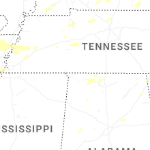


Connect with Interactive Hail Maps