

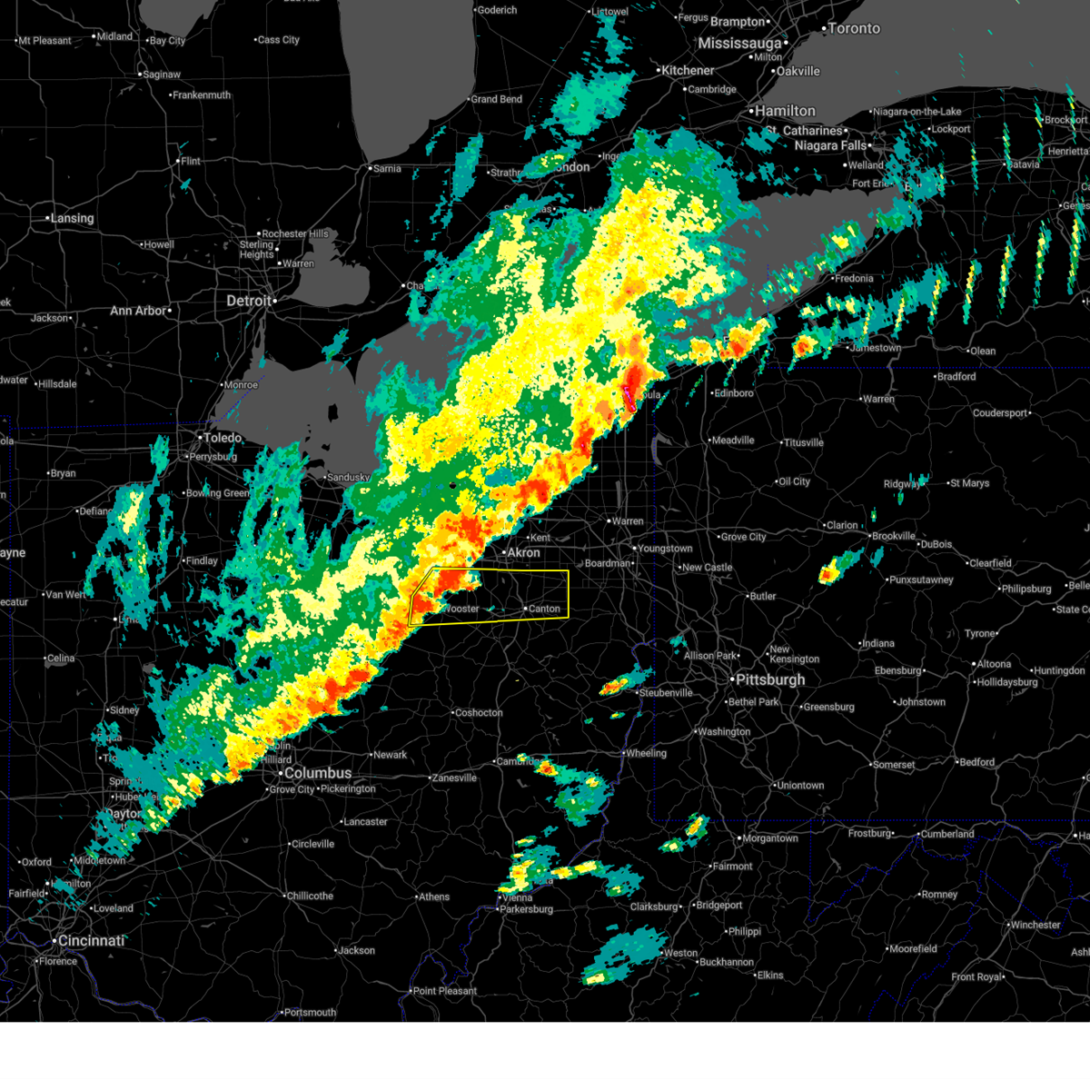
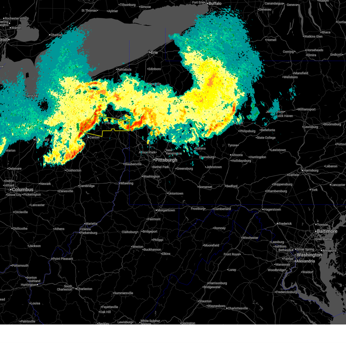
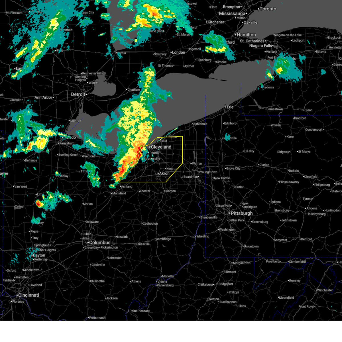
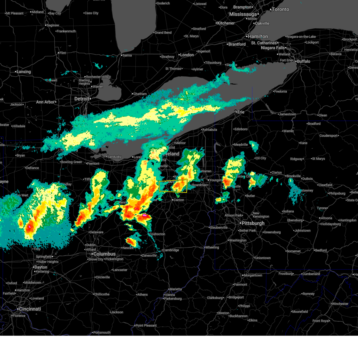
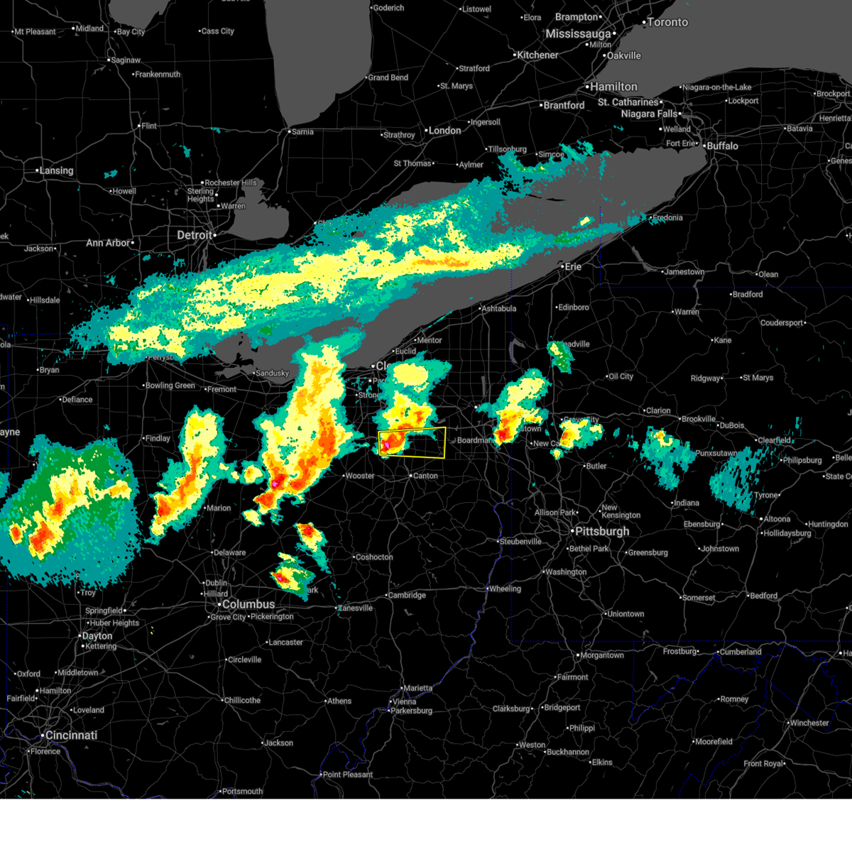
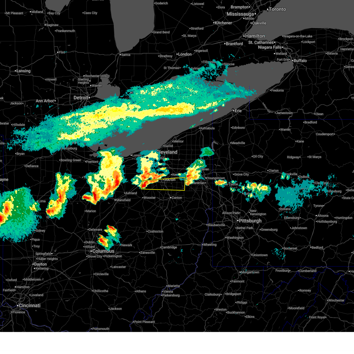
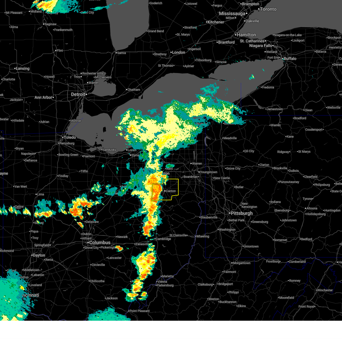
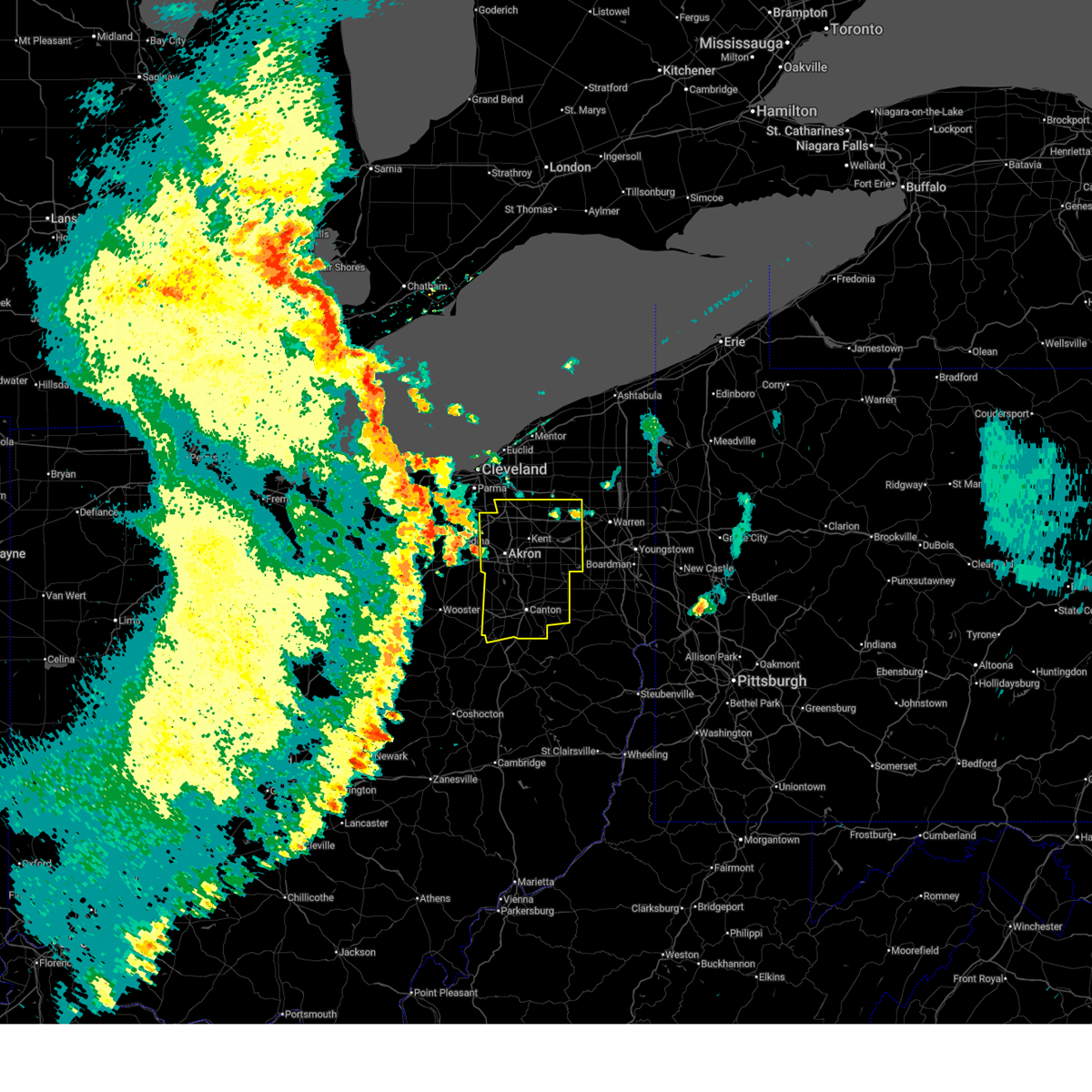
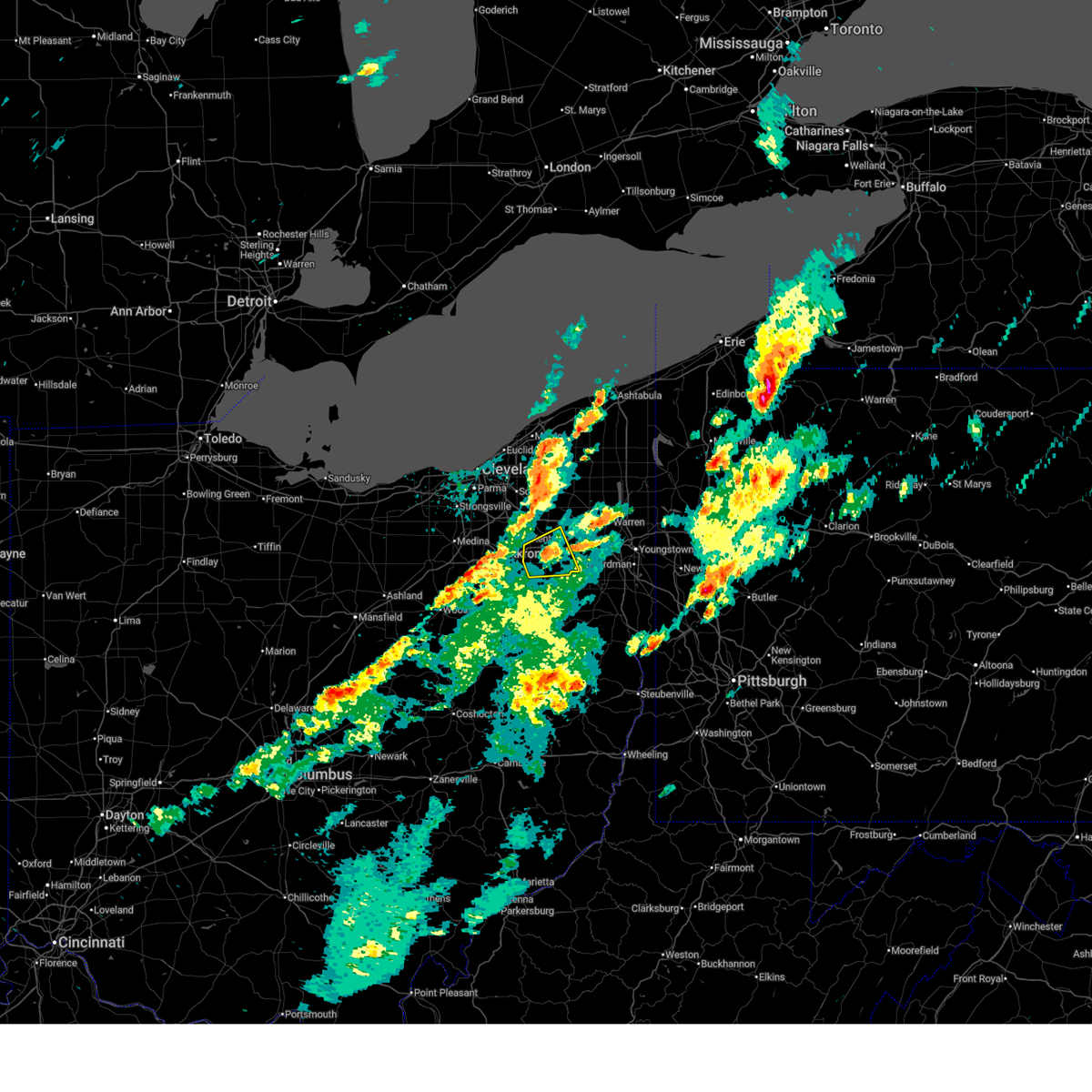
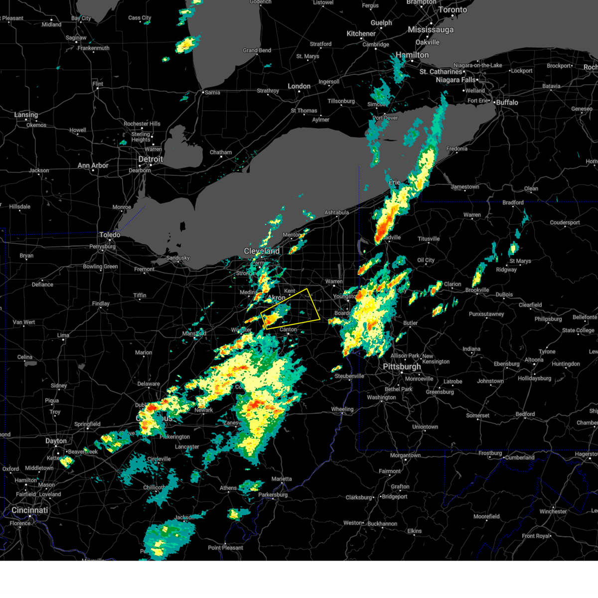
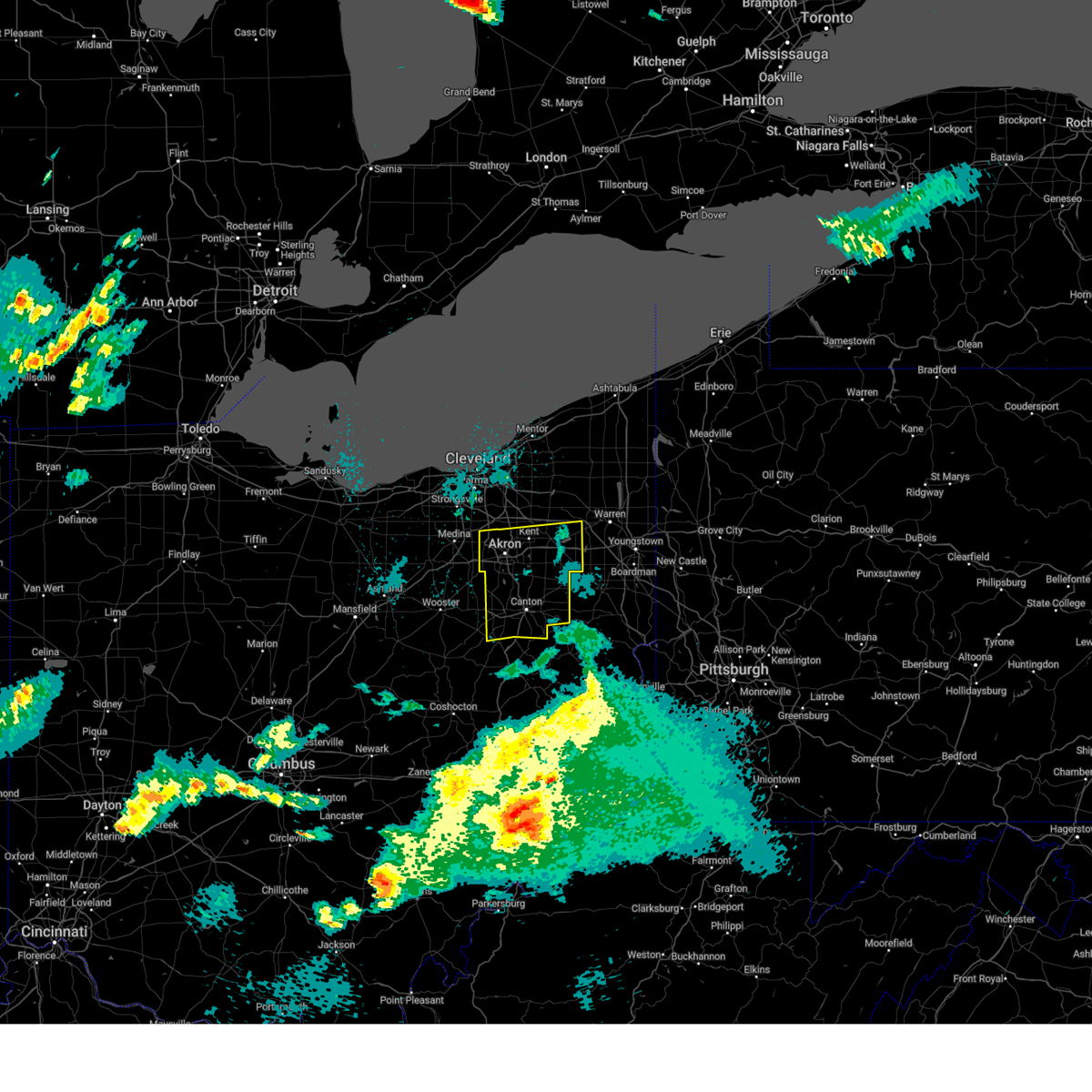
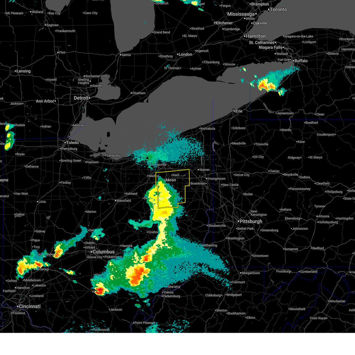
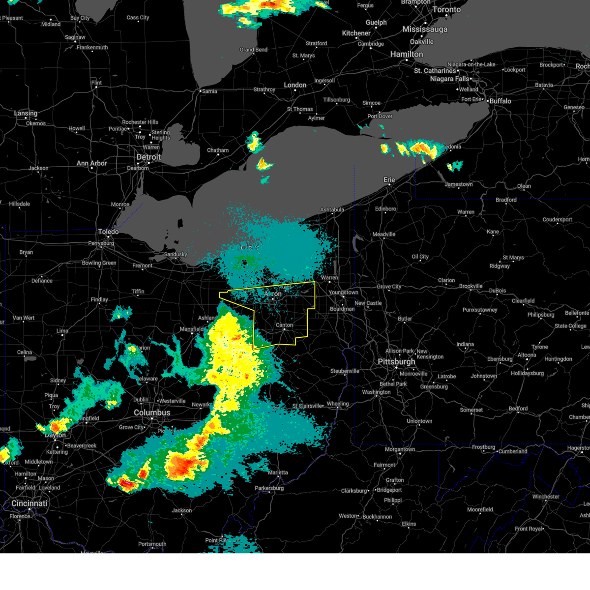
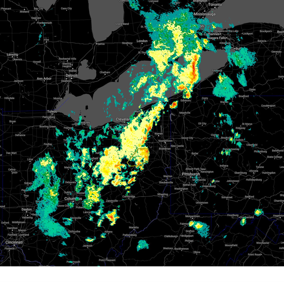
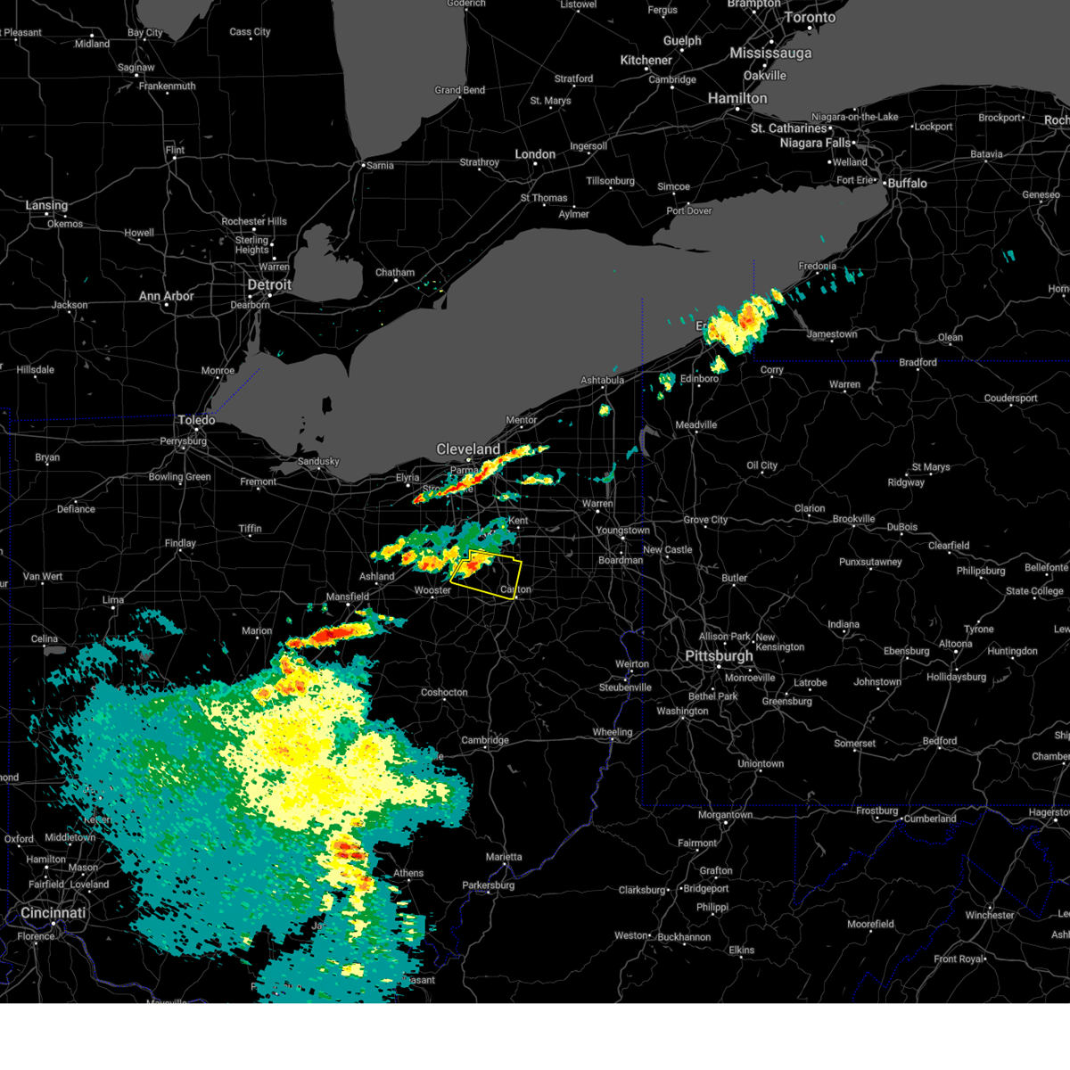
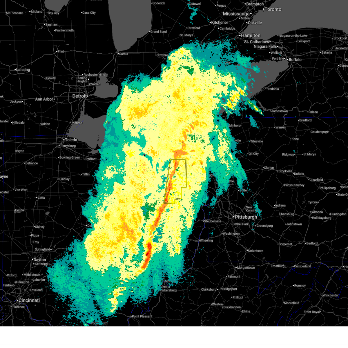
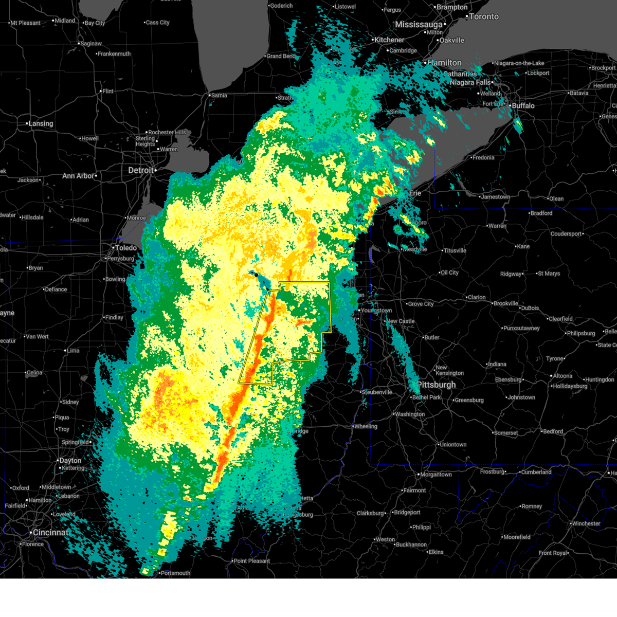
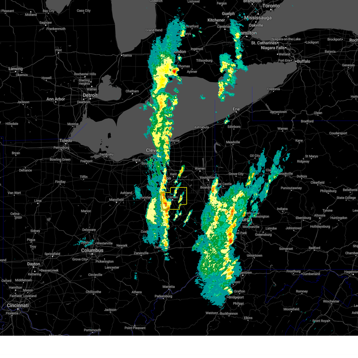
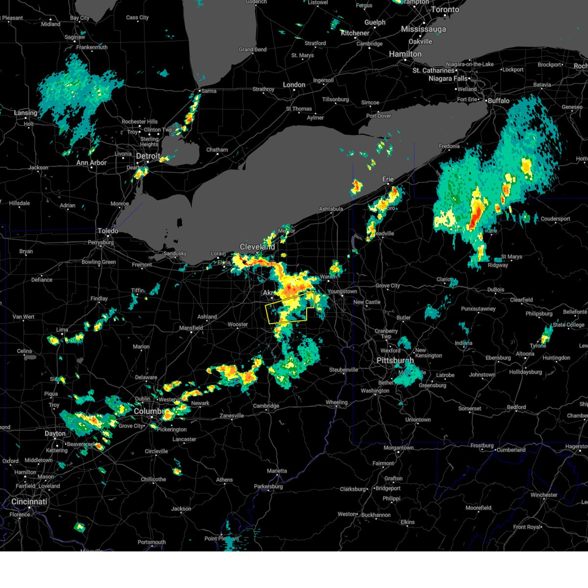
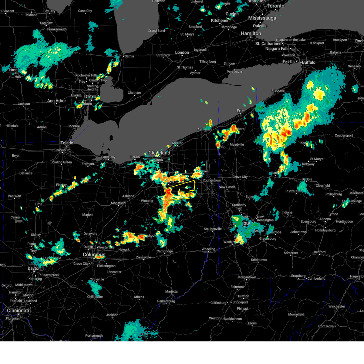
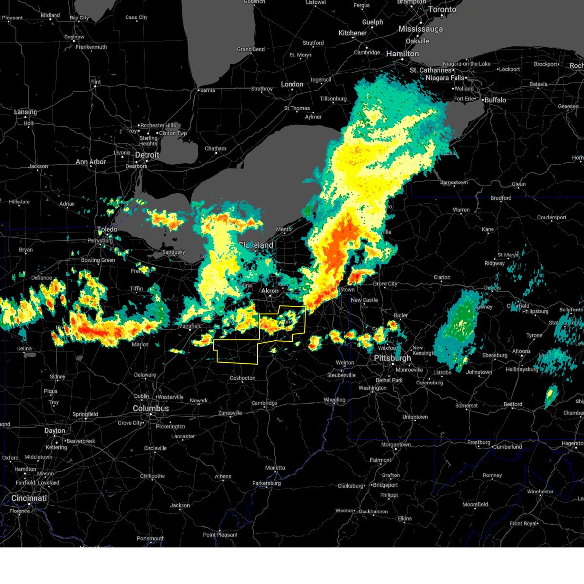
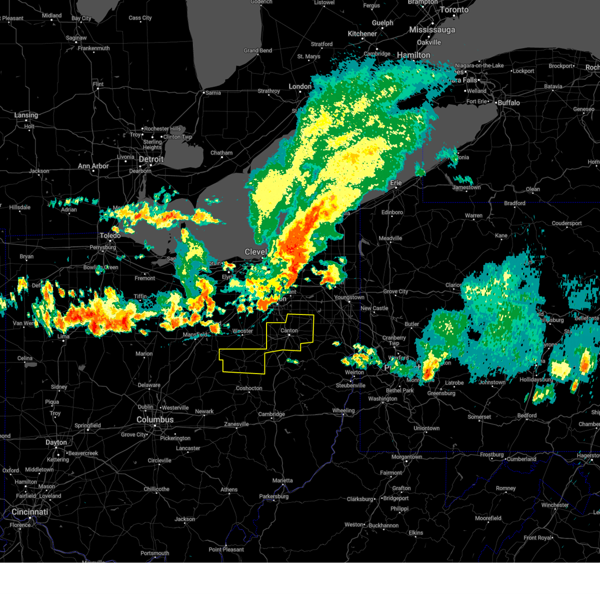
Hail Map for Hartville, OH
The Hartville, OH area has had 0 reports of on-the-ground hail by trained spotters, and has been under severe weather warnings 18 times during the past 12 months. Doppler radar has detected hail at or near Hartville, OH on 29 occasions, including 3 occasions during the past year.
| Name: | Hartville, OH |
| Where Located: | 41.5 miles SSE of Cleveland, OH |
| Map: | Google Map for Hartville, OH |
| Population: | 2944 |
| Housing Units: | 1276 |
| More Info: | Search Google for Hartville, OH |
0
The Top Recent Hail Date for Hartville, OH is Wednesday, June 10, 2026 (27th out of 29)
Hail and Wind Damage Spotted near Hartville, OH
| Date / Time | Report Details |
|---|---|
| 7/3/2026 9:36 PM EDT |
 At 935 pm edt, severe thunderstorms were located along a line extending from cortland to canton, moving southeast at 45 mph (radar indicated). Hazards include 60 mph wind gusts. Expect damage to trees and power lines. Locations impacted include, akron, canton, warren, wooster, ravenna, massillon, kent, barberton, green, alliance, wadsworth, niles, tallmadge, north canton, louisville, orrville, cortland, rittman, newton falls, and sebring. At 935 pm edt, severe thunderstorms were located along a line extending from cortland to canton, moving southeast at 45 mph (radar indicated). Hazards include 60 mph wind gusts. Expect damage to trees and power lines. Locations impacted include, akron, canton, warren, wooster, ravenna, massillon, kent, barberton, green, alliance, wadsworth, niles, tallmadge, north canton, louisville, orrville, cortland, rittman, newton falls, and sebring.
|
| 7/3/2026 9:05 PM EDT |
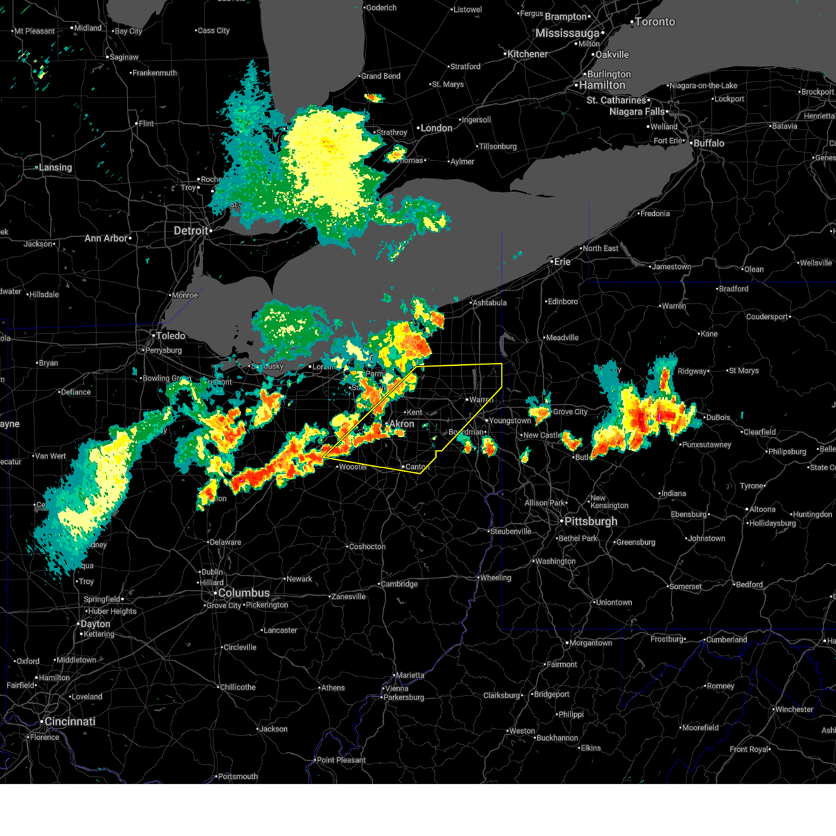 Svrcle the national weather service in cleveland has issued a * severe thunderstorm warning for, trumbull county in northeastern ohio, portage county in northeastern ohio, western mahoning county in northeastern ohio, southern geauga county in northeastern ohio, southeastern medina county in northeastern ohio, northern stark county in northeastern ohio, summit county in northeastern ohio, northern wayne county in northeastern ohio, * until 945 pm edt. * at 904 pm edt, severe thunderstorms were located along a line extending from near west farmington to near dalton, moving east at 35 mph (radar indicated). Hazards include 60 mph wind gusts. expect damage to trees and power lines Svrcle the national weather service in cleveland has issued a * severe thunderstorm warning for, trumbull county in northeastern ohio, portage county in northeastern ohio, western mahoning county in northeastern ohio, southern geauga county in northeastern ohio, southeastern medina county in northeastern ohio, northern stark county in northeastern ohio, summit county in northeastern ohio, northern wayne county in northeastern ohio, * until 945 pm edt. * at 904 pm edt, severe thunderstorms were located along a line extending from near west farmington to near dalton, moving east at 35 mph (radar indicated). Hazards include 60 mph wind gusts. expect damage to trees and power lines
|
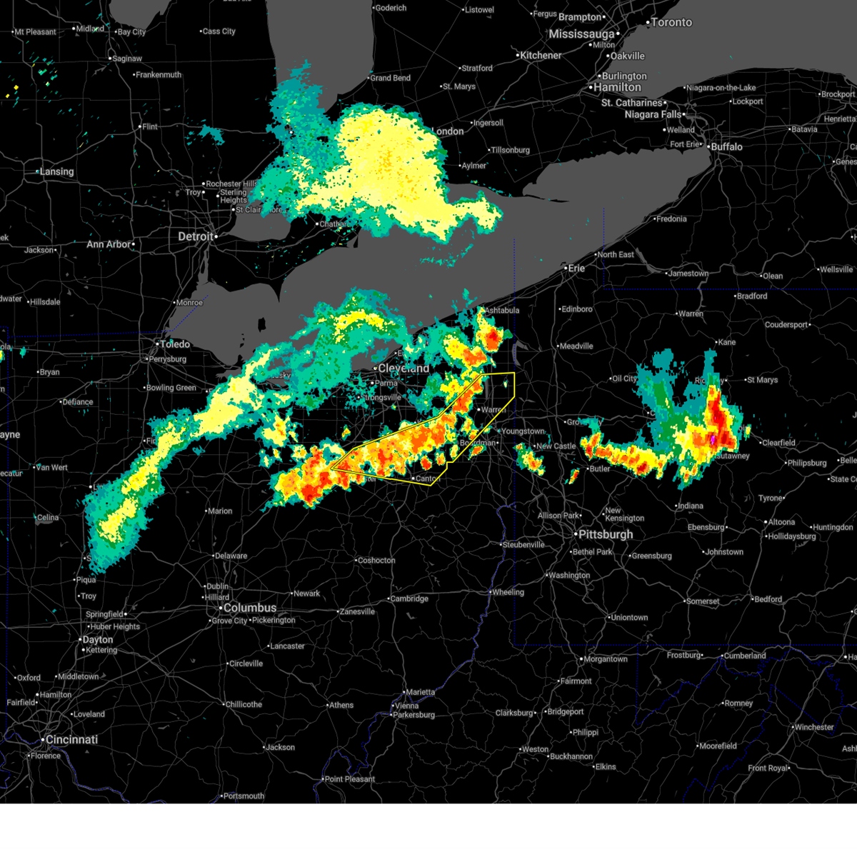
| 6/14/2026 4:31 PM EDT |
 At 430 pm edt, a severe thunderstorm was located near hartville, or 8 miles northeast of canton, moving east at 60 mph (radar indicated). Hazards include 60 mph wind gusts. Expect damage to trees and power lines. Locations impacted include, canton, massillon, green, alliance, north canton, louisville, hartville, navarre, new franklin, canal fulton, east canton, meyers lake, hills and dales, limaville, greentown, robertsville, maximo, perry heights, uniontown, and portage lakes. At 430 pm edt, a severe thunderstorm was located near hartville, or 8 miles northeast of canton, moving east at 60 mph (radar indicated). Hazards include 60 mph wind gusts. Expect damage to trees and power lines. Locations impacted include, canton, massillon, green, alliance, north canton, louisville, hartville, navarre, new franklin, canal fulton, east canton, meyers lake, hills and dales, limaville, greentown, robertsville, maximo, perry heights, uniontown, and portage lakes.
|
| 6/14/2026 3:55 PM EDT |
 Svrcle the national weather service in cleveland has issued a * severe thunderstorm warning for, southeastern medina county in northeastern ohio, east central ashland county in north central ohio, stark county in northeastern ohio, southern summit county in northeastern ohio, wayne county in northeastern ohio, * until 445 pm edt. * at 355 pm edt, a severe thunderstorm was located over wooster, moving east at 55 mph (radar indicated). Hazards include 60 mph wind gusts and quarter size hail. Minor damage to vehicles is possible. Expect damage to trees and power lines. Svrcle the national weather service in cleveland has issued a * severe thunderstorm warning for, southeastern medina county in northeastern ohio, east central ashland county in north central ohio, stark county in northeastern ohio, southern summit county in northeastern ohio, wayne county in northeastern ohio, * until 445 pm edt. * at 355 pm edt, a severe thunderstorm was located over wooster, moving east at 55 mph (radar indicated). Hazards include 60 mph wind gusts and quarter size hail. Minor damage to vehicles is possible. Expect damage to trees and power lines.
|
| 6/10/2026 9:14 PM EDT |
 The storm which prompted the warning has weakened below severe limits, and no longer poses an immediate threat to life or property. therefore, the warning will be allowed to expire. however, gusty winds and heavy rain are still possible with this thunderstorm. The storm which prompted the warning has weakened below severe limits, and no longer poses an immediate threat to life or property. therefore, the warning will be allowed to expire. however, gusty winds and heavy rain are still possible with this thunderstorm.
|
| 6/10/2026 8:37 PM EDT |
 Svrcle the national weather service in cleveland has issued a * severe thunderstorm warning for, southwestern portage county in northeastern ohio, northwestern stark county in northeastern ohio, southern summit county in northeastern ohio, northeastern wayne county in northeastern ohio, * until 915 pm edt. * at 837 pm edt, a severe thunderstorm was located over barberton, or near akron, moving southeast at 15 mph (radar indicated). Hazards include 60 mph wind gusts and quarter size hail. Minor damage to vehicles is possible. Expect damage to trees and power lines. Svrcle the national weather service in cleveland has issued a * severe thunderstorm warning for, southwestern portage county in northeastern ohio, northwestern stark county in northeastern ohio, southern summit county in northeastern ohio, northeastern wayne county in northeastern ohio, * until 915 pm edt. * at 837 pm edt, a severe thunderstorm was located over barberton, or near akron, moving southeast at 15 mph (radar indicated). Hazards include 60 mph wind gusts and quarter size hail. Minor damage to vehicles is possible. Expect damage to trees and power lines.
|
| 4/16/2026 3:21 PM EDT |
 Svrcle the national weather service in cleveland has issued a * severe thunderstorm warning for, central stark county in northeastern ohio, * until 400 pm edt. * at 321 pm edt, a severe thunderstorm was located over canton, moving east at 50 mph (radar indicated). Hazards include 60 mph wind gusts and quarter size hail. Minor damage to vehicles is possible. Expect damage to trees and power lines. Svrcle the national weather service in cleveland has issued a * severe thunderstorm warning for, central stark county in northeastern ohio, * until 400 pm edt. * at 321 pm edt, a severe thunderstorm was located over canton, moving east at 50 mph (radar indicated). Hazards include 60 mph wind gusts and quarter size hail. Minor damage to vehicles is possible. Expect damage to trees and power lines.
|
| 3/31/2026 10:16 PM EDT |
 Svrcle the national weather service in cleveland has issued a * severe thunderstorm warning for, southern portage county in northeastern ohio, mahoning county in northeastern ohio, northern stark county in northeastern ohio, southeastern summit county in northeastern ohio, * until 1100 pm edt. * at 1015 pm edt, a severe thunderstorm was located near hartville, or 12 miles northeast of canton, moving east at 55 mph (radar indicated). Hazards include 60 mph wind gusts. expect damage to trees and power lines Svrcle the national weather service in cleveland has issued a * severe thunderstorm warning for, southern portage county in northeastern ohio, mahoning county in northeastern ohio, northern stark county in northeastern ohio, southeastern summit county in northeastern ohio, * until 1100 pm edt. * at 1015 pm edt, a severe thunderstorm was located near hartville, or 12 miles northeast of canton, moving east at 55 mph (radar indicated). Hazards include 60 mph wind gusts. expect damage to trees and power lines
|
| 3/31/2026 5:25 PM EDT |
 Svrcle the national weather service in cleveland has issued a * severe thunderstorm warning for, portage county in northeastern ohio, geauga county in northeastern ohio, cuyahoga county in northeastern ohio, medina county in northeastern ohio, southern lake county in northeastern ohio, northeastern ashland county in north central ohio, north central stark county in northeastern ohio, summit county in northeastern ohio, northern wayne county in northeastern ohio, southeastern lorain county in north central ohio, * until 615 pm edt. * at 524 pm edt, severe thunderstorms were located along a line extending from near lakewood to near brunswick to near polk, moving east at 65 mph (radar indicated). Hazards include 70 mph wind gusts and penny size hail. Expect considerable tree damage. Damage is likely to mobile homes, roofs, and outbuildings. Svrcle the national weather service in cleveland has issued a * severe thunderstorm warning for, portage county in northeastern ohio, geauga county in northeastern ohio, cuyahoga county in northeastern ohio, medina county in northeastern ohio, southern lake county in northeastern ohio, northeastern ashland county in north central ohio, north central stark county in northeastern ohio, summit county in northeastern ohio, northern wayne county in northeastern ohio, southeastern lorain county in north central ohio, * until 615 pm edt. * at 524 pm edt, severe thunderstorms were located along a line extending from near lakewood to near brunswick to near polk, moving east at 65 mph (radar indicated). Hazards include 70 mph wind gusts and penny size hail. Expect considerable tree damage. Damage is likely to mobile homes, roofs, and outbuildings.
|
| 3/22/2026 9:07 PM EDT |
 The storm which prompted the warning has weakened below severe limits, and no longer poses an immediate threat to life or property. therefore, the warning will be allowed to expire. a severe thunderstorm watch remains in effect until midnight edt for northeastern ohio. The storm which prompted the warning has weakened below severe limits, and no longer poses an immediate threat to life or property. therefore, the warning will be allowed to expire. a severe thunderstorm watch remains in effect until midnight edt for northeastern ohio.
|
| 3/22/2026 8:48 PM EDT |
 At 848 pm edt, a severe thunderstorm was located near barberton, or near akron, moving east at 55 mph (radar indicated). Hazards include ping pong ball size hail. People and animals outdoors will be injured. expect damage to roofs, siding, windows, and vehicles. Locations impacted include, akron, barberton, green, alliance, tallmadge, mogadore, hartville, new franklin, norton, brimfield, randolph, lakemore, atwater, edinburg, clinton, limaville, greentown, portage lakes, and uniontown. At 848 pm edt, a severe thunderstorm was located near barberton, or near akron, moving east at 55 mph (radar indicated). Hazards include ping pong ball size hail. People and animals outdoors will be injured. expect damage to roofs, siding, windows, and vehicles. Locations impacted include, akron, barberton, green, alliance, tallmadge, mogadore, hartville, new franklin, norton, brimfield, randolph, lakemore, atwater, edinburg, clinton, limaville, greentown, portage lakes, and uniontown.
|
| 3/22/2026 8:48 PM EDT |
 the severe thunderstorm warning has been cancelled and is no longer in effect the severe thunderstorm warning has been cancelled and is no longer in effect
|
| 3/22/2026 8:32 PM EDT |
 Svrcle the national weather service in cleveland has issued a * severe thunderstorm warning for, southern portage county in northeastern ohio, southeastern medina county in northeastern ohio, northeastern stark county in northeastern ohio, southern summit county in northeastern ohio, northeastern wayne county in northeastern ohio, * until 915 pm edt. * at 832 pm edt, a severe thunderstorm was located over rittman, or 10 miles south of medina, moving east at 65 mph (radar indicated). Hazards include quarter size hail. minor damage to vehicles is possible Svrcle the national weather service in cleveland has issued a * severe thunderstorm warning for, southern portage county in northeastern ohio, southeastern medina county in northeastern ohio, northeastern stark county in northeastern ohio, southern summit county in northeastern ohio, northeastern wayne county in northeastern ohio, * until 915 pm edt. * at 832 pm edt, a severe thunderstorm was located over rittman, or 10 miles south of medina, moving east at 65 mph (radar indicated). Hazards include quarter size hail. minor damage to vehicles is possible
|
| 7/31/2025 1:30 AM EDT |
 the severe thunderstorm warning has been cancelled and is no longer in effect the severe thunderstorm warning has been cancelled and is no longer in effect
|
| 7/31/2025 1:06 AM EDT |
 Svrcle the national weather service in cleveland has issued a * severe thunderstorm warning for, southwestern portage county in northeastern ohio, northern stark county in northeastern ohio, southern summit county in northeastern ohio, * until 145 am edt. * at 106 am edt, severe thunderstorms were located along a line extending from doylestown to near massillon, moving east at 25 mph (radar indicated). Hazards include 60 mph wind gusts. expect damage to trees and power lines Svrcle the national weather service in cleveland has issued a * severe thunderstorm warning for, southwestern portage county in northeastern ohio, northern stark county in northeastern ohio, southern summit county in northeastern ohio, * until 145 am edt. * at 106 am edt, severe thunderstorms were located along a line extending from doylestown to near massillon, moving east at 25 mph (radar indicated). Hazards include 60 mph wind gusts. expect damage to trees and power lines
|
| 7/28/2025 8:15 PM EDT |
 The storms which prompted the warning have weakened below severe limits, and no longer pose an immediate threat to life or property. therefore, the warning has been allowed to expire. however, gusty winds and heavy rain are still possible with these thunderstorms. to report severe weather, contact your nearest law enforcement agency. they will relay your report to the national weather service cleveland. The storms which prompted the warning have weakened below severe limits, and no longer pose an immediate threat to life or property. therefore, the warning has been allowed to expire. however, gusty winds and heavy rain are still possible with these thunderstorms. to report severe weather, contact your nearest law enforcement agency. they will relay your report to the national weather service cleveland.
|
| 7/28/2025 7:58 PM EDT |
 At 758 pm edt, severe thunderstorms were located along a line extending from near north canton to east sparta, moving east at 25 mph (radar indicated). Hazards include 60 mph wind gusts. Expect damage to trees and power lines. Locations impacted include, canton, massillon, green, alliance, north canton, louisville, minerva, hartville, navarre, waynesburg, east sparta, east canton, bolivar, meyers lake, hills and dales, limaville, greentown, robertsville, maximo, and perry heights. At 758 pm edt, severe thunderstorms were located along a line extending from near north canton to east sparta, moving east at 25 mph (radar indicated). Hazards include 60 mph wind gusts. Expect damage to trees and power lines. Locations impacted include, canton, massillon, green, alliance, north canton, louisville, minerva, hartville, navarre, waynesburg, east sparta, east canton, bolivar, meyers lake, hills and dales, limaville, greentown, robertsville, maximo, and perry heights.
|
| 7/28/2025 7:50 PM EDT | Tree down across roadway. time estimated via rada in stark county OH, 1.1 miles S of Hartville, OH |
| 7/28/2025 7:37 PM EDT |
 Svrcle the national weather service in cleveland has issued a * severe thunderstorm warning for, stark county in northeastern ohio, * until 815 pm edt. * at 737 pm edt, severe thunderstorms were located along a line extending from near green to near strasburg, moving east at 35 mph (radar indicated). Hazards include 60 mph wind gusts. expect damage to trees and power lines Svrcle the national weather service in cleveland has issued a * severe thunderstorm warning for, stark county in northeastern ohio, * until 815 pm edt. * at 737 pm edt, severe thunderstorms were located along a line extending from near green to near strasburg, moving east at 35 mph (radar indicated). Hazards include 60 mph wind gusts. expect damage to trees and power lines
|
| 6/18/2025 10:13 PM EDT |
 The storms which prompted the warning have moved out of the area. therefore, the warning will be allowed to expire. however, heavy rain is still possible with these thunderstorms. a severe thunderstorm watch remains in effect until 300 am edt for northeastern ohio. The storms which prompted the warning have moved out of the area. therefore, the warning will be allowed to expire. however, heavy rain is still possible with these thunderstorms. a severe thunderstorm watch remains in effect until 300 am edt for northeastern ohio.
|
| 6/18/2025 9:49 PM EDT |
 At 949 pm edt, severe thunderstorms were located along a line extending from 7 miles southwest of newton falls to near sebring to near waynesburg, moving east at 60 mph (radar indicated). Hazards include 70 mph wind gusts. Expect considerable tree damage. damage is likely to mobile homes, roofs, and outbuildings. Locations impacted include, canton, ravenna, massillon, kent, green, alliance, tallmadge, north canton, streetsboro, louisville, mogadore, minerva, hartville, garrettsville, navarre, mantua, waynesburg, east sparta, aurora, and brimfield. At 949 pm edt, severe thunderstorms were located along a line extending from 7 miles southwest of newton falls to near sebring to near waynesburg, moving east at 60 mph (radar indicated). Hazards include 70 mph wind gusts. Expect considerable tree damage. damage is likely to mobile homes, roofs, and outbuildings. Locations impacted include, canton, ravenna, massillon, kent, green, alliance, tallmadge, north canton, streetsboro, louisville, mogadore, minerva, hartville, garrettsville, navarre, mantua, waynesburg, east sparta, aurora, and brimfield.
|
| 6/18/2025 9:49 PM EDT |
 the severe thunderstorm warning has been cancelled and is no longer in effect the severe thunderstorm warning has been cancelled and is no longer in effect
|
| 6/18/2025 8:54 PM EDT |
 Svrcle the national weather service in cleveland has issued a * severe thunderstorm warning for, portage county in northeastern ohio, stark county in northeastern ohio, summit county in northeastern ohio, southeastern wayne county in northeastern ohio, * until 1015 pm edt. * at 854 pm edt, severe thunderstorms were located along a line extending from 6 miles southeast of west salem to near shreve to near glenmont, moving east at 60 mph (radar indicated). Hazards include 70 mph wind gusts. Expect considerable tree damage. Damage is likely to mobile homes, roofs, and outbuildings. Svrcle the national weather service in cleveland has issued a * severe thunderstorm warning for, portage county in northeastern ohio, stark county in northeastern ohio, summit county in northeastern ohio, southeastern wayne county in northeastern ohio, * until 1015 pm edt. * at 854 pm edt, severe thunderstorms were located along a line extending from 6 miles southeast of west salem to near shreve to near glenmont, moving east at 60 mph (radar indicated). Hazards include 70 mph wind gusts. Expect considerable tree damage. Damage is likely to mobile homes, roofs, and outbuildings.
|
| 6/18/2025 6:00 PM EDT |
 Torcle the national weather service in cleveland has issued a * tornado warning for, southern portage county in northeastern ohio, southwestern mahoning county in northeastern ohio, northeastern stark county in northeastern ohio, east central summit county in northeastern ohio, * until 645 pm edt. * at 600 pm edt, a severe thunderstorm capable of producing a tornado was located over tallmadge, or near akron, moving east at 30 mph (radar indicated rotation). Hazards include tornado. Flying debris will be dangerous to those caught without shelter. mobile homes will be damaged or destroyed. damage to roofs, windows, and vehicles will occur. tree damage is likely. this dangerous storm will be near, akron, ravenna, kent, tallmadge, and mogadore around 605 pm edt. alliance around 630 pm edt. Other locations impacted by this tornadic thunderstorm include silver lake, brimfield, brady lake, atwater, edinburg, limaville, lakemore, deerfield, randolph, and munroe falls. Torcle the national weather service in cleveland has issued a * tornado warning for, southern portage county in northeastern ohio, southwestern mahoning county in northeastern ohio, northeastern stark county in northeastern ohio, east central summit county in northeastern ohio, * until 645 pm edt. * at 600 pm edt, a severe thunderstorm capable of producing a tornado was located over tallmadge, or near akron, moving east at 30 mph (radar indicated rotation). Hazards include tornado. Flying debris will be dangerous to those caught without shelter. mobile homes will be damaged or destroyed. damage to roofs, windows, and vehicles will occur. tree damage is likely. this dangerous storm will be near, akron, ravenna, kent, tallmadge, and mogadore around 605 pm edt. alliance around 630 pm edt. Other locations impacted by this tornadic thunderstorm include silver lake, brimfield, brady lake, atwater, edinburg, limaville, lakemore, deerfield, randolph, and munroe falls.
|
| 6/18/2025 3:50 PM EDT |
 The storm which prompted the warning has weakened below severe limits, and no longer poses an immediate threat to life or property. therefore, the warning will be allowed to expire. The storm which prompted the warning has weakened below severe limits, and no longer poses an immediate threat to life or property. therefore, the warning will be allowed to expire.
|
| 6/18/2025 3:37 PM EDT | the severe thunderstorm warning has been cancelled and is no longer in effect |
| 6/18/2025 3:37 PM EDT | At 337 pm edt, a severe thunderstorm was located over green, or 7 miles southeast of akron, moving east at 30 mph (radar indicated). Hazards include 60 mph wind gusts and penny size hail. Expect damage to trees and power lines. Locations impacted include, akron, green, tallmadge, north canton, mogadore, hartville, new franklin, brimfield, randolph, lakemore, greentown, portage lakes, and uniontown. |
| 6/18/2025 3:12 PM EDT |
 Svrcle the national weather service in cleveland has issued a * severe thunderstorm warning for, southwestern portage county in northeastern ohio, southeastern medina county in northeastern ohio, northwestern stark county in northeastern ohio, southern summit county in northeastern ohio, northeastern wayne county in northeastern ohio, * until 400 pm edt. * at 312 pm edt, a severe thunderstorm was located over doylestown, or 9 miles southwest of akron, moving east at 30 mph (radar indicated). Hazards include 60 mph wind gusts and penny size hail. expect damage to trees and power lines Svrcle the national weather service in cleveland has issued a * severe thunderstorm warning for, southwestern portage county in northeastern ohio, southeastern medina county in northeastern ohio, northwestern stark county in northeastern ohio, southern summit county in northeastern ohio, northeastern wayne county in northeastern ohio, * until 400 pm edt. * at 312 pm edt, a severe thunderstorm was located over doylestown, or 9 miles southwest of akron, moving east at 30 mph (radar indicated). Hazards include 60 mph wind gusts and penny size hail. expect damage to trees and power lines
|
| 6/9/2025 3:54 PM EDT |
 The storm which prompted the warning has weakened below severe limits, and no longer poses an immediate threat to life or property. therefore, the warning will be allowed to expire. a severe thunderstorm watch remains in effect until 1000 pm edt for northeastern ohio. The storm which prompted the warning has weakened below severe limits, and no longer poses an immediate threat to life or property. therefore, the warning will be allowed to expire. a severe thunderstorm watch remains in effect until 1000 pm edt for northeastern ohio.
|
| 6/9/2025 3:47 PM EDT |
 At 347 pm edt, a severe thunderstorm was located near hartville, or 8 miles south of ravenna, moving northeast at 35 mph (radar indicated). Hazards include 60 mph wind gusts and penny size hail. Expect damage to trees and power lines. Locations impacted include, ravenna, kent, tallmadge, mogadore, hartville, brimfield, randolph, atwater, edinburg, deerfield, and limaville. At 347 pm edt, a severe thunderstorm was located near hartville, or 8 miles south of ravenna, moving northeast at 35 mph (radar indicated). Hazards include 60 mph wind gusts and penny size hail. Expect damage to trees and power lines. Locations impacted include, ravenna, kent, tallmadge, mogadore, hartville, brimfield, randolph, atwater, edinburg, deerfield, and limaville.
|
| 6/9/2025 3:47 PM EDT |
 the severe thunderstorm warning has been cancelled and is no longer in effect the severe thunderstorm warning has been cancelled and is no longer in effect
|
| 6/9/2025 3:32 PM EDT |
 the severe thunderstorm warning has been cancelled and is no longer in effect the severe thunderstorm warning has been cancelled and is no longer in effect
|
| 6/9/2025 3:32 PM EDT |
 At 331 pm edt, a severe thunderstorm was located near green, or 9 miles southeast of akron, moving northeast at 30 mph (radar indicated). Hazards include 60 mph wind gusts and penny size hail. Expect damage to trees and power lines. Locations impacted include, akron, ravenna, kent, barberton, green, alliance, tallmadge, north canton, sebring, mogadore, hartville, new franklin, brimfield, randolph, lakemore, atwater, edinburg, deerfield, limaville, and greentown. At 331 pm edt, a severe thunderstorm was located near green, or 9 miles southeast of akron, moving northeast at 30 mph (radar indicated). Hazards include 60 mph wind gusts and penny size hail. Expect damage to trees and power lines. Locations impacted include, akron, ravenna, kent, barberton, green, alliance, tallmadge, north canton, sebring, mogadore, hartville, new franklin, brimfield, randolph, lakemore, atwater, edinburg, deerfield, limaville, and greentown.
|
| 6/9/2025 3:14 PM EDT |
 Svrcle the national weather service in cleveland has issued a * severe thunderstorm warning for, southern portage county in northeastern ohio, southwestern mahoning county in northeastern ohio, northern stark county in northeastern ohio, southern summit county in northeastern ohio, northeastern wayne county in northeastern ohio, * until 400 pm edt. * at 314 pm edt, a severe thunderstorm was located near green, or 11 miles south of akron, moving northeast at 30 mph (radar indicated). Hazards include 60 mph wind gusts and penny size hail. expect damage to trees and power lines Svrcle the national weather service in cleveland has issued a * severe thunderstorm warning for, southern portage county in northeastern ohio, southwestern mahoning county in northeastern ohio, northern stark county in northeastern ohio, southern summit county in northeastern ohio, northeastern wayne county in northeastern ohio, * until 400 pm edt. * at 314 pm edt, a severe thunderstorm was located near green, or 11 miles south of akron, moving northeast at 30 mph (radar indicated). Hazards include 60 mph wind gusts and penny size hail. expect damage to trees and power lines
|
| 5/16/2025 11:59 PM EDT |
 The storms which prompted the warning have moved out of the warned area. therefore, the warning will be allowed to expire. a severe thunderstorm watch remains in effect until 400 am edt for northeastern ohio. The storms which prompted the warning have moved out of the warned area. therefore, the warning will be allowed to expire. a severe thunderstorm watch remains in effect until 400 am edt for northeastern ohio.
|
| 5/16/2025 11:30 PM EDT |
 the severe thunderstorm warning has been cancelled and is no longer in effect the severe thunderstorm warning has been cancelled and is no longer in effect
|
| 5/16/2025 11:30 PM EDT |
 At 1130 pm edt, severe thunderstorms were located along a line extending from near akron to near uhrichsville, moving east at 55 mph (radar indicated). Hazards include 60 mph wind gusts. Expect damage to trees and power lines. Locations impacted include, akron, canton, ravenna, cuyahoga falls, massillon, kent, barberton, green, alliance, hudson, tallmadge, north canton, streetsboro, louisville, mogadore, minerva, hartville, brewster, navarre, and waynesburg. At 1130 pm edt, severe thunderstorms were located along a line extending from near akron to near uhrichsville, moving east at 55 mph (radar indicated). Hazards include 60 mph wind gusts. Expect damage to trees and power lines. Locations impacted include, akron, canton, ravenna, cuyahoga falls, massillon, kent, barberton, green, alliance, hudson, tallmadge, north canton, streetsboro, louisville, mogadore, minerva, hartville, brewster, navarre, and waynesburg.
|
| 5/16/2025 11:07 PM EDT |
 Svrcle the national weather service in cleveland has issued a * severe thunderstorm warning for, portage county in northeastern ohio, southern medina county in northeastern ohio, stark county in northeastern ohio, summit county in northeastern ohio, eastern wayne county in northeastern ohio, northeastern holmes county in northeastern ohio, * until midnight edt. * at 1107 pm edt, severe thunderstorms were located along a line extending from lodi to near west lafayette, moving east at 55 mph (radar indicated). Hazards include 60 mph wind gusts. expect damage to trees and power lines Svrcle the national weather service in cleveland has issued a * severe thunderstorm warning for, portage county in northeastern ohio, southern medina county in northeastern ohio, stark county in northeastern ohio, summit county in northeastern ohio, eastern wayne county in northeastern ohio, northeastern holmes county in northeastern ohio, * until midnight edt. * at 1107 pm edt, severe thunderstorms were located along a line extending from lodi to near west lafayette, moving east at 55 mph (radar indicated). Hazards include 60 mph wind gusts. expect damage to trees and power lines
|
| 5/1/2025 5:27 PM EDT |
 The storm which prompted the warning has moved out western portions of stark county. therefore, the warning will be allowed to expire. a severe thunderstorm watch remains in effect until 700 pm edt for northeastern ohio. remember, a severe thunderstorm warning still remains in effect for eastern portions of stark county until 615 pm edt. The storm which prompted the warning has moved out western portions of stark county. therefore, the warning will be allowed to expire. a severe thunderstorm watch remains in effect until 700 pm edt for northeastern ohio. remember, a severe thunderstorm warning still remains in effect for eastern portions of stark county until 615 pm edt.
|
| 5/1/2025 5:25 PM EDT |
 Svrcle the national weather service in cleveland has issued a * severe thunderstorm warning for, southern trumbull county in northeastern ohio, mahoning county in northeastern ohio, southeastern portage county in northeastern ohio, northeastern stark county in northeastern ohio, * until 615 pm edt. * at 524 pm edt, a severe thunderstorm was located over alliance, or 14 miles west of salem, moving northeast at 45 mph (radar indicated). Hazards include 60 mph wind gusts. expect damage to trees and power lines Svrcle the national weather service in cleveland has issued a * severe thunderstorm warning for, southern trumbull county in northeastern ohio, mahoning county in northeastern ohio, southeastern portage county in northeastern ohio, northeastern stark county in northeastern ohio, * until 615 pm edt. * at 524 pm edt, a severe thunderstorm was located over alliance, or 14 miles west of salem, moving northeast at 45 mph (radar indicated). Hazards include 60 mph wind gusts. expect damage to trees and power lines
|
| 5/1/2025 4:56 PM EDT |
 Svrcle the national weather service in cleveland has issued a * severe thunderstorm warning for, stark county in northeastern ohio, * until 530 pm edt. * at 456 pm edt, a severe thunderstorm was located over navarre, or 8 miles southwest of canton, moving northeast at 50 mph (radar indicated). Hazards include 60 mph wind gusts. expect damage to trees and power lines Svrcle the national weather service in cleveland has issued a * severe thunderstorm warning for, stark county in northeastern ohio, * until 530 pm edt. * at 456 pm edt, a severe thunderstorm was located over navarre, or 8 miles southwest of canton, moving northeast at 50 mph (radar indicated). Hazards include 60 mph wind gusts. expect damage to trees and power lines
|
| 4/29/2025 9:14 PM EDT |
 the severe thunderstorm warning has been cancelled and is no longer in effect the severe thunderstorm warning has been cancelled and is no longer in effect
|
| 4/29/2025 8:55 PM EDT |
 At 855 pm edt, a severe thunderstorm was located near barberton, or 10 miles southwest of akron, moving east at 40 mph (radar indicated). Hazards include 60 mph wind gusts. Expect damage to trees and power lines. Locations impacted include, akron, canton, massillon, barberton, green, north canton, orrville, rittman, doylestown, hartville, new franklin, norton, canal fulton, clinton, marshallville, meyers lake, hills and dales, greentown, portage lakes, and north lawrence. At 855 pm edt, a severe thunderstorm was located near barberton, or 10 miles southwest of akron, moving east at 40 mph (radar indicated). Hazards include 60 mph wind gusts. Expect damage to trees and power lines. Locations impacted include, akron, canton, massillon, barberton, green, north canton, orrville, rittman, doylestown, hartville, new franklin, norton, canal fulton, clinton, marshallville, meyers lake, hills and dales, greentown, portage lakes, and north lawrence.
|
| 4/29/2025 8:55 PM EDT |
 the severe thunderstorm warning has been cancelled and is no longer in effect the severe thunderstorm warning has been cancelled and is no longer in effect
|
| 4/29/2025 8:42 PM EDT |
 Svrcle the national weather service in cleveland has issued a * severe thunderstorm warning for, southeastern medina county in northeastern ohio, northwestern stark county in northeastern ohio, southern summit county in northeastern ohio, northeastern wayne county in northeastern ohio, * until 930 pm edt. * at 842 pm edt, a severe thunderstorm was located over rittman, or 13 miles southeast of medina, moving east at 50 mph (radar indicated). Hazards include 60 mph wind gusts. expect damage to trees and power lines Svrcle the national weather service in cleveland has issued a * severe thunderstorm warning for, southeastern medina county in northeastern ohio, northwestern stark county in northeastern ohio, southern summit county in northeastern ohio, northeastern wayne county in northeastern ohio, * until 930 pm edt. * at 842 pm edt, a severe thunderstorm was located over rittman, or 13 miles southeast of medina, moving east at 50 mph (radar indicated). Hazards include 60 mph wind gusts. expect damage to trees and power lines
|
| 4/29/2025 4:29 PM EDT |
 Svrcle the national weather service in cleveland has issued a * severe thunderstorm warning for, trumbull county in northeastern ohio, mahoning county in northeastern ohio, portage county in northeastern ohio, southern geauga county in northeastern ohio, southeastern cuyahoga county in northeastern ohio, stark county in northeastern ohio, summit county in northeastern ohio, * until 515 pm edt. * at 429 pm edt, severe thunderstorms were located along a line extending from 6 miles northwest of cuyahoga falls to near waynesburg, moving northeast at 50 mph (radar indicated). Hazards include 60 mph wind gusts and penny size hail. expect damage to trees and power lines Svrcle the national weather service in cleveland has issued a * severe thunderstorm warning for, trumbull county in northeastern ohio, mahoning county in northeastern ohio, portage county in northeastern ohio, southern geauga county in northeastern ohio, southeastern cuyahoga county in northeastern ohio, stark county in northeastern ohio, summit county in northeastern ohio, * until 515 pm edt. * at 429 pm edt, severe thunderstorms were located along a line extending from 6 miles northwest of cuyahoga falls to near waynesburg, moving northeast at 50 mph (radar indicated). Hazards include 60 mph wind gusts and penny size hail. expect damage to trees and power lines
|
| 4/3/2025 3:30 AM EDT |
 The storms which prompted the warning have moved out of the area. therefore, the warning has been allowed to expire. a severe thunderstorm watch remains in effect until 700 am edt for northeastern ohio. to report severe weather, contact your nearest law enforcement agency. they will relay your report to the national weather service cleveland. The storms which prompted the warning have moved out of the area. therefore, the warning has been allowed to expire. a severe thunderstorm watch remains in effect until 700 am edt for northeastern ohio. to report severe weather, contact your nearest law enforcement agency. they will relay your report to the national weather service cleveland.
|
| 4/3/2025 3:11 AM EDT |
 At 311 am edt, severe thunderstorms were located along a line extending from near ravenna to east sparta, moving east at 70 mph (radar indicated). Hazards include 60 mph wind gusts. Expect damage to trees and power lines. Locations impacted include, canton, ravenna, kent, alliance, north canton, streetsboro, louisville, sebring, minerva, hartville, garrettsville, mantua, waynesburg, east sparta, aurora, brimfield, randolph, atwater, edinburg, and windham. At 311 am edt, severe thunderstorms were located along a line extending from near ravenna to east sparta, moving east at 70 mph (radar indicated). Hazards include 60 mph wind gusts. Expect damage to trees and power lines. Locations impacted include, canton, ravenna, kent, alliance, north canton, streetsboro, louisville, sebring, minerva, hartville, garrettsville, mantua, waynesburg, east sparta, aurora, brimfield, randolph, atwater, edinburg, and windham.
|
| 4/3/2025 3:11 AM EDT |
 the severe thunderstorm warning has been cancelled and is no longer in effect the severe thunderstorm warning has been cancelled and is no longer in effect
|
| 4/3/2025 3:00 AM EDT |
 At 259 am edt, severe thunderstorms were located along a line extending from kent to near wilmot, moving east at 70 mph (radar indicated). Hazards include 60 mph wind gusts. Expect damage to trees and power lines. Locations impacted include, akron, canton, ravenna, cuyahoga falls, massillon, kent, barberton, green, solon, alliance, hudson, twinsburg, tallmadge, north canton, streetsboro, macedonia, louisville, sebring, mogadore, and walnut creek. At 259 am edt, severe thunderstorms were located along a line extending from kent to near wilmot, moving east at 70 mph (radar indicated). Hazards include 60 mph wind gusts. Expect damage to trees and power lines. Locations impacted include, akron, canton, ravenna, cuyahoga falls, massillon, kent, barberton, green, solon, alliance, hudson, twinsburg, tallmadge, north canton, streetsboro, macedonia, louisville, sebring, mogadore, and walnut creek.
|
| 4/3/2025 3:00 AM EDT |
 the severe thunderstorm warning has been cancelled and is no longer in effect the severe thunderstorm warning has been cancelled and is no longer in effect
|
| 4/3/2025 2:42 AM EDT |
 Svrcle the national weather service in cleveland has issued a * severe thunderstorm warning for, western mahoning county in northeastern ohio, portage county in northeastern ohio, eastern medina county in northeastern ohio, stark county in northeastern ohio, summit county in northeastern ohio, eastern wayne county in northeastern ohio, holmes county in northeastern ohio, * until 330 am edt. * at 242 am edt, severe thunderstorms were located along a line extending from 7 miles northeast of wadsworth to near millersburg, moving east at 70 mph (radar indicated). Hazards include 60 mph wind gusts. expect damage to trees and power lines Svrcle the national weather service in cleveland has issued a * severe thunderstorm warning for, western mahoning county in northeastern ohio, portage county in northeastern ohio, eastern medina county in northeastern ohio, stark county in northeastern ohio, summit county in northeastern ohio, eastern wayne county in northeastern ohio, holmes county in northeastern ohio, * until 330 am edt. * at 242 am edt, severe thunderstorms were located along a line extending from 7 miles northeast of wadsworth to near millersburg, moving east at 70 mph (radar indicated). Hazards include 60 mph wind gusts. expect damage to trees and power lines
|
| 4/2/2025 1:12 PM EDT |
 Svrcle the national weather service in cleveland has issued a * severe thunderstorm warning for, stark county in northeastern ohio, southeastern summit county in northeastern ohio, * until 200 pm edt. * at 112 pm edt, a severe thunderstorm was located over massillon, or near canton, moving east at 65 mph (radar indicated). Hazards include 60 mph wind gusts and quarter size hail. Minor damage to vehicles is possible. Expect damage to trees and power lines. Svrcle the national weather service in cleveland has issued a * severe thunderstorm warning for, stark county in northeastern ohio, southeastern summit county in northeastern ohio, * until 200 pm edt. * at 112 pm edt, a severe thunderstorm was located over massillon, or near canton, moving east at 65 mph (radar indicated). Hazards include 60 mph wind gusts and quarter size hail. Minor damage to vehicles is possible. Expect damage to trees and power lines.
|
| 3/16/2025 12:59 PM EDT |
 The storms which prompted the warning have moved out of the area. therefore, the warning will be allowed to expire. a tornado watch remains in effect until 400 pm edt for northeastern ohio. to report severe weather, contact your nearest law enforcement agency. they will relay your report to the national weather service cleveland. The storms which prompted the warning have moved out of the area. therefore, the warning will be allowed to expire. a tornado watch remains in effect until 400 pm edt for northeastern ohio. to report severe weather, contact your nearest law enforcement agency. they will relay your report to the national weather service cleveland.
|
| 3/16/2025 12:41 PM EDT |
 At 1241 pm edt, severe thunderstorms were located along a line extending from 8 miles northwest of sebring to alliance to minerva, moving east at 80 mph (radar indicated). Hazards include 70 mph wind gusts. Expect considerable tree damage. damage is likely to mobile homes, roofs, and outbuildings. Locations impacted include, canton, alliance, louisville, minerva, hartville, waynesburg, east canton, limaville, robertsville, and maximo. At 1241 pm edt, severe thunderstorms were located along a line extending from 8 miles northwest of sebring to alliance to minerva, moving east at 80 mph (radar indicated). Hazards include 70 mph wind gusts. Expect considerable tree damage. damage is likely to mobile homes, roofs, and outbuildings. Locations impacted include, canton, alliance, louisville, minerva, hartville, waynesburg, east canton, limaville, robertsville, and maximo.
|
| 3/16/2025 12:21 PM EDT |
 the severe thunderstorm warning has been cancelled and is no longer in effect the severe thunderstorm warning has been cancelled and is no longer in effect
|
| 3/16/2025 12:21 PM EDT |
 At 1221 pm edt, severe thunderstorms were located along a line extending from near green to near massillon to near strasburg, moving northeast at 55 mph (radar indicated). Hazards include 60 mph wind gusts. Expect damage to trees and power lines. Locations impacted include, canton, massillon, green, alliance, north canton, louisville, minerva, hartville, brewster, navarre, waynesburg, east sparta, canal fulton, east canton, beach city, meyers lake, hills and dales, limaville, greentown, and robertsville. At 1221 pm edt, severe thunderstorms were located along a line extending from near green to near massillon to near strasburg, moving northeast at 55 mph (radar indicated). Hazards include 60 mph wind gusts. Expect damage to trees and power lines. Locations impacted include, canton, massillon, green, alliance, north canton, louisville, minerva, hartville, brewster, navarre, waynesburg, east sparta, canal fulton, east canton, beach city, meyers lake, hills and dales, limaville, greentown, and robertsville.
|
| 3/16/2025 11:55 AM EDT |
 Svrcle the national weather service in cleveland has issued a * severe thunderstorm warning for, stark county in northeastern ohio, southeastern wayne county in northeastern ohio, eastern holmes county in northeastern ohio, * until 100 pm edt. * at 1154 am edt, severe thunderstorms were located along a line extending from near holmesville to 6 miles west of farmerstown, moving northeast at 55 mph (radar indicated). Hazards include 60 mph wind gusts. expect damage to trees and power lines Svrcle the national weather service in cleveland has issued a * severe thunderstorm warning for, stark county in northeastern ohio, southeastern wayne county in northeastern ohio, eastern holmes county in northeastern ohio, * until 100 pm edt. * at 1154 am edt, severe thunderstorms were located along a line extending from near holmesville to 6 miles west of farmerstown, moving northeast at 55 mph (radar indicated). Hazards include 60 mph wind gusts. expect damage to trees and power lines
|
| 3/16/2025 10:49 AM EDT |
 At 1049 am edt, a severe thunderstorm was located over hartville, or 11 miles north of canton, moving northeast at 45 mph (radar indicated). Hazards include 60 mph wind gusts. Expect damage to trees and power lines. Locations impacted include, canton, north canton, louisville, hartville, randolph, atwater, edinburg, east canton, meyers lake, limaville, and greentown. At 1049 am edt, a severe thunderstorm was located over hartville, or 11 miles north of canton, moving northeast at 45 mph (radar indicated). Hazards include 60 mph wind gusts. Expect damage to trees and power lines. Locations impacted include, canton, north canton, louisville, hartville, randolph, atwater, edinburg, east canton, meyers lake, limaville, and greentown.
|
| 3/16/2025 10:32 AM EDT |
 Svrcle the national weather service in cleveland has issued a * severe thunderstorm warning for, southern portage county in northeastern ohio, central stark county in northeastern ohio, * until 1115 am edt. * at 1032 am edt, a severe thunderstorm was located near canton, moving northeast at 50 mph (radar indicated). Hazards include 60 mph wind gusts and penny size hail. expect damage to trees and power lines Svrcle the national weather service in cleveland has issued a * severe thunderstorm warning for, southern portage county in northeastern ohio, central stark county in northeastern ohio, * until 1115 am edt. * at 1032 am edt, a severe thunderstorm was located near canton, moving northeast at 50 mph (radar indicated). Hazards include 60 mph wind gusts and penny size hail. expect damage to trees and power lines
|
| 8/17/2024 7:13 PM EDT |
 the severe thunderstorm warning has been cancelled and is no longer in effect the severe thunderstorm warning has been cancelled and is no longer in effect
|
| 8/17/2024 6:45 PM EDT |
 Svrcle the national weather service in cleveland has issued a * severe thunderstorm warning for, southern portage county in northeastern ohio, northern stark county in northeastern ohio, southeastern summit county in northeastern ohio, * until 730 pm edt. * at 645 pm edt, a severe thunderstorm was located over green, or 9 miles south of akron, moving east at 25 mph (radar indicated). Hazards include 60 mph wind gusts and penny size hail. expect damage to trees and power lines Svrcle the national weather service in cleveland has issued a * severe thunderstorm warning for, southern portage county in northeastern ohio, northern stark county in northeastern ohio, southeastern summit county in northeastern ohio, * until 730 pm edt. * at 645 pm edt, a severe thunderstorm was located over green, or 9 miles south of akron, moving east at 25 mph (radar indicated). Hazards include 60 mph wind gusts and penny size hail. expect damage to trees and power lines
|
| 8/6/2024 5:28 PM EDT |
 The storms which prompted the warning have weakened below severe limits, and no longer pose an immediate threat to life or property. therefore, the warning will be allowed to expire. however, gusty winds are still possible with these thunderstorms. a severe thunderstorm watch remains in effect until 700 pm edt for north central and northeastern ohio. The storms which prompted the warning have weakened below severe limits, and no longer pose an immediate threat to life or property. therefore, the warning will be allowed to expire. however, gusty winds are still possible with these thunderstorms. a severe thunderstorm watch remains in effect until 700 pm edt for north central and northeastern ohio.
|
| 8/6/2024 4:48 PM EDT |
 Svrcle the national weather service in cleveland has issued a * severe thunderstorm warning for, stark county in northeastern ohio, holmes county in northeastern ohio, * until 530 pm edt. * at 448 pm edt, severe thunderstorms were located along a line extending from near green to near wooster to near mansfield, moving southeast at 50 mph (radar indicated). Hazards include 60 mph wind gusts. expect damage to trees and power lines Svrcle the national weather service in cleveland has issued a * severe thunderstorm warning for, stark county in northeastern ohio, holmes county in northeastern ohio, * until 530 pm edt. * at 448 pm edt, severe thunderstorms were located along a line extending from near green to near wooster to near mansfield, moving southeast at 50 mph (radar indicated). Hazards include 60 mph wind gusts. expect damage to trees and power lines
|
| 6/17/2024 2:04 PM EDT |
 Svrcle the national weather service in cleveland has issued a * severe thunderstorm warning for, stark county in northeastern ohio, southeastern wayne county in northeastern ohio, * until 300 pm edt. * at 203 pm edt, a severe thunderstorm was located over massillon, or 9 miles west of canton, moving east at 25 mph (radar indicated). Hazards include 60 mph wind gusts and quarter size hail. Minor damage to vehicles is possible. Expect damage to trees and power lines. Svrcle the national weather service in cleveland has issued a * severe thunderstorm warning for, stark county in northeastern ohio, southeastern wayne county in northeastern ohio, * until 300 pm edt. * at 203 pm edt, a severe thunderstorm was located over massillon, or 9 miles west of canton, moving east at 25 mph (radar indicated). Hazards include 60 mph wind gusts and quarter size hail. Minor damage to vehicles is possible. Expect damage to trees and power lines.
|
| 5/26/2024 6:29 PM EDT |
 The storms which prompted the warning have weakened below severe limits, and have exited the warned area. therefore, the warning will be allowed to expire. however, gusty winds are still possible with these thunderstorms. a severe thunderstorm watch remains in effect until 1100 pm edt for northeastern ohio. The storms which prompted the warning have weakened below severe limits, and have exited the warned area. therefore, the warning will be allowed to expire. however, gusty winds are still possible with these thunderstorms. a severe thunderstorm watch remains in effect until 1100 pm edt for northeastern ohio.
|
| 5/26/2024 6:14 PM EDT |
 At 613 pm edt, severe thunderstorms were located along a line extending from east sparta to near cadiz to near powhatan point, moving northeast at 45 mph (radar indicated). Hazards include 60 mph wind gusts. Expect damage to trees and power lines. Locations impacted include, canton, massillon, barberton, green, alliance, north canton, louisville, minerva, hartville, brewster, navarre, waynesburg, east sparta, wilmot, new franklin, norton, canal fulton, east canton, clinton, and beach city. At 613 pm edt, severe thunderstorms were located along a line extending from east sparta to near cadiz to near powhatan point, moving northeast at 45 mph (radar indicated). Hazards include 60 mph wind gusts. Expect damage to trees and power lines. Locations impacted include, canton, massillon, barberton, green, alliance, north canton, louisville, minerva, hartville, brewster, navarre, waynesburg, east sparta, wilmot, new franklin, norton, canal fulton, east canton, clinton, and beach city.
|
| 5/26/2024 6:14 PM EDT |
 the severe thunderstorm warning has been cancelled and is no longer in effect the severe thunderstorm warning has been cancelled and is no longer in effect
|
| 5/26/2024 5:47 PM EDT |
 Svrcle the national weather service in cleveland has issued a * severe thunderstorm warning for, stark county in northeastern ohio, southern summit county in northeastern ohio, eastern wayne county in northeastern ohio, eastern holmes county in northeastern ohio, * until 630 pm edt. * at 547 pm edt, severe thunderstorms were located along a line extending from winesburg to near freeport to 7 miles west of woodsfield, moving northeast at 45 mph (radar indicated). Hazards include 60 mph wind gusts. expect damage to trees and power lines Svrcle the national weather service in cleveland has issued a * severe thunderstorm warning for, stark county in northeastern ohio, southern summit county in northeastern ohio, eastern wayne county in northeastern ohio, eastern holmes county in northeastern ohio, * until 630 pm edt. * at 547 pm edt, severe thunderstorms were located along a line extending from winesburg to near freeport to 7 miles west of woodsfield, moving northeast at 45 mph (radar indicated). Hazards include 60 mph wind gusts. expect damage to trees and power lines
|
| 4/17/2024 5:06 PM EDT |
 Svrcle the national weather service in cleveland has issued a * severe thunderstorm warning for, east central ashland county in north central ohio, stark county in northeastern ohio, southeastern summit county in northeastern ohio, wayne county in northeastern ohio, holmes county in northeastern ohio, * until 545 pm edt. * at 506 pm edt, severe thunderstorms were located along a line extending from near wooster to near fredericktown, moving east at 60 mph (radar indicated). Hazards include 60 mph wind gusts and quarter size hail. Minor damage to vehicles is possible. Expect damage to trees and power lines. Svrcle the national weather service in cleveland has issued a * severe thunderstorm warning for, east central ashland county in north central ohio, stark county in northeastern ohio, southeastern summit county in northeastern ohio, wayne county in northeastern ohio, holmes county in northeastern ohio, * until 545 pm edt. * at 506 pm edt, severe thunderstorms were located along a line extending from near wooster to near fredericktown, moving east at 60 mph (radar indicated). Hazards include 60 mph wind gusts and quarter size hail. Minor damage to vehicles is possible. Expect damage to trees and power lines.
|
| 3/14/2024 10:22 PM EDT |
 The storm which prompted the warning has weakened below severe limits, and no longer poses an immediate threat to life or property. therefore, the warning will be allowed to expire. a tornado watch remains in effect until midnight edt for northeastern ohio. to report severe weather, contact your nearest law enforcement agency. they will relay your report to the national weather service cleveland. The storm which prompted the warning has weakened below severe limits, and no longer poses an immediate threat to life or property. therefore, the warning will be allowed to expire. a tornado watch remains in effect until midnight edt for northeastern ohio. to report severe weather, contact your nearest law enforcement agency. they will relay your report to the national weather service cleveland.
|
| 3/14/2024 10:10 PM EDT |
 At 1010 pm edt, a severe thunderstorm was located over mogadore, or 8 miles southeast of akron, moving east at 55 mph (radar indicated). Hazards include 60 mph wind gusts and quarter size hail. Minor damage to vehicles is possible. expect damage to trees and power lines. Locations impacted include, akron, cuyahoga falls, kent, barberton, green, alliance, tallmadge, mogadore, hartville, norton, brimfield, randolph, munroe falls, lakemore, atwater, edinburg, deerfield, limaville, portage lakes, and uniontown. At 1010 pm edt, a severe thunderstorm was located over mogadore, or 8 miles southeast of akron, moving east at 55 mph (radar indicated). Hazards include 60 mph wind gusts and quarter size hail. Minor damage to vehicles is possible. expect damage to trees and power lines. Locations impacted include, akron, cuyahoga falls, kent, barberton, green, alliance, tallmadge, mogadore, hartville, norton, brimfield, randolph, munroe falls, lakemore, atwater, edinburg, deerfield, limaville, portage lakes, and uniontown.
|
| 3/14/2024 9:52 PM EDT |
 Svrcle the national weather service in cleveland has issued a * severe thunderstorm warning for, southern portage county in northeastern ohio, northeastern stark county in northeastern ohio, southern summit county in northeastern ohio, * until 1030 pm edt. * at 952 pm edt, a severe thunderstorm was located over wadsworth, or 9 miles west of akron, moving east at 50 mph (radar indicated). Hazards include ping pong ball size hail and 60 mph wind gusts. People and animals outdoors will be injured. expect hail damage to roofs, siding, windows, and vehicles. Expect damage to trees and power lines. Svrcle the national weather service in cleveland has issued a * severe thunderstorm warning for, southern portage county in northeastern ohio, northeastern stark county in northeastern ohio, southern summit county in northeastern ohio, * until 1030 pm edt. * at 952 pm edt, a severe thunderstorm was located over wadsworth, or 9 miles west of akron, moving east at 50 mph (radar indicated). Hazards include ping pong ball size hail and 60 mph wind gusts. People and animals outdoors will be injured. expect hail damage to roofs, siding, windows, and vehicles. Expect damage to trees and power lines.
|
| 8/25/2023 12:40 AM EDT | Report from spotter network...multiple large trees and power lines down in hartville... especially along n prospect ave. time estimated via rada in stark county OH, 0.7 miles SW of Hartville, OH |
| 8/25/2023 12:20 AM EDT |
 At 1219 am edt, severe thunderstorms were located along a line extending from near mantua to lodi, moving southeast at 75 mph (radar indicated). Hazards include 70 mph wind gusts. Expect considerable tree damage. Damage is likely to mobile homes, roofs, and outbuildings. At 1219 am edt, severe thunderstorms were located along a line extending from near mantua to lodi, moving southeast at 75 mph (radar indicated). Hazards include 70 mph wind gusts. Expect considerable tree damage. Damage is likely to mobile homes, roofs, and outbuildings.
|
| 7/28/2023 2:08 PM EDT |
 At 208 pm edt, severe thunderstorms were located along a line extending from near mogadore to near louisville to dover, moving east at 35 mph (radar indicated). Hazards include 60 mph wind gusts. expect damage to trees and power lines At 208 pm edt, severe thunderstorms were located along a line extending from near mogadore to near louisville to dover, moving east at 35 mph (radar indicated). Hazards include 60 mph wind gusts. expect damage to trees and power lines
|
| 7/20/2023 8:53 PM EDT |
 At 853 pm edt, severe thunderstorms were located along a line extending from near new wilmington to near alliance to near brewster, moving southeast at 55 mph (radar indicated). Hazards include 60 mph wind gusts. Expect damage to trees and power lines. locations impacted include, canton, youngstown, salem, columbiana, boardman, massillon, barberton, green, alliance, niles, north canton, louisville, campbell, hubbard, canfield, sebring, minerva, lordstown, hartville and brewster. hail threat, radar indicated max hail size, <. 75 in wind threat, radar indicated max wind gust, 60 mph. At 853 pm edt, severe thunderstorms were located along a line extending from near new wilmington to near alliance to near brewster, moving southeast at 55 mph (radar indicated). Hazards include 60 mph wind gusts. Expect damage to trees and power lines. locations impacted include, canton, youngstown, salem, columbiana, boardman, massillon, barberton, green, alliance, niles, north canton, louisville, campbell, hubbard, canfield, sebring, minerva, lordstown, hartville and brewster. hail threat, radar indicated max hail size, <. 75 in wind threat, radar indicated max wind gust, 60 mph.
|
| 7/20/2023 8:00 PM EDT |
 At 759 pm edt, severe thunderstorms were located along a line extending from near hubbard to near kent to 6 miles northeast of wadsworth, moving southeast at 40 mph (radar indicated). Hazards include 60 mph wind gusts and quarter size hail. Minor damage to vehicles is possible. Expect damage to trees and power lines. At 759 pm edt, severe thunderstorms were located along a line extending from near hubbard to near kent to 6 miles northeast of wadsworth, moving southeast at 40 mph (radar indicated). Hazards include 60 mph wind gusts and quarter size hail. Minor damage to vehicles is possible. Expect damage to trees and power lines.
|
| 4/1/2023 1:10 PM EDT |
 The severe thunderstorm warning for stark county will expire at 115 pm edt, the storms which prompted the warning have moved out of the area. therefore, the warning will be allowed to expire. wind gusts to 50 mph will continue for the next several hours and a wind advisory remains in effect until 800 pm edt. a severe thunderstorm watch remains in effect until 600 pm edt for northeastern ohio. The severe thunderstorm warning for stark county will expire at 115 pm edt, the storms which prompted the warning have moved out of the area. therefore, the warning will be allowed to expire. wind gusts to 50 mph will continue for the next several hours and a wind advisory remains in effect until 800 pm edt. a severe thunderstorm watch remains in effect until 600 pm edt for northeastern ohio.
|
| 4/1/2023 12:19 PM EDT |
 At 1218 pm edt, severe thunderstorms were located along a line extending from near rittman to near holmesville to near glenmont, moving east at 55 mph (radar indicated). Hazards include 60 mph wind gusts and nickel size hail. expect damage to trees and power lines At 1218 pm edt, severe thunderstorms were located along a line extending from near rittman to near holmesville to near glenmont, moving east at 55 mph (radar indicated). Hazards include 60 mph wind gusts and nickel size hail. expect damage to trees and power lines
|
| 7/25/2022 2:27 AM EDT |
 The severe thunderstorm warning for southwestern mahoning and northeastern stark counties will expire at 230 am edt, the storm which prompted the warning has moved out of the area. therefore, the warning will be allowed to expire. however gusty winds are still possible with this thunderstorm. a tornado watch remains in effect until 700 am edt for northeastern ohio. remember, a severe thunderstorm warning still remains in effect for southeastern mahoning county until 300 am edt. The severe thunderstorm warning for southwestern mahoning and northeastern stark counties will expire at 230 am edt, the storm which prompted the warning has moved out of the area. therefore, the warning will be allowed to expire. however gusty winds are still possible with this thunderstorm. a tornado watch remains in effect until 700 am edt for northeastern ohio. remember, a severe thunderstorm warning still remains in effect for southeastern mahoning county until 300 am edt.
|
| 7/25/2022 1:52 AM EDT |
 At 152 am edt, a severe thunderstorm was located near hartville, or 10 miles northeast of canton, moving east at 45 mph (radar indicated). Hazards include 60 mph wind gusts. expect damage to trees and power lines At 152 am edt, a severe thunderstorm was located near hartville, or 10 miles northeast of canton, moving east at 45 mph (radar indicated). Hazards include 60 mph wind gusts. expect damage to trees and power lines
|
| 7/25/2022 1:29 AM EDT |
 At 129 am edt, a severe thunderstorm capable of producing a tornado was located over green, or 10 miles south of akron, moving east at 40 mph (radar indicated rotation). Hazards include tornado. Flying debris will be dangerous to those caught without shelter. mobile homes will be damaged or destroyed. damage to roofs, windows, and vehicles will occur. tree damage is likely. this dangerous storm will be near, canton and north canton around 140 am edt. louisville and hartville around 145 am edt. Other locations impacted by this tornadic thunderstorm include greentown, new franklin, canal fulton, uniontown, portage lakes, lakemore, randolph and norton. At 129 am edt, a severe thunderstorm capable of producing a tornado was located over green, or 10 miles south of akron, moving east at 40 mph (radar indicated rotation). Hazards include tornado. Flying debris will be dangerous to those caught without shelter. mobile homes will be damaged or destroyed. damage to roofs, windows, and vehicles will occur. tree damage is likely. this dangerous storm will be near, canton and north canton around 140 am edt. louisville and hartville around 145 am edt. Other locations impacted by this tornadic thunderstorm include greentown, new franklin, canal fulton, uniontown, portage lakes, lakemore, randolph and norton.
|
| 7/25/2022 1:21 AM EDT |
 At 121 am edt, a severe thunderstorm capable of producing a tornado was located near doylestown, or 13 miles southwest of akron, moving east at 30 mph (radar indicated rotation). Hazards include tornado. Flying debris will be dangerous to those caught without shelter. mobile homes will be damaged or destroyed. damage to roofs, windows, and vehicles will occur. tree damage is likely. this dangerous storm will be near, green around 135 am edt. canton and north canton around 150 am edt. hartville around 155 am edt. louisville around 200 am edt. Other locations impacted by this tornadic thunderstorm include greentown, new franklin, canal fulton, uniontown, portage lakes, lakemore, randolph, clinton and norton. At 121 am edt, a severe thunderstorm capable of producing a tornado was located near doylestown, or 13 miles southwest of akron, moving east at 30 mph (radar indicated rotation). Hazards include tornado. Flying debris will be dangerous to those caught without shelter. mobile homes will be damaged or destroyed. damage to roofs, windows, and vehicles will occur. tree damage is likely. this dangerous storm will be near, green around 135 am edt. canton and north canton around 150 am edt. hartville around 155 am edt. louisville around 200 am edt. Other locations impacted by this tornadic thunderstorm include greentown, new franklin, canal fulton, uniontown, portage lakes, lakemore, randolph, clinton and norton.
|
| 7/13/2022 5:25 PM EDT |
 The severe thunderstorm warning for southwestern portage, southeastern medina, western stark, southern summit and northeastern wayne counties will expire at 530 pm edt, the storm which prompted the warning has weakened below severe limits, and no longer poses an immediate threat to life or property. therefore, the warning will be allowed to expire. The severe thunderstorm warning for southwestern portage, southeastern medina, western stark, southern summit and northeastern wayne counties will expire at 530 pm edt, the storm which prompted the warning has weakened below severe limits, and no longer poses an immediate threat to life or property. therefore, the warning will be allowed to expire.
|
| 7/13/2022 4:58 PM EDT |
 At 458 pm edt, a severe thunderstorm was located over doylestown, or 9 miles southwest of akron, moving southeast at 45 mph (radar indicated). Hazards include 60 mph wind gusts. Expect damage to trees and power lines. locations impacted include, akron, canton, massillon, barberton, green, wadsworth, tallmadge, north canton, rittman, mogadore, doylestown, hartville, creston, navarre, new franklin, norton, fairlawn, canal fulton, lakemore and seville. hail threat, radar indicated max hail size, <. 75 in wind threat, radar indicated max wind gust, 60 mph. At 458 pm edt, a severe thunderstorm was located over doylestown, or 9 miles southwest of akron, moving southeast at 45 mph (radar indicated). Hazards include 60 mph wind gusts. Expect damage to trees and power lines. locations impacted include, akron, canton, massillon, barberton, green, wadsworth, tallmadge, north canton, rittman, mogadore, doylestown, hartville, creston, navarre, new franklin, norton, fairlawn, canal fulton, lakemore and seville. hail threat, radar indicated max hail size, <. 75 in wind threat, radar indicated max wind gust, 60 mph.
|
| 7/13/2022 4:46 PM EDT |
 At 446 pm edt, a severe thunderstorm was located near chippewa lake, or near medina, moving southeast at 45 mph (radar indicated). Hazards include 60 mph wind gusts. expect damage to trees and power lines At 446 pm edt, a severe thunderstorm was located near chippewa lake, or near medina, moving southeast at 45 mph (radar indicated). Hazards include 60 mph wind gusts. expect damage to trees and power lines
|
| 7/1/2022 8:04 PM EDT |
 At 804 pm edt, severe thunderstorms were located along a line extending from 6 miles south of ravenna to near green, moving southeast at 25 mph (radar indicated). Hazards include 60 mph wind gusts and penny size hail. expect damage to trees and power lines At 804 pm edt, severe thunderstorms were located along a line extending from 6 miles south of ravenna to near green, moving southeast at 25 mph (radar indicated). Hazards include 60 mph wind gusts and penny size hail. expect damage to trees and power lines
|
| 6/1/2022 6:33 PM EDT |
 At 633 pm edt, severe thunderstorms were located along a line extending from near barberton to near green to near mount eaton, moving east at 25 mph (radar indicated). Hazards include 60 mph wind gusts and penny size hail. Expect damage to trees and power lines. locations impacted include, canton, massillon, green, north canton, hartville, brewster, navarre, meyers lake, hills and dales, greentown, perry heights and uniontown. hail threat, radar indicated max hail size, 0. 75 in wind threat, radar indicated max wind gust, 60 mph. At 633 pm edt, severe thunderstorms were located along a line extending from near barberton to near green to near mount eaton, moving east at 25 mph (radar indicated). Hazards include 60 mph wind gusts and penny size hail. Expect damage to trees and power lines. locations impacted include, canton, massillon, green, north canton, hartville, brewster, navarre, meyers lake, hills and dales, greentown, perry heights and uniontown. hail threat, radar indicated max hail size, 0. 75 in wind threat, radar indicated max wind gust, 60 mph.
|
| 6/1/2022 6:24 PM EDT |
 At 624 pm edt, severe thunderstorms were located along a line extending from near hartville to near louisville to brewster, moving east at 30 mph (radar indicated). Hazards include 60 mph wind gusts and penny size hail. expect damage to trees and power lines At 624 pm edt, severe thunderstorms were located along a line extending from near hartville to near louisville to brewster, moving east at 30 mph (radar indicated). Hazards include 60 mph wind gusts and penny size hail. expect damage to trees and power lines
|
| 6/1/2022 6:11 PM EDT |
 At 611 pm edt, severe thunderstorms were located along a line extending from wadsworth to near orrville to near holmesville, moving east at 25 mph (radar indicated). Hazards include 60 mph wind gusts and penny size hail. Expect damage to trees and power lines. locations impacted include, canton, massillon, barberton, green, north canton, orrville, doylestown, hartville, brewster, navarre, dalton, new franklin, canal fulton, clinton, apple creek, marshallville, meyers lake, hills and dales, greentown and perry heights. hail threat, radar indicated max hail size, 0. 75 in wind threat, radar indicated max wind gust, 60 mph. At 611 pm edt, severe thunderstorms were located along a line extending from wadsworth to near orrville to near holmesville, moving east at 25 mph (radar indicated). Hazards include 60 mph wind gusts and penny size hail. Expect damage to trees and power lines. locations impacted include, canton, massillon, barberton, green, north canton, orrville, doylestown, hartville, brewster, navarre, dalton, new franklin, canal fulton, clinton, apple creek, marshallville, meyers lake, hills and dales, greentown and perry heights. hail threat, radar indicated max hail size, 0. 75 in wind threat, radar indicated max wind gust, 60 mph.
|
| 6/1/2022 5:50 PM EDT |
 At 550 pm edt, severe thunderstorms were located along a line extending from near chippewa lake to near orrville to near shreve, moving east at 25 mph (radar indicated). Hazards include 60 mph wind gusts and penny size hail. expect damage to trees and power lines At 550 pm edt, severe thunderstorms were located along a line extending from near chippewa lake to near orrville to near shreve, moving east at 25 mph (radar indicated). Hazards include 60 mph wind gusts and penny size hail. expect damage to trees and power lines
|
| 5/14/2022 6:49 PM EDT |
 At 649 pm edt, a severe thunderstorm was located over north canton, or near canton, moving south at 5 mph (radar indicated). Hazards include 60 mph wind gusts and quarter size hail. Minor damage to vehicles is possible. Expect damage to trees and power lines. At 649 pm edt, a severe thunderstorm was located over north canton, or near canton, moving south at 5 mph (radar indicated). Hazards include 60 mph wind gusts and quarter size hail. Minor damage to vehicles is possible. Expect damage to trees and power lines.
|
| 10/21/2021 5:19 PM EDT |
 At 518 pm edt, a severe thunderstorm capable of producing a tornado was located over north canton, or near canton, moving east at 40 mph (radar indicated rotation). Hazards include tornado. Flying debris will be dangerous to those caught without shelter. mobile homes will be damaged or destroyed. damage to roofs, windows, and vehicles will occur. tree damage is likely. this dangerous storm will be near, louisville around 525 pm edt. alliance around 540 pm edt. Other locations impacted by this tornadic thunderstorm include greentown, east canton, maximo, meyers lake, limaville, hills and dales and perry heights. At 518 pm edt, a severe thunderstorm capable of producing a tornado was located over north canton, or near canton, moving east at 40 mph (radar indicated rotation). Hazards include tornado. Flying debris will be dangerous to those caught without shelter. mobile homes will be damaged or destroyed. damage to roofs, windows, and vehicles will occur. tree damage is likely. this dangerous storm will be near, louisville around 525 pm edt. alliance around 540 pm edt. Other locations impacted by this tornadic thunderstorm include greentown, east canton, maximo, meyers lake, limaville, hills and dales and perry heights.
|
| 10/21/2021 5:10 PM EDT |
 At 510 pm edt, a severe thunderstorm capable of producing a tornado was located near north canton, or near canton, moving east at 40 mph (radar indicated rotation). Hazards include tornado. Flying debris will be dangerous to those caught without shelter. mobile homes will be damaged or destroyed. damage to roofs, windows, and vehicles will occur. tree damage is likely. this dangerous storm will be near, canton and north canton around 520 pm edt. louisville and hartville around 525 pm edt. alliance around 540 pm edt. Other locations impacted by this tornadic thunderstorm include greentown, east canton, maximo, perry heights, canal fulton, meyers lake, limaville, hills and dales, new franklin and uniontown. At 510 pm edt, a severe thunderstorm capable of producing a tornado was located near north canton, or near canton, moving east at 40 mph (radar indicated rotation). Hazards include tornado. Flying debris will be dangerous to those caught without shelter. mobile homes will be damaged or destroyed. damage to roofs, windows, and vehicles will occur. tree damage is likely. this dangerous storm will be near, canton and north canton around 520 pm edt. louisville and hartville around 525 pm edt. alliance around 540 pm edt. Other locations impacted by this tornadic thunderstorm include greentown, east canton, maximo, perry heights, canal fulton, meyers lake, limaville, hills and dales, new franklin and uniontown.
|
| 9/22/2021 2:59 PM EDT |
 At 259 pm edt, a severe thunderstorm was located over louisville, or 8 miles northeast of canton, moving northeast at 35 mph (radar indicated). Hazards include 60 mph wind gusts. expect damage to trees and power lines At 259 pm edt, a severe thunderstorm was located over louisville, or 8 miles northeast of canton, moving northeast at 35 mph (radar indicated). Hazards include 60 mph wind gusts. expect damage to trees and power lines
|
| 9/22/2021 2:09 PM EDT |
 At 209 pm edt, a severe thunderstorm was located over barberton, or near akron, moving north at 30 mph (radar indicated). Hazards include 60 mph wind gusts. expect damage to trees and power lines At 209 pm edt, a severe thunderstorm was located over barberton, or near akron, moving north at 30 mph (radar indicated). Hazards include 60 mph wind gusts. expect damage to trees and power lines
|
| 8/13/2021 8:05 PM EDT |
 At 804 pm edt, a severe thunderstorm was located near dalton, or 14 miles east of wooster, moving east at 20 mph (radar indicated). Hazards include 60 mph wind gusts. expect damage to trees and power lines At 804 pm edt, a severe thunderstorm was located near dalton, or 14 miles east of wooster, moving east at 20 mph (radar indicated). Hazards include 60 mph wind gusts. expect damage to trees and power lines
|
| 8/11/2021 6:01 PM EDT |
 At 601 pm edt, a line of severe thunderstorms was located from hudson to massillon, moving east at 45 mph (radar indicated). Hazards include 70 mph wind gusts and penny size hail. Expect considerable tree damage. damage is likely to mobile homes, roofs, and outbuildings. locations impacted include, akron, canton, ravenna, cuyahoga falls, massillon, kent, barberton, green, alliance, hudson, wadsworth, tallmadge, north canton, streetsboro, macedonia, louisville, orrville, rittman, sebring and mogadore. thunderstorm damage threat, considerable hail threat, radar indicated max hail size, 0. 75 in wind threat, radar indicated max wind gust, 70 mph. At 601 pm edt, a line of severe thunderstorms was located from hudson to massillon, moving east at 45 mph (radar indicated). Hazards include 70 mph wind gusts and penny size hail. Expect considerable tree damage. damage is likely to mobile homes, roofs, and outbuildings. locations impacted include, akron, canton, ravenna, cuyahoga falls, massillon, kent, barberton, green, alliance, hudson, wadsworth, tallmadge, north canton, streetsboro, macedonia, louisville, orrville, rittman, sebring and mogadore. thunderstorm damage threat, considerable hail threat, radar indicated max hail size, 0. 75 in wind threat, radar indicated max wind gust, 70 mph.
|
| 8/11/2021 5:36 PM EDT |
 At 535 pm edt, a line of severe thunderstorm was located near brunswick to wooster, moving east at 45 mph (radar indicated). Hazards include 70 mph wind gusts and penny size hail. Expect considerable tree damage. Damage is likely to mobile homes, roofs, and outbuildings. At 535 pm edt, a line of severe thunderstorm was located near brunswick to wooster, moving east at 45 mph (radar indicated). Hazards include 70 mph wind gusts and penny size hail. Expect considerable tree damage. Damage is likely to mobile homes, roofs, and outbuildings.
|
| 8/11/2021 10:56 AM EDT |
 At 1055 am edt, a severe thunderstorm was located near hartville, or near canton, moving east at 40 mph (radar indicated). Hazards include 60 mph wind gusts. expect damage to trees and power lines At 1055 am edt, a severe thunderstorm was located near hartville, or near canton, moving east at 40 mph (radar indicated). Hazards include 60 mph wind gusts. expect damage to trees and power lines
|
| 7/7/2021 1:45 PM EDT |
 At 145 pm edt, severe thunderstorms were located along a line extending from near orrville to near mount eaton to berlin, moving east at 25 mph (radar indicated). Hazards include 60 mph wind gusts and quarter size hail. Minor damage to vehicles is possible. Expect damage to trees and power lines. At 145 pm edt, severe thunderstorms were located along a line extending from near orrville to near mount eaton to berlin, moving east at 25 mph (radar indicated). Hazards include 60 mph wind gusts and quarter size hail. Minor damage to vehicles is possible. Expect damage to trees and power lines.
|
| 6/21/2021 1:14 PM EDT |
 At 114 pm edt, a severe thunderstorm was located 8 miles south of ravenna, moving east at 40 mph (radar indicated). Hazards include 60 mph wind gusts. Expect damage to trees and power lines. Locations impacted include, kent, alliance, tallmadge, sebring, hartville, brimfield, randolph, atwater, edinburg, craig beach, beloit, deerfield, limaville, wayland, berlin center and uniontown. At 114 pm edt, a severe thunderstorm was located 8 miles south of ravenna, moving east at 40 mph (radar indicated). Hazards include 60 mph wind gusts. Expect damage to trees and power lines. Locations impacted include, kent, alliance, tallmadge, sebring, hartville, brimfield, randolph, atwater, edinburg, craig beach, beloit, deerfield, limaville, wayland, berlin center and uniontown.
|
| 6/21/2021 12:58 PM EDT |
 At 1258 pm edt, a severe thunderstorm was located over mogadore, or near akron, moving east at 40 mph (radar indicated). Hazards include 60 mph wind gusts. Expect damage to trees and power lines. Locations impacted include, akron, ravenna, kent, barberton, green, alliance, tallmadge, sebring, mogadore, hartville, norton, brimfield, randolph, lakemore, atwater, edinburg, craig beach, beloit, deerfield and limaville. At 1258 pm edt, a severe thunderstorm was located over mogadore, or near akron, moving east at 40 mph (radar indicated). Hazards include 60 mph wind gusts. Expect damage to trees and power lines. Locations impacted include, akron, ravenna, kent, barberton, green, alliance, tallmadge, sebring, mogadore, hartville, norton, brimfield, randolph, lakemore, atwater, edinburg, craig beach, beloit, deerfield and limaville.
|
| 6/21/2021 12:43 PM EDT |
 At 1243 pm edt, a severe thunderstorm was located over barberton, or near akron, moving east at 40 mph (radar indicated). Hazards include 60 mph wind gusts. expect damage to trees and power lines At 1243 pm edt, a severe thunderstorm was located over barberton, or near akron, moving east at 40 mph (radar indicated). Hazards include 60 mph wind gusts. expect damage to trees and power lines
|
| 5/26/2021 1:14 PM EDT |
 At 114 pm edt, a severe thunderstorm was located over barberton, or 7 miles southwest of akron, moving east at 35 mph (radar indicated). Hazards include 60 mph wind gusts and penny size hail. expect damage to trees and power lines At 114 pm edt, a severe thunderstorm was located over barberton, or 7 miles southwest of akron, moving east at 35 mph (radar indicated). Hazards include 60 mph wind gusts and penny size hail. expect damage to trees and power lines
|
| 11/15/2020 1:38 PM EST |
 At 137 pm est, severe thunderstorms were located along a line extending from near chesterland to near newcomerstown, moving east at 55 mph (radar indicated). Hazards include 70 mph wind gusts. Expect considerable tree damage. damage is likely to mobile homes, roofs, and outbuildings. Locations impacted include, canton, painesville, ravenna, chardon, fairport harbor, kent, alliance, north canton, streetsboro, louisville, minerva, madison, hartville, middlefield, garrettsville, perry, burton, mantua, waynesburg and east sparta. At 137 pm est, severe thunderstorms were located along a line extending from near chesterland to near newcomerstown, moving east at 55 mph (radar indicated). Hazards include 70 mph wind gusts. Expect considerable tree damage. damage is likely to mobile homes, roofs, and outbuildings. Locations impacted include, canton, painesville, ravenna, chardon, fairport harbor, kent, alliance, north canton, streetsboro, louisville, minerva, madison, hartville, middlefield, garrettsville, perry, burton, mantua, waynesburg and east sparta.
|
| 11/15/2020 1:21 PM EST |
 At 120 pm est, severe thunderstorms were located along a line extending from near highland hills to coshocton, moving east at 55 mph (radar indicated). Hazards include 70 mph wind gusts. Expect considerable tree damage. damage is likely to mobile homes, roofs, and outbuildings. Locations impacted include, akron, canton, painesville, ravenna, chardon, fairport harbor, cuyahoga falls, mentor, massillon, kent, barberton, green, solon, alliance, willoughby, hudson, twinsburg, tallmadge, north canton and streetsboro. At 120 pm est, severe thunderstorms were located along a line extending from near highland hills to coshocton, moving east at 55 mph (radar indicated). Hazards include 70 mph wind gusts. Expect considerable tree damage. damage is likely to mobile homes, roofs, and outbuildings. Locations impacted include, akron, canton, painesville, ravenna, chardon, fairport harbor, cuyahoga falls, mentor, massillon, kent, barberton, green, solon, alliance, willoughby, hudson, twinsburg, tallmadge, north canton and streetsboro.
|
| 11/15/2020 12:58 PM EST |
 At 1258 pm est, severe thunderstorms were located along a line extending from near westlake to 10 miles east of utica, moving east at 55 mph (radar indicated). Hazards include 70 mph wind gusts. Expect considerable tree damage. damage is likely to mobile homes, roofs, and outbuildings. Locations impacted include, cleveland, akron, canton, painesville, willowick, ravenna, chardon, fairport harbor, millersburg, cuyahoga falls, euclid, mentor, cleveland heights, massillon, kent, barberton, green, solon, alliance and willoughby. At 1258 pm est, severe thunderstorms were located along a line extending from near westlake to 10 miles east of utica, moving east at 55 mph (radar indicated). Hazards include 70 mph wind gusts. Expect considerable tree damage. damage is likely to mobile homes, roofs, and outbuildings. Locations impacted include, cleveland, akron, canton, painesville, willowick, ravenna, chardon, fairport harbor, millersburg, cuyahoga falls, euclid, mentor, cleveland heights, massillon, kent, barberton, green, solon, alliance and willoughby.
|
| 11/15/2020 12:51 PM EST |
 At 1251 pm est, severe thunderstorms were located along a line extending from near westlake to 10 miles east of utica, moving east at 55 mph (radar indicated). Hazards include 60 mph wind gusts. expect damage to trees and power lines At 1251 pm est, severe thunderstorms were located along a line extending from near westlake to 10 miles east of utica, moving east at 55 mph (radar indicated). Hazards include 60 mph wind gusts. expect damage to trees and power lines
|
| 8/28/2020 12:07 PM EDT |
 At 1207 pm edt, a severe thunderstorm was located near hartville, or 10 miles northeast of canton, moving east at 20 mph (radar indicated). Hazards include 60 mph wind gusts and quarter size hail. Minor damage to vehicles is possible. expect damage to trees and power lines. Locations impacted include, akron, green, alliance, north canton, louisville, mogadore, hartville, new franklin, randolph, lakemore, atwater, limaville, greentown, portage lakes, maximo and uniontown. At 1207 pm edt, a severe thunderstorm was located near hartville, or 10 miles northeast of canton, moving east at 20 mph (radar indicated). Hazards include 60 mph wind gusts and quarter size hail. Minor damage to vehicles is possible. expect damage to trees and power lines. Locations impacted include, akron, green, alliance, north canton, louisville, mogadore, hartville, new franklin, randolph, lakemore, atwater, limaville, greentown, portage lakes, maximo and uniontown.
|
| 8/28/2020 11:34 AM EDT |
 At 1134 am edt, a severe thunderstorm was located over green, or 7 miles south of akron, moving east at 20 mph (radar indicated). Hazards include 60 mph wind gusts and quarter size hail. Minor damage to vehicles is possible. Expect damage to trees and power lines. At 1134 am edt, a severe thunderstorm was located over green, or 7 miles south of akron, moving east at 20 mph (radar indicated). Hazards include 60 mph wind gusts and quarter size hail. Minor damage to vehicles is possible. Expect damage to trees and power lines.
|
| 6/10/2020 9:28 PM EDT |
 The severe thunderstorm warning for southeastern portage and eastern stark counties will expire at 930 pm edt, the storms which prompted the warning have moved out of the area. therefore, the warning will be allowed to expire. a severe thunderstorm watch remains in effect until 100 am edt for northeastern ohio. The severe thunderstorm warning for southeastern portage and eastern stark counties will expire at 930 pm edt, the storms which prompted the warning have moved out of the area. therefore, the warning will be allowed to expire. a severe thunderstorm watch remains in effect until 100 am edt for northeastern ohio.
|
| 6/10/2020 9:06 PM EDT |
 At 905 pm edt, severe thunderstorms were located along a line extending from 6 miles southwest of newton falls to near alliance to near minerva, moving northeast at 65 mph (radar indicated). Hazards include 60 mph wind gusts and nickel size hail. Expect damage to trees and power lines. Locations impacted include, canton, alliance, north canton, louisville, minerva, hartville, waynesburg, randolph, atwater, east canton, deerfield, meyers lake, limaville, greentown, robertsville and maximo. At 905 pm edt, severe thunderstorms were located along a line extending from 6 miles southwest of newton falls to near alliance to near minerva, moving northeast at 65 mph (radar indicated). Hazards include 60 mph wind gusts and nickel size hail. Expect damage to trees and power lines. Locations impacted include, canton, alliance, north canton, louisville, minerva, hartville, waynesburg, randolph, atwater, east canton, deerfield, meyers lake, limaville, greentown, robertsville and maximo.
|
| 6/10/2020 8:27 PM EDT |
 At 827 pm edt, severe thunderstorms were located along a line extending from barberton to near sugarcreek, moving northeast at 45 mph (radar indicated). Hazards include 60 mph wind gusts and nickel size hail. expect damage to trees and power lines At 827 pm edt, severe thunderstorms were located along a line extending from barberton to near sugarcreek, moving northeast at 45 mph (radar indicated). Hazards include 60 mph wind gusts and nickel size hail. expect damage to trees and power lines
|
| 6/4/2020 3:02 PM EDT |
 At 301 pm edt, severe thunderstorms were located along a line extending from near hartville to waynesburg, moving east at 35 mph (radar indicated). Hazards include 60 mph wind gusts and penny size hail. Expect damage to trees and power lines. Locations impacted include, canton, green, alliance, north canton, louisville, minerva, hartville, waynesburg, east sparta, east canton, meyers lake, hills and dales, limaville, greentown, robertsville, maximo, perry heights and uniontown. At 301 pm edt, severe thunderstorms were located along a line extending from near hartville to waynesburg, moving east at 35 mph (radar indicated). Hazards include 60 mph wind gusts and penny size hail. Expect damage to trees and power lines. Locations impacted include, canton, green, alliance, north canton, louisville, minerva, hartville, waynesburg, east sparta, east canton, meyers lake, hills and dales, limaville, greentown, robertsville, maximo, perry heights and uniontown.
|
| 6/4/2020 2:40 PM EDT |
 At 238 pm edt, a severe thunderstorm was located near green, or 11 miles northwest of canton, moving east at 20 mph. public reports one inch hail 2 miles northwest of canton (public). Hazards include 60 mph wind gusts and quarter size hail. Minor damage to vehicles is possible. expect damage to trees and power lines. Locations impacted include, canton, massillon, green, alliance, north canton, louisville, minerva, hartville, brewster, navarre, waynesburg, east sparta, wilmot, new franklin, canal fulton, east canton, clinton, beach city, meyers lake and hills and dales. At 238 pm edt, a severe thunderstorm was located near green, or 11 miles northwest of canton, moving east at 20 mph. public reports one inch hail 2 miles northwest of canton (public). Hazards include 60 mph wind gusts and quarter size hail. Minor damage to vehicles is possible. expect damage to trees and power lines. Locations impacted include, canton, massillon, green, alliance, north canton, louisville, minerva, hartville, brewster, navarre, waynesburg, east sparta, wilmot, new franklin, canal fulton, east canton, clinton, beach city, meyers lake and hills and dales.
|
| 6/4/2020 2:24 PM EDT |
 At 224 pm edt, a severe thunderstorm was located near doylestown, or 14 miles southwest of akron, moving east at 20 mph (radar indicated). Hazards include ping pong ball size hail and 60 mph wind gusts. People and animals outdoors will be injured. expect hail damage to roofs, siding, windows, and vehicles. Expect damage to trees and power lines. At 224 pm edt, a severe thunderstorm was located near doylestown, or 14 miles southwest of akron, moving east at 20 mph (radar indicated). Hazards include ping pong ball size hail and 60 mph wind gusts. People and animals outdoors will be injured. expect hail damage to roofs, siding, windows, and vehicles. Expect damage to trees and power lines.
|
| 4/8/2020 12:15 AM EDT |
 At 1215 am edt, severe thunderstorms were located along a line extending from 7 miles north of sebring to near brewster to near savannah, moving southeast at 70 mph (radar indicated). Hazards include 70 mph wind gusts and quarter size hail. Minor damage to vehicles is possible. expect considerable tree damage. wind damage is also likely to mobile homes, roofs, and outbuildings. Locations impacted include, akron, canton, wooster, salem, millersburg, massillon, barberton, green, alliance, wadsworth, tallmadge, north canton, louisville, orrville, berlin, rittman, sebring, mogadore, walnut creek and minerva. At 1215 am edt, severe thunderstorms were located along a line extending from 7 miles north of sebring to near brewster to near savannah, moving southeast at 70 mph (radar indicated). Hazards include 70 mph wind gusts and quarter size hail. Minor damage to vehicles is possible. expect considerable tree damage. wind damage is also likely to mobile homes, roofs, and outbuildings. Locations impacted include, akron, canton, wooster, salem, millersburg, massillon, barberton, green, alliance, wadsworth, tallmadge, north canton, louisville, orrville, berlin, rittman, sebring, mogadore, walnut creek and minerva.
|
| 4/8/2020 12:08 AM EDT |
 At 1208 am edt, a severe thunderstorm capable of producing a tornado was located over massillon, or 9 miles west of canton, moving southeast at 50 mph (radar indicated rotation). Hazards include tornado and quarter size hail. Flying debris will be dangerous to those caught without shelter. mobile homes will be damaged or destroyed. damage to roofs, windows, and vehicles will occur. tree damage is likely. Locations impacted include, canton, massillon, green, north canton, louisville, minerva, hartville, brewster, navarre, waynesburg, east sparta, new franklin, canal fulton, east canton, beach city, meyers lake, hills and dales, greentown, robertsville and perry heights. At 1208 am edt, a severe thunderstorm capable of producing a tornado was located over massillon, or 9 miles west of canton, moving southeast at 50 mph (radar indicated rotation). Hazards include tornado and quarter size hail. Flying debris will be dangerous to those caught without shelter. mobile homes will be damaged or destroyed. damage to roofs, windows, and vehicles will occur. tree damage is likely. Locations impacted include, canton, massillon, green, north canton, louisville, minerva, hartville, brewster, navarre, waynesburg, east sparta, new franklin, canal fulton, east canton, beach city, meyers lake, hills and dales, greentown, robertsville and perry heights.
|
| 4/7/2020 11:58 PM EDT |
 At 1157 pm edt, a severe thunderstorm capable of producing a tornado was located near doylestown, or 12 miles southwest of akron, moving southeast at 55 mph (radar indicated rotation). Hazards include tornado and quarter size hail. Flying debris will be dangerous to those caught without shelter. mobile homes will be damaged or destroyed. damage to roofs, windows, and vehicles will occur. tree damage is likely. Locations impacted include, akron, canton, massillon, barberton, green, north canton, louisville, minerva, doylestown, hartville, brewster, navarre, waynesburg, east sparta, new franklin, norton, canal fulton, east canton, clinton and beach city. At 1157 pm edt, a severe thunderstorm capable of producing a tornado was located near doylestown, or 12 miles southwest of akron, moving southeast at 55 mph (radar indicated rotation). Hazards include tornado and quarter size hail. Flying debris will be dangerous to those caught without shelter. mobile homes will be damaged or destroyed. damage to roofs, windows, and vehicles will occur. tree damage is likely. Locations impacted include, akron, canton, massillon, barberton, green, north canton, louisville, minerva, doylestown, hartville, brewster, navarre, waynesburg, east sparta, new franklin, norton, canal fulton, east canton, clinton and beach city.
|
| 4/7/2020 11:45 PM EDT |
 At 1145 pm edt, a severe thunderstorm capable of producing a tornado was located near wadsworth, or 7 miles southeast of medina, moving southeast at 50 mph (radar indicated rotation). Hazards include tornado and quarter size hail. Flying debris will be dangerous to those caught without shelter. mobile homes will be damaged or destroyed. damage to roofs, windows, and vehicles will occur. Tree damage is likely. At 1145 pm edt, a severe thunderstorm capable of producing a tornado was located near wadsworth, or 7 miles southeast of medina, moving southeast at 50 mph (radar indicated rotation). Hazards include tornado and quarter size hail. Flying debris will be dangerous to those caught without shelter. mobile homes will be damaged or destroyed. damage to roofs, windows, and vehicles will occur. Tree damage is likely.
|
| 4/7/2020 11:38 PM EDT |
 At 1137 pm edt, severe thunderstorms were located along a line extending from solon to 6 miles northwest of lodi to near norwalk, moving southeast at 45 mph (radar indicated). Hazards include 70 mph wind gusts and quarter size hail. Minor damage to vehicles is possible. expect considerable tree damage. Wind damage is also likely to mobile homes, roofs, and outbuildings. At 1137 pm edt, severe thunderstorms were located along a line extending from solon to 6 miles northwest of lodi to near norwalk, moving southeast at 45 mph (radar indicated). Hazards include 70 mph wind gusts and quarter size hail. Minor damage to vehicles is possible. expect considerable tree damage. Wind damage is also likely to mobile homes, roofs, and outbuildings.
|
| 3/20/2020 12:51 PM EDT |
 At 1251 pm edt, severe thunderstorms were located along a line extending from near canfield to near shreve, moving east at 60 mph (radar indicated). Hazards include 60 mph wind gusts. Expect damage to trees and power lines. Locations impacted include, canton, wooster, massillon, green, alliance, north canton, louisville, orrville, sebring, minerva, hartville, brewster, navarre, dalton, shreve, waynesburg, east sparta, wilmot, mount eaton and new franklin. At 1251 pm edt, severe thunderstorms were located along a line extending from near canfield to near shreve, moving east at 60 mph (radar indicated). Hazards include 60 mph wind gusts. Expect damage to trees and power lines. Locations impacted include, canton, wooster, massillon, green, alliance, north canton, louisville, orrville, sebring, minerva, hartville, brewster, navarre, dalton, shreve, waynesburg, east sparta, wilmot, mount eaton and new franklin.
|
| 3/20/2020 12:42 PM EDT |
 The severe thunderstorm warning for southern portage, northern stark and southeastern summit counties will expire at 1245 pm edt, the storm which prompted the warning has moved out of the area. therefore, the warning will be allowed to expire. The severe thunderstorm warning for southern portage, northern stark and southeastern summit counties will expire at 1245 pm edt, the storm which prompted the warning has moved out of the area. therefore, the warning will be allowed to expire.
|
| 3/20/2020 12:37 PM EDT |
 At 1236 pm edt, severe thunderstorms were located along a line extending from 6 miles north of sebring to near hayesville, moving east at 45 mph (radar indicated). Hazards include 60 mph wind gusts. Expect damage to trees and power lines. Locations impacted include, akron, canton, wooster, massillon, barberton, green, alliance, north canton, louisville, orrville, rittman, sebring, minerva, doylestown, hartville, creston, brewster, navarre, dalton and shreve. At 1236 pm edt, severe thunderstorms were located along a line extending from 6 miles north of sebring to near hayesville, moving east at 45 mph (radar indicated). Hazards include 60 mph wind gusts. Expect damage to trees and power lines. Locations impacted include, akron, canton, wooster, massillon, barberton, green, alliance, north canton, louisville, orrville, rittman, sebring, minerva, doylestown, hartville, creston, brewster, navarre, dalton and shreve.
|
| 3/20/2020 12:21 PM EDT |
 At 1221 pm edt, a severe thunderstorm was located 8 miles south of ravenna, moving east at 55 mph (radar indicated). Hazards include 60 mph wind gusts. Expect damage to trees and power lines. Locations impacted include, akron, ravenna, cuyahoga falls, kent, green, alliance, tallmadge, mogadore, hartville, stow, new franklin, brimfield, randolph, munroe falls, lakemore, atwater, edinburg, silver lake, deerfield and brady lake. At 1221 pm edt, a severe thunderstorm was located 8 miles south of ravenna, moving east at 55 mph (radar indicated). Hazards include 60 mph wind gusts. Expect damage to trees and power lines. Locations impacted include, akron, ravenna, cuyahoga falls, kent, green, alliance, tallmadge, mogadore, hartville, stow, new franklin, brimfield, randolph, munroe falls, lakemore, atwater, edinburg, silver lake, deerfield and brady lake.
|
| 3/20/2020 12:18 PM EDT |
 At 1218 pm edt, severe thunderstorms were located along a line extending from near green to near lexington, moving east-southeast at 45 mph (radar indicated). Hazards include 60 mph wind gusts. expect damage to trees and power lines At 1218 pm edt, severe thunderstorms were located along a line extending from near green to near lexington, moving east-southeast at 45 mph (radar indicated). Hazards include 60 mph wind gusts. expect damage to trees and power lines
|
| 3/20/2020 12:09 PM EDT |
 At 1209 pm edt, a severe thunderstorm was located over mogadore, or near akron, moving east at 65 mph (radar indicated). Hazards include 60 mph wind gusts. expect damage to trees and power lines At 1209 pm edt, a severe thunderstorm was located over mogadore, or near akron, moving east at 65 mph (radar indicated). Hazards include 60 mph wind gusts. expect damage to trees and power lines
|
| 8/18/2019 6:04 PM EDT |
 At 603 pm edt, severe thunderstorms were located along a line extending from near akron to near dalton, moving northeast at 25 mph (radar indicated). Hazards include 60 mph wind gusts and quarter size hail. Minor damage to vehicles is possible. expect damage to trees and power lines. Locations impacted include, akron, canton, massillon, barberton, green, tallmadge, north canton, louisville, mogadore, hartville, brewster, navarre, new franklin, norton, canal fulton, lakemore, east canton, clinton, meyers lake and hills and dales. At 603 pm edt, severe thunderstorms were located along a line extending from near akron to near dalton, moving northeast at 25 mph (radar indicated). Hazards include 60 mph wind gusts and quarter size hail. Minor damage to vehicles is possible. expect damage to trees and power lines. Locations impacted include, akron, canton, massillon, barberton, green, tallmadge, north canton, louisville, mogadore, hartville, brewster, navarre, new franklin, norton, canal fulton, lakemore, east canton, clinton, meyers lake and hills and dales.
|
| 8/18/2019 5:33 PM EDT |
 At 533 pm edt, a severe thunderstorm was located over dalton, or 10 miles east of wooster, moving east at 25 mph (radar indicated). Hazards include 60 mph wind gusts and quarter size hail. Minor damage to vehicles is possible. Expect damage to trees and power lines. At 533 pm edt, a severe thunderstorm was located over dalton, or 10 miles east of wooster, moving east at 25 mph (radar indicated). Hazards include 60 mph wind gusts and quarter size hail. Minor damage to vehicles is possible. Expect damage to trees and power lines.
|
| 7/15/2019 8:36 PM EDT |
 At 836 pm edt, a severe thunderstorm was located over akron, moving east at 25 mph (radar indicated). Hazards include 60 mph wind gusts. Expect damage to trees and power lines. Locations impacted include, akron, ravenna, cuyahoga falls, kent, barberton, green, hudson, tallmadge, streetsboro, mogadore, hartville, stow, brimfield, randolph, munroe falls, lakemore, silver lake, brady lake, sugar bush knolls and portage lakes. At 836 pm edt, a severe thunderstorm was located over akron, moving east at 25 mph (radar indicated). Hazards include 60 mph wind gusts. Expect damage to trees and power lines. Locations impacted include, akron, ravenna, cuyahoga falls, kent, barberton, green, hudson, tallmadge, streetsboro, mogadore, hartville, stow, brimfield, randolph, munroe falls, lakemore, silver lake, brady lake, sugar bush knolls and portage lakes.
|
| 7/15/2019 8:15 PM EDT |
 At 815 pm edt, a severe thunderstorm was located over barberton, or 7 miles southwest of akron, moving east at 20 mph (radar indicated). Hazards include 60 mph wind gusts and quarter size hail. Minor damage to vehicles is possible. Expect damage to trees and power lines. At 815 pm edt, a severe thunderstorm was located over barberton, or 7 miles southwest of akron, moving east at 20 mph (radar indicated). Hazards include 60 mph wind gusts and quarter size hail. Minor damage to vehicles is possible. Expect damage to trees and power lines.
|
| 7/11/2019 2:12 PM EDT |
 At 212 pm edt, a severe thunderstorm was located over north canton, or near canton, moving east at 25 mph (radar indicated). Hazards include 60 mph wind gusts and penny size hail. Expect damage to trees and power lines. Locations impacted include, canton, alliance, north canton, louisville, hartville, limaville, greentown, maximo and uniontown. At 212 pm edt, a severe thunderstorm was located over north canton, or near canton, moving east at 25 mph (radar indicated). Hazards include 60 mph wind gusts and penny size hail. Expect damage to trees and power lines. Locations impacted include, canton, alliance, north canton, louisville, hartville, limaville, greentown, maximo and uniontown.
|
| 7/11/2019 1:46 PM EDT |
 At 146 pm edt, a severe thunderstorm was located over green, or 8 miles south of akron, moving east at 15 mph (radar indicated). Hazards include 60 mph wind gusts and penny size hail. expect damage to trees and power lines At 146 pm edt, a severe thunderstorm was located over green, or 8 miles south of akron, moving east at 15 mph (radar indicated). Hazards include 60 mph wind gusts and penny size hail. expect damage to trees and power lines
|
| 7/2/2019 5:47 PM EDT |
 At 547 pm edt, severe thunderstorms were located along a line extending from near canton to 6 miles west of loudonville, moving southeast at 30 mph (radar indicated). Hazards include 60 mph wind gusts and quarter size hail. Minor damage to vehicles is possible. expect damage to trees and power lines. Locations impacted include, akron, canton, mansfield, wooster, millersburg, massillon, barberton, green, alliance, tallmadge, north canton, louisville, orrville, berlin, rittman, lexington, mogadore, walnut creek, minerva and doylestown. At 547 pm edt, severe thunderstorms were located along a line extending from near canton to 6 miles west of loudonville, moving southeast at 30 mph (radar indicated). Hazards include 60 mph wind gusts and quarter size hail. Minor damage to vehicles is possible. expect damage to trees and power lines. Locations impacted include, akron, canton, mansfield, wooster, millersburg, massillon, barberton, green, alliance, tallmadge, north canton, louisville, orrville, berlin, rittman, lexington, mogadore, walnut creek, minerva and doylestown.
|
| 7/2/2019 5:31 PM EDT |
 At 530 pm edt, severe thunderstorms were located along a line extending from near green to near danville, moving southeast at 40 mph (radar indicated). Hazards include 60 mph wind gusts and quarter size hail. Minor damage to vehicles is possible. expect damage to trees and power lines. Locations impacted include, akron, canton, mansfield, wooster, millersburg, massillon, barberton, green, alliance, wadsworth, tallmadge, north canton, louisville, orrville, berlin, rittman, ontario, lexington, mogadore and walnut creek. At 530 pm edt, severe thunderstorms were located along a line extending from near green to near danville, moving southeast at 40 mph (radar indicated). Hazards include 60 mph wind gusts and quarter size hail. Minor damage to vehicles is possible. expect damage to trees and power lines. Locations impacted include, akron, canton, mansfield, wooster, millersburg, massillon, barberton, green, alliance, wadsworth, tallmadge, north canton, louisville, orrville, berlin, rittman, ontario, lexington, mogadore and walnut creek.
|
| 7/2/2019 5:14 PM EDT |
 At 513 pm edt, severe thunderstorms were located along a line extending from near wadsworth to 6 miles east of bellville, moving southeast at 40 mph (radar indicated). Hazards include 60 mph wind gusts and quarter size hail. Minor damage to vehicles is possible. Expect damage to trees and power lines. At 513 pm edt, severe thunderstorms were located along a line extending from near wadsworth to 6 miles east of bellville, moving southeast at 40 mph (radar indicated). Hazards include 60 mph wind gusts and quarter size hail. Minor damage to vehicles is possible. Expect damage to trees and power lines.
|
| 6/28/2019 7:46 PM EDT |
 At 746 pm edt, a severe thunderstorm was located over wadsworth, or 10 miles southeast of medina, moving southeast at 30 mph (radar indicated). Hazards include 60 mph wind gusts and quarter size hail. Minor damage to vehicles is possible. Expect damage to trees and power lines. At 746 pm edt, a severe thunderstorm was located over wadsworth, or 10 miles southeast of medina, moving southeast at 30 mph (radar indicated). Hazards include 60 mph wind gusts and quarter size hail. Minor damage to vehicles is possible. Expect damage to trees and power lines.
|
| 6/2/2019 12:32 AM EDT |
 At 1231 am edt, a severe thunderstorm was located near mogadore, or near akron, moving east at 35 mph (radar indicated). Hazards include 60 mph wind gusts and quarter size hail. Minor damage to vehicles is possible. Expect damage to trees and power lines. At 1231 am edt, a severe thunderstorm was located near mogadore, or near akron, moving east at 35 mph (radar indicated). Hazards include 60 mph wind gusts and quarter size hail. Minor damage to vehicles is possible. Expect damage to trees and power lines.
|
| 6/1/2019 7:42 PM EDT |
 The severe thunderstorm warning for southern trumbull, southeastern portage, mahoning and northeastern stark counties will expire at 745 pm edt, the storms which prompted the warning have weakened below severe limits, and have exited the warned area. therefore, the warning will be allowed to expire. a severe thunderstorm watch remains in effect until 1000 pm edt for northeastern ohio. to report severe weather, contact your nearest law enforcement agency. they will relay your report to the national weather service cleveland. The severe thunderstorm warning for southern trumbull, southeastern portage, mahoning and northeastern stark counties will expire at 745 pm edt, the storms which prompted the warning have weakened below severe limits, and have exited the warned area. therefore, the warning will be allowed to expire. a severe thunderstorm watch remains in effect until 1000 pm edt for northeastern ohio. to report severe weather, contact your nearest law enforcement agency. they will relay your report to the national weather service cleveland.
|
| 6/1/2019 7:31 PM EDT |
 At 731 pm edt, severe thunderstorms were located along a line extending from 9 miles northeast of grove city to alliance, moving east at 40 mph (radar indicated). Hazards include 60 mph wind gusts and quarter size hail. Minor damage to vehicles is possible. expect damage to trees and power lines. Locations impacted include, youngstown, warren, salem, columbiana, boardman, alliance, niles, campbell, hubbard, canfield, newton falls, sebring, lordstown, hartville, vienna center, hilltop, maplewood park, austintown, struthers and girard. At 731 pm edt, severe thunderstorms were located along a line extending from 9 miles northeast of grove city to alliance, moving east at 40 mph (radar indicated). Hazards include 60 mph wind gusts and quarter size hail. Minor damage to vehicles is possible. expect damage to trees and power lines. Locations impacted include, youngstown, warren, salem, columbiana, boardman, alliance, niles, campbell, hubbard, canfield, newton falls, sebring, lordstown, hartville, vienna center, hilltop, maplewood park, austintown, struthers and girard.
|
| 6/1/2019 7:19 PM EDT |
 At 643 pm edt, severe thunderstorms were located along a line extending from near greenville to near mogadore, moving east at 40 mph (radar indicated). Hazards include 60 mph wind gusts and quarter size hail. Minor damage to vehicles is possible. Expect damage to trees and power lines. At 643 pm edt, severe thunderstorms were located along a line extending from near greenville to near mogadore, moving east at 40 mph (radar indicated). Hazards include 60 mph wind gusts and quarter size hail. Minor damage to vehicles is possible. Expect damage to trees and power lines.
|
| 6/1/2019 6:43 PM EDT |
 The national weather service in cleveland has issued a * severe thunderstorm warning for. trumbull county in northeastern ohio. portage county in northeastern ohio. mahoning county in northeastern ohio. Northern stark county in northeastern ohio. The national weather service in cleveland has issued a * severe thunderstorm warning for. trumbull county in northeastern ohio. portage county in northeastern ohio. mahoning county in northeastern ohio. Northern stark county in northeastern ohio.
|
| 5/28/2019 5:13 PM EDT |
 At 513 pm edt, a severe thunderstorm was located over hartville, or 10 miles northeast of canton, moving east at 35 mph (radar indicated). Hazards include 60 mph wind gusts and quarter size hail. Minor damage to vehicles is possible. Expect damage to trees and power lines. At 513 pm edt, a severe thunderstorm was located over hartville, or 10 miles northeast of canton, moving east at 35 mph (radar indicated). Hazards include 60 mph wind gusts and quarter size hail. Minor damage to vehicles is possible. Expect damage to trees and power lines.
|
| 5/28/2019 4:15 PM EDT |
 At 415 pm edt, a severe thunderstorm was located near mogadore, or 8 miles southwest of ravenna, moving east at 45 mph (radar indicated). Hazards include two inch hail and 60 mph wind gusts. People and animals outdoors will be injured. expect hail damage to roofs, siding, windows, and vehicles. expect damage to trees and power lines. Locations impacted include, akron, ravenna, kent, green, alliance, tallmadge, mogadore, hartville, brimfield, randolph, lakemore, atwater, edinburg, deerfield, limaville and uniontown. At 415 pm edt, a severe thunderstorm was located near mogadore, or 8 miles southwest of ravenna, moving east at 45 mph (radar indicated). Hazards include two inch hail and 60 mph wind gusts. People and animals outdoors will be injured. expect hail damage to roofs, siding, windows, and vehicles. expect damage to trees and power lines. Locations impacted include, akron, ravenna, kent, green, alliance, tallmadge, mogadore, hartville, brimfield, randolph, lakemore, atwater, edinburg, deerfield, limaville and uniontown.
|
| 5/28/2019 4:04 PM EDT |
 At 404 pm edt, a severe thunderstorm was located over tallmadge, or near akron, moving east at 45 mph (radar indicated). Hazards include ping pong ball size hail and 60 mph wind gusts. People and animals outdoors will be injured. expect hail damage to roofs, siding, windows, and vehicles. Expect damage to trees and power lines. At 404 pm edt, a severe thunderstorm was located over tallmadge, or near akron, moving east at 45 mph (radar indicated). Hazards include ping pong ball size hail and 60 mph wind gusts. People and animals outdoors will be injured. expect hail damage to roofs, siding, windows, and vehicles. Expect damage to trees and power lines.
|
| 5/25/2019 5:16 PM EDT |
 At 515 pm edt, a severe thunderstorm was located over louisville, or near canton, moving east at 45 mph (radar indicated). Hazards include 70 mph wind gusts and half dollar size hail. People and animals outdoors will be injured. expect hail damage to roofs, siding, windows, and vehicles. expect considerable tree damage. wind damage is also likely to mobile homes, roofs, and outbuildings. Locations impacted include, canton, ravenna, massillon, alliance, north canton, louisville, minerva, hartville, garrettsville, brewster, navarre, randolph, atwater, edinburg, windham, east canton, deerfield, meyers lake, hills and dales and limaville. At 515 pm edt, a severe thunderstorm was located over louisville, or near canton, moving east at 45 mph (radar indicated). Hazards include 70 mph wind gusts and half dollar size hail. People and animals outdoors will be injured. expect hail damage to roofs, siding, windows, and vehicles. expect considerable tree damage. wind damage is also likely to mobile homes, roofs, and outbuildings. Locations impacted include, canton, ravenna, massillon, alliance, north canton, louisville, minerva, hartville, garrettsville, brewster, navarre, randolph, atwater, edinburg, windham, east canton, deerfield, meyers lake, hills and dales and limaville.
|
| 5/25/2019 4:55 PM EDT |
 At 455 pm edt, a severe thunderstorm was located over massillon, or 9 miles west of canton, moving east at 30 mph (radar indicated). Hazards include 70 mph wind gusts and half dollar size hail. People and animals outdoors will be injured. expect hail damage to roofs, siding, windows, and vehicles. expect considerable tree damage. Wind damage is also likely to mobile homes, roofs, and outbuildings. At 455 pm edt, a severe thunderstorm was located over massillon, or 9 miles west of canton, moving east at 30 mph (radar indicated). Hazards include 70 mph wind gusts and half dollar size hail. People and animals outdoors will be injured. expect hail damage to roofs, siding, windows, and vehicles. expect considerable tree damage. Wind damage is also likely to mobile homes, roofs, and outbuildings.
|
| 5/25/2019 4:51 PM EDT |
 At 450 pm edt, a severe thunderstorm was located over massillon, or near canton, moving east at 45 mph (radar indicated). Hazards include 70 mph wind gusts and half dollar size hail. People and animals outdoors will be injured. expect hail damage to roofs, siding, windows, and vehicles. expect considerable tree damage. wind damage is also likely to mobile homes, roofs, and outbuildings. Locations impacted include, akron, canton, massillon, green, alliance, tallmadge, north canton, louisville, mogadore, hartville, brewster, navarre, dalton, waynesburg, east sparta, new franklin, brimfield, canal fulton, randolph and lakemore. At 450 pm edt, a severe thunderstorm was located over massillon, or near canton, moving east at 45 mph (radar indicated). Hazards include 70 mph wind gusts and half dollar size hail. People and animals outdoors will be injured. expect hail damage to roofs, siding, windows, and vehicles. expect considerable tree damage. wind damage is also likely to mobile homes, roofs, and outbuildings. Locations impacted include, akron, canton, massillon, green, alliance, tallmadge, north canton, louisville, mogadore, hartville, brewster, navarre, dalton, waynesburg, east sparta, new franklin, brimfield, canal fulton, randolph and lakemore.
|
| 5/25/2019 4:35 PM EDT |
 At 434 pm edt, a severe thunderstorm was located over dalton, or 11 miles east of wooster, moving east at 35 mph (radar indicated). Hazards include 70 mph wind gusts and half dollar size hail. People and animals outdoors will be injured. expect hail damage to roofs, siding, windows, and vehicles. expect considerable tree damage. wind damage is also likely to mobile homes, roofs, and outbuildings. Locations impacted include, akron, canton, wooster, massillon, barberton, green, alliance, tallmadge, north canton, louisville, orrville, rittman, mogadore, doylestown, hartville, brewster, navarre, dalton, waynesburg and east sparta. At 434 pm edt, a severe thunderstorm was located over dalton, or 11 miles east of wooster, moving east at 35 mph (radar indicated). Hazards include 70 mph wind gusts and half dollar size hail. People and animals outdoors will be injured. expect hail damage to roofs, siding, windows, and vehicles. expect considerable tree damage. wind damage is also likely to mobile homes, roofs, and outbuildings. Locations impacted include, akron, canton, wooster, massillon, barberton, green, alliance, tallmadge, north canton, louisville, orrville, rittman, mogadore, doylestown, hartville, brewster, navarre, dalton, waynesburg and east sparta.
|
| 5/25/2019 4:15 PM EDT |
 At 414 pm edt, a severe thunderstorm was located near wooster, moving east at 45 mph (radar indicated). Hazards include 60 mph wind gusts and quarter size hail. Minor damage to vehicles is possible. Expect damage to trees and power lines. At 414 pm edt, a severe thunderstorm was located near wooster, moving east at 45 mph (radar indicated). Hazards include 60 mph wind gusts and quarter size hail. Minor damage to vehicles is possible. Expect damage to trees and power lines.
|
| 5/23/2019 9:05 AM EDT |
 At 904 am edt, severe thunderstorms were located along a line extending from near ashtabula to west farmington, moving northeast at 65 mph (radar indicated). Hazards include 60 mph wind gusts. Expect damage to trees and power lines. Locations impacted include, canton, youngstown, warren, ashtabula, conneaut, ravenna, geneva-on-the-lake, boardman, massillon, alliance, niles, north canton, louisville, campbell, hubbard, canfield, cortland, geneva, newton falls and sebring. At 904 am edt, severe thunderstorms were located along a line extending from near ashtabula to west farmington, moving northeast at 65 mph (radar indicated). Hazards include 60 mph wind gusts. Expect damage to trees and power lines. Locations impacted include, canton, youngstown, warren, ashtabula, conneaut, ravenna, geneva-on-the-lake, boardman, massillon, alliance, niles, north canton, louisville, campbell, hubbard, canfield, cortland, geneva, newton falls and sebring.
|
| 5/23/2019 9:00 AM EDT |
 At 900 am edt, severe thunderstorms were located along a line extending from near ashtabula to near west farmington, moving northeast at 65 mph (radar indicated). Hazards include 60 mph wind gusts. Expect damage to trees and power lines. Locations impacted include, canton, youngstown, warren, ashtabula, conneaut, ravenna, geneva-on-the-lake, boardman, massillon, kent, green, alliance, hudson, niles, tallmadge, north canton, streetsboro, louisville, campbell and hubbard. At 900 am edt, severe thunderstorms were located along a line extending from near ashtabula to near west farmington, moving northeast at 65 mph (radar indicated). Hazards include 60 mph wind gusts. Expect damage to trees and power lines. Locations impacted include, canton, youngstown, warren, ashtabula, conneaut, ravenna, geneva-on-the-lake, boardman, massillon, kent, green, alliance, hudson, niles, tallmadge, north canton, streetsboro, louisville, campbell and hubbard.
|
| 5/23/2019 8:38 AM EDT |
 At 837 am edt, severe thunderstorms were located along a line extending from painesville to hudson, moving northeast at 60 mph (radar indicated). Hazards include 60 mph wind gusts. expect damage to trees and power lines At 837 am edt, severe thunderstorms were located along a line extending from painesville to hudson, moving northeast at 60 mph (radar indicated). Hazards include 60 mph wind gusts. expect damage to trees and power lines
|
| 4/14/2019 5:26 PM EDT |
 At 526 pm edt, a severe thunderstorm capable of producing a tornado was located near green, or 8 miles southeast of akron, moving northeast at 55 mph (radar indicated rotation). Hazards include tornado and quarter size hail. Flying debris will be dangerous to those caught without shelter. mobile homes will be damaged or destroyed. damage to roofs, windows, and vehicles will occur. Tree damage is likely. At 526 pm edt, a severe thunderstorm capable of producing a tornado was located near green, or 8 miles southeast of akron, moving northeast at 55 mph (radar indicated rotation). Hazards include tornado and quarter size hail. Flying debris will be dangerous to those caught without shelter. mobile homes will be damaged or destroyed. damage to roofs, windows, and vehicles will occur. Tree damage is likely.
|
| 4/14/2019 5:14 PM EDT |
 At 513 pm edt, a severe squall line capable of producing both tornadoes and extensive straight line wind damage was located near massillon, or 9 miles west of canton, moving northeast at 55 mph (radar indicated rotation). Hazards include tornado and quarter size hail. Flying debris will be dangerous to those caught without shelter. mobile homes will be damaged or destroyed. damage to roofs, windows, and vehicles will occur. tree damage is likely. Locations impacted include, akron, canton, massillon, barberton, green, north canton, louisville, mogadore, hartville, brewster, navarre, new franklin, norton, canal fulton, lakemore, east canton, clinton, meyers lake, hills and dales and greentown. At 513 pm edt, a severe squall line capable of producing both tornadoes and extensive straight line wind damage was located near massillon, or 9 miles west of canton, moving northeast at 55 mph (radar indicated rotation). Hazards include tornado and quarter size hail. Flying debris will be dangerous to those caught without shelter. mobile homes will be damaged or destroyed. damage to roofs, windows, and vehicles will occur. tree damage is likely. Locations impacted include, akron, canton, massillon, barberton, green, north canton, louisville, mogadore, hartville, brewster, navarre, new franklin, norton, canal fulton, lakemore, east canton, clinton, meyers lake, hills and dales and greentown.
|
| 4/14/2019 5:01 PM EDT |
 At 500 pm edt, severe thunderstorms capable of producing both tornadoes and extensive straight line wind damage were located near dalton, or 9 miles east of wooster, moving northeast at 50 mph (radar indicated rotation). Hazards include tornado and quarter size hail. Flying debris will be dangerous to those caught without shelter. mobile homes will be damaged or destroyed. damage to roofs, windows, and vehicles will occur. Tree damage is likely. At 500 pm edt, severe thunderstorms capable of producing both tornadoes and extensive straight line wind damage were located near dalton, or 9 miles east of wooster, moving northeast at 50 mph (radar indicated rotation). Hazards include tornado and quarter size hail. Flying debris will be dangerous to those caught without shelter. mobile homes will be damaged or destroyed. damage to roofs, windows, and vehicles will occur. Tree damage is likely.
|
| 4/14/2019 4:48 PM EDT |
 At 447 pm edt, a severe thunderstorm was located over millersburg, moving northeast at 50 mph (radar indicated). Hazards include 60 mph wind gusts and penny size hail. expect damage to trees and power lines At 447 pm edt, a severe thunderstorm was located over millersburg, moving northeast at 50 mph (radar indicated). Hazards include 60 mph wind gusts and penny size hail. expect damage to trees and power lines
|
| 3/14/2019 8:28 PM EDT |
 At 828 pm edt, a severe thunderstorm capable of producing a tornado was located near louisville, or 9 miles northeast of canton, moving northeast at 60 mph (radar indicated rotation). Hazards include tornado and quarter size hail. Flying debris will be dangerous to those caught without shelter. mobile homes will be damaged or destroyed. damage to roofs, windows, and vehicles will occur. tree damage is likely. this dangerous storm will be near, sebring around 840 pm edt. canfield around 855 pm edt. lordstown around 900 pm edt. Other locations impacted by this tornadic thunderstorm include east canton, north jackson, atwater, limaville, beloit, berlin center, ellsworth, maple ridge, maximo and greenford. At 828 pm edt, a severe thunderstorm capable of producing a tornado was located near louisville, or 9 miles northeast of canton, moving northeast at 60 mph (radar indicated rotation). Hazards include tornado and quarter size hail. Flying debris will be dangerous to those caught without shelter. mobile homes will be damaged or destroyed. damage to roofs, windows, and vehicles will occur. tree damage is likely. this dangerous storm will be near, sebring around 840 pm edt. canfield around 855 pm edt. lordstown around 900 pm edt. Other locations impacted by this tornadic thunderstorm include east canton, north jackson, atwater, limaville, beloit, berlin center, ellsworth, maple ridge, maximo and greenford.
|
| 3/14/2019 8:17 PM EDT |
 At 816 pm edt, a severe thunderstorm was located over navarre, or 7 miles southwest of canton, moving northeast at 60 mph (radar indicated). Hazards include 60 mph wind gusts and quarter size hail. Minor damage to vehicles is possible. Expect damage to trees and power lines. At 816 pm edt, a severe thunderstorm was located over navarre, or 7 miles southwest of canton, moving northeast at 60 mph (radar indicated). Hazards include 60 mph wind gusts and quarter size hail. Minor damage to vehicles is possible. Expect damage to trees and power lines.
|
| 9/21/2018 6:00 PM EDT |
 The national weather service in cleveland has issued a * severe thunderstorm warning for. southern portage county in northeastern ohio. western mahoning county in northeastern ohio. eastern stark county in northeastern ohio. Until 630 pm edt. The national weather service in cleveland has issued a * severe thunderstorm warning for. southern portage county in northeastern ohio. western mahoning county in northeastern ohio. eastern stark county in northeastern ohio. Until 630 pm edt.
|
| 9/21/2018 5:42 PM EDT |
 A severe thunderstorm warning remains in effect until 600 pm edt for stark. southern summit. eastern wayne and northeastern holmes counties. at 541 pm edt, a severe thunderstorm was located over navarre, or 9 miles southwest of canton, moving east at 45 mph. hazard. 60 mph wind gusts. A severe thunderstorm warning remains in effect until 600 pm edt for stark. southern summit. eastern wayne and northeastern holmes counties. at 541 pm edt, a severe thunderstorm was located over navarre, or 9 miles southwest of canton, moving east at 45 mph. hazard. 60 mph wind gusts.
|
| 9/21/2018 5:18 PM EDT |
 At 518 pm edt, a severe thunderstorm was located near wooster, moving east at 45 mph (radar indicated). Hazards include 60 mph wind gusts. expect damage to trees and power lines At 518 pm edt, a severe thunderstorm was located near wooster, moving east at 45 mph (radar indicated). Hazards include 60 mph wind gusts. expect damage to trees and power lines
|
| 8/10/2018 4:13 PM EDT |
 The severe thunderstorm warning for stark county will expire at 415 pm edt, the storm which prompted the warning has weakened below severe limits, and no longer poses an immediate threat to life or property. therefore, the warning will be allowed to expire. however gusty winds and heavy rain are still possible with this thunderstorm. The severe thunderstorm warning for stark county will expire at 415 pm edt, the storm which prompted the warning has weakened below severe limits, and no longer poses an immediate threat to life or property. therefore, the warning will be allowed to expire. however gusty winds and heavy rain are still possible with this thunderstorm.
|
| 8/10/2018 3:54 PM EDT |
 At 353 pm edt, a severe thunderstorm was located near hartville, or 9 miles northeast of canton, moving east at 20 mph (radar indicated). Hazards include 60 mph wind gusts and penny size hail. Expect damage to trees and power lines. Locations impacted include, canton, massillon, alliance, north canton, louisville, hartville, brewster, navarre, waynesburg, east sparta, wilmot, canal fulton, east canton, beach city, meyers lake, hills and dales, limaville, greentown, robertsville and maximo. At 353 pm edt, a severe thunderstorm was located near hartville, or 9 miles northeast of canton, moving east at 20 mph (radar indicated). Hazards include 60 mph wind gusts and penny size hail. Expect damage to trees and power lines. Locations impacted include, canton, massillon, alliance, north canton, louisville, hartville, brewster, navarre, waynesburg, east sparta, wilmot, canal fulton, east canton, beach city, meyers lake, hills and dales, limaville, greentown, robertsville and maximo.
|
| 8/10/2018 3:31 PM EDT |
 At 330 pm edt, a severe thunderstorm was located over green, or 7 miles south of akron, moving south at 10 mph (radar indicated). Hazards include 60 mph wind gusts and penny size hail. expect damage to trees and power lines At 330 pm edt, a severe thunderstorm was located over green, or 7 miles south of akron, moving south at 10 mph (radar indicated). Hazards include 60 mph wind gusts and penny size hail. expect damage to trees and power lines
|
| 5/22/2018 4:57 PM EDT |
 At 457 pm edt, a severe thunderstorm was located near hartville, or 10 miles northeast of canton, moving east at 30 mph (radar indicated). Hazards include 60 mph wind gusts and quarter size hail. Minor damage to vehicles is possible. Expect damage to trees and power lines. At 457 pm edt, a severe thunderstorm was located near hartville, or 10 miles northeast of canton, moving east at 30 mph (radar indicated). Hazards include 60 mph wind gusts and quarter size hail. Minor damage to vehicles is possible. Expect damage to trees and power lines.
|
| 4/15/2018 6:59 PM EDT |
 A tornado warning remains in effect until 715 pm edt for portage and eastern stark counties. at 658 pm edt, a severe thunderstorm capable of producing a tornado was located over mantua, or 9 miles north of ravenna, moving northeast at 25 mph. hazard. Tornado. A tornado warning remains in effect until 715 pm edt for portage and eastern stark counties. at 658 pm edt, a severe thunderstorm capable of producing a tornado was located over mantua, or 9 miles north of ravenna, moving northeast at 25 mph. hazard. Tornado.
|
| 4/15/2018 6:29 PM EDT |
 At 627 pm edt, a severe thunderstorm capable of producing a tornado was located over cuyahoga falls, or near akron, moving northeast at 25 mph. additional storms located along the line in stark county were also capable of producing a tornado (radar indicated rotation). Hazards include tornado. Flying debris will be dangerous to those caught without shelter. mobile homes will be damaged or destroyed. damage to roofs, windows, and vehicles will occur. tree damage is likely. this dangerous storm will be near, kent, hudson and twinsburg around 640 pm edt. streetsboro around 650 pm edt. ravenna around 655 pm edt. mantua around 700 pm edt. garrettsville around 715 pm edt. Other locations impacted by this tornadic thunderstorm include greentown, brimfield, brady lake, windham, atwater, stow, aurora, robertsville, perry heights and sugar bush knolls. At 627 pm edt, a severe thunderstorm capable of producing a tornado was located over cuyahoga falls, or near akron, moving northeast at 25 mph. additional storms located along the line in stark county were also capable of producing a tornado (radar indicated rotation). Hazards include tornado. Flying debris will be dangerous to those caught without shelter. mobile homes will be damaged or destroyed. damage to roofs, windows, and vehicles will occur. tree damage is likely. this dangerous storm will be near, kent, hudson and twinsburg around 640 pm edt. streetsboro around 650 pm edt. ravenna around 655 pm edt. mantua around 700 pm edt. garrettsville around 715 pm edt. Other locations impacted by this tornadic thunderstorm include greentown, brimfield, brady lake, windham, atwater, stow, aurora, robertsville, perry heights and sugar bush knolls.
|
| 11/5/2017 7:42 PM EDT |
 The severe thunderstorm warning for portage and stark counties will expire at 645 pm est, the storm which prompted the warning has moved out of the area. therefore the warning will be allowed to expire. a severe thunderstorm watch remains in effect until 1000 pm est for northeastern ohio. The severe thunderstorm warning for portage and stark counties will expire at 645 pm est, the storm which prompted the warning has moved out of the area. therefore the warning will be allowed to expire. a severe thunderstorm watch remains in effect until 1000 pm est for northeastern ohio.
|
| 11/5/2017 7:25 PM EDT |
 At 625 pm est, a severe thunderstorm was located over garrettsville, or 12 miles northeast of ravenna, moving east at 80 mph. this is a very dangerous storm (radar indicated). Hazards include 80 mph wind gusts. Flying debris will be dangerous to those caught without shelter. mobile homes will be heavily damaged. expect considerable damage to roofs, windows, and vehicles. extensive tree damage and power outages are likely. Locations impacted include, canton, ravenna, kent, alliance, north canton, streetsboro, louisville, minerva, hartville, garrettsville, mantua, waynesburg, east sparta, aurora, brimfield, randolph, atwater, edinburg, windham and east canton. At 625 pm est, a severe thunderstorm was located over garrettsville, or 12 miles northeast of ravenna, moving east at 80 mph. this is a very dangerous storm (radar indicated). Hazards include 80 mph wind gusts. Flying debris will be dangerous to those caught without shelter. mobile homes will be heavily damaged. expect considerable damage to roofs, windows, and vehicles. extensive tree damage and power outages are likely. Locations impacted include, canton, ravenna, kent, alliance, north canton, streetsboro, louisville, minerva, hartville, garrettsville, mantua, waynesburg, east sparta, aurora, brimfield, randolph, atwater, edinburg, windham and east canton.
|
| 11/5/2017 7:20 PM EDT |
 At 620 pm est, a severe thunderstorm was located near mantua, or 10 miles north of ravenna, moving east at 80 mph. this is a very dangerous storm (radar indicated). Hazards include 90 mph wind gusts. You are in a life-threatening situation. flying debris may be deadly to those caught without shelter. mobile homes will be heavily damaged or destroyed. homes and businesses will have substantial roof and window damage. expect extensive tree damage and power outages. locations impacted include, akron, canton, ravenna, cuyahoga falls, massillon, kent, barberton, green, alliance, hudson, twinsburg, tallmadge, north canton, streetsboro, macedonia, louisville, mogadore, minerva, hartville and garrettsville. A tornado watch remains in effect until 700 pm est for northeastern ohio. At 620 pm est, a severe thunderstorm was located near mantua, or 10 miles north of ravenna, moving east at 80 mph. this is a very dangerous storm (radar indicated). Hazards include 90 mph wind gusts. You are in a life-threatening situation. flying debris may be deadly to those caught without shelter. mobile homes will be heavily damaged or destroyed. homes and businesses will have substantial roof and window damage. expect extensive tree damage and power outages. locations impacted include, akron, canton, ravenna, cuyahoga falls, massillon, kent, barberton, green, alliance, hudson, twinsburg, tallmadge, north canton, streetsboro, macedonia, louisville, mogadore, minerva, hartville and garrettsville. A tornado watch remains in effect until 700 pm est for northeastern ohio.
|
| 11/5/2017 7:14 PM EDT |
 At 614 pm est, a severe thunderstorm was located near twinsburg, or 12 miles northwest of ravenna, moving east at 85 mph. this is a very dangerous storm (radar indicated). Hazards include 80 mph wind gusts. Flying debris will be dangerous to those caught without shelter. mobile homes will be heavily damaged. expect considerable damage to roofs, windows, and vehicles. extensive tree damage and power outages are likely. locations impacted include, akron, canton, ravenna, cuyahoga falls, massillon, kent, barberton, green, alliance, hudson, twinsburg, tallmadge, north canton, streetsboro, macedonia, louisville, mogadore, minerva, hartville and garrettsville. A tornado watch remains in effect until 700 pm est for northeastern ohio. At 614 pm est, a severe thunderstorm was located near twinsburg, or 12 miles northwest of ravenna, moving east at 85 mph. this is a very dangerous storm (radar indicated). Hazards include 80 mph wind gusts. Flying debris will be dangerous to those caught without shelter. mobile homes will be heavily damaged. expect considerable damage to roofs, windows, and vehicles. extensive tree damage and power outages are likely. locations impacted include, akron, canton, ravenna, cuyahoga falls, massillon, kent, barberton, green, alliance, hudson, twinsburg, tallmadge, north canton, streetsboro, macedonia, louisville, mogadore, minerva, hartville and garrettsville. A tornado watch remains in effect until 700 pm est for northeastern ohio.
|
| 11/5/2017 7:02 PM EDT |
 At 601 pm est, severe thunderstorms were located along a line extending from cuyahoga falls to near mount eaton, moving northeast at 75 mph (radar indicated). Hazards include 60 mph wind gusts. expect damage to trees and power lines At 601 pm est, severe thunderstorms were located along a line extending from cuyahoga falls to near mount eaton, moving northeast at 75 mph (radar indicated). Hazards include 60 mph wind gusts. expect damage to trees and power lines
|
| 6/29/2017 5:17 PM EDT |
 At 917 pm edt, a severe thunderstorm was located near louisville, or 8 miles northeast of canton, moving east at 35 mph (radar indicated). Hazards include 60 mph wind gusts. Expect damage to trees and power lines. Locations impacted include, canton, massillon, green, alliance, north canton, louisville, minerva, hartville, brewster, navarre, canal fulton, east canton, meyers lake, hills and dales, limaville, greentown, robertsville, maximo, perry heights and uniontown. At 917 pm edt, a severe thunderstorm was located near louisville, or 8 miles northeast of canton, moving east at 35 mph (radar indicated). Hazards include 60 mph wind gusts. Expect damage to trees and power lines. Locations impacted include, canton, massillon, green, alliance, north canton, louisville, minerva, hartville, brewster, navarre, canal fulton, east canton, meyers lake, hills and dales, limaville, greentown, robertsville, maximo, perry heights and uniontown.
|
| 6/29/2017 4:57 PM EDT |
 At 856 pm edt, a severe thunderstorm was located near north canton, or 7 miles northwest of canton, moving east at 35 mph (radar indicated). Hazards include 60 mph wind gusts and quarter size hail. Minor damage to vehicles is possible. Expect damage to trees and power lines. At 856 pm edt, a severe thunderstorm was located near north canton, or 7 miles northwest of canton, moving east at 35 mph (radar indicated). Hazards include 60 mph wind gusts and quarter size hail. Minor damage to vehicles is possible. Expect damage to trees and power lines.
|
| 6/13/2017 3:12 PM EDT |
 At 311 pm edt, a severe thunderstorm was located over louisville, or 8 miles northeast of canton, moving southeast at 25 mph (radar indicated and trained spotters. at 256 pm edt, trained spotters reported half dollar size hail near east canton). Hazards include 60 mph wind gusts and quarter size hail. Minor damage to vehicles is possible. expect damage to trees and power lines. Locations impacted include, canton, alliance, north canton, louisville, minerva, hartville, waynesburg, east canton, greentown, robertsville and maximo. At 311 pm edt, a severe thunderstorm was located over louisville, or 8 miles northeast of canton, moving southeast at 25 mph (radar indicated and trained spotters. at 256 pm edt, trained spotters reported half dollar size hail near east canton). Hazards include 60 mph wind gusts and quarter size hail. Minor damage to vehicles is possible. expect damage to trees and power lines. Locations impacted include, canton, alliance, north canton, louisville, minerva, hartville, waynesburg, east canton, greentown, robertsville and maximo.
|
| 6/13/2017 2:49 PM EDT |
 At 249 pm edt, a severe thunderstorm was located over hartville, or 9 miles north of canton, moving southeast at 20 mph. another storm was located south of canton, moving southeast at 20 mph (radar indicated). Hazards include 60 mph wind gusts and quarter size hail. Minor damage to vehicles is possible. Expect damage to trees and power lines. At 249 pm edt, a severe thunderstorm was located over hartville, or 9 miles north of canton, moving southeast at 20 mph. another storm was located south of canton, moving southeast at 20 mph (radar indicated). Hazards include 60 mph wind gusts and quarter size hail. Minor damage to vehicles is possible. Expect damage to trees and power lines.
|
| 3/1/2017 6:28 AM EST |
 At 628 am est, severe thunderstorms were located along a line extending from 8 miles north of harmonsburg to 7 miles north of alliance, moving east at 55 mph (radar indicated). Hazards include 60 mph wind gusts and quarter size hail. Hail damage to vehicles is expected. expect wind damage to roofs, siding, and trees. Locations impacted include, youngstown, warren, salem, columbiana, boardman, alliance, niles, campbell, hubbard, canfield, cortland, newton falls, sebring, lordstown, hartville, kinsman, vienna center, leavittsburg, hilltop and bristolville. At 628 am est, severe thunderstorms were located along a line extending from 8 miles north of harmonsburg to 7 miles north of alliance, moving east at 55 mph (radar indicated). Hazards include 60 mph wind gusts and quarter size hail. Hail damage to vehicles is expected. expect wind damage to roofs, siding, and trees. Locations impacted include, youngstown, warren, salem, columbiana, boardman, alliance, niles, campbell, hubbard, canfield, cortland, newton falls, sebring, lordstown, hartville, kinsman, vienna center, leavittsburg, hilltop and bristolville.
|
| 3/1/2017 6:05 AM EST |
 At 605 am est, severe thunderstorms were located along a line extending from 6 miles southeast of jefferson to near barberton, moving east at 65 mph (radar indicated). Hazards include 60 mph wind gusts and quarter size hail. Hail damage to vehicles is expected. Expect wind damage to roofs, siding, and trees. At 605 am est, severe thunderstorms were located along a line extending from 6 miles southeast of jefferson to near barberton, moving east at 65 mph (radar indicated). Hazards include 60 mph wind gusts and quarter size hail. Hail damage to vehicles is expected. Expect wind damage to roofs, siding, and trees.
|
| 3/1/2017 4:31 AM EST |
 At 431 am est, a severe thunderstorm was located near newton falls, or 11 miles southwest of warren, moving northeast at 35 mph (radar indicated). Hazards include 60 mph wind gusts. Expect damage to roofs, siding, and trees. Locations impacted include, akron, canton, youngstown, warren, ravenna, columbiana, boardman, kent, green, alliance, niles, tallmadge, north canton, streetsboro, louisville, campbell, hubbard, canfield, cortland and newton falls. At 431 am est, a severe thunderstorm was located near newton falls, or 11 miles southwest of warren, moving northeast at 35 mph (radar indicated). Hazards include 60 mph wind gusts. Expect damage to roofs, siding, and trees. Locations impacted include, akron, canton, youngstown, warren, ravenna, columbiana, boardman, kent, green, alliance, niles, tallmadge, north canton, streetsboro, louisville, campbell, hubbard, canfield, cortland and newton falls.
|
| 3/1/2017 4:01 AM EST |
 At 400 am est, a severe thunderstorm was located near alliance, or 12 miles northeast of canton, moving northeast at 35 mph (radar indicated). Hazards include 60 mph wind gusts. expect damage to roofs, siding, and trees At 400 am est, a severe thunderstorm was located near alliance, or 12 miles northeast of canton, moving northeast at 35 mph (radar indicated). Hazards include 60 mph wind gusts. expect damage to roofs, siding, and trees
|
| 8/28/2016 6:50 PM EDT |
 The severe thunderstorm warning for southwestern mahoning, southeastern portage and eastern stark counties will expire at 700 pm edt, the storms which prompted the warning have weakened below severe limits, and no longer pose an immediate threat to life or property. therefore the warning will be allowed to expire. however gusty winds are still possible with these thunderstorms. The severe thunderstorm warning for southwestern mahoning, southeastern portage and eastern stark counties will expire at 700 pm edt, the storms which prompted the warning have weakened below severe limits, and no longer pose an immediate threat to life or property. therefore the warning will be allowed to expire. however gusty winds are still possible with these thunderstorms.
|
| 8/28/2016 6:36 PM EDT |
 At 635 pm edt, severe thunderstorms were located along a line extending from 6 miles south of ravenna to near hartville to near canton, moving east at 20 mph (radar indicated). Hazards include 60 mph wind gusts. Expect damage to roofs. siding and trees. Locations impacted include, canton, alliance, louisville, sebring, minerva, hartville, waynesburg, randolph, atwater, east canton, beloit, deerfield, limaville, maple ridge, maximo and robertsville. At 635 pm edt, severe thunderstorms were located along a line extending from 6 miles south of ravenna to near hartville to near canton, moving east at 20 mph (radar indicated). Hazards include 60 mph wind gusts. Expect damage to roofs. siding and trees. Locations impacted include, canton, alliance, louisville, sebring, minerva, hartville, waynesburg, randolph, atwater, east canton, beloit, deerfield, limaville, maple ridge, maximo and robertsville.
|
| 8/28/2016 6:18 PM EDT |
 At 618 pm edt, a severe thunderstorm was located near north canton, moving southeast at 30 mph (radar indicated). Hazards include 60 mph wind gusts and quarter size hail. Hail damage to wehicles is expected. Expect damage to roofs, siding and trees. At 618 pm edt, a severe thunderstorm was located near north canton, moving southeast at 30 mph (radar indicated). Hazards include 60 mph wind gusts and quarter size hail. Hail damage to wehicles is expected. Expect damage to roofs, siding and trees.
|
| 7/24/2016 1:40 PM EDT |
 At 140 pm edt, a severe thunderstorm was located near hartville, or 9 miles south of ravenna, moving east at 40 mph (radar indicated). Hazards include 60 mph wind gusts. Expect damage to roofs. Siding and trees. At 140 pm edt, a severe thunderstorm was located near hartville, or 9 miles south of ravenna, moving east at 40 mph (radar indicated). Hazards include 60 mph wind gusts. Expect damage to roofs. Siding and trees.
|
| 7/13/2016 10:33 PM EDT |
 At 1033 pm edt, severe thunderstorms were located along a line extending from near green to near east sparta, moving northeast at 35 mph (radar indicated). Hazards include 60 mph wind gusts. Hail damage to vehicles is expected. Expect wind damage to roofs, siding and trees. At 1033 pm edt, severe thunderstorms were located along a line extending from near green to near east sparta, moving northeast at 35 mph (radar indicated). Hazards include 60 mph wind gusts. Hail damage to vehicles is expected. Expect wind damage to roofs, siding and trees.
|
| 6/16/2016 2:20 PM EDT |
 At 219 pm edt, severe thunderstorms were located along a line extending from near hartville to near north canton to near massillon, moving southeast at 15 mph (radar indicated). Hazards include 60 mph wind gusts and quarter size hail. Hail damage to vehicles is expected. expect wind damage to roofs, siding and trees. Locations impacted include, canton, massillon, green, alliance, north canton, louisville, minerva, hartville, brewster, navarre, waynesburg, east sparta, wilmot, canal fulton, east canton, beach city, meyers lake, hills and dales, limaville and maximo. At 219 pm edt, severe thunderstorms were located along a line extending from near hartville to near north canton to near massillon, moving southeast at 15 mph (radar indicated). Hazards include 60 mph wind gusts and quarter size hail. Hail damage to vehicles is expected. expect wind damage to roofs, siding and trees. Locations impacted include, canton, massillon, green, alliance, north canton, louisville, minerva, hartville, brewster, navarre, waynesburg, east sparta, wilmot, canal fulton, east canton, beach city, meyers lake, hills and dales, limaville and maximo.
|
| 6/16/2016 2:01 PM EDT |
 At 201 pm edt, severe thunderstorms were located along a line extending from near tallmadge to near mogadore to green, moving southeast at 30 mph (radar indicated). Hazards include 60 mph wind gusts and quarter size hail. Hail damage to vehicles is expected. Expect wind damage to roofs, siding and trees. At 201 pm edt, severe thunderstorms were located along a line extending from near tallmadge to near mogadore to green, moving southeast at 30 mph (radar indicated). Hazards include 60 mph wind gusts and quarter size hail. Hail damage to vehicles is expected. Expect wind damage to roofs, siding and trees.
|
| 9/3/2015 4:08 PM EDT |
 At 407 pm edt, a severe thunderstorm was located over green, or 9 miles north of canton, moving east at 15 mph (radar indicated). Hazards include 60 mph wind gusts and quarter size hail. Hail damage to vehicles is expected. expect wind damage to roofs, siding and trees. Locations impacted include, canton, massillon, barberton, green, north canton, louisville, hartville, navarre, new franklin, norton, canal fulton, east canton, clinton, meyers lake, hills and dales, perry heights, greentown, portage lakes, north lawrence and uniontown. At 407 pm edt, a severe thunderstorm was located over green, or 9 miles north of canton, moving east at 15 mph (radar indicated). Hazards include 60 mph wind gusts and quarter size hail. Hail damage to vehicles is expected. expect wind damage to roofs, siding and trees. Locations impacted include, canton, massillon, barberton, green, north canton, louisville, hartville, navarre, new franklin, norton, canal fulton, east canton, clinton, meyers lake, hills and dales, perry heights, greentown, portage lakes, north lawrence and uniontown.
|
| 9/3/2015 3:38 PM EDT |
 At 338 pm edt, a severe thunderstorm was located near green, or 12 miles south of akron, moving east at 10 mph (radar indicated). Hazards include 60 mph wind gusts and quarter size hail. Hail damage to vehicles is expected. Expect wind damage to roofs, siding and trees. At 338 pm edt, a severe thunderstorm was located near green, or 12 miles south of akron, moving east at 10 mph (radar indicated). Hazards include 60 mph wind gusts and quarter size hail. Hail damage to vehicles is expected. Expect wind damage to roofs, siding and trees.
|
| 7/14/2015 2:54 PM EDT |
 At 253 pm edt, a severe thunderstorm was located near hartville, or 12 miles south of ravenna, moving east at 40 mph (radar indicated). Hazards include 60 mph wind gusts. Expect damage to roofs. Siding and trees. At 253 pm edt, a severe thunderstorm was located near hartville, or 12 miles south of ravenna, moving east at 40 mph (radar indicated). Hazards include 60 mph wind gusts. Expect damage to roofs. Siding and trees.
|
| 6/18/2015 7:15 PM EDT | At 714 pm edt, a severe thunderstorm capable of producing a tornado was located over massillon, or 8 miles west of canton, and is moving southeast at 25 mph. a second storm capable of producing a tornado was near north canton also moving southeast at 25 mph (radar indicated rotation). Hazards include tornado. Flying debris will be dangerous to those caught without shelter. mobile homes will be damaged or destroyed. damage to roofs, windows and vehicles will occur. tree damage is likely. this dangerous storm will be near, east sparta around 730 pm edt. waynesburg around 735 pm edt. Other locations impacted by this tornadic thunderstorm include perry heights, maximo, limaville, greentown, north lawrence, uniontown, robertsville, canal fulton, beach city and meyers lake. |
| 6/18/2015 7:10 PM EDT | Numerous trees down in and around hartvill in stark county OH, 0.6 miles WNW of Hartville, OH |
| 6/18/2015 6:58 PM EDT | At 657 pm edt, a severe thunderstorm was located near green, or near akron, moving southeast at 35 mph (radar indicated). Hazards include 60 mph wind gusts. Expect damage to roofs. Siding and trees. |
| 6/12/2015 4:27 PM EDT |
 At 426 pm edt, a severe thunderstorm was located over canton, moving east at 60 mph (radar indicated). Hazards include 60 mph wind gusts. Expect damage to roofs. Siding and trees. At 426 pm edt, a severe thunderstorm was located over canton, moving east at 60 mph (radar indicated). Hazards include 60 mph wind gusts. Expect damage to roofs. Siding and trees.
|
Hail Maps for Hartville, OH
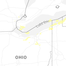
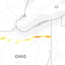
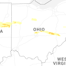


Connect with Interactive Hail Maps