

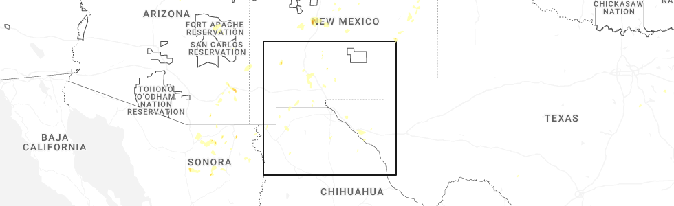
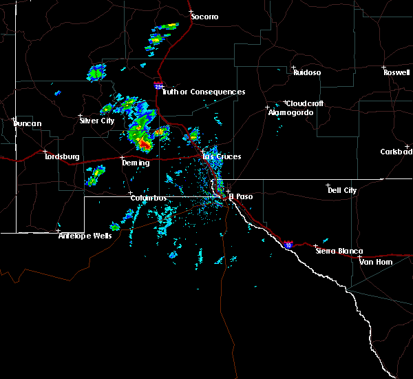
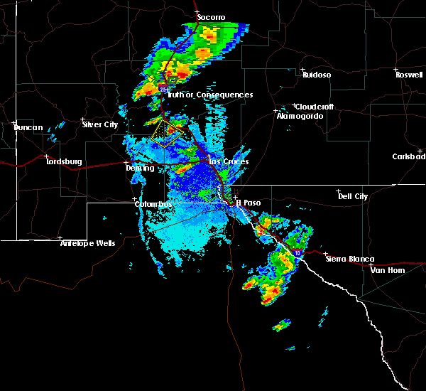
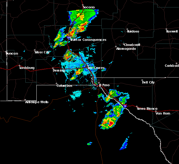
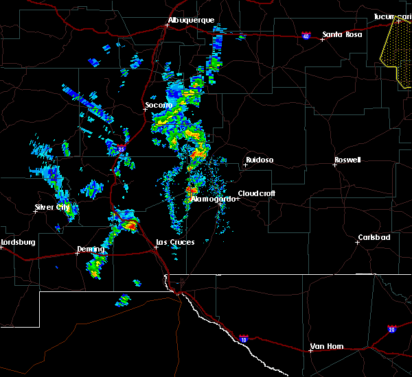
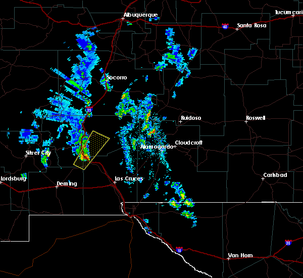
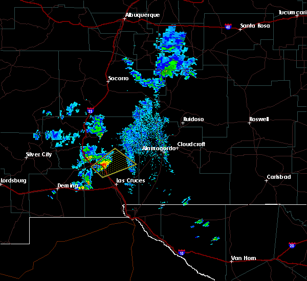
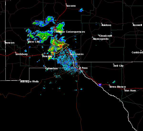
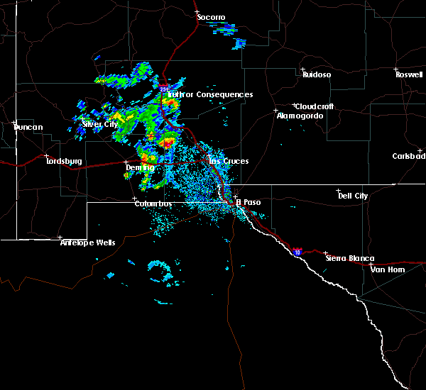
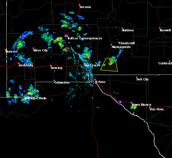
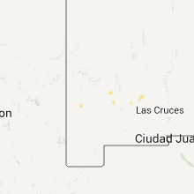
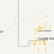
Hail Map for Hatch, NM
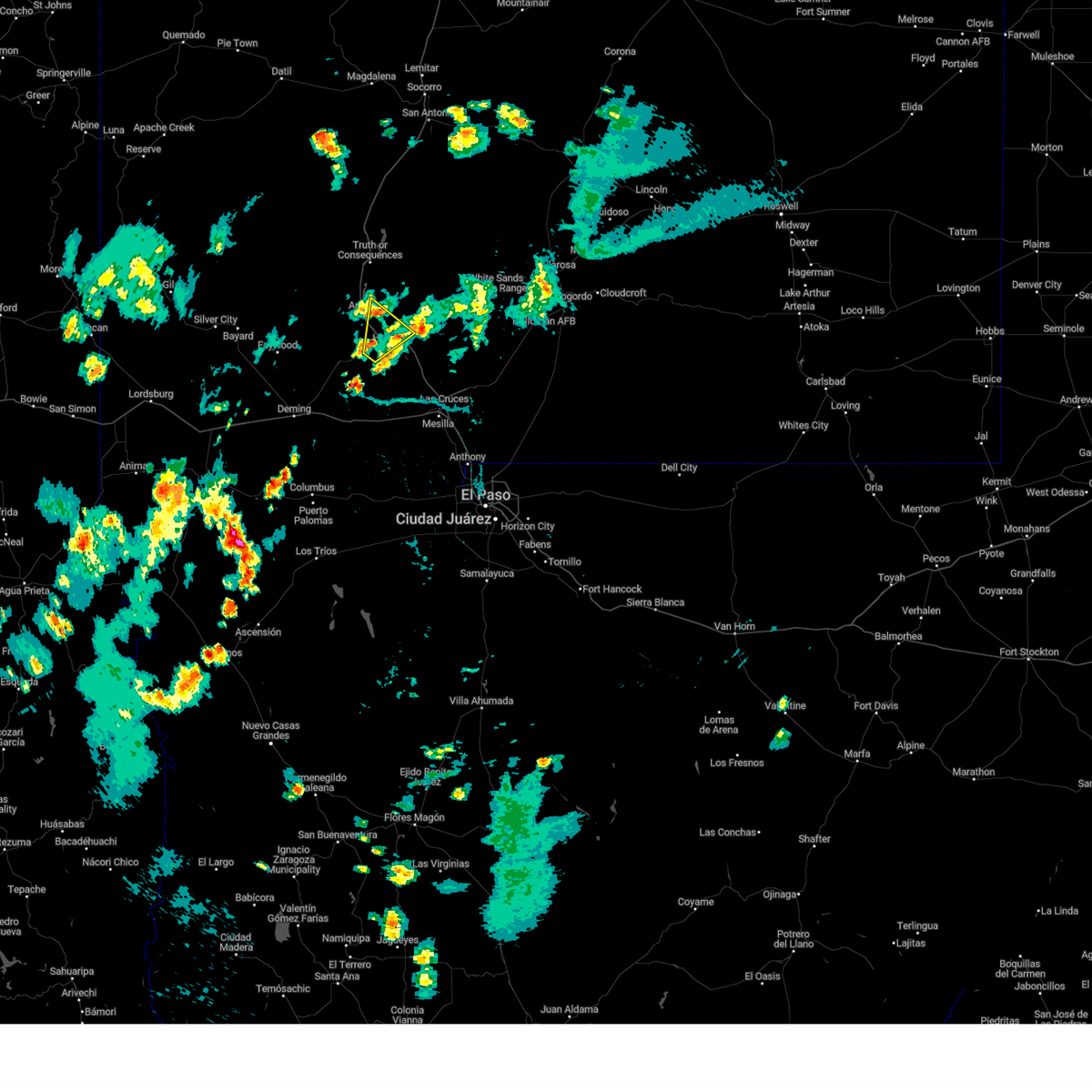
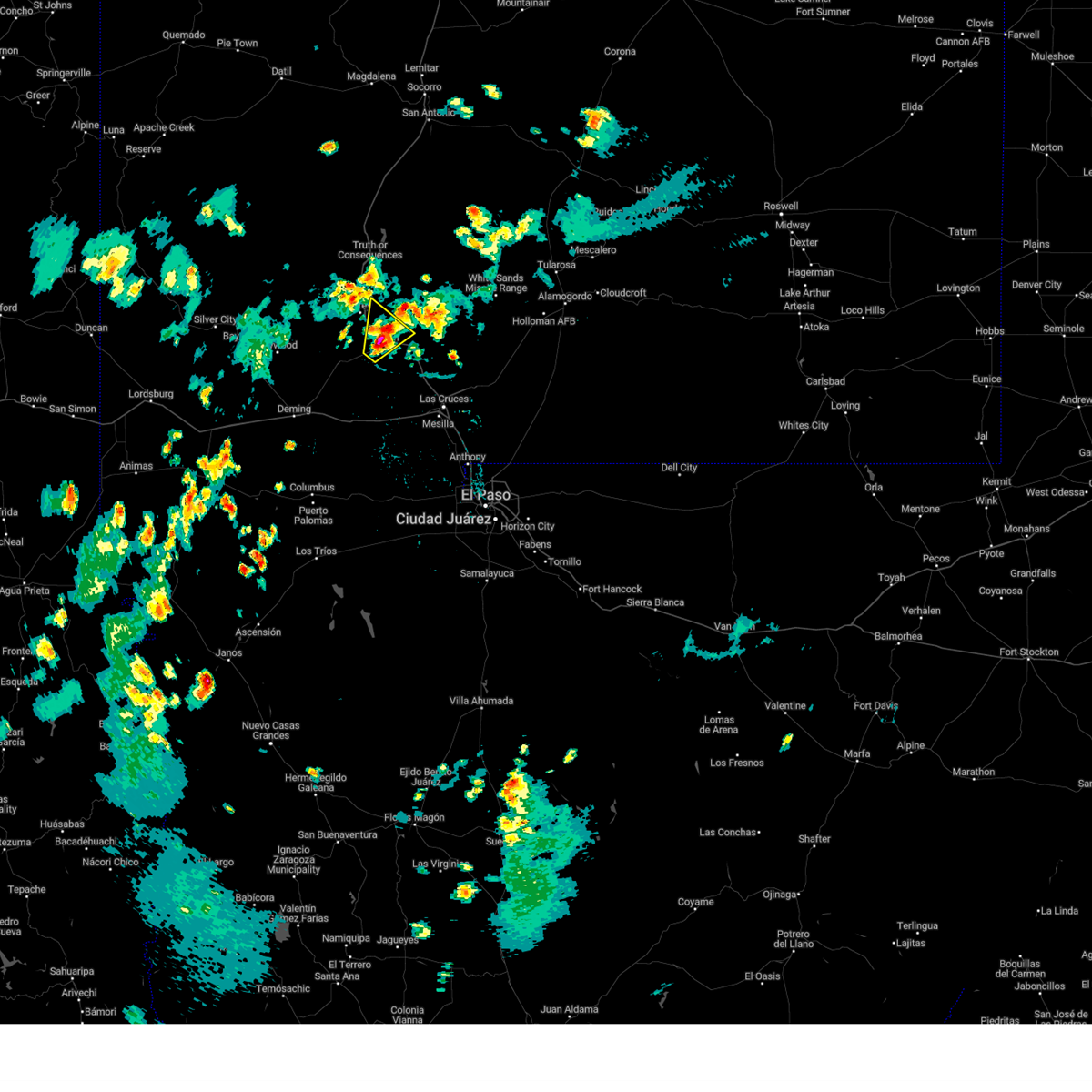
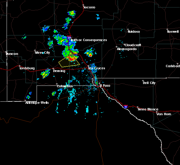
The Hatch, NM area has had 0 reports of on-the-ground hail by trained spotters, and has been under severe weather warnings 0 times during the past 12 months. Doppler radar has detected hail at or near Hatch, NM on 25 occasions, including 2 occasions during the past year.
| Name: | Hatch, NM |
| Where Located: | 64.8 miles E of Silver City, NM |
| Map: | Google Map for Hatch, NM |
| Population: | 1648 |
| Housing Units: | 555 |
| More Info: | Search Google for Hatch, NM |
3
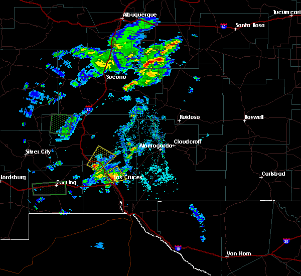
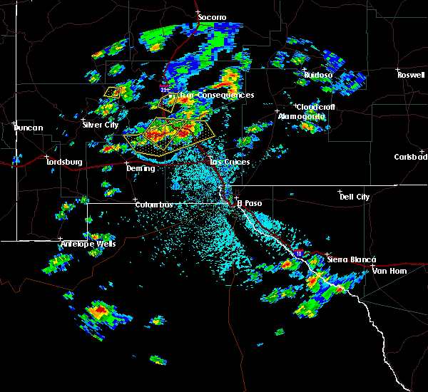
The Top Recent Hail Date for Hatch, NM is Sunday, July 13, 2025 (3rd out of 25)
Hail and Wind Damage Spotted near Hatch, NM
| Date / Time | Report Details |
|---|---|
| 7/15/2023 5:55 PM MDT |
 The severe thunderstorm warning for south central sierra and northwestern dona ana counties will expire at 600 pm mdt, the storm which prompted the warning has weakened below severe limits, and no longer poses an immediate threat to life or property. therefore, the warning will be allowed to expire. however heavy rain is still possible with this thunderstorm. The severe thunderstorm warning for south central sierra and northwestern dona ana counties will expire at 600 pm mdt, the storm which prompted the warning has weakened below severe limits, and no longer poses an immediate threat to life or property. therefore, the warning will be allowed to expire. however heavy rain is still possible with this thunderstorm.
|
| 7/15/2023 5:16 PM MDT |
 At 515 pm mdt, a severe thunderstorm was located over salem, moving northeast at 20 mph (radar indicated). Hazards include 60 mph wind gusts and half dollar size hail. Hail damage to vehicles is expected. Expect wind damage to roofs, siding, and trees. At 515 pm mdt, a severe thunderstorm was located over salem, moving northeast at 20 mph (radar indicated). Hazards include 60 mph wind gusts and half dollar size hail. Hail damage to vehicles is expected. Expect wind damage to roofs, siding, and trees.
|
| 7/11/2021 8:37 PM MDT |
 The severe thunderstorm warning for south central sierra and northwestern dona ana counties will expire at 845 pm mdt, the storm which prompted the warning has weakened below severe limits, and has exited the warned area. therefore, the warning will be allowed to expire. a severe thunderstorm watch remains in effect until 1000 pm mdt for south central new mexico. The severe thunderstorm warning for south central sierra and northwestern dona ana counties will expire at 845 pm mdt, the storm which prompted the warning has weakened below severe limits, and has exited the warned area. therefore, the warning will be allowed to expire. a severe thunderstorm watch remains in effect until 1000 pm mdt for south central new mexico.
|
| 7/11/2021 7:57 PM MDT |
 At 757 pm mdt, a severe thunderstorm was located 6 miles northeast of salem, moving south at 25 mph (radar indicated). Hazards include 60 mph wind gusts and half dollar size hail. Hail damage to vehicles is expected. Expect wind damage to roofs, siding, and trees. At 757 pm mdt, a severe thunderstorm was located 6 miles northeast of salem, moving south at 25 mph (radar indicated). Hazards include 60 mph wind gusts and half dollar size hail. Hail damage to vehicles is expected. Expect wind damage to roofs, siding, and trees.
|
| 9/27/2019 4:56 PM MDT |
 The severe thunderstorm warning for northeastern luna and west central dona ana counties will expire at 500 pm mdt, the storm which prompted the warning has weakened below severe limits, and has exited the warned area. therefore, the warning will be allowed to expire. The severe thunderstorm warning for northeastern luna and west central dona ana counties will expire at 500 pm mdt, the storm which prompted the warning has weakened below severe limits, and has exited the warned area. therefore, the warning will be allowed to expire.
|
| 9/27/2019 4:33 PM MDT |
 At 432 pm mdt, a severe thunderstorm was located 11 miles south of nutt, moving northeast at 40 mph (radar indicated). Hazards include 60 mph wind gusts and nickel size hail. expect damage to roofs, siding, and trees At 432 pm mdt, a severe thunderstorm was located 11 miles south of nutt, moving northeast at 40 mph (radar indicated). Hazards include 60 mph wind gusts and nickel size hail. expect damage to roofs, siding, and trees
|
| 6/3/2018 5:05 PM MDT |
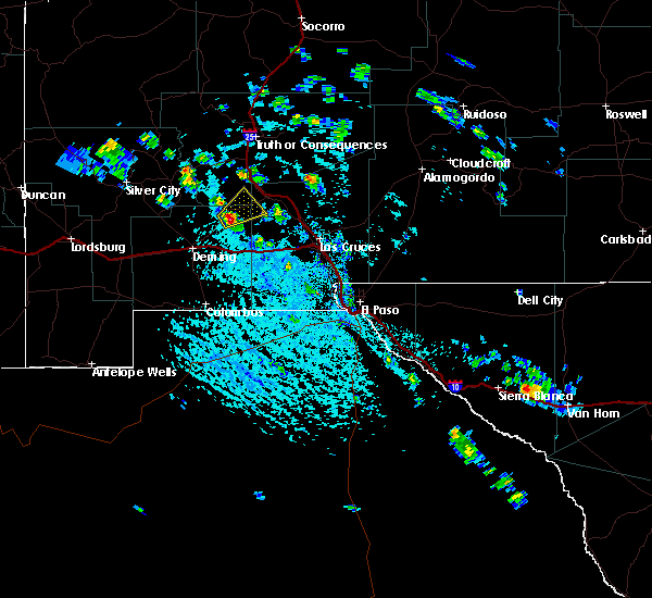
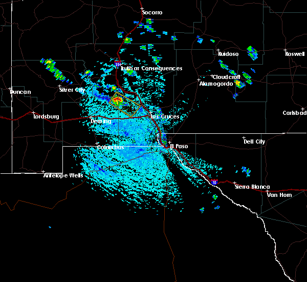
 At 504 pm mdt, a severe thunderstorm was located 7 miles west of upham, or 12 miles southeast of caballo, moving northeast at 20 mph (radar indicated). Hazards include 70 mph wind gusts and half dollar size hail. Hail damage to vehicles is expected. expect considerable tree damage. wind damage is also likely to mobile homes, roofs, and outbuildings. Locations impacted include, hatch, caballo, garfield, placitas in dona ana county, derry, salem, upham, arrey, and caballo lake state park. At 504 pm mdt, a severe thunderstorm was located 7 miles west of upham, or 12 miles southeast of caballo, moving northeast at 20 mph (radar indicated). Hazards include 70 mph wind gusts and half dollar size hail. Hail damage to vehicles is expected. expect considerable tree damage. wind damage is also likely to mobile homes, roofs, and outbuildings. Locations impacted include, hatch, caballo, garfield, placitas in dona ana county, derry, salem, upham, arrey, and caballo lake state park.
|
| 6/3/2018 4:35 PM MDT |
 At 434 pm mdt, a severe thunderstorm was located over garfield, or 9 miles northwest of hatch, moving northeast at 20 mph (radar indicated). Hazards include 70 mph wind gusts and half dollar size hail. Hail damage to vehicles is expected. expect considerable tree damage. Wind damage is also likely to mobile homes, roofs, and outbuildings. At 434 pm mdt, a severe thunderstorm was located over garfield, or 9 miles northwest of hatch, moving northeast at 20 mph (radar indicated). Hazards include 70 mph wind gusts and half dollar size hail. Hail damage to vehicles is expected. expect considerable tree damage. Wind damage is also likely to mobile homes, roofs, and outbuildings.
|
| 9/26/2017 7:38 PM MDT |
 At 738 pm mdt, a severe thunderstorm was located over placitas in dona ana county, or near hatch, moving northeast at 15 mph (radar indicated). Hazards include 60 mph wind gusts and quarter size hail. Hail damage to vehicles is expected. Expect wind damage to roofs, siding, and trees. At 738 pm mdt, a severe thunderstorm was located over placitas in dona ana county, or near hatch, moving northeast at 15 mph (radar indicated). Hazards include 60 mph wind gusts and quarter size hail. Hail damage to vehicles is expected. Expect wind damage to roofs, siding, and trees.
|
| 9/26/2017 7:07 PM MDT |
 At 707 pm mdt, a severe thunderstorm was located 5 miles northeast of uvas valley, or 11 miles southwest of hatch, moving northeast at 15 mph (radar indicated). Hazards include 60 mph wind gusts and quarter size hail. Hail damage to vehicles is expected. Expect wind damage to roofs, siding, and trees. At 707 pm mdt, a severe thunderstorm was located 5 miles northeast of uvas valley, or 11 miles southwest of hatch, moving northeast at 15 mph (radar indicated). Hazards include 60 mph wind gusts and quarter size hail. Hail damage to vehicles is expected. Expect wind damage to roofs, siding, and trees.
|
| 11/4/2016 4:14 PM MDT |
 At 414 pm mdt, a severe thunderstorm was located 8 miles southeast of nutt, moving northeast at 20 mph (radar indicated). Hazards include 60 mph wind gusts and quarter size hail. Hail damage to vehicles is expected. Expect wind damage to roofs, siding, and trees. At 414 pm mdt, a severe thunderstorm was located 8 miles southeast of nutt, moving northeast at 20 mph (radar indicated). Hazards include 60 mph wind gusts and quarter size hail. Hail damage to vehicles is expected. Expect wind damage to roofs, siding, and trees.
|
| 10/21/2015 10:54 AM MDT |
 At 1054 am mdt, a severe thunderstorm was located 6 miles south of rincon, or 8 miles southeast of hatch, moving northeast at 25 mph (radar indicated). Hazards include 60 mph wind gusts and quarter size hail. Hail damage to vehicles is expected. Expect wind damage to roofs, siding and trees. At 1054 am mdt, a severe thunderstorm was located 6 miles south of rincon, or 8 miles southeast of hatch, moving northeast at 25 mph (radar indicated). Hazards include 60 mph wind gusts and quarter size hail. Hail damage to vehicles is expected. Expect wind damage to roofs, siding and trees.
|
| 10/21/2015 5:25 AM MDT |
 At 524 am mdt, a severe thunderstorm was located over garfield, or 9 miles northwest of hatch, moving northeast at 45 mph (radar indicated). Hazards include 60 mph wind gusts and quarter size hail. Hail damage to vehicles is expected. expect wind damage to roofs, siding and trees. Very hazardous driving. At 524 am mdt, a severe thunderstorm was located over garfield, or 9 miles northwest of hatch, moving northeast at 45 mph (radar indicated). Hazards include 60 mph wind gusts and quarter size hail. Hail damage to vehicles is expected. expect wind damage to roofs, siding and trees. Very hazardous driving.
|
| 10/7/2015 8:19 AM MDT |
 At 816 am mdt, a severe thunderstorm continues was located near rincon moving northeast at 15 to 20 mph (radar indicated). Hazards include 60 mph wind gusts and quarter size hail. Hail damage to vehicles is expected. Expect wind damage to roofs, siding and trees. At 816 am mdt, a severe thunderstorm continues was located near rincon moving northeast at 15 to 20 mph (radar indicated). Hazards include 60 mph wind gusts and quarter size hail. Hail damage to vehicles is expected. Expect wind damage to roofs, siding and trees.
|
| 10/7/2015 7:48 AM MDT |
 At 746 am mdt, a severe thunderstorm was located just south of hatch continues to move northeast at 15-20 mph (radar indicated). Hazards include 60 mph wind gusts and quarter size hail. Hail damage to vehicles is expected. expect wind damage to roofs, siding and trees. Locations impacted include, hatch, garfield, uvas valley, derry, placitas in dona ana county, salem, rincon. At 746 am mdt, a severe thunderstorm was located just south of hatch continues to move northeast at 15-20 mph (radar indicated). Hazards include 60 mph wind gusts and quarter size hail. Hail damage to vehicles is expected. expect wind damage to roofs, siding and trees. Locations impacted include, hatch, garfield, uvas valley, derry, placitas in dona ana county, salem, rincon.
|
| 10/7/2015 7:20 AM MDT |
 At 718 am mdt, a severe thunderstorm was located 6 miles southeast of uvas valley, or 14 miles southwest of hatch moving northeast around 20 mph stationary (radar indicated). Hazards include 60 mph wind gusts and quarter size hail. Hail damage to vehicles is expected. Expect wind damage to roofs, siding and trees. At 718 am mdt, a severe thunderstorm was located 6 miles southeast of uvas valley, or 14 miles southwest of hatch moving northeast around 20 mph stationary (radar indicated). Hazards include 60 mph wind gusts and quarter size hail. Hail damage to vehicles is expected. Expect wind damage to roofs, siding and trees.
|
| 8/18/2015 3:53 PM MDT |
 At 353 pm mdt, a severe thunderstorm was located near nutt, or 19 miles southwest of hatch, moving northeast at 15 mph (radar indicated). Hazards include 60 mph wind gusts and quarter size hail. Hail damage to vehicles is expected. Expect wind damage to roofs, siding and trees. At 353 pm mdt, a severe thunderstorm was located near nutt, or 19 miles southwest of hatch, moving northeast at 15 mph (radar indicated). Hazards include 60 mph wind gusts and quarter size hail. Hail damage to vehicles is expected. Expect wind damage to roofs, siding and trees.
|
| 8/18/2015 2:42 PM MDT |
 At 242 pm mdt, a severe thunderstorm was located 6 miles east of uvas valley, or 10 miles southwest of hatch, moving southeast at 35 mph (radar indicated). Hazards include 60 mph wind gusts and quarter size hail. Hail damage to vehicles is expected. Expect wind damage to roofs, siding and trees. At 242 pm mdt, a severe thunderstorm was located 6 miles east of uvas valley, or 10 miles southwest of hatch, moving southeast at 35 mph (radar indicated). Hazards include 60 mph wind gusts and quarter size hail. Hail damage to vehicles is expected. Expect wind damage to roofs, siding and trees.
|
| 7/10/2015 3:01 PM MDT |
 At 301 pm mdt, a severe thunderstorm was located near rincon, or 6 miles east of hatch, moving northeast at 35 mph (radar indicated). Hazards include 60 mph wind gusts and nickel size hail. Expect damage to roofs. Siding and trees. At 301 pm mdt, a severe thunderstorm was located near rincon, or 6 miles east of hatch, moving northeast at 35 mph (radar indicated). Hazards include 60 mph wind gusts and nickel size hail. Expect damage to roofs. Siding and trees.
|
| 7/7/2015 3:13 PM MDT |
 At 311 pm mdt, severe thunderstorms were located along a line extending from near rincon to 6 miles northeast of uvas valley to 10 miles west of nutt, moving east at 20 mph. the strongest storms were located just south of hatch, near rodey, and in the vicinity of the macho springs wind farm (radar indicated). Hazards include 70 mph wind gusts and quarter size hail. Hail damage to vehicles is expected. expect considerable tree damage. wind damage is also likely to mobile homes, roofs and outbuildings. Locations impacted include, hatch, rodey, macho springs, uvas valley, jornada range, nutt, rincon, salem. At 311 pm mdt, severe thunderstorms were located along a line extending from near rincon to 6 miles northeast of uvas valley to 10 miles west of nutt, moving east at 20 mph. the strongest storms were located just south of hatch, near rodey, and in the vicinity of the macho springs wind farm (radar indicated). Hazards include 70 mph wind gusts and quarter size hail. Hail damage to vehicles is expected. expect considerable tree damage. wind damage is also likely to mobile homes, roofs and outbuildings. Locations impacted include, hatch, rodey, macho springs, uvas valley, jornada range, nutt, rincon, salem.
|
| 7/7/2015 2:51 PM MDT |
 At 250 pm mdt, severe thunderstorms were located along a line extending from rincon to near nutt to 8 miles east of faywood, moving east at 20 mph (radar indicated). Hazards include 60 mph wind gusts and quarter size hail. Hail damage to vehicles is expected. Expect wind damage to roofs, siding and trees. At 250 pm mdt, severe thunderstorms were located along a line extending from rincon to near nutt to 8 miles east of faywood, moving east at 20 mph (radar indicated). Hazards include 60 mph wind gusts and quarter size hail. Hail damage to vehicles is expected. Expect wind damage to roofs, siding and trees.
|
| 7/7/2015 2:21 PM MDT |
 At 221 pm mdt, a severe thunderstorm was located 7 miles southwest of garfield, or 11 miles west of hatch, moving southeast at 25 mph (radar indicated). Hazards include 60 mph wind gusts and quarter size hail. Hail damage to vehicles is expected. Expect wind damage to roofs, siding and trees. At 221 pm mdt, a severe thunderstorm was located 7 miles southwest of garfield, or 11 miles west of hatch, moving southeast at 25 mph (radar indicated). Hazards include 60 mph wind gusts and quarter size hail. Hail damage to vehicles is expected. Expect wind damage to roofs, siding and trees.
|
| 6/22/2015 6:36 PM MDT |
 At 635 pm mdt, doppler radar indicated a severe thunderstorm capable of producing damaging winds in excess of 60 mph. this storm was located near rincon, or 11 miles east of hatch, and moving southwest at 15 mph. nickel size hail may also accompany the damaging winds. At 635 pm mdt, doppler radar indicated a severe thunderstorm capable of producing damaging winds in excess of 60 mph. this storm was located near rincon, or 11 miles east of hatch, and moving southwest at 15 mph. nickel size hail may also accompany the damaging winds.
|
| 6/17/2015 7:33 PM MDT |
 At 732 pm mdt, doppler radar indicated a severe thunderstorm capable of producing quarter size hail and damaging winds in excess of 60 mph. this storm was located over salem, or near hatch, and moving southeast at 15 mph. At 732 pm mdt, doppler radar indicated a severe thunderstorm capable of producing quarter size hail and damaging winds in excess of 60 mph. this storm was located over salem, or near hatch, and moving southeast at 15 mph.
|
| 7/1/2013 9:00 PM MDT | Wind gust estimated near hatch exit of i-25. very heavy rainfall also reporte in dona ana county NM, 1.4 miles WSW of Hatch, NM |
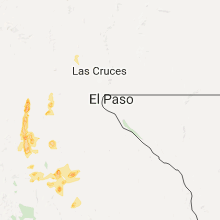
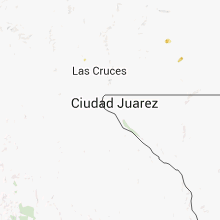
Hail Maps for Hatch, NM


Connect with Interactive Hail Maps