

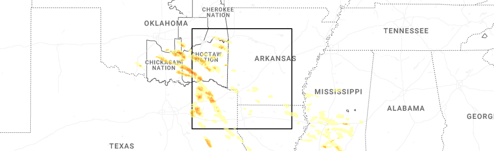
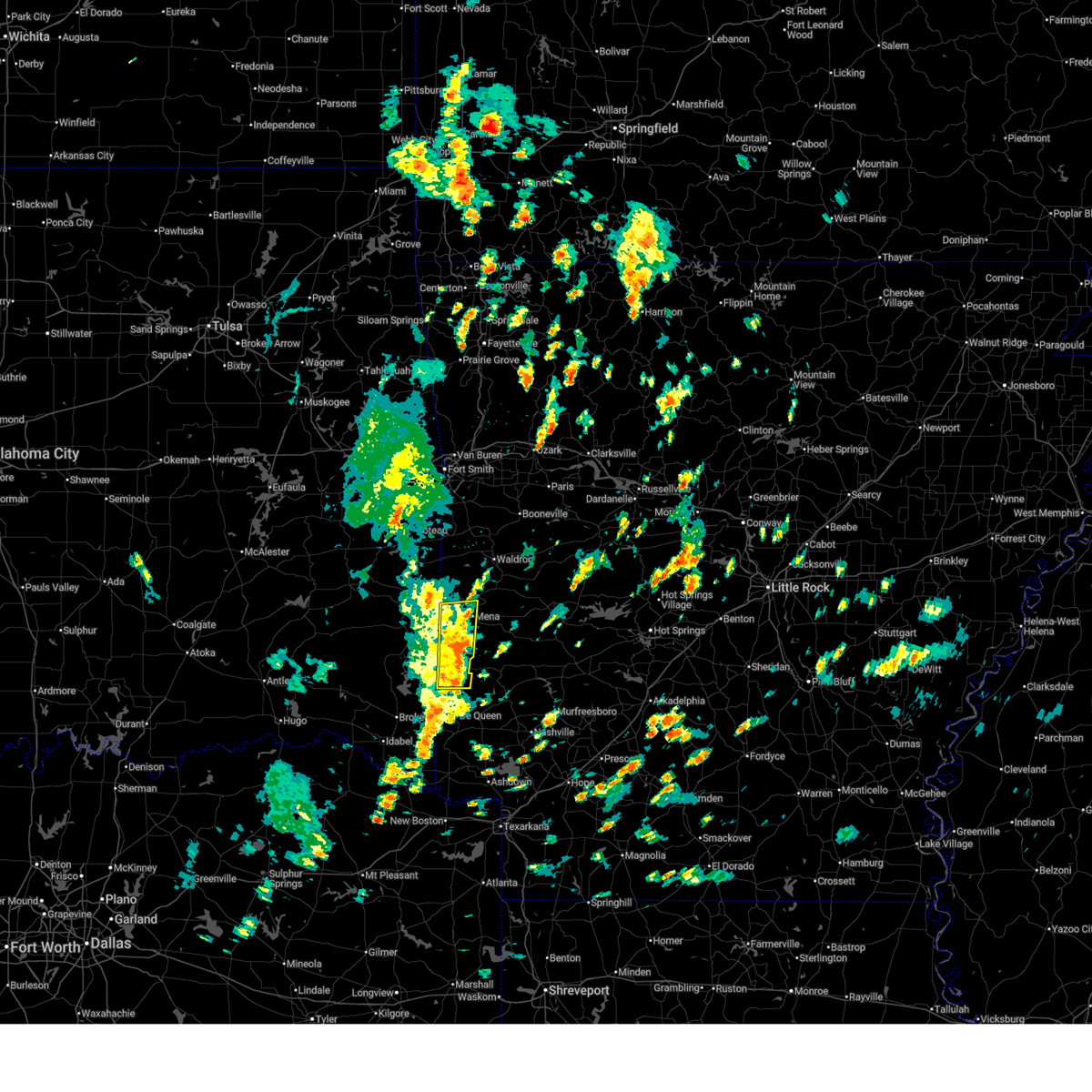
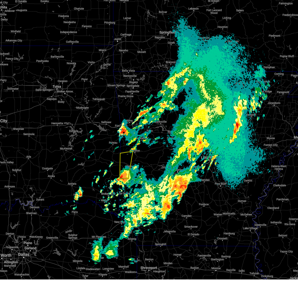
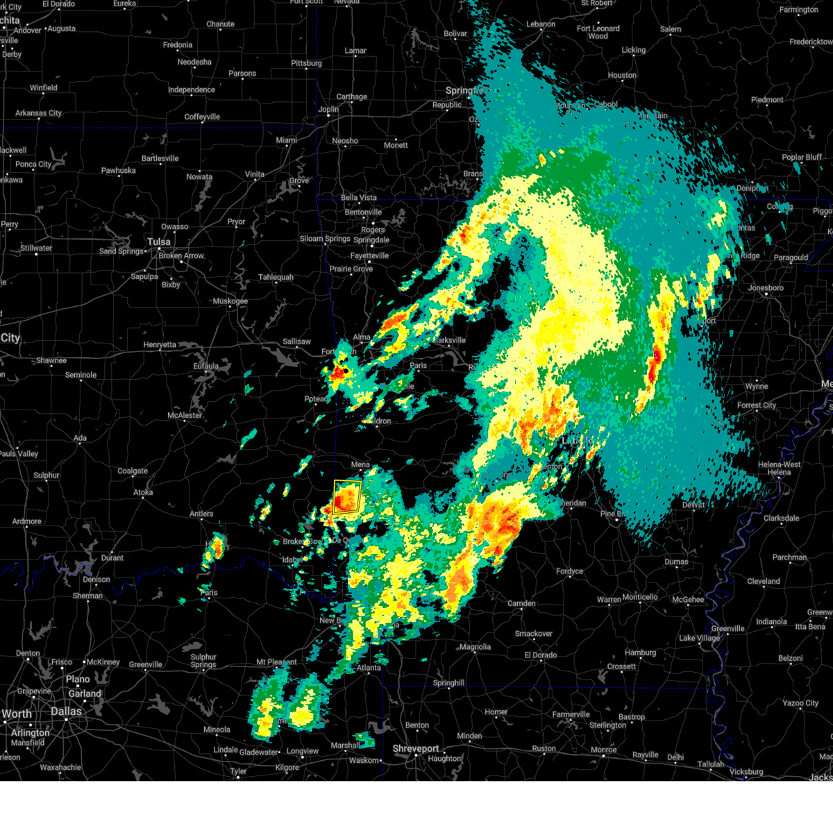
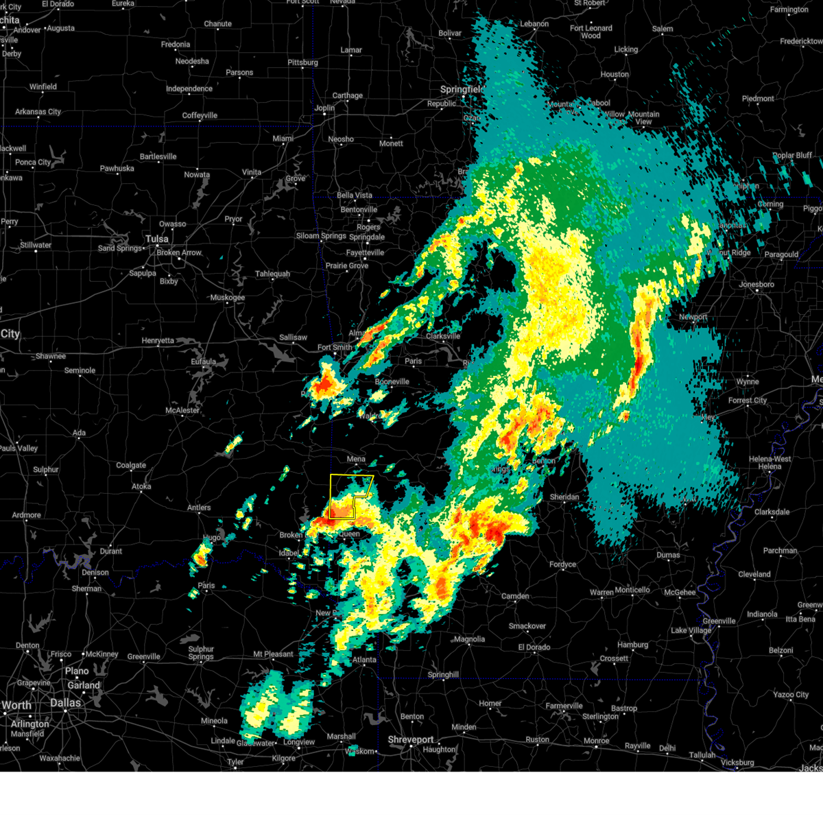
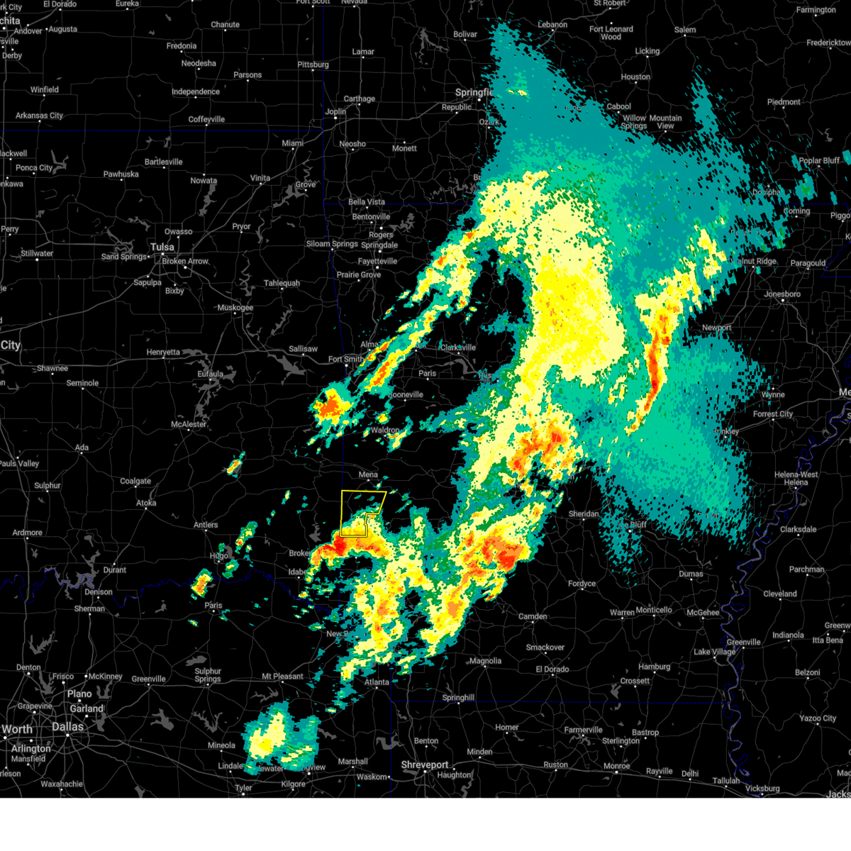
Hail Map for Hatfield, AR
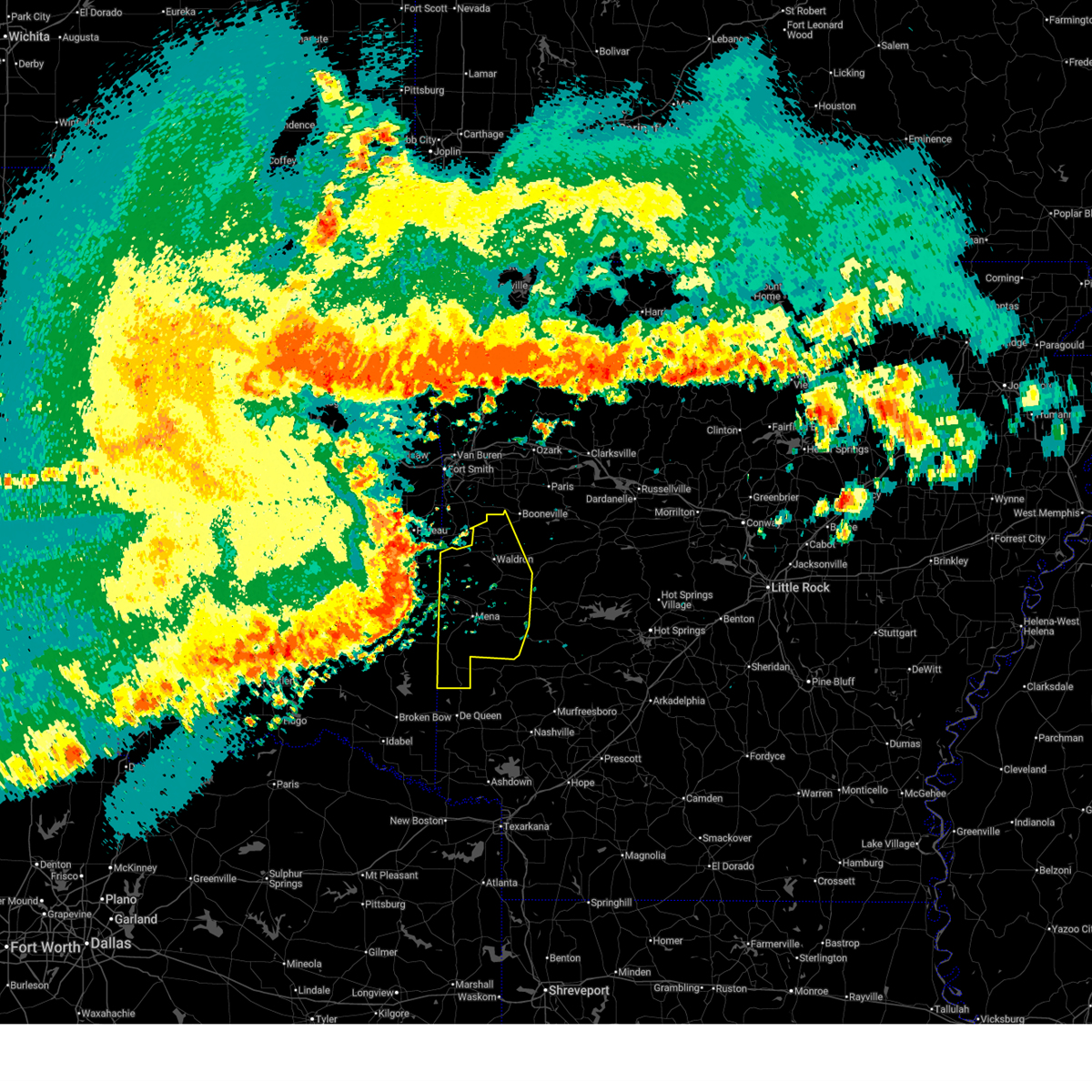
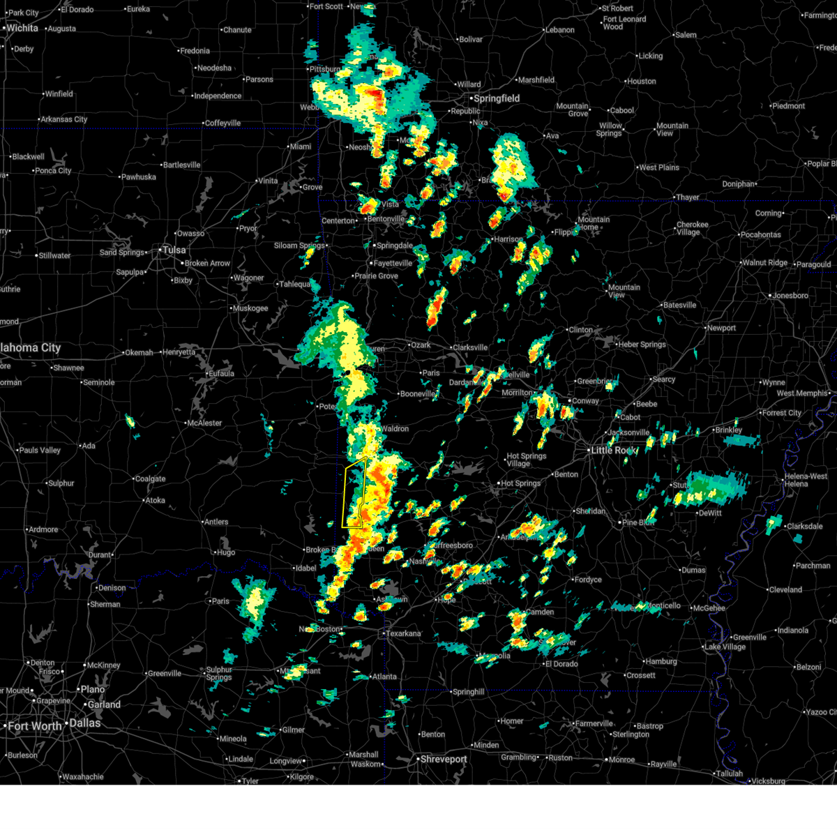
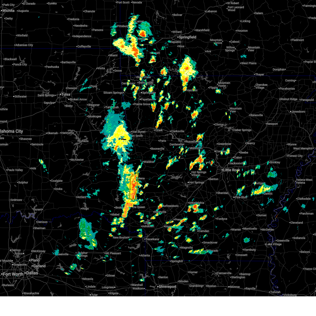
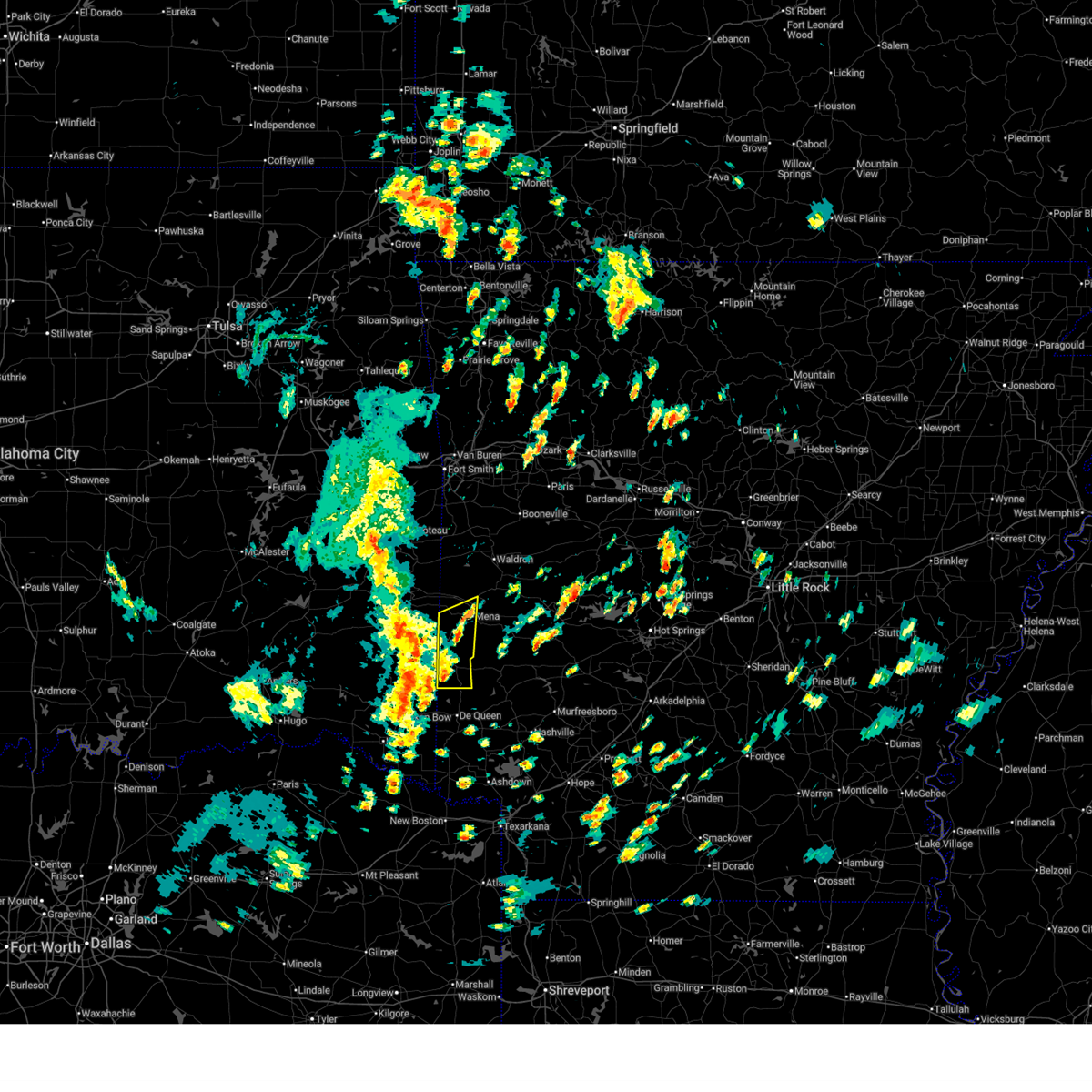
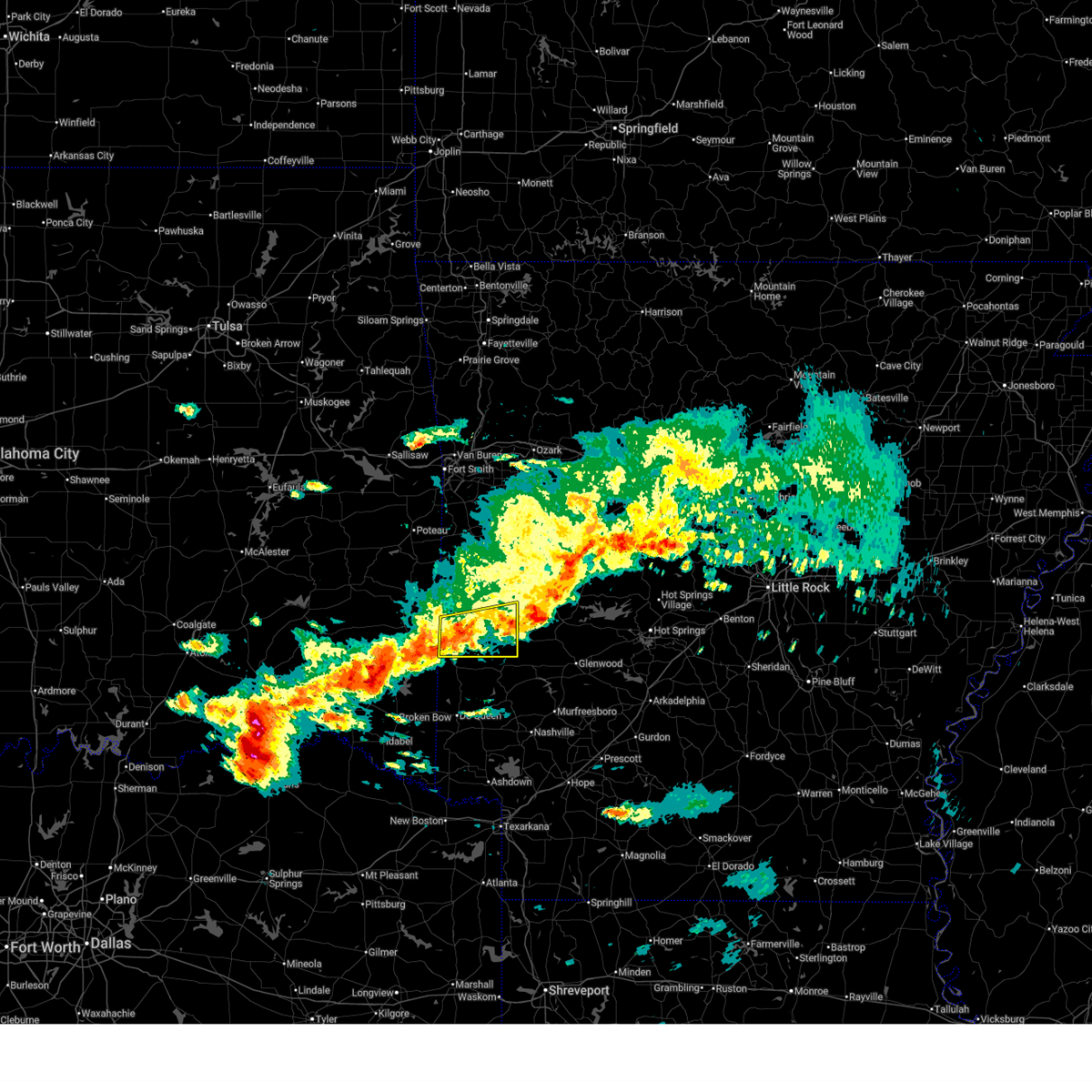
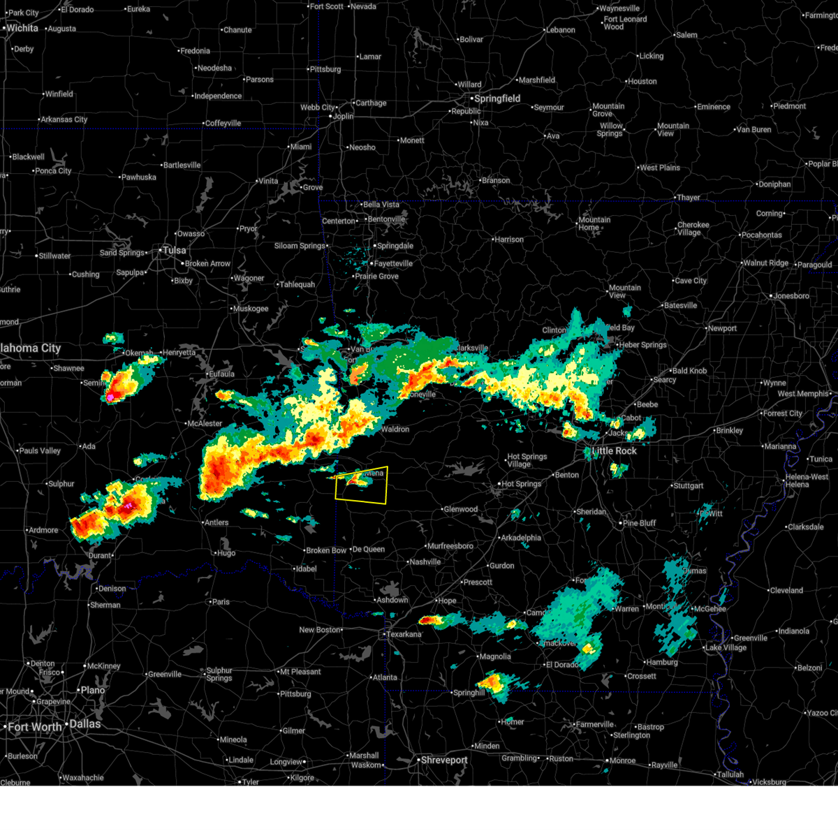
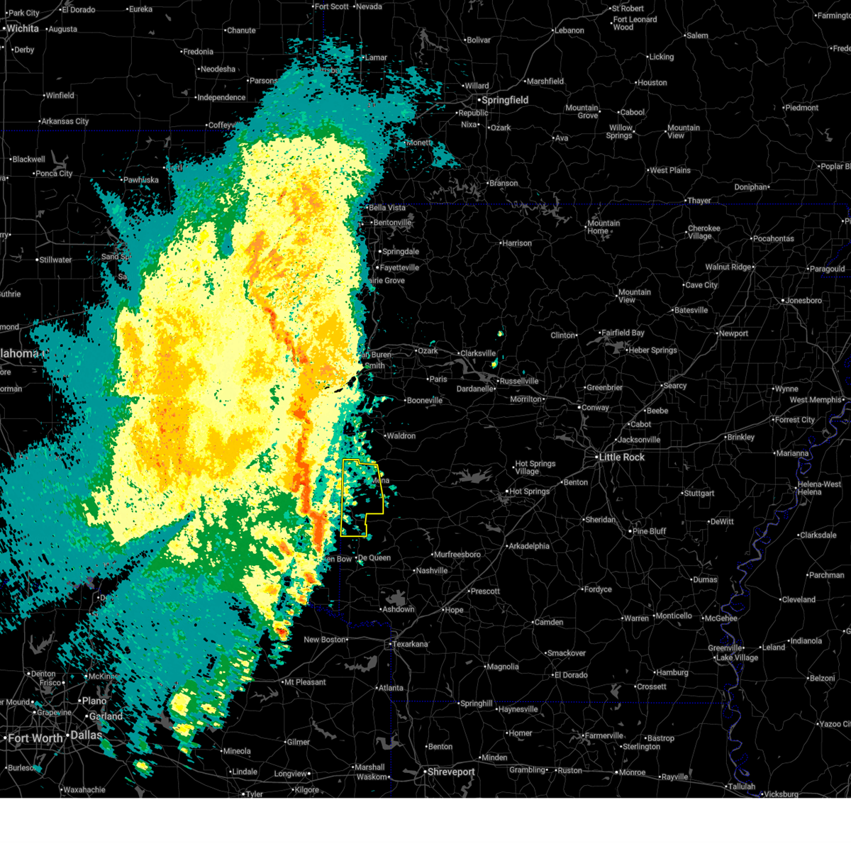
The Hatfield, AR area has had 4 reports of on-the-ground hail by trained spotters, and has been under severe weather warnings 10 times during the past 12 months. Doppler radar has detected hail at or near Hatfield, AR on 55 occasions, including 3 occasions during the past year.
| Name: | Hatfield, AR |
| Where Located: | 48.2 miles NW of Nashville, AR |
| Map: | Google Map for Hatfield, AR |
| Population: | 413 |
| Housing Units: | 188 |
| More Info: | Search Google for Hatfield, AR |
0
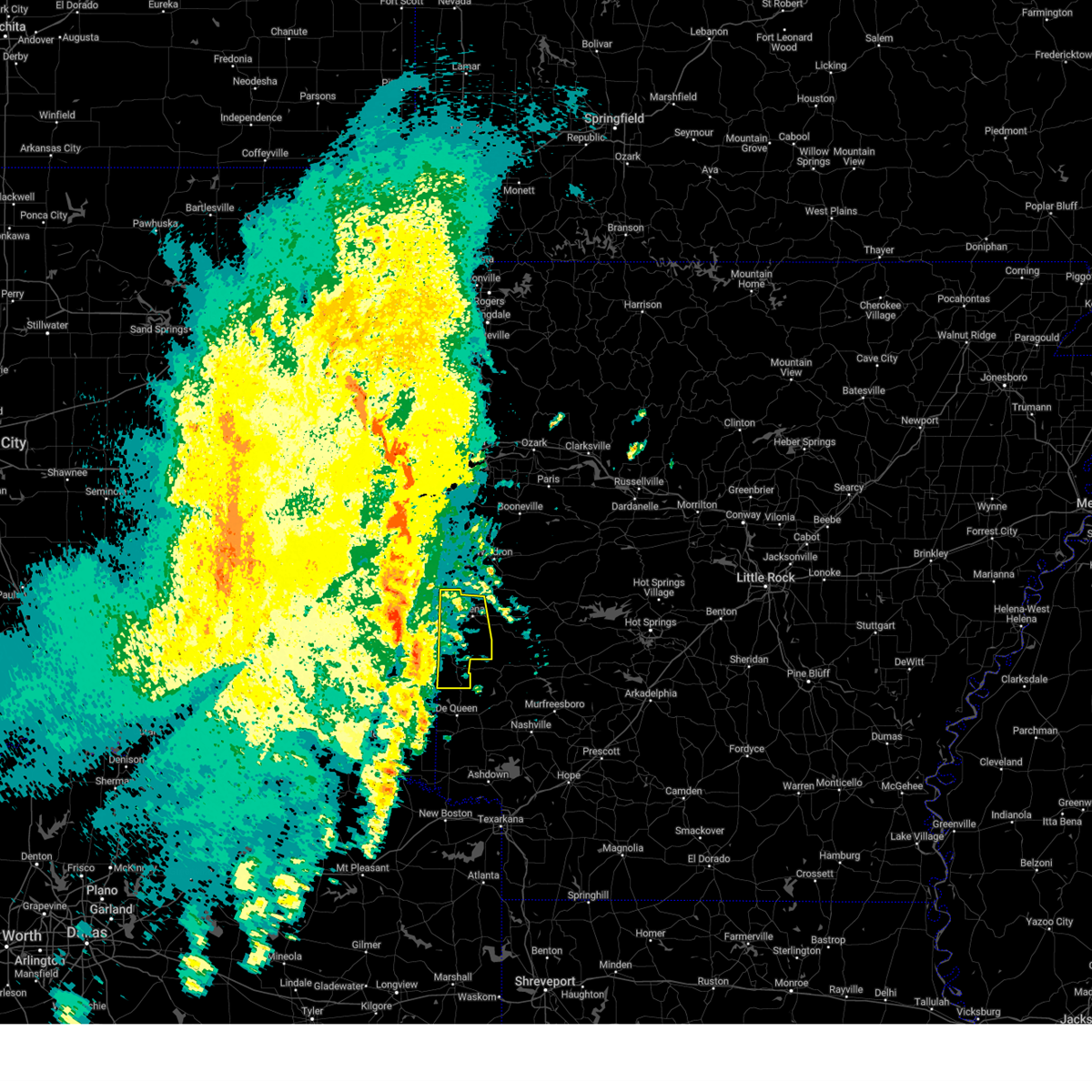
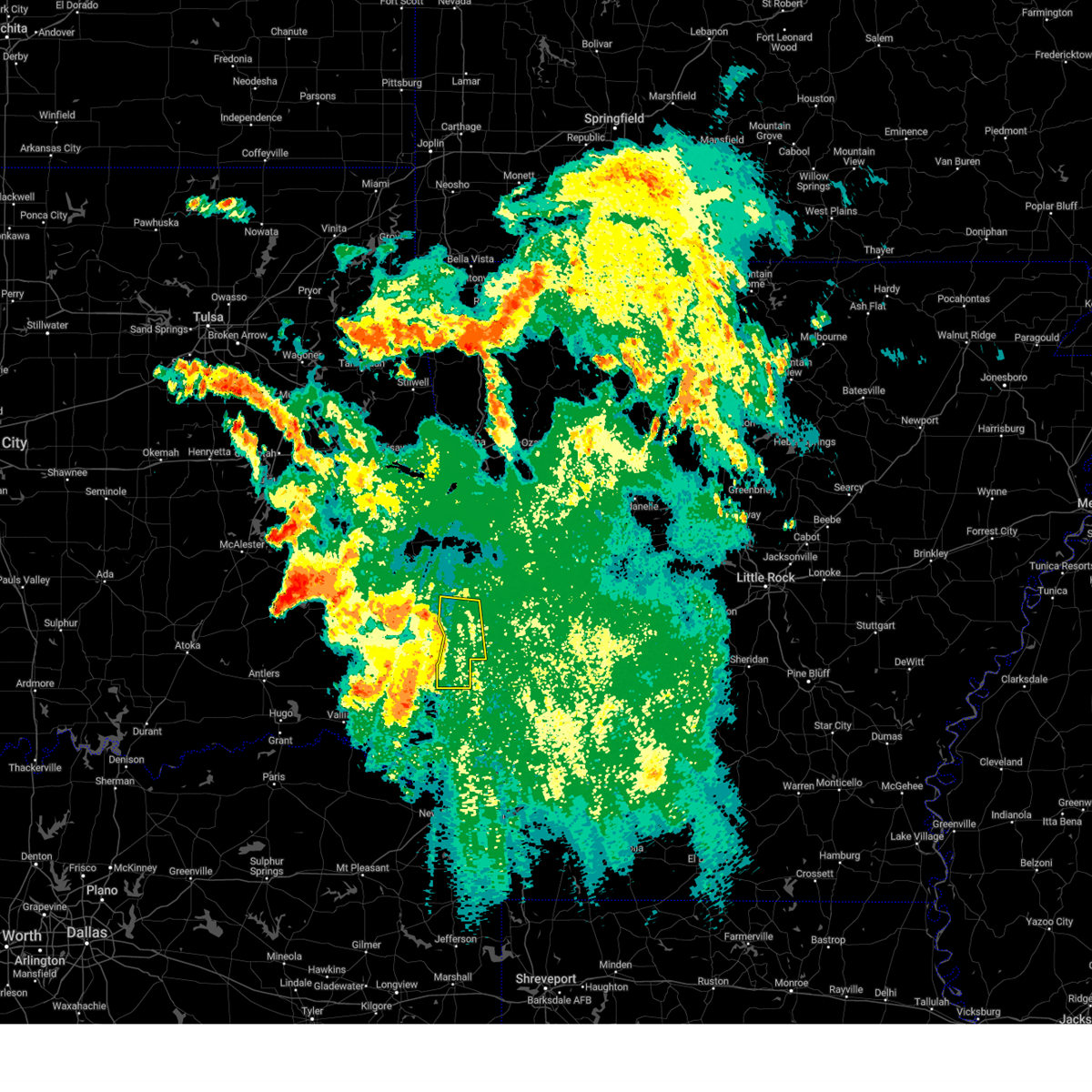
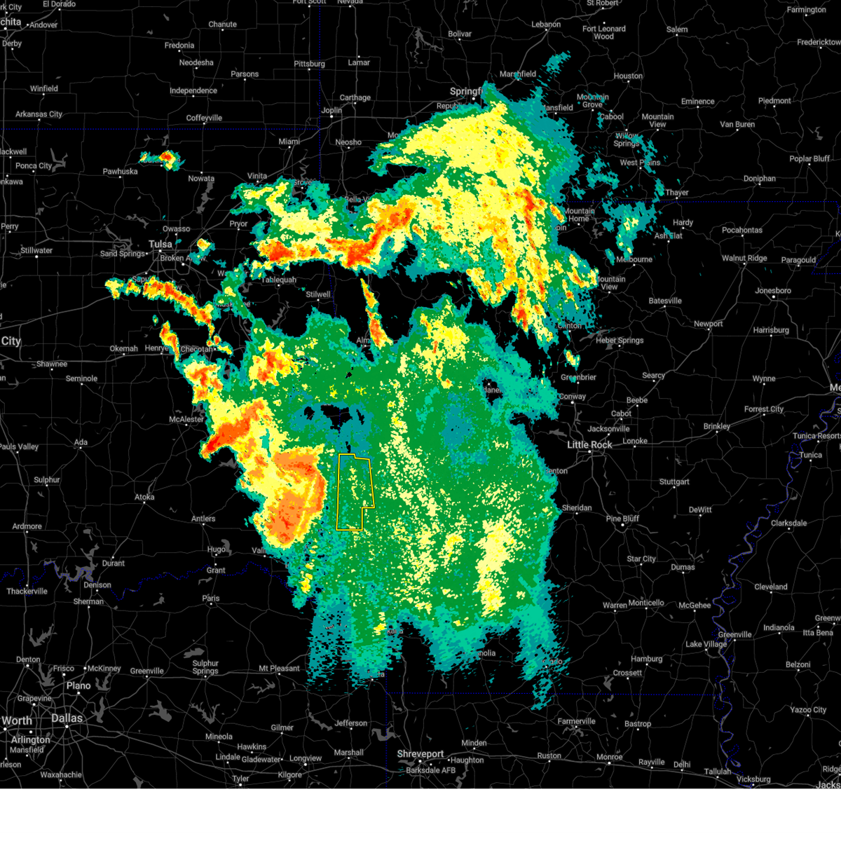
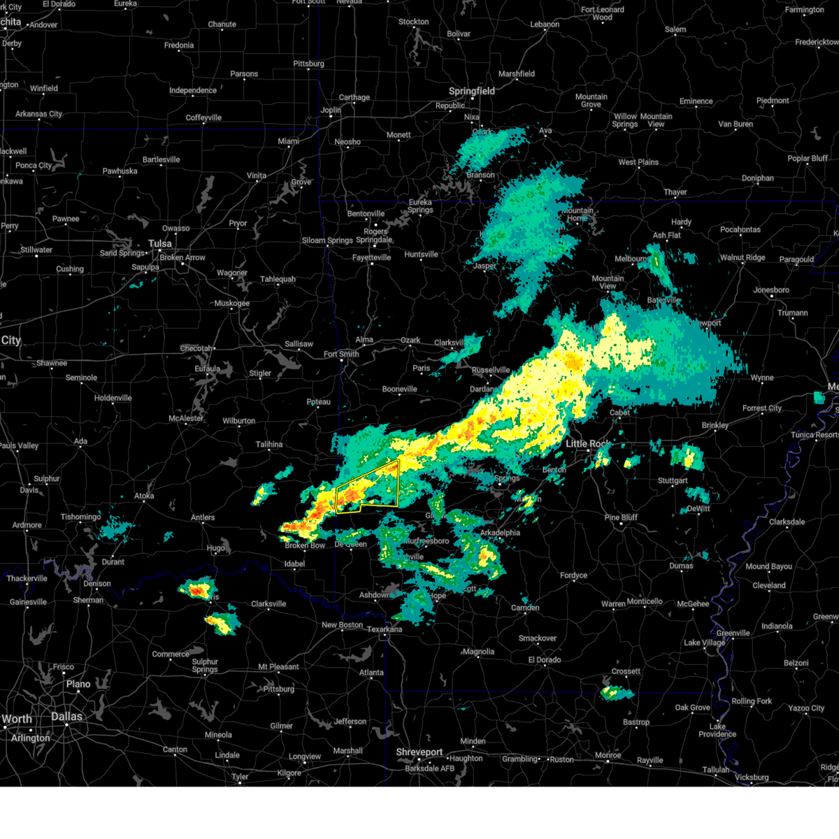
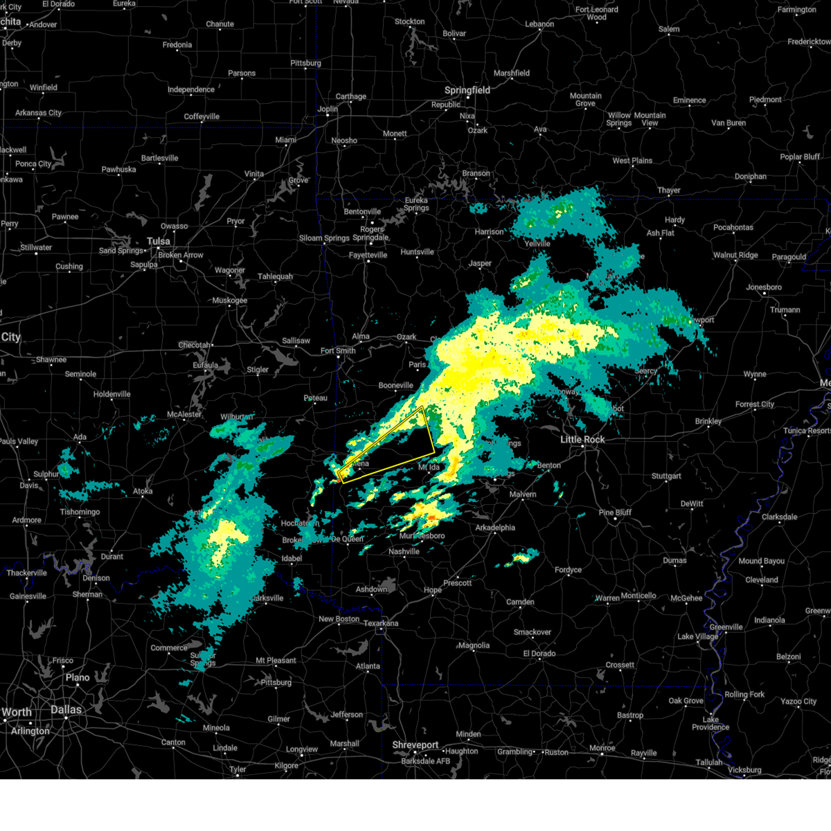
The Top Recent Hail Date for Hatfield, AR is Friday, April 24, 2026 (46th out of 55)
Hail and Wind Damage Spotted near Hatfield, AR
| Date / Time | Report Details |
|---|---|
| 6/22/2026 5:04 AM CDT |
 Svrlzk the national weather service in little rock has issued a * severe thunderstorm warning for, southwestern logan county in western arkansas, scott county in western arkansas, polk county in western arkansas, northwestern montgomery county in western arkansas, * until 545 am cdt. * at 503 am cdt, severe thunderstorms were located along a line extending from near wister to 9 miles northeast of whitesboro to 7 miles southwest of muse to 12 miles east of nashoba, moving east at 50 mph (radar indicated). Hazards include 60 mph wind gusts. expect damage to roofs, siding, and trees Svrlzk the national weather service in little rock has issued a * severe thunderstorm warning for, southwestern logan county in western arkansas, scott county in western arkansas, polk county in western arkansas, northwestern montgomery county in western arkansas, * until 545 am cdt. * at 503 am cdt, severe thunderstorms were located along a line extending from near wister to 9 miles northeast of whitesboro to 7 miles southwest of muse to 12 miles east of nashoba, moving east at 50 mph (radar indicated). Hazards include 60 mph wind gusts. expect damage to roofs, siding, and trees
|
| 6/7/2026 2:17 PM CDT |
 the severe thunderstorm warning has been cancelled and is no longer in effect the severe thunderstorm warning has been cancelled and is no longer in effect
|
| 6/7/2026 2:16 PM CDT |
 the severe thunderstorm warning has been cancelled and is no longer in effect the severe thunderstorm warning has been cancelled and is no longer in effect
|
| 6/7/2026 1:52 PM CDT |
 Svrlzk the national weather service in little rock has issued a * severe thunderstorm warning for, western polk county in western arkansas, * until 230 pm cdt. * at 152 pm cdt, severe thunderstorms were located along a line extending from 6 miles south of mountain fork to 7 miles west of wickes, moving northeast at 30 mph (radar indicated). Hazards include 60 mph wind gusts. expect damage to roofs, siding, and trees Svrlzk the national weather service in little rock has issued a * severe thunderstorm warning for, western polk county in western arkansas, * until 230 pm cdt. * at 152 pm cdt, severe thunderstorms were located along a line extending from 6 miles south of mountain fork to 7 miles west of wickes, moving northeast at 30 mph (radar indicated). Hazards include 60 mph wind gusts. expect damage to roofs, siding, and trees
|
| 6/7/2026 1:45 PM CDT |
 Svrlzk the national weather service in little rock has issued a * severe thunderstorm warning for, western polk county in western arkansas, * until 230 pm cdt. * at 144 pm cdt, severe thunderstorms were located along a line extending from 8 miles northwest of hatfield to 10 miles west of wickes, moving northeast at 30 mph (radar indicated). Hazards include 60 mph wind gusts and quarter size hail. Hail damage to vehicles is expected. Expect wind damage to roofs, siding, and trees. Svrlzk the national weather service in little rock has issued a * severe thunderstorm warning for, western polk county in western arkansas, * until 230 pm cdt. * at 144 pm cdt, severe thunderstorms were located along a line extending from 8 miles northwest of hatfield to 10 miles west of wickes, moving northeast at 30 mph (radar indicated). Hazards include 60 mph wind gusts and quarter size hail. Hail damage to vehicles is expected. Expect wind damage to roofs, siding, and trees.
|
| 6/7/2026 1:23 PM CDT |
 Svrlzk the national weather service in little rock has issued a * severe thunderstorm warning for, western polk county in western arkansas, * until 200 pm cdt. * at 123 pm cdt, severe thunderstorms were located along a line extending from near octavia to 12 miles north of broken bow, moving northeast at 30 mph (radar indicated). Hazards include 60 mph wind gusts. expect damage to roofs, siding, and trees Svrlzk the national weather service in little rock has issued a * severe thunderstorm warning for, western polk county in western arkansas, * until 200 pm cdt. * at 123 pm cdt, severe thunderstorms were located along a line extending from near octavia to 12 miles north of broken bow, moving northeast at 30 mph (radar indicated). Hazards include 60 mph wind gusts. expect damage to roofs, siding, and trees
|
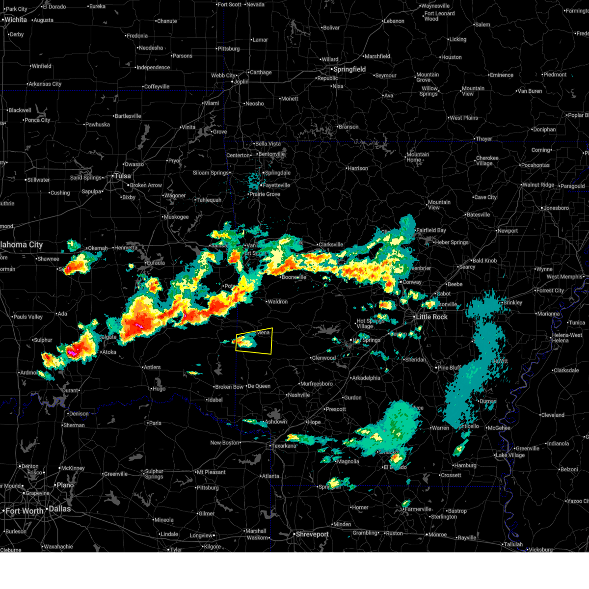
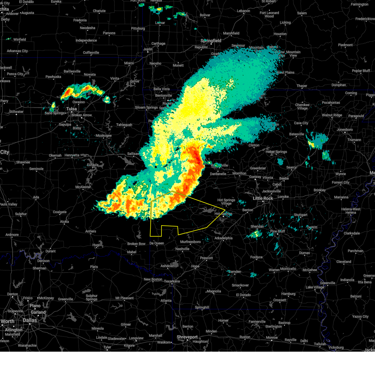
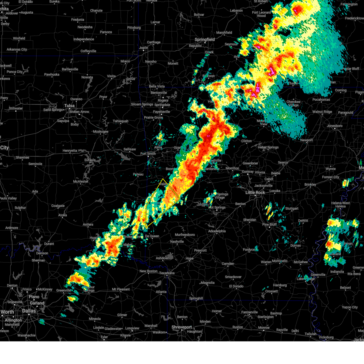
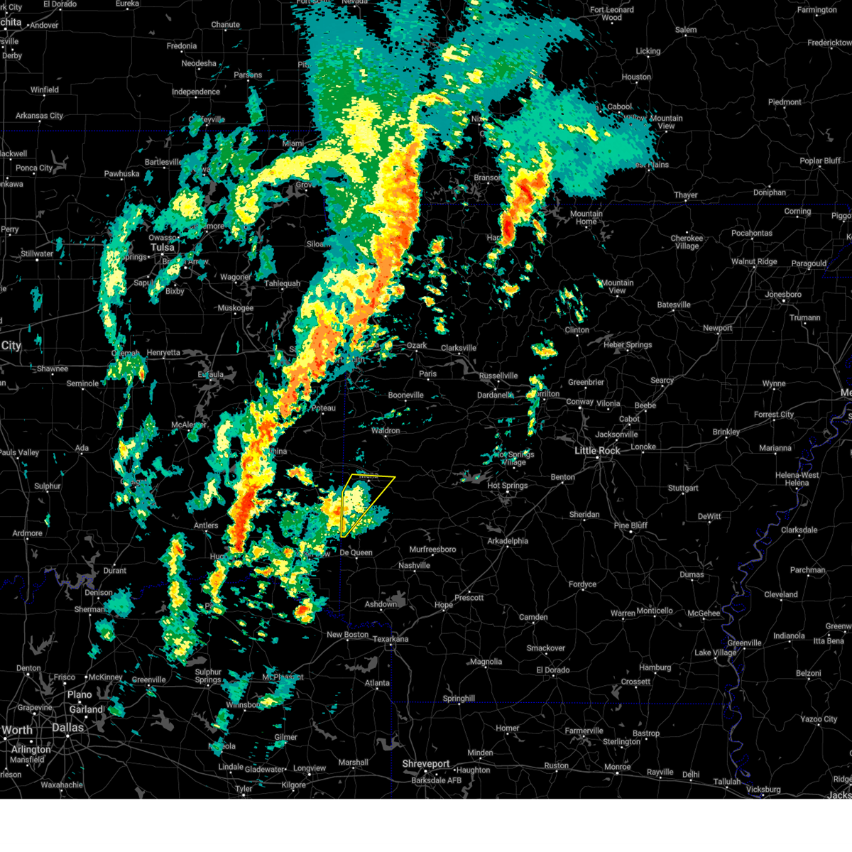
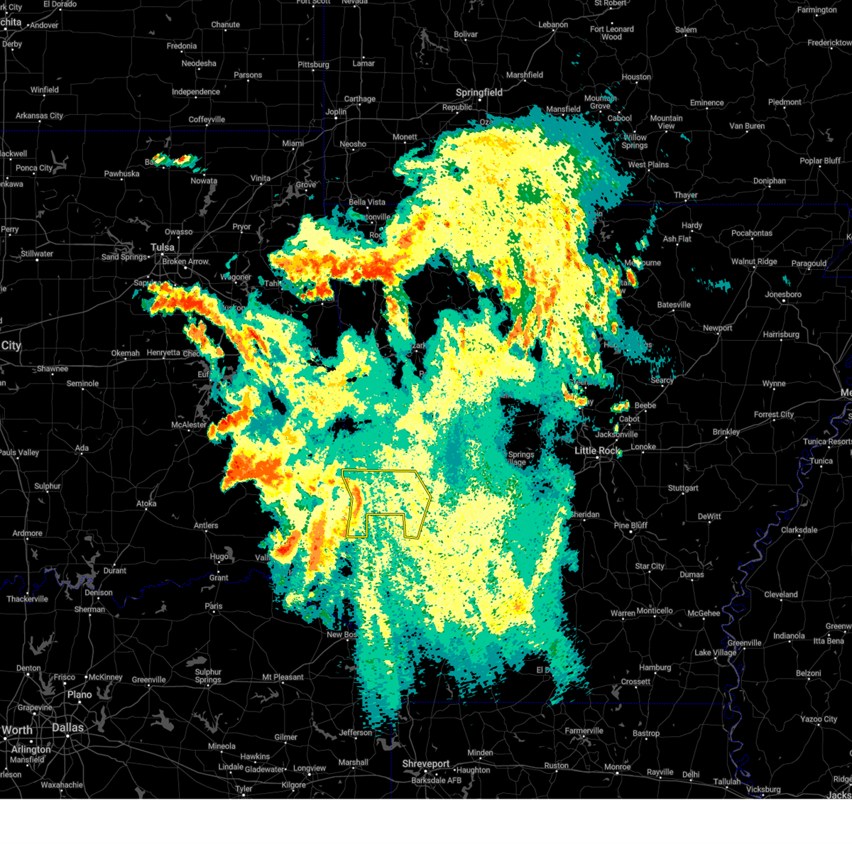
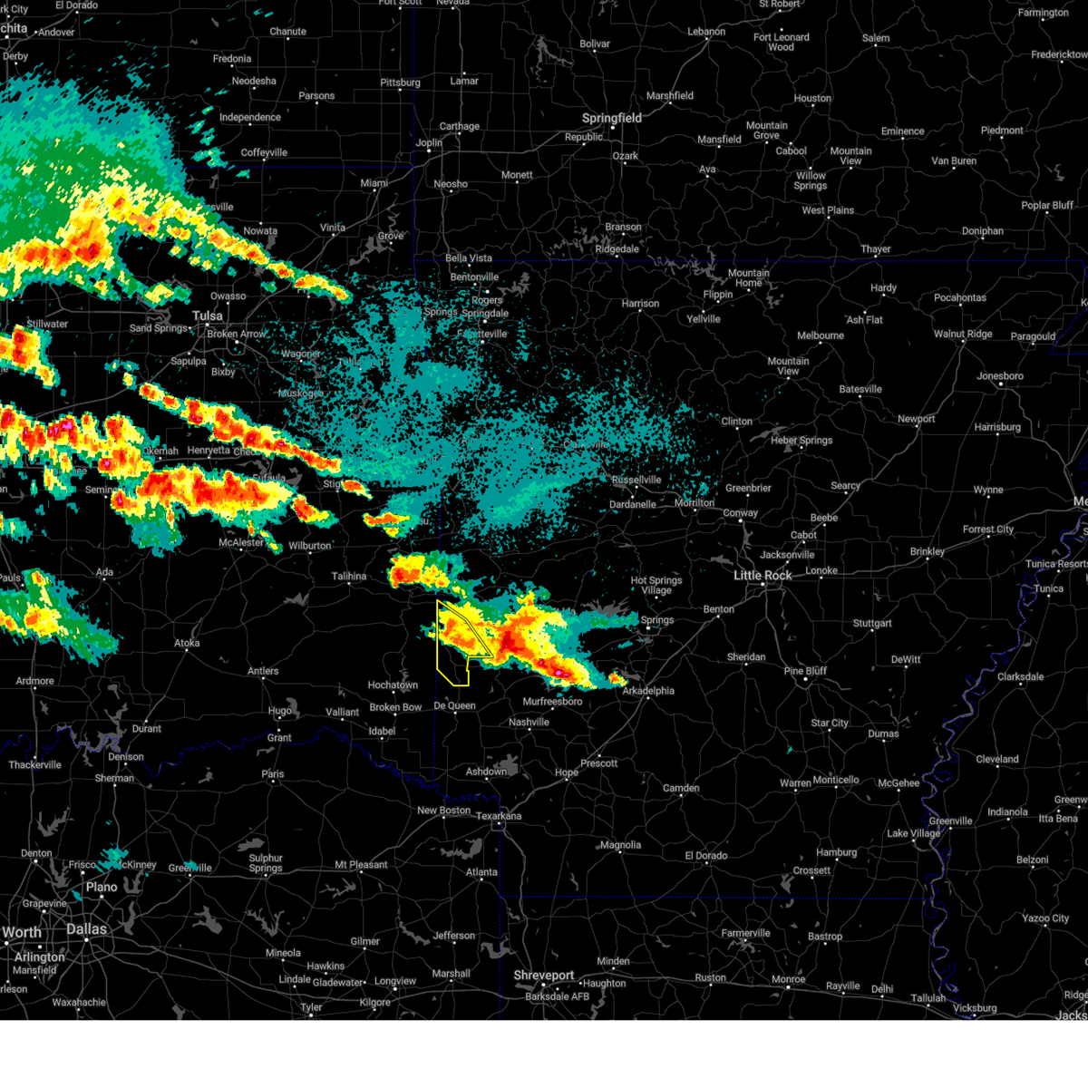
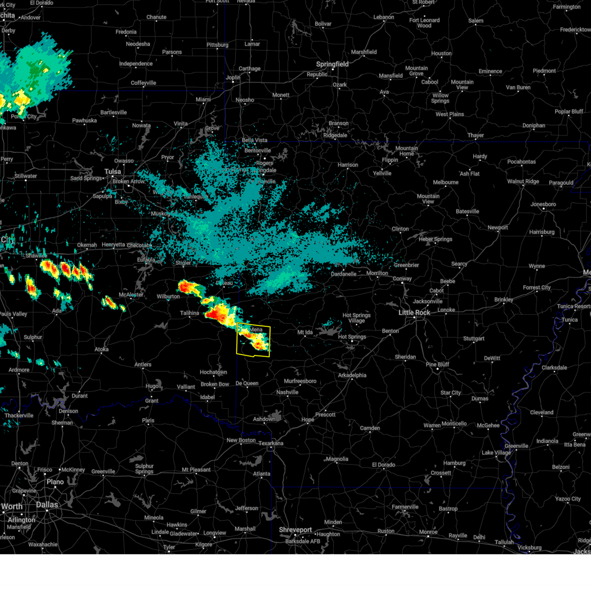
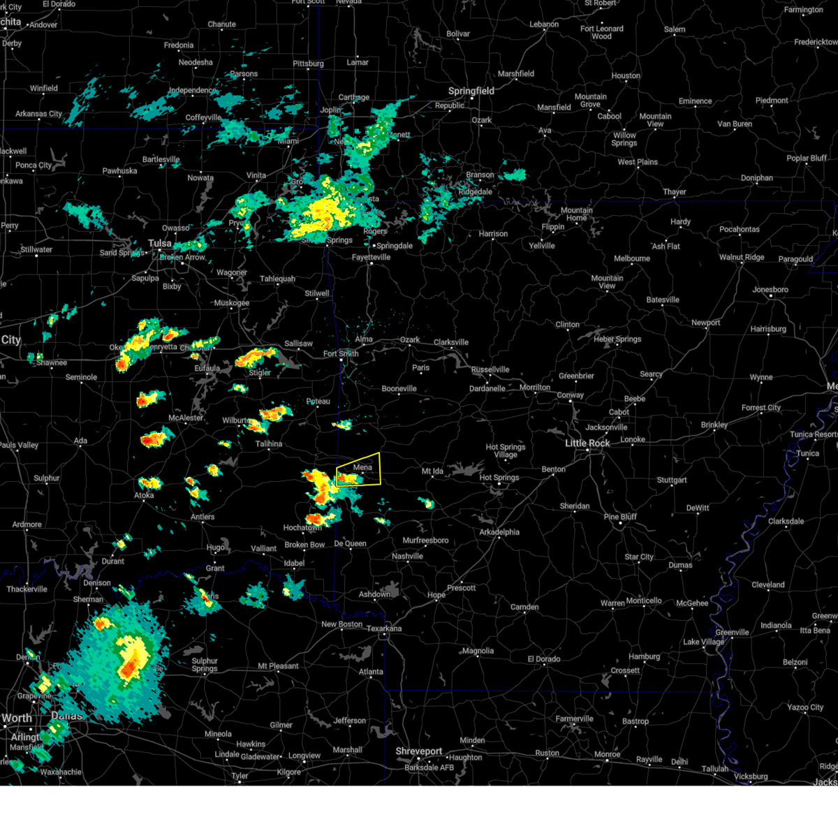
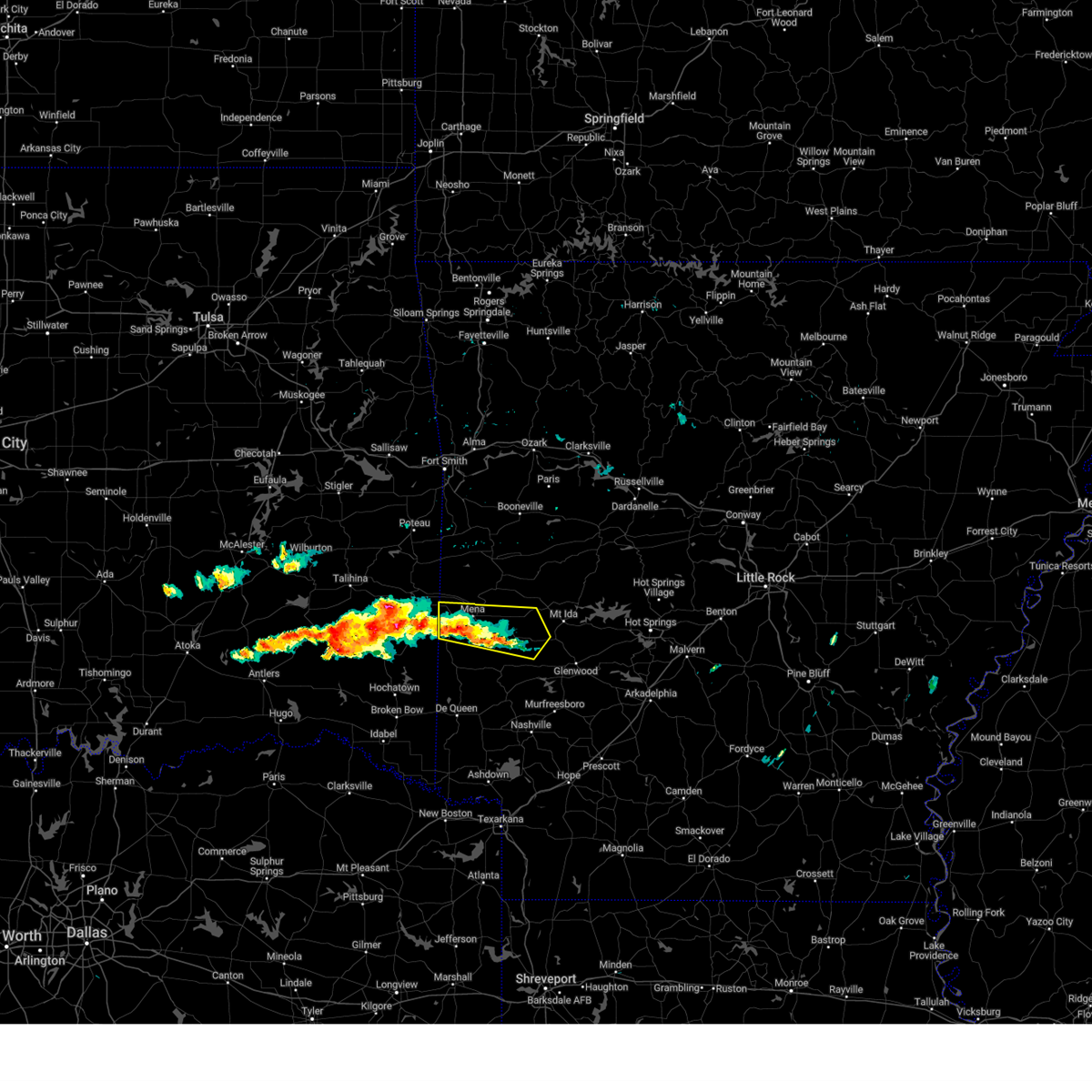
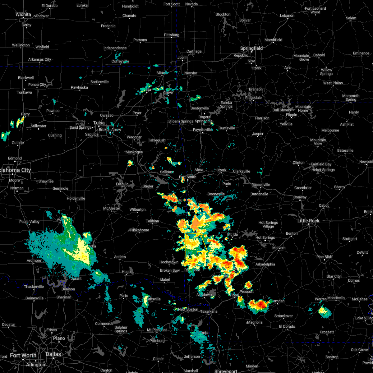
| 4/24/2026 7:33 PM CDT |
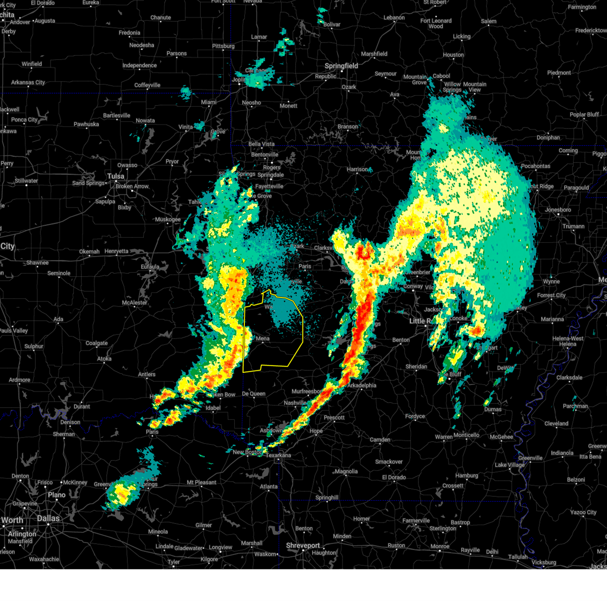
 Svrlzk the national weather service in little rock has issued a * severe thunderstorm warning for, polk county in western arkansas, * until 815 pm cdt. * at 733 pm cdt, a severe thunderstorm was located near hatfield, or 7 miles southwest of mena, moving east at 15 mph (radar indicated). Hazards include quarter size hail. damage to vehicles is expected Svrlzk the national weather service in little rock has issued a * severe thunderstorm warning for, polk county in western arkansas, * until 815 pm cdt. * at 733 pm cdt, a severe thunderstorm was located near hatfield, or 7 miles southwest of mena, moving east at 15 mph (radar indicated). Hazards include quarter size hail. damage to vehicles is expected
|
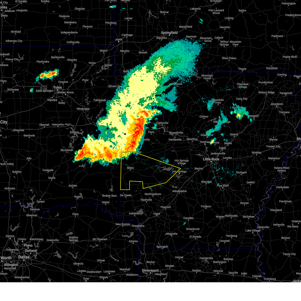
| 4/24/2026 6:09 PM CDT |
 The severe thunderstorm which prompted the warning has weakened. therefore, the warning will be allowed to expire. a tornado watch remains in effect until 900 pm cdt for western arkansas. The severe thunderstorm which prompted the warning has weakened. therefore, the warning will be allowed to expire. a tornado watch remains in effect until 900 pm cdt for western arkansas.
|
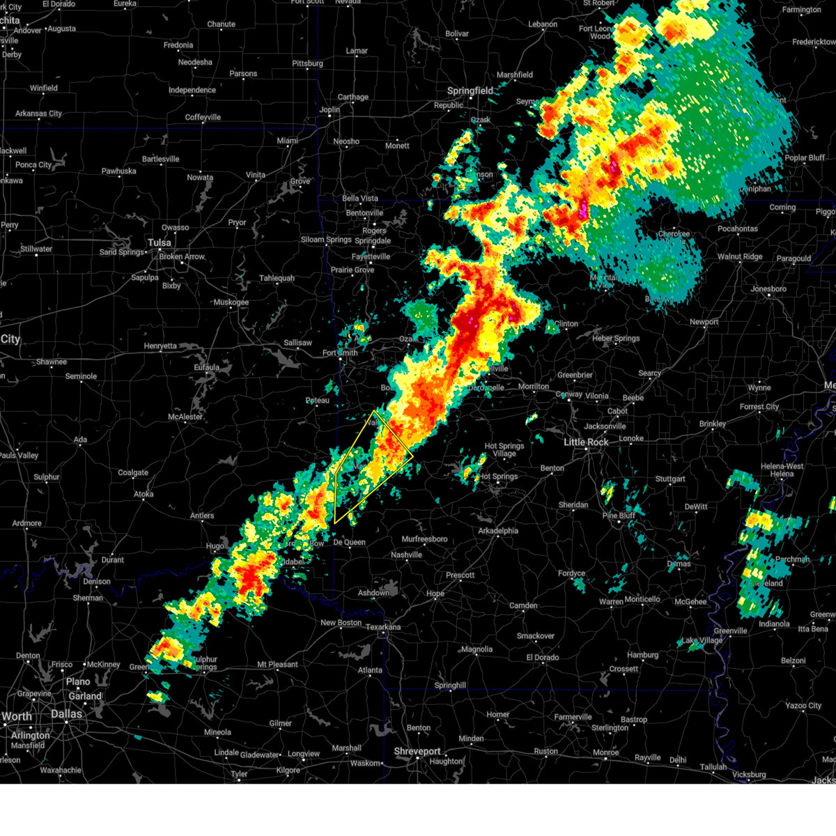
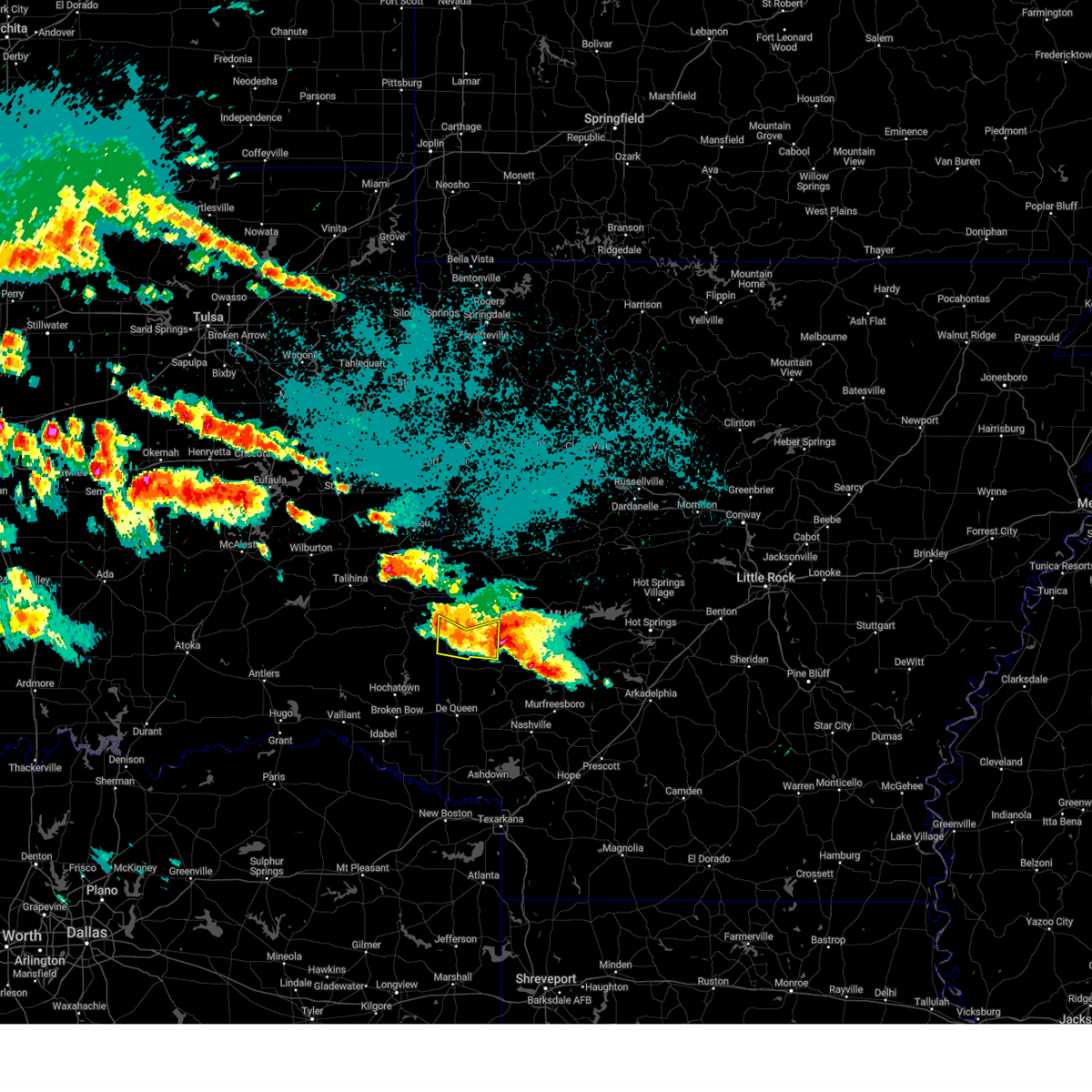
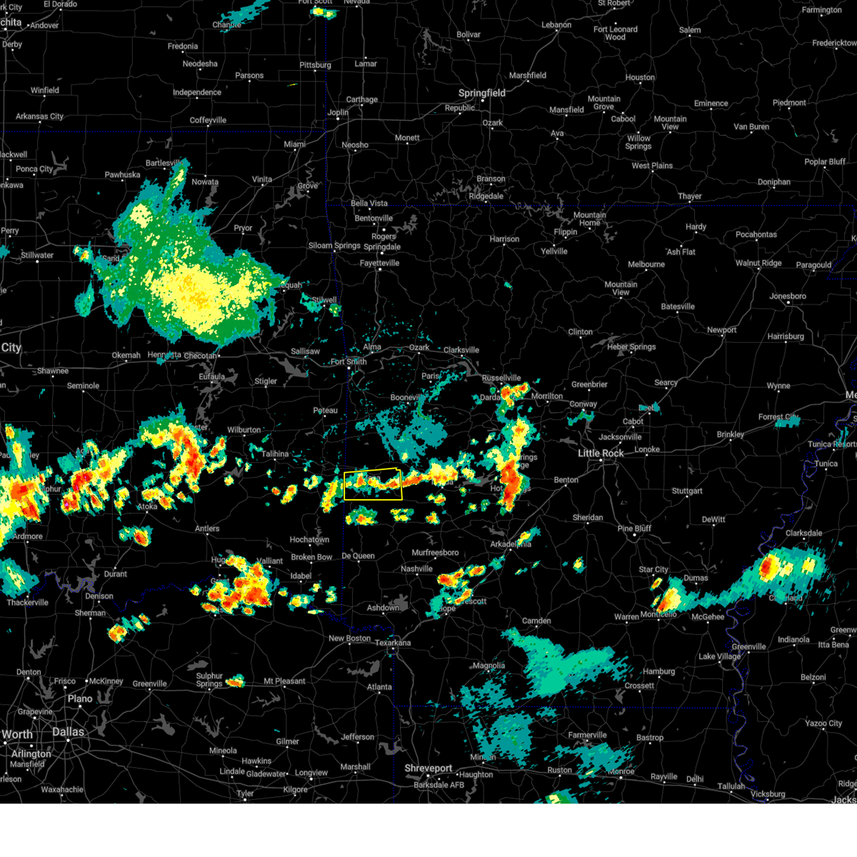
| 4/24/2026 5:41 PM CDT |
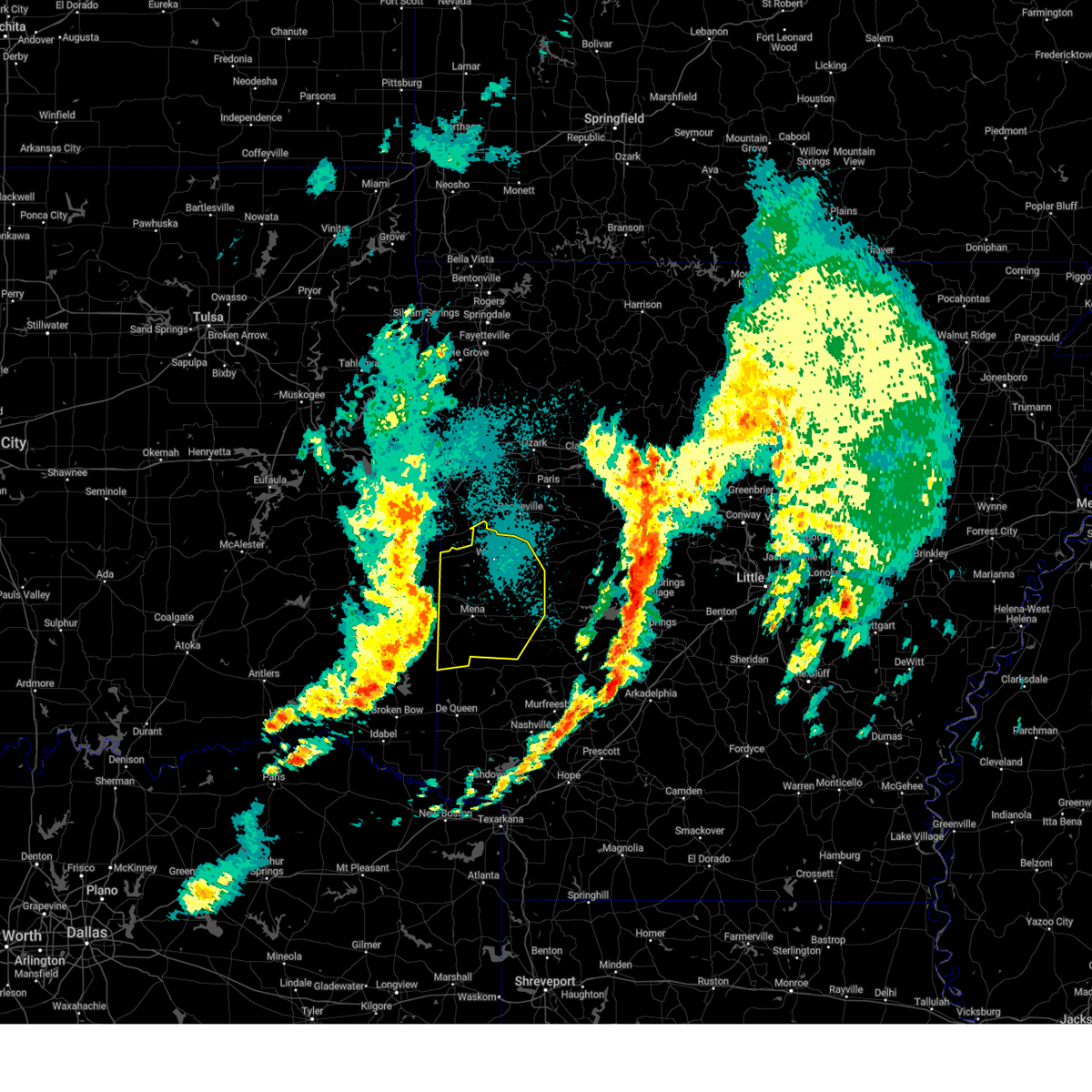
 Svrlzk the national weather service in little rock has issued a * severe thunderstorm warning for, central polk county in western arkansas, * until 615 pm cdt. * at 541 pm cdt, a severe thunderstorm was located near hatfield, or 15 miles southwest of mena, moving east at 25 mph (radar indicated). Hazards include 60 mph wind gusts and quarter size hail. Hail damage to vehicles is expected. Expect wind damage to roofs, siding, and trees. Svrlzk the national weather service in little rock has issued a * severe thunderstorm warning for, central polk county in western arkansas, * until 615 pm cdt. * at 541 pm cdt, a severe thunderstorm was located near hatfield, or 15 miles southwest of mena, moving east at 25 mph (radar indicated). Hazards include 60 mph wind gusts and quarter size hail. Hail damage to vehicles is expected. Expect wind damage to roofs, siding, and trees.
|
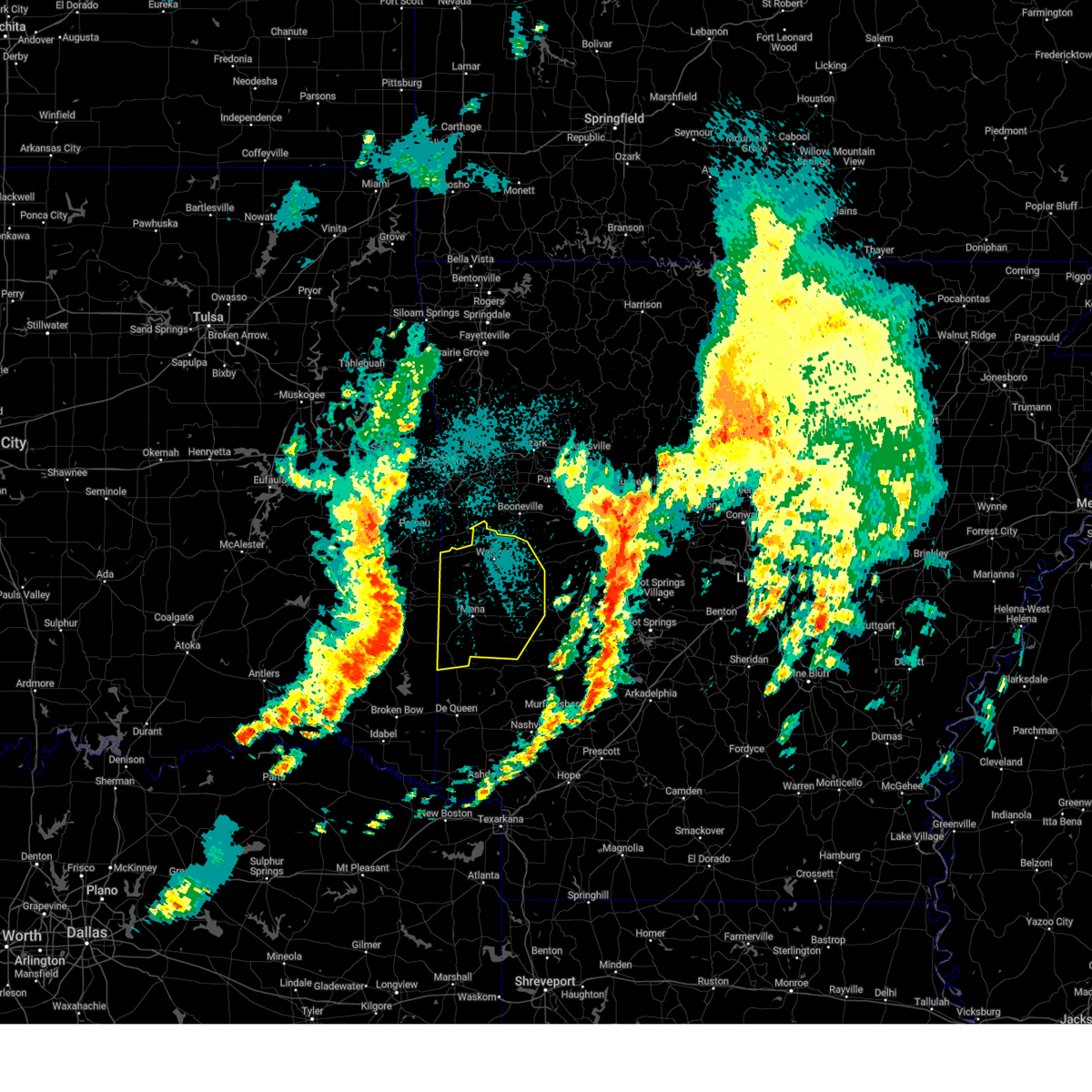
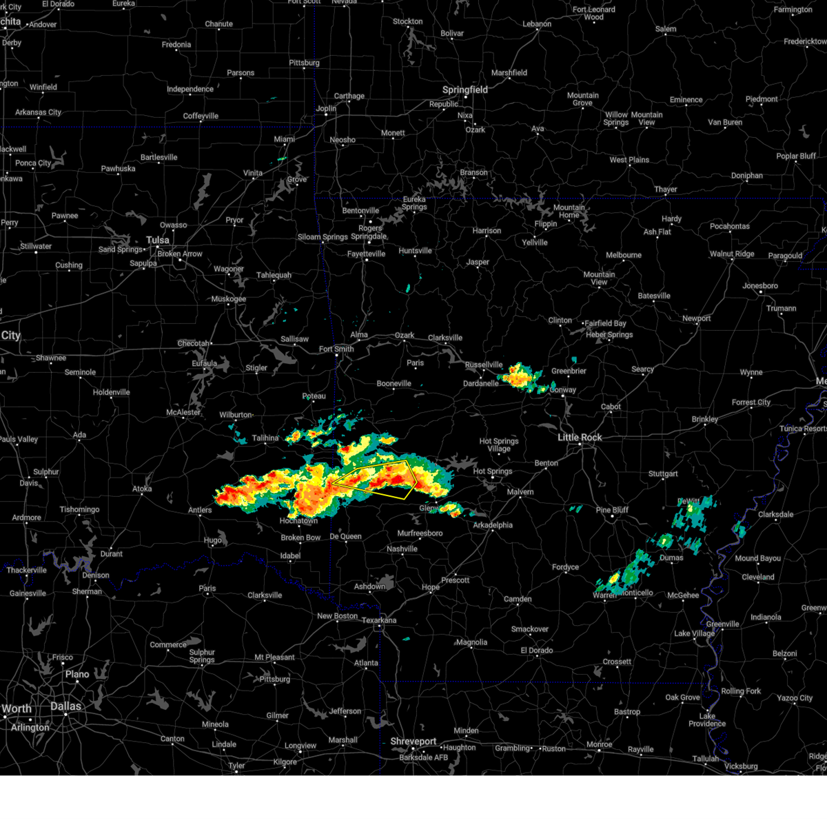
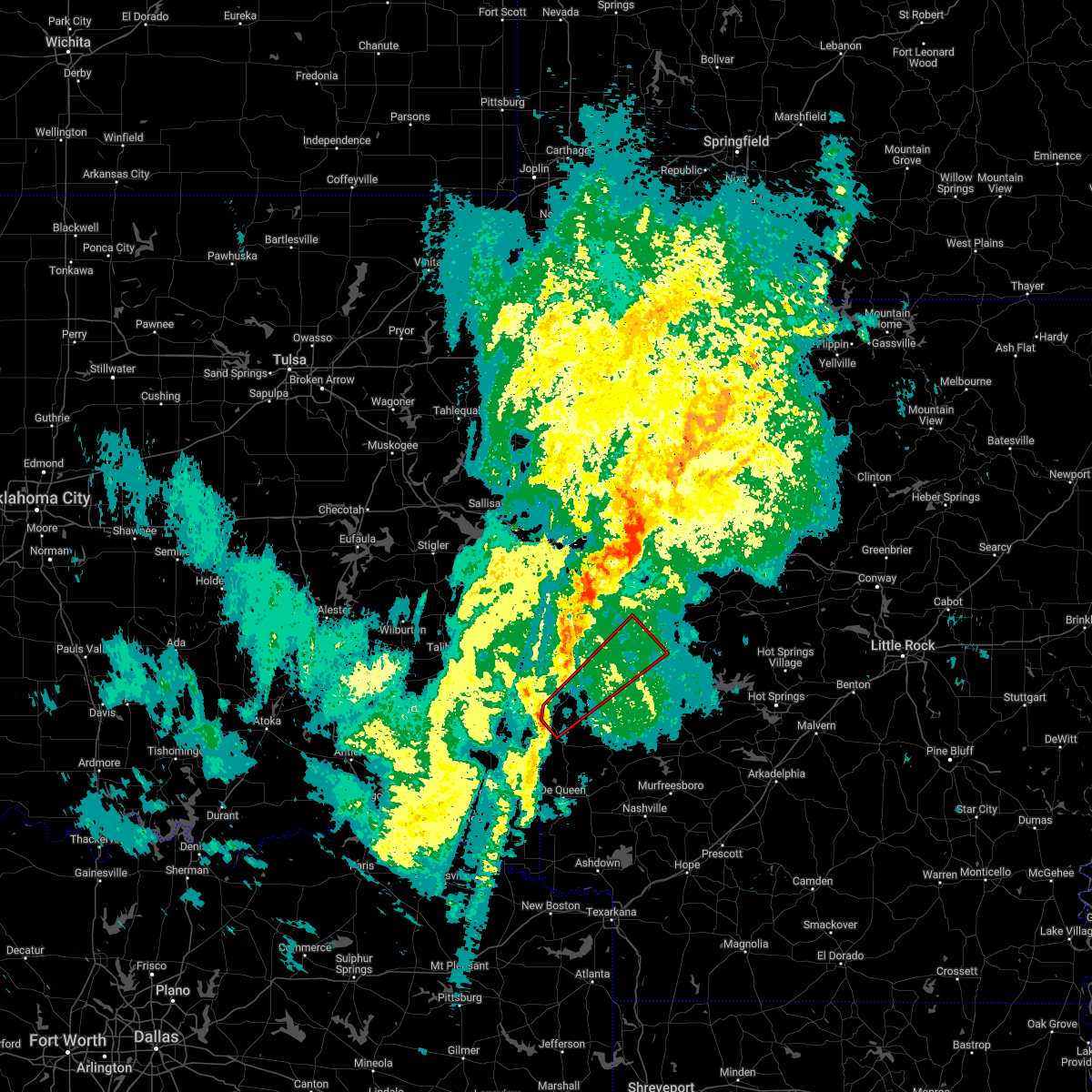
| 9/23/2025 8:30 PM CDT | Svrlzk the national weather service in little rock has issued a * severe thunderstorm warning for, central polk county in western arkansas, * until 915 pm cdt. * at 829 pm cdt, a severe thunderstorm was located over hatfield, or 10 miles southwest of mena, moving east at 30 mph (radar indicated). Hazards include 60 mph wind gusts and quarter size hail. Hail damage to vehicles is expected. Expect wind damage to roofs, siding, and trees. |
| 6/7/2025 7:30 AM CDT |
 Svrlzk the national weather service in little rock has issued a * severe thunderstorm warning for, searcy county in north central arkansas, southwestern izard county in north central arkansas, southeastern johnson county in western arkansas, van buren county in north central arkansas, southeastern baxter county in north central arkansas, eastern scott county in western arkansas, northern polk county in western arkansas, yell county in central arkansas, pope county in central arkansas, western stone county in north central arkansas, eastern logan county in western arkansas, southeastern newton county in north central arkansas, perry county in central arkansas, southeastern marion county in north central arkansas, conway county in central arkansas, garland county in central arkansas, northwestern saline county in central arkansas, west central hot spring county in southwestern arkansas, montgomery county in western arkansas, * until 815 am cdt. * at 729 am cdt, severe thunderstorms were located along a line extending from near rush to near hatfield, moving southeast at 30 mph (radar indicated). Hazards include 60 mph wind gusts and penny size hail. expect damage to roofs, siding, and trees Svrlzk the national weather service in little rock has issued a * severe thunderstorm warning for, searcy county in north central arkansas, southwestern izard county in north central arkansas, southeastern johnson county in western arkansas, van buren county in north central arkansas, southeastern baxter county in north central arkansas, eastern scott county in western arkansas, northern polk county in western arkansas, yell county in central arkansas, pope county in central arkansas, western stone county in north central arkansas, eastern logan county in western arkansas, southeastern newton county in north central arkansas, perry county in central arkansas, southeastern marion county in north central arkansas, conway county in central arkansas, garland county in central arkansas, northwestern saline county in central arkansas, west central hot spring county in southwestern arkansas, montgomery county in western arkansas, * until 815 am cdt. * at 729 am cdt, severe thunderstorms were located along a line extending from near rush to near hatfield, moving southeast at 30 mph (radar indicated). Hazards include 60 mph wind gusts and penny size hail. expect damage to roofs, siding, and trees
|
| 5/24/2025 10:37 AM CDT |
 The storms which prompted the warning have weakened below severe limits, and have exited the warned area. therefore, the warning will be allowed to expire. however gusty winds and heavy rain are still possible with these thunderstorms. a severe thunderstorm watch remains in effect until 300 pm cdt for western arkansas. The storms which prompted the warning have weakened below severe limits, and have exited the warned area. therefore, the warning will be allowed to expire. however gusty winds and heavy rain are still possible with these thunderstorms. a severe thunderstorm watch remains in effect until 300 pm cdt for western arkansas.
|
| 5/24/2025 9:59 AM CDT |
 Svrlzk the national weather service in little rock has issued a * severe thunderstorm warning for, southern polk county in western arkansas, * until 1045 am cdt. * at 959 am cdt, severe thunderstorms were located along a line extending from near hatfield to 8 miles west of vandervoort to 14 miles west of wickes, moving southeast at 35 mph (radar indicated). Hazards include 60 mph wind gusts. expect damage to roofs, siding, and trees Svrlzk the national weather service in little rock has issued a * severe thunderstorm warning for, southern polk county in western arkansas, * until 1045 am cdt. * at 959 am cdt, severe thunderstorms were located along a line extending from near hatfield to 8 miles west of vandervoort to 14 miles west of wickes, moving southeast at 35 mph (radar indicated). Hazards include 60 mph wind gusts. expect damage to roofs, siding, and trees
|
| 5/20/2025 2:08 AM CDT |
 At 207 am cdt, severe thunderstorms were located along a line extending from beauchamp to 12 miles east of queen wilhelmina state park to 8 miles northeast of mena to near mena intermountain airport to near cossatot river state park, moving east at 60 mph (radar indicated). Hazards include 60 mph wind gusts. Expect damage to roofs, siding, and trees. Locations impacted include, big fork, cardiff, hatfield, little missouri falls recreatio, pine ridge, shady lake recreation area, hatton, potter, cove, rocky, hon, cedar creek, acorn, bates, y city, bard springs recreation area, roaring branch natural area, parks, eagleton, bogg springs,. At 207 am cdt, severe thunderstorms were located along a line extending from beauchamp to 12 miles east of queen wilhelmina state park to 8 miles northeast of mena to near mena intermountain airport to near cossatot river state park, moving east at 60 mph (radar indicated). Hazards include 60 mph wind gusts. Expect damage to roofs, siding, and trees. Locations impacted include, big fork, cardiff, hatfield, little missouri falls recreatio, pine ridge, shady lake recreation area, hatton, potter, cove, rocky, hon, cedar creek, acorn, bates, y city, bard springs recreation area, roaring branch natural area, parks, eagleton, bogg springs,.
|
| 5/20/2025 1:59 AM CDT |
 At 159 am cdt, severe thunderstorms were located along a line extending from 8 miles north of mountain fork to near queen wilhelmina state park to near mena to near polk county fairgrounds to near vandervoort, moving east at 65 mph (radar indicated). Hazards include 60 mph wind gusts. Expect damage to roofs, siding, and trees. Locations impacted include, big fork, cardiff, hatfield, little missouri falls recreatio, pine ridge, shady lake recreation area, hatton, mountain fork, potter, cove, black fork, rocky, black fork mountain wilderness, hon, cedar creek, acorn, bates, y city, bard springs recreation area, roaring branch natural area,. At 159 am cdt, severe thunderstorms were located along a line extending from 8 miles north of mountain fork to near queen wilhelmina state park to near mena to near polk county fairgrounds to near vandervoort, moving east at 65 mph (radar indicated). Hazards include 60 mph wind gusts. Expect damage to roofs, siding, and trees. Locations impacted include, big fork, cardiff, hatfield, little missouri falls recreatio, pine ridge, shady lake recreation area, hatton, mountain fork, potter, cove, black fork, rocky, black fork mountain wilderness, hon, cedar creek, acorn, bates, y city, bard springs recreation area, roaring branch natural area,.
|
| 5/20/2025 1:52 AM CDT |
 At 151 am cdt, severe thunderstorms were located along a line extending from 9 miles southeast of heavener to near mountain fork to 6 miles southwest of queen wilhelmina state park to near hatfield to 11 miles west of vandervoort, moving east at 60 mph (radar indicated). Hazards include 60 mph wind gusts. Expect damage to roofs, siding, and trees. Locations impacted include, big fork, cardiff, hatfield, little missouri falls recreatio, pine ridge, shady lake recreation area, hatton, mountain fork, potter, cove, black fork, rocky, black fork mountain wilderness, hon, cedar creek, acorn, bates, y city, bard springs recreation area, roaring branch natural area,. At 151 am cdt, severe thunderstorms were located along a line extending from 9 miles southeast of heavener to near mountain fork to 6 miles southwest of queen wilhelmina state park to near hatfield to 11 miles west of vandervoort, moving east at 60 mph (radar indicated). Hazards include 60 mph wind gusts. Expect damage to roofs, siding, and trees. Locations impacted include, big fork, cardiff, hatfield, little missouri falls recreatio, pine ridge, shady lake recreation area, hatton, mountain fork, potter, cove, black fork, rocky, black fork mountain wilderness, hon, cedar creek, acorn, bates, y city, bard springs recreation area, roaring branch natural area,.
|
| 5/20/2025 1:37 AM CDT |
 Svrlzk the national weather service in little rock has issued a * severe thunderstorm warning for, scott county in western arkansas, polk county in western arkansas, northwestern montgomery county in western arkansas, * until 215 am cdt. * at 137 am cdt, severe thunderstorms were located along a line extending from 6 miles north of muse to big cedar to near octavia, moving east at 60 mph (radar indicated). Hazards include 60 mph wind gusts. expect damage to roofs, siding, and trees Svrlzk the national weather service in little rock has issued a * severe thunderstorm warning for, scott county in western arkansas, polk county in western arkansas, northwestern montgomery county in western arkansas, * until 215 am cdt. * at 137 am cdt, severe thunderstorms were located along a line extending from 6 miles north of muse to big cedar to near octavia, moving east at 60 mph (radar indicated). Hazards include 60 mph wind gusts. expect damage to roofs, siding, and trees
|
| 5/18/2025 5:33 AM CDT |
 At 533 am cdt, severe thunderstorms were located along a line extending from near muddy creek wma to 6 miles east of opal to shady, moving east at 50 mph (radar indicated). Hazards include 60 mph wind gusts and nickel size hail. Expect damage to roofs, siding, and trees. Locations impacted include, big fork, bonnerdale, hatfield, little missouri falls recreatio, pine ridge, lena landing rec area, shady lake recreation area, hatton, potter, cove, story, rocky, cedar creek, pencil bluff, glenwood, crystal springs landing, meyers, acorn, lake ouachita state park, y city,. At 533 am cdt, severe thunderstorms were located along a line extending from near muddy creek wma to 6 miles east of opal to shady, moving east at 50 mph (radar indicated). Hazards include 60 mph wind gusts and nickel size hail. Expect damage to roofs, siding, and trees. Locations impacted include, big fork, bonnerdale, hatfield, little missouri falls recreatio, pine ridge, lena landing rec area, shady lake recreation area, hatton, potter, cove, story, rocky, cedar creek, pencil bluff, glenwood, crystal springs landing, meyers, acorn, lake ouachita state park, y city,.
|
| 5/18/2025 5:23 AM CDT |
 At 522 am cdt, severe thunderstorms were located along a line extending from 6 miles southwest of muddy creek wma to opal to near mena intermountain airport, moving southeast at 55 mph (radar indicated). Hazards include 60 mph wind gusts and quarter size hail. Hail damage to vehicles is expected. expect wind damage to roofs, siding, and trees. Locations impacted include, big fork, bonnerdale, hatfield, little missouri falls recreatio, pine ridge, lena landing rec area, shady lake recreation area, hatton, mountain fork, potter, cove, story, rocky, black fork mountain wilderness, cedar creek, pencil bluff, glenwood, crystal springs landing, meyers, acorn,. At 522 am cdt, severe thunderstorms were located along a line extending from 6 miles southwest of muddy creek wma to opal to near mena intermountain airport, moving southeast at 55 mph (radar indicated). Hazards include 60 mph wind gusts and quarter size hail. Hail damage to vehicles is expected. expect wind damage to roofs, siding, and trees. Locations impacted include, big fork, bonnerdale, hatfield, little missouri falls recreatio, pine ridge, lena landing rec area, shady lake recreation area, hatton, mountain fork, potter, cove, story, rocky, black fork mountain wilderness, cedar creek, pencil bluff, glenwood, crystal springs landing, meyers, acorn,.
|
| 5/18/2025 5:06 AM CDT |
 Svrlzk the national weather service in little rock has issued a * severe thunderstorm warning for, northwestern clark county in southwestern arkansas, northwestern pike county in southwestern arkansas, southwestern garland county in central arkansas, scott county in western arkansas, polk county in western arkansas, southwestern yell county in central arkansas, western hot spring county in southwestern arkansas, montgomery county in western arkansas, * until 600 am cdt. * at 506 am cdt, severe thunderstorms were located along a line extending from 8 miles south of cardiff to near mena to near mountain fork, moving southeast at 55 mph (radar indicated). Hazards include 60 mph wind gusts and quarter size hail. Hail damage to vehicles is expected. Expect wind damage to roofs, siding, and trees. Svrlzk the national weather service in little rock has issued a * severe thunderstorm warning for, northwestern clark county in southwestern arkansas, northwestern pike county in southwestern arkansas, southwestern garland county in central arkansas, scott county in western arkansas, polk county in western arkansas, southwestern yell county in central arkansas, western hot spring county in southwestern arkansas, montgomery county in western arkansas, * until 600 am cdt. * at 506 am cdt, severe thunderstorms were located along a line extending from 8 miles south of cardiff to near mena to near mountain fork, moving southeast at 55 mph (radar indicated). Hazards include 60 mph wind gusts and quarter size hail. Hail damage to vehicles is expected. Expect wind damage to roofs, siding, and trees.
|
| 4/30/2025 2:09 PM CDT |
 The storms which prompted the warning have moved out of portions of the warned area. therefore, the warning will be allowed to expire. however severe winds are still possible with these thunderstorms. a tornado watch remains in effect until 500 pm cdt for western arkansas. remember, a new severe thunderstorm warning still remains in effect for portions of polk county until 300 pm cdt. The storms which prompted the warning have moved out of portions of the warned area. therefore, the warning will be allowed to expire. however severe winds are still possible with these thunderstorms. a tornado watch remains in effect until 500 pm cdt for western arkansas. remember, a new severe thunderstorm warning still remains in effect for portions of polk county until 300 pm cdt.
|
| 4/30/2025 2:08 PM CDT |
 Svrlzk the national weather service in little rock has issued a * severe thunderstorm warning for, northwestern pike county in southwestern arkansas, polk county in western arkansas, southwestern montgomery county in western arkansas, * until 300 pm cdt. * at 207 pm cdt, severe thunderstorms were located along a line extending from near hatfield to near wickes to gillham, moving east at 25 mph (radar indicated). Hazards include 60 mph wind gusts. expect damage to roofs, siding, and trees Svrlzk the national weather service in little rock has issued a * severe thunderstorm warning for, northwestern pike county in southwestern arkansas, polk county in western arkansas, southwestern montgomery county in western arkansas, * until 300 pm cdt. * at 207 pm cdt, severe thunderstorms were located along a line extending from near hatfield to near wickes to gillham, moving east at 25 mph (radar indicated). Hazards include 60 mph wind gusts. expect damage to roofs, siding, and trees
|
| 4/30/2025 1:54 PM CDT |
 At 154 pm cdt, severe thunderstorms were located along a line extending from 7 miles southwest of hatfield to near vandervoort to 7 miles west of grannis, moving northeast at 30 mph (radar indicated). Hazards include 60 mph wind gusts. Expect damage to roofs, siding, and trees. Locations impacted include, grannis, hatfield, mena, cossatot river state park, hatton, mountain fork, potter, polk county fairgrounds, cove, dallas, mena intermountain airport, shady grove, mccauley, rocky, shady, wickes, black fork mountain wilderness, hartley, nunley, camp pioneer,. At 154 pm cdt, severe thunderstorms were located along a line extending from 7 miles southwest of hatfield to near vandervoort to 7 miles west of grannis, moving northeast at 30 mph (radar indicated). Hazards include 60 mph wind gusts. Expect damage to roofs, siding, and trees. Locations impacted include, grannis, hatfield, mena, cossatot river state park, hatton, mountain fork, potter, polk county fairgrounds, cove, dallas, mena intermountain airport, shady grove, mccauley, rocky, shady, wickes, black fork mountain wilderness, hartley, nunley, camp pioneer,.
|
| 4/30/2025 1:40 PM CDT |
 At 140 pm cdt, severe thunderstorms were located along a line extending from 10 miles southeast of octavia to 11 miles southwest of vandervoort to 14 miles west of grannis, moving northeast at 25 mph (radar indicated). Hazards include 60 mph wind gusts. Expect damage to roofs, siding, and trees. Locations impacted include, grannis, hatfield, mena, cossatot river state park, hatton, mountain fork, potter, polk county fairgrounds, cove, dallas, mena intermountain airport, shady grove, mccauley, rocky, shady, wickes, black fork mountain wilderness, hartley, nunley, camp pioneer,. At 140 pm cdt, severe thunderstorms were located along a line extending from 10 miles southeast of octavia to 11 miles southwest of vandervoort to 14 miles west of grannis, moving northeast at 25 mph (radar indicated). Hazards include 60 mph wind gusts. Expect damage to roofs, siding, and trees. Locations impacted include, grannis, hatfield, mena, cossatot river state park, hatton, mountain fork, potter, polk county fairgrounds, cove, dallas, mena intermountain airport, shady grove, mccauley, rocky, shady, wickes, black fork mountain wilderness, hartley, nunley, camp pioneer,.
|
| 4/30/2025 1:28 PM CDT |
 Svrlzk the national weather service in little rock has issued a * severe thunderstorm warning for, polk county in western arkansas, * until 215 pm cdt. * at 127 pm cdt, severe thunderstorms were located along a line extending from 10 miles south of octavia to 16 miles southwest of vandervoort to 11 miles northeast of broken bow, moving northeast at 30 mph (radar indicated). Hazards include 60 mph wind gusts. expect damage to roofs, siding, and trees Svrlzk the national weather service in little rock has issued a * severe thunderstorm warning for, polk county in western arkansas, * until 215 pm cdt. * at 127 pm cdt, severe thunderstorms were located along a line extending from 10 miles south of octavia to 16 miles southwest of vandervoort to 11 miles northeast of broken bow, moving northeast at 30 mph (radar indicated). Hazards include 60 mph wind gusts. expect damage to roofs, siding, and trees
|
| 4/5/2025 1:29 AM CDT |
 At 128 am cdt, a severe thunderstorm was located near mena intermountain airport, or near mena, moving north at 40 mph (radar indicated). Hazards include ping pong ball size hail and 60 mph wind gusts. People and animals outdoors will be injured. expect hail damage to roofs, siding, windows, and vehicles. expect wind damage to roofs, siding, and trees. Locations impacted include, board camp, winfield, ink, beauchamp, hatfield, mena, mountain fork, potter, boles, polk county fairgrounds, dallas, mena intermountain airport, shady grove, mccauley, black fork, rocky, shady, black fork mountain wilderness, nunley, morgan springs,. At 128 am cdt, a severe thunderstorm was located near mena intermountain airport, or near mena, moving north at 40 mph (radar indicated). Hazards include ping pong ball size hail and 60 mph wind gusts. People and animals outdoors will be injured. expect hail damage to roofs, siding, windows, and vehicles. expect wind damage to roofs, siding, and trees. Locations impacted include, board camp, winfield, ink, beauchamp, hatfield, mena, mountain fork, potter, boles, polk county fairgrounds, dallas, mena intermountain airport, shady grove, mccauley, black fork, rocky, shady, black fork mountain wilderness, nunley, morgan springs,.
|
| 4/5/2025 1:17 AM CDT |
 Svrlzk the national weather service in little rock has issued a * severe thunderstorm warning for, southern scott county in western arkansas, polk county in western arkansas, * until 200 am cdt. * at 117 am cdt, a severe thunderstorm was located over cossatot river state park, or 13 miles south of mena, moving north at 45 mph (radar indicated). Hazards include 60 mph wind gusts and quarter size hail. Hail damage to vehicles is expected. Expect wind damage to roofs, siding, and trees. Svrlzk the national weather service in little rock has issued a * severe thunderstorm warning for, southern scott county in western arkansas, polk county in western arkansas, * until 200 am cdt. * at 117 am cdt, a severe thunderstorm was located over cossatot river state park, or 13 miles south of mena, moving north at 45 mph (radar indicated). Hazards include 60 mph wind gusts and quarter size hail. Hail damage to vehicles is expected. Expect wind damage to roofs, siding, and trees.
|
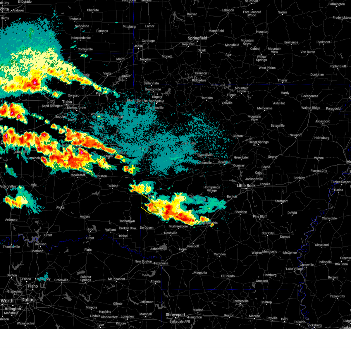
| 4/4/2025 10:01 PM CDT | Golf Ball sized hail reported 0.1 miles SSW of Hatfield, AR |
| 4/4/2025 9:55 PM CDT |
 Svrlzk the national weather service in little rock has issued a * severe thunderstorm warning for, southwestern scott county in western arkansas, northwestern polk county in western arkansas, * until 1030 pm cdt. * at 955 pm cdt, a severe thunderstorm was located near hatfield, or 14 miles southwest of mena, moving north at 45 mph (radar indicated). Hazards include ping pong ball size hail and 60 mph wind gusts. People and animals outdoors will be injured. expect hail damage to roofs, siding, windows, and vehicles. Expect wind damage to roofs, siding, and trees. Svrlzk the national weather service in little rock has issued a * severe thunderstorm warning for, southwestern scott county in western arkansas, northwestern polk county in western arkansas, * until 1030 pm cdt. * at 955 pm cdt, a severe thunderstorm was located near hatfield, or 14 miles southwest of mena, moving north at 45 mph (radar indicated). Hazards include ping pong ball size hail and 60 mph wind gusts. People and animals outdoors will be injured. expect hail damage to roofs, siding, windows, and vehicles. Expect wind damage to roofs, siding, and trees.
|
| 4/4/2025 9:50 PM CDT |
 At 950 pm cdt, a severe thunderstorm was located near vandervoort, or 16 miles southwest of mena, moving north at 45 mph (radar indicated). Hazards include golf ball size hail and 60 mph wind gusts. People and animals outdoors will be injured. expect hail damage to roofs, siding, windows, and vehicles. expect wind damage to roofs, siding, and trees. Locations impacted include, hatton, wickes, cove, hatfield, mccauley, bogg springs, vandervoort,. At 950 pm cdt, a severe thunderstorm was located near vandervoort, or 16 miles southwest of mena, moving north at 45 mph (radar indicated). Hazards include golf ball size hail and 60 mph wind gusts. People and animals outdoors will be injured. expect hail damage to roofs, siding, windows, and vehicles. expect wind damage to roofs, siding, and trees. Locations impacted include, hatton, wickes, cove, hatfield, mccauley, bogg springs, vandervoort,.
|
| 4/4/2025 9:37 PM CDT |
 At 937 pm cdt, a severe thunderstorm was located 7 miles west of grannis, or 15 miles northwest of de queen, moving north at 55 mph (radar indicated). Hazards include golf ball size hail and 60 mph wind gusts. People and animals outdoors will be injured. expect hail damage to roofs, siding, windows, and vehicles. expect wind damage to roofs, siding, and trees. Locations impacted include, cossatot river state park, hatton, shady, wickes, hartley, cove, grannis, hatfield, mccauley, bogg springs, vandervoort,. At 937 pm cdt, a severe thunderstorm was located 7 miles west of grannis, or 15 miles northwest of de queen, moving north at 55 mph (radar indicated). Hazards include golf ball size hail and 60 mph wind gusts. People and animals outdoors will be injured. expect hail damage to roofs, siding, windows, and vehicles. expect wind damage to roofs, siding, and trees. Locations impacted include, cossatot river state park, hatton, shady, wickes, hartley, cove, grannis, hatfield, mccauley, bogg springs, vandervoort,.
|
| 4/4/2025 9:27 PM CDT |
 Svrlzk the national weather service in little rock has issued a * severe thunderstorm warning for, southwestern polk county in western arkansas, * until 1000 pm cdt. * at 927 pm cdt, a severe thunderstorm was located 7 miles northwest of de queen, moving north at 50 mph (radar indicated). Hazards include golf ball size hail and 60 mph wind gusts. People and animals outdoors will be injured. expect hail damage to roofs, siding, windows, and vehicles. Expect wind damage to roofs, siding, and trees. Svrlzk the national weather service in little rock has issued a * severe thunderstorm warning for, southwestern polk county in western arkansas, * until 1000 pm cdt. * at 927 pm cdt, a severe thunderstorm was located 7 miles northwest of de queen, moving north at 50 mph (radar indicated). Hazards include golf ball size hail and 60 mph wind gusts. People and animals outdoors will be injured. expect hail damage to roofs, siding, windows, and vehicles. Expect wind damage to roofs, siding, and trees.
|
| 4/2/2025 3:06 PM CDT |
 the severe thunderstorm warning has been cancelled and is no longer in effect the severe thunderstorm warning has been cancelled and is no longer in effect
|
| 4/2/2025 2:46 PM CDT |
 Svrlzk the national weather service in little rock has issued a * severe thunderstorm warning for, southwestern scott county in western arkansas, polk county in western arkansas, northwestern montgomery county in western arkansas, * until 330 pm cdt. * at 246 pm cdt, a severe thunderstorm was located 8 miles southwest of vandervoort, or 21 miles northwest of de queen, moving northeast at 60 mph (radar indicated). Hazards include ping pong ball size hail and 60 mph wind gusts. People and animals outdoors will be injured. expect hail damage to roofs, siding, windows, and vehicles. Expect wind damage to roofs, siding, and trees. Svrlzk the national weather service in little rock has issued a * severe thunderstorm warning for, southwestern scott county in western arkansas, polk county in western arkansas, northwestern montgomery county in western arkansas, * until 330 pm cdt. * at 246 pm cdt, a severe thunderstorm was located 8 miles southwest of vandervoort, or 21 miles northwest of de queen, moving northeast at 60 mph (radar indicated). Hazards include ping pong ball size hail and 60 mph wind gusts. People and animals outdoors will be injured. expect hail damage to roofs, siding, windows, and vehicles. Expect wind damage to roofs, siding, and trees.
|
| 3/4/2025 8:11 AM CST |
 Svrlzk the national weather service in little rock has issued a * severe thunderstorm warning for, southwestern logan county in western arkansas, scott county in western arkansas, polk county in western arkansas, * until 915 am cst. * at 810 am cst, severe thunderstorms were located in oklahoma along a line extending from panama to 6 miles northeast of big cedar to 10 miles west of grannis, moving east at 50 mph (radar indicated). Hazards include 60 mph wind gusts and penny size hail. expect damage to roofs, siding, and trees Svrlzk the national weather service in little rock has issued a * severe thunderstorm warning for, southwestern logan county in western arkansas, scott county in western arkansas, polk county in western arkansas, * until 915 am cst. * at 810 am cst, severe thunderstorms were located in oklahoma along a line extending from panama to 6 miles northeast of big cedar to 10 miles west of grannis, moving east at 50 mph (radar indicated). Hazards include 60 mph wind gusts and penny size hail. expect damage to roofs, siding, and trees
|
| 11/4/2024 6:14 PM CST |
 the severe thunderstorm warning has been cancelled and is no longer in effect the severe thunderstorm warning has been cancelled and is no longer in effect
|
| 11/4/2024 5:49 PM CST |
 Svrlzk the national weather service in little rock has issued a * severe thunderstorm warning for, northwestern polk county in western arkansas, * until 630 pm cst. * at 547 pm cst, a severe thunderstorm was located 7 miles west of wickes, or 17 miles northwest of de queen, moving northeast at 40 mph (radar indicated). Hazards include 60 mph wind gusts and penny size hail. expect damage to roofs, siding, and trees Svrlzk the national weather service in little rock has issued a * severe thunderstorm warning for, northwestern polk county in western arkansas, * until 630 pm cst. * at 547 pm cst, a severe thunderstorm was located 7 miles west of wickes, or 17 miles northwest of de queen, moving northeast at 40 mph (radar indicated). Hazards include 60 mph wind gusts and penny size hail. expect damage to roofs, siding, and trees
|
| 3/14/2024 6:26 PM CDT |
 At 626 pm cdt, a severe thunderstorm was located over hatfield, or 9 miles southwest of mena, moving northeast at 25 mph (radar indicated). Hazards include ping pong ball size hail and 60 mph wind gusts. People and animals outdoors will be injured. expect hail damage to roofs, siding, windows, and vehicles. expect wind damage to roofs, siding, and trees. Locations impacted include, mena, hatfield, vandervoort, shady, opal, cossatot river state park, polk county fairgrounds, mena intermountain airport, mccauley, cove, big fork, board camp, nunley, ink, camp pioneer, hatton, cherry hill in polk county, potter, dallas,. At 626 pm cdt, a severe thunderstorm was located over hatfield, or 9 miles southwest of mena, moving northeast at 25 mph (radar indicated). Hazards include ping pong ball size hail and 60 mph wind gusts. People and animals outdoors will be injured. expect hail damage to roofs, siding, windows, and vehicles. expect wind damage to roofs, siding, and trees. Locations impacted include, mena, hatfield, vandervoort, shady, opal, cossatot river state park, polk county fairgrounds, mena intermountain airport, mccauley, cove, big fork, board camp, nunley, ink, camp pioneer, hatton, cherry hill in polk county, potter, dallas,.
|
| 3/14/2024 6:11 PM CDT |
 At 610 pm cdt, a severe thunderstorm was located near cove, or 12 miles southwest of mena, moving northeast at 30 mph (radar indicated). Hazards include ping pong ball size hail and 60 mph wind gusts. People and animals outdoors will be injured. expect hail damage to roofs, siding, windows, and vehicles. expect wind damage to roofs, siding, and trees. Locations impacted include, mena, hatfield, vandervoort, shady, opal, cossatot river state park, polk county fairgrounds, mena intermountain airport, mccauley, cove, big fork, board camp, nunley, ink, camp pioneer, hatton, cherry hill in polk county, potter, dallas,. At 610 pm cdt, a severe thunderstorm was located near cove, or 12 miles southwest of mena, moving northeast at 30 mph (radar indicated). Hazards include ping pong ball size hail and 60 mph wind gusts. People and animals outdoors will be injured. expect hail damage to roofs, siding, windows, and vehicles. expect wind damage to roofs, siding, and trees. Locations impacted include, mena, hatfield, vandervoort, shady, opal, cossatot river state park, polk county fairgrounds, mena intermountain airport, mccauley, cove, big fork, board camp, nunley, ink, camp pioneer, hatton, cherry hill in polk county, potter, dallas,.
|
| 3/14/2024 5:52 PM CDT |
 Svrlzk the national weather service in little rock has issued a * severe thunderstorm warning for, central polk county in western arkansas, * until 645 pm cdt. * at 551 pm cdt, a severe thunderstorm was located 8 miles west of vandervoort, or 20 miles southwest of mena, moving east at 35 mph (radar indicated). Hazards include ping pong ball size hail and 60 mph wind gusts. People and animals outdoors will be injured. expect hail damage to roofs, siding, windows, and vehicles. Expect wind damage to roofs, siding, and trees. Svrlzk the national weather service in little rock has issued a * severe thunderstorm warning for, central polk county in western arkansas, * until 645 pm cdt. * at 551 pm cdt, a severe thunderstorm was located 8 miles west of vandervoort, or 20 miles southwest of mena, moving east at 35 mph (radar indicated). Hazards include ping pong ball size hail and 60 mph wind gusts. People and animals outdoors will be injured. expect hail damage to roofs, siding, windows, and vehicles. Expect wind damage to roofs, siding, and trees.
|
| 9/24/2023 3:19 AM CDT |
 At 319 am cdt, severe thunderstorms were located along a line extending from near polk county fairgrounds to near mena intermountain airport to grannis, moving east at 35 mph (radar indicated). Hazards include 60 mph wind gusts. expect damage to roofs, siding, and trees At 319 am cdt, severe thunderstorms were located along a line extending from near polk county fairgrounds to near mena intermountain airport to grannis, moving east at 35 mph (radar indicated). Hazards include 60 mph wind gusts. expect damage to roofs, siding, and trees
|
| 9/24/2023 3:06 AM CDT |
 At 305 am cdt, severe thunderstorms were located along a line extending from mountain fork to hatfield to near wickes to 6 miles west of grannis, moving east at 35 mph (radar indicated). Hazards include 60 mph wind gusts. Expect damage to roofs, siding, and trees. locations impacted include, mena, wickes, grannis, hatfield, vandervoort, hartley, cossatot river state park, mountain fork, polk county fairgrounds, mena intermountain airport, mccauley, queen wilhelmina state park, cove, acorn, rocky, camp pioneer, hatton, potter, dallas, shady grove, hail threat, radar indicated max hail size, <. 75 in wind threat, radar indicated max wind gust, 60 mph. At 305 am cdt, severe thunderstorms were located along a line extending from mountain fork to hatfield to near wickes to 6 miles west of grannis, moving east at 35 mph (radar indicated). Hazards include 60 mph wind gusts. Expect damage to roofs, siding, and trees. locations impacted include, mena, wickes, grannis, hatfield, vandervoort, hartley, cossatot river state park, mountain fork, polk county fairgrounds, mena intermountain airport, mccauley, queen wilhelmina state park, cove, acorn, rocky, camp pioneer, hatton, potter, dallas, shady grove, hail threat, radar indicated max hail size, <. 75 in wind threat, radar indicated max wind gust, 60 mph.
|
| 9/24/2023 2:50 AM CDT |
 At 249 am cdt, severe thunderstorms were located along a line extending from near big cedar to 9 miles west of hatfield to 19 miles west of grannis to 9 miles northwest of broken bow, moving southeast at 30 mph (radar indicated). Hazards include 60 mph wind gusts. expect damage to roofs, siding, and trees At 249 am cdt, severe thunderstorms were located along a line extending from near big cedar to 9 miles west of hatfield to 19 miles west of grannis to 9 miles northwest of broken bow, moving southeast at 30 mph (radar indicated). Hazards include 60 mph wind gusts. expect damage to roofs, siding, and trees
|
| 8/8/2023 2:13 AM CDT |
 At 212 am cdt, a severe thunderstorm was located over cossatot river state park, or 12 miles northwest of umpire, moving southeast at 25 mph. another severe storm was just east of big cedar in eastern oklahoma, and headed toward polk county (radar indicated). Hazards include golf ball size hail and 60 mph wind gusts. People and animals outdoors will be injured. expect hail damage to roofs, siding, windows, and vehicles. expect wind damage to roofs, siding, and trees. locations impacted include, hatfield, vandervoort, cossatot river state park, mountain fork, hartley, mccauley, cove, rocky, potter, camp pioneer, thunderstorm damage threat, considerable hail threat, radar indicated max hail size, 1. 75 in wind threat, radar indicated max wind gust, 60 mph. At 212 am cdt, a severe thunderstorm was located over cossatot river state park, or 12 miles northwest of umpire, moving southeast at 25 mph. another severe storm was just east of big cedar in eastern oklahoma, and headed toward polk county (radar indicated). Hazards include golf ball size hail and 60 mph wind gusts. People and animals outdoors will be injured. expect hail damage to roofs, siding, windows, and vehicles. expect wind damage to roofs, siding, and trees. locations impacted include, hatfield, vandervoort, cossatot river state park, mountain fork, hartley, mccauley, cove, rocky, potter, camp pioneer, thunderstorm damage threat, considerable hail threat, radar indicated max hail size, 1. 75 in wind threat, radar indicated max wind gust, 60 mph.
|
| 8/8/2023 1:59 AM CDT |
 At 158 am cdt, a severe thunderstorm was located over vandervoort, or 14 miles south of mena, moving southeast at 20 mph. another severe storm was just north of big cedar in eastern oklahoma, and was headed toward polk county (radar indicated). Hazards include golf ball size hail and 60 mph wind gusts. People and animals outdoors will be injured. expect hail damage to roofs, siding, windows, and vehicles. Expect wind damage to roofs, siding, and trees. At 158 am cdt, a severe thunderstorm was located over vandervoort, or 14 miles south of mena, moving southeast at 20 mph. another severe storm was just north of big cedar in eastern oklahoma, and was headed toward polk county (radar indicated). Hazards include golf ball size hail and 60 mph wind gusts. People and animals outdoors will be injured. expect hail damage to roofs, siding, windows, and vehicles. Expect wind damage to roofs, siding, and trees.
|
| 8/8/2023 1:46 AM CDT |
 At 145 am cdt, severe thunderstorms were located near shady and 3 miles west of hatfield, moving southeast at 20 mph (radar indicated). Hazards include two inch hail and 60 mph wind gusts. People and animals outdoors will be injured. expect hail damage to roofs, siding, windows, and vehicles. expect wind damage to roofs, siding, and trees. locations impacted include, hatfield, vandervoort, cossatot river state park, shady, caney creek wilderness, hartley, mccauley, cove, board camp, camp pioneer, thunderstorm damage threat, considerable hail threat, radar indicated max hail size, 2. 00 in wind threat, radar indicated max wind gust, 60 mph. At 145 am cdt, severe thunderstorms were located near shady and 3 miles west of hatfield, moving southeast at 20 mph (radar indicated). Hazards include two inch hail and 60 mph wind gusts. People and animals outdoors will be injured. expect hail damage to roofs, siding, windows, and vehicles. expect wind damage to roofs, siding, and trees. locations impacted include, hatfield, vandervoort, cossatot river state park, shady, caney creek wilderness, hartley, mccauley, cove, board camp, camp pioneer, thunderstorm damage threat, considerable hail threat, radar indicated max hail size, 2. 00 in wind threat, radar indicated max wind gust, 60 mph.
|
| 8/8/2023 1:30 AM CDT |
 At 129 am cdt, severe thunderstorms were located near mena intermountain airport and 5 miles southeast of big cedar, moving southeast at 20 mph (radar indicated). Hazards include two inch hail and 60 mph wind gusts. People and animals outdoors will be injured. expect hail damage to roofs, siding, windows, and vehicles. expect wind damage to roofs, siding, and trees. locations impacted include, mena, hatfield, vandervoort, shady, hartley, cossatot river state park, caney creek wilderness, mountain fork, polk county fairgrounds, mena intermountain airport, mccauley, cove, board camp, rocky, nunley, ink, camp pioneer, potter, dallas, shady grove, thunderstorm damage threat, considerable hail threat, radar indicated max hail size, 2. 00 in wind threat, radar indicated max wind gust, 60 mph. At 129 am cdt, severe thunderstorms were located near mena intermountain airport and 5 miles southeast of big cedar, moving southeast at 20 mph (radar indicated). Hazards include two inch hail and 60 mph wind gusts. People and animals outdoors will be injured. expect hail damage to roofs, siding, windows, and vehicles. expect wind damage to roofs, siding, and trees. locations impacted include, mena, hatfield, vandervoort, shady, hartley, cossatot river state park, caney creek wilderness, mountain fork, polk county fairgrounds, mena intermountain airport, mccauley, cove, board camp, rocky, nunley, ink, camp pioneer, potter, dallas, shady grove, thunderstorm damage threat, considerable hail threat, radar indicated max hail size, 2. 00 in wind threat, radar indicated max wind gust, 60 mph.
|
| 8/8/2023 1:15 AM CDT |
 At 114 am cdt, a severe thunderstorm was located near mena, moving east at 20 mph. another severe storm was near big cedar in eastern oklahoma, and headed toward polk county (radar indicated). Hazards include golf ball size hail and 60 mph wind gusts. People and animals outdoors will be injured. expect hail damage to roofs, siding, windows, and vehicles. expect wind damage to roofs, siding, and trees. locations impacted include, mena, hatfield, vandervoort, shady, hartley, cossatot river state park, caney creek wilderness, mountain fork, polk county fairgrounds, mena intermountain airport, mccauley, cove, acorn, board camp, rocky, nunley, ink, camp pioneer, potter, dallas, thunderstorm damage threat, considerable hail threat, radar indicated max hail size, 1. 75 in wind threat, radar indicated max wind gust, 60 mph. At 114 am cdt, a severe thunderstorm was located near mena, moving east at 20 mph. another severe storm was near big cedar in eastern oklahoma, and headed toward polk county (radar indicated). Hazards include golf ball size hail and 60 mph wind gusts. People and animals outdoors will be injured. expect hail damage to roofs, siding, windows, and vehicles. expect wind damage to roofs, siding, and trees. locations impacted include, mena, hatfield, vandervoort, shady, hartley, cossatot river state park, caney creek wilderness, mountain fork, polk county fairgrounds, mena intermountain airport, mccauley, cove, acorn, board camp, rocky, nunley, ink, camp pioneer, potter, dallas, thunderstorm damage threat, considerable hail threat, radar indicated max hail size, 1. 75 in wind threat, radar indicated max wind gust, 60 mph.
|
| 8/8/2023 1:12 AM CDT |
 At 111 am cdt, a severe thunderstorm was located near mena, moving east at 20 mph. another severe storm was near big cedar in eastern oklahoma, and headed toward polk county (radar indicated). Hazards include 60 mph wind gusts and half dollar size hail. Hail damage to vehicles is expected. expect wind damage to roofs, siding, and trees. locations impacted include, mena, hatfield, vandervoort, shady, hartley, cossatot river state park, caney creek wilderness, mountain fork, polk county fairgrounds, mena intermountain airport, mccauley, cove, acorn, board camp, rocky, nunley, ink, camp pioneer, potter, dallas, hail threat, radar indicated max hail size, 1. 25 in wind threat, radar indicated max wind gust, 60 mph. At 111 am cdt, a severe thunderstorm was located near mena, moving east at 20 mph. another severe storm was near big cedar in eastern oklahoma, and headed toward polk county (radar indicated). Hazards include 60 mph wind gusts and half dollar size hail. Hail damage to vehicles is expected. expect wind damage to roofs, siding, and trees. locations impacted include, mena, hatfield, vandervoort, shady, hartley, cossatot river state park, caney creek wilderness, mountain fork, polk county fairgrounds, mena intermountain airport, mccauley, cove, acorn, board camp, rocky, nunley, ink, camp pioneer, potter, dallas, hail threat, radar indicated max hail size, 1. 25 in wind threat, radar indicated max wind gust, 60 mph.
|
| 8/8/2023 12:57 AM CDT |
 At 1256 am cdt, a severe thunderstorm was located near hatfield, or 7 miles west of mena, moving east at 25 mph. another severe storm was in eastern oklahoma near muse, and headed toward polk county (radar indicated). Hazards include 60 mph wind gusts and quarter size hail. Hail damage to vehicles is expected. Expect wind damage to roofs, siding, and trees. At 1256 am cdt, a severe thunderstorm was located near hatfield, or 7 miles west of mena, moving east at 25 mph. another severe storm was in eastern oklahoma near muse, and headed toward polk county (radar indicated). Hazards include 60 mph wind gusts and quarter size hail. Hail damage to vehicles is expected. Expect wind damage to roofs, siding, and trees.
|
| 7/3/2023 5:49 PM CDT |
 At 548 pm cdt, a severe thunderstorm was located near polk county fairgrounds, or near mena, moving east at 15 mph (radar indicated). Hazards include 60 mph wind gusts and quarter size hail. Hail damage to vehicles is expected. Expect wind damage to roofs, siding, and trees. At 548 pm cdt, a severe thunderstorm was located near polk county fairgrounds, or near mena, moving east at 15 mph (radar indicated). Hazards include 60 mph wind gusts and quarter size hail. Hail damage to vehicles is expected. Expect wind damage to roofs, siding, and trees.
|
| 6/18/2023 1:01 AM CDT |
 At 101 am cdt, severe thunderstorms were located along a line extending from near vandervoort to 7 miles east of gillham to 6 miles east of winthrop, moving east at 55 mph (radar indicated). Hazards include 60 mph wind gusts and penny size hail. Expect damage to roofs, siding, and trees. locations impacted include, murfreesboro, wickes, grannis, hatfield, norman, daisy, vandervoort, mimosa, little missouri falls recreatio, cossatot river state park, daisy state park, crater of diamonds state park, mccauley, narrows dam, shady, hartley, bard springs recreation area, caney creek wilderness, albert pike recreation area, cove, hail threat, radar indicated max hail size, 0. 75 in wind threat, radar indicated max wind gust, 60 mph. At 101 am cdt, severe thunderstorms were located along a line extending from near vandervoort to 7 miles east of gillham to 6 miles east of winthrop, moving east at 55 mph (radar indicated). Hazards include 60 mph wind gusts and penny size hail. Expect damage to roofs, siding, and trees. locations impacted include, murfreesboro, wickes, grannis, hatfield, norman, daisy, vandervoort, mimosa, little missouri falls recreatio, cossatot river state park, daisy state park, crater of diamonds state park, mccauley, narrows dam, shady, hartley, bard springs recreation area, caney creek wilderness, albert pike recreation area, cove, hail threat, radar indicated max hail size, 0. 75 in wind threat, radar indicated max wind gust, 60 mph.
|
| 6/18/2023 12:43 AM CDT |
 At 1243 am cdt, severe thunderstorms were located along a line extending from 9 miles south of octavia to 9 miles northwest of de queen to near arkinda, moving east at 55 mph (radar indicated). Hazards include 60 mph wind gusts and penny size hail. expect damage to roofs, siding, and trees At 1243 am cdt, severe thunderstorms were located along a line extending from 9 miles south of octavia to 9 miles northwest of de queen to near arkinda, moving east at 55 mph (radar indicated). Hazards include 60 mph wind gusts and penny size hail. expect damage to roofs, siding, and trees
|
| 6/9/2023 9:37 PM CDT | At 937 pm cdt, a severe thunderstorm was located near vandervoort, or 16 miles southwest of mena, moving south at 20 mph (radar indicated). Hazards include 60 mph wind gusts and quarter size hail. Hail damage to vehicles is expected. Expect wind damage to roofs, siding, and trees. |
| 5/19/2023 4:55 PM CDT |
 At 455 pm cdt, a severe thunderstorm was located near grannis, or 13 miles north of de queen, moving east at 35 mph (radar indicated). Hazards include 60 mph wind gusts and quarter size hail. Hail damage to vehicles is expected. Expect wind damage to roofs, siding, and trees. At 455 pm cdt, a severe thunderstorm was located near grannis, or 13 miles north of de queen, moving east at 35 mph (radar indicated). Hazards include 60 mph wind gusts and quarter size hail. Hail damage to vehicles is expected. Expect wind damage to roofs, siding, and trees.
|
| 5/19/2023 4:34 PM CDT |
 At 433 pm cdt, a severe thunderstorm was located 12 miles west of wickes, or 20 miles northwest of de queen, moving east at 20 mph (radar indicated). Hazards include 60 mph wind gusts and quarter size hail. Hail damage to vehicles is expected. Expect wind damage to roofs, siding, and trees. At 433 pm cdt, a severe thunderstorm was located 12 miles west of wickes, or 20 miles northwest of de queen, moving east at 20 mph (radar indicated). Hazards include 60 mph wind gusts and quarter size hail. Hail damage to vehicles is expected. Expect wind damage to roofs, siding, and trees.
|
| 5/19/2023 4:19 PM CDT |
 At 419 pm cdt, a severe thunderstorm was located near hatfield, or 8 miles west of mena, moving east at 20 mph (radar indicated). Hazards include 60 mph wind gusts and quarter size hail. Hail damage to vehicles is expected. Expect wind damage to roofs, siding, and trees. At 419 pm cdt, a severe thunderstorm was located near hatfield, or 8 miles west of mena, moving east at 20 mph (radar indicated). Hazards include 60 mph wind gusts and quarter size hail. Hail damage to vehicles is expected. Expect wind damage to roofs, siding, and trees.
|
| 3/11/2023 9:34 PM CDT |
 At 834 pm cst, severe thunderstorms were located along a line extending from near opal to near mimosa, moving east at 45 mph (radar indicated). Hazards include half dollar size hail. Damage to vehicles is expected. locations impacted include, mena, hatfield, shady, opal, mimosa, little missouri falls recreatio, bard springs recreation area, caney creek wilderness, albert pike recreation area, mena intermountain airport, polk county fairgrounds, big fork, board camp, nunley, pine ridge, cherry hill in polk county, dallas, hail threat, radar indicated max hail size, 1. 25 in wind threat, radar indicated max wind gust, <50 mph. At 834 pm cst, severe thunderstorms were located along a line extending from near opal to near mimosa, moving east at 45 mph (radar indicated). Hazards include half dollar size hail. Damage to vehicles is expected. locations impacted include, mena, hatfield, shady, opal, mimosa, little missouri falls recreatio, bard springs recreation area, caney creek wilderness, albert pike recreation area, mena intermountain airport, polk county fairgrounds, big fork, board camp, nunley, pine ridge, cherry hill in polk county, dallas, hail threat, radar indicated max hail size, 1. 25 in wind threat, radar indicated max wind gust, <50 mph.
|
| 3/11/2023 9:26 PM CDT |
 At 826 pm cst, severe thunderstorms were located along a line extending from near opal to near little missouri falls recreation area, moving east at 40 mph (radar indicated). Hazards include half dollar size hail. Damage to vehicles is expected. locations impacted include, mena, hatfield, shady, opal, mimosa, little missouri falls recreatio, bard springs recreation area, caney creek wilderness, mountain fork, polk county fairgrounds, albert pike recreation area, mena intermountain airport, acorn, big fork, board camp, rocky, nunley, ink, camp pioneer, pine ridge, hail threat, radar indicated max hail size, 1. 25 in wind threat, radar indicated max wind gust, <50 mph. At 826 pm cst, severe thunderstorms were located along a line extending from near opal to near little missouri falls recreation area, moving east at 40 mph (radar indicated). Hazards include half dollar size hail. Damage to vehicles is expected. locations impacted include, mena, hatfield, shady, opal, mimosa, little missouri falls recreatio, bard springs recreation area, caney creek wilderness, mountain fork, polk county fairgrounds, albert pike recreation area, mena intermountain airport, acorn, big fork, board camp, rocky, nunley, ink, camp pioneer, pine ridge, hail threat, radar indicated max hail size, 1. 25 in wind threat, radar indicated max wind gust, <50 mph.
|
| 3/11/2023 9:10 PM CDT |
 At 809 pm cst, severe thunderstorms were located along a line extending from near mena intermountain airport to near opal, moving east at 40 mph (radar indicated). Hazards include quarter size hail. Damage to vehicles is expected. locations impacted include, mena, hatfield, shady, opal, mimosa, little missouri falls recreatio, bard springs recreation area, caney creek wilderness, mountain fork, polk county fairgrounds, albert pike recreation area, mena intermountain airport, acorn, big fork, board camp, rocky, nunley, ink, camp pioneer, pine ridge, hail threat, radar indicated max hail size, 1. 00 in wind threat, radar indicated max wind gust, <50 mph. At 809 pm cst, severe thunderstorms were located along a line extending from near mena intermountain airport to near opal, moving east at 40 mph (radar indicated). Hazards include quarter size hail. Damage to vehicles is expected. locations impacted include, mena, hatfield, shady, opal, mimosa, little missouri falls recreatio, bard springs recreation area, caney creek wilderness, mountain fork, polk county fairgrounds, albert pike recreation area, mena intermountain airport, acorn, big fork, board camp, rocky, nunley, ink, camp pioneer, pine ridge, hail threat, radar indicated max hail size, 1. 00 in wind threat, radar indicated max wind gust, <50 mph.
|
| 3/11/2023 9:00 PM CDT |
 At 759 pm cst, a severe thunderstorm was located near polk county fairgrounds, or near mena, moving east at 45 mph (radar indicated). Hazards include quarter size hail. damage to vehicles is expected At 759 pm cst, a severe thunderstorm was located near polk county fairgrounds, or near mena, moving east at 45 mph (radar indicated). Hazards include quarter size hail. damage to vehicles is expected
|
| 3/2/2023 7:10 PM CST |
 At 709 pm cst, a severe thunderstorm was located near polk county fairgrounds, or 2 miles southwest of mena, moving northeast at 45 mph (radar indicated). Hazards include golf ball size hail and 60 mph wind gusts. People and animals outdoors will be injured. expect hail damage to roofs, siding, windows, and vehicles. expect wind damage to roofs, siding, and trees. locations impacted include, mena, hatfield, vandervoort, opal, polk county fairgrounds, mena intermountain airport, mccauley, acorn, board camp, rocky, nunley, ink, camp pioneer, potter, dallas, shady grove, thunderstorm damage threat, considerable hail threat, radar indicated max hail size, 1. 75 in wind threat, radar indicated max wind gust, 60 mph. At 709 pm cst, a severe thunderstorm was located near polk county fairgrounds, or 2 miles southwest of mena, moving northeast at 45 mph (radar indicated). Hazards include golf ball size hail and 60 mph wind gusts. People and animals outdoors will be injured. expect hail damage to roofs, siding, windows, and vehicles. expect wind damage to roofs, siding, and trees. locations impacted include, mena, hatfield, vandervoort, opal, polk county fairgrounds, mena intermountain airport, mccauley, acorn, board camp, rocky, nunley, ink, camp pioneer, potter, dallas, shady grove, thunderstorm damage threat, considerable hail threat, radar indicated max hail size, 1. 75 in wind threat, radar indicated max wind gust, 60 mph.
|
| 3/2/2023 7:05 PM CST |
 At 704 pm cst, a severe thunderstorm was located over hatfield, or 9 miles southwest of mena, moving northeast at 45 mph (radar indicated). Hazards include 60 mph wind gusts and quarter size hail. Hail damage to vehicles is expected. expect wind damage to roofs, siding, and trees. locations impacted include, mena, hatfield, vandervoort, opal, polk county fairgrounds, mena intermountain airport, mccauley, shady, cove, acorn, board camp, rocky, nunley, ink, camp pioneer, hatton, potter, dallas, shady grove, bogg springs, hail threat, radar indicated max hail size, 1. 00 in wind threat, radar indicated max wind gust, 60 mph. At 704 pm cst, a severe thunderstorm was located over hatfield, or 9 miles southwest of mena, moving northeast at 45 mph (radar indicated). Hazards include 60 mph wind gusts and quarter size hail. Hail damage to vehicles is expected. expect wind damage to roofs, siding, and trees. locations impacted include, mena, hatfield, vandervoort, opal, polk county fairgrounds, mena intermountain airport, mccauley, shady, cove, acorn, board camp, rocky, nunley, ink, camp pioneer, hatton, potter, dallas, shady grove, bogg springs, hail threat, radar indicated max hail size, 1. 00 in wind threat, radar indicated max wind gust, 60 mph.
|
| 3/2/2023 6:50 PM CST |
 At 649 pm cst, a severe thunderstorm was located 9 miles west of vandervoort, or 20 miles southwest of mena, moving northeast at 45 mph (radar indicated). Hazards include 60 mph wind gusts and quarter size hail. Hail damage to vehicles is expected. Expect wind damage to roofs, siding, and trees. At 649 pm cst, a severe thunderstorm was located 9 miles west of vandervoort, or 20 miles southwest of mena, moving northeast at 45 mph (radar indicated). Hazards include 60 mph wind gusts and quarter size hail. Hail damage to vehicles is expected. Expect wind damage to roofs, siding, and trees.
|
| 3/1/2023 4:53 PM CST |
 At 453 pm cst, a severe thunderstorm was located over vandervoort, or 17 miles southwest of mena, moving east at 35 mph (radar indicated). Hazards include 60 mph wind gusts and quarter size hail. Hail damage to vehicles is expected. Expect wind damage to roofs, siding, and trees. At 453 pm cst, a severe thunderstorm was located over vandervoort, or 17 miles southwest of mena, moving east at 35 mph (radar indicated). Hazards include 60 mph wind gusts and quarter size hail. Hail damage to vehicles is expected. Expect wind damage to roofs, siding, and trees.
|
| 3/1/2023 2:41 PM CST |
 At 240 pm cst, a severe thunderstorm was located over polk county fairgrounds, or near mena, moving northeast at 70 mph (radar indicated). Hazards include 60 mph wind gusts and quarter size hail. Hail damage to vehicles is expected. Expect wind damage to roofs, siding, and trees. At 240 pm cst, a severe thunderstorm was located over polk county fairgrounds, or near mena, moving northeast at 70 mph (radar indicated). Hazards include 60 mph wind gusts and quarter size hail. Hail damage to vehicles is expected. Expect wind damage to roofs, siding, and trees.
|
| 11/4/2022 8:21 PM CDT |
 At 821 pm cdt, a confirmed tornado was located near opal, or 16 miles east of mena, moving northeast at 50 mph (radar confirmed tornado). Hazards include damaging tornado and quarter size hail. Flying debris will be dangerous to those caught without shelter. mobile homes will be damaged or destroyed. damage to roofs, windows, and vehicles will occur. tree damage is likely. Locations impacted include, mena, hatfield, oden, opal, mimosa, little missouri falls recreatio, cossatot river state park, polk county fairgrounds, mena intermountain airport, mccauley, shady, hartley, bard springs recreation area, caney creek wilderness, mauldin, muddy creek wma, acorn, big fork, board camp, olio,. At 821 pm cdt, a confirmed tornado was located near opal, or 16 miles east of mena, moving northeast at 50 mph (radar confirmed tornado). Hazards include damaging tornado and quarter size hail. Flying debris will be dangerous to those caught without shelter. mobile homes will be damaged or destroyed. damage to roofs, windows, and vehicles will occur. tree damage is likely. Locations impacted include, mena, hatfield, oden, opal, mimosa, little missouri falls recreatio, cossatot river state park, polk county fairgrounds, mena intermountain airport, mccauley, shady, hartley, bard springs recreation area, caney creek wilderness, mauldin, muddy creek wma, acorn, big fork, board camp, olio,.
|
| 11/4/2022 7:58 PM CDT |
 At 757 pm cdt, a tornado producing storm was located near hartley, or 11 miles south of mena, moving northeast at 50 mph (radar confirmed tornado). Hazards include damaging tornado and quarter size hail. Flying debris will be dangerous to those caught without shelter. mobile homes will be damaged or destroyed. damage to roofs, windows, and vehicles will occur. Tree damage is likely. At 757 pm cdt, a tornado producing storm was located near hartley, or 11 miles south of mena, moving northeast at 50 mph (radar confirmed tornado). Hazards include damaging tornado and quarter size hail. Flying debris will be dangerous to those caught without shelter. mobile homes will be damaged or destroyed. damage to roofs, windows, and vehicles will occur. Tree damage is likely.
|
| 11/4/2022 7:23 PM CDT |
 At 723 pm cdt, a confirmed tornado was located 10 miles west of gillham, or 11 miles northwest of de queen, moving northeast at 55 mph. this will track near wickes (radar confirmed tornado). Hazards include damaging tornado and quarter size hail. Flying debris will be dangerous to those caught without shelter. mobile homes will be damaged or destroyed. damage to roofs, windows, and vehicles will occur. tree damage is likely. Locations impacted include, mena, wickes, grannis, hatfield, vandervoort, little missouri falls recreatio, cossatot river state park, polk county fairgrounds, mena intermountain airport, mccauley, shady, hartley, bard springs recreation area, caney creek wilderness, albert pike recreation area, cove, acorn, big fork, board camp, ink,. At 723 pm cdt, a confirmed tornado was located 10 miles west of gillham, or 11 miles northwest of de queen, moving northeast at 55 mph. this will track near wickes (radar confirmed tornado). Hazards include damaging tornado and quarter size hail. Flying debris will be dangerous to those caught without shelter. mobile homes will be damaged or destroyed. damage to roofs, windows, and vehicles will occur. tree damage is likely. Locations impacted include, mena, wickes, grannis, hatfield, vandervoort, little missouri falls recreatio, cossatot river state park, polk county fairgrounds, mena intermountain airport, mccauley, shady, hartley, bard springs recreation area, caney creek wilderness, albert pike recreation area, cove, acorn, big fork, board camp, ink,.
|
| 11/4/2022 7:19 PM CDT |
 The national weather service in little rock has issued a * tornado warning for. northwestern pike county in southwestern arkansas. polk county in western arkansas. southwestern montgomery county in western arkansas. Until 800 pm cdt. The national weather service in little rock has issued a * tornado warning for. northwestern pike county in southwestern arkansas. polk county in western arkansas. southwestern montgomery county in western arkansas. Until 800 pm cdt.
|
| 7/21/2022 3:52 PM CDT |
 The severe thunderstorm warning for western polk county will expire at 400 pm cdt, the storms which prompted the warning have weakened below severe limits, and no longer pose an immediate threat to life or property. therefore, the warning will be allowed to expire. however small hail, gusty winds and heavy rain are still possible with these thunderstorms. The severe thunderstorm warning for western polk county will expire at 400 pm cdt, the storms which prompted the warning have weakened below severe limits, and no longer pose an immediate threat to life or property. therefore, the warning will be allowed to expire. however small hail, gusty winds and heavy rain are still possible with these thunderstorms.
|
| 7/21/2022 3:17 PM CDT |
 At 316 pm cdt, severe thunderstorms were located along a line extending from near hatfield to 7 miles west of umpire, moving east at 10 mph (radar indicated). Hazards include 60 mph wind gusts and quarter size hail. Hail damage to vehicles is expected. Expect wind damage to roofs, siding, and trees. At 316 pm cdt, severe thunderstorms were located along a line extending from near hatfield to 7 miles west of umpire, moving east at 10 mph (radar indicated). Hazards include 60 mph wind gusts and quarter size hail. Hail damage to vehicles is expected. Expect wind damage to roofs, siding, and trees.
|
| 7/21/2022 3:01 PM CDT |
 At 301 pm cdt, severe thunderstorms were located along a line extending from near mena to cossatot river state park, and are nearly stationary (radar indicated). Hazards include 60 mph wind gusts and quarter size hail. Hail damage to vehicles is expected. expect wind damage to roofs, siding, and trees. locations impacted include, mena, hatfield, vandervoort, shady, hartley, cossatot river state park, polk county fairgrounds, mena intermountain airport, mccauley, cove, nunley, hatton, dallas, potter, shady grove, hail threat, radar indicated max hail size, 1. 00 in wind threat, radar indicated max wind gust, 60 mph. At 301 pm cdt, severe thunderstorms were located along a line extending from near mena to cossatot river state park, and are nearly stationary (radar indicated). Hazards include 60 mph wind gusts and quarter size hail. Hail damage to vehicles is expected. expect wind damage to roofs, siding, and trees. locations impacted include, mena, hatfield, vandervoort, shady, hartley, cossatot river state park, polk county fairgrounds, mena intermountain airport, mccauley, cove, nunley, hatton, dallas, potter, shady grove, hail threat, radar indicated max hail size, 1. 00 in wind threat, radar indicated max wind gust, 60 mph.
|
| 7/21/2022 2:25 PM CDT |
 At 225 pm cdt, a severe thunderstorm was located over shady, or 8 miles southeast of mena, moving southeast at 10 mph (radar indicated). Hazards include 60 mph wind gusts and half dollar size hail. Hail damage to vehicles is expected. Expect wind damage to roofs, siding, and trees. At 225 pm cdt, a severe thunderstorm was located over shady, or 8 miles southeast of mena, moving southeast at 10 mph (radar indicated). Hazards include 60 mph wind gusts and half dollar size hail. Hail damage to vehicles is expected. Expect wind damage to roofs, siding, and trees.
|
| 4/24/2022 9:31 PM CDT |
 At 931 pm cdt, severe thunderstorms were located along a line extending from near hatfield to near vandervoort to 14 miles northeast of broken bow, moving northeast at 40 mph (radar indicated). Hazards include 60 mph wind gusts and quarter size hail. Hail damage to vehicles is expected. expect wind damage to roofs, siding, and trees. locations impacted include, mena, wickes, grannis, hatfield, vandervoort, opal, cossatot river state park, polk county fairgrounds, mena intermountain airport, mccauley, shady, hartley, bard springs recreation area, caney creek wilderness, cove, acorn, big fork, board camp, ink, shady lake recreation area, hail threat, radar indicated max hail size, 1. 00 in wind threat, radar indicated max wind gust, 60 mph. At 931 pm cdt, severe thunderstorms were located along a line extending from near hatfield to near vandervoort to 14 miles northeast of broken bow, moving northeast at 40 mph (radar indicated). Hazards include 60 mph wind gusts and quarter size hail. Hail damage to vehicles is expected. expect wind damage to roofs, siding, and trees. locations impacted include, mena, wickes, grannis, hatfield, vandervoort, opal, cossatot river state park, polk county fairgrounds, mena intermountain airport, mccauley, shady, hartley, bard springs recreation area, caney creek wilderness, cove, acorn, big fork, board camp, ink, shady lake recreation area, hail threat, radar indicated max hail size, 1. 00 in wind threat, radar indicated max wind gust, 60 mph.
|
| 4/24/2022 9:23 PM CDT |
 At 922 pm cdt, severe thunderstorms were located along a line extending from 9 miles west of hatfield to 9 miles west of vandervoort to 9 miles north of broken bow, moving northeast at 30 mph (radar indicated). Hazards include 60 mph wind gusts and quarter size hail. Hail damage to vehicles is expected. expect wind damage to roofs, siding, and trees. locations impacted include, mena, wickes, grannis, hatfield, vandervoort, opal, cossatot river state park, polk county fairgrounds, mena intermountain airport, mccauley, shady, hartley, bard springs recreation area, caney creek wilderness, cove, acorn, big fork, board camp, ink, shady lake recreation area, hail threat, radar indicated max hail size, 1. 00 in wind threat, radar indicated max wind gust, 60 mph. At 922 pm cdt, severe thunderstorms were located along a line extending from 9 miles west of hatfield to 9 miles west of vandervoort to 9 miles north of broken bow, moving northeast at 30 mph (radar indicated). Hazards include 60 mph wind gusts and quarter size hail. Hail damage to vehicles is expected. expect wind damage to roofs, siding, and trees. locations impacted include, mena, wickes, grannis, hatfield, vandervoort, opal, cossatot river state park, polk county fairgrounds, mena intermountain airport, mccauley, shady, hartley, bard springs recreation area, caney creek wilderness, cove, acorn, big fork, board camp, ink, shady lake recreation area, hail threat, radar indicated max hail size, 1. 00 in wind threat, radar indicated max wind gust, 60 mph.
|
| 4/24/2022 9:05 PM CDT |
 At 905 pm cdt, severe thunderstorms were located along a line extending from 9 miles south of octavia to 15 miles west of vandervoort to 7 miles northwest of broken bow, moving northeast at 40 mph (radar indicated). Hazards include 60 mph wind gusts and penny size hail. expect damage to roofs, siding, and trees At 905 pm cdt, severe thunderstorms were located along a line extending from 9 miles south of octavia to 15 miles west of vandervoort to 7 miles northwest of broken bow, moving northeast at 40 mph (radar indicated). Hazards include 60 mph wind gusts and penny size hail. expect damage to roofs, siding, and trees
|
| 4/16/2022 4:28 AM CDT |
 At 428 am cdt, a severe thunderstorm was located over queen wilhelmina state park, or 12 miles northwest of mena, moving southeast at 35 mph (radar indicated). Hazards include 60 mph wind gusts and quarter size hail. Hail damage to vehicles is expected. Expect wind damage to roofs, siding, and trees. At 428 am cdt, a severe thunderstorm was located over queen wilhelmina state park, or 12 miles northwest of mena, moving southeast at 35 mph (radar indicated). Hazards include 60 mph wind gusts and quarter size hail. Hail damage to vehicles is expected. Expect wind damage to roofs, siding, and trees.
|
| 3/30/2022 7:18 AM CDT |
 At 717 am cdt, a severe thunderstorm capable of producing a tornado was located near vandervoort, or 14 miles southwest of mena, moving northeast at 65 mph (radar indicated rotation). Hazards include tornado. Flying debris will be dangerous to those caught without shelter. mobile homes will be damaged or destroyed. damage to roofs, windows, and vehicles will occur. Tree damage is likely. At 717 am cdt, a severe thunderstorm capable of producing a tornado was located near vandervoort, or 14 miles southwest of mena, moving northeast at 65 mph (radar indicated rotation). Hazards include tornado. Flying debris will be dangerous to those caught without shelter. mobile homes will be damaged or destroyed. damage to roofs, windows, and vehicles will occur. Tree damage is likely.
|
| 3/30/2022 7:16 AM CDT |
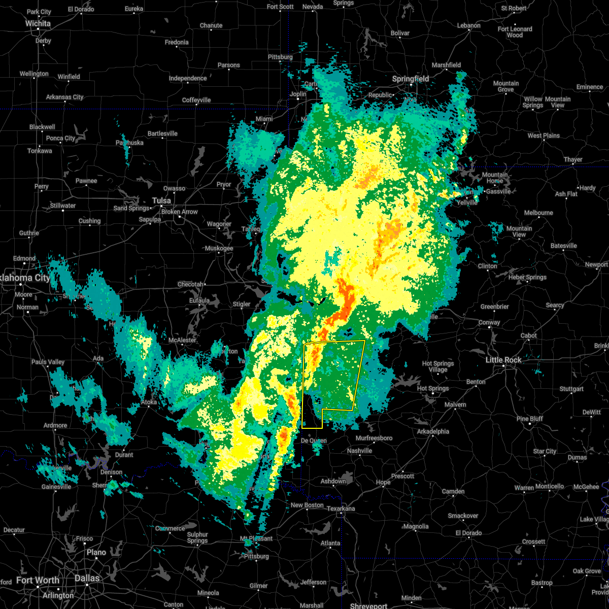 At 715 am cdt, severe thunderstorms were located along a line extending from near hatfield to 10 miles west of horatio, moving northeast at 65 mph (radar indicated). Hazards include 60 mph wind gusts and quarter size hail. Hail damage to vehicles is expected. expect wind damage to roofs, siding, and trees. Locations impacted include, mena, waldron, wickes, grannis, hatfield, vandervoort, beauchamp, cardiff, little missouri falls recreatio, mountain fork, bard springs recreation area, opal, cossatot river state park, polk county fairgrounds, mena intermountain airport, mccauley, shady, oliver, hartley, morgan springs,. At 715 am cdt, severe thunderstorms were located along a line extending from near hatfield to 10 miles west of horatio, moving northeast at 65 mph (radar indicated). Hazards include 60 mph wind gusts and quarter size hail. Hail damage to vehicles is expected. expect wind damage to roofs, siding, and trees. Locations impacted include, mena, waldron, wickes, grannis, hatfield, vandervoort, beauchamp, cardiff, little missouri falls recreatio, mountain fork, bard springs recreation area, opal, cossatot river state park, polk county fairgrounds, mena intermountain airport, mccauley, shady, oliver, hartley, morgan springs,.
|
| 3/30/2022 7:08 AM CDT |
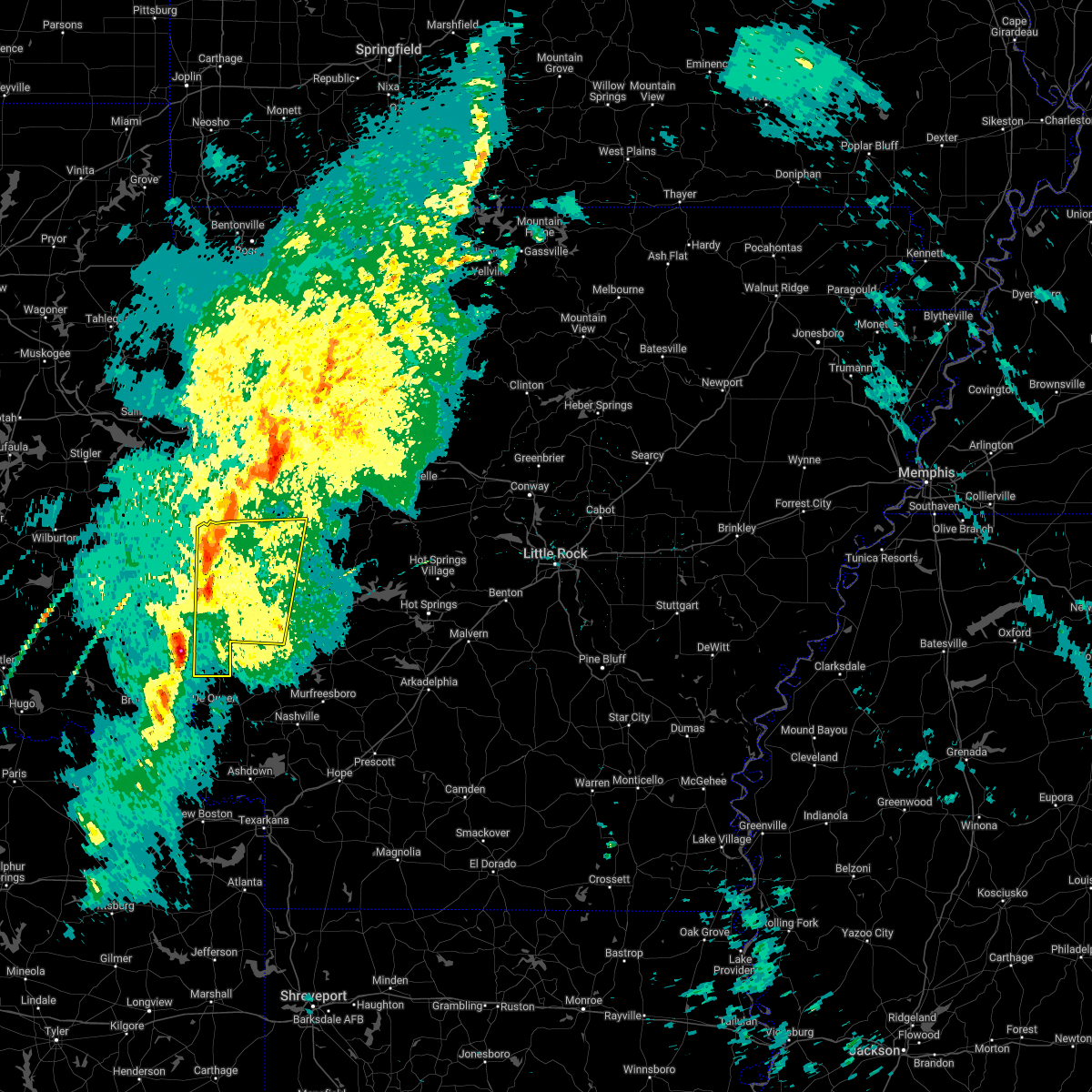 At 708 am cdt, severe thunderstorms were located along a line extending from 8 miles southwest of hatfield to 10 miles southeast of broken bow, moving northeast at 60 mph (radar indicated). Hazards include 60 mph wind gusts and quarter size hail. Hail damage to vehicles is expected. Expect wind damage to roofs, siding, and trees. At 708 am cdt, severe thunderstorms were located along a line extending from 8 miles southwest of hatfield to 10 miles southeast of broken bow, moving northeast at 60 mph (radar indicated). Hazards include 60 mph wind gusts and quarter size hail. Hail damage to vehicles is expected. Expect wind damage to roofs, siding, and trees.
|
| 10/11/2021 1:04 AM CDT |
 At 103 am cdt, strong to severe thunderstorms were located along a line extending from near polk county fairgrounds to near grannis to 6 miles west of horatio, moving east at 45 mph (radar indicated). Hazards include 60 mph wind gusts and penny size hail. Expect damage to roofs, siding, and trees. Locations impacted include, mena, wickes, grannis, hatfield, vandervoort, opal, cossatot river state park, polk county fairgrounds, mena intermountain airport, mccauley, shady, hartley, bard springs recreation area, caney creek wilderness, cove, acorn, big fork, board camp, ink, shady lake recreation area,. At 103 am cdt, strong to severe thunderstorms were located along a line extending from near polk county fairgrounds to near grannis to 6 miles west of horatio, moving east at 45 mph (radar indicated). Hazards include 60 mph wind gusts and penny size hail. Expect damage to roofs, siding, and trees. Locations impacted include, mena, wickes, grannis, hatfield, vandervoort, opal, cossatot river state park, polk county fairgrounds, mena intermountain airport, mccauley, shady, hartley, bard springs recreation area, caney creek wilderness, cove, acorn, big fork, board camp, ink, shady lake recreation area,.
|
| 10/11/2021 12:32 AM CDT |
 At 1231 am cdt, a severe thunderstorm was located 13 miles southwest of vandervoort, or 22 miles northwest of de queen, moving northeast at 45 mph (radar indicated). Hazards include 60 mph wind gusts and quarter size hail. Hail damage to vehicles is expected. Expect wind damage to roofs, siding, and trees. At 1231 am cdt, a severe thunderstorm was located 13 miles southwest of vandervoort, or 22 miles northwest of de queen, moving northeast at 45 mph (radar indicated). Hazards include 60 mph wind gusts and quarter size hail. Hail damage to vehicles is expected. Expect wind damage to roofs, siding, and trees.
|
| 5/27/2021 9:55 PM CDT |
 At 955 pm cdt, severe thunderstorms were located along a line extending from 6 miles southwest of waldron to 9 miles northeast of polk county fairgrounds to near mena to near hatfield, moving southeast at 35 mph (radar indicated). Hazards include 60 mph wind gusts and quarter size hail. Hail damage to vehicles is expected. Expect wind damage to roofs, siding, and trees. At 955 pm cdt, severe thunderstorms were located along a line extending from 6 miles southwest of waldron to 9 miles northeast of polk county fairgrounds to near mena to near hatfield, moving southeast at 35 mph (radar indicated). Hazards include 60 mph wind gusts and quarter size hail. Hail damage to vehicles is expected. Expect wind damage to roofs, siding, and trees.
|
| 5/27/2021 9:41 PM CDT |
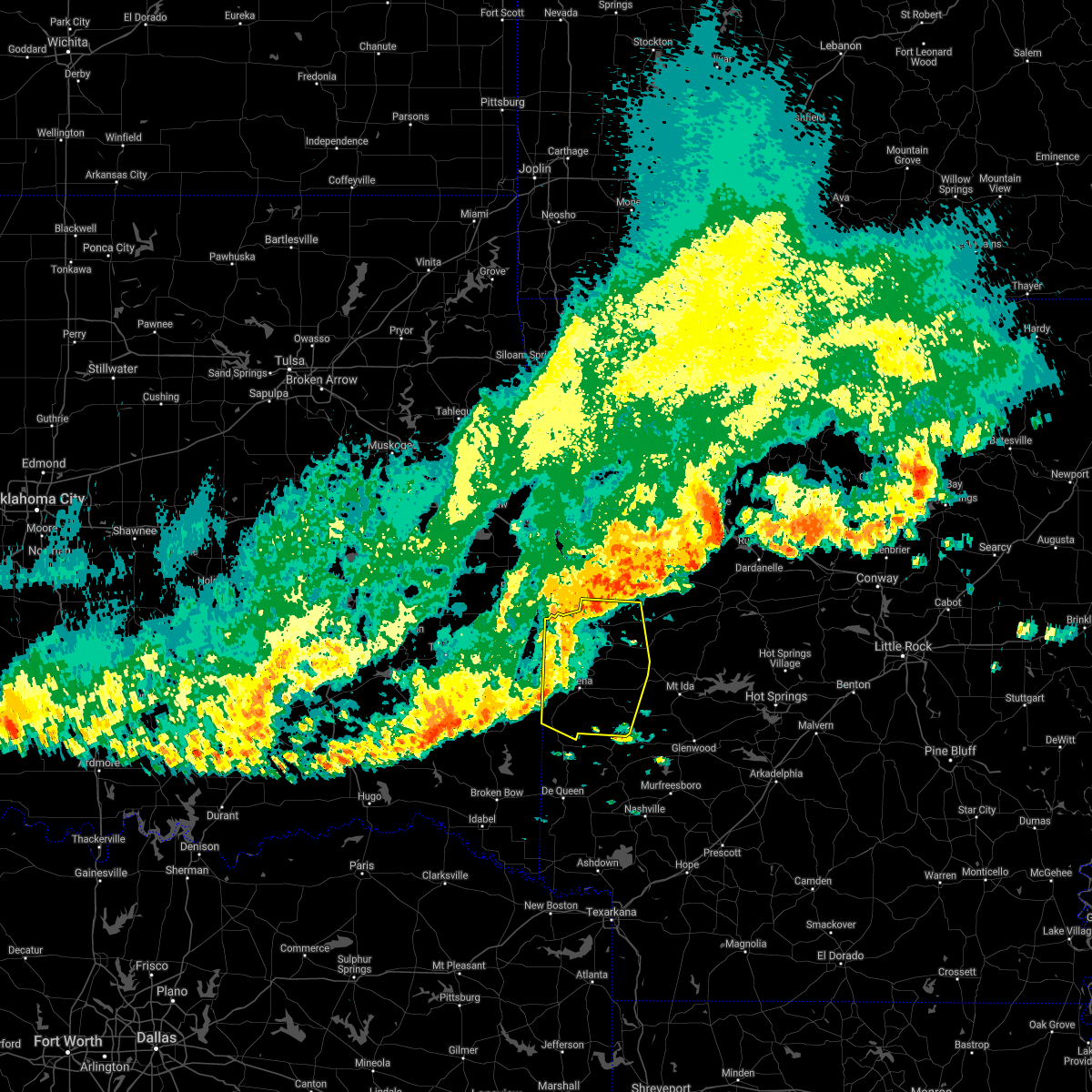 At 941 pm cdt, severe thunderstorms were located along a line extending from near morgan springs to near beauchamp to near mena to near hatfield, moving east at 45 mph (radar indicated). Hazards include 60 mph wind gusts and half dollar size hail. Hail damage to vehicles is expected. expect wind damage to roofs, siding, and trees. Locations impacted include, mena, waldron, hatfield, vandervoort, beauchamp, cardiff, little missouri falls recreatio, mountain fork, bard springs recreation area, opal, cossatot river state park, polk county fairgrounds, mena intermountain airport, mccauley, shady, oliver, hartley, morgan springs, caney creek wilderness, queen wilhelmina state park,. At 941 pm cdt, severe thunderstorms were located along a line extending from near morgan springs to near beauchamp to near mena to near hatfield, moving east at 45 mph (radar indicated). Hazards include 60 mph wind gusts and half dollar size hail. Hail damage to vehicles is expected. expect wind damage to roofs, siding, and trees. Locations impacted include, mena, waldron, hatfield, vandervoort, beauchamp, cardiff, little missouri falls recreatio, mountain fork, bard springs recreation area, opal, cossatot river state park, polk county fairgrounds, mena intermountain airport, mccauley, shady, oliver, hartley, morgan springs, caney creek wilderness, queen wilhelmina state park,.
|
| 5/27/2021 9:27 PM CDT |
 At 927 pm cdt, severe thunderstorms were located along a line extending from 7 miles southwest of hartford to 6 miles southwest of morgan springs to near mountain fork to 7 miles southeast of big cedar, moving east at 45 mph (radar indicated). Hazards include 60 mph wind gusts and half dollar size hail. Hail damage to vehicles is expected. expect wind damage to roofs, siding, and trees. Locations impacted include, mena, waldron, hatfield, vandervoort, beauchamp, cardiff, little missouri falls recreatio, mountain fork, bard springs recreation area, opal, cossatot river state park, polk county fairgrounds, mena intermountain airport, mccauley, shady, oliver, hartley, morgan springs, caney creek wilderness, queen wilhelmina state park,. At 927 pm cdt, severe thunderstorms were located along a line extending from 7 miles southwest of hartford to 6 miles southwest of morgan springs to near mountain fork to 7 miles southeast of big cedar, moving east at 45 mph (radar indicated). Hazards include 60 mph wind gusts and half dollar size hail. Hail damage to vehicles is expected. expect wind damage to roofs, siding, and trees. Locations impacted include, mena, waldron, hatfield, vandervoort, beauchamp, cardiff, little missouri falls recreatio, mountain fork, bard springs recreation area, opal, cossatot river state park, polk county fairgrounds, mena intermountain airport, mccauley, shady, oliver, hartley, morgan springs, caney creek wilderness, queen wilhelmina state park,.
|
| 5/27/2021 9:10 PM CDT |
 At 909 pm cdt, severe thunderstorms were located along a line extending from near poteau to heavener to 8 miles southwest of heavener runestone state park to near muse, moving southeast at 45 mph (radar indicated). Hazards include 60 mph wind gusts and half dollar size hail. Hail damage to vehicles is expected. Expect wind damage to roofs, siding, and trees. At 909 pm cdt, severe thunderstorms were located along a line extending from near poteau to heavener to 8 miles southwest of heavener runestone state park to near muse, moving southeast at 45 mph (radar indicated). Hazards include 60 mph wind gusts and half dollar size hail. Hail damage to vehicles is expected. Expect wind damage to roofs, siding, and trees.
|
| 5/18/2021 4:35 PM CDT |
 At 435 pm cdt, severe thunderstorms were located along a line extending from near morgan springs to shady to 8 miles northwest of dierks, moving northeast at 45 mph (radar indicated). Hazards include 60 mph wind gusts and quarter size hail. Hail damage to vehicles is expected. expect wind damage to roofs, siding, and trees. Locations impacted include, mena, wickes, grannis, hatfield, vandervoort, beauchamp, opal, cossatot river state park, mountain fork, polk county fairgrounds, mena intermountain airport, mccauley, shady, oliver, hartley, morgan springs, bard springs recreation area, caney creek wilderness, queen wilhelmina state park, cove,. At 435 pm cdt, severe thunderstorms were located along a line extending from near morgan springs to shady to 8 miles northwest of dierks, moving northeast at 45 mph (radar indicated). Hazards include 60 mph wind gusts and quarter size hail. Hail damage to vehicles is expected. expect wind damage to roofs, siding, and trees. Locations impacted include, mena, wickes, grannis, hatfield, vandervoort, beauchamp, opal, cossatot river state park, mountain fork, polk county fairgrounds, mena intermountain airport, mccauley, shady, oliver, hartley, morgan springs, bard springs recreation area, caney creek wilderness, queen wilhelmina state park, cove,.
|
| 5/18/2021 4:10 PM CDT |
 At 410 pm cdt, severe thunderstorms were located along a line extending from near big cedar to near wickes to near de queen, moving northeast at 45 mph (radar indicated). Hazards include 60 mph wind gusts and quarter size hail. Hail damage to vehicles is expected. Expect wind damage to roofs, siding, and trees. At 410 pm cdt, severe thunderstorms were located along a line extending from near big cedar to near wickes to near de queen, moving northeast at 45 mph (radar indicated). Hazards include 60 mph wind gusts and quarter size hail. Hail damage to vehicles is expected. Expect wind damage to roofs, siding, and trees.
|
| 5/3/2021 10:58 PM CDT |
 The severe thunderstorm warning for northwestern polk county will expire at 1100 pm cdt, the storms which prompted the warning are moving out of the area. therefore, the warning will be allowed to expire. a severe thunderstorm watch remains in effect until 400 am cdt for western arkansas. The severe thunderstorm warning for northwestern polk county will expire at 1100 pm cdt, the storms which prompted the warning are moving out of the area. therefore, the warning will be allowed to expire. a severe thunderstorm watch remains in effect until 400 am cdt for western arkansas.
|
| 5/3/2021 10:49 PM CDT |
 At 1032 pm cdt, severe thunderstorms were located along a line extending from 7 miles northwest of mountain fork to near wickes, moving northeast at 40 mph (radar indicated). Hazards include 60 mph wind gusts and quarter size hail. Hail damage to vehicles is expected. expect wind damage to roofs, siding, and trees. Locations impacted include, mena, wickes, hatfield, vandervoort, cossatot river state park, mountain fork, polk county fairgrounds, mccauley, mena intermountain airport, cove, rocky, camp pioneer, hatton, potter, dallas, shady grove, bogg springs,. At 1032 pm cdt, severe thunderstorms were located along a line extending from 7 miles northwest of mountain fork to near wickes, moving northeast at 40 mph (radar indicated). Hazards include 60 mph wind gusts and quarter size hail. Hail damage to vehicles is expected. expect wind damage to roofs, siding, and trees. Locations impacted include, mena, wickes, hatfield, vandervoort, cossatot river state park, mountain fork, polk county fairgrounds, mccauley, mena intermountain airport, cove, rocky, camp pioneer, hatton, potter, dallas, shady grove, bogg springs,.
|
| 5/3/2021 10:32 PM CDT |
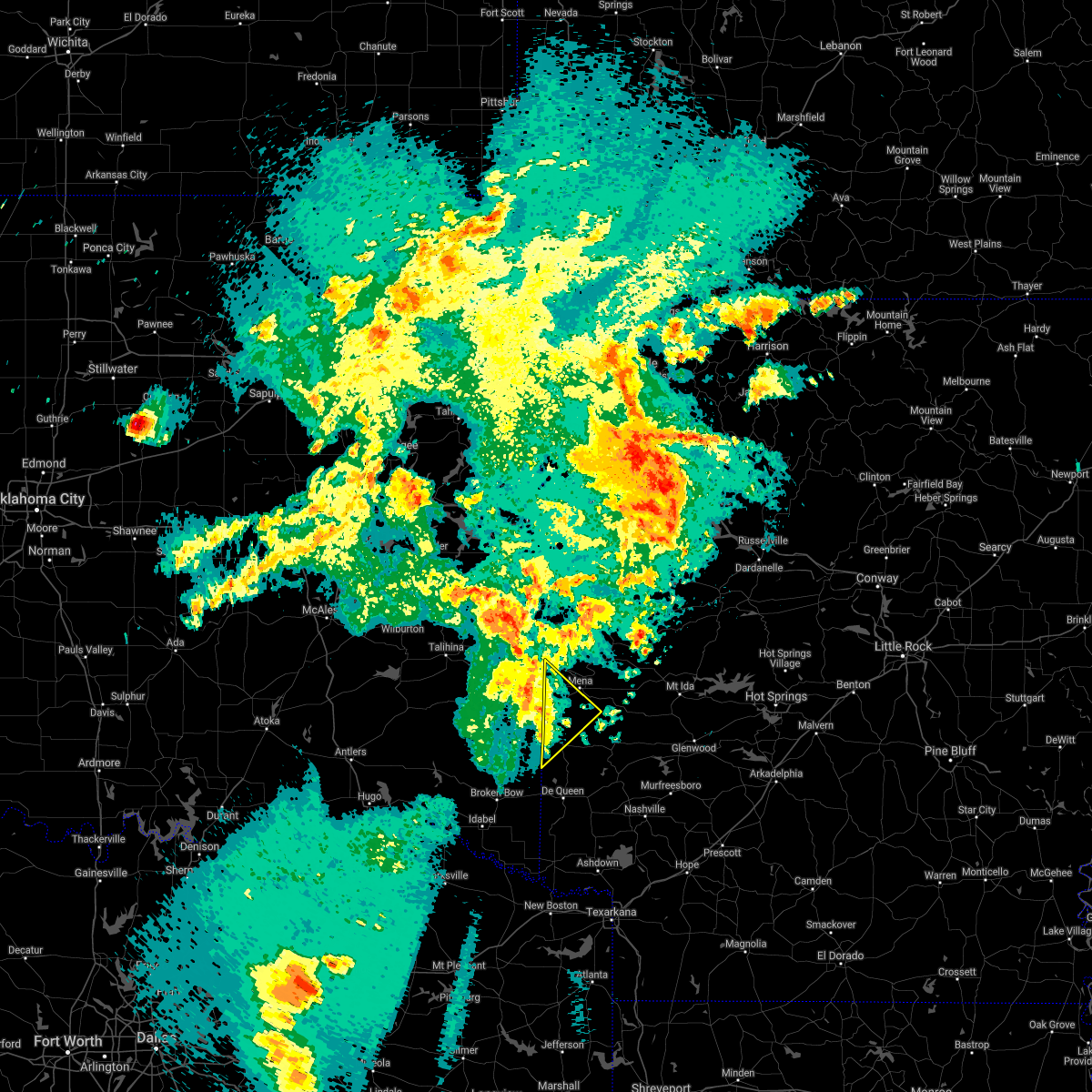 At 1032 pm cdt, severe thunderstorms were located along a line extending from 7 miles northwest of mountain fork to near wickes, moving northeast at 40 mph (radar indicated). Hazards include 60 mph wind gusts and quarter size hail. Hail damage to vehicles is expected. expect wind damage to roofs, siding, and trees. Locations impacted include, mena, wickes, hatfield, vandervoort, cossatot river state park, mountain fork, polk county fairgrounds, mccauley, mena intermountain airport, cove, rocky, camp pioneer, hatton, potter, dallas, shady grove, bogg springs,. At 1032 pm cdt, severe thunderstorms were located along a line extending from 7 miles northwest of mountain fork to near wickes, moving northeast at 40 mph (radar indicated). Hazards include 60 mph wind gusts and quarter size hail. Hail damage to vehicles is expected. expect wind damage to roofs, siding, and trees. Locations impacted include, mena, wickes, hatfield, vandervoort, cossatot river state park, mountain fork, polk county fairgrounds, mccauley, mena intermountain airport, cove, rocky, camp pioneer, hatton, potter, dallas, shady grove, bogg springs,.
|
| 5/3/2021 10:14 PM CDT |
 At 1013 pm cdt, severe thunderstorms were located along a line extending from 8 miles west of octavia to 12 miles west of grannis, moving northeast at 45 mph (radar indicated). Hazards include 60 mph wind gusts and quarter size hail. Hail damage to vehicles is expected. Expect wind damage to roofs, siding, and trees. At 1013 pm cdt, severe thunderstorms were located along a line extending from 8 miles west of octavia to 12 miles west of grannis, moving northeast at 45 mph (radar indicated). Hazards include 60 mph wind gusts and quarter size hail. Hail damage to vehicles is expected. Expect wind damage to roofs, siding, and trees.
|
| 4/29/2021 1:19 AM CDT |
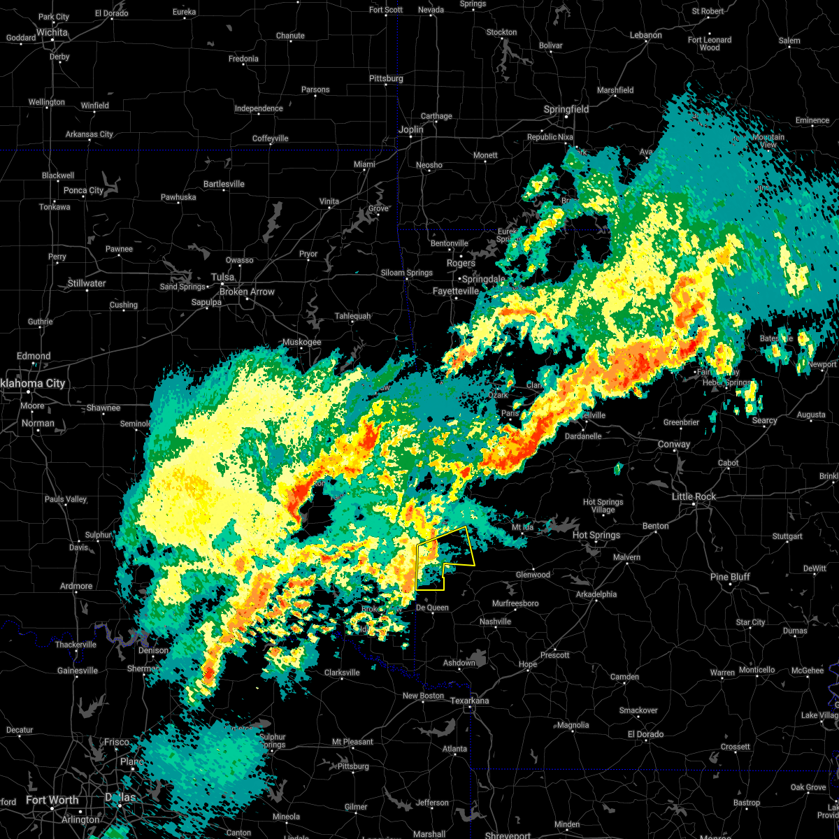 At 118 am cdt, a severe thunderstorm was located 13 miles west of grannis, or 15 miles northwest of de queen, moving northeast at 35 mph (radar indicated). Hazards include 60 mph wind gusts and half dollar size hail. Hail damage to vehicles is expected. Expect wind damage to roofs, siding, and trees. At 118 am cdt, a severe thunderstorm was located 13 miles west of grannis, or 15 miles northwest of de queen, moving northeast at 35 mph (radar indicated). Hazards include 60 mph wind gusts and half dollar size hail. Hail damage to vehicles is expected. Expect wind damage to roofs, siding, and trees.
|
| 4/7/2021 2:05 PM CDT |
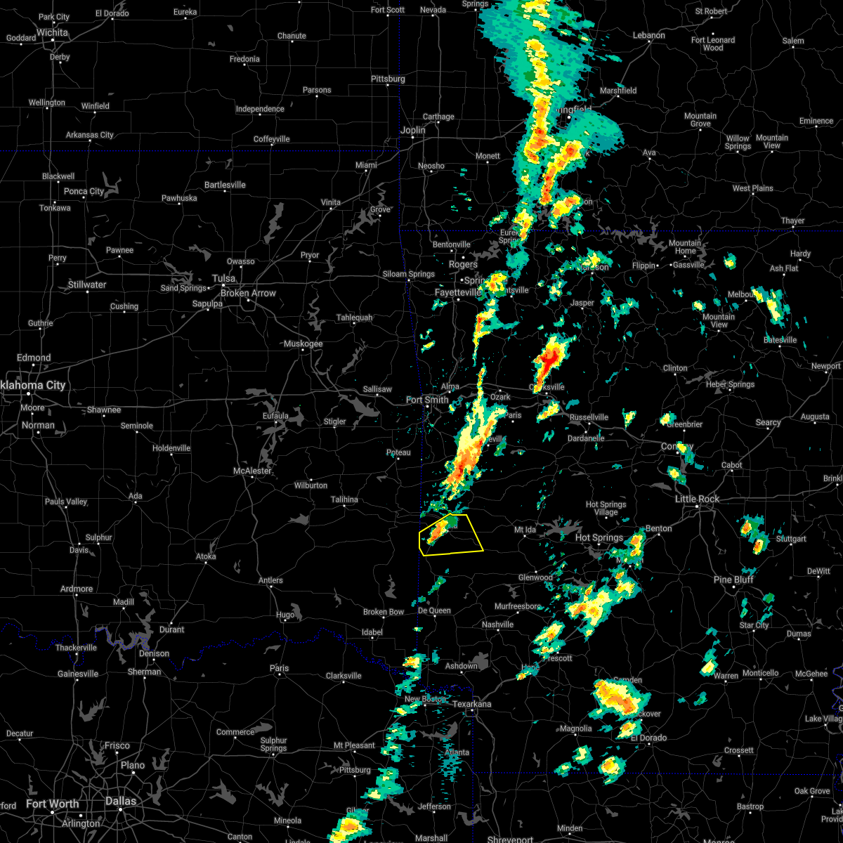 At 204 pm cdt, a severe thunderstorm was located over hatfield, or 9 miles southwest of mena, moving east at 25 mph (radar indicated). Hazards include 60 mph wind gusts and quarter size hail. Hail damage to vehicles is expected. Expect wind damage to roofs, siding, and trees. At 204 pm cdt, a severe thunderstorm was located over hatfield, or 9 miles southwest of mena, moving east at 25 mph (radar indicated). Hazards include 60 mph wind gusts and quarter size hail. Hail damage to vehicles is expected. Expect wind damage to roofs, siding, and trees.
|
| 11/24/2020 10:36 PM CST |
 At 1036 pm cst, a severe thunderstorm capable of producing a tornado was located near hatfield, or 7 miles west of mena, moving east at 45 mph (radar indicated rotation). Hazards include tornado. Flying debris will be dangerous to those caught without shelter. mobile homes will be damaged or destroyed. damage to roofs, windows, and vehicles will occur. Tree damage is likely. At 1036 pm cst, a severe thunderstorm capable of producing a tornado was located near hatfield, or 7 miles west of mena, moving east at 45 mph (radar indicated rotation). Hazards include tornado. Flying debris will be dangerous to those caught without shelter. mobile homes will be damaged or destroyed. damage to roofs, windows, and vehicles will occur. Tree damage is likely.
|
| 8/29/2020 9:04 PM CDT |
 At 904 pm cdt, severe thunderstorms were located along a line extending from opal to near shady to near hatfield, moving south at 30 mph (radar indicated). Hazards include 70 mph wind gusts and nickel size hail. Expect considerable tree damage. damage is likely to mobile homes, roofs, and outbuildings. Locations impacted include, mena, glenwood, wickes, amity, grannis, hatfield, norman, oden, daisy, vandervoort, little missouri falls recreatio, mountain fork, daisy state park, bard springs recreation area, albert pike recreation area, opal, mimosa, cossatot river state park, polk county fairgrounds, mena intermountain airport,. At 904 pm cdt, severe thunderstorms were located along a line extending from opal to near shady to near hatfield, moving south at 30 mph (radar indicated). Hazards include 70 mph wind gusts and nickel size hail. Expect considerable tree damage. damage is likely to mobile homes, roofs, and outbuildings. Locations impacted include, mena, glenwood, wickes, amity, grannis, hatfield, norman, oden, daisy, vandervoort, little missouri falls recreatio, mountain fork, daisy state park, bard springs recreation area, albert pike recreation area, opal, mimosa, cossatot river state park, polk county fairgrounds, mena intermountain airport,.
|
| 8/29/2020 8:48 PM CDT |
 At 848 pm cdt, severe thunderstorms were located along a line extending from near oden to near mena to near mountain fork, moving south at 40 mph (radar indicated). Hazards include 70 mph wind gusts and nickel size hail. Expect considerable tree damage. Damage is likely to mobile homes, roofs, and outbuildings. At 848 pm cdt, severe thunderstorms were located along a line extending from near oden to near mena to near mountain fork, moving south at 40 mph (radar indicated). Hazards include 70 mph wind gusts and nickel size hail. Expect considerable tree damage. Damage is likely to mobile homes, roofs, and outbuildings.
|
| 8/29/2020 8:45 PM CDT |
 At 845 pm cdt, severe thunderstorms were located along a line extending from 11 miles north of opal to 6 miles northeast of mena to near polk county fairgrounds, moving south at 35 mph (radar indicated). Hazards include 70 mph wind gusts and nickel size hail. Expect considerable tree damage. damage is likely to mobile homes, roofs, and outbuildings. Locations impacted include, mena, hatfield, beauchamp, mountain fork, polk county fairgrounds, mena intermountain airport, queen wilhelmina state park, acorn, black fork, board camp, ink, potter, boles, dallas, shady grove, rocky, black fork mountain wilderness, nunley, camp pioneer, y city,. At 845 pm cdt, severe thunderstorms were located along a line extending from 11 miles north of opal to 6 miles northeast of mena to near polk county fairgrounds, moving south at 35 mph (radar indicated). Hazards include 70 mph wind gusts and nickel size hail. Expect considerable tree damage. damage is likely to mobile homes, roofs, and outbuildings. Locations impacted include, mena, hatfield, beauchamp, mountain fork, polk county fairgrounds, mena intermountain airport, queen wilhelmina state park, acorn, black fork, board camp, ink, potter, boles, dallas, shady grove, rocky, black fork mountain wilderness, nunley, camp pioneer, y city,.
|
| 8/29/2020 8:26 PM CDT |
 At 826 pm cdt, severe thunderstorms were located along a line extending from near waldron to near beauchamp to 6 miles north of queen wilhelmina state park, moving south at 25 mph (radar indicated). Hazards include 70 mph wind gusts and quarter size hail. Hail damage to vehicles is expected. expect considerable tree damage. wind damage is also likely to mobile homes, roofs, and outbuildings. Locations impacted include, mena, waldron, hatfield, beauchamp, mountain fork, polk county fairgrounds, mena intermountain airport, oliver, morgan springs, queen wilhelmina state park, bates, acorn, black fork, board camp, winfield, ink, liberty, potter, boles, dallas,. At 826 pm cdt, severe thunderstorms were located along a line extending from near waldron to near beauchamp to 6 miles north of queen wilhelmina state park, moving south at 25 mph (radar indicated). Hazards include 70 mph wind gusts and quarter size hail. Hail damage to vehicles is expected. expect considerable tree damage. wind damage is also likely to mobile homes, roofs, and outbuildings. Locations impacted include, mena, waldron, hatfield, beauchamp, mountain fork, polk county fairgrounds, mena intermountain airport, oliver, morgan springs, queen wilhelmina state park, bates, acorn, black fork, board camp, winfield, ink, liberty, potter, boles, dallas,.
|
| 8/29/2020 8:15 PM CDT |
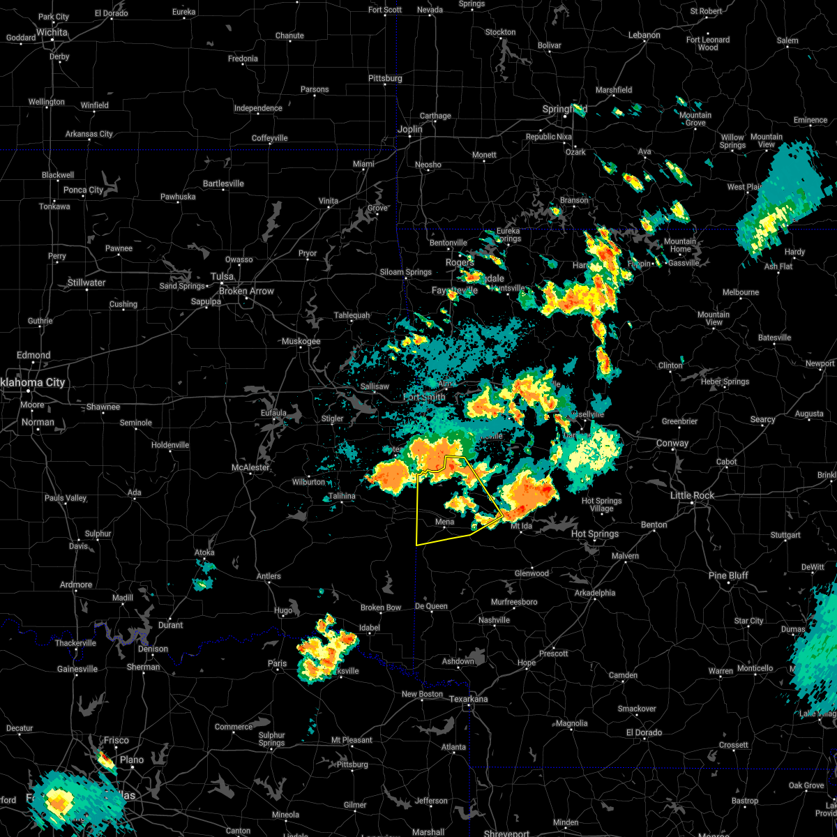 At 814 pm cdt, severe thunderstorms were located along a line extending from near waldron to near oliver to near morgan springs, moving south at 25 mph (radar indicated). Hazards include 60 mph wind gusts and nickel size hail. expect damage to roofs, siding, and trees At 814 pm cdt, severe thunderstorms were located along a line extending from near waldron to near oliver to near morgan springs, moving south at 25 mph (radar indicated). Hazards include 60 mph wind gusts and nickel size hail. expect damage to roofs, siding, and trees
|
| 7/30/2020 10:07 PM CDT |
 At 1006 pm cdt, severe thunderstorms were located along a line extending from 10 miles southeast of beauchamp to mena to near vandervoort to gillham, moving east at 35 mph (radar indicated). Hazards include 60 mph wind gusts and penny size hail. Expect damage to roofs, siding, and trees. Locations impacted include, mena, wickes, grannis, hatfield, vandervoort, shady, hartley, cossatot river state park, polk county fairgrounds, mena intermountain airport, mccauley, acorn, board camp, nunley, ink, hatton, cherry hill in polk county, potter, dallas, eagleton,. At 1006 pm cdt, severe thunderstorms were located along a line extending from 10 miles southeast of beauchamp to mena to near vandervoort to gillham, moving east at 35 mph (radar indicated). Hazards include 60 mph wind gusts and penny size hail. Expect damage to roofs, siding, and trees. Locations impacted include, mena, wickes, grannis, hatfield, vandervoort, shady, hartley, cossatot river state park, polk county fairgrounds, mena intermountain airport, mccauley, acorn, board camp, nunley, ink, hatton, cherry hill in polk county, potter, dallas, eagleton,.
|
| 7/30/2020 9:47 PM CDT |
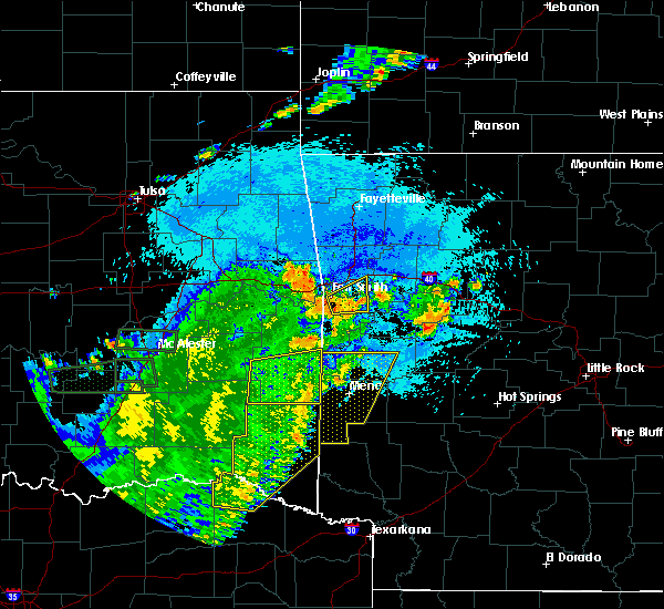 At 946 pm cdt, severe thunderstorms were located along a line extending from near beauchamp to near queen wilhelmina state park to 10 miles southeast of octavia to 10 miles northeast of broken bow, moving east at 35 mph (radar indicated). Hazards include 60 mph wind gusts and penny size hail. Expect damage to roofs, siding, and trees. Locations impacted include, mena, waldron, wickes, grannis, hatfield, vandervoort, beauchamp, cossatot river state park, mountain fork, polk county fairgrounds, mena intermountain airport, mccauley, shady, hartley, morgan springs, queen wilhelmina state park, cove, bates, acorn, black fork,. At 946 pm cdt, severe thunderstorms were located along a line extending from near beauchamp to near queen wilhelmina state park to 10 miles southeast of octavia to 10 miles northeast of broken bow, moving east at 35 mph (radar indicated). Hazards include 60 mph wind gusts and penny size hail. Expect damage to roofs, siding, and trees. Locations impacted include, mena, waldron, wickes, grannis, hatfield, vandervoort, beauchamp, cossatot river state park, mountain fork, polk county fairgrounds, mena intermountain airport, mccauley, shady, hartley, morgan springs, queen wilhelmina state park, cove, bates, acorn, black fork,.
|
| 7/30/2020 9:24 PM CDT |
 At 923 pm cdt, severe thunderstorms were located along a line extending from near morgan springs to near mountain fork to 12 miles southwest of octavia to 12 miles northwest of broken bow, moving east at 35 mph (radar indicated). Hazards include 60 mph wind gusts and penny size hail. expect damage to roofs, siding, and trees At 923 pm cdt, severe thunderstorms were located along a line extending from near morgan springs to near mountain fork to 12 miles southwest of octavia to 12 miles northwest of broken bow, moving east at 35 mph (radar indicated). Hazards include 60 mph wind gusts and penny size hail. expect damage to roofs, siding, and trees
|
| 7/30/2020 3:47 PM CDT |
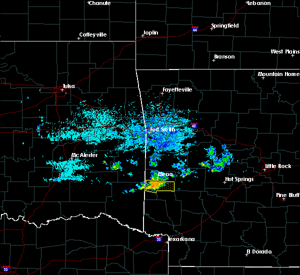 At 346 pm cdt, a severe thunderstorm was 3 miles northeast of vandervoort, or 12 miles south of mena, moving east at 30 mph (radar indicated). Hazards include 60 mph wind gusts and penny size hail. Expect damage to roofs, siding, and trees. Locations impacted include, hatfield, vandervoort, shady, hartley, cossatot river state park, bard springs recreation area, caney creek wilderness, mccauley, cove, big fork, camp pioneer, shady lake recreation area, hatton, roaring branch natural area,. At 346 pm cdt, a severe thunderstorm was 3 miles northeast of vandervoort, or 12 miles south of mena, moving east at 30 mph (radar indicated). Hazards include 60 mph wind gusts and penny size hail. Expect damage to roofs, siding, and trees. Locations impacted include, hatfield, vandervoort, shady, hartley, cossatot river state park, bard springs recreation area, caney creek wilderness, mccauley, cove, big fork, camp pioneer, shady lake recreation area, hatton, roaring branch natural area,.
|
| 7/30/2020 3:30 PM CDT |
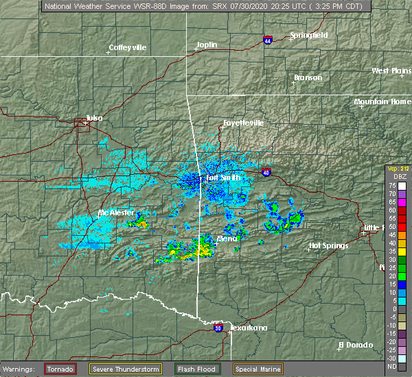 At 330 pm cdt, a severe thunderstorm was located near hatfield, or 11 miles southwest of mena, moving east at 30 mph (radar indicated). Hazards include 60 mph wind gusts and penny size hail. expect damage to roofs, siding, and trees At 330 pm cdt, a severe thunderstorm was located near hatfield, or 11 miles southwest of mena, moving east at 30 mph (radar indicated). Hazards include 60 mph wind gusts and penny size hail. expect damage to roofs, siding, and trees
|
| 7/20/2020 5:24 PM CDT |
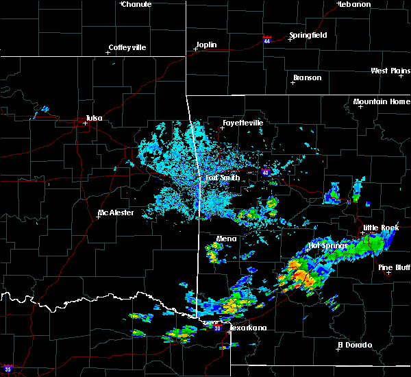 At 524 pm cdt, a severe thunderstorm was located over mccauley, or 12 miles south of mena, moving north at 10 mph (radar indicated). Hazards include 60 mph wind gusts and quarter size hail. Hail damage to vehicles is expected. Expect wind damage to roofs, siding, and trees. At 524 pm cdt, a severe thunderstorm was located over mccauley, or 12 miles south of mena, moving north at 10 mph (radar indicated). Hazards include 60 mph wind gusts and quarter size hail. Hail damage to vehicles is expected. Expect wind damage to roofs, siding, and trees.
|
| 7/12/2020 12:28 AM CDT |
 The severe thunderstorm warning for western polk county will expire at 1230 am cdt, the storm which prompted the warning has weakened below severe limits, and no longer poses an immediate threat to life or property. therefore, the warning will be allowed to expire. however gusty winds and heavy rain are still possible with this thunderstorm. to report severe weather, contact your nearest law enforcement agency. they will relay your report to the national weather service little rock. The severe thunderstorm warning for western polk county will expire at 1230 am cdt, the storm which prompted the warning has weakened below severe limits, and no longer poses an immediate threat to life or property. therefore, the warning will be allowed to expire. however gusty winds and heavy rain are still possible with this thunderstorm. to report severe weather, contact your nearest law enforcement agency. they will relay your report to the national weather service little rock.
|
| 7/12/2020 12:06 AM CDT |
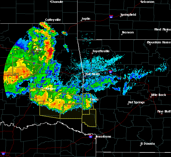 At 1206 am cdt, a severe thunderstorm was located near queen wilhelmina state park, or near mena, moving south at 20 mph (radar indicated). Hazards include 60 mph wind gusts. Expect damage to roofs, siding, and trees. Locations impacted include, mena, wickes, grannis, hatfield, vandervoort, hartley, cossatot river state park, mountain fork, polk county fairgrounds, mena intermountain airport, mccauley, cove, rocky, nunley, camp pioneer, hatton, potter, dallas, shady grove, bogg springs,. At 1206 am cdt, a severe thunderstorm was located near queen wilhelmina state park, or near mena, moving south at 20 mph (radar indicated). Hazards include 60 mph wind gusts. Expect damage to roofs, siding, and trees. Locations impacted include, mena, wickes, grannis, hatfield, vandervoort, hartley, cossatot river state park, mountain fork, polk county fairgrounds, mena intermountain airport, mccauley, cove, rocky, nunley, camp pioneer, hatton, potter, dallas, shady grove, bogg springs,.
|
| 7/11/2020 11:43 PM CDT |
 At 1142 pm cdt, a severe thunderstorm was located near beauchamp, or 13 miles northwest of mena, moving south at 20 mph (radar indicated). Hazards include 60 mph wind gusts. expect damage to roofs, siding, and trees At 1142 pm cdt, a severe thunderstorm was located near beauchamp, or 13 miles northwest of mena, moving south at 20 mph (radar indicated). Hazards include 60 mph wind gusts. expect damage to roofs, siding, and trees
|
| 7/11/2020 11:18 PM CDT |
 At 1117 pm cdt, severe thunderstorms were located along a line extending from near beauchamp to mountain fork to near octavia, moving southeast at 30 mph (radar indicated). Hazards include 60 mph wind gusts. Expect damage to roofs, siding, and trees. Locations impacted include, mena, waldron, hatfield, vandervoort, beauchamp, mountain fork, polk county fairgrounds, mena intermountain airport, mccauley, oliver, morgan springs, queen wilhelmina state park, cove, bates, acorn, black fork, winfield, ink, hatton, potter,. At 1117 pm cdt, severe thunderstorms were located along a line extending from near beauchamp to mountain fork to near octavia, moving southeast at 30 mph (radar indicated). Hazards include 60 mph wind gusts. Expect damage to roofs, siding, and trees. Locations impacted include, mena, waldron, hatfield, vandervoort, beauchamp, mountain fork, polk county fairgrounds, mena intermountain airport, mccauley, oliver, morgan springs, queen wilhelmina state park, cove, bates, acorn, black fork, winfield, ink, hatton, potter,.
|
| 7/11/2020 11:05 PM CDT |
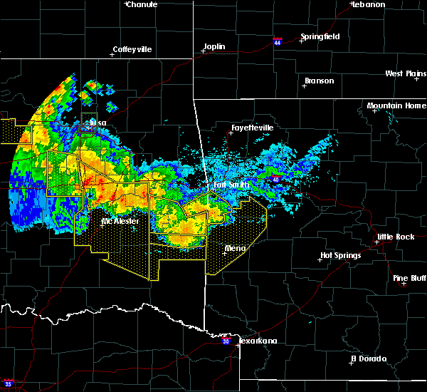 At 1105 pm cdt, severe thunderstorms were located along a line extending from near waldron to queen wilhelmina state park to near big cedar, moving south at 50 mph (radar indicated). Hazards include 60 mph wind gusts and quarter size hail. Hail damage to vehicles is expected. expect wind damage to roofs, siding, and trees. Locations impacted include, mena, booneville, waldron, mansfield, hatfield, vandervoort, beauchamp, cardiff, mountain fork, polk county fairgrounds, mena intermountain airport, mccauley, echo, oliver, morgan springs, queen wilhelmina state park, cove, bates, acorn, barber,. At 1105 pm cdt, severe thunderstorms were located along a line extending from near waldron to queen wilhelmina state park to near big cedar, moving south at 50 mph (radar indicated). Hazards include 60 mph wind gusts and quarter size hail. Hail damage to vehicles is expected. expect wind damage to roofs, siding, and trees. Locations impacted include, mena, booneville, waldron, mansfield, hatfield, vandervoort, beauchamp, cardiff, mountain fork, polk county fairgrounds, mena intermountain airport, mccauley, echo, oliver, morgan springs, queen wilhelmina state park, cove, bates, acorn, barber,.
|
| 7/11/2020 10:39 PM CDT |
 At 1038 pm cdt, severe thunderstorms were located along a line extending from burnville to near hartford to near heavener, moving south at 50 mph (radar indicated). Hazards include 70 mph wind gusts and quarter size hail. Hail damage to vehicles is expected. expect considerable tree damage. Wind damage is also likely to mobile homes, roofs, and outbuildings. At 1038 pm cdt, severe thunderstorms were located along a line extending from burnville to near hartford to near heavener, moving south at 50 mph (radar indicated). Hazards include 70 mph wind gusts and quarter size hail. Hail damage to vehicles is expected. expect considerable tree damage. Wind damage is also likely to mobile homes, roofs, and outbuildings.
|
| 5/22/2020 11:07 AM CDT |
 At 1107 am cdt, a severe thunderstorm was located over vandervoort, or 15 miles southwest of mena, moving east at 45 mph (radar indicated). Hazards include 60 mph wind gusts and quarter size hail. Hail damage to vehicles is expected. Expect wind damage to roofs, siding, and trees. At 1107 am cdt, a severe thunderstorm was located over vandervoort, or 15 miles southwest of mena, moving east at 45 mph (radar indicated). Hazards include 60 mph wind gusts and quarter size hail. Hail damage to vehicles is expected. Expect wind damage to roofs, siding, and trees.
|
| 5/8/2020 4:18 AM CDT |
 At 417 am cdt, severe thunderstorms were located along a line extending from near morgan springs to near queen wilhelmina state park to grannis, moving east at 65 mph (radar indicated). Hazards include 60 mph wind gusts. Expect damage to roofs, siding, and trees. Locations impacted include, mena, waldron, wickes, grannis, hatfield, vandervoort, beauchamp, cossatot river state park, mountain fork, polk county fairgrounds, mena intermountain airport, mccauley, shady, oliver, hartley, morgan springs, caney creek wilderness, queen wilhelmina state park, cove, bates,. At 417 am cdt, severe thunderstorms were located along a line extending from near morgan springs to near queen wilhelmina state park to grannis, moving east at 65 mph (radar indicated). Hazards include 60 mph wind gusts. Expect damage to roofs, siding, and trees. Locations impacted include, mena, waldron, wickes, grannis, hatfield, vandervoort, beauchamp, cossatot river state park, mountain fork, polk county fairgrounds, mena intermountain airport, mccauley, shady, oliver, hartley, morgan springs, caney creek wilderness, queen wilhelmina state park, cove, bates,.
|
| 5/8/2020 4:07 AM CDT |
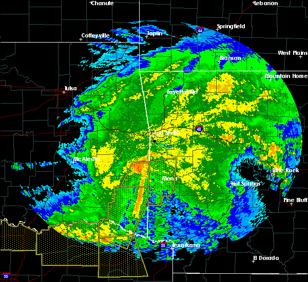 At 407 am cdt, severe thunderstorms were located along a line extending from 6 miles southwest of morgan springs to near mountain fork to 7 miles west of wickes, moving east at 50 mph (radar indicated). Hazards include 60 mph wind gusts and penny size hail. Expect damage to roofs, siding, and trees. Locations impacted include, mena, waldron, wickes, grannis, hatfield, vandervoort, beauchamp, cossatot river state park, mountain fork, polk county fairgrounds, mena intermountain airport, mccauley, shady, oliver, hartley, morgan springs, caney creek wilderness, queen wilhelmina state park, cove, bates,. At 407 am cdt, severe thunderstorms were located along a line extending from 6 miles southwest of morgan springs to near mountain fork to 7 miles west of wickes, moving east at 50 mph (radar indicated). Hazards include 60 mph wind gusts and penny size hail. Expect damage to roofs, siding, and trees. Locations impacted include, mena, waldron, wickes, grannis, hatfield, vandervoort, beauchamp, cossatot river state park, mountain fork, polk county fairgrounds, mena intermountain airport, mccauley, shady, oliver, hartley, morgan springs, caney creek wilderness, queen wilhelmina state park, cove, bates,.
|
| 5/8/2020 3:43 AM CDT |
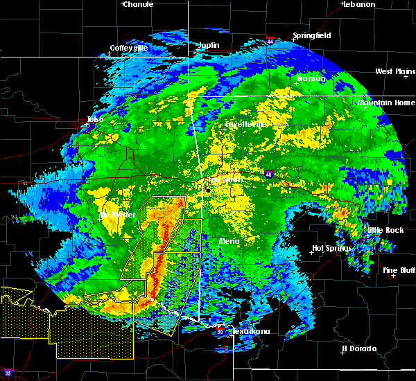 At 342 am cdt, severe thunderstorms were located along a line extending from near talimena state park to near whitesboro to 14 miles east of nashoba, moving east at 55 mph (radar indicated). Hazards include 60 mph wind gusts and penny size hail. expect damage to roofs, siding, and trees At 342 am cdt, severe thunderstorms were located along a line extending from near talimena state park to near whitesboro to 14 miles east of nashoba, moving east at 55 mph (radar indicated). Hazards include 60 mph wind gusts and penny size hail. expect damage to roofs, siding, and trees
|
| 4/28/2020 10:20 PM CDT |
 At 1019 pm cdt, severe thunderstorms were located along a line extending from near opal to shady to near grannis, moving east at 35 mph (radar indicated). Hazards include 60 mph wind gusts and quarter size hail. Hail damage to vehicles is expected. expect wind damage to roofs, siding, and trees. Locations impacted include, mena, wickes, grannis, hatfield, vandervoort, opal, cossatot river state park, polk county fairgrounds, mena intermountain airport, mccauley, shady, hartley, bard springs recreation area, caney creek wilderness, cove, big fork, board camp, ink, shady lake recreation area, hatton,. At 1019 pm cdt, severe thunderstorms were located along a line extending from near opal to shady to near grannis, moving east at 35 mph (radar indicated). Hazards include 60 mph wind gusts and quarter size hail. Hail damage to vehicles is expected. expect wind damage to roofs, siding, and trees. Locations impacted include, mena, wickes, grannis, hatfield, vandervoort, opal, cossatot river state park, polk county fairgrounds, mena intermountain airport, mccauley, shady, hartley, bard springs recreation area, caney creek wilderness, cove, big fork, board camp, ink, shady lake recreation area, hatton,.
|
| 4/28/2020 9:39 PM CDT |
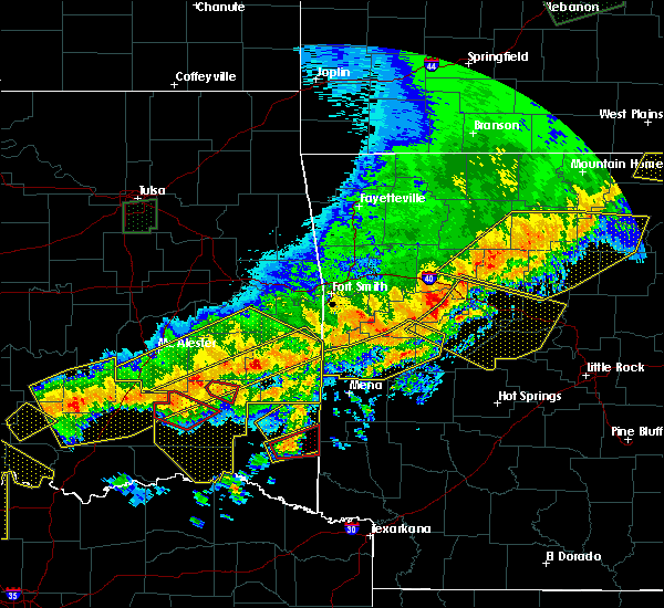 At 937 pm cdt, severe thunderstorms were located along a line extending from near mountain fork to 9 miles west of vandervoort to 11 miles northeast of broken bow, moving east at 40 mph (radar indicated). Hazards include 60 mph wind gusts and quarter size hail. Hail damage to vehicles is expected. Expect wind damage to roofs, siding, and trees. At 937 pm cdt, severe thunderstorms were located along a line extending from near mountain fork to 9 miles west of vandervoort to 11 miles northeast of broken bow, moving east at 40 mph (radar indicated). Hazards include 60 mph wind gusts and quarter size hail. Hail damage to vehicles is expected. Expect wind damage to roofs, siding, and trees.
|
| 3/19/2020 8:05 PM CDT |
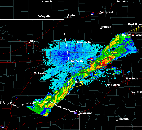 At 805 pm cdt, a severe thunderstorm was located over hatfield, or 9 miles southwest of mena, moving northeast at 45 mph (radar indicated). Hazards include 60 mph wind gusts and quarter size hail. Hail damage to vehicles is expected. Expect wind damage to roofs, siding, and trees. At 805 pm cdt, a severe thunderstorm was located over hatfield, or 9 miles southwest of mena, moving northeast at 45 mph (radar indicated). Hazards include 60 mph wind gusts and quarter size hail. Hail damage to vehicles is expected. Expect wind damage to roofs, siding, and trees.
|
| 3/19/2020 5:28 PM CDT |
 At 526 pm cdt, a severe thunderstorm was located near big cedar, or 19 miles west of mena, moving northeast at 35 mph (radar indicated). Hazards include 60 mph wind gusts and penny size hail. expect damage to roofs, siding, and trees At 526 pm cdt, a severe thunderstorm was located near big cedar, or 19 miles west of mena, moving northeast at 35 mph (radar indicated). Hazards include 60 mph wind gusts and penny size hail. expect damage to roofs, siding, and trees
|
| 3/12/2020 7:35 PM CDT |
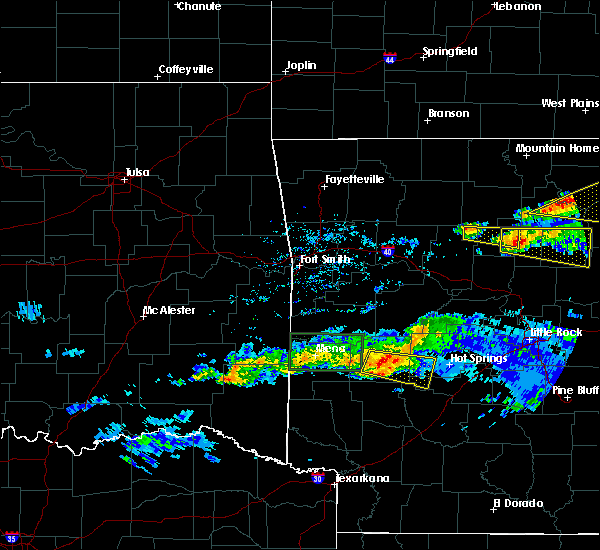 At 735 pm cdt, a severe thunderstorm was located near mccauley, or 7 miles south of mena, moving east at 35 mph (radar indicated). Hazards include 60 mph wind gusts and quarter size hail. Hail damage to vehicles is expected. expect wind damage to roofs, siding, and trees. Locations impacted include, mena, hatfield, shady, hartley, opal, cossatot river state park, bard springs recreation area, caney creek wilderness, polk county fairgrounds, mena intermountain airport, mccauley, cove, big fork, board camp, rocky, nunley, camp pioneer, shady lake recreation area, roaring branch natural area, potter,. At 735 pm cdt, a severe thunderstorm was located near mccauley, or 7 miles south of mena, moving east at 35 mph (radar indicated). Hazards include 60 mph wind gusts and quarter size hail. Hail damage to vehicles is expected. expect wind damage to roofs, siding, and trees. Locations impacted include, mena, hatfield, shady, hartley, opal, cossatot river state park, bard springs recreation area, caney creek wilderness, polk county fairgrounds, mena intermountain airport, mccauley, cove, big fork, board camp, rocky, nunley, camp pioneer, shady lake recreation area, roaring branch natural area, potter,.
|
| 3/12/2020 7:21 PM CDT |
 At 720 pm cdt, a severe thunderstorm was located over hatfield, or 10 miles southwest of mena, moving east at 35 mph (radar indicated). Hazards include 60 mph wind gusts and quarter size hail. Hail damage to vehicles is expected. Expect wind damage to roofs, siding, and trees. At 720 pm cdt, a severe thunderstorm was located over hatfield, or 10 miles southwest of mena, moving east at 35 mph (radar indicated). Hazards include 60 mph wind gusts and quarter size hail. Hail damage to vehicles is expected. Expect wind damage to roofs, siding, and trees.
|
| 1/10/2020 8:13 PM CST |
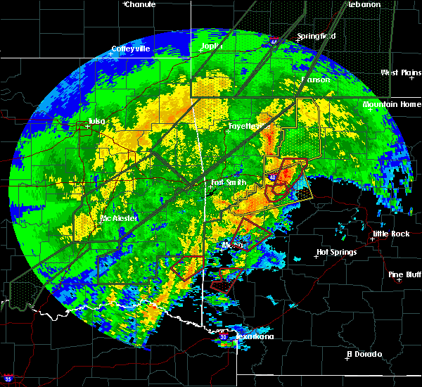 At 813 pm cst, severe thunderstorms were located along a line extending from mountain fork to 11 miles northeast of broken bow, moving northeast at 40 mph (radar indicated). Hazards include 60 mph wind gusts and quarter size hail. Hail damage to vehicles is expected. Expect wind damage to roofs, siding, and trees. At 813 pm cst, severe thunderstorms were located along a line extending from mountain fork to 11 miles northeast of broken bow, moving northeast at 40 mph (radar indicated). Hazards include 60 mph wind gusts and quarter size hail. Hail damage to vehicles is expected. Expect wind damage to roofs, siding, and trees.
|
| 1/10/2020 7:06 PM CST |
 At 706 pm cst, a severe thunderstorm was located near grannis, or 12 miles north of de queen, moving northeast at 45 mph (radar indicated). Hazards include 60 mph wind gusts and quarter size hail. Hail damage to vehicles is expected. Expect wind damage to roofs, siding, and trees. At 706 pm cst, a severe thunderstorm was located near grannis, or 12 miles north of de queen, moving northeast at 45 mph (radar indicated). Hazards include 60 mph wind gusts and quarter size hail. Hail damage to vehicles is expected. Expect wind damage to roofs, siding, and trees.
|
| 10/10/2019 8:54 PM CDT |
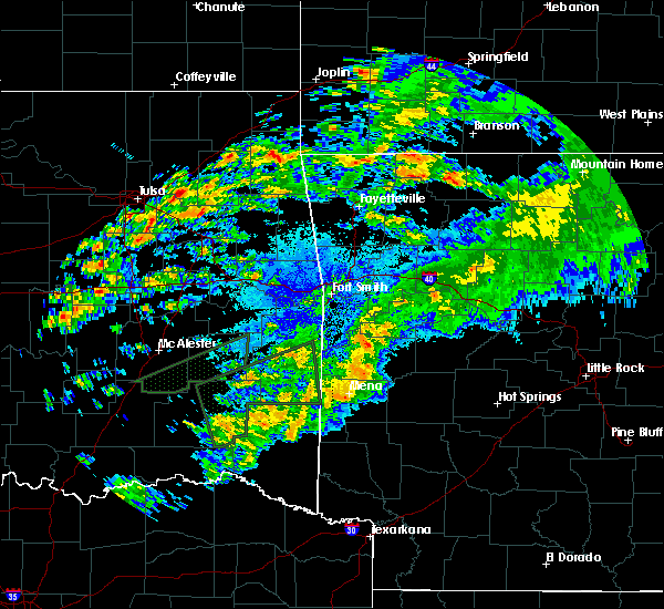 The severe thunderstorm warning for northwestern polk county will expire at 900 pm cdt, the storm which prompted the warning has weakened below severe limits, and no longer poses an immediate threat to life or property. therefore, the warning will be allowed to expire. however small hail, gusty winds and heavy rain are still possible with this thunderstorm. The severe thunderstorm warning for northwestern polk county will expire at 900 pm cdt, the storm which prompted the warning has weakened below severe limits, and no longer poses an immediate threat to life or property. therefore, the warning will be allowed to expire. however small hail, gusty winds and heavy rain are still possible with this thunderstorm.
|
| 10/10/2019 8:34 PM CDT |
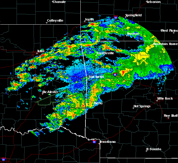 At 834 pm cdt, a severe thunderstorm was located near hatfield, or 13 miles west of mena, moving east at 25 mph (radar indicated). Hazards include 60 mph wind gusts and quarter size hail. Hail damage to vehicles is expected. Expect wind damage to roofs, siding, and trees. At 834 pm cdt, a severe thunderstorm was located near hatfield, or 13 miles west of mena, moving east at 25 mph (radar indicated). Hazards include 60 mph wind gusts and quarter size hail. Hail damage to vehicles is expected. Expect wind damage to roofs, siding, and trees.
|
| 7/10/2019 5:23 PM CDT |
 At 523 pm cdt, severe thunderstorms were located along a line extending from near grannis to near narrows dam to near lofton, moving southeast at 10 mph (radar indicated). Hazards include 60 mph wind gusts and quarter size hail. Hail damage to vehicles is expected. Expect wind damage to roofs, siding, and trees. At 523 pm cdt, severe thunderstorms were located along a line extending from near grannis to near narrows dam to near lofton, moving southeast at 10 mph (radar indicated). Hazards include 60 mph wind gusts and quarter size hail. Hail damage to vehicles is expected. Expect wind damage to roofs, siding, and trees.
|
| 7/10/2019 5:10 PM CDT |
 At 510 pm cdt, severe thunderstorms were located along a line extending from near hatfield to bard springs recreation area to near norman, moving south at 25 mph (radar indicated). Hazards include 60 mph wind gusts and quarter size hail. Hail damage to vehicles is expected. expect wind damage to roofs, siding, and trees. Locations impacted include, arkadelphia, mena, murfreesboro, mount ida, glenwood, wickes, amity, grannis, hatfield, norman, oden, daisy, vandervoort, gum springs in clark county, little missouri falls recreation area, mountain fork, daisy state park, narrows dam, meyers, lofton, this includes interstate 30 between mile markers 68 and 71. At 510 pm cdt, severe thunderstorms were located along a line extending from near hatfield to bard springs recreation area to near norman, moving south at 25 mph (radar indicated). Hazards include 60 mph wind gusts and quarter size hail. Hail damage to vehicles is expected. expect wind damage to roofs, siding, and trees. Locations impacted include, arkadelphia, mena, murfreesboro, mount ida, glenwood, wickes, amity, grannis, hatfield, norman, oden, daisy, vandervoort, gum springs in clark county, little missouri falls recreation area, mountain fork, daisy state park, narrows dam, meyers, lofton, this includes interstate 30 between mile markers 68 and 71.
|
| 7/10/2019 4:40 PM CDT |
 At 440 pm cdt, severe thunderstorms were located along a line extending from near hatfield to near oden to near meyers, moving south at 15 mph (radar indicated). Hazards include 60 mph wind gusts and quarter size hail. Hail damage to vehicles is expected. Expect wind damage to roofs, siding, and trees. At 440 pm cdt, severe thunderstorms were located along a line extending from near hatfield to near oden to near meyers, moving south at 15 mph (radar indicated). Hazards include 60 mph wind gusts and quarter size hail. Hail damage to vehicles is expected. Expect wind damage to roofs, siding, and trees.
|
| 7/10/2019 4:10 PM CDT |
 At 410 pm cdt, severe thunderstorms were located along a line extending from morgan springs to near oden to 6 miles northeast of meyers, moving south at 35 mph (radar indicated). Hazards include 60 mph wind gusts and quarter size hail. Hail damage to vehicles is expected. Expect wind damage to roofs, siding, and trees. At 410 pm cdt, severe thunderstorms were located along a line extending from morgan springs to near oden to 6 miles northeast of meyers, moving south at 35 mph (radar indicated). Hazards include 60 mph wind gusts and quarter size hail. Hail damage to vehicles is expected. Expect wind damage to roofs, siding, and trees.
|
| 7/10/2019 4:00 PM CDT |
 At 359 pm cdt, severe thunderstorms were located along a line extending from 10 miles northwest of lake ouachita state park to 10 miles west of muddy creek wma to near morgan springs, moving southeast at 15 mph (radar indicated). Hazards include 60 mph wind gusts and quarter size hail. Hail damage to vehicles is expected. Expect wind damage to roofs, siding, and trees. At 359 pm cdt, severe thunderstorms were located along a line extending from 10 miles northwest of lake ouachita state park to 10 miles west of muddy creek wma to near morgan springs, moving southeast at 15 mph (radar indicated). Hazards include 60 mph wind gusts and quarter size hail. Hail damage to vehicles is expected. Expect wind damage to roofs, siding, and trees.
|
| 7/10/2019 3:46 PM CDT |
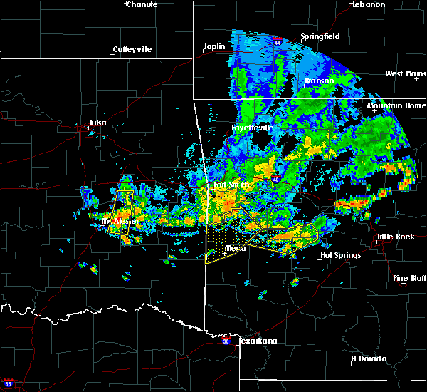 At 345 pm cdt, severe thunderstorms were located along a line extending from near echo to near oliver to near morgan springs, moving southeast at 30 mph (radar indicated). Hazards include 60 mph wind gusts. Expect damage to roofs, siding, and trees. Locations impacted include, mena, waldron, mansfield, hatfield, beauchamp, cardiff, mountain fork, polk county fairgrounds, mena intermountain airport, echo, oliver, morgan springs, queen wilhelmina state park, bates, acorn, barber, black fork, winfield, olio, ink,. At 345 pm cdt, severe thunderstorms were located along a line extending from near echo to near oliver to near morgan springs, moving southeast at 30 mph (radar indicated). Hazards include 60 mph wind gusts. Expect damage to roofs, siding, and trees. Locations impacted include, mena, waldron, mansfield, hatfield, beauchamp, cardiff, mountain fork, polk county fairgrounds, mena intermountain airport, echo, oliver, morgan springs, queen wilhelmina state park, bates, acorn, barber, black fork, winfield, olio, ink,.
|
| 7/10/2019 3:21 PM CDT |
 The national weather service in little rock has issued a * severe thunderstorm warning for. southwestern logan county in western arkansas. northern polk county in western arkansas. scott county in western arkansas. Until 400 pm cdt. The national weather service in little rock has issued a * severe thunderstorm warning for. southwestern logan county in western arkansas. northern polk county in western arkansas. scott county in western arkansas. Until 400 pm cdt.
|
| 6/19/2019 7:52 PM CDT |
 At 751 pm cdt, a severe thunderstorm was 5 miles east of mena, moving east at 30 mph (radar indicated). Hazards include 60 mph wind gusts and half dollar size hail. Hail damage to vehicles is expected. expect wind damage to roofs, siding, and trees. Locations impacted include, mena, hatfield, opal, polk county fairgrounds, mena intermountain airport, cove, acorn, board camp, rocky, nunley, ink, camp pioneer, cherry hill in polk county, potter, dallas, shady grove, a tornado watch remains in effect until midnight cdt for western arkansas. At 751 pm cdt, a severe thunderstorm was 5 miles east of mena, moving east at 30 mph (radar indicated). Hazards include 60 mph wind gusts and half dollar size hail. Hail damage to vehicles is expected. expect wind damage to roofs, siding, and trees. Locations impacted include, mena, hatfield, opal, polk county fairgrounds, mena intermountain airport, cove, acorn, board camp, rocky, nunley, ink, camp pioneer, cherry hill in polk county, potter, dallas, shady grove, a tornado watch remains in effect until midnight cdt for western arkansas.
|
| 6/19/2019 7:43 PM CDT |
 At 742 pm cdt, a severe thunderstorm was located 2 miles northwest of hatfield, or 8 miles southwest of mena, moving northeast at 35 mph (radar indicated). Hazards include 60 mph wind gusts and quarter size hail. Hail damage to vehicles is expected. Expect wind damage to roofs, siding, and trees. At 742 pm cdt, a severe thunderstorm was located 2 miles northwest of hatfield, or 8 miles southwest of mena, moving northeast at 35 mph (radar indicated). Hazards include 60 mph wind gusts and quarter size hail. Hail damage to vehicles is expected. Expect wind damage to roofs, siding, and trees.
|
| 6/19/2019 7:16 PM CDT |
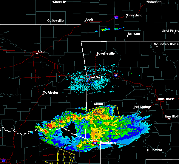 At 716 pm cdt, a severe thunderstorm was located over shady, or 11 miles southeast of mena, moving east at 35 mph (radar indicated). Hazards include 60 mph wind gusts and half dollar size hail. Hail damage to vehicles is expected. expect wind damage to roofs, siding, and trees. Locations impacted include, vandervoort, shady, hartley, cossatot river state park, bard springs recreation area, caney creek wilderness, mccauley, cove, board camp, nunley, hatton, bogg springs, shady lake recreation area, a tornado watch remains in effect until midnight cdt for western arkansas. At 716 pm cdt, a severe thunderstorm was located over shady, or 11 miles southeast of mena, moving east at 35 mph (radar indicated). Hazards include 60 mph wind gusts and half dollar size hail. Hail damage to vehicles is expected. expect wind damage to roofs, siding, and trees. Locations impacted include, vandervoort, shady, hartley, cossatot river state park, bard springs recreation area, caney creek wilderness, mccauley, cove, board camp, nunley, hatton, bogg springs, shady lake recreation area, a tornado watch remains in effect until midnight cdt for western arkansas.
|
| 6/19/2019 7:00 PM CDT |
 At 650 pm cdt, a severe thunderstorm was located 2 miles southwest of vandervoort, or 17 miles southwest of mena, moving northeast at 30 mph (radar indicated). Hazards include 60 mph wind gusts and half dollar size hail. Hail damage to vehicles is expected. Expect wind damage to roofs, siding, and trees. At 650 pm cdt, a severe thunderstorm was located 2 miles southwest of vandervoort, or 17 miles southwest of mena, moving northeast at 30 mph (radar indicated). Hazards include 60 mph wind gusts and half dollar size hail. Hail damage to vehicles is expected. Expect wind damage to roofs, siding, and trees.
|
| 6/19/2019 6:51 PM CDT |
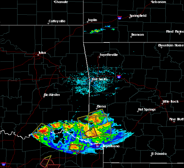 At 650 pm cdt, a severe thunderstorm was located 2 miles southwest of vandervoort, or 17 miles southwest of mena, moving northeast at 30 mph (radar indicated). Hazards include 60 mph wind gusts and half dollar size hail. Hail damage to vehicles is expected. Expect wind damage to roofs, siding, and trees. At 650 pm cdt, a severe thunderstorm was located 2 miles southwest of vandervoort, or 17 miles southwest of mena, moving northeast at 30 mph (radar indicated). Hazards include 60 mph wind gusts and half dollar size hail. Hail damage to vehicles is expected. Expect wind damage to roofs, siding, and trees.
|
| 5/21/2019 12:23 PM CDT |
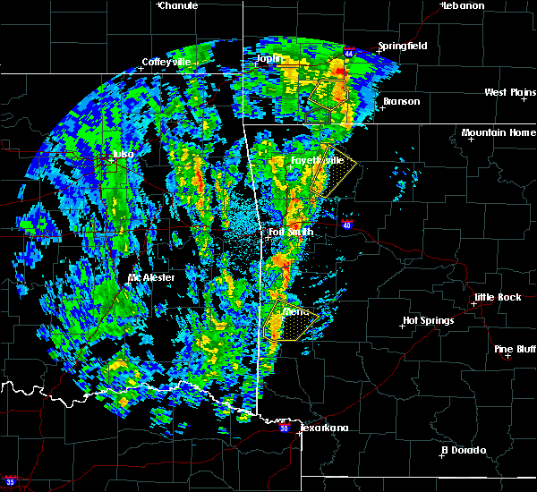 At 1222 pm cdt, a severe thunderstorm was located near mccauley, or 8 miles south of mena, moving northeast at 55 mph (radar indicated). Hazards include 60 mph wind gusts and quarter size hail. Hail damage to vehicles is expected. expect wind damage to roofs, siding, and trees. Locations impacted include, mena, hatfield, vandervoort, shady, hartley, opal, cossatot river state park, caney creek wilderness, polk county fairgrounds, mena intermountain airport, mccauley, cove, acorn, big fork, board camp, nunley, ink, camp pioneer, pine ridge, cherry hill in polk county, a tornado watch remains in effect until 700 pm cdt for western arkansas. At 1222 pm cdt, a severe thunderstorm was located near mccauley, or 8 miles south of mena, moving northeast at 55 mph (radar indicated). Hazards include 60 mph wind gusts and quarter size hail. Hail damage to vehicles is expected. expect wind damage to roofs, siding, and trees. Locations impacted include, mena, hatfield, vandervoort, shady, hartley, opal, cossatot river state park, caney creek wilderness, polk county fairgrounds, mena intermountain airport, mccauley, cove, acorn, big fork, board camp, nunley, ink, camp pioneer, pine ridge, cherry hill in polk county, a tornado watch remains in effect until 700 pm cdt for western arkansas.
|
| 5/21/2019 11:56 AM CDT |
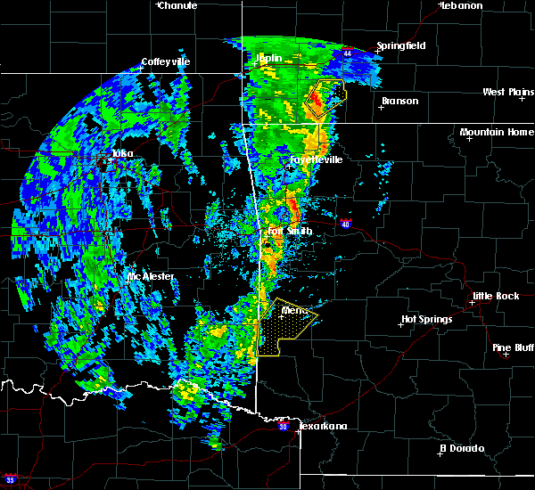 The national weather service in little rock has issued a * severe thunderstorm warning for. polk county in western arkansas. south central scott county in western arkansas. west central montgomery county in western arkansas. Until 1245 pm cdt. The national weather service in little rock has issued a * severe thunderstorm warning for. polk county in western arkansas. south central scott county in western arkansas. west central montgomery county in western arkansas. Until 1245 pm cdt.
|
| 5/18/2019 1:57 PM CDT |
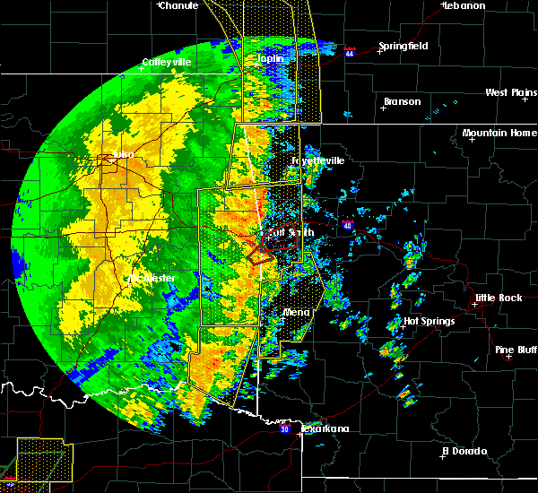 At 157 pm cdt, severe thunderstorms were located along a line extending from near pocola to near oliver to 10 miles west of vandervoort, moving east at 50 mph (radar indicated). Hazards include 60 mph wind gusts and nickel size hail. Expect damage to roofs, siding, and trees. Locations impacted include, mena, booneville, waldron, mansfield, wickes, grannis, hatfield, vandervoort, beauchamp, cardiff, mountain fork, opal, cossatot river state park, polk county fairgrounds, mena intermountain airport, mccauley, shady, echo, oliver, hartley, a tornado watch remains in effect until 800 pm cdt for western arkansas. At 157 pm cdt, severe thunderstorms were located along a line extending from near pocola to near oliver to 10 miles west of vandervoort, moving east at 50 mph (radar indicated). Hazards include 60 mph wind gusts and nickel size hail. Expect damage to roofs, siding, and trees. Locations impacted include, mena, booneville, waldron, mansfield, wickes, grannis, hatfield, vandervoort, beauchamp, cardiff, mountain fork, opal, cossatot river state park, polk county fairgrounds, mena intermountain airport, mccauley, shady, echo, oliver, hartley, a tornado watch remains in effect until 800 pm cdt for western arkansas.
|
| 5/18/2019 1:38 PM CDT |
 At 136 pm cdt, severe thunderstorms were located along a line extending from 10 miles west of fort smith to big cedar to 10 miles west of broken bow, moving east at 45 mph (radar indicated). Hazards include 60 mph wind gusts and nickel size hail. expect damage to roofs, siding, and trees At 136 pm cdt, severe thunderstorms were located along a line extending from 10 miles west of fort smith to big cedar to 10 miles west of broken bow, moving east at 45 mph (radar indicated). Hazards include 60 mph wind gusts and nickel size hail. expect damage to roofs, siding, and trees
|
| 3/24/2019 9:17 PM CDT |
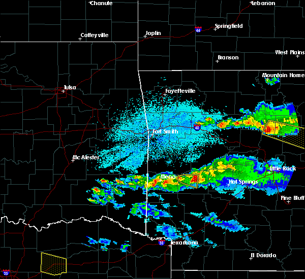 At 915 pm cdt, severe thunderstorms were located 5 miles southwest of mena, and 4 miles southeast of mena, moving east at 30 mph (radar indicated). Hazards include 60 mph wind gusts and nickel size hail. expect damage to roofs, siding, and trees At 915 pm cdt, severe thunderstorms were located 5 miles southwest of mena, and 4 miles southeast of mena, moving east at 30 mph (radar indicated). Hazards include 60 mph wind gusts and nickel size hail. expect damage to roofs, siding, and trees
|
| 3/24/2019 7:22 PM CDT |
 At 722 pm cdt, a severe thunderstorm was located near mountain fork, or 12 miles west of mena, moving northeast at 40 mph (radar indicated). Hazards include 60 mph wind gusts and quarter size hail. Hail damage to vehicles is expected. Expect wind damage to roofs, siding, and trees. At 722 pm cdt, a severe thunderstorm was located near mountain fork, or 12 miles west of mena, moving northeast at 40 mph (radar indicated). Hazards include 60 mph wind gusts and quarter size hail. Hail damage to vehicles is expected. Expect wind damage to roofs, siding, and trees.
|
| 11/30/2018 11:51 PM CST |
 At 1151 pm cst, severe thunderstorms were located along a line extending from 9 miles northeast of mena to near opal to vandervoort, moving northeast at 55 mph (radar indicated). Hazards include 60 mph wind gusts and quarter size hail. Hail damage to vehicles is expected. expect wind damage to roofs, siding, and trees. Locations impacted include, mena, wickes, hatfield, vandervoort, opal, cossatot river state park, polk county fairgrounds, mena intermountain airport, mccauley, shady, hartley, bard springs recreation area, caney creek wilderness, queen wilhelmina state park, cove, acorn, big fork, board camp, ink, shady lake recreation area, a tornado watch remains in effect until 200 am cst for western arkansas. At 1151 pm cst, severe thunderstorms were located along a line extending from 9 miles northeast of mena to near opal to vandervoort, moving northeast at 55 mph (radar indicated). Hazards include 60 mph wind gusts and quarter size hail. Hail damage to vehicles is expected. expect wind damage to roofs, siding, and trees. Locations impacted include, mena, wickes, hatfield, vandervoort, opal, cossatot river state park, polk county fairgrounds, mena intermountain airport, mccauley, shady, hartley, bard springs recreation area, caney creek wilderness, queen wilhelmina state park, cove, acorn, big fork, board camp, ink, shady lake recreation area, a tornado watch remains in effect until 200 am cst for western arkansas.
|
| 11/30/2018 11:29 PM CST |
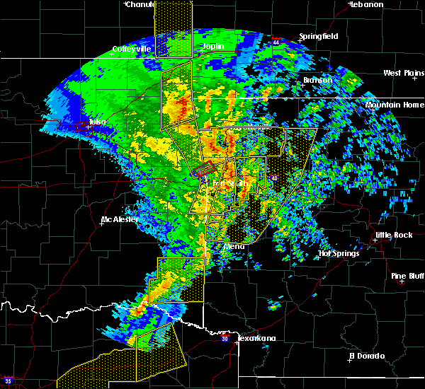 At 1128 pm cst, severe thunderstorms were located along a line extending from near queen wilhelmina state park to near hatfield to 8 miles west of wickes, moving northeast at 55 mph (radar indicated). Hazards include 60 mph wind gusts and quarter size hail. Hail damage to vehicles is expected. Expect wind damage to roofs, siding, and trees. At 1128 pm cst, severe thunderstorms were located along a line extending from near queen wilhelmina state park to near hatfield to 8 miles west of wickes, moving northeast at 55 mph (radar indicated). Hazards include 60 mph wind gusts and quarter size hail. Hail damage to vehicles is expected. Expect wind damage to roofs, siding, and trees.
|
| 7/11/2018 6:10 PM CDT |
 At 609 pm cdt, a severe thunderstorm continued to be indicated on radar and was located near shady, or 11 miles south of mena, moving southwest at 10 mph (radar indicated). Hazards include 60 mph wind gusts and quarter size hail. Hail damage to vehicles is expected. Expect wind damage to roofs, siding, and trees. At 609 pm cdt, a severe thunderstorm continued to be indicated on radar and was located near shady, or 11 miles south of mena, moving southwest at 10 mph (radar indicated). Hazards include 60 mph wind gusts and quarter size hail. Hail damage to vehicles is expected. Expect wind damage to roofs, siding, and trees.
|
| 7/11/2018 5:57 PM CDT |
 At 557 pm cdt, a severe thunderstorm was located over shady, or 11 miles southeast of mena, moving west at 15 mph (radar indicated). Hazards include 60 mph wind gusts and quarter size hail. Hail damage to vehicles is expected. expect wind damage to roofs, siding, and trees. Locations impacted include, mena, wickes, hatfield, vandervoort, shady, hartley, cossatot river state park, caney creek wilderness, polk county fairgrounds, mena intermountain airport, mccauley, board camp, nunley, potter, dallas, shady lake recreation area,. At 557 pm cdt, a severe thunderstorm was located over shady, or 11 miles southeast of mena, moving west at 15 mph (radar indicated). Hazards include 60 mph wind gusts and quarter size hail. Hail damage to vehicles is expected. expect wind damage to roofs, siding, and trees. Locations impacted include, mena, wickes, hatfield, vandervoort, shady, hartley, cossatot river state park, caney creek wilderness, polk county fairgrounds, mena intermountain airport, mccauley, board camp, nunley, potter, dallas, shady lake recreation area,.
|
| 7/11/2018 5:46 PM CDT |
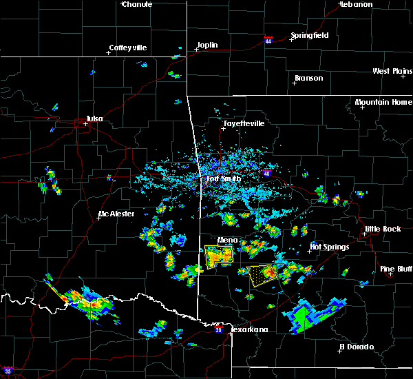 At 546 pm cdt, a severe thunderstorm was located over shady, or 11 miles southeast of mena, moving west at 15 mph (radar indicated). Hazards include 60 mph wind gusts and quarter size hail. Hail damage to vehicles is expected. Expect wind damage to roofs, siding, and trees. At 546 pm cdt, a severe thunderstorm was located over shady, or 11 miles southeast of mena, moving west at 15 mph (radar indicated). Hazards include 60 mph wind gusts and quarter size hail. Hail damage to vehicles is expected. Expect wind damage to roofs, siding, and trees.
|
| 6/24/2018 8:09 AM CDT |
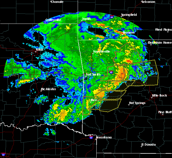 The severe thunderstorm warning for polk, southwestern scott and west central montgomery counties will expire at 815 am cdt, the severe thunderstorm which prompted the warning has !weakened therefore, the warning will be allowed to expire. a severe thunderstorm watch remains in effect until 1100 am cdt for western arkansas. The severe thunderstorm warning for polk, southwestern scott and west central montgomery counties will expire at 815 am cdt, the severe thunderstorm which prompted the warning has !weakened therefore, the warning will be allowed to expire. a severe thunderstorm watch remains in effect until 1100 am cdt for western arkansas.
|
| 6/24/2018 7:42 AM CDT |
 At 741 am cdt, a severe thunderstorm was located near beauchamp, or 12 miles north of mena, moving east at 45 mph (radar indicated). Hazards include 60 mph wind gusts and quarter size hail. Hail damage to vehicles is expected. expect wind damage to roofs, siding, and trees. Locations impacted include, mena, wickes, grannis, hatfield, vandervoort, opal, cossatot river state park, mountain fork, polk county fairgrounds, mena intermountain airport, mccauley, shady, hartley, bard springs recreation area, queen wilhelmina state park, caney creek wilderness, cove, acorn, big fork, black fork,. At 741 am cdt, a severe thunderstorm was located near beauchamp, or 12 miles north of mena, moving east at 45 mph (radar indicated). Hazards include 60 mph wind gusts and quarter size hail. Hail damage to vehicles is expected. expect wind damage to roofs, siding, and trees. Locations impacted include, mena, wickes, grannis, hatfield, vandervoort, opal, cossatot river state park, mountain fork, polk county fairgrounds, mena intermountain airport, mccauley, shady, hartley, bard springs recreation area, queen wilhelmina state park, caney creek wilderness, cove, acorn, big fork, black fork,.
|
| 6/24/2018 7:27 AM CDT |
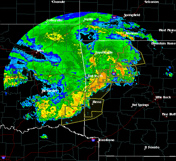 At 727 am cdt, a severe thunderstorm was located 7 miles northwest of queen wilhelmina state park, or 17 miles northwest of mena, moving east at 45 mph (radar indicated). Hazards include 60 mph wind gusts and quarter size hail. Hail damage to vehicles is expected. Expect wind damage to roofs, siding, and trees. At 727 am cdt, a severe thunderstorm was located 7 miles northwest of queen wilhelmina state park, or 17 miles northwest of mena, moving east at 45 mph (radar indicated). Hazards include 60 mph wind gusts and quarter size hail. Hail damage to vehicles is expected. Expect wind damage to roofs, siding, and trees.
|
| 4/3/2018 3:28 PM CDT |
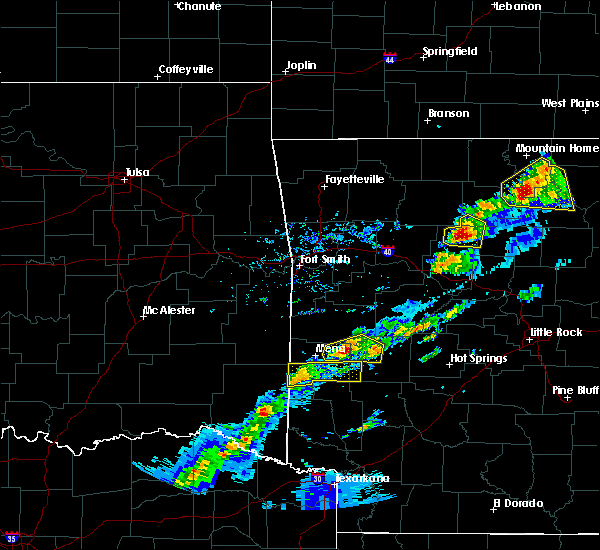 At 327 pm cdt, a severe thunderstorm was located over vandervoort, or 16 miles southwest of mena, moving east at 40 mph (radar indicated). Hazards include half dollar size hail. damage to vehicles is expected At 327 pm cdt, a severe thunderstorm was located over vandervoort, or 16 miles southwest of mena, moving east at 40 mph (radar indicated). Hazards include half dollar size hail. damage to vehicles is expected
|
| 4/3/2018 2:50 PM CDT |
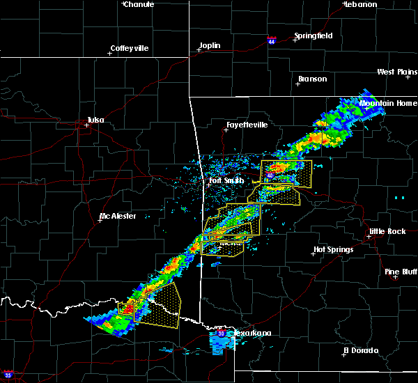 At 250 pm cdt, a severe thunderstorm was located 7 miles west of octavia, or 29 miles east of clayton, moving east at 45 mph (radar indicated). Hazards include ping pong ball size hail. People and animals outdoors will be injured. Expect damage to roofs, siding, windows, and vehicles. At 250 pm cdt, a severe thunderstorm was located 7 miles west of octavia, or 29 miles east of clayton, moving east at 45 mph (radar indicated). Hazards include ping pong ball size hail. People and animals outdoors will be injured. Expect damage to roofs, siding, windows, and vehicles.
|
| 2/24/2018 1:19 PM CST |
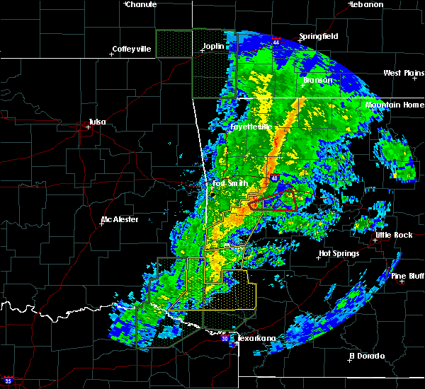 At 119 pm cst, severe thunderstorms were located along a line extending from near hatfield to near cossatot river state park to gillham, moving northeast at 60 mph (radar indicated). Hazards include 60 mph wind gusts. Expect damage to roofs, siding, and trees. Locations impacted include, mena, wickes, grannis, hatfield, vandervoort, opal, cossatot river state park, polk county fairgrounds, mena intermountain airport, mccauley, shady, hartley, bard springs recreation area, caney creek wilderness, cove, acorn, board camp, ink, shady lake recreation area, hatton, a tornado watch remains in effect until 600 pm cst for western arkansas. At 119 pm cst, severe thunderstorms were located along a line extending from near hatfield to near cossatot river state park to gillham, moving northeast at 60 mph (radar indicated). Hazards include 60 mph wind gusts. Expect damage to roofs, siding, and trees. Locations impacted include, mena, wickes, grannis, hatfield, vandervoort, opal, cossatot river state park, polk county fairgrounds, mena intermountain airport, mccauley, shady, hartley, bard springs recreation area, caney creek wilderness, cove, acorn, board camp, ink, shady lake recreation area, hatton, a tornado watch remains in effect until 600 pm cst for western arkansas.
|
| 2/24/2018 12:56 PM CST |
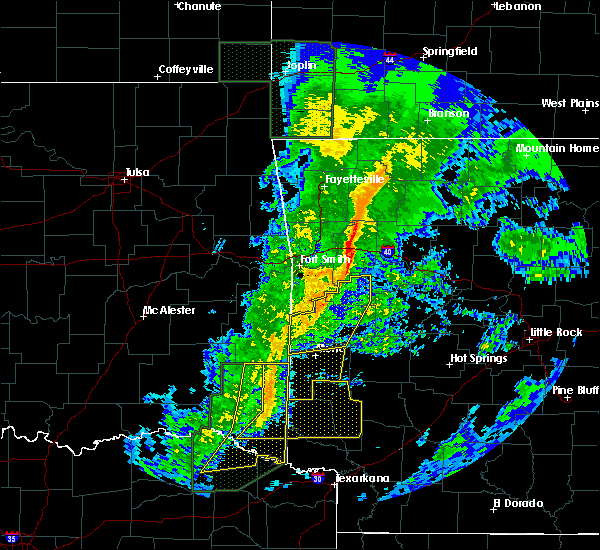 At 1255 pm cst, severe thunderstorms were located along a line extending from near octavia to 14 miles west of vandervoort to 13 miles north of broken bow, moving east at 40 mph (radar indicated). Hazards include 60 mph wind gusts. expect damage to roofs, siding, and trees At 1255 pm cst, severe thunderstorms were located along a line extending from near octavia to 14 miles west of vandervoort to 13 miles north of broken bow, moving east at 40 mph (radar indicated). Hazards include 60 mph wind gusts. expect damage to roofs, siding, and trees
|
| 6/30/2017 10:23 PM CDT |
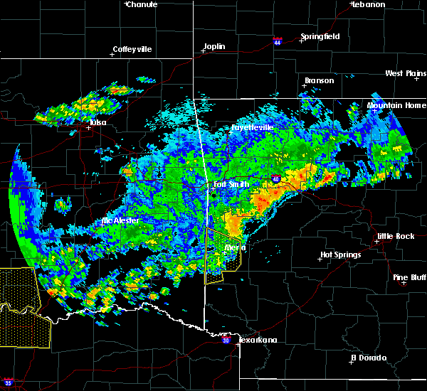 The severe thunderstorm warning for southwestern scott and polk counties will expire at 1030 pm cdt, the storms which prompted the warning have weakened below severe limits, and no longer pose an immediate threat to life or property. therefore, the warning will be allowed to expire. however gusty winds are still possible with these thunderstorms. The severe thunderstorm warning for southwestern scott and polk counties will expire at 1030 pm cdt, the storms which prompted the warning have weakened below severe limits, and no longer pose an immediate threat to life or property. therefore, the warning will be allowed to expire. however gusty winds are still possible with these thunderstorms.
|
| 6/30/2017 9:43 PM CDT |
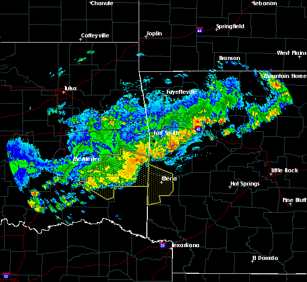 At 943 pm cdt, severe thunderstorms were located along a line extending from near heavener to big cedar to near octavia to 12 miles southwest of muse, moving southeast at 50 mph (radar indicated). Hazards include 60 mph wind gusts. expect damage to roofs, siding, and trees At 943 pm cdt, severe thunderstorms were located along a line extending from near heavener to big cedar to near octavia to 12 miles southwest of muse, moving southeast at 50 mph (radar indicated). Hazards include 60 mph wind gusts. expect damage to roofs, siding, and trees
|
| 6/18/2017 9:53 AM CDT |
 At 953 am cdt, severe thunderstorms were located along a line extending from near magazine to 6 miles south of waldron to near hatfield, moving southeast at 40 mph (radar indicated). Hazards include 60 mph wind gusts and quarter size hail. Hail damage to vehicles is expected. expect wind damage to roofs, siding, and trees. Locations impacted include, mena, booneville, waldron, mansfield, magazine, wickes, hatfield, blue mountain, vandervoort, beauchamp, cardiff, mountain fork, stonehouse recreation area, cossatot river state park, polk county fairgrounds, mena intermountain airport, mccauley, mount magazine, shady, echo,. At 953 am cdt, severe thunderstorms were located along a line extending from near magazine to 6 miles south of waldron to near hatfield, moving southeast at 40 mph (radar indicated). Hazards include 60 mph wind gusts and quarter size hail. Hail damage to vehicles is expected. expect wind damage to roofs, siding, and trees. Locations impacted include, mena, booneville, waldron, mansfield, magazine, wickes, hatfield, blue mountain, vandervoort, beauchamp, cardiff, mountain fork, stonehouse recreation area, cossatot river state park, polk county fairgrounds, mena intermountain airport, mccauley, mount magazine, shady, echo,.
|
| 6/18/2017 9:29 AM CDT |
 At 928 am cdt, severe thunderstorms were located along a line extending from branch to near hartford to near muse, moving southeast at 40 mph (radar indicated). Hazards include 60 mph wind gusts and quarter size hail. Hail damage to vehicles is expected. Expect wind damage to roofs, siding, and trees. At 928 am cdt, severe thunderstorms were located along a line extending from branch to near hartford to near muse, moving southeast at 40 mph (radar indicated). Hazards include 60 mph wind gusts and quarter size hail. Hail damage to vehicles is expected. Expect wind damage to roofs, siding, and trees.
|
| 5/28/2017 1:17 AM CDT |
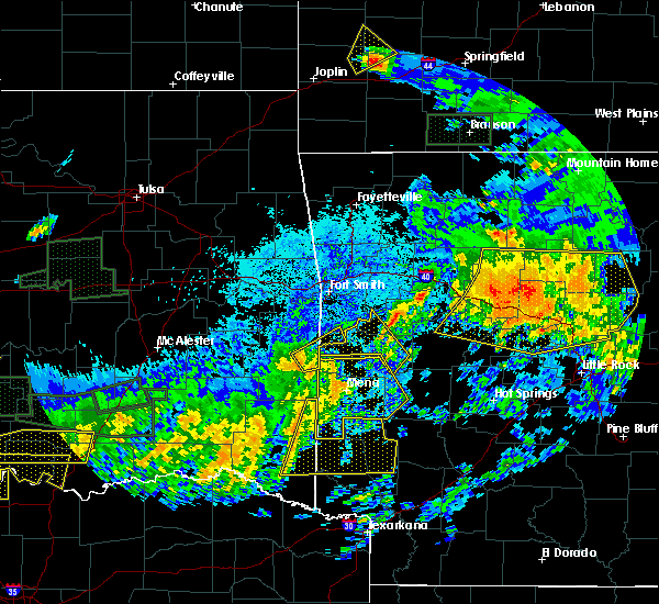 At 117 am cdt, severe thunderstorms were located along a line extending from near beauchamp to near mena intermountain airport to 7 miles west of grannis, moving east at 50 mph (radar indicated). Hazards include 70 mph wind gusts and nickel size hail. Expect considerable tree damage. damage is likely to mobile homes, roofs, and outbuildings. Locations impacted include, mena, wickes, grannis, hatfield, oden, vandervoort, beauchamp, opal, mimosa, little missouri falls recreatio, cossatot river state park, mountain fork, polk county fairgrounds, mena intermountain airport, mccauley, shady, hartley, bard springs recreation area, queen wilhelmina state park, caney creek wilderness, a tornado watch remains in effect until 200 am cdt for western arkansas. At 117 am cdt, severe thunderstorms were located along a line extending from near beauchamp to near mena intermountain airport to 7 miles west of grannis, moving east at 50 mph (radar indicated). Hazards include 70 mph wind gusts and nickel size hail. Expect considerable tree damage. damage is likely to mobile homes, roofs, and outbuildings. Locations impacted include, mena, wickes, grannis, hatfield, oden, vandervoort, beauchamp, opal, mimosa, little missouri falls recreatio, cossatot river state park, mountain fork, polk county fairgrounds, mena intermountain airport, mccauley, shady, hartley, bard springs recreation area, queen wilhelmina state park, caney creek wilderness, a tornado watch remains in effect until 200 am cdt for western arkansas.
|
| 5/28/2017 12:47 AM CDT |
 At 1247 am cdt, severe thunderstorms were located along a line extending from near whitesboro to octavia to 15 miles north of broken bow, moving east at 55 mph (radar indicated). Hazards include 70 mph wind gusts and nickel size hail. Expect considerable tree damage. Damage is likely to mobile homes, roofs, and outbuildings. At 1247 am cdt, severe thunderstorms were located along a line extending from near whitesboro to octavia to 15 miles north of broken bow, moving east at 55 mph (radar indicated). Hazards include 70 mph wind gusts and nickel size hail. Expect considerable tree damage. Damage is likely to mobile homes, roofs, and outbuildings.
|
| 4/29/2017 9:24 PM CDT |
 At 923 pm cdt, severe thunderstorms were located along a line extending from 8 miles east of octavia to vandervoort to near wickes, moving northeast at 70 mph (radar indicated). Hazards include 60 mph wind gusts and penny size hail. expect damage to roofs, siding, and trees At 923 pm cdt, severe thunderstorms were located along a line extending from 8 miles east of octavia to vandervoort to near wickes, moving northeast at 70 mph (radar indicated). Hazards include 60 mph wind gusts and penny size hail. expect damage to roofs, siding, and trees
|
| 1/21/2017 7:16 PM CST |
 At 716 pm cst, a severe thunderstorm was located over vandervoort, or 16 miles southwest of mena, moving northeast at 15 mph (radar indicated). Hazards include quarter size hail. damage to vehicles is expected At 716 pm cst, a severe thunderstorm was located over vandervoort, or 16 miles southwest of mena, moving northeast at 15 mph (radar indicated). Hazards include quarter size hail. damage to vehicles is expected
|
| 7/29/2016 7:27 PM CDT | The severe thunderstorm warning for northwestern montgomery, southeastern scott and polk counties will expire at 730 pm cdt, the storms which prompted the warning have weakened below severe limits, therefore the warning will be allowed to expire. however gusty winds and heavy rain are still possible with these thunderstorms. to report severe weather, contact your nearest law enforcement agency. they will relay your report to the national weather service little rock. |
| 7/29/2016 7:06 PM CDT |
 At 706 pm cdt, severe thunderstorms were located along a line extending from 6 miles northwest of opal to mccauley, moving southeast at 20 mph (radar indicated). Hazards include 60 mph wind gusts and quarter size hail. Hail damage to vehicles is expected. expect wind damage to roofs, siding, and trees. Locations impacted include, mena, mount ida, wickes, grannis, hatfield, oden, vandervoort, mccauley, hartley, cossatot river state park, mimosa, little missouri falls recreatio, mena intermountain airport, opal, mountain fork, caney creek wilderness, mauldin, shady, bard springs recreation area, polk county fairgrounds,. At 706 pm cdt, severe thunderstorms were located along a line extending from 6 miles northwest of opal to mccauley, moving southeast at 20 mph (radar indicated). Hazards include 60 mph wind gusts and quarter size hail. Hail damage to vehicles is expected. expect wind damage to roofs, siding, and trees. Locations impacted include, mena, mount ida, wickes, grannis, hatfield, oden, vandervoort, mccauley, hartley, cossatot river state park, mimosa, little missouri falls recreatio, mena intermountain airport, opal, mountain fork, caney creek wilderness, mauldin, shady, bard springs recreation area, polk county fairgrounds,.
|
| 7/29/2016 6:45 PM CDT |
 At 644 pm cdt, severe thunderstorms were located along a line extending from 9 miles northeast of mena to near hatfield, moving southeast at 20 mph (radar indicated). Hazards include 60 mph wind gusts and half dollar size hail. Hail damage to vehicles is expected. Expect wind damage to roofs, siding, and trees. At 644 pm cdt, severe thunderstorms were located along a line extending from 9 miles northeast of mena to near hatfield, moving southeast at 20 mph (radar indicated). Hazards include 60 mph wind gusts and half dollar size hail. Hail damage to vehicles is expected. Expect wind damage to roofs, siding, and trees.
|
| 7/14/2016 4:06 PM CDT |
 At 405 pm cdt, severe thunderstorms were located along a line extending from 10 miles north of woodland to near paris to near hatfield, moving east at 55 mph (trained weather spotters reported 65 mph winds and damage to trees and shingles blown off of roofs in paris). Hazards include 70 mph wind gusts and quarter size hail. Hail damage to vehicles is expected. expect considerable tree damage. wind damage is also likely to mobile homes, roofs, and outbuildings. Locations impacted include, clarksville, mena, booneville, waldron, paris, danville, mount ida, lamar, mansfield, london, magazine, knoxville, subiaco, hartman, hatfield, norman, oden, scranton, ratcliff, blue mountain,. At 405 pm cdt, severe thunderstorms were located along a line extending from 10 miles north of woodland to near paris to near hatfield, moving east at 55 mph (trained weather spotters reported 65 mph winds and damage to trees and shingles blown off of roofs in paris). Hazards include 70 mph wind gusts and quarter size hail. Hail damage to vehicles is expected. expect considerable tree damage. wind damage is also likely to mobile homes, roofs, and outbuildings. Locations impacted include, clarksville, mena, booneville, waldron, paris, danville, mount ida, lamar, mansfield, london, magazine, knoxville, subiaco, hartman, hatfield, norman, oden, scranton, ratcliff, blue mountain,.
|
| 7/14/2016 3:28 PM CDT |
 At 328 pm cdt, severe thunderstorms were located along a line extending from near brentwood to near burnville to near muse, moving east at 45 mph (radar indicated). Hazards include 60 mph wind gusts and quarter size hail. Hail damage to vehicles is expected. Expect wind damage to roofs, siding, and trees. At 328 pm cdt, severe thunderstorms were located along a line extending from near brentwood to near burnville to near muse, moving east at 45 mph (radar indicated). Hazards include 60 mph wind gusts and quarter size hail. Hail damage to vehicles is expected. Expect wind damage to roofs, siding, and trees.
|
| 6/17/2016 7:37 PM CDT |
 At 737 pm cdt, a severe thunderstorm was located near hatfield, or 13 miles southwest of mena, moving southwest at 15 mph (radar indicated). Hazards include 60 mph wind gusts and quarter size hail. Hail damage to vehicles is expected. expect wind damage to roofs, siding, and trees. Locations impacted include, hatfield, mountain fork, queen wilhelmina state park, cove, potter, camp pioneer, rocky,. At 737 pm cdt, a severe thunderstorm was located near hatfield, or 13 miles southwest of mena, moving southwest at 15 mph (radar indicated). Hazards include 60 mph wind gusts and quarter size hail. Hail damage to vehicles is expected. expect wind damage to roofs, siding, and trees. Locations impacted include, hatfield, mountain fork, queen wilhelmina state park, cove, potter, camp pioneer, rocky,.
|
| 6/17/2016 7:21 PM CDT |
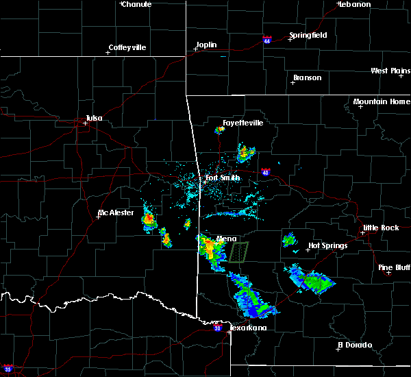 At 721 pm cdt, a severe thunderstorm was located near mountain fork, or 7 miles west of mena, moving southwest at 25 mph (radar indicated). Hazards include 60 mph wind gusts and quarter size hail. Hail damage to vehicles is expected. Expect wind damage to roofs, siding, and trees. At 721 pm cdt, a severe thunderstorm was located near mountain fork, or 7 miles west of mena, moving southwest at 25 mph (radar indicated). Hazards include 60 mph wind gusts and quarter size hail. Hail damage to vehicles is expected. Expect wind damage to roofs, siding, and trees.
|
| 6/17/2016 7:07 PM CDT |
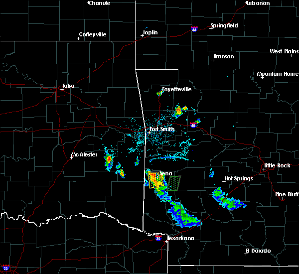 At 707 pm cdt, a severe thunderstorm was located near hatfield, or near mena, moving west at 15 mph (radar indicated). Hazards include 60 mph wind gusts and quarter size hail. Hail damage to vehicles is expected. expect wind damage to roofs, siding, and trees. Locations impacted include, mena, hatfield, mena intermountain airport, polk county fairgrounds, mccauley, shady, acorn, potter, nunley, shady grove, dallas, rocky,. At 707 pm cdt, a severe thunderstorm was located near hatfield, or near mena, moving west at 15 mph (radar indicated). Hazards include 60 mph wind gusts and quarter size hail. Hail damage to vehicles is expected. expect wind damage to roofs, siding, and trees. Locations impacted include, mena, hatfield, mena intermountain airport, polk county fairgrounds, mccauley, shady, acorn, potter, nunley, shady grove, dallas, rocky,.
|
| 6/17/2016 6:52 PM CDT |
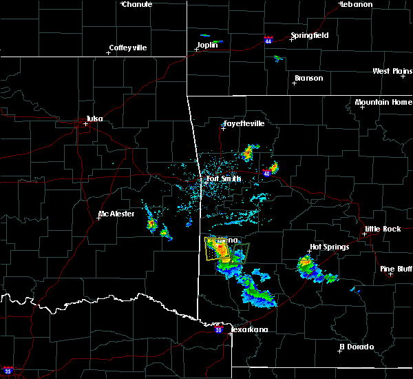 At 651 pm cdt, a severe thunderstorm was located over polk county fairgrounds, or near mena, moving west at 15 mph (trained weather spotters). Hazards include 60 mph wind gusts and quarter size hail. Hail damage to vehicles is expected. expect wind damage to roofs, siding, and trees. Locations impacted include, mena, hatfield, mena intermountain airport, mccauley, shady, polk county fairgrounds, acorn, nunley, rocky, potter, shady grove, ink, dallas, board camp,. At 651 pm cdt, a severe thunderstorm was located over polk county fairgrounds, or near mena, moving west at 15 mph (trained weather spotters). Hazards include 60 mph wind gusts and quarter size hail. Hail damage to vehicles is expected. expect wind damage to roofs, siding, and trees. Locations impacted include, mena, hatfield, mena intermountain airport, mccauley, shady, polk county fairgrounds, acorn, nunley, rocky, potter, shady grove, ink, dallas, board camp,.
|
| 6/17/2016 6:39 PM CDT |
 At 639 pm cdt, a severe thunderstorm was located over mena intermountain airport, or near mena, moving west at 15 mph (radar indicated). Hazards include 60 mph wind gusts and quarter size hail. Hail damage to vehicles is expected. Expect wind damage to roofs, siding, and trees. At 639 pm cdt, a severe thunderstorm was located over mena intermountain airport, or near mena, moving west at 15 mph (radar indicated). Hazards include 60 mph wind gusts and quarter size hail. Hail damage to vehicles is expected. Expect wind damage to roofs, siding, and trees.
|
| 4/27/2016 1:12 AM CDT |
 At 112 am cdt, severe thunderstorms were located along a line extending from morgan springs to near mena intermountain airport to near grannis, moving east at 45 mph (radar indicated). Hazards include 60 mph wind gusts. Expect damage to roofs. siding. and trees. Locations impacted include, mena, booneville, waldron, paris, mansfield, magazine, wickes, grannis, hatfield, oden, ratcliff, blue mountain, daisy, vandervoort, beauchamp, mccauley, hartley, cossatot river state, mimosa, little missouri fall,. At 112 am cdt, severe thunderstorms were located along a line extending from morgan springs to near mena intermountain airport to near grannis, moving east at 45 mph (radar indicated). Hazards include 60 mph wind gusts. Expect damage to roofs. siding. and trees. Locations impacted include, mena, booneville, waldron, paris, mansfield, magazine, wickes, grannis, hatfield, oden, ratcliff, blue mountain, daisy, vandervoort, beauchamp, mccauley, hartley, cossatot river state, mimosa, little missouri fall,.
|
| 4/27/2016 1:03 AM CDT |
 At 102 am cdt, severe thunderstorms were located along a line extending from near heavener to near hatfield to 8 miles west of gillham, moving northeast at 50 mph (radar indicated). Hazards include 60 mph wind gusts. Expect damage to roofs. siding. and trees. Locations impacted include, mena, booneville, waldron, paris, mansfield, magazine, wickes, grannis, hatfield, oden, ratcliff, blue mountain, daisy, vandervoort, beauchamp, mccauley, hartley, cossatot river state, mimosa, little missouri fall,. At 102 am cdt, severe thunderstorms were located along a line extending from near heavener to near hatfield to 8 miles west of gillham, moving northeast at 50 mph (radar indicated). Hazards include 60 mph wind gusts. Expect damage to roofs. siding. and trees. Locations impacted include, mena, booneville, waldron, paris, mansfield, magazine, wickes, grannis, hatfield, oden, ratcliff, blue mountain, daisy, vandervoort, beauchamp, mccauley, hartley, cossatot river state, mimosa, little missouri fall,.
|
| 4/27/2016 12:31 AM CDT |
 At 1230 am cdt, severe thunderstorms were located along a line extending from near whitesboro to 12 miles south of octavia to 9 miles southwest of idabel, moving northeast at 55 mph (radar indicated). Hazards include 60 mph wind gusts. Expect damage to roofs. siding. And trees. At 1230 am cdt, severe thunderstorms were located along a line extending from near whitesboro to 12 miles south of octavia to 9 miles southwest of idabel, moving northeast at 55 mph (radar indicated). Hazards include 60 mph wind gusts. Expect damage to roofs. siding. And trees.
|
| 12/27/2015 11:43 AM CST |
 At 1143 am cst, a severe thunderstorm capable of producing a tornado was located near wickes, or 18 miles north of de queen, moving north at 35 mph (radar indicated rotation). Hazards include tornado. Flying debris will be dangerous to those caught without shelter. mobile homes will be damaged or destroyed. damage to roofs, windows, and vehicles will occur. tree damage is likely. Locations impacted include, wickes, grannis, hatfield, vandervoort, mena intermountain airport, mccauley, cossatot river state park, cove, nunley, hatton, camp pioneer, bogg springs and dallas. At 1143 am cst, a severe thunderstorm capable of producing a tornado was located near wickes, or 18 miles north of de queen, moving north at 35 mph (radar indicated rotation). Hazards include tornado. Flying debris will be dangerous to those caught without shelter. mobile homes will be damaged or destroyed. damage to roofs, windows, and vehicles will occur. tree damage is likely. Locations impacted include, wickes, grannis, hatfield, vandervoort, mena intermountain airport, mccauley, cossatot river state park, cove, nunley, hatton, camp pioneer, bogg springs and dallas.
|
| 12/27/2015 11:33 AM CST |
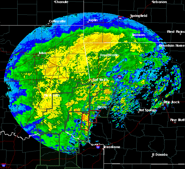 At 1132 am cst, a severe thunderstorm capable of producing a tornado was located near grannis, or 13 miles northwest of de queen, moving north at 40 mph (radar indicated rotation). Hazards include tornado. Flying debris will be dangerous to those caught without shelter. mobile homes will be damaged or destroyed. damage to roofs, windows, and vehicles will occur. tree damage is likely. Locations impacted include, wickes, grannis, hatfield, vandervoort, mena intermountain airport, mccauley, cossatot river state park, cove, nunley, hatton, camp pioneer, bogg springs and dallas. At 1132 am cst, a severe thunderstorm capable of producing a tornado was located near grannis, or 13 miles northwest of de queen, moving north at 40 mph (radar indicated rotation). Hazards include tornado. Flying debris will be dangerous to those caught without shelter. mobile homes will be damaged or destroyed. damage to roofs, windows, and vehicles will occur. tree damage is likely. Locations impacted include, wickes, grannis, hatfield, vandervoort, mena intermountain airport, mccauley, cossatot river state park, cove, nunley, hatton, camp pioneer, bogg springs and dallas.
|
| 12/27/2015 11:18 AM CST |
 The national weather service in little rock has issued a * tornado warning for. southwestern polk county in western arkansas. until noon cst * at 1118 am cst. a severe thunderstorm capable of producing a tornado was located 11 miles west of de queen. Moving north at 35. The national weather service in little rock has issued a * tornado warning for. southwestern polk county in western arkansas. until noon cst * at 1118 am cst. a severe thunderstorm capable of producing a tornado was located 11 miles west of de queen. Moving north at 35.
|
| 12/27/2015 4:38 AM CST |
 The tornado warning for southwestern scott and northern polk counties will expire at 445 am cst, the storm which prompted the warning has weakened below severe limits, and no longer appears capable of producing a tornado. therefore the warning will be allowed to expire. however heavy rain is still possible with this thunderstorm. The tornado warning for southwestern scott and northern polk counties will expire at 445 am cst, the storm which prompted the warning has weakened below severe limits, and no longer appears capable of producing a tornado. therefore the warning will be allowed to expire. however heavy rain is still possible with this thunderstorm.
|
| 12/27/2015 4:27 AM CST |
 At 427 am cst, a severe thunderstorm capable of producing a tornado was located near mena, moving northeast at 30 mph (radar indicated rotation). Hazards include tornado. Flying debris will be dangerous to those caught without shelter. mobile homes will be damaged or destroyed. damage to roofs, windows, and vehicles will occur. tree damage is likely. Locations impacted include, mena, waldron, hatfield, beauchamp, polk county fairgrounds, queen wilhelmina state park, mountain fork, acorn, rich mountain, camp pioneer, eagleton, y city, hon, winfield, rocky, potter, shady grove, boles, needmore and parks. At 427 am cst, a severe thunderstorm capable of producing a tornado was located near mena, moving northeast at 30 mph (radar indicated rotation). Hazards include tornado. Flying debris will be dangerous to those caught without shelter. mobile homes will be damaged or destroyed. damage to roofs, windows, and vehicles will occur. tree damage is likely. Locations impacted include, mena, waldron, hatfield, beauchamp, polk county fairgrounds, queen wilhelmina state park, mountain fork, acorn, rich mountain, camp pioneer, eagleton, y city, hon, winfield, rocky, potter, shady grove, boles, needmore and parks.
|
| 12/27/2015 4:13 AM CST |
 At 413 am cst, a severe thunderstorm capable of producing a tornado was located over polk county fairgrounds, or near mena, moving northeast at 40 mph (radar indicated rotation). Hazards include tornado and quarter size hail. Flying debris will be dangerous to those caught without shelter. mobile homes will be damaged or destroyed. damage to roofs, windows, and vehicles will occur. Tree damage is likely. At 413 am cst, a severe thunderstorm capable of producing a tornado was located over polk county fairgrounds, or near mena, moving northeast at 40 mph (radar indicated rotation). Hazards include tornado and quarter size hail. Flying debris will be dangerous to those caught without shelter. mobile homes will be damaged or destroyed. damage to roofs, windows, and vehicles will occur. Tree damage is likely.
|
| 12/27/2015 3:49 AM CST |
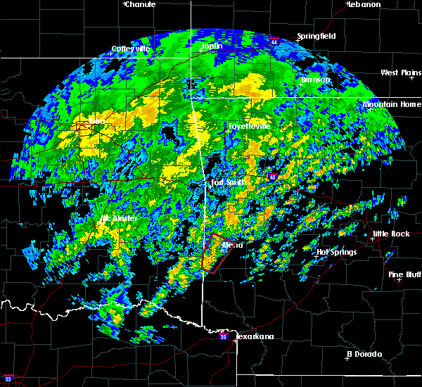 At 349 am cst, a severe thunderstorm capable of producing a tornado was located over vandervoort, or 15 miles southwest of mena, moving northeast at 40 mph (radar indicated rotation). Hazards include tornado and quarter size hail. Flying debris will be dangerous to those caught without shelter. mobile homes will be damaged or destroyed. damage to roofs, windows, and vehicles will occur. Tree damage is likely. At 349 am cst, a severe thunderstorm capable of producing a tornado was located over vandervoort, or 15 miles southwest of mena, moving northeast at 40 mph (radar indicated rotation). Hazards include tornado and quarter size hail. Flying debris will be dangerous to those caught without shelter. mobile homes will be damaged or destroyed. damage to roofs, windows, and vehicles will occur. Tree damage is likely.
|
| 12/23/2015 6:23 AM CST |
 At 622 am cst, a severe thunderstorm was located over mccauley, or 12 miles south of mena, moving northeast at 65 mph (radar indicated). Hazards include 60 mph wind gusts and quarter size hail. Hail damage to vehicles is expected. Expect wind damage to roofs, siding, and trees. At 622 am cst, a severe thunderstorm was located over mccauley, or 12 miles south of mena, moving northeast at 65 mph (radar indicated). Hazards include 60 mph wind gusts and quarter size hail. Hail damage to vehicles is expected. Expect wind damage to roofs, siding, and trees.
|
| 5/25/2015 5:54 PM CDT | At 553 pm cdt, a severe thunderstorm capable of producing a tornado was located 7 miles west of wickes, and moving northeast at 40 mph (radar indicated rotation). Hazards include tornado. Flying debris will be dangerous to those caught without shelter. mobile homes will be damaged or destroyed. damage to roofs, windows and vehicles will occur. tree damage is likely. Locations in the path of this dangerous storm include, mena, wickes, vandervoort, polk county fairgnds, mena intermountain airport, mccauley, lake mena, hatfield, cossatot river state park, shady grove, potter, nunley, hatton, dallas, cove, bogg springs, board camp,. |
| 5/25/2015 5:48 PM CDT | At 545 pm cdt, severe thunderstorms were located along a line extending from 10 miles west of black fork to 7 miles west of hatfield to 5 miles northwest of horatio, and moving east at 50 mph (radar indicated). Hazards include 60 mph wind gusts and quarter size hail. Hail damage to vehicles is possible. Expect wind damage to roofs, siding and trees. |
| 5/25/2015 5:31 PM CDT | At 526 pm cdt, severe thunderstorms were located along a line extending from 20 miles west of black fork to 15 miles west of hatfield to 15 miles west of wickes, and moving east at 45 mph (radar indicated). Hazards include 60 mph wind gusts and quarter size hail. Hail damage to vehicles is possible. Expect wind damage to roofs, siding and trees. |
| 5/24/2015 2:35 PM CDT | Large trees down with multiple shops destroye in polk county AR, 0.1 miles SSW of Hatfield, AR |
| 4/1/2015 4:59 PM CDT | The national weather service in little rock has issued a * severe thunderstorm warning for. southwestern montgomery county in western arkansas. polk county in western arkansas. until 545 pm cdt * at 457 pm cdt. A severe thunderstorm was located 6 miles southwest. |
| 3/26/2015 1:36 AM CDT | A severe thunderstorm warning remains in effect for scott and northern polk counties until 215 am cdt. at 134 am cdt. national weather service doppler radar continued to indicate a line of severe thunderstorms capable of producing damaging winds in excess of 60 mph. These storms were located along a line extending from black fork to queen wilhelmina state park to 2 miles. |
| 3/26/2015 1:11 AM CDT | The national weather service in little rock has issued a * severe thunderstorm warning for. northern polk county in western arkansas. scott county in western arkansas. until 215 am cdt * at 107 am cdt. National weather service doppler radar indicated a. |
| 10/13/2014 5:12 AM CDT | Trees were blown dow in polk county AR, 0.1 miles SSW of Hatfield, AR |
| 10/2/2014 5:50 PM CDT | Numerous trees down in hatfiel in polk county AR, 0.1 miles SSW of Hatfield, AR |
| 10/2/2014 5:45 PM CDT | Trees down on highway 71 south of potte in polk county AR, 4.9 miles SSW of Hatfield, AR |
| 7/23/2014 4:05 PM CDT | Roof damage to houses in hatfiel in polk county AR, 0.1 miles SSW of Hatfield, AR |
| 6/16/2013 5:54 PM CDT | Large limbs were blown dow in polk county AR, 0.1 miles SSW of Hatfield, AR |
| 5/30/2013 2:03 PM CDT | Numerous trees and power lines were reported down. county road 127 reported to be blocked by tree in polk county AR, 9.4 miles SSE of Hatfield, AR |
| 1/1/0001 12:00 AM | Cr 93 and 164 blocked by down trees and wires. trees down on a house and a tree down on vehicle. no injuries reporte in polk county AR, 6.3 miles S of Hatfield, AR |
| 1/1/0001 12:00 AM | Several buildings sustained roof damag in polk county AR, 6.4 miles S of Hatfield, AR |
| 1/1/0001 12:00 AM | Trees down on polk county roads 47 and 12 in polk county AR, 6.4 miles S of Hatfield, AR |
| 1/1/0001 12:00 AM | Golf Ball sized hail reported 2.3 miles W of Hatfield, AR |
| 1/1/0001 12:00 AM | Golf Ball sized hail reported 0.1 miles SSW of Hatfield, AR |
| 1/1/0001 12:00 AM | Quarter sized hail reported 0.1 miles SSW of Hatfield, AR |
Hail Maps for Hatfield, AR
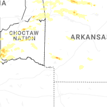


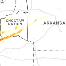


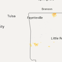


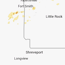


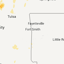


Connect with Interactive Hail Maps