

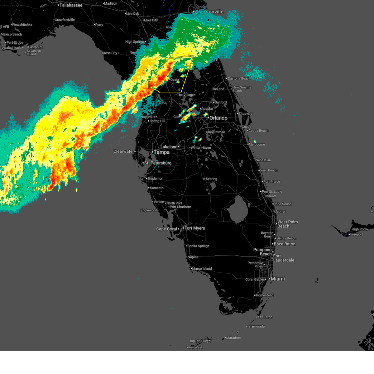
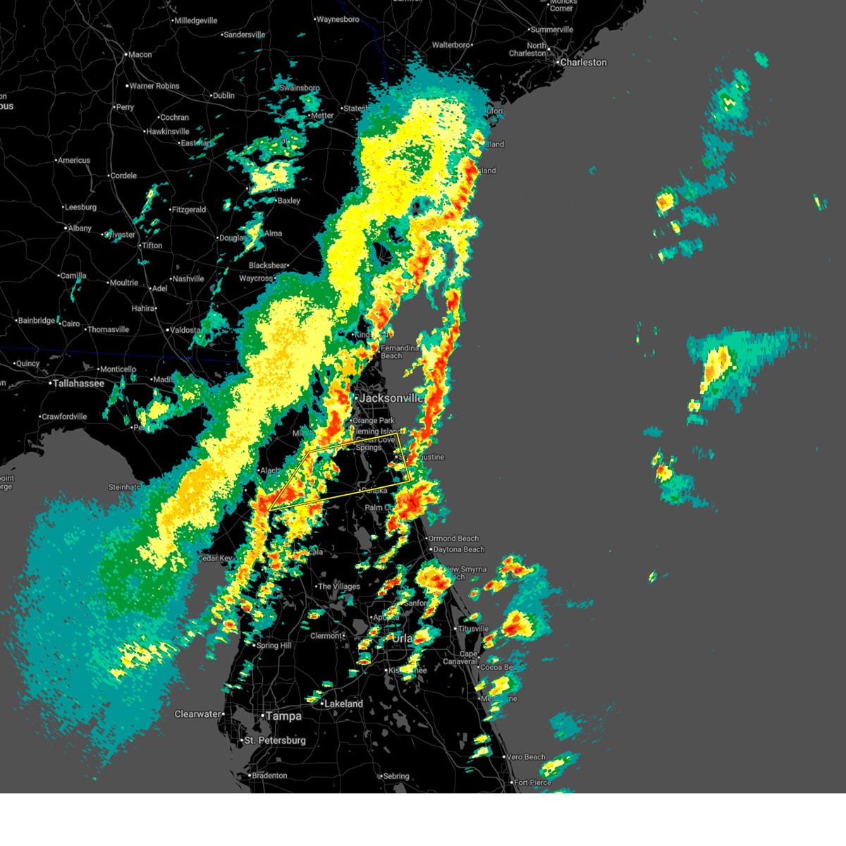
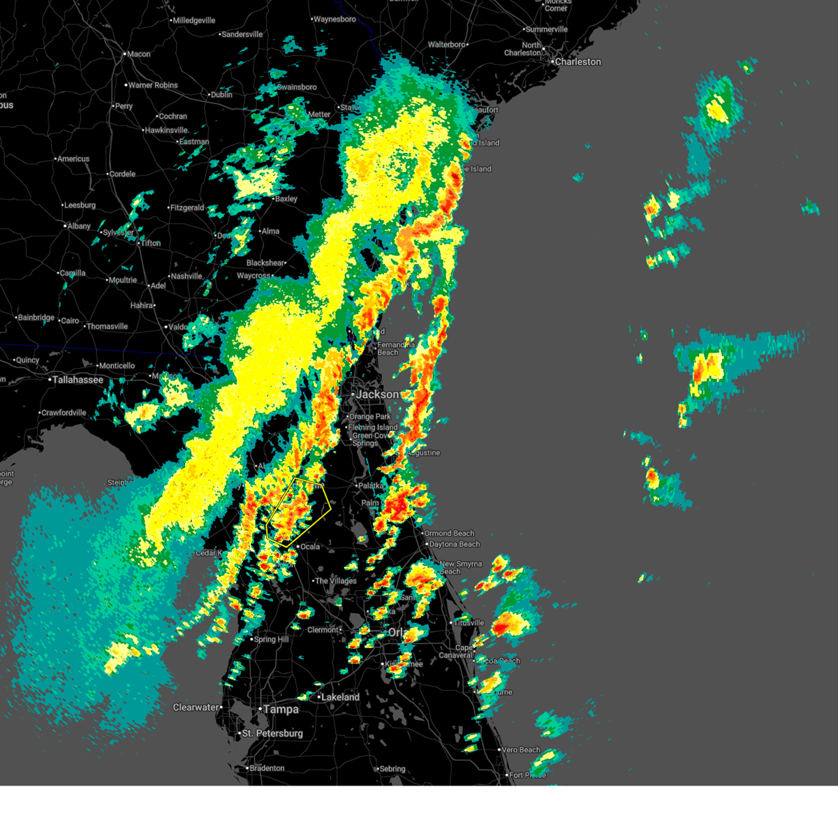
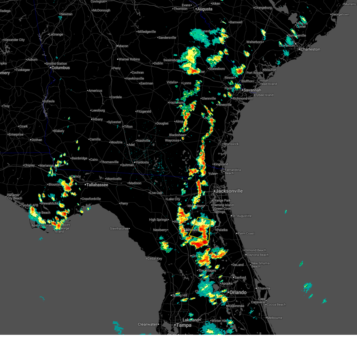
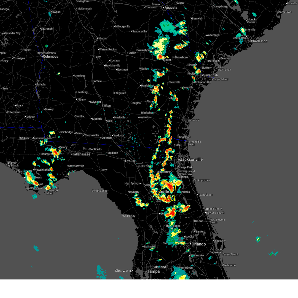
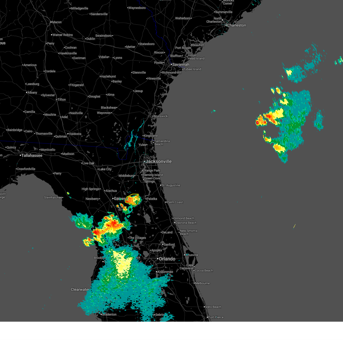
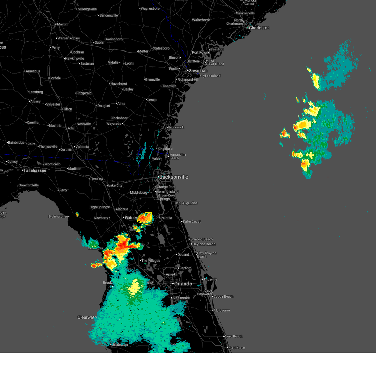
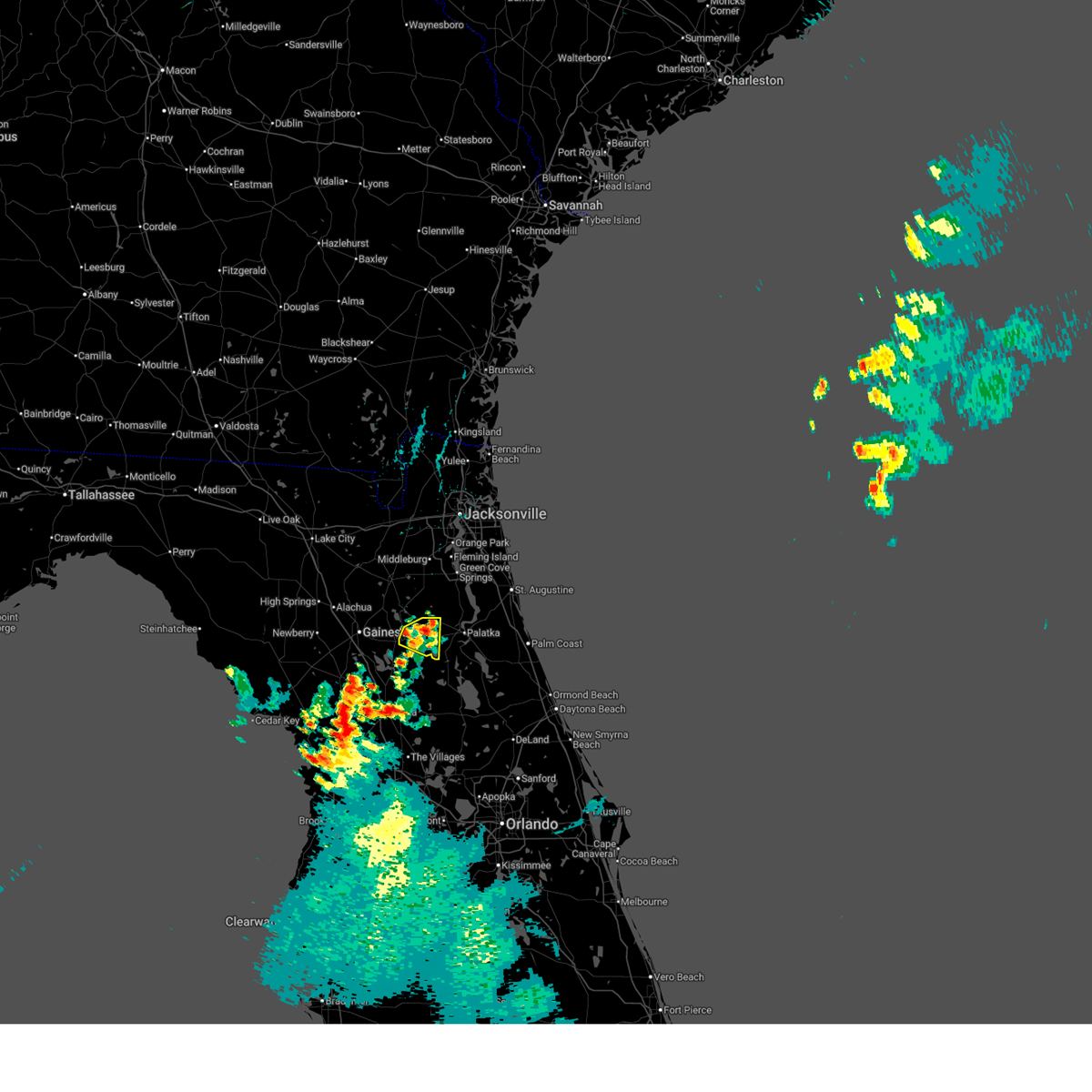
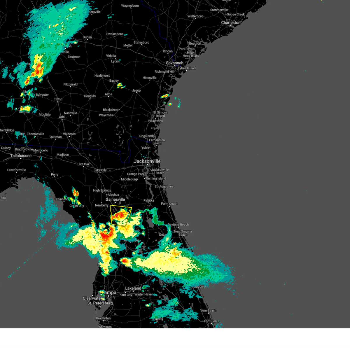
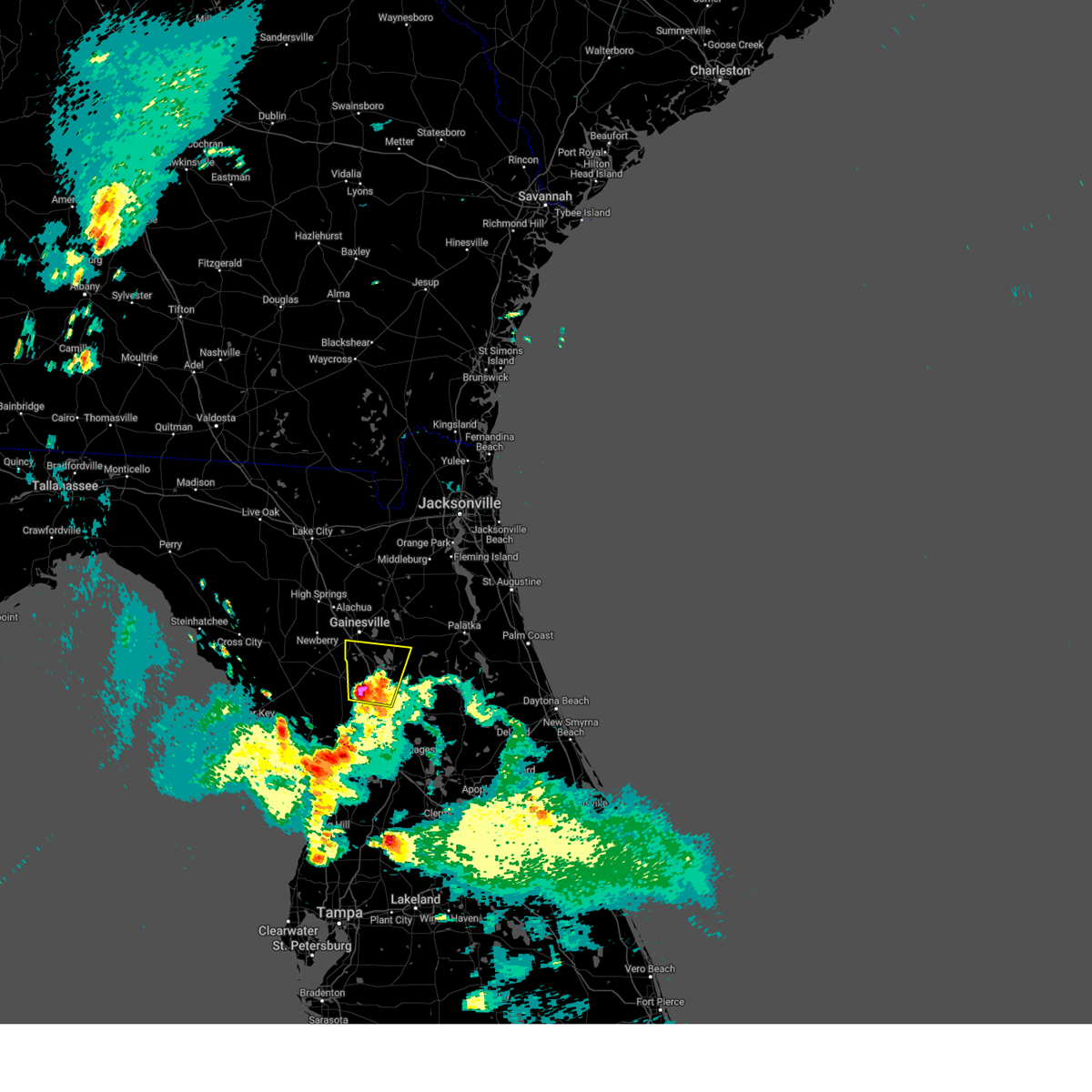
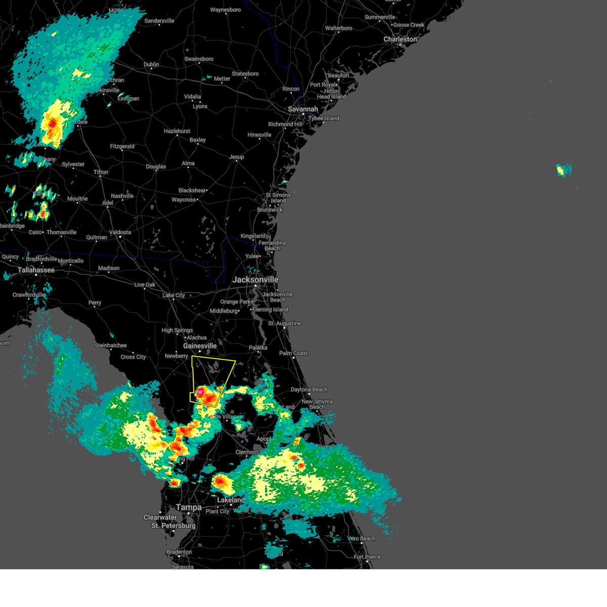
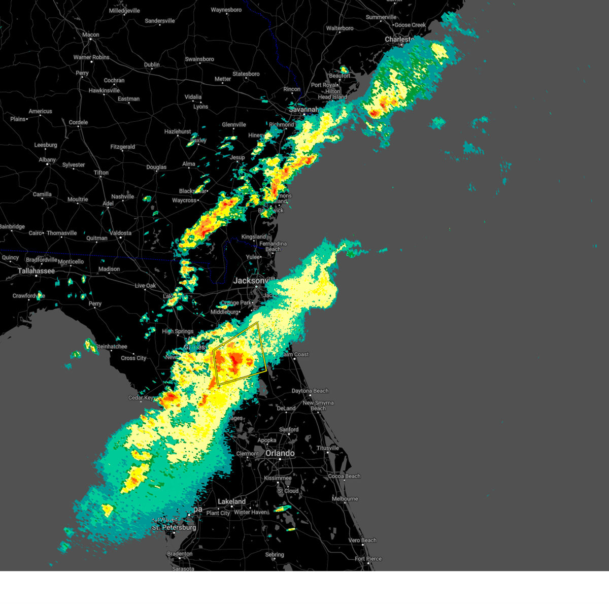
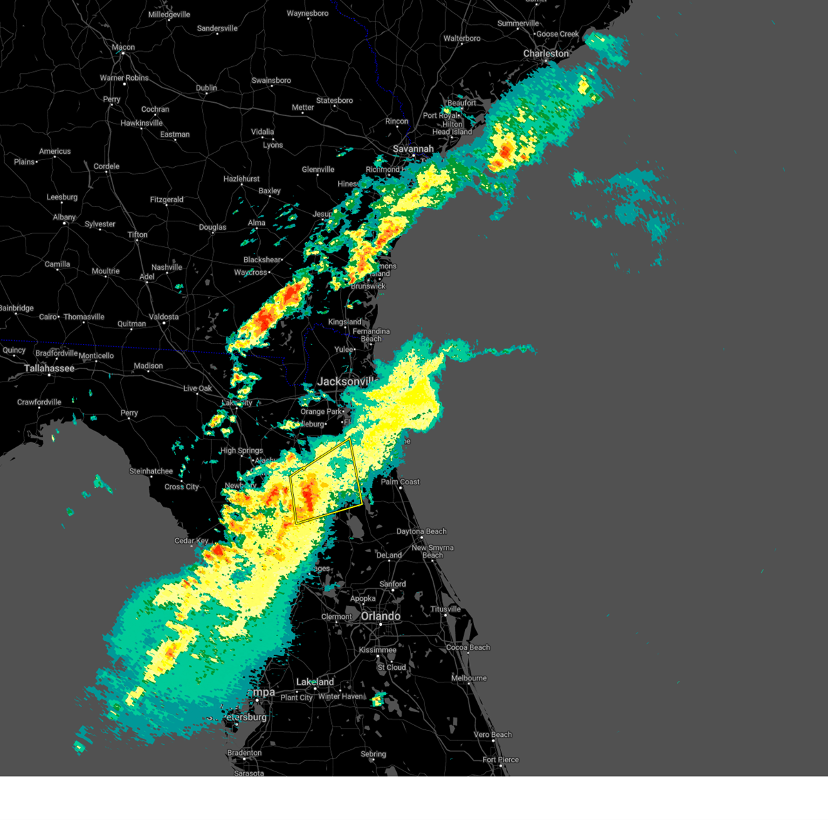
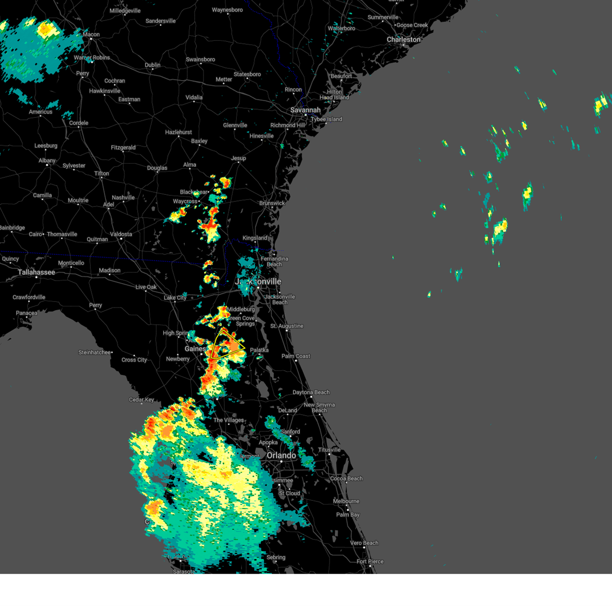
Hail Map for Hawthorne, FL
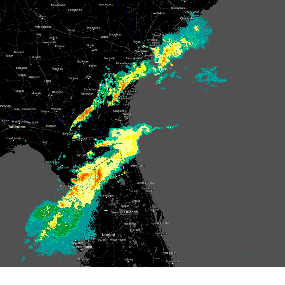
The Hawthorne, FL area has had 0 reports of on-the-ground hail by trained spotters, and has been under severe weather warnings 9 times during the past 12 months. Doppler radar has detected hail at or near Hawthorne, FL on 54 occasions.
| Name: | Hawthorne, FL |
| Where Located: | 57.1 miles SSW of Jacksonville, FL |
| Map: | Google Map for Hawthorne, FL |
| Population: | 1417 |
| Housing Units: | 681 |
| More Info: | Search Google for Hawthorne, FL |
0
The Top Recent Hail Date for Hawthorne, FL is Friday, June 20, 2025 (26th out of 54)

Hail and Wind Damage Spotted near Hawthorne, FL
| Date / Time | Report Details |
|---|---|
| 5/2/2026 1:05 PM EDT |
 Svrjax the national weather service in jacksonville has issued a * severe thunderstorm warning for, southeastern alachua county in northern florida, marion county in northern florida, southwestern putnam county in northeastern florida, * until 130 pm edt. * at 105 pm edt, a severe thunderstorm was located over anthony, or near ocala, moving east at 50 mph (radar indicated). Hazards include 60 mph wind gusts and penny size hail. expect damage to roofs, siding, and trees Svrjax the national weather service in jacksonville has issued a * severe thunderstorm warning for, southeastern alachua county in northern florida, marion county in northern florida, southwestern putnam county in northeastern florida, * until 130 pm edt. * at 105 pm edt, a severe thunderstorm was located over anthony, or near ocala, moving east at 50 mph (radar indicated). Hazards include 60 mph wind gusts and penny size hail. expect damage to roofs, siding, and trees
|
| 3/16/2026 3:24 PM EDT |
 The storm which prompted the warning has moved out of the area. therefore, the warning will be allowed to expire. a tornado watch remains in effect until 800 pm edt for northern and northeastern florida. to report severe weather, contact your nearest law enforcement agency. they will relay your report to the national weather service jacksonville. The storm which prompted the warning has moved out of the area. therefore, the warning will be allowed to expire. a tornado watch remains in effect until 800 pm edt for northern and northeastern florida. to report severe weather, contact your nearest law enforcement agency. they will relay your report to the national weather service jacksonville.
|
| 3/16/2026 3:14 PM EDT |
 At 314 pm edt, a severe thunderstorm was located near hawthorne, or 8 miles southwest of interlachen, moving northeast at 40 mph (radar indicated). Hazards include 60 mph wind gusts and penny size hail. Expect damage to roofs, siding, and trees. Locations impacted include, citra, hawthorne, orange springs, lochloosa, hog valley, and johnson. At 314 pm edt, a severe thunderstorm was located near hawthorne, or 8 miles southwest of interlachen, moving northeast at 40 mph (radar indicated). Hazards include 60 mph wind gusts and penny size hail. Expect damage to roofs, siding, and trees. Locations impacted include, citra, hawthorne, orange springs, lochloosa, hog valley, and johnson.
|
| 3/16/2026 3:12 PM EDT |
 the severe thunderstorm warning has been cancelled and is no longer in effect the severe thunderstorm warning has been cancelled and is no longer in effect
|
| 3/16/2026 3:12 PM EDT |
 At 312 pm edt, severe thunderstorms were located along a line extending from near green cove springs to near florahome, moving east at 55 mph (radar indicated). Hazards include 60 mph wind gusts and penny size hail. Expect damage to roofs, siding, and trees. Locations impacted include, saint augustine, palatka, green cove springs, interlachen, keystone heights, hastings, melrose, east palatka, world golf village, and saint augustine beach. At 312 pm edt, severe thunderstorms were located along a line extending from near green cove springs to near florahome, moving east at 55 mph (radar indicated). Hazards include 60 mph wind gusts and penny size hail. Expect damage to roofs, siding, and trees. Locations impacted include, saint augustine, palatka, green cove springs, interlachen, keystone heights, hastings, melrose, east palatka, world golf village, and saint augustine beach.
|
| 3/16/2026 2:47 PM EDT |
 Svrjax the national weather service in jacksonville has issued a * severe thunderstorm warning for, southeastern bradford county in northern florida, southeastern alachua county in northern florida, st. johns county in northeastern florida, northern putnam county in northeastern florida, southern clay county in northeastern florida, * until 345 pm edt. * at 247 pm edt, severe thunderstorms were located along a line extending from near kingsley to rochelle, moving east at 55 mph (radar indicated). Hazards include 60 mph wind gusts and penny size hail. expect damage to roofs, siding, and trees Svrjax the national weather service in jacksonville has issued a * severe thunderstorm warning for, southeastern bradford county in northern florida, southeastern alachua county in northern florida, st. johns county in northeastern florida, northern putnam county in northeastern florida, southern clay county in northeastern florida, * until 345 pm edt. * at 247 pm edt, severe thunderstorms were located along a line extending from near kingsley to rochelle, moving east at 55 mph (radar indicated). Hazards include 60 mph wind gusts and penny size hail. expect damage to roofs, siding, and trees
|
| 3/16/2026 2:41 PM EDT |
 Svrjax the national weather service in jacksonville has issued a * severe thunderstorm warning for, southeastern alachua county in northern florida, northwestern marion county in northern florida, west central putnam county in northeastern florida, * until 330 pm edt. * at 241 pm edt, a severe thunderstorm was located 10 miles east of williston, moving northeast at 40 mph (radar indicated). Hazards include 60 mph wind gusts and penny size hail. expect damage to roofs, siding, and trees Svrjax the national weather service in jacksonville has issued a * severe thunderstorm warning for, southeastern alachua county in northern florida, northwestern marion county in northern florida, west central putnam county in northeastern florida, * until 330 pm edt. * at 241 pm edt, a severe thunderstorm was located 10 miles east of williston, moving northeast at 40 mph (radar indicated). Hazards include 60 mph wind gusts and penny size hail. expect damage to roofs, siding, and trees
|
| 7/14/2025 3:35 PM EDT |
 The storm which prompted the warning has weakened below severe limits, and no longer poses an immediate threat to life or property. therefore, the warning will be allowed to expire. however, gusty winds and heavy rain are still possible with this thunderstorm. The storm which prompted the warning has weakened below severe limits, and no longer poses an immediate threat to life or property. therefore, the warning will be allowed to expire. however, gusty winds and heavy rain are still possible with this thunderstorm.
|
| 7/14/2025 3:21 PM EDT |
 Svrjax the national weather service in jacksonville has issued a * severe thunderstorm warning for, southeastern bradford county in northern florida, east central alachua county in northern florida, north central marion county in northern florida, northwestern putnam county in northeastern florida, southwestern clay county in northeastern florida, * until 345 pm edt. * at 320 pm edt, a severe thunderstorm was located over florahome, or near interlachen, moving south at 15 mph (radar indicated). Hazards include 60 mph wind gusts and quarter size hail. Hail damage to vehicles is expected. Expect wind damage to roofs, siding, and trees. Svrjax the national weather service in jacksonville has issued a * severe thunderstorm warning for, southeastern bradford county in northern florida, east central alachua county in northern florida, north central marion county in northern florida, northwestern putnam county in northeastern florida, southwestern clay county in northeastern florida, * until 345 pm edt. * at 320 pm edt, a severe thunderstorm was located over florahome, or near interlachen, moving south at 15 mph (radar indicated). Hazards include 60 mph wind gusts and quarter size hail. Hail damage to vehicles is expected. Expect wind damage to roofs, siding, and trees.
|
| 6/20/2025 6:56 PM EDT |
 The storm which prompted the warning has weakened below severe limits, and no longer poses an immediate threat to life or property. therefore, the warning will be allowed to expire. however, gusty winds and heavy rain are still possible with this thunderstorm. The storm which prompted the warning has weakened below severe limits, and no longer poses an immediate threat to life or property. therefore, the warning will be allowed to expire. however, gusty winds and heavy rain are still possible with this thunderstorm.
|
| 6/20/2025 6:43 PM EDT |
 At 642 pm edt, a severe thunderstorm was located over melrose landing, or near interlachen, moving southwest at 10 mph (radar indicated). Hazards include 60 mph wind gusts and penny size hail. Expect damage to roofs, siding, and trees. Locations impacted include, interlachen, melrose landing, hollister, johnson, and mannville. At 642 pm edt, a severe thunderstorm was located over melrose landing, or near interlachen, moving southwest at 10 mph (radar indicated). Hazards include 60 mph wind gusts and penny size hail. Expect damage to roofs, siding, and trees. Locations impacted include, interlachen, melrose landing, hollister, johnson, and mannville.
|
| 6/20/2025 6:23 PM EDT |
 Svrjax the national weather service in jacksonville has issued a * severe thunderstorm warning for, northwestern putnam county in northeastern florida, * until 700 pm edt. * at 623 pm edt, a severe thunderstorm was located over interlachen, and is nearly stationary (radar indicated). Hazards include 60 mph wind gusts and penny size hail. expect damage to roofs, siding, and trees Svrjax the national weather service in jacksonville has issued a * severe thunderstorm warning for, northwestern putnam county in northeastern florida, * until 700 pm edt. * at 623 pm edt, a severe thunderstorm was located over interlachen, and is nearly stationary (radar indicated). Hazards include 60 mph wind gusts and penny size hail. expect damage to roofs, siding, and trees
|
| 5/10/2025 5:27 PM EDT |
 The storm which prompted the warning has weakened below severe limits, and no longer poses an immediate threat to life or property. therefore, the warning will be allowed to expire. however, gusty winds are still possible with this thunderstorm. The storm which prompted the warning has weakened below severe limits, and no longer poses an immediate threat to life or property. therefore, the warning will be allowed to expire. however, gusty winds are still possible with this thunderstorm.
|
| 5/10/2025 5:10 PM EDT |
 At 509 pm edt, a severe thunderstorm was located 9 miles west of sparr, or 11 miles east of williston, moving north at 25 mph (radar indicated). Hazards include 60 mph wind gusts and quarter size hail. Hail damage to vehicles is expected. expect wind damage to roofs, siding, and trees. Locations impacted include, citra, sparr, cross creek, anthony, micanopy, reddick, mcintosh, flemington, lowell, and lochloosa. At 509 pm edt, a severe thunderstorm was located 9 miles west of sparr, or 11 miles east of williston, moving north at 25 mph (radar indicated). Hazards include 60 mph wind gusts and quarter size hail. Hail damage to vehicles is expected. expect wind damage to roofs, siding, and trees. Locations impacted include, citra, sparr, cross creek, anthony, micanopy, reddick, mcintosh, flemington, lowell, and lochloosa.
|
| 5/10/2025 4:53 PM EDT |
 Svrjax the national weather service in jacksonville has issued a * severe thunderstorm warning for, southeastern alachua county in northern florida, western marion county in northern florida, west central putnam county in northeastern florida, * until 530 pm edt. * at 453 pm edt, a severe thunderstorm was located near ocala airport, or 10 miles northeast of rainbow lakes estates, moving north at 25 mph (radar indicated). Hazards include 60 mph wind gusts and quarter size hail. Hail damage to vehicles is expected. Expect wind damage to roofs, siding, and trees. Svrjax the national weather service in jacksonville has issued a * severe thunderstorm warning for, southeastern alachua county in northern florida, western marion county in northern florida, west central putnam county in northeastern florida, * until 530 pm edt. * at 453 pm edt, a severe thunderstorm was located near ocala airport, or 10 miles northeast of rainbow lakes estates, moving north at 25 mph (radar indicated). Hazards include 60 mph wind gusts and quarter size hail. Hail damage to vehicles is expected. Expect wind damage to roofs, siding, and trees.
|
| 3/16/2025 2:55 PM EDT |
 The storm which prompted the warning has weakened below severe limits, and no longer poses an immediate threat to life or property. therefore, the warning will be allowed to expire. however, gusty winds are still possible with this thunderstorm. a tornado watch remains in effect until 500 pm edt for northern and northeastern florida. The storm which prompted the warning has weakened below severe limits, and no longer poses an immediate threat to life or property. therefore, the warning will be allowed to expire. however, gusty winds are still possible with this thunderstorm. a tornado watch remains in effect until 500 pm edt for northern and northeastern florida.
|
| 3/16/2025 2:44 PM EDT |
 At 243 pm edt, a severe thunderstorm was located over interlachen, moving northeast at 45 mph (radar indicated). Hazards include 60 mph wind gusts and nickel size hail. Expect damage to roofs, siding, and trees. Locations impacted include, lake delancy, hog valley, sparr, melrose, carraway, east palatka, pomona park, lochloosa, interlachen, and grove park. At 243 pm edt, a severe thunderstorm was located over interlachen, moving northeast at 45 mph (radar indicated). Hazards include 60 mph wind gusts and nickel size hail. Expect damage to roofs, siding, and trees. Locations impacted include, lake delancy, hog valley, sparr, melrose, carraway, east palatka, pomona park, lochloosa, interlachen, and grove park.
|
| 3/16/2025 2:21 PM EDT |
 Svrjax the national weather service in jacksonville has issued a * severe thunderstorm warning for, southeastern alachua county in northern florida, northeastern marion county in northern florida, putnam county in northeastern florida, southern clay county in northeastern florida, * until 300 pm edt. * at 221 pm edt, a severe thunderstorm was located over citra, moving northeast at 45 mph (radar indicated). Hazards include 60 mph wind gusts and nickel size hail. expect damage to roofs, siding, and trees Svrjax the national weather service in jacksonville has issued a * severe thunderstorm warning for, southeastern alachua county in northern florida, northeastern marion county in northern florida, putnam county in northeastern florida, southern clay county in northeastern florida, * until 300 pm edt. * at 221 pm edt, a severe thunderstorm was located over citra, moving northeast at 45 mph (radar indicated). Hazards include 60 mph wind gusts and nickel size hail. expect damage to roofs, siding, and trees
|
| 1/19/2025 7:26 AM EST |
 At 726 am est, severe thunderstorms were located along a line extending from near hawthorne to near fort mccoy to near ocala to near rainbow lakes estates, moving east at 65 mph (radar indicated). Hazards include 70 mph wind gusts and quarter size hail. Hail damage to vehicles is expected. expect considerable tree damage. wind damage is also likely to mobile homes, roofs, and outbuildings. Locations impacted include, ocala, rainbow lakes estates, interlachen, fort mccoy, citra, lynne, lake delancy, sparr, anthony, and silver springs shores. At 726 am est, severe thunderstorms were located along a line extending from near hawthorne to near fort mccoy to near ocala to near rainbow lakes estates, moving east at 65 mph (radar indicated). Hazards include 70 mph wind gusts and quarter size hail. Hail damage to vehicles is expected. expect considerable tree damage. wind damage is also likely to mobile homes, roofs, and outbuildings. Locations impacted include, ocala, rainbow lakes estates, interlachen, fort mccoy, citra, lynne, lake delancy, sparr, anthony, and silver springs shores.
|
| 1/19/2025 7:15 AM EST |
 Svrjax the national weather service in jacksonville has issued a * severe thunderstorm warning for, southeastern alachua county in northern florida, marion county in northern florida, southwestern putnam county in northeastern florida, * until 745 am est. * at 715 am est, severe thunderstorms were located along a line extending from near rochelle to near citra to near rainbow lakes estates, moving east at 65 mph (radar indicated). Hazards include 70 mph wind gusts and quarter size hail. Hail damage to vehicles is expected. expect considerable tree damage. Wind damage is also likely to mobile homes, roofs, and outbuildings. Svrjax the national weather service in jacksonville has issued a * severe thunderstorm warning for, southeastern alachua county in northern florida, marion county in northern florida, southwestern putnam county in northeastern florida, * until 745 am est. * at 715 am est, severe thunderstorms were located along a line extending from near rochelle to near citra to near rainbow lakes estates, moving east at 65 mph (radar indicated). Hazards include 70 mph wind gusts and quarter size hail. Hail damage to vehicles is expected. expect considerable tree damage. Wind damage is also likely to mobile homes, roofs, and outbuildings.
|
| 1/19/2025 6:55 AM EST |
 Svrjax the national weather service in jacksonville has issued a * severe thunderstorm warning for, southern alachua county in northern florida, western marion county in northern florida, * until 730 am est. * at 655 am est, severe thunderstorms were located along a line extending from near bronson to near williston highlands to 18 miles northwest of crystal river airport, moving east at 65 mph (radar indicated). Hazards include 60 mph wind gusts. expect damage to roofs, siding, and trees Svrjax the national weather service in jacksonville has issued a * severe thunderstorm warning for, southern alachua county in northern florida, western marion county in northern florida, * until 730 am est. * at 655 am est, severe thunderstorms were located along a line extending from near bronson to near williston highlands to 18 miles northwest of crystal river airport, moving east at 65 mph (radar indicated). Hazards include 60 mph wind gusts. expect damage to roofs, siding, and trees
|
| 7/23/2024 8:40 PM EDT |
 The storm which prompted the warning has weakened below severe limits, and no longer poses an immediate threat to life or property. therefore, the warning will be allowed to expire. however, gusty winds are still possible with this thunderstorm. to report severe weather, contact your nearest law enforcement agency. they will relay your report to the national weather service jacksonville. The storm which prompted the warning has weakened below severe limits, and no longer poses an immediate threat to life or property. therefore, the warning will be allowed to expire. however, gusty winds are still possible with this thunderstorm. to report severe weather, contact your nearest law enforcement agency. they will relay your report to the national weather service jacksonville.
|
| 7/23/2024 8:32 PM EDT |
 At 832 pm edt, a severe thunderstorm was located over lake geneva, or near melrose, moving northwest at 20 mph. other storms were located near orange heights moving northwest at 15 mph (radar indicated). Hazards include 60 mph wind gusts. Expect damage to roofs, siding, and trees. Locations impacted include, keystone heights, melrose, melrose landing, orange heights, lake geneva, florahome, putnam hall, and grove park. At 832 pm edt, a severe thunderstorm was located over lake geneva, or near melrose, moving northwest at 20 mph. other storms were located near orange heights moving northwest at 15 mph (radar indicated). Hazards include 60 mph wind gusts. Expect damage to roofs, siding, and trees. Locations impacted include, keystone heights, melrose, melrose landing, orange heights, lake geneva, florahome, putnam hall, and grove park.
|
| 7/23/2024 8:20 PM EDT |
 At 820 pm edt, a severe thunderstorm was located just east of melrose, or near putnam hall, moving northwest at 20 mph (radar indicated). Hazards include 60 mph wind gusts. Expect damage to roofs, siding, and trees. Locations impacted include, keystone heights, melrose, hawthorne, melrose landing, orange heights, lake geneva, florahome, johnson, putnam hall, and lochloosa. At 820 pm edt, a severe thunderstorm was located just east of melrose, or near putnam hall, moving northwest at 20 mph (radar indicated). Hazards include 60 mph wind gusts. Expect damage to roofs, siding, and trees. Locations impacted include, keystone heights, melrose, hawthorne, melrose landing, orange heights, lake geneva, florahome, johnson, putnam hall, and lochloosa.
|
| 7/23/2024 8:06 PM EDT |
 Svrjax the national weather service in jacksonville has issued a * severe thunderstorm warning for, southeastern bradford county in northern florida, southeastern alachua county in northern florida, northwestern putnam county in northeastern florida, southwestern clay county in northeastern florida, * until 845 pm edt. * at 806 pm edt, a severe thunderstorm was located over melrose landing, or near interlachen, moving northwest at 20 mph. another storm was over southwest putnam county moving west at 20 mph (radar indicated). Hazards include 60 mph wind gusts and penny size hail. expect damage to roofs, siding, and trees Svrjax the national weather service in jacksonville has issued a * severe thunderstorm warning for, southeastern bradford county in northern florida, southeastern alachua county in northern florida, northwestern putnam county in northeastern florida, southwestern clay county in northeastern florida, * until 845 pm edt. * at 806 pm edt, a severe thunderstorm was located over melrose landing, or near interlachen, moving northwest at 20 mph. another storm was over southwest putnam county moving west at 20 mph (radar indicated). Hazards include 60 mph wind gusts and penny size hail. expect damage to roofs, siding, and trees
|
| 5/10/2024 9:59 AM EDT |
 The storms which prompted the warning have moved out of the area. therefore, the warning will be allowed to expire. however, heavy rain is still possible with these thunderstorms. a severe thunderstorm watch remains in effect until noon edt for northern and northeastern florida, and southeastern georgia. The storms which prompted the warning have moved out of the area. therefore, the warning will be allowed to expire. however, heavy rain is still possible with these thunderstorms. a severe thunderstorm watch remains in effect until noon edt for northern and northeastern florida, and southeastern georgia.
|
| 5/10/2024 9:25 AM EDT |
 Svrjax the national weather service in jacksonville has issued a * severe thunderstorm warning for, nassau county in northeastern florida, southeastern alachua county in northern florida, st. johns county in northeastern florida, central marion county in northern florida, putnam county in northeastern florida, clay county in northeastern florida, duval county in northeastern florida, camden county in southeastern georgia, northeastern charlton county in southeastern georgia, * until 1000 am edt. * at 925 am edt, severe thunderstorms were located along a line extending from near kings ferry to near florahome to near williston municipal airport, moving east at 60 mph (radar indicated). Hazards include 60 mph wind gusts and penny size hail. expect damage to roofs, siding, and trees Svrjax the national weather service in jacksonville has issued a * severe thunderstorm warning for, nassau county in northeastern florida, southeastern alachua county in northern florida, st. johns county in northeastern florida, central marion county in northern florida, putnam county in northeastern florida, clay county in northeastern florida, duval county in northeastern florida, camden county in southeastern georgia, northeastern charlton county in southeastern georgia, * until 1000 am edt. * at 925 am edt, severe thunderstorms were located along a line extending from near kings ferry to near florahome to near williston municipal airport, moving east at 60 mph (radar indicated). Hazards include 60 mph wind gusts and penny size hail. expect damage to roofs, siding, and trees
|
| 5/10/2024 9:20 AM EDT |
 At 920 am edt, severe thunderstorms were located along a line extending from 10 miles east of woodbine to baymeadows to near bardin to 8 miles southwest of cross creek, moving east at 90 mph (radar indicated). Hazards include 60 mph wind gusts and penny size hail. Expect damage to roofs, siding, and trees. locations impacted include, jacksonville, st. Marys, kingsland, fernandina beach, palatka, orange park, green cove springs, rainbow lakes estates, woodbine, and interlachen. At 920 am edt, severe thunderstorms were located along a line extending from 10 miles east of woodbine to baymeadows to near bardin to 8 miles southwest of cross creek, moving east at 90 mph (radar indicated). Hazards include 60 mph wind gusts and penny size hail. Expect damage to roofs, siding, and trees. locations impacted include, jacksonville, st. Marys, kingsland, fernandina beach, palatka, orange park, green cove springs, rainbow lakes estates, woodbine, and interlachen.
|
| 5/10/2024 9:00 AM EDT |
 Svrjax the national weather service in jacksonville has issued a * severe thunderstorm warning for, nassau county in northeastern florida, southeastern bradford county in northern florida, southeastern alachua county in northern florida, northwestern st. johns county in northeastern florida, northwestern marion county in northern florida, northwestern putnam county in northeastern florida, clay county in northeastern florida, duval county in northeastern florida, camden county in southeastern georgia, * until 930 am edt. * at 900 am edt, severe thunderstorms were located along a line extending from near hickox to near bryceville to near keystone heights to near archer, moving east at 70 mph (radar indicated). Hazards include 70 mph wind gusts and quarter size hail. Hail damage to vehicles is expected. expect considerable tree damage. Wind damage is also likely to mobile homes, roofs, and outbuildings. Svrjax the national weather service in jacksonville has issued a * severe thunderstorm warning for, nassau county in northeastern florida, southeastern bradford county in northern florida, southeastern alachua county in northern florida, northwestern st. johns county in northeastern florida, northwestern marion county in northern florida, northwestern putnam county in northeastern florida, clay county in northeastern florida, duval county in northeastern florida, camden county in southeastern georgia, * until 930 am edt. * at 900 am edt, severe thunderstorms were located along a line extending from near hickox to near bryceville to near keystone heights to near archer, moving east at 70 mph (radar indicated). Hazards include 70 mph wind gusts and quarter size hail. Hail damage to vehicles is expected. expect considerable tree damage. Wind damage is also likely to mobile homes, roofs, and outbuildings.
|
| 5/10/2024 8:44 AM EDT |
 Svrjax the national weather service in jacksonville has issued a * severe thunderstorm warning for, nassau county in northeastern florida, bradford county in northern florida, alachua county in northern florida, north central marion county in northern florida, baker county in northeastern florida, northwestern putnam county in northeastern florida, union county in northern florida, western clay county in northeastern florida, western duval county in northeastern florida, southwestern camden county in southeastern georgia, southeastern ware county in southeastern georgia, charlton county in southeastern georgia, * until 915 am edt. * at 843 am edt, severe thunderstorms were located along a line extending from 9 miles south of argyle to near lulu to 7 miles southeast of cross city, moving east at 70 mph. these are destructive storms for lake butler, starke, gainesville, macclenny, baldwin, and hilliard. (radar indicated). Hazards include 80 mph wind gusts and quarter size hail. Flying debris will be dangerous to those caught without shelter. mobile homes will be heavily damaged. expect considerable damage to roofs, windows, and vehicles. Extensive tree damage and power outages are likely. Svrjax the national weather service in jacksonville has issued a * severe thunderstorm warning for, nassau county in northeastern florida, bradford county in northern florida, alachua county in northern florida, north central marion county in northern florida, baker county in northeastern florida, northwestern putnam county in northeastern florida, union county in northern florida, western clay county in northeastern florida, western duval county in northeastern florida, southwestern camden county in southeastern georgia, southeastern ware county in southeastern georgia, charlton county in southeastern georgia, * until 915 am edt. * at 843 am edt, severe thunderstorms were located along a line extending from 9 miles south of argyle to near lulu to 7 miles southeast of cross city, moving east at 70 mph. these are destructive storms for lake butler, starke, gainesville, macclenny, baldwin, and hilliard. (radar indicated). Hazards include 80 mph wind gusts and quarter size hail. Flying debris will be dangerous to those caught without shelter. mobile homes will be heavily damaged. expect considerable damage to roofs, windows, and vehicles. Extensive tree damage and power outages are likely.
|
| 1/9/2024 3:38 PM EST |
 A severe thunderstorm warning remains in effect until 400 pm est for southeastern alachua. marion. northwestern putnam and southwestern clay counties. At 337 pm est, severe thunderstorms were located along a line extending from melrose to 7 miles north of inverness highlands north, moving east at 35 mph. A severe thunderstorm warning remains in effect until 400 pm est for southeastern alachua. marion. northwestern putnam and southwestern clay counties. At 337 pm est, severe thunderstorms were located along a line extending from melrose to 7 miles north of inverness highlands north, moving east at 35 mph.
|
| 1/9/2024 3:35 PM EST |
 The national weather service in jacksonville has issued a * tornado warning for. southeastern alachua county in northern florida. northeastern marion county in northern florida. western putnam county in northeastern florida. Until 400 pm est. The national weather service in jacksonville has issued a * tornado warning for. southeastern alachua county in northern florida. northeastern marion county in northern florida. western putnam county in northeastern florida. Until 400 pm est.
|
| 1/9/2024 2:57 PM EST |
 At 257 pm est, severe thunderstorms were located along a line extending from near alachua to 15 miles west of rainbow lakes estates, moving east at 35 mph (radar indicated). Hazards include 60 mph wind gusts. expect damage to roofs, siding, and trees At 257 pm est, severe thunderstorms were located along a line extending from near alachua to 15 miles west of rainbow lakes estates, moving east at 35 mph (radar indicated). Hazards include 60 mph wind gusts. expect damage to roofs, siding, and trees
|
| 1/9/2024 2:09 PM EST |
 At 209 pm est, severe thunderstorms were located along a line extending from near high springs to 20 miles northwest of crystal river airport, moving east at 45 mph (radar indicated). Hazards include 60 mph wind gusts. expect damage to roofs, siding, and trees At 209 pm est, severe thunderstorms were located along a line extending from near high springs to 20 miles northwest of crystal river airport, moving east at 45 mph (radar indicated). Hazards include 60 mph wind gusts. expect damage to roofs, siding, and trees
|
| 10/12/2023 10:19 AM EDT |
 At 1018 am edt, a severe thunderstorm was located over hawthorne, or 7 miles southwest of melrose, moving northeast at 35 mph (radar indicated). Hazards include 60 mph wind gusts. expect damage to roofs, siding, and trees At 1018 am edt, a severe thunderstorm was located over hawthorne, or 7 miles southwest of melrose, moving northeast at 35 mph (radar indicated). Hazards include 60 mph wind gusts. expect damage to roofs, siding, and trees
|
| 9/11/2023 5:14 PM EDT |
 At 513 pm edt, a severe thunderstorm was located over hawthorne, or 10 miles north of citra, moving northeast at 10 mph (radar indicated). Hazards include 60 mph wind gusts. Expect damage to roofs, siding, and trees. locations impacted include, hawthorne and lochloosa. hail threat, radar indicated max hail size, <. 75 in wind threat, radar indicated max wind gust, 60 mph. At 513 pm edt, a severe thunderstorm was located over hawthorne, or 10 miles north of citra, moving northeast at 10 mph (radar indicated). Hazards include 60 mph wind gusts. Expect damage to roofs, siding, and trees. locations impacted include, hawthorne and lochloosa. hail threat, radar indicated max hail size, <. 75 in wind threat, radar indicated max wind gust, 60 mph.
|
| 9/11/2023 4:53 PM EDT |
 At 453 pm edt, a severe thunderstorm was located over cross creek, or near citra, moving northeast at 5 mph (radar indicated). Hazards include 60 mph wind gusts. expect damage to roofs, siding, and trees At 453 pm edt, a severe thunderstorm was located over cross creek, or near citra, moving northeast at 5 mph (radar indicated). Hazards include 60 mph wind gusts. expect damage to roofs, siding, and trees
|
| 7/30/2023 9:21 PM EDT |
 The severe thunderstorm warning for bradford, alachua, northeastern marion, western putnam, union and southwestern clay counties will expire at 930 pm edt, the storms which prompted the warning have weakened below severe limits, and no longer pose an immediate threat to life or property. therefore, the warning will be allowed to expire. however gusty winds and heavy rain are still possible with these thunderstorms. The severe thunderstorm warning for bradford, alachua, northeastern marion, western putnam, union and southwestern clay counties will expire at 930 pm edt, the storms which prompted the warning have weakened below severe limits, and no longer pose an immediate threat to life or property. therefore, the warning will be allowed to expire. however gusty winds and heavy rain are still possible with these thunderstorms.
|
| 7/30/2023 8:55 PM EDT |
 At 855 pm edt, severe thunderstorms were located along a line extending from near worthington spring to near lake delancy, moving southwest at 20 mph (radar indicated). Hazards include 60 mph wind gusts. expect damage to roofs, siding, and trees At 855 pm edt, severe thunderstorms were located along a line extending from near worthington spring to near lake delancy, moving southwest at 20 mph (radar indicated). Hazards include 60 mph wind gusts. expect damage to roofs, siding, and trees
|
| 7/30/2023 8:28 PM EDT |
 At 828 pm edt, severe thunderstorms were located along a line extending from near raiford to near florahome, moving southwest at 10 mph (radar indicated). Hazards include 60 mph wind gusts. expect damage to roofs, siding, and trees At 828 pm edt, severe thunderstorms were located along a line extending from near raiford to near florahome, moving southwest at 10 mph (radar indicated). Hazards include 60 mph wind gusts. expect damage to roofs, siding, and trees
|
| 6/14/2023 11:46 PM EDT |
 At 1146 pm edt, severe thunderstorms were located along a line extending from near hawthorne to 7 miles west of citra to 7 miles northwest of rainbow lakes estates, moving east at 40 mph (radar indicated). Hazards include 60 mph wind gusts. Expect damage to roofs, siding, and trees. locations impacted include, rainbow lakes estates, citra, hawthorne, sparr, anthony, rochelle, cross creek, micanopy, reddick and mcintosh. hail threat, radar indicated max hail size, <. 75 in wind threat, radar indicated max wind gust, 60 mph. At 1146 pm edt, severe thunderstorms were located along a line extending from near hawthorne to 7 miles west of citra to 7 miles northwest of rainbow lakes estates, moving east at 40 mph (radar indicated). Hazards include 60 mph wind gusts. Expect damage to roofs, siding, and trees. locations impacted include, rainbow lakes estates, citra, hawthorne, sparr, anthony, rochelle, cross creek, micanopy, reddick and mcintosh. hail threat, radar indicated max hail size, <. 75 in wind threat, radar indicated max wind gust, 60 mph.
|
| 6/14/2023 11:27 PM EDT |
 At 1127 pm edt, severe thunderstorms were located along a line extending from 8 miles east of alachua to near archer to 12 miles southeast of fowlers bluff, moving east at 45 mph (trained weather spotters). Hazards include 70 mph wind gusts. Expect considerable tree damage. Damage is likely to mobile homes, roofs, and outbuildings. At 1127 pm edt, severe thunderstorms were located along a line extending from 8 miles east of alachua to near archer to 12 miles southeast of fowlers bluff, moving east at 45 mph (trained weather spotters). Hazards include 70 mph wind gusts. Expect considerable tree damage. Damage is likely to mobile homes, roofs, and outbuildings.
|
| 6/14/2023 11:21 PM EDT |
 At 1121 pm edt, severe thunderstorms were located along a line extending from near worthington spring to near archer to 7 miles southeast of fowlers bluff, moving southeast at 40 mph (radar indicated). Hazards include 70 mph wind gusts. Expect considerable tree damage. damage is likely to mobile homes, roofs, and outbuildings. locations impacted include, gainesville, alachua, high springs, hawthorne, archer, university of florida, rochelle, cross creek, orange heights and gainesville airport. thunderstorm damage threat, considerable hail threat, radar indicated max hail size, <. 75 in wind threat, radar indicated max wind gust, 70 mph. At 1121 pm edt, severe thunderstorms were located along a line extending from near worthington spring to near archer to 7 miles southeast of fowlers bluff, moving southeast at 40 mph (radar indicated). Hazards include 70 mph wind gusts. Expect considerable tree damage. damage is likely to mobile homes, roofs, and outbuildings. locations impacted include, gainesville, alachua, high springs, hawthorne, archer, university of florida, rochelle, cross creek, orange heights and gainesville airport. thunderstorm damage threat, considerable hail threat, radar indicated max hail size, <. 75 in wind threat, radar indicated max wind gust, 70 mph.
|
| 6/14/2023 11:13 PM EDT |
 At 1113 pm edt, severe thunderstorms were located along a line extending from near worthington spring to 6 miles north of archer to near fowlers bluff, moving southeast at 40 mph (radar indicated). Hazards include 60 mph wind gusts. Expect damage to roofs, siding, and trees. locations impacted include, gainesville, trenton, alachua, high springs, hawthorne, archer, university of florida, rochelle, cross creek and orange heights. hail threat, radar indicated max hail size, <. 75 in wind threat, radar indicated max wind gust, 60 mph. At 1113 pm edt, severe thunderstorms were located along a line extending from near worthington spring to 6 miles north of archer to near fowlers bluff, moving southeast at 40 mph (radar indicated). Hazards include 60 mph wind gusts. Expect damage to roofs, siding, and trees. locations impacted include, gainesville, trenton, alachua, high springs, hawthorne, archer, university of florida, rochelle, cross creek and orange heights. hail threat, radar indicated max hail size, <. 75 in wind threat, radar indicated max wind gust, 60 mph.
|
| 6/14/2023 10:55 PM EDT |
 At 1054 pm edt, severe thunderstorms were located along a line extending from near watertown to 6 miles southwest of high springs to 8 miles south of cross city, moving southeast at 40 mph (radar indicated). Hazards include 60 mph wind gusts. expect damage to roofs, siding, and trees At 1054 pm edt, severe thunderstorms were located along a line extending from near watertown to 6 miles southwest of high springs to 8 miles south of cross city, moving southeast at 40 mph (radar indicated). Hazards include 60 mph wind gusts. expect damage to roofs, siding, and trees
|
| 4/27/2023 9:29 PM EDT |
 At 928 pm edt, severe thunderstorms were located along a line extending from near lake geneva to near anthony, moving east to northeast at 40 mph (radar indicated). Hazards include 60 mph wind gusts. Expect damage to roofs, siding, and trees. locations impacted include, interlachen, keystone heights, melrose, fort mccoy, citra, hawthorne, sparr, florahome, melrose landing and orange heights. hail threat, radar indicated max hail size, <. 75 in wind threat, radar indicated max wind gust, 60 mph. At 928 pm edt, severe thunderstorms were located along a line extending from near lake geneva to near anthony, moving east to northeast at 40 mph (radar indicated). Hazards include 60 mph wind gusts. Expect damage to roofs, siding, and trees. locations impacted include, interlachen, keystone heights, melrose, fort mccoy, citra, hawthorne, sparr, florahome, melrose landing and orange heights. hail threat, radar indicated max hail size, <. 75 in wind threat, radar indicated max wind gust, 60 mph.
|
| 4/27/2023 9:13 PM EDT |
 At 913 pm edt, severe thunderstorms were located along a line extending from near orange heights to near ocala, moving east at 45 mph (radar indicated). Hazards include 60 mph wind gusts. Expect damage to roofs, siding, and trees. locations impacted include, gainesville, interlachen, keystone heights, melrose, fort mccoy, citra, hawthorne, sparr, florahome and melrose landing. hail threat, radar indicated max hail size, <. 75 in wind threat, radar indicated max wind gust, 60 mph. At 913 pm edt, severe thunderstorms were located along a line extending from near orange heights to near ocala, moving east at 45 mph (radar indicated). Hazards include 60 mph wind gusts. Expect damage to roofs, siding, and trees. locations impacted include, gainesville, interlachen, keystone heights, melrose, fort mccoy, citra, hawthorne, sparr, florahome and melrose landing. hail threat, radar indicated max hail size, <. 75 in wind threat, radar indicated max wind gust, 60 mph.
|
| 4/27/2023 8:57 PM EDT |
 At 857 pm edt, severe thunderstorms were located along a line extending from gainesville to 8 miles southeast of williston, moving northeast at 40 mph (radar indicated). Hazards include 60 mph wind gusts. expect damage to roofs, siding, and trees At 857 pm edt, severe thunderstorms were located along a line extending from gainesville to 8 miles southeast of williston, moving northeast at 40 mph (radar indicated). Hazards include 60 mph wind gusts. expect damage to roofs, siding, and trees
|
| 3/13/2023 3:18 AM EDT |
 At 318 am edt, a severe thunderstorm was located over hawthorne, or 7 miles south of melrose, moving east at 30 mph (radar indicated). Hazards include 60 mph wind gusts. expect damage to roofs, siding, and trees At 318 am edt, a severe thunderstorm was located over hawthorne, or 7 miles south of melrose, moving east at 30 mph (radar indicated). Hazards include 60 mph wind gusts. expect damage to roofs, siding, and trees
|
| 3/13/2023 2:56 AM EDT |
 The severe thunderstorm warning for east central alachua county will expire at 300 am edt, the storm which prompted the warning has weakened below severe limits, and no longer poses an immediate threat to life or property. therefore, the warning will be allowed to expire. however gusty winds and heavy rain are still possible with this thunderstorm. The severe thunderstorm warning for east central alachua county will expire at 300 am edt, the storm which prompted the warning has weakened below severe limits, and no longer poses an immediate threat to life or property. therefore, the warning will be allowed to expire. however gusty winds and heavy rain are still possible with this thunderstorm.
|
| 3/13/2023 2:44 AM EDT |
 At 243 am edt, a severe thunderstorm was located over gainesville, moving southeast at 30 mph (radar indicated). Hazards include 60 mph wind gusts. Expect damage to roofs, siding, and trees. locations impacted include, gainesville, hawthorne, university of florida, gainesville airport, newnans lake, rochelle and grove park. hail threat, radar indicated max hail size, <. 75 in wind threat, radar indicated max wind gust, 60 mph. At 243 am edt, a severe thunderstorm was located over gainesville, moving southeast at 30 mph (radar indicated). Hazards include 60 mph wind gusts. Expect damage to roofs, siding, and trees. locations impacted include, gainesville, hawthorne, university of florida, gainesville airport, newnans lake, rochelle and grove park. hail threat, radar indicated max hail size, <. 75 in wind threat, radar indicated max wind gust, 60 mph.
|
| 3/13/2023 2:31 AM EDT |
 At 231 am edt, a severe thunderstorm was located near gainesville, moving east at 40 mph (radar indicated). Hazards include 60 mph wind gusts. Expect damage to roofs, siding, and trees. locations impacted include, gainesville, melrose, hawthorne, university of florida, orange heights, gainesville airport, newnans lake, rochelle, waldo and grove park. hail threat, radar indicated max hail size, <. 75 in wind threat, radar indicated max wind gust, 60 mph. At 231 am edt, a severe thunderstorm was located near gainesville, moving east at 40 mph (radar indicated). Hazards include 60 mph wind gusts. Expect damage to roofs, siding, and trees. locations impacted include, gainesville, melrose, hawthorne, university of florida, orange heights, gainesville airport, newnans lake, rochelle, waldo and grove park. hail threat, radar indicated max hail size, <. 75 in wind threat, radar indicated max wind gust, 60 mph.
|
| 3/13/2023 2:23 AM EDT |
 At 222 am edt, a severe thunderstorm was located over alachua, or 8 miles northwest of gainesville, moving east at 45 mph (radar indicated). Hazards include 60 mph wind gusts. expect damage to roofs, siding, and trees At 222 am edt, a severe thunderstorm was located over alachua, or 8 miles northwest of gainesville, moving east at 45 mph (radar indicated). Hazards include 60 mph wind gusts. expect damage to roofs, siding, and trees
|
| 1/4/2023 3:57 PM EST |
 At 357 pm est, severe thunderstorms were located along a line extending from near starke to near hawthorne to 9 miles southwest of cross creek, moving east at 55 mph (radar indicated). Hazards include 70 mph wind gusts. Expect considerable tree damage. Damage is likely to mobile homes, roofs, and outbuildings. At 357 pm est, severe thunderstorms were located along a line extending from near starke to near hawthorne to 9 miles southwest of cross creek, moving east at 55 mph (radar indicated). Hazards include 70 mph wind gusts. Expect considerable tree damage. Damage is likely to mobile homes, roofs, and outbuildings.
|
| 1/4/2023 3:47 PM EST |
 At 346 pm est, severe thunderstorms were located along a line extending from near sampson to rochelle to near williston, moving east at 35 mph (radar indicated). Hazards include 70 mph wind gusts and quarter size hail. Hail damage to vehicles is expected. expect considerable tree damage. wind damage is also likely to mobile homes, roofs, and outbuildings. locations impacted include, gainesville, keystone heights, melrose, citra, hawthorne, university of florida, sparr, rochelle, cross creek and orange heights. thunderstorm damage threat, considerable hail threat, radar indicated max hail size, 1. 00 in wind threat, radar indicated max wind gust, 70 mph. At 346 pm est, severe thunderstorms were located along a line extending from near sampson to rochelle to near williston, moving east at 35 mph (radar indicated). Hazards include 70 mph wind gusts and quarter size hail. Hail damage to vehicles is expected. expect considerable tree damage. wind damage is also likely to mobile homes, roofs, and outbuildings. locations impacted include, gainesville, keystone heights, melrose, citra, hawthorne, university of florida, sparr, rochelle, cross creek and orange heights. thunderstorm damage threat, considerable hail threat, radar indicated max hail size, 1. 00 in wind threat, radar indicated max wind gust, 70 mph.
|
| 1/4/2023 3:23 PM EST |
 At 322 pm est, a severe thunderstorm was located near gainesville, moving northeast at 40 mph (radar indicated). Hazards include 70 mph wind gusts and quarter size hail. possible tornado. Hail damage to vehicles is expected. expect considerable tree damage. wind damage is also likely to mobile homes, roofs, and outbuildings. Locations impacted include, gainesville, keystone heights, melrose, citra, alachua, hawthorne, archer, university of florida, sparr and rochelle. At 322 pm est, a severe thunderstorm was located near gainesville, moving northeast at 40 mph (radar indicated). Hazards include 70 mph wind gusts and quarter size hail. possible tornado. Hail damage to vehicles is expected. expect considerable tree damage. wind damage is also likely to mobile homes, roofs, and outbuildings. Locations impacted include, gainesville, keystone heights, melrose, citra, alachua, hawthorne, archer, university of florida, sparr and rochelle.
|
| 1/4/2023 3:14 PM EST |
 At 313 pm est, a severe thunderstorm was located 7 miles south of alachua, or 10 miles west of gainesville, moving northeast at 40 mph (radar indicated). Hazards include 70 mph wind gusts and quarter size hail. possible tornado. Hail damage to vehicles is expected. expect considerable tree damage. Wind damage is also likely to mobile homes, roofs, and outbuildings. At 313 pm est, a severe thunderstorm was located 7 miles south of alachua, or 10 miles west of gainesville, moving northeast at 40 mph (radar indicated). Hazards include 70 mph wind gusts and quarter size hail. possible tornado. Hail damage to vehicles is expected. expect considerable tree damage. Wind damage is also likely to mobile homes, roofs, and outbuildings.
|
| 8/18/2022 2:13 PM EDT |
 At 213 pm edt, severe thunderstorms were located along a line extending from newnans lake to near orange springs, moving northeast at 30 mph (radar indicated). Hazards include 60 mph wind gusts. expect damage to roofs, siding, and trees At 213 pm edt, severe thunderstorms were located along a line extending from newnans lake to near orange springs, moving northeast at 30 mph (radar indicated). Hazards include 60 mph wind gusts. expect damage to roofs, siding, and trees
|
| 8/18/2022 1:26 PM EDT |
 At 126 pm edt, a severe thunderstorm was located 8 miles east of williston, moving northeast at 25 mph (radar indicated). Hazards include 60 mph wind gusts and penny size hail. expect damage to roofs, siding, and trees At 126 pm edt, a severe thunderstorm was located 8 miles east of williston, moving northeast at 25 mph (radar indicated). Hazards include 60 mph wind gusts and penny size hail. expect damage to roofs, siding, and trees
|
| 8/3/2022 7:06 PM EDT |
 At 706 pm edt, a severe thunderstorm was located near orange heights, or 7 miles west of melrose, moving northwest at 10 mph (radar indicated). Hazards include 60 mph wind gusts and penny size hail. expect damage to roofs, siding, and trees At 706 pm edt, a severe thunderstorm was located near orange heights, or 7 miles west of melrose, moving northwest at 10 mph (radar indicated). Hazards include 60 mph wind gusts and penny size hail. expect damage to roofs, siding, and trees
|
| 6/14/2022 6:24 PM EDT |
 At 624 pm edt, a severe thunderstorm was located near orange springs, or 9 miles northeast of citra, moving south at 5 mph (radar indicated). Hazards include 60 mph wind gusts and penny size hail. expect damage to roofs, siding, and trees At 624 pm edt, a severe thunderstorm was located near orange springs, or 9 miles northeast of citra, moving south at 5 mph (radar indicated). Hazards include 60 mph wind gusts and penny size hail. expect damage to roofs, siding, and trees
|
| 6/6/2022 5:06 PM EDT |
 The severe thunderstorm warning for southeastern alachua and northwestern marion counties will expire at 515 pm edt, the storm which prompted the warning has weakened below severe limits, and no longer poses an immediate threat to life or property. therefore, the warning will be allowed to expire. however small hail, gusty winds and heavy rain are still possible with this thunderstorm. The severe thunderstorm warning for southeastern alachua and northwestern marion counties will expire at 515 pm edt, the storm which prompted the warning has weakened below severe limits, and no longer poses an immediate threat to life or property. therefore, the warning will be allowed to expire. however small hail, gusty winds and heavy rain are still possible with this thunderstorm.
|
| 6/6/2022 5:01 PM EDT |
 At 501 pm edt, a severe thunderstorm was located near cross creek, or 9 miles west of citra, moving southwest at 10 mph (radar indicated). Hazards include 60 mph wind gusts and nickel size hail. Expect damage to roofs, siding, and trees. Locations impacted include, cross creek, rochelle, micanopy, reddick, mcintosh, flemington, lowell and lochloosa. At 501 pm edt, a severe thunderstorm was located near cross creek, or 9 miles west of citra, moving southwest at 10 mph (radar indicated). Hazards include 60 mph wind gusts and nickel size hail. Expect damage to roofs, siding, and trees. Locations impacted include, cross creek, rochelle, micanopy, reddick, mcintosh, flemington, lowell and lochloosa.
|
| 6/6/2022 4:42 PM EDT |
 At 441 pm edt, a severe thunderstorm was located near cross creek, or 8 miles northwest of citra, moving southwest at 10 mph (radar indicated). Hazards include 60 mph wind gusts and nickel size hail. expect damage to roofs, siding, and trees At 441 pm edt, a severe thunderstorm was located near cross creek, or 8 miles northwest of citra, moving southwest at 10 mph (radar indicated). Hazards include 60 mph wind gusts and nickel size hail. expect damage to roofs, siding, and trees
|
| 5/15/2022 5:39 PM EDT |
 The severe thunderstorm warning for east central alachua and west central putnam counties will expire at 545 pm edt, the storm which prompted the warning has weakened below severe limits, and no longer poses an immediate threat to life or property. therefore, the warning will be allowed to expire. however heavy rain is still possible with this thunderstorm. The severe thunderstorm warning for east central alachua and west central putnam counties will expire at 545 pm edt, the storm which prompted the warning has weakened below severe limits, and no longer poses an immediate threat to life or property. therefore, the warning will be allowed to expire. however heavy rain is still possible with this thunderstorm.
|
| 5/15/2022 5:28 PM EDT |
 At 528 pm edt, a severe thunderstorm was located near hawthorne, or near melrose, moving northeast at 10 mph (radar indicated). Hazards include 60 mph wind gusts and quarter size hail. Hail damage to vehicles is expected. expect wind damage to roofs, siding, and trees. locations impacted include, melrose, hawthorne, melrose landing and johnson. hail threat, radar indicated max hail size, 1. 00 in wind threat, radar indicated max wind gust, 60 mph. At 528 pm edt, a severe thunderstorm was located near hawthorne, or near melrose, moving northeast at 10 mph (radar indicated). Hazards include 60 mph wind gusts and quarter size hail. Hail damage to vehicles is expected. expect wind damage to roofs, siding, and trees. locations impacted include, melrose, hawthorne, melrose landing and johnson. hail threat, radar indicated max hail size, 1. 00 in wind threat, radar indicated max wind gust, 60 mph.
|
| 5/15/2022 5:14 PM EDT |
 At 514 pm edt, a severe thunderstorm was located near hawthorne, or near melrose, moving northeast at 10 mph (radar indicated). Hazards include 60 mph wind gusts and quarter size hail. Hail damage to vehicles is expected. Expect wind damage to roofs, siding, and trees. At 514 pm edt, a severe thunderstorm was located near hawthorne, or near melrose, moving northeast at 10 mph (radar indicated). Hazards include 60 mph wind gusts and quarter size hail. Hail damage to vehicles is expected. Expect wind damage to roofs, siding, and trees.
|
| 4/7/2022 9:12 AM EDT |
 The severe thunderstorm warning for southeastern alachua, north central marion and west central putnam counties will expire at 915 am edt, the storm which prompted the warning has weakened below severe limits, and no longer poses an immediate threat to life or property. therefore, the warning will be allowed to expire. however small hail and gusty winds are still possible with this thunderstorm. The severe thunderstorm warning for southeastern alachua, north central marion and west central putnam counties will expire at 915 am edt, the storm which prompted the warning has weakened below severe limits, and no longer poses an immediate threat to life or property. therefore, the warning will be allowed to expire. however small hail and gusty winds are still possible with this thunderstorm.
|
| 4/7/2022 8:58 AM EDT |
 At 857 am edt, a severe thunderstorm was located near cross creek, or 7 miles north of citra, moving east at 50 mph (radar indicated). Hazards include 60 mph wind gusts. Expect damage to roofs, siding, and trees. Locations impacted include, citra, hawthorne, orange springs, lochloosa and johnson. At 857 am edt, a severe thunderstorm was located near cross creek, or 7 miles north of citra, moving east at 50 mph (radar indicated). Hazards include 60 mph wind gusts. Expect damage to roofs, siding, and trees. Locations impacted include, citra, hawthorne, orange springs, lochloosa and johnson.
|
| 4/7/2022 8:55 AM EDT |
 At 855 am edt, a severe thunderstorm was located near cross creek, or near citra, moving east at 50 mph (radar indicated). Hazards include 60 mph wind gusts. Expect damage to roofs, siding, and trees. Locations impacted include, citra, hawthorne, cross creek, orange springs, johnson, lochloosa and grove park. At 855 am edt, a severe thunderstorm was located near cross creek, or near citra, moving east at 50 mph (radar indicated). Hazards include 60 mph wind gusts. Expect damage to roofs, siding, and trees. Locations impacted include, citra, hawthorne, cross creek, orange springs, johnson, lochloosa and grove park.
|
| 4/7/2022 8:52 AM EDT |
 At 851 am edt, a severe thunderstorm was located over cross creek, or near citra, moving east at 45 mph (radar indicated). Hazards include 60 mph wind gusts. Expect damage to roofs, siding, and trees. Locations impacted include, citra, hawthorne, cross creek, orange springs, mcintosh, johnson, lochloosa and grove park. At 851 am edt, a severe thunderstorm was located over cross creek, or near citra, moving east at 45 mph (radar indicated). Hazards include 60 mph wind gusts. Expect damage to roofs, siding, and trees. Locations impacted include, citra, hawthorne, cross creek, orange springs, mcintosh, johnson, lochloosa and grove park.
|
| 4/7/2022 8:47 AM EDT |
 At 847 am edt, a severe thunderstorm was located over cross creek, or 8 miles northwest of citra, moving east at 45 mph (radar indicated). Hazards include 60 mph wind gusts. expect damage to roofs, siding, and trees At 847 am edt, a severe thunderstorm was located over cross creek, or 8 miles northwest of citra, moving east at 45 mph (radar indicated). Hazards include 60 mph wind gusts. expect damage to roofs, siding, and trees
|
| 4/2/2022 1:21 PM EDT |
 At 121 pm edt, severe thunderstorms were located along a line extending from near orange springs to 6 miles southwest of lake delancy, moving east at 30 mph (radar indicated). Hazards include 60 mph wind gusts and quarter size hail. Hail damage to vehicles is expected. expect wind damage to roofs, siding, and trees. locations impacted include, interlachen, fort mccoy, salt springs, lake delancy, fruitland, orange springs, hog valley, johnson and georgetown. hail threat, radar indicated max hail size, 1. 00 in wind threat, radar indicated max wind gust, 60 mph. At 121 pm edt, severe thunderstorms were located along a line extending from near orange springs to 6 miles southwest of lake delancy, moving east at 30 mph (radar indicated). Hazards include 60 mph wind gusts and quarter size hail. Hail damage to vehicles is expected. expect wind damage to roofs, siding, and trees. locations impacted include, interlachen, fort mccoy, salt springs, lake delancy, fruitland, orange springs, hog valley, johnson and georgetown. hail threat, radar indicated max hail size, 1. 00 in wind threat, radar indicated max wind gust, 60 mph.
|
| 4/2/2022 1:09 PM EDT |
 At 109 pm edt, severe thunderstorms were located along a line extending from near citra to near fort mccoy, moving northeast at 30 mph (radar indicated). Hazards include 60 mph wind gusts and quarter size hail. Hail damage to vehicles is expected. Expect wind damage to roofs, siding, and trees. At 109 pm edt, severe thunderstorms were located along a line extending from near citra to near fort mccoy, moving northeast at 30 mph (radar indicated). Hazards include 60 mph wind gusts and quarter size hail. Hail damage to vehicles is expected. Expect wind damage to roofs, siding, and trees.
|
| 4/2/2022 12:50 PM EDT |
 At 1249 pm edt, severe thunderstorms were located along a line extending from 6 miles northwest of orange heights to near melrose to near hawthorne, moving east at 50 mph (radar indicated). Hazards include 60 mph wind gusts and quarter size hail. Hail damage to vehicles is expected. expect wind damage to roofs, siding, and trees. locations impacted include, interlachen, melrose, hawthorne, melrose landing, orange heights, lake geneva, newnans lake, rochelle, johnson and putnam hall. hail threat, radar indicated max hail size, 1. 00 in wind threat, radar indicated max wind gust, 60 mph. At 1249 pm edt, severe thunderstorms were located along a line extending from 6 miles northwest of orange heights to near melrose to near hawthorne, moving east at 50 mph (radar indicated). Hazards include 60 mph wind gusts and quarter size hail. Hail damage to vehicles is expected. expect wind damage to roofs, siding, and trees. locations impacted include, interlachen, melrose, hawthorne, melrose landing, orange heights, lake geneva, newnans lake, rochelle, johnson and putnam hall. hail threat, radar indicated max hail size, 1. 00 in wind threat, radar indicated max wind gust, 60 mph.
|
| 4/2/2022 12:42 PM EDT |
 At 1242 pm edt, severe thunderstorms were located along a line extending from near gainesville airport to orange heights to near hawthorne, moving east at 50 mph (radar indicated). Hazards include 60 mph wind gusts and quarter size hail. Hail damage to vehicles is expected. expect wind damage to roofs, siding, and trees. locations impacted include, gainesville, interlachen, melrose, hawthorne, university of florida, lake geneva, rochelle, melrose landing, orange heights and gainesville airport. hail threat, radar indicated max hail size, 1. 00 in wind threat, radar indicated max wind gust, 60 mph. At 1242 pm edt, severe thunderstorms were located along a line extending from near gainesville airport to orange heights to near hawthorne, moving east at 50 mph (radar indicated). Hazards include 60 mph wind gusts and quarter size hail. Hail damage to vehicles is expected. expect wind damage to roofs, siding, and trees. locations impacted include, gainesville, interlachen, melrose, hawthorne, university of florida, lake geneva, rochelle, melrose landing, orange heights and gainesville airport. hail threat, radar indicated max hail size, 1. 00 in wind threat, radar indicated max wind gust, 60 mph.
|
| 4/2/2022 12:26 PM EDT |
 At 1225 pm edt, severe thunderstorms were located along a line extending from near alachua to gainesville to near university of florida, moving east at 50 mph (radar indicated). Hazards include 60 mph wind gusts and quarter size hail. Hail damage to vehicles is expected. Expect wind damage to roofs, siding, and trees. At 1225 pm edt, severe thunderstorms were located along a line extending from near alachua to gainesville to near university of florida, moving east at 50 mph (radar indicated). Hazards include 60 mph wind gusts and quarter size hail. Hail damage to vehicles is expected. Expect wind damage to roofs, siding, and trees.
|
| 3/11/2022 2:54 PM EST |
 The severe thunderstorm warning for southeastern bradford and southeastern alachua counties will expire at 300 pm est, the storm which prompted the warning has weakened below severe limits, and no longer poses an immediate threat to life or property. therefore, the warning will be allowed to expire. however gusty winds are still possible with this thunderstorm. The severe thunderstorm warning for southeastern bradford and southeastern alachua counties will expire at 300 pm est, the storm which prompted the warning has weakened below severe limits, and no longer poses an immediate threat to life or property. therefore, the warning will be allowed to expire. however gusty winds are still possible with this thunderstorm.
|
| 3/11/2022 2:51 PM EST |
 At 250 pm est, a severe thunderstorm was located over george`s lake, or 9 miles east of keystone heights, moving northeast at 55 mph (radar indicated). Hazards include 60 mph wind gusts and quarter size hail. Hail damage to vehicles is expected. expect wind damage to roofs, siding, and trees. Locations impacted include, melrose, hawthorne, orange heights, rochelle and grove park. At 250 pm est, a severe thunderstorm was located over george`s lake, or 9 miles east of keystone heights, moving northeast at 55 mph (radar indicated). Hazards include 60 mph wind gusts and quarter size hail. Hail damage to vehicles is expected. expect wind damage to roofs, siding, and trees. Locations impacted include, melrose, hawthorne, orange heights, rochelle and grove park.
|
| 3/11/2022 2:32 PM EST |
 At 232 pm est, a severe thunderstorm was located over orange heights, or near melrose, moving northeast at 55 mph (radar indicated). Hazards include 60 mph wind gusts and quarter size hail. Hail damage to vehicles is expected. Expect wind damage to roofs, siding, and trees. At 232 pm est, a severe thunderstorm was located over orange heights, or near melrose, moving northeast at 55 mph (radar indicated). Hazards include 60 mph wind gusts and quarter size hail. Hail damage to vehicles is expected. Expect wind damage to roofs, siding, and trees.
|
| 10/28/2021 12:06 PM EDT |
 At 1206 pm edt, a severe thunderstorm was located over hawthorne, or 7 miles south of melrose, moving east at 25 mph (radar indicated). Hazards include 60 mph wind gusts. expect damage to roofs, siding, and trees At 1206 pm edt, a severe thunderstorm was located over hawthorne, or 7 miles south of melrose, moving east at 25 mph (radar indicated). Hazards include 60 mph wind gusts. expect damage to roofs, siding, and trees
|
| 6/20/2021 10:56 AM EDT |
 At 1055 am edt, a severe thunderstorm was located near university of florida, or near gainesville, moving northeast at 20 mph (radar indicated). Hazards include 60 mph wind gusts. Expect damage to roofs, siding, and trees. Locations impacted include, gainesville, alachua, hawthorne, archer, university of florida, rochelle, cross creek, orange heights, gainesville airport and newnans lake. At 1055 am edt, a severe thunderstorm was located near university of florida, or near gainesville, moving northeast at 20 mph (radar indicated). Hazards include 60 mph wind gusts. Expect damage to roofs, siding, and trees. Locations impacted include, gainesville, alachua, hawthorne, archer, university of florida, rochelle, cross creek, orange heights, gainesville airport and newnans lake.
|
| 6/20/2021 10:36 AM EDT |
 At 1036 am edt, a severe thunderstorm was located over archer, or 12 miles northeast of bronson, moving northeast at 20 mph (radar indicated). Hazards include 60 mph wind gusts. expect damage to roofs, siding, and trees At 1036 am edt, a severe thunderstorm was located over archer, or 12 miles northeast of bronson, moving northeast at 20 mph (radar indicated). Hazards include 60 mph wind gusts. expect damage to roofs, siding, and trees
|
| 6/15/2021 6:42 PM EDT |
 The severe thunderstorm warning for southern alachua, northwestern marion and west central putnam counties will expire at 645 pm edt, the storm which prompted the warning has weakened below severe limits, and no longer poses an immediate threat to life or property. therefore, the warning will be allowed to expire. however gusty winds and heavy rain are still possible with this thunderstorm. The severe thunderstorm warning for southern alachua, northwestern marion and west central putnam counties will expire at 645 pm edt, the storm which prompted the warning has weakened below severe limits, and no longer poses an immediate threat to life or property. therefore, the warning will be allowed to expire. however gusty winds and heavy rain are still possible with this thunderstorm.
|
| 6/15/2021 5:57 PM EDT |
 At 557 pm edt, a severe thunderstorm was located 7 miles south of university of florida, or 9 miles south of gainesville, moving east at 25 mph (radar indicated). Hazards include 60 mph wind gusts and quarter size hail. Hail damage to vehicles is expected. Expect wind damage to roofs, siding, and trees. At 557 pm edt, a severe thunderstorm was located 7 miles south of university of florida, or 9 miles south of gainesville, moving east at 25 mph (radar indicated). Hazards include 60 mph wind gusts and quarter size hail. Hail damage to vehicles is expected. Expect wind damage to roofs, siding, and trees.
|
| 6/15/2021 5:35 PM EDT |
 At 535 pm edt, a severe thunderstorm was located near melrose, moving southeast at 20 mph (radar indicated). Hazards include 70 mph wind gusts and quarter size hail. Hail damage to vehicles is expected. expect considerable tree damage. Wind damage is also likely to mobile homes, roofs, and outbuildings. At 535 pm edt, a severe thunderstorm was located near melrose, moving southeast at 20 mph (radar indicated). Hazards include 70 mph wind gusts and quarter size hail. Hail damage to vehicles is expected. expect considerable tree damage. Wind damage is also likely to mobile homes, roofs, and outbuildings.
|
| 6/15/2021 4:45 PM EDT |
 At 445 pm edt, a severe thunderstorm was located over orange heights, or near melrose, moving east at 15 mph (radar indicated). Hazards include 60 mph wind gusts and quarter size hail. Hail damage to vehicles is expected. Expect wind damage to roofs, siding, and trees. At 445 pm edt, a severe thunderstorm was located over orange heights, or near melrose, moving east at 15 mph (radar indicated). Hazards include 60 mph wind gusts and quarter size hail. Hail damage to vehicles is expected. Expect wind damage to roofs, siding, and trees.
|
| 12/24/2020 6:08 PM EST |
 At 608 pm est, a severe thunderstorm was located over gainesville, moving east at 50 mph (radar indicated). Hazards include 60 mph wind gusts. expect damage to roofs, siding, and trees At 608 pm est, a severe thunderstorm was located over gainesville, moving east at 50 mph (radar indicated). Hazards include 60 mph wind gusts. expect damage to roofs, siding, and trees
|
| 8/18/2020 5:35 PM EDT |
 The severe thunderstorm warning for southeastern alachua and northwestern putnam counties will expire at 545 pm edt, the storm which prompted the warning has weakened below severe limits, and no longer poses an immediate threat to life or property. therefore, the warning will be allowed to expire. however heavy rain is still possible with this thunderstorm. The severe thunderstorm warning for southeastern alachua and northwestern putnam counties will expire at 545 pm edt, the storm which prompted the warning has weakened below severe limits, and no longer poses an immediate threat to life or property. therefore, the warning will be allowed to expire. however heavy rain is still possible with this thunderstorm.
|
| 8/18/2020 5:19 PM EDT |
 At 519 pm edt, a severe thunderstorm was located over hawthorne, or near melrose, moving northeast at 15 mph (radar indicated). Hazards include 60 mph wind gusts and nickel size hail. Expect damage to roofs, siding, and trees. Locations impacted include, interlachen, melrose, hawthorne, melrose landing, florahome, rochelle, johnson, putnam hall and grove park. At 519 pm edt, a severe thunderstorm was located over hawthorne, or near melrose, moving northeast at 15 mph (radar indicated). Hazards include 60 mph wind gusts and nickel size hail. Expect damage to roofs, siding, and trees. Locations impacted include, interlachen, melrose, hawthorne, melrose landing, florahome, rochelle, johnson, putnam hall and grove park.
|
| 8/18/2020 4:58 PM EDT |
 At 458 pm edt, a severe thunderstorm was located near hawthorne, or 10 miles southwest of melrose, moving northeast at 15 mph (radar indicated). Hazards include 60 mph wind gusts and quarter size hail. Hail damage to vehicles is expected. Expect wind damage to roofs, siding, and trees. At 458 pm edt, a severe thunderstorm was located near hawthorne, or 10 miles southwest of melrose, moving northeast at 15 mph (radar indicated). Hazards include 60 mph wind gusts and quarter size hail. Hail damage to vehicles is expected. Expect wind damage to roofs, siding, and trees.
|
| 4/15/2020 1:39 PM EDT |
 The severe thunderstorm warning for northern flagler, st. johns and putnam counties will expire at 145 pm edt, the storm which prompted the warning has weakened below severe limits, and has exited the warned area. therefore, the warning will be allowed to expire. however gusty winds and heavy rain are still possible with this thunderstorm. The severe thunderstorm warning for northern flagler, st. johns and putnam counties will expire at 145 pm edt, the storm which prompted the warning has weakened below severe limits, and has exited the warned area. therefore, the warning will be allowed to expire. however gusty winds and heavy rain are still possible with this thunderstorm.
|
| 4/15/2020 1:14 PM EDT |
 At 114 pm edt, a severe thunderstorm was located over florahome, or near interlachen, moving east at 35 mph (radar indicated). Hazards include 60 mph wind gusts. Expect damage to roofs, siding, and trees. Locations impacted include, palm coast, saint augustine, palatka, interlachen, hastings, melrose, east palatka, world golf village, saint augustine beach and marineland. At 114 pm edt, a severe thunderstorm was located over florahome, or near interlachen, moving east at 35 mph (radar indicated). Hazards include 60 mph wind gusts. Expect damage to roofs, siding, and trees. Locations impacted include, palm coast, saint augustine, palatka, interlachen, hastings, melrose, east palatka, world golf village, saint augustine beach and marineland.
|
| 4/15/2020 1:02 PM EDT |
 At 101 pm edt, a severe thunderstorm was located over melrose landing, or near melrose, moving east at 35 mph (radar indicated). Hazards include 60 mph wind gusts. Expect damage to roofs, siding, and trees. Locations impacted include, palm coast, saint augustine, palatka, interlachen, keystone heights, hastings, melrose, east palatka, world golf village and saint augustine beach. At 101 pm edt, a severe thunderstorm was located over melrose landing, or near melrose, moving east at 35 mph (radar indicated). Hazards include 60 mph wind gusts. Expect damage to roofs, siding, and trees. Locations impacted include, palm coast, saint augustine, palatka, interlachen, keystone heights, hastings, melrose, east palatka, world golf village and saint augustine beach.
|
| 4/15/2020 12:45 PM EDT |
 At 1244 pm edt, a severe thunderstorm was located near orange heights, or 7 miles southwest of melrose, moving east at 35 mph (radar indicated). Hazards include 60 mph wind gusts. expect damage to roofs, siding, and trees At 1244 pm edt, a severe thunderstorm was located near orange heights, or 7 miles southwest of melrose, moving east at 35 mph (radar indicated). Hazards include 60 mph wind gusts. expect damage to roofs, siding, and trees
|
| 2/6/2020 10:27 PM EST | Putnam county 911/dispatch reports trees and powerlines downed throughout western portions of the count in putnam county FL, 5.4 miles WNW of Hawthorne, FL |
| 2/6/2020 10:22 PM EST |
 At 1021 pm est, severe thunderstorms were located along a line extending from near yulee to near hawthorne, moving east at 45 mph (radar indicated. at 1012 pm, jacksonville international airport reported a gust to 58 mph). Hazards include 70 mph wind gusts. Expect considerable tree damage. damage is likely to mobile homes, roofs, and outbuildings. Locations impacted include, jacksonville, saint augustine, fernandina beach, palatka, orange park, green cove springs, starke, interlachen, keystone heights and callahan. At 1021 pm est, severe thunderstorms were located along a line extending from near yulee to near hawthorne, moving east at 45 mph (radar indicated. at 1012 pm, jacksonville international airport reported a gust to 58 mph). Hazards include 70 mph wind gusts. Expect considerable tree damage. damage is likely to mobile homes, roofs, and outbuildings. Locations impacted include, jacksonville, saint augustine, fernandina beach, palatka, orange park, green cove springs, starke, interlachen, keystone heights and callahan.
|
| 2/6/2020 9:56 PM EST |
 At 955 pm est, severe thunderstorms were located along a line extending from near callahan to rochelle, moving east at 50 mph (radar indicated). Hazards include 70 mph wind gusts. Expect considerable tree damage. Damage is likely to mobile homes, roofs, and outbuildings. At 955 pm est, severe thunderstorms were located along a line extending from near callahan to rochelle, moving east at 50 mph (radar indicated). Hazards include 70 mph wind gusts. Expect considerable tree damage. Damage is likely to mobile homes, roofs, and outbuildings.
|
| 2/6/2020 9:44 PM EST |
 At 944 pm est, severe thunderstorms were located along a line extending from near st. george to 6 miles northeast of archer, moving east at 35 mph. some storms could potentially produce brief tornadoes (radar indicated). Hazards include 70 mph wind gusts. Expect considerable tree damage. damage is likely to mobile homes, roofs, and outbuildings. Locations impacted include, gainesville, starke, lake butler, keystone heights, callahan, raiford, melrose, worthington spring, taylor and alachua. At 944 pm est, severe thunderstorms were located along a line extending from near st. george to 6 miles northeast of archer, moving east at 35 mph. some storms could potentially produce brief tornadoes (radar indicated). Hazards include 70 mph wind gusts. Expect considerable tree damage. damage is likely to mobile homes, roofs, and outbuildings. Locations impacted include, gainesville, starke, lake butler, keystone heights, callahan, raiford, melrose, worthington spring, taylor and alachua.
|
| 2/6/2020 9:22 PM EST |
 At 920 pm est, severe thunderstorms were located along a line extending from 10 miles northwest of taylor to near high springs, moving east at 45 mph. some storms could potentially produce brief tornadoes (radar indicated). Hazards include 70 mph wind gusts. Expect considerable tree damage. Damage is likely to mobile homes, roofs, and outbuildings. At 920 pm est, severe thunderstorms were located along a line extending from 10 miles northwest of taylor to near high springs, moving east at 45 mph. some storms could potentially produce brief tornadoes (radar indicated). Hazards include 70 mph wind gusts. Expect considerable tree damage. Damage is likely to mobile homes, roofs, and outbuildings.
|
| 12/14/2019 4:08 AM EST |
 At 408 am est, a severe thunderstorm capable of producing a tornado was located over hawthorne, or near melrose, moving east at 45 mph (radar indicated rotation). Hazards include tornado. Flying debris will be dangerous to those caught without shelter. mobile homes will be damaged or destroyed. damage to roofs, windows, and vehicles will occur. tree damage is likely. this dangerous storm will be near, melrose landing around 420 am est. interlachen and florahome around 425 am est. hollister around 430 am est. bardin around 440 am est. palatka, east palatka, orange mills, bostwick and san mateo around 445 am est. Other locations impacted by this tornadic thunderstorm include johnson, putnam hall, carraway and mannville. At 408 am est, a severe thunderstorm capable of producing a tornado was located over hawthorne, or near melrose, moving east at 45 mph (radar indicated rotation). Hazards include tornado. Flying debris will be dangerous to those caught without shelter. mobile homes will be damaged or destroyed. damage to roofs, windows, and vehicles will occur. tree damage is likely. this dangerous storm will be near, melrose landing around 420 am est. interlachen and florahome around 425 am est. hollister around 430 am est. bardin around 440 am est. palatka, east palatka, orange mills, bostwick and san mateo around 445 am est. Other locations impacted by this tornadic thunderstorm include johnson, putnam hall, carraway and mannville.
|
| 12/14/2019 4:05 AM EST |
 At 405 am est, a severe thunderstorm capable of producing a tornado was located over hawthorne, or 9 miles south of melrose, moving east at 40 mph (radar indicated rotation). Hazards include tornado. Flying debris will be dangerous to those caught without shelter. mobile homes will be damaged or destroyed. damage to roofs, windows, and vehicles will occur. tree damage is likely. this dangerous storm will be near, melrose landing around 420 am est. Other locations impacted by this tornadic thunderstorm include lochloosa, grove park and johnson. At 405 am est, a severe thunderstorm capable of producing a tornado was located over hawthorne, or 9 miles south of melrose, moving east at 40 mph (radar indicated rotation). Hazards include tornado. Flying debris will be dangerous to those caught without shelter. mobile homes will be damaged or destroyed. damage to roofs, windows, and vehicles will occur. tree damage is likely. this dangerous storm will be near, melrose landing around 420 am est. Other locations impacted by this tornadic thunderstorm include lochloosa, grove park and johnson.
|
| 12/14/2019 3:55 AM EST |
 At 342 am est, a severe thunderstorm capable of producing a tornado was located 8 miles south of university of florida, or 10 miles south of gainesville, moving east at 45 mph (radar indicated rotation). Hazards include tornado. Flying debris will be dangerous to those caught without shelter. mobile homes will be damaged or destroyed. damage to roofs, windows, and vehicles will occur. tree damage is likely. this dangerous storm will be near, rochelle around 355 am est. cross creek around 400 am est. hawthorne around 405 am est. orange springs around 415 am est. Other locations impacted by this tornadic thunderstorm include flemington, mcintosh, johnson, putnam hall, micanopy, lochloosa, grove park and reddick. At 342 am est, a severe thunderstorm capable of producing a tornado was located 8 miles south of university of florida, or 10 miles south of gainesville, moving east at 45 mph (radar indicated rotation). Hazards include tornado. Flying debris will be dangerous to those caught without shelter. mobile homes will be damaged or destroyed. damage to roofs, windows, and vehicles will occur. tree damage is likely. this dangerous storm will be near, rochelle around 355 am est. cross creek around 400 am est. hawthorne around 405 am est. orange springs around 415 am est. Other locations impacted by this tornadic thunderstorm include flemington, mcintosh, johnson, putnam hall, micanopy, lochloosa, grove park and reddick.
|
| 12/14/2019 3:43 AM EST |
 At 342 am est, a severe thunderstorm capable of producing a tornado was located 8 miles south of university of florida, or 10 miles south of gainesville, moving east at 45 mph (radar indicated rotation). Hazards include tornado. Flying debris will be dangerous to those caught without shelter. mobile homes will be damaged or destroyed. damage to roofs, windows, and vehicles will occur. tree damage is likely. this dangerous storm will be near, rochelle around 355 am est. cross creek around 400 am est. hawthorne around 405 am est. orange springs around 415 am est. Other locations impacted by this tornadic thunderstorm include flemington, mcintosh, johnson, putnam hall, micanopy, lochloosa, grove park and reddick. At 342 am est, a severe thunderstorm capable of producing a tornado was located 8 miles south of university of florida, or 10 miles south of gainesville, moving east at 45 mph (radar indicated rotation). Hazards include tornado. Flying debris will be dangerous to those caught without shelter. mobile homes will be damaged or destroyed. damage to roofs, windows, and vehicles will occur. tree damage is likely. this dangerous storm will be near, rochelle around 355 am est. cross creek around 400 am est. hawthorne around 405 am est. orange springs around 415 am est. Other locations impacted by this tornadic thunderstorm include flemington, mcintosh, johnson, putnam hall, micanopy, lochloosa, grove park and reddick.
|
| 5/28/2019 6:10 PM EDT |
 The severe thunderstorm warning for southeastern alachua and west central putnam counties will expire at 615 pm edt, the storm which prompted the warning has weakened below severe limits, and no longer poses an immediate threat to life or property. therefore, the warning will be allowed to expire. however gusty winds are still possible with this thunderstorm. The severe thunderstorm warning for southeastern alachua and west central putnam counties will expire at 615 pm edt, the storm which prompted the warning has weakened below severe limits, and no longer poses an immediate threat to life or property. therefore, the warning will be allowed to expire. however gusty winds are still possible with this thunderstorm.
|
| 5/28/2019 5:30 PM EDT |
 At 530 pm edt, a severe thunderstorm was located near hawthorne, or 7 miles south of melrose, moving southwest at 10 mph (radar indicated). Hazards include 60 mph wind gusts and quarter size hail. Hail damage to vehicles is expected. Expect wind damage to roofs, siding, and trees. At 530 pm edt, a severe thunderstorm was located near hawthorne, or 7 miles south of melrose, moving southwest at 10 mph (radar indicated). Hazards include 60 mph wind gusts and quarter size hail. Hail damage to vehicles is expected. Expect wind damage to roofs, siding, and trees.
|
| 5/5/2019 11:57 AM EDT |
 At 1157 am edt, a severe thunderstorm was located near melrose landing, or near melrose, moving northeast at 45 mph (radar indicated). Hazards include 60 mph wind gusts. Expect damage to roofs, siding, and trees. Locations impacted include, interlachen, hawthorne, melrose landing, orange springs, hollister, hog valley, johnson and mannville. At 1157 am edt, a severe thunderstorm was located near melrose landing, or near melrose, moving northeast at 45 mph (radar indicated). Hazards include 60 mph wind gusts. Expect damage to roofs, siding, and trees. Locations impacted include, interlachen, hawthorne, melrose landing, orange springs, hollister, hog valley, johnson and mannville.
|
| 5/5/2019 11:44 AM EDT |
 At 1144 am edt, a severe thunderstorm was located near citra, moving northeast at 45 mph (radar indicated). Hazards include 60 mph wind gusts. Expect damage to roofs, siding, and trees. Locations impacted include, interlachen, citra, hawthorne, sparr, melrose landing, cross creek, orange springs, hollister, mcintosh and hog valley. At 1144 am edt, a severe thunderstorm was located near citra, moving northeast at 45 mph (radar indicated). Hazards include 60 mph wind gusts. Expect damage to roofs, siding, and trees. Locations impacted include, interlachen, citra, hawthorne, sparr, melrose landing, cross creek, orange springs, hollister, mcintosh and hog valley.
|
| 5/5/2019 11:31 AM EDT |
 At 1131 am edt, a severe thunderstorm was located near citra, moving northeast at 45 mph (radar indicated). Hazards include 60 mph wind gusts. expect damage to roofs, siding, and trees At 1131 am edt, a severe thunderstorm was located near citra, moving northeast at 45 mph (radar indicated). Hazards include 60 mph wind gusts. expect damage to roofs, siding, and trees
|
| 4/19/2019 11:54 AM EDT |
 At 1154 am edt, severe thunderstorms were located along a line extending from near keystone heights to near beverly hills, moving northeast at 50 mph (radar indicated). Hazards include 60 mph wind gusts. expect damage to roofs, siding, and trees At 1154 am edt, severe thunderstorms were located along a line extending from near keystone heights to near beverly hills, moving northeast at 50 mph (radar indicated). Hazards include 60 mph wind gusts. expect damage to roofs, siding, and trees
|
| 4/19/2019 11:29 AM EDT |
 At 1129 am edt, severe thunderstorms were located along a line extending from near raybon to near raiford, moving northeast at 55 mph (radar indicated). Hazards include 70 mph wind gusts. Expect considerable tree damage. damage is likely to mobile homes, roofs, and outbuildings. Locations impacted include, gainesville, starke, folkston, lake butler, raiford, worthington spring, stephen foster state park, taylor, alachua and macclenny. At 1129 am edt, severe thunderstorms were located along a line extending from near raybon to near raiford, moving northeast at 55 mph (radar indicated). Hazards include 70 mph wind gusts. Expect considerable tree damage. damage is likely to mobile homes, roofs, and outbuildings. Locations impacted include, gainesville, starke, folkston, lake butler, raiford, worthington spring, stephen foster state park, taylor, alachua and macclenny.
|
| 4/19/2019 11:15 AM EDT |
 At 1114 am edt, severe thunderstorms were located along a line extending from near braganza to near alachua, moving northeast at 55 mph (radar indicated). Hazards include 70 mph wind gusts. Expect considerable tree damage. damage is likely to mobile homes, roofs, and outbuildings. Locations impacted include, gainesville, starke, folkston, lake butler, raiford, worthington spring, stephen foster state park, taylor, alachua and macclenny. At 1114 am edt, severe thunderstorms were located along a line extending from near braganza to near alachua, moving northeast at 55 mph (radar indicated). Hazards include 70 mph wind gusts. Expect considerable tree damage. damage is likely to mobile homes, roofs, and outbuildings. Locations impacted include, gainesville, starke, folkston, lake butler, raiford, worthington spring, stephen foster state park, taylor, alachua and macclenny.
|
| 4/19/2019 11:00 AM EDT |
 At 1100 am edt, severe thunderstorms were located along a line extending from 8 miles west of stephen foster state park to 7 miles north of bronson, moving northeast at 55 mph (radar indicated). Hazards include 70 mph wind gusts. Expect considerable tree damage. Damage is likely to mobile homes, roofs, and outbuildings. At 1100 am edt, severe thunderstorms were located along a line extending from 8 miles west of stephen foster state park to 7 miles north of bronson, moving northeast at 55 mph (radar indicated). Hazards include 70 mph wind gusts. Expect considerable tree damage. Damage is likely to mobile homes, roofs, and outbuildings.
|
| 3/2/2019 3:05 PM EST |
 At 304 pm est, a severe thunderstorm was located over orange heights, or near melrose, moving east at 20 mph (radar indicated). Hazards include 60 mph wind gusts and quarter size hail. Hail damage to vehicles is expected. Expect wind damage to roofs, siding, and trees. At 304 pm est, a severe thunderstorm was located over orange heights, or near melrose, moving east at 20 mph (radar indicated). Hazards include 60 mph wind gusts and quarter size hail. Hail damage to vehicles is expected. Expect wind damage to roofs, siding, and trees.
|
| 1/4/2019 2:38 PM EST | Media partner reported via social media photos of a tree that had fallen on a home in hawthorne due to strong winds from earlier storms. time estimated from rada in alachua county FL, 1.7 miles NNW of Hawthorne, FL |
| 10/10/2018 4:25 PM EDT |
 At 424 pm edt, a severe thunderstorm capable of producing a tornado was located over orange heights, or near melrose, moving north at 35 mph (radar indicated rotation). Hazards include tornado. Flying debris will be dangerous to those caught without shelter. mobile homes will be damaged or destroyed. damage to roofs, windows, and vehicles will occur. tree damage is likely. this dangerous storm will be near, lake geneva around 435 pm edt. keystone heights around 440 pm edt. starke around 455 pm edt. Other locations impacted by this tornadic thunderstorm include hampton. At 424 pm edt, a severe thunderstorm capable of producing a tornado was located over orange heights, or near melrose, moving north at 35 mph (radar indicated rotation). Hazards include tornado. Flying debris will be dangerous to those caught without shelter. mobile homes will be damaged or destroyed. damage to roofs, windows, and vehicles will occur. tree damage is likely. this dangerous storm will be near, lake geneva around 435 pm edt. keystone heights around 440 pm edt. starke around 455 pm edt. Other locations impacted by this tornadic thunderstorm include hampton.
|
| 10/10/2018 4:10 PM EDT |
 At 409 pm edt, a severe thunderstorm capable of producing a tornado was located near cross creek, or 10 miles north of citra, moving north at 35 mph (radar indicated rotation). Hazards include tornado. Flying debris will be dangerous to those caught without shelter. mobile homes will be damaged or destroyed. damage to roofs, windows, and vehicles will occur. tree damage is likely. this dangerous storm will be near, hawthorne around 420 pm edt. melrose and orange heights around 430 pm edt. keystone heights and lake geneva around 440 pm edt. starke around 455 pm edt. Other locations impacted by this tornadic thunderstorm include hampton, grove park and waldo. At 409 pm edt, a severe thunderstorm capable of producing a tornado was located near cross creek, or 10 miles north of citra, moving north at 35 mph (radar indicated rotation). Hazards include tornado. Flying debris will be dangerous to those caught without shelter. mobile homes will be damaged or destroyed. damage to roofs, windows, and vehicles will occur. tree damage is likely. this dangerous storm will be near, hawthorne around 420 pm edt. melrose and orange heights around 430 pm edt. keystone heights and lake geneva around 440 pm edt. starke around 455 pm edt. Other locations impacted by this tornadic thunderstorm include hampton, grove park and waldo.
|
| 8/16/2018 5:21 PM EDT |
 The severe thunderstorm warning for northeastern alachua and northwestern putnam counties will expire at 530 pm edt, the storm which prompted the warning has weakened below severe limits, and no longer poses an immediate threat to life or property. therefore, the warning will be allowed to expire. however gusty winds and heavy rain are still possible with this thunderstorm. to report severe weather, contact your nearest law enforcement agency. they will relay your report to the national weather service jacksonville. The severe thunderstorm warning for northeastern alachua and northwestern putnam counties will expire at 530 pm edt, the storm which prompted the warning has weakened below severe limits, and no longer poses an immediate threat to life or property. therefore, the warning will be allowed to expire. however gusty winds and heavy rain are still possible with this thunderstorm. to report severe weather, contact your nearest law enforcement agency. they will relay your report to the national weather service jacksonville.
|
| 8/16/2018 5:01 PM EDT |
 At 501 pm edt, a severe thunderstorm was located over hawthorne, or 9 miles south of melrose, moving north at 5 mph (radar indicated). Hazards include 60 mph wind gusts and penny size hail. Expect damage to roofs, siding, and trees. Locations impacted include, melrose, hawthorne, melrose landing, orange heights, waldo, johnson, putnam hall and grove park. At 501 pm edt, a severe thunderstorm was located over hawthorne, or 9 miles south of melrose, moving north at 5 mph (radar indicated). Hazards include 60 mph wind gusts and penny size hail. Expect damage to roofs, siding, and trees. Locations impacted include, melrose, hawthorne, melrose landing, orange heights, waldo, johnson, putnam hall and grove park.
|
| 8/16/2018 4:43 PM EDT |
 At 443 pm edt, a severe thunderstorm was located over hawthorne, or 10 miles north of citra, moving north at 5 mph (radar indicated). Hazards include 60 mph wind gusts and penny size hail. expect damage to roofs, siding, and trees At 443 pm edt, a severe thunderstorm was located over hawthorne, or 10 miles north of citra, moving north at 5 mph (radar indicated). Hazards include 60 mph wind gusts and penny size hail. expect damage to roofs, siding, and trees
|
| 7/22/2018 1:26 PM EDT |
 The national weather service in jacksonville has issued a * severe thunderstorm warning for. southeastern alachua county in northern florida. until 200 pm edt. At 126 pm edt, a severe thunderstorm was located over gainesville, moving southeast at 25 mph. The national weather service in jacksonville has issued a * severe thunderstorm warning for. southeastern alachua county in northern florida. until 200 pm edt. At 126 pm edt, a severe thunderstorm was located over gainesville, moving southeast at 25 mph.
|
| 7/22/2018 1:20 PM EDT |
 At 119 pm edt, a severe thunderstorm was located over orange heights, or near melrose, moving east at 50 mph (radar indicated). Hazards include 60 mph wind gusts and quarter size hail. Hail damage to vehicles is expected. expect wind damage to roofs, siding, and trees. Locations impacted include, gainesville, alachua, hawthorne, orange heights, gainesville airport, waldo, hampton and la crosse. At 119 pm edt, a severe thunderstorm was located over orange heights, or near melrose, moving east at 50 mph (radar indicated). Hazards include 60 mph wind gusts and quarter size hail. Hail damage to vehicles is expected. expect wind damage to roofs, siding, and trees. Locations impacted include, gainesville, alachua, hawthorne, orange heights, gainesville airport, waldo, hampton and la crosse.
|
| 7/22/2018 12:58 PM EDT |
 At 1257 pm edt, a severe thunderstorm was located over alachua, or 8 miles south of worthington spring, moving east at 50 mph (radar indicated). Hazards include 60 mph wind gusts and quarter size hail. Hail damage to vehicles is expected. Expect wind damage to roofs, siding, and trees. At 1257 pm edt, a severe thunderstorm was located over alachua, or 8 miles south of worthington spring, moving east at 50 mph (radar indicated). Hazards include 60 mph wind gusts and quarter size hail. Hail damage to vehicles is expected. Expect wind damage to roofs, siding, and trees.
|
| 7/22/2018 11:49 AM EDT |
 A severe thunderstorm warning remains in effect until noon edt for alachua county. at 1149 am edt, a severe thunderstorm was located over gainesville airport, or near gainesville, moving east at 15 mph. hazard. 70 mph wind gusts. source. Radar indicated. A severe thunderstorm warning remains in effect until noon edt for alachua county. at 1149 am edt, a severe thunderstorm was located over gainesville airport, or near gainesville, moving east at 15 mph. hazard. 70 mph wind gusts. source. Radar indicated.
|
| 7/22/2018 11:42 AM EDT |
 At 1142 am edt, a severe thunderstorm was located over gainesville airport, or near gainesville, moving east at 15 mph (radar indicated). Hazards include 70 mph wind gusts. Expect considerable tree damage. damage is likely to mobile homes, roofs, and outbuildings. Locations impacted include, gainesville, alachua, hawthorne, university of florida, rochelle, cross creek, orange heights, gainesville airport, newnans lake and waldo. At 1142 am edt, a severe thunderstorm was located over gainesville airport, or near gainesville, moving east at 15 mph (radar indicated). Hazards include 70 mph wind gusts. Expect considerable tree damage. damage is likely to mobile homes, roofs, and outbuildings. Locations impacted include, gainesville, alachua, hawthorne, university of florida, rochelle, cross creek, orange heights, gainesville airport, newnans lake and waldo.
|
| 7/22/2018 11:29 AM EDT |
 At 1128 am edt, a severe thunderstorm was located near gainesville, moving east at 15 mph (radar indicated). Hazards include 70 mph wind gusts. Expect considerable tree damage. damage is likely to mobile homes, roofs, and outbuildings. Locations impacted include, gainesville, alachua, high springs, hawthorne, university of florida, rochelle, cross creek, orange heights, gainesville airport and newnans lake. At 1128 am edt, a severe thunderstorm was located near gainesville, moving east at 15 mph (radar indicated). Hazards include 70 mph wind gusts. Expect considerable tree damage. damage is likely to mobile homes, roofs, and outbuildings. Locations impacted include, gainesville, alachua, high springs, hawthorne, university of florida, rochelle, cross creek, orange heights, gainesville airport and newnans lake.
|
| 7/22/2018 11:21 AM EDT |
 At 1121 am edt, a severe thunderstorm was located near alachua, or near gainesville, moving east at 15 mph (radar indicated). Hazards include 70 mph wind gusts. Expect considerable tree damage. Damage is likely to mobile homes, roofs, and outbuildings. At 1121 am edt, a severe thunderstorm was located near alachua, or near gainesville, moving east at 15 mph (radar indicated). Hazards include 70 mph wind gusts. Expect considerable tree damage. Damage is likely to mobile homes, roofs, and outbuildings.
|
| 7/21/2018 3:06 PM EDT |
 The severe thunderstorm warning for st. johns, northern putnam and southern clay counties will expire at 315 pm edt, the storms which prompted the warning have weakened below severe limits, and no longer pose an immediate threat to life or property. therefore, the warning will be allowed to expire. however gusty winds are still possible with these thunderstorms. to report severe weather, contact your nearest law enforcement agency. they will relay your report to the national weather service jacksonville. The severe thunderstorm warning for st. johns, northern putnam and southern clay counties will expire at 315 pm edt, the storms which prompted the warning have weakened below severe limits, and no longer pose an immediate threat to life or property. therefore, the warning will be allowed to expire. however gusty winds are still possible with these thunderstorms. to report severe weather, contact your nearest law enforcement agency. they will relay your report to the national weather service jacksonville.
|
| 7/21/2018 3:01 PM EDT |
 At 301 pm edt, severe thunderstorms were located along a line extending from south ponte vedra to near lake geneva, moving south at 40 mph (radar indicated). Hazards include 60 mph wind gusts. Expect damage to roofs, siding, and trees. Locations impacted include, saint augustine, palatka, interlachen, keystone heights, hastings, melrose, east palatka, world golf village, saint augustine beach and vilano beach. At 301 pm edt, severe thunderstorms were located along a line extending from south ponte vedra to near lake geneva, moving south at 40 mph (radar indicated). Hazards include 60 mph wind gusts. Expect damage to roofs, siding, and trees. Locations impacted include, saint augustine, palatka, interlachen, keystone heights, hastings, melrose, east palatka, world golf village, saint augustine beach and vilano beach.
|
| 7/21/2018 2:47 PM EDT |
 At 247 pm edt, severe thunderstorms were located along a line extending from near sawgrass to near camp blanding, moving south at 30 mph (radar indicated). Hazards include 60 mph wind gusts. Expect damage to roofs, siding, and trees. Locations impacted include, saint augustine, palatka, green cove springs, interlachen, keystone heights, hastings, melrose, east palatka, fruit cove and world golf village. At 247 pm edt, severe thunderstorms were located along a line extending from near sawgrass to near camp blanding, moving south at 30 mph (radar indicated). Hazards include 60 mph wind gusts. Expect damage to roofs, siding, and trees. Locations impacted include, saint augustine, palatka, green cove springs, interlachen, keystone heights, hastings, melrose, east palatka, fruit cove and world golf village.
|
| 7/21/2018 2:27 PM EDT |
 At 226 pm edt, severe thunderstorms were located along a line extending from neptune beach to near maxville, moving south at 30 mph (radar indicated). Hazards include 60 mph wind gusts. expect damage to roofs, siding, and trees At 226 pm edt, severe thunderstorms were located along a line extending from neptune beach to near maxville, moving south at 30 mph (radar indicated). Hazards include 60 mph wind gusts. expect damage to roofs, siding, and trees
|
| 6/19/2018 6:06 PM EDT |
 The severe thunderstorm warning for southeastern alachua, north central marion and west central putnam counties will expire at 615 pm edt, the storm which prompted the warning has weakened below severe limits, and no longer poses an immediate threat to life or property. therefore, the warning will be allowed to expire. however gusty winds and heavy rain are still possible with this thunderstorm. to report severe weather, contact your nearest law enforcement agency. they will relay your report to the national weather service jacksonville. The severe thunderstorm warning for southeastern alachua, north central marion and west central putnam counties will expire at 615 pm edt, the storm which prompted the warning has weakened below severe limits, and no longer poses an immediate threat to life or property. therefore, the warning will be allowed to expire. however gusty winds and heavy rain are still possible with this thunderstorm. to report severe weather, contact your nearest law enforcement agency. they will relay your report to the national weather service jacksonville.
|
| 6/19/2018 5:37 PM EDT |
 At 536 pm edt, a severe thunderstorm was located near hawthorne, or 7 miles northeast of citra, moving south at 10 mph (radar indicated). Hazards include 60 mph wind gusts. expect damage to roofs, siding, and trees At 536 pm edt, a severe thunderstorm was located near hawthorne, or 7 miles northeast of citra, moving south at 10 mph (radar indicated). Hazards include 60 mph wind gusts. expect damage to roofs, siding, and trees
|
| 6/4/2018 4:15 PM EDT | 911 call center reported powerlines down on south county road 21 west of interlache in putnam county FL, 6.3 miles WSW of Hawthorne, FL |
| 5/15/2018 2:56 PM EDT |
 The severe thunderstorm warning for eastern alachua, southern bradford, northwestern putnam and southwestern clay counties will expire at 300 pm edt, the storm which prompted the warning has weakened below severe limits, and has exited the warned area. therefore, the warning will be allowed to expire. however gusty winds and heavy rain are still possible with this thunderstorm. to report severe weather, contact your nearest law enforcement agency. they will relay your report to the national weather service jacksonville. The severe thunderstorm warning for eastern alachua, southern bradford, northwestern putnam and southwestern clay counties will expire at 300 pm edt, the storm which prompted the warning has weakened below severe limits, and has exited the warned area. therefore, the warning will be allowed to expire. however gusty winds and heavy rain are still possible with this thunderstorm. to report severe weather, contact your nearest law enforcement agency. they will relay your report to the national weather service jacksonville.
|
| 5/15/2018 2:31 PM EDT |
 At 230 pm edt, a severe thunderstorm was located over rochelle, or 11 miles southeast of gainesville, moving north at 35 mph (radar indicated). Hazards include 60 mph wind gusts. Expect damage to roofs, siding, and trees. Locations impacted include, gainesville, interlachen, keystone heights, melrose, hawthorne, university of florida, george`s lake, lake geneva, rochelle and florahome. At 230 pm edt, a severe thunderstorm was located over rochelle, or 11 miles southeast of gainesville, moving north at 35 mph (radar indicated). Hazards include 60 mph wind gusts. Expect damage to roofs, siding, and trees. Locations impacted include, gainesville, interlachen, keystone heights, melrose, hawthorne, university of florida, george`s lake, lake geneva, rochelle and florahome.
|
| 5/15/2018 2:22 PM EDT |
 At 222 pm edt, a severe thunderstorm was located over cross creek, or 8 miles northwest of citra, moving north at 35 mph (radar indicated). Hazards include 60 mph wind gusts. Expect damage to roofs, siding, and trees. Locations impacted include, gainesville, interlachen, keystone heights, melrose, citra, hawthorne, university of florida, florahome, melrose landing and cross creek. At 222 pm edt, a severe thunderstorm was located over cross creek, or 8 miles northwest of citra, moving north at 35 mph (radar indicated). Hazards include 60 mph wind gusts. Expect damage to roofs, siding, and trees. Locations impacted include, gainesville, interlachen, keystone heights, melrose, citra, hawthorne, university of florida, florahome, melrose landing and cross creek.
|
| 5/15/2018 2:17 PM EDT |
 At 216 pm edt, a severe thunderstorm was located near cross creek, or near citra, moving north at 35 mph (radar indicated). Hazards include 60 mph wind gusts. expect damage to roofs, siding, and trees At 216 pm edt, a severe thunderstorm was located near cross creek, or near citra, moving north at 35 mph (radar indicated). Hazards include 60 mph wind gusts. expect damage to roofs, siding, and trees
|
| 4/15/2018 2:40 PM EDT |
 At 240 pm edt, severe thunderstorms were located along a line extending from near kingsley to interlachen to near weirsdale, moving northeast at 50 mph (radar indicated). Hazards include 60 mph wind gusts. expect damage to roofs, siding, and trees At 240 pm edt, severe thunderstorms were located along a line extending from near kingsley to interlachen to near weirsdale, moving northeast at 50 mph (radar indicated). Hazards include 60 mph wind gusts. expect damage to roofs, siding, and trees
|
| 4/15/2018 2:27 PM EDT |
 At 227 pm edt, severe thunderstorms were located along a line extending from near keystone heights to near orange springs to near silver springs shores, moving northeast at 45 mph (radar indicated). Hazards include 60 mph wind gusts. Expect damage to roofs, siding, and trees. locations impacted include, ocala, keystone heights, fort mccoy, melrose, citra, lynne, hawthorne, sparr, anthony and lake geneva. A tornado watch remains in effect until 600 pm edt for northern and northeastern florida. At 227 pm edt, severe thunderstorms were located along a line extending from near keystone heights to near orange springs to near silver springs shores, moving northeast at 45 mph (radar indicated). Hazards include 60 mph wind gusts. Expect damage to roofs, siding, and trees. locations impacted include, ocala, keystone heights, fort mccoy, melrose, citra, lynne, hawthorne, sparr, anthony and lake geneva. A tornado watch remains in effect until 600 pm edt for northern and northeastern florida.
|
| 4/15/2018 2:07 PM EDT |
 At 207 pm edt, a severe thunderstorm was located near citra, moving northeast at 45 mph (radar indicated). Hazards include 60 mph wind gusts. expect damage to roofs, siding, and trees At 207 pm edt, a severe thunderstorm was located near citra, moving northeast at 45 mph (radar indicated). Hazards include 60 mph wind gusts. expect damage to roofs, siding, and trees
|
| 3/20/2018 1:48 PM EDT |
 At 148 pm edt, a severe thunderstorm was located 8 miles south of alachua, or 10 miles west of gainesville, moving east at 50 mph (radar indicated). Hazards include 60 mph wind gusts and quarter size hail. Hail damage to vehicles is expected. expect wind damage to roofs, siding, and trees. locations impacted include, gainesville, alachua, archer, university of florida, orange heights, gainesville airport, newnans lake, rochelle, newberry and waldo. A tornado watch remains in effect until 700 pm edt for northern florida. At 148 pm edt, a severe thunderstorm was located 8 miles south of alachua, or 10 miles west of gainesville, moving east at 50 mph (radar indicated). Hazards include 60 mph wind gusts and quarter size hail. Hail damage to vehicles is expected. expect wind damage to roofs, siding, and trees. locations impacted include, gainesville, alachua, archer, university of florida, orange heights, gainesville airport, newnans lake, rochelle, newberry and waldo. A tornado watch remains in effect until 700 pm edt for northern florida.
|
| 3/20/2018 1:39 PM EDT |
 At 139 pm edt, a severe thunderstorm was located 8 miles northwest of archer, or 11 miles east of trenton, moving northeast at 50 mph (radar indicated). Hazards include 60 mph wind gusts and quarter size hail. Hail damage to vehicles is expected. expect wind damage to roofs, siding, and trees. locations impacted include, gainesville, citra, alachua, hawthorne, archer, university of florida, rochelle, cross creek, orange heights and gainesville airport. A tornado watch remains in effect until 700 pm edt for northern and northeastern florida. At 139 pm edt, a severe thunderstorm was located 8 miles northwest of archer, or 11 miles east of trenton, moving northeast at 50 mph (radar indicated). Hazards include 60 mph wind gusts and quarter size hail. Hail damage to vehicles is expected. expect wind damage to roofs, siding, and trees. locations impacted include, gainesville, citra, alachua, hawthorne, archer, university of florida, rochelle, cross creek, orange heights and gainesville airport. A tornado watch remains in effect until 700 pm edt for northern and northeastern florida.
|
| 3/20/2018 1:29 PM EDT |
 At 129 pm edt, a severe thunderstorm was located near chiefland, moving east at 50 mph (radar indicated). Hazards include 60 mph wind gusts and half dollar size hail. Hail damage to vehicles is expected. Expect wind damage to roofs, siding, and trees. At 129 pm edt, a severe thunderstorm was located near chiefland, moving east at 50 mph (radar indicated). Hazards include 60 mph wind gusts and half dollar size hail. Hail damage to vehicles is expected. Expect wind damage to roofs, siding, and trees.
|
| 5/24/2017 4:27 AM EDT |
 The severe thunderstorm warning for southeastern alachua, northwestern putnam and southwestern clay counties will expire at 430 am edt, the storm which prompted the warning has weakened below severe limits, and no longer poses an immediate threat to life or property. therefore the warning will be allowed to expire. however gusty winds are still possible with this thunderstorm. The severe thunderstorm warning for southeastern alachua, northwestern putnam and southwestern clay counties will expire at 430 am edt, the storm which prompted the warning has weakened below severe limits, and no longer poses an immediate threat to life or property. therefore the warning will be allowed to expire. however gusty winds are still possible with this thunderstorm.
|
| 5/24/2017 3:43 AM EDT |
 At 342 am edt, a severe thunderstorm was located over hawthorne, or near melrose, moving northeast at 35 mph (radar indicated). Hazards include 60 mph wind gusts. expect damage to roofs, siding, and trees At 342 am edt, a severe thunderstorm was located over hawthorne, or near melrose, moving northeast at 35 mph (radar indicated). Hazards include 60 mph wind gusts. expect damage to roofs, siding, and trees
|
| 4/4/2017 8:40 AM EDT |
 At 839 am edt, a severe thunderstorm was located near university of florida, or 8 miles south of gainesville, moving east at 35 mph (radar indicated). Hazards include 60 mph wind gusts. expect damage to roofs, siding, and trees At 839 am edt, a severe thunderstorm was located near university of florida, or 8 miles south of gainesville, moving east at 35 mph (radar indicated). Hazards include 60 mph wind gusts. expect damage to roofs, siding, and trees
|
| 4/4/2017 8:29 AM EDT |
 At 828 am edt, a severe thunderstorm was located over rochelle, or 8 miles southeast of gainesville, moving east at 25 mph (radar indicated). Hazards include 60 mph wind gusts. Expect damage to roofs, siding, and trees. Locations impacted include, gainesville, hawthorne, archer, university of florida, orange heights, newnans lake, rochelle, micanopy and grove park. At 828 am edt, a severe thunderstorm was located over rochelle, or 8 miles southeast of gainesville, moving east at 25 mph (radar indicated). Hazards include 60 mph wind gusts. Expect damage to roofs, siding, and trees. Locations impacted include, gainesville, hawthorne, archer, university of florida, orange heights, newnans lake, rochelle, micanopy and grove park.
|
| 4/4/2017 8:00 AM EDT |
 At 759 am edt, a severe thunderstorm was located over archer, or 11 miles northeast of bronson, moving east at 25 mph (radar indicated). Hazards include 60 mph wind gusts. expect damage to roofs, siding, and trees At 759 am edt, a severe thunderstorm was located over archer, or 11 miles northeast of bronson, moving east at 25 mph (radar indicated). Hazards include 60 mph wind gusts. expect damage to roofs, siding, and trees
|
| 1/22/2017 6:46 PM EST |
 At 646 pm est, severe thunderstorms were located along a line extending from near yulee to interlachen, moving northeast at 70 mph (radar indicated). Hazards include 60 mph wind gusts and quarter size hail. Hail damage to vehicles is expected. expect wind damage to roofs, siding, and trees. locations impacted include, jacksonville, saint augustine, fernandina beach, palatka, orange park, green cove springs, starke, interlachen, keystone heights and callahan. A tornado watch remains in effect until 800 pm est for northeastern and northern florida, and southeastern georgia. At 646 pm est, severe thunderstorms were located along a line extending from near yulee to interlachen, moving northeast at 70 mph (radar indicated). Hazards include 60 mph wind gusts and quarter size hail. Hail damage to vehicles is expected. expect wind damage to roofs, siding, and trees. locations impacted include, jacksonville, saint augustine, fernandina beach, palatka, orange park, green cove springs, starke, interlachen, keystone heights and callahan. A tornado watch remains in effect until 800 pm est for northeastern and northern florida, and southeastern georgia.
|
| 1/22/2017 6:32 PM EST |
 At 631 pm est, severe thunderstorms were located along a line extending from 6 miles west of ratliff to cross creek, moving northeast at 70 mph (radar indicated). Hazards include 60 mph wind gusts and quarter size hail. Hail damage to vehicles is expected. expect wind damage to roofs, siding, and trees. locations impacted include, jacksonville, gainesville, saint augustine, fernandina beach, palatka, orange park, green cove springs, starke, lake butler and interlachen. A tornado watch remains in effect until 800 pm est for northeastern and northern florida, and southeastern georgia. At 631 pm est, severe thunderstorms were located along a line extending from 6 miles west of ratliff to cross creek, moving northeast at 70 mph (radar indicated). Hazards include 60 mph wind gusts and quarter size hail. Hail damage to vehicles is expected. expect wind damage to roofs, siding, and trees. locations impacted include, jacksonville, gainesville, saint augustine, fernandina beach, palatka, orange park, green cove springs, starke, lake butler and interlachen. A tornado watch remains in effect until 800 pm est for northeastern and northern florida, and southeastern georgia.
|
| 1/22/2017 6:17 PM EST |
 At 617 pm est, severe thunderstorms were located along a line extending from 8 miles north of macclenny to near williston, moving northeast at 70 mph (radar indicated). Hazards include 60 mph wind gusts and quarter size hail. Hail damage to vehicles is expected. expect wind damage to roofs, siding, and trees. locations impacted include, jacksonville, gainesville, saint augustine, fernandina beach, palatka, orange park, green cove springs, starke, lake butler and interlachen. A tornado watch remains in effect until 800 pm est for northeastern and northern florida, and southeastern georgia. At 617 pm est, severe thunderstorms were located along a line extending from 8 miles north of macclenny to near williston, moving northeast at 70 mph (radar indicated). Hazards include 60 mph wind gusts and quarter size hail. Hail damage to vehicles is expected. expect wind damage to roofs, siding, and trees. locations impacted include, jacksonville, gainesville, saint augustine, fernandina beach, palatka, orange park, green cove springs, starke, lake butler and interlachen. A tornado watch remains in effect until 800 pm est for northeastern and northern florida, and southeastern georgia.
|
| 1/22/2017 6:06 PM EST |
 At 605 pm est, severe thunderstorms were located along a line extending from near sanderson to near williston highlands, moving northeast at 70 mph (radar indicated). Hazards include 60 mph wind gusts and quarter size hail. Hail damage to vehicles is expected. Expect wind damage to roofs, siding, and trees. At 605 pm est, severe thunderstorms were located along a line extending from near sanderson to near williston highlands, moving northeast at 70 mph (radar indicated). Hazards include 60 mph wind gusts and quarter size hail. Hail damage to vehicles is expected. Expect wind damage to roofs, siding, and trees.
|
| 7/15/2016 4:40 PM EDT |
 At 439 pm edt, a severe thunderstorm was located over hawthorne, or near melrose, moving north at 10 mph (radar indicated). Hazards include 60 mph wind gusts and penny size hail. Expect damage to roofs. siding. And trees. At 439 pm edt, a severe thunderstorm was located over hawthorne, or near melrose, moving north at 10 mph (radar indicated). Hazards include 60 mph wind gusts and penny size hail. Expect damage to roofs. siding. And trees.
|
| 7/13/2016 5:01 PM EDT |
 At 500 pm edt, a severe thunderstorm was located over hawthorne, or 9 miles south of melrose, and is nearly stationary (radar indicated). Hazards include 60 mph wind gusts and quarter size hail. Hail damage to vehicles is expected. expect wind damage to roofs, siding, and trees. Locations impacted include, hawthorne and lochloosa. At 500 pm edt, a severe thunderstorm was located over hawthorne, or 9 miles south of melrose, and is nearly stationary (radar indicated). Hazards include 60 mph wind gusts and quarter size hail. Hail damage to vehicles is expected. expect wind damage to roofs, siding, and trees. Locations impacted include, hawthorne and lochloosa.
|
| 7/13/2016 4:52 PM EDT |
 At 452 pm edt, a severe thunderstorm was located over hawthorne, or 9 miles south of melrose, and is nearly stationary (radar indicated). Hazards include 60 mph wind gusts and quarter size hail. Hail damage to vehicles is expected. Expect wind damage to roofs, siding, and trees. At 452 pm edt, a severe thunderstorm was located over hawthorne, or 9 miles south of melrose, and is nearly stationary (radar indicated). Hazards include 60 mph wind gusts and quarter size hail. Hail damage to vehicles is expected. Expect wind damage to roofs, siding, and trees.
|
| 6/30/2016 4:18 PM EDT |
 At 418 pm edt, a severe thunderstorm was located over hawthorne, or 9 miles south of melrose, moving northeast at 20 mph (radar indicated). Hazards include 60 mph wind gusts and penny size hail. Expect damage to roofs. siding. and trees. Locations impacted include, melrose, hawthorne, rochelle, cross creek, grove park, johnson and lochloosa. At 418 pm edt, a severe thunderstorm was located over hawthorne, or 9 miles south of melrose, moving northeast at 20 mph (radar indicated). Hazards include 60 mph wind gusts and penny size hail. Expect damage to roofs. siding. and trees. Locations impacted include, melrose, hawthorne, rochelle, cross creek, grove park, johnson and lochloosa.
|
| 6/30/2016 3:58 PM EDT |
 At 358 pm edt, a severe thunderstorm was located near cross creek, or 9 miles north of citra, moving northeast at 20 mph (radar indicated). Hazards include 60 mph wind gusts and penny size hail. Expect damage to roofs. siding. And trees. At 358 pm edt, a severe thunderstorm was located near cross creek, or 9 miles north of citra, moving northeast at 20 mph (radar indicated). Hazards include 60 mph wind gusts and penny size hail. Expect damage to roofs. siding. And trees.
|
| 6/10/2016 7:00 PM EDT |
 At 659 pm edt, severe thunderstorms were located along a line extending from near keystone heights to 8 miles northwest of archer, moving south at 15 mph (radar indicated). Hazards include 60 mph wind gusts and penny size hail. Expect damage to roofs. siding. and trees. Locations impacted include, gainesville, alachua, high springs, hawthorne, archer, cross creek, university of florida, orange heights, gainesville airport, newnans lake, rochelle, newberry, waldo, micanopy, grove park and lochloosa. At 659 pm edt, severe thunderstorms were located along a line extending from near keystone heights to 8 miles northwest of archer, moving south at 15 mph (radar indicated). Hazards include 60 mph wind gusts and penny size hail. Expect damage to roofs. siding. and trees. Locations impacted include, gainesville, alachua, high springs, hawthorne, archer, cross creek, university of florida, orange heights, gainesville airport, newnans lake, rochelle, newberry, waldo, micanopy, grove park and lochloosa.
|
| 6/10/2016 6:39 PM EDT |
 At 639 pm edt, severe thunderstorms were located along a line extending from 6 miles south of starke to 8 miles south of high springs, moving south at 15 mph (radar indicated). Hazards include 60 mph wind gusts and penny size hail. Expect damage to roofs. siding. And trees. At 639 pm edt, severe thunderstorms were located along a line extending from 6 miles south of starke to 8 miles south of high springs, moving south at 15 mph (radar indicated). Hazards include 60 mph wind gusts and penny size hail. Expect damage to roofs. siding. And trees.
|
| 5/17/2016 4:56 PM EDT |
 At 455 pm edt, a severe thunderstorm was located near lake geneva, or near keystone heights, moving northeast at 30 mph (radar indicated). Hazards include 60 mph wind gusts and quarter size hail. Hail damage to vehicles is expected. expect wind damage to roofs, siding, and trees. Locations impacted include, interlachen, keystone heights, melrose, hawthorne, kingsley, george`s lake, melrose landing, lake geneva, florahome, camp blanding, bardin, carraway and putnam hall. At 455 pm edt, a severe thunderstorm was located near lake geneva, or near keystone heights, moving northeast at 30 mph (radar indicated). Hazards include 60 mph wind gusts and quarter size hail. Hail damage to vehicles is expected. expect wind damage to roofs, siding, and trees. Locations impacted include, interlachen, keystone heights, melrose, hawthorne, kingsley, george`s lake, melrose landing, lake geneva, florahome, camp blanding, bardin, carraway and putnam hall.
|
| 5/17/2016 4:30 PM EDT |
 At 430 pm edt, a severe thunderstorm was located near hawthorne, or near melrose, moving northeast at 30 mph (radar indicated). Hazards include 60 mph wind gusts and quarter size hail. Hail damage to vehicles is expected. Expect wind damage to roofs, siding, and trees. At 430 pm edt, a severe thunderstorm was located near hawthorne, or near melrose, moving northeast at 30 mph (radar indicated). Hazards include 60 mph wind gusts and quarter size hail. Hail damage to vehicles is expected. Expect wind damage to roofs, siding, and trees.
|
| 5/17/2016 4:08 PM EDT |
 At 408 pm edt, severe thunderstorms were located along a line extending from near rochelle to near fort mccoy, moving northeast at 30 mph (radar indicated). Hazards include 60 mph wind gusts and quarter size hail. Hail damage to vehicles is expected. expect wind damage to roofs, siding, and trees. Locations impacted include, gainesville, fort mccoy, citra, hawthorne, orange springs, cross creek, orange heights, sparr, newnans lake, rochelle, waldo, micanopy, reddick, mcintosh, lowell, flemington, grove park, hog valley, lochloosa and burbank. At 408 pm edt, severe thunderstorms were located along a line extending from near rochelle to near fort mccoy, moving northeast at 30 mph (radar indicated). Hazards include 60 mph wind gusts and quarter size hail. Hail damage to vehicles is expected. expect wind damage to roofs, siding, and trees. Locations impacted include, gainesville, fort mccoy, citra, hawthorne, orange springs, cross creek, orange heights, sparr, newnans lake, rochelle, waldo, micanopy, reddick, mcintosh, lowell, flemington, grove park, hog valley, lochloosa and burbank.
|
| 5/17/2016 3:43 PM EDT |
 At 343 pm edt, severe thunderstorms were located along a line extending from 9 miles southwest of cross creek to near ocala, moving northeast at 30 mph (radar indicated). Hazards include 60 mph wind gusts and half dollar size hail. Hail damage to vehicles is expected. Expect wind damage to roofs, siding, and trees. At 343 pm edt, severe thunderstorms were located along a line extending from 9 miles southwest of cross creek to near ocala, moving northeast at 30 mph (radar indicated). Hazards include 60 mph wind gusts and half dollar size hail. Hail damage to vehicles is expected. Expect wind damage to roofs, siding, and trees.
|
| 5/13/2016 5:56 PM EDT |
 At 555 pm edt, a severe thunderstorm was located near hawthorne, or near melrose, moving east at 20 mph (radar indicated). Hazards include 60 mph wind gusts and penny size hail. Expect damage to roofs. siding. And trees. At 555 pm edt, a severe thunderstorm was located near hawthorne, or near melrose, moving east at 20 mph (radar indicated). Hazards include 60 mph wind gusts and penny size hail. Expect damage to roofs. siding. And trees.
|
| 5/13/2016 5:34 PM EDT |
 At 534 pm edt, a severe thunderstorm was located near gainesville, moving east at 20 mph (radar indicated). Hazards include 60 mph wind gusts and penny size hail. Expect damage to roofs. siding. and trees. Locations impacted include, gainesville, alachua, hawthorne, gainesville airport, newnans lake, university of florida, orange heights, rochelle, waldo, grove park and lochloosa. At 534 pm edt, a severe thunderstorm was located near gainesville, moving east at 20 mph (radar indicated). Hazards include 60 mph wind gusts and penny size hail. Expect damage to roofs. siding. and trees. Locations impacted include, gainesville, alachua, hawthorne, gainesville airport, newnans lake, university of florida, orange heights, rochelle, waldo, grove park and lochloosa.
|
| 5/13/2016 5:17 PM EDT |
 At 517 pm edt, a severe thunderstorm was located near alachua, or 8 miles northwest of gainesville, moving east at 20 mph (radar indicated). Hazards include 60 mph wind gusts and penny size hail. Expect damage to roofs. siding. And trees. At 517 pm edt, a severe thunderstorm was located near alachua, or 8 miles northwest of gainesville, moving east at 20 mph (radar indicated). Hazards include 60 mph wind gusts and penny size hail. Expect damage to roofs. siding. And trees.
|
| 5/4/2016 12:51 PM EDT |
 At 1251 pm edt, a severe thunderstorm was located over cross creek, or 8 miles northwest of citra, moving northeast at 35 mph (radar indicated). Hazards include half dollar size hail. damage to vehicles is expected At 1251 pm edt, a severe thunderstorm was located over cross creek, or 8 miles northwest of citra, moving northeast at 35 mph (radar indicated). Hazards include half dollar size hail. damage to vehicles is expected
|
| 8/17/2015 3:54 PM EDT |
 At 354 pm edt, doppler radar indicated a severe thunderstorm capable of producing damaging winds in excess of 60 mph. this storm was located over hawthorne, or 8 miles south of melrose, moving east at 20 mph. locations impacted include, gainesville, hawthorne, newnans lake, orange heights, rochelle, waldo and grove park. At 354 pm edt, doppler radar indicated a severe thunderstorm capable of producing damaging winds in excess of 60 mph. this storm was located over hawthorne, or 8 miles south of melrose, moving east at 20 mph. locations impacted include, gainesville, hawthorne, newnans lake, orange heights, rochelle, waldo and grove park.
|
| 8/17/2015 3:29 PM EDT |
 At 329 pm edt, doppler radar indicated a severe thunderstorm capable of producing damaging winds in excess of 60 mph. this storm was located over gainesville, and moving east at 10 mph. At 329 pm edt, doppler radar indicated a severe thunderstorm capable of producing damaging winds in excess of 60 mph. this storm was located over gainesville, and moving east at 10 mph.
|
| 8/7/2015 6:33 PM EDT |
 At 632 pm edt, doppler radar indicated a line of severe thunderstorms capable of producing damaging winds in excess of 60 mph. these storms were located along a line extending from near sampson to high springs, moving southeast at 25 mph. locations impacted include, gainesville, worthington spring, alachua, high springs, hawthorne, worthington springs, groves, university of florida, orange heights, upland pines, gainesville airport, newnans lake, rochelle, waldo, la crosse, brooker, grove park and dukes. At 632 pm edt, doppler radar indicated a line of severe thunderstorms capable of producing damaging winds in excess of 60 mph. these storms were located along a line extending from near sampson to high springs, moving southeast at 25 mph. locations impacted include, gainesville, worthington spring, alachua, high springs, hawthorne, worthington springs, groves, university of florida, orange heights, upland pines, gainesville airport, newnans lake, rochelle, waldo, la crosse, brooker, grove park and dukes.
|
| 8/7/2015 6:01 PM EDT |
 At 600 pm edt, doppler radar indicated a line of severe thunderstorms capable of producing damaging winds in excess of 60 mph. these storms were located along a line extending from near maxville to near alachua, moving southeast at 30 mph. locations impacted include, gainesville, starke, lake butler, keystone heights, raiford, middleburg, worthington spring, melrose, alachua, high springs, hawthorne, worthington springs, george`s lake, groves, lake geneva, upland pines, kingsley, university of florida, camp blanding and orange heights. At 600 pm edt, doppler radar indicated a line of severe thunderstorms capable of producing damaging winds in excess of 60 mph. these storms were located along a line extending from near maxville to near alachua, moving southeast at 30 mph. locations impacted include, gainesville, starke, lake butler, keystone heights, raiford, middleburg, worthington spring, melrose, alachua, high springs, hawthorne, worthington springs, george`s lake, groves, lake geneva, upland pines, kingsley, university of florida, camp blanding and orange heights.
|
| 8/7/2015 5:39 PM EDT |
 At 539 pm edt, doppler radar indicated a line of severe thunderstorms capable of producing damaging winds in excess of 60 mph. these storms were located along a line extending from near glen st. mary to near upland pines, and moving southeast at 30 mph. At 539 pm edt, doppler radar indicated a line of severe thunderstorms capable of producing damaging winds in excess of 60 mph. these storms were located along a line extending from near glen st. mary to near upland pines, and moving southeast at 30 mph.
|
| 7/22/2015 6:49 PM EDT |
 At 649 pm edt, doppler radar indicated a severe thunderstorm capable of producing damaging winds in excess of 60 mph. this storm was located near hawthorne, or 7 miles southwest of melrose, and moving southeast at 5 mph. penny size hail may also accompany the damaging winds. At 649 pm edt, doppler radar indicated a severe thunderstorm capable of producing damaging winds in excess of 60 mph. this storm was located near hawthorne, or 7 miles southwest of melrose, and moving southeast at 5 mph. penny size hail may also accompany the damaging winds.
|
| 7/11/2015 4:00 PM EDT | Several trees reported knocked down in putnam county FL, 3.8 miles WSW of Hawthorne, FL |
| 7/5/2015 4:27 PM EDT | The severe thunderstorm warning for northwestern marion and southeastern alachua counties will expire at 430 pm edt. the storms which prompted the warning have weakened below severe limits. and no longer poses an immediate threat to life or property. Therefore the warning will be allowed to expire. |
| 7/5/2015 3:54 PM EDT | Newspaper reported multiple trees down in the hawthorne area east of gainesvill in alachua county FL, 1.7 miles ESE of Hawthorne, FL |
| 7/5/2015 3:45 PM EDT |
 At 344 pm edt, doppler radar indicated a line of severe thunderstorms capable of producing damaging winds in excess of 60 mph. these storms were located along a line extending from 7 miles north of gainesville airport to near cross creek, and moving northeast at 20 mph. nickel size hail may also accompany the damaging winds. At 344 pm edt, doppler radar indicated a line of severe thunderstorms capable of producing damaging winds in excess of 60 mph. these storms were located along a line extending from 7 miles north of gainesville airport to near cross creek, and moving northeast at 20 mph. nickel size hail may also accompany the damaging winds.
|
| 6/24/2015 3:40 PM EDT |
 The severe thunderstorm warning for alachua county will expire at 345 pm edt, the storm which prompted the warning has weakened below severe limits, and no longer poses an immediate threat to life or property. therefore the warning will be allowed to expire. however small. The severe thunderstorm warning for alachua county will expire at 345 pm edt, the storm which prompted the warning has weakened below severe limits, and no longer poses an immediate threat to life or property. therefore the warning will be allowed to expire. however small.
|
| 6/24/2015 3:36 PM EDT |
 At 336 pm edt, doppler radar indicated a severe thunderstorm capable of producing quarter size hail and destructive winds in excess of 70 mph. this storm was located near gainesville, moving east at 15 mph. locations impacted include, gainesville, melrose, hawthorne, archer, university of florida, orange heights, gainesville airport, newnans lake, rochelle, waldo, micanopy, grove park and lochloosa. At 336 pm edt, doppler radar indicated a severe thunderstorm capable of producing quarter size hail and destructive winds in excess of 70 mph. this storm was located near gainesville, moving east at 15 mph. locations impacted include, gainesville, melrose, hawthorne, archer, university of florida, orange heights, gainesville airport, newnans lake, rochelle, waldo, micanopy, grove park and lochloosa.
|
| 6/24/2015 3:32 PM EDT |
 At 332 pm edt, doppler radar indicated a severe thunderstorm capable of producing quarter size hail and destructive winds in excess of 70 mph. this storm was located near gainesville, moving east at 15 mph. locations impacted include, gainesville, melrose, hawthorne, archer, university of florida, orange heights, gainesville airport, newnans lake, rochelle, waldo, micanopy, grove park and lochloosa. At 332 pm edt, doppler radar indicated a severe thunderstorm capable of producing quarter size hail and destructive winds in excess of 70 mph. this storm was located near gainesville, moving east at 15 mph. locations impacted include, gainesville, melrose, hawthorne, archer, university of florida, orange heights, gainesville airport, newnans lake, rochelle, waldo, micanopy, grove park and lochloosa.
|
| 6/24/2015 3:24 PM EDT |
 At 324 pm edt, doppler radar indicated a severe thunderstorm capable of producing quarter size hail and destructive winds in excess of 70 mph. this storm was located near university of florida, or near gainesville, moving east at 10 mph. locations impacted include, gainesville, melrose, hawthorne, archer, university of florida, orange heights, gainesville airport, newnans lake, rochelle, waldo, micanopy, grove park and lochloosa. At 324 pm edt, doppler radar indicated a severe thunderstorm capable of producing quarter size hail and destructive winds in excess of 70 mph. this storm was located near university of florida, or near gainesville, moving east at 10 mph. locations impacted include, gainesville, melrose, hawthorne, archer, university of florida, orange heights, gainesville airport, newnans lake, rochelle, waldo, micanopy, grove park and lochloosa.
|
| 6/24/2015 3:15 PM EDT |
 At 315 pm edt, doppler radar indicated a severe thunderstorm capable of producing quarter size hail and destructive winds in excess of 70 mph. this storm was located near university of florida, or near gainesville, and moving northeast at 15 mph. At 315 pm edt, doppler radar indicated a severe thunderstorm capable of producing quarter size hail and destructive winds in excess of 70 mph. this storm was located near university of florida, or near gainesville, and moving northeast at 15 mph.
|
| 6/22/2015 11:07 PM EDT |
 At 1107 pm edt, doppler radar indicated a severe thunderstorm capable of producing quarter size hail and destructive winds in excess of 70 mph. this storm was located over george`s lake, or 8 miles east of keystone heights, moving north at 15 mph. locations impacted include, green cove springs, interlachen, keystone heights, melrose, hawthorne, george`s lake, melrose landing, bostwick, lake geneva, florahome, bardin, hollister, penney farms, mannville, johnson, carraway and putnam hall. At 1107 pm edt, doppler radar indicated a severe thunderstorm capable of producing quarter size hail and destructive winds in excess of 70 mph. this storm was located over george`s lake, or 8 miles east of keystone heights, moving north at 15 mph. locations impacted include, green cove springs, interlachen, keystone heights, melrose, hawthorne, george`s lake, melrose landing, bostwick, lake geneva, florahome, bardin, hollister, penney farms, mannville, johnson, carraway and putnam hall.
|
| 6/22/2015 10:49 PM EDT |
 At 1049 pm edt, doppler radar indicated a severe thunderstorm capable of producing damaging winds in excess of 60 mph. this storm was located over bardin, or 9 miles northwest of palatka, and moving north at 15 mph. penny size hail may also accompany the damaging winds. At 1049 pm edt, doppler radar indicated a severe thunderstorm capable of producing damaging winds in excess of 60 mph. this storm was located over bardin, or 9 miles northwest of palatka, and moving north at 15 mph. penny size hail may also accompany the damaging winds.
|
| 4/19/2015 3:20 PM EDT | Wind damage impacted a home and damaged the outdoor canopy. cost of damage was unknown. the canopy was the only damage in the area. no tree damage was reporte in alachua county FL, 3.4 miles S of Hawthorne, FL |
| 4/19/2015 3:18 PM EDT | At 318 pm edt, doppler radar indicated a severe thunderstorm capable of producing quarter size hail and damaging winds in excess of 60 mph. this storm was located near melrose, and moving northeast at 35 mph. |
| 4/19/2015 3:18 PM EDT | At 318 pm edt, doppler radar indicated a severe thunderstorm capable of producing quarter size hail and damaging winds in excess of 60 mph. this storm was located near melrose, and moving northeast at 35 mph. |
| 4/19/2015 3:18 PM EDT | At 318 pm edt, doppler radar indicated a severe thunderstorm capable of producing quarter size hail and damaging winds in excess of 60 mph. this storm was located near melrose, and moving northeast at 35 mph. |
| 8/21/2014 6:20 PM EDT | Alachua county 911/dispatch reports a large tree downed over county road 1474 near the intersection with u.s. highway 301 northeast...blocking both lanes of the roadway in alachua county FL, 5.2 miles SSE of Hawthorne, FL |
| 12/10/2012 4:50 PM EST | Trees were blown down about 3 miles north of hawthorne along county road 219 in alachua county FL, 3.5 miles SSE of Hawthorne, FL |
| 8/28/2012 3:40 PM EDT | Putnam county 911 dispatch reports a large tree blown down by strong thunderstorm wind gusts across the intersection of state road 20 and victoria road between interlac in putnam county FL, 5.2 miles WSW of Hawthorne, FL |
| 6/13/2012 7:02 PM EDT | Large tree down on highway 20 at gordon chapel road in putnam county FL, 3.5 miles WSW of Hawthorne, FL |
| 1/1/0001 12:00 AM | 911 call center reported a tree down along east highway 318 east of u.s. highway 30 in marion county FL, 8.8 miles NW of Hawthorne, FL |
| 1/1/0001 12:00 AM | 911 call center reported a tree down along east highway 318 east of u.s. highway 30 in marion county FL, 8.8 miles NW of Hawthorne, FL |
| 1/1/0001 12:00 AM | The public reported a tree down on highway 315 near the fire station. a tree also fell on highway 318 in orange spring in marion county FL, 10.2 miles NW of Hawthorne, FL |
| 1/1/0001 12:00 AM | Lawn furniture tossed around yard. 16 foot ladder thrown 12 feet across boat slip. time estimated by rada in putnam county FL, 3.8 miles W of Hawthorne, FL |
Hail Maps for Hawthorne, FL
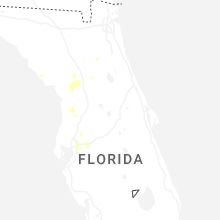
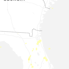
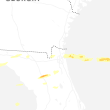


Connect with Interactive Hail Maps