

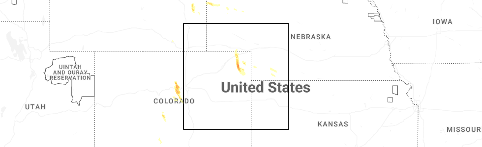
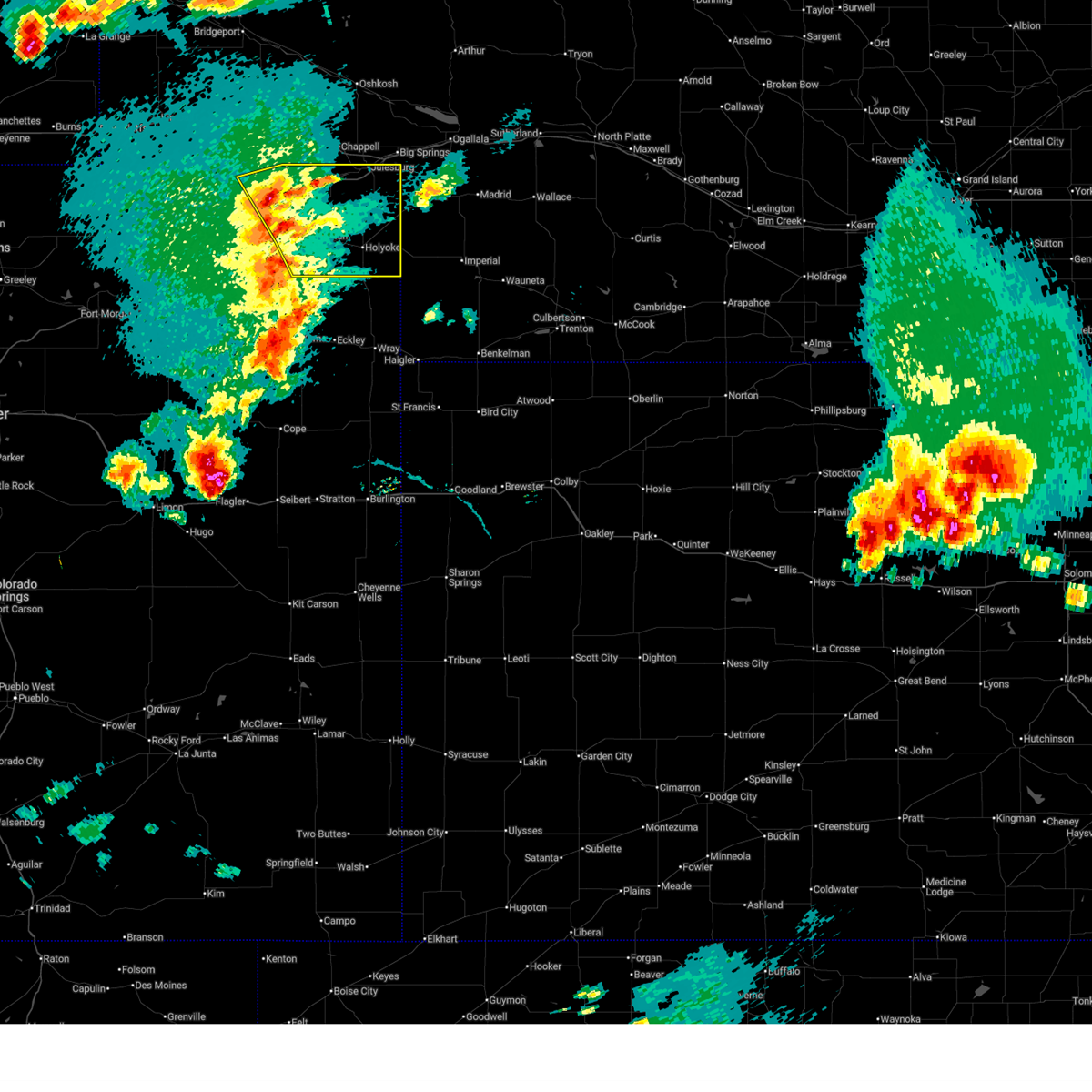
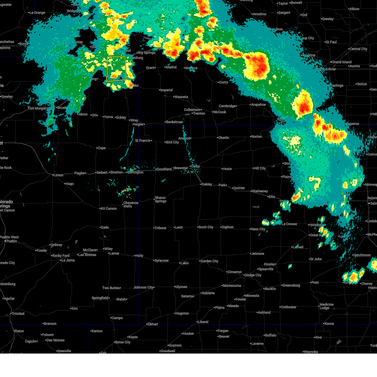
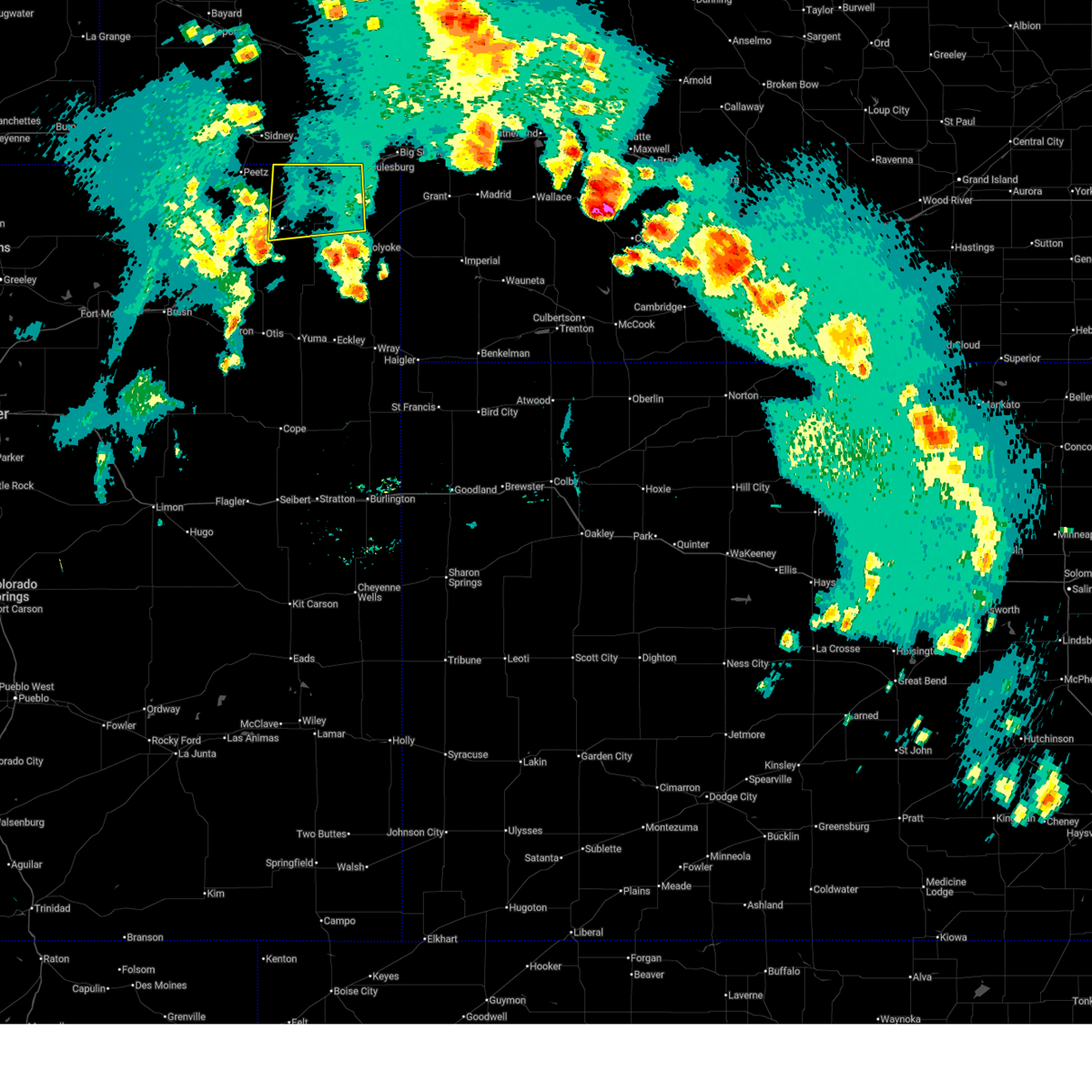
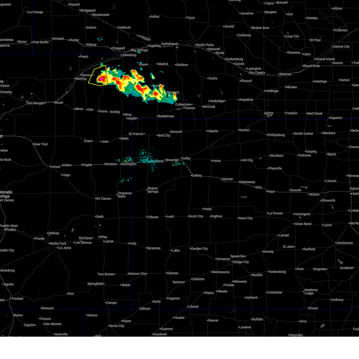
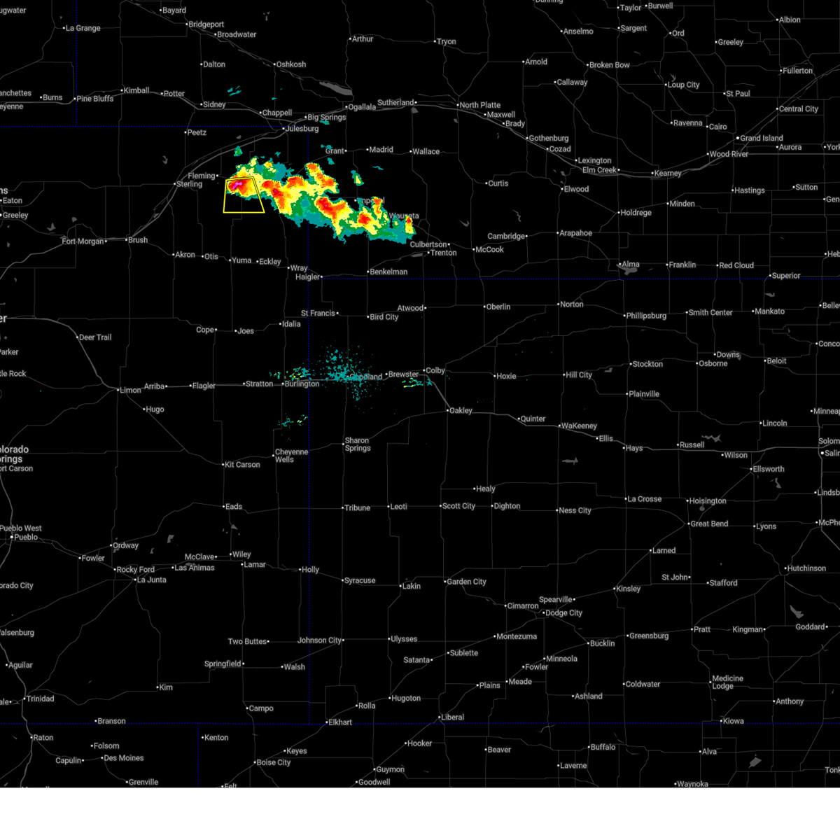
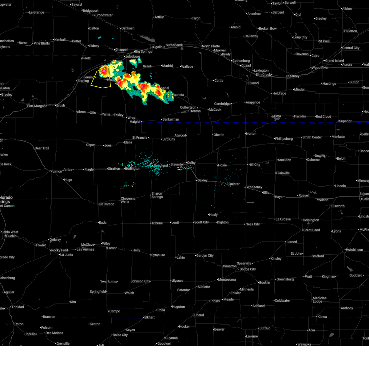
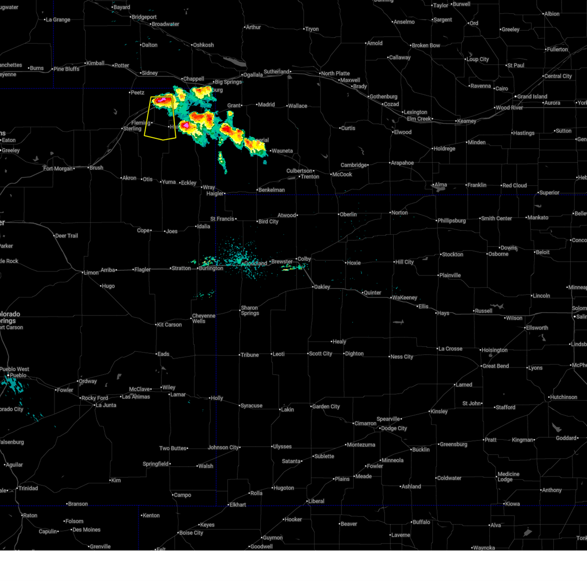
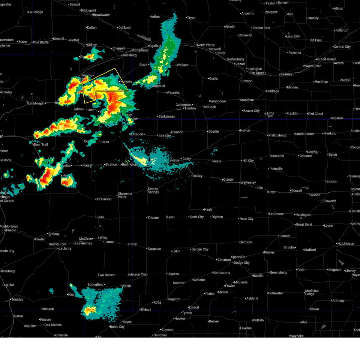
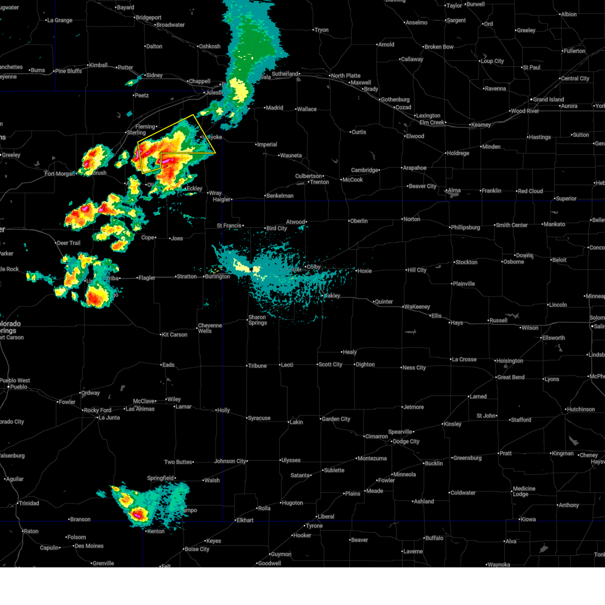
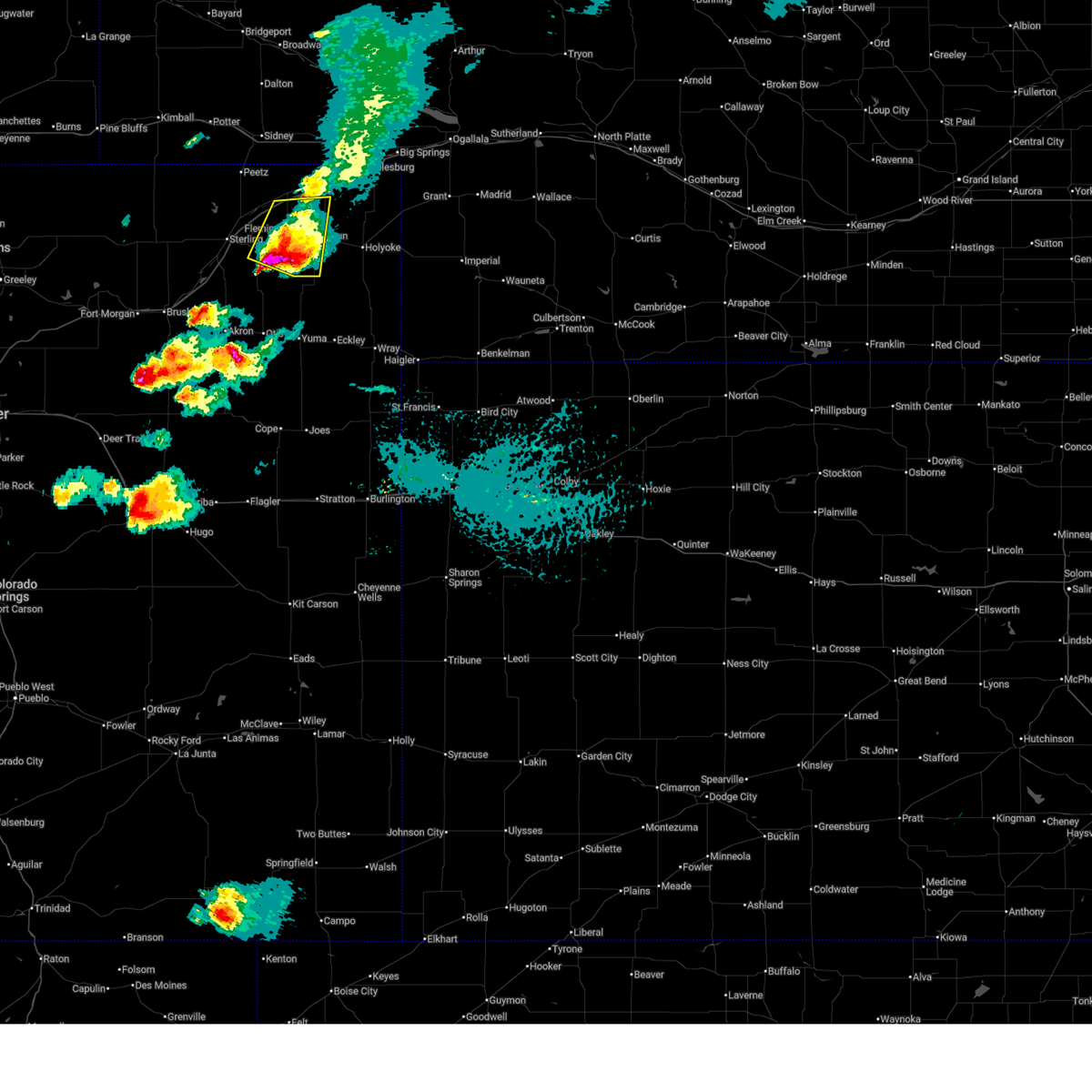
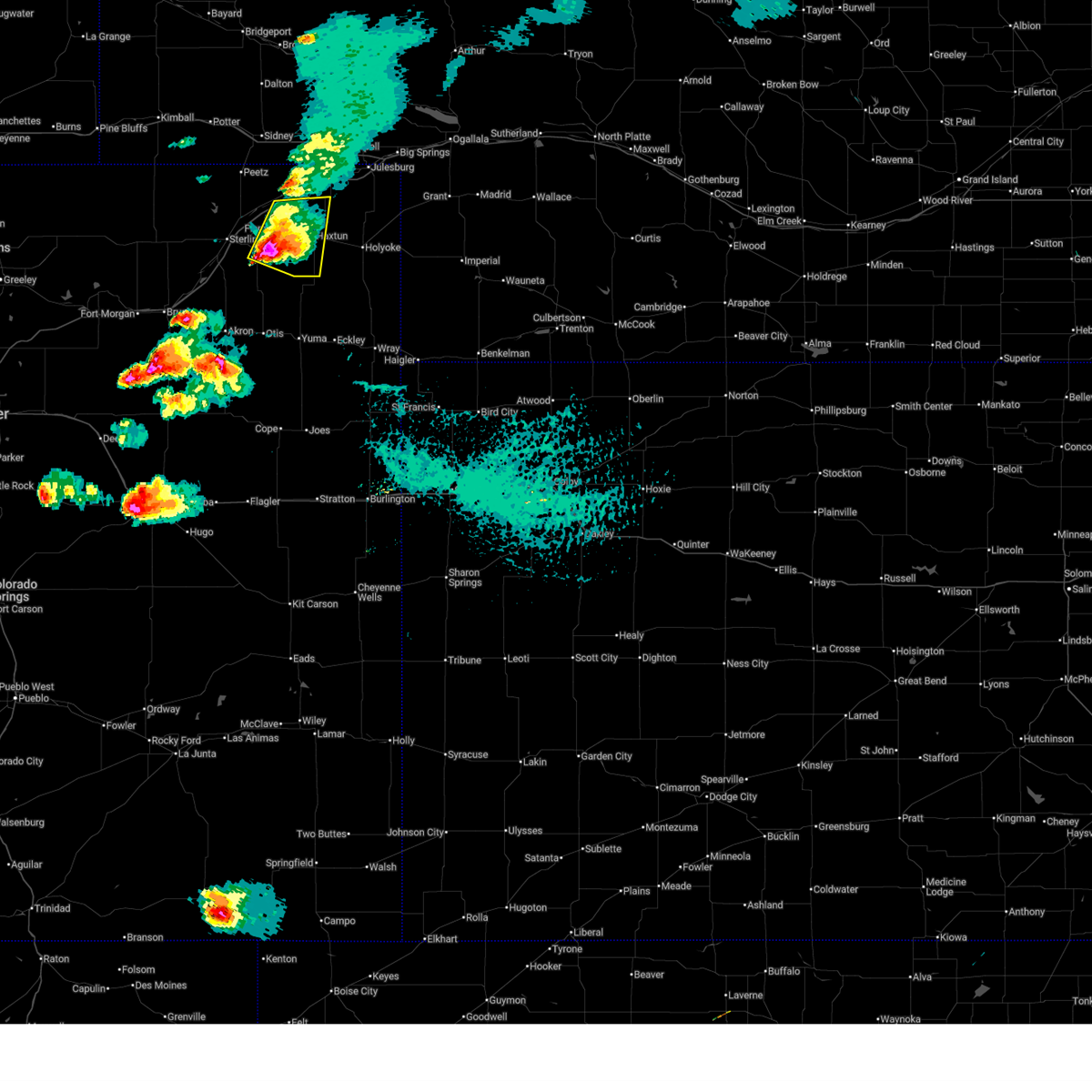
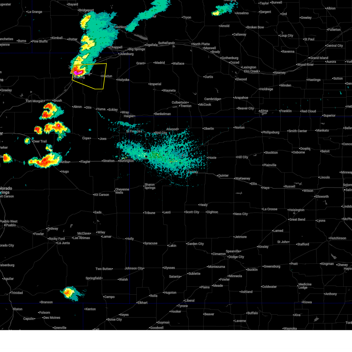
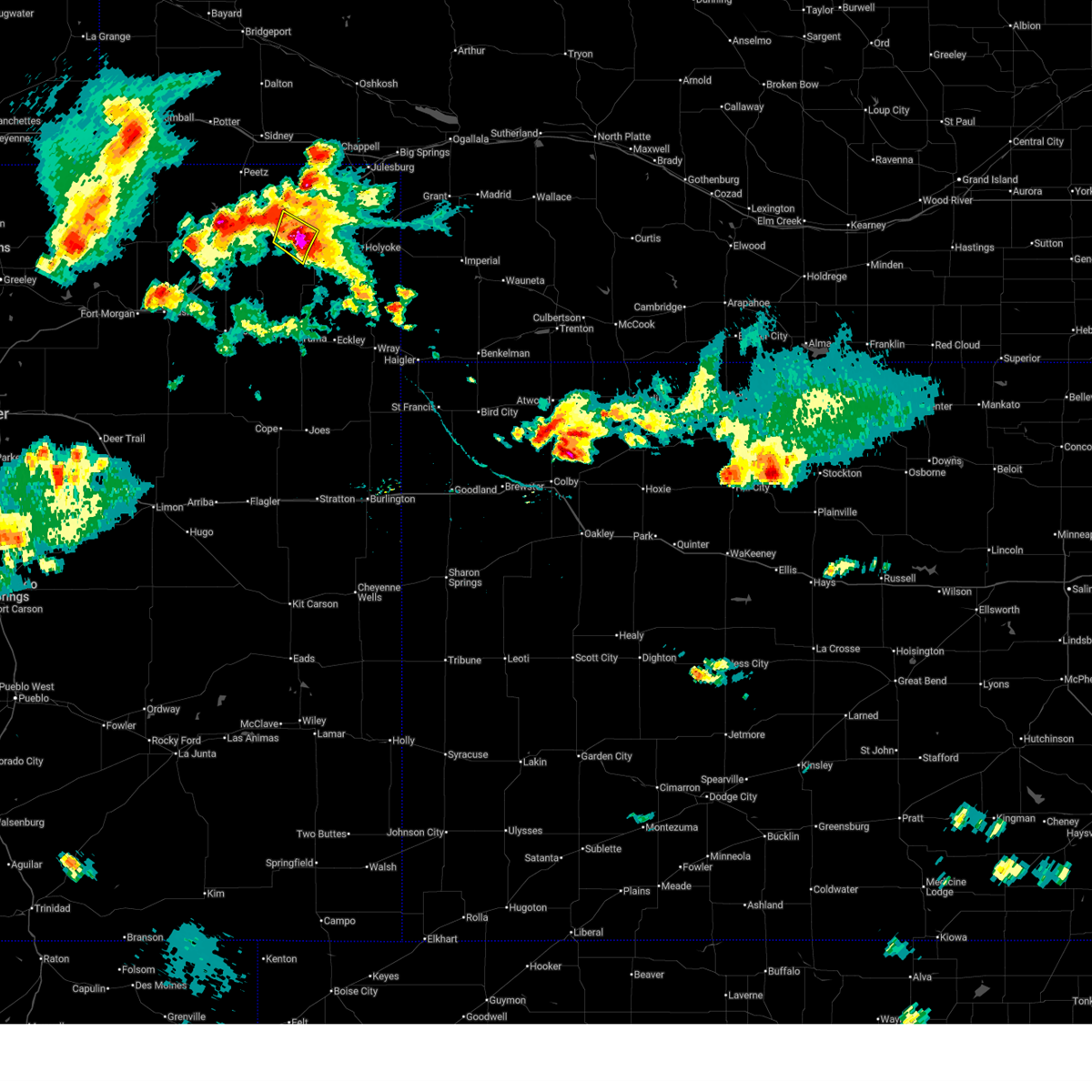
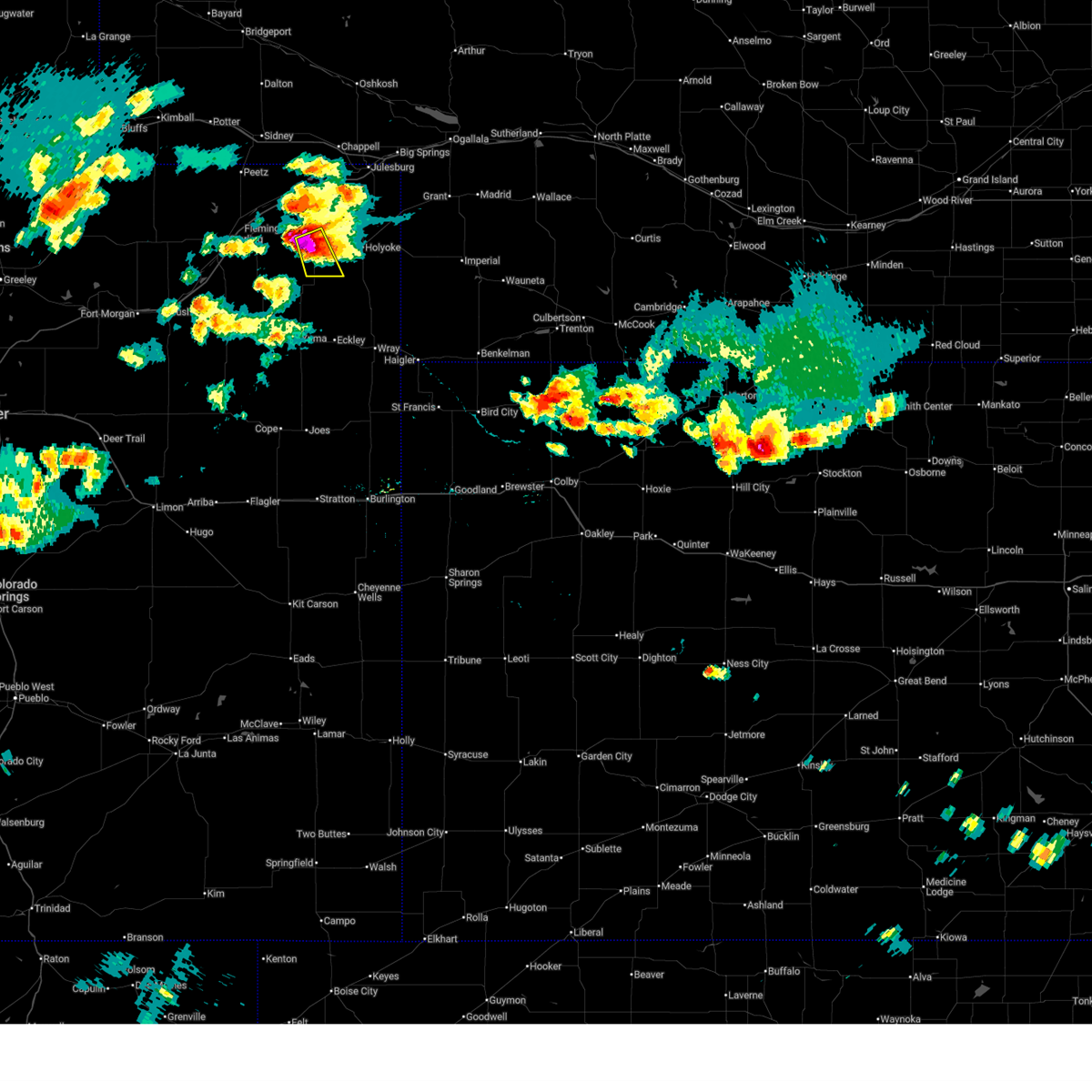
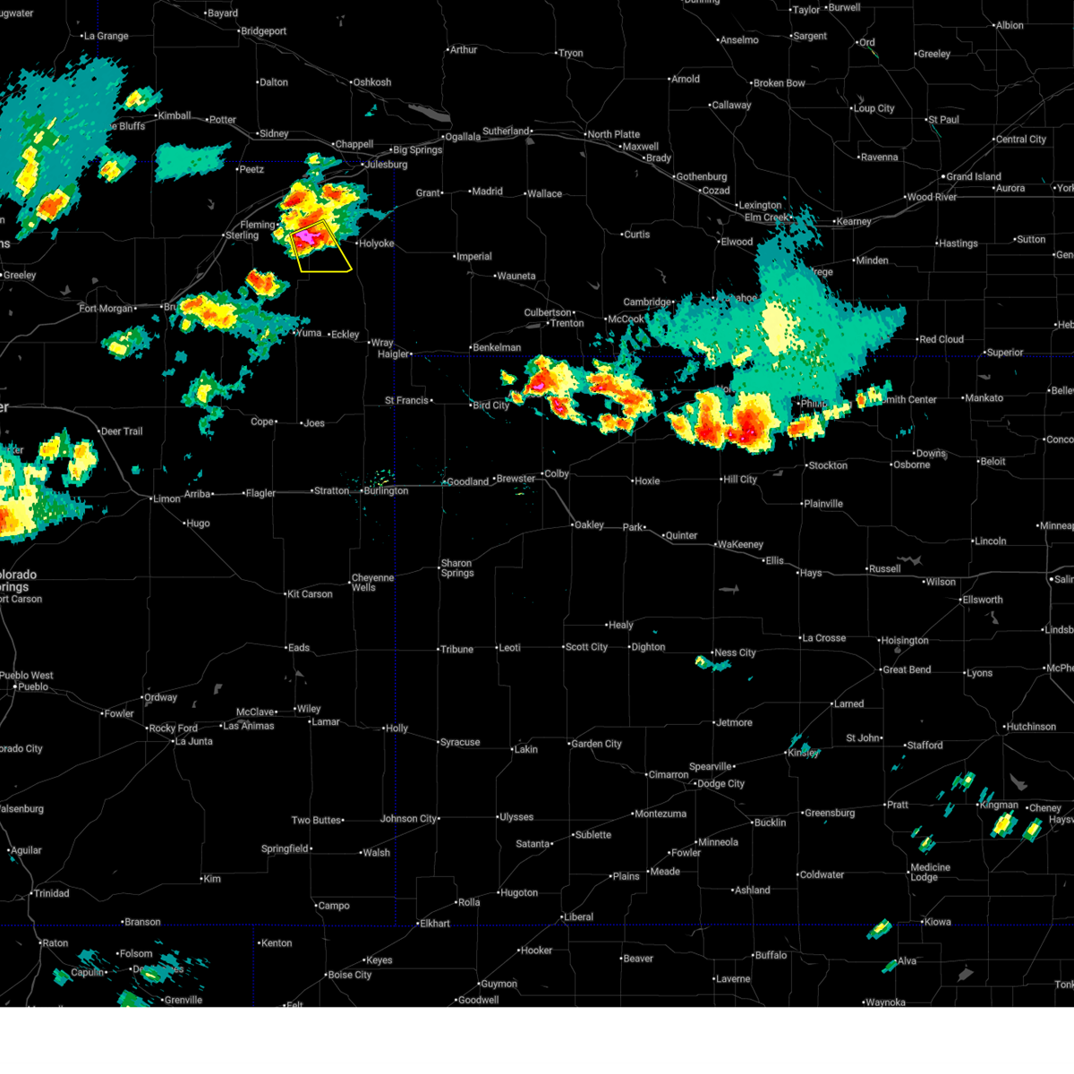
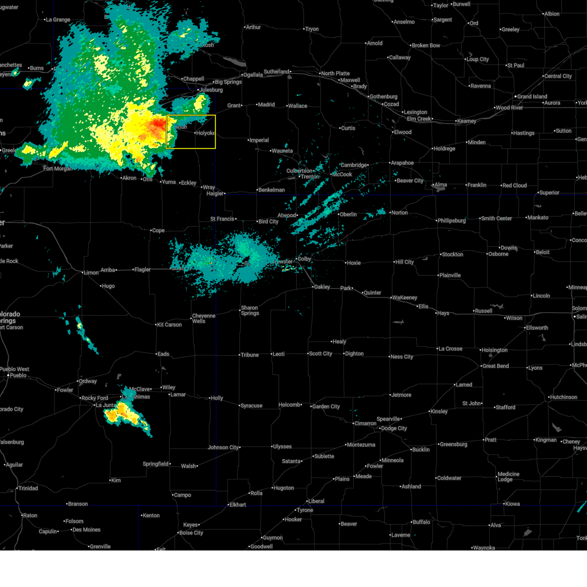
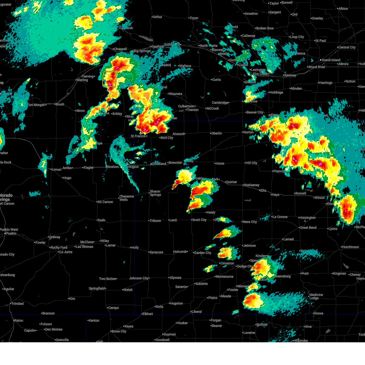
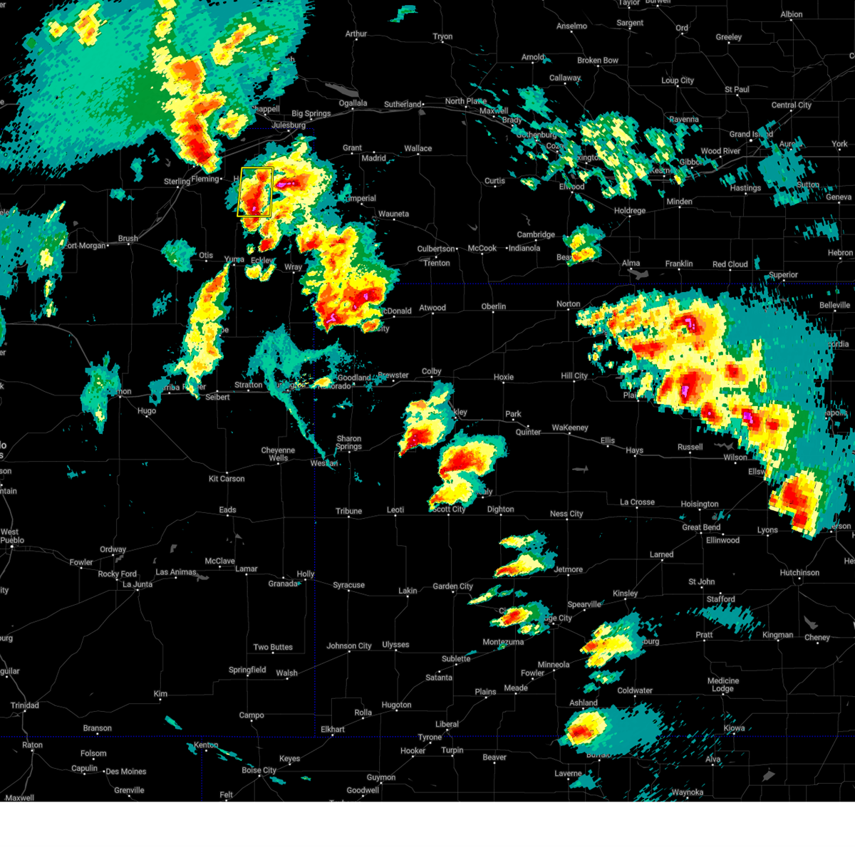
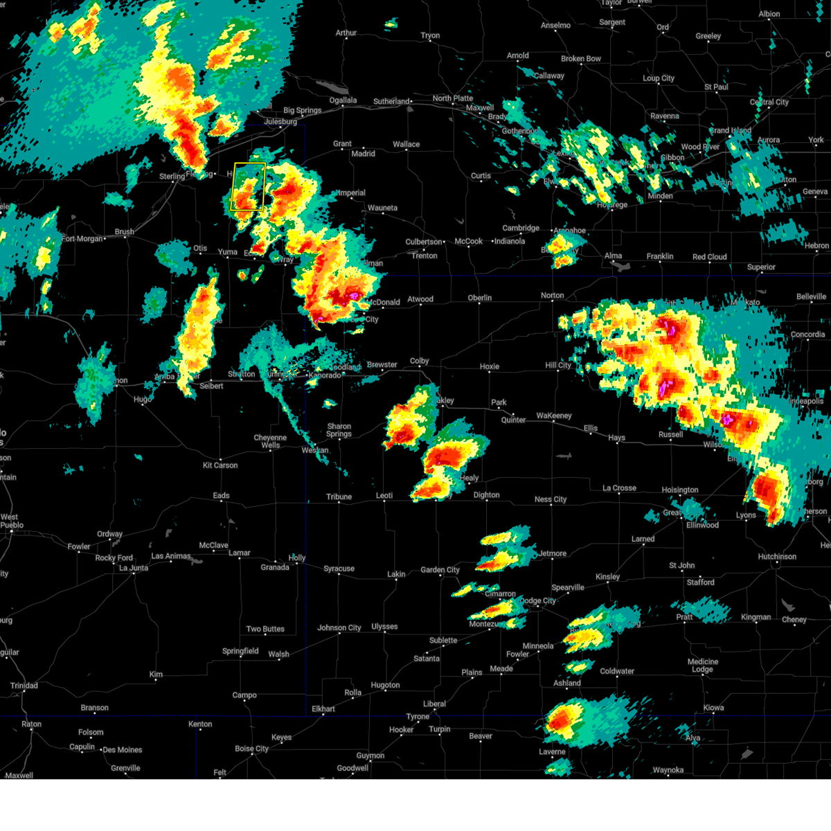
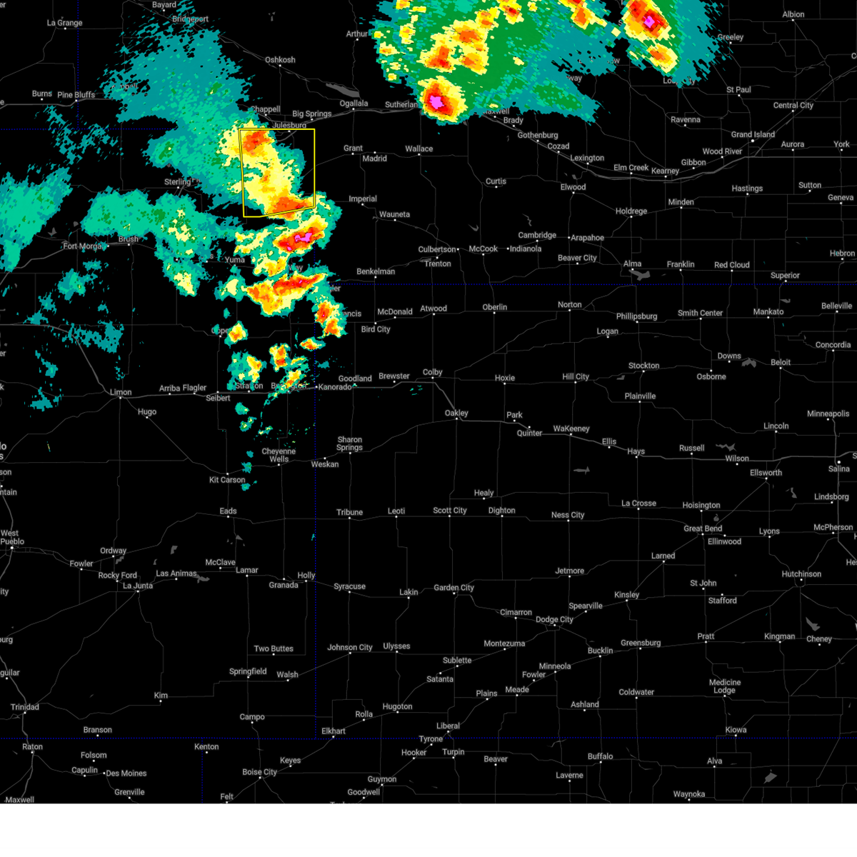
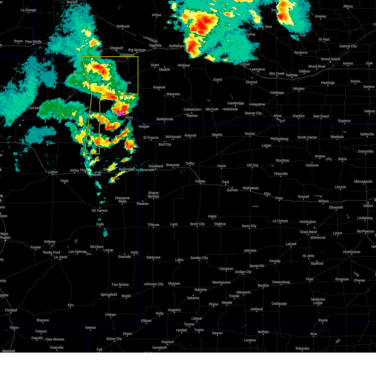
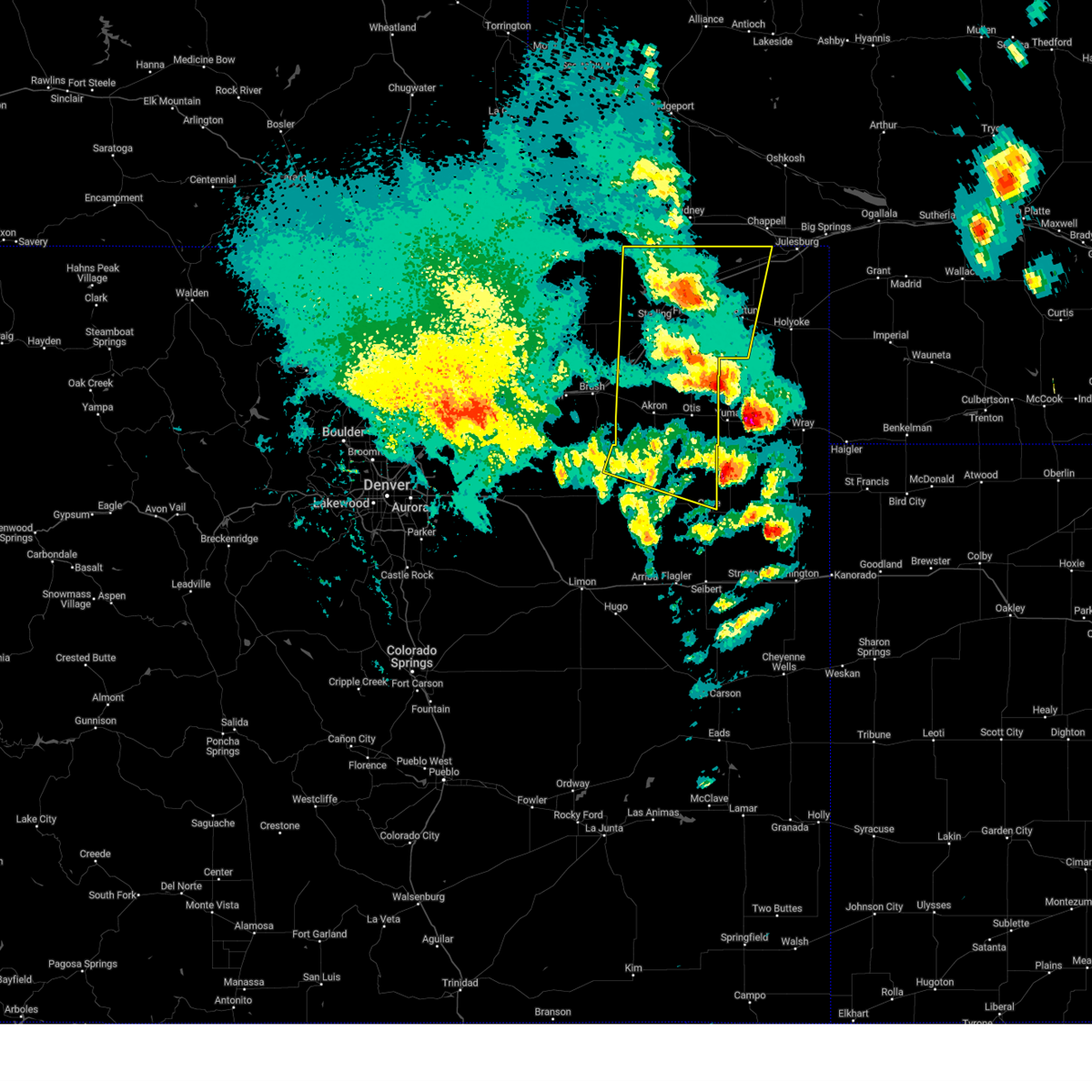
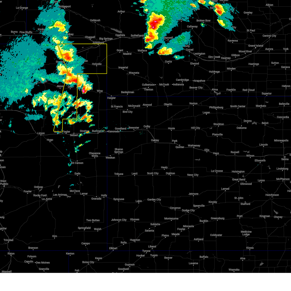
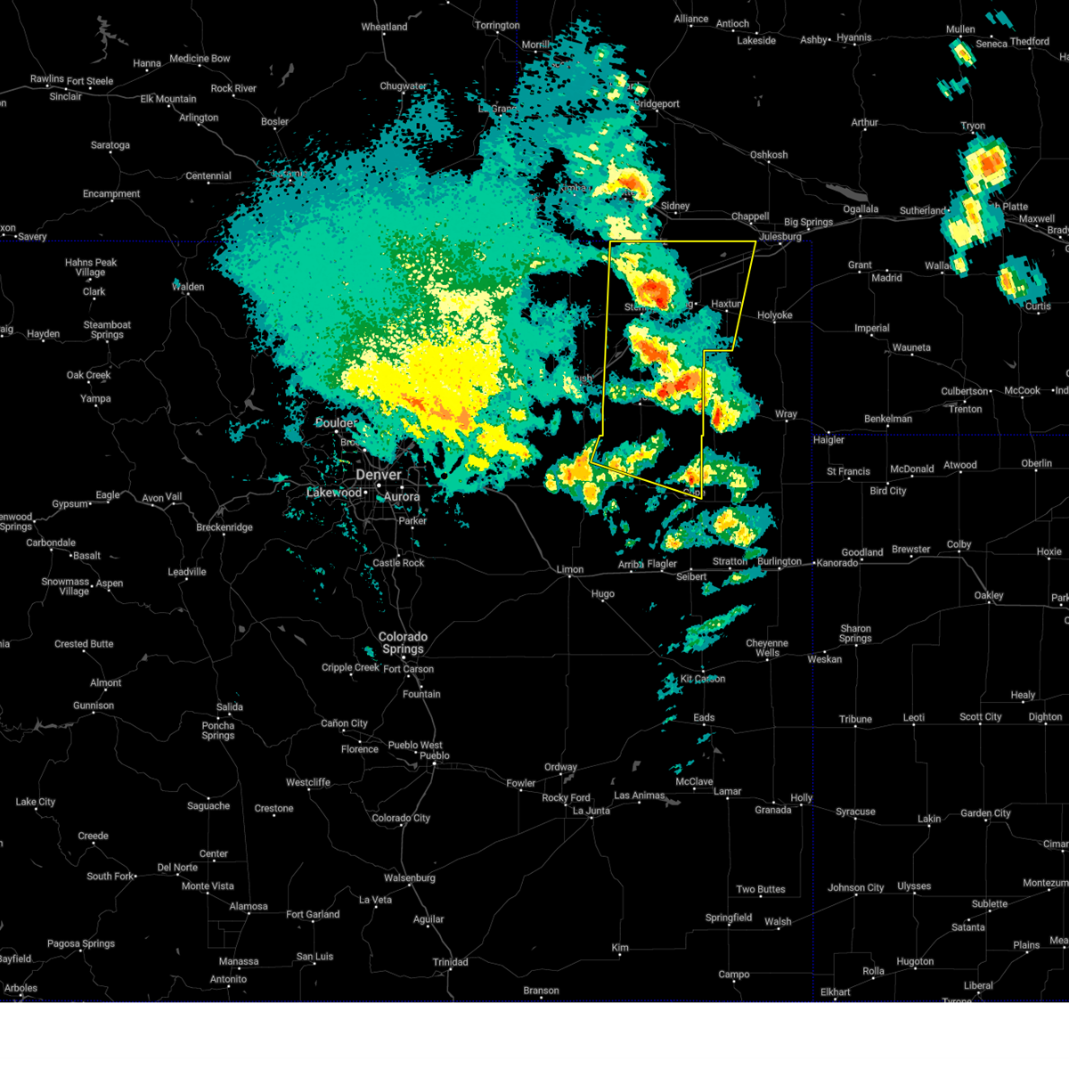
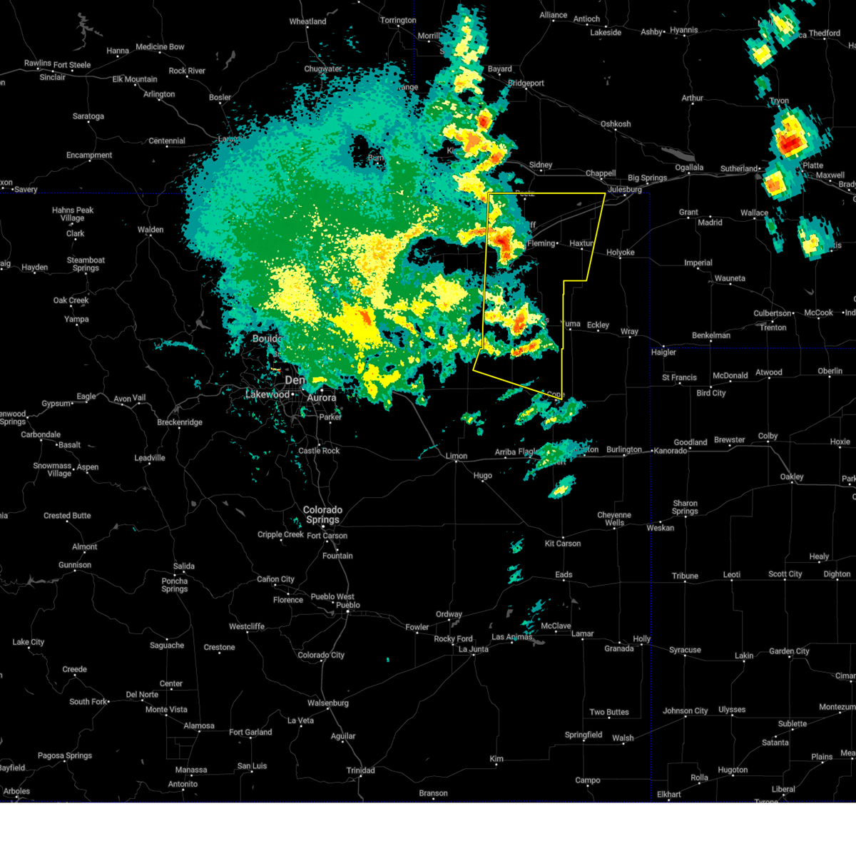
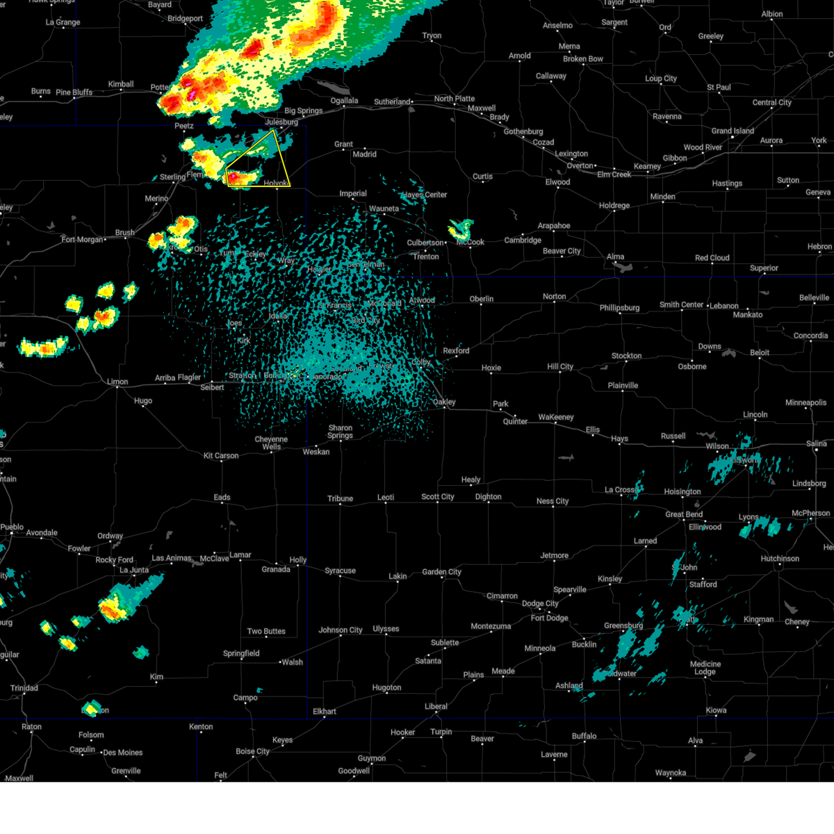
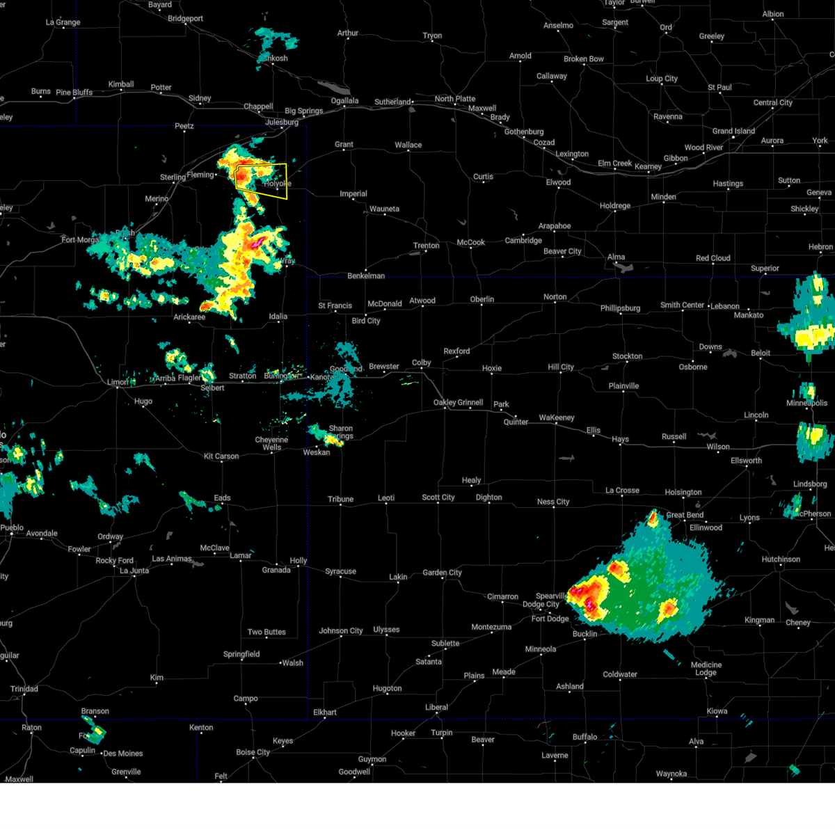
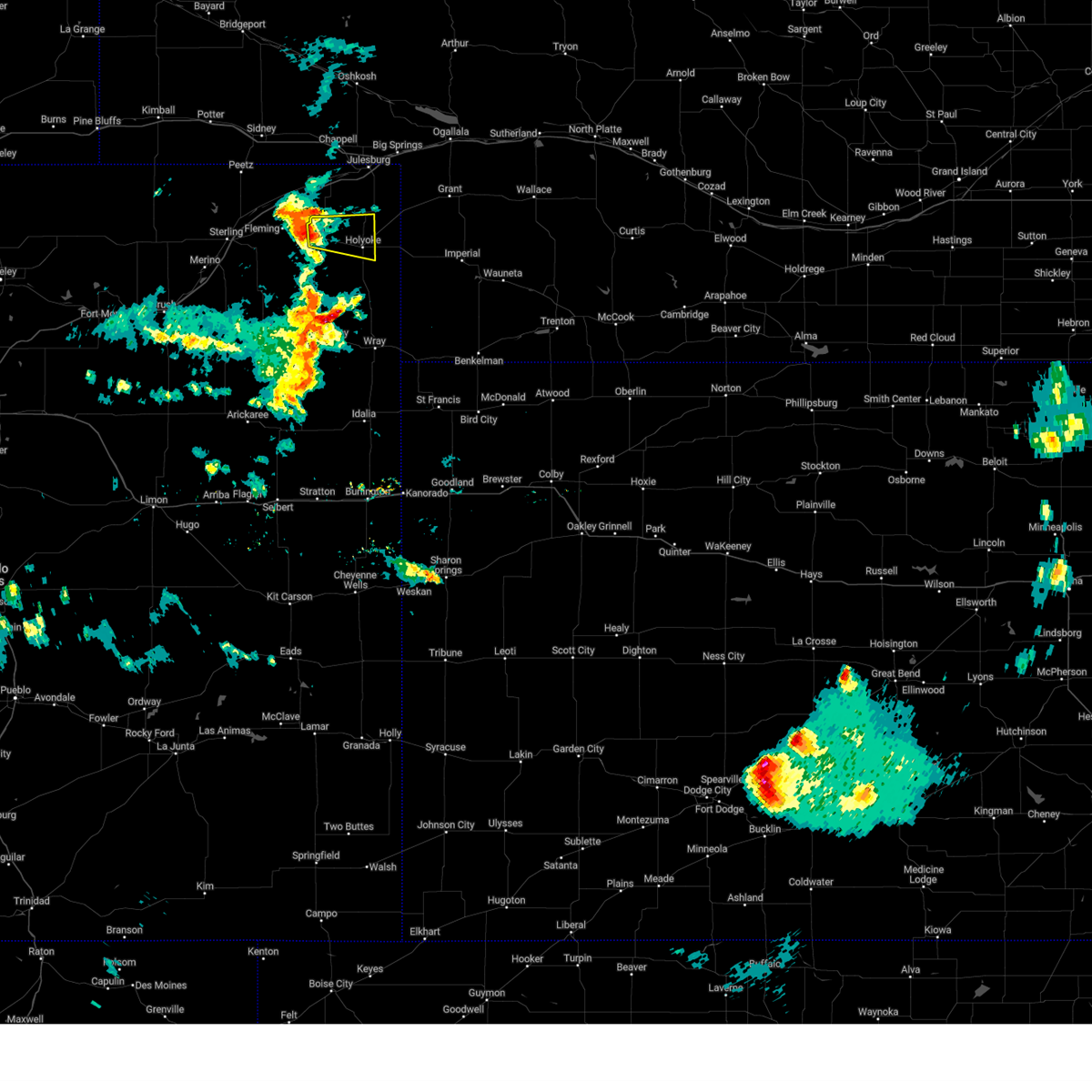
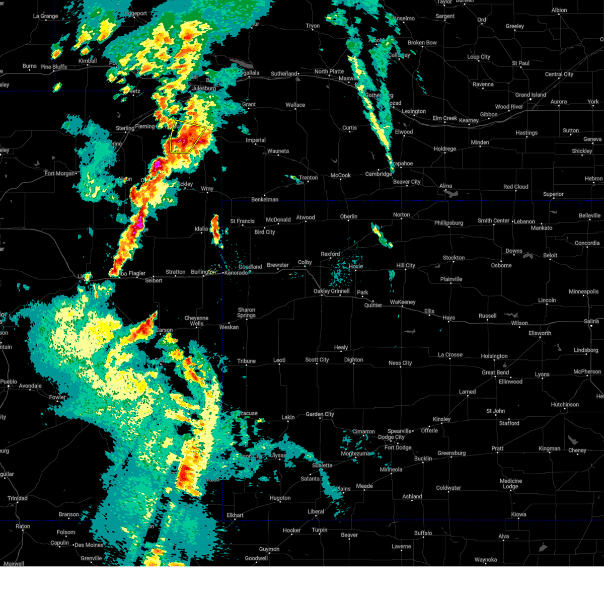
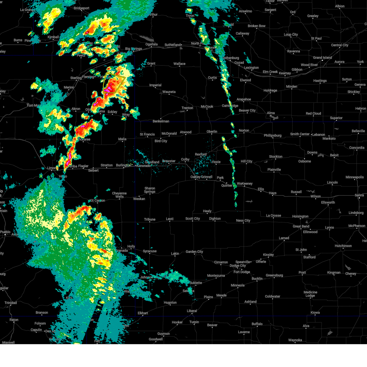
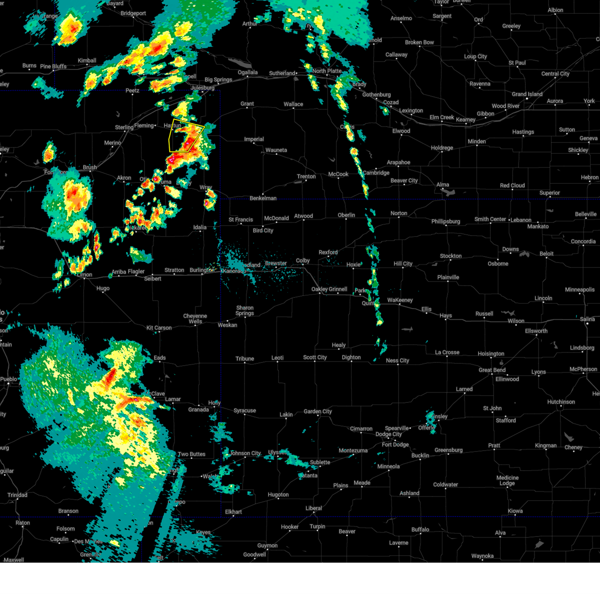
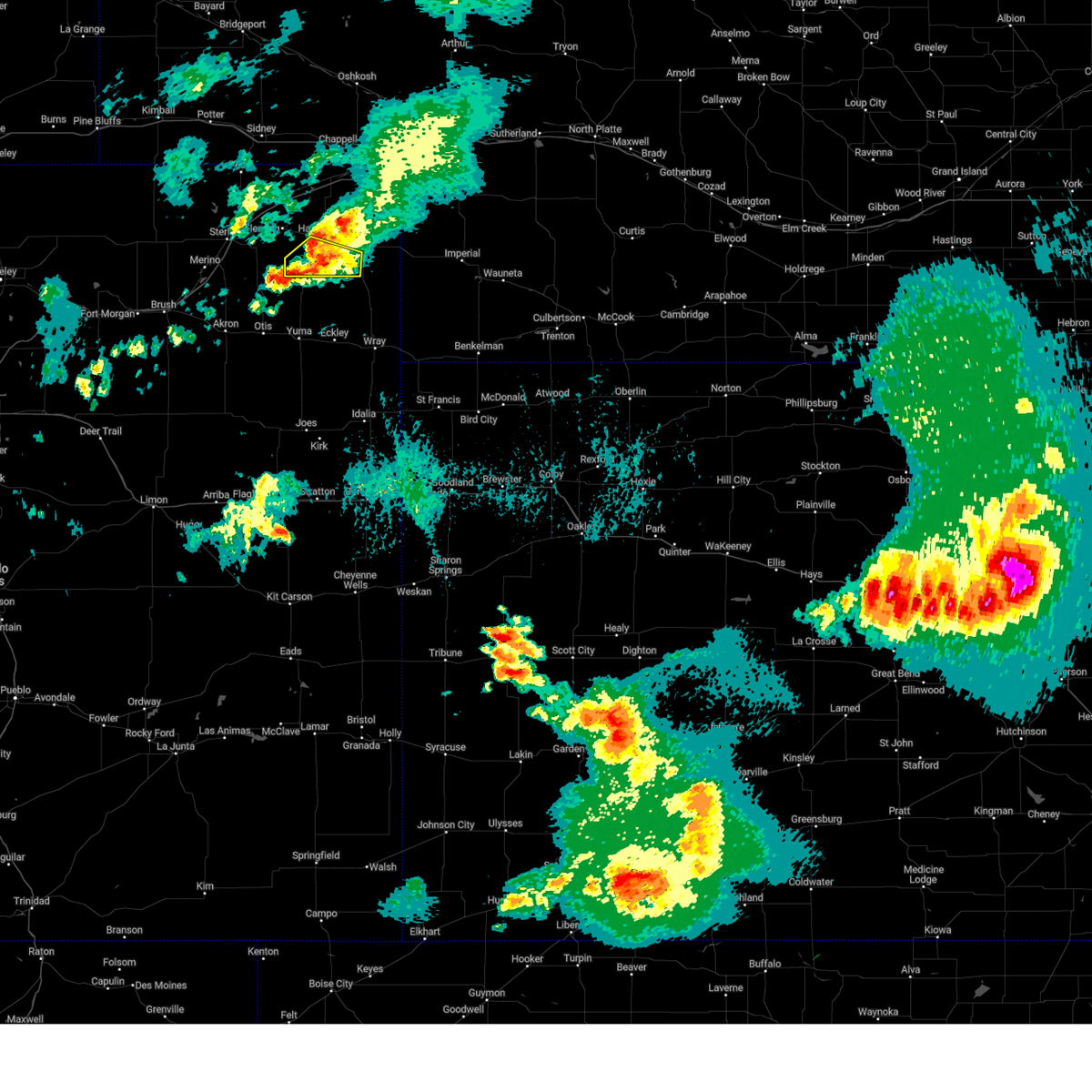
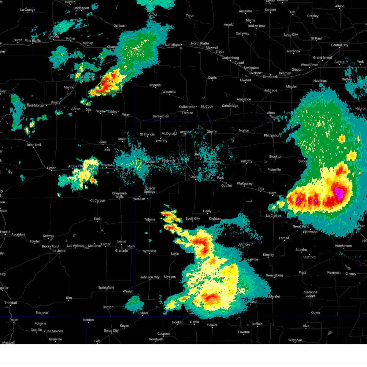
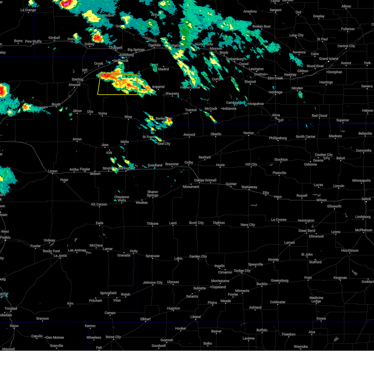
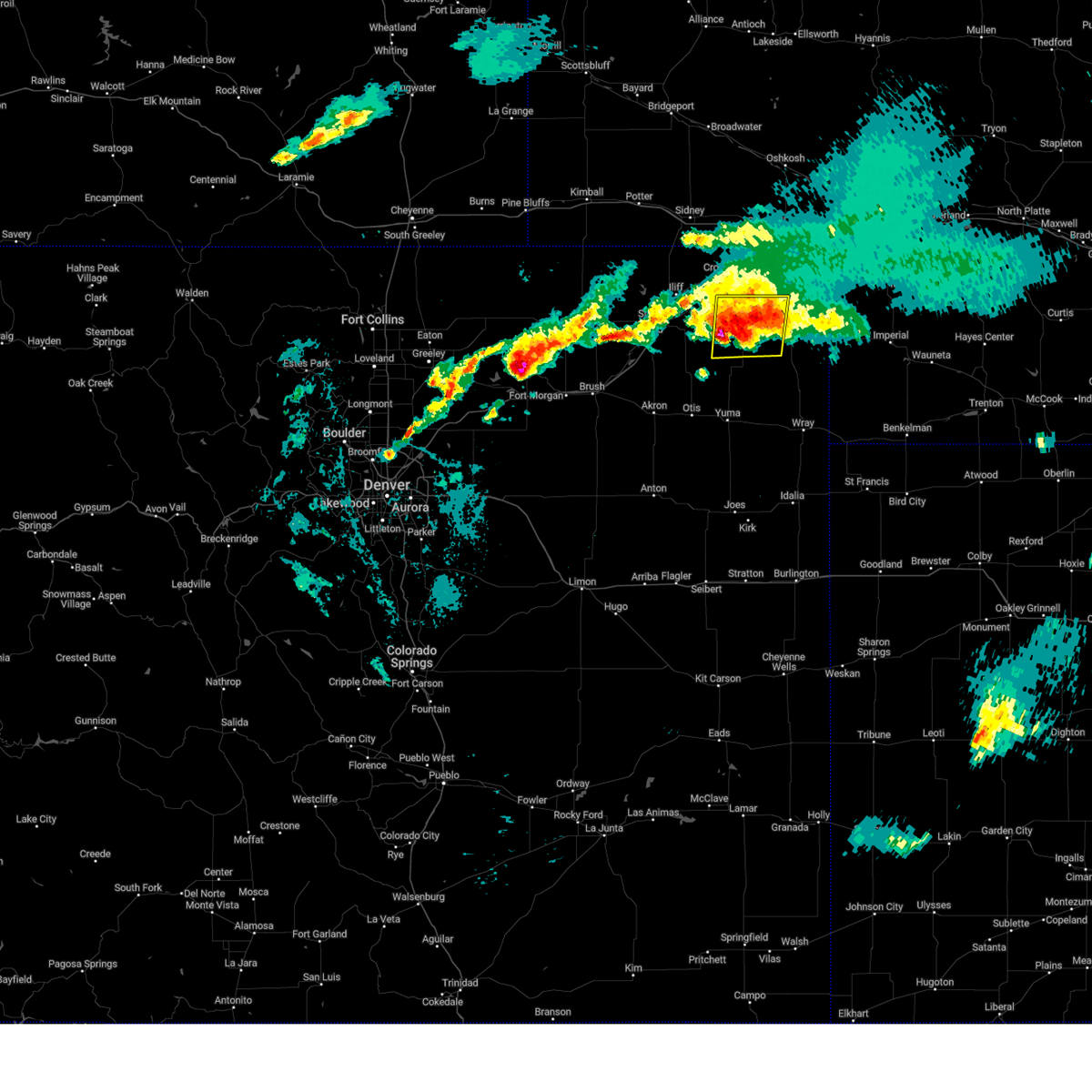
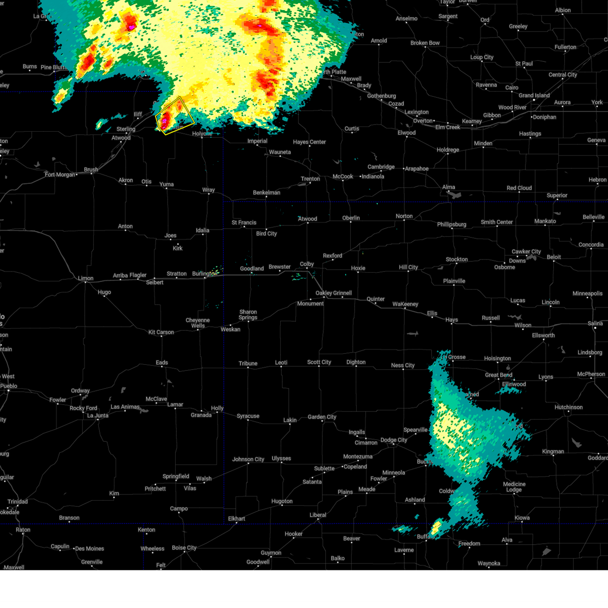
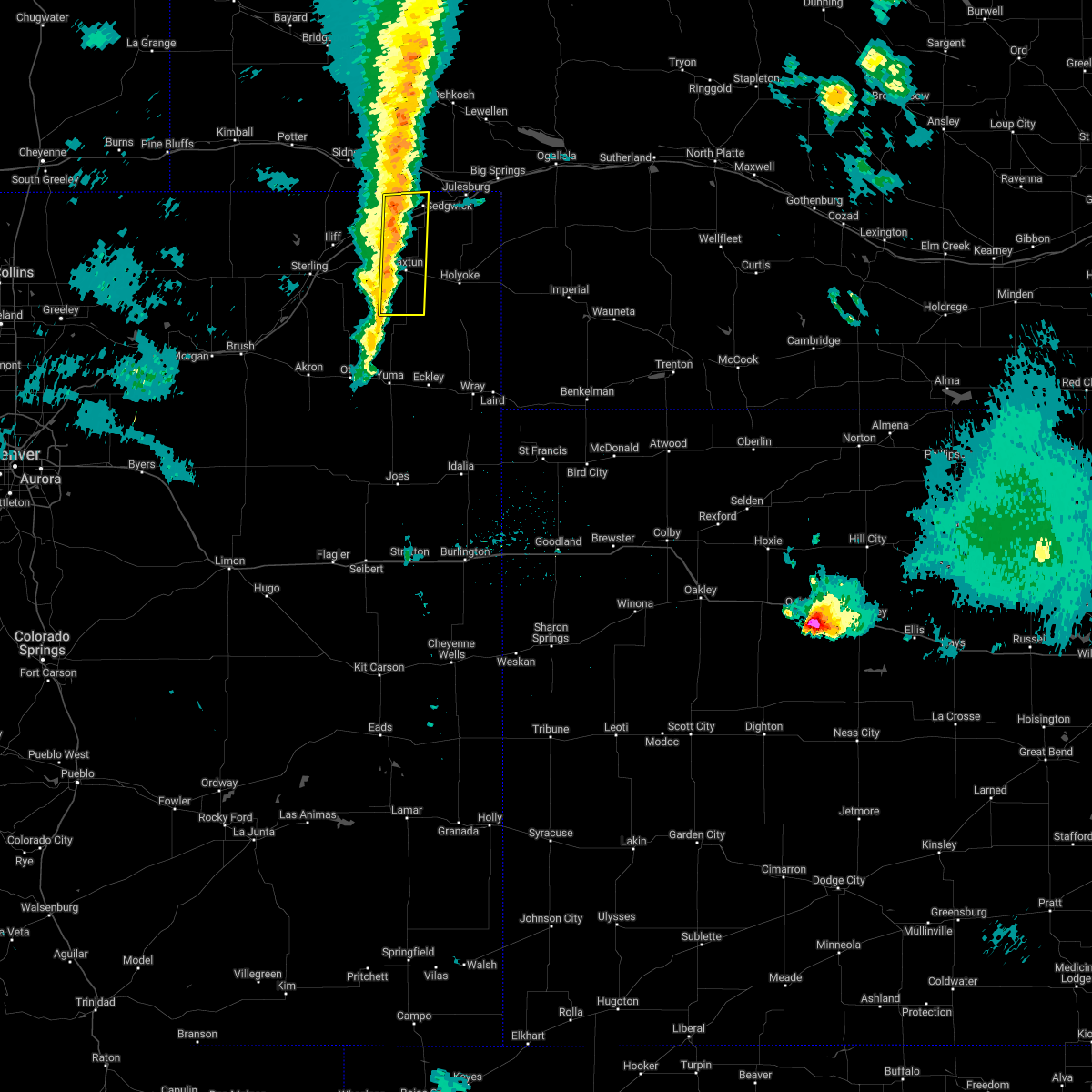
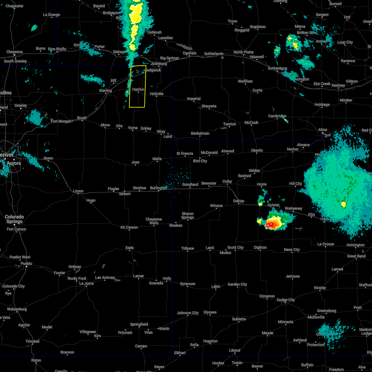
Hail Map for Haxtun, CO
The Haxtun, CO area has had 31 reports of on-the-ground hail by trained spotters, and has been under severe weather warnings 21 times during the past 12 months. Doppler radar has detected hail at or near Haxtun, CO on 91 occasions, including 6 occasions during the past year.
| Name: | Haxtun, CO |
| Where Located: | 36.4 miles N of Yuma, CO |
| Map: | Google Map for Haxtun, CO |
| Population: | 946 |
| Housing Units: | 498 |
| More Info: | Search Google for Haxtun, CO |
3
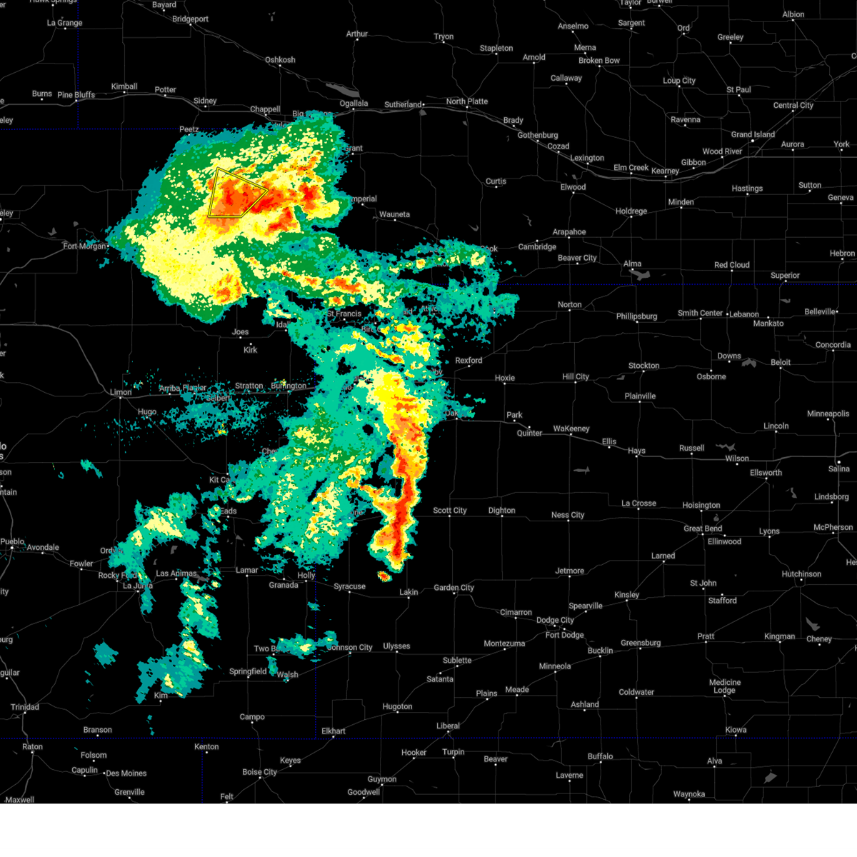
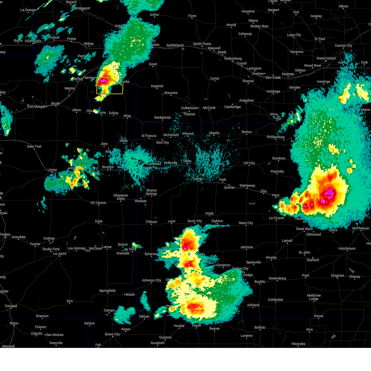
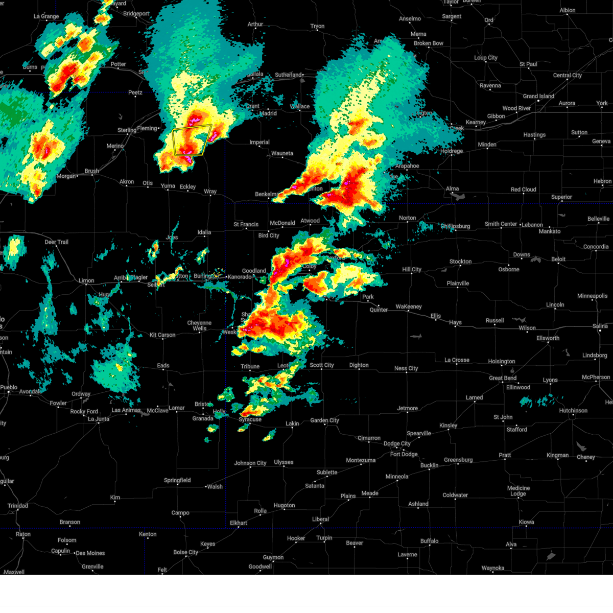
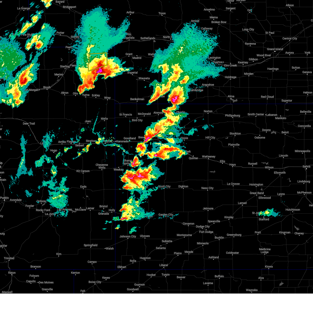
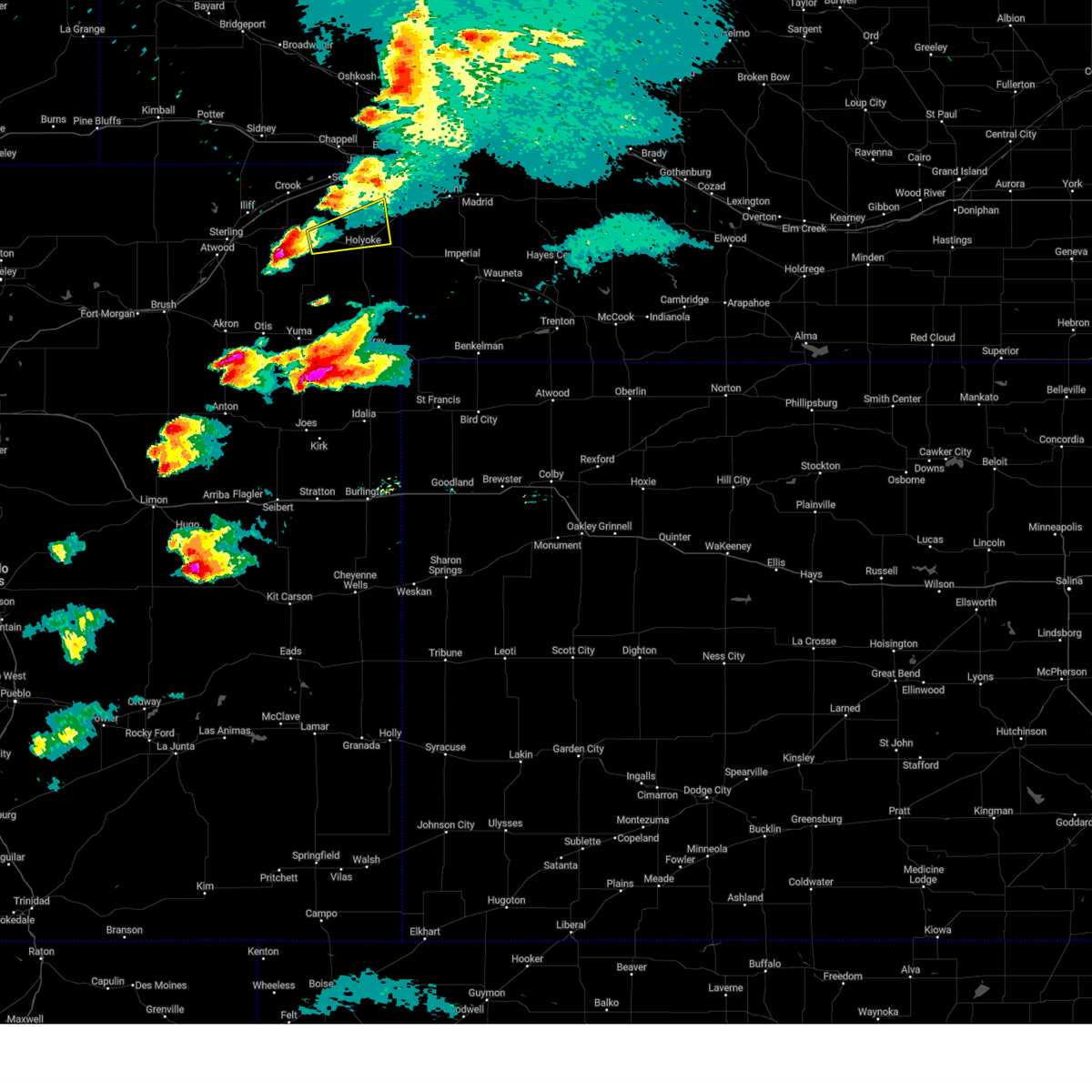
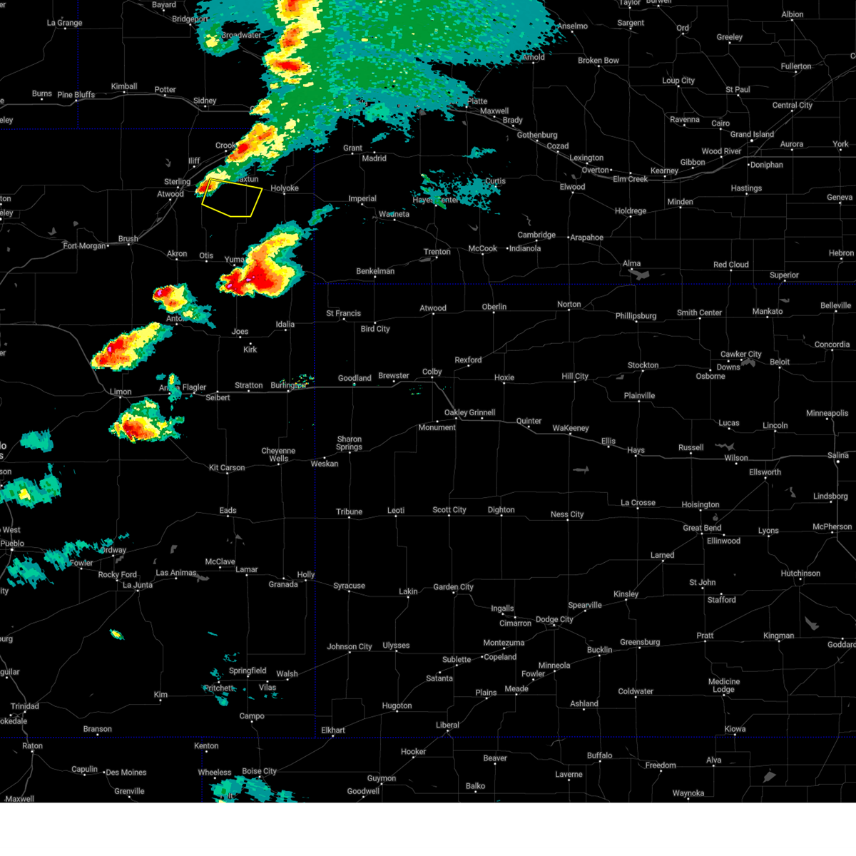
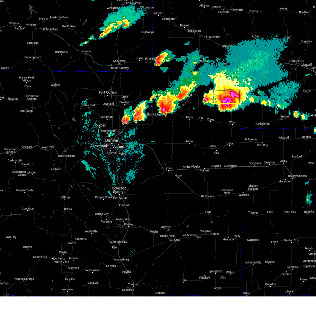
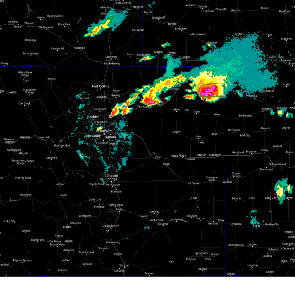
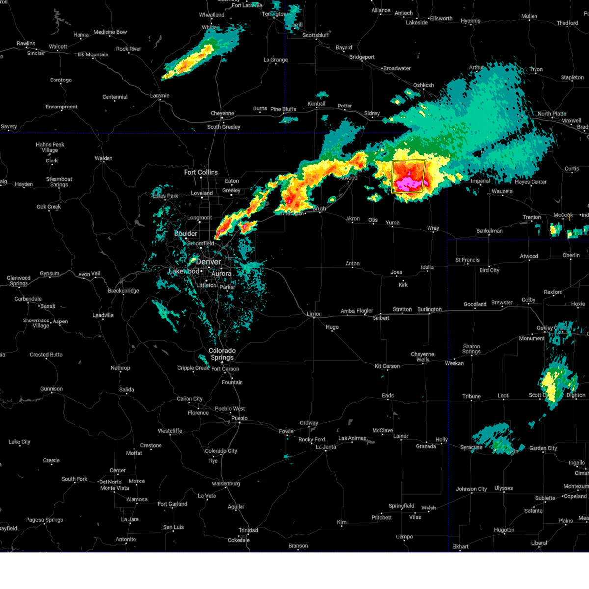
The Top Recent Hail Date for Haxtun, CO is Saturday, August 23, 2025 (4th out of 91)
Hail and Wind Damage Spotted near Haxtun, CO
| Date / Time | Report Details |
|---|---|
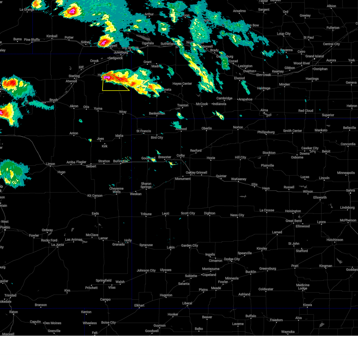
| 6/21/2026 8:35 PM MDT | Hen Egg sized hail reported 8.5 miles NW of Haxtun, CO |
| 6/8/2026 7:00 PM MDT |
 Svrbou the national weather service in denver has issued a * severe thunderstorm warning for, eastern logan county in northeastern colorado, phillips county in northeastern colorado, sedgwick county in northeastern colorado, * until 800 pm mdt. * at 700 pm mdt, severe thunderstorms were located along a line from near crook to 8 miles southwest of highland center, or along a line from 26 miles northeast of sterling to 21 miles north of yuma, moving east at 40 mph (radar indicated). Hazards include 60 mph wind gusts and small hail. expect damage to roofs, siding, and trees Svrbou the national weather service in denver has issued a * severe thunderstorm warning for, eastern logan county in northeastern colorado, phillips county in northeastern colorado, sedgwick county in northeastern colorado, * until 800 pm mdt. * at 700 pm mdt, severe thunderstorms were located along a line from near crook to 8 miles southwest of highland center, or along a line from 26 miles northeast of sterling to 21 miles north of yuma, moving east at 40 mph (radar indicated). Hazards include 60 mph wind gusts and small hail. expect damage to roofs, siding, and trees
|
| 5/30/2026 7:05 PM MDT |
 The storm which prompted the warning has weakened below severe limits, and no longer poses an immediate threat to life or property. therefore, the warning will be allowed to expire. The storm which prompted the warning has weakened below severe limits, and no longer poses an immediate threat to life or property. therefore, the warning will be allowed to expire.
|
| 5/30/2026 6:59 PM MDT |
 At 659 pm mdt, a severe thunderstorm was located near marks butte, or 16 miles southwest of julesburg, moving east at 20 mph (radar indicated). Hazards include 60 mph wind gusts and quarter size hail. Hail damage to vehicles is expected. expect wind damage to roofs, siding, and trees. Locations impacted include, haxtun, ovid, sedgwick, marks butte and fairfield. At 659 pm mdt, a severe thunderstorm was located near marks butte, or 16 miles southwest of julesburg, moving east at 20 mph (radar indicated). Hazards include 60 mph wind gusts and quarter size hail. Hail damage to vehicles is expected. expect wind damage to roofs, siding, and trees. Locations impacted include, haxtun, ovid, sedgwick, marks butte and fairfield.
|
| 5/30/2026 6:28 PM MDT |
 Svrbou the national weather service in denver has issued a * severe thunderstorm warning for, northeastern logan county in northeastern colorado, northwestern phillips county in northeastern colorado, western sedgwick county in northeastern colorado, * until 715 pm mdt. * at 628 pm mdt, a severe thunderstorm was located 7 miles southeast of twin buttes, or 25 miles southwest of julesburg, moving east at 20 mph (radar indicated). Hazards include 60 mph wind gusts and quarter size hail. Hail damage to vehicles is expected. Expect wind damage to roofs, siding, and trees. Svrbou the national weather service in denver has issued a * severe thunderstorm warning for, northeastern logan county in northeastern colorado, northwestern phillips county in northeastern colorado, western sedgwick county in northeastern colorado, * until 715 pm mdt. * at 628 pm mdt, a severe thunderstorm was located 7 miles southeast of twin buttes, or 25 miles southwest of julesburg, moving east at 20 mph (radar indicated). Hazards include 60 mph wind gusts and quarter size hail. Hail damage to vehicles is expected. Expect wind damage to roofs, siding, and trees.
|
| 9/9/2025 5:57 PM MDT | At 557 pm mdt, a severe thunderstorm was located near haxtun, or 18 miles west of holyoke, moving southeast at 15 mph (radar indicated). Hazards include 60 mph wind gusts and quarter size hail. Hail damage to vehicles is expected. expect wind damage to roofs, siding, and trees. Locations impacted include, haxtun, paoli, highland center, fairfield and dailey. |
| 9/9/2025 5:38 PM MDT | Svrbou the national weather service in denver has issued a * severe thunderstorm warning for, east central logan county in northeastern colorado, western phillips county in northeastern colorado, * until 630 pm mdt. * at 538 pm mdt, a severe thunderstorm was located near haxtun, or 20 miles west of holyoke, moving southeast at 15 mph (radar indicated). Hazards include 60 mph wind gusts and quarter size hail. Hail damage to vehicles is expected. Expect wind damage to roofs, siding, and trees. |
| 8/23/2025 11:16 PM MDT |
 The severe thunderstorm warning that was previously in effect has been reissued for southwest phillips and southeast logan counties and is in effect until 1200 am mdt. please refer to that bulletin for the latest severe weather information. The severe thunderstorm warning that was previously in effect has been reissued for southwest phillips and southeast logan counties and is in effect until 1200 am mdt. please refer to that bulletin for the latest severe weather information.
|
| 8/23/2025 11:12 PM MDT |
 Svrbou the national weather service in denver has issued a * severe thunderstorm warning for, southeastern logan county in northeastern colorado, southwestern phillips county in northeastern colorado, * until midnight mdt. * at 1112 pm mdt, a severe thunderstorm was located near haxtun, or 17 miles west of holyoke, moving south at 30 mph (radar indicated). Hazards include 60 mph wind gusts and half dollar size hail. Hail damage to vehicles is expected. Expect wind damage to roofs, siding, and trees. Svrbou the national weather service in denver has issued a * severe thunderstorm warning for, southeastern logan county in northeastern colorado, southwestern phillips county in northeastern colorado, * until midnight mdt. * at 1112 pm mdt, a severe thunderstorm was located near haxtun, or 17 miles west of holyoke, moving south at 30 mph (radar indicated). Hazards include 60 mph wind gusts and half dollar size hail. Hail damage to vehicles is expected. Expect wind damage to roofs, siding, and trees.
|
| 8/23/2025 10:53 PM MDT |
 At 1053 pm mdt, a severe thunderstorm was located 7 miles north of haxtun, or 22 miles northwest of holyoke, moving south at 20 mph (radar indicated). Hazards include 60 mph wind gusts and quarter size hail. Hail damage to vehicles is expected. expect wind damage to roofs, siding, and trees. Locations impacted include, haxtun, fleming, st petersburg and dailey. At 1053 pm mdt, a severe thunderstorm was located 7 miles north of haxtun, or 22 miles northwest of holyoke, moving south at 20 mph (radar indicated). Hazards include 60 mph wind gusts and quarter size hail. Hail damage to vehicles is expected. expect wind damage to roofs, siding, and trees. Locations impacted include, haxtun, fleming, st petersburg and dailey.
|
| 8/23/2025 10:30 PM MDT |
 Svrbou the national weather service in denver has issued a * severe thunderstorm warning for, eastern logan county in northeastern colorado, northwestern phillips county in northeastern colorado, southwestern sedgwick county in northeastern colorado, * until 1115 pm mdt. * at 1030 pm mdt, a severe thunderstorm was located 4 miles southeast of twin buttes, or 26 miles west of julesburg, moving south at 25 mph (radar indicated). Hazards include quarter size hail. damage to vehicles is expected Svrbou the national weather service in denver has issued a * severe thunderstorm warning for, eastern logan county in northeastern colorado, northwestern phillips county in northeastern colorado, southwestern sedgwick county in northeastern colorado, * until 1115 pm mdt. * at 1030 pm mdt, a severe thunderstorm was located 4 miles southeast of twin buttes, or 26 miles west of julesburg, moving south at 25 mph (radar indicated). Hazards include quarter size hail. damage to vehicles is expected
|
| 8/9/2025 5:25 PM MDT |
 the severe thunderstorm warning has been cancelled and is no longer in effect the severe thunderstorm warning has been cancelled and is no longer in effect
|
| 8/9/2025 5:02 PM MDT |
 Svrbou the national weather service in denver has issued a * severe thunderstorm warning for, southeastern logan county in northeastern colorado, phillips county in northeastern colorado, southwestern sedgwick county in northeastern colorado, northeastern washington county in northeastern colorado, * until 545 pm mdt. * at 502 pm mdt, a severe thunderstorm was located 4 miles south of st petersburg, or 21 miles southeast of sterling, moving east at 45 mph (radar indicated). Hazards include ping pong ball size hail and 60 mph wind gusts. People and animals outdoors will be injured. expect hail damage to roofs, siding, windows, and vehicles. Expect wind damage to roofs, siding, and trees. Svrbou the national weather service in denver has issued a * severe thunderstorm warning for, southeastern logan county in northeastern colorado, phillips county in northeastern colorado, southwestern sedgwick county in northeastern colorado, northeastern washington county in northeastern colorado, * until 545 pm mdt. * at 502 pm mdt, a severe thunderstorm was located 4 miles south of st petersburg, or 21 miles southeast of sterling, moving east at 45 mph (radar indicated). Hazards include ping pong ball size hail and 60 mph wind gusts. People and animals outdoors will be injured. expect hail damage to roofs, siding, windows, and vehicles. Expect wind damage to roofs, siding, and trees.
|
| 8/9/2025 4:09 PM MDT |
 The severe thunderstorm warning that was previously in effect has been reissued for phillips and logan counties and is in effect until 500 pm mdt. please refer to that bulletin for the latest severe weather information. a severe thunderstorm watch remains in effect until 900 pm mdt saturday for a portion of northeast colorado. The severe thunderstorm warning that was previously in effect has been reissued for phillips and logan counties and is in effect until 500 pm mdt. please refer to that bulletin for the latest severe weather information. a severe thunderstorm watch remains in effect until 900 pm mdt saturday for a portion of northeast colorado.
|
| 8/9/2025 3:54 PM MDT |
 At 354 pm mdt, a severe thunderstorm was located over fleming, or 20 miles east of sterling, moving east at 30 mph (radar indicated). Hazards include two inch hail and 60 mph wind gusts. People and animals outdoors will be injured. expect hail damage to roofs, siding, windows, and vehicles. expect wind damage to roofs, siding, and trees. Locations impacted include, haxtun, fleming, st petersburg, highland center and dailey. At 354 pm mdt, a severe thunderstorm was located over fleming, or 20 miles east of sterling, moving east at 30 mph (radar indicated). Hazards include two inch hail and 60 mph wind gusts. People and animals outdoors will be injured. expect hail damage to roofs, siding, windows, and vehicles. expect wind damage to roofs, siding, and trees. Locations impacted include, haxtun, fleming, st petersburg, highland center and dailey.
|
| 8/9/2025 3:26 PM MDT |
 Svrbou the national weather service in denver has issued a * severe thunderstorm warning for, southeastern logan county in northeastern colorado, western phillips county in northeastern colorado, southwestern sedgwick county in northeastern colorado, * until 415 pm mdt. * at 326 pm mdt, a severe thunderstorm was located 5 miles south of iliff, or 7 miles northeast of sterling, moving east at 30 mph (radar indicated). Hazards include two inch hail and 60 mph wind gusts. People and animals outdoors will be injured. expect hail damage to roofs, siding, windows, and vehicles. Expect wind damage to roofs, siding, and trees. Svrbou the national weather service in denver has issued a * severe thunderstorm warning for, southeastern logan county in northeastern colorado, western phillips county in northeastern colorado, southwestern sedgwick county in northeastern colorado, * until 415 pm mdt. * at 326 pm mdt, a severe thunderstorm was located 5 miles south of iliff, or 7 miles northeast of sterling, moving east at 30 mph (radar indicated). Hazards include two inch hail and 60 mph wind gusts. People and animals outdoors will be injured. expect hail damage to roofs, siding, windows, and vehicles. Expect wind damage to roofs, siding, and trees.
|
| 8/1/2025 9:04 PM MDT | Weatherlink station wl-paoli3.34 in phillips county CO, 6 miles WNW of Haxtun, CO |
| 8/1/2025 8:52 PM MDT |
 At 852 pm mdt, severe thunderstorms were located along a line from over julesburg to over burdett, or along a line from over julesburg to 18 miles northeast of akron, moving east at 35 mph (weather station reported. at 846 pm, a 70 mph wind gust was reported by an automated weather station southwest of fleming. additional gusts of 60 to 65 mph winds were also measured in western phillips county). Hazards include 70 mph wind gusts and small hail. Expect considerable tree damage. damage is likely to mobile homes, roofs, and outbuildings. Locations impacted include, holyoke, julesburg, haxtun, otis, ovid, sedgwick, paoli, fairfield, highland center, marks butte, st petersburg, sixteen-mile corner, amherst, lone star, pleasant valley, burdett, platner, dailey and hyde. At 852 pm mdt, severe thunderstorms were located along a line from over julesburg to over burdett, or along a line from over julesburg to 18 miles northeast of akron, moving east at 35 mph (weather station reported. at 846 pm, a 70 mph wind gust was reported by an automated weather station southwest of fleming. additional gusts of 60 to 65 mph winds were also measured in western phillips county). Hazards include 70 mph wind gusts and small hail. Expect considerable tree damage. damage is likely to mobile homes, roofs, and outbuildings. Locations impacted include, holyoke, julesburg, haxtun, otis, ovid, sedgwick, paoli, fairfield, highland center, marks butte, st petersburg, sixteen-mile corner, amherst, lone star, pleasant valley, burdett, platner, dailey and hyde.
|
| 8/1/2025 8:50 PM MDT | Storm damage reported in phillips county CO, 6.4 miles NNW of Haxtun, CO |
| 8/1/2025 8:49 PM MDT | Storm damage reported in phillips county CO, 8.4 miles N of Haxtun, CO |
| 8/1/2025 8:48 PM MDT | Storm damage reported in phillips county CO, 3.5 miles WNW of Haxtun, CO |
| 8/1/2025 8:24 PM MDT |
 Svrbou the national weather service in denver has issued a * severe thunderstorm warning for, eastern logan county in northeastern colorado, phillips county in northeastern colorado, sedgwick county in northeastern colorado, northeastern washington county in northeastern colorado, * until 930 pm mdt. * at 824 pm mdt, severe thunderstorms were located along a line from near sedgwick to 8 miles southeast of atwood, or along a line from 13 miles west of julesburg to 11 miles south of sterling, moving southeast at 30 mph (radar indicated). Hazards include 70 mph wind gusts and small hail. Expect considerable tree damage. Damage is likely to mobile homes, roofs, and outbuildings. Svrbou the national weather service in denver has issued a * severe thunderstorm warning for, eastern logan county in northeastern colorado, phillips county in northeastern colorado, sedgwick county in northeastern colorado, northeastern washington county in northeastern colorado, * until 930 pm mdt. * at 824 pm mdt, severe thunderstorms were located along a line from near sedgwick to 8 miles southeast of atwood, or along a line from 13 miles west of julesburg to 11 miles south of sterling, moving southeast at 30 mph (radar indicated). Hazards include 70 mph wind gusts and small hail. Expect considerable tree damage. Damage is likely to mobile homes, roofs, and outbuildings.
|
| 7/6/2025 5:25 PM MDT |
 the severe thunderstorm warning has been cancelled and is no longer in effect the severe thunderstorm warning has been cancelled and is no longer in effect
|
| 7/6/2025 4:59 PM MDT |
 Svrbou the national weather service in denver has issued a * severe thunderstorm warning for, east central logan county in northeastern colorado, west central phillips county in northeastern colorado, * until 545 pm mdt. * at 459 pm mdt, a severe thunderstorm was located near haxtun, or 21 miles west of holyoke, moving northwest at 5 mph (radar indicated). Hazards include two inch hail and 60 mph wind gusts. People and animals outdoors will be injured. expect hail damage to roofs, siding, windows, and vehicles. Expect wind damage to roofs, siding, and trees. Svrbou the national weather service in denver has issued a * severe thunderstorm warning for, east central logan county in northeastern colorado, west central phillips county in northeastern colorado, * until 545 pm mdt. * at 459 pm mdt, a severe thunderstorm was located near haxtun, or 21 miles west of holyoke, moving northwest at 5 mph (radar indicated). Hazards include two inch hail and 60 mph wind gusts. People and animals outdoors will be injured. expect hail damage to roofs, siding, windows, and vehicles. Expect wind damage to roofs, siding, and trees.
|
| 7/6/2025 4:25 PM MDT |
 At 425 pm mdt, a severe thunderstorm was located near haxtun, or 18 miles west of holyoke, moving south at 10 mph (radar indicated). Hazards include two inch hail and 60 mph wind gusts. People and animals outdoors will be injured. expect hail damage to roofs, siding, windows, and vehicles. expect wind damage to roofs, siding, and trees. Locations impacted include, haxtun and highland center. At 425 pm mdt, a severe thunderstorm was located near haxtun, or 18 miles west of holyoke, moving south at 10 mph (radar indicated). Hazards include two inch hail and 60 mph wind gusts. People and animals outdoors will be injured. expect hail damage to roofs, siding, windows, and vehicles. expect wind damage to roofs, siding, and trees. Locations impacted include, haxtun and highland center.
|
| 7/6/2025 4:11 PM MDT |
 Svrbou the national weather service in denver has issued a * severe thunderstorm warning for, east central logan county in northeastern colorado, western phillips county in northeastern colorado, * until 500 pm mdt. * at 411 pm mdt, a severe thunderstorm was located over haxtun, or 17 miles west of holyoke, moving southeast at 15 mph (public reported. at 405 pm, a spotter reported nickel sized hail north of haxtun). Hazards include quarter size hail. damage to vehicles is expected Svrbou the national weather service in denver has issued a * severe thunderstorm warning for, east central logan county in northeastern colorado, western phillips county in northeastern colorado, * until 500 pm mdt. * at 411 pm mdt, a severe thunderstorm was located over haxtun, or 17 miles west of holyoke, moving southeast at 15 mph (public reported. at 405 pm, a spotter reported nickel sized hail north of haxtun). Hazards include quarter size hail. damage to vehicles is expected
|
| 7/6/2025 3:40 PM MDT | Quarter sized hail reported 7.4 miles SE of Haxtun, CO |
| 6/14/2025 10:01 PM MDT |
 Svrbou the national weather service in denver has issued a * severe thunderstorm warning for, phillips county in northeastern colorado, * until 1045 pm mdt. * at 1001 pm mdt, a severe thunderstorm was located over paoli, or 11 miles west of holyoke, moving east at 40 mph (radar indicated). Hazards include 60 mph wind gusts and small hail. expect damage to roofs, siding, and trees Svrbou the national weather service in denver has issued a * severe thunderstorm warning for, phillips county in northeastern colorado, * until 1045 pm mdt. * at 1001 pm mdt, a severe thunderstorm was located over paoli, or 11 miles west of holyoke, moving east at 40 mph (radar indicated). Hazards include 60 mph wind gusts and small hail. expect damage to roofs, siding, and trees
|
| 5/18/2025 5:26 PM MDT |
 The storm which prompted the warning has moved out of the area. therefore, the warning will be allowed to expire. a tornado watch remains in effect until 800 pm mdt sunday for a portion of northeast colorado. The storm which prompted the warning has moved out of the area. therefore, the warning will be allowed to expire. a tornado watch remains in effect until 800 pm mdt sunday for a portion of northeast colorado.
|
| 5/18/2025 5:12 PM MDT |
 the severe thunderstorm warning has been cancelled and is no longer in effect the severe thunderstorm warning has been cancelled and is no longer in effect
|
| 5/18/2025 5:12 PM MDT |
 At 512 pm mdt, a severe thunderstorm was located near fairfield, or 12 miles west of holyoke, moving northeast at 25 mph (radar indicated). Hazards include two inch hail and 70 mph wind gusts. People and animals outdoors will be injured. expect hail damage to roofs, siding, windows, and vehicles. expect considerable tree damage. wind damage is also likely to mobile homes, roofs, and outbuildings. Locations impacted include, haxtun, paoli and fairfield. At 512 pm mdt, a severe thunderstorm was located near fairfield, or 12 miles west of holyoke, moving northeast at 25 mph (radar indicated). Hazards include two inch hail and 70 mph wind gusts. People and animals outdoors will be injured. expect hail damage to roofs, siding, windows, and vehicles. expect considerable tree damage. wind damage is also likely to mobile homes, roofs, and outbuildings. Locations impacted include, haxtun, paoli and fairfield.
|
| 5/18/2025 5:01 PM MDT |
 At 501 pm mdt, a severe thunderstorm was located near highland center, or 14 miles west of holyoke, moving northeast at 25 mph (radar indicated). Hazards include two inch hail and 70 mph wind gusts. People and animals outdoors will be injured. expect hail damage to roofs, siding, windows, and vehicles. expect considerable tree damage. wind damage is also likely to mobile homes, roofs, and outbuildings. Locations impacted include, haxtun, paoli, highland center and fairfield. At 501 pm mdt, a severe thunderstorm was located near highland center, or 14 miles west of holyoke, moving northeast at 25 mph (radar indicated). Hazards include two inch hail and 70 mph wind gusts. People and animals outdoors will be injured. expect hail damage to roofs, siding, windows, and vehicles. expect considerable tree damage. wind damage is also likely to mobile homes, roofs, and outbuildings. Locations impacted include, haxtun, paoli, highland center and fairfield.
|
| 5/18/2025 4:53 PM MDT | Storm damage reported in phillips county CO, 7.8 miles SSW of Haxtun, CO |
| 5/18/2025 4:50 PM MDT |
 Svrbou the national weather service in denver has issued a * severe thunderstorm warning for, southeastern logan county in northeastern colorado, western phillips county in northeastern colorado, * until 530 pm mdt. * at 450 pm mdt, a severe thunderstorm was located over highland center, or 16 miles west of holyoke, moving northeast at 25 mph (radar indicated). Hazards include 60 mph wind gusts and half dollar size hail. Hail damage to vehicles is expected. Expect wind damage to roofs, siding, and trees. Svrbou the national weather service in denver has issued a * severe thunderstorm warning for, southeastern logan county in northeastern colorado, western phillips county in northeastern colorado, * until 530 pm mdt. * at 450 pm mdt, a severe thunderstorm was located over highland center, or 16 miles west of holyoke, moving northeast at 25 mph (radar indicated). Hazards include 60 mph wind gusts and half dollar size hail. Hail damage to vehicles is expected. Expect wind damage to roofs, siding, and trees.
|
| 5/14/2025 6:47 PM MDT | Weatherlink statio in phillips county CO, 6 miles WNW of Haxtun, CO |
| 5/14/2025 6:43 PM MDT |
 Svrbou the national weather service in denver has issued a * severe thunderstorm warning for, northeastern logan county in northeastern colorado, phillips county in northeastern colorado, sedgwick county in northeastern colorado, * until 730 pm mdt. * at 643 pm mdt, severe thunderstorms were located along a line from over chappell to near pleasant valley, or along a line from over chappell to 8 miles southeast of holyoke, moving northeast at 45 mph (public reported at 635 pm, a wind gust to 67 mph was reported about 5 miles west of julesburg. at 633 pm, a gust to 59 mph was recorded 10 miles south of julesburg). Hazards include 70 mph wind gusts and small hail. Expect considerable tree damage. Damage is likely to mobile homes, roofs, and outbuildings. Svrbou the national weather service in denver has issued a * severe thunderstorm warning for, northeastern logan county in northeastern colorado, phillips county in northeastern colorado, sedgwick county in northeastern colorado, * until 730 pm mdt. * at 643 pm mdt, severe thunderstorms were located along a line from over chappell to near pleasant valley, or along a line from over chappell to 8 miles southeast of holyoke, moving northeast at 45 mph (public reported at 635 pm, a wind gust to 67 mph was reported about 5 miles west of julesburg. at 633 pm, a gust to 59 mph was recorded 10 miles south of julesburg). Hazards include 70 mph wind gusts and small hail. Expect considerable tree damage. Damage is likely to mobile homes, roofs, and outbuildings.
|
| 5/14/2025 6:37 PM MDT | Wunderground station pws-kcohaxtu2 in phillips county CO, 8.4 miles N of Haxtun, CO |
| 5/14/2025 6:29 PM MDT | Weatherlink statio in sedgwick county CO, 14.2 miles SW of Haxtun, CO |
| 5/14/2025 6:21 PM MDT |
 the severe thunderstorm warning has been cancelled and is no longer in effect the severe thunderstorm warning has been cancelled and is no longer in effect
|
| 5/14/2025 6:21 PM MDT |
 At 621 pm mdt, severe thunderstorms were located along a line from 7 miles southeast of twin buttes to 7 miles south of cope, or along a line from 22 miles southwest of julesburg to 19 miles north of seibert, moving east at 45 mph (weather station reported. at 608 pm, a 62 mph wind gust was recorded 3 mile west of cope). Hazards include 70 mph wind gusts and small hail. Expect considerable tree damage. damage is likely to mobile homes, roofs, and outbuildings. Locations impacted include, holyoke, julesburg, haxtun, otis, fleming, ovid, peetz, sedgwick, crook, paoli, highland center, st petersburg, fairfield, lone star, marks butte, twin buttes, proctor, sixteen-mile corner, amherst and pleasant valley. At 621 pm mdt, severe thunderstorms were located along a line from 7 miles southeast of twin buttes to 7 miles south of cope, or along a line from 22 miles southwest of julesburg to 19 miles north of seibert, moving east at 45 mph (weather station reported. at 608 pm, a 62 mph wind gust was recorded 3 mile west of cope). Hazards include 70 mph wind gusts and small hail. Expect considerable tree damage. damage is likely to mobile homes, roofs, and outbuildings. Locations impacted include, holyoke, julesburg, haxtun, otis, fleming, ovid, peetz, sedgwick, crook, paoli, highland center, st petersburg, fairfield, lone star, marks butte, twin buttes, proctor, sixteen-mile corner, amherst and pleasant valley.
|
| 5/14/2025 6:02 PM MDT |
 The severe thunderstorm warning that was previously in effect has been reissued for eastern washington, eastern logan, sedgwick, and phillips counties and is in effect until 645 pm mdt. please refer to that bulletin for the latest severe weather information. a severe thunderstorm watch remains in effect until 1000 pm mdt for a portion of northeast colorado. The severe thunderstorm warning that was previously in effect has been reissued for eastern washington, eastern logan, sedgwick, and phillips counties and is in effect until 645 pm mdt. please refer to that bulletin for the latest severe weather information. a severe thunderstorm watch remains in effect until 1000 pm mdt for a portion of northeast colorado.
|
| 5/14/2025 5:58 PM MDT |
 Svrbou the national weather service in denver has issued a * severe thunderstorm warning for, northeastern lincoln county in east central colorado, eastern logan county in northeastern colorado, phillips county in northeastern colorado, sedgwick county in northeastern colorado, eastern washington county in northeastern colorado, * until 645 pm mdt. * at 558 pm mdt, severe thunderstorms were located along a line from near twin buttes to 11 miles south of thurman, or along a line from 28 miles northeast of sterling to 29 miles northeast of limon, moving east at 45 mph (public reported at 533 pm, the akron, colorado airport reported a 63 mph wind gust). Hazards include 70 mph wind gusts and small hail. Expect considerable tree damage. Damage is likely to mobile homes, roofs, and outbuildings. Svrbou the national weather service in denver has issued a * severe thunderstorm warning for, northeastern lincoln county in east central colorado, eastern logan county in northeastern colorado, phillips county in northeastern colorado, sedgwick county in northeastern colorado, eastern washington county in northeastern colorado, * until 645 pm mdt. * at 558 pm mdt, severe thunderstorms were located along a line from near twin buttes to 11 miles south of thurman, or along a line from 28 miles northeast of sterling to 29 miles northeast of limon, moving east at 45 mph (public reported at 533 pm, the akron, colorado airport reported a 63 mph wind gust). Hazards include 70 mph wind gusts and small hail. Expect considerable tree damage. Damage is likely to mobile homes, roofs, and outbuildings.
|
| 5/14/2025 5:45 PM MDT |
 At 545 pm mdt, severe thunderstorms were located along a line from 7 miles southeast of sidney municipal airport to 10 miles southeast of elba, or along a line from 8 miles southeast of sidney to 24 miles south of akron, moving east at 40 mph (trained spotters and weather stations reported. at 533 pm, the akron, colorado airport recorded a wind gust to 63 mph. at 515 pm, the sterling, colorado airport reported a wind gusts to 60 mph. reports of high wind damage have been received from around brush, where tree damage occurred). Hazards include 70 mph wind gusts and quarter size hail. Hail damage to vehicles is expected. expect considerable tree damage. wind damage is also likely to mobile homes, roofs, and outbuildings. Locations impacted include, sterling, akron, haxtun, otis, fleming, merino, iliff, peetz, sedgwick, crook, burdett, lone star, st petersburg, atwood, platner, prewitt reservoir, logan corners, padroni, proctor and midway. At 545 pm mdt, severe thunderstorms were located along a line from 7 miles southeast of sidney municipal airport to 10 miles southeast of elba, or along a line from 8 miles southeast of sidney to 24 miles south of akron, moving east at 40 mph (trained spotters and weather stations reported. at 533 pm, the akron, colorado airport recorded a wind gust to 63 mph. at 515 pm, the sterling, colorado airport reported a wind gusts to 60 mph. reports of high wind damage have been received from around brush, where tree damage occurred). Hazards include 70 mph wind gusts and quarter size hail. Hail damage to vehicles is expected. expect considerable tree damage. wind damage is also likely to mobile homes, roofs, and outbuildings. Locations impacted include, sterling, akron, haxtun, otis, fleming, merino, iliff, peetz, sedgwick, crook, burdett, lone star, st petersburg, atwood, platner, prewitt reservoir, logan corners, padroni, proctor and midway.
|
| 5/14/2025 5:22 PM MDT |
 Svrbou the national weather service in denver has issued a * severe thunderstorm warning for, logan county in northeastern colorado, western phillips county in northeastern colorado, western sedgwick county in northeastern colorado, washington county in northeastern colorado, * until 600 pm mdt. * at 522 pm mdt, severe thunderstorms were located along a line from 8 miles east of peetz to near elba, or along a line from 27 miles northeast of sterling to 19 miles south of akron, moving east at 60 mph (trained spotters reported at 510 pm, powerlines were reported down about 4 miles west of brush. tree damage was reported in brush with 3-4 inch diameter limbs broken. several weather stations reported gusts between 60 and 70 mph). Hazards include 70 mph wind gusts and small hail. Expect considerable tree damage. Damage is likely to mobile homes, roofs, and outbuildings. Svrbou the national weather service in denver has issued a * severe thunderstorm warning for, logan county in northeastern colorado, western phillips county in northeastern colorado, western sedgwick county in northeastern colorado, washington county in northeastern colorado, * until 600 pm mdt. * at 522 pm mdt, severe thunderstorms were located along a line from 8 miles east of peetz to near elba, or along a line from 27 miles northeast of sterling to 19 miles south of akron, moving east at 60 mph (trained spotters reported at 510 pm, powerlines were reported down about 4 miles west of brush. tree damage was reported in brush with 3-4 inch diameter limbs broken. several weather stations reported gusts between 60 and 70 mph). Hazards include 70 mph wind gusts and small hail. Expect considerable tree damage. Damage is likely to mobile homes, roofs, and outbuildings.
|
| 8/22/2024 8:51 PM MDT |
 the severe thunderstorm warning has been cancelled and is no longer in effect the severe thunderstorm warning has been cancelled and is no longer in effect
|
| 8/22/2024 8:47 PM MDT |
 At 846 pm mdt, a severe thunderstorm was located near st petersburg, or 23 miles west of holyoke, moving northeast at 40 mph (radar indicated). Hazards include quarter size hail. Damage to vehicles is expected. Locations impacted include, haxtun, fleming, paoli, st petersburg, and highland center. At 846 pm mdt, a severe thunderstorm was located near st petersburg, or 23 miles west of holyoke, moving northeast at 40 mph (radar indicated). Hazards include quarter size hail. Damage to vehicles is expected. Locations impacted include, haxtun, fleming, paoli, st petersburg, and highland center.
|
| 8/22/2024 8:47 PM MDT |
 the severe thunderstorm warning has been cancelled and is no longer in effect the severe thunderstorm warning has been cancelled and is no longer in effect
|
| 8/22/2024 8:29 PM MDT |
 Svrbou the national weather service in denver colorado has issued a * severe thunderstorm warning for, northeastern washington county in northeastern colorado, southeastern logan county in northeastern colorado, west central phillips county in northeastern colorado, * until 915 pm mdt. * at 828 pm mdt, a severe thunderstorm was located near lone star, or 19 miles northwest of yuma, moving northeast at 40 mph (radar indicated). Hazards include quarter size hail. damage to vehicles is expected Svrbou the national weather service in denver colorado has issued a * severe thunderstorm warning for, northeastern washington county in northeastern colorado, southeastern logan county in northeastern colorado, west central phillips county in northeastern colorado, * until 915 pm mdt. * at 828 pm mdt, a severe thunderstorm was located near lone star, or 19 miles northwest of yuma, moving northeast at 40 mph (radar indicated). Hazards include quarter size hail. damage to vehicles is expected
|
| 8/13/2024 7:25 PM MDT |
 Svrbou the national weather service in denver colorado has issued a * severe thunderstorm warning for, phillips county in northeastern colorado, sedgwick county in northeastern colorado, * until 815 pm mdt. * at 725 pm mdt, severe thunderstorms were located along a line extending from 3 miles northeast of sedgwick to 5 miles south of highland center, or along a line extending from 9 miles south of chappell to 17 miles southwest of holyoke, moving east at 30 mph (radar indicated). Hazards include 60 mph wind gusts and penny size hail. expect damage to roofs, siding, and trees Svrbou the national weather service in denver colorado has issued a * severe thunderstorm warning for, phillips county in northeastern colorado, sedgwick county in northeastern colorado, * until 815 pm mdt. * at 725 pm mdt, severe thunderstorms were located along a line extending from 3 miles northeast of sedgwick to 5 miles south of highland center, or along a line extending from 9 miles south of chappell to 17 miles southwest of holyoke, moving east at 30 mph (radar indicated). Hazards include 60 mph wind gusts and penny size hail. expect damage to roofs, siding, and trees
|
| 8/13/2024 7:22 PM MDT | Storm damage reported in phillips county CO, 7.8 miles SSW of Haxtun, CO |
| 7/27/2024 8:04 PM MDT | Storm damage reported in sedgwick county CO, 11.9 miles SW of Haxtun, CO |
| 7/3/2024 2:53 PM MDT |
 Svrbou the national weather service in denver colorado has issued a * severe thunderstorm warning for, east central logan county in northeastern colorado, northwestern phillips county in northeastern colorado, western sedgwick county in northeastern colorado, * until 345 pm mdt. * at 253 pm mdt, a severe thunderstorm was located near haxtun, or 20 miles west of holyoke, moving northeast at 30 mph (radar indicated). Hazards include quarter size hail. damage to vehicles is expected Svrbou the national weather service in denver colorado has issued a * severe thunderstorm warning for, east central logan county in northeastern colorado, northwestern phillips county in northeastern colorado, western sedgwick county in northeastern colorado, * until 345 pm mdt. * at 253 pm mdt, a severe thunderstorm was located near haxtun, or 20 miles west of holyoke, moving northeast at 30 mph (radar indicated). Hazards include quarter size hail. damage to vehicles is expected
|
| 6/15/2024 9:08 PM MDT |
 The storm which prompted the warning has weakened below severe limits, and no longer poses an immediate threat to life or property. therefore, the warning will be allowed to expire. The storm which prompted the warning has weakened below severe limits, and no longer poses an immediate threat to life or property. therefore, the warning will be allowed to expire.
|
| 6/15/2024 8:57 PM MDT |
 At 856 pm mdt, a severe thunderstorm was located near fairfield, or 12 miles west of holyoke, moving east at 40 mph (radar indicated). Hazards include 60 mph wind gusts and nickel size hail. Expect damage to roofs, siding, and trees. Locations impacted include, holyoke, haxtun, paoli, and fairfield. At 856 pm mdt, a severe thunderstorm was located near fairfield, or 12 miles west of holyoke, moving east at 40 mph (radar indicated). Hazards include 60 mph wind gusts and nickel size hail. Expect damage to roofs, siding, and trees. Locations impacted include, holyoke, haxtun, paoli, and fairfield.
|
| 6/15/2024 8:57 PM MDT |
 the severe thunderstorm warning has been cancelled and is no longer in effect the severe thunderstorm warning has been cancelled and is no longer in effect
|
| 6/15/2024 8:37 PM MDT |
 Svrbou the national weather service in denver colorado has issued a * severe thunderstorm warning for, east central logan county in northeastern colorado, central phillips county in northeastern colorado, * until 915 pm mdt. * at 836 pm mdt, a severe thunderstorm was located near fleming, or 21 miles east of sterling, moving east at 40 mph (radar indicated). Hazards include 60 mph wind gusts and quarter size hail. Expect damage to roofs, siding, and trees. Hail damage to vehicles is expected. Svrbou the national weather service in denver colorado has issued a * severe thunderstorm warning for, east central logan county in northeastern colorado, central phillips county in northeastern colorado, * until 915 pm mdt. * at 836 pm mdt, a severe thunderstorm was located near fleming, or 21 miles east of sterling, moving east at 40 mph (radar indicated). Hazards include 60 mph wind gusts and quarter size hail. Expect damage to roofs, siding, and trees. Hail damage to vehicles is expected.
|
| 6/14/2024 5:13 PM MDT |
 The storm which prompted the warning has weakened below severe limits, and no longer poses an immediate threat to life or property. therefore, the warning will be allowed to expire. however, small hail is still possible with this thunderstorm. a severe thunderstorm watch remains in effect until 900 pm mdt for northeastern colorado. The storm which prompted the warning has weakened below severe limits, and no longer poses an immediate threat to life or property. therefore, the warning will be allowed to expire. however, small hail is still possible with this thunderstorm. a severe thunderstorm watch remains in effect until 900 pm mdt for northeastern colorado.
|
| 6/14/2024 4:48 PM MDT |
 At 448 pm mdt, a severe thunderstorm was located near highland center, or 12 miles west of holyoke, moving northeast at 30 mph (radar indicated). Hazards include ping pong ball size hail and 60 mph wind gusts. Expect damage to roofs, siding, and trees. people and animals outdoors will be injured. expect hail damage to roofs, siding, windows, and vehicles. Locations impacted include, holyoke, haxtun, paoli, fairfield, and highland center. At 448 pm mdt, a severe thunderstorm was located near highland center, or 12 miles west of holyoke, moving northeast at 30 mph (radar indicated). Hazards include ping pong ball size hail and 60 mph wind gusts. Expect damage to roofs, siding, and trees. people and animals outdoors will be injured. expect hail damage to roofs, siding, windows, and vehicles. Locations impacted include, holyoke, haxtun, paoli, fairfield, and highland center.
|
| 6/14/2024 4:23 PM MDT |
 Svrbou the national weather service in denver colorado has issued a * severe thunderstorm warning for, western phillips county in northeastern colorado, * until 515 pm mdt. * at 422 pm mdt, a severe thunderstorm was located 10 miles south of highland center, or 17 miles north of yuma, moving northeast at 30 mph (radar indicated). Hazards include 60 mph wind gusts and quarter size hail. Expect damage to roofs, siding, and trees. Hail damage to vehicles is expected. Svrbou the national weather service in denver colorado has issued a * severe thunderstorm warning for, western phillips county in northeastern colorado, * until 515 pm mdt. * at 422 pm mdt, a severe thunderstorm was located 10 miles south of highland center, or 17 miles north of yuma, moving northeast at 30 mph (radar indicated). Hazards include 60 mph wind gusts and quarter size hail. Expect damage to roofs, siding, and trees. Hail damage to vehicles is expected.
|
| 6/1/2024 5:59 PM MDT |
 Svrbou the national weather service in denver colorado has issued a * severe thunderstorm warning for, east central logan county in northeastern colorado, northwestern phillips county in northeastern colorado, western sedgwick county in northeastern colorado, * until 645 pm mdt. * at 559 pm mdt, a severe thunderstorm was located near haxtun, or 18 miles west of holyoke, moving north at 25 mph (radar indicated). Hazards include quarter size hail. damage to vehicles is expected Svrbou the national weather service in denver colorado has issued a * severe thunderstorm warning for, east central logan county in northeastern colorado, northwestern phillips county in northeastern colorado, western sedgwick county in northeastern colorado, * until 645 pm mdt. * at 559 pm mdt, a severe thunderstorm was located near haxtun, or 18 miles west of holyoke, moving north at 25 mph (radar indicated). Hazards include quarter size hail. damage to vehicles is expected
|
| 6/1/2024 5:54 PM MDT | Quarter sized hail reported 2.2 miles ESE of Haxtun, CO, report from mping: quarter (1.00 in.). |
| 5/19/2024 4:16 PM MDT |
 the severe thunderstorm warning has been cancelled and is no longer in effect the severe thunderstorm warning has been cancelled and is no longer in effect
|
| 5/19/2024 4:06 PM MDT |
 At 405 pm mdt, a severe thunderstorm was located 4 miles northwest of highland center, or 19 miles west of holyoke, moving southeast at 15 mph (radar indicated). Hazards include 60 mph wind gusts and quarter size hail. Expect damage to roofs, siding, and trees. hail damage to vehicles is expected. Locations impacted include, highland center. At 405 pm mdt, a severe thunderstorm was located 4 miles northwest of highland center, or 19 miles west of holyoke, moving southeast at 15 mph (radar indicated). Hazards include 60 mph wind gusts and quarter size hail. Expect damage to roofs, siding, and trees. hail damage to vehicles is expected. Locations impacted include, highland center.
|
| 5/19/2024 3:41 PM MDT |
 Svrbou the national weather service in denver colorado has issued a * severe thunderstorm warning for, southeastern logan county in northeastern colorado, southwestern phillips county in northeastern colorado, * until 430 pm mdt. * at 340 pm mdt, a severe thunderstorm was located 5 miles northwest of highland center, or 19 miles west of holyoke, moving southeast at 30 mph. this storm has a history of producing tornados (radar indicated). Hazards include golf ball size hail and 60 mph wind gusts. Expect damage to roofs, siding, and trees. people and animals outdoors will be injured. expect hail damage to roofs, siding, windows, and vehicles. This severe thunderstorm will be near, highland center around 345 pm mdt. Svrbou the national weather service in denver colorado has issued a * severe thunderstorm warning for, southeastern logan county in northeastern colorado, southwestern phillips county in northeastern colorado, * until 430 pm mdt. * at 340 pm mdt, a severe thunderstorm was located 5 miles northwest of highland center, or 19 miles west of holyoke, moving southeast at 30 mph. this storm has a history of producing tornados (radar indicated). Hazards include golf ball size hail and 60 mph wind gusts. Expect damage to roofs, siding, and trees. people and animals outdoors will be injured. expect hail damage to roofs, siding, windows, and vehicles. This severe thunderstorm will be near, highland center around 345 pm mdt.
|
| 5/19/2024 3:35 PM MDT | Golf Ball sized hail reported 5.9 miles ENE of Haxtun, CO |
| 4/25/2024 5:30 PM MDT |
 Svrbou the national weather service in denver colorado has issued a * severe thunderstorm warning for, western phillips county in northeastern colorado, * until 600 pm mdt. * at 530 pm mdt, a severe thunderstorm was located 6 miles southeast of highland center, or 13 miles southwest of holyoke, moving north at 30 mph (radar indicated). Hazards include quarter size hail. Damage to vehicles is expected. This severe thunderstorm will be near, paoli around 545 pm mdt. Svrbou the national weather service in denver colorado has issued a * severe thunderstorm warning for, western phillips county in northeastern colorado, * until 600 pm mdt. * at 530 pm mdt, a severe thunderstorm was located 6 miles southeast of highland center, or 13 miles southwest of holyoke, moving north at 30 mph (radar indicated). Hazards include quarter size hail. Damage to vehicles is expected. This severe thunderstorm will be near, paoli around 545 pm mdt.
|
| 4/25/2024 5:16 PM MDT |
 Svrbou the national weather service in denver colorado has issued a * severe thunderstorm warning for, northwestern phillips county in northeastern colorado, southwestern sedgwick county in northeastern colorado, * until 545 pm mdt. * at 516 pm mdt, a severe thunderstorm was located near paoli, or 7 miles northwest of holyoke, moving north at 40 mph (radar indicated). Hazards include 60 mph wind gusts and quarter size hail. Expect damage to roofs, siding, and trees. hail damage to vehicles is expected. this severe thunderstorm will be near, fairfield around 520 pm mdt. Marks butte around 530 pm mdt. Svrbou the national weather service in denver colorado has issued a * severe thunderstorm warning for, northwestern phillips county in northeastern colorado, southwestern sedgwick county in northeastern colorado, * until 545 pm mdt. * at 516 pm mdt, a severe thunderstorm was located near paoli, or 7 miles northwest of holyoke, moving north at 40 mph (radar indicated). Hazards include 60 mph wind gusts and quarter size hail. Expect damage to roofs, siding, and trees. hail damage to vehicles is expected. this severe thunderstorm will be near, fairfield around 520 pm mdt. Marks butte around 530 pm mdt.
|
| 8/8/2023 6:46 PM MDT |
 At 646 pm mdt, a severe thunderstorm was located near haxtun, or 13 miles west of holyoke, moving east at 30 mph (radar indicated). Hazards include quarter size hail. Damage to vehicles is expected. this severe thunderstorm will be near, paoli and fairfield around 655 pm mdt. other locations in the path of this severe thunderstorm include holyoke, amherst and sixteen-mile corner. hail threat, radar indicated max hail size, 1. 00 in wind threat, radar indicated max wind gust, <50 mph. At 646 pm mdt, a severe thunderstorm was located near haxtun, or 13 miles west of holyoke, moving east at 30 mph (radar indicated). Hazards include quarter size hail. Damage to vehicles is expected. this severe thunderstorm will be near, paoli and fairfield around 655 pm mdt. other locations in the path of this severe thunderstorm include holyoke, amherst and sixteen-mile corner. hail threat, radar indicated max hail size, 1. 00 in wind threat, radar indicated max wind gust, <50 mph.
|
| 8/8/2023 6:01 PM MDT |
 At 601 pm mdt, a severe thunderstorm was located near st petersburg, or 17 miles east of sterling, moving east at 25 mph (radar indicated). Hazards include half dollar size hail. damage to vehicles is expected At 601 pm mdt, a severe thunderstorm was located near st petersburg, or 17 miles east of sterling, moving east at 25 mph (radar indicated). Hazards include half dollar size hail. damage to vehicles is expected
|
| 8/4/2023 5:30 PM MDT | Irrigation equipment destroye in phillips county CO, 9.7 miles N of Haxtun, CO |
| 8/4/2023 5:24 PM MDT |
 At 523 pm mdt, severe thunderstorms were located along a line extending from barton to 5 miles southwest of highland center, or along a line extending from 4 miles northeast of julesburg to 20 miles west of holyoke, moving east at 40 mph (radar indicated. at 514 pm, a 65 mph wind gust was reported in julesburg). Hazards include 60 mph wind gusts and nickel size hail. Expect damage to roofs, siding, and trees. severe thunderstorms will be near, julesburg around 530 pm mdt. hail threat, radar indicated max hail size, 0. 88 in wind threat, radar indicated max wind gust, 60 mph. At 523 pm mdt, severe thunderstorms were located along a line extending from barton to 5 miles southwest of highland center, or along a line extending from 4 miles northeast of julesburg to 20 miles west of holyoke, moving east at 40 mph (radar indicated. at 514 pm, a 65 mph wind gust was reported in julesburg). Hazards include 60 mph wind gusts and nickel size hail. Expect damage to roofs, siding, and trees. severe thunderstorms will be near, julesburg around 530 pm mdt. hail threat, radar indicated max hail size, 0. 88 in wind threat, radar indicated max wind gust, 60 mph.
|
| 7/8/2023 5:07 PM MDT | Golf Ball sized hail reported 0.1 miles NNW of Haxtun, CO |
| 7/8/2023 5:07 PM MDT |
 At 507 pm mdt, a severe thunderstorm was located 4 miles west of paoli, or 12 miles west of holyoke, moving southeast at 40 mph (radar indicated). Hazards include 70 mph wind gusts and half dollar size hail. Expect considerable tree damage. damage is likely to mobile homes, roofs, and outbuildings. hail damage to vehicles is expected. this severe thunderstorm will be near, paoli and highland center around 510 pm mdt. thunderstorm damage threat, considerable hail threat, radar indicated max hail size, 1. 25 in wind threat, radar indicated max wind gust, 70 mph. At 507 pm mdt, a severe thunderstorm was located 4 miles west of paoli, or 12 miles west of holyoke, moving southeast at 40 mph (radar indicated). Hazards include 70 mph wind gusts and half dollar size hail. Expect considerable tree damage. damage is likely to mobile homes, roofs, and outbuildings. hail damage to vehicles is expected. this severe thunderstorm will be near, paoli and highland center around 510 pm mdt. thunderstorm damage threat, considerable hail threat, radar indicated max hail size, 1. 25 in wind threat, radar indicated max wind gust, 70 mph.
|
| 7/8/2023 5:05 PM MDT | Storm damage reported in phillips county CO, 1.3 miles S of Haxtun, CO |
| 7/8/2023 2:28 PM MDT |
 At 228 pm mdt, a severe thunderstorm was located over paoli, or 10 miles west of holyoke, moving southeast at 20 mph (radar indicated). Hazards include half dollar size hail. damage to vehicles is expected At 228 pm mdt, a severe thunderstorm was located over paoli, or 10 miles west of holyoke, moving southeast at 20 mph (radar indicated). Hazards include half dollar size hail. damage to vehicles is expected
|
| 7/8/2023 2:17 PM MDT |
 At 217 pm mdt, a severe thunderstorm was located over haxtun, or 15 miles west of holyoke, moving southeast at 15 mph (radar indicated). Hazards include 60 mph wind gusts. Expect damage to roofs, siding, and trees. locations impacted include, fairfield, paoli and highland center. hail threat, radar indicated max hail size, <. 75 in wind threat, radar indicated max wind gust, 60 mph. At 217 pm mdt, a severe thunderstorm was located over haxtun, or 15 miles west of holyoke, moving southeast at 15 mph (radar indicated). Hazards include 60 mph wind gusts. Expect damage to roofs, siding, and trees. locations impacted include, fairfield, paoli and highland center. hail threat, radar indicated max hail size, <. 75 in wind threat, radar indicated max wind gust, 60 mph.
|
| 7/8/2023 2:15 PM MDT | Quarter sized hail reported 2.7 miles S of Haxtun, CO |
| 7/8/2023 1:59 PM MDT |
 At 159 pm mdt, a severe thunderstorm was located near haxtun, or 18 miles west of holyoke, moving southeast at 15 mph (radar indicated). Hazards include 60 mph wind gusts and half dollar size hail. Expect damage to roofs, siding, and trees. hail damage to vehicles is expected. this severe thunderstorm will be near, haxtun around 205 pm mdt. fairfield around 210 pm mdt. other locations in the path of this severe thunderstorm include paoli and highland center. hail threat, radar indicated max hail size, 1. 25 in wind threat, radar indicated max wind gust, 60 mph. At 159 pm mdt, a severe thunderstorm was located near haxtun, or 18 miles west of holyoke, moving southeast at 15 mph (radar indicated). Hazards include 60 mph wind gusts and half dollar size hail. Expect damage to roofs, siding, and trees. hail damage to vehicles is expected. this severe thunderstorm will be near, haxtun around 205 pm mdt. fairfield around 210 pm mdt. other locations in the path of this severe thunderstorm include paoli and highland center. hail threat, radar indicated max hail size, 1. 25 in wind threat, radar indicated max wind gust, 60 mph.
|
| 6/28/2023 10:46 PM MDT |
 At 1046 pm mdt, a severe thunderstorm was located 5 miles southwest of holyoke, moving east at 20 mph. this is a destructive storm for southern phillips county (radar indicated). Hazards include baseball size hail and 70 mph wind gusts. People and animals outdoors will be severely injured. expect shattered windows, extensive damage to roofs, siding, and vehicles. Locations impacted include, holyoke, haxtun, paoli, amherst, highland center and pleasant valley. At 1046 pm mdt, a severe thunderstorm was located 5 miles southwest of holyoke, moving east at 20 mph. this is a destructive storm for southern phillips county (radar indicated). Hazards include baseball size hail and 70 mph wind gusts. People and animals outdoors will be severely injured. expect shattered windows, extensive damage to roofs, siding, and vehicles. Locations impacted include, holyoke, haxtun, paoli, amherst, highland center and pleasant valley.
|
| 6/28/2023 10:30 PM MDT |
 At 1029 pm mdt, a severe thunderstorm was located 6 miles south of paoli, or 9 miles southwest of holyoke, moving east at 20 mph. this is a destructive storm for southern phillips county (radar indicated). Hazards include three inch hail and 60 mph wind gusts. People and animals outdoors will be severely injured. Expect shattered windows, extensive damage to roofs, siding, and vehicles. At 1029 pm mdt, a severe thunderstorm was located 6 miles south of paoli, or 9 miles southwest of holyoke, moving east at 20 mph. this is a destructive storm for southern phillips county (radar indicated). Hazards include three inch hail and 60 mph wind gusts. People and animals outdoors will be severely injured. Expect shattered windows, extensive damage to roofs, siding, and vehicles.
|
| 6/28/2023 10:18 PM MDT |
 At 1017 pm mdt, a severe thunderstorm was located 4 miles east of highland center, or 10 miles west of holyoke, moving east at 25 mph. this is a destructive storm for western phillips county (radar indicated). Hazards include baseball size hail. People and animals outdoors will be severely injured. expect shattered windows, extensive damage to roofs, siding, and vehicles. locations impacted include, haxtun, paoli, fairfield and highland center. thunderstorm damage threat, destructive hail threat, radar indicated max hail size, 2. 75 in wind threat, radar indicated max wind gust, <50 mph. At 1017 pm mdt, a severe thunderstorm was located 4 miles east of highland center, or 10 miles west of holyoke, moving east at 25 mph. this is a destructive storm for western phillips county (radar indicated). Hazards include baseball size hail. People and animals outdoors will be severely injured. expect shattered windows, extensive damage to roofs, siding, and vehicles. locations impacted include, haxtun, paoli, fairfield and highland center. thunderstorm damage threat, destructive hail threat, radar indicated max hail size, 2. 75 in wind threat, radar indicated max wind gust, <50 mph.
|
| 6/28/2023 10:04 PM MDT |
 At 1003 pm mdt, a severe thunderstorm was located near highland center, or 16 miles west of holyoke, moving east at 20 mph (radar indicated). Hazards include tennis ball size hail. People and animals outdoors will be injured. expect damage to roofs, siding, windows, and vehicles. locations impacted include, paoli. thunderstorm damage threat, considerable hail threat, radar indicated max hail size, 2. 50 in wind threat, radar indicated max wind gust, <50 mph. At 1003 pm mdt, a severe thunderstorm was located near highland center, or 16 miles west of holyoke, moving east at 20 mph (radar indicated). Hazards include tennis ball size hail. People and animals outdoors will be injured. expect damage to roofs, siding, windows, and vehicles. locations impacted include, paoli. thunderstorm damage threat, considerable hail threat, radar indicated max hail size, 2. 50 in wind threat, radar indicated max wind gust, <50 mph.
|
| 6/28/2023 9:56 PM MDT |
 At 956 pm mdt, a severe thunderstorm was located 5 miles northwest of highland center, or 19 miles west of holyoke, moving east at 20 mph (radar indicated). Hazards include golf ball size hail. People and animals outdoors will be injured. expect damage to roofs, siding, windows, and vehicles. this severe thunderstorm will be near, haxtun around 1005 pm mdt. highland center around 1010 pm mdt. other locations in the path of this severe thunderstorm include paoli. thunderstorm damage threat, considerable hail threat, radar indicated max hail size, 1. 75 in wind threat, radar indicated max wind gust, <50 mph. At 956 pm mdt, a severe thunderstorm was located 5 miles northwest of highland center, or 19 miles west of holyoke, moving east at 20 mph (radar indicated). Hazards include golf ball size hail. People and animals outdoors will be injured. expect damage to roofs, siding, windows, and vehicles. this severe thunderstorm will be near, haxtun around 1005 pm mdt. highland center around 1010 pm mdt. other locations in the path of this severe thunderstorm include paoli. thunderstorm damage threat, considerable hail threat, radar indicated max hail size, 1. 75 in wind threat, radar indicated max wind gust, <50 mph.
|
| 6/28/2023 9:46 PM MDT |
 At 945 pm mdt, a severe thunderstorm was located 4 miles northwest of highland center, or 19 miles west of holyoke, moving southeast at 15 mph (radar indicated). Hazards include golf ball size hail and 60 mph wind gusts. Expect damage to roofs, siding, and trees. people and animals outdoors will be injured. expect hail damage to roofs, siding, windows, and vehicles. This severe thunderstorm will remain over mainly rural areas of east central logan and west central phillips counties, including the following locations, dailey. At 945 pm mdt, a severe thunderstorm was located 4 miles northwest of highland center, or 19 miles west of holyoke, moving southeast at 15 mph (radar indicated). Hazards include golf ball size hail and 60 mph wind gusts. Expect damage to roofs, siding, and trees. people and animals outdoors will be injured. expect hail damage to roofs, siding, windows, and vehicles. This severe thunderstorm will remain over mainly rural areas of east central logan and west central phillips counties, including the following locations, dailey.
|
| 6/28/2023 9:37 PM MDT | Quarter sized hail reported 1.3 miles S of Haxtun, CO |
| 6/28/2023 9:32 PM MDT | Baseball sized hail reported 0.1 miles NNW of Haxtun, CO |
| 6/28/2023 9:28 PM MDT | Golf Ball sized hail reported 1.3 miles S of Haxtun, CO |
| 6/28/2023 9:19 PM MDT |
 At 919 pm mdt, a severe thunderstorm was located 5 miles northeast of st petersburg, or 22 miles east of sterling, moving southeast at 15 mph. this is a destructive storm for haxtun and fleming areas (radar indicated). Hazards include baseball size hail and 60 mph wind gusts. People and animals outdoors will be severely injured. expect shattered windows, extensive damage to roofs, siding, and vehicles. This severe thunderstorm will be near, haxtun around 935 pm mdt. At 919 pm mdt, a severe thunderstorm was located 5 miles northeast of st petersburg, or 22 miles east of sterling, moving southeast at 15 mph. this is a destructive storm for haxtun and fleming areas (radar indicated). Hazards include baseball size hail and 60 mph wind gusts. People and animals outdoors will be severely injured. expect shattered windows, extensive damage to roofs, siding, and vehicles. This severe thunderstorm will be near, haxtun around 935 pm mdt.
|
| 6/23/2023 10:49 PM MDT |
 At 1049 pm mdt, a severe thunderstorm was located 7 miles southwest of marks butte, or 21 miles northwest of holyoke, moving northeast at 50 mph (radar indicated). Hazards include 60 mph wind gusts and quarter size hail. Expect damage to roofs, siding, and trees. hail damage to vehicles is expected. locations impacted include, marks butte. hail threat, radar indicated max hail size, 1. 00 in wind threat, radar indicated max wind gust, 60 mph. At 1049 pm mdt, a severe thunderstorm was located 7 miles southwest of marks butte, or 21 miles northwest of holyoke, moving northeast at 50 mph (radar indicated). Hazards include 60 mph wind gusts and quarter size hail. Expect damage to roofs, siding, and trees. hail damage to vehicles is expected. locations impacted include, marks butte. hail threat, radar indicated max hail size, 1. 00 in wind threat, radar indicated max wind gust, 60 mph.
|
| 6/23/2023 10:30 PM MDT |
 At 1030 pm mdt, a severe thunderstorm was located 4 miles west of fleming, or 14 miles east of sterling, moving northeast at 50 mph (radar indicated). Hazards include 60 mph wind gusts and quarter size hail. Expect damage to roofs, siding, and trees. hail damage to vehicles is expected. this severe thunderstorm will be near, fleming around 1035 pm mdt. other locations in the path of this severe thunderstorm include fairfield and marks butte. hail threat, radar indicated max hail size, 1. 00 in wind threat, radar indicated max wind gust, 60 mph. At 1030 pm mdt, a severe thunderstorm was located 4 miles west of fleming, or 14 miles east of sterling, moving northeast at 50 mph (radar indicated). Hazards include 60 mph wind gusts and quarter size hail. Expect damage to roofs, siding, and trees. hail damage to vehicles is expected. this severe thunderstorm will be near, fleming around 1035 pm mdt. other locations in the path of this severe thunderstorm include fairfield and marks butte. hail threat, radar indicated max hail size, 1. 00 in wind threat, radar indicated max wind gust, 60 mph.
|
| 5/30/2023 6:46 PM MDT |
 At 645 pm mdt, a severe thunderstorm was located over haxtun, or 19 miles west of holyoke, moving north at 20 mph (radar indicated). Hazards include quarter size hail. damage to vehicles is expected At 645 pm mdt, a severe thunderstorm was located over haxtun, or 19 miles west of holyoke, moving north at 20 mph (radar indicated). Hazards include quarter size hail. damage to vehicles is expected
|
| 5/10/2023 5:55 PM MDT |
 At 555 pm mdt, a severe thunderstorm was located 5 miles southeast of st petersburg, or 23 miles west of holyoke, moving north at 45 mph (radar indicated). Hazards include 60 mph wind gusts and half dollar size hail. Expect damage to roofs, siding, and trees. hail damage to vehicles is expected. this severe thunderstorm will be near, st petersburg around 600 pm mdt. fleming around 615 pm mdt. other locations in the path of this severe thunderstorm include crook, proctor and twin buttes. hail threat, radar indicated max hail size, 1. 25 in wind threat, radar indicated max wind gust, 60 mph. At 555 pm mdt, a severe thunderstorm was located 5 miles southeast of st petersburg, or 23 miles west of holyoke, moving north at 45 mph (radar indicated). Hazards include 60 mph wind gusts and half dollar size hail. Expect damage to roofs, siding, and trees. hail damage to vehicles is expected. this severe thunderstorm will be near, st petersburg around 600 pm mdt. fleming around 615 pm mdt. other locations in the path of this severe thunderstorm include crook, proctor and twin buttes. hail threat, radar indicated max hail size, 1. 25 in wind threat, radar indicated max wind gust, 60 mph.
|
| 6/12/2022 9:17 PM MDT |
 At 916 pm mdt, a severe thunderstorm was located 4 miles southwest of marks butte, or 17 miles northwest of holyoke, moving northeast at 40 mph (radar indicated). Hazards include 60 mph wind gusts and quarter size hail. Expect damage to roofs, siding, and trees. hail damage to vehicles is expected. locations impacted include, marks butte. hail threat, radar indicated max hail size, 1. 00 in wind threat, radar indicated max wind gust, 60 mph. At 916 pm mdt, a severe thunderstorm was located 4 miles southwest of marks butte, or 17 miles northwest of holyoke, moving northeast at 40 mph (radar indicated). Hazards include 60 mph wind gusts and quarter size hail. Expect damage to roofs, siding, and trees. hail damage to vehicles is expected. locations impacted include, marks butte. hail threat, radar indicated max hail size, 1. 00 in wind threat, radar indicated max wind gust, 60 mph.
|
| 6/12/2022 8:54 PM MDT |
 At 853 pm mdt, a severe thunderstorm was located 4 miles west of highland center, or 20 miles west of holyoke, moving northeast at 40 mph (radar indicated). Hazards include 60 mph wind gusts and quarter size hail. Expect damage to roofs, siding, and trees. hail damage to vehicles is expected. this severe thunderstorm will be near, haxtun and paoli around 905 pm mdt. other locations in the path of this severe thunderstorm include fairfield and marks butte. hail threat, radar indicated max hail size, 1. 00 in wind threat, radar indicated max wind gust, 60 mph. At 853 pm mdt, a severe thunderstorm was located 4 miles west of highland center, or 20 miles west of holyoke, moving northeast at 40 mph (radar indicated). Hazards include 60 mph wind gusts and quarter size hail. Expect damage to roofs, siding, and trees. hail damage to vehicles is expected. this severe thunderstorm will be near, haxtun and paoli around 905 pm mdt. other locations in the path of this severe thunderstorm include fairfield and marks butte. hail threat, radar indicated max hail size, 1. 00 in wind threat, radar indicated max wind gust, 60 mph.
|
| 6/7/2022 4:58 PM MDT |
 At 457 pm mdt, a severe thunderstorm was located 4 miles southeast of lorenzo, or 10 miles south of sidney, moving southeast at 55 mph (radar indicated). Hazards include 60 mph wind gusts and quarter size hail. Expect damage to roofs, siding, and trees. hail damage to vehicles is expected. this severe thunderstorm will be near, crook and twin buttes around 510 pm mdt. Other locations in the path of this severe thunderstorm include marks butte, fairfield and sixteen-mile corner. At 457 pm mdt, a severe thunderstorm was located 4 miles southeast of lorenzo, or 10 miles south of sidney, moving southeast at 55 mph (radar indicated). Hazards include 60 mph wind gusts and quarter size hail. Expect damage to roofs, siding, and trees. hail damage to vehicles is expected. this severe thunderstorm will be near, crook and twin buttes around 510 pm mdt. Other locations in the path of this severe thunderstorm include marks butte, fairfield and sixteen-mile corner.
|
| 4/22/2022 10:20 PM MDT |
 At 1019 pm mdt, severe thunderstorms were located along a line extending from 5 miles northeast of chappell to 6 miles south of holyoke, or along a line extending from 14 miles northwest of julesburg to 29 miles north of wray, moving northeast at 30 mph (radar indicated). Hazards include 70 mph wind gusts. Expect considerable tree damage. damage is likely to mobile homes, roofs, and outbuildings. Locations impacted include, holyoke, julesburg, haxtun, ovid, sedgwick, paoli, amherst, highland center, pleasant valley, fairfield, marks butte and sixteen-mile corner. At 1019 pm mdt, severe thunderstorms were located along a line extending from 5 miles northeast of chappell to 6 miles south of holyoke, or along a line extending from 14 miles northwest of julesburg to 29 miles north of wray, moving northeast at 30 mph (radar indicated). Hazards include 70 mph wind gusts. Expect considerable tree damage. damage is likely to mobile homes, roofs, and outbuildings. Locations impacted include, holyoke, julesburg, haxtun, ovid, sedgwick, paoli, amherst, highland center, pleasant valley, fairfield, marks butte and sixteen-mile corner.
|
| 4/22/2022 9:57 PM MDT |
 At 956 pm mdt, severe thunderstorms were located along a line extending from 4 miles southeast of lodgepole to 7 miles southeast of highland center, or along a line extending from 6 miles west of chappell to 14 miles southwest of holyoke, moving northeast at 30 mph (radar indicated). Hazards include 70 mph wind gusts. Expect considerable tree damage. Damage is likely to mobile homes, roofs, and outbuildings. At 956 pm mdt, severe thunderstorms were located along a line extending from 4 miles southeast of lodgepole to 7 miles southeast of highland center, or along a line extending from 6 miles west of chappell to 14 miles southwest of holyoke, moving northeast at 30 mph (radar indicated). Hazards include 70 mph wind gusts. Expect considerable tree damage. Damage is likely to mobile homes, roofs, and outbuildings.
|
| 4/22/2022 9:40 PM MDT |
 At 939 pm mdt, severe thunderstorms were located along a line extending from near lodgepole to 3 miles west of highland center, or along a line extending from 8 miles west of chappell to 18 miles west of holyoke, moving northeast at 25 mph (radar indicated). Hazards include 70 mph wind gusts. Expect considerable tree damage. damage is likely to mobile homes, roofs, and outbuildings. locations impacted include, haxtun, sedgwick, fairfield, highland center and marks butte. thunderstorm damage threat, considerable hail threat, radar indicated max hail size, <. 75 in wind threat, radar indicated max wind gust, 70 mph. At 939 pm mdt, severe thunderstorms were located along a line extending from near lodgepole to 3 miles west of highland center, or along a line extending from 8 miles west of chappell to 18 miles west of holyoke, moving northeast at 25 mph (radar indicated). Hazards include 70 mph wind gusts. Expect considerable tree damage. damage is likely to mobile homes, roofs, and outbuildings. locations impacted include, haxtun, sedgwick, fairfield, highland center and marks butte. thunderstorm damage threat, considerable hail threat, radar indicated max hail size, <. 75 in wind threat, radar indicated max wind gust, 70 mph.
|
| 4/22/2022 9:22 PM MDT |
 At 920 pm mdt, severe thunderstorms were located along a line extending from 8 miles south of lodgepole to 7 miles southwest of highland center, or along a line extending from 12 miles west of chappell to 23 miles west of holyoke, moving northeast at 25 mph (radar indicated). Hazards include 60 mph wind gusts. expect damage to roofs, siding, and trees At 920 pm mdt, severe thunderstorms were located along a line extending from 8 miles south of lodgepole to 7 miles southwest of highland center, or along a line extending from 12 miles west of chappell to 23 miles west of holyoke, moving northeast at 25 mph (radar indicated). Hazards include 60 mph wind gusts. expect damage to roofs, siding, and trees
|
| 10/12/2021 5:48 PM MDT |
 At 547 pm mdt, severe thunderstorms were located along a line extending from 6 miles south of sunol to 9 miles south of holyoke, or along a line extending from 11 miles southeast of sidney to 26 miles north of wray, moving north at 50 mph (radar indicated). Hazards include 60 mph wind gusts and half dollar size hail. Expect damage to roofs, siding, and trees. hail damage to vehicles is expected. locations impacted include, haxtun, ovid, sedgwick, paoli, highland center, fairfield and marks butte. hail threat, radar indicated max hail size, 1. 25 in wind threat, radar indicated max wind gust, 60 mph. At 547 pm mdt, severe thunderstorms were located along a line extending from 6 miles south of sunol to 9 miles south of holyoke, or along a line extending from 11 miles southeast of sidney to 26 miles north of wray, moving north at 50 mph (radar indicated). Hazards include 60 mph wind gusts and half dollar size hail. Expect damage to roofs, siding, and trees. hail damage to vehicles is expected. locations impacted include, haxtun, ovid, sedgwick, paoli, highland center, fairfield and marks butte. hail threat, radar indicated max hail size, 1. 25 in wind threat, radar indicated max wind gust, 60 mph.
|
| 10/12/2021 5:35 PM MDT |
 At 535 pm mdt, severe thunderstorms were located along a line extending from 6 miles south of peetz to 7 miles south of highland center, or along a line extending from 18 miles north of sterling to 20 miles southwest of holyoke, moving north at 45 mph (radar indicated). Hazards include 60 mph wind gusts and half dollar size hail. Expect damage to roofs, siding, and trees. hail damage to vehicles is expected. locations impacted include, haxtun, paoli, fairfield, marks butte and sedgwick. hail threat, radar indicated max hail size, 1. 25 in wind threat, radar indicated max wind gust, 60 mph. At 535 pm mdt, severe thunderstorms were located along a line extending from 6 miles south of peetz to 7 miles south of highland center, or along a line extending from 18 miles north of sterling to 20 miles southwest of holyoke, moving north at 45 mph (radar indicated). Hazards include 60 mph wind gusts and half dollar size hail. Expect damage to roofs, siding, and trees. hail damage to vehicles is expected. locations impacted include, haxtun, paoli, fairfield, marks butte and sedgwick. hail threat, radar indicated max hail size, 1. 25 in wind threat, radar indicated max wind gust, 60 mph.
|
| 10/12/2021 5:18 PM MDT |
 At 517 pm mdt, severe thunderstorms were located along a line extending from 3 miles south of iliff to 11 miles northeast of yuma, or along a line extending from 8 miles northeast of sterling to 25 miles northwest of wray, moving north at 45 mph (radar indicated). Hazards include 60 mph wind gusts and half dollar size hail. Expect damage to roofs, siding, and trees. hail damage to vehicles is expected. severe thunderstorms will be near, iliff, padroni and proctor around 525 pm mdt. other locations in the path of these severe thunderstorms include peetz, highland center, haxtun, paoli, fairfield and marks butte. hail threat, radar indicated max hail size, 1. 25 in wind threat, radar indicated max wind gust, 60 mph. At 517 pm mdt, severe thunderstorms were located along a line extending from 3 miles south of iliff to 11 miles northeast of yuma, or along a line extending from 8 miles northeast of sterling to 25 miles northwest of wray, moving north at 45 mph (radar indicated). Hazards include 60 mph wind gusts and half dollar size hail. Expect damage to roofs, siding, and trees. hail damage to vehicles is expected. severe thunderstorms will be near, iliff, padroni and proctor around 525 pm mdt. other locations in the path of these severe thunderstorms include peetz, highland center, haxtun, paoli, fairfield and marks butte. hail threat, radar indicated max hail size, 1. 25 in wind threat, radar indicated max wind gust, 60 mph.
|
| 8/14/2021 9:15 PM MDT |
 At 914 pm mdt, a severe thunderstorm was located near marks butte, or 19 miles southwest of julesburg, moving southwest at 20 mph (radar indicated). Hazards include quarter size hail. damage to vehicles is expected At 914 pm mdt, a severe thunderstorm was located near marks butte, or 19 miles southwest of julesburg, moving southwest at 20 mph (radar indicated). Hazards include quarter size hail. damage to vehicles is expected
|
| 6/19/2021 5:04 PM MDT |
 At 503 pm mdt, severe thunderstorms were located along a line extending from 3 miles south of julesburg to near highland center, or along a line extending from 12 miles southwest of big springs to 15 miles west of holyoke, moving east at 20 mph (radar indicated). Hazards include 60 mph wind gusts and quarter size hail. Expect damage to roofs, siding, and trees. hail damage to vehicles is expected. Locations impacted include, holyoke, julesburg, haxtun, ovid, sedgwick, paoli, highland center, fairfield, marks butte and sixteen-mile corner. At 503 pm mdt, severe thunderstorms were located along a line extending from 3 miles south of julesburg to near highland center, or along a line extending from 12 miles southwest of big springs to 15 miles west of holyoke, moving east at 20 mph (radar indicated). Hazards include 60 mph wind gusts and quarter size hail. Expect damage to roofs, siding, and trees. hail damage to vehicles is expected. Locations impacted include, holyoke, julesburg, haxtun, ovid, sedgwick, paoli, highland center, fairfield, marks butte and sixteen-mile corner.
|
| 6/19/2021 4:49 PM MDT |
 At 448 pm mdt, severe thunderstorms were located along a line extending from 4 miles southeast of ovid to 4 miles southwest of highland center, or along a line extending from 5 miles southwest of julesburg to 19 miles west of holyoke, moving east at 20 mph (radar indicated). Hazards include 60 mph wind gusts and quarter size hail. Expect damage to roofs, siding, and trees. Hail damage to vehicles is expected. At 448 pm mdt, severe thunderstorms were located along a line extending from 4 miles southeast of ovid to 4 miles southwest of highland center, or along a line extending from 5 miles southwest of julesburg to 19 miles west of holyoke, moving east at 20 mph (radar indicated). Hazards include 60 mph wind gusts and quarter size hail. Expect damage to roofs, siding, and trees. Hail damage to vehicles is expected.
|
| 8/5/2020 6:25 PM MDT |
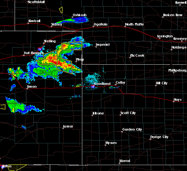 At 625 pm mdt, a severe thunderstorm was located near highland center, or 12 miles west of holyoke, moving east at 25 mph (radar indicated). Hazards include 60 mph wind gusts and quarter size hail. Expect damage to roofs, siding, and trees. Hail damage to vehicles is expected. At 625 pm mdt, a severe thunderstorm was located near highland center, or 12 miles west of holyoke, moving east at 25 mph (radar indicated). Hazards include 60 mph wind gusts and quarter size hail. Expect damage to roofs, siding, and trees. Hail damage to vehicles is expected.
|
| 7/19/2020 6:23 PM MDT |
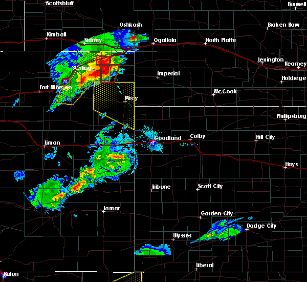 At 623 pm mdt, a severe thunderstorm capable of producing a tornado was located near haxtun, or 13 miles west of holyoke, moving southeast at 20 mph (radar indicated rotation). Hazards include tornado and quarter size hail. Flying debris will be dangerous to those caught without shelter. mobile homes will be damaged or destroyed. damage to roofs, windows, and vehicles will occur. tree damage is likely. Locations impacted include, haxtun, paoli, fairfield and highland center. At 623 pm mdt, a severe thunderstorm capable of producing a tornado was located near haxtun, or 13 miles west of holyoke, moving southeast at 20 mph (radar indicated rotation). Hazards include tornado and quarter size hail. Flying debris will be dangerous to those caught without shelter. mobile homes will be damaged or destroyed. damage to roofs, windows, and vehicles will occur. tree damage is likely. Locations impacted include, haxtun, paoli, fairfield and highland center.
|
| 7/19/2020 6:21 PM MDT | Storm damage reported in phillips county CO, 2.1 miles N of Haxtun, CO |
| 7/19/2020 6:14 PM MDT |
 At 614 pm mdt, a severe thunderstorm capable of producing a tornado was located over haxtun, or 16 miles west of holyoke, moving southeast at 20 mph (radar indicated rotation). Hazards include tornado and quarter size hail. Flying debris will be dangerous to those caught without shelter. mobile homes will be damaged or destroyed. damage to roofs, windows, and vehicles will occur. Tree damage is likely. At 614 pm mdt, a severe thunderstorm capable of producing a tornado was located over haxtun, or 16 miles west of holyoke, moving southeast at 20 mph (radar indicated rotation). Hazards include tornado and quarter size hail. Flying debris will be dangerous to those caught without shelter. mobile homes will be damaged or destroyed. damage to roofs, windows, and vehicles will occur. Tree damage is likely.
|
| 7/19/2020 6:02 PM MDT |
 At 601 pm mdt, a severe thunderstorm was located near fleming, or 21 miles east of sterling, moving east at 45 mph (radar indicated). Hazards include two inch hail and 70 mph wind gusts. Expect considerable tree damage. damage is likely to mobile homes, roofs, and outbuildings. people and animals outdoors will be injured. expect hail damage to roofs, siding, windows, and vehicles. Locations impacted include, akron, haxtun, fleming, sedgwick, crook, st petersburg, proctor, platner, marks butte, highland center, twin buttes, burdett, midway and fairfield. At 601 pm mdt, a severe thunderstorm was located near fleming, or 21 miles east of sterling, moving east at 45 mph (radar indicated). Hazards include two inch hail and 70 mph wind gusts. Expect considerable tree damage. damage is likely to mobile homes, roofs, and outbuildings. people and animals outdoors will be injured. expect hail damage to roofs, siding, windows, and vehicles. Locations impacted include, akron, haxtun, fleming, sedgwick, crook, st petersburg, proctor, platner, marks butte, highland center, twin buttes, burdett, midway and fairfield.
|
| 7/19/2020 5:47 PM MDT |
 At 547 pm mdt, a severe thunderstorm was located 4 miles southeast of iliff, or 10 miles northeast of sterling, moving east at 55 mph (radar indicated). Hazards include two inch hail and 60 mph wind gusts. Expect damage to roofs, siding, and trees. people and animals outdoors will be injured. Expect hail damage to roofs, siding, windows, and vehicles. At 547 pm mdt, a severe thunderstorm was located 4 miles southeast of iliff, or 10 miles northeast of sterling, moving east at 55 mph (radar indicated). Hazards include two inch hail and 60 mph wind gusts. Expect damage to roofs, siding, and trees. people and animals outdoors will be injured. Expect hail damage to roofs, siding, windows, and vehicles.
|
| 7/8/2020 6:00 PM MDT |
 At 557 pm mdt, a severe thunderstorm was located 8 miles north of venango, or 12 miles south of big springs, moving east at 10 mph (trained weather spotters have reported severa weak landspout tornadoes between sixtenn mile corner and amherst. there may be additional weak landspout tornadoes with this weakening storm). Hazards include 70 mph wind gusts. expect damage to roofs, siding, and trees At 557 pm mdt, a severe thunderstorm was located 8 miles north of venango, or 12 miles south of big springs, moving east at 10 mph (trained weather spotters have reported severa weak landspout tornadoes between sixtenn mile corner and amherst. there may be additional weak landspout tornadoes with this weakening storm). Hazards include 70 mph wind gusts. expect damage to roofs, siding, and trees
|
| 7/8/2020 5:47 PM MDT |
 At 540 pm mdt, a severe thunderstorm was located 9 miles north of venango, or 11 miles south of big springs, moving east at 20 mph (radar indicated. automated weather station in sidney had an earlier wind gust to 90 mph. a trained spotter also reported a funnel cloud near sixteen mile corner in sedgwick county). Hazards include 70 mph wind gusts and nickel size hail. Expect considerable tree damage. damage is likely to mobile homes, roofs, and outbuildings. Locations impacted include, julesburg, haxtun, fleming, ovid, peetz, sedgwick, crook, paoli, proctor, marks butte, amherst, twin buttes, fairfield and sixteen-mile corner. At 540 pm mdt, a severe thunderstorm was located 9 miles north of venango, or 11 miles south of big springs, moving east at 20 mph (radar indicated. automated weather station in sidney had an earlier wind gust to 90 mph. a trained spotter also reported a funnel cloud near sixteen mile corner in sedgwick county). Hazards include 70 mph wind gusts and nickel size hail. Expect considerable tree damage. damage is likely to mobile homes, roofs, and outbuildings. Locations impacted include, julesburg, haxtun, fleming, ovid, peetz, sedgwick, crook, paoli, proctor, marks butte, amherst, twin buttes, fairfield and sixteen-mile corner.
|
| 7/8/2020 5:20 PM MDT |
 At 519 pm mdt, a severe thunderstorm was located near proctor, or 19 miles south of sidney, moving east at 30 mph (radar indicated). Hazards include 60 mph wind gusts. expect damage to roofs, siding, and trees At 519 pm mdt, a severe thunderstorm was located near proctor, or 19 miles south of sidney, moving east at 30 mph (radar indicated). Hazards include 60 mph wind gusts. expect damage to roofs, siding, and trees
|
| 6/9/2020 12:43 AM MDT |
 At 1243 am mdt, a severe thunderstorm was located 7 miles northwest of burdett, or 14 miles southeast of sterling, moving north at 45 mph (radar indicated). Hazards include 70 mph wind gusts and quarter size hail. Expect considerable tree damage. damage is likely to mobile homes, roofs, and outbuildings. Hail damage to vehicles is expected. At 1243 am mdt, a severe thunderstorm was located 7 miles northwest of burdett, or 14 miles southeast of sterling, moving north at 45 mph (radar indicated). Hazards include 70 mph wind gusts and quarter size hail. Expect considerable tree damage. damage is likely to mobile homes, roofs, and outbuildings. Hail damage to vehicles is expected.
|
| 6/6/2020 7:07 PM MDT |
 The severe thunderstorm warning for northeastern washington, logan, phillips and sedgwick counties will expire at 715 pm mdt, the storms which prompted the warning have weakened below severe limits, and are exiting the warned area. therefore, the warning will be allowed to expire. however gusty winds are still possible with these thunderstorms. a severe thunderstorm watch remains in effect until 800 pm mdt for northeastern colorado. to report severe weather, contact your nearest law enforcement agency. they will relay your report to the national weather service denver colorado. The severe thunderstorm warning for northeastern washington, logan, phillips and sedgwick counties will expire at 715 pm mdt, the storms which prompted the warning have weakened below severe limits, and are exiting the warned area. therefore, the warning will be allowed to expire. however gusty winds are still possible with these thunderstorms. a severe thunderstorm watch remains in effect until 800 pm mdt for northeastern colorado. to report severe weather, contact your nearest law enforcement agency. they will relay your report to the national weather service denver colorado.
|
| 6/6/2020 6:36 PM MDT |
 At 636 pm mdt, severe thunderstorms were located along a line extending from 4 miles northeast of sedgwick to near prewitt reservoir, or along a line extending from 7 miles south of chappell to 15 miles southwest of sterling, moving northeast at 60 mph (radar indicated). Hazards include 70 mph wind gusts. Expect considerable tree damage. Damage is likely to mobile homes, roofs, and outbuildings. At 636 pm mdt, severe thunderstorms were located along a line extending from 4 miles northeast of sedgwick to near prewitt reservoir, or along a line extending from 7 miles south of chappell to 15 miles southwest of sterling, moving northeast at 60 mph (radar indicated). Hazards include 70 mph wind gusts. Expect considerable tree damage. Damage is likely to mobile homes, roofs, and outbuildings.
|
| 6/6/2020 6:29 PM MDT | Storm damage reported in phillips county CO, 11.3 miles SW of Haxtun, CO |
| 9/11/2019 7:35 PM MDT | Tennis Ball sized hail reported 11.3 miles SW of Haxtun, CO, house windows broken with damage to vehicles. |
| 7/29/2019 2:52 PM MDT |
 The severe thunderstorm warning for southeastern logan and southwestern phillips counties will expire at 300 pm mdt, the storm which prompted the warning has weakened below severe limits, and no longer poses an immediate threat to life or property. therefore, the warning will be allowed to expire. however gusty winds are still possible with this thunderstorm. The severe thunderstorm warning for southeastern logan and southwestern phillips counties will expire at 300 pm mdt, the storm which prompted the warning has weakened below severe limits, and no longer poses an immediate threat to life or property. therefore, the warning will be allowed to expire. however gusty winds are still possible with this thunderstorm.
|
| 7/29/2019 2:30 PM MDT | Quarter sized hail reported 5.2 miles ENE of Haxtun, CO |
| 7/29/2019 2:28 PM MDT |
 At 227 pm mdt, a severe thunderstorm was located near st petersburg, or 23 miles east of sterling, moving east at 20 mph (a trained weather spotter near st petersburg reported golfball size hail at 225 pm mdt). Hazards include golf ball size hail. People and animals outdoors will be injured. Expect damage to roofs, siding, windows, and vehicles. At 227 pm mdt, a severe thunderstorm was located near st petersburg, or 23 miles east of sterling, moving east at 20 mph (a trained weather spotter near st petersburg reported golfball size hail at 225 pm mdt). Hazards include golf ball size hail. People and animals outdoors will be injured. Expect damage to roofs, siding, windows, and vehicles.
|
| 7/29/2019 2:25 PM MDT | Golf Ball sized hail reported 6.6 miles ENE of Haxtun, CO |
| 6/30/2019 7:20 PM MDT | Quarter sized hail reported 5.2 miles ENE of Haxtun, CO |
| 6/30/2019 7:12 PM MDT |
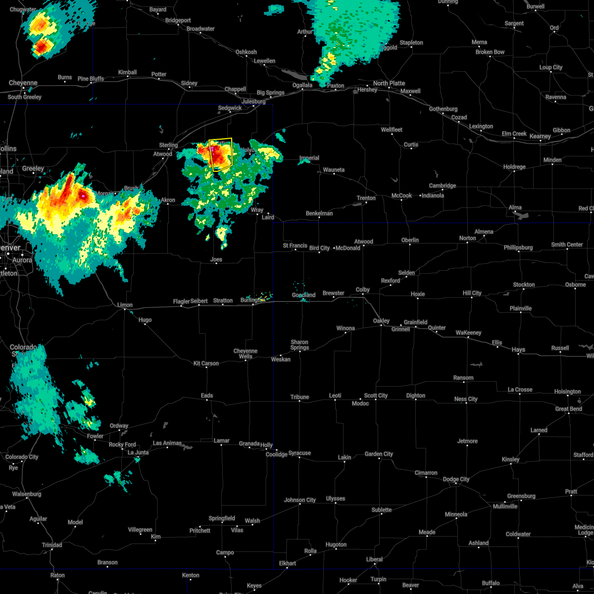 The severe thunderstorm warning for southeastern logan and western phillips counties will expire at 715 pm mdt, the storm which prompted the warning has moved out of the area. therefore, this warning will be allowed to expire. however hail and heavy rain are still possible with this thunderstorm as it moves over eastern logan county. The severe thunderstorm warning for southeastern logan and western phillips counties will expire at 715 pm mdt, the storm which prompted the warning has moved out of the area. therefore, this warning will be allowed to expire. however hail and heavy rain are still possible with this thunderstorm as it moves over eastern logan county.
|
| 6/30/2019 6:42 PM MDT |
 At 640 pm mdt, a severe thunderstorm was located near highland center, or 17 miles west of holyoke, moving north at 15 mph (radar indicated. at 639 pm mdt, a spotter 8 miles south of haxtun reported golfball sized hail). Hazards include golf ball size hail and 60 mph wind gusts. Expect damage to roofs, siding, and trees. people and animals outdoors will be injured. expect hail damage to roofs, siding, windows, and vehicles. Locations impacted include, haxtun, highland center and fairfield. At 640 pm mdt, a severe thunderstorm was located near highland center, or 17 miles west of holyoke, moving north at 15 mph (radar indicated. at 639 pm mdt, a spotter 8 miles south of haxtun reported golfball sized hail). Hazards include golf ball size hail and 60 mph wind gusts. Expect damage to roofs, siding, and trees. people and animals outdoors will be injured. expect hail damage to roofs, siding, windows, and vehicles. Locations impacted include, haxtun, highland center and fairfield.
|
| 6/30/2019 6:39 PM MDT | Golf Ball sized hail reported 7.7 miles N of Haxtun, CO |
| 6/30/2019 6:35 PM MDT |
 The national weather service in denver colorado has issued a * severe thunderstorm warning for. southeastern logan county in northeastern colorado. western phillips county in northeastern colorado. until 715 pm mdt. At 634 pm mdt, a severe thunderstorm was located near highland. The national weather service in denver colorado has issued a * severe thunderstorm warning for. southeastern logan county in northeastern colorado. western phillips county in northeastern colorado. until 715 pm mdt. At 634 pm mdt, a severe thunderstorm was located near highland.
|
| 5/27/2019 5:53 PM MDT | Quarter sized hail reported 15 miles NNW of Haxtun, CO |
| 5/17/2019 3:50 PM MDT | Quarter sized hail reported 5.8 miles SE of Haxtun, CO, report via facebook. |
| 4/16/2019 10:08 PM MDT |
 At 1008 pm mdt, a severe thunderstorm was located 10 miles south of holyoke, moving north at 30 mph (radar indicated). Hazards include 60 mph wind gusts and quarter size hail. Expect damage to roofs, siding, and trees. Hail damage to vehicles is expected. At 1008 pm mdt, a severe thunderstorm was located 10 miles south of holyoke, moving north at 30 mph (radar indicated). Hazards include 60 mph wind gusts and quarter size hail. Expect damage to roofs, siding, and trees. Hail damage to vehicles is expected.
|
| 8/5/2018 8:48 PM MDT |
 At 848 pm mdt, a severe thunderstorm was located 4 miles southwest of haxtun, or 21 miles west of holyoke, moving east at 35 mph (radar indicated). Hazards include golf ball size hail and 70 mph wind gusts. Expect considerable tree damage. damage is likely to mobile homes, roofs, and outbuildings. people and animals outdoors will be injured. Expect hail damage to roofs, siding, windows, and vehicles. At 848 pm mdt, a severe thunderstorm was located 4 miles southwest of haxtun, or 21 miles west of holyoke, moving east at 35 mph (radar indicated). Hazards include golf ball size hail and 70 mph wind gusts. Expect considerable tree damage. damage is likely to mobile homes, roofs, and outbuildings. people and animals outdoors will be injured. Expect hail damage to roofs, siding, windows, and vehicles.
|
| 6/23/2018 8:32 PM MDT |
 At 831 pm mdt, a severe thunderstorm was located 4 miles west of sedgwick, or 12 miles southwest of chappell, moving southeast at 30 mph (radar indicated). Hazards include 70 mph wind gusts and quarter size hail. Expect considerable tree damage. damage is likely to mobile homes, roofs, and outbuildings. Hail damage to vehicles is expected. At 831 pm mdt, a severe thunderstorm was located 4 miles west of sedgwick, or 12 miles southwest of chappell, moving southeast at 30 mph (radar indicated). Hazards include 70 mph wind gusts and quarter size hail. Expect considerable tree damage. damage is likely to mobile homes, roofs, and outbuildings. Hail damage to vehicles is expected.
|
| 5/27/2018 6:09 PM MDT |
 At 609 pm mdt, severe thunderstorms were located along a line extending from 7 miles northwest of sedgwick to 5 miles southwest of highland center, or along a line extending from 10 miles southwest of chappell to 19 miles southwest of holyoke, moving northeast at 35 mph (radar indicated). Hazards include 60 mph wind gusts and penny size hail. expect damage to roofs, siding, and trees At 609 pm mdt, severe thunderstorms were located along a line extending from 7 miles northwest of sedgwick to 5 miles southwest of highland center, or along a line extending from 10 miles southwest of chappell to 19 miles southwest of holyoke, moving northeast at 35 mph (radar indicated). Hazards include 60 mph wind gusts and penny size hail. expect damage to roofs, siding, and trees
|
| 5/10/2018 5:59 PM MDT |
 A severe thunderstorm warning remains in effect until 615 pm mdt for southwestern phillips county. at 557 pm mdt, a severe thunderstorm was located over highland center, or 15 miles west of holyoke, moving east at 35 mph. hazard. 60 mph wind gusts and half dollar size hail. source. Radar indicated. A severe thunderstorm warning remains in effect until 615 pm mdt for southwestern phillips county. at 557 pm mdt, a severe thunderstorm was located over highland center, or 15 miles west of holyoke, moving east at 35 mph. hazard. 60 mph wind gusts and half dollar size hail. source. Radar indicated.
|
| 5/10/2018 5:25 PM MDT |
 At 524 pm mdt, a severe thunderstorm was located 6 miles southwest of st petersburg, or 20 miles southeast of sterling, moving northeast at 35 mph (radar indicated). Hazards include 60 mph wind gusts and half dollar size hail. Hail damage to vehicles is expected. Expect wind damage to roofs, siding, and trees. At 524 pm mdt, a severe thunderstorm was located 6 miles southwest of st petersburg, or 20 miles southeast of sterling, moving northeast at 35 mph (radar indicated). Hazards include 60 mph wind gusts and half dollar size hail. Hail damage to vehicles is expected. Expect wind damage to roofs, siding, and trees.
|
| 10/1/2017 4:35 PM MDT |
 At 434 pm mdt, severe thunderstorms were located along a line extending from 6 miles west of peetz to 4 miles west of proctor to 6 miles northwest of burdett, or along a line extending from 16 miles southwest of sidney to 15 miles northeast of sterling to 21 miles northeast of akron, moving east at 45 mph (radar indicated. a wind gust to 60 mph was also reported in southeast sterling with these storms). Hazards include 70 mph wind gusts and quarter size hail. Hail damage to vehicles is expected. expect considerable tree damage. Wind damage is also likely to mobile homes, roofs, and outbuildings. At 434 pm mdt, severe thunderstorms were located along a line extending from 6 miles west of peetz to 4 miles west of proctor to 6 miles northwest of burdett, or along a line extending from 16 miles southwest of sidney to 15 miles northeast of sterling to 21 miles northeast of akron, moving east at 45 mph (radar indicated. a wind gust to 60 mph was also reported in southeast sterling with these storms). Hazards include 70 mph wind gusts and quarter size hail. Hail damage to vehicles is expected. expect considerable tree damage. Wind damage is also likely to mobile homes, roofs, and outbuildings.
|
| 8/2/2017 4:45 PM MDT | Ping Pong Ball sized hail reported 3.1 miles E of Haxtun, CO, extensive crop damage in vicinity of haxtun. hail measured 3-4 inches deep over a widespread area. |
| 8/2/2017 4:45 PM MDT |
 At 445 pm mdt, a severe thunderstorm was located near haxtun, or 19 miles west of holyoke, moving south at 20 mph (radar indicated). Hazards include two inch hail and 60 mph wind gusts. People and animals outdoors will be injured. expect hail damage to roofs, siding, windows, and vehicles. Expect wind damage to roofs, siding, and trees. At 445 pm mdt, a severe thunderstorm was located near haxtun, or 19 miles west of holyoke, moving south at 20 mph (radar indicated). Hazards include two inch hail and 60 mph wind gusts. People and animals outdoors will be injured. expect hail damage to roofs, siding, windows, and vehicles. Expect wind damage to roofs, siding, and trees.
|
| 8/2/2017 4:00 PM MDT |
 At 359 pm mdt, a severe thunderstorm was located 4 miles east of twin buttes, or 17 miles southwest of chappell, moving southeast at 15 mph (radar indicated). Hazards include ping pong ball size hail and 60 mph wind gusts. People and animals outdoors will be injured. expect hail damage to roofs, siding, windows, and vehicles. Expect wind damage to roofs, siding, and trees. At 359 pm mdt, a severe thunderstorm was located 4 miles east of twin buttes, or 17 miles southwest of chappell, moving southeast at 15 mph (radar indicated). Hazards include ping pong ball size hail and 60 mph wind gusts. People and animals outdoors will be injured. expect hail damage to roofs, siding, windows, and vehicles. Expect wind damage to roofs, siding, and trees.
|
| 7/4/2017 3:29 PM MDT | Quarter sized hail reported 11.3 miles SW of Haxtun, CO |
| 7/3/2017 4:56 PM MDT |
 At 454 pm mdt, severe thunderstorms were located along a line extending from 6 miles northeast of fleming to 7 miles southwest of highland center to 4 miles southeast of otis, or along a line extending from 24 miles east of sterling to 22 miles southwest of holyoke to 10 miles west of yuma, moving southeast at 25 mph (radar indicated and weather spotter report). Hazards include half dollar size hail. Damage to vehicles is expected. at 441 pm mdt, a trained weather spotter 1 mile south of otis in northeast washington county reported ping pong ball size hail. Locations impacted include, haxtun, otis, fleming, crook, paoli, st petersburg, highland center, burdett, fairfield, lone star and marks butte. At 454 pm mdt, severe thunderstorms were located along a line extending from 6 miles northeast of fleming to 7 miles southwest of highland center to 4 miles southeast of otis, or along a line extending from 24 miles east of sterling to 22 miles southwest of holyoke to 10 miles west of yuma, moving southeast at 25 mph (radar indicated and weather spotter report). Hazards include half dollar size hail. Damage to vehicles is expected. at 441 pm mdt, a trained weather spotter 1 mile south of otis in northeast washington county reported ping pong ball size hail. Locations impacted include, haxtun, otis, fleming, crook, paoli, st petersburg, highland center, burdett, fairfield, lone star and marks butte.
|
| 7/3/2017 4:30 PM MDT |
 At 429 pm mdt, severe thunderstorms were located along a line extending from near crook to 7 miles south of lone star, or along a line extending from 20 miles south of sidney to 11 miles northwest of yuma, moving east at 35 mph (radar indicated). Hazards include 60 mph wind gusts and quarter size hail. Hail damage to vehicles is expected. Expect wind damage to roofs, siding, and trees. At 429 pm mdt, severe thunderstorms were located along a line extending from near crook to 7 miles south of lone star, or along a line extending from 20 miles south of sidney to 11 miles northwest of yuma, moving east at 35 mph (radar indicated). Hazards include 60 mph wind gusts and quarter size hail. Hail damage to vehicles is expected. Expect wind damage to roofs, siding, and trees.
|
| 7/27/2016 8:33 PM MDT |
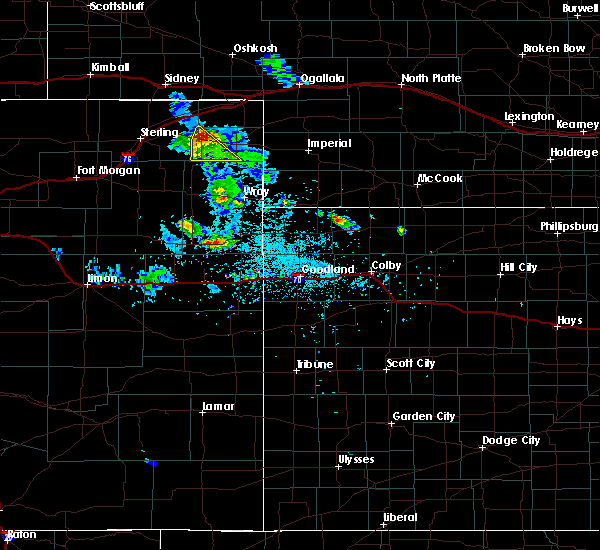 At 833 pm mdt, a severe thunderstorm was located near haxtun, or 14 miles west of holyoke, moving southeast at 25 mph (radar indicated). Hazards include 60 mph wind gusts and quarter size hail. Hail damage to vehicles is expected. expect wind damage to roofs, siding, and trees. Locations impacted include, haxtun, paoli and highland center. At 833 pm mdt, a severe thunderstorm was located near haxtun, or 14 miles west of holyoke, moving southeast at 25 mph (radar indicated). Hazards include 60 mph wind gusts and quarter size hail. Hail damage to vehicles is expected. expect wind damage to roofs, siding, and trees. Locations impacted include, haxtun, paoli and highland center.
|
| 7/27/2016 8:18 PM MDT |
 At 817 pm mdt, a severe thunderstorm was located 4 miles northwest of haxtun, or 21 miles west of holyoke, moving southeast at 35 mph (radar indicated). Hazards include 60 mph wind gusts and quarter size hail. Hail damage to vehicles is expected. Expect wind damage to roofs, siding, and trees. At 817 pm mdt, a severe thunderstorm was located 4 miles northwest of haxtun, or 21 miles west of holyoke, moving southeast at 35 mph (radar indicated). Hazards include 60 mph wind gusts and quarter size hail. Hail damage to vehicles is expected. Expect wind damage to roofs, siding, and trees.
|
| 7/18/2016 9:11 PM MDT |
 At 909 pm mdt, strong to severe thunderstorms were located over eastern logan, western phillips and western sedgwick counties these storms are moving northeast at 35 mph (radar indicated). Hazards include 70 mph wind gusts and quarter size hail. Hail damage to vehicles is expected. expect considerable tree damage. Wind damage is also likely to mobile homes, roofs, and outbuildings. At 909 pm mdt, strong to severe thunderstorms were located over eastern logan, western phillips and western sedgwick counties these storms are moving northeast at 35 mph (radar indicated). Hazards include 70 mph wind gusts and quarter size hail. Hail damage to vehicles is expected. expect considerable tree damage. Wind damage is also likely to mobile homes, roofs, and outbuildings.
|
| 6/28/2016 8:55 PM MDT |
 The severe thunderstorm warning for phillips, southeastern logan and sedgwick counties will expire at 900 pm mdt, the storm which prompted the warning has moved out of the area. therefore the warning will be allowed to expire. however gusty winds are still possible with this departing thunderstorm. The severe thunderstorm warning for phillips, southeastern logan and sedgwick counties will expire at 900 pm mdt, the storm which prompted the warning has moved out of the area. therefore the warning will be allowed to expire. however gusty winds are still possible with this departing thunderstorm.
|
| 6/28/2016 8:32 PM MDT |
 At 828 pm mdt, a severe thunderstorm was located 5 miles northwest of venango, or 14 miles southeast of julesburg, moving southeast at 30 mph. strong outflow winds are being produced by this storm (radar indicated. cameras across logan and sedgwick and phillips counties also indicated considerable blowing dust produced by strong outflow winds from this thunderstorm). Hazards include 60 mph wind gusts and penny size hail. Expect damage to roofs. siding. crops and and trees. Locations impacted include, holyoke, julesburg, haxtun, fleming, ovid, sedgwick, paoli, pleasant valley, st petersburg, fairfield, sixteen-mile corner, amherst, marks butte and highland center. At 828 pm mdt, a severe thunderstorm was located 5 miles northwest of venango, or 14 miles southeast of julesburg, moving southeast at 30 mph. strong outflow winds are being produced by this storm (radar indicated. cameras across logan and sedgwick and phillips counties also indicated considerable blowing dust produced by strong outflow winds from this thunderstorm). Hazards include 60 mph wind gusts and penny size hail. Expect damage to roofs. siding. crops and and trees. Locations impacted include, holyoke, julesburg, haxtun, fleming, ovid, sedgwick, paoli, pleasant valley, st petersburg, fairfield, sixteen-mile corner, amherst, marks butte and highland center.
|
| 6/28/2016 8:03 PM MDT |
 At 757 pm mdt, a severe thunderstorm near sydney nebraska was producing a line of very strong outflow winds across logan and sedgwick counties in northeast colorado. the leading edge of these winds extends from near iliff to near marks butte to 8 miles south of barton, or along a line extending from 12 miles northeast of sterling to 17 miles northwest of holyoke to 8 miles southeast of julesburg, moving southeast at 20 mph. this storm is expected to move over northeast logan county near twin buttes by 820 pm mdt (radar indicated. strong winds have been observed producing considerable blowing dust). Hazards include 60 mph wind gusts and nickel size hail. Expect damage to roofs. siding. And trees. At 757 pm mdt, a severe thunderstorm near sydney nebraska was producing a line of very strong outflow winds across logan and sedgwick counties in northeast colorado. the leading edge of these winds extends from near iliff to near marks butte to 8 miles south of barton, or along a line extending from 12 miles northeast of sterling to 17 miles northwest of holyoke to 8 miles southeast of julesburg, moving southeast at 20 mph. this storm is expected to move over northeast logan county near twin buttes by 820 pm mdt (radar indicated. strong winds have been observed producing considerable blowing dust). Hazards include 60 mph wind gusts and nickel size hail. Expect damage to roofs. siding. And trees.
|
| 6/27/2016 5:47 PM MDT | Tennis Ball sized hail reported 3.8 miles NW of Haxtun, CO, broken windows |
| 6/27/2016 5:26 PM MDT | Baseball sized hail reported 6.9 miles WNW of Haxtun, CO |
| 6/27/2016 5:13 PM MDT |
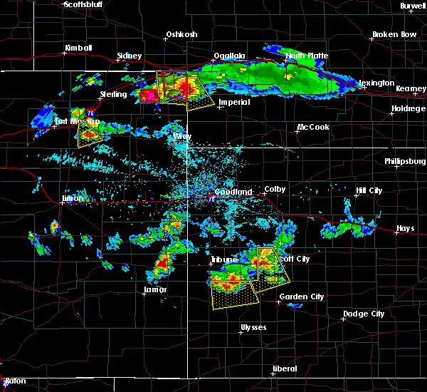 At 512 pm mdt, a severe thunderstorm was located over paoli, or 9 miles northwest of holyoke, moving south at 25 mph (radar indicated). Hazards include two inch hail and 70 mph wind gusts. People and animals outdoors will be injured. expect hail damage to roofs, siding, windows, and vehicles. expect considerable tree damage. Wind damage is also likely to mobile homes, roofs, and outbuildings. At 512 pm mdt, a severe thunderstorm was located over paoli, or 9 miles northwest of holyoke, moving south at 25 mph (radar indicated). Hazards include two inch hail and 70 mph wind gusts. People and animals outdoors will be injured. expect hail damage to roofs, siding, windows, and vehicles. expect considerable tree damage. Wind damage is also likely to mobile homes, roofs, and outbuildings.
|
| 6/27/2016 5:05 PM MDT | Ping Pong Ball sized hail reported 4.2 miles W of Haxtun, CO, strong wind |
| 6/27/2016 5:05 PM MDT |
 At 504 pm mdt, a severe thunderstorm capable of producing a tornado was located 5 miles northeast of haxtun, or 14 miles northwest of holyoke, moving south at 20 mph (radar indicated rotation). Hazards include tornado and two inch hail. Flying debris will be dangerous to those caught without shelter. mobile homes will be damaged or destroyed. damage to roofs, windows, and vehicles will occur. tree damage is likely. Locations impacted include, haxtun, paoli and fairfield. At 504 pm mdt, a severe thunderstorm capable of producing a tornado was located 5 miles northeast of haxtun, or 14 miles northwest of holyoke, moving south at 20 mph (radar indicated rotation). Hazards include tornado and two inch hail. Flying debris will be dangerous to those caught without shelter. mobile homes will be damaged or destroyed. damage to roofs, windows, and vehicles will occur. tree damage is likely. Locations impacted include, haxtun, paoli and fairfield.
|
| 6/27/2016 4:48 PM MDT |
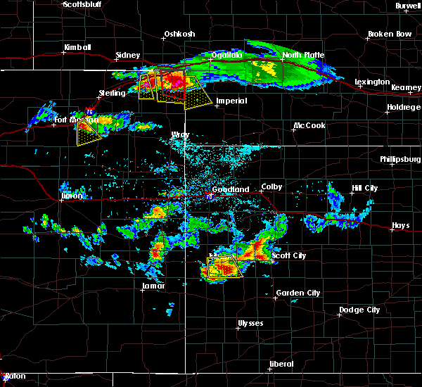 At 448 pm mdt, a severe thunderstorm capable of producing a tornado was located 4 miles southwest of marks butte, or 19 miles northwest of holyoke, moving south at 20 mph (radar indicated rotation). Hazards include tornado and hail up to two inches in diameter. Flying debris will be dangerous to those caught without shelter. mobile homes will be damaged or destroyed. damage to roofs, windows, and vehicles will occur. Tree damage is likely. At 448 pm mdt, a severe thunderstorm capable of producing a tornado was located 4 miles southwest of marks butte, or 19 miles northwest of holyoke, moving south at 20 mph (radar indicated rotation). Hazards include tornado and hail up to two inches in diameter. Flying debris will be dangerous to those caught without shelter. mobile homes will be damaged or destroyed. damage to roofs, windows, and vehicles will occur. Tree damage is likely.
|
| 6/27/2016 4:45 PM MDT |
 At 444 pm mdt, a severe thunderstorm was located near marks butte, or 20 miles northwest of holyoke, moving southeast at 30 mph (radar indicated). Hazards include two inch hail and 70 mph wind gusts. People and animals outdoors will be injured. expect hail damage to roofs, siding, windows, and vehicles. expect considerable tree damage. wind damage is also likely to mobile homes, roofs, and outbuildings. locations impacted include, haxtun and fairfield. A tornado watch remains in effect until 800 pm mdt for northeastern colorado. At 444 pm mdt, a severe thunderstorm was located near marks butte, or 20 miles northwest of holyoke, moving southeast at 30 mph (radar indicated). Hazards include two inch hail and 70 mph wind gusts. People and animals outdoors will be injured. expect hail damage to roofs, siding, windows, and vehicles. expect considerable tree damage. wind damage is also likely to mobile homes, roofs, and outbuildings. locations impacted include, haxtun and fairfield. A tornado watch remains in effect until 800 pm mdt for northeastern colorado.
|
| 6/27/2016 4:22 PM MDT |
 At 421 pm mdt, a severe thunderstorm was located 5 miles northeast of twin buttes, or 14 miles southwest of chappell, moving south at 35 mph (radar indicated). Hazards include golf ball size hail and 70 mph wind gusts. People and animals outdoors will be injured. expect hail damage to roofs, siding, windows, and vehicles. expect considerable tree damage. Wind damage is also likely to mobile homes, roofs, and outbuildings. At 421 pm mdt, a severe thunderstorm was located 5 miles northeast of twin buttes, or 14 miles southwest of chappell, moving south at 35 mph (radar indicated). Hazards include golf ball size hail and 70 mph wind gusts. People and animals outdoors will be injured. expect hail damage to roofs, siding, windows, and vehicles. expect considerable tree damage. Wind damage is also likely to mobile homes, roofs, and outbuildings.
|
| 6/26/2016 6:42 PM MDT |
 At 642 pm mdt, a severe thunderstorm was located 4 miles north of highland center, or 14 miles west of holyoke, moving east at 15 mph (radar indicated). Hazards include ping pong ball size hail and 60 mph wind gusts. People and animals outdoors will be injured. expect hail damage to roofs, siding, windows, and vehicles. expect wind damage to roofs, siding, and trees. Locations impacted include, haxtun, paoli and highland center. At 642 pm mdt, a severe thunderstorm was located 4 miles north of highland center, or 14 miles west of holyoke, moving east at 15 mph (radar indicated). Hazards include ping pong ball size hail and 60 mph wind gusts. People and animals outdoors will be injured. expect hail damage to roofs, siding, windows, and vehicles. expect wind damage to roofs, siding, and trees. Locations impacted include, haxtun, paoli and highland center.
|
| 6/26/2016 6:28 PM MDT |
 At 628 pm mdt, a severe thunderstorm was located near haxtun, or 17 miles west of holyoke, moving east at 15 mph (radar indicated). Hazards include ping pong ball size hail and 60 mph wind gusts. People and animals outdoors will be injured. expect hail damage to roofs, siding, windows, and vehicles. Expect wind damage to roofs, siding, and trees. At 628 pm mdt, a severe thunderstorm was located near haxtun, or 17 miles west of holyoke, moving east at 15 mph (radar indicated). Hazards include ping pong ball size hail and 60 mph wind gusts. People and animals outdoors will be injured. expect hail damage to roofs, siding, windows, and vehicles. Expect wind damage to roofs, siding, and trees.
|
| 6/17/2016 6:15 PM MDT | Half Dollar sized hail reported 7.7 miles N of Haxtun, CO |
| 6/17/2016 5:50 PM MDT | Half Dollar sized hail reported 0.1 miles NNW of Haxtun, CO |
| 6/17/2016 5:49 PM MDT |
 At 547 pm mdt, a severe thunderstorm was located near haxtun, or 21 miles west of holyoke, moving southwest at 10 mph (trained weather spotters). Hazards include golf ball size hail and 60 mph wind gusts. People and animals outdoors will be injured. expect hail damage to roofs, siding, windows, and vehicles. expect wind damage to roofs, siding, and trees. Locations impacted include, haxtun and fleming. At 547 pm mdt, a severe thunderstorm was located near haxtun, or 21 miles west of holyoke, moving southwest at 10 mph (trained weather spotters). Hazards include golf ball size hail and 60 mph wind gusts. People and animals outdoors will be injured. expect hail damage to roofs, siding, windows, and vehicles. expect wind damage to roofs, siding, and trees. Locations impacted include, haxtun and fleming.
|
| 6/17/2016 5:47 PM MDT | Half Dollar sized hail reported 0.8 miles SW of Haxtun, CO |
| 6/17/2016 5:47 PM MDT | Half Dollar sized hail reported 0.1 miles NNW of Haxtun, CO |
| 6/17/2016 5:46 PM MDT | Ping Pong Ball sized hail reported 4.2 miles W of Haxtun, CO |
| 6/17/2016 5:37 PM MDT |
 At 537 pm mdt, a severe thunderstorm was located near haxtun, or 20 miles west of holyoke, moving southwest at 10 mph (radar indicated). Hazards include 60 mph wind gusts and half dollar size hail. Hail damage to vehicles is expected. Expect wind damage to roofs, siding, and trees. At 537 pm mdt, a severe thunderstorm was located near haxtun, or 20 miles west of holyoke, moving southwest at 10 mph (radar indicated). Hazards include 60 mph wind gusts and half dollar size hail. Hail damage to vehicles is expected. Expect wind damage to roofs, siding, and trees.
|
| 8/17/2015 6:44 PM MDT |
 At 643 pm mdt, severe thunderstorms were located along a line extending from 4 miles northeast of north sterling reservoir to proctor, or along a line extending from 12 miles north of sterling to 22 miles south of sidney, moving east at 30 mph (radar indicated). Hazards include ping pong ball size hail and 60 mph wind gusts. People and animals outdoors will be injured. expect hail damage to roofs, siding, windows and vehicles. Expect wind damage to roofs, siding and trees. At 643 pm mdt, severe thunderstorms were located along a line extending from 4 miles northeast of north sterling reservoir to proctor, or along a line extending from 12 miles north of sterling to 22 miles south of sidney, moving east at 30 mph (radar indicated). Hazards include ping pong ball size hail and 60 mph wind gusts. People and animals outdoors will be injured. expect hail damage to roofs, siding, windows and vehicles. Expect wind damage to roofs, siding and trees.
|
| 8/5/2015 6:40 PM MDT |
 At 635 pm mdt, a severe thunderstorm was located 5 miles northeast of fleming, or 24 miles east of sterling, moving southeast at 25 mph (radar indicated). Hazards include 60 mph wind gusts and nickel size hail. Expect damage to roofs. siding and trees. Locations impacted include, haxtun, fleming and crook. At 635 pm mdt, a severe thunderstorm was located 5 miles northeast of fleming, or 24 miles east of sterling, moving southeast at 25 mph (radar indicated). Hazards include 60 mph wind gusts and nickel size hail. Expect damage to roofs. siding and trees. Locations impacted include, haxtun, fleming and crook.
|
| 8/5/2015 6:21 PM MDT |
 At 619 pm mdt, a severe thunderstorm was located near proctor, or 20 miles northeast of sterling, moving southeast at 25 mph (radar indicated). Hazards include 60 mph wind gusts and quarter size hail. Hail damage to vehicles is expected. Expect wind damage to roofs, siding and trees. At 619 pm mdt, a severe thunderstorm was located near proctor, or 20 miles northeast of sterling, moving southeast at 25 mph (radar indicated). Hazards include 60 mph wind gusts and quarter size hail. Hail damage to vehicles is expected. Expect wind damage to roofs, siding and trees.
|
| 5/27/2015 3:36 PM MDT | At 335 pm mdt, a severe thunderstorm was located 6 miles northeast of fleming, or 24 miles northwest of holyoke, moving northeast at 10 mph (radar indicated). Hazards include ping pong ball size hail and 60 mph wind gusts. People and animals outdoors will be injured. expect hail damage to roofs, siding, windows and vehicles. Expect wind damage to roofs, siding and trees. |
| 5/15/2015 6:26 PM MDT | At 625 pm mdt, a severe thunderstorm was located near highland center, or 12 miles west of holyoke, moving northeast at 30 mph (radar indicated). Hazards include ping pong ball size hail and 60 mph wind gusts. People and animals outdoors will be injured. expect hail damage to roofs, siding, windows and vehicles. Expect wind damage to roofs, siding and trees. |
| 6/18/2014 8:40 PM MDT | High thunderstorm winds knocked down numerous trees and power line in phillips county CO, 0.1 miles NNW of Haxtun, CO |
| 4/8/2013 9:32 PM MDT | Storm damage reported in phillips county CO, 4.2 miles W of Haxtun, CO |
| 4/8/2013 7:09 PM MDT | Half Dollar sized hail reported 15.8 miles NNW of Haxtun, CO, relayed via spotter network |
| 7/17/2012 3:30 PM MDT | Quarter sized hail reported 2.3 miles SSW of Haxtun, CO |
| 6/22/2012 7:48 PM MDT | Quarter sized hail reported 7.7 miles N of Haxtun, CO |
| 1/1/0001 12:00 AM | Ping Pong Ball sized hail reported 12.8 miles W of Haxtun, CO |
| 1/1/0001 12:00 AM | Quarter sized hail reported 17.3 miles N of Haxtun, CO |
Hail Maps for Haxtun, CO

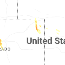
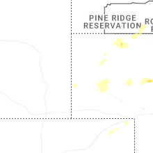
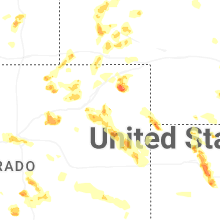
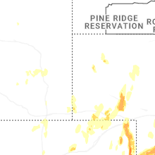


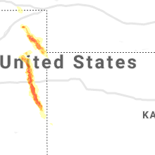


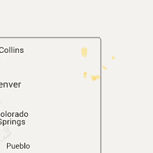


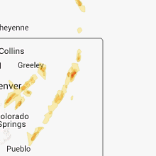


Connect with Interactive Hail Maps