

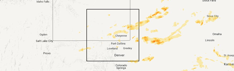
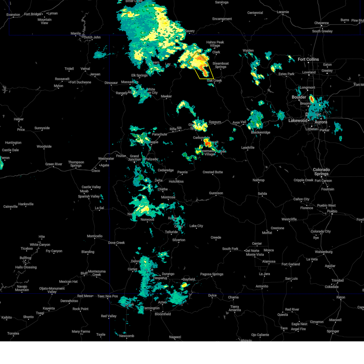
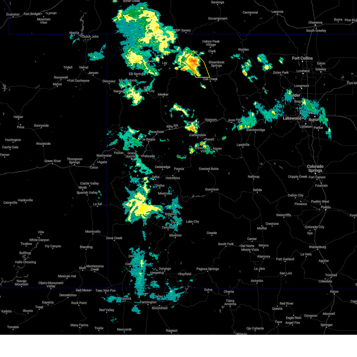
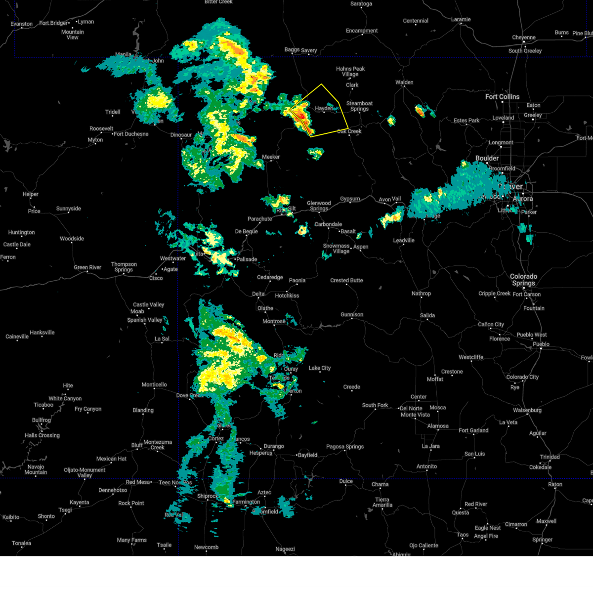
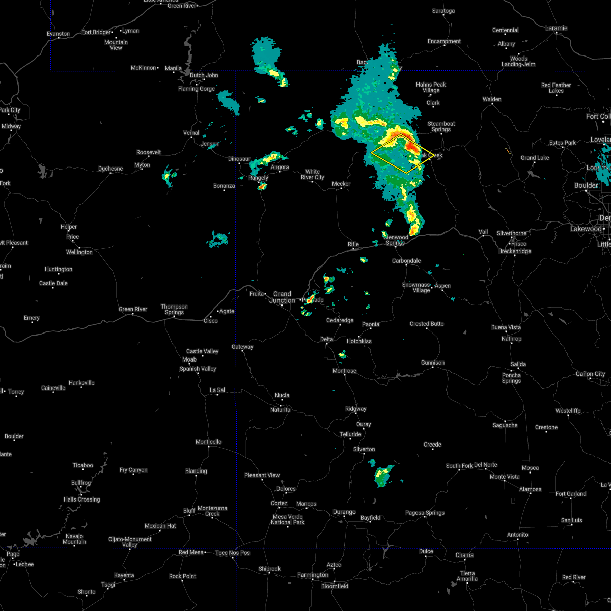
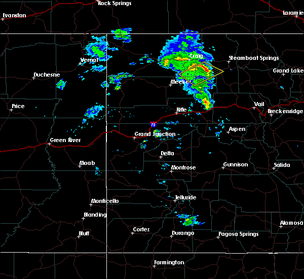
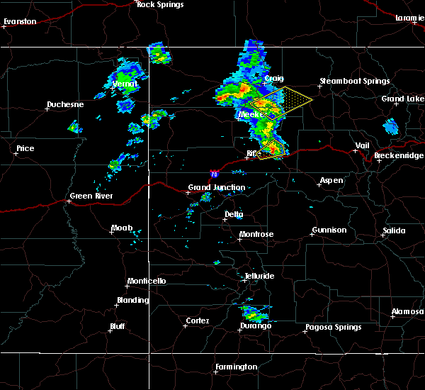
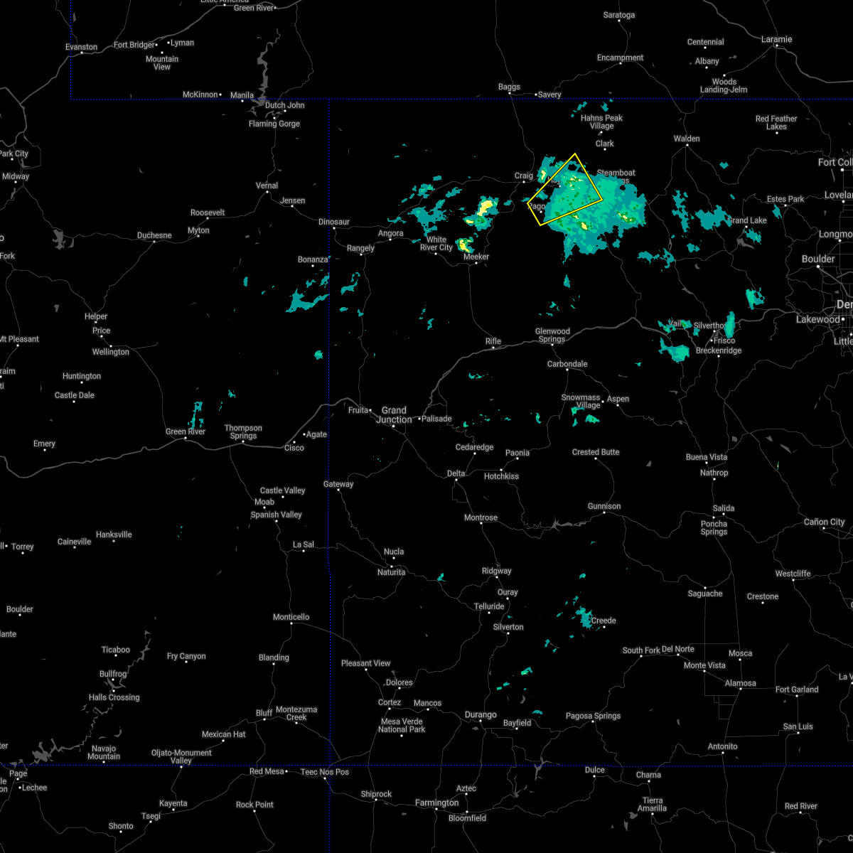
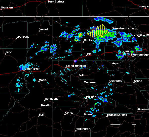
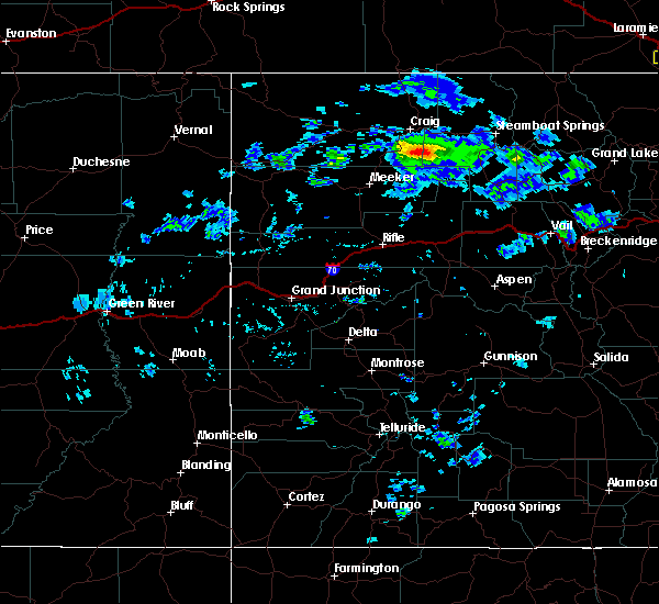
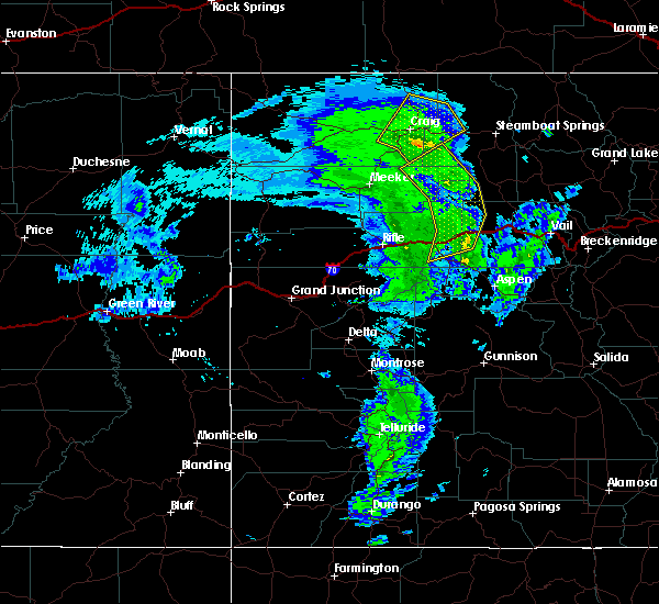
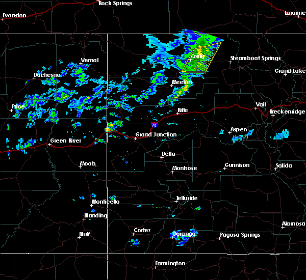
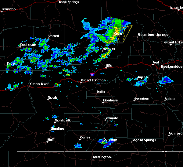
Hail Map for Hayden, CO
The Hayden, CO area has had 0 reports of on-the-ground hail by trained spotters, and has been under severe weather warnings 3 times during the past 12 months. Doppler radar has detected hail at or near Hayden, CO on 1 occasion.
| Name: | Hayden, CO |
| Where Located: | 15.7 miles E of Craig, CO |
| Map: | Google Map for Hayden, CO |
| Population: | 1810 |
| Housing Units: | 806 |
| More Info: | Search Google for Hayden, CO |
0
The Top Recent Hail Date for Hayden, CO is Thursday, June 16, 2011 (1st out of 1)
Hail and Wind Damage Spotted near Hayden, CO
| Date / Time | Report Details |
|---|---|
| 8/2/2023 9:53 PM MDT |
 The severe thunderstorm warning for west central routt and east central moffat counties will expire at 1000 pm mdt, the storms which prompted the warning have weakened below severe limits, and have exited the warned area. therefore, the warning will be allowed to expire. however gusty winds are still possible with these thunderstorms. The severe thunderstorm warning for west central routt and east central moffat counties will expire at 1000 pm mdt, the storms which prompted the warning have weakened below severe limits, and have exited the warned area. therefore, the warning will be allowed to expire. however gusty winds are still possible with these thunderstorms.
|
| 8/2/2023 9:35 PM MDT |
 At 934 pm mdt, severe thunderstorms were located along a line extending from 7 miles northeast of craig to near hayden to 17 miles northwest of oak creek, moving northeast at 20 mph (radar indicated). Hazards include 60 mph wind gusts. Expect damage to roofs, siding, and trees. locations impacted include, hayden and tow creek. this includes the following highways, u. s. highway 40 in colorado between mile markers 99 and 100, and between mile markers 102 and 120. colorado 13 near mile marker 97. hail threat, radar indicated max hail size, <. 75 in wind threat, radar indicated max wind gust, 60 mph. At 934 pm mdt, severe thunderstorms were located along a line extending from 7 miles northeast of craig to near hayden to 17 miles northwest of oak creek, moving northeast at 20 mph (radar indicated). Hazards include 60 mph wind gusts. Expect damage to roofs, siding, and trees. locations impacted include, hayden and tow creek. this includes the following highways, u. s. highway 40 in colorado between mile markers 99 and 100, and between mile markers 102 and 120. colorado 13 near mile marker 97. hail threat, radar indicated max hail size, <. 75 in wind threat, radar indicated max wind gust, 60 mph.
|
| 8/2/2023 9:08 PM MDT |
 At 907 pm mdt, severe thunderstorms were located along a line extending from craig to 11 miles west of hayden, moving northeast at 20 mph (radar indicated). Hazards include 60 mph wind gusts and penny size hail. expect damage to roofs, siding, and trees At 907 pm mdt, severe thunderstorms were located along a line extending from craig to 11 miles west of hayden, moving northeast at 20 mph (radar indicated). Hazards include 60 mph wind gusts and penny size hail. expect damage to roofs, siding, and trees
|
| 6/6/2020 1:55 PM MDT |
 At 154 pm mdt, severe thunderstorms were located along a line extending from 8 miles south of savery to near hayden to 7 miles south of yampa, moving northeast at 65 mph (public reported damage to structures). Hazards include 70 mph wind gusts. Expect considerable tree damage. Damage is likely to mobile homes, roofs, and outbuildings. At 154 pm mdt, severe thunderstorms were located along a line extending from 8 miles south of savery to near hayden to 7 miles south of yampa, moving northeast at 65 mph (public reported damage to structures). Hazards include 70 mph wind gusts. Expect considerable tree damage. Damage is likely to mobile homes, roofs, and outbuildings.
|
| 6/6/2020 1:49 PM MDT | Report from mping: trees uprooted or snapped; roof blown of in routt county CO, 5.7 miles E of Hayden, CO |
| 6/6/2020 1:49 PM MDT |
 At 149 pm mdt, severe thunderstorms were located along a line extending from near dixon to 6 miles north of hayden to 7 miles west of yampa, moving northeast at 65 mph (radar indicated). Hazards include 70 mph wind gusts. Expect considerable tree damage. damage is likely to mobile homes, roofs, and outbuildings. locations impacted include, hayden, oak creek, yampa, milner, tow creek, slater, phippsburg and fortification. this includes the following highways, u. s. highway 40 in colorado between mile markers 94 and 127. colorado 13 between mile markers 94 and 127. Colorado 131 between mile markers 36 and 63. At 149 pm mdt, severe thunderstorms were located along a line extending from near dixon to 6 miles north of hayden to 7 miles west of yampa, moving northeast at 65 mph (radar indicated). Hazards include 70 mph wind gusts. Expect considerable tree damage. damage is likely to mobile homes, roofs, and outbuildings. locations impacted include, hayden, oak creek, yampa, milner, tow creek, slater, phippsburg and fortification. this includes the following highways, u. s. highway 40 in colorado between mile markers 94 and 127. colorado 13 between mile markers 94 and 127. Colorado 131 between mile markers 36 and 63.
|
| 6/6/2020 1:28 PM MDT |
 At 126 pm mdt, severe thunderstorms were located along a line extending from 13 miles northwest of craig to 18 miles southwest of hayden to 22 miles north of glenwood springs, moving northeast at 65 mph (radar indicated). Hazards include 70 mph wind gusts. Expect considerable tree damage. Damage is likely to mobile homes, roofs, and outbuildings. At 126 pm mdt, severe thunderstorms were located along a line extending from 13 miles northwest of craig to 18 miles southwest of hayden to 22 miles north of glenwood springs, moving northeast at 65 mph (radar indicated). Hazards include 70 mph wind gusts. Expect considerable tree damage. Damage is likely to mobile homes, roofs, and outbuildings.
|
| 9/8/2019 6:43 PM MDT |
 The severe thunderstorm warning for west central routt, southeastern moffat and northeastern rio blanco counties will expire at 645 pm mdt, the storm which prompted the warning has moved out of the area. therefore the warning will be allowed to expire. The severe thunderstorm warning for west central routt, southeastern moffat and northeastern rio blanco counties will expire at 645 pm mdt, the storm which prompted the warning has moved out of the area. therefore the warning will be allowed to expire.
|
| 9/8/2019 6:30 PM MDT |
 At 630 pm mdt, a severe thunderstorm was located 9 miles northwest of oak creek, or 26 miles east of craig, moving northeast at 35 mph (radar indicated). Hazards include 70 mph wind gusts. Expect considerable tree damage. damage is likely to mobile homes, roofs, and outbuildings. locations impacted include, hayden. This includes colorado 131 between mile markers 53 and 56. At 630 pm mdt, a severe thunderstorm was located 9 miles northwest of oak creek, or 26 miles east of craig, moving northeast at 35 mph (radar indicated). Hazards include 70 mph wind gusts. Expect considerable tree damage. damage is likely to mobile homes, roofs, and outbuildings. locations impacted include, hayden. This includes colorado 131 between mile markers 53 and 56.
|
| 9/8/2019 6:11 PM MDT |
 At 610 pm mdt, a severe thunderstorm was located 18 miles southwest of hayden, or 20 miles south of craig, moving northeast at 35 mph (radar indicated). Hazards include 70 mph wind gusts. Expect considerable tree damage. Damage is likely to mobile homes, roofs, and outbuildings. At 610 pm mdt, a severe thunderstorm was located 18 miles southwest of hayden, or 20 miles south of craig, moving northeast at 35 mph (radar indicated). Hazards include 70 mph wind gusts. Expect considerable tree damage. Damage is likely to mobile homes, roofs, and outbuildings.
|
| 8/16/2019 5:57 PM MDT |
 The severe thunderstorm warning for west central routt and eastern moffat counties will expire at 600 pm mdt, the storm which prompted the warning has weakened below severe limits, and no longer poses an immediate threat to life or property. therefore the warning will be allowed to expire. however gusty winds are still possible with this thunderstorm. The severe thunderstorm warning for west central routt and eastern moffat counties will expire at 600 pm mdt, the storm which prompted the warning has weakened below severe limits, and no longer poses an immediate threat to life or property. therefore the warning will be allowed to expire. however gusty winds are still possible with this thunderstorm.
|
| 8/16/2019 5:39 PM MDT |
 A severe thunderstorm warning remains in effect until 600 pm mdt for west central routt and eastern moffat counties. at 537 pm mdt, a severe thunderstorm was located 10 miles south of hayden moving east northeast at 30 mph. hazard. 60 mph wind gusts and penny size hail. source. Radar indicated. A severe thunderstorm warning remains in effect until 600 pm mdt for west central routt and eastern moffat counties. at 537 pm mdt, a severe thunderstorm was located 10 miles south of hayden moving east northeast at 30 mph. hazard. 60 mph wind gusts and penny size hail. source. Radar indicated.
|
| 8/16/2019 5:15 PM MDT |
 The national weather service in grand junction has issued a * severe thunderstorm warning for. west central routt county in northwestern colorado. southeastern moffat county in northwestern colorado. northeastern rio blanco county in northwestern colorado. Until 600 pm mdt. The national weather service in grand junction has issued a * severe thunderstorm warning for. west central routt county in northwestern colorado. southeastern moffat county in northwestern colorado. northeastern rio blanco county in northwestern colorado. Until 600 pm mdt.
|
| 4/26/2019 3:06 PM MDT | Awos station khdn yampa valley airpor in routt county CO, 2.1 miles NW of Hayden, CO |
| 10/4/2018 12:00 PM MDT |
 At 1159 am mdt, severe thunderstorms were located along a line extending from 7 miles northwest of hayden to 11 miles west of steamboat springs to near yampa, moving northeast at 50 mph (numerous public reports of 60 mph winds have been reported across western colorado with this line of thunderstorms). Hazards include 60 mph wind gusts. expect damage to roofs, siding, and trees At 1159 am mdt, severe thunderstorms were located along a line extending from 7 miles northwest of hayden to 11 miles west of steamboat springs to near yampa, moving northeast at 50 mph (numerous public reports of 60 mph winds have been reported across western colorado with this line of thunderstorms). Hazards include 60 mph wind gusts. expect damage to roofs, siding, and trees
|
| 10/4/2018 11:54 AM MDT |
 At 1153 am mdt, a severe thunderstorm was located near hayden, or 12 miles east of craig, moving northeast at 45 mph (numerous public reports of 60 mph winds have been reported across western colorado with these thunderstorms). Hazards include 60 mph wind gusts. Expect damage to roofs, siding, and trees. locations impacted include, craig and hayden. this includes the following highways, u. s. highway 40 in colorado between mile markers 86 and 116. Colorado 13 between mile markers 87 and 105. At 1153 am mdt, a severe thunderstorm was located near hayden, or 12 miles east of craig, moving northeast at 45 mph (numerous public reports of 60 mph winds have been reported across western colorado with these thunderstorms). Hazards include 60 mph wind gusts. Expect damage to roofs, siding, and trees. locations impacted include, craig and hayden. this includes the following highways, u. s. highway 40 in colorado between mile markers 86 and 116. Colorado 13 between mile markers 87 and 105.
|
| 10/4/2018 11:35 AM MDT |
 At 1134 am mdt, a severe thunderstorm was located near craig, moving northeast at 45 mph (numerous public reports of 60 mph winds have been reported across western colorado with these thunderstorms). Hazards include 60 mph wind gusts. expect damage to roofs, siding, and trees At 1134 am mdt, a severe thunderstorm was located near craig, moving northeast at 45 mph (numerous public reports of 60 mph winds have been reported across western colorado with these thunderstorms). Hazards include 60 mph wind gusts. expect damage to roofs, siding, and trees
|
| 6/23/2016 6:55 PM MDT | Awos station hayden airport /hdn/ corrected for thunderstorm wind gus in routt county CO, 1.8 miles WNW of Hayden, CO |
| 6/23/2016 6:49 PM MDT |
 At 649 pm mdt, severe thunderstorms were located along a line extending from 13 miles north of hayden to 8 miles southeast of craig, moving east at 20 mph (trained weather spotters). Hazards include 60 to 70 mph wind gusts. Expect damage to roofs. siding. and trees. Locations impacted include, craig, hayden and hamilton. At 649 pm mdt, severe thunderstorms were located along a line extending from 13 miles north of hayden to 8 miles southeast of craig, moving east at 20 mph (trained weather spotters). Hazards include 60 to 70 mph wind gusts. Expect damage to roofs. siding. and trees. Locations impacted include, craig, hayden and hamilton.
|
| 6/23/2016 6:37 PM MDT |
 At 637 pm mdt, severe thunderstorms were located along a line extending from 14 miles northwest of hayden to 8 miles south of craig, moving east at 20 mph (radar indicated). Hazards include 60 mph wind gusts. Expect damage to roofs. siding. And trees. At 637 pm mdt, severe thunderstorms were located along a line extending from 14 miles northwest of hayden to 8 miles south of craig, moving east at 20 mph (radar indicated). Hazards include 60 mph wind gusts. Expect damage to roofs. siding. And trees.
|
| 4/11/2012 7:15 PM MDT | Storm damage reported in routt county CO, 1.4 miles S of Hayden, CO |
Hail Maps for Hayden, CO

Connect with Interactive Hail Maps