

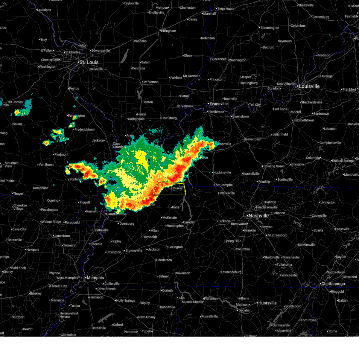
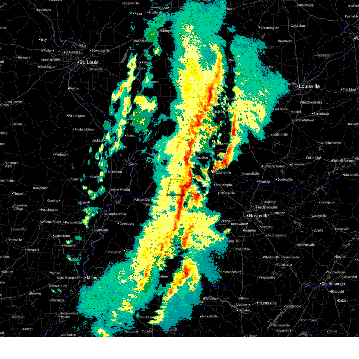
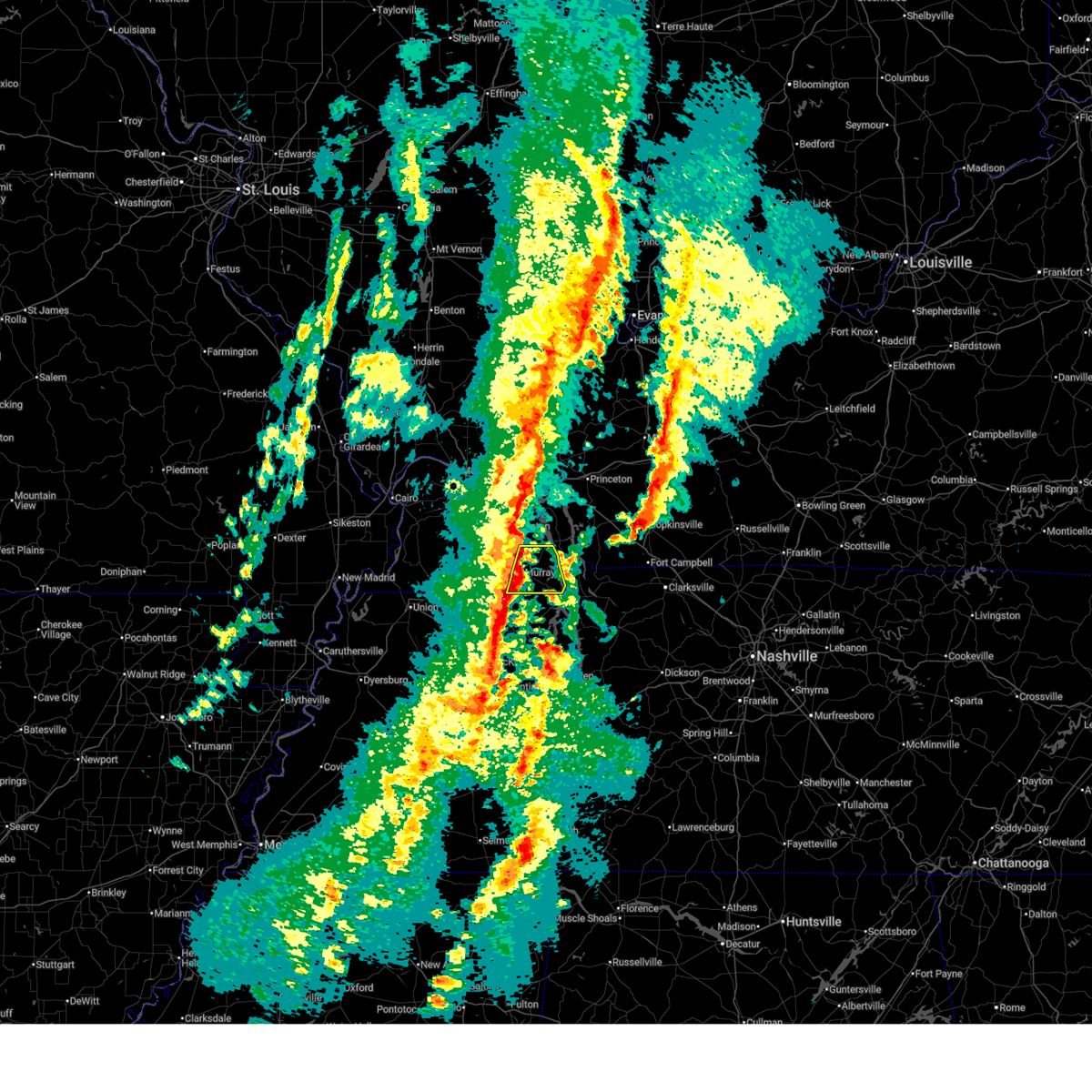
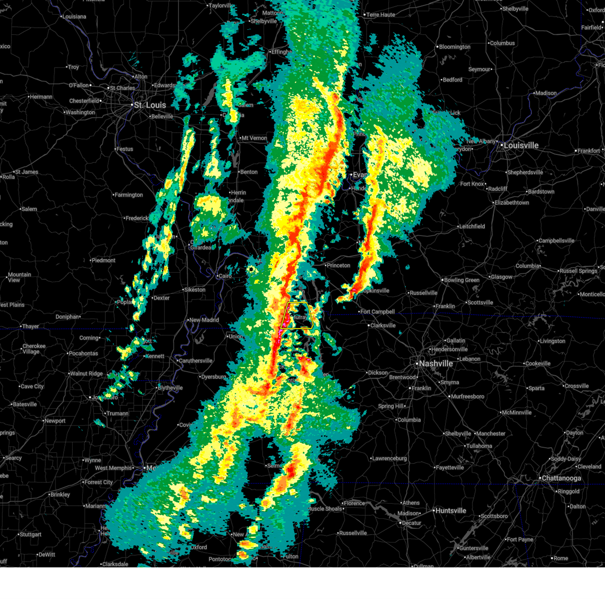
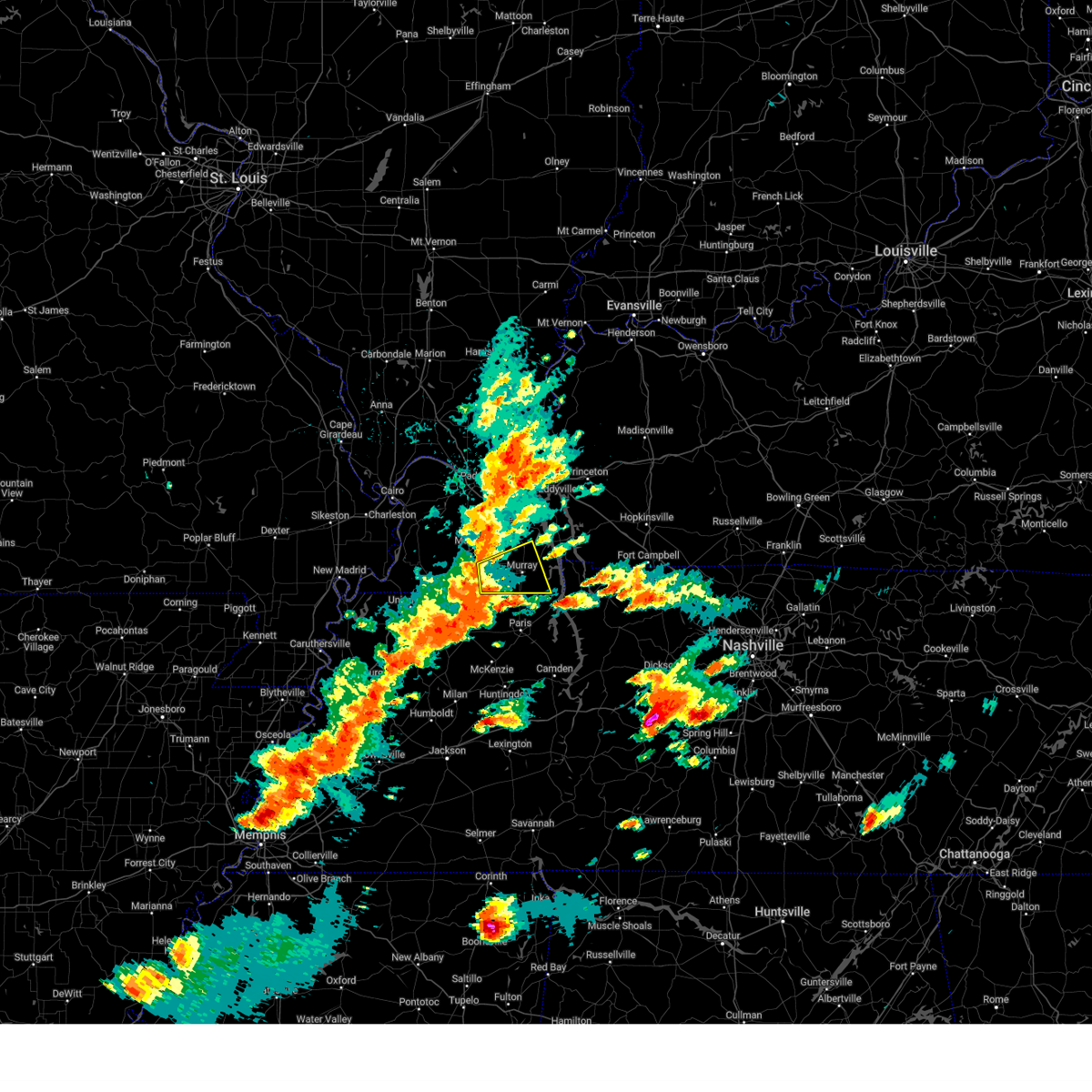
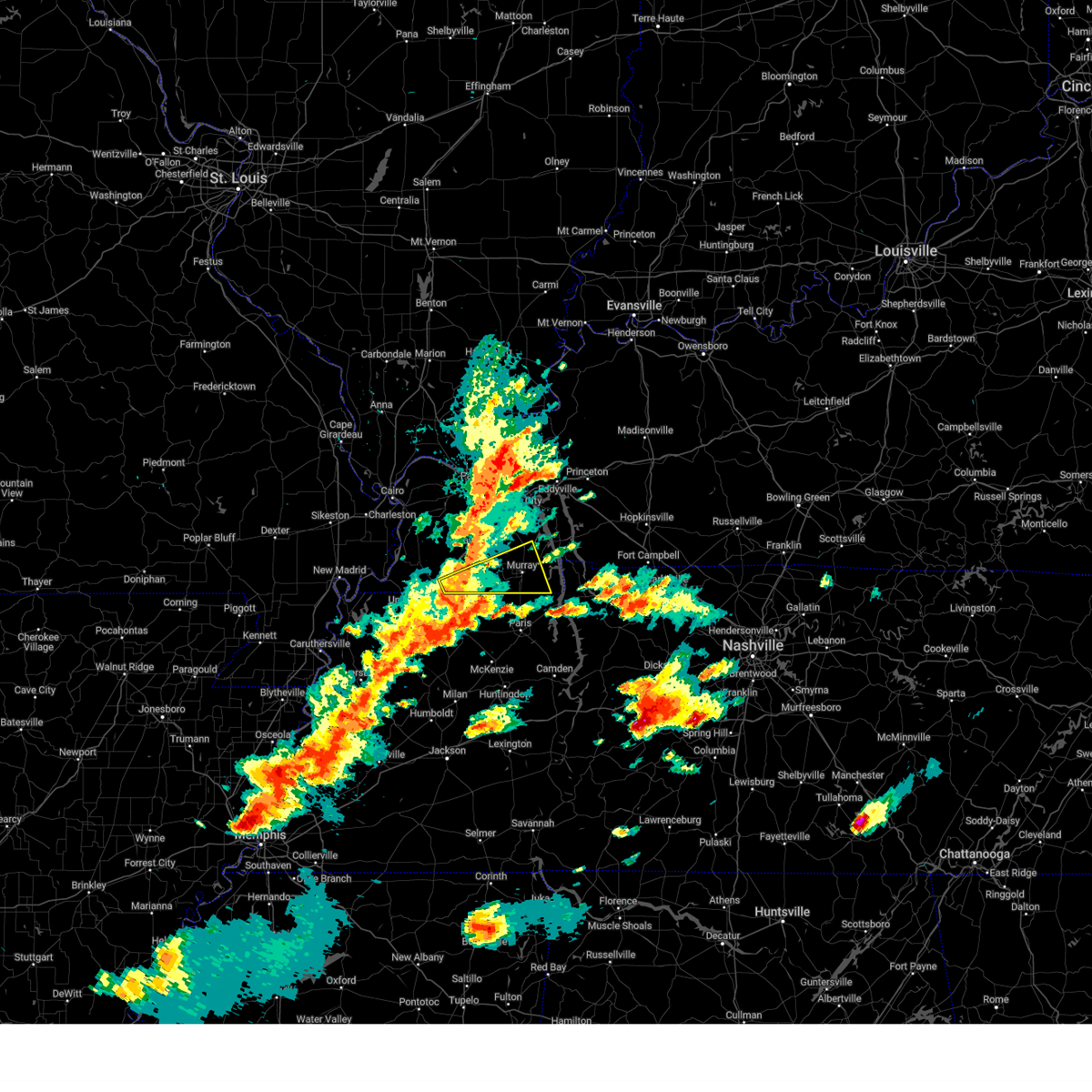
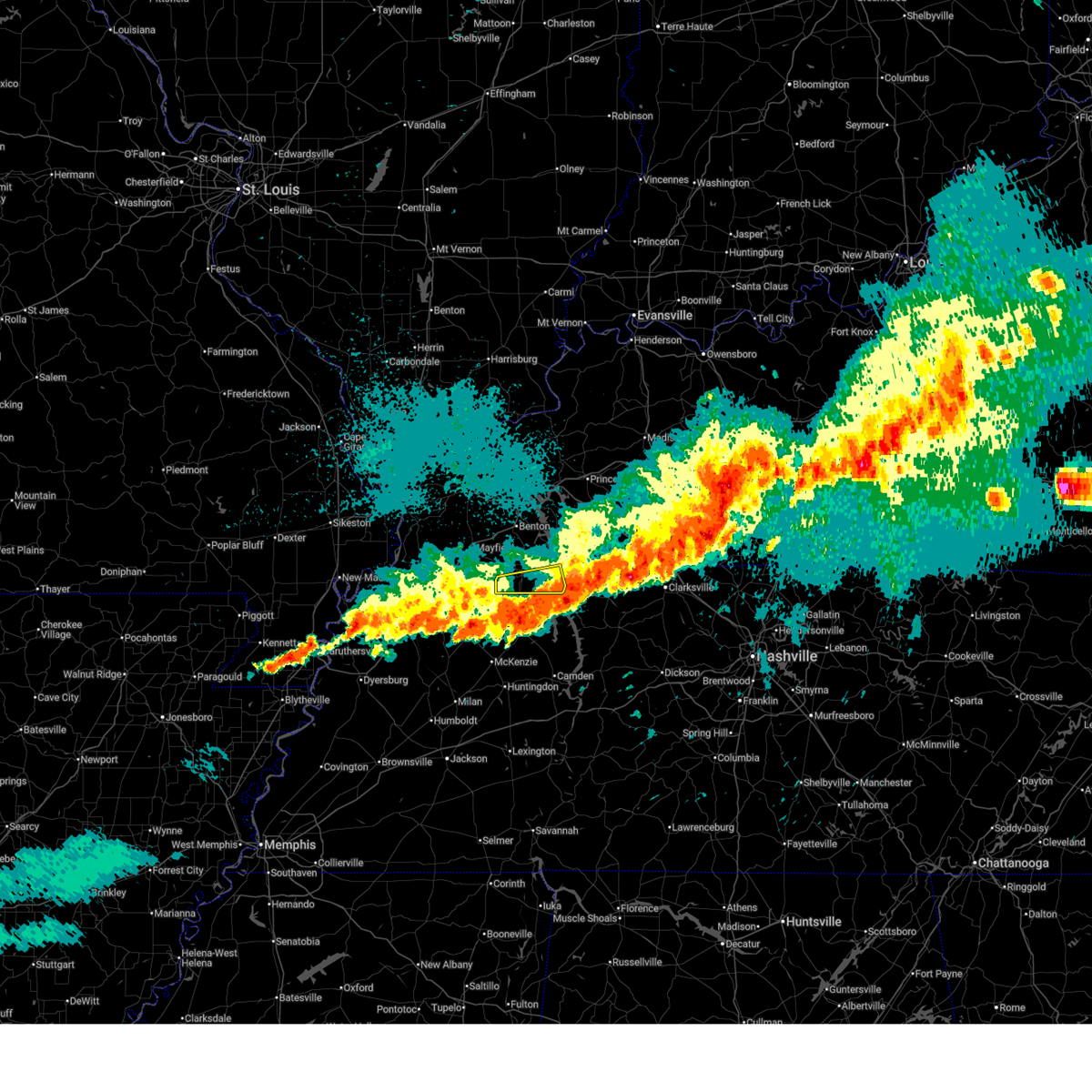
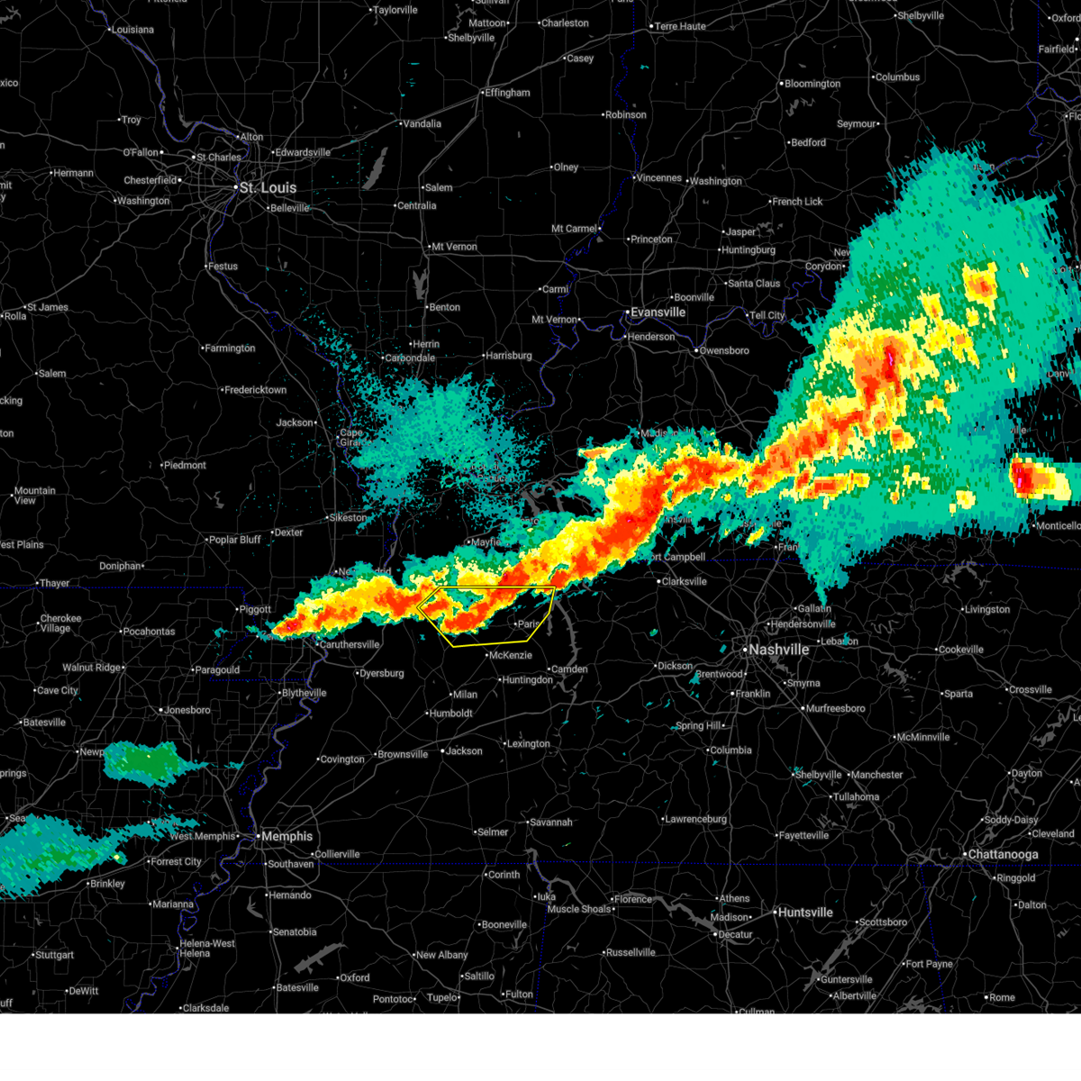
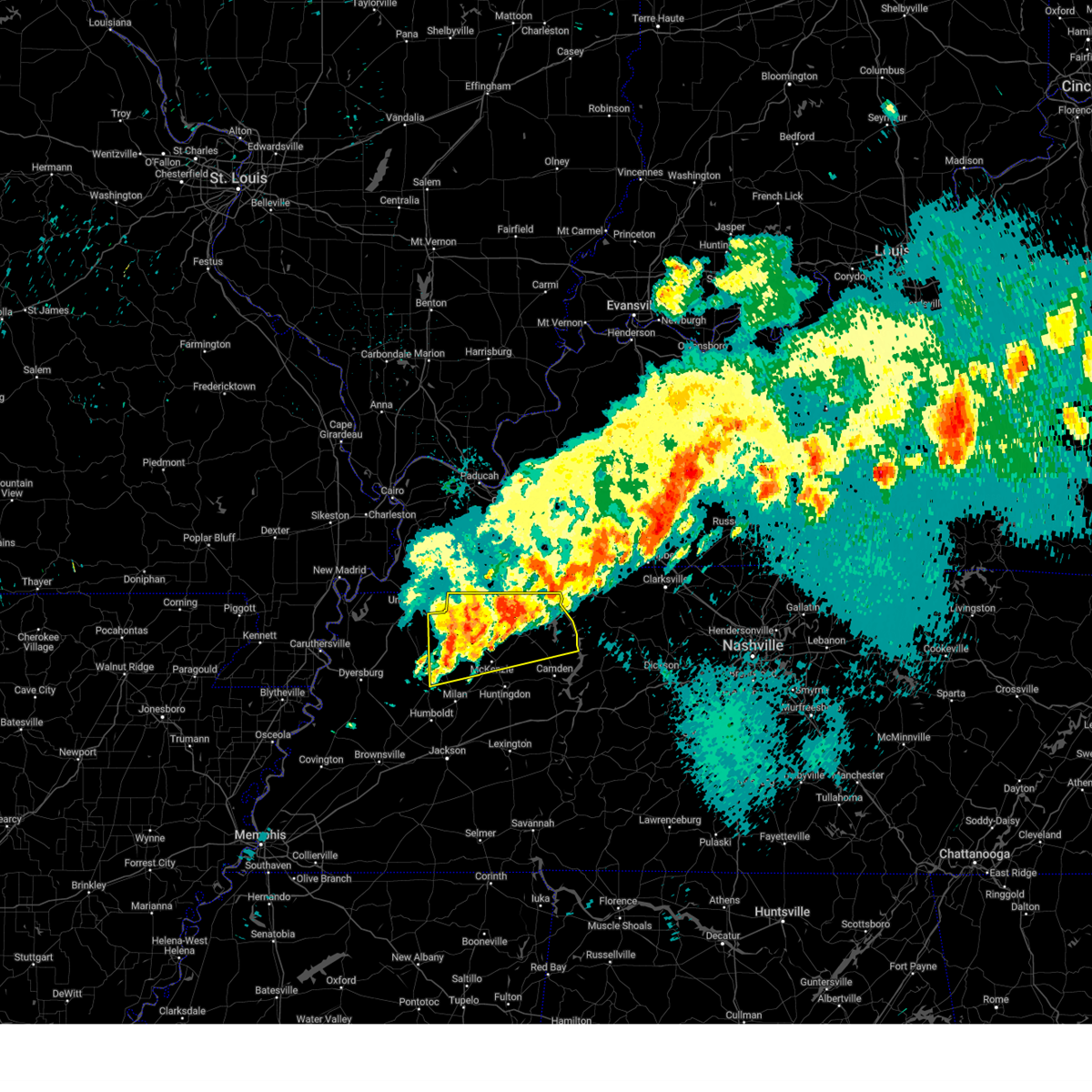
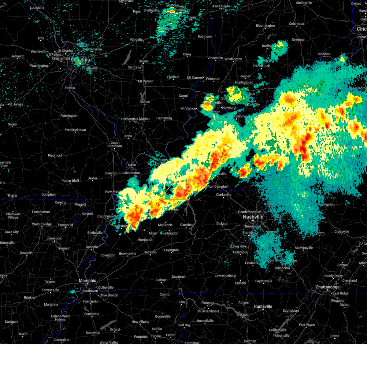
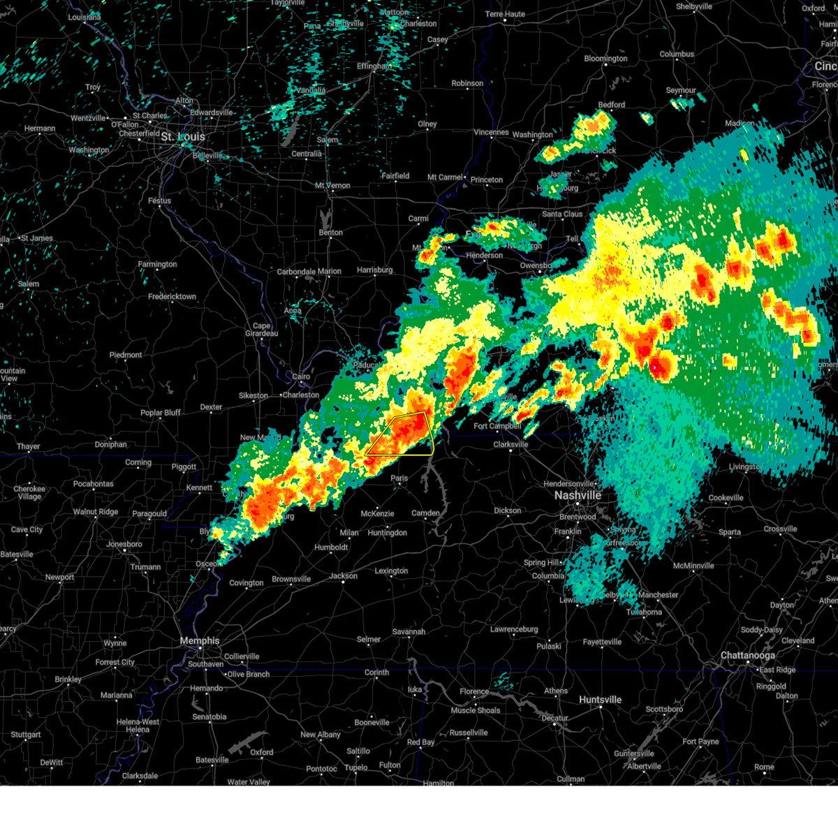
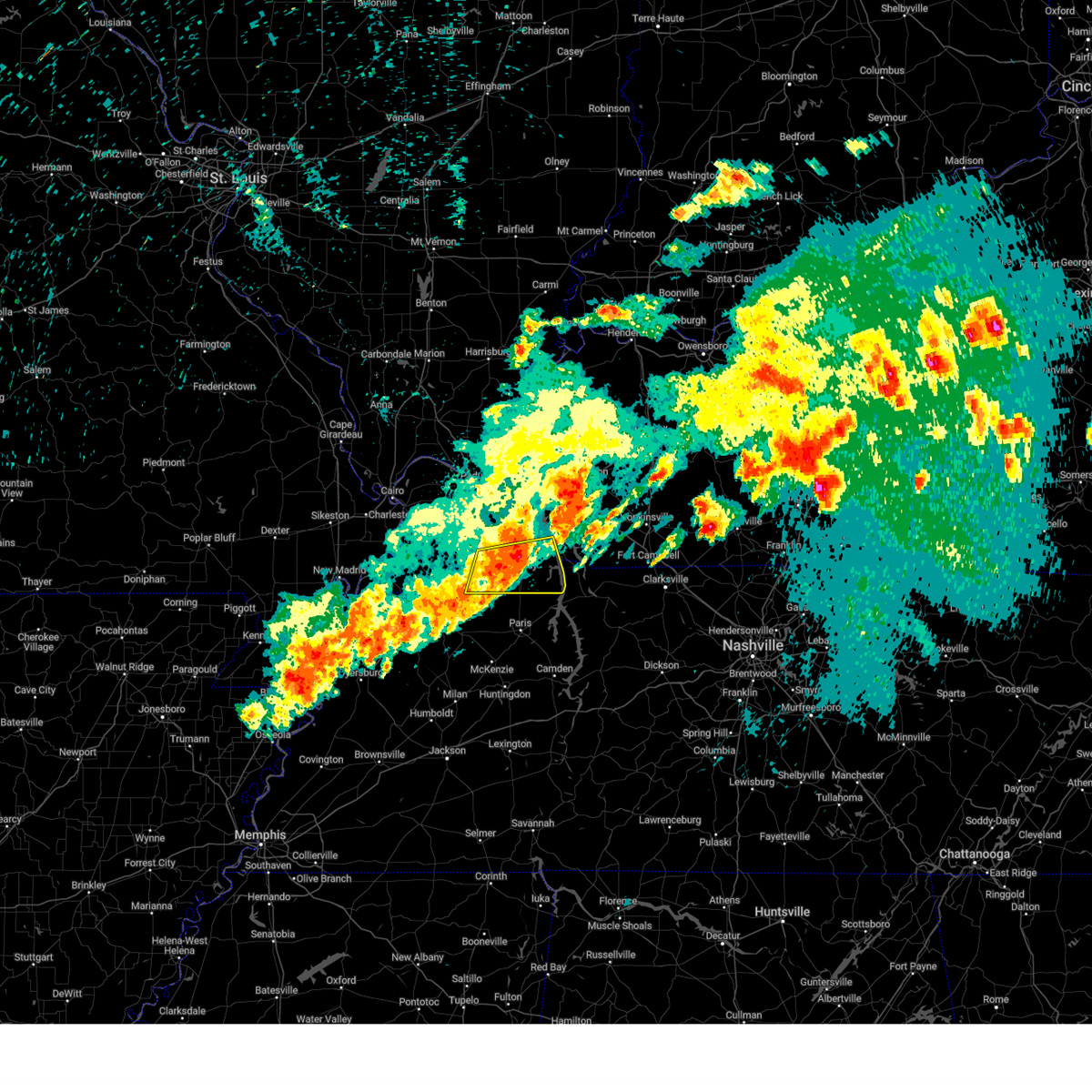
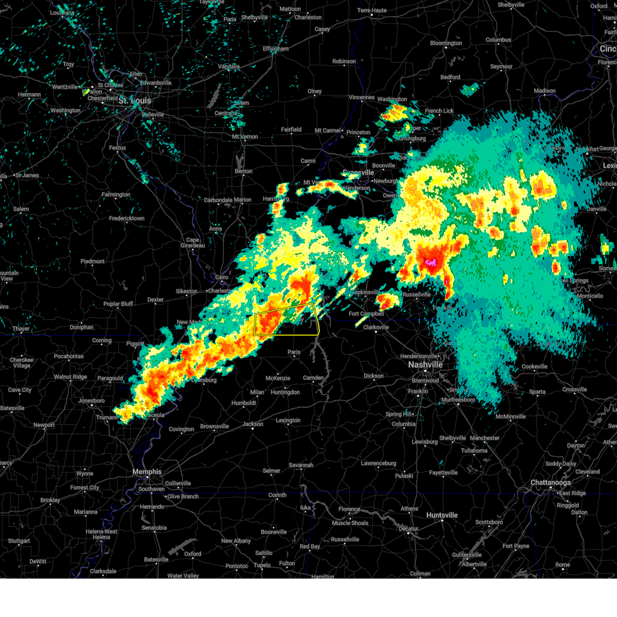
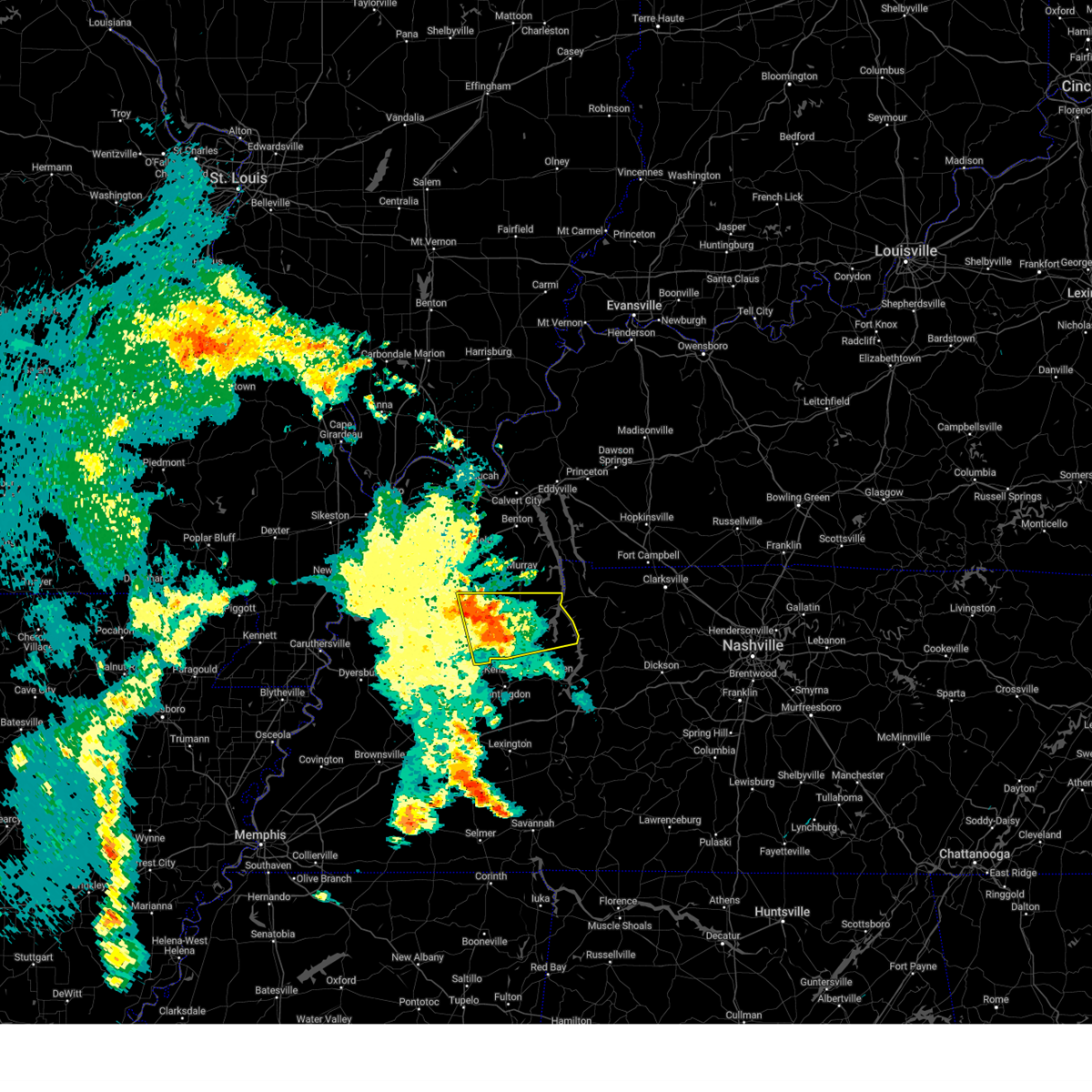
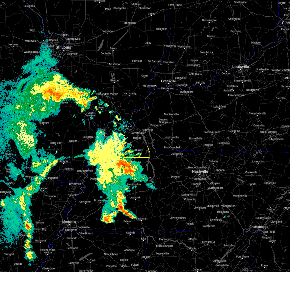
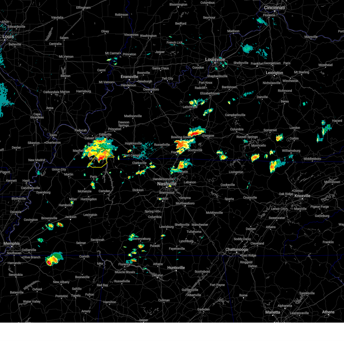
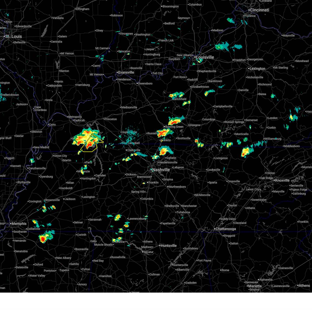
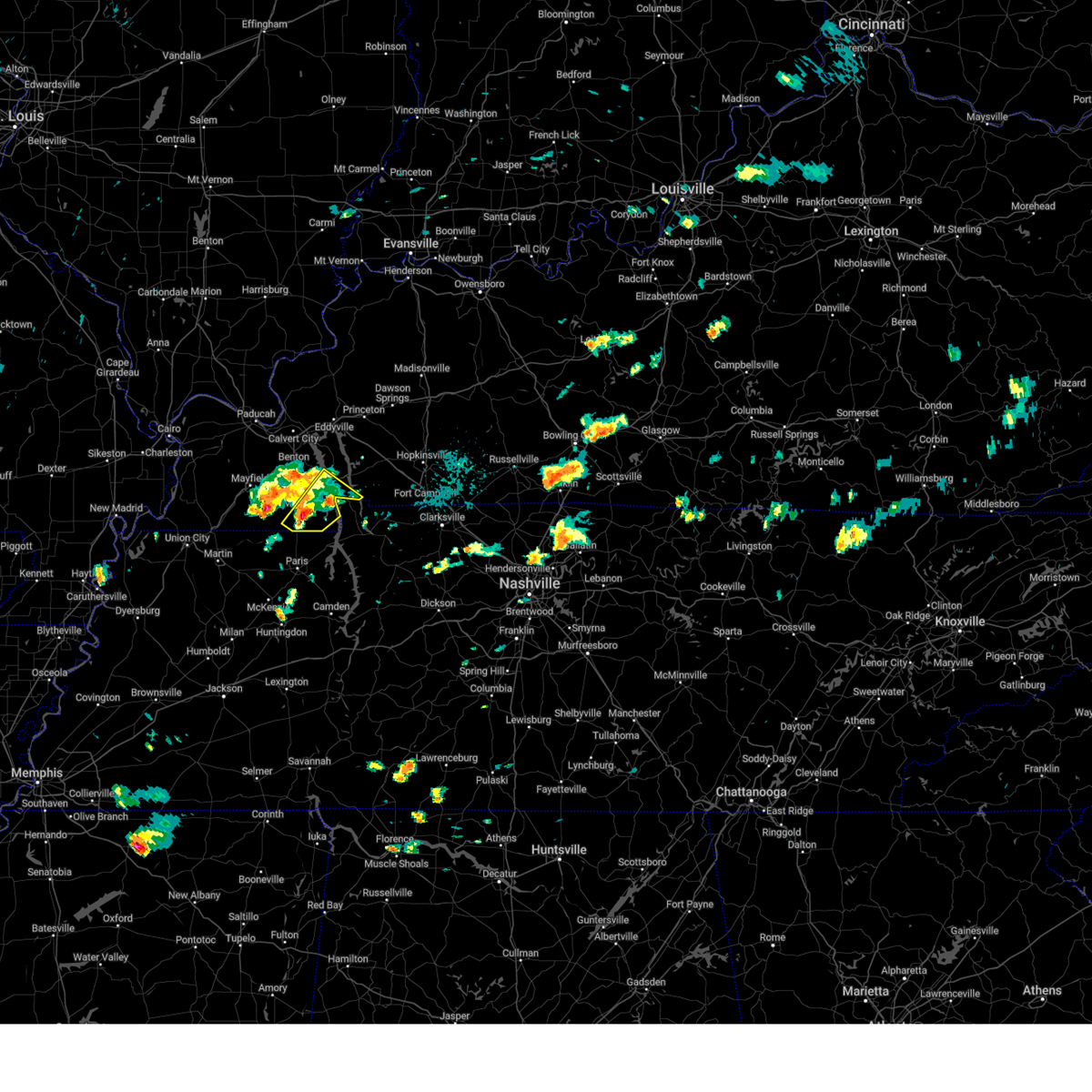
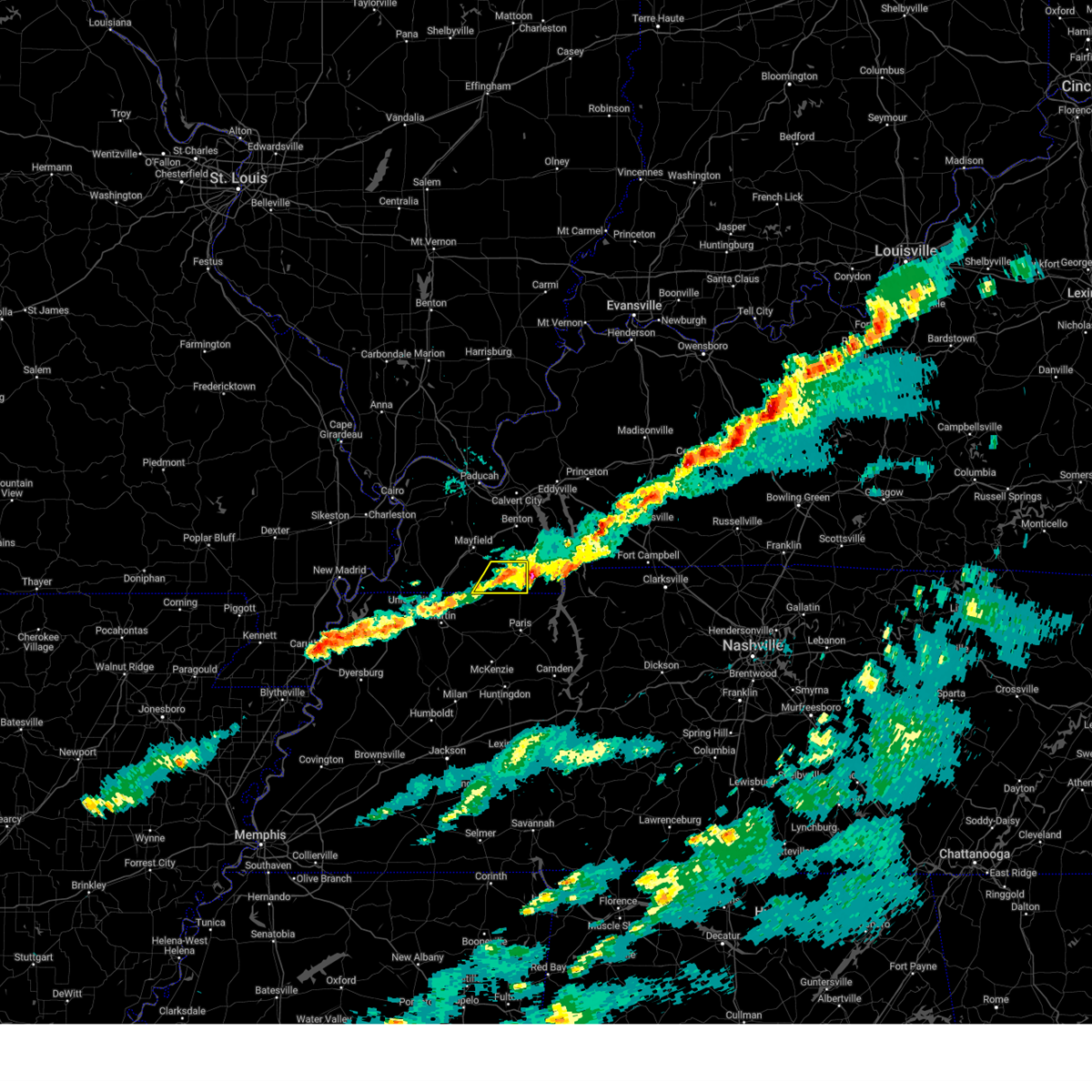
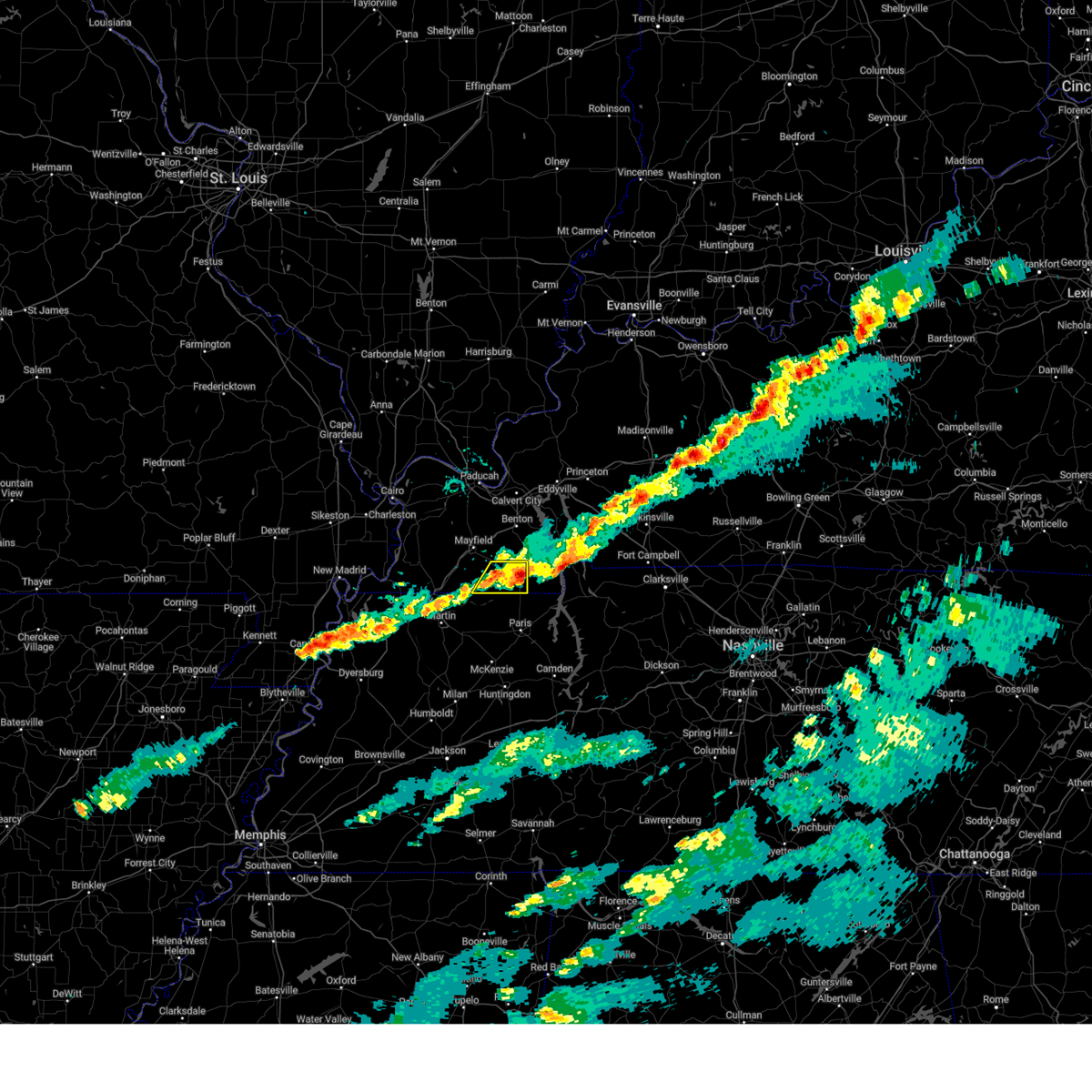
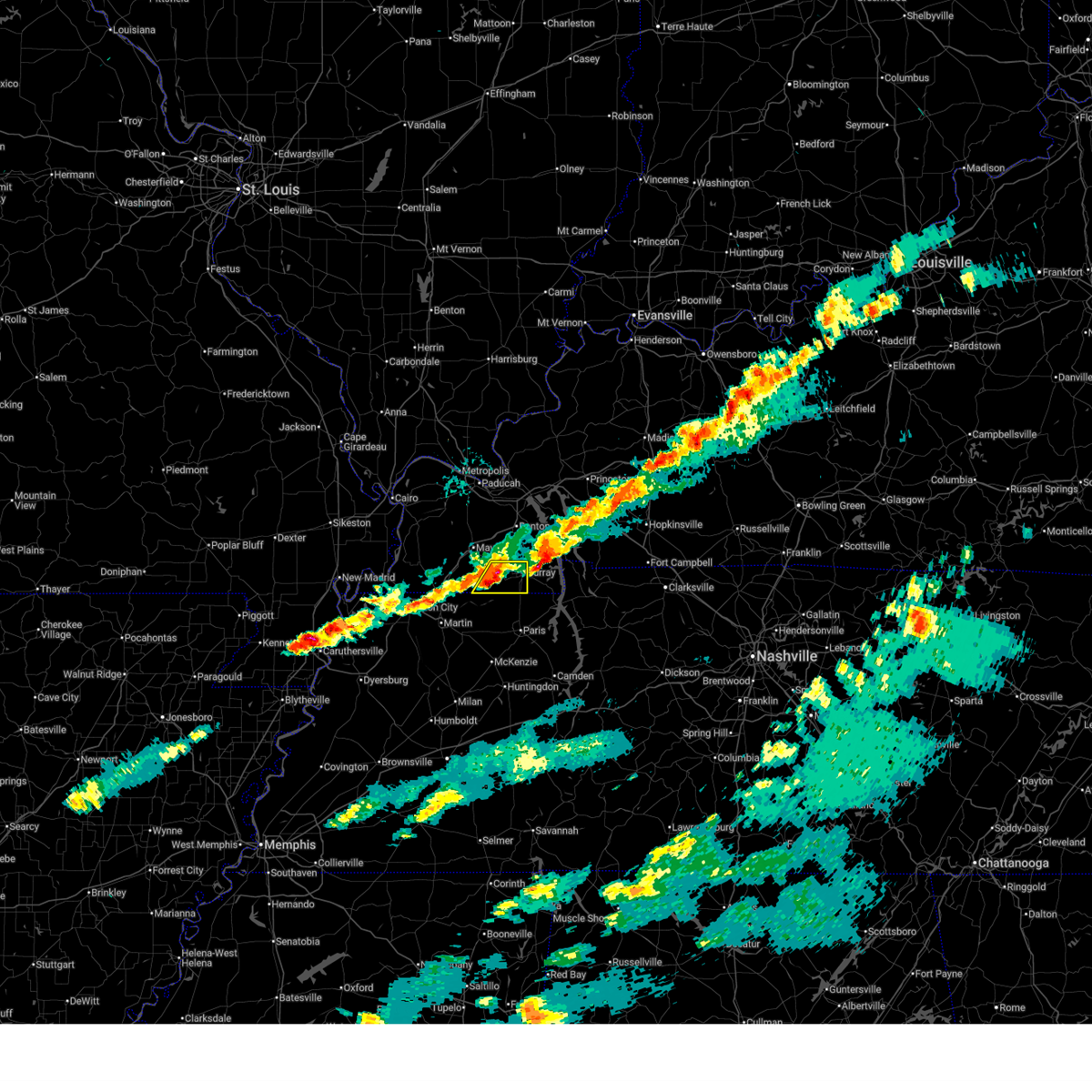
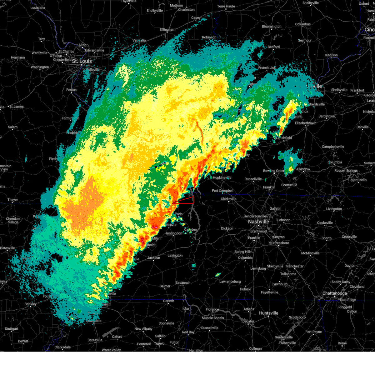
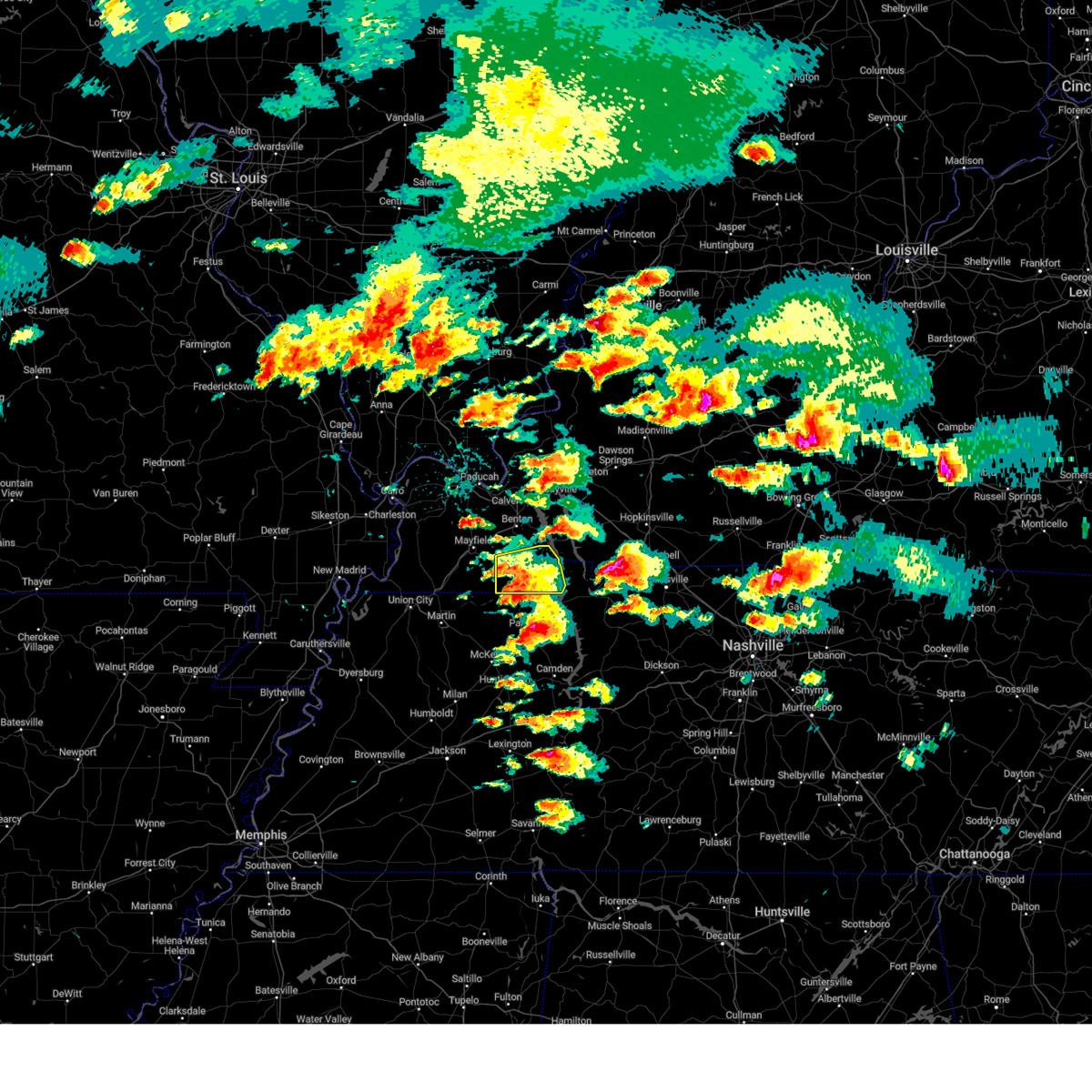
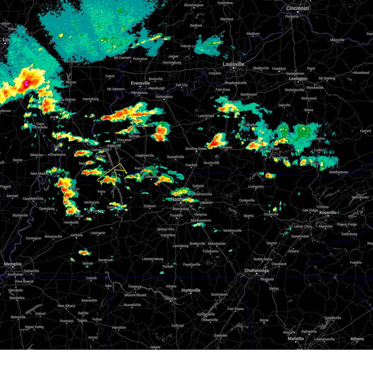
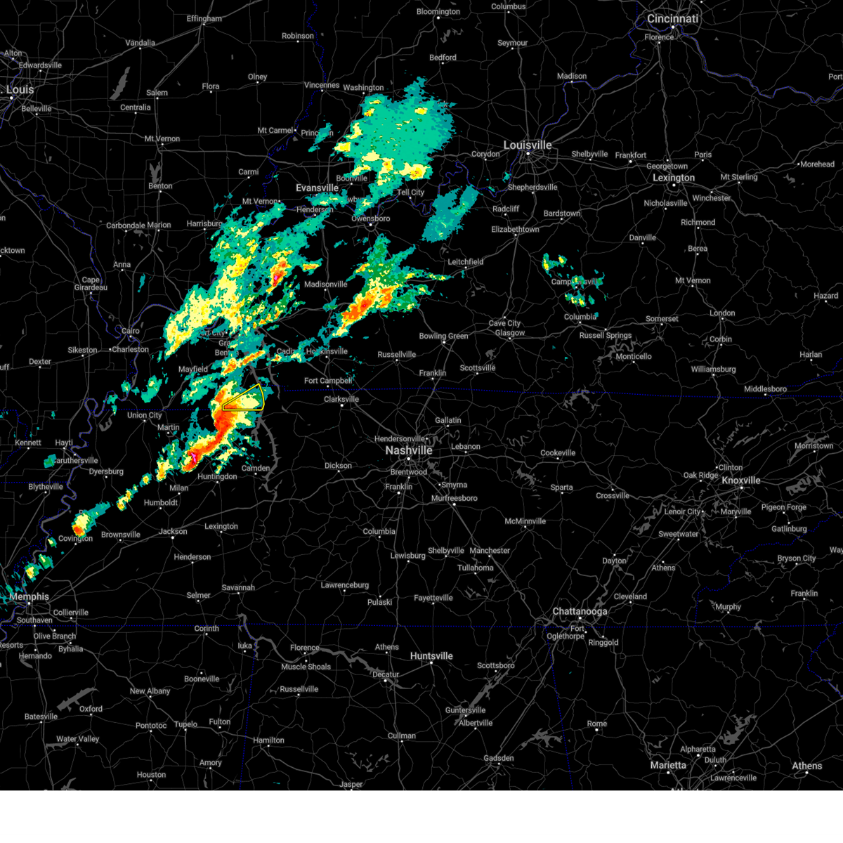
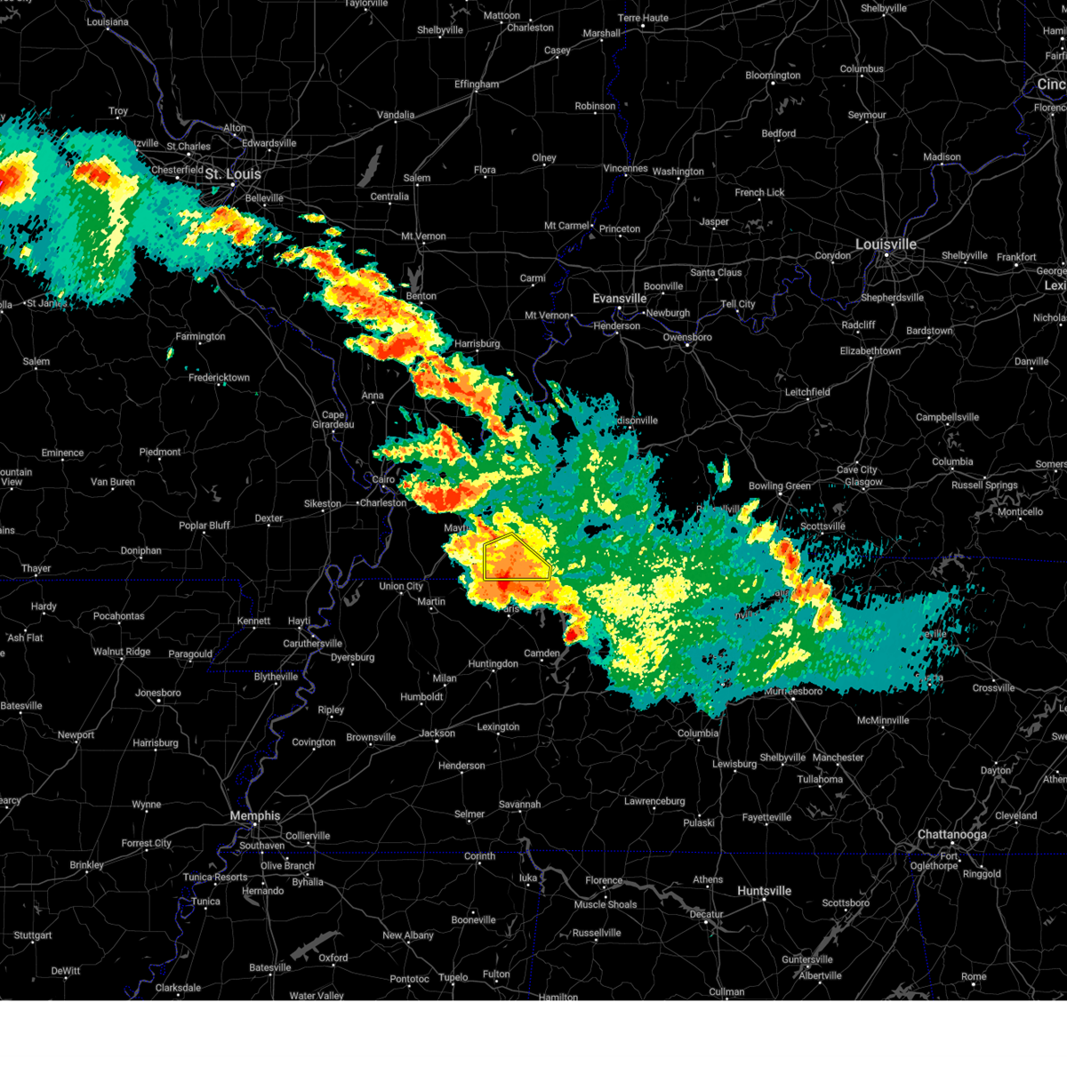
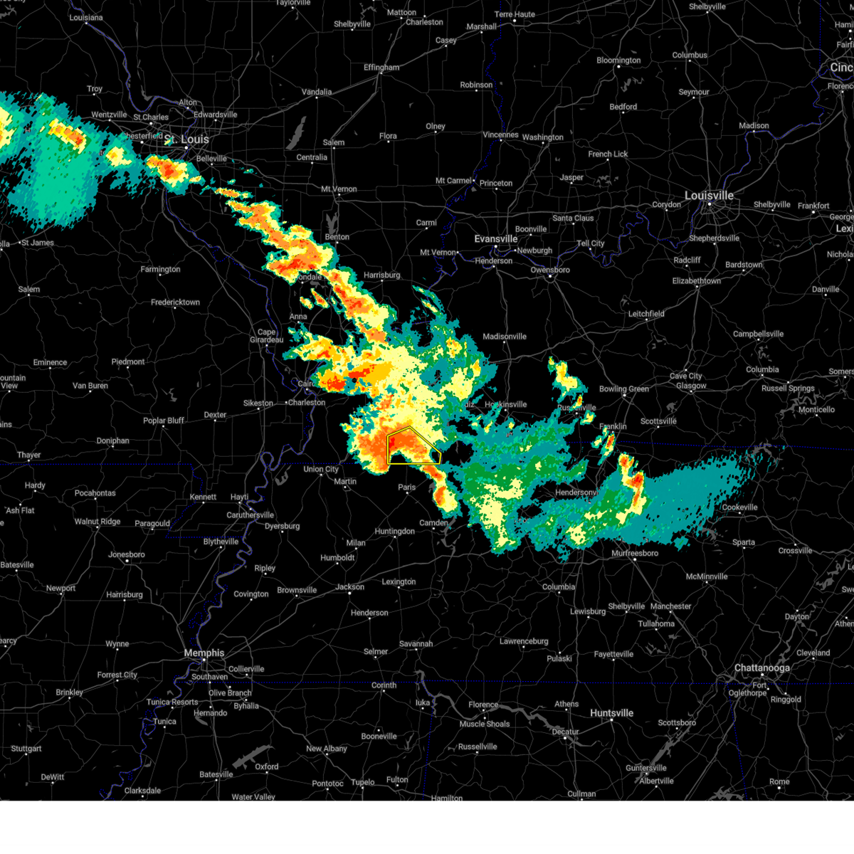
Hail Map for Hazel, KY
The Hazel, KY area has had 2 reports of on-the-ground hail by trained spotters, and has been under severe weather warnings 10 times during the past 12 months. Doppler radar has detected hail at or near Hazel, KY on 59 occasions, including 1 occasion during the past year.
| Name: | Hazel, KY |
| Where Located: | 27.8 miles NNE of Mc Kenzie, TN |
| Map: | Google Map for Hazel, KY |
| Population: | 410 |
| Housing Units: | 222 |
| More Info: | Search Google for Hazel, KY |
1
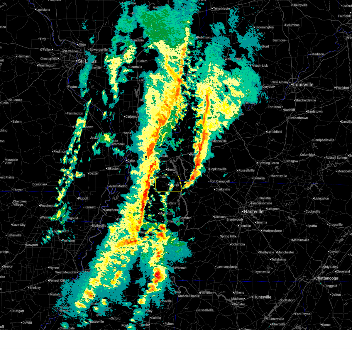
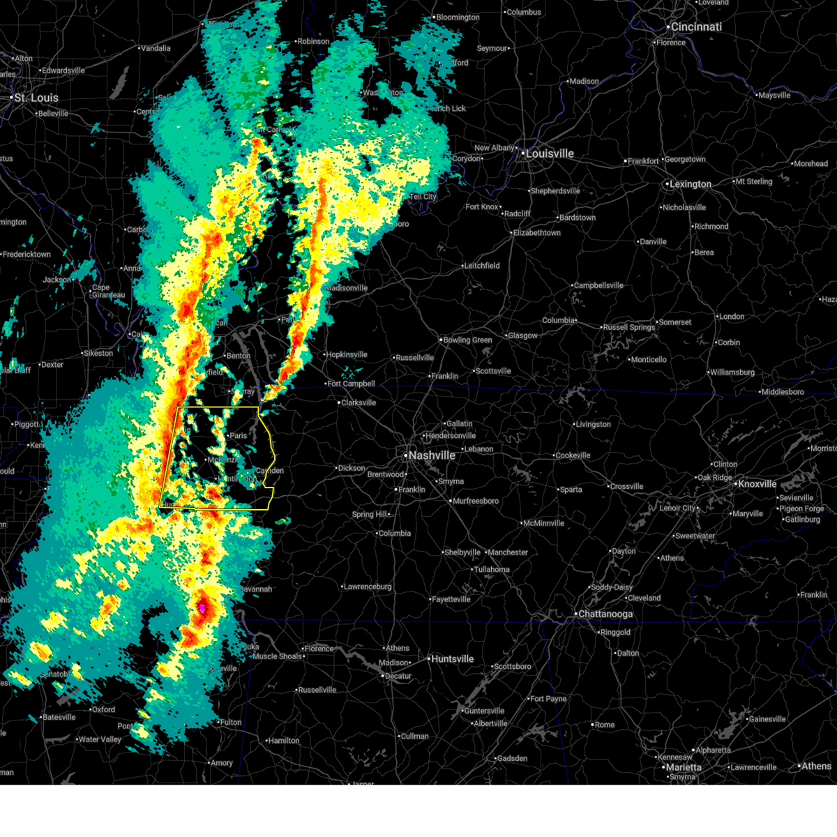
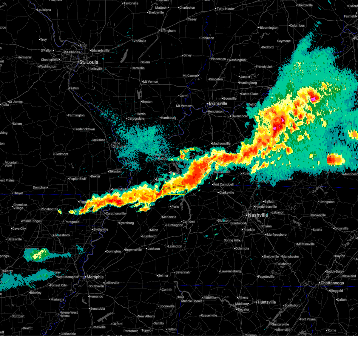
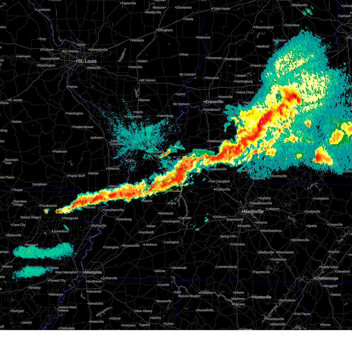
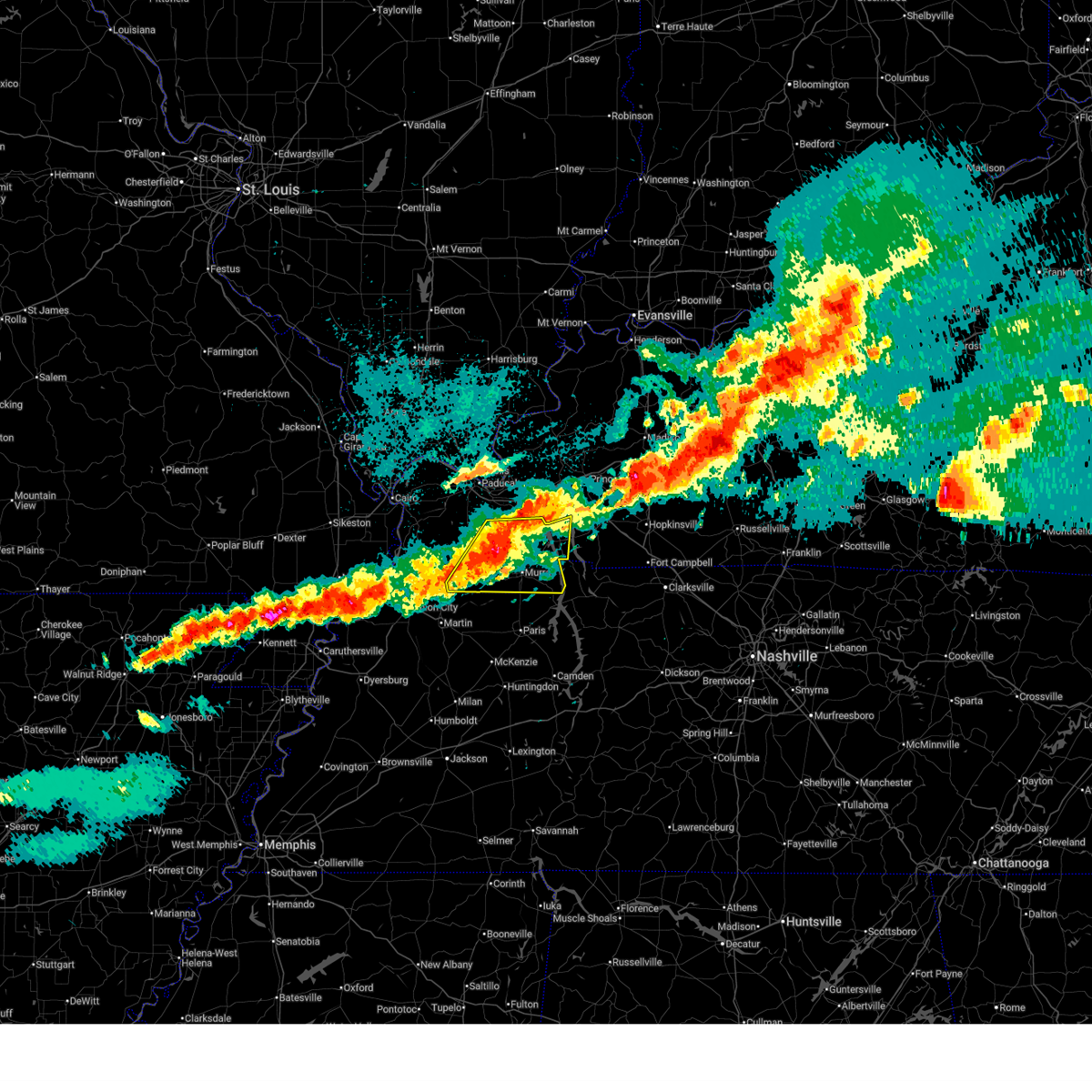
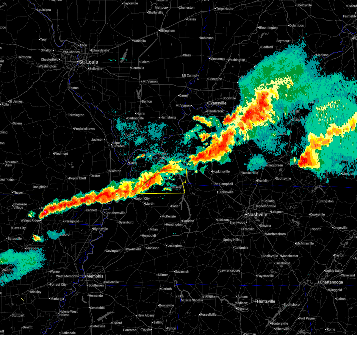
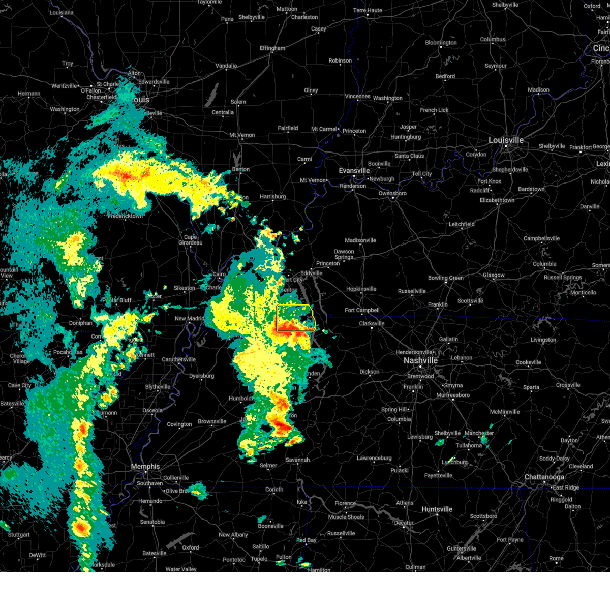
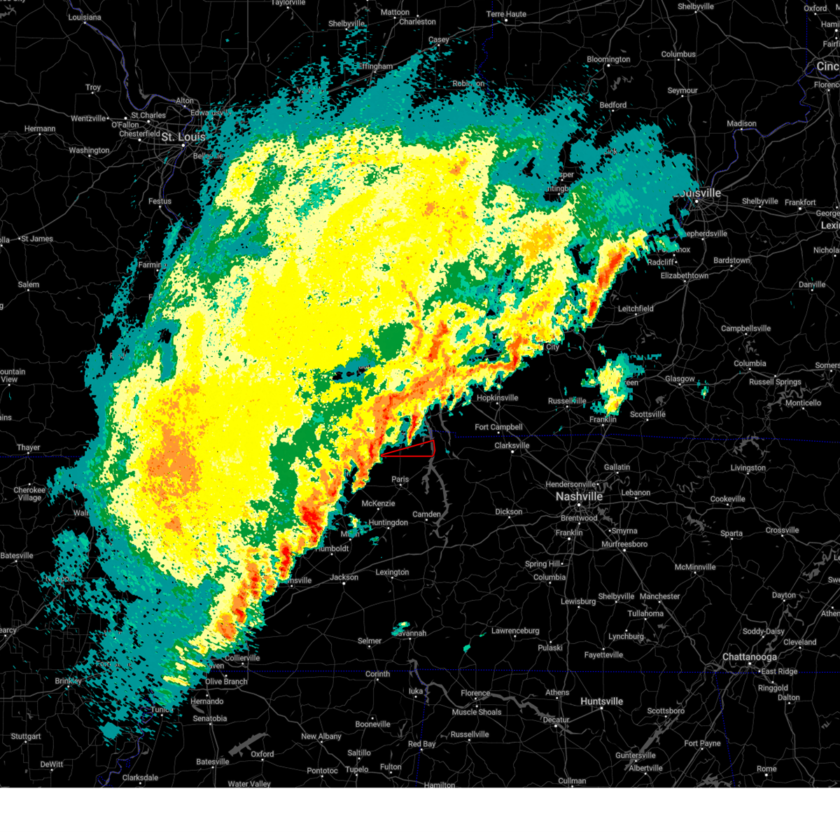
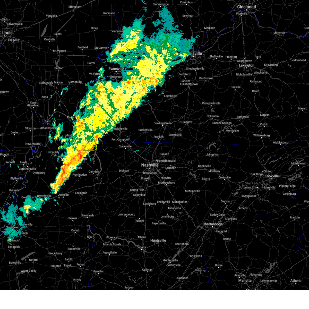
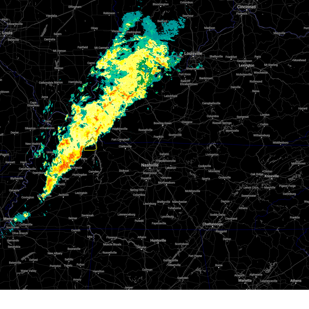
The Top Recent Hail Date for Hazel, KY is Sunday, March 15, 2026 (16th out of 59)
Hail and Wind Damage Spotted near Hazel, KY
| Date / Time | Report Details |
|---|---|
| 6/1/2026 9:40 AM CDT |
 At 940 am cdt, severe thunderstorms were located along a line extending from 10 miles south of turkey bay to near cottage grove to near dresden, moving southeast at 50 mph (radar indicated). Hazards include 60 mph wind gusts and quarter size hail. Hail damage to vehicles is expected. expect wind damage to roofs, siding, and trees. Locations impacted include, martin, union city, paris, fulton, paris landing state park, dresden, south fulton, greenfield, gleason, troy, kenton, sharon, cottage grove, latham, routon, palmersville, puryear, hazel, rives, and jones mill. At 940 am cdt, severe thunderstorms were located along a line extending from 10 miles south of turkey bay to near cottage grove to near dresden, moving southeast at 50 mph (radar indicated). Hazards include 60 mph wind gusts and quarter size hail. Hail damage to vehicles is expected. expect wind damage to roofs, siding, and trees. Locations impacted include, martin, union city, paris, fulton, paris landing state park, dresden, south fulton, greenfield, gleason, troy, kenton, sharon, cottage grove, latham, routon, palmersville, puryear, hazel, rives, and jones mill.
|
| 6/1/2026 9:06 AM CDT |
 Svrmeg the national weather service in memphis has issued a * severe thunderstorm warning for, weakley county in west tennessee, eastern obion county in west tennessee, henry county in west tennessee, * until 1000 am cdt. * at 905 am cdt, severe thunderstorms were located along a line extending from 9 miles northeast of mayfield to near fulgham to near hickman, moving east at 40 mph (radar indicated). Hazards include 60 mph wind gusts and quarter size hail. Hail damage to vehicles is expected. Expect wind damage to roofs, siding, and trees. Svrmeg the national weather service in memphis has issued a * severe thunderstorm warning for, weakley county in west tennessee, eastern obion county in west tennessee, henry county in west tennessee, * until 1000 am cdt. * at 905 am cdt, severe thunderstorms were located along a line extending from 9 miles northeast of mayfield to near fulgham to near hickman, moving east at 40 mph (radar indicated). Hazards include 60 mph wind gusts and quarter size hail. Hail damage to vehicles is expected. Expect wind damage to roofs, siding, and trees.
|
| 4/16/2026 5:52 PM CDT |
 At 552 pm cdt, a severe thunderstorm was located 10 miles north of paris landing state park, moving east at 60 mph (radar indicated). Hazards include 60 mph wind gusts and quarter size hail. Hail damage to vehicles is expected. expect wind damage to roofs, siding, and trees. Locations impacted include, murray, hazel, new concord, and crossland. At 552 pm cdt, a severe thunderstorm was located 10 miles north of paris landing state park, moving east at 60 mph (radar indicated). Hazards include 60 mph wind gusts and quarter size hail. Hail damage to vehicles is expected. expect wind damage to roofs, siding, and trees. Locations impacted include, murray, hazel, new concord, and crossland.
|
| 4/16/2026 5:28 PM CDT |
 Svrmeg the national weather service in memphis has issued a * severe thunderstorm warning for, northern weakley county in west tennessee, east central obion county in west tennessee, henry county in west tennessee, * until 615 pm cdt. * at 528 pm cdt, a severe thunderstorm was located near latham, or 7 miles east of martin, moving east at 50 mph (radar indicated). Hazards include 60 mph wind gusts and quarter size hail. Hail damage to vehicles is expected. Expect wind damage to roofs, siding, and trees. Svrmeg the national weather service in memphis has issued a * severe thunderstorm warning for, northern weakley county in west tennessee, east central obion county in west tennessee, henry county in west tennessee, * until 615 pm cdt. * at 528 pm cdt, a severe thunderstorm was located near latham, or 7 miles east of martin, moving east at 50 mph (radar indicated). Hazards include 60 mph wind gusts and quarter size hail. Hail damage to vehicles is expected. Expect wind damage to roofs, siding, and trees.
|
| 4/16/2026 5:27 PM CDT |
 Svrpah the national weather service in paducah has issued a * severe thunderstorm warning for, calloway county in western kentucky, southeastern graves county in western kentucky, * until 615 pm cdt. * at 527 pm cdt, a severe thunderstorm was located over sedalia, or 8 miles southeast of mayfield, moving east at 55 mph (radar indicated). Hazards include 60 mph wind gusts and quarter size hail. Hail damage to vehicles is expected. Expect wind damage to roofs, siding, and trees. Svrpah the national weather service in paducah has issued a * severe thunderstorm warning for, calloway county in western kentucky, southeastern graves county in western kentucky, * until 615 pm cdt. * at 527 pm cdt, a severe thunderstorm was located over sedalia, or 8 miles southeast of mayfield, moving east at 55 mph (radar indicated). Hazards include 60 mph wind gusts and quarter size hail. Hail damage to vehicles is expected. Expect wind damage to roofs, siding, and trees.
|
| 3/15/2026 8:58 PM CDT |
 The storms which prompted the warning have moved out of the area. therefore, the warning will be allowed to expire. a tornado watch remains in effect until 1100 pm cdt for western kentucky. The storms which prompted the warning have moved out of the area. therefore, the warning will be allowed to expire. a tornado watch remains in effect until 1100 pm cdt for western kentucky.
|
| 3/15/2026 8:41 PM CDT |
 the severe thunderstorm warning has been cancelled and is no longer in effect the severe thunderstorm warning has been cancelled and is no longer in effect
|
| 3/15/2026 8:41 PM CDT |
 At 841 pm cdt, severe thunderstorms were located along a line extending from 7 miles southeast of benton to 8 miles northeast of cottage grove, moving east at 60 mph (radar indicated). Hazards include 60 mph wind gusts and penny size hail. Expect damage to roofs, siding, and trees. Locations impacted include, murray, hazel, new concord, and crossland. At 841 pm cdt, severe thunderstorms were located along a line extending from 7 miles southeast of benton to 8 miles northeast of cottage grove, moving east at 60 mph (radar indicated). Hazards include 60 mph wind gusts and penny size hail. Expect damage to roofs, siding, and trees. Locations impacted include, murray, hazel, new concord, and crossland.
|
| 3/15/2026 8:20 PM CDT |
 Svrpah the national weather service in paducah has issued a * severe thunderstorm warning for, calloway county in western kentucky, southeastern graves county in western kentucky, * until 900 pm cdt. * at 820 pm cdt, severe thunderstorms were located along a line extending from near mayfield to near palmersville, moving east at 50 mph (radar indicated). Hazards include 60 mph wind gusts. expect damage to roofs, siding, and trees Svrpah the national weather service in paducah has issued a * severe thunderstorm warning for, calloway county in western kentucky, southeastern graves county in western kentucky, * until 900 pm cdt. * at 820 pm cdt, severe thunderstorms were located along a line extending from near mayfield to near palmersville, moving east at 50 mph (radar indicated). Hazards include 60 mph wind gusts. expect damage to roofs, siding, and trees
|
| 3/15/2026 8:18 PM CDT |
 Svrmeg the national weather service in memphis has issued a * severe thunderstorm warning for, weakley county in west tennessee, northern henderson county in west tennessee, eastern gibson county in west tennessee, benton county in west tennessee, carroll county in west tennessee, henry county in west tennessee, northeastern decatur county in west tennessee, * until 915 pm cdt. * at 818 pm cdt, severe thunderstorms were located along a line extending from 6 miles north of latham to near bradford, moving east at 55 mph (radar indicated). Hazards include 70 mph wind gusts. Expect considerable tree damage. Damage is likely to mobile homes, roofs, and outbuildings. Svrmeg the national weather service in memphis has issued a * severe thunderstorm warning for, weakley county in west tennessee, northern henderson county in west tennessee, eastern gibson county in west tennessee, benton county in west tennessee, carroll county in west tennessee, henry county in west tennessee, northeastern decatur county in west tennessee, * until 915 pm cdt. * at 818 pm cdt, severe thunderstorms were located along a line extending from 6 miles north of latham to near bradford, moving east at 55 mph (radar indicated). Hazards include 70 mph wind gusts. Expect considerable tree damage. Damage is likely to mobile homes, roofs, and outbuildings.
|
| 5/20/2025 4:16 PM CDT |
 the severe thunderstorm warning has been cancelled and is no longer in effect the severe thunderstorm warning has been cancelled and is no longer in effect
|
| 5/20/2025 4:16 PM CDT |
 At 415 pm cdt, a severe thunderstorm was located over murray, moving east at 50 mph (radar indicated). Hazards include 60 mph wind gusts and penny size hail. Expect damage to roofs, siding, and trees. Locations impacted include, murray, hardin, hazel, new concord, kirksey, harris grove, and crossland. At 415 pm cdt, a severe thunderstorm was located over murray, moving east at 50 mph (radar indicated). Hazards include 60 mph wind gusts and penny size hail. Expect damage to roofs, siding, and trees. Locations impacted include, murray, hardin, hazel, new concord, kirksey, harris grove, and crossland.
|
| 5/20/2025 4:04 PM CDT |
 the severe thunderstorm warning has been cancelled and is no longer in effect the severe thunderstorm warning has been cancelled and is no longer in effect
|
| 5/20/2025 4:04 PM CDT |
 At 404 pm cdt, a severe thunderstorm was located near lynnville, or 8 miles west of murray, moving east at 55 mph (radar indicated). Hazards include 60 mph wind gusts and penny size hail. Expect damage to roofs, siding, and trees. Locations impacted include, murray, lynnville, sedalia, hardin, hazel, new concord, kirksey, harris grove, and crossland. At 404 pm cdt, a severe thunderstorm was located near lynnville, or 8 miles west of murray, moving east at 55 mph (radar indicated). Hazards include 60 mph wind gusts and penny size hail. Expect damage to roofs, siding, and trees. Locations impacted include, murray, lynnville, sedalia, hardin, hazel, new concord, kirksey, harris grove, and crossland.
|
| 5/20/2025 3:50 PM CDT |
 Svrpah the national weather service in paducah has issued a * severe thunderstorm warning for, calloway county in western kentucky, south central marshall county in western kentucky, southeastern hickman county in western kentucky, southern graves county in western kentucky, * until 430 pm cdt. * at 350 pm cdt, a severe thunderstorm was located 7 miles north of latham, or 8 miles east of fulton, moving east at 50 mph (radar indicated). Hazards include 60 mph wind gusts. expect damage to roofs, siding, and trees Svrpah the national weather service in paducah has issued a * severe thunderstorm warning for, calloway county in western kentucky, south central marshall county in western kentucky, southeastern hickman county in western kentucky, southern graves county in western kentucky, * until 430 pm cdt. * at 350 pm cdt, a severe thunderstorm was located 7 miles north of latham, or 8 miles east of fulton, moving east at 50 mph (radar indicated). Hazards include 60 mph wind gusts. expect damage to roofs, siding, and trees
|
| 5/16/2025 9:50 PM CDT |
 the severe thunderstorm warning has been cancelled and is no longer in effect the severe thunderstorm warning has been cancelled and is no longer in effect
|
| 5/16/2025 9:37 PM CDT |
 Svrmeg the national weather service in memphis has issued a * severe thunderstorm warning for, weakley county in west tennessee, east central obion county in west tennessee, henry county in west tennessee, * until 1015 pm cdt. * at 937 pm cdt, a severe thunderstorm was located near dresden, or near martin, moving east at 35 mph (radar indicated). Hazards include 60 mph wind gusts and quarter size hail. Hail damage to vehicles is expected. Expect wind damage to roofs, siding, and trees. Svrmeg the national weather service in memphis has issued a * severe thunderstorm warning for, weakley county in west tennessee, east central obion county in west tennessee, henry county in west tennessee, * until 1015 pm cdt. * at 937 pm cdt, a severe thunderstorm was located near dresden, or near martin, moving east at 35 mph (radar indicated). Hazards include 60 mph wind gusts and quarter size hail. Hail damage to vehicles is expected. Expect wind damage to roofs, siding, and trees.
|
| 5/16/2025 9:30 PM CDT |
 Svrpah the national weather service in paducah has issued a * severe thunderstorm warning for, southern calloway county in western kentucky, * until 1015 pm cdt. * at 929 pm cdt, a severe thunderstorm was located near lynnville, or 9 miles southwest of murray, moving east at 35 mph (radar indicated). Hazards include 60 mph wind gusts and quarter size hail. Hail damage to vehicles is expected. Expect wind damage to roofs, siding, and trees. Svrpah the national weather service in paducah has issued a * severe thunderstorm warning for, southern calloway county in western kentucky, * until 1015 pm cdt. * at 929 pm cdt, a severe thunderstorm was located near lynnville, or 9 miles southwest of murray, moving east at 35 mph (radar indicated). Hazards include 60 mph wind gusts and quarter size hail. Hail damage to vehicles is expected. Expect wind damage to roofs, siding, and trees.
|
| 5/16/2025 9:16 PM CDT |
 At 916 pm cdt, severe thunderstorms were located along a line extending from near land between the lakes area to 8 miles southwest of turkey bay to 6 miles northeast of cottage grove, moving east at 50 mph (radar indicated). Hazards include 70 mph wind gusts and quarter size hail. Hail damage to vehicles is expected. expect considerable tree damage. wind damage is also likely to mobile homes, roofs, and outbuildings. Locations impacted include, murray, energy lake campground, turkey bay, land between the lakes area, golden pond visitors center, wranglers campground, lynnville, hazel, new concord, harris grove, and aurora. At 916 pm cdt, severe thunderstorms were located along a line extending from near land between the lakes area to 8 miles southwest of turkey bay to 6 miles northeast of cottage grove, moving east at 50 mph (radar indicated). Hazards include 70 mph wind gusts and quarter size hail. Hail damage to vehicles is expected. expect considerable tree damage. wind damage is also likely to mobile homes, roofs, and outbuildings. Locations impacted include, murray, energy lake campground, turkey bay, land between the lakes area, golden pond visitors center, wranglers campground, lynnville, hazel, new concord, harris grove, and aurora.
|
| 5/16/2025 8:52 PM CDT |
 the severe thunderstorm warning has been cancelled and is no longer in effect the severe thunderstorm warning has been cancelled and is no longer in effect
|
| 5/16/2025 8:52 PM CDT |
 At 851 pm cdt, severe thunderstorms were located along a line extending from near benton to near sedalia to near latham, moving east at 50 mph (radar indicated). Hazards include 70 mph wind gusts and quarter size hail. trees and power lines were reported down in mayfield around 845 pm. Hail damage to vehicles is expected. expect considerable tree damage. wind damage is also likely to mobile homes, roofs, and outbuildings. locations impacted include, murray, mayfield, benton, golden pond visitors center, energy lake campground, turkey bay, land between the lakes area, wranglers campground, lynnville, sedalia, wingo, hardin, hazel, water valley, new concord, kirksey, brewers, aurora, and harris grove. This includes interstate 69 in kentucky between mile markers 20 and 22, and between mile markers 24 and 44. At 851 pm cdt, severe thunderstorms were located along a line extending from near benton to near sedalia to near latham, moving east at 50 mph (radar indicated). Hazards include 70 mph wind gusts and quarter size hail. trees and power lines were reported down in mayfield around 845 pm. Hail damage to vehicles is expected. expect considerable tree damage. wind damage is also likely to mobile homes, roofs, and outbuildings. locations impacted include, murray, mayfield, benton, golden pond visitors center, energy lake campground, turkey bay, land between the lakes area, wranglers campground, lynnville, sedalia, wingo, hardin, hazel, water valley, new concord, kirksey, brewers, aurora, and harris grove. This includes interstate 69 in kentucky between mile markers 20 and 22, and between mile markers 24 and 44.
|
| 5/16/2025 8:44 PM CDT |
 Svrpah the national weather service in paducah has issued a * severe thunderstorm warning for, southeastern fulton county in western kentucky, calloway county in western kentucky, southern marshall county in western kentucky, southeastern hickman county in western kentucky, southwestern trigg county in western kentucky, graves county in western kentucky, * until 930 pm cdt. * at 844 pm cdt, severe thunderstorms were located along a line extending from 11 miles south of reidland to near mayfield to south fulton, moving east at 50 mph (radar indicated). Hazards include 60 mph wind gusts and quarter size hail. Hail damage to vehicles is expected. Expect wind damage to roofs, siding, and trees. Svrpah the national weather service in paducah has issued a * severe thunderstorm warning for, southeastern fulton county in western kentucky, calloway county in western kentucky, southern marshall county in western kentucky, southeastern hickman county in western kentucky, southwestern trigg county in western kentucky, graves county in western kentucky, * until 930 pm cdt. * at 844 pm cdt, severe thunderstorms were located along a line extending from 11 miles south of reidland to near mayfield to south fulton, moving east at 50 mph (radar indicated). Hazards include 60 mph wind gusts and quarter size hail. Hail damage to vehicles is expected. Expect wind damage to roofs, siding, and trees.
|
| 5/16/2025 9:20 AM CDT |
 At 920 am cdt, a severe thunderstorm was located over palmersville, or 15 miles northwest of paris, moving northeast at 80 mph (radar indicated). Hazards include 60 mph wind gusts and quarter size hail. Hail damage to vehicles is expected. expect wind damage to roofs, siding, and trees. Locations impacted include, bradford, jones mill, latham, old springville, como, ralston, pisgah, porter court, mckenzie, pine hill, laneview, ore springs, haigler ridge, kimery, buchanan, india, mill creek, puryear, van dyke, and mixie. At 920 am cdt, a severe thunderstorm was located over palmersville, or 15 miles northwest of paris, moving northeast at 80 mph (radar indicated). Hazards include 60 mph wind gusts and quarter size hail. Hail damage to vehicles is expected. expect wind damage to roofs, siding, and trees. Locations impacted include, bradford, jones mill, latham, old springville, como, ralston, pisgah, porter court, mckenzie, pine hill, laneview, ore springs, haigler ridge, kimery, buchanan, india, mill creek, puryear, van dyke, and mixie.
|
| 5/16/2025 9:20 AM CDT |
 the severe thunderstorm warning has been cancelled and is no longer in effect the severe thunderstorm warning has been cancelled and is no longer in effect
|
| 5/16/2025 9:08 AM CDT |
 Svrmeg the national weather service in memphis has issued a * severe thunderstorm warning for, weakley county in west tennessee, northeastern gibson county in west tennessee, northern benton county in west tennessee, eastern obion county in west tennessee, northwestern carroll county in west tennessee, henry county in west tennessee, * until 1000 am cdt. * at 908 am cdt, a severe thunderstorm was located over martin, moving east at 70 mph (radar indicated). Hazards include 60 mph wind gusts and quarter size hail. Hail damage to vehicles is expected. Expect wind damage to roofs, siding, and trees. Svrmeg the national weather service in memphis has issued a * severe thunderstorm warning for, weakley county in west tennessee, northeastern gibson county in west tennessee, northern benton county in west tennessee, eastern obion county in west tennessee, northwestern carroll county in west tennessee, henry county in west tennessee, * until 1000 am cdt. * at 908 am cdt, a severe thunderstorm was located over martin, moving east at 70 mph (radar indicated). Hazards include 60 mph wind gusts and quarter size hail. Hail damage to vehicles is expected. Expect wind damage to roofs, siding, and trees.
|
| 5/16/2025 8:57 AM CDT |
 The storm which prompted the warning has weakened below severe limits, and no longer poses an immediate threat to life or property. therefore, the warning will be allowed to expire. however, small hail and gusty winds are still possible with this thunderstorm. a severe thunderstorm watch remains in effect until 1100 am cdt for western kentucky. The storm which prompted the warning has weakened below severe limits, and no longer poses an immediate threat to life or property. therefore, the warning will be allowed to expire. however, small hail and gusty winds are still possible with this thunderstorm. a severe thunderstorm watch remains in effect until 1100 am cdt for western kentucky.
|
| 5/16/2025 8:43 AM CDT |
 At 843 am cdt, a severe thunderstorm was located 8 miles southwest of turkey bay, moving east at 60 mph (radar indicated). Hazards include 60 mph wind gusts and quarter size hail. Hail damage to vehicles is expected. expect wind damage to roofs, siding, and trees. Locations impacted include, murray, land between the lakes area, hardin, hazel, aurora, new concord, kirksey, harris grove, and crossland. At 843 am cdt, a severe thunderstorm was located 8 miles southwest of turkey bay, moving east at 60 mph (radar indicated). Hazards include 60 mph wind gusts and quarter size hail. Hail damage to vehicles is expected. expect wind damage to roofs, siding, and trees. Locations impacted include, murray, land between the lakes area, hardin, hazel, aurora, new concord, kirksey, harris grove, and crossland.
|
| 5/16/2025 8:31 AM CDT |
 At 831 am cdt, a severe thunderstorm was located over murray, moving east at 60 mph (radar indicated). Hazards include 60 mph wind gusts and quarter size hail. Hail damage to vehicles is expected. expect wind damage to roofs, siding, and trees. Locations impacted include, murray, mayfield, land between the lakes area, lynnville, sedalia, hardin, hazel, aurora, new concord, kirksey, harris grove, and crossland. At 831 am cdt, a severe thunderstorm was located over murray, moving east at 60 mph (radar indicated). Hazards include 60 mph wind gusts and quarter size hail. Hail damage to vehicles is expected. expect wind damage to roofs, siding, and trees. Locations impacted include, murray, mayfield, land between the lakes area, lynnville, sedalia, hardin, hazel, aurora, new concord, kirksey, harris grove, and crossland.
|
| 5/16/2025 8:13 AM CDT |
 Svrpah the national weather service in paducah has issued a * severe thunderstorm warning for, calloway county in western kentucky, southeastern marshall county in western kentucky, southwestern trigg county in western kentucky, southern graves county in western kentucky, * until 900 am cdt. * at 813 am cdt, a severe thunderstorm was located near sedalia, or 10 miles south of mayfield, moving east at 60 mph (radar indicated). Hazards include 60 mph wind gusts and quarter size hail. Hail damage to vehicles is expected. Expect wind damage to roofs, siding, and trees. Svrpah the national weather service in paducah has issued a * severe thunderstorm warning for, calloway county in western kentucky, southeastern marshall county in western kentucky, southwestern trigg county in western kentucky, southern graves county in western kentucky, * until 900 am cdt. * at 813 am cdt, a severe thunderstorm was located near sedalia, or 10 miles south of mayfield, moving east at 60 mph (radar indicated). Hazards include 60 mph wind gusts and quarter size hail. Hail damage to vehicles is expected. Expect wind damage to roofs, siding, and trees.
|
| 5/2/2025 11:13 AM CDT | Large tree down in midwa in calloway county KY, 3.2 miles S of Hazel, KY |
| 5/2/2025 11:03 AM CDT |
 At 1103 am cdt, severe thunderstorms were located along a line extending from near lynnville to near murray to near paris landing state park, moving northeast at 45 mph (radar indicated). Hazards include 70 mph wind gusts. Expect considerable tree damage. damage is likely to mobile homes, roofs, and outbuildings. these severe storms will be near, murray around 1110 am cdt. Other locations impacted by these severe thunderstorms include kirksey, harris grove, hazel, new concord, and crossland. At 1103 am cdt, severe thunderstorms were located along a line extending from near lynnville to near murray to near paris landing state park, moving northeast at 45 mph (radar indicated). Hazards include 70 mph wind gusts. Expect considerable tree damage. damage is likely to mobile homes, roofs, and outbuildings. these severe storms will be near, murray around 1110 am cdt. Other locations impacted by these severe thunderstorms include kirksey, harris grove, hazel, new concord, and crossland.
|
| 5/2/2025 11:03 AM CDT |
 the severe thunderstorm warning has been cancelled and is no longer in effect the severe thunderstorm warning has been cancelled and is no longer in effect
|
| 5/2/2025 10:46 AM CDT |
 At 1045 am cdt, severe thunderstorms were located along a line extending from near lynnville to near cottage grove to near paris, moving northeast at 45 mph (radar indicated). Hazards include 70 mph wind gusts. Expect considerable tree damage. damage is likely to mobile homes, roofs, and outbuildings. these severe storms will be near, lynnville around 1050 am cdt. murray around 1055 am cdt. Other locations impacted by these severe thunderstorms include kirksey, harris grove, hazel, new concord, and crossland. At 1045 am cdt, severe thunderstorms were located along a line extending from near lynnville to near cottage grove to near paris, moving northeast at 45 mph (radar indicated). Hazards include 70 mph wind gusts. Expect considerable tree damage. damage is likely to mobile homes, roofs, and outbuildings. these severe storms will be near, lynnville around 1050 am cdt. murray around 1055 am cdt. Other locations impacted by these severe thunderstorms include kirksey, harris grove, hazel, new concord, and crossland.
|
| 5/2/2025 10:44 AM CDT |
 At 1044 am cdt, a severe thunderstorm was located near paris, moving northeast at 35 mph (radar indicated). Hazards include 70 mph wind gusts and quarter size hail. Hail damage to vehicles is expected. expect considerable tree damage. wind damage is also likely to mobile homes, roofs, and outbuildings. Locations impacted include, sandhill, mansfield, jones mill, latham, cottage grove, old springville, crossland, como, big sandy unit tennessee national wildlife refuge, brundige, sunnyside, whitlock, porter court, conyersville, paris landing state park, pine hill, routon, henry, matheny grove, and ore springs. At 1044 am cdt, a severe thunderstorm was located near paris, moving northeast at 35 mph (radar indicated). Hazards include 70 mph wind gusts and quarter size hail. Hail damage to vehicles is expected. expect considerable tree damage. wind damage is also likely to mobile homes, roofs, and outbuildings. Locations impacted include, sandhill, mansfield, jones mill, latham, cottage grove, old springville, crossland, como, big sandy unit tennessee national wildlife refuge, brundige, sunnyside, whitlock, porter court, conyersville, paris landing state park, pine hill, routon, henry, matheny grove, and ore springs.
|
| 5/2/2025 10:36 AM CDT |
 Svrmeg the national weather service in memphis has issued a * severe thunderstorm warning for, eastern weakley county in west tennessee, northeastern benton county in west tennessee, henry county in west tennessee, * until 1115 am cdt. * at 1036 am cdt, a severe thunderstorm was located near routon, or 7 miles west of paris, moving northeast at 35 mph (radar indicated). Hazards include 60 mph wind gusts and quarter size hail. Hail damage to vehicles is expected. Expect wind damage to roofs, siding, and trees. Svrmeg the national weather service in memphis has issued a * severe thunderstorm warning for, eastern weakley county in west tennessee, northeastern benton county in west tennessee, henry county in west tennessee, * until 1115 am cdt. * at 1036 am cdt, a severe thunderstorm was located near routon, or 7 miles west of paris, moving northeast at 35 mph (radar indicated). Hazards include 60 mph wind gusts and quarter size hail. Hail damage to vehicles is expected. Expect wind damage to roofs, siding, and trees.
|
| 5/2/2025 10:35 AM CDT |
 Svrpah the national weather service in paducah has issued a * severe thunderstorm warning for, calloway county in western kentucky, southeastern graves county in western kentucky, * until 1115 am cdt. * at 1034 am cdt, severe thunderstorms were located along a line extending from near latham to near routon, moving northeast at 50 mph (radar indicated). Hazards include 60 mph wind gusts. Expect damage to roofs, siding, and trees. severe thunderstorms will be near, lynnville around 1040 am cdt. murray around 1050 am cdt. Other locations impacted by these severe thunderstorms include kirksey, harris grove, hazel, new concord, and crossland. Svrpah the national weather service in paducah has issued a * severe thunderstorm warning for, calloway county in western kentucky, southeastern graves county in western kentucky, * until 1115 am cdt. * at 1034 am cdt, severe thunderstorms were located along a line extending from near latham to near routon, moving northeast at 50 mph (radar indicated). Hazards include 60 mph wind gusts. Expect damage to roofs, siding, and trees. severe thunderstorms will be near, lynnville around 1040 am cdt. murray around 1050 am cdt. Other locations impacted by these severe thunderstorms include kirksey, harris grove, hazel, new concord, and crossland.
|
| 4/4/2025 3:30 PM CDT |
 At 330 pm cdt, a severe thunderstorm was located 7 miles east of murray, moving northeast at 30 mph (law enforcement). Hazards include golf ball size hail and 70 mph wind gusts. People and animals outdoors will be injured. expect hail damage to roofs, siding, windows, and vehicles. expect considerable tree damage. wind damage is also likely to mobile homes, roofs, and outbuildings. Locations impacted include, aurora, new concord, linton, turkey bay, murray, hazel, golden pond visitors center, wranglers campground, and land between the lakes area. At 330 pm cdt, a severe thunderstorm was located 7 miles east of murray, moving northeast at 30 mph (law enforcement). Hazards include golf ball size hail and 70 mph wind gusts. People and animals outdoors will be injured. expect hail damage to roofs, siding, windows, and vehicles. expect considerable tree damage. wind damage is also likely to mobile homes, roofs, and outbuildings. Locations impacted include, aurora, new concord, linton, turkey bay, murray, hazel, golden pond visitors center, wranglers campground, and land between the lakes area.
|
| 4/4/2025 3:26 PM CDT |
 At 326 pm cdt, a severe thunderstorm was located near murray, moving northeast at 30 mph (radar indicated). Hazards include ping pong ball size hail and 60 mph wind gusts. People and animals outdoors will be injured. expect hail damage to roofs, siding, windows, and vehicles. expect wind damage to roofs, siding, and trees. Locations impacted include, aurora, new concord, linton, turkey bay, murray, hazel, golden pond visitors center, wranglers campground, and land between the lakes area. At 326 pm cdt, a severe thunderstorm was located near murray, moving northeast at 30 mph (radar indicated). Hazards include ping pong ball size hail and 60 mph wind gusts. People and animals outdoors will be injured. expect hail damage to roofs, siding, windows, and vehicles. expect wind damage to roofs, siding, and trees. Locations impacted include, aurora, new concord, linton, turkey bay, murray, hazel, golden pond visitors center, wranglers campground, and land between the lakes area.
|
| 4/4/2025 3:25 PM CDT |
 At 325 pm cdt, a severe thunderstorm was located near murray, moving northeast at 30 mph (radar indicated). Hazards include ping pong ball size hail and 60 mph wind gusts. People and animals outdoors will be injured. expect hail damage to roofs, siding, windows, and vehicles. expect wind damage to roofs, siding, and trees. Locations impacted include, aurora, new concord, linton, turkey bay, murray, hazel, golden pond visitors center, wranglers campground, and land between the lakes area. At 325 pm cdt, a severe thunderstorm was located near murray, moving northeast at 30 mph (radar indicated). Hazards include ping pong ball size hail and 60 mph wind gusts. People and animals outdoors will be injured. expect hail damage to roofs, siding, windows, and vehicles. expect wind damage to roofs, siding, and trees. Locations impacted include, aurora, new concord, linton, turkey bay, murray, hazel, golden pond visitors center, wranglers campground, and land between the lakes area.
|
| 4/4/2025 3:15 PM CDT |
 Svrpah the national weather service in paducah has issued a * severe thunderstorm warning for, calloway county in western kentucky, southeastern marshall county in western kentucky, southwestern trigg county in western kentucky, * until 400 pm cdt. * at 315 pm cdt, a severe thunderstorm was located near murray, moving northeast at 30 mph (radar indicated). Hazards include 60 mph wind gusts and quarter size hail. Hail damage to vehicles is expected. Expect wind damage to roofs, siding, and trees. Svrpah the national weather service in paducah has issued a * severe thunderstorm warning for, calloway county in western kentucky, southeastern marshall county in western kentucky, southwestern trigg county in western kentucky, * until 400 pm cdt. * at 315 pm cdt, a severe thunderstorm was located near murray, moving northeast at 30 mph (radar indicated). Hazards include 60 mph wind gusts and quarter size hail. Hail damage to vehicles is expected. Expect wind damage to roofs, siding, and trees.
|
| 4/2/2025 9:56 PM CDT |
 At 956 pm cdt, severe thunderstorms were located along a line extending from 8 miles south of murray to alamo, moving northeast at 50 mph (radar indicated). Hazards include 60 mph wind gusts and quarter size hail. Hail damage to vehicles is expected. expect wind damage to roofs, siding, and trees. Locations impacted include, tuckers corner, dyer, grizzard, south fulton, bradford, newbern, atwood, fowlkes, jones mill, lapata, cades, bonicord, como, ralston, shaffner, rohoboth, leach, terrell, currie, and mckenzie. At 956 pm cdt, severe thunderstorms were located along a line extending from 8 miles south of murray to alamo, moving northeast at 50 mph (radar indicated). Hazards include 60 mph wind gusts and quarter size hail. Hail damage to vehicles is expected. expect wind damage to roofs, siding, and trees. Locations impacted include, tuckers corner, dyer, grizzard, south fulton, bradford, newbern, atwood, fowlkes, jones mill, lapata, cades, bonicord, como, ralston, shaffner, rohoboth, leach, terrell, currie, and mckenzie.
|
| 4/2/2025 9:50 PM CDT |
 Svrmeg the national weather service in memphis has issued a * severe thunderstorm warning for, central crockett county in west tennessee, weakley county in west tennessee, eastern dyer county in west tennessee, gibson county in west tennessee, northwestern benton county in west tennessee, eastern obion county in west tennessee, northeastern lauderdale county in west tennessee, carroll county in west tennessee, henry county in west tennessee, * until 1045 pm cdt. * at 950 pm cdt, severe thunderstorms were located along a line extending from 8 miles northeast of cottage grove to near alamo, moving northeast at 50 mph (radar indicated). Hazards include 60 mph wind gusts and quarter size hail. Hail damage to vehicles is expected. Expect wind damage to roofs, siding, and trees. Svrmeg the national weather service in memphis has issued a * severe thunderstorm warning for, central crockett county in west tennessee, weakley county in west tennessee, eastern dyer county in west tennessee, gibson county in west tennessee, northwestern benton county in west tennessee, eastern obion county in west tennessee, northeastern lauderdale county in west tennessee, carroll county in west tennessee, henry county in west tennessee, * until 1045 pm cdt. * at 950 pm cdt, severe thunderstorms were located along a line extending from 8 miles northeast of cottage grove to near alamo, moving northeast at 50 mph (radar indicated). Hazards include 60 mph wind gusts and quarter size hail. Hail damage to vehicles is expected. Expect wind damage to roofs, siding, and trees.
|
| 4/2/2025 8:51 PM CDT |
 At 851 pm cdt, severe thunderstorms were located along a line extending from joy to near calvert city to near latham, moving northeast at 60 mph (radar indicated). Hazards include 70 mph wind gusts. Expect considerable tree damage. damage is likely to mobile homes, roofs, and outbuildings. locations impacted include, kirksey, burna, murray, hazel, ledbetter, hillman ferry campground, reidland, aurora, smithland, kuttawa, lynnville, sedalia, hardin, salem, demumbers bay campground, harris grove, new concord, hamletsburg, benton, and mayfield. this includes the following highways, interstate 24 in kentucky between mile markers 12 and 39. Interstate 69 in kentucky between mile markers 21 and 51. At 851 pm cdt, severe thunderstorms were located along a line extending from joy to near calvert city to near latham, moving northeast at 60 mph (radar indicated). Hazards include 70 mph wind gusts. Expect considerable tree damage. damage is likely to mobile homes, roofs, and outbuildings. locations impacted include, kirksey, burna, murray, hazel, ledbetter, hillman ferry campground, reidland, aurora, smithland, kuttawa, lynnville, sedalia, hardin, salem, demumbers bay campground, harris grove, new concord, hamletsburg, benton, and mayfield. this includes the following highways, interstate 24 in kentucky between mile markers 12 and 39. Interstate 69 in kentucky between mile markers 21 and 51.
|
| 4/2/2025 8:32 PM CDT |
 Svrpah the national weather service in paducah has issued a * severe thunderstorm warning for, southeastern massac county in southern illinois, southeastern pope county in southern illinois, calloway county in western kentucky, southwestern crittenden county in western kentucky, livingston county in western kentucky, marshall county in western kentucky, west central trigg county in western kentucky, southeastern mccracken county in western kentucky, graves county in western kentucky, western lyon county in western kentucky, * until 915 pm cdt. * at 832 pm cdt, severe thunderstorms were located along a line extending from 6 miles north of brookport to 7 miles west of lynnville, moving northeast at 90 mph (radar indicated). Hazards include 70 mph wind gusts. Expect considerable tree damage. Damage is likely to mobile homes, roofs, and outbuildings. Svrpah the national weather service in paducah has issued a * severe thunderstorm warning for, southeastern massac county in southern illinois, southeastern pope county in southern illinois, calloway county in western kentucky, southwestern crittenden county in western kentucky, livingston county in western kentucky, marshall county in western kentucky, west central trigg county in western kentucky, southeastern mccracken county in western kentucky, graves county in western kentucky, western lyon county in western kentucky, * until 915 pm cdt. * at 832 pm cdt, severe thunderstorms were located along a line extending from 6 miles north of brookport to 7 miles west of lynnville, moving northeast at 90 mph (radar indicated). Hazards include 70 mph wind gusts. Expect considerable tree damage. Damage is likely to mobile homes, roofs, and outbuildings.
|
| 3/23/2025 7:32 PM CDT |
 The severe thunderstorm which prompted the warning has weakened, therefore the warning has been allowed to expire. however, small hail is still possible with this thunderstorm, as it moves from murray toward new concord and the tennessee border. a tornado watch remains in effect until 1100 pm cdt for western kentucky. The severe thunderstorm which prompted the warning has weakened, therefore the warning has been allowed to expire. however, small hail is still possible with this thunderstorm, as it moves from murray toward new concord and the tennessee border. a tornado watch remains in effect until 1100 pm cdt for western kentucky.
|
| 3/23/2025 7:24 PM CDT |
 At 723 pm cdt, a severe thunderstorm was located over murray, moving east at 45 mph (radar indicated). Hazards include 60 mph wind gusts and quarter size hail. nickel sized hail was just reported in murray at 723 pm. Hail damage to vehicles is expected. expect wind damage to roofs, siding, and trees. Locations impacted include, harris grove, murray, hazel, lynnville, and crossland. At 723 pm cdt, a severe thunderstorm was located over murray, moving east at 45 mph (radar indicated). Hazards include 60 mph wind gusts and quarter size hail. nickel sized hail was just reported in murray at 723 pm. Hail damage to vehicles is expected. expect wind damage to roofs, siding, and trees. Locations impacted include, harris grove, murray, hazel, lynnville, and crossland.
|
| 3/23/2025 7:16 PM CDT |
 Svrpah the national weather service in paducah has issued a * severe thunderstorm warning for, southwestern calloway county in western kentucky, southeastern graves county in western kentucky, * until 730 pm cdt. * at 715 pm cdt, a severe thunderstorm was located near murray, moving east at 40 mph (radar indicated). Hazards include 60 mph wind gusts and quarter size hail. Hail damage to vehicles is expected. Expect wind damage to roofs, siding, and trees. Svrpah the national weather service in paducah has issued a * severe thunderstorm warning for, southwestern calloway county in western kentucky, southeastern graves county in western kentucky, * until 730 pm cdt. * at 715 pm cdt, a severe thunderstorm was located near murray, moving east at 40 mph (radar indicated). Hazards include 60 mph wind gusts and quarter size hail. Hail damage to vehicles is expected. Expect wind damage to roofs, siding, and trees.
|
| 2/15/2025 7:19 PM CST |
 At 718 pm cst, a severe thunderstorm capable of producing a tornado was located 7 miles southeast of murray, moving east at 45 mph. radar is showing strong rotation (radar indicated rotation). Hazards include tornado. Flying debris will be dangerous to those caught without shelter. mobile homes will be damaged or destroyed. damage to roofs, windows, and vehicles will occur. tree damage is likely. Locations impacted include, hazel, new concord, and crossland. At 718 pm cst, a severe thunderstorm capable of producing a tornado was located 7 miles southeast of murray, moving east at 45 mph. radar is showing strong rotation (radar indicated rotation). Hazards include tornado. Flying debris will be dangerous to those caught without shelter. mobile homes will be damaged or destroyed. damage to roofs, windows, and vehicles will occur. tree damage is likely. Locations impacted include, hazel, new concord, and crossland.
|
| 2/15/2025 7:08 PM CST |
 Torpah the national weather service in paducah has issued a * tornado warning for, southern calloway county in western kentucky, * until 800 pm cst. * at 708 pm cst, a severe thunderstorm capable of producing a tornado was located near cottage grove, or 11 miles northwest of paris, moving east at 45 mph (radar indicated rotation). Hazards include tornado. Flying debris will be dangerous to those caught without shelter. mobile homes will be damaged or destroyed. damage to roofs, windows, and vehicles will occur. tree damage is likely. This tornadic thunderstorm will remain over mainly rural areas of southern calloway county, including the following locations, hazel, new concord, and crossland. Torpah the national weather service in paducah has issued a * tornado warning for, southern calloway county in western kentucky, * until 800 pm cst. * at 708 pm cst, a severe thunderstorm capable of producing a tornado was located near cottage grove, or 11 miles northwest of paris, moving east at 45 mph (radar indicated rotation). Hazards include tornado. Flying debris will be dangerous to those caught without shelter. mobile homes will be damaged or destroyed. damage to roofs, windows, and vehicles will occur. tree damage is likely. This tornadic thunderstorm will remain over mainly rural areas of southern calloway county, including the following locations, hazel, new concord, and crossland.
|
| 11/6/2024 12:27 AM CST |
 The storm which prompted the warning has weakened below severe limits, and has exited the warned area. therefore, the warning will be allowed to expire. however, gusty winds are still possible with this thunderstorm. The storm which prompted the warning has weakened below severe limits, and has exited the warned area. therefore, the warning will be allowed to expire. however, gusty winds are still possible with this thunderstorm.
|
| 11/6/2024 12:05 AM CST |
 Svrpah the national weather service in paducah has issued a * severe thunderstorm warning for, eastern calloway county in western kentucky, * until 1230 am cst. * at 1205 am cst, a severe thunderstorm was located near murray, moving northeast at 45 mph (radar indicated). Hazards include 60 mph wind gusts. expect damage to roofs, siding, and trees Svrpah the national weather service in paducah has issued a * severe thunderstorm warning for, eastern calloway county in western kentucky, * until 1230 am cst. * at 1205 am cst, a severe thunderstorm was located near murray, moving northeast at 45 mph (radar indicated). Hazards include 60 mph wind gusts. expect damage to roofs, siding, and trees
|
| 5/26/2024 10:15 PM CDT |
 the severe thunderstorm warning has been cancelled and is no longer in effect the severe thunderstorm warning has been cancelled and is no longer in effect
|
| 5/26/2024 10:15 PM CDT |
 At 1015 pm cdt, severe thunderstorms were located along a line extending from 11 miles southeast of crofton to 9 miles southwest of hopkinsville to 8 miles east of murray, moving southeast at 50 mph (radar indicated). Hazards include 60 mph wind gusts and quarter size hail. Hail damage to vehicles is expected. expect wind damage to roofs, siding, and trees. locations impacted include, hopkinsville, murray, oak grove, cadiz, elkton, wranglers campground, energy lake campground, turkey bay, golden pond visitors center, fort campbell, land between the lakes area, clarksville, guthrie, pembroke, canton, dunmor, hazel, trenton, lafayette, and justice. this includes the following highways, interstate 24 in kentucky between mile markers 58 and 92. Pennyrile parkway between mile markers 1 and 21. At 1015 pm cdt, severe thunderstorms were located along a line extending from 11 miles southeast of crofton to 9 miles southwest of hopkinsville to 8 miles east of murray, moving southeast at 50 mph (radar indicated). Hazards include 60 mph wind gusts and quarter size hail. Hail damage to vehicles is expected. expect wind damage to roofs, siding, and trees. locations impacted include, hopkinsville, murray, oak grove, cadiz, elkton, wranglers campground, energy lake campground, turkey bay, golden pond visitors center, fort campbell, land between the lakes area, clarksville, guthrie, pembroke, canton, dunmor, hazel, trenton, lafayette, and justice. this includes the following highways, interstate 24 in kentucky between mile markers 58 and 92. Pennyrile parkway between mile markers 1 and 21.
|
| 5/26/2024 9:37 PM CDT |
 Svrpah the national weather service in paducah has issued a * severe thunderstorm warning for, calloway county in western kentucky, southern muhlenberg county in south central kentucky, christian county in south central kentucky, southern caldwell county in western kentucky, trigg county in western kentucky, todd county in south central kentucky, southeastern graves county in western kentucky, southeastern lyon county in western kentucky, * until 1030 pm cdt. * at 936 pm cdt, severe thunderstorms were located along a line extending from near dawson springs to near cravens bay campground to near mayfield, moving east at 85 mph (radar indicated). Hazards include 60 mph wind gusts and quarter size hail. Hail damage to vehicles is expected. Expect wind damage to roofs, siding, and trees. Svrpah the national weather service in paducah has issued a * severe thunderstorm warning for, calloway county in western kentucky, southern muhlenberg county in south central kentucky, christian county in south central kentucky, southern caldwell county in western kentucky, trigg county in western kentucky, todd county in south central kentucky, southeastern graves county in western kentucky, southeastern lyon county in western kentucky, * until 1030 pm cdt. * at 936 pm cdt, severe thunderstorms were located along a line extending from near dawson springs to near cravens bay campground to near mayfield, moving east at 85 mph (radar indicated). Hazards include 60 mph wind gusts and quarter size hail. Hail damage to vehicles is expected. Expect wind damage to roofs, siding, and trees.
|
| 5/26/2024 8:35 AM CDT |
 At 834 am cdt, severe thunderstorms were located along a line extending from near joy to near demumbers bay campground to near lynnville, moving east at 70 mph (radar indicated). Hazards include 70 mph wind gusts. Expect considerable tree damage. damage is likely to mobile homes, roofs, and outbuildings. locations impacted include, murray, princeton, benton, marion, dawson springs, calvert city, cadiz, eddyville, hillman ferry campground, wranglers campground, energy lake campground, woodlands nature station, turkey bay, demumbers bay campground, cravens bay campground, golden pond visitors center, birmingham ferry recreation area, land between the lakes area, salem, and burna. this includes the following highways, interstate 24 in kentucky between mile markers 26 and 69. Interstate 69 in kentucky between mile markers 38 and 50, and between mile markers 68 and 90. At 834 am cdt, severe thunderstorms were located along a line extending from near joy to near demumbers bay campground to near lynnville, moving east at 70 mph (radar indicated). Hazards include 70 mph wind gusts. Expect considerable tree damage. damage is likely to mobile homes, roofs, and outbuildings. locations impacted include, murray, princeton, benton, marion, dawson springs, calvert city, cadiz, eddyville, hillman ferry campground, wranglers campground, energy lake campground, woodlands nature station, turkey bay, demumbers bay campground, cravens bay campground, golden pond visitors center, birmingham ferry recreation area, land between the lakes area, salem, and burna. this includes the following highways, interstate 24 in kentucky between mile markers 26 and 69. Interstate 69 in kentucky between mile markers 38 and 50, and between mile markers 68 and 90.
|
| 5/26/2024 8:35 AM CDT |
 the severe thunderstorm warning has been cancelled and is no longer in effect the severe thunderstorm warning has been cancelled and is no longer in effect
|
| 5/26/2024 8:20 AM CDT |
 Svrpah the national weather service in paducah has issued a * severe thunderstorm warning for, eastern massac county in southern illinois, southern pope county in southern illinois, calloway county in western kentucky, crittenden county in western kentucky, livingston county in western kentucky, caldwell county in western kentucky, marshall county in western kentucky, trigg county in western kentucky, southeastern mccracken county in western kentucky, graves county in western kentucky, lyon county in western kentucky, * until 900 am cdt. * at 819 am cdt, severe thunderstorms were located along a line extending from 8 miles southwest of golconda to near reidland to near latham, moving east at 70 mph (radar indicated). Hazards include 70 mph wind gusts. Expect considerable tree damage. Damage is likely to mobile homes, roofs, and outbuildings. Svrpah the national weather service in paducah has issued a * severe thunderstorm warning for, eastern massac county in southern illinois, southern pope county in southern illinois, calloway county in western kentucky, crittenden county in western kentucky, livingston county in western kentucky, caldwell county in western kentucky, marshall county in western kentucky, trigg county in western kentucky, southeastern mccracken county in western kentucky, graves county in western kentucky, lyon county in western kentucky, * until 900 am cdt. * at 819 am cdt, severe thunderstorms were located along a line extending from 8 miles southwest of golconda to near reidland to near latham, moving east at 70 mph (radar indicated). Hazards include 70 mph wind gusts. Expect considerable tree damage. Damage is likely to mobile homes, roofs, and outbuildings.
|
| 5/9/2024 12:14 AM CDT |
 The storms which prompted the warning have weakened below severe limits, and no longer pose an immediate threat to life or property. therefore, the warning will be allowed to expire. however, small hail, gusty winds and heavy rain are still possible with these thunderstorms. a tornado watch remains in effect until 200 am cdt for western kentucky. The storms which prompted the warning have weakened below severe limits, and no longer pose an immediate threat to life or property. therefore, the warning will be allowed to expire. however, small hail, gusty winds and heavy rain are still possible with these thunderstorms. a tornado watch remains in effect until 200 am cdt for western kentucky.
|
| 5/9/2024 12:03 AM CDT |
 the severe thunderstorm warning has been cancelled and is no longer in effect the severe thunderstorm warning has been cancelled and is no longer in effect
|
| 5/9/2024 12:03 AM CDT |
 At 1203 am cdt, severe thunderstorms were located along a line extending from near birmingham ferry recreation area to 6 miles southwest of turkey bay to 7 miles west of murray, moving east at 50 mph (radar indicated). Hazards include 60 mph wind gusts and penny size hail. Expect damage to roofs, siding, and trees. locations impacted include, murray, benton, hardin, hazel, aurora, new concord, kirksey, harris grove, brewers, and crossland. This includes interstate 69 in kentucky between mile markers 35 and 49. At 1203 am cdt, severe thunderstorms were located along a line extending from near birmingham ferry recreation area to 6 miles southwest of turkey bay to 7 miles west of murray, moving east at 50 mph (radar indicated). Hazards include 60 mph wind gusts and penny size hail. Expect damage to roofs, siding, and trees. locations impacted include, murray, benton, hardin, hazel, aurora, new concord, kirksey, harris grove, brewers, and crossland. This includes interstate 69 in kentucky between mile markers 35 and 49.
|
| 5/8/2024 11:36 PM CDT |
 Svrpah the national weather service in paducah has issued a * severe thunderstorm warning for, calloway county in western kentucky, marshall county in western kentucky, graves county in western kentucky, * until 1215 am cdt. * at 1136 pm cdt, severe thunderstorms were located along a line extending from 10 miles southeast of lovelaceville to near mayfield to 8 miles southwest of sedalia, moving northeast at 45 mph (radar indicated). Hazards include 60 mph wind gusts and penny size hail. expect damage to roofs, siding, and trees Svrpah the national weather service in paducah has issued a * severe thunderstorm warning for, calloway county in western kentucky, marshall county in western kentucky, graves county in western kentucky, * until 1215 am cdt. * at 1136 pm cdt, severe thunderstorms were located along a line extending from 10 miles southeast of lovelaceville to near mayfield to 8 miles southwest of sedalia, moving northeast at 45 mph (radar indicated). Hazards include 60 mph wind gusts and penny size hail. expect damage to roofs, siding, and trees
|
| 5/8/2024 3:51 PM CDT |
 At 350 pm cdt, a severe thunderstorm was located 8 miles southeast of murray, moving east at 30 mph (radar indicated). Hazards include 60 mph wind gusts and quarter size hail. Hail damage to vehicles is expected. expect wind damage to roofs, siding, and trees. Locations impacted include, murray, hazel, and new concord. At 350 pm cdt, a severe thunderstorm was located 8 miles southeast of murray, moving east at 30 mph (radar indicated). Hazards include 60 mph wind gusts and quarter size hail. Hail damage to vehicles is expected. expect wind damage to roofs, siding, and trees. Locations impacted include, murray, hazel, and new concord.
|
| 5/8/2024 3:37 PM CDT |
 the severe thunderstorm warning has been cancelled and is no longer in effect the severe thunderstorm warning has been cancelled and is no longer in effect
|
| 5/8/2024 3:37 PM CDT |
 At 336 pm cdt, severe thunderstorms were located along a line extending from 7 miles northeast of lynnville to 10 miles north of paris, moving east at 40 mph (radar indicated). Hazards include 60 mph wind gusts and quarter size hail. Hail damage to vehicles is expected. expect wind damage to roofs, siding, and trees. Locations impacted include, murray, hazel, kirksey, harris grove, new concord, and crossland. At 336 pm cdt, severe thunderstorms were located along a line extending from 7 miles northeast of lynnville to 10 miles north of paris, moving east at 40 mph (radar indicated). Hazards include 60 mph wind gusts and quarter size hail. Hail damage to vehicles is expected. expect wind damage to roofs, siding, and trees. Locations impacted include, murray, hazel, kirksey, harris grove, new concord, and crossland.
|
| 5/8/2024 3:13 PM CDT |
 Svrpah the national weather service in paducah has issued a * severe thunderstorm warning for, calloway county in western kentucky, southern graves county in western kentucky, * until 415 pm cdt. * at 312 pm cdt, two severe thunderstorms were located along a line extending from 8 miles southwest of sedalia to palmersville, moving east at 40 mph (radar indicated). Hazards include 60 mph wind gusts and quarter size hail. Hail damage to vehicles is expected. Expect wind damage to roofs, siding, and trees. Svrpah the national weather service in paducah has issued a * severe thunderstorm warning for, calloway county in western kentucky, southern graves county in western kentucky, * until 415 pm cdt. * at 312 pm cdt, two severe thunderstorms were located along a line extending from 8 miles southwest of sedalia to palmersville, moving east at 40 mph (radar indicated). Hazards include 60 mph wind gusts and quarter size hail. Hail damage to vehicles is expected. Expect wind damage to roofs, siding, and trees.
|
| 5/8/2024 2:28 PM CDT |
 Svrpah the national weather service in paducah has issued a * severe thunderstorm warning for, southeastern calloway county in western kentucky, southwestern trigg county in western kentucky, * until 315 pm cdt. * at 228 pm cdt, a severe thunderstorm was located 8 miles south of murray, moving northeast at 35 mph (radar indicated). Hazards include 60 mph wind gusts and quarter size hail. Hail damage to vehicles is expected. Expect wind damage to roofs, siding, and trees. Svrpah the national weather service in paducah has issued a * severe thunderstorm warning for, southeastern calloway county in western kentucky, southwestern trigg county in western kentucky, * until 315 pm cdt. * at 228 pm cdt, a severe thunderstorm was located 8 miles south of murray, moving northeast at 35 mph (radar indicated). Hazards include 60 mph wind gusts and quarter size hail. Hail damage to vehicles is expected. Expect wind damage to roofs, siding, and trees.
|
| 3/6/2024 9:05 AM CST |
 Torpah the national weather service in paducah has issued a * this is a test message. tornado warning for, henderson county in northwestern kentucky, caldwell county in western kentucky, marshall county in western kentucky, trigg county in western kentucky, ballard county in western kentucky, mccracken county in western kentucky, hopkins county in northwestern kentucky, lyon county in western kentucky, fulton county in western kentucky, calloway county in western kentucky, daviess county in northwestern kentucky, muhlenberg county in south central kentucky, crittenden county in western kentucky, livingston county in western kentucky, christian county in south central kentucky, carlisle county in western kentucky, hickman county in western kentucky, mclean county in northwestern kentucky, todd county in south central kentucky, union county in northwestern kentucky, webster county in northwestern kentucky, graves county in western kentucky, * this is a test message. until 915 am cst. * this is a test message. this is a test tornado warning message. there is no severe weather occurring at this time. this test warning message is part of the annual kentucky tornado drill. if this were an actual severe weather event, you would be given information about the hazard. the national weather service, kentucky emergency management agency and the kentucky weather preparedness committee encourages the use of this time to activate and review your severe weather safety plans. repeating, this has been a test tornado warning message for the 2024 kentucky tornado drill. this concludes the test (test radar indicated rotation). Hazards include test tornado. There are no impacts. this is a test tornado warning. this is a test message. Locations include, all counties in western kentucky. Torpah the national weather service in paducah has issued a * this is a test message. tornado warning for, henderson county in northwestern kentucky, caldwell county in western kentucky, marshall county in western kentucky, trigg county in western kentucky, ballard county in western kentucky, mccracken county in western kentucky, hopkins county in northwestern kentucky, lyon county in western kentucky, fulton county in western kentucky, calloway county in western kentucky, daviess county in northwestern kentucky, muhlenberg county in south central kentucky, crittenden county in western kentucky, livingston county in western kentucky, christian county in south central kentucky, carlisle county in western kentucky, hickman county in western kentucky, mclean county in northwestern kentucky, todd county in south central kentucky, union county in northwestern kentucky, webster county in northwestern kentucky, graves county in western kentucky, * this is a test message. until 915 am cst. * this is a test message. this is a test tornado warning message. there is no severe weather occurring at this time. this test warning message is part of the annual kentucky tornado drill. if this were an actual severe weather event, you would be given information about the hazard. the national weather service, kentucky emergency management agency and the kentucky weather preparedness committee encourages the use of this time to activate and review your severe weather safety plans. repeating, this has been a test tornado warning message for the 2024 kentucky tornado drill. this concludes the test (test radar indicated rotation). Hazards include test tornado. There are no impacts. this is a test tornado warning. this is a test message. Locations include, all counties in western kentucky.
|
| 12/9/2023 12:29 PM CST |
 At 1229 pm cst, severe thunderstorms were located along a line extending from 8 miles south of murray to near paris, moving east at 40 mph (radar indicated). Hazards include 60 mph wind gusts and quarter size hail. Hail damage to vehicles is expected. Expect wind damage to roofs, siding, and trees. At 1229 pm cst, severe thunderstorms were located along a line extending from 8 miles south of murray to near paris, moving east at 40 mph (radar indicated). Hazards include 60 mph wind gusts and quarter size hail. Hail damage to vehicles is expected. Expect wind damage to roofs, siding, and trees.
|
| 8/26/2023 4:20 PM CDT |
 The severe thunderstorm warning for southwestern calloway and southern graves counties will expire at 430 pm cdt, the storm which prompted the warning has moved out of the area. therefore, the warning will be allowed to expire. The severe thunderstorm warning for southwestern calloway and southern graves counties will expire at 430 pm cdt, the storm which prompted the warning has moved out of the area. therefore, the warning will be allowed to expire.
|
| 8/26/2023 4:00 PM CDT |
 At 400 pm cdt, a severe thunderstorm was located over sedalia, or 9 miles south of mayfield, moving southeast at 30 mph (radar indicated). Hazards include 60 mph wind gusts. expect damage to roofs, siding, and trees At 400 pm cdt, a severe thunderstorm was located over sedalia, or 9 miles south of mayfield, moving southeast at 30 mph (radar indicated). Hazards include 60 mph wind gusts. expect damage to roofs, siding, and trees
|
| 7/19/2023 4:55 AM CDT |
 The severe thunderstorm warning for western calloway and southeastern graves counties will expire at 500 am cdt, the storm which prompted the warning has weakened below severe limits, and no longer poses an immediate threat to life or property. therefore, the warning will be allowed to expire. a severe thunderstorm watch remains in effect until 1000 am cdt for western kentucky. The severe thunderstorm warning for western calloway and southeastern graves counties will expire at 500 am cdt, the storm which prompted the warning has weakened below severe limits, and no longer poses an immediate threat to life or property. therefore, the warning will be allowed to expire. a severe thunderstorm watch remains in effect until 1000 am cdt for western kentucky.
|
| 7/19/2023 4:48 AM CDT |
 At 448 am cdt, a severe thunderstorm was located near lynnville, or 10 miles west of murray, moving southeast at 30 mph (radar indicated). Hazards include 60 mph wind gusts and quarter size hail. Hail damage to vehicles is expected. expect wind damage to roofs, siding, and trees. locations impacted include, murray, sedalia, lynnville, hazel, harris grove and crossland. hail threat, radar indicated max hail size, 1. 00 in wind threat, radar indicated max wind gust, 60 mph. At 448 am cdt, a severe thunderstorm was located near lynnville, or 10 miles west of murray, moving southeast at 30 mph (radar indicated). Hazards include 60 mph wind gusts and quarter size hail. Hail damage to vehicles is expected. expect wind damage to roofs, siding, and trees. locations impacted include, murray, sedalia, lynnville, hazel, harris grove and crossland. hail threat, radar indicated max hail size, 1. 00 in wind threat, radar indicated max wind gust, 60 mph.
|
| 7/19/2023 4:33 AM CDT |
 At 433 am cdt, a severe thunderstorm was located near sedalia, or near mayfield, moving southeast at 25 mph (radar indicated). Hazards include 60 mph wind gusts and quarter size hail. Hail damage to vehicles is expected. expect wind damage to roofs, siding, and trees. locations impacted include, murray, mayfield, lynnville, sedalia, hazel, harris grove and crossland. this includes interstate 69 in kentucky between mile markers 18 and 21. hail threat, radar indicated max hail size, 1. 00 in wind threat, radar indicated max wind gust, 60 mph. At 433 am cdt, a severe thunderstorm was located near sedalia, or near mayfield, moving southeast at 25 mph (radar indicated). Hazards include 60 mph wind gusts and quarter size hail. Hail damage to vehicles is expected. expect wind damage to roofs, siding, and trees. locations impacted include, murray, mayfield, lynnville, sedalia, hazel, harris grove and crossland. this includes interstate 69 in kentucky between mile markers 18 and 21. hail threat, radar indicated max hail size, 1. 00 in wind threat, radar indicated max wind gust, 60 mph.
|
| 7/19/2023 4:16 AM CDT |
 At 416 am cdt, a severe thunderstorm was located over mayfield, moving southeast at 30 mph (radar indicated). Hazards include 60 mph wind gusts and quarter size hail. Hail damage to vehicles is expected. Expect wind damage to roofs, siding, and trees. At 416 am cdt, a severe thunderstorm was located over mayfield, moving southeast at 30 mph (radar indicated). Hazards include 60 mph wind gusts and quarter size hail. Hail damage to vehicles is expected. Expect wind damage to roofs, siding, and trees.
|
| 7/19/2023 4:06 AM CDT |
 The severe thunderstorm warning for calloway county will expire at 415 am cdt, the storm which prompted the warning has moved out of the area. therefore, the warning will be allowed to expire. however heavy rain is still possible with this thunderstorm. a severe thunderstorm watch remains in effect until 1000 am cdt for western kentucky. The severe thunderstorm warning for calloway county will expire at 415 am cdt, the storm which prompted the warning has moved out of the area. therefore, the warning will be allowed to expire. however heavy rain is still possible with this thunderstorm. a severe thunderstorm watch remains in effect until 1000 am cdt for western kentucky.
|
| 7/19/2023 3:40 AM CDT |
 At 339 am cdt, a severe thunderstorm was located near murray, moving southeast at 35 mph (radar indicated). Hazards include 70 mph wind gusts and half dollar size hail. Hail damage to vehicles is expected. expect considerable tree damage. wind damage is also likely to mobile homes, roofs, and outbuildings. locations impacted include, murray, hazel, kirksey, harris grove, new concord and crossland. thunderstorm damage threat, considerable hail threat, radar indicated max hail size, 1. 25 in wind threat, radar indicated max wind gust, 70 mph. At 339 am cdt, a severe thunderstorm was located near murray, moving southeast at 35 mph (radar indicated). Hazards include 70 mph wind gusts and half dollar size hail. Hail damage to vehicles is expected. expect considerable tree damage. wind damage is also likely to mobile homes, roofs, and outbuildings. locations impacted include, murray, hazel, kirksey, harris grove, new concord and crossland. thunderstorm damage threat, considerable hail threat, radar indicated max hail size, 1. 25 in wind threat, radar indicated max wind gust, 70 mph.
|
| 7/19/2023 3:27 AM CDT |
 At 326 am cdt, a severe thunderstorm was located near sedalia, or 9 miles southeast of mayfield, moving southeast at 35 mph (trained weather spotters). Hazards include 70 mph wind gusts and quarter size hail. Hail damage to vehicles is expected. expect considerable tree damage. Wind damage is also likely to mobile homes, roofs, and outbuildings. At 326 am cdt, a severe thunderstorm was located near sedalia, or 9 miles southeast of mayfield, moving southeast at 35 mph (trained weather spotters). Hazards include 70 mph wind gusts and quarter size hail. Hail damage to vehicles is expected. expect considerable tree damage. Wind damage is also likely to mobile homes, roofs, and outbuildings.
|
| 7/18/2023 1:59 PM CDT |
 At 159 pm cdt, severe thunderstorms were located along a line extending from 8 miles east of murray to near cottage grove to dresden, moving southeast at 45 mph (radar indicated). Hazards include 70 mph wind gusts. Expect considerable tree damage. damage is likely to mobile homes, roofs, and outbuildings. locations impacted include, martin, union city, paris, mckenzie, fulton, paris landing state park, dresden, south fulton, gleason, cottage grove, latham, springville, routon, palmersville, puryear, big sandy, henry, woodland mills, jones mill and old springville. thunderstorm damage threat, considerable hail threat, radar indicated max hail size, <. 75 in wind threat, radar indicated max wind gust, 70 mph. At 159 pm cdt, severe thunderstorms were located along a line extending from 8 miles east of murray to near cottage grove to dresden, moving southeast at 45 mph (radar indicated). Hazards include 70 mph wind gusts. Expect considerable tree damage. damage is likely to mobile homes, roofs, and outbuildings. locations impacted include, martin, union city, paris, mckenzie, fulton, paris landing state park, dresden, south fulton, gleason, cottage grove, latham, springville, routon, palmersville, puryear, big sandy, henry, woodland mills, jones mill and old springville. thunderstorm damage threat, considerable hail threat, radar indicated max hail size, <. 75 in wind threat, radar indicated max wind gust, 70 mph.
|
| 7/18/2023 1:39 PM CDT |
 At 139 pm cdt, severe thunderstorms were located along a line extending from near rosiclare to 7 miles northeast of calvert city to 7 miles north of murray to near latham, moving east at 50 mph (radar indicated). Hazards include 60 mph wind gusts. Expect damage to roofs, siding, and trees. locations impacted include, murray, benton, marion, calvert city, eddyville, hillman ferry campground, energy lake campground, woodlands nature station, turkey bay, demumbers bay campground, cravens bay campground, golden pond visitors center, birmingham ferry recreation area, land between the lakes area, rosiclare, salem, burna, joy, ledbetter and rockcastle. this includes the following highways, interstate 24 in kentucky between mile markers 18 and 48. interstate 69 in kentucky between mile markers 34 and 73. hail threat, radar indicated max hail size, <. 75 in wind threat, radar indicated max wind gust, 60 mph. At 139 pm cdt, severe thunderstorms were located along a line extending from near rosiclare to 7 miles northeast of calvert city to 7 miles north of murray to near latham, moving east at 50 mph (radar indicated). Hazards include 60 mph wind gusts. Expect damage to roofs, siding, and trees. locations impacted include, murray, benton, marion, calvert city, eddyville, hillman ferry campground, energy lake campground, woodlands nature station, turkey bay, demumbers bay campground, cravens bay campground, golden pond visitors center, birmingham ferry recreation area, land between the lakes area, rosiclare, salem, burna, joy, ledbetter and rockcastle. this includes the following highways, interstate 24 in kentucky between mile markers 18 and 48. interstate 69 in kentucky between mile markers 34 and 73. hail threat, radar indicated max hail size, <. 75 in wind threat, radar indicated max wind gust, 60 mph.
|
| 7/18/2023 1:39 PM CDT |
 At 139 pm cdt, severe thunderstorms were located along a line extending from near benton to near lynnville to near south fulton, moving southeast at 45 mph (radar indicated). Hazards include 60 mph wind gusts and penny size hail. expect damage to roofs, siding, and trees At 139 pm cdt, severe thunderstorms were located along a line extending from near benton to near lynnville to near south fulton, moving southeast at 45 mph (radar indicated). Hazards include 60 mph wind gusts and penny size hail. expect damage to roofs, siding, and trees
|
| 7/18/2023 1:39 PM CDT |
 At 139 pm cdt, severe thunderstorms were located along a line extending from near rosiclare to 7 miles northeast of calvert city to 7 miles north of murray to near latham, moving east at 50 mph (radar indicated). Hazards include 60 mph wind gusts. Expect damage to roofs, siding, and trees. locations impacted include, murray, benton, marion, calvert city, eddyville, hillman ferry campground, energy lake campground, woodlands nature station, turkey bay, demumbers bay campground, cravens bay campground, golden pond visitors center, birmingham ferry recreation area, land between the lakes area, rosiclare, salem, burna, joy, ledbetter and rockcastle. this includes the following highways, interstate 24 in kentucky between mile markers 18 and 48. interstate 69 in kentucky between mile markers 34 and 73. hail threat, radar indicated max hail size, <. 75 in wind threat, radar indicated max wind gust, 60 mph. At 139 pm cdt, severe thunderstorms were located along a line extending from near rosiclare to 7 miles northeast of calvert city to 7 miles north of murray to near latham, moving east at 50 mph (radar indicated). Hazards include 60 mph wind gusts. Expect damage to roofs, siding, and trees. locations impacted include, murray, benton, marion, calvert city, eddyville, hillman ferry campground, energy lake campground, woodlands nature station, turkey bay, demumbers bay campground, cravens bay campground, golden pond visitors center, birmingham ferry recreation area, land between the lakes area, rosiclare, salem, burna, joy, ledbetter and rockcastle. this includes the following highways, interstate 24 in kentucky between mile markers 18 and 48. interstate 69 in kentucky between mile markers 34 and 73. hail threat, radar indicated max hail size, <. 75 in wind threat, radar indicated max wind gust, 60 mph.
|
| 7/18/2023 1:17 PM CDT |
 At 116 pm cdt, severe thunderstorms were located along a line extending from 7 miles southeast of creal springs to near lone oak to 7 miles west of mayfield to near clayton, moving east at 50 mph (radar indicated). Hazards include 60 mph wind gusts. expect damage to roofs, siding, and trees At 116 pm cdt, severe thunderstorms were located along a line extending from 7 miles southeast of creal springs to near lone oak to 7 miles west of mayfield to near clayton, moving east at 50 mph (radar indicated). Hazards include 60 mph wind gusts. expect damage to roofs, siding, and trees
|
| 6/25/2023 9:34 PM CDT |
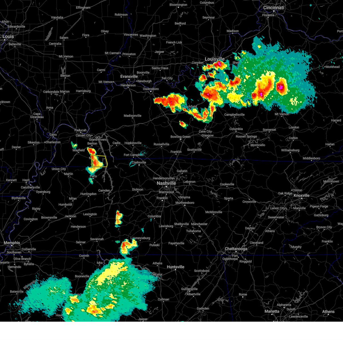 At 934 pm cdt, a severe thunderstorm was located 7 miles east of murray, moving east at 50 mph (radar indicated). Hazards include 60 mph wind gusts. Expect damage to roofs, siding, and trees. locations impacted include, murray, hazel and new concord. hail threat, radar indicated max hail size, <. 75 in wind threat, radar indicated max wind gust, 60 mph. At 934 pm cdt, a severe thunderstorm was located 7 miles east of murray, moving east at 50 mph (radar indicated). Hazards include 60 mph wind gusts. Expect damage to roofs, siding, and trees. locations impacted include, murray, hazel and new concord. hail threat, radar indicated max hail size, <. 75 in wind threat, radar indicated max wind gust, 60 mph.
|
| 6/25/2023 9:15 PM CDT |
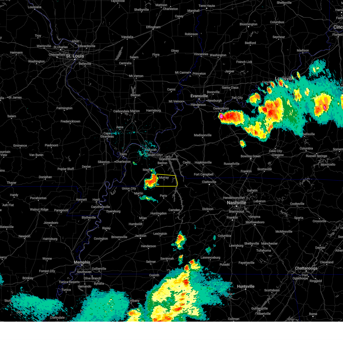 At 915 pm cdt, a severe thunderstorm was located near lynnville, or 7 miles west of murray, moving east at 60 mph (radar indicated). Hazards include 60 mph wind gusts and quarter size hail. Hail damage to vehicles is expected. Expect wind damage to roofs, siding, and trees. At 915 pm cdt, a severe thunderstorm was located near lynnville, or 7 miles west of murray, moving east at 60 mph (radar indicated). Hazards include 60 mph wind gusts and quarter size hail. Hail damage to vehicles is expected. Expect wind damage to roofs, siding, and trees.
|
| 4/5/2023 2:00 PM CDT |
 At 159 pm cdt, severe thunderstorms were located along a line extending from near calvert city to 6 miles northwest of hillman ferry campground to 7 miles southeast of lynnville, moving east at 65 mph (radar indicated). Hazards include 60 mph wind gusts. Expect damage to roofs, siding, and trees. locations impacted include, murray, benton, calvert city, eddyville, hillman ferry campground, birmingham ferry recreation area, demumbers bay campground, land between the lakes area, kuttawa, hardin, hazel, fredonia, grand rivers, kirksey, brewers, harris grove and crossland. this includes the following highways, interstate 24 in kentucky between mile markers 23 and 43. Interstate 69 in kentucky between mile markers 38 and 71. At 159 pm cdt, severe thunderstorms were located along a line extending from near calvert city to 6 miles northwest of hillman ferry campground to 7 miles southeast of lynnville, moving east at 65 mph (radar indicated). Hazards include 60 mph wind gusts. Expect damage to roofs, siding, and trees. locations impacted include, murray, benton, calvert city, eddyville, hillman ferry campground, birmingham ferry recreation area, demumbers bay campground, land between the lakes area, kuttawa, hardin, hazel, fredonia, grand rivers, kirksey, brewers, harris grove and crossland. this includes the following highways, interstate 24 in kentucky between mile markers 23 and 43. Interstate 69 in kentucky between mile markers 38 and 71.
|
| 4/5/2023 1:35 PM CDT |
 At 135 pm cdt, severe thunderstorms were located along a line extending from near metropolis to 9 miles southeast of lovelaceville to near south fulton, moving northeast at 55 mph (radar indicated). Hazards include 60 mph wind gusts. expect damage to roofs, siding, and trees At 135 pm cdt, severe thunderstorms were located along a line extending from near metropolis to 9 miles southeast of lovelaceville to near south fulton, moving northeast at 55 mph (radar indicated). Hazards include 60 mph wind gusts. expect damage to roofs, siding, and trees
|
| 3/3/2023 11:38 AM CST |
 The severe thunderstorm warning for eastern massac, calloway, western marshall, eastern mccracken and eastern graves counties will expire at 1145 am cst, the storms which prompted the warning have moved out of the area. therefore, the warning will be allowed to expire. a warning continues for the easternmost parts of calloway and marshall counties. a tornado watch remains in effect until 100 pm cst for southern illinois, and western kentucky. The severe thunderstorm warning for eastern massac, calloway, western marshall, eastern mccracken and eastern graves counties will expire at 1145 am cst, the storms which prompted the warning have moved out of the area. therefore, the warning will be allowed to expire. a warning continues for the easternmost parts of calloway and marshall counties. a tornado watch remains in effect until 100 pm cst for southern illinois, and western kentucky.
|
| 3/3/2023 11:19 AM CST |
 At 1119 am cst, severe thunderstorms were located over mainly rural from about 6 miles south of murray to just east of metropolis, moving east at 60 mph (trained weather spotters). Hazards include 70 mph wind gusts. Expect considerable tree damage. damage is likely to mobile homes, roofs, and outbuildings. locations impacted include, paducah, murray, mayfield, metropolis, benton, reidland, lone oak, brookport, lynnville, hardin, hazel, new concord, kirksey, brewers, harris grove and symsonia. this includes the following highways, interstate 24 in kentucky between mile markers 1 and 24. interstate 24 in illinois between mile markers 32 and 38. interstate 69 in kentucky between mile markers 27 and 49. thunderstorm damage threat, considerable hail threat, radar indicated max hail size, <. 75 in wind threat, radar indicated max wind gust, 70 mph. At 1119 am cst, severe thunderstorms were located over mainly rural from about 6 miles south of murray to just east of metropolis, moving east at 60 mph (trained weather spotters). Hazards include 70 mph wind gusts. Expect considerable tree damage. damage is likely to mobile homes, roofs, and outbuildings. locations impacted include, paducah, murray, mayfield, metropolis, benton, reidland, lone oak, brookport, lynnville, hardin, hazel, new concord, kirksey, brewers, harris grove and symsonia. this includes the following highways, interstate 24 in kentucky between mile markers 1 and 24. interstate 24 in illinois between mile markers 32 and 38. interstate 69 in kentucky between mile markers 27 and 49. thunderstorm damage threat, considerable hail threat, radar indicated max hail size, <. 75 in wind threat, radar indicated max wind gust, 70 mph.
|
| 3/3/2023 11:15 AM CST |
 At 1115 am cst, severe thunderstorms were located along a line extending from 7 miles north of brookport to 6 miles west of benton to near murray, moving northeast at 65 mph (radar indicated). Hazards include 70 mph wind gusts. Expect considerable tree damage. Damage is likely to mobile homes, roofs, and outbuildings. At 1115 am cst, severe thunderstorms were located along a line extending from 7 miles north of brookport to 6 miles west of benton to near murray, moving northeast at 65 mph (radar indicated). Hazards include 70 mph wind gusts. Expect considerable tree damage. Damage is likely to mobile homes, roofs, and outbuildings.
|
| 3/3/2023 11:04 AM CST |
 At 1103 am cst, severe thunderstorms were located from near kevil to just west of mayfield to near cuba, kentucky, moving northeast at 65 mph. multiple reports of wind gusts of 60 to 75 mph have been received with this line (trained weather spotters). Hazards include 70 mph wind gusts. Expect considerable tree damage. damage is likely to mobile homes, roofs, and outbuildings. locations impacted include, paducah, murray, mayfield, metropolis, benton, la center, wickliffe, reidland, lone oak, brookport, barlow, barkley regional airport, lynnville, sedalia, lovelaceville, west paducah, wingo, hardin, hazel and kevil. this includes the following highways, interstate 24 in kentucky between mile markers 1 and 24. interstate 24 in illinois between mile markers 31 and 38. interstate 69 in kentucky between mile markers 9 and 49. thunderstorm damage threat, considerable hail threat, radar indicated max hail size, <. 75 in wind threat, radar indicated max wind gust, 70 mph. At 1103 am cst, severe thunderstorms were located from near kevil to just west of mayfield to near cuba, kentucky, moving northeast at 65 mph. multiple reports of wind gusts of 60 to 75 mph have been received with this line (trained weather spotters). Hazards include 70 mph wind gusts. Expect considerable tree damage. damage is likely to mobile homes, roofs, and outbuildings. locations impacted include, paducah, murray, mayfield, metropolis, benton, la center, wickliffe, reidland, lone oak, brookport, barlow, barkley regional airport, lynnville, sedalia, lovelaceville, west paducah, wingo, hardin, hazel and kevil. this includes the following highways, interstate 24 in kentucky between mile markers 1 and 24. interstate 24 in illinois between mile markers 31 and 38. interstate 69 in kentucky between mile markers 9 and 49. thunderstorm damage threat, considerable hail threat, radar indicated max hail size, <. 75 in wind threat, radar indicated max wind gust, 70 mph.
|
| 3/3/2023 10:44 AM CST |
 At 1044 am cst, severe thunderstorms were located along a line extending from wickliffe to fulton, moving east at 60 mph (trained weather spotters. mesonet reported a 74 mph wind gust at fulton). Hazards include 70 mph wind gusts. Expect considerable tree damage. Damage is likely to mobile homes, roofs, and outbuildings. At 1044 am cst, severe thunderstorms were located along a line extending from wickliffe to fulton, moving east at 60 mph (trained weather spotters. mesonet reported a 74 mph wind gust at fulton). Hazards include 70 mph wind gusts. Expect considerable tree damage. Damage is likely to mobile homes, roofs, and outbuildings.
|
| 1/12/2023 5:19 AM CST |
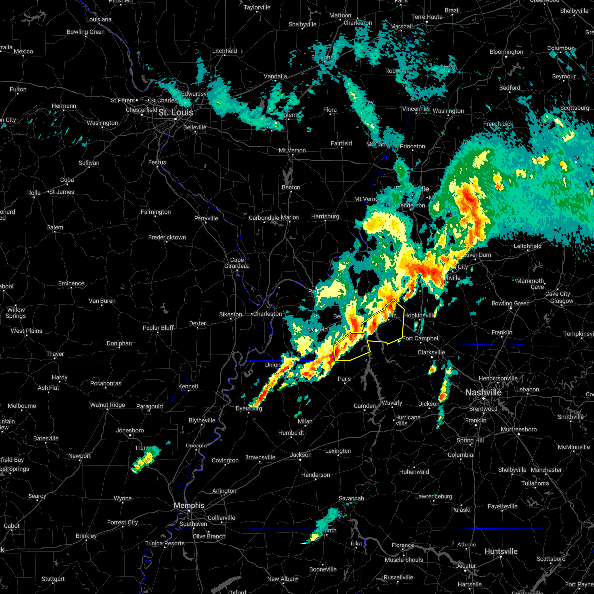 At 519 am cst, a severe thunderstorm was located near murray, moving northeast at 60 mph (radar indicated). Hazards include 60 mph wind gusts and quarter size hail. Hail damage to vehicles is expected. expect wind damage to roofs, siding, and trees. this severe thunderstorm will be near, land between the lakes area around 535 am cst. other locations in the path of this severe thunderstorm include canton and cadiz. this includes interstate 24 in kentucky between mile markers 55 and 70. hail threat, radar indicated max hail size, 1. 00 in wind threat, radar indicated max wind gust, 60 mph. At 519 am cst, a severe thunderstorm was located near murray, moving northeast at 60 mph (radar indicated). Hazards include 60 mph wind gusts and quarter size hail. Hail damage to vehicles is expected. expect wind damage to roofs, siding, and trees. this severe thunderstorm will be near, land between the lakes area around 535 am cst. other locations in the path of this severe thunderstorm include canton and cadiz. this includes interstate 24 in kentucky between mile markers 55 and 70. hail threat, radar indicated max hail size, 1. 00 in wind threat, radar indicated max wind gust, 60 mph.
|
| 7/9/2022 12:16 AM CDT |
 At 1215 am cdt, a severe thunderstorm was located near murray, moving east at 50 mph (radar indicated). Hazards include 60 mph wind gusts. Expect damage to roofs, siding, and trees. this severe thunderstorm will remain over mainly rural areas of calloway, southern marshall and southeastern graves counties, including the following locations, hardin, kirksey, harris grove and brewers. hail threat, radar indicated max hail size, <. 75 in wind threat, radar indicated max wind gust, 60 mph. At 1215 am cdt, a severe thunderstorm was located near murray, moving east at 50 mph (radar indicated). Hazards include 60 mph wind gusts. Expect damage to roofs, siding, and trees. this severe thunderstorm will remain over mainly rural areas of calloway, southern marshall and southeastern graves counties, including the following locations, hardin, kirksey, harris grove and brewers. hail threat, radar indicated max hail size, <. 75 in wind threat, radar indicated max wind gust, 60 mph.
|
| 7/9/2022 12:06 AM CDT |
 At 1206 am cdt, a severe thunderstorm was located near sedalia, or near mayfield, moving east at 40 mph (radar indicated). Hazards include 60 mph wind gusts. Expect damage to roofs, siding, and trees. this severe thunderstorm will be near, murray around 1225 am cdt. this includes interstate 69 in kentucky between mile markers 27 and 30. hail threat, radar indicated max hail size, <. 75 in wind threat, radar indicated max wind gust, 60 mph. At 1206 am cdt, a severe thunderstorm was located near sedalia, or near mayfield, moving east at 40 mph (radar indicated). Hazards include 60 mph wind gusts. Expect damage to roofs, siding, and trees. this severe thunderstorm will be near, murray around 1225 am cdt. this includes interstate 69 in kentucky between mile markers 27 and 30. hail threat, radar indicated max hail size, <. 75 in wind threat, radar indicated max wind gust, 60 mph.
|
| 5/21/2022 4:52 PM CDT |
 The severe thunderstorm warning for weakley, northeastern dyer, northwestern gibson, northwestern benton, obion and henry counties will expire at 500 pm cdt, the storms which prompted the warning have weakened below severe limits, and no longer pose an immediate threat to life or property. therefore, the warning will be allowed to expire. however small hail and gusty winds are still possible with these thunderstorms. a severe thunderstorm watch remains in effect until 1000 pm cdt for west tennessee. The severe thunderstorm warning for weakley, northeastern dyer, northwestern gibson, northwestern benton, obion and henry counties will expire at 500 pm cdt, the storms which prompted the warning have weakened below severe limits, and no longer pose an immediate threat to life or property. therefore, the warning will be allowed to expire. however small hail and gusty winds are still possible with these thunderstorms. a severe thunderstorm watch remains in effect until 1000 pm cdt for west tennessee.
|
| 5/21/2022 4:42 PM CDT |
 At 442 pm cdt, severe thunderstorms were located along a line extending from near kenton to 10 miles southeast of paris landing state park, moving northeast at 20 mph (radar indicated). Hazards include 60 mph wind gusts and quarter size hail. Hail damage to vehicles is expected. expect wind damage to roofs, siding, and trees. locations impacted include, martin, union city, paris, mckenzie, fulton, paris landing state park, dresden, south fulton, greenfield, gleason, troy, kenton, rutherford, obion, sharon, cottage grove, latham, springville, routon and palmersville. hail threat, radar indicated max hail size, 1. 00 in wind threat, radar indicated max wind gust, 60 mph. At 442 pm cdt, severe thunderstorms were located along a line extending from near kenton to 10 miles southeast of paris landing state park, moving northeast at 20 mph (radar indicated). Hazards include 60 mph wind gusts and quarter size hail. Hail damage to vehicles is expected. expect wind damage to roofs, siding, and trees. locations impacted include, martin, union city, paris, mckenzie, fulton, paris landing state park, dresden, south fulton, greenfield, gleason, troy, kenton, rutherford, obion, sharon, cottage grove, latham, springville, routon and palmersville. hail threat, radar indicated max hail size, 1. 00 in wind threat, radar indicated max wind gust, 60 mph.
|
| 5/21/2022 4:34 PM CDT |
 At 434 pm cdt, severe thunderstorms were located along a line extending from near kenton to 8 miles east of springville, moving east at 20 mph (radar indicated). Hazards include 60 mph wind gusts and quarter size hail. Hail damage to vehicles is expected. expect wind damage to roofs, siding, and trees. locations impacted include, martin, union city, paris, mckenzie, fulton, paris landing state park, dresden, south fulton, greenfield, gleason, troy, kenton, rutherford, obion, sharon, cottage grove, latham, springville, routon and palmersville. hail threat, radar indicated max hail size, 1. 00 in wind threat, radar indicated max wind gust, 60 mph. At 434 pm cdt, severe thunderstorms were located along a line extending from near kenton to 8 miles east of springville, moving east at 20 mph (radar indicated). Hazards include 60 mph wind gusts and quarter size hail. Hail damage to vehicles is expected. expect wind damage to roofs, siding, and trees. locations impacted include, martin, union city, paris, mckenzie, fulton, paris landing state park, dresden, south fulton, greenfield, gleason, troy, kenton, rutherford, obion, sharon, cottage grove, latham, springville, routon and palmersville. hail threat, radar indicated max hail size, 1. 00 in wind threat, radar indicated max wind gust, 60 mph.
|
| 5/21/2022 4:19 PM CDT |
 At 419 pm cdt, severe thunderstorms were located along a line extending from 6 miles southeast of obion to near springville, moving northeast at 20 mph (radar indicated). Hazards include 60 mph wind gusts and quarter size hail. Hail damage to vehicles is expected. Expect wind damage to roofs, siding, and trees. At 419 pm cdt, severe thunderstorms were located along a line extending from 6 miles southeast of obion to near springville, moving northeast at 20 mph (radar indicated). Hazards include 60 mph wind gusts and quarter size hail. Hail damage to vehicles is expected. Expect wind damage to roofs, siding, and trees.
|
| 5/3/2022 12:41 AM CDT |
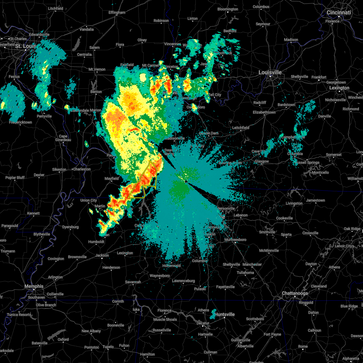 The severe thunderstorm warning for eastern calloway, south central caldwell, central trigg and southeastern lyon counties will expire at 1245 am cdt, the storms which prompted the warning is moving out of the area. therefore, the warning will be allowed to expire. however gusty winds and heavy rain are still possible with these thunderstorms. to report severe weather, contact your nearest law enforcement agency. they will relay your report to the national weather service paducah. The severe thunderstorm warning for eastern calloway, south central caldwell, central trigg and southeastern lyon counties will expire at 1245 am cdt, the storms which prompted the warning is moving out of the area. therefore, the warning will be allowed to expire. however gusty winds and heavy rain are still possible with these thunderstorms. to report severe weather, contact your nearest law enforcement agency. they will relay your report to the national weather service paducah.
|
| 5/3/2022 12:33 AM CDT |
 At 1233 am cdt, severe thunderstorms were located along a line extending from near princeton to 6 miles northwest of cadiz to near canton to 7 miles northwest of paris landing state park, moving east at 45 mph (radar indicated). Hazards include 60 mph wind gusts and penny size hail. Expect damage to roofs, siding, and trees. locations impacted include, cadiz, land between the lakes area, canton, rockcastle, hazel, new concord and linton. this includes interstate 24 in kentucky between mile markers 51 and 58. hail threat, radar indicated max hail size, 0. 75 in wind threat, radar indicated max wind gust, 60 mph. At 1233 am cdt, severe thunderstorms were located along a line extending from near princeton to 6 miles northwest of cadiz to near canton to 7 miles northwest of paris landing state park, moving east at 45 mph (radar indicated). Hazards include 60 mph wind gusts and penny size hail. Expect damage to roofs, siding, and trees. locations impacted include, cadiz, land between the lakes area, canton, rockcastle, hazel, new concord and linton. this includes interstate 24 in kentucky between mile markers 51 and 58. hail threat, radar indicated max hail size, 0. 75 in wind threat, radar indicated max wind gust, 60 mph.
|
| 5/3/2022 12:27 AM CDT |
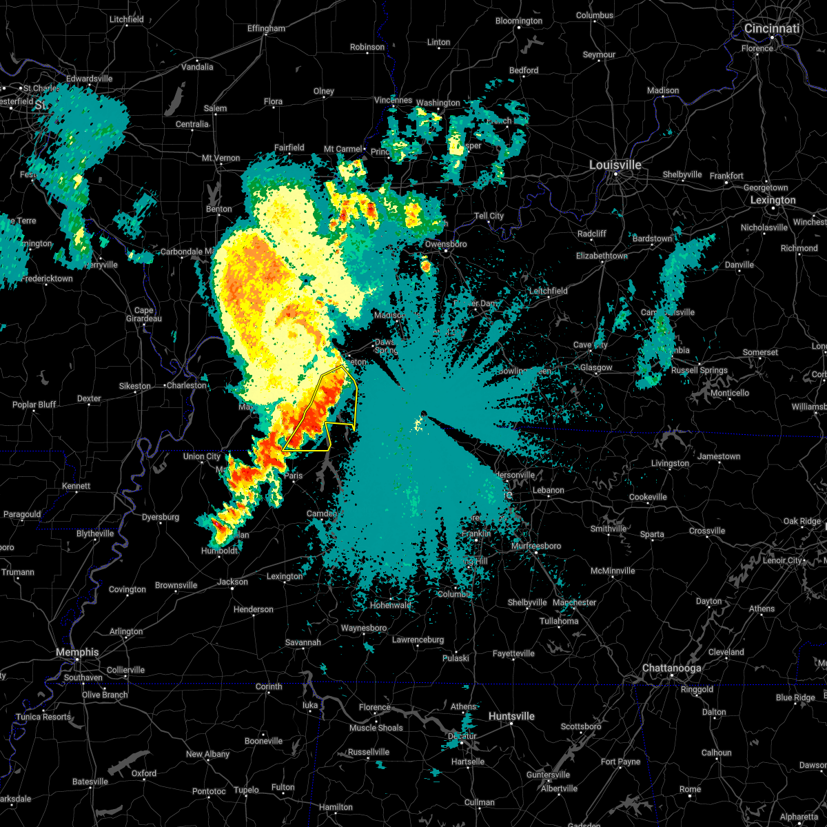 At 1226 am cdt, severe thunderstorms were located along a line extending from near eddyville to 6 miles northwest of cadiz to near canton to 7 miles southeast of land between the lakes area to 8 miles northwest of paris landing state park, moving east at 45 mph (radar indicated). Hazards include 60 mph wind gusts and penny size hail. Expect damage to roofs, siding, and trees. locations impacted include, murray, cadiz, land between the lakes area, canton, rockcastle, hazel, aurora, new concord, linton and crossland. this includes interstate 24 in kentucky between mile markers 49 and 58. hail threat, radar indicated max hail size, 0. 75 in wind threat, radar indicated max wind gust, 60 mph. At 1226 am cdt, severe thunderstorms were located along a line extending from near eddyville to 6 miles northwest of cadiz to near canton to 7 miles southeast of land between the lakes area to 8 miles northwest of paris landing state park, moving east at 45 mph (radar indicated). Hazards include 60 mph wind gusts and penny size hail. Expect damage to roofs, siding, and trees. locations impacted include, murray, cadiz, land between the lakes area, canton, rockcastle, hazel, aurora, new concord, linton and crossland. this includes interstate 24 in kentucky between mile markers 49 and 58. hail threat, radar indicated max hail size, 0. 75 in wind threat, radar indicated max wind gust, 60 mph.
|
| 5/3/2022 12:15 AM CDT |
 At 1214 am cdt, severe thunderstorms were located along a line extending from near eddyville to 10 miles northwest of canton to near land between the lakes area to 7 miles southwest of murray, moving east at 45 mph (radar indicated). Hazards include 60 mph wind gusts and penny size hail. Expect damage to roofs, siding, and trees. locations impacted include, murray, cadiz, land between the lakes area, canton, rockcastle, hazel, aurora, new concord, linton and crossland. this includes interstate 24 in kentucky between mile markers 48 and 58. hail threat, radar indicated max hail size, 0. 75 in wind threat, radar indicated max wind gust, 60 mph. At 1214 am cdt, severe thunderstorms were located along a line extending from near eddyville to 10 miles northwest of canton to near land between the lakes area to 7 miles southwest of murray, moving east at 45 mph (radar indicated). Hazards include 60 mph wind gusts and penny size hail. Expect damage to roofs, siding, and trees. locations impacted include, murray, cadiz, land between the lakes area, canton, rockcastle, hazel, aurora, new concord, linton and crossland. this includes interstate 24 in kentucky between mile markers 48 and 58. hail threat, radar indicated max hail size, 0. 75 in wind threat, radar indicated max wind gust, 60 mph.
|
| 5/2/2022 11:54 PM CDT |
 At 1153 pm cdt, severe thunderstorms were located along a line extending from near calvert city to near benton to 15 miles west of land between the lakes area to near murray to near cottage grove, moving east at 45 mph (radar indicated). Hazards include 60 mph wind gusts and penny size hail. expect damage to roofs, siding, and trees At 1153 pm cdt, severe thunderstorms were located along a line extending from near calvert city to near benton to 15 miles west of land between the lakes area to near murray to near cottage grove, moving east at 45 mph (radar indicated). Hazards include 60 mph wind gusts and penny size hail. expect damage to roofs, siding, and trees
|
| 5/2/2022 11:26 PM CDT |
 At 1125 pm cdt, severe thunderstorms were located along a line extending from 8 miles southeast of lovelaceville to near mayfield to near sedalia to near martin, moving northeast at 55 mph (radar indicated). Hazards include 60 mph wind gusts. Expect damage to roofs, siding, and trees. severe thunderstorms will be near, mayfield and sedalia around 1130 pm cdt. lynnville around 1145 pm cdt. other locations in the path of these severe thunderstorms include benton and murray. this includes interstate 69 in kentucky between mile markers 14 and 44. hail threat, radar indicated max hail size, <. 75 in wind threat, radar indicated max wind gust, 60 mph. At 1125 pm cdt, severe thunderstorms were located along a line extending from 8 miles southeast of lovelaceville to near mayfield to near sedalia to near martin, moving northeast at 55 mph (radar indicated). Hazards include 60 mph wind gusts. Expect damage to roofs, siding, and trees. severe thunderstorms will be near, mayfield and sedalia around 1130 pm cdt. lynnville around 1145 pm cdt. other locations in the path of these severe thunderstorms include benton and murray. this includes interstate 69 in kentucky between mile markers 14 and 44. hail threat, radar indicated max hail size, <. 75 in wind threat, radar indicated max wind gust, 60 mph.
|
| 4/21/2022 3:21 AM CDT |
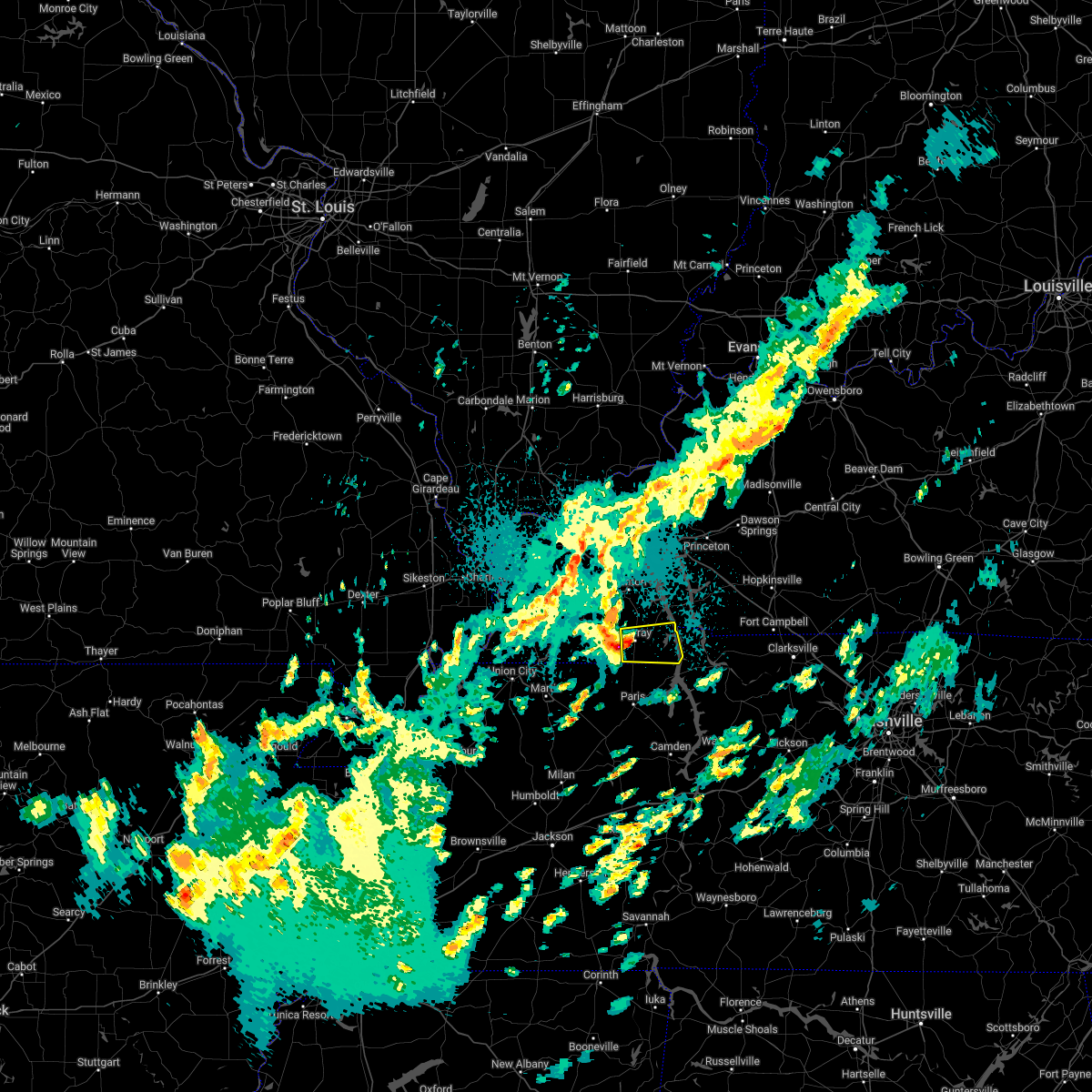 At 320 am cdt, a severe thunderstorm was located over murray, moving east at 45 mph (trained weather spotters). Hazards include quarter size hail. Damage to vehicles is expected. this severe thunderstorm will remain over mainly rural areas of calloway county, including the following locations, new concord and hazel. hail threat, radar indicated max hail size, 1. 00 in wind threat, radar indicated max wind gust, <50 mph. At 320 am cdt, a severe thunderstorm was located over murray, moving east at 45 mph (trained weather spotters). Hazards include quarter size hail. Damage to vehicles is expected. this severe thunderstorm will remain over mainly rural areas of calloway county, including the following locations, new concord and hazel. hail threat, radar indicated max hail size, 1. 00 in wind threat, radar indicated max wind gust, <50 mph.
|
| 4/13/2022 4:57 PM CDT |
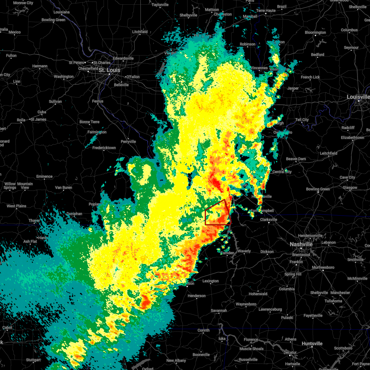 The tornado warning for calloway and southeastern marshall counties will expire at 500 pm cdt, the storms which prompted the warning have moved out of the area. therefore, the warning will be allowed to expire. a tornado watch remains in effect until 900 pm cdt for western kentucky. The tornado warning for calloway and southeastern marshall counties will expire at 500 pm cdt, the storms which prompted the warning have moved out of the area. therefore, the warning will be allowed to expire. a tornado watch remains in effect until 900 pm cdt for western kentucky.
|
| 4/13/2022 4:31 PM CDT |
 At 431 pm cdt, severe thunderstorms were located along a line extending from near reidland to 8 miles northwest of murray to near palmersville, moving east at 60 mph (radar indicated). Hazards include 60 mph wind gusts and nickel size hail. Expect damage to roofs, siding, and trees. locations impacted include, murray, mayfield, benton, lynnville, hardin, hazel, aurora, new concord, kirksey, harris grove, brewers and symsonia. This includes interstate 69 in kentucky between mile markers 27 and 48. At 431 pm cdt, severe thunderstorms were located along a line extending from near reidland to 8 miles northwest of murray to near palmersville, moving east at 60 mph (radar indicated). Hazards include 60 mph wind gusts and nickel size hail. Expect damage to roofs, siding, and trees. locations impacted include, murray, mayfield, benton, lynnville, hardin, hazel, aurora, new concord, kirksey, harris grove, brewers and symsonia. This includes interstate 69 in kentucky between mile markers 27 and 48.
|
| 4/13/2022 4:28 PM CDT |
 At 428 pm cdt, severe thunderstorms capable of producing both tornadoes and extensive straight line wind damage were located along a line extending from 8 miles southwest of benton to 7 miles southeast of lynnville, moving east at 75 mph (radar indicated rotation). Hazards include tornado. Flying debris will be dangerous to those caught without shelter. mobile homes will be damaged or destroyed. damage to roofs, windows, and vehicles will occur. tree damage is likely. These tornadic storms will remain over mainly rural areas of calloway and southeastern marshall counties, including the following locations, aurora, new concord, hardin, kirksey, harris grove, hazel and crossland. At 428 pm cdt, severe thunderstorms capable of producing both tornadoes and extensive straight line wind damage were located along a line extending from 8 miles southwest of benton to 7 miles southeast of lynnville, moving east at 75 mph (radar indicated rotation). Hazards include tornado. Flying debris will be dangerous to those caught without shelter. mobile homes will be damaged or destroyed. damage to roofs, windows, and vehicles will occur. tree damage is likely. These tornadic storms will remain over mainly rural areas of calloway and southeastern marshall counties, including the following locations, aurora, new concord, hardin, kirksey, harris grove, hazel and crossland.
|
| 4/13/2022 4:17 PM CDT |
 At 416 pm cdt, severe thunderstorms were located along a line extending from 6 miles south of lovelaceville to near sedalia to near sharon, moving east at 60 mph (radar indicated). Hazards include 60 mph wind gusts and nickel size hail. Expect damage to roofs, siding, and trees. locations impacted include, murray, mayfield, benton, lynnville, sedalia, wingo, hardin, hazel, water valley, lowes, new concord, fancy farm, kirksey, brewers, aurora, harris grove and symsonia. This includes interstate 69 in kentucky between mile markers 7 and 48. At 416 pm cdt, severe thunderstorms were located along a line extending from 6 miles south of lovelaceville to near sedalia to near sharon, moving east at 60 mph (radar indicated). Hazards include 60 mph wind gusts and nickel size hail. Expect damage to roofs, siding, and trees. locations impacted include, murray, mayfield, benton, lynnville, sedalia, wingo, hardin, hazel, water valley, lowes, new concord, fancy farm, kirksey, brewers, aurora, harris grove and symsonia. This includes interstate 69 in kentucky between mile markers 7 and 48.
|
| 4/13/2022 4:06 PM CDT |
 At 405 pm cdt, severe thunderstorms were located along a line extending from near bardwell to near fulgham to kenton, moving east at 60 mph (radar indicated). Hazards include 60 mph wind gusts and nickel size hail. Expect damage to roofs, siding, and trees. locations impacted include, fulgham, mayfield, sedalia, lynnville and murray. This includes interstate 69 in kentucky between mile markers 1 and 48. At 405 pm cdt, severe thunderstorms were located along a line extending from near bardwell to near fulgham to kenton, moving east at 60 mph (radar indicated). Hazards include 60 mph wind gusts and nickel size hail. Expect damage to roofs, siding, and trees. locations impacted include, fulgham, mayfield, sedalia, lynnville and murray. This includes interstate 69 in kentucky between mile markers 1 and 48.
|
| 4/13/2022 3:49 PM CDT |
 At 349 pm cdt, severe thunderstorms were located along a line extending from near towosahgy state historic site to near hickman to near newbern, moving east at 60 mph (radar indicated). Hazards include 60 mph wind gusts and nickel size hail. Expect damage to roofs, siding, and trees. severe thunderstorms will be near, cayce around 355 pm cdt. clinton around 400 pm cdt. fulton, bardwell and fulgham around 405 pm cdt. other locations in the path of these severe thunderstorms include mayfield, sedalia, lynnville and murray. This includes interstate 69 in kentucky between mile markers 1 and 48. At 349 pm cdt, severe thunderstorms were located along a line extending from near towosahgy state historic site to near hickman to near newbern, moving east at 60 mph (radar indicated). Hazards include 60 mph wind gusts and nickel size hail. Expect damage to roofs, siding, and trees. severe thunderstorms will be near, cayce around 355 pm cdt. clinton around 400 pm cdt. fulton, bardwell and fulgham around 405 pm cdt. other locations in the path of these severe thunderstorms include mayfield, sedalia, lynnville and murray. This includes interstate 69 in kentucky between mile markers 1 and 48.
|
| 3/30/2022 5:30 PM CDT |
 At 530 pm cdt, severe thunderstorms were located along a line extending from near dixon springs to 8 miles southwest of reidland to near lynnville, moving northeast at 55 mph (radar indicated). Hazards include 60 mph wind gusts. Expect damage to roofs, siding, and trees. severe thunderstorms will be near, reidland around 540 pm cdt. calvert city and ledbetter around 545 pm cdt. murray around 550 pm cdt. other locations in the path of these severe thunderstorms include benton and salem. this includes the following highways, interstate 24 in kentucky between mile markers 13 and 33. Interstate 69 in kentucky between mile markers 24 and 51. At 530 pm cdt, severe thunderstorms were located along a line extending from near dixon springs to 8 miles southwest of reidland to near lynnville, moving northeast at 55 mph (radar indicated). Hazards include 60 mph wind gusts. Expect damage to roofs, siding, and trees. severe thunderstorms will be near, reidland around 540 pm cdt. calvert city and ledbetter around 545 pm cdt. murray around 550 pm cdt. other locations in the path of these severe thunderstorms include benton and salem. this includes the following highways, interstate 24 in kentucky between mile markers 13 and 33. Interstate 69 in kentucky between mile markers 24 and 51.
|
| 3/30/2022 4:48 PM CDT |
 At 447 pm cdt, severe thunderstorms were located along a line extending from 8 miles north of mayfield to near palmersville, moving northeast at 60 mph (radar indicated). Hazards include 70 mph wind gusts. Expect considerable tree damage. damage is likely to mobile homes, roofs, and outbuildings. severe thunderstorms will be near, paducah around 455 pm cdt. reidland around 500 pm cdt. ledbetter around 505 pm cdt. other locations in the path of these severe thunderstorms include murray, salem, burna, benton and joy. this includes the following highways, interstate 24 in kentucky between mile markers 13 and 33. Interstate 69 in kentucky between mile markers 24 and 51. At 447 pm cdt, severe thunderstorms were located along a line extending from 8 miles north of mayfield to near palmersville, moving northeast at 60 mph (radar indicated). Hazards include 70 mph wind gusts. Expect considerable tree damage. damage is likely to mobile homes, roofs, and outbuildings. severe thunderstorms will be near, paducah around 455 pm cdt. reidland around 500 pm cdt. ledbetter around 505 pm cdt. other locations in the path of these severe thunderstorms include murray, salem, burna, benton and joy. this includes the following highways, interstate 24 in kentucky between mile markers 13 and 33. Interstate 69 in kentucky between mile markers 24 and 51.
|
| 2/22/2022 7:08 AM CST | At 707 am cst, severe thunderstorms were located along a line extending from 7 miles east of mayfield to near sedalia to 7 miles east of lynnville to near gleason, moving east at 50 mph (radar indicated). Hazards include 60 mph wind gusts. Expect damage to roofs, siding, and trees. Severe thunderstorms will be near, murray around 720 am cst. |
| 1/1/2022 2:06 AM CST |
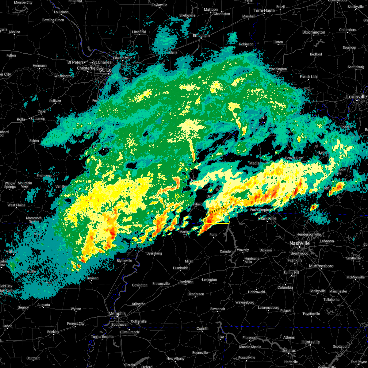 At 205 am cst, severe thunderstorms were located along a line extending from west of murray to near cottage grove, moving east at 45 mph (radar indicated). Hazards include 60 mph wind gusts. Expect damage to roofs, siding, and trees. Locations impacted include, murray, hazel, harris grove, new concord and crossland. At 205 am cst, severe thunderstorms were located along a line extending from west of murray to near cottage grove, moving east at 45 mph (radar indicated). Hazards include 60 mph wind gusts. Expect damage to roofs, siding, and trees. Locations impacted include, murray, hazel, harris grove, new concord and crossland.
|
| 1/1/2022 1:51 AM CST |
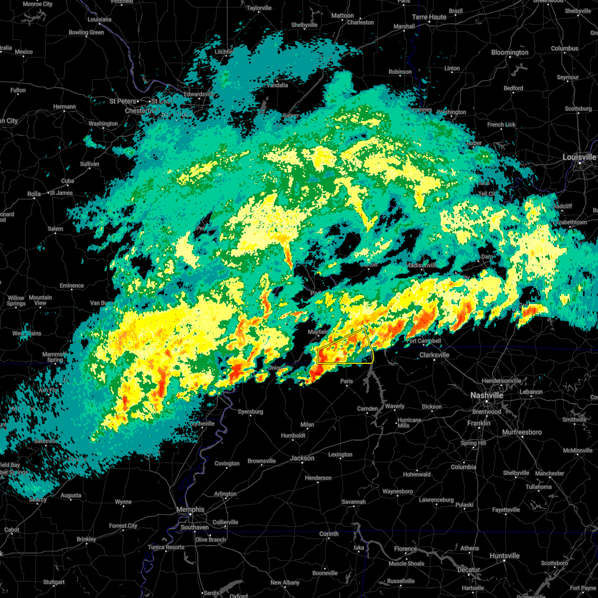 At 150 am cst, severe thunderstorms were located along a line extending from near lynnville to near palmersville, moving northeast at 45 mph (radar indicated). Hazards include 60 mph wind gusts and penny size hail. expect damage to roofs, siding, and trees At 150 am cst, severe thunderstorms were located along a line extending from near lynnville to near palmersville, moving northeast at 45 mph (radar indicated). Hazards include 60 mph wind gusts and penny size hail. expect damage to roofs, siding, and trees
|
| 12/6/2021 3:41 AM CST |
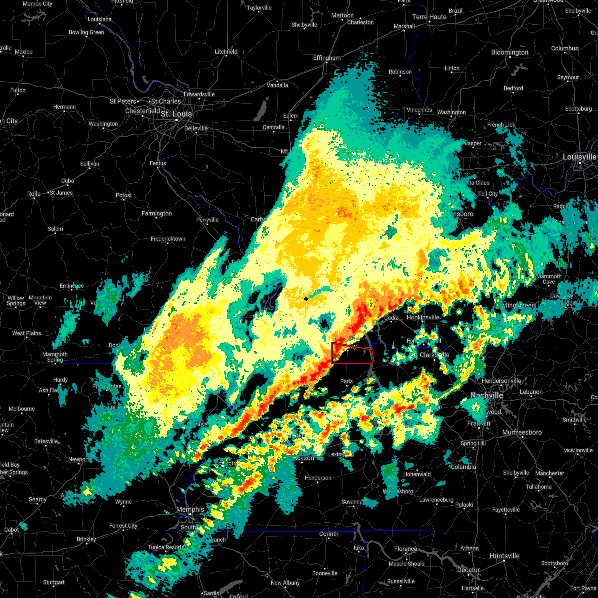 At 340 am cst, a severe thunderstorm capable of producing a tornado was located near murray, moving east at 55 mph (radar indicated rotation). Hazards include tornado. Flying debris will be dangerous to those caught without shelter. mobile homes will be damaged or destroyed. damage to roofs, windows, and vehicles will occur. tree damage is likely. This dangerous storm will be near, murray around 345 am cst. At 340 am cst, a severe thunderstorm capable of producing a tornado was located near murray, moving east at 55 mph (radar indicated rotation). Hazards include tornado. Flying debris will be dangerous to those caught without shelter. mobile homes will be damaged or destroyed. damage to roofs, windows, and vehicles will occur. tree damage is likely. This dangerous storm will be near, murray around 345 am cst.
|
| 12/6/2021 3:28 AM CST |
 At 327 am cst, a severe thunderstorm capable of producing a tornado was located near sedalia, or 9 miles south of mayfield, moving east at 55 mph (radar indicated rotation). Hazards include tornado. Flying debris will be dangerous to those caught without shelter. mobile homes will be damaged or destroyed. damage to roofs, windows, and vehicles will occur. tree damage is likely. This dangerous storm will be near, murray around 345 am cst. At 327 am cst, a severe thunderstorm capable of producing a tornado was located near sedalia, or 9 miles south of mayfield, moving east at 55 mph (radar indicated rotation). Hazards include tornado. Flying debris will be dangerous to those caught without shelter. mobile homes will be damaged or destroyed. damage to roofs, windows, and vehicles will occur. tree damage is likely. This dangerous storm will be near, murray around 345 am cst.
|
| 5/4/2021 4:12 AM CDT | Numerous trees down from 2 miles west of hazel to hazel. 2 houses with trees on the in calloway county KY, 2.1 miles ESE of Hazel, KY |
| 5/4/2021 4:10 AM CDT |
 At 410 am cdt, a severe thunderstorm capable of producing a tornado was located near murray, moving east at 55 mph (radar indicated rotation). Hazards include tornado. Flying debris will be dangerous to those caught without shelter. mobile homes will be damaged or destroyed. damage to roofs, windows, and vehicles will occur. tree damage is likely. this dangerous storm will be near, murray around 415 am cdt. Other locations impacted by this tornadic thunderstorm include harris grove, hazel, new concord and crossland. At 410 am cdt, a severe thunderstorm capable of producing a tornado was located near murray, moving east at 55 mph (radar indicated rotation). Hazards include tornado. Flying debris will be dangerous to those caught without shelter. mobile homes will be damaged or destroyed. damage to roofs, windows, and vehicles will occur. tree damage is likely. this dangerous storm will be near, murray around 415 am cdt. Other locations impacted by this tornadic thunderstorm include harris grove, hazel, new concord and crossland.
|
| 5/4/2021 4:08 AM CDT |
 At 408 am cdt, severe thunderstorms were located along a line extending from near reidland to 6 miles southeast of lynnville, moving east at 50 mph (radar indicated). Hazards include 60 mph wind gusts and nickel size hail. expect damage to roofs, siding, and trees At 408 am cdt, severe thunderstorms were located along a line extending from near reidland to 6 miles southeast of lynnville, moving east at 50 mph (radar indicated). Hazards include 60 mph wind gusts and nickel size hail. expect damage to roofs, siding, and trees
|
| 5/4/2021 3:59 AM CDT |
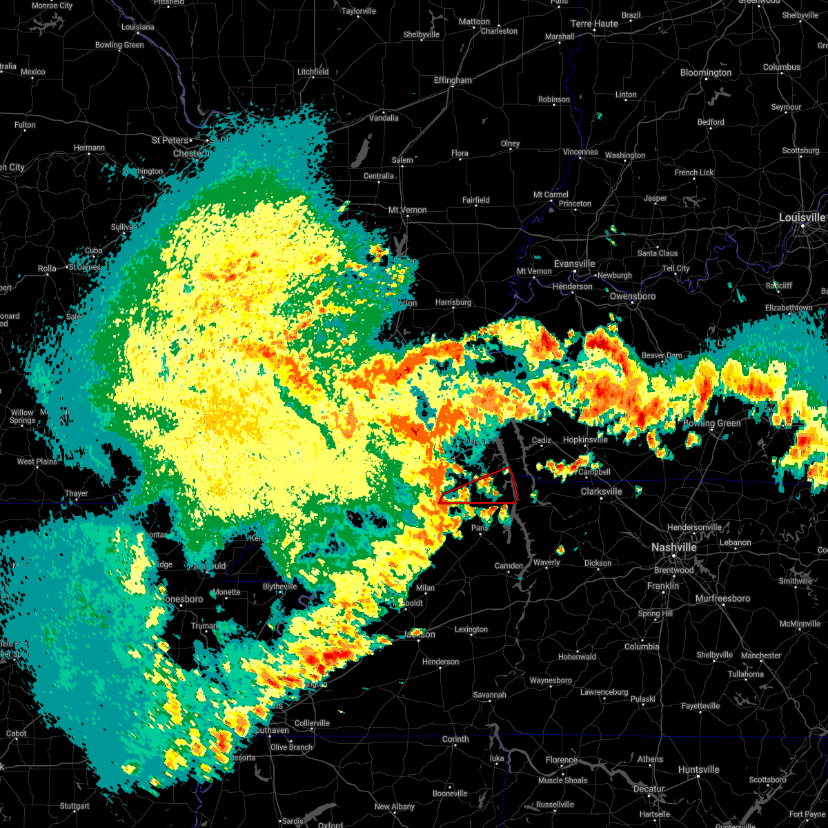 At 359 am cdt, a severe thunderstorm capable of producing a tornado was located near lynnville, or 15 miles southwest of murray, moving east at 60 mph (radar indicated rotation). Hazards include tornado. Flying debris will be dangerous to those caught without shelter. mobile homes will be damaged or destroyed. damage to roofs, windows, and vehicles will occur. tree damage is likely. this dangerous storm will be near, murray around 415 am cdt. Other locations impacted by this tornadic thunderstorm include harris grove, hazel, new concord and crossland. At 359 am cdt, a severe thunderstorm capable of producing a tornado was located near lynnville, or 15 miles southwest of murray, moving east at 60 mph (radar indicated rotation). Hazards include tornado. Flying debris will be dangerous to those caught without shelter. mobile homes will be damaged or destroyed. damage to roofs, windows, and vehicles will occur. tree damage is likely. this dangerous storm will be near, murray around 415 am cdt. Other locations impacted by this tornadic thunderstorm include harris grove, hazel, new concord and crossland.
|
| 4/28/2021 6:36 PM CDT |
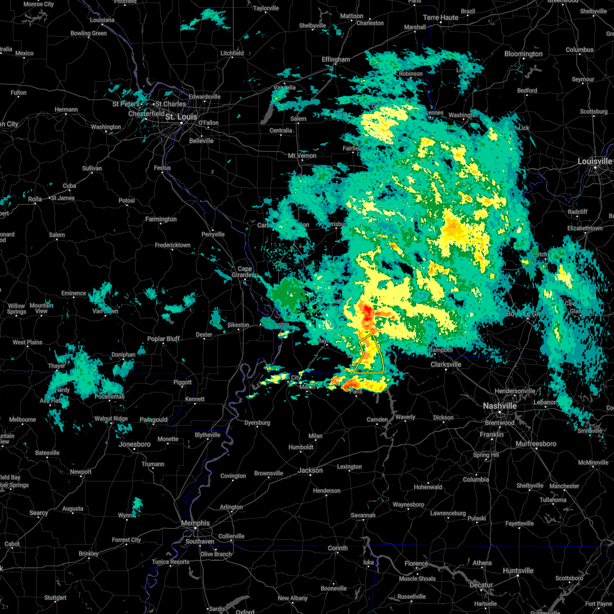 At 636 pm cdt, severe thunderstorms were located along a line extending from 7 miles southwest of land between the lakes area to 13 miles southwest of canton to 8 miles east of murray, moving east at 40 mph (radar indicated). Hazards include 60 mph wind gusts. Expect damage to roofs, siding, and trees. Locations impacted include, hazel, aurora and new concord. At 636 pm cdt, severe thunderstorms were located along a line extending from 7 miles southwest of land between the lakes area to 13 miles southwest of canton to 8 miles east of murray, moving east at 40 mph (radar indicated). Hazards include 60 mph wind gusts. Expect damage to roofs, siding, and trees. Locations impacted include, hazel, aurora and new concord.
|
| 4/28/2021 6:24 PM CDT |
 At 624 pm cdt, severe thunderstorms were located along a line extending from 6 miles southeast of benton to near murray, moving northeast at 40 mph (radar indicated). Hazards include 60 mph wind gusts. expect damage to roofs, siding, and trees At 624 pm cdt, severe thunderstorms were located along a line extending from 6 miles southeast of benton to near murray, moving northeast at 40 mph (radar indicated). Hazards include 60 mph wind gusts. expect damage to roofs, siding, and trees
|
| 5/3/2020 3:20 PM CDT |
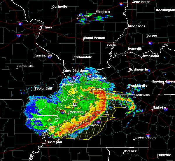 At 319 pm cdt, severe thunderstorms were located along a line extending from 9 miles south of reidland to near benton to 7 miles east of murray to 6 miles southwest of paris landing state park, moving east at 55 mph (radar indicated). Hazards include 70 mph wind gusts. Expect considerable tree damage. damage is likely to mobile homes, roofs, and outbuildings. Locations impacted include, murray, hazel, kirksey, harris grove and crossland. At 319 pm cdt, severe thunderstorms were located along a line extending from 9 miles south of reidland to near benton to 7 miles east of murray to 6 miles southwest of paris landing state park, moving east at 55 mph (radar indicated). Hazards include 70 mph wind gusts. Expect considerable tree damage. damage is likely to mobile homes, roofs, and outbuildings. Locations impacted include, murray, hazel, kirksey, harris grove and crossland.
|
| 5/3/2020 3:09 PM CDT |
 At 308 pm cdt, severe thunderstorms were located along a line extending from 10 miles southwest of reidland to 7 miles northeast of mayfield to 10 miles south of benton to near murray to 7 miles north of paris, moving east at 55 mph (radar indicated. this line of storms will bring 60 to 70 mph winds to the murray, kentucky area). Hazards include 70 mph wind gusts. Expect considerable tree damage. damage is likely to mobile homes, roofs, and outbuildings. Locations impacted include, murray, mayfield, hardin, hazel, kirksey, harris grove, brewers and crossland. At 308 pm cdt, severe thunderstorms were located along a line extending from 10 miles southwest of reidland to 7 miles northeast of mayfield to 10 miles south of benton to near murray to 7 miles north of paris, moving east at 55 mph (radar indicated. this line of storms will bring 60 to 70 mph winds to the murray, kentucky area). Hazards include 70 mph wind gusts. Expect considerable tree damage. damage is likely to mobile homes, roofs, and outbuildings. Locations impacted include, murray, mayfield, hardin, hazel, kirksey, harris grove, brewers and crossland.
|
| 5/3/2020 3:00 PM CDT |
 At 258 pm cdt, severe thunderstorms were located along a line extending from near lovelaceville to 12 miles north of sedalia to near mayfield to near lynnville to near cottage grove, moving east at 70 mph (trained weather spotters. 64 mph winds measured in western graves county at the kentucky mesonet site). Hazards include 70 mph wind gusts and penny size hail. Expect considerable tree damage. damage is likely to mobile homes, roofs, and outbuildings. Locations impacted include, murray, mayfield, lynnville, sedalia, wingo, hardin, hazel, water valley, lowes, fancy farm, kirksey, brewers, dukedom, harris grove and crossland. At 258 pm cdt, severe thunderstorms were located along a line extending from near lovelaceville to 12 miles north of sedalia to near mayfield to near lynnville to near cottage grove, moving east at 70 mph (trained weather spotters. 64 mph winds measured in western graves county at the kentucky mesonet site). Hazards include 70 mph wind gusts and penny size hail. Expect considerable tree damage. damage is likely to mobile homes, roofs, and outbuildings. Locations impacted include, murray, mayfield, lynnville, sedalia, wingo, hardin, hazel, water valley, lowes, fancy farm, kirksey, brewers, dukedom, harris grove and crossland.
|
| 5/3/2020 2:29 PM CDT |
 At 228 pm cdt, severe thunderstorms were located along a line extending from 6 miles south of horseshoe lake conservation area to wyatt to 8 miles northeast of towosahgy state historic site to near clinton to near union city, moving east at 55 mph (radar indicated). Hazards include 70 mph wind gusts and penny size hail. Expect considerable tree damage. Damage is likely to mobile homes, roofs, and outbuildings. At 228 pm cdt, severe thunderstorms were located along a line extending from 6 miles south of horseshoe lake conservation area to wyatt to 8 miles northeast of towosahgy state historic site to near clinton to near union city, moving east at 55 mph (radar indicated). Hazards include 70 mph wind gusts and penny size hail. Expect considerable tree damage. Damage is likely to mobile homes, roofs, and outbuildings.
|
| 4/8/2020 8:31 PM CDT |
 At 831 pm cdt, severe thunderstorms were located along a line extending from near cobb to near paris landing state park, moving east at 45 mph (radar indicated). Hazards include 60 mph wind gusts and quarter size hail. Hail damage to vehicles is expected. expect wind damage to roofs, siding, and trees. Locations impacted include, murray, cadiz, land between the lakes area, canton, cobb, hazel, new concord and linton. At 831 pm cdt, severe thunderstorms were located along a line extending from near cobb to near paris landing state park, moving east at 45 mph (radar indicated). Hazards include 60 mph wind gusts and quarter size hail. Hail damage to vehicles is expected. expect wind damage to roofs, siding, and trees. Locations impacted include, murray, cadiz, land between the lakes area, canton, cobb, hazel, new concord and linton.
|
| 4/8/2020 8:10 PM CDT |
 At 809 pm cdt, severe thunderstorms were located along a line extending from near eddyville to near murray, moving east at 45 mph (radar indicated). Hazards include 60 mph wind gusts and half dollar size hail. Hail damage to vehicles is expected. expect wind damage to roofs, siding, and trees. Locations impacted include, murray, princeton, cadiz, eddyville, land between the lakes area, cobb, canton, rockcastle, kuttawa, hardin, hazel, new concord, linton, aurora, harris grove and kirksey. At 809 pm cdt, severe thunderstorms were located along a line extending from near eddyville to near murray, moving east at 45 mph (radar indicated). Hazards include 60 mph wind gusts and half dollar size hail. Hail damage to vehicles is expected. expect wind damage to roofs, siding, and trees. Locations impacted include, murray, princeton, cadiz, eddyville, land between the lakes area, cobb, canton, rockcastle, kuttawa, hardin, hazel, new concord, linton, aurora, harris grove and kirksey.
|
| 4/8/2020 7:53 PM CDT |
 At 753 pm cdt, severe thunderstorms were located along a line extending from 7 miles northwest of eddyville to near lynnville, moving east at 40 mph (radar indicated). Hazards include 60 mph wind gusts and quarter size hail. Hail damage to vehicles is expected. Expect wind damage to roofs, siding, and trees. At 753 pm cdt, severe thunderstorms were located along a line extending from 7 miles northwest of eddyville to near lynnville, moving east at 40 mph (radar indicated). Hazards include 60 mph wind gusts and quarter size hail. Hail damage to vehicles is expected. Expect wind damage to roofs, siding, and trees.
|
| 3/20/2020 4:01 AM CDT |
 At 401 am cdt, a severe thunderstorm was located 8 miles northwest of paris landing state park, moving east at 55 mph (radar indicated). Hazards include 60 mph wind gusts and quarter size hail. Hail damage to vehicles is expected. expect wind damage to roofs, siding, and trees. Locations impacted include, hazel and new concord. At 401 am cdt, a severe thunderstorm was located 8 miles northwest of paris landing state park, moving east at 55 mph (radar indicated). Hazards include 60 mph wind gusts and quarter size hail. Hail damage to vehicles is expected. expect wind damage to roofs, siding, and trees. Locations impacted include, hazel and new concord.
|
| 3/20/2020 3:56 AM CDT |
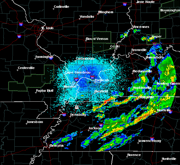 At 355 am cdt, a severe thunderstorm was located 8 miles south of murray, moving east at 55 mph (radar indicated). Hazards include 60 mph wind gusts and quarter size hail. Hail damage to vehicles is expected. Expect wind damage to roofs, siding, and trees. At 355 am cdt, a severe thunderstorm was located 8 miles south of murray, moving east at 55 mph (radar indicated). Hazards include 60 mph wind gusts and quarter size hail. Hail damage to vehicles is expected. Expect wind damage to roofs, siding, and trees.
|
| 1/11/2020 7:09 AM CST |
 The severe thunderstorm warning for calloway and southwestern trigg counties will expire at 715 am cst, the storm which prompted the warning has moved out of the area. therefore, the warning will be allowed to expire. a tornado watch remains in effect until 100 pm cst for western kentucky. The severe thunderstorm warning for calloway and southwestern trigg counties will expire at 715 am cst, the storm which prompted the warning has moved out of the area. therefore, the warning will be allowed to expire. a tornado watch remains in effect until 100 pm cst for western kentucky.
|
| 1/11/2020 6:39 AM CST |
 At 639 am cst, a severe thunderstorm was located 7 miles southeast of murray, moving northeast at 55 mph (radar indicated). Hazards include 60 mph wind gusts. expect damage to roofs, siding, and trees At 639 am cst, a severe thunderstorm was located 7 miles southeast of murray, moving northeast at 55 mph (radar indicated). Hazards include 60 mph wind gusts. expect damage to roofs, siding, and trees
|
| 6/23/2019 4:37 PM CDT |
 At 436 pm cdt, severe thunderstorms were located along a line extending from near vienna to 7 miles west of metropolis to near lovelaceville to near fulgham, moving east at 40 mph (radar indicated). Hazards include 60 mph wind gusts and half dollar size hail. Hail damage to vehicles is expected. Expect wind damage to roofs, siding, and trees. At 436 pm cdt, severe thunderstorms were located along a line extending from near vienna to 7 miles west of metropolis to near lovelaceville to near fulgham, moving east at 40 mph (radar indicated). Hazards include 60 mph wind gusts and half dollar size hail. Hail damage to vehicles is expected. Expect wind damage to roofs, siding, and trees.
|
| 6/23/2019 1:16 PM CDT |
 At 116 pm cdt, a severe thunderstorm was located near murray, moving northeast at 30 mph (radar indicated). Hazards include 60 mph wind gusts and quarter size hail. Hail damage to vehicles is expected. Expect wind damage to roofs, siding, and trees. At 116 pm cdt, a severe thunderstorm was located near murray, moving northeast at 30 mph (radar indicated). Hazards include 60 mph wind gusts and quarter size hail. Hail damage to vehicles is expected. Expect wind damage to roofs, siding, and trees.
|
| 6/21/2019 6:52 PM CDT |
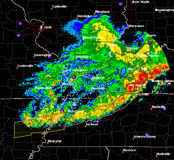 The severe thunderstorm warning for calloway county will expire at 700 pm cdt, the storms which prompted the warning have moved out of the area. therefore, the warning will be allowed to expire. a severe thunderstorm watch remains in effect until 1000 pm cdt for western kentucky. The severe thunderstorm warning for calloway county will expire at 700 pm cdt, the storms which prompted the warning have moved out of the area. therefore, the warning will be allowed to expire. a severe thunderstorm watch remains in effect until 1000 pm cdt for western kentucky.
|
| 6/21/2019 6:41 PM CDT |
 The severe thunderstorm warning for weakley, northeastern dyer, northwestern gibson, north central benton, obion, henry and southeastern lake counties will expire at 645 pm cdt, the storms which prompted the warning have moved out of the area. therefore, the warning will be allowed to expire. however strong winds to 45 mph is still possible with these thunderstorms. a severe thunderstorm watch remains in effect until 100 am cdt for southeastern missouri, and western tennessee. The severe thunderstorm warning for weakley, northeastern dyer, northwestern gibson, north central benton, obion, henry and southeastern lake counties will expire at 645 pm cdt, the storms which prompted the warning have moved out of the area. therefore, the warning will be allowed to expire. however strong winds to 45 mph is still possible with these thunderstorms. a severe thunderstorm watch remains in effect until 100 am cdt for southeastern missouri, and western tennessee.
|
| 6/21/2019 6:29 PM CDT |
 At 628 pm cdt, severe thunderstorms were located along a line extending from 8 miles southwest of land between the lakes area to 8 miles southwest of murray, moving southeast at 30 mph (trained weather spotters). Hazards include 70 mph wind gusts and quarter size hail. there have been numerous reports of 70 mph or more wind gusts with this line of storms. Hail damage to vehicles is expected. expect considerable tree damage. Wind damage is also likely to mobile homes, roofs, and outbuildings. At 628 pm cdt, severe thunderstorms were located along a line extending from 8 miles southwest of land between the lakes area to 8 miles southwest of murray, moving southeast at 30 mph (trained weather spotters). Hazards include 70 mph wind gusts and quarter size hail. there have been numerous reports of 70 mph or more wind gusts with this line of storms. Hail damage to vehicles is expected. expect considerable tree damage. Wind damage is also likely to mobile homes, roofs, and outbuildings.
|
| 6/21/2019 6:29 PM CDT |
 At 629 pm cdt, severe thunderstorms were located along a line extending from 6 miles south of cottage grove to near dyersburg, moving southeast at 35 mph (radar indicated). Hazards include 60 mph wind gusts. Expect damage to roofs, siding, and trees. Locations impacted include, dyersburg, martin, union city, paris, fulton, paris landing state park, newbern, dresden, greenfield, ridgely, gleason, troy, kenton, rutherford, obion, sharon, cottage grove, latham, cloverdale and miston. At 629 pm cdt, severe thunderstorms were located along a line extending from 6 miles south of cottage grove to near dyersburg, moving southeast at 35 mph (radar indicated). Hazards include 60 mph wind gusts. Expect damage to roofs, siding, and trees. Locations impacted include, dyersburg, martin, union city, paris, fulton, paris landing state park, newbern, dresden, greenfield, ridgely, gleason, troy, kenton, rutherford, obion, sharon, cottage grove, latham, cloverdale and miston.
|
| 6/21/2019 6:20 PM CDT | Multiple trees dow in calloway county KY, 0.5 miles SSW of Hazel, KY |
| 6/21/2019 5:54 PM CDT |
 At 553 pm cdt, severe thunderstorms were located along a line extending from near latham to cottonwood grove, moving south at 25 mph (radar indicated). Hazards include 60 mph wind gusts. expect damage to roofs, siding, and trees At 553 pm cdt, severe thunderstorms were located along a line extending from near latham to cottonwood grove, moving south at 25 mph (radar indicated). Hazards include 60 mph wind gusts. expect damage to roofs, siding, and trees
|
| 6/21/2019 5:51 PM CDT |
 At 549 pm cdt, severe thunderstorms were located along a line extending from 6 miles south of marion to near benton to near sedalia to near troy, moving east at 60 mph (spotters, automated weather observation sites, and emergency management have been reporting extensive tree damage, winds 60 to 70 mph, and power outages with this line of storms). Hazards include 70 mph wind gusts and quarter size hail. Hail damage to vehicles is expected. expect considerable tree damage. Wind damage is also likely to mobile homes, roofs, and outbuildings. At 549 pm cdt, severe thunderstorms were located along a line extending from 6 miles south of marion to near benton to near sedalia to near troy, moving east at 60 mph (spotters, automated weather observation sites, and emergency management have been reporting extensive tree damage, winds 60 to 70 mph, and power outages with this line of storms). Hazards include 70 mph wind gusts and quarter size hail. Hail damage to vehicles is expected. expect considerable tree damage. Wind damage is also likely to mobile homes, roofs, and outbuildings.
|
| 6/21/2019 5:07 PM CDT |
 At 506 pm cdt, severe thunderstorms were located along a line extending from near dixon springs to 6 miles northeast of bardwell to near east prairie to malden, moving east at 60 mph (radar indicated). Hazards include 70 mph wind gusts and nickel size hail. Expect considerable tree damage. Damage is likely to mobile homes, roofs, and outbuildings. At 506 pm cdt, severe thunderstorms were located along a line extending from near dixon springs to 6 miles northeast of bardwell to near east prairie to malden, moving east at 60 mph (radar indicated). Hazards include 70 mph wind gusts and nickel size hail. Expect considerable tree damage. Damage is likely to mobile homes, roofs, and outbuildings.
|
| 6/28/2018 9:27 PM CDT |
 At 927 pm cdt, a severe thunderstorm was located near palmersville, or 14 miles east of martin, moving south at 60 mph (radar indicated). Hazards include 70 mph wind gusts and quarter size hail. Hail damage to vehicles is expected. expect considerable tree damage. Wind damage is also likely to mobile homes, roofs, and outbuildings. At 927 pm cdt, a severe thunderstorm was located near palmersville, or 14 miles east of martin, moving south at 60 mph (radar indicated). Hazards include 70 mph wind gusts and quarter size hail. Hail damage to vehicles is expected. expect considerable tree damage. Wind damage is also likely to mobile homes, roofs, and outbuildings.
|
| 6/28/2018 9:14 PM CDT | Power outage reported for the entire hazel are in calloway county KY, 0.5 miles SE of Hazel, KY |
| 6/28/2018 8:59 PM CDT |
 At 842 pm cdt, severe thunderstorms were located along a line extending from near energy to 7 miles southeast of wyatt, moving south at 60 mph (radar indicated). Hazards include 60 mph wind gusts. Expect damage to roofs, siding, and trees. Locations impacted include, martin, union city, paris, caruthersville, mckenzie, fulton, paris landing state park, reelfoot lake state park, tiptonville, newbern, dresden, south fulton, dyer, greenfield, ridgely, gleason, troy, kenton, rutherford and obion. At 842 pm cdt, severe thunderstorms were located along a line extending from near energy to 7 miles southeast of wyatt, moving south at 60 mph (radar indicated). Hazards include 60 mph wind gusts. Expect damage to roofs, siding, and trees. Locations impacted include, martin, union city, paris, caruthersville, mckenzie, fulton, paris landing state park, reelfoot lake state park, tiptonville, newbern, dresden, south fulton, dyer, greenfield, ridgely, gleason, troy, kenton, rutherford and obion.
|
| 6/28/2018 8:42 PM CDT |
 At 842 pm cdt, severe thunderstorms were located along a line extending from near energy to 7 miles southeast of wyatt, moving south at 60 mph (radar indicated). Hazards include 60 mph wind gusts. Expect damage to roofs, siding, and trees. Locations impacted include, martin, union city, paris, caruthersville, mckenzie, fulton, paris landing state park, reelfoot lake state park, tiptonville, newbern, dresden, south fulton, dyer, greenfield, ridgely, gleason, troy, kenton, rutherford and obion. At 842 pm cdt, severe thunderstorms were located along a line extending from near energy to 7 miles southeast of wyatt, moving south at 60 mph (radar indicated). Hazards include 60 mph wind gusts. Expect damage to roofs, siding, and trees. Locations impacted include, martin, union city, paris, caruthersville, mckenzie, fulton, paris landing state park, reelfoot lake state park, tiptonville, newbern, dresden, south fulton, dyer, greenfield, ridgely, gleason, troy, kenton, rutherford and obion.
|
| 6/28/2018 8:36 PM CDT |
 At 836 pm cdt, severe thunderstorms were located along a line extending from energy to 7 miles north of towosahgy state historic site, moving northeast at 30 mph (radar indicated). Hazards include 60 mph wind gusts. expect damage to roofs, siding, and trees At 836 pm cdt, severe thunderstorms were located along a line extending from energy to 7 miles north of towosahgy state historic site, moving northeast at 30 mph (radar indicated). Hazards include 60 mph wind gusts. expect damage to roofs, siding, and trees
|
| 6/28/2018 8:35 PM CDT |
 At 835 pm cdt, severe thunderstorms were located along a line extending from near providence to near cadiz to 9 miles northeast of murray to near fulgham, moving south to southeast at 60 mph (radar indicated). Hazards include 60 mph wind gusts. Expect damage to roofs, siding, and trees. Locations impacted include, madisonville, murray, mayfield, princeton, benton, providence, dawson springs, calvert city, cadiz, eddyville, land between the lakes area, sebree, earlington, nortonville, mortons gap, dixon, olney, creswell, sedalia and lynnville. At 835 pm cdt, severe thunderstorms were located along a line extending from near providence to near cadiz to 9 miles northeast of murray to near fulgham, moving south to southeast at 60 mph (radar indicated). Hazards include 60 mph wind gusts. Expect damage to roofs, siding, and trees. Locations impacted include, madisonville, murray, mayfield, princeton, benton, providence, dawson springs, calvert city, cadiz, eddyville, land between the lakes area, sebree, earlington, nortonville, mortons gap, dixon, olney, creswell, sedalia and lynnville.
|
| 6/28/2018 8:05 PM CDT |
 At 805 pm cdt, severe thunderstorms were located along a line extending from near uniontown to near salem to brookport, moving south at 60 mph (radar indicated). Hazards include 70 mph wind gusts and nickel size hail. Expect considerable tree damage. Damage is likely to mobile homes, roofs, and outbuildings. At 805 pm cdt, severe thunderstorms were located along a line extending from near uniontown to near salem to brookport, moving south at 60 mph (radar indicated). Hazards include 70 mph wind gusts and nickel size hail. Expect considerable tree damage. Damage is likely to mobile homes, roofs, and outbuildings.
|
| 6/27/2018 8:45 PM CDT |
 At 845 pm cdt, a severe thunderstorm was located 8 miles northwest of paris landing state park, moving southeast at 15 mph (radar indicated). Hazards include 60 mph wind gusts and quarter size hail. Hail damage to vehicles is expected. Expect wind damage to roofs, siding, and trees. At 845 pm cdt, a severe thunderstorm was located 8 miles northwest of paris landing state park, moving southeast at 15 mph (radar indicated). Hazards include 60 mph wind gusts and quarter size hail. Hail damage to vehicles is expected. Expect wind damage to roofs, siding, and trees.
|
| 6/27/2018 8:35 PM CDT |
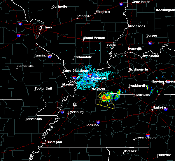 At 833 pm cdt, a severe thunderstorm was located near murray, moving southeast at 20 mph (public reported quarter sized hail on the southwest side of murray at 828 pm). Hazards include 60 mph wind gusts and quarter size hail. Hail damage to vehicles is expected. expect wind damage to roofs, siding, and trees. Locations impacted include, murray, hazel and new concord. At 833 pm cdt, a severe thunderstorm was located near murray, moving southeast at 20 mph (public reported quarter sized hail on the southwest side of murray at 828 pm). Hazards include 60 mph wind gusts and quarter size hail. Hail damage to vehicles is expected. expect wind damage to roofs, siding, and trees. Locations impacted include, murray, hazel and new concord.
|
| 6/27/2018 8:12 PM CDT |
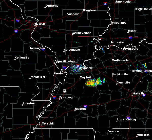 At 812 pm cdt, a severe thunderstorm was located over murray, moving southeast at 15 mph (radar indicated). Hazards include 60 mph wind gusts and quarter size hail. Hail damage to vehicles is expected. Expect wind damage to roofs, siding, and trees. At 812 pm cdt, a severe thunderstorm was located over murray, moving southeast at 15 mph (radar indicated). Hazards include 60 mph wind gusts and quarter size hail. Hail damage to vehicles is expected. Expect wind damage to roofs, siding, and trees.
|
| 6/26/2018 8:43 PM CDT |
 At 843 pm cdt, a severe thunderstorm was located near lynnville, or 9 miles southwest of murray, moving east at 35 mph (radar indicated). Hazards include 60 mph wind gusts. expect damage to roofs, siding, and trees At 843 pm cdt, a severe thunderstorm was located near lynnville, or 9 miles southwest of murray, moving east at 35 mph (radar indicated). Hazards include 60 mph wind gusts. expect damage to roofs, siding, and trees
|
| 6/1/2018 12:04 AM CDT |
 At 1204 am cdt, a severe thunderstorm was located over murray, moving northeast at 55 mph (radar indicated). Hazards include 60 mph wind gusts and quarter size hail. Hail damage to vehicles is expected. expect wind damage to roofs, siding, and trees. Locations impacted include, martin, paris, mckenzie, paris landing state park, dresden, greenfield, gleason, sharon, cottage grove, latham, routon, palmersville, springville, puryear, henry, sandhill, mansfield, mount pelia, jones mill and old springville. At 1204 am cdt, a severe thunderstorm was located over murray, moving northeast at 55 mph (radar indicated). Hazards include 60 mph wind gusts and quarter size hail. Hail damage to vehicles is expected. expect wind damage to roofs, siding, and trees. Locations impacted include, martin, paris, mckenzie, paris landing state park, dresden, greenfield, gleason, sharon, cottage grove, latham, routon, palmersville, springville, puryear, henry, sandhill, mansfield, mount pelia, jones mill and old springville.
|
| 5/31/2018 11:43 PM CDT |
 At 1142 pm cdt, a severe thunderstorm was located over palmersville, or 15 miles northeast of martin, moving southeast at 55 mph (radar indicated). Hazards include 60 mph wind gusts and quarter size hail. Hail damage to vehicles is expected. expect wind damage to roofs, siding, and trees. Locations impacted include, martin, paris, mckenzie, fulton, paris landing state park, dresden, south fulton, greenfield, gleason, sharon, cottage grove, latham, springville, routon, palmersville, puryear, henry, jones mill, old springville and como. At 1142 pm cdt, a severe thunderstorm was located over palmersville, or 15 miles northeast of martin, moving southeast at 55 mph (radar indicated). Hazards include 60 mph wind gusts and quarter size hail. Hail damage to vehicles is expected. expect wind damage to roofs, siding, and trees. Locations impacted include, martin, paris, mckenzie, fulton, paris landing state park, dresden, south fulton, greenfield, gleason, sharon, cottage grove, latham, springville, routon, palmersville, puryear, henry, jones mill, old springville and como.
|
| 5/31/2018 11:40 PM CDT |
 At 1140 pm cdt, a severe thunderstorm was located near palmersville, or 13 miles northeast of martin, moving northeast at 55 mph (radar indicated). Hazards include 60 mph wind gusts and quarter size hail. Hail damage to vehicles is expected. Expect wind damage to roofs, siding, and trees. At 1140 pm cdt, a severe thunderstorm was located near palmersville, or 13 miles northeast of martin, moving northeast at 55 mph (radar indicated). Hazards include 60 mph wind gusts and quarter size hail. Hail damage to vehicles is expected. Expect wind damage to roofs, siding, and trees.
|
| 2/24/2018 7:30 PM CST |
 At 729 pm cst, a severe thunderstorm was located near palmersville, or 16 miles east of fulton, moving northeast at 55 mph (radar indicated). Hazards include 60 mph wind gusts and penny size hail. expect damage to roofs, siding, and trees At 729 pm cst, a severe thunderstorm was located near palmersville, or 16 miles east of fulton, moving northeast at 55 mph (radar indicated). Hazards include 60 mph wind gusts and penny size hail. expect damage to roofs, siding, and trees
|
| 10/7/2017 6:05 PM CDT |
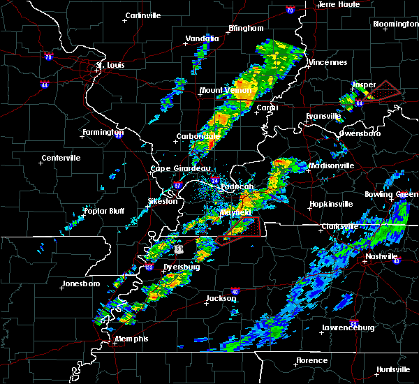 At 603 pm cdt, a severe thunderstorm capable of producing a tornado was located near lynnville, or 16 miles southwest of murray, moving northeast at 20 mph (radar indicated rotation). Hazards include tornado. Flying debris will be dangerous to those caught without shelter. mobile homes will be damaged or destroyed. damage to roofs, windows, and vehicles will occur. Tree damage is likely. At 603 pm cdt, a severe thunderstorm capable of producing a tornado was located near lynnville, or 16 miles southwest of murray, moving northeast at 20 mph (radar indicated rotation). Hazards include tornado. Flying debris will be dangerous to those caught without shelter. mobile homes will be damaged or destroyed. damage to roofs, windows, and vehicles will occur. Tree damage is likely.
|
| 5/27/2017 7:06 PM CDT |
 At 705 pm cdt, severe thunderstorms were located along a line extending from 7 miles northeast of marion to near energy to near murray, moving east at 65 mph (radar indicated. 65 to 70 mph winds were reported in lynnville kentucky in graves county with these storms). Hazards include 70 mph wind gusts and nickel size hail. Expect considerable tree damage. damage is likely to mobile homes, roofs, and outbuildings. Locations impacted include, murray, mayfield, lynnville, sedalia, wingo, hazel, water valley, new concord, dukedom, kirksey, harris grove and crossland. At 705 pm cdt, severe thunderstorms were located along a line extending from 7 miles northeast of marion to near energy to near murray, moving east at 65 mph (radar indicated. 65 to 70 mph winds were reported in lynnville kentucky in graves county with these storms). Hazards include 70 mph wind gusts and nickel size hail. Expect considerable tree damage. damage is likely to mobile homes, roofs, and outbuildings. Locations impacted include, murray, mayfield, lynnville, sedalia, wingo, hazel, water valley, new concord, dukedom, kirksey, harris grove and crossland.
|
| 5/27/2017 7:03 PM CDT |
 At 702 pm cdt, severe thunderstorms were located along a line extending from 6 miles northwest of murray to near union city, moving east at 40 mph (radar indicated). Hazards include 70 mph wind gusts and quarter size hail. Hail damage to vehicles is expected. expect considerable tree damage. Wind damage is also likely to mobile homes, roofs, and outbuildings. At 702 pm cdt, severe thunderstorms were located along a line extending from 6 miles northwest of murray to near union city, moving east at 40 mph (radar indicated). Hazards include 70 mph wind gusts and quarter size hail. Hail damage to vehicles is expected. expect considerable tree damage. Wind damage is also likely to mobile homes, roofs, and outbuildings.
|
| 5/27/2017 6:53 PM CDT |
 At 652 pm cdt, severe thunderstorms were located along a line extending from 7 miles northwest of marion to 8 miles east of benton to near sedalia, moving east at 65 mph (radar indicated). Hazards include 70 mph wind gusts and nickel size hail. Expect considerable tree damage. damage is likely to mobile homes, roofs, and outbuildings. Locations impacted include, murray, mayfield, benton, calvert city, salem, golconda, burna, lynnville, sedalia, joy, ledbetter, wingo, hardin, hazel, grand rivers, smithland, water valley, carrsville, lowes and fancy farm. At 652 pm cdt, severe thunderstorms were located along a line extending from 7 miles northwest of marion to 8 miles east of benton to near sedalia, moving east at 65 mph (radar indicated). Hazards include 70 mph wind gusts and nickel size hail. Expect considerable tree damage. damage is likely to mobile homes, roofs, and outbuildings. Locations impacted include, murray, mayfield, benton, calvert city, salem, golconda, burna, lynnville, sedalia, joy, ledbetter, wingo, hardin, hazel, grand rivers, smithland, water valley, carrsville, lowes and fancy farm.
|
| 5/27/2017 6:10 PM CDT |
 At 608 pm cdt, severe thunderstorms were located along a line extending from goreville to near barlow to near east prairie, moving east at 65 mph. these are very dangerous storms (law enforcement. structural damage has been reported in stoddard county with 80 mph winds reported near sikeston missouri). Hazards include 80 mph wind gusts and nickel size hail. Flying debris will be dangerous to those caught without shelter. mobile homes will be heavily damaged. expect considerable damage to roofs, windows, and vehicles. Extensive tree damage and power outages are likely. At 608 pm cdt, severe thunderstorms were located along a line extending from goreville to near barlow to near east prairie, moving east at 65 mph. these are very dangerous storms (law enforcement. structural damage has been reported in stoddard county with 80 mph winds reported near sikeston missouri). Hazards include 80 mph wind gusts and nickel size hail. Flying debris will be dangerous to those caught without shelter. mobile homes will be heavily damaged. expect considerable damage to roofs, windows, and vehicles. Extensive tree damage and power outages are likely.
|
| 5/27/2017 5:15 PM CDT |
 At 515 pm cdt, severe thunderstorms were located along a line extending from 9 miles southeast of benton to near murray, moving southeast at 55 mph (radar indicated). Hazards include 70 mph wind gusts and quarter size hail. Hail damage to vehicles is expected. expect considerable tree damage. Wind damage is also likely to mobile homes, roofs, and outbuildings. At 515 pm cdt, severe thunderstorms were located along a line extending from 9 miles southeast of benton to near murray, moving southeast at 55 mph (radar indicated). Hazards include 70 mph wind gusts and quarter size hail. Hail damage to vehicles is expected. expect considerable tree damage. Wind damage is also likely to mobile homes, roofs, and outbuildings.
|
| 3/9/2017 9:23 PM CST |
 The tornado warning for southwestern calloway county will expire at 930 pm cst, the tornadic thunderstorm which prompted the warning is moving out of the warned area. therefore, the warning will be allowed to expire. a severe thunderstorm watch remains in effect until 1000 pm cst for western kentucky. The tornado warning for southwestern calloway county will expire at 930 pm cst, the tornadic thunderstorm which prompted the warning is moving out of the warned area. therefore, the warning will be allowed to expire. a severe thunderstorm watch remains in effect until 1000 pm cst for western kentucky.
|
| 3/9/2017 9:16 PM CST |
 At 916 pm cst, a severe thunderstorm capable of producing a tornado was located near murray, moving southeast at 40 mph (radar indicated rotation). Hazards include tornado and quarter size hail. Flying debris will be dangerous to those caught without shelter. mobile homes will be damaged or destroyed. damage to roofs, windows, and vehicles will occur. tree damage is likely. Locations impacted include, hazel and crossland. At 916 pm cst, a severe thunderstorm capable of producing a tornado was located near murray, moving southeast at 40 mph (radar indicated rotation). Hazards include tornado and quarter size hail. Flying debris will be dangerous to those caught without shelter. mobile homes will be damaged or destroyed. damage to roofs, windows, and vehicles will occur. tree damage is likely. Locations impacted include, hazel and crossland.
|
| 3/9/2017 9:08 PM CST |
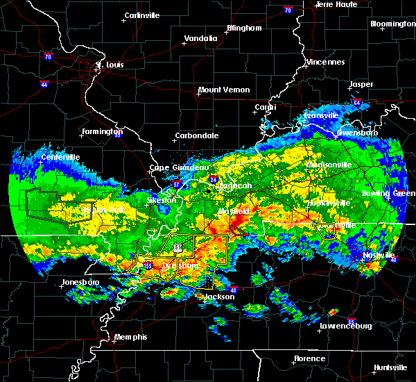 At 908 pm cst, a severe thunderstorm capable of producing a tornado was located near lynnville, or 7 miles west of murray, moving southeast at 35 mph (radar indicated rotation). Hazards include tornado and quarter size hail. Flying debris will be dangerous to those caught without shelter. mobile homes will be damaged or destroyed. damage to roofs, windows, and vehicles will occur. Tree damage is likely. At 908 pm cst, a severe thunderstorm capable of producing a tornado was located near lynnville, or 7 miles west of murray, moving southeast at 35 mph (radar indicated rotation). Hazards include tornado and quarter size hail. Flying debris will be dangerous to those caught without shelter. mobile homes will be damaged or destroyed. damage to roofs, windows, and vehicles will occur. Tree damage is likely.
|
| 3/1/2017 5:44 AM CST |
 At 543 am cst, severe thunderstorms were located along a line extending from near marion to 7 miles south of murray, moving east at 75 mph (radar indicated). Hazards include 70 mph wind gusts and penny size hail. Expect considerable tree damage. Damage is likely to mobile homes, roofs, and outbuildings. At 543 am cst, severe thunderstorms were located along a line extending from near marion to 7 miles south of murray, moving east at 75 mph (radar indicated). Hazards include 70 mph wind gusts and penny size hail. Expect considerable tree damage. Damage is likely to mobile homes, roofs, and outbuildings.
|
| 3/1/2017 5:21 AM CST |
 At 520 am cst, severe thunderstorms were located along a line extending from near hendron to 7 miles west of lynnville, moving east at 80 mph (radar indicated). Hazards include 70 mph wind gusts. Expect considerable tree damage. Damage is likely to mobile homes, roofs, and outbuildings. At 520 am cst, severe thunderstorms were located along a line extending from near hendron to 7 miles west of lynnville, moving east at 80 mph (radar indicated). Hazards include 70 mph wind gusts. Expect considerable tree damage. Damage is likely to mobile homes, roofs, and outbuildings.
|
| 2/28/2017 10:43 PM CST |
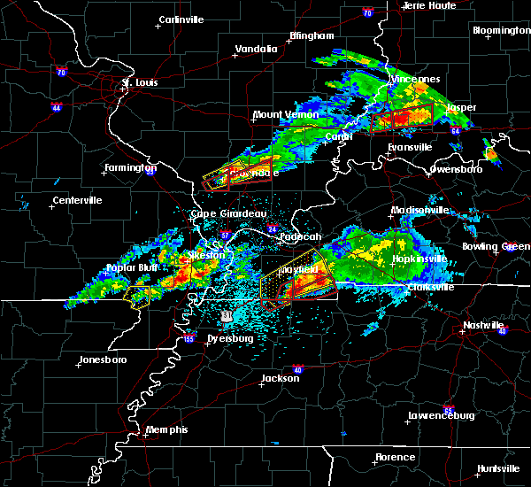 At 1042 pm cst, a severe thunderstorm capable of producing a tornado was located near lynnville, or 10 miles southwest of murray, moving northeast at 50 mph (radar indicated rotation). Hazards include tornado and golf ball size hail. Flying debris will be dangerous to those caught without shelter. mobile homes will be damaged or destroyed. damage to roofs, windows, and vehicles will occur. Tree damage is likely. At 1042 pm cst, a severe thunderstorm capable of producing a tornado was located near lynnville, or 10 miles southwest of murray, moving northeast at 50 mph (radar indicated rotation). Hazards include tornado and golf ball size hail. Flying debris will be dangerous to those caught without shelter. mobile homes will be damaged or destroyed. damage to roofs, windows, and vehicles will occur. Tree damage is likely.
|
| 7/22/2016 12:47 PM CDT |
 At 1245 pm cdt, a severe thunderstorm was located near murray, moving southeast at 25 mph. this storm just produced 60 mph winds on the west side of murray, which blew the roof off a house (radar indicated). Hazards include 60 mph wind gusts and quarter size hail. Hail damage to vehicles is expected. expect wind damage to roofs, siding, and trees. Locations impacted include, murray, hazel, kirksey, harris grove and crossland. At 1245 pm cdt, a severe thunderstorm was located near murray, moving southeast at 25 mph. this storm just produced 60 mph winds on the west side of murray, which blew the roof off a house (radar indicated). Hazards include 60 mph wind gusts and quarter size hail. Hail damage to vehicles is expected. expect wind damage to roofs, siding, and trees. Locations impacted include, murray, hazel, kirksey, harris grove and crossland.
|
| 7/22/2016 12:30 PM CDT |
 At 1229 pm cdt, a severe thunderstorm was located over murray, moving southeast at 25 mph (radar indicated). Hazards include 60 mph wind gusts and quarter size hail. Hail damage to vehicles is expected. Expect wind damage to roofs, siding, and trees. At 1229 pm cdt, a severe thunderstorm was located over murray, moving southeast at 25 mph (radar indicated). Hazards include 60 mph wind gusts and quarter size hail. Hail damage to vehicles is expected. Expect wind damage to roofs, siding, and trees.
|
| 7/6/2016 2:14 PM CDT |
 At 213 pm cdt, severe thunderstorms were located along a line extending from near marion to 7 miles northwest of energy to 7 miles southwest of murray, moving east at 60 mph (trained weather spotters). Hazards include 70 mph wind gusts and penny size hail. Expect considerable tree damage. damage is likely to mobile homes, roofs, and outbuildings. Locations impacted include, murray, princeton, benton, marion, calvert city, eddyville, land between the lakes area, salem, creswell, energy, canton, farmersville, rockcastle, kuttawa, hardin, hazel, fredonia, grand rivers, kirksey and harris grove. At 213 pm cdt, severe thunderstorms were located along a line extending from near marion to 7 miles northwest of energy to 7 miles southwest of murray, moving east at 60 mph (trained weather spotters). Hazards include 70 mph wind gusts and penny size hail. Expect considerable tree damage. damage is likely to mobile homes, roofs, and outbuildings. Locations impacted include, murray, princeton, benton, marion, calvert city, eddyville, land between the lakes area, salem, creswell, energy, canton, farmersville, rockcastle, kuttawa, hardin, hazel, fredonia, grand rivers, kirksey and harris grove.
|
| 7/6/2016 1:55 PM CDT |
 At 154 pm cdt, severe thunderstorms were located along a line extending from near golconda to 7 miles northwest of benton to 6 miles north of latham, moving east at 60 mph (trained weather spotters). Hazards include 70 mph wind gusts and penny size hail. Expect considerable tree damage. Damage is likely to mobile homes, roofs, and outbuildings. At 154 pm cdt, severe thunderstorms were located along a line extending from near golconda to 7 miles northwest of benton to 6 miles north of latham, moving east at 60 mph (trained weather spotters). Hazards include 70 mph wind gusts and penny size hail. Expect considerable tree damage. Damage is likely to mobile homes, roofs, and outbuildings.
|
| 6/25/2016 2:37 PM CDT |
 At 236 pm cdt, a severe thunderstorm was located 7 miles northeast of lynnville, or 7 miles west of murray, moving east at 25 mph (radar indicated). Hazards include 60 mph wind gusts and quarter size hail. Hail damage to vehicles is expected. Expect wind damage to roofs, siding, and trees. At 236 pm cdt, a severe thunderstorm was located 7 miles northeast of lynnville, or 7 miles west of murray, moving east at 25 mph (radar indicated). Hazards include 60 mph wind gusts and quarter size hail. Hail damage to vehicles is expected. Expect wind damage to roofs, siding, and trees.
|
| 6/15/2016 2:39 PM CDT |
 At 238 pm cdt, a severe thunderstorm was located 8 miles southeast of murray, moving southeast at 25 mph (radar indicated). Hazards include 60 mph wind gusts and penny size hail. Expect damage to roofs. siding. and trees. Locations impacted include, paris, paris landing state park, cottage grove, palmersville, latham, puryear, brundige, whitlock, pisgah, buchanan, mill creek, conyersville, matheny grove, pine hill, crossland, india, hyndsver, foundry hill, jones mill and ruthville. At 238 pm cdt, a severe thunderstorm was located 8 miles southeast of murray, moving southeast at 25 mph (radar indicated). Hazards include 60 mph wind gusts and penny size hail. Expect damage to roofs. siding. and trees. Locations impacted include, paris, paris landing state park, cottage grove, palmersville, latham, puryear, brundige, whitlock, pisgah, buchanan, mill creek, conyersville, matheny grove, pine hill, crossland, india, hyndsver, foundry hill, jones mill and ruthville.
|
| 6/15/2016 2:18 PM CDT |
 At 218 pm cdt, a severe thunderstorm was located over murray, moving southeast at 25 mph (radar indicated). Hazards include 60 mph wind gusts and penny size hail. Expect damage to roofs. siding. And trees. At 218 pm cdt, a severe thunderstorm was located over murray, moving southeast at 25 mph (radar indicated). Hazards include 60 mph wind gusts and penny size hail. Expect damage to roofs. siding. And trees.
|
| 6/15/2016 2:10 PM CDT |
 At 208 pm cdt, a severe thunderstorm was located over murray, moving east at 25 mph (radar indicated). Hazards include 60 mph wind gusts and nickel size hail. Expect damage to roofs. siding. And trees. At 208 pm cdt, a severe thunderstorm was located over murray, moving east at 25 mph (radar indicated). Hazards include 60 mph wind gusts and nickel size hail. Expect damage to roofs. siding. And trees.
|
| 5/1/2016 1:50 PM CDT | Quarter sized hail reported 0.5 miles SE of Hazel, KY, estimated quarter sized hail and minor flooding in hazel |
| 5/1/2016 1:50 PM CDT | Tree broken in hazel at 5th and barnett in calloway county KY, 0.5 miles SE of Hazel, KY |
| 5/1/2016 1:50 PM CDT | 10 inch diamater tree broken at 1066 midway rd in calloway county KY, 3.2 miles S of Hazel, KY |
| 5/1/2016 1:48 PM CDT |
 At 147 pm cdt, a severe thunderstorm was located just southwest of murray, moving east at 35 mph (radar indicated). Hazards include 60 mph wind gusts and half dollar size hail. Hail damage to vehicles is expected. Expect wind damage to roofs, siding, and trees. At 147 pm cdt, a severe thunderstorm was located just southwest of murray, moving east at 35 mph (radar indicated). Hazards include 60 mph wind gusts and half dollar size hail. Hail damage to vehicles is expected. Expect wind damage to roofs, siding, and trees.
|
| 3/12/2016 10:30 PM CDT | One home had half of roof as well as rafters blown off with minor tree damage on property along midway road. one quarter mile away along hwy 641s a mobile home had all in calloway county KY, 2.5 miles S of Hazel, KY |
| 12/23/2015 5:15 PM CST | The national weather service in paducah has issued a * severe thunderstorm warning for. southeastern calloway county in western kentucky. trigg county in western kentucky. until 545 pm cst * at 515 pm cst. A severe thunderstorm was located near paris. |
| 12/23/2015 4:37 PM CST | At 435 pm cst, a severe thunderstorm was located near land between the lakes area, moving northeast at 50 to 60 mph. this storm produced close to 50 mph winds as it moved near murray (radar indicated). Hazards include 60 mph wind gusts. Expect damage to roofs. siding and trees. locations impacted include, murray, hardin, hazel, new concord, aurora, harris grove and crossland. a tornado watch remains in effect until 500 pm cst for western kentucky. A tornado watch also remains in effect until 800 pm cst for western kentucky. |
| 12/23/2015 4:22 PM CST | At 422 pm cst, a severe thunderstorm was located near benton, moving northeast at 50 to 60 mph (radar indicated). Hazards include 60 mph wind gusts. Expect damage to roofs. Siding and trees. |
| 9/6/2012 7:40 PM CDT | On-line newspaper reports tree and power line down in the southwestern part of calloway county. also reported a car ran into a tree just northwest of murray. time estim in calloway county KY, 0.5 miles SE of Hazel, KY |
| 7/18/2012 6:47 PM CDT | Golf Ball sized hail reported 0.5 miles SE of Hazel, KY, golf ball size hail reported in the community. hail the size of quarters reported north of town. wind gusts 40 to 50 mph occurring with this storm. |
| 1/1/0001 12:00 AM | Late report...damage along craig road. numerous trees down...gutters pulled off of one home which had several windows blown out. large tree fell across a truc in calloway county KY, 3.5 miles SW of Hazel, KY |
| 1/1/0001 12:00 AM | Roof of metal barn blown off and one tree dow in calloway county KY, 3.6 miles W of Hazel, KY |
Hail Maps for Hazel, KY


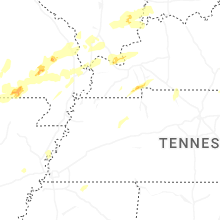
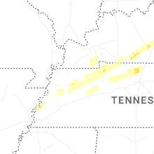


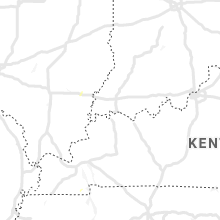


Connect with Interactive Hail Maps