

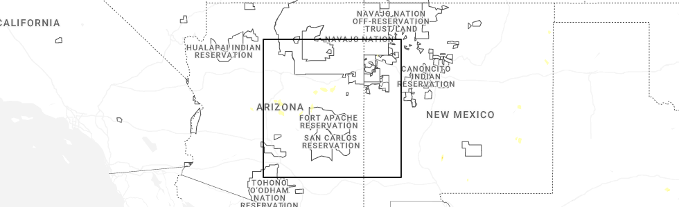
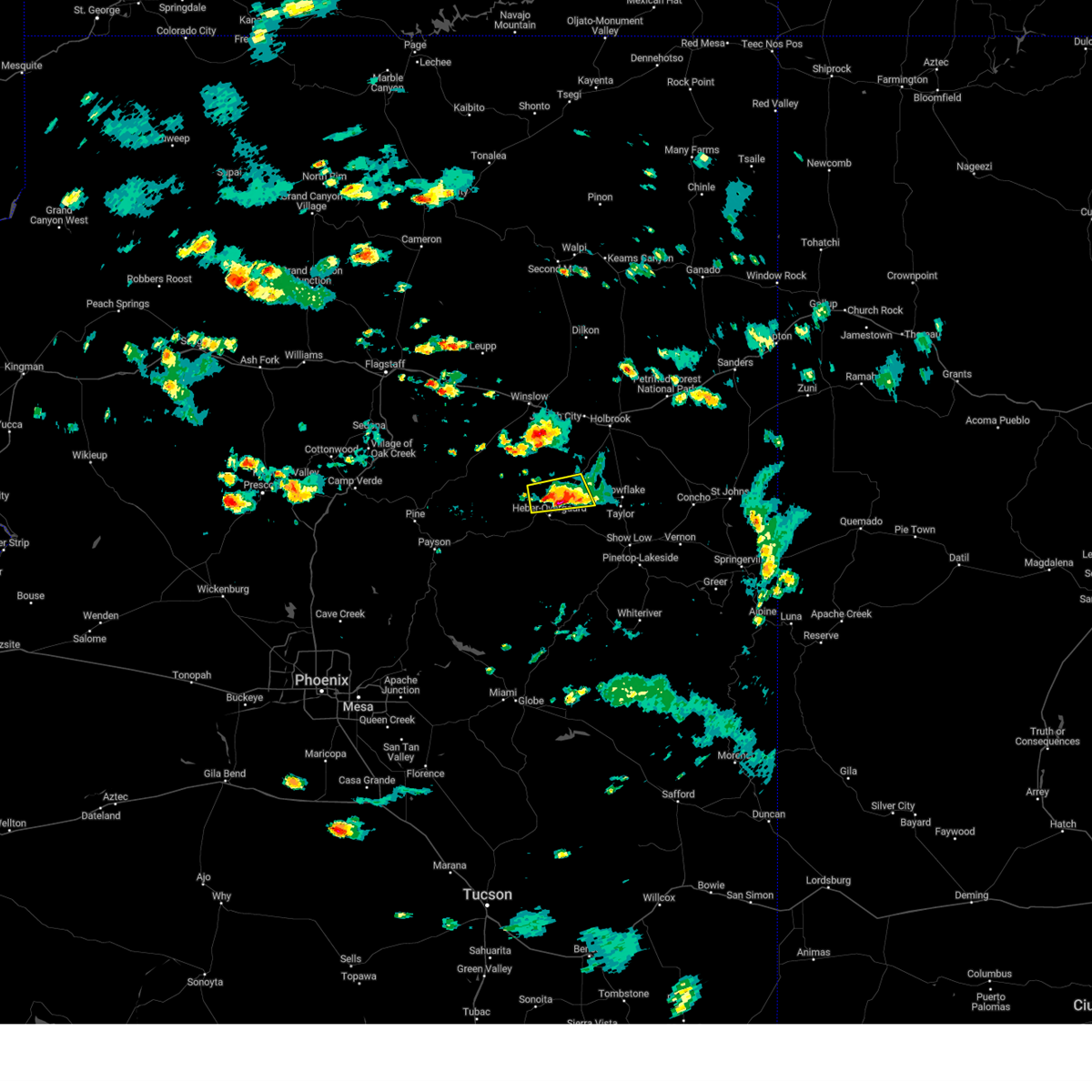
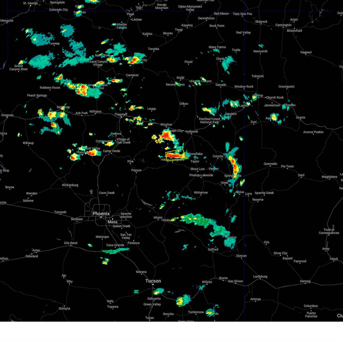
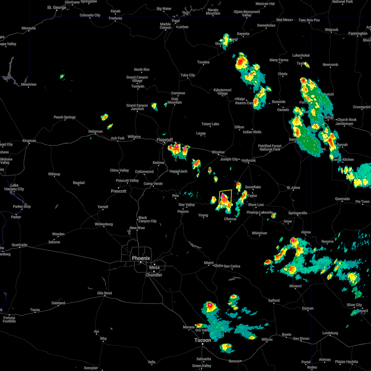
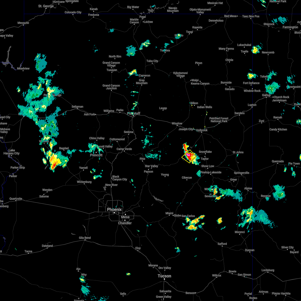
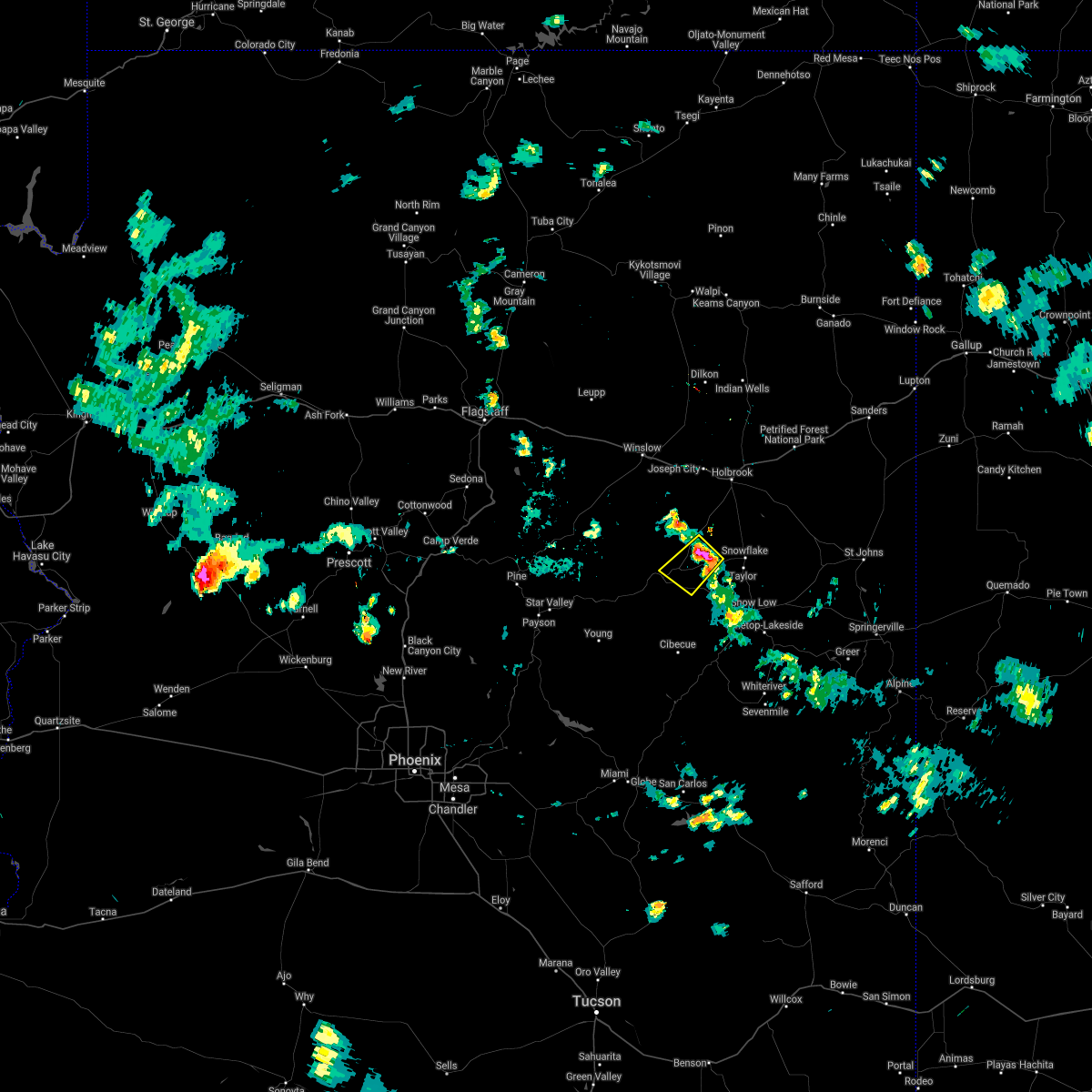
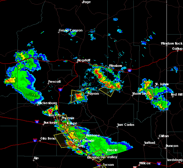
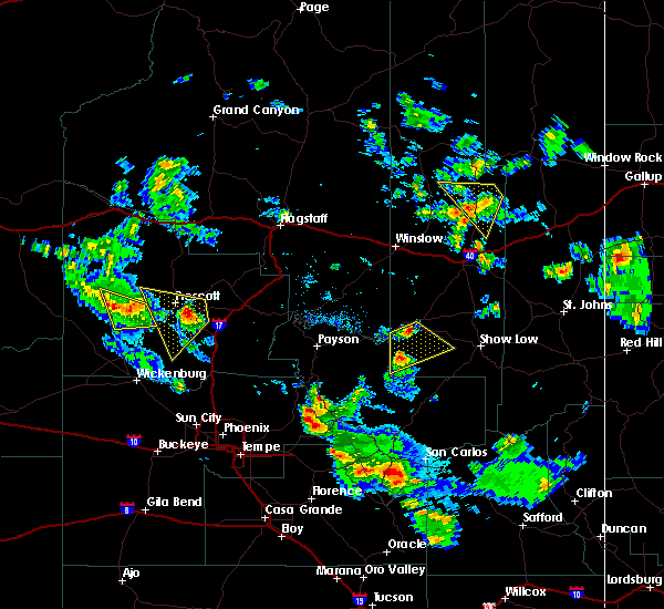
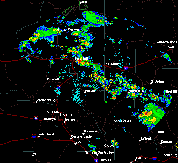
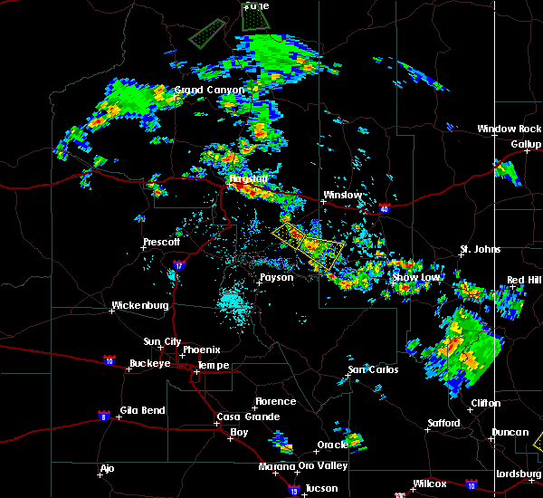
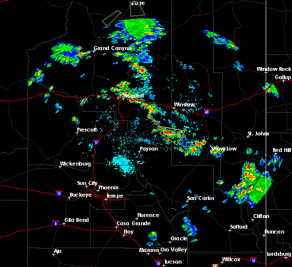
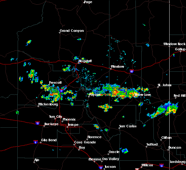
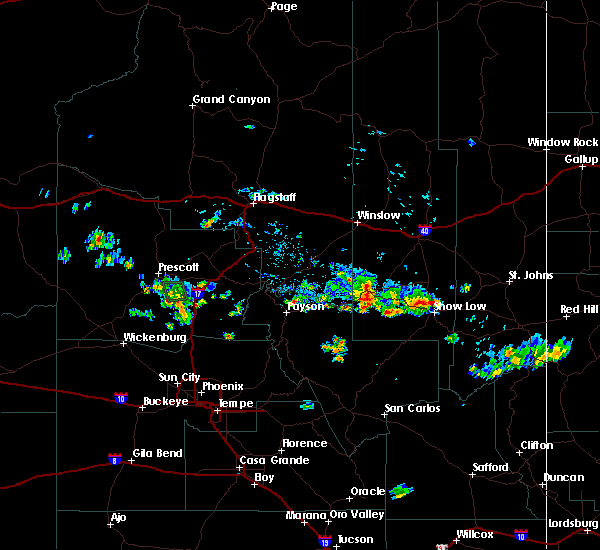
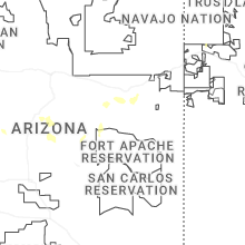
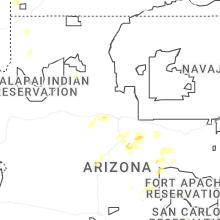
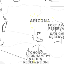
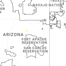
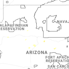
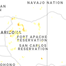
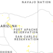
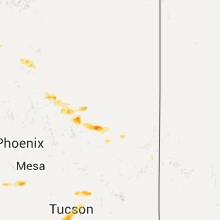
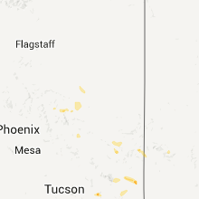
Hail Map for Heber-Overgaard, AZ
The Heber-Overgaard, AZ area has had 2 reports of on-the-ground hail by trained spotters, and has been under severe weather warnings 4 times during the past 12 months. Doppler radar has detected hail at or near Heber-Overgaard, AZ on 42 occasions, including 5 occasions during the past year.
| Name: | Heber-Overgaard, AZ |
| Where Located: | 32.2 miles WNW of Show Low, AZ |
| Map: | Google Map for Heber-Overgaard, AZ |
| Population: | 2822 |
| Housing Units: | 3593 |
| More Info: | Search Google for Heber-Overgaard, AZ |
0
The Top Recent Hail Date for Heber-Overgaard, AZ is Monday, May 25, 2026 (32nd out of 42)
Hail and Wind Damage Spotted near Heber-Overgaard, AZ
| Date / Time | Report Details |
|---|---|
| 9/25/2025 6:20 PM MST | The storm just north of forest lakes and west of heber has weakened below severe limits. small hail and heavy rain are still occurring with this storm. |
| 9/25/2025 5:57 PM MST | At 557 pm mst, a severe thunderstorm was located just west of heber-overgaard, or 13 miles northeast of forest lakes, moving northeast at 20 mph (radar indicated). Hazards include quarter size hail. Damage to vehicles is expected. locations impacted include, forest lakes, heber-overgaard, chevelon canyon lake and chevelon canyon dam. this includes the following highways, state route 260 between mile markers 298 and 306. state route 377 between mile markers 0 and 4. state route 277 between mile markers 306 and 317. This includes the following recreation areas and campgrounds, forest road 237 camping area and camp shadow pines. |
| 9/25/2025 5:40 PM MST | Svrfgz the national weather service in flagstaff has issued a * severe thunderstorm warning for, coconino county in north central arizona, navajo county in north central arizona, * until 615 pm mst. * at 540 pm mst, a severe thunderstorm was located 7 miles west of heber-overgaard, or 8 miles northeast of forest lakes, moving northeast at 20 mph (radar indicated). Hazards include half dollar size hail. damage to vehicles is expected |
| 9/25/2025 2:00 PM MST | Svrfgz the national weather service in flagstaff has issued a * severe thunderstorm warning for, navajo county in north central arizona, * until 230 pm mst. * at 200 pm mst, a severe thunderstorm was located over aripine, or 23 miles east of forest lakes, moving northeast at 30 mph (radar indicated). Hazards include 60 mph wind gusts and quarter size hail. Hail damage to vehicles is expected. Expect wind damage to roofs, siding, and trees. |
| 9/13/2023 1:50 PM MST |
 At 148 pm mst, a severe thunderstorm was located 10 miles north of heber-overgaard, moving south at 5 mph (radar indicated). Hazards include half dollar size hail and flooding of area roads and washes. Damage to vehicles is expected. locations impacted include, twin lake, heber-overgaard, and dry lake. this includes the following highways, state route 277 between mile markers 310 and 325. state route 260 between mile markers 302 and 303. state route 377 between mile markers 0 and 14. hail threat, radar indicated max hail size, 1. 25 in wind threat, radar indicated max wind gust, <50 mph. At 148 pm mst, a severe thunderstorm was located 10 miles north of heber-overgaard, moving south at 5 mph (radar indicated). Hazards include half dollar size hail and flooding of area roads and washes. Damage to vehicles is expected. locations impacted include, twin lake, heber-overgaard, and dry lake. this includes the following highways, state route 277 between mile markers 310 and 325. state route 260 between mile markers 302 and 303. state route 377 between mile markers 0 and 14. hail threat, radar indicated max hail size, 1. 25 in wind threat, radar indicated max wind gust, <50 mph.
|
| 9/13/2023 1:35 PM MST |
 At 133 pm mst, a severe thunderstorm was located 7 miles north of heber-overgaard, moving east at 10 mph (radar indicated). Hazards include quarter size hail and flooding on roadways. damage to vehicles is expected At 133 pm mst, a severe thunderstorm was located 7 miles north of heber-overgaard, moving east at 10 mph (radar indicated). Hazards include quarter size hail and flooding on roadways. damage to vehicles is expected
|
| 8/16/2021 1:52 PM MST | Quarter sized hail reported 1.5 miles NE of Heber-Overgaard, AZ |
| 8/16/2021 1:38 PM MST |
 At 137 pm mst, a severe thunderstorm was located 9 miles west of aripine, or 12 miles east of forest lakes, and is nearly stationary (radar indicated). Hazards include up to quarter size hail. hail damage to vehicles is expected At 137 pm mst, a severe thunderstorm was located 9 miles west of aripine, or 12 miles east of forest lakes, and is nearly stationary (radar indicated). Hazards include up to quarter size hail. hail damage to vehicles is expected
|
| 7/9/2021 6:37 PM MST |
 At 635 pm mst, a severe thunderstorm was located just north of aripine, or 22 miles northeast of forest lakes, moving southwest at 15 mph (radar indicated). Hazards include 60 mph wind gusts and quarter size hail. Hail damage to vehicles is expected. expect wind damage to roofs, siding, and trees. locations impacted include, aripine. Highways 277 and 377 northeast of heber. At 635 pm mst, a severe thunderstorm was located just north of aripine, or 22 miles northeast of forest lakes, moving southwest at 15 mph (radar indicated). Hazards include 60 mph wind gusts and quarter size hail. Hail damage to vehicles is expected. expect wind damage to roofs, siding, and trees. locations impacted include, aripine. Highways 277 and 377 northeast of heber.
|
| 7/9/2021 6:14 PM MST |
 At 612 pm mst, a severe thunderstorm was located 9 miles northeast of aripine, or 26 miles northwest of show low, moving southwest at 15 mph (radar indicated). Hazards include 60 mph wind gusts and quarter size hail. Hail damage to vehicles is expected. Expect wind damage to roofs, siding, and trees. At 612 pm mst, a severe thunderstorm was located 9 miles northeast of aripine, or 26 miles northwest of show low, moving southwest at 15 mph (radar indicated). Hazards include 60 mph wind gusts and quarter size hail. Hail damage to vehicles is expected. Expect wind damage to roofs, siding, and trees.
|
| 8/12/2018 6:59 PM MST |
 The national weather service in flagstaff has issued a * severe thunderstorm warning for. gila county in east central arizona. navajo county in north central arizona. coconino county in north central arizona. Until 745 pm mst. The national weather service in flagstaff has issued a * severe thunderstorm warning for. gila county in east central arizona. navajo county in north central arizona. coconino county in north central arizona. Until 745 pm mst.
|
| 8/12/2018 6:42 PM MST |
 At 642 pm mst, a severe thunderstorm was located 12 miles west of aripine, or 13 miles northeast of forest lakes, moving southwest at 35 mph (radar indicated). Hazards include 60 mph wind gusts and quarter size hail. Hail damage to vehicles is expected. Expect wind damage to roofs, siding, and trees. At 642 pm mst, a severe thunderstorm was located 12 miles west of aripine, or 13 miles northeast of forest lakes, moving southwest at 35 mph (radar indicated). Hazards include 60 mph wind gusts and quarter size hail. Hail damage to vehicles is expected. Expect wind damage to roofs, siding, and trees.
|
| 8/12/2018 4:38 PM MST |
 At 438 pm mst, a severe thunderstorm was located 8 miles southwest of aripine, or 13 miles east of forest lakes, moving southeast at 25 mph (radar indicated). Hazards include 60 mph wind gusts and quarter size hail. Hail damage to vehicles is expected. Expect wind damage to roofs, siding, and trees. At 438 pm mst, a severe thunderstorm was located 8 miles southwest of aripine, or 13 miles east of forest lakes, moving southeast at 25 mph (radar indicated). Hazards include 60 mph wind gusts and quarter size hail. Hail damage to vehicles is expected. Expect wind damage to roofs, siding, and trees.
|
| 8/1/2018 2:25 PM MST |
 At 212 pm mst, a severe thunderstorm was located 13 miles northwest of aripine, or 15 miles northeast of forest lakes, moving southeast at 15 mph (radar indicated). Hazards include 60 mph wind gusts and half dollar size hail. Hail damage to vehicles is expected. expect wind damage to roofs, siding, and trees. locations impacted include, chevelon crossing campground, chevelon canyon lake campground and chevelon canyon dam. This includes state route 260 between mile markers 298 and 303. At 212 pm mst, a severe thunderstorm was located 13 miles northwest of aripine, or 15 miles northeast of forest lakes, moving southeast at 15 mph (radar indicated). Hazards include 60 mph wind gusts and half dollar size hail. Hail damage to vehicles is expected. expect wind damage to roofs, siding, and trees. locations impacted include, chevelon crossing campground, chevelon canyon lake campground and chevelon canyon dam. This includes state route 260 between mile markers 298 and 303.
|
| 8/1/2018 2:12 PM MST |
 At 212 pm mst, a severe thunderstorm was located 13 miles northwest of aripine, or 15 miles northeast of forest lakes, moving southeast at 15 mph (radar indicated). Hazards include 60 mph wind gusts and half dollar size hail. Hail damage to vehicles is expected. expect wind damage to roofs, siding, and trees. locations impacted include, chevelon crossing campground, chevelon canyon lake campground and chevelon canyon dam. This includes state route 260 between mile markers 298 and 303. At 212 pm mst, a severe thunderstorm was located 13 miles northwest of aripine, or 15 miles northeast of forest lakes, moving southeast at 15 mph (radar indicated). Hazards include 60 mph wind gusts and half dollar size hail. Hail damage to vehicles is expected. expect wind damage to roofs, siding, and trees. locations impacted include, chevelon crossing campground, chevelon canyon lake campground and chevelon canyon dam. This includes state route 260 between mile markers 298 and 303.
|
| 8/1/2018 1:38 PM MST |
 At 138 pm mst, a severe thunderstorm was located 16 miles north of forest lakes, moving southeast at 15 mph (radar indicated). Hazards include 60 mph wind gusts and half dollar size hail. Hail damage to vehicles is expected. Expect wind damage to roofs, siding, and trees. At 138 pm mst, a severe thunderstorm was located 16 miles north of forest lakes, moving southeast at 15 mph (radar indicated). Hazards include 60 mph wind gusts and half dollar size hail. Hail damage to vehicles is expected. Expect wind damage to roofs, siding, and trees.
|
| 8/27/2015 11:52 AM MST |
 At 1151 am mst, doppler radar indicated a severe thunderstorm capable of producing damaging wind gusts up to 60 mph. this storm was located over aripine, or 19 miles east of forest lakes, moving east at 15 mph. locations impacted include, clay springs, aripine and heber-overgaard. At 1151 am mst, doppler radar indicated a severe thunderstorm capable of producing damaging wind gusts up to 60 mph. this storm was located over aripine, or 19 miles east of forest lakes, moving east at 15 mph. locations impacted include, clay springs, aripine and heber-overgaard.
|
| 8/27/2015 11:35 AM MST |
 At 1135 am mst, doppler radar indicated a severe thunderstorm capable of producing damaging winds in excess of 60 mph. this storm was located near heber-overgaard, or 15 miles east of forest lakes, and moving east at 20 mph. At 1135 am mst, doppler radar indicated a severe thunderstorm capable of producing damaging winds in excess of 60 mph. this storm was located near heber-overgaard, or 15 miles east of forest lakes, and moving east at 20 mph.
|
| 7/10/2013 3:28 PM MST | Quarter sized hail reported 0.3 miles N of Heber-Overgaard, AZ, accompanied by heavy rain and localized flooding |
Hail Maps for Heber-Overgaard, AZ


Connect with Interactive Hail Maps