

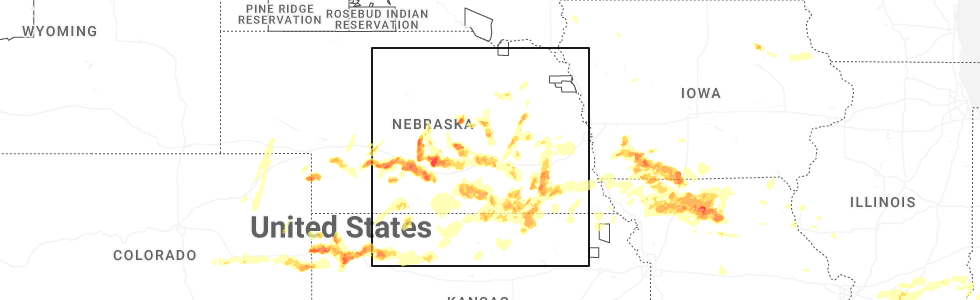
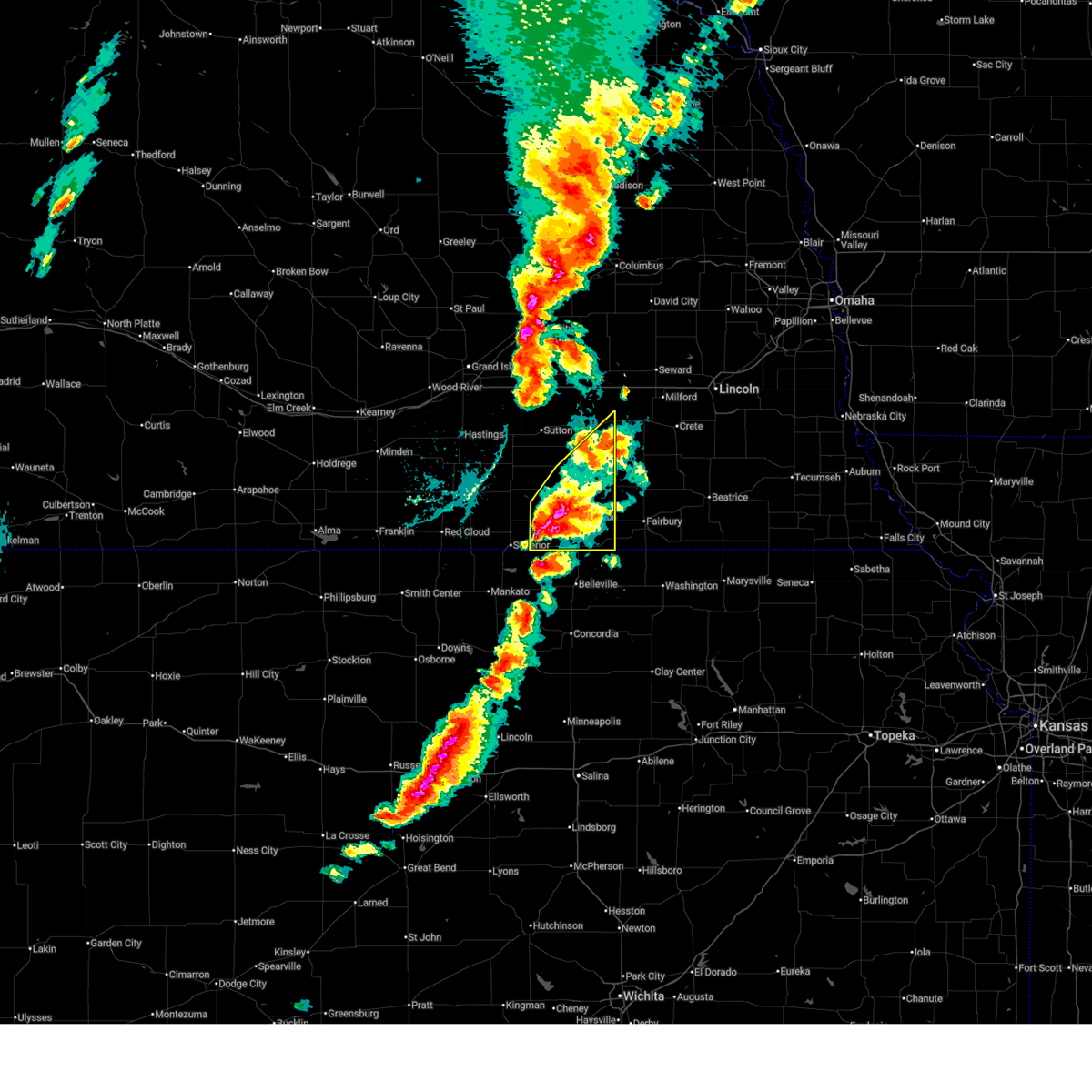
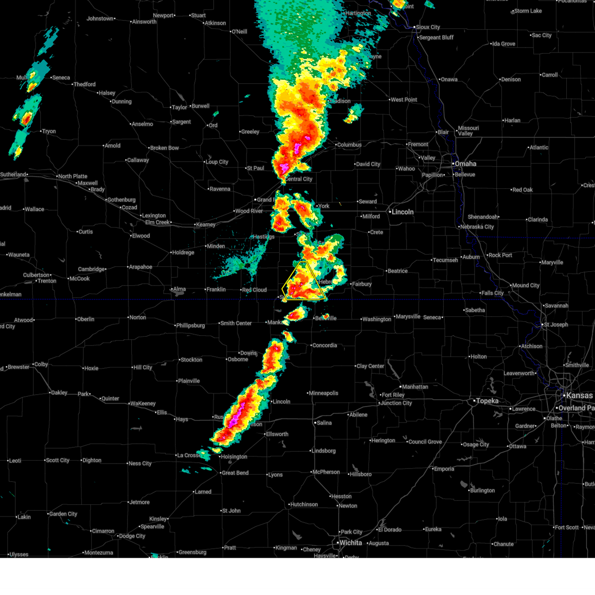
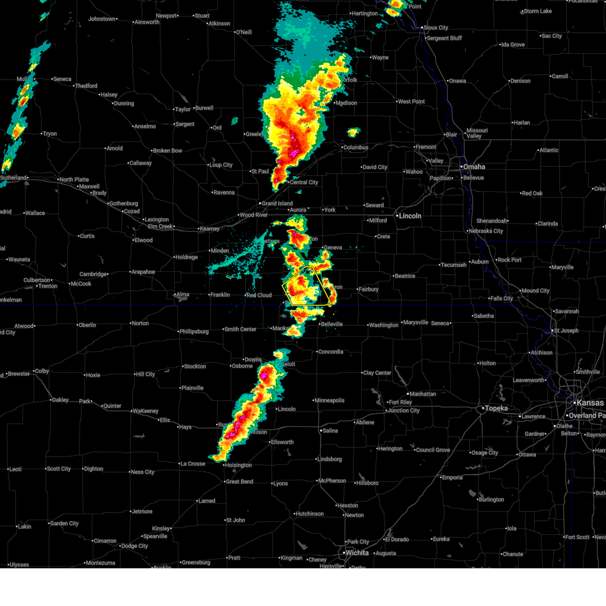
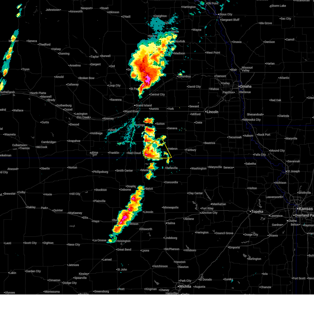
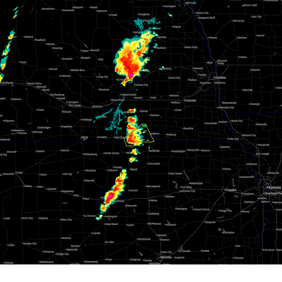
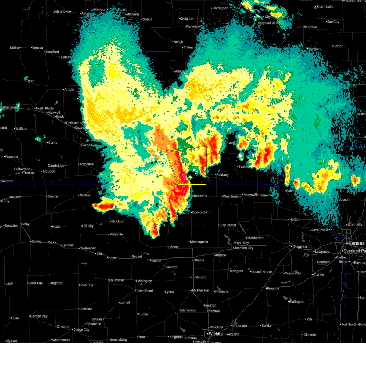
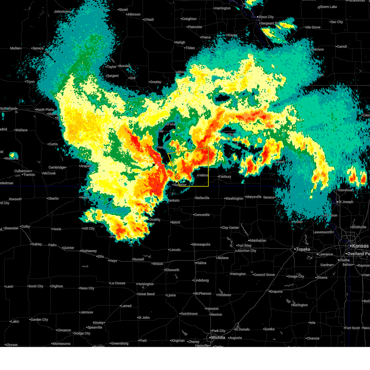
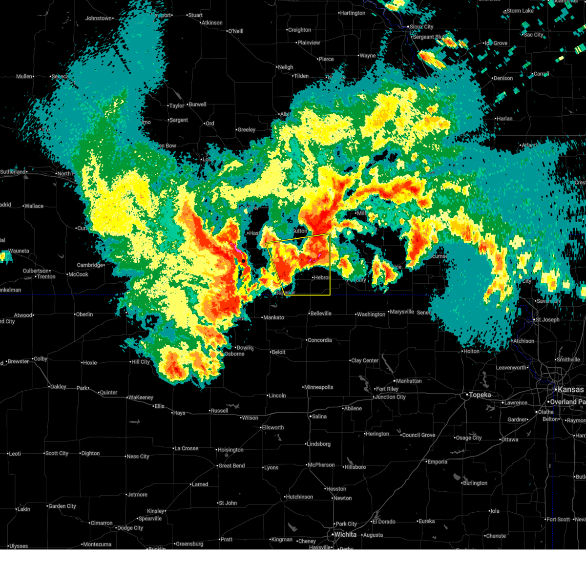
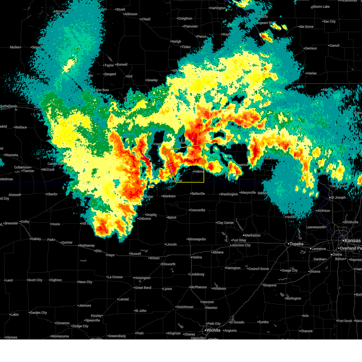
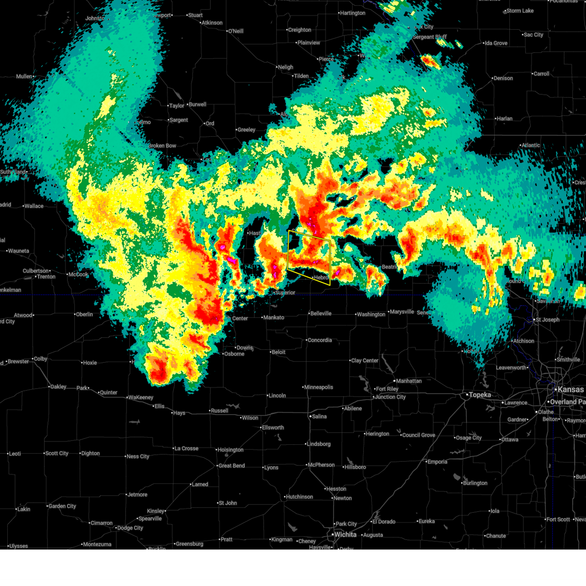
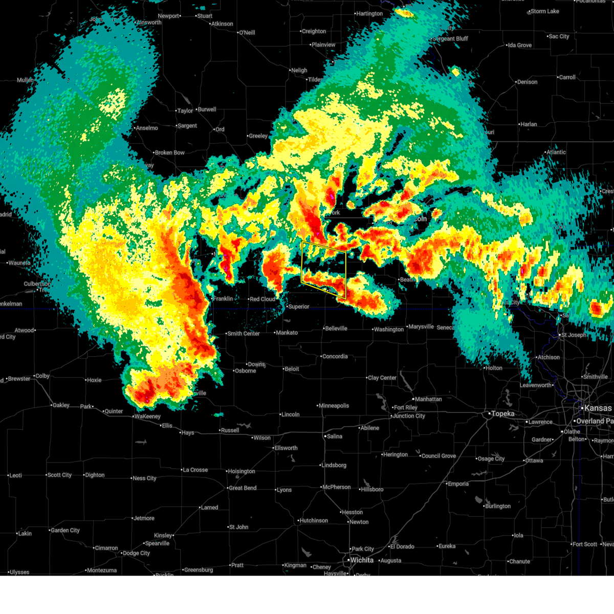
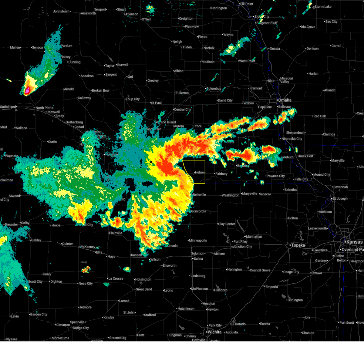
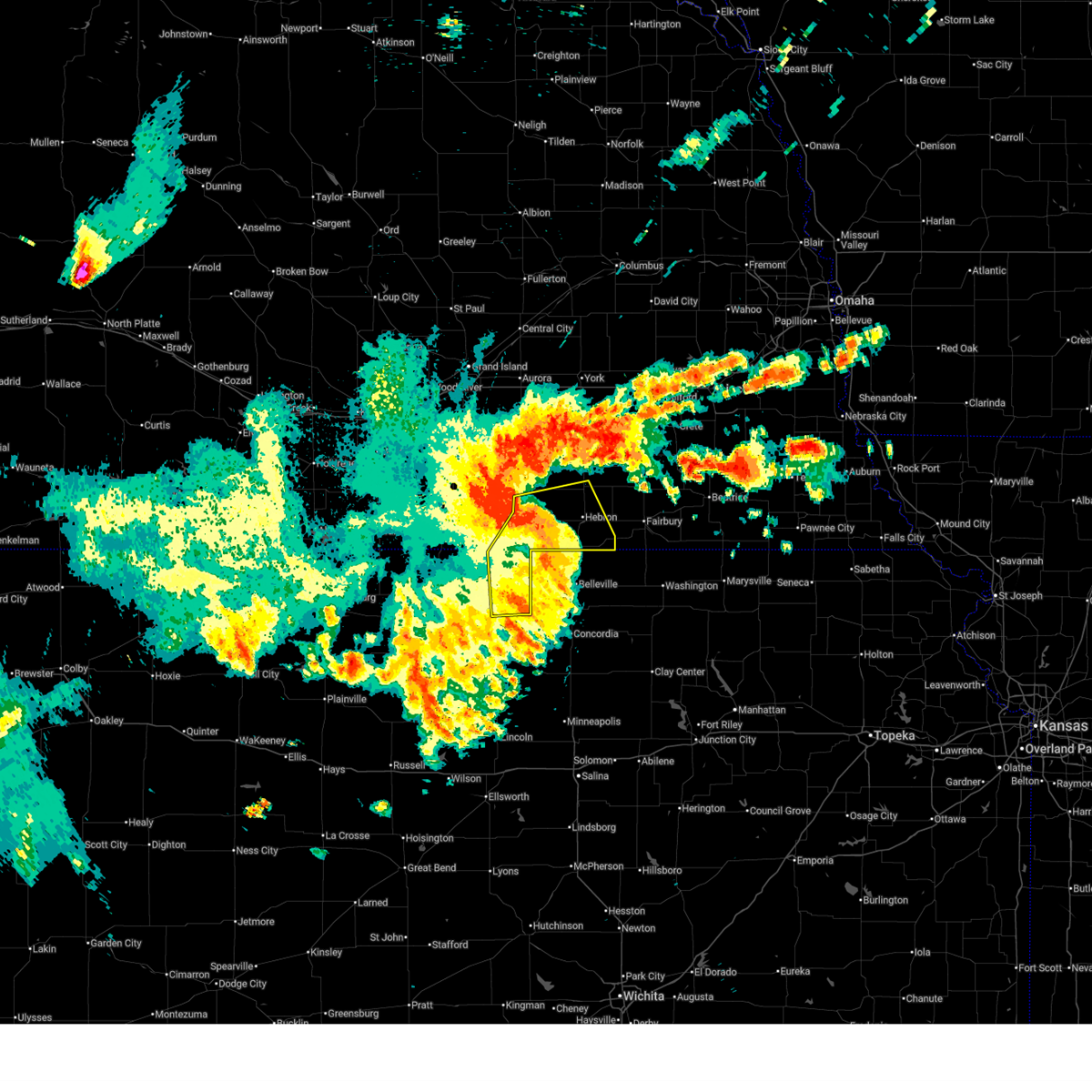
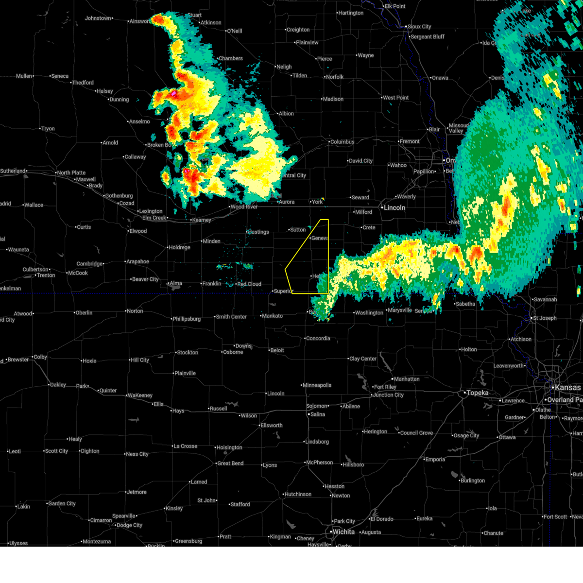
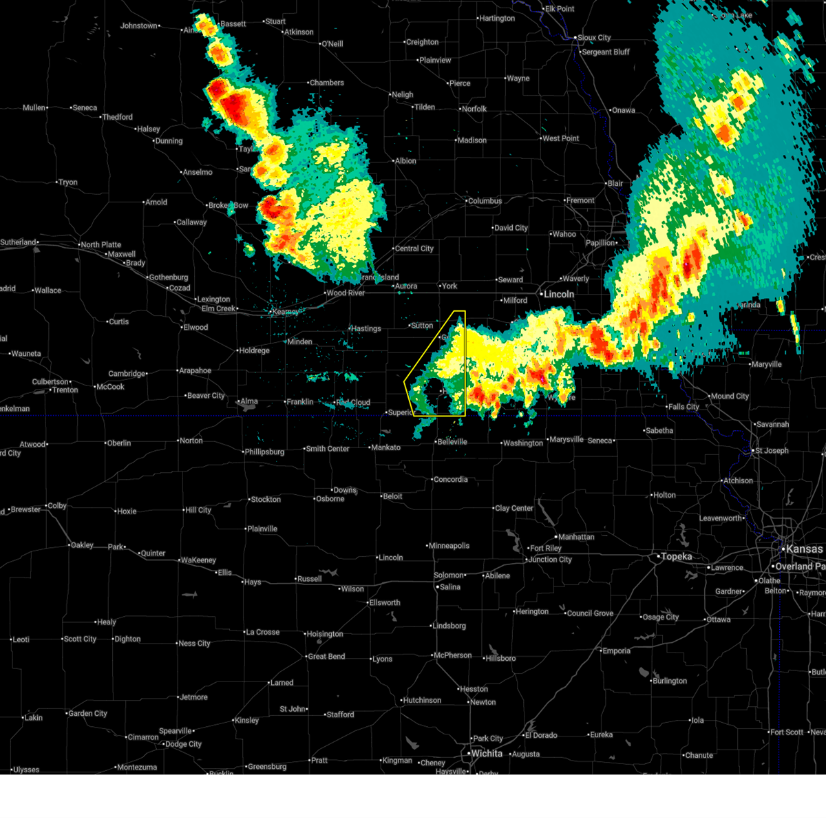
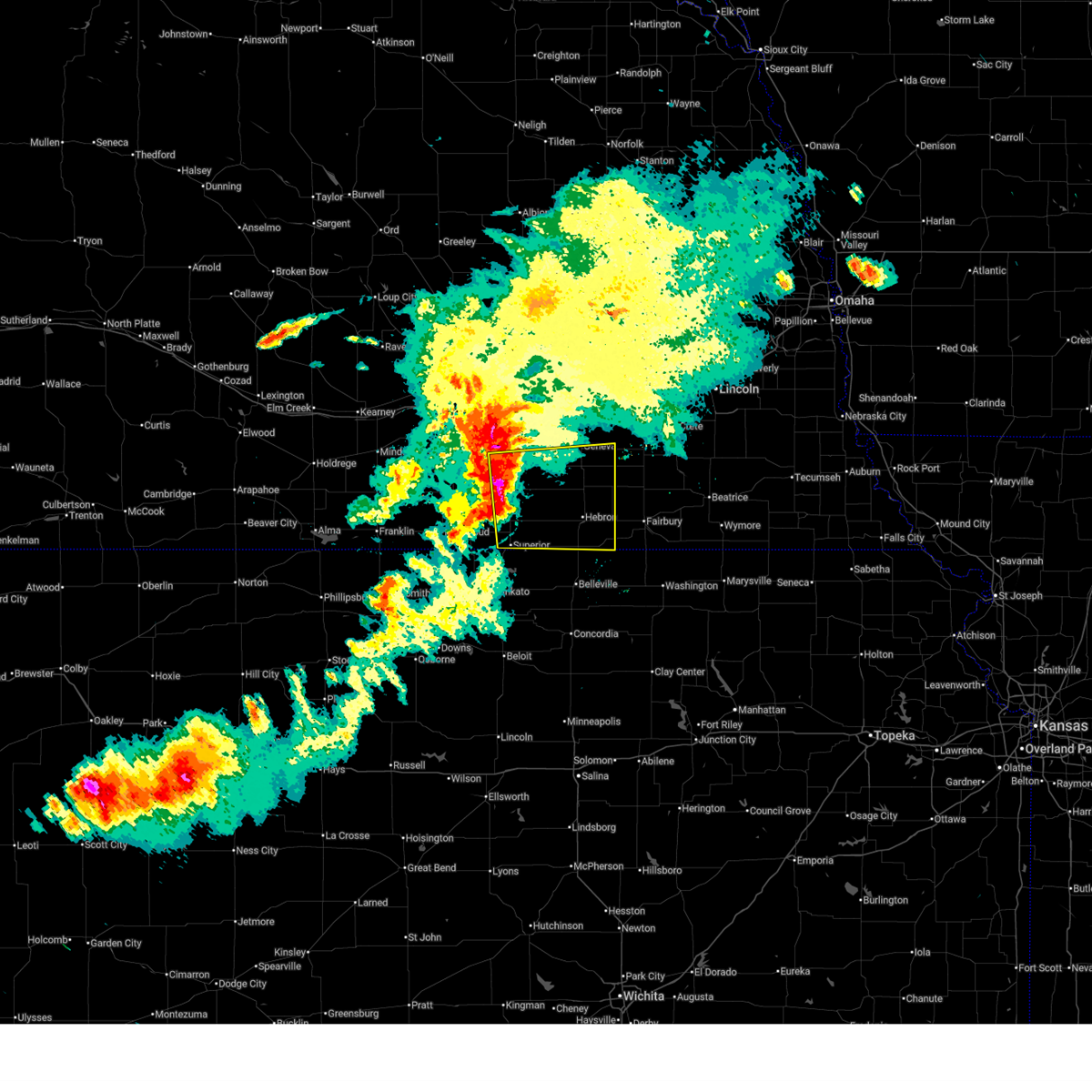
Hail Map for Hebron, NE
The Hebron, NE area has had 14 reports of on-the-ground hail by trained spotters, and has been under severe weather warnings 39 times during the past 12 months. Doppler radar has detected hail at or near Hebron, NE on 101 occasions, including 11 occasions during the past year.
| Name: | Hebron, NE |
| Where Located: | 65.3 miles SE of Grand Island, NE |
| Map: | Google Map for Hebron, NE |
| Population: | 1579 |
| Housing Units: | 791 |
| More Info: | Search Google for Hebron, NE |
2
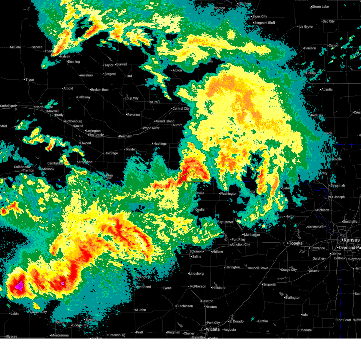
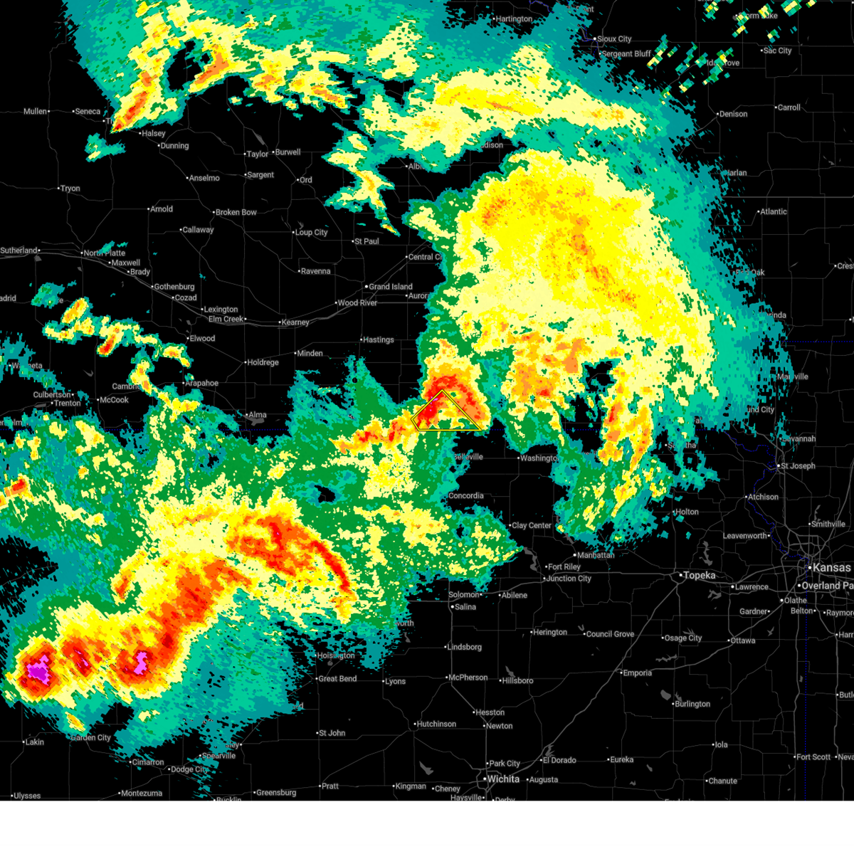
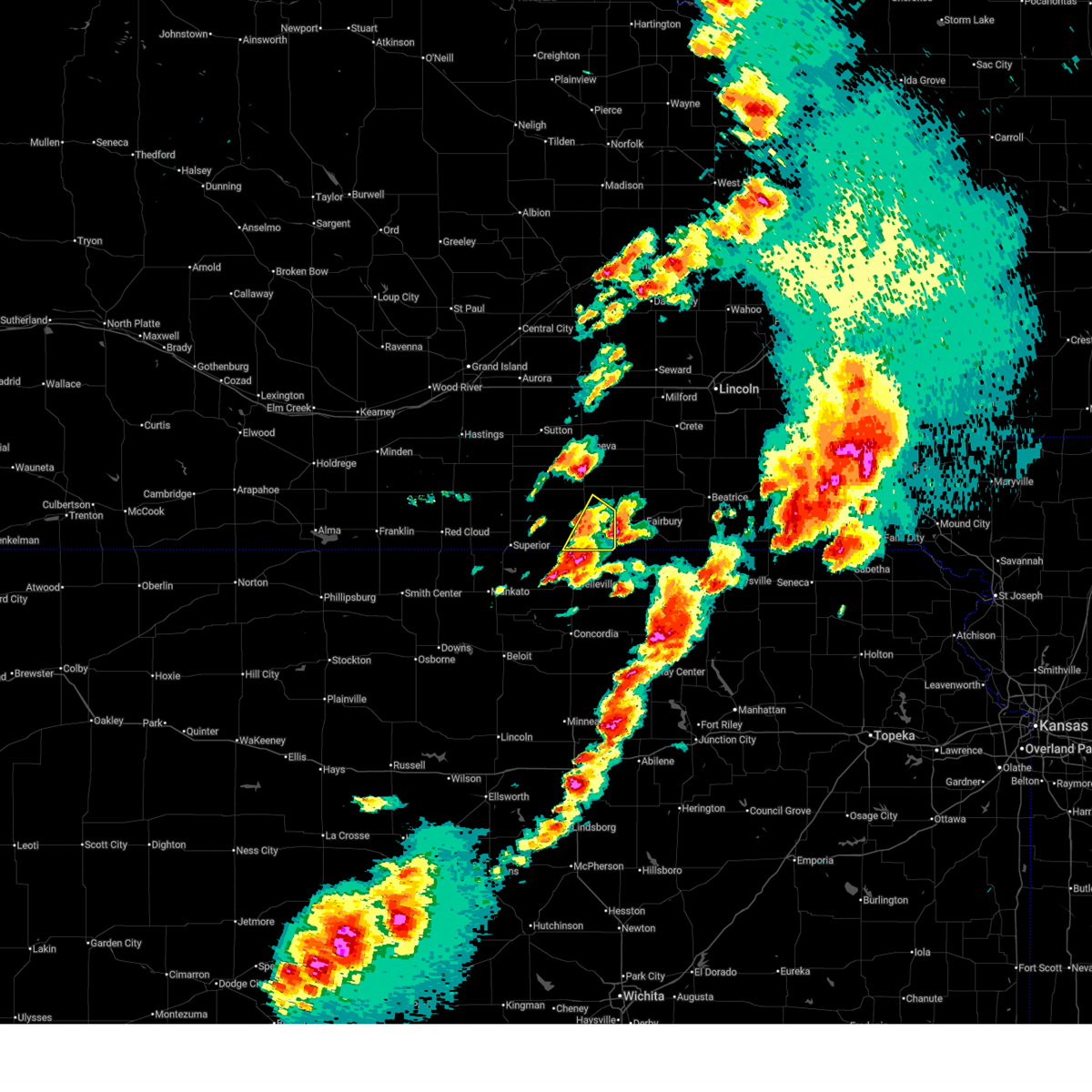
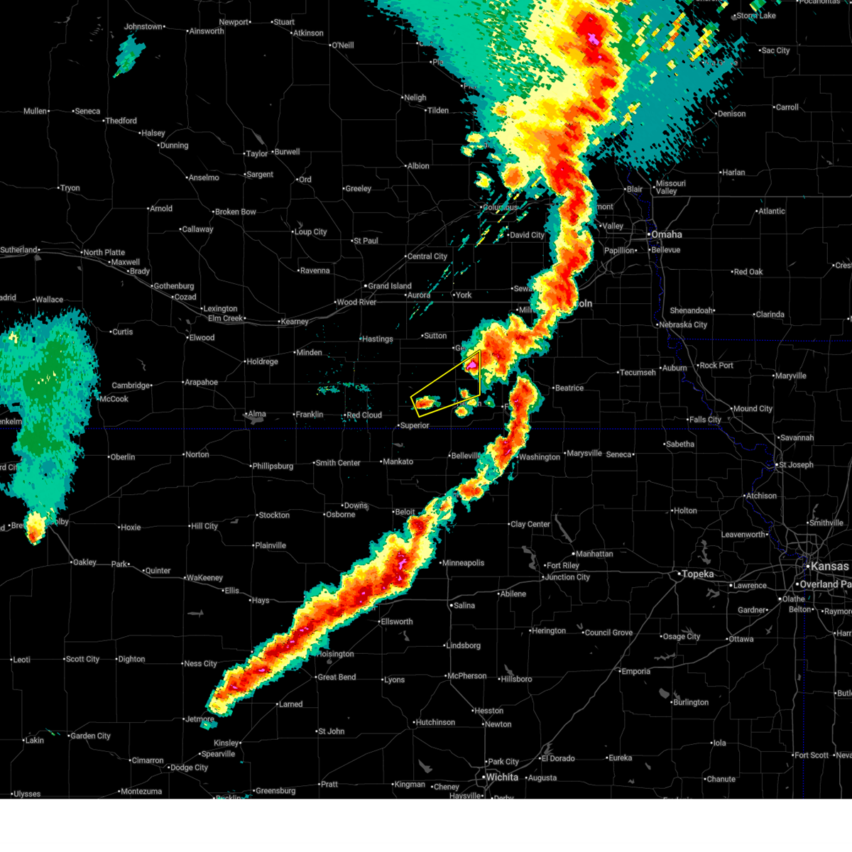
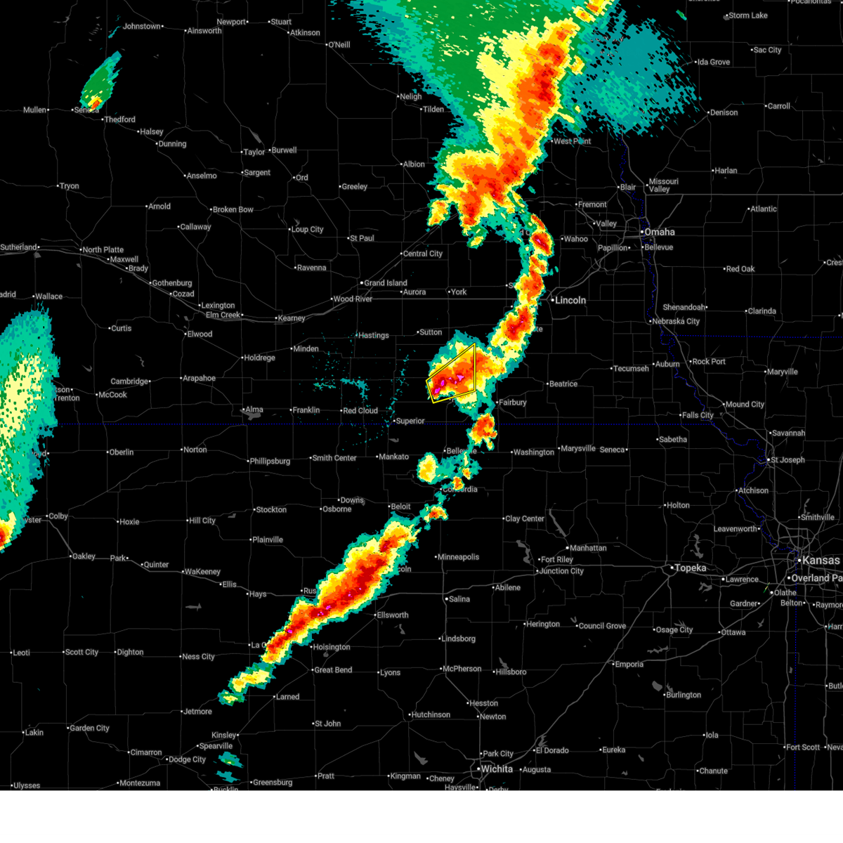
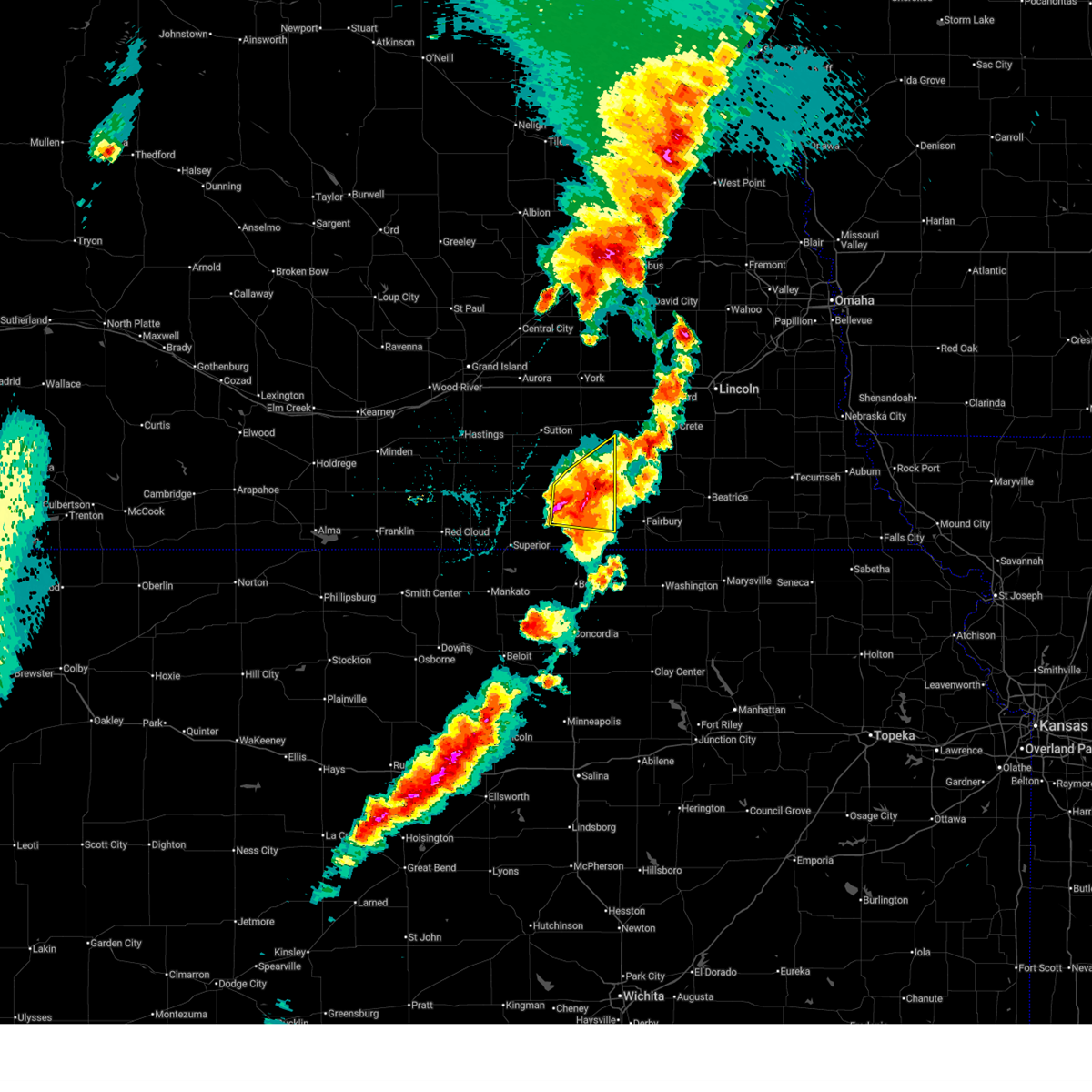
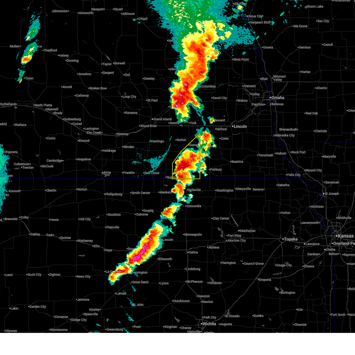
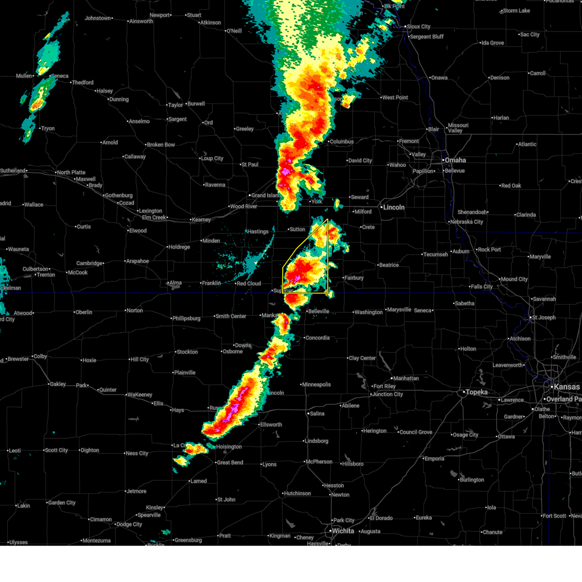
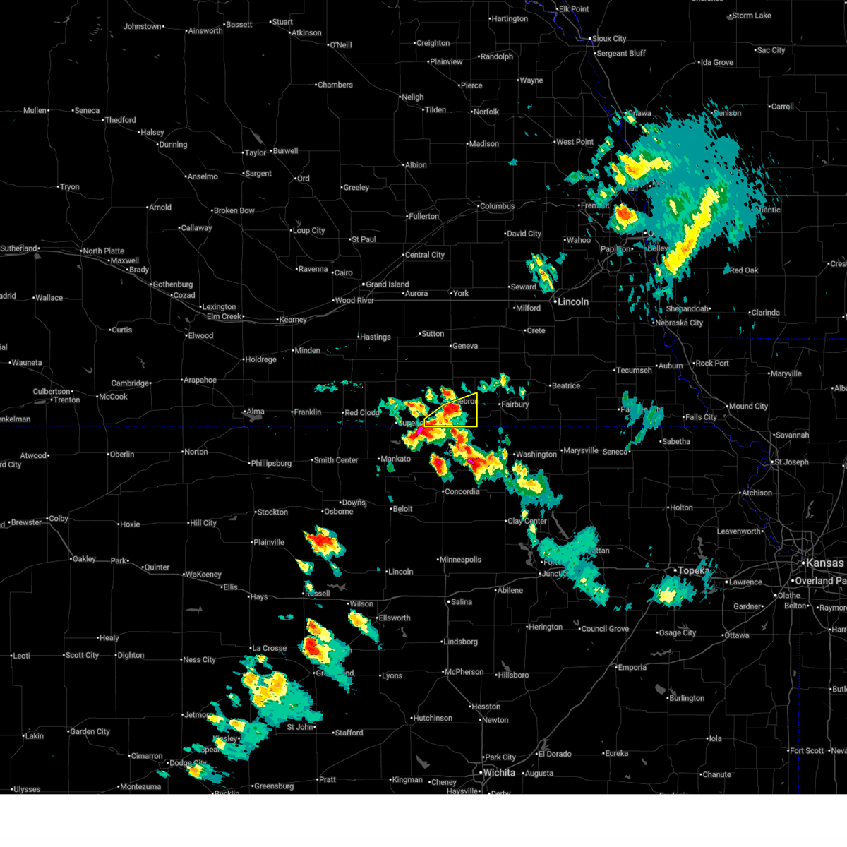
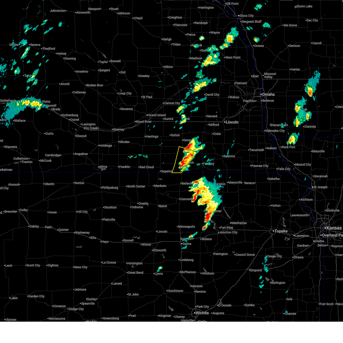
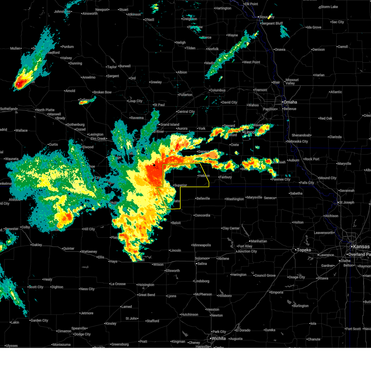
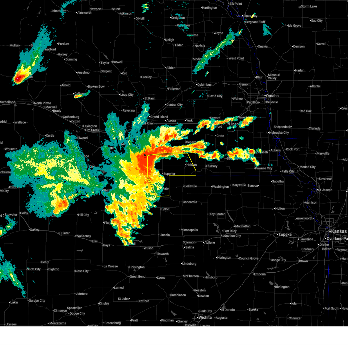
The Top Recent Hail Date for Hebron, NE is Saturday, May 16, 2026 (4th out of 101)
Hail and Wind Damage Spotted near Hebron, NE
| Date / Time | Report Details |
|---|---|
| 6/20/2026 9:37 PM CDT |
 At 937 pm cdt, a severe thunderstorm was located near deshler, or 17 miles north of belleville, moving southeast at 30 mph (radar indicated). Hazards include 60 mph wind gusts and penny size hail. Expect damage to roofs, siding, and trees. this severe storm will be near, chester around 945 pm cdt. Hubbell around 1000 pm cdt. At 937 pm cdt, a severe thunderstorm was located near deshler, or 17 miles north of belleville, moving southeast at 30 mph (radar indicated). Hazards include 60 mph wind gusts and penny size hail. Expect damage to roofs, siding, and trees. this severe storm will be near, chester around 945 pm cdt. Hubbell around 1000 pm cdt.
|
| 6/20/2026 9:24 PM CDT |
 Svrgid the national weather service in hastings has issued a * severe thunderstorm warning for, southeastern nuckolls county in south central nebraska, southern thayer county in south central nebraska, * until 1000 pm cdt. * at 924 pm cdt, a severe thunderstorm was located near deshler, or 23 miles north of belleville, moving southeast at 30 mph (radar indicated). Hazards include 60 mph wind gusts and quarter size hail. Hail damage to vehicles is expected. expect wind damage to roofs, siding, and trees. this severe thunderstorm will be near, deshler around 930 pm cdt. Other locations in the path of this severe thunderstorm include chester. Svrgid the national weather service in hastings has issued a * severe thunderstorm warning for, southeastern nuckolls county in south central nebraska, southern thayer county in south central nebraska, * until 1000 pm cdt. * at 924 pm cdt, a severe thunderstorm was located near deshler, or 23 miles north of belleville, moving southeast at 30 mph (radar indicated). Hazards include 60 mph wind gusts and quarter size hail. Hail damage to vehicles is expected. expect wind damage to roofs, siding, and trees. this severe thunderstorm will be near, deshler around 930 pm cdt. Other locations in the path of this severe thunderstorm include chester.
|
| 5/30/2026 8:51 PM CDT |
 Svrgid the national weather service in hastings has issued a * severe thunderstorm warning for, eastern thayer county in south central nebraska, * until 930 pm cdt. * at 851 pm cdt, a severe thunderstorm was located over chester, or 12 miles north of belleville, moving northeast at 35 mph (radar indicated). Hazards include 60 mph wind gusts and quarter size hail. Hail damage to vehicles is expected. expect wind damage to roofs, siding, and trees. this severe thunderstorm will be near, gilead around 910 pm cdt. Other locations in the path of this severe thunderstorm include alexandria. Svrgid the national weather service in hastings has issued a * severe thunderstorm warning for, eastern thayer county in south central nebraska, * until 930 pm cdt. * at 851 pm cdt, a severe thunderstorm was located over chester, or 12 miles north of belleville, moving northeast at 35 mph (radar indicated). Hazards include 60 mph wind gusts and quarter size hail. Hail damage to vehicles is expected. expect wind damage to roofs, siding, and trees. this severe thunderstorm will be near, gilead around 910 pm cdt. Other locations in the path of this severe thunderstorm include alexandria.
|
| 5/18/2026 4:39 PM CDT |
 Svrgid the national weather service in hastings has issued a * severe thunderstorm warning for, eastern thayer county in south central nebraska, * until 515 pm cdt. * at 439 pm cdt, a severe thunderstorm was located near chester, or 9 miles north of belleville, moving northeast at 35 mph (radar indicated). Hazards include half dollar size hail. Damage to vehicles is expected. this severe thunderstorm will be near, chester around 445 pm cdt. Other locations in the path of this severe thunderstorm include gilead. Svrgid the national weather service in hastings has issued a * severe thunderstorm warning for, eastern thayer county in south central nebraska, * until 515 pm cdt. * at 439 pm cdt, a severe thunderstorm was located near chester, or 9 miles north of belleville, moving northeast at 35 mph (radar indicated). Hazards include half dollar size hail. Damage to vehicles is expected. this severe thunderstorm will be near, chester around 445 pm cdt. Other locations in the path of this severe thunderstorm include gilead.
|
| 5/17/2026 7:38 PM CDT |
 Svrgid the national weather service in hastings has issued a * severe thunderstorm warning for, east central nuckolls county in south central nebraska, southeastern fillmore county in south central nebraska, northern thayer county in south central nebraska, * until 830 pm cdt. * at 738 pm cdt, a severe thunderstorm was located over ruskin, or 26 miles northwest of belleville, moving northeast at 45 mph (radar indicated). Hazards include 60 mph wind gusts and half dollar size hail. Hail damage to vehicles is expected. expect wind damage to roofs, siding, and trees. this severe thunderstorm will be near, carleton and belvidere around 755 pm cdt. Other locations in the path of this severe thunderstorm include bruning. Svrgid the national weather service in hastings has issued a * severe thunderstorm warning for, east central nuckolls county in south central nebraska, southeastern fillmore county in south central nebraska, northern thayer county in south central nebraska, * until 830 pm cdt. * at 738 pm cdt, a severe thunderstorm was located over ruskin, or 26 miles northwest of belleville, moving northeast at 45 mph (radar indicated). Hazards include 60 mph wind gusts and half dollar size hail. Hail damage to vehicles is expected. expect wind damage to roofs, siding, and trees. this severe thunderstorm will be near, carleton and belvidere around 755 pm cdt. Other locations in the path of this severe thunderstorm include bruning.
|
| 5/17/2026 7:10 PM CDT |
 Svrgid the national weather service in hastings has issued a * severe thunderstorm warning for, southeastern fillmore county in south central nebraska, northern thayer county in south central nebraska, * until 745 pm cdt. * at 710 pm cdt, a severe thunderstorm was located near carleton, or 26 miles west of fairbury, moving northeast at 40 mph (radar indicated). Hazards include golf ball size hail and 60 mph wind gusts. People and animals outdoors will be injured. expect hail damage to roofs, siding, windows, and vehicles. expect wind damage to roofs, siding, and trees. this severe thunderstorm will be near, bruning, carleton, and belvidere around 715 pm cdt. Ohiowa around 730 pm cdt. Svrgid the national weather service in hastings has issued a * severe thunderstorm warning for, southeastern fillmore county in south central nebraska, northern thayer county in south central nebraska, * until 745 pm cdt. * at 710 pm cdt, a severe thunderstorm was located near carleton, or 26 miles west of fairbury, moving northeast at 40 mph (radar indicated). Hazards include golf ball size hail and 60 mph wind gusts. People and animals outdoors will be injured. expect hail damage to roofs, siding, windows, and vehicles. expect wind damage to roofs, siding, and trees. this severe thunderstorm will be near, bruning, carleton, and belvidere around 715 pm cdt. Ohiowa around 730 pm cdt.
|
| 5/17/2026 7:04 PM CDT |
 At 704 pm cdt, a severe thunderstorm was located near alexandria, or 16 miles west of fairbury, moving northeast at 30 mph (radar indicated). Hazards include golf ball size hail and 60 mph wind gusts. People and animals outdoors will be injured. expect hail damage to roofs, siding, windows, and vehicles. expect wind damage to roofs, siding, and trees. This severe storm will be near, alexandria around 710 pm cdt. At 704 pm cdt, a severe thunderstorm was located near alexandria, or 16 miles west of fairbury, moving northeast at 30 mph (radar indicated). Hazards include golf ball size hail and 60 mph wind gusts. People and animals outdoors will be injured. expect hail damage to roofs, siding, windows, and vehicles. expect wind damage to roofs, siding, and trees. This severe storm will be near, alexandria around 710 pm cdt.
|
| 5/17/2026 6:52 PM CDT |
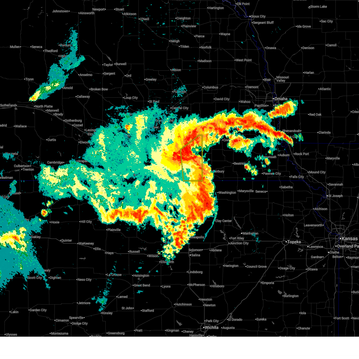
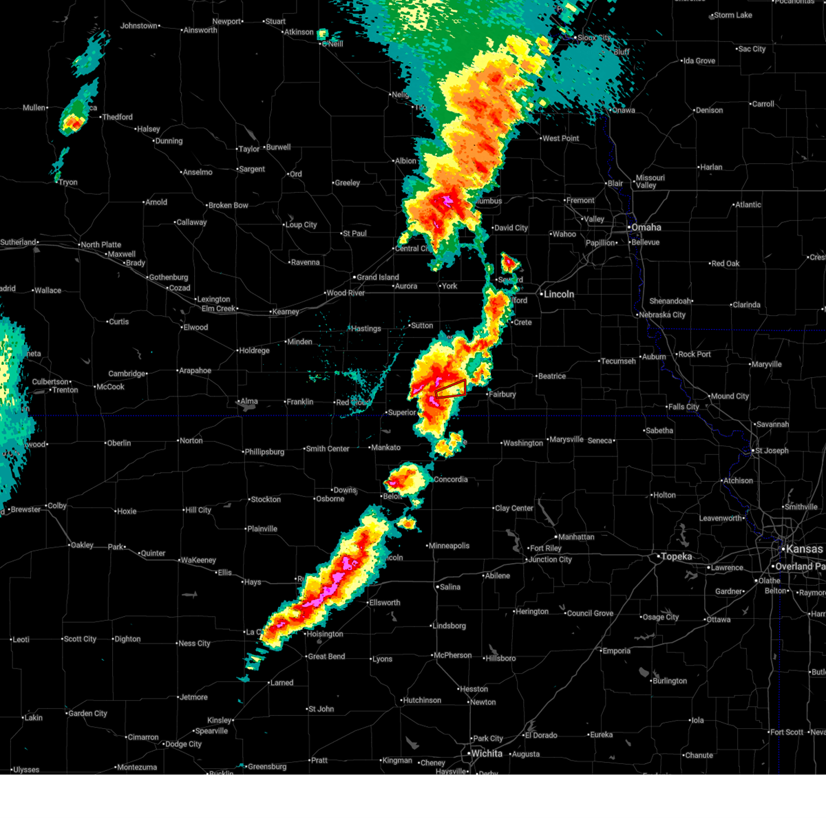 At 652 pm cdt, a confirmed large and destructive tornado was located over hebron, or 20 miles west of fairbury, moving east at 25 mph. tornado emergency for hebron. this is a particularly dangerous situation. take cover now! (radar confirmed tornado). Hazards include deadly tornado. You are in a life-threatening situation. flying debris may be deadly to those caught without shelter. mobile homes will be destroyed. considerable damage to homes, businesses, and vehicles is likely and complete destruction is possible. The tornado will be near, gilead around 705 pm cdt. At 652 pm cdt, a confirmed large and destructive tornado was located over hebron, or 20 miles west of fairbury, moving east at 25 mph. tornado emergency for hebron. this is a particularly dangerous situation. take cover now! (radar confirmed tornado). Hazards include deadly tornado. You are in a life-threatening situation. flying debris may be deadly to those caught without shelter. mobile homes will be destroyed. considerable damage to homes, businesses, and vehicles is likely and complete destruction is possible. The tornado will be near, gilead around 705 pm cdt.
|
| 5/17/2026 6:41 PM CDT |
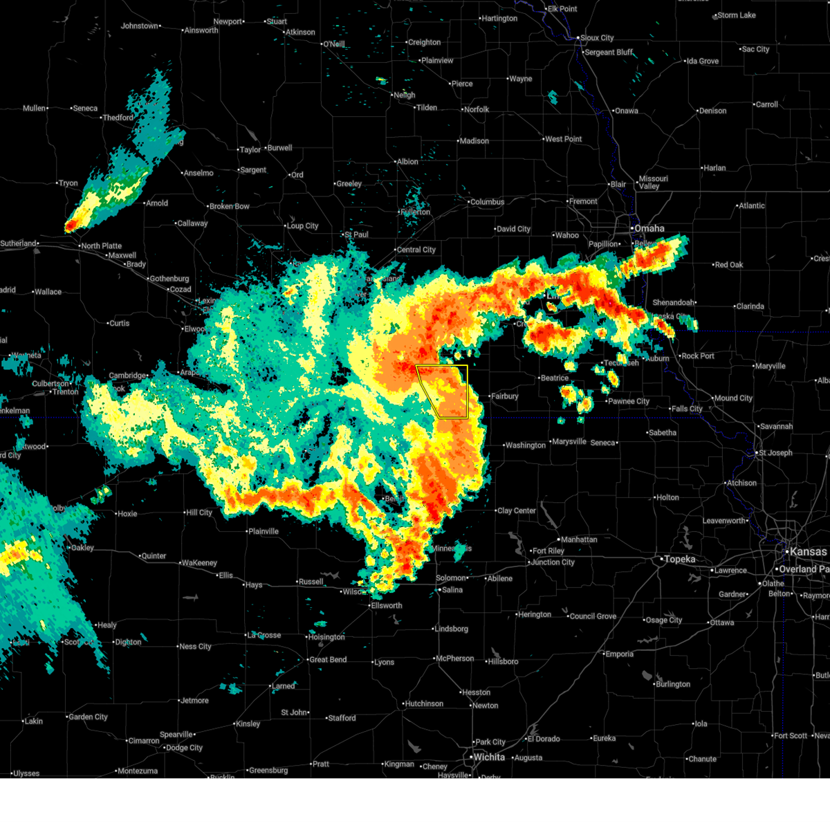
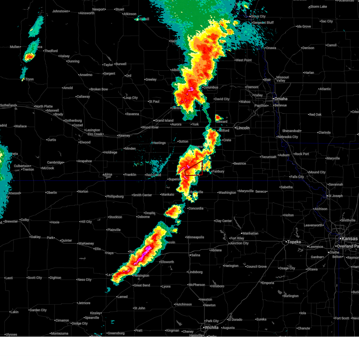 Torgid the national weather service in hastings has issued a * tornado warning for, southern thayer county in south central nebraska, * until 730 pm cdt. * at 641 pm cdt, a severe thunderstorm capable of producing a tornado was located near hebron, or 21 miles north of belleville, moving east at 25 mph (radar indicated rotation). Hazards include tornado. Flying debris will be dangerous to those caught without shelter. mobile homes will be damaged or destroyed. damage to roofs, windows, and vehicles will occur. tree damage is likely. this dangerous storm will be near, hebron around 645 pm cdt. gilead around 700 pm cdt. Other locations in the path of this tornadic thunderstorm include alexandria. Torgid the national weather service in hastings has issued a * tornado warning for, southern thayer county in south central nebraska, * until 730 pm cdt. * at 641 pm cdt, a severe thunderstorm capable of producing a tornado was located near hebron, or 21 miles north of belleville, moving east at 25 mph (radar indicated rotation). Hazards include tornado. Flying debris will be dangerous to those caught without shelter. mobile homes will be damaged or destroyed. damage to roofs, windows, and vehicles will occur. tree damage is likely. this dangerous storm will be near, hebron around 645 pm cdt. gilead around 700 pm cdt. Other locations in the path of this tornadic thunderstorm include alexandria.
|
| 5/17/2026 6:36 PM CDT |
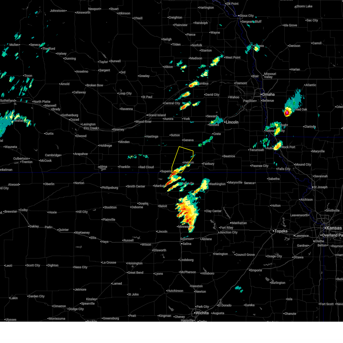
 At 636 pm cdt, a severe thunderstorm was located over deshler, or 23 miles north of belleville, moving northeast at 30 mph (radar indicated. at 634 pm cdt, tennis ball size hail was reported in deshler). Hazards include tennis ball size hail and 60 mph wind gusts. People and animals outdoors will be injured. expect hail damage to roofs, siding, windows, and vehicles. expect wind damage to roofs, siding, and trees. this severe storm will be near, hebron around 640 pm cdt. belvidere around 650 pm cdt. Alexandria around 710 pm cdt. At 636 pm cdt, a severe thunderstorm was located over deshler, or 23 miles north of belleville, moving northeast at 30 mph (radar indicated. at 634 pm cdt, tennis ball size hail was reported in deshler). Hazards include tennis ball size hail and 60 mph wind gusts. People and animals outdoors will be injured. expect hail damage to roofs, siding, windows, and vehicles. expect wind damage to roofs, siding, and trees. this severe storm will be near, hebron around 640 pm cdt. belvidere around 650 pm cdt. Alexandria around 710 pm cdt.
|
| 5/17/2026 6:30 PM CDT |
 At 630 pm cdt, a severe thunderstorm was located near deshler, or 19 miles north of belleville, moving east at 30 mph (radar indicated). Hazards include golf ball size hail and 60 mph wind gusts. People and animals outdoors will be injured. expect hail damage to roofs, siding, windows, and vehicles. expect wind damage to roofs, siding, and trees. this severe storm will be near, deshler around 635 pm cdt. hebron around 645 pm cdt. Gilead around 700 pm cdt. At 630 pm cdt, a severe thunderstorm was located near deshler, or 19 miles north of belleville, moving east at 30 mph (radar indicated). Hazards include golf ball size hail and 60 mph wind gusts. People and animals outdoors will be injured. expect hail damage to roofs, siding, windows, and vehicles. expect wind damage to roofs, siding, and trees. this severe storm will be near, deshler around 635 pm cdt. hebron around 645 pm cdt. Gilead around 700 pm cdt.
|
| 5/17/2026 6:25 PM CDT |
 Svrgid the national weather service in hastings has issued a * severe thunderstorm warning for, eastern nuckolls county in south central nebraska, southeastern fillmore county in south central nebraska, thayer county in south central nebraska, * until 715 pm cdt. * at 624 pm cdt, a severe thunderstorm was located over deshler, or 21 miles north of belleville, moving east at 40 mph (radar indicated). Hazards include golf ball size hail and 60 mph wind gusts. People and animals outdoors will be injured. expect hail damage to roofs, siding, windows, and vehicles. expect wind damage to roofs, siding, and trees. this severe thunderstorm will be near, hebron around 630 pm cdt. Other locations in the path of this severe thunderstorm include alexandria. Svrgid the national weather service in hastings has issued a * severe thunderstorm warning for, eastern nuckolls county in south central nebraska, southeastern fillmore county in south central nebraska, thayer county in south central nebraska, * until 715 pm cdt. * at 624 pm cdt, a severe thunderstorm was located over deshler, or 21 miles north of belleville, moving east at 40 mph (radar indicated). Hazards include golf ball size hail and 60 mph wind gusts. People and animals outdoors will be injured. expect hail damage to roofs, siding, windows, and vehicles. expect wind damage to roofs, siding, and trees. this severe thunderstorm will be near, hebron around 630 pm cdt. Other locations in the path of this severe thunderstorm include alexandria.
|
| 5/17/2026 6:17 PM CDT |
 At 616 pm cdt, a severe thunderstorm was located near ruskin, or 21 miles northwest of belleville, moving east at 25 mph (radar indicated). Hazards include ping pong ball size hail and 60 mph wind gusts. People and animals outdoors will be injured. expect hail damage to roofs, siding, windows, and vehicles. expect wind damage to roofs, siding, and trees. this severe storm will be near, deshler around 620 pm cdt. Hebron around 635 pm cdt. At 616 pm cdt, a severe thunderstorm was located near ruskin, or 21 miles northwest of belleville, moving east at 25 mph (radar indicated). Hazards include ping pong ball size hail and 60 mph wind gusts. People and animals outdoors will be injured. expect hail damage to roofs, siding, windows, and vehicles. expect wind damage to roofs, siding, and trees. this severe storm will be near, deshler around 620 pm cdt. Hebron around 635 pm cdt.
|
| 5/17/2026 6:01 PM CDT |
 At 601 pm cdt, a severe thunderstorm was located over ruskin, or 26 miles northwest of belleville, moving northeast at 40 mph (radar indicated). Hazards include ping pong ball size hail and 60 mph wind gusts. People and animals outdoors will be injured. expect hail damage to roofs, siding, windows, and vehicles. expect wind damage to roofs, siding, and trees. This severe storm will be near, ruskin around 605 pm cdt. At 601 pm cdt, a severe thunderstorm was located over ruskin, or 26 miles northwest of belleville, moving northeast at 40 mph (radar indicated). Hazards include ping pong ball size hail and 60 mph wind gusts. People and animals outdoors will be injured. expect hail damage to roofs, siding, windows, and vehicles. expect wind damage to roofs, siding, and trees. This severe storm will be near, ruskin around 605 pm cdt.
|
| 5/17/2026 5:51 PM CDT |
 the severe thunderstorm warning has been cancelled and is no longer in effect the severe thunderstorm warning has been cancelled and is no longer in effect
|
| 5/17/2026 5:51 PM CDT |
 At 551 pm cdt, a severe thunderstorm was located near hardy, or 24 miles northwest of belleville, moving northeast at 40 mph (radar indicated). Hazards include ping pong ball size hail and 60 mph wind gusts. People and animals outdoors will be injured. expect hail damage to roofs, siding, windows, and vehicles. expect wind damage to roofs, siding, and trees. this severe storm will be near, ruskin around 600 pm cdt. deshler around 605 pm cdt. Hebron around 620 pm cdt. At 551 pm cdt, a severe thunderstorm was located near hardy, or 24 miles northwest of belleville, moving northeast at 40 mph (radar indicated). Hazards include ping pong ball size hail and 60 mph wind gusts. People and animals outdoors will be injured. expect hail damage to roofs, siding, windows, and vehicles. expect wind damage to roofs, siding, and trees. this severe storm will be near, ruskin around 600 pm cdt. deshler around 605 pm cdt. Hebron around 620 pm cdt.
|
| 5/17/2026 5:38 PM CDT |
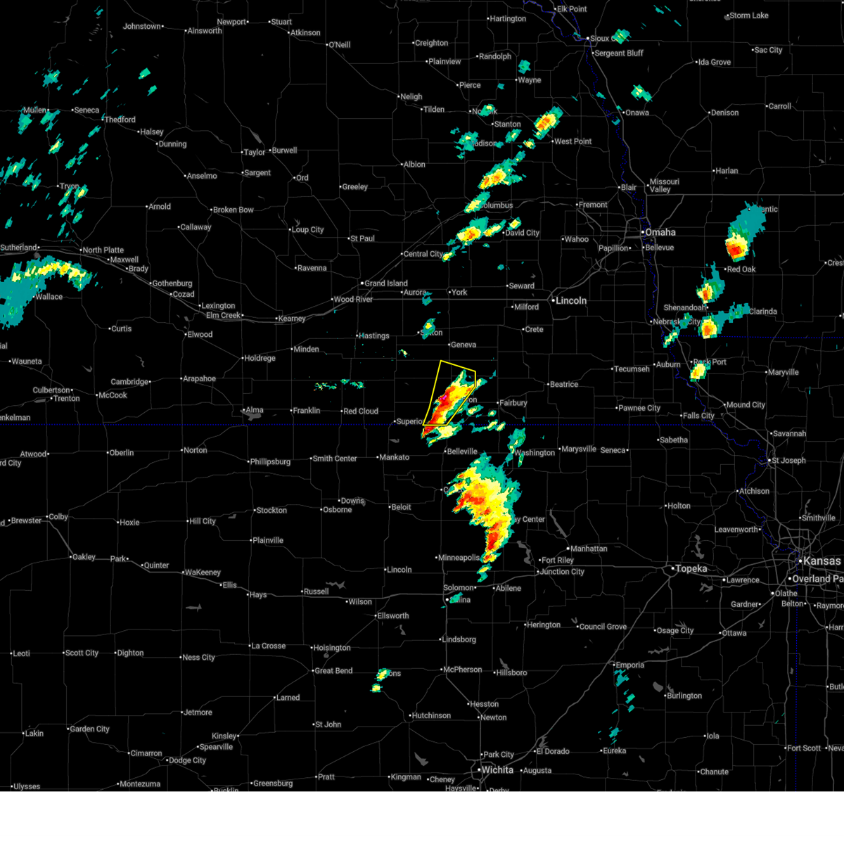
 Svrgid the national weather service in hastings has issued a * severe thunderstorm warning for, northeastern jewell county in north central kansas, southeastern nuckolls county in south central nebraska, western thayer county in south central nebraska, * until 630 pm cdt. * at 538 pm cdt, a severe thunderstorm was located near superior, or 28 miles northwest of belleville, moving northeast at 40 mph (radar indicated). Hazards include ping pong ball size hail and 60 mph wind gusts. People and animals outdoors will be injured. expect hail damage to roofs, siding, windows, and vehicles. expect wind damage to roofs, siding, and trees. this severe thunderstorm will be near, superior around 545 pm cdt. hardy around 550 pm cdt. Other locations in the path of this severe thunderstorm include ruskin, deshler and hebron. Svrgid the national weather service in hastings has issued a * severe thunderstorm warning for, northeastern jewell county in north central kansas, southeastern nuckolls county in south central nebraska, western thayer county in south central nebraska, * until 630 pm cdt. * at 538 pm cdt, a severe thunderstorm was located near superior, or 28 miles northwest of belleville, moving northeast at 40 mph (radar indicated). Hazards include ping pong ball size hail and 60 mph wind gusts. People and animals outdoors will be injured. expect hail damage to roofs, siding, windows, and vehicles. expect wind damage to roofs, siding, and trees. this severe thunderstorm will be near, superior around 545 pm cdt. hardy around 550 pm cdt. Other locations in the path of this severe thunderstorm include ruskin, deshler and hebron.
|
| 5/16/2026 11:54 PM CDT |
 The storms which prompted the warning have moved out of the area. therefore, the warning will be allowed to expire. however, gusty winds are still possible with these thunderstorms. a severe thunderstorm watch remains in effect until 100 am cdt for south central nebraska. to report severe weather, contact your nearest law enforcement agency. they will relay your report to the national weather service hastings. The storms which prompted the warning have moved out of the area. therefore, the warning will be allowed to expire. however, gusty winds are still possible with these thunderstorms. a severe thunderstorm watch remains in effect until 100 am cdt for south central nebraska. to report severe weather, contact your nearest law enforcement agency. they will relay your report to the national weather service hastings.
|
| 5/16/2026 11:41 PM CDT |
 At 1141 pm cdt, severe thunderstorms were located along a line extending from geneva to near reynolds, moving east at 25 mph (radar indicated). Hazards include 70 mph wind gusts and ping pong ball size hail. People and animals outdoors will be injured. expect hail damage to roofs, siding, windows, and vehicles. expect considerable tree damage. wind damage is also likely to mobile homes, roofs, and outbuildings. these severe storms will be near, alexandria and ohiowa around 1145 pm cdt. Milligan around 1150 pm cdt. At 1141 pm cdt, severe thunderstorms were located along a line extending from geneva to near reynolds, moving east at 25 mph (radar indicated). Hazards include 70 mph wind gusts and ping pong ball size hail. People and animals outdoors will be injured. expect hail damage to roofs, siding, windows, and vehicles. expect considerable tree damage. wind damage is also likely to mobile homes, roofs, and outbuildings. these severe storms will be near, alexandria and ohiowa around 1145 pm cdt. Milligan around 1150 pm cdt.
|
| 5/16/2026 11:30 PM CDT |
 At 1130 pm cdt, severe thunderstorms were located along a line extending from near shickley to near hubbell, moving east at 25 mph (radar indicated). Hazards include 70 mph wind gusts and ping pong ball size hail. People and animals outdoors will be injured. expect hail damage to roofs, siding, windows, and vehicles. expect considerable tree damage. wind damage is also likely to mobile homes, roofs, and outbuildings. these severe storms will be near, geneva, bruning, belvidere, gilead, and strang around 1135 pm cdt. alexandria and ohiowa around 1145 pm cdt. Milligan around 1200 am cdt. At 1130 pm cdt, severe thunderstorms were located along a line extending from near shickley to near hubbell, moving east at 25 mph (radar indicated). Hazards include 70 mph wind gusts and ping pong ball size hail. People and animals outdoors will be injured. expect hail damage to roofs, siding, windows, and vehicles. expect considerable tree damage. wind damage is also likely to mobile homes, roofs, and outbuildings. these severe storms will be near, geneva, bruning, belvidere, gilead, and strang around 1135 pm cdt. alexandria and ohiowa around 1145 pm cdt. Milligan around 1200 am cdt.
|
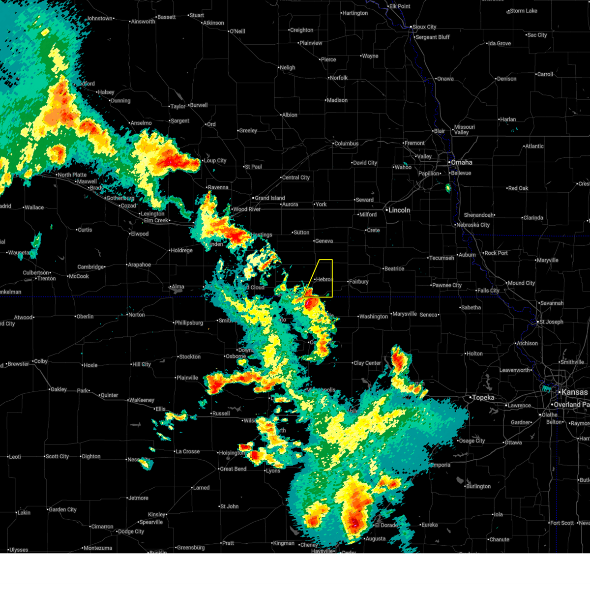
| 5/16/2026 11:20 PM CDT | Storm damage reported in thayer county NE, 8.6 miles NNE of Hebron, NE |
| 5/16/2026 11:19 PM CDT | Personal weather statio in thayer county NE, 6.6 miles NE of Hebron, NE |
| 5/16/2026 11:16 PM CDT |
 At 1116 pm cdt, severe thunderstorms were located along a line extending from 6 miles north of ong to near chester, moving east at 30 mph (radar indicated). Hazards include 70 mph wind gusts and ping pong ball size hail. People and animals outdoors will be injured. expect hail damage to roofs, siding, windows, and vehicles. expect considerable tree damage. wind damage is also likely to mobile homes, roofs, and outbuildings. these severe storms will be near, hebron, shickley, chester, and carleton around 1120 pm cdt. bruning, hubbell, and belvidere around 1130 pm cdt. geneva and strang around 1135 pm cdt. gilead around 1140 pm cdt. alexandria around 1145 pm cdt. Ohiowa around 1150 pm cdt. At 1116 pm cdt, severe thunderstorms were located along a line extending from 6 miles north of ong to near chester, moving east at 30 mph (radar indicated). Hazards include 70 mph wind gusts and ping pong ball size hail. People and animals outdoors will be injured. expect hail damage to roofs, siding, windows, and vehicles. expect considerable tree damage. wind damage is also likely to mobile homes, roofs, and outbuildings. these severe storms will be near, hebron, shickley, chester, and carleton around 1120 pm cdt. bruning, hubbell, and belvidere around 1130 pm cdt. geneva and strang around 1135 pm cdt. gilead around 1140 pm cdt. alexandria around 1145 pm cdt. Ohiowa around 1150 pm cdt.
|
| 5/16/2026 10:46 PM CDT | Personal weather statio in thayer county NE, 1.9 miles SW of Hebron, NE |
| 5/16/2026 10:37 PM CDT |
 At 1037 pm cdt, severe thunderstorms were located along a line extending from near ohiowa to near carleton to near deshler, moving east at 20 mph (radar indicated). Hazards include 70 mph wind gusts and ping pong ball size hail. People and animals outdoors will be injured. expect hail damage to roofs, siding, windows, and vehicles. expect considerable tree damage. wind damage is also likely to mobile homes, roofs, and outbuildings. these severe storms will be near, hebron, deshler, bruning, ohiowa, and belvidere around 1045 pm cdt. Alexandria around 1110 pm cdt. At 1037 pm cdt, severe thunderstorms were located along a line extending from near ohiowa to near carleton to near deshler, moving east at 20 mph (radar indicated). Hazards include 70 mph wind gusts and ping pong ball size hail. People and animals outdoors will be injured. expect hail damage to roofs, siding, windows, and vehicles. expect considerable tree damage. wind damage is also likely to mobile homes, roofs, and outbuildings. these severe storms will be near, hebron, deshler, bruning, ohiowa, and belvidere around 1045 pm cdt. Alexandria around 1110 pm cdt.
|
| 5/16/2026 10:28 PM CDT |
 At 1028 pm cdt, severe thunderstorms were located along a line extending from near ong to oak to near hardy, moving east at 15 mph (radar indicated). Hazards include ping pong ball size hail and 60 mph wind gusts. People and animals outdoors will be injured. expect hail damage to roofs, siding, windows, and vehicles. expect wind damage to roofs, siding, and trees. these severe storms will be near, davenport, ruskin, and ong around 1035 pm cdt. deshler around 1045 pm cdt. Shickley around 1050 pm cdt. At 1028 pm cdt, severe thunderstorms were located along a line extending from near ong to oak to near hardy, moving east at 15 mph (radar indicated). Hazards include ping pong ball size hail and 60 mph wind gusts. People and animals outdoors will be injured. expect hail damage to roofs, siding, windows, and vehicles. expect wind damage to roofs, siding, and trees. these severe storms will be near, davenport, ruskin, and ong around 1035 pm cdt. deshler around 1045 pm cdt. Shickley around 1050 pm cdt.
|
| 5/16/2026 10:23 PM CDT |
 Svrgid the national weather service in hastings has issued a * severe thunderstorm warning for, southeastern clay county in south central nebraska, eastern nuckolls county in south central nebraska, southern fillmore county in south central nebraska, thayer county in south central nebraska, * until 1115 pm cdt. * at 1023 pm cdt, severe thunderstorms were located along a line extending from near ong to oak to near hardy, moving east at 15 mph (radar indicated). Hazards include ping pong ball size hail and 60 mph wind gusts. People and animals outdoors will be injured. expect hail damage to roofs, siding, windows, and vehicles. expect wind damage to roofs, siding, and trees. severe thunderstorms will be near, davenport, ruskin, and ong around 1030 pm cdt. Other locations in the path of these severe thunderstorms include deshler and shickley. Svrgid the national weather service in hastings has issued a * severe thunderstorm warning for, southeastern clay county in south central nebraska, eastern nuckolls county in south central nebraska, southern fillmore county in south central nebraska, thayer county in south central nebraska, * until 1115 pm cdt. * at 1023 pm cdt, severe thunderstorms were located along a line extending from near ong to oak to near hardy, moving east at 15 mph (radar indicated). Hazards include ping pong ball size hail and 60 mph wind gusts. People and animals outdoors will be injured. expect hail damage to roofs, siding, windows, and vehicles. expect wind damage to roofs, siding, and trees. severe thunderstorms will be near, davenport, ruskin, and ong around 1030 pm cdt. Other locations in the path of these severe thunderstorms include deshler and shickley.
|
| 5/16/2026 10:19 PM CDT |
 At 1018 pm cdt, severe thunderstorms were located along a line extending from near alexandria to ong, moving north at 20 mph (radar indicated). Hazards include ping pong ball size hail and 60 mph wind gusts. People and animals outdoors will be injured. expect hail damage to roofs, siding, windows, and vehicles. expect wind damage to roofs, siding, and trees. these severe storms will be near, shickley, bruning, ong, and strang around 1025 pm cdt. Ohiowa around 1030 pm cdt. At 1018 pm cdt, severe thunderstorms were located along a line extending from near alexandria to ong, moving north at 20 mph (radar indicated). Hazards include ping pong ball size hail and 60 mph wind gusts. People and animals outdoors will be injured. expect hail damage to roofs, siding, windows, and vehicles. expect wind damage to roofs, siding, and trees. these severe storms will be near, shickley, bruning, ong, and strang around 1025 pm cdt. Ohiowa around 1030 pm cdt.
|
| 5/16/2026 9:57 PM CDT |
 Svrgid the national weather service in hastings has issued a * severe thunderstorm warning for, southeastern clay county in south central nebraska, northeastern nuckolls county in south central nebraska, southern fillmore county in south central nebraska, northern thayer county in south central nebraska, * until 1030 pm cdt. * at 957 pm cdt, severe thunderstorms were located along a line extending from near alexandria to davenport, moving north at 25 mph (radar indicated). Hazards include ping pong ball size hail and 60 mph wind gusts. People and animals outdoors will be injured. expect hail damage to roofs, siding, windows, and vehicles. expect wind damage to roofs, siding, and trees. severe thunderstorms will be near, davenport, bruning, alexandria, carleton, and belvidere around 1000 pm cdt. ong around 1005 pm cdt. shickley around 1010 pm cdt. strang around 1015 pm cdt. Other locations in the path of these severe thunderstorms include ohiowa. Svrgid the national weather service in hastings has issued a * severe thunderstorm warning for, southeastern clay county in south central nebraska, northeastern nuckolls county in south central nebraska, southern fillmore county in south central nebraska, northern thayer county in south central nebraska, * until 1030 pm cdt. * at 957 pm cdt, severe thunderstorms were located along a line extending from near alexandria to davenport, moving north at 25 mph (radar indicated). Hazards include ping pong ball size hail and 60 mph wind gusts. People and animals outdoors will be injured. expect hail damage to roofs, siding, windows, and vehicles. expect wind damage to roofs, siding, and trees. severe thunderstorms will be near, davenport, bruning, alexandria, carleton, and belvidere around 1000 pm cdt. ong around 1005 pm cdt. shickley around 1010 pm cdt. strang around 1015 pm cdt. Other locations in the path of these severe thunderstorms include ohiowa.
|
| 4/9/2026 5:59 PM CDT |
 Svrgid the national weather service in hastings has issued a * severe thunderstorm warning for, southern thayer county in south central nebraska, * until 700 pm cdt. * at 558 pm cdt, a severe thunderstorm was located near byron, or 15 miles northwest of belleville, moving east at 20 mph (broadcast media). Hazards include 60 mph wind gusts and quarter size hail. Hail damage to vehicles is expected. expect wind damage to roofs, siding, and trees. this severe thunderstorm will be near, byron around 605 pm cdt. Other locations in the path of this severe thunderstorm include chester and hubbell. Svrgid the national weather service in hastings has issued a * severe thunderstorm warning for, southern thayer county in south central nebraska, * until 700 pm cdt. * at 558 pm cdt, a severe thunderstorm was located near byron, or 15 miles northwest of belleville, moving east at 20 mph (broadcast media). Hazards include 60 mph wind gusts and quarter size hail. Hail damage to vehicles is expected. expect wind damage to roofs, siding, and trees. this severe thunderstorm will be near, byron around 605 pm cdt. Other locations in the path of this severe thunderstorm include chester and hubbell.
|
| 3/6/2026 6:28 PM CST |
 The storm which prompted the warning has moved out of the area. therefore, the warning will be allowed to expire. however, small hail is still possible with this thunderstorm. The storm which prompted the warning has moved out of the area. therefore, the warning will be allowed to expire. however, small hail is still possible with this thunderstorm.
|
| 3/6/2026 6:09 PM CST |
 At 609 pm cst, a severe thunderstorm was located over hebron, or 24 miles north of belleville, moving northeast at 45 mph (radar indicated). Hazards include quarter size hail. Damage to vehicles is expected. this severe storm will be near, belvidere around 615 pm cst. Bruning around 620 pm cst. At 609 pm cst, a severe thunderstorm was located over hebron, or 24 miles north of belleville, moving northeast at 45 mph (radar indicated). Hazards include quarter size hail. Damage to vehicles is expected. this severe storm will be near, belvidere around 615 pm cst. Bruning around 620 pm cst.
|
| 3/6/2026 6:07 PM CST | Quarter sized hail reported 3.9 miles E of Hebron, NE |
| 3/6/2026 5:54 PM CST |
 Svrgid the national weather service in hastings has issued a * severe thunderstorm warning for, south central fillmore county in south central nebraska, thayer county in south central nebraska, * until 630 pm cst. * at 554 pm cst, a severe thunderstorm was located over byron, or 15 miles northwest of belleville, moving northeast at 45 mph (radar indicated). Hazards include quarter size hail. Damage to vehicles is expected. this severe thunderstorm will be near, deshler around 600 pm cst. hebron around 605 pm cst. Other locations in the path of this severe thunderstorm include belvidere and bruning. Svrgid the national weather service in hastings has issued a * severe thunderstorm warning for, south central fillmore county in south central nebraska, thayer county in south central nebraska, * until 630 pm cst. * at 554 pm cst, a severe thunderstorm was located over byron, or 15 miles northwest of belleville, moving northeast at 45 mph (radar indicated). Hazards include quarter size hail. Damage to vehicles is expected. this severe thunderstorm will be near, deshler around 600 pm cst. hebron around 605 pm cst. Other locations in the path of this severe thunderstorm include belvidere and bruning.
|
| 8/10/2025 1:38 AM CDT |
 Svrgid the national weather service in hastings has issued a * severe thunderstorm warning for, fillmore county in south central nebraska, thayer county in south central nebraska, * until 230 am cdt. * at 137 am cdt, severe thunderstorms were located along a line extending from near geneva to near gilead to near clyde, moving northeast at 55 mph. severe winds continue well behind this line, including much of thayer and fillmore counties (automated weather station). Hazards include 70 mph wind gusts. Expect considerable tree damage. Damage is likely to mobile homes, roofs, and outbuildings. Svrgid the national weather service in hastings has issued a * severe thunderstorm warning for, fillmore county in south central nebraska, thayer county in south central nebraska, * until 230 am cdt. * at 137 am cdt, severe thunderstorms were located along a line extending from near geneva to near gilead to near clyde, moving northeast at 55 mph. severe winds continue well behind this line, including much of thayer and fillmore counties (automated weather station). Hazards include 70 mph wind gusts. Expect considerable tree damage. Damage is likely to mobile homes, roofs, and outbuildings.
|
| 8/10/2025 1:24 AM CDT |
 At 123 am cdt, severe thunderstorms were located along a line extending from near belvidere to 6 miles east of mahaska to near morganville, moving east at 50 mph. winds remain elevated behind the line of storms. these are destructive storms for thayer county (automated weather station). Hazards include 90 mph wind gusts reported 80 to 90 mph winds. You are in a life-threatening situation. flying debris may be deadly to those caught without shelter. mobile homes will be heavily damaged or destroyed. homes and businesses will have substantial roof and window damage. expect extensive tree damage and power outages. Locations impacted include, hebron, deshler, davenport, bruning, chester, alexandria, carleton, hubbell, belvidere, and gilead. At 123 am cdt, severe thunderstorms were located along a line extending from near belvidere to 6 miles east of mahaska to near morganville, moving east at 50 mph. winds remain elevated behind the line of storms. these are destructive storms for thayer county (automated weather station). Hazards include 90 mph wind gusts reported 80 to 90 mph winds. You are in a life-threatening situation. flying debris may be deadly to those caught without shelter. mobile homes will be heavily damaged or destroyed. homes and businesses will have substantial roof and window damage. expect extensive tree damage and power outages. Locations impacted include, hebron, deshler, davenport, bruning, chester, alexandria, carleton, hubbell, belvidere, and gilead.
|
| 8/10/2025 1:14 AM CDT | Storm damage reported in thayer county NE, 8.6 miles NNE of Hebron, NE |
| 8/10/2025 1:09 AM CDT | Storm damage reported in thayer county NE, 3.6 miles W of Hebron, NE |
| 8/10/2025 1:01 AM CDT |
 Svrgid the national weather service in hastings has issued a * severe thunderstorm warning for, thayer county in south central nebraska, * until 145 am cdt. * at 101 am cdt, severe thunderstorms were located along a line extending from near davenport to near hubbell to near aurora, moving east at 50 mph. these are destructive storms for hebron and surrounding areas (radar indicated). Hazards include 90 mph wind gusts. You are in a life-threatening situation. flying debris may be deadly to those caught without shelter. mobile homes will be heavily damaged or destroyed. homes and businesses will have substantial roof and window damage. expect extensive tree damage and power outages. severe thunderstorms will be near, hebron, davenport, carleton, and hubbell around 105 am cdt. belvidere around 110 am cdt. bruning and gilead around 115 am cdt. Alexandria around 120 am cdt. Svrgid the national weather service in hastings has issued a * severe thunderstorm warning for, thayer county in south central nebraska, * until 145 am cdt. * at 101 am cdt, severe thunderstorms were located along a line extending from near davenport to near hubbell to near aurora, moving east at 50 mph. these are destructive storms for hebron and surrounding areas (radar indicated). Hazards include 90 mph wind gusts. You are in a life-threatening situation. flying debris may be deadly to those caught without shelter. mobile homes will be heavily damaged or destroyed. homes and businesses will have substantial roof and window damage. expect extensive tree damage and power outages. severe thunderstorms will be near, hebron, davenport, carleton, and hubbell around 105 am cdt. belvidere around 110 am cdt. bruning and gilead around 115 am cdt. Alexandria around 120 am cdt.
|
| 8/10/2025 12:57 AM CDT |
 At 1257 am cdt, severe thunderstorms were located along a line extending from oak to chester to 7 miles southwest of agenda, moving east at 45 mph. these are destructive storms for hebron and surrounding areas (automated weather station). Hazards include 90 mph wind gusts and penny size hail. You are in a life-threatening situation. flying debris may be deadly to those caught without shelter. mobile homes will be heavily damaged or destroyed. homes and businesses will have substantial roof and window damage. expect extensive tree damage and power outages. these severe storms will be near, deshler, davenport, chester, and hubbell around 100 am cdt. hebron around 105 am cdt. carleton and belvidere around 110 am cdt. Bruning around 120 am cdt. At 1257 am cdt, severe thunderstorms were located along a line extending from oak to chester to 7 miles southwest of agenda, moving east at 45 mph. these are destructive storms for hebron and surrounding areas (automated weather station). Hazards include 90 mph wind gusts and penny size hail. You are in a life-threatening situation. flying debris may be deadly to those caught without shelter. mobile homes will be heavily damaged or destroyed. homes and businesses will have substantial roof and window damage. expect extensive tree damage and power outages. these severe storms will be near, deshler, davenport, chester, and hubbell around 100 am cdt. hebron around 105 am cdt. carleton and belvidere around 110 am cdt. Bruning around 120 am cdt.
|
| 8/10/2025 12:41 AM CDT |
 At 1240 am cdt, severe thunderstorms were located along a line extending from near nelson to hardy to near norway, moving east at 60 mph. these are destructive storms for eastern nuckolls and jewell counties (automated weather station). Hazards include 90 mph wind gusts and penny size hail. You are in a life-threatening situation. flying debris may be deadly to those caught without shelter. mobile homes will be heavily damaged or destroyed. homes and businesses will have substantial roof and window damage. expect extensive tree damage and power outages. these severe storms will be near, nelson, ruskin, byron, and nora around 1245 am cdt. chester and oak around 1250 am cdt. deshler around 1255 am cdt. hebron and hubbell around 100 am cdt. Belvidere around 110 am cdt. At 1240 am cdt, severe thunderstorms were located along a line extending from near nelson to hardy to near norway, moving east at 60 mph. these are destructive storms for eastern nuckolls and jewell counties (automated weather station). Hazards include 90 mph wind gusts and penny size hail. You are in a life-threatening situation. flying debris may be deadly to those caught without shelter. mobile homes will be heavily damaged or destroyed. homes and businesses will have substantial roof and window damage. expect extensive tree damage and power outages. these severe storms will be near, nelson, ruskin, byron, and nora around 1245 am cdt. chester and oak around 1250 am cdt. deshler around 1255 am cdt. hebron and hubbell around 100 am cdt. Belvidere around 110 am cdt.
|
| 8/10/2025 12:41 AM CDT |
 the severe thunderstorm warning has been cancelled and is no longer in effect the severe thunderstorm warning has been cancelled and is no longer in effect
|
| 8/10/2025 12:31 AM CDT |
 Svrgid the national weather service in hastings has issued a * severe thunderstorm warning for, eastern jewell county in north central kansas, eastern webster county in south central nebraska, nuckolls county in south central nebraska, thayer county in south central nebraska, * until 115 am cdt. * at 1230 am cdt, severe thunderstorms were located along a line extending from lawrence to superior to montrose, moving east at 35 mph. these are destructive storms for superior and surrounding areas (radar indicated). Hazards include 80 mph wind gusts and penny size hail. Flying debris will be dangerous to those caught without shelter. mobile homes will be heavily damaged. expect considerable damage to roofs, windows, and vehicles. extensive tree damage and power outages are likely. severe thunderstorms will be near, superior, nelson, hardy, formoso, webber, and lovewell state park around 1235 am cdt. nora around 1240 am cdt. ruskin around 1245 am cdt. byron and oak around 1250 am cdt. Other locations in the path of these severe thunderstorms include deshler, davenport and chester. Svrgid the national weather service in hastings has issued a * severe thunderstorm warning for, eastern jewell county in north central kansas, eastern webster county in south central nebraska, nuckolls county in south central nebraska, thayer county in south central nebraska, * until 115 am cdt. * at 1230 am cdt, severe thunderstorms were located along a line extending from lawrence to superior to montrose, moving east at 35 mph. these are destructive storms for superior and surrounding areas (radar indicated). Hazards include 80 mph wind gusts and penny size hail. Flying debris will be dangerous to those caught without shelter. mobile homes will be heavily damaged. expect considerable damage to roofs, windows, and vehicles. extensive tree damage and power outages are likely. severe thunderstorms will be near, superior, nelson, hardy, formoso, webber, and lovewell state park around 1235 am cdt. nora around 1240 am cdt. ruskin around 1245 am cdt. byron and oak around 1250 am cdt. Other locations in the path of these severe thunderstorms include deshler, davenport and chester.
|
| 7/10/2025 3:57 AM CDT |
 The storms which prompted the warning have weakened below severe limits, and have exited the warned area. therefore, the warning will be allowed to expire. however, gusty winds are still possible with these thunderstorms. The storms which prompted the warning have weakened below severe limits, and have exited the warned area. therefore, the warning will be allowed to expire. however, gusty winds are still possible with these thunderstorms.
|
| 7/10/2025 3:21 AM CDT |
 Svrgid the national weather service in hastings has issued a * severe thunderstorm warning for, east central nuckolls county in south central nebraska, southeastern fillmore county in south central nebraska, thayer county in south central nebraska, * until 400 am cdt. * at 320 am cdt, severe thunderstorms were located along a line extending from ohiowa to near deshler to near chester, moving east at 40 mph (weather instrument). Hazards include 60 mph wind gusts. the strongest winds are occurring behind the heaviest precipitation. Expect damage to roofs, siding, and trees. severe thunderstorms will be near, hebron, deshler, chester, and belvidere around 325 am cdt. alexandria and hubbell around 330 am cdt. Gilead around 335 am cdt. Svrgid the national weather service in hastings has issued a * severe thunderstorm warning for, east central nuckolls county in south central nebraska, southeastern fillmore county in south central nebraska, thayer county in south central nebraska, * until 400 am cdt. * at 320 am cdt, severe thunderstorms were located along a line extending from ohiowa to near deshler to near chester, moving east at 40 mph (weather instrument). Hazards include 60 mph wind gusts. the strongest winds are occurring behind the heaviest precipitation. Expect damage to roofs, siding, and trees. severe thunderstorms will be near, hebron, deshler, chester, and belvidere around 325 am cdt. alexandria and hubbell around 330 am cdt. Gilead around 335 am cdt.
|
| 7/6/2024 6:23 PM CDT |
 The storms which prompted the warning have moved out of the area. therefore, the warning will be allowed to expire. however, gusty winds are still possible with these thunderstorms. a severe thunderstorm watch remains in effect until 800 pm cdt for south central nebraska. The storms which prompted the warning have moved out of the area. therefore, the warning will be allowed to expire. however, gusty winds are still possible with these thunderstorms. a severe thunderstorm watch remains in effect until 800 pm cdt for south central nebraska.
|
| 7/6/2024 5:59 PM CDT |
 Svrgid the national weather service in hastings has issued a * severe thunderstorm warning for, southeastern fillmore county in south central nebraska, eastern thayer county in south central nebraska, * until 630 pm cdt. * at 559 pm cdt, severe thunderstorms were located along a line extending from near milligan to near gilead, moving east at 30 mph (radar indicated). Hazards include 70 mph wind gusts. Expect considerable tree damage. damage is likely to mobile homes, roofs, and outbuildings. Severe thunderstorms will be near, alexandria and gilead around 605 pm cdt. Svrgid the national weather service in hastings has issued a * severe thunderstorm warning for, southeastern fillmore county in south central nebraska, eastern thayer county in south central nebraska, * until 630 pm cdt. * at 559 pm cdt, severe thunderstorms were located along a line extending from near milligan to near gilead, moving east at 30 mph (radar indicated). Hazards include 70 mph wind gusts. Expect considerable tree damage. damage is likely to mobile homes, roofs, and outbuildings. Severe thunderstorms will be near, alexandria and gilead around 605 pm cdt.
|
| 7/6/2024 5:47 PM CDT |
 the severe thunderstorm warning has been cancelled and is no longer in effect the severe thunderstorm warning has been cancelled and is no longer in effect
|
| 7/6/2024 5:47 PM CDT |
 At 546 pm cdt, severe thunderstorms were located along a line extending from near ohiowa to near hubbell, moving east at 45 mph (radar indicated). Hazards include 70 mph wind gusts and half dollar size hail. Hail damage to vehicles is expected. expect considerable tree damage. wind damage is also likely to mobile homes, roofs, and outbuildings. These severe storms will be near, milligan, alexandria, ohiowa, hubbell, and gilead around 550 pm cdt. At 546 pm cdt, severe thunderstorms were located along a line extending from near ohiowa to near hubbell, moving east at 45 mph (radar indicated). Hazards include 70 mph wind gusts and half dollar size hail. Hail damage to vehicles is expected. expect considerable tree damage. wind damage is also likely to mobile homes, roofs, and outbuildings. These severe storms will be near, milligan, alexandria, ohiowa, hubbell, and gilead around 550 pm cdt.
|
| 7/6/2024 5:14 PM CDT |
 Svrgid the national weather service in hastings has issued a * severe thunderstorm warning for, southern clay county in south central nebraska, nuckolls county in south central nebraska, southern fillmore county in south central nebraska, thayer county in south central nebraska, * until 600 pm cdt. * at 514 pm cdt, severe thunderstorms were located along a line extending from 6 miles northwest of ong to near hardy, moving east at 40 mph (radar indicated). Hazards include 60 mph wind gusts and quarter size hail. Hail damage to vehicles is expected. expect wind damage to roofs, siding, and trees. severe thunderstorms will be near, davenport, ruskin, oak, and ong around 520 pm cdt. deshler and shickley around 525 pm cdt. carleton and byron around 530 pm cdt. Other locations in the path of these severe thunderstorms include strang, hebron, bruning, chester, belvidere, ohiowa and hubbell. Svrgid the national weather service in hastings has issued a * severe thunderstorm warning for, southern clay county in south central nebraska, nuckolls county in south central nebraska, southern fillmore county in south central nebraska, thayer county in south central nebraska, * until 600 pm cdt. * at 514 pm cdt, severe thunderstorms were located along a line extending from 6 miles northwest of ong to near hardy, moving east at 40 mph (radar indicated). Hazards include 60 mph wind gusts and quarter size hail. Hail damage to vehicles is expected. expect wind damage to roofs, siding, and trees. severe thunderstorms will be near, davenport, ruskin, oak, and ong around 520 pm cdt. deshler and shickley around 525 pm cdt. carleton and byron around 530 pm cdt. Other locations in the path of these severe thunderstorms include strang, hebron, bruning, chester, belvidere, ohiowa and hubbell.
|
| 6/26/2024 1:50 AM CDT |
 At 150 am cdt, severe thunderstorms were located along a line extending from near swanton to near republic, moving southeast at 50 mph (radar indicated). Hazards include 60 mph wind gusts and nickel size hail. Expect damage to roofs, siding, and trees. These severe storms will be near, hubbell around 155 am cdt. At 150 am cdt, severe thunderstorms were located along a line extending from near swanton to near republic, moving southeast at 50 mph (radar indicated). Hazards include 60 mph wind gusts and nickel size hail. Expect damage to roofs, siding, and trees. These severe storms will be near, hubbell around 155 am cdt.
|
| 6/26/2024 1:50 AM CDT |
 the severe thunderstorm warning has been cancelled and is no longer in effect the severe thunderstorm warning has been cancelled and is no longer in effect
|
| 6/26/2024 1:43 AM CDT |
 At 142 am cdt, severe thunderstorms were located along a line extending from near swanton to republic, moving southeast at 50 mph (radar indicated). Hazards include 60 mph wind gusts and nickel size hail. Expect damage to roofs, siding, and trees. These severe storms will be near, hubbell around 150 am cdt. At 142 am cdt, severe thunderstorms were located along a line extending from near swanton to republic, moving southeast at 50 mph (radar indicated). Hazards include 60 mph wind gusts and nickel size hail. Expect damage to roofs, siding, and trees. These severe storms will be near, hubbell around 150 am cdt.
|
| 6/26/2024 1:35 AM CDT | Storm damage reported in thayer county NE, 8.6 miles NNE of Hebron, NE |
| 6/26/2024 1:20 AM CDT |
 Svrgid the national weather service in hastings has issued a * severe thunderstorm warning for, northeastern jewell county in north central kansas, southeastern nuckolls county in south central nebraska, southeastern fillmore county in south central nebraska, thayer county in south central nebraska, * until 200 am cdt. * at 120 am cdt, severe thunderstorms were located along a line extending from near milligan to near superior, moving southeast at 50 mph (radar indicated). Hazards include 60 mph wind gusts and penny size hail. Expect damage to roofs, siding, and trees. severe thunderstorms will be near, superior, milligan, bruning, hardy, ruskin, ohiowa, and carleton around 125 am cdt. hebron, deshler, and belvidere around 130 am cdt. alexandria and byron around 135 am cdt. chester and gilead around 140 am cdt. Other locations in the path of these severe thunderstorms include hubbell. Svrgid the national weather service in hastings has issued a * severe thunderstorm warning for, northeastern jewell county in north central kansas, southeastern nuckolls county in south central nebraska, southeastern fillmore county in south central nebraska, thayer county in south central nebraska, * until 200 am cdt. * at 120 am cdt, severe thunderstorms were located along a line extending from near milligan to near superior, moving southeast at 50 mph (radar indicated). Hazards include 60 mph wind gusts and penny size hail. Expect damage to roofs, siding, and trees. severe thunderstorms will be near, superior, milligan, bruning, hardy, ruskin, ohiowa, and carleton around 125 am cdt. hebron, deshler, and belvidere around 130 am cdt. alexandria and byron around 135 am cdt. chester and gilead around 140 am cdt. Other locations in the path of these severe thunderstorms include hubbell.
|
| 6/15/2024 4:45 PM CDT |
 This warning has been replaced with a new severe thunderstorm warning for portions of fillmore and thayer counties until until 515 pm cdt. a tornado watch remains in effect until 1000 pm cdt for south central nebraska. This warning has been replaced with a new severe thunderstorm warning for portions of fillmore and thayer counties until until 515 pm cdt. a tornado watch remains in effect until 1000 pm cdt for south central nebraska.
|
| 6/15/2024 4:33 PM CDT |
 At 433 pm cdt, a severe thunderstorm was located near ohiowa, or 18 miles northwest of fairbury, moving northeast at 35 mph (radar indicated). Hazards include 60 mph wind gusts and quarter size hail. Hail damage to vehicles is expected. expect wind damage to roofs, siding, and trees. Locations impacted include, hebron, bruning, alexandria, ohiowa, and belvidere. At 433 pm cdt, a severe thunderstorm was located near ohiowa, or 18 miles northwest of fairbury, moving northeast at 35 mph (radar indicated). Hazards include 60 mph wind gusts and quarter size hail. Hail damage to vehicles is expected. expect wind damage to roofs, siding, and trees. Locations impacted include, hebron, bruning, alexandria, ohiowa, and belvidere.
|
| 6/15/2024 4:19 PM CDT |
 At 418 pm cdt, a severe thunderstorm was located near belvidere, or 19 miles northwest of fairbury, moving northeast at 30 mph (radar indicated). Hazards include 60 mph wind gusts and half dollar size hail. Hail damage to vehicles is expected. expect wind damage to roofs, siding, and trees. Locations impacted include, geneva, hebron, deshler, bruning, alexandria, ohiowa, carleton, belvidere, and strang. At 418 pm cdt, a severe thunderstorm was located near belvidere, or 19 miles northwest of fairbury, moving northeast at 30 mph (radar indicated). Hazards include 60 mph wind gusts and half dollar size hail. Hail damage to vehicles is expected. expect wind damage to roofs, siding, and trees. Locations impacted include, geneva, hebron, deshler, bruning, alexandria, ohiowa, carleton, belvidere, and strang.
|
| 6/15/2024 4:08 PM CDT |
 Svrgid the national weather service in hastings has issued a * severe thunderstorm warning for, southeastern fillmore county in south central nebraska, northeastern thayer county in south central nebraska, * until 445 pm cdt. * at 407 pm cdt, a severe thunderstorm was located over belvidere, or 20 miles west of fairbury, moving northeast at 30 mph (radar indicated). Hazards include 60 mph wind gusts and half dollar size hail. Hail damage to vehicles is expected. Expect wind damage to roofs, siding, and trees. Svrgid the national weather service in hastings has issued a * severe thunderstorm warning for, southeastern fillmore county in south central nebraska, northeastern thayer county in south central nebraska, * until 445 pm cdt. * at 407 pm cdt, a severe thunderstorm was located over belvidere, or 20 miles west of fairbury, moving northeast at 30 mph (radar indicated). Hazards include 60 mph wind gusts and half dollar size hail. Hail damage to vehicles is expected. Expect wind damage to roofs, siding, and trees.
|
| 5/24/2024 1:54 AM CDT |
 The storms which prompted the warning have weakened below severe limits, and have exited the warned area. therefore, the warning will be allowed to expire. however, gusty winds are still possible with these thunderstorms. a severe thunderstorm watch remains in effect until 400 am cdt for south central, central and east central nebraska. The storms which prompted the warning have weakened below severe limits, and have exited the warned area. therefore, the warning will be allowed to expire. however, gusty winds are still possible with these thunderstorms. a severe thunderstorm watch remains in effect until 400 am cdt for south central, central and east central nebraska.
|
| 5/24/2024 1:43 AM CDT | Report via wl-chester2.57n statio in thayer county NE, 8.6 miles NNE of Hebron, NE |
| 5/24/2024 1:25 AM CDT |
 the severe thunderstorm warning has been cancelled and is no longer in effect the severe thunderstorm warning has been cancelled and is no longer in effect
|
| 5/24/2024 1:25 AM CDT |
 At 125 am cdt, severe thunderstorms were located along a line extending from near staplehurst to hebron to near lovewell state park, moving east at 55 mph (radar indicated). Hazards include 70 mph wind gusts and quarter size hail. Hail damage to vehicles is expected. expect considerable tree damage. wind damage is also likely to mobile homes, roofs, and outbuildings. these severe storms will be near, hebron, milligan, alexandria, ohiowa, and gilead around 130 am cdt. other locations impacted by these severe thunderstorms include thayer. This includes interstate 80 between mile markers 341 and 364. At 125 am cdt, severe thunderstorms were located along a line extending from near staplehurst to hebron to near lovewell state park, moving east at 55 mph (radar indicated). Hazards include 70 mph wind gusts and quarter size hail. Hail damage to vehicles is expected. expect considerable tree damage. wind damage is also likely to mobile homes, roofs, and outbuildings. these severe storms will be near, hebron, milligan, alexandria, ohiowa, and gilead around 130 am cdt. other locations impacted by these severe thunderstorms include thayer. This includes interstate 80 between mile markers 341 and 364.
|
| 5/24/2024 1:12 AM CDT |
 Svrgid the national weather service in hastings has issued a * severe thunderstorm warning for, clay county in south central nebraska, nuckolls county in south central nebraska, southeastern webster county in south central nebraska, york county in east central nebraska, hamilton county in south central nebraska, fillmore county in south central nebraska, thayer county in south central nebraska, central merrick county in central nebraska, polk county in east central nebraska, * until 200 am cdt. * at 112 am cdt, severe thunderstorms were located along a line extending from near waco to near ruskin to near burr oak, moving east at 55 mph (radar indicated). Hazards include 70 mph wind gusts and quarter size hail. Hail damage to vehicles is expected. expect considerable tree damage. wind damage is also likely to mobile homes, roofs, and outbuildings. severe thunderstorms will be near, hebron, deshler, exeter, bruning, hardy, ohiowa, belvidere, and strang around 120 am cdt. milligan around 125 am cdt. alexandria and gilead around 130 am cdt. This includes interstate 80 between mile markers 325 and 364. Svrgid the national weather service in hastings has issued a * severe thunderstorm warning for, clay county in south central nebraska, nuckolls county in south central nebraska, southeastern webster county in south central nebraska, york county in east central nebraska, hamilton county in south central nebraska, fillmore county in south central nebraska, thayer county in south central nebraska, central merrick county in central nebraska, polk county in east central nebraska, * until 200 am cdt. * at 112 am cdt, severe thunderstorms were located along a line extending from near waco to near ruskin to near burr oak, moving east at 55 mph (radar indicated). Hazards include 70 mph wind gusts and quarter size hail. Hail damage to vehicles is expected. expect considerable tree damage. wind damage is also likely to mobile homes, roofs, and outbuildings. severe thunderstorms will be near, hebron, deshler, exeter, bruning, hardy, ohiowa, belvidere, and strang around 120 am cdt. milligan around 125 am cdt. alexandria and gilead around 130 am cdt. This includes interstate 80 between mile markers 325 and 364.
|
| 5/24/2024 1:06 AM CDT |
 the severe thunderstorm warning has been cancelled and is no longer in effect the severe thunderstorm warning has been cancelled and is no longer in effect
|
| 5/24/2024 1:06 AM CDT |
 At 105 am cdt, severe thunderstorms were located along a line extending from near osceola to near lushton to davenport to 8 miles south of red cloud, moving east at 60 mph (radar indicated). Hazards include 70 mph wind gusts and quarter size hail. Hail damage to vehicles is expected. expect considerable tree damage. wind damage is also likely to mobile homes, roofs, and outbuildings. these severe storms will be near, york, geneva, fairmont, mccool junction, shickley, davenport, waco, benedict, ruskin, and carleton around 110 am cdt. superior, exeter, bruning, gresham, and belvidere around 115 am cdt. deshler, milligan, hardy, and ohiowa around 120 am cdt. hebron and webber around 125 am cdt. other locations impacted by these severe thunderstorms include thayer. This includes interstate 80 between mile markers 325 and 365. At 105 am cdt, severe thunderstorms were located along a line extending from near osceola to near lushton to davenport to 8 miles south of red cloud, moving east at 60 mph (radar indicated). Hazards include 70 mph wind gusts and quarter size hail. Hail damage to vehicles is expected. expect considerable tree damage. wind damage is also likely to mobile homes, roofs, and outbuildings. these severe storms will be near, york, geneva, fairmont, mccool junction, shickley, davenport, waco, benedict, ruskin, and carleton around 110 am cdt. superior, exeter, bruning, gresham, and belvidere around 115 am cdt. deshler, milligan, hardy, and ohiowa around 120 am cdt. hebron and webber around 125 am cdt. other locations impacted by these severe thunderstorms include thayer. This includes interstate 80 between mile markers 325 and 365.
|
| 5/24/2024 12:52 AM CDT |
 At 1251 am cdt, severe thunderstorms were located along a line extending from near hordville to near stockham to near nelson to 8 miles north of bellaire, moving east at 60 mph (radar indicated). Hazards include 70 mph wind gusts and quarter size hail. Hail damage to vehicles is expected. expect considerable tree damage. wind damage is also likely to mobile homes, roofs, and outbuildings. these severe storms will be near, sutton, henderson, edgar, nelson, hampton, bradshaw, guide rock, oak, ong, and saronville around 1255 am cdt. davenport, grafton, and lushton around 100 am cdt. york, mccool junction, shickley, benedict, carleton, and nora around 105 am cdt. geneva, fairmont, strang, and bostwick around 110 am cdt. exeter, bruning, waco, gresham, and ruskin around 115 am cdt. superior, milligan, and ohiowa around 120 am cdt. belvidere around 125 am cdt. other locations impacted by these severe thunderstorms include thayer. This includes interstate 80 between mile markers 293 and 365. At 1251 am cdt, severe thunderstorms were located along a line extending from near hordville to near stockham to near nelson to 8 miles north of bellaire, moving east at 60 mph (radar indicated). Hazards include 70 mph wind gusts and quarter size hail. Hail damage to vehicles is expected. expect considerable tree damage. wind damage is also likely to mobile homes, roofs, and outbuildings. these severe storms will be near, sutton, henderson, edgar, nelson, hampton, bradshaw, guide rock, oak, ong, and saronville around 1255 am cdt. davenport, grafton, and lushton around 100 am cdt. york, mccool junction, shickley, benedict, carleton, and nora around 105 am cdt. geneva, fairmont, strang, and bostwick around 110 am cdt. exeter, bruning, waco, gresham, and ruskin around 115 am cdt. superior, milligan, and ohiowa around 120 am cdt. belvidere around 125 am cdt. other locations impacted by these severe thunderstorms include thayer. This includes interstate 80 between mile markers 293 and 365.
|
| 5/24/2024 12:52 AM CDT |
 the severe thunderstorm warning has been cancelled and is no longer in effect the severe thunderstorm warning has been cancelled and is no longer in effect
|
| 5/24/2024 12:41 AM CDT |
 Svrgid the national weather service in hastings has issued a * severe thunderstorm warning for, northern jewell county in north central kansas, northern smith county in north central kansas, northeastern phillips county in north central kansas, webster county in south central nebraska, adams county in south central nebraska, hamilton county in south central nebraska, eastern buffalo county in south central nebraska, southern polk county in east central nebraska, hall county in south central nebraska, clay county in south central nebraska, franklin county in south central nebraska, nuckolls county in south central nebraska, eastern kearney county in south central nebraska, york county in east central nebraska, fillmore county in south central nebraska, thayer county in south central nebraska, southwestern merrick county in central nebraska, southern howard county in central nebraska, * until 115 am cdt. * at 1237 am cdt, severe thunderstorms were located along a line extending from near chapman to near trumbull to near lawrence to 6 miles north of kensington, moving east at 60 mph (radar indicated). Hazards include 70 mph wind gusts and quarter size hail. Hail damage to vehicles is expected. expect considerable tree damage. wind damage is also likely to mobile homes, roofs, and outbuildings. severe thunderstorms will be near, aurora, red cloud, harvard, fairfield, giltner, glenvil, lawrence, marquette, inland, and deweese around 1240 am cdt. clay center, nelson, and guide rock around 1245 am cdt. sutton, edgar, hampton, saronville, and stockham around 1250 am cdt. henderson, bradshaw, oak, and ong around 1255 am cdt. other locations in the path of these severe thunderstorms include davenport, benedict, grafton, lushton, nora, york, fairmont, mccool junction, shickley, carleton, bostwick, geneva and strang. This includes interstate 80 between mile markers 286 and 365. Svrgid the national weather service in hastings has issued a * severe thunderstorm warning for, northern jewell county in north central kansas, northern smith county in north central kansas, northeastern phillips county in north central kansas, webster county in south central nebraska, adams county in south central nebraska, hamilton county in south central nebraska, eastern buffalo county in south central nebraska, southern polk county in east central nebraska, hall county in south central nebraska, clay county in south central nebraska, franklin county in south central nebraska, nuckolls county in south central nebraska, eastern kearney county in south central nebraska, york county in east central nebraska, fillmore county in south central nebraska, thayer county in south central nebraska, southwestern merrick county in central nebraska, southern howard county in central nebraska, * until 115 am cdt. * at 1237 am cdt, severe thunderstorms were located along a line extending from near chapman to near trumbull to near lawrence to 6 miles north of kensington, moving east at 60 mph (radar indicated). Hazards include 70 mph wind gusts and quarter size hail. Hail damage to vehicles is expected. expect considerable tree damage. wind damage is also likely to mobile homes, roofs, and outbuildings. severe thunderstorms will be near, aurora, red cloud, harvard, fairfield, giltner, glenvil, lawrence, marquette, inland, and deweese around 1240 am cdt. clay center, nelson, and guide rock around 1245 am cdt. sutton, edgar, hampton, saronville, and stockham around 1250 am cdt. henderson, bradshaw, oak, and ong around 1255 am cdt. other locations in the path of these severe thunderstorms include davenport, benedict, grafton, lushton, nora, york, fairmont, mccool junction, shickley, carleton, bostwick, geneva and strang. This includes interstate 80 between mile markers 286 and 365.
|
| 5/6/2024 5:28 PM CDT |
 At 528 pm cdt, severe thunderstorms were located along a line extending from near hordville to hampton to near sutton to 6 miles northwest of shickley to davenport to near nora, moving east at 30 mph (public). Hazards include 60 mph wind gusts and quarter size hail. Hail damage to vehicles is expected. expect wind damage to roofs, siding, and trees. these severe storms will be near, henderson, shickley, polk, bradshaw, hordville, grafton, ruskin, carleton, and lushton around 535 pm cdt. geneva, deshler, and strang around 540 pm cdt. york, fairmont, mccool junction, and bruning around 545 pm cdt. benedict and belvidere around 550 pm cdt. hebron, stromsburg, and ohiowa around 555 pm cdt. exeter and waco around 600 pm cdt. milligan around 605 pm cdt. other locations impacted by these severe thunderstorms include thayer. This includes interstate 80 between mile markers 334 and 365. At 528 pm cdt, severe thunderstorms were located along a line extending from near hordville to hampton to near sutton to 6 miles northwest of shickley to davenport to near nora, moving east at 30 mph (public). Hazards include 60 mph wind gusts and quarter size hail. Hail damage to vehicles is expected. expect wind damage to roofs, siding, and trees. these severe storms will be near, henderson, shickley, polk, bradshaw, hordville, grafton, ruskin, carleton, and lushton around 535 pm cdt. geneva, deshler, and strang around 540 pm cdt. york, fairmont, mccool junction, and bruning around 545 pm cdt. benedict and belvidere around 550 pm cdt. hebron, stromsburg, and ohiowa around 555 pm cdt. exeter and waco around 600 pm cdt. milligan around 605 pm cdt. other locations impacted by these severe thunderstorms include thayer. This includes interstate 80 between mile markers 334 and 365.
|
| 5/6/2024 5:10 PM CDT |
 Svrgid the national weather service in hastings has issued a * severe thunderstorm warning for, eastern clay county in south central nebraska, nuckolls county in south central nebraska, york county in east central nebraska, hamilton county in south central nebraska, fillmore county in south central nebraska, thayer county in south central nebraska, west central merrick county in central nebraska, southwestern polk county in east central nebraska, * until 600 pm cdt. * at 510 pm cdt, severe thunderstorms were located along a line extending from near marquette to aurora to near saronville to 6 miles southeast of clay center to near oak to near superior, moving east at 30 mph (radar indicated). Hazards include 60 mph wind gusts and quarter size hail. Hail damage to vehicles is expected. expect wind damage to roofs, siding, and trees. severe thunderstorms will be near, aurora, superior, sutton, hampton, davenport, marquette, oak, ong, saronville, and stockham around 515 pm cdt. henderson, hordville, and ruskin around 520 pm cdt. shickley around 525 pm cdt. polk, bradshaw, grafton, carleton, and lushton around 530 pm cdt. other locations in the path of these severe thunderstorms include geneva, york, deshler, fairmont, bruning, strang, mccool junction, benedict and belvidere. This includes interstate 80 between mile markers 327 and 365. Svrgid the national weather service in hastings has issued a * severe thunderstorm warning for, eastern clay county in south central nebraska, nuckolls county in south central nebraska, york county in east central nebraska, hamilton county in south central nebraska, fillmore county in south central nebraska, thayer county in south central nebraska, west central merrick county in central nebraska, southwestern polk county in east central nebraska, * until 600 pm cdt. * at 510 pm cdt, severe thunderstorms were located along a line extending from near marquette to aurora to near saronville to 6 miles southeast of clay center to near oak to near superior, moving east at 30 mph (radar indicated). Hazards include 60 mph wind gusts and quarter size hail. Hail damage to vehicles is expected. expect wind damage to roofs, siding, and trees. severe thunderstorms will be near, aurora, superior, sutton, hampton, davenport, marquette, oak, ong, saronville, and stockham around 515 pm cdt. henderson, hordville, and ruskin around 520 pm cdt. shickley around 525 pm cdt. polk, bradshaw, grafton, carleton, and lushton around 530 pm cdt. other locations in the path of these severe thunderstorms include geneva, york, deshler, fairmont, bruning, strang, mccool junction, benedict and belvidere. This includes interstate 80 between mile markers 327 and 365.
|
| 5/4/2024 12:12 AM CDT |
 The storms which prompted the warning have weakened below severe limits, and no longer pose an immediate threat to life or property. therefore, the warning will be allowed to expire. however, small hail and gusty winds are still possible with these thunderstorms. a severe thunderstorm watch remains in effect until 100 am cdt for north central kansas, and south central, central and east central nebraska. The storms which prompted the warning have weakened below severe limits, and no longer pose an immediate threat to life or property. therefore, the warning will be allowed to expire. however, small hail and gusty winds are still possible with these thunderstorms. a severe thunderstorm watch remains in effect until 100 am cdt for north central kansas, and south central, central and east central nebraska.
|
| 5/3/2024 11:31 PM CDT |
 Svrgid the national weather service in hastings has issued a * severe thunderstorm warning for, eastern clay county in south central nebraska, eastern nuckolls county in south central nebraska, york county in east central nebraska, hamilton county in south central nebraska, fillmore county in south central nebraska, thayer county in south central nebraska, southern merrick county in central nebraska, polk county in east central nebraska, * until 1215 am cdt. * at 1131 pm cdt, severe thunderstorms were located along a line extending from near phillips to near saronville to davenport to near bostwick, moving east at 60 mph (radar indicated). Hazards include 60 mph wind gusts and nickel size hail. Expect damage to roofs, siding, and trees. severe thunderstorms will be near, aurora, superior, sutton, henderson, shickley, davenport, ruskin, carleton, oak, and stockham around 1135 pm cdt. geneva, hampton, bruning, grafton, lushton, and strang around 1140 pm cdt. deshler, fairmont, mccool junction, bradshaw, and belvidere around 1145 pm cdt. york, hebron, exeter, and ohiowa around 1150 pm cdt. other locations in the path of these severe thunderstorms include milligan, benedict, waco, alexandria, gresham and gilead. This includes interstate 80 between mile markers 326 and 365. Svrgid the national weather service in hastings has issued a * severe thunderstorm warning for, eastern clay county in south central nebraska, eastern nuckolls county in south central nebraska, york county in east central nebraska, hamilton county in south central nebraska, fillmore county in south central nebraska, thayer county in south central nebraska, southern merrick county in central nebraska, polk county in east central nebraska, * until 1215 am cdt. * at 1131 pm cdt, severe thunderstorms were located along a line extending from near phillips to near saronville to davenport to near bostwick, moving east at 60 mph (radar indicated). Hazards include 60 mph wind gusts and nickel size hail. Expect damage to roofs, siding, and trees. severe thunderstorms will be near, aurora, superior, sutton, henderson, shickley, davenport, ruskin, carleton, oak, and stockham around 1135 pm cdt. geneva, hampton, bruning, grafton, lushton, and strang around 1140 pm cdt. deshler, fairmont, mccool junction, bradshaw, and belvidere around 1145 pm cdt. york, hebron, exeter, and ohiowa around 1150 pm cdt. other locations in the path of these severe thunderstorms include milligan, benedict, waco, alexandria, gresham and gilead. This includes interstate 80 between mile markers 326 and 365.
|
| 5/2/2024 1:51 AM CDT |
 At 150 am cdt, severe thunderstorms were located along a line extending from fairmont to near ohiowa to hubbell, moving northeast at 50 mph (automated weather station). Hazards include 60 mph wind gusts. Expect damage to roofs, siding, and trees. These severe storms will be near, exeter, milligan, alexandria, and gilead around 155 am cdt. At 150 am cdt, severe thunderstorms were located along a line extending from fairmont to near ohiowa to hubbell, moving northeast at 50 mph (automated weather station). Hazards include 60 mph wind gusts. Expect damage to roofs, siding, and trees. These severe storms will be near, exeter, milligan, alexandria, and gilead around 155 am cdt.
|
| 5/2/2024 1:51 AM CDT |
 the severe thunderstorm warning has been cancelled and is no longer in effect the severe thunderstorm warning has been cancelled and is no longer in effect
|
| 5/2/2024 1:19 AM CDT |
 Svrgid the national weather service in hastings has issued a * severe thunderstorm warning for, southeastern clay county in south central nebraska, eastern nuckolls county in south central nebraska, fillmore county in south central nebraska, thayer county in south central nebraska, * until 215 am cdt. * at 118 am cdt, severe thunderstorms were located along a line extending from near fairfield to near ruskin to near republic, moving northeast at 50 mph (automated weather station). Hazards include 60 mph wind gusts. Expect damage to roofs, siding, and trees. severe thunderstorms will be near, deshler, davenport, byron, and ong around 125 am cdt. shickley and carleton around 130 am cdt. hebron, bruning, chester, and belvidere around 135 am cdt. Other locations in the path of these severe thunderstorms include geneva, strang, ohiowa, alexandria, gilead, exeter and milligan. Svrgid the national weather service in hastings has issued a * severe thunderstorm warning for, southeastern clay county in south central nebraska, eastern nuckolls county in south central nebraska, fillmore county in south central nebraska, thayer county in south central nebraska, * until 215 am cdt. * at 118 am cdt, severe thunderstorms were located along a line extending from near fairfield to near ruskin to near republic, moving northeast at 50 mph (automated weather station). Hazards include 60 mph wind gusts. Expect damage to roofs, siding, and trees. severe thunderstorms will be near, deshler, davenport, byron, and ong around 125 am cdt. shickley and carleton around 130 am cdt. hebron, bruning, chester, and belvidere around 135 am cdt. Other locations in the path of these severe thunderstorms include geneva, strang, ohiowa, alexandria, gilead, exeter and milligan.
|
| 4/16/2024 3:27 AM CDT |
 At 326 am cdt, severe thunderstorms were located along a line extending from 6 miles west of loup city to near dannebrog to near aurora to deshler, moving northeast at 55 mph (radar indicated). Hazards include 60 mph wind gusts and penny size hail. Expect damage to roofs, siding, and trees. these severe storms will be near, aurora, st. paul, hebron, sutton, loup city, shickley, chapman, marquette, elba, and ashton around 330 am cdt. central city, henderson, palmer, hampton, bruning, grafton, belvidere, cotesfield, strang, and archer around 335 am cdt. geneva, fairmont, bradshaw, hordville, and lushton around 340 am cdt. ohiowa around 345 am cdt. This includes interstate 80 between mile markers 307 and 350. At 326 am cdt, severe thunderstorms were located along a line extending from 6 miles west of loup city to near dannebrog to near aurora to deshler, moving northeast at 55 mph (radar indicated). Hazards include 60 mph wind gusts and penny size hail. Expect damage to roofs, siding, and trees. these severe storms will be near, aurora, st. paul, hebron, sutton, loup city, shickley, chapman, marquette, elba, and ashton around 330 am cdt. central city, henderson, palmer, hampton, bruning, grafton, belvidere, cotesfield, strang, and archer around 335 am cdt. geneva, fairmont, bradshaw, hordville, and lushton around 340 am cdt. ohiowa around 345 am cdt. This includes interstate 80 between mile markers 307 and 350.
|
| 4/16/2024 3:27 AM CDT |
 the severe thunderstorm warning has been cancelled and is no longer in effect the severe thunderstorm warning has been cancelled and is no longer in effect
|
| 4/16/2024 3:10 AM CDT |
 Svrgid the national weather service in hastings has issued a * severe thunderstorm warning for, northeastern adams county in south central nebraska, hamilton county in south central nebraska, northeastern buffalo county in south central nebraska, hall county in south central nebraska, clay county in south central nebraska, nuckolls county in south central nebraska, northeastern kearney county in south central nebraska, western york county in east central nebraska, fillmore county in south central nebraska, thayer county in south central nebraska, sherman county in central nebraska, southwestern merrick county in central nebraska, howard county in central nebraska, * until 345 am cdt. * at 310 am cdt, severe thunderstorms were located along a line extending from near hazard to near giltner to near byron, moving northeast at 45 mph (radar indicated). Hazards include 70 mph wind gusts and penny size hail. Expect considerable tree damage. damage is likely to mobile homes, roofs, and outbuildings. severe thunderstorms will be near, grand island, ravenna, harvard, cairo, clay center, deshler, alda, edgar, giltner, and davenport around 315 am cdt. aurora, sutton, phillips, stockham, and boelus around 320 am cdt. shickley, dannebrog, and carleton around 325 am cdt. hampton, chapman, ashton, farwell, sherman reservoir dam, and st. libory around 330 am cdt. other locations in the path of these severe thunderstorms include st. paul, henderson, bruning, marquette, grafton, belvidere and strang. This includes interstate 80 between mile markers 286 and 350. Svrgid the national weather service in hastings has issued a * severe thunderstorm warning for, northeastern adams county in south central nebraska, hamilton county in south central nebraska, northeastern buffalo county in south central nebraska, hall county in south central nebraska, clay county in south central nebraska, nuckolls county in south central nebraska, northeastern kearney county in south central nebraska, western york county in east central nebraska, fillmore county in south central nebraska, thayer county in south central nebraska, sherman county in central nebraska, southwestern merrick county in central nebraska, howard county in central nebraska, * until 345 am cdt. * at 310 am cdt, severe thunderstorms were located along a line extending from near hazard to near giltner to near byron, moving northeast at 45 mph (radar indicated). Hazards include 70 mph wind gusts and penny size hail. Expect considerable tree damage. damage is likely to mobile homes, roofs, and outbuildings. severe thunderstorms will be near, grand island, ravenna, harvard, cairo, clay center, deshler, alda, edgar, giltner, and davenport around 315 am cdt. aurora, sutton, phillips, stockham, and boelus around 320 am cdt. shickley, dannebrog, and carleton around 325 am cdt. hampton, chapman, ashton, farwell, sherman reservoir dam, and st. libory around 330 am cdt. other locations in the path of these severe thunderstorms include st. paul, henderson, bruning, marquette, grafton, belvidere and strang. This includes interstate 80 between mile markers 286 and 350.
|
| 4/6/2024 5:23 PM CDT |
 At 523 pm cdt, severe thunderstorms were located along a line extending from near palmer to near grafton to near gilead, moving north at 50 mph (radar indicated). Hazards include 70 mph wind gusts. Expect considerable tree damage. damage is likely to mobile homes, roofs, and outbuildings. these severe storms will be near, central city, geneva, fairmont, hampton, mccool junction, bradshaw, alexandria, hordville, ohiowa, and lushton around 530 pm cdt. york around 535 pm cdt. fullerton, exeter, polk, and milligan around 540 pm cdt. clarks and belgrade around 545 pm cdt. benedict around 550 pm cdt. This includes interstate 80 between mile markers 321 and 360. At 523 pm cdt, severe thunderstorms were located along a line extending from near palmer to near grafton to near gilead, moving north at 50 mph (radar indicated). Hazards include 70 mph wind gusts. Expect considerable tree damage. damage is likely to mobile homes, roofs, and outbuildings. these severe storms will be near, central city, geneva, fairmont, hampton, mccool junction, bradshaw, alexandria, hordville, ohiowa, and lushton around 530 pm cdt. york around 535 pm cdt. fullerton, exeter, polk, and milligan around 540 pm cdt. clarks and belgrade around 545 pm cdt. benedict around 550 pm cdt. This includes interstate 80 between mile markers 321 and 360.
|
| 4/6/2024 5:09 PM CDT |
 At 508 pm cdt, severe thunderstorms were located along a line extending from near st. libory to near shickley to near hubbell, moving north at 45 mph (radar indicated). Hazards include 70 mph wind gusts. Expect considerable tree damage. damage is likely to mobile homes, roofs, and outbuildings. these severe storms will be near, aurora, geneva, henderson, palmer, hampton, chapman, bruning, marquette, grafton, and belvidere around 515 pm cdt. central city, fairmont, alexandria, and lushton around 520 pm cdt. bradshaw and ohiowa around 525 pm cdt. mccool junction and hordville around 530 pm cdt. york around 535 pm cdt. fullerton, exeter, polk, and milligan around 540 pm cdt. clarks and belgrade around 545 pm cdt. benedict around 550 pm cdt. This includes interstate 80 between mile markers 318 and 360. At 508 pm cdt, severe thunderstorms were located along a line extending from near st. libory to near shickley to near hubbell, moving north at 45 mph (radar indicated). Hazards include 70 mph wind gusts. Expect considerable tree damage. damage is likely to mobile homes, roofs, and outbuildings. these severe storms will be near, aurora, geneva, henderson, palmer, hampton, chapman, bruning, marquette, grafton, and belvidere around 515 pm cdt. central city, fairmont, alexandria, and lushton around 520 pm cdt. bradshaw and ohiowa around 525 pm cdt. mccool junction and hordville around 530 pm cdt. york around 535 pm cdt. fullerton, exeter, polk, and milligan around 540 pm cdt. clarks and belgrade around 545 pm cdt. benedict around 550 pm cdt. This includes interstate 80 between mile markers 318 and 360.
|
| 4/6/2024 5:04 PM CDT |
 At 504 pm cdt, severe thunderstorms were located along a line extending from near elba to 6 miles northwest of aurora to near carleton, moving north at 45 mph (radar indicated). Hazards include 70 mph wind gusts. Expect considerable tree damage. damage is likely to mobile homes, roofs, and outbuildings. these severe storms will be near, aurora, sutton, palmer, shickley, chapman, marquette, and stockham around 510 pm cdt. central city and archer around 515 pm cdt. This includes interstate 80 between mile markers 306 and 338. At 504 pm cdt, severe thunderstorms were located along a line extending from near elba to 6 miles northwest of aurora to near carleton, moving north at 45 mph (radar indicated). Hazards include 70 mph wind gusts. Expect considerable tree damage. damage is likely to mobile homes, roofs, and outbuildings. these severe storms will be near, aurora, sutton, palmer, shickley, chapman, marquette, and stockham around 510 pm cdt. central city and archer around 515 pm cdt. This includes interstate 80 between mile markers 306 and 338.
|
| 4/6/2024 5:04 PM CDT |
 the severe thunderstorm warning has been cancelled and is no longer in effect the severe thunderstorm warning has been cancelled and is no longer in effect
|
| 4/6/2024 4:59 PM CDT |
 Svrgid the national weather service in hastings has issued a * severe thunderstorm warning for, northeastern clay county in south central nebraska, nance county in central nebraska, york county in east central nebraska, hamilton county in south central nebraska, fillmore county in south central nebraska, thayer county in south central nebraska, merrick county in central nebraska, southwestern polk county in east central nebraska, * until 545 pm cdt. * at 458 pm cdt, severe thunderstorms were located along a line extending from near st. libory to near deshler, moving north at 50 mph (radar indicated). Hazards include 70 mph wind gusts. Expect considerable tree damage. damage is likely to mobile homes, roofs, and outbuildings. severe thunderstorms will be near, aurora, sutton, shickley, chapman, carleton, saronville, and stockham around 505 pm cdt. palmer around 510 pm cdt. marquette, grafton, and archer around 515 pm cdt. other locations in the path of these severe thunderstorms include central city, geneva, henderson, hampton, lushton, fairmont, bradshaw, hordville and mccool junction. This includes interstate 80 between mile markers 318 and 360. Svrgid the national weather service in hastings has issued a * severe thunderstorm warning for, northeastern clay county in south central nebraska, nance county in central nebraska, york county in east central nebraska, hamilton county in south central nebraska, fillmore county in south central nebraska, thayer county in south central nebraska, merrick county in central nebraska, southwestern polk county in east central nebraska, * until 545 pm cdt. * at 458 pm cdt, severe thunderstorms were located along a line extending from near st. libory to near deshler, moving north at 50 mph (radar indicated). Hazards include 70 mph wind gusts. Expect considerable tree damage. damage is likely to mobile homes, roofs, and outbuildings. severe thunderstorms will be near, aurora, sutton, shickley, chapman, carleton, saronville, and stockham around 505 pm cdt. palmer around 510 pm cdt. marquette, grafton, and archer around 515 pm cdt. other locations in the path of these severe thunderstorms include central city, geneva, henderson, hampton, lushton, fairmont, bradshaw, hordville and mccool junction. This includes interstate 80 between mile markers 318 and 360.
|
| 4/6/2024 4:44 PM CDT |
 the severe thunderstorm warning has been cancelled and is no longer in effect the severe thunderstorm warning has been cancelled and is no longer in effect
|
| 4/6/2024 4:44 PM CDT |
 At 443 pm cdt, severe thunderstorms were located along a line extending from near dannebrog to near giltner to near byron, moving north at 45 mph (radar indicated). Hazards include 70 mph wind gusts. Expect considerable tree damage. damage is likely to mobile homes, roofs, and outbuildings. these severe storms will be near, grand island, deshler, giltner, dannebrog, davenport, phillips, ong, saronville, and st. libory around 450 pm cdt. aurora, st. paul, sutton, carleton, and stockham around 455 pm cdt. shickley and chapman around 500 pm cdt. palmer and marquette around 505 pm cdt. central city and archer around 510 pm cdt. This includes interstate 80 between mile markers 298 and 338. At 443 pm cdt, severe thunderstorms were located along a line extending from near dannebrog to near giltner to near byron, moving north at 45 mph (radar indicated). Hazards include 70 mph wind gusts. Expect considerable tree damage. damage is likely to mobile homes, roofs, and outbuildings. these severe storms will be near, grand island, deshler, giltner, dannebrog, davenport, phillips, ong, saronville, and st. libory around 450 pm cdt. aurora, st. paul, sutton, carleton, and stockham around 455 pm cdt. shickley and chapman around 500 pm cdt. palmer and marquette around 505 pm cdt. central city and archer around 510 pm cdt. This includes interstate 80 between mile markers 298 and 338.
|
| 4/6/2024 4:28 PM CDT |
 Svrgid the national weather service in hastings has issued a * severe thunderstorm warning for, northern jewell county in north central kansas, clay county in south central nebraska, nuckolls county in south central nebraska, webster county in south central nebraska, adams county in south central nebraska, hamilton county in south central nebraska, southwestern fillmore county in south central nebraska, western thayer county in south central nebraska, southwestern merrick county in central nebraska, southeastern howard county in central nebraska, hall county in south central nebraska, * until 515 pm cdt. * at 427 pm cdt, severe thunderstorms were located along a line extending from near wood river to near trumbull to hardy, moving north at 45 mph (radar indicated). Hazards include 70 mph wind gusts. Expect considerable tree damage. damage is likely to mobile homes, roofs, and outbuildings. severe thunderstorms will be near, grand island, doniphan, alda, edgar, fairfield, trumbull, ruskin, inland, oak, and nora around 435 pm cdt. harvard, clay center, and dannebrog around 440 pm cdt. giltner and phillips around 445 pm cdt. other locations in the path of these severe thunderstorms include st. paul, davenport, st. libory, ong, saronville, chapman, aurora, sutton and stockham. This includes interstate 80 between mile markers 298 and 338. Svrgid the national weather service in hastings has issued a * severe thunderstorm warning for, northern jewell county in north central kansas, clay county in south central nebraska, nuckolls county in south central nebraska, webster county in south central nebraska, adams county in south central nebraska, hamilton county in south central nebraska, southwestern fillmore county in south central nebraska, western thayer county in south central nebraska, southwestern merrick county in central nebraska, southeastern howard county in central nebraska, hall county in south central nebraska, * until 515 pm cdt. * at 427 pm cdt, severe thunderstorms were located along a line extending from near wood river to near trumbull to hardy, moving north at 45 mph (radar indicated). Hazards include 70 mph wind gusts. Expect considerable tree damage. damage is likely to mobile homes, roofs, and outbuildings. severe thunderstorms will be near, grand island, doniphan, alda, edgar, fairfield, trumbull, ruskin, inland, oak, and nora around 435 pm cdt. harvard, clay center, and dannebrog around 440 pm cdt. giltner and phillips around 445 pm cdt. other locations in the path of these severe thunderstorms include st. paul, davenport, st. libory, ong, saronville, chapman, aurora, sutton and stockham. This includes interstate 80 between mile markers 298 and 338.
|
| 10/3/2023 7:56 PM CDT |
 The severe thunderstorm warning for southeastern nuckolls, fillmore and thayer counties will expire at 800 pm cdt, the storms which prompted the warning have moved out of the area. therefore, the warning will be allowed to expire. however, gusty winds are still possible with these thunderstorms. a severe thunderstorm watch remains in effect until 1100 pm cdt for south central and east central nebraska. The severe thunderstorm warning for southeastern nuckolls, fillmore and thayer counties will expire at 800 pm cdt, the storms which prompted the warning have moved out of the area. therefore, the warning will be allowed to expire. however, gusty winds are still possible with these thunderstorms. a severe thunderstorm watch remains in effect until 1100 pm cdt for south central and east central nebraska.
|
| 10/3/2023 7:42 PM CDT |
 At 742 pm cdt, severe thunderstorms were located along a line extending from near friend to near chester, moving northeast at 40 mph (radar indicated). Hazards include 60 mph wind gusts and quarter size hail. Hail damage to vehicles is expected. expect wind damage to roofs, siding, and trees. these severe storms will be near, hebron, chester, and alexandria around 745 pm cdt. gilead around 755 pm cdt. hail threat, radar indicated max hail size, 1. 00 in wind threat, radar indicated max wind gust, 60 mph. At 742 pm cdt, severe thunderstorms were located along a line extending from near friend to near chester, moving northeast at 40 mph (radar indicated). Hazards include 60 mph wind gusts and quarter size hail. Hail damage to vehicles is expected. expect wind damage to roofs, siding, and trees. these severe storms will be near, hebron, chester, and alexandria around 745 pm cdt. gilead around 755 pm cdt. hail threat, radar indicated max hail size, 1. 00 in wind threat, radar indicated max wind gust, 60 mph.
|
| 10/3/2023 7:26 PM CDT |
 At 726 pm cdt, severe thunderstorms were located along a line extending from near beaver crossing to near byron, moving northeast at 50 mph (radar indicated). Hazards include 60 mph wind gusts and quarter size hail. Hail damage to vehicles is expected. expect wind damage to roofs, siding, and trees. severe thunderstorms will be near, deshler, exeter, milligan, bruning, ohiowa, carleton, belvidere, and strang around 730 pm cdt. hebron around 735 pm cdt. hail threat, radar indicated max hail size, 1. 00 in wind threat, radar indicated max wind gust, 60 mph. At 726 pm cdt, severe thunderstorms were located along a line extending from near beaver crossing to near byron, moving northeast at 50 mph (radar indicated). Hazards include 60 mph wind gusts and quarter size hail. Hail damage to vehicles is expected. expect wind damage to roofs, siding, and trees. severe thunderstorms will be near, deshler, exeter, milligan, bruning, ohiowa, carleton, belvidere, and strang around 730 pm cdt. hebron around 735 pm cdt. hail threat, radar indicated max hail size, 1. 00 in wind threat, radar indicated max wind gust, 60 mph.
|
| 10/3/2023 7:11 PM CDT |
 At 711 pm cdt, severe thunderstorms were located along a line extending from 6 miles southeast of gresham to near deshler, moving east at 45 mph (radar indicated). Hazards include 70 mph wind gusts and quarter size hail. Hail damage to vehicles is expected. expect considerable tree damage. wind damage is also likely to mobile homes, roofs, and outbuildings. these severe storms will be near, hebron, exeter, milligan, bruning, ohiowa, and belvidere around 715 pm cdt. alexandria around 725 pm cdt. gilead around 730 pm cdt. This includes interstate 80 between mile markers 343 and 365. At 711 pm cdt, severe thunderstorms were located along a line extending from 6 miles southeast of gresham to near deshler, moving east at 45 mph (radar indicated). Hazards include 70 mph wind gusts and quarter size hail. Hail damage to vehicles is expected. expect considerable tree damage. wind damage is also likely to mobile homes, roofs, and outbuildings. these severe storms will be near, hebron, exeter, milligan, bruning, ohiowa, and belvidere around 715 pm cdt. alexandria around 725 pm cdt. gilead around 730 pm cdt. This includes interstate 80 between mile markers 343 and 365.
|
| 10/3/2023 6:56 PM CDT |
 At 655 pm cdt, severe thunderstorms were located along a line extending from near waco to near hardy, moving east at 45 mph (radar indicated). Hazards include 70 mph wind gusts and quarter size hail. Hail damage to vehicles is expected. expect considerable tree damage. wind damage is also likely to mobile homes, roofs, and outbuildings. severe thunderstorms will be near, geneva, deshler, exeter, fairmont, waco, carleton, and strang around 700 pm cdt. bruning around 705 pm cdt. hebron, ohiowa, and belvidere around 710 pm cdt. milligan around 715 pm cdt. This includes interstate 80 between mile markers 343 and 365. At 655 pm cdt, severe thunderstorms were located along a line extending from near waco to near hardy, moving east at 45 mph (radar indicated). Hazards include 70 mph wind gusts and quarter size hail. Hail damage to vehicles is expected. expect considerable tree damage. wind damage is also likely to mobile homes, roofs, and outbuildings. severe thunderstorms will be near, geneva, deshler, exeter, fairmont, waco, carleton, and strang around 700 pm cdt. bruning around 705 pm cdt. hebron, ohiowa, and belvidere around 710 pm cdt. milligan around 715 pm cdt. This includes interstate 80 between mile markers 343 and 365.
|
| 10/3/2023 6:41 PM CDT |
 At 641 pm cdt, severe thunderstorms were located along a line extending from near hordville to near lushton to oak, moving northeast at 60 mph (radar indicated). Hazards include 70 mph wind gusts and half dollar size hail. Hail damage to vehicles is expected. expect considerable tree damage. wind damage is also likely to mobile homes, roofs, and outbuildings. these severe storms will be near, york, mccool junction, shickley, polk, davenport, bradshaw, grafton, ong, and lushton around 645 pm cdt. geneva, fairmont, benedict, and carleton around 650 pm cdt. bruning and strang around 655 pm cdt. This includes interstate 80 between mile markers 325 and 356. At 641 pm cdt, severe thunderstorms were located along a line extending from near hordville to near lushton to oak, moving northeast at 60 mph (radar indicated). Hazards include 70 mph wind gusts and half dollar size hail. Hail damage to vehicles is expected. expect considerable tree damage. wind damage is also likely to mobile homes, roofs, and outbuildings. these severe storms will be near, york, mccool junction, shickley, polk, davenport, bradshaw, grafton, ong, and lushton around 645 pm cdt. geneva, fairmont, benedict, and carleton around 650 pm cdt. bruning and strang around 655 pm cdt. This includes interstate 80 between mile markers 325 and 356.
|
| 10/3/2023 6:26 PM CDT |
 At 625 pm cdt, severe thunderstorms were located along a line extending from near phillips to near clay center to near bostwick, moving northeast at 55 mph (radar indicated). Hazards include 70 mph wind gusts and half dollar size hail. Hail damage to vehicles is expected. expect considerable tree damage. wind damage is also likely to mobile homes, roofs, and outbuildings. these severe storms will be near, aurora, sutton, clay center, edgar, nelson, saronville, and stockham around 630 pm cdt. hampton, marquette, and nora around 635 pm cdt. henderson, hordville, oak, and ong around 640 pm cdt. polk, davenport, bradshaw, grafton, and lushton around 645 pm cdt. york, mccool junction, and shickley around 650 pm cdt. geneva, fairmont, benedict, and carleton around 655 pm cdt. strang around 700 pm cdt. This includes interstate 80 between mile markers 318 and 356. At 625 pm cdt, severe thunderstorms were located along a line extending from near phillips to near clay center to near bostwick, moving northeast at 55 mph (radar indicated). Hazards include 70 mph wind gusts and half dollar size hail. Hail damage to vehicles is expected. expect considerable tree damage. wind damage is also likely to mobile homes, roofs, and outbuildings. these severe storms will be near, aurora, sutton, clay center, edgar, nelson, saronville, and stockham around 630 pm cdt. hampton, marquette, and nora around 635 pm cdt. henderson, hordville, oak, and ong around 640 pm cdt. polk, davenport, bradshaw, grafton, and lushton around 645 pm cdt. york, mccool junction, and shickley around 650 pm cdt. geneva, fairmont, benedict, and carleton around 655 pm cdt. strang around 700 pm cdt. This includes interstate 80 between mile markers 318 and 356.
|
| 10/3/2023 6:09 PM CDT |
 At 609 pm cdt, severe thunderstorms were located along a line extending from near doniphan to near glenvil to 7 miles southwest of guide rock, moving northeast at 55 mph (radar indicated). Hazards include 70 mph wind gusts and half dollar size hail. Hail damage to vehicles is expected. expect considerable tree damage. wind damage is also likely to mobile homes, roofs, and outbuildings. severe thunderstorms will be near, fairfield, glenvil, lawrence, guide rock, trumbull, inland, and deweese around 615 pm cdt. harvard, clay center, giltner, phillips, and bostwick around 620 pm cdt. nelson around 625 pm cdt. other locations in the path of these severe thunderstorms include aurora, edgar, saronville, stockham, sutton, hampton, marquette, nora, henderson, hordville, oak, ong, polk, davenport, bradshaw, grafton, lushton, york, mccool junction and shickley. This includes interstate 80 between mile markers 312 and 356. At 609 pm cdt, severe thunderstorms were located along a line extending from near doniphan to near glenvil to 7 miles southwest of guide rock, moving northeast at 55 mph (radar indicated). Hazards include 70 mph wind gusts and half dollar size hail. Hail damage to vehicles is expected. expect considerable tree damage. wind damage is also likely to mobile homes, roofs, and outbuildings. severe thunderstorms will be near, fairfield, glenvil, lawrence, guide rock, trumbull, inland, and deweese around 615 pm cdt. harvard, clay center, giltner, phillips, and bostwick around 620 pm cdt. nelson around 625 pm cdt. other locations in the path of these severe thunderstorms include aurora, edgar, saronville, stockham, sutton, hampton, marquette, nora, henderson, hordville, oak, ong, polk, davenport, bradshaw, grafton, lushton, york, mccool junction and shickley. This includes interstate 80 between mile markers 312 and 356.
|
| 9/22/2023 12:53 AM CDT |
 The severe thunderstorm warning for southern thayer county will expire at 100 am cdt, the storm which prompted the warning has weakened below severe limits, and no longer poses an immediate threat to life or property. therefore, the warning will be allowed to expire. however, gusty winds and heavy rain are still possible with this thunderstorm. to report severe weather, contact your nearest law enforcement agency. they will relay your report to the national weather service hastings. The severe thunderstorm warning for southern thayer county will expire at 100 am cdt, the storm which prompted the warning has weakened below severe limits, and no longer poses an immediate threat to life or property. therefore, the warning will be allowed to expire. however, gusty winds and heavy rain are still possible with this thunderstorm. to report severe weather, contact your nearest law enforcement agency. they will relay your report to the national weather service hastings.
|
| 9/22/2023 12:42 AM CDT |
 At 1241 am cdt, a severe thunderstorm was located near hebron, or 19 miles north of belleville, moving east at 40 mph (automated weather station). Hazards include 60 mph wind gusts. Expect damage to roofs, siding, and trees. this severe storm will be near, gilead around 1250 am cdt. hail threat, radar indicated max hail size, <. 75 in wind threat, observed max wind gust, 60 mph. At 1241 am cdt, a severe thunderstorm was located near hebron, or 19 miles north of belleville, moving east at 40 mph (automated weather station). Hazards include 60 mph wind gusts. Expect damage to roofs, siding, and trees. this severe storm will be near, gilead around 1250 am cdt. hail threat, radar indicated max hail size, <. 75 in wind threat, observed max wind gust, 60 mph.
|
| 9/22/2023 12:14 AM CDT |
 At 1213 am cdt, a severe thunderstorm was located near ruskin, or 21 miles northwest of belleville, moving east at 45 mph (radar indicated). Hazards include 60 mph wind gusts. Expect damage to roofs, siding, and trees. This severe thunderstorm will be near, deshler around 1225 am cdt. At 1213 am cdt, a severe thunderstorm was located near ruskin, or 21 miles northwest of belleville, moving east at 45 mph (radar indicated). Hazards include 60 mph wind gusts. Expect damage to roofs, siding, and trees. This severe thunderstorm will be near, deshler around 1225 am cdt.
|
| 8/25/2023 10:56 PM CDT | Via davis weatherlin in thayer county NE, 11.6 miles WNW of Hebron, NE |
| 8/25/2023 10:55 PM CDT | Via davis weatherlin in thayer county NE, 8.6 miles NNE of Hebron, NE |
| 8/9/2023 12:08 AM CDT |
 The severe thunderstorm warning for eastern fillmore and northeastern thayer counties will expire at 1215 am cdt, the storms which prompted the warning have weakened below severe limits, and no longer pose an immediate threat to life or property. therefore, the warning will be allowed to expire. however gusty winds are still possible with these thunderstorms. The severe thunderstorm warning for eastern fillmore and northeastern thayer counties will expire at 1215 am cdt, the storms which prompted the warning have weakened below severe limits, and no longer pose an immediate threat to life or property. therefore, the warning will be allowed to expire. however gusty winds are still possible with these thunderstorms.
|
| 8/9/2023 12:00 AM CDT |
 At 1159 pm cdt, severe thunderstorms were located along a line extending from near exeter to near milligan to near hebron, moving east at 25 mph (radar indicated). Hazards include 60 mph wind gusts. Expect damage to roofs, siding, and trees. locations impacted include, hebron, exeter, fairmont, milligan, bruning, alexandria, ohiowa, belvidere, gilead and strang. hail threat, radar indicated max hail size, <. 75 in wind threat, radar indicated max wind gust, 60 mph. At 1159 pm cdt, severe thunderstorms were located along a line extending from near exeter to near milligan to near hebron, moving east at 25 mph (radar indicated). Hazards include 60 mph wind gusts. Expect damage to roofs, siding, and trees. locations impacted include, hebron, exeter, fairmont, milligan, bruning, alexandria, ohiowa, belvidere, gilead and strang. hail threat, radar indicated max hail size, <. 75 in wind threat, radar indicated max wind gust, 60 mph.
|
| 8/8/2023 11:39 PM CDT |
 At 1138 pm cdt, severe thunderstorms were located along a line extending from near grafton to near fairmont to near geneva to near deshler, moving east at 45 mph (radar indicated). Hazards include 60 mph wind gusts and penny size hail. Expect damage to roofs, siding, and trees. these severe storms will be near, ohiowa around 1145 pm cdt. milligan around 1150 pm cdt. exeter around 1155 pm cdt. alexandria and gilead around 1200 am cdt. hail threat, radar indicated max hail size, 0. 75 in wind threat, radar indicated max wind gust, 60 mph. At 1138 pm cdt, severe thunderstorms were located along a line extending from near grafton to near fairmont to near geneva to near deshler, moving east at 45 mph (radar indicated). Hazards include 60 mph wind gusts and penny size hail. Expect damage to roofs, siding, and trees. these severe storms will be near, ohiowa around 1145 pm cdt. milligan around 1150 pm cdt. exeter around 1155 pm cdt. alexandria and gilead around 1200 am cdt. hail threat, radar indicated max hail size, 0. 75 in wind threat, radar indicated max wind gust, 60 mph.
|
| 8/8/2023 11:23 PM CDT |
 At 1122 pm cdt, severe thunderstorms were located along a line extending from near saronville to near sutton to 6 miles northwest of shickley to oak, moving east at 45 mph (radar indicated). Hazards include 60 mph wind gusts and penny size hail. Expect damage to roofs, siding, and trees. severe thunderstorms will be near, shickley around 1125 pm cdt. geneva, grafton and strang around 1135 pm cdt. carleton around 1140 pm cdt. other locations in the path of these severe thunderstorms include hebron, fairmont, ohiowa, milligan, bruning, belvidere, exeter, alexandria and gilead. hail threat, radar indicated max hail size, 0. 75 in wind threat, radar indicated max wind gust, 60 mph. At 1122 pm cdt, severe thunderstorms were located along a line extending from near saronville to near sutton to 6 miles northwest of shickley to oak, moving east at 45 mph (radar indicated). Hazards include 60 mph wind gusts and penny size hail. Expect damage to roofs, siding, and trees. severe thunderstorms will be near, shickley around 1125 pm cdt. geneva, grafton and strang around 1135 pm cdt. carleton around 1140 pm cdt. other locations in the path of these severe thunderstorms include hebron, fairmont, ohiowa, milligan, bruning, belvidere, exeter, alexandria and gilead. hail threat, radar indicated max hail size, 0. 75 in wind threat, radar indicated max wind gust, 60 mph.
|
| 7/18/2023 3:12 AM CDT |
 The severe thunderstorm warning for clay, northern nuckolls, southern york, southern hamilton, fillmore and thayer counties will expire at 315 am cdt, the storm which prompted the warning has weakened below severe limits, and no longer poses an immediate threat to life or property. therefore, the warning will be allowed to expire. however gusty winds are still possible with this thunderstorm. The severe thunderstorm warning for clay, northern nuckolls, southern york, southern hamilton, fillmore and thayer counties will expire at 315 am cdt, the storm which prompted the warning has weakened below severe limits, and no longer poses an immediate threat to life or property. therefore, the warning will be allowed to expire. however gusty winds are still possible with this thunderstorm.
|
| 7/18/2023 2:47 AM CDT |
 At 246 am cdt, a severe thunderstorm was located over saronville, or 21 miles east of hastings, moving east at 45 mph. the hastings asos reported a wind gust of 60 mph at 217 am (automated weather station). Hazards include 60 mph wind gusts and nickel size hail. Expect damage to roofs, siding, and trees. this severe storm will be near, sutton around 255 am cdt. shickley and grafton around 305 am cdt. geneva and strang around 315 am cdt. ohiowa around 325 am cdt. milligan around 330 am cdt. hail threat, radar indicated max hail size, 0. 88 in wind threat, radar indicated max wind gust, 60 mph. At 246 am cdt, a severe thunderstorm was located over saronville, or 21 miles east of hastings, moving east at 45 mph. the hastings asos reported a wind gust of 60 mph at 217 am (automated weather station). Hazards include 60 mph wind gusts and nickel size hail. Expect damage to roofs, siding, and trees. this severe storm will be near, sutton around 255 am cdt. shickley and grafton around 305 am cdt. geneva and strang around 315 am cdt. ohiowa around 325 am cdt. milligan around 330 am cdt. hail threat, radar indicated max hail size, 0. 88 in wind threat, radar indicated max wind gust, 60 mph.
|
| 7/18/2023 2:30 AM CDT |
 At 230 am cdt, a severe thunderstorm was located over inland, or 9 miles east of hastings, moving east at 45 mph (radar indicated). Hazards include 60 mph wind gusts and nickel size hail. Expect damage to roofs, siding, and trees. this severe thunderstorm will be near, harvard around 240 am cdt. clay center around 245 am cdt. saronville around 250 am cdt. other locations in the path of this severe thunderstorm include sutton, grafton, shickley, geneva and strang. hail threat, radar indicated max hail size, 0. 88 in wind threat, radar indicated max wind gust, 60 mph. At 230 am cdt, a severe thunderstorm was located over inland, or 9 miles east of hastings, moving east at 45 mph (radar indicated). Hazards include 60 mph wind gusts and nickel size hail. Expect damage to roofs, siding, and trees. this severe thunderstorm will be near, harvard around 240 am cdt. clay center around 245 am cdt. saronville around 250 am cdt. other locations in the path of this severe thunderstorm include sutton, grafton, shickley, geneva and strang. hail threat, radar indicated max hail size, 0. 88 in wind threat, radar indicated max wind gust, 60 mph.
|
| 7/4/2023 8:20 PM CDT |
 At 819 pm cdt, a severe thunderstorm was located near geneva, or 24 miles south of york, moving southeast at 10 mph (radar indicated). Hazards include 60 mph wind gusts and quarter size hail. Hail damage to vehicles is expected. expect wind damage to roofs, siding, and trees. locations impacted include, geneva, hebron, sutton, deshler, exeter, fairmont, mccool junction, shickley, davenport, milligan, bruning, alexandria, grafton, ruskin, ohiowa, carleton, oak, ong, belvidere and saronville. this includes interstate 80 between mile markers 361 and 365. hail threat, radar indicated max hail size, 1. 00 in wind threat, radar indicated max wind gust, 60 mph. At 819 pm cdt, a severe thunderstorm was located near geneva, or 24 miles south of york, moving southeast at 10 mph (radar indicated). Hazards include 60 mph wind gusts and quarter size hail. Hail damage to vehicles is expected. expect wind damage to roofs, siding, and trees. locations impacted include, geneva, hebron, sutton, deshler, exeter, fairmont, mccool junction, shickley, davenport, milligan, bruning, alexandria, grafton, ruskin, ohiowa, carleton, oak, ong, belvidere and saronville. this includes interstate 80 between mile markers 361 and 365. hail threat, radar indicated max hail size, 1. 00 in wind threat, radar indicated max wind gust, 60 mph.
|
| 7/4/2023 8:00 PM CDT |
 At 759 pm cdt, a severe thunderstorm was located near sutton, or 24 miles south of york, moving southeast at 15 mph (radar indicated). Hazards include 60 mph wind gusts and half dollar size hail. Hail damage to vehicles is expected. Expect wind damage to roofs, siding, and trees. At 759 pm cdt, a severe thunderstorm was located near sutton, or 24 miles south of york, moving southeast at 15 mph (radar indicated). Hazards include 60 mph wind gusts and half dollar size hail. Hail damage to vehicles is expected. Expect wind damage to roofs, siding, and trees.
|
| 7/4/2023 7:38 PM CDT |
 At 738 pm cdt, a severe thunderstorm was located near shickley, or 34 miles south of york, moving southeast at 20 mph (radar indicated). Hazards include ping pong ball size hail and 60 mph wind gusts. People and animals outdoors will be injured. expect hail damage to roofs, siding, windows, and vehicles. expect wind damage to roofs, siding, and trees. locations impacted include, york, geneva, hebron, sutton, henderson, deshler, exeter, fairmont, mccool junction, shickley, davenport, milligan, bruning, waco, alexandria, grafton, ohiowa, carleton, ong and belvidere. this includes interstate 80 between mile markers 345 and 365. hail threat, radar indicated max hail size, 1. 50 in wind threat, radar indicated max wind gust, 60 mph. At 738 pm cdt, a severe thunderstorm was located near shickley, or 34 miles south of york, moving southeast at 20 mph (radar indicated). Hazards include ping pong ball size hail and 60 mph wind gusts. People and animals outdoors will be injured. expect hail damage to roofs, siding, windows, and vehicles. expect wind damage to roofs, siding, and trees. locations impacted include, york, geneva, hebron, sutton, henderson, deshler, exeter, fairmont, mccool junction, shickley, davenport, milligan, bruning, waco, alexandria, grafton, ohiowa, carleton, ong and belvidere. this includes interstate 80 between mile markers 345 and 365. hail threat, radar indicated max hail size, 1. 50 in wind threat, radar indicated max wind gust, 60 mph.
|
| 7/4/2023 7:13 PM CDT |
 At 712 pm cdt, a severe thunderstorm was located near york, moving southeast at 30 mph (radar indicated). Hazards include 60 mph wind gusts and half dollar size hail. Hail damage to vehicles is expected. expect wind damage to roofs, siding, and trees. this severe thunderstorm will remain over mainly rural areas of eastern clay, northeastern nuckolls, york, southeastern hamilton, fillmore and thayer counties, including the following locations, thayer. this includes interstate 80 between mile markers 337 and 365. hail threat, radar indicated max hail size, 1. 25 in wind threat, radar indicated max wind gust, 60 mph. At 712 pm cdt, a severe thunderstorm was located near york, moving southeast at 30 mph (radar indicated). Hazards include 60 mph wind gusts and half dollar size hail. Hail damage to vehicles is expected. expect wind damage to roofs, siding, and trees. this severe thunderstorm will remain over mainly rural areas of eastern clay, northeastern nuckolls, york, southeastern hamilton, fillmore and thayer counties, including the following locations, thayer. this includes interstate 80 between mile markers 337 and 365. hail threat, radar indicated max hail size, 1. 25 in wind threat, radar indicated max wind gust, 60 mph.
|
| 5/7/2023 10:07 PM CDT |
 At 1007 pm cdt, a severe thunderstorm was located near chester, or 16 miles north of belleville, moving east at 30 mph (automated weather station). Hazards include 60 mph wind gusts and nickel size hail. Expect damage to roofs, siding, and trees. this severe storm will be near, hebron around 1010 pm cdt. hubbell around 1015 pm cdt. hail threat, radar indicated max hail size, 0. 88 in wind threat, observed max wind gust, 60 mph. At 1007 pm cdt, a severe thunderstorm was located near chester, or 16 miles north of belleville, moving east at 30 mph (automated weather station). Hazards include 60 mph wind gusts and nickel size hail. Expect damage to roofs, siding, and trees. this severe storm will be near, hebron around 1010 pm cdt. hubbell around 1015 pm cdt. hail threat, radar indicated max hail size, 0. 88 in wind threat, observed max wind gust, 60 mph.
|
| 5/7/2023 10:02 PM CDT |
 At 1001 pm cdt, a severe thunderstorm was located near hubbell, or 17 miles north of belleville, moving east at 40 mph. this warning replaces the previous warning in effect for southern thayer county (automated weather station. at 9:40 pm 60 to 70 mph winds were reported in western and southern thayer county). Hazards include 60 mph wind gusts and nickel size hail. Expect damage to roofs, siding, and trees. this severe thunderstorm will be near, gilead around 1015 pm cdt. hail threat, radar indicated max hail size, 0. 88 in wind threat, observed max wind gust, 60 mph. At 1001 pm cdt, a severe thunderstorm was located near hubbell, or 17 miles north of belleville, moving east at 40 mph. this warning replaces the previous warning in effect for southern thayer county (automated weather station. at 9:40 pm 60 to 70 mph winds were reported in western and southern thayer county). Hazards include 60 mph wind gusts and nickel size hail. Expect damage to roofs, siding, and trees. this severe thunderstorm will be near, gilead around 1015 pm cdt. hail threat, radar indicated max hail size, 0. 88 in wind threat, observed max wind gust, 60 mph.
|
| 5/7/2023 9:58 PM CDT | Storm damage reported in thayer county NE, 11.6 miles WNW of Hebron, NE |
| 5/7/2023 9:58 PM CDT |
 At 958 pm cdt, a severe thunderstorm was located near deshler, or 22 miles north of belleville, moving east at 40 mph (automated weather station. a few stations have reported wind speeds of 55 to 60 mph). Hazards include 60 mph wind gusts and nickel size hail. Expect damage to roofs, siding, and trees. this severe thunderstorm will be near, belvidere around 1010 pm cdt. other locations in the path of this severe thunderstorm include alexandria. hail threat, radar indicated max hail size, 0. 88 in wind threat, observed max wind gust, 60 mph. At 958 pm cdt, a severe thunderstorm was located near deshler, or 22 miles north of belleville, moving east at 40 mph (automated weather station. a few stations have reported wind speeds of 55 to 60 mph). Hazards include 60 mph wind gusts and nickel size hail. Expect damage to roofs, siding, and trees. this severe thunderstorm will be near, belvidere around 1010 pm cdt. other locations in the path of this severe thunderstorm include alexandria. hail threat, radar indicated max hail size, 0. 88 in wind threat, observed max wind gust, 60 mph.
|
| 5/7/2023 9:54 PM CDT |
 At 953 pm cdt, a severe thunderstorm was located over byron, or 14 miles north of belleville, moving east at 35 mph (automated weather station. a couple of reports between 55 and 60 mph were observed near ruskin and chester with this thunderstorm). Hazards include 60 mph wind gusts and quarter size hail. Hail damage to vehicles is expected. expect wind damage to roofs, siding, and trees. this severe storm will be near, chester around 1000 pm cdt. hubbell around 1010 pm cdt. hail threat, radar indicated max hail size, 1. 00 in wind threat, observed max wind gust, 60 mph. At 953 pm cdt, a severe thunderstorm was located over byron, or 14 miles north of belleville, moving east at 35 mph (automated weather station. a couple of reports between 55 and 60 mph were observed near ruskin and chester with this thunderstorm). Hazards include 60 mph wind gusts and quarter size hail. Hail damage to vehicles is expected. expect wind damage to roofs, siding, and trees. this severe storm will be near, chester around 1000 pm cdt. hubbell around 1010 pm cdt. hail threat, radar indicated max hail size, 1. 00 in wind threat, observed max wind gust, 60 mph.
|
| 5/7/2023 9:36 PM CDT |
 At 935 pm cdt, a severe thunderstorm was located near hardy, or 20 miles northwest of belleville, moving east at 25 mph. this warning replaces the previous warning in effect for northeastern jewell county (radar indicated). Hazards include 60 mph wind gusts and quarter size hail. Hail damage to vehicles is expected. expect wind damage to roofs, siding, and trees. this severe thunderstorm will be near, hardy around 945 pm cdt. other locations in the path of this severe thunderstorm include byron, chester and hubbell. hail threat, radar indicated max hail size, 1. 00 in wind threat, radar indicated max wind gust, 60 mph. At 935 pm cdt, a severe thunderstorm was located near hardy, or 20 miles northwest of belleville, moving east at 25 mph. this warning replaces the previous warning in effect for northeastern jewell county (radar indicated). Hazards include 60 mph wind gusts and quarter size hail. Hail damage to vehicles is expected. expect wind damage to roofs, siding, and trees. this severe thunderstorm will be near, hardy around 945 pm cdt. other locations in the path of this severe thunderstorm include byron, chester and hubbell. hail threat, radar indicated max hail size, 1. 00 in wind threat, radar indicated max wind gust, 60 mph.
|
| 5/7/2023 6:41 PM CDT |
 At 640 pm cdt, a severe thunderstorm was located near hebron, or 21 miles north of belleville, moving northeast at 30 mph (radar indicated). Hazards include 60 mph wind gusts and quarter size hail. Hail damage to vehicles is expected. expect wind damage to roofs, siding, and trees. this severe thunderstorm will be near, gilead around 655 pm cdt. other locations in the path of this severe thunderstorm include alexandria. hail threat, radar indicated max hail size, 1. 00 in wind threat, radar indicated max wind gust, 60 mph. At 640 pm cdt, a severe thunderstorm was located near hebron, or 21 miles north of belleville, moving northeast at 30 mph (radar indicated). Hazards include 60 mph wind gusts and quarter size hail. Hail damage to vehicles is expected. expect wind damage to roofs, siding, and trees. this severe thunderstorm will be near, gilead around 655 pm cdt. other locations in the path of this severe thunderstorm include alexandria. hail threat, radar indicated max hail size, 1. 00 in wind threat, radar indicated max wind gust, 60 mph.
|
| 5/6/2023 9:25 PM CDT |
 At 925 pm cdt, a severe thunderstorm was located over belvidere, or 30 miles north of belleville, moving east at 30 mph (radar indicated). Hazards include golf ball size hail and 60 mph wind gusts. People and animals outdoors will be injured. expect hail damage to roofs, siding, windows, and vehicles. expect wind damage to roofs, siding, and trees. this severe thunderstorm will be near, alexandria and gilead around 945 pm cdt. thunderstorm damage threat, considerable hail threat, radar indicated max hail size, 1. 75 in wind threat, radar indicated max wind gust, 60 mph. At 925 pm cdt, a severe thunderstorm was located over belvidere, or 30 miles north of belleville, moving east at 30 mph (radar indicated). Hazards include golf ball size hail and 60 mph wind gusts. People and animals outdoors will be injured. expect hail damage to roofs, siding, windows, and vehicles. expect wind damage to roofs, siding, and trees. this severe thunderstorm will be near, alexandria and gilead around 945 pm cdt. thunderstorm damage threat, considerable hail threat, radar indicated max hail size, 1. 75 in wind threat, radar indicated max wind gust, 60 mph.
|
| 5/6/2023 9:23 PM CDT |
 At 923 pm cdt, a severe thunderstorm was located over alexandria, or 30 miles north of belleville, moving east at 40 mph (radar indicated). Hazards include golf ball size hail and 60 mph wind gusts. People and animals outdoors will be injured. expect hail damage to roofs, siding, windows, and vehicles. expect wind damage to roofs, siding, and trees. this severe thunderstorm will remain over mainly rural areas of southeastern fillmore and northeastern thayer counties. thunderstorm damage threat, considerable hail threat, observed max hail size, 1. 75 in wind threat, radar indicated max wind gust, 60 mph. At 923 pm cdt, a severe thunderstorm was located over alexandria, or 30 miles north of belleville, moving east at 40 mph (radar indicated). Hazards include golf ball size hail and 60 mph wind gusts. People and animals outdoors will be injured. expect hail damage to roofs, siding, windows, and vehicles. expect wind damage to roofs, siding, and trees. this severe thunderstorm will remain over mainly rural areas of southeastern fillmore and northeastern thayer counties. thunderstorm damage threat, considerable hail threat, observed max hail size, 1. 75 in wind threat, radar indicated max wind gust, 60 mph.
|
| 5/6/2023 9:12 PM CDT |
 At 912 pm cdt, a severe thunderstorm was located over belvidere, or 30 miles north of belleville, moving east at 40 mph (trained weather spotters). Hazards include two inch hail and 60 mph wind gusts. People and animals outdoors will be injured. expect hail damage to roofs, siding, windows, and vehicles. expect wind damage to roofs, siding, and trees. this severe storm will be near, alexandria and gilead around 925 pm cdt. thunderstorm damage threat, considerable hail threat, observed max hail size, 2. 00 in wind threat, radar indicated max wind gust, 60 mph. At 912 pm cdt, a severe thunderstorm was located over belvidere, or 30 miles north of belleville, moving east at 40 mph (trained weather spotters). Hazards include two inch hail and 60 mph wind gusts. People and animals outdoors will be injured. expect hail damage to roofs, siding, windows, and vehicles. expect wind damage to roofs, siding, and trees. this severe storm will be near, alexandria and gilead around 925 pm cdt. thunderstorm damage threat, considerable hail threat, observed max hail size, 2. 00 in wind threat, radar indicated max wind gust, 60 mph.
|
| 5/6/2023 9:01 PM CDT |
 At 901 pm cdt, a severe thunderstorm was located over carleton, or 32 miles north of belleville, moving east at 35 mph (trained weather spotters reported golf ball size hail in carleton). Hazards include two inch hail and 60 mph wind gusts. People and animals outdoors will be injured. expect hail damage to roofs, siding, windows, and vehicles. expect wind damage to roofs, siding, and trees. this severe storm will be near, bruning and belvidere around 910 pm cdt. alexandria around 925 pm cdt. thunderstorm damage threat, considerable hail threat, observed max hail size, 2. 00 in wind threat, radar indicated max wind gust, 60 mph. At 901 pm cdt, a severe thunderstorm was located over carleton, or 32 miles north of belleville, moving east at 35 mph (trained weather spotters reported golf ball size hail in carleton). Hazards include two inch hail and 60 mph wind gusts. People and animals outdoors will be injured. expect hail damage to roofs, siding, windows, and vehicles. expect wind damage to roofs, siding, and trees. this severe storm will be near, bruning and belvidere around 910 pm cdt. alexandria around 925 pm cdt. thunderstorm damage threat, considerable hail threat, observed max hail size, 2. 00 in wind threat, radar indicated max wind gust, 60 mph.
|
| 5/6/2023 8:59 PM CDT |
 At 858 pm cdt, a severe thunderstorm was located over carleton, or 33 miles north of belleville, moving east at 50 mph (radar indicated). Hazards include two inch hail and 60 mph wind gusts. People and animals outdoors will be injured. expect hail damage to roofs, siding, windows, and vehicles. expect wind damage to roofs, siding, and trees. this severe storm will be near, hebron, bruning and belvidere around 910 pm cdt. alexandria and gilead around 920 pm cdt. thunderstorm damage threat, considerable hail threat, radar indicated max hail size, 2. 00 in wind threat, radar indicated max wind gust, 60 mph. At 858 pm cdt, a severe thunderstorm was located over carleton, or 33 miles north of belleville, moving east at 50 mph (radar indicated). Hazards include two inch hail and 60 mph wind gusts. People and animals outdoors will be injured. expect hail damage to roofs, siding, windows, and vehicles. expect wind damage to roofs, siding, and trees. this severe storm will be near, hebron, bruning and belvidere around 910 pm cdt. alexandria and gilead around 920 pm cdt. thunderstorm damage threat, considerable hail threat, radar indicated max hail size, 2. 00 in wind threat, radar indicated max wind gust, 60 mph.
|
| 5/6/2023 8:49 PM CDT |
 At 849 pm cdt, a severe thunderstorm was located over edgar, or 29 miles southeast of hastings, moving east at 35 mph (radar indicated). Hazards include 60 mph wind gusts and half dollar size hail. Hail damage to vehicles is expected. expect wind damage to roofs, siding, and trees. this severe storm will be near, ong around 855 pm cdt. davenport around 900 pm cdt. shickley around 905 pm cdt. carleton around 910 pm cdt. strang around 915 pm cdt. bruning and belvidere around 920 pm cdt. ohiowa around 930 pm cdt. alexandria around 935 pm cdt. hail threat, radar indicated max hail size, 1. 25 in wind threat, radar indicated max wind gust, 60 mph. At 849 pm cdt, a severe thunderstorm was located over edgar, or 29 miles southeast of hastings, moving east at 35 mph (radar indicated). Hazards include 60 mph wind gusts and half dollar size hail. Hail damage to vehicles is expected. expect wind damage to roofs, siding, and trees. this severe storm will be near, ong around 855 pm cdt. davenport around 900 pm cdt. shickley around 905 pm cdt. carleton around 910 pm cdt. strang around 915 pm cdt. bruning and belvidere around 920 pm cdt. ohiowa around 930 pm cdt. alexandria around 935 pm cdt. hail threat, radar indicated max hail size, 1. 25 in wind threat, radar indicated max wind gust, 60 mph.
|
| 5/6/2023 8:39 PM CDT |
 At 839 pm cdt, a severe thunderstorm was located over edgar, or 25 miles southeast of hastings, moving east at 35 mph (emergency management). Hazards include golf ball size hail and 60 mph wind gusts. People and animals outdoors will be injured. expect hail damage to roofs, siding, windows, and vehicles. expect wind damage to roofs, siding, and trees. this severe storm will be near, oak around 850 pm cdt. ong around 855 pm cdt. davenport around 900 pm cdt. shickley around 905 pm cdt. carleton around 910 pm cdt. strang around 915 pm cdt. bruning and belvidere around 920 pm cdt. alexandria and ohiowa around 930 pm cdt. thunderstorm damage threat, considerable hail threat, observed max hail size, 1. 75 in wind threat, radar indicated max wind gust, 60 mph. At 839 pm cdt, a severe thunderstorm was located over edgar, or 25 miles southeast of hastings, moving east at 35 mph (emergency management). Hazards include golf ball size hail and 60 mph wind gusts. People and animals outdoors will be injured. expect hail damage to roofs, siding, windows, and vehicles. expect wind damage to roofs, siding, and trees. this severe storm will be near, oak around 850 pm cdt. ong around 855 pm cdt. davenport around 900 pm cdt. shickley around 905 pm cdt. carleton around 910 pm cdt. strang around 915 pm cdt. bruning and belvidere around 920 pm cdt. alexandria and ohiowa around 930 pm cdt. thunderstorm damage threat, considerable hail threat, observed max hail size, 1. 75 in wind threat, radar indicated max wind gust, 60 mph.
|
| 5/6/2023 8:34 PM CDT |
 At 834 pm cdt, a severe thunderstorm was located near deweese, or 23 miles southeast of hastings, moving east at 35 mph (radar indicated). Hazards include ping pong ball size hail and 60 mph wind gusts. People and animals outdoors will be injured. expect hail damage to roofs, siding, windows, and vehicles. expect wind damage to roofs, siding, and trees. this severe thunderstorm will be near, edgar around 840 pm cdt. oak and ong around 850 pm cdt. other locations in the path of this severe thunderstorm include davenport, shickley, carleton, bruning, strang, belvidere and ohiowa. hail threat, radar indicated max hail size, 1. 50 in wind threat, radar indicated max wind gust, 60 mph. At 834 pm cdt, a severe thunderstorm was located near deweese, or 23 miles southeast of hastings, moving east at 35 mph (radar indicated). Hazards include ping pong ball size hail and 60 mph wind gusts. People and animals outdoors will be injured. expect hail damage to roofs, siding, windows, and vehicles. expect wind damage to roofs, siding, and trees. this severe thunderstorm will be near, edgar around 840 pm cdt. oak and ong around 850 pm cdt. other locations in the path of this severe thunderstorm include davenport, shickley, carleton, bruning, strang, belvidere and ohiowa. hail threat, radar indicated max hail size, 1. 50 in wind threat, radar indicated max wind gust, 60 mph.
|
| 4/20/2023 2:02 AM CDT |
 At 202 am cdt, a severe thunderstorm was located over chester, or 15 miles north of belleville, moving northeast at 40 mph (radar indicated). Hazards include 60 mph wind gusts and quarter size hail. Hail damage to vehicles is expected. expect wind damage to roofs, siding, and trees. this severe storm will be near, gilead around 220 am cdt. alexandria around 230 am cdt. hail threat, radar indicated max hail size, 1. 00 in wind threat, radar indicated max wind gust, 60 mph. At 202 am cdt, a severe thunderstorm was located over chester, or 15 miles north of belleville, moving northeast at 40 mph (radar indicated). Hazards include 60 mph wind gusts and quarter size hail. Hail damage to vehicles is expected. expect wind damage to roofs, siding, and trees. this severe storm will be near, gilead around 220 am cdt. alexandria around 230 am cdt. hail threat, radar indicated max hail size, 1. 00 in wind threat, radar indicated max wind gust, 60 mph.
|
| 4/20/2023 1:46 AM CDT |
 At 146 am cdt, a severe thunderstorm was located over byron, or 13 miles northwest of belleville, moving northeast at 40 mph (radar indicated). Hazards include 60 mph wind gusts and quarter size hail. Hail damage to vehicles is expected. expect wind damage to roofs, siding, and trees. this severe thunderstorm will be near, chester around 200 am cdt. other locations in the path of this severe thunderstorm include hebron, hubbell, gilead and alexandria. hail threat, radar indicated max hail size, 1. 00 in wind threat, radar indicated max wind gust, 60 mph. At 146 am cdt, a severe thunderstorm was located over byron, or 13 miles northwest of belleville, moving northeast at 40 mph (radar indicated). Hazards include 60 mph wind gusts and quarter size hail. Hail damage to vehicles is expected. expect wind damage to roofs, siding, and trees. this severe thunderstorm will be near, chester around 200 am cdt. other locations in the path of this severe thunderstorm include hebron, hubbell, gilead and alexandria. hail threat, radar indicated max hail size, 1. 00 in wind threat, radar indicated max wind gust, 60 mph.
|
| 4/14/2023 6:59 PM CDT |
 At 659 pm cdt, severe thunderstorms were located along a line extending from near davenport to near superior, moving northeast at 25 mph (radar indicated). Hazards include quarter size hail. Damage to vehicles is expected. these severe storms will be near, nelson and carleton around 715 pm cdt. oak around 730 pm cdt. davenport around 745 pm cdt. hail threat, radar indicated max hail size, 1. 00 in wind threat, radar indicated max wind gust, <50 mph. At 659 pm cdt, severe thunderstorms were located along a line extending from near davenport to near superior, moving northeast at 25 mph (radar indicated). Hazards include quarter size hail. Damage to vehicles is expected. these severe storms will be near, nelson and carleton around 715 pm cdt. oak around 730 pm cdt. davenport around 745 pm cdt. hail threat, radar indicated max hail size, 1. 00 in wind threat, radar indicated max wind gust, <50 mph.
|
| 4/14/2023 6:34 PM CDT |
 At 634 pm cdt, severe thunderstorms were located along a line extending from nora to near hardy, moving northeast at 25 mph (radar indicated). Hazards include quarter size hail. Damage to vehicles is expected. severe thunderstorms will be near, nora around 640 pm cdt. byron and oak around 650 pm cdt. other locations in the path of these severe thunderstorms include ruskin, davenport, hebron, deshler and carleton. hail threat, radar indicated max hail size, 1. 00 in wind threat, radar indicated max wind gust, <50 mph. At 634 pm cdt, severe thunderstorms were located along a line extending from nora to near hardy, moving northeast at 25 mph (radar indicated). Hazards include quarter size hail. Damage to vehicles is expected. severe thunderstorms will be near, nora around 640 pm cdt. byron and oak around 650 pm cdt. other locations in the path of these severe thunderstorms include ruskin, davenport, hebron, deshler and carleton. hail threat, radar indicated max hail size, 1. 00 in wind threat, radar indicated max wind gust, <50 mph.
|
| 6/14/2022 10:47 PM CDT |
 At 1044 pm cdt, a severe thunderstorm was located near carleton, or 30 miles north of belleville, moving east at 30 mph (radar indicated). Hazards include quarter size hail. Damage to vehicles is expected. this severe storm will be near, carleton around 1050 pm cdt. bruning and belvidere around 1105 pm cdt. hail threat, radar indicated max hail size, 1. 00 in wind threat, radar indicated max wind gust, <50 mph. At 1044 pm cdt, a severe thunderstorm was located near carleton, or 30 miles north of belleville, moving east at 30 mph (radar indicated). Hazards include quarter size hail. Damage to vehicles is expected. this severe storm will be near, carleton around 1050 pm cdt. bruning and belvidere around 1105 pm cdt. hail threat, radar indicated max hail size, 1. 00 in wind threat, radar indicated max wind gust, <50 mph.
|
| 6/14/2022 10:36 PM CDT |
 At 1035 pm cdt, a severe thunderstorm was located near davenport, or 30 miles north of belleville, moving east at 35 mph (radar indicated). Hazards include quarter size hail. Damage to vehicles is expected. this severe storm will be near, deshler around 1040 pm cdt. carleton around 1050 pm cdt. hebron around 1055 pm cdt. bruning and belvidere around 1100 pm cdt. hail threat, radar indicated max hail size, 1. 00 in wind threat, radar indicated max wind gust, <50 mph. At 1035 pm cdt, a severe thunderstorm was located near davenport, or 30 miles north of belleville, moving east at 35 mph (radar indicated). Hazards include quarter size hail. Damage to vehicles is expected. this severe storm will be near, deshler around 1040 pm cdt. carleton around 1050 pm cdt. hebron around 1055 pm cdt. bruning and belvidere around 1100 pm cdt. hail threat, radar indicated max hail size, 1. 00 in wind threat, radar indicated max wind gust, <50 mph.
|
| 6/14/2022 10:24 PM CDT |
 At 1023 pm cdt, a severe thunderstorm was located over nelson, or 31 miles southeast of hastings, moving east at 30 mph (radar indicated). Hazards include golf ball size hail and 60 mph wind gusts. People and animals outdoors will be injured. expect hail damage to roofs, siding, windows, and vehicles. expect wind damage to roofs, siding, and trees. this severe thunderstorm will be near, ruskin and oak around 1040 pm cdt. other locations in the path of this severe thunderstorm include davenport, deshler, carleton, hebron, bruning and belvidere. thunderstorm damage threat, considerable hail threat, radar indicated max hail size, 1. 75 in wind threat, radar indicated max wind gust, 60 mph. At 1023 pm cdt, a severe thunderstorm was located over nelson, or 31 miles southeast of hastings, moving east at 30 mph (radar indicated). Hazards include golf ball size hail and 60 mph wind gusts. People and animals outdoors will be injured. expect hail damage to roofs, siding, windows, and vehicles. expect wind damage to roofs, siding, and trees. this severe thunderstorm will be near, ruskin and oak around 1040 pm cdt. other locations in the path of this severe thunderstorm include davenport, deshler, carleton, hebron, bruning and belvidere. thunderstorm damage threat, considerable hail threat, radar indicated max hail size, 1. 75 in wind threat, radar indicated max wind gust, 60 mph.
|
| 6/12/2022 7:26 AM CDT |
 The severe thunderstorm warning for southeastern fillmore and northeastern thayer counties will expire at 730 am cdt, the storm which prompted the warning has moved out of the area. therefore, the warning will be allowed to expire. however small hail and gusty winds are still possible with this thunderstorm. The severe thunderstorm warning for southeastern fillmore and northeastern thayer counties will expire at 730 am cdt, the storm which prompted the warning has moved out of the area. therefore, the warning will be allowed to expire. however small hail and gusty winds are still possible with this thunderstorm.
|
| 6/12/2022 7:15 AM CDT |
 At 715 am cdt, a severe thunderstorm was located near bruning, or 33 miles north of belleville, moving east at 35 mph (radar indicated). Hazards include 60 mph wind gusts and half dollar size hail. Hail damage to vehicles is expected. expect wind damage to roofs, siding, and trees. this severe thunderstorm will be near, alexandria around 725 am cdt. hail threat, radar indicated max hail size, 1. 25 in wind threat, radar indicated max wind gust, 60 mph. At 715 am cdt, a severe thunderstorm was located near bruning, or 33 miles north of belleville, moving east at 35 mph (radar indicated). Hazards include 60 mph wind gusts and half dollar size hail. Hail damage to vehicles is expected. expect wind damage to roofs, siding, and trees. this severe thunderstorm will be near, alexandria around 725 am cdt. hail threat, radar indicated max hail size, 1. 25 in wind threat, radar indicated max wind gust, 60 mph.
|
| 6/12/2022 7:03 AM CDT |
 At 703 am cdt, a severe thunderstorm was located over bruning, or 33 miles north of belleville, moving east at 35 mph (radar indicated). Hazards include 60 mph wind gusts and half dollar size hail. Hail damage to vehicles is expected. expect wind damage to roofs, siding, and trees. this severe storm will be near, alexandria around 725 am cdt. hail threat, radar indicated max hail size, 1. 25 in wind threat, radar indicated max wind gust, 60 mph. At 703 am cdt, a severe thunderstorm was located over bruning, or 33 miles north of belleville, moving east at 35 mph (radar indicated). Hazards include 60 mph wind gusts and half dollar size hail. Hail damage to vehicles is expected. expect wind damage to roofs, siding, and trees. this severe storm will be near, alexandria around 725 am cdt. hail threat, radar indicated max hail size, 1. 25 in wind threat, radar indicated max wind gust, 60 mph.
|
| 6/12/2022 6:33 AM CDT |
 At 633 am cdt, a severe thunderstorm was located near edgar, or 29 miles southeast of hastings, moving east at 35 mph (radar indicated). Hazards include 60 mph wind gusts and half dollar size hail. Hail damage to vehicles is expected. expect wind damage to roofs, siding, and trees. this severe thunderstorm will be near, davenport around 645 am cdt. shickley around 650 am cdt. other locations in the path of this severe thunderstorm include carleton, strang, bruning, belvidere and alexandria. hail threat, radar indicated max hail size, 1. 25 in wind threat, radar indicated max wind gust, 60 mph. At 633 am cdt, a severe thunderstorm was located near edgar, or 29 miles southeast of hastings, moving east at 35 mph (radar indicated). Hazards include 60 mph wind gusts and half dollar size hail. Hail damage to vehicles is expected. expect wind damage to roofs, siding, and trees. this severe thunderstorm will be near, davenport around 645 am cdt. shickley around 650 am cdt. other locations in the path of this severe thunderstorm include carleton, strang, bruning, belvidere and alexandria. hail threat, radar indicated max hail size, 1. 25 in wind threat, radar indicated max wind gust, 60 mph.
|
| 6/7/2022 10:24 PM CDT |
 At 1023 pm cdt, severe thunderstorms were located along a line extending from 7 miles east of alexandria to near gilead to munden, moving east at 35 mph (radar indicated. also, a 61 mph wind gust was measured by a mesonet station two miles north of chester at 1001 pm cdt). Hazards include 70 mph wind gusts and quarter size hail. Hail damage to vehicles is expected. expect considerable tree damage. wind damage is also likely to mobile homes, roofs, and outbuildings. Locations impacted include, hebron, chester, hubbell and gilead. At 1023 pm cdt, severe thunderstorms were located along a line extending from 7 miles east of alexandria to near gilead to munden, moving east at 35 mph (radar indicated. also, a 61 mph wind gust was measured by a mesonet station two miles north of chester at 1001 pm cdt). Hazards include 70 mph wind gusts and quarter size hail. Hail damage to vehicles is expected. expect considerable tree damage. wind damage is also likely to mobile homes, roofs, and outbuildings. Locations impacted include, hebron, chester, hubbell and gilead.
|
| 6/7/2022 10:10 PM CDT |
 At 1010 pm cdt, severe thunderstorms were located along a line extending from near alexandria to near gilead to near munden, moving east at 35 mph (radar indicated). Hazards include 70 mph wind gusts and quarter size hail. Hail damage to vehicles is expected. expect considerable tree damage. Wind damage is also likely to mobile homes, roofs, and outbuildings. At 1010 pm cdt, severe thunderstorms were located along a line extending from near alexandria to near gilead to near munden, moving east at 35 mph (radar indicated). Hazards include 70 mph wind gusts and quarter size hail. Hail damage to vehicles is expected. expect considerable tree damage. Wind damage is also likely to mobile homes, roofs, and outbuildings.
|
| 6/7/2022 10:01 PM CDT | Storm damage reported in thayer county NE, 8.6 miles NNE of Hebron, NE |
| 6/7/2022 9:55 PM CDT |
 At 953 pm cdt, severe thunderstorms were located along a line extending from near strang to near deshler to near webber, moving east at 40 mph (radar indicated. at 949 pm cdt...a 71 mph wind gust was measured by a mesonet five miles southeast of ruskin). Hazards include 70 mph wind gusts and quarter size hail. Hail damage to vehicles is expected. expect considerable tree damage. wind damage is also likely to mobile homes, roofs, and outbuildings. these severe storms will be near, hebron and ohiowa around 1000 pm cdt. milligan around 1005 pm cdt. byron around 1010 pm cdt. gilead around 1015 pm cdt. thunderstorm damage threat, considerable hail threat, radar indicated max hail size, 1. 00 in wind threat, observed max wind gust, 70 mph. At 953 pm cdt, severe thunderstorms were located along a line extending from near strang to near deshler to near webber, moving east at 40 mph (radar indicated. at 949 pm cdt...a 71 mph wind gust was measured by a mesonet five miles southeast of ruskin). Hazards include 70 mph wind gusts and quarter size hail. Hail damage to vehicles is expected. expect considerable tree damage. wind damage is also likely to mobile homes, roofs, and outbuildings. these severe storms will be near, hebron and ohiowa around 1000 pm cdt. milligan around 1005 pm cdt. byron around 1010 pm cdt. gilead around 1015 pm cdt. thunderstorm damage threat, considerable hail threat, radar indicated max hail size, 1. 00 in wind threat, observed max wind gust, 70 mph.
|
| 6/7/2022 9:38 PM CDT |
 At 936 pm cdt, severe thunderstorms were located along a line extending from near geneva to near ruskin to near bostwick, moving east at 40 mph (radar indicated. also, at 931 pm cdt, a 59 mph gust was measured by a mesonet just north of nelson). Hazards include ping pong ball size hail and 60 mph wind gusts. the main threat for large hail will affect notheastern nuckolls county during the next 15 minutes. People and animals outdoors will be injured. expect hail damage to roofs, siding, windows, and vehicles. expect wind damage to roofs, siding, and trees. these severe storms will be near, shickley and ruskin around 940 pm cdt. geneva around 945 pm cdt. deshler, strang and lovewell state park around 950 pm cdt. hebron and hardy around 955 pm cdt. milligan and ohiowa around 1000 pm cdt. gilead around 1010 pm cdt. hail threat, radar indicated max hail size, 1. 50 in wind threat, observed max wind gust, 60 mph. At 936 pm cdt, severe thunderstorms were located along a line extending from near geneva to near ruskin to near bostwick, moving east at 40 mph (radar indicated. also, at 931 pm cdt, a 59 mph gust was measured by a mesonet just north of nelson). Hazards include ping pong ball size hail and 60 mph wind gusts. the main threat for large hail will affect notheastern nuckolls county during the next 15 minutes. People and animals outdoors will be injured. expect hail damage to roofs, siding, windows, and vehicles. expect wind damage to roofs, siding, and trees. these severe storms will be near, shickley and ruskin around 940 pm cdt. geneva around 945 pm cdt. deshler, strang and lovewell state park around 950 pm cdt. hebron and hardy around 955 pm cdt. milligan and ohiowa around 1000 pm cdt. gilead around 1010 pm cdt. hail threat, radar indicated max hail size, 1. 50 in wind threat, observed max wind gust, 60 mph.
|
| 6/7/2022 9:27 PM CDT |
 At 925 pm cdt, severe thunderstorms were located along a line extending from near sutton to near oak to near guide rock, moving east at 35 mph (radar indicated). Hazards include ping pong ball size hail and 60 mph wind gusts. the main threat for large hail will pass through the edgar area in the next 15 minutes. People and animals outdoors will be injured. expect hail damage to roofs, siding, windows, and vehicles. expect wind damage to roofs, siding, and trees. severe thunderstorms will be near, oak and nora around 930 pm cdt. davenport around 935 pm cdt. geneva and ruskin around 940 pm cdt. superior, carleton and strang around 945 pm cdt. other locations in the path of these severe thunderstorms include deshler, webber, hebron, milligan, hardy, ohiowa, belvidere, byron and gilead. hail threat, radar indicated max hail size, 1. 50 in wind threat, radar indicated max wind gust, 60 mph. At 925 pm cdt, severe thunderstorms were located along a line extending from near sutton to near oak to near guide rock, moving east at 35 mph (radar indicated). Hazards include ping pong ball size hail and 60 mph wind gusts. the main threat for large hail will pass through the edgar area in the next 15 minutes. People and animals outdoors will be injured. expect hail damage to roofs, siding, windows, and vehicles. expect wind damage to roofs, siding, and trees. severe thunderstorms will be near, oak and nora around 930 pm cdt. davenport around 935 pm cdt. geneva and ruskin around 940 pm cdt. superior, carleton and strang around 945 pm cdt. other locations in the path of these severe thunderstorms include deshler, webber, hebron, milligan, hardy, ohiowa, belvidere, byron and gilead. hail threat, radar indicated max hail size, 1. 50 in wind threat, radar indicated max wind gust, 60 mph.
|
| 5/12/2022 6:29 PM CDT |
 At 628 pm cdt, severe thunderstorms were located along a line extending from near staplehurst to near beaver crossing to near exeter to hebron, moving east at 35 mph (radar indicated). Hazards include two inch hail and 70 mph wind gusts. People and animals outdoors will be injured. expect hail damage to roofs, siding, windows, and vehicles. expect considerable tree damage. wind damage is also likely to mobile homes, roofs, and outbuildings. these severe storms will be near, alexandria around 650 pm cdt. thunderstorm damage threat, considerable hail threat, radar indicated max hail size, 2. 00 in wind threat, radar indicated max wind gust, 70 mph. At 628 pm cdt, severe thunderstorms were located along a line extending from near staplehurst to near beaver crossing to near exeter to hebron, moving east at 35 mph (radar indicated). Hazards include two inch hail and 70 mph wind gusts. People and animals outdoors will be injured. expect hail damage to roofs, siding, windows, and vehicles. expect considerable tree damage. wind damage is also likely to mobile homes, roofs, and outbuildings. these severe storms will be near, alexandria around 650 pm cdt. thunderstorm damage threat, considerable hail threat, radar indicated max hail size, 2. 00 in wind threat, radar indicated max wind gust, 70 mph.
|
| 5/12/2022 6:03 PM CDT |
 At 603 pm cdt, severe thunderstorms were located along a line extending from near waco to near exeter to near geneva to near shickley to byron, moving east at 35 mph (radar indicated). Hazards include two inch hail and 70 mph wind gusts. People and animals outdoors will be injured. expect hail damage to roofs, siding, windows, and vehicles. expect considerable tree damage. wind damage is also likely to mobile homes, roofs, and outbuildings. these severe storms will be near, exeter around 610 pm cdt. ohiowa around 620 pm cdt. milligan around 625 pm cdt. hubbell around 630 pm cdt. thunderstorm damage threat, considerable hail threat, radar indicated max hail size, 2. 00 in wind threat, radar indicated max wind gust, 70 mph. At 603 pm cdt, severe thunderstorms were located along a line extending from near waco to near exeter to near geneva to near shickley to byron, moving east at 35 mph (radar indicated). Hazards include two inch hail and 70 mph wind gusts. People and animals outdoors will be injured. expect hail damage to roofs, siding, windows, and vehicles. expect considerable tree damage. wind damage is also likely to mobile homes, roofs, and outbuildings. these severe storms will be near, exeter around 610 pm cdt. ohiowa around 620 pm cdt. milligan around 625 pm cdt. hubbell around 630 pm cdt. thunderstorm damage threat, considerable hail threat, radar indicated max hail size, 2. 00 in wind threat, radar indicated max wind gust, 70 mph.
|
| 5/12/2022 5:58 PM CDT |
 At 558 pm cdt, severe thunderstorms were located along a line extending from near waco to near exeter to near geneva to near shickley to near byron, moving northeast at 35 mph (radar indicated). Hazards include two inch hail and 70 mph wind gusts. People and animals outdoors will be injured. expect hail damage to roofs, siding, windows, and vehicles. expect considerable tree damage. wind damage is also likely to mobile homes, roofs, and outbuildings. severe thunderstorms will be near, exeter and fairmont around 605 pm cdt. geneva around 615 pm cdt. other locations in the path of these severe thunderstorms include hebron, milligan, belvidere, gilead, bruning and alexandria. thunderstorm damage threat, considerable hail threat, radar indicated max hail size, 2. 00 in wind threat, radar indicated max wind gust, 70 mph. At 558 pm cdt, severe thunderstorms were located along a line extending from near waco to near exeter to near geneva to near shickley to near byron, moving northeast at 35 mph (radar indicated). Hazards include two inch hail and 70 mph wind gusts. People and animals outdoors will be injured. expect hail damage to roofs, siding, windows, and vehicles. expect considerable tree damage. wind damage is also likely to mobile homes, roofs, and outbuildings. severe thunderstorms will be near, exeter and fairmont around 605 pm cdt. geneva around 615 pm cdt. other locations in the path of these severe thunderstorms include hebron, milligan, belvidere, gilead, bruning and alexandria. thunderstorm damage threat, considerable hail threat, radar indicated max hail size, 2. 00 in wind threat, radar indicated max wind gust, 70 mph.
|
| 5/12/2022 5:08 PM CDT |
 At 507 pm cdt, severe thunderstorms were located along a line extending from aurora to saronville to near edgar to near bostwick, moving northeast at 65 mph (radar indicated). Hazards include 60 mph wind gusts and half dollar size hail. Hail damage to vehicles is expected. expect wind damage to roofs, siding, and trees. severe thunderstorms will be near, sutton around 515 pm cdt. henderson, lushton and nora around 520 pm cdt. ruskin around 525 pm cdt. other locations in the path of these severe thunderstorms include york, fairmont, grafton, oak, mccool junction, davenport, shickley, carleton, strang and geneva. hail threat, radar indicated max hail size, 1. 25 in wind threat, radar indicated max wind gust, 60 mph. At 507 pm cdt, severe thunderstorms were located along a line extending from aurora to saronville to near edgar to near bostwick, moving northeast at 65 mph (radar indicated). Hazards include 60 mph wind gusts and half dollar size hail. Hail damage to vehicles is expected. expect wind damage to roofs, siding, and trees. severe thunderstorms will be near, sutton around 515 pm cdt. henderson, lushton and nora around 520 pm cdt. ruskin around 525 pm cdt. other locations in the path of these severe thunderstorms include york, fairmont, grafton, oak, mccool junction, davenport, shickley, carleton, strang and geneva. hail threat, radar indicated max hail size, 1. 25 in wind threat, radar indicated max wind gust, 60 mph.
|
| 4/29/2022 7:33 PM CDT |
 At 733 pm cdt, severe thunderstorms were located along a line extending from near geneva to near gilead, moving northeast at 45 mph (radar indicated). Hazards include 70 mph wind gusts and quarter size hail. Hail damage to vehicles is expected. expect considerable tree damage. wind damage is also likely to mobile homes, roofs, and outbuildings. These severe storms will be near, exeter around 750 pm cdt. At 733 pm cdt, severe thunderstorms were located along a line extending from near geneva to near gilead, moving northeast at 45 mph (radar indicated). Hazards include 70 mph wind gusts and quarter size hail. Hail damage to vehicles is expected. expect considerable tree damage. wind damage is also likely to mobile homes, roofs, and outbuildings. These severe storms will be near, exeter around 750 pm cdt.
|
| 4/29/2022 7:22 PM CDT |
 At 721 pm cdt, severe thunderstorms were located along a line extending from 7 miles north of shickley to near hebron, moving northeast at 45 mph (radar indicated). Hazards include 70 mph wind gusts and quarter size hail. Hail damage to vehicles is expected. expect considerable tree damage. wind damage is also likely to mobile homes, roofs, and outbuildings. these severe storms will be near, grafton around 730 pm cdt. geneva and gilead around 735 pm cdt. fairmont and alexandria around 740 pm cdt. Exeter around 750 pm cdt. At 721 pm cdt, severe thunderstorms were located along a line extending from 7 miles north of shickley to near hebron, moving northeast at 45 mph (radar indicated). Hazards include 70 mph wind gusts and quarter size hail. Hail damage to vehicles is expected. expect considerable tree damage. wind damage is also likely to mobile homes, roofs, and outbuildings. these severe storms will be near, grafton around 730 pm cdt. geneva and gilead around 735 pm cdt. fairmont and alexandria around 740 pm cdt. Exeter around 750 pm cdt.
|
| 4/29/2022 7:20 PM CDT | Grain bin destroyed and debris scattered. time estimated from rada in thayer county NE, 3.5 miles ESE of Hebron, NE |
| 4/29/2022 7:09 PM CDT |
 At 708 pm cdt, severe thunderstorms were located along a line extending from near edgar to near byron, moving northeast at 45 mph (radar indicated). Hazards include ping pong ball size hail and 60 mph wind gusts. People and animals outdoors will be injured. expect hail damage to roofs, siding, windows, and vehicles. expect wind damage to roofs, siding, and trees. severe thunderstorms will be near, chester around 715 pm cdt. shickley around 720 pm cdt. hebron around 725 pm cdt. Other locations in the path of these severe thunderstorms include grafton, geneva, gilead, fairmont, alexandria and exeter. At 708 pm cdt, severe thunderstorms were located along a line extending from near edgar to near byron, moving northeast at 45 mph (radar indicated). Hazards include ping pong ball size hail and 60 mph wind gusts. People and animals outdoors will be injured. expect hail damage to roofs, siding, windows, and vehicles. expect wind damage to roofs, siding, and trees. severe thunderstorms will be near, chester around 715 pm cdt. shickley around 720 pm cdt. hebron around 725 pm cdt. Other locations in the path of these severe thunderstorms include grafton, geneva, gilead, fairmont, alexandria and exeter.
|
| 4/29/2022 6:37 PM CDT |
 At 637 pm cdt, a severe thunderstorm was located near carleton, or 35 miles south of york, moving north at 40 mph (radar indicated). Hazards include 60 mph wind gusts and half dollar size hail. Hail damage to vehicles is expected. expect wind damage to roofs, siding, and trees. this severe storm will be near, shickley and strang around 645 pm cdt. hail threat, radar indicated max hail size, 1. 25 in wind threat, radar indicated max wind gust, 60 mph. At 637 pm cdt, a severe thunderstorm was located near carleton, or 35 miles south of york, moving north at 40 mph (radar indicated). Hazards include 60 mph wind gusts and half dollar size hail. Hail damage to vehicles is expected. expect wind damage to roofs, siding, and trees. this severe storm will be near, shickley and strang around 645 pm cdt. hail threat, radar indicated max hail size, 1. 25 in wind threat, radar indicated max wind gust, 60 mph.
|
| 4/29/2022 6:06 PM CDT |
 At 606 pm cdt, a severe thunderstorm was located over byron, or 16 miles north of belleville, moving north at 40 mph (radar indicated). Hazards include ping pong ball size hail and 60 mph wind gusts. People and animals outdoors will be injured. expect hail damage to roofs, siding, windows, and vehicles. expect wind damage to roofs, siding, and trees. this severe thunderstorm will be near, deshler and ruskin around 615 pm cdt. hebron around 620 pm cdt. other locations in the path of this severe thunderstorm include belvidere, carleton, bruning, shickley and strang. hail threat, radar indicated max hail size, 1. 50 in wind threat, radar indicated max wind gust, 60 mph. At 606 pm cdt, a severe thunderstorm was located over byron, or 16 miles north of belleville, moving north at 40 mph (radar indicated). Hazards include ping pong ball size hail and 60 mph wind gusts. People and animals outdoors will be injured. expect hail damage to roofs, siding, windows, and vehicles. expect wind damage to roofs, siding, and trees. this severe thunderstorm will be near, deshler and ruskin around 615 pm cdt. hebron around 620 pm cdt. other locations in the path of this severe thunderstorm include belvidere, carleton, bruning, shickley and strang. hail threat, radar indicated max hail size, 1. 50 in wind threat, radar indicated max wind gust, 60 mph.
|
| 4/12/2022 7:16 PM CDT |
 At 716 pm cdt, severe thunderstorms were located along a line extending from 6 miles northeast of alexandria to near hubbell, moving southeast at 35 mph (radar indicated). Hazards include 60 mph wind gusts and quarter size hail. Hail damage to vehicles is expected. expect wind damage to roofs, siding, and trees. these severe thunderstorms will remain over mainly rural areas of southeastern fillmore and eastern thayer counties. hail threat, radar indicated max hail size, 1. 00 in wind threat, radar indicated max wind gust, 60 mph. At 716 pm cdt, severe thunderstorms were located along a line extending from 6 miles northeast of alexandria to near hubbell, moving southeast at 35 mph (radar indicated). Hazards include 60 mph wind gusts and quarter size hail. Hail damage to vehicles is expected. expect wind damage to roofs, siding, and trees. these severe thunderstorms will remain over mainly rural areas of southeastern fillmore and eastern thayer counties. hail threat, radar indicated max hail size, 1. 00 in wind threat, radar indicated max wind gust, 60 mph.
|
| 4/12/2022 7:02 PM CDT |
 At 701 pm cdt, severe thunderstorms were located along a line extending from 6 miles west of western to near hebron, moving southeast at 45 mph (radar indicated). Hazards include 60 mph wind gusts and quarter size hail. Hail damage to vehicles is expected. expect wind damage to roofs, siding, and trees. severe thunderstorms will be near, gilead around 705 pm cdt. hubbell around 710 pm cdt. hail threat, radar indicated max hail size, 1. 00 in wind threat, radar indicated max wind gust, 60 mph. At 701 pm cdt, severe thunderstorms were located along a line extending from 6 miles west of western to near hebron, moving southeast at 45 mph (radar indicated). Hazards include 60 mph wind gusts and quarter size hail. Hail damage to vehicles is expected. expect wind damage to roofs, siding, and trees. severe thunderstorms will be near, gilead around 705 pm cdt. hubbell around 710 pm cdt. hail threat, radar indicated max hail size, 1. 00 in wind threat, radar indicated max wind gust, 60 mph.
|
| 12/15/2021 2:37 PM CST | 2 large pine trees uprooted at the courthous in thayer county NE, 0.2 miles NE of Hebron, NE |
| 8/20/2021 5:40 PM CDT | Estimated 60-70 mph winds along highway 13 in thayer county NE, 6.4 miles WNW of Hebron, NE |
| 8/20/2021 5:32 PM CDT |
 At 530 pm cdt, a severe thunderstorm was located near gilead, or 22 miles north of belleville, moving east at 30 mph (radar indicated). Hazards include 60 mph wind gusts and half dollar size hail. Hail damage to vehicles is expected. expect wind damage to roofs, siding, and trees. this severe storm will be near, gilead around 540 pm cdt. alexandria around 550 pm cdt. hail threat, radar indicated max hail size, 1. 25 in wind threat, radar indicated max wind gust, 60 mph. At 530 pm cdt, a severe thunderstorm was located near gilead, or 22 miles north of belleville, moving east at 30 mph (radar indicated). Hazards include 60 mph wind gusts and half dollar size hail. Hail damage to vehicles is expected. expect wind damage to roofs, siding, and trees. this severe storm will be near, gilead around 540 pm cdt. alexandria around 550 pm cdt. hail threat, radar indicated max hail size, 1. 25 in wind threat, radar indicated max wind gust, 60 mph.
|
| 8/20/2021 5:20 PM CDT |
 At 520 pm cdt, a severe thunderstorm was located near belvidere, or 27 miles north of belleville, moving east at 30 mph (radar indicated). Hazards include golf ball size hail and 60 mph wind gusts. People and animals outdoors will be injured. expect hail damage to roofs, siding, windows, and vehicles. expect wind damage to roofs, siding, and trees. this severe thunderstorm will be near, gilead around 525 pm cdt. Alexandria around 530 pm cdt. At 520 pm cdt, a severe thunderstorm was located near belvidere, or 27 miles north of belleville, moving east at 30 mph (radar indicated). Hazards include golf ball size hail and 60 mph wind gusts. People and animals outdoors will be injured. expect hail damage to roofs, siding, windows, and vehicles. expect wind damage to roofs, siding, and trees. this severe thunderstorm will be near, gilead around 525 pm cdt. Alexandria around 530 pm cdt.
|
| 8/20/2021 5:16 PM CDT |
 At 515 pm cdt, a severe thunderstorm was located over hebron, or 26 miles north of belleville, moving east at 25 mph (radar indicated). Hazards include golf ball size hail and 60 mph wind gusts. People and animals outdoors will be injured. expect hail damage to roofs, siding, windows, and vehicles. expect wind damage to roofs, siding, and trees. This severe thunderstorm will remain over mainly rural areas of southeastern fillmore and northwestern thayer counties. At 515 pm cdt, a severe thunderstorm was located over hebron, or 26 miles north of belleville, moving east at 25 mph (radar indicated). Hazards include golf ball size hail and 60 mph wind gusts. People and animals outdoors will be injured. expect hail damage to roofs, siding, windows, and vehicles. expect wind damage to roofs, siding, and trees. This severe thunderstorm will remain over mainly rural areas of southeastern fillmore and northwestern thayer counties.
|
| 8/20/2021 5:04 PM CDT |
 At 503 pm cdt, a severe thunderstorm was located near deshler, or 23 miles north of belleville, moving east at 15 mph (radar indicated). Hazards include ping pong ball size hail and 60 mph wind gusts. People and animals outdoors will be injured. expect hail damage to roofs, siding, windows, and vehicles. expect wind damage to roofs, siding, and trees. this severe storm will be near, hebron around 515 pm cdt. Belvidere around 520 pm cdt. At 503 pm cdt, a severe thunderstorm was located near deshler, or 23 miles north of belleville, moving east at 15 mph (radar indicated). Hazards include ping pong ball size hail and 60 mph wind gusts. People and animals outdoors will be injured. expect hail damage to roofs, siding, windows, and vehicles. expect wind damage to roofs, siding, and trees. this severe storm will be near, hebron around 515 pm cdt. Belvidere around 520 pm cdt.
|
| 8/20/2021 4:50 PM CDT |
 At 449 pm cdt, a severe thunderstorm was located near and mainly just north of deshler, or 26 miles north of belleville, moving northeast at 20 mph (radar indicated). Hazards include 60 mph wind gusts and half dollar size hail. Hail damage to vehicles is expected. expect wind damage to roofs, siding, and trees. this severe thunderstorm will be near, hebron around 455 pm cdt. carleton around 505 pm cdt. other locations in the path of this severe thunderstorm include belvidere, bruning, strang and ohiowa. hail threat, radar indicated max hail size, 1. 25 in wind threat, radar indicated max wind gust, 60 mph. At 449 pm cdt, a severe thunderstorm was located near and mainly just north of deshler, or 26 miles north of belleville, moving northeast at 20 mph (radar indicated). Hazards include 60 mph wind gusts and half dollar size hail. Hail damage to vehicles is expected. expect wind damage to roofs, siding, and trees. this severe thunderstorm will be near, hebron around 455 pm cdt. carleton around 505 pm cdt. other locations in the path of this severe thunderstorm include belvidere, bruning, strang and ohiowa. hail threat, radar indicated max hail size, 1. 25 in wind threat, radar indicated max wind gust, 60 mph.
|
| 8/7/2021 9:03 PM CDT |
 At 903 pm cdt, severe thunderstorms were located along a line extending from near deshler to near chester to narka, moving northeast at 25 mph (radar indicated). Hazards include 60 mph wind gusts and nickel size hail. Expect damage to roofs, siding, and trees. severe thunderstorms will be near, hebron around 920 pm cdt. other locations in the path of these severe thunderstorms include gilead, davenport, carleton, belvidere, bruning and alexandria. hail threat, radar indicated max hail size, 0. 88 in wind threat, radar indicated max wind gust, 60 mph. At 903 pm cdt, severe thunderstorms were located along a line extending from near deshler to near chester to narka, moving northeast at 25 mph (radar indicated). Hazards include 60 mph wind gusts and nickel size hail. Expect damage to roofs, siding, and trees. severe thunderstorms will be near, hebron around 920 pm cdt. other locations in the path of these severe thunderstorms include gilead, davenport, carleton, belvidere, bruning and alexandria. hail threat, radar indicated max hail size, 0. 88 in wind threat, radar indicated max wind gust, 60 mph.
|
| 7/10/2021 12:01 AM CDT |
 At 1201 am cdt, severe thunderstorms were located along a line extending from lincoln to de witt to near mahaska, moving east at 75 mph (radar indicated). Hazards include 70 mph wind gusts and nickel size hail. Expect considerable tree damage. damage is likely to mobile homes, roofs, and outbuildings. these severe thunderstorms will remain over mainly rural areas of eastern nuckolls, southeastern york, southeastern fillmore and thayer counties. This includes interstate 80 between mile markers 362 and 365. At 1201 am cdt, severe thunderstorms were located along a line extending from lincoln to de witt to near mahaska, moving east at 75 mph (radar indicated). Hazards include 70 mph wind gusts and nickel size hail. Expect considerable tree damage. damage is likely to mobile homes, roofs, and outbuildings. these severe thunderstorms will remain over mainly rural areas of eastern nuckolls, southeastern york, southeastern fillmore and thayer counties. This includes interstate 80 between mile markers 362 and 365.
|
| 7/9/2021 11:30 PM CDT |
 At 1129 pm cdt, severe thunderstorms were located along a line extending from near mccool junction to near carleton to near bostwick, moving east at 75 mph (radar indicated). Hazards include 70 mph wind gusts and nickel size hail. Expect considerable tree damage. damage is likely to mobile homes, roofs, and outbuildings. severe thunderstorms will be near, bruning, belvidere and strang around 1135 pm cdt. alexandria and ohiowa around 1140 pm cdt. byron around 1145 pm cdt. other locations in the path of these severe thunderstorms include chester and hubbell. This includes interstate 80 between mile markers 331 and 365. At 1129 pm cdt, severe thunderstorms were located along a line extending from near mccool junction to near carleton to near bostwick, moving east at 75 mph (radar indicated). Hazards include 70 mph wind gusts and nickel size hail. Expect considerable tree damage. damage is likely to mobile homes, roofs, and outbuildings. severe thunderstorms will be near, bruning, belvidere and strang around 1135 pm cdt. alexandria and ohiowa around 1140 pm cdt. byron around 1145 pm cdt. other locations in the path of these severe thunderstorms include chester and hubbell. This includes interstate 80 between mile markers 331 and 365.
|
| 7/9/2021 10:51 PM CDT |
 At 1051 pm cdt, severe thunderstorms were located along a line extending from near stockham to near naponee, moving southeast at 60 mph (radar indicated). Hazards include 70 mph wind gusts and quarter size hail. Hail damage to vehicles is expected. expect considerable tree damage. wind damage is also likely to mobile homes, roofs, and outbuildings. severe thunderstorms will be near, henderson and stockham around 1055 pm cdt. saronville around 1100 pm cdt. sutton and grafton around 1105 pm cdt. other locations in the path of these severe thunderstorms include geneva, shickley, ohiowa, strang, bruning and belvidere. This includes interstate 80 between mile markers 327 and 365. At 1051 pm cdt, severe thunderstorms were located along a line extending from near stockham to near naponee, moving southeast at 60 mph (radar indicated). Hazards include 70 mph wind gusts and quarter size hail. Hail damage to vehicles is expected. expect considerable tree damage. wind damage is also likely to mobile homes, roofs, and outbuildings. severe thunderstorms will be near, henderson and stockham around 1055 pm cdt. saronville around 1100 pm cdt. sutton and grafton around 1105 pm cdt. other locations in the path of these severe thunderstorms include geneva, shickley, ohiowa, strang, bruning and belvidere. This includes interstate 80 between mile markers 327 and 365.
|
| 6/20/2021 12:04 AM CDT |
 At 1203 am cdt, severe thunderstorms were located along a line extending from grafton to near geneva to near ohiowa to near alexandria to near hubbell, moving east at 45 mph (radar indicated). Hazards include 60 mph wind gusts. Expect damage to roofs, siding, and trees. these severe storms will be near, milligan and alexandria around 1210 am cdt. Other locations in the path of these severe thunderstorms include exeter. At 1203 am cdt, severe thunderstorms were located along a line extending from grafton to near geneva to near ohiowa to near alexandria to near hubbell, moving east at 45 mph (radar indicated). Hazards include 60 mph wind gusts. Expect damage to roofs, siding, and trees. these severe storms will be near, milligan and alexandria around 1210 am cdt. Other locations in the path of these severe thunderstorms include exeter.
|
| 6/19/2021 11:52 PM CDT |
 At 1151 pm cdt, severe thunderstorms were located along a line extending from sutton to near shickley to bruning to near hebron to chester, moving east at 45 mph (radar indicated. at 11:40 pm a wind gust of 60 mph was reported 6 ese of clay center). Hazards include 60 mph wind gusts. Expect damage to roofs, siding, and trees. these severe storms will be near, hebron, bruning and belvidere around 1155 pm cdt. Other locations in the path of these severe thunderstorms include geneva, hubbell, gilead, strang, alexandria, fairmont, ohiowa, milligan and exeter. At 1151 pm cdt, severe thunderstorms were located along a line extending from sutton to near shickley to bruning to near hebron to chester, moving east at 45 mph (radar indicated. at 11:40 pm a wind gust of 60 mph was reported 6 ese of clay center). Hazards include 60 mph wind gusts. Expect damage to roofs, siding, and trees. these severe storms will be near, hebron, bruning and belvidere around 1155 pm cdt. Other locations in the path of these severe thunderstorms include geneva, hubbell, gilead, strang, alexandria, fairmont, ohiowa, milligan and exeter.
|
| 6/19/2021 11:38 PM CDT |
 At 1136 pm cdt, severe thunderstorms were located along a line extending from near inland to near ong to davenport to deshler to near republic, moving east at 45 mph (radar indicated). Hazards include 60 mph wind gusts. Expect damage to roofs, siding, and trees. these severe storms will be near, deshler, davenport and byron around 1140 pm cdt. hebron and carleton around 1145 pm cdt. Other locations in the path of these severe thunderstorms include shickley, bruning, chester, belvidere, saronville, hubbell, sutton, gilead, strang, alexandria, milligan, grafton, ohiowa, geneva and fairmont. At 1136 pm cdt, severe thunderstorms were located along a line extending from near inland to near ong to davenport to deshler to near republic, moving east at 45 mph (radar indicated). Hazards include 60 mph wind gusts. Expect damage to roofs, siding, and trees. these severe storms will be near, deshler, davenport and byron around 1140 pm cdt. hebron and carleton around 1145 pm cdt. Other locations in the path of these severe thunderstorms include shickley, bruning, chester, belvidere, saronville, hubbell, sutton, gilead, strang, alexandria, milligan, grafton, ohiowa, geneva and fairmont.
|
| 6/19/2021 11:28 PM CDT |
 At 1127 pm cdt, severe thunderstorms were located along a line extending from kenesaw to near clay center to edgar to oak to near ruskin to near republic to near jamestown, moving east at 45 mph. this warning replaces the previous warning in effect for the warned counties (radar indicated). Hazards include 60 mph wind gusts. Expect damage to roofs, siding, and trees. severe thunderstorms will be near, edgar, davenport, ruskin, byron and oak around 1135 pm cdt. deshler, carleton and ong around 1140 pm cdt. hastings, hebron, shickley and saronville around 1145 pm cdt. Other locations in the path of these severe thunderstorms include sutton, bruning, chester, belvidere, hansen, trumbull, inland, hubbell, strang, alexandria, grafton, gilead, geneva, fairmont, ohiowa and milligan. At 1127 pm cdt, severe thunderstorms were located along a line extending from kenesaw to near clay center to edgar to oak to near ruskin to near republic to near jamestown, moving east at 45 mph. this warning replaces the previous warning in effect for the warned counties (radar indicated). Hazards include 60 mph wind gusts. Expect damage to roofs, siding, and trees. severe thunderstorms will be near, edgar, davenport, ruskin, byron and oak around 1135 pm cdt. deshler, carleton and ong around 1140 pm cdt. hastings, hebron, shickley and saronville around 1145 pm cdt. Other locations in the path of these severe thunderstorms include sutton, bruning, chester, belvidere, hansen, trumbull, inland, hubbell, strang, alexandria, grafton, gilead, geneva, fairmont, ohiowa and milligan.
|
| 5/8/2021 8:21 PM CDT |
 At 744 pm cdt, a severe thunderstorm was located near chester, or 16 miles north of belleville, moving east at 40 mph (radar indicated). Hazards include golf ball size hail and 60 mph wind gusts. People and animals outdoors will be injured. expect hail damage to roofs, siding, windows, and vehicles. Expect wind damage to roofs, siding, and trees. At 744 pm cdt, a severe thunderstorm was located near chester, or 16 miles north of belleville, moving east at 40 mph (radar indicated). Hazards include golf ball size hail and 60 mph wind gusts. People and animals outdoors will be injured. expect hail damage to roofs, siding, windows, and vehicles. Expect wind damage to roofs, siding, and trees.
|
| 5/8/2021 8:20 PM CDT |
 The severe thunderstorm warning for southeastern thayer county will expire at 830 pm cdt, the storm which prompted the warning has moved out of the area. therefore, the warning will be allowed to expire. a severe thunderstorm watch remains in effect until 900 pm cdt for south central nebraska. The severe thunderstorm warning for southeastern thayer county will expire at 830 pm cdt, the storm which prompted the warning has moved out of the area. therefore, the warning will be allowed to expire. a severe thunderstorm watch remains in effect until 900 pm cdt for south central nebraska.
|
| 5/8/2021 8:11 PM CDT |
 At 810 pm cdt, a severe thunderstorm was located near gilead, or 22 miles northeast of belleville, moving east at 45 mph (radar indicated). Hazards include golf ball size hail and 70 mph wind gusts. People and animals outdoors will be injured. expect hail damage to roofs, siding, windows, and vehicles. expect considerable tree damage. wind damage is also likely to mobile homes, roofs, and outbuildings. Locations impacted include, hebron, chester, hubbell and gilead. At 810 pm cdt, a severe thunderstorm was located near gilead, or 22 miles northeast of belleville, moving east at 45 mph (radar indicated). Hazards include golf ball size hail and 70 mph wind gusts. People and animals outdoors will be injured. expect hail damage to roofs, siding, windows, and vehicles. expect considerable tree damage. wind damage is also likely to mobile homes, roofs, and outbuildings. Locations impacted include, hebron, chester, hubbell and gilead.
|
| 5/8/2021 7:56 PM CDT |
 At 756 pm cdt, a severe thunderstorm was located near deshler, or 18 miles north of belleville, moving east at 35 mph (radar indicated). Hazards include golf ball size hail and 60 mph wind gusts. People and animals outdoors will be injured. expect hail damage to roofs, siding, windows, and vehicles. Expect wind damage to roofs, siding, and trees. At 756 pm cdt, a severe thunderstorm was located near deshler, or 18 miles north of belleville, moving east at 35 mph (radar indicated). Hazards include golf ball size hail and 60 mph wind gusts. People and animals outdoors will be injured. expect hail damage to roofs, siding, windows, and vehicles. Expect wind damage to roofs, siding, and trees.
|
| 5/8/2021 7:44 PM CDT |
 At 744 pm cdt, a severe thunderstorm was located near chester, or 16 miles north of belleville, moving east at 40 mph (radar indicated). Hazards include golf ball size hail and 60 mph wind gusts. People and animals outdoors will be injured. expect hail damage to roofs, siding, windows, and vehicles. Expect wind damage to roofs, siding, and trees. At 744 pm cdt, a severe thunderstorm was located near chester, or 16 miles north of belleville, moving east at 40 mph (radar indicated). Hazards include golf ball size hail and 60 mph wind gusts. People and animals outdoors will be injured. expect hail damage to roofs, siding, windows, and vehicles. Expect wind damage to roofs, siding, and trees.
|
| 5/8/2021 7:20 PM CDT |
 At 719 pm cdt, a severe thunderstorm was located over nora, or 28 miles northwest of belleville, moving east at 35 mph (radar indicated). Hazards include 60 mph wind gusts and quarter size hail. Hail damage to vehicles is expected. Expect wind damage to roofs, siding, and trees. At 719 pm cdt, a severe thunderstorm was located over nora, or 28 miles northwest of belleville, moving east at 35 mph (radar indicated). Hazards include 60 mph wind gusts and quarter size hail. Hail damage to vehicles is expected. Expect wind damage to roofs, siding, and trees.
|
| 10/11/2020 9:49 PM CDT |
 At 948 pm cdt, severe thunderstorms were located along a line extending from near alexandria to near chester, moving east at 20 mph (radar indicated). Hazards include 60 mph wind gusts. Expect damage to roofs, siding, and trees. Locations impacted include, hebron, milligan, bruning, chester, alexandria, ohiowa, belvidere and gilead. At 948 pm cdt, severe thunderstorms were located along a line extending from near alexandria to near chester, moving east at 20 mph (radar indicated). Hazards include 60 mph wind gusts. Expect damage to roofs, siding, and trees. Locations impacted include, hebron, milligan, bruning, chester, alexandria, ohiowa, belvidere and gilead.
|
| 10/11/2020 9:30 PM CDT |
 At 929 pm cdt, severe thunderstorms were located along a line extending from near milligan to bruning to near byron, moving east at 20 mph (radar indicated). Hazards include 60 mph wind gusts. Expect damage to roofs, siding, and trees. Locations impacted include, geneva, hebron, deshler, exeter, fairmont, shickley, milligan, bruning, chester, alexandria, ohiowa, carleton, belvidere, gilead and strang. At 929 pm cdt, severe thunderstorms were located along a line extending from near milligan to bruning to near byron, moving east at 20 mph (radar indicated). Hazards include 60 mph wind gusts. Expect damage to roofs, siding, and trees. Locations impacted include, geneva, hebron, deshler, exeter, fairmont, shickley, milligan, bruning, chester, alexandria, ohiowa, carleton, belvidere, gilead and strang.
|
| 10/11/2020 9:13 PM CDT |
 At 913 pm cdt, severe thunderstorms were located along a line extending from near beaver crossing to near carleton to hardy, moving east at 25 mph (radar indicated). Hazards include 60 mph wind gusts. expect damage to roofs, siding, and trees At 913 pm cdt, severe thunderstorms were located along a line extending from near beaver crossing to near carleton to hardy, moving east at 25 mph (radar indicated). Hazards include 60 mph wind gusts. expect damage to roofs, siding, and trees
|
| 8/16/2020 8:10 PM CDT |
 The severe thunderstorm warning for eastern thayer county will expire at 815 pm cdt, the storm which prompted the warning has weakened below severe limits, and no longer poses an immediate threat to life or property. therefore, the warning will be allowed to expire. a severe thunderstorm watch remains in effect until 900 pm cdt for south central nebraska. The severe thunderstorm warning for eastern thayer county will expire at 815 pm cdt, the storm which prompted the warning has weakened below severe limits, and no longer poses an immediate threat to life or property. therefore, the warning will be allowed to expire. a severe thunderstorm watch remains in effect until 900 pm cdt for south central nebraska.
|
| 8/16/2020 7:49 PM CDT | Two large trees down in hebron and one store front damaged. em estimates wind gusts to 60 mp in thayer county NE, 0.4 miles WNW of Hebron, NE |
| 8/16/2020 7:44 PM CDT |
 At 744 pm cdt, a severe thunderstorm was located near belvidere, or 30 miles north of belleville, moving south at 55 mph (radar indicated). Hazards include 60 mph wind gusts and half dollar size hail. Hail damage to vehicles is expected. Expect wind damage to roofs, siding, and trees. At 744 pm cdt, a severe thunderstorm was located near belvidere, or 30 miles north of belleville, moving south at 55 mph (radar indicated). Hazards include 60 mph wind gusts and half dollar size hail. Hail damage to vehicles is expected. Expect wind damage to roofs, siding, and trees.
|
| 7/26/2020 4:54 PM CDT |
 The severe thunderstorm warning for southern thayer county will expire at 500 pm cdt, the storm which prompted the warning has weakened below severe limits, and no longer poses an immediate threat to life or property. therefore, the warning will be allowed to expire. however heavy rain is still expected with this thunderstorm. The severe thunderstorm warning for southern thayer county will expire at 500 pm cdt, the storm which prompted the warning has weakened below severe limits, and no longer poses an immediate threat to life or property. therefore, the warning will be allowed to expire. however heavy rain is still expected with this thunderstorm.
|
| 7/26/2020 4:28 PM CDT |
 At 428 pm cdt, a severe thunderstorm was located over deshler, or 22 miles north of belleville, moving east at 5 mph (radar indicated). Hazards include 60 mph wind gusts and quarter size hail. Hail damage to vehicles is expected. expect wind damage to roofs, siding, and trees. Locations impacted include, hebron, deshler, chester, hubbell and gilead. At 428 pm cdt, a severe thunderstorm was located over deshler, or 22 miles north of belleville, moving east at 5 mph (radar indicated). Hazards include 60 mph wind gusts and quarter size hail. Hail damage to vehicles is expected. expect wind damage to roofs, siding, and trees. Locations impacted include, hebron, deshler, chester, hubbell and gilead.
|
| 7/26/2020 4:09 PM CDT |
 At 409 pm cdt, a severe thunderstorm was located over deshler, or 23 miles north of belleville, moving east at 10 mph (radar indicated). Hazards include 60 mph wind gusts and quarter size hail. Hail damage to vehicles is expected. Expect wind damage to roofs, siding, and trees. At 409 pm cdt, a severe thunderstorm was located over deshler, or 23 miles north of belleville, moving east at 10 mph (radar indicated). Hazards include 60 mph wind gusts and quarter size hail. Hail damage to vehicles is expected. Expect wind damage to roofs, siding, and trees.
|
| 7/9/2020 12:55 AM CDT |
 The severe thunderstorm warning for southeastern york, eastern fillmore and thayer counties will expire at 100 am cdt, the storms which prompted the warning have moved out of the area. therefore, the warning will be allowed to expire. however gusty winds up to 45 mph are still possible with these thunderstorms. a severe thunderstorm watch remains in effect until 500 am cdt for south central and east central nebraska. to report severe weather, contact your nearest law enforcement agency. they will relay your report to the national weather service hastings. The severe thunderstorm warning for southeastern york, eastern fillmore and thayer counties will expire at 100 am cdt, the storms which prompted the warning have moved out of the area. therefore, the warning will be allowed to expire. however gusty winds up to 45 mph are still possible with these thunderstorms. a severe thunderstorm watch remains in effect until 500 am cdt for south central and east central nebraska. to report severe weather, contact your nearest law enforcement agency. they will relay your report to the national weather service hastings.
|
| 7/9/2020 12:42 AM CDT |
 At 1242 am cdt, severe thunderstorms were located along a line extending from beaver crossing to ohiowa to hubbell, moving east at 55 mph (trained weather spotters). Hazards include 70 mph wind gusts and quarter size hail. Hail damage to vehicles is expected. expect considerable tree damage. wind damage is also likely to mobile homes, roofs, and outbuildings. locations impacted include, geneva, hebron, exeter, fairmont, milligan, bruning, chester, alexandria, ohiowa, hubbell, belvidere, gilead and strang. People attending fillmore county fairgrounds should seek safe shelter immediately! this includes interstate 80 between mile markers 360 and 365. At 1242 am cdt, severe thunderstorms were located along a line extending from beaver crossing to ohiowa to hubbell, moving east at 55 mph (trained weather spotters). Hazards include 70 mph wind gusts and quarter size hail. Hail damage to vehicles is expected. expect considerable tree damage. wind damage is also likely to mobile homes, roofs, and outbuildings. locations impacted include, geneva, hebron, exeter, fairmont, milligan, bruning, chester, alexandria, ohiowa, hubbell, belvidere, gilead and strang. People attending fillmore county fairgrounds should seek safe shelter immediately! this includes interstate 80 between mile markers 360 and 365.
|
| 7/9/2020 12:29 AM CDT |
 At 1227 am cdt, severe thunderstorms were located along a line extending from near waco to near shickley to near byron, moving east at 50 mph (trained weather spotters. there has been multiple reports of wind gusts of 60 to 70 mph with this line of storms as it passed through clay, hamilton and york counties). Hazards include 70 mph wind gusts. Expect considerable tree damage. damage is likely to mobile homes, roofs, and outbuildings. locations impacted include, york, geneva, hebron, deshler, exeter, fairmont, mccool junction, shickley, davenport, milligan, bruning, waco, chester, alexandria, grafton, ohiowa, carleton, byron, hubbell and belvidere. People attending fillmore county fairgrounds should seek safe shelter immediately! this includes interstate 80 between mile markers 346 and 365. At 1227 am cdt, severe thunderstorms were located along a line extending from near waco to near shickley to near byron, moving east at 50 mph (trained weather spotters. there has been multiple reports of wind gusts of 60 to 70 mph with this line of storms as it passed through clay, hamilton and york counties). Hazards include 70 mph wind gusts. Expect considerable tree damage. damage is likely to mobile homes, roofs, and outbuildings. locations impacted include, york, geneva, hebron, deshler, exeter, fairmont, mccool junction, shickley, davenport, milligan, bruning, waco, chester, alexandria, grafton, ohiowa, carleton, byron, hubbell and belvidere. People attending fillmore county fairgrounds should seek safe shelter immediately! this includes interstate 80 between mile markers 346 and 365.
|
| 7/9/2020 12:23 AM CDT | Wind damage across hebron including a car trailer possibly blown across the street. time estimated from rada in thayer county NE, 0.2 miles NE of Hebron, NE |
| 7/9/2020 12:17 AM CDT |
 At 1216 am cdt, severe thunderstorms were located along a line extending from near york to near sutton to near hardy, moving east at 50 mph (trained weather spotters). Hazards include 70 mph wind gusts. Expect considerable tree damage. damage is likely to mobile homes, roofs, and outbuildings. locations impacted include, york, geneva, hebron, sutton, henderson, clay center, deshler, exeter, fairmont, edgar, hampton, mccool junction, shickley, davenport, milligan, bruning, bradshaw, waco, chester and alexandria. People attending fillmore county fairgrounds should seek safe shelter immediately! this includes interstate 80 between mile markers 335 and 365. At 1216 am cdt, severe thunderstorms were located along a line extending from near york to near sutton to near hardy, moving east at 50 mph (trained weather spotters). Hazards include 70 mph wind gusts. Expect considerable tree damage. damage is likely to mobile homes, roofs, and outbuildings. locations impacted include, york, geneva, hebron, sutton, henderson, clay center, deshler, exeter, fairmont, edgar, hampton, mccool junction, shickley, davenport, milligan, bruning, bradshaw, waco, chester and alexandria. People attending fillmore county fairgrounds should seek safe shelter immediately! this includes interstate 80 between mile markers 335 and 365.
|
| 7/8/2020 11:58 PM CDT |
 The national weather service in hastings has issued a * severe thunderstorm warning for. clay county in south central nebraska. nuckolls county in south central nebraska. york county in east central nebraska. Southeastern hamilton county in south central nebraska. The national weather service in hastings has issued a * severe thunderstorm warning for. clay county in south central nebraska. nuckolls county in south central nebraska. york county in east central nebraska. Southeastern hamilton county in south central nebraska.
|
| 6/28/2020 2:36 AM CDT |
 The severe thunderstorm warning for fillmore and thayer counties will expire at 245 am cdt, the storms which prompted the warning have moved out of the area. therefore, the warning will be allowed to expire. however gusty winds are still possible with these thunderstorms. a severe thunderstorm watch remains in effect until 300 am cdt for south central nebraska. The severe thunderstorm warning for fillmore and thayer counties will expire at 245 am cdt, the storms which prompted the warning have moved out of the area. therefore, the warning will be allowed to expire. however gusty winds are still possible with these thunderstorms. a severe thunderstorm watch remains in effect until 300 am cdt for south central nebraska.
|
| 6/28/2020 2:15 AM CDT |
 At 214 am cdt, severe thunderstorms were located along a line extending from geneva to near chester to hubbell, moving east at 40 mph. this warning replaces the previous warning in effect for fillmore and thayer counties (radar indicated). Hazards include 60 mph wind gusts. expect damage to roofs, siding, and trees At 214 am cdt, severe thunderstorms were located along a line extending from geneva to near chester to hubbell, moving east at 40 mph. this warning replaces the previous warning in effect for fillmore and thayer counties (radar indicated). Hazards include 60 mph wind gusts. expect damage to roofs, siding, and trees
|
| 6/28/2020 2:02 AM CDT |
 At 202 am cdt, a severe thunderstorm was located near deshler, or 19 miles north of belleville, moving east at 50 mph (radar indicated). Hazards include 60 mph wind gusts. Expect damage to roofs, siding, and trees. Locations impacted include, hebron, deshler, chester, alexandria, byron, hubbell and gilead. At 202 am cdt, a severe thunderstorm was located near deshler, or 19 miles north of belleville, moving east at 50 mph (radar indicated). Hazards include 60 mph wind gusts. Expect damage to roofs, siding, and trees. Locations impacted include, hebron, deshler, chester, alexandria, byron, hubbell and gilead.
|
| 6/28/2020 2:01 AM CDT |
 A severe thunderstorm warning remains in effect until 215 am cdt for southwestern fillmore and central thayer counties. at 201 am cdt, a severe thunderstorm was located over shickley, or 34 miles south of york, moving east at 40 mph. hazard. 60 mph wind gusts. source. Radar indicated. A severe thunderstorm warning remains in effect until 215 am cdt for southwestern fillmore and central thayer counties. at 201 am cdt, a severe thunderstorm was located over shickley, or 34 miles south of york, moving east at 40 mph. hazard. 60 mph wind gusts. source. Radar indicated.
|
| 6/28/2020 1:49 AM CDT |
 At 149 am cdt, a severe thunderstorm was located over hardy, or 20 miles northwest of belleville, moving east at 30 mph (radar indicated). Hazards include 60 mph wind gusts and quarter size hail. Hail damage to vehicles is expected. Expect wind damage to roofs, siding, and trees. At 149 am cdt, a severe thunderstorm was located over hardy, or 20 miles northwest of belleville, moving east at 30 mph (radar indicated). Hazards include 60 mph wind gusts and quarter size hail. Hail damage to vehicles is expected. Expect wind damage to roofs, siding, and trees.
|
| 6/28/2020 1:41 AM CDT |
 At 141 am cdt, a severe thunderstorm was located near edgar, or 27 miles southeast of hastings, moving northeast at 55 mph (radar indicated). Hazards include 60 mph wind gusts and quarter size hail. Hail damage to vehicles is expected. Expect wind damage to roofs, siding, and trees. At 141 am cdt, a severe thunderstorm was located near edgar, or 27 miles southeast of hastings, moving northeast at 55 mph (radar indicated). Hazards include 60 mph wind gusts and quarter size hail. Hail damage to vehicles is expected. Expect wind damage to roofs, siding, and trees.
|
| 6/28/2020 1:13 AM CDT |
 At 112 am cdt, severe thunderstorms were located along a line extending from near clay center to alexandria, moving northeast at 25 mph (radar indicated). Hazards include 60 mph wind gusts and quarter size hail. Hail damage to vehicles is expected. expect wind damage to roofs, siding, and trees. Locations impacted include, geneva, hebron, sutton, harvard, clay center, fairmont, fairfield, shickley, glenvil, davenport, milligan, bruning, alexandria, grafton, ohiowa, inland, carleton, ong, belvidere and saronville. At 112 am cdt, severe thunderstorms were located along a line extending from near clay center to alexandria, moving northeast at 25 mph (radar indicated). Hazards include 60 mph wind gusts and quarter size hail. Hail damage to vehicles is expected. expect wind damage to roofs, siding, and trees. Locations impacted include, geneva, hebron, sutton, harvard, clay center, fairmont, fairfield, shickley, glenvil, davenport, milligan, bruning, alexandria, grafton, ohiowa, inland, carleton, ong, belvidere and saronville.
|
| 6/28/2020 1:00 AM CDT |
 At 1259 am cdt, severe thunderstorms were located along a line extending from near deweese to near gilead, moving northeast at 20 mph (radar indicated). Hazards include 60 mph wind gusts and quarter size hail. Hail damage to vehicles is expected. Expect wind damage to roofs, siding, and trees. At 1259 am cdt, severe thunderstorms were located along a line extending from near deweese to near gilead, moving northeast at 20 mph (radar indicated). Hazards include 60 mph wind gusts and quarter size hail. Hail damage to vehicles is expected. Expect wind damage to roofs, siding, and trees.
|
| 6/28/2020 12:46 AM CDT |
 At 1245 am cdt, a cluster of severe thunderstorms was located over bruning, or 35 miles north of belleville, moving northeast at 30 mph (radar indicated). Hazards include 60 mph wind gusts and quarter size hail. Hail damage to vehicles is expected. expect wind damage to roofs, siding, and trees. Locations impacted include, geneva, hebron, deshler, shickley, davenport, milligan, bruning, chester, alexandria, hardy, ruskin, ohiowa, carleton, hubbell, oak, belvidere, gilead and strang. At 1245 am cdt, a cluster of severe thunderstorms was located over bruning, or 35 miles north of belleville, moving northeast at 30 mph (radar indicated). Hazards include 60 mph wind gusts and quarter size hail. Hail damage to vehicles is expected. expect wind damage to roofs, siding, and trees. Locations impacted include, geneva, hebron, deshler, shickley, davenport, milligan, bruning, chester, alexandria, hardy, ruskin, ohiowa, carleton, hubbell, oak, belvidere, gilead and strang.
|
| 6/28/2020 12:21 AM CDT |
 At 1221 am cdt, a cluster of severe thunderstorms were located near deshler, or 28 miles north of belleville, moving northeast at 30 mph (radar indicated). Hazards include 60 mph wind gusts and quarter size hail. Hail damage to vehicles is expected. Expect wind damage to roofs, siding, and trees. At 1221 am cdt, a cluster of severe thunderstorms were located near deshler, or 28 miles north of belleville, moving northeast at 30 mph (radar indicated). Hazards include 60 mph wind gusts and quarter size hail. Hail damage to vehicles is expected. Expect wind damage to roofs, siding, and trees.
|
| 6/9/2020 6:01 PM CDT |
 At 601 pm cdt, a severe thunderstorm was located near belvidere, or 30 miles north of belleville, moving north at 50 mph (radar indicated). Hazards include 60 mph wind gusts and quarter size hail. Hail damage to vehicles is expected. Expect wind damage to roofs, siding, and trees. At 601 pm cdt, a severe thunderstorm was located near belvidere, or 30 miles north of belleville, moving north at 50 mph (radar indicated). Hazards include 60 mph wind gusts and quarter size hail. Hail damage to vehicles is expected. Expect wind damage to roofs, siding, and trees.
|
| 6/9/2020 5:22 PM CDT |
 At 521 pm cdt, a severe thunderstorm was located over chester, or 12 miles north of belleville, moving north at 30 mph (radar indicated). Hazards include 60 mph wind gusts and quarter size hail. Hail damage to vehicles is expected. Expect wind damage to roofs, siding, and trees. At 521 pm cdt, a severe thunderstorm was located over chester, or 12 miles north of belleville, moving north at 30 mph (radar indicated). Hazards include 60 mph wind gusts and quarter size hail. Hail damage to vehicles is expected. Expect wind damage to roofs, siding, and trees.
|
| 6/4/2020 11:57 PM CDT |
 The severe thunderstorm warning for southeastern nuckolls and southern thayer counties will expire at midnight cdt, the storm which prompted the warning has weakened below severe limits, and no longer poses an immediate threat to life or property. therefore, the warning will be allowed to expire. however gusty winds are still possible with this thunderstorm. a severe thunderstorm watch remains in effect until 200 am cdt for north central kansas, and south central nebraska. The severe thunderstorm warning for southeastern nuckolls and southern thayer counties will expire at midnight cdt, the storm which prompted the warning has weakened below severe limits, and no longer poses an immediate threat to life or property. therefore, the warning will be allowed to expire. however gusty winds are still possible with this thunderstorm. a severe thunderstorm watch remains in effect until 200 am cdt for north central kansas, and south central nebraska.
|
| 6/4/2020 11:15 PM CDT |
 At 1114 pm cdt, a severe thunderstorm was located near ruskin, or 21 miles northwest of belleville, moving east at 25 mph (radar indicated). Hazards include 60 mph wind gusts and quarter size hail. Hail damage to vehicles is expected. Expect wind damage to roofs, siding, and trees. At 1114 pm cdt, a severe thunderstorm was located near ruskin, or 21 miles northwest of belleville, moving east at 25 mph (radar indicated). Hazards include 60 mph wind gusts and quarter size hail. Hail damage to vehicles is expected. Expect wind damage to roofs, siding, and trees.
|
| 6/3/2020 11:11 PM CDT |
 At 1111 pm cdt, severe thunderstorms were located along a line extending from near deshler to near republic to near randall, moving southeast at 35 mph (radar indicated). Hazards include 60 mph wind gusts and penny size hail. Expect damage to roofs, siding, and trees. Locations impacted include, hebron, deshler, chester, hardy, formoso, carleton, byron, hubbell, randall, belvidere, gilead and scottsville. At 1111 pm cdt, severe thunderstorms were located along a line extending from near deshler to near republic to near randall, moving southeast at 35 mph (radar indicated). Hazards include 60 mph wind gusts and penny size hail. Expect damage to roofs, siding, and trees. Locations impacted include, hebron, deshler, chester, hardy, formoso, carleton, byron, hubbell, randall, belvidere, gilead and scottsville.
|
| 6/3/2020 10:56 PM CDT |
 At 1055 pm cdt, severe thunderstorms were located along a line extending from near davenport to near lovewell state park to near jewell, moving southeast at 35 mph (radar indicated). Hazards include 60 mph wind gusts and penny size hail. expect damage to roofs, siding, and trees At 1055 pm cdt, severe thunderstorms were located along a line extending from near davenport to near lovewell state park to near jewell, moving southeast at 35 mph (radar indicated). Hazards include 60 mph wind gusts and penny size hail. expect damage to roofs, siding, and trees
|
| 9/21/2019 7:05 PM CDT | Quarter sized hail reported 0.4 miles WNW of Hebron, NE, picture of quarter size hail on social media. |
| 9/21/2019 6:59 PM CDT |
 At 659 pm cdt, a severe thunderstorm was located near hebron, or 20 miles north of belleville, moving northeast at 35 mph (radar indicated). Hazards include 60 mph wind gusts and half dollar size hail. Hail damage to vehicles is expected. Expect wind damage to roofs, siding, and trees. At 659 pm cdt, a severe thunderstorm was located near hebron, or 20 miles north of belleville, moving northeast at 35 mph (radar indicated). Hazards include 60 mph wind gusts and half dollar size hail. Hail damage to vehicles is expected. Expect wind damage to roofs, siding, and trees.
|
| 9/7/2019 9:30 PM CDT |
 At 929 pm cdt, a severe thunderstorm was located over belvidere, or 30 miles north of belleville, moving east at 25 mph (radar indicated). Hazards include 60 mph wind gusts and half dollar size hail. Hail damage to vehicles is expected. Expect wind damage to roofs, siding, and trees. At 929 pm cdt, a severe thunderstorm was located over belvidere, or 30 miles north of belleville, moving east at 25 mph (radar indicated). Hazards include 60 mph wind gusts and half dollar size hail. Hail damage to vehicles is expected. Expect wind damage to roofs, siding, and trees.
|
| 8/7/2019 4:12 AM CDT |
 At 412 am cdt, severe thunderstorms were located along a line extending from near strang to byron, moving southeast at 40 mph (radar indicated). Hazards include 60 mph wind gusts and quarter size hail. Hail damage to vehicles is expected. Expect wind damage to roofs, siding, and trees. At 412 am cdt, severe thunderstorms were located along a line extending from near strang to byron, moving southeast at 40 mph (radar indicated). Hazards include 60 mph wind gusts and quarter size hail. Hail damage to vehicles is expected. Expect wind damage to roofs, siding, and trees.
|
| 8/7/2019 3:59 AM CDT |
 At 359 am cdt, severe thunderstorms were located along a line extending from near carleton to deshler to hardy, moving southeast at 35 mph (radar indicated). Hazards include 70 mph wind gusts and ping pong ball size hail. People and animals outdoors will be injured. expect hail damage to roofs, siding, windows, and vehicles. expect considerable tree damage. wind damage is also likely to mobile homes, roofs, and outbuildings. Locations impacted include, geneva, superior, hebron, sutton, clay center, deshler, fairmont, edgar, nelson, fairfield, shickley, davenport, bruning, chester, hardy, grafton, ruskin, carleton, byron and deweese. At 359 am cdt, severe thunderstorms were located along a line extending from near carleton to deshler to hardy, moving southeast at 35 mph (radar indicated). Hazards include 70 mph wind gusts and ping pong ball size hail. People and animals outdoors will be injured. expect hail damage to roofs, siding, windows, and vehicles. expect considerable tree damage. wind damage is also likely to mobile homes, roofs, and outbuildings. Locations impacted include, geneva, superior, hebron, sutton, clay center, deshler, fairmont, edgar, nelson, fairfield, shickley, davenport, bruning, chester, hardy, grafton, ruskin, carleton, byron and deweese.
|
| 8/7/2019 3:46 AM CDT |
 At 345 am cdt, severe thunderstorms were located along a line extending from near shickley to near oak to near nora, moving southeast at 45 mph (radar indicated. at 341 am cdt, a 71 mph wind gusts was recorded 1 mile north of nelson). Hazards include 70 mph wind gusts and ping pong ball size hail. People and animals outdoors will be injured. expect hail damage to roofs, siding, windows, and vehicles. expect considerable tree damage. wind damage is also likely to mobile homes, roofs, and outbuildings. Locations impacted include, geneva, superior, hebron, sutton, harvard, clay center, deshler, fairmont, edgar, nelson, fairfield, shickley, glenvil, lawrence, davenport, bruning, chester, guide rock, trumbull and hardy. At 345 am cdt, severe thunderstorms were located along a line extending from near shickley to near oak to near nora, moving southeast at 45 mph (radar indicated. at 341 am cdt, a 71 mph wind gusts was recorded 1 mile north of nelson). Hazards include 70 mph wind gusts and ping pong ball size hail. People and animals outdoors will be injured. expect hail damage to roofs, siding, windows, and vehicles. expect considerable tree damage. wind damage is also likely to mobile homes, roofs, and outbuildings. Locations impacted include, geneva, superior, hebron, sutton, harvard, clay center, deshler, fairmont, edgar, nelson, fairfield, shickley, glenvil, lawrence, davenport, bruning, chester, guide rock, trumbull and hardy.
|
| 8/7/2019 3:26 AM CDT |
 At 326 am cdt, severe thunderstorms were located along a line extending from near stockham to clay center to near deweese, moving southeast at 35 mph (radar indicated). Hazards include 70 mph wind gusts and ping pong ball size hail. People and animals outdoors will be injured. expect hail damage to roofs, siding, windows, and vehicles. expect considerable tree damage. Wind damage is also likely to mobile homes, roofs, and outbuildings. At 326 am cdt, severe thunderstorms were located along a line extending from near stockham to clay center to near deweese, moving southeast at 35 mph (radar indicated). Hazards include 70 mph wind gusts and ping pong ball size hail. People and animals outdoors will be injured. expect hail damage to roofs, siding, windows, and vehicles. expect considerable tree damage. Wind damage is also likely to mobile homes, roofs, and outbuildings.
|
| 7/10/2019 5:23 AM CDT |
 At 523 am cdt, severe thunderstorms were located along a line extending from near gilead to near chester to near hardy to near courtland, moving east at 35 mph (radar indicated). Hazards include 60 mph wind gusts and half dollar size hail. Hail damage to vehicles is expected. expect wind damage to roofs, siding, and trees. Locations impacted include, hebron, deshler, chester, alexandria, hardy, ruskin, formoso, byron, hubbell, belvidere and gilead. At 523 am cdt, severe thunderstorms were located along a line extending from near gilead to near chester to near hardy to near courtland, moving east at 35 mph (radar indicated). Hazards include 60 mph wind gusts and half dollar size hail. Hail damage to vehicles is expected. expect wind damage to roofs, siding, and trees. Locations impacted include, hebron, deshler, chester, alexandria, hardy, ruskin, formoso, byron, hubbell, belvidere and gilead.
|
| 7/10/2019 5:06 AM CDT |
 At 505 am cdt, severe thunderstorms were located along a line extending from 7 miles southwest of fairbury to near chester to near hardy to near mankato, moving east at 55 mph (radar indicated). Hazards include 60 mph wind gusts and half dollar size hail. Hail damage to vehicles is expected. expect wind damage to roofs, siding, and trees. Locations impacted include, superior, hebron, mankato, deshler, nelson, davenport, chester, alexandria, burr oak, hardy, ruskin, formoso, carleton, byron, hubbell, oak, belvidere, gilead, webber and nora. At 505 am cdt, severe thunderstorms were located along a line extending from 7 miles southwest of fairbury to near chester to near hardy to near mankato, moving east at 55 mph (radar indicated). Hazards include 60 mph wind gusts and half dollar size hail. Hail damage to vehicles is expected. expect wind damage to roofs, siding, and trees. Locations impacted include, superior, hebron, mankato, deshler, nelson, davenport, chester, alexandria, burr oak, hardy, ruskin, formoso, carleton, byron, hubbell, oak, belvidere, gilead, webber and nora.
|
| 7/10/2019 4:58 AM CDT |
 At 457 am cdt, severe thunderstorms were located along a line extending from near gilead to near superior to near burr oak, moving east at 85 mph (radar indicated). Hazards include 60 mph wind gusts and half dollar size hail. Hail damage to vehicles is expected. Expect wind damage to roofs, siding, and trees. At 457 am cdt, severe thunderstorms were located along a line extending from near gilead to near superior to near burr oak, moving east at 85 mph (radar indicated). Hazards include 60 mph wind gusts and half dollar size hail. Hail damage to vehicles is expected. Expect wind damage to roofs, siding, and trees.
|
| 7/10/2019 4:26 AM CDT |
 At 426 am cdt, severe thunderstorms were located along a line extending from 7 miles northeast of guide rock to near deshler, moving northeast at 25 mph (radar indicated). Hazards include ping pong ball size hail and 60 mph wind gusts. People and animals outdoors will be injured. expect hail damage to roofs, siding, windows, and vehicles. Expect wind damage to roofs, siding, and trees. At 426 am cdt, severe thunderstorms were located along a line extending from 7 miles northeast of guide rock to near deshler, moving northeast at 25 mph (radar indicated). Hazards include ping pong ball size hail and 60 mph wind gusts. People and animals outdoors will be injured. expect hail damage to roofs, siding, windows, and vehicles. Expect wind damage to roofs, siding, and trees.
|
| 7/5/2019 4:46 AM CDT |
 At 445 am cdt, severe thunderstorms were located along a line extending from near byron to near courtland, moving southeast at 25 mph (radar indicated). Hazards include 60 mph wind gusts. Expect damage to roofs, siding, and trees. Locations impacted include, hebron, deshler, chester, hardy, ruskin, formoso, byron, hubbell, webber and lovewell state park. At 445 am cdt, severe thunderstorms were located along a line extending from near byron to near courtland, moving southeast at 25 mph (radar indicated). Hazards include 60 mph wind gusts. Expect damage to roofs, siding, and trees. Locations impacted include, hebron, deshler, chester, hardy, ruskin, formoso, byron, hubbell, webber and lovewell state park.
|
| 7/5/2019 4:25 AM CDT |
 At 425 am cdt, severe thunderstorms were located along a line extending from ruskin to lovewell state park, moving southeast at 30 mph (radar indicated). Hazards include 60 mph wind gusts and penny size hail. expect damage to roofs, siding, and trees At 425 am cdt, severe thunderstorms were located along a line extending from ruskin to lovewell state park, moving southeast at 30 mph (radar indicated). Hazards include 60 mph wind gusts and penny size hail. expect damage to roofs, siding, and trees
|
| 6/21/2019 6:28 AM CDT |
 The severe thunderstorm warning for eastern jewell, southeastern nuckolls, southeastern fillmore and thayer counties will expire at 630 am cdt, a new severe thunderstorm warning was just reissued for fillmore and thayer counties that runs until 645 am cdt. the severe thunderstorm warning in effect for jewell and nuckolls counties will be allowed to expire, as thunderstorms have weakened in these areas. a severe thunderstorm watch remains in effect until 700 am cdt for north central kansas, and south central nebraska. The severe thunderstorm warning for eastern jewell, southeastern nuckolls, southeastern fillmore and thayer counties will expire at 630 am cdt, a new severe thunderstorm warning was just reissued for fillmore and thayer counties that runs until 645 am cdt. the severe thunderstorm warning in effect for jewell and nuckolls counties will be allowed to expire, as thunderstorms have weakened in these areas. a severe thunderstorm watch remains in effect until 700 am cdt for north central kansas, and south central nebraska.
|
| 6/21/2019 6:26 AM CDT |
 At 625 am cdt, severe thunderstorms were located along a line extending from 6 miles east of ohiowa to near belleville, moving east at 60 mph (trained weather spotters). Hazards include 60 mph wind gusts. expect damage to roofs, siding, and trees At 625 am cdt, severe thunderstorms were located along a line extending from 6 miles east of ohiowa to near belleville, moving east at 60 mph (trained weather spotters). Hazards include 60 mph wind gusts. expect damage to roofs, siding, and trees
|
| 6/21/2019 6:19 AM CDT |
 At 618 am cdt, severe thunderstorms were located along a line extending from near milligan to near hebron to near randall, moving east at 50 mph (trained weather spotters). Hazards include 60 mph wind gusts. Expect damage to roofs, siding, and trees. Locations impacted include, geneva, hebron, mankato, deshler, jewell, milligan, bruning, chester, alexandria, hardy, ruskin, ohiowa, formoso, carleton, byron, hubbell, belvidere, gilead, strang and webber. At 618 am cdt, severe thunderstorms were located along a line extending from near milligan to near hebron to near randall, moving east at 50 mph (trained weather spotters). Hazards include 60 mph wind gusts. Expect damage to roofs, siding, and trees. Locations impacted include, geneva, hebron, mankato, deshler, jewell, milligan, bruning, chester, alexandria, hardy, ruskin, ohiowa, formoso, carleton, byron, hubbell, belvidere, gilead, strang and webber.
|
| 6/21/2019 6:07 AM CDT |
 At 606 am cdt, severe thunderstorms were located along a line extending from near geneva to near deshler to near jewell, moving east at 50 mph (trained weather spotters). Hazards include 60 mph wind gusts and penny size hail. Expect damage to roofs, siding, and trees. Locations impacted include, geneva, superior, hebron, mankato, deshler, jewell, shickley, davenport, milligan, bruning, chester, alexandria, burr oak, hardy, ruskin, ohiowa, formoso, carleton, byron and hubbell. At 606 am cdt, severe thunderstorms were located along a line extending from near geneva to near deshler to near jewell, moving east at 50 mph (trained weather spotters). Hazards include 60 mph wind gusts and penny size hail. Expect damage to roofs, siding, and trees. Locations impacted include, geneva, superior, hebron, mankato, deshler, jewell, shickley, davenport, milligan, bruning, chester, alexandria, burr oak, hardy, ruskin, ohiowa, formoso, carleton, byron and hubbell.
|
| 6/21/2019 5:55 AM CDT |
 At 554 am cdt, severe thunderstorms were located along a line extending from near fairmont to near nora to near burr oak, moving east at 50 mph (trained weather spotter in burr oak kansas reported wind gusts up to 60 mph at 552 am cdt). Hazards include 60 mph wind gusts and penny size hail. Expect damage to roofs, siding, and trees. Locations impacted include, geneva, superior, hebron, sutton, mankato, deshler, exeter, fairmont, edgar, nelson, jewell, shickley, davenport, milligan, bruning, chester, guide rock, lebanon, alexandria and burr oak. At 554 am cdt, severe thunderstorms were located along a line extending from near fairmont to near nora to near burr oak, moving east at 50 mph (trained weather spotter in burr oak kansas reported wind gusts up to 60 mph at 552 am cdt). Hazards include 60 mph wind gusts and penny size hail. Expect damage to roofs, siding, and trees. Locations impacted include, geneva, superior, hebron, sutton, mankato, deshler, exeter, fairmont, edgar, nelson, jewell, shickley, davenport, milligan, bruning, chester, guide rock, lebanon, alexandria and burr oak.
|
| 6/21/2019 5:43 AM CDT |
 At 543 am cdt, severe thunderstorms were located along a line extending from near grafton to nelson to esbon, moving east at 50 mph (radar indicated). Hazards include 60 mph wind gusts. Expect damage to roofs, siding, and trees. Locations impacted include, geneva, superior, hebron, sutton, mankato, clay center, deshler, exeter, fairmont, edgar, nelson, jewell, fairfield, shickley, lawrence, davenport, milligan, bruning, chester and guide rock. At 543 am cdt, severe thunderstorms were located along a line extending from near grafton to nelson to esbon, moving east at 50 mph (radar indicated). Hazards include 60 mph wind gusts. Expect damage to roofs, siding, and trees. Locations impacted include, geneva, superior, hebron, sutton, mankato, clay center, deshler, exeter, fairmont, edgar, nelson, jewell, fairfield, shickley, lawrence, davenport, milligan, bruning, chester and guide rock.
|
| 6/21/2019 5:30 AM CDT |
 At 530 am cdt, severe thunderstorms were located along a line extending from near stockham to near lawrence to near lebanon, moving east at 50 mph (radar indicated). Hazards include 60 mph wind gusts. expect damage to roofs, siding, and trees At 530 am cdt, severe thunderstorms were located along a line extending from near stockham to near lawrence to near lebanon, moving east at 50 mph (radar indicated). Hazards include 60 mph wind gusts. expect damage to roofs, siding, and trees
|
| 6/21/2019 4:36 AM CDT |
 At 436 am cdt, a severe thunderstorm was located over carleton, or 33 miles north of belleville, moving northeast at 50 mph (radar indicated). Hazards include quarter size hail. damage to vehicles is expected At 436 am cdt, a severe thunderstorm was located over carleton, or 33 miles north of belleville, moving northeast at 50 mph (radar indicated). Hazards include quarter size hail. damage to vehicles is expected
|
| 5/27/2019 11:52 PM CDT |
 At 1152 pm cdt, a severe thunderstorm capable of producing a tornado was located near gilead, or 23 miles north of belleville, moving northeast at 30 mph (radar indicated rotation). Hazards include tornado and half dollar size hail. Flying debris will be dangerous to those caught without shelter. mobile homes will be damaged or destroyed. damage to roofs, windows, and vehicles will occur. tree damage is likely. This tornadic thunderstorm will remain over mainly rural areas of southeastern thayer county. At 1152 pm cdt, a severe thunderstorm capable of producing a tornado was located near gilead, or 23 miles north of belleville, moving northeast at 30 mph (radar indicated rotation). Hazards include tornado and half dollar size hail. Flying debris will be dangerous to those caught without shelter. mobile homes will be damaged or destroyed. damage to roofs, windows, and vehicles will occur. tree damage is likely. This tornadic thunderstorm will remain over mainly rural areas of southeastern thayer county.
|
| 5/27/2019 11:32 PM CDT |
 At 1132 pm cdt, a severe thunderstorm capable of producing a tornado was located near chester, or 16 miles north of belleville, moving northeast at 30 mph (radar indicated rotation). Hazards include tornado and half dollar size hail. Flying debris will be dangerous to those caught without shelter. mobile homes will be damaged or destroyed. damage to roofs, windows, and vehicles will occur. tree damage is likely. this dangerous storm will be near, hubbell around 1140 pm cdt. hebron around 1145 pm cdt. Alexandria and gilead around 1200 am cdt. At 1132 pm cdt, a severe thunderstorm capable of producing a tornado was located near chester, or 16 miles north of belleville, moving northeast at 30 mph (radar indicated rotation). Hazards include tornado and half dollar size hail. Flying debris will be dangerous to those caught without shelter. mobile homes will be damaged or destroyed. damage to roofs, windows, and vehicles will occur. tree damage is likely. this dangerous storm will be near, hubbell around 1140 pm cdt. hebron around 1145 pm cdt. Alexandria and gilead around 1200 am cdt.
|
| 5/23/2019 3:11 PM CDT |
 The severe thunderstorm warning for southeastern fillmore and northeastern thayer counties will expire at 315 pm cdt, the storm which prompted the warning has weakened below severe limits, and is exited the warned area. therefore, the warning will be allowed to expire. however small hail is still possible with this thunderstorm. The severe thunderstorm warning for southeastern fillmore and northeastern thayer counties will expire at 315 pm cdt, the storm which prompted the warning has weakened below severe limits, and is exited the warned area. therefore, the warning will be allowed to expire. however small hail is still possible with this thunderstorm.
|
| 5/23/2019 3:06 PM CDT |
 At 306 pm cdt, a severe thunderstorm was located over bruning, or 36 miles north of belleville, moving northeast at 45 mph (radar indicated). Hazards include quarter size hail. Damage to vehicles is expected. Locations impacted include, geneva, hebron, milligan, bruning, alexandria, ohiowa, belvidere and strang. At 306 pm cdt, a severe thunderstorm was located over bruning, or 36 miles north of belleville, moving northeast at 45 mph (radar indicated). Hazards include quarter size hail. Damage to vehicles is expected. Locations impacted include, geneva, hebron, milligan, bruning, alexandria, ohiowa, belvidere and strang.
|
| 5/23/2019 2:58 PM CDT |
 At 258 pm cdt, a severe thunderstorm was located over carleton, or 31 miles north of belleville, moving northeast at 45 mph (radar indicated). Hazards include quarter size hail. Damage to vehicles is expected. Locations impacted include, geneva, hebron, shickley, milligan, bruning, alexandria, ohiowa, carleton, belvidere and strang. At 258 pm cdt, a severe thunderstorm was located over carleton, or 31 miles north of belleville, moving northeast at 45 mph (radar indicated). Hazards include quarter size hail. Damage to vehicles is expected. Locations impacted include, geneva, hebron, shickley, milligan, bruning, alexandria, ohiowa, carleton, belvidere and strang.
|
| 5/23/2019 2:48 PM CDT |
 At 246 pm cdt, a severe thunderstorm was located near deshler, or 24 miles north of belleville, moving northeast at 45 mph. a second severe thunderstorm is near geneva, moving northeast (radar indicated). Hazards include quarter size hail. Damage to vehicles is expected. Locations impacted include, geneva, hebron, deshler, shickley, davenport, milligan, bruning, alexandria, ohiowa, carleton, belvidere and strang. At 246 pm cdt, a severe thunderstorm was located near deshler, or 24 miles north of belleville, moving northeast at 45 mph. a second severe thunderstorm is near geneva, moving northeast (radar indicated). Hazards include quarter size hail. Damage to vehicles is expected. Locations impacted include, geneva, hebron, deshler, shickley, davenport, milligan, bruning, alexandria, ohiowa, carleton, belvidere and strang.
|
| 5/23/2019 2:36 PM CDT |
 At 235 pm cdt, a severe thunderstorm was located near ruskin, or 21 miles northwest of belleville, moving northeast at 45 mph (radar indicated). Hazards include quarter size hail. damage to vehicles is expected At 235 pm cdt, a severe thunderstorm was located near ruskin, or 21 miles northwest of belleville, moving northeast at 45 mph (radar indicated). Hazards include quarter size hail. damage to vehicles is expected
|
| 5/17/2019 11:58 PM CDT |
 The severe thunderstorm warning for southeastern nuckolls and thayer counties will expire at midnight cdt, the storm which prompted the warning has weakened below severe limits, and no longer poses an immediate threat to life or property. therefore, the warning will be allowed to expire. however gusty winds are still possible with this thunderstorm. The severe thunderstorm warning for southeastern nuckolls and thayer counties will expire at midnight cdt, the storm which prompted the warning has weakened below severe limits, and no longer poses an immediate threat to life or property. therefore, the warning will be allowed to expire. however gusty winds are still possible with this thunderstorm.
|
| 5/17/2019 11:37 PM CDT |
 At 1137 pm cdt, a severe thunderstorm was located over deshler, or 20 miles north of belleville, moving northeast at 60 mph (radar indicated). Hazards include 60 mph wind gusts and quarter size hail. Hail damage to vehicles is expected. Expect wind damage to roofs, siding, and trees. At 1137 pm cdt, a severe thunderstorm was located over deshler, or 20 miles north of belleville, moving northeast at 60 mph (radar indicated). Hazards include 60 mph wind gusts and quarter size hail. Hail damage to vehicles is expected. Expect wind damage to roofs, siding, and trees.
|
| 5/17/2019 11:37 PM CDT |
 The national weather service in hastings has issued a * severe thunderstorm warning for. southeastern nuckolls county in south central nebraska. thayer county in south central nebraska. until midnight cdt. At 1137 pm cdt, a severe thunderstorm was located over deshler, or. The national weather service in hastings has issued a * severe thunderstorm warning for. southeastern nuckolls county in south central nebraska. thayer county in south central nebraska. until midnight cdt. At 1137 pm cdt, a severe thunderstorm was located over deshler, or.
|
| 5/6/2019 2:06 PM CDT |
 At 204 pm cdt, a severe thunderstorm was located near hebron, or 18 miles north of belleville, moving east at 35 mph (radar indicated). Hazards include quarter size hail. Damage to vehicles is expected. Locations impacted include, hebron, deshler, chester, alexandria, byron, hubbell and gilead. At 204 pm cdt, a severe thunderstorm was located near hebron, or 18 miles north of belleville, moving east at 35 mph (radar indicated). Hazards include quarter size hail. Damage to vehicles is expected. Locations impacted include, hebron, deshler, chester, alexandria, byron, hubbell and gilead.
|
| 5/6/2019 1:39 PM CDT |
 The national weather service in hastings has issued a * severe thunderstorm warning for. southeastern nuckolls county in south central nebraska. thayer county in south central nebraska. until 230 pm cdt. At 139 pm cdt, a severe thunderstorm was located near ruskin, or 22. The national weather service in hastings has issued a * severe thunderstorm warning for. southeastern nuckolls county in south central nebraska. thayer county in south central nebraska. until 230 pm cdt. At 139 pm cdt, a severe thunderstorm was located near ruskin, or 22.
|
| 5/5/2019 6:29 PM CDT |
 The national weather service in hastings has issued a * severe thunderstorm warning for. southern clay county in south central nebraska. nuckolls county in south central nebraska. southwestern fillmore county in south central nebraska. Thayer county in south central nebraska. The national weather service in hastings has issued a * severe thunderstorm warning for. southern clay county in south central nebraska. nuckolls county in south central nebraska. southwestern fillmore county in south central nebraska. Thayer county in south central nebraska.
|
| 3/28/2019 8:31 AM CDT |
 At 830 am cdt, a severe thunderstorm was located over oak, or 33 miles northwest of belleville, moving east at 30 mph (radar indicated). Hazards include half dollar size hail. Damage to vehicles is expected. this severe storm will be near, davenport around 840 am cdt. carleton around 855 am cdt. Hebron, bruning and belvidere around 900 am cdt. At 830 am cdt, a severe thunderstorm was located over oak, or 33 miles northwest of belleville, moving east at 30 mph (radar indicated). Hazards include half dollar size hail. Damage to vehicles is expected. this severe storm will be near, davenport around 840 am cdt. carleton around 855 am cdt. Hebron, bruning and belvidere around 900 am cdt.
|
| 3/28/2019 8:18 AM CDT |
 At 818 am cdt, a severe thunderstorm was located near nelson, or 30 miles southeast of hastings, moving east at 30 mph (radar indicated). Hazards include half dollar size hail. Damage to vehicles is expected. this severe thunderstorm will be near, oak around 830 am cdt. davenport around 840 am cdt. deshler around 850 am cdt. carleton around 855 am cdt. Hebron and belvidere around 900 am cdt. At 818 am cdt, a severe thunderstorm was located near nelson, or 30 miles southeast of hastings, moving east at 30 mph (radar indicated). Hazards include half dollar size hail. Damage to vehicles is expected. this severe thunderstorm will be near, oak around 830 am cdt. davenport around 840 am cdt. deshler around 850 am cdt. carleton around 855 am cdt. Hebron and belvidere around 900 am cdt.
|
| 9/20/2018 6:58 PM CDT |
 At 657 pm cdt, severe thunderstorms were located along a line extending from shickley to near belvidere to chester, moving northeast at 45 mph (radar indicated). Hazards include 70 mph wind gusts. Expect considerable tree damage. Damage is likely to mobile homes, roofs, and outbuildings. At 657 pm cdt, severe thunderstorms were located along a line extending from shickley to near belvidere to chester, moving northeast at 45 mph (radar indicated). Hazards include 70 mph wind gusts. Expect considerable tree damage. Damage is likely to mobile homes, roofs, and outbuildings.
|
| 9/20/2018 6:57 PM CDT | Tree down on power line at 5th and duffield and a 2nd down on 8th and jefferson. time of damage estimated from rada in thayer county NE, 0.2 miles NE of Hebron, NE |
| 9/20/2018 6:52 PM CDT |
 At 652 pm cdt, severe thunderstorms were located along a line extending from davenport to near deshler to near byron, moving east at 40 mph (radar indicated). Hazards include 70 mph wind gusts. Expect considerable tree damage. damage is likely to mobile homes, roofs, and outbuildings. Locations impacted include, hebron, deshler, davenport, bruning, chester, carleton, byron, hubbell and belvidere. At 652 pm cdt, severe thunderstorms were located along a line extending from davenport to near deshler to near byron, moving east at 40 mph (radar indicated). Hazards include 70 mph wind gusts. Expect considerable tree damage. damage is likely to mobile homes, roofs, and outbuildings. Locations impacted include, hebron, deshler, davenport, bruning, chester, carleton, byron, hubbell and belvidere.
|
| 9/20/2018 6:29 PM CDT |
 At 628 pm cdt, severe thunderstorms were located along a line extending from lawrence to near nelson to superior, moving east at 35 mph (radar indicated). Hazards include 70 mph wind gusts. Expect considerable tree damage. Damage is likely to mobile homes, roofs, and outbuildings. At 628 pm cdt, severe thunderstorms were located along a line extending from lawrence to near nelson to superior, moving east at 35 mph (radar indicated). Hazards include 70 mph wind gusts. Expect considerable tree damage. Damage is likely to mobile homes, roofs, and outbuildings.
|
| 9/1/2018 8:27 PM CDT |
 The severe thunderstorm warning for eastern thayer county will expire at 830 pm cdt, the storm which prompted the warning has moved out of the area. therefore, the warning will be allowed to expire. however gusty winds are still possible behind this thunderstorm. a severe thunderstorm watch remains in effect until 1100 pm cdt for south central nebraska. The severe thunderstorm warning for eastern thayer county will expire at 830 pm cdt, the storm which prompted the warning has moved out of the area. therefore, the warning will be allowed to expire. however gusty winds are still possible behind this thunderstorm. a severe thunderstorm watch remains in effect until 1100 pm cdt for south central nebraska.
|
| 9/1/2018 8:04 PM CDT |
 At 804 pm cdt, a severe thunderstorm was located near gilead, or 21 miles northeast of belleville, moving northeast at 35 mph (radar indicated). Hazards include 60 mph wind gusts and quarter size hail. Hail damage to vehicles is expected. expect wind damage to roofs, siding, and trees. This severe storm will be near, alexandria around 820 pm cdt. At 804 pm cdt, a severe thunderstorm was located near gilead, or 21 miles northeast of belleville, moving northeast at 35 mph (radar indicated). Hazards include 60 mph wind gusts and quarter size hail. Hail damage to vehicles is expected. expect wind damage to roofs, siding, and trees. This severe storm will be near, alexandria around 820 pm cdt.
|
| 9/1/2018 7:50 PM CDT |
 The national weather service in hastings has issued a * severe thunderstorm warning for. thayer county in south central nebraska. until 830 pm cdt. At 750 pm cdt, a severe thunderstorm was located near chester, or 17 miles north of belleville, moving northeast at 30 mph. The national weather service in hastings has issued a * severe thunderstorm warning for. thayer county in south central nebraska. until 830 pm cdt. At 750 pm cdt, a severe thunderstorm was located near chester, or 17 miles north of belleville, moving northeast at 30 mph.
|
| 7/1/2018 12:36 AM CDT |
 The severe thunderstorm warning for york, fillmore, thayer, northeastern merrick and polk counties will expire at 1245 am cdt, the storms which prompted the warning have moved out of the area. therefore, the warning will be allowed to expire. The severe thunderstorm warning for york, fillmore, thayer, northeastern merrick and polk counties will expire at 1245 am cdt, the storms which prompted the warning have moved out of the area. therefore, the warning will be allowed to expire.
|
| 7/1/2018 12:08 AM CDT | Report of camper blown over at junction of hwys 136 and 81 in thayer county near hebron. report of a person trapped insid in thayer county NE, 1.8 miles NNW of Hebron, NE |
| 7/1/2018 12:06 AM CDT |
 At 1205 am cdt, severe thunderstorms were located along a line extending from near benedict to near waco to bruning to near byron, moving east at 25 mph (radar indicated). Hazards include 70 mph wind gusts. Expect considerable tree damage. Damage is likely to mobile homes, roofs, and outbuildings. At 1205 am cdt, severe thunderstorms were located along a line extending from near benedict to near waco to bruning to near byron, moving east at 25 mph (radar indicated). Hazards include 70 mph wind gusts. Expect considerable tree damage. Damage is likely to mobile homes, roofs, and outbuildings.
|
| 7/1/2018 12:05 AM CDT | Storm damage reported in thayer county NE, 1.5 miles NNW of Hebron, NE |
| 6/19/2018 6:41 PM CDT |
 The severe thunderstorm warning for southern thayer county will expire at 645 pm cdt, the storm which prompted the warning has weakened below severe limits, and no longer poses an immediate threat to life or property. therefore, the warning will be allowed to expire. however gusty winds and heavy rain are still possible with this thunderstorm. a severe thunderstorm watch remains in effect until 1100 pm cdt for south central nebraska. The severe thunderstorm warning for southern thayer county will expire at 645 pm cdt, the storm which prompted the warning has weakened below severe limits, and no longer poses an immediate threat to life or property. therefore, the warning will be allowed to expire. however gusty winds and heavy rain are still possible with this thunderstorm. a severe thunderstorm watch remains in effect until 1100 pm cdt for south central nebraska.
|
| 6/19/2018 6:34 PM CDT |
 At 634 pm cdt, a severe thunderstorm was located near chester, or 13 miles north of belleville, moving northeast at 5 mph (radar indicated). Hazards include 60 mph wind gusts and half dollar size hail. Hail damage to vehicles is expected. expect wind damage to roofs, siding, and trees. Locations impacted include, hebron, deshler, chester, alexandria, hubbell and gilead. At 634 pm cdt, a severe thunderstorm was located near chester, or 13 miles north of belleville, moving northeast at 5 mph (radar indicated). Hazards include 60 mph wind gusts and half dollar size hail. Hail damage to vehicles is expected. expect wind damage to roofs, siding, and trees. Locations impacted include, hebron, deshler, chester, alexandria, hubbell and gilead.
|
| 6/19/2018 6:16 PM CDT |
 At 616 pm cdt, severe thunderstorms were located along a line extending from near hubbell to near deshler, moving north at 15 mph (radar indicated). Hazards include ping pong ball size hail and 60 mph wind gusts. People and animals outdoors will be injured. expect hail damage to roofs, siding, windows, and vehicles. expect wind damage to roofs, siding, and trees. Locations impacted include, hebron, deshler, bruning, chester, alexandria, carleton, hubbell, belvidere and gilead. At 616 pm cdt, severe thunderstorms were located along a line extending from near hubbell to near deshler, moving north at 15 mph (radar indicated). Hazards include ping pong ball size hail and 60 mph wind gusts. People and animals outdoors will be injured. expect hail damage to roofs, siding, windows, and vehicles. expect wind damage to roofs, siding, and trees. Locations impacted include, hebron, deshler, bruning, chester, alexandria, carleton, hubbell, belvidere and gilead.
|
| 6/19/2018 5:57 PM CDT |
 At 557 pm cdt, severe thunderstorms were located along a line extending from gilead to near deshler, moving north at 35 mph (radar indicated). Hazards include 60 mph wind gusts and half dollar size hail. Hail damage to vehicles is expected. Expect wind damage to roofs, siding, and trees. At 557 pm cdt, severe thunderstorms were located along a line extending from gilead to near deshler, moving north at 35 mph (radar indicated). Hazards include 60 mph wind gusts and half dollar size hail. Hail damage to vehicles is expected. Expect wind damage to roofs, siding, and trees.
|
| 6/19/2018 5:39 PM CDT |
 At 519 pm cdt, a severe thunderstorm was located over deshler, or 22 miles north of belleville, moving northeast at 10 mph (radar indicated). Hazards include golf ball size hail and 60 mph wind gusts. People and animals outdoors will be injured. expect hail damage to roofs, siding, windows, and vehicles. expect wind damage to roofs, siding, and trees. This severe thunderstorm will be near, hebron, carleton and belvidere around 600 pm cdt. At 519 pm cdt, a severe thunderstorm was located over deshler, or 22 miles north of belleville, moving northeast at 10 mph (radar indicated). Hazards include golf ball size hail and 60 mph wind gusts. People and animals outdoors will be injured. expect hail damage to roofs, siding, windows, and vehicles. expect wind damage to roofs, siding, and trees. This severe thunderstorm will be near, hebron, carleton and belvidere around 600 pm cdt.
|
| 6/19/2018 5:19 PM CDT |
 At 519 pm cdt, a severe thunderstorm was located over deshler, or 22 miles north of belleville, moving northeast at 10 mph (radar indicated). Hazards include golf ball size hail and 60 mph wind gusts. People and animals outdoors will be injured. expect hail damage to roofs, siding, windows, and vehicles. expect wind damage to roofs, siding, and trees. This severe thunderstorm will be near, hebron, carleton and belvidere around 600 pm cdt. At 519 pm cdt, a severe thunderstorm was located over deshler, or 22 miles north of belleville, moving northeast at 10 mph (radar indicated). Hazards include golf ball size hail and 60 mph wind gusts. People and animals outdoors will be injured. expect hail damage to roofs, siding, windows, and vehicles. expect wind damage to roofs, siding, and trees. This severe thunderstorm will be near, hebron, carleton and belvidere around 600 pm cdt.
|
| 6/19/2018 4:30 PM CDT | Half Dollar sized hail reported 11.1 miles W of Hebron, NE, lots of half dollar size hail. |
| 6/19/2018 4:27 PM CDT |
 At 427 pm cdt, a severe thunderstorm was located near gilead, or 26 miles north of belleville, moving north at 10 mph (radar indicated). Hazards include golf ball size hail and 60 mph wind gusts. People and animals outdoors will be injured. expect hail damage to roofs, siding, windows, and vehicles. expect wind damage to roofs, siding, and trees. this severe thunderstorm will be near, belvidere around 450 pm cdt. Alexandria around 500 pm cdt. At 427 pm cdt, a severe thunderstorm was located near gilead, or 26 miles north of belleville, moving north at 10 mph (radar indicated). Hazards include golf ball size hail and 60 mph wind gusts. People and animals outdoors will be injured. expect hail damage to roofs, siding, windows, and vehicles. expect wind damage to roofs, siding, and trees. this severe thunderstorm will be near, belvidere around 450 pm cdt. Alexandria around 500 pm cdt.
|
| 6/19/2018 4:20 PM CDT |
 At 419 pm cdt, a severe thunderstorm was located near alexandria, or 28 miles north of belleville, moving northeast at 25 mph. given the persistence of severe thunderstorms. this warning may need to be reissued (radar indicated). Hazards include golf ball size hail and 60 mph wind gusts. People and animals outdoors will be injured. expect hail damage to roofs, siding, windows, and vehicles. expect wind damage to roofs, siding, and trees. This severe storm will be near, alexandria around 430 pm cdt. At 419 pm cdt, a severe thunderstorm was located near alexandria, or 28 miles north of belleville, moving northeast at 25 mph. given the persistence of severe thunderstorms. this warning may need to be reissued (radar indicated). Hazards include golf ball size hail and 60 mph wind gusts. People and animals outdoors will be injured. expect hail damage to roofs, siding, windows, and vehicles. expect wind damage to roofs, siding, and trees. This severe storm will be near, alexandria around 430 pm cdt.
|
| 6/19/2018 4:09 PM CDT |
 A severe thunderstorm warning remains in effect until 430 pm cdt for eastern thayer county. at 408 pm cdt, a severe thunderstorm was located over alexandria, or 30 miles northeast of belleville, moving northeast at 15 mph. hazard. ping pong ball size hail and 60 mph wind gusts. source. Radar indicated. A severe thunderstorm warning remains in effect until 430 pm cdt for eastern thayer county. at 408 pm cdt, a severe thunderstorm was located over alexandria, or 30 miles northeast of belleville, moving northeast at 15 mph. hazard. ping pong ball size hail and 60 mph wind gusts. source. Radar indicated.
|
| 6/19/2018 3:55 PM CDT |
 At 354 pm cdt, a severe thunderstorm was located near alexandria, or 33 miles north of belleville, moving northeast at 15 mph (radar indicated). Hazards include two inch hail and 60 mph wind gusts. People and animals outdoors will be injured. expect hail damage to roofs, siding, windows, and vehicles. expect wind damage to roofs, siding, and trees. This severe storm will be near, ohiowa around 430 pm cdt. At 354 pm cdt, a severe thunderstorm was located near alexandria, or 33 miles north of belleville, moving northeast at 15 mph (radar indicated). Hazards include two inch hail and 60 mph wind gusts. People and animals outdoors will be injured. expect hail damage to roofs, siding, windows, and vehicles. expect wind damage to roofs, siding, and trees. This severe storm will be near, ohiowa around 430 pm cdt.
|
| 6/19/2018 3:41 PM CDT |
 At 340 pm cdt, a severe thunderstorm was located near alexandria, or 31 miles north of belleville, moving north at 10 mph (radar indicated). Hazards include golf ball size hail and 60 mph wind gusts. People and animals outdoors will be injured. expect hail damage to roofs, siding, windows, and vehicles. expect wind damage to roofs, siding, and trees. this severe thunderstorm will be near, bruning around 405 pm cdt. Ohiowa around 430 pm cdt. At 340 pm cdt, a severe thunderstorm was located near alexandria, or 31 miles north of belleville, moving north at 10 mph (radar indicated). Hazards include golf ball size hail and 60 mph wind gusts. People and animals outdoors will be injured. expect hail damage to roofs, siding, windows, and vehicles. expect wind damage to roofs, siding, and trees. this severe thunderstorm will be near, bruning around 405 pm cdt. Ohiowa around 430 pm cdt.
|
| 6/9/2018 3:22 AM CDT |
 At 321 am cdt, severe thunderstorm outflow winds were located along a line extending from near bostwick to near deshler to near milligan, moving south at 45 mph (radar indicated). Hazards include 60 mph wind gusts. Expect damage to roofs, siding, and trees. Locations impacted include, superior, hebron, mankato, deshler, nelson, chester, alexandria, hardy, ruskin, carleton, byron, oak, belvidere, gilead, webber, nora, lovewell state park and bostwick. At 321 am cdt, severe thunderstorm outflow winds were located along a line extending from near bostwick to near deshler to near milligan, moving south at 45 mph (radar indicated). Hazards include 60 mph wind gusts. Expect damage to roofs, siding, and trees. Locations impacted include, superior, hebron, mankato, deshler, nelson, chester, alexandria, hardy, ruskin, carleton, byron, oak, belvidere, gilead, webber, nora, lovewell state park and bostwick.
|
| 6/9/2018 3:00 AM CDT |
 At 259 am cdt, severe thunderstorm outflow winds were located along a line extending from near lawrence to near davenport to near friend, moving south at 45 mph (radar indicated. in addition, airports at hastings, aurora and york have all gusted to at least 59 mph during the past hour). Hazards include 60 mph wind gusts. expect damage to roofs, siding, and trees At 259 am cdt, severe thunderstorm outflow winds were located along a line extending from near lawrence to near davenport to near friend, moving south at 45 mph (radar indicated. in addition, airports at hastings, aurora and york have all gusted to at least 59 mph during the past hour). Hazards include 60 mph wind gusts. expect damage to roofs, siding, and trees
|
| 5/29/2018 9:08 PM CDT |
 The severe thunderstorm warning for southeastern thayer county will expire at 915 pm cdt, the storms which prompted the warning have weakened below severe limits, and have exited the warned area. therefore the warning will be allowed to expire. however gusty winds are still possible with these thunderstorms. The severe thunderstorm warning for southeastern thayer county will expire at 915 pm cdt, the storms which prompted the warning have weakened below severe limits, and have exited the warned area. therefore the warning will be allowed to expire. however gusty winds are still possible with these thunderstorms.
|
| 5/29/2018 8:56 PM CDT |
 At 856 pm cdt, severe thunderstorms were located along a line extending from near alexandria to 6 miles north of gilead to near hebron, moving north at 40 mph (radar indicated). Hazards include 60 mph wind gusts. Expect damage to roofs, siding, and trees. Locations impacted include, hebron, chester, alexandria, hubbell, belvidere and gilead. At 856 pm cdt, severe thunderstorms were located along a line extending from near alexandria to 6 miles north of gilead to near hebron, moving north at 40 mph (radar indicated). Hazards include 60 mph wind gusts. Expect damage to roofs, siding, and trees. Locations impacted include, hebron, chester, alexandria, hubbell, belvidere and gilead.
|
| 5/29/2018 8:47 PM CDT |
 At 847 pm cdt, severe thunderstorms were located along a line extending from 8 miles north of mahaska to near gilead to near hebron, moving northeast at 40 mph (radar indicated). Hazards include 70 mph wind gusts. Expect considerable tree damage. damage is likely to mobile homes, roofs, and outbuildings. Locations impacted include, hebron, deshler, chester, alexandria, byron, hubbell, belvidere and gilead. At 847 pm cdt, severe thunderstorms were located along a line extending from 8 miles north of mahaska to near gilead to near hebron, moving northeast at 40 mph (radar indicated). Hazards include 70 mph wind gusts. Expect considerable tree damage. damage is likely to mobile homes, roofs, and outbuildings. Locations impacted include, hebron, deshler, chester, alexandria, byron, hubbell, belvidere and gilead.
|
| 5/29/2018 8:41 PM CDT |
 At 841 pm cdt, severe thunderstorms were located along a line extending from near mahaska to near hubbell to near chester, moving northeast at 40 mph (radar indicated). Hazards include 70 mph wind gusts. Expect considerable tree damage. damage is likely to mobile homes, roofs, and outbuildings. Locations impacted include, hebron, deshler, chester, alexandria, byron, hubbell, belvidere and gilead. At 841 pm cdt, severe thunderstorms were located along a line extending from near mahaska to near hubbell to near chester, moving northeast at 40 mph (radar indicated). Hazards include 70 mph wind gusts. Expect considerable tree damage. damage is likely to mobile homes, roofs, and outbuildings. Locations impacted include, hebron, deshler, chester, alexandria, byron, hubbell, belvidere and gilead.
|
| 5/29/2018 8:34 PM CDT |
 At 834 pm cdt, severe thunderstorms were located along a line extending from near mahaska to near hubbell to near chester, moving east at 55 mph (radar indicated). Hazards include 60 mph wind gusts. expect damage to roofs, siding, and trees At 834 pm cdt, severe thunderstorms were located along a line extending from near mahaska to near hubbell to near chester, moving east at 55 mph (radar indicated). Hazards include 60 mph wind gusts. expect damage to roofs, siding, and trees
|
| 5/1/2018 6:36 PM CDT |
 At 619 pm cdt, a severe thunderstorm was located over hubbell, or 14 miles northeast of belleville, moving east at 55 mph (radar indicated). Hazards include 60 mph wind gusts and quarter size hail. Hail damage to vehicles is expected. Expect wind damage to roofs, siding, and trees. At 619 pm cdt, a severe thunderstorm was located over hubbell, or 14 miles northeast of belleville, moving east at 55 mph (radar indicated). Hazards include 60 mph wind gusts and quarter size hail. Hail damage to vehicles is expected. Expect wind damage to roofs, siding, and trees.
|
| 5/1/2018 6:20 PM CDT |
 At 619 pm cdt, a severe thunderstorm was located over hubbell, or 14 miles northeast of belleville, moving east at 55 mph (radar indicated). Hazards include 60 mph wind gusts and quarter size hail. Hail damage to vehicles is expected. Expect wind damage to roofs, siding, and trees. At 619 pm cdt, a severe thunderstorm was located over hubbell, or 14 miles northeast of belleville, moving east at 55 mph (radar indicated). Hazards include 60 mph wind gusts and quarter size hail. Hail damage to vehicles is expected. Expect wind damage to roofs, siding, and trees.
|
| 5/1/2018 5:59 PM CDT |
 At 559 pm cdt, a severe thunderstorm was located near hubbell, or 19 miles north of belleville, moving east at 45 mph (radar indicated). Hazards include 70 mph wind gusts and half dollar size hail. Hail damage to vehicles is expected. expect considerable tree damage. wind damage is also likely to mobile homes, roofs, and outbuildings. locations impacted include, hebron, deshler, chester, alexandria, byron, hubbell, belvidere and gilead. A tornado watch remains in effect until 1000 pm cdt for south central nebraska. At 559 pm cdt, a severe thunderstorm was located near hubbell, or 19 miles north of belleville, moving east at 45 mph (radar indicated). Hazards include 70 mph wind gusts and half dollar size hail. Hail damage to vehicles is expected. expect considerable tree damage. wind damage is also likely to mobile homes, roofs, and outbuildings. locations impacted include, hebron, deshler, chester, alexandria, byron, hubbell, belvidere and gilead. A tornado watch remains in effect until 1000 pm cdt for south central nebraska.
|
| 5/1/2018 5:33 PM CDT |
 At 533 pm cdt, a severe thunderstorm was located near byron, or 19 miles northwest of belleville, moving east at 40 mph. weak rotation is also noted on radar near hardy (radar indicated). Hazards include 70 mph wind gusts and half dollar size hail. Hail damage to vehicles is expected. expect considerable tree damage. wind damage is also likely to mobile homes, roofs, and outbuildings. locations impacted include, superior, hebron, deshler, chester, alexandria, hardy, ruskin, byron, hubbell, oak, belvidere, gilead and nora. A tornado watch remains in effect until 1000 pm cdt for north central kansas, and south central nebraska. At 533 pm cdt, a severe thunderstorm was located near byron, or 19 miles northwest of belleville, moving east at 40 mph. weak rotation is also noted on radar near hardy (radar indicated). Hazards include 70 mph wind gusts and half dollar size hail. Hail damage to vehicles is expected. expect considerable tree damage. wind damage is also likely to mobile homes, roofs, and outbuildings. locations impacted include, superior, hebron, deshler, chester, alexandria, hardy, ruskin, byron, hubbell, oak, belvidere, gilead and nora. A tornado watch remains in effect until 1000 pm cdt for north central kansas, and south central nebraska.
|
| 5/1/2018 5:25 PM CDT |
 At 525 pm cdt, a severe thunderstorm was located near ruskin, or 20 miles northwest of belleville, moving east at 55 mph (radar indicated). Hazards include 70 mph wind gusts and half dollar size hail. Hail damage to vehicles is expected. expect considerable tree damage. Wind damage is also likely to mobile homes, roofs, and outbuildings. At 525 pm cdt, a severe thunderstorm was located near ruskin, or 20 miles northwest of belleville, moving east at 55 mph (radar indicated). Hazards include 70 mph wind gusts and half dollar size hail. Hail damage to vehicles is expected. expect considerable tree damage. Wind damage is also likely to mobile homes, roofs, and outbuildings.
|
| 6/16/2017 10:25 PM CDT | Golf Ball sized hail reported 10 miles W of Hebron, NE, quarters to golf balls sized hail. |
| 6/15/2017 8:23 PM CDT |
 At 822 pm cdt, a severe thunderstorm was located near belvidere, or 28 miles north of belleville, moving southeast at 15 mph (radar indicated). Hazards include ping pong ball size hail. People and animals outdoors will be injured. expect damage to roofs, siding, windows, and vehicles. Locations impacted include, alexandria and gilead. At 822 pm cdt, a severe thunderstorm was located near belvidere, or 28 miles north of belleville, moving southeast at 15 mph (radar indicated). Hazards include ping pong ball size hail. People and animals outdoors will be injured. expect damage to roofs, siding, windows, and vehicles. Locations impacted include, alexandria and gilead.
|
| 6/15/2017 8:14 PM CDT |
 At 814 pm cdt, a severe thunderstorm was located over belvidere, or 30 miles north of belleville, moving east at 15 mph (radar indicated). Hazards include ping pong ball size hail. People and animals outdoors will be injured. Expect damage to roofs, siding, windows, and vehicles. At 814 pm cdt, a severe thunderstorm was located over belvidere, or 30 miles north of belleville, moving east at 15 mph (radar indicated). Hazards include ping pong ball size hail. People and animals outdoors will be injured. Expect damage to roofs, siding, windows, and vehicles.
|
| 5/16/2017 7:47 PM CDT | 3 power poles snapped north of highway 136 on highway 5 in thayer county NE, 10.6 miles W of Hebron, NE |
| 5/16/2017 7:46 PM CDT |
 At 746 pm cdt, severe thunderstorms were located along a line extending from carleton to near gilead, moving northeast at 35 mph (radar indicated). Hazards include 60 mph wind gusts and penny size hail. expect damage to roofs, siding, and trees At 746 pm cdt, severe thunderstorms were located along a line extending from carleton to near gilead, moving northeast at 35 mph (radar indicated). Hazards include 60 mph wind gusts and penny size hail. expect damage to roofs, siding, and trees
|
| 5/16/2017 5:46 PM CDT | Quarter sized hail reported 2.2 miles E of Hebron, NE, 2 west of hebron. |
| 5/16/2017 5:40 PM CDT |
 At 540 pm cdt, a severe thunderstorm was located over hebron, or 24 miles north of belleville, moving northeast at 30 mph (radar indicated). Hazards include 60 mph wind gusts and quarter size hail. Hail damage to vehicles is expected. Expect wind damage to roofs, siding, and trees. At 540 pm cdt, a severe thunderstorm was located over hebron, or 24 miles north of belleville, moving northeast at 30 mph (radar indicated). Hazards include 60 mph wind gusts and quarter size hail. Hail damage to vehicles is expected. Expect wind damage to roofs, siding, and trees.
|
| 12/25/2016 1:47 PM CST | Damage reported to an unused barn just north of town. time estimated from rada in thayer county NE, 0.6 miles SSE of Hebron, NE |
| 10/6/2016 4:21 PM CDT | Half Dollar sized hail reported 11.9 miles WNW of Hebron, NE, brief period of half dollar size hail |
| 8/11/2016 7:26 PM CDT |
 At 725 pm cdt, a severe thunderstorm was located near belvidere, or 27 miles north of belleville, moving northeast at 25 mph (trained weather spotters reported winds in excess of 60 mph in belvidere at 724 pm). Hazards include 60 mph wind gusts. Expect damage to roofs. siding. And trees. At 725 pm cdt, a severe thunderstorm was located near belvidere, or 27 miles north of belleville, moving northeast at 25 mph (trained weather spotters reported winds in excess of 60 mph in belvidere at 724 pm). Hazards include 60 mph wind gusts. Expect damage to roofs. siding. And trees.
|
| 8/11/2016 7:18 PM CDT |
 At 717 pm cdt, a severe thunderstorm was located over belvidere, or 32 miles north of belleville, moving east at 50 mph (trained weather spotters). Hazards include 60 mph wind gusts. Expect damage to roofs. siding. and trees. Locations impacted include, hebron, deshler, davenport, bruning, carleton, belvidere and strang. At 717 pm cdt, a severe thunderstorm was located over belvidere, or 32 miles north of belleville, moving east at 50 mph (trained weather spotters). Hazards include 60 mph wind gusts. Expect damage to roofs. siding. and trees. Locations impacted include, hebron, deshler, davenport, bruning, carleton, belvidere and strang.
|
| 8/11/2016 7:02 PM CDT |
 At 702 pm cdt, a severe thunderstorm was located near davenport, or 31 miles north of belleville, moving northeast at 45 mph (radar indicated). Hazards include 60 mph wind gusts. Expect damage to roofs. siding. And trees. At 702 pm cdt, a severe thunderstorm was located near davenport, or 31 miles north of belleville, moving northeast at 45 mph (radar indicated). Hazards include 60 mph wind gusts. Expect damage to roofs. siding. And trees.
|
| 7/7/2016 1:04 AM CDT |
 At 104 am cdt, severe thunderstorms were located along a line extending from near aurora to saronville to near edgar to near nora to near bostwick, moving east at 45 mph (radar indicated). Hazards include 70 mph wind gusts and quarter size hail. Hail damage to vehicles is expected. expect considerable tree damage. Wind damage is also likely to mobile homes, roofs, and outbuildings. At 104 am cdt, severe thunderstorms were located along a line extending from near aurora to saronville to near edgar to near nora to near bostwick, moving east at 45 mph (radar indicated). Hazards include 70 mph wind gusts and quarter size hail. Hail damage to vehicles is expected. expect considerable tree damage. Wind damage is also likely to mobile homes, roofs, and outbuildings.
|
| 5/26/2016 5:23 PM CDT |
 The severe thunderstorm warning for nuckolls, clay, southern hamilton, southern york, fillmore, thayer, webster and adams counties will expire at 530 pm cdt, the storms which prompted the warning have weakened below severe limits, and no longer pose an immediate threat to life or property. therefore the warning will be allowed to expire. however gusty winds are still possible with these thunderstorms. a tornado watch remains in effect until 1000 pm cdt for north central kansas, and southeastern nebraska. The severe thunderstorm warning for nuckolls, clay, southern hamilton, southern york, fillmore, thayer, webster and adams counties will expire at 530 pm cdt, the storms which prompted the warning have weakened below severe limits, and no longer pose an immediate threat to life or property. therefore the warning will be allowed to expire. however gusty winds are still possible with these thunderstorms. a tornado watch remains in effect until 1000 pm cdt for north central kansas, and southeastern nebraska.
|
| 5/26/2016 5:05 PM CDT |
 At 504 pm cdt, severe thunderstorms were located along a line extending from near inavale to near bruning, moving east at 60 mph (radar indicated). Hazards include 60 mph wind gusts and nickel size hail. Expect damage to roofs. siding. and trees. locations impacted include, hastings, york, geneva, superior, hebron, sutton, red cloud, harvard, henderson, blue hill, clay center, juniata, deshler, exeter, fairmont, edgar, nelson, mccool junction, fairfield and shickley. A tornado watch remains in effect until 1000 pm cdt for north central kansas, and southeastern nebraska. At 504 pm cdt, severe thunderstorms were located along a line extending from near inavale to near bruning, moving east at 60 mph (radar indicated). Hazards include 60 mph wind gusts and nickel size hail. Expect damage to roofs. siding. and trees. locations impacted include, hastings, york, geneva, superior, hebron, sutton, red cloud, harvard, henderson, blue hill, clay center, juniata, deshler, exeter, fairmont, edgar, nelson, mccool junction, fairfield and shickley. A tornado watch remains in effect until 1000 pm cdt for north central kansas, and southeastern nebraska.
|
| 5/26/2016 4:50 PM CDT |
 At 449 pm cdt, severe thunderstorms were located along a line extending from 9 miles south of riverton to hebron, moving northeast at 60 mph (radar indicated). Hazards include 60 mph wind gusts and quarter size hail. Hail damage to vehicles is expected. Expect wind damage to roofs, siding, and trees. At 449 pm cdt, severe thunderstorms were located along a line extending from 9 miles south of riverton to hebron, moving northeast at 60 mph (radar indicated). Hazards include 60 mph wind gusts and quarter size hail. Hail damage to vehicles is expected. Expect wind damage to roofs, siding, and trees.
|
| 5/26/2016 3:56 PM CDT |
 At 356 pm cdt, a severe thunderstorm was located near bruning, or 37 miles south of york, moving north at 20 mph (radar indicated). Hazards include ping pong ball size hail and 60 mph wind gusts. People and animals outdoors will be injured. expect hail damage to roofs, siding, windows, and vehicles. expect wind damage to roofs, siding, and trees. this severe storm will be near, strang around 410 pm cdt. ohiowa around 415 pm cdt. milligan around 430 pm cdt. A tornado watch remains in effect until 1000 pm cdt for south central nebraska. At 356 pm cdt, a severe thunderstorm was located near bruning, or 37 miles south of york, moving north at 20 mph (radar indicated). Hazards include ping pong ball size hail and 60 mph wind gusts. People and animals outdoors will be injured. expect hail damage to roofs, siding, windows, and vehicles. expect wind damage to roofs, siding, and trees. this severe storm will be near, strang around 410 pm cdt. ohiowa around 415 pm cdt. milligan around 430 pm cdt. A tornado watch remains in effect until 1000 pm cdt for south central nebraska.
|
| 5/26/2016 3:43 PM CDT |
 At 343 pm cdt, a severe thunderstorm was located over belvidere, or 42 miles south of york, moving north at 20 mph (radar indicated). Hazards include golf ball size hail and 60 mph wind gusts. People and animals outdoors will be injured. expect hail damage to roofs, siding, windows, and vehicles. expect wind damage to roofs, siding, and trees. this severe thunderstorm will be near, bruning around 355 pm cdt. strang around 410 pm cdt. ohiowa around 415 pm cdt. milligan around 430 pm cdt. A tornado watch remains in effect until 1000 pm cdt for south central nebraska. At 343 pm cdt, a severe thunderstorm was located over belvidere, or 42 miles south of york, moving north at 20 mph (radar indicated). Hazards include golf ball size hail and 60 mph wind gusts. People and animals outdoors will be injured. expect hail damage to roofs, siding, windows, and vehicles. expect wind damage to roofs, siding, and trees. this severe thunderstorm will be near, bruning around 355 pm cdt. strang around 410 pm cdt. ohiowa around 415 pm cdt. milligan around 430 pm cdt. A tornado watch remains in effect until 1000 pm cdt for south central nebraska.
|
| 5/26/2016 1:57 PM CDT |
 At 156 pm cdt, a severe thunderstorm was located over edgar. another severe thunderstorm was just north of davenport. these storms were moving northeast around 20 mph (radar indicated). Hazards include golf ball size hail and 60 mph wind gusts. People and animals outdoors will be injured. expect hail damage to roofs, siding, windows, and vehicles. expect wind damage to roofs, siding, and trees. this severe storm will be near, ong around 210 pm cdt. shickley around 220 pm cdt. sutton and saronville around 230 pm cdt. A tornado watch remains in effect until 1000 pm cdt for southeastern nebraska. At 156 pm cdt, a severe thunderstorm was located over edgar. another severe thunderstorm was just north of davenport. these storms were moving northeast around 20 mph (radar indicated). Hazards include golf ball size hail and 60 mph wind gusts. People and animals outdoors will be injured. expect hail damage to roofs, siding, windows, and vehicles. expect wind damage to roofs, siding, and trees. this severe storm will be near, ong around 210 pm cdt. shickley around 220 pm cdt. sutton and saronville around 230 pm cdt. A tornado watch remains in effect until 1000 pm cdt for southeastern nebraska.
|
| 5/26/2016 1:46 PM CDT |
 At 146 pm cdt, a severe thunderstorm was located near edgar, or 29 miles southeast of hastings, moving northeast at 25 mph (radar indicated). Hazards include golf ball size hail and 60 mph wind gusts. People and animals outdoors will be injured. expect hail damage to roofs, siding, windows, and vehicles. expect wind damage to roofs, siding, and trees. this severe thunderstorm will be near, davenport around 155 pm cdt. ong around 205 pm cdt. shickley around 215 pm cdt. Geneva and grafton around 230 pm cdt. At 146 pm cdt, a severe thunderstorm was located near edgar, or 29 miles southeast of hastings, moving northeast at 25 mph (radar indicated). Hazards include golf ball size hail and 60 mph wind gusts. People and animals outdoors will be injured. expect hail damage to roofs, siding, windows, and vehicles. expect wind damage to roofs, siding, and trees. this severe thunderstorm will be near, davenport around 155 pm cdt. ong around 205 pm cdt. shickley around 215 pm cdt. Geneva and grafton around 230 pm cdt.
|
| 5/9/2016 7:06 PM CDT |
 At 706 pm cdt, a severe thunderstorm was located near chester, or 42 miles northeast of beloit, moving north at 15 mph (radar indicated). Hazards include ping pong ball size hail and 60 mph wind gusts. People and animals outdoors will be injured. expect hail damage to roofs, siding, windows, and vehicles. Expect wind damage to roofs, siding, and trees. At 706 pm cdt, a severe thunderstorm was located near chester, or 42 miles northeast of beloit, moving north at 15 mph (radar indicated). Hazards include ping pong ball size hail and 60 mph wind gusts. People and animals outdoors will be injured. expect hail damage to roofs, siding, windows, and vehicles. Expect wind damage to roofs, siding, and trees.
|
| 5/8/2016 10:32 PM CDT |
 At 1031 pm cdt, severe thunderstorms were located along a line extending from deshler to near chester to 11 miles east of formoso, moving northeast at 40 mph (radar indicated). Hazards include 60 mph wind gusts and quarter size hail. Hail damage to vehicles is expected. expect wind damage to roofs, siding, and trees. locations impacted include, hebron, deshler, chester, hardy, ruskin, carleton and byron. A tornado watch remains in effect until midnight cdt for south central nebraska. At 1031 pm cdt, severe thunderstorms were located along a line extending from deshler to near chester to 11 miles east of formoso, moving northeast at 40 mph (radar indicated). Hazards include 60 mph wind gusts and quarter size hail. Hail damage to vehicles is expected. expect wind damage to roofs, siding, and trees. locations impacted include, hebron, deshler, chester, hardy, ruskin, carleton and byron. A tornado watch remains in effect until midnight cdt for south central nebraska.
|
| 5/8/2016 10:04 PM CDT |
 At 1004 pm cdt, severe thunderstorms were located along a line extending from near superior to near lovewell state park to near montrose, moving northeast at 25 mph (radar indicated). Hazards include 60 mph wind gusts and quarter size hail. Hail damage to vehicles is expected. Expect wind damage to roofs, siding, and trees. At 1004 pm cdt, severe thunderstorms were located along a line extending from near superior to near lovewell state park to near montrose, moving northeast at 25 mph (radar indicated). Hazards include 60 mph wind gusts and quarter size hail. Hail damage to vehicles is expected. Expect wind damage to roofs, siding, and trees.
|
| 4/26/2016 5:40 PM CDT |
 At 540 pm cdt, severe thunderstorms were located along a line extending from near carleton to near deshler, moving northeast at 30 mph (trained weather spotters. a trained spotter reported hail up to tennis ball size in deshler at 538 pm cdt). Hazards include tennis ball size hail and 60 mph wind gusts. People and animals outdoors will be injured. expect hail damage to roofs, siding, windows, and vehicles. Expect wind damage to roofs, siding, and trees. At 540 pm cdt, severe thunderstorms were located along a line extending from near carleton to near deshler, moving northeast at 30 mph (trained weather spotters. a trained spotter reported hail up to tennis ball size in deshler at 538 pm cdt). Hazards include tennis ball size hail and 60 mph wind gusts. People and animals outdoors will be injured. expect hail damage to roofs, siding, windows, and vehicles. Expect wind damage to roofs, siding, and trees.
|
| 4/26/2016 6:08 AM CDT |
 At 608 am cdt, a severe thunderstorm was located near alexandria, or 39 miles south of york, moving east at 35 mph (radar indicated). Hazards include quarter size hail. Damage to vehicles is expected. Locations impacted include, hebron, bruning, alexandria, ohiowa, belvidere and strang. At 608 am cdt, a severe thunderstorm was located near alexandria, or 39 miles south of york, moving east at 35 mph (radar indicated). Hazards include quarter size hail. Damage to vehicles is expected. Locations impacted include, hebron, bruning, alexandria, ohiowa, belvidere and strang.
|
| 4/26/2016 5:58 AM CDT |
 At 558 am cdt, a severe thunderstorm was located over belvidere, or 40 miles south of york, moving east at 35 mph (radar indicated). Hazards include half dollar size hail. Damage to vehicles is expected. Locations impacted include, hebron, bruning, alexandria, ohiowa, carleton, belvidere and strang. At 558 am cdt, a severe thunderstorm was located over belvidere, or 40 miles south of york, moving east at 35 mph (radar indicated). Hazards include half dollar size hail. Damage to vehicles is expected. Locations impacted include, hebron, bruning, alexandria, ohiowa, carleton, belvidere and strang.
|
| 4/26/2016 5:43 AM CDT |
 At 543 am cdt, a severe thunderstorm was located near carleton, or 42 miles southeast of hastings, moving northeast at 25 mph (radar indicated). Hazards include half dollar size hail. damage to vehicles is expected At 543 am cdt, a severe thunderstorm was located near carleton, or 42 miles southeast of hastings, moving northeast at 25 mph (radar indicated). Hazards include half dollar size hail. damage to vehicles is expected
|
| 4/26/2016 4:53 AM CDT |
 At 453 am cdt, a severe thunderstorm was located near byron, or 45 miles northeast of beloit, moving northeast at 30 mph (radar indicated). Hazards include quarter size hail. Damage to vehicles is expected. Locations impacted include, hebron, deshler, chester, byron, hubbell and gilead. At 453 am cdt, a severe thunderstorm was located near byron, or 45 miles northeast of beloit, moving northeast at 30 mph (radar indicated). Hazards include quarter size hail. Damage to vehicles is expected. Locations impacted include, hebron, deshler, chester, byron, hubbell and gilead.
|
| 4/26/2016 4:42 AM CDT |
 At 442 am cdt, a severe thunderstorm was located over byron, or 42 miles northeast of beloit, moving northeast at 25 mph (radar indicated). Hazards include quarter size hail. damage to vehicles is expected At 442 am cdt, a severe thunderstorm was located over byron, or 42 miles northeast of beloit, moving northeast at 25 mph (radar indicated). Hazards include quarter size hail. damage to vehicles is expected
|
| 4/26/2016 3:57 AM CDT | Half Dollar sized hail reported 0.2 miles NE of Hebron, NE, report via facebook with picture. time estimated by radar. |
| 4/26/2016 3:49 AM CDT |
 At 348 am cdt, a severe thunderstorm was located near ruskin, or 45 miles southeast of hastings, moving northeast at 15 mph (radar indicated). Hazards include quarter size hail. Damage to vehicles is expected. Locations impacted include, hebron, deshler, chester, hardy, ruskin, byron, hubbell, belvidere and gilead. At 348 am cdt, a severe thunderstorm was located near ruskin, or 45 miles southeast of hastings, moving northeast at 15 mph (radar indicated). Hazards include quarter size hail. Damage to vehicles is expected. Locations impacted include, hebron, deshler, chester, hardy, ruskin, byron, hubbell, belvidere and gilead.
|
| 4/26/2016 3:30 AM CDT |
 At 329 am cdt, a severe thunderstorm was located near hardy, or 43 miles north of beloit, moving northeast at 15 mph. this warning replaces the previous warning in effect for these counties (radar indicated). Hazards include 60 mph wind gusts and quarter size hail. Hail damage to vehicles is expected. Expect wind damage to roofs, siding, and trees. At 329 am cdt, a severe thunderstorm was located near hardy, or 43 miles north of beloit, moving northeast at 15 mph. this warning replaces the previous warning in effect for these counties (radar indicated). Hazards include 60 mph wind gusts and quarter size hail. Hail damage to vehicles is expected. Expect wind damage to roofs, siding, and trees.
|
| 4/24/2016 6:24 PM CDT |
 At 623 pm cdt, a severe thunderstorm was located near shickley, or 35 miles south of york, moving northeast at 45 mph (radar indicated). Hazards include 60 mph wind gusts and quarter size hail. Hail damage to vehicles is expected. Expect wind damage to roofs, siding, and trees. At 623 pm cdt, a severe thunderstorm was located near shickley, or 35 miles south of york, moving northeast at 45 mph (radar indicated). Hazards include 60 mph wind gusts and quarter size hail. Hail damage to vehicles is expected. Expect wind damage to roofs, siding, and trees.
|
| 9/10/2015 2:18 PM CDT |
 At 218 pm cdt, a severe thunderstorm was located over nora, or 36 miles southeast of hastings, moving southeast at 30 mph (radar indicated). Hazards include ping pong ball size hail and 60 mph wind gusts. People and animals outdoors will be injured. expect hail damage to roofs, siding, windows and vehicles. expect wind damage to roofs, siding and trees. this severe thunderstorm will be near, ruskin around 230 pm cdt. hardy around 235 pm cdt. deshler around 245 pm cdt. byron around 250 pm cdt. Chester around 300 pm cdt. At 218 pm cdt, a severe thunderstorm was located over nora, or 36 miles southeast of hastings, moving southeast at 30 mph (radar indicated). Hazards include ping pong ball size hail and 60 mph wind gusts. People and animals outdoors will be injured. expect hail damage to roofs, siding, windows and vehicles. expect wind damage to roofs, siding and trees. this severe thunderstorm will be near, ruskin around 230 pm cdt. hardy around 235 pm cdt. deshler around 245 pm cdt. byron around 250 pm cdt. Chester around 300 pm cdt.
|
| 9/10/2015 12:56 AM CDT |
 At 1256 am cdt, a severe thunderstorm was located near gilead, or 54 miles south of york, moving southeast at 35 mph (radar indicated). Hazards include quarter size hail. Damage to vehicles is expected. Locations impacted include, hebron, alexandria, hubbell and gilead. At 1256 am cdt, a severe thunderstorm was located near gilead, or 54 miles south of york, moving southeast at 35 mph (radar indicated). Hazards include quarter size hail. Damage to vehicles is expected. Locations impacted include, hebron, alexandria, hubbell and gilead.
|
| 9/10/2015 12:41 AM CDT |
 At 1240 am cdt, a severe thunderstorm was located over belvidere, or 45 miles south of york, moving southeast at 35 mph (radar indicated). Hazards include quarter size hail. Damage to vehicles is expected. Locations impacted include, hebron, bruning, alexandria, carleton, hubbell, belvidere and gilead. At 1240 am cdt, a severe thunderstorm was located over belvidere, or 45 miles south of york, moving southeast at 35 mph (radar indicated). Hazards include quarter size hail. Damage to vehicles is expected. Locations impacted include, hebron, bruning, alexandria, carleton, hubbell, belvidere and gilead.
|
| 9/10/2015 12:28 AM CDT |
 At 1227 am cdt, a severe thunderstorm was located near bruning, or 38 miles south of york, moving southeast at 35 mph (radar indicated. at 1215 am cdt...quarter size hail was reported in shickley in southern fillmore county). Hazards include quarter size hail. damage to vehicles is expected At 1227 am cdt, a severe thunderstorm was located near bruning, or 38 miles south of york, moving southeast at 35 mph (radar indicated. at 1215 am cdt...quarter size hail was reported in shickley in southern fillmore county). Hazards include quarter size hail. damage to vehicles is expected
|
| 9/7/2015 2:58 PM CDT |
 At 258 pm cdt, a severe thunderstorm was located near belvidere, or 45 miles south of york, moving east at 30 mph. this is a very dangerous storm (radar indicated). Hazards include three inch hail and 70 mph wind gusts. People and animals outdoors will be severely injured. expect shattered windows, extensive damage to roofs, siding and vehicles. Locations impacted include, hebron, bruning, alexandria and belvidere. At 258 pm cdt, a severe thunderstorm was located near belvidere, or 45 miles south of york, moving east at 30 mph. this is a very dangerous storm (radar indicated). Hazards include three inch hail and 70 mph wind gusts. People and animals outdoors will be severely injured. expect shattered windows, extensive damage to roofs, siding and vehicles. Locations impacted include, hebron, bruning, alexandria and belvidere.
|
| 9/7/2015 2:46 PM CDT |
 At 246 pm cdt, a severe thunderstorm was located near belvidere, or 43 miles south of york, moving east at 30 mph. this is a very dangerous storm (radar indicated). Hazards include three inch hail and 70 mph wind gusts. People and animals outdoors will be severely injured. Expect shattered windows, extensive damage to roofs, siding and vehicles. At 246 pm cdt, a severe thunderstorm was located near belvidere, or 43 miles south of york, moving east at 30 mph. this is a very dangerous storm (radar indicated). Hazards include three inch hail and 70 mph wind gusts. People and animals outdoors will be severely injured. Expect shattered windows, extensive damage to roofs, siding and vehicles.
|
| 9/7/2015 2:39 PM CDT | Storm damage reported in thayer county NE, 4.6 miles NNE of Hebron, NE |
| 9/7/2015 2:37 PM CDT |
 At 237 pm cdt, a severe thunderstorm was located near carleton, or 42 miles southeast of hastings, moving east at 30 mph. this is a very dangerous storm (radar indicated). Hazards include three inch hail and 70 mph wind gusts. People and animals outdoors will be severely injured. Expect shattered windows, extensive damage to roofs, siding and vehicles. At 237 pm cdt, a severe thunderstorm was located near carleton, or 42 miles southeast of hastings, moving east at 30 mph. this is a very dangerous storm (radar indicated). Hazards include three inch hail and 70 mph wind gusts. People and animals outdoors will be severely injured. Expect shattered windows, extensive damage to roofs, siding and vehicles.
|
| 8/8/2015 12:43 AM CDT |
 At 1242 am cdt, severe thunderstorms were located along a line extending from near sutton to near carleton to near byron, moving east at 35 mph (trained weather spotters). Hazards include 60 mph wind gusts and penny size hail. Expect damage to roofs. siding and trees. these severe storms will be near, chester and carleton around 1250 am cdt. hebron, bruning and belvidere around 1255 am cdt. Geneva, fairmont, alexandria and hubbell around 100 am cdt. At 1242 am cdt, severe thunderstorms were located along a line extending from near sutton to near carleton to near byron, moving east at 35 mph (trained weather spotters). Hazards include 60 mph wind gusts and penny size hail. Expect damage to roofs. siding and trees. these severe storms will be near, chester and carleton around 1250 am cdt. hebron, bruning and belvidere around 1255 am cdt. Geneva, fairmont, alexandria and hubbell around 100 am cdt.
|
| 8/8/2015 12:29 AM CDT |
 At 1229 am cdt, severe thunderstorms were located along a line extending from near clay center to near oak to near byron, moving east at 45 mph (trained weather spotters). Hazards include 60 mph wind gusts and penny size hail. Expect damage to roofs. siding and trees. these severe storms will be near, deshler and byron around 1235 am cdt. carleton around 1240 am cdt. hebron and chester around 1245 am cdt. bruning, grafton and belvidere around 1250 am cdt. hubbell around 1255 am cdt. Geneva, fairmont, alexandria and gilead around 100 am cdt. At 1229 am cdt, severe thunderstorms were located along a line extending from near clay center to near oak to near byron, moving east at 45 mph (trained weather spotters). Hazards include 60 mph wind gusts and penny size hail. Expect damage to roofs. siding and trees. these severe storms will be near, deshler and byron around 1235 am cdt. carleton around 1240 am cdt. hebron and chester around 1245 am cdt. bruning, grafton and belvidere around 1250 am cdt. hubbell around 1255 am cdt. Geneva, fairmont, alexandria and gilead around 100 am cdt.
|
| 8/8/2015 12:18 AM CDT |
 At 1217 am cdt, severe thunderstorms were located along a line extending from near inland to near nelson to near superior, moving east at 35 mph (trained weather spotters). Hazards include 60 mph wind gusts and penny size hail. Expect damage to roofs. siding and trees. severe thunderstorms will be near, nora around 1225 am cdt. hardy and oak around 1230 am cdt. davenport and ruskin around 1235 am cdt. byron and saronville around 1240 am cdt. sutton and deshler around 1245 am cdt. carleton around 1250 am cdt. hebron and chester around 1255 am cdt. Geneva, bruning, grafton, hubbell and belvidere around 100 am cdt. At 1217 am cdt, severe thunderstorms were located along a line extending from near inland to near nelson to near superior, moving east at 35 mph (trained weather spotters). Hazards include 60 mph wind gusts and penny size hail. Expect damage to roofs. siding and trees. severe thunderstorms will be near, nora around 1225 am cdt. hardy and oak around 1230 am cdt. davenport and ruskin around 1235 am cdt. byron and saronville around 1240 am cdt. sutton and deshler around 1245 am cdt. carleton around 1250 am cdt. hebron and chester around 1255 am cdt. Geneva, bruning, grafton, hubbell and belvidere around 100 am cdt.
|
| 6/23/2015 12:10 PM CDT |
 At 1210 pm cdt, severe thunderstorms were located along a line extending from near belvidere to near hebron to gilead, moving east at 40 mph (radar indicated). Hazards include golf ball size hail. golf ball size hail was reported in hebron at 1208 pm. People and animals outdoors will be injured. expect damage to roofs, siding, windows and vehicles. Locations impacted include, hebron, bruning, chester, alexandria, carleton, hubbell, belvidere and gilead. At 1210 pm cdt, severe thunderstorms were located along a line extending from near belvidere to near hebron to gilead, moving east at 40 mph (radar indicated). Hazards include golf ball size hail. golf ball size hail was reported in hebron at 1208 pm. People and animals outdoors will be injured. expect damage to roofs, siding, windows and vehicles. Locations impacted include, hebron, bruning, chester, alexandria, carleton, hubbell, belvidere and gilead.
|
| 6/23/2015 12:08 PM CDT | Quarter sized hail reported 0.2 miles NE of Hebron, NE, fire cheif reported. |
| 6/23/2015 12:07 PM CDT | Golf Ball sized hail reported 0.2 miles NE of Hebron, NE, in town. |
| 6/23/2015 12:06 PM CDT |
 At 1205 pm cdt, a severe thunderstorm was located near hebron, or 23 miles north of belleville, moving east at 25 mph (radar indicated). Hazards include quarter size hail. damage to vehicles is expected At 1205 pm cdt, a severe thunderstorm was located near hebron, or 23 miles north of belleville, moving east at 25 mph (radar indicated). Hazards include quarter size hail. damage to vehicles is expected
|
| 6/23/2015 10:50 AM CDT |
 At 1048 am cdt, severe thunderstorms were located along a line extending from near belvidere to near gilead, moving northeast at 20 mph (radar indicated. at 1048 am quarter size hail was reported 2 miles west of reynolds). Hazards include quarter size hail. Damage to vehicles is expected. Locations impacted include, hebron, deshler, bruning, alexandria, carleton, hubbell, belvidere and gilead. At 1048 am cdt, severe thunderstorms were located along a line extending from near belvidere to near gilead, moving northeast at 20 mph (radar indicated. at 1048 am quarter size hail was reported 2 miles west of reynolds). Hazards include quarter size hail. Damage to vehicles is expected. Locations impacted include, hebron, deshler, bruning, alexandria, carleton, hubbell, belvidere and gilead.
|
| 6/23/2015 10:48 AM CDT | Quarter sized hail reported 11.9 miles WNW of Hebron, NE, quarter hail and larger ongoing. |
| 6/23/2015 10:39 AM CDT |
 At 1038 am cdt, severe thunderstorms were located along a line extending from near hebron to near gilead, moving northeast at 20 mph (radar indicated). Hazards include quarter size hail. Damage to vehicles is expected. Locations impacted include, hebron, deshler, bruning, alexandria, carleton, hubbell, belvidere and gilead. At 1038 am cdt, severe thunderstorms were located along a line extending from near hebron to near gilead, moving northeast at 20 mph (radar indicated). Hazards include quarter size hail. Damage to vehicles is expected. Locations impacted include, hebron, deshler, bruning, alexandria, carleton, hubbell, belvidere and gilead.
|
| 6/23/2015 10:29 AM CDT |
 At 1028 am cdt, severe thunderstorms were located along a line extending from hebron to near hubbell, moving northeast at 20 mph (radar indicated). Hazards include half dollar size hail. damage to vehicles is expected At 1028 am cdt, severe thunderstorms were located along a line extending from hebron to near hubbell, moving northeast at 20 mph (radar indicated). Hazards include half dollar size hail. damage to vehicles is expected
|
| 6/23/2015 9:18 AM CDT | Quarter sized hail reported 11.9 miles WNW of Hebron, NE, quarter hail. |
| 6/4/2015 5:55 AM CDT | At 555 am cdt, severe thunderstorms were located along a line extending from near ohiowa to belvidere to near deshler, moving southeast at 30 mph (law enforcement). Hazards include 60 mph wind gusts and quarter size hail. Hail damage to vehicles is expected. expect wind damage to roofs, siding and trees. Locations impacted include, hebron, bruning, alexandria, ohiowa, carleton, belvidere, gilead and strang. |
| 6/4/2015 5:34 AM CDT | At 533 am cdt, severe thunderstorms were located along a line extending from near shickley to carleton to near ruskin, moving east at 20 mph. law enforcement reported quarter size hail in shickley at 530 am (law enforcement). Hazards include 60 mph wind gusts and quarter size hail. Hail damage to vehicles is expected. Expect wind damage to roofs, siding and trees. |
| 5/6/2015 11:23 PM CDT | The severe thunderstorm warning for central thayer county will expire at 1130 pm cdt, the storms which prompted the warning have weakened below severe limits, and no longer poses an immediate threat to life or property. therefore the warning will be allowed to expire. a tornado watch remains in effect until 200 am cdt for south central nebraska. |
| 5/6/2015 11:16 PM CDT | At 1116 pm cdt, severe thunderstorms were located along a line extending from near belvidere to near hebron, moving northeast at 30 mph (radar indicated). Hazards include quarter size hail. Damage to vehicles is expected. locations impacted include, hebron, bruning and belvidere. a tornado watch remains in effect until 200 am cdt for south central nebraska. 1. 00in. |
| 5/6/2015 11:01 PM CDT | At 1100 pm cdt, severe thunderstorms were located along a line extending from near hebron to near deshler, moving northeast at 40 mph (radar indicated). Hazards include quarter size hail. Damage to vehicles is expected. locations impacted include, hebron, deshler, bruning, carleton and belvidere. a tornado watch remains in effect until 200 am cdt for south central nebraska. 1. 00in. |
| 5/6/2015 10:52 PM CDT | At 1052 pm cdt, severe thunderstorms were located along a line extending from near deshler to near byron, moving northeast at 35 mph (radar indicated). Hazards include quarter size hail. damage to vehicles is expected |
| 5/6/2015 6:34 PM CDT | At 633 pm cdt, a severe thunderstorm capable of producing a tornado was located near belvidere, or 27 miles north of belleville, moving northeast at 35 mph (radar indicated rotation). Hazards include tornado and quarter size hail. Flying debris will be dangerous to those caught without shelter. mobile homes will be damaged or destroyed. damage to roofs, windows and vehicles will occur. tree damage is likely. this dangerous storm will be near, bruning and alexandria around 645 pm cdt. Radar indicated. |
| 5/6/2015 6:23 PM CDT | At 623 pm cdt, a severe thunderstorm capable of producing a tornado was located near hebron, or 19 miles north of belleville, moving northeast at 35 mph (radar indicated rotation). Hazards include tornado and quarter size hail. Flying debris will be dangerous to those caught without shelter. mobile homes will be damaged or destroyed. damage to roofs, windows and vehicles will occur. tree damage is likely. the city of hebron should take shelter immediately. this dangerous storm will be near, hebron around 630 pm cdt. gilead around 635 pm cdt. belvidere around 645 pm cdt. bruning and alexandria around 650 pm cdt. Radar indicated. |
| 5/6/2015 6:10 PM CDT | At 609 pm cdt, a confirmed tornado was located near chester, or 14 miles north of belleville, moving northeast at 30 mph (weather spotters confirmed tornado. tornado was located 2 west of chester). Hazards include damaging tornado and quarter size hail. Flying debris will be dangerous to those caught without shelter. mobile homes will be damaged or destroyed. damage to roofs, windows and vehicles will occur. tree damage is likely. this tornado will be near, hebron around 630 pm cdt. Observed. |
| 5/6/2015 6:07 PM CDT | At 607 pm cdt, a confirmed tornado was located over chester, or 13 miles north of belleville, moving northeast at 30 mph (weather spotters confirmed tornado). Hazards include damaging tornado and quarter size hail. Flying debris will be dangerous to those caught without shelter. mobile homes will be damaged or destroyed. damage to roofs, windows and vehicles will occur. tree damage is likely. this tornado will be near, hebron around 630 pm cdt. Observed. |
| 5/6/2015 5:55 PM CDT | At 555 pm cdt, a confirmed tornado was located near byron, or 9 miles northwest of belleville, moving northeast at 35 mph (weather spotters confirmed tornado). Hazards include damaging tornado. Flying debris will be dangerous to those caught without shelter. mobile homes will be damaged or destroyed. damage to roofs, windows and vehicles will occur. tree damage is likely. the tornado will be near, chester around 610 pm cdt. hebron around 630 pm cdt. Observed. |
| 5/6/2015 5:35 PM CDT | Storm damage reported in thayer county NE, 1.5 miles N of Hebron, NE |
| 5/6/2015 5:35 PM CDT | Lots of large trees damaged. one home damaged s of hebron with powerlines down across the road. exact location not specified. used time from awos 70 mph wind gust but t in thayer county NE, 0.2 miles NE of Hebron, NE |
| 5/6/2015 5:28 PM CDT | At 528 pm cdt, a severe thunderstorm capable of producing a tornado was located over byron, or 15 miles northwest of belleville, moving northeast at 35 mph (radar indicated rotation). Hazards include tornado. Flying debris will be dangerous to those caught without shelter. mobile homes will be damaged or destroyed. damage to roofs, windows and vehicles will occur. tree damage is likely. this dangerous storm will be near, deshler around 545 pm cdt. hebron around 555 pm cdt. Radar indicated. |
| 4/1/2015 10:54 PM CDT | A severe thunderstorm warning remains in effect until 1100 pm cdt for northern thayer and south central fillmore counties. at 1054 pm cdt. a severe thunderstorm was located over belvidere. or 29 miles north of belleville. moving northeast at 30 mph. hazard. 60 mph wind gusts and quarter size hail. source. Radar indicated. |
| 4/1/2015 10:44 PM CDT | A severe thunderstorm warning remains in effect until 1100 pm cdt for central thayer and south central fillmore counties. at 1043 pm cdt. a severe thunderstorm was located near carleton. or 27 miles north of belleville. moving northeast at 35 mph. hazard. 60 mph wind gusts and quarter size hail. source. Radar indicated. |
| 4/1/2015 10:35 PM CDT | The national weather service in hastings has issued a * severe thunderstorm warning for. central thayer county in south central nebraska. south central fillmore county in south central nebraska. east central nuckolls county in south central nebraska. Until 1100 pm cdt. |
| 4/1/2015 9:24 PM CDT | The national weather service in hastings has issued a * severe thunderstorm warning for. northeastern thayer county in south central nebraska. eastern fillmore county in south central nebraska. until 945 pm cdt * at 924 pm cdt. Severe thunderstorms were located along a line. |
| 4/1/2015 9:12 PM CDT | A severe thunderstorm warning remains in effect until 930 pm cdt for thayer. fillmore. nuckolls and southeastern clay counties. at 911 pm cdt. severe thunderstorms were located along a line extending from near sutton to shickley to ruskin. moving northeast at 50 mph. The portion of the storm with the greatest potential for damaging. |
| 4/1/2015 8:56 PM CDT | The national weather service in hastings has issued a * severe thunderstorm warning for. thayer county in south central nebraska. fillmore county in south central nebraska. nuckolls county in south central nebraska. Southeastern clay county in south central nebraska. |
| 6/16/2014 7:27 AM CDT | Golf Ball sized hail reported 2.8 miles E of Hebron, NE |
| 6/15/2014 12:35 AM CDT | Awos reported 60mph wind gust at 1235am in thayer county NE, 1.5 miles N of Hebron, NE |
| 5/29/2013 4:55 PM CDT | Storm damage reported in thayer county NE, 1.5 miles N of Hebron, NE |
| 9/4/2012 7:30 PM CDT | Sides blown off a golf cart shed that was under construction. outflow winds from the sout in thayer county NE, 0.2 miles NE of Hebron, NE |
| 5/27/2012 5:25 PM CDT | Quarter sized hail reported 0.2 miles NE of Hebron, NE, hailed from 515 pm to 525 pm. |
| 5/27/2012 5:20 PM CDT | Quarter sized hail reported 0.2 miles NE of Hebron, NE |
| 1/1/0001 12:00 AM | Power lines down in hebron...belvidere...carlton and deshle in thayer county NE, 0.2 miles NE of Hebron, NE |
Hail Maps for Hebron, NE

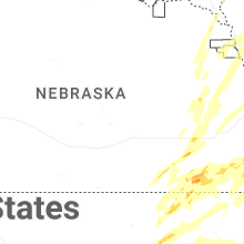
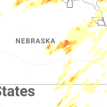

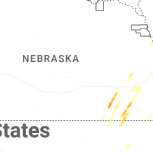
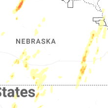
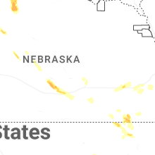


Connect with Interactive Hail Maps