

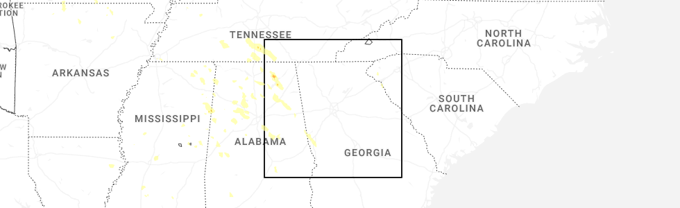
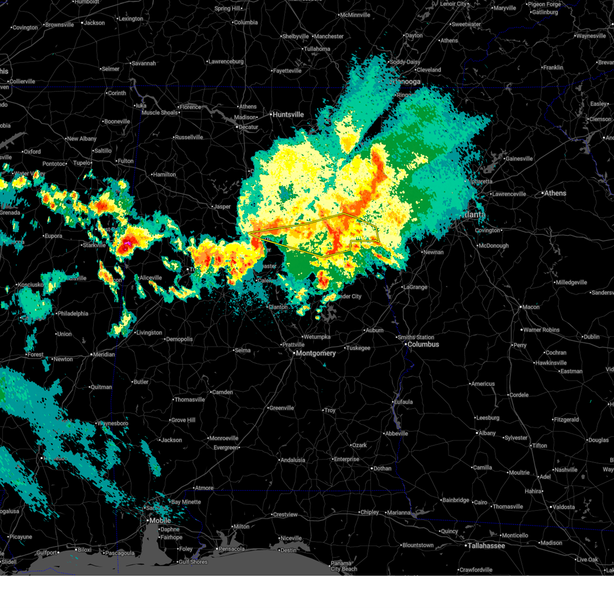
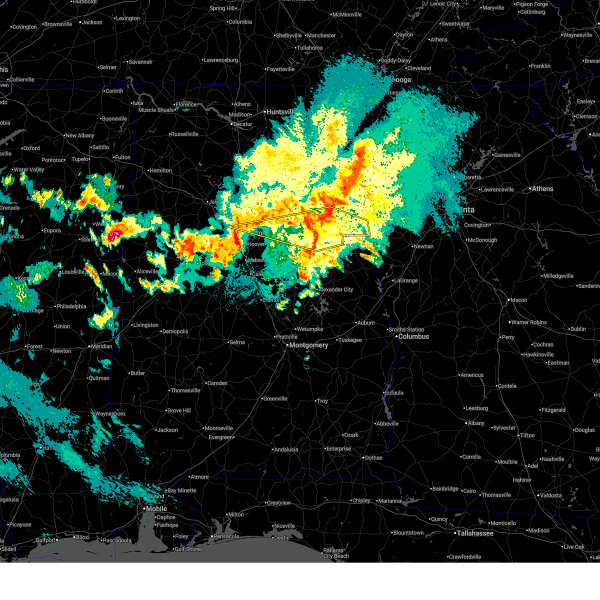
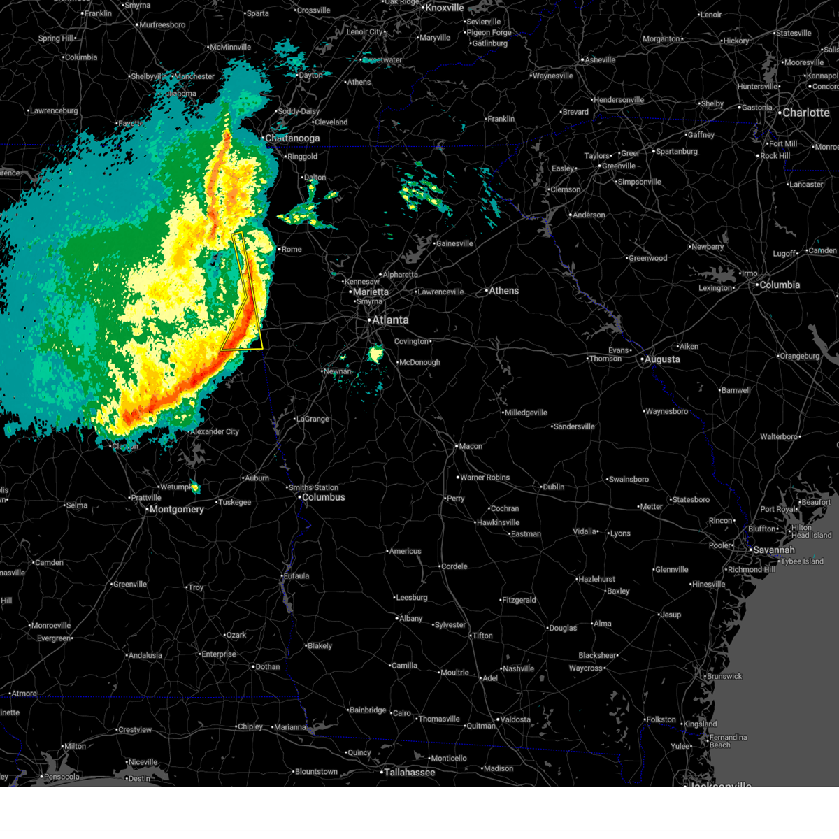
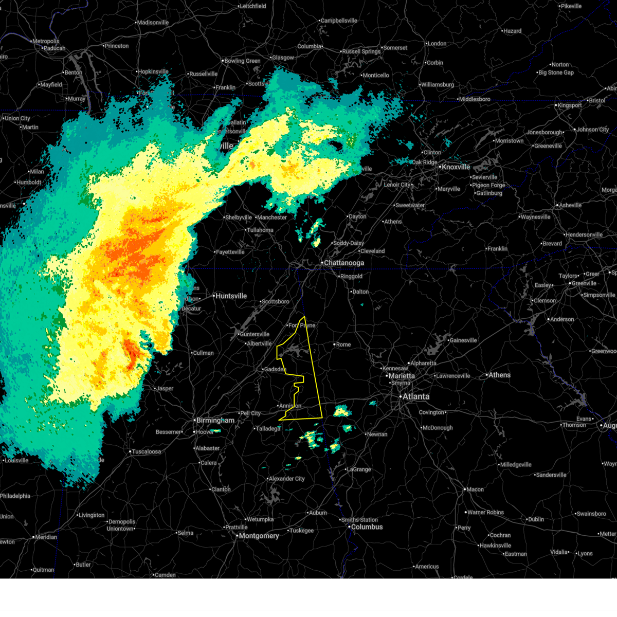
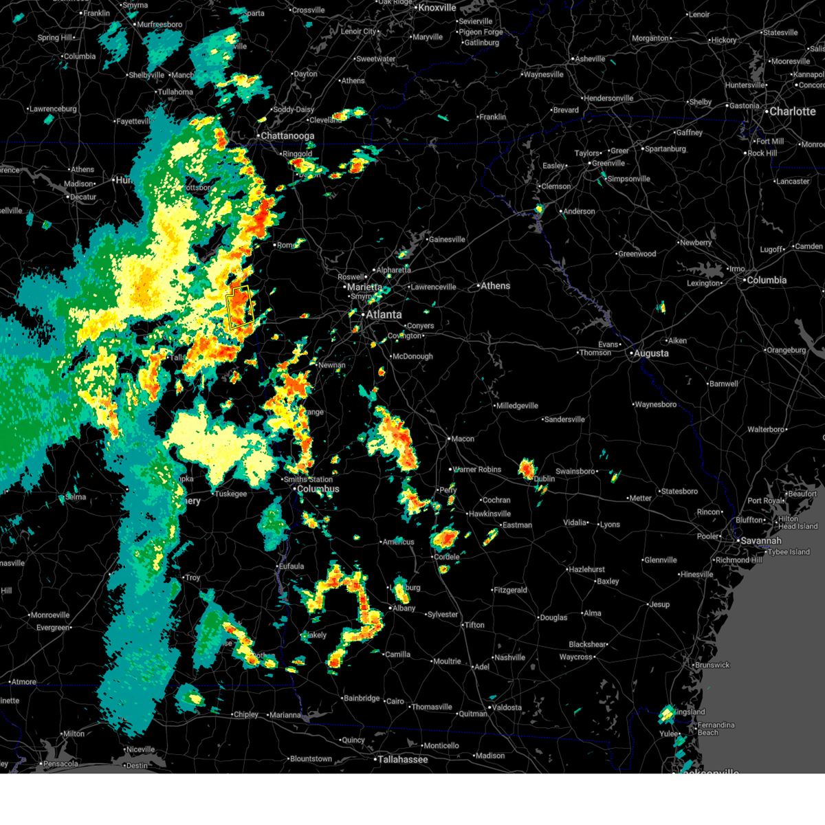
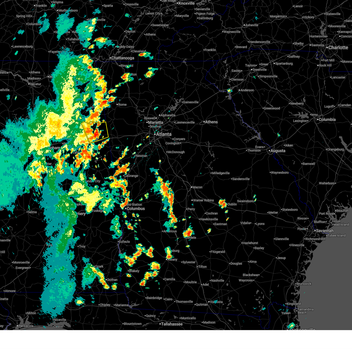
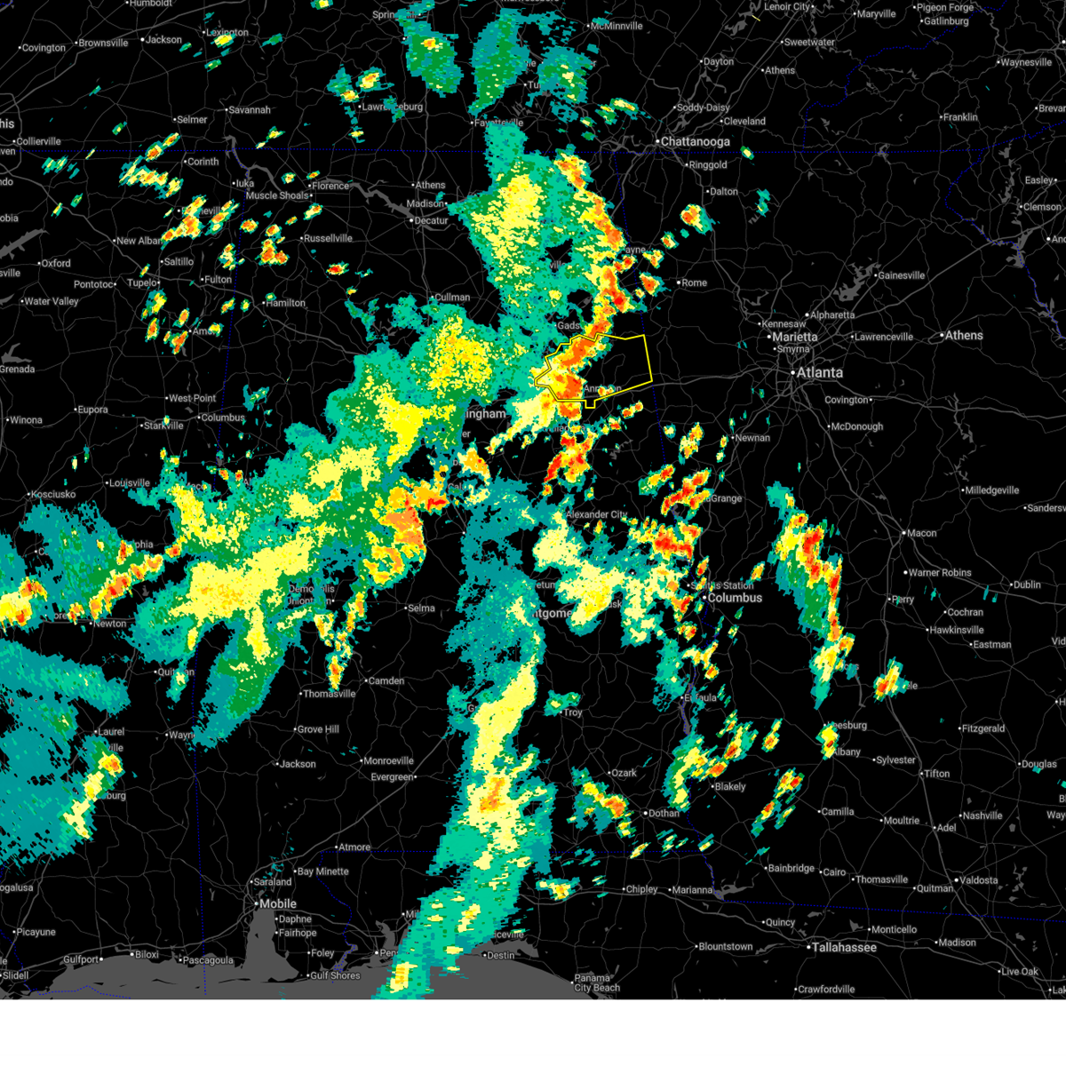
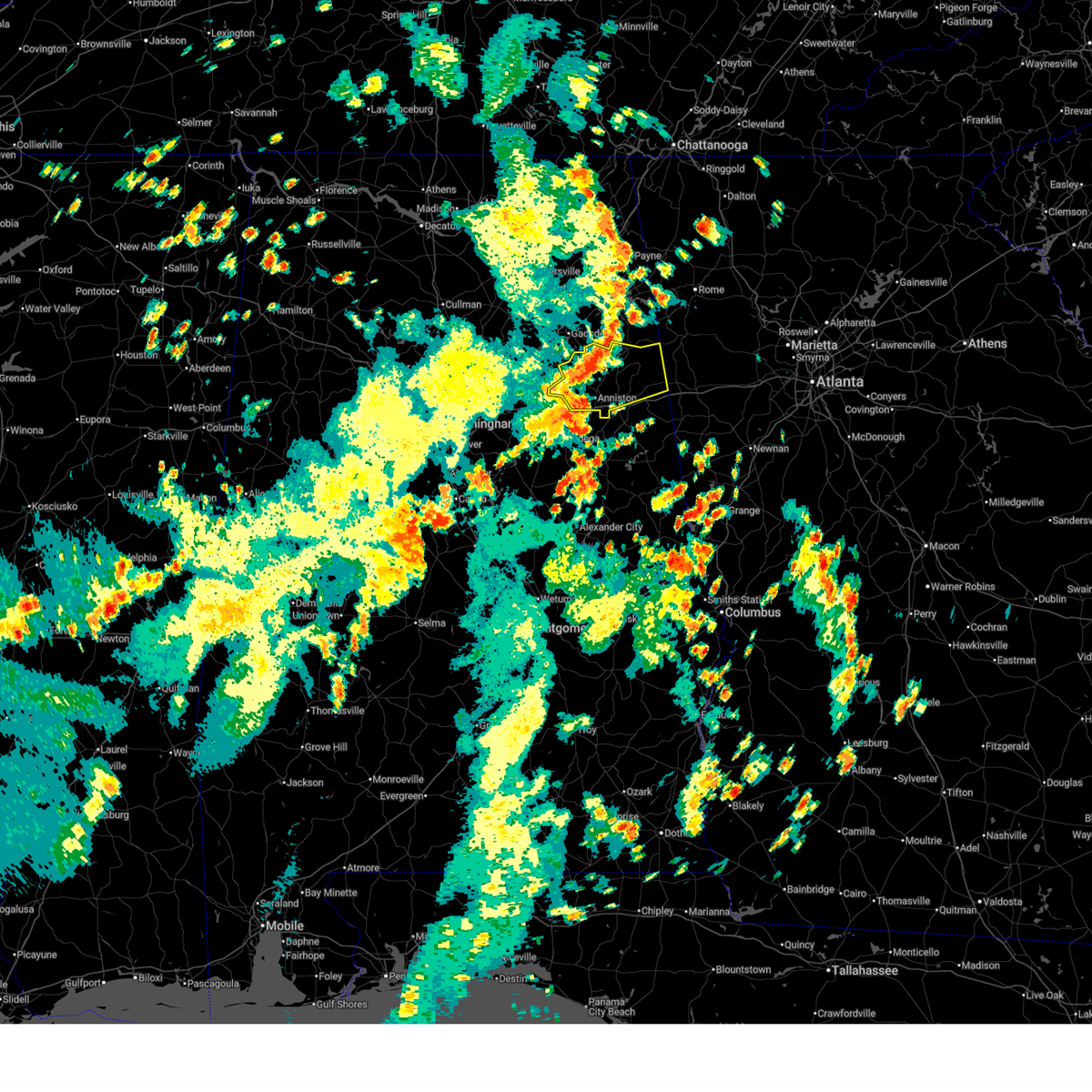
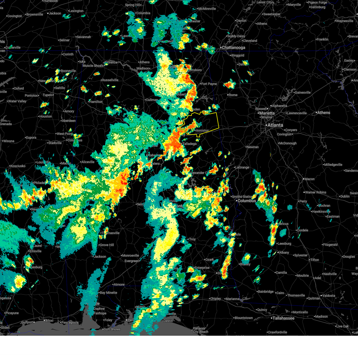
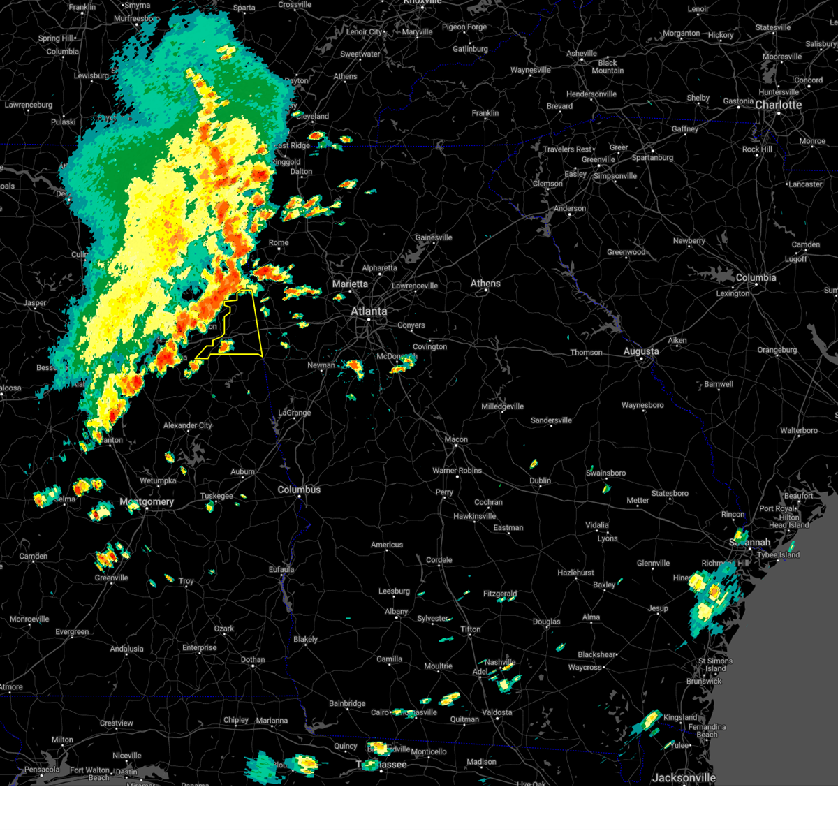
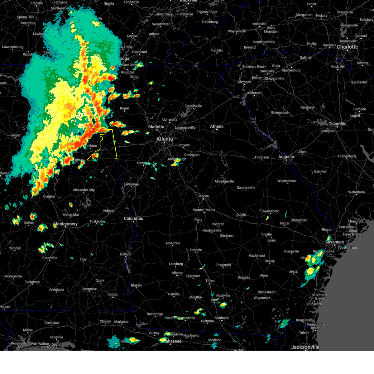
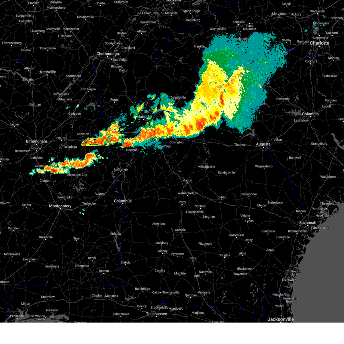
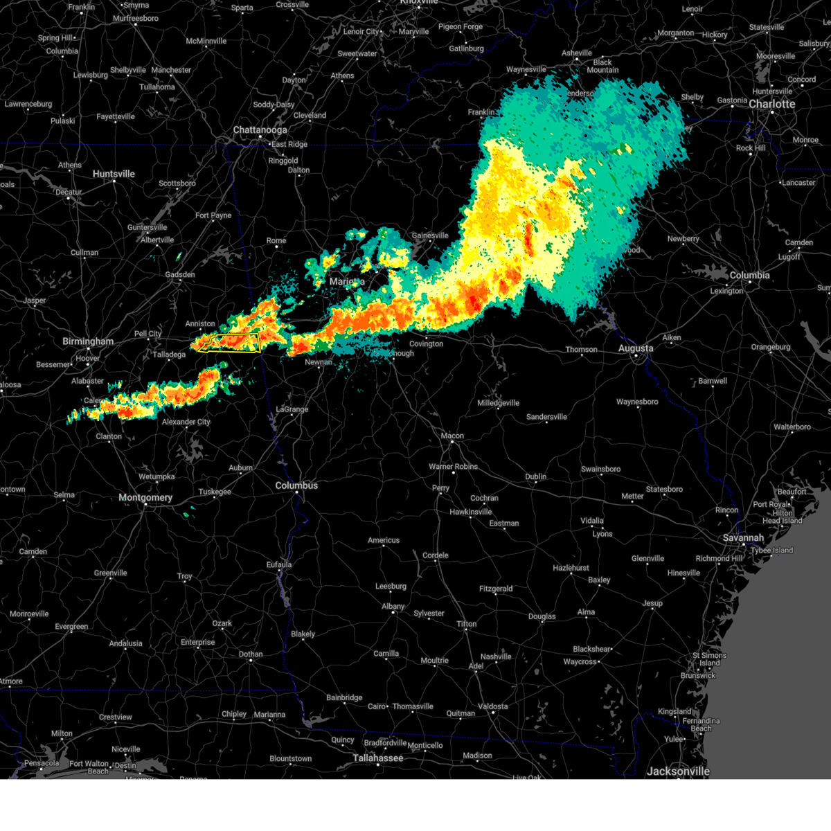
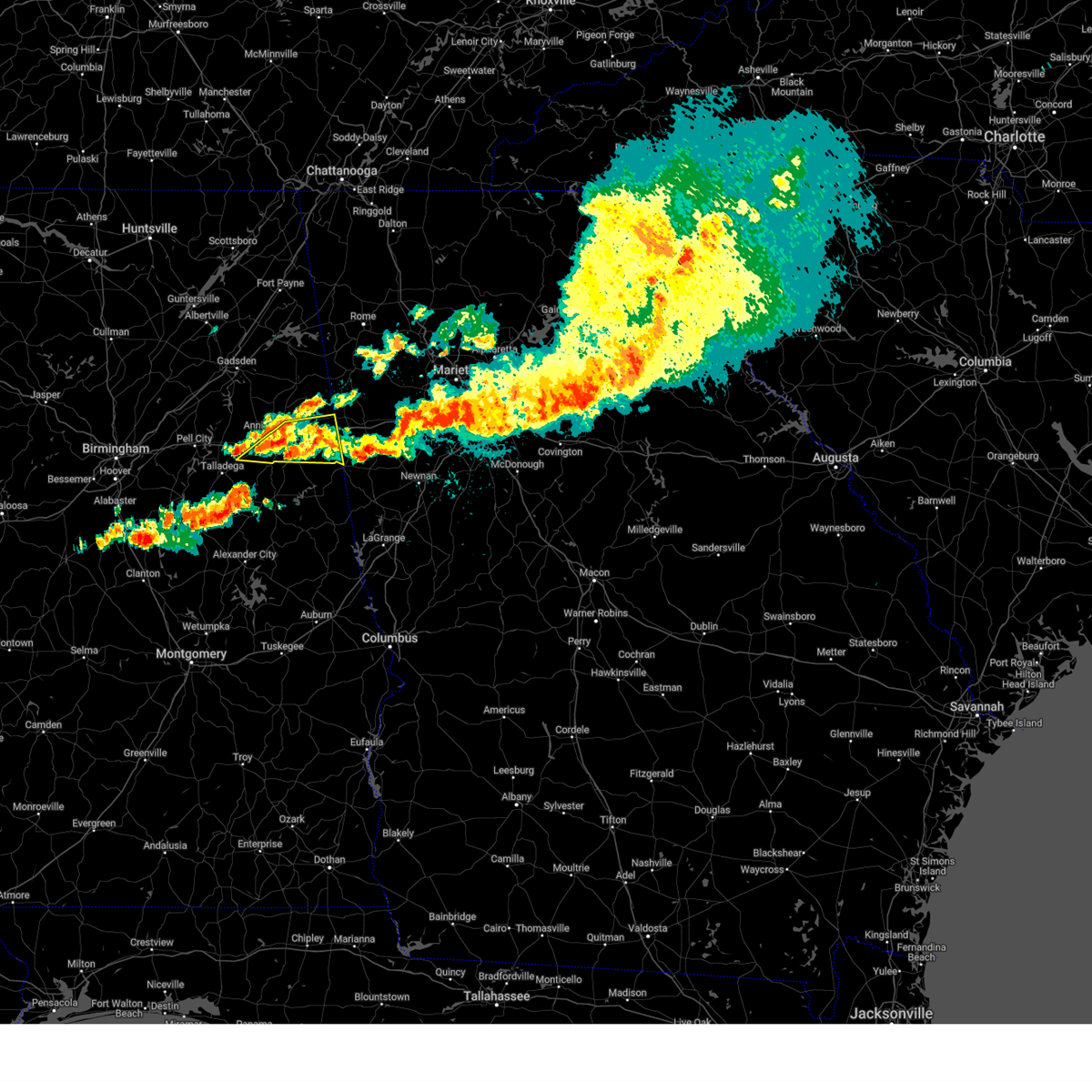
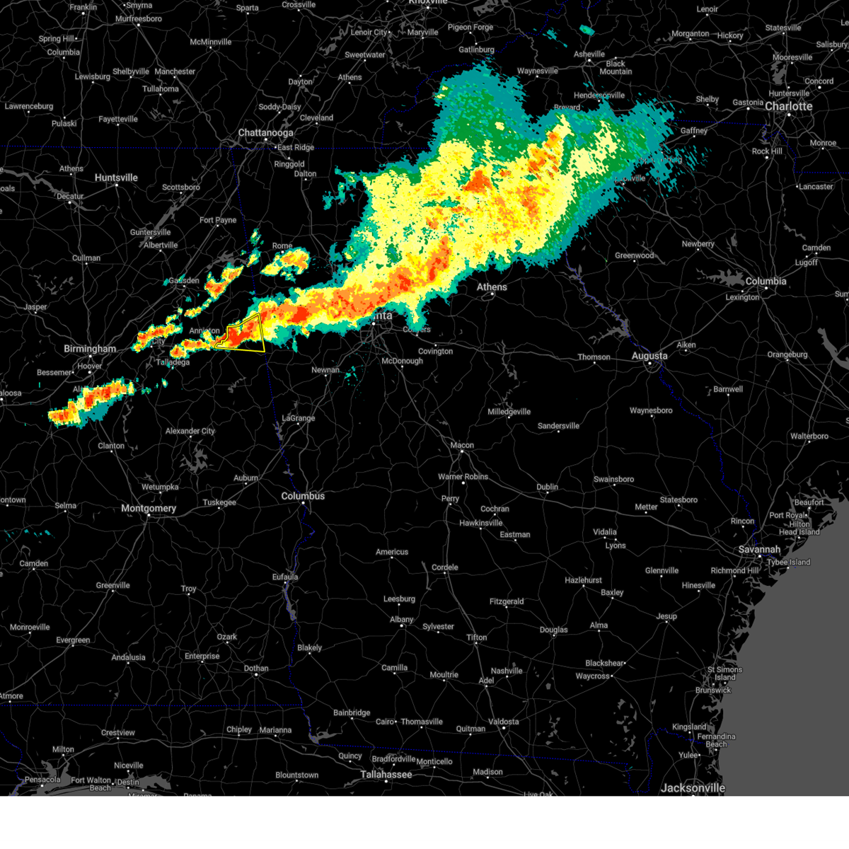
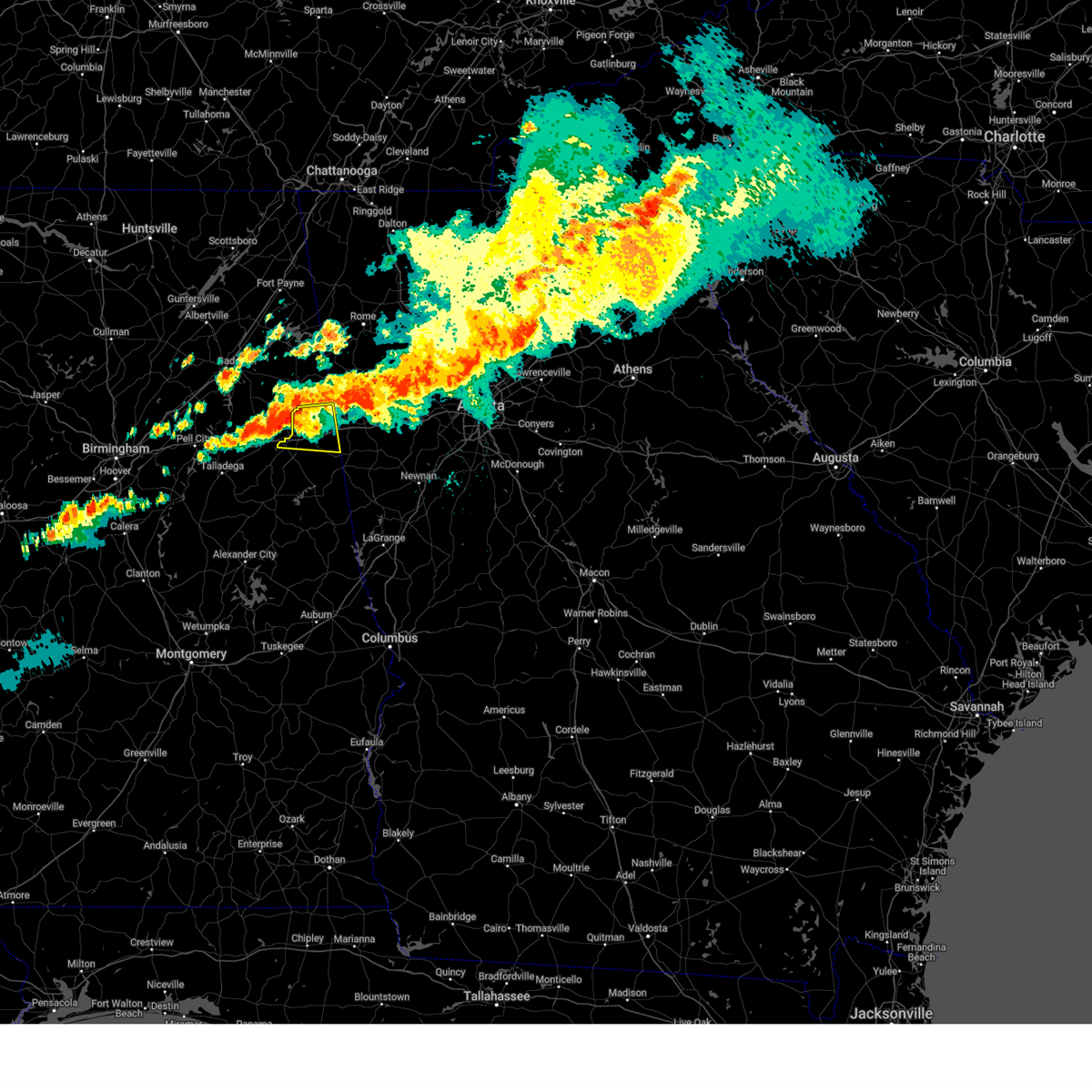
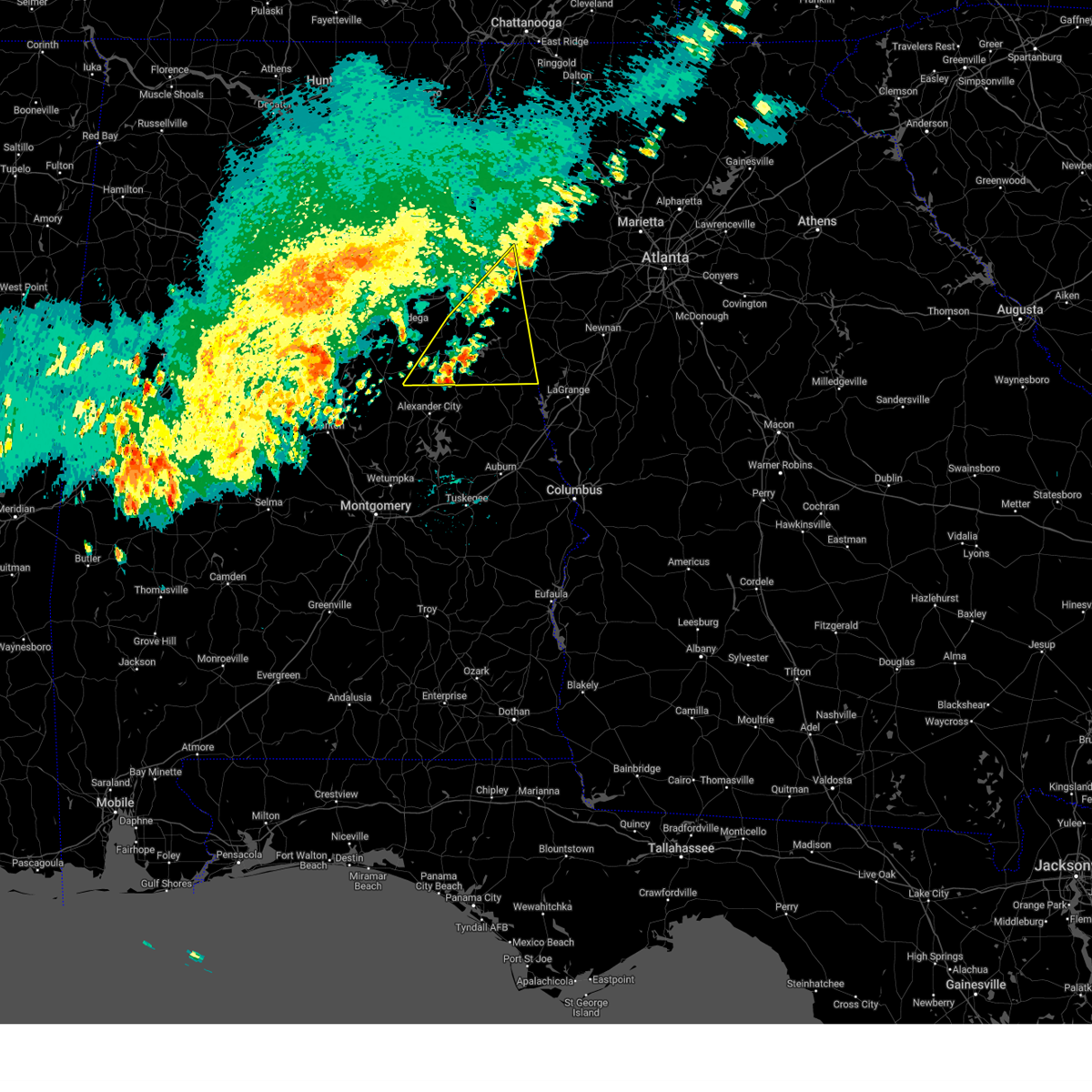
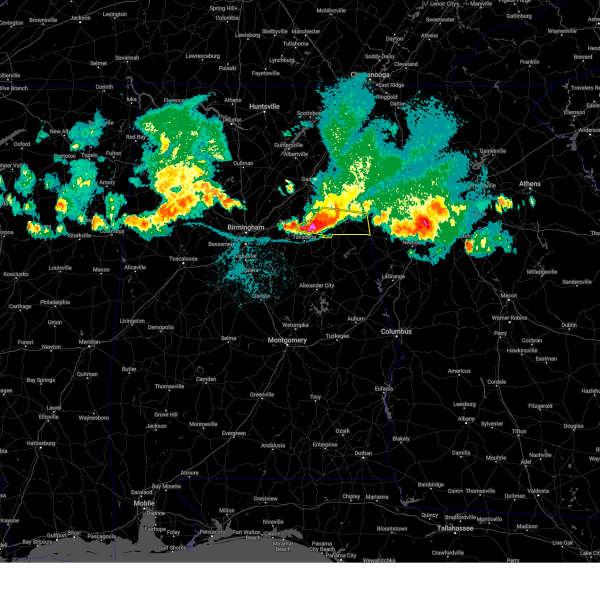
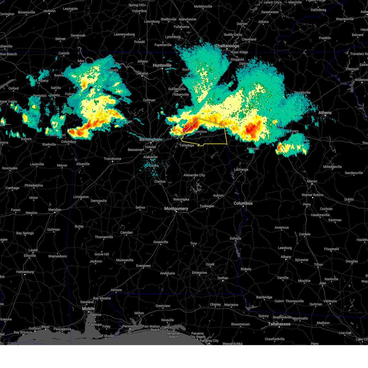
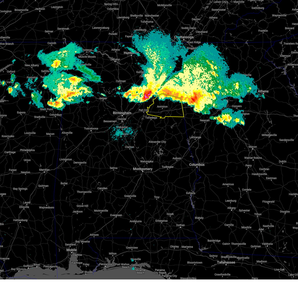
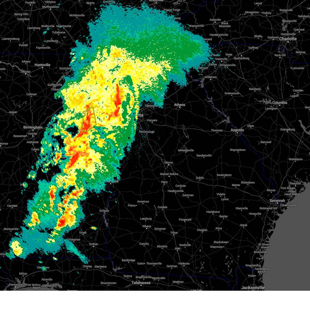
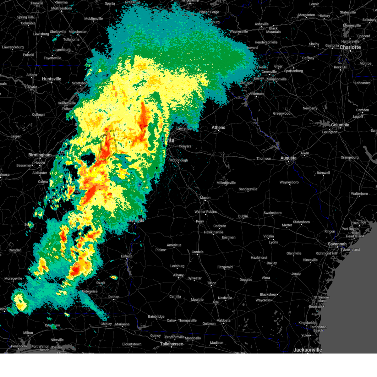
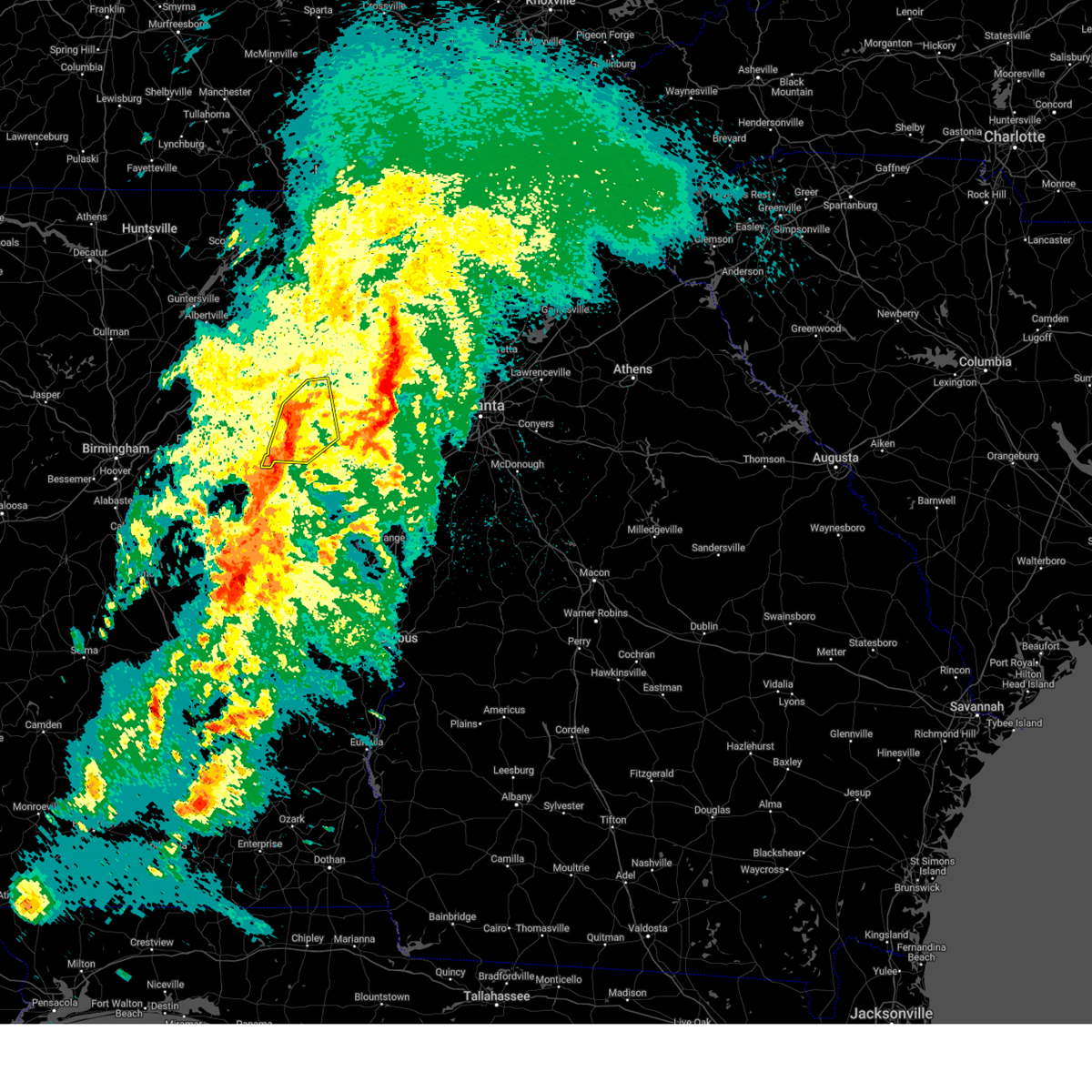
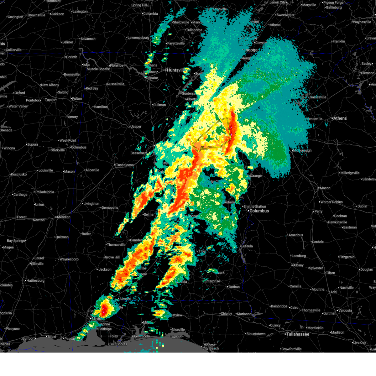
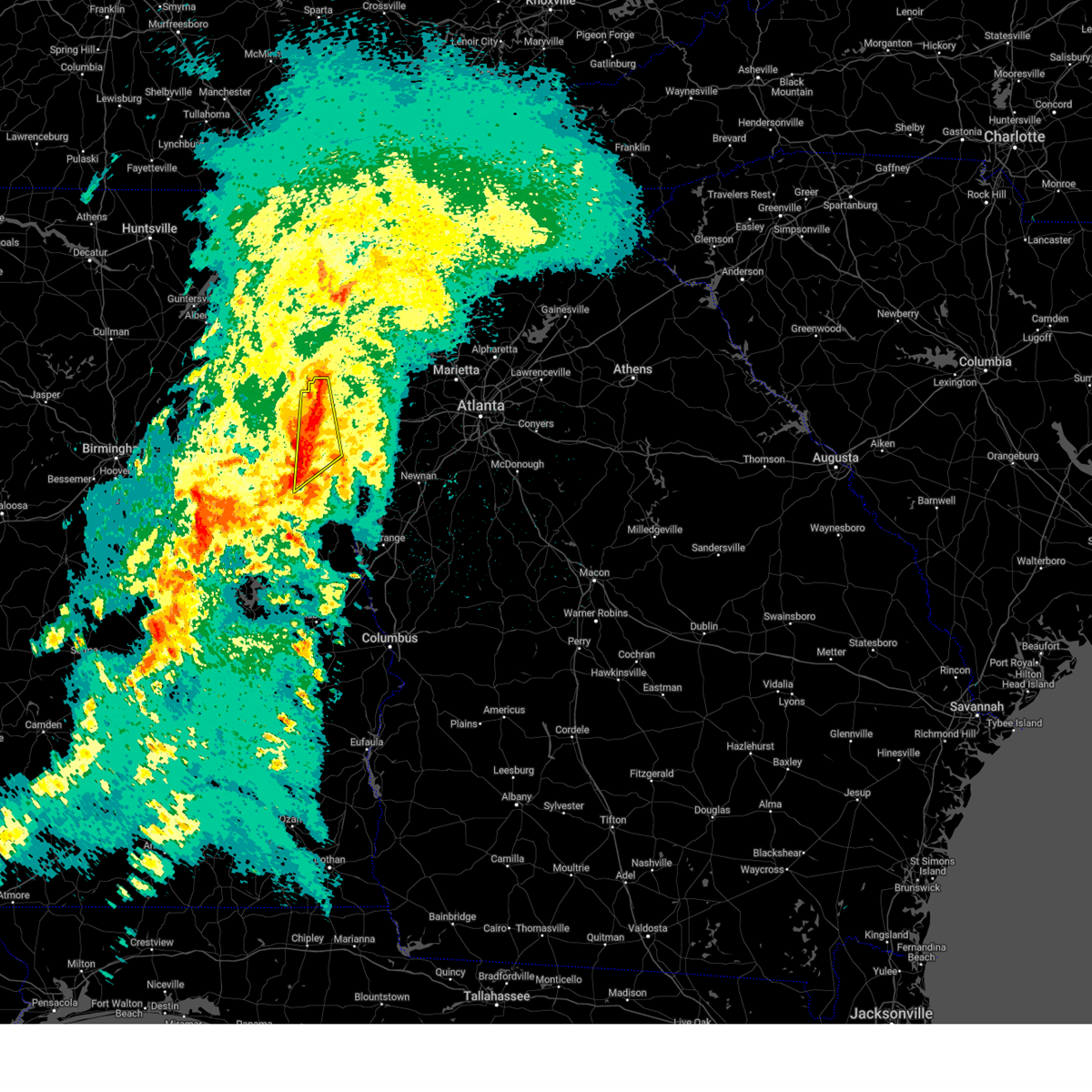
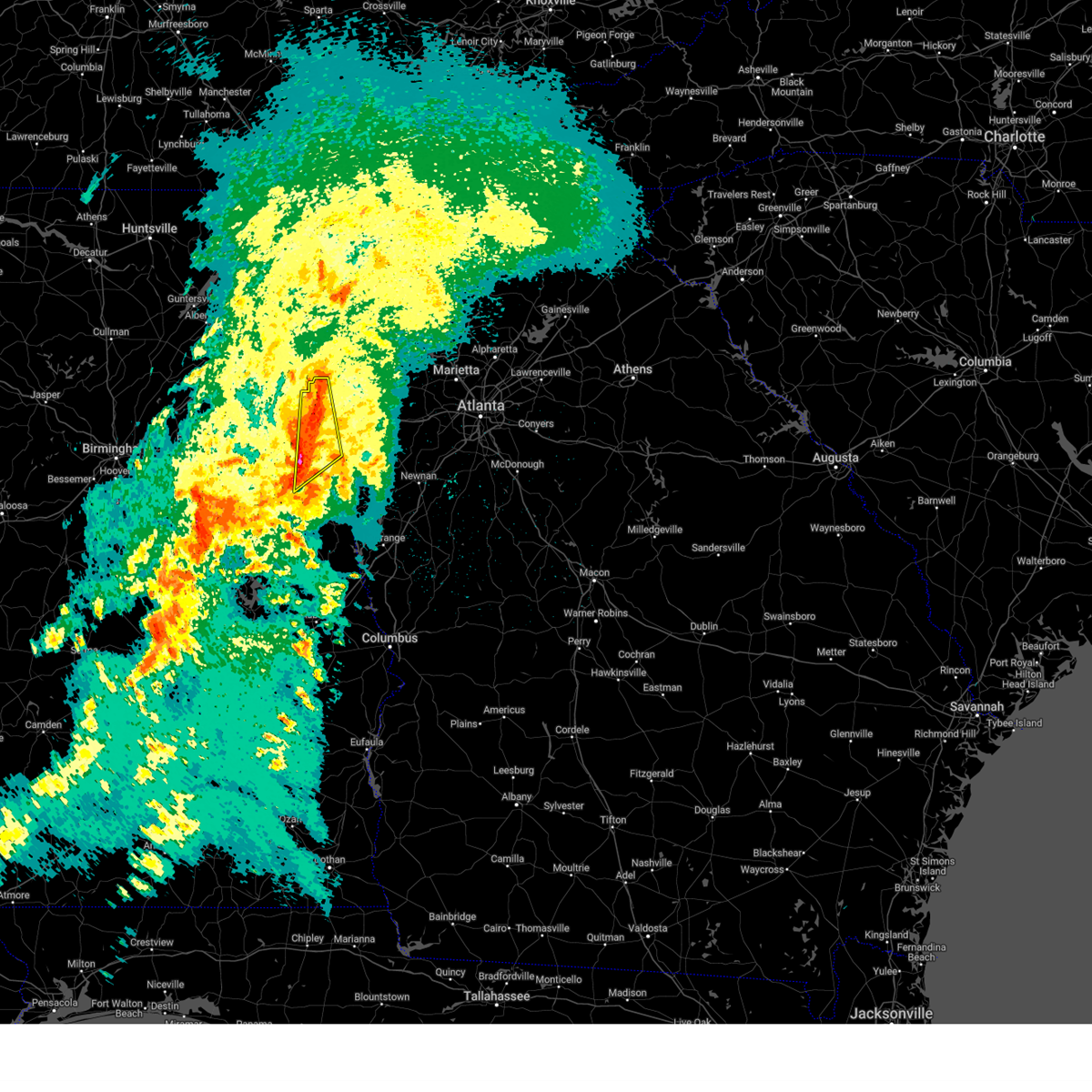
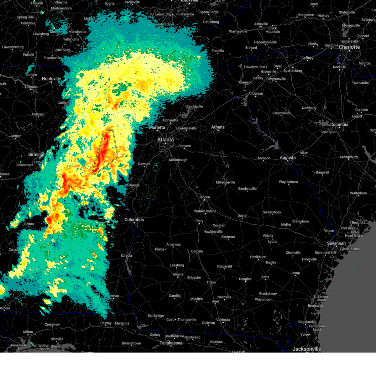
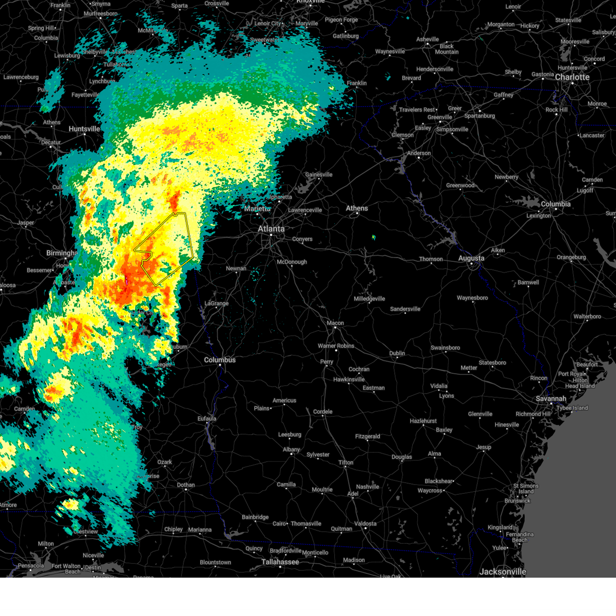
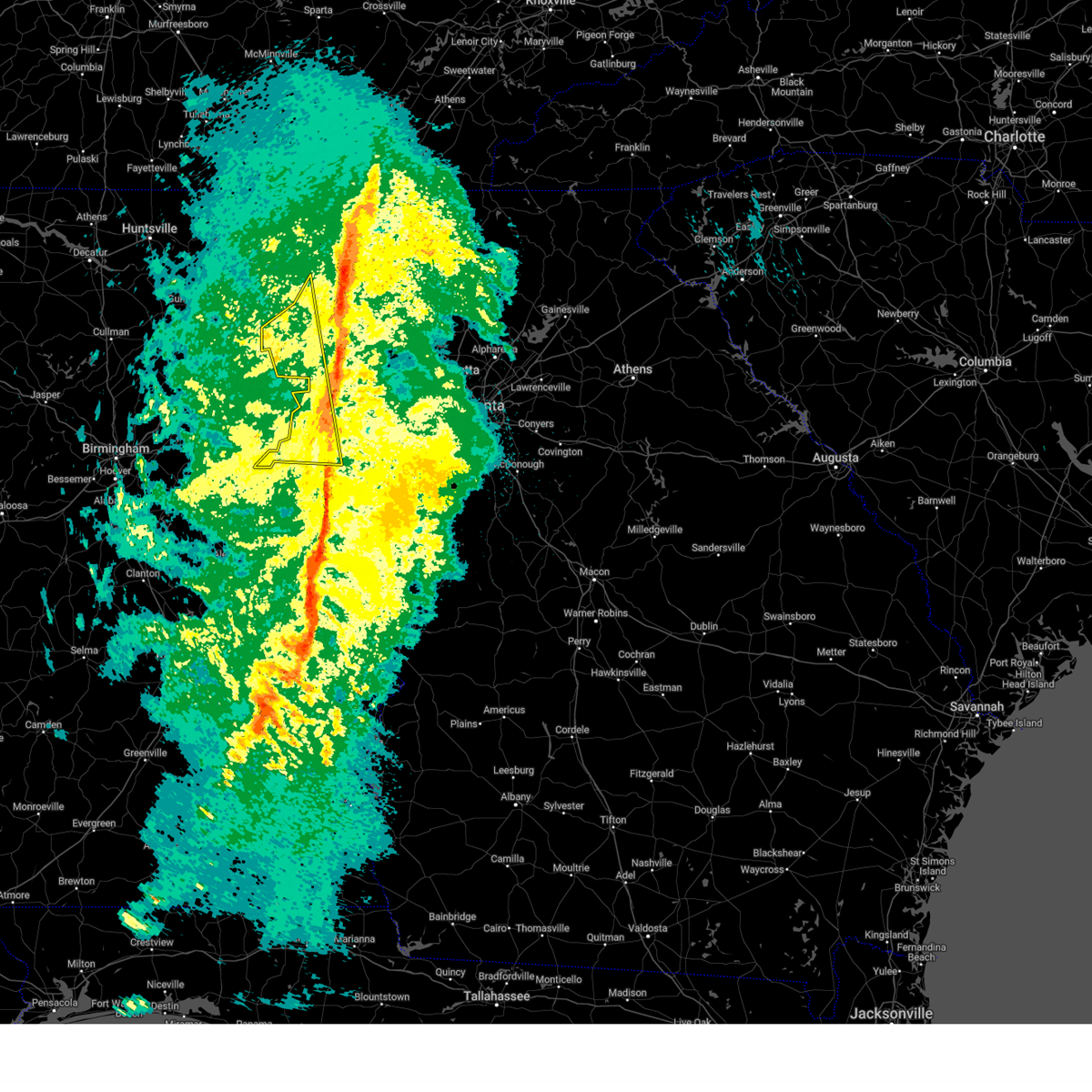
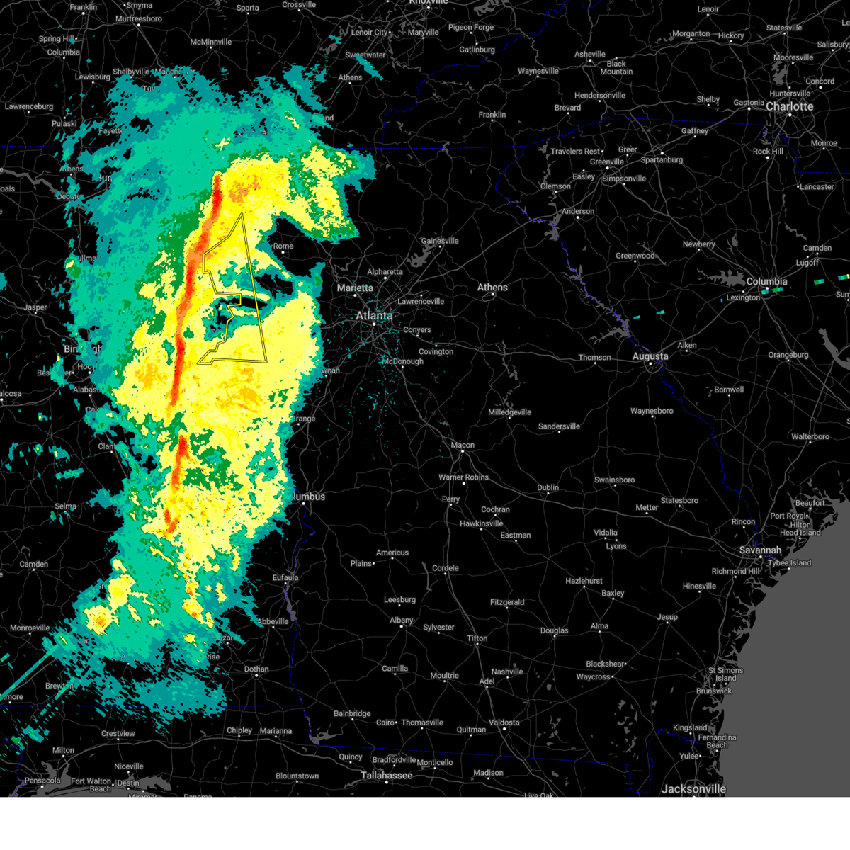
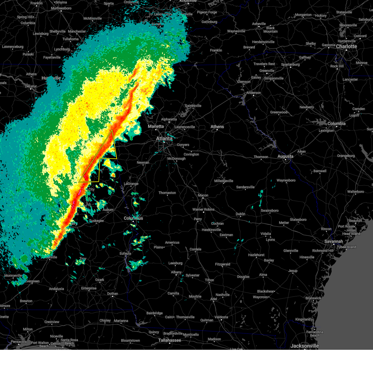
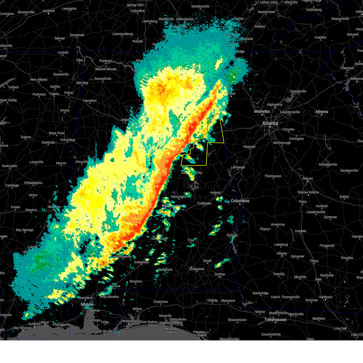
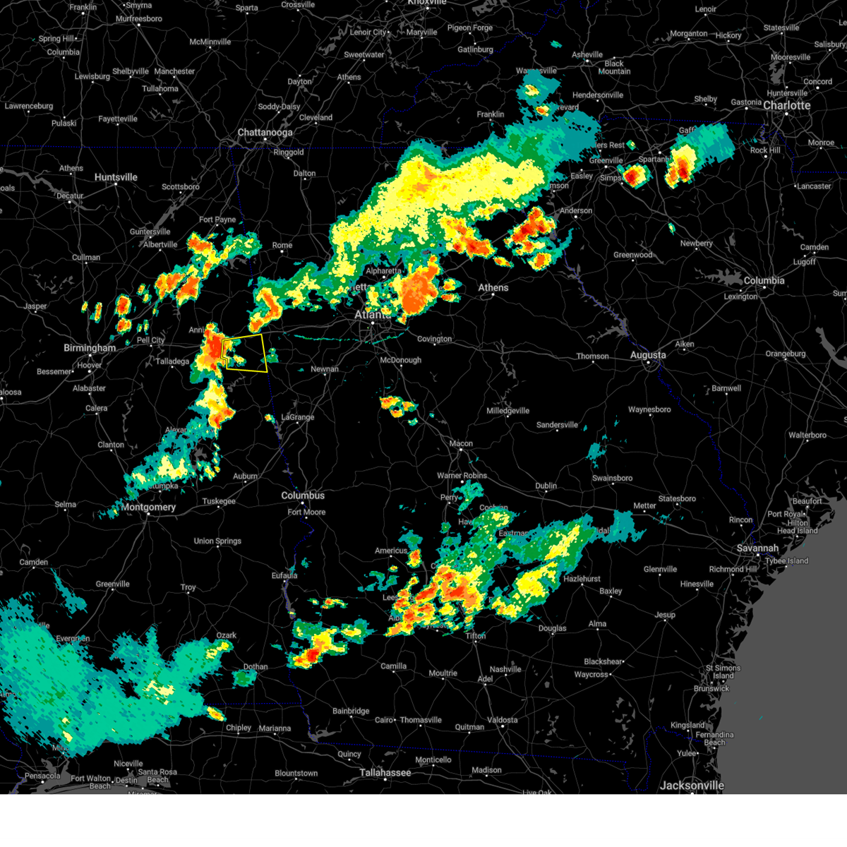
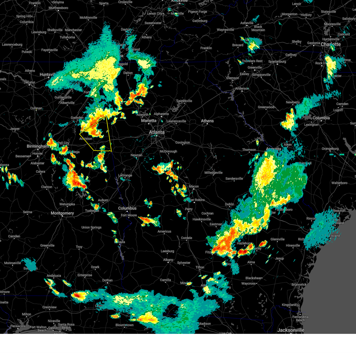
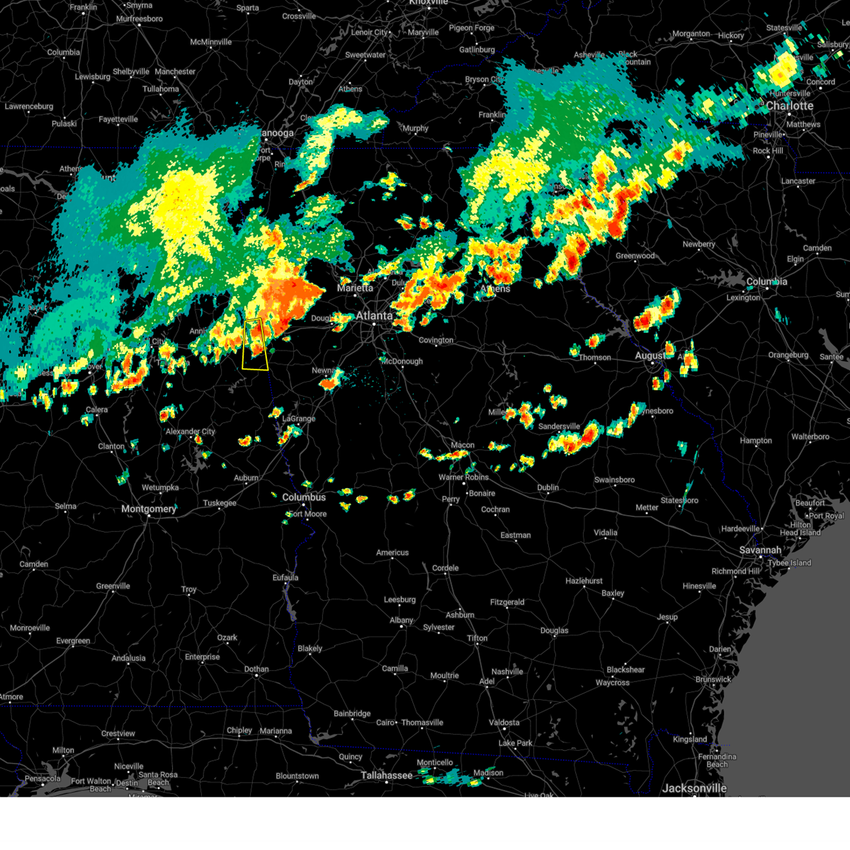
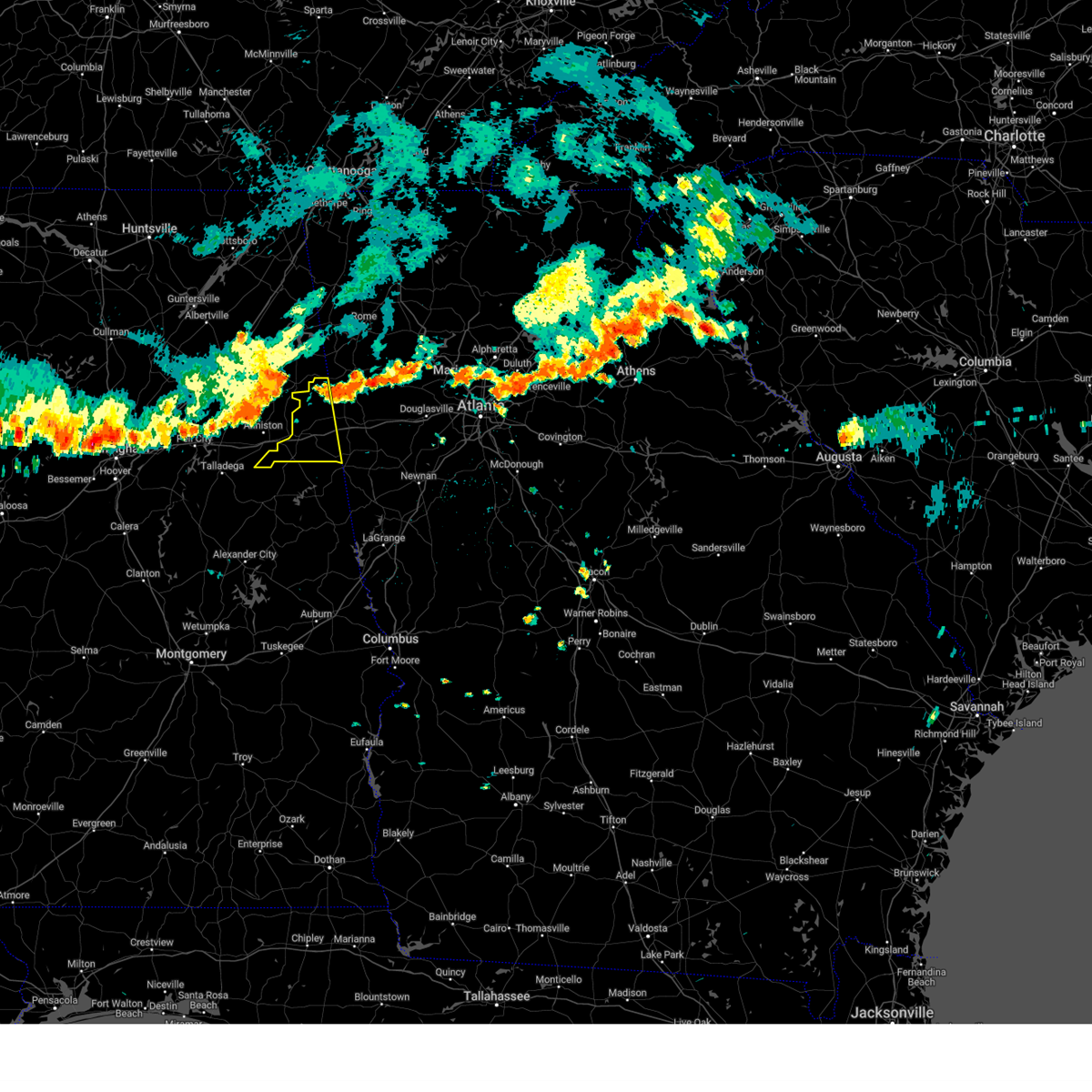
Hail Map for Heflin, AL
The Heflin, AL area has had 9 reports of on-the-ground hail by trained spotters, and has been under severe weather warnings 8 times during the past 12 months. Doppler radar has detected hail at or near Heflin, AL on 52 occasions, including 1 occasion during the past year.
| Name: | Heflin, AL |
| Where Located: | 67.3 miles W of Atlanta, GA |
| Map: | Google Map for Heflin, AL |
| Population: | 3480 |
| Housing Units: | 1531 |
| More Info: | Search Google for Heflin, AL |
1
The Top Recent Hail Date for Heflin, AL is Monday, June 1, 2026 (19th out of 52)
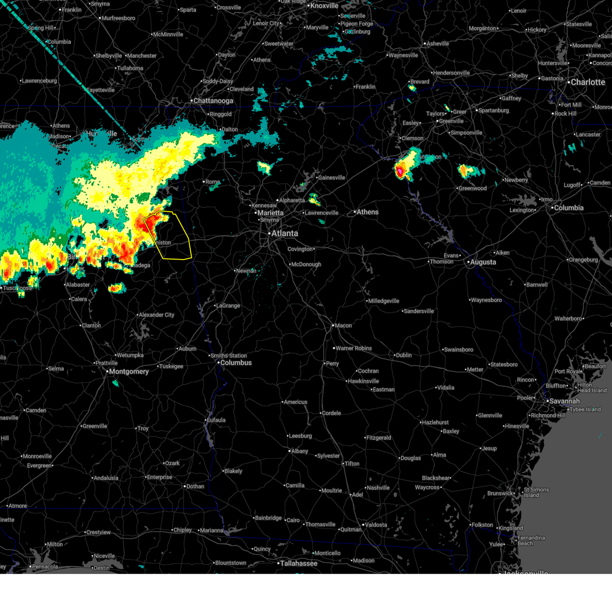
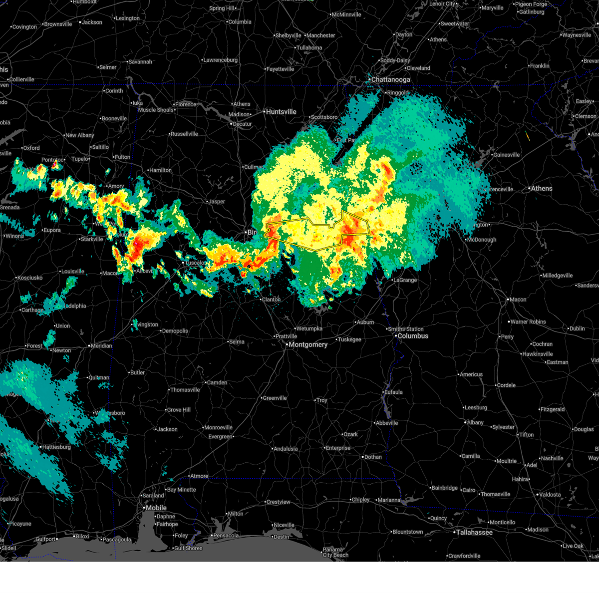
Hail and Wind Damage Spotted near Heflin, AL
| Date / Time | Report Details |
|---|---|
| 6/1/2026 3:21 PM CDT | Multiple trees and power lines down across the count in cleburne county AL, 2.2 miles ESE of Heflin, AL |
| 6/1/2026 3:08 PM CDT |
 Svrbmx the national weather service in birmingham has issued a * severe thunderstorm warning for, eastern calhoun county in east central alabama, cleburne county in east central alabama, * until 400 pm cdt. * at 308 pm cdt, a severe thunderstorm was located over jacksonville, moving southeast at 40 mph (radar indicated). Hazards include 60 mph wind gusts and quarter size hail. Hail damage to vehicles is expected. Expect wind damage to roofs, siding, and trees. Svrbmx the national weather service in birmingham has issued a * severe thunderstorm warning for, eastern calhoun county in east central alabama, cleburne county in east central alabama, * until 400 pm cdt. * at 308 pm cdt, a severe thunderstorm was located over jacksonville, moving southeast at 40 mph (radar indicated). Hazards include 60 mph wind gusts and quarter size hail. Hail damage to vehicles is expected. Expect wind damage to roofs, siding, and trees.
|
| 3/9/2026 8:43 PM CDT |
 At 843 pm cdt, severe thunderstorms were located along a line extending from abernathy to near mount cheaha to near vandiver, moving southeast at 45 mph (radar indicated). Hazards include 60 mph wind gusts. Expect damage to roofs, siding, and trees. Locations impacted include, oxford, talladega, pell city, leeds, moody, heflin, lincoln, munford, ranburne, waldo, alpine bay resort, bald rock, talladega superspeedway, anniston regional airport, vandiver, harrisburg, talladega municipal airport, grant town, abernathy, and logan martin lake. At 843 pm cdt, severe thunderstorms were located along a line extending from abernathy to near mount cheaha to near vandiver, moving southeast at 45 mph (radar indicated). Hazards include 60 mph wind gusts. Expect damage to roofs, siding, and trees. Locations impacted include, oxford, talladega, pell city, leeds, moody, heflin, lincoln, munford, ranburne, waldo, alpine bay resort, bald rock, talladega superspeedway, anniston regional airport, vandiver, harrisburg, talladega municipal airport, grant town, abernathy, and logan martin lake.
|
| 3/9/2026 8:43 PM CDT |
 the severe thunderstorm warning has been cancelled and is no longer in effect the severe thunderstorm warning has been cancelled and is no longer in effect
|
| 3/9/2026 8:24 PM CDT |
 At 824 pm cdt, severe thunderstorms were located along a line extending from heflin to talladega superspeedway to irondale, moving southeast at 45 mph (radar indicated). Hazards include 60 mph wind gusts. Expect damage to roofs, siding, and trees. Locations impacted include, northern birmingham, anniston, oxford, trussville, talladega, pell city, irondale, leeds, moody, heflin, west end-cobb town, cobb town, fort mcclellan, saks, tarrant, lincoln, riverside, munford, hobson city, and ranburne. At 824 pm cdt, severe thunderstorms were located along a line extending from heflin to talladega superspeedway to irondale, moving southeast at 45 mph (radar indicated). Hazards include 60 mph wind gusts. Expect damage to roofs, siding, and trees. Locations impacted include, northern birmingham, anniston, oxford, trussville, talladega, pell city, irondale, leeds, moody, heflin, west end-cobb town, cobb town, fort mcclellan, saks, tarrant, lincoln, riverside, munford, hobson city, and ranburne.
|
| 3/9/2026 8:10 PM CDT |
 Svrbmx the national weather service in birmingham has issued a * severe thunderstorm warning for, northeastern talladega county in east central alabama, southern calhoun county in east central alabama, northeastern shelby county in central alabama, east central jefferson county in central alabama, southern st. clair county in central alabama, southern cleburne county in east central alabama, northeastern clay county in east central alabama, * until 915 pm cdt. * at 810 pm cdt, severe thunderstorms were located along a line extending from near fort mcclellan to near riverside to birmingham, moving southeast at 45 mph (radar indicated). Hazards include 60 mph wind gusts. expect damage to roofs, siding, and trees Svrbmx the national weather service in birmingham has issued a * severe thunderstorm warning for, northeastern talladega county in east central alabama, southern calhoun county in east central alabama, northeastern shelby county in central alabama, east central jefferson county in central alabama, southern st. clair county in central alabama, southern cleburne county in east central alabama, northeastern clay county in east central alabama, * until 915 pm cdt. * at 810 pm cdt, severe thunderstorms were located along a line extending from near fort mcclellan to near riverside to birmingham, moving southeast at 45 mph (radar indicated). Hazards include 60 mph wind gusts. expect damage to roofs, siding, and trees
|
| 11/25/2025 6:18 AM CST |
 At 618 am cst, severe thunderstorms were located along a line extending from near gaylesville to near mars hills to 6 miles southeast of heflin, moving east at 40 mph (radar indicated). Hazards include 60 mph wind gusts. Expect damage to roofs, siding, and trees. Locations impacted include, heflin, forney, fruithurst, edwardsville, muscadine, abernathy, mars hills, eastern weiss lake, fullerton, trickem, broomtown, lake cleburne, i 20 welcome center, chalafinnee, oak level, and waterhouse. At 618 am cst, severe thunderstorms were located along a line extending from near gaylesville to near mars hills to 6 miles southeast of heflin, moving east at 40 mph (radar indicated). Hazards include 60 mph wind gusts. Expect damage to roofs, siding, and trees. Locations impacted include, heflin, forney, fruithurst, edwardsville, muscadine, abernathy, mars hills, eastern weiss lake, fullerton, trickem, broomtown, lake cleburne, i 20 welcome center, chalafinnee, oak level, and waterhouse.
|
| 11/25/2025 6:02 AM CST | At 602 am cst, severe thunderstorms were located along a line extending from sand rock to near pleasant gap to near heflin, moving east at 50 mph (radar indicated). Hazards include 60 mph wind gusts. Expect damage to roofs, siding, and trees. Locations impacted include, piedmont, centre, heflin, cedar bluff, little river canyon national preserve, forney, centre municipal airport, leesburg, sand rock, fruithurst, edwardsville, gaylesville, tennala, cherokee rock village, pleasant gap, cornwall furnace park, blanche, eastern weiss lake, muscadine, and abernathy. |
| 11/25/2025 5:45 AM CST |
 Svrbmx the national weather service in birmingham has issued a * severe thunderstorm warning for, cleburne county in east central alabama, cherokee county in northeastern alabama, * until 645 am cst. * at 545 am cst, severe thunderstorms were located along a line extending from near crossville to 6 miles southeast of hokes bluff to anniston regional airport, moving east at 50 mph (radar indicated). Hazards include 60 mph wind gusts. expect damage to roofs, siding, and trees Svrbmx the national weather service in birmingham has issued a * severe thunderstorm warning for, cleburne county in east central alabama, cherokee county in northeastern alabama, * until 645 am cst. * at 545 am cst, severe thunderstorms were located along a line extending from near crossville to 6 miles southeast of hokes bluff to anniston regional airport, moving east at 50 mph (radar indicated). Hazards include 60 mph wind gusts. expect damage to roofs, siding, and trees
|
| 6/17/2025 4:05 PM CDT |
 The storm which prompted the warning has moved out of the area. therefore, the warning will be allowed to expire. however, gusty winds are still possible with this thunderstorm. The storm which prompted the warning has moved out of the area. therefore, the warning will be allowed to expire. however, gusty winds are still possible with this thunderstorm.
|
| 6/17/2025 3:51 PM CDT |
 At 351 pm cdt, a severe thunderstorm was located near mars hills, or 10 miles southeast of piedmont, moving northeast at 40 mph (radar indicated). Hazards include 60 mph wind gusts. Expect damage to roofs, siding, and trees. Locations impacted include, heflin, fruithurst, edwardsville, muscadine, mars hills, liberty hill, oak level, borden springs, and coleman lake and campground. At 351 pm cdt, a severe thunderstorm was located near mars hills, or 10 miles southeast of piedmont, moving northeast at 40 mph (radar indicated). Hazards include 60 mph wind gusts. Expect damage to roofs, siding, and trees. Locations impacted include, heflin, fruithurst, edwardsville, muscadine, mars hills, liberty hill, oak level, borden springs, and coleman lake and campground.
|
| 6/17/2025 3:51 PM CDT |
 the severe thunderstorm warning has been cancelled and is no longer in effect the severe thunderstorm warning has been cancelled and is no longer in effect
|
| 6/17/2025 3:40 PM CDT | A couple trees down in the heflin are in cleburne county AL, 2.2 miles ESE of Heflin, AL |
| 6/17/2025 3:40 PM CDT |
 At 339 pm cdt, a severe thunderstorm was located near fort mcclellan, moving northeast at 35 mph (radar indicated). Hazards include 60 mph wind gusts. a 56 mph wind gust was recorded at the anniston airport. Expect damage to roofs, siding, and trees. Locations impacted include, anniston, jacksonville, piedmont, heflin, fort mcclellan, weaver, fruithurst, edwardsville, muscadine, mars hills, jacksonville state university, sweetwater lake, coleman lake and campground, choccolocco, knightens crossroads, liberty hill, oak level, and borden springs. At 339 pm cdt, a severe thunderstorm was located near fort mcclellan, moving northeast at 35 mph (radar indicated). Hazards include 60 mph wind gusts. a 56 mph wind gust was recorded at the anniston airport. Expect damage to roofs, siding, and trees. Locations impacted include, anniston, jacksonville, piedmont, heflin, fort mcclellan, weaver, fruithurst, edwardsville, muscadine, mars hills, jacksonville state university, sweetwater lake, coleman lake and campground, choccolocco, knightens crossroads, liberty hill, oak level, and borden springs.
|
| 6/17/2025 3:27 PM CDT |
 At 327 pm cdt, a severe thunderstorm was located over anniston, moving northeast at 40 mph (radar indicated). Hazards include 60 mph wind gusts. the anniston airport recently reported a wind gust of 56 mph. Expect damage to roofs, siding, and trees. Locations impacted include, anniston, oxford, jacksonville, piedmont, heflin, cobb town, west end-cobb town, fort mcclellan, saks, glencoe, weaver, ohatchee, hobson city, fruithurst, edwardsville, blue mountain, alexandria, jacksonville state university, muscadine, and oxford lake. At 327 pm cdt, a severe thunderstorm was located over anniston, moving northeast at 40 mph (radar indicated). Hazards include 60 mph wind gusts. the anniston airport recently reported a wind gust of 56 mph. Expect damage to roofs, siding, and trees. Locations impacted include, anniston, oxford, jacksonville, piedmont, heflin, cobb town, west end-cobb town, fort mcclellan, saks, glencoe, weaver, ohatchee, hobson city, fruithurst, edwardsville, blue mountain, alexandria, jacksonville state university, muscadine, and oxford lake.
|
| 6/17/2025 3:17 PM CDT |
 At 317 pm cdt, a severe thunderstorm was located over bynum, or near cobb town, moving northeast at 35 mph (radar indicated). Hazards include 60 mph wind gusts. Expect damage to roofs, siding, and trees. Locations impacted include, anniston, oxford, jacksonville, piedmont, heflin, cobb town, west end-cobb town, fort mcclellan, saks, glencoe, weaver, ohatchee, hobson city, fruithurst, edwardsville, blue mountain, alexandria, jacksonville state university, muscadine, and oxford lake. At 317 pm cdt, a severe thunderstorm was located over bynum, or near cobb town, moving northeast at 35 mph (radar indicated). Hazards include 60 mph wind gusts. Expect damage to roofs, siding, and trees. Locations impacted include, anniston, oxford, jacksonville, piedmont, heflin, cobb town, west end-cobb town, fort mcclellan, saks, glencoe, weaver, ohatchee, hobson city, fruithurst, edwardsville, blue mountain, alexandria, jacksonville state university, muscadine, and oxford lake.
|
| 6/17/2025 3:04 PM CDT |
 Svrbmx the national weather service in birmingham has issued a * severe thunderstorm warning for, calhoun county in east central alabama, cleburne county in east central alabama, * until 415 pm cdt. * at 304 pm cdt, a severe thunderstorm was located over talladega superspeedway, or 8 miles north of talladega, moving northeast at 35 mph (radar indicated). Hazards include 60 mph wind gusts. expect damage to roofs, siding, and trees Svrbmx the national weather service in birmingham has issued a * severe thunderstorm warning for, calhoun county in east central alabama, cleburne county in east central alabama, * until 415 pm cdt. * at 304 pm cdt, a severe thunderstorm was located over talladega superspeedway, or 8 miles north of talladega, moving northeast at 35 mph (radar indicated). Hazards include 60 mph wind gusts. expect damage to roofs, siding, and trees
|
| 6/7/2025 3:59 PM CDT |
 At 359 pm cdt, severe thunderstorms were located along a line extending from near muscadine to near corinth, moving east at 40 mph (radar indicated). Hazards include 60 mph wind gusts and penny size hail. Expect damage to roofs, siding, and trees. Locations impacted include, ranburne, abernathy, trickem, lake cleburne, hollis crossroads, i 20 welcome center, and camp sequoyah. At 359 pm cdt, severe thunderstorms were located along a line extending from near muscadine to near corinth, moving east at 40 mph (radar indicated). Hazards include 60 mph wind gusts and penny size hail. Expect damage to roofs, siding, and trees. Locations impacted include, ranburne, abernathy, trickem, lake cleburne, hollis crossroads, i 20 welcome center, and camp sequoyah.
|
| 6/7/2025 3:51 PM CDT |
 At 351 pm cdt, severe thunderstorms were located along a line extending from 7 miles northwest of buchanan to near delta, moving east at 50 mph (radar indicated). Hazards include 60 mph wind gusts and penny size hail. Expect damage to roofs, siding, and trees. Locations impacted include, heflin, ranburne, fruithurst, edwardsville, muscadine, abernathy, mars hills, mount cheaha, hollis crossroads, sweetwater lake, trickem, lake cleburne, i 20 welcome center, chalafinnee, and camp sequoyah. At 351 pm cdt, severe thunderstorms were located along a line extending from 7 miles northwest of buchanan to near delta, moving east at 50 mph (radar indicated). Hazards include 60 mph wind gusts and penny size hail. Expect damage to roofs, siding, and trees. Locations impacted include, heflin, ranburne, fruithurst, edwardsville, muscadine, abernathy, mars hills, mount cheaha, hollis crossroads, sweetwater lake, trickem, lake cleburne, i 20 welcome center, chalafinnee, and camp sequoyah.
|
| 6/7/2025 3:45 PM CDT |
 At 345 pm cdt, severe thunderstorms were located along a line extending from near mars hills to near delta, moving east at 45 mph (radar indicated). Hazards include 60 mph wind gusts and penny size hail. Expect damage to roofs, siding, and trees. Locations impacted include, heflin, ranburne, fruithurst, edwardsville, muscadine, abernathy, mars hills, mount cheaha, hollis crossroads, sweetwater lake, coleman lake and campground, trickem, lake cleburne, i 20 welcome center, liberty hill, chalafinnee, oak level, borden springs, and camp sequoyah. At 345 pm cdt, severe thunderstorms were located along a line extending from near mars hills to near delta, moving east at 45 mph (radar indicated). Hazards include 60 mph wind gusts and penny size hail. Expect damage to roofs, siding, and trees. Locations impacted include, heflin, ranburne, fruithurst, edwardsville, muscadine, abernathy, mars hills, mount cheaha, hollis crossroads, sweetwater lake, coleman lake and campground, trickem, lake cleburne, i 20 welcome center, liberty hill, chalafinnee, oak level, borden springs, and camp sequoyah.
|
| 6/7/2025 3:31 PM CDT |
 At 330 pm cdt, severe thunderstorms were located along a line extending from near pleasant gap to near anniston regional airport, moving east at 45 mph (radar indicated). Hazards include 60 mph wind gusts and penny size hail. Expect damage to roofs, siding, and trees. Locations impacted include, heflin, ranburne, fruithurst, edwardsville, muscadine, abernathy, mars hills, mount cheaha, hollis crossroads, sweetwater lake, coleman lake and campground, trickem, lake cleburne, i 20 welcome center, liberty hill, chalafinnee, oak level, borden springs, and camp sequoyah. At 330 pm cdt, severe thunderstorms were located along a line extending from near pleasant gap to near anniston regional airport, moving east at 45 mph (radar indicated). Hazards include 60 mph wind gusts and penny size hail. Expect damage to roofs, siding, and trees. Locations impacted include, heflin, ranburne, fruithurst, edwardsville, muscadine, abernathy, mars hills, mount cheaha, hollis crossroads, sweetwater lake, coleman lake and campground, trickem, lake cleburne, i 20 welcome center, liberty hill, chalafinnee, oak level, borden springs, and camp sequoyah.
|
| 6/7/2025 3:18 PM CDT |
 Svrbmx the national weather service in birmingham has issued a * severe thunderstorm warning for, cleburne county in east central alabama, * until 415 pm cdt. * at 318 pm cdt, severe thunderstorms were located along a line extending from near piedmont to near talladega municipal airport, moving east at 55 mph (radar indicated). Hazards include 60 mph wind gusts and penny size hail. expect damage to roofs, siding, and trees Svrbmx the national weather service in birmingham has issued a * severe thunderstorm warning for, cleburne county in east central alabama, * until 415 pm cdt. * at 318 pm cdt, severe thunderstorms were located along a line extending from near piedmont to near talladega municipal airport, moving east at 55 mph (radar indicated). Hazards include 60 mph wind gusts and penny size hail. expect damage to roofs, siding, and trees
|
| 5/21/2025 1:17 AM CDT |
 the severe thunderstorm warning has been cancelled and is no longer in effect the severe thunderstorm warning has been cancelled and is no longer in effect
|
| 5/21/2025 1:11 AM CDT |
 At 110 am cdt, severe thunderstorms were located along a line extending from near mars hills to near oxford lake, moving east at 45 mph (radar indicated). Hazards include 60 mph wind gusts and quarter size hail. Hail damage to vehicles is expected. expect wind damage to roofs, siding, and trees. Locations impacted include, heflin, ranburne, trickem, lake cleburne, hollis crossroads, micaville, chalafinnee, and camp sequoyah. At 110 am cdt, severe thunderstorms were located along a line extending from near mars hills to near oxford lake, moving east at 45 mph (radar indicated). Hazards include 60 mph wind gusts and quarter size hail. Hail damage to vehicles is expected. expect wind damage to roofs, siding, and trees. Locations impacted include, heflin, ranburne, trickem, lake cleburne, hollis crossroads, micaville, chalafinnee, and camp sequoyah.
|
| 5/21/2025 1:11 AM CDT |
 the severe thunderstorm warning has been cancelled and is no longer in effect the severe thunderstorm warning has been cancelled and is no longer in effect
|
| 5/21/2025 12:59 AM CDT |
 At 1259 am cdt, severe thunderstorms were located along a line extending from near mars hills to near grant town, moving east at 45 mph (radar indicated). Hazards include 60 mph wind gusts and quarter size hail. Hail damage to vehicles is expected. expect wind damage to roofs, siding, and trees. Locations impacted include, anniston, oxford, heflin, munford, hobson city, ranburne, fruithurst, edwardsville, grant town, muscadine, abernathy, anniston regional airport, oxford lake, hollis crossroads, choccolocco, trickem, lake cleburne, dearmanville, i 20 welcome center, and micaville. At 1259 am cdt, severe thunderstorms were located along a line extending from near mars hills to near grant town, moving east at 45 mph (radar indicated). Hazards include 60 mph wind gusts and quarter size hail. Hail damage to vehicles is expected. expect wind damage to roofs, siding, and trees. Locations impacted include, anniston, oxford, heflin, munford, hobson city, ranburne, fruithurst, edwardsville, grant town, muscadine, abernathy, anniston regional airport, oxford lake, hollis crossroads, choccolocco, trickem, lake cleburne, dearmanville, i 20 welcome center, and micaville.
|
| 5/21/2025 12:48 AM CDT |
 Svrbmx the national weather service in birmingham has issued a * severe thunderstorm warning for, northeastern talladega county in east central alabama, southeastern calhoun county in east central alabama, cleburne county in east central alabama, * until 145 am cdt. * at 1247 am cdt, severe thunderstorms were located along a line extending from 6 miles south of piedmont to talladega superspeedway, moving east at 45 mph (radar indicated). Hazards include 60 mph wind gusts and quarter size hail. Hail damage to vehicles is expected. Expect wind damage to roofs, siding, and trees. Svrbmx the national weather service in birmingham has issued a * severe thunderstorm warning for, northeastern talladega county in east central alabama, southeastern calhoun county in east central alabama, cleburne county in east central alabama, * until 145 am cdt. * at 1247 am cdt, severe thunderstorms were located along a line extending from 6 miles south of piedmont to talladega superspeedway, moving east at 45 mph (radar indicated). Hazards include 60 mph wind gusts and quarter size hail. Hail damage to vehicles is expected. Expect wind damage to roofs, siding, and trees.
|
| 5/21/2025 12:36 AM CDT |
 The storm which prompted the warning has moved out of the area. therefore, the warning will be allowed to expire. a tornado watch remains in effect until 200 am cdt for east central alabama. The storm which prompted the warning has moved out of the area. therefore, the warning will be allowed to expire. a tornado watch remains in effect until 200 am cdt for east central alabama.
|
| 5/21/2025 12:23 AM CDT |
 At 1223 am cdt, a severe thunderstorm was located near abernathy, or 12 miles east of heflin, moving east at 45 mph (radar indicated). Hazards include 60 mph wind gusts. Expect damage to roofs, siding, and trees. Locations impacted include, heflin, abernathy, trickem, lake cleburne, and i 20 welcome center. At 1223 am cdt, a severe thunderstorm was located near abernathy, or 12 miles east of heflin, moving east at 45 mph (radar indicated). Hazards include 60 mph wind gusts. Expect damage to roofs, siding, and trees. Locations impacted include, heflin, abernathy, trickem, lake cleburne, and i 20 welcome center.
|
| 5/21/2025 12:11 AM CDT |
 At 1211 am cdt, a severe thunderstorm was located near heflin, moving east at 45 mph (radar indicated). Hazards include 60 mph wind gusts. Expect damage to roofs, siding, and trees. Locations impacted include, heflin, fruithurst, edwardsville, muscadine, abernathy, trickem, lake cleburne, and i 20 welcome center. At 1211 am cdt, a severe thunderstorm was located near heflin, moving east at 45 mph (radar indicated). Hazards include 60 mph wind gusts. Expect damage to roofs, siding, and trees. Locations impacted include, heflin, fruithurst, edwardsville, muscadine, abernathy, trickem, lake cleburne, and i 20 welcome center.
|
| 5/21/2025 12:07 AM CDT | Tree down on highway 46 and evans bridge rd in hefli in cleburne county AL, 1.6 miles SE of Heflin, AL |
| 5/20/2025 11:53 PM CDT |
 Svrbmx the national weather service in birmingham has issued a * severe thunderstorm warning for, southeastern cleburne county in east central alabama, * until 1245 am cdt. * at 1153 pm cdt, a severe thunderstorm was located near fort mcclellan, moving east at 35 mph (radar indicated). Hazards include 60 mph wind gusts. expect damage to roofs, siding, and trees Svrbmx the national weather service in birmingham has issued a * severe thunderstorm warning for, southeastern cleburne county in east central alabama, * until 1245 am cdt. * at 1153 pm cdt, a severe thunderstorm was located near fort mcclellan, moving east at 35 mph (radar indicated). Hazards include 60 mph wind gusts. expect damage to roofs, siding, and trees
|
| 5/2/2025 7:33 PM CDT |
 the severe thunderstorm warning has been cancelled and is no longer in effect the severe thunderstorm warning has been cancelled and is no longer in effect
|
| 5/2/2025 7:33 PM CDT |
 At 732 pm cdt, severe thunderstorms were located along a line extending from near mars hills to delta to near goodwater, moving east at 35 mph (radar indicated). Hazards include 60 mph wind gusts and nickel size hail. Expect damage to roofs, siding, and trees. locations impacted include, malone, graham, cleveland crossroads, dickert, lake wedowee, morrison cross roads, newell, barfield, r. l. Harris dam, roanoke, woodland, tennant, edwardsville, trickem, lake cleburne, heflin, rock mills, micaville, big springs, and motley. At 732 pm cdt, severe thunderstorms were located along a line extending from near mars hills to delta to near goodwater, moving east at 35 mph (radar indicated). Hazards include 60 mph wind gusts and nickel size hail. Expect damage to roofs, siding, and trees. locations impacted include, malone, graham, cleveland crossroads, dickert, lake wedowee, morrison cross roads, newell, barfield, r. l. Harris dam, roanoke, woodland, tennant, edwardsville, trickem, lake cleburne, heflin, rock mills, micaville, big springs, and motley.
|
| 5/2/2025 7:16 PM CDT |
 At 716 pm cdt, severe thunderstorms were located along a line extending from mars hills to near mount cheaha to talladega springs, moving east at 35 mph (radar indicated). Hazards include 60 mph wind gusts and quarter size hail. Hail damage to vehicles is expected. expect wind damage to roofs, siding, and trees. Locations impacted include, graham, cleveland crossroads, dickert, anniston, gantts quarry, coleman lake and campground, choccolocco, tennant, trickem, lake cleburne, heflin, varnons, liberty hill, oak level, hobson city, roanoke municipal airport, corinth, lineville, mellow valley, and mignon. At 716 pm cdt, severe thunderstorms were located along a line extending from mars hills to near mount cheaha to talladega springs, moving east at 35 mph (radar indicated). Hazards include 60 mph wind gusts and quarter size hail. Hail damage to vehicles is expected. expect wind damage to roofs, siding, and trees. Locations impacted include, graham, cleveland crossroads, dickert, anniston, gantts quarry, coleman lake and campground, choccolocco, tennant, trickem, lake cleburne, heflin, varnons, liberty hill, oak level, hobson city, roanoke municipal airport, corinth, lineville, mellow valley, and mignon.
|
| 5/2/2025 6:48 PM CDT |
 Svrbmx the national weather service in birmingham has issued a * severe thunderstorm warning for, talladega county in east central alabama, randolph county in east central alabama, calhoun county in east central alabama, cleburne county in east central alabama, clay county in east central alabama, * until 815 pm cdt. * at 647 pm cdt, severe thunderstorms were located along a line extending from near mars hills to near mount cheaha to near winterboro to bon air to near wilsonville, moving east at 45 mph (radar indicated). Hazards include 60 mph wind gusts and quarter size hail. Hail damage to vehicles is expected. Expect wind damage to roofs, siding, and trees. Svrbmx the national weather service in birmingham has issued a * severe thunderstorm warning for, talladega county in east central alabama, randolph county in east central alabama, calhoun county in east central alabama, cleburne county in east central alabama, clay county in east central alabama, * until 815 pm cdt. * at 647 pm cdt, severe thunderstorms were located along a line extending from near mars hills to near mount cheaha to near winterboro to bon air to near wilsonville, moving east at 45 mph (radar indicated). Hazards include 60 mph wind gusts and quarter size hail. Hail damage to vehicles is expected. Expect wind damage to roofs, siding, and trees.
|
| 4/10/2025 8:17 PM CDT |
 At 817 pm cdt, a severe thunderstorm was located near grant town, or near oxford, moving southeast at 40 mph (radar indicated). Hazards include 60 mph wind gusts and half dollar size hail. Hail damage to vehicles is expected. expect wind damage to roofs, siding, and trees. Locations impacted include, anniston, munford, choccolocco, talladega superspeedway, anniston regional airport, edwardsville, trickem, lake cleburne, blue mountain, heflin, cobb town, jackson shoals, jenifer, hobson city, alexandria, lincoln, talladega municipal airport, oxford, west end-cobb town, and anniston army depot. At 817 pm cdt, a severe thunderstorm was located near grant town, or near oxford, moving southeast at 40 mph (radar indicated). Hazards include 60 mph wind gusts and half dollar size hail. Hail damage to vehicles is expected. expect wind damage to roofs, siding, and trees. Locations impacted include, anniston, munford, choccolocco, talladega superspeedway, anniston regional airport, edwardsville, trickem, lake cleburne, blue mountain, heflin, cobb town, jackson shoals, jenifer, hobson city, alexandria, lincoln, talladega municipal airport, oxford, west end-cobb town, and anniston army depot.
|
| 4/10/2025 8:01 PM CDT |
 At 800 pm cdt, a severe thunderstorm was located over saks, moving southeast at 45 mph (radar indicated). Hazards include 60 mph wind gusts and half dollar size hail. Hail damage to vehicles is expected. expect wind damage to roofs, siding, and trees. Locations impacted include, anniston, munford, coleman lake and campground, choccolocco, talladega superspeedway, anniston regional airport, edwardsville, trickem, lake cleburne, blue mountain, heflin, cobb town, jackson shoals, sulphur springs, jenifer, hobson city, alexandria, lincoln, talladega municipal airport, and jacksonville. At 800 pm cdt, a severe thunderstorm was located over saks, moving southeast at 45 mph (radar indicated). Hazards include 60 mph wind gusts and half dollar size hail. Hail damage to vehicles is expected. expect wind damage to roofs, siding, and trees. Locations impacted include, anniston, munford, coleman lake and campground, choccolocco, talladega superspeedway, anniston regional airport, edwardsville, trickem, lake cleburne, blue mountain, heflin, cobb town, jackson shoals, sulphur springs, jenifer, hobson city, alexandria, lincoln, talladega municipal airport, and jacksonville.
|
| 4/10/2025 7:40 PM CDT |
 Svrbmx the national weather service in birmingham has issued a * severe thunderstorm warning for, northeastern talladega county in east central alabama, calhoun county in east central alabama, cleburne county in east central alabama, * until 830 pm cdt. * at 740 pm cdt, a severe thunderstorm was located over neely henry lake, or near rainbow city, moving southeast at 45 mph (radar indicated). Hazards include 60 mph wind gusts and quarter size hail. Hail damage to vehicles is expected. Expect wind damage to roofs, siding, and trees. Svrbmx the national weather service in birmingham has issued a * severe thunderstorm warning for, northeastern talladega county in east central alabama, calhoun county in east central alabama, cleburne county in east central alabama, * until 830 pm cdt. * at 740 pm cdt, a severe thunderstorm was located over neely henry lake, or near rainbow city, moving southeast at 45 mph (radar indicated). Hazards include 60 mph wind gusts and quarter size hail. Hail damage to vehicles is expected. Expect wind damage to roofs, siding, and trees.
|
| 3/15/2025 11:07 PM CDT |
 The storms which prompted the warning have moved out of the area. therefore, the warning will be allowed to expire. a tornado watch remains in effect until 300 am cdt for east central alabama. The storms which prompted the warning have moved out of the area. therefore, the warning will be allowed to expire. a tornado watch remains in effect until 300 am cdt for east central alabama.
|
| 3/15/2025 10:57 PM CDT |
 At 1057 pm cdt, severe thunderstorms were located along a line extending from near mars hills to near abernathy, moving northeast at 65 mph (radar indicated). Hazards include 60 mph wind gusts. Expect damage to roofs, siding, and trees. Locations impacted include, edwardsville, muscadine, i 20 welcome center, abernathy, oak level, fruithurst, borden springs, mars hills, and trickem. At 1057 pm cdt, severe thunderstorms were located along a line extending from near mars hills to near abernathy, moving northeast at 65 mph (radar indicated). Hazards include 60 mph wind gusts. Expect damage to roofs, siding, and trees. Locations impacted include, edwardsville, muscadine, i 20 welcome center, abernathy, oak level, fruithurst, borden springs, mars hills, and trickem.
|
| 3/15/2025 10:49 PM CDT |
 the severe thunderstorm warning has been cancelled and is no longer in effect the severe thunderstorm warning has been cancelled and is no longer in effect
|
| 3/15/2025 10:49 PM CDT |
 At 1049 pm cdt, severe thunderstorms were located along a line extending from 6 miles west of mars hills to 6 miles northeast of corinth, moving northeast at 35 mph (radar indicated). Hazards include 60 mph wind gusts. Expect damage to roofs, siding, and trees. Locations impacted include, hollis crossroads, muscadine, abernathy, sweetwater lake, coleman lake and campground, edwardsville, trickem, lake cleburne, heflin, i 20 welcome center, liberty hill, micaville, chalafinnee, oak level, fruithurst, borden springs, and mars hills. At 1049 pm cdt, severe thunderstorms were located along a line extending from 6 miles west of mars hills to 6 miles northeast of corinth, moving northeast at 35 mph (radar indicated). Hazards include 60 mph wind gusts. Expect damage to roofs, siding, and trees. Locations impacted include, hollis crossroads, muscadine, abernathy, sweetwater lake, coleman lake and campground, edwardsville, trickem, lake cleburne, heflin, i 20 welcome center, liberty hill, micaville, chalafinnee, oak level, fruithurst, borden springs, and mars hills.
|
| 3/15/2025 10:41 PM CDT |
 the severe thunderstorm warning has been cancelled and is no longer in effect the severe thunderstorm warning has been cancelled and is no longer in effect
|
| 3/15/2025 10:41 PM CDT |
 At 1040 pm cdt, severe thunderstorms were located along a line extending from 7 miles east of jacksonville to near delta, moving northeast at 65 mph (radar indicated). Hazards include 60 mph wind gusts. Expect damage to roofs, siding, and trees. Locations impacted include, hollis crossroads, muscadine, abernathy, sweetwater lake, coleman lake and campground, choccolocco, edwardsville, trickem, lake cleburne, dearmanville, heflin, i 20 welcome center, liberty hill, micaville, chalafinnee, oak level, fruithurst, borden springs, mars hills, and camp sequoyah. At 1040 pm cdt, severe thunderstorms were located along a line extending from 7 miles east of jacksonville to near delta, moving northeast at 65 mph (radar indicated). Hazards include 60 mph wind gusts. Expect damage to roofs, siding, and trees. Locations impacted include, hollis crossroads, muscadine, abernathy, sweetwater lake, coleman lake and campground, choccolocco, edwardsville, trickem, lake cleburne, dearmanville, heflin, i 20 welcome center, liberty hill, micaville, chalafinnee, oak level, fruithurst, borden springs, mars hills, and camp sequoyah.
|
| 3/15/2025 10:16 PM CDT |
 Svrbmx the national weather service in birmingham has issued a * severe thunderstorm warning for, northeastern talladega county in east central alabama, southeastern calhoun county in east central alabama, cleburne county in east central alabama, * until 1115 pm cdt. * at 1016 pm cdt, severe thunderstorms were located along a line extending from grant town to 7 miles west of ashland, moving northeast at 65 mph (radar indicated). Hazards include 60 mph wind gusts. expect damage to roofs, siding, and trees Svrbmx the national weather service in birmingham has issued a * severe thunderstorm warning for, northeastern talladega county in east central alabama, southeastern calhoun county in east central alabama, cleburne county in east central alabama, * until 1115 pm cdt. * at 1016 pm cdt, severe thunderstorms were located along a line extending from grant town to 7 miles west of ashland, moving northeast at 65 mph (radar indicated). Hazards include 60 mph wind gusts. expect damage to roofs, siding, and trees
|
| 3/15/2025 9:56 PM CDT |
 At 956 pm cdt, severe thunderstorms were located along a line extending from 7 miles east of pleasant gap to fosters cross roads, moving northeast at 55 mph (radar indicated). Hazards include 70 mph wind gusts. Expect considerable tree damage. damage is likely to mobile homes, roofs, and outbuildings. Locations impacted include, muscadine, morrison cross roads, abernathy, fosters cross roads, sweetwater lake, coleman lake and campground, edwardsville, trickem, lake cleburne, heflin, i 20 welcome center, liberty hill, micaville, oak level, ranburne, fruithurst, borden springs, corinth, and mars hills. At 956 pm cdt, severe thunderstorms were located along a line extending from 7 miles east of pleasant gap to fosters cross roads, moving northeast at 55 mph (radar indicated). Hazards include 70 mph wind gusts. Expect considerable tree damage. damage is likely to mobile homes, roofs, and outbuildings. Locations impacted include, muscadine, morrison cross roads, abernathy, fosters cross roads, sweetwater lake, coleman lake and campground, edwardsville, trickem, lake cleburne, heflin, i 20 welcome center, liberty hill, micaville, oak level, ranburne, fruithurst, borden springs, corinth, and mars hills.
|
| 3/15/2025 9:56 PM CDT |
 the severe thunderstorm warning has been cancelled and is no longer in effect the severe thunderstorm warning has been cancelled and is no longer in effect
|
| 3/15/2025 9:49 PM CDT |
 At 948 pm cdt, severe thunderstorms were located along a line extending from 6 miles south of pleasant gap to near barfield, moving northeast at 55 mph (radar indicated). Hazards include 70 mph wind gusts. Expect considerable tree damage. damage is likely to mobile homes, roofs, and outbuildings. Locations impacted include, morrison cross roads, barfield, coleman lake and campground, edwardsville, trickem, lake cleburne, heflin, liberty hill, micaville, oak level, corinth, lineville, hollis crossroads, muscadine, abernathy, fosters cross roads, sweetwater lake, i 20 welcome center, delta, and chalafinnee. At 948 pm cdt, severe thunderstorms were located along a line extending from 6 miles south of pleasant gap to near barfield, moving northeast at 55 mph (radar indicated). Hazards include 70 mph wind gusts. Expect considerable tree damage. damage is likely to mobile homes, roofs, and outbuildings. Locations impacted include, morrison cross roads, barfield, coleman lake and campground, edwardsville, trickem, lake cleburne, heflin, liberty hill, micaville, oak level, corinth, lineville, hollis crossroads, muscadine, abernathy, fosters cross roads, sweetwater lake, i 20 welcome center, delta, and chalafinnee.
|
| 3/15/2025 9:12 PM CDT |
 Svrbmx the national weather service in birmingham has issued a * severe thunderstorm warning for, northwestern randolph county in east central alabama, southeastern calhoun county in east central alabama, cleburne county in east central alabama, northeastern clay county in east central alabama, * until 1015 pm cdt. * at 912 pm cdt, a severe thunderstorm was located near oxford, moving northeast at 55 mph (radar indicated). Hazards include 60 mph wind gusts. expect damage to roofs, siding, and trees Svrbmx the national weather service in birmingham has issued a * severe thunderstorm warning for, northwestern randolph county in east central alabama, southeastern calhoun county in east central alabama, cleburne county in east central alabama, northeastern clay county in east central alabama, * until 1015 pm cdt. * at 912 pm cdt, a severe thunderstorm was located near oxford, moving northeast at 55 mph (radar indicated). Hazards include 60 mph wind gusts. expect damage to roofs, siding, and trees
|
| 3/4/2025 11:20 PM CST |
 The storms which prompted the warning have weakened below severe limits, and have exited the warned area. therefore, the warning will be allowed to expire. however, gusty winds are still possible with these thunderstorms. a severe thunderstorm watch remains in effect until 300 am cst for northeastern and east central alabama. The storms which prompted the warning have weakened below severe limits, and have exited the warned area. therefore, the warning will be allowed to expire. however, gusty winds are still possible with these thunderstorms. a severe thunderstorm watch remains in effect until 300 am cst for northeastern and east central alabama.
|
| 3/4/2025 10:19 PM CST |
 Svrbmx the national weather service in birmingham has issued a * severe thunderstorm warning for, cleburne county in east central alabama, cherokee county in northeastern alabama, * until 1130 pm cst. * at 1019 pm cst, severe thunderstorms were located along a line extending from near sand rock to near talladega, moving east at 35 mph (radar indicated). Hazards include 60 mph wind gusts. expect damage to roofs, siding, and trees Svrbmx the national weather service in birmingham has issued a * severe thunderstorm warning for, cleburne county in east central alabama, cherokee county in northeastern alabama, * until 1130 pm cst. * at 1019 pm cst, severe thunderstorms were located along a line extending from near sand rock to near talladega, moving east at 35 mph (radar indicated). Hazards include 60 mph wind gusts. expect damage to roofs, siding, and trees
|
| 2/16/2025 2:31 AM CST |
 At 231 am cst, severe thunderstorms were located along a line extending from near cedartown to near goldville, moving east at 55 mph (radar indicated). Hazards include 70 mph wind gusts. Expect considerable tree damage. damage is likely to mobile homes, roofs, and outbuildings. Locations impacted include, heflin, lineville, ashland, ranburne, fruithurst, edwardsville, muscadine, barfield, abernathy, delta, mars hills, cleveland crossroads, hollis crossroads, cragford, trickem, lake cleburne, i 20 welcome center, micaville, chalafinnee, and millerville. At 231 am cst, severe thunderstorms were located along a line extending from near cedartown to near goldville, moving east at 55 mph (radar indicated). Hazards include 70 mph wind gusts. Expect considerable tree damage. damage is likely to mobile homes, roofs, and outbuildings. Locations impacted include, heflin, lineville, ashland, ranburne, fruithurst, edwardsville, muscadine, barfield, abernathy, delta, mars hills, cleveland crossroads, hollis crossroads, cragford, trickem, lake cleburne, i 20 welcome center, micaville, chalafinnee, and millerville.
|
| 2/16/2025 1:58 AM CST |
 Svrbmx the national weather service in birmingham has issued a * severe thunderstorm warning for, cleburne county in east central alabama, clay county in east central alabama, * until 300 am cst. * at 158 am cst, severe thunderstorms were located along a line extending from near ball flat to fayetteville, moving east at 55 mph (radar indicated). Hazards include 70 mph wind gusts. Expect considerable tree damage. Damage is likely to mobile homes, roofs, and outbuildings. Svrbmx the national weather service in birmingham has issued a * severe thunderstorm warning for, cleburne county in east central alabama, clay county in east central alabama, * until 300 am cst. * at 158 am cst, severe thunderstorms were located along a line extending from near ball flat to fayetteville, moving east at 55 mph (radar indicated). Hazards include 70 mph wind gusts. Expect considerable tree damage. Damage is likely to mobile homes, roofs, and outbuildings.
|
| 8/17/2024 6:11 PM CDT |
 Svrbmx the national weather service in birmingham has issued a * severe thunderstorm warning for, northern randolph county in east central alabama, southeastern cleburne county in east central alabama, * until 700 pm cdt. * at 611 pm cdt, a severe thunderstorm was located near corinth, or 7 miles south of heflin, moving east at 30 mph (radar indicated). Hazards include 60 mph wind gusts and penny size hail. expect damage to roofs, siding, and trees Svrbmx the national weather service in birmingham has issued a * severe thunderstorm warning for, northern randolph county in east central alabama, southeastern cleburne county in east central alabama, * until 700 pm cdt. * at 611 pm cdt, a severe thunderstorm was located near corinth, or 7 miles south of heflin, moving east at 30 mph (radar indicated). Hazards include 60 mph wind gusts and penny size hail. expect damage to roofs, siding, and trees
|
| 7/29/2024 7:05 PM CDT |
 The storms which prompted the warning have weakened below severe limits, and no longer pose an immediate threat to life or property. therefore, the warning will be allowed to expire. The storms which prompted the warning have weakened below severe limits, and no longer pose an immediate threat to life or property. therefore, the warning will be allowed to expire.
|
| 7/29/2024 6:42 PM CDT |
 the severe thunderstorm warning has been cancelled and is no longer in effect the severe thunderstorm warning has been cancelled and is no longer in effect
|
| 7/29/2024 6:42 PM CDT |
 At 642 pm cdt, severe thunderstorms were located along a line extending from near muscadine to near abernathy to near heflin, moving southeast at 50 mph (radar indicated). Hazards include 60 mph wind gusts. Expect damage to roofs, siding, and trees. Locations impacted include, heflin, ranburne, fruithurst, edwardsville, muscadine, abernathy, trickem, lake cleburne, i 20 welcome center, and micaville. At 642 pm cdt, severe thunderstorms were located along a line extending from near muscadine to near abernathy to near heflin, moving southeast at 50 mph (radar indicated). Hazards include 60 mph wind gusts. Expect damage to roofs, siding, and trees. Locations impacted include, heflin, ranburne, fruithurst, edwardsville, muscadine, abernathy, trickem, lake cleburne, i 20 welcome center, and micaville.
|
| 7/29/2024 6:27 PM CDT |
 the severe thunderstorm warning has been cancelled and is no longer in effect the severe thunderstorm warning has been cancelled and is no longer in effect
|
| 7/29/2024 6:27 PM CDT |
 At 627 pm cdt, severe thunderstorms were located along a line extending from 6 miles north of mars hills to fort mcclellan, moving southeast at 40 mph (radar indicated). Hazards include 60 mph wind gusts. Expect damage to roofs, siding, and trees. Locations impacted include, anniston, oxford, heflin, fort mcclellan, saks, weaver, ranburne, fruithurst, edwardsville, blue mountain, muscadine, abernathy, mars hills, coleman lake and campground, choccolocco, trickem, lake cleburne, liberty hill, micaville, and oak level. At 627 pm cdt, severe thunderstorms were located along a line extending from 6 miles north of mars hills to fort mcclellan, moving southeast at 40 mph (radar indicated). Hazards include 60 mph wind gusts. Expect damage to roofs, siding, and trees. Locations impacted include, anniston, oxford, heflin, fort mcclellan, saks, weaver, ranburne, fruithurst, edwardsville, blue mountain, muscadine, abernathy, mars hills, coleman lake and campground, choccolocco, trickem, lake cleburne, liberty hill, micaville, and oak level.
|
| 7/29/2024 6:14 PM CDT |
 Svrbmx the national weather service in birmingham has issued a * severe thunderstorm warning for, eastern calhoun county in east central alabama, cleburne county in east central alabama, southeastern cherokee county in northeastern alabama, * until 715 pm cdt. * at 614 pm cdt, severe thunderstorms were located along a line extending from near forney to near alexandria, moving southeast at 40 mph (radar indicated). Hazards include 60 mph wind gusts. expect damage to roofs, siding, and trees Svrbmx the national weather service in birmingham has issued a * severe thunderstorm warning for, eastern calhoun county in east central alabama, cleburne county in east central alabama, southeastern cherokee county in northeastern alabama, * until 715 pm cdt. * at 614 pm cdt, severe thunderstorms were located along a line extending from near forney to near alexandria, moving southeast at 40 mph (radar indicated). Hazards include 60 mph wind gusts. expect damage to roofs, siding, and trees
|
| 5/27/2024 6:49 AM CDT |
 the severe thunderstorm warning has been cancelled and is no longer in effect the severe thunderstorm warning has been cancelled and is no longer in effect
|
| 5/27/2024 6:49 AM CDT |
 At 649 am cdt, a severe thunderstorm was located over heflin, moving east at 60 mph (radar indicated). Hazards include 60 mph wind gusts. Expect damage to roofs, siding, and trees. Locations impacted include, anniston, oxford, jacksonville, heflin, ranburne, fruithurst, edwardsville, muscadine, abernathy, mars hills, hollis crossroads, sweetwater lake, coleman lake and campground, choccolocco, trickem, lake cleburne, dearmanville, i 20 welcome center, liberty hill, and micaville. At 649 am cdt, a severe thunderstorm was located over heflin, moving east at 60 mph (radar indicated). Hazards include 60 mph wind gusts. Expect damage to roofs, siding, and trees. Locations impacted include, anniston, oxford, jacksonville, heflin, ranburne, fruithurst, edwardsville, muscadine, abernathy, mars hills, hollis crossroads, sweetwater lake, coleman lake and campground, choccolocco, trickem, lake cleburne, dearmanville, i 20 welcome center, liberty hill, and micaville.
|
| 5/27/2024 6:26 AM CDT |
 Svrbmx the national weather service in birmingham has issued a * severe thunderstorm warning for, northeastern talladega county in east central alabama, calhoun county in east central alabama, cleburne county in east central alabama, * until 715 am cdt. * at 626 am cdt, a severe thunderstorm was located over grant town, or 7 miles southwest of oxford, moving east at 60 mph (radar indicated). Hazards include 60 mph wind gusts. expect damage to roofs, siding, and trees Svrbmx the national weather service in birmingham has issued a * severe thunderstorm warning for, northeastern talladega county in east central alabama, calhoun county in east central alabama, cleburne county in east central alabama, * until 715 am cdt. * at 626 am cdt, a severe thunderstorm was located over grant town, or 7 miles southwest of oxford, moving east at 60 mph (radar indicated). Hazards include 60 mph wind gusts. expect damage to roofs, siding, and trees
|
| 5/27/2024 5:49 AM CDT |
 Svrbmx the national weather service in birmingham has issued a * severe thunderstorm warning for, northeastern talladega county in east central alabama, calhoun county in east central alabama, cleburne county in east central alabama, * until 630 am cdt. * at 549 am cdt, severe thunderstorms were located along a line extending from pleasant gap to near riverside, moving southeast at 35 mph (radar indicated). Hazards include 60 mph wind gusts. expect damage to roofs, siding, and trees Svrbmx the national weather service in birmingham has issued a * severe thunderstorm warning for, northeastern talladega county in east central alabama, calhoun county in east central alabama, cleburne county in east central alabama, * until 630 am cdt. * at 549 am cdt, severe thunderstorms were located along a line extending from pleasant gap to near riverside, moving southeast at 35 mph (radar indicated). Hazards include 60 mph wind gusts. expect damage to roofs, siding, and trees
|
| 5/9/2024 9:46 AM CDT |
 Svrbmx the national weather service in birmingham has issued a * severe thunderstorm warning for, randolph county in east central alabama, cleburne county in east central alabama, clay county in east central alabama, * until 1045 am cdt. * at 946 am cdt, severe thunderstorms were located along a line extending from near heflin to near delta to near waldo, moving southeast at 40 mph (radar indicated). Hazards include 60 mph wind gusts and quarter size hail. Hail damage to vehicles is expected. Expect wind damage to roofs, siding, and trees. Svrbmx the national weather service in birmingham has issued a * severe thunderstorm warning for, randolph county in east central alabama, cleburne county in east central alabama, clay county in east central alabama, * until 1045 am cdt. * at 946 am cdt, severe thunderstorms were located along a line extending from near heflin to near delta to near waldo, moving southeast at 40 mph (radar indicated). Hazards include 60 mph wind gusts and quarter size hail. Hail damage to vehicles is expected. Expect wind damage to roofs, siding, and trees.
|
| 3/15/2024 8:51 AM CDT |
 The storms which prompted the warning have weakened below severe limits, and have exited the warned area. therefore, the warning will be allowed to expire. however, gusty winds are still possible with these thunderstorms. a severe thunderstorm watch remains in effect until 1000 am cdt for east central alabama. The storms which prompted the warning have weakened below severe limits, and have exited the warned area. therefore, the warning will be allowed to expire. however, gusty winds are still possible with these thunderstorms. a severe thunderstorm watch remains in effect until 1000 am cdt for east central alabama.
|
| 3/15/2024 8:37 AM CDT |
 At 837 am cdt, severe thunderstorms were located along a line extending from taylorsville to near abernathy, moving east at 45 mph (radar indicated). Hazards include 60 mph wind gusts and penny size hail. Expect damage to roofs, siding, and trees. Locations impacted include, heflin, ranburne, fruithurst, edwardsville, muscadine, abernathy, mount cheaha, hollis crossroads, trickem, lake cleburne, i 20 welcome center, chalafinnee, and camp sequoyah. At 837 am cdt, severe thunderstorms were located along a line extending from taylorsville to near abernathy, moving east at 45 mph (radar indicated). Hazards include 60 mph wind gusts and penny size hail. Expect damage to roofs, siding, and trees. Locations impacted include, heflin, ranburne, fruithurst, edwardsville, muscadine, abernathy, mount cheaha, hollis crossroads, trickem, lake cleburne, i 20 welcome center, chalafinnee, and camp sequoyah.
|
| 3/15/2024 8:02 AM CDT |
 Svrbmx the national weather service in birmingham has issued a * severe thunderstorm warning for, cleburne county in east central alabama, * until 900 am cdt. * at 801 am cdt, severe thunderstorms were located along a line extending from near forney to near anniston, moving east at 45 mph (radar indicated). Hazards include 60 mph wind gusts and penny size hail. expect damage to roofs, siding, and trees Svrbmx the national weather service in birmingham has issued a * severe thunderstorm warning for, cleburne county in east central alabama, * until 900 am cdt. * at 801 am cdt, severe thunderstorms were located along a line extending from near forney to near anniston, moving east at 45 mph (radar indicated). Hazards include 60 mph wind gusts and penny size hail. expect damage to roofs, siding, and trees
|
| 8/7/2023 4:12 PM CDT |
 At 412 pm cdt, a severe thunderstorm was located near abernathy, or 13 miles east of heflin, moving east at 30 mph (radar indicated). Hazards include 60 mph wind gusts. expect damage to roofs, siding, and trees At 412 pm cdt, a severe thunderstorm was located near abernathy, or 13 miles east of heflin, moving east at 30 mph (radar indicated). Hazards include 60 mph wind gusts. expect damage to roofs, siding, and trees
|
| 8/7/2023 4:06 PM CDT |
 At 406 pm cdt, a severe thunderstorm was located near temple, or near buchanan, moving east at 45 mph (radar indicated). Hazards include 70 mph wind gusts and quarter size hail. Hail damage to vehicles is expected. expect considerable tree damage. wind damage is also likely to mobile homes, roofs, and outbuildings. locations impacted include, heflin, ranburne, fruithurst, edwardsville, muscadine, abernathy, mars hills, mount cheaha, hollis crossroads, sweetwater lake, coleman lake and campground, trickem, lake cleburne, i 20 welcome center, liberty hill, micaville, chalafinnee, oak level, borden springs and camp sequoyah. thunderstorm damage threat, considerable hail threat, radar indicated max hail size, 1. 00 in wind threat, radar indicated max wind gust, 70 mph. At 406 pm cdt, a severe thunderstorm was located near temple, or near buchanan, moving east at 45 mph (radar indicated). Hazards include 70 mph wind gusts and quarter size hail. Hail damage to vehicles is expected. expect considerable tree damage. wind damage is also likely to mobile homes, roofs, and outbuildings. locations impacted include, heflin, ranburne, fruithurst, edwardsville, muscadine, abernathy, mars hills, mount cheaha, hollis crossroads, sweetwater lake, coleman lake and campground, trickem, lake cleburne, i 20 welcome center, liberty hill, micaville, chalafinnee, oak level, borden springs and camp sequoyah. thunderstorm damage threat, considerable hail threat, radar indicated max hail size, 1. 00 in wind threat, radar indicated max wind gust, 70 mph.
|
| 8/7/2023 4:04 PM CDT | Reports of trees down in the abernathy area near the state line. time estimated via rada in cleburne county AL, 8.2 miles W of Heflin, AL |
| 8/7/2023 3:57 PM CDT |
 At 356 pm cdt, a severe thunderstorm was located near buchanan, moving east at 45 mph (radar indicated). Hazards include 70 mph wind gusts. Expect considerable tree damage. damage is likely to mobile homes, roofs, and outbuildings. locations impacted include, anniston, oxford, jacksonville, piedmont, heflin, fort mcclellan, saks, glencoe, weaver, ranburne, fruithurst, edwardsville, blue mountain, alexandria, jacksonville state university, muscadine, abernathy, mars hills, mount cheaha and southside. thunderstorm damage threat, considerable hail threat, radar indicated max hail size, <. 75 in wind threat, radar indicated max wind gust, 70 mph. At 356 pm cdt, a severe thunderstorm was located near buchanan, moving east at 45 mph (radar indicated). Hazards include 70 mph wind gusts. Expect considerable tree damage. damage is likely to mobile homes, roofs, and outbuildings. locations impacted include, anniston, oxford, jacksonville, piedmont, heflin, fort mcclellan, saks, glencoe, weaver, ranburne, fruithurst, edwardsville, blue mountain, alexandria, jacksonville state university, muscadine, abernathy, mars hills, mount cheaha and southside. thunderstorm damage threat, considerable hail threat, radar indicated max hail size, <. 75 in wind threat, radar indicated max wind gust, 70 mph.
|
| 8/7/2023 3:53 PM CDT | Several reports of trees and power lines down in hefli in cleburne county AL, 2.2 miles ESE of Heflin, AL |
| 8/7/2023 3:41 PM CDT |
 At 341 pm cdt, a severe thunderstorm was located over mars hills, or 13 miles southeast of piedmont, moving east at 45 mph (radar indicated). Hazards include 60 mph wind gusts. Expect damage to roofs, siding, and trees. locations impacted include, anniston, oxford, jacksonville, piedmont, heflin, fort mcclellan, saks, glencoe, weaver, ranburne, fruithurst, edwardsville, blue mountain, alexandria, jacksonville state university, muscadine, abernathy, mars hills, mount cheaha and southside. hail threat, radar indicated max hail size, <. 75 in wind threat, radar indicated max wind gust, 60 mph. At 341 pm cdt, a severe thunderstorm was located over mars hills, or 13 miles southeast of piedmont, moving east at 45 mph (radar indicated). Hazards include 60 mph wind gusts. Expect damage to roofs, siding, and trees. locations impacted include, anniston, oxford, jacksonville, piedmont, heflin, fort mcclellan, saks, glencoe, weaver, ranburne, fruithurst, edwardsville, blue mountain, alexandria, jacksonville state university, muscadine, abernathy, mars hills, mount cheaha and southside. hail threat, radar indicated max hail size, <. 75 in wind threat, radar indicated max wind gust, 60 mph.
|
| 8/7/2023 3:14 PM CDT |
 At 314 pm cdt, a severe thunderstorm was located near jacksonville state university, or near jacksonville, moving east at 45 mph (radar indicated). Hazards include 60 mph wind gusts. expect damage to roofs, siding, and trees At 314 pm cdt, a severe thunderstorm was located near jacksonville state university, or near jacksonville, moving east at 45 mph (radar indicated). Hazards include 60 mph wind gusts. expect damage to roofs, siding, and trees
|
| 8/6/2023 4:27 PM CDT |
 At 427 pm cdt, severe thunderstorms were located along a line extending from muscadine to near ranburne to near goldville, moving east at 35 mph (radar indicated). Hazards include 60 mph wind gusts. Expect damage to roofs, siding, and trees. locations impacted include, heflin, lineville, ashland, new site, fruithurst, edwardsville, goldville, barfield, daviston, cleveland crossroads, cragford, sweetwater lake, hackneyville, lake cleburne, micaville, motley and mellow valley. hail threat, radar indicated max hail size, <. 75 in wind threat, radar indicated max wind gust, 60 mph. At 427 pm cdt, severe thunderstorms were located along a line extending from muscadine to near ranburne to near goldville, moving east at 35 mph (radar indicated). Hazards include 60 mph wind gusts. Expect damage to roofs, siding, and trees. locations impacted include, heflin, lineville, ashland, new site, fruithurst, edwardsville, goldville, barfield, daviston, cleveland crossroads, cragford, sweetwater lake, hackneyville, lake cleburne, micaville, motley and mellow valley. hail threat, radar indicated max hail size, <. 75 in wind threat, radar indicated max wind gust, 60 mph.
|
| 8/6/2023 4:15 PM CDT |
 At 415 pm cdt, severe thunderstorms were located along a line extending from edwardsville to near morrison cross roads to 6 miles east of goodwater, moving east at 40 mph (radar indicated). Hazards include 60 mph wind gusts. Expect damage to roofs, siding, and trees. locations impacted include, heflin, lineville, ashland, new site, fruithurst, edwardsville, goldville, barfield, delta, daviston, cleveland crossroads, hollis crossroads, cragford, sweetwater lake, hackneyville, lake cleburne, micaville, chalafinnee, motley and millerville. hail threat, radar indicated max hail size, <. 75 in wind threat, radar indicated max wind gust, 60 mph. At 415 pm cdt, severe thunderstorms were located along a line extending from edwardsville to near morrison cross roads to 6 miles east of goodwater, moving east at 40 mph (radar indicated). Hazards include 60 mph wind gusts. Expect damage to roofs, siding, and trees. locations impacted include, heflin, lineville, ashland, new site, fruithurst, edwardsville, goldville, barfield, delta, daviston, cleveland crossroads, hollis crossroads, cragford, sweetwater lake, hackneyville, lake cleburne, micaville, chalafinnee, motley and millerville. hail threat, radar indicated max hail size, <. 75 in wind threat, radar indicated max wind gust, 60 mph.
|
| 8/6/2023 4:04 PM CDT |
 At 403 pm cdt, severe thunderstorms were located along a line extending from fort mcclellan to near mount cheaha to goodwater, moving east at 50 mph (radar indicated). Hazards include 60 mph wind gusts. Expect damage to roofs, siding, and trees. locations impacted include, anniston, oxford, heflin, lineville, ashland, cobb town, west end-cobb town, fort mcclellan, saks, new site, hobson city, fruithurst, edwardsville, goldville, barfield, anniston regional airport, blue mountain, oxford lake, bynum and delta. hail threat, radar indicated max hail size, <. 75 in wind threat, radar indicated max wind gust, 60 mph. At 403 pm cdt, severe thunderstorms were located along a line extending from fort mcclellan to near mount cheaha to goodwater, moving east at 50 mph (radar indicated). Hazards include 60 mph wind gusts. Expect damage to roofs, siding, and trees. locations impacted include, anniston, oxford, heflin, lineville, ashland, cobb town, west end-cobb town, fort mcclellan, saks, new site, hobson city, fruithurst, edwardsville, goldville, barfield, anniston regional airport, blue mountain, oxford lake, bynum and delta. hail threat, radar indicated max hail size, <. 75 in wind threat, radar indicated max wind gust, 60 mph.
|
| 8/6/2023 3:48 PM CDT |
 At 347 pm cdt, severe thunderstorms were located along a line extending from near alexandria to parkdale, moving east at 35 mph (radar indicated). Hazards include 60 mph wind gusts. Expect damage to roofs, siding, and trees. locations impacted include, anniston, oxford, heflin, lineville, ashland, cobb town, west end-cobb town, fort mcclellan, saks, new site, hobson city, fruithurst, edwardsville, goldville, barfield, anniston regional airport, blue mountain, oxford lake, bynum and delta. hail threat, radar indicated max hail size, <. 75 in wind threat, radar indicated max wind gust, 60 mph. At 347 pm cdt, severe thunderstorms were located along a line extending from near alexandria to parkdale, moving east at 35 mph (radar indicated). Hazards include 60 mph wind gusts. Expect damage to roofs, siding, and trees. locations impacted include, anniston, oxford, heflin, lineville, ashland, cobb town, west end-cobb town, fort mcclellan, saks, new site, hobson city, fruithurst, edwardsville, goldville, barfield, anniston regional airport, blue mountain, oxford lake, bynum and delta. hail threat, radar indicated max hail size, <. 75 in wind threat, radar indicated max wind gust, 60 mph.
|
| 8/6/2023 3:36 PM CDT |
 At 336 pm cdt, severe thunderstorms were located along a line extending from near ohatchee to stewartville, moving east at 35 mph (radar indicated). Hazards include 60 mph wind gusts. expect damage to roofs, siding, and trees At 336 pm cdt, severe thunderstorms were located along a line extending from near ohatchee to stewartville, moving east at 35 mph (radar indicated). Hazards include 60 mph wind gusts. expect damage to roofs, siding, and trees
|
| 8/3/2023 3:26 PM CDT |
 At 326 pm cdt, severe thunderstorms were located along a line extending from near mars hills to near delta, moving southeast at 40 mph (radar indicated). Hazards include 60 mph wind gusts. Expect damage to roofs, siding, and trees. locations impacted include, heflin, ranburne, fruithurst, edwardsville, muscadine, abernathy, mars hills, mount cheaha, hollis crossroads, trickem, lake cleburne, i 20 welcome center, chalafinnee and camp sequoyah. hail threat, radar indicated max hail size, <. 75 in wind threat, radar indicated max wind gust, 60 mph. At 326 pm cdt, severe thunderstorms were located along a line extending from near mars hills to near delta, moving southeast at 40 mph (radar indicated). Hazards include 60 mph wind gusts. Expect damage to roofs, siding, and trees. locations impacted include, heflin, ranburne, fruithurst, edwardsville, muscadine, abernathy, mars hills, mount cheaha, hollis crossroads, trickem, lake cleburne, i 20 welcome center, chalafinnee and camp sequoyah. hail threat, radar indicated max hail size, <. 75 in wind threat, radar indicated max wind gust, 60 mph.
|
| 8/3/2023 3:18 PM CDT | A few trees down on cr 66 and ross street near heflin. time estimated by rada in cleburne county AL, 2.5 miles SE of Heflin, AL |
| 8/3/2023 3:13 PM CDT |
 At 313 pm cdt, severe thunderstorms were located along a line extending from 6 miles northwest of mars hills to anniston regional airport, moving southeast at 35 mph (radar indicated). Hazards include 60 mph wind gusts. Expect damage to roofs, siding, and trees. locations impacted include, heflin, ranburne, fruithurst, edwardsville, muscadine, abernathy, mars hills, mount cheaha, hollis crossroads, sweetwater lake, coleman lake and campground, trickem, lake cleburne, i 20 welcome center, liberty hill, chalafinnee, oak level, borden springs and camp sequoyah. hail threat, radar indicated max hail size, <. 75 in wind threat, radar indicated max wind gust, 60 mph. At 313 pm cdt, severe thunderstorms were located along a line extending from 6 miles northwest of mars hills to anniston regional airport, moving southeast at 35 mph (radar indicated). Hazards include 60 mph wind gusts. Expect damage to roofs, siding, and trees. locations impacted include, heflin, ranburne, fruithurst, edwardsville, muscadine, abernathy, mars hills, mount cheaha, hollis crossroads, sweetwater lake, coleman lake and campground, trickem, lake cleburne, i 20 welcome center, liberty hill, chalafinnee, oak level, borden springs and camp sequoyah. hail threat, radar indicated max hail size, <. 75 in wind threat, radar indicated max wind gust, 60 mph.
|
| 8/3/2023 3:03 PM CDT |
 At 303 pm cdt, severe thunderstorms were located along a line extending from near piedmont to near bynum, moving southeast at 35 mph (radar indicated). Hazards include 60 mph wind gusts. expect damage to roofs, siding, and trees At 303 pm cdt, severe thunderstorms were located along a line extending from near piedmont to near bynum, moving southeast at 35 mph (radar indicated). Hazards include 60 mph wind gusts. expect damage to roofs, siding, and trees
|
| 7/21/2023 6:19 PM CDT |
 At 619 pm cdt, severe thunderstorms were located along a line extending from near tallapoosa to near corinth, moving east at 40 mph (radar indicated). Hazards include 60 mph wind gusts. Expect damage to roofs, siding, and trees. locations impacted include, ranburne, fruithurst, muscadine, abernathy, trickem, lake cleburne and i 20 welcome center. hail threat, radar indicated max hail size, <. 75 in wind threat, radar indicated max wind gust, 60 mph. At 619 pm cdt, severe thunderstorms were located along a line extending from near tallapoosa to near corinth, moving east at 40 mph (radar indicated). Hazards include 60 mph wind gusts. Expect damage to roofs, siding, and trees. locations impacted include, ranburne, fruithurst, muscadine, abernathy, trickem, lake cleburne and i 20 welcome center. hail threat, radar indicated max hail size, <. 75 in wind threat, radar indicated max wind gust, 60 mph.
|
| 7/21/2023 6:07 PM CDT |
 At 607 pm cdt, severe thunderstorms were located along a line extending from mars hills to 6 miles north of delta, moving southeast at 40 mph (radar indicated). Hazards include 60 mph wind gusts. Expect damage to roofs, siding, and trees. locations impacted include, heflin, ranburne, fruithurst, edwardsville, muscadine, abernathy, mars hills, hollis crossroads, sweetwater lake, coleman lake and campground, trickem, lake cleburne, i 20 welcome center, chalafinnee, oak level and camp sequoyah. hail threat, radar indicated max hail size, <. 75 in wind threat, radar indicated max wind gust, 60 mph. At 607 pm cdt, severe thunderstorms were located along a line extending from mars hills to 6 miles north of delta, moving southeast at 40 mph (radar indicated). Hazards include 60 mph wind gusts. Expect damage to roofs, siding, and trees. locations impacted include, heflin, ranburne, fruithurst, edwardsville, muscadine, abernathy, mars hills, hollis crossroads, sweetwater lake, coleman lake and campground, trickem, lake cleburne, i 20 welcome center, chalafinnee, oak level and camp sequoyah. hail threat, radar indicated max hail size, <. 75 in wind threat, radar indicated max wind gust, 60 mph.
|
| 7/21/2023 5:36 PM CDT |
 At 536 pm cdt, severe thunderstorms were located along a line extending from near moshat to alexandria, moving east at 40 mph (radar indicated). Hazards include 60 mph wind gusts. expect damage to roofs, siding, and trees At 536 pm cdt, severe thunderstorms were located along a line extending from near moshat to alexandria, moving east at 40 mph (radar indicated). Hazards include 60 mph wind gusts. expect damage to roofs, siding, and trees
|
| 6/30/2023 1:28 PM CDT | Trees down at several locations in the count in cleburne county AL, 4.2 miles W of Heflin, AL |
| 6/25/2023 5:53 PM CDT |
 At 553 pm cdt, severe thunderstorms were located along a line extending from near bowdon to 6 miles north of delta, moving southeast at 30 mph (radar indicated). Hazards include 70 mph wind gusts. Expect considerable tree damage. damage is likely to mobile homes, roofs, and outbuildings. locations impacted include, anniston, oxford, heflin, ranburne, trickem, lake cleburne, dearmanville, hollis crossroads, chalafinnee and camp sequoyah. thunderstorm damage threat, considerable hail threat, radar indicated max hail size, <. 75 in wind threat, radar indicated max wind gust, 70 mph. At 553 pm cdt, severe thunderstorms were located along a line extending from near bowdon to 6 miles north of delta, moving southeast at 30 mph (radar indicated). Hazards include 70 mph wind gusts. Expect considerable tree damage. damage is likely to mobile homes, roofs, and outbuildings. locations impacted include, anniston, oxford, heflin, ranburne, trickem, lake cleburne, dearmanville, hollis crossroads, chalafinnee and camp sequoyah. thunderstorm damage threat, considerable hail threat, radar indicated max hail size, <. 75 in wind threat, radar indicated max wind gust, 70 mph.
|
| 6/25/2023 5:39 PM CDT |
 At 539 pm cdt, severe thunderstorms were located along a line extending from near ranburne to 6 miles northeast of mount cheaha, moving south at 30 mph (radar indicated). Hazards include 70 mph wind gusts. Expect considerable tree damage. damage is likely to mobile homes, roofs, and outbuildings. locations impacted include, anniston, oxford, heflin, fort mcclellan, saks, west end-cobb town, ranburne, fruithurst, edwardsville, muscadine, abernathy, blue mountain, hollis crossroads, sweetwater lake, choccolocco, trickem, lake cleburne, dearmanville, i 20 welcome center and chalafinnee. thunderstorm damage threat, considerable hail threat, radar indicated max hail size, <. 75 in wind threat, radar indicated max wind gust, 70 mph. At 539 pm cdt, severe thunderstorms were located along a line extending from near ranburne to 6 miles northeast of mount cheaha, moving south at 30 mph (radar indicated). Hazards include 70 mph wind gusts. Expect considerable tree damage. damage is likely to mobile homes, roofs, and outbuildings. locations impacted include, anniston, oxford, heflin, fort mcclellan, saks, west end-cobb town, ranburne, fruithurst, edwardsville, muscadine, abernathy, blue mountain, hollis crossroads, sweetwater lake, choccolocco, trickem, lake cleburne, dearmanville, i 20 welcome center and chalafinnee. thunderstorm damage threat, considerable hail threat, radar indicated max hail size, <. 75 in wind threat, radar indicated max wind gust, 70 mph.
|
| 6/25/2023 5:21 PM CDT |
 At 520 pm cdt, severe thunderstorms were located along a line extending from near tallapoosa to edwardsville to west end-cobb town, moving southeast at 35 mph (radar indicated). Hazards include 70 mph wind gusts. Expect considerable tree damage. damage is likely to mobile homes, roofs, and outbuildings. locations impacted include, anniston, oxford, jacksonville, heflin, fort mcclellan, saks, weaver, ranburne, fruithurst, edwardsville, blue mountain, alexandria, jacksonville state university, muscadine, abernathy, mars hills, coleman lake and campground, choccolocco, trickem and lake cleburne. thunderstorm damage threat, considerable hail threat, radar indicated max hail size, <. 75 in wind threat, radar indicated max wind gust, 70 mph. At 520 pm cdt, severe thunderstorms were located along a line extending from near tallapoosa to edwardsville to west end-cobb town, moving southeast at 35 mph (radar indicated). Hazards include 70 mph wind gusts. Expect considerable tree damage. damage is likely to mobile homes, roofs, and outbuildings. locations impacted include, anniston, oxford, jacksonville, heflin, fort mcclellan, saks, weaver, ranburne, fruithurst, edwardsville, blue mountain, alexandria, jacksonville state university, muscadine, abernathy, mars hills, coleman lake and campground, choccolocco, trickem and lake cleburne. thunderstorm damage threat, considerable hail threat, radar indicated max hail size, <. 75 in wind threat, radar indicated max wind gust, 70 mph.
|
| 6/25/2023 4:55 PM CDT |
 At 455 pm cdt, severe thunderstorms were located along a line extending from near pleasant gap to near piedmont to near ohatchee, moving southeast at 35 mph (radar indicated). Hazards include 70 mph wind gusts. Expect considerable tree damage. damage is likely to mobile homes, roofs, and outbuildings. locations impacted include, anniston, oxford, jacksonville, piedmont, heflin, fort mcclellan, saks, glencoe, weaver, ranburne, fruithurst, edwardsville, pleasant gap, blue mountain, alexandria, jacksonville state university, muscadine, abernathy, mars hills and southside. thunderstorm damage threat, considerable hail threat, radar indicated max hail size, <. 75 in wind threat, radar indicated max wind gust, 70 mph. At 455 pm cdt, severe thunderstorms were located along a line extending from near pleasant gap to near piedmont to near ohatchee, moving southeast at 35 mph (radar indicated). Hazards include 70 mph wind gusts. Expect considerable tree damage. damage is likely to mobile homes, roofs, and outbuildings. locations impacted include, anniston, oxford, jacksonville, piedmont, heflin, fort mcclellan, saks, glencoe, weaver, ranburne, fruithurst, edwardsville, pleasant gap, blue mountain, alexandria, jacksonville state university, muscadine, abernathy, mars hills and southside. thunderstorm damage threat, considerable hail threat, radar indicated max hail size, <. 75 in wind threat, radar indicated max wind gust, 70 mph.
|
| 6/25/2023 4:53 PM CDT |
 At 453 pm cdt, severe thunderstorms were located along a line extending from near pleasant gap to near piedmont to near neely henry lake, moving southeast at 30 mph (radar indicated). Hazards include 60 mph wind gusts. Expect damage to roofs, siding, and trees. locations impacted include, anniston, oxford, jacksonville, piedmont, heflin, fort mcclellan, saks, glencoe, weaver, ranburne, fruithurst, edwardsville, pleasant gap, blue mountain, alexandria, jacksonville state university, muscadine, abernathy, mars hills and southside. hail threat, radar indicated max hail size, <. 75 in wind threat, radar indicated max wind gust, 60 mph. At 453 pm cdt, severe thunderstorms were located along a line extending from near pleasant gap to near piedmont to near neely henry lake, moving southeast at 30 mph (radar indicated). Hazards include 60 mph wind gusts. Expect damage to roofs, siding, and trees. locations impacted include, anniston, oxford, jacksonville, piedmont, heflin, fort mcclellan, saks, glencoe, weaver, ranburne, fruithurst, edwardsville, pleasant gap, blue mountain, alexandria, jacksonville state university, muscadine, abernathy, mars hills and southside. hail threat, radar indicated max hail size, <. 75 in wind threat, radar indicated max wind gust, 60 mph.
|
| 6/25/2023 4:37 PM CDT |
 At 437 pm cdt, severe thunderstorms were located along a line extending from centre municipal airport to ballplay to attalla, moving southeast at 35 mph (radar indicated). Hazards include 60 mph wind gusts. expect damage to roofs, siding, and trees At 437 pm cdt, severe thunderstorms were located along a line extending from centre municipal airport to ballplay to attalla, moving southeast at 35 mph (radar indicated). Hazards include 60 mph wind gusts. expect damage to roofs, siding, and trees
|
| 6/25/2023 4:18 PM CDT |
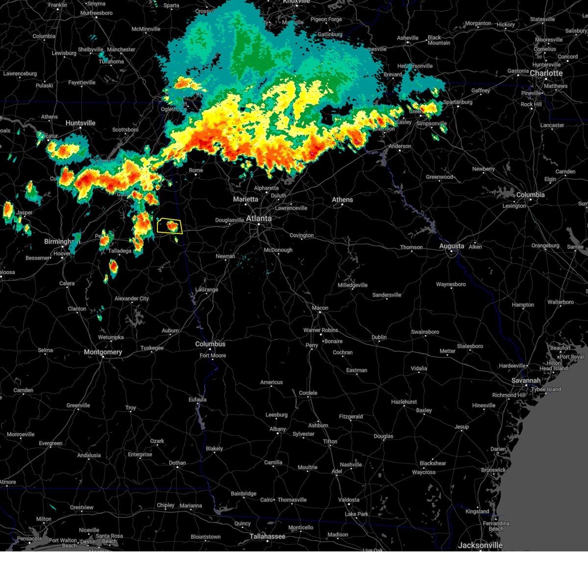 At 418 pm cdt, severe thunderstorms were located along a line extending from fruithurst to weaver, moving east at 25 mph (radar indicated). Hazards include 60 mph wind gusts and quarter size hail. Hail damage to vehicles is expected. expect wind damage to roofs, siding, and trees. locations impacted include, heflin, fruithurst, edwardsville, muscadine, i 20 welcome center, sweetwater lake and coleman lake and campground. hail threat, radar indicated max hail size, 1. 00 in wind threat, radar indicated max wind gust, 60 mph. At 418 pm cdt, severe thunderstorms were located along a line extending from fruithurst to weaver, moving east at 25 mph (radar indicated). Hazards include 60 mph wind gusts and quarter size hail. Hail damage to vehicles is expected. expect wind damage to roofs, siding, and trees. locations impacted include, heflin, fruithurst, edwardsville, muscadine, i 20 welcome center, sweetwater lake and coleman lake and campground. hail threat, radar indicated max hail size, 1. 00 in wind threat, radar indicated max wind gust, 60 mph.
|
| 6/25/2023 4:10 PM CDT |
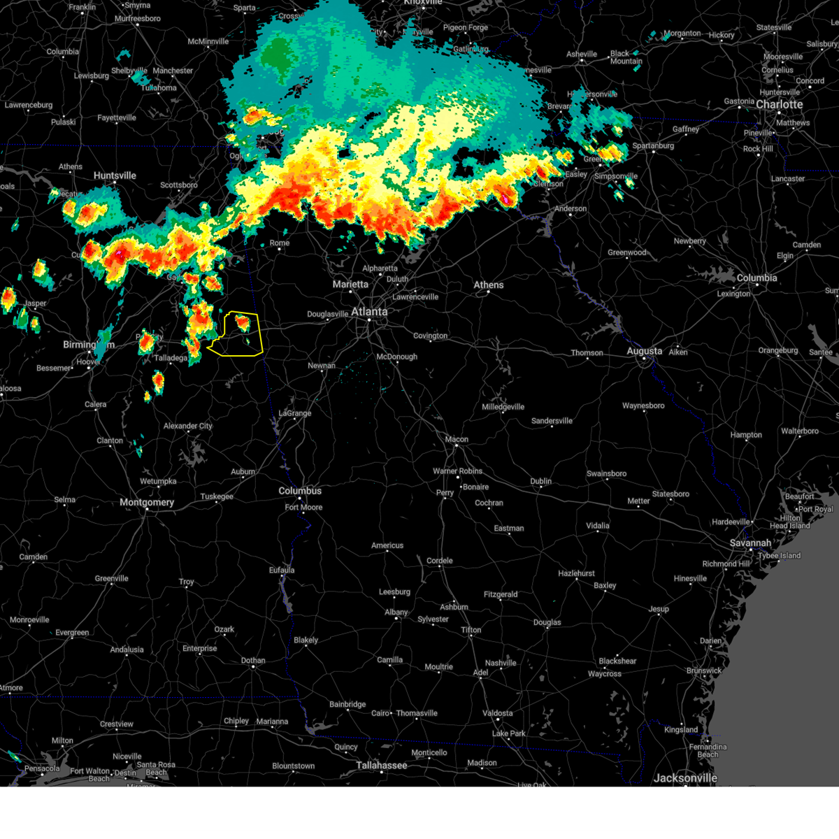 At 410 pm cdt, severe thunderstorms were located along a line extending from near edwardsville to saks, moving east at 35 mph (radar indicated). Hazards include 60 mph wind gusts and quarter size hail. Hail damage to vehicles is expected. expect wind damage to roofs, siding, and trees. locations impacted include, heflin, ranburne, fruithurst, edwardsville, muscadine, abernathy, hollis crossroads, sweetwater lake, coleman lake and campground, trickem, lake cleburne, i 20 welcome center, micaville, chalafinnee and camp sequoyah. hail threat, radar indicated max hail size, 1. 00 in wind threat, radar indicated max wind gust, 60 mph. At 410 pm cdt, severe thunderstorms were located along a line extending from near edwardsville to saks, moving east at 35 mph (radar indicated). Hazards include 60 mph wind gusts and quarter size hail. Hail damage to vehicles is expected. expect wind damage to roofs, siding, and trees. locations impacted include, heflin, ranburne, fruithurst, edwardsville, muscadine, abernathy, hollis crossroads, sweetwater lake, coleman lake and campground, trickem, lake cleburne, i 20 welcome center, micaville, chalafinnee and camp sequoyah. hail threat, radar indicated max hail size, 1. 00 in wind threat, radar indicated max wind gust, 60 mph.
|
| 6/25/2023 4:02 PM CDT |
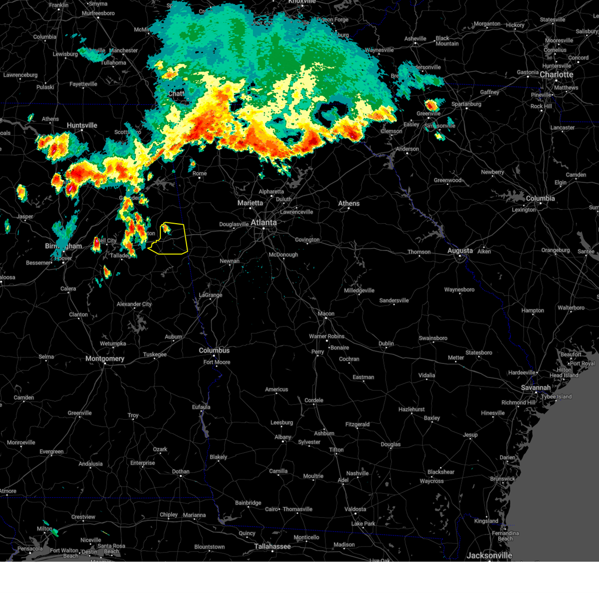 At 402 pm cdt, severe thunderstorms were located along a line extending from 6 miles east of jacksonville to near ohatchee, moving east at 25 mph (radar indicated). Hazards include 60 mph wind gusts and quarter size hail. Hail damage to vehicles is expected. Expect wind damage to roofs, siding, and trees. At 402 pm cdt, severe thunderstorms were located along a line extending from 6 miles east of jacksonville to near ohatchee, moving east at 25 mph (radar indicated). Hazards include 60 mph wind gusts and quarter size hail. Hail damage to vehicles is expected. Expect wind damage to roofs, siding, and trees.
|
| 6/14/2023 2:51 PM CDT |
 At 251 pm cdt, severe thunderstorms were located along a line extending from near ranburne to near lake wedowee to ashland, moving southeast at 60 mph (emergency management). Hazards include 60 mph wind gusts and quarter size hail. Hail damage to vehicles is expected. expect wind damage to roofs, siding, and trees. locations impacted include, roanoke, heflin, lineville, ashland, wedowee, lake wedowee, wadley, ranburne, woodland, malone, morrison cross roads, barfield, corinth, fosters cross roads, delta, crystal lake, graham, dickert, newell and r. l. harris dam. hail threat, radar indicated max hail size, 1. 00 in wind threat, radar indicated max wind gust, 60 mph. At 251 pm cdt, severe thunderstorms were located along a line extending from near ranburne to near lake wedowee to ashland, moving southeast at 60 mph (emergency management). Hazards include 60 mph wind gusts and quarter size hail. Hail damage to vehicles is expected. expect wind damage to roofs, siding, and trees. locations impacted include, roanoke, heflin, lineville, ashland, wedowee, lake wedowee, wadley, ranburne, woodland, malone, morrison cross roads, barfield, corinth, fosters cross roads, delta, crystal lake, graham, dickert, newell and r. l. harris dam. hail threat, radar indicated max hail size, 1. 00 in wind threat, radar indicated max wind gust, 60 mph.
|
| 6/14/2023 2:28 PM CDT |
 At 228 pm cdt, severe thunderstorms were located along a line extending from near weaver to near munford to near alpine, moving southeast at 60 mph (emergency management). Hazards include 60 mph wind gusts and quarter size hail. Hail damage to vehicles is expected. Expect wind damage to roofs, siding, and trees. At 228 pm cdt, severe thunderstorms were located along a line extending from near weaver to near munford to near alpine, moving southeast at 60 mph (emergency management). Hazards include 60 mph wind gusts and quarter size hail. Hail damage to vehicles is expected. Expect wind damage to roofs, siding, and trees.
|
| 1/12/2023 1:22 PM CST |
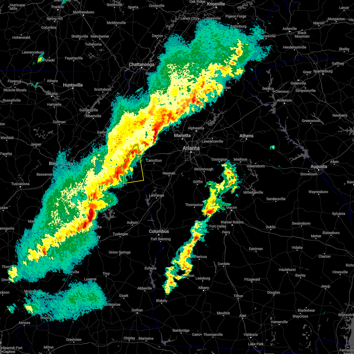 At 122 pm cst, severe thunderstorms were located along a line extending from near muscadine to 6 miles northeast of corinth to near lake wedowee, moving east at 55 mph (radar indicated). Hazards include 60 mph wind gusts and penny size hail. expect damage to roofs, siding, and trees At 122 pm cst, severe thunderstorms were located along a line extending from near muscadine to 6 miles northeast of corinth to near lake wedowee, moving east at 55 mph (radar indicated). Hazards include 60 mph wind gusts and penny size hail. expect damage to roofs, siding, and trees
|
| 1/12/2023 12:30 PM CST |
 At 1230 pm cst, a severe thunderstorm was located near fort mcclellan, moving northeast at 60 mph (radar indicated). Hazards include 60 mph wind gusts and quarter size hail. Hail damage to vehicles is expected. expect wind damage to roofs, siding, and trees. locations impacted include, jacksonville, heflin, fruithurst, edwardsville, muscadine, mars hills, liberty hill, oak level, sweetwater lake, borden springs, coleman lake and campground and choccolocco. hail threat, radar indicated max hail size, 1. 00 in wind threat, radar indicated max wind gust, 60 mph. At 1230 pm cst, a severe thunderstorm was located near fort mcclellan, moving northeast at 60 mph (radar indicated). Hazards include 60 mph wind gusts and quarter size hail. Hail damage to vehicles is expected. expect wind damage to roofs, siding, and trees. locations impacted include, jacksonville, heflin, fruithurst, edwardsville, muscadine, mars hills, liberty hill, oak level, sweetwater lake, borden springs, coleman lake and campground and choccolocco. hail threat, radar indicated max hail size, 1. 00 in wind threat, radar indicated max wind gust, 60 mph.
|
| 1/12/2023 12:23 PM CST |
 At 1223 pm cst, a severe thunderstorm was located over cobb town, moving northeast at 55 mph (radar indicated). Hazards include 60 mph wind gusts and quarter size hail. Hail damage to vehicles is expected. expect wind damage to roofs, siding, and trees. locations impacted include, anniston, oxford, jacksonville, heflin, fort mcclellan, saks, cobb town, west end-cobb town, weaver, hobson city, fruithurst, edwardsville, muscadine, oxford lake, blue mountain, mars hills, alexandria, sweetwater lake, coleman lake and campground and choccolocco. hail threat, radar indicated max hail size, 1. 00 in wind threat, radar indicated max wind gust, 60 mph. At 1223 pm cst, a severe thunderstorm was located over cobb town, moving northeast at 55 mph (radar indicated). Hazards include 60 mph wind gusts and quarter size hail. Hail damage to vehicles is expected. expect wind damage to roofs, siding, and trees. locations impacted include, anniston, oxford, jacksonville, heflin, fort mcclellan, saks, cobb town, west end-cobb town, weaver, hobson city, fruithurst, edwardsville, muscadine, oxford lake, blue mountain, mars hills, alexandria, sweetwater lake, coleman lake and campground and choccolocco. hail threat, radar indicated max hail size, 1. 00 in wind threat, radar indicated max wind gust, 60 mph.
|
| 1/12/2023 12:09 PM CST |
 At 1209 pm cst, a severe thunderstorm was located over talladega municipal airport, or 9 miles north of talladega, moving northeast at 55 mph (radar indicated). Hazards include 70 mph wind gusts and quarter size hail. Hail damage to vehicles is expected. expect considerable tree damage. Wind damage is also likely to mobile homes, roofs, and outbuildings. At 1209 pm cst, a severe thunderstorm was located over talladega municipal airport, or 9 miles north of talladega, moving northeast at 55 mph (radar indicated). Hazards include 70 mph wind gusts and quarter size hail. Hail damage to vehicles is expected. expect considerable tree damage. Wind damage is also likely to mobile homes, roofs, and outbuildings.
|
| 1/3/2023 3:19 PM CST |
 At 319 pm cst, severe thunderstorms were located along a line extending from piedmont to near lake wedowee, moving east at 35 mph (radar indicated). Hazards include 60 mph wind gusts. expect damage to roofs, siding, and trees At 319 pm cst, severe thunderstorms were located along a line extending from piedmont to near lake wedowee, moving east at 35 mph (radar indicated). Hazards include 60 mph wind gusts. expect damage to roofs, siding, and trees
|
| 11/30/2022 2:14 AM CST | At 214 am cst, severe thunderstorms were located along a line extending from mars hills to near abernathy to barfield, moving east at 60 mph (radar indicated). Hazards include 60 mph wind gusts. Expect damage to roofs, siding, and trees. locations impacted include, ranburne, fruithurst, woodland, muscadine, morrison cross roads, barfield, abernathy, fosters cross roads, delta, corinth, mars hills, graham, hollis crossroads, newell, trickem, lake cleburne, i 20 welcome center and micaville. hail threat, radar indicated max hail size, <. 75 in wind threat, radar indicated max wind gust, 60 mph. |
| 11/30/2022 2:06 AM CST |
 At 206 am cst, severe thunderstorms were located along a line extending from 6 miles west of mars hills to near heflin to near barfield, moving east at 65 mph (radar indicated). Hazards include 60 mph wind gusts. Expect damage to roofs, siding, and trees. locations impacted include, heflin, ranburne, fruithurst, edwardsville, woodland, morrison cross roads, barfield, corinth, muscadine, abernathy, fosters cross roads, delta, mars hills, mount cheaha, graham, newell, coleman lake and campground, trickem, lake cleburne and liberty hill. hail threat, radar indicated max hail size, <. 75 in wind threat, radar indicated max wind gust, 60 mph. At 206 am cst, severe thunderstorms were located along a line extending from 6 miles west of mars hills to near heflin to near barfield, moving east at 65 mph (radar indicated). Hazards include 60 mph wind gusts. Expect damage to roofs, siding, and trees. locations impacted include, heflin, ranburne, fruithurst, edwardsville, woodland, morrison cross roads, barfield, corinth, muscadine, abernathy, fosters cross roads, delta, mars hills, mount cheaha, graham, newell, coleman lake and campground, trickem, lake cleburne and liberty hill. hail threat, radar indicated max hail size, <. 75 in wind threat, radar indicated max wind gust, 60 mph.
|
| 11/30/2022 1:56 AM CST |
 At 156 am cst, severe thunderstorms were located along a line extending from jacksonville state university to near oxford lake to near waldo, moving east at 60 mph (radar indicated). Hazards include 60 mph wind gusts. expect damage to roofs, siding, and trees At 156 am cst, severe thunderstorms were located along a line extending from jacksonville state university to near oxford lake to near waldo, moving east at 60 mph (radar indicated). Hazards include 60 mph wind gusts. expect damage to roofs, siding, and trees
|
| 7/21/2022 11:41 AM CDT |
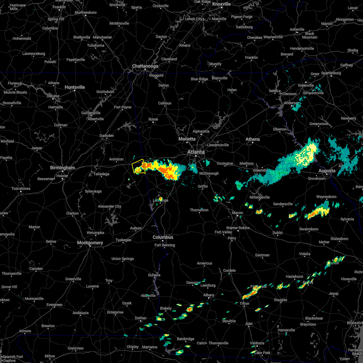 At 1141 am cdt, a severe thunderstorm was located near ranburne, or 13 miles east of heflin, moving southeast at 5 mph (radar indicated). Hazards include 60 mph wind gusts. expect damage to roofs, siding, and trees At 1141 am cdt, a severe thunderstorm was located near ranburne, or 13 miles east of heflin, moving southeast at 5 mph (radar indicated). Hazards include 60 mph wind gusts. expect damage to roofs, siding, and trees
|
| 6/17/2022 12:53 AM CDT | Quarter sized hail reported 8.5 miles NE of Heflin, AL, hail fell for over 15 minutes. |
| 6/17/2022 12:52 AM CDT |
 At 1252 am cdt, a severe thunderstorm was located 7 miles northwest of corinth, or 7 miles southwest of heflin, moving west at 15 mph (radar indicated). Hazards include 60 mph wind gusts and quarter size hail. Hail damage to vehicles is expected. Expect wind damage to roofs, siding, and trees. At 1252 am cdt, a severe thunderstorm was located 7 miles northwest of corinth, or 7 miles southwest of heflin, moving west at 15 mph (radar indicated). Hazards include 60 mph wind gusts and quarter size hail. Hail damage to vehicles is expected. Expect wind damage to roofs, siding, and trees.
|
| 6/15/2022 8:13 PM CDT |
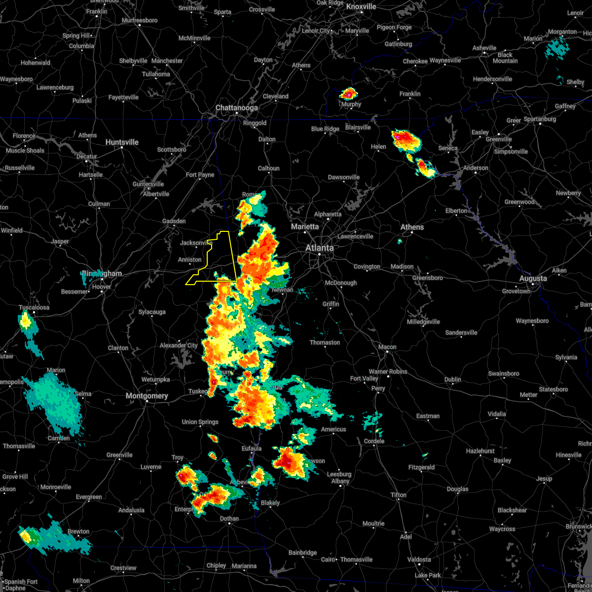 At 813 pm cdt, severe thunderstorms were located along a line extending from 6 miles southwest of rockmart to ranburne, moving west at 15 mph (radar indicated). Hazards include 60 mph wind gusts. expect damage to roofs, siding, and trees At 813 pm cdt, severe thunderstorms were located along a line extending from 6 miles southwest of rockmart to ranburne, moving west at 15 mph (radar indicated). Hazards include 60 mph wind gusts. expect damage to roofs, siding, and trees
|
| 6/9/2021 6:20 PM CDT |
 The severe thunderstorm warning for east central calhoun and cleburne counties will expire at 630 pm cdt, the storms which prompted the warning have weakened below severe limits, and have exited the warned area. therefore, the warning will be allowed to expire. The severe thunderstorm warning for east central calhoun and cleburne counties will expire at 630 pm cdt, the storms which prompted the warning have weakened below severe limits, and have exited the warned area. therefore, the warning will be allowed to expire.
|
| 6/9/2021 6:00 PM CDT |
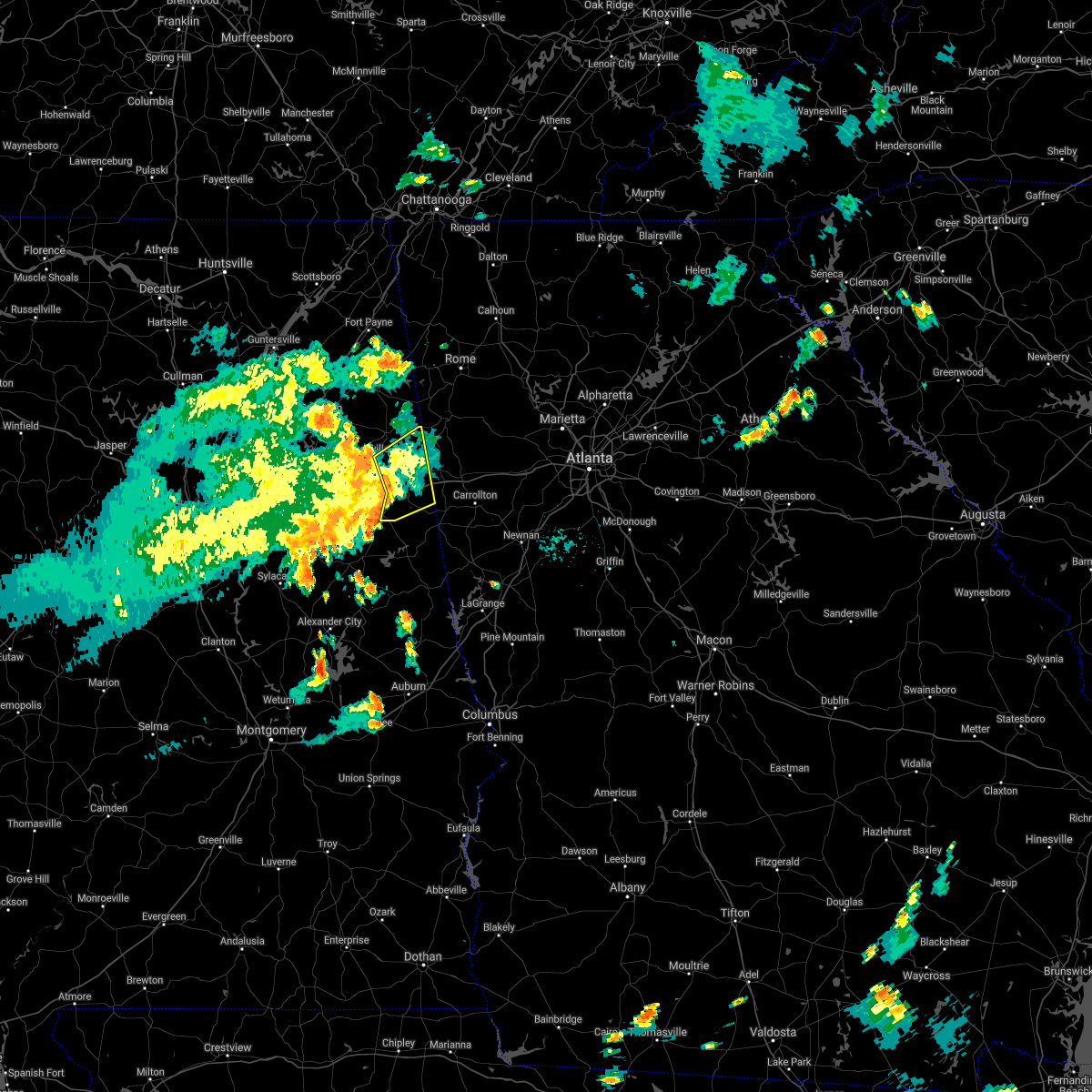 At 600 pm cdt, severe thunderstorms were located along a line extending from near piedmont to near edwardsville to near fosters cross roads, moving northeast at 35 mph (radar indicated). Hazards include 60 mph wind gusts. Expect damage to roofs, siding, and trees. Locations impacted include, heflin, fruithurst, edwardsville, muscadine, abernathy, mars hills, hollis crossroads, sweetwater lake, coleman lake and campground, trickem, lake cleburne, i 20 welcome center, liberty hill, oak level, borden springs and micaville. At 600 pm cdt, severe thunderstorms were located along a line extending from near piedmont to near edwardsville to near fosters cross roads, moving northeast at 35 mph (radar indicated). Hazards include 60 mph wind gusts. Expect damage to roofs, siding, and trees. Locations impacted include, heflin, fruithurst, edwardsville, muscadine, abernathy, mars hills, hollis crossroads, sweetwater lake, coleman lake and campground, trickem, lake cleburne, i 20 welcome center, liberty hill, oak level, borden springs and micaville.
|
| 6/9/2021 5:42 PM CDT |
 At 542 pm cdt, severe thunderstorms were located along a line extending from 6 miles northwest of jacksonville state university to 6 miles southeast of fort mcclellan to delta, moving northeast at 35 mph (radar indicated). Hazards include 60 mph wind gusts. Expect damage to roofs, siding, and trees. Locations impacted include, anniston, oxford, heflin, fort mcclellan, saks, fruithurst, edwardsville, muscadine, abernathy, blue mountain, mars hills, hollis crossroads, sweetwater lake, coleman lake and campground, choccolocco, trickem, lake cleburne, dearmanville, i 20 welcome center and liberty hill. At 542 pm cdt, severe thunderstorms were located along a line extending from 6 miles northwest of jacksonville state university to 6 miles southeast of fort mcclellan to delta, moving northeast at 35 mph (radar indicated). Hazards include 60 mph wind gusts. Expect damage to roofs, siding, and trees. Locations impacted include, anniston, oxford, heflin, fort mcclellan, saks, fruithurst, edwardsville, muscadine, abernathy, blue mountain, mars hills, hollis crossroads, sweetwater lake, coleman lake and campground, choccolocco, trickem, lake cleburne, dearmanville, i 20 welcome center and liberty hill.
|
| 6/9/2021 5:22 PM CDT |
 At 522 pm cdt, severe thunderstorms were located along a line extending from ohatchee to anniston regional airport to near ashland, moving northeast at 35 mph (radar indicated). Hazards include 60 mph wind gusts. expect damage to roofs, siding, and trees At 522 pm cdt, severe thunderstorms were located along a line extending from ohatchee to anniston regional airport to near ashland, moving northeast at 35 mph (radar indicated). Hazards include 60 mph wind gusts. expect damage to roofs, siding, and trees
|
| 5/4/2021 1:31 PM CDT | Half Dollar sized hail reported 2.2 miles ESE of Heflin, AL, hail dollar or slightly larger hail reported on social media. |
| 5/4/2021 1:25 PM CDT |
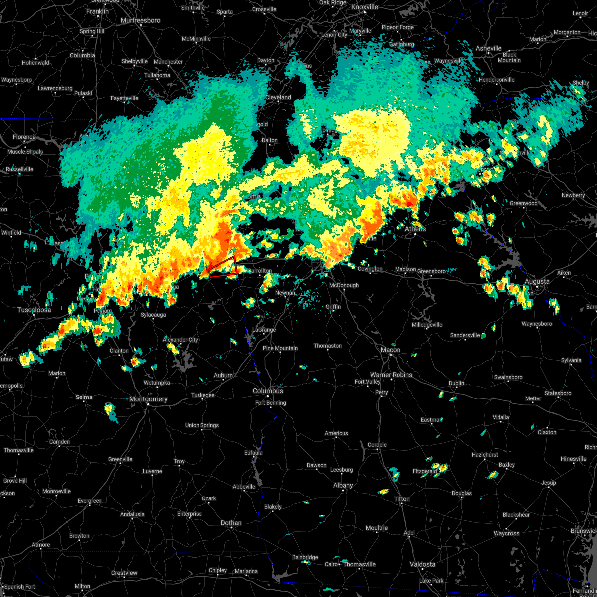 At 125 pm cdt, a severe thunderstorm capable of producing a tornado was located near heflin, moving east at 30 mph (radar indicated rotation). Hazards include tornado. Flying debris will be dangerous to those caught without shelter. mobile homes will be damaged or destroyed. damage to roofs, windows, and vehicles will occur. Tree damage is likely. At 125 pm cdt, a severe thunderstorm capable of producing a tornado was located near heflin, moving east at 30 mph (radar indicated rotation). Hazards include tornado. Flying debris will be dangerous to those caught without shelter. mobile homes will be damaged or destroyed. damage to roofs, windows, and vehicles will occur. Tree damage is likely.
|
| 5/4/2021 12:56 PM CDT |
 At 1255 pm cdt, severe thunderstorms were located along a line extending from 6 miles southwest of ball flat to pell city, moving east at 45 mph (radar indicated). Hazards include 60 mph wind gusts and quarter size hail. Hail damage to vehicles is expected. Expect wind damage to roofs, siding, and trees. At 1255 pm cdt, severe thunderstorms were located along a line extending from 6 miles southwest of ball flat to pell city, moving east at 45 mph (radar indicated). Hazards include 60 mph wind gusts and quarter size hail. Hail damage to vehicles is expected. Expect wind damage to roofs, siding, and trees.
|
| 4/24/2021 6:32 PM CDT |
 At 632 pm cdt, severe thunderstorms were located along a line extending from 6 miles west of mars hills to near sycamore, moving east at 50 mph (radar indicated). Hazards include 60 mph wind gusts and quarter size hail. Hail damage to vehicles is expected. expect wind damage to roofs, siding, and trees. Locations impacted include, anniston, oxford, talladega, sylacauga, heflin, munford, fruithurst, waldo, edwardsville, muscadine, abernathy, sycamore, delta, mars hills, mount cheaha, coleman lake and campground, choccolocco, lake cleburne, camp mac and ironaton. At 632 pm cdt, severe thunderstorms were located along a line extending from 6 miles west of mars hills to near sycamore, moving east at 50 mph (radar indicated). Hazards include 60 mph wind gusts and quarter size hail. Hail damage to vehicles is expected. expect wind damage to roofs, siding, and trees. Locations impacted include, anniston, oxford, talladega, sylacauga, heflin, munford, fruithurst, waldo, edwardsville, muscadine, abernathy, sycamore, delta, mars hills, mount cheaha, coleman lake and campground, choccolocco, lake cleburne, camp mac and ironaton.
|
| 4/24/2021 6:28 PM CDT |
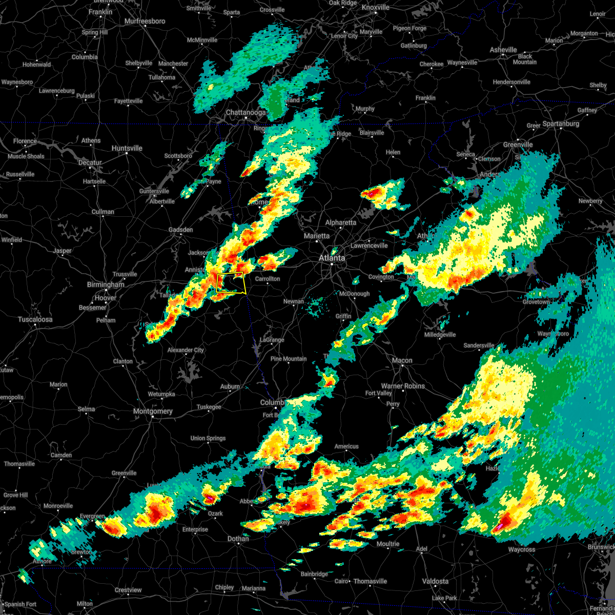 At 628 pm cdt, a severe thunderstorm was located near heflin, moving east at 55 mph (radar indicated). Hazards include 60 mph wind gusts and quarter size hail. Hail damage to vehicles is expected. Expect wind damage to roofs, siding, and trees. At 628 pm cdt, a severe thunderstorm was located near heflin, moving east at 55 mph (radar indicated). Hazards include 60 mph wind gusts and quarter size hail. Hail damage to vehicles is expected. Expect wind damage to roofs, siding, and trees.
|
| 4/24/2021 6:09 PM CDT |
 At 609 pm cdt, severe thunderstorms were located along a line extending from near weaver to near wilsonville, moving east at 50 mph (radar indicated). Hazards include 60 mph wind gusts and half dollar size hail. Hail damage to vehicles is expected. Expect wind damage to roofs, siding, and trees. At 609 pm cdt, severe thunderstorms were located along a line extending from near weaver to near wilsonville, moving east at 50 mph (radar indicated). Hazards include 60 mph wind gusts and half dollar size hail. Hail damage to vehicles is expected. Expect wind damage to roofs, siding, and trees.
|
| 8/3/2020 12:01 PM CDT |
 At 1201 pm cdt, a severe thunderstorm was located near heflin, moving east at 10 mph (radar indicated). Hazards include 60 mph wind gusts and quarter size hail. Hail damage to vehicles is expected. Expect wind damage to roofs, siding, and trees. At 1201 pm cdt, a severe thunderstorm was located near heflin, moving east at 10 mph (radar indicated). Hazards include 60 mph wind gusts and quarter size hail. Hail damage to vehicles is expected. Expect wind damage to roofs, siding, and trees.
|
| 6/14/2020 7:05 PM CDT | One tree fell onto a house in heflin. pea-size hail in town as well. time estimate in cleburne county AL, 1.7 miles ESE of Heflin, AL |
| 6/14/2020 6:46 PM CDT |
 At 645 pm cdt, a severe thunderstorm was located over muscadine, or 12 miles west of buchanan, moving south at 15 mph. the worst part of this storm is near the alabama, georgia state line (radar indicated). Hazards include quarter size hail and wind gusts up to 50 mph. Damage to vehicles is expected. Locations impacted include, fruithurst, edwardsville, abernathy, muscadine and i 20 welcome center. At 645 pm cdt, a severe thunderstorm was located over muscadine, or 12 miles west of buchanan, moving south at 15 mph. the worst part of this storm is near the alabama, georgia state line (radar indicated). Hazards include quarter size hail and wind gusts up to 50 mph. Damage to vehicles is expected. Locations impacted include, fruithurst, edwardsville, abernathy, muscadine and i 20 welcome center.
|
| 6/14/2020 6:31 PM CDT |
 At 630 pm cdt, a severe thunderstorm was located over mars hills, or 10 miles west of buchanan, moving south at 15 mph. the worst part of this storm was along the alabama, georgia state line (radar indicated). Hazards include 60 mph wind gusts and quarter size hail. Hail damage to vehicles is expected. expect wind damage to roofs, siding, and trees. Locations impacted include, fruithurst, edwardsville, muscadine, abernathy, mars hills, i 20 welcome center and oak level. At 630 pm cdt, a severe thunderstorm was located over mars hills, or 10 miles west of buchanan, moving south at 15 mph. the worst part of this storm was along the alabama, georgia state line (radar indicated). Hazards include 60 mph wind gusts and quarter size hail. Hail damage to vehicles is expected. expect wind damage to roofs, siding, and trees. Locations impacted include, fruithurst, edwardsville, muscadine, abernathy, mars hills, i 20 welcome center and oak level.
|
| 6/14/2020 6:18 PM CDT |
 At 617 pm cdt, a severe thunderstorm was located near mars hills, or 11 miles southwest of cedartown, moving south at 15 mph (radar indicated). Hazards include 60 mph wind gusts and quarter size hail. Hail damage to vehicles is expected. Expect wind damage to roofs, siding, and trees. At 617 pm cdt, a severe thunderstorm was located near mars hills, or 11 miles southwest of cedartown, moving south at 15 mph (radar indicated). Hazards include 60 mph wind gusts and quarter size hail. Hail damage to vehicles is expected. Expect wind damage to roofs, siding, and trees.
|
| 6/5/2020 2:39 PM CDT |
 At 238 pm cdt, a severe thunderstorm was located near fort mcclellan, moving southeast at 25 mph (radar indicated). Hazards include 60 mph wind gusts and quarter size hail. Hail damage to vehicles is expected. expect wind damage to roofs, siding, and trees. Locations impacted include, anniston, oxford, heflin, fort mcclellan, west end-cobb town, blue mountain, dearmanville, chalafinnee and choccolocco. At 238 pm cdt, a severe thunderstorm was located near fort mcclellan, moving southeast at 25 mph (radar indicated). Hazards include 60 mph wind gusts and quarter size hail. Hail damage to vehicles is expected. expect wind damage to roofs, siding, and trees. Locations impacted include, anniston, oxford, heflin, fort mcclellan, west end-cobb town, blue mountain, dearmanville, chalafinnee and choccolocco.
|
| 6/5/2020 2:23 PM CDT |
 At 223 pm cdt, a severe thunderstorm was located over fort mcclellan, moving southeast at 25 mph (radar indicated). Hazards include 60 mph wind gusts and quarter size hail. Hail damage to vehicles is expected. Expect wind damage to roofs, siding, and trees. At 223 pm cdt, a severe thunderstorm was located over fort mcclellan, moving southeast at 25 mph (radar indicated). Hazards include 60 mph wind gusts and quarter size hail. Hail damage to vehicles is expected. Expect wind damage to roofs, siding, and trees.
|
| 2/6/2020 4:41 AM CST |
 At 441 am cst, a severe thunderstorm capable of producing a tornado was located over lineville, moving northeast at 65 mph (radar indicated rotation). Hazards include tornado. Flying debris will be dangerous to those caught without shelter. mobile homes will be damaged or destroyed. damage to roofs, windows, and vehicles will occur. Tree damage is likely. At 441 am cst, a severe thunderstorm capable of producing a tornado was located over lineville, moving northeast at 65 mph (radar indicated rotation). Hazards include tornado. Flying debris will be dangerous to those caught without shelter. mobile homes will be damaged or destroyed. damage to roofs, windows, and vehicles will occur. Tree damage is likely.
|
| 1/11/2020 3:12 PM CST |
 At 312 pm cst, severe thunderstorms were located along a line extending from near cave spring to near morrison cross roads, moving northeast at 50 mph (radar indicated). Hazards include 60 mph wind gusts. Expect damage to roofs, siding, and trees. Locations impacted include, ranburne, fruithurst, muscadine, abernathy, mars hills, trickem, lake cleburne and i 20 welcome center. At 312 pm cst, severe thunderstorms were located along a line extending from near cave spring to near morrison cross roads, moving northeast at 50 mph (radar indicated). Hazards include 60 mph wind gusts. Expect damage to roofs, siding, and trees. Locations impacted include, ranburne, fruithurst, muscadine, abernathy, mars hills, trickem, lake cleburne and i 20 welcome center.
|
| 1/11/2020 3:06 PM CST |
 At 306 pm cst, severe thunderstorms were located along a line extending from near cave spring to near morrison cross roads, moving northeast at 50 mph (radar indicated). Hazards include 70 mph wind gusts. Expect considerable tree damage. damage is likely to mobile homes, roofs, and outbuildings. Locations impacted include, heflin, ranburne, fruithurst, edwardsville, muscadine, abernathy, mars hills, hollis crossroads, trickem, lake cleburne, i 20 welcome center, chalafinnee, oak level and camp sequoyah. At 306 pm cst, severe thunderstorms were located along a line extending from near cave spring to near morrison cross roads, moving northeast at 50 mph (radar indicated). Hazards include 70 mph wind gusts. Expect considerable tree damage. damage is likely to mobile homes, roofs, and outbuildings. Locations impacted include, heflin, ranburne, fruithurst, edwardsville, muscadine, abernathy, mars hills, hollis crossroads, trickem, lake cleburne, i 20 welcome center, chalafinnee, oak level and camp sequoyah.
|
| 1/11/2020 2:23 PM CST |
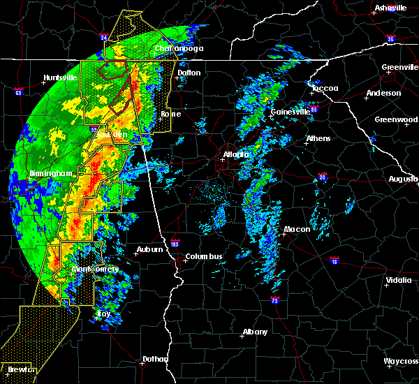 At 223 pm cst, severe thunderstorms were located along a line extending from near alexandria to 7 miles east of sycamore, moving northeast at 50 mph (radar indicated). Hazards include 70 mph wind gusts. Expect considerable tree damage. Damage is likely to mobile homes, roofs, and outbuildings. At 223 pm cst, severe thunderstorms were located along a line extending from near alexandria to 7 miles east of sycamore, moving northeast at 50 mph (radar indicated). Hazards include 70 mph wind gusts. Expect considerable tree damage. Damage is likely to mobile homes, roofs, and outbuildings.
|
| 7/31/2019 5:15 PM CDT |
 At 515 pm cdt, a severe thunderstorm was located 7 miles northwest of heflin, moving east at 5 mph (radar indicated). Hazards include 60 mph wind gusts and quarter size hail. Hail damage to vehicles is expected. expect wind damage to roofs, siding, and trees. Locations impacted include, heflin, edwardsville, sweetwater lake, coleman lake and campground and liberty hill. At 515 pm cdt, a severe thunderstorm was located 7 miles northwest of heflin, moving east at 5 mph (radar indicated). Hazards include 60 mph wind gusts and quarter size hail. Hail damage to vehicles is expected. expect wind damage to roofs, siding, and trees. Locations impacted include, heflin, edwardsville, sweetwater lake, coleman lake and campground and liberty hill.
|
| 7/31/2019 5:09 PM CDT |
 At 507 pm cdt, a severe thunderstorm was located near jacksonville, moving northeast at 5 mph (radar indicated). Hazards include 60 mph wind gusts and quarter size hail. Hail damage to vehicles is expected. Expect wind damage to roofs, siding, and trees. At 507 pm cdt, a severe thunderstorm was located near jacksonville, moving northeast at 5 mph (radar indicated). Hazards include 60 mph wind gusts and quarter size hail. Hail damage to vehicles is expected. Expect wind damage to roofs, siding, and trees.
|
| 5/9/2019 2:50 PM CDT |
 The severe thunderstorm warning for southeastern cleburne county will expire at 300 pm cdt, the storms which prompted the warning have moved out of the area. therefore, the warning will be allowed to expire. The severe thunderstorm warning for southeastern cleburne county will expire at 300 pm cdt, the storms which prompted the warning have moved out of the area. therefore, the warning will be allowed to expire.
|
| 5/9/2019 2:41 PM CDT |
 A severe thunderstorm warning remains in effect until 300 pm cdt for southeastern cleburne county. at 241 pm cdt, severe thunderstorms were located along a line extending from near cedartown to near morrison cross roads, moving east at 40 mph. hazard. 60 mph wind gusts. A severe thunderstorm warning remains in effect until 300 pm cdt for southeastern cleburne county. at 241 pm cdt, severe thunderstorms were located along a line extending from near cedartown to near morrison cross roads, moving east at 40 mph. hazard. 60 mph wind gusts.
|
| 5/9/2019 2:30 PM CDT |
 A severe thunderstorm warning remains in effect until 300 pm cdt for cleburne county. at 230 pm cdt, severe thunderstorms were located along a line extending from 6 miles east of pleasant gap to 6 miles northeast of delta, moving east at 35 mph. hazard. 60 mph wind gusts. A severe thunderstorm warning remains in effect until 300 pm cdt for cleburne county. at 230 pm cdt, severe thunderstorms were located along a line extending from 6 miles east of pleasant gap to 6 miles northeast of delta, moving east at 35 mph. hazard. 60 mph wind gusts.
|
| 5/9/2019 2:21 PM CDT |
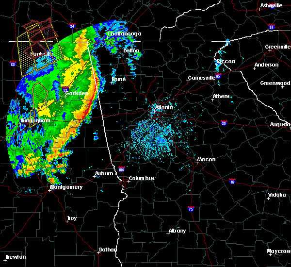 A severe thunderstorm warning remains in effect until 300 pm cdt for cleburne county. at 221 pm cdt, severe thunderstorms were located along a line extending from near pleasant gap to near delta, moving east at 30 mph. hazard. 60 mph wind gusts. A severe thunderstorm warning remains in effect until 300 pm cdt for cleburne county. at 221 pm cdt, severe thunderstorms were located along a line extending from near pleasant gap to near delta, moving east at 30 mph. hazard. 60 mph wind gusts.
|
| 5/9/2019 2:09 PM CDT |
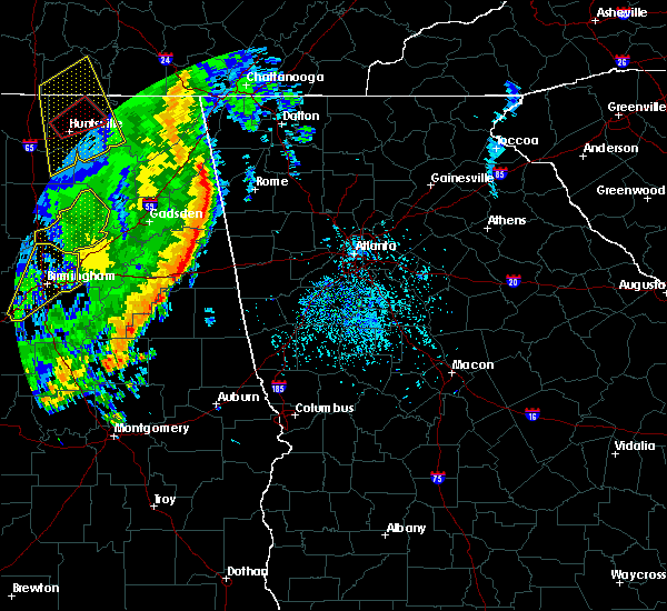 The national weather service in birmingham has issued a * severe thunderstorm warning for. cleburne county in east central alabama. until 300 pm cdt. At 208 pm cdt, severe thunderstorms were located along a line extending from piedmont to near oxford, moving east at 35 mph. The national weather service in birmingham has issued a * severe thunderstorm warning for. cleburne county in east central alabama. until 300 pm cdt. At 208 pm cdt, severe thunderstorms were located along a line extending from piedmont to near oxford, moving east at 35 mph.
|
| 7/21/2018 4:46 PM CDT |
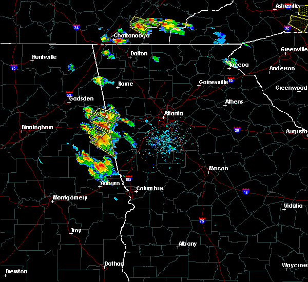 At 446 pm cdt, a severe thunderstorm was located over abernathy, or 11 miles east of heflin, moving southeast at 35 mph (radar indicated). Hazards include ping pong ball size hail and 60 mph wind gusts. People and animals outdoors will be injured. expect hail damage to roofs, siding, windows, and vehicles. expect wind damage to roofs, siding, and trees. Locations impacted include, heflin, abernathy and i 20 welcome center. At 446 pm cdt, a severe thunderstorm was located over abernathy, or 11 miles east of heflin, moving southeast at 35 mph (radar indicated). Hazards include ping pong ball size hail and 60 mph wind gusts. People and animals outdoors will be injured. expect hail damage to roofs, siding, windows, and vehicles. expect wind damage to roofs, siding, and trees. Locations impacted include, heflin, abernathy and i 20 welcome center.
|
| 7/21/2018 4:26 PM CDT |
 At 426 pm cdt, a severe thunderstorm was located near edwardsville, or near heflin, moving southeast at 35 mph (radar indicated). Hazards include 60 mph wind gusts and half dollar size hail. Hail damage to vehicles is expected. Expect wind damage to roofs, siding, and trees. At 426 pm cdt, a severe thunderstorm was located near edwardsville, or near heflin, moving southeast at 35 mph (radar indicated). Hazards include 60 mph wind gusts and half dollar size hail. Hail damage to vehicles is expected. Expect wind damage to roofs, siding, and trees.
|
| 7/21/2018 4:19 PM CDT |
 At 419 pm cdt, a severe thunderstorm was located 7 miles northeast of delta, or 8 miles south of heflin, moving southeast at 25 mph (radar indicated). Hazards include golf ball size hail and 60 mph wind gusts. ping pong ball size hail has already been reported with this storm. People and animals outdoors will be injured. expect hail damage to roofs, siding, windows, and vehicles. expect wind damage to roofs, siding, and trees. Locations impacted include, morrison cross roads, fosters cross roads, delta, hollis crossroads, micaville, chalafinnee and camp sequoyah. At 419 pm cdt, a severe thunderstorm was located 7 miles northeast of delta, or 8 miles south of heflin, moving southeast at 25 mph (radar indicated). Hazards include golf ball size hail and 60 mph wind gusts. ping pong ball size hail has already been reported with this storm. People and animals outdoors will be injured. expect hail damage to roofs, siding, windows, and vehicles. expect wind damage to roofs, siding, and trees. Locations impacted include, morrison cross roads, fosters cross roads, delta, hollis crossroads, micaville, chalafinnee and camp sequoyah.
|
| 7/21/2018 4:12 PM CDT |
 At 411 pm cdt, a severe thunderstorm was located 7 miles northeast of delta, or 8 miles south of heflin, moving southeast at 25 mph (radar indicated). Hazards include golf ball size hail and 60 mph wind gusts. People and animals outdoors will be injured. expect hail damage to roofs, siding, windows, and vehicles. expect wind damage to roofs, siding, and trees. Locations impacted include, morrison cross roads, fosters cross roads, delta, hollis crossroads, micaville, chalafinnee and camp sequoyah. At 411 pm cdt, a severe thunderstorm was located 7 miles northeast of delta, or 8 miles south of heflin, moving southeast at 25 mph (radar indicated). Hazards include golf ball size hail and 60 mph wind gusts. People and animals outdoors will be injured. expect hail damage to roofs, siding, windows, and vehicles. expect wind damage to roofs, siding, and trees. Locations impacted include, morrison cross roads, fosters cross roads, delta, hollis crossroads, micaville, chalafinnee and camp sequoyah.
|
| 7/21/2018 4:01 PM CDT |
 At 400 pm cdt, a severe thunderstorm was located near oxford lake, or 7 miles east of oxford, moving southeast at 25 mph (radar indicated). Hazards include 60 mph wind gusts and half dollar size hail. Hail damage to vehicles is expected. Expect wind damage to roofs, siding, and trees. At 400 pm cdt, a severe thunderstorm was located near oxford lake, or 7 miles east of oxford, moving southeast at 25 mph (radar indicated). Hazards include 60 mph wind gusts and half dollar size hail. Hail damage to vehicles is expected. Expect wind damage to roofs, siding, and trees.
|
| 6/28/2018 2:17 PM CDT |
 At 217 pm cdt, severe thunderstorms were located along a line extending from near anniston regional airport to muscadine, moving south at 50 mph (emergency management). Hazards include 70 mph wind gusts. Expect considerable tree damage. Damage is likely to mobile homes, roofs, and outbuildings. At 217 pm cdt, severe thunderstorms were located along a line extending from near anniston regional airport to muscadine, moving south at 50 mph (emergency management). Hazards include 70 mph wind gusts. Expect considerable tree damage. Damage is likely to mobile homes, roofs, and outbuildings.
|
| 4/4/2018 12:38 AM CDT |
 At 1238 am cdt, severe thunderstorms were located along a line extending from 6 miles north of mars hills to 8 miles northwest of fruithurst to near mount cheaha to near winterboro, moving east at 45 mph (radar indicated). Hazards include 60 mph wind gusts. Expect damage to roofs, siding, and trees. Locations impacted include, anniston, oxford, talladega, jacksonville, piedmont, heflin, lineville, west end-cobb town, cobb town, fort mcclellan, saks, lincoln, weaver, munford, hobson city, ranburne, fruithurst, waldo, edwardsville and woodland. At 1238 am cdt, severe thunderstorms were located along a line extending from 6 miles north of mars hills to 8 miles northwest of fruithurst to near mount cheaha to near winterboro, moving east at 45 mph (radar indicated). Hazards include 60 mph wind gusts. Expect damage to roofs, siding, and trees. Locations impacted include, anniston, oxford, talladega, jacksonville, piedmont, heflin, lineville, west end-cobb town, cobb town, fort mcclellan, saks, lincoln, weaver, munford, hobson city, ranburne, fruithurst, waldo, edwardsville and woodland.
|
| 4/4/2018 12:21 AM CDT |
 At 1221 am cdt, severe thunderstorms were located along a line extending from near pleasant gap to near jacksonville state university to near talladega superspeedway to near logan martin dam, moving east at 40 mph (radar indicated). Hazards include 60 mph wind gusts. expect damage to roofs, siding, and trees At 1221 am cdt, severe thunderstorms were located along a line extending from near pleasant gap to near jacksonville state university to near talladega superspeedway to near logan martin dam, moving east at 40 mph (radar indicated). Hazards include 60 mph wind gusts. expect damage to roofs, siding, and trees
|
| 3/19/2018 10:36 PM CDT |
 At 1036 pm cdt, severe thunderstorms were located along a line extending from near abernathy to near mount cheaha, moving east at 50 mph (radar indicated). Hazards include 60 mph wind gusts and quarter size hail. Hail damage to vehicles is expected. expect wind damage to roofs, siding, and trees. locations impacted include, heflin, ranburne, abernathy, mount cheaha, trickem, lake cleburne, hollis crossroads, i 20 welcome center, micaville, chalafinnee and camp sequoyah. A tornado watch remains in effect until midnight cdt for east central alabama. At 1036 pm cdt, severe thunderstorms were located along a line extending from near abernathy to near mount cheaha, moving east at 50 mph (radar indicated). Hazards include 60 mph wind gusts and quarter size hail. Hail damage to vehicles is expected. expect wind damage to roofs, siding, and trees. locations impacted include, heflin, ranburne, abernathy, mount cheaha, trickem, lake cleburne, hollis crossroads, i 20 welcome center, micaville, chalafinnee and camp sequoyah. A tornado watch remains in effect until midnight cdt for east central alabama.
|
| 3/19/2018 10:20 PM CDT |
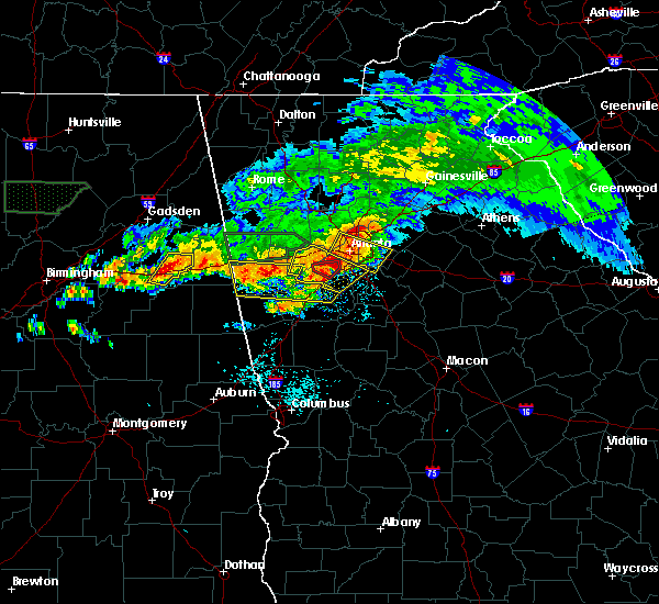 At 1020 pm cdt, severe thunderstorms were located along a line extending from near fort mcclellan to near oxford, moving east at 50 mph (radar indicated). Hazards include 60 mph wind gusts and quarter size hail. Hail damage to vehicles is expected. Expect wind damage to roofs, siding, and trees. At 1020 pm cdt, severe thunderstorms were located along a line extending from near fort mcclellan to near oxford, moving east at 50 mph (radar indicated). Hazards include 60 mph wind gusts and quarter size hail. Hail damage to vehicles is expected. Expect wind damage to roofs, siding, and trees.
|
| 3/19/2018 9:55 PM CDT |
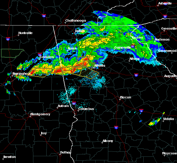 At 955 pm cdt, a severe thunderstorm was located over abernathy, or 12 miles east of heflin, moving east at 55 mph (radar indicated). Hazards include golf ball size hail and 60 mph wind gusts. People and animals outdoors will be injured. expect hail damage to roofs, siding, windows, and vehicles. expect wind damage to roofs, siding, and trees. locations impacted include, fruithurst, edwardsville, abernathy and i 20 welcome center. A tornado watch remains in effect until 1100 pm cdt for east central alabama. At 955 pm cdt, a severe thunderstorm was located over abernathy, or 12 miles east of heflin, moving east at 55 mph (radar indicated). Hazards include golf ball size hail and 60 mph wind gusts. People and animals outdoors will be injured. expect hail damage to roofs, siding, windows, and vehicles. expect wind damage to roofs, siding, and trees. locations impacted include, fruithurst, edwardsville, abernathy and i 20 welcome center. A tornado watch remains in effect until 1100 pm cdt for east central alabama.
|
| 3/19/2018 9:43 PM CDT |
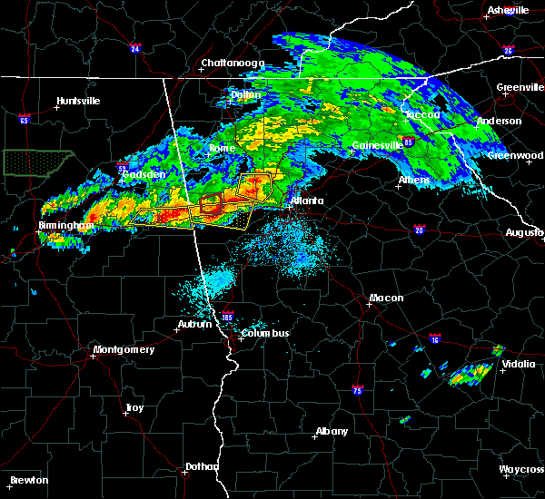 At 943 pm cdt, a severe thunderstorm was located over heflin, moving east at 45 mph (radar indicated). Hazards include tennis ball size hail and 70 mph wind gusts. People and animals outdoors will be injured. expect hail damage to roofs, siding, windows, and vehicles. expect considerable tree damage. wind damage is also likely to mobile homes, roofs, and outbuildings. locations impacted include, heflin, fruithurst, edwardsville, muscadine, abernathy, lake cleburne, i 20 welcome center and sweetwater lake. A tornado watch remains in effect until 1100 pm cdt for east central alabama. At 943 pm cdt, a severe thunderstorm was located over heflin, moving east at 45 mph (radar indicated). Hazards include tennis ball size hail and 70 mph wind gusts. People and animals outdoors will be injured. expect hail damage to roofs, siding, windows, and vehicles. expect considerable tree damage. wind damage is also likely to mobile homes, roofs, and outbuildings. locations impacted include, heflin, fruithurst, edwardsville, muscadine, abernathy, lake cleburne, i 20 welcome center and sweetwater lake. A tornado watch remains in effect until 1100 pm cdt for east central alabama.
|
| 3/19/2018 9:42 PM CDT | Golf Ball sized hail reported 2 miles SE of Heflin, AL |
| 3/19/2018 9:32 PM CDT |
 At 932 pm cdt, severe thunderstorms were located along a line extending from near heflin to anniston, moving east at 55 mph (radar indicated). Hazards include golf ball size hail and 70 mph wind gusts. People and animals outdoors will be injured. expect hail damage to roofs, siding, windows, and vehicles. expect considerable tree damage. wind damage is also likely to mobile homes, roofs, and outbuildings. locations impacted include, anniston, oxford, heflin, fort mcclellan, cobb town, west end-cobb town, saks, weaver, hobson city, fruithurst, edwardsville, muscadine, abernathy, oxford lake, blue mountain, sweetwater lake, choccolocco, lake cleburne, dearmanville and i 20 welcome center. A tornado watch remains in effect until 1100 pm cdt for east central alabama. At 932 pm cdt, severe thunderstorms were located along a line extending from near heflin to anniston, moving east at 55 mph (radar indicated). Hazards include golf ball size hail and 70 mph wind gusts. People and animals outdoors will be injured. expect hail damage to roofs, siding, windows, and vehicles. expect considerable tree damage. wind damage is also likely to mobile homes, roofs, and outbuildings. locations impacted include, anniston, oxford, heflin, fort mcclellan, cobb town, west end-cobb town, saks, weaver, hobson city, fruithurst, edwardsville, muscadine, abernathy, oxford lake, blue mountain, sweetwater lake, choccolocco, lake cleburne, dearmanville and i 20 welcome center. A tornado watch remains in effect until 1100 pm cdt for east central alabama.
|
| 3/19/2018 9:27 PM CDT |
 At 927 pm cdt, a severe thunderstorm was located over saks, moving east at 50 mph (radar indicated). Hazards include 60 mph wind gusts and quarter size hail. Hail damage to vehicles is expected. Expect wind damage to roofs, siding, and trees. At 927 pm cdt, a severe thunderstorm was located over saks, moving east at 50 mph (radar indicated). Hazards include 60 mph wind gusts and quarter size hail. Hail damage to vehicles is expected. Expect wind damage to roofs, siding, and trees.
|
| 3/19/2018 3:23 PM CDT |
 At 322 pm cdt, a severe thunderstorm was located 7 miles east of oxford lake, or 7 miles east of oxford, moving east at 35 mph (radar indicated). Hazards include golf ball size hail. People and animals outdoors will be injured. expect damage to roofs, siding, windows, and vehicles. Locations impacted include, heflin, ranburne, fruithurst, edwardsville, muscadine, abernathy, hollis crossroads, trickem, lake cleburne, i 20 welcome center, micaville, chalafinnee and camp sequoyah. At 322 pm cdt, a severe thunderstorm was located 7 miles east of oxford lake, or 7 miles east of oxford, moving east at 35 mph (radar indicated). Hazards include golf ball size hail. People and animals outdoors will be injured. expect damage to roofs, siding, windows, and vehicles. Locations impacted include, heflin, ranburne, fruithurst, edwardsville, muscadine, abernathy, hollis crossroads, trickem, lake cleburne, i 20 welcome center, micaville, chalafinnee and camp sequoyah.
|
| 3/19/2018 3:15 PM CDT |
 At 314 pm cdt, a severe thunderstorm was located near oxford, moving east at 35 mph (radar indicated). Hazards include golf ball size hail. People and animals outdoors will be injured. expect damage to roofs, siding, windows, and vehicles. Locations impacted include, anniston, oxford, heflin, ranburne, fruithurst, edwardsville, muscadine, abernathy, mount cheaha, hollis crossroads, trickem, lake cleburne, dearmanville, i 20 welcome center, micaville, chalafinnee and camp sequoyah. At 314 pm cdt, a severe thunderstorm was located near oxford, moving east at 35 mph (radar indicated). Hazards include golf ball size hail. People and animals outdoors will be injured. expect damage to roofs, siding, windows, and vehicles. Locations impacted include, anniston, oxford, heflin, ranburne, fruithurst, edwardsville, muscadine, abernathy, mount cheaha, hollis crossroads, trickem, lake cleburne, dearmanville, i 20 welcome center, micaville, chalafinnee and camp sequoyah.
|
| 3/19/2018 2:54 PM CDT |
 At 253 pm cdt, a severe thunderstorm was located over munford, or 9 miles northeast of talladega, moving east at 35 mph (radar indicated). Hazards include quarter size hail. damage to vehicles is expected At 253 pm cdt, a severe thunderstorm was located over munford, or 9 miles northeast of talladega, moving east at 35 mph (radar indicated). Hazards include quarter size hail. damage to vehicles is expected
|
| 9/19/2017 4:57 PM CDT |
 At 457 pm cdt, a severe thunderstorm was located near heflin, moving east at 20 mph (radar indicated). Hazards include 60 mph wind gusts and nickel size hail. expect damage to roofs, siding, and trees At 457 pm cdt, a severe thunderstorm was located near heflin, moving east at 20 mph (radar indicated). Hazards include 60 mph wind gusts and nickel size hail. expect damage to roofs, siding, and trees
|
| 7/6/2017 5:49 PM CDT |
 At 548 pm cdt, severe thunderstorms were located along a line extending from near heflin to near delta, moving east at 30 mph (radar indicated). Hazards include 60 mph wind gusts and penny size hail. Expect damage to roofs, siding, and trees. Locations impacted include, heflin, delta, hollis crossroads, camp sequoyah and chalafinnee. At 548 pm cdt, severe thunderstorms were located along a line extending from near heflin to near delta, moving east at 30 mph (radar indicated). Hazards include 60 mph wind gusts and penny size hail. Expect damage to roofs, siding, and trees. Locations impacted include, heflin, delta, hollis crossroads, camp sequoyah and chalafinnee.
|
| 7/6/2017 5:36 PM CDT |
 At 536 pm cdt, severe thunderstorms were located along a line extending from near oxford lake to near delta, moving east at 45 mph (radar indicated). Hazards include 60 mph wind gusts and penny size hail. Expect damage to roofs, siding, and trees. Locations impacted include, anniston, oxford, heflin, delta, mount cheaha, dearmanville, hollis crossroads, chalafinnee and camp sequoyah. At 536 pm cdt, severe thunderstorms were located along a line extending from near oxford lake to near delta, moving east at 45 mph (radar indicated). Hazards include 60 mph wind gusts and penny size hail. Expect damage to roofs, siding, and trees. Locations impacted include, anniston, oxford, heflin, delta, mount cheaha, dearmanville, hollis crossroads, chalafinnee and camp sequoyah.
|
| 7/6/2017 5:23 PM CDT |
 At 523 pm cdt, a severe thunderstorm was located over talladega municipal airport, or 9 miles northeast of talladega, moving east at 30 mph (radar indicated). Hazards include 60 mph wind gusts and penny size hail. expect damage to roofs, siding, and trees At 523 pm cdt, a severe thunderstorm was located over talladega municipal airport, or 9 miles northeast of talladega, moving east at 30 mph (radar indicated). Hazards include 60 mph wind gusts and penny size hail. expect damage to roofs, siding, and trees
|
| 7/6/2017 4:54 PM CDT |
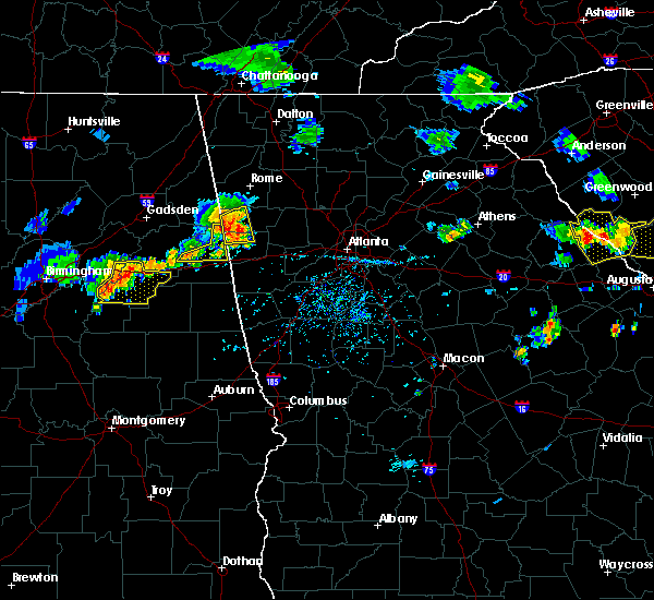 At 454 pm cdt, severe thunderstorms were located along a line extending from 6 miles north of mars hills to near fruithurst to near fort mcclellan, moving southeast at 35 mph (radar indicated). Hazards include 60 mph wind gusts and penny size hail. Expect damage to roofs, siding, and trees. Locations impacted include, heflin, fruithurst, edwardsville, muscadine, mars hills, sweetwater lake, borden springs, coleman lake and campground and oak level. At 454 pm cdt, severe thunderstorms were located along a line extending from 6 miles north of mars hills to near fruithurst to near fort mcclellan, moving southeast at 35 mph (radar indicated). Hazards include 60 mph wind gusts and penny size hail. Expect damage to roofs, siding, and trees. Locations impacted include, heflin, fruithurst, edwardsville, muscadine, mars hills, sweetwater lake, borden springs, coleman lake and campground and oak level.
|
| 7/6/2017 4:48 PM CDT |
 At 448 pm cdt, severe thunderstorms were located along a line extending from near cave spring to near heflin, moving east at 30 mph (radar indicated). Hazards include 60 mph wind gusts and penny size hail. Expect damage to roofs, siding, and trees. Locations impacted include, piedmont, heflin, forney, fruithurst, edwardsville, muscadine, pleasant gap, mars hills, sweetwater lake, coleman lake and campground, liberty hill, oak level and borden springs. At 448 pm cdt, severe thunderstorms were located along a line extending from near cave spring to near heflin, moving east at 30 mph (radar indicated). Hazards include 60 mph wind gusts and penny size hail. Expect damage to roofs, siding, and trees. Locations impacted include, piedmont, heflin, forney, fruithurst, edwardsville, muscadine, pleasant gap, mars hills, sweetwater lake, coleman lake and campground, liberty hill, oak level and borden springs.
|
| 7/6/2017 4:33 PM CDT |
 At 433 pm cdt, severe thunderstorms were located along a line extending from forney to near fort mcclellan, moving east at 30 mph (radar indicated). Hazards include 60 mph wind gusts and penny size hail. Expect damage to roofs, siding, and trees. Locations impacted include, anniston, jacksonville, piedmont, heflin, fort mcclellan, forney, saks, weaver, fruithurst, edwardsville, muscadine, pleasant gap, mars hills, blue mountain, sweetwater lake, coleman lake and campground, spring garden, liberty hill, oak level and borden springs. At 433 pm cdt, severe thunderstorms were located along a line extending from forney to near fort mcclellan, moving east at 30 mph (radar indicated). Hazards include 60 mph wind gusts and penny size hail. Expect damage to roofs, siding, and trees. Locations impacted include, anniston, jacksonville, piedmont, heflin, fort mcclellan, forney, saks, weaver, fruithurst, edwardsville, muscadine, pleasant gap, mars hills, blue mountain, sweetwater lake, coleman lake and campground, spring garden, liberty hill, oak level and borden springs.
|
| 7/6/2017 4:21 PM CDT |
 At 421 pm cdt, severe thunderstorms were located along a line extending from near moshat to blue mountain, moving east at 30 mph (radar indicated). Hazards include 60 mph wind gusts and penny size hail. expect damage to roofs, siding, and trees At 421 pm cdt, severe thunderstorms were located along a line extending from near moshat to blue mountain, moving east at 30 mph (radar indicated). Hazards include 60 mph wind gusts and penny size hail. expect damage to roofs, siding, and trees
|
| 6/23/2017 5:09 PM CDT |
 At 509 pm cdt, severe thunderstorms were located along a line extending from near piedmont to near mars hills to near fruithurst to edwardsville, moving northeast at 60 mph (radar indicated). Hazards include 60 mph wind gusts. Expect damage to roofs, siding, and trees. locations impacted include, heflin, edwardsville, mars hills, liberty hill, oak level, sweetwater lake, borden springs and coleman lake and campground. A tornado watch remains in effect until 800 pm cdt for northeastern alabama. At 509 pm cdt, severe thunderstorms were located along a line extending from near piedmont to near mars hills to near fruithurst to edwardsville, moving northeast at 60 mph (radar indicated). Hazards include 60 mph wind gusts. Expect damage to roofs, siding, and trees. locations impacted include, heflin, edwardsville, mars hills, liberty hill, oak level, sweetwater lake, borden springs and coleman lake and campground. A tornado watch remains in effect until 800 pm cdt for northeastern alabama.
|
| 6/23/2017 5:06 PM CDT |
 At 506 pm cdt, severe thunderstorms were located along a line extending from near piedmont to 7 miles west of mars hills to near fruithurst to near heflin, moving northeast at 60 mph (radar indicated). Hazards include 60 mph wind gusts. Expect damage to roofs, siding, and trees. locations impacted include, piedmont, heflin, forney, edwardsville, pleasant gap, mars hills, liberty hill, oak level, sweetwater lake, borden springs, coleman lake and campground and spring garden. A tornado watch remains in effect until 800 pm cdt for northeastern alabama. At 506 pm cdt, severe thunderstorms were located along a line extending from near piedmont to 7 miles west of mars hills to near fruithurst to near heflin, moving northeast at 60 mph (radar indicated). Hazards include 60 mph wind gusts. Expect damage to roofs, siding, and trees. locations impacted include, piedmont, heflin, forney, edwardsville, pleasant gap, mars hills, liberty hill, oak level, sweetwater lake, borden springs, coleman lake and campground and spring garden. A tornado watch remains in effect until 800 pm cdt for northeastern alabama.
|
| 6/23/2017 4:59 PM CDT |
 At 459 pm cdt, severe thunderstorms were located along a line extending from near piedmont to 9 miles east of jacksonville to near edwardsville to near heflin, moving northeast at 60 mph (radar indicated). Hazards include 60 mph wind gusts. Expect damage to roofs, siding, and trees. locations impacted include, piedmont, heflin, forney, edwardsville, pleasant gap, mars hills, sweetwater lake, coleman lake and campground, choccolocco, spring garden, liberty hill, oak level and borden springs. A tornado watch remains in effect until 800 pm cdt for northeastern alabama. At 459 pm cdt, severe thunderstorms were located along a line extending from near piedmont to 9 miles east of jacksonville to near edwardsville to near heflin, moving northeast at 60 mph (radar indicated). Hazards include 60 mph wind gusts. Expect damage to roofs, siding, and trees. locations impacted include, piedmont, heflin, forney, edwardsville, pleasant gap, mars hills, sweetwater lake, coleman lake and campground, choccolocco, spring garden, liberty hill, oak level and borden springs. A tornado watch remains in effect until 800 pm cdt for northeastern alabama.
|
| 6/23/2017 4:54 PM CDT |
 At 454 pm cdt, severe thunderstorms were located along a line extending from near piedmont to 7 miles east of jacksonville to near edwardsville to near heflin, moving northeast at 60 mph (radar indicated). Hazards include 60 mph wind gusts. Expect damage to roofs, siding, and trees. locations impacted include, anniston, oxford, jacksonville, piedmont, heflin, forney, edwardsville, pleasant gap, mars hills, jacksonville state university, sweetwater lake, coleman lake and campground, choccolocco, spring garden, dearmanville, liberty hill, oak level and borden springs. A tornado watch remains in effect until 800 pm cdt for northeastern alabama. At 454 pm cdt, severe thunderstorms were located along a line extending from near piedmont to 7 miles east of jacksonville to near edwardsville to near heflin, moving northeast at 60 mph (radar indicated). Hazards include 60 mph wind gusts. Expect damage to roofs, siding, and trees. locations impacted include, anniston, oxford, jacksonville, piedmont, heflin, forney, edwardsville, pleasant gap, mars hills, jacksonville state university, sweetwater lake, coleman lake and campground, choccolocco, spring garden, dearmanville, liberty hill, oak level and borden springs. A tornado watch remains in effect until 800 pm cdt for northeastern alabama.
|
| 6/23/2017 4:49 PM CDT |
 At 449 pm cdt, severe thunderstorms were located along a line extending from jacksonville to near jacksonville state university to near fort mcclellan to near anniston regional airport, moving northeast at 60 mph (radar indicated). Hazards include 60 mph wind gusts. Expect damage to roofs, siding, and trees. locations impacted include, anniston, oxford, jacksonville, piedmont, heflin, fort mcclellan, forney, saks, weaver, hobson city, edwardsville, pleasant gap, oxford lake, mars hills, jacksonville state university, alexandria, sweetwater lake, coleman lake and campground, choccolocco and spring garden. A tornado watch remains in effect until 800 pm cdt for northeastern alabama. At 449 pm cdt, severe thunderstorms were located along a line extending from jacksonville to near jacksonville state university to near fort mcclellan to near anniston regional airport, moving northeast at 60 mph (radar indicated). Hazards include 60 mph wind gusts. Expect damage to roofs, siding, and trees. locations impacted include, anniston, oxford, jacksonville, piedmont, heflin, fort mcclellan, forney, saks, weaver, hobson city, edwardsville, pleasant gap, oxford lake, mars hills, jacksonville state university, alexandria, sweetwater lake, coleman lake and campground, choccolocco and spring garden. A tornado watch remains in effect until 800 pm cdt for northeastern alabama.
|
| 6/23/2017 4:41 PM CDT |
 At 441 pm cdt, severe thunderstorms were located along a line extending from weaver to fort mcclellan to near anniston to near munford, moving northeast at 60 mph (radar indicated). Hazards include 60 mph wind gusts. Expect damage to roofs, siding, and trees. locations impacted include, anniston, oxford, jacksonville, piedmont, heflin, cobb town, forney, west end-cobb town, fort mcclellan, saks, weaver, hobson city, edwardsville, pleasant gap, blue mountain, alexandria, jacksonville state university, oxford lake, mars hills and coleman lake and campground. A tornado watch remains in effect until 800 pm cdt for northeastern alabama. At 441 pm cdt, severe thunderstorms were located along a line extending from weaver to fort mcclellan to near anniston to near munford, moving northeast at 60 mph (radar indicated). Hazards include 60 mph wind gusts. Expect damage to roofs, siding, and trees. locations impacted include, anniston, oxford, jacksonville, piedmont, heflin, cobb town, forney, west end-cobb town, fort mcclellan, saks, weaver, hobson city, edwardsville, pleasant gap, blue mountain, alexandria, jacksonville state university, oxford lake, mars hills and coleman lake and campground. A tornado watch remains in effect until 800 pm cdt for northeastern alabama.
|
| 6/23/2017 4:35 PM CDT |
 At 434 pm cdt, severe thunderstorms were located along a line extending from saks to blue mountain to oxford lake to near munford, moving northeast at 60 mph (radar indicated). Hazards include 60 mph wind gusts. expect damage to roofs, siding, and trees At 434 pm cdt, severe thunderstorms were located along a line extending from saks to blue mountain to oxford lake to near munford, moving northeast at 60 mph (radar indicated). Hazards include 60 mph wind gusts. expect damage to roofs, siding, and trees
|
| 6/15/2017 4:36 PM CDT |
 At 436 pm cdt, severe thunderstorms were located along a line extending from near bowdon to dexter, moving southeast at 40 mph (radar indicated). Hazards include 60 mph wind gusts. trees continue to be blown down by these storms. Expect damage to roofs, siding, and trees. Locations impacted include, alexander city, roanoke, tallassee, heflin, dadeville, lineville, ashland, goodwater, camp hill, wedowee, rockford, kellyton, weogufka, equality, stewartville, lake wedowee, jacksons` gap, new site, wadley and ranburne. At 436 pm cdt, severe thunderstorms were located along a line extending from near bowdon to dexter, moving southeast at 40 mph (radar indicated). Hazards include 60 mph wind gusts. trees continue to be blown down by these storms. Expect damage to roofs, siding, and trees. Locations impacted include, alexander city, roanoke, tallassee, heflin, dadeville, lineville, ashland, goodwater, camp hill, wedowee, rockford, kellyton, weogufka, equality, stewartville, lake wedowee, jacksons` gap, new site, wadley and ranburne.
|
| 6/15/2017 4:12 PM CDT |
 At 411 pm cdt, severe thunderstorms were located along a line extending from near mars hills to near booth, moving southeast at 50 mph (radar indicated). Hazards include 60 mph wind gusts. trees have been reported blown down by these storms. expect damage to roofs, siding, and trees At 411 pm cdt, severe thunderstorms were located along a line extending from near mars hills to near booth, moving southeast at 50 mph (radar indicated). Hazards include 60 mph wind gusts. trees have been reported blown down by these storms. expect damage to roofs, siding, and trees
|
| 5/28/2017 4:18 AM CDT |
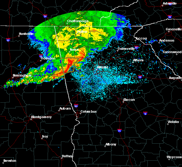 At 418 am cdt, severe thunderstorms were located along a line extending from 6 miles southeast of heflin to near muscadine, moving southeast at 15 mph (radar indicated). Hazards include 60 mph wind gusts. Expect damage to roofs, siding, and trees. Locations impacted include, heflin, ranburne, fruithurst, edwardsville, muscadine, abernathy, trickem, lake cleburne and i 20 welcome center. At 418 am cdt, severe thunderstorms were located along a line extending from 6 miles southeast of heflin to near muscadine, moving southeast at 15 mph (radar indicated). Hazards include 60 mph wind gusts. Expect damage to roofs, siding, and trees. Locations impacted include, heflin, ranburne, fruithurst, edwardsville, muscadine, abernathy, trickem, lake cleburne and i 20 welcome center.
|
| 5/28/2017 4:02 AM CDT |
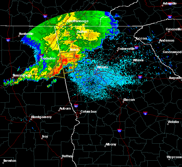 At 402 am cdt, severe thunderstorms were located along a line extending from near heflin to 6 miles north of mars hills, moving east at 45 mph (radar indicated). Hazards include 60 mph wind gusts and penny size hail. Expect damage to roofs, siding, and trees. Locations impacted include, heflin, ranburne, fruithurst, edwardsville, muscadine, abernathy, mars hills, sweetwater lake, coleman lake and campground, trickem, lake cleburne, i 20 welcome center, liberty hill, oak level and borden springs. At 402 am cdt, severe thunderstorms were located along a line extending from near heflin to 6 miles north of mars hills, moving east at 45 mph (radar indicated). Hazards include 60 mph wind gusts and penny size hail. Expect damage to roofs, siding, and trees. Locations impacted include, heflin, ranburne, fruithurst, edwardsville, muscadine, abernathy, mars hills, sweetwater lake, coleman lake and campground, trickem, lake cleburne, i 20 welcome center, liberty hill, oak level and borden springs.
|
| 5/28/2017 3:40 AM CDT |
 At 340 am cdt, severe thunderstorms were located along a line extending from blue mountain to near piedmont, moving east at 55 mph (radar indicated). Hazards include 60 mph wind gusts. expect damage to roofs, siding, and trees At 340 am cdt, severe thunderstorms were located along a line extending from blue mountain to near piedmont, moving east at 55 mph (radar indicated). Hazards include 60 mph wind gusts. expect damage to roofs, siding, and trees
|
| 4/5/2017 4:54 PM CDT |
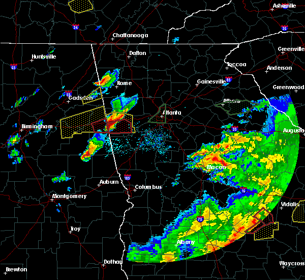 The tornado warning for southeastern cleburne county will expire at 500 pm cdt, the tornadic thunderstorm which prompted the warning has moved out of the warned area. therefore, the warning will be allowed to expire. a tornado watch remains in effect until 900 pm cdt for east central alabama. The tornado warning for southeastern cleburne county will expire at 500 pm cdt, the tornadic thunderstorm which prompted the warning has moved out of the warned area. therefore, the warning will be allowed to expire. a tornado watch remains in effect until 900 pm cdt for east central alabama.
|
| 4/5/2017 4:39 PM CDT | Tennis Ball sized hail reported 6.6 miles NNE of Heflin, AL, golfball- to tennis ball-sized hail. |
| 4/5/2017 4:34 PM CDT |
 At 434 pm cdt, a severe thunderstorm capable of producing a tornado was located near heflin, moving east at 55 mph (radar indicated rotation). Hazards include tornado and two inch hail. Flying debris will be dangerous to those caught without shelter. mobile homes will be damaged or destroyed. damage to roofs, windows, and vehicles will occur. tree damage is likely. Locations impacted include, heflin, ranburne, abernathy, trickem, lake cleburne and i 20 welcome center. At 434 pm cdt, a severe thunderstorm capable of producing a tornado was located near heflin, moving east at 55 mph (radar indicated rotation). Hazards include tornado and two inch hail. Flying debris will be dangerous to those caught without shelter. mobile homes will be damaged or destroyed. damage to roofs, windows, and vehicles will occur. tree damage is likely. Locations impacted include, heflin, ranburne, abernathy, trickem, lake cleburne and i 20 welcome center.
|
| 4/5/2017 4:30 PM CDT |
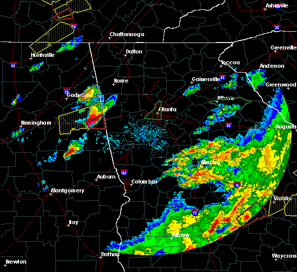 At 430 pm cdt, a severe thunderstorm capable of producing a tornado was located near heflin, moving east at 55 mph (radar indicated rotation). Hazards include tornado and golf ball size hail. Flying debris will be dangerous to those caught without shelter. mobile homes will be damaged or destroyed. damage to roofs, windows, and vehicles will occur. tree damage is likely. Locations impacted include, heflin, ranburne, abernathy, trickem, lake cleburne and i 20 welcome center. At 430 pm cdt, a severe thunderstorm capable of producing a tornado was located near heflin, moving east at 55 mph (radar indicated rotation). Hazards include tornado and golf ball size hail. Flying debris will be dangerous to those caught without shelter. mobile homes will be damaged or destroyed. damage to roofs, windows, and vehicles will occur. tree damage is likely. Locations impacted include, heflin, ranburne, abernathy, trickem, lake cleburne and i 20 welcome center.
|
| 4/5/2017 4:28 PM CDT | Golf Ball sized hail reported 2 miles SE of Heflin, AL |
| 4/5/2017 4:23 PM CDT | Hen Egg sized hail reported 6.6 miles NNE of Heflin, AL, golfball- to tennis ball-sized hail. time corrected (estimated). |
| 4/5/2017 4:23 PM CDT | Hen Egg sized hail reported 3.5 miles NE of Heflin, AL |
| 4/5/2017 4:22 PM CDT |
 At 422 pm cdt, a severe thunderstorm capable of producing a tornado was located near heflin, moving east at 55 mph (radar indicated rotation). Hazards include tornado. Flying debris will be dangerous to those caught without shelter. mobile homes will be damaged or destroyed. damage to roofs, windows, and vehicles will occur. tree damage is likely. Locations impacted include, heflin, ranburne, abernathy, trickem, lake cleburne, hollis crossroads, i 20 welcome center, micaville, chalafinnee and camp sequoyah. At 422 pm cdt, a severe thunderstorm capable of producing a tornado was located near heflin, moving east at 55 mph (radar indicated rotation). Hazards include tornado. Flying debris will be dangerous to those caught without shelter. mobile homes will be damaged or destroyed. damage to roofs, windows, and vehicles will occur. tree damage is likely. Locations impacted include, heflin, ranburne, abernathy, trickem, lake cleburne, hollis crossroads, i 20 welcome center, micaville, chalafinnee and camp sequoyah.
|
| 4/5/2017 4:08 PM CDT |
 At 408 pm cdt, a severe thunderstorm capable of producing a tornado was located over mount cheaha, or near oxford, moving east at 55 mph (radar indicated rotation). Hazards include tornado. Flying debris will be dangerous to those caught without shelter. mobile homes will be damaged or destroyed. damage to roofs, windows, and vehicles will occur. Tree damage is likely. At 408 pm cdt, a severe thunderstorm capable of producing a tornado was located over mount cheaha, or near oxford, moving east at 55 mph (radar indicated rotation). Hazards include tornado. Flying debris will be dangerous to those caught without shelter. mobile homes will be damaged or destroyed. damage to roofs, windows, and vehicles will occur. Tree damage is likely.
|
| 4/5/2017 3:48 PM CDT |
 At 348 pm cdt, a severe thunderstorm was located over talladega municipal airport, or 8 miles northeast of talladega, moving east at 35 mph (radar indicated). Hazards include two inch hail and 60 mph wind gusts. People and animals outdoors will be injured. expect hail damage to roofs, siding, windows, and vehicles. Expect wind damage to roofs, siding, and trees. At 348 pm cdt, a severe thunderstorm was located over talladega municipal airport, or 8 miles northeast of talladega, moving east at 35 mph (radar indicated). Hazards include two inch hail and 60 mph wind gusts. People and animals outdoors will be injured. expect hail damage to roofs, siding, windows, and vehicles. Expect wind damage to roofs, siding, and trees.
|
| 4/5/2017 5:49 AM CDT |
 At 549 am cdt, a severe thunderstorm was located 7 miles northwest of edwardsville, or 8 miles north of heflin, moving northeast at 55 mph (radar indicated). Hazards include 60 mph wind gusts and half dollar size hail. Hail damage to vehicles is expected. expect wind damage to roofs, siding, and trees. Locations impacted include, anniston, oxford, jacksonville, piedmont, heflin, weaver, fruithurst, edwardsville, mars hills, jacksonville state university, sweetwater lake, coleman lake and campground, choccolocco, dearmanville, liberty hill, chalafinnee, oak level, borden springs and camp sequoyah. At 549 am cdt, a severe thunderstorm was located 7 miles northwest of edwardsville, or 8 miles north of heflin, moving northeast at 55 mph (radar indicated). Hazards include 60 mph wind gusts and half dollar size hail. Hail damage to vehicles is expected. expect wind damage to roofs, siding, and trees. Locations impacted include, anniston, oxford, jacksonville, piedmont, heflin, weaver, fruithurst, edwardsville, mars hills, jacksonville state university, sweetwater lake, coleman lake and campground, choccolocco, dearmanville, liberty hill, chalafinnee, oak level, borden springs and camp sequoyah.
|
| 4/5/2017 5:37 AM CDT |
 At 537 am cdt, a severe thunderstorm was located near anniston, moving northeast at 55 mph (radar indicated). Hazards include golf ball size hail and 60 mph wind gusts. People and animals outdoors will be injured. expect hail damage to roofs, siding, windows, and vehicles. expect wind damage to roofs, siding, and trees. Locations impacted include, anniston, oxford, jacksonville, piedmont, heflin, cobb town, west end-cobb town, fort mcclellan, saks, weaver, hobson city, fruithurst, edwardsville, blue mountain, jacksonville state university, oxford lake, mars hills, coleman lake and campground, choccolocco and liberty hill. At 537 am cdt, a severe thunderstorm was located near anniston, moving northeast at 55 mph (radar indicated). Hazards include golf ball size hail and 60 mph wind gusts. People and animals outdoors will be injured. expect hail damage to roofs, siding, windows, and vehicles. expect wind damage to roofs, siding, and trees. Locations impacted include, anniston, oxford, jacksonville, piedmont, heflin, cobb town, west end-cobb town, fort mcclellan, saks, weaver, hobson city, fruithurst, edwardsville, blue mountain, jacksonville state university, oxford lake, mars hills, coleman lake and campground, choccolocco and liberty hill.
|
| 4/5/2017 5:27 AM CDT |
 At 527 am cdt, a severe thunderstorm was located over anniston regional airport, or over oxford, moving northeast at 55 mph (radar indicated). Hazards include golf ball size hail and 60 mph wind gusts. People and animals outdoors will be injured. expect hail damage to roofs, siding, windows, and vehicles. expect wind damage to roofs, siding, and trees. Locations impacted include, anniston, oxford, jacksonville, piedmont, heflin, cobb town, west end-cobb town, fort mcclellan, saks, weaver, munford, hobson city, fruithurst, edwardsville, anniston regional airport, blue mountain, jacksonville state university, grant town, oxford lake and mars hills. At 527 am cdt, a severe thunderstorm was located over anniston regional airport, or over oxford, moving northeast at 55 mph (radar indicated). Hazards include golf ball size hail and 60 mph wind gusts. People and animals outdoors will be injured. expect hail damage to roofs, siding, windows, and vehicles. expect wind damage to roofs, siding, and trees. Locations impacted include, anniston, oxford, jacksonville, piedmont, heflin, cobb town, west end-cobb town, fort mcclellan, saks, weaver, munford, hobson city, fruithurst, edwardsville, anniston regional airport, blue mountain, jacksonville state university, grant town, oxford lake and mars hills.
|
| 4/5/2017 5:22 AM CDT |
 At 522 am cdt, a severe thunderstorm was located near grant town, or 7 miles southwest of oxford, moving northeast at 50 mph (radar indicated). Hazards include 60 mph wind gusts and half dollar size hail. Hail damage to vehicles is expected. Expect wind damage to roofs, siding, and trees. At 522 am cdt, a severe thunderstorm was located near grant town, or 7 miles southwest of oxford, moving northeast at 50 mph (radar indicated). Hazards include 60 mph wind gusts and half dollar size hail. Hail damage to vehicles is expected. Expect wind damage to roofs, siding, and trees.
|
| 7/21/2016 8:42 PM CDT |
 At 841 pm cdt, severe thunderstorms were located along a line extending from near anniston to near delta, moving south southwest at 10 mph (radar indicated). Hazards include 60 mph wind gusts and penny size hail. Expect damage to roofs. siding. and trees. Locations impacted include, anniston, oxford, heflin, lineville, oxford lake, barfield, delta, fosters cross roads, mount cheaha, chalafinnee, choccolocco, dearmanville, hollis crossroads and camp sequoyah. At 841 pm cdt, severe thunderstorms were located along a line extending from near anniston to near delta, moving south southwest at 10 mph (radar indicated). Hazards include 60 mph wind gusts and penny size hail. Expect damage to roofs. siding. and trees. Locations impacted include, anniston, oxford, heflin, lineville, oxford lake, barfield, delta, fosters cross roads, mount cheaha, chalafinnee, choccolocco, dearmanville, hollis crossroads and camp sequoyah.
|
| 7/21/2016 8:29 PM CDT |
 At 828 pm cdt, severe thunderstorms were located along a line extending from near heflin to near delta, moving west at 10 mph (radar indicated). Hazards include 60 mph wind gusts and penny size hail. Expect damage to roofs. siding. And trees. At 828 pm cdt, severe thunderstorms were located along a line extending from near heflin to near delta, moving west at 10 mph (radar indicated). Hazards include 60 mph wind gusts and penny size hail. Expect damage to roofs. siding. And trees.
|
| 7/21/2016 8:27 PM CDT | Trees were blown down along highway 43 in cleburne county AL, 9.9 miles ENE of Heflin, AL |
| 7/21/2016 8:24 PM CDT |
 At 824 pm cdt, severe thunderstorms were located along a line extending from near heflin to near delta, moving southwest at 10 mph (radar indicated). Hazards include 60 mph wind gusts. Expect damage to roofs. siding. and trees. Locations impacted include, anniston, oxford, heflin, delta, hollis crossroads, camp sequoyah, chalafinnee, dearmanville and micaville. At 824 pm cdt, severe thunderstorms were located along a line extending from near heflin to near delta, moving southwest at 10 mph (radar indicated). Hazards include 60 mph wind gusts. Expect damage to roofs. siding. and trees. Locations impacted include, anniston, oxford, heflin, delta, hollis crossroads, camp sequoyah, chalafinnee, dearmanville and micaville.
|
| 7/21/2016 8:06 PM CDT |
 At 806 pm cdt, severe thunderstorms were located along a line extending from near heflin to near delta, moving southwest at 10 mph (radar indicated). Hazards include 60 mph wind gusts. Expect damage to roofs. siding. And trees. At 806 pm cdt, severe thunderstorms were located along a line extending from near heflin to near delta, moving southwest at 10 mph (radar indicated). Hazards include 60 mph wind gusts. Expect damage to roofs. siding. And trees.
|
| 6/17/2016 3:06 PM CDT |
 At 305 pm cdt, severe thunderstorms were located along a line extending from near ball flat to mars hills, moving south at 15 mph (radar indicated). Hazards include 60 mph wind gusts and quarter size hail. Hail damage to vehicles is expected. expect wind damage to roofs, siding, and trees. Locations impacted include, piedmont, heflin, ranburne, fruithurst, edwardsville, mars hills, muscadine, pleasant gap, abernathy, sweetwater lake, chalafinnee, oak level, i 20 welcome center, coleman lake and campground, spring garden, lake cleburne, borden springs, hollis crossroads, camp sequoyah and trickem. At 305 pm cdt, severe thunderstorms were located along a line extending from near ball flat to mars hills, moving south at 15 mph (radar indicated). Hazards include 60 mph wind gusts and quarter size hail. Hail damage to vehicles is expected. expect wind damage to roofs, siding, and trees. Locations impacted include, piedmont, heflin, ranburne, fruithurst, edwardsville, mars hills, muscadine, pleasant gap, abernathy, sweetwater lake, chalafinnee, oak level, i 20 welcome center, coleman lake and campground, spring garden, lake cleburne, borden springs, hollis crossroads, camp sequoyah and trickem.
|
| 6/17/2016 2:59 PM CDT |
 At 259 pm cdt, severe thunderstorms were located along a line extending from near dallas to near bowdon, moving south at 35 mph (radar indicated). Hazards include 70 mph wind gusts and quarter size hail. Hail damage to vehicles is expected. expect considerable tree damage. Wind damage is also likely to mobile homes, roofs, and outbuildings. At 259 pm cdt, severe thunderstorms were located along a line extending from near dallas to near bowdon, moving south at 35 mph (radar indicated). Hazards include 70 mph wind gusts and quarter size hail. Hail damage to vehicles is expected. expect considerable tree damage. Wind damage is also likely to mobile homes, roofs, and outbuildings.
|
| 6/17/2016 2:40 PM CDT |
 At 240 pm cdt, severe thunderstorms were located along a line extending from near tennala to near mars hills, moving south at 20 mph (radar indicated). Hazards include 60 mph wind gusts and quarter size hail. Hail damage to vehicles is expected. expect wind damage to roofs, siding, and trees. Locations impacted include, piedmont, centre, heflin, ranburne, fruithurst, edwardsville, tennala, mars hills, muscadine, pleasant gap, abernathy, moshat, eastern weiss lake, i 20 welcome center, coloma, hollis crossroads, sweetwater lake, chalafinnee, oak level and coleman lake and campground. At 240 pm cdt, severe thunderstorms were located along a line extending from near tennala to near mars hills, moving south at 20 mph (radar indicated). Hazards include 60 mph wind gusts and quarter size hail. Hail damage to vehicles is expected. expect wind damage to roofs, siding, and trees. Locations impacted include, piedmont, centre, heflin, ranburne, fruithurst, edwardsville, tennala, mars hills, muscadine, pleasant gap, abernathy, moshat, eastern weiss lake, i 20 welcome center, coloma, hollis crossroads, sweetwater lake, chalafinnee, oak level and coleman lake and campground.
|
| 6/17/2016 2:26 PM CDT |
 At 226 pm cdt, severe thunderstorms were located along a line extending from tennala to near mars hills, moving south at 25 mph (radar indicated). Hazards include 60 mph wind gusts and quarter size hail. Hail damage to vehicles is expected. Expect wind damage to roofs, siding, and trees. At 226 pm cdt, severe thunderstorms were located along a line extending from tennala to near mars hills, moving south at 25 mph (radar indicated). Hazards include 60 mph wind gusts and quarter size hail. Hail damage to vehicles is expected. Expect wind damage to roofs, siding, and trees.
|
| 8/10/2015 6:59 PM CDT |
 At 659 pm cdt, severe thunderstorms were located along a line extending from near ranburne to morrison cross roads to fosters cross roads to near delta, moving southeast at 30 mph (radar indicated). Hazards include 60 mph wind gusts. Expect damage to roofs. siding and trees. Locations impacted include, roanoke, heflin, wedowee, lake wedowee, ranburne, woodland, morrison cross roads, delta, crystal lake, fosters cross roads, barfield, abernathy, corinth, napoleon, hollis crossroads, rock stand, newell, tennant, rock mills and chalafinnee. At 659 pm cdt, severe thunderstorms were located along a line extending from near ranburne to morrison cross roads to fosters cross roads to near delta, moving southeast at 30 mph (radar indicated). Hazards include 60 mph wind gusts. Expect damage to roofs. siding and trees. Locations impacted include, roanoke, heflin, wedowee, lake wedowee, ranburne, woodland, morrison cross roads, delta, crystal lake, fosters cross roads, barfield, abernathy, corinth, napoleon, hollis crossroads, rock stand, newell, tennant, rock mills and chalafinnee.
|
| 8/10/2015 6:47 PM CDT |
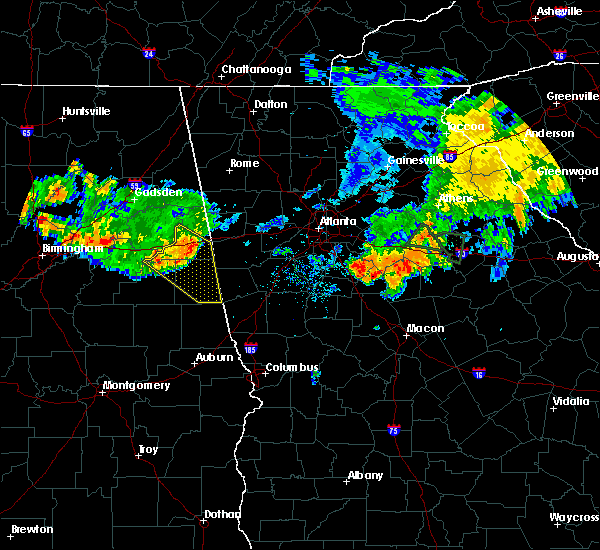 At 646 pm cdt, severe thunderstorms were located along a line extending from near edwardsville to near fosters cross roads to near delta to near mount cheaha, moving southeast at 35 mph (radar indicated). Hazards include 60 mph wind gusts. Expect damage to roofs. siding and trees. Locations impacted include, roanoke, heflin, wedowee, lake wedowee, ranburne, edwardsville, woodland, morrison cross roads, delta, crystal lake, fosters cross roads, barfield, abernathy, mount cheaha, corinth, napoleon, hollis crossroads, rock stand, newell and sweetwater lake. At 646 pm cdt, severe thunderstorms were located along a line extending from near edwardsville to near fosters cross roads to near delta to near mount cheaha, moving southeast at 35 mph (radar indicated). Hazards include 60 mph wind gusts. Expect damage to roofs. siding and trees. Locations impacted include, roanoke, heflin, wedowee, lake wedowee, ranburne, edwardsville, woodland, morrison cross roads, delta, crystal lake, fosters cross roads, barfield, abernathy, mount cheaha, corinth, napoleon, hollis crossroads, rock stand, newell and sweetwater lake.
|
| 8/10/2015 6:30 PM CDT |
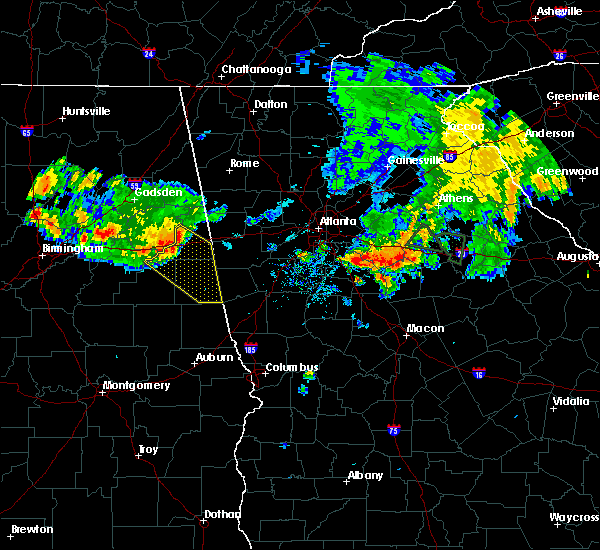 At 629 pm cdt, severe thunderstorms were located along a line extending from near heflin to 7 miles east of oxford lake to near oxford to anniston regional airport, moving southeast at 35 mph (radar indicated). Hazards include 60 mph wind gusts. Expect damage to roofs. Siding and trees. At 629 pm cdt, severe thunderstorms were located along a line extending from near heflin to 7 miles east of oxford lake to near oxford to anniston regional airport, moving southeast at 35 mph (radar indicated). Hazards include 60 mph wind gusts. Expect damage to roofs. Siding and trees.
|
| 7/14/2015 8:45 PM CDT |
 At 845 pm cdt, severe thunderstorms were located along a line extending from near cedartown to near jacksonville to anniston regional airport, moving southeast at 40 mph (radar indicated). Hazards include 60 mph wind gusts. Expect damage to roofs. Siding and trees. At 845 pm cdt, severe thunderstorms were located along a line extending from near cedartown to near jacksonville to anniston regional airport, moving southeast at 40 mph (radar indicated). Hazards include 60 mph wind gusts. Expect damage to roofs. Siding and trees.
|
| 6/26/2015 12:49 PM CDT | Large tree down close to exit 205 on i-2 in cleburne county AL, 1.9 miles WSW of Heflin, AL |
| 6/26/2015 12:42 PM CDT | Powerline down on oxford st in cleburne county AL, 2 miles SE of Heflin, AL |
| 6/26/2015 12:37 PM CDT |
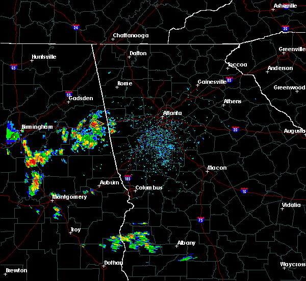 At 1237 pm cdt, a severe thunderstorm was located over heflin, moving northeast at 10 mph (radar indicated). Hazards include 60 mph wind gusts and nickel size hail. Expect damage to roofs. Siding and trees. At 1237 pm cdt, a severe thunderstorm was located over heflin, moving northeast at 10 mph (radar indicated). Hazards include 60 mph wind gusts and nickel size hail. Expect damage to roofs. Siding and trees.
|
| 6/25/2015 5:20 PM CDT |
 The severe thunderstorm warning for northeastern cleburne county will expire at 530 pm cdt, the storm which prompted the warning has weakened below severe limits, and no longer pose an immediate threat to life or property. therefore the warning will be allowed to expire. however gusty winds and heavy rain are still possible with this thunderstorm. The severe thunderstorm warning for northeastern cleburne county will expire at 530 pm cdt, the storm which prompted the warning has weakened below severe limits, and no longer pose an immediate threat to life or property. therefore the warning will be allowed to expire. however gusty winds and heavy rain are still possible with this thunderstorm.
|
| 6/25/2015 5:14 PM CDT |
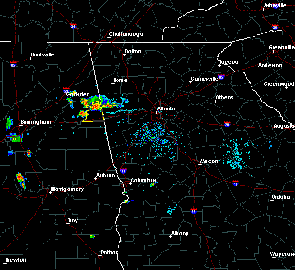 At 513 pm cdt, a severe thunderstorm was located near mars hills, or 9 miles southeast of piedmont, moving south at 15 mph (radar indicated). Hazards include 60 mph wind gusts and quarter size hail. Hail damage to vehicles is expected. expect wind damage to roofs, siding and trees. Locations impacted include, heflin, fruithurst, edwardsville, abernathy, mars hills, muscadine, sweetwater lake, oak level, i 20 welcome center, coleman lake and campground and lake cleburne. At 513 pm cdt, a severe thunderstorm was located near mars hills, or 9 miles southeast of piedmont, moving south at 15 mph (radar indicated). Hazards include 60 mph wind gusts and quarter size hail. Hail damage to vehicles is expected. expect wind damage to roofs, siding and trees. Locations impacted include, heflin, fruithurst, edwardsville, abernathy, mars hills, muscadine, sweetwater lake, oak level, i 20 welcome center, coleman lake and campground and lake cleburne.
|
| 6/25/2015 4:58 PM CDT |
 At 458 pm cdt, a severe thunderstorm was located near piedmont, moving south at 15 mph (radar indicated). Hazards include 60 mph wind gusts and quarter size hail. Hail damage to vehicles is expected. Expect wind damage to roofs, siding and trees. At 458 pm cdt, a severe thunderstorm was located near piedmont, moving south at 15 mph (radar indicated). Hazards include 60 mph wind gusts and quarter size hail. Hail damage to vehicles is expected. Expect wind damage to roofs, siding and trees.
|
| 6/24/2015 7:43 PM CDT | Trees down along county 19 in cleburne county AL, 5 miles N of Heflin, AL |
| 6/24/2015 7:38 PM CDT | Quarter sized hail reported 5 miles N of Heflin, AL, along county 19 |
| 6/24/2015 7:36 PM CDT |
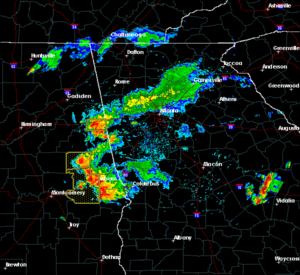 At 735 pm cdt, a severe thunderstorm was located 7 miles west of ranburne, or 10 miles southeast of heflin, moving south at 15 mph (radar indicated). Hazards include 60 mph wind gusts and quarter size hail. Hail damage to vehicles is expected. expect wind damage to roofs, siding and trees. Locations impacted include, heflin, ranburne, abernathy, hollis crossroads, trickem, chalafinnee, i 20 welcome center, lake cleburne and micaville. At 735 pm cdt, a severe thunderstorm was located 7 miles west of ranburne, or 10 miles southeast of heflin, moving south at 15 mph (radar indicated). Hazards include 60 mph wind gusts and quarter size hail. Hail damage to vehicles is expected. expect wind damage to roofs, siding and trees. Locations impacted include, heflin, ranburne, abernathy, hollis crossroads, trickem, chalafinnee, i 20 welcome center, lake cleburne and micaville.
|
| 6/24/2015 7:14 PM CDT |
 At 713 pm cdt, a severe thunderstorm was located near abernathy, or 7 miles east of heflin, moving south at 15 mph (radar indicated). Hazards include 60 mph wind gusts and quarter size hail. Hail damage to vehicles is expected. Expect wind damage to roofs, siding and trees. At 713 pm cdt, a severe thunderstorm was located near abernathy, or 7 miles east of heflin, moving south at 15 mph (radar indicated). Hazards include 60 mph wind gusts and quarter size hail. Hail damage to vehicles is expected. Expect wind damage to roofs, siding and trees.
|
| 4/19/2015 9:41 AM CDT | The severe thunderstorm warning for eastern cleburne county will expire at 945 am cdt, the storms which prompted the warning have weakened below severe limits, and no longer pose an immediate threat to life or property. therefore the warning will be allowed to expire. to report severe weather, contact your nearest law enforcement agency. they will relay your report to the national weather service birmingham. |
| 4/19/2015 9:35 AM CDT | At 934 am cdt, severe thunderstorms were located along a line extending from 6 miles south of summerville to near cedartown to near abernathy, moving northeast at 35 mph (radar indicated). Hazards include 60 mph wind gusts. Expect damage to roofs. siding and trees. locations impacted include, fruithurst, edwardsville, abernathy, mars hills, muscadine, trickem, i 20 welcome center, lake cleburne and oak level. 75in. |
| 4/19/2015 9:28 AM CDT | At 927 am cdt, severe thunderstorms were located along a line extending from 9 miles northeast of gaylesville to 6 miles north of mars hills to near heflin, moving northeast at 35 mph (radar indicated). Hazards include 60 mph wind gusts. Expect damage to roofs. siding and trees. locations impacted include, heflin, forney, fruithurst, edwardsville, mars hills, muscadine, abernathy, eastern weiss lake, oak level, i 20 welcome center, lake cleburne, borden springs, trickem and waterhouse. 75in. |
| 4/19/2015 9:14 AM CDT | At 914 am cdt, severe thunderstorms were located along a line extending from 9 miles west of summerville to 6 miles northwest of mars hills to near delta, moving east at 55 mph (radar indicated). Hazards include 60 mph wind gusts. Expect damage to roofs. Siding and trees. |
| 4/19/2015 9:08 AM CDT | At 908 am cdt, severe thunderstorms were located along a line extending from 9 miles west of summerville to near pleasant gap to near delta, moving east at 35 mph (trained weather spotters). Hazards include 60 mph wind gusts. Expect damage to roofs. siding and trees. locations impacted include, anniston, oxford, jacksonville, piedmont, centre, heflin, cedar bluff, forney, little river canyon national preserve, centre municipal airport, ranburne, fruithurst, edwardsville, gaylesville, tennala, blanche, mars hills, muscadine, pleasant gap and eastern weiss lake. a tornado watch remains in effect until 200 pm cdt for east central alabama. 75in. |
| 4/19/2015 8:52 AM CDT | At 852 am cdt, severe thunderstorms were located along a line extending from 9 miles east of ider to near anniston regional airport, moving east at 55 mph (trained weather spotters). Hazards include 60 mph wind gusts. Expect damage to roofs. Siding and trees. |
| 3/31/2015 5:00 PM CDT | The national weather service in birmingham has issued a * severe thunderstorm warning for. southeastern cleburne county in east central alabama. until 545 pm cdt * at 500 pm cdt. a severe thunderstorm was located near heflin. Moving east at 50 mph. |
| 3/31/2015 4:41 PM CDT | The national weather service in birmingham has issued a * severe thunderstorm warning for. east central cleburne county in east central alabama. until 515 pm cdt * at 441 pm cdt. a severe thunderstorm was located near heflin. Moving southeast at 35 mph. |
| 3/31/2015 4:36 PM CDT | The national weather service in birmingham has issued a * severe thunderstorm warning for. south central calhoun county in east central alabama. southern cleburne county in east central alabama. east central talladega county in east central alabama. Until 500 pm cdt. |
| 1/1/0001 12:00 AM | Trees down along interstate 2 in cleburne county AL, 2.7 miles NE of Heflin, AL |
| 1/1/0001 12:00 AM | Metal roof damaged and powerlines down. winds estimated up to 50 mph from rada in cleburne county AL, 2.2 miles ESE of Heflin, AL |
| 1/1/0001 12:00 AM | Tree down near heflin along highway 7 in cleburne county AL, 2.2 miles ESE of Heflin, AL |
| 1/1/0001 12:00 AM | Quarter sized hail reported 8.7 miles NNW of Heflin, AL, public report of quarter sized hail on county road 5...near micaville. |
| 1/1/0001 12:00 AM | Several trees down along perryman bridge rd and evans bridge rd between heflin and interstate 20 in cleburne county AL, 1.6 miles E of Heflin, AL |
Hail Maps for Heflin, AL


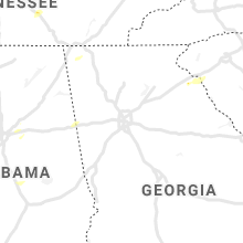


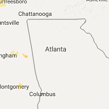


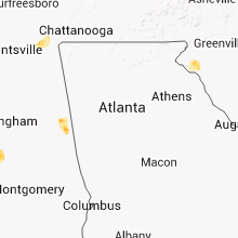


Connect with Interactive Hail Maps