

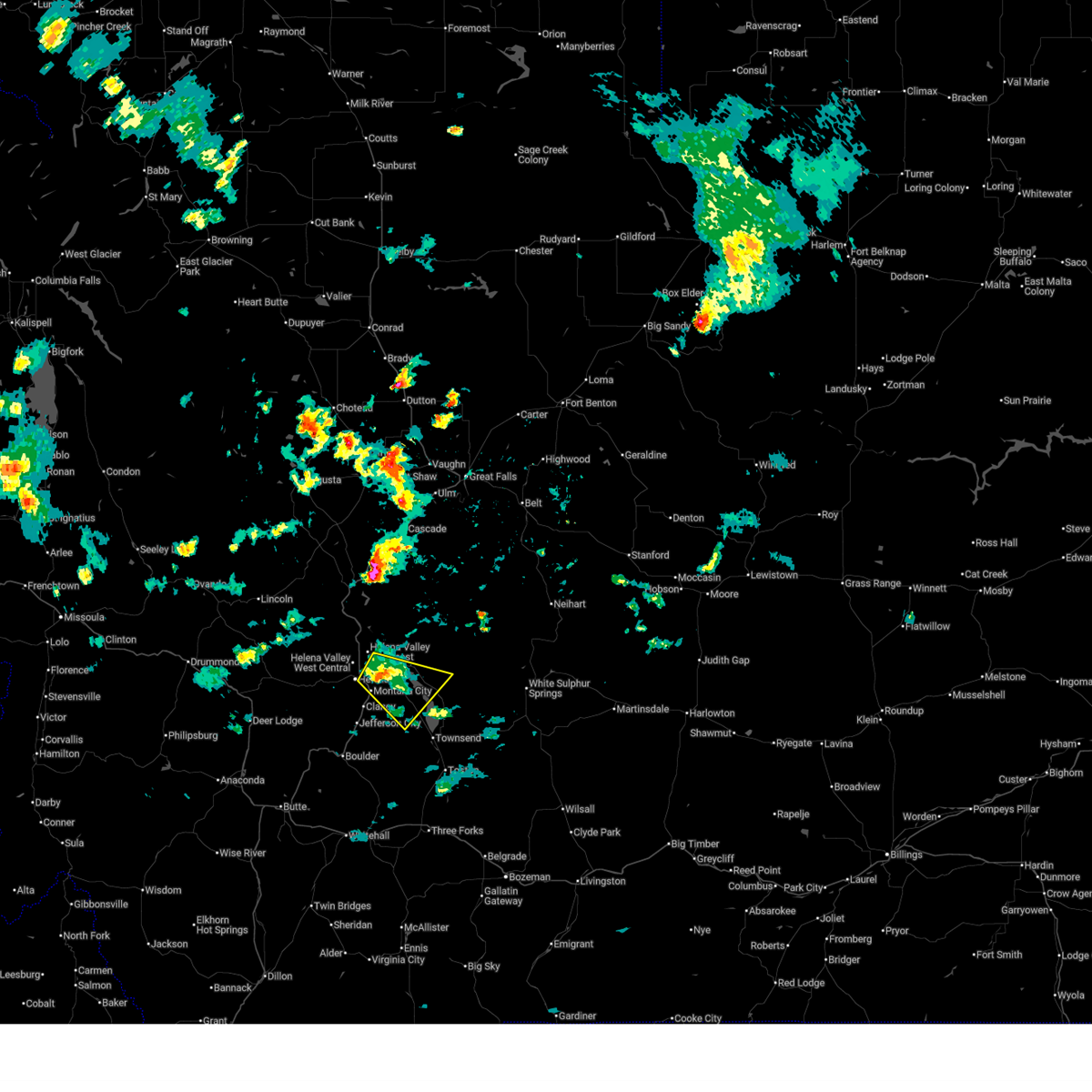
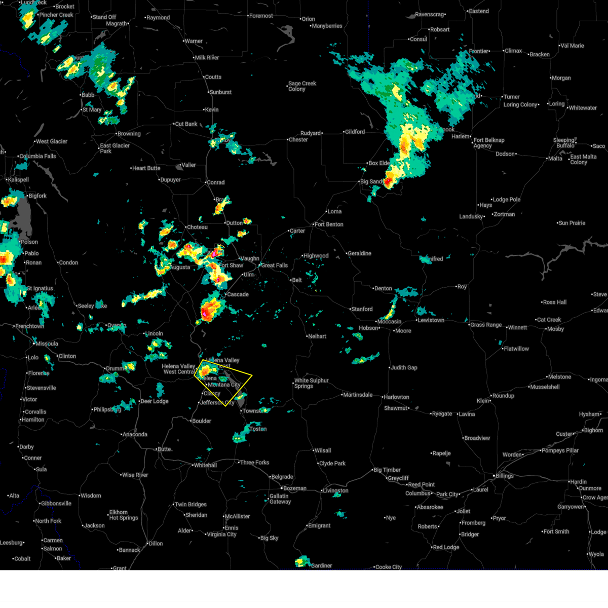
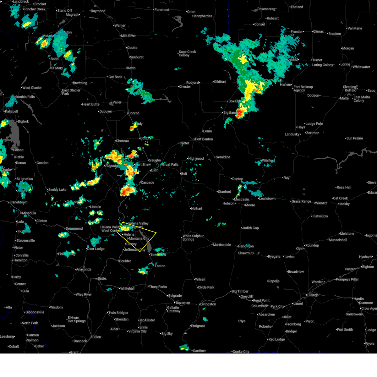
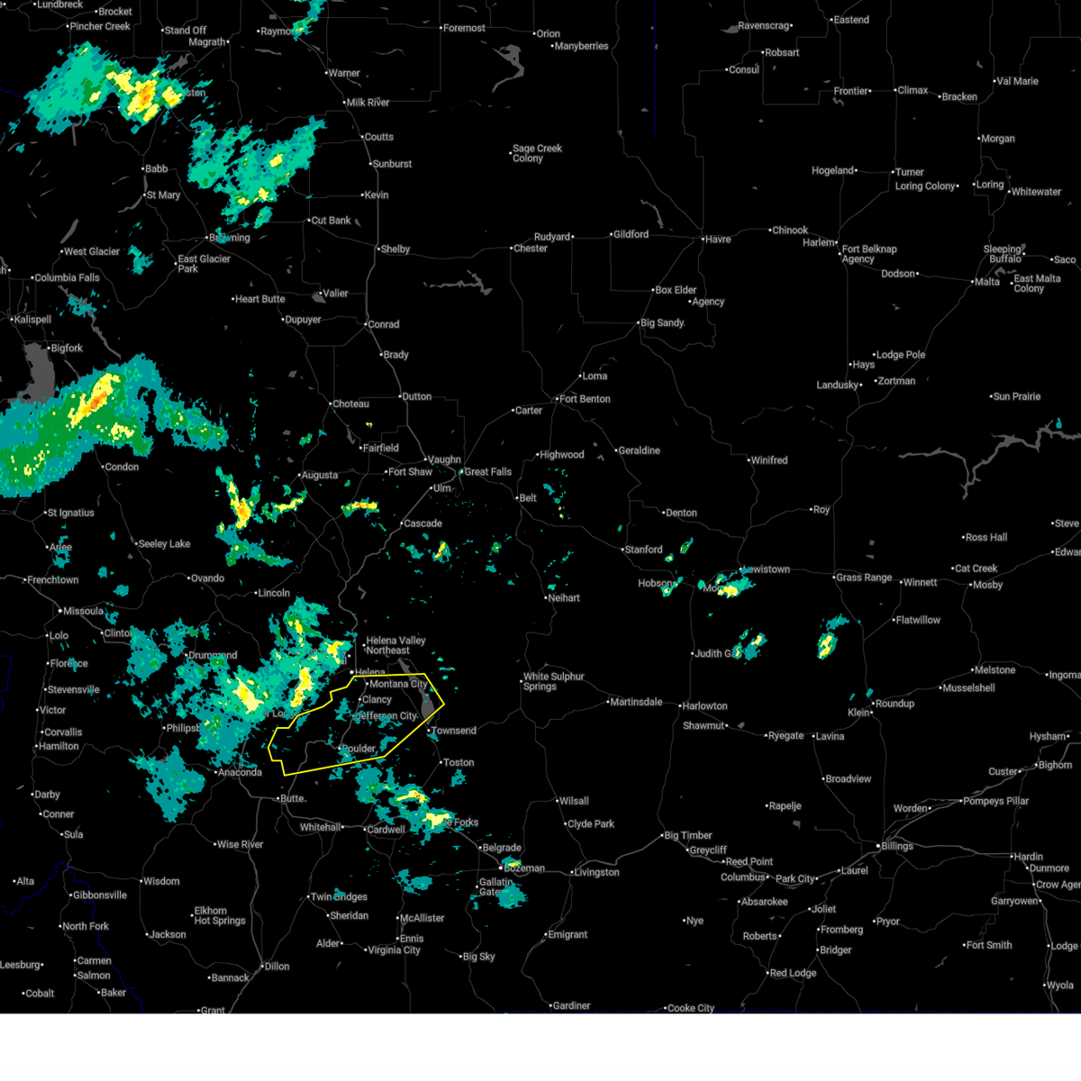
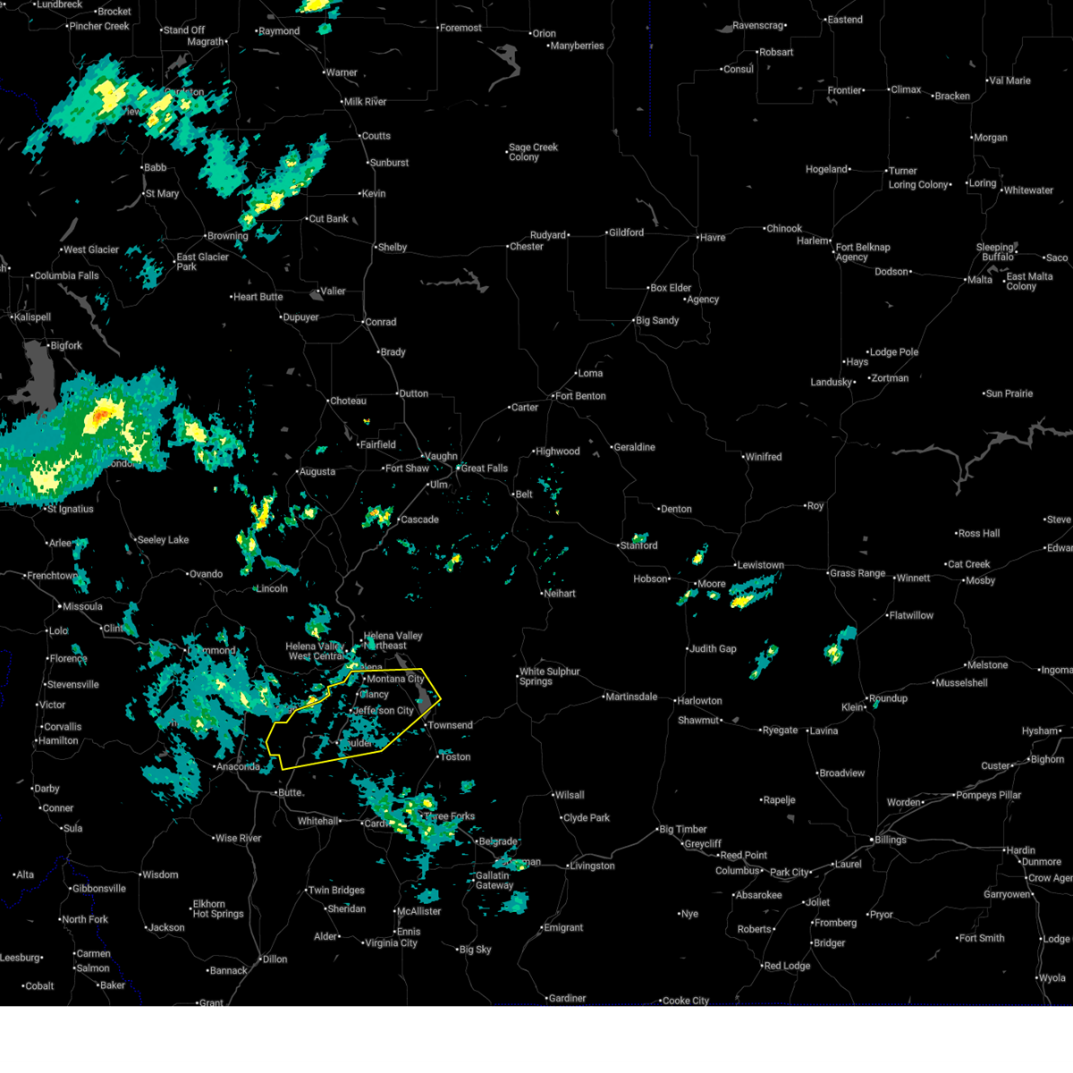
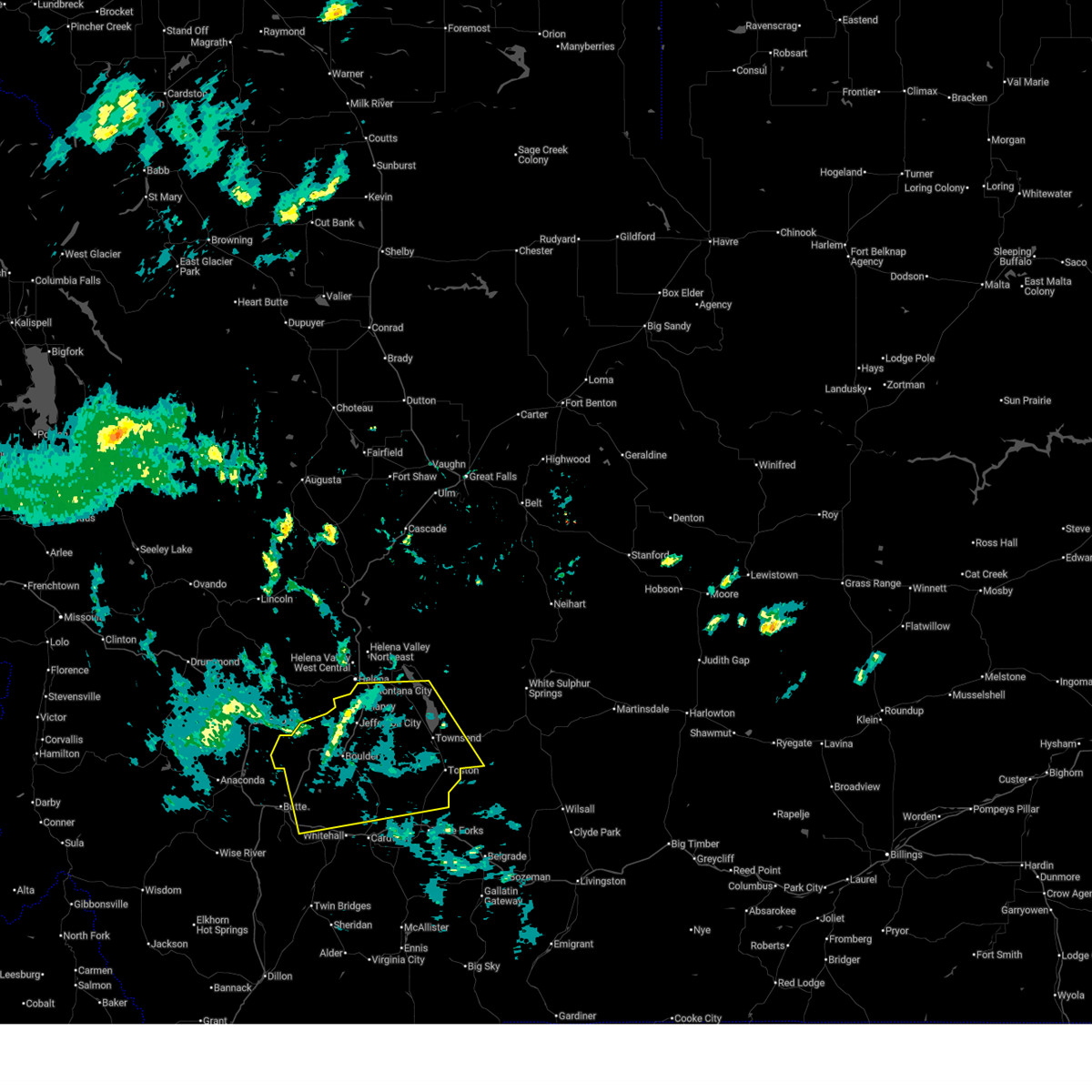
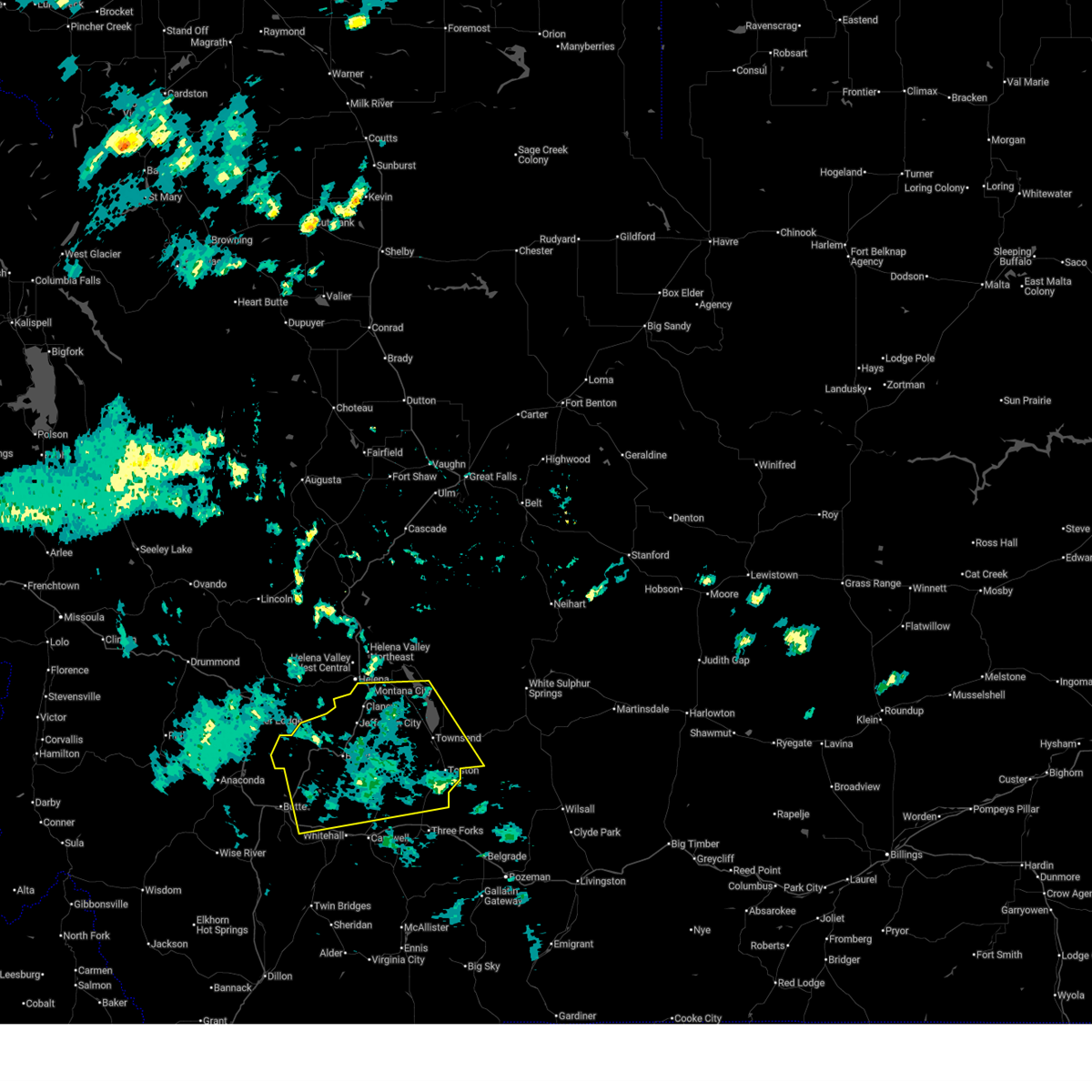
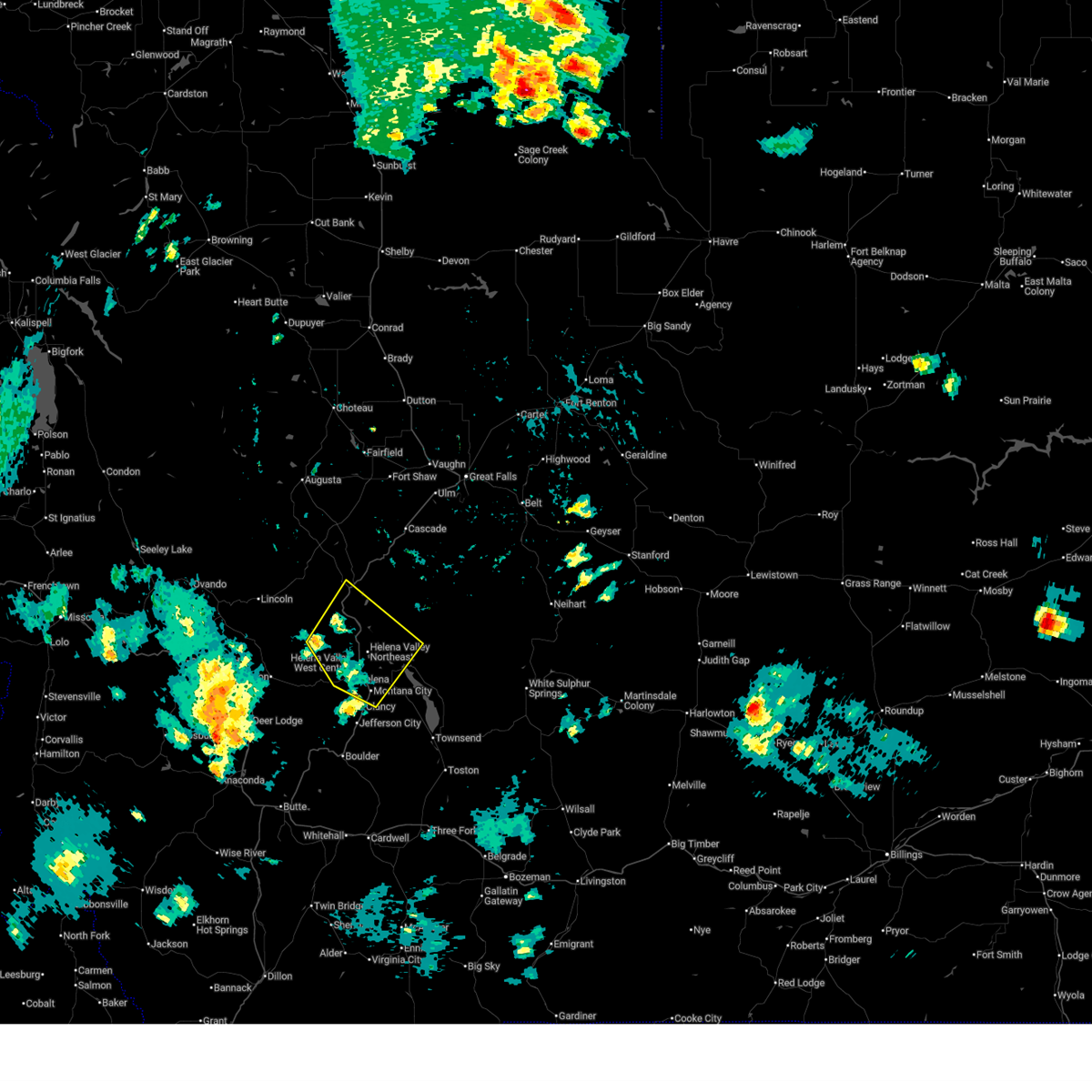
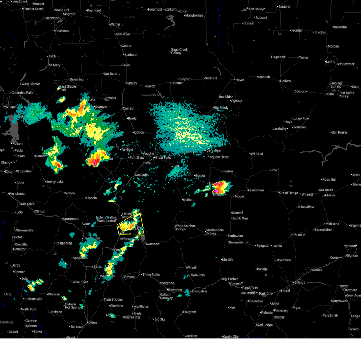
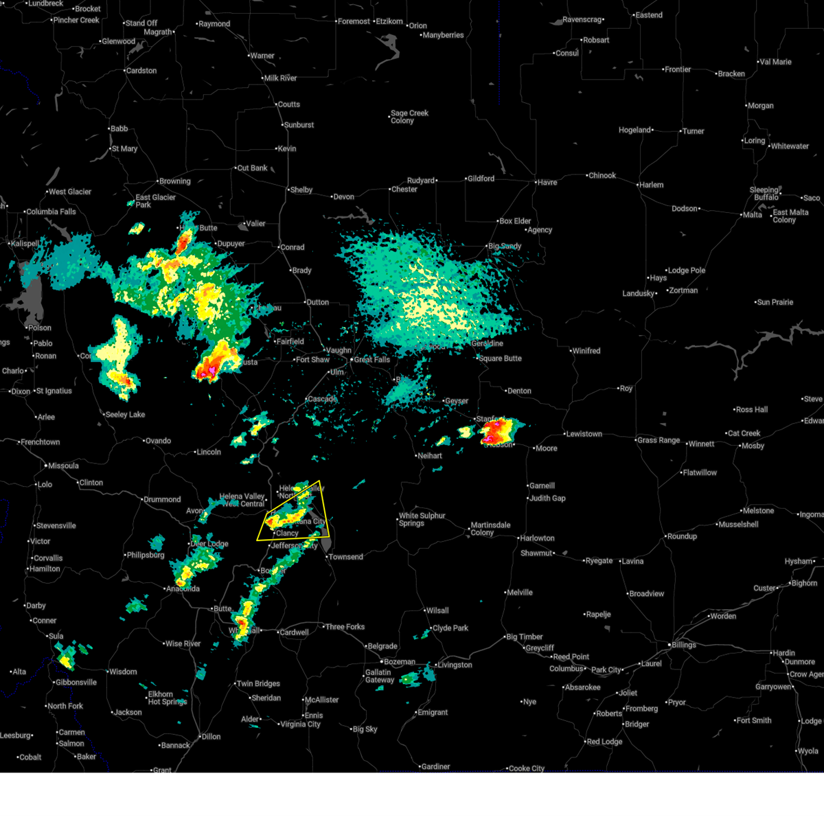
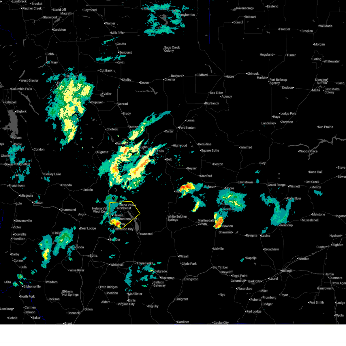
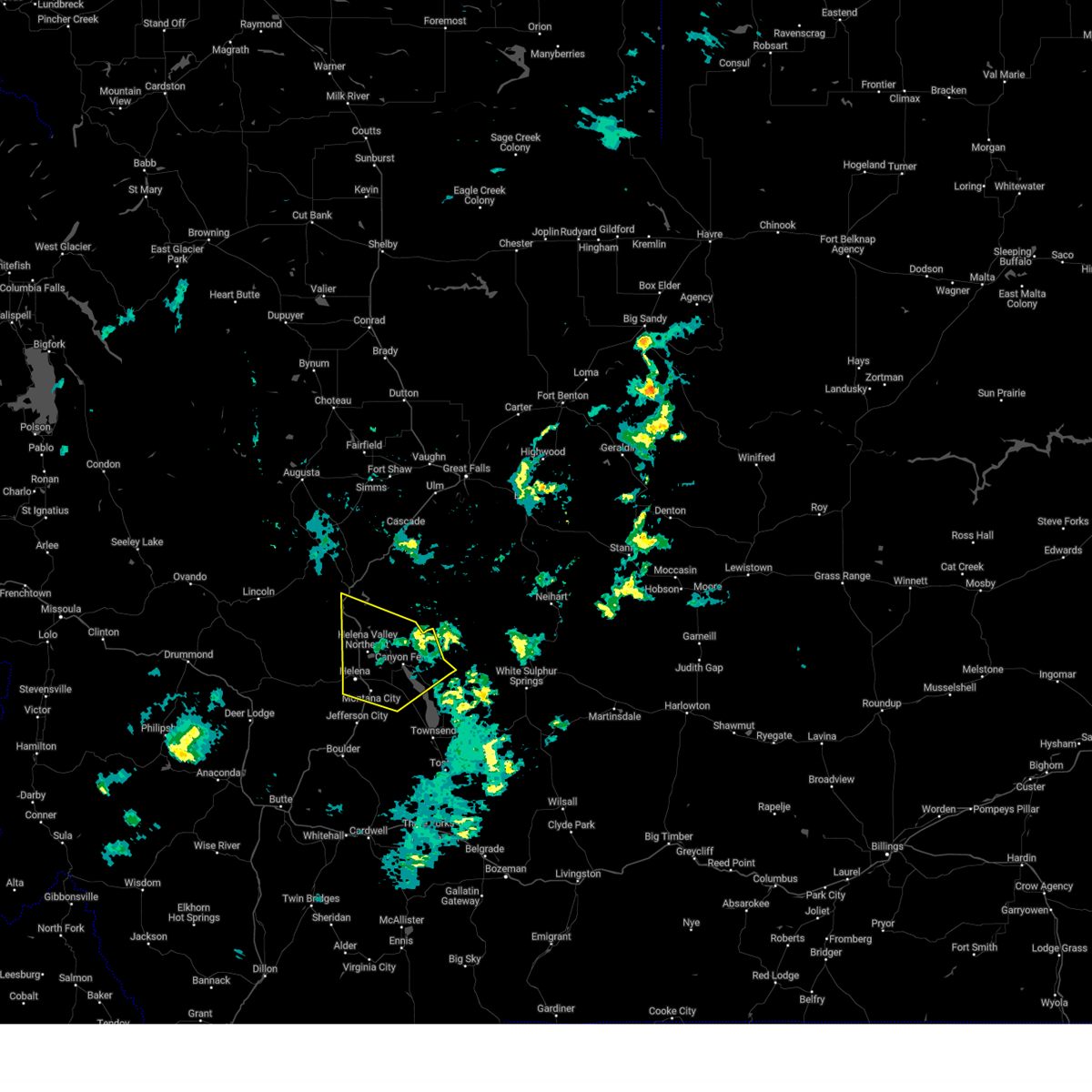
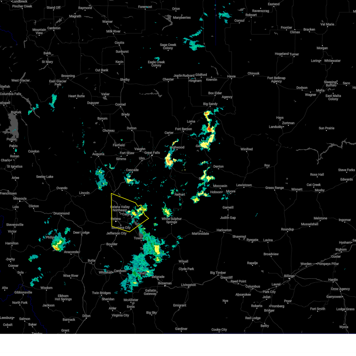
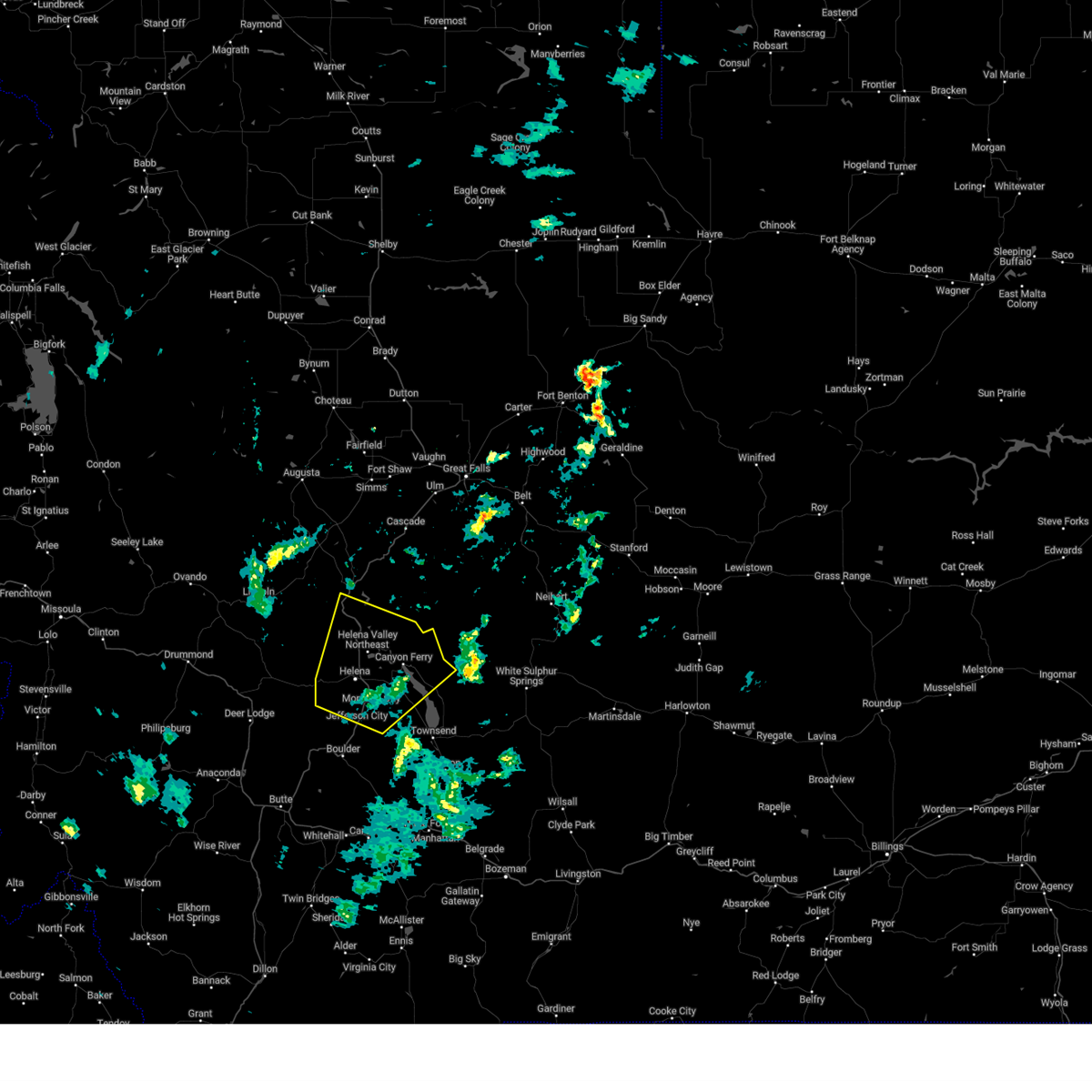
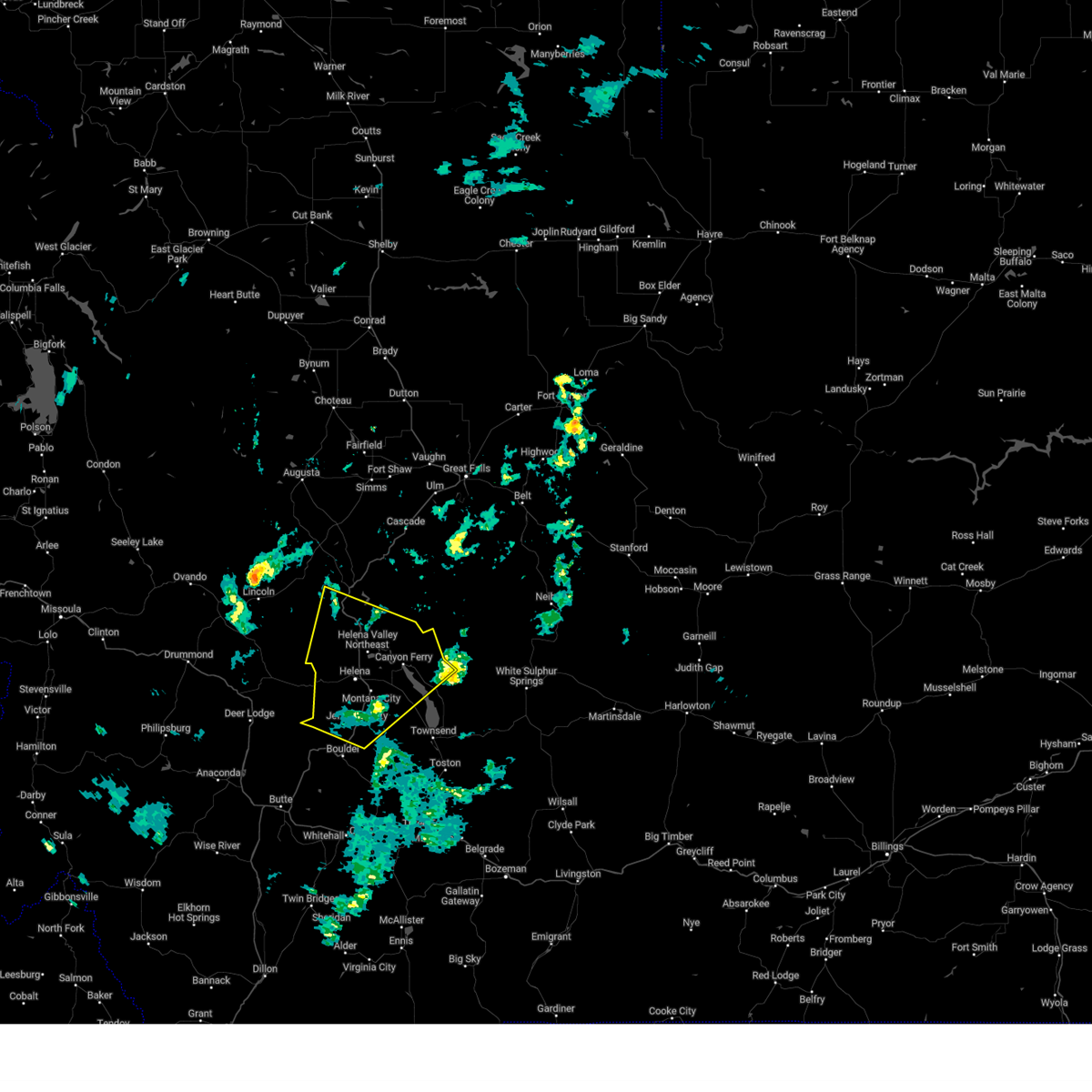
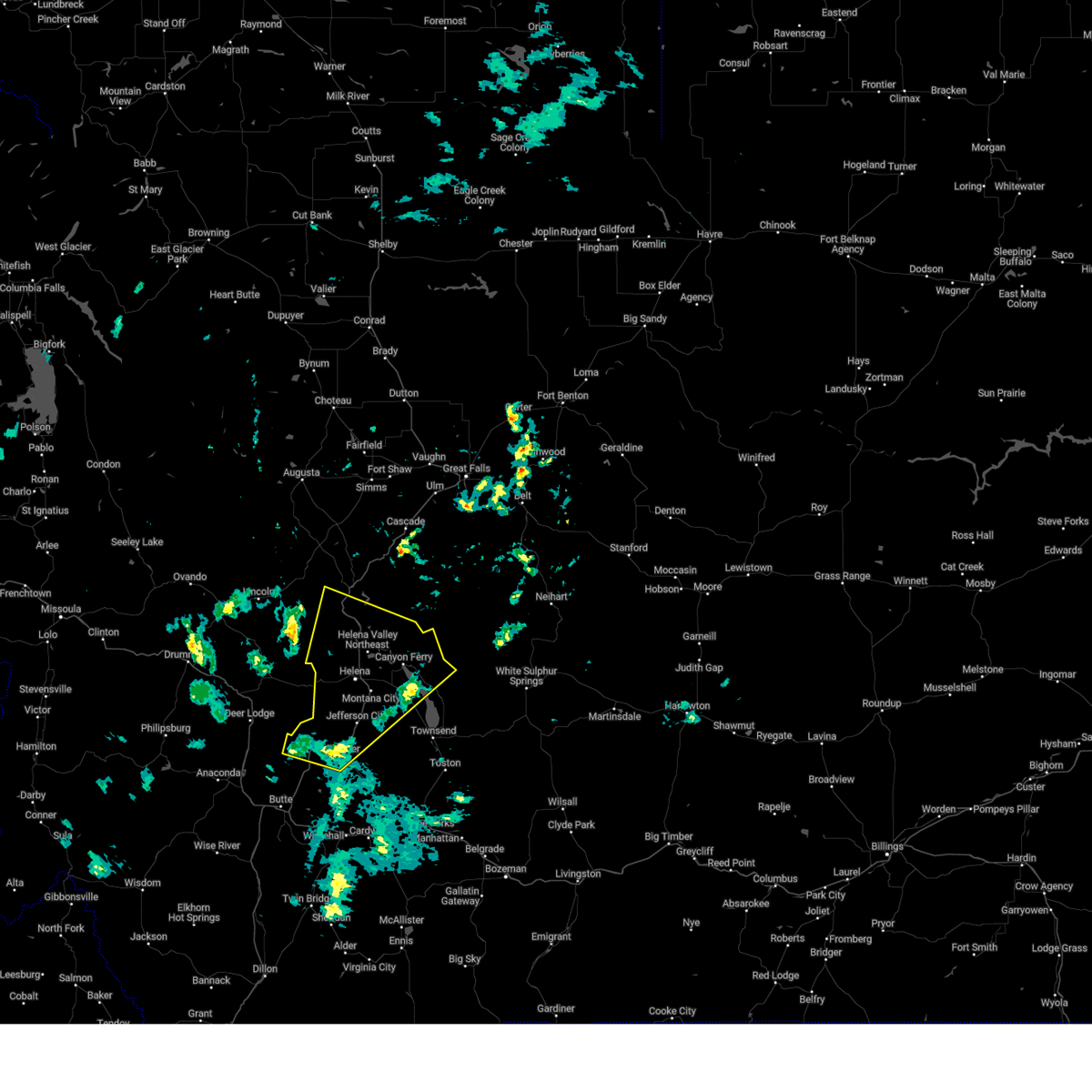
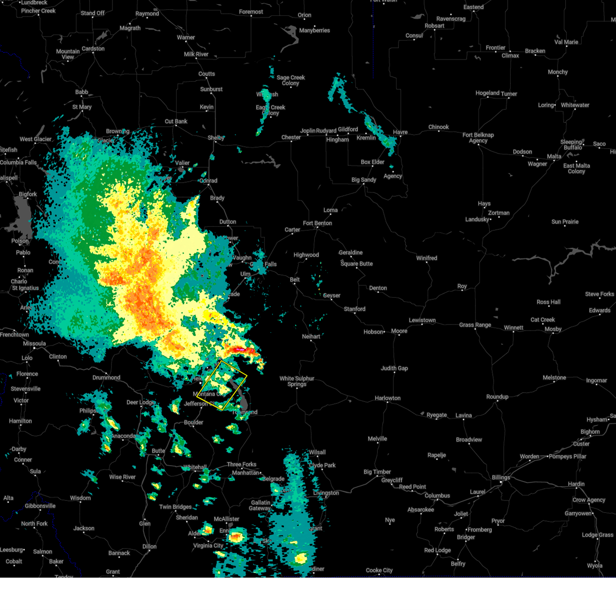
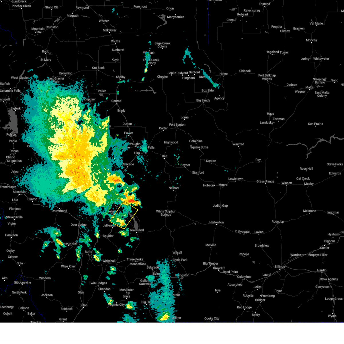
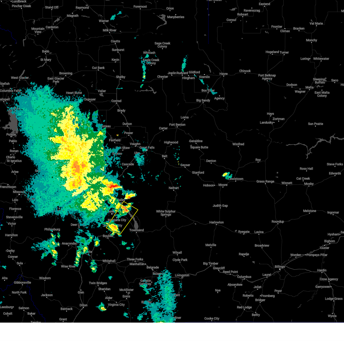
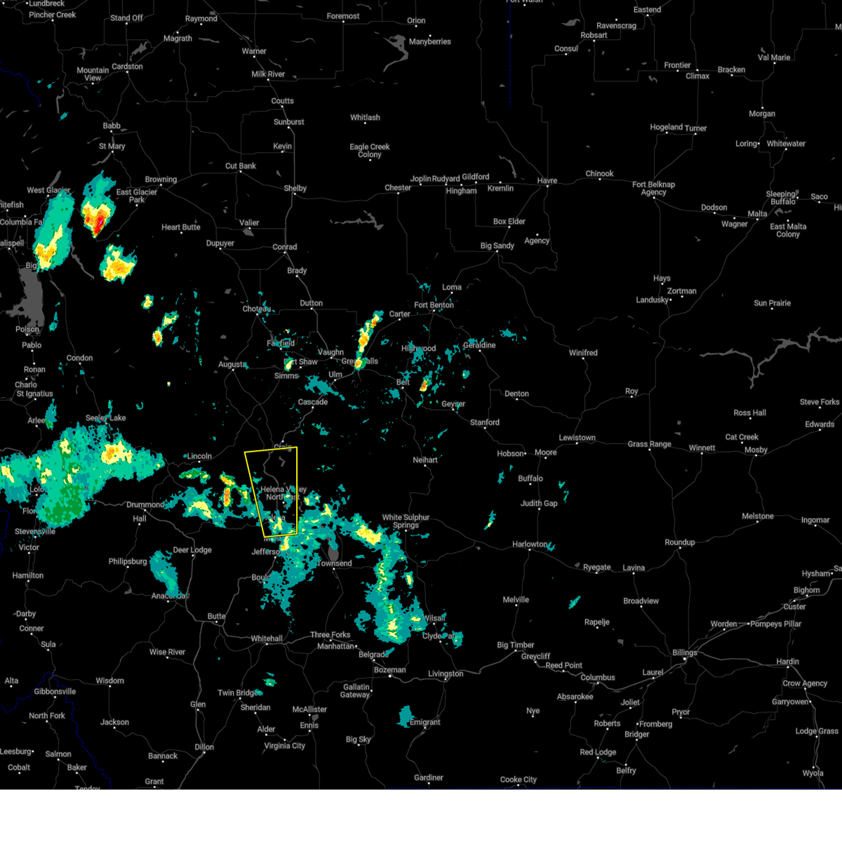
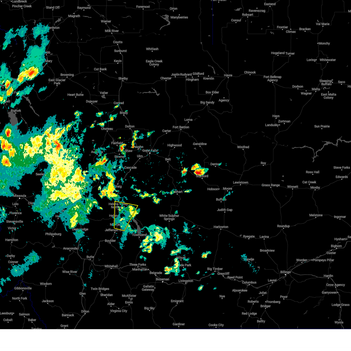
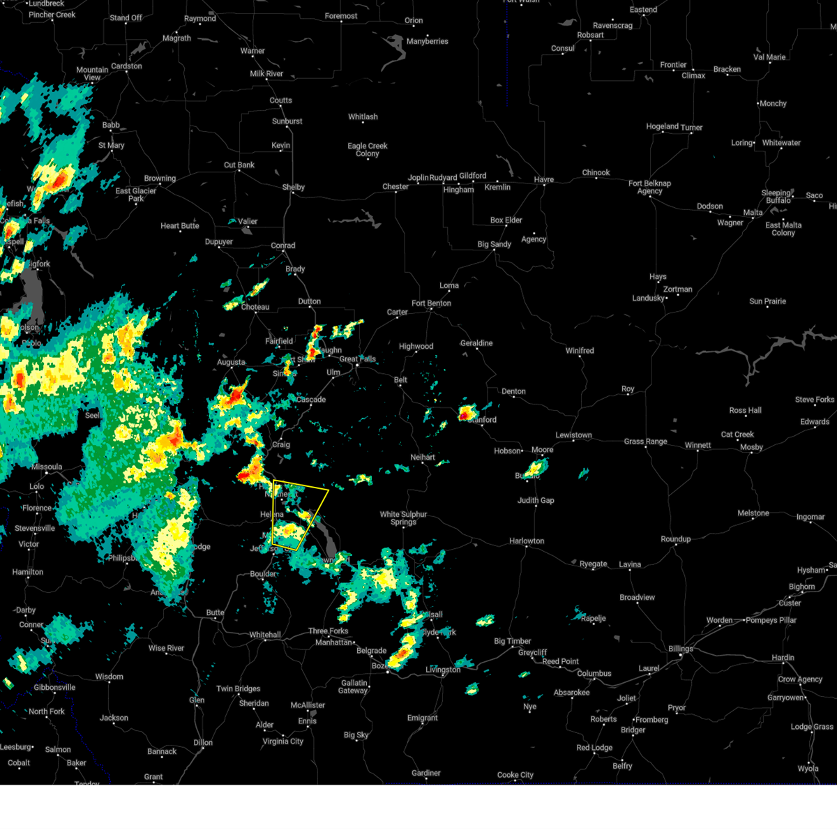
Hail Map for Helena, MT
The Helena, MT area has had 12 reports of on-the-ground hail by trained spotters, and has been under severe weather warnings 13 times during the past 12 months. Doppler radar has detected hail at or near Helena, MT on 19 occasions.
| Name: | Helena, MT |
| Where Located: | 71.2 miles SSW of Great Falls, MT |
| Map: | Google Map for Helena, MT |
| Population: | 28190 |
| Housing Units: | 13457 |
| More Info: | Search Google for Helena, MT |
5
The Top Recent Hail Date for Helena, MT is Thursday, August 1, 2013 (1st out of 19)

Hail and Wind Damage Spotted near Helena, MT
| Date / Time | Report Details |
|---|---|
| 6/25/2026 2:29 PM MDT |
 At 228 pm mdt, a severe thunderstorm was located over east helena, or near helena, moving southeast at 30 mph (public. at 218 pm quarter-sized hail was reported in helena mt). Hazards include quarter size hail. Damage to vehicles is expected. Locations impacted include, helena, east helena, montana city, winston, and goose bay. At 228 pm mdt, a severe thunderstorm was located over east helena, or near helena, moving southeast at 30 mph (public. at 218 pm quarter-sized hail was reported in helena mt). Hazards include quarter size hail. Damage to vehicles is expected. Locations impacted include, helena, east helena, montana city, winston, and goose bay.
|
| 6/25/2026 2:22 PM MDT |
 At 222 pm mdt, a severe thunderstorm was located near east helena, or near helena, moving southeast at 10 mph (radar indicated). Hazards include quarter size hail. Damage to vehicles is expected. Locations impacted include, helena, east helena, montana city, winston, goose bay, and spring meadow lake state park. At 222 pm mdt, a severe thunderstorm was located near east helena, or near helena, moving southeast at 10 mph (radar indicated). Hazards include quarter size hail. Damage to vehicles is expected. Locations impacted include, helena, east helena, montana city, winston, goose bay, and spring meadow lake state park.
|
| 6/25/2026 2:18 PM MDT | Quarter sized hail reported 1 miles SSE of Helena, MT, report from mping: quarter (1.00 in.). |
| 6/25/2026 2:12 PM MDT |
 Svrtfx the national weather service in great falls has issued a * severe thunderstorm warning for, southeastern lewis and clark county in west central montana, northwestern broadwater county in southwestern montana, northeastern jefferson county in southwestern montana, * until 300 pm mdt. * at 211 pm mdt, a severe thunderstorm was located near helena, moving southeast at 30 mph (trained weather spotters. at 210 pm quarter-sized hail was reported 6 miles northwest of helena mt). Hazards include quarter size hail. damage to vehicles is expected Svrtfx the national weather service in great falls has issued a * severe thunderstorm warning for, southeastern lewis and clark county in west central montana, northwestern broadwater county in southwestern montana, northeastern jefferson county in southwestern montana, * until 300 pm mdt. * at 211 pm mdt, a severe thunderstorm was located near helena, moving southeast at 30 mph (trained weather spotters. at 210 pm quarter-sized hail was reported 6 miles northwest of helena mt). Hazards include quarter size hail. damage to vehicles is expected
|
| 6/25/2026 2:09 PM MDT | Quarter sized hail reported 6.9 miles SSE of Helena, MT, mostly nickel sized hail with a few quarter sized mixed in. |
| 5/26/2026 6:55 PM MDT |
 the severe thunderstorm warning has been cancelled and is no longer in effect the severe thunderstorm warning has been cancelled and is no longer in effect
|
| 5/26/2026 6:41 PM MDT |
 At 639 pm mdt, a cluster of severe thunderstorms were located across northern broadwater and jefferson counties , moving northwest at 20 mph (radar indicated). Hazards include 70 mph wind gusts from decaying thunderstorms. Expect considerable tree damage. damage is likely to mobile homes, roofs, and outbuildings. Locations impacted include, boulder, basin, montana city, wickes, winston, alhambra, corbin, silos, clancy, jefferson city, elkhorn state park, and goose bay. At 639 pm mdt, a cluster of severe thunderstorms were located across northern broadwater and jefferson counties , moving northwest at 20 mph (radar indicated). Hazards include 70 mph wind gusts from decaying thunderstorms. Expect considerable tree damage. damage is likely to mobile homes, roofs, and outbuildings. Locations impacted include, boulder, basin, montana city, wickes, winston, alhambra, corbin, silos, clancy, jefferson city, elkhorn state park, and goose bay.
|
| 5/26/2026 6:29 PM MDT |
 At 626 pm mdt, a cluster of severe thunderstorms were located across broadwater and jefferson counties, moving east at 40 mph (radar indicated). Hazards include 70 mph wind gusts from decaying thunderstorms. Expect considerable tree damage. damage is likely to mobile homes, roofs, and outbuildings. Locations impacted include, townsend, boulder, montana city, toston, basin, wickes, alhambra, corbin, elkhorn state park, winston, radersburg, elk park, silos, clancy, jefferson city, and goose bay. At 626 pm mdt, a cluster of severe thunderstorms were located across broadwater and jefferson counties, moving east at 40 mph (radar indicated). Hazards include 70 mph wind gusts from decaying thunderstorms. Expect considerable tree damage. damage is likely to mobile homes, roofs, and outbuildings. Locations impacted include, townsend, boulder, montana city, toston, basin, wickes, alhambra, corbin, elkhorn state park, winston, radersburg, elk park, silos, clancy, jefferson city, and goose bay.
|
| 5/26/2026 6:14 PM MDT |
 Svrtfx the national weather service in great falls has issued a * severe thunderstorm warning for, broadwater county in southwestern montana, jefferson county in southwestern montana, * until 715 pm mdt. * at 614 pm mdt, severe thunderstorms were located along a line extending from 11 miles southeast of boulder to near toston, moving northwest at 40 mph (radar indicated). Hazards include 70 mph wind gusts and nickel size hail. Expect considerable tree damage. Damage is likely to mobile homes, roofs, and outbuildings. Svrtfx the national weather service in great falls has issued a * severe thunderstorm warning for, broadwater county in southwestern montana, jefferson county in southwestern montana, * until 715 pm mdt. * at 614 pm mdt, severe thunderstorms were located along a line extending from 11 miles southeast of boulder to near toston, moving northwest at 40 mph (radar indicated). Hazards include 70 mph wind gusts and nickel size hail. Expect considerable tree damage. Damage is likely to mobile homes, roofs, and outbuildings.
|
| 12/17/2025 11:42 AM MST | Traffic sign bent over with debris blowing down the stree in lewis and clark county MT, 1.3 miles NNW of Helena, MT |
| 9/14/2025 8:07 PM MDT | The storms which prompted the warning have weakened below severe limits, and no longer pose an immediate threat to life or property. therefore, the warning will be allowed to expire. |
| 9/14/2025 7:39 PM MDT | Spotter network report of a large tree down across a fence. time of damage estimated using rada in lewis and clark county MT, 3.8 miles S of Helena, MT |
| 9/14/2025 7:32 PM MDT | Svrtfx the national weather service in great falls has issued a * severe thunderstorm warning for, southeastern lewis and clark county in west central montana, northwestern broadwater county in southwestern montana, northeastern jefferson county in southwestern montana, * until 815 pm mdt. * at 732 pm mdt, severe thunderstorms were located along a line extending from 10 miles north of helena to near east helena to 12 miles west of townsend, moving northeast at 20 mph (radar indicated). Hazards include 60 mph wind gusts. expect damage to roofs, siding, and trees |
| 8/4/2025 4:49 PM MDT |
 Svrtfx the national weather service in great falls has issued a * severe thunderstorm warning for, southeastern lewis and clark county in west central montana, northwestern broadwater county in southwestern montana, north central jefferson county in southwestern montana, * until 515 pm mdt. * at 448 pm mdt, a severe thunderstorm was located over helena, moving northeast at 10 mph (radar indicated). Hazards include 60 mph wind gusts and penny size hail. expect damage to roofs, siding, and trees Svrtfx the national weather service in great falls has issued a * severe thunderstorm warning for, southeastern lewis and clark county in west central montana, northwestern broadwater county in southwestern montana, north central jefferson county in southwestern montana, * until 515 pm mdt. * at 448 pm mdt, a severe thunderstorm was located over helena, moving northeast at 10 mph (radar indicated). Hazards include 60 mph wind gusts and penny size hail. expect damage to roofs, siding, and trees
|
| 7/28/2025 2:48 PM MDT |
 At 248 pm mdt, severe thunderstorms were located along a line extending from near montana city to near helena, moving northeast at 15 mph (radar indicated). Hazards include 60 mph wind gusts and quarter size hail. Hail damage to vehicles is expected. expect wind damage to roofs, siding, and trees. Locations impacted include, helena, east helena, montana city, winston, alhambra, clancy, and goose bay. At 248 pm mdt, severe thunderstorms were located along a line extending from near montana city to near helena, moving northeast at 15 mph (radar indicated). Hazards include 60 mph wind gusts and quarter size hail. Hail damage to vehicles is expected. expect wind damage to roofs, siding, and trees. Locations impacted include, helena, east helena, montana city, winston, alhambra, clancy, and goose bay.
|
| 7/28/2025 2:39 PM MDT |
 Svrtfx the national weather service in great falls has issued a * severe thunderstorm warning for, southeastern lewis and clark county in west central montana, northwestern broadwater county in southwestern montana, northeastern jefferson county in southwestern montana, * until 315 pm mdt. * at 239 pm mdt, severe thunderstorms were located along a line extending from near montana city to 7 miles south of helena, moving northeast at 10 mph (trained weather spotters). Hazards include quarter size hail. damage to vehicles is expected Svrtfx the national weather service in great falls has issued a * severe thunderstorm warning for, southeastern lewis and clark county in west central montana, northwestern broadwater county in southwestern montana, northeastern jefferson county in southwestern montana, * until 315 pm mdt. * at 239 pm mdt, severe thunderstorms were located along a line extending from near montana city to 7 miles south of helena, moving northeast at 10 mph (trained weather spotters). Hazards include quarter size hail. damage to vehicles is expected
|
| 7/21/2025 5:17 PM MDT |
 Svrtfx the national weather service in great falls has issued a * severe thunderstorm warning for, southeastern lewis and clark county in west central montana, northwestern broadwater county in southwestern montana, northeastern jefferson county in southwestern montana, * until 600 pm mdt. * at 516 pm mdt, a severe thunderstorm was located over montana city, or 8 miles southeast of helena, moving northeast at 40 mph (radar indicated). Hazards include 60 mph wind gusts and quarter size hail. Hail damage to vehicles is expected. Expect wind damage to roofs, siding, and trees. Svrtfx the national weather service in great falls has issued a * severe thunderstorm warning for, southeastern lewis and clark county in west central montana, northwestern broadwater county in southwestern montana, northeastern jefferson county in southwestern montana, * until 600 pm mdt. * at 516 pm mdt, a severe thunderstorm was located over montana city, or 8 miles southeast of helena, moving northeast at 40 mph (radar indicated). Hazards include 60 mph wind gusts and quarter size hail. Hail damage to vehicles is expected. Expect wind damage to roofs, siding, and trees.
|
| 7/2/2025 7:19 PM MDT | Asos station khln helena airpor in lewis and clark county MT, 1.6 miles W of Helena, MT |
| 5/10/2025 4:56 PM MDT |
 The storms which prompted the warning have weakened below severe limits, and no longer pose an immediate threat to life or property. therefore, the warning will be allowed to expire. however, gusty winds up to 55 mph are still possible. The storms which prompted the warning have weakened below severe limits, and no longer pose an immediate threat to life or property. therefore, the warning will be allowed to expire. however, gusty winds up to 55 mph are still possible.
|
| 5/10/2025 4:50 PM MDT |
 At 449 pm mdt, severe thunderstorms were located along a line extending from 10 miles north of east helena to 14 miles northeast of montana city, moving northeast at 40 mph (radar indicated). Hazards include 60 mph wind gusts. Expect damage to roofs, siding, and trees. Locations impacted include, york, helena, spring meadow lake state park, east helena, black sandy state park, goose bay, and montana city. At 449 pm mdt, severe thunderstorms were located along a line extending from 10 miles north of east helena to 14 miles northeast of montana city, moving northeast at 40 mph (radar indicated). Hazards include 60 mph wind gusts. Expect damage to roofs, siding, and trees. Locations impacted include, york, helena, spring meadow lake state park, east helena, black sandy state park, goose bay, and montana city.
|
| 5/10/2025 4:32 PM MDT |
 At 431 pm mdt, severe thunderstorms were located along a line extending from near helena to near montana city, moving northeast at 40 mph (radar indicated). Hazards include 60 mph wind gusts. Expect damage to roofs, siding, and trees. Locations impacted include, winston, york, rimini, helena, alhambra, spring meadow lake state park, east helena, clancy, black sandy state park, austin, goose bay, and montana city. At 431 pm mdt, severe thunderstorms were located along a line extending from near helena to near montana city, moving northeast at 40 mph (radar indicated). Hazards include 60 mph wind gusts. Expect damage to roofs, siding, and trees. Locations impacted include, winston, york, rimini, helena, alhambra, spring meadow lake state park, east helena, clancy, black sandy state park, austin, goose bay, and montana city.
|
| 5/10/2025 4:17 PM MDT |
 At 417 pm mdt, severe thunderstorms were located along a line extending from 11 miles north of basin to 10 miles southwest of montana city, moving northeast at 40 mph (radar indicated). Hazards include 60 mph wind gusts. Expect damage to roofs, siding, and trees. Locations impacted include, wickes, york, rimini, alhambra, corbin, spring meadow lake state park, east helena, austin, montana city, marysville, winston, helena, clancy, canyon creek, black sandy state park, jefferson city, and goose bay. At 417 pm mdt, severe thunderstorms were located along a line extending from 11 miles north of basin to 10 miles southwest of montana city, moving northeast at 40 mph (radar indicated). Hazards include 60 mph wind gusts. Expect damage to roofs, siding, and trees. Locations impacted include, wickes, york, rimini, alhambra, corbin, spring meadow lake state park, east helena, austin, montana city, marysville, winston, helena, clancy, canyon creek, black sandy state park, jefferson city, and goose bay.
|
| 5/10/2025 4:00 PM MDT |
 Svrtfx the national weather service in great falls has issued a * severe thunderstorm warning for, southeastern lewis and clark county in west central montana, northwestern broadwater county in southwestern montana, northern jefferson county in southwestern montana, * until 500 pm mdt. * at 359 pm mdt, severe thunderstorms were located along a line extending from near basin to near boulder, moving northeast at 40 mph (radar indicated). Hazards include 60 mph wind gusts. expect damage to roofs, siding, and trees Svrtfx the national weather service in great falls has issued a * severe thunderstorm warning for, southeastern lewis and clark county in west central montana, northwestern broadwater county in southwestern montana, northern jefferson county in southwestern montana, * until 500 pm mdt. * at 359 pm mdt, severe thunderstorms were located along a line extending from near basin to near boulder, moving northeast at 40 mph (radar indicated). Hazards include 60 mph wind gusts. expect damage to roofs, siding, and trees
|
| 5/10/2025 3:51 PM MDT | 61 mph gust at helena airpor in lewis and clark county MT, 1.1 miles WSW of Helena, MT |
| 5/10/2025 3:35 PM MDT | Asos station khln helena airpor in lewis and clark county MT, 1.6 miles W of Helena, MT |
| 9/11/2024 6:22 PM MDT |
 The storm which prompted the warning has weakened below severe limits, and no longer poses an immediate threat to life or property. therefore, the warning will be allowed to expire. remember, a severe thunderstorm warning still remains in effect for southeastern lewis and clark county until 645 pm. The storm which prompted the warning has weakened below severe limits, and no longer poses an immediate threat to life or property. therefore, the warning will be allowed to expire. remember, a severe thunderstorm warning still remains in effect for southeastern lewis and clark county until 645 pm.
|
| 9/11/2024 6:08 PM MDT |
 At 608 pm mdt, a severe thunderstorm was located near montana city, or 10 miles southeast of helena, moving north at 35 mph (radar indicated). Hazards include 60 mph wind gusts and penny size hail. Expect damage to roofs, siding, and trees. Locations impacted include, helena, east helena, montana city, clancy, york, and alhambra. At 608 pm mdt, a severe thunderstorm was located near montana city, or 10 miles southeast of helena, moving north at 35 mph (radar indicated). Hazards include 60 mph wind gusts and penny size hail. Expect damage to roofs, siding, and trees. Locations impacted include, helena, east helena, montana city, clancy, york, and alhambra.
|
| 9/11/2024 5:55 PM MDT |
 Svrtfx the national weather service in great falls has issued a * severe thunderstorm warning for, southeastern lewis and clark county in west central montana, northwestern broadwater county in southwestern montana, northeastern jefferson county in southwestern montana, * until 630 pm mdt. * at 555 pm mdt, a severe thunderstorm was located 7 miles south of montana city, or 12 miles south of helena, moving northeast at 45 mph (radar indicated). Hazards include 60 mph wind gusts and penny size hail. expect damage to roofs, siding, and trees Svrtfx the national weather service in great falls has issued a * severe thunderstorm warning for, southeastern lewis and clark county in west central montana, northwestern broadwater county in southwestern montana, northeastern jefferson county in southwestern montana, * until 630 pm mdt. * at 555 pm mdt, a severe thunderstorm was located 7 miles south of montana city, or 12 miles south of helena, moving northeast at 45 mph (radar indicated). Hazards include 60 mph wind gusts and penny size hail. expect damage to roofs, siding, and trees
|
| 8/23/2024 4:09 PM MDT | Personal weather sensor measured a wind gust of 61.5 mp in lewis and clark county MT, 2.7 miles E of Helena, MT |
| 8/23/2024 4:09 PM MDT | Public weather station reports wind gust of 58 mp in lewis and clark county MT, 10.1 miles S of Helena, MT |
| 8/23/2024 4:09 PM MDT |
 Svrtfx the national weather service in great falls has issued a * severe thunderstorm warning for, southeastern lewis and clark county in west central montana, north central jefferson county in southwestern montana, * until 445 pm mdt. * at 407 pm mdt, a severe thunderstorm was located over helena, moving north at 45 mph (62 mph wind gust reported in silver city). Hazards include 60 mph wind gusts. expect damage to roofs, siding, and trees Svrtfx the national weather service in great falls has issued a * severe thunderstorm warning for, southeastern lewis and clark county in west central montana, north central jefferson county in southwestern montana, * until 445 pm mdt. * at 407 pm mdt, a severe thunderstorm was located over helena, moving north at 45 mph (62 mph wind gust reported in silver city). Hazards include 60 mph wind gusts. expect damage to roofs, siding, and trees
|
| 8/23/2024 4:06 PM MDT | Corrects previous tstm wnd gst report from 2 w helena. personal weather sensor measured a wind gust of 61.5 mph. time of event is corrected to 406 p in lewis and clark county MT, 2.7 miles E of Helena, MT |
| 8/23/2024 3:59 PM MDT | 62 mph wind gus in lewis and clark county MT, 11.6 miles SE of Helena, MT |
| 8/19/2024 6:08 PM MDT |
 The storm which prompted the warning has weakened below severe limits, and no longer poses an immediate threat to life or property. therefore, the warning will be allowed to expire. a severe thunderstorm watch remains in effect until 1000 pm mdt for southwestern and west central montana. The storm which prompted the warning has weakened below severe limits, and no longer poses an immediate threat to life or property. therefore, the warning will be allowed to expire. a severe thunderstorm watch remains in effect until 1000 pm mdt for southwestern and west central montana.
|
| 8/19/2024 5:51 PM MDT |
 Svrtfx the national weather service in great falls has issued a * severe thunderstorm warning for, southeastern lewis and clark county in west central montana, northwestern broadwater county in southwestern montana, northeastern jefferson county in southwestern montana, * until 615 pm mdt. * at 550 pm mdt, a severe thunderstorm was located over montana city, or near helena, moving north at 35 mph (public weather station near east helena reported a wind gust of 62 mph.). Hazards include 60 mph wind gusts. expect damage to roofs, siding, and trees Svrtfx the national weather service in great falls has issued a * severe thunderstorm warning for, southeastern lewis and clark county in west central montana, northwestern broadwater county in southwestern montana, northeastern jefferson county in southwestern montana, * until 615 pm mdt. * at 550 pm mdt, a severe thunderstorm was located over montana city, or near helena, moving north at 35 mph (public weather station near east helena reported a wind gust of 62 mph.). Hazards include 60 mph wind gusts. expect damage to roofs, siding, and trees
|
| 8/6/2024 5:45 PM MDT | Ping Pong Ball sized hail reported 11.6 miles SE of Helena, MT |
| 5/28/2024 10:02 PM MDT | Asos station khln helena airpor in lewis and clark county MT, 1.6 miles W of Helena, MT |
| 5/28/2024 7:02 PM MDT |
 the severe thunderstorm warning has been cancelled and is no longer in effect the severe thunderstorm warning has been cancelled and is no longer in effect
|
| 5/28/2024 6:53 PM MDT |
 At 653 pm mdt, severe thunderstorms were located along a line extending from 22 miles southeast of wolf creek to near montana city, moving east at 30 mph (radar indicated). Hazards include 60 mph wind gusts. Expect damage to roofs, siding, and trees. Locations impacted include, helena, east helena, montana city, york, black sandy state park, goose bay, winston, and clancy. At 653 pm mdt, severe thunderstorms were located along a line extending from 22 miles southeast of wolf creek to near montana city, moving east at 30 mph (radar indicated). Hazards include 60 mph wind gusts. Expect damage to roofs, siding, and trees. Locations impacted include, helena, east helena, montana city, york, black sandy state park, goose bay, winston, and clancy.
|
| 5/28/2024 6:34 PM MDT | Asos station khln helena airpor in lewis and clark county MT, 1.6 miles W of Helena, MT |
| 5/28/2024 6:31 PM MDT |
 Svrtfx the national weather service in great falls has issued a * severe thunderstorm warning for, southeastern lewis and clark county in west central montana, northwestern broadwater county in southwestern montana, northwestern meagher county in central montana, northeastern jefferson county in southwestern montana, * until 715 pm mdt. * at 631 pm mdt, severe thunderstorms were located along a line extending from 16 miles southeast of wolf creek to 10 miles southwest of montana city, moving east at 35 mph (radar indicated). Hazards include 60 mph wind gusts. expect damage to roofs, siding, and trees Svrtfx the national weather service in great falls has issued a * severe thunderstorm warning for, southeastern lewis and clark county in west central montana, northwestern broadwater county in southwestern montana, northwestern meagher county in central montana, northeastern jefferson county in southwestern montana, * until 715 pm mdt. * at 631 pm mdt, severe thunderstorms were located along a line extending from 16 miles southeast of wolf creek to 10 miles southwest of montana city, moving east at 35 mph (radar indicated). Hazards include 60 mph wind gusts. expect damage to roofs, siding, and trees
|
| 8/18/2023 3:14 PM MDT | Asos station khln helena airpor in lewis and clark county MT, 1.6 miles W of Helena, MT |
| 9/7/2022 5:58 PM MDT |
 The severe thunderstorm warning for southeastern lewis and clark, northwestern broadwater, northwestern meagher, northeastern jefferson and southwestern cascade counties will expire at 600 pm mdt, the storms which prompted the warning have moved out of the area. therefore, the warning will be allowed to expire. however gusty winds are still possible with these thunderstorms. The severe thunderstorm warning for southeastern lewis and clark, northwestern broadwater, northwestern meagher, northeastern jefferson and southwestern cascade counties will expire at 600 pm mdt, the storms which prompted the warning have moved out of the area. therefore, the warning will be allowed to expire. however gusty winds are still possible with these thunderstorms.
|
| 9/7/2022 5:28 PM MDT |
 At 528 pm mdt, severe thunderstorms were located along a line extending from near wolf creek to 10 miles north of east helena to 6 miles southwest of montana city, moving northeast at 55 mph (radar indicated). Hazards include 70 mph wind gusts. Expect considerable tree damage. Damage is likely to mobile homes, roofs, and outbuildings. At 528 pm mdt, severe thunderstorms were located along a line extending from near wolf creek to 10 miles north of east helena to 6 miles southwest of montana city, moving northeast at 55 mph (radar indicated). Hazards include 70 mph wind gusts. Expect considerable tree damage. Damage is likely to mobile homes, roofs, and outbuildings.
|
| 9/7/2022 5:25 PM MDT | Asos station khln helena airpor in lewis and clark county MT, 1.6 miles W of Helena, MT |
| 7/13/2022 2:06 PM MDT |
 The severe thunderstorm warning for northwestern broadwater and northeastern jefferson counties will expire at 215 pm mdt, the storm which prompted the warning has weakened below severe limits, and has exited the warned area. therefore, the warning will be allowed to expire. The severe thunderstorm warning for northwestern broadwater and northeastern jefferson counties will expire at 215 pm mdt, the storm which prompted the warning has weakened below severe limits, and has exited the warned area. therefore, the warning will be allowed to expire.
|
| 7/13/2022 1:30 PM MDT |
 At 130 pm mdt, a severe thunderstorm was located 10 miles southwest of montana city, or 12 miles north of boulder, moving northeast at 30 mph (radar indicated). Hazards include 60 mph wind gusts and quarter size hail. Hail damage to vehicles is expected. Expect wind damage to roofs, siding, and trees. At 130 pm mdt, a severe thunderstorm was located 10 miles southwest of montana city, or 12 miles north of boulder, moving northeast at 30 mph (radar indicated). Hazards include 60 mph wind gusts and quarter size hail. Hail damage to vehicles is expected. Expect wind damage to roofs, siding, and trees.
|
| 7/8/2022 5:10 PM MDT | Near lake helena... via ambient weathe in lewis and clark county MT, 9.8 miles SW of Helena, MT |
| 7/8/2022 5:09 PM MDT |
 At 508 pm mdt, a severe thunderstorm was located near east helena, or 8 miles east of helena, moving northeast at 25 mph (radar indicated). Hazards include 60 mph wind gusts and penny size hail. Expect damage to roofs, siding, and trees. locations impacted include, helena, east helena, black sandy state park and york. hail threat, radar indicated max hail size, 0. 75 in wind threat, radar indicated max wind gust, 60 mph. At 508 pm mdt, a severe thunderstorm was located near east helena, or 8 miles east of helena, moving northeast at 25 mph (radar indicated). Hazards include 60 mph wind gusts and penny size hail. Expect damage to roofs, siding, and trees. locations impacted include, helena, east helena, black sandy state park and york. hail threat, radar indicated max hail size, 0. 75 in wind threat, radar indicated max wind gust, 60 mph.
|
| 7/8/2022 5:01 PM MDT |
 At 500 pm mdt, a severe thunderstorm was located over east helena, or near helena, moving northeast at 25 mph (radar indicated). Hazards include 60 mph wind gusts and quarter size hail. localized flash flooding possible. Hail damage to vehicles is expected. Expect wind damage to roofs, siding, and trees. At 500 pm mdt, a severe thunderstorm was located over east helena, or near helena, moving northeast at 25 mph (radar indicated). Hazards include 60 mph wind gusts and quarter size hail. localized flash flooding possible. Hail damage to vehicles is expected. Expect wind damage to roofs, siding, and trees.
|
| 7/7/2022 6:40 PM MDT |
 At 640 pm mdt, a severe thunderstorm was located 16 miles southwest of wolf creek, moving northeast at 20 mph (radar indicated). Hazards include 60 mph wind gusts and quarter size hail. Hail damage to vehicles is expected. expect wind damage to roofs, siding, and trees. locations impacted include, wolf creek, marysville, canyon creek, black sandy state park and spring meadow lake state park. hail threat, radar indicated max hail size, 1. 00 in wind threat, radar indicated max wind gust, 60 mph. At 640 pm mdt, a severe thunderstorm was located 16 miles southwest of wolf creek, moving northeast at 20 mph (radar indicated). Hazards include 60 mph wind gusts and quarter size hail. Hail damage to vehicles is expected. expect wind damage to roofs, siding, and trees. locations impacted include, wolf creek, marysville, canyon creek, black sandy state park and spring meadow lake state park. hail threat, radar indicated max hail size, 1. 00 in wind threat, radar indicated max wind gust, 60 mph.
|
| 7/7/2022 6:25 PM MDT |
 At 624 pm mdt, a severe thunderstorm was located 18 miles northwest of helena, moving northeast at 20 mph (radar indicated). Hazards include 60 mph wind gusts and half dollar size hail. Hail damage to vehicles is expected. Expect wind damage to roofs, siding, and trees. At 624 pm mdt, a severe thunderstorm was located 18 miles northwest of helena, moving northeast at 20 mph (radar indicated). Hazards include 60 mph wind gusts and half dollar size hail. Hail damage to vehicles is expected. Expect wind damage to roofs, siding, and trees.
|
| 7/3/2022 7:00 PM MDT |
 At 659 pm mdt, a severe thunderstorm was located near east helena, or 9 miles east of helena, moving northeast at 25 mph (radar indicated). Hazards include 60 mph wind gusts and penny size hail. Expect damage to roofs, siding, and trees. locations impacted include, helena, east helena and york. hail threat, radar indicated max hail size, 0. 75 in wind threat, observed max wind gust, 60 mph. At 659 pm mdt, a severe thunderstorm was located near east helena, or 9 miles east of helena, moving northeast at 25 mph (radar indicated). Hazards include 60 mph wind gusts and penny size hail. Expect damage to roofs, siding, and trees. locations impacted include, helena, east helena and york. hail threat, radar indicated max hail size, 0. 75 in wind threat, observed max wind gust, 60 mph.
|
| 7/3/2022 6:52 PM MDT |
 At 651 pm mdt, a severe thunderstorm was located over east helena, or near helena, moving northeast at 20 mph (automated weather station). Hazards include 70 mph wind gusts and penny size hail. Expect considerable tree damage. Damage is likely to mobile homes, roofs, and outbuildings. At 651 pm mdt, a severe thunderstorm was located over east helena, or near helena, moving northeast at 20 mph (automated weather station). Hazards include 70 mph wind gusts and penny size hail. Expect considerable tree damage. Damage is likely to mobile homes, roofs, and outbuildings.
|
| 7/3/2022 6:47 PM MDT |
 At 646 pm mdt, a severe thunderstorm was located over east helena, or near helena, moving northeast at 20 mph (radar indicated). Hazards include 70 mph wind gusts and penny size hail. Expect considerable tree damage. Damage is likely to mobile homes, roofs, and outbuildings. At 646 pm mdt, a severe thunderstorm was located over east helena, or near helena, moving northeast at 20 mph (radar indicated). Hazards include 70 mph wind gusts and penny size hail. Expect considerable tree damage. Damage is likely to mobile homes, roofs, and outbuildings.
|
| 7/3/2022 6:40 PM MDT | Corrects previous non-tstm wnd gst report from 2 e helena. asos station khln helena airpor in lewis and clark county MT, 1.6 miles W of Helena, MT |
| 1/13/2021 12:22 PM MST | Highest wind gust before the pole supporting the anemometer ben in lewis and clark county MT, 9.4 miles S of Helena, MT |
| 6/6/2020 5:55 PM MDT | 1 large tree blown down on madison/gilbert street in helen in lewis and clark county MT, 1.4 miles ENE of Helena, MT |
| 5/19/2020 4:25 PM MDT | Quarter sized hail reported 11.6 miles SE of Helena, MT, penny to quarter sized hail reported. |
| 8/11/2019 8:13 AM MDT |
 At 812 am mdt, a severe thunderstorm was located over east helena, or near helena, moving northeast at 35 mph (radar indicated). Hazards include 60 mph wind gusts and quarter size hail. Hail damage to vehicles is expected. Expect wind damage to roofs, siding, and trees. At 812 am mdt, a severe thunderstorm was located over east helena, or near helena, moving northeast at 35 mph (radar indicated). Hazards include 60 mph wind gusts and quarter size hail. Hail damage to vehicles is expected. Expect wind damage to roofs, siding, and trees.
|
| 8/10/2019 5:57 PM MDT |
 The severe thunderstorm warning for south central lewis and clark and north central jefferson counties will expire at 600 pm mdt, the storm which prompted the warning has weakened below severe limits, and no longer poses an immediate threat to life or property. therefore, the warning will be allowed to expire. a severe thunderstorm watch remains in effect until 900 pm mdt for southwestern and west central montana. to report severe weather, contact your nearest law enforcement agency. they will relay your report to the national weather service great falls. remember, a severe thunderstorm warning still remains in effect for central jefferson county. The severe thunderstorm warning for south central lewis and clark and north central jefferson counties will expire at 600 pm mdt, the storm which prompted the warning has weakened below severe limits, and no longer poses an immediate threat to life or property. therefore, the warning will be allowed to expire. a severe thunderstorm watch remains in effect until 900 pm mdt for southwestern and west central montana. to report severe weather, contact your nearest law enforcement agency. they will relay your report to the national weather service great falls. remember, a severe thunderstorm warning still remains in effect for central jefferson county.
|
| 8/10/2019 5:42 PM MDT |
 At 542 pm mdt, a severe thunderstorm was located near helena, moving northeast at 25 mph (radar indicated). Hazards include 60 mph wind gusts and penny size hail. Expect damage to roofs, siding, and trees. Locations impacted include, helena, east helena, montana city, clancy, alhambra and spring meadow lake state park. At 542 pm mdt, a severe thunderstorm was located near helena, moving northeast at 25 mph (radar indicated). Hazards include 60 mph wind gusts and penny size hail. Expect damage to roofs, siding, and trees. Locations impacted include, helena, east helena, montana city, clancy, alhambra and spring meadow lake state park.
|
| 8/10/2019 5:25 PM MDT |
 At 524 pm mdt, a severe thunderstorm was located 12 miles southwest of helena, moving northeast at 25 mph (radar indicated). Hazards include 60 mph wind gusts and half dollar size hail. Hail damage to vehicles is expected. Expect wind damage to roofs, siding, and trees. At 524 pm mdt, a severe thunderstorm was located 12 miles southwest of helena, moving northeast at 25 mph (radar indicated). Hazards include 60 mph wind gusts and half dollar size hail. Hail damage to vehicles is expected. Expect wind damage to roofs, siding, and trees.
|
| 6/27/2019 2:35 PM MDT |
 At 234 pm mdt, a severe thunderstorm was located near montana city, or 8 miles southeast of helena, moving northeast at 35 mph (public). Hazards include 60 mph wind gusts and half dollar size hail. Hail damage to vehicles is expected. expect wind damage to roofs, siding, and trees. Locations impacted include, helena, east helena, montana city, york and goose bay. At 234 pm mdt, a severe thunderstorm was located near montana city, or 8 miles southeast of helena, moving northeast at 35 mph (public). Hazards include 60 mph wind gusts and half dollar size hail. Hail damage to vehicles is expected. expect wind damage to roofs, siding, and trees. Locations impacted include, helena, east helena, montana city, york and goose bay.
|
| 6/27/2019 2:27 PM MDT |
 At 226 pm mdt, a severe thunderstorm was located over montana city, or 8 miles southeast of helena, moving northeast at 35 mph (public reported and radar indicated). Hazards include 60 mph wind gusts and quarter size hail. Hail damage to vehicles is expected. Expect wind damage to roofs, siding, and trees. At 226 pm mdt, a severe thunderstorm was located over montana city, or 8 miles southeast of helena, moving northeast at 35 mph (public reported and radar indicated). Hazards include 60 mph wind gusts and quarter size hail. Hail damage to vehicles is expected. Expect wind damage to roofs, siding, and trees.
|
| 7/9/2017 6:54 PM MDT |
 At 653 pm mdt, a severe thunderstorm was located over helena, moving east at 20 mph (radar indicated). Hazards include 60 mph wind gusts. Expect damage to roofs, siding, and trees. Locations impacted include, helena, east helena, montana city, york, alhambra, spring meadow lake state park, clancy, black sandy state park, austin and jefferson city. At 653 pm mdt, a severe thunderstorm was located over helena, moving east at 20 mph (radar indicated). Hazards include 60 mph wind gusts. Expect damage to roofs, siding, and trees. Locations impacted include, helena, east helena, montana city, york, alhambra, spring meadow lake state park, clancy, black sandy state park, austin and jefferson city.
|
| 7/9/2017 6:38 PM MDT |
 At 638 pm mdt, a severe thunderstorm was located near helena, moving east at 20 mph (trained weather spotters). Hazards include 60 mph wind gusts. expect damage to roofs, siding, and trees At 638 pm mdt, a severe thunderstorm was located near helena, moving east at 20 mph (trained weather spotters). Hazards include 60 mph wind gusts. expect damage to roofs, siding, and trees
|
| 7/9/2017 6:33 PM MDT | Trained spotter reported an estimated wind gusts over 60 mp in lewis and clark county MT, 8.5 miles ESE of Helena, MT |
| 7/6/2017 6:05 PM MDT | A metal barn destroyed. it was made of 2 by 4s and railroad ties. debris blown 70 feet away. event time/location estimate in lewis and clark county MT, 6.8 miles ESE of Helena, MT |
| 6/1/2017 3:20 PM MDT | Ping Pong Ball sized hail reported 10.1 miles ESE of Helena, MT, ping pong ball sized hail reported briefly just north of macdonald pass. only pea sized hail now. |
| 5/6/2017 4:05 PM MDT | Also reports pea sized hai in lewis and clark county MT, 11.4 miles E of Helena, MT |
| 9/1/2016 3:53 PM MDT | 62 mph wind gust at the helena airpor in lewis and clark county MT, 2.7 miles WSW of Helena, MT |
| 8/8/2016 5:47 PM MDT |
 At 545 pm mdt, a severe thunderstorm was located 11 miles west of helena, moving northeast at 25 mph (at 545 pm mdt, a trained weather spotter reported half dollar size hail near macdonald pass). Hazards include 60 mph wind gusts and half dollar size hail. Hail damage to vehicles is expected. Expect wind damage to roofs, siding, and trees. At 545 pm mdt, a severe thunderstorm was located 11 miles west of helena, moving northeast at 25 mph (at 545 pm mdt, a trained weather spotter reported half dollar size hail near macdonald pass). Hazards include 60 mph wind gusts and half dollar size hail. Hail damage to vehicles is expected. Expect wind damage to roofs, siding, and trees.
|
| 8/7/2016 3:47 PM MDT |
 At 345 pm mdt, a severe thunderstorm was located 12 miles east of east helena, or 17 miles east of helena, moving northeast at 35 mph (radar indicated. at 340 pm mdt ping pong ball sized hail was reported 4 miles northwest of winston). Hazards include ping pong ball size hail and 60 mph wind gusts. People and animals outdoors will be injured. expect hail damage to roofs, siding, windows, and vehicles. expect wind damage to roofs, siding, and trees. Locations impacted include, helena, east helena, montana city, york, goose bay and winston. At 345 pm mdt, a severe thunderstorm was located 12 miles east of east helena, or 17 miles east of helena, moving northeast at 35 mph (radar indicated. at 340 pm mdt ping pong ball sized hail was reported 4 miles northwest of winston). Hazards include ping pong ball size hail and 60 mph wind gusts. People and animals outdoors will be injured. expect hail damage to roofs, siding, windows, and vehicles. expect wind damage to roofs, siding, and trees. Locations impacted include, helena, east helena, montana city, york, goose bay and winston.
|
| 8/7/2016 3:30 PM MDT |
 At 330 pm mdt, a severe thunderstorm was located near montana city, or 10 miles southeast of helena, moving northeast at 35 mph (radar indicated). Hazards include 60 mph wind gusts and quarter size hail. Hail damage to vehicles is expected. Expect wind damage to roofs, siding, and trees. At 330 pm mdt, a severe thunderstorm was located near montana city, or 10 miles southeast of helena, moving northeast at 35 mph (radar indicated). Hazards include 60 mph wind gusts and quarter size hail. Hail damage to vehicles is expected. Expect wind damage to roofs, siding, and trees.
|
| 8/7/2016 3:21 PM MDT |
 At 320 pm mdt, a severe thunderstorm was located over montana city, or near helena, moving northeast at 40 mph (radar indicated). Hazards include 60 mph wind gusts and quarter size hail. Hail damage to vehicles is expected. expect wind damage to roofs, siding, and trees. Locations impacted include, helena, east helena, montana city, clancy, york and alhambra. At 320 pm mdt, a severe thunderstorm was located over montana city, or near helena, moving northeast at 40 mph (radar indicated). Hazards include 60 mph wind gusts and quarter size hail. Hail damage to vehicles is expected. expect wind damage to roofs, siding, and trees. Locations impacted include, helena, east helena, montana city, clancy, york and alhambra.
|
| 8/7/2016 3:07 PM MDT |
 At 307 pm mdt, a severe thunderstorm was located 10 miles southwest of montana city, or 12 miles south of helena, moving northeast at 40 mph (radar indicated). Hazards include 60 mph wind gusts and quarter size hail. Hail damage to vehicles is expected. Expect wind damage to roofs, siding, and trees. At 307 pm mdt, a severe thunderstorm was located 10 miles southwest of montana city, or 12 miles south of helena, moving northeast at 40 mph (radar indicated). Hazards include 60 mph wind gusts and quarter size hail. Hail damage to vehicles is expected. Expect wind damage to roofs, siding, and trees.
|
| 7/19/2016 5:59 PM MDT | 58 mph thunderstorm wind gust near york road and wylie driv in lewis and clark county MT, 5.9 miles WSW of Helena, MT |
| 7/19/2016 5:59 PM MDT | 58 mph wind gust near the intersection of york road and wylie driv in lewis and clark county MT, 4.6 miles SW of Helena, MT |
| 8/15/2014 12:44 PM MDT | Half Dollar sized hail reported 8.5 miles E of Helena, MT, heavy rain with storm. |
| 8/15/2014 12:38 PM MDT | Golf Ball sized hail reported 8.1 miles ENE of Helena, MT, heavy rain with storm. |
| 6/13/2014 1:50 AM MDT | Quarter sized hail reported 11.6 miles SE of Helena, MT, mostly pea-sized hail |
| 8/1/2013 2:50 PM MDT | Two and a half foot diameter tree down wind speed unknown in lewis and clark county MT, 0.5 miles SE of Helena, MT |
| 8/1/2013 2:48 PM MDT | Trees down wind speed unknown in lewis and clark county MT, 0.5 miles SE of Helena, MT |
| 7/17/2013 5:00 PM MDT | Half Dollar sized hail reported 1.5 miles NW of Helena, MT, half-dollar sized hail between helena and east helena around 5pm mdt. |
| 7/2/2013 5:36 PM MDT | Quarter sized hail reported 6.5 miles SW of Helena, MT |
| 7/2/2013 5:30 PM MDT | Golf Ball sized hail reported 11 miles SW of Helena, MT |
| 1/1/0001 12:00 AM | Quarter sized hail reported 10 miles S of Helena, MT, dime to quarter sized hail reported 10 miles north of helena on the north hill. hail size is one half inch to one inch in diameter. still hailing now. |
Hail Maps for Helena, MT


Connect with Interactive Hail Maps