

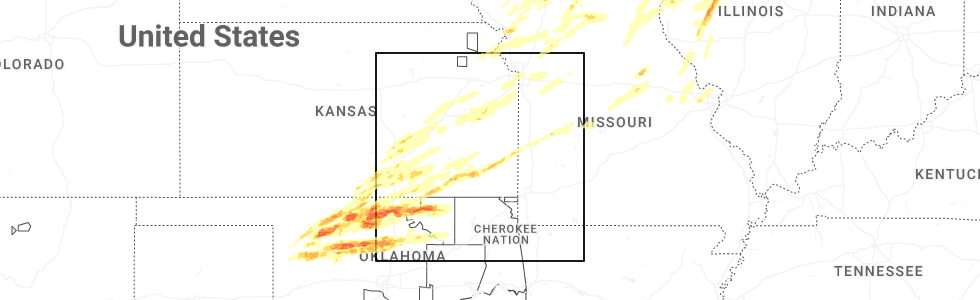
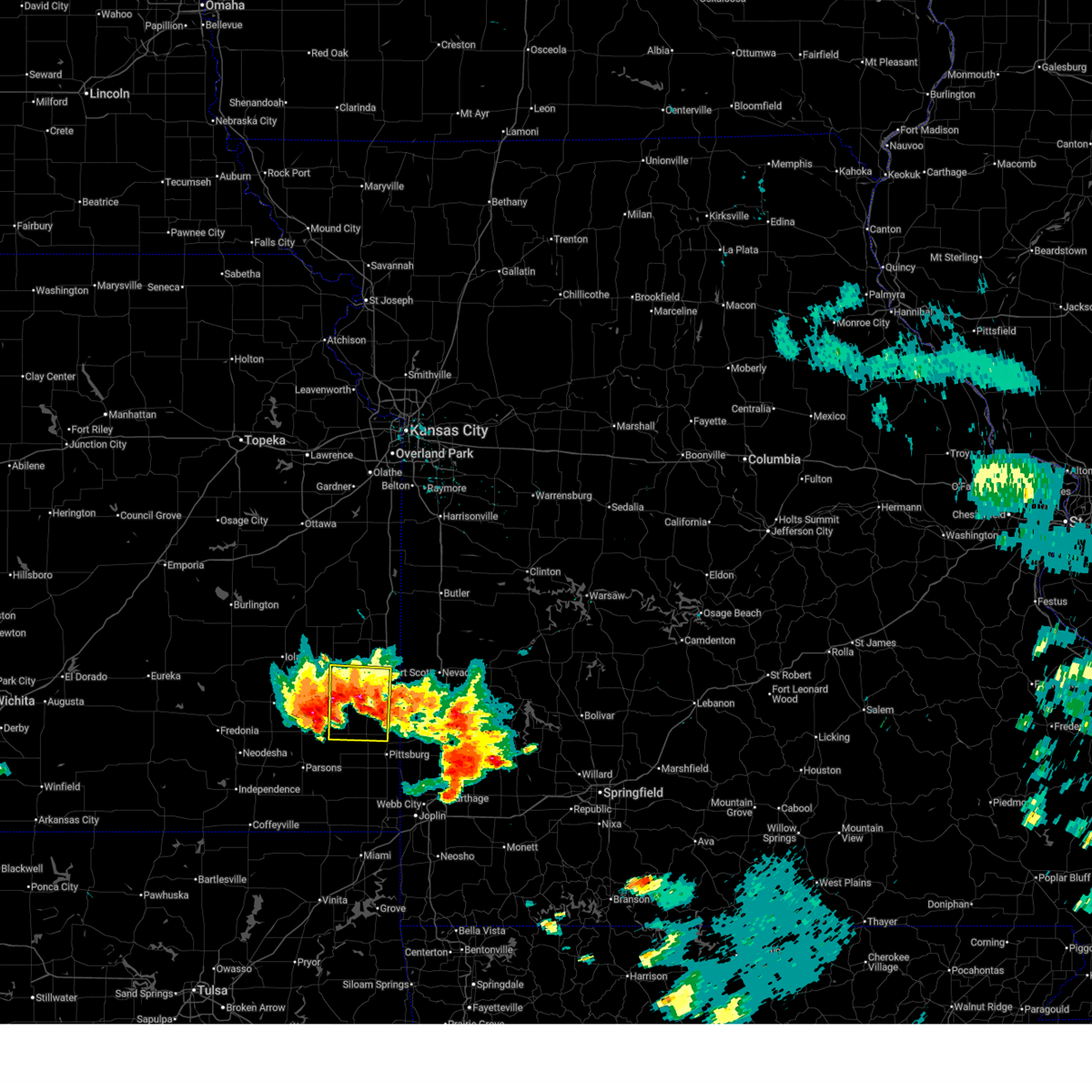
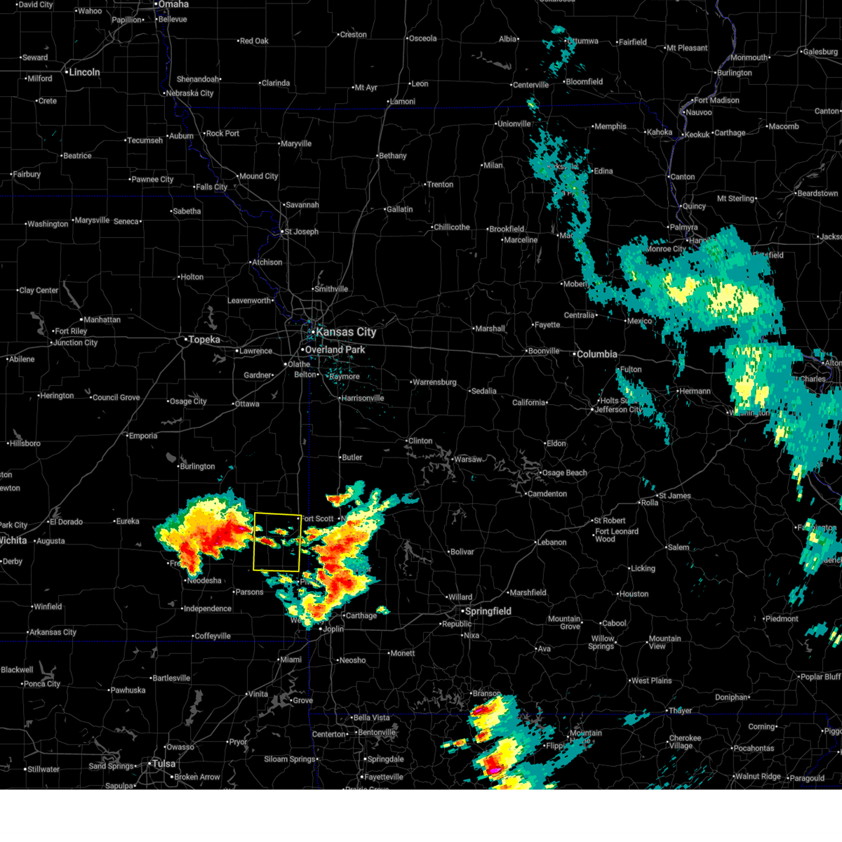
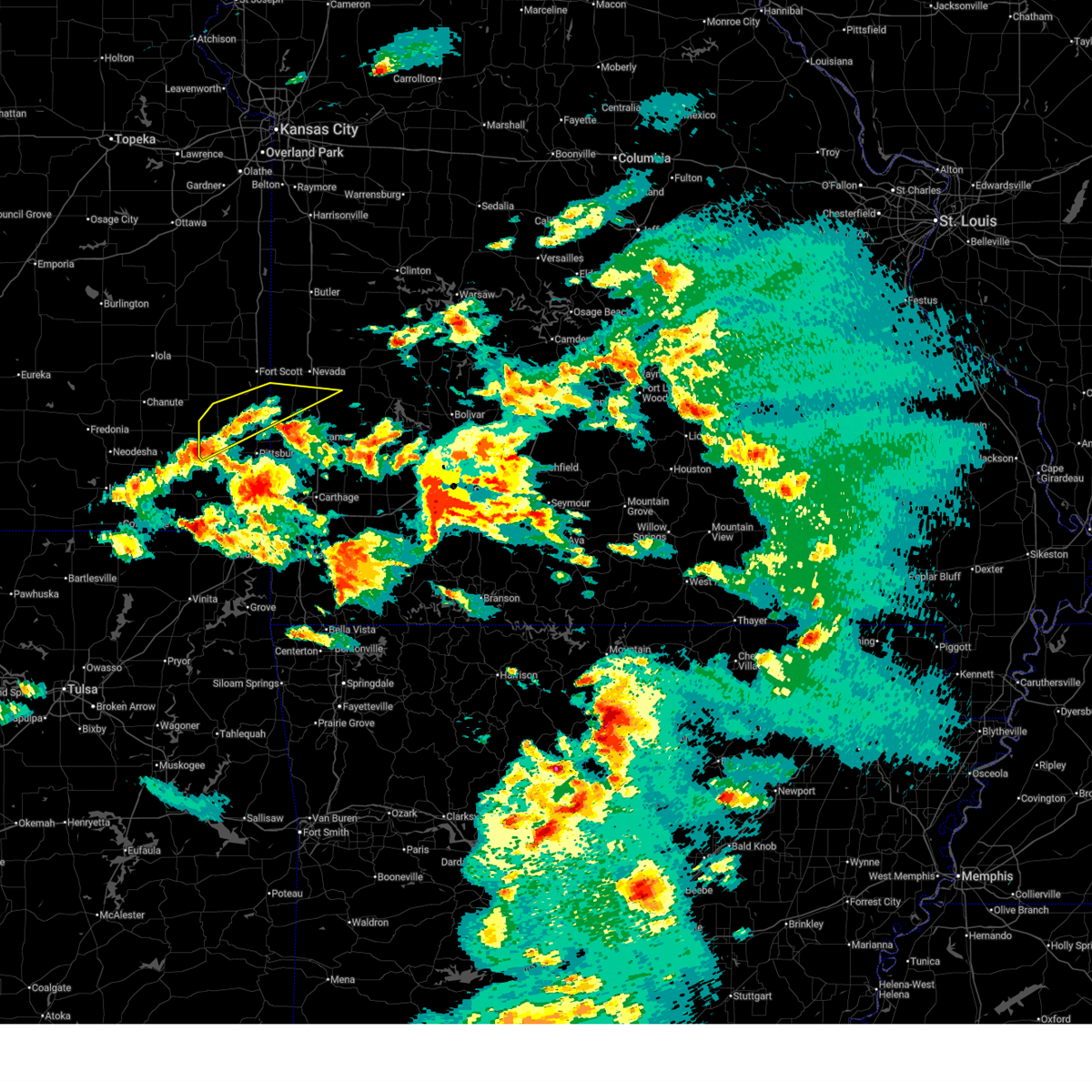
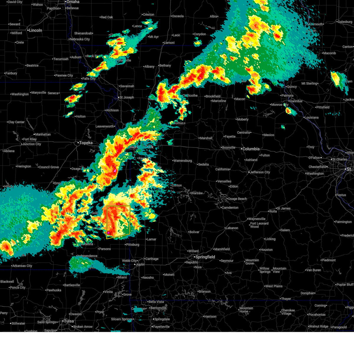
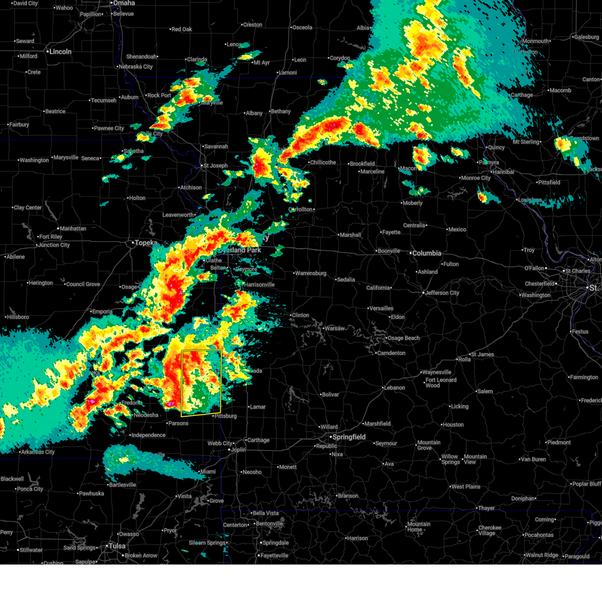
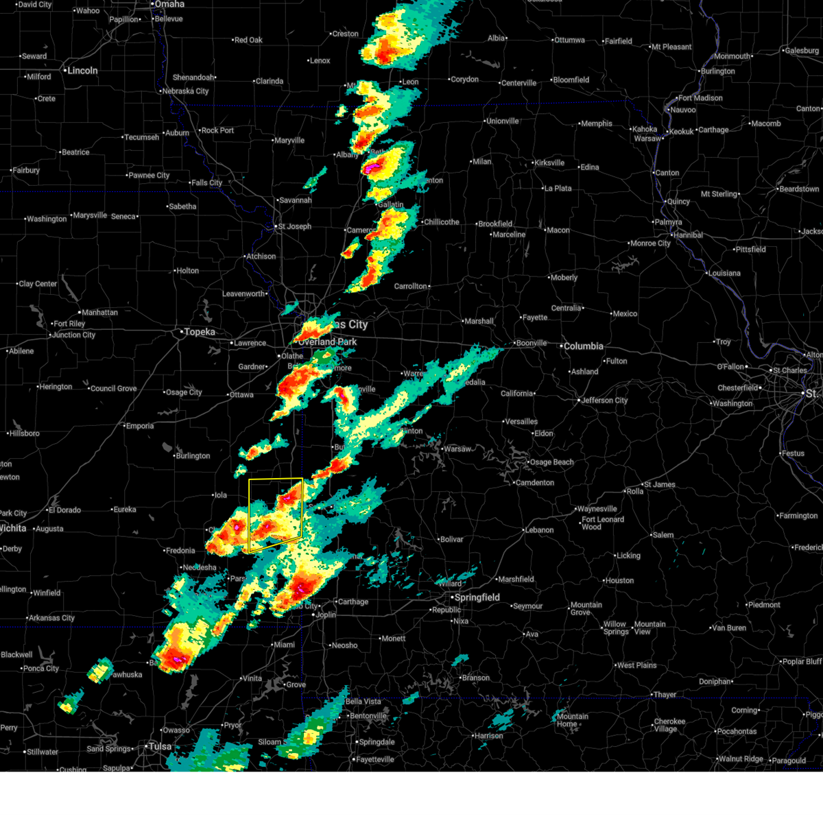
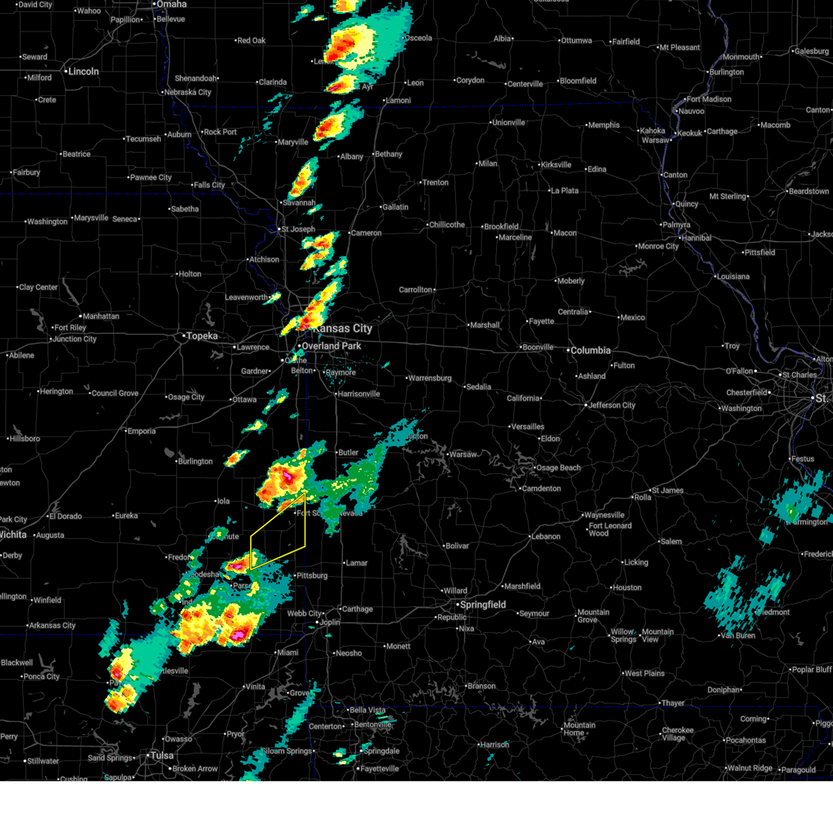
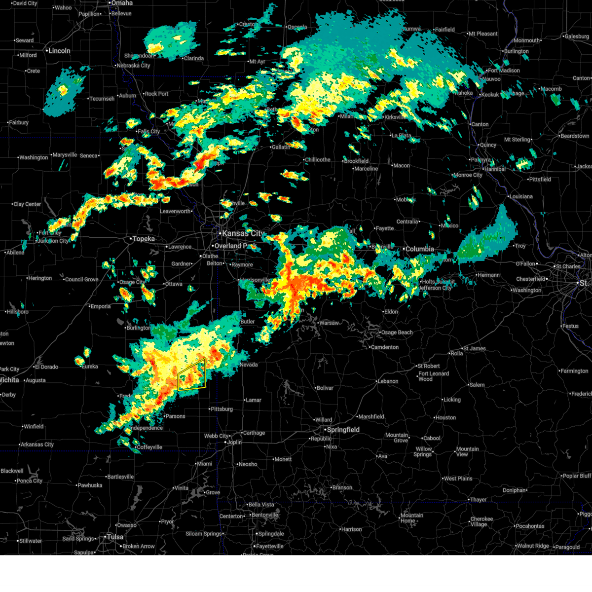
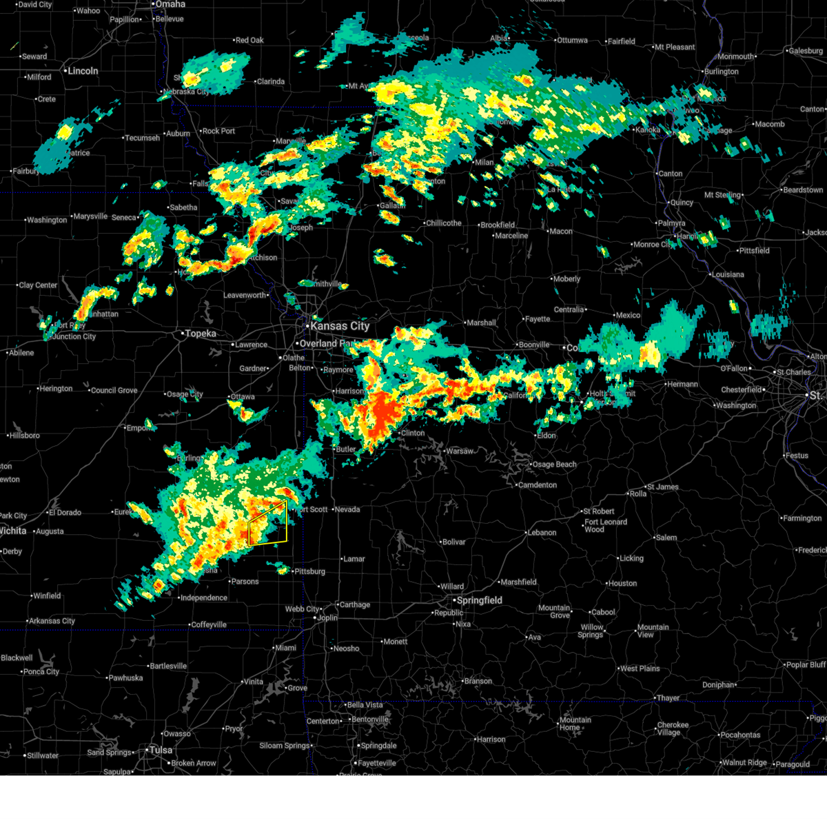
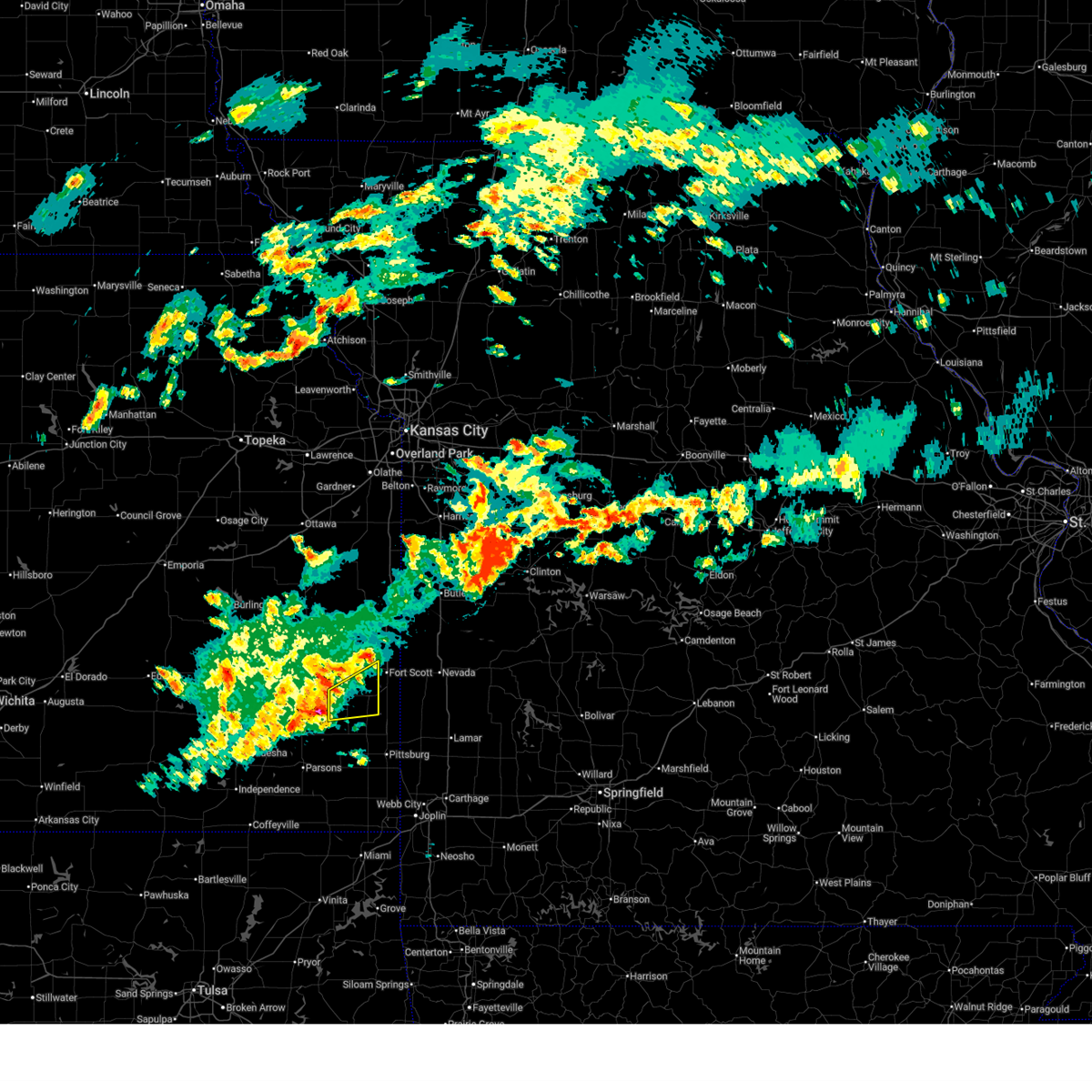
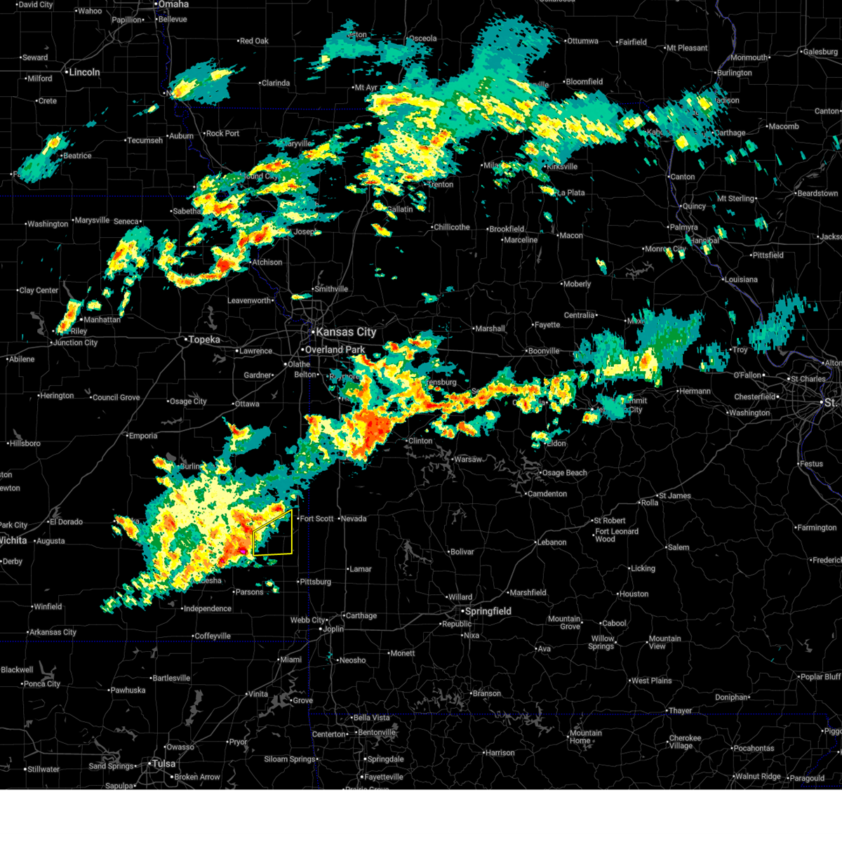
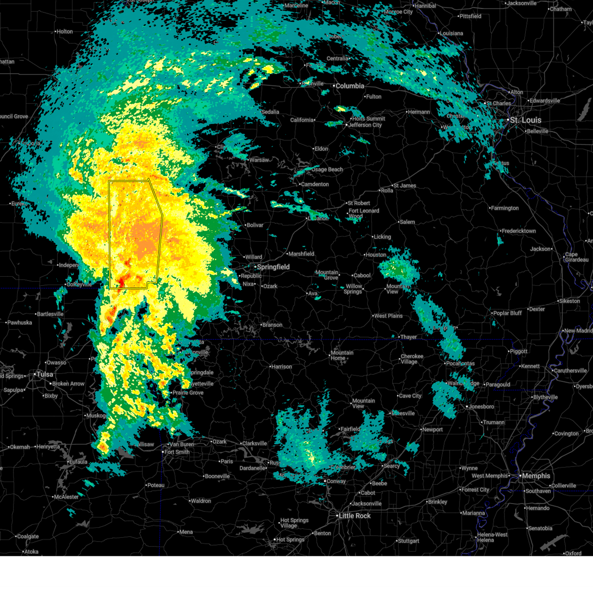
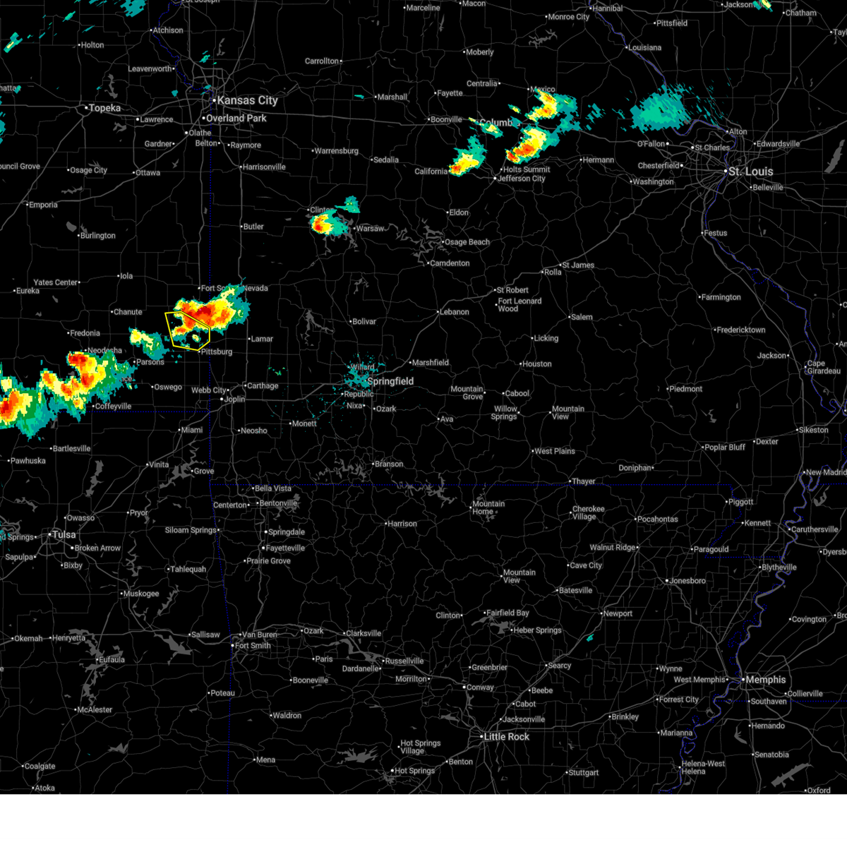
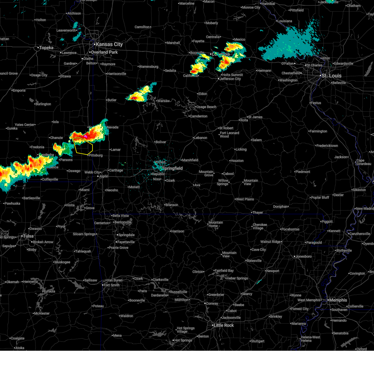
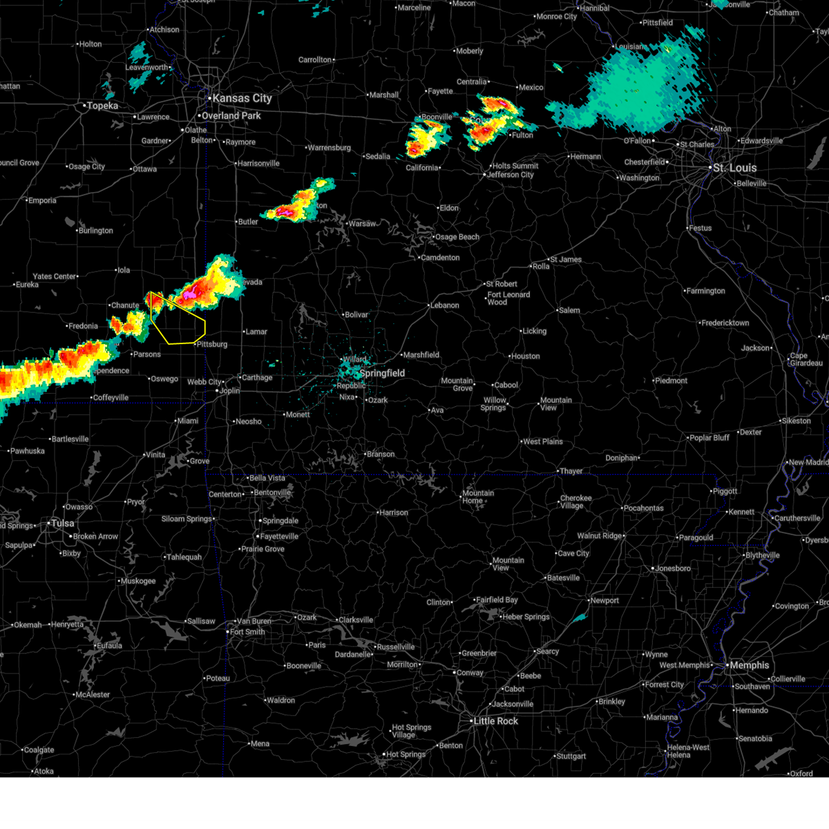
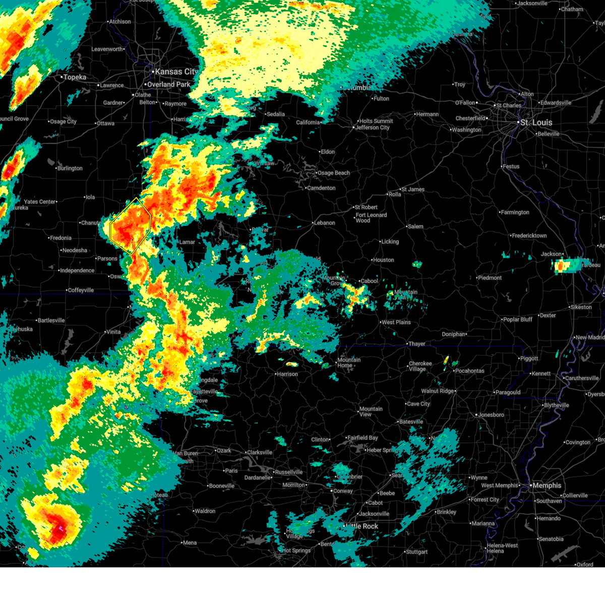
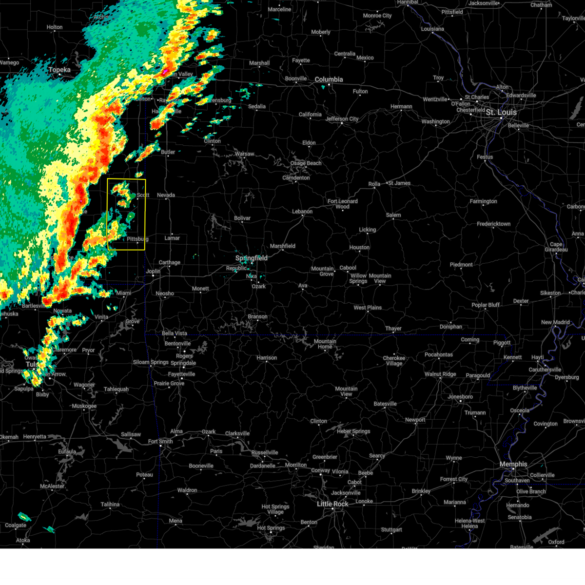
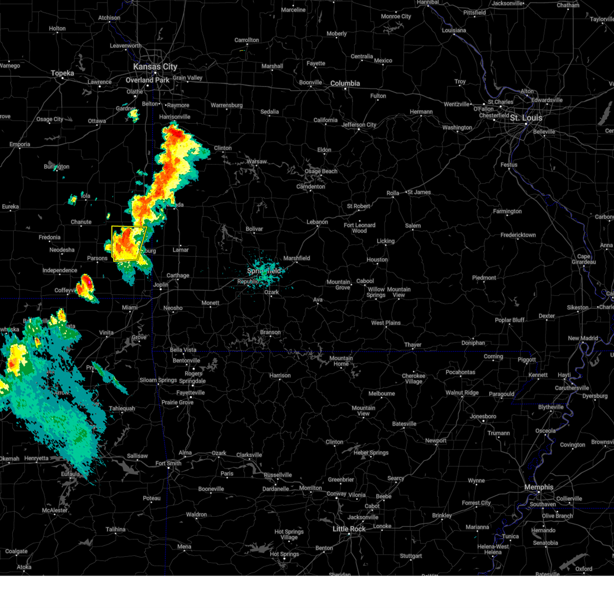
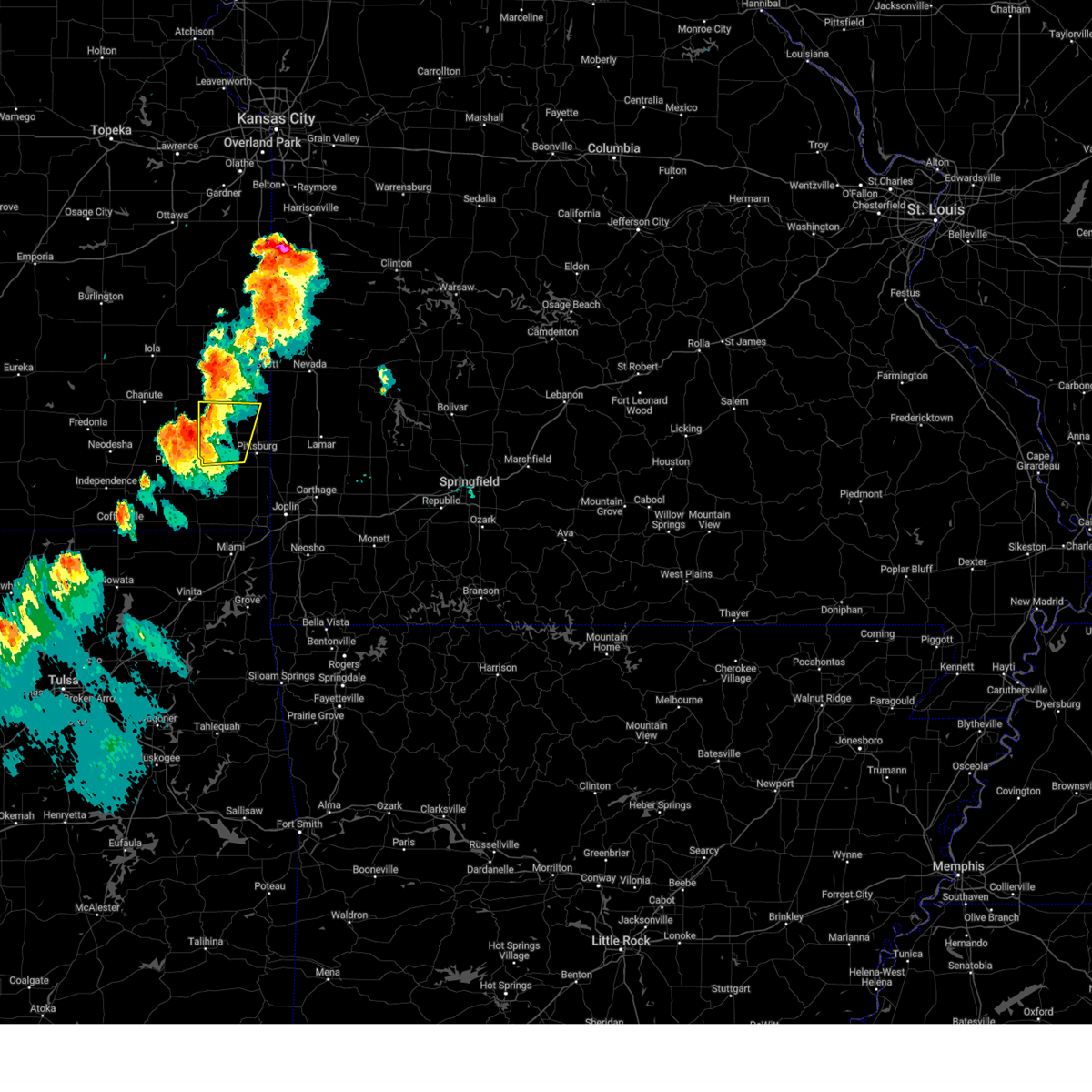
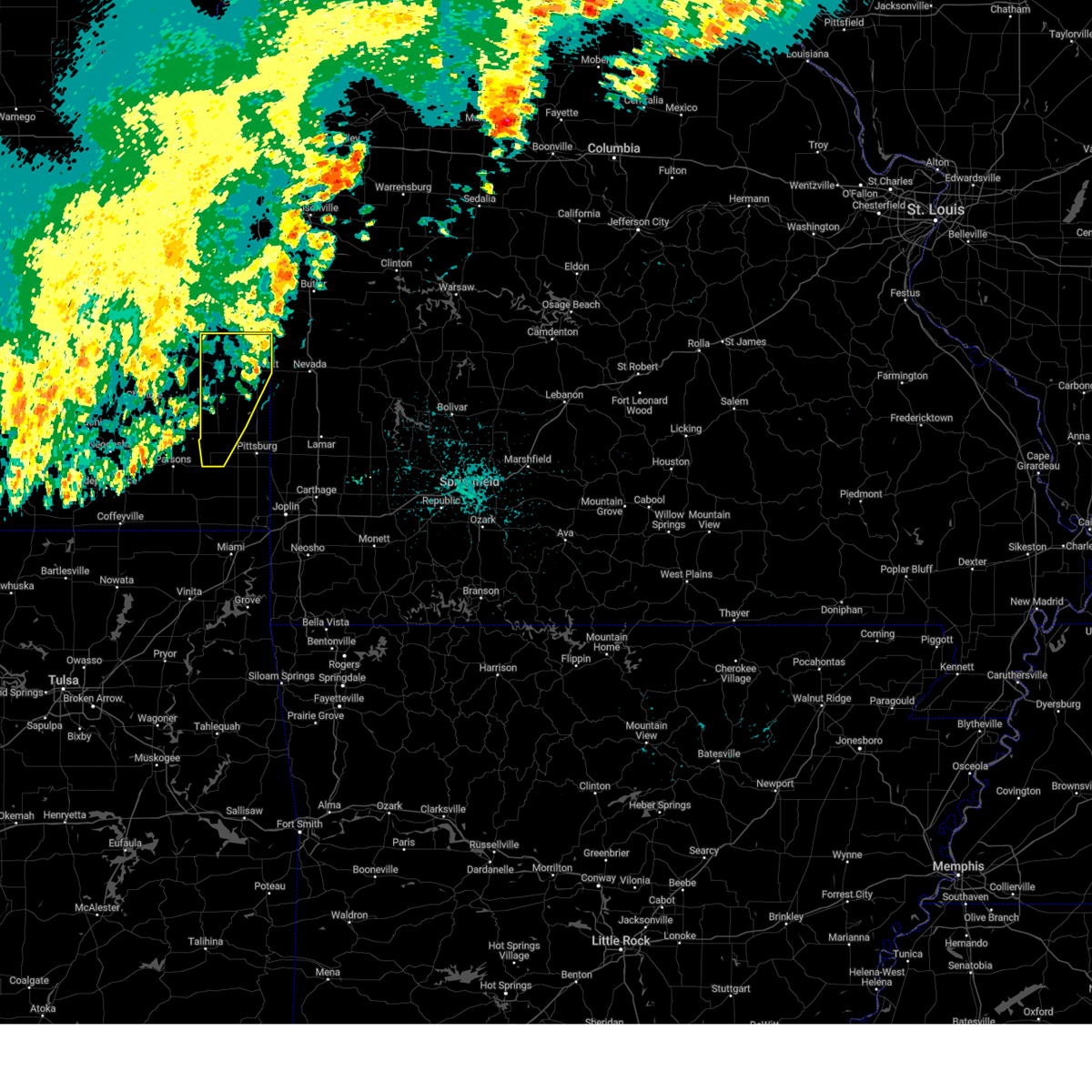
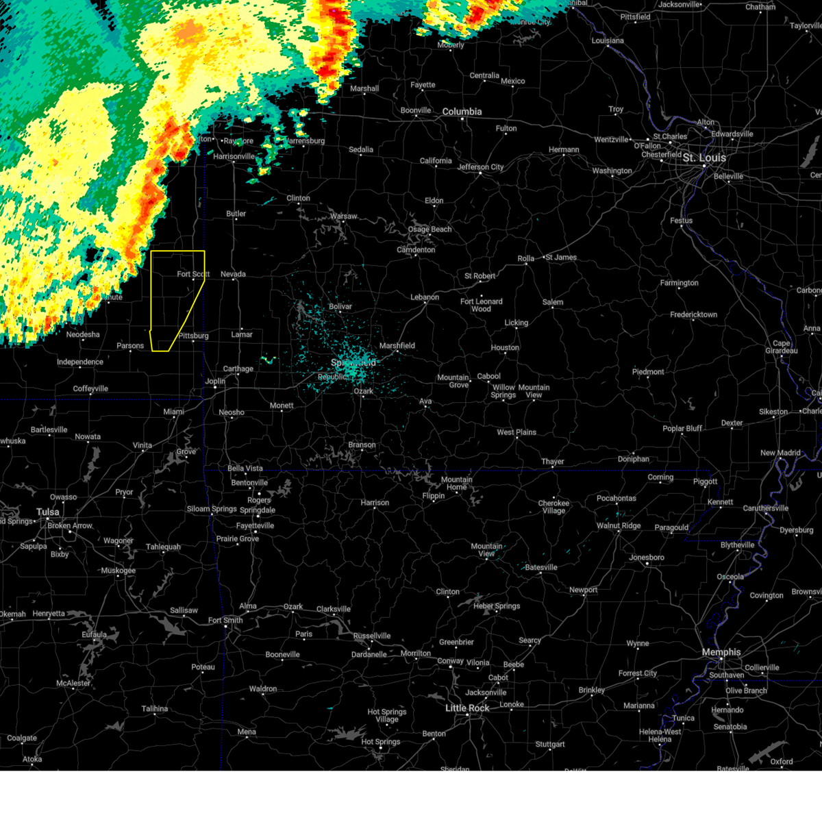
Hail Map for Hepler, KS
The Hepler, KS area has had 2 reports of on-the-ground hail by trained spotters, and has been under severe weather warnings 23 times during the past 12 months. Doppler radar has detected hail at or near Hepler, KS on 82 occasions, including 8 occasions during the past year.
| Name: | Hepler, KS |
| Where Located: | 26.5 miles E of Chanute, KS |
| Map: | Google Map for Hepler, KS |
| Population: | 132 |
| Housing Units: | 68 |
| More Info: | Search Google for Hepler, KS |
2
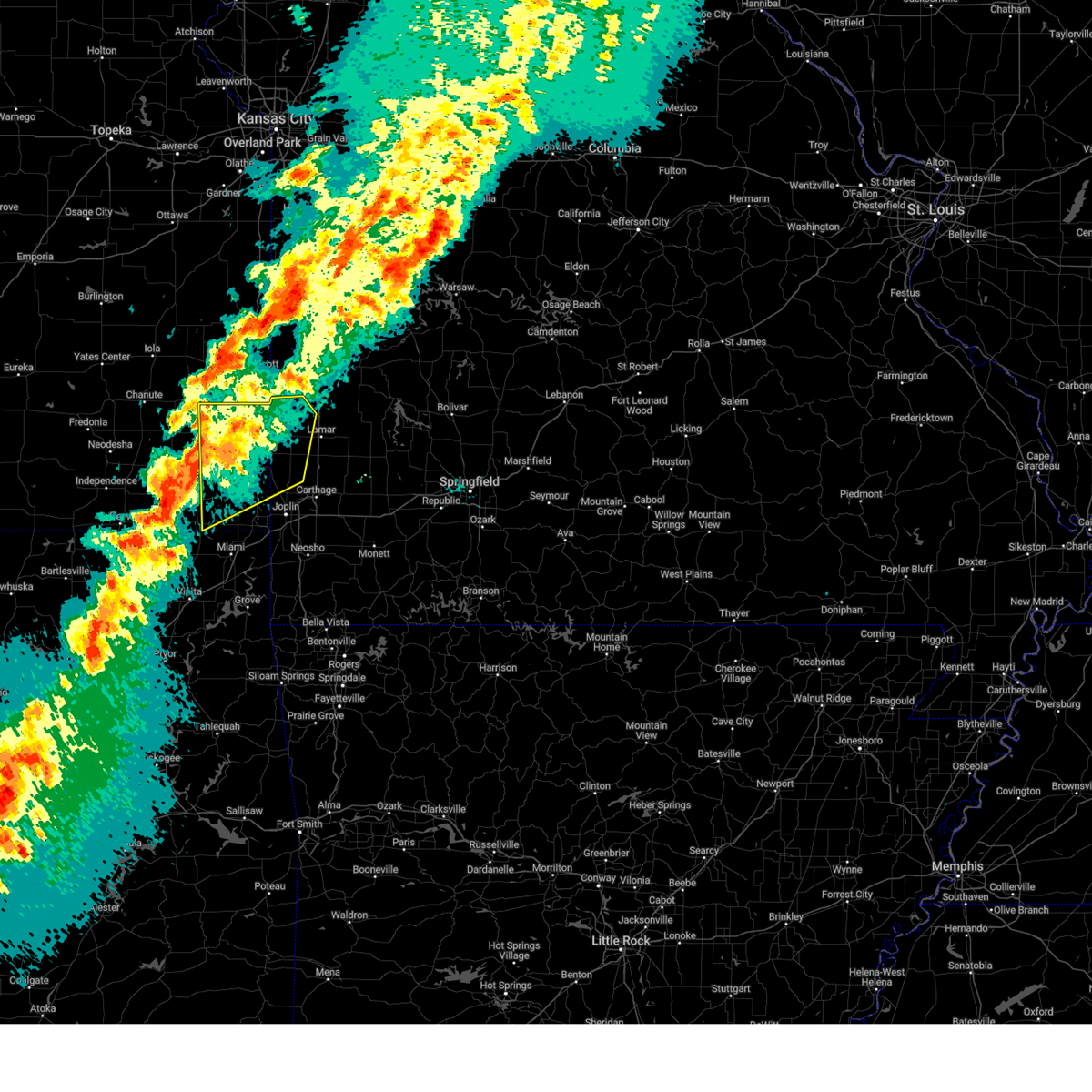
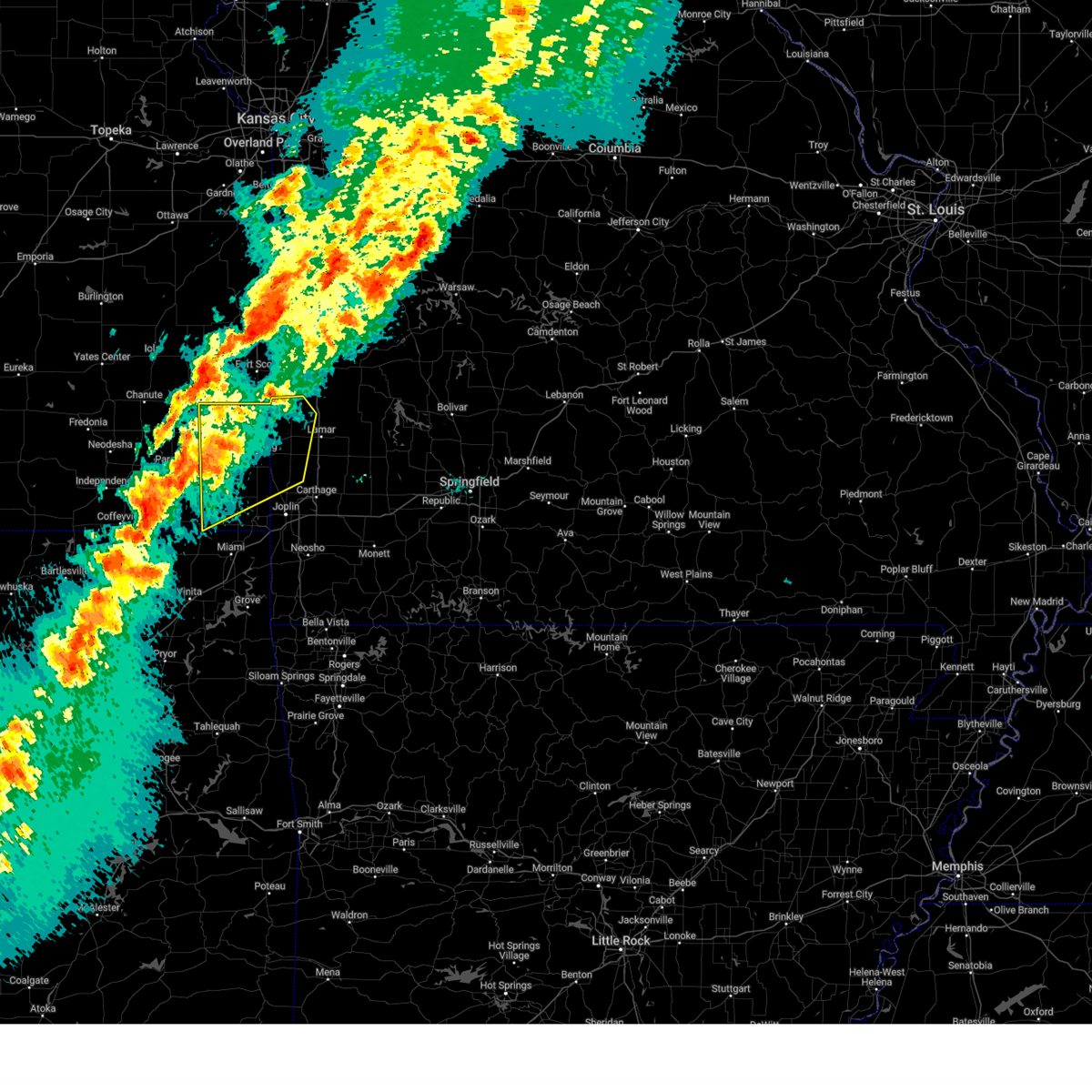
The Top Recent Hail Date for Hepler, KS is Friday, April 17, 2026 (7th out of 82)
Hail and Wind Damage Spotted near Hepler, KS
| Date / Time | Report Details |
|---|---|
| 6/13/2026 10:20 PM CDT |
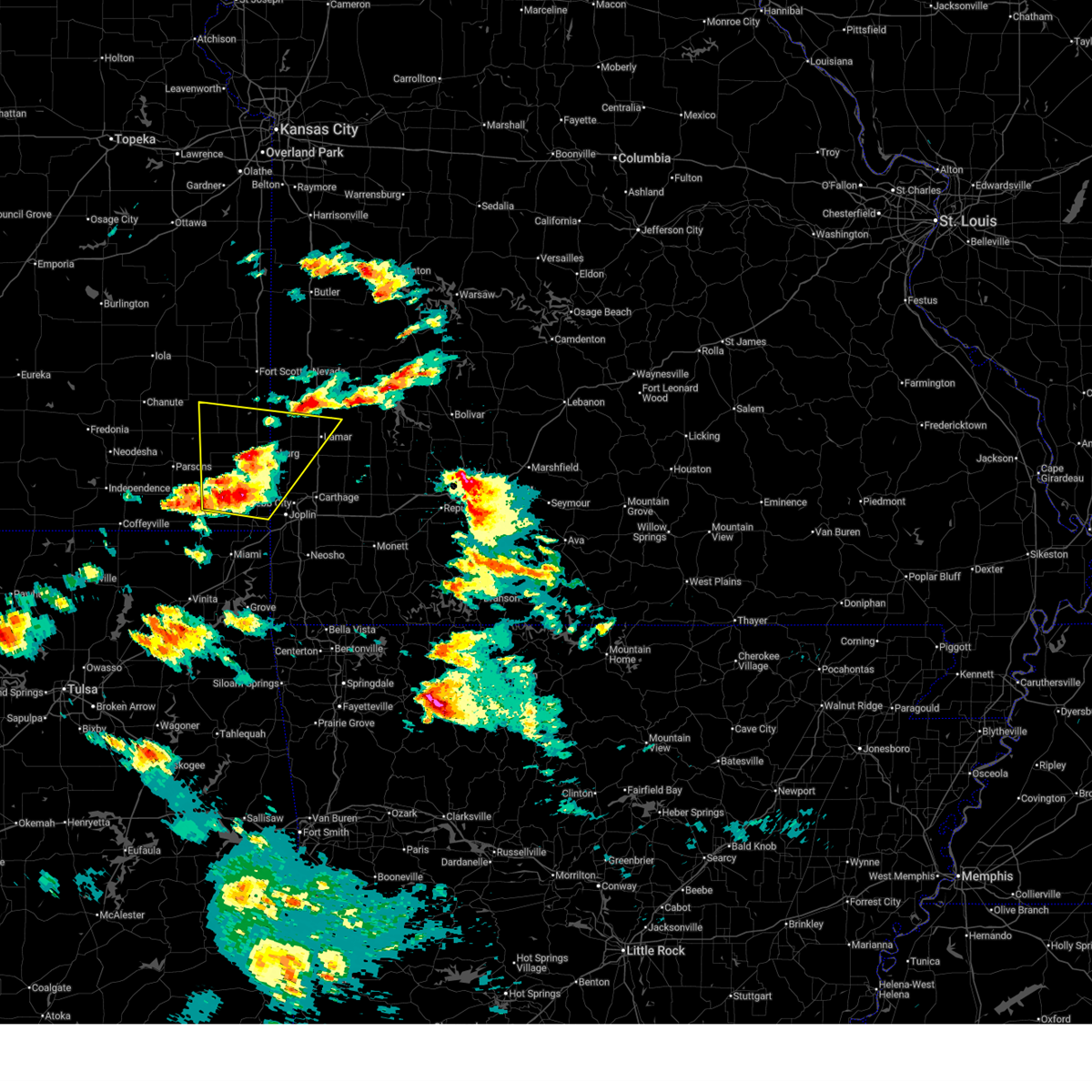
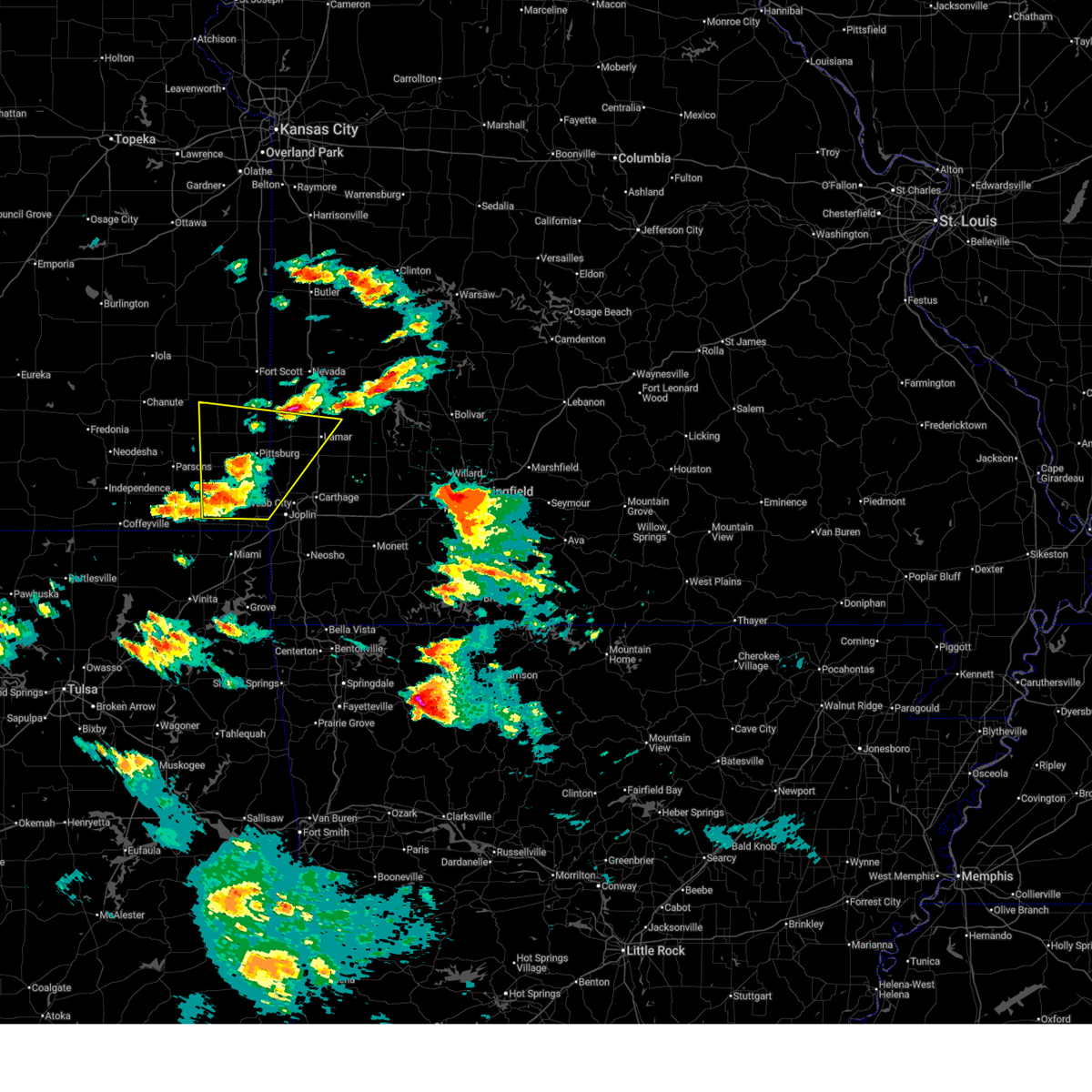
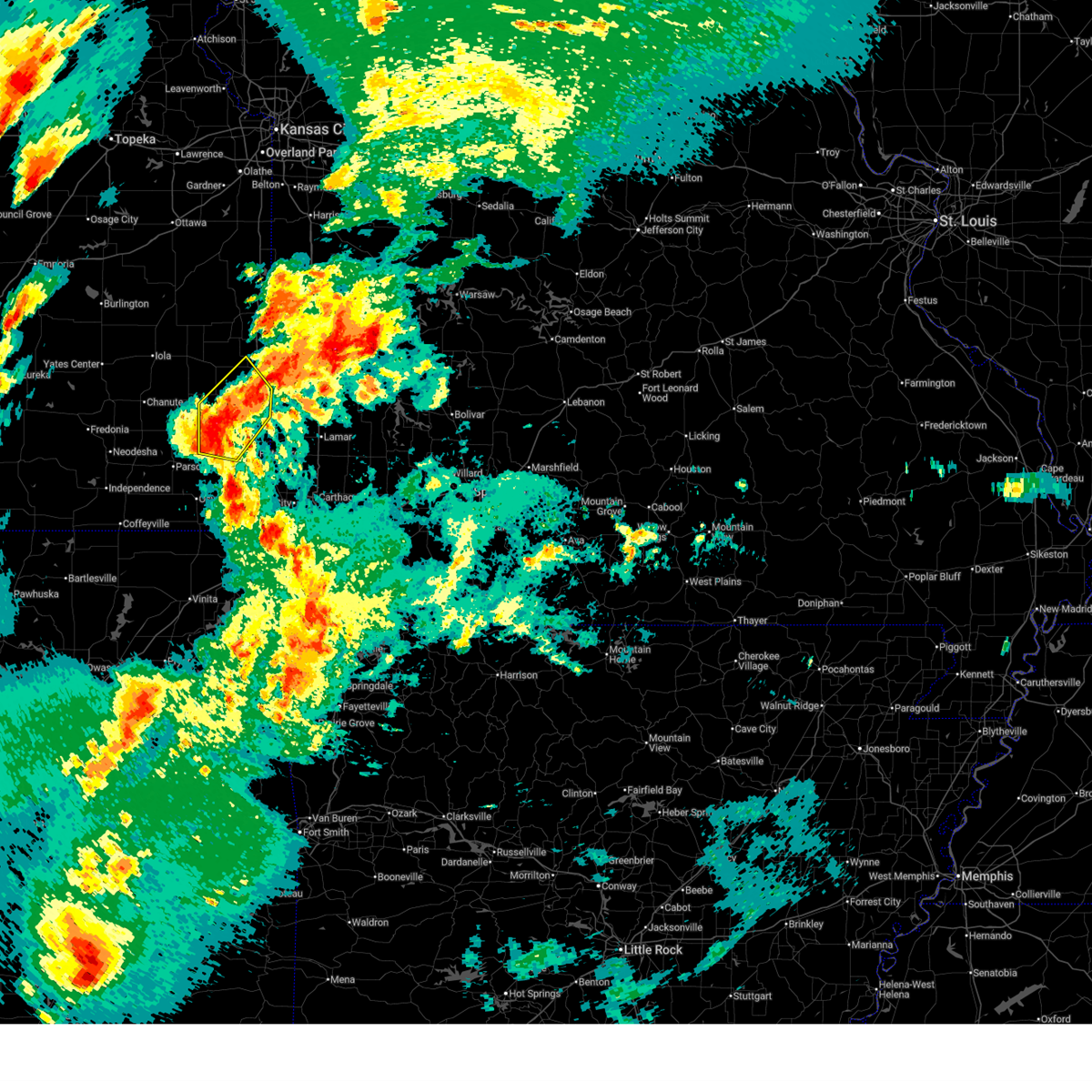
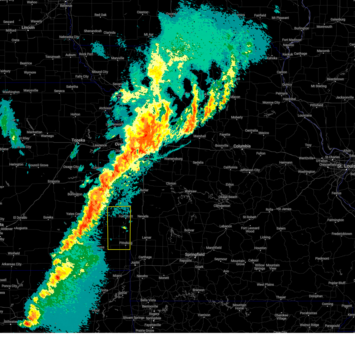
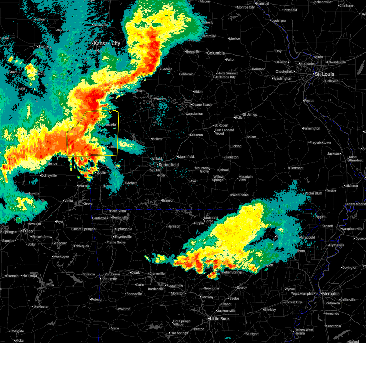 At 1019 pm cdt, severe thunderstorms were located along a line extending from 7 miles east of pleasanton to near fort scott to 6 miles northeast of parsons, moving southeast at 60 mph (radar indicated. multiple reports of 60 to 70 mph wind gusts have been received from this line of storms). Hazards include 70 mph wind gusts and quarter size hail. Hail damage to vehicles is expected. expect considerable tree damage. wind damage is also likely to mobile homes, roofs, and outbuildings. Locations impacted include, pittsburg, prairie state park, nevada, fort scott, lamar, frontenac, girard, arma, marmaton, golden city, liberal, cherokee, sheldon, mulberry, chicopee, mccune, nashville, mindenmines, franklin, and montevallo. At 1019 pm cdt, severe thunderstorms were located along a line extending from 7 miles east of pleasanton to near fort scott to 6 miles northeast of parsons, moving southeast at 60 mph (radar indicated. multiple reports of 60 to 70 mph wind gusts have been received from this line of storms). Hazards include 70 mph wind gusts and quarter size hail. Hail damage to vehicles is expected. expect considerable tree damage. wind damage is also likely to mobile homes, roofs, and outbuildings. Locations impacted include, pittsburg, prairie state park, nevada, fort scott, lamar, frontenac, girard, arma, marmaton, golden city, liberal, cherokee, sheldon, mulberry, chicopee, mccune, nashville, mindenmines, franklin, and montevallo.
|
| 6/13/2026 10:08 PM CDT |
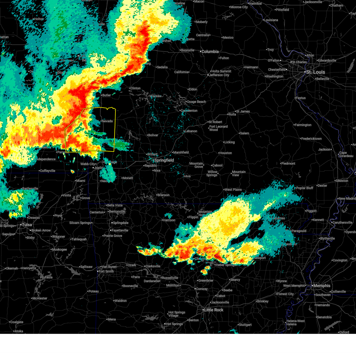 Svrsgf the national weather service in springfield has issued a * severe thunderstorm warning for, southeastern bourbon county in southeastern kansas, crawford county in southeastern kansas, barton county in southwestern missouri, vernon county in west central missouri, * until 1115 pm cdt. * at 1008 pm cdt, severe thunderstorms were located along a line extending from near la cygne to near fort scott to near galesburg, moving southeast at 60 mph (radar indicated). Hazards include 70 mph wind gusts and nickel size hail. Expect considerable tree damage. Damage is likely to mobile homes, roofs, and outbuildings. Svrsgf the national weather service in springfield has issued a * severe thunderstorm warning for, southeastern bourbon county in southeastern kansas, crawford county in southeastern kansas, barton county in southwestern missouri, vernon county in west central missouri, * until 1115 pm cdt. * at 1008 pm cdt, severe thunderstorms were located along a line extending from near la cygne to near fort scott to near galesburg, moving southeast at 60 mph (radar indicated). Hazards include 70 mph wind gusts and nickel size hail. Expect considerable tree damage. Damage is likely to mobile homes, roofs, and outbuildings.
|
| 6/13/2026 9:58 PM CDT |
 At 957 pm cdt, severe thunderstorms were located along a line extending from mound city to near redfield to buffalo, moving southeast at 60 mph (radar indicated. multiple reports of 60 to 70 mph wind gusts have been received with this line of storms). Hazards include 70 mph wind gusts and quarter size hail. Hail damage to vehicles is expected. expect considerable tree damage. wind damage is also likely to mobile homes, roofs, and outbuildings. Locations impacted include, fort scott, marmaton, bronson, uniontown, fulton, redfield, hepler, mapleton, harding, pawnee station, hiattville, petersburg, hammond, devon, garland, porterville, and xenia. At 957 pm cdt, severe thunderstorms were located along a line extending from mound city to near redfield to buffalo, moving southeast at 60 mph (radar indicated. multiple reports of 60 to 70 mph wind gusts have been received with this line of storms). Hazards include 70 mph wind gusts and quarter size hail. Hail damage to vehicles is expected. expect considerable tree damage. wind damage is also likely to mobile homes, roofs, and outbuildings. Locations impacted include, fort scott, marmaton, bronson, uniontown, fulton, redfield, hepler, mapleton, harding, pawnee station, hiattville, petersburg, hammond, devon, garland, porterville, and xenia.
|
| 6/13/2026 9:25 PM CDT |
 Svrsgf the national weather service in springfield has issued a * severe thunderstorm warning for, bourbon county in southeastern kansas, northern crawford county in southeastern kansas, * until 1030 pm cdt. * at 925 pm cdt, severe thunderstorms were located along a line extending from richmond to 6 miles northwest of lone elm to near hamilton, moving southeast at 60 mph (radar indicated). Hazards include 60 mph wind gusts and quarter size hail. Hail damage to vehicles is expected. Expect wind damage to roofs, siding, and trees. Svrsgf the national weather service in springfield has issued a * severe thunderstorm warning for, bourbon county in southeastern kansas, northern crawford county in southeastern kansas, * until 1030 pm cdt. * at 925 pm cdt, severe thunderstorms were located along a line extending from richmond to 6 miles northwest of lone elm to near hamilton, moving southeast at 60 mph (radar indicated). Hazards include 60 mph wind gusts and quarter size hail. Hail damage to vehicles is expected. Expect wind damage to roofs, siding, and trees.
|
| 5/30/2026 4:32 PM CDT |
 The storm which prompted the warning has moved out of the area. therefore, the warning has been allowed to expire. The storm which prompted the warning has moved out of the area. therefore, the warning has been allowed to expire.
|
| 5/30/2026 3:52 PM CDT |
 Svrsgf the national weather service in springfield has issued a * severe thunderstorm warning for, southern bourbon county in southeastern kansas, northern crawford county in southeastern kansas, * until 430 pm cdt. * at 352 pm cdt, a severe thunderstorm was located 10 miles southwest of bronson, or 13 miles southeast of la harpe, moving east at 30 mph (radar indicated). Hazards include 60 mph wind gusts and quarter size hail. Hail damage to vehicles is expected. Expect wind damage to roofs, siding, and trees. Svrsgf the national weather service in springfield has issued a * severe thunderstorm warning for, southern bourbon county in southeastern kansas, northern crawford county in southeastern kansas, * until 430 pm cdt. * at 352 pm cdt, a severe thunderstorm was located 10 miles southwest of bronson, or 13 miles southeast of la harpe, moving east at 30 mph (radar indicated). Hazards include 60 mph wind gusts and quarter size hail. Hail damage to vehicles is expected. Expect wind damage to roofs, siding, and trees.
|
| 4/28/2026 1:35 PM CDT |
 Svrsgf the national weather service in springfield has issued a * severe thunderstorm warning for, southeastern bourbon county in southeastern kansas, crawford county in southeastern kansas, northwestern barton county in southwestern missouri, southern vernon county in west central missouri, * until 215 pm cdt. * at 135 pm cdt, a severe thunderstorm was located near mccune, or 7 miles southeast of st. paul, moving northeast at 65 mph (radar indicated). Hazards include ping pong ball size hail and 60 mph wind gusts. People and animals outdoors will be injured. expect hail damage to roofs, siding, windows, and vehicles. Expect wind damage to roofs, siding, and trees. Svrsgf the national weather service in springfield has issued a * severe thunderstorm warning for, southeastern bourbon county in southeastern kansas, crawford county in southeastern kansas, northwestern barton county in southwestern missouri, southern vernon county in west central missouri, * until 215 pm cdt. * at 135 pm cdt, a severe thunderstorm was located near mccune, or 7 miles southeast of st. paul, moving northeast at 65 mph (radar indicated). Hazards include ping pong ball size hail and 60 mph wind gusts. People and animals outdoors will be injured. expect hail damage to roofs, siding, windows, and vehicles. Expect wind damage to roofs, siding, and trees.
|
| 4/28/2026 11:55 AM CDT |
 At 1155 am cdt, a severe thunderstorm was located near columbus, moving northeast at 75 mph (radar indicated). Hazards include two inch hail. People and animals outdoors will be injured. expect damage to roofs, siding, windows, and vehicles. Locations impacted include, pittsburg, prairie state park, carl junction, lamar, frontenac, columbus, galena, girard, arma, liberal, cherokee, weir, sherman, mulberry, scammon, chicopee, mccune, nashville, mindenmines, and franklin. At 1155 am cdt, a severe thunderstorm was located near columbus, moving northeast at 75 mph (radar indicated). Hazards include two inch hail. People and animals outdoors will be injured. expect damage to roofs, siding, windows, and vehicles. Locations impacted include, pittsburg, prairie state park, carl junction, lamar, frontenac, columbus, galena, girard, arma, liberal, cherokee, weir, sherman, mulberry, scammon, chicopee, mccune, nashville, mindenmines, and franklin.
|
| 4/28/2026 11:51 AM CDT |
 Svrsgf the national weather service in springfield has issued a * severe thunderstorm warning for, cherokee county in southeastern kansas, crawford county in southeastern kansas, barton county in southwestern missouri, northwestern jasper county in southwestern missouri, * until 1215 pm cdt. * at 1151 am cdt, a severe thunderstorm was located near columbus, moving northeast at 80 mph (radar indicated). Hazards include half dollar size hail. damage to vehicles is expected Svrsgf the national weather service in springfield has issued a * severe thunderstorm warning for, cherokee county in southeastern kansas, crawford county in southeastern kansas, barton county in southwestern missouri, northwestern jasper county in southwestern missouri, * until 1215 pm cdt. * at 1151 am cdt, a severe thunderstorm was located near columbus, moving northeast at 80 mph (radar indicated). Hazards include half dollar size hail. damage to vehicles is expected
|
| 4/26/2026 3:31 PM CDT |
 At 331 pm cdt, a severe thunderstorm was located near walnut, or 8 miles northeast of erie, moving northeast at 35 mph (radar indicated). Hazards include golf ball size hail and 60 mph wind gusts. People and animals outdoors will be injured. expect hail damage to roofs, siding, windows, and vehicles. expect wind damage to roofs, siding, and trees. Locations impacted include, fort scott, marmaton, arcadia, uniontown, walnut, redfield, hepler, pawnee station, hiattville, petersburg, farlington, brazilton, garland, porterville, and englevale. At 331 pm cdt, a severe thunderstorm was located near walnut, or 8 miles northeast of erie, moving northeast at 35 mph (radar indicated). Hazards include golf ball size hail and 60 mph wind gusts. People and animals outdoors will be injured. expect hail damage to roofs, siding, windows, and vehicles. expect wind damage to roofs, siding, and trees. Locations impacted include, fort scott, marmaton, arcadia, uniontown, walnut, redfield, hepler, pawnee station, hiattville, petersburg, farlington, brazilton, garland, porterville, and englevale.
|
| 4/26/2026 3:23 PM CDT |
 Svrsgf the national weather service in springfield has issued a * severe thunderstorm warning for, bourbon county in southeastern kansas, northern crawford county in southeastern kansas, * until 415 pm cdt. * at 323 pm cdt, a severe thunderstorm was located over erie, moving northeast at 35 mph (radar indicated). Hazards include 60 mph wind gusts and half dollar size hail. Hail damage to vehicles is expected. Expect wind damage to roofs, siding, and trees. Svrsgf the national weather service in springfield has issued a * severe thunderstorm warning for, bourbon county in southeastern kansas, northern crawford county in southeastern kansas, * until 415 pm cdt. * at 323 pm cdt, a severe thunderstorm was located over erie, moving northeast at 35 mph (radar indicated). Hazards include 60 mph wind gusts and half dollar size hail. Hail damage to vehicles is expected. Expect wind damage to roofs, siding, and trees.
|
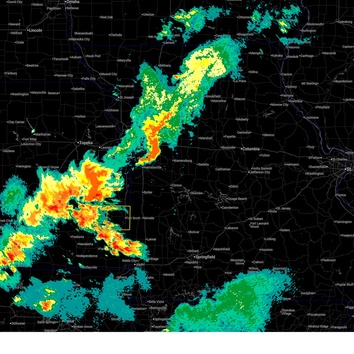
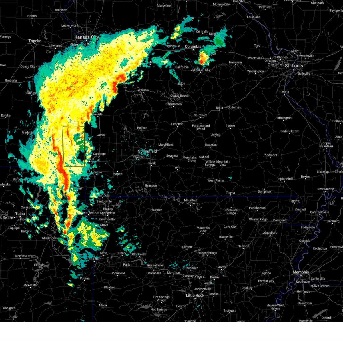
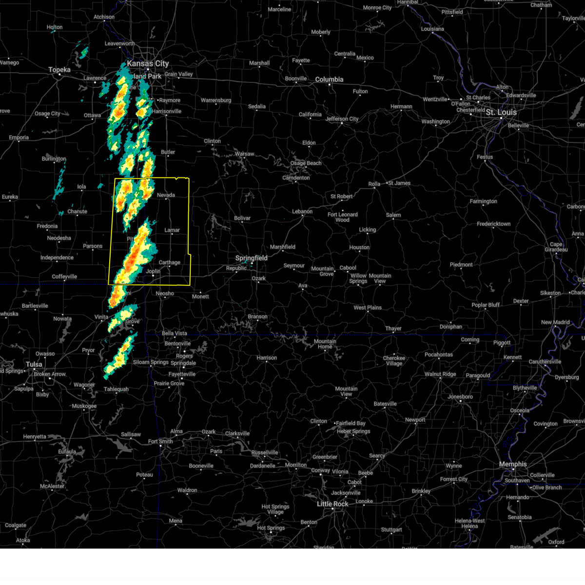
| 4/17/2026 5:07 PM CDT | Quarter sized hail reported 0.1 miles ENE of Hepler, KS |
| 4/17/2026 4:58 PM CDT |
 At 458 pm cdt, severe thunderstorms were located along a line extending from near bronson to near hepler to near girard, moving east at 60 mph (radar indicated). Hazards include 60 mph wind gusts and half dollar size hail. Hail damage to vehicles is expected. expect wind damage to roofs, siding, and trees. Locations impacted include, fort scott, marmaton, bronson, arcadia, uniontown, walnut, fulton, redfield, hepler, mapleton, harding, pawnee station, hiattville, petersburg, farlington, hammond, brazilton, devon, garland, and porterville. At 458 pm cdt, severe thunderstorms were located along a line extending from near bronson to near hepler to near girard, moving east at 60 mph (radar indicated). Hazards include 60 mph wind gusts and half dollar size hail. Hail damage to vehicles is expected. expect wind damage to roofs, siding, and trees. Locations impacted include, fort scott, marmaton, bronson, arcadia, uniontown, walnut, fulton, redfield, hepler, mapleton, harding, pawnee station, hiattville, petersburg, farlington, hammond, brazilton, devon, garland, and porterville.
|
| 4/17/2026 4:46 PM CDT |
 Svrsgf the national weather service in springfield has issued a * severe thunderstorm warning for, bourbon county in southeastern kansas, crawford county in southeastern kansas, * until 530 pm cdt. * at 446 pm cdt, severe thunderstorms were located along a line extending from moran to near walnut to near st. paul, moving east at 60 mph (radar indicated). Hazards include 60 mph wind gusts and half dollar size hail. Hail damage to vehicles is expected. Expect wind damage to roofs, siding, and trees. Svrsgf the national weather service in springfield has issued a * severe thunderstorm warning for, bourbon county in southeastern kansas, crawford county in southeastern kansas, * until 530 pm cdt. * at 446 pm cdt, severe thunderstorms were located along a line extending from moran to near walnut to near st. paul, moving east at 60 mph (radar indicated). Hazards include 60 mph wind gusts and half dollar size hail. Hail damage to vehicles is expected. Expect wind damage to roofs, siding, and trees.
|
| 4/15/2026 4:56 PM CDT |
 Svrsgf the national weather service in springfield has issued a * severe thunderstorm warning for, bourbon county in southeastern kansas, northern crawford county in southeastern kansas, * until 600 pm cdt. * at 455 pm cdt, a severe thunderstorm was located near redfield, or 10 miles southwest of fort scott, moving east at 50 mph (radar indicated). Hazards include 60 mph wind gusts and quarter size hail. Hail damage to vehicles is expected. Expect wind damage to roofs, siding, and trees. Svrsgf the national weather service in springfield has issued a * severe thunderstorm warning for, bourbon county in southeastern kansas, northern crawford county in southeastern kansas, * until 600 pm cdt. * at 455 pm cdt, a severe thunderstorm was located near redfield, or 10 miles southwest of fort scott, moving east at 50 mph (radar indicated). Hazards include 60 mph wind gusts and quarter size hail. Hail damage to vehicles is expected. Expect wind damage to roofs, siding, and trees.
|
| 4/15/2026 4:09 PM CDT |
 Svrsgf the national weather service in springfield has issued a * severe thunderstorm warning for, southern bourbon county in southeastern kansas, northern crawford county in southeastern kansas, * until 500 pm cdt. * at 409 pm cdt, a severe thunderstorm was located over st. paul, moving northeast at 45 mph (radar indicated). Hazards include ping pong ball size hail and 60 mph wind gusts. People and animals outdoors will be injured. expect hail damage to roofs, siding, windows, and vehicles. Expect wind damage to roofs, siding, and trees. Svrsgf the national weather service in springfield has issued a * severe thunderstorm warning for, southern bourbon county in southeastern kansas, northern crawford county in southeastern kansas, * until 500 pm cdt. * at 409 pm cdt, a severe thunderstorm was located over st. paul, moving northeast at 45 mph (radar indicated). Hazards include ping pong ball size hail and 60 mph wind gusts. People and animals outdoors will be injured. expect hail damage to roofs, siding, windows, and vehicles. Expect wind damage to roofs, siding, and trees.
|
| 4/1/2026 12:03 AM CDT |
 the severe thunderstorm warning has been cancelled and is no longer in effect the severe thunderstorm warning has been cancelled and is no longer in effect
|
| 3/31/2026 11:42 PM CDT |
 At 1142 pm cdt, a severe thunderstorm was located over walnut, or 10 miles northeast of st. paul, moving northeast at 25 mph (radar indicated). Hazards include 60 mph wind gusts and quarter size hail. Hail damage to vehicles is expected. expect wind damage to roofs, siding, and trees. Locations impacted include, marmaton, walnut, redfield, hepler, hiattville, petersburg, farlington, porterville, and pawnee station. At 1142 pm cdt, a severe thunderstorm was located over walnut, or 10 miles northeast of st. paul, moving northeast at 25 mph (radar indicated). Hazards include 60 mph wind gusts and quarter size hail. Hail damage to vehicles is expected. expect wind damage to roofs, siding, and trees. Locations impacted include, marmaton, walnut, redfield, hepler, hiattville, petersburg, farlington, porterville, and pawnee station.
|
| 3/31/2026 11:31 PM CDT |
 At 1131 pm cdt, a severe thunderstorm was located near walnut, or 9 miles northeast of erie, moving northeast at 30 mph (law enforcement. at 1116 pm, quarter size hail was reported in erie). Hazards include 60 mph wind gusts and quarter size hail. Hail damage to vehicles is expected. expect wind damage to roofs, siding, and trees. Locations impacted include, marmaton, walnut, redfield, hepler, hiattville, petersburg, farlington, porterville, and pawnee station. At 1131 pm cdt, a severe thunderstorm was located near walnut, or 9 miles northeast of erie, moving northeast at 30 mph (law enforcement. at 1116 pm, quarter size hail was reported in erie). Hazards include 60 mph wind gusts and quarter size hail. Hail damage to vehicles is expected. expect wind damage to roofs, siding, and trees. Locations impacted include, marmaton, walnut, redfield, hepler, hiattville, petersburg, farlington, porterville, and pawnee station.
|
| 3/31/2026 11:25 PM CDT |
 Svrsgf the national weather service in springfield has issued a * severe thunderstorm warning for, southwestern bourbon county in southeastern kansas, northwestern crawford county in southeastern kansas, * until 1215 am cdt. * at 1125 pm cdt, a severe thunderstorm was located near walnut, or near erie, moving northeast at 30 mph (radar indicated). Hazards include 60 mph wind gusts and quarter size hail. Hail damage to vehicles is expected. Expect wind damage to roofs, siding, and trees. Svrsgf the national weather service in springfield has issued a * severe thunderstorm warning for, southwestern bourbon county in southeastern kansas, northwestern crawford county in southeastern kansas, * until 1215 am cdt. * at 1125 pm cdt, a severe thunderstorm was located near walnut, or near erie, moving northeast at 30 mph (radar indicated). Hazards include 60 mph wind gusts and quarter size hail. Hail damage to vehicles is expected. Expect wind damage to roofs, siding, and trees.
|
| 1/8/2026 10:30 AM CST |
 Svrsgf the national weather service in springfield has issued a * severe thunderstorm warning for, bourbon county in southeastern kansas, cherokee county in southeastern kansas, crawford county in southeastern kansas, western barton county in southwestern missouri, western vernon county in west central missouri, western jasper county in southwestern missouri, * until 1115 am cst. * at 1030 am cst, severe thunderstorms were located along a line extending from 6 miles southeast of humboldt to near mccune to near treece, moving northeast at 60 mph (radar indicated). Hazards include 60 mph wind gusts and penny size hail. expect damage to roofs, siding, and trees Svrsgf the national weather service in springfield has issued a * severe thunderstorm warning for, bourbon county in southeastern kansas, cherokee county in southeastern kansas, crawford county in southeastern kansas, western barton county in southwestern missouri, western vernon county in west central missouri, western jasper county in southwestern missouri, * until 1115 am cst. * at 1030 am cst, severe thunderstorms were located along a line extending from 6 miles southeast of humboldt to near mccune to near treece, moving northeast at 60 mph (radar indicated). Hazards include 60 mph wind gusts and penny size hail. expect damage to roofs, siding, and trees
|
| 1/8/2026 9:49 AM CST |
 Svrsgf the national weather service in springfield has issued a * severe thunderstorm warning for, bourbon county in southeastern kansas, cherokee county in southeastern kansas, crawford county in southeastern kansas, * until 1030 am cst. * at 948 am cst, severe thunderstorms were located along a line extending from 6 miles southeast of blue mound to 7 miles southwest of girard to near baxter springs, moving northeast at 60 mph (radar indicated). Hazards include 60 mph wind gusts and nickel size hail. expect damage to roofs, siding, and trees Svrsgf the national weather service in springfield has issued a * severe thunderstorm warning for, bourbon county in southeastern kansas, cherokee county in southeastern kansas, crawford county in southeastern kansas, * until 1030 am cst. * at 948 am cst, severe thunderstorms were located along a line extending from 6 miles southeast of blue mound to 7 miles southwest of girard to near baxter springs, moving northeast at 60 mph (radar indicated). Hazards include 60 mph wind gusts and nickel size hail. expect damage to roofs, siding, and trees
|
| 8/10/2025 6:35 PM CDT |
 The storm which prompted the warning has weakened below severe limits, and no longer poses an immediate threat to life or property. therefore, the warning will be allowed to expire. The storm which prompted the warning has weakened below severe limits, and no longer poses an immediate threat to life or property. therefore, the warning will be allowed to expire.
|
| 8/10/2025 6:03 PM CDT |
 Svrsgf the national weather service in springfield has issued a * severe thunderstorm warning for, bourbon county in southeastern kansas, northeastern crawford county in southeastern kansas, * until 645 pm cdt. * at 602 pm cdt, a severe thunderstorm was located near hepler, or 11 miles north of girard, moving northeast at 15 mph (radar indicated). Hazards include 60 mph wind gusts and quarter size hail. Hail damage to vehicles is expected. Expect wind damage to roofs, siding, and trees. Svrsgf the national weather service in springfield has issued a * severe thunderstorm warning for, bourbon county in southeastern kansas, northeastern crawford county in southeastern kansas, * until 645 pm cdt. * at 602 pm cdt, a severe thunderstorm was located near hepler, or 11 miles north of girard, moving northeast at 15 mph (radar indicated). Hazards include 60 mph wind gusts and quarter size hail. Hail damage to vehicles is expected. Expect wind damage to roofs, siding, and trees.
|
| 6/8/2025 4:12 PM CDT |
 the severe thunderstorm warning has been cancelled and is no longer in effect the severe thunderstorm warning has been cancelled and is no longer in effect
|
| 6/8/2025 4:00 PM CDT |
 the severe thunderstorm warning has been cancelled and is no longer in effect the severe thunderstorm warning has been cancelled and is no longer in effect
|
| 6/8/2025 4:00 PM CDT |
 At 359 pm cdt, a severe thunderstorm was located over hepler, or 11 miles north of girard, moving east at 30 mph (radar indicated). Hazards include 60 mph wind gusts and quarter size hail. Hail damage to vehicles is expected. expect wind damage to roofs, siding, and trees. Locations impacted include, pittsburg, frontenac, girard, arma, mulberry, franklin, hepler, beulah, croweburg, yale, ringo, lone oak, farlington, brazilton, polk, and englevale. At 359 pm cdt, a severe thunderstorm was located over hepler, or 11 miles north of girard, moving east at 30 mph (radar indicated). Hazards include 60 mph wind gusts and quarter size hail. Hail damage to vehicles is expected. expect wind damage to roofs, siding, and trees. Locations impacted include, pittsburg, frontenac, girard, arma, mulberry, franklin, hepler, beulah, croweburg, yale, ringo, lone oak, farlington, brazilton, polk, and englevale.
|
| 6/8/2025 3:45 PM CDT |
 Svrsgf the national weather service in springfield has issued a * severe thunderstorm warning for, southwestern bourbon county in southeastern kansas, central crawford county in southeastern kansas, * until 430 pm cdt. * at 345 pm cdt, a severe thunderstorm was located near hepler, or 13 miles northeast of erie, moving east at 25 mph (radar indicated). Hazards include 60 mph wind gusts and quarter size hail. Hail damage to vehicles is expected. Expect wind damage to roofs, siding, and trees. Svrsgf the national weather service in springfield has issued a * severe thunderstorm warning for, southwestern bourbon county in southeastern kansas, central crawford county in southeastern kansas, * until 430 pm cdt. * at 345 pm cdt, a severe thunderstorm was located near hepler, or 13 miles northeast of erie, moving east at 25 mph (radar indicated). Hazards include 60 mph wind gusts and quarter size hail. Hail damage to vehicles is expected. Expect wind damage to roofs, siding, and trees.
|
| 5/19/2025 6:03 PM CDT |
 At 603 pm cdt, a severe thunderstorm was located near hepler, or 9 miles northwest of girard, moving northeast at 30 mph (radar indicated). Hazards include 70 mph wind gusts and quarter size hail. Hail damage to vehicles is expected. expect considerable tree damage. wind damage is also likely to mobile homes, roofs, and outbuildings. Locations impacted include, fort scott, girard, arma, marmaton, franklin, arcadia, walnut, redfield, hepler, beulah, croweburg, greenbush, ringo, pawnee station, hiattville, farlington, brazilton, polk, garland, and englevale. At 603 pm cdt, a severe thunderstorm was located near hepler, or 9 miles northwest of girard, moving northeast at 30 mph (radar indicated). Hazards include 70 mph wind gusts and quarter size hail. Hail damage to vehicles is expected. expect considerable tree damage. wind damage is also likely to mobile homes, roofs, and outbuildings. Locations impacted include, fort scott, girard, arma, marmaton, franklin, arcadia, walnut, redfield, hepler, beulah, croweburg, greenbush, ringo, pawnee station, hiattville, farlington, brazilton, polk, garland, and englevale.
|
| 5/19/2025 5:53 PM CDT |
 Svrsgf the national weather service in springfield has issued a * severe thunderstorm warning for, southern bourbon county in southeastern kansas, crawford county in southeastern kansas, * until 645 pm cdt. * at 553 pm cdt, a severe thunderstorm was located near walnut, or 7 miles northwest of girard, moving northeast at 35 mph (radar indicated). Hazards include 60 mph wind gusts and quarter size hail. Hail damage to vehicles is expected. Expect wind damage to roofs, siding, and trees. Svrsgf the national weather service in springfield has issued a * severe thunderstorm warning for, southern bourbon county in southeastern kansas, crawford county in southeastern kansas, * until 645 pm cdt. * at 553 pm cdt, a severe thunderstorm was located near walnut, or 7 miles northwest of girard, moving northeast at 35 mph (radar indicated). Hazards include 60 mph wind gusts and quarter size hail. Hail damage to vehicles is expected. Expect wind damage to roofs, siding, and trees.
|
| 5/19/2025 3:36 PM CDT |
 The storm which prompted the warning has weakened below severe limits, and has exited the warned area. therefore, the warning will be allowed to expire. a tornado watch remains in effect until 900 pm cdt for southeastern kansas, and southwestern and west central missouri. The storm which prompted the warning has weakened below severe limits, and has exited the warned area. therefore, the warning will be allowed to expire. a tornado watch remains in effect until 900 pm cdt for southeastern kansas, and southwestern and west central missouri.
|
| 5/19/2025 3:22 PM CDT |
 At 321 pm cdt, a severe thunderstorm was located over redfield, or 8 miles west of fort scott, moving north at 55 mph (radar indicated). Hazards include 60 mph wind gusts and quarter size hail. Hail damage to vehicles is expected. expect wind damage to roofs, siding, and trees. locations impacted include, nevada, fort scott, marmaton, mulberry, bronson, arcadia, uniontown, fulton, redfield, hepler, moundville, richards, mapleton, deerfield, metz, stotesbury, harding, petersburg, farlington, and porterville. This includes interstate 49 between mile markers 92 and 107. At 321 pm cdt, a severe thunderstorm was located over redfield, or 8 miles west of fort scott, moving north at 55 mph (radar indicated). Hazards include 60 mph wind gusts and quarter size hail. Hail damage to vehicles is expected. expect wind damage to roofs, siding, and trees. locations impacted include, nevada, fort scott, marmaton, mulberry, bronson, arcadia, uniontown, fulton, redfield, hepler, moundville, richards, mapleton, deerfield, metz, stotesbury, harding, petersburg, farlington, and porterville. This includes interstate 49 between mile markers 92 and 107.
|
| 5/19/2025 3:22 PM CDT |
 the severe thunderstorm warning has been cancelled and is no longer in effect the severe thunderstorm warning has been cancelled and is no longer in effect
|
| 5/19/2025 3:00 PM CDT |
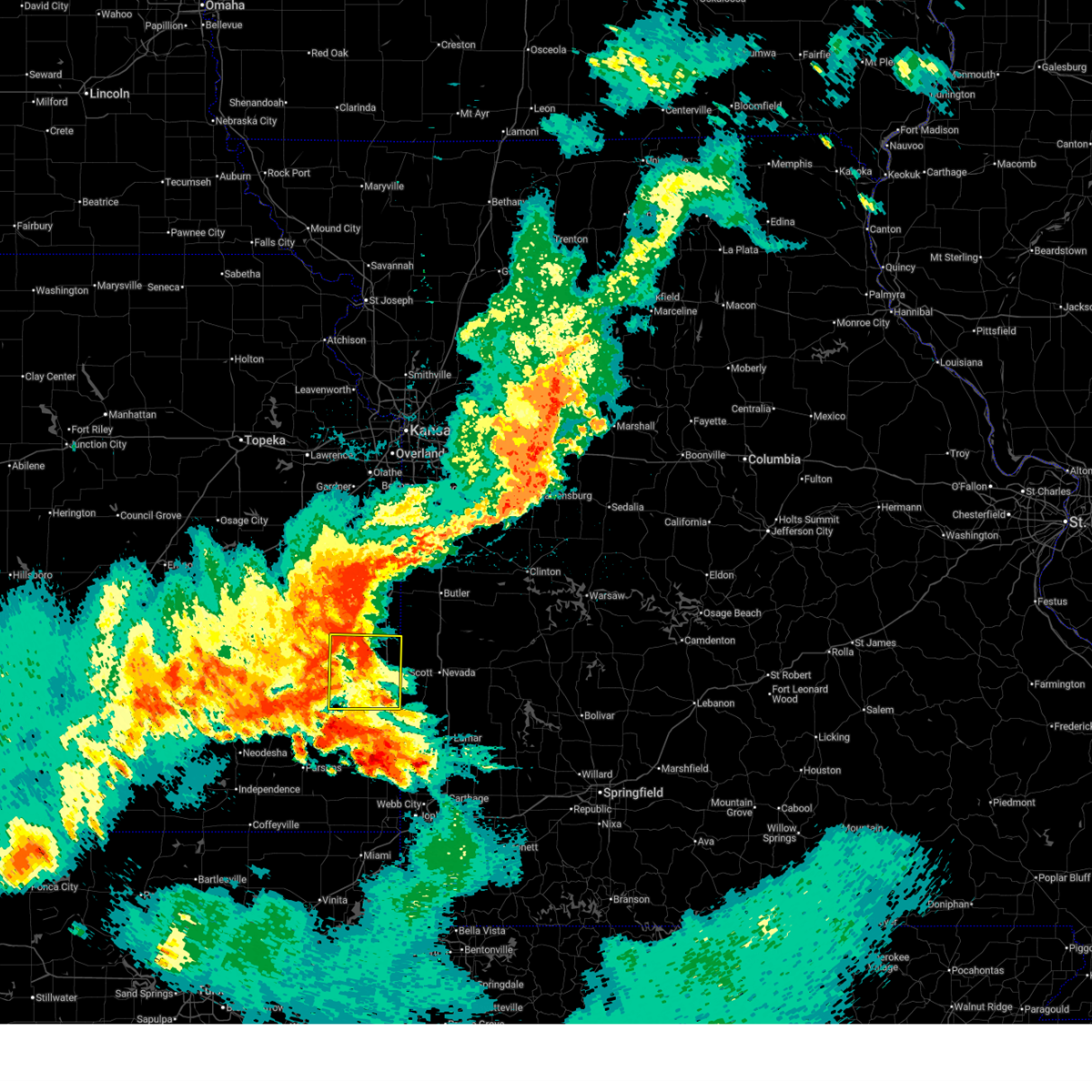
 Svrsgf the national weather service in springfield has issued a * severe thunderstorm warning for, bourbon county in southeastern kansas, northern crawford county in southeastern kansas, northwestern barton county in southwestern missouri, vernon county in west central missouri, * until 345 pm cdt. * at 300 pm cdt, a severe thunderstorm was located near hepler, or 9 miles northwest of girard, moving northeast at 55 mph (radar indicated). Hazards include 70 mph wind gusts and ping pong ball size hail. People and animals outdoors will be injured. expect hail damage to roofs, siding, windows, and vehicles. expect considerable tree damage. Wind damage is also likely to mobile homes, roofs, and outbuildings. Svrsgf the national weather service in springfield has issued a * severe thunderstorm warning for, bourbon county in southeastern kansas, northern crawford county in southeastern kansas, northwestern barton county in southwestern missouri, vernon county in west central missouri, * until 345 pm cdt. * at 300 pm cdt, a severe thunderstorm was located near hepler, or 9 miles northwest of girard, moving northeast at 55 mph (radar indicated). Hazards include 70 mph wind gusts and ping pong ball size hail. People and animals outdoors will be injured. expect hail damage to roofs, siding, windows, and vehicles. expect considerable tree damage. Wind damage is also likely to mobile homes, roofs, and outbuildings.
|
| 4/20/2025 1:28 PM CDT |
 Svrsgf the national weather service in springfield has issued a * severe thunderstorm warning for, cherokee county in southeastern kansas, crawford county in southeastern kansas, * until 230 pm cdt. * at 128 pm cdt, severe thunderstorms were located along a line extending from near altamont to near welch to langley, moving northeast at 30 mph (radar indicated). Hazards include 60 mph wind gusts and penny size hail. expect damage to roofs, siding, and trees Svrsgf the national weather service in springfield has issued a * severe thunderstorm warning for, cherokee county in southeastern kansas, crawford county in southeastern kansas, * until 230 pm cdt. * at 128 pm cdt, severe thunderstorms were located along a line extending from near altamont to near welch to langley, moving northeast at 30 mph (radar indicated). Hazards include 60 mph wind gusts and penny size hail. expect damage to roofs, siding, and trees
|
| 4/2/2025 6:47 AM CDT |
 At 647 am cdt, severe thunderstorms were located along a line extending from mccune to near oswego to near edna, moving northeast at 50 mph (radar indicated). Hazards include 60 mph wind gusts and quarter size hail. Hail damage to vehicles is expected. expect wind damage to roofs, siding, and trees. Locations impacted include, franklin, frontenac, beulah, girard, pittsburg, croweburg, yale, west mineral, farlington, prairie state park, brazilton, faulkner, mulberry, oakton, cherokee, roseland, nashville, ringo, oskaloosa, and verdella. At 647 am cdt, severe thunderstorms were located along a line extending from mccune to near oswego to near edna, moving northeast at 50 mph (radar indicated). Hazards include 60 mph wind gusts and quarter size hail. Hail damage to vehicles is expected. expect wind damage to roofs, siding, and trees. Locations impacted include, franklin, frontenac, beulah, girard, pittsburg, croweburg, yale, west mineral, farlington, prairie state park, brazilton, faulkner, mulberry, oakton, cherokee, roseland, nashville, ringo, oskaloosa, and verdella.
|
| 4/2/2025 6:40 AM CDT |
 Svrsgf the national weather service in springfield has issued a * severe thunderstorm warning for, cherokee county in southeastern kansas, crawford county in southeastern kansas, western barton county in southwestern missouri, southwestern vernon county in west central missouri, northwestern jasper county in southwestern missouri, * until 730 am cdt. * at 640 am cdt, severe thunderstorms were located along a line extending from near mccune to 6 miles north of oswego to near edna, moving northeast at 65 mph (radar indicated). Hazards include 60 mph wind gusts and quarter size hail. Hail damage to vehicles is expected. Expect wind damage to roofs, siding, and trees. Svrsgf the national weather service in springfield has issued a * severe thunderstorm warning for, cherokee county in southeastern kansas, crawford county in southeastern kansas, western barton county in southwestern missouri, southwestern vernon county in west central missouri, northwestern jasper county in southwestern missouri, * until 730 am cdt. * at 640 am cdt, severe thunderstorms were located along a line extending from near mccune to 6 miles north of oswego to near edna, moving northeast at 65 mph (radar indicated). Hazards include 60 mph wind gusts and quarter size hail. Hail damage to vehicles is expected. Expect wind damage to roofs, siding, and trees.
|
| 4/2/2025 6:04 AM CDT |
 At 604 am cdt, severe thunderstorms were located along a line extending from near mound city to 7 miles southwest of uniontown to 6 miles north of thayer, moving northeast at 40 mph (radar indicated). Hazards include 60 mph wind gusts and quarter size hail. Hail damage to vehicles is expected. expect wind damage to roofs, siding, and trees. Locations impacted include, fulton, franklin, redfield, frontenac, beulah, girard, pittsburg, croweburg, yale, mapleton, harding, bronson, petersburg, farlington, uniontown, brazilton, mccune, porterville, xenia, and mulberry. At 604 am cdt, severe thunderstorms were located along a line extending from near mound city to 7 miles southwest of uniontown to 6 miles north of thayer, moving northeast at 40 mph (radar indicated). Hazards include 60 mph wind gusts and quarter size hail. Hail damage to vehicles is expected. expect wind damage to roofs, siding, and trees. Locations impacted include, fulton, franklin, redfield, frontenac, beulah, girard, pittsburg, croweburg, yale, mapleton, harding, bronson, petersburg, farlington, uniontown, brazilton, mccune, porterville, xenia, and mulberry.
|
| 4/2/2025 5:44 AM CDT |
 Svrsgf the national weather service in springfield has issued a * severe thunderstorm warning for, bourbon county in southeastern kansas, crawford county in southeastern kansas, * until 645 am cdt. * at 544 am cdt, severe thunderstorms were located along a line extending from 6 miles southeast of kincaid to 9 miles east of chanute to near neodesha, moving northeast at 40 mph (radar indicated). Hazards include 60 mph wind gusts and quarter size hail. Hail damage to vehicles is expected. Expect wind damage to roofs, siding, and trees. Svrsgf the national weather service in springfield has issued a * severe thunderstorm warning for, bourbon county in southeastern kansas, crawford county in southeastern kansas, * until 645 am cdt. * at 544 am cdt, severe thunderstorms were located along a line extending from 6 miles southeast of kincaid to 9 miles east of chanute to near neodesha, moving northeast at 40 mph (radar indicated). Hazards include 60 mph wind gusts and quarter size hail. Hail damage to vehicles is expected. Expect wind damage to roofs, siding, and trees.
|
| 3/14/2025 2:47 PM CDT |
 Svrsgf the national weather service in springfield has issued a * severe thunderstorm warning for, bourbon county in southeastern kansas, cherokee county in southeastern kansas, crawford county in southeastern kansas, barton county in southwestern missouri, northern newton county in southwestern missouri, vernon county in west central missouri, jasper county in southwestern missouri, * until 345 pm cdt. * at 246 pm cdt, a severe thunderstorm was located near weir, or 7 miles northeast of columbus, moving northeast at 70 mph (radar indicated. emergency manager reported 4 inch tree limbs down in cherokee county). Hazards include 70 mph wind gusts and penny size hail. Expect considerable tree damage. Damage is likely to mobile homes, roofs, and outbuildings. Svrsgf the national weather service in springfield has issued a * severe thunderstorm warning for, bourbon county in southeastern kansas, cherokee county in southeastern kansas, crawford county in southeastern kansas, barton county in southwestern missouri, northern newton county in southwestern missouri, vernon county in west central missouri, jasper county in southwestern missouri, * until 345 pm cdt. * at 246 pm cdt, a severe thunderstorm was located near weir, or 7 miles northeast of columbus, moving northeast at 70 mph (radar indicated. emergency manager reported 4 inch tree limbs down in cherokee county). Hazards include 70 mph wind gusts and penny size hail. Expect considerable tree damage. Damage is likely to mobile homes, roofs, and outbuildings.
|
| 11/4/2024 2:27 PM CST |
 At 226 pm cst, severe thunderstorms were located along a line extending from near girard to scammon to near treece, moving northeast at 45 mph (radar indicated). Hazards include 60 mph wind gusts and quarter size hail. Hail damage to vehicles is expected. expect wind damage to roofs, siding, and trees. Locations impacted include, pittsburg, baxter springs, frontenac, columbus, galena, girard, arma, cherokee, weir, lowell, mulberry, scammon, chicopee, franklin, arcadia, west mineral, treece, hepler, roseland, and picher. At 226 pm cst, severe thunderstorms were located along a line extending from near girard to scammon to near treece, moving northeast at 45 mph (radar indicated). Hazards include 60 mph wind gusts and quarter size hail. Hail damage to vehicles is expected. expect wind damage to roofs, siding, and trees. Locations impacted include, pittsburg, baxter springs, frontenac, columbus, galena, girard, arma, cherokee, weir, lowell, mulberry, scammon, chicopee, franklin, arcadia, west mineral, treece, hepler, roseland, and picher.
|
| 10/30/2024 8:49 PM CDT |
 At 849 pm cdt, severe thunderstorms were located along a line extending from near parker to near mound city to near walnut, moving east at 45 mph (radar indicated). Hazards include 60 mph wind gusts and quarter size hail. Hail damage to vehicles is expected. expect wind damage to roofs, siding, and trees. Locations impacted include, pittsburg, fort scott, frontenac, girard, arma, marmaton, cherokee, mulberry, chicopee, mccune, franklin, arcadia, uniontown, walnut, fulton, redfield, hepler, mapleton, burgess, and beulah. At 849 pm cdt, severe thunderstorms were located along a line extending from near parker to near mound city to near walnut, moving east at 45 mph (radar indicated). Hazards include 60 mph wind gusts and quarter size hail. Hail damage to vehicles is expected. expect wind damage to roofs, siding, and trees. Locations impacted include, pittsburg, fort scott, frontenac, girard, arma, marmaton, cherokee, mulberry, chicopee, mccune, franklin, arcadia, uniontown, walnut, fulton, redfield, hepler, mapleton, burgess, and beulah.
|
| 10/30/2024 8:11 PM CDT |
 Svrsgf the national weather service in springfield has issued a * severe thunderstorm warning for, bourbon county in southeastern kansas, crawford county in southeastern kansas, * until 915 pm cdt. * at 810 pm cdt, severe thunderstorms were located along a line extending from colony to near la harpe to near thayer, moving northeast at 45 mph (radar indicated). Hazards include 60 mph wind gusts and nickel size hail. expect damage to roofs, siding, and trees Svrsgf the national weather service in springfield has issued a * severe thunderstorm warning for, bourbon county in southeastern kansas, crawford county in southeastern kansas, * until 915 pm cdt. * at 810 pm cdt, severe thunderstorms were located along a line extending from colony to near la harpe to near thayer, moving northeast at 45 mph (radar indicated). Hazards include 60 mph wind gusts and nickel size hail. expect damage to roofs, siding, and trees
|
| 9/19/2024 7:36 PM CDT |
 The storm which prompted the warning has weakened below severe limits, and no longer poses an immediate threat to life or property. therefore, the warning will be allowed to expire. however, gusty winds are still possible with this thunderstorm. a severe thunderstorm watch remains in effect until midnight cdt for southeastern kansas. The storm which prompted the warning has weakened below severe limits, and no longer poses an immediate threat to life or property. therefore, the warning will be allowed to expire. however, gusty winds are still possible with this thunderstorm. a severe thunderstorm watch remains in effect until midnight cdt for southeastern kansas.
|
| 9/19/2024 7:14 PM CDT |
 Svrsgf the national weather service in springfield has issued a * severe thunderstorm warning for, crawford county in southeastern kansas, * until 745 pm cdt. * at 710 pm cdt, a severe thunderstorm was located over st. paul, moving east at 40 mph (radar indicated). Hazards include 60 mph wind gusts and nickel size hail. expect damage to roofs, siding, and trees Svrsgf the national weather service in springfield has issued a * severe thunderstorm warning for, crawford county in southeastern kansas, * until 745 pm cdt. * at 710 pm cdt, a severe thunderstorm was located over st. paul, moving east at 40 mph (radar indicated). Hazards include 60 mph wind gusts and nickel size hail. expect damage to roofs, siding, and trees
|
| 8/1/2024 12:58 AM CDT |
 The storms which prompted the warning have weakened below severe limits, and have exited the warned area. therefore, the warning will be allowed to expire. The storms which prompted the warning have weakened below severe limits, and have exited the warned area. therefore, the warning will be allowed to expire.
|
| 8/1/2024 12:16 AM CDT |
 Svrsgf the national weather service in springfield has issued a * severe thunderstorm warning for, bourbon county in southeastern kansas, western crawford county in southeastern kansas, * until 100 am cdt. * at 1216 am cdt, severe thunderstorms were located along a line extending from near parker to near kincaid to 8 miles east of chanute to altoona, moving southeast at 35 mph (radar indicated). Hazards include 60 mph wind gusts. expect damage to roofs, siding, and trees Svrsgf the national weather service in springfield has issued a * severe thunderstorm warning for, bourbon county in southeastern kansas, western crawford county in southeastern kansas, * until 100 am cdt. * at 1216 am cdt, severe thunderstorms were located along a line extending from near parker to near kincaid to 8 miles east of chanute to altoona, moving southeast at 35 mph (radar indicated). Hazards include 60 mph wind gusts. expect damage to roofs, siding, and trees
|
| 6/26/2024 4:31 AM CDT |
 Svrsgf the national weather service in springfield has issued a * severe thunderstorm warning for, bourbon county in southeastern kansas, crawford county in southeastern kansas, southwestern hickory county in central missouri, barton county in southwestern missouri, southwestern dallas county in southwestern missouri, cedar county in southwestern missouri, polk county in southwestern missouri, southern st. clair county in west central missouri, vernon county in west central missouri, northern dade county in southwestern missouri, * until 515 am cdt. * at 431 am cdt, severe thunderstorms were located along a line extending from near weaubleau to near el dorado springs to near bronson, moving southeast at 40 mph (radar indicated). Hazards include 60 mph wind gusts and penny size hail. expect damage to roofs, siding, and trees Svrsgf the national weather service in springfield has issued a * severe thunderstorm warning for, bourbon county in southeastern kansas, crawford county in southeastern kansas, southwestern hickory county in central missouri, barton county in southwestern missouri, southwestern dallas county in southwestern missouri, cedar county in southwestern missouri, polk county in southwestern missouri, southern st. clair county in west central missouri, vernon county in west central missouri, northern dade county in southwestern missouri, * until 515 am cdt. * at 431 am cdt, severe thunderstorms were located along a line extending from near weaubleau to near el dorado springs to near bronson, moving southeast at 40 mph (radar indicated). Hazards include 60 mph wind gusts and penny size hail. expect damage to roofs, siding, and trees
|
| 6/9/2024 3:42 AM CDT |
 Svrsgf the national weather service in springfield has issued a * severe thunderstorm warning for, southern bourbon county in southeastern kansas, crawford county in southeastern kansas, * until 415 am cdt. * at 342 am cdt, a severe thunderstorm was located over walnut, or near st. paul, moving east at 40 mph (radar indicated). Hazards include 60 mph wind gusts and quarter size hail. Hail damage to vehicles is expected. Expect wind damage to roofs, siding, and trees. Svrsgf the national weather service in springfield has issued a * severe thunderstorm warning for, southern bourbon county in southeastern kansas, crawford county in southeastern kansas, * until 415 am cdt. * at 342 am cdt, a severe thunderstorm was located over walnut, or near st. paul, moving east at 40 mph (radar indicated). Hazards include 60 mph wind gusts and quarter size hail. Hail damage to vehicles is expected. Expect wind damage to roofs, siding, and trees.
|
| 5/25/2024 10:26 PM CDT |
 Svrsgf the national weather service in springfield has issued a * severe thunderstorm warning for, crawford county in southeastern kansas, * until 1100 pm cdt. * at 1026 pm cdt, a severe thunderstorm was located near mccune, or 10 miles southeast of st. paul, moving northeast at 40 mph (radar indicated). Hazards include 60 mph wind gusts and half dollar size hail. Hail damage to vehicles is expected. Expect wind damage to roofs, siding, and trees. Svrsgf the national weather service in springfield has issued a * severe thunderstorm warning for, crawford county in southeastern kansas, * until 1100 pm cdt. * at 1026 pm cdt, a severe thunderstorm was located near mccune, or 10 miles southeast of st. paul, moving northeast at 40 mph (radar indicated). Hazards include 60 mph wind gusts and half dollar size hail. Hail damage to vehicles is expected. Expect wind damage to roofs, siding, and trees.
|
| 5/19/2024 10:48 PM CDT |
 the severe thunderstorm warning has been cancelled and is no longer in effect the severe thunderstorm warning has been cancelled and is no longer in effect
|
| 5/19/2024 10:34 PM CDT |
 At 1034 pm cdt, severe thunderstorms were located along a line extending from near hume to near fort scott to 8 miles east of hepler, moving east at 55 mph (radar indicated). Hazards include 60 mph wind gusts and nickel size hail. Expect damage to roofs, siding, and trees. Locations impacted include, fort scott, girard, arma, marmaton, mulberry, franklin, arcadia, uniontown, walnut, fulton, redfield, hepler, mapleton, croweburg, harding, petersburg, farlington, brazilton, pawnee station, and hiattville. At 1034 pm cdt, severe thunderstorms were located along a line extending from near hume to near fort scott to 8 miles east of hepler, moving east at 55 mph (radar indicated). Hazards include 60 mph wind gusts and nickel size hail. Expect damage to roofs, siding, and trees. Locations impacted include, fort scott, girard, arma, marmaton, mulberry, franklin, arcadia, uniontown, walnut, fulton, redfield, hepler, mapleton, croweburg, harding, petersburg, farlington, brazilton, pawnee station, and hiattville.
|
| 5/19/2024 9:59 PM CDT |
 Svrsgf the national weather service in springfield has issued a * severe thunderstorm warning for, bourbon county in southeastern kansas, northern crawford county in southeastern kansas, * until 1100 pm cdt. * at 958 pm cdt, severe thunderstorms were located along a line extending from near kincaid to near moran to near chanute, moving east at 55 mph (radar indicated). Hazards include 60 mph wind gusts and nickel size hail. expect damage to roofs, siding, and trees Svrsgf the national weather service in springfield has issued a * severe thunderstorm warning for, bourbon county in southeastern kansas, northern crawford county in southeastern kansas, * until 1100 pm cdt. * at 958 pm cdt, severe thunderstorms were located along a line extending from near kincaid to near moran to near chanute, moving east at 55 mph (radar indicated). Hazards include 60 mph wind gusts and nickel size hail. expect damage to roofs, siding, and trees
|
| 5/6/2024 10:31 PM CDT |
 Svrsgf the national weather service in springfield has issued a * severe thunderstorm warning for, bourbon county in southeastern kansas, northern crawford county in southeastern kansas, * until 1115 pm cdt. * at 1031 pm cdt, severe thunderstorms were located along a line extending from near blue mound to 8 miles northwest of hepler to near st. paul, moving northeast at 55 mph (radar indicated). Hazards include 60 mph wind gusts and penny size hail. expect damage to roofs, siding, and trees Svrsgf the national weather service in springfield has issued a * severe thunderstorm warning for, bourbon county in southeastern kansas, northern crawford county in southeastern kansas, * until 1115 pm cdt. * at 1031 pm cdt, severe thunderstorms were located along a line extending from near blue mound to 8 miles northwest of hepler to near st. paul, moving northeast at 55 mph (radar indicated). Hazards include 60 mph wind gusts and penny size hail. expect damage to roofs, siding, and trees
|
| 4/27/2024 9:47 PM CDT |
 Svrsgf the national weather service in springfield has issued a * severe thunderstorm warning for, bourbon county in southeastern kansas, northern crawford county in southeastern kansas, * until 1045 pm cdt. * at 947 pm cdt, severe thunderstorms were located along a line extending from 11 miles north of erie to near walnut to near st. paul, moving northeast at 50 mph (radar indicated). Hazards include 60 mph wind gusts and quarter size hail. Hail damage to vehicles is expected. Expect wind damage to roofs, siding, and trees. Svrsgf the national weather service in springfield has issued a * severe thunderstorm warning for, bourbon county in southeastern kansas, northern crawford county in southeastern kansas, * until 1045 pm cdt. * at 947 pm cdt, severe thunderstorms were located along a line extending from 11 miles north of erie to near walnut to near st. paul, moving northeast at 50 mph (radar indicated). Hazards include 60 mph wind gusts and quarter size hail. Hail damage to vehicles is expected. Expect wind damage to roofs, siding, and trees.
|
| 4/27/2024 9:28 PM CDT |
 The storm which prompted the warning has weakened below severe limits, and no longer poses an immediate threat to life or property. therefore, the warning will be allowed to expire. however, small hail and gusty winds are still possible with this thunderstorm. a tornado watch remains in effect until midnight cdt for southeastern kansas, and west central missouri. The storm which prompted the warning has weakened below severe limits, and no longer poses an immediate threat to life or property. therefore, the warning will be allowed to expire. however, small hail and gusty winds are still possible with this thunderstorm. a tornado watch remains in effect until midnight cdt for southeastern kansas, and west central missouri.
|
| 4/27/2024 8:55 PM CDT |
 At 855 pm cdt, a severe thunderstorm was located near fort scott, moving east at 30 mph (radar indicated). Hazards include 60 mph wind gusts and half dollar size hail. Hail damage to vehicles is expected. expect wind damage to roofs, siding, and trees. locations impacted include, nevada, fort scott, marmaton, walnut, redfield, hepler, moundville, richards, deerfield, metz, stotesbury, horton, pawnee station, hiattville, petersburg, farlington, hammond, brazilton, devon, and garland. This includes interstate 49 between mile markers 92 and 105. At 855 pm cdt, a severe thunderstorm was located near fort scott, moving east at 30 mph (radar indicated). Hazards include 60 mph wind gusts and half dollar size hail. Hail damage to vehicles is expected. expect wind damage to roofs, siding, and trees. locations impacted include, nevada, fort scott, marmaton, walnut, redfield, hepler, moundville, richards, deerfield, metz, stotesbury, horton, pawnee station, hiattville, petersburg, farlington, hammond, brazilton, devon, and garland. This includes interstate 49 between mile markers 92 and 105.
|
| 4/27/2024 8:40 PM CDT |
 Svrsgf the national weather service in springfield has issued a * severe thunderstorm warning for, bourbon county in southeastern kansas, northern crawford county in southeastern kansas, western vernon county in west central missouri, * until 930 pm cdt. * at 840 pm cdt, a severe thunderstorm was located over fort scott, moving east at 30 mph (radar indicated). Hazards include 60 mph wind gusts and quarter size hail. Hail damage to vehicles is expected. Expect wind damage to roofs, siding, and trees. Svrsgf the national weather service in springfield has issued a * severe thunderstorm warning for, bourbon county in southeastern kansas, northern crawford county in southeastern kansas, western vernon county in west central missouri, * until 930 pm cdt. * at 840 pm cdt, a severe thunderstorm was located over fort scott, moving east at 30 mph (radar indicated). Hazards include 60 mph wind gusts and quarter size hail. Hail damage to vehicles is expected. Expect wind damage to roofs, siding, and trees.
|
| 4/27/2024 8:24 PM CDT |
 The storm which prompted the warning has weakened below severe limits, and no longer poses an immediate threat to life or property. therefore, the warning will be allowed to expire. however, gusty winds and heavy rain are still possible with this thunderstorm. a tornado watch remains in effect until midnight cdt for southeastern kansas, and west central missouri. The storm which prompted the warning has weakened below severe limits, and no longer poses an immediate threat to life or property. therefore, the warning will be allowed to expire. however, gusty winds and heavy rain are still possible with this thunderstorm. a tornado watch remains in effect until midnight cdt for southeastern kansas, and west central missouri.
|
| 4/27/2024 8:13 PM CDT |
 At 813 pm cdt, a severe thunderstorm was located over fort scott, moving northeast at 50 mph (radar indicated). Hazards include 60 mph wind gusts and quarter size hail. Hail damage to vehicles is expected. expect wind damage to roofs, siding, and trees. Locations impacted include, fort scott, marmaton, walnut, fulton, redfield, hepler, richards, deerfield, metz, stotesbury, pawnee station, hiattville, petersburg, farlington, hammond, devon, garland, and porterville. At 813 pm cdt, a severe thunderstorm was located over fort scott, moving northeast at 50 mph (radar indicated). Hazards include 60 mph wind gusts and quarter size hail. Hail damage to vehicles is expected. expect wind damage to roofs, siding, and trees. Locations impacted include, fort scott, marmaton, walnut, fulton, redfield, hepler, richards, deerfield, metz, stotesbury, pawnee station, hiattville, petersburg, farlington, hammond, devon, garland, and porterville.
|
| 4/27/2024 7:58 PM CDT |
 Svrsgf the national weather service in springfield has issued a * severe thunderstorm warning for, bourbon county in southeastern kansas, northern crawford county in southeastern kansas, northwestern vernon county in west central missouri, * until 830 pm cdt. * at 758 pm cdt, a severe thunderstorm was located near redfield, or 12 miles west of fort scott, moving northeast at 50 mph (radar indicated). Hazards include 60 mph wind gusts and half dollar size hail. Hail damage to vehicles is expected. Expect wind damage to roofs, siding, and trees. Svrsgf the national weather service in springfield has issued a * severe thunderstorm warning for, bourbon county in southeastern kansas, northern crawford county in southeastern kansas, northwestern vernon county in west central missouri, * until 830 pm cdt. * at 758 pm cdt, a severe thunderstorm was located near redfield, or 12 miles west of fort scott, moving northeast at 50 mph (radar indicated). Hazards include 60 mph wind gusts and half dollar size hail. Hail damage to vehicles is expected. Expect wind damage to roofs, siding, and trees.
|
| 4/27/2024 7:45 PM CDT |
 At 745 pm cdt, a severe thunderstorm was located over redfield, or 10 miles west of fort scott, moving northeast at 60 mph (radar indicated). Hazards include 60 mph wind gusts and half dollar size hail. Hail damage to vehicles is expected. expect wind damage to roofs, siding, and trees. Locations impacted include, fort scott, marmaton, bronson, uniontown, walnut, fulton, redfield, hepler, mapleton, harding, pawnee station, hiattville, petersburg, farlington, hammond, devon, garland, porterville, and xenia. At 745 pm cdt, a severe thunderstorm was located over redfield, or 10 miles west of fort scott, moving northeast at 60 mph (radar indicated). Hazards include 60 mph wind gusts and half dollar size hail. Hail damage to vehicles is expected. expect wind damage to roofs, siding, and trees. Locations impacted include, fort scott, marmaton, bronson, uniontown, walnut, fulton, redfield, hepler, mapleton, harding, pawnee station, hiattville, petersburg, farlington, hammond, devon, garland, porterville, and xenia.
|
| 4/27/2024 7:20 PM CDT |
 Svrsgf the national weather service in springfield has issued a * severe thunderstorm warning for, bourbon county in southeastern kansas, northern crawford county in southeastern kansas, * until 800 pm cdt. * at 720 pm cdt, a severe thunderstorm was located 9 miles north of erie, moving east at 40 mph (radar indicated). Hazards include 60 mph wind gusts and quarter size hail. Hail damage to vehicles is expected. Expect wind damage to roofs, siding, and trees. Svrsgf the national weather service in springfield has issued a * severe thunderstorm warning for, bourbon county in southeastern kansas, northern crawford county in southeastern kansas, * until 800 pm cdt. * at 720 pm cdt, a severe thunderstorm was located 9 miles north of erie, moving east at 40 mph (radar indicated). Hazards include 60 mph wind gusts and quarter size hail. Hail damage to vehicles is expected. Expect wind damage to roofs, siding, and trees.
|
| 3/14/2024 4:54 AM CDT |
 The storms which prompted the warning have weakened below severe limits, and have exited the warned area. therefore, the warning has been allowed to expire. a severe thunderstorm watch remains in effect until 600 am cdt for southeastern kansas, and west central missouri. The storms which prompted the warning have weakened below severe limits, and have exited the warned area. therefore, the warning has been allowed to expire. a severe thunderstorm watch remains in effect until 600 am cdt for southeastern kansas, and west central missouri.
|
| 3/14/2024 4:06 AM CDT |
 Svrsgf the national weather service in springfield has issued a * severe thunderstorm warning for, southeastern bourbon county in southeastern kansas, northern crawford county in southeastern kansas, * until 445 am cdt. * at 405 am cdt, severe thunderstorms were located along a line extending from near fort scott to near hepler to near walnut, moving east at 35 mph (radar indicated). Hazards include quarter size hail. damage to vehicles is expected Svrsgf the national weather service in springfield has issued a * severe thunderstorm warning for, southeastern bourbon county in southeastern kansas, northern crawford county in southeastern kansas, * until 445 am cdt. * at 405 am cdt, severe thunderstorms were located along a line extending from near fort scott to near hepler to near walnut, moving east at 35 mph (radar indicated). Hazards include quarter size hail. damage to vehicles is expected
|
| 3/12/2024 7:29 PM CDT |
 Svrsgf the national weather service in springfield has issued a * severe thunderstorm warning for, crawford county in southeastern kansas, * until 815 pm cdt. * at 728 pm cdt, a severe thunderstorm was located near walnut, or 7 miles east of st. paul, moving east at 25 mph (radar indicated). Hazards include ping pong ball size hail. People and animals outdoors will be injured. Expect damage to roofs, siding, windows, and vehicles. Svrsgf the national weather service in springfield has issued a * severe thunderstorm warning for, crawford county in southeastern kansas, * until 815 pm cdt. * at 728 pm cdt, a severe thunderstorm was located near walnut, or 7 miles east of st. paul, moving east at 25 mph (radar indicated). Hazards include ping pong ball size hail. People and animals outdoors will be injured. Expect damage to roofs, siding, windows, and vehicles.
|
| 3/7/2024 6:09 PM CST |
 Svrsgf the national weather service in springfield has issued a * severe thunderstorm warning for, southern bourbon county in southeastern kansas, northeastern crawford county in southeastern kansas, northwestern barton county in southwestern missouri, southwestern vernon county in west central missouri, * until 715 pm cst. * at 608 pm cst, a severe thunderstorm was located 7 miles northeast of hepler, or 10 miles southwest of fort scott, moving east at 30 mph (radar indicated). Hazards include 60 mph wind gusts and quarter size hail. Hail damage to vehicles is expected. expect wind damage to roofs, siding, and trees. this severe thunderstorm will be near, arcadia around 625 pm cst. other locations impacted by this severe thunderstorm include prairie state park, marmaton, bronaugh, moundville, milo, burgess, croweburg, iantha, pawnee station, and oskaloosa. This includes interstate 49 between mile markers 81 and 87. Svrsgf the national weather service in springfield has issued a * severe thunderstorm warning for, southern bourbon county in southeastern kansas, northeastern crawford county in southeastern kansas, northwestern barton county in southwestern missouri, southwestern vernon county in west central missouri, * until 715 pm cst. * at 608 pm cst, a severe thunderstorm was located 7 miles northeast of hepler, or 10 miles southwest of fort scott, moving east at 30 mph (radar indicated). Hazards include 60 mph wind gusts and quarter size hail. Hail damage to vehicles is expected. expect wind damage to roofs, siding, and trees. this severe thunderstorm will be near, arcadia around 625 pm cst. other locations impacted by this severe thunderstorm include prairie state park, marmaton, bronaugh, moundville, milo, burgess, croweburg, iantha, pawnee station, and oskaloosa. This includes interstate 49 between mile markers 81 and 87.
|
| 3/7/2024 5:57 PM CST |
 At 556 pm cst, severe thunderstorms were located along a line extending from near redfield to near hepler to near walnut, moving east at 35 mph (radar indicated). Hazards include 60 mph wind gusts and nickel size hail. Expect damage to roofs, siding, and trees. these severe storms will be near, walnut, redfield, and hepler around 600 pm cst. Other locations impacted by these severe thunderstorms include marmaton, hiattville, petersburg, porterville, brazilton, and greenbush. At 556 pm cst, severe thunderstorms were located along a line extending from near redfield to near hepler to near walnut, moving east at 35 mph (radar indicated). Hazards include 60 mph wind gusts and nickel size hail. Expect damage to roofs, siding, and trees. these severe storms will be near, walnut, redfield, and hepler around 600 pm cst. Other locations impacted by these severe thunderstorms include marmaton, hiattville, petersburg, porterville, brazilton, and greenbush.
|
| 3/7/2024 5:37 PM CST |
 Svrsgf the national weather service in springfield has issued a * severe thunderstorm warning for, southwestern bourbon county in southeastern kansas, northwestern crawford county in southeastern kansas, * until 615 pm cst. * at 536 pm cst, strong thunderstorms expected to become severe were located along a line extending from near moran to 11 miles southwest of bronson to 7 miles northwest of erie, moving southeast at 25 mph (radar indicated). Hazards include 60 mph wind gusts and quarter size hail. Hail damage to vehicles is expected. expect wind damage to roofs, siding, and trees. severe thunderstorms will be near, bronson around 540 pm cst. uniontown around 550 pm cst. walnut and hepler around 555 pm cst. Other locations impacted by these severe thunderstorms include marmaton, hiattville, petersburg, porterville, brazilton, and greenbush. Svrsgf the national weather service in springfield has issued a * severe thunderstorm warning for, southwestern bourbon county in southeastern kansas, northwestern crawford county in southeastern kansas, * until 615 pm cst. * at 536 pm cst, strong thunderstorms expected to become severe were located along a line extending from near moran to 11 miles southwest of bronson to 7 miles northwest of erie, moving southeast at 25 mph (radar indicated). Hazards include 60 mph wind gusts and quarter size hail. Hail damage to vehicles is expected. expect wind damage to roofs, siding, and trees. severe thunderstorms will be near, bronson around 540 pm cst. uniontown around 550 pm cst. walnut and hepler around 555 pm cst. Other locations impacted by these severe thunderstorms include marmaton, hiattville, petersburg, porterville, brazilton, and greenbush.
|
| 9/23/2023 10:18 PM CDT |
 At 1018 pm cdt, a severe thunderstorm was located 7 miles northwest of arma, or 8 miles north of girard, moving southeast at 25 mph (radar indicated). Hazards include 60 mph wind gusts and quarter size hail. Hail damage to vehicles is expected. Expect wind damage to roofs, siding, and trees. At 1018 pm cdt, a severe thunderstorm was located 7 miles northwest of arma, or 8 miles north of girard, moving southeast at 25 mph (radar indicated). Hazards include 60 mph wind gusts and quarter size hail. Hail damage to vehicles is expected. Expect wind damage to roofs, siding, and trees.
|
| 8/13/2023 8:51 PM CDT |
 The severe thunderstorm warning for bourbon and crawford counties will expire at 900 pm cdt, the storm which prompted the warning has weakened below severe limits, and no longer poses an immediate threat to life or property. therefore, the warning will be allowed to expire. a severe thunderstorm watch remains in effect until 200 am cdt for southeastern kansas, and southwestern and west central missouri. The severe thunderstorm warning for bourbon and crawford counties will expire at 900 pm cdt, the storm which prompted the warning has weakened below severe limits, and no longer poses an immediate threat to life or property. therefore, the warning will be allowed to expire. a severe thunderstorm watch remains in effect until 200 am cdt for southeastern kansas, and southwestern and west central missouri.
|
| 8/13/2023 7:55 PM CDT |
 At 754 pm cdt, a severe thunderstorm was located over bronson, or 12 miles east of la harpe, moving southeast at 35 mph (radar indicated). Hazards include 60 mph wind gusts and quarter size hail. Hail damage to vehicles is expected. Expect wind damage to roofs, siding, and trees. At 754 pm cdt, a severe thunderstorm was located over bronson, or 12 miles east of la harpe, moving southeast at 35 mph (radar indicated). Hazards include 60 mph wind gusts and quarter size hail. Hail damage to vehicles is expected. Expect wind damage to roofs, siding, and trees.
|
| 8/12/2023 2:54 AM CDT |
 The severe thunderstorm warning for crawford county will expire at 300 am cdt, the storm which prompted the warning has weakened below severe limits, and has exited the warned area. therefore, the warning will be allowed to expire. to report severe weather, contact your nearest law enforcement agency. they will relay your report to the national weather service springfield. The severe thunderstorm warning for crawford county will expire at 300 am cdt, the storm which prompted the warning has weakened below severe limits, and has exited the warned area. therefore, the warning will be allowed to expire. to report severe weather, contact your nearest law enforcement agency. they will relay your report to the national weather service springfield.
|
| 8/12/2023 2:09 AM CDT |
 At 209 am cdt, a severe thunderstorm was located 8 miles north of mccune, or 9 miles west of girard, moving east at 35 mph (radar indicated). Hazards include 60 mph wind gusts and quarter size hail. Hail damage to vehicles is expected. Expect wind damage to roofs, siding, and trees. At 209 am cdt, a severe thunderstorm was located 8 miles north of mccune, or 9 miles west of girard, moving east at 35 mph (radar indicated). Hazards include 60 mph wind gusts and quarter size hail. Hail damage to vehicles is expected. Expect wind damage to roofs, siding, and trees.
|
| 7/30/2023 9:52 PM CDT |
 The severe thunderstorm warning for bourbon, northern crawford, northern barton and vernon counties will expire at 1000 pm cdt, the storm which prompted the warning has moved out of the area. therefore, the warning will be allowed to expire. however gusty winds are still possible with this thunderstorm. a severe thunderstorm watch remains in effect until 100 am cdt for southeastern kansas, and southwestern and west central missouri. to report severe weather, contact your nearest law enforcement agency. they will relay your report to the national weather service springfield. The severe thunderstorm warning for bourbon, northern crawford, northern barton and vernon counties will expire at 1000 pm cdt, the storm which prompted the warning has moved out of the area. therefore, the warning will be allowed to expire. however gusty winds are still possible with this thunderstorm. a severe thunderstorm watch remains in effect until 100 am cdt for southeastern kansas, and southwestern and west central missouri. to report severe weather, contact your nearest law enforcement agency. they will relay your report to the national weather service springfield.
|
| 7/30/2023 9:44 PM CDT |
 At 943 pm cdt, a severe thunderstorm was located near schell city, or near el dorado springs, moving southeast at 55 mph (law enforcement). Hazards include 70 mph wind gusts. Expect considerable tree damage. damage is likely to mobile homes, roofs, and outbuildings. locations impacted include, nevada, fort scott, marmaton, sheldon, bronson, montevallo, arcadia, uniontown, walker, schell city, bronaugh, fulton, redfield, hepler, moundville, richards, milo, mapleton, deerfield and metz. this includes interstate 49 between mile markers 75 and 107. thunderstorm damage threat, considerable hail threat, radar indicated max hail size, <. 75 in wind threat, observed max wind gust, 70 mph. At 943 pm cdt, a severe thunderstorm was located near schell city, or near el dorado springs, moving southeast at 55 mph (law enforcement). Hazards include 70 mph wind gusts. Expect considerable tree damage. damage is likely to mobile homes, roofs, and outbuildings. locations impacted include, nevada, fort scott, marmaton, sheldon, bronson, montevallo, arcadia, uniontown, walker, schell city, bronaugh, fulton, redfield, hepler, moundville, richards, milo, mapleton, deerfield and metz. this includes interstate 49 between mile markers 75 and 107. thunderstorm damage threat, considerable hail threat, radar indicated max hail size, <. 75 in wind threat, observed max wind gust, 70 mph.
|
| 7/30/2023 8:59 PM CDT |
 At 859 pm cdt, a severe thunderstorm was located over pleasanton, moving southeast at 55 mph (trained weather spotters). Hazards include 70 mph wind gusts. Expect considerable tree damage. Damage is likely to mobile homes, roofs, and outbuildings. At 859 pm cdt, a severe thunderstorm was located over pleasanton, moving southeast at 55 mph (trained weather spotters). Hazards include 70 mph wind gusts. Expect considerable tree damage. Damage is likely to mobile homes, roofs, and outbuildings.
|
| 7/14/2023 5:42 PM CDT |
 At 541 pm cdt, severe thunderstorms were located along a line extending from near colony to near la harpe to 11 miles northwest of walnut to near erie, moving east at 45 mph. these are destructive storms for bourbon and crawford counties in kansas (radar indicated). Hazards include 80 mph wind gusts and quarter size hail. Flying debris will be dangerous to those caught without shelter. mobile homes will be heavily damaged. expect considerable damage to roofs, windows, and vehicles. Extensive tree damage and power outages are likely. At 541 pm cdt, severe thunderstorms were located along a line extending from near colony to near la harpe to 11 miles northwest of walnut to near erie, moving east at 45 mph. these are destructive storms for bourbon and crawford counties in kansas (radar indicated). Hazards include 80 mph wind gusts and quarter size hail. Flying debris will be dangerous to those caught without shelter. mobile homes will be heavily damaged. expect considerable damage to roofs, windows, and vehicles. Extensive tree damage and power outages are likely.
|
| 7/14/2023 5:29 PM CDT |
 At 528 pm cdt, severe thunderstorms were located along a line extending from near westphalia to gas to near chanute to near neodesha, moving east at 50 mph (radar indicated). Hazards include 70 mph wind gusts and quarter size hail. Hail damage to vehicles is expected. expect considerable tree damage. Wind damage is also likely to mobile homes, roofs, and outbuildings. At 528 pm cdt, severe thunderstorms were located along a line extending from near westphalia to gas to near chanute to near neodesha, moving east at 50 mph (radar indicated). Hazards include 70 mph wind gusts and quarter size hail. Hail damage to vehicles is expected. expect considerable tree damage. Wind damage is also likely to mobile homes, roofs, and outbuildings.
|
| 6/8/2023 5:45 PM CDT |
 At 545 pm cdt, a severe thunderstorm was located near hepler, or 8 miles north of girard, moving south at 15 mph (radar indicated). Hazards include 60 mph wind gusts and penny size hail. Expect damage to roofs, siding, and trees. locations impacted include, girard, hepler, hiattville, farlington, brazilton, greenbush, pawnee station and englevale. hail threat, radar indicated max hail size, 0. 75 in wind threat, radar indicated max wind gust, 60 mph. At 545 pm cdt, a severe thunderstorm was located near hepler, or 8 miles north of girard, moving south at 15 mph (radar indicated). Hazards include 60 mph wind gusts and penny size hail. Expect damage to roofs, siding, and trees. locations impacted include, girard, hepler, hiattville, farlington, brazilton, greenbush, pawnee station and englevale. hail threat, radar indicated max hail size, 0. 75 in wind threat, radar indicated max wind gust, 60 mph.
|
| 6/8/2023 5:10 PM CDT |
 At 509 pm cdt, a severe thunderstorm was located near hepler, or 13 miles southwest of fort scott, moving south at 15 mph (radar indicated). Hazards include 60 mph wind gusts and quarter size hail. Hail damage to vehicles is expected. Expect wind damage to roofs, siding, and trees. At 509 pm cdt, a severe thunderstorm was located near hepler, or 13 miles southwest of fort scott, moving south at 15 mph (radar indicated). Hazards include 60 mph wind gusts and quarter size hail. Hail damage to vehicles is expected. Expect wind damage to roofs, siding, and trees.
|
| 5/9/2023 6:27 PM CDT |
 At 627 pm cdt, severe thunderstorms were located along a line extending from near butler to nevada to near arcadia to near mccune, moving southeast at 45 mph (radar indicated). Hazards include 60 mph wind gusts and quarter size hail. Hail damage to vehicles is expected. expect wind damage to roofs, siding, and trees. locations impacted include, pittsburg, prairie state park, nevada, fort scott, frontenac, girard, arma, liberal, cherokee, sheldon, mulberry, chicopee, mccune, nashville, mindenmines, franklin, arcadia, walker, schell city and bronaugh. this includes interstate 49 between mile markers 69 and 107. hail threat, radar indicated max hail size, 1. 00 in wind threat, radar indicated max wind gust, 60 mph. At 627 pm cdt, severe thunderstorms were located along a line extending from near butler to nevada to near arcadia to near mccune, moving southeast at 45 mph (radar indicated). Hazards include 60 mph wind gusts and quarter size hail. Hail damage to vehicles is expected. expect wind damage to roofs, siding, and trees. locations impacted include, pittsburg, prairie state park, nevada, fort scott, frontenac, girard, arma, liberal, cherokee, sheldon, mulberry, chicopee, mccune, nashville, mindenmines, franklin, arcadia, walker, schell city and bronaugh. this includes interstate 49 between mile markers 69 and 107. hail threat, radar indicated max hail size, 1. 00 in wind threat, radar indicated max wind gust, 60 mph.
|
| 5/9/2023 6:10 PM CDT |
 At 609 pm cdt, severe thunderstorms were located along a line extending from near butler to 9 miles northwest of nevada to 7 miles west of arcadia to near st. paul, moving southeast at 50 mph. uniontown, kansas mesonet gusted to 61 mph at 550 pm cdt (radar indicated). Hazards include 60 mph wind gusts and quarter size hail. Hail damage to vehicles is expected. expect wind damage to roofs, siding, and trees. locations impacted include, pittsburg, prairie state park, nevada, fort scott, frontenac, girard, arma, marmaton, liberal, cherokee, sheldon, mulberry, chicopee, mccune, nashville, mindenmines, franklin, bronson, arcadia and uniontown. this includes interstate 49 between mile markers 69 and 107. hail threat, radar indicated max hail size, 1. 00 in wind threat, radar indicated max wind gust, 60 mph. At 609 pm cdt, severe thunderstorms were located along a line extending from near butler to 9 miles northwest of nevada to 7 miles west of arcadia to near st. paul, moving southeast at 50 mph. uniontown, kansas mesonet gusted to 61 mph at 550 pm cdt (radar indicated). Hazards include 60 mph wind gusts and quarter size hail. Hail damage to vehicles is expected. expect wind damage to roofs, siding, and trees. locations impacted include, pittsburg, prairie state park, nevada, fort scott, frontenac, girard, arma, marmaton, liberal, cherokee, sheldon, mulberry, chicopee, mccune, nashville, mindenmines, franklin, bronson, arcadia and uniontown. this includes interstate 49 between mile markers 69 and 107. hail threat, radar indicated max hail size, 1. 00 in wind threat, radar indicated max wind gust, 60 mph.
|
| 5/9/2023 5:59 PM CDT |
 At 559 pm cdt, severe thunderstorms were located along a line extending from 8 miles east of linn valley to 6 miles southeast of fulton to 6 miles northeast of hepler to erie, moving southeast at 50 mph (radar indicated). Hazards include 60 mph wind gusts and quarter size hail. Hail damage to vehicles is expected. Expect wind damage to roofs, siding, and trees. At 559 pm cdt, severe thunderstorms were located along a line extending from 8 miles east of linn valley to 6 miles southeast of fulton to 6 miles northeast of hepler to erie, moving southeast at 50 mph (radar indicated). Hazards include 60 mph wind gusts and quarter size hail. Hail damage to vehicles is expected. Expect wind damage to roofs, siding, and trees.
|
| 5/9/2023 5:03 PM CDT |
 At 503 pm cdt, severe thunderstorms were located along a line extending from near lane to near colony to near toronto, moving southeast at 50 mph (radar indicated). Hazards include 70 mph wind gusts and quarter size hail. Hail damage to vehicles is expected. expect considerable tree damage. Wind damage is also likely to mobile homes, roofs, and outbuildings. At 503 pm cdt, severe thunderstorms were located along a line extending from near lane to near colony to near toronto, moving southeast at 50 mph (radar indicated). Hazards include 70 mph wind gusts and quarter size hail. Hail damage to vehicles is expected. expect considerable tree damage. Wind damage is also likely to mobile homes, roofs, and outbuildings.
|
| 5/9/2023 3:03 AM CDT |
 At 303 am cdt, a severe thunderstorm was located over walnut, or 10 miles northeast of st. paul, moving southeast at 10 mph (radar indicated). Hazards include 60 mph wind gusts and quarter size hail. Hail damage to vehicles is expected. Expect wind damage to roofs, siding, and trees. At 303 am cdt, a severe thunderstorm was located over walnut, or 10 miles northeast of st. paul, moving southeast at 10 mph (radar indicated). Hazards include 60 mph wind gusts and quarter size hail. Hail damage to vehicles is expected. Expect wind damage to roofs, siding, and trees.
|
| 4/5/2023 1:34 AM CDT |
 At 134 am cdt, severe thunderstorms were located along a line extending from near bronson to near hepler, moving northeast at 60 mph (radar indicated). Hazards include 60 mph wind gusts and quarter size hail. Hail damage to vehicles is expected. Expect wind damage to roofs, siding, and trees. At 134 am cdt, severe thunderstorms were located along a line extending from near bronson to near hepler, moving northeast at 60 mph (radar indicated). Hazards include 60 mph wind gusts and quarter size hail. Hail damage to vehicles is expected. Expect wind damage to roofs, siding, and trees.
|
| 6/26/2022 2:14 AM CDT |
 At 213 am cdt, severe thunderstorms were located along a line extending from near redfield to near arcadia to near girard, moving east at 30 mph (radar indicated). Hazards include 60 mph wind gusts and quarter size hail. Hail damage to vehicles is expected. expect wind damage to roofs, siding, and trees. locations impacted include, pittsburg, fort scott, frontenac, girard, arma, marmaton, mulberry, chicopee, franklin, arcadia, uniontown, walnut, redfield, hepler, beulah, croweburg, yale, petersburg, farlington, brazilton, hail threat, radar indicated max hail size, 1. 00 in wind threat, radar indicated max wind gust, 60 mph. At 213 am cdt, severe thunderstorms were located along a line extending from near redfield to near arcadia to near girard, moving east at 30 mph (radar indicated). Hazards include 60 mph wind gusts and quarter size hail. Hail damage to vehicles is expected. expect wind damage to roofs, siding, and trees. locations impacted include, pittsburg, fort scott, frontenac, girard, arma, marmaton, mulberry, chicopee, franklin, arcadia, uniontown, walnut, redfield, hepler, beulah, croweburg, yale, petersburg, farlington, brazilton, hail threat, radar indicated max hail size, 1. 00 in wind threat, radar indicated max wind gust, 60 mph.
|
| 6/26/2022 1:45 AM CDT |
 At 144 am cdt, severe thunderstorms were located along a line extending from uniontown to near st. paul, moving southeast at 35 mph (radar indicated). Hazards include 60 mph wind gusts and quarter size hail. Hail damage to vehicles is expected. Expect wind damage to roofs, siding, and trees. At 144 am cdt, severe thunderstorms were located along a line extending from uniontown to near st. paul, moving southeast at 35 mph (radar indicated). Hazards include 60 mph wind gusts and quarter size hail. Hail damage to vehicles is expected. Expect wind damage to roofs, siding, and trees.
|
| 6/1/2022 1:53 AM CDT |
 At 153 am cdt, a severe thunderstorm was located 7 miles southeast of hepler, or 7 miles north of girard, moving northeast at 35 mph (radar indicated). Hazards include 60 mph wind gusts. Expect damage to roofs, siding, and trees. locations impacted include, girard, arcadia, hepler, farlington, brazilton, polk, garland, pawnee station, englevale, hail threat, radar indicated max hail size, <. 75 in wind threat, radar indicated max wind gust, 60 mph. At 153 am cdt, a severe thunderstorm was located 7 miles southeast of hepler, or 7 miles north of girard, moving northeast at 35 mph (radar indicated). Hazards include 60 mph wind gusts. Expect damage to roofs, siding, and trees. locations impacted include, girard, arcadia, hepler, farlington, brazilton, polk, garland, pawnee station, englevale, hail threat, radar indicated max hail size, <. 75 in wind threat, radar indicated max wind gust, 60 mph.
|
| 6/1/2022 1:44 AM CDT |
 At 144 am cdt, a severe thunderstorm was located near walnut, or 7 miles northwest of girard, moving northeast at 25 mph (radar indicated). Hazards include 60 mph wind gusts. expect damage to roofs, siding, and trees At 144 am cdt, a severe thunderstorm was located near walnut, or 7 miles northwest of girard, moving northeast at 25 mph (radar indicated). Hazards include 60 mph wind gusts. expect damage to roofs, siding, and trees
|
| 6/1/2022 1:10 AM CDT |
 At 110 am cdt, a severe thunderstorm was located over redfield, or 8 miles west of fort scott, moving northeast at 40 mph (radar indicated). Hazards include 60 mph wind gusts and penny size hail. Expect damage to roofs, siding, and trees. locations impacted include, fort scott, marmaton, bronson, uniontown, walnut, fulton, redfield, hepler, mapleton, harding, pawnee station, hiattville, petersburg, hammond, devon, garland, porterville, hail threat, radar indicated max hail size, 0. 75 in wind threat, radar indicated max wind gust, 60 mph. At 110 am cdt, a severe thunderstorm was located over redfield, or 8 miles west of fort scott, moving northeast at 40 mph (radar indicated). Hazards include 60 mph wind gusts and penny size hail. Expect damage to roofs, siding, and trees. locations impacted include, fort scott, marmaton, bronson, uniontown, walnut, fulton, redfield, hepler, mapleton, harding, pawnee station, hiattville, petersburg, hammond, devon, garland, porterville, hail threat, radar indicated max hail size, 0. 75 in wind threat, radar indicated max wind gust, 60 mph.
|
| 6/1/2022 12:48 AM CDT |
 At 1247 am cdt, a severe thunderstorm was located 8 miles northwest of walnut, or 11 miles northeast of erie, moving northeast at 25 mph (radar indicated). Hazards include 60 mph wind gusts and nickel size hail. expect damage to roofs, siding, and trees At 1247 am cdt, a severe thunderstorm was located 8 miles northwest of walnut, or 11 miles northeast of erie, moving northeast at 25 mph (radar indicated). Hazards include 60 mph wind gusts and nickel size hail. expect damage to roofs, siding, and trees
|
| 10/13/2021 7:44 AM CDT |
 At 744 am cdt, severe thunderstorms were located along a line extending from 6 miles northeast of redfield to 6 miles west of girard, moving northeast at 85 mph (radar indicated). Hazards include 60 mph wind gusts and penny size hail. expect damage to roofs, siding, and trees At 744 am cdt, severe thunderstorms were located along a line extending from 6 miles northeast of redfield to 6 miles west of girard, moving northeast at 85 mph (radar indicated). Hazards include 60 mph wind gusts and penny size hail. expect damage to roofs, siding, and trees
|
| 9/20/2021 7:05 PM CDT |
 At 704 pm cdt, a severe thunderstorm was located over walnut, or 7 miles northeast of st. paul, moving east at 25 mph (trained weather spotters). Hazards include 60 mph wind gusts and quarter size hail. Hail damage to vehicles is expected. expect wind damage to roofs, siding, and trees. locations impacted include, pittsburg, frontenac, girard, arma, mulberry, franklin, arcadia, walnut, hepler, beulah, croweburg, greenbush, yale, ringo, pawnee station, lone oak, farlington, brazilton, polk, garland, hail threat, observed max hail size, 1. 00 in wind threat, radar indicated max wind gust, 60 mph. At 704 pm cdt, a severe thunderstorm was located over walnut, or 7 miles northeast of st. paul, moving east at 25 mph (trained weather spotters). Hazards include 60 mph wind gusts and quarter size hail. Hail damage to vehicles is expected. expect wind damage to roofs, siding, and trees. locations impacted include, pittsburg, frontenac, girard, arma, mulberry, franklin, arcadia, walnut, hepler, beulah, croweburg, greenbush, yale, ringo, pawnee station, lone oak, farlington, brazilton, polk, garland, hail threat, observed max hail size, 1. 00 in wind threat, radar indicated max wind gust, 60 mph.
|
| 9/20/2021 6:48 PM CDT |
 At 646 pm cdt, a severe thunderstorm was located near erie, moving east at 20 mph. storm spotters in erie kansas reported hail to the size of quarters (trained weather spotters). Hazards include golf ball size hail and 60 mph wind gusts. People and animals outdoors will be injured. expect hail damage to roofs, siding, windows, and vehicles. Expect wind damage to roofs, siding, and trees. At 646 pm cdt, a severe thunderstorm was located near erie, moving east at 20 mph. storm spotters in erie kansas reported hail to the size of quarters (trained weather spotters). Hazards include golf ball size hail and 60 mph wind gusts. People and animals outdoors will be injured. expect hail damage to roofs, siding, windows, and vehicles. Expect wind damage to roofs, siding, and trees.
|
| 9/7/2021 7:37 PM CDT |
 At 736 pm cdt, a severe thunderstorm was located near arma, or near girard, moving south at 25 mph (radar indicated). Hazards include 60 mph wind gusts and quarter size hail. Hail damage to vehicles is expected. expect wind damage to roofs, siding, and trees. this severe storm will be near, girard and arma around 745 pm cdt. frontenac around 755 pm cdt. other locations impacted by this severe thunderstorm include franklin, farlington, croweburg, brazilton, polk, ringo and englevale. hail threat, radar indicated max hail size, 1. 00 in wind threat, radar indicated max wind gust, 60 mph. At 736 pm cdt, a severe thunderstorm was located near arma, or near girard, moving south at 25 mph (radar indicated). Hazards include 60 mph wind gusts and quarter size hail. Hail damage to vehicles is expected. expect wind damage to roofs, siding, and trees. this severe storm will be near, girard and arma around 745 pm cdt. frontenac around 755 pm cdt. other locations impacted by this severe thunderstorm include franklin, farlington, croweburg, brazilton, polk, ringo and englevale. hail threat, radar indicated max hail size, 1. 00 in wind threat, radar indicated max wind gust, 60 mph.
|
| 9/7/2021 7:23 PM CDT |
 At 722 pm cdt, a severe thunderstorm was located 9 miles east of hepler, or 11 miles north of girard, moving south at 25 mph (radar indicated). Hazards include 60 mph wind gusts and quarter size hail. Hail damage to vehicles is expected. expect wind damage to roofs, siding, and trees. this severe storm will be near, girard and arma around 745 pm cdt. frontenac around 755 pm cdt. other locations impacted by this severe thunderstorm include franklin, hiattville, farlington, croweburg, brazilton, polk, ringo, pawnee station and englevale. hail threat, radar indicated max hail size, 1. 00 in wind threat, radar indicated max wind gust, 60 mph. At 722 pm cdt, a severe thunderstorm was located 9 miles east of hepler, or 11 miles north of girard, moving south at 25 mph (radar indicated). Hazards include 60 mph wind gusts and quarter size hail. Hail damage to vehicles is expected. expect wind damage to roofs, siding, and trees. this severe storm will be near, girard and arma around 745 pm cdt. frontenac around 755 pm cdt. other locations impacted by this severe thunderstorm include franklin, hiattville, farlington, croweburg, brazilton, polk, ringo, pawnee station and englevale. hail threat, radar indicated max hail size, 1. 00 in wind threat, radar indicated max wind gust, 60 mph.
|
| 9/7/2021 6:57 PM CDT |
 At 657 pm cdt, a severe thunderstorm was located over redfield, or near fort scott, moving south at 25 mph (radar indicated). Hazards include 60 mph wind gusts and quarter size hail. Hail damage to vehicles is expected. expect wind damage to roofs, siding, and trees. this severe thunderstorm will be near, fort scott around 700 pm cdt. girard, frontenac and arma around 745 pm cdt. other locations impacted by this severe thunderstorm include marmaton, franklin, hiattville, petersburg, farlington, croweburg, brazilton, polk, ringo and pawnee station. hail threat, radar indicated max hail size, 1. 00 in wind threat, radar indicated max wind gust, 60 mph. At 657 pm cdt, a severe thunderstorm was located over redfield, or near fort scott, moving south at 25 mph (radar indicated). Hazards include 60 mph wind gusts and quarter size hail. Hail damage to vehicles is expected. expect wind damage to roofs, siding, and trees. this severe thunderstorm will be near, fort scott around 700 pm cdt. girard, frontenac and arma around 745 pm cdt. other locations impacted by this severe thunderstorm include marmaton, franklin, hiattville, petersburg, farlington, croweburg, brazilton, polk, ringo and pawnee station. hail threat, radar indicated max hail size, 1. 00 in wind threat, radar indicated max wind gust, 60 mph.
|
| 6/11/2021 6:43 PM CDT |
 At 643 pm cdt, a severe thunderstorm was located from fort scott to walnut, moving southeast at 15 mph. this is a very dangerous storm (radar indicated). Hazards include 80 mph wind gusts and golf ball size hail. Flying debris will be dangerous to those caught without shelter. mobile homes will be heavily damaged. expect considerable damage to roofs, windows, and vehicles. Extensive tree damage and power outages are likely. At 643 pm cdt, a severe thunderstorm was located from fort scott to walnut, moving southeast at 15 mph. this is a very dangerous storm (radar indicated). Hazards include 80 mph wind gusts and golf ball size hail. Flying debris will be dangerous to those caught without shelter. mobile homes will be heavily damaged. expect considerable damage to roofs, windows, and vehicles. Extensive tree damage and power outages are likely.
|
| 5/27/2021 3:14 AM CDT |
 At 313 am cdt, severe thunderstorms were located along a line extending from 6 miles south of blue mound to redfield to near hepler, moving east at 30 mph (radar indicated). Hazards include 60 mph wind gusts and penny size hail. Expect damage to roofs, siding, and trees. Locations impacted include, fort scott, marmaton, bronson, arcadia, uniontown, walnut, fulton, redfield, hepler, mapleton, harding, pawnee station, hiattville, petersburg, farlington, hammond, devon, garland, porterville, englevale,. At 313 am cdt, severe thunderstorms were located along a line extending from 6 miles south of blue mound to redfield to near hepler, moving east at 30 mph (radar indicated). Hazards include 60 mph wind gusts and penny size hail. Expect damage to roofs, siding, and trees. Locations impacted include, fort scott, marmaton, bronson, arcadia, uniontown, walnut, fulton, redfield, hepler, mapleton, harding, pawnee station, hiattville, petersburg, farlington, hammond, devon, garland, porterville, englevale,.
|
| 5/27/2021 2:46 AM CDT |
 At 246 am cdt, severe thunderstorms were located along a line extending from near la harpe to 9 miles southwest of bronson to near walnut, moving east at 35 mph (radar indicated). Hazards include 60 mph wind gusts and nickel size hail. expect damage to roofs, siding, and trees At 246 am cdt, severe thunderstorms were located along a line extending from near la harpe to 9 miles southwest of bronson to near walnut, moving east at 35 mph (radar indicated). Hazards include 60 mph wind gusts and nickel size hail. expect damage to roofs, siding, and trees
|
| 3/17/2021 5:33 AM CDT |
 At 533 am cdt, severe thunderstorms were located along a line extending from 8 miles east of hepler to treece, moving east at 40 mph (radar indicated). Hazards include 60 mph wind gusts and penny size hail. expect damage to roofs, siding, and trees At 533 am cdt, severe thunderstorms were located along a line extending from 8 miles east of hepler to treece, moving east at 40 mph (radar indicated). Hazards include 60 mph wind gusts and penny size hail. expect damage to roofs, siding, and trees
|
| 5/15/2020 2:50 AM CDT |
 The severe thunderstorm warning for southern bourbon and crawford counties will expire at 300 am cdt, the storms which prompted the warning have weakened below severe limits, and no longer pose an immediate threat to life or property. therefore, the warning will be allowed to expire. however heavy rain is still possible with these thunderstorms. a severe thunderstorm watch remains in effect until 500 am cdt for southeastern kansas. The severe thunderstorm warning for southern bourbon and crawford counties will expire at 300 am cdt, the storms which prompted the warning have weakened below severe limits, and no longer pose an immediate threat to life or property. therefore, the warning will be allowed to expire. however heavy rain is still possible with these thunderstorms. a severe thunderstorm watch remains in effect until 500 am cdt for southeastern kansas.
|
| 5/15/2020 2:03 AM CDT |
 The national weather service in springfield has issued a * severe thunderstorm warning for. southern bourbon county in southeastern kansas. crawford county in southeastern kansas. until 300 am cdt. At 203 am cdt, severe thunderstorms were located along a line. The national weather service in springfield has issued a * severe thunderstorm warning for. southern bourbon county in southeastern kansas. crawford county in southeastern kansas. until 300 am cdt. At 203 am cdt, severe thunderstorms were located along a line.
|
| 5/3/2020 8:46 AM CDT |
 At 846 am cdt, severe thunderstorms were located along a line extending from 7 miles west of fulton to 6 miles south of redfield to near st. paul, moving east at 45 mph (trained weather spotters). Hazards include 70 mph wind gusts and quarter size hail has been reported with these storms. Hail damage to vehicles is expected. expect considerable tree damage. wind damage is also likely to mobile homes, roofs, and outbuildings. Locations impacted include, pittsburg, fort scott, frontenac, girard, arma, marmaton, cherokee, mulberry, chicopee, mccune, franklin, bronson, arcadia, uniontown, walnut, fulton, redfield, hepler, mapleton, burgess,. At 846 am cdt, severe thunderstorms were located along a line extending from 7 miles west of fulton to 6 miles south of redfield to near st. paul, moving east at 45 mph (trained weather spotters). Hazards include 70 mph wind gusts and quarter size hail has been reported with these storms. Hail damage to vehicles is expected. expect considerable tree damage. wind damage is also likely to mobile homes, roofs, and outbuildings. Locations impacted include, pittsburg, fort scott, frontenac, girard, arma, marmaton, cherokee, mulberry, chicopee, mccune, franklin, bronson, arcadia, uniontown, walnut, fulton, redfield, hepler, mapleton, burgess,.
|
| 5/3/2020 8:30 AM CDT |
 At 828 am cdt, severe thunderstorms were located along a line extending from near bronson to 10 miles south of moran to near galesburg, moving east at 50 mph (asos in iola reported a 76 mph wind gust). Hazards include 70 mph wind gusts and quarter size hail. Hail damage to vehicles is expected. expect considerable tree damage. wind damage is also likely to mobile homes, roofs, and outbuildings. Locations impacted include, pittsburg, fort scott, frontenac, girard, arma, marmaton, cherokee, mulberry, chicopee, mccune, franklin, bronson, arcadia, uniontown, walnut, fulton, redfield, hepler, mapleton, burgess,. At 828 am cdt, severe thunderstorms were located along a line extending from near bronson to 10 miles south of moran to near galesburg, moving east at 50 mph (asos in iola reported a 76 mph wind gust). Hazards include 70 mph wind gusts and quarter size hail. Hail damage to vehicles is expected. expect considerable tree damage. wind damage is also likely to mobile homes, roofs, and outbuildings. Locations impacted include, pittsburg, fort scott, frontenac, girard, arma, marmaton, cherokee, mulberry, chicopee, mccune, franklin, bronson, arcadia, uniontown, walnut, fulton, redfield, hepler, mapleton, burgess,.
|
| 5/3/2020 8:21 AM CDT |
 At 821 am cdt, severe thunderstorms were located along a line extending from near moran to 10 miles southeast of la harpe to near thayer, moving east at 50 mph (trained weather spotters). Hazards include 60 mph wind gusts and quarter size hail. Hail damage to vehicles is expected. Expect wind damage to roofs, siding, and trees. At 821 am cdt, severe thunderstorms were located along a line extending from near moran to 10 miles southeast of la harpe to near thayer, moving east at 50 mph (trained weather spotters). Hazards include 60 mph wind gusts and quarter size hail. Hail damage to vehicles is expected. Expect wind damage to roofs, siding, and trees.
|
| 4/28/2020 5:04 PM CDT |
 At 503 pm cdt, severe thunderstorms were located along a line extending from chanute to near galesburg to 7 miles west of parsons, moving east at 35 mph (radar indicated). Hazards include 60 mph wind gusts and quarter size hail. Hail damage to vehicles is expected. Expect wind damage to roofs, siding, and trees. At 503 pm cdt, severe thunderstorms were located along a line extending from chanute to near galesburg to 7 miles west of parsons, moving east at 35 mph (radar indicated). Hazards include 60 mph wind gusts and quarter size hail. Hail damage to vehicles is expected. Expect wind damage to roofs, siding, and trees.
|
| 9/12/2019 7:43 PM CDT |
 At 743 pm cdt, a severe thunderstorm was located near walnut, or 9 miles northwest of girard, moving east at 30 mph (radar indicated). Hazards include 60 mph wind gusts. expect damage to roofs, siding, and trees At 743 pm cdt, a severe thunderstorm was located near walnut, or 9 miles northwest of girard, moving east at 30 mph (radar indicated). Hazards include 60 mph wind gusts. expect damage to roofs, siding, and trees
|
| 8/30/2019 2:43 AM CDT |
 At 243 am cdt, severe thunderstorms were located along a line extending from la harpe to near cherryvale to near osage hills state park, moving east at 60 mph (radar indicated). Hazards include 60 mph wind gusts. expect damage to roofs, siding, and trees At 243 am cdt, severe thunderstorms were located along a line extending from la harpe to near cherryvale to near osage hills state park, moving east at 60 mph (radar indicated). Hazards include 60 mph wind gusts. expect damage to roofs, siding, and trees
|
| 8/16/2019 1:57 AM CDT |
 A severe thunderstorm warning remains in effect until 230 am cdt for northern crawford county. at 156 am cdt, severe thunderstorms were located along a line extending from 9 miles south of redfield to hepler to near walnut, moving east at 40 mph. hazard. 60 mph wind gusts and half dollar size hail. A severe thunderstorm warning remains in effect until 230 am cdt for northern crawford county. at 156 am cdt, severe thunderstorms were located along a line extending from 9 miles south of redfield to hepler to near walnut, moving east at 40 mph. hazard. 60 mph wind gusts and half dollar size hail.
|
| 8/16/2019 1:28 AM CDT |
 The national weather service in springfield has issued a * severe thunderstorm warning for. crawford county in southeastern kansas. until 230 am cdt. At 128 am cdt, severe thunderstorms were located along a line extending from 7 miles southeast of la harpe to 9 miles east of. The national weather service in springfield has issued a * severe thunderstorm warning for. crawford county in southeastern kansas. until 230 am cdt. At 128 am cdt, severe thunderstorms were located along a line extending from 7 miles southeast of la harpe to 9 miles east of.
|
| 8/16/2019 12:37 AM CDT |
 The national weather service in springfield has issued a * severe thunderstorm warning for. bourbon county in southeastern kansas. northern crawford county in southeastern kansas. northwestern vernon county in west central missouri. Until 115 am cdt. The national weather service in springfield has issued a * severe thunderstorm warning for. bourbon county in southeastern kansas. northern crawford county in southeastern kansas. northwestern vernon county in west central missouri. Until 115 am cdt.
|
| 8/6/2019 5:56 PM CDT |
 The severe thunderstorm warning for southern bourbon, crawford, western barton and southwestern vernon counties will expire at 600 pm cdt, the severe thunderstorm which prompted the warning has weakened. therefore, the warning will be allowed to expire. however small hail and gusty winds are still possible with this thunderstorm. The severe thunderstorm warning for southern bourbon, crawford, western barton and southwestern vernon counties will expire at 600 pm cdt, the severe thunderstorm which prompted the warning has weakened. therefore, the warning will be allowed to expire. however small hail and gusty winds are still possible with this thunderstorm.
|
| 8/6/2019 5:15 PM CDT |
 At 514 pm cdt, a severe thunderstorm was located 9 miles northwest of arcadia, or 10 miles southwest of fort scott, moving southeast at 40 mph (radar indicated). Hazards include 60 mph wind gusts and quarter size hail. Hail damage to vehicles is expected. Expect wind damage to roofs, siding, and trees. At 514 pm cdt, a severe thunderstorm was located 9 miles northwest of arcadia, or 10 miles southwest of fort scott, moving southeast at 40 mph (radar indicated). Hazards include 60 mph wind gusts and quarter size hail. Hail damage to vehicles is expected. Expect wind damage to roofs, siding, and trees.
|
| 7/21/2019 7:43 PM CDT |
 At 742 pm cdt, a severe thunderstorm was located over bronson, or 12 miles east of la harpe, moving southeast at 30 mph (radar indicated). Hazards include 60 mph wind gusts and quarter size hail. Hail damage to vehicles is expected. Expect wind damage to roofs, siding, and trees. At 742 pm cdt, a severe thunderstorm was located over bronson, or 12 miles east of la harpe, moving southeast at 30 mph (radar indicated). Hazards include 60 mph wind gusts and quarter size hail. Hail damage to vehicles is expected. Expect wind damage to roofs, siding, and trees.
|
| 6/23/2019 8:06 AM CDT |
 The severe thunderstorm warning for bourbon, cherokee and crawford counties will expire at 815 am cdt, the storms which prompted the warning have moved out of the area. therefore, the warning will be allowed to expire. however gusty winds are still possible with these thunderstorms. a severe thunderstorm watch remains in effect until noon cdt for southeastern kansas, and southwestern and west central missouri. The severe thunderstorm warning for bourbon, cherokee and crawford counties will expire at 815 am cdt, the storms which prompted the warning have moved out of the area. therefore, the warning will be allowed to expire. however gusty winds are still possible with these thunderstorms. a severe thunderstorm watch remains in effect until noon cdt for southeastern kansas, and southwestern and west central missouri.
|
| 6/23/2019 7:34 AM CDT |
 At 734 am cdt, severe thunderstorms were located along a line extending from near blue mound to near walnut to edna, moving east at 55 mph (radar indicated). Hazards include 60 mph wind gusts. Expect damage to roofs, siding, and trees. Locations impacted include, pittsburg, fort scott, baxter springs, frontenac, columbus, galena, girard, arma, marmaton, cherokee, weir, lowell, sherman, mulberry, scammon, chicopee, mccune, franklin, bronson, arcadia, this includes interstate 44 near mile marker 0. At 734 am cdt, severe thunderstorms were located along a line extending from near blue mound to near walnut to edna, moving east at 55 mph (radar indicated). Hazards include 60 mph wind gusts. Expect damage to roofs, siding, and trees. Locations impacted include, pittsburg, fort scott, baxter springs, frontenac, columbus, galena, girard, arma, marmaton, cherokee, weir, lowell, sherman, mulberry, scammon, chicopee, mccune, franklin, bronson, arcadia, this includes interstate 44 near mile marker 0.
|
| 6/23/2019 7:09 AM CDT |
 At 708 am cdt, severe thunderstorms were located along a line extending from near colony to near dearing, moving east at 45 mph (radar indicated). Hazards include 60 mph wind gusts. expect damage to roofs, siding, and trees At 708 am cdt, severe thunderstorms were located along a line extending from near colony to near dearing, moving east at 45 mph (radar indicated). Hazards include 60 mph wind gusts. expect damage to roofs, siding, and trees
|
| 6/21/2019 12:20 PM CDT |
 At 1219 pm cdt, severe thunderstorms were located along a line extending from near warsaw to 9 miles southwest of osceola to near arcadia, moving east at 35 mph (radar indicated). Hazards include 60 mph wind gusts and penny size hail. Expect damage to roofs, siding, and trees. Locations impacted include, pomme de terre lake, truman lake, stockton lake, prairie state park, pomme de terre state park, stockton state park, nevada, fort scott, lamar, el dorado springs, frontenac, girard, stockton, arma, pittsburg, appleton city, humansville, osceola, marmaton, liberal, this includes interstate 49 between mile markers 67 and 107. At 1219 pm cdt, severe thunderstorms were located along a line extending from near warsaw to 9 miles southwest of osceola to near arcadia, moving east at 35 mph (radar indicated). Hazards include 60 mph wind gusts and penny size hail. Expect damage to roofs, siding, and trees. Locations impacted include, pomme de terre lake, truman lake, stockton lake, prairie state park, pomme de terre state park, stockton state park, nevada, fort scott, lamar, el dorado springs, frontenac, girard, stockton, arma, pittsburg, appleton city, humansville, osceola, marmaton, liberal, this includes interstate 49 between mile markers 67 and 107.
|
| 6/21/2019 11:56 AM CDT |
 At 1154 am cdt, severe thunderstorms were located along a line extending from near deepwater to near schell city to near redfield, moving east at 35 mph (radar indicated). Hazards include 60 mph wind gusts and penny size hail. expect damage to roofs, siding, and trees At 1154 am cdt, severe thunderstorms were located along a line extending from near deepwater to near schell city to near redfield, moving east at 35 mph (radar indicated). Hazards include 60 mph wind gusts and penny size hail. expect damage to roofs, siding, and trees
|
| 6/1/2019 8:45 PM CDT |
 At 845 pm cdt, a severe thunderstorm was located near girard, moving southeast at 35 mph (radar indicated). Hazards include 60 mph wind gusts and quarter size hail. Hail damage to vehicles is expected. Expect wind damage to roofs, siding, and trees. At 845 pm cdt, a severe thunderstorm was located near girard, moving southeast at 35 mph (radar indicated). Hazards include 60 mph wind gusts and quarter size hail. Hail damage to vehicles is expected. Expect wind damage to roofs, siding, and trees.
|
| 6/1/2019 8:05 PM CDT |
 At 805 pm cdt, a severe thunderstorm was located near hepler, or 13 miles northeast of erie, moving southeast at 5 mph (radar indicated). Hazards include 60 mph wind gusts and quarter size hail. Hail damage to vehicles is expected. expect wind damage to roofs, siding, and trees. Locations impacted include, walnut, hepler, brazilton, greenbush,. At 805 pm cdt, a severe thunderstorm was located near hepler, or 13 miles northeast of erie, moving southeast at 5 mph (radar indicated). Hazards include 60 mph wind gusts and quarter size hail. Hail damage to vehicles is expected. expect wind damage to roofs, siding, and trees. Locations impacted include, walnut, hepler, brazilton, greenbush,.
|
| 6/1/2019 7:44 PM CDT |
 At 744 pm cdt, a severe thunderstorm was located 7 miles north of walnut, or 12 miles northeast of erie, moving southeast at 5 mph (radar indicated. this storm has a history of producing quarter size hail). Hazards include 60 mph wind gusts and quarter size hail. Hail damage to vehicles is expected. Expect wind damage to roofs, siding, and trees. At 744 pm cdt, a severe thunderstorm was located 7 miles north of walnut, or 12 miles northeast of erie, moving southeast at 5 mph (radar indicated. this storm has a history of producing quarter size hail). Hazards include 60 mph wind gusts and quarter size hail. Hail damage to vehicles is expected. Expect wind damage to roofs, siding, and trees.
|
| 6/1/2019 7:31 PM CDT |
 At 731 pm cdt, a severe thunderstorm was located near arma, or 7 miles northeast of girard, moving southeast at 25 mph (public. this storm has a history of producing quarter size hail). Hazards include 60 mph wind gusts and quarter size hail. Hail damage to vehicles is expected. expect wind damage to roofs, siding, and trees. Locations impacted include, girard, arma, hepler, hiattville, petersburg, farlington, croweburg, polk, porterville, pawnee station, englevale,. At 731 pm cdt, a severe thunderstorm was located near arma, or 7 miles northeast of girard, moving southeast at 25 mph (public. this storm has a history of producing quarter size hail). Hazards include 60 mph wind gusts and quarter size hail. Hail damage to vehicles is expected. expect wind damage to roofs, siding, and trees. Locations impacted include, girard, arma, hepler, hiattville, petersburg, farlington, croweburg, polk, porterville, pawnee station, englevale,.
|
| 6/1/2019 6:54 PM CDT |
 The national weather service in springfield has issued a * severe thunderstorm warning for. southwestern bourbon county in southeastern kansas. northeastern crawford county in southeastern kansas. until 745 pm cdt. At 654 pm cdt, a severe thunderstorm was located near redfield, or. The national weather service in springfield has issued a * severe thunderstorm warning for. southwestern bourbon county in southeastern kansas. northeastern crawford county in southeastern kansas. until 745 pm cdt. At 654 pm cdt, a severe thunderstorm was located near redfield, or.
|
| 5/22/2019 7:56 PM CDT |
 At 756 pm cdt, a severe thunderstorm was located near uniontown, or 13 miles west of fort scott, moving north at 40 mph (radar indicated). Hazards include 60 mph wind gusts and half dollar size hail. Hail damage to vehicles is expected. Expect wind damage to roofs, siding, and trees. At 756 pm cdt, a severe thunderstorm was located near uniontown, or 13 miles west of fort scott, moving north at 40 mph (radar indicated). Hazards include 60 mph wind gusts and half dollar size hail. Hail damage to vehicles is expected. Expect wind damage to roofs, siding, and trees.
|
| 5/22/2019 7:02 PM CDT |
 At 702 pm cdt, a severe thunderstorm capable of producing a tornado was located over hepler, or 13 miles northwest of girard, moving northeast at 30 mph (radar indicated rotation). Hazards include tornado and golf ball size hail. Flying debris will be dangerous to those caught without shelter. mobile homes will be damaged or destroyed. damage to roofs, windows, and vehicles will occur. Tree damage is likely. At 702 pm cdt, a severe thunderstorm capable of producing a tornado was located over hepler, or 13 miles northwest of girard, moving northeast at 30 mph (radar indicated rotation). Hazards include tornado and golf ball size hail. Flying debris will be dangerous to those caught without shelter. mobile homes will be damaged or destroyed. damage to roofs, windows, and vehicles will occur. Tree damage is likely.
|
| 5/22/2019 6:58 PM CDT |
 At 658 pm cdt, a severe thunderstorm was located over hepler, or 13 miles northeast of st. paul, moving northeast at 30 mph (radar indicated). Hazards include ping pong ball size hail and 60 mph wind gusts. People and animals outdoors will be injured. expect hail damage to roofs, siding, windows, and vehicles. expect wind damage to roofs, siding, and trees. Locations impacted include, fort scott, marmaton, arcadia, uniontown, walnut, redfield, hepler, pawnee station, hiattville, petersburg, farlington, hammond, garland, porterville,. At 658 pm cdt, a severe thunderstorm was located over hepler, or 13 miles northeast of st. paul, moving northeast at 30 mph (radar indicated). Hazards include ping pong ball size hail and 60 mph wind gusts. People and animals outdoors will be injured. expect hail damage to roofs, siding, windows, and vehicles. expect wind damage to roofs, siding, and trees. Locations impacted include, fort scott, marmaton, arcadia, uniontown, walnut, redfield, hepler, pawnee station, hiattville, petersburg, farlington, hammond, garland, porterville,.
|
| 5/22/2019 6:48 PM CDT |
 At 647 pm cdt, a developing severe thunderstorm was located near walnut, or 10 miles northeast of st. paul, moving northeast at 45 mph. this storm is expected to become severe shortly (radar indicated). Hazards include 60 mph wind gusts and quarter size hail. Hail damage to vehicles is expected. Expect wind damage to roofs, siding, and trees. At 647 pm cdt, a developing severe thunderstorm was located near walnut, or 10 miles northeast of st. paul, moving northeast at 45 mph. this storm is expected to become severe shortly (radar indicated). Hazards include 60 mph wind gusts and quarter size hail. Hail damage to vehicles is expected. Expect wind damage to roofs, siding, and trees.
|
| 5/20/2019 8:27 PM CDT |
 The severe thunderstorm warning for bourbon, northern cherokee and crawford counties will expire at 830 pm cdt, the storms which prompted the warning have moved out of the area. therefore, the warning will be allowed to expire. however gusty winds and heavy rain are still possible with these thunderstorms. a tornado watch remains in effect until 100 am cdt for southeastern kansas, and southwestern missouri. The severe thunderstorm warning for bourbon, northern cherokee and crawford counties will expire at 830 pm cdt, the storms which prompted the warning have moved out of the area. therefore, the warning will be allowed to expire. however gusty winds and heavy rain are still possible with these thunderstorms. a tornado watch remains in effect until 100 am cdt for southeastern kansas, and southwestern missouri.
|
| 5/20/2019 8:06 PM CDT |
 At 806 pm cdt, severe thunderstorms were located along a line extending from 8 miles southeast of blue mound to near cherokee, moving northeast at 30 mph (radar indicated). Hazards include 60 mph wind gusts and quarter size hail. Hail damage to vehicles is expected. expect wind damage to roofs, siding, and trees. Locations impacted include, pittsburg, fort scott, frontenac, girard, arma, marmaton, cherokee, weir, mulberry, chicopee, mccune, franklin, arcadia, uniontown, west mineral, fulton, redfield, hepler, mapleton, burgess,. At 806 pm cdt, severe thunderstorms were located along a line extending from 8 miles southeast of blue mound to near cherokee, moving northeast at 30 mph (radar indicated). Hazards include 60 mph wind gusts and quarter size hail. Hail damage to vehicles is expected. expect wind damage to roofs, siding, and trees. Locations impacted include, pittsburg, fort scott, frontenac, girard, arma, marmaton, cherokee, weir, mulberry, chicopee, mccune, franklin, arcadia, uniontown, west mineral, fulton, redfield, hepler, mapleton, burgess,.
|
| 5/20/2019 7:56 PM CDT |
 At 754 pm cdt, severe thunderstorms were located along a line extending from 6 miles northeast of bronson to near cherokee, moving northeast at 55 mph (radar indicated). Hazards include 60 mph wind gusts and quarter size hail. Hail damage to vehicles is expected. expect wind damage to roofs, siding, and trees. Locations impacted include, pittsburg, fort scott, frontenac, girard, arma, marmaton, cherokee, weir, mulberry, chicopee, mccune, franklin, bronson, arcadia, uniontown, walnut, west mineral, fulton, redfield, hepler,. At 754 pm cdt, severe thunderstorms were located along a line extending from 6 miles northeast of bronson to near cherokee, moving northeast at 55 mph (radar indicated). Hazards include 60 mph wind gusts and quarter size hail. Hail damage to vehicles is expected. expect wind damage to roofs, siding, and trees. Locations impacted include, pittsburg, fort scott, frontenac, girard, arma, marmaton, cherokee, weir, mulberry, chicopee, mccune, franklin, bronson, arcadia, uniontown, walnut, west mineral, fulton, redfield, hepler,.
|
| 5/20/2019 7:41 PM CDT |
 At 741 pm cdt, severe thunderstorms were located along a line extending from 6 miles south of moran to near mccune, moving northeast at 50 mph (radar indicated). Hazards include 60 mph wind gusts and quarter size hail. Hail damage to vehicles is expected. Expect wind damage to roofs, siding, and trees. At 741 pm cdt, severe thunderstorms were located along a line extending from 6 miles south of moran to near mccune, moving northeast at 50 mph (radar indicated). Hazards include 60 mph wind gusts and quarter size hail. Hail damage to vehicles is expected. Expect wind damage to roofs, siding, and trees.
|
| 5/19/2019 12:26 AM CDT |
 At 1224 am cdt, severe thunderstorms were located along a line extending from near neodesha to near edna, moving east at 50 mph (radar indicated. this line of storms has a history of producing 60 to 70mph wind gusts). Hazards include 60 mph wind gusts. expect damage to roofs, siding, and trees At 1224 am cdt, severe thunderstorms were located along a line extending from near neodesha to near edna, moving east at 50 mph (radar indicated. this line of storms has a history of producing 60 to 70mph wind gusts). Hazards include 60 mph wind gusts. expect damage to roofs, siding, and trees
|
| 5/18/2019 1:47 PM CDT |
 At 146 pm cdt, severe thunderstorms were located along a line extending from near bronson to 8 miles southeast of redfield to near mindenmines to near shoal creek drive to 7 miles northwest of anderson, moving north at 55 mph (radar indicated. at 141 pm cdt...powerlines were blown over 2 miles east of pittsburg kansas). Hazards include 60 mph wind gusts and quarter size hail. Hail damage to vehicles is expected. expect wind damage to roofs, siding, and trees. locations impacted include, joplin, pittsburg, carthage, neosho, webb city, big sugar creek state park, prairie state park, fort scott, carl junction, lamar, frontenac, galena, girard, oronogo, seneca, granby, anderson, carterville, noel, duquesne, this includes the following highways, interstate 44 between mile markers 0 and 30. Interstate 49 between mile markers 1 and 85. At 146 pm cdt, severe thunderstorms were located along a line extending from near bronson to 8 miles southeast of redfield to near mindenmines to near shoal creek drive to 7 miles northwest of anderson, moving north at 55 mph (radar indicated. at 141 pm cdt...powerlines were blown over 2 miles east of pittsburg kansas). Hazards include 60 mph wind gusts and quarter size hail. Hail damage to vehicles is expected. expect wind damage to roofs, siding, and trees. locations impacted include, joplin, pittsburg, carthage, neosho, webb city, big sugar creek state park, prairie state park, fort scott, carl junction, lamar, frontenac, galena, girard, oronogo, seneca, granby, anderson, carterville, noel, duquesne, this includes the following highways, interstate 44 between mile markers 0 and 30. Interstate 49 between mile markers 1 and 85.
|
| 5/18/2019 1:32 PM CDT |
 At 132 pm cdt, severe thunderstorms were located along a line extending from near uniontown to near girard to near pittsburg to seneca to near south west city, moving north-northeast at 55 mph (radar indicated). Hazards include 60 mph wind gusts and quarter size hail. Hail damage to vehicles is expected. expect wind damage to roofs, siding, and trees. locations impacted include, joplin, pittsburg, carthage, neosho, webb city, big sugar creek state park, prairie state park, fort scott, carl junction, lamar, baxter springs, frontenac, galena, girard, oronogo, seneca, granby, anderson, carterville, noel, this includes the following highways, interstate 44 between mile markers 0 and 30. Interstate 49 between mile markers 1 and 85. At 132 pm cdt, severe thunderstorms were located along a line extending from near uniontown to near girard to near pittsburg to seneca to near south west city, moving north-northeast at 55 mph (radar indicated). Hazards include 60 mph wind gusts and quarter size hail. Hail damage to vehicles is expected. expect wind damage to roofs, siding, and trees. locations impacted include, joplin, pittsburg, carthage, neosho, webb city, big sugar creek state park, prairie state park, fort scott, carl junction, lamar, baxter springs, frontenac, galena, girard, oronogo, seneca, granby, anderson, carterville, noel, this includes the following highways, interstate 44 between mile markers 0 and 30. Interstate 49 between mile markers 1 and 85.
|
| 5/18/2019 1:13 PM CDT |
 At 113 pm cdt, severe thunderstorms were located along a line extending from near mccune to near scammon to near miami to near maysville, moving north at 55 mph (radar indicated). Hazards include 60 mph wind gusts and half dollar size hail. Hail damage to vehicles is expected. Expect wind damage to roofs, siding, and trees. At 113 pm cdt, severe thunderstorms were located along a line extending from near mccune to near scammon to near miami to near maysville, moving north at 55 mph (radar indicated). Hazards include 60 mph wind gusts and half dollar size hail. Hail damage to vehicles is expected. Expect wind damage to roofs, siding, and trees.
|
| 5/6/2019 10:16 PM CDT |
 At 1016 pm cdt, severe thunderstorms were located along a line extending from near nevada to near arma to near girard, moving southeast at 40 mph (radar indicated). Hazards include ping pong ball size hail and 60 mph wind gusts. People and animals outdoors will be injured. expect hail damage to roofs, siding, windows, and vehicles. expect wind damage to roofs, siding, and trees. Locations impacted include, fort scott, frontenac, girard, arma, mulberry, franklin, arcadia, hepler, moundville, richards, deerfield, burgess, beulah, croweburg, ringo, oskaloosa, pawnee station, farlington, brazilton, polk,. At 1016 pm cdt, severe thunderstorms were located along a line extending from near nevada to near arma to near girard, moving southeast at 40 mph (radar indicated). Hazards include ping pong ball size hail and 60 mph wind gusts. People and animals outdoors will be injured. expect hail damage to roofs, siding, windows, and vehicles. expect wind damage to roofs, siding, and trees. Locations impacted include, fort scott, frontenac, girard, arma, mulberry, franklin, arcadia, hepler, moundville, richards, deerfield, burgess, beulah, croweburg, ringo, oskaloosa, pawnee station, farlington, brazilton, polk,.
|
| 5/6/2019 10:01 PM CDT |
 At 1001 pm cdt, severe thunderstorms were located along a line extending from near fort scott to 8 miles northwest of arma to near hepler, moving southeast at 40 mph (radar indicated). Hazards include ping pong ball size hail and 60 mph wind gusts. People and animals outdoors will be injured. expect hail damage to roofs, siding, windows, and vehicles. expect wind damage to roofs, siding, and trees. Locations impacted include, fort scott, frontenac, girard, arma, mulberry, franklin, arcadia, hepler, moundville, richards, deerfield, burgess, beulah, croweburg, ringo, oskaloosa, pawnee station, hiattville, farlington, hammond,. At 1001 pm cdt, severe thunderstorms were located along a line extending from near fort scott to 8 miles northwest of arma to near hepler, moving southeast at 40 mph (radar indicated). Hazards include ping pong ball size hail and 60 mph wind gusts. People and animals outdoors will be injured. expect hail damage to roofs, siding, windows, and vehicles. expect wind damage to roofs, siding, and trees. Locations impacted include, fort scott, frontenac, girard, arma, mulberry, franklin, arcadia, hepler, moundville, richards, deerfield, burgess, beulah, croweburg, ringo, oskaloosa, pawnee station, hiattville, farlington, hammond,.
|
| 5/6/2019 9:44 PM CDT |
 At 944 pm cdt, severe thunderstorms were located along a line extending from 6 miles northwest of redfield to near uniontown to 7 miles northwest of hepler, moving southeast at 40 mph (radar indicated). Hazards include 60 mph wind gusts and quarter size hail. Hail damage to vehicles is expected. Expect wind damage to roofs, siding, and trees. At 944 pm cdt, severe thunderstorms were located along a line extending from 6 miles northwest of redfield to near uniontown to 7 miles northwest of hepler, moving southeast at 40 mph (radar indicated). Hazards include 60 mph wind gusts and quarter size hail. Hail damage to vehicles is expected. Expect wind damage to roofs, siding, and trees.
|
| 4/18/2019 12:22 AM CDT |
 The severe thunderstorm warning for eastern cherokee and crawford counties will expire at 1230 am cdt, the storms which prompted the warning have moved out of the area. therefore, the warning will be allowed to expire. a severe thunderstorm watch remains in effect until 500 am cdt for southeastern kansas. to report severe weather, contact your nearest law enforcement agency. they will relay your report to the national weather service springfield. The severe thunderstorm warning for eastern cherokee and crawford counties will expire at 1230 am cdt, the storms which prompted the warning have moved out of the area. therefore, the warning will be allowed to expire. a severe thunderstorm watch remains in effect until 500 am cdt for southeastern kansas. to report severe weather, contact your nearest law enforcement agency. they will relay your report to the national weather service springfield.
|
| 4/18/2019 12:12 AM CDT |
 At 1212 am cdt, severe thunderstorms were located along a line extending from near hepler to near baxter springs, moving east at 55 mph (radar indicated). Hazards include 70 mph wind gusts. Expect considerable tree damage. damage is likely to mobile homes, roofs, and outbuildings. Locations impacted include, pittsburg, baxter springs, frontenac, columbus, galena, girard, arma, cherokee, weir, lowell, mulberry, scammon, chicopee, franklin, arcadia, walnut, treece, hepler, roseland, neutral,. At 1212 am cdt, severe thunderstorms were located along a line extending from near hepler to near baxter springs, moving east at 55 mph (radar indicated). Hazards include 70 mph wind gusts. Expect considerable tree damage. damage is likely to mobile homes, roofs, and outbuildings. Locations impacted include, pittsburg, baxter springs, frontenac, columbus, galena, girard, arma, cherokee, weir, lowell, mulberry, scammon, chicopee, franklin, arcadia, walnut, treece, hepler, roseland, neutral,.
|
| 4/17/2019 11:53 PM CDT |
 At 1153 pm cdt, severe thunderstorms were located along a line extending from near erie to 6 miles southeast of chetopa, moving east at 65 mph (radar indicated). Hazards include 70 mph wind gusts. Expect considerable tree damage. damage is likely to mobile homes, roofs, and outbuildings. Locations impacted include, pittsburg, baxter springs, frontenac, columbus, galena, girard, arma, cherokee, weir, lowell, sherman, mulberry, scammon, chicopee, mccune, franklin, arcadia, walnut, west mineral, treece,. At 1153 pm cdt, severe thunderstorms were located along a line extending from near erie to 6 miles southeast of chetopa, moving east at 65 mph (radar indicated). Hazards include 70 mph wind gusts. Expect considerable tree damage. damage is likely to mobile homes, roofs, and outbuildings. Locations impacted include, pittsburg, baxter springs, frontenac, columbus, galena, girard, arma, cherokee, weir, lowell, sherman, mulberry, scammon, chicopee, mccune, franklin, arcadia, walnut, west mineral, treece,.
|
| 4/17/2019 11:33 PM CDT |
 At 1133 pm cdt, severe thunderstorms were located along a line extending from near thayer kansas to 9 miles northwest of white oak oklahoma, moving east at 55 mph (radar indicated). Hazards include 60 mph wind gusts. expect damage to roofs, siding, and trees At 1133 pm cdt, severe thunderstorms were located along a line extending from near thayer kansas to 9 miles northwest of white oak oklahoma, moving east at 55 mph (radar indicated). Hazards include 60 mph wind gusts. expect damage to roofs, siding, and trees
|
| 2/6/2019 10:02 PM CST |
 At 1001 pm cst, a severe thunderstorm was located over scammon, or 9 miles north of columbus, moving northeast at 50 mph. county emergency management has reported quarter size hail northwest of columbus (emergency management). Hazards include quarter size hail. Damage to vehicles is expected. Locations impacted include, pittsburg, frontenac, columbus, girard, arma, cherokee, weir, sherman, mulberry, scammon, chicopee, mccune, franklin, arcadia, walnut, west mineral, hepler, roseland, neutral, beulah,. At 1001 pm cst, a severe thunderstorm was located over scammon, or 9 miles north of columbus, moving northeast at 50 mph. county emergency management has reported quarter size hail northwest of columbus (emergency management). Hazards include quarter size hail. Damage to vehicles is expected. Locations impacted include, pittsburg, frontenac, columbus, girard, arma, cherokee, weir, sherman, mulberry, scammon, chicopee, mccune, franklin, arcadia, walnut, west mineral, hepler, roseland, neutral, beulah,.
|
| 2/6/2019 9:46 PM CST |
 At 946 pm cst, a severe thunderstorm was located near columbus, moving northeast at 55 mph (radar indicated). Hazards include quarter size hail. damage to vehicles is expected At 946 pm cst, a severe thunderstorm was located near columbus, moving northeast at 55 mph (radar indicated). Hazards include quarter size hail. damage to vehicles is expected
|
| 11/30/2018 11:27 PM CST |
 At 1127 pm cst, severe thunderstorms were located along a line extending from near bronson to near cherokee to near baxter springs, moving northeast at 40 mph (radar indicated). Hazards include 60 mph wind gusts and quarter size hail. Hail damage to vehicles is expected. expect wind damage to roofs, siding, and trees. Locations impacted include, pittsburg, fort scott, baxter springs, frontenac, columbus, galena, girard, arma, marmaton, cherokee, weir, lowell, mulberry, scammon, chicopee, franklin, bronson, arcadia, uniontown, redfield, a tornado watch remains in effect until 500 am cst for southeastern kansas. At 1127 pm cst, severe thunderstorms were located along a line extending from near bronson to near cherokee to near baxter springs, moving northeast at 40 mph (radar indicated). Hazards include 60 mph wind gusts and quarter size hail. Hail damage to vehicles is expected. expect wind damage to roofs, siding, and trees. Locations impacted include, pittsburg, fort scott, baxter springs, frontenac, columbus, galena, girard, arma, marmaton, cherokee, weir, lowell, mulberry, scammon, chicopee, franklin, bronson, arcadia, uniontown, redfield, a tornado watch remains in effect until 500 am cst for southeastern kansas.
|
| 11/30/2018 11:02 PM CST |
 At 1101 pm cst, severe thunderstorms were located along a line extending from 6 miles east of chanute to 6 miles south of mccune to near welch, moving northeast at 40 mph (radar indicated). Hazards include 60 mph wind gusts and quarter size hail. Hail damage to vehicles is expected. Expect wind damage to roofs, siding, and trees. At 1101 pm cst, severe thunderstorms were located along a line extending from 6 miles east of chanute to 6 miles south of mccune to near welch, moving northeast at 40 mph (radar indicated). Hazards include 60 mph wind gusts and quarter size hail. Hail damage to vehicles is expected. Expect wind damage to roofs, siding, and trees.
|
| 8/16/2018 7:25 PM CDT |
 At 724 pm cdt, severe thunderstorms were located along a line extending from 6 miles north of nevada to 6 miles south of sheldon to 7 miles south of walnut, moving southeast at 30 mph (radar indicated). Hazards include 70 mph wind gusts and quarter size hail. Hail damage to vehicles is expected. expect considerable tree damage. Wind damage is also likely to mobile homes, roofs, and outbuildings. At 724 pm cdt, severe thunderstorms were located along a line extending from 6 miles north of nevada to 6 miles south of sheldon to 7 miles south of walnut, moving southeast at 30 mph (radar indicated). Hazards include 70 mph wind gusts and quarter size hail. Hail damage to vehicles is expected. expect considerable tree damage. Wind damage is also likely to mobile homes, roofs, and outbuildings.
|
| 6/26/2018 11:21 PM CDT |
 The severe thunderstorm warning for northern crawford county will expire at 1130 pm cdt, the storm which prompted the warning has weakened below severe limits, and no longer poses an immediate threat to life or property. therefore the warning will be allowed to expire. The severe thunderstorm warning for northern crawford county will expire at 1130 pm cdt, the storm which prompted the warning has weakened below severe limits, and no longer poses an immediate threat to life or property. therefore the warning will be allowed to expire.
|
| 6/26/2018 10:38 PM CDT |
 At 1038 pm cdt, a severe thunderstorm was located near hepler, or 9 miles northwest of girard, moving east at 15 mph (radar indicated). Hazards include 60 mph wind gusts and quarter size hail. Hail damage to vehicles is expected. Expect wind damage to roofs, siding, and trees. At 1038 pm cdt, a severe thunderstorm was located near hepler, or 9 miles northwest of girard, moving east at 15 mph (radar indicated). Hazards include 60 mph wind gusts and quarter size hail. Hail damage to vehicles is expected. Expect wind damage to roofs, siding, and trees.
|
| 5/19/2018 4:48 PM CDT |
 At 448 pm cdt, a severe thunderstorm was located near frontenac, or near girard, moving east at 45 mph (radar indicated). Hazards include 60 mph wind gusts and half dollar size hail. Hail damage to vehicles is expected. Expect wind damage to roofs, siding, and trees. At 448 pm cdt, a severe thunderstorm was located near frontenac, or near girard, moving east at 45 mph (radar indicated). Hazards include 60 mph wind gusts and half dollar size hail. Hail damage to vehicles is expected. Expect wind damage to roofs, siding, and trees.
|
| 5/19/2018 4:24 PM CDT |
 At 424 pm cdt, a severe thunderstorm was located near mccune, or 9 miles southeast of st. paul, moving east at 25 mph (radar indicated). Hazards include golf ball size hail and 60 mph wind gusts. People and animals outdoors will be injured. expect hail damage to roofs, siding, windows, and vehicles. expect wind damage to roofs, siding, and trees. Locations impacted include, pittsburg, frontenac, girard, arma, mulberry, chicopee, mccune, franklin, arcadia, walnut, hepler, beulah, croweburg, greenbush, yale, ringo, lone oak, farlington, brazilton, polk,. At 424 pm cdt, a severe thunderstorm was located near mccune, or 9 miles southeast of st. paul, moving east at 25 mph (radar indicated). Hazards include golf ball size hail and 60 mph wind gusts. People and animals outdoors will be injured. expect hail damage to roofs, siding, windows, and vehicles. expect wind damage to roofs, siding, and trees. Locations impacted include, pittsburg, frontenac, girard, arma, mulberry, chicopee, mccune, franklin, arcadia, walnut, hepler, beulah, croweburg, greenbush, yale, ringo, lone oak, farlington, brazilton, polk,.
|
| 5/19/2018 4:18 PM CDT |
 At 418 pm cdt, a severe thunderstorm was located near mccune, or 8 miles southeast of st. paul, moving northeast at 20 mph (radar indicated). Hazards include golf ball size hail and 60 mph wind gusts. People and animals outdoors will be injured. expect hail damage to roofs, siding, windows, and vehicles. expect wind damage to roofs, siding, and trees. Locations impacted include, pittsburg, frontenac, girard, arma, mulberry, chicopee, mccune, franklin, arcadia, walnut, hepler, beulah, croweburg, greenbush, yale, ringo, lone oak, farlington, brazilton, polk,. At 418 pm cdt, a severe thunderstorm was located near mccune, or 8 miles southeast of st. paul, moving northeast at 20 mph (radar indicated). Hazards include golf ball size hail and 60 mph wind gusts. People and animals outdoors will be injured. expect hail damage to roofs, siding, windows, and vehicles. expect wind damage to roofs, siding, and trees. Locations impacted include, pittsburg, frontenac, girard, arma, mulberry, chicopee, mccune, franklin, arcadia, walnut, hepler, beulah, croweburg, greenbush, yale, ringo, lone oak, farlington, brazilton, polk,.
|
| 5/19/2018 4:03 PM CDT |
 The national weather service in springfield has issued a * severe thunderstorm warning for. crawford county in southeastern kansas. Until 445 pm cdt * at 403 pm cdt, a severe thunderstorm was located 7 miles northeast of parsons, moving northeast at 35 mph. The national weather service in springfield has issued a * severe thunderstorm warning for. crawford county in southeastern kansas. Until 445 pm cdt * at 403 pm cdt, a severe thunderstorm was located 7 miles northeast of parsons, moving northeast at 35 mph.
|
| 5/14/2018 10:54 PM CDT |
 At 1054 pm cdt, a severe thunderstorm was located near walnut, or 8 miles east of st. paul, moving east at 25 mph (radar indicated). Hazards include 60 mph wind gusts and penny size hail. expect damage to roofs, siding, and trees At 1054 pm cdt, a severe thunderstorm was located near walnut, or 8 miles east of st. paul, moving east at 25 mph (radar indicated). Hazards include 60 mph wind gusts and penny size hail. expect damage to roofs, siding, and trees
|
| 5/3/2018 12:20 AM CDT |
 At 1219 am cdt, severe thunderstorms were located along a line extending from 8 miles east of hepler to near mindenmines to joplin, moving northeast at 50 mph (emergency management). Hazards include 60 mph wind gusts. the cherokee county, kansas emergency manager has reported 50 to 60 mph winds with these storms. Expect damage to roofs, siding, and trees. Locations impacted include, pittsburg, baxter springs, frontenac, galena, girard, arma, weir, lowell, mulberry, chicopee, franklin, arcadia, treece, hepler, neutral, croweburg, riverton, yale, farlington, crestline, this includes interstate 44 near mile marker 0. At 1219 am cdt, severe thunderstorms were located along a line extending from 8 miles east of hepler to near mindenmines to joplin, moving northeast at 50 mph (emergency management). Hazards include 60 mph wind gusts. the cherokee county, kansas emergency manager has reported 50 to 60 mph winds with these storms. Expect damage to roofs, siding, and trees. Locations impacted include, pittsburg, baxter springs, frontenac, galena, girard, arma, weir, lowell, mulberry, chicopee, franklin, arcadia, treece, hepler, neutral, croweburg, riverton, yale, farlington, crestline, this includes interstate 44 near mile marker 0.
|
| 5/3/2018 12:04 AM CDT |
 At 1202 am cdt, severe thunderstorms were located along a line extending from near walnut to weir to quapaw, moving northeast at 50 mph (emergency management). Hazards include 60 mph wind gusts. the cherokee county emergency manager has reported 50 to 60 mph winds with these storms. Expect damage to roofs, siding, and trees. Locations impacted include, pittsburg, baxter springs, frontenac, columbus, galena, girard, arma, cherokee, weir, lowell, mulberry, scammon, chicopee, franklin, arcadia, walnut, treece, hepler, roseland, neutral,. At 1202 am cdt, severe thunderstorms were located along a line extending from near walnut to weir to quapaw, moving northeast at 50 mph (emergency management). Hazards include 60 mph wind gusts. the cherokee county emergency manager has reported 50 to 60 mph winds with these storms. Expect damage to roofs, siding, and trees. Locations impacted include, pittsburg, baxter springs, frontenac, columbus, galena, girard, arma, cherokee, weir, lowell, mulberry, scammon, chicopee, franklin, arcadia, walnut, treece, hepler, roseland, neutral,.
|
| 5/2/2018 11:31 PM CDT |
 At 1131 pm cdt, severe thunderstorms were located along a line extending from 8 miles west of parsons to near oswego to 6 miles west of bluejacket, moving northeast at 50 mph (radar indicated). Hazards include 60 mph wind gusts and nickel size hail. expect damage to roofs, siding, and trees At 1131 pm cdt, severe thunderstorms were located along a line extending from 8 miles west of parsons to near oswego to 6 miles west of bluejacket, moving northeast at 50 mph (radar indicated). Hazards include 60 mph wind gusts and nickel size hail. expect damage to roofs, siding, and trees
|
| 3/19/2018 4:53 AM CDT |
 The severe thunderstorm warning for southern bourbon and northwestern crawford counties will expire at 500 am cdt, the storm which prompted the warning has weakened below severe limits, and exiting the warned area. therefore, the warning will be allowed to expire. to report severe weather, contact your nearest law enforcement agency. they will relay your report to the national weather service springfield. The severe thunderstorm warning for southern bourbon and northwestern crawford counties will expire at 500 am cdt, the storm which prompted the warning has weakened below severe limits, and exiting the warned area. therefore, the warning will be allowed to expire. to report severe weather, contact your nearest law enforcement agency. they will relay your report to the national weather service springfield.
|
| 3/19/2018 4:38 AM CDT |
 At 437 am cdt, a severe thunderstorm was located 7 miles east of hepler, or 10 miles north of girard, moving north northeast at 45 mph (radar indicated). Hazards include quarter size hail. Damage to vehicles is expected. Locations impacted include, girard, uniontown, redfield, hepler, hiattville, petersburg, farlington, brazilton, porterville, pawnee station,. At 437 am cdt, a severe thunderstorm was located 7 miles east of hepler, or 10 miles north of girard, moving north northeast at 45 mph (radar indicated). Hazards include quarter size hail. Damage to vehicles is expected. Locations impacted include, girard, uniontown, redfield, hepler, hiattville, petersburg, farlington, brazilton, porterville, pawnee station,.
|
| 3/19/2018 4:32 AM CDT |
 At 431 am cdt, a severe thunderstorm was located near hepler, or 7 miles north of girard, moving north northeast at 45 mph (radar indicated). Hazards include quarter size hail. Damage to vehicles is expected. Locations impacted include, girard, mccune, uniontown, walnut, redfield, hepler, greenbush, pawnee station, hiattville, petersburg, farlington, brazilton, porterville,. At 431 am cdt, a severe thunderstorm was located near hepler, or 7 miles north of girard, moving north northeast at 45 mph (radar indicated). Hazards include quarter size hail. Damage to vehicles is expected. Locations impacted include, girard, mccune, uniontown, walnut, redfield, hepler, greenbush, pawnee station, hiattville, petersburg, farlington, brazilton, porterville,.
|
| 3/19/2018 4:14 AM CDT |
 At 413 am cdt, a severe thunderstorm was located 7 miles south of walnut, or 8 miles east of st. paul, moving northeast at 40 mph (radar indicated). Hazards include quarter size hail. damage to vehicles is expected At 413 am cdt, a severe thunderstorm was located 7 miles south of walnut, or 8 miles east of st. paul, moving northeast at 40 mph (radar indicated). Hazards include quarter size hail. damage to vehicles is expected
|
| 9/16/2017 6:11 PM CDT |
 At 611 pm cdt, severe thunderstorms were located along a line extending from 7 miles east of hepler to near mindenmines to 7 miles northwest of purcell, moving east at 35 mph (radar indicated). Hazards include 60 mph wind gusts. Expect damage to roofs, siding, and trees. Locations impacted include, pittsburg, prairie state park, lamar, frontenac, girard, arma, liberal, cherokee, weir, sheldon, mulberry, scammon, chicopee, nashville, mindenmines, franklin, arcadia, bronaugh, lamar heights, hepler,. At 611 pm cdt, severe thunderstorms were located along a line extending from 7 miles east of hepler to near mindenmines to 7 miles northwest of purcell, moving east at 35 mph (radar indicated). Hazards include 60 mph wind gusts. Expect damage to roofs, siding, and trees. Locations impacted include, pittsburg, prairie state park, lamar, frontenac, girard, arma, liberal, cherokee, weir, sheldon, mulberry, scammon, chicopee, nashville, mindenmines, franklin, arcadia, bronaugh, lamar heights, hepler,.
|
| 9/16/2017 5:54 PM CDT |
 At 553 pm cdt, severe thunderstorms were located along a line extending from near hepler to near frontenac to near weir, moving east at 35 mph (emergency management. damaging wind gusts were reported in the town of weir, with trees and power lines down). Hazards include 60 mph wind gusts. expect damage to roofs, siding, and trees At 553 pm cdt, severe thunderstorms were located along a line extending from near hepler to near frontenac to near weir, moving east at 35 mph (emergency management. damaging wind gusts were reported in the town of weir, with trees and power lines down). Hazards include 60 mph wind gusts. expect damage to roofs, siding, and trees
|
| 9/16/2017 5:22 PM CDT |
 At 521 pm cdt, severe thunderstorms were located along a line extending from near galesburg to 6 miles northeast of parsons to near oswego, moving northeast at 30 mph (radar indicated). Hazards include 60 mph wind gusts and penny size hail. expect damage to roofs, siding, and trees At 521 pm cdt, severe thunderstorms were located along a line extending from near galesburg to 6 miles northeast of parsons to near oswego, moving northeast at 30 mph (radar indicated). Hazards include 60 mph wind gusts and penny size hail. expect damage to roofs, siding, and trees
|
| 8/5/2017 9:40 AM CDT |
 The severe thunderstorm warning for northwestern crawford county will expire at 945 am cdt, the storm which prompted the warning has moved out of the area. therefore the warning will be allowed to expire. however heavy rain is still possible with this thunderstorm. The severe thunderstorm warning for northwestern crawford county will expire at 945 am cdt, the storm which prompted the warning has moved out of the area. therefore the warning will be allowed to expire. however heavy rain is still possible with this thunderstorm.
|
| 8/5/2017 9:07 AM CDT |
 At 907 am cdt, a severe thunderstorm was located near walnut, or 8 miles northeast of st. paul, moving east at 25 mph (radar indicated). Hazards include 60 mph wind gusts and half dollar size hail. Hail damage to vehicles is expected. expect wind damage to roofs, siding, and trees. Locations impacted include, girard, walnut, hepler, farlington, brazilton, greenbush,. At 907 am cdt, a severe thunderstorm was located near walnut, or 8 miles northeast of st. paul, moving east at 25 mph (radar indicated). Hazards include 60 mph wind gusts and half dollar size hail. Hail damage to vehicles is expected. expect wind damage to roofs, siding, and trees. Locations impacted include, girard, walnut, hepler, farlington, brazilton, greenbush,.
|
| 8/5/2017 8:50 AM CDT |
 At 848 am cdt, a severe thunderstorm was located over erie, moving east at 20 mph (radar indicated). Hazards include 60 mph wind gusts and quarter size hail. Hail damage to vehicles is expected. Expect wind damage to roofs, siding, and trees. At 848 am cdt, a severe thunderstorm was located over erie, moving east at 20 mph (radar indicated). Hazards include 60 mph wind gusts and quarter size hail. Hail damage to vehicles is expected. Expect wind damage to roofs, siding, and trees.
|
| 6/29/2017 10:28 PM CDT |
 At 328 am cdt, severe thunderstorms were located along a line extending from 7 miles south of hume to near arcadia to near girard to 6 miles northwest of mccune, moving east at 40 mph (radar indicated). Hazards include 60 mph wind gusts. Expect damage to roofs, siding, and trees. Locations impacted include, pittsburg, fort scott, frontenac, girard, arma, marmaton, cherokee, mulberry, chicopee, mccune, franklin, arcadia, walnut, fulton, redfield, hepler, burgess, beulah, croweburg, yale,. At 328 am cdt, severe thunderstorms were located along a line extending from 7 miles south of hume to near arcadia to near girard to 6 miles northwest of mccune, moving east at 40 mph (radar indicated). Hazards include 60 mph wind gusts. Expect damage to roofs, siding, and trees. Locations impacted include, pittsburg, fort scott, frontenac, girard, arma, marmaton, cherokee, mulberry, chicopee, mccune, franklin, arcadia, walnut, fulton, redfield, hepler, burgess, beulah, croweburg, yale,.
|
| 6/29/2017 10:18 PM CDT |
 At 318 am cdt, severe thunderstorms were located along a line extending from near fulton to 9 miles southeast of redfield to 7 miles southeast of walnut to 6 miles north of parsons, moving east at 40 mph (radar indicated). Hazards include 60 mph wind gusts. Expect damage to roofs, siding, and trees. Locations impacted include, pittsburg, fort scott, frontenac, girard, arma, marmaton, cherokee, mulberry, chicopee, mccune, franklin, arcadia, uniontown, walnut, fulton, redfield, hepler, burgess, beulah, croweburg,. At 318 am cdt, severe thunderstorms were located along a line extending from near fulton to 9 miles southeast of redfield to 7 miles southeast of walnut to 6 miles north of parsons, moving east at 40 mph (radar indicated). Hazards include 60 mph wind gusts. Expect damage to roofs, siding, and trees. Locations impacted include, pittsburg, fort scott, frontenac, girard, arma, marmaton, cherokee, mulberry, chicopee, mccune, franklin, arcadia, uniontown, walnut, fulton, redfield, hepler, burgess, beulah, croweburg,.
|
| 6/29/2017 10:07 PM CDT |
 At 306 am cdt, severe thunderstorms were located along a line extending from near fulton to near hepler to near st. paul to galesburg, moving east at 45 mph (radar indicated). Hazards include 60 mph wind gusts. Expect damage to roofs, siding, and trees. Locations impacted include, pittsburg, fort scott, frontenac, girard, arma, marmaton, cherokee, mulberry, chicopee, mccune, franklin, bronson, arcadia, uniontown, walnut, fulton, redfield, hepler, mapleton, burgess,. At 306 am cdt, severe thunderstorms were located along a line extending from near fulton to near hepler to near st. paul to galesburg, moving east at 45 mph (radar indicated). Hazards include 60 mph wind gusts. Expect damage to roofs, siding, and trees. Locations impacted include, pittsburg, fort scott, frontenac, girard, arma, marmaton, cherokee, mulberry, chicopee, mccune, franklin, bronson, arcadia, uniontown, walnut, fulton, redfield, hepler, mapleton, burgess,.
|
| 6/29/2017 9:53 PM CDT |
 At 251 am cdt, severe thunderstorms were located along a line extending from blue mound to 8 miles southwest of bronson to 6 miles west of erie to near altoona, moving east at 40 mph. wind gusts up to 58 mph have been measured in chanute (radar indicated). Hazards include 60 mph wind gusts. expect damage to roofs, siding, and trees At 251 am cdt, severe thunderstorms were located along a line extending from blue mound to 8 miles southwest of bronson to 6 miles west of erie to near altoona, moving east at 40 mph. wind gusts up to 58 mph have been measured in chanute (radar indicated). Hazards include 60 mph wind gusts. expect damage to roofs, siding, and trees
|
| 6/17/2017 11:06 PM CDT |
 At 1105 pm cdt, severe thunderstorms were located along a line extending from 6 miles southeast of fulton to erie, moving east at 45 mph (radar indicated). Hazards include 60 mph wind gusts. expect damage to roofs, siding, and trees At 1105 pm cdt, severe thunderstorms were located along a line extending from 6 miles southeast of fulton to erie, moving east at 45 mph (radar indicated). Hazards include 60 mph wind gusts. expect damage to roofs, siding, and trees
|
| 6/17/2017 6:00 AM CDT |
 At 559 am cdt, severe thunderstorms were located along a line extending from 7 miles south of fort scott to near arma to near girard to 7 miles northeast of mccune to st. paul, moving south at 30 mph (radar indicated). Hazards include 60 mph wind gusts and quarter size hail. Hail damage to vehicles is expected. expect wind damage to roofs, siding, and trees. Locations impacted include, pittsburg, prairie state park, carl junction, frontenac, columbus, girard, arma, liberal, cherokee, weir, sherman, mulberry, scammon, chicopee, mccune, nashville, mindenmines, franklin, arcadia, walnut,. At 559 am cdt, severe thunderstorms were located along a line extending from 7 miles south of fort scott to near arma to near girard to 7 miles northeast of mccune to st. paul, moving south at 30 mph (radar indicated). Hazards include 60 mph wind gusts and quarter size hail. Hail damage to vehicles is expected. expect wind damage to roofs, siding, and trees. Locations impacted include, pittsburg, prairie state park, carl junction, frontenac, columbus, girard, arma, liberal, cherokee, weir, sherman, mulberry, scammon, chicopee, mccune, nashville, mindenmines, franklin, arcadia, walnut,.
|
| 6/17/2017 5:44 AM CDT |
 At 544 am cdt, severe thunderstorms were located along a line extending from fort scott to near arcadia to near girard to 6 miles southeast of walnut to near erie, moving south at 30 mph (radar indicated). Hazards include 60 mph wind gusts and quarter size hail. Hail damage to vehicles is expected. Expect wind damage to roofs, siding, and trees. At 544 am cdt, severe thunderstorms were located along a line extending from fort scott to near arcadia to near girard to 6 miles southeast of walnut to near erie, moving south at 30 mph (radar indicated). Hazards include 60 mph wind gusts and quarter size hail. Hail damage to vehicles is expected. Expect wind damage to roofs, siding, and trees.
|
| 6/17/2017 5:38 AM CDT |
 At 537 am cdt, a severe thunderstorm was located near redfield, or 12 miles southwest of fort scott, moving southeast at 35 mph (radar indicated). Hazards include 60 mph wind gusts and quarter size hail. Hail damage to vehicles is expected. expect wind damage to roofs, siding, and trees. Locations impacted include, pittsburg, frontenac, girard, arma, marmaton, mulberry, franklin, bronson, arcadia, uniontown, walnut, redfield, hepler, beulah, croweburg, yale, petersburg, farlington, brazilton, porterville,. At 537 am cdt, a severe thunderstorm was located near redfield, or 12 miles southwest of fort scott, moving southeast at 35 mph (radar indicated). Hazards include 60 mph wind gusts and quarter size hail. Hail damage to vehicles is expected. expect wind damage to roofs, siding, and trees. Locations impacted include, pittsburg, frontenac, girard, arma, marmaton, mulberry, franklin, bronson, arcadia, uniontown, walnut, redfield, hepler, beulah, croweburg, yale, petersburg, farlington, brazilton, porterville,.
|
| 6/17/2017 5:03 AM CDT |
 At 502 am cdt, a severe thunderstorm was located over moran, or 7 miles east of la harpe, moving southeast at 50 mph (radar indicated). Hazards include 60 mph wind gusts and quarter size hail. Hail damage to vehicles is expected. Expect wind damage to roofs, siding, and trees. At 502 am cdt, a severe thunderstorm was located over moran, or 7 miles east of la harpe, moving southeast at 50 mph (radar indicated). Hazards include 60 mph wind gusts and quarter size hail. Hail damage to vehicles is expected. Expect wind damage to roofs, siding, and trees.
|
| 5/27/2017 12:32 PM CDT |
 At 1231 pm cdt, a severe thunderstorm was located 7 miles north of mccune, or 8 miles east of st. paul, moving east at 25 mph (radar indicated). Hazards include ping pong ball size hail and 60 mph wind gusts. People and animals outdoors will be injured. expect hail damage to roofs, siding, windows, and vehicles. expect wind damage to roofs, siding, and trees. Locations impacted include, girard, cherokee, mccune, walnut, hepler, farlington, beulah, brazilton, greenbush, a tornado watch remains in effect until 700 pm cdt for southeastern kansas. At 1231 pm cdt, a severe thunderstorm was located 7 miles north of mccune, or 8 miles east of st. paul, moving east at 25 mph (radar indicated). Hazards include ping pong ball size hail and 60 mph wind gusts. People and animals outdoors will be injured. expect hail damage to roofs, siding, windows, and vehicles. expect wind damage to roofs, siding, and trees. Locations impacted include, girard, cherokee, mccune, walnut, hepler, farlington, beulah, brazilton, greenbush, a tornado watch remains in effect until 700 pm cdt for southeastern kansas.
|
| 5/27/2017 12:07 PM CDT |
 At 1207 pm cdt, a severe thunderstorm was located near st. paul, moving east at 30 mph (radar indicated). Hazards include 60 mph wind gusts and half dollar size hail. Hail damage to vehicles is expected. Expect wind damage to roofs, siding, and trees. At 1207 pm cdt, a severe thunderstorm was located near st. paul, moving east at 30 mph (radar indicated). Hazards include 60 mph wind gusts and half dollar size hail. Hail damage to vehicles is expected. Expect wind damage to roofs, siding, and trees.
|
| 5/10/2017 6:53 PM CDT |
 At 653 pm cdt, severe thunderstorms were located along a line extending from 6 miles south of hepler to near mccune, moving east at 45 mph (radar indicated). Hazards include 60 mph wind gusts and quarter size hail. Hail damage to vehicles is expected. expect wind damage to roofs, siding, and trees. Locations impacted include, pittsburg, frontenac, girard, arma, mulberry, mccune, franklin, arcadia, walnut, hepler, beulah, croweburg, greenbush, yale, ringo, pawnee station, lone oak, farlington, brazilton, polk,. At 653 pm cdt, severe thunderstorms were located along a line extending from 6 miles south of hepler to near mccune, moving east at 45 mph (radar indicated). Hazards include 60 mph wind gusts and quarter size hail. Hail damage to vehicles is expected. expect wind damage to roofs, siding, and trees. Locations impacted include, pittsburg, frontenac, girard, arma, mulberry, mccune, franklin, arcadia, walnut, hepler, beulah, croweburg, greenbush, yale, ringo, pawnee station, lone oak, farlington, brazilton, polk,.
|
| 5/10/2017 6:25 PM CDT |
 At 625 pm cdt, a severe thunderstorm was located near parsons, moving northeast at 40 mph (radar indicated). Hazards include 60 mph wind gusts and quarter size hail. Hail damage to vehicles is expected. Expect wind damage to roofs, siding, and trees. At 625 pm cdt, a severe thunderstorm was located near parsons, moving northeast at 40 mph (radar indicated). Hazards include 60 mph wind gusts and quarter size hail. Hail damage to vehicles is expected. Expect wind damage to roofs, siding, and trees.
|
| 4/29/2017 8:11 PM CDT |
 At 811 pm cdt, severe thunderstorms were located along a line extending from galesburg to near parsons to 7 miles southwest of mccune to oswego, moving northeast at 50 mph (radar indicated). Hazards include 60 mph wind gusts and penny size hail. expect damage to roofs, siding, and trees At 811 pm cdt, severe thunderstorms were located along a line extending from galesburg to near parsons to 7 miles southwest of mccune to oswego, moving northeast at 50 mph (radar indicated). Hazards include 60 mph wind gusts and penny size hail. expect damage to roofs, siding, and trees
|
| 4/4/2017 8:50 PM CDT |
 At 850 pm cdt, severe thunderstorms were located along a line extending from 7 miles southwest of uniontown to near cherokee, moving northeast at 45 mph (radar indicated). Hazards include 60 mph wind gusts. Expect damage to roofs, siding, and trees. Locations impacted include, pittsburg, fort scott, frontenac, girard, arma, marmaton, cherokee, mulberry, chicopee, franklin, bronson, arcadia, uniontown, fulton, redfield, hepler, mapleton, burgess, beulah, croweburg,. At 850 pm cdt, severe thunderstorms were located along a line extending from 7 miles southwest of uniontown to near cherokee, moving northeast at 45 mph (radar indicated). Hazards include 60 mph wind gusts. Expect damage to roofs, siding, and trees. Locations impacted include, pittsburg, fort scott, frontenac, girard, arma, marmaton, cherokee, mulberry, chicopee, franklin, bronson, arcadia, uniontown, fulton, redfield, hepler, mapleton, burgess, beulah, croweburg,.
|
| 4/4/2017 8:15 PM CDT |
 At 814 pm cdt, severe thunderstorms were located along a line extending from near chanute to near welch, moving northeast at 45 mph (radar indicated). Hazards include 60 mph wind gusts. expect damage to roofs, siding, and trees At 814 pm cdt, severe thunderstorms were located along a line extending from near chanute to near welch, moving northeast at 45 mph (radar indicated). Hazards include 60 mph wind gusts. expect damage to roofs, siding, and trees
|
| 3/6/2017 9:28 PM CST |
 At 928 pm cst, severe thunderstorms were located along a line extending from near fort scott to near mindenmines, moving east at 35 mph (radar indicated). Hazards include 70 mph wind gusts and quarter size hail. Hail damage to vehicles is expected. expect considerable tree damage. wind damage is also likely to mobile homes, roofs, and outbuildings. Locations impacted include, fort scott, girard, arma, mulberry, franklin, arcadia, hepler, croweburg, greenbush, ringo, pawnee station, hiattville, farlington, brazilton, polk, garland, englevale, a tornado watch remains in effect until 300 am cst for southeastern kansas. At 928 pm cst, severe thunderstorms were located along a line extending from near fort scott to near mindenmines, moving east at 35 mph (radar indicated). Hazards include 70 mph wind gusts and quarter size hail. Hail damage to vehicles is expected. expect considerable tree damage. wind damage is also likely to mobile homes, roofs, and outbuildings. Locations impacted include, fort scott, girard, arma, mulberry, franklin, arcadia, hepler, croweburg, greenbush, ringo, pawnee station, hiattville, farlington, brazilton, polk, garland, englevale, a tornado watch remains in effect until 300 am cst for southeastern kansas.
|
| 3/6/2017 8:58 PM CST |
 At 857 pm cst, severe thunderstorms were located along a line extending from near uniontown to 7 miles southwest of girard, moving east at 35 mph (trained weather spotters reported damage to a barn west of fort scott). Hazards include 70 mph wind gusts and quarter size hail. Hail damage to vehicles is expected. expect considerable tree damage. wind damage is also likely to mobile homes, roofs, and outbuildings. Locations impacted include, fort scott, girard, arma, marmaton, mulberry, franklin, arcadia, uniontown, walnut, redfield, hepler, croweburg, greenbush, ringo, pawnee station, hiattville, petersburg, farlington, brazilton, polk, a tornado watch remains in effect until 300 am cst for southeastern kansas. At 857 pm cst, severe thunderstorms were located along a line extending from near uniontown to 7 miles southwest of girard, moving east at 35 mph (trained weather spotters reported damage to a barn west of fort scott). Hazards include 70 mph wind gusts and quarter size hail. Hail damage to vehicles is expected. expect considerable tree damage. wind damage is also likely to mobile homes, roofs, and outbuildings. Locations impacted include, fort scott, girard, arma, marmaton, mulberry, franklin, arcadia, uniontown, walnut, redfield, hepler, croweburg, greenbush, ringo, pawnee station, hiattville, petersburg, farlington, brazilton, polk, a tornado watch remains in effect until 300 am cst for southeastern kansas.
|
| 3/6/2017 8:44 PM CST |
 At 843 pm cst, severe thunderstorms were located along a line extending from near bronson to 6 miles southeast of st. paul, moving east at 35 mph (radar indicated). Hazards include 60 mph wind gusts and quarter size hail. Hail damage to vehicles is expected. Expect wind damage to roofs, siding, and trees. At 843 pm cst, severe thunderstorms were located along a line extending from near bronson to 6 miles southeast of st. paul, moving east at 35 mph (radar indicated). Hazards include 60 mph wind gusts and quarter size hail. Hail damage to vehicles is expected. Expect wind damage to roofs, siding, and trees.
|
| 2/28/2017 10:33 PM CST |
 At 1032 pm cst, a severe thunderstorm capable of producing a tornado was located 4 miles northwest of hepler, or 13 miles northeast of erie, moving east at 65 mph (radar indicated rotation). Hazards include tornado and quarter size hail. Flying debris will be dangerous to those caught without shelter. mobile homes will be damaged or destroyed. damage to roofs, windows, and vehicles will occur. tree damage is likely. Locations impacted include, fort scott, marmaton, arcadia, hepler, hiattville, petersburg, farlington, garland, porterville, pawnee station,. At 1032 pm cst, a severe thunderstorm capable of producing a tornado was located 4 miles northwest of hepler, or 13 miles northeast of erie, moving east at 65 mph (radar indicated rotation). Hazards include tornado and quarter size hail. Flying debris will be dangerous to those caught without shelter. mobile homes will be damaged or destroyed. damage to roofs, windows, and vehicles will occur. tree damage is likely. Locations impacted include, fort scott, marmaton, arcadia, hepler, hiattville, petersburg, farlington, garland, porterville, pawnee station,.
|
| 2/28/2017 10:22 PM CST |
 At 1022 pm cst, a severe thunderstorm capable of producing a tornado was located 3 miles north of erie, moving east at 70 mph (radar indicated rotation). Hazards include tornado. Flying debris will be dangerous to those caught without shelter. mobile homes will be damaged or destroyed. damage to roofs, windows, and vehicles will occur. Tree damage is likely. At 1022 pm cst, a severe thunderstorm capable of producing a tornado was located 3 miles north of erie, moving east at 70 mph (radar indicated rotation). Hazards include tornado. Flying debris will be dangerous to those caught without shelter. mobile homes will be damaged or destroyed. damage to roofs, windows, and vehicles will occur. Tree damage is likely.
|
| 2/28/2017 10:14 PM CST |
 At 1014 pm cst, severe thunderstorms were located along a line extending from near la harpe to near erie, moving east at 70 mph (radar indicated). Hazards include 60 mph wind gusts and half dollar size hail. Hail damage to vehicles is expected. Expect wind damage to roofs, siding, and trees. At 1014 pm cst, severe thunderstorms were located along a line extending from near la harpe to near erie, moving east at 70 mph (radar indicated). Hazards include 60 mph wind gusts and half dollar size hail. Hail damage to vehicles is expected. Expect wind damage to roofs, siding, and trees.
|
| 9/15/2016 7:39 PM CDT |
 At 739 pm cdt, a severe thunderstorm was located near hepler, or 16 miles northwest of girard, moving northeast at 15 mph (radar indicated). Hazards include ping pong ball size hail and 60 mph wind gusts. People and animals outdoors will be injured. expect hail damage to roofs, siding, windows, and vehicles. Expect wind damage to roofs, siding, and trees. At 739 pm cdt, a severe thunderstorm was located near hepler, or 16 miles northwest of girard, moving northeast at 15 mph (radar indicated). Hazards include ping pong ball size hail and 60 mph wind gusts. People and animals outdoors will be injured. expect hail damage to roofs, siding, windows, and vehicles. Expect wind damage to roofs, siding, and trees.
|
| 9/15/2016 7:34 PM CDT |
 At 733 pm cdt, a severe thunderstorm was located near hepler, or 15 miles northwest of girard, moving northeast at 15 mph (radar indicated). Hazards include ping pong ball size hail and 60 mph wind gusts. People and animals outdoors will be injured. expect hail damage to roofs, siding, windows, and vehicles. expect wind damage to roofs, siding, and trees. Locations impacted include, fort scott, marmaton, uniontown, redfield, hepler, hiattville, petersburg, pawnee station, porterville, devon,. At 733 pm cdt, a severe thunderstorm was located near hepler, or 15 miles northwest of girard, moving northeast at 15 mph (radar indicated). Hazards include ping pong ball size hail and 60 mph wind gusts. People and animals outdoors will be injured. expect hail damage to roofs, siding, windows, and vehicles. expect wind damage to roofs, siding, and trees. Locations impacted include, fort scott, marmaton, uniontown, redfield, hepler, hiattville, petersburg, pawnee station, porterville, devon,.
|
| 9/15/2016 7:26 PM CDT |
 At 726 pm cdt, a severe thunderstorm was located over hepler, or 14 miles northwest of girard, moving northeast at 15 mph (radar indicated). Hazards include 60 mph wind gusts and half dollar size hail. Hail damage to vehicles is expected. expect wind damage to roofs, siding, and trees. Locations impacted include, fort scott, marmaton, uniontown, walnut, redfield, hepler, hiattville, petersburg, pawnee station, porterville, devon,. At 726 pm cdt, a severe thunderstorm was located over hepler, or 14 miles northwest of girard, moving northeast at 15 mph (radar indicated). Hazards include 60 mph wind gusts and half dollar size hail. Hail damage to vehicles is expected. expect wind damage to roofs, siding, and trees. Locations impacted include, fort scott, marmaton, uniontown, walnut, redfield, hepler, hiattville, petersburg, pawnee station, porterville, devon,.
|
| 9/15/2016 6:59 PM CDT |
 At 659 pm cdt, severe thunderstorms were located along a line extending from near bronson to walnut, moving northeast at 35 mph (radar indicated). Hazards include half dollar size hail. Damage to vehicles is expected. Locations impacted include, fort scott, marmaton, bronson, uniontown, walnut, fulton, redfield, hepler, mapleton, xenia, harding, hiattville, petersburg, porterville, devon, pawnee station,. At 659 pm cdt, severe thunderstorms were located along a line extending from near bronson to walnut, moving northeast at 35 mph (radar indicated). Hazards include half dollar size hail. Damage to vehicles is expected. Locations impacted include, fort scott, marmaton, bronson, uniontown, walnut, fulton, redfield, hepler, mapleton, xenia, harding, hiattville, petersburg, porterville, devon, pawnee station,.
|
| 9/15/2016 6:54 PM CDT |
 At 654 pm cdt, severe thunderstorms were located along a line extending from near bronson to near walnut, moving northeast at 35 mph (radar indicated). Hazards include quarter size hail. damage to vehicles is expected At 654 pm cdt, severe thunderstorms were located along a line extending from near bronson to near walnut, moving northeast at 35 mph (radar indicated). Hazards include quarter size hail. damage to vehicles is expected
|
| 7/7/2016 11:58 PM CDT |
 At 1156 pm cdt, severe thunderstorms were located along a line extending from 6 miles northwest of arma to near parsons, moving southeast at 45 mph (law enforcement. this line of storms has a history of downing large trees). Hazards include 70 mph wind gusts and quarter size hail. Hail damage to vehicles is expected. expect considerable tree damage. wind damage is also likely to mobile homes, roofs, and outbuildings. Locations impacted include, pittsburg, baxter springs, frontenac, columbus, galena, girard, arma, cherokee, weir, lowell, sherman, mulberry, scammon, chicopee, mccune, franklin, arcadia, walnut, west mineral, treece,. At 1156 pm cdt, severe thunderstorms were located along a line extending from 6 miles northwest of arma to near parsons, moving southeast at 45 mph (law enforcement. this line of storms has a history of downing large trees). Hazards include 70 mph wind gusts and quarter size hail. Hail damage to vehicles is expected. expect considerable tree damage. wind damage is also likely to mobile homes, roofs, and outbuildings. Locations impacted include, pittsburg, baxter springs, frontenac, columbus, galena, girard, arma, cherokee, weir, lowell, sherman, mulberry, scammon, chicopee, mccune, franklin, arcadia, walnut, west mineral, treece,.
|
| 7/7/2016 11:48 PM CDT |
 At 1147 pm cdt, severe thunderstorms were located along a line extending from 6 miles east of hepler to near parsons, moving southeast at 40 mph. these storms have a history of producing wind damage (radar indicated). Hazards include 60 mph wind gusts and quarter size hail. Hail damage to vehicles is expected. Expect wind damage to roofs, siding, and trees. At 1147 pm cdt, severe thunderstorms were located along a line extending from 6 miles east of hepler to near parsons, moving southeast at 40 mph. these storms have a history of producing wind damage (radar indicated). Hazards include 60 mph wind gusts and quarter size hail. Hail damage to vehicles is expected. Expect wind damage to roofs, siding, and trees.
|
| 7/7/2016 11:44 PM CDT |
 At 1143 pm cdt, severe thunderstorms were located along a line extending from 9 miles northwest of nevada to 7 miles southeast of fort scott to 6 miles west of arcadia, moving east at 30 mph (law enforcement. this storm has downed large tree limbs around fort scott). Hazards include 60 mph wind gusts and nickel size hail. Expect damage to roofs. siding. and trees. Locations impacted include, fort scott, frontenac, girard, arma, marmaton, mulberry, franklin, arcadia, uniontown, walnut, fulton, redfield, hepler, petersburg, porterville, greenbush, devon, brazilton, pawnee station, ringo,. At 1143 pm cdt, severe thunderstorms were located along a line extending from 9 miles northwest of nevada to 7 miles southeast of fort scott to 6 miles west of arcadia, moving east at 30 mph (law enforcement. this storm has downed large tree limbs around fort scott). Hazards include 60 mph wind gusts and nickel size hail. Expect damage to roofs. siding. and trees. Locations impacted include, fort scott, frontenac, girard, arma, marmaton, mulberry, franklin, arcadia, uniontown, walnut, fulton, redfield, hepler, petersburg, porterville, greenbush, devon, brazilton, pawnee station, ringo,.
|
| 7/7/2016 11:20 PM CDT |
 At 1119 pm cdt, severe thunderstorms were located along a line extending from near fulton to near redfield to 6 miles northwest of hepler, moving east at 50 mph (radar indicated). Hazards include 60 mph wind gusts and quarter size hail. Hail damage to vehicles is expected. expect wind damage to roofs, siding, and trees. Locations impacted include, fort scott, frontenac, girard, arma, marmaton, mulberry, franklin, bronson, arcadia, uniontown, walnut, fulton, redfield, hepler, mapleton, petersburg, porterville, greenbush, devon, brazilton,. At 1119 pm cdt, severe thunderstorms were located along a line extending from near fulton to near redfield to 6 miles northwest of hepler, moving east at 50 mph (radar indicated). Hazards include 60 mph wind gusts and quarter size hail. Hail damage to vehicles is expected. expect wind damage to roofs, siding, and trees. Locations impacted include, fort scott, frontenac, girard, arma, marmaton, mulberry, franklin, bronson, arcadia, uniontown, walnut, fulton, redfield, hepler, mapleton, petersburg, porterville, greenbush, devon, brazilton,.
|
| 7/7/2016 11:06 PM CDT |
 At 1106 pm cdt, severe thunderstorms were located along a line extending from 8 miles southeast of blue mound to 9 miles north of walnut, moving east at 45 mph (radar indicated). Hazards include 60 mph wind gusts and quarter size hail. Hail damage to vehicles is expected. Expect wind damage to roofs, siding, and trees. At 1106 pm cdt, severe thunderstorms were located along a line extending from 8 miles southeast of blue mound to 9 miles north of walnut, moving east at 45 mph (radar indicated). Hazards include 60 mph wind gusts and quarter size hail. Hail damage to vehicles is expected. Expect wind damage to roofs, siding, and trees.
|
| 7/6/2016 5:13 AM CDT |
 At 513 am cdt, severe thunderstorms were located along a line extending from near hepler to near pittsburg to columbus, moving east at 45 mph (radar indicated). Hazards include 60 mph wind gusts. Expect damage to roofs. siding. and trees. Locations impacted include, pittsburg, fort scott, baxter springs, frontenac, columbus, galena, girard, arma, cherokee, weir, lowell, sherman, mulberry, scammon, chicopee, mccune, franklin, arcadia, walnut, west mineral, this includes interstate 44 near mile marker 0. At 513 am cdt, severe thunderstorms were located along a line extending from near hepler to near pittsburg to columbus, moving east at 45 mph (radar indicated). Hazards include 60 mph wind gusts. Expect damage to roofs. siding. and trees. Locations impacted include, pittsburg, fort scott, baxter springs, frontenac, columbus, galena, girard, arma, cherokee, weir, lowell, sherman, mulberry, scammon, chicopee, mccune, franklin, arcadia, walnut, west mineral, this includes interstate 44 near mile marker 0.
|
| 7/6/2016 4:44 AM CDT |
 At 444 am cdt, severe thunderstorms were located along a line extending from 8 miles north of erie to near altamont, moving east at 60 mph (radar indicated). Hazards include 60 mph wind gusts. Expect damage to roofs. siding. And trees. At 444 am cdt, severe thunderstorms were located along a line extending from 8 miles north of erie to near altamont, moving east at 60 mph (radar indicated). Hazards include 60 mph wind gusts. Expect damage to roofs. siding. And trees.
|
| 6/23/2016 7:15 PM CDT |
 At 714 pm cdt, severe thunderstorms were located along a line extending from 7 miles southwest of mound city to near girard, moving east at 25 mph (radar indicated). Hazards include 60 mph wind gusts and penny size hail. Expect damage to roofs. siding. and trees. Locations impacted include, fort scott, arma, marmaton, mulberry, arcadia, uniontown, fulton, redfield, hepler, mapleton, harding, hiattville, petersburg, garland, farlington, devon, polk, englevale, croweburg, brazilton,. At 714 pm cdt, severe thunderstorms were located along a line extending from 7 miles southwest of mound city to near girard, moving east at 25 mph (radar indicated). Hazards include 60 mph wind gusts and penny size hail. Expect damage to roofs. siding. and trees. Locations impacted include, fort scott, arma, marmaton, mulberry, arcadia, uniontown, fulton, redfield, hepler, mapleton, harding, hiattville, petersburg, garland, farlington, devon, polk, englevale, croweburg, brazilton,.
|
| 6/23/2016 6:49 PM CDT |
 At 648 pm cdt, severe thunderstorms were located along a line extending from near blue mound to near walnut, moving east at 25 mph (radar indicated). Hazards include 60 mph wind gusts and penny size hail. Expect damage to roofs. siding. And trees. At 648 pm cdt, severe thunderstorms were located along a line extending from near blue mound to near walnut, moving east at 25 mph (radar indicated). Hazards include 60 mph wind gusts and penny size hail. Expect damage to roofs. siding. And trees.
|
| 6/16/2016 1:25 AM CDT |
 At 123 am cdt, a severe thunderstorm was located 7 miles south of fort scott, moving east at 30 mph. this storm has recently produced wind gusts of at least 45 mph in the fort scott area (radar indicated). Hazards include 60 mph wind gusts and penny size hail. Expect damage to roofs. siding. and trees. Locations impacted include, fort scott, arma, marmaton, mulberry, franklin, arcadia, uniontown, redfield, hepler, burgess, hiattville, yale, petersburg, garland, farlington, polk, englevale, croweburg, pawnee station,. At 123 am cdt, a severe thunderstorm was located 7 miles south of fort scott, moving east at 30 mph. this storm has recently produced wind gusts of at least 45 mph in the fort scott area (radar indicated). Hazards include 60 mph wind gusts and penny size hail. Expect damage to roofs. siding. and trees. Locations impacted include, fort scott, arma, marmaton, mulberry, franklin, arcadia, uniontown, redfield, hepler, burgess, hiattville, yale, petersburg, garland, farlington, polk, englevale, croweburg, pawnee station,.
|
| 6/16/2016 1:00 AM CDT |
 At 100 am cdt, a severe thunderstorm was located near hepler, or 15 miles southwest of fort scott, moving east at 30 mph (radar indicated). Hazards include 60 mph wind gusts and nickel size hail. Expect damage to roofs. siding. And trees. At 100 am cdt, a severe thunderstorm was located near hepler, or 15 miles southwest of fort scott, moving east at 30 mph (radar indicated). Hazards include 60 mph wind gusts and nickel size hail. Expect damage to roofs. siding. And trees.
|
| 6/12/2016 1:44 PM CDT |
 At 144 pm cdt, a severe thunderstorm was located near girard, moving north at 15 mph (radar indicated). Hazards include 60 mph wind gusts and penny size hail. Expect damage to roofs. siding. And trees. At 144 pm cdt, a severe thunderstorm was located near girard, moving north at 15 mph (radar indicated). Hazards include 60 mph wind gusts and penny size hail. Expect damage to roofs. siding. And trees.
|
| 4/26/2016 11:52 PM CDT |
 At 1151 pm cdt, severe thunderstorms were located along a line extending from 8 miles north of erie to near walnut to near girard to near west mineral, moving northeast at 45 mph (radar indicated). Hazards include 70 mph wind gusts and quarter size hail. Hail damage to vehicles is expected. expect considerable tree damage. wind damage is also likely to mobile homes, roofs, and outbuildings. Locations impacted include, pittsburg, frontenac, girard, arma, cherokee, weir, sherman, mulberry, scammon, chicopee, mccune, franklin, arcadia, walnut, asbury, west mineral, hepler, roseland, greenbush, stippville,. At 1151 pm cdt, severe thunderstorms were located along a line extending from 8 miles north of erie to near walnut to near girard to near west mineral, moving northeast at 45 mph (radar indicated). Hazards include 70 mph wind gusts and quarter size hail. Hail damage to vehicles is expected. expect considerable tree damage. wind damage is also likely to mobile homes, roofs, and outbuildings. Locations impacted include, pittsburg, frontenac, girard, arma, cherokee, weir, sherman, mulberry, scammon, chicopee, mccune, franklin, arcadia, walnut, asbury, west mineral, hepler, roseland, greenbush, stippville,.
|
| 4/26/2016 11:37 PM CDT |
 At 1137 pm cdt, severe thunderstorms were located along a line extending from la harpe to 9 miles southwest of bronson to near hepler, moving north at 55 mph (radar indicated). Hazards include 60 mph wind gusts and quarter size hail. Hail damage to vehicles is expected. Expect wind damage to roofs, siding, and trees. At 1137 pm cdt, severe thunderstorms were located along a line extending from la harpe to 9 miles southwest of bronson to near hepler, moving north at 55 mph (radar indicated). Hazards include 60 mph wind gusts and quarter size hail. Hail damage to vehicles is expected. Expect wind damage to roofs, siding, and trees.
|
| 4/26/2016 11:27 PM CDT |
 At 1125 pm cdt, severe thunderstorms were located along a line extending from thayer to near galesburg to near parsons to near chetopa, moving northeast at 45 mph. this line of storms has a history of producing wind damage (radar indicated). Hazards include 70 mph wind gusts and quarter size hail. Hail damage to vehicles is expected. expect considerable tree damage. Wind damage is also likely to mobile homes, roofs, and outbuildings. At 1125 pm cdt, severe thunderstorms were located along a line extending from thayer to near galesburg to near parsons to near chetopa, moving northeast at 45 mph. this line of storms has a history of producing wind damage (radar indicated). Hazards include 70 mph wind gusts and quarter size hail. Hail damage to vehicles is expected. expect considerable tree damage. Wind damage is also likely to mobile homes, roofs, and outbuildings.
|
| 4/10/2016 9:15 PM CDT |
 At 914 pm cdt, a severe thunderstorm was located over st. paul, moving east at 35 mph (radar indicated). Hazards include 60 mph wind gusts and quarter size hail. Hail damage to vehicles is expected. Expect wind damage to roofs, siding, and trees. At 914 pm cdt, a severe thunderstorm was located over st. paul, moving east at 35 mph (radar indicated). Hazards include 60 mph wind gusts and quarter size hail. Hail damage to vehicles is expected. Expect wind damage to roofs, siding, and trees.
|
| 11/5/2015 12:56 PM CST |
 At 1256 pm cst, a severe thunderstorm was located near parsons, moving northeast at 55 mph (radar indicated). Hazards include 60 mph wind gusts and quarter size hail. Hail damage to vehicles is expected. Expect wind damage to roofs, siding and trees. At 1256 pm cst, a severe thunderstorm was located near parsons, moving northeast at 55 mph (radar indicated). Hazards include 60 mph wind gusts and quarter size hail. Hail damage to vehicles is expected. Expect wind damage to roofs, siding and trees.
|
| 9/18/2015 8:27 PM CDT |
 At 827 pm cdt, severe thunderstorms were located along a line extending from hepler to near mccune, moving northeast at 40 mph (radar indicated). Hazards include 60 mph wind gusts and quarter size hail. Hail damage to vehicles is expected. expect wind damage to roofs, siding and trees. Locations impacted include, pittsburg, fort scott, frontenac, girard, arma, cherokee, weir, mulberry, chicopee, mccune, franklin, arcadia, walnut, hepler, greenbush, brazilton, pawnee station, lone oak, ringo, hiattville,. At 827 pm cdt, severe thunderstorms were located along a line extending from hepler to near mccune, moving northeast at 40 mph (radar indicated). Hazards include 60 mph wind gusts and quarter size hail. Hail damage to vehicles is expected. expect wind damage to roofs, siding and trees. Locations impacted include, pittsburg, fort scott, frontenac, girard, arma, cherokee, weir, mulberry, chicopee, mccune, franklin, arcadia, walnut, hepler, greenbush, brazilton, pawnee station, lone oak, ringo, hiattville,.
|
| 9/18/2015 8:00 PM CDT |
 At 759 pm cdt, severe thunderstorms were located along a line extending from erie to near cherryvale, moving northeast at 45 mph (radar indicated). Hazards include 60 mph wind gusts and quarter size hail. Hail damage to vehicles is expected. Expect wind damage to roofs, siding and trees. At 759 pm cdt, severe thunderstorms were located along a line extending from erie to near cherryvale, moving northeast at 45 mph (radar indicated). Hazards include 60 mph wind gusts and quarter size hail. Hail damage to vehicles is expected. Expect wind damage to roofs, siding and trees.
|
| 8/27/2015 6:11 AM CDT |
 At 611 am cdt, a severe thunderstorm was located near greenbush, or 8 miles east of st. paul, moving south at 25 mph (radar indicated). Hazards include 60 mph wind gusts and quarter size hail. Hail damage to vehicles is expected. expect wind damage to roofs, siding and trees. Locations impacted include, girard, cherokee, mccune, walnut, hepler, beulah, brazilton, greenbush,. At 611 am cdt, a severe thunderstorm was located near greenbush, or 8 miles east of st. paul, moving south at 25 mph (radar indicated). Hazards include 60 mph wind gusts and quarter size hail. Hail damage to vehicles is expected. expect wind damage to roofs, siding and trees. Locations impacted include, girard, cherokee, mccune, walnut, hepler, beulah, brazilton, greenbush,.
|
| 8/27/2015 5:51 AM CDT |
 At 551 am cdt, a severe thunderstorm was located near walnut, or 11 miles northeast of st. paul, moving south at 25 mph (radar indicated). Hazards include 60 mph wind gusts and quarter size hail. Hail damage to vehicles is expected. Expect wind damage to roofs, siding and trees. At 551 am cdt, a severe thunderstorm was located near walnut, or 11 miles northeast of st. paul, moving south at 25 mph (radar indicated). Hazards include 60 mph wind gusts and quarter size hail. Hail damage to vehicles is expected. Expect wind damage to roofs, siding and trees.
|
| 8/5/2015 8:16 AM CDT |
 At 815 am cdt, severe thunderstorms were located along a line extending from hepler to near oswego, moving east at 45 mph (radar indicated). Hazards include 60 mph wind gusts. Expect damage to roofs. siding and trees. these severe storms will be near, hepler around 820 am cdt. arma around 835 am cdt. columbus, mulberry, arcadia and treece around 840 am cdt. baxter springs around 845 am cdt. galena around 850 am cdt. other locations impacted by these severe thunderstorms include lowell, sherman, chicopee, franklin, roseland, sherwin, hallowell, crestline, greenbush and stippville. This includes interstate 44 near mile marker 0. At 815 am cdt, severe thunderstorms were located along a line extending from hepler to near oswego, moving east at 45 mph (radar indicated). Hazards include 60 mph wind gusts. Expect damage to roofs. siding and trees. these severe storms will be near, hepler around 820 am cdt. arma around 835 am cdt. columbus, mulberry, arcadia and treece around 840 am cdt. baxter springs around 845 am cdt. galena around 850 am cdt. other locations impacted by these severe thunderstorms include lowell, sherman, chicopee, franklin, roseland, sherwin, hallowell, crestline, greenbush and stippville. This includes interstate 44 near mile marker 0.
|
| 8/5/2015 8:00 AM CDT |
 At 759 am cdt, severe thunderstorms were located along a line extending from near erie to 6 miles northwest of edna, moving east at 40 mph (radar indicated). Hazards include 60 mph wind gusts. Expect damage to roofs. siding and trees. severe thunderstorms will be near, walnut around 805 am cdt. hepler around 815 am cdt. girard around 825 am cdt. arma around 835 am cdt. frontenac around 840 am cdt. mulberry and arcadia around 845 am cdt. columbus and treece around 850 am cdt. baxter springs and galena around 900 am cdt. other locations impacted by these severe thunderstorms include lowell, sherman, chicopee, franklin, roseland, sherwin, hallowell, crestline, greenbush and stippville. This includes interstate 44 near mile marker 0. At 759 am cdt, severe thunderstorms were located along a line extending from near erie to 6 miles northwest of edna, moving east at 40 mph (radar indicated). Hazards include 60 mph wind gusts. Expect damage to roofs. siding and trees. severe thunderstorms will be near, walnut around 805 am cdt. hepler around 815 am cdt. girard around 825 am cdt. arma around 835 am cdt. frontenac around 840 am cdt. mulberry and arcadia around 845 am cdt. columbus and treece around 850 am cdt. baxter springs and galena around 900 am cdt. other locations impacted by these severe thunderstorms include lowell, sherman, chicopee, franklin, roseland, sherwin, hallowell, crestline, greenbush and stippville. This includes interstate 44 near mile marker 0.
|
| 7/14/2015 9:31 AM CDT |
 At 930 am cdt, severe thunderstorms were located along a line extending from fulton to 9 miles east of hepler, and moving east at 45 mph (radar indicated). Hazards include 60 mph wind gusts. Expect damage to roofs. siding and trees. Locations impacted include, bronson, devon, fort scott, fulton, hammond, harding, hepler, hiattville, mapleton, marmaton, pawnee station, petersburg, porterville, redfield, uniontown and xenia. At 930 am cdt, severe thunderstorms were located along a line extending from fulton to 9 miles east of hepler, and moving east at 45 mph (radar indicated). Hazards include 60 mph wind gusts. Expect damage to roofs. siding and trees. Locations impacted include, bronson, devon, fort scott, fulton, hammond, harding, hepler, hiattville, mapleton, marmaton, pawnee station, petersburg, porterville, redfield, uniontown and xenia.
|
| 7/14/2015 9:07 AM CDT |
 At 906 am cdt, severe thunderstorms were located along a line extending from 6 miles north of bronson to walnut, and moving east at 30 mph (trained weather spotters. these storms have a history of producing wind damage in allen and woodson counties). Hazards include 60 mph wind gusts and half dollar size hail. Hail damage to vehicles is expected. expect wind damage to roofs, siding and trees. Locations impacted include, arcadia, arma, brazilton, bronson, croweburg, devon, englevale, farlington, fort scott, franklin, frontenac, fulton, garland, girard, hammond, harding, hepler, hiattville, mapleton, marmaton, mulberry, pawnee station, petersburg, polk, porterville, redfield, ringo, uniontown, walnut, xenia and yale. At 906 am cdt, severe thunderstorms were located along a line extending from 6 miles north of bronson to walnut, and moving east at 30 mph (trained weather spotters. these storms have a history of producing wind damage in allen and woodson counties). Hazards include 60 mph wind gusts and half dollar size hail. Hail damage to vehicles is expected. expect wind damage to roofs, siding and trees. Locations impacted include, arcadia, arma, brazilton, bronson, croweburg, devon, englevale, farlington, fort scott, franklin, frontenac, fulton, garland, girard, hammond, harding, hepler, hiattville, mapleton, marmaton, mulberry, pawnee station, petersburg, polk, porterville, redfield, ringo, uniontown, walnut, xenia and yale.
|
| 7/14/2015 8:50 AM CDT |
 At 847 am cdt, severe thunderstorms were located along a line extending from 12 miles northwest of bronson to 14 miles west of walnut, and moving east at 30 mph (trained weather spotters. damage to trees and power lines has been reported near yates center and in iola with these storms). Hazards include 60 mph wind gusts and half dollar size hail. Hail damage to vehicles is expected. Expect wind damage to roofs, siding and trees. At 847 am cdt, severe thunderstorms were located along a line extending from 12 miles northwest of bronson to 14 miles west of walnut, and moving east at 30 mph (trained weather spotters. damage to trees and power lines has been reported near yates center and in iola with these storms). Hazards include 60 mph wind gusts and half dollar size hail. Hail damage to vehicles is expected. Expect wind damage to roofs, siding and trees.
|
| 5/17/2015 12:06 AM CDT | At 1205 am cdt, severe thunderstorms were located along a line extending from 19 miles east of fulton to treece, and moving east at 45 mph (radar indicated). Hazards include 60 mph wind gusts. Expect damage to roofs. siding and trees. locations impacted include, arcadia, arma, baxter springs, carona, cherokee, columbus, englevale, fort scott, frontenac, fulton, galena, girard, hepler, mccune, mindenmines, mulberry, pittsburg, redfield, scammon, treece, weir and west mineral. this warning also includes prairie state park. a tornado watch remains in effect until 500 am cdt sunday morning for southeast kansas and southwestern missouri. Possible. |
| 5/17/2015 12:06 AM CDT | At 1205 am cdt, severe thunderstorms were located along a line extending from 19 miles east of fulton to treece, and moving east at 45 mph (radar indicated). Hazards include 60 mph wind gusts. Expect damage to roofs. siding and trees. locations impacted include, arcadia, arma, baxter springs, carona, cherokee, columbus, englevale, fort scott, frontenac, fulton, galena, girard, hepler, mccune, mindenmines, mulberry, pittsburg, redfield, scammon, treece, weir and west mineral. this warning also includes prairie state park. a tornado watch remains in effect until 500 am cdt sunday morning for southeast kansas and southwestern missouri. Possible. |
| 5/16/2015 11:43 PM CDT | At 1140 pm cdt, severe thunderstorms were located along a line extending from fulton to 18 miles southwest of treece, and moving east at 45 mph (radar indicated). Hazards include 60 mph wind gusts. Expect damage to roofs. siding and trees. locations impacted include, arcadia, arma, baxter springs, carona, cherokee, columbus, englevale, fort scott, frontenac, fulton, galena, girard, hepler, mccune, mindenmines, mulberry, pittsburg, redfield, scammon, treece, uniontown, walnut, weir and west mineral. this warning also includes prairie state park. a tornado watch remains in effect until 500 am cdt sunday morning for southeast kansas and southwestern missouri. Possible. |
| 5/16/2015 11:43 PM CDT | At 1140 pm cdt, severe thunderstorms were located along a line extending from fulton to 18 miles southwest of treece, and moving east at 45 mph (radar indicated). Hazards include 60 mph wind gusts. Expect damage to roofs. siding and trees. locations impacted include, arcadia, arma, baxter springs, carona, cherokee, columbus, englevale, fort scott, frontenac, fulton, galena, girard, hepler, mccune, mindenmines, mulberry, pittsburg, redfield, scammon, treece, uniontown, walnut, weir and west mineral. this warning also includes prairie state park. a tornado watch remains in effect until 500 am cdt sunday morning for southeast kansas and southwestern missouri. Possible. |
| 5/16/2015 11:35 PM CDT | At 1133 pm cdt, severe thunderstorms were located along a line extending from fulton to 22 miles west of treece, and moving east at 45 mph (radar indicated). Hazards include 60 mph wind gusts. Expect damage to roofs. Siding and trees. |
| 5/16/2015 11:35 PM CDT | At 1133 pm cdt, severe thunderstorms were located along a line extending from fulton to 22 miles west of treece, and moving east at 45 mph (radar indicated). Hazards include 60 mph wind gusts. Expect damage to roofs. Siding and trees. |
| 5/16/2015 11:30 PM CDT | At 1128 pm cdt, severe thunderstorms were located along a line extending from 10 miles northwest of fulton to 8 miles south of walnut, and moving northeast at 65 mph (radar indicated). Hazards include 60 mph wind gusts. Expect damage to roofs. siding and trees. locations impacted include, arcadia, arma, brazilton, bronson, croweburg, devon, englevale, farlington, fort scott, fulton, garland, girard, greenbush, hammond, harding, hepler, hiattville, mapleton, marmaton, pawnee station, petersburg, polk, porterville, redfield, uniontown, walnut and xenia. a tornado watch remains in effect until 500 am cdt sunday morning for southeast kansas and southwestern missouri. 75in. |
| 5/16/2015 11:02 PM CDT | At 1059 pm cdt, severe thunderstorms were located along a line extending from 14 miles north of bronson to 22 miles southwest of walnut, and moving northeast at 45 mph (radar indicated). Hazards include 60 mph wind gusts. Expect damage to roofs. Siding and trees. |
| 4/8/2015 3:46 PM CDT | A severe thunderstorm warning remains in effect for northern crawford and bourbon counties until 430 pm cdt. at 343 pm cdt. a severe thunderstorm was located 6 miles north of walnut. and moving northeast at 50 mph. hazard. 70 mph wind gusts and quarter size hail. source. radar indicated. A 67 mph wind gust. |
| 4/8/2015 3:30 PM CDT | The national weather service in springfield has issued a * severe thunderstorm warning for. bourbon county in southeast kansas. crawford county in southeast kansas. until 430 pm cdt * at 327 pm cdt. A severe thunderstorm was located 15 miles west of. |
| 4/8/2015 5:59 AM CDT | Ping Pong Ball sized hail reported 0.1 miles ENE of Hepler, KS |
| 4/8/2015 5:55 AM CDT | The national weather service in springfield has issued a * severe thunderstorm warning for. southeastern bourbon county in southeast kansas. northeastern crawford county in southeast kansas. until 630 am cdt * at 553 am cdt. a severe thunderstorm was located near hepler. And. |
| 4/3/2015 2:09 AM CDT | The national weather service in springfield has issued a * severe thunderstorm warning for. cherokee county in southeast kansas. crawford county in southeast kansas. until 300 am cdt * at 206 am cdt. Severe thunderstorms were located along a line. |
| 8/8/2012 3:40 PM CDT | A few power poles were leaning due to the wind but not downed near hepler on to the southeas in crawford county KS, 0.1 miles ENE of Hepler, KS |
Hail Maps for Hepler, KS
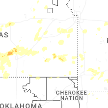

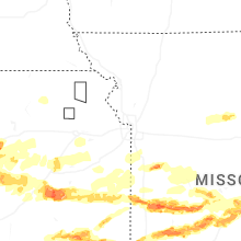
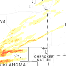

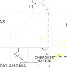
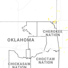
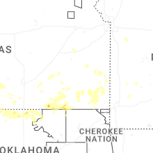
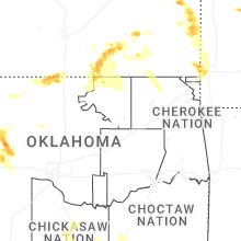

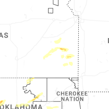


Connect with Interactive Hail Maps