

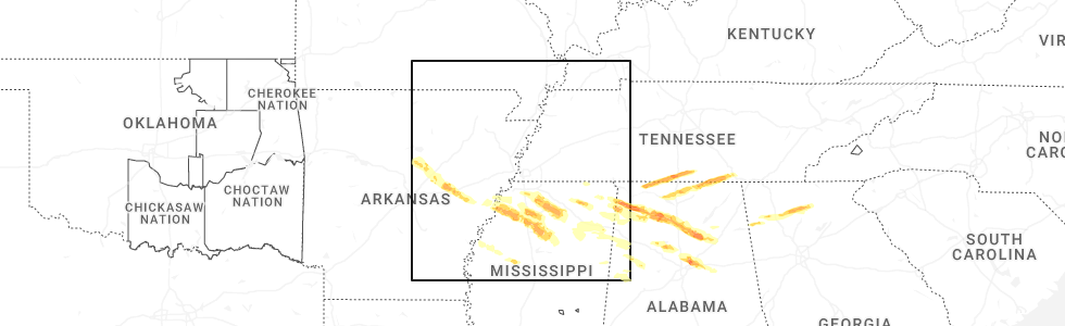
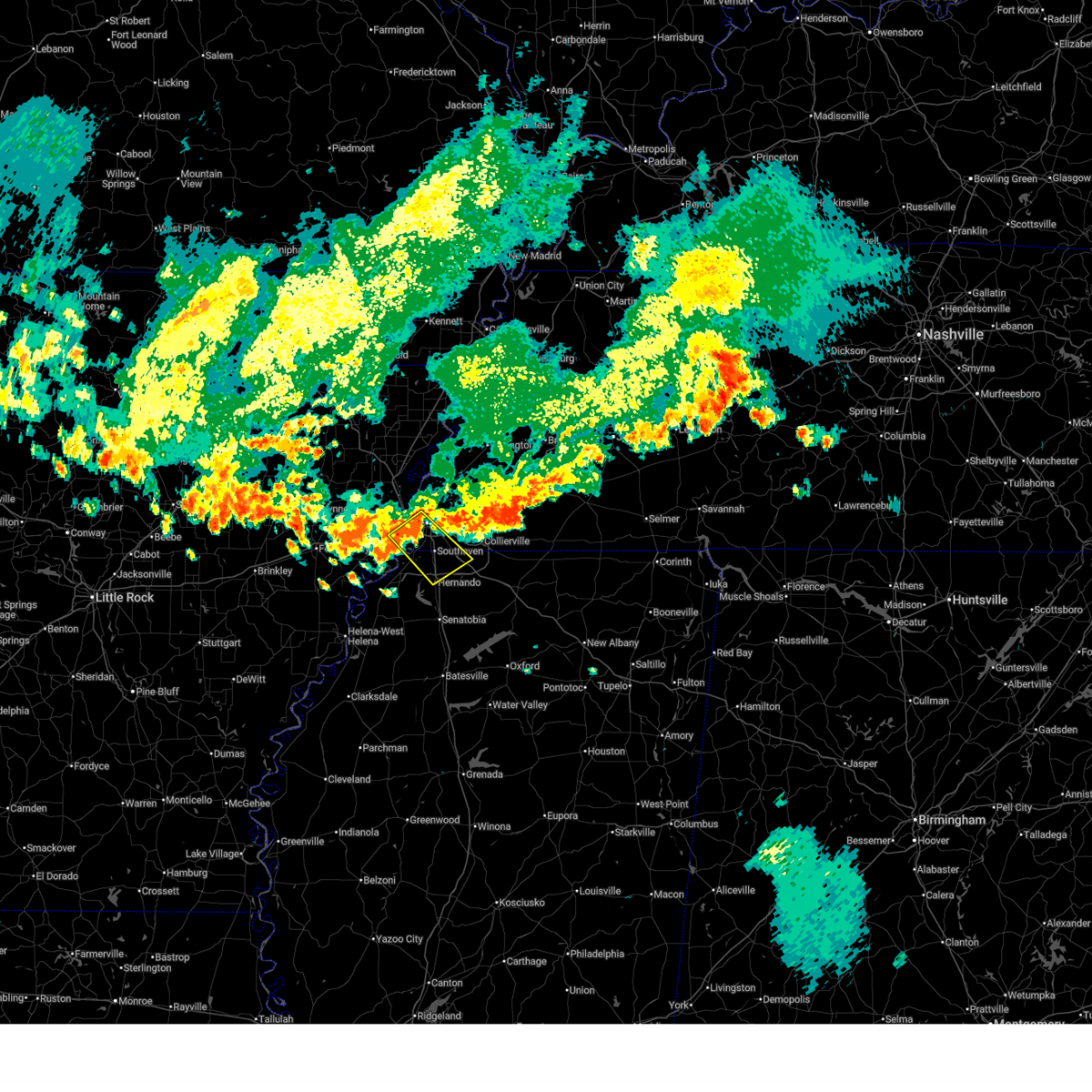
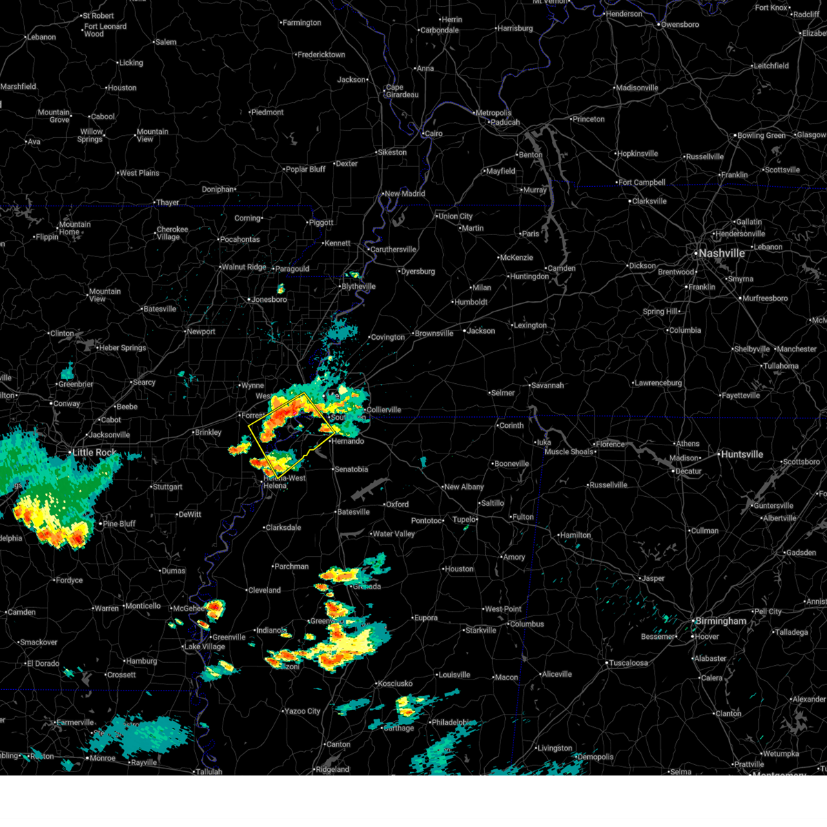
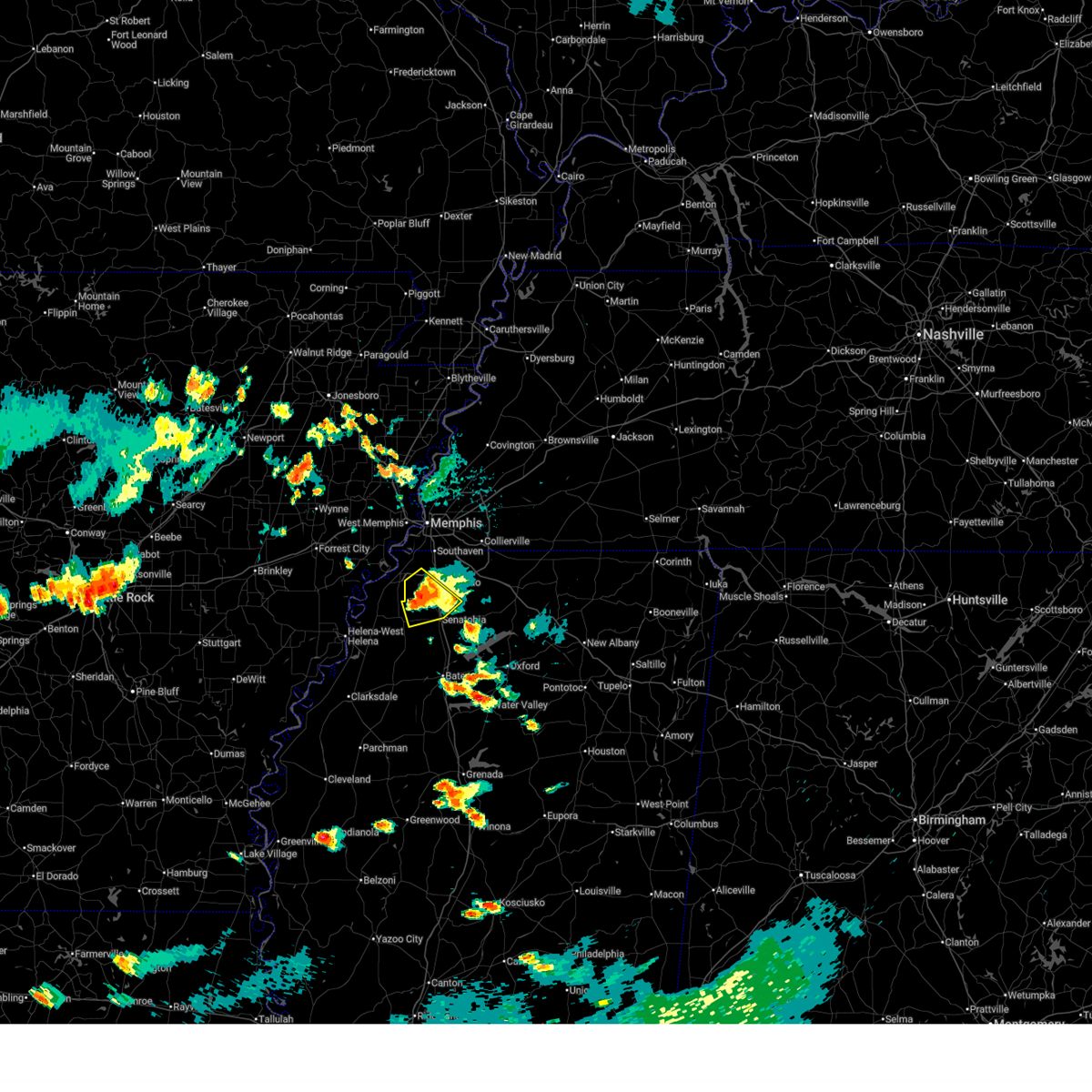
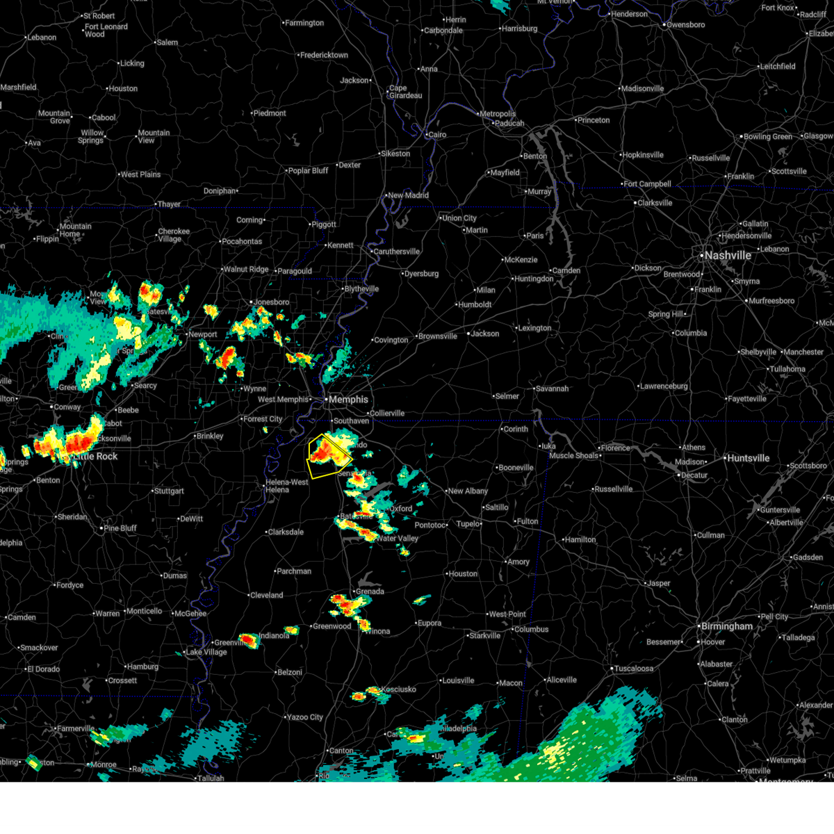
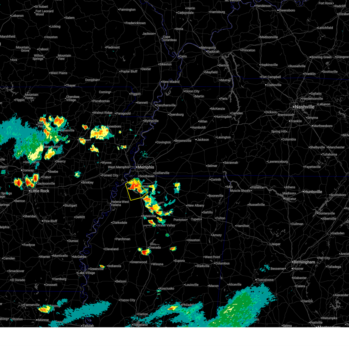
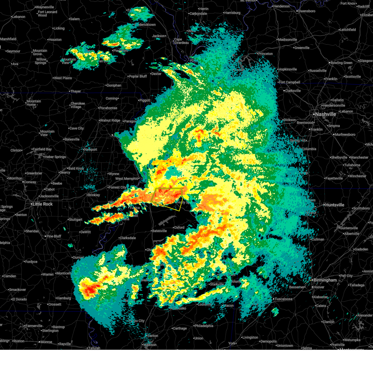
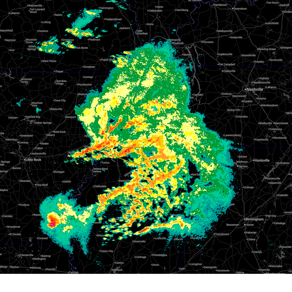
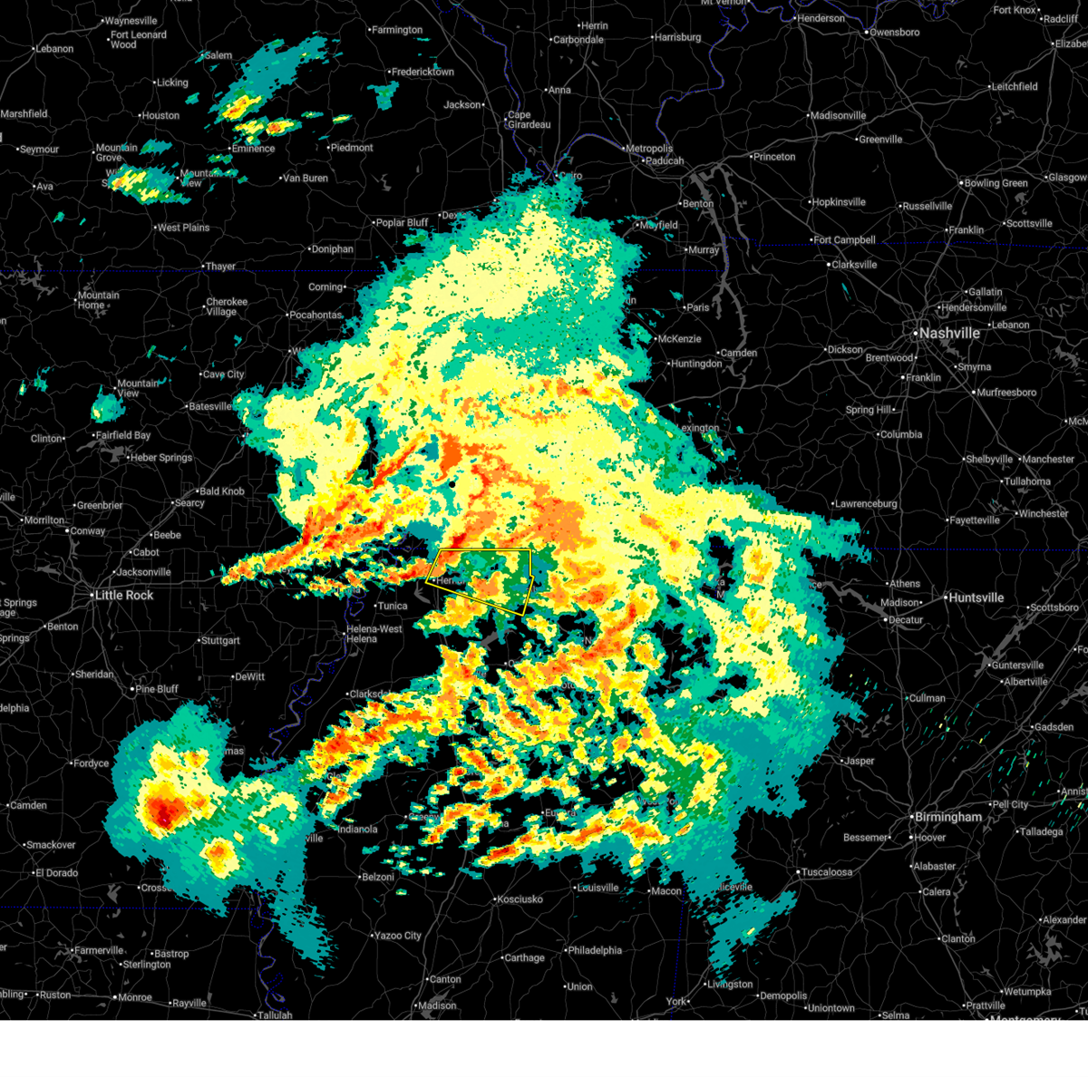
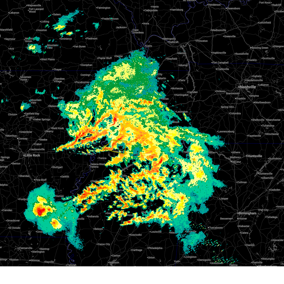
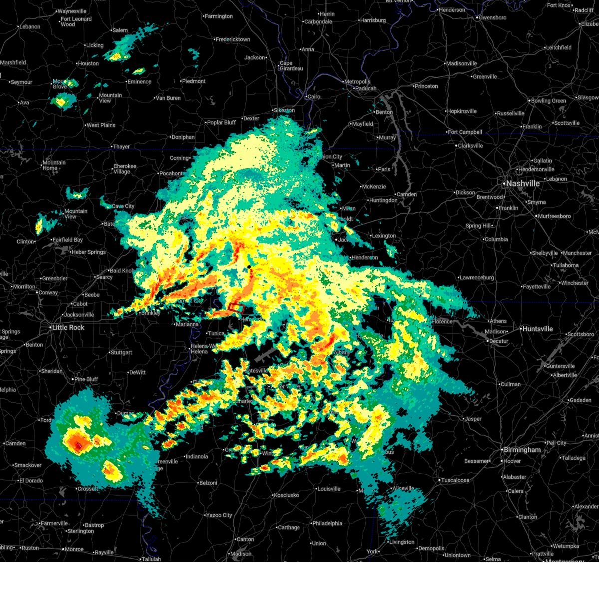
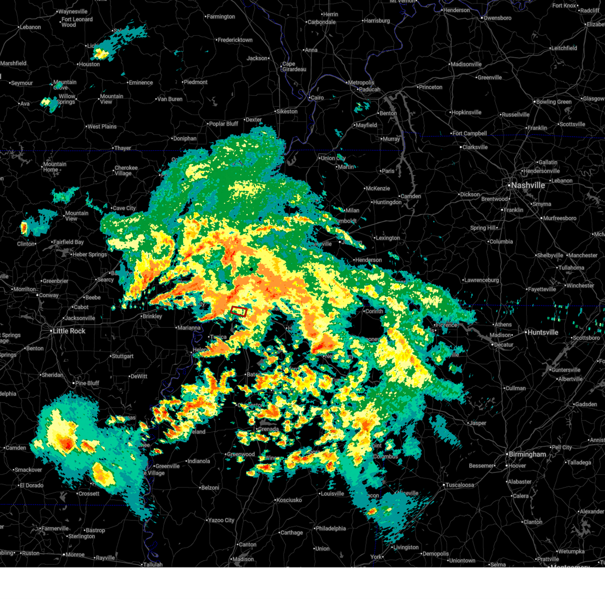
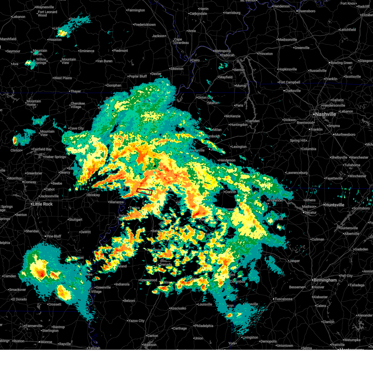
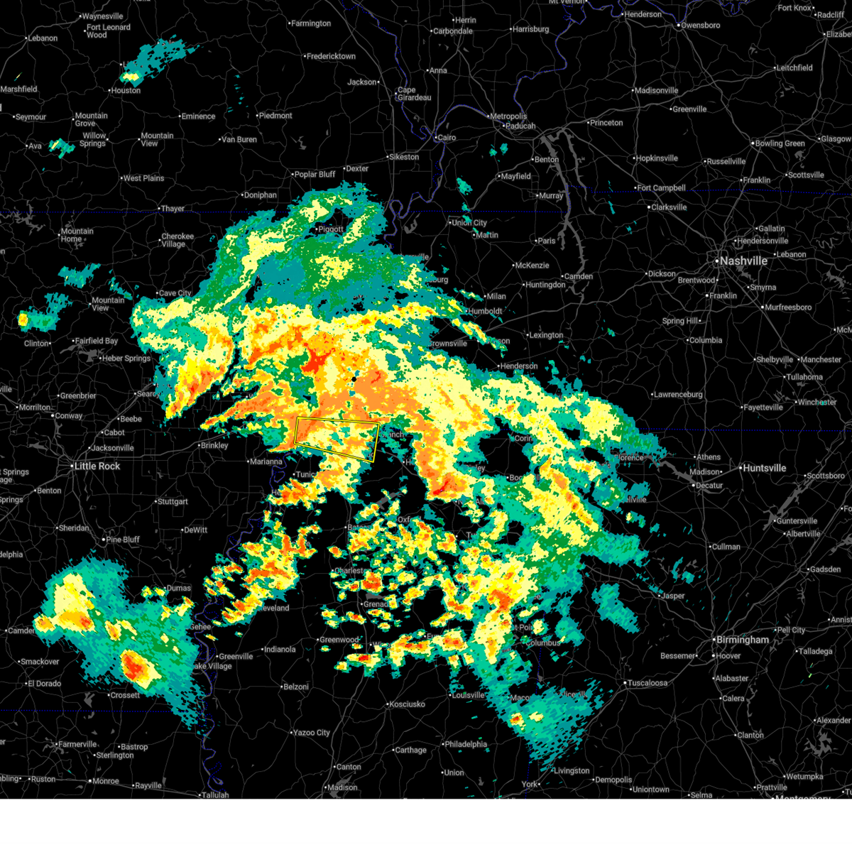
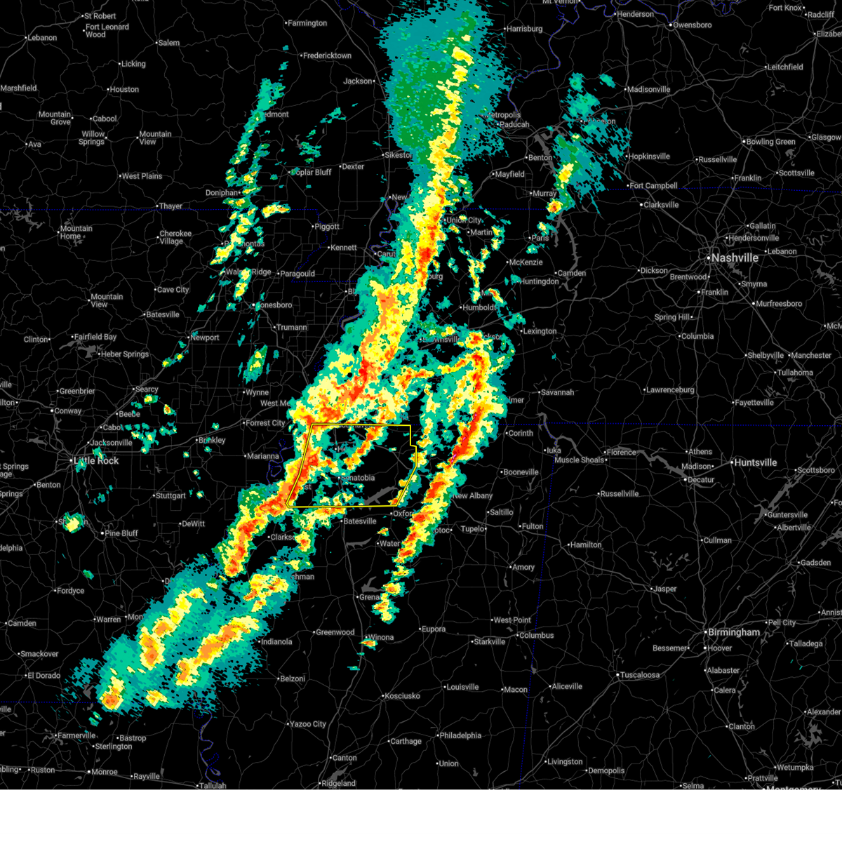
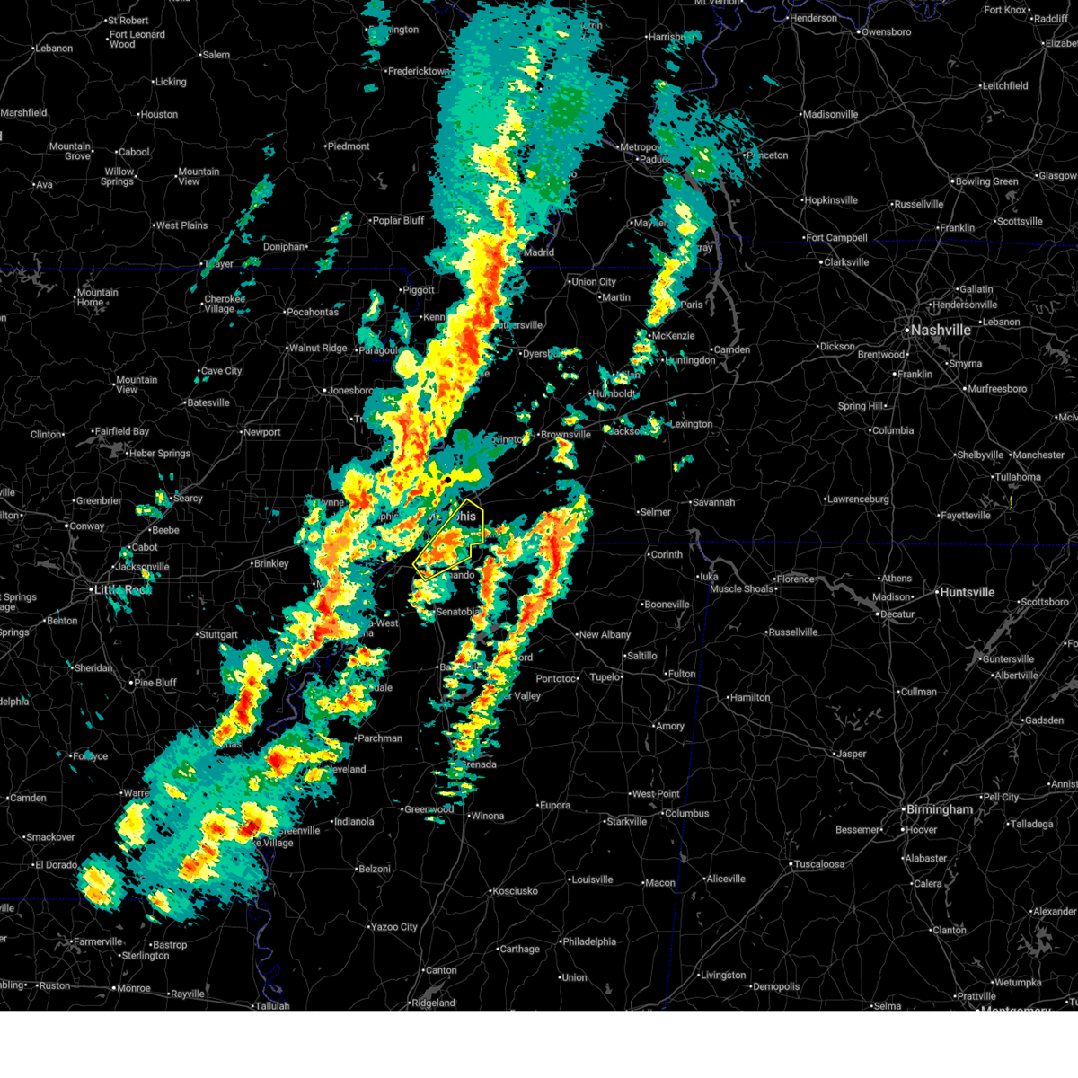
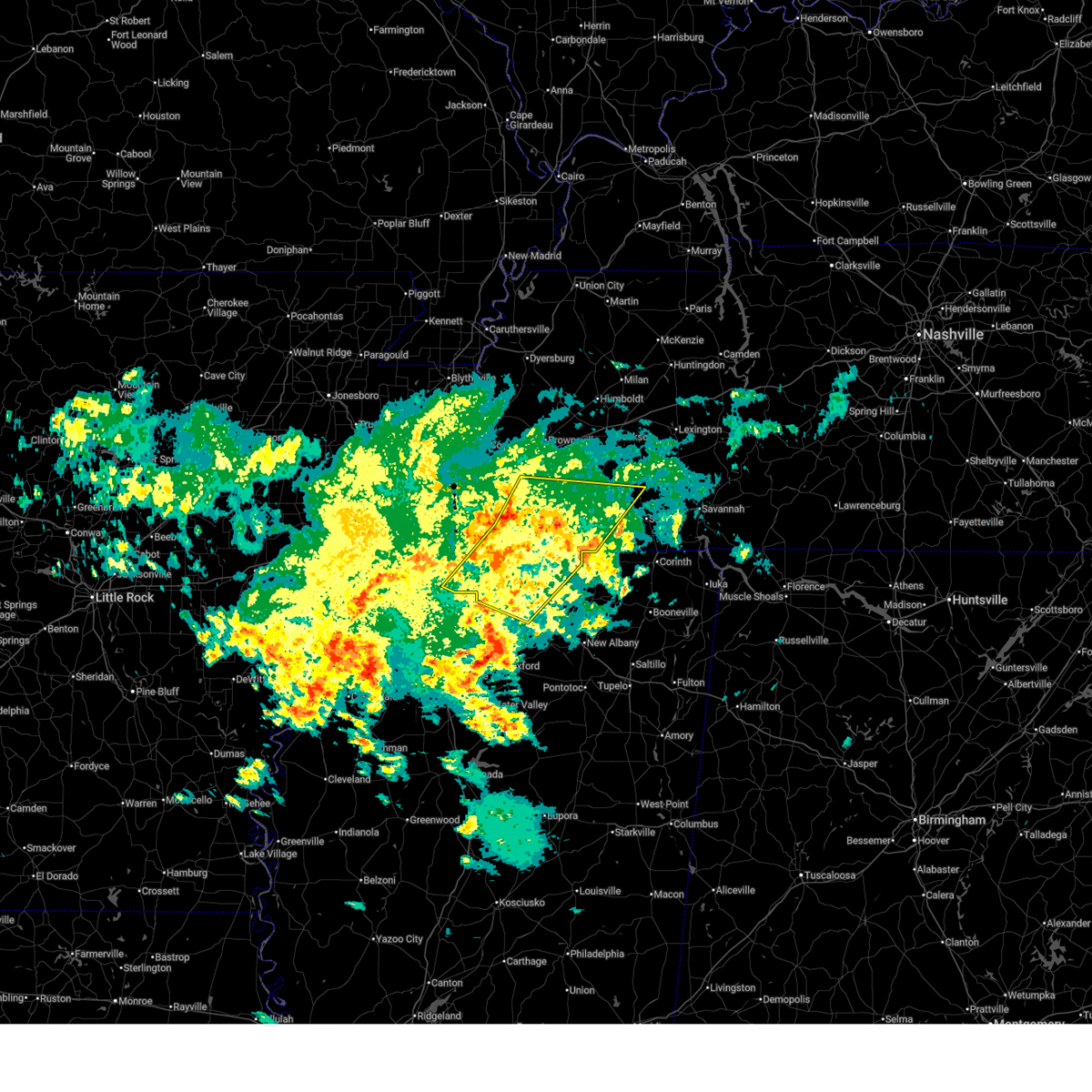
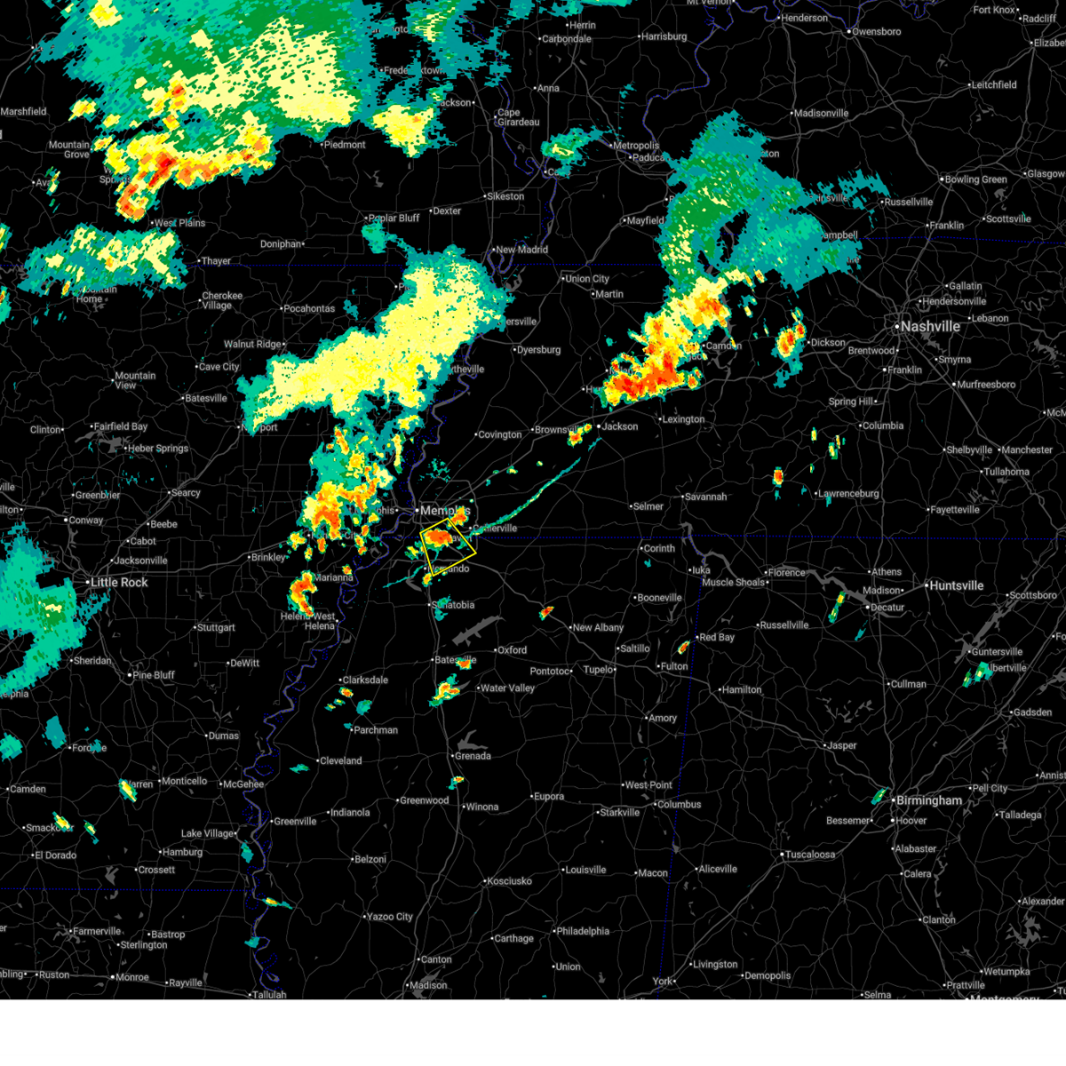
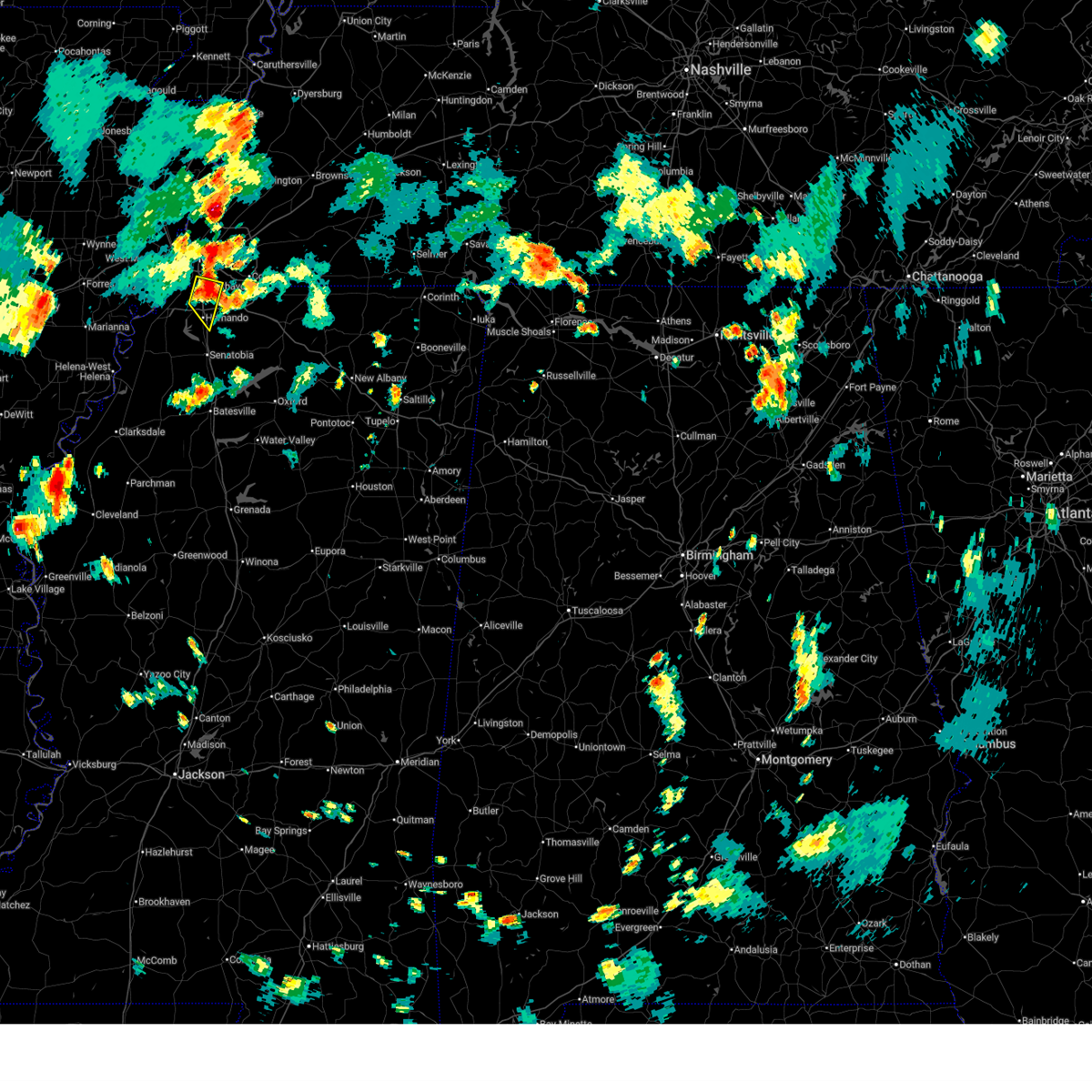
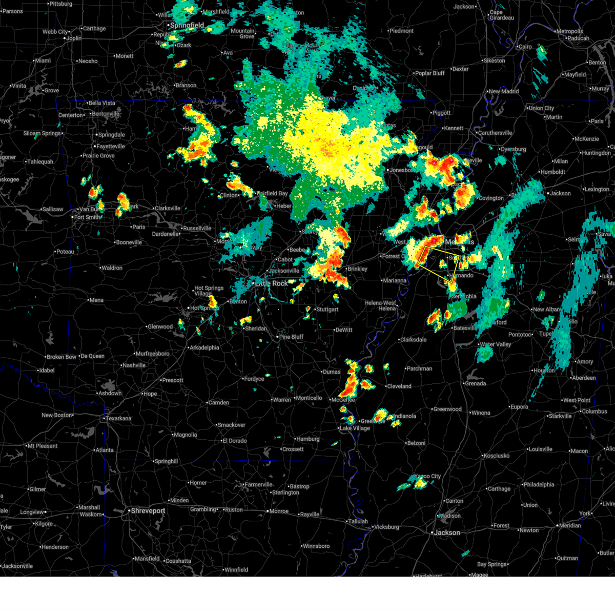
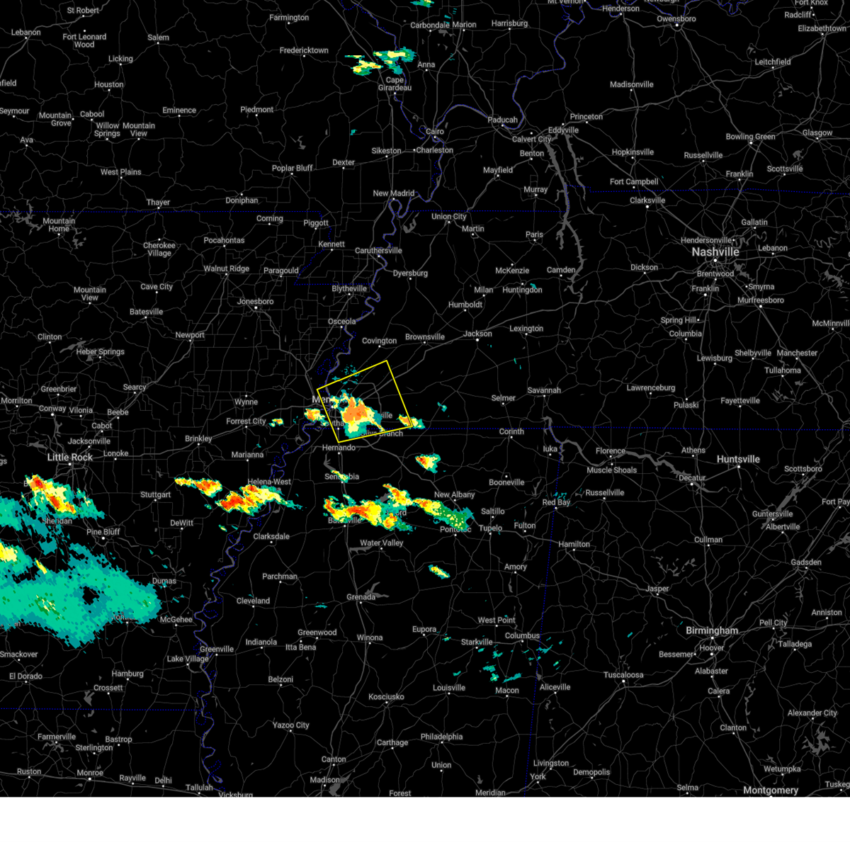
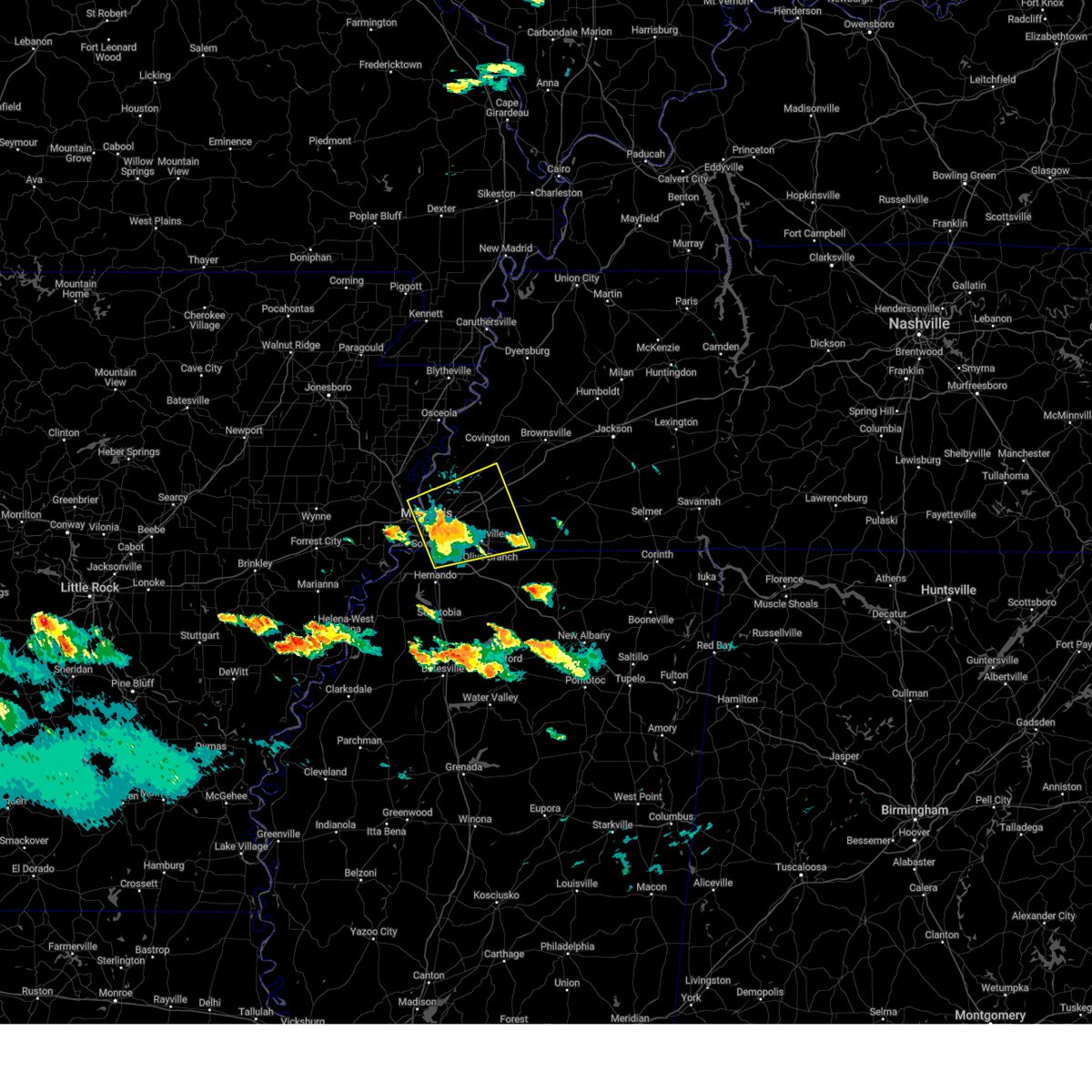
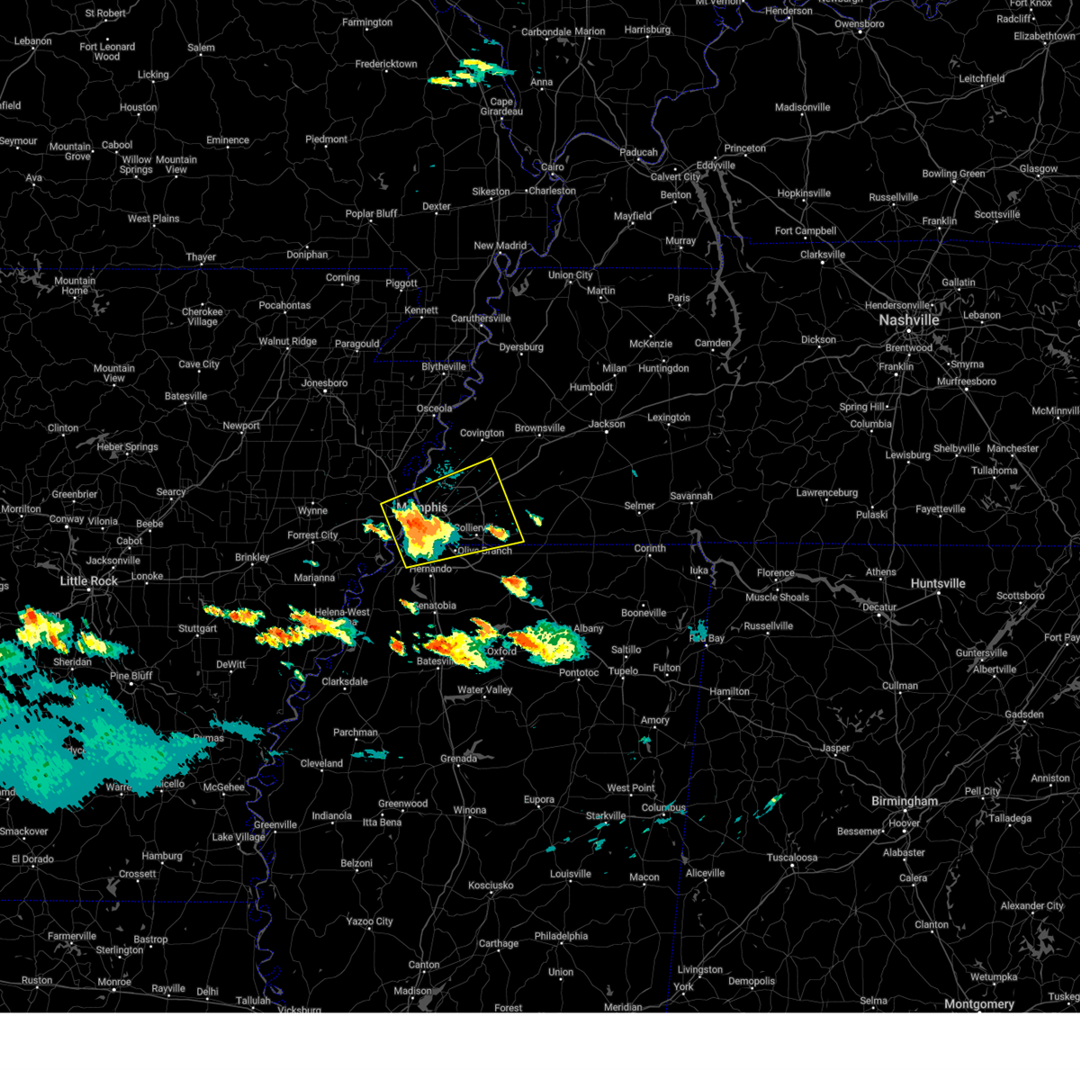
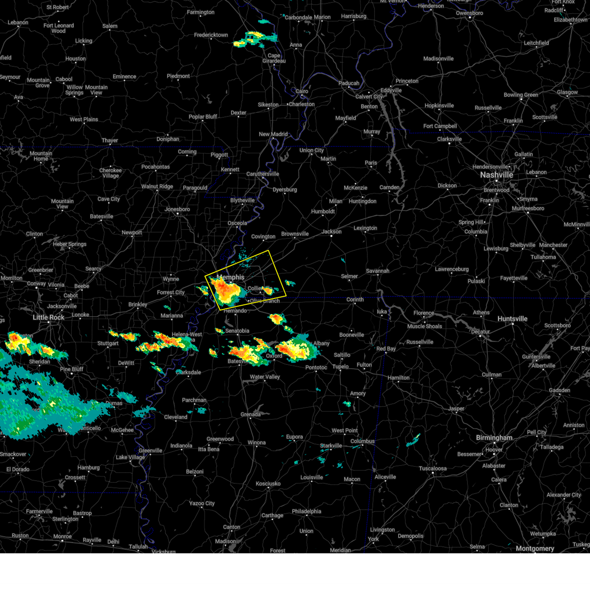
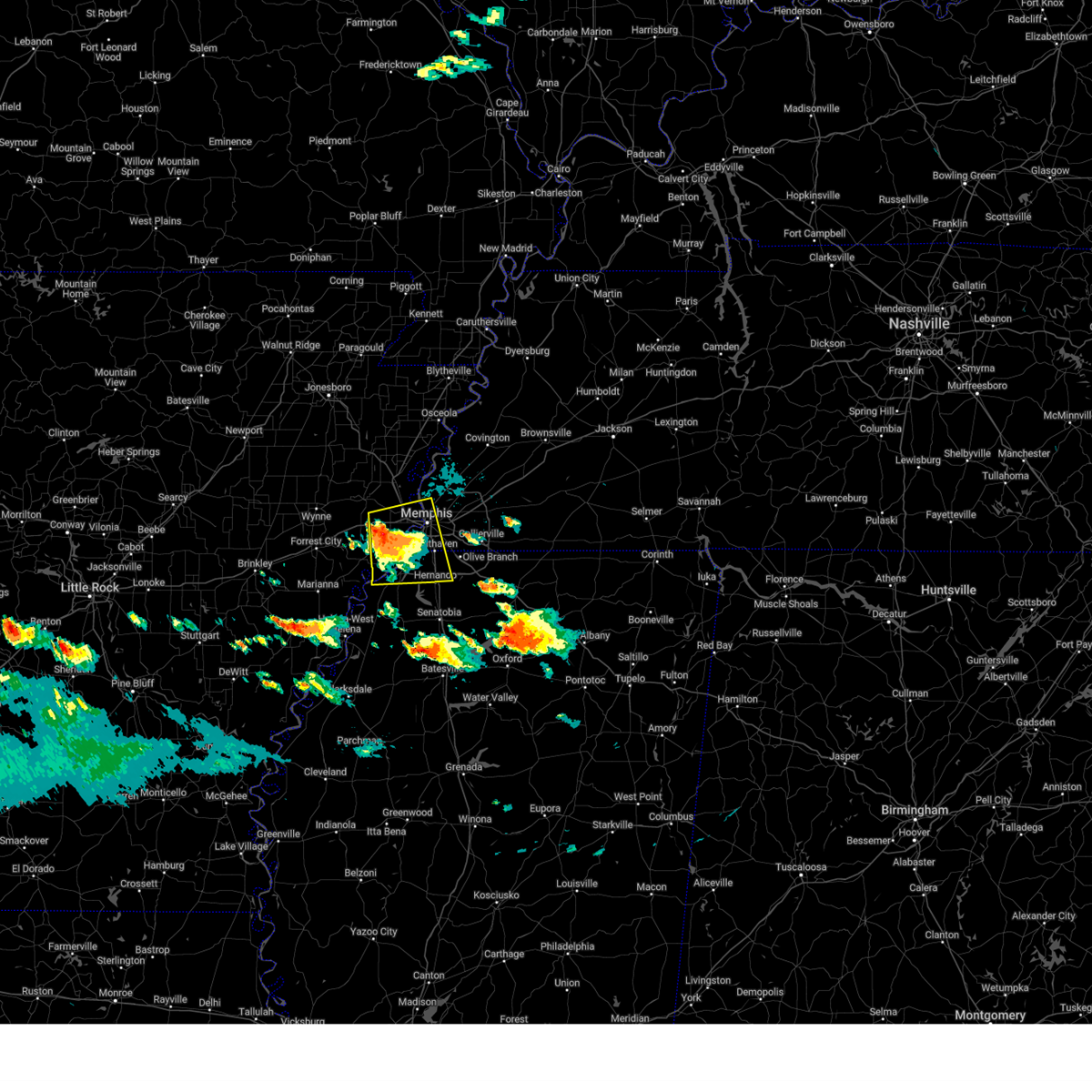
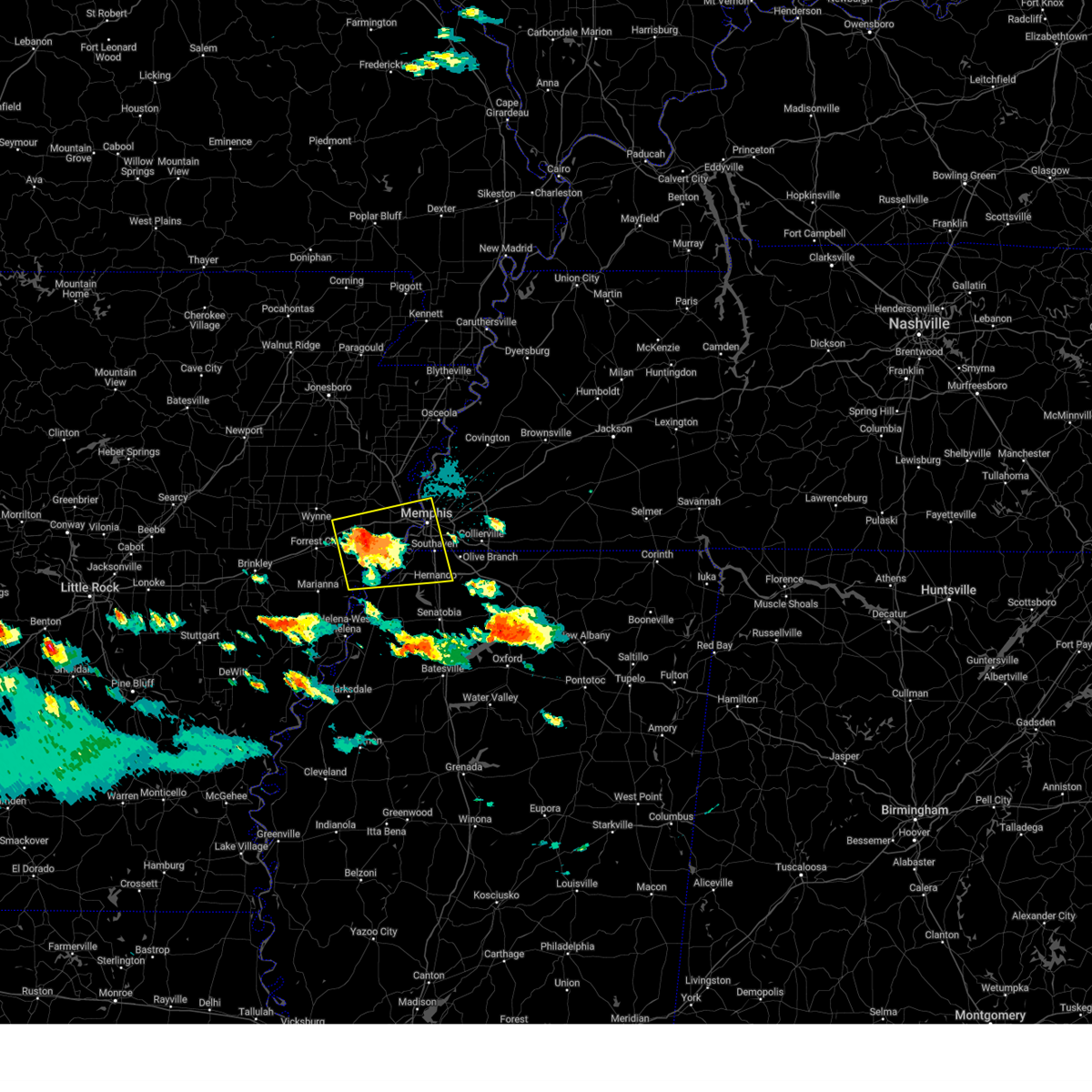
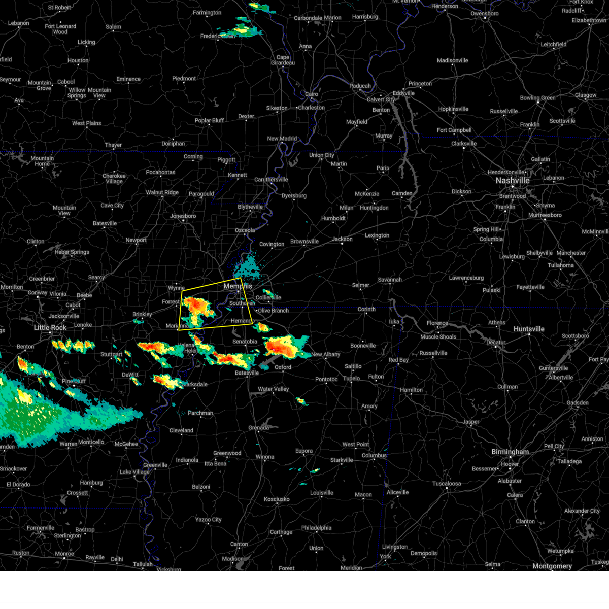
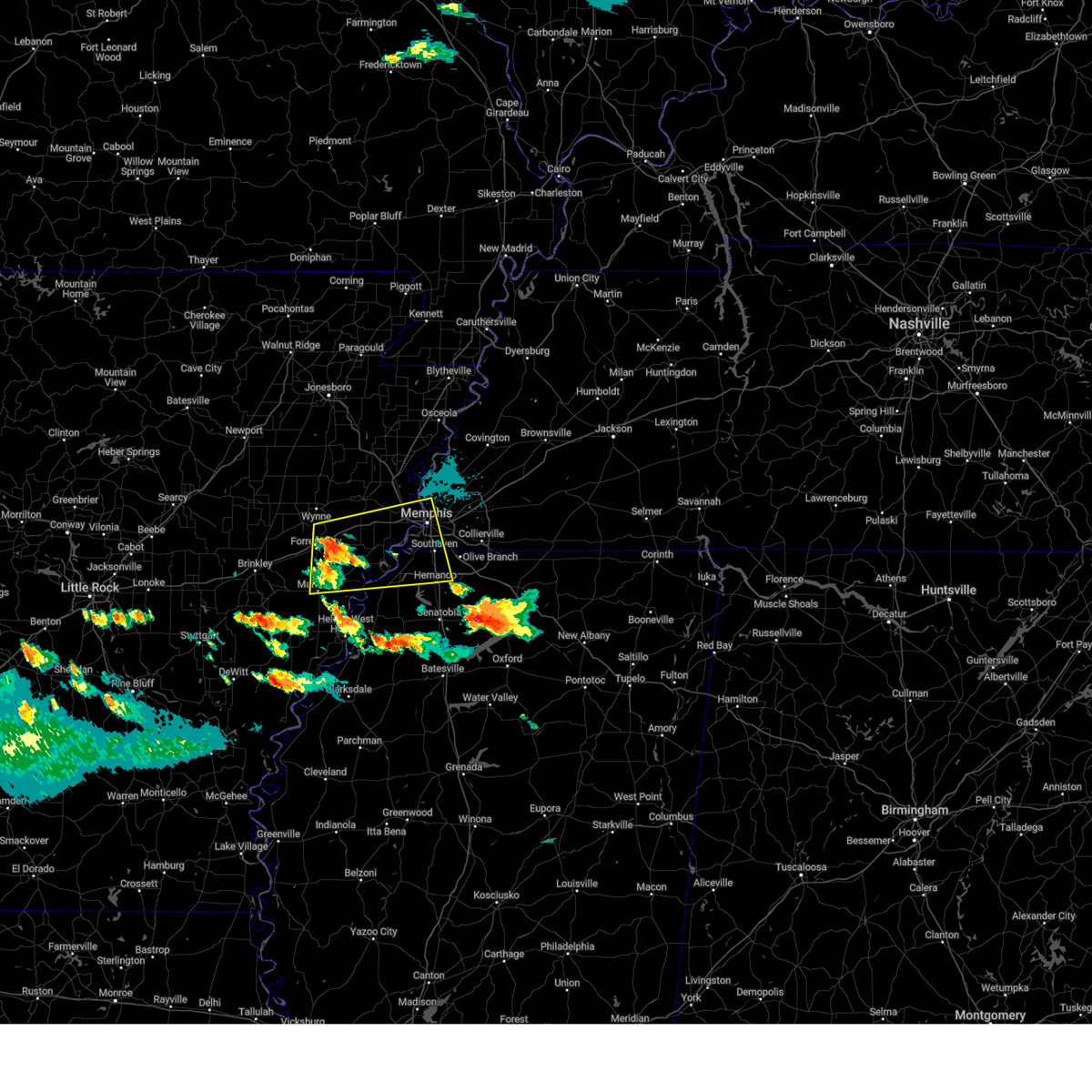
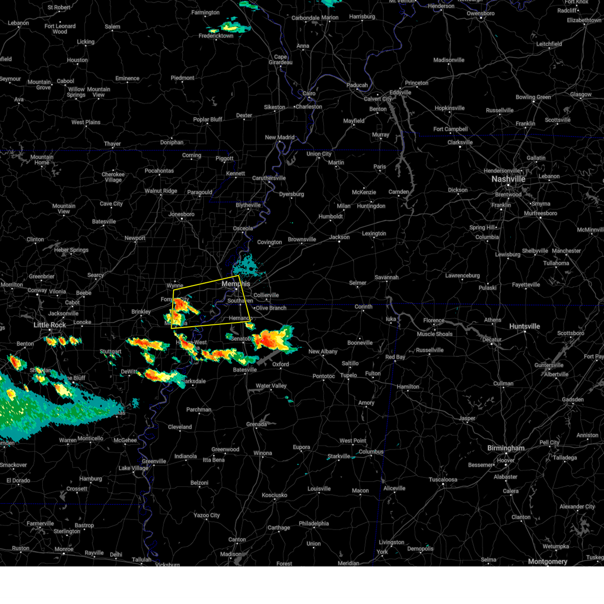
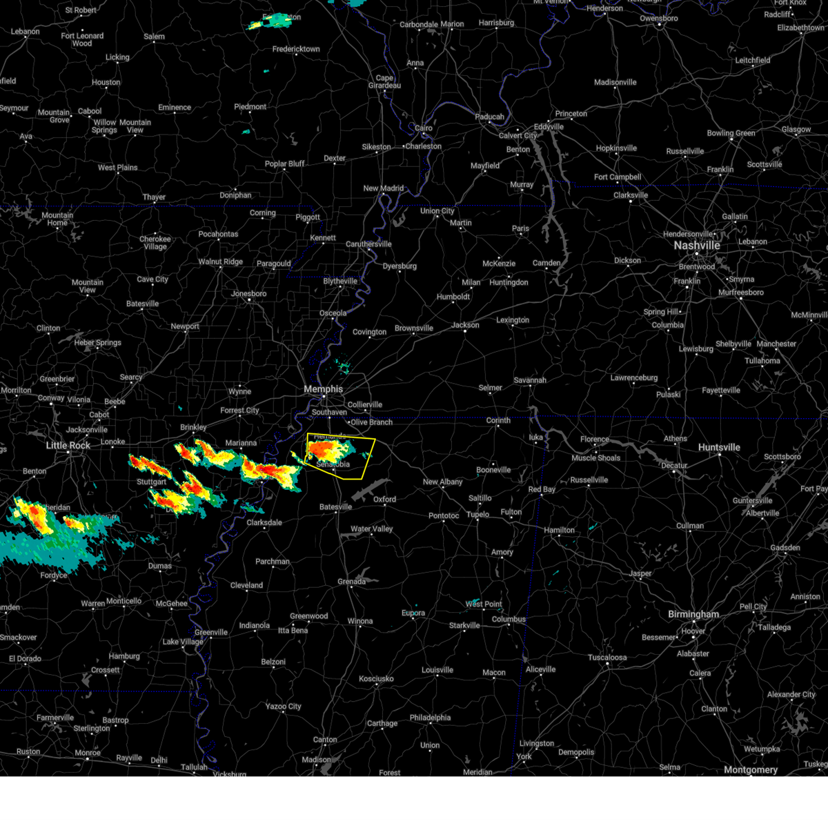
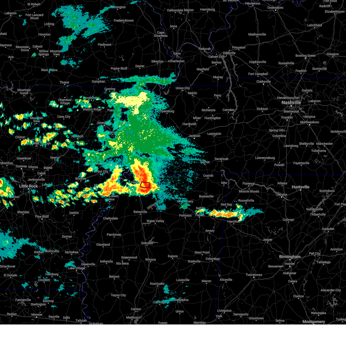
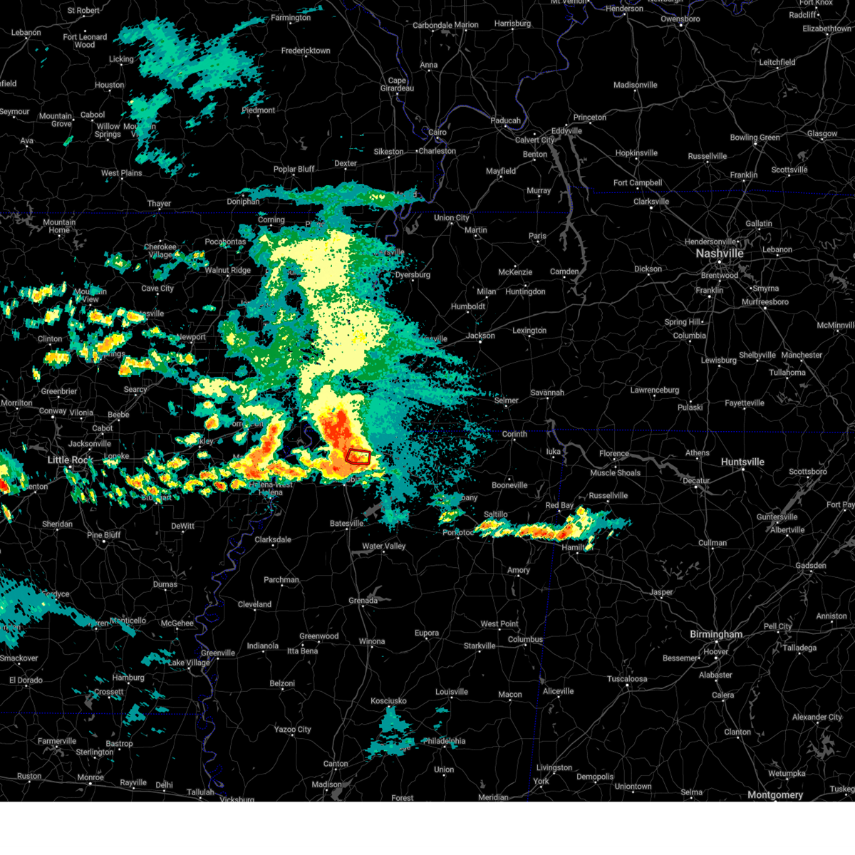
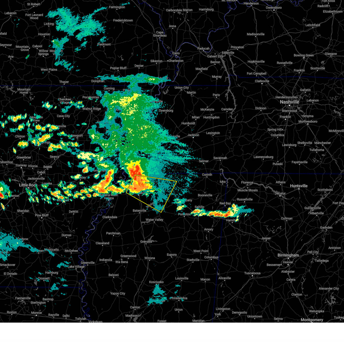
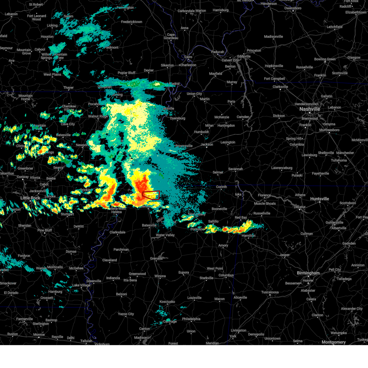
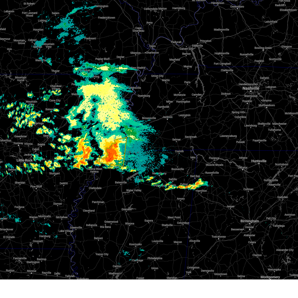
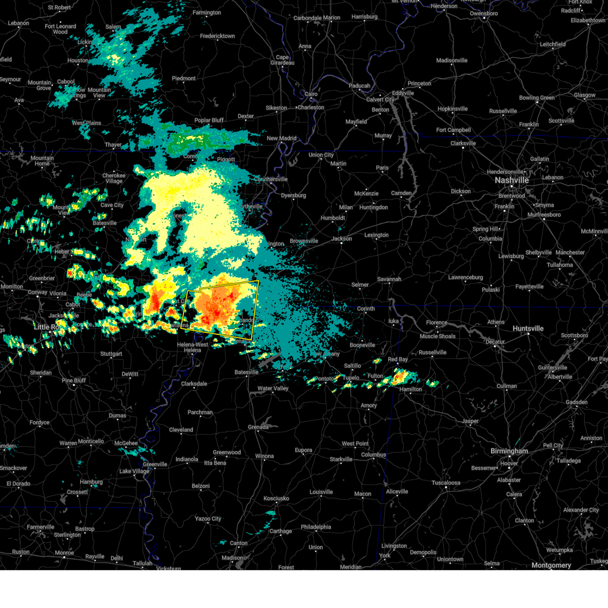
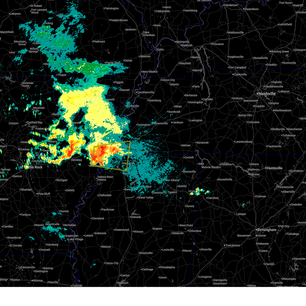
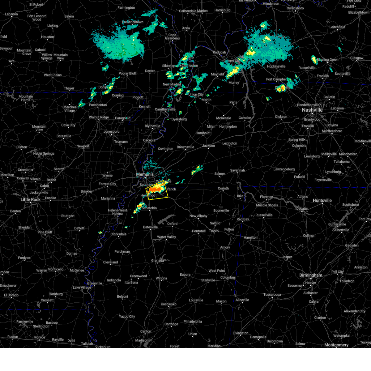
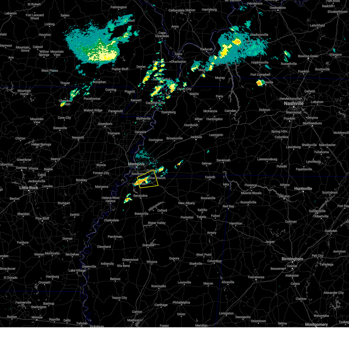
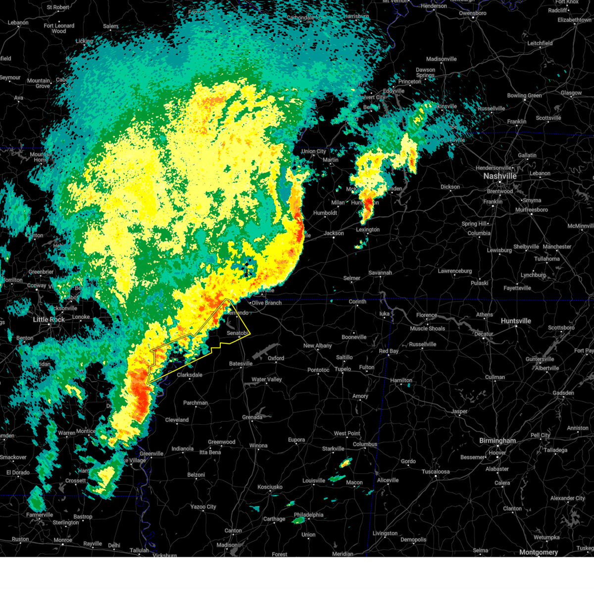
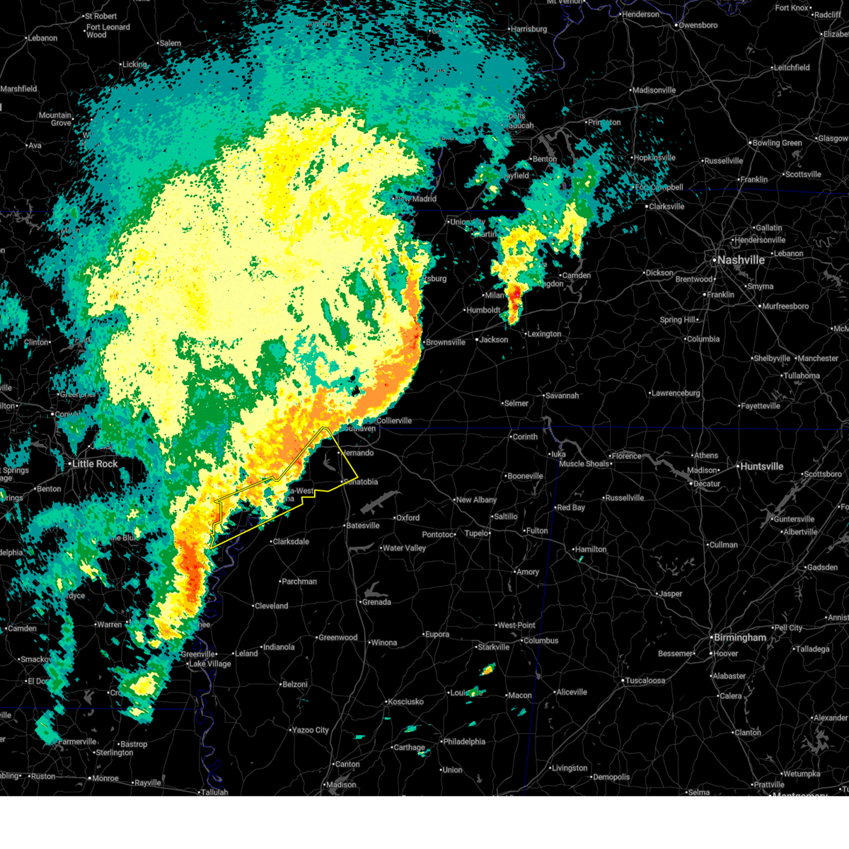
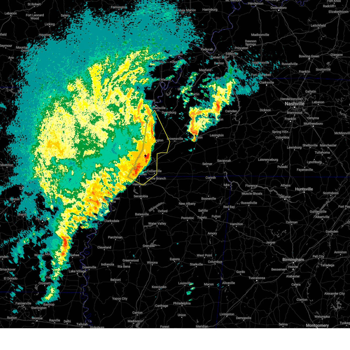
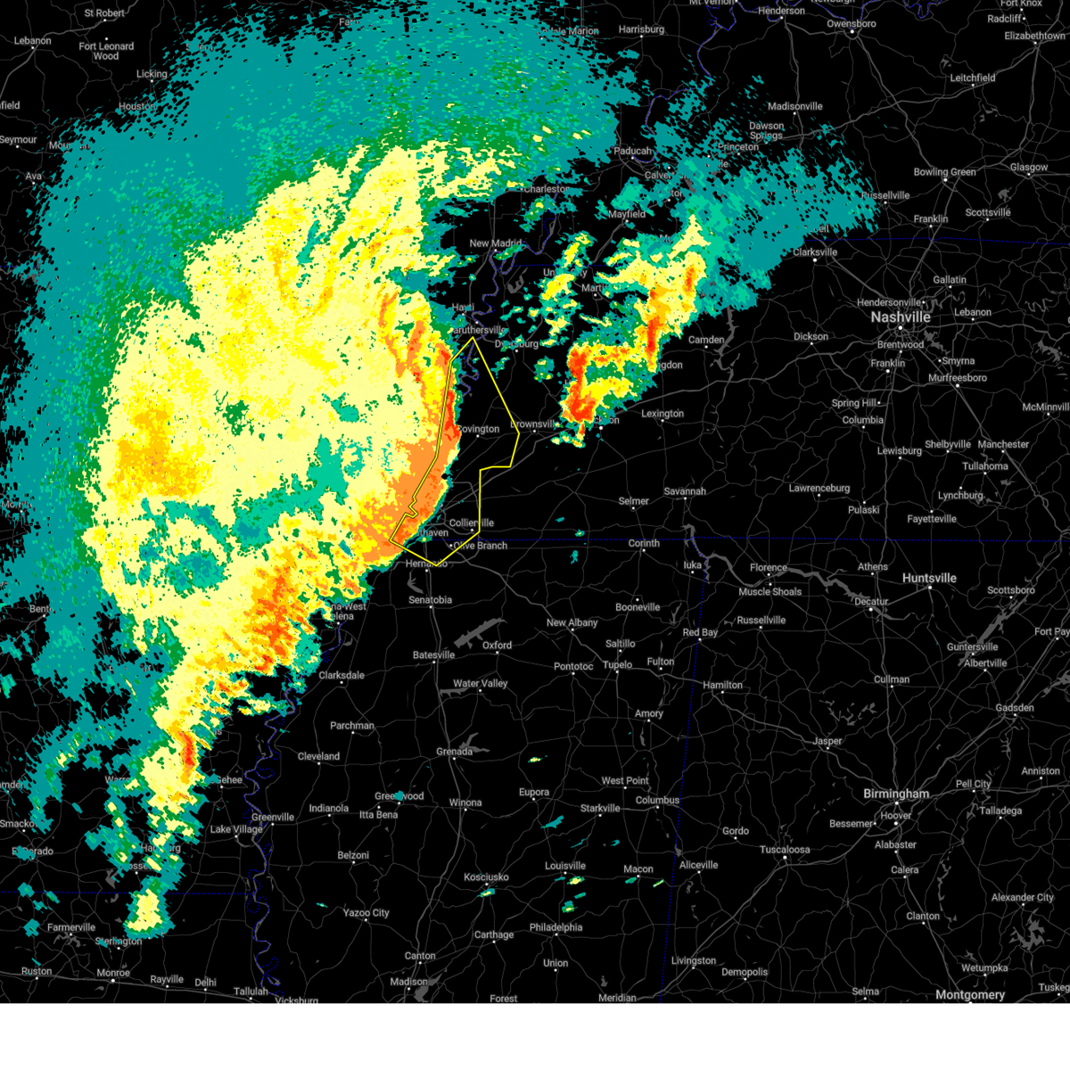
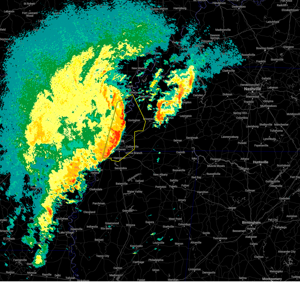
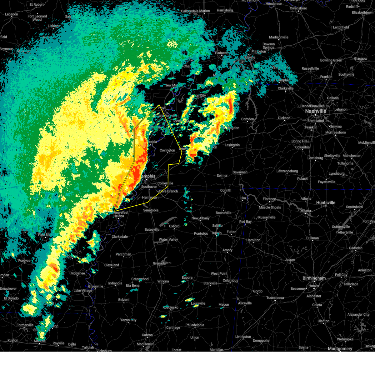
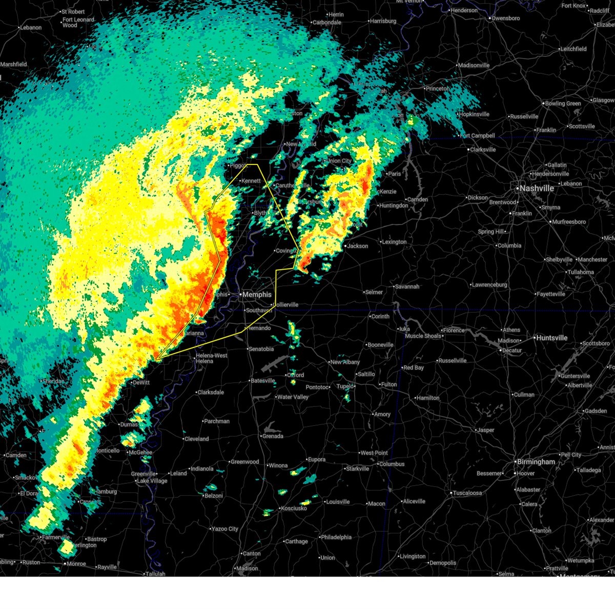
Hail Map for Hernando, MS
The Hernando, MS area has had 15 reports of on-the-ground hail by trained spotters, and has been under severe weather warnings 38 times during the past 12 months. Doppler radar has detected hail at or near Hernando, MS on 95 occasions, including 3 occasions during the past year.
| Name: | Hernando, MS |
| Where Located: | 21.5 miles S of Memphis, TN |
| Map: | Google Map for Hernando, MS |
| Population: | 14090 |
| Housing Units: | 5506 |
| More Info: | Search Google for Hernando, MS |
2
The Top Recent Hail Date for Hernando, MS is Thursday, February 26, 2026 (19th out of 95)
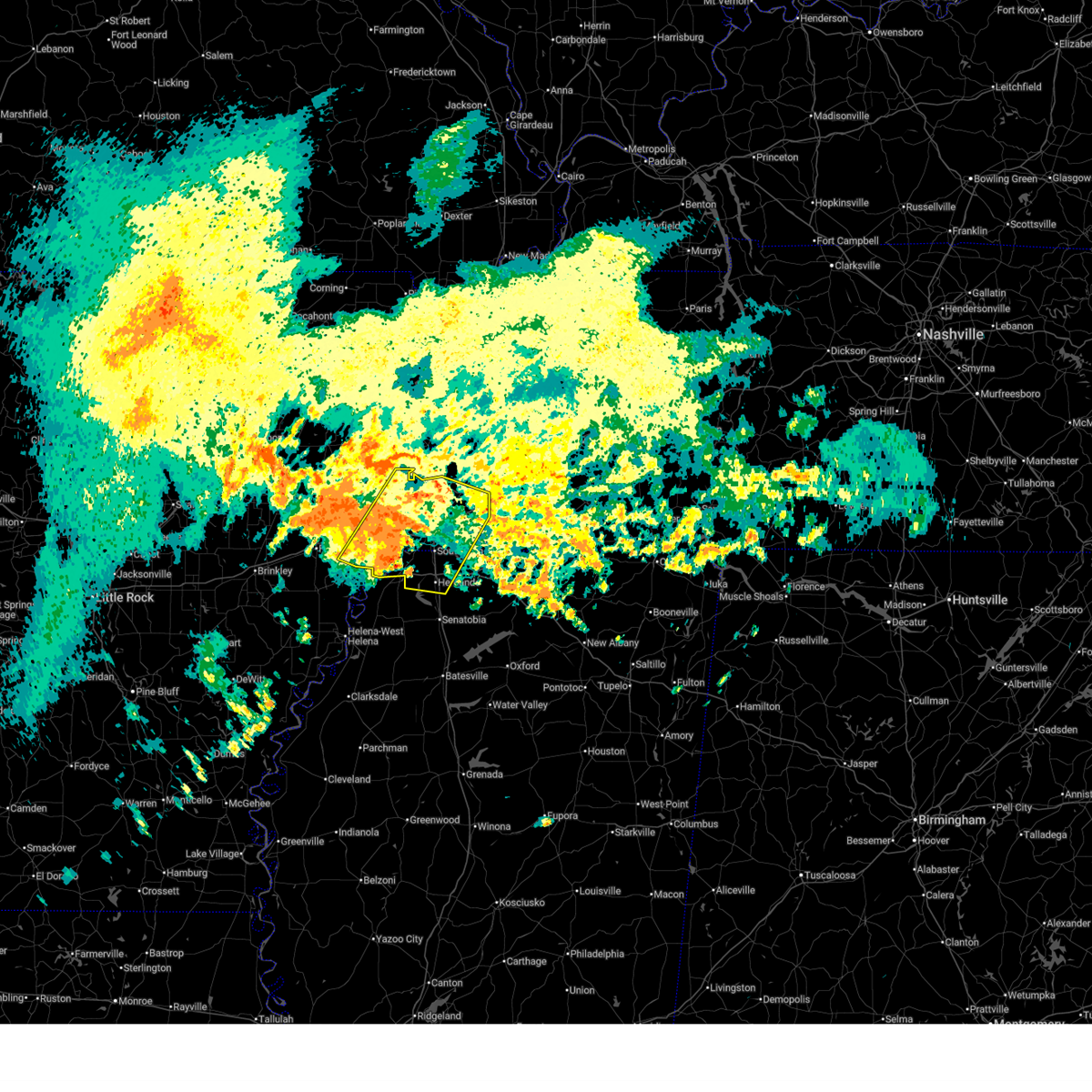
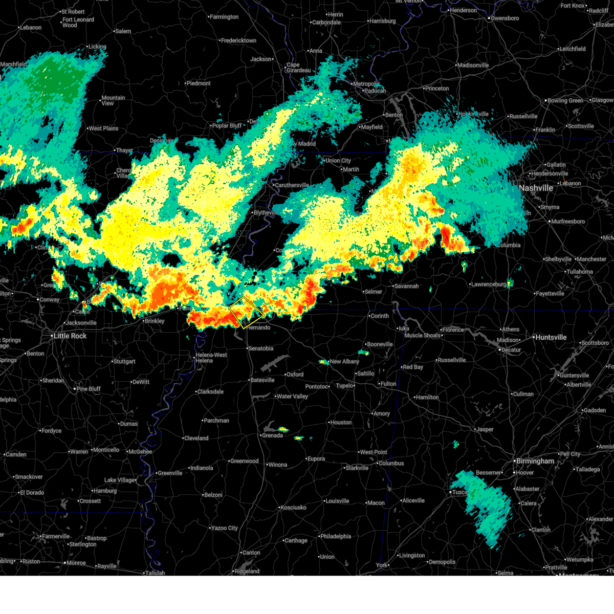
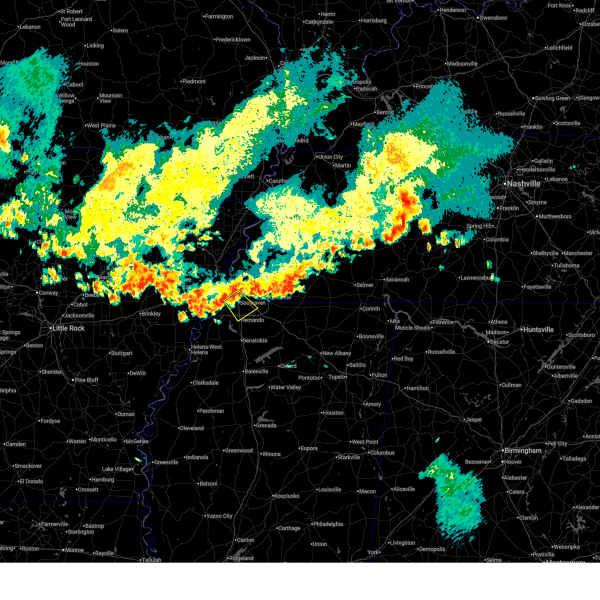
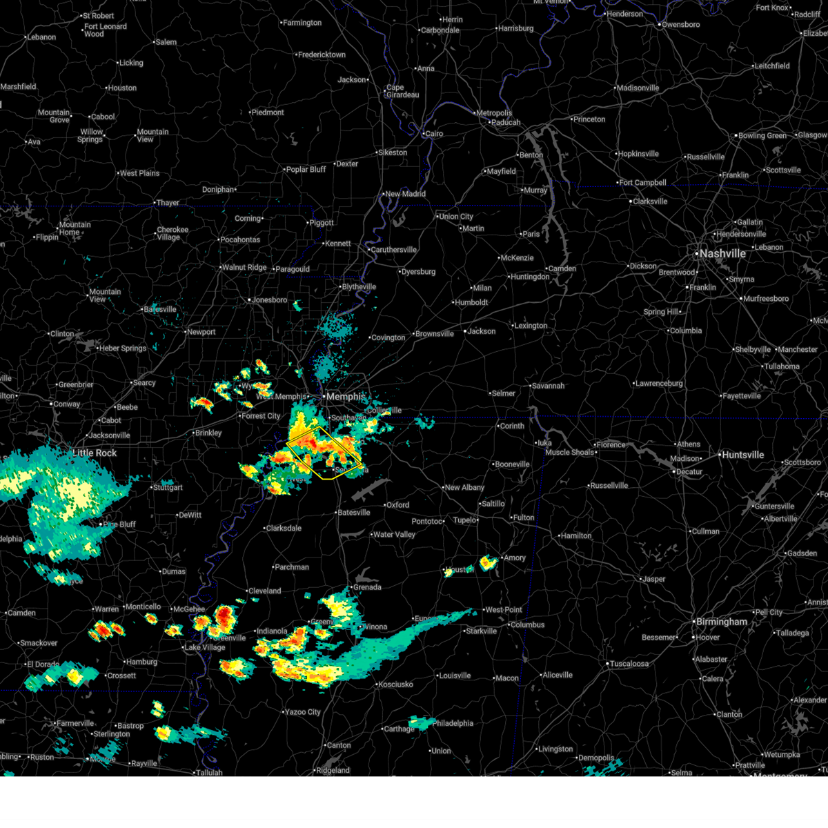
Hail and Wind Damage Spotted near Hernando, MS
| Date / Time | Report Details |
|---|---|
| 6/22/2026 9:12 AM CDT |
 Svrmeg the national weather service in memphis has issued a * severe thunderstorm warning for, eastern st. francis county in eastern arkansas, crittenden county in eastern arkansas, desoto county in northwestern mississippi, shelby county in west tennessee, * until 1000 am cdt. * at 912 am cdt, a severe thunderstorm was located near pinckney, or 9 miles southwest of t o fuller state park, moving northeast at 50 mph (radar indicated). Hazards include 60 mph wind gusts. expect damage to roofs, siding, and trees Svrmeg the national weather service in memphis has issued a * severe thunderstorm warning for, eastern st. francis county in eastern arkansas, crittenden county in eastern arkansas, desoto county in northwestern mississippi, shelby county in west tennessee, * until 1000 am cdt. * at 912 am cdt, a severe thunderstorm was located near pinckney, or 9 miles southwest of t o fuller state park, moving northeast at 50 mph (radar indicated). Hazards include 60 mph wind gusts. expect damage to roofs, siding, and trees
|
| 6/13/2026 7:11 PM CDT |
 The storm which prompted the warning has weakened below severe limits, and no longer poses an immediate threat to life or property. therefore, the warning will be allowed to expire. The storm which prompted the warning has weakened below severe limits, and no longer poses an immediate threat to life or property. therefore, the warning will be allowed to expire.
|
| 6/13/2026 6:42 PM CDT |
 At 641 pm cdt, a severe thunderstorm was located over whitehaven, or near horn lake, moving southeast at 30 mph (radar indicated). Hazards include 60 mph wind gusts and nickel size hail. Expect damage to roofs, siding, and trees. locations impacted include, southaven, olive branch, horn lake, hernando, memphis, southwest memphis, lynchburg, whitehaven, alden, fairhaven, twin lakes, cedarview, nesbit, west days, capleville, lake view, jago, and plum point. this includes the following highways, interstate 22 in mississipppi between mile markers 1 and 6. interstate 240 between mile markers 22 and 27. interstate 55 in tennessee between mile markers 1 and 8. Interstate 55 in mississippi between mile markers 281 and 292. At 641 pm cdt, a severe thunderstorm was located over whitehaven, or near horn lake, moving southeast at 30 mph (radar indicated). Hazards include 60 mph wind gusts and nickel size hail. Expect damage to roofs, siding, and trees. locations impacted include, southaven, olive branch, horn lake, hernando, memphis, southwest memphis, lynchburg, whitehaven, alden, fairhaven, twin lakes, cedarview, nesbit, west days, capleville, lake view, jago, and plum point. this includes the following highways, interstate 22 in mississipppi between mile markers 1 and 6. interstate 240 between mile markers 22 and 27. interstate 55 in tennessee between mile markers 1 and 8. Interstate 55 in mississippi between mile markers 281 and 292.
|
| 6/13/2026 6:24 PM CDT |
 Svrmeg the national weather service in memphis has issued a * severe thunderstorm warning for, east central crittenden county in eastern arkansas, northeastern desoto county in northwestern mississippi, southwestern shelby county in west tennessee, * until 715 pm cdt. * at 624 pm cdt, a severe thunderstorm was located over t o fuller state park, moving southeast at 30 mph (radar indicated). Hazards include 60 mph wind gusts and nickel size hail. expect damage to roofs, siding, and trees Svrmeg the national weather service in memphis has issued a * severe thunderstorm warning for, east central crittenden county in eastern arkansas, northeastern desoto county in northwestern mississippi, southwestern shelby county in west tennessee, * until 715 pm cdt. * at 624 pm cdt, a severe thunderstorm was located over t o fuller state park, moving southeast at 30 mph (radar indicated). Hazards include 60 mph wind gusts and nickel size hail. expect damage to roofs, siding, and trees
|
| 6/1/2026 10:24 PM CDT |
 Svrmeg the national weather service in memphis has issued a * severe thunderstorm warning for, southwestern desoto county in northwestern mississippi, northeastern tunica county in northwestern mississippi, tate county in northwestern mississippi, * until 1115 pm cdt. * at 1024 pm cdt, a severe thunderstorm was located near eudora, or near hernando, moving southeast at 25 mph (radar indicated). Hazards include 60 mph wind gusts and nickel size hail. expect damage to roofs, siding, and trees Svrmeg the national weather service in memphis has issued a * severe thunderstorm warning for, southwestern desoto county in northwestern mississippi, northeastern tunica county in northwestern mississippi, tate county in northwestern mississippi, * until 1115 pm cdt. * at 1024 pm cdt, a severe thunderstorm was located near eudora, or near hernando, moving southeast at 25 mph (radar indicated). Hazards include 60 mph wind gusts and nickel size hail. expect damage to roofs, siding, and trees
|
| 6/1/2026 10:17 PM CDT |
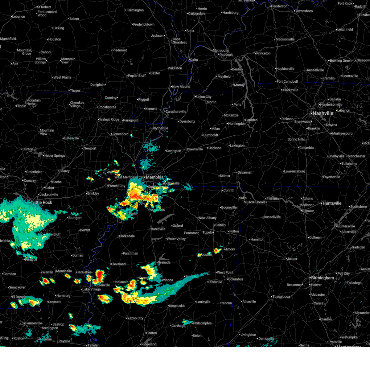 At 1017 pm cdt, a severe thunderstorm was located over walls, or near horn lake, moving southeast at 25 mph (radar indicated). Hazards include 60 mph wind gusts and quarter size hail. Hail damage to vehicles is expected. expect wind damage to roofs, siding, and trees. locations impacted include, hernando, walls, horseshoe lake, lake cormorant, eudora, robinsonville, newport, clack, trinity, frees corners, commerce, nesbit, west days, seyppel, lost lake, prichard, bruins, glover, banks, and penton. This includes interstate 55 in mississippi between mile markers 283 and 285. At 1017 pm cdt, a severe thunderstorm was located over walls, or near horn lake, moving southeast at 25 mph (radar indicated). Hazards include 60 mph wind gusts and quarter size hail. Hail damage to vehicles is expected. expect wind damage to roofs, siding, and trees. locations impacted include, hernando, walls, horseshoe lake, lake cormorant, eudora, robinsonville, newport, clack, trinity, frees corners, commerce, nesbit, west days, seyppel, lost lake, prichard, bruins, glover, banks, and penton. This includes interstate 55 in mississippi between mile markers 283 and 285.
|
| 6/1/2026 10:07 PM CDT |
 At 1007 pm cdt, a severe thunderstorm was located over walls, or 7 miles southwest of t o fuller state park, moving southeast at 25 mph (radar indicated). Hazards include 60 mph wind gusts and quarter size hail. Hail damage to vehicles is expected. expect wind damage to roofs, siding, and trees. locations impacted include, southaven, west memphis, horn lake, hernando, hughes, memphis, walls, edmondson, horseshoe lake, anthonyville, lake cormorant, simsboro, eudora, pinckney, lynchburg, robinsonville, crittenden, clack, trinity, and browns. this includes the following highways, interstate 40 in arkansas between mile markers 273 and 275. Interstate 55 in mississippi between mile markers 283 and 287. At 1007 pm cdt, a severe thunderstorm was located over walls, or 7 miles southwest of t o fuller state park, moving southeast at 25 mph (radar indicated). Hazards include 60 mph wind gusts and quarter size hail. Hail damage to vehicles is expected. expect wind damage to roofs, siding, and trees. locations impacted include, southaven, west memphis, horn lake, hernando, hughes, memphis, walls, edmondson, horseshoe lake, anthonyville, lake cormorant, simsboro, eudora, pinckney, lynchburg, robinsonville, crittenden, clack, trinity, and browns. this includes the following highways, interstate 40 in arkansas between mile markers 273 and 275. Interstate 55 in mississippi between mile markers 283 and 287.
|
| 6/1/2026 9:45 PM CDT |
 Svrmeg the national weather service in memphis has issued a * severe thunderstorm warning for, eastern lee county in eastern arkansas, southeastern st. francis county in eastern arkansas, southwestern crittenden county in eastern arkansas, western desoto county in northwestern mississippi, northern tunica county in northwestern mississippi, southwestern shelby county in west tennessee, * until 1030 pm cdt. * at 945 pm cdt, a severe thunderstorm was located near anthonyville, or 8 miles southwest of west memphis, moving southeast at 25 mph (radar indicated). Hazards include 60 mph wind gusts and quarter size hail. Hail damage to vehicles is expected. Expect wind damage to roofs, siding, and trees. Svrmeg the national weather service in memphis has issued a * severe thunderstorm warning for, eastern lee county in eastern arkansas, southeastern st. francis county in eastern arkansas, southwestern crittenden county in eastern arkansas, western desoto county in northwestern mississippi, northern tunica county in northwestern mississippi, southwestern shelby county in west tennessee, * until 1030 pm cdt. * at 945 pm cdt, a severe thunderstorm was located near anthonyville, or 8 miles southwest of west memphis, moving southeast at 25 mph (radar indicated). Hazards include 60 mph wind gusts and quarter size hail. Hail damage to vehicles is expected. Expect wind damage to roofs, siding, and trees.
|
| 6/1/2026 8:23 PM CDT |
 The storm which prompted the warning has weakened below severe limits, and no longer poses an immediate threat to life or property. therefore, the warning will be allowed to expire. a severe thunderstorm watch remains in effect until 900 pm cdt for northwestern mississippi. The storm which prompted the warning has weakened below severe limits, and no longer poses an immediate threat to life or property. therefore, the warning will be allowed to expire. a severe thunderstorm watch remains in effect until 900 pm cdt for northwestern mississippi.
|
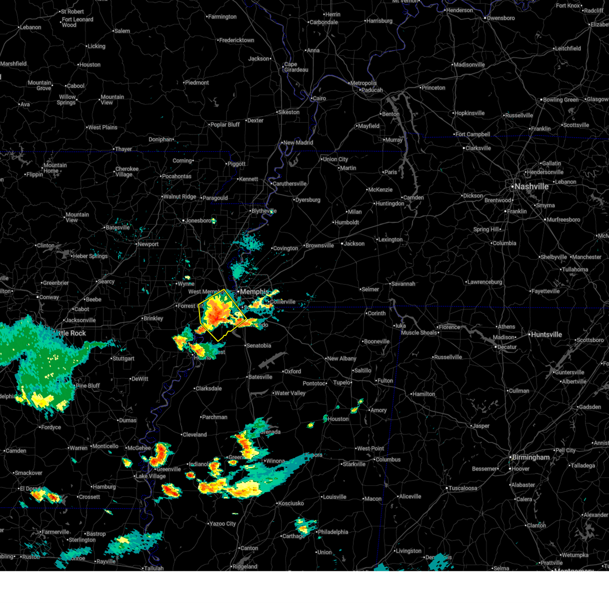
| 6/1/2026 8:11 PM CDT |
 At 811 pm cdt, a severe thunderstorm was located near arkabutla, or 9 miles southwest of hernando, moving southeast at 15 mph (radar indicated). Hazards include 60 mph wind gusts and quarter size hail. Hail damage to vehicles is expected. expect wind damage to roofs, siding, and trees. locations impacted include, hernando, senatobia, coldwater, strayhorn, eudora, arkabutla, phillipp, robinson gin, trinity, sarah, love, and frees corners. This includes interstate 55 in mississippi between mile markers 267 and 280. At 811 pm cdt, a severe thunderstorm was located near arkabutla, or 9 miles southwest of hernando, moving southeast at 15 mph (radar indicated). Hazards include 60 mph wind gusts and quarter size hail. Hail damage to vehicles is expected. expect wind damage to roofs, siding, and trees. locations impacted include, hernando, senatobia, coldwater, strayhorn, eudora, arkabutla, phillipp, robinson gin, trinity, sarah, love, and frees corners. This includes interstate 55 in mississippi between mile markers 267 and 280.
|
| 6/1/2026 7:56 PM CDT |
 Svrmeg the national weather service in memphis has issued a * severe thunderstorm warning for, central desoto county in northwestern mississippi, northeastern tunica county in northwestern mississippi, western tate county in northwestern mississippi, * until 830 pm cdt. * at 756 pm cdt, a severe thunderstorm was located over eudora, or 8 miles west of hernando, moving southeast at 25 mph (radar indicated). Hazards include 60 mph wind gusts and quarter size hail. Hail damage to vehicles is expected. Expect wind damage to roofs, siding, and trees. Svrmeg the national weather service in memphis has issued a * severe thunderstorm warning for, central desoto county in northwestern mississippi, northeastern tunica county in northwestern mississippi, western tate county in northwestern mississippi, * until 830 pm cdt. * at 756 pm cdt, a severe thunderstorm was located over eudora, or 8 miles west of hernando, moving southeast at 25 mph (radar indicated). Hazards include 60 mph wind gusts and quarter size hail. Hail damage to vehicles is expected. Expect wind damage to roofs, siding, and trees.
|
| 4/28/2026 10:08 PM CDT |
 The storm which prompted the warning has weakened below severe limits, and no longer poses an immediate threat to life or property. therefore, the warning will be allowed to expire. however, gusty winds are still possible with this thunderstorm. a tornado watch remains in effect until 400 am cdt for northeastern and northwestern mississippi. The storm which prompted the warning has weakened below severe limits, and no longer poses an immediate threat to life or property. therefore, the warning will be allowed to expire. however, gusty winds are still possible with this thunderstorm. a tornado watch remains in effect until 400 am cdt for northeastern and northwestern mississippi.
|
| 4/28/2026 9:42 PM CDT |
 At 942 pm cdt, a severe thunderstorm was located over byhalia, or 10 miles southeast of olive branch, moving east at 35 mph (radar indicated). Hazards include 60 mph wind gusts. Expect damage to roofs, siding, and trees. locations impacted include, olive branch, holly springs, wall doxey state park, byhalia, mt pleasant, lewisburg, red banks, slayden, marianna, coal oil corner, wakefield, cayce, waterford, cockrum, higdon, cedarview, watson, gilton, handy corner, and taska. This includes interstate 22 in mississipppi between mile markers 2 and 36. At 942 pm cdt, a severe thunderstorm was located over byhalia, or 10 miles southeast of olive branch, moving east at 35 mph (radar indicated). Hazards include 60 mph wind gusts. Expect damage to roofs, siding, and trees. locations impacted include, olive branch, holly springs, wall doxey state park, byhalia, mt pleasant, lewisburg, red banks, slayden, marianna, coal oil corner, wakefield, cayce, waterford, cockrum, higdon, cedarview, watson, gilton, handy corner, and taska. This includes interstate 22 in mississipppi between mile markers 2 and 36.
|
| 4/28/2026 9:26 PM CDT |
 Svrmeg the national weather service in memphis has issued a * severe thunderstorm warning for, eastern desoto county in northwestern mississippi, marshall county in northwestern mississippi, northeastern tate county in northwestern mississippi, * until 1015 pm cdt. * at 925 pm cdt, a severe thunderstorm was located near lewisburg, or near olive branch, moving east at 35 mph (radar indicated). Hazards include 60 mph wind gusts. expect damage to roofs, siding, and trees Svrmeg the national weather service in memphis has issued a * severe thunderstorm warning for, eastern desoto county in northwestern mississippi, marshall county in northwestern mississippi, northeastern tate county in northwestern mississippi, * until 1015 pm cdt. * at 925 pm cdt, a severe thunderstorm was located near lewisburg, or near olive branch, moving east at 35 mph (radar indicated). Hazards include 60 mph wind gusts. expect damage to roofs, siding, and trees
|
| 4/28/2026 9:16 PM CDT |
 At 915 pm cdt, a severe thunderstorm was located over southaven, moving east at 35 mph (radar indicated). Hazards include 60 mph wind gusts. Expect damage to roofs, siding, and trees. locations impacted include, southaven, collierville, olive branch, horn lake, hernando, memphis, byhalia, walls, lake cormorant, lynchburg, whitehaven, lewisburg, newport, cockrum, cedarview, bright, nesbit, handy corner, capleville, and glover. this includes the following highways, interstate 22 in mississipppi between mile markers 1 and 14. interstate 55 in tennessee between mile markers 1 and 4. Interstate 55 in mississippi between mile markers 280 and 292. At 915 pm cdt, a severe thunderstorm was located over southaven, moving east at 35 mph (radar indicated). Hazards include 60 mph wind gusts. Expect damage to roofs, siding, and trees. locations impacted include, southaven, collierville, olive branch, horn lake, hernando, memphis, byhalia, walls, lake cormorant, lynchburg, whitehaven, lewisburg, newport, cockrum, cedarview, bright, nesbit, handy corner, capleville, and glover. this includes the following highways, interstate 22 in mississipppi between mile markers 1 and 14. interstate 55 in tennessee between mile markers 1 and 4. Interstate 55 in mississippi between mile markers 280 and 292.
|
| 4/28/2026 9:16 PM CDT |
 the severe thunderstorm warning has been cancelled and is no longer in effect the severe thunderstorm warning has been cancelled and is no longer in effect
|
| 4/28/2026 9:15 PM CDT |
 The tornado warning that was previously in effect has been reissued for desoto county and is in effect until 1000pm . please refer to that bulletin for the latest severe weather information. a tornado watch remains in effect until 1000 pm cdt for northwestern mississippi. The tornado warning that was previously in effect has been reissued for desoto county and is in effect until 1000pm . please refer to that bulletin for the latest severe weather information. a tornado watch remains in effect until 1000 pm cdt for northwestern mississippi.
|
| 4/28/2026 9:13 PM CDT |
 Tormeg the national weather service in memphis has issued a * tornado warning for, northeastern desoto county in northwestern mississippi, northwestern marshall county in northwestern mississippi, * until 1000 pm cdt. * at 913 pm cdt, a severe thunderstorm capable of producing a tornado was located near southaven, moving east at 35 mph (radar indicated rotation). Hazards include tornado. Flying debris will be dangerous to those caught without shelter. mobile homes will be damaged or destroyed. damage to roofs, windows, and vehicles will occur. Tree damage is likely. Tormeg the national weather service in memphis has issued a * tornado warning for, northeastern desoto county in northwestern mississippi, northwestern marshall county in northwestern mississippi, * until 1000 pm cdt. * at 913 pm cdt, a severe thunderstorm capable of producing a tornado was located near southaven, moving east at 35 mph (radar indicated rotation). Hazards include tornado. Flying debris will be dangerous to those caught without shelter. mobile homes will be damaged or destroyed. damage to roofs, windows, and vehicles will occur. Tree damage is likely.
|
| 4/28/2026 9:07 PM CDT |
 At 906 pm cdt, a severe thunderstorm capable of producing a tornado was located over lynchburg, or over horn lake, moving east at 35 mph (radar indicated rotation). Hazards include tornado. Flying debris will be dangerous to those caught without shelter. mobile homes will be damaged or destroyed. damage to roofs, windows, and vehicles will occur. tree damage is likely. locations impacted include, southaven, horn lake, lynchburg, alden, jago, and twin lakes. This includes interstate 55 in mississippi between mile markers 285 and 290. At 906 pm cdt, a severe thunderstorm capable of producing a tornado was located over lynchburg, or over horn lake, moving east at 35 mph (radar indicated rotation). Hazards include tornado. Flying debris will be dangerous to those caught without shelter. mobile homes will be damaged or destroyed. damage to roofs, windows, and vehicles will occur. tree damage is likely. locations impacted include, southaven, horn lake, lynchburg, alden, jago, and twin lakes. This includes interstate 55 in mississippi between mile markers 285 and 290.
|
| 4/28/2026 8:56 PM CDT |
 Tormeg the national weather service in memphis has issued a * tornado warning for, northwestern desoto county in northwestern mississippi, * until 915 pm cdt. * at 856 pm cdt, a severe thunderstorm capable of producing a tornado was located near walls, or 8 miles southwest of t o fuller state park, moving east at 35 mph (radar indicated rotation). Hazards include tornado. Flying debris will be dangerous to those caught without shelter. mobile homes will be damaged or destroyed. damage to roofs, windows, and vehicles will occur. Tree damage is likely. Tormeg the national weather service in memphis has issued a * tornado warning for, northwestern desoto county in northwestern mississippi, * until 915 pm cdt. * at 856 pm cdt, a severe thunderstorm capable of producing a tornado was located near walls, or 8 miles southwest of t o fuller state park, moving east at 35 mph (radar indicated rotation). Hazards include tornado. Flying debris will be dangerous to those caught without shelter. mobile homes will be damaged or destroyed. damage to roofs, windows, and vehicles will occur. Tree damage is likely.
|
| 4/28/2026 8:49 PM CDT |
 Svrmeg the national weather service in memphis has issued a * severe thunderstorm warning for, south central crittenden county in eastern arkansas, desoto county in northwestern mississippi, northwestern marshall county in northwestern mississippi, southern shelby county in west tennessee, * until 930 pm cdt. * at 849 pm cdt, a severe thunderstorm was located over pinckney, or 10 miles southwest of t o fuller state park, moving east at 35 mph (radar indicated). Hazards include 60 mph wind gusts. expect damage to roofs, siding, and trees Svrmeg the national weather service in memphis has issued a * severe thunderstorm warning for, south central crittenden county in eastern arkansas, desoto county in northwestern mississippi, northwestern marshall county in northwestern mississippi, southern shelby county in west tennessee, * until 930 pm cdt. * at 849 pm cdt, a severe thunderstorm was located over pinckney, or 10 miles southwest of t o fuller state park, moving east at 35 mph (radar indicated). Hazards include 60 mph wind gusts. expect damage to roofs, siding, and trees
|
| 4/28/2026 4:41 PM CDT | Trees down reported at the intersection of slocum blvd and mccracken rd. time estimated from rada in desoto county MS, 4.4 miles NNW of Hernando, MS |
| 4/28/2026 4:30 PM CDT | Trees reported down at the intersection of nesbit road and horn lake road. time estimated from rada in desoto county MS, 5 miles SE of Hernando, MS |
| 3/15/2026 8:05 PM CDT | Tree down on blackhack dr in the love communit in desoto county MS, 7.6 miles N of Hernando, MS |
| 3/15/2026 8:00 PM CDT | *** 1 inj *** tree downed on a home on labauve s in desoto county MS, 1.4 miles NNW of Hernando, MS |
| 3/15/2026 8:00 PM CDT | Quarter sized hail reported 10 miles E of Hernando, MS, report from mping: quarter (1.00 in.). |
| 3/15/2026 7:58 PM CDT | Trees down at w comemrce and elm stree in desoto county MS, 1.4 miles N of Hernando, MS |
| 3/15/2026 7:52 PM CDT |
 Svrmeg the national weather service in memphis has issued a * severe thunderstorm warning for, northwestern lafayette county in northwestern mississippi, desoto county in northwestern mississippi, marshall county in northwestern mississippi, eastern tunica county in northwestern mississippi, tate county in northwestern mississippi, northern quitman county in northwestern mississippi, northern panola county in northwestern mississippi, * until 830 pm cdt. * at 751 pm cdt, severe thunderstorms were located along a line extending from lynchburg to near strayhorn to 7 miles southeast of dundee, moving east at 60 mph (radar indicated). Hazards include 60 mph wind gusts and quarter size hail. Hail damage to vehicles is expected. Expect wind damage to roofs, siding, and trees. Svrmeg the national weather service in memphis has issued a * severe thunderstorm warning for, northwestern lafayette county in northwestern mississippi, desoto county in northwestern mississippi, marshall county in northwestern mississippi, eastern tunica county in northwestern mississippi, tate county in northwestern mississippi, northern quitman county in northwestern mississippi, northern panola county in northwestern mississippi, * until 830 pm cdt. * at 751 pm cdt, severe thunderstorms were located along a line extending from lynchburg to near strayhorn to 7 miles southeast of dundee, moving east at 60 mph (radar indicated). Hazards include 60 mph wind gusts and quarter size hail. Hail damage to vehicles is expected. Expect wind damage to roofs, siding, and trees.
|
| 3/15/2026 7:22 PM CDT |
 the severe thunderstorm warning has been cancelled and is no longer in effect the severe thunderstorm warning has been cancelled and is no longer in effect
|
| 3/15/2026 7:22 PM CDT |
 At 722 pm cdt, a severe thunderstorm was located near southaven, moving northeast at 50 mph (radar indicated). Hazards include 60 mph wind gusts and quarter size hail. Hail damage to vehicles is expected. expect wind damage to roofs, siding, and trees. locations impacted include, bartlett, southaven, collierville, germantown, olive branch, horn lake, hernando, cordova, memphis, lakeland, southeast memphis, piperton, lenow, cedarview, bright, nesbit, handy corner, capleville, jago, and fisherville. this includes the following highways, interstate 40 in tennessee between mile markers 17 and 20. interstate 22 in mississipppi between mile markers 1 and 9. interstate 240 between mile markers 14 and 19. Interstate 55 in mississippi between mile markers 280 and 292. At 722 pm cdt, a severe thunderstorm was located near southaven, moving northeast at 50 mph (radar indicated). Hazards include 60 mph wind gusts and quarter size hail. Hail damage to vehicles is expected. expect wind damage to roofs, siding, and trees. locations impacted include, bartlett, southaven, collierville, germantown, olive branch, horn lake, hernando, cordova, memphis, lakeland, southeast memphis, piperton, lenow, cedarview, bright, nesbit, handy corner, capleville, jago, and fisherville. this includes the following highways, interstate 40 in tennessee between mile markers 17 and 20. interstate 22 in mississipppi between mile markers 1 and 9. interstate 240 between mile markers 14 and 19. Interstate 55 in mississippi between mile markers 280 and 292.
|
| 3/15/2026 7:03 PM CDT |
 Svrmeg the national weather service in memphis has issued a * severe thunderstorm warning for, desoto county in northwestern mississippi, northeastern tunica county in northwestern mississippi, southeastern shelby county in west tennessee, * until 745 pm cdt. * at 703 pm cdt, a severe thunderstorm was located near phillipp, or 12 miles west of hernando, moving northeast at 55 mph (radar indicated). Hazards include 60 mph wind gusts and quarter size hail. Hail damage to vehicles is expected. Expect wind damage to roofs, siding, and trees. Svrmeg the national weather service in memphis has issued a * severe thunderstorm warning for, desoto county in northwestern mississippi, northeastern tunica county in northwestern mississippi, southeastern shelby county in west tennessee, * until 745 pm cdt. * at 703 pm cdt, a severe thunderstorm was located near phillipp, or 12 miles west of hernando, moving northeast at 55 mph (radar indicated). Hazards include 60 mph wind gusts and quarter size hail. Hail damage to vehicles is expected. Expect wind damage to roofs, siding, and trees.
|
| 3/9/2026 2:13 PM CDT |
 Svrmeg the national weather service in memphis has issued a * severe thunderstorm warning for, northeastern desoto county in northwestern mississippi, marshall county in northwestern mississippi, benton county in northeastern mississippi, fayette county in west tennessee, hardeman county in west tennessee, northwestern mcnairy county in west tennessee, southeastern shelby county in west tennessee, southwestern chester county in west tennessee, * until 300 pm cdt. * at 212 pm cdt, severe thunderstorms were located along a line extending from near dancyville to 8 miles southeast of eads to lewisburg, moving east at 35 mph (radar indicated). Hazards include 60 mph wind gusts and penny size hail. expect damage to roofs, siding, and trees Svrmeg the national weather service in memphis has issued a * severe thunderstorm warning for, northeastern desoto county in northwestern mississippi, marshall county in northwestern mississippi, benton county in northeastern mississippi, fayette county in west tennessee, hardeman county in west tennessee, northwestern mcnairy county in west tennessee, southeastern shelby county in west tennessee, southwestern chester county in west tennessee, * until 300 pm cdt. * at 212 pm cdt, severe thunderstorms were located along a line extending from near dancyville to 8 miles southeast of eads to lewisburg, moving east at 35 mph (radar indicated). Hazards include 60 mph wind gusts and penny size hail. expect damage to roofs, siding, and trees
|
| 2/26/2026 7:23 PM CST |
 The storm which prompted the warning has weakened below severe limits, and no longer poses an immediate threat to life or property. therefore, the warning will be allowed to expire. however, small hail is still possible with this thunderstorm. The storm which prompted the warning has weakened below severe limits, and no longer poses an immediate threat to life or property. therefore, the warning will be allowed to expire. however, small hail is still possible with this thunderstorm.
|
| 2/26/2026 7:04 PM CST |
 Svrmeg the national weather service in memphis has issued a * severe thunderstorm warning for, southeastern desoto county in northwestern mississippi, west central marshall county in northwestern mississippi, northeastern tate county in northwestern mississippi, * until 730 pm cst. * at 704 pm cst, a severe thunderstorm was located near hernando, moving east at 50 mph (radar indicated). Hazards include quarter size hail. damage to vehicles is expected Svrmeg the national weather service in memphis has issued a * severe thunderstorm warning for, southeastern desoto county in northwestern mississippi, west central marshall county in northwestern mississippi, northeastern tate county in northwestern mississippi, * until 730 pm cst. * at 704 pm cst, a severe thunderstorm was located near hernando, moving east at 50 mph (radar indicated). Hazards include quarter size hail. damage to vehicles is expected
|
| 9/22/2025 6:59 PM CDT | the severe thunderstorm warning has been cancelled and is no longer in effect |
| 9/22/2025 6:53 PM CDT | the severe thunderstorm warning has been cancelled and is no longer in effect |
| 9/22/2025 6:53 PM CDT | At 652 pm cdt, a severe thunderstorm was located near horn lake, moving northeast at 15 mph (radar indicated). Hazards include 60 mph wind gusts and nickel size hail. Expect damage to roofs, siding, and trees. locations impacted include, horn lake, hernando, lynchburg, west days, twin lakes, frees corners, and nesbit. This includes interstate 55 in mississippi between mile markers 281 and 285. |
| 9/22/2025 6:44 PM CDT | At 643 pm cdt, a severe thunderstorm was located near eudora, or 7 miles southwest of horn lake, moving northeast at 20 mph (radar indicated). Hazards include 60 mph wind gusts and nickel size hail. Expect damage to roofs, siding, and trees. locations impacted include, horn lake, hernando, memphis, walls, lake cormorant, lynchburg, eudora, newport, alden, twin lakes, frees corners, nesbit, west days, lake view, glover, and norfolk. This includes interstate 55 in mississippi between mile markers 281 and 285. |
| 9/22/2025 6:44 PM CDT | the severe thunderstorm warning has been cancelled and is no longer in effect |
| 9/22/2025 6:26 PM CDT | Svrmeg the national weather service in memphis has issued a * severe thunderstorm warning for, south central crittenden county in eastern arkansas, western desoto county in northwestern mississippi, northeastern tunica county in northwestern mississippi, southwestern shelby county in west tennessee, * until 715 pm cdt. * at 625 pm cdt, a severe thunderstorm was located over robinsonville, or 12 miles southeast of hughes, moving northeast at 15 mph (radar indicated). Hazards include 60 mph wind gusts and nickel size hail. expect damage to roofs, siding, and trees |
| 9/15/2025 7:02 PM CDT | the severe thunderstorm warning has been cancelled and is no longer in effect |
| 9/15/2025 6:36 PM CDT | Svrmeg the national weather service in memphis has issued a * severe thunderstorm warning for, southeastern desoto county in northwestern mississippi, northwestern marshall county in northwestern mississippi, northeastern tate county in northwestern mississippi, * until 715 pm cdt. * at 636 pm cdt, a severe thunderstorm was located over byhalia, or 13 miles southeast of olive branch, moving west at 20 mph (radar indicated). Hazards include 60 mph wind gusts and quarter size hail. Hail damage to vehicles is expected. Expect wind damage to roofs, siding, and trees. |
| 8/19/2025 7:11 PM CDT |
 the severe thunderstorm warning has been cancelled and is no longer in effect the severe thunderstorm warning has been cancelled and is no longer in effect
|
| 8/19/2025 6:51 PM CDT |
 Svrmeg the national weather service in memphis has issued a * severe thunderstorm warning for, northeastern desoto county in northwestern mississippi, western marshall county in northwestern mississippi, south central shelby county in west tennessee, * until 730 pm cdt. * at 651 pm cdt, a severe thunderstorm was located near olive branch, moving southeast at 5 mph (radar indicated). Hazards include 60 mph wind gusts and quarter size hail. Hail damage to vehicles is expected. Expect wind damage to roofs, siding, and trees. Svrmeg the national weather service in memphis has issued a * severe thunderstorm warning for, northeastern desoto county in northwestern mississippi, western marshall county in northwestern mississippi, south central shelby county in west tennessee, * until 730 pm cdt. * at 651 pm cdt, a severe thunderstorm was located near olive branch, moving southeast at 5 mph (radar indicated). Hazards include 60 mph wind gusts and quarter size hail. Hail damage to vehicles is expected. Expect wind damage to roofs, siding, and trees.
|
| 6/28/2025 5:51 PM CDT |
 The severe thunderstorm which prompted the warning has weakened. therefore, the warning will be allowed to expire. however, gusty winds and heavy rain are still possible with this thunderstorm. The severe thunderstorm which prompted the warning has weakened. therefore, the warning will be allowed to expire. however, gusty winds and heavy rain are still possible with this thunderstorm.
|
| 6/28/2025 5:46 PM CDT |
 the severe thunderstorm warning has been cancelled and is no longer in effect the severe thunderstorm warning has been cancelled and is no longer in effect
|
| 6/28/2025 5:46 PM CDT |
 At 546 pm cdt, a severe thunderstorm was located near hernando, moving southeast at 25 mph (radar indicated). Hazards include 60 mph wind gusts. Expect damage to roofs, siding, and trees. Locations impacted include, southaven, olive branch, horn lake, hernando, memphis, whitehaven, alden, jago, bright, plum point, and nesbit. At 546 pm cdt, a severe thunderstorm was located near hernando, moving southeast at 25 mph (radar indicated). Hazards include 60 mph wind gusts. Expect damage to roofs, siding, and trees. Locations impacted include, southaven, olive branch, horn lake, hernando, memphis, whitehaven, alden, jago, bright, plum point, and nesbit.
|
| 6/28/2025 5:16 PM CDT |
 Svrmeg the national weather service in memphis has issued a * severe thunderstorm warning for, south central crittenden county in eastern arkansas, western desoto county in northwestern mississippi, southwestern shelby county in west tennessee, * until 600 pm cdt. * at 516 pm cdt, a severe thunderstorm was located near lake cormorant, or 9 miles southwest of t o fuller state park, moving southeast at 25 mph (radar indicated). Hazards include 60 mph wind gusts. expect damage to roofs, siding, and trees Svrmeg the national weather service in memphis has issued a * severe thunderstorm warning for, south central crittenden county in eastern arkansas, western desoto county in northwestern mississippi, southwestern shelby county in west tennessee, * until 600 pm cdt. * at 516 pm cdt, a severe thunderstorm was located near lake cormorant, or 9 miles southwest of t o fuller state park, moving southeast at 25 mph (radar indicated). Hazards include 60 mph wind gusts. expect damage to roofs, siding, and trees
|
| 6/7/2025 9:59 PM CDT |
 the severe thunderstorm warning has been cancelled and is no longer in effect the severe thunderstorm warning has been cancelled and is no longer in effect
|
| 6/7/2025 9:54 PM CDT |
 At 954 pm cdt, a severe thunderstorm was located near southeast memphis, or near cordova, moving east at 45 mph (radar indicated). Hazards include 60 mph wind gusts and quarter size hail. Hail damage to vehicles is expected. expect wind damage to roofs, siding, and trees. Locations impacted include, bartlett, southaven, collierville, germantown, olive branch, west memphis, horn lake, millington, cordova, memphis, lakeland, arlington, southwest memphis, ellendale, whitehaven, frayser, midtown memphis, southeast memphis, downtown memphis, and eads. At 954 pm cdt, a severe thunderstorm was located near southeast memphis, or near cordova, moving east at 45 mph (radar indicated). Hazards include 60 mph wind gusts and quarter size hail. Hail damage to vehicles is expected. expect wind damage to roofs, siding, and trees. Locations impacted include, bartlett, southaven, collierville, germantown, olive branch, west memphis, horn lake, millington, cordova, memphis, lakeland, arlington, southwest memphis, ellendale, whitehaven, frayser, midtown memphis, southeast memphis, downtown memphis, and eads.
|
| 6/7/2025 9:43 PM CDT |
 At 943 pm cdt, a severe thunderstorm was located over downtown memphis, or near t o fuller state park, moving east at 45 mph (radar indicated). Hazards include 60 mph wind gusts and quarter size hail. Hail damage to vehicles is expected. expect wind damage to roofs, siding, and trees. Locations impacted include, bartlett, southaven, collierville, germantown, olive branch, west memphis, horn lake, marion, millington, t o fuller state park, cordova, memphis, lakeland, arlington, walls, crawfordsville, sunset, southwest memphis, ellendale, and whitehaven. At 943 pm cdt, a severe thunderstorm was located over downtown memphis, or near t o fuller state park, moving east at 45 mph (radar indicated). Hazards include 60 mph wind gusts and quarter size hail. Hail damage to vehicles is expected. expect wind damage to roofs, siding, and trees. Locations impacted include, bartlett, southaven, collierville, germantown, olive branch, west memphis, horn lake, marion, millington, t o fuller state park, cordova, memphis, lakeland, arlington, walls, crawfordsville, sunset, southwest memphis, ellendale, and whitehaven.
|
| 6/7/2025 9:36 PM CDT |
 Svrmeg the national weather service in memphis has issued a * severe thunderstorm warning for, east central crittenden county in eastern arkansas, northern desoto county in northwestern mississippi, northwestern marshall county in northwestern mississippi, southeastern tipton county in west tennessee, western fayette county in west tennessee, shelby county in west tennessee, * until 1015 pm cdt. * at 936 pm cdt, a severe thunderstorm was located over t o fuller state park, moving east at 45 mph (radar indicated). Hazards include 60 mph wind gusts and half dollar size hail. Hail damage to vehicles is expected. Expect wind damage to roofs, siding, and trees. Svrmeg the national weather service in memphis has issued a * severe thunderstorm warning for, east central crittenden county in eastern arkansas, northern desoto county in northwestern mississippi, northwestern marshall county in northwestern mississippi, southeastern tipton county in west tennessee, western fayette county in west tennessee, shelby county in west tennessee, * until 1015 pm cdt. * at 936 pm cdt, a severe thunderstorm was located over t o fuller state park, moving east at 45 mph (radar indicated). Hazards include 60 mph wind gusts and half dollar size hail. Hail damage to vehicles is expected. Expect wind damage to roofs, siding, and trees.
|
| 6/7/2025 9:27 PM CDT |
 At 927 pm cdt, a severe thunderstorm was located near edmondson, or near west memphis, moving east at 45 mph (radar indicated). Hazards include 60 mph wind gusts and half dollar size hail. Hail damage to vehicles is expected. expect wind damage to roofs, siding, and trees. Locations impacted include, southaven, west memphis, horn lake, hernando, marion, t o fuller state park, memphis, walls, crawfordsville, edmondson, horseshoe lake, sunset, anthonyville, jennette, lake cormorant, southwest memphis, eudora, simsboro, whitehaven, and midtown memphis. At 927 pm cdt, a severe thunderstorm was located near edmondson, or near west memphis, moving east at 45 mph (radar indicated). Hazards include 60 mph wind gusts and half dollar size hail. Hail damage to vehicles is expected. expect wind damage to roofs, siding, and trees. Locations impacted include, southaven, west memphis, horn lake, hernando, marion, t o fuller state park, memphis, walls, crawfordsville, edmondson, horseshoe lake, sunset, anthonyville, jennette, lake cormorant, southwest memphis, eudora, simsboro, whitehaven, and midtown memphis.
|
| 6/7/2025 9:27 PM CDT |
 the severe thunderstorm warning has been cancelled and is no longer in effect the severe thunderstorm warning has been cancelled and is no longer in effect
|
| 6/7/2025 9:16 PM CDT |
 At 916 pm cdt, a severe thunderstorm was located over simsboro, or 7 miles northeast of hughes, moving east at 40 mph (radar indicated). Hazards include golf ball size hail and 60 mph wind gusts. People and animals outdoors will be injured. expect hail damage to roofs, siding, windows, and vehicles. expect wind damage to roofs, siding, and trees. Locations impacted include, southaven, west memphis, horn lake, hernando, marion, hughes, t o fuller state park, memphis, walls, crawfordsville, edmondson, horseshoe lake, sunset, anthonyville, jennette, lake cormorant, southwest memphis, simsboro, brickeys, and whitehaven. At 916 pm cdt, a severe thunderstorm was located over simsboro, or 7 miles northeast of hughes, moving east at 40 mph (radar indicated). Hazards include golf ball size hail and 60 mph wind gusts. People and animals outdoors will be injured. expect hail damage to roofs, siding, windows, and vehicles. expect wind damage to roofs, siding, and trees. Locations impacted include, southaven, west memphis, horn lake, hernando, marion, hughes, t o fuller state park, memphis, walls, crawfordsville, edmondson, horseshoe lake, sunset, anthonyville, jennette, lake cormorant, southwest memphis, simsboro, brickeys, and whitehaven.
|
| 6/7/2025 9:05 PM CDT |
 At 905 pm cdt, a severe thunderstorm was located over new home, or near hughes, moving east at 35 mph (radar indicated). Hazards include ping pong ball size hail and 60 mph wind gusts. People and animals outdoors will be injured. expect hail damage to roofs, siding, windows, and vehicles. expect wind damage to roofs, siding, and trees. Locations impacted include, southaven, west memphis, horn lake, hernando, marion, marianna, hughes, madison, t o fuller state park, memphis, walls, crawfordsville, edmondson, horseshoe lake, widener, sunset, anthonyville, jennette, lake cormorant, and southwest memphis. At 905 pm cdt, a severe thunderstorm was located over new home, or near hughes, moving east at 35 mph (radar indicated). Hazards include ping pong ball size hail and 60 mph wind gusts. People and animals outdoors will be injured. expect hail damage to roofs, siding, windows, and vehicles. expect wind damage to roofs, siding, and trees. Locations impacted include, southaven, west memphis, horn lake, hernando, marion, marianna, hughes, madison, t o fuller state park, memphis, walls, crawfordsville, edmondson, horseshoe lake, widener, sunset, anthonyville, jennette, lake cormorant, and southwest memphis.
|
| 6/7/2025 9:01 PM CDT |
 At 901 pm cdt, a severe thunderstorm was located near new home, or near madison, moving east at 35 mph (radar indicated). Hazards include 60 mph wind gusts and quarter size hail. Hail damage to vehicles is expected. expect wind damage to roofs, siding, and trees. Locations impacted include, southaven, west memphis, horn lake, forrest city, hernando, marion, marianna, hughes, madison, t o fuller state park, memphis, walls, caldwell, crawfordsville, edmondson, horseshoe lake, widener, sunset, anthonyville, and haynes. At 901 pm cdt, a severe thunderstorm was located near new home, or near madison, moving east at 35 mph (radar indicated). Hazards include 60 mph wind gusts and quarter size hail. Hail damage to vehicles is expected. expect wind damage to roofs, siding, and trees. Locations impacted include, southaven, west memphis, horn lake, forrest city, hernando, marion, marianna, hughes, madison, t o fuller state park, memphis, walls, caldwell, crawfordsville, edmondson, horseshoe lake, widener, sunset, anthonyville, and haynes.
|
| 6/7/2025 8:55 PM CDT |
 Svrmeg the national weather service in memphis has issued a * severe thunderstorm warning for, northeastern lee county in eastern arkansas, eastern st. francis county in eastern arkansas, central crittenden county in eastern arkansas, southeastern cross county in eastern arkansas, northwestern desoto county in northwestern mississippi, northern tunica county in northwestern mississippi, southwestern shelby county in west tennessee, * until 945 pm cdt. * at 855 pm cdt, a severe thunderstorm was located over widener, or near madison, moving east at 35 mph (radar indicated). Hazards include 60 mph wind gusts and quarter size hail. Hail damage to vehicles is expected. Expect wind damage to roofs, siding, and trees. Svrmeg the national weather service in memphis has issued a * severe thunderstorm warning for, northeastern lee county in eastern arkansas, eastern st. francis county in eastern arkansas, central crittenden county in eastern arkansas, southeastern cross county in eastern arkansas, northwestern desoto county in northwestern mississippi, northern tunica county in northwestern mississippi, southwestern shelby county in west tennessee, * until 945 pm cdt. * at 855 pm cdt, a severe thunderstorm was located over widener, or near madison, moving east at 35 mph (radar indicated). Hazards include 60 mph wind gusts and quarter size hail. Hail damage to vehicles is expected. Expect wind damage to roofs, siding, and trees.
|
| 6/7/2025 8:05 PM CDT |
 At 805 pm cdt, a severe thunderstorm was located near arkabutla, or 8 miles southwest of hernando, moving east at 25 mph (radar indicated). Hazards include 60 mph wind gusts and quarter size hail. Hail damage to vehicles is expected. expect wind damage to roofs, siding, and trees. Locations impacted include, hernando, senatobia, coldwater, barr, phillipp, eudora, independence, arkabutla, wakefield, trinity, cockrum, aiken, frees corners, crossroad, watson, bright, poagville, bluff, robinson gin, and looxahoma. At 805 pm cdt, a severe thunderstorm was located near arkabutla, or 8 miles southwest of hernando, moving east at 25 mph (radar indicated). Hazards include 60 mph wind gusts and quarter size hail. Hail damage to vehicles is expected. expect wind damage to roofs, siding, and trees. Locations impacted include, hernando, senatobia, coldwater, barr, phillipp, eudora, independence, arkabutla, wakefield, trinity, cockrum, aiken, frees corners, crossroad, watson, bright, poagville, bluff, robinson gin, and looxahoma.
|
| 6/7/2025 8:05 PM CDT |
 the severe thunderstorm warning has been cancelled and is no longer in effect the severe thunderstorm warning has been cancelled and is no longer in effect
|
| 6/7/2025 7:52 PM CDT |
 Svrmeg the national weather service in memphis has issued a * severe thunderstorm warning for, southern desoto county in northwestern mississippi, west central marshall county in northwestern mississippi, northeastern tunica county in northwestern mississippi, tate county in northwestern mississippi, * until 845 pm cdt. * at 752 pm cdt, a severe thunderstorm was located over phillipp, or 12 miles west of hernando, moving east at 25 mph (radar indicated). Hazards include 60 mph wind gusts and quarter size hail. Hail damage to vehicles is expected. Expect wind damage to roofs, siding, and trees. Svrmeg the national weather service in memphis has issued a * severe thunderstorm warning for, southern desoto county in northwestern mississippi, west central marshall county in northwestern mississippi, northeastern tunica county in northwestern mississippi, tate county in northwestern mississippi, * until 845 pm cdt. * at 752 pm cdt, a severe thunderstorm was located over phillipp, or 12 miles west of hernando, moving east at 25 mph (radar indicated). Hazards include 60 mph wind gusts and quarter size hail. Hail damage to vehicles is expected. Expect wind damage to roofs, siding, and trees.
|
| 6/7/2025 9:56 AM CDT |
 Svrmeg the national weather service in memphis has issued a * severe thunderstorm warning for, northeastern desoto county in northwestern mississippi, northern marshall county in northwestern mississippi, northwestern benton county in northeastern mississippi, southwestern fayette county in west tennessee, * until 1045 am cdt. * at 956 am cdt, a severe thunderstorm was located near lewisburg, or near olive branch, moving east at 40 mph (radar indicated). Hazards include 60 mph wind gusts and nickel size hail. expect damage to roofs, siding, and trees Svrmeg the national weather service in memphis has issued a * severe thunderstorm warning for, northeastern desoto county in northwestern mississippi, northern marshall county in northwestern mississippi, northwestern benton county in northeastern mississippi, southwestern fayette county in west tennessee, * until 1045 am cdt. * at 956 am cdt, a severe thunderstorm was located near lewisburg, or near olive branch, moving east at 40 mph (radar indicated). Hazards include 60 mph wind gusts and nickel size hail. expect damage to roofs, siding, and trees
|
| 5/18/2025 10:50 PM CDT |
 At 1050 pm cdt, a severe thunderstorm was located near barr, or 12 miles west of wall doxey state park, moving east at 35 mph (radar indicated). Hazards include 70 mph wind gusts and quarter size hail. Hail damage to vehicles is expected. expect considerable tree damage. wind damage is also likely to mobile homes, roofs, and outbuildings. Locations impacted include, snow lake shores, waterford, horn lake, crossroad, tyro, watson, senatobia, bright, chulahoma, lake center, glenville, harmontown, coldwater, bluff, robinson gin, teckville, alden, lurline, fairhaven, and victoria. At 1050 pm cdt, a severe thunderstorm was located near barr, or 12 miles west of wall doxey state park, moving east at 35 mph (radar indicated). Hazards include 70 mph wind gusts and quarter size hail. Hail damage to vehicles is expected. expect considerable tree damage. wind damage is also likely to mobile homes, roofs, and outbuildings. Locations impacted include, snow lake shores, waterford, horn lake, crossroad, tyro, watson, senatobia, bright, chulahoma, lake center, glenville, harmontown, coldwater, bluff, robinson gin, teckville, alden, lurline, fairhaven, and victoria.
|
| 5/18/2025 10:47 PM CDT |
 the tornado warning has been cancelled and is no longer in effect the tornado warning has been cancelled and is no longer in effect
|
| 5/18/2025 10:35 PM CDT |
 At 1034 pm cdt, a severe thunderstorm capable of producing a tornado was located near lewisburg, or 8 miles east of hernando, moving east at 45 mph (radar indicated rotation). Hazards include tornado. Flying debris will be dangerous to those caught without shelter. mobile homes will be damaged or destroyed. damage to roofs, windows, and vehicles will occur. tree damage is likely. Locations impacted include, bright, alphaba, and cockrum. At 1034 pm cdt, a severe thunderstorm capable of producing a tornado was located near lewisburg, or 8 miles east of hernando, moving east at 45 mph (radar indicated rotation). Hazards include tornado. Flying debris will be dangerous to those caught without shelter. mobile homes will be damaged or destroyed. damage to roofs, windows, and vehicles will occur. tree damage is likely. Locations impacted include, bright, alphaba, and cockrum.
|
| 5/18/2025 10:31 PM CDT |
 Svrmeg the national weather service in memphis has issued a * severe thunderstorm warning for, northwestern lafayette county in northwestern mississippi, desoto county in northwestern mississippi, marshall county in northwestern mississippi, tate county in northwestern mississippi, southwestern benton county in northeastern mississippi, northeastern panola county in northwestern mississippi, * until 1115 pm cdt. * at 1031 pm cdt, a severe thunderstorm was located near independence, or 9 miles northeast of senatobia, moving east at 45 mph (radar indicated). Hazards include 60 mph wind gusts and quarter size hail. Hail damage to vehicles is expected. Expect wind damage to roofs, siding, and trees. Svrmeg the national weather service in memphis has issued a * severe thunderstorm warning for, northwestern lafayette county in northwestern mississippi, desoto county in northwestern mississippi, marshall county in northwestern mississippi, tate county in northwestern mississippi, southwestern benton county in northeastern mississippi, northeastern panola county in northwestern mississippi, * until 1115 pm cdt. * at 1031 pm cdt, a severe thunderstorm was located near independence, or 9 miles northeast of senatobia, moving east at 45 mph (radar indicated). Hazards include 60 mph wind gusts and quarter size hail. Hail damage to vehicles is expected. Expect wind damage to roofs, siding, and trees.
|
| 5/18/2025 10:24 PM CDT |
 At 1023 pm cdt, a severe thunderstorm capable of producing a tornado was located over hernando, moving east at 35 mph (radar indicated rotation). Hazards include tornado. Flying debris will be dangerous to those caught without shelter. mobile homes will be damaged or destroyed. damage to roofs, windows, and vehicles will occur. tree damage is likely. Locations impacted include, alphaba, cockrum, frees corners, lewisburg, bright, nesbit, and hernando. At 1023 pm cdt, a severe thunderstorm capable of producing a tornado was located over hernando, moving east at 35 mph (radar indicated rotation). Hazards include tornado. Flying debris will be dangerous to those caught without shelter. mobile homes will be damaged or destroyed. damage to roofs, windows, and vehicles will occur. tree damage is likely. Locations impacted include, alphaba, cockrum, frees corners, lewisburg, bright, nesbit, and hernando.
|
| 5/18/2025 10:23 PM CDT | Trees down in yard on just off of tara driv in desoto county MS, 0.7 miles SSW of Hernando, MS |
| 5/18/2025 10:22 PM CDT |
 Tormeg the national weather service in memphis has issued a * tornado warning for, east central desoto county in northwestern mississippi, * until 1100 pm cdt. * at 1022 pm cdt, a severe thunderstorm capable of producing a tornado was located over eudora, or 8 miles west of hernando, moving east at 40 mph (radar indicated rotation). Hazards include tornado. Flying debris will be dangerous to those caught without shelter. mobile homes will be damaged or destroyed. damage to roofs, windows, and vehicles will occur. Tree damage is likely. Tormeg the national weather service in memphis has issued a * tornado warning for, east central desoto county in northwestern mississippi, * until 1100 pm cdt. * at 1022 pm cdt, a severe thunderstorm capable of producing a tornado was located over eudora, or 8 miles west of hernando, moving east at 40 mph (radar indicated rotation). Hazards include tornado. Flying debris will be dangerous to those caught without shelter. mobile homes will be damaged or destroyed. damage to roofs, windows, and vehicles will occur. Tree damage is likely.
|
| 5/18/2025 10:11 PM CDT |
 the severe thunderstorm warning has been cancelled and is no longer in effect the severe thunderstorm warning has been cancelled and is no longer in effect
|
| 5/18/2025 10:11 PM CDT |
 At 1011 pm cdt, a severe thunderstorm was located over eudora, or 7 miles west of hernando, moving east at 35 mph (radar indicated). Hazards include 70 mph wind gusts and half dollar size hail. Hail damage to vehicles is expected. expect considerable tree damage. wind damage is also likely to mobile homes, roofs, and outbuildings. Locations impacted include, clack, trinity, lake cormorant, southwest memphis, horn lake, commerce, ellendale, bright, presidents island, eudora, t o fuller state park, glover, coldwater, memphis, robinson gin, elmore park, alden, twin lakes, whitehaven, and southaven. At 1011 pm cdt, a severe thunderstorm was located over eudora, or 7 miles west of hernando, moving east at 35 mph (radar indicated). Hazards include 70 mph wind gusts and half dollar size hail. Hail damage to vehicles is expected. expect considerable tree damage. wind damage is also likely to mobile homes, roofs, and outbuildings. Locations impacted include, clack, trinity, lake cormorant, southwest memphis, horn lake, commerce, ellendale, bright, presidents island, eudora, t o fuller state park, glover, coldwater, memphis, robinson gin, elmore park, alden, twin lakes, whitehaven, and southaven.
|
| 5/18/2025 10:02 PM CDT |
 At 1001 pm cdt, a severe thunderstorm was located over walls, or 7 miles west of horn lake, moving east at 50 mph (radar indicated). Hazards include ping pong ball size hail and 60 mph wind gusts. People and animals outdoors will be injured. expect hail damage to roofs, siding, windows, and vehicles. expect wind damage to roofs, siding, and trees. Locations impacted include, cody, lake cormorant, southwest memphis, browns, horn lake, commerce, louise, bright, edmondson, round pond, presidents island, beck, simsboro, glover, brickeys, ball point, whitehall, tongin, elmore park, and alden. At 1001 pm cdt, a severe thunderstorm was located over walls, or 7 miles west of horn lake, moving east at 50 mph (radar indicated). Hazards include ping pong ball size hail and 60 mph wind gusts. People and animals outdoors will be injured. expect hail damage to roofs, siding, windows, and vehicles. expect wind damage to roofs, siding, and trees. Locations impacted include, cody, lake cormorant, southwest memphis, browns, horn lake, commerce, louise, bright, edmondson, round pond, presidents island, beck, simsboro, glover, brickeys, ball point, whitehall, tongin, elmore park, and alden.
|
| 5/18/2025 9:36 PM CDT |
 Svrmeg the national weather service in memphis has issued a * severe thunderstorm warning for, northeastern lee county in eastern arkansas, eastern st. francis county in eastern arkansas, southern crittenden county in eastern arkansas, desoto county in northwestern mississippi, northern tunica county in northwestern mississippi, northwestern tate county in northwestern mississippi, southwestern shelby county in west tennessee, * until 1030 pm cdt. * at 936 pm cdt, a severe thunderstorm was located over simsboro, or 8 miles northeast of hughes, moving east at 30 mph (radar indicated). Hazards include golf ball size hail and 60 mph wind gusts. People and animals outdoors will be injured. expect hail damage to roofs, siding, windows, and vehicles. Expect wind damage to roofs, siding, and trees. Svrmeg the national weather service in memphis has issued a * severe thunderstorm warning for, northeastern lee county in eastern arkansas, eastern st. francis county in eastern arkansas, southern crittenden county in eastern arkansas, desoto county in northwestern mississippi, northern tunica county in northwestern mississippi, northwestern tate county in northwestern mississippi, southwestern shelby county in west tennessee, * until 1030 pm cdt. * at 936 pm cdt, a severe thunderstorm was located over simsboro, or 8 miles northeast of hughes, moving east at 30 mph (radar indicated). Hazards include golf ball size hail and 60 mph wind gusts. People and animals outdoors will be injured. expect hail damage to roofs, siding, windows, and vehicles. Expect wind damage to roofs, siding, and trees.
|
| 5/2/2025 11:53 AM CDT |
 At 1153 am cdt, severe thunderstorms were located along a line extending from near joiner to hernando to near crowder, moving east at 45 mph (radar indicated). Hazards include 60 mph wind gusts and quarter size hail. Hail damage to vehicles is expected. expect wind damage to roofs, siding, and trees. Locations impacted include, three forks, charleston, horn lake, louise, austin, bright, falcon, edmondson, strayhorn, prichard, presidents island, beck, dubbs, glover, locke, arlington, elmore park, alden, dooley, and north tunica. At 1153 am cdt, severe thunderstorms were located along a line extending from near joiner to hernando to near crowder, moving east at 45 mph (radar indicated). Hazards include 60 mph wind gusts and quarter size hail. Hail damage to vehicles is expected. expect wind damage to roofs, siding, and trees. Locations impacted include, three forks, charleston, horn lake, louise, austin, bright, falcon, edmondson, strayhorn, prichard, presidents island, beck, dubbs, glover, locke, arlington, elmore park, alden, dooley, and north tunica.
|
| 5/2/2025 11:53 AM CDT |
 the severe thunderstorm warning has been cancelled and is no longer in effect the severe thunderstorm warning has been cancelled and is no longer in effect
|
| 5/2/2025 11:26 AM CDT |
 Svrmeg the national weather service in memphis has issued a * severe thunderstorm warning for, northeastern st. francis county in eastern arkansas, crittenden county in eastern arkansas, northeastern cross county in eastern arkansas, desoto county in northwestern mississippi, northwestern yalobusha county in northwestern mississippi, eastern coahoma county in northwestern mississippi, tunica county in northwestern mississippi, tate county in northwestern mississippi, northern tallahatchie county in northwestern mississippi, quitman county in northwestern mississippi, panola county in northwestern mississippi, shelby county in west tennessee, * until 1230 pm cdt. * at 1126 am cdt, severe thunderstorms were located along a line extending from near tyronza to robinsonville to dublin, moving east at 45 mph (radar indicated). Hazards include 60 mph wind gusts and quarter size hail. Hail damage to vehicles is expected. Expect wind damage to roofs, siding, and trees. Svrmeg the national weather service in memphis has issued a * severe thunderstorm warning for, northeastern st. francis county in eastern arkansas, crittenden county in eastern arkansas, northeastern cross county in eastern arkansas, desoto county in northwestern mississippi, northwestern yalobusha county in northwestern mississippi, eastern coahoma county in northwestern mississippi, tunica county in northwestern mississippi, tate county in northwestern mississippi, northern tallahatchie county in northwestern mississippi, quitman county in northwestern mississippi, panola county in northwestern mississippi, shelby county in west tennessee, * until 1230 pm cdt. * at 1126 am cdt, severe thunderstorms were located along a line extending from near tyronza to robinsonville to dublin, moving east at 45 mph (radar indicated). Hazards include 60 mph wind gusts and quarter size hail. Hail damage to vehicles is expected. Expect wind damage to roofs, siding, and trees.
|
| 4/29/2025 5:21 PM CDT |
 the severe thunderstorm warning has been cancelled and is no longer in effect the severe thunderstorm warning has been cancelled and is no longer in effect
|
| 4/29/2025 5:02 PM CDT |
 Svrmeg the national weather service in memphis has issued a * severe thunderstorm warning for, northeastern desoto county in northwestern mississippi, northwestern marshall county in northwestern mississippi, southeastern shelby county in west tennessee, * until 545 pm cdt. * at 502 pm cdt, a severe thunderstorm was located near southaven, moving east at 20 mph (radar indicated). Hazards include 60 mph wind gusts and quarter size hail. Hail damage to vehicles is expected. Expect wind damage to roofs, siding, and trees. Svrmeg the national weather service in memphis has issued a * severe thunderstorm warning for, northeastern desoto county in northwestern mississippi, northwestern marshall county in northwestern mississippi, southeastern shelby county in west tennessee, * until 545 pm cdt. * at 502 pm cdt, a severe thunderstorm was located near southaven, moving east at 20 mph (radar indicated). Hazards include 60 mph wind gusts and quarter size hail. Hail damage to vehicles is expected. Expect wind damage to roofs, siding, and trees.
|
| 4/5/2025 2:43 PM CDT |
 The storm which prompted the warning has moved out of the area. therefore, the warning will be allowed to expire. a tornado watch remains in effect until 700 pm cdt for eastern arkansas, northwestern mississippi, and west tennessee. remember, a severe thunderstorm warning still remains in effect for phillips, coahoma, and tunica counties. The storm which prompted the warning has moved out of the area. therefore, the warning will be allowed to expire. a tornado watch remains in effect until 700 pm cdt for eastern arkansas, northwestern mississippi, and west tennessee. remember, a severe thunderstorm warning still remains in effect for phillips, coahoma, and tunica counties.
|
| 4/5/2025 2:33 PM CDT |
 At 233 pm cdt, a severe thunderstorm was located near watkins corner, or 8 miles northwest of elaine, moving east at 40 mph (radar indicated). Hazards include 60 mph wind gusts and quarter size hail. Hail damage to vehicles is expected. expect wind damage to roofs, siding, and trees. Locations impacted include, tunica, gerlach mill, trinity, lake cormorant, moon, helena-west helena, savage, preston place, quarles, senatobia, austin, hoop spur, westover, strayhorn, prichard, eudora, dubbs, glover, coldwater, and bluff. At 233 pm cdt, a severe thunderstorm was located near watkins corner, or 8 miles northwest of elaine, moving east at 40 mph (radar indicated). Hazards include 60 mph wind gusts and quarter size hail. Hail damage to vehicles is expected. expect wind damage to roofs, siding, and trees. Locations impacted include, tunica, gerlach mill, trinity, lake cormorant, moon, helena-west helena, savage, preston place, quarles, senatobia, austin, hoop spur, westover, strayhorn, prichard, eudora, dubbs, glover, coldwater, and bluff.
|
| 4/5/2025 2:33 PM CDT |
 the severe thunderstorm warning has been cancelled and is no longer in effect the severe thunderstorm warning has been cancelled and is no longer in effect
|
| 4/5/2025 2:08 PM CDT |
 The severe thunderstorm warning has been replaced by a new warning. a tornado watch remains in effect until 700 pm cdt for eastern arkansas, northwestern mississippi, and west tennessee. remember, a severe thunderstorm warning still remains in effect. The severe thunderstorm warning has been replaced by a new warning. a tornado watch remains in effect until 700 pm cdt for eastern arkansas, northwestern mississippi, and west tennessee. remember, a severe thunderstorm warning still remains in effect.
|
| 4/5/2025 2:07 PM CDT |
 At 207 pm cdt, a severe thunderstorm was located over rondo, or 8 miles northeast of marvell, moving east at 50 mph (radar indicated). Hazards include 60 mph wind gusts and quarter size hail. Hail damage to vehicles is expected. expect wind damage to roofs, siding, and trees. Locations impacted include, lake cormorant, moon, savage, haleside, commerce, senatobia, austin, hoop spur, westover, strayhorn, prichard, dubbs, glover, whitehall, poplar grove, dooley, north tunica, clayton, hollywood, and lost lake. At 207 pm cdt, a severe thunderstorm was located over rondo, or 8 miles northeast of marvell, moving east at 50 mph (radar indicated). Hazards include 60 mph wind gusts and quarter size hail. Hail damage to vehicles is expected. expect wind damage to roofs, siding, and trees. Locations impacted include, lake cormorant, moon, savage, haleside, commerce, senatobia, austin, hoop spur, westover, strayhorn, prichard, dubbs, glover, whitehall, poplar grove, dooley, north tunica, clayton, hollywood, and lost lake.
|
| 4/5/2025 2:07 PM CDT |
 the severe thunderstorm warning has been cancelled and is no longer in effect the severe thunderstorm warning has been cancelled and is no longer in effect
|
| 4/5/2025 2:01 PM CDT |
 At 201 pm cdt, severe thunderstorms were located along a line extending from near cooter to covington to horn lake, moving east at 55 mph (radar indicated). Hazards include 70 mph wind gusts and quarter size hail. Hail damage to vehicles is expected. expect considerable tree damage. wind damage is also likely to mobile homes, roofs, and outbuildings. Locations impacted include, burlison, southwest memphis, horn lake, covington, presidents island, atoka, arlington, elmore park, brunswick, alden, orysa, whitehaven, southaven, durhamville, keeling, gainesville, tabernacle, mason, clopton, and armorel. At 201 pm cdt, severe thunderstorms were located along a line extending from near cooter to covington to horn lake, moving east at 55 mph (radar indicated). Hazards include 70 mph wind gusts and quarter size hail. Hail damage to vehicles is expected. expect considerable tree damage. wind damage is also likely to mobile homes, roofs, and outbuildings. Locations impacted include, burlison, southwest memphis, horn lake, covington, presidents island, atoka, arlington, elmore park, brunswick, alden, orysa, whitehaven, southaven, durhamville, keeling, gainesville, tabernacle, mason, clopton, and armorel.
|
| 4/5/2025 2:01 PM CDT |
 the severe thunderstorm warning has been cancelled and is no longer in effect the severe thunderstorm warning has been cancelled and is no longer in effect
|
| 4/5/2025 1:52 PM CDT |
 Svrmeg the national weather service in memphis has issued a * severe thunderstorm warning for, lee county in eastern arkansas, southeastern st. francis county in eastern arkansas, phillips county in eastern arkansas, southwestern crittenden county in eastern arkansas, western desoto county in northwestern mississippi, northern coahoma county in northwestern mississippi, tunica county in northwestern mississippi, western tate county in northwestern mississippi, southwestern shelby county in west tennessee, * until 245 pm cdt. * at 152 pm cdt, a severe thunderstorm was located near palmer, or near marvell, moving northeast at 60 mph (radar indicated). Hazards include 60 mph wind gusts and quarter size hail. Hail damage to vehicles is expected. Expect wind damage to roofs, siding, and trees. Svrmeg the national weather service in memphis has issued a * severe thunderstorm warning for, lee county in eastern arkansas, southeastern st. francis county in eastern arkansas, phillips county in eastern arkansas, southwestern crittenden county in eastern arkansas, western desoto county in northwestern mississippi, northern coahoma county in northwestern mississippi, tunica county in northwestern mississippi, western tate county in northwestern mississippi, southwestern shelby county in west tennessee, * until 245 pm cdt. * at 152 pm cdt, a severe thunderstorm was located near palmer, or near marvell, moving northeast at 60 mph (radar indicated). Hazards include 60 mph wind gusts and quarter size hail. Hail damage to vehicles is expected. Expect wind damage to roofs, siding, and trees.
|
| 4/5/2025 1:51 PM CDT |
 At 151 pm cdt, severe thunderstorms were located along a line extending from near blytheville to near fort pillow state park to near eudora, moving east at 50 mph (radar indicated). Hazards include 70 mph wind gusts and quarter size hail. Hail damage to vehicles is expected. expect considerable tree damage. wind damage is also likely to mobile homes, roofs, and outbuildings. Locations impacted include, burlison, calumet, horn lake, louise, covington, edmondson, osceola, presidents island, glover, locke, arlington, elmore park, alden, durhamville, gilestown, clopton, lightfoot, arp, norfolk, and wapanocca national wildlife refuge. At 151 pm cdt, severe thunderstorms were located along a line extending from near blytheville to near fort pillow state park to near eudora, moving east at 50 mph (radar indicated). Hazards include 70 mph wind gusts and quarter size hail. Hail damage to vehicles is expected. expect considerable tree damage. wind damage is also likely to mobile homes, roofs, and outbuildings. Locations impacted include, burlison, calumet, horn lake, louise, covington, edmondson, osceola, presidents island, glover, locke, arlington, elmore park, alden, durhamville, gilestown, clopton, lightfoot, arp, norfolk, and wapanocca national wildlife refuge.
|
| 4/5/2025 1:51 PM CDT |
 the severe thunderstorm warning has been cancelled and is no longer in effect the severe thunderstorm warning has been cancelled and is no longer in effect
|
| 4/5/2025 1:38 PM CDT |
 the severe thunderstorm warning has been cancelled and is no longer in effect the severe thunderstorm warning has been cancelled and is no longer in effect
|
| 4/5/2025 1:38 PM CDT |
 At 138 pm cdt, severe thunderstorms were located along a line extending from near hornersville to near wilson to near horseshoe lake, moving east at 50 mph (radar indicated). Hazards include 70 mph wind gusts and quarter size hail. Hail damage to vehicles is expected. expect considerable tree damage. wind damage is also likely to mobile homes, roofs, and outbuildings. Locations impacted include, burlison, calumet, new survey, horn lake, louise, gobler, covington, edmondson, osceola, presidents island, beck, glover, locke, arlington, elmore park, alden, milligan ridge, roseland, julius, and steele. At 138 pm cdt, severe thunderstorms were located along a line extending from near hornersville to near wilson to near horseshoe lake, moving east at 50 mph (radar indicated). Hazards include 70 mph wind gusts and quarter size hail. Hail damage to vehicles is expected. expect considerable tree damage. wind damage is also likely to mobile homes, roofs, and outbuildings. Locations impacted include, burlison, calumet, new survey, horn lake, louise, gobler, covington, edmondson, osceola, presidents island, beck, glover, locke, arlington, elmore park, alden, milligan ridge, roseland, julius, and steele.
|
| 4/5/2025 1:29 PM CDT |
 At 129 pm cdt, severe thunderstorms were located along a line extending from leachville to marie to near hughes, moving east at 50 mph. these are destructive storms for the memphis metro area (radar indicated). Hazards include 80 mph wind gusts and quarter size hail. Flying debris will be dangerous to those caught without shelter. mobile homes will be heavily damaged. expect considerable damage to roofs, windows, and vehicles. extensive tree damage and power outages are likely. Locations impacted include, cody, burlison, paulding, scobeville, calumet, new survey, horn lake, haleside, louise, gobler, covington, edmondson, osceola, presidents island, beck, glover, locke, ball point, arlington, and tongin. At 129 pm cdt, severe thunderstorms were located along a line extending from leachville to marie to near hughes, moving east at 50 mph. these are destructive storms for the memphis metro area (radar indicated). Hazards include 80 mph wind gusts and quarter size hail. Flying debris will be dangerous to those caught without shelter. mobile homes will be heavily damaged. expect considerable damage to roofs, windows, and vehicles. extensive tree damage and power outages are likely. Locations impacted include, cody, burlison, paulding, scobeville, calumet, new survey, horn lake, haleside, louise, gobler, covington, edmondson, osceola, presidents island, beck, glover, locke, ball point, arlington, and tongin.
|
| 4/5/2025 1:29 PM CDT |
 the severe thunderstorm warning has been cancelled and is no longer in effect the severe thunderstorm warning has been cancelled and is no longer in effect
|
| 4/5/2025 1:21 PM CDT |
 Svrmeg the national weather service in memphis has issued a * severe thunderstorm warning for, eastern craighead county in eastern arkansas, eastern st. francis county in eastern arkansas, mississippi county in eastern arkansas, crittenden county in eastern arkansas, southeastern clay county in eastern arkansas, greene county in eastern arkansas, eastern lee county in eastern arkansas, eastern poinsett county in eastern arkansas, northern phillips county in eastern arkansas, desoto county in northwestern mississippi, northwestern tate county in northwestern mississippi, northern tunica county in northwestern mississippi, dunklin county in southeastern missouri, pemiscot county in southeastern missouri, lauderdale county in west tennessee, southwestern haywood county in west tennessee, shelby county in west tennessee, tipton county in west tennessee, southwestern dyer county in west tennessee, * until 215 pm cdt. * at 120 pm cdt, severe thunderstorms were located along a line extending from evening star to joiner to near hughes to near marvell, moving east at 55 mph. this storm system is moving over areas already impacted earlier in the week. these are destructive storms for shelby, mississippi, and desoto (radar indicated). Hazards include 80 mph wind gusts and quarter size hail. Flying debris will be dangerous to those caught without shelter. mobile homes will be heavily damaged. expect considerable damage to roofs, windows, and vehicles. Extensive tree damage and power outages are likely. Svrmeg the national weather service in memphis has issued a * severe thunderstorm warning for, eastern craighead county in eastern arkansas, eastern st. francis county in eastern arkansas, mississippi county in eastern arkansas, crittenden county in eastern arkansas, southeastern clay county in eastern arkansas, greene county in eastern arkansas, eastern lee county in eastern arkansas, eastern poinsett county in eastern arkansas, northern phillips county in eastern arkansas, desoto county in northwestern mississippi, northwestern tate county in northwestern mississippi, northern tunica county in northwestern mississippi, dunklin county in southeastern missouri, pemiscot county in southeastern missouri, lauderdale county in west tennessee, southwestern haywood county in west tennessee, shelby county in west tennessee, tipton county in west tennessee, southwestern dyer county in west tennessee, * until 215 pm cdt. * at 120 pm cdt, severe thunderstorms were located along a line extending from evening star to joiner to near hughes to near marvell, moving east at 55 mph. this storm system is moving over areas already impacted earlier in the week. these are destructive storms for shelby, mississippi, and desoto (radar indicated). Hazards include 80 mph wind gusts and quarter size hail. Flying debris will be dangerous to those caught without shelter. mobile homes will be heavily damaged. expect considerable damage to roofs, windows, and vehicles. Extensive tree damage and power outages are likely.
|
| 4/5/2025 1:12 PM CDT |
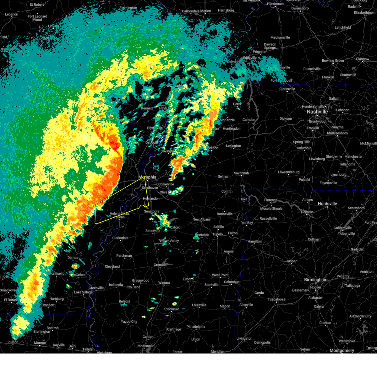 the severe thunderstorm warning has been cancelled and is no longer in effect the severe thunderstorm warning has been cancelled and is no longer in effect
|
| 4/5/2025 1:12 PM CDT |
 At 112 pm cdt, a severe thunderstorm was located over horseshoe lake, or 10 miles southeast of hughes, moving northeast at 80 mph (radar indicated). Hazards include 60 mph wind gusts and penny size hail. Expect damage to roofs, siding, and trees. Locations impacted include, cody, lake cormorant, haleside, commerce, louise, austin, edmondson, presidents island, beck, simsboro, glover, brickeys, ball point, whitehall, tongin, poplar grove, north tunica, hollywood, lost lake, and thomasville. At 112 pm cdt, a severe thunderstorm was located over horseshoe lake, or 10 miles southeast of hughes, moving northeast at 80 mph (radar indicated). Hazards include 60 mph wind gusts and penny size hail. Expect damage to roofs, siding, and trees. Locations impacted include, cody, lake cormorant, haleside, commerce, louise, austin, edmondson, presidents island, beck, simsboro, glover, brickeys, ball point, whitehall, tongin, poplar grove, north tunica, hollywood, lost lake, and thomasville.
|
| 4/5/2025 12:36 PM CDT |
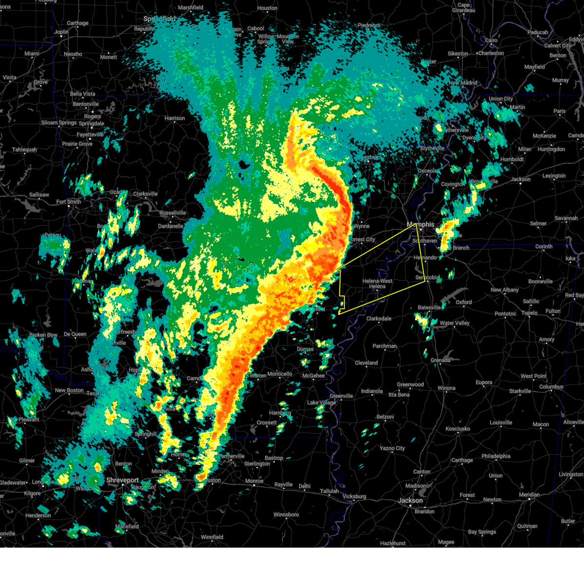 Svrmeg the national weather service in memphis has issued a * severe thunderstorm warning for, lee county in eastern arkansas, southeastern st. francis county in eastern arkansas, phillips county in eastern arkansas, southern crittenden county in eastern arkansas, western desoto county in northwestern mississippi, northern coahoma county in northwestern mississippi, tunica county in northwestern mississippi, western tate county in northwestern mississippi, southwestern shelby county in west tennessee, * until 130 pm cdt. * at 1236 pm cdt, a severe thunderstorm was located over palmer, or 9 miles northwest of marvell, moving northeast at 80 mph (radar indicated). Hazards include 60 mph wind gusts and quarter size hail. Hail damage to vehicles is expected. Expect wind damage to roofs, siding, and trees. Svrmeg the national weather service in memphis has issued a * severe thunderstorm warning for, lee county in eastern arkansas, southeastern st. francis county in eastern arkansas, phillips county in eastern arkansas, southern crittenden county in eastern arkansas, western desoto county in northwestern mississippi, northern coahoma county in northwestern mississippi, tunica county in northwestern mississippi, western tate county in northwestern mississippi, southwestern shelby county in west tennessee, * until 130 pm cdt. * at 1236 pm cdt, a severe thunderstorm was located over palmer, or 9 miles northwest of marvell, moving northeast at 80 mph (radar indicated). Hazards include 60 mph wind gusts and quarter size hail. Hail damage to vehicles is expected. Expect wind damage to roofs, siding, and trees.
|
| 4/3/2025 7:11 PM CDT |
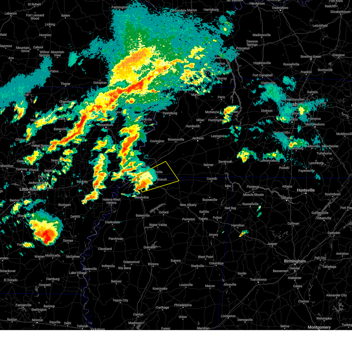 the severe thunderstorm warning has been cancelled and is no longer in effect the severe thunderstorm warning has been cancelled and is no longer in effect
|
| 4/3/2025 7:11 PM CDT |
 At 710 pm cdt, a severe thunderstorm was located over olive branch, moving northeast at 55 mph (radar indicated). Hazards include 60 mph wind gusts and quarter size hail. Hail damage to vehicles is expected. expect wind damage to roofs, siding, and trees. Locations impacted include, piperton, coal oil corner, ghost river state natural area, mt pleasant, cayce, cockrum, horn lake, cedarview, oakland, moscow, germantown, bright, nesbit, handy corner, warren, taska, capleville, kirk, jago, and rossville. At 710 pm cdt, a severe thunderstorm was located over olive branch, moving northeast at 55 mph (radar indicated). Hazards include 60 mph wind gusts and quarter size hail. Hail damage to vehicles is expected. expect wind damage to roofs, siding, and trees. Locations impacted include, piperton, coal oil corner, ghost river state natural area, mt pleasant, cayce, cockrum, horn lake, cedarview, oakland, moscow, germantown, bright, nesbit, handy corner, warren, taska, capleville, kirk, jago, and rossville.
|
| 4/3/2025 7:06 PM CDT | Quarter sized hail reported 2.7 miles WSW of Hernando, MS, jaybird road and byhalia road. |
| 4/3/2025 6:56 PM CDT |
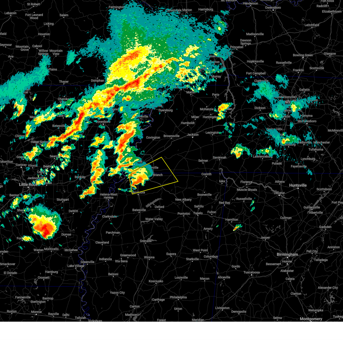 the severe thunderstorm warning has been cancelled and is no longer in effect the severe thunderstorm warning has been cancelled and is no longer in effect
|
| 4/3/2025 6:56 PM CDT |
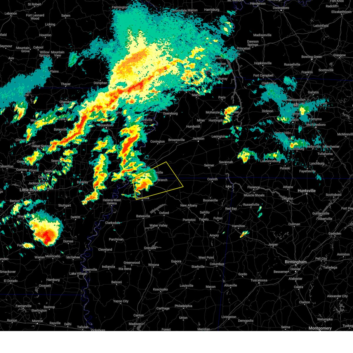 At 656 pm cdt, a severe thunderstorm was located over hernando, moving northeast at 55 mph (radar indicated). Hazards include 60 mph wind gusts and quarter size hail. Hail damage to vehicles is expected. expect wind damage to roofs, siding, and trees. Locations impacted include, ghost river state natural area, snow lake shores, mt pleasant, cayce, horn lake, watson, oakland, bright, taska, kirk, coldwater, rossville, robinson gin, fisherville, collierville, alden, macon, lurline, fairhaven, and twin lakes. At 656 pm cdt, a severe thunderstorm was located over hernando, moving northeast at 55 mph (radar indicated). Hazards include 60 mph wind gusts and quarter size hail. Hail damage to vehicles is expected. expect wind damage to roofs, siding, and trees. Locations impacted include, ghost river state natural area, snow lake shores, mt pleasant, cayce, horn lake, watson, oakland, bright, taska, kirk, coldwater, rossville, robinson gin, fisherville, collierville, alden, macon, lurline, fairhaven, and twin lakes.
|
| 4/3/2025 6:52 PM CDT |
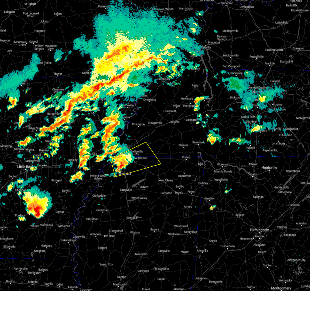 Svrmeg the national weather service in memphis has issued a * severe thunderstorm warning for, desoto county in northwestern mississippi, northern marshall county in northwestern mississippi, northeastern tunica county in northwestern mississippi, northern tate county in northwestern mississippi, northwestern benton county in northeastern mississippi, southwestern fayette county in west tennessee, southeastern shelby county in west tennessee, * until 730 pm cdt. * at 651 pm cdt, a severe thunderstorm was located over hernando, moving northeast at 55 mph (radar indicated). Hazards include 60 mph wind gusts and quarter size hail. Hail damage to vehicles is expected. Expect wind damage to roofs, siding, and trees. Svrmeg the national weather service in memphis has issued a * severe thunderstorm warning for, desoto county in northwestern mississippi, northern marshall county in northwestern mississippi, northeastern tunica county in northwestern mississippi, northern tate county in northwestern mississippi, northwestern benton county in northeastern mississippi, southwestern fayette county in west tennessee, southeastern shelby county in west tennessee, * until 730 pm cdt. * at 651 pm cdt, a severe thunderstorm was located over hernando, moving northeast at 55 mph (radar indicated). Hazards include 60 mph wind gusts and quarter size hail. Hail damage to vehicles is expected. Expect wind damage to roofs, siding, and trees.
|
| 4/3/2025 6:46 PM CDT |
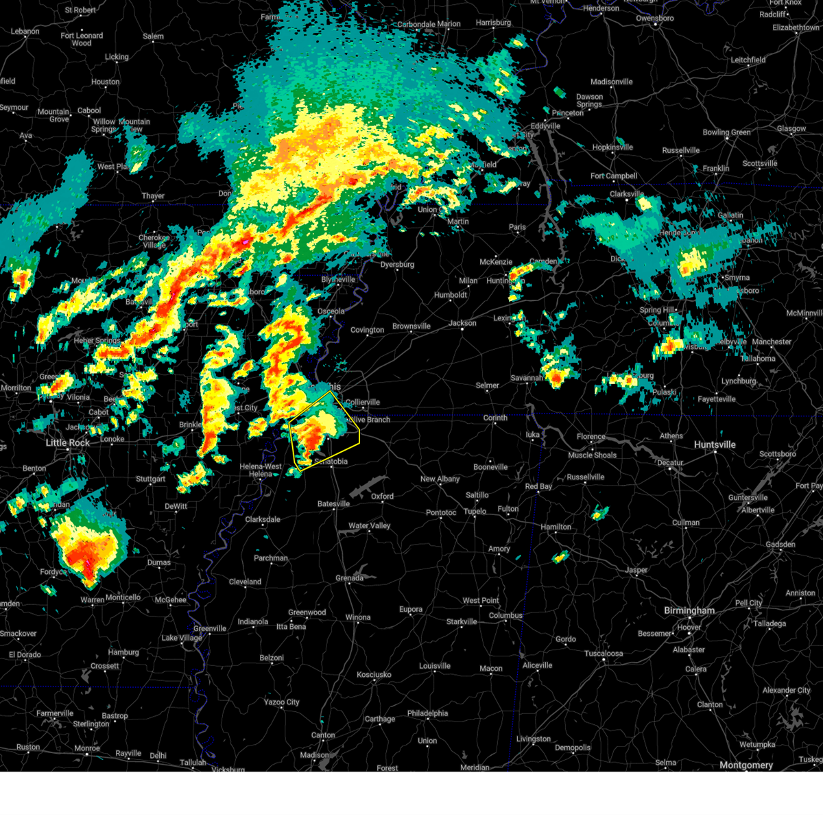 At 646 pm cdt, a severe thunderstorm was located near eudora, or 7 miles southwest of hernando, moving northeast at 55 mph (radar indicated). Hazards include ping pong ball size hail and 60 mph wind gusts. People and animals outdoors will be injured. expect hail damage to roofs, siding, windows, and vehicles. expect wind damage to roofs, siding, and trees. Locations impacted include, clack, trinity, lake cormorant, southwest memphis, savage, horn lake, bright, strayhorn, prichard, eudora, t o fuller state park, glover, memphis, robinson gin, alden, lurline, fairhaven, dooley, twin lakes, and lewisburg. At 646 pm cdt, a severe thunderstorm was located near eudora, or 7 miles southwest of hernando, moving northeast at 55 mph (radar indicated). Hazards include ping pong ball size hail and 60 mph wind gusts. People and animals outdoors will be injured. expect hail damage to roofs, siding, windows, and vehicles. expect wind damage to roofs, siding, and trees. Locations impacted include, clack, trinity, lake cormorant, southwest memphis, savage, horn lake, bright, strayhorn, prichard, eudora, t o fuller state park, glover, memphis, robinson gin, alden, lurline, fairhaven, dooley, twin lakes, and lewisburg.
|
| 4/3/2025 6:42 PM CDT |
 At 642 pm cdt, a severe thunderstorm was located over phillipp, or 11 miles southwest of hernando, moving northeast at 45 mph (radar indicated). Hazards include 60 mph wind gusts and quarter size hail. Hail damage to vehicles is expected. expect wind damage to roofs, siding, and trees. Locations impacted include, clack, trinity, lake cormorant, southwest memphis, savage, horn lake, bright, strayhorn, prichard, eudora, t o fuller state park, glover, memphis, robinson gin, alden, lurline, fairhaven, dooley, twin lakes, and lewisburg. At 642 pm cdt, a severe thunderstorm was located over phillipp, or 11 miles southwest of hernando, moving northeast at 45 mph (radar indicated). Hazards include 60 mph wind gusts and quarter size hail. Hail damage to vehicles is expected. expect wind damage to roofs, siding, and trees. Locations impacted include, clack, trinity, lake cormorant, southwest memphis, savage, horn lake, bright, strayhorn, prichard, eudora, t o fuller state park, glover, memphis, robinson gin, alden, lurline, fairhaven, dooley, twin lakes, and lewisburg.
|
| 4/3/2025 6:42 PM CDT |
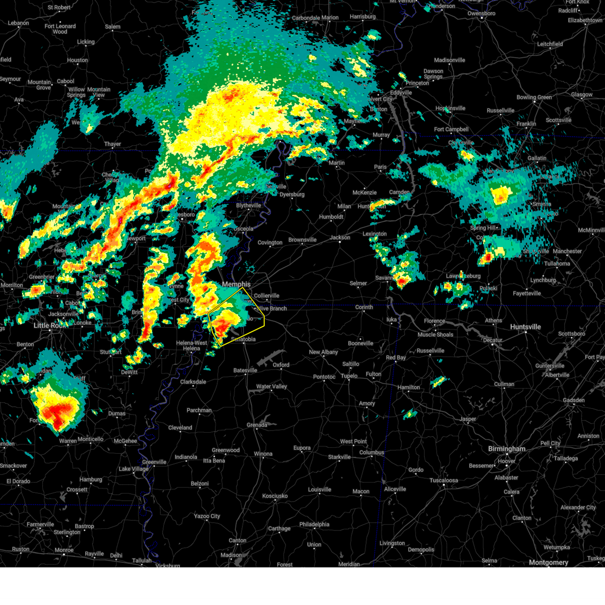 the severe thunderstorm warning has been cancelled and is no longer in effect the severe thunderstorm warning has been cancelled and is no longer in effect
|
| 4/3/2025 6:30 PM CDT |
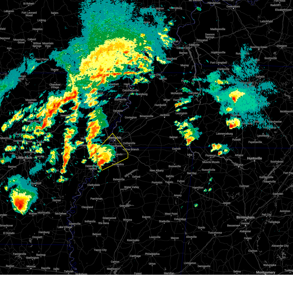 At 630 pm cdt, a severe thunderstorm was located near robinsonville, or 16 miles west of hernando, moving northeast at 55 mph (radar indicated). Hazards include 60 mph wind gusts and quarter size hail. Hail damage to vehicles is expected. expect wind damage to roofs, siding, and trees. Locations impacted include, tunica, hughes, clack, trinity, lake cormorant, southwest memphis, savage, horn lake, commerce, louise, west memphis, austin, bright, edmondson, st clair, strayhorn, prichard, presidents island, beck, and eudora. At 630 pm cdt, a severe thunderstorm was located near robinsonville, or 16 miles west of hernando, moving northeast at 55 mph (radar indicated). Hazards include 60 mph wind gusts and quarter size hail. Hail damage to vehicles is expected. expect wind damage to roofs, siding, and trees. Locations impacted include, tunica, hughes, clack, trinity, lake cormorant, southwest memphis, savage, horn lake, commerce, louise, west memphis, austin, bright, edmondson, st clair, strayhorn, prichard, presidents island, beck, and eudora.
|
| 4/3/2025 6:21 PM CDT |
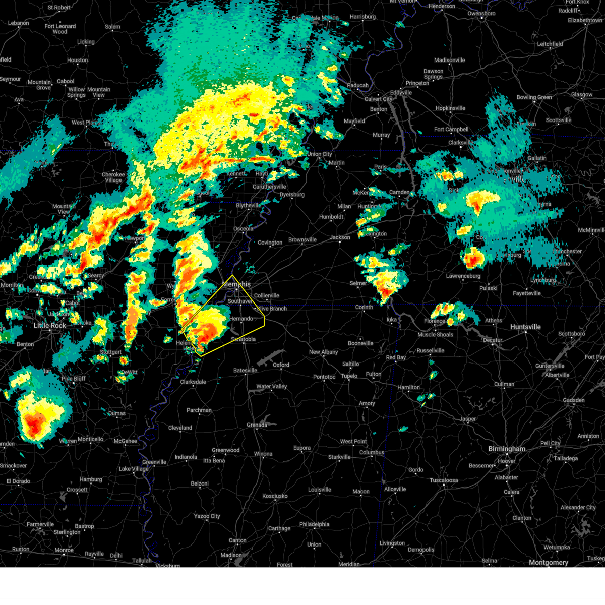 the severe thunderstorm warning has been cancelled and is no longer in effect the severe thunderstorm warning has been cancelled and is no longer in effect
|
| 4/3/2025 6:21 PM CDT |
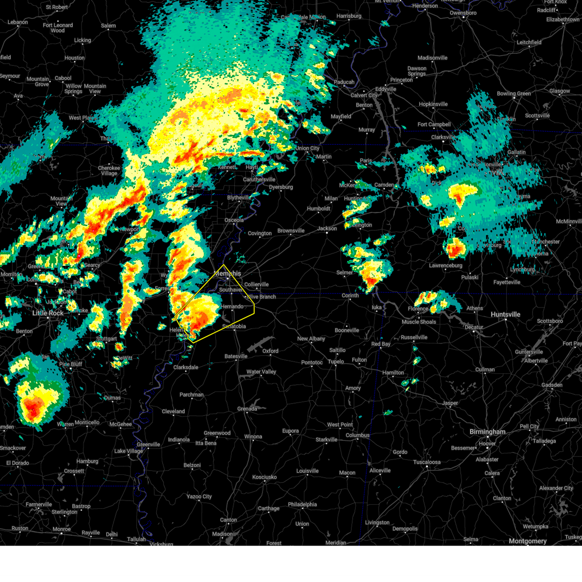 At 621 pm cdt, a severe thunderstorm was located over north tunica, or 15 miles northeast of st francis national park, moving northeast at 55 mph (radar indicated). Hazards include 60 mph wind gusts and quarter size hail. Hail damage to vehicles is expected. expect wind damage to roofs, siding, and trees. Locations impacted include, lake cormorant, southwest memphis, savage, horn lake, haleside, commerce, louise, austin, bright, edmondson, st clair, strayhorn, prichard, presidents island, beck, simsboro, dubbs, glover, brickeys, and whitehall. At 621 pm cdt, a severe thunderstorm was located over north tunica, or 15 miles northeast of st francis national park, moving northeast at 55 mph (radar indicated). Hazards include 60 mph wind gusts and quarter size hail. Hail damage to vehicles is expected. expect wind damage to roofs, siding, and trees. Locations impacted include, lake cormorant, southwest memphis, savage, horn lake, haleside, commerce, louise, austin, bright, edmondson, st clair, strayhorn, prichard, presidents island, beck, simsboro, dubbs, glover, brickeys, and whitehall.
|
| 4/3/2025 6:15 PM CDT |
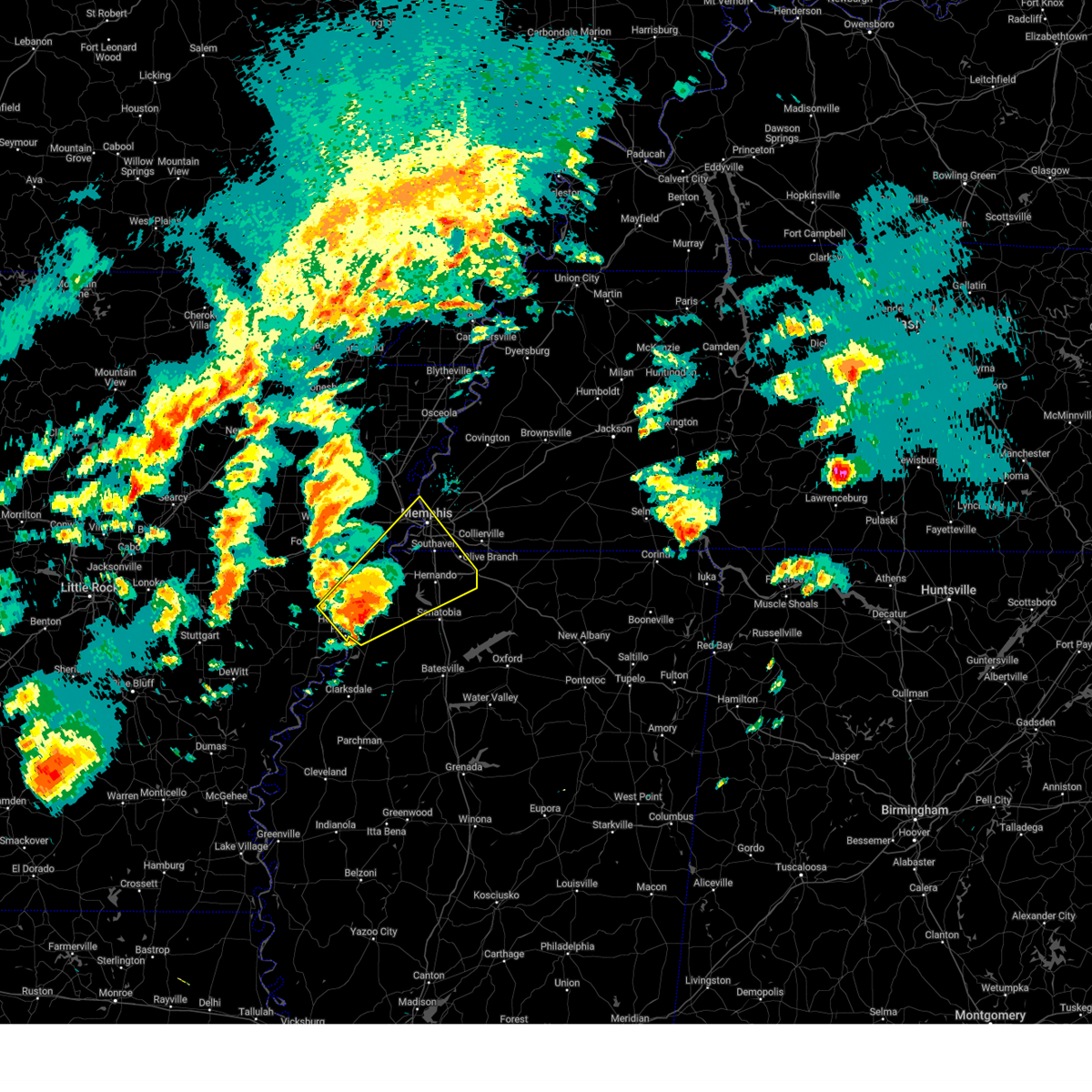 Svrmeg the national weather service in memphis has issued a * severe thunderstorm warning for, eastern lee county in eastern arkansas, southeastern st. francis county in eastern arkansas, northeastern phillips county in eastern arkansas, southern crittenden county in eastern arkansas, desoto county in northwestern mississippi, tunica county in northwestern mississippi, northwestern tate county in northwestern mississippi, southwestern shelby county in west tennessee, * until 700 pm cdt. * at 615 pm cdt, a severe thunderstorm was located near tunica, or 10 miles northeast of st francis national park, moving northeast at 55 mph (radar indicated). Hazards include 60 mph wind gusts and half dollar size hail. Hail damage to vehicles is expected. Expect wind damage to roofs, siding, and trees. Svrmeg the national weather service in memphis has issued a * severe thunderstorm warning for, eastern lee county in eastern arkansas, southeastern st. francis county in eastern arkansas, northeastern phillips county in eastern arkansas, southern crittenden county in eastern arkansas, desoto county in northwestern mississippi, tunica county in northwestern mississippi, northwestern tate county in northwestern mississippi, southwestern shelby county in west tennessee, * until 700 pm cdt. * at 615 pm cdt, a severe thunderstorm was located near tunica, or 10 miles northeast of st francis national park, moving northeast at 55 mph (radar indicated). Hazards include 60 mph wind gusts and half dollar size hail. Hail damage to vehicles is expected. Expect wind damage to roofs, siding, and trees.
|
| 4/3/2025 2:05 PM CDT |
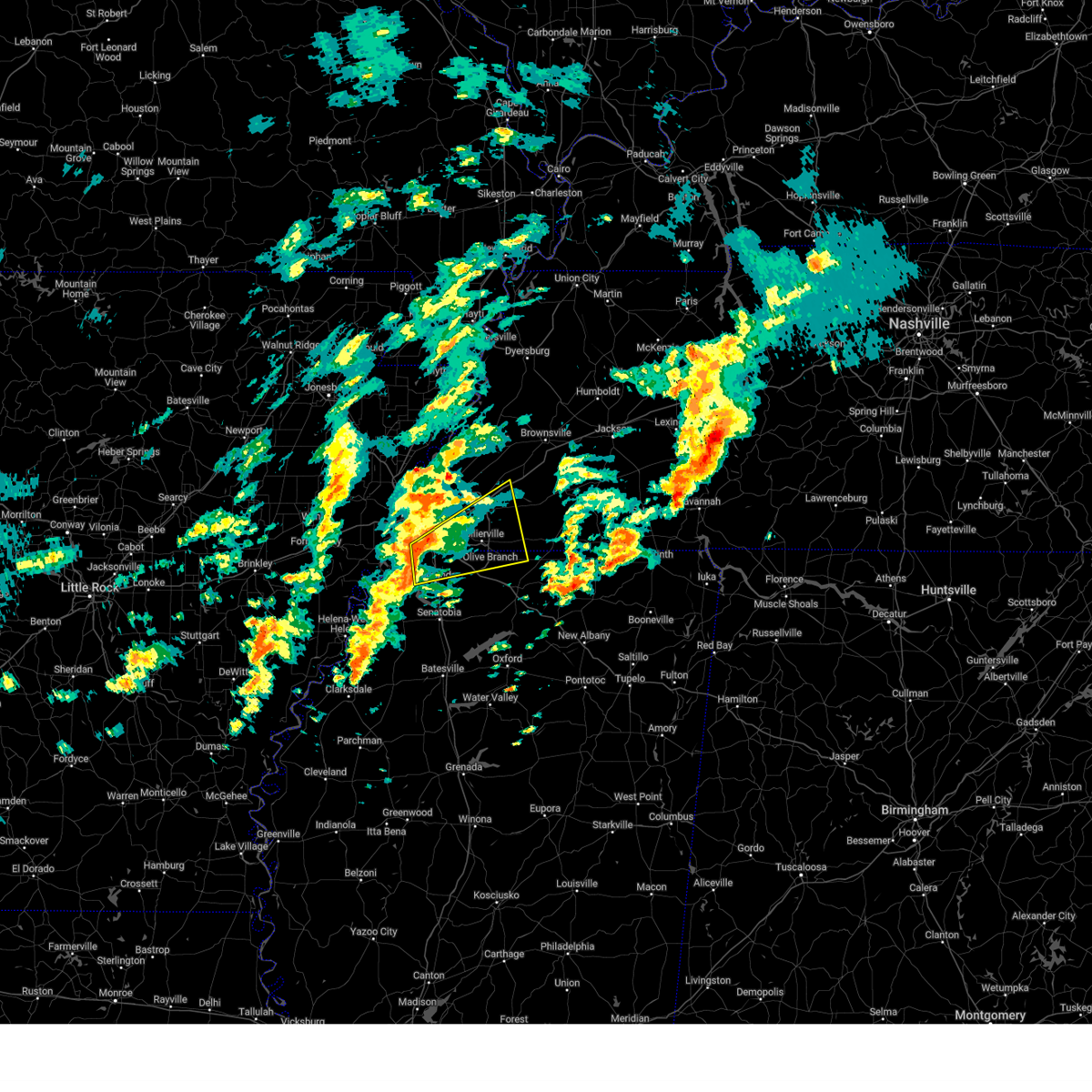 Svrmeg the national weather service in memphis has issued a * severe thunderstorm warning for, northeastern desoto county in northwestern mississippi, northwestern marshall county in northwestern mississippi, western fayette county in west tennessee, southeastern shelby county in west tennessee, * until 245 pm cdt. * at 205 pm cdt, a severe thunderstorm was located over horn lake, moving northeast at 55 mph (radar indicated). Hazards include 60 mph wind gusts and quarter size hail. Hail damage to vehicles is expected. Expect wind damage to roofs, siding, and trees. Svrmeg the national weather service in memphis has issued a * severe thunderstorm warning for, northeastern desoto county in northwestern mississippi, northwestern marshall county in northwestern mississippi, western fayette county in west tennessee, southeastern shelby county in west tennessee, * until 245 pm cdt. * at 205 pm cdt, a severe thunderstorm was located over horn lake, moving northeast at 55 mph (radar indicated). Hazards include 60 mph wind gusts and quarter size hail. Hail damage to vehicles is expected. Expect wind damage to roofs, siding, and trees.
|
| 4/3/2025 1:21 AM CDT |
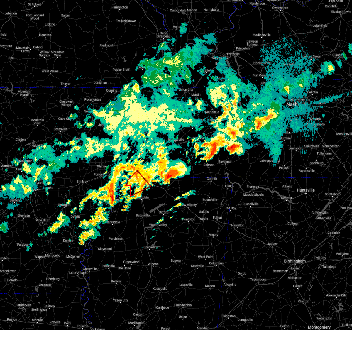 The storm which prompted the warning has weakened below severe limits, and no longer appears capable of producing a tornado. therefore, the warning will be allowed to expire. a tornado watch remains in effect until 600 am cdt for northwestern mississippi. The storm which prompted the warning has weakened below severe limits, and no longer appears capable of producing a tornado. therefore, the warning will be allowed to expire. a tornado watch remains in effect until 600 am cdt for northwestern mississippi.
|
| 4/3/2025 1:05 AM CDT |
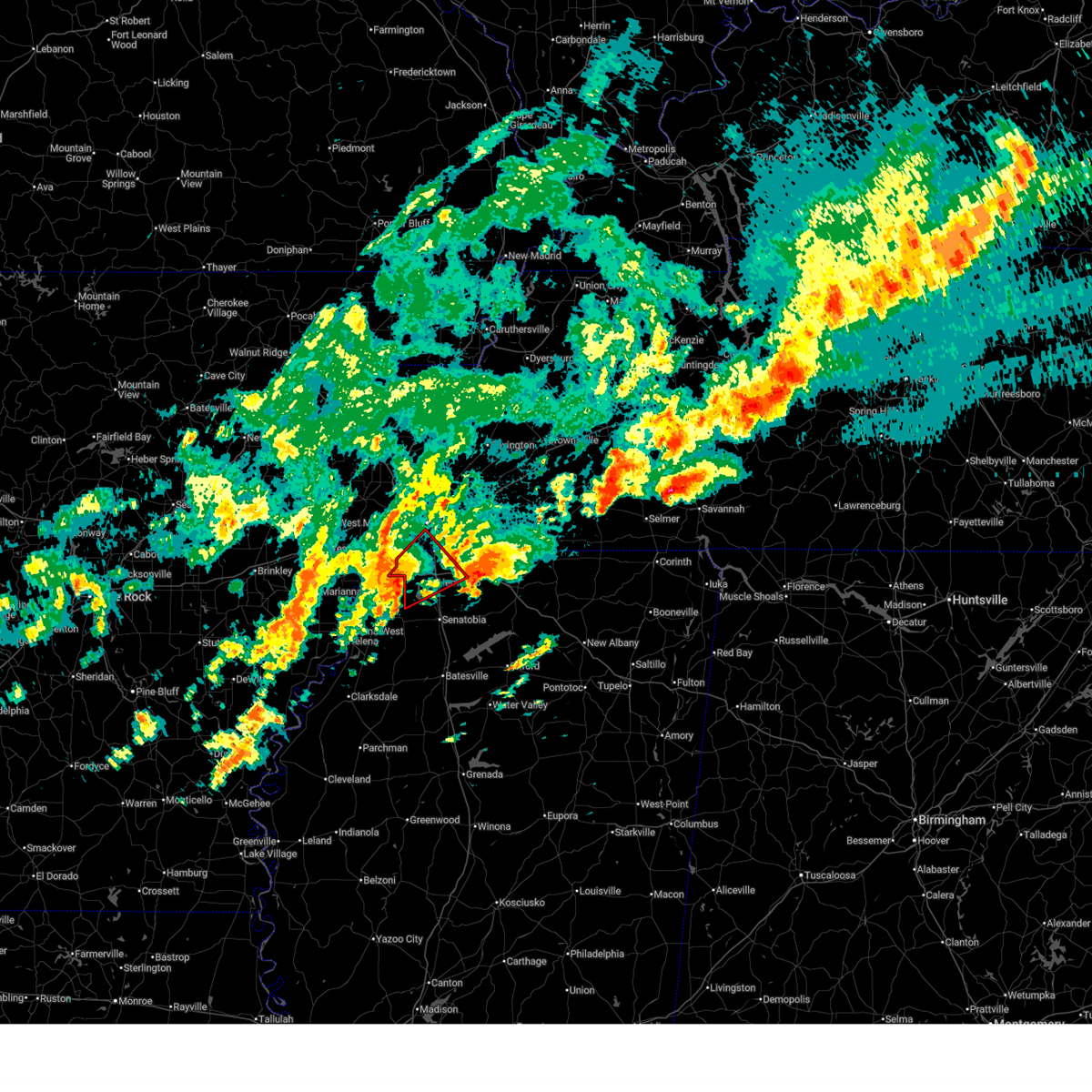 At 104 am cdt, a severe thunderstorm capable of producing a tornado was located over eudora, or 8 miles west of hernando, moving northeast at 50 mph (radar indicated rotation). Hazards include tornado. Flying debris will be dangerous to those caught without shelter. mobile homes will be damaged or destroyed. damage to roofs, windows, and vehicles will occur. tree damage is likely. Locations impacted include, newport, trinity, lake cormorant, southwest memphis, horn lake, frees corners, lynchburg, bright, nesbit, phillipp, eudora, t o fuller state park, glover, jago, robinson gin, alden, twin lakes, lewisburg, whitehaven, and southaven. At 104 am cdt, a severe thunderstorm capable of producing a tornado was located over eudora, or 8 miles west of hernando, moving northeast at 50 mph (radar indicated rotation). Hazards include tornado. Flying debris will be dangerous to those caught without shelter. mobile homes will be damaged or destroyed. damage to roofs, windows, and vehicles will occur. tree damage is likely. Locations impacted include, newport, trinity, lake cormorant, southwest memphis, horn lake, frees corners, lynchburg, bright, nesbit, phillipp, eudora, t o fuller state park, glover, jago, robinson gin, alden, twin lakes, lewisburg, whitehaven, and southaven.
|
| 4/3/2025 1:05 AM CDT |
 the tornado warning has been cancelled and is no longer in effect the tornado warning has been cancelled and is no longer in effect
|
| 4/3/2025 12:50 AM CDT |
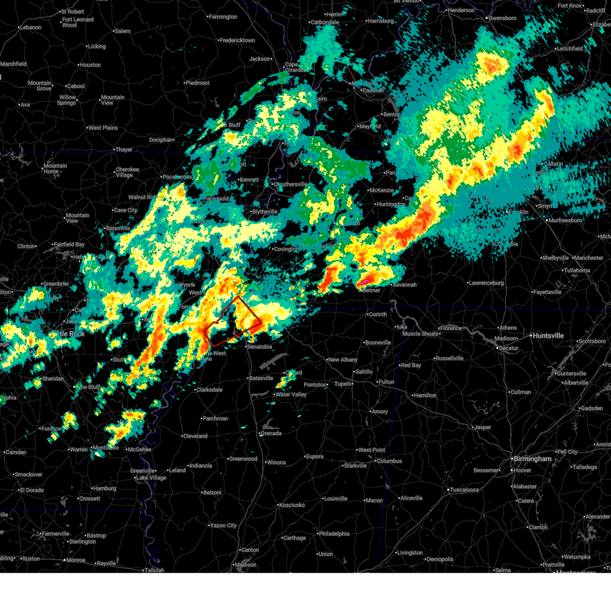 Tormeg the national weather service in memphis has issued a * tornado warning for, desoto county in northwestern mississippi, northeastern tunica county in northwestern mississippi, northwestern tate county in northwestern mississippi, south central shelby county in west tennessee, * until 130 am cdt. * at 1250 am cdt, a severe thunderstorm capable of producing a tornado was located over north tunica, or 16 miles southeast of hughes, moving northeast at 40 mph (radar indicated rotation). Hazards include tornado. Flying debris will be dangerous to those caught without shelter. mobile homes will be damaged or destroyed. damage to roofs, windows, and vehicles will occur. Tree damage is likely. Tormeg the national weather service in memphis has issued a * tornado warning for, desoto county in northwestern mississippi, northeastern tunica county in northwestern mississippi, northwestern tate county in northwestern mississippi, south central shelby county in west tennessee, * until 130 am cdt. * at 1250 am cdt, a severe thunderstorm capable of producing a tornado was located over north tunica, or 16 miles southeast of hughes, moving northeast at 40 mph (radar indicated rotation). Hazards include tornado. Flying debris will be dangerous to those caught without shelter. mobile homes will be damaged or destroyed. damage to roofs, windows, and vehicles will occur. Tree damage is likely.
|
| 4/3/2025 12:33 AM CDT |
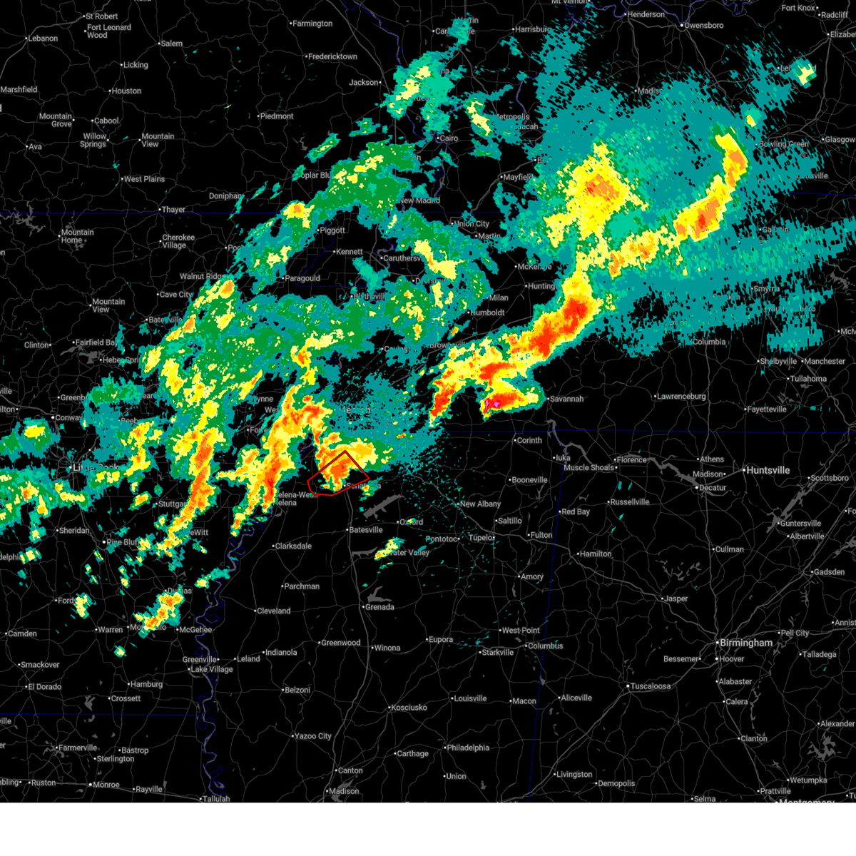 At 1232 am cdt, a confirmed large and extremely dangerous tornado was located over coldwater, or near senatobia, moving northeast at 50 mph. this is a particularly dangerous situation. take cover now! (radar confirmed tornado). Hazards include damaging tornado. You are in a life-threatening situation. flying debris may be deadly to those caught without shelter. mobile homes will be destroyed. considerable damage to homes, businesses, and vehicles is likely and complete destruction is possible. Locations impacted include, robinson gin, lurline, dooley, alphaba, savage, independence, senatobia, arkabutla, strayhorn, sarah, love, coldwater, poagville, new town, bluff, cypress corner, and hernando. At 1232 am cdt, a confirmed large and extremely dangerous tornado was located over coldwater, or near senatobia, moving northeast at 50 mph. this is a particularly dangerous situation. take cover now! (radar confirmed tornado). Hazards include damaging tornado. You are in a life-threatening situation. flying debris may be deadly to those caught without shelter. mobile homes will be destroyed. considerable damage to homes, businesses, and vehicles is likely and complete destruction is possible. Locations impacted include, robinson gin, lurline, dooley, alphaba, savage, independence, senatobia, arkabutla, strayhorn, sarah, love, coldwater, poagville, new town, bluff, cypress corner, and hernando.
|
| 4/3/2025 12:27 AM CDT |
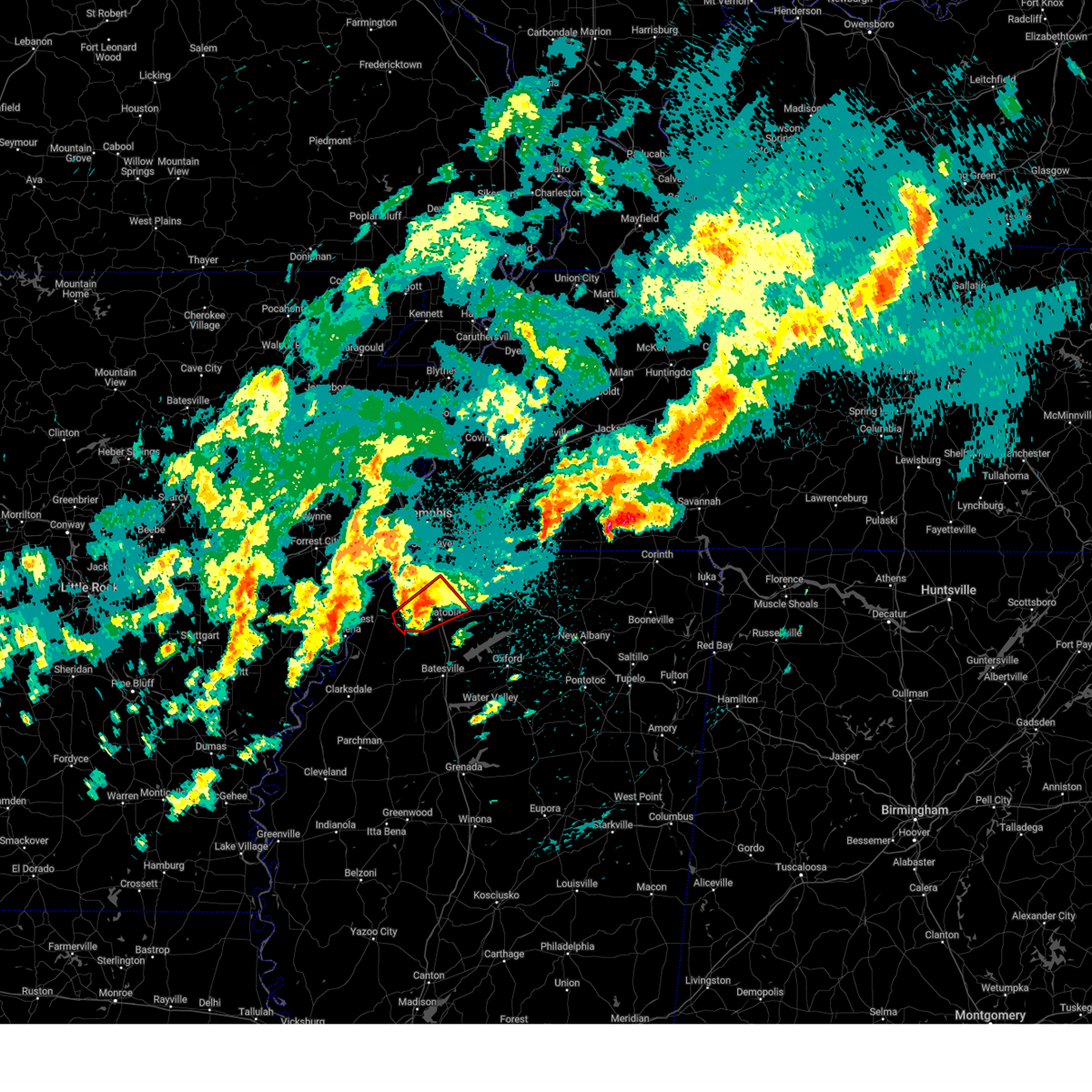 the tornado warning has been cancelled and is no longer in effect the tornado warning has been cancelled and is no longer in effect
|
| 4/3/2025 12:27 AM CDT |
 At 1226 am cdt, a severe thunderstorm capable of producing a tornado was located near strayhorn, or near senatobia, moving northeast at 50 mph (radar indicated rotation). Hazards include tornado and quarter size hail. Flying debris will be dangerous to those caught without shelter. mobile homes will be damaged or destroyed. damage to roofs, windows, and vehicles will occur. tree damage is likely. Locations impacted include, robinson gin, lurline, dooley, alphaba, savage, independence, senatobia, arkabutla, strayhorn, sarah, love, coldwater, poagville, new town, bluff, cypress corner, and hernando. At 1226 am cdt, a severe thunderstorm capable of producing a tornado was located near strayhorn, or near senatobia, moving northeast at 50 mph (radar indicated rotation). Hazards include tornado and quarter size hail. Flying debris will be dangerous to those caught without shelter. mobile homes will be damaged or destroyed. damage to roofs, windows, and vehicles will occur. tree damage is likely. Locations impacted include, robinson gin, lurline, dooley, alphaba, savage, independence, senatobia, arkabutla, strayhorn, sarah, love, coldwater, poagville, new town, bluff, cypress corner, and hernando.
|
| 4/3/2025 12:21 AM CDT |
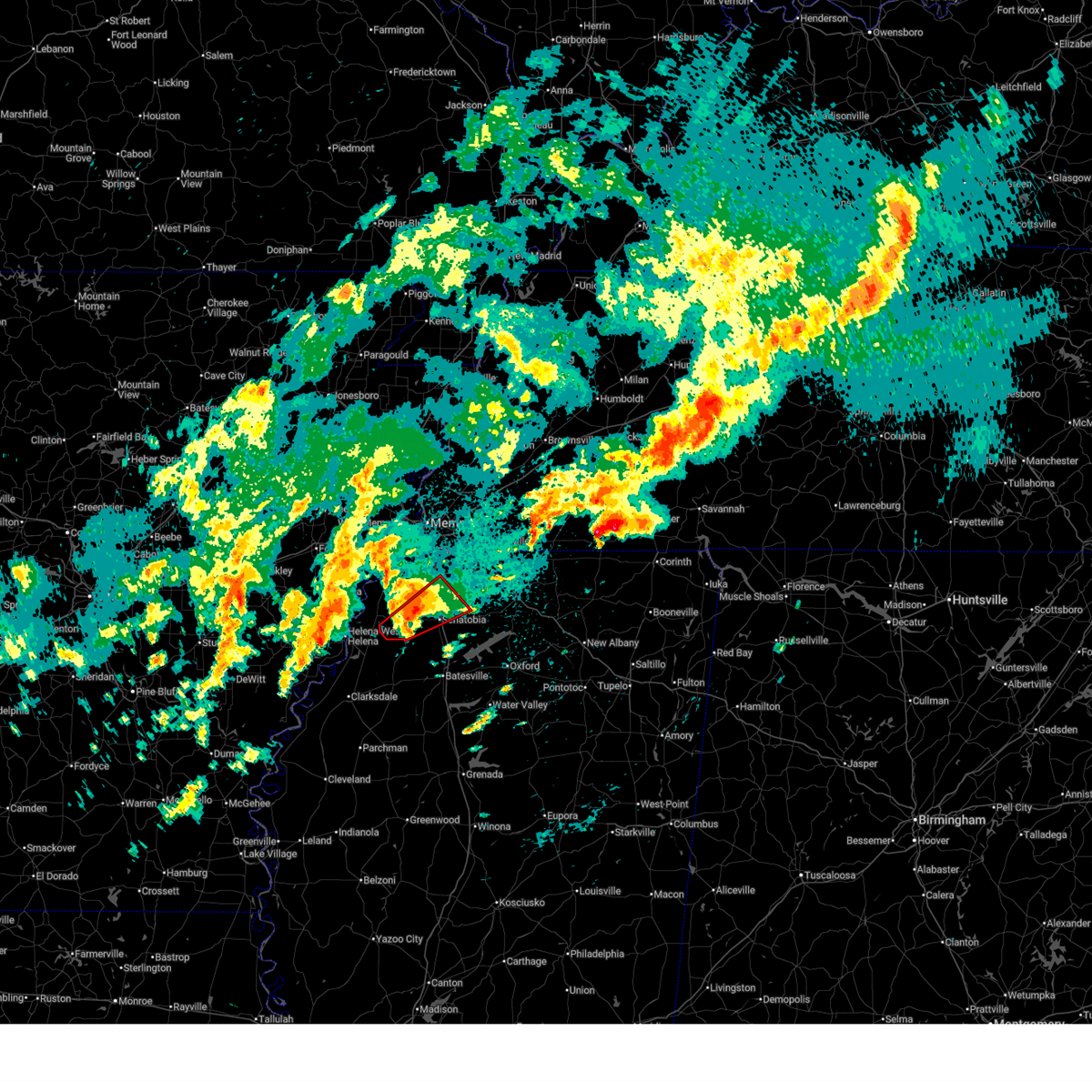 At 1221 am cdt, a severe thunderstorm capable of producing a tornado was located over strayhorn, or 10 miles west of senatobia, moving northeast at 50 mph (radar indicated rotation). Hazards include tornado and quarter size hail. Flying debris will be dangerous to those caught without shelter. mobile homes will be damaged or destroyed. damage to roofs, windows, and vehicles will occur. tree damage is likely. Locations impacted include, robinson gin, askew, lurline, dooley, alphaba, buxton, savage, independence, senatobia, arkabutla, crenshaw, strayhorn, sarah, love, coldwater, poagville, little texas, new town, cypress corner, and bluff. At 1221 am cdt, a severe thunderstorm capable of producing a tornado was located over strayhorn, or 10 miles west of senatobia, moving northeast at 50 mph (radar indicated rotation). Hazards include tornado and quarter size hail. Flying debris will be dangerous to those caught without shelter. mobile homes will be damaged or destroyed. damage to roofs, windows, and vehicles will occur. tree damage is likely. Locations impacted include, robinson gin, askew, lurline, dooley, alphaba, buxton, savage, independence, senatobia, arkabutla, crenshaw, strayhorn, sarah, love, coldwater, poagville, little texas, new town, cypress corner, and bluff.
|
| 4/3/2025 12:03 AM CDT |
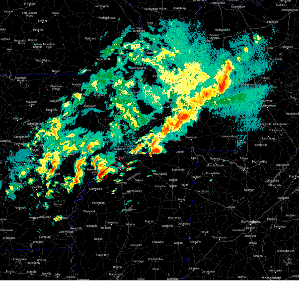 Tormeg the national weather service in memphis has issued a * tornado warning for, south central desoto county in northwestern mississippi, southeastern tunica county in northwestern mississippi, tate county in northwestern mississippi, northwestern panola county in northwestern mississippi, * until 1245 am cdt. * at 1203 am cdt, a severe thunderstorm capable of producing a tornado was located near dundee, or 14 miles east of helena-west helena, moving northeast at 50 mph (radar indicated rotation). Hazards include tornado and quarter size hail. Flying debris will be dangerous to those caught without shelter. mobile homes will be damaged or destroyed. damage to roofs, windows, and vehicles will occur. Tree damage is likely. Tormeg the national weather service in memphis has issued a * tornado warning for, south central desoto county in northwestern mississippi, southeastern tunica county in northwestern mississippi, tate county in northwestern mississippi, northwestern panola county in northwestern mississippi, * until 1245 am cdt. * at 1203 am cdt, a severe thunderstorm capable of producing a tornado was located near dundee, or 14 miles east of helena-west helena, moving northeast at 50 mph (radar indicated rotation). Hazards include tornado and quarter size hail. Flying debris will be dangerous to those caught without shelter. mobile homes will be damaged or destroyed. damage to roofs, windows, and vehicles will occur. Tree damage is likely.
|
| 4/2/2025 10:33 PM CDT |
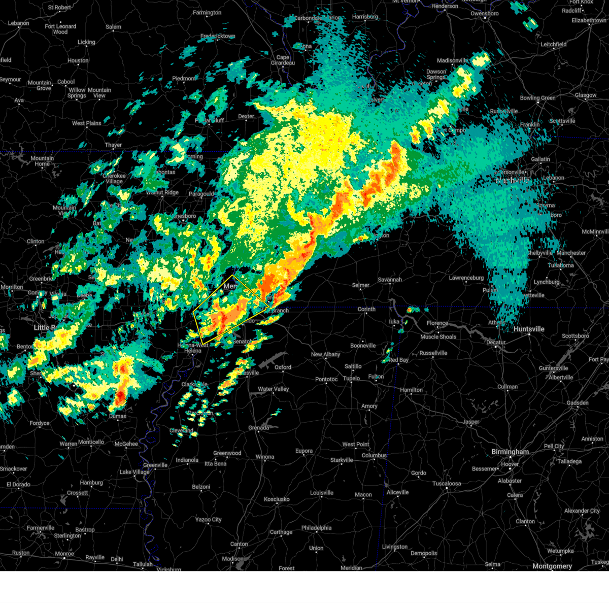 At 1033 pm cdt, a severe thunderstorm was located over walls, or 7 miles southwest of t o fuller state park, moving northeast at 65 mph (radar indicated). Hazards include 60 mph wind gusts and quarter size hail. Hail damage to vehicles is expected. expect wind damage to roofs, siding, and trees. Locations impacted include, tunica, hughes, clack, trinity, lake cormorant, southwest memphis, browns, horn lake, commerce, louise, west memphis, austin, edmondson, st clair, presidents island, beck, eudora, simsboro, democrat, and t o fuller state park. At 1033 pm cdt, a severe thunderstorm was located over walls, or 7 miles southwest of t o fuller state park, moving northeast at 65 mph (radar indicated). Hazards include 60 mph wind gusts and quarter size hail. Hail damage to vehicles is expected. expect wind damage to roofs, siding, and trees. Locations impacted include, tunica, hughes, clack, trinity, lake cormorant, southwest memphis, browns, horn lake, commerce, louise, west memphis, austin, edmondson, st clair, presidents island, beck, eudora, simsboro, democrat, and t o fuller state park.
|
| 4/2/2025 10:17 PM CDT |
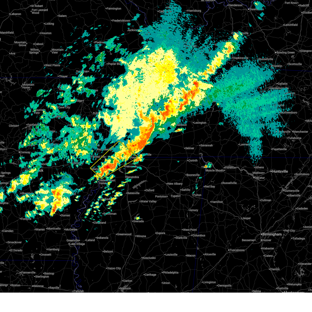 At 1017 pm cdt, a severe thunderstorm was located near robinsonville, or 9 miles south of hughes, moving northeast at 65 mph (radar indicated). Hazards include ping pong ball size hail and 60 mph wind gusts. People and animals outdoors will be injured. expect hail damage to roofs, siding, windows, and vehicles. expect wind damage to roofs, siding, and trees. Locations impacted include, cody, lake cormorant, southwest memphis, browns, horn lake, haleside, commerce, louise, austin, edmondson, st clair, presidents island, beck, simsboro, glover, brickeys, ball point, whitehall, tongin, and alden. At 1017 pm cdt, a severe thunderstorm was located near robinsonville, or 9 miles south of hughes, moving northeast at 65 mph (radar indicated). Hazards include ping pong ball size hail and 60 mph wind gusts. People and animals outdoors will be injured. expect hail damage to roofs, siding, windows, and vehicles. expect wind damage to roofs, siding, and trees. Locations impacted include, cody, lake cormorant, southwest memphis, browns, horn lake, haleside, commerce, louise, austin, edmondson, st clair, presidents island, beck, simsboro, glover, brickeys, ball point, whitehall, tongin, and alden.
|
| 4/2/2025 10:13 PM CDT |
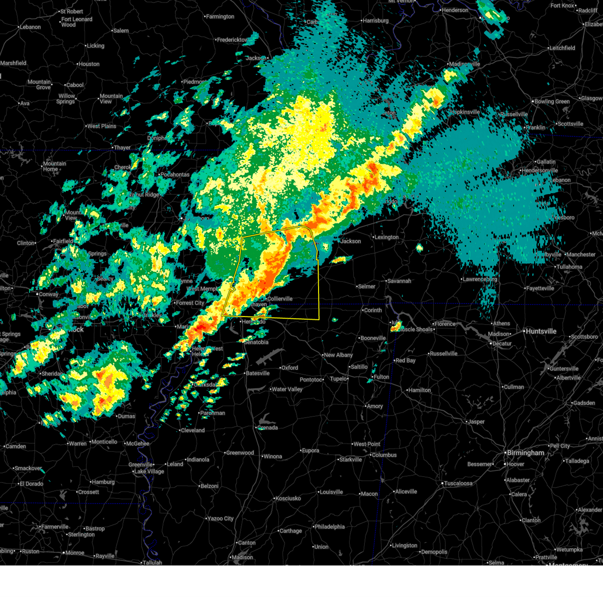 the severe thunderstorm warning has been cancelled and is no longer in effect the severe thunderstorm warning has been cancelled and is no longer in effect
|
| 4/2/2025 10:13 PM CDT |
 At 1013 pm cdt, a severe thunderstorm was located 10 miles northwest of somerville, or 17 miles southeast of covington, moving east at 65 mph (radar indicated). Hazards include 70 mph wind gusts and half dollar size hail. Hail damage to vehicles is expected. expect considerable tree damage. wind damage is also likely to mobile homes, roofs, and outbuildings. Locations impacted include, ghost river state natural area, brody, yum yum, burlison, southwest memphis, stanton, horn lake, belmont, christmasville, covington, kirk, glover, atoka, locke, rossville, arlington, elmore park, brunswick, laconia, and alden. At 1013 pm cdt, a severe thunderstorm was located 10 miles northwest of somerville, or 17 miles southeast of covington, moving east at 65 mph (radar indicated). Hazards include 70 mph wind gusts and half dollar size hail. Hail damage to vehicles is expected. expect considerable tree damage. wind damage is also likely to mobile homes, roofs, and outbuildings. Locations impacted include, ghost river state natural area, brody, yum yum, burlison, southwest memphis, stanton, horn lake, belmont, christmasville, covington, kirk, glover, atoka, locke, rossville, arlington, elmore park, brunswick, laconia, and alden.
|
| 4/2/2025 10:09 PM CDT |
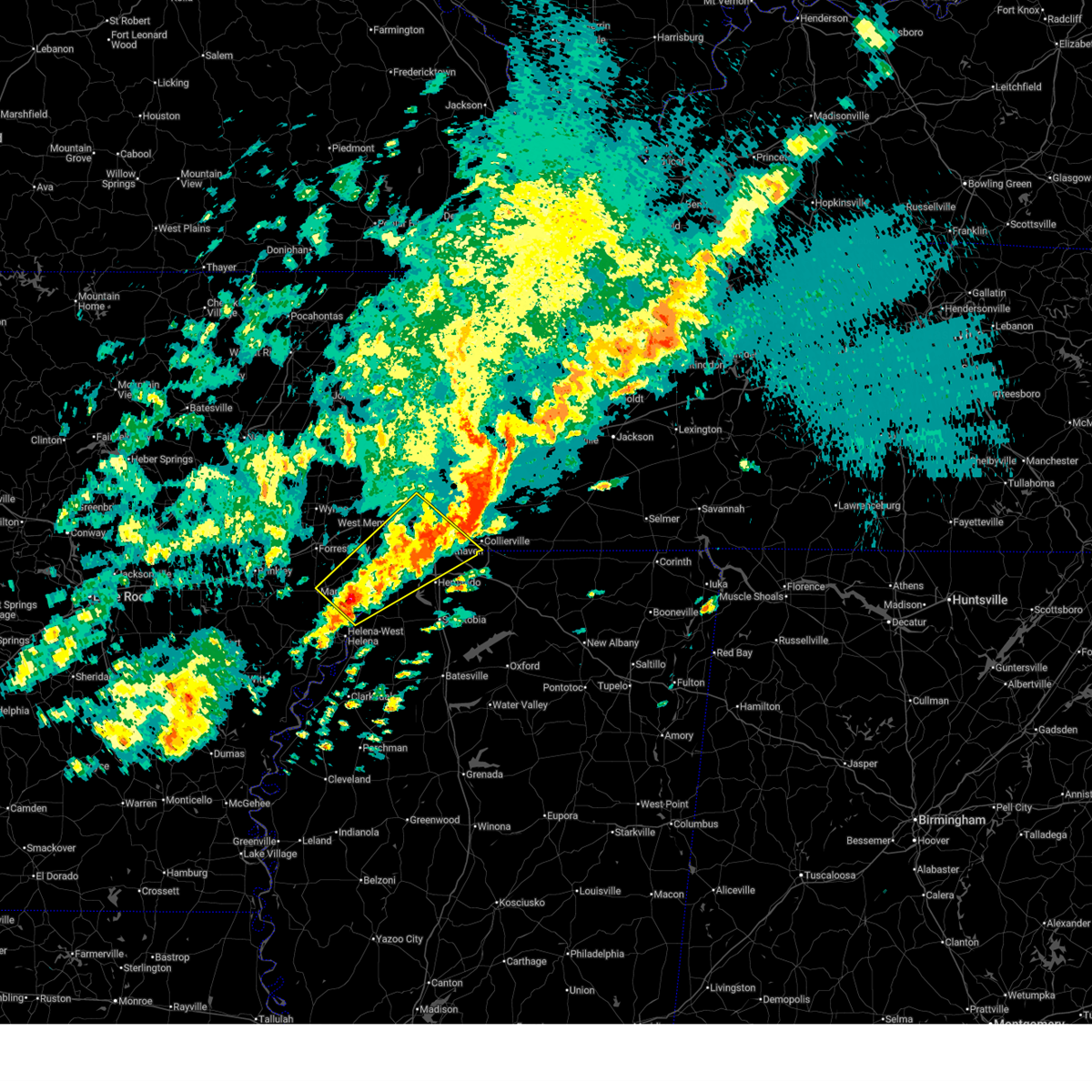 Svrmeg the national weather service in memphis has issued a * severe thunderstorm warning for, eastern lee county in eastern arkansas, southeastern st. francis county in eastern arkansas, central crittenden county in eastern arkansas, northwestern desoto county in northwestern mississippi, northern tunica county in northwestern mississippi, southwestern shelby county in west tennessee, * until 1100 pm cdt. * at 1009 pm cdt, a severe thunderstorm was located 7 miles south of brickeys, or 12 miles north of st francis national park, moving northeast at 65 mph (radar indicated). Hazards include ping pong ball size hail and 60 mph wind gusts. People and animals outdoors will be injured. expect hail damage to roofs, siding, windows, and vehicles. Expect wind damage to roofs, siding, and trees. Svrmeg the national weather service in memphis has issued a * severe thunderstorm warning for, eastern lee county in eastern arkansas, southeastern st. francis county in eastern arkansas, central crittenden county in eastern arkansas, northwestern desoto county in northwestern mississippi, northern tunica county in northwestern mississippi, southwestern shelby county in west tennessee, * until 1100 pm cdt. * at 1009 pm cdt, a severe thunderstorm was located 7 miles south of brickeys, or 12 miles north of st francis national park, moving northeast at 65 mph (radar indicated). Hazards include ping pong ball size hail and 60 mph wind gusts. People and animals outdoors will be injured. expect hail damage to roofs, siding, windows, and vehicles. Expect wind damage to roofs, siding, and trees.
|
| 4/2/2025 9:56 PM CDT |
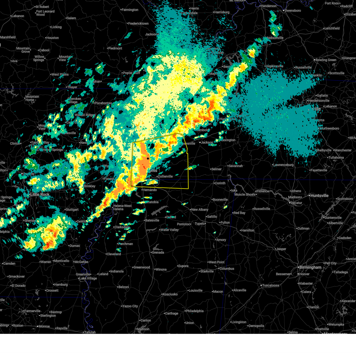 At 956 pm cdt, a severe thunderstorm was located near ellendale, or near millington, moving east at 65 mph (radar indicated). Hazards include 60 mph wind gusts and half dollar size hail. Hail damage to vehicles is expected. expect wind damage to roofs, siding, and trees. Locations impacted include, ghost river state natural area, burlison, stanton, horn lake, covington, presidents island, kirk, glover, locke, arlington, elmore park, laconia, alden, hudsonville, sunnyhill, durhamville, gilestown, clopton, asbury, and mound city. At 956 pm cdt, a severe thunderstorm was located near ellendale, or near millington, moving east at 65 mph (radar indicated). Hazards include 60 mph wind gusts and half dollar size hail. Hail damage to vehicles is expected. expect wind damage to roofs, siding, and trees. Locations impacted include, ghost river state natural area, burlison, stanton, horn lake, covington, presidents island, kirk, glover, locke, arlington, elmore park, laconia, alden, hudsonville, sunnyhill, durhamville, gilestown, clopton, asbury, and mound city.
|
| 4/2/2025 9:54 PM CDT |
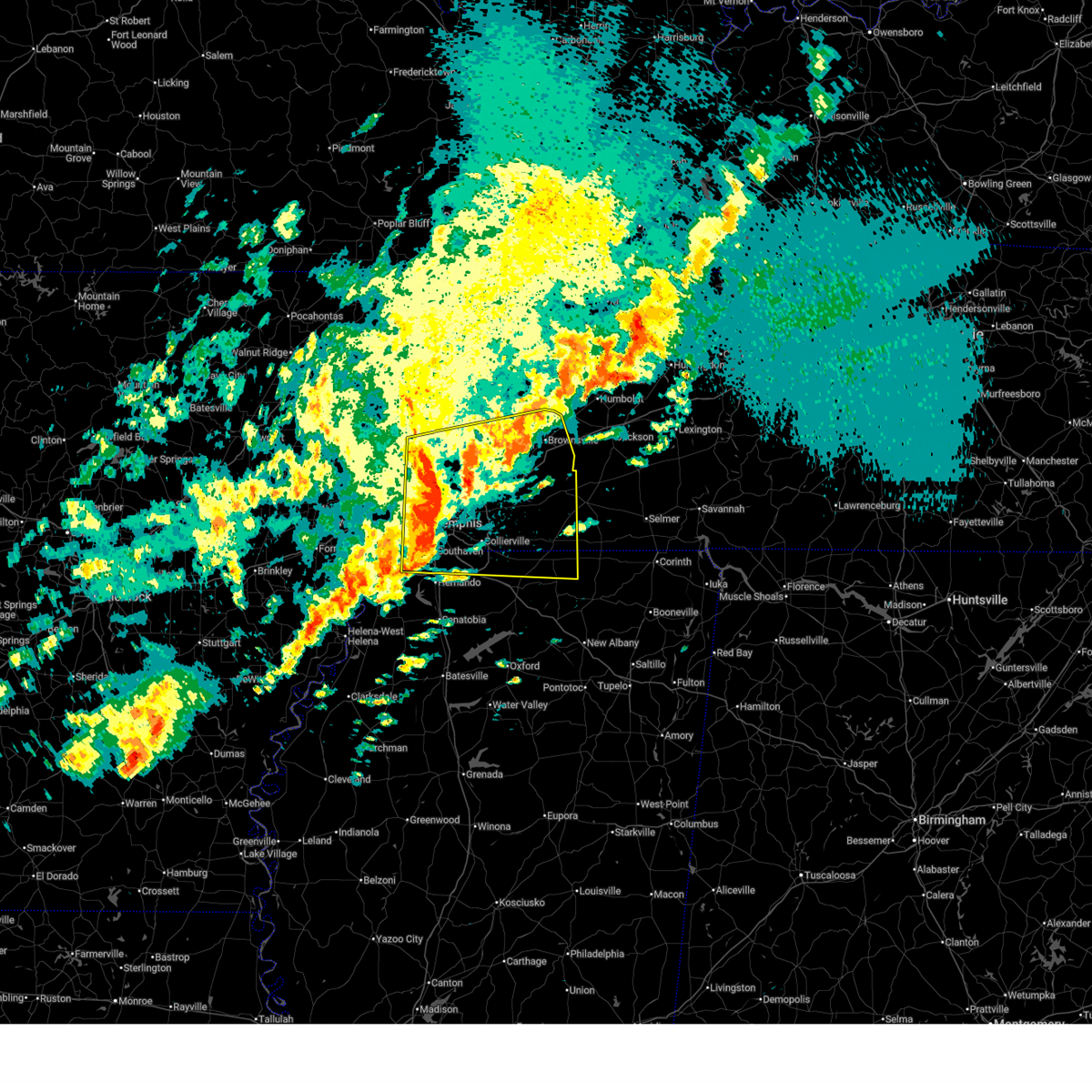 Svrmeg the national weather service in memphis has issued a * severe thunderstorm warning for, southwestern mississippi county in eastern arkansas, northeastern crittenden county in eastern arkansas, northern desoto county in northwestern mississippi, northern marshall county in northwestern mississippi, northern benton county in northeastern mississippi, tipton county in west tennessee, fayette county in west tennessee, western hardeman county in west tennessee, southern lauderdale county in west tennessee, haywood county in west tennessee, shelby county in west tennessee, * until 1045 pm cdt. * at 954 pm cdt, a severe thunderstorm was located near millington, moving east at 65 mph (radar indicated). Hazards include 60 mph wind gusts and quarter size hail. Hail damage to vehicles is expected. Expect wind damage to roofs, siding, and trees. Svrmeg the national weather service in memphis has issued a * severe thunderstorm warning for, southwestern mississippi county in eastern arkansas, northeastern crittenden county in eastern arkansas, northern desoto county in northwestern mississippi, northern marshall county in northwestern mississippi, northern benton county in northeastern mississippi, tipton county in west tennessee, fayette county in west tennessee, western hardeman county in west tennessee, southern lauderdale county in west tennessee, haywood county in west tennessee, shelby county in west tennessee, * until 1045 pm cdt. * at 954 pm cdt, a severe thunderstorm was located near millington, moving east at 65 mph (radar indicated). Hazards include 60 mph wind gusts and quarter size hail. Hail damage to vehicles is expected. Expect wind damage to roofs, siding, and trees.
|
| 4/2/2025 9:47 PM CDT |
 the severe thunderstorm warning has been cancelled and is no longer in effect the severe thunderstorm warning has been cancelled and is no longer in effect
|
| 4/2/2025 9:47 PM CDT |
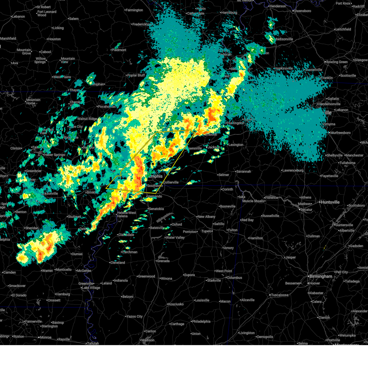 At 947 pm cdt, a severe thunderstorm was located near chestnut bluff, or 8 miles south of dyersburg, moving northeast at 65 mph (radar indicated). Hazards include ping pong ball size hail and 60 mph wind gusts. People and animals outdoors will be injured. expect hail damage to roofs, siding, windows, and vehicles. expect wind damage to roofs, siding, and trees. Locations impacted include, burlison, stanton, horn lake, louise, covington, edmondson, presidents island, beck, glover, locke, arlington, elmore park, alden, julius, brims corner, durhamville, gilestown, clopton, clarks corner, and lightfoot. At 947 pm cdt, a severe thunderstorm was located near chestnut bluff, or 8 miles south of dyersburg, moving northeast at 65 mph (radar indicated). Hazards include ping pong ball size hail and 60 mph wind gusts. People and animals outdoors will be injured. expect hail damage to roofs, siding, windows, and vehicles. expect wind damage to roofs, siding, and trees. Locations impacted include, burlison, stanton, horn lake, louise, covington, edmondson, presidents island, beck, glover, locke, arlington, elmore park, alden, julius, brims corner, durhamville, gilestown, clopton, clarks corner, and lightfoot.
|
| 4/2/2025 9:28 PM CDT |
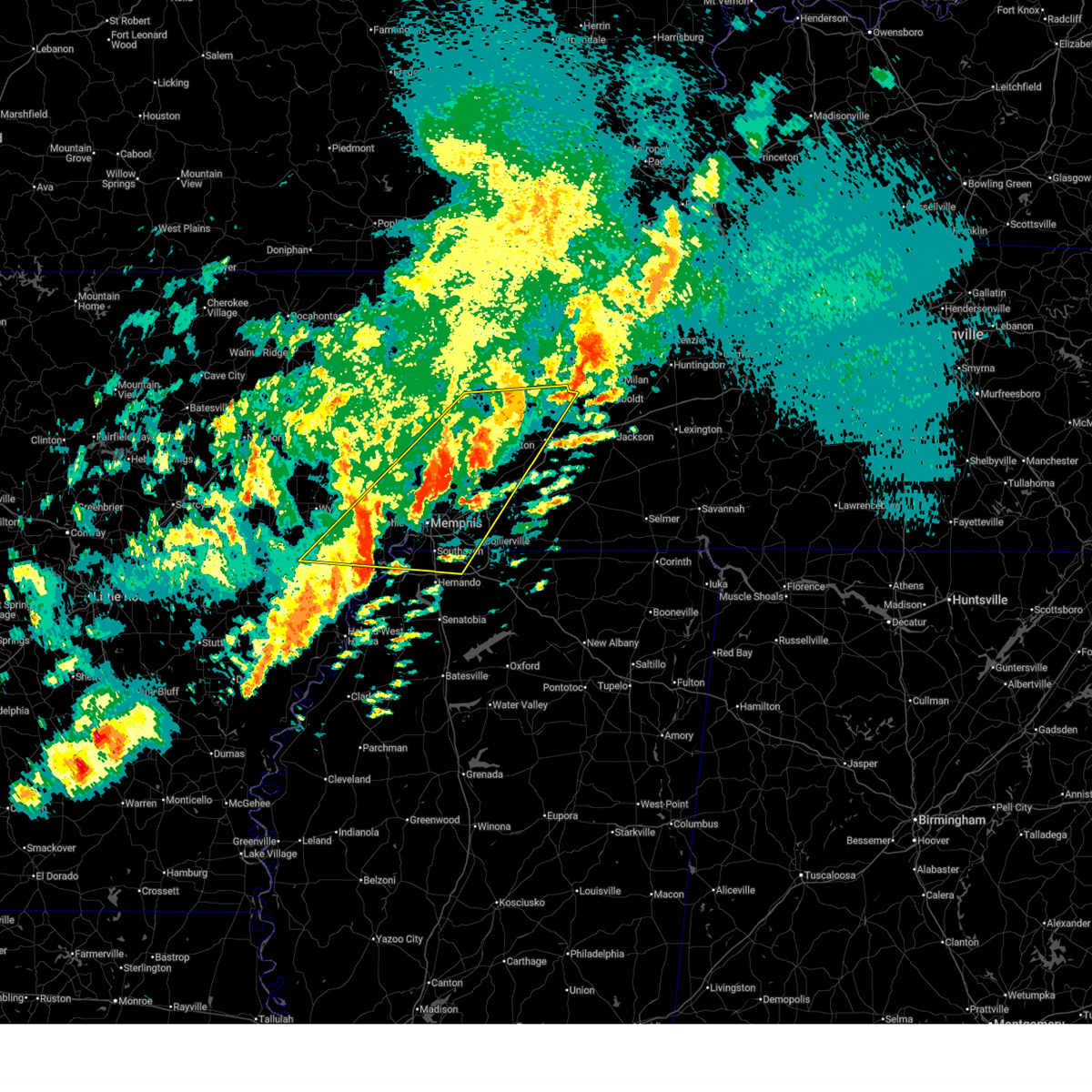 At 928 pm cdt, a severe thunderstorm was located near ripley, moving northeast at 65 mph (radar indicated). Hazards include ping pong ball size hail and 60 mph wind gusts. People and animals outdoors will be injured. expect hail damage to roofs, siding, windows, and vehicles. expect wind damage to roofs, siding, and trees. Locations impacted include, burlison, stanton, horn lake, louise, new castle, covington, edmondson, presidents island, beck, glover, locke, arlington, elmore park, alden, julius, brims corner, durhamville, gilestown, clopton, and clarks corner. At 928 pm cdt, a severe thunderstorm was located near ripley, moving northeast at 65 mph (radar indicated). Hazards include ping pong ball size hail and 60 mph wind gusts. People and animals outdoors will be injured. expect hail damage to roofs, siding, windows, and vehicles. expect wind damage to roofs, siding, and trees. Locations impacted include, burlison, stanton, horn lake, louise, new castle, covington, edmondson, presidents island, beck, glover, locke, arlington, elmore park, alden, julius, brims corner, durhamville, gilestown, clopton, and clarks corner.
|
| 4/2/2025 9:10 PM CDT |
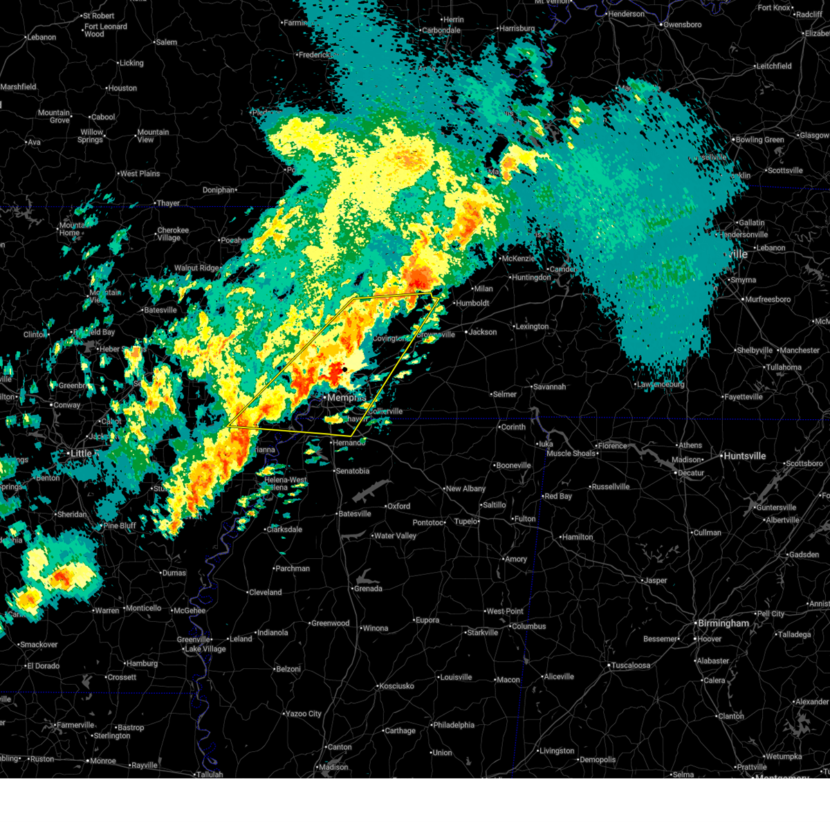 Svrmeg the national weather service in memphis has issued a * severe thunderstorm warning for, eastern st. francis county in eastern arkansas, southern mississippi county in eastern arkansas, crittenden county in eastern arkansas, southeastern cross county in eastern arkansas, northern desoto county in northwestern mississippi, southwestern crockett county in west tennessee, tipton county in west tennessee, northwestern fayette county in west tennessee, lauderdale county in west tennessee, northwestern haywood county in west tennessee, shelby county in west tennessee, * until 1000 pm cdt. * at 910 pm cdt, a severe thunderstorm was located over munford, or 10 miles north of millington, moving northeast at 65 mph (radar indicated). Hazards include 60 mph wind gusts and quarter size hail. Hail damage to vehicles is expected. Expect wind damage to roofs, siding, and trees. Svrmeg the national weather service in memphis has issued a * severe thunderstorm warning for, eastern st. francis county in eastern arkansas, southern mississippi county in eastern arkansas, crittenden county in eastern arkansas, southeastern cross county in eastern arkansas, northern desoto county in northwestern mississippi, southwestern crockett county in west tennessee, tipton county in west tennessee, northwestern fayette county in west tennessee, lauderdale county in west tennessee, northwestern haywood county in west tennessee, shelby county in west tennessee, * until 1000 pm cdt. * at 910 pm cdt, a severe thunderstorm was located over munford, or 10 miles north of millington, moving northeast at 65 mph (radar indicated). Hazards include 60 mph wind gusts and quarter size hail. Hail damage to vehicles is expected. Expect wind damage to roofs, siding, and trees.
|
| 4/2/2025 6:23 PM CDT |
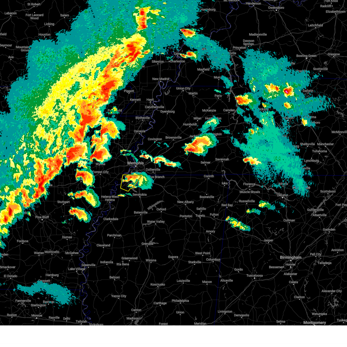 The storm which prompted the warning has weakened below severe limits, and no longer poses an immediate threat to life or property. therefore, the warning will be allowed to expire. a tornado watch remains in effect until midnight cdt for eastern arkansas, northwestern mississippi, and west tennessee. The storm which prompted the warning has weakened below severe limits, and no longer poses an immediate threat to life or property. therefore, the warning will be allowed to expire. a tornado watch remains in effect until midnight cdt for eastern arkansas, northwestern mississippi, and west tennessee.
|
| 4/2/2025 6:10 PM CDT |
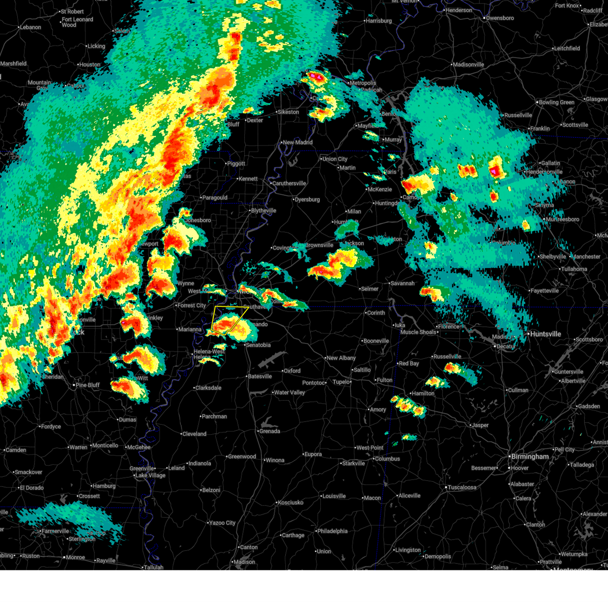 At 610 pm cdt, a severe thunderstorm was located near lake cormorant, or 14 miles southwest of horn lake, moving northeast at 45 mph (radar indicated). Hazards include 60 mph wind gusts and quarter size hail. Hail damage to vehicles is expected. expect wind damage to roofs, siding, and trees. Locations impacted include, newport, clack, pinckney, trinity, lake cormorant, horn lake, frees corners, lynchburg, eudora, glover, banks, jago, bowdre, alden, twin lakes, horseshoe lake, southaven, west days, lost lake, and seyppel. At 610 pm cdt, a severe thunderstorm was located near lake cormorant, or 14 miles southwest of horn lake, moving northeast at 45 mph (radar indicated). Hazards include 60 mph wind gusts and quarter size hail. Hail damage to vehicles is expected. expect wind damage to roofs, siding, and trees. Locations impacted include, newport, clack, pinckney, trinity, lake cormorant, horn lake, frees corners, lynchburg, eudora, glover, banks, jago, bowdre, alden, twin lakes, horseshoe lake, southaven, west days, lost lake, and seyppel.
|
| 4/2/2025 5:53 PM CDT |
 At 553 pm cdt, a severe thunderstorm was located over tunica, or 15 miles northeast of st francis national park, moving northeast at 50 mph (radar indicated). Hazards include two inch hail and 60 mph wind gusts. People and animals outdoors will be injured. expect hail damage to roofs, siding, windows, and vehicles. expect wind damage to roofs, siding, and trees. Locations impacted include, newport, tunica, clack, pinckney, trinity, lake cormorant, horn lake, frees corners, commerce, lynchburg, austin, prichard, bruins, eudora, glover, banks, jago, bowdre, alden, and dooley. At 553 pm cdt, a severe thunderstorm was located over tunica, or 15 miles northeast of st francis national park, moving northeast at 50 mph (radar indicated). Hazards include two inch hail and 60 mph wind gusts. People and animals outdoors will be injured. expect hail damage to roofs, siding, windows, and vehicles. expect wind damage to roofs, siding, and trees. Locations impacted include, newport, tunica, clack, pinckney, trinity, lake cormorant, horn lake, frees corners, commerce, lynchburg, austin, prichard, bruins, eudora, glover, banks, jago, bowdre, alden, and dooley.
|
| 4/2/2025 5:53 PM CDT |
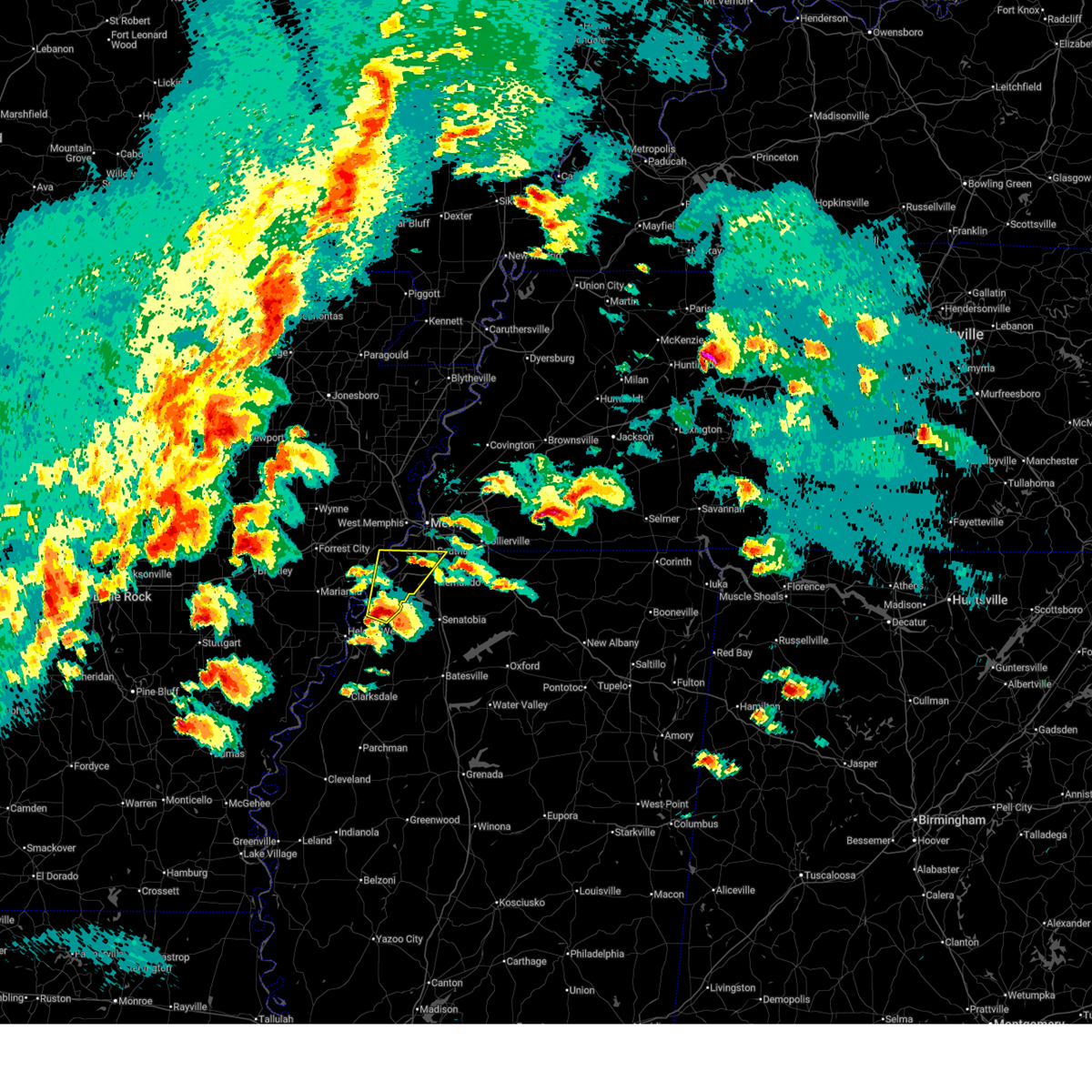 the severe thunderstorm warning has been cancelled and is no longer in effect the severe thunderstorm warning has been cancelled and is no longer in effect
|
| 4/2/2025 5:38 PM CDT |
 At 538 pm cdt, a severe thunderstorm was located near dundee, or near helena-west helena, moving northeast at 45 mph (radar indicated). Hazards include two inch hail and 60 mph wind gusts. People and animals outdoors will be injured. expect hail damage to roofs, siding, windows, and vehicles. expect wind damage to roofs, siding, and trees. Locations impacted include, tunica, hughes, clack, trinity, lake cormorant, horn lake, commerce, austin, prichard, beck, eudora, dubbs, glover, whitehall, alden, dooley, twin lakes, north tunica, penjur, and dundee. At 538 pm cdt, a severe thunderstorm was located near dundee, or near helena-west helena, moving northeast at 45 mph (radar indicated). Hazards include two inch hail and 60 mph wind gusts. People and animals outdoors will be injured. expect hail damage to roofs, siding, windows, and vehicles. expect wind damage to roofs, siding, and trees. Locations impacted include, tunica, hughes, clack, trinity, lake cormorant, horn lake, commerce, austin, prichard, beck, eudora, dubbs, glover, whitehall, alden, dooley, twin lakes, north tunica, penjur, and dundee.
|
| 4/2/2025 5:32 PM CDT |
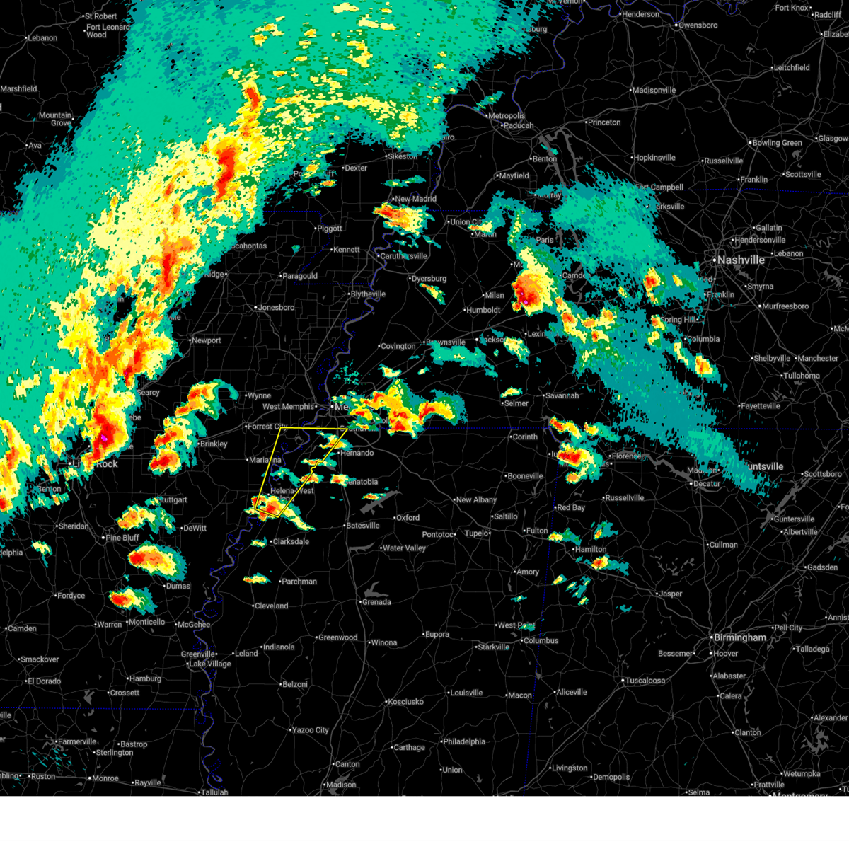 Svrmeg the national weather service in memphis has issued a * severe thunderstorm warning for, eastern lee county in eastern arkansas, southeastern st. francis county in eastern arkansas, northeastern phillips county in eastern arkansas, southwestern crittenden county in eastern arkansas, western desoto county in northwestern mississippi, northeastern coahoma county in northwestern mississippi, tunica county in northwestern mississippi, * until 630 pm cdt. * at 532 pm cdt, a severe thunderstorm was located near helena-west helena, moving northeast at 45 mph (radar indicated). Hazards include 60 mph wind gusts and quarter size hail. Hail damage to vehicles is expected. Expect wind damage to roofs, siding, and trees. Svrmeg the national weather service in memphis has issued a * severe thunderstorm warning for, eastern lee county in eastern arkansas, southeastern st. francis county in eastern arkansas, northeastern phillips county in eastern arkansas, southwestern crittenden county in eastern arkansas, western desoto county in northwestern mississippi, northeastern coahoma county in northwestern mississippi, tunica county in northwestern mississippi, * until 630 pm cdt. * at 532 pm cdt, a severe thunderstorm was located near helena-west helena, moving northeast at 45 mph (radar indicated). Hazards include 60 mph wind gusts and quarter size hail. Hail damage to vehicles is expected. Expect wind damage to roofs, siding, and trees.
|
| 4/2/2025 5:06 PM CDT |
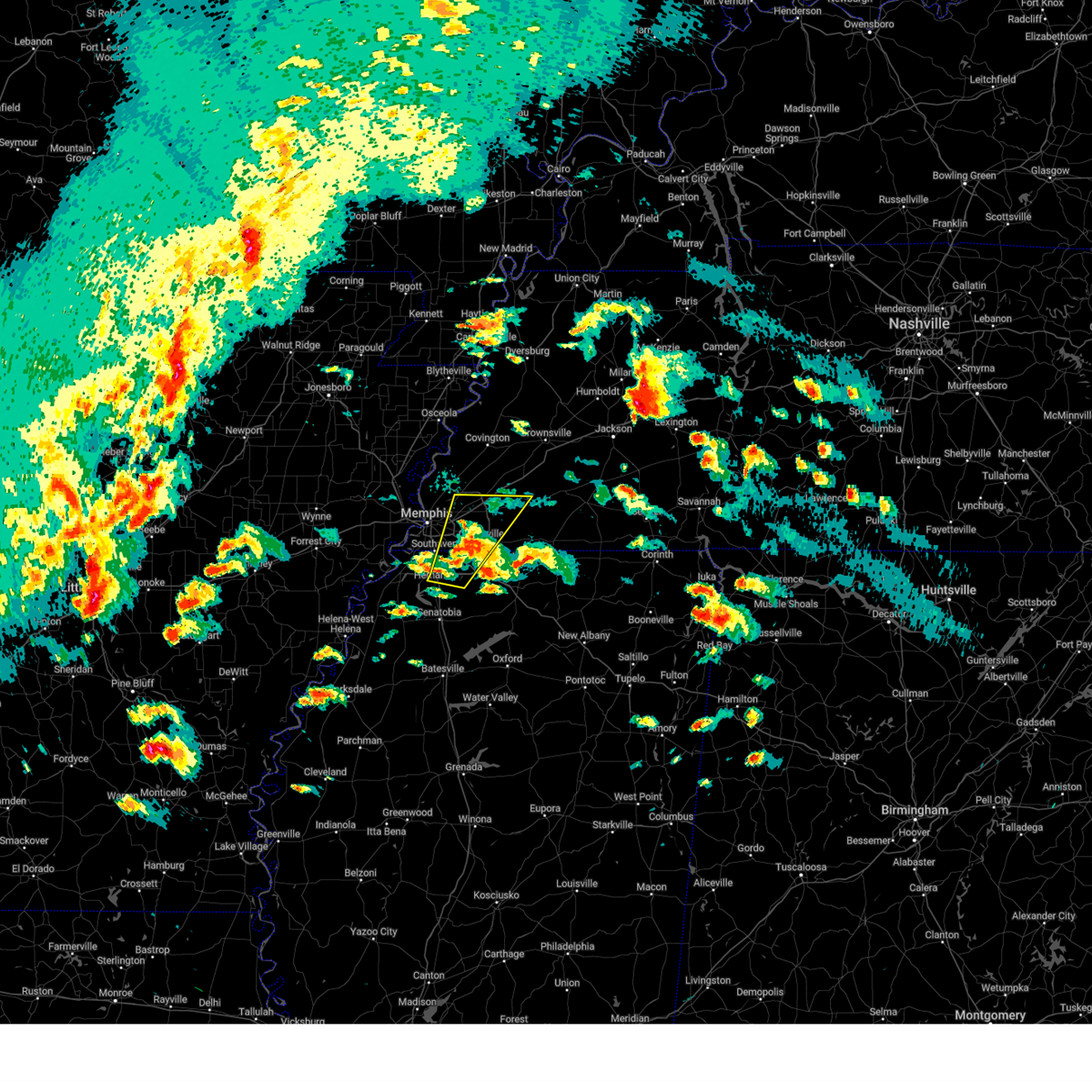 At 506 pm cdt, a severe thunderstorm was located over olive branch, moving northeast at 50 mph (radar indicated. at 503 pm cdt, golf ball sized hail was reported near nesbit along interstate 269). Hazards include ping pong ball size hail and 60 mph wind gusts. People and animals outdoors will be injured. expect hail damage to roofs, siding, windows, and vehicles. expect wind damage to roofs, siding, and trees. Locations impacted include, piperton, lenow, cockrum, cedarview, ellendale, oakland, germantown, bright, nesbit, handy corner, warren, capleville, kirk, hickory withe, jago, arlington, elmore park, brunswick, fisherville, and collierville. At 506 pm cdt, a severe thunderstorm was located over olive branch, moving northeast at 50 mph (radar indicated. at 503 pm cdt, golf ball sized hail was reported near nesbit along interstate 269). Hazards include ping pong ball size hail and 60 mph wind gusts. People and animals outdoors will be injured. expect hail damage to roofs, siding, windows, and vehicles. expect wind damage to roofs, siding, and trees. Locations impacted include, piperton, lenow, cockrum, cedarview, ellendale, oakland, germantown, bright, nesbit, handy corner, warren, capleville, kirk, hickory withe, jago, arlington, elmore park, brunswick, fisherville, and collierville.
|
| 4/2/2025 5:00 PM CDT | Golf Ball sized hail reported 2.8 miles SSE of Hernando, MS, golfball size hail near nesbitt at lauder and 269. |
| 4/2/2025 4:53 PM CDT |
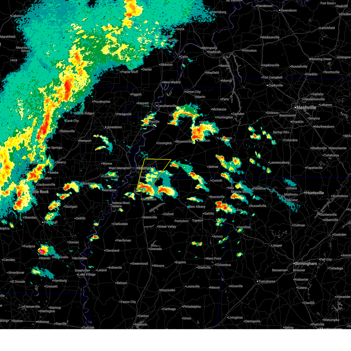 the severe thunderstorm warning has been cancelled and is no longer in effect the severe thunderstorm warning has been cancelled and is no longer in effect
|
| 4/2/2025 4:53 PM CDT |
 At 452 pm cdt, a severe thunderstorm was located over hernando, moving northeast at 50 mph (radar indicated). Hazards include 60 mph wind gusts and quarter size hail. Hail damage to vehicles is expected. expect wind damage to roofs, siding, and trees. Locations impacted include, piperton, lenow, cockrum, cedarview, ellendale, oakland, germantown, bright, nesbit, handy corner, warren, capleville, kirk, hickory withe, jago, arlington, robinson gin, elmore park, brunswick, and fisherville. At 452 pm cdt, a severe thunderstorm was located over hernando, moving northeast at 50 mph (radar indicated). Hazards include 60 mph wind gusts and quarter size hail. Hail damage to vehicles is expected. expect wind damage to roofs, siding, and trees. Locations impacted include, piperton, lenow, cockrum, cedarview, ellendale, oakland, germantown, bright, nesbit, handy corner, warren, capleville, kirk, hickory withe, jago, arlington, robinson gin, elmore park, brunswick, and fisherville.
|
| 4/2/2025 4:38 PM CDT |
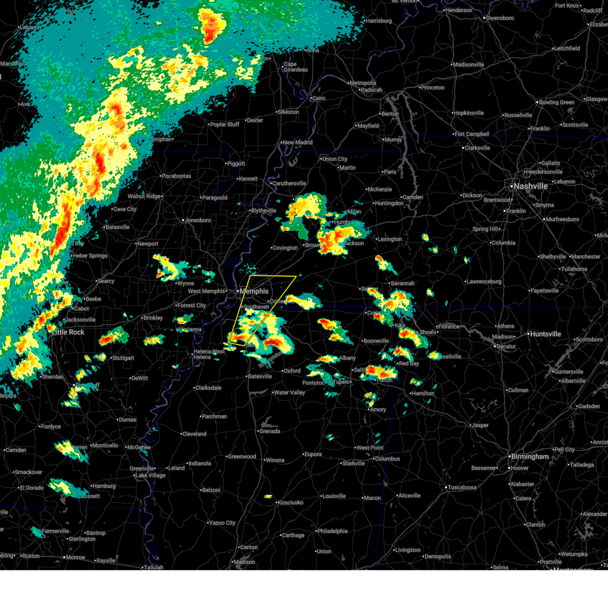 Svrmeg the national weather service in memphis has issued a * severe thunderstorm warning for, desoto county in northwestern mississippi, northwestern marshall county in northwestern mississippi, central tate county in northwestern mississippi, southwestern fayette county in west tennessee, southeastern shelby county in west tennessee, * until 545 pm cdt. * at 438 pm cdt, a severe thunderstorm was located near arkabutla, or near senatobia, moving northeast at 50 mph (radar indicated). Hazards include 60 mph wind gusts and quarter size hail. Hail damage to vehicles is expected. Expect wind damage to roofs, siding, and trees. Svrmeg the national weather service in memphis has issued a * severe thunderstorm warning for, desoto county in northwestern mississippi, northwestern marshall county in northwestern mississippi, central tate county in northwestern mississippi, southwestern fayette county in west tennessee, southeastern shelby county in west tennessee, * until 545 pm cdt. * at 438 pm cdt, a severe thunderstorm was located near arkabutla, or near senatobia, moving northeast at 50 mph (radar indicated). Hazards include 60 mph wind gusts and quarter size hail. Hail damage to vehicles is expected. Expect wind damage to roofs, siding, and trees.
|
| 4/2/2025 3:45 PM CDT |
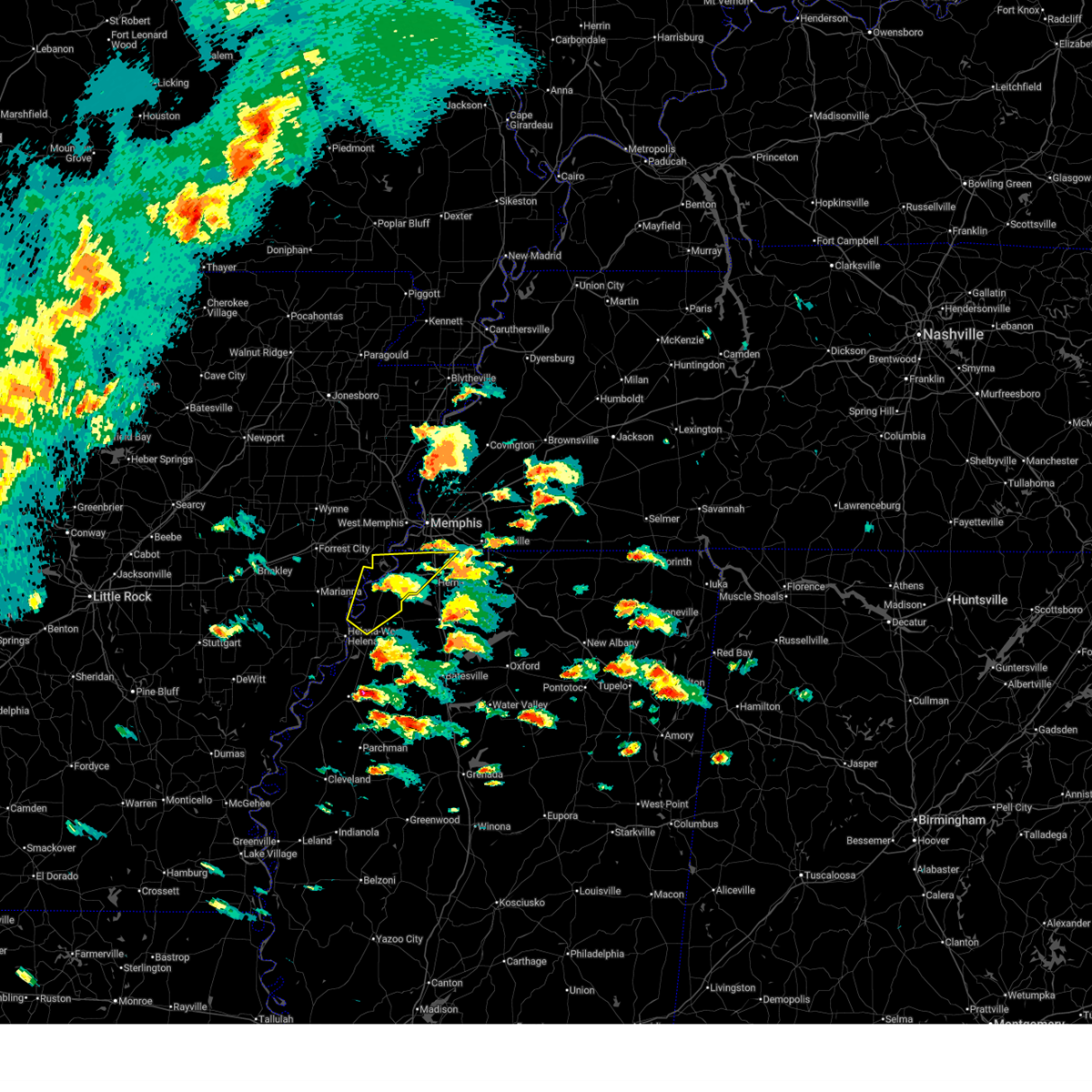 the severe thunderstorm warning has been cancelled and is no longer in effect the severe thunderstorm warning has been cancelled and is no longer in effect
|
| 4/2/2025 3:25 PM CDT |
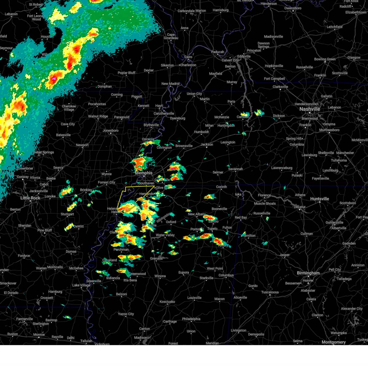 the severe thunderstorm warning has been cancelled and is no longer in effect the severe thunderstorm warning has been cancelled and is no longer in effect
|
| 4/2/2025 3:25 PM CDT |
 At 325 pm cdt, a severe thunderstorm was located near tunica, or 8 miles northeast of st francis national park, moving northeast at 50 mph (radar indicated). Hazards include 60 mph wind gusts and quarter size hail. Hail damage to vehicles is expected. expect wind damage to roofs, siding, and trees. Locations impacted include, newport, tunica, clack, pinckney, trinity, lake cormorant, horn lake, frees corners, commerce, lynchburg, austin, peters, nesbit, prichard, bruins, beck, eudora, diamond woods, glover, and banks. At 325 pm cdt, a severe thunderstorm was located near tunica, or 8 miles northeast of st francis national park, moving northeast at 50 mph (radar indicated). Hazards include 60 mph wind gusts and quarter size hail. Hail damage to vehicles is expected. expect wind damage to roofs, siding, and trees. Locations impacted include, newport, tunica, clack, pinckney, trinity, lake cormorant, horn lake, frees corners, commerce, lynchburg, austin, peters, nesbit, prichard, bruins, beck, eudora, diamond woods, glover, and banks.
|
| 4/2/2025 3:14 PM CDT |
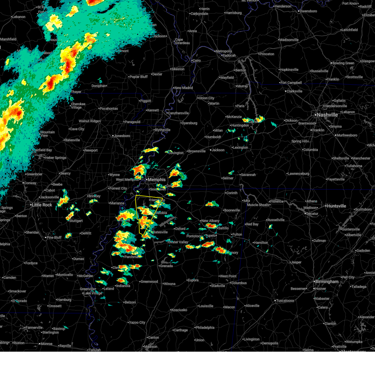 the severe thunderstorm warning has been cancelled and is no longer in effect the severe thunderstorm warning has been cancelled and is no longer in effect
|
| 4/2/2025 3:14 PM CDT |
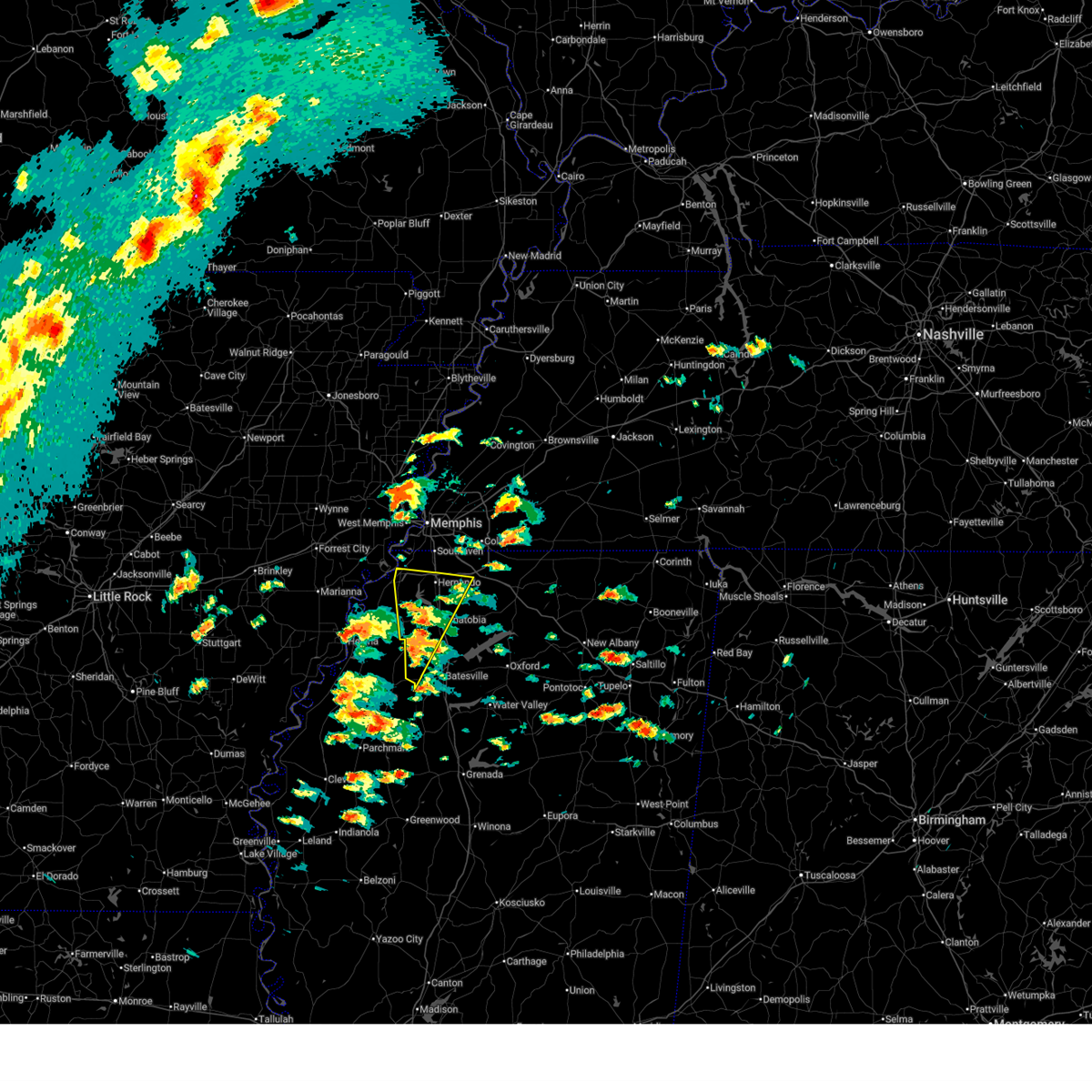 At 314 pm cdt, a severe thunderstorm was located near crenshaw, or 11 miles southwest of senatobia, moving north at 60 mph (radar indicated). Hazards include 60 mph wind gusts and quarter size hail. Hail damage to vehicles is expected. expect wind damage to roofs, siding, and trees. Locations impacted include, newport, askew, trinity, buxton, cockrum, savage, frees corners, senatobia, bright, phillipp, crenshaw, strayhorn, prichard, pleasant grove, sarah, eudora, coldwater, banks, poagville, and horatio. At 314 pm cdt, a severe thunderstorm was located near crenshaw, or 11 miles southwest of senatobia, moving north at 60 mph (radar indicated). Hazards include 60 mph wind gusts and quarter size hail. Hail damage to vehicles is expected. expect wind damage to roofs, siding, and trees. Locations impacted include, newport, askew, trinity, buxton, cockrum, savage, frees corners, senatobia, bright, phillipp, crenshaw, strayhorn, prichard, pleasant grove, sarah, eudora, coldwater, banks, poagville, and horatio.
|
| 4/2/2025 3:13 PM CDT |
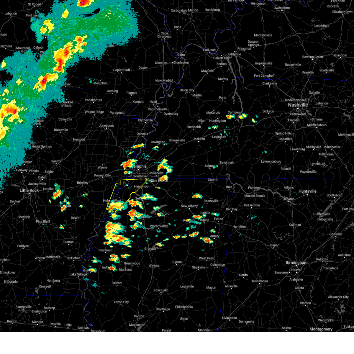 At 313 pm cdt, a severe thunderstorm was located over helena-west helena, moving northeast at 50 mph (radar indicated). Hazards include 60 mph wind gusts and quarter size hail. Hail damage to vehicles is expected. expect wind damage to roofs, siding, and trees. Locations impacted include, tunica, clack, trinity, lake cormorant, helena-west helena, preston place, horn lake, quarles, commerce, austin, prichard, beck, eudora, dubbs, glover, whitehall, huma, alden, dooley, and twin lakes. At 313 pm cdt, a severe thunderstorm was located over helena-west helena, moving northeast at 50 mph (radar indicated). Hazards include 60 mph wind gusts and quarter size hail. Hail damage to vehicles is expected. expect wind damage to roofs, siding, and trees. Locations impacted include, tunica, clack, trinity, lake cormorant, helena-west helena, preston place, horn lake, quarles, commerce, austin, prichard, beck, eudora, dubbs, glover, whitehall, huma, alden, dooley, and twin lakes.
|
| 4/2/2025 3:02 PM CDT |
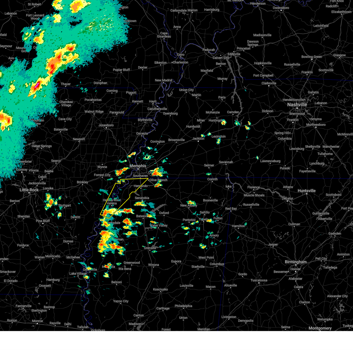 Svrmeg the national weather service in memphis has issued a * severe thunderstorm warning for, eastern lee county in eastern arkansas, northeastern phillips county in eastern arkansas, southwestern crittenden county in eastern arkansas, western desoto county in northwestern mississippi, northeastern coahoma county in northwestern mississippi, tunica county in northwestern mississippi, * until 400 pm cdt. * at 302 pm cdt, a severe thunderstorm was located near friars point, or 10 miles southwest of helena-west helena, moving northeast at 45 mph (radar indicated). Hazards include 60 mph wind gusts and quarter size hail. Hail damage to vehicles is expected. Expect wind damage to roofs, siding, and trees. Svrmeg the national weather service in memphis has issued a * severe thunderstorm warning for, eastern lee county in eastern arkansas, northeastern phillips county in eastern arkansas, southwestern crittenden county in eastern arkansas, western desoto county in northwestern mississippi, northeastern coahoma county in northwestern mississippi, tunica county in northwestern mississippi, * until 400 pm cdt. * at 302 pm cdt, a severe thunderstorm was located near friars point, or 10 miles southwest of helena-west helena, moving northeast at 45 mph (radar indicated). Hazards include 60 mph wind gusts and quarter size hail. Hail damage to vehicles is expected. Expect wind damage to roofs, siding, and trees.
|
| 4/2/2025 2:57 PM CDT |
 Svrmeg the national weather service in memphis has issued a * severe thunderstorm warning for, southern desoto county in northwestern mississippi, eastern tunica county in northwestern mississippi, tate county in northwestern mississippi, quitman county in northwestern mississippi, northwestern panola county in northwestern mississippi, * until 345 pm cdt. * at 256 pm cdt, a severe thunderstorm was located over marks, or 17 miles east of clarksdale, moving north at 60 mph (radar indicated). Hazards include 60 mph wind gusts and quarter size hail. Hail damage to vehicles is expected. Expect wind damage to roofs, siding, and trees. Svrmeg the national weather service in memphis has issued a * severe thunderstorm warning for, southern desoto county in northwestern mississippi, eastern tunica county in northwestern mississippi, tate county in northwestern mississippi, quitman county in northwestern mississippi, northwestern panola county in northwestern mississippi, * until 345 pm cdt. * at 256 pm cdt, a severe thunderstorm was located over marks, or 17 miles east of clarksdale, moving north at 60 mph (radar indicated). Hazards include 60 mph wind gusts and quarter size hail. Hail damage to vehicles is expected. Expect wind damage to roofs, siding, and trees.
|
| 3/30/2025 11:32 PM CDT |
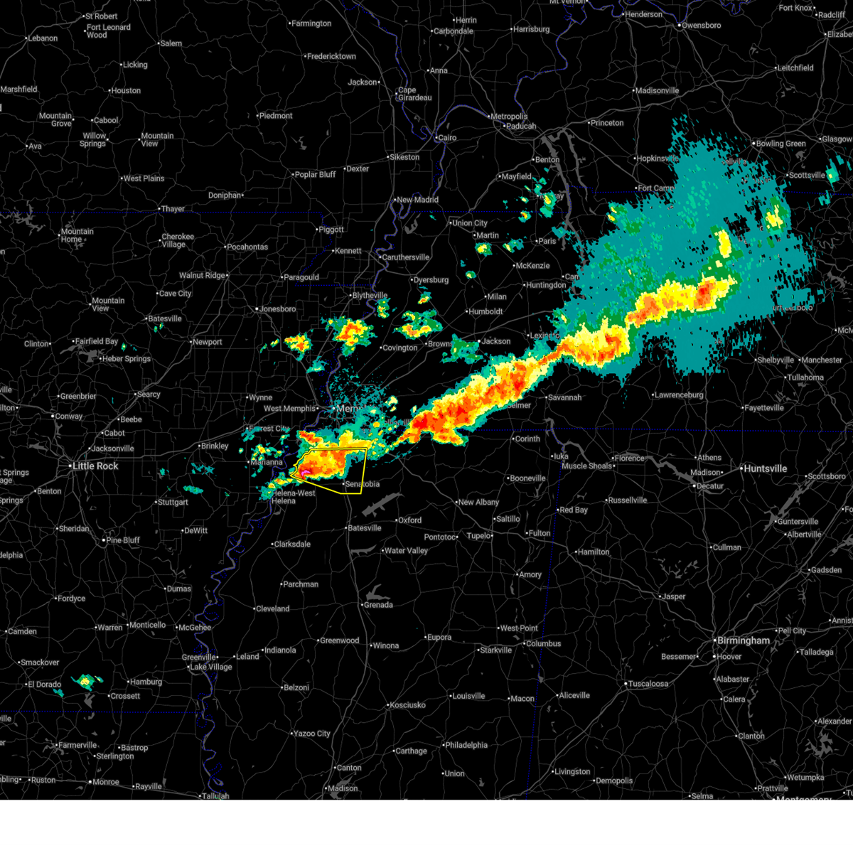 At 1131 pm cdt, a severe thunderstorm was located near arkabutla, or 9 miles northwest of senatobia, moving east at 45 mph (radar indicated). Hazards include two inch hail and 60 mph wind gusts. People and animals outdoors will be injured. expect hail damage to roofs, siding, windows, and vehicles. expect wind damage to roofs, siding, and trees. Locations impacted include, tunica, trinity, cockrum, savage, frees corners, crossroad, senatobia, bright, phillipp, strayhorn, prichard, sarah, eudora, coldwater, banks, poagville, bowdre, bluff, robinson gin, and looxahoma. At 1131 pm cdt, a severe thunderstorm was located near arkabutla, or 9 miles northwest of senatobia, moving east at 45 mph (radar indicated). Hazards include two inch hail and 60 mph wind gusts. People and animals outdoors will be injured. expect hail damage to roofs, siding, windows, and vehicles. expect wind damage to roofs, siding, and trees. Locations impacted include, tunica, trinity, cockrum, savage, frees corners, crossroad, senatobia, bright, phillipp, strayhorn, prichard, sarah, eudora, coldwater, banks, poagville, bowdre, bluff, robinson gin, and looxahoma.
|
| 3/30/2025 11:17 PM CDT |
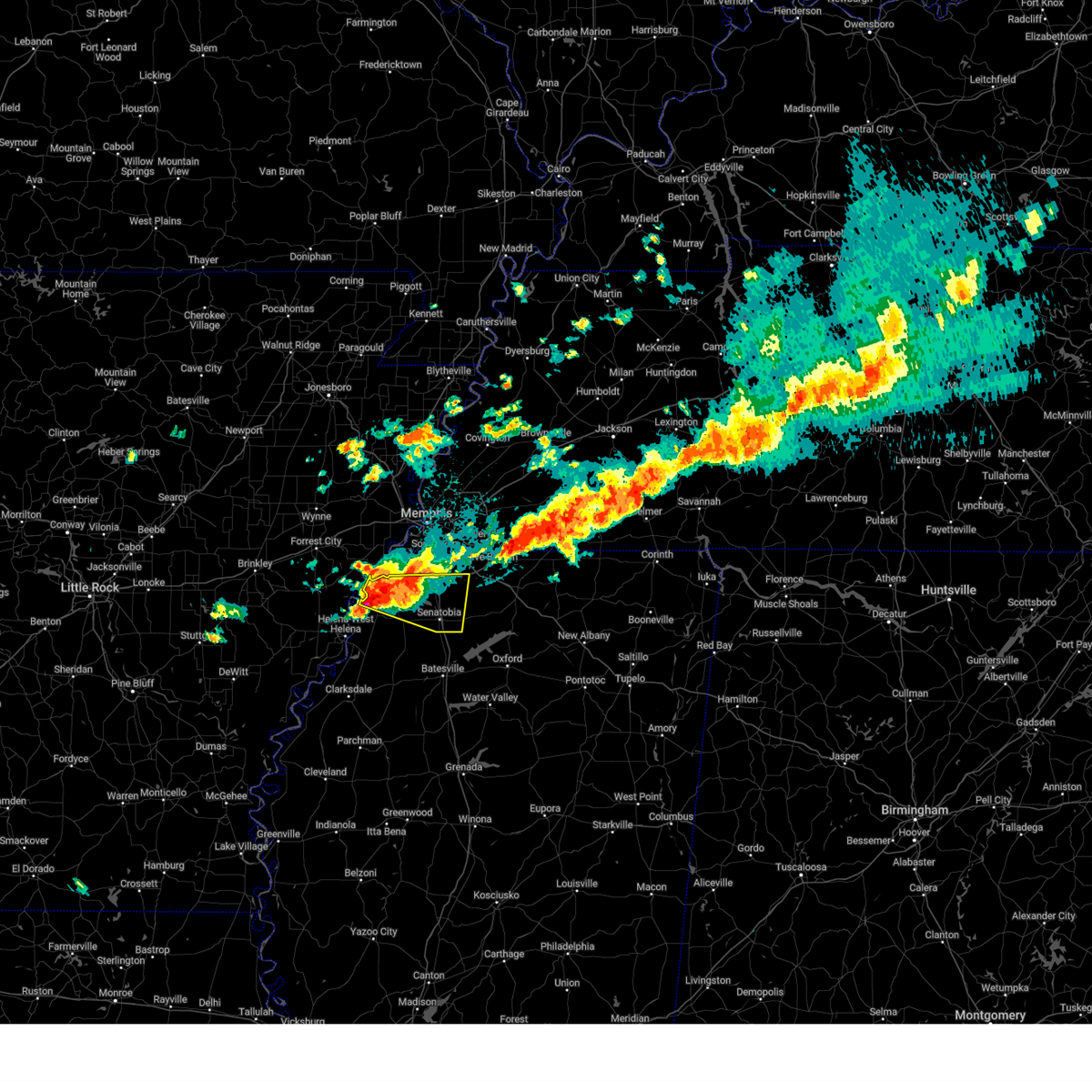 At 1116 pm cdt, a severe thunderstorm was located near phillipp, or 17 miles southwest of hernando, moving east at 45 mph. this is a destructive storm for tunica (radar indicated). Hazards include baseball size hail and 60 mph wind gusts. People and animals outdoors will be severely injured. expect shattered windows, extensive damage to roofs, siding, and vehicles. Locations impacted include, tunica, clack, trinity, cockrum, savage, frees corners, commerce, crossroad, senatobia, bright, phillipp, strayhorn, prichard, sarah, eudora, coldwater, banks, poagville, bowdre, and bluff. At 1116 pm cdt, a severe thunderstorm was located near phillipp, or 17 miles southwest of hernando, moving east at 45 mph. this is a destructive storm for tunica (radar indicated). Hazards include baseball size hail and 60 mph wind gusts. People and animals outdoors will be severely injured. expect shattered windows, extensive damage to roofs, siding, and vehicles. Locations impacted include, tunica, clack, trinity, cockrum, savage, frees corners, commerce, crossroad, senatobia, bright, phillipp, strayhorn, prichard, sarah, eudora, coldwater, banks, poagville, bowdre, and bluff.
|
| 3/30/2025 11:11 PM CDT |
 At 1110 pm cdt, a severe thunderstorm was located near north tunica, or 15 miles southeast of hughes, moving east at 35 mph (radar indicated). Hazards include ping pong ball size hail and 60 mph wind gusts. People and animals outdoors will be injured. expect hail damage to roofs, siding, windows, and vehicles. expect wind damage to roofs, siding, and trees. Locations impacted include, tunica, clack, trinity, cockrum, savage, frees corners, commerce, crossroad, senatobia, bright, phillipp, strayhorn, prichard, sarah, eudora, coldwater, banks, poagville, bowdre, and bluff. At 1110 pm cdt, a severe thunderstorm was located near north tunica, or 15 miles southeast of hughes, moving east at 35 mph (radar indicated). Hazards include ping pong ball size hail and 60 mph wind gusts. People and animals outdoors will be injured. expect hail damage to roofs, siding, windows, and vehicles. expect wind damage to roofs, siding, and trees. Locations impacted include, tunica, clack, trinity, cockrum, savage, frees corners, commerce, crossroad, senatobia, bright, phillipp, strayhorn, prichard, sarah, eudora, coldwater, banks, poagville, bowdre, and bluff.
|
| 3/30/2025 11:11 PM CDT |
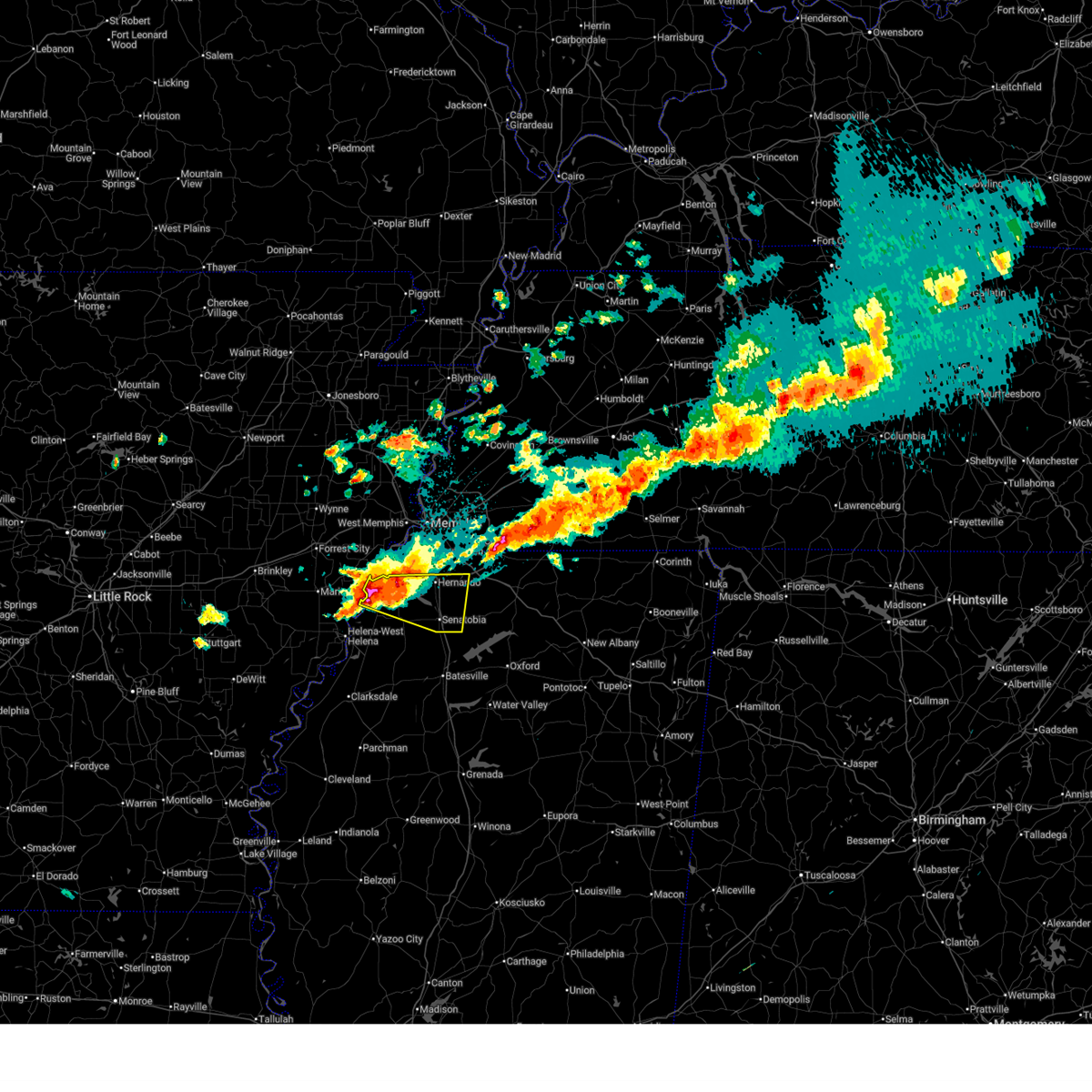 the severe thunderstorm warning has been cancelled and is no longer in effect the severe thunderstorm warning has been cancelled and is no longer in effect
|
| 3/30/2025 10:58 PM CDT |
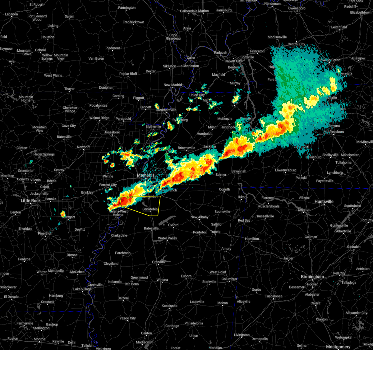 Svrmeg the national weather service in memphis has issued a * severe thunderstorm warning for, east central lee county in eastern arkansas, southern desoto county in northwestern mississippi, northern tunica county in northwestern mississippi, tate county in northwestern mississippi, * until 1145 pm cdt. * at 1057 pm cdt, a severe thunderstorm was located 7 miles west of robinsonville, or 9 miles south of hughes, moving east at 40 mph (radar indicated). Hazards include ping pong ball size hail and 60 mph wind gusts. People and animals outdoors will be injured. expect hail damage to roofs, siding, windows, and vehicles. Expect wind damage to roofs, siding, and trees. Svrmeg the national weather service in memphis has issued a * severe thunderstorm warning for, east central lee county in eastern arkansas, southern desoto county in northwestern mississippi, northern tunica county in northwestern mississippi, tate county in northwestern mississippi, * until 1145 pm cdt. * at 1057 pm cdt, a severe thunderstorm was located 7 miles west of robinsonville, or 9 miles south of hughes, moving east at 40 mph (radar indicated). Hazards include ping pong ball size hail and 60 mph wind gusts. People and animals outdoors will be injured. expect hail damage to roofs, siding, windows, and vehicles. Expect wind damage to roofs, siding, and trees.
|
| 3/15/2025 9:06 AM CDT |
 The storm which prompted the warning has weakened below severe limits, and has exited the warned area. therefore, the warning will be allowed to expire. however, small hail and gusty winds are still possible with this thunderstorm. a tornado watch remains in effect until 100 pm cdt for northwestern mississippi. The storm which prompted the warning has weakened below severe limits, and has exited the warned area. therefore, the warning will be allowed to expire. however, small hail and gusty winds are still possible with this thunderstorm. a tornado watch remains in effect until 100 pm cdt for northwestern mississippi.
|
| 3/15/2025 8:59 AM CDT |
 At 858 am cdt, a severe thunderstorm was located over phillipp, or 11 miles southwest of hernando, moving northeast at 60 mph (radar indicated). Hazards include 60 mph wind gusts and quarter size hail. Hail damage to vehicles is expected. expect wind damage to roofs, siding, and trees. Locations impacted include, askew, belen, moon, southwest memphis, savage, horn lake, senatobia, austin, bright, falcon, como, chulahoma, strayhorn, prichard, jonestown, dubbs, whitehall, alden, lurline, and dooley. At 858 am cdt, a severe thunderstorm was located over phillipp, or 11 miles southwest of hernando, moving northeast at 60 mph (radar indicated). Hazards include 60 mph wind gusts and quarter size hail. Hail damage to vehicles is expected. expect wind damage to roofs, siding, and trees. Locations impacted include, askew, belen, moon, southwest memphis, savage, horn lake, senatobia, austin, bright, falcon, como, chulahoma, strayhorn, prichard, jonestown, dubbs, whitehall, alden, lurline, and dooley.
|
| 3/15/2025 8:59 AM CDT |
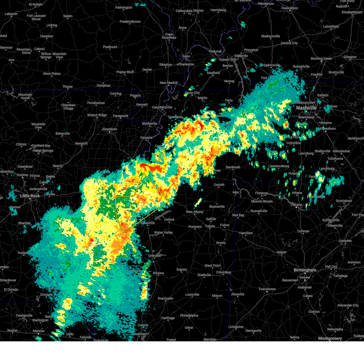 the severe thunderstorm warning has been cancelled and is no longer in effect the severe thunderstorm warning has been cancelled and is no longer in effect
|
| 3/15/2025 8:39 AM CDT |
 The severe thunderstorm which prompted the warning has moved out of the warned area. therefore, the warning will be allowed to expire. a tornado watch remains in effect until 100 pm cdt for northeastern and northwestern mississippi, and west tennessee. The severe thunderstorm which prompted the warning has moved out of the warned area. therefore, the warning will be allowed to expire. a tornado watch remains in effect until 100 pm cdt for northeastern and northwestern mississippi, and west tennessee.
|
| 3/15/2025 8:39 AM CDT |
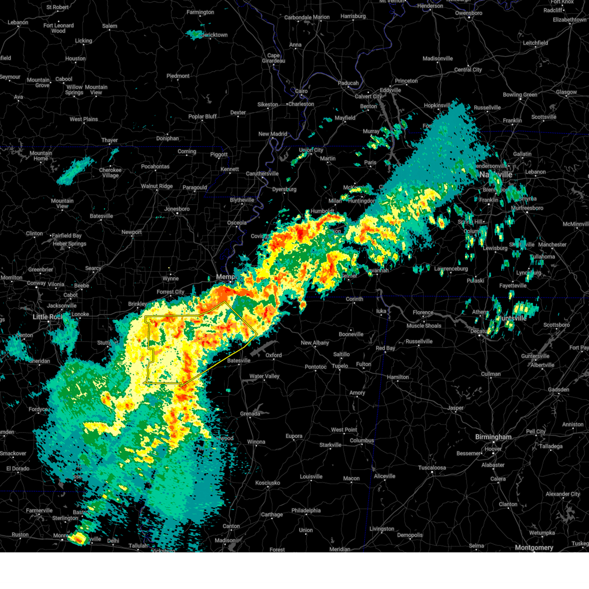 The storm which prompted the warning has moved out of the area. therefore, the warning will be allowed to expire. a tornado watch remains in effect until 100 pm cdt for northwestern mississippi. The storm which prompted the warning has moved out of the area. therefore, the warning will be allowed to expire. a tornado watch remains in effect until 100 pm cdt for northwestern mississippi.
|
| 3/15/2025 8:35 AM CDT |
 Svrmeg the national weather service in memphis has issued a * severe thunderstorm warning for, southern lee county in eastern arkansas, phillips county in eastern arkansas, desoto county in northwestern mississippi, coahoma county in northwestern mississippi, west central marshall county in northwestern mississippi, tunica county in northwestern mississippi, tate county in northwestern mississippi, northern quitman county in northwestern mississippi, northwestern panola county in northwestern mississippi, south central shelby county in west tennessee, * until 915 am cdt. * at 835 am cdt, a severe thunderstorm was located over dubbs, or 13 miles east of st francis national park, moving northeast at 40 mph (radar indicated). Hazards include 60 mph wind gusts and quarter size hail. Hail damage to vehicles is expected. Expect wind damage to roofs, siding, and trees. Svrmeg the national weather service in memphis has issued a * severe thunderstorm warning for, southern lee county in eastern arkansas, phillips county in eastern arkansas, desoto county in northwestern mississippi, coahoma county in northwestern mississippi, west central marshall county in northwestern mississippi, tunica county in northwestern mississippi, tate county in northwestern mississippi, northern quitman county in northwestern mississippi, northwestern panola county in northwestern mississippi, south central shelby county in west tennessee, * until 915 am cdt. * at 835 am cdt, a severe thunderstorm was located over dubbs, or 13 miles east of st francis national park, moving northeast at 40 mph (radar indicated). Hazards include 60 mph wind gusts and quarter size hail. Hail damage to vehicles is expected. Expect wind damage to roofs, siding, and trees.
|
| 3/15/2025 8:13 AM CDT |
 At 813 am cdt, a severe thunderstorm was located near dancyville, or 15 miles south of brownsville, moving northeast at 75 mph (radar indicated). Hazards include 60 mph wind gusts and quarter size hail. Hail damage to vehicles is expected. expect wind damage to roofs, siding, and trees. Locations impacted include, ghost river state natural area, neely, brody, yum yum, selmer, southwest memphis, stanton, horn lake, masseyville, belmont, madison hall, bright, uptonville, chulahoma, silerton, kirk, rossville, arlington, pinson mounds state archaeological park, and rogers springs. At 813 am cdt, a severe thunderstorm was located near dancyville, or 15 miles south of brownsville, moving northeast at 75 mph (radar indicated). Hazards include 60 mph wind gusts and quarter size hail. Hail damage to vehicles is expected. expect wind damage to roofs, siding, and trees. Locations impacted include, ghost river state natural area, neely, brody, yum yum, selmer, southwest memphis, stanton, horn lake, masseyville, belmont, madison hall, bright, uptonville, chulahoma, silerton, kirk, rossville, arlington, pinson mounds state archaeological park, and rogers springs.
|
| 3/15/2025 8:12 AM CDT |
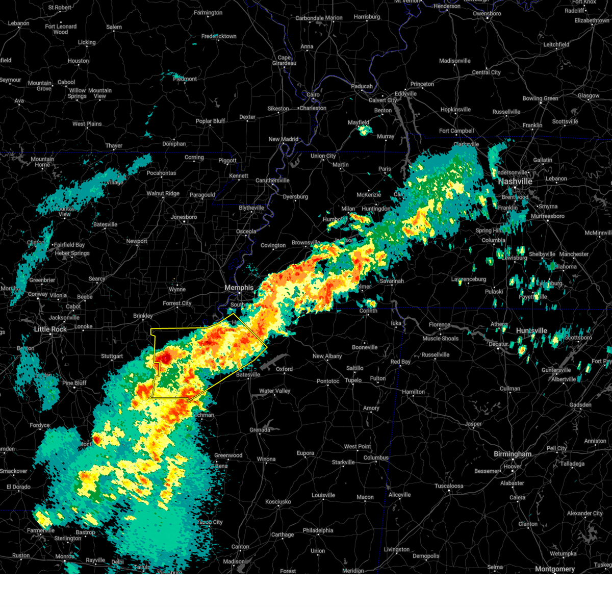 At 812 am cdt, a cluster of severe thunderstorms was located over marvell, moving north at 45 mph (radar indicated). Hazards include 60 mph wind gusts and half dollar size hail. Hail damage to vehicles is expected. expect wind damage to roofs, siding, and trees. Locations impacted include, rena lara, askew, belen, rudyard, moon, savage, haleside, commerce, senatobia, austin, hoop spur, westover, falcon, como, clarksdale, strayhorn, prichard, jonestown, dubbs, and lundell. At 812 am cdt, a cluster of severe thunderstorms was located over marvell, moving north at 45 mph (radar indicated). Hazards include 60 mph wind gusts and half dollar size hail. Hail damage to vehicles is expected. expect wind damage to roofs, siding, and trees. Locations impacted include, rena lara, askew, belen, rudyard, moon, savage, haleside, commerce, senatobia, austin, hoop spur, westover, falcon, como, clarksdale, strayhorn, prichard, jonestown, dubbs, and lundell.
|
| 3/15/2025 7:54 AM CDT |
 The storm which prompted the warning has moved out of the area. therefore, the warning will be allowed to expire. a tornado watch remains in effect until 100 pm cdt for northeastern and northwestern mississippi, and west tennessee. The storm which prompted the warning has moved out of the area. therefore, the warning will be allowed to expire. a tornado watch remains in effect until 100 pm cdt for northeastern and northwestern mississippi, and west tennessee.
|
| 3/15/2025 7:53 AM CDT |
 Svrmeg the national weather service in memphis has issued a * severe thunderstorm warning for, northeastern desoto county in northwestern mississippi, marshall county in northwestern mississippi, northeastern tate county in northwestern mississippi, northern benton county in northeastern mississippi, southeastern tipton county in west tennessee, fayette county in west tennessee, hardeman county in west tennessee, northwestern mcnairy county in west tennessee, southern haywood county in west tennessee, southern madison county in west tennessee, shelby county in west tennessee, chester county in west tennessee, * until 845 am cdt. * at 753 am cdt, a severe thunderstorm was located 9 miles west of lagrange, or 17 miles east of collierville, moving northeast at 50 mph (radar indicated). Hazards include 60 mph wind gusts and quarter size hail. Hail damage to vehicles is expected. Expect wind damage to roofs, siding, and trees. Svrmeg the national weather service in memphis has issued a * severe thunderstorm warning for, northeastern desoto county in northwestern mississippi, marshall county in northwestern mississippi, northeastern tate county in northwestern mississippi, northern benton county in northeastern mississippi, southeastern tipton county in west tennessee, fayette county in west tennessee, hardeman county in west tennessee, northwestern mcnairy county in west tennessee, southern haywood county in west tennessee, southern madison county in west tennessee, shelby county in west tennessee, chester county in west tennessee, * until 845 am cdt. * at 753 am cdt, a severe thunderstorm was located 9 miles west of lagrange, or 17 miles east of collierville, moving northeast at 50 mph (radar indicated). Hazards include 60 mph wind gusts and quarter size hail. Hail damage to vehicles is expected. Expect wind damage to roofs, siding, and trees.
|
| 3/15/2025 7:52 AM CDT |
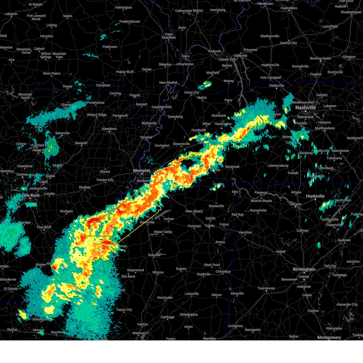 The storm which prompted the warning has moved out of the area. therefore, the warning will be allowed to expire. a tornado watch remains in effect until 100 pm cdt for northwestern mississippi. The storm which prompted the warning has moved out of the area. therefore, the warning will be allowed to expire. a tornado watch remains in effect until 100 pm cdt for northwestern mississippi.
|
| 3/15/2025 7:51 AM CDT |
 Svrmeg the national weather service in memphis has issued a * severe thunderstorm warning for, southern lee county in eastern arkansas, phillips county in eastern arkansas, central desoto county in northwestern mississippi, coahoma county in northwestern mississippi, tunica county in northwestern mississippi, tate county in northwestern mississippi, northern quitman county in northwestern mississippi, northwestern panola county in northwestern mississippi, * until 845 am cdt. * at 751 am cdt, a severe thunderstorm was located near dubbs, or 18 miles east of st francis national park, moving northeast at 45 mph (radar indicated). Hazards include 60 mph wind gusts and quarter size hail. Hail damage to vehicles is expected. Expect wind damage to roofs, siding, and trees. Svrmeg the national weather service in memphis has issued a * severe thunderstorm warning for, southern lee county in eastern arkansas, phillips county in eastern arkansas, central desoto county in northwestern mississippi, coahoma county in northwestern mississippi, tunica county in northwestern mississippi, tate county in northwestern mississippi, northern quitman county in northwestern mississippi, northwestern panola county in northwestern mississippi, * until 845 am cdt. * at 751 am cdt, a severe thunderstorm was located near dubbs, or 18 miles east of st francis national park, moving northeast at 45 mph (radar indicated). Hazards include 60 mph wind gusts and quarter size hail. Hail damage to vehicles is expected. Expect wind damage to roofs, siding, and trees.
|
| 3/15/2025 7:41 AM CDT |
 At 741 am cdt, a severe thunderstorm was located near canaan, or 18 miles south of bolivar, moving northeast at 45 mph (radar indicated). Hazards include 60 mph wind gusts and quarter size hail. Hail damage to vehicles is expected. expect wind damage to roofs, siding, and trees. Locations impacted include, ghost river state natural area, snow lake shores, brody, yum yum, bright, uptonville, chulahoma, silerton, kirk, rossville, rogers springs, hornsby, laconia, macon, lurline, lisbon, hillville, victoria, holly springs, and hudsonville. At 741 am cdt, a severe thunderstorm was located near canaan, or 18 miles south of bolivar, moving northeast at 45 mph (radar indicated). Hazards include 60 mph wind gusts and quarter size hail. Hail damage to vehicles is expected. expect wind damage to roofs, siding, and trees. Locations impacted include, ghost river state natural area, snow lake shores, brody, yum yum, bright, uptonville, chulahoma, silerton, kirk, rossville, rogers springs, hornsby, laconia, macon, lurline, lisbon, hillville, victoria, holly springs, and hudsonville.
|
| 3/15/2025 7:40 AM CDT |
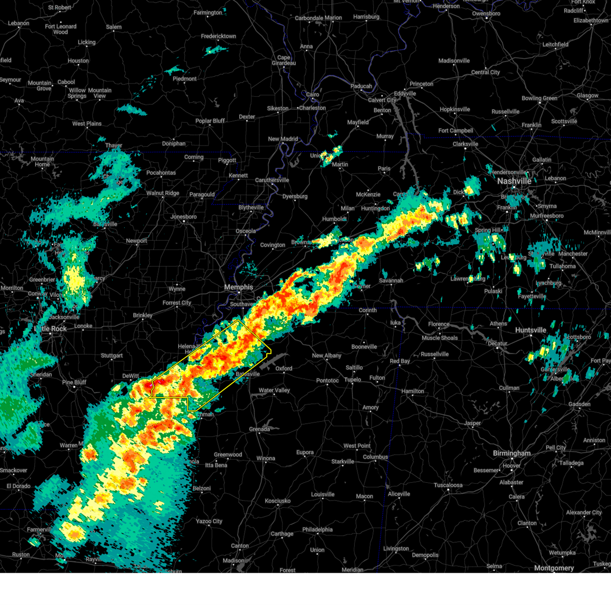 At 740 am cdt, a severe thunderstorm was located near coldwater, or near senatobia, moving northeast at 50 mph (radar indicated). Hazards include 60 mph wind gusts and quarter size hail. Hail damage to vehicles is expected. expect wind damage to roofs, siding, and trees. Locations impacted include, rena lara, askew, belen, rudyard, moon, savage, senatobia, austin, hoop spur, westover, falcon, como, clarksdale, strayhorn, prichard, jonestown, dubbs, lurand, lundell, and dooley. At 740 am cdt, a severe thunderstorm was located near coldwater, or near senatobia, moving northeast at 50 mph (radar indicated). Hazards include 60 mph wind gusts and quarter size hail. Hail damage to vehicles is expected. expect wind damage to roofs, siding, and trees. Locations impacted include, rena lara, askew, belen, rudyard, moon, savage, senatobia, austin, hoop spur, westover, falcon, como, clarksdale, strayhorn, prichard, jonestown, dubbs, lurand, lundell, and dooley.
|
| 3/15/2025 7:40 AM CDT |
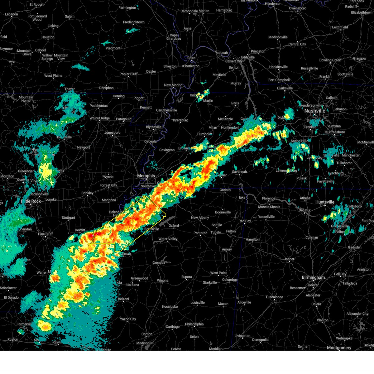 the severe thunderstorm warning has been cancelled and is no longer in effect the severe thunderstorm warning has been cancelled and is no longer in effect
|
| 3/15/2025 7:11 AM CDT |
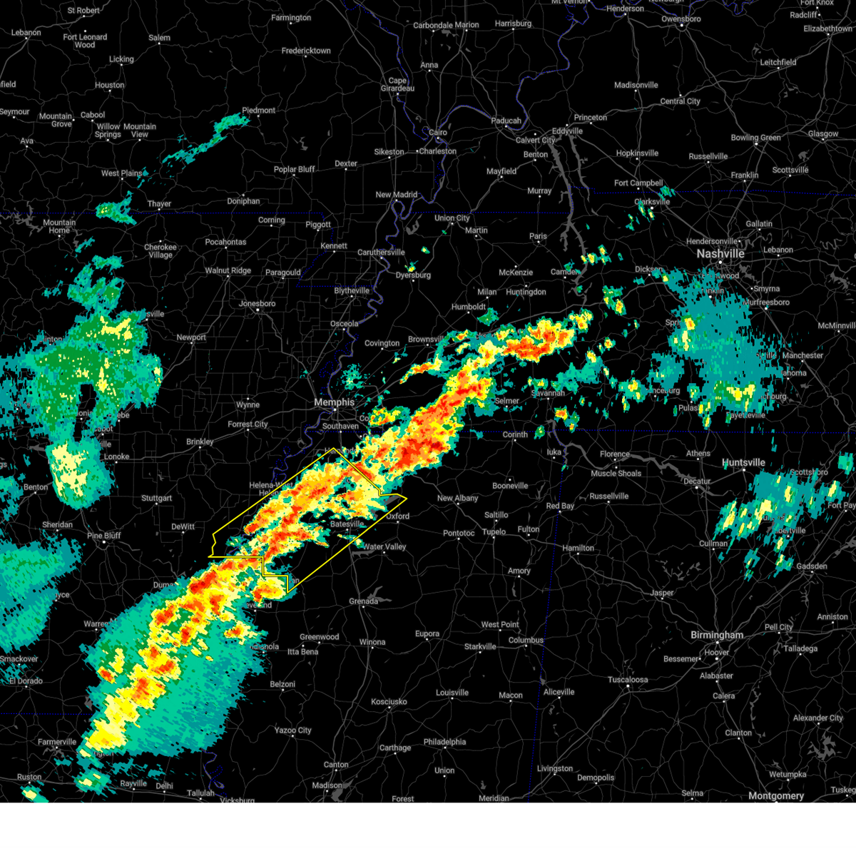 Svrmeg the national weather service in memphis has issued a * severe thunderstorm warning for, central phillips county in eastern arkansas, northwestern lafayette county in northwestern mississippi, southwestern desoto county in northwestern mississippi, coahoma county in northwestern mississippi, tunica county in northwestern mississippi, tate county in northwestern mississippi, northwestern tallahatchie county in northwestern mississippi, quitman county in northwestern mississippi, panola county in northwestern mississippi, * until 800 am cdt. * at 710 am cdt, a cluster of severe thunderstorms was located 7 miles northwest of darling, or 16 miles southeast of helena-west helena, moving northeast at 50 mph (radar indicated). Hazards include 60 mph wind gusts and quarter size hail. Hail damage to vehicles is expected. Expect wind damage to roofs, siding, and trees. Svrmeg the national weather service in memphis has issued a * severe thunderstorm warning for, central phillips county in eastern arkansas, northwestern lafayette county in northwestern mississippi, southwestern desoto county in northwestern mississippi, coahoma county in northwestern mississippi, tunica county in northwestern mississippi, tate county in northwestern mississippi, northwestern tallahatchie county in northwestern mississippi, quitman county in northwestern mississippi, panola county in northwestern mississippi, * until 800 am cdt. * at 710 am cdt, a cluster of severe thunderstorms was located 7 miles northwest of darling, or 16 miles southeast of helena-west helena, moving northeast at 50 mph (radar indicated). Hazards include 60 mph wind gusts and quarter size hail. Hail damage to vehicles is expected. Expect wind damage to roofs, siding, and trees.
|
| 3/15/2025 7:08 AM CDT |
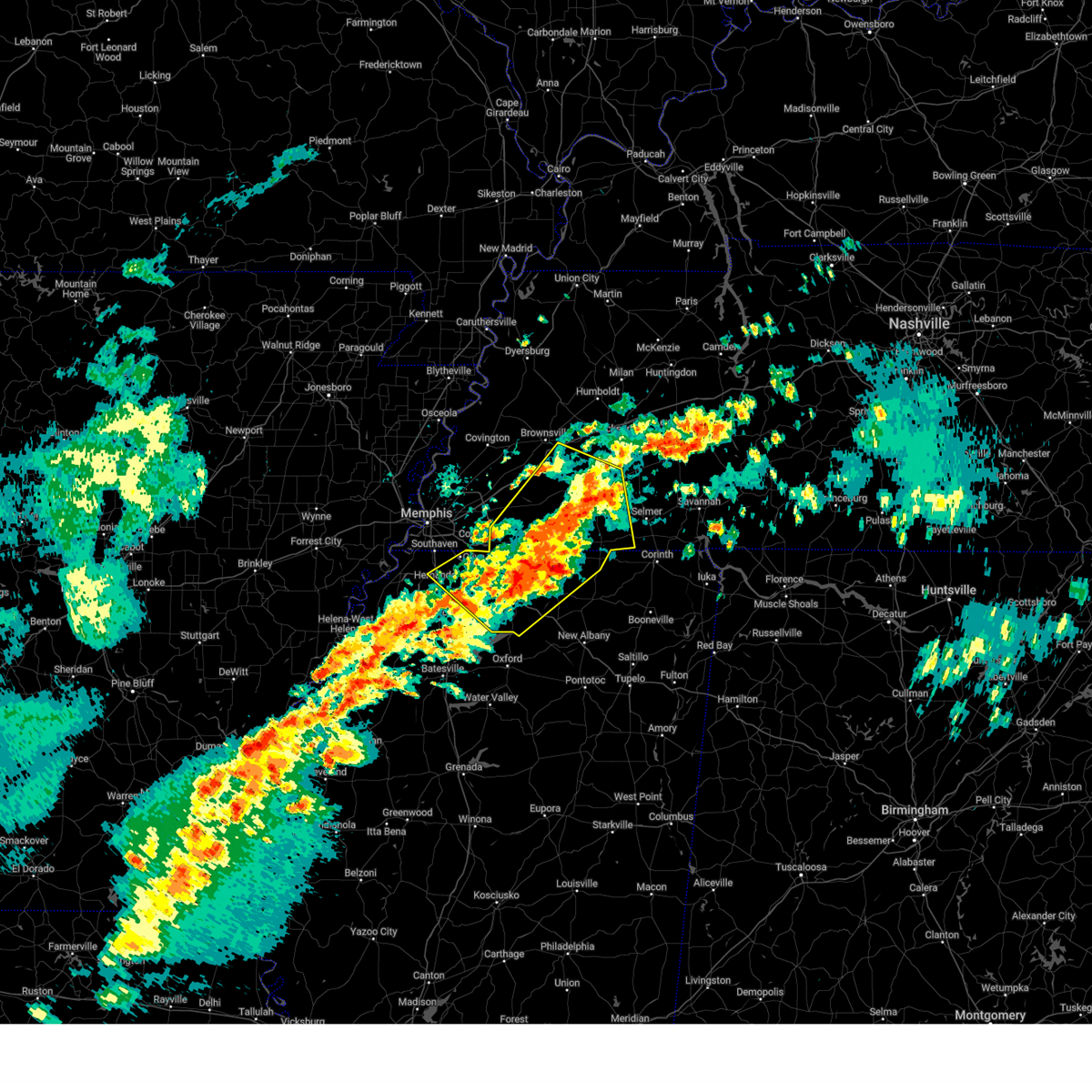 Svrmeg the national weather service in memphis has issued a * severe thunderstorm warning for, eastern desoto county in northwestern mississippi, marshall county in northwestern mississippi, northwestern tippah county in northeastern mississippi, northeastern tate county in northwestern mississippi, benton county in northeastern mississippi, fayette county in west tennessee, hardeman county in west tennessee, southwestern mcnairy county in west tennessee, southeastern haywood county in west tennessee, southwestern madison county in west tennessee, southwestern chester county in west tennessee, * until 800 am cdt. * at 708 am cdt, a severe thunderstorm was located over holly springs, moving northeast at 45 mph (radar indicated). Hazards include 60 mph wind gusts and quarter size hail. Hail damage to vehicles is expected. Expect wind damage to roofs, siding, and trees. Svrmeg the national weather service in memphis has issued a * severe thunderstorm warning for, eastern desoto county in northwestern mississippi, marshall county in northwestern mississippi, northwestern tippah county in northeastern mississippi, northeastern tate county in northwestern mississippi, benton county in northeastern mississippi, fayette county in west tennessee, hardeman county in west tennessee, southwestern mcnairy county in west tennessee, southeastern haywood county in west tennessee, southwestern madison county in west tennessee, southwestern chester county in west tennessee, * until 800 am cdt. * at 708 am cdt, a severe thunderstorm was located over holly springs, moving northeast at 45 mph (radar indicated). Hazards include 60 mph wind gusts and quarter size hail. Hail damage to vehicles is expected. Expect wind damage to roofs, siding, and trees.
|
| 2/15/2025 7:10 PM CST |
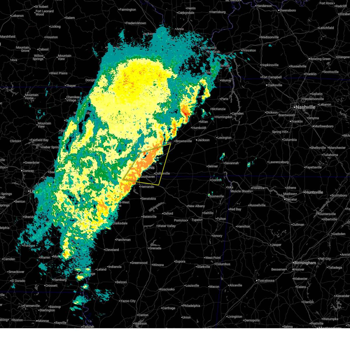 The storm which prompted the warning has weakened below severe limits, and no longer poses an immediate threat to life or property. therefore, the warning will be allowed to expire. however, small hail and gusty winds are still possible with this thunderstorm. a tornado watch remains in effect until 1000 pm cst for northwestern mississippi, and west tennessee. to report severe weather, contact your nearest law enforcement agency. they will relay your report to the national weather service memphis. The storm which prompted the warning has weakened below severe limits, and no longer poses an immediate threat to life or property. therefore, the warning will be allowed to expire. however, small hail and gusty winds are still possible with this thunderstorm. a tornado watch remains in effect until 1000 pm cst for northwestern mississippi, and west tennessee. to report severe weather, contact your nearest law enforcement agency. they will relay your report to the national weather service memphis.
|
| 2/15/2025 6:55 PM CST |
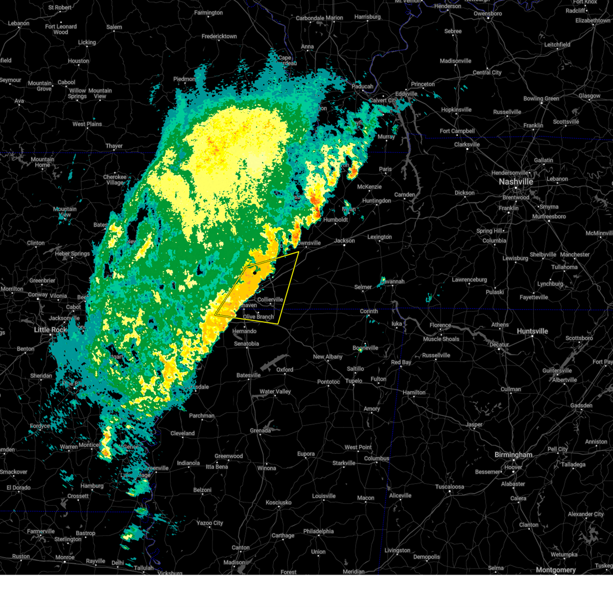 At 655 pm cst, a severe thunderstorm was located near olive branch, moving east at 55 mph (radar indicated). Hazards include 60 mph wind gusts and quarter size hail. Hail damage to vehicles is expected. expect wind damage to roofs, siding, and trees. Locations impacted include, bartlett, southaven, collierville, germantown, olive branch, west memphis, horn lake, millington, t o fuller state park, cordova, memphis, lakeland, arlington, munford, byhalia, walls, southwest memphis, ellendale, whitehaven, and frayser. At 655 pm cst, a severe thunderstorm was located near olive branch, moving east at 55 mph (radar indicated). Hazards include 60 mph wind gusts and quarter size hail. Hail damage to vehicles is expected. expect wind damage to roofs, siding, and trees. Locations impacted include, bartlett, southaven, collierville, germantown, olive branch, west memphis, horn lake, millington, t o fuller state park, cordova, memphis, lakeland, arlington, munford, byhalia, walls, southwest memphis, ellendale, whitehaven, and frayser.
|
| 2/15/2025 6:33 PM CST |
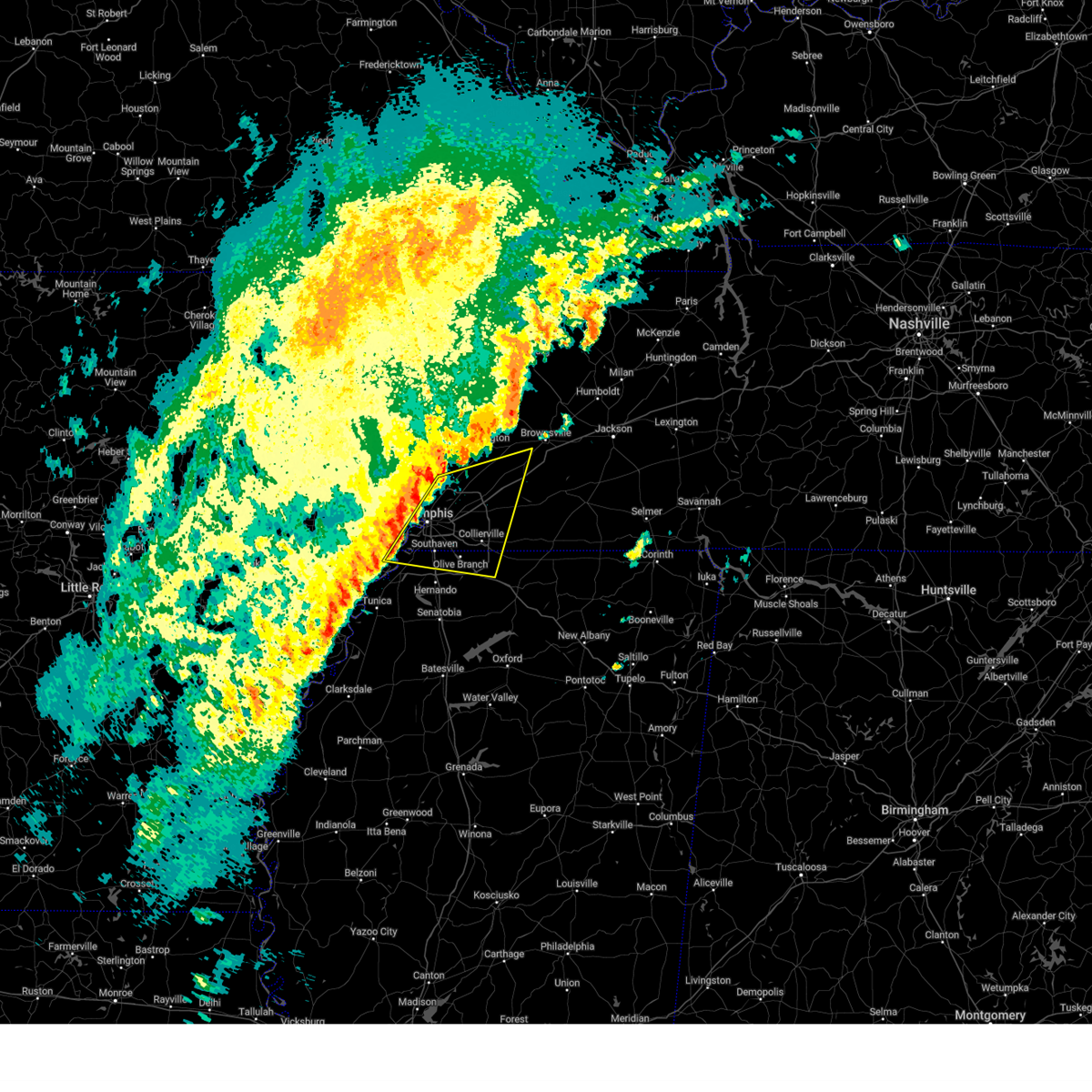 Svrmeg the national weather service in memphis has issued a * severe thunderstorm warning for, southeastern crittenden county in eastern arkansas, northern desoto county in northwestern mississippi, northwestern marshall county in northwestern mississippi, southeastern tipton county in west tennessee, western fayette county in west tennessee, southwestern haywood county in west tennessee, shelby county in west tennessee, * until 715 pm cst. * at 633 pm cst, a severe thunderstorm was located near t o fuller state park, moving east at 55 mph (radar indicated). Hazards include 60 mph wind gusts and quarter size hail. Hail damage to vehicles is expected. Expect wind damage to roofs, siding, and trees. Svrmeg the national weather service in memphis has issued a * severe thunderstorm warning for, southeastern crittenden county in eastern arkansas, northern desoto county in northwestern mississippi, northwestern marshall county in northwestern mississippi, southeastern tipton county in west tennessee, western fayette county in west tennessee, southwestern haywood county in west tennessee, shelby county in west tennessee, * until 715 pm cst. * at 633 pm cst, a severe thunderstorm was located near t o fuller state park, moving east at 55 mph (radar indicated). Hazards include 60 mph wind gusts and quarter size hail. Hail damage to vehicles is expected. Expect wind damage to roofs, siding, and trees.
|
| 1/5/2025 3:45 PM CST |
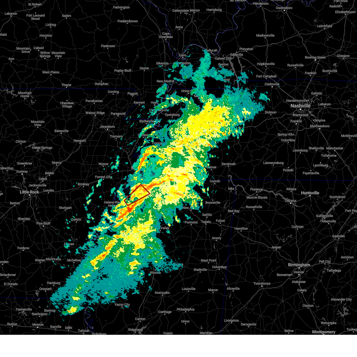 the tornado warning has been cancelled and is no longer in effect the tornado warning has been cancelled and is no longer in effect
|
| 1/5/2025 3:37 PM CST |
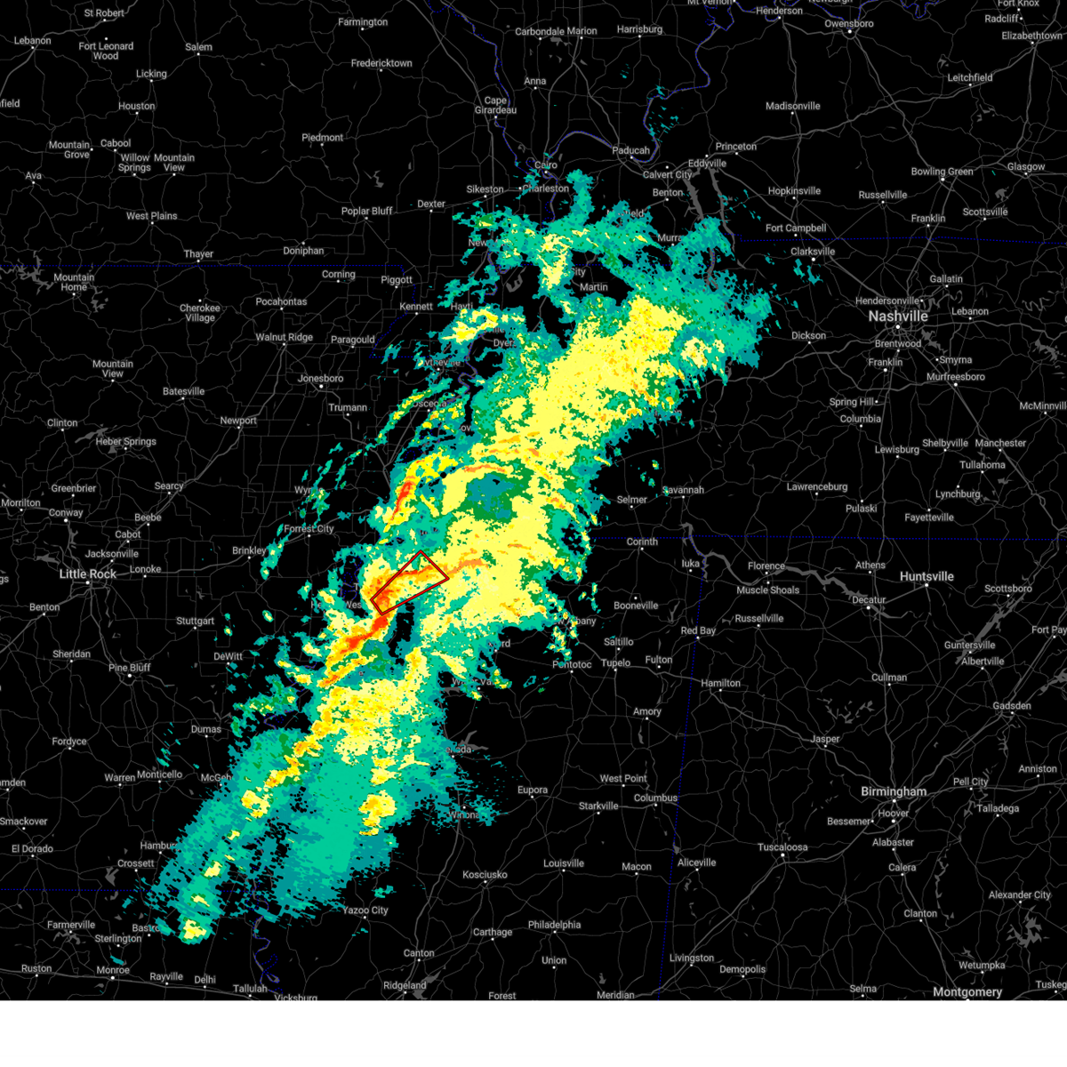 Tormeg the national weather service in memphis has issued a * tornado warning for, southern desoto county in northwestern mississippi, east central tunica county in northwestern mississippi, northwestern tate county in northwestern mississippi, * until 415 pm cst. * at 337 pm cst, a severe thunderstorm capable of producing a tornado was located over little texas, or 16 miles west of senatobia, moving northeast at 45 mph (radar indicated rotation). Hazards include tornado. Flying debris will be dangerous to those caught without shelter. mobile homes will be damaged or destroyed. damage to roofs, windows, and vehicles will occur. Tree damage is likely. Tormeg the national weather service in memphis has issued a * tornado warning for, southern desoto county in northwestern mississippi, east central tunica county in northwestern mississippi, northwestern tate county in northwestern mississippi, * until 415 pm cst. * at 337 pm cst, a severe thunderstorm capable of producing a tornado was located over little texas, or 16 miles west of senatobia, moving northeast at 45 mph (radar indicated rotation). Hazards include tornado. Flying debris will be dangerous to those caught without shelter. mobile homes will be damaged or destroyed. damage to roofs, windows, and vehicles will occur. Tree damage is likely.
|
| 1/5/2025 3:32 PM CST |
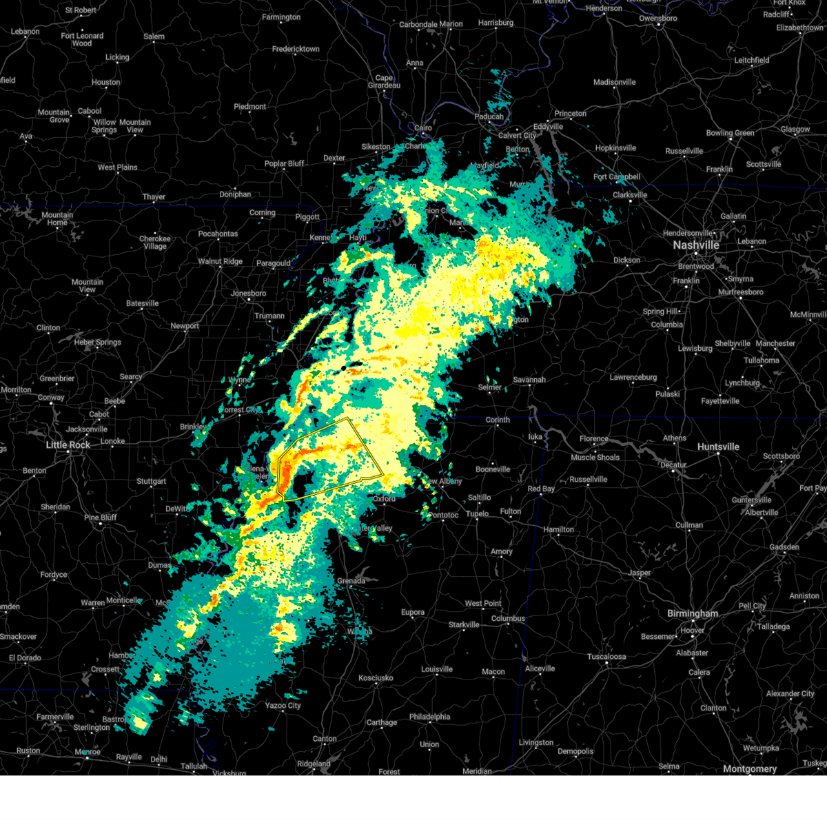 Svrmeg the national weather service in memphis has issued a * severe thunderstorm warning for, desoto county in northwestern mississippi, southwestern marshall county in northwestern mississippi, tunica county in northwestern mississippi, tate county in northwestern mississippi, northern quitman county in northwestern mississippi, northern panola county in northwestern mississippi, * until 415 pm cst. * at 332 pm cst, a severe thunderstorm was located over little texas, or 15 miles west of senatobia, moving northeast at 60 mph (radar indicated). Hazards include 60 mph wind gusts and penny size hail. expect damage to roofs, siding, and trees Svrmeg the national weather service in memphis has issued a * severe thunderstorm warning for, desoto county in northwestern mississippi, southwestern marshall county in northwestern mississippi, tunica county in northwestern mississippi, tate county in northwestern mississippi, northern quitman county in northwestern mississippi, northern panola county in northwestern mississippi, * until 415 pm cst. * at 332 pm cst, a severe thunderstorm was located over little texas, or 15 miles west of senatobia, moving northeast at 60 mph (radar indicated). Hazards include 60 mph wind gusts and penny size hail. expect damage to roofs, siding, and trees
|
| 12/16/2024 8:05 PM CST |
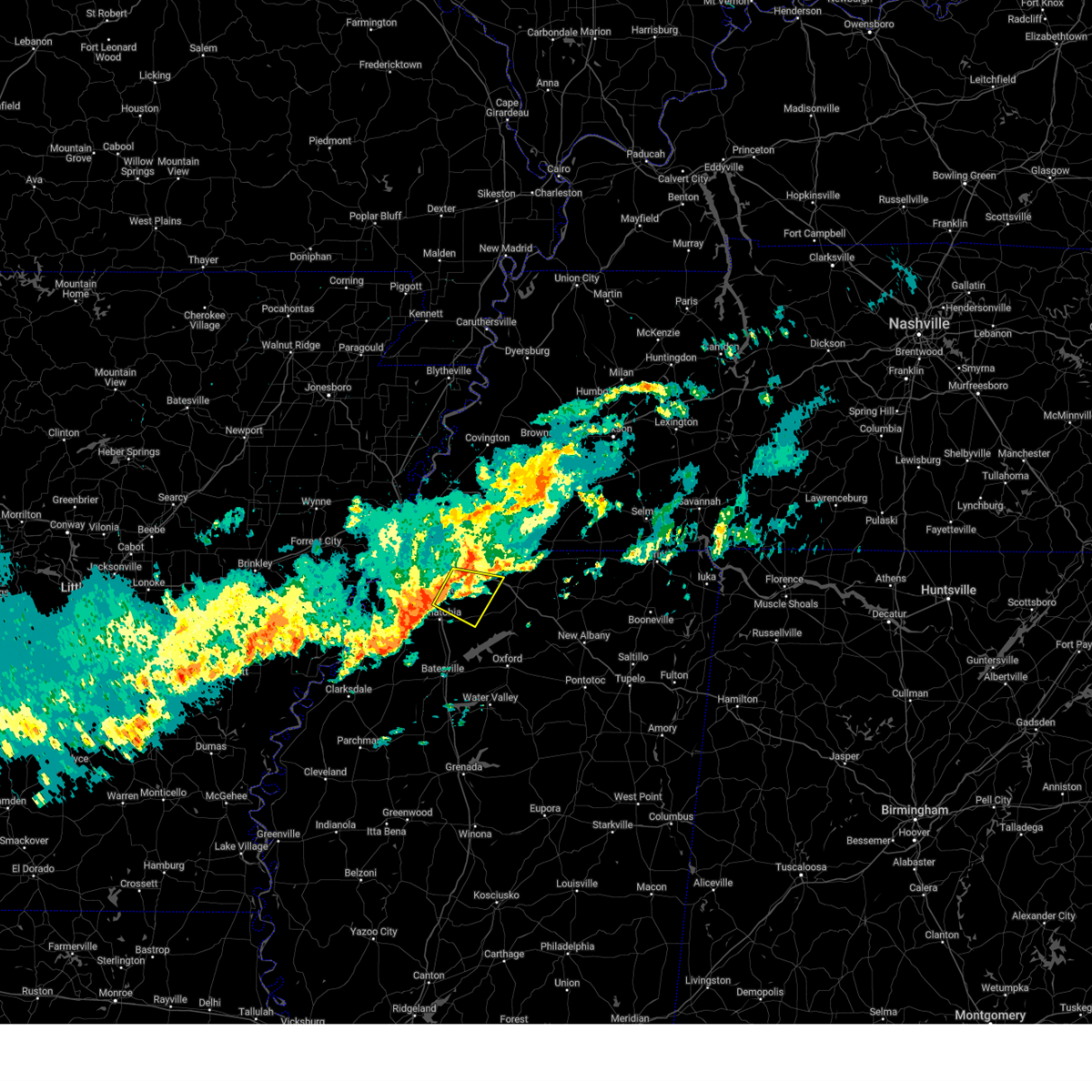 Svrmeg the national weather service in memphis has issued a * severe thunderstorm warning for, southeastern desoto county in northwestern mississippi, west central marshall county in northwestern mississippi, northeastern tate county in northwestern mississippi, * until 830 pm cst. * at 805 pm cst, a severe thunderstorm was located near lewisburg, or 8 miles east of hernando, moving southeast at 20 mph (radar indicated). Hazards include 60 mph wind gusts. expect damage to roofs, siding, and trees Svrmeg the national weather service in memphis has issued a * severe thunderstorm warning for, southeastern desoto county in northwestern mississippi, west central marshall county in northwestern mississippi, northeastern tate county in northwestern mississippi, * until 830 pm cst. * at 805 pm cst, a severe thunderstorm was located near lewisburg, or 8 miles east of hernando, moving southeast at 20 mph (radar indicated). Hazards include 60 mph wind gusts. expect damage to roofs, siding, and trees
|
| 8/30/2024 6:36 PM CDT |
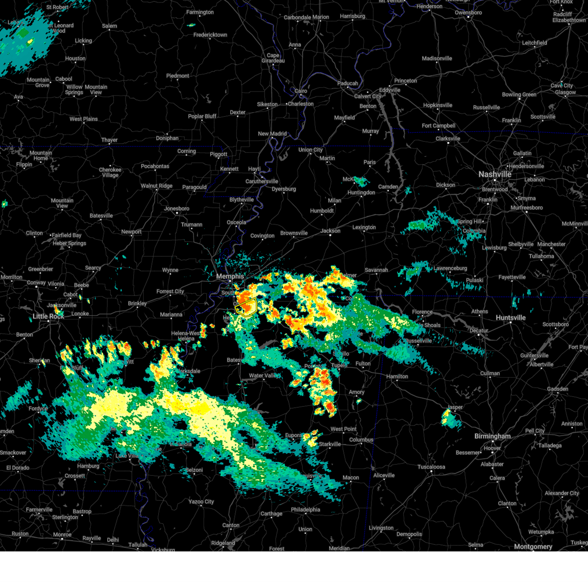 The storm which prompted the warning has weakened below severe limits, and no longer poses an immediate threat to life or property. therefore, the warning will be allowed to expire. however, small hail and gusty winds are still possible with this thunderstorm. The storm which prompted the warning has weakened below severe limits, and no longer poses an immediate threat to life or property. therefore, the warning will be allowed to expire. however, small hail and gusty winds are still possible with this thunderstorm.
|
| 8/30/2024 6:31 PM CDT |
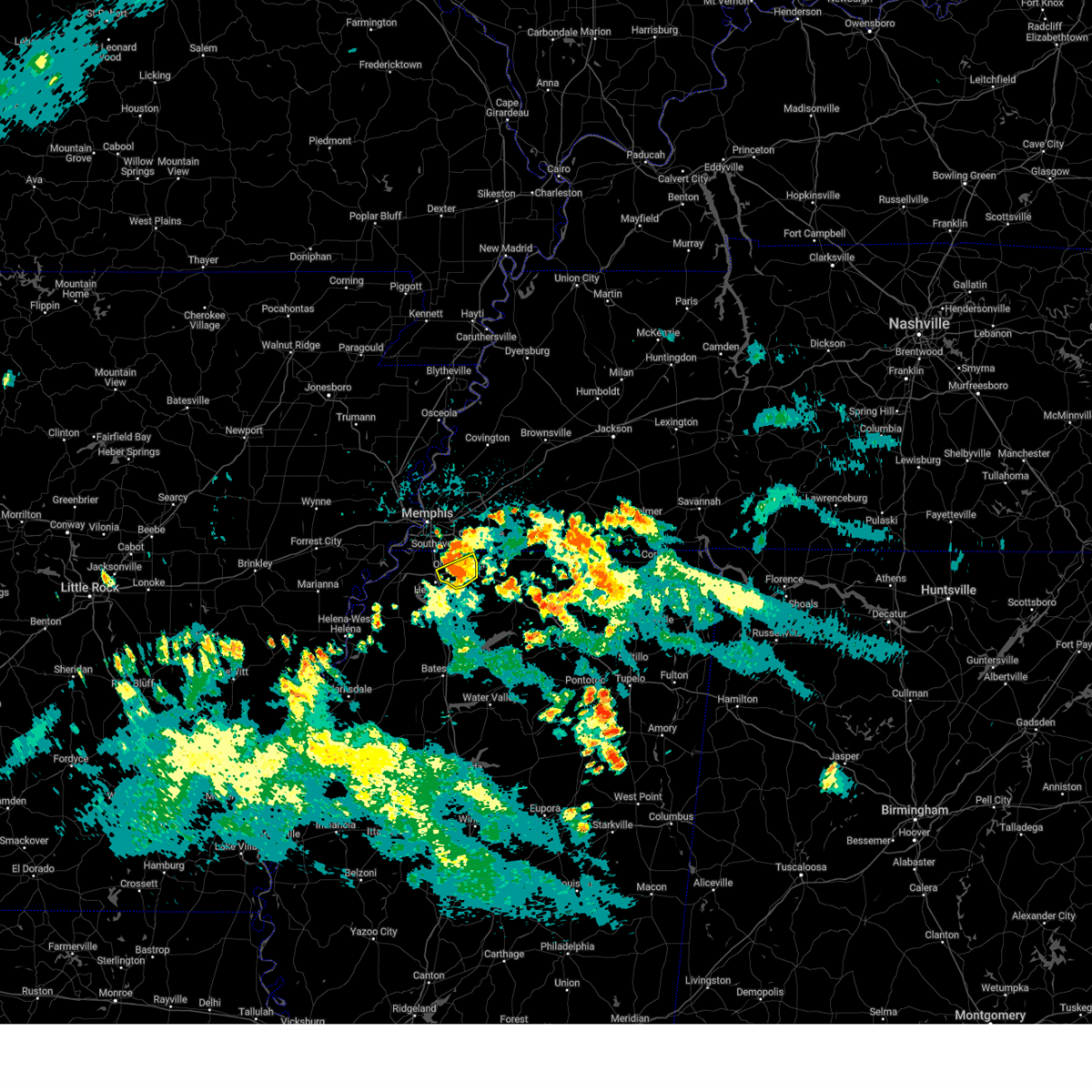 At 631 pm cdt, a severe thunderstorm was located over coldwater, or near senatobia, moving northwest at 10 mph (radar indicated). Hazards include 60 mph wind gusts and quarter size hail. Hail damage to vehicles is expected. expect wind damage to roofs, siding, and trees. Locations impacted include, southaven, olive branch, hernando, lewisburg, fairhaven, miller, cockrum, cedarview, bright, and handy corner. At 631 pm cdt, a severe thunderstorm was located over coldwater, or near senatobia, moving northwest at 10 mph (radar indicated). Hazards include 60 mph wind gusts and quarter size hail. Hail damage to vehicles is expected. expect wind damage to roofs, siding, and trees. Locations impacted include, southaven, olive branch, hernando, lewisburg, fairhaven, miller, cockrum, cedarview, bright, and handy corner.
|
| 8/30/2024 6:14 PM CDT |
 At 614 pm cdt, a severe thunderstorm was located near coldwater, or near senatobia, moving northwest at 10 mph (radar indicated). Hazards include 60 mph wind gusts and quarter size hail. Hail damage to vehicles is expected. expect wind damage to roofs, siding, and trees. Locations impacted include, southaven, olive branch, hernando, lewisburg, eudora, robinson gin, trinity, fairhaven, alphaba, cockrum, frees corners, cedarview, bright, nesbit, handy corner, love, and miller. At 614 pm cdt, a severe thunderstorm was located near coldwater, or near senatobia, moving northwest at 10 mph (radar indicated). Hazards include 60 mph wind gusts and quarter size hail. Hail damage to vehicles is expected. expect wind damage to roofs, siding, and trees. Locations impacted include, southaven, olive branch, hernando, lewisburg, eudora, robinson gin, trinity, fairhaven, alphaba, cockrum, frees corners, cedarview, bright, nesbit, handy corner, love, and miller.
|
| 8/30/2024 6:14 PM CDT |
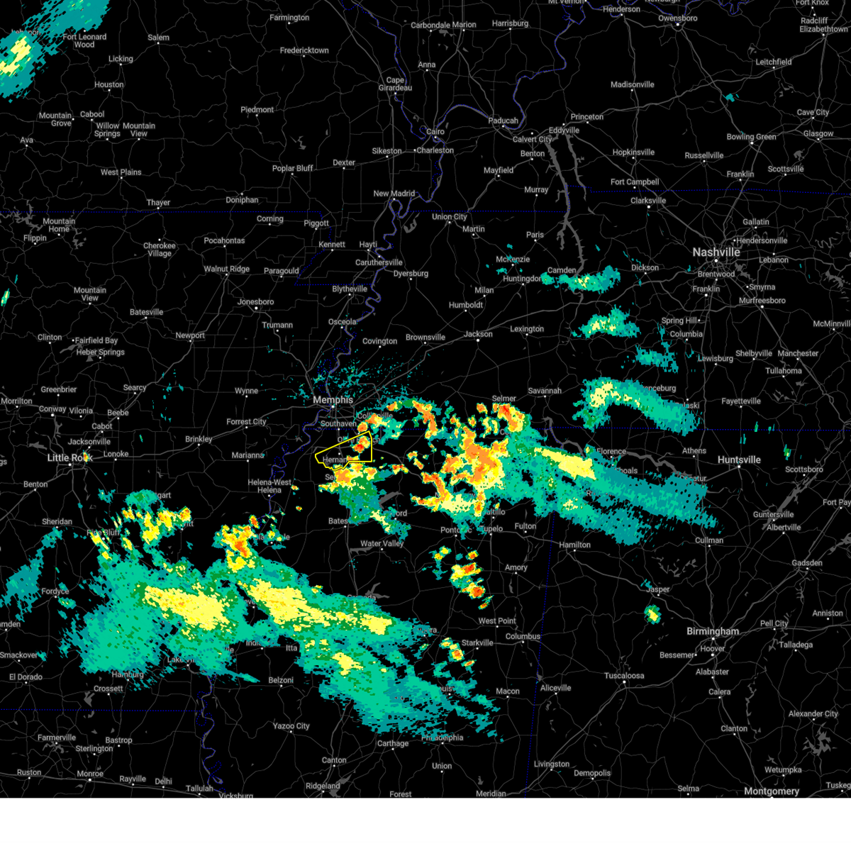 the severe thunderstorm warning has been cancelled and is no longer in effect the severe thunderstorm warning has been cancelled and is no longer in effect
|
| 8/30/2024 5:55 PM CDT |
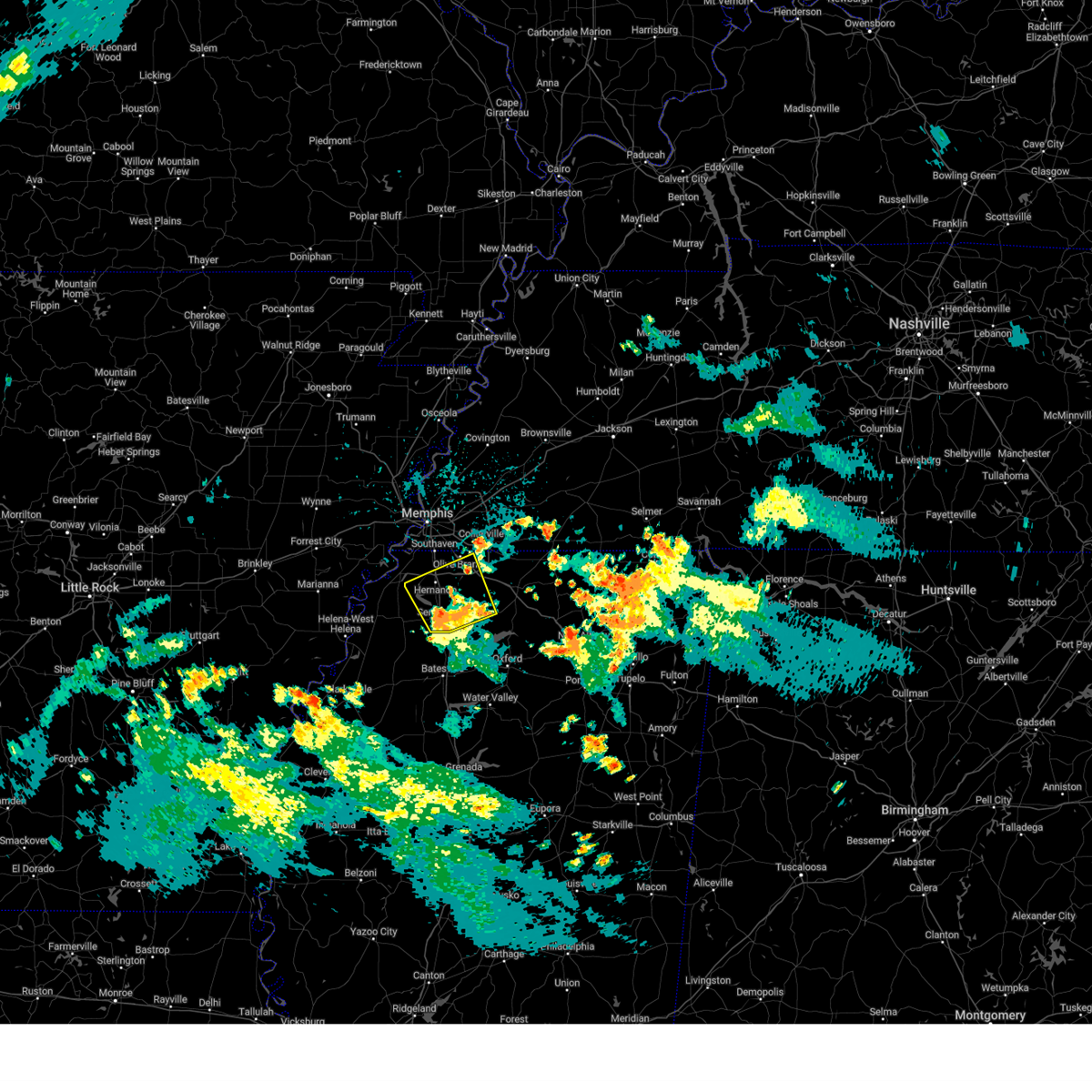 Svrmeg the national weather service in memphis has issued a * severe thunderstorm warning for, southeastern desoto county in northwestern mississippi, west central marshall county in northwestern mississippi, tate county in northwestern mississippi, * until 645 pm cdt. * at 555 pm cdt, a severe thunderstorm was located near senatobia, moving northwest at 10 mph (radar indicated). Hazards include 60 mph wind gusts and quarter size hail. Hail damage to vehicles is expected. Expect wind damage to roofs, siding, and trees. Svrmeg the national weather service in memphis has issued a * severe thunderstorm warning for, southeastern desoto county in northwestern mississippi, west central marshall county in northwestern mississippi, tate county in northwestern mississippi, * until 645 pm cdt. * at 555 pm cdt, a severe thunderstorm was located near senatobia, moving northwest at 10 mph (radar indicated). Hazards include 60 mph wind gusts and quarter size hail. Hail damage to vehicles is expected. Expect wind damage to roofs, siding, and trees.
|
| 5/27/2024 1:14 AM CDT |
 Svrmeg the national weather service in memphis has issued a * severe thunderstorm warning for, southeastern desoto county in northwestern mississippi, northwestern marshall county in northwestern mississippi, northeastern tate county in northwestern mississippi, * until 200 am cdt. * at 114 am cdt, a severe thunderstorm was located over hernando, moving east at 30 mph (radar indicated). Hazards include 60 mph wind gusts and quarter size hail. Hail damage to vehicles is expected. Expect wind damage to roofs, siding, and trees. Svrmeg the national weather service in memphis has issued a * severe thunderstorm warning for, southeastern desoto county in northwestern mississippi, northwestern marshall county in northwestern mississippi, northeastern tate county in northwestern mississippi, * until 200 am cdt. * at 114 am cdt, a severe thunderstorm was located over hernando, moving east at 30 mph (radar indicated). Hazards include 60 mph wind gusts and quarter size hail. Hail damage to vehicles is expected. Expect wind damage to roofs, siding, and trees.
|
| 5/27/2024 12:05 AM CDT |
 Svrmeg the national weather service in memphis has issued a * severe thunderstorm warning for, northeastern st. francis county in eastern arkansas, central crittenden county in eastern arkansas, northern desoto county in northwestern mississippi, west central fayette county in west tennessee, southern shelby county in west tennessee, * until 1245 am cdt. * at 1205 am cdt, a severe thunderstorm was located near west memphis, moving east at 45 mph (radar indicated). Hazards include 60 mph wind gusts and nickel size hail. expect damage to roofs, siding, and trees Svrmeg the national weather service in memphis has issued a * severe thunderstorm warning for, northeastern st. francis county in eastern arkansas, central crittenden county in eastern arkansas, northern desoto county in northwestern mississippi, west central fayette county in west tennessee, southern shelby county in west tennessee, * until 1245 am cdt. * at 1205 am cdt, a severe thunderstorm was located near west memphis, moving east at 45 mph (radar indicated). Hazards include 60 mph wind gusts and nickel size hail. expect damage to roofs, siding, and trees
|
| 5/24/2024 5:56 PM CDT |
 At 556 pm cdt, a severe thunderstorm was located over coldwater, or near senatobia, moving east at 15 mph (radar indicated). Hazards include golf ball size hail and 60 mph wind gusts. People and animals outdoors will be injured. expect hail damage to roofs, siding, windows, and vehicles. expect wind damage to roofs, siding, and trees. Locations impacted include, hernando, senatobia, coldwater, independence, arkabutla, robinson gin, wakefield, looxahoma, lurline, alphaba, frees corners, crossroad, new garden, love, poagville, bett, new town, rockhill, and bluff. At 556 pm cdt, a severe thunderstorm was located over coldwater, or near senatobia, moving east at 15 mph (radar indicated). Hazards include golf ball size hail and 60 mph wind gusts. People and animals outdoors will be injured. expect hail damage to roofs, siding, windows, and vehicles. expect wind damage to roofs, siding, and trees. Locations impacted include, hernando, senatobia, coldwater, independence, arkabutla, robinson gin, wakefield, looxahoma, lurline, alphaba, frees corners, crossroad, new garden, love, poagville, bett, new town, rockhill, and bluff.
|
| 5/24/2024 5:42 PM CDT |
 Svrmeg the national weather service in memphis has issued a * severe thunderstorm warning for, southeastern desoto county in northwestern mississippi, central tate county in northwestern mississippi, * until 630 pm cdt. * at 542 pm cdt, a severe thunderstorm was located near coldwater, or 8 miles southwest of hernando, moving southeast at 15 mph (radar indicated). Hazards include two inch hail and 60 mph wind gusts. People and animals outdoors will be injured. expect hail damage to roofs, siding, windows, and vehicles. Expect wind damage to roofs, siding, and trees. Svrmeg the national weather service in memphis has issued a * severe thunderstorm warning for, southeastern desoto county in northwestern mississippi, central tate county in northwestern mississippi, * until 630 pm cdt. * at 542 pm cdt, a severe thunderstorm was located near coldwater, or 8 miles southwest of hernando, moving southeast at 15 mph (radar indicated). Hazards include two inch hail and 60 mph wind gusts. People and animals outdoors will be injured. expect hail damage to roofs, siding, windows, and vehicles. Expect wind damage to roofs, siding, and trees.
|
| 5/24/2024 5:31 PM CDT |
 the severe thunderstorm warning has been cancelled and is no longer in effect the severe thunderstorm warning has been cancelled and is no longer in effect
|
| 5/24/2024 5:31 PM CDT |
 At 531 pm cdt, a severe thunderstorm was located near hernando, moving east at 25 mph (radar indicated). Hazards include 60 mph wind gusts and quarter size hail. Hail damage to vehicles is expected. expect wind damage to roofs, siding, and trees. Locations impacted include, hernando, senatobia, coldwater, independence, arkabutla, phillipp, strayhorn, eudora, robinson gin, trinity, lurline, alphaba, frees corners, bright, love, and poagville. At 531 pm cdt, a severe thunderstorm was located near hernando, moving east at 25 mph (radar indicated). Hazards include 60 mph wind gusts and quarter size hail. Hail damage to vehicles is expected. expect wind damage to roofs, siding, and trees. Locations impacted include, hernando, senatobia, coldwater, independence, arkabutla, phillipp, strayhorn, eudora, robinson gin, trinity, lurline, alphaba, frees corners, bright, love, and poagville.
|
| 5/24/2024 5:15 PM CDT |
 At 514 pm cdt, a severe thunderstorm was located near arkabutla, or near hernando, moving east at 25 mph (radar indicated). Hazards include 60 mph wind gusts and quarter size hail. Hail damage to vehicles is expected. expect wind damage to roofs, siding, and trees. Locations impacted include, hernando, senatobia, coldwater, independence, arkabutla, phillipp, strayhorn, eudora, robinson gin, trinity, lurline, dooley, alphaba, frees corners, bright, lost lake, prichard, love, banks, and poagville. At 514 pm cdt, a severe thunderstorm was located near arkabutla, or near hernando, moving east at 25 mph (radar indicated). Hazards include 60 mph wind gusts and quarter size hail. Hail damage to vehicles is expected. expect wind damage to roofs, siding, and trees. Locations impacted include, hernando, senatobia, coldwater, independence, arkabutla, phillipp, strayhorn, eudora, robinson gin, trinity, lurline, dooley, alphaba, frees corners, bright, lost lake, prichard, love, banks, and poagville.
|
| 5/24/2024 4:55 PM CDT |
 Svrmeg the national weather service in memphis has issued a * severe thunderstorm warning for, southern desoto county in northwestern mississippi, northeastern tunica county in northwestern mississippi, central tate county in northwestern mississippi, * until 545 pm cdt. * at 455 pm cdt, a severe thunderstorm was located over phillipp, or 13 miles southwest of hernando, moving east at 25 mph (radar indicated). Hazards include 60 mph wind gusts and half dollar size hail. Hail damage to vehicles is expected. Expect wind damage to roofs, siding, and trees. Svrmeg the national weather service in memphis has issued a * severe thunderstorm warning for, southern desoto county in northwestern mississippi, northeastern tunica county in northwestern mississippi, central tate county in northwestern mississippi, * until 545 pm cdt. * at 455 pm cdt, a severe thunderstorm was located over phillipp, or 13 miles southwest of hernando, moving east at 25 mph (radar indicated). Hazards include 60 mph wind gusts and half dollar size hail. Hail damage to vehicles is expected. Expect wind damage to roofs, siding, and trees.
|
| 5/24/2024 4:52 PM CDT |
 At 452 pm cdt, a severe thunderstorm was located over pinckney, or 9 miles east of hughes, moving east at 15 mph (radar indicated). Hazards include 60 mph wind gusts and quarter size hail. Hail damage to vehicles is expected. expect wind damage to roofs, siding, and trees. Locations impacted include, southaven, west memphis, horn lake, hernando, t o fuller state park, memphis, walls, horseshoe lake, anthonyville, pinckney, lake cormorant, southwest memphis, lynchburg, simsboro, whitehaven, newport, kate, louise, nesbit, and presidents island. At 452 pm cdt, a severe thunderstorm was located over pinckney, or 9 miles east of hughes, moving east at 15 mph (radar indicated). Hazards include 60 mph wind gusts and quarter size hail. Hail damage to vehicles is expected. expect wind damage to roofs, siding, and trees. Locations impacted include, southaven, west memphis, horn lake, hernando, t o fuller state park, memphis, walls, horseshoe lake, anthonyville, pinckney, lake cormorant, southwest memphis, lynchburg, simsboro, whitehaven, newport, kate, louise, nesbit, and presidents island.
|
| 5/24/2024 4:32 PM CDT |
 Svrmeg the national weather service in memphis has issued a * severe thunderstorm warning for, east central st. francis county in eastern arkansas, southern crittenden county in eastern arkansas, northwestern desoto county in northwestern mississippi, southwestern shelby county in west tennessee, * until 515 pm cdt. * at 432 pm cdt, a severe thunderstorm was located over simsboro, or near hughes, moving east at 20 mph (radar indicated). Hazards include 60 mph wind gusts and quarter size hail. Hail damage to vehicles is expected. Expect wind damage to roofs, siding, and trees. Svrmeg the national weather service in memphis has issued a * severe thunderstorm warning for, east central st. francis county in eastern arkansas, southern crittenden county in eastern arkansas, northwestern desoto county in northwestern mississippi, southwestern shelby county in west tennessee, * until 515 pm cdt. * at 432 pm cdt, a severe thunderstorm was located over simsboro, or near hughes, moving east at 20 mph (radar indicated). Hazards include 60 mph wind gusts and quarter size hail. Hail damage to vehicles is expected. Expect wind damage to roofs, siding, and trees.
|
| 5/18/2024 5:20 AM CDT |
 The storm which prompted the warning has weakened below severe limits, and no longer poses an immediate threat to life or property. therefore, the warning will be allowed to expire. The storm which prompted the warning has weakened below severe limits, and no longer poses an immediate threat to life or property. therefore, the warning will be allowed to expire.
|
| 5/18/2024 4:57 AM CDT |
 At 457 am cdt, a severe thunderstorm was located near robinsonville, or 14 miles west of hernando, moving east at 20 mph (radar indicated). Hazards include 60 mph wind gusts and nickel size hail. Expect damage to roofs, siding, and trees. Locations impacted include, horn lake, hernando, lake cormorant, phillipp, eudora, robinsonville, robinson gin, newport, clack, trinity, alden, twin lakes, frees corners, commerce, nesbit, west days, lost lake, prichard, banks, and penton. At 457 am cdt, a severe thunderstorm was located near robinsonville, or 14 miles west of hernando, moving east at 20 mph (radar indicated). Hazards include 60 mph wind gusts and nickel size hail. Expect damage to roofs, siding, and trees. Locations impacted include, horn lake, hernando, lake cormorant, phillipp, eudora, robinsonville, robinson gin, newport, clack, trinity, alden, twin lakes, frees corners, commerce, nesbit, west days, lost lake, prichard, banks, and penton.
|
| 5/18/2024 4:40 AM CDT |
 Svrmeg the national weather service in memphis has issued a * severe thunderstorm warning for, western desoto county in northwestern mississippi, northeastern tunica county in northwestern mississippi, northwestern tate county in northwestern mississippi, * until 530 am cdt. * at 440 am cdt, a severe thunderstorm was located near robinsonville, or 14 miles southeast of hughes, moving east at 20 mph (radar indicated). Hazards include 60 mph wind gusts and quarter size hail. Hail damage to vehicles is expected. Expect wind damage to roofs, siding, and trees. Svrmeg the national weather service in memphis has issued a * severe thunderstorm warning for, western desoto county in northwestern mississippi, northeastern tunica county in northwestern mississippi, northwestern tate county in northwestern mississippi, * until 530 am cdt. * at 440 am cdt, a severe thunderstorm was located near robinsonville, or 14 miles southeast of hughes, moving east at 20 mph (radar indicated). Hazards include 60 mph wind gusts and quarter size hail. Hail damage to vehicles is expected. Expect wind damage to roofs, siding, and trees.
|
| 5/9/2024 4:25 AM CDT |
 The storm which prompted the warning has weakened below severe limits, and no longer poses an immediate threat to life or property. therefore, the warning will be allowed to expire. however, small hail and gusty winds are still possible with this thunderstorm. The storm which prompted the warning has weakened below severe limits, and no longer poses an immediate threat to life or property. therefore, the warning will be allowed to expire. however, small hail and gusty winds are still possible with this thunderstorm.
|
| 5/9/2024 4:14 AM CDT |
 the severe thunderstorm warning has been cancelled and is no longer in effect the severe thunderstorm warning has been cancelled and is no longer in effect
|
| 5/9/2024 4:14 AM CDT |
 At 414 am cdt, a severe thunderstorm was located over whitehaven, or near horn lake, moving east at 45 mph (radar indicated). Hazards include 60 mph wind gusts and quarter size hail. Hail damage to vehicles is expected. expect wind damage to roofs, siding, and trees. Locations impacted include, southaven, germantown, olive branch, horn lake, hernando, cordova, memphis, southwest memphis, lynchburg, southeast memphis, downtown memphis, lewisburg, whitehaven, midtown memphis, cedarview, nesbit, handy corner, capleville, jago, and alden. At 414 am cdt, a severe thunderstorm was located over whitehaven, or near horn lake, moving east at 45 mph (radar indicated). Hazards include 60 mph wind gusts and quarter size hail. Hail damage to vehicles is expected. expect wind damage to roofs, siding, and trees. Locations impacted include, southaven, germantown, olive branch, horn lake, hernando, cordova, memphis, southwest memphis, lynchburg, southeast memphis, downtown memphis, lewisburg, whitehaven, midtown memphis, cedarview, nesbit, handy corner, capleville, jago, and alden.
|
| 5/9/2024 4:00 AM CDT |
 At 359 am cdt, a severe thunderstorm was located near pinckney, or near t o fuller state park, moving east at 45 mph (radar indicated). Hazards include 60 mph wind gusts and quarter size hail. Hail damage to vehicles is expected. expect wind damage to roofs, siding, and trees. Locations impacted include, southaven, germantown, olive branch, west memphis, horn lake, hernando, hughes, t o fuller state park, cordova, memphis, walls, edmondson, horseshoe lake, anthonyville, lake cormorant, southwest memphis, simsboro, lewisburg, whitehaven, and midtown memphis. At 359 am cdt, a severe thunderstorm was located near pinckney, or near t o fuller state park, moving east at 45 mph (radar indicated). Hazards include 60 mph wind gusts and quarter size hail. Hail damage to vehicles is expected. expect wind damage to roofs, siding, and trees. Locations impacted include, southaven, germantown, olive branch, west memphis, horn lake, hernando, hughes, t o fuller state park, cordova, memphis, walls, edmondson, horseshoe lake, anthonyville, lake cormorant, southwest memphis, simsboro, lewisburg, whitehaven, and midtown memphis.
|
| 5/9/2024 3:44 AM CDT |
 Svrmeg the national weather service in memphis has issued a * severe thunderstorm warning for, eastern st. francis county in eastern arkansas, southern crittenden county in eastern arkansas, northern desoto county in northwestern mississippi, southern shelby county in west tennessee, * until 430 am cdt. * at 344 am cdt, a severe thunderstorm was located over simsboro, or near hughes, moving east at 45 mph (radar indicated). Hazards include 60 mph wind gusts and quarter size hail. Hail damage to vehicles is expected. Expect wind damage to roofs, siding, and trees. Svrmeg the national weather service in memphis has issued a * severe thunderstorm warning for, eastern st. francis county in eastern arkansas, southern crittenden county in eastern arkansas, northern desoto county in northwestern mississippi, southern shelby county in west tennessee, * until 430 am cdt. * at 344 am cdt, a severe thunderstorm was located over simsboro, or near hughes, moving east at 45 mph (radar indicated). Hazards include 60 mph wind gusts and quarter size hail. Hail damage to vehicles is expected. Expect wind damage to roofs, siding, and trees.
|
| 4/2/2024 7:46 AM CDT |
 the severe thunderstorm warning has been cancelled and is no longer in effect the severe thunderstorm warning has been cancelled and is no longer in effect
|
| 4/2/2024 7:46 AM CDT |
 At 746 am cdt, a severe thunderstorm was located over southwest memphis, or over t o fuller state park, moving northeast at 55 mph (radar indicated). Hazards include 60 mph wind gusts and quarter size hail. Hail damage to vehicles is expected. expect wind damage to roofs, siding, and trees. Locations impacted include, bartlett, southaven, collierville, germantown, olive branch, west memphis, horn lake, hernando, marion, millington, t o fuller state park, meeman shelby forest state park, cordova, memphis, lakeland, arlington, walls, edmondson, horseshoe lake, and sunset. At 746 am cdt, a severe thunderstorm was located over southwest memphis, or over t o fuller state park, moving northeast at 55 mph (radar indicated). Hazards include 60 mph wind gusts and quarter size hail. Hail damage to vehicles is expected. expect wind damage to roofs, siding, and trees. Locations impacted include, bartlett, southaven, collierville, germantown, olive branch, west memphis, horn lake, hernando, marion, millington, t o fuller state park, meeman shelby forest state park, cordova, memphis, lakeland, arlington, walls, edmondson, horseshoe lake, and sunset.
|
| 4/2/2024 7:29 AM CDT |
 Svrmeg the national weather service in memphis has issued a * severe thunderstorm warning for, northeastern lee county in eastern arkansas, southeastern st. francis county in eastern arkansas, southern crittenden county in eastern arkansas, northern desoto county in northwestern mississippi, northern tunica county in northwestern mississippi, shelby county in west tennessee, * until 815 am cdt. * at 729 am cdt, a severe thunderstorm was located over horseshoe lake, or 9 miles east of hughes, moving northeast at 70 mph (radar indicated). Hazards include 60 mph wind gusts and half dollar size hail. Hail damage to vehicles is expected. Expect wind damage to roofs, siding, and trees. Svrmeg the national weather service in memphis has issued a * severe thunderstorm warning for, northeastern lee county in eastern arkansas, southeastern st. francis county in eastern arkansas, southern crittenden county in eastern arkansas, northern desoto county in northwestern mississippi, northern tunica county in northwestern mississippi, shelby county in west tennessee, * until 815 am cdt. * at 729 am cdt, a severe thunderstorm was located over horseshoe lake, or 9 miles east of hughes, moving northeast at 70 mph (radar indicated). Hazards include 60 mph wind gusts and half dollar size hail. Hail damage to vehicles is expected. Expect wind damage to roofs, siding, and trees.
|
| 1/12/2024 7:39 AM CST |
 The severe thunderstorm warning for desoto, northeastern tunica, northwestern tate and eastern shelby counties will expire at 745 am cst, the storms which prompted the warning have weakened below severe limits, and no longer pose an immediate threat to life or property. therefore, the warning will be allowed to expire. however, gusty winds and heavy rain are still possible with these thunderstorms. a tornado watch remains in effect until 1100 am cst for northwestern mississippi, and west tennessee. The severe thunderstorm warning for desoto, northeastern tunica, northwestern tate and eastern shelby counties will expire at 745 am cst, the storms which prompted the warning have weakened below severe limits, and no longer pose an immediate threat to life or property. therefore, the warning will be allowed to expire. however, gusty winds and heavy rain are still possible with these thunderstorms. a tornado watch remains in effect until 1100 am cst for northwestern mississippi, and west tennessee.
|
| 1/12/2024 7:19 AM CST |
 At 718 am cst, severe thunderstorms were located along a line extending from near meeman shelby forest state park to near little texas, moving northeast at 65 mph (radar indicated). Hazards include 60 mph wind gusts. Expect damage to roofs, siding, and trees. locations impacted include, bartlett, southaven, germantown, olive branch, horn lake, hernando, millington, cordova, memphis, lakeland, arlington, coldwater, walls, lake cormorant, ellendale, eudora, lewisburg, arkabutla, lynchburg, and phillipp. hail threat, radar indicated max hail size, <. 75 in wind threat, radar indicated max wind gust, 60 mph. At 718 am cst, severe thunderstorms were located along a line extending from near meeman shelby forest state park to near little texas, moving northeast at 65 mph (radar indicated). Hazards include 60 mph wind gusts. Expect damage to roofs, siding, and trees. locations impacted include, bartlett, southaven, germantown, olive branch, horn lake, hernando, millington, cordova, memphis, lakeland, arlington, coldwater, walls, lake cormorant, ellendale, eudora, lewisburg, arkabutla, lynchburg, and phillipp. hail threat, radar indicated max hail size, <. 75 in wind threat, radar indicated max wind gust, 60 mph.
|
| 1/12/2024 6:56 AM CST |
 At 656 am cst, severe thunderstorms were located along a line extending from near jennette to near helena-west helena, moving northeast at 60 mph (radar indicated). Hazards include 60 mph wind gusts. expect damage to roofs, siding, and trees At 656 am cst, severe thunderstorms were located along a line extending from near jennette to near helena-west helena, moving northeast at 60 mph (radar indicated). Hazards include 60 mph wind gusts. expect damage to roofs, siding, and trees
|
| 12/9/2023 2:37 PM CST |
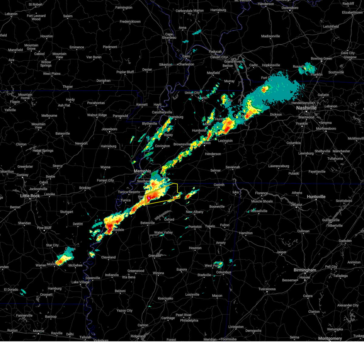 At 236 pm cst, a severe thunderstorm was located near independence, or 9 miles southeast of hernando, moving east at 45 mph (radar indicated). Hazards include tennis ball size hail. People and animals outdoors will be injured. expect damage to roofs, siding, windows, and vehicles. Locations impacted include, hernando, holly springs, coldwater, byhalia, mt pleasant, independence, lewisburg, red banks, slayden, marianna, coal oil corner, wakefield, cockrum, higdon, watson, taska, poagville, lurline, alphaba, and victoria. At 236 pm cst, a severe thunderstorm was located near independence, or 9 miles southeast of hernando, moving east at 45 mph (radar indicated). Hazards include tennis ball size hail. People and animals outdoors will be injured. expect damage to roofs, siding, windows, and vehicles. Locations impacted include, hernando, holly springs, coldwater, byhalia, mt pleasant, independence, lewisburg, red banks, slayden, marianna, coal oil corner, wakefield, cockrum, higdon, watson, taska, poagville, lurline, alphaba, and victoria.
|
| 12/9/2023 2:36 PM CST |
 At 235 pm cst, a severe thunderstorm was located near independence, or 9 miles southeast of hernando, moving east at 45 mph (radar indicated). Hazards include golf ball size hail. People and animals outdoors will be injured. expect damage to roofs, siding, windows, and vehicles. Locations impacted include, hernando, holly springs, coldwater, byhalia, mt pleasant, independence, lewisburg, red banks, slayden, marianna, coal oil corner, wakefield, cockrum, higdon, watson, taska, poagville, lurline, alphaba, and victoria. At 235 pm cst, a severe thunderstorm was located near independence, or 9 miles southeast of hernando, moving east at 45 mph (radar indicated). Hazards include golf ball size hail. People and animals outdoors will be injured. expect damage to roofs, siding, windows, and vehicles. Locations impacted include, hernando, holly springs, coldwater, byhalia, mt pleasant, independence, lewisburg, red banks, slayden, marianna, coal oil corner, wakefield, cockrum, higdon, watson, taska, poagville, lurline, alphaba, and victoria.
|
| 12/9/2023 2:32 PM CST |
 At 220 pm cst, a severe thunderstorm was located near arkabutla, or 8 miles northwest of senatobia, moving northeast at 45 mph (radar indicated). Hazards include 60 mph wind gusts and half dollar size hail. Hail damage to vehicles is expected. expect wind damage to roofs, siding, and trees. Locations impacted include, hernando, senatobia, coldwater, arkabutla, robinson gin, alphaba, love, poagville, and bright. At 220 pm cst, a severe thunderstorm was located near arkabutla, or 8 miles northwest of senatobia, moving northeast at 45 mph (radar indicated). Hazards include 60 mph wind gusts and half dollar size hail. Hail damage to vehicles is expected. expect wind damage to roofs, siding, and trees. Locations impacted include, hernando, senatobia, coldwater, arkabutla, robinson gin, alphaba, love, poagville, and bright.
|
| 12/9/2023 2:32 PM CST |
 At 231 pm cst, a severe thunderstorm was located near coldwater, or 7 miles southeast of hernando, moving east at 45 mph (radar indicated). Hazards include ping pong ball size hail. People and animals outdoors will be injured. Expect damage to roofs, siding, windows, and vehicles. At 231 pm cst, a severe thunderstorm was located near coldwater, or 7 miles southeast of hernando, moving east at 45 mph (radar indicated). Hazards include ping pong ball size hail. People and animals outdoors will be injured. Expect damage to roofs, siding, windows, and vehicles.
|
| 12/9/2023 2:23 PM CST | Quarter sized hail reported 6.4 miles NNW of Hernando, MS, quarter-sized hail in the love community. |
| 12/9/2023 2:20 PM CST | Golf Ball sized hail reported 7.6 miles N of Hernando, MS, golf ball-sized hail at highway 51 and thunderbird dr. |
| 12/9/2023 2:08 PM CST |
 At 208 pm cst, a severe thunderstorm was located near little texas, or 15 miles west of senatobia, moving east at 20 mph (radar indicated). Hazards include 60 mph wind gusts and quarter size hail. Hail damage to vehicles is expected. Expect wind damage to roofs, siding, and trees. At 208 pm cst, a severe thunderstorm was located near little texas, or 15 miles west of senatobia, moving east at 20 mph (radar indicated). Hazards include 60 mph wind gusts and quarter size hail. Hail damage to vehicles is expected. Expect wind damage to roofs, siding, and trees.
|
| 12/9/2023 1:24 PM CST |
 At 123 pm cst, a severe thunderstorm capable of producing a tornado was located near st francis national park, moving northeast at 45 mph (radar indicated rotation). Hazards include tornado and quarter size hail. Flying debris will be dangerous to those caught without shelter. mobile homes will be damaged or destroyed. damage to roofs, windows, and vehicles will occur. Tree damage is likely. At 123 pm cst, a severe thunderstorm capable of producing a tornado was located near st francis national park, moving northeast at 45 mph (radar indicated rotation). Hazards include tornado and quarter size hail. Flying debris will be dangerous to those caught without shelter. mobile homes will be damaged or destroyed. damage to roofs, windows, and vehicles will occur. Tree damage is likely.
|
| 9/6/2023 5:59 PM CDT |
 At 559 pm cdt, a severe thunderstorm was located near arkabutla, or 8 miles northwest of senatobia, moving southeast at 10 mph (radar indicated). Hazards include 60 mph wind gusts and quarter size hail. Hail damage to vehicles is expected. Expect wind damage to roofs, siding, and trees. At 559 pm cdt, a severe thunderstorm was located near arkabutla, or 8 miles northwest of senatobia, moving southeast at 10 mph (radar indicated). Hazards include 60 mph wind gusts and quarter size hail. Hail damage to vehicles is expected. Expect wind damage to roofs, siding, and trees.
|
| 9/6/2023 5:46 PM CDT |
 At 546 pm cdt, a severe thunderstorm was located near coldwater, or near senatobia, moving southeast at 30 mph (radar indicated). Hazards include 60 mph wind gusts and quarter size hail. Hail damage to vehicles is expected. expect wind damage to roofs, siding, and trees. locations impacted include, hernando, senatobia, coldwater, como, barr, independence, arkabutla, phillipp, robinson gin, looxahoma, lurline, frees corners, crossroad, mcghee, love, poagville, bett, new town and bluff. hail threat, radar indicated max hail size, 1. 00 in wind threat, radar indicated max wind gust, 60 mph. At 546 pm cdt, a severe thunderstorm was located near coldwater, or near senatobia, moving southeast at 30 mph (radar indicated). Hazards include 60 mph wind gusts and quarter size hail. Hail damage to vehicles is expected. expect wind damage to roofs, siding, and trees. locations impacted include, hernando, senatobia, coldwater, como, barr, independence, arkabutla, phillipp, robinson gin, looxahoma, lurline, frees corners, crossroad, mcghee, love, poagville, bett, new town and bluff. hail threat, radar indicated max hail size, 1. 00 in wind threat, radar indicated max wind gust, 60 mph.
|
| 9/6/2023 5:15 PM CDT |
 At 515 pm cdt, a severe thunderstorm was located near eudora, or 8 miles southwest of hernando, moving southeast at 25 mph (radar indicated). Hazards include 60 mph wind gusts and quarter size hail. Hail damage to vehicles is expected. Expect wind damage to roofs, siding, and trees. At 515 pm cdt, a severe thunderstorm was located near eudora, or 8 miles southwest of hernando, moving southeast at 25 mph (radar indicated). Hazards include 60 mph wind gusts and quarter size hail. Hail damage to vehicles is expected. Expect wind damage to roofs, siding, and trees.
|
| 8/5/2023 5:09 PM CDT |
 The severe thunderstorm warning for western desoto and southwestern shelby counties will expire at 515 pm cdt, the storm which prompted the warning has weakened below severe limits, and no longer poses an immediate threat to life or property. therefore, the warning will be allowed to expire. however gusty winds are still possible with this thunderstorm. a severe thunderstorm watch remains in effect until 900 pm cdt for eastern arkansas, northwestern mississippi, and west tennessee. The severe thunderstorm warning for western desoto and southwestern shelby counties will expire at 515 pm cdt, the storm which prompted the warning has weakened below severe limits, and no longer poses an immediate threat to life or property. therefore, the warning will be allowed to expire. however gusty winds are still possible with this thunderstorm. a severe thunderstorm watch remains in effect until 900 pm cdt for eastern arkansas, northwestern mississippi, and west tennessee.
|
| 8/5/2023 4:51 PM CDT |
 At 451 pm cdt, a severe thunderstorm was located over walls, or near horn lake, moving east at 30 mph (radar indicated). Hazards include 60 mph wind gusts. Expect damage to roofs, siding, and trees. locations impacted include, southaven, horn lake, hernando, memphis, walls, lake cormorant, lynchburg, whitehaven, eudora, robinson gin, newport, trinity, alden, twin lakes, frees corners, nesbit, west days, lake view, glover and jago. hail threat, radar indicated max hail size, <. 75 in wind threat, radar indicated max wind gust, 60 mph. At 451 pm cdt, a severe thunderstorm was located over walls, or near horn lake, moving east at 30 mph (radar indicated). Hazards include 60 mph wind gusts. Expect damage to roofs, siding, and trees. locations impacted include, southaven, horn lake, hernando, memphis, walls, lake cormorant, lynchburg, whitehaven, eudora, robinson gin, newport, trinity, alden, twin lakes, frees corners, nesbit, west days, lake view, glover and jago. hail threat, radar indicated max hail size, <. 75 in wind threat, radar indicated max wind gust, 60 mph.
|
| 8/5/2023 4:26 PM CDT |
 At 425 pm cdt, a severe thunderstorm was located near horseshoe lake, or near hughes, moving east at 30 mph (radar indicated). Hazards include 60 mph wind gusts. expect damage to roofs, siding, and trees At 425 pm cdt, a severe thunderstorm was located near horseshoe lake, or near hughes, moving east at 30 mph (radar indicated). Hazards include 60 mph wind gusts. expect damage to roofs, siding, and trees
|
| 7/21/2023 1:38 PM CDT |
 At 138 pm cdt, severe thunderstorms were located along a line extending from near manila to millington to hernando, moving east at 50 mph. these are destructive storms for extreme northern shelby county and southern tipton county (radar indicated). Hazards include 80 mph wind gusts. Flying debris will be dangerous to those caught without shelter. mobile homes will be heavily damaged. expect considerable damage to roofs, windows, and vehicles. extensive tree damage and power outages are likely. locations impacted include, jonesboro, bartlett, southaven, collierville, germantown, olive branch, west memphis, horn lake, blytheville, hernando, marion, millington, covington, ripley, osceola, holly springs, trumann, manila, marked tree and lake city. thunderstorm damage threat, destructive hail threat, radar indicated max hail size, <. 75 in wind threat, radar indicated max wind gust, 80 mph. At 138 pm cdt, severe thunderstorms were located along a line extending from near manila to millington to hernando, moving east at 50 mph. these are destructive storms for extreme northern shelby county and southern tipton county (radar indicated). Hazards include 80 mph wind gusts. Flying debris will be dangerous to those caught without shelter. mobile homes will be heavily damaged. expect considerable damage to roofs, windows, and vehicles. extensive tree damage and power outages are likely. locations impacted include, jonesboro, bartlett, southaven, collierville, germantown, olive branch, west memphis, horn lake, blytheville, hernando, marion, millington, covington, ripley, osceola, holly springs, trumann, manila, marked tree and lake city. thunderstorm damage threat, destructive hail threat, radar indicated max hail size, <. 75 in wind threat, radar indicated max wind gust, 80 mph.
|
| 7/21/2023 1:16 PM CDT |
 At 115 pm cdt, severe thunderstorms were located along a line extending from near lake city to near jericho to near horseshoe lake, moving east at 50 mph (radar indicated). Hazards include 60 mph wind gusts and penny size hail. expect damage to roofs, siding, and trees At 115 pm cdt, severe thunderstorms were located along a line extending from near lake city to near jericho to near horseshoe lake, moving east at 50 mph (radar indicated). Hazards include 60 mph wind gusts and penny size hail. expect damage to roofs, siding, and trees
|
| 7/8/2023 1:06 PM CDT |
 The severe thunderstorm warning for northern desoto and south central shelby counties will expire at 115 pm cdt, the storm which prompted the warning has weakened below severe limits, and no longer poses an immediate threat to life or property. therefore, the warning will be allowed to expire. The severe thunderstorm warning for northern desoto and south central shelby counties will expire at 115 pm cdt, the storm which prompted the warning has weakened below severe limits, and no longer poses an immediate threat to life or property. therefore, the warning will be allowed to expire.
|
| 7/8/2023 12:52 PM CDT |
 At 1252 pm cdt, a severe thunderstorm was located over lynchburg, or over horn lake, moving east at 30 mph (radar indicated). Hazards include 60 mph wind gusts and nickel size hail. expect damage to roofs, siding, and trees At 1252 pm cdt, a severe thunderstorm was located over lynchburg, or over horn lake, moving east at 30 mph (radar indicated). Hazards include 60 mph wind gusts and nickel size hail. expect damage to roofs, siding, and trees
|
| 7/8/2023 12:25 PM CDT |
 At 1225 pm cdt, a severe thunderstorm was located near t o fuller state park, moving east at 30 mph (radar indicated). Hazards include 60 mph wind gusts and nickel size hail. expect damage to roofs, siding, and trees At 1225 pm cdt, a severe thunderstorm was located near t o fuller state park, moving east at 30 mph (radar indicated). Hazards include 60 mph wind gusts and nickel size hail. expect damage to roofs, siding, and trees
|
| 7/5/2023 7:28 PM CDT |
 The severe thunderstorm warning for northwestern desoto and south central shelby counties will expire at 730 pm cdt, the storm which prompted the warning has weakened below severe limits, and has exited the warned area. therefore, the warning will be allowed to expire. The severe thunderstorm warning for northwestern desoto and south central shelby counties will expire at 730 pm cdt, the storm which prompted the warning has weakened below severe limits, and has exited the warned area. therefore, the warning will be allowed to expire.
|
| 7/5/2023 7:18 PM CDT |
 At 717 pm cdt, a severe thunderstorm was located over lynchburg, or near horn lake, moving east at 20 mph (memphis airport weather observation). Hazards include 70 mph wind gusts. Expect considerable tree damage. damage is likely to mobile homes, roofs, and outbuildings. locations impacted include, southaven, olive branch, horn lake, hernando, memphis, walls, lake cormorant, lynchburg, whitehaven, alden, twin lakes, parkway village, nesbit, west days, capleville, lake view, glover, jago, plum point and norfolk. thunderstorm damage threat, considerable hail threat, radar indicated max hail size, <. 75 in wind threat, radar indicated max wind gust, 70 mph. At 717 pm cdt, a severe thunderstorm was located over lynchburg, or near horn lake, moving east at 20 mph (memphis airport weather observation). Hazards include 70 mph wind gusts. Expect considerable tree damage. damage is likely to mobile homes, roofs, and outbuildings. locations impacted include, southaven, olive branch, horn lake, hernando, memphis, walls, lake cormorant, lynchburg, whitehaven, alden, twin lakes, parkway village, nesbit, west days, capleville, lake view, glover, jago, plum point and norfolk. thunderstorm damage threat, considerable hail threat, radar indicated max hail size, <. 75 in wind threat, radar indicated max wind gust, 70 mph.
|
| 7/5/2023 7:13 PM CDT |
 At 713 pm cdt, a severe thunderstorm was located over lynchburg, or near horn lake, moving east at 20 mph (radar indicated). Hazards include 60 mph wind gusts. Expect damage to roofs, siding, and trees. locations impacted include, southaven, olive branch, horn lake, hernando, memphis, walls, lake cormorant, lynchburg, whitehaven, alden, twin lakes, parkway village, nesbit, west days, capleville, lake view, glover, jago, plum point and norfolk. hail threat, radar indicated max hail size, <. 75 in wind threat, radar indicated max wind gust, 60 mph. At 713 pm cdt, a severe thunderstorm was located over lynchburg, or near horn lake, moving east at 20 mph (radar indicated). Hazards include 60 mph wind gusts. Expect damage to roofs, siding, and trees. locations impacted include, southaven, olive branch, horn lake, hernando, memphis, walls, lake cormorant, lynchburg, whitehaven, alden, twin lakes, parkway village, nesbit, west days, capleville, lake view, glover, jago, plum point and norfolk. hail threat, radar indicated max hail size, <. 75 in wind threat, radar indicated max wind gust, 60 mph.
|
| 7/5/2023 6:58 PM CDT |
 At 657 pm cdt, a severe thunderstorm was located near walls, or near t o fuller state park, moving east at 20 mph (radar indicated). Hazards include 60 mph wind gusts. Expect damage to roofs, siding, and trees. locations impacted include, southaven, olive branch, horn lake, hernando, t o fuller state park, memphis, walls, lake cormorant, southwest memphis, lynchburg, whitehaven, alden, twin lakes, parkway village, nesbit, west days, capleville, lake view, glover and jago. hail threat, radar indicated max hail size, <. 75 in wind threat, radar indicated max wind gust, 60 mph. At 657 pm cdt, a severe thunderstorm was located near walls, or near t o fuller state park, moving east at 20 mph (radar indicated). Hazards include 60 mph wind gusts. Expect damage to roofs, siding, and trees. locations impacted include, southaven, olive branch, horn lake, hernando, t o fuller state park, memphis, walls, lake cormorant, southwest memphis, lynchburg, whitehaven, alden, twin lakes, parkway village, nesbit, west days, capleville, lake view, glover and jago. hail threat, radar indicated max hail size, <. 75 in wind threat, radar indicated max wind gust, 60 mph.
|
| 7/5/2023 6:45 PM CDT |
 At 645 pm cdt, a severe thunderstorm was located near anthonyville, or 9 miles west of t o fuller state park, moving east at 20 mph (radar indicated). Hazards include 60 mph wind gusts. expect damage to roofs, siding, and trees At 645 pm cdt, a severe thunderstorm was located near anthonyville, or 9 miles west of t o fuller state park, moving east at 20 mph (radar indicated). Hazards include 60 mph wind gusts. expect damage to roofs, siding, and trees
|
| 6/18/2023 5:24 AM CDT |
 At 524 am cdt, a severe thunderstorm was located near lewisburg, or 8 miles east of hernando, moving east at 40 mph (radar indicated). Hazards include 60 mph wind gusts and penny size hail. expect damage to roofs, siding, and trees At 524 am cdt, a severe thunderstorm was located near lewisburg, or 8 miles east of hernando, moving east at 40 mph (radar indicated). Hazards include 60 mph wind gusts and penny size hail. expect damage to roofs, siding, and trees
|
| 6/18/2023 5:15 AM CDT | Trees and power lines down on west commerce st just east of hwy 51 in hernand in desoto county MS, 1.4 miles NNW of Hernando, MS |
| 6/16/2023 4:57 PM CDT |
 The severe thunderstorm warning for central desoto and eastern tate counties will expire at 500 pm cdt, the storm which prompted the warning has weakened below severe limits, and no longer poses an immediate threat to life or property. therefore, the warning will be allowed to expire. a severe thunderstorm watch remains in effect until midnight cdt for northwestern mississippi. The severe thunderstorm warning for central desoto and eastern tate counties will expire at 500 pm cdt, the storm which prompted the warning has weakened below severe limits, and no longer poses an immediate threat to life or property. therefore, the warning will be allowed to expire. a severe thunderstorm watch remains in effect until midnight cdt for northwestern mississippi.
|
| 6/16/2023 4:45 PM CDT |
 At 444 pm cdt, a severe thunderstorm was located over hernando, and is nearly stationary (radar indicated). Hazards include 60 mph wind gusts and quarter size hail. Hail damage to vehicles is expected. expect wind damage to roofs, siding, and trees. locations impacted include, hernando, coldwater, barr, eudora, independence, lewisburg, wakefield, trinity, cockrum, frees corners, aiken, crossroad, bright, nesbit, poagville, robinson gin, looxahoma, lurline, alphaba and west days. hail threat, radar indicated max hail size, 1. 00 in wind threat, radar indicated max wind gust, 60 mph. At 444 pm cdt, a severe thunderstorm was located over hernando, and is nearly stationary (radar indicated). Hazards include 60 mph wind gusts and quarter size hail. Hail damage to vehicles is expected. expect wind damage to roofs, siding, and trees. locations impacted include, hernando, coldwater, barr, eudora, independence, lewisburg, wakefield, trinity, cockrum, frees corners, aiken, crossroad, bright, nesbit, poagville, robinson gin, looxahoma, lurline, alphaba and west days. hail threat, radar indicated max hail size, 1. 00 in wind threat, radar indicated max wind gust, 60 mph.
|
| 6/16/2023 4:26 PM CDT |
 At 426 pm cdt, a severe thunderstorm was located over hernando, and is nearly stationary (radar indicated). Hazards include two inch hail and 60 mph wind gusts. People and animals outdoors will be injured. expect hail damage to roofs, siding, windows, and vehicles. Expect wind damage to roofs, siding, and trees. At 426 pm cdt, a severe thunderstorm was located over hernando, and is nearly stationary (radar indicated). Hazards include two inch hail and 60 mph wind gusts. People and animals outdoors will be injured. expect hail damage to roofs, siding, windows, and vehicles. Expect wind damage to roofs, siding, and trees.
|
| 6/16/2023 4:19 PM CDT | Quarter sized hail reported 5.8 miles NNW of Hernando, MS |
| 6/16/2023 4:13 PM CDT |
 At 413 pm cdt, a severe thunderstorm was located near hernando, moving southwest at 30 mph (radar indicated). Hazards include golf ball size hail and 60 mph wind gusts. People and animals outdoors will be injured. expect hail damage to roofs, siding, windows, and vehicles. expect wind damage to roofs, siding, and trees. locations impacted include, southaven, olive branch, horn lake, hernando, senatobia, coldwater, lewisburg, eudora, robinson gin, trinity, alden, lurline, alphaba, cockrum, frees corners, cedarview, bright, nesbit, west days and love. thunderstorm damage threat, considerable hail threat, radar indicated max hail size, 1. 75 in wind threat, radar indicated max wind gust, 60 mph. At 413 pm cdt, a severe thunderstorm was located near hernando, moving southwest at 30 mph (radar indicated). Hazards include golf ball size hail and 60 mph wind gusts. People and animals outdoors will be injured. expect hail damage to roofs, siding, windows, and vehicles. expect wind damage to roofs, siding, and trees. locations impacted include, southaven, olive branch, horn lake, hernando, senatobia, coldwater, lewisburg, eudora, robinson gin, trinity, alden, lurline, alphaba, cockrum, frees corners, cedarview, bright, nesbit, west days and love. thunderstorm damage threat, considerable hail threat, radar indicated max hail size, 1. 75 in wind threat, radar indicated max wind gust, 60 mph.
|
| 6/16/2023 4:07 PM CDT |
 At 407 pm cdt, a severe thunderstorm was located over hernando, moving southwest at 30 mph (radar indicated). Hazards include 60 mph wind gusts and quarter size hail. Hail damage to vehicles is expected. Expect wind damage to roofs, siding, and trees. At 407 pm cdt, a severe thunderstorm was located over hernando, moving southwest at 30 mph (radar indicated). Hazards include 60 mph wind gusts and quarter size hail. Hail damage to vehicles is expected. Expect wind damage to roofs, siding, and trees.
|
| 6/16/2023 4:06 PM CDT | Tree down on roa in desoto county MS, 9.8 miles WNW of Hernando, MS |
| 6/11/2023 7:30 PM CDT |
 At 729 pm cdt, severe thunderstorms were located along a line extending from near olive branch to near phillipp, moving east at 45 mph (radar indicated). Hazards include 60 mph wind gusts and quarter size hail. Hail damage to vehicles is expected. expect wind damage to roofs, siding, and trees. locations impacted include, southaven, olive branch, horn lake, hernando, coldwater, byhalia, phillipp, strayhorn, eudora, lewisburg, arkabutla, robinsonville, coal oil corner, clack, trinity, cockrum, frees corners, commerce, cedarview and bright. hail threat, radar indicated max hail size, 1. 00 in wind threat, radar indicated max wind gust, 60 mph. At 729 pm cdt, severe thunderstorms were located along a line extending from near olive branch to near phillipp, moving east at 45 mph (radar indicated). Hazards include 60 mph wind gusts and quarter size hail. Hail damage to vehicles is expected. expect wind damage to roofs, siding, and trees. locations impacted include, southaven, olive branch, horn lake, hernando, coldwater, byhalia, phillipp, strayhorn, eudora, lewisburg, arkabutla, robinsonville, coal oil corner, clack, trinity, cockrum, frees corners, commerce, cedarview and bright. hail threat, radar indicated max hail size, 1. 00 in wind threat, radar indicated max wind gust, 60 mph.
|
| 6/11/2023 7:13 PM CDT |
 At 713 pm cdt, severe thunderstorms were located along a line extending from lynchburg to 6 miles west of robinsonville, moving east at 40 mph (radar indicated). Hazards include 60 mph wind gusts and quarter size hail. Hail damage to vehicles is expected. Expect wind damage to roofs, siding, and trees. At 713 pm cdt, severe thunderstorms were located along a line extending from lynchburg to 6 miles west of robinsonville, moving east at 40 mph (radar indicated). Hazards include 60 mph wind gusts and quarter size hail. Hail damage to vehicles is expected. Expect wind damage to roofs, siding, and trees.
|
| 6/11/2023 6:53 PM CDT |
 At 652 pm cdt, a severe thunderstorm was located near hernando, moving southeast at 35 mph (radar indicated). Hazards include 60 mph wind gusts and quarter size hail. Hail damage to vehicles is expected. expect wind damage to roofs, siding, and trees. locations impacted include, southaven, olive branch, hernando, coldwater, barr, independence, lewisburg, marianna, wakefield, cockrum, aiken, crossroad, watson, bright, poagville, robinson gin, looxahoma, lurline, alphaba and wyatte. hail threat, observed max hail size, 1. 00 in wind threat, radar indicated max wind gust, 60 mph. At 652 pm cdt, a severe thunderstorm was located near hernando, moving southeast at 35 mph (radar indicated). Hazards include 60 mph wind gusts and quarter size hail. Hail damage to vehicles is expected. expect wind damage to roofs, siding, and trees. locations impacted include, southaven, olive branch, hernando, coldwater, barr, independence, lewisburg, marianna, wakefield, cockrum, aiken, crossroad, watson, bright, poagville, robinson gin, looxahoma, lurline, alphaba and wyatte. hail threat, observed max hail size, 1. 00 in wind threat, radar indicated max wind gust, 60 mph.
|
| 6/11/2023 6:48 PM CDT | Quarter sized hail reported 4 miles WSW of Hernando, MS, quarter size hail at getwell road and byhalia road and malone road and byhalia road. |
| 6/11/2023 6:32 PM CDT |
 At 631 pm cdt, a severe thunderstorm was located over lynchburg, or near horn lake, moving southeast at 25 mph (radar indicated). Hazards include 60 mph wind gusts and quarter size hail. Hail damage to vehicles is expected. Expect wind damage to roofs, siding, and trees. At 631 pm cdt, a severe thunderstorm was located over lynchburg, or near horn lake, moving southeast at 25 mph (radar indicated). Hazards include 60 mph wind gusts and quarter size hail. Hail damage to vehicles is expected. Expect wind damage to roofs, siding, and trees.
|
| 6/11/2023 6:21 PM CDT |
 The severe thunderstorm warning for eastern desoto, west central marshall and northeastern tate counties will expire at 630 pm cdt, the storm which prompted the warning has weakened below severe limits, and no longer poses an immediate threat to life or property. therefore, the warning will be allowed to expire. a severe thunderstorm watch remains in effect until 1000 pm cdt for northwestern mississippi. The severe thunderstorm warning for eastern desoto, west central marshall and northeastern tate counties will expire at 630 pm cdt, the storm which prompted the warning has weakened below severe limits, and no longer poses an immediate threat to life or property. therefore, the warning will be allowed to expire. a severe thunderstorm watch remains in effect until 1000 pm cdt for northwestern mississippi.
|
| 6/11/2023 5:57 PM CDT |
 At 556 pm cdt, a severe thunderstorm was located over southaven, moving southeast at 35 mph (radar indicated). Hazards include golf ball size hail and 60 mph wind gusts. People and animals outdoors will be injured. expect hail damage to roofs, siding, windows, and vehicles. expect wind damage to roofs, siding, and trees. locations impacted include, southaven, olive branch, horn lake, hernando, byhalia, independence, lewisburg, red banks, coal oil corner, wakefield, cockrum, frees corners, watson, cedarview, bright, nesbit, jago, alden, lurline and fairhaven. thunderstorm damage threat, considerable hail threat, radar indicated max hail size, 1. 75 in wind threat, radar indicated max wind gust, 60 mph. At 556 pm cdt, a severe thunderstorm was located over southaven, moving southeast at 35 mph (radar indicated). Hazards include golf ball size hail and 60 mph wind gusts. People and animals outdoors will be injured. expect hail damage to roofs, siding, windows, and vehicles. expect wind damage to roofs, siding, and trees. locations impacted include, southaven, olive branch, horn lake, hernando, byhalia, independence, lewisburg, red banks, coal oil corner, wakefield, cockrum, frees corners, watson, cedarview, bright, nesbit, jago, alden, lurline and fairhaven. thunderstorm damage threat, considerable hail threat, radar indicated max hail size, 1. 75 in wind threat, radar indicated max wind gust, 60 mph.
|
| 6/11/2023 5:47 PM CDT |
 At 547 pm cdt, a severe thunderstorm was located over lynchburg, or over horn lake, moving southeast at 30 mph (radar indicated). Hazards include 60 mph wind gusts and quarter size hail. Hail damage to vehicles is expected. Expect wind damage to roofs, siding, and trees. At 547 pm cdt, a severe thunderstorm was located over lynchburg, or over horn lake, moving southeast at 30 mph (radar indicated). Hazards include 60 mph wind gusts and quarter size hail. Hail damage to vehicles is expected. Expect wind damage to roofs, siding, and trees.
|
| 6/11/2023 5:22 PM CDT |
 At 522 pm cdt, a severe thunderstorm was located near t o fuller state park, moving southeast at 30 mph (radar indicated). Hazards include 60 mph wind gusts and quarter size hail. Hail damage to vehicles is expected. expect wind damage to roofs, siding, and trees. locations impacted include, southaven, olive branch, west memphis, horn lake, hernando, t o fuller state park, memphis, walls, southwest memphis, lynchburg, lewisburg, whitehaven, cockrum, cedarview, bright, amanea, nesbit, handy corner, wyandoke and capleville. hail threat, radar indicated max hail size, 1. 00 in wind threat, radar indicated max wind gust, 60 mph. At 522 pm cdt, a severe thunderstorm was located near t o fuller state park, moving southeast at 30 mph (radar indicated). Hazards include 60 mph wind gusts and quarter size hail. Hail damage to vehicles is expected. expect wind damage to roofs, siding, and trees. locations impacted include, southaven, olive branch, west memphis, horn lake, hernando, t o fuller state park, memphis, walls, southwest memphis, lynchburg, lewisburg, whitehaven, cockrum, cedarview, bright, amanea, nesbit, handy corner, wyandoke and capleville. hail threat, radar indicated max hail size, 1. 00 in wind threat, radar indicated max wind gust, 60 mph.
|
| 6/11/2023 5:07 PM CDT |
 At 507 pm cdt, a severe thunderstorm was located over edmondson, or 7 miles southwest of west memphis, moving southeast at 35 mph (radar indicated). Hazards include 60 mph wind gusts and quarter size hail. Hail damage to vehicles is expected. Expect wind damage to roofs, siding, and trees. At 507 pm cdt, a severe thunderstorm was located over edmondson, or 7 miles southwest of west memphis, moving southeast at 35 mph (radar indicated). Hazards include 60 mph wind gusts and quarter size hail. Hail damage to vehicles is expected. Expect wind damage to roofs, siding, and trees.
|
| 6/6/2023 3:53 PM CDT |
 The severe thunderstorm warning for northeastern desoto and southeastern shelby counties will expire at 400 pm cdt, the storm which prompted the warning has moved out of the area. therefore, the warning will be allowed to expire. however small hail is still possible with this thunderstorm. The severe thunderstorm warning for northeastern desoto and southeastern shelby counties will expire at 400 pm cdt, the storm which prompted the warning has moved out of the area. therefore, the warning will be allowed to expire. however small hail is still possible with this thunderstorm.
|
| 6/6/2023 3:44 PM CDT |
 At 344 pm cdt, a severe thunderstorm was located near olive branch, moving east at 5 mph (radar indicated). Hazards include 60 mph wind gusts and quarter size hail. Hail damage to vehicles is expected. expect wind damage to roofs, siding, and trees. locations impacted include, southaven, collierville, germantown, olive branch, horn lake, hernando, memphis, southeast memphis, lewisburg, whitehaven, alden, fairhaven, cedarview, parkway village, nesbit, handy corner, capleville, miller, jago and plum point. hail threat, radar indicated max hail size, 1. 00 in wind threat, radar indicated max wind gust, 60 mph. At 344 pm cdt, a severe thunderstorm was located near olive branch, moving east at 5 mph (radar indicated). Hazards include 60 mph wind gusts and quarter size hail. Hail damage to vehicles is expected. expect wind damage to roofs, siding, and trees. locations impacted include, southaven, collierville, germantown, olive branch, horn lake, hernando, memphis, southeast memphis, lewisburg, whitehaven, alden, fairhaven, cedarview, parkway village, nesbit, handy corner, capleville, miller, jago and plum point. hail threat, radar indicated max hail size, 1. 00 in wind threat, radar indicated max wind gust, 60 mph.
|
| 6/6/2023 3:27 PM CDT |
 At 327 pm cdt, a severe thunderstorm was located over olive branch, moving east at 5 mph (radar indicated). Hazards include 60 mph wind gusts and quarter size hail. Hail damage to vehicles is expected. Expect wind damage to roofs, siding, and trees. At 327 pm cdt, a severe thunderstorm was located over olive branch, moving east at 5 mph (radar indicated). Hazards include 60 mph wind gusts and quarter size hail. Hail damage to vehicles is expected. Expect wind damage to roofs, siding, and trees.
|
| 5/11/2023 4:05 PM CDT |
 At 405 pm cdt, a severe thunderstorm was located near t o fuller state park, moving north at 35 mph (radar indicated). Hazards include 60 mph wind gusts. Expect damage to roofs, siding, and trees. locations impacted include, bartlett, southaven, west memphis, horn lake, hernando, marion, t o fuller state park, memphis, walls, crawfordsville, edmondson, horseshoe lake, sunset, jericho, lake cormorant, southwest memphis, whitehaven, frayser, midtown memphis and pinckney. hail threat, radar indicated max hail size, <. 75 in wind threat, radar indicated max wind gust, 60 mph. At 405 pm cdt, a severe thunderstorm was located near t o fuller state park, moving north at 35 mph (radar indicated). Hazards include 60 mph wind gusts. Expect damage to roofs, siding, and trees. locations impacted include, bartlett, southaven, west memphis, horn lake, hernando, marion, t o fuller state park, memphis, walls, crawfordsville, edmondson, horseshoe lake, sunset, jericho, lake cormorant, southwest memphis, whitehaven, frayser, midtown memphis and pinckney. hail threat, radar indicated max hail size, <. 75 in wind threat, radar indicated max wind gust, 60 mph.
|
| 5/11/2023 3:52 PM CDT |
 At 352 pm cdt, a severe thunderstorm was located near walls, or 8 miles southwest of t o fuller state park, moving north at 35 mph (radar indicated). Hazards include 60 mph wind gusts. Expect damage to roofs, siding, and trees. locations impacted include, bartlett, southaven, west memphis, horn lake, hernando, marion, t o fuller state park, memphis, walls, crawfordsville, edmondson, horseshoe lake, sunset, anthonyville, jericho, lake cormorant, southwest memphis, eudora, whitehaven and frayser. hail threat, radar indicated max hail size, <. 75 in wind threat, radar indicated max wind gust, 60 mph. At 352 pm cdt, a severe thunderstorm was located near walls, or 8 miles southwest of t o fuller state park, moving north at 35 mph (radar indicated). Hazards include 60 mph wind gusts. Expect damage to roofs, siding, and trees. locations impacted include, bartlett, southaven, west memphis, horn lake, hernando, marion, t o fuller state park, memphis, walls, crawfordsville, edmondson, horseshoe lake, sunset, anthonyville, jericho, lake cormorant, southwest memphis, eudora, whitehaven and frayser. hail threat, radar indicated max hail size, <. 75 in wind threat, radar indicated max wind gust, 60 mph.
|
| 5/11/2023 3:42 PM CDT |
 At 342 pm cdt, a severe thunderstorm was located over lake cormorant, or 11 miles southwest of horn lake, moving north at 35 mph (radar indicated). Hazards include 60 mph wind gusts. expect damage to roofs, siding, and trees At 342 pm cdt, a severe thunderstorm was located over lake cormorant, or 11 miles southwest of horn lake, moving north at 35 mph (radar indicated). Hazards include 60 mph wind gusts. expect damage to roofs, siding, and trees
|
| 5/11/2023 3:40 PM CDT | Large tree limbs down in the eudora communit in desoto county MS, 8.8 miles E of Hernando, MS |
| 5/11/2023 3:19 PM CDT |
 At 319 pm cdt, a severe thunderstorm was located over little texas, or 15 miles west of senatobia, moving north at 40 mph (radar indicated). Hazards include 60 mph wind gusts. expect damage to roofs, siding, and trees At 319 pm cdt, a severe thunderstorm was located over little texas, or 15 miles west of senatobia, moving north at 40 mph (radar indicated). Hazards include 60 mph wind gusts. expect damage to roofs, siding, and trees
|
| 4/15/2023 9:46 PM CDT |
 At 945 pm cdt, severe thunderstorms were located along a line extending from near cloverport to near slayden to near coldwater, moving east at 50 mph (radar indicated). Hazards include 60 mph wind gusts. Expect damage to roofs, siding, and trees. locations impacted include, southaven, olive branch, hernando, holly springs, bolivar, chickasaw state forest, lamar, whiteville, somerville, coldwater, byhalia, mt pleasant, eudora, lewisburg, michigan city, red banks, barr, lagrange, independence and dancyville. hail threat, radar indicated max hail size, <. 75 in wind threat, radar indicated max wind gust, 60 mph. At 945 pm cdt, severe thunderstorms were located along a line extending from near cloverport to near slayden to near coldwater, moving east at 50 mph (radar indicated). Hazards include 60 mph wind gusts. Expect damage to roofs, siding, and trees. locations impacted include, southaven, olive branch, hernando, holly springs, bolivar, chickasaw state forest, lamar, whiteville, somerville, coldwater, byhalia, mt pleasant, eudora, lewisburg, michigan city, red banks, barr, lagrange, independence and dancyville. hail threat, radar indicated max hail size, <. 75 in wind threat, radar indicated max wind gust, 60 mph.
|
| 4/15/2023 9:31 PM CDT |
 At 931 pm cdt, severe thunderstorms were located along a line extending from dancyville to 6 miles east of collierville to near phillipp, moving east at 40 mph. strong outflow winds will precede this line of thunderstorms (radar indicated). Hazards include 60 mph wind gusts. Expect damage to roofs, siding, and trees. locations impacted include, bartlett, southaven, collierville, germantown, olive branch, horn lake, hernando, senatobia, holly springs, bolivar, chickasaw state forest, cordova, memphis, lamar, lakeland, arlington, whiteville, somerville, coldwater and byhalia. hail threat, radar indicated max hail size, <. 75 in wind threat, radar indicated max wind gust, 60 mph. At 931 pm cdt, severe thunderstorms were located along a line extending from dancyville to 6 miles east of collierville to near phillipp, moving east at 40 mph. strong outflow winds will precede this line of thunderstorms (radar indicated). Hazards include 60 mph wind gusts. Expect damage to roofs, siding, and trees. locations impacted include, bartlett, southaven, collierville, germantown, olive branch, horn lake, hernando, senatobia, holly springs, bolivar, chickasaw state forest, cordova, memphis, lamar, lakeland, arlington, whiteville, somerville, coldwater and byhalia. hail threat, radar indicated max hail size, <. 75 in wind threat, radar indicated max wind gust, 60 mph.
|
| 4/15/2023 9:10 PM CDT |
 At 908 pm cdt, severe thunderstorms were located along a line extending from 9 miles southeast of covington to germantown to robinsonville, moving east at 50 mph. strong outflow winds will precede this line of thunderstorms (radar indicated). Hazards include 60 mph wind gusts and penny size hail. expect damage to roofs, siding, and trees At 908 pm cdt, severe thunderstorms were located along a line extending from 9 miles southeast of covington to germantown to robinsonville, moving east at 50 mph. strong outflow winds will precede this line of thunderstorms (radar indicated). Hazards include 60 mph wind gusts and penny size hail. expect damage to roofs, siding, and trees
|
| 4/15/2023 8:57 PM CDT |
 At 856 pm cdt, severe thunderstorms were located along a line extending from near frayser to near brickeys, moving east at 45 mph (radar indicated). Hazards include 60 mph wind gusts and quarter size hail. Hail damage to vehicles is expected. expect wind damage to roofs, siding, and trees. locations impacted include, bartlett, southaven, collierville, germantown, olive branch, west memphis, horn lake, hernando, marion, hughes, t o fuller state park, cordova, memphis, lakeland, arlington, walls, crawfordsville, edmondson, horseshoe lake and widener. hail threat, radar indicated max hail size, 1. 00 in wind threat, radar indicated max wind gust, 60 mph. At 856 pm cdt, severe thunderstorms were located along a line extending from near frayser to near brickeys, moving east at 45 mph (radar indicated). Hazards include 60 mph wind gusts and quarter size hail. Hail damage to vehicles is expected. expect wind damage to roofs, siding, and trees. locations impacted include, bartlett, southaven, collierville, germantown, olive branch, west memphis, horn lake, hernando, marion, hughes, t o fuller state park, cordova, memphis, lakeland, arlington, walls, crawfordsville, edmondson, horseshoe lake and widener. hail threat, radar indicated max hail size, 1. 00 in wind threat, radar indicated max wind gust, 60 mph.
|
| 4/15/2023 8:45 PM CDT |
 At 845 pm cdt, severe thunderstorms were located along a line extending from near sunset to near brickeys, moving east at 50 mph. strong outflow winds will precede this line of storms (radar indicated). Hazards include 60 mph wind gusts and quarter size hail. Hail damage to vehicles is expected. expect wind damage to roofs, siding, and trees. locations impacted include, bartlett, southaven, collierville, germantown, olive branch, west memphis, horn lake, forrest city, hernando, marion, marianna, earle, hughes, parkin, madison, t o fuller state park, cordova, memphis, lakeland and arlington. hail threat, radar indicated max hail size, 1. 00 in wind threat, radar indicated max wind gust, 60 mph. At 845 pm cdt, severe thunderstorms were located along a line extending from near sunset to near brickeys, moving east at 50 mph. strong outflow winds will precede this line of storms (radar indicated). Hazards include 60 mph wind gusts and quarter size hail. Hail damage to vehicles is expected. expect wind damage to roofs, siding, and trees. locations impacted include, bartlett, southaven, collierville, germantown, olive branch, west memphis, horn lake, forrest city, hernando, marion, marianna, earle, hughes, parkin, madison, t o fuller state park, cordova, memphis, lakeland and arlington. hail threat, radar indicated max hail size, 1. 00 in wind threat, radar indicated max wind gust, 60 mph.
|
| 4/15/2023 8:29 PM CDT |
 At 828 pm cdt, a line of severe thunderstorm was located near widener, or near village creek state park, moving east at 45 mph (radar indicated). Hazards include 60 mph wind gusts and quarter size hail. Hail damage to vehicles is expected. Expect wind damage to roofs, siding, and trees. At 828 pm cdt, a line of severe thunderstorm was located near widener, or near village creek state park, moving east at 45 mph (radar indicated). Hazards include 60 mph wind gusts and quarter size hail. Hail damage to vehicles is expected. Expect wind damage to roofs, siding, and trees.
|
| 3/31/2023 7:52 PM CDT | Several trees were knocked down with one tree on a car on horn lake road north of dean roa in desoto county MS, 1.6 miles ENE of Hernando, MS |
| 1/3/2023 5:50 AM CST |
 At 549 am cst, a severe thunderstorm capable of producing a tornado was located over hernando, moving east at 25 mph (radar indicated rotation). Hazards include tornado. Flying debris will be dangerous to those caught without shelter. mobile homes will be damaged or destroyed. damage to roofs, windows, and vehicles will occur. Tree damage is likely. At 549 am cst, a severe thunderstorm capable of producing a tornado was located over hernando, moving east at 25 mph (radar indicated rotation). Hazards include tornado. Flying debris will be dangerous to those caught without shelter. mobile homes will be damaged or destroyed. damage to roofs, windows, and vehicles will occur. Tree damage is likely.
|
| 1/3/2023 5:42 AM CST |
 At 542 am cst, a severe thunderstorm was located over hernando, moving east at 45 mph (radar indicated). Hazards include 60 mph wind gusts. expect damage to roofs, siding, and trees At 542 am cst, a severe thunderstorm was located over hernando, moving east at 45 mph (radar indicated). Hazards include 60 mph wind gusts. expect damage to roofs, siding, and trees
|
| 1/3/2023 5:32 AM CST |
 At 532 am cst, a severe thunderstorm was located over walls, or 7 miles west of horn lake, moving northeast at 30 mph (radar indicated). Hazards include 60 mph wind gusts. expect damage to roofs, siding, and trees At 532 am cst, a severe thunderstorm was located over walls, or 7 miles west of horn lake, moving northeast at 30 mph (radar indicated). Hazards include 60 mph wind gusts. expect damage to roofs, siding, and trees
|
| 11/29/2022 7:21 PM CST |
 At 720 pm cst, a cluster of severe thunderstorms were located over southeast memphis, or 7 miles northeast of southaven, moving northeast at 60 mph (radar indicated). Hazards include 60 mph wind gusts and quarter size hail. Hail damage to vehicles is expected. expect wind damage to roofs, siding, and trees. locations impacted include, bartlett, southaven, collierville, germantown, olive branch, horn lake, hernando, t o fuller state park, cordova, memphis, lakeland, arlington, walls, horseshoe lake, lake cormorant, southwest memphis, ellendale, eudora, lewisburg and whitehaven. hail threat, radar indicated max hail size, 1. 00 in wind threat, radar indicated max wind gust, 60 mph. At 720 pm cst, a cluster of severe thunderstorms were located over southeast memphis, or 7 miles northeast of southaven, moving northeast at 60 mph (radar indicated). Hazards include 60 mph wind gusts and quarter size hail. Hail damage to vehicles is expected. expect wind damage to roofs, siding, and trees. locations impacted include, bartlett, southaven, collierville, germantown, olive branch, horn lake, hernando, t o fuller state park, cordova, memphis, lakeland, arlington, walls, horseshoe lake, lake cormorant, southwest memphis, ellendale, eudora, lewisburg and whitehaven. hail threat, radar indicated max hail size, 1. 00 in wind threat, radar indicated max wind gust, 60 mph.
|
| 11/29/2022 7:06 PM CST |
 At 706 pm cst, a cluster of severe thunderstorms were located over walls, or near horn lake, moving northeast at 60 mph (radar indicated). Hazards include quarter size hail. damage to vehicles is expected At 706 pm cst, a cluster of severe thunderstorms were located over walls, or near horn lake, moving northeast at 60 mph (radar indicated). Hazards include quarter size hail. damage to vehicles is expected
|
| 5/21/2022 8:10 PM CDT | Quarter sized hail reported 8.8 miles E of Hernando, MS |
| 5/21/2022 7:32 PM CDT |
 At 732 pm cdt, a severe thunderstorm was located near robinsonville, or 15 miles west of hernando, moving northeast at 25 mph (radar indicated). Hazards include 60 mph wind gusts and quarter size hail. Hail damage to vehicles is expected. Expect wind damage to roofs, siding, and trees. At 732 pm cdt, a severe thunderstorm was located near robinsonville, or 15 miles west of hernando, moving northeast at 25 mph (radar indicated). Hazards include 60 mph wind gusts and quarter size hail. Hail damage to vehicles is expected. Expect wind damage to roofs, siding, and trees.
|
| 5/13/2022 2:56 PM CDT |
 At 255 pm cdt, a severe thunderstorm was located over lewisburg, or 8 miles southeast of olive branch, moving southwest at 15 mph (radar indicated). Hazards include 60 mph wind gusts and quarter size hail. Hail damage to vehicles is expected. expect wind damage to roofs, siding, and trees. locations impacted include, olive branch, hernando, byhalia, independence, lewisburg, coal oil corner, wakefield, lurline, fairhaven, alphaba, cockrum, watson, cedarview, bright, handy corner, new garden, love, miller, poagville and bett. hail threat, radar indicated max hail size, 1. 00 in wind threat, radar indicated max wind gust, 60 mph. At 255 pm cdt, a severe thunderstorm was located over lewisburg, or 8 miles southeast of olive branch, moving southwest at 15 mph (radar indicated). Hazards include 60 mph wind gusts and quarter size hail. Hail damage to vehicles is expected. expect wind damage to roofs, siding, and trees. locations impacted include, olive branch, hernando, byhalia, independence, lewisburg, coal oil corner, wakefield, lurline, fairhaven, alphaba, cockrum, watson, cedarview, bright, handy corner, new garden, love, miller, poagville and bett. hail threat, radar indicated max hail size, 1. 00 in wind threat, radar indicated max wind gust, 60 mph.
|
| 5/13/2022 2:38 PM CDT |
 At 238 pm cdt, a severe thunderstorm was located near byhalia, or 7 miles southeast of olive branch, moving southwest at 15 mph (radar indicated). Hazards include 60 mph wind gusts and quarter size hail. Hail damage to vehicles is expected. Expect wind damage to roofs, siding, and trees. At 238 pm cdt, a severe thunderstorm was located near byhalia, or 7 miles southeast of olive branch, moving southwest at 15 mph (radar indicated). Hazards include 60 mph wind gusts and quarter size hail. Hail damage to vehicles is expected. Expect wind damage to roofs, siding, and trees.
|
| 5/5/2022 3:22 PM CDT |
 At 322 pm cdt, a severe thunderstorm was located near arkabutla, or 7 miles northwest of senatobia, moving east at 40 mph (radar indicated). Hazards include 60 mph wind gusts and quarter size hail. Hail damage to vehicles is expected. expect wind damage to roofs, siding, and trees. locations impacted include, hernando, senatobia, coldwater, arkabutla, strayhorn, robinson gin, lurline, alphaba, crossroad, sarah, love, poagville, new town and bluff. hail threat, radar indicated max hail size, 1. 00 in wind threat, radar indicated max wind gust, 60 mph. At 322 pm cdt, a severe thunderstorm was located near arkabutla, or 7 miles northwest of senatobia, moving east at 40 mph (radar indicated). Hazards include 60 mph wind gusts and quarter size hail. Hail damage to vehicles is expected. expect wind damage to roofs, siding, and trees. locations impacted include, hernando, senatobia, coldwater, arkabutla, strayhorn, robinson gin, lurline, alphaba, crossroad, sarah, love, poagville, new town and bluff. hail threat, radar indicated max hail size, 1. 00 in wind threat, radar indicated max wind gust, 60 mph.
|
| 5/5/2022 2:59 PM CDT |
 At 258 pm cdt, a severe thunderstorm was located over dubbs, or 15 miles east of st francis national park, moving northeast at 40 mph (radar indicated). Hazards include 60 mph wind gusts and quarter size hail. Hail damage to vehicles is expected. Expect wind damage to roofs, siding, and trees. At 258 pm cdt, a severe thunderstorm was located over dubbs, or 15 miles east of st francis national park, moving northeast at 40 mph (radar indicated). Hazards include 60 mph wind gusts and quarter size hail. Hail damage to vehicles is expected. Expect wind damage to roofs, siding, and trees.
|
| 4/30/2022 10:14 PM CDT |
 At 1014 pm cdt, a severe thunderstorm was located over little texas, or 17 miles west of senatobia, moving east at 25 mph (radar indicated). Hazards include 60 mph wind gusts and quarter size hail. Hail damage to vehicles is expected. Expect wind damage to roofs, siding, and trees. At 1014 pm cdt, a severe thunderstorm was located over little texas, or 17 miles west of senatobia, moving east at 25 mph (radar indicated). Hazards include 60 mph wind gusts and quarter size hail. Hail damage to vehicles is expected. Expect wind damage to roofs, siding, and trees.
|
| 4/16/2022 12:04 AM CDT |
 At 1203 am cdt, a severe thunderstorm was located near olive branch, moving east at 60 mph (radar indicated). Hazards include 60 mph wind gusts and quarter size hail. Hail damage to vehicles is expected. expect wind damage to roofs, siding, and trees. locations impacted include, southaven, olive branch, horn lake, hernando, senatobia, holly springs, wall doxey state park, coldwater, byhalia, walls, mt pleasant, lake cormorant, eudora, lewisburg, arkabutla, red banks, laws hill, barr, lynchburg and phillipp. hail threat, radar indicated max hail size, 1. 00 in wind threat, radar indicated max wind gust, 60 mph. At 1203 am cdt, a severe thunderstorm was located near olive branch, moving east at 60 mph (radar indicated). Hazards include 60 mph wind gusts and quarter size hail. Hail damage to vehicles is expected. expect wind damage to roofs, siding, and trees. locations impacted include, southaven, olive branch, horn lake, hernando, senatobia, holly springs, wall doxey state park, coldwater, byhalia, walls, mt pleasant, lake cormorant, eudora, lewisburg, arkabutla, red banks, laws hill, barr, lynchburg and phillipp. hail threat, radar indicated max hail size, 1. 00 in wind threat, radar indicated max wind gust, 60 mph.
|
| 4/15/2022 11:56 PM CDT |
 At 1156 pm cdt, a severe thunderstorm was located near horn lake, moving east at 60 mph (radar indicated). Hazards include 60 mph wind gusts and quarter size hail. Hail damage to vehicles is expected. Expect wind damage to roofs, siding, and trees. At 1156 pm cdt, a severe thunderstorm was located near horn lake, moving east at 60 mph (radar indicated). Hazards include 60 mph wind gusts and quarter size hail. Hail damage to vehicles is expected. Expect wind damage to roofs, siding, and trees.
|
| 4/13/2022 5:20 PM CDT | Large tree on a home in nesbi in desoto county MS, 2.8 miles SSE of Hernando, MS |
| 4/13/2022 5:18 PM CDT |
 At 518 pm cdt, severe thunderstorms were located along a line extending from near robinsonville to near jonestown to 6 miles southwest of clarksdale, moving east at 45 mph (radar indicated). Hazards include 70 mph wind gusts. Expect considerable tree damage. damage is likely to mobile homes, roofs, and outbuildings. locations impacted include, southaven, horn lake, clarksdale, hernando, elaine, helena-west helena, st francis national park, jonestown, friars point, walls, tunica, crenshaw, belen, lake cormorant, strayhorn, eudora, dubbs, north tunica, dundee and arkabutla. thunderstorm damage threat, considerable hail threat, radar indicated max hail size, <. 75 in wind threat, radar indicated max wind gust, 70 mph. At 518 pm cdt, severe thunderstorms were located along a line extending from near robinsonville to near jonestown to 6 miles southwest of clarksdale, moving east at 45 mph (radar indicated). Hazards include 70 mph wind gusts. Expect considerable tree damage. damage is likely to mobile homes, roofs, and outbuildings. locations impacted include, southaven, horn lake, clarksdale, hernando, elaine, helena-west helena, st francis national park, jonestown, friars point, walls, tunica, crenshaw, belen, lake cormorant, strayhorn, eudora, dubbs, north tunica, dundee and arkabutla. thunderstorm damage threat, considerable hail threat, radar indicated max hail size, <. 75 in wind threat, radar indicated max wind gust, 70 mph.
|
| 4/13/2022 5:16 PM CDT |
 At 516 pm cdt, severe thunderstorms were located along a line extending from walls to phillipp to near dubbs, moving east at 40 mph (radar indicated). Hazards include 70 mph wind gusts. Expect considerable tree damage. Damage is likely to mobile homes, roofs, and outbuildings. At 516 pm cdt, severe thunderstorms were located along a line extending from walls to phillipp to near dubbs, moving east at 40 mph (radar indicated). Hazards include 70 mph wind gusts. Expect considerable tree damage. Damage is likely to mobile homes, roofs, and outbuildings.
|
| 1/1/0001 12:00 AM | Tree fell on multiple homes in eudora... damaging one roo in desoto county MS, 8.8 miles E of Hernando, MS |
| 4/13/2022 4:58 PM CDT |
 At 458 pm cdt, severe thunderstorms were located along a line extending from near hughes to near helena-west helena to elaine, moving east at 50 mph (radar indicated). Hazards include 70 mph wind gusts. Expect considerable tree damage. Damage is likely to mobile homes, roofs, and outbuildings. At 458 pm cdt, severe thunderstorms were located along a line extending from near hughes to near helena-west helena to elaine, moving east at 50 mph (radar indicated). Hazards include 70 mph wind gusts. Expect considerable tree damage. Damage is likely to mobile homes, roofs, and outbuildings.
|
| 4/13/2022 4:48 PM CDT |
 At 448 pm cdt, severe thunderstorms were located along a line extending from midtown memphis to near eudora to near north tunica, moving east at 40 mph (radar indicated). Hazards include 60 mph wind gusts. Expect damage to roofs, siding, and trees. locations impacted include, southaven, olive branch, horn lake, hernando, hughes, t o fuller state park, memphis, coldwater, walls, tunica, horseshoe lake, lake cormorant, southwest memphis, eudora, brickeys, north tunica, whitehaven, arkabutla, frayser and midtown memphis. hail threat, radar indicated max hail size, <. 75 in wind threat, radar indicated max wind gust, 60 mph. At 448 pm cdt, severe thunderstorms were located along a line extending from midtown memphis to near eudora to near north tunica, moving east at 40 mph (radar indicated). Hazards include 60 mph wind gusts. Expect damage to roofs, siding, and trees. locations impacted include, southaven, olive branch, horn lake, hernando, hughes, t o fuller state park, memphis, coldwater, walls, tunica, horseshoe lake, lake cormorant, southwest memphis, eudora, brickeys, north tunica, whitehaven, arkabutla, frayser and midtown memphis. hail threat, radar indicated max hail size, <. 75 in wind threat, radar indicated max wind gust, 60 mph.
|
| 4/13/2022 4:30 PM CDT |
 At 430 pm cdt, severe thunderstorms were located along a line extending from west memphis to near eudora to near north tunica, moving east at 65 mph (radar indicated). Hazards include 60 mph wind gusts. Expect damage to roofs, siding, and trees. locations impacted include, southaven, olive branch, west memphis, horn lake, hernando, marion, hughes, t o fuller state park, memphis, coldwater, walls, tunica, edmondson, horseshoe lake, anthonyville, jennette, lake cormorant, southwest memphis, simsboro and brickeys. hail threat, radar indicated max hail size, <. 75 in wind threat, radar indicated max wind gust, 60 mph. At 430 pm cdt, severe thunderstorms were located along a line extending from west memphis to near eudora to near north tunica, moving east at 65 mph (radar indicated). Hazards include 60 mph wind gusts. Expect damage to roofs, siding, and trees. locations impacted include, southaven, olive branch, west memphis, horn lake, hernando, marion, hughes, t o fuller state park, memphis, coldwater, walls, tunica, edmondson, horseshoe lake, anthonyville, jennette, lake cormorant, southwest memphis, simsboro and brickeys. hail threat, radar indicated max hail size, <. 75 in wind threat, radar indicated max wind gust, 60 mph.
|
| 4/13/2022 4:08 PM CDT |
 At 407 pm cdt, severe thunderstorms were located along a line extending from near village creek state park to brickeys to near lexa, moving east at 65 mph (radar indicated). Hazards include 60 mph wind gusts. expect damage to roofs, siding, and trees At 407 pm cdt, severe thunderstorms were located along a line extending from near village creek state park to brickeys to near lexa, moving east at 65 mph (radar indicated). Hazards include 60 mph wind gusts. expect damage to roofs, siding, and trees
|
| 4/13/2022 3:37 PM CDT |
 At 337 pm cdt, severe thunderstorms were located along a line extending from near gilmore to near west memphis to near robinsonville, moving east at 65 mph (radar indicated). Hazards include 70 mph wind gusts. Expect considerable tree damage. damage is likely to mobile homes, roofs, and outbuildings. locations impacted include, bartlett, southaven, collierville, germantown, olive branch, west memphis, horn lake, hernando, marion, millington, t o fuller state park, meeman shelby forest state park, cordova, memphis, lakeland, arlington, munford, brighton, walls and crawfordsville. thunderstorm damage threat, considerable hail threat, radar indicated max hail size, <. 75 in wind threat, radar indicated max wind gust, 70 mph. At 337 pm cdt, severe thunderstorms were located along a line extending from near gilmore to near west memphis to near robinsonville, moving east at 65 mph (radar indicated). Hazards include 70 mph wind gusts. Expect considerable tree damage. damage is likely to mobile homes, roofs, and outbuildings. locations impacted include, bartlett, southaven, collierville, germantown, olive branch, west memphis, horn lake, hernando, marion, millington, t o fuller state park, meeman shelby forest state park, cordova, memphis, lakeland, arlington, munford, brighton, walls and crawfordsville. thunderstorm damage threat, considerable hail threat, radar indicated max hail size, <. 75 in wind threat, radar indicated max wind gust, 70 mph.
|
| 4/13/2022 3:20 PM CDT |
 At 320 pm cdt, severe thunderstorms were located along a line extending from 7 miles north of earle to near simsboro to near brickeys, moving east at 65 mph (radar indicated). Hazards include 70 mph wind gusts. Expect considerable tree damage. Damage is likely to mobile homes, roofs, and outbuildings. At 320 pm cdt, severe thunderstorms were located along a line extending from 7 miles north of earle to near simsboro to near brickeys, moving east at 65 mph (radar indicated). Hazards include 70 mph wind gusts. Expect considerable tree damage. Damage is likely to mobile homes, roofs, and outbuildings.
|
| 3/30/2022 4:58 PM CDT |
 At 457 pm cdt, severe thunderstorms were located along a line extending from midtown memphis to near hernando to near barr, moving northeast at 45 mph (radar indicated). Hazards include 70 mph wind gusts. Expect considerable tree damage. damage is likely to mobile homes, roofs, and outbuildings. Locations impacted include, bartlett, southaven, collierville, germantown, olive branch, horn lake, hernando, millington, senatobia, t o fuller state park, cordova, memphis, lakeland, arlington, coldwater, byhalia, walls, southwest memphis, ellendale and eudora. At 457 pm cdt, severe thunderstorms were located along a line extending from midtown memphis to near hernando to near barr, moving northeast at 45 mph (radar indicated). Hazards include 70 mph wind gusts. Expect considerable tree damage. damage is likely to mobile homes, roofs, and outbuildings. Locations impacted include, bartlett, southaven, collierville, germantown, olive branch, horn lake, hernando, millington, senatobia, t o fuller state park, cordova, memphis, lakeland, arlington, coldwater, byhalia, walls, southwest memphis, ellendale and eudora.
|
| 3/30/2022 4:42 PM CDT |
 At 442 pm cdt, severe thunderstorms were located along a line extending from near t o fuller state park to near eudora to near senatobia, moving northeast at 45 mph (radar indicated). Hazards include 60 mph wind gusts. expect damage to roofs, siding, and trees At 442 pm cdt, severe thunderstorms were located along a line extending from near t o fuller state park to near eudora to near senatobia, moving northeast at 45 mph (radar indicated). Hazards include 60 mph wind gusts. expect damage to roofs, siding, and trees
|
| 3/30/2022 4:26 PM CDT |
 At 426 pm cdt, severe thunderstorms were located along a line extending from near pinckney to near phillipp to near crenshaw, moving northeast at 50 mph (radar indicated). Hazards include 70 mph wind gusts. Expect considerable tree damage. damage is likely to mobile homes, roofs, and outbuildings. locations impacted include, bartlett, southaven, collierville, germantown, olive branch, west memphis, horn lake, hernando, marion, millington, senatobia, t o fuller state park, cordova, memphis, lakeland, coldwater, como, walls, tunica and crenshaw. thunderstorm damage threat, considerable hail threat, radar indicated max hail size, <. 75 in wind threat, radar indicated max wind gust, 70 mph. At 426 pm cdt, severe thunderstorms were located along a line extending from near pinckney to near phillipp to near crenshaw, moving northeast at 50 mph (radar indicated). Hazards include 70 mph wind gusts. Expect considerable tree damage. damage is likely to mobile homes, roofs, and outbuildings. locations impacted include, bartlett, southaven, collierville, germantown, olive branch, west memphis, horn lake, hernando, marion, millington, senatobia, t o fuller state park, cordova, memphis, lakeland, coldwater, como, walls, tunica and crenshaw. thunderstorm damage threat, considerable hail threat, radar indicated max hail size, <. 75 in wind threat, radar indicated max wind gust, 70 mph.
|
| 3/30/2022 4:04 PM CDT |
 At 404 pm cdt, a severe thunderstorm was located over tunica, or 13 miles northeast of st francis national park, moving northeast at 60 mph (radar indicated). Hazards include 70 mph wind gusts. Expect considerable tree damage. Damage is likely to mobile homes, roofs, and outbuildings. At 404 pm cdt, a severe thunderstorm was located over tunica, or 13 miles northeast of st francis national park, moving northeast at 60 mph (radar indicated). Hazards include 70 mph wind gusts. Expect considerable tree damage. Damage is likely to mobile homes, roofs, and outbuildings.
|
| 12/11/2021 1:20 AM CST |
 The severe thunderstorm warning for eastern lee, southeastern st. francis, southwestern crittenden, northern desoto and northern tunica counties will expire at 130 am cst, the storm which prompted the warning has weakened below severe limits, and no longer poses an immediate threat to life or property. therefore, the warning will be allowed to expire. a tornado watch remains in effect until 500 am cst for eastern arkansas, and northwestern mississippi. The severe thunderstorm warning for eastern lee, southeastern st. francis, southwestern crittenden, northern desoto and northern tunica counties will expire at 130 am cst, the storm which prompted the warning has weakened below severe limits, and no longer poses an immediate threat to life or property. therefore, the warning will be allowed to expire. a tornado watch remains in effect until 500 am cst for eastern arkansas, and northwestern mississippi.
|
| 12/11/2021 12:48 AM CST |
 At 1248 am cst, a severe thunderstorm was located over lake cormorant, or 12 miles east of hughes, moving east at 85 mph (radar indicated). Hazards include 60 mph wind gusts and penny size hail. expect damage to roofs, siding, and trees At 1248 am cst, a severe thunderstorm was located over lake cormorant, or 12 miles east of hughes, moving east at 85 mph (radar indicated). Hazards include 60 mph wind gusts and penny size hail. expect damage to roofs, siding, and trees
|
| 12/10/2021 11:25 PM CST |
 At 1124 pm cst, a severe thunderstorm was located near new home, or 7 miles west of hughes, moving northeast at 60 mph (radar indicated). Hazards include 60 mph wind gusts and quarter size hail. Hail damage to vehicles is expected. Expect wind damage to roofs, siding, and trees. At 1124 pm cst, a severe thunderstorm was located near new home, or 7 miles west of hughes, moving northeast at 60 mph (radar indicated). Hazards include 60 mph wind gusts and quarter size hail. Hail damage to vehicles is expected. Expect wind damage to roofs, siding, and trees.
|
| 10/15/2021 6:30 PM CDT |
 At 630 pm cdt, a severe thunderstorm was located over eudora, or 7 miles west of hernando, moving east at 35 mph (radar indicated). Hazards include 60 mph wind gusts. Expect damage to roofs, siding, and trees. locations impacted include, southaven, olive branch, horn lake, hernando, eudora, lewisburg, wakefield, trinity, cockrum, frees corners, cedarview, bright, nesbit, handy corner, jago, robinson gin, alden, lurline, fairhaven and twin lakes. hail threat, radar indicated max hail size, <. 75 in wind threat, radar indicated max wind gust, 60 mph. At 630 pm cdt, a severe thunderstorm was located over eudora, or 7 miles west of hernando, moving east at 35 mph (radar indicated). Hazards include 60 mph wind gusts. Expect damage to roofs, siding, and trees. locations impacted include, southaven, olive branch, horn lake, hernando, eudora, lewisburg, wakefield, trinity, cockrum, frees corners, cedarview, bright, nesbit, handy corner, jago, robinson gin, alden, lurline, fairhaven and twin lakes. hail threat, radar indicated max hail size, <. 75 in wind threat, radar indicated max wind gust, 60 mph.
|
| 10/15/2021 6:21 PM CDT |
 At 621 pm cdt, a severe thunderstorm was located near eudora, or 12 miles west of hernando, moving east at 35 mph (radar indicated). Hazards include 60 mph wind gusts and penny size hail. expect damage to roofs, siding, and trees At 621 pm cdt, a severe thunderstorm was located near eudora, or 12 miles west of hernando, moving east at 35 mph (radar indicated). Hazards include 60 mph wind gusts and penny size hail. expect damage to roofs, siding, and trees
|
| 7/9/2021 1:47 PM CDT |
 At 147 pm cdt, a severe thunderstorm was located over lake cormorant, or 8 miles west of horn lake, moving southeast at 15 mph (radar indicated). Hazards include 60 mph wind gusts and penny size hail. Expect damage to roofs, siding, and trees. Locations impacted include, southaven, horn lake, hernando, walls, horseshoe lake, pinckney, lake cormorant, lynchburg, phillipp, eudora, arkabutla, newport, clack, trinity, frees corners, nesbit, bruins, beck, glover and banks. At 147 pm cdt, a severe thunderstorm was located over lake cormorant, or 8 miles west of horn lake, moving southeast at 15 mph (radar indicated). Hazards include 60 mph wind gusts and penny size hail. Expect damage to roofs, siding, and trees. Locations impacted include, southaven, horn lake, hernando, walls, horseshoe lake, pinckney, lake cormorant, lynchburg, phillipp, eudora, arkabutla, newport, clack, trinity, frees corners, nesbit, bruins, beck, glover and banks.
|
| 7/9/2021 1:19 PM CDT |
 At 119 pm cdt, a severe thunderstorm was located over pinckney, or 11 miles east of hughes, moving southeast at 15 mph (radar indicated). Hazards include 60 mph wind gusts and penny size hail. expect damage to roofs, siding, and trees At 119 pm cdt, a severe thunderstorm was located over pinckney, or 11 miles east of hughes, moving southeast at 15 mph (radar indicated). Hazards include 60 mph wind gusts and penny size hail. expect damage to roofs, siding, and trees
|
| 7/9/2021 12:14 AM CDT |
 At 1213 am cdt, a severe thunderstorm was located over eudora, or 8 miles west of hernando, moving southeast at 15 mph (radar indicated). Hazards include 60 mph wind gusts and half dollar size hail. Hail damage to vehicles is expected. Expect wind damage to roofs, siding, and trees. At 1213 am cdt, a severe thunderstorm was located over eudora, or 8 miles west of hernando, moving southeast at 15 mph (radar indicated). Hazards include 60 mph wind gusts and half dollar size hail. Hail damage to vehicles is expected. Expect wind damage to roofs, siding, and trees.
|
| 6/7/2021 8:09 PM CDT |
 At 809 pm cdt, a severe thunderstorm was located over olive branch, moving northeast at 45 mph (radar indicated). Hazards include 60 mph wind gusts. Expect damage to roofs, siding, and trees. Locations impacted include, southaven, collierville, olive branch, horn lake, hernando, t o fuller state park, memphis, coldwater, byhalia, walls, lake cormorant, southwest memphis, eudora, lewisburg, whitehaven, red banks, barr, lynchburg, southeast memphis and independence. At 809 pm cdt, a severe thunderstorm was located over olive branch, moving northeast at 45 mph (radar indicated). Hazards include 60 mph wind gusts. Expect damage to roofs, siding, and trees. Locations impacted include, southaven, collierville, olive branch, horn lake, hernando, t o fuller state park, memphis, coldwater, byhalia, walls, lake cormorant, southwest memphis, eudora, lewisburg, whitehaven, red banks, barr, lynchburg, southeast memphis and independence.
|
| 6/7/2021 7:55 PM CDT | Three inch limbs on the ground in the area of holly springs road and mcingvale roa in desoto county MS, 2 miles NW of Hernando, MS |
| 6/7/2021 7:50 PM CDT | Several trees down in the love community off highway 5 in desoto county MS, 6.2 miles N of Hernando, MS |
| 6/7/2021 7:40 PM CDT |
 At 740 pm cdt, a severe thunderstorm was located near arkabutla, or near senatobia, moving northeast at 45 mph (radar indicated). Hazards include 60 mph wind gusts. expect damage to roofs, siding, and trees At 740 pm cdt, a severe thunderstorm was located near arkabutla, or near senatobia, moving northeast at 45 mph (radar indicated). Hazards include 60 mph wind gusts. expect damage to roofs, siding, and trees
|
| 6/7/2021 7:31 PM CDT |
 At 731 pm cdt, severe thunderstorms were located along a line extending from near rondo to strayhorn to near batesville, moving northeast at 60 mph (radar indicated). Hazards include 60 mph wind gusts. Expect damage to roofs, siding, and trees. Locations impacted include, hernando, senatobia, batesville, john w kyle state park, sardis, coldwater, como, tunica, crenshaw, sledge, strayhorn, pleasant grove, eudora, dubbs, curtis station, north tunica, arkabutla, barr, phillipp and independence. At 731 pm cdt, severe thunderstorms were located along a line extending from near rondo to strayhorn to near batesville, moving northeast at 60 mph (radar indicated). Hazards include 60 mph wind gusts. Expect damage to roofs, siding, and trees. Locations impacted include, hernando, senatobia, batesville, john w kyle state park, sardis, coldwater, como, tunica, crenshaw, sledge, strayhorn, pleasant grove, eudora, dubbs, curtis station, north tunica, arkabutla, barr, phillipp and independence.
|
| 6/7/2021 7:17 PM CDT |
 At 717 pm cdt, severe thunderstorms were located along a line extending from near marvell to near crenshaw to near enid, moving northeast at 55 mph (radar indicated). Hazards include 60 mph wind gusts. Expect damage to roofs, siding, and trees. Locations impacted include, hernando, senatobia, batesville, john w kyle state park, sardis, coldwater, como, tunica, crenshaw, crowder, sledge, lake cormorant, strayhorn, pleasant grove, eudora, dubbs, curtis station, north tunica, arkabutla and barr. At 717 pm cdt, severe thunderstorms were located along a line extending from near marvell to near crenshaw to near enid, moving northeast at 55 mph (radar indicated). Hazards include 60 mph wind gusts. Expect damage to roofs, siding, and trees. Locations impacted include, hernando, senatobia, batesville, john w kyle state park, sardis, coldwater, como, tunica, crenshaw, crowder, sledge, lake cormorant, strayhorn, pleasant grove, eudora, dubbs, curtis station, north tunica, arkabutla and barr.
|
| 6/7/2021 7:02 PM CDT |
 At 701 pm cdt, severe thunderstorms were located along a line extending from near watkins corner to near darling to near charleston, moving northeast at 60 mph (radar indicated). Hazards include 60 mph wind gusts. Expect damage to roofs, siding, and trees. Locations impacted include, hernando, senatobia, batesville, john w kyle state park, sardis, coldwater, como, tunica, crenshaw, crowder, sledge, lake cormorant, strayhorn, pleasant grove, eudora, dubbs, curtis station, north tunica, arkabutla and barr. At 701 pm cdt, severe thunderstorms were located along a line extending from near watkins corner to near darling to near charleston, moving northeast at 60 mph (radar indicated). Hazards include 60 mph wind gusts. Expect damage to roofs, siding, and trees. Locations impacted include, hernando, senatobia, batesville, john w kyle state park, sardis, coldwater, como, tunica, crenshaw, crowder, sledge, lake cormorant, strayhorn, pleasant grove, eudora, dubbs, curtis station, north tunica, arkabutla and barr.
|
| 6/7/2021 6:54 PM CDT |
 At 654 pm cdt, severe thunderstorms were located along a line extending from 6 miles southeast of st. charles to near jonestown to charleston, moving northeast at 60 mph (radar indicated). Hazards include 60 mph wind gusts. expect damage to roofs, siding, and trees At 654 pm cdt, severe thunderstorms were located along a line extending from 6 miles southeast of st. charles to near jonestown to charleston, moving northeast at 60 mph (radar indicated). Hazards include 60 mph wind gusts. expect damage to roofs, siding, and trees
|
| 5/3/2021 2:01 AM CDT |
 At 200 am cdt, a severe thunderstorm was located over lewisburg, or near olive branch, moving east at 30 mph (radar indicated). Hazards include 60 mph wind gusts. Expect damage to roofs, siding, and trees. Locations impacted include, southaven, olive branch, hernando, holly springs, byhalia, mt pleasant, lewisburg, red banks, slayden, piperton, coal oil corner, cayce, cockrum, watson, cedarview, bright, nesbit, handy corner, taska and robinson gin. At 200 am cdt, a severe thunderstorm was located over lewisburg, or near olive branch, moving east at 30 mph (radar indicated). Hazards include 60 mph wind gusts. Expect damage to roofs, siding, and trees. Locations impacted include, southaven, olive branch, hernando, holly springs, byhalia, mt pleasant, lewisburg, red banks, slayden, piperton, coal oil corner, cayce, cockrum, watson, cedarview, bright, nesbit, handy corner, taska and robinson gin.
|
| 5/3/2021 1:45 AM CDT |
 At 145 am cdt, a severe thunderstorm was located near hernando, moving east at 45 mph (radar indicated). Hazards include 60 mph wind gusts. expect damage to roofs, siding, and trees At 145 am cdt, a severe thunderstorm was located near hernando, moving east at 45 mph (radar indicated). Hazards include 60 mph wind gusts. expect damage to roofs, siding, and trees
|
| 3/27/2021 10:20 PM CDT |
 At 1020 pm cdt, severe thunderstorms were located along a line extending from near dixonville to southeast memphis, moving northeast at 65 mph (radar indicated). Hazards include 60 mph wind gusts. Expect damage to roofs, siding, and trees. Locations impacted include, bartlett, southaven, collierville, germantown, olive branch, horn lake, hernando, millington, t o fuller state park, meeman shelby forest state park, cordova, memphis, lakeland, arlington, munford, brighton, walls, lake cormorant, southwest memphis and ellendale. At 1020 pm cdt, severe thunderstorms were located along a line extending from near dixonville to southeast memphis, moving northeast at 65 mph (radar indicated). Hazards include 60 mph wind gusts. Expect damage to roofs, siding, and trees. Locations impacted include, bartlett, southaven, collierville, germantown, olive branch, horn lake, hernando, millington, t o fuller state park, meeman shelby forest state park, cordova, memphis, lakeland, arlington, munford, brighton, walls, lake cormorant, southwest memphis and ellendale.
|
| 3/27/2021 9:53 PM CDT |
 At 953 pm cdt, severe thunderstorms were located along a line extending from near jennette to near robinsonville, moving northeast at 65 mph (radar indicated). Hazards include 60 mph wind gusts. expect damage to roofs, siding, and trees At 953 pm cdt, severe thunderstorms were located along a line extending from near jennette to near robinsonville, moving northeast at 65 mph (radar indicated). Hazards include 60 mph wind gusts. expect damage to roofs, siding, and trees
|
| 3/27/2021 6:05 AM CDT |
 The severe thunderstorm warning for northeastern desoto and southeastern shelby counties will expire at 615 am cdt, the storm which prompted the warning has moved out of the area. therefore, the warning will be allowed to expire. however heavy rain is still possible with this thunderstorm. The severe thunderstorm warning for northeastern desoto and southeastern shelby counties will expire at 615 am cdt, the storm which prompted the warning has moved out of the area. therefore, the warning will be allowed to expire. however heavy rain is still possible with this thunderstorm.
|
| 3/27/2021 5:34 AM CDT |
 At 533 am cdt, a severe thunderstorm was located over whitehaven, or near southaven, moving northeast at 30 mph (radar indicated). Hazards include 60 mph wind gusts and quarter size hail. Hail damage to vehicles is expected. Expect wind damage to roofs, siding, and trees. At 533 am cdt, a severe thunderstorm was located over whitehaven, or near southaven, moving northeast at 30 mph (radar indicated). Hazards include 60 mph wind gusts and quarter size hail. Hail damage to vehicles is expected. Expect wind damage to roofs, siding, and trees.
|
| 9/2/2020 8:15 PM CDT |
 At 815 pm cdt, a severe thunderstorm was located near germantown, moving northeast at 40 mph (radar indicated). Hazards include 60 mph wind gusts. Expect damage to roofs, siding, and trees. Locations impacted include, bartlett, southaven, collierville, germantown, olive branch, horn lake, cordova, memphis, lakeland, arlington, southwest memphis, ellendale, southeast memphis, eads, lewisburg, whitehaven, midtown memphis, piperton, rossville and lenow. At 815 pm cdt, a severe thunderstorm was located near germantown, moving northeast at 40 mph (radar indicated). Hazards include 60 mph wind gusts. Expect damage to roofs, siding, and trees. Locations impacted include, bartlett, southaven, collierville, germantown, olive branch, horn lake, cordova, memphis, lakeland, arlington, southwest memphis, ellendale, southeast memphis, eads, lewisburg, whitehaven, midtown memphis, piperton, rossville and lenow.
|
| 9/2/2020 7:54 PM CDT |
 At 753 pm cdt, a severe thunderstorm was located near hernando, moving northeast at 55 mph (radar indicated). Hazards include 60 mph wind gusts. expect damage to roofs, siding, and trees At 753 pm cdt, a severe thunderstorm was located near hernando, moving northeast at 55 mph (radar indicated). Hazards include 60 mph wind gusts. expect damage to roofs, siding, and trees
|
| 9/2/2020 7:43 PM CDT |
 At 743 pm cdt, a severe thunderstorm was located over phillipp, or 10 miles southwest of hernando, moving northeast at 45 mph (radar indicated). Hazards include 70 mph wind gusts. Expect considerable tree damage. damage is likely to mobile homes, roofs, and outbuildings. Locations impacted include, southaven, olive branch, horn lake, hernando, coldwater, walls, lake cormorant, lynchburg, phillipp, strayhorn, eudora, lewisburg, arkabutla, newport, trinity, cockrum, frees corners, cedarview, bright and nesbit. At 743 pm cdt, a severe thunderstorm was located over phillipp, or 10 miles southwest of hernando, moving northeast at 45 mph (radar indicated). Hazards include 70 mph wind gusts. Expect considerable tree damage. damage is likely to mobile homes, roofs, and outbuildings. Locations impacted include, southaven, olive branch, horn lake, hernando, coldwater, walls, lake cormorant, lynchburg, phillipp, strayhorn, eudora, lewisburg, arkabutla, newport, trinity, cockrum, frees corners, cedarview, bright and nesbit.
|
| 9/2/2020 7:34 PM CDT |
 At 734 pm cdt, a severe thunderstorm was located near phillipp, or 16 miles west of senatobia, moving northeast at 50 mph (radar indicated). Hazards include 60 mph wind gusts. expect damage to roofs, siding, and trees At 734 pm cdt, a severe thunderstorm was located near phillipp, or 16 miles west of senatobia, moving northeast at 50 mph (radar indicated). Hazards include 60 mph wind gusts. expect damage to roofs, siding, and trees
|
| 7/9/2020 2:08 PM CDT |
 The severe thunderstorm warning for western desoto and northeastern tunica counties will expire at 215 pm cdt, the storm which prompted the warning has weakened below severe limits, and no longer poses an immediate threat to life or property. therefore, the warning will be allowed to expire. The severe thunderstorm warning for western desoto and northeastern tunica counties will expire at 215 pm cdt, the storm which prompted the warning has weakened below severe limits, and no longer poses an immediate threat to life or property. therefore, the warning will be allowed to expire.
|
| 7/9/2020 1:56 PM CDT |
 At 155 pm cdt, a severe thunderstorm was located near eudora, or 8 miles southwest of horn lake, moving east at 25 mph (radar indicated). Hazards include 60 mph wind gusts. Expect damage to roofs, siding, and trees. Locations impacted include, southaven, horn lake, hernando, walls, lake cormorant, eudora, robinsonville, lynchburg, robinson gin, newport, clack, trinity, alden, twin lakes, frees corners, nesbit, west days, glover, banks and penton. At 155 pm cdt, a severe thunderstorm was located near eudora, or 8 miles southwest of horn lake, moving east at 25 mph (radar indicated). Hazards include 60 mph wind gusts. Expect damage to roofs, siding, and trees. Locations impacted include, southaven, horn lake, hernando, walls, lake cormorant, eudora, robinsonville, lynchburg, robinson gin, newport, clack, trinity, alden, twin lakes, frees corners, nesbit, west days, glover, banks and penton.
|
| 7/9/2020 1:45 PM CDT |
 The national weather service in memphis has issued a * severe thunderstorm warning for. south central crittenden county in eastern arkansas. western desoto county in northwestern mississippi. northeastern tunica county in northwestern mississippi. Until 215 pm cdt. The national weather service in memphis has issued a * severe thunderstorm warning for. south central crittenden county in eastern arkansas. western desoto county in northwestern mississippi. northeastern tunica county in northwestern mississippi. Until 215 pm cdt.
|
| 7/9/2020 1:45 PM CDT |
 At 145 pm cdt, a severe thunderstorm was located near lake cormorant, or 11 miles southwest of horn lake, moving east at 30 mph (radar indicated). Hazards include 60 mph wind gusts. expect damage to roofs, siding, and trees At 145 pm cdt, a severe thunderstorm was located near lake cormorant, or 11 miles southwest of horn lake, moving east at 30 mph (radar indicated). Hazards include 60 mph wind gusts. expect damage to roofs, siding, and trees
|
| 6/5/2020 2:21 PM CDT |
 At 221 pm cdt, severe thunderstorms were located along a line extending from near gravestown to near harmontown to near crenshaw, moving south at 35 mph (radar indicated). Hazards include 60 mph wind gusts and penny size hail. Expect damage to roofs, siding, and trees. Locations impacted include, hernando, senatobia, holly springs, wall doxey state park, john w kyle state park, lamar, sardis, coldwater, byhalia, como, tunica, crenshaw, sledge, snow lake shores, strayhorn, dubbs, bethlehem, north tunica, red banks and laws hill. At 221 pm cdt, severe thunderstorms were located along a line extending from near gravestown to near harmontown to near crenshaw, moving south at 35 mph (radar indicated). Hazards include 60 mph wind gusts and penny size hail. Expect damage to roofs, siding, and trees. Locations impacted include, hernando, senatobia, holly springs, wall doxey state park, john w kyle state park, lamar, sardis, coldwater, byhalia, como, tunica, crenshaw, sledge, snow lake shores, strayhorn, dubbs, bethlehem, north tunica, red banks and laws hill.
|
| 6/5/2020 2:12 PM CDT |
 The severe thunderstorm warning for crittenden, desoto, northern marshall, northeastern tunica, northwestern benton, southern fayette and shelby counties will expire at 215 pm cdt, the storms which prompted the warning have moved out of the area. therefore, the warning will be allowed to expire. however gusty winds are still possible with these thunderstorms. a severe thunderstorm watch remains in effect until 600 pm cdt for eastern arkansas, northeastern and northwestern mississippi, and western tennessee. The severe thunderstorm warning for crittenden, desoto, northern marshall, northeastern tunica, northwestern benton, southern fayette and shelby counties will expire at 215 pm cdt, the storms which prompted the warning have moved out of the area. therefore, the warning will be allowed to expire. however gusty winds are still possible with these thunderstorms. a severe thunderstorm watch remains in effect until 600 pm cdt for eastern arkansas, northeastern and northwestern mississippi, and western tennessee.
|
| 6/5/2020 2:05 PM CDT | Trees and power lines down near i-55 south of hernand in desoto county MS, 4.9 miles N of Hernando, MS |
| 6/5/2020 1:54 PM CDT |
 At 154 pm cdt, severe thunderstorms were located along a line extending from near lamar to near byhalia to near north tunica, moving south at 40 mph (radar indicated). Hazards include 60 mph wind gusts. expect damage to roofs, siding, and trees At 154 pm cdt, severe thunderstorms were located along a line extending from near lamar to near byhalia to near north tunica, moving south at 40 mph (radar indicated). Hazards include 60 mph wind gusts. expect damage to roofs, siding, and trees
|
| 6/5/2020 1:41 PM CDT |
 At 141 pm cdt, severe thunderstorms were located along a line extending from near pinckney to near olive branch to 9 miles south of somerville, moving southeast at 40 mph (radar indicated). Hazards include 60 mph wind gusts and penny size hail. Expect damage to roofs, siding, and trees. Locations impacted include, bartlett, southaven, collierville, germantown, olive branch, west memphis, horn lake, hernando, marion, millington, t o fuller state park, cordova, memphis, lamar, lakeland, arlington, somerville, byhalia, walls and crawfordsville. At 141 pm cdt, severe thunderstorms were located along a line extending from near pinckney to near olive branch to 9 miles south of somerville, moving southeast at 40 mph (radar indicated). Hazards include 60 mph wind gusts and penny size hail. Expect damage to roofs, siding, and trees. Locations impacted include, bartlett, southaven, collierville, germantown, olive branch, west memphis, horn lake, hernando, marion, millington, t o fuller state park, cordova, memphis, lamar, lakeland, arlington, somerville, byhalia, walls and crawfordsville.
|
| 6/5/2020 1:27 PM CDT |
 At 127 pm cdt, severe thunderstorms were located along a line extending from near simsboro to near midtown memphis to 7 miles east of eads, moving southeast at 35 mph (radar indicated). Hazards include 60 mph wind gusts. expect damage to roofs, siding, and trees At 127 pm cdt, severe thunderstorms were located along a line extending from near simsboro to near midtown memphis to 7 miles east of eads, moving southeast at 35 mph (radar indicated). Hazards include 60 mph wind gusts. expect damage to roofs, siding, and trees
|
| 5/28/2020 1:30 PM CDT |
 At 129 pm cdt, a severe thunderstorm was located near senatobia, moving northeast at 40 mph (radar indicated). Hazards include 60 mph wind gusts. Expect damage to roofs, siding, and trees. Locations impacted include, hernando, senatobia, coldwater, como, crenshaw, phillipp, strayhorn, pleasant grove, arkabutla, little texas, askew, buxton, savage, frees corners, crossroad, sarah, horatio, cypress corner, bluff and robinson gin. At 129 pm cdt, a severe thunderstorm was located near senatobia, moving northeast at 40 mph (radar indicated). Hazards include 60 mph wind gusts. Expect damage to roofs, siding, and trees. Locations impacted include, hernando, senatobia, coldwater, como, crenshaw, phillipp, strayhorn, pleasant grove, arkabutla, little texas, askew, buxton, savage, frees corners, crossroad, sarah, horatio, cypress corner, bluff and robinson gin.
|
| 5/28/2020 1:15 PM CDT |
 At 115 pm cdt, a severe thunderstorm was located over crenshaw, or 15 miles southwest of senatobia, moving northeast at 30 mph (radar indicated). Hazards include 60 mph wind gusts. expect damage to roofs, siding, and trees At 115 pm cdt, a severe thunderstorm was located over crenshaw, or 15 miles southwest of senatobia, moving northeast at 30 mph (radar indicated). Hazards include 60 mph wind gusts. expect damage to roofs, siding, and trees
|
| 4/29/2020 12:57 AM CDT |
 The severe thunderstorm warning for southeastern crittenden, desoto, northeastern tunica, northwestern tate and southern shelby counties will expire at 100 am cdt, the storms which prompted the warning have weakened below severe limits, and have exited the warned area. therefore, the warning will be allowed to expire. however gusty winds are still possible with these thunderstorms. a severe thunderstorm watch remains in effect until 300 am cdt for eastern arkansas, northwestern mississippi, and western tennessee. The severe thunderstorm warning for southeastern crittenden, desoto, northeastern tunica, northwestern tate and southern shelby counties will expire at 100 am cdt, the storms which prompted the warning have weakened below severe limits, and have exited the warned area. therefore, the warning will be allowed to expire. however gusty winds are still possible with these thunderstorms. a severe thunderstorm watch remains in effect until 300 am cdt for eastern arkansas, northwestern mississippi, and western tennessee.
|
| 4/29/2020 12:36 AM CDT |
 At 1236 am cdt, severe thunderstorms were located along a line extending from near southeast memphis to near north tunica, moving east at 55 mph (radar indicated). Hazards include 70 mph wind gusts. Expect considerable tree damage. damage is likely to mobile homes, roofs, and outbuildings. Locations impacted include, southaven, collierville, germantown, olive branch, west memphis, horn lake, hernando, t o fuller state park, memphis, coldwater, walls, horseshoe lake, lake cormorant, southwest memphis, eudora, lewisburg, whitehaven, arkabutla, pinckney and lynchburg. At 1236 am cdt, severe thunderstorms were located along a line extending from near southeast memphis to near north tunica, moving east at 55 mph (radar indicated). Hazards include 70 mph wind gusts. Expect considerable tree damage. damage is likely to mobile homes, roofs, and outbuildings. Locations impacted include, southaven, collierville, germantown, olive branch, west memphis, horn lake, hernando, t o fuller state park, memphis, coldwater, walls, horseshoe lake, lake cormorant, southwest memphis, eudora, lewisburg, whitehaven, arkabutla, pinckney and lynchburg.
|
| 4/29/2020 12:22 AM CDT |
 At 1222 am cdt, severe thunderstorms were located along a line extending from near downtown memphis to 7 miles west of north tunica, moving east at 55 mph (radar indicated). Hazards include 70 mph wind gusts. Expect considerable tree damage. damage is likely to mobile homes, roofs, and outbuildings. Locations impacted include, bartlett, southaven, collierville, germantown, olive branch, west memphis, horn lake, hernando, marion, hughes, t o fuller state park, cordova, memphis, coldwater, walls, edmondson, horseshoe lake, sunset, anthonyville and lake cormorant. At 1222 am cdt, severe thunderstorms were located along a line extending from near downtown memphis to 7 miles west of north tunica, moving east at 55 mph (radar indicated). Hazards include 70 mph wind gusts. Expect considerable tree damage. damage is likely to mobile homes, roofs, and outbuildings. Locations impacted include, bartlett, southaven, collierville, germantown, olive branch, west memphis, horn lake, hernando, marion, hughes, t o fuller state park, cordova, memphis, coldwater, walls, edmondson, horseshoe lake, sunset, anthonyville and lake cormorant.
|
| 4/29/2020 12:11 AM CDT |
 At 1210 am cdt, severe thunderstorms were located along a line extending from near edmondson to near marianna, moving east at 55 mph (radar indicated). Hazards include 60 mph wind gusts. expect damage to roofs, siding, and trees At 1210 am cdt, severe thunderstorms were located along a line extending from near edmondson to near marianna, moving east at 55 mph (radar indicated). Hazards include 60 mph wind gusts. expect damage to roofs, siding, and trees
|
| 4/12/2020 10:35 PM CDT |
 The severe thunderstorm warning for western lafayette, central desoto, eastern yalobusha, southwestern marshall, eastern tate and eastern panola counties will expire at 1045 pm cdt, the storms which prompted the warning have moved out of the area. therefore, the warning will be allowed to expire. a severe thunderstorm watch remains in effect until 100 am cdt for eastern arkansas, and northwestern mississippi. The severe thunderstorm warning for western lafayette, central desoto, eastern yalobusha, southwestern marshall, eastern tate and eastern panola counties will expire at 1045 pm cdt, the storms which prompted the warning have moved out of the area. therefore, the warning will be allowed to expire. a severe thunderstorm watch remains in effect until 100 am cdt for eastern arkansas, and northwestern mississippi.
|
| 4/12/2020 10:28 PM CDT |
 At 1028 pm cdt, severe thunderstorms were located along a line extending from near downtown memphis to near marianna to near sabougla, moving northeast at 75 mph (radar indicated). Hazards include 70 mph wind gusts. Expect considerable tree damage. damage is likely to mobile homes, roofs, and outbuildings. Locations impacted include, southaven, olive branch, horn lake, oxford, new albany, holly springs, pontotoc, houston, wall doxey state park, bruce, calhoun city, vardaman, byhalia, derma, blue mountain, ecru, snow lake shores, pittsboro, slate springs and cambridge. At 1028 pm cdt, severe thunderstorms were located along a line extending from near downtown memphis to near marianna to near sabougla, moving northeast at 75 mph (radar indicated). Hazards include 70 mph wind gusts. Expect considerable tree damage. damage is likely to mobile homes, roofs, and outbuildings. Locations impacted include, southaven, olive branch, horn lake, oxford, new albany, holly springs, pontotoc, houston, wall doxey state park, bruce, calhoun city, vardaman, byhalia, derma, blue mountain, ecru, snow lake shores, pittsboro, slate springs and cambridge.
|
| 4/12/2020 10:23 PM CDT |
 At 1022 pm cdt, severe thunderstorms were located along a line extending from near midtown memphis to harmontown to near velma, moving northeast at 70 mph (radar indicated). Hazards include 70 mph wind gusts. Expect considerable tree damage. damage is likely to mobile homes, roofs, and outbuildings. Locations impacted include, southaven, horn lake, oxford, hernando, water valley, holly springs national forest, coldwater, walls, coffeeville, lake cormorant, harmontown, eudora, velma, laws hill, barr, lynchburg, springdale, burgess, independence and abbeville. At 1022 pm cdt, severe thunderstorms were located along a line extending from near midtown memphis to harmontown to near velma, moving northeast at 70 mph (radar indicated). Hazards include 70 mph wind gusts. Expect considerable tree damage. damage is likely to mobile homes, roofs, and outbuildings. Locations impacted include, southaven, horn lake, oxford, hernando, water valley, holly springs national forest, coldwater, walls, coffeeville, lake cormorant, harmontown, eudora, velma, laws hill, barr, lynchburg, springdale, burgess, independence and abbeville.
|
| 4/12/2020 10:17 PM CDT |
 At 1017 pm cdt, severe thunderstorms were located along a line extending from whitehaven to 6 miles north of burgess to coffeeville, moving northeast at 75 mph (radar indicated). Hazards include 70 mph wind gusts. Expect considerable tree damage. damage is likely to mobile homes, roofs, and outbuildings. Locations impacted include, southaven, horn lake, oxford, hernando, senatobia, batesville, water valley, george payne state park, holly springs national forest, john w kyle state park, sardis, coldwater, como, walls, coffeeville, pope, lake cormorant, enid, harmontown and eudora. At 1017 pm cdt, severe thunderstorms were located along a line extending from whitehaven to 6 miles north of burgess to coffeeville, moving northeast at 75 mph (radar indicated). Hazards include 70 mph wind gusts. Expect considerable tree damage. damage is likely to mobile homes, roofs, and outbuildings. Locations impacted include, southaven, horn lake, oxford, hernando, senatobia, batesville, water valley, george payne state park, holly springs national forest, john w kyle state park, sardis, coldwater, como, walls, coffeeville, pope, lake cormorant, enid, harmontown and eudora.
|
| 4/12/2020 10:13 PM CDT |
 At 1013 pm cdt, severe thunderstorms were located along a line extending from horseshoe lake to near barr to near scobey, moving northeast at 75 mph (radar indicated). Hazards include 60 mph wind gusts. expect damage to roofs, siding, and trees At 1013 pm cdt, severe thunderstorms were located along a line extending from horseshoe lake to near barr to near scobey, moving northeast at 75 mph (radar indicated). Hazards include 60 mph wind gusts. expect damage to roofs, siding, and trees
|
| 4/12/2020 10:10 PM CDT | Numerous trees and powerlines down in the eudora communit in desoto county MS, 8.8 miles E of Hernando, MS |
| 4/12/2020 10:03 PM CDT |
 At 1001 pm cdt, severe thunderstorms were located along a line extending from near horseshoe lake to near batesville to near paynes, moving east at 75 mph (radar indicated. tunica airport reported 60 mph winds at 10 pm). Hazards include 70 mph wind gusts. Expect considerable tree damage. damage is likely to mobile homes, roofs, and outbuildings. Locations impacted include, southaven, horn lake, oxford, hernando, senatobia, batesville, water valley, charleston, george payne state park, holly springs national forest, john w kyle state park, sardis, coldwater, como, walls, tunica, coffeeville, crenshaw, crowder and pope. At 1001 pm cdt, severe thunderstorms were located along a line extending from near horseshoe lake to near batesville to near paynes, moving east at 75 mph (radar indicated. tunica airport reported 60 mph winds at 10 pm). Hazards include 70 mph wind gusts. Expect considerable tree damage. damage is likely to mobile homes, roofs, and outbuildings. Locations impacted include, southaven, horn lake, oxford, hernando, senatobia, batesville, water valley, charleston, george payne state park, holly springs national forest, john w kyle state park, sardis, coldwater, como, walls, tunica, coffeeville, crenshaw, crowder and pope.
|
| 4/12/2020 9:50 PM CDT |
 At 950 pm cdt, severe thunderstorms were located along a line extending from madison to 6 miles southeast of dundee to tutwiler, moving northeast at 70 mph (radar indicated). Hazards include 70 mph wind gusts. Expect considerable tree damage. Damage is likely to mobile homes, roofs, and outbuildings. At 950 pm cdt, severe thunderstorms were located along a line extending from madison to 6 miles southeast of dundee to tutwiler, moving northeast at 70 mph (radar indicated). Hazards include 70 mph wind gusts. Expect considerable tree damage. Damage is likely to mobile homes, roofs, and outbuildings.
|
| 3/28/2020 8:06 PM CDT |
 At 806 pm cdt, severe thunderstorms were located along a line extending from 6 miles north of arlington to near senatobia, moving east at 45 mph (radar indicated). Hazards include 70 mph wind gusts. Expect considerable tree damage. damage is likely to mobile homes, roofs, and outbuildings. Locations impacted include, bartlett, southaven, collierville, germantown, olive branch, hernando, millington, senatobia, cordova, memphis, lakeland, arlington, coldwater, byhalia, ellendale, lewisburg, barr, southeast memphis, independence and eads. At 806 pm cdt, severe thunderstorms were located along a line extending from 6 miles north of arlington to near senatobia, moving east at 45 mph (radar indicated). Hazards include 70 mph wind gusts. Expect considerable tree damage. damage is likely to mobile homes, roofs, and outbuildings. Locations impacted include, bartlett, southaven, collierville, germantown, olive branch, hernando, millington, senatobia, cordova, memphis, lakeland, arlington, coldwater, byhalia, ellendale, lewisburg, barr, southeast memphis, independence and eads.
|
| 3/28/2020 7:58 PM CDT |
 At 758 pm cdt, severe thunderstorms were located along a line extending from near dixonville to senatobia, moving east at 25 mph (radar indicated). Hazards include 70 mph wind gusts. Expect considerable tree damage. damage is likely to mobile homes, roofs, and outbuildings. Locations impacted include, bartlett, southaven, collierville, germantown, olive branch, horn lake, hernando, millington, senatobia, cordova, memphis, lakeland, arlington, coldwater, byhalia, ellendale, strayhorn, lewisburg, whitehaven and arkabutla. At 758 pm cdt, severe thunderstorms were located along a line extending from near dixonville to senatobia, moving east at 25 mph (radar indicated). Hazards include 70 mph wind gusts. Expect considerable tree damage. damage is likely to mobile homes, roofs, and outbuildings. Locations impacted include, bartlett, southaven, collierville, germantown, olive branch, horn lake, hernando, millington, senatobia, cordova, memphis, lakeland, arlington, coldwater, byhalia, ellendale, strayhorn, lewisburg, whitehaven and arkabutla.
|
| 3/28/2020 7:26 PM CDT |
 At 725 pm cdt, severe thunderstorms were located along a line extending from near meeman shelby forest state park to little texas, moving east at 40 mph (radar indicated). Hazards include 60 mph wind gusts. expect damage to roofs, siding, and trees At 725 pm cdt, severe thunderstorms were located along a line extending from near meeman shelby forest state park to little texas, moving east at 40 mph (radar indicated). Hazards include 60 mph wind gusts. expect damage to roofs, siding, and trees
|
| 3/28/2020 7:16 PM CDT |
 At 716 pm cdt, severe thunderstorms were located along a line extending from robinsonville to near dubbs to near clarksdale, moving east at 35 mph (radar indicated). Hazards include 70 mph wind gusts. Expect considerable tree damage. damage is likely to mobile homes, roofs, and outbuildings. Locations impacted include, clarksdale, helena-west helena, jonestown, friars point, tunica, crenshaw, sledge, belen, strayhorn, eudora, dubbs, north tunica, dundee, arkabutla, darling, kings, phillipp, sherard, robinsonville and little texas. At 716 pm cdt, severe thunderstorms were located along a line extending from robinsonville to near dubbs to near clarksdale, moving east at 35 mph (radar indicated). Hazards include 70 mph wind gusts. Expect considerable tree damage. damage is likely to mobile homes, roofs, and outbuildings. Locations impacted include, clarksdale, helena-west helena, jonestown, friars point, tunica, crenshaw, sledge, belen, strayhorn, eudora, dubbs, north tunica, dundee, arkabutla, darling, kings, phillipp, sherard, robinsonville and little texas.
|
| 3/28/2020 7:11 PM CDT |
 At 711 pm cdt, severe thunderstorms were located along a line extending from near jericho to near edmondson to near hughes, moving east at 40 mph (radar indicated). Hazards include 60 mph wind gusts. Expect damage to roofs, siding, and trees. Locations impacted include, southaven, west memphis, horn lake, marion, millington, hughes, t o fuller state park, meeman shelby forest state park, memphis, walls, crawfordsville, edmondson, horseshoe lake, sunset, anthonyville, jericho, jennette, lake cormorant, southwest memphis and simsboro. At 711 pm cdt, severe thunderstorms were located along a line extending from near jericho to near edmondson to near hughes, moving east at 40 mph (radar indicated). Hazards include 60 mph wind gusts. Expect damage to roofs, siding, and trees. Locations impacted include, southaven, west memphis, horn lake, marion, millington, hughes, t o fuller state park, meeman shelby forest state park, memphis, walls, crawfordsville, edmondson, horseshoe lake, sunset, anthonyville, jericho, jennette, lake cormorant, southwest memphis and simsboro.
|
| 3/28/2020 7:06 PM CDT |
 At 706 pm cdt, severe thunderstorms were located along a line extending from near hughes to dundee to near sherard, moving east at 35 mph (radar indicated). Hazards include 60 mph wind gusts. Expect damage to roofs, siding, and trees. Locations impacted include, clarksdale, helena-west helena, st francis national park, jonestown, friars point, tunica, crenshaw, sledge, belen, strayhorn, eudora, dubbs, north tunica, dundee, arkabutla, darling, kings, phillipp, sherard and robinsonville. At 706 pm cdt, severe thunderstorms were located along a line extending from near hughes to dundee to near sherard, moving east at 35 mph (radar indicated). Hazards include 60 mph wind gusts. Expect damage to roofs, siding, and trees. Locations impacted include, clarksdale, helena-west helena, st francis national park, jonestown, friars point, tunica, crenshaw, sledge, belen, strayhorn, eudora, dubbs, north tunica, dundee, arkabutla, darling, kings, phillipp, sherard and robinsonville.
|
| 3/28/2020 7:02 PM CDT |
 At 701 pm cdt, severe thunderstorms were located along a line extending from near crawfordsville to near brickeys, moving northeast at 35 mph (radar indicated). Hazards include 60 mph wind gusts. expect damage to roofs, siding, and trees At 701 pm cdt, severe thunderstorms were located along a line extending from near crawfordsville to near brickeys, moving northeast at 35 mph (radar indicated). Hazards include 60 mph wind gusts. expect damage to roofs, siding, and trees
|
| 3/28/2020 6:57 PM CDT |
 At 657 pm cdt, severe thunderstorms were located along a line extending from near hughes to near dundee to sherard, moving east at 35 mph (radar indicated). Hazards include 60 mph wind gusts and quarter size hail. Hail damage to vehicles is expected. Expect wind damage to roofs, siding, and trees. At 657 pm cdt, severe thunderstorms were located along a line extending from near hughes to near dundee to sherard, moving east at 35 mph (radar indicated). Hazards include 60 mph wind gusts and quarter size hail. Hail damage to vehicles is expected. Expect wind damage to roofs, siding, and trees.
|
| 1/11/2020 5:07 AM CST |
 At 507 am cst, a severe thunderstorm was located near olive branch, moving northeast at 60 mph (radar indicated). Hazards include 70 mph wind gusts. Expect considerable tree damage. damage is likely to mobile homes, roofs, and outbuildings. Locations impacted include, southaven, olive branch, senatobia, coldwater, byhalia, independence, lewisburg, red banks, marianna, coal oil corner, wakefield, cayce, cockrum, watson, cedarview, bright, handy corner, taska, poagville and jago. At 507 am cst, a severe thunderstorm was located near olive branch, moving northeast at 60 mph (radar indicated). Hazards include 70 mph wind gusts. Expect considerable tree damage. damage is likely to mobile homes, roofs, and outbuildings. Locations impacted include, southaven, olive branch, senatobia, coldwater, byhalia, independence, lewisburg, red banks, marianna, coal oil corner, wakefield, cayce, cockrum, watson, cedarview, bright, handy corner, taska, poagville and jago.
|
| 1/11/2020 4:50 AM CST | Multiple trees down south of hernando along i55 near mccracken r in desoto county MS, 0.8 miles NNW of Hernando, MS |
| 1/11/2020 4:45 AM CST |
 At 445 am cst, doppler radar indicated a severe thunderstorm producing a tornado was located near arkabutla, or 8 miles southwest of hernando, moving northeast at 55 mph (radar indicated rotation). Hazards include tornado. Flying debris will be dangerous to those caught without shelter. mobile homes will be damaged or destroyed. damage to roofs, windows, and vehicles will occur. Tree damage is likely. At 445 am cst, doppler radar indicated a severe thunderstorm producing a tornado was located near arkabutla, or 8 miles southwest of hernando, moving northeast at 55 mph (radar indicated rotation). Hazards include tornado. Flying debris will be dangerous to those caught without shelter. mobile homes will be damaged or destroyed. damage to roofs, windows, and vehicles will occur. Tree damage is likely.
|
| 1/11/2020 4:40 AM CST |
 At 439 am cst, a severe thunderstorm was located over phillipp, or 12 miles southwest of hernando, moving northeast at 60 mph. this is a very dangerous storm (radar indicated). Hazards include 80 mph wind gusts. Flying debris will be dangerous to those caught without shelter. mobile homes will be heavily damaged. expect considerable damage to roofs, windows, and vehicles. Extensive tree damage and power outages are likely. At 439 am cst, a severe thunderstorm was located over phillipp, or 12 miles southwest of hernando, moving northeast at 60 mph. this is a very dangerous storm (radar indicated). Hazards include 80 mph wind gusts. Flying debris will be dangerous to those caught without shelter. mobile homes will be heavily damaged. expect considerable damage to roofs, windows, and vehicles. Extensive tree damage and power outages are likely.
|
| 1/11/2020 4:16 AM CST |
 At 416 am cst, a severe thunderstorm was located near tunica, or 12 miles northeast of st francis national park, moving northeast at 35 mph (radar indicated). Hazards include 60 mph wind gusts. expect damage to roofs, siding, and trees At 416 am cst, a severe thunderstorm was located near tunica, or 12 miles northeast of st francis national park, moving northeast at 35 mph (radar indicated). Hazards include 60 mph wind gusts. expect damage to roofs, siding, and trees
|
| 10/21/2019 6:35 AM CDT |
 At 635 am cdt, severe thunderstorms were located along a line extending from munford to horn lake, moving east at 45 mph (radar indicated). Hazards include 60 mph wind gusts and quarter size hail. Hail damage to vehicles is expected. expect wind damage to roofs, siding, and trees. Locations impacted include, southaven, west memphis, horn lake, hernando, millington, t o fuller state park, meeman shelby forest state park, memphis, walls, horseshoe lake, lake cormorant, southwest memphis, lynchburg, eudora, downtown memphis, whitehaven, frayser, robinsonville, midtown memphis and newport. At 635 am cdt, severe thunderstorms were located along a line extending from munford to horn lake, moving east at 45 mph (radar indicated). Hazards include 60 mph wind gusts and quarter size hail. Hail damage to vehicles is expected. expect wind damage to roofs, siding, and trees. Locations impacted include, southaven, west memphis, horn lake, hernando, millington, t o fuller state park, meeman shelby forest state park, memphis, walls, horseshoe lake, lake cormorant, southwest memphis, lynchburg, eudora, downtown memphis, whitehaven, frayser, robinsonville, midtown memphis and newport.
|
| 10/21/2019 6:20 AM CDT |
 At 619 am cdt, severe thunderstorms were located along a line extending from near meeman shelby forest state park to near horseshoe lake, moving east at 35 mph (radar indicated). Hazards include 60 mph wind gusts. expect damage to roofs, siding, and trees At 619 am cdt, severe thunderstorms were located along a line extending from near meeman shelby forest state park to near horseshoe lake, moving east at 35 mph (radar indicated). Hazards include 60 mph wind gusts. expect damage to roofs, siding, and trees
|
| 10/21/2019 5:56 AM CDT |
 At 556 am cdt, severe thunderstorms were located along a line extending from near gilmore to near brickeys, moving east at 45 mph (radar indicated). Hazards include 60 mph wind gusts and quarter size hail. Hail damage to vehicles is expected. Expect wind damage to roofs, siding, and trees. At 556 am cdt, severe thunderstorms were located along a line extending from near gilmore to near brickeys, moving east at 45 mph (radar indicated). Hazards include 60 mph wind gusts and quarter size hail. Hail damage to vehicles is expected. Expect wind damage to roofs, siding, and trees.
|
| 10/6/2019 9:40 PM CDT | Power poles down at highway 301 and oak grove roa in desoto county MS, 8.8 miles E of Hernando, MS |
| 8/13/2019 8:08 PM CDT |
 The severe thunderstorm warning for eastern desoto, west central marshall and eastern tate counties will expire at 815 pm cdt, the storm which prompted the warning has weakened below severe limits, and no longer poses an immediate threat to life or property. therefore, the warning will be allowed to expire. The severe thunderstorm warning for eastern desoto, west central marshall and eastern tate counties will expire at 815 pm cdt, the storm which prompted the warning has weakened below severe limits, and no longer poses an immediate threat to life or property. therefore, the warning will be allowed to expire.
|
| 8/13/2019 8:06 PM CDT |
 The severe thunderstorm warning for northeastern desoto and south central shelby counties will expire at 815 pm cdt, the storm which prompted the warning has weakened below severe limits, and has exited the warned area. therefore, the warning will be allowed to expire. The severe thunderstorm warning for northeastern desoto and south central shelby counties will expire at 815 pm cdt, the storm which prompted the warning has weakened below severe limits, and has exited the warned area. therefore, the warning will be allowed to expire.
|
| 8/13/2019 7:58 PM CDT |
 At 758 pm cdt, a severe thunderstorm was located near olive branch, moving southeast at 60 mph (radar indicated). Hazards include 60 mph wind gusts. expect damage to roofs, siding, and trees At 758 pm cdt, a severe thunderstorm was located near olive branch, moving southeast at 60 mph (radar indicated). Hazards include 60 mph wind gusts. expect damage to roofs, siding, and trees
|
| 8/13/2019 7:37 PM CDT |
 At 737 pm cdt, a severe thunderstorm was located over horn lake, moving southeast at 45 mph (radar indicated). Hazards include 60 mph wind gusts. expect damage to roofs, siding, and trees At 737 pm cdt, a severe thunderstorm was located over horn lake, moving southeast at 45 mph (radar indicated). Hazards include 60 mph wind gusts. expect damage to roofs, siding, and trees
|
| 8/13/2019 7:24 PM CDT |
 At 724 pm cdt, a severe thunderstorm was located near t o fuller state park, moving southeast at 25 mph (radar indicated). Hazards include 70 mph wind gusts and quarter size hail. Hail damage to vehicles is expected. expect considerable tree damage. wind damage is also likely to mobile homes, roofs, and outbuildings. Locations impacted include, southaven, olive branch, west memphis, horn lake, hernando, marion, t o fuller state park, memphis, walls, edmondson, horseshoe lake, sunset, anthonyville, lake cormorant, southwest memphis, eudora, simsboro, whitehaven, pinckney and lynchburg. At 724 pm cdt, a severe thunderstorm was located near t o fuller state park, moving southeast at 25 mph (radar indicated). Hazards include 70 mph wind gusts and quarter size hail. Hail damage to vehicles is expected. expect considerable tree damage. wind damage is also likely to mobile homes, roofs, and outbuildings. Locations impacted include, southaven, olive branch, west memphis, horn lake, hernando, marion, t o fuller state park, memphis, walls, edmondson, horseshoe lake, sunset, anthonyville, lake cormorant, southwest memphis, eudora, simsboro, whitehaven, pinckney and lynchburg.
|
| 8/13/2019 7:13 PM CDT |
 At 713 pm cdt, a severe thunderstorm was located near edmondson, or 7 miles southwest of west memphis, moving southeast at 50 mph (radar indicated). Hazards include 60 mph wind gusts and quarter size hail. Hail damage to vehicles is expected. Expect wind damage to roofs, siding, and trees. At 713 pm cdt, a severe thunderstorm was located near edmondson, or 7 miles southwest of west memphis, moving southeast at 50 mph (radar indicated). Hazards include 60 mph wind gusts and quarter size hail. Hail damage to vehicles is expected. Expect wind damage to roofs, siding, and trees.
|
| 6/20/2019 12:06 AM CDT |
 At 1205 am cdt, severe thunderstorms were located along a line extending from near ashport to near lewisburg, moving east at 50 mph (airport weather observation). Hazards include 70 mph wind gusts. Expect considerable tree damage. damage is likely to mobile homes, roofs, and outbuildings. Locations impacted include, bartlett, southaven, collierville, germantown, olive branch, horn lake, brownsville, millington, covington, ripley, osceola, luxora, wilson, keiser, cordova, meeman shelby forest state park, fort pillow state park, memphis, lakeland and arlington. At 1205 am cdt, severe thunderstorms were located along a line extending from near ashport to near lewisburg, moving east at 50 mph (airport weather observation). Hazards include 70 mph wind gusts. Expect considerable tree damage. damage is likely to mobile homes, roofs, and outbuildings. Locations impacted include, bartlett, southaven, collierville, germantown, olive branch, horn lake, brownsville, millington, covington, ripley, osceola, luxora, wilson, keiser, cordova, meeman shelby forest state park, fort pillow state park, memphis, lakeland and arlington.
|
| 6/19/2019 11:58 PM CDT |
 At 1158 pm cdt, severe thunderstorms were located along a line extending from near luxora to near hernando, moving east at 50 mph (radar indicated). Hazards include 60 mph wind gusts. expect damage to roofs, siding, and trees At 1158 pm cdt, severe thunderstorms were located along a line extending from near luxora to near hernando, moving east at 50 mph (radar indicated). Hazards include 60 mph wind gusts. expect damage to roofs, siding, and trees
|
| 6/19/2019 11:35 PM CDT |
 At 1134 pm cdt, severe thunderstorms were located along a line extending from near gilmore to phillipp, moving east at 60 mph (radar indicated). Hazards include 70 mph wind gusts. Expect considerable tree damage. damage is likely to mobile homes, roofs, and outbuildings. Locations impacted include, bartlett, southaven, collierville, germantown, olive branch, west memphis, horn lake, hernando, marion, millington, covington, marked tree, earle, hughes, parkin, tyronza, t o fuller state park, meeman shelby forest state park, cordova and memphis. At 1134 pm cdt, severe thunderstorms were located along a line extending from near gilmore to phillipp, moving east at 60 mph (radar indicated). Hazards include 70 mph wind gusts. Expect considerable tree damage. damage is likely to mobile homes, roofs, and outbuildings. Locations impacted include, bartlett, southaven, collierville, germantown, olive branch, west memphis, horn lake, hernando, marion, millington, covington, marked tree, earle, hughes, parkin, tyronza, t o fuller state park, meeman shelby forest state park, cordova and memphis.
|
| 6/19/2019 11:15 PM CDT |
 At 1115 pm cdt, severe thunderstorms were located along a line extending from 7 miles southwest of marked tree to 7 miles northwest of north tunica, moving east at 60 mph (radar indicated). Hazards include 70 mph wind gusts. Expect considerable tree damage. Damage is likely to mobile homes, roofs, and outbuildings. At 1115 pm cdt, severe thunderstorms were located along a line extending from 7 miles southwest of marked tree to 7 miles northwest of north tunica, moving east at 60 mph (radar indicated). Hazards include 70 mph wind gusts. Expect considerable tree damage. Damage is likely to mobile homes, roofs, and outbuildings.
|
| 5/18/2019 8:37 PM CDT |
 The severe thunderstorm warning for eastern crittenden, northern desoto and central shelby counties will expire at 845 pm cdt, the storms which prompted the warning have weakened below severe limits, and no longer pose an immediate threat to life or property. therefore, the warning will be allowed to expire. however gusty winds and heavy rain are still possible with these thunderstorms. a severe thunderstorm watch remains in effect until midnight cdt for eastern arkansas, northwestern mississippi, and western tennessee. The severe thunderstorm warning for eastern crittenden, northern desoto and central shelby counties will expire at 845 pm cdt, the storms which prompted the warning have weakened below severe limits, and no longer pose an immediate threat to life or property. therefore, the warning will be allowed to expire. however gusty winds and heavy rain are still possible with these thunderstorms. a severe thunderstorm watch remains in effect until midnight cdt for eastern arkansas, northwestern mississippi, and western tennessee.
|
| 5/18/2019 8:30 PM CDT |
 At 830 pm cdt, severe thunderstorms were located along a line extending from meeman shelby forest state park to near frayser to near southaven, moving northeast at 40 mph (radar indicated). Hazards include 60 mph wind gusts. Expect damage to roofs, siding, and trees. Locations impacted include, bartlett, southaven, olive branch, west memphis, horn lake, hernando, marion, millington, t o fuller state park, meeman shelby forest state park, memphis, walls, edmondson, sunset, jericho, southwest memphis, whitehaven, frayser, midtown memphis and lynchburg. At 830 pm cdt, severe thunderstorms were located along a line extending from meeman shelby forest state park to near frayser to near southaven, moving northeast at 40 mph (radar indicated). Hazards include 60 mph wind gusts. Expect damage to roofs, siding, and trees. Locations impacted include, bartlett, southaven, olive branch, west memphis, horn lake, hernando, marion, millington, t o fuller state park, meeman shelby forest state park, memphis, walls, edmondson, sunset, jericho, southwest memphis, whitehaven, frayser, midtown memphis and lynchburg.
|
| 5/18/2019 8:23 PM CDT |
 At 822 pm cdt, severe thunderstorms were located along a line extending from near meeman shelby forest state park to memphis to horn lake, moving northeast at 50 mph (radar indicated). Hazards include 60 mph wind gusts. Expect damage to roofs, siding, and trees. Locations impacted include, bartlett, southaven, olive branch, west memphis, horn lake, hernando, marion, millington, t o fuller state park, meeman shelby forest state park, memphis, walls, crawfordsville, edmondson, sunset, jericho, lake cormorant, southwest memphis, eudora and whitehaven. At 822 pm cdt, severe thunderstorms were located along a line extending from near meeman shelby forest state park to memphis to horn lake, moving northeast at 50 mph (radar indicated). Hazards include 60 mph wind gusts. Expect damage to roofs, siding, and trees. Locations impacted include, bartlett, southaven, olive branch, west memphis, horn lake, hernando, marion, millington, t o fuller state park, meeman shelby forest state park, memphis, walls, crawfordsville, edmondson, sunset, jericho, lake cormorant, southwest memphis, eudora and whitehaven.
|
| 5/18/2019 7:59 PM CDT |
 At 759 pm cdt, severe thunderstorms were located along a line extending from near jennette to near phillipp, moving northeast at 40 mph (radar indicated). Hazards include 60 mph wind gusts. expect damage to roofs, siding, and trees At 759 pm cdt, severe thunderstorms were located along a line extending from near jennette to near phillipp, moving northeast at 40 mph (radar indicated). Hazards include 60 mph wind gusts. expect damage to roofs, siding, and trees
|
| 5/18/2019 7:59 PM CDT |
 The national weather service in memphis has issued a * severe thunderstorm warning for. central crittenden county in eastern arkansas. desoto county in northwestern mississippi. northeastern tunica county in northwestern mississippi. Central shelby county in western tennessee. The national weather service in memphis has issued a * severe thunderstorm warning for. central crittenden county in eastern arkansas. desoto county in northwestern mississippi. northeastern tunica county in northwestern mississippi. Central shelby county in western tennessee.
|
| 5/18/2019 7:59 PM CDT |
 At 759 pm cdt, severe thunderstorms were located along a line extending from near jennette to near phillipp, moving northeast at 40 mph (radar indicated). Hazards include 60 mph wind gusts. expect damage to roofs, siding, and trees At 759 pm cdt, severe thunderstorms were located along a line extending from near jennette to near phillipp, moving northeast at 40 mph (radar indicated). Hazards include 60 mph wind gusts. expect damage to roofs, siding, and trees
|
| 4/6/2019 9:19 PM CDT |
 At 918 pm cdt, a severe thunderstorm was located over southeast memphis, or near germantown, moving northeast at 50 mph (radar indicated). Hazards include 60 mph wind gusts. Expect damage to roofs, siding, and trees. Locations impacted include, southaven, collierville, germantown, olive branch, horn lake, t o fuller state park, cordova, memphis, southwest memphis, southeast memphis, eads, whitehaven, lynchburg, lenow, cedarview, handy corner, capleville, jago, fisherville and alden. At 918 pm cdt, a severe thunderstorm was located over southeast memphis, or near germantown, moving northeast at 50 mph (radar indicated). Hazards include 60 mph wind gusts. Expect damage to roofs, siding, and trees. Locations impacted include, southaven, collierville, germantown, olive branch, horn lake, t o fuller state park, cordova, memphis, southwest memphis, southeast memphis, eads, whitehaven, lynchburg, lenow, cedarview, handy corner, capleville, jago, fisherville and alden.
|
| 4/6/2019 9:09 PM CDT |
 At 909 pm cdt, a severe thunderstorm was located over whitehaven, or over southaven, moving northeast at 50 mph (radar indicated). Hazards include 60 mph wind gusts. Expect damage to roofs, siding, and trees. Locations impacted include, southaven, collierville, germantown, olive branch, horn lake, hernando, t o fuller state park, cordova, memphis, walls, southwest memphis, lynchburg, southeast memphis, eads, whitehaven, lenow, cedarview, nesbit, handy corner and capleville. At 909 pm cdt, a severe thunderstorm was located over whitehaven, or over southaven, moving northeast at 50 mph (radar indicated). Hazards include 60 mph wind gusts. Expect damage to roofs, siding, and trees. Locations impacted include, southaven, collierville, germantown, olive branch, horn lake, hernando, t o fuller state park, cordova, memphis, walls, southwest memphis, lynchburg, southeast memphis, eads, whitehaven, lenow, cedarview, nesbit, handy corner and capleville.
|
| 4/6/2019 8:57 PM CDT |
 At 857 pm cdt, a severe thunderstorm was located over walls, or near horn lake, moving northeast at 50 mph (radar indicated). Hazards include 60 mph wind gusts. expect damage to roofs, siding, and trees At 857 pm cdt, a severe thunderstorm was located over walls, or near horn lake, moving northeast at 50 mph (radar indicated). Hazards include 60 mph wind gusts. expect damage to roofs, siding, and trees
|
| 4/6/2019 8:49 PM CDT |
 At 849 pm cdt, doppler radar indicated a severe thunderstorm producing a tornado was located over lake cormorant, or 12 miles east of hughes, moving northeast at 50 mph (radar indicated rotation). Hazards include tornado. Flying debris will be dangerous to those caught without shelter. mobile homes will be damaged or destroyed. damage to roofs, windows, and vehicles will occur. Tree damage is likely. At 849 pm cdt, doppler radar indicated a severe thunderstorm producing a tornado was located over lake cormorant, or 12 miles east of hughes, moving northeast at 50 mph (radar indicated rotation). Hazards include tornado. Flying debris will be dangerous to those caught without shelter. mobile homes will be damaged or destroyed. damage to roofs, windows, and vehicles will occur. Tree damage is likely.
|
| 4/6/2019 8:47 PM CDT |
 At 847 pm cdt, a severe thunderstorm was located over lake cormorant, or 12 miles west of horn lake, moving northeast at 50 mph (radar indicated). Hazards include 60 mph wind gusts. Expect damage to roofs, siding, and trees. Locations impacted include, southaven, horn lake, hernando, walls, tunica, horseshoe lake, lake cormorant, strayhorn, eudora, dubbs, north tunica, arkabutla, pinckney, lynchburg, phillipp, robinsonville, little texas, clack, trinity and savage. At 847 pm cdt, a severe thunderstorm was located over lake cormorant, or 12 miles west of horn lake, moving northeast at 50 mph (radar indicated). Hazards include 60 mph wind gusts. Expect damage to roofs, siding, and trees. Locations impacted include, southaven, horn lake, hernando, walls, tunica, horseshoe lake, lake cormorant, strayhorn, eudora, dubbs, north tunica, arkabutla, pinckney, lynchburg, phillipp, robinsonville, little texas, clack, trinity and savage.
|
| 4/6/2019 8:37 PM CDT |
 At 837 pm cdt, a severe thunderstorm was located near robinsonville, or 9 miles southeast of hughes, moving northeast at 50 mph (radar indicated). Hazards include 60 mph wind gusts. expect damage to roofs, siding, and trees At 837 pm cdt, a severe thunderstorm was located near robinsonville, or 9 miles southeast of hughes, moving northeast at 50 mph (radar indicated). Hazards include 60 mph wind gusts. expect damage to roofs, siding, and trees
|
| 3/9/2019 12:59 PM CST |
 At 1258 pm cst, severe thunderstorms were located along a line extending from near phillipp to strayhorn to near sledge, moving east at 45 mph (radar indicated). Hazards include 60 mph wind gusts. expect damage to roofs, siding, and trees At 1258 pm cst, severe thunderstorms were located along a line extending from near phillipp to strayhorn to near sledge, moving east at 45 mph (radar indicated). Hazards include 60 mph wind gusts. expect damage to roofs, siding, and trees
|
| 2/23/2019 4:21 PM CST |
 The severe thunderstorm warning for south central crittenden, desoto, tunica, western tate and northwestern panola counties will expire at 430 pm cst, the storm which prompted the warning has weakened below severe limits, and no longer poses an immediate threat to life or property. therefore, the warning will be allowed to expire. a tornado watch remains in effect until 800 pm cst for eastern arkansas, northwestern mississippi, and western tennessee. The severe thunderstorm warning for south central crittenden, desoto, tunica, western tate and northwestern panola counties will expire at 430 pm cst, the storm which prompted the warning has weakened below severe limits, and no longer poses an immediate threat to life or property. therefore, the warning will be allowed to expire. a tornado watch remains in effect until 800 pm cst for eastern arkansas, northwestern mississippi, and western tennessee.
|
| 2/23/2019 3:52 PM CST |
 At 351 pm cst, a severe thunderstorm was located over dubbs, or 13 miles east of st francis national park, moving northeast at 55 mph (radar indicated). Hazards include 60 mph wind gusts. expect damage to roofs, siding, and trees At 351 pm cst, a severe thunderstorm was located over dubbs, or 13 miles east of st francis national park, moving northeast at 55 mph (radar indicated). Hazards include 60 mph wind gusts. expect damage to roofs, siding, and trees
|
| 1/19/2019 5:41 AM CST |
 At 541 am cst, a severe thunderstorm was located over horn lake, moving northeast at 70 mph (radar indicated). Hazards include 60 mph wind gusts. Expect damage to roofs, siding, and trees. Locations impacted include, southaven, olive branch, horn lake, hernando, helena-west helena, friars point, walls, tunica, crenshaw, sledge, lake cormorant, strayhorn, eudora, dubbs, north tunica, dundee, arkabutla, lynchburg, phillipp and robinsonville. At 541 am cst, a severe thunderstorm was located over horn lake, moving northeast at 70 mph (radar indicated). Hazards include 60 mph wind gusts. Expect damage to roofs, siding, and trees. Locations impacted include, southaven, olive branch, horn lake, hernando, helena-west helena, friars point, walls, tunica, crenshaw, sledge, lake cormorant, strayhorn, eudora, dubbs, north tunica, dundee, arkabutla, lynchburg, phillipp and robinsonville.
|
| 1/19/2019 5:30 AM CST |
 At 530 am cst, a severe thunderstorm was located near lake cormorant, or 13 miles southwest of horn lake, moving northeast at 55 mph (radar indicated). Hazards include 60 mph wind gusts. Expect damage to roofs, siding, and trees. Locations impacted include, southaven, olive branch, horn lake, hernando, helena-west helena, st francis national park, friars point, walls, tunica, crenshaw, sledge, horseshoe lake, lake cormorant, strayhorn, eudora, dubbs, north tunica, dundee, arkabutla and pinckney. At 530 am cst, a severe thunderstorm was located near lake cormorant, or 13 miles southwest of horn lake, moving northeast at 55 mph (radar indicated). Hazards include 60 mph wind gusts. Expect damage to roofs, siding, and trees. Locations impacted include, southaven, olive branch, horn lake, hernando, helena-west helena, st francis national park, friars point, walls, tunica, crenshaw, sledge, horseshoe lake, lake cormorant, strayhorn, eudora, dubbs, north tunica, dundee, arkabutla and pinckney.
|
| 1/19/2019 5:24 AM CST |
 At 524 am cst, a severe thunderstorm was located over robinsonville, or 12 miles southeast of hughes, moving northeast at 70 mph (radar indicated). Hazards include 60 mph wind gusts. expect damage to roofs, siding, and trees At 524 am cst, a severe thunderstorm was located over robinsonville, or 12 miles southeast of hughes, moving northeast at 70 mph (radar indicated). Hazards include 60 mph wind gusts. expect damage to roofs, siding, and trees
|
| 12/1/2018 6:09 AM CST |
 At 608 am cst, a severe thunderstorm was located near horn lake, moving northeast at 65 mph (radar indicated). Hazards include 60 mph wind gusts. Expect damage to roofs, siding, and trees. Locations impacted include, southaven, olive branch, horn lake, hernando, walls, lake cormorant, lynchburg, eudora, lewisburg, newport, trinity, frees corners, cedarview, bright, nesbit, handy corner, glover, jago, robinson gin and alden. At 608 am cst, a severe thunderstorm was located near horn lake, moving northeast at 65 mph (radar indicated). Hazards include 60 mph wind gusts. Expect damage to roofs, siding, and trees. Locations impacted include, southaven, olive branch, horn lake, hernando, walls, lake cormorant, lynchburg, eudora, lewisburg, newport, trinity, frees corners, cedarview, bright, nesbit, handy corner, glover, jago, robinson gin and alden.
|
| 12/1/2018 5:56 AM CST |
 At 556 am cst, a severe thunderstorm was located near robinsonville, or 14 miles west of hernando, moving northeast at 65 mph (radar indicated). Hazards include 60 mph wind gusts. expect damage to roofs, siding, and trees At 556 am cst, a severe thunderstorm was located near robinsonville, or 14 miles west of hernando, moving northeast at 65 mph (radar indicated). Hazards include 60 mph wind gusts. expect damage to roofs, siding, and trees
|
| 8/20/2018 6:26 PM CDT |
 The severe thunderstorm warning for northeastern lee, eastern st. francis, southern crittenden, northern desoto, northeastern tunica and southwestern shelby counties will expire at 630 pm cdt, the storms which prompted the warning have moved out of the area. therefore, the warning will be allowed to expire. however gusty winds are still possible with these thunderstorms. a severe thunderstorm watch remains in effect until 800 pm cdt for eastern arkansas, and northwestern mississippi. a severe thunderstorm watch also remains in effect until midnight cdt for northwestern mississippi, and southwestern tennessee. The severe thunderstorm warning for northeastern lee, eastern st. francis, southern crittenden, northern desoto, northeastern tunica and southwestern shelby counties will expire at 630 pm cdt, the storms which prompted the warning have moved out of the area. therefore, the warning will be allowed to expire. however gusty winds are still possible with these thunderstorms. a severe thunderstorm watch remains in effect until 800 pm cdt for eastern arkansas, and northwestern mississippi. a severe thunderstorm watch also remains in effect until midnight cdt for northwestern mississippi, and southwestern tennessee.
|
| 8/20/2018 5:41 PM CDT |
 At 541 pm cdt, severe thunderstorms were located along a line extending from near jennette to simsboro to 6 miles southeast of hughes, moving east at 40 mph (radar indicated). Hazards include 60 mph wind gusts. expect damage to roofs, siding, and trees At 541 pm cdt, severe thunderstorms were located along a line extending from near jennette to simsboro to 6 miles southeast of hughes, moving east at 40 mph (radar indicated). Hazards include 60 mph wind gusts. expect damage to roofs, siding, and trees
|
| 7/15/2018 7:57 PM CDT |
 The severe thunderstorm warning for north central desoto and south central shelby counties will expire at 800 pm cdt, the storm which prompted the warning has weakened below severe limits, and no longer poses an immediate threat to life or property. therefore, the warning will be allowed to expire. The severe thunderstorm warning for north central desoto and south central shelby counties will expire at 800 pm cdt, the storm which prompted the warning has weakened below severe limits, and no longer poses an immediate threat to life or property. therefore, the warning will be allowed to expire.
|
| 7/15/2018 7:51 PM CDT |
 At 751 pm cdt, a severe thunderstorm was located near southaven, moving southeast at 25 mph (radar indicated). Hazards include 60 mph wind gusts. Expect damage to roofs, siding, and trees. Locations impacted include, southaven, germantown, olive branch, horn lake, hernando, memphis, southeast memphis, southwest memphis, whitehaven, midtown memphis, lynchburg, alden, parkway village, nesbit, capleville, jago and plum point. At 751 pm cdt, a severe thunderstorm was located near southaven, moving southeast at 25 mph (radar indicated). Hazards include 60 mph wind gusts. Expect damage to roofs, siding, and trees. Locations impacted include, southaven, germantown, olive branch, horn lake, hernando, memphis, southeast memphis, southwest memphis, whitehaven, midtown memphis, lynchburg, alden, parkway village, nesbit, capleville, jago and plum point.
|
| 7/15/2018 7:43 PM CDT |
 At 743 pm cdt, a severe thunderstorm was located near whitehaven, or near southaven, moving southeast at 25 mph (radar indicated). Hazards include 60 mph wind gusts. Expect damage to roofs, siding, and trees. Locations impacted include, southaven, germantown, olive branch, horn lake, hernando, t o fuller state park, memphis, southeast memphis, downtown memphis, southwest memphis, lynchburg, whitehaven, midtown memphis, alden, twin lakes, parkway village, nesbit, capleville, presidents island and lake view. At 743 pm cdt, a severe thunderstorm was located near whitehaven, or near southaven, moving southeast at 25 mph (radar indicated). Hazards include 60 mph wind gusts. Expect damage to roofs, siding, and trees. Locations impacted include, southaven, germantown, olive branch, horn lake, hernando, t o fuller state park, memphis, southeast memphis, downtown memphis, southwest memphis, lynchburg, whitehaven, midtown memphis, alden, twin lakes, parkway village, nesbit, capleville, presidents island and lake view.
|
| 7/15/2018 7:32 PM CDT |
 At 732 pm cdt, a severe thunderstorm was located over southwest memphis, or over t o fuller state park, moving southeast at 20 mph (radar indicated). Hazards include 60 mph wind gusts. expect damage to roofs, siding, and trees At 732 pm cdt, a severe thunderstorm was located over southwest memphis, or over t o fuller state park, moving southeast at 20 mph (radar indicated). Hazards include 60 mph wind gusts. expect damage to roofs, siding, and trees
|
| 7/4/2018 6:09 PM CDT |
 The severe thunderstorm warning for central desoto, northeastern tunica and northwestern tate counties will expire at 615 pm cdt, the severe thunderstorm which prompted the warning has weakened. therefore, the warning will be allowed to expire. The severe thunderstorm warning for central desoto, northeastern tunica and northwestern tate counties will expire at 615 pm cdt, the severe thunderstorm which prompted the warning has weakened. therefore, the warning will be allowed to expire.
|
| 7/4/2018 6:01 PM CDT |
 The national weather service in memphis has issued a * severe thunderstorm warning for. south central crittenden county in eastern arkansas. desoto county in northwestern mississippi. northeastern tunica county in northwestern mississippi. Southwestern shelby county in southwestern tennessee. The national weather service in memphis has issued a * severe thunderstorm warning for. south central crittenden county in eastern arkansas. desoto county in northwestern mississippi. northeastern tunica county in northwestern mississippi. Southwestern shelby county in southwestern tennessee.
|
| 7/4/2018 6:01 PM CDT |
 At 600 pm cdt, a severe thunderstorm was located over hernando, moving west at 25 mph (radar indicated). Hazards include 60 mph wind gusts. expect damage to roofs, siding, and trees At 600 pm cdt, a severe thunderstorm was located over hernando, moving west at 25 mph (radar indicated). Hazards include 60 mph wind gusts. expect damage to roofs, siding, and trees
|
| 7/4/2018 5:56 PM CDT | Trees down blocking roads in and around city of hernando. time is radar estimate in desoto county MS, 0.8 miles NNW of Hernando, MS |
| 7/4/2018 5:54 PM CDT |
 At 553 pm cdt, a severe thunderstorm was located near coldwater, or 7 miles southwest of hernando, moving west at 25 mph (radar indicated). Hazards include 60 mph wind gusts. Expect damage to roofs, siding, and trees. Locations impacted include, hernando, coldwater, lake cormorant, arkabutla, phillipp, eudora, robinson gin, newport, trinity, dooley, frees corners, bright, nesbit, west days, lost lake, prichard, love, glover, banks and memphis. At 553 pm cdt, a severe thunderstorm was located near coldwater, or 7 miles southwest of hernando, moving west at 25 mph (radar indicated). Hazards include 60 mph wind gusts. Expect damage to roofs, siding, and trees. Locations impacted include, hernando, coldwater, lake cormorant, arkabutla, phillipp, eudora, robinson gin, newport, trinity, dooley, frees corners, bright, nesbit, west days, lost lake, prichard, love, glover, banks and memphis.
|
| 7/4/2018 5:41 PM CDT |
 At 540 pm cdt, a severe thunderstorm was located over coldwater, or 7 miles north of senatobia, moving west at 25 mph (radar indicated). Hazards include 60 mph wind gusts. Expect damage to roofs, siding, and trees. Locations impacted include, hernando, coldwater, lake cormorant, arkabutla, phillipp, eudora, robinson gin, newport, trinity, lurline, dooley, alphaba, cockrum, frees corners, bright, nesbit, west days, lost lake, prichard and love. At 540 pm cdt, a severe thunderstorm was located over coldwater, or 7 miles north of senatobia, moving west at 25 mph (radar indicated). Hazards include 60 mph wind gusts. Expect damage to roofs, siding, and trees. Locations impacted include, hernando, coldwater, lake cormorant, arkabutla, phillipp, eudora, robinson gin, newport, trinity, lurline, dooley, alphaba, cockrum, frees corners, bright, nesbit, west days, lost lake, prichard and love.
|
| 7/4/2018 5:27 PM CDT |
 At 526 pm cdt, a severe thunderstorm was located over independence, or 9 miles northeast of senatobia, moving west at 25 mph (radar indicated). Hazards include 60 mph wind gusts. expect damage to roofs, siding, and trees At 526 pm cdt, a severe thunderstorm was located over independence, or 9 miles northeast of senatobia, moving west at 25 mph (radar indicated). Hazards include 60 mph wind gusts. expect damage to roofs, siding, and trees
|
| 6/24/2018 2:57 AM CDT |
 At 257 am cdt, a severe thunderstorm was located over phillipp, or 10 miles southwest of hernando, moving east at 15 mph (radar indicated). Hazards include 60 mph wind gusts and quarter size hail. Hail damage to vehicles is expected. expect wind damage to roofs, siding, and trees. Locations impacted include, hernando, senatobia, coldwater, arkabutla, phillipp, eudora, strayhorn, robinson gin, trinity, dooley, frees corners, nesbit, lost lake, prichard, banks and savage. At 257 am cdt, a severe thunderstorm was located over phillipp, or 10 miles southwest of hernando, moving east at 15 mph (radar indicated). Hazards include 60 mph wind gusts and quarter size hail. Hail damage to vehicles is expected. expect wind damage to roofs, siding, and trees. Locations impacted include, hernando, senatobia, coldwater, arkabutla, phillipp, eudora, strayhorn, robinson gin, trinity, dooley, frees corners, nesbit, lost lake, prichard, banks and savage.
|
| 6/24/2018 2:27 AM CDT |
 At 226 am cdt, a severe thunderstorm was located near phillipp, or 17 miles west of hernando, moving east at 15 mph (radar indicated). Hazards include 60 mph wind gusts and quarter size hail. Hail damage to vehicles is expected. Expect wind damage to roofs, siding, and trees. At 226 am cdt, a severe thunderstorm was located near phillipp, or 17 miles west of hernando, moving east at 15 mph (radar indicated). Hazards include 60 mph wind gusts and quarter size hail. Hail damage to vehicles is expected. Expect wind damage to roofs, siding, and trees.
|
| 6/24/2018 2:05 AM CDT |
 At 204 am cdt, a severe thunderstorm was located near north tunica, or 15 miles southeast of hughes, moving east at 15 mph (radar indicated). Hazards include 60 mph wind gusts and quarter size hail. Hail damage to vehicles is expected. expect wind damage to roofs, siding, and trees. Locations impacted include, horn lake, walls, horseshoe lake, lake cormorant, phillipp, eudora, arkabutla, robinsonville, lynchburg, north tunica, newport, clack, trinity, frees corners, commerce, prichard, bruins, glover, banks and memphis. At 204 am cdt, a severe thunderstorm was located near north tunica, or 15 miles southeast of hughes, moving east at 15 mph (radar indicated). Hazards include 60 mph wind gusts and quarter size hail. Hail damage to vehicles is expected. expect wind damage to roofs, siding, and trees. Locations impacted include, horn lake, walls, horseshoe lake, lake cormorant, phillipp, eudora, arkabutla, robinsonville, lynchburg, north tunica, newport, clack, trinity, frees corners, commerce, prichard, bruins, glover, banks and memphis.
|
| 6/24/2018 1:46 AM CDT |
 The national weather service in memphis has issued a * severe thunderstorm warning for. south central crittenden county in eastern arkansas. western desoto county in northwestern mississippi. northeastern tunica county in northwestern mississippi. Northwestern tate county in northwestern mississippi. The national weather service in memphis has issued a * severe thunderstorm warning for. south central crittenden county in eastern arkansas. western desoto county in northwestern mississippi. northeastern tunica county in northwestern mississippi. Northwestern tate county in northwestern mississippi.
|
| 6/24/2018 1:46 AM CDT |
 At 146 am cdt, a severe thunderstorm was located near robinsonville, or 12 miles south of hughes, moving east at 20 mph (radar indicated). Hazards include 60 mph wind gusts and quarter size hail. Hail damage to vehicles is expected. Expect wind damage to roofs, siding, and trees. At 146 am cdt, a severe thunderstorm was located near robinsonville, or 12 miles south of hughes, moving east at 20 mph (radar indicated). Hazards include 60 mph wind gusts and quarter size hail. Hail damage to vehicles is expected. Expect wind damage to roofs, siding, and trees.
|
| 6/23/2018 8:15 AM CDT |
 At 814 am cdt, a severe thunderstorm was located over germantown, moving east at 55 mph (radar indicated). Hazards include 70 mph wind gusts. Expect considerable tree damage. damage is likely to mobile homes, roofs, and outbuildings. Locations impacted include, bartlett, southaven, collierville, germantown, olive branch, horn lake, hernando, t o fuller state park, cordova, memphis, lakeland, arlington, mt pleasant, southwest memphis, ellendale, lewisburg, whitehaven, midtown memphis, southeast memphis and downtown memphis. At 814 am cdt, a severe thunderstorm was located over germantown, moving east at 55 mph (radar indicated). Hazards include 70 mph wind gusts. Expect considerable tree damage. damage is likely to mobile homes, roofs, and outbuildings. Locations impacted include, bartlett, southaven, collierville, germantown, olive branch, horn lake, hernando, t o fuller state park, cordova, memphis, lakeland, arlington, mt pleasant, southwest memphis, ellendale, lewisburg, whitehaven, midtown memphis, southeast memphis and downtown memphis.
|
| 6/23/2018 8:05 AM CDT |
 At 805 am cdt, a severe thunderstorm was located over southaven, moving east at 50 mph (radar indicated). Hazards include 70 mph wind gusts. Expect considerable tree damage. damage is likely to mobile homes, roofs, and outbuildings. Locations impacted include, southaven, west memphis, horn lake, hernando, t o fuller state park, walls, southwest memphis, lynchburg, downtown memphis, whitehaven, frees corners, louise, nesbit, wyandoke, presidents island, neuhardt, glover, memphis, robinson gin and alden. At 805 am cdt, a severe thunderstorm was located over southaven, moving east at 50 mph (radar indicated). Hazards include 70 mph wind gusts. Expect considerable tree damage. damage is likely to mobile homes, roofs, and outbuildings. Locations impacted include, southaven, west memphis, horn lake, hernando, t o fuller state park, walls, southwest memphis, lynchburg, downtown memphis, whitehaven, frees corners, louise, nesbit, wyandoke, presidents island, neuhardt, glover, memphis, robinson gin and alden.
|
| 6/23/2018 8:00 AM CDT |
 At 800 am cdt, a severe thunderstorm was located over whitehaven, or near southaven, moving east at 55 mph (radar indicated). Hazards include 70 mph wind gusts. Expect considerable tree damage. damage is likely to mobile homes, roofs, and outbuildings. Locations impacted include, bartlett, southaven, collierville, germantown, olive branch, west memphis, horn lake, hernando, t o fuller state park, cordova, lakeland, arlington, walls, edmondson, mt pleasant, southwest memphis, ellendale, lewisburg, whitehaven and midtown memphis. At 800 am cdt, a severe thunderstorm was located over whitehaven, or near southaven, moving east at 55 mph (radar indicated). Hazards include 70 mph wind gusts. Expect considerable tree damage. damage is likely to mobile homes, roofs, and outbuildings. Locations impacted include, bartlett, southaven, collierville, germantown, olive branch, west memphis, horn lake, hernando, t o fuller state park, cordova, lakeland, arlington, walls, edmondson, mt pleasant, southwest memphis, ellendale, lewisburg, whitehaven and midtown memphis.
|
| 6/23/2018 7:54 AM CDT |
 At 754 am cdt, a severe thunderstorm was located over walls, or near t o fuller state park, moving east at 55 mph (radar indicated). Hazards include 60 mph wind gusts. expect damage to roofs, siding, and trees At 754 am cdt, a severe thunderstorm was located over walls, or near t o fuller state park, moving east at 55 mph (radar indicated). Hazards include 60 mph wind gusts. expect damage to roofs, siding, and trees
|
| 6/23/2018 7:46 AM CDT |
 At 746 am cdt, a severe thunderstorm was located over pinckney, or 11 miles southwest of t o fuller state park, moving east at 50 mph (radar indicated). Hazards include 60 mph wind gusts. Expect damage to roofs, siding, and trees. Locations impacted include, southaven, west memphis, horn lake, hernando, hughes, t o fuller state park, walls, horseshoe lake, anthonyville, lake cormorant, southwest memphis, eudora, simsboro, whitehaven, pinckney, lynchburg, downtown memphis, robinsonville, clack and trinity. At 746 am cdt, a severe thunderstorm was located over pinckney, or 11 miles southwest of t o fuller state park, moving east at 50 mph (radar indicated). Hazards include 60 mph wind gusts. Expect damage to roofs, siding, and trees. Locations impacted include, southaven, west memphis, horn lake, hernando, hughes, t o fuller state park, walls, horseshoe lake, anthonyville, lake cormorant, southwest memphis, eudora, simsboro, whitehaven, pinckney, lynchburg, downtown memphis, robinsonville, clack and trinity.
|
| 6/23/2018 7:24 AM CDT |
 At 723 am cdt, a severe thunderstorm was located near brickeys, or 8 miles west of hughes, moving east at 50 mph (radar indicated). Hazards include 60 mph wind gusts. expect damage to roofs, siding, and trees At 723 am cdt, a severe thunderstorm was located near brickeys, or 8 miles west of hughes, moving east at 50 mph (radar indicated). Hazards include 60 mph wind gusts. expect damage to roofs, siding, and trees
|
| 4/3/2018 7:06 PM CDT |
 At 705 pm cdt, a severe thunderstorm was located near lake cormorant, or 12 miles southwest of horn lake, moving east at 55 mph (radar indicated). Hazards include 60 mph wind gusts. expect damage to roofs, siding, and trees At 705 pm cdt, a severe thunderstorm was located near lake cormorant, or 12 miles southwest of horn lake, moving east at 55 mph (radar indicated). Hazards include 60 mph wind gusts. expect damage to roofs, siding, and trees
|
| 6/18/2017 2:52 PM CDT |
 The severe thunderstorm warning for southeastern crittenden, northern desoto and southwestern shelby counties will expire at 300 pm cdt, the storm which prompted the warning has weakened below severe limits, and no longer pose an immediate threat to life or property. therefore, the warning will be allowed to expire. a severe thunderstorm watch remains in effect until 400 pm cdt for eastern arkansas, northwestern mississippi, and west tennessee. The severe thunderstorm warning for southeastern crittenden, northern desoto and southwestern shelby counties will expire at 300 pm cdt, the storm which prompted the warning has weakened below severe limits, and no longer pose an immediate threat to life or property. therefore, the warning will be allowed to expire. a severe thunderstorm watch remains in effect until 400 pm cdt for eastern arkansas, northwestern mississippi, and west tennessee.
|
| 6/18/2017 2:44 PM CDT |
 At 243 pm cdt, a severe thunderstorm was located over memphis, or near t o fuller state park, moving east at 45 mph (radar indicated). Hazards include 60 mph wind gusts. Expect damage to roofs, siding, and trees. Locations impacted include, bartlett, southaven, olive branch, west memphis, horn lake, hernando, t o fuller state park, walls, edmondson, horseshoe lake, lake cormorant, southwest memphis, whitehaven, midtown memphis, pinckney, lynchburg, southeast memphis, downtown memphis, crittenden and louise. At 243 pm cdt, a severe thunderstorm was located over memphis, or near t o fuller state park, moving east at 45 mph (radar indicated). Hazards include 60 mph wind gusts. Expect damage to roofs, siding, and trees. Locations impacted include, bartlett, southaven, olive branch, west memphis, horn lake, hernando, t o fuller state park, walls, edmondson, horseshoe lake, lake cormorant, southwest memphis, whitehaven, midtown memphis, pinckney, lynchburg, southeast memphis, downtown memphis, crittenden and louise.
|
| 6/18/2017 2:27 PM CDT |
 At 226 pm cdt, a severe thunderstorm was located near pinckney, or 7 miles southwest of t o fuller state park, moving east at 45 mph (radar indicated). Hazards include 60 mph wind gusts. Expect damage to roofs, siding, and trees. Locations impacted include, bartlett, southaven, olive branch, west memphis, horn lake, hernando, marion, t o fuller state park, walls, edmondson, horseshoe lake, anthonyville, lake cormorant, southwest memphis, eudora, simsboro, whitehaven, midtown memphis, pinckney and lynchburg. At 226 pm cdt, a severe thunderstorm was located near pinckney, or 7 miles southwest of t o fuller state park, moving east at 45 mph (radar indicated). Hazards include 60 mph wind gusts. Expect damage to roofs, siding, and trees. Locations impacted include, bartlett, southaven, olive branch, west memphis, horn lake, hernando, marion, t o fuller state park, walls, edmondson, horseshoe lake, anthonyville, lake cormorant, southwest memphis, eudora, simsboro, whitehaven, midtown memphis, pinckney and lynchburg.
|
| 6/18/2017 2:10 PM CDT |
 At 209 pm cdt, a severe thunderstorm was located over hughes, moving east at 45 mph (radar indicated). Hazards include 60 mph wind gusts. expect damage to roofs, siding, and trees At 209 pm cdt, a severe thunderstorm was located over hughes, moving east at 45 mph (radar indicated). Hazards include 60 mph wind gusts. expect damage to roofs, siding, and trees
|
| 6/16/2017 1:54 PM CDT |
 At 153 pm cdt, severe thunderstorms were located along a line extending from near lynchburg to phillipp, moving northeast at 15 mph (radar indicated). Hazards include 60 mph wind gusts. Expect damage to roofs, siding, and trees. Locations impacted include, southaven, horn lake, hernando, t o fuller state park, walls, lake cormorant, southwest memphis, lynchburg, eudora, whitehaven, newport, trinity, frees corners, nesbit, glover, memphis, jago, robinson gin, alden and twin lakes. At 153 pm cdt, severe thunderstorms were located along a line extending from near lynchburg to phillipp, moving northeast at 15 mph (radar indicated). Hazards include 60 mph wind gusts. Expect damage to roofs, siding, and trees. Locations impacted include, southaven, horn lake, hernando, t o fuller state park, walls, lake cormorant, southwest memphis, lynchburg, eudora, whitehaven, newport, trinity, frees corners, nesbit, glover, memphis, jago, robinson gin, alden and twin lakes.
|
| 6/16/2017 1:33 PM CDT |
 At 133 pm cdt, a severe thunderstorm was located near walls, or near t o fuller state park, moving east at 20 mph (radar indicated). Hazards include 60 mph wind gusts. expect damage to roofs, siding, and trees At 133 pm cdt, a severe thunderstorm was located near walls, or near t o fuller state park, moving east at 20 mph (radar indicated). Hazards include 60 mph wind gusts. expect damage to roofs, siding, and trees
|
| 5/27/2017 11:57 PM CDT |
 At 1157 pm cdt, a severe thunderstorm was located 7 miles east of wall doxey state park, moving southeast at 65 mph (radar indicated). Hazards include 60 mph wind gusts and quarter size hail. Hail damage to vehicles is expected. expect wind damage to roofs, siding, and trees. locations impacted include, southaven, olive branch, horn lake, oxford, hernando, senatobia, holly springs, wall doxey state park, john w kyle state park, lamar, sardis, coldwater, byhalia, como, walls, tunica, crenshaw, sledge, snow lake shores and horseshoe lake. A tornado watch remains in effect until 500 am cdt for eastern arkansas, and northeastern and northwestern mississippi. At 1157 pm cdt, a severe thunderstorm was located 7 miles east of wall doxey state park, moving southeast at 65 mph (radar indicated). Hazards include 60 mph wind gusts and quarter size hail. Hail damage to vehicles is expected. expect wind damage to roofs, siding, and trees. locations impacted include, southaven, olive branch, horn lake, oxford, hernando, senatobia, holly springs, wall doxey state park, john w kyle state park, lamar, sardis, coldwater, byhalia, como, walls, tunica, crenshaw, sledge, snow lake shores and horseshoe lake. A tornado watch remains in effect until 500 am cdt for eastern arkansas, and northeastern and northwestern mississippi.
|
| 5/27/2017 11:41 PM CDT |
 At 1141 pm cdt, a severe thunderstorm was located near mt pleasant, or 10 miles northwest of holly springs, moving southeast at 65 mph (radar indicated). Hazards include 70 mph wind gusts and quarter size hail. Hail damage to vehicles is expected. expect considerable tree damage. Wind damage is also likely to mobile homes, roofs, and outbuildings. At 1141 pm cdt, a severe thunderstorm was located near mt pleasant, or 10 miles northwest of holly springs, moving southeast at 65 mph (radar indicated). Hazards include 70 mph wind gusts and quarter size hail. Hail damage to vehicles is expected. expect considerable tree damage. Wind damage is also likely to mobile homes, roofs, and outbuildings.
|
| 5/27/2017 11:04 PM CDT |
 At 1104 pm cdt, a severe thunderstorm was located over southwest memphis, or over t o fuller state park, moving southeast at 50 mph. this is a very dangerous storm (radar indicated). Hazards include 80 mph wind gusts and quarter size hail. Flying debris will be dangerous to those caught without shelter. mobile homes will be heavily damaged. expect considerable damage to roofs, windows, and vehicles. Extensive tree damage and power outages are likely. At 1104 pm cdt, a severe thunderstorm was located over southwest memphis, or over t o fuller state park, moving southeast at 50 mph. this is a very dangerous storm (radar indicated). Hazards include 80 mph wind gusts and quarter size hail. Flying debris will be dangerous to those caught without shelter. mobile homes will be heavily damaged. expect considerable damage to roofs, windows, and vehicles. Extensive tree damage and power outages are likely.
|
| 5/19/2017 4:50 PM CDT |
 At 450 pm cdt, a severe thunderstorm was located over phillipp, or 14 miles northwest of senatobia, moving northeast at 10 mph (radar indicated). Hazards include 60 mph wind gusts and half dollar size hail. Hail damage to vehicles is expected. expect wind damage to roofs, siding, and trees. Locations impacted include, southaven, horn lake, hernando, senatobia, coldwater, tunica, phillipp, strayhorn, eudora, independence, north tunica, arkabutla, little texas, trinity, savage, frees corners, bright, nesbit, prichard and banks. At 450 pm cdt, a severe thunderstorm was located over phillipp, or 14 miles northwest of senatobia, moving northeast at 10 mph (radar indicated). Hazards include 60 mph wind gusts and half dollar size hail. Hail damage to vehicles is expected. expect wind damage to roofs, siding, and trees. Locations impacted include, southaven, horn lake, hernando, senatobia, coldwater, tunica, phillipp, strayhorn, eudora, independence, north tunica, arkabutla, little texas, trinity, savage, frees corners, bright, nesbit, prichard and banks.
|
| 5/19/2017 4:34 PM CDT |
 At 434 pm cdt, a severe thunderstorm was located near phillipp, or 14 miles west of senatobia, moving northeast at 20 mph (radar indicated). Hazards include 60 mph wind gusts and half dollar size hail. Hail damage to vehicles is expected. Expect wind damage to roofs, siding, and trees. At 434 pm cdt, a severe thunderstorm was located near phillipp, or 14 miles west of senatobia, moving northeast at 20 mph (radar indicated). Hazards include 60 mph wind gusts and half dollar size hail. Hail damage to vehicles is expected. Expect wind damage to roofs, siding, and trees.
|
| 4/30/2017 11:10 AM CDT | Trees and powerlines down countywid in desoto county MS, 0.8 miles NNW of Hernando, MS |
| 4/30/2017 10:50 AM CDT |
 At 1050 am cdt, severe thunderstorms were located along a line extending from near strayhorn to near john w kyle state park, moving north at 65 mph (radar indicated). Hazards include 60 mph wind gusts. expect damage to roofs, siding, and trees At 1050 am cdt, severe thunderstorms were located along a line extending from near strayhorn to near john w kyle state park, moving north at 65 mph (radar indicated). Hazards include 60 mph wind gusts. expect damage to roofs, siding, and trees
|
| 4/29/2017 9:18 PM CDT |
 At 918 pm cdt, severe thunderstorms were located along a line extending from near cordova to near sardis, moving northeast at 20 mph (radar indicated). Hazards include 60 mph wind gusts and quarter size hail. Hail damage to vehicles is expected. expect wind damage to roofs, siding, and trees. Locations impacted include, southaven, olive branch, horn lake, hernando, senatobia, coldwater, barr, independence, lewisburg, wakefield, cockrum, frees corners, aiken, crossroad, tyro, cedarview, bright, nesbit, handy corner and sarah. At 918 pm cdt, severe thunderstorms were located along a line extending from near cordova to near sardis, moving northeast at 20 mph (radar indicated). Hazards include 60 mph wind gusts and quarter size hail. Hail damage to vehicles is expected. expect wind damage to roofs, siding, and trees. Locations impacted include, southaven, olive branch, horn lake, hernando, senatobia, coldwater, barr, independence, lewisburg, wakefield, cockrum, frees corners, aiken, crossroad, tyro, cedarview, bright, nesbit, handy corner and sarah.
|
| 4/29/2017 9:12 PM CDT |
 At 912 pm cdt, a severe thunderstorm was located near olive branch, moving northeast at 40 mph (radar indicated). Hazards include 60 mph wind gusts and quarter size hail. Hail damage to vehicles is expected. Expect wind damage to roofs, siding, and trees. At 912 pm cdt, a severe thunderstorm was located near olive branch, moving northeast at 40 mph (radar indicated). Hazards include 60 mph wind gusts and quarter size hail. Hail damage to vehicles is expected. Expect wind damage to roofs, siding, and trees.
|
| 4/29/2017 8:54 PM CDT |
 At 854 pm cdt, severe thunderstorms were located along a line extending from southeast memphis to near pleasant grove, moving northeast at 20 mph (radar indicated). Hazards include 60 mph wind gusts. Expect damage to roofs, siding, and trees. Locations impacted include, southaven, olive branch, horn lake, hernando, senatobia, holly springs, wall doxey state park, coldwater, byhalia, mt pleasant, lewisburg, red banks, laws hill, barr, independence, slayden, marianna, cayce, waterford and crossroad. At 854 pm cdt, severe thunderstorms were located along a line extending from southeast memphis to near pleasant grove, moving northeast at 20 mph (radar indicated). Hazards include 60 mph wind gusts. Expect damage to roofs, siding, and trees. Locations impacted include, southaven, olive branch, horn lake, hernando, senatobia, holly springs, wall doxey state park, coldwater, byhalia, mt pleasant, lewisburg, red banks, laws hill, barr, independence, slayden, marianna, cayce, waterford and crossroad.
|
| 4/29/2017 8:23 PM CDT |
 At 823 pm cdt, severe thunderstorms were located along a line extending from whitehaven to curtis station, moving northeast at 20 mph (radar indicated). Hazards include 60 mph wind gusts. expect damage to roofs, siding, and trees At 823 pm cdt, severe thunderstorms were located along a line extending from whitehaven to curtis station, moving northeast at 20 mph (radar indicated). Hazards include 60 mph wind gusts. expect damage to roofs, siding, and trees
|
| 4/29/2017 7:43 PM CDT |
 At 743 pm cdt, severe thunderstorms were located along a line extending from near tunica to near lambert, moving northeast at 35 mph (radar indicated). Hazards include 60 mph wind gusts. expect damage to roofs, siding, and trees At 743 pm cdt, severe thunderstorms were located along a line extending from near tunica to near lambert, moving northeast at 35 mph (radar indicated). Hazards include 60 mph wind gusts. expect damage to roofs, siding, and trees
|
| 3/9/2017 11:58 PM CST |
 At 1158 pm cst, severe thunderstorms were located along a line extending from near olive branch to near hernando, moving south at 40 mph (radar indicated). Hazards include 60 mph wind gusts. expect damage to roofs, siding, and trees At 1158 pm cst, severe thunderstorms were located along a line extending from near olive branch to near hernando, moving south at 40 mph (radar indicated). Hazards include 60 mph wind gusts. expect damage to roofs, siding, and trees
|
| 12/17/2016 9:15 PM CST |
 At 915 pm cst, a severe thunderstorm producing a tornado was located near hernando, moving northeast at 40 mph (radar indicated rotation). Hazards include tornado. Flying debris will be dangerous to those caught without shelter. mobile homes will be damaged or destroyed. damage to roofs, windows, and vehicles will occur. tree damage is likely. this dangerous storm will be near, lewisburg around 925 pm cst. byhalia around 935 pm cst. olive branch around 940 pm cst. Other locations impacted by this tornadic thunderstorm include cayce, fairhaven, victoria, handy corner, coal oil corner, cockrum, cedarview, bright, miller and love. At 915 pm cst, a severe thunderstorm producing a tornado was located near hernando, moving northeast at 40 mph (radar indicated rotation). Hazards include tornado. Flying debris will be dangerous to those caught without shelter. mobile homes will be damaged or destroyed. damage to roofs, windows, and vehicles will occur. tree damage is likely. this dangerous storm will be near, lewisburg around 925 pm cst. byhalia around 935 pm cst. olive branch around 940 pm cst. Other locations impacted by this tornadic thunderstorm include cayce, fairhaven, victoria, handy corner, coal oil corner, cockrum, cedarview, bright, miller and love.
|
| 12/17/2016 8:58 PM CST |
 At 858 pm cst, a severe thunderstorm was located near strayhorn, or 13 miles west of senatobia, moving northeast at 60 mph (radar indicated). Hazards include 60 mph wind gusts. expect damage to roofs, siding, and trees At 858 pm cst, a severe thunderstorm was located near strayhorn, or 13 miles west of senatobia, moving northeast at 60 mph (radar indicated). Hazards include 60 mph wind gusts. expect damage to roofs, siding, and trees
|
| 12/17/2016 8:54 PM CST |
 At 854 pm cst, a severe thunderstorm was located over olive branch, moving northeast at 85 mph (radar indicated). Hazards include 60 mph wind gusts. expect damage to roofs, siding, and trees At 854 pm cst, a severe thunderstorm was located over olive branch, moving northeast at 85 mph (radar indicated). Hazards include 60 mph wind gusts. expect damage to roofs, siding, and trees
|
| 12/17/2016 8:50 PM CST | Power poles down... power out all along mcingvale r in desoto county MS, 2 miles NW of Hernando, MS |
| 7/29/2016 5:53 PM CDT |
 The severe thunderstorm warning for northeastern desoto and southeastern shelby counties will expire at 600 pm cdt, the storm which prompted the warning has weakened below severe limits, and no longer pose an immediate threat to life or property. therefore, the warning will be allowed to expire. however gusty winds and heavy rain are still possible with this thunderstorm. to report severe weather, contact your nearest law enforcement agency. they will relay your report to the national weather service memphis. The severe thunderstorm warning for northeastern desoto and southeastern shelby counties will expire at 600 pm cdt, the storm which prompted the warning has weakened below severe limits, and no longer pose an immediate threat to life or property. therefore, the warning will be allowed to expire. however gusty winds and heavy rain are still possible with this thunderstorm. to report severe weather, contact your nearest law enforcement agency. they will relay your report to the national weather service memphis.
|
| 7/29/2016 5:44 PM CDT |
 At 543 pm cdt, a severe thunderstorm was located near southeast memphis, or near southaven, moving southeast at 5 mph (radar indicated). Hazards include 60 mph wind gusts. Expect damage to roofs. siding. and trees. Locations impacted include, southaven, collierville, germantown, olive branch, horn lake, hernando, memphis, southeast memphis, whitehaven, lewisburg, fairhaven, handy corner, cedarview, capleville, plum point, alden, jago, white station, miller and parkway village. At 543 pm cdt, a severe thunderstorm was located near southeast memphis, or near southaven, moving southeast at 5 mph (radar indicated). Hazards include 60 mph wind gusts. Expect damage to roofs. siding. and trees. Locations impacted include, southaven, collierville, germantown, olive branch, horn lake, hernando, memphis, southeast memphis, whitehaven, lewisburg, fairhaven, handy corner, cedarview, capleville, plum point, alden, jago, white station, miller and parkway village.
|
| 7/29/2016 5:31 PM CDT |
 At 531 pm cdt, a severe thunderstorm was located over t o fuller state park, moving east at 20 mph (radar indicated). Hazards include 60 mph wind gusts. Expect damage to roofs. siding. And trees. At 531 pm cdt, a severe thunderstorm was located over t o fuller state park, moving east at 20 mph (radar indicated). Hazards include 60 mph wind gusts. Expect damage to roofs. siding. And trees.
|
| 6/17/2016 5:21 PM CDT |
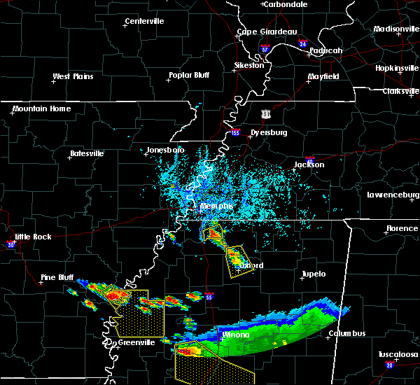 At 521 pm cdt, a severe thunderstorm was located over lewisburg, or 8 miles south of olive branch, moving south at 5 mph (radar indicated). Hazards include 60 mph wind gusts and quarter size hail. Hail damage to vehicles is expected. Expect wind damage to roofs, siding, and trees. At 521 pm cdt, a severe thunderstorm was located over lewisburg, or 8 miles south of olive branch, moving south at 5 mph (radar indicated). Hazards include 60 mph wind gusts and quarter size hail. Hail damage to vehicles is expected. Expect wind damage to roofs, siding, and trees.
|
| 3/31/2016 5:34 PM CDT | Wind gust of 50-60 mph in hernando with penny to nickel size hai in desoto county MS, 0.8 miles NNW of Hernando, MS |
| 3/31/2016 5:34 PM CDT | Quarter sized hail reported 0.8 miles NNW of Hernando, MS, quarter sized hail. most of the hail was dime to nickel sized hail. |
| 3/31/2016 5:14 PM CDT |
 At 513 pm cdt, a severe thunderstorm was located near eudora, or near hernando, moving east at 60 mph (radar indicated). Hazards include 60 mph wind gusts and quarter size hail. Hail damage to vehicles is expected. Expect wind damage to roofs, siding, and trees. At 513 pm cdt, a severe thunderstorm was located near eudora, or near hernando, moving east at 60 mph (radar indicated). Hazards include 60 mph wind gusts and quarter size hail. Hail damage to vehicles is expected. Expect wind damage to roofs, siding, and trees.
|
| 3/31/2016 4:54 PM CDT |
 At 453 pm cdt, a severe thunderstorm was located over robinsonville, or 12 miles southeast of hughes, moving northeast at 55 mph (radar indicated). Hazards include 60 mph wind gusts and quarter size hail. Hail damage to vehicles is expected. expect wind damage to roofs, siding, and trees. locations impacted include, southaven, horn lake, hernando, walls, tunica, horseshoe lake, eudora, robinsonville, lynchburg, north tunica, lake cormorant, fox island, trinity, frees corners, penton, west days, newport, alden, lake view and lost lake. A tornado watch remains in effect until 1000 pm cdt for eastern arkansas and northwestern mississippi. At 453 pm cdt, a severe thunderstorm was located over robinsonville, or 12 miles southeast of hughes, moving northeast at 55 mph (radar indicated). Hazards include 60 mph wind gusts and quarter size hail. Hail damage to vehicles is expected. expect wind damage to roofs, siding, and trees. locations impacted include, southaven, horn lake, hernando, walls, tunica, horseshoe lake, eudora, robinsonville, lynchburg, north tunica, lake cormorant, fox island, trinity, frees corners, penton, west days, newport, alden, lake view and lost lake. A tornado watch remains in effect until 1000 pm cdt for eastern arkansas and northwestern mississippi.
|
| 3/31/2016 4:42 PM CDT |
 At 442 pm cdt, a severe thunderstorm was located 7 miles northwest of north tunica, or 12 miles south of hughes, moving northeast at 55 mph (radar indicated). Hazards include 60 mph wind gusts and quarter size hail. Hail damage to vehicles is expected. expect wind damage to roofs, siding, and trees. locations impacted include, southaven, horn lake, hernando, marianna, walls, tunica, horseshoe lake, eudora, lynchburg, north tunica, lake cormorant, robinsonville, brickeys, trinity, newport, alden, lake view, bowdre, diamond woods and commerce. A tornado watch remains in effect until 1000 pm cdt for eastern arkansas and northwestern mississippi. At 442 pm cdt, a severe thunderstorm was located 7 miles northwest of north tunica, or 12 miles south of hughes, moving northeast at 55 mph (radar indicated). Hazards include 60 mph wind gusts and quarter size hail. Hail damage to vehicles is expected. expect wind damage to roofs, siding, and trees. locations impacted include, southaven, horn lake, hernando, marianna, walls, tunica, horseshoe lake, eudora, lynchburg, north tunica, lake cormorant, robinsonville, brickeys, trinity, newport, alden, lake view, bowdre, diamond woods and commerce. A tornado watch remains in effect until 1000 pm cdt for eastern arkansas and northwestern mississippi.
|
| 3/31/2016 4:33 PM CDT |
 At 433 pm cdt, a severe thunderstorm was located 8 miles south of brickeys, or 9 miles east of marianna, moving northeast at 55 mph (radar indicated). Hazards include 60 mph wind gusts and quarter size hail. Hail damage to vehicles is expected. Expect wind damage to roofs, siding, and trees. At 433 pm cdt, a severe thunderstorm was located 8 miles south of brickeys, or 9 miles east of marianna, moving northeast at 55 mph (radar indicated). Hazards include 60 mph wind gusts and quarter size hail. Hail damage to vehicles is expected. Expect wind damage to roofs, siding, and trees.
|
| 12/28/2015 7:23 AM CST |
 The severe thunderstorm warning for mississippi, southeastern craighead, northeastern crittenden, desoto, tate, northwestern panola, western lauderdale, central tipton and shelby counties will expire at 730 am cst, the storms which prompted the warning have weakened below severe limits, and no longer pose an immediate threat to life or property. therefore the warning will be allowed to expire. however gusty winds and heavy rain are still possible with these thunderstorms. The severe thunderstorm warning for mississippi, southeastern craighead, northeastern crittenden, desoto, tate, northwestern panola, western lauderdale, central tipton and shelby counties will expire at 730 am cst, the storms which prompted the warning have weakened below severe limits, and no longer pose an immediate threat to life or property. therefore the warning will be allowed to expire. however gusty winds and heavy rain are still possible with these thunderstorms.
|
| 12/28/2015 7:10 AM CST |
 At 709 am cst, severe thunderstorms were located along a line extending from 7 miles southeast of wilson to near olive branch, moving northeast at 55 mph (radar indicated). Hazards include 60 mph wind gusts and penny size hail. Expect damage to roofs. siding and trees. locations impacted include, bartlett, southaven, germantown, olive branch, west memphis, horn lake, blytheville, hernando, marion, millington, senatobia, osceola, gosnell, manila, leachville, monette, caraway, luxora, wilson and keiser. A tornado watch remains in effect until 800 am cst for northwestern mississippi. At 709 am cst, severe thunderstorms were located along a line extending from 7 miles southeast of wilson to near olive branch, moving northeast at 55 mph (radar indicated). Hazards include 60 mph wind gusts and penny size hail. Expect damage to roofs. siding and trees. locations impacted include, bartlett, southaven, germantown, olive branch, west memphis, horn lake, blytheville, hernando, marion, millington, senatobia, osceola, gosnell, manila, leachville, monette, caraway, luxora, wilson and keiser. A tornado watch remains in effect until 800 am cst for northwestern mississippi.
|
| 12/28/2015 6:23 AM CST |
 At 623 am cst, severe thunderstorms were located along a line extending from near horseshoe lake to sledge, moving northeast at 55 mph (radar indicated). Hazards include 60 mph wind gusts and penny size hail. Expect damage to roofs. Siding and trees. At 623 am cst, severe thunderstorms were located along a line extending from near horseshoe lake to sledge, moving northeast at 55 mph (radar indicated). Hazards include 60 mph wind gusts and penny size hail. Expect damage to roofs. Siding and trees.
|
| 12/28/2015 5:51 AM CST |
 At 551 am cst, severe thunderstorms were located along a line extending from near tunica to near minter city, moving north at 160 mph (radar indicated). Hazards include 60 mph wind gusts and penny size hail. Expect damage to roofs. Siding and trees. At 551 am cst, severe thunderstorms were located along a line extending from near tunica to near minter city, moving north at 160 mph (radar indicated). Hazards include 60 mph wind gusts and penny size hail. Expect damage to roofs. Siding and trees.
|
| 12/25/2015 1:39 AM CST |
 The severe thunderstorm warning for central desoto and northwestern tate counties will expire at 145 am cst, the severe thunderstorm which prompted the warning has weakened. moved out of the warned area. therefore the warning will be allowed to expire. The severe thunderstorm warning for central desoto and northwestern tate counties will expire at 145 am cst, the severe thunderstorm which prompted the warning has weakened. moved out of the warned area. therefore the warning will be allowed to expire.
|
| 12/25/2015 1:28 AM CST |
 At 127 am cst, a severe thunderstorm was located over eudora, or 7 miles west of hernando, moving northeast at 35 mph (radar indicated). Hazards include 60 mph wind gusts and quarter size hail. Hail damage to vehicles is expected. expect wind damage to roofs, siding and trees. Locations impacted include, southaven, horn lake, hernando, eudora, phillipp, trinity, nesbit, frees corners, west days, alden, robinson gin, jago, bright, love and memphis. At 127 am cst, a severe thunderstorm was located over eudora, or 7 miles west of hernando, moving northeast at 35 mph (radar indicated). Hazards include 60 mph wind gusts and quarter size hail. Hail damage to vehicles is expected. expect wind damage to roofs, siding and trees. Locations impacted include, southaven, horn lake, hernando, eudora, phillipp, trinity, nesbit, frees corners, west days, alden, robinson gin, jago, bright, love and memphis.
|
| 12/25/2015 1:14 AM CST |
 At 114 am cst, a severe thunderstorm was located over phillipp, or 15 miles southwest of hernando, moving northeast at 35 mph (radar indicated). Hazards include 60 mph wind gusts and quarter size hail. Hail damage to vehicles is expected. Expect wind damage to roofs, siding and trees. At 114 am cst, a severe thunderstorm was located over phillipp, or 15 miles southwest of hernando, moving northeast at 35 mph (radar indicated). Hazards include 60 mph wind gusts and quarter size hail. Hail damage to vehicles is expected. Expect wind damage to roofs, siding and trees.
|
| 8/7/2015 8:42 AM CDT |
 At 841 am cdt, a severe thunderstorm was located over walls, or near t o fuller state park, moving southeast at 55 mph (radar indicated). Hazards include 60 mph wind gusts. Expect damage to roofs. Siding and trees. At 841 am cdt, a severe thunderstorm was located over walls, or near t o fuller state park, moving southeast at 55 mph (radar indicated). Hazards include 60 mph wind gusts. Expect damage to roofs. Siding and trees.
|
| 8/5/2015 11:29 PM CDT |
 At 1128 pm cdt, a severe thunderstorm was located over southeast memphis, or near germantown, moving southeast at 40 mph (radar indicated). Hazards include 60 mph wind gusts. Expect damage to roofs. Siding and trees. At 1128 pm cdt, a severe thunderstorm was located over southeast memphis, or near germantown, moving southeast at 40 mph (radar indicated). Hazards include 60 mph wind gusts. Expect damage to roofs. Siding and trees.
|
| 7/14/2015 5:01 PM CDT |
 At 501 pm cdt, severe thunderstorms were located along a line extending from 7 miles northwest of pocahontas to near snow lake shores to near senatobia, moving southeast at 50 mph (radar indicated). Hazards include 60 mph wind gusts. Expect damage to roofs. Siding and trees. At 501 pm cdt, severe thunderstorms were located along a line extending from 7 miles northwest of pocahontas to near snow lake shores to near senatobia, moving southeast at 50 mph (radar indicated). Hazards include 60 mph wind gusts. Expect damage to roofs. Siding and trees.
|
| 7/14/2015 4:08 PM CDT |
 At 407 pm cdt, a severe thunderstorm was located near cordova, moving southeast at 50 mph (radar indicated). Hazards include 60 mph wind gusts. Expect damage to roofs. Siding and trees. At 407 pm cdt, a severe thunderstorm was located near cordova, moving southeast at 50 mph (radar indicated). Hazards include 60 mph wind gusts. Expect damage to roofs. Siding and trees.
|
| 7/3/2015 10:17 AM CDT |
 At 1016 am cdt, a severe thunderstorm was located near arkabutla, or near senatobia, moving east at 60 mph (radar indicated). Hazards include 60 mph wind gusts. Expect damage to roofs. siding and trees. Locations impacted include, hernando, senatobia, coldwater, arkabutla, independence, phillipp, strayhorn, wakefield, rockhill, poagville, sarah, lurline, bett, new garden, robinson gin, savage, cockrum, love and alphaba. At 1016 am cdt, a severe thunderstorm was located near arkabutla, or near senatobia, moving east at 60 mph (radar indicated). Hazards include 60 mph wind gusts. Expect damage to roofs. siding and trees. Locations impacted include, hernando, senatobia, coldwater, arkabutla, independence, phillipp, strayhorn, wakefield, rockhill, poagville, sarah, lurline, bett, new garden, robinson gin, savage, cockrum, love and alphaba.
|
| 7/3/2015 10:02 AM CDT |
 At 1002 am cdt, a severe thunderstorm was located over little texas, or 18 miles east of st francis national park, moving east at 60 mph (radar indicated). Hazards include 60 mph wind gusts. Expect damage to roofs. Siding and trees. At 1002 am cdt, a severe thunderstorm was located over little texas, or 18 miles east of st francis national park, moving east at 60 mph (radar indicated). Hazards include 60 mph wind gusts. Expect damage to roofs. Siding and trees.
|
| 6/5/2015 9:43 PM CDT | At 943 pm cdt, a severe thunderstorm was located near byhalia, or near olive branch, moving southeast at 25 mph (radar indicated). Hazards include 60 mph wind gusts. Expect damage to roofs. Siding and trees. |
| 5/29/2015 3:41 PM CDT | At 341 pm cdt, a severe thunderstorm was located near hernando, moving north at 30 mph (radar indicated). Hazards include 60 mph wind gusts. Expect damage to roofs. Siding and trees. |
| 5/29/2015 3:30 PM CDT | Tree down on mcingvale roa in desoto county MS, 0.8 miles NNW of Hernando, MS |
| 5/29/2015 3:20 PM CDT | At 320 pm cdt, a severe thunderstorm was located near hernando, moving north at 20 mph (radar indicated). Hazards include 60 mph wind gusts. Expect damage to roofs. Siding and trees. |
| 5/24/2015 5:55 PM CDT | At 555 pm cdt, a severe thunderstorm was located over midtown memphis, or 8 miles northeast of t o fuller state park, and is nearly stationary (radar indicated). Hazards include 60 mph wind gusts and penny size hail. Expect damage to roofs. siding and trees. locations impacted include, southaven, west memphis, horn lake, marion, t o fuller state park, walls, edmondson, downtown memphis, midtown memphis, whitehaven, lynchburg, southwest memphis, crittenden, galet, riceville, bridge junction, frees corners, brice, west days and briark. A tornado watch remains in effect until 1000 pm cdt for eastern arkansas, northwestern mississippi and western tennessee. |
| 5/24/2015 5:55 PM CDT | At 555 pm cdt, a severe thunderstorm was located over midtown memphis, or 8 miles northeast of t o fuller state park, and is nearly stationary (radar indicated). Hazards include 60 mph wind gusts and penny size hail. Expect damage to roofs. siding and trees. locations impacted include, southaven, west memphis, horn lake, marion, t o fuller state park, walls, edmondson, downtown memphis, midtown memphis, whitehaven, lynchburg, southwest memphis, crittenden, galet, riceville, bridge junction, frees corners, brice, west days and briark. A tornado watch remains in effect until 1000 pm cdt for eastern arkansas, northwestern mississippi and western tennessee. |
| 5/24/2015 5:55 PM CDT | At 555 pm cdt, a severe thunderstorm was located over midtown memphis, or 8 miles northeast of t o fuller state park, and is nearly stationary (radar indicated). Hazards include 60 mph wind gusts and penny size hail. Expect damage to roofs. siding and trees. locations impacted include, southaven, west memphis, horn lake, marion, t o fuller state park, walls, edmondson, downtown memphis, midtown memphis, whitehaven, lynchburg, southwest memphis, crittenden, galet, riceville, bridge junction, frees corners, brice, west days and briark. A tornado watch remains in effect until 1000 pm cdt for eastern arkansas, northwestern mississippi and western tennessee. |
| 5/24/2015 5:37 PM CDT | The severe thunderstorm warning for southwestern desoto, northwestern tate and northeastern tunica counties will expire at 545 pm cdt, the storm which prompted the warning has moved out of the area. therefore the warning will be allowed to expire. a tornado watch remains in effect until 1000 pm cdt for eastern arkansas and northwestern mississippi. |
| 5/24/2015 5:26 PM CDT | At 526 pm cdt, a severe thunderstorm was located near eudora, or 7 miles west of hernando, and is nearly stationary (radar indicated). Hazards include 60 mph wind gusts and penny size hail. Expect damage to roofs. siding and trees. locations impacted include, phillipp, eudora, robinsonville, clack, trinity, lost lake, frees corners, bowdre, banks, hollywood and penton. A tornado watch remains in effect until 1000 pm cdt for eastern arkansas and northwestern mississippi. |
| 5/24/2015 5:23 PM CDT | At 523 pm cdt, a severe thunderstorm was located over eudora, or 10 miles west of hernando, moving north at 45 mph (radar indicated). Hazards include 60 mph wind gusts and penny size hail. Expect damage to roofs. Siding and trees. |
| 5/24/2015 5:23 PM CDT | At 523 pm cdt, a severe thunderstorm was located over eudora, or 10 miles west of hernando, moving north at 45 mph (radar indicated). Hazards include 60 mph wind gusts and penny size hail. Expect damage to roofs. Siding and trees. |
| 5/24/2015 5:23 PM CDT | At 523 pm cdt, a severe thunderstorm was located over eudora, or 10 miles west of hernando, moving north at 45 mph (radar indicated). Hazards include 60 mph wind gusts and penny size hail. Expect damage to roofs. Siding and trees. |
| 5/24/2015 5:17 PM CDT | At 516 pm cdt, a severe thunderstorm was located over phillipp, or 10 miles southwest of hernando, moving north at 55 mph (radar indicated). Hazards include 60 mph wind gusts and penny size hail. Expect damage to roofs. siding and trees. locations impacted include, hernando, senatobia, coldwater, little texas, arkabutla, eudora, robinsonville, phillipp, dubbs, strayhorn, dooley, trinity, frees corners, sarah, hollywood, penton, prichard, clack, robinson gin and savage. A tornado watch remains in effect until 1000 pm cdt for eastern arkansas and northwestern mississippi. |
| 5/24/2015 5:01 PM CDT | At 500 pm cdt, a severe thunderstorm was located near little texas, or 14 miles west of senatobia, moving north at 55 mph (radar indicated). Hazards include 60 mph wind gusts and penny size hail. Expect damage to roofs. Siding and trees. |
| 5/24/2015 5:01 PM CDT | At 500 pm cdt, a severe thunderstorm was located near little texas, or 14 miles west of senatobia, moving north at 55 mph (radar indicated). Hazards include 60 mph wind gusts and penny size hail. Expect damage to roofs. Siding and trees. |
| 5/15/2015 5:43 PM CDT | At 542 pm cdt, a severe thunderstorm was located near lewisburg, or 7 miles east of hernando, moving north at 20 mph (radar indicated). Hazards include 60 mph wind gusts and quarter size hail. Hail damage to vehicles is expected. Expect wind damage to roofs, siding and trees. |
| 4/27/2014 7:37 PM CDT | Quarter sized hail reported 0.8 miles NNW of Hernando, MS, quarter size hail at intersection of macenvile and middlebuster. |
| 10/17/2012 9:00 PM CDT | Quarter sized hail reported 0.8 miles NNW of Hernando, MS, quarter-sized hail near intersection of byhalia and craft |
| 9/6/2012 9:15 PM CDT | Pole snapped near hwy 51 on buena vista in desoto county MS, 0.8 miles NNW of Hernando, MS |
| 1/1/0001 12:00 AM | Quarter sized hail reported 7.6 miles N of Hernando, MS |
| 1/1/0001 12:00 AM | Quarter sized hail reported 2.8 miles N of Hernando, MS |
| 1/1/0001 12:00 AM | Quarter sized hail reported 6.9 miles N of Hernando, MS |
| 1/1/0001 12:00 AM | Quarter sized hail reported 5.2 miles ESE of Hernando, MS, quarter size hail at shelby drive and hwy 78 |
Hail Maps for Hernando, MS
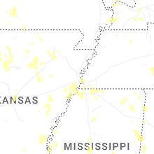
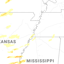
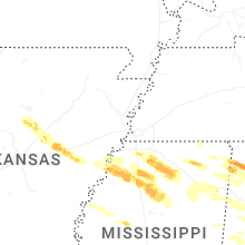
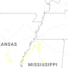
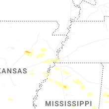
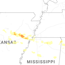
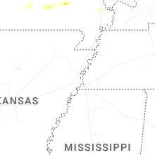
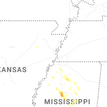


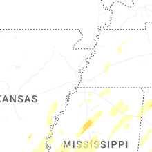


Connect with Interactive Hail Maps