

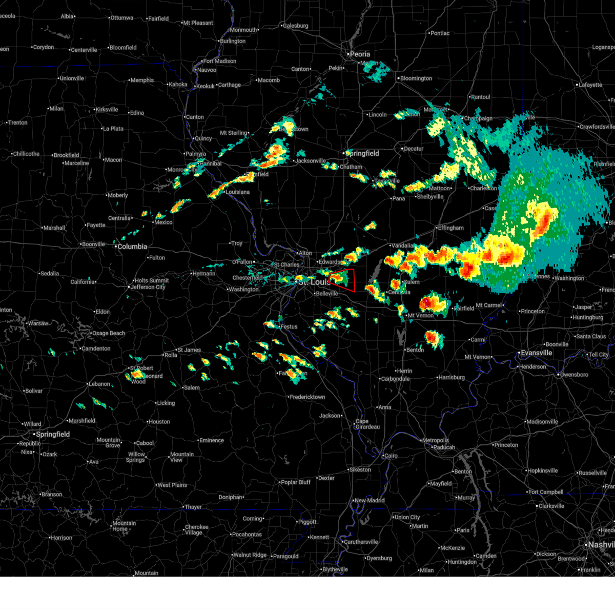
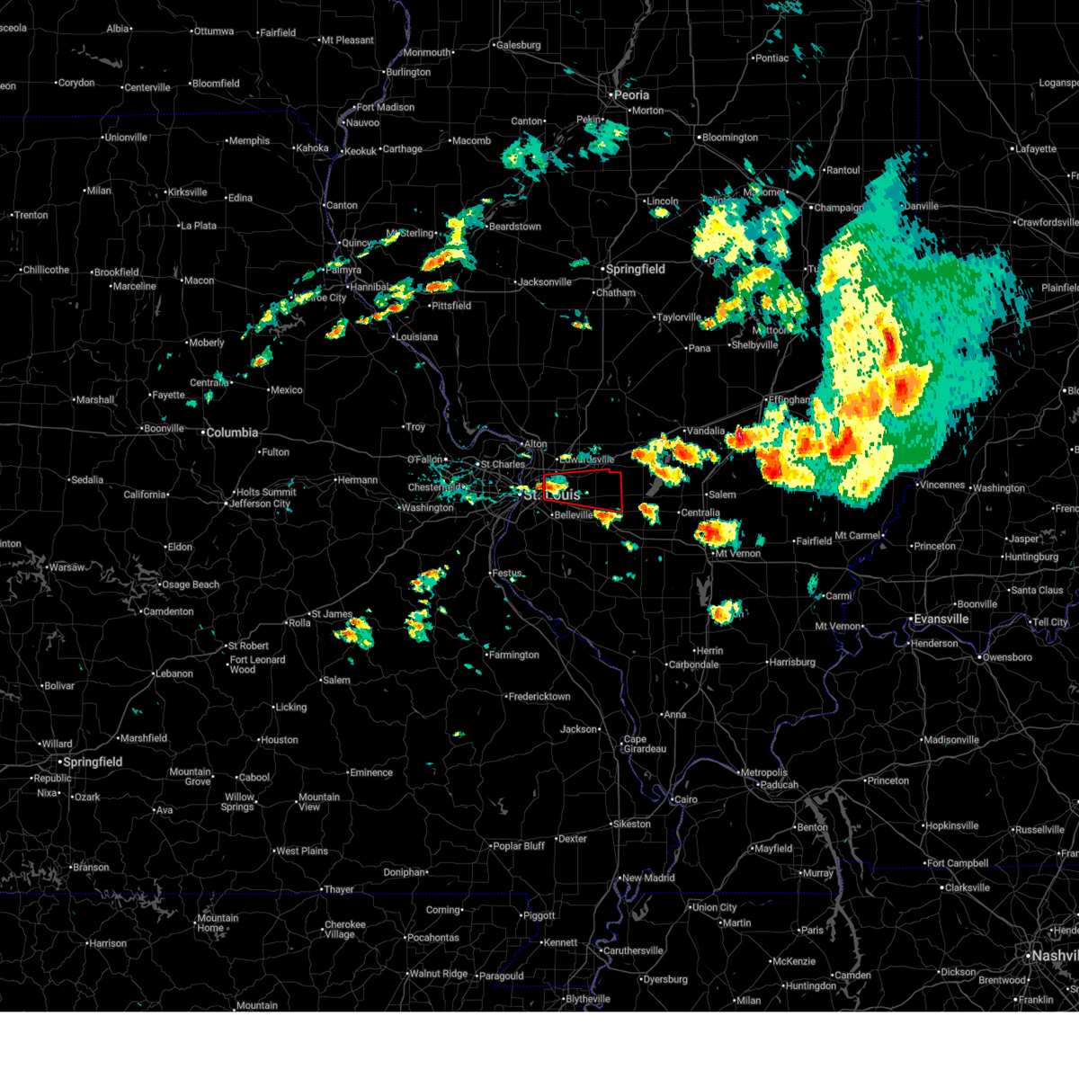
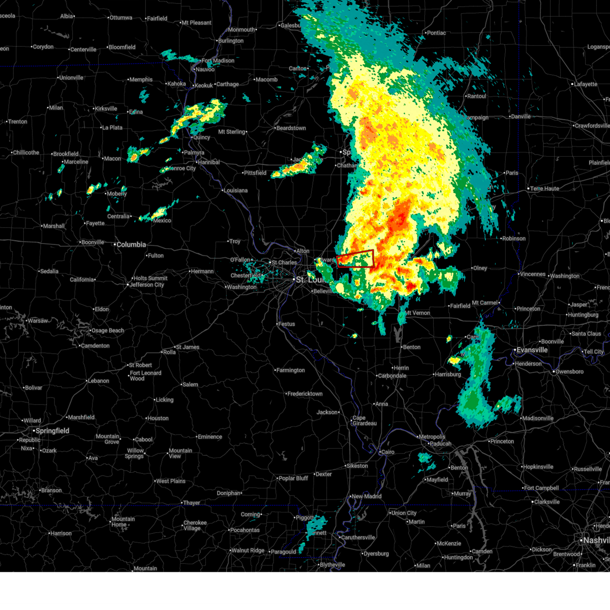
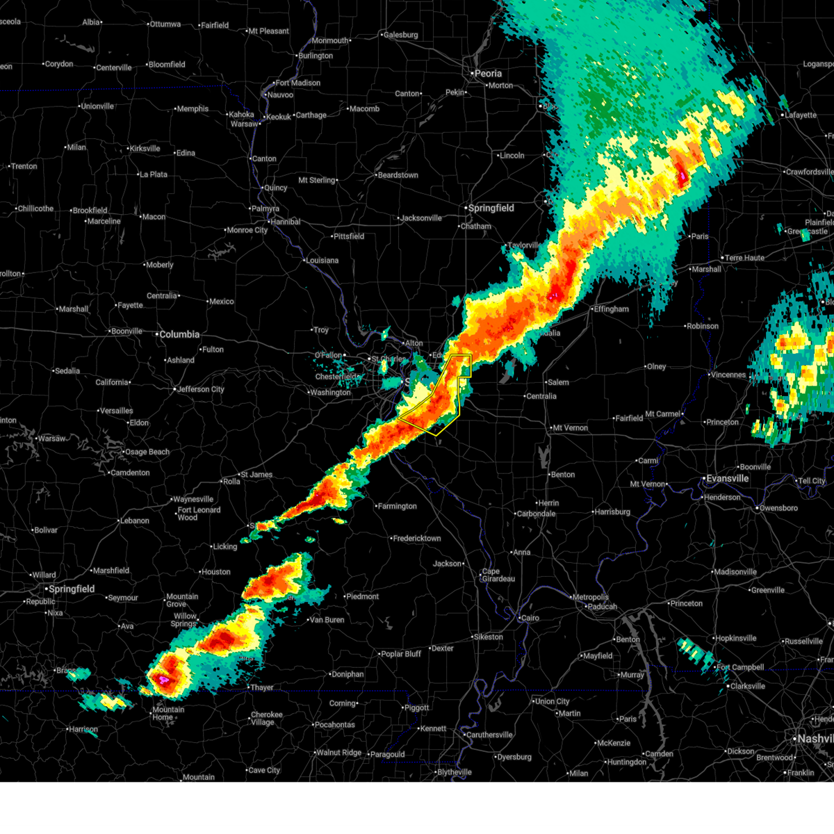
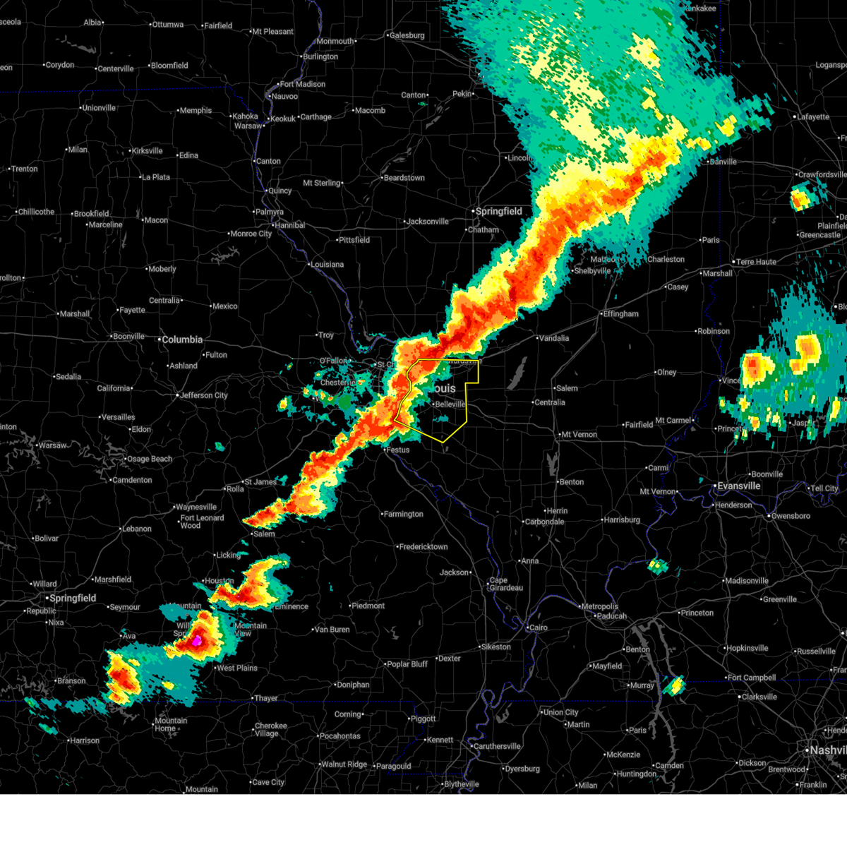
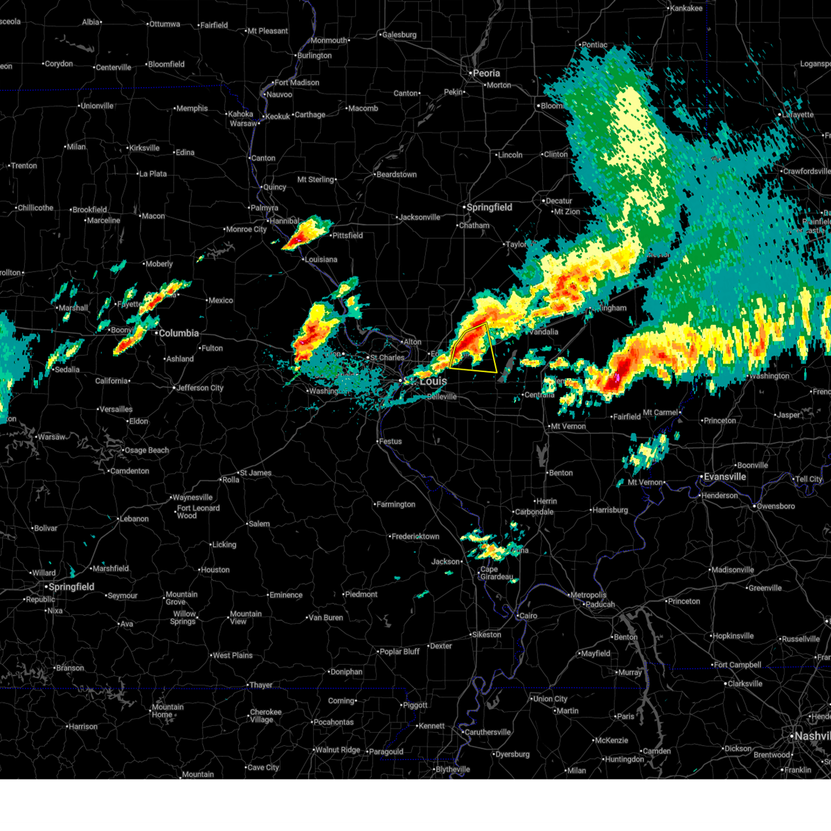
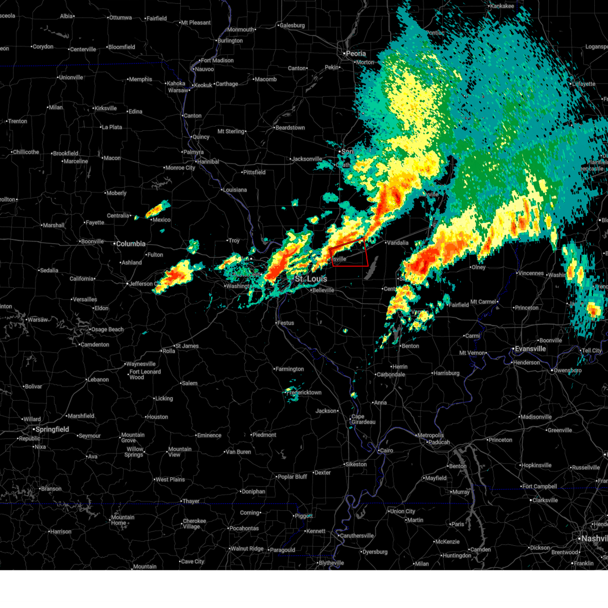
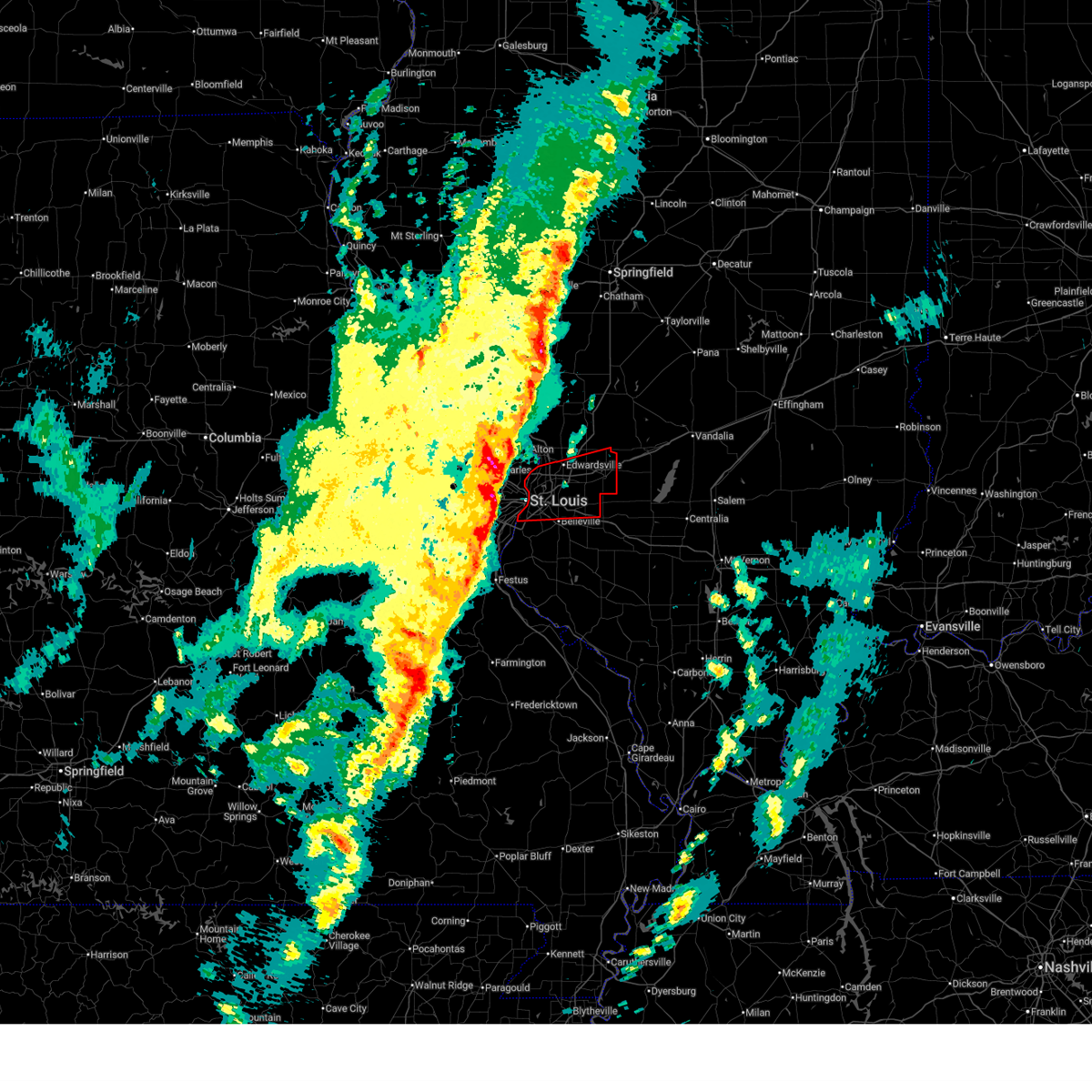
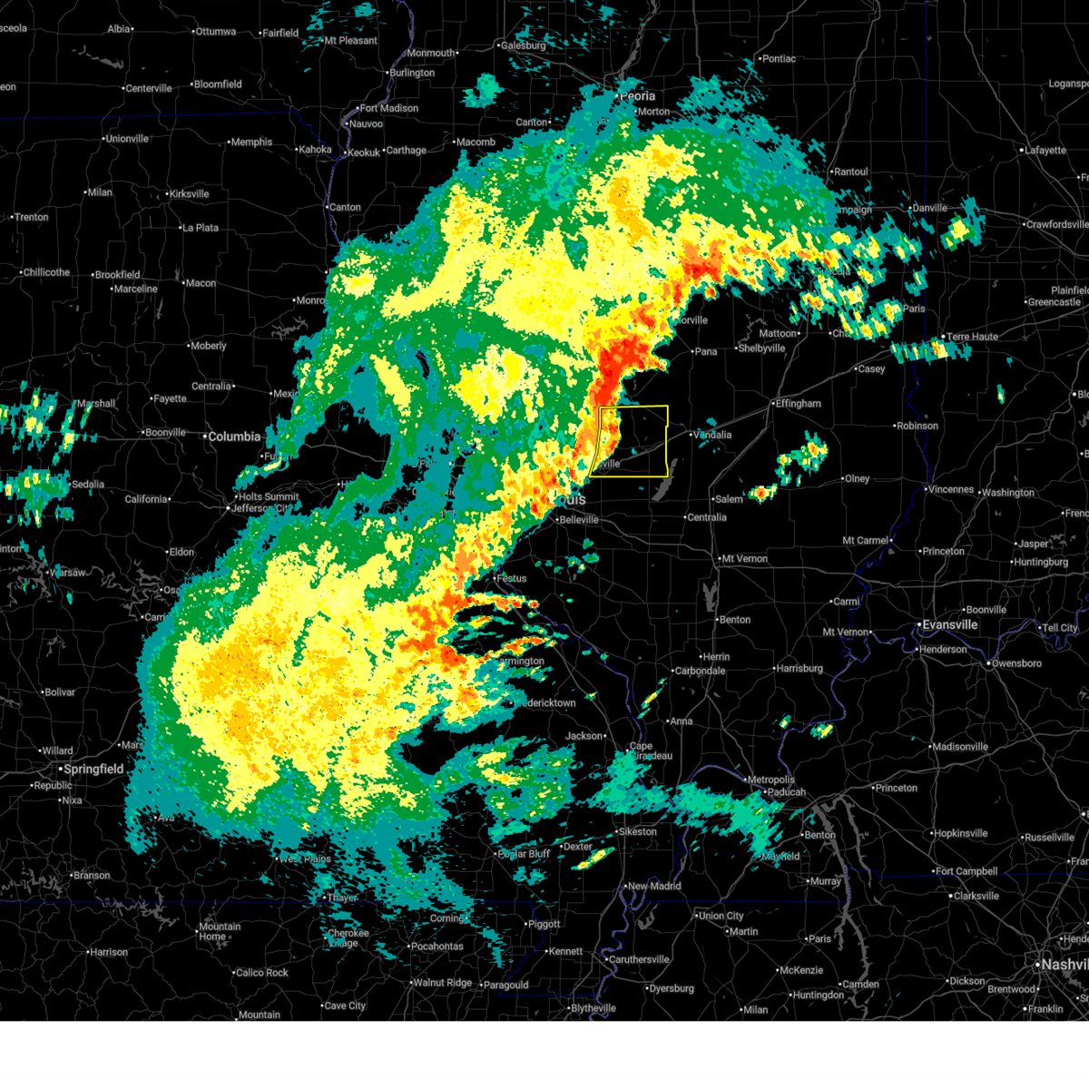
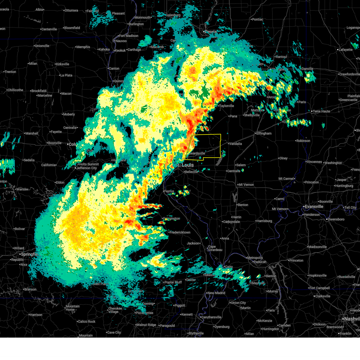
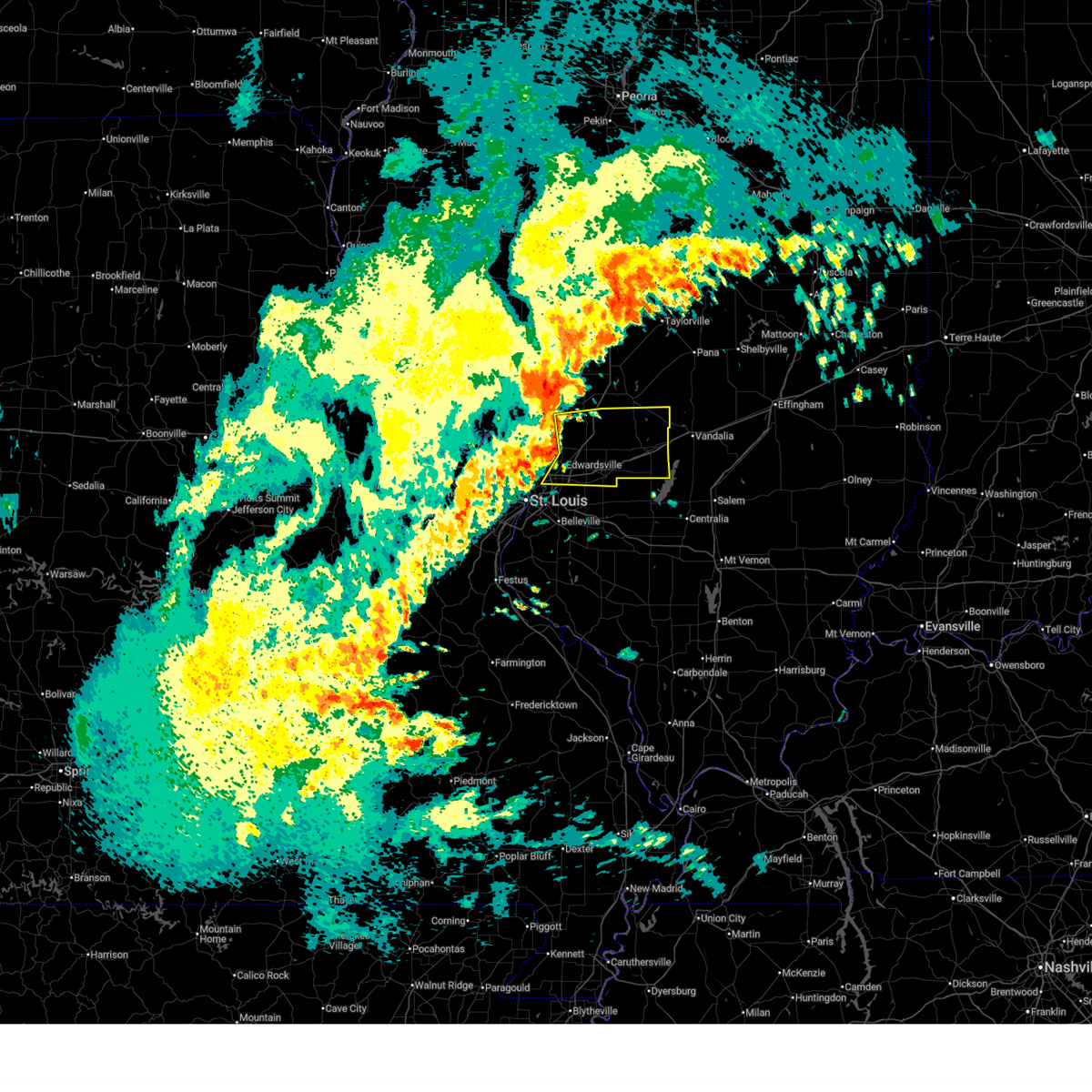
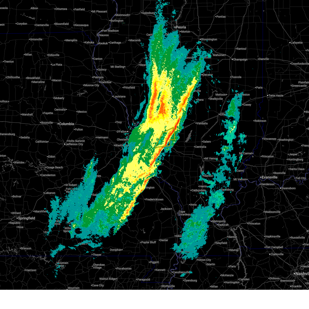
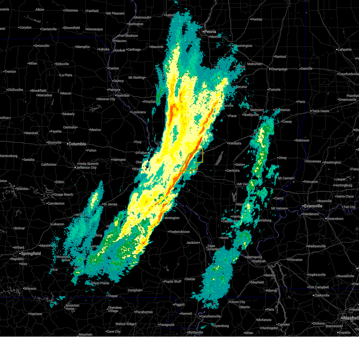
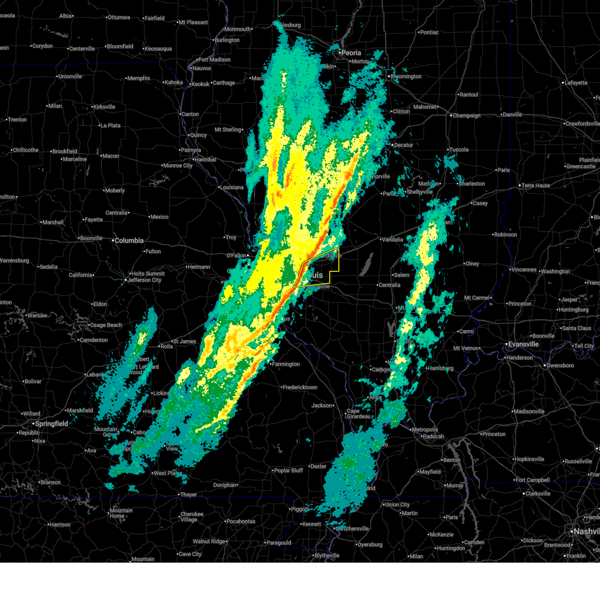
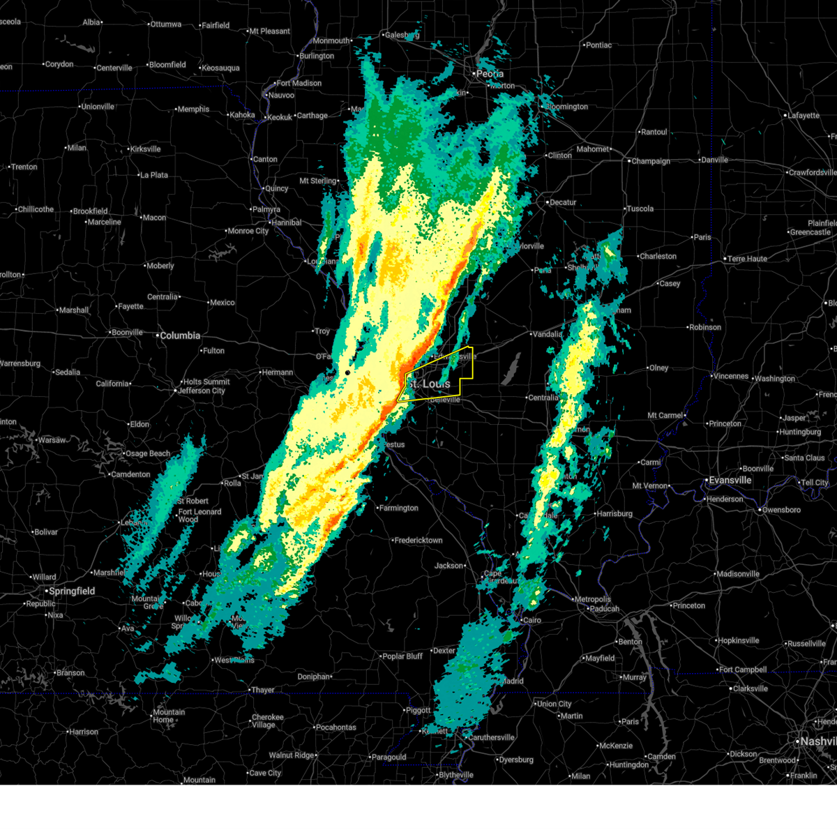
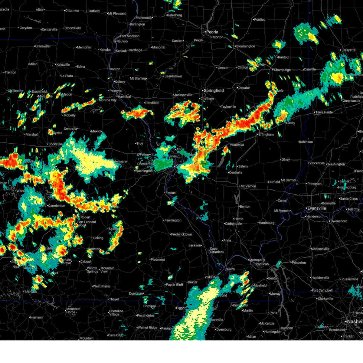
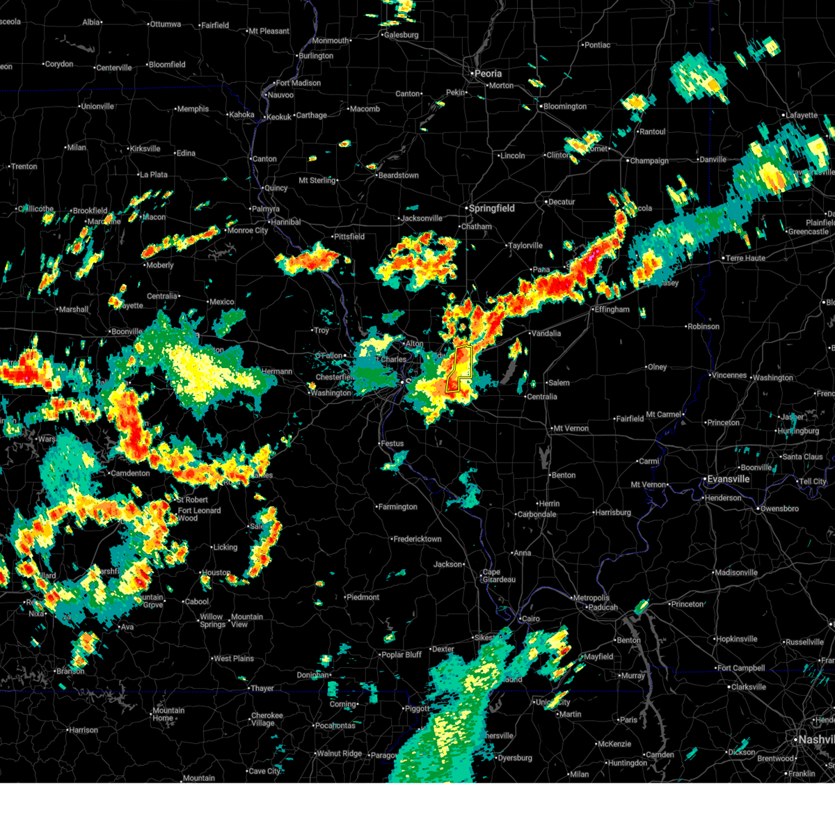
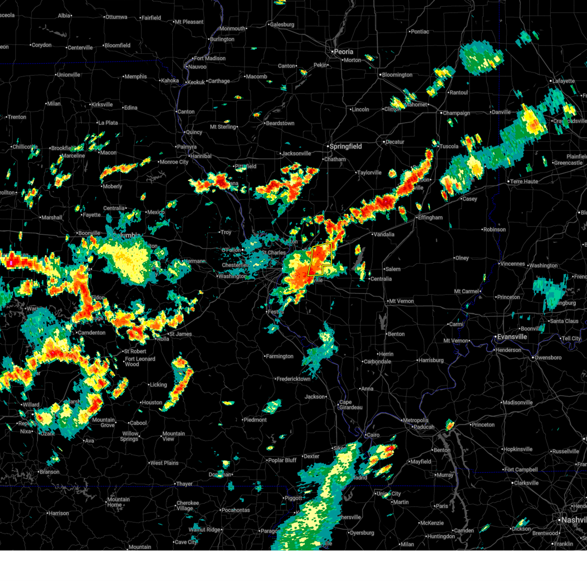
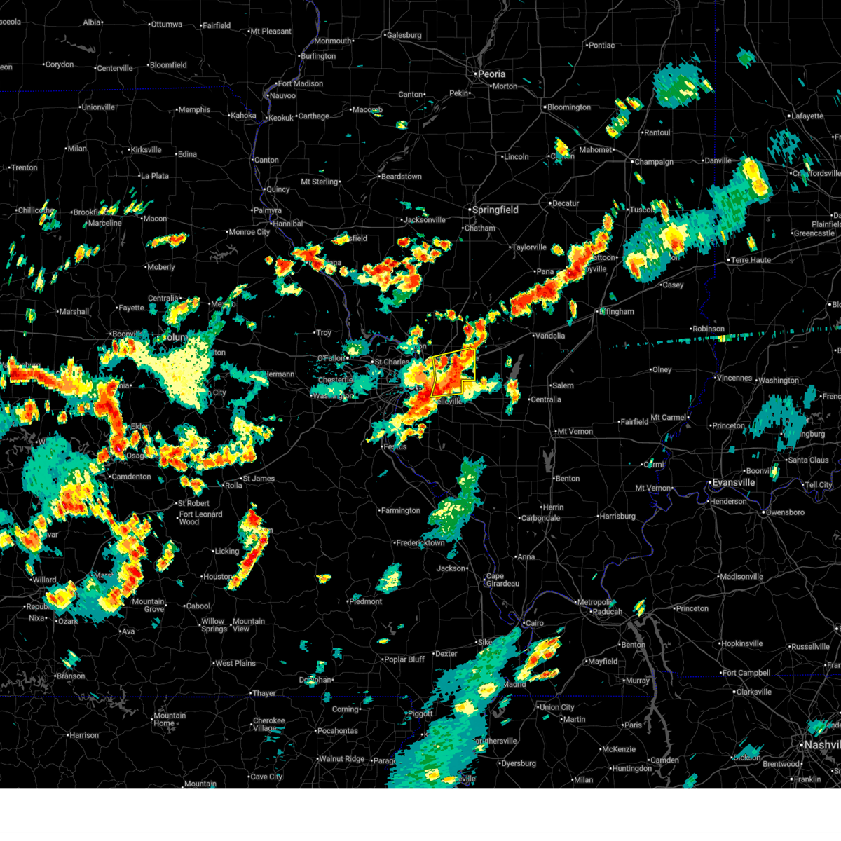
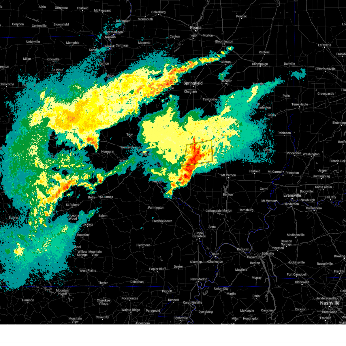
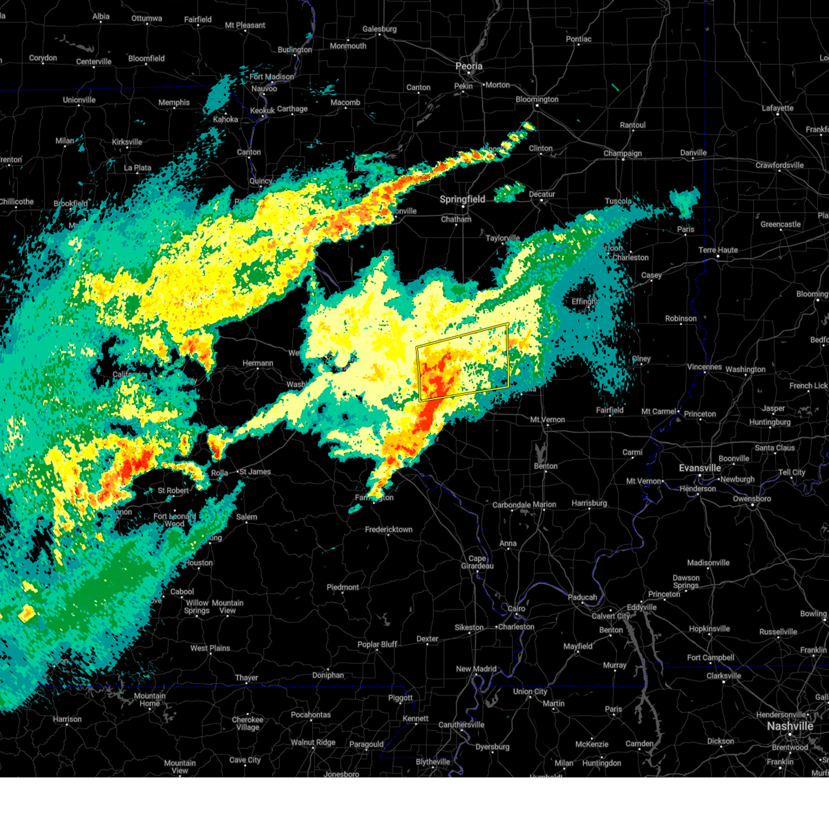
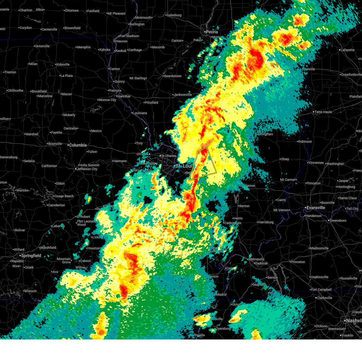
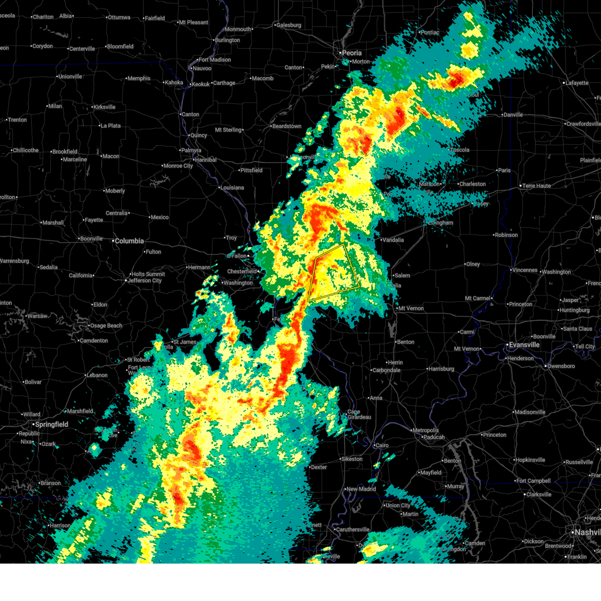
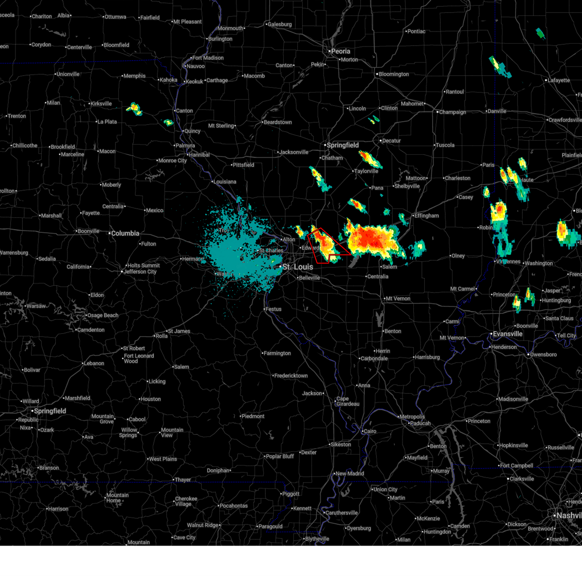
Hail Map for Highland, IL
The Highland, IL area has had 6 reports of on-the-ground hail by trained spotters, and has been under severe weather warnings 33 times during the past 12 months. Doppler radar has detected hail at or near Highland, IL on 94 occasions, including 5 occasions during the past year.
| Name: | Highland, IL |
| Where Located: | 29.6 miles ENE of Saint Louis, MO |
| Map: | Google Map for Highland, IL |
| Population: | 9919 |
| Housing Units: | 4283 |
| More Info: | Search Google for Highland, IL |
1
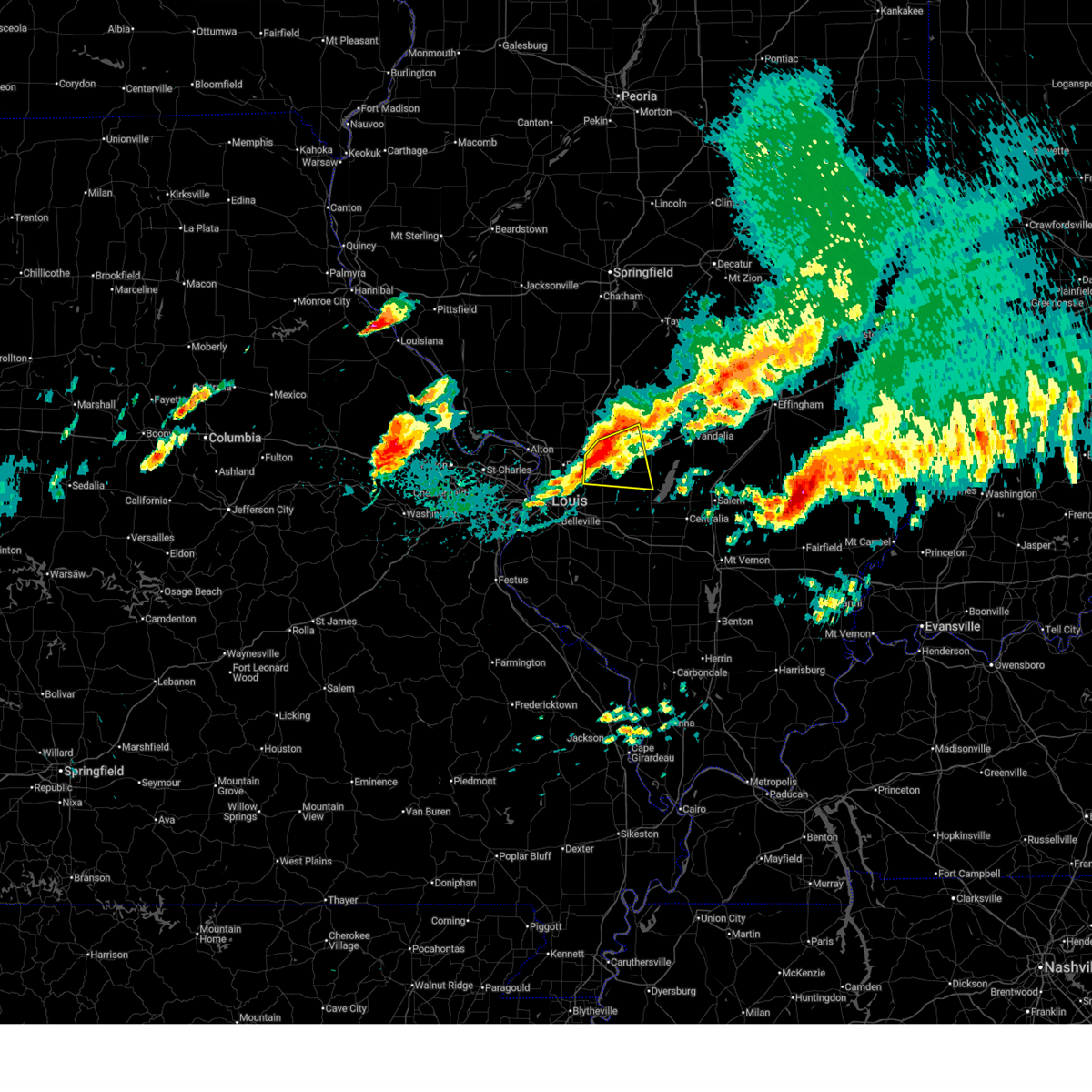
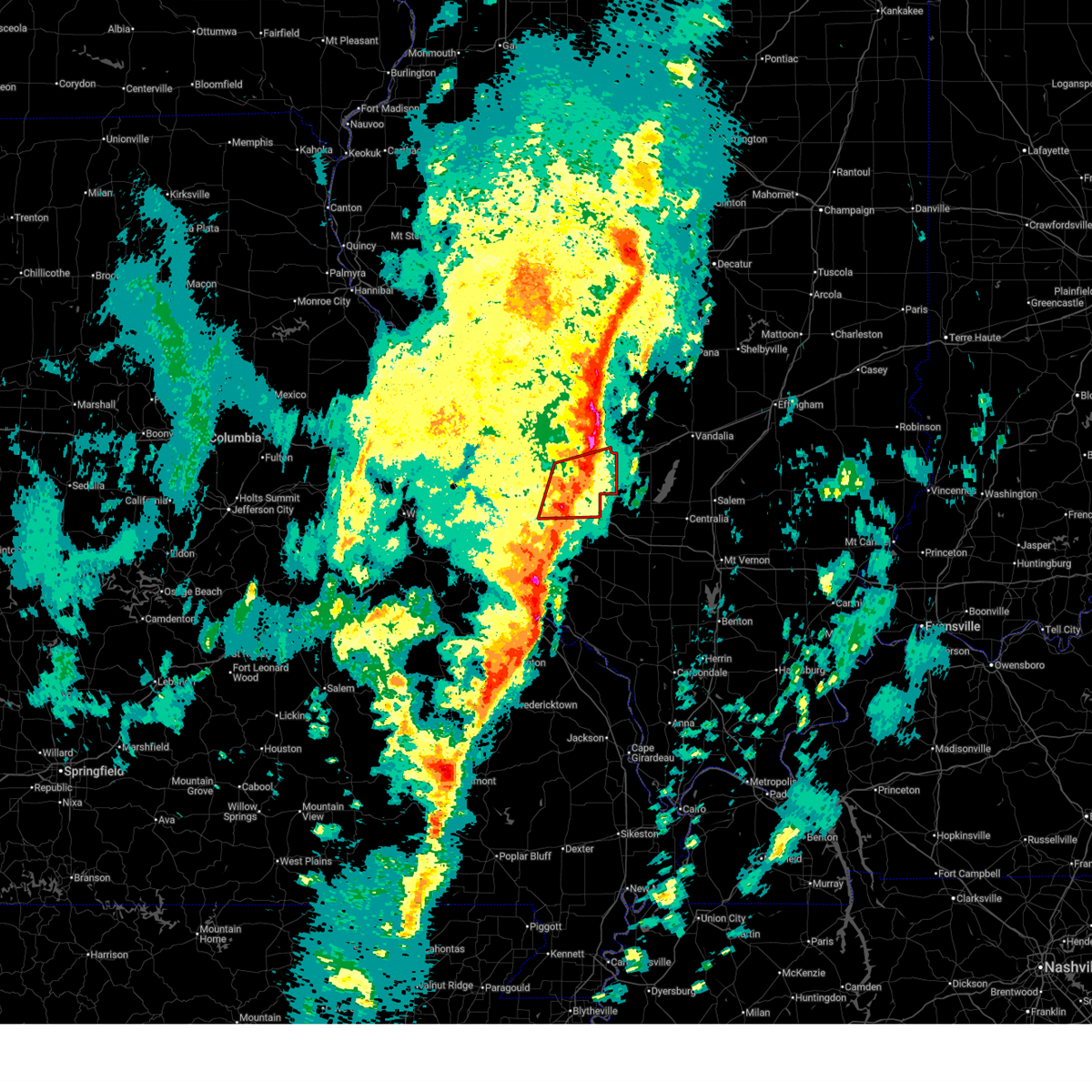
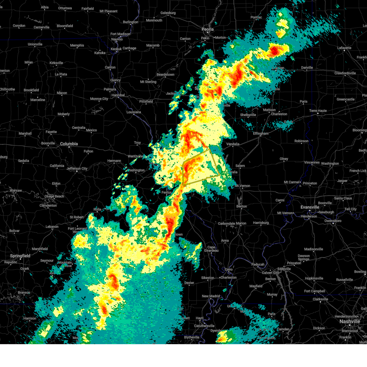
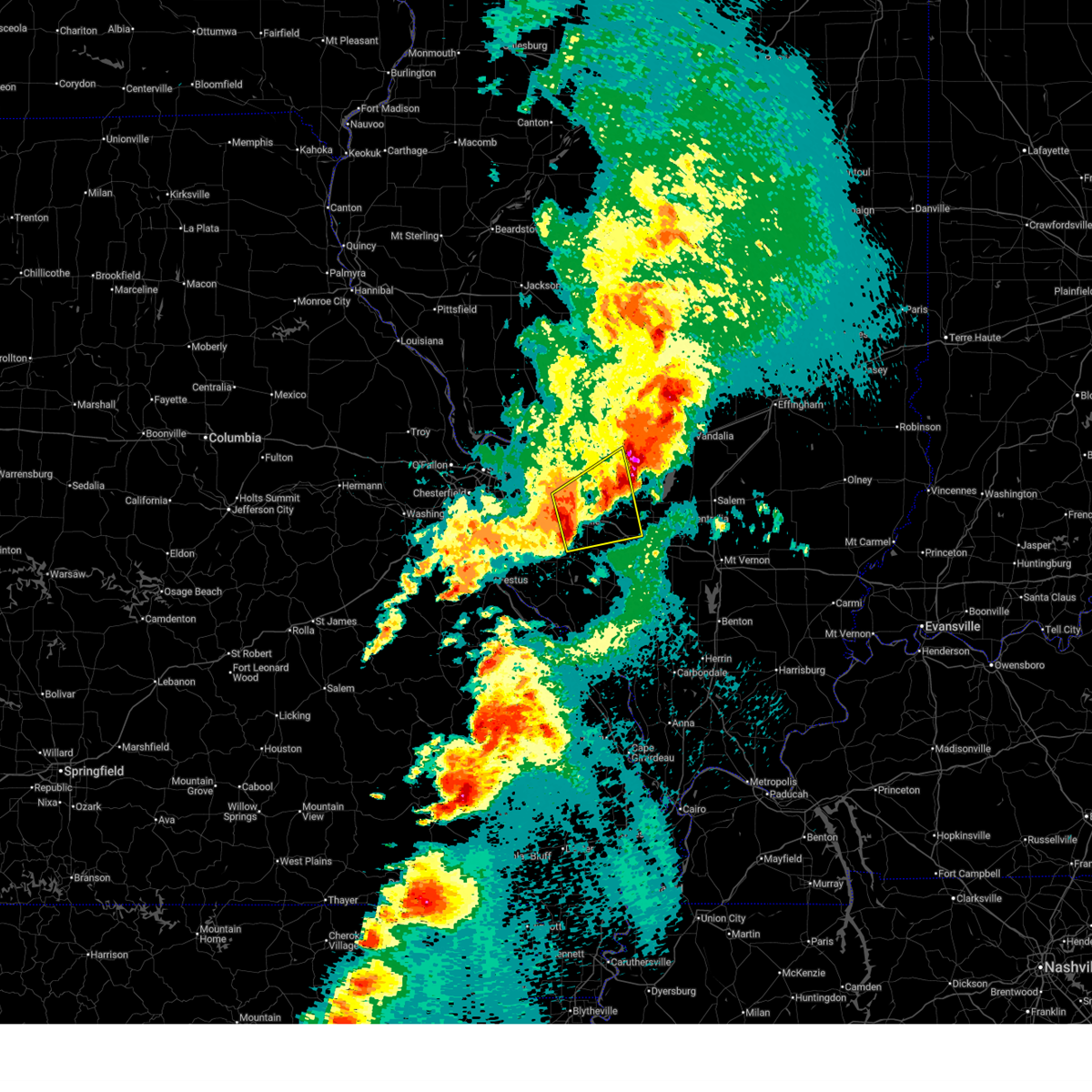
The Top Recent Hail Date for Highland, IL is Monday, April 27, 2026 (22nd out of 94)

Hail and Wind Damage Spotted near Highland, IL
| Date / Time | Report Details |
|---|---|
| 6/21/2026 5:23 PM CDT |
 At 523 pm cdt, a severe thunderstorm capable of producing a tornado was located near lebanon, moving east at 30 mph (radar indicated rotation). Hazards include tornado. Flying debris will be dangerous to those caught without shelter. mobile homes will be damaged or destroyed. damage to roofs, windows and vehicles will occur. tree damage is likely. locations impacted include, summerfield, trenton, aviston, breese, st. Rose and germantown. At 523 pm cdt, a severe thunderstorm capable of producing a tornado was located near lebanon, moving east at 30 mph (radar indicated rotation). Hazards include tornado. Flying debris will be dangerous to those caught without shelter. mobile homes will be damaged or destroyed. damage to roofs, windows and vehicles will occur. tree damage is likely. locations impacted include, summerfield, trenton, aviston, breese, st. Rose and germantown.
|
| 6/21/2026 5:15 PM CDT |
 At 515 pm cdt, a severe thunderstorm capable of producing a tornado was located near lebanon, moving east at 30 mph (radar indicated rotation). Hazards include tornado. Flying debris will be dangerous to those caught without shelter. mobile homes will be damaged or destroyed. damage to roofs, windows and vehicles will occur. tree damage is likely. locations impacted include, o'fallon, lebanon, st. jacob, summerfield, highland, trenton, aviston, breese, st. Rose and germantown. At 515 pm cdt, a severe thunderstorm capable of producing a tornado was located near lebanon, moving east at 30 mph (radar indicated rotation). Hazards include tornado. Flying debris will be dangerous to those caught without shelter. mobile homes will be damaged or destroyed. damage to roofs, windows and vehicles will occur. tree damage is likely. locations impacted include, o'fallon, lebanon, st. jacob, summerfield, highland, trenton, aviston, breese, st. Rose and germantown.
|
| 6/21/2026 5:02 PM CDT |
 Torlsx the national weather service in st louis has issued a * tornado warning for, northwestern clinton county in south central illinois, southeastern madison county in southwestern illinois, northeastern saint clair county in southwestern illinois, * until 545 pm cdt. * at 502 pm cdt, a severe thunderstorm capable of producing a tornado was located over collinsville, moving east at 35 mph (radar indicated rotation). Hazards include tornado. Flying debris will be dangerous to those caught without shelter. mobile homes will be damaged or destroyed. damage to roofs, windows and vehicles will occur. Tree damage is likely. Torlsx the national weather service in st louis has issued a * tornado warning for, northwestern clinton county in south central illinois, southeastern madison county in southwestern illinois, northeastern saint clair county in southwestern illinois, * until 545 pm cdt. * at 502 pm cdt, a severe thunderstorm capable of producing a tornado was located over collinsville, moving east at 35 mph (radar indicated rotation). Hazards include tornado. Flying debris will be dangerous to those caught without shelter. mobile homes will be damaged or destroyed. damage to roofs, windows and vehicles will occur. Tree damage is likely.
|
| 6/21/2026 2:54 PM CDT |
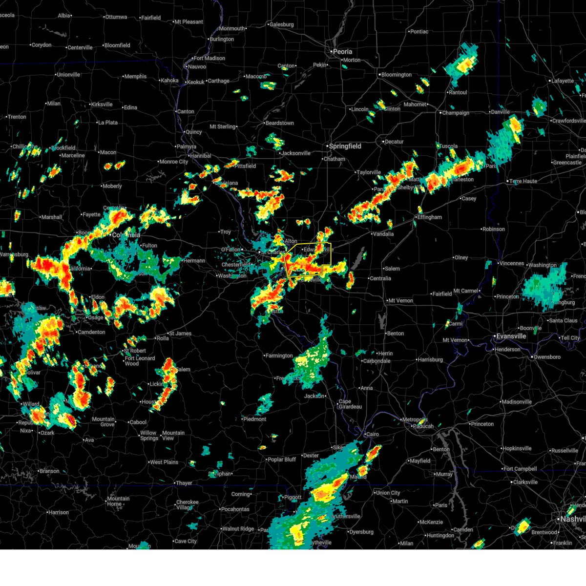
 Torlsx the national weather service in st louis has issued a * tornado warning for, southern bond county in south central illinois, east central madison county in southwestern illinois, * until 330 pm cdt. * at 254 pm cdt, a severe thunderstorm capable of producing a tornado was located near highland, moving east at 40 mph (radar indicated rotation). Hazards include tornado. Flying debris will be dangerous to those caught without shelter. mobile homes will be damaged or destroyed. damage to roofs, windows and vehicles will occur. Tree damage is likely. Torlsx the national weather service in st louis has issued a * tornado warning for, southern bond county in south central illinois, east central madison county in southwestern illinois, * until 330 pm cdt. * at 254 pm cdt, a severe thunderstorm capable of producing a tornado was located near highland, moving east at 40 mph (radar indicated rotation). Hazards include tornado. Flying debris will be dangerous to those caught without shelter. mobile homes will be damaged or destroyed. damage to roofs, windows and vehicles will occur. Tree damage is likely.
|
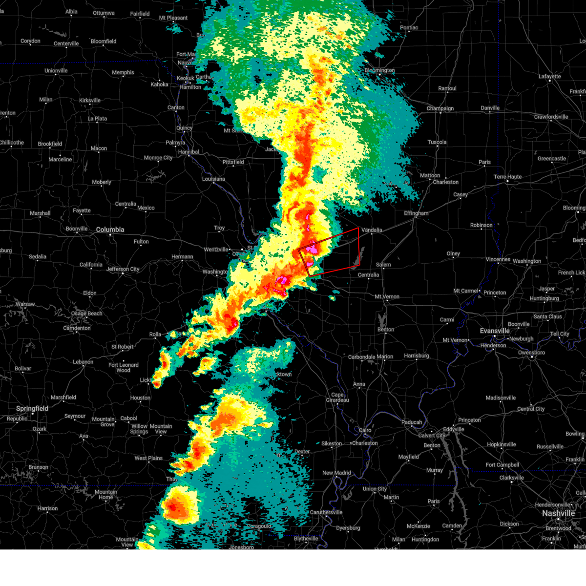
| 4/27/2026 7:58 PM CDT |
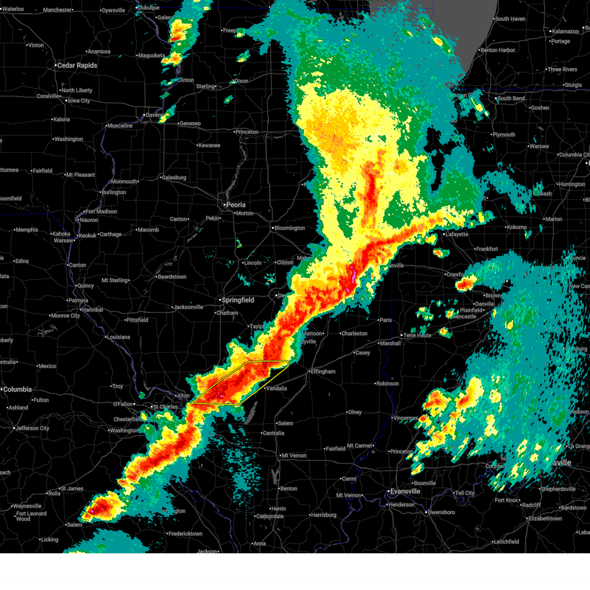
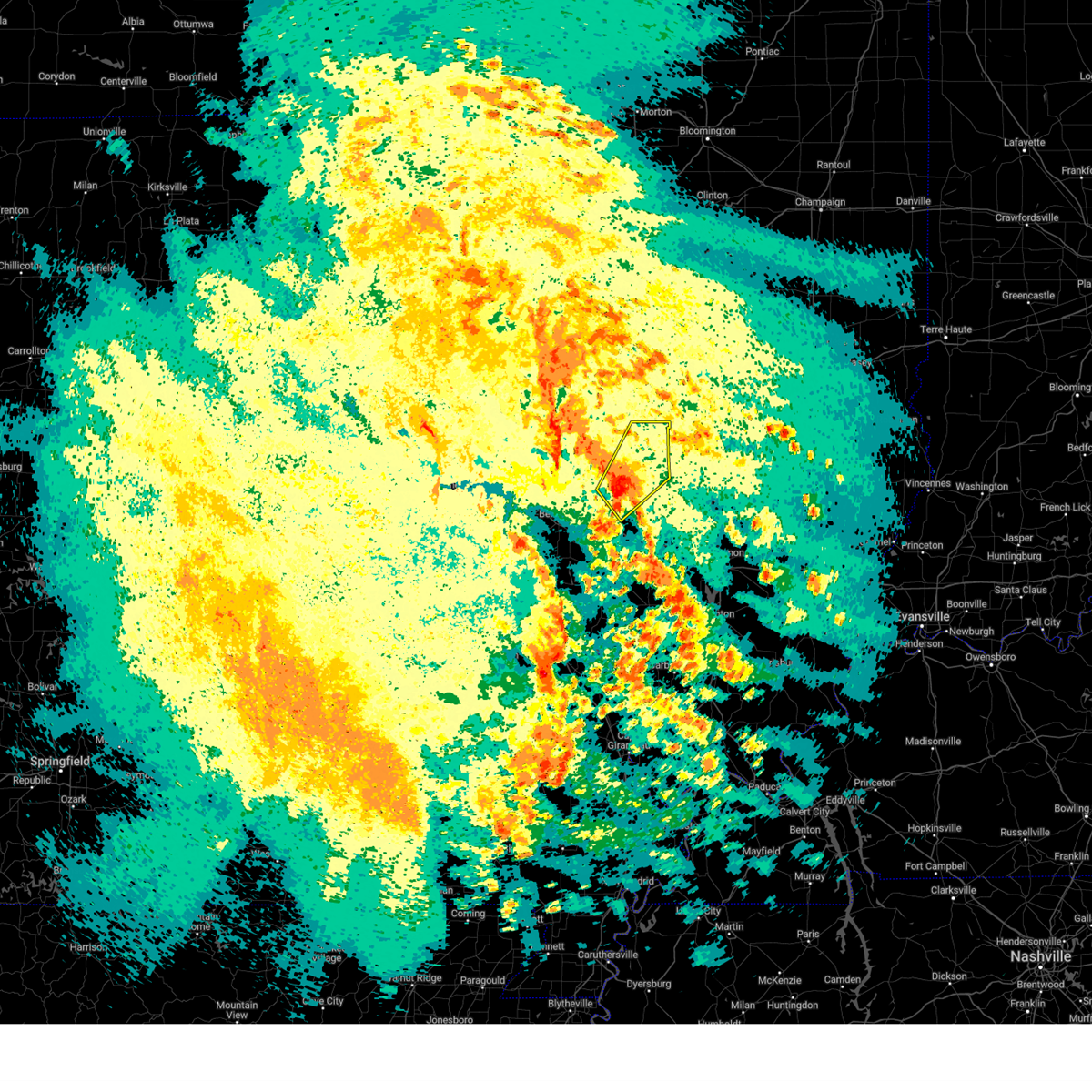
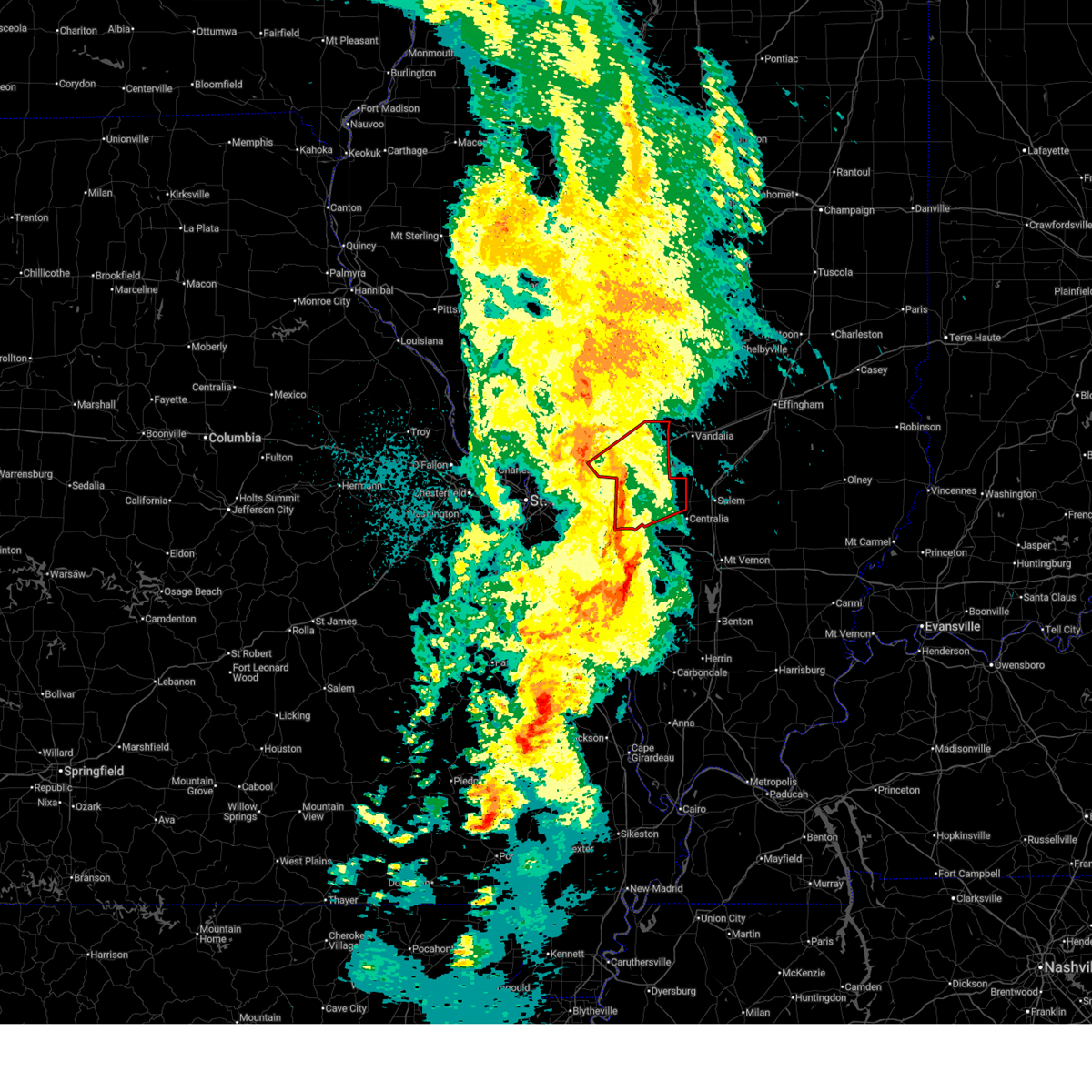
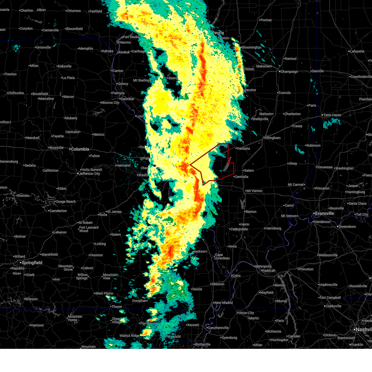
 At 758 pm cdt, severe thunderstorms were located along a line from over lebanon to 6 miles north of red bud, moving east at 35 mph (radar indicated). Hazards include 60 mph wind gusts and quarter size hail. Hail damage to vehicles is expected. expect wind damage to roofs, siding, and trees. locations impacted include, belleville, waterloo, barr, o'fallon, shiloh, smithton, marine, freeburg, scott afb, lebanon, st. jacob, hecker, mascoutah, summerfield, highland, new athens, new baden, pierron and fayetteville. this includes the following highways, interstate 64 in illinois between exits 19 and 27. Interstate 70 in illinois between exits 24 and 30. At 758 pm cdt, severe thunderstorms were located along a line from over lebanon to 6 miles north of red bud, moving east at 35 mph (radar indicated). Hazards include 60 mph wind gusts and quarter size hail. Hail damage to vehicles is expected. expect wind damage to roofs, siding, and trees. locations impacted include, belleville, waterloo, barr, o'fallon, shiloh, smithton, marine, freeburg, scott afb, lebanon, st. jacob, hecker, mascoutah, summerfield, highland, new athens, new baden, pierron and fayetteville. this includes the following highways, interstate 64 in illinois between exits 19 and 27. Interstate 70 in illinois between exits 24 and 30.
|
| 4/27/2026 7:50 PM CDT |
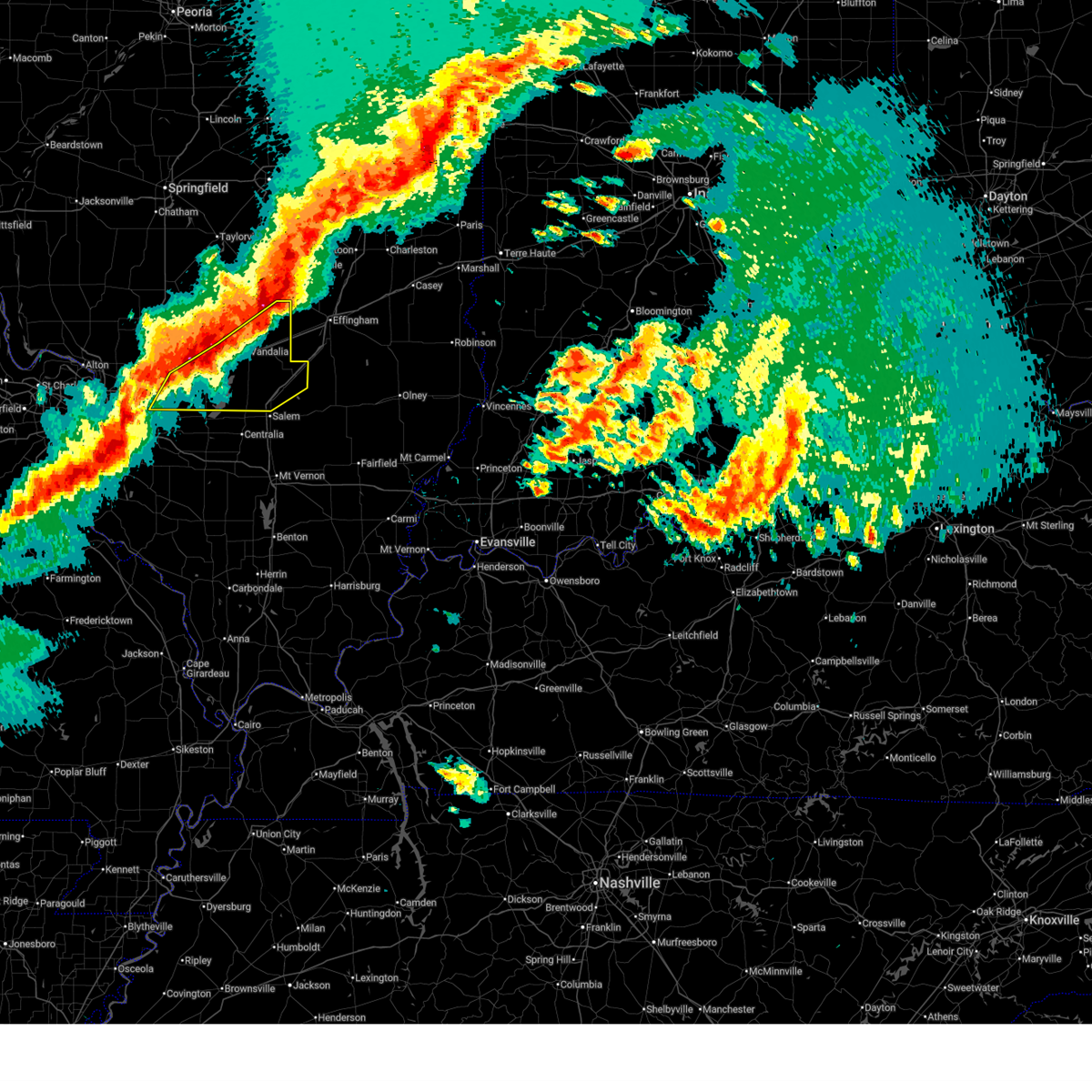 Svrlsx the national weather service in st louis has issued a * severe thunderstorm warning for, bond county in south central illinois, northern clinton county in south central illinois, fayette county in south central illinois, northern marion county in south central illinois, southeastern madison county in southwestern illinois, * until 845 pm cdt. * at 750 pm cdt, severe thunderstorms were located along a line from over wrights corner to near highland, or along a line from 19 miles northeast of vandalia to near highland, moving east at 40 mph (radar indicated). Hazards include 60 mph wind gusts and quarter size hail. Hail damage to vehicles is expected. Expect wind damage to roofs, siding, and trees. Svrlsx the national weather service in st louis has issued a * severe thunderstorm warning for, bond county in south central illinois, northern clinton county in south central illinois, fayette county in south central illinois, northern marion county in south central illinois, southeastern madison county in southwestern illinois, * until 845 pm cdt. * at 750 pm cdt, severe thunderstorms were located along a line from over wrights corner to near highland, or along a line from 19 miles northeast of vandalia to near highland, moving east at 40 mph (radar indicated). Hazards include 60 mph wind gusts and quarter size hail. Hail damage to vehicles is expected. Expect wind damage to roofs, siding, and trees.
|
| 4/27/2026 7:42 PM CDT |
 At 742 pm cdt, severe thunderstorms were located along a line from 8 miles north of wrights corner to over highland, or along a line from 23 miles northeast of vandalia to over highland, moving east at 40 mph (radar indicated). Hazards include 60 mph wind gusts and quarter size hail. Hail damage to vehicles is expected. expect wind damage to roofs, siding, and trees. locations impacted include, hamel, panama, coffeen, sorento, alhambra, fillmore, reno, van burensburg, grantfork, ramsey, woburn, shafter, greenville, pocahontas, vandalia, mulberry grove and wrights corner. this includes the following state parks, ramsey lake state park. this includes the following highways, interstate 55 in illinois between exits 30 and 33. Interstate 70 in illinois between exits 36 and 61. At 742 pm cdt, severe thunderstorms were located along a line from 8 miles north of wrights corner to over highland, or along a line from 23 miles northeast of vandalia to over highland, moving east at 40 mph (radar indicated). Hazards include 60 mph wind gusts and quarter size hail. Hail damage to vehicles is expected. expect wind damage to roofs, siding, and trees. locations impacted include, hamel, panama, coffeen, sorento, alhambra, fillmore, reno, van burensburg, grantfork, ramsey, woburn, shafter, greenville, pocahontas, vandalia, mulberry grove and wrights corner. this includes the following state parks, ramsey lake state park. this includes the following highways, interstate 55 in illinois between exits 30 and 33. Interstate 70 in illinois between exits 36 and 61.
|
| 4/27/2026 7:41 PM CDT |
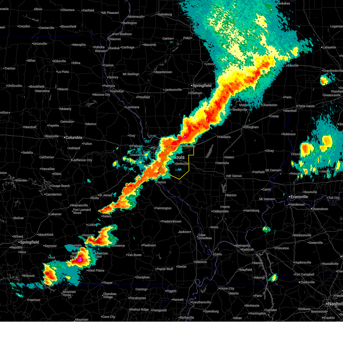
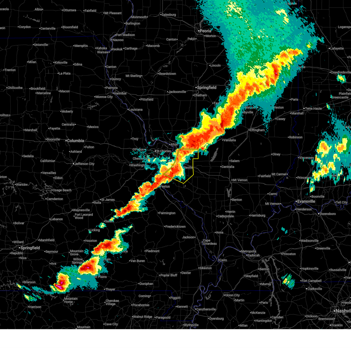 At 741 pm cdt, severe thunderstorms were located along a line from near collinsville to over waterloo, moving east at 35 mph (radar indicated). Hazards include 70 mph wind gusts and half dollar size hail. Hail damage to vehicles is expected. expect considerable tree damage. wind damage is also likely to mobile homes, roofs, and outbuildings. locations impacted include, east st. louis, columbia, centreville, edwardsville, pontoon beach, collinsville, glen carbon, belleville, fairview heights, maryville, waterloo, troy, swansea, o'fallon, shiloh, freeburg, lebanon, mascoutah and highland. this includes the following highways, interstate 64 in illinois between exits 9 and 27. interstate 55 in illinois near exit 23. Interstate 70 in illinois between exits 21 and 30. At 741 pm cdt, severe thunderstorms were located along a line from near collinsville to over waterloo, moving east at 35 mph (radar indicated). Hazards include 70 mph wind gusts and half dollar size hail. Hail damage to vehicles is expected. expect considerable tree damage. wind damage is also likely to mobile homes, roofs, and outbuildings. locations impacted include, east st. louis, columbia, centreville, edwardsville, pontoon beach, collinsville, glen carbon, belleville, fairview heights, maryville, waterloo, troy, swansea, o'fallon, shiloh, freeburg, lebanon, mascoutah and highland. this includes the following highways, interstate 64 in illinois between exits 9 and 27. interstate 55 in illinois near exit 23. Interstate 70 in illinois between exits 21 and 30.
|
| 4/27/2026 7:31 PM CDT |
 the severe thunderstorm warning has been cancelled and is no longer in effect the severe thunderstorm warning has been cancelled and is no longer in effect
|
| 4/27/2026 7:31 PM CDT |
 At 731 pm cdt, severe thunderstorms were located along a line from over collinsville to over fountain, or along a line from over collinsville to 6 miles west of waterloo, moving east at 35 mph (radar indicated). Hazards include 70 mph wind gusts and quarter size hail. Hail damage to vehicles is expected. expect considerable tree damage. wind damage is also likely to mobile homes, roofs, and outbuildings. locations impacted include, granite city, cahokia, east st. louis, columbia, centreville, edwardsville, pontoon beach, collinsville, glen carbon, belleville, fairview heights, maryville, waterloo, troy, swansea, o'fallon, shiloh, mascoutah and highland. this includes the following state parks, horseshoe lake state park. this includes the following highways, interstate 64 in illinois between exits 9 and 27. interstate 55 in illinois near exit 23. Interstate 70 in illinois between exits 21 and 30. At 731 pm cdt, severe thunderstorms were located along a line from over collinsville to over fountain, or along a line from over collinsville to 6 miles west of waterloo, moving east at 35 mph (radar indicated). Hazards include 70 mph wind gusts and quarter size hail. Hail damage to vehicles is expected. expect considerable tree damage. wind damage is also likely to mobile homes, roofs, and outbuildings. locations impacted include, granite city, cahokia, east st. louis, columbia, centreville, edwardsville, pontoon beach, collinsville, glen carbon, belleville, fairview heights, maryville, waterloo, troy, swansea, o'fallon, shiloh, mascoutah and highland. this includes the following state parks, horseshoe lake state park. this includes the following highways, interstate 64 in illinois between exits 9 and 27. interstate 55 in illinois near exit 23. Interstate 70 in illinois between exits 21 and 30.
|
| 4/27/2026 7:25 PM CDT |
 At 725 pm cdt, severe thunderstorms were located along a line from 10 miles north of ramsey to near troy, or along a line from 12 miles east of nokomis to near troy, moving east at 40 mph (radar indicated). Hazards include ping pong ball size hail and 60 mph wind gusts. People and animals outdoors will be injured. expect hail damage to roofs, siding, windows, and vehicles. expect wind damage to roofs, siding, and trees. locations impacted include, bethalto, mount olive, staunton, wood river, hillsboro, hartford, roxana, witt, taylor springs, nokomis, south roxana, livingston, worden, coffeen, ramsey, greenville, pocahontas and vandalia. this includes the following state parks, ramsey lake state park. this includes the following highways, interstate 55 in illinois between exits 30 and 44. Interstate 70 in illinois between exits 36 and 61. At 725 pm cdt, severe thunderstorms were located along a line from 10 miles north of ramsey to near troy, or along a line from 12 miles east of nokomis to near troy, moving east at 40 mph (radar indicated). Hazards include ping pong ball size hail and 60 mph wind gusts. People and animals outdoors will be injured. expect hail damage to roofs, siding, windows, and vehicles. expect wind damage to roofs, siding, and trees. locations impacted include, bethalto, mount olive, staunton, wood river, hillsboro, hartford, roxana, witt, taylor springs, nokomis, south roxana, livingston, worden, coffeen, ramsey, greenville, pocahontas and vandalia. this includes the following state parks, ramsey lake state park. this includes the following highways, interstate 55 in illinois between exits 30 and 44. Interstate 70 in illinois between exits 36 and 61.
|
| 4/27/2026 7:12 PM CDT |
 Svrlsx the national weather service in st louis has issued a * severe thunderstorm warning for, southern madison county in southwestern illinois, northern monroe county in southwestern illinois, saint clair county in southwestern illinois, saint louis city in east central missouri, * until 815 pm cdt. * at 712 pm cdt, severe thunderstorms were located along a line from over moline acres to near antonia, or along a line from over bellefontaine neighbors to near antonia, moving east at 35 mph (radar indicated). Hazards include 70 mph wind gusts and quarter size hail. Hail damage to vehicles is expected. expect considerable tree damage. Wind damage is also likely to mobile homes, roofs, and outbuildings. Svrlsx the national weather service in st louis has issued a * severe thunderstorm warning for, southern madison county in southwestern illinois, northern monroe county in southwestern illinois, saint clair county in southwestern illinois, saint louis city in east central missouri, * until 815 pm cdt. * at 712 pm cdt, severe thunderstorms were located along a line from over moline acres to near antonia, or along a line from over bellefontaine neighbors to near antonia, moving east at 35 mph (radar indicated). Hazards include 70 mph wind gusts and quarter size hail. Hail damage to vehicles is expected. expect considerable tree damage. Wind damage is also likely to mobile homes, roofs, and outbuildings.
|
| 4/27/2026 7:09 PM CDT |
 Svrlsx the national weather service in st louis has issued a * severe thunderstorm warning for, bond county in south central illinois, northwestern fayette county in south central illinois, montgomery county in south central illinois, southeastern macoupin county in southwestern illinois, northern madison county in southwestern illinois, northeastern saint charles county in east central missouri, * until 800 pm cdt. * at 709 pm cdt, severe thunderstorms were located along a line from over nokomis to over roxana, or along a line from over nokomis to over wood river, moving east at 40 mph (radar indicated). Hazards include 60 mph wind gusts and half dollar size hail. Hail damage to vehicles is expected. Expect wind damage to roofs, siding, and trees. Svrlsx the national weather service in st louis has issued a * severe thunderstorm warning for, bond county in south central illinois, northwestern fayette county in south central illinois, montgomery county in south central illinois, southeastern macoupin county in southwestern illinois, northern madison county in southwestern illinois, northeastern saint charles county in east central missouri, * until 800 pm cdt. * at 709 pm cdt, severe thunderstorms were located along a line from over nokomis to over roxana, or along a line from over nokomis to over wood river, moving east at 40 mph (radar indicated). Hazards include 60 mph wind gusts and half dollar size hail. Hail damage to vehicles is expected. Expect wind damage to roofs, siding, and trees.
|
| 4/27/2026 2:52 PM CDT |
 At 252 pm cdt, a severe thunderstorm was located near pocahontas, or 6 miles northeast of highland, moving east at 30 mph (radar indicated). Hazards include 60 mph wind gusts and quarter size hail. Hail damage to vehicles is expected. expect wind damage to roofs, siding, and trees. locations impacted include, st. jacob, highland, grantfork, pierron, old ripley, pocahontas, jamestown, reno, stolletown, dudleyville, greenville and beaver creek. This includes interstate 70 in illinois between exits 24 and 41. At 252 pm cdt, a severe thunderstorm was located near pocahontas, or 6 miles northeast of highland, moving east at 30 mph (radar indicated). Hazards include 60 mph wind gusts and quarter size hail. Hail damage to vehicles is expected. expect wind damage to roofs, siding, and trees. locations impacted include, st. jacob, highland, grantfork, pierron, old ripley, pocahontas, jamestown, reno, stolletown, dudleyville, greenville and beaver creek. This includes interstate 70 in illinois between exits 24 and 41.
|
| 4/27/2026 2:42 PM CDT |
 At 242 pm cdt, a severe thunderstorm was located near highland, moving east at 30 mph (radar indicated). Hazards include 60 mph wind gusts and quarter size hail. Hail damage to vehicles is expected. expect wind damage to roofs, siding, and trees. locations impacted include, marine, st. jacob, kaufman, alhambra, highland, grantfork, pierron, old ripley, pocahontas, jamestown, reno, stolletown, dudleyville, greenville and beaver creek. This includes interstate 70 in illinois between exits 21 and 41. At 242 pm cdt, a severe thunderstorm was located near highland, moving east at 30 mph (radar indicated). Hazards include 60 mph wind gusts and quarter size hail. Hail damage to vehicles is expected. expect wind damage to roofs, siding, and trees. locations impacted include, marine, st. jacob, kaufman, alhambra, highland, grantfork, pierron, old ripley, pocahontas, jamestown, reno, stolletown, dudleyville, greenville and beaver creek. This includes interstate 70 in illinois between exits 21 and 41.
|
| 4/27/2026 2:30 PM CDT |
 Svrlsx the national weather service in st louis has issued a * severe thunderstorm warning for, western bond county in south central illinois, northwestern clinton county in south central illinois, eastern madison county in southwestern illinois, * until 315 pm cdt. * at 230 pm cdt, a severe thunderstorm was located over marine, or 7 miles northeast of troy, moving east at 30 mph (radar indicated). Hazards include 60 mph wind gusts and quarter size hail. Hail damage to vehicles is expected. Expect wind damage to roofs, siding, and trees. Svrlsx the national weather service in st louis has issued a * severe thunderstorm warning for, western bond county in south central illinois, northwestern clinton county in south central illinois, eastern madison county in southwestern illinois, * until 315 pm cdt. * at 230 pm cdt, a severe thunderstorm was located over marine, or 7 miles northeast of troy, moving east at 30 mph (radar indicated). Hazards include 60 mph wind gusts and quarter size hail. Hail damage to vehicles is expected. Expect wind damage to roofs, siding, and trees.
|
| 4/27/2026 2:03 PM CDT |
 the tornado warning has been cancelled and is no longer in effect the tornado warning has been cancelled and is no longer in effect
|
| 4/27/2026 1:59 PM CDT |
 At 159 pm cdt, a severe thunderstorm capable of producing a tornado was located near highland, moving east at 25 mph (radar indicated rotation). Hazards include tornado. Flying debris will be dangerous to those caught without shelter. mobile homes will be damaged or destroyed. damage to roofs, windows and vehicles will occur. tree damage is likely. locations impacted include, highland, grantfork, pierron, old ripley, pocahontas, dudleyville, greenville, beaver creek and smithboro. This includes interstate 70 in illinois between exits 30 and 45. At 159 pm cdt, a severe thunderstorm capable of producing a tornado was located near highland, moving east at 25 mph (radar indicated rotation). Hazards include tornado. Flying debris will be dangerous to those caught without shelter. mobile homes will be damaged or destroyed. damage to roofs, windows and vehicles will occur. tree damage is likely. locations impacted include, highland, grantfork, pierron, old ripley, pocahontas, dudleyville, greenville, beaver creek and smithboro. This includes interstate 70 in illinois between exits 30 and 45.
|
| 4/27/2026 1:49 PM CDT |
 Torlsx the national weather service in st louis has issued a * tornado warning for, bond county in south central illinois, east central madison county in southwestern illinois, * until 245 pm cdt. * at 149 pm cdt, a severe thunderstorm capable of producing a tornado was located over marine, or near highland, moving east at 25 mph (radar indicated rotation). Hazards include tornado. Flying debris will be dangerous to those caught without shelter. mobile homes will be damaged or destroyed. damage to roofs, windows and vehicles will occur. Tree damage is likely. Torlsx the national weather service in st louis has issued a * tornado warning for, bond county in south central illinois, east central madison county in southwestern illinois, * until 245 pm cdt. * at 149 pm cdt, a severe thunderstorm capable of producing a tornado was located over marine, or near highland, moving east at 25 mph (radar indicated rotation). Hazards include tornado. Flying debris will be dangerous to those caught without shelter. mobile homes will be damaged or destroyed. damage to roofs, windows and vehicles will occur. Tree damage is likely.
|
| 3/15/2026 5:39 PM CDT |
 the tornado warning has been cancelled and is no longer in effect the tornado warning has been cancelled and is no longer in effect
|
| 3/15/2026 5:26 PM CDT |
 the severe thunderstorm warning has been cancelled and is no longer in effect the severe thunderstorm warning has been cancelled and is no longer in effect
|
| 3/15/2026 5:26 PM CDT |
 At 526 pm cdt, a severe thunderstorm was located over troy, moving east at 50 mph (radar indicated). Hazards include 60 mph wind gusts and small hail. Expect damage to roofs, siding, and trees. locations impacted include, waterloo, east st. louis, belleville, fairview heights, swansea, pontoon beach, shiloh, maryville, collinsville, wood river, bethalto, glen carbon, o'fallon, edwardsville, troy, mascoutah and highland. this includes the following state parks, horseshoe lake state park. this includes the following highways, interstate 64 in illinois between exits 9 and 27. interstate 55 in illinois between exits 23 and 37. Interstate 70 in illinois between exits 21 and 24. At 526 pm cdt, a severe thunderstorm was located over troy, moving east at 50 mph (radar indicated). Hazards include 60 mph wind gusts and small hail. Expect damage to roofs, siding, and trees. locations impacted include, waterloo, east st. louis, belleville, fairview heights, swansea, pontoon beach, shiloh, maryville, collinsville, wood river, bethalto, glen carbon, o'fallon, edwardsville, troy, mascoutah and highland. this includes the following state parks, horseshoe lake state park. this includes the following highways, interstate 64 in illinois between exits 9 and 27. interstate 55 in illinois between exits 23 and 37. Interstate 70 in illinois between exits 21 and 24.
|
| 3/15/2026 5:22 PM CDT |
 At 522 pm cdt, a severe thunderstorm capable of producing a tornado was located over troy, moving east at 50 mph (radar indicated rotation). Hazards include tornado. Flying debris will be dangerous to those caught without shelter. mobile homes will be damaged or destroyed. damage to roofs, windows and vehicles will occur. tree damage is likely. locations impacted include, east st. louis, centreville, belleville, pontoon beach, caseyville, fairview heights, swansea, collinsville, shiloh, maryville, glen carbon, scott afb, o'fallon, edwardsville, troy, mascoutah, lebanon and highland. this includes the following highways, interstate 64 in illinois between exits 9 and 23. interstate 55 in illinois near exit 23. Interstate 70 in illinois between exits 21 and 30. At 522 pm cdt, a severe thunderstorm capable of producing a tornado was located over troy, moving east at 50 mph (radar indicated rotation). Hazards include tornado. Flying debris will be dangerous to those caught without shelter. mobile homes will be damaged or destroyed. damage to roofs, windows and vehicles will occur. tree damage is likely. locations impacted include, east st. louis, centreville, belleville, pontoon beach, caseyville, fairview heights, swansea, collinsville, shiloh, maryville, glen carbon, scott afb, o'fallon, edwardsville, troy, mascoutah, lebanon and highland. this includes the following highways, interstate 64 in illinois between exits 9 and 23. interstate 55 in illinois near exit 23. Interstate 70 in illinois between exits 21 and 30.
|
| 3/15/2026 5:05 PM CDT |
 Torlsx the national weather service in st louis has issued a * tornado warning for, southern madison county in southwestern illinois, northern saint clair county in southwestern illinois, * until 545 pm cdt. * at 505 pm cdt, a severe thunderstorm capable of producing a tornado was located over madison, moving east at 45 mph (radar indicated rotation). Hazards include tornado. Flying debris will be dangerous to those caught without shelter. mobile homes will be damaged or destroyed. damage to roofs, windows and vehicles will occur. Tree damage is likely. Torlsx the national weather service in st louis has issued a * tornado warning for, southern madison county in southwestern illinois, northern saint clair county in southwestern illinois, * until 545 pm cdt. * at 505 pm cdt, a severe thunderstorm capable of producing a tornado was located over madison, moving east at 45 mph (radar indicated rotation). Hazards include tornado. Flying debris will be dangerous to those caught without shelter. mobile homes will be damaged or destroyed. damage to roofs, windows and vehicles will occur. Tree damage is likely.
|
| 3/15/2026 5:01 PM CDT |
 Svrlsx the national weather service in st louis has issued a * severe thunderstorm warning for, madison county in southwestern illinois, northwestern monroe county in southwestern illinois, saint clair county in southwestern illinois, northeastern saint charles county in east central missouri, eastern saint louis county in east central missouri, * until 545 pm cdt. * at 501 pm cdt, a severe thunderstorm was located over bella villa, or over lemay, moving east at 40 mph (radar indicated). Hazards include 60 mph wind gusts and small hail. expect damage to roofs, siding, and trees Svrlsx the national weather service in st louis has issued a * severe thunderstorm warning for, madison county in southwestern illinois, northwestern monroe county in southwestern illinois, saint clair county in southwestern illinois, northeastern saint charles county in east central missouri, eastern saint louis county in east central missouri, * until 545 pm cdt. * at 501 pm cdt, a severe thunderstorm was located over bella villa, or over lemay, moving east at 40 mph (radar indicated). Hazards include 60 mph wind gusts and small hail. expect damage to roofs, siding, and trees
|
| 3/11/2026 4:23 AM CDT |
 the severe thunderstorm warning has been cancelled and is no longer in effect the severe thunderstorm warning has been cancelled and is no longer in effect
|
| 3/11/2026 4:23 AM CDT |
 At 423 am cdt, severe thunderstorms were located along a line from near sorento to over highland, or along a line from 10 miles south of hillsboro to over highland, moving east at 45 mph (radar indicated). Hazards include 60 mph wind gusts and small hail. Expect damage to roofs, siding, and trees. locations impacted include, highland, greenville, pocahontas, coffeen, mulberry grove, tamalco, sorento, beaver creek, reno, woburn, van burensburg, pleasant mound, pierron, keyesport, panama, grantfork, new douglas, donnellson and smithboro. This includes interstate 70 in illinois between exits 24 and 52. At 423 am cdt, severe thunderstorms were located along a line from near sorento to over highland, or along a line from 10 miles south of hillsboro to over highland, moving east at 45 mph (radar indicated). Hazards include 60 mph wind gusts and small hail. Expect damage to roofs, siding, and trees. locations impacted include, highland, greenville, pocahontas, coffeen, mulberry grove, tamalco, sorento, beaver creek, reno, woburn, van burensburg, pleasant mound, pierron, keyesport, panama, grantfork, new douglas, donnellson and smithboro. This includes interstate 70 in illinois between exits 24 and 52.
|
| 3/11/2026 4:12 AM CDT |
 At 412 am cdt, severe thunderstorms were located along a line from near mount olive to over troy, or along a line from 5 miles east of staunton to over troy, moving east at 45 mph (radar indicated). Hazards include 60 mph wind gusts and small hail. Expect damage to roofs, siding, and trees. locations impacted include, edwardsville, glen carbon, highland, troy, maryville, greenville, staunton, mount olive, benld, st. jacob, worden, marine, livingston, pocahontas, coffeen, alhambra, mulberry grove, tamalco, sorento and sawyerville. this includes the following highways, interstate 55 in illinois between exits 23 and 44. Interstate 70 in illinois between exits 21 and 52. At 412 am cdt, severe thunderstorms were located along a line from near mount olive to over troy, or along a line from 5 miles east of staunton to over troy, moving east at 45 mph (radar indicated). Hazards include 60 mph wind gusts and small hail. Expect damage to roofs, siding, and trees. locations impacted include, edwardsville, glen carbon, highland, troy, maryville, greenville, staunton, mount olive, benld, st. jacob, worden, marine, livingston, pocahontas, coffeen, alhambra, mulberry grove, tamalco, sorento and sawyerville. this includes the following highways, interstate 55 in illinois between exits 23 and 44. Interstate 70 in illinois between exits 21 and 52.
|
| 3/11/2026 3:57 AM CDT |
 Svrlsx the national weather service in st louis has issued a * severe thunderstorm warning for, bond county in south central illinois, southern montgomery county in south central illinois, southeastern macoupin county in southwestern illinois, eastern madison county in southwestern illinois, * until 445 am cdt. * at 357 am cdt, severe thunderstorms were located along a line from over bunker hill to over pontoon beach, or along a line from 9 miles northeast of bethalto to over pontoon beach, moving east at 45 mph (at 345 am, alton regional airport reported a 67 mph gust). Hazards include 60 mph wind gusts and small hail. Expect damage to roofs, siding, and trees. this severe thunderstorm will be near, edwardsville, glen carbon, maryville, collinsville, carpenter, pontoon beach, prairietown, bunker hill, granite city and roxana around 400 am cdt. worden, staunton, livingston and wilsonville around 405 am cdt. alhambra, troy, sawyerville and benld around 410 am cdt. other locations impacted by the severe thunderstorm include pruett, poag, kuhn, fruit, hamel, dorchester, williamson, kaufman, white city and new douglas. this includes the following highways, interstate 55 in illinois between exits 23 and 44. Interstate 70 in illinois between exits 21 and 52. Svrlsx the national weather service in st louis has issued a * severe thunderstorm warning for, bond county in south central illinois, southern montgomery county in south central illinois, southeastern macoupin county in southwestern illinois, eastern madison county in southwestern illinois, * until 445 am cdt. * at 357 am cdt, severe thunderstorms were located along a line from over bunker hill to over pontoon beach, or along a line from 9 miles northeast of bethalto to over pontoon beach, moving east at 45 mph (at 345 am, alton regional airport reported a 67 mph gust). Hazards include 60 mph wind gusts and small hail. Expect damage to roofs, siding, and trees. this severe thunderstorm will be near, edwardsville, glen carbon, maryville, collinsville, carpenter, pontoon beach, prairietown, bunker hill, granite city and roxana around 400 am cdt. worden, staunton, livingston and wilsonville around 405 am cdt. alhambra, troy, sawyerville and benld around 410 am cdt. other locations impacted by the severe thunderstorm include pruett, poag, kuhn, fruit, hamel, dorchester, williamson, kaufman, white city and new douglas. this includes the following highways, interstate 55 in illinois between exits 23 and 44. Interstate 70 in illinois between exits 21 and 52.
|
| 12/18/2025 12:36 PM CST |
 The storm which prompted the warning has weakened below severe limits, and has exited the warned area. therefore, the warning will be allowed to expire. however, gusty winds are still possible with this thunderstorm. The storm which prompted the warning has weakened below severe limits, and has exited the warned area. therefore, the warning will be allowed to expire. however, gusty winds are still possible with this thunderstorm.
|
| 12/18/2025 12:22 PM CST |
 At 1222 pm cst, a severe thunderstorm was located near st. jacob, or 5 miles north of lebanon, moving east at 50 mph (radar indicated). Hazards include 60 mph wind gusts. Expect damage to roofs, siding, and trees. this severe thunderstorm will be near, st. jacob, lebanon, troy, marine and o'fallon around 1225 pm cst. highland around 1230 pm cst. other locations impacted by the severe thunderstorm include summerfield, grantfork and pierron. this includes the following highways, interstate 64 in illinois between exits 12 and 23. Interstate 70 in illinois between exits 21 and 30. At 1222 pm cst, a severe thunderstorm was located near st. jacob, or 5 miles north of lebanon, moving east at 50 mph (radar indicated). Hazards include 60 mph wind gusts. Expect damage to roofs, siding, and trees. this severe thunderstorm will be near, st. jacob, lebanon, troy, marine and o'fallon around 1225 pm cst. highland around 1230 pm cst. other locations impacted by the severe thunderstorm include summerfield, grantfork and pierron. this includes the following highways, interstate 64 in illinois between exits 12 and 23. Interstate 70 in illinois between exits 21 and 30.
|
| 12/18/2025 12:11 PM CST |
 At 1211 pm cst, a severe thunderstorm was located over collinsville, moving east at 50 mph (radar indicated). Hazards include 60 mph wind gusts. Expect damage to roofs, siding, and trees. this severe thunderstorm will be near, o'fallon, collinsville, caseyville, maryville, fairview heights, shiloh, glen carbon, pontoon beach, swansea and scott afb around 1215 pm cst. troy and lebanon around 1220 pm cst. other locations impacted by the severe thunderstorm include kuhn, summerfield, grantfork and pierron. this includes the following highways, interstate 64 in illinois between exits 9 and 23. Interstate 70 in illinois between exits 21 and 30. At 1211 pm cst, a severe thunderstorm was located over collinsville, moving east at 50 mph (radar indicated). Hazards include 60 mph wind gusts. Expect damage to roofs, siding, and trees. this severe thunderstorm will be near, o'fallon, collinsville, caseyville, maryville, fairview heights, shiloh, glen carbon, pontoon beach, swansea and scott afb around 1215 pm cst. troy and lebanon around 1220 pm cst. other locations impacted by the severe thunderstorm include kuhn, summerfield, grantfork and pierron. this includes the following highways, interstate 64 in illinois between exits 9 and 23. Interstate 70 in illinois between exits 21 and 30.
|
| 12/18/2025 11:59 AM CST |
 Svrlsx the national weather service in st louis has issued a * severe thunderstorm warning for, southeastern madison county in southwestern illinois, northern saint clair county in southwestern illinois, * until 1245 pm cst. * at 1159 am cst, a severe thunderstorm was located over east st. louis, moving east at 50 mph (radar indicated). Hazards include 60 mph wind gusts. Expect damage to roofs, siding, and trees. this severe thunderstorm will be near, east st. louis, centreville, alorton, madison, st. louis, cahokia, cahokia parks airport, brooklyn, venice and dupo around 1200 pm cst. washington park, fairmont city, belleville, pontoon beach and granite city around 1205 pm cst. other locations impacted by the severe thunderstorm include sauget, kuhn, summerfield, grantfork and pierron. this includes the following state parks, horseshoe lake state park. this includes the following highways, interstate 64 in illinois between exits 9 and 23. Interstate 70 in illinois between exits 21 and 30. Svrlsx the national weather service in st louis has issued a * severe thunderstorm warning for, southeastern madison county in southwestern illinois, northern saint clair county in southwestern illinois, * until 1245 pm cst. * at 1159 am cst, a severe thunderstorm was located over east st. louis, moving east at 50 mph (radar indicated). Hazards include 60 mph wind gusts. Expect damage to roofs, siding, and trees. this severe thunderstorm will be near, east st. louis, centreville, alorton, madison, st. louis, cahokia, cahokia parks airport, brooklyn, venice and dupo around 1200 pm cst. washington park, fairmont city, belleville, pontoon beach and granite city around 1205 pm cst. other locations impacted by the severe thunderstorm include sauget, kuhn, summerfield, grantfork and pierron. this includes the following state parks, horseshoe lake state park. this includes the following highways, interstate 64 in illinois between exits 9 and 23. Interstate 70 in illinois between exits 21 and 30.
|
| 7/6/2025 5:00 PM CDT |
 the severe thunderstorm warning has been cancelled and is no longer in effect the severe thunderstorm warning has been cancelled and is no longer in effect
|
| 7/6/2025 4:52 PM CDT |
 At 452 pm cdt, severe thunderstorms were located along a line from over highland to over new baden, moving east at 25 mph (radar indicated). Hazards include 60 mph wind gusts and small hail. Expect damage to roofs, siding, and trees. locations impacted include, highland, lebanon, pierron, summerfield and grantfork. This includes interstate 70 in illinois near exit 30. At 452 pm cdt, severe thunderstorms were located along a line from over highland to over new baden, moving east at 25 mph (radar indicated). Hazards include 60 mph wind gusts and small hail. Expect damage to roofs, siding, and trees. locations impacted include, highland, lebanon, pierron, summerfield and grantfork. This includes interstate 70 in illinois near exit 30.
|
| 7/6/2025 4:41 PM CDT |
 At 441 pm cdt, severe thunderstorms were located along a line from over marine to near new baden, or along a line from 6 miles west of highland to near new baden, moving east at 25 mph (radar indicated). Hazards include 60 mph wind gusts and small hail. Expect damage to roofs, siding, and trees. locations impacted include, o'fallon, shiloh, highland, lebanon, st. jacob, marine, pierron, summerfield and grantfork. this includes the following highways, interstate 64 in illinois near exit 19. Interstate 70 in illinois between exits 21 and 30. At 441 pm cdt, severe thunderstorms were located along a line from over marine to near new baden, or along a line from 6 miles west of highland to near new baden, moving east at 25 mph (radar indicated). Hazards include 60 mph wind gusts and small hail. Expect damage to roofs, siding, and trees. locations impacted include, o'fallon, shiloh, highland, lebanon, st. jacob, marine, pierron, summerfield and grantfork. this includes the following highways, interstate 64 in illinois near exit 19. Interstate 70 in illinois between exits 21 and 30.
|
| 7/6/2025 4:31 PM CDT |
 At 431 pm cdt, severe thunderstorms were located along a line from over glen carbon to over shiloh, moving east at 20 mph (radar indicated). Hazards include 60 mph wind gusts and small hail. Expect damage to roofs, siding, and trees. locations impacted include, o'fallon, edwardsville, fairview heights, swansea, glen carbon, shiloh, highland, troy, maryville, lebanon, scott afb, st. jacob, marine, pierron, summerfield, grantfork, kuhn and fruit. this includes the following highways, interstate 64 in illinois between exits 14 and 19. interstate 55 in illinois near exit 23. Interstate 70 in illinois between exits 21 and 30. At 431 pm cdt, severe thunderstorms were located along a line from over glen carbon to over shiloh, moving east at 20 mph (radar indicated). Hazards include 60 mph wind gusts and small hail. Expect damage to roofs, siding, and trees. locations impacted include, o'fallon, edwardsville, fairview heights, swansea, glen carbon, shiloh, highland, troy, maryville, lebanon, scott afb, st. jacob, marine, pierron, summerfield, grantfork, kuhn and fruit. this includes the following highways, interstate 64 in illinois between exits 14 and 19. interstate 55 in illinois near exit 23. Interstate 70 in illinois between exits 21 and 30.
|
| 7/6/2025 4:11 PM CDT |
 Svrlsx the national weather service in st louis has issued a * severe thunderstorm warning for, southern madison county in southwestern illinois, northeastern saint clair county in southwestern illinois, * until 515 pm cdt. * at 411 pm cdt, severe thunderstorms were located along a line from near hartford to over centreville, or along a line from near granite city to over centreville, moving east at 15 mph (radar indicated). Hazards include 60 mph wind gusts and small hail. expect damage to roofs, siding, and trees Svrlsx the national weather service in st louis has issued a * severe thunderstorm warning for, southern madison county in southwestern illinois, northeastern saint clair county in southwestern illinois, * until 515 pm cdt. * at 411 pm cdt, severe thunderstorms were located along a line from near hartford to over centreville, or along a line from near granite city to over centreville, moving east at 15 mph (radar indicated). Hazards include 60 mph wind gusts and small hail. expect damage to roofs, siding, and trees
|
| 5/20/2025 12:31 AM CDT |
 Svrlsx the national weather service in st louis has issued a * severe thunderstorm warning for, bond county in south central illinois, northwestern clinton county in south central illinois, southeastern madison county in southwestern illinois, * until 115 am cdt. * at 1231 am cdt, a severe thunderstorm was located over st. rose, or near breese, moving northeast at 45 mph (radar indicated). Hazards include 60 mph wind gusts. expect damage to roofs, siding, and trees Svrlsx the national weather service in st louis has issued a * severe thunderstorm warning for, bond county in south central illinois, northwestern clinton county in south central illinois, southeastern madison county in southwestern illinois, * until 115 am cdt. * at 1231 am cdt, a severe thunderstorm was located over st. rose, or near breese, moving northeast at 45 mph (radar indicated). Hazards include 60 mph wind gusts. expect damage to roofs, siding, and trees
|
| 5/16/2025 3:02 PM CDT | Tree down. power pole and transformer taken down by tre in madison county IL, 2.1 miles N of Highland, IL |
| 5/16/2025 2:55 PM CDT | A large branch snapped from a large healthy tre in madison county IL, 2.1 miles N of Highland, IL |
| 4/20/2025 9:01 PM CDT |
 At 901 pm cdt, severe thunderstorms capable of producing a tornado were located along a line from near pocahontas to near beckemeyer, or along a line from 7 miles west of greenville to 6 miles south of carlyle, moving northeast at 50 mph (radar indicated rotation). Hazards include tornado. Flying debris will be dangerous to those caught without shelter. mobile homes will be damaged or destroyed. damage to roofs, windows and vehicles will occur. tree damage is likely. locations impacted include, highland, greenville, breese, carlyle, aviston, st. rose, germantown, albers, beckemeyer, pocahontas, mulberry grove, tamalco, beaver creek, jamestown, boulder, woburn, reno, shattuc, pleasant mound and pierron. this includes the following state parks, carlyle lake recreational area. This includes interstate 70 in illinois between exits 24 and 52. At 901 pm cdt, severe thunderstorms capable of producing a tornado were located along a line from near pocahontas to near beckemeyer, or along a line from 7 miles west of greenville to 6 miles south of carlyle, moving northeast at 50 mph (radar indicated rotation). Hazards include tornado. Flying debris will be dangerous to those caught without shelter. mobile homes will be damaged or destroyed. damage to roofs, windows and vehicles will occur. tree damage is likely. locations impacted include, highland, greenville, breese, carlyle, aviston, st. rose, germantown, albers, beckemeyer, pocahontas, mulberry grove, tamalco, beaver creek, jamestown, boulder, woburn, reno, shattuc, pleasant mound and pierron. this includes the following state parks, carlyle lake recreational area. This includes interstate 70 in illinois between exits 24 and 52.
|
| 4/20/2025 8:51 PM CDT |
 the tornado warning has been cancelled and is no longer in effect the tornado warning has been cancelled and is no longer in effect
|
| 4/20/2025 8:51 PM CDT |
 At 851 pm cdt, severe thunderstorms capable of producing a tornado were located along a line from near pocahontas to near okawville, or along a line from 6 miles northeast of highland to 9 miles south of breese, moving northeast at 60 mph (radar indicated rotation). Hazards include tornado. Flying debris will be dangerous to those caught without shelter. mobile homes will be damaged or destroyed. damage to roofs, windows and vehicles will occur. tree damage is likely. locations impacted include, highland, troy, greenville, breese, new baden, carlyle, trenton, aviston, st. rose, germantown, albers, st. jacob, beckemeyer, marine, pocahontas, mulberry grove, tamalco, beaver creek, jamestown and reno. this includes the following state parks, carlyle lake recreational area. this includes the following highways, interstate 64 in illinois near exit 34. Interstate 70 in illinois between exits 21 and 52. At 851 pm cdt, severe thunderstorms capable of producing a tornado were located along a line from near pocahontas to near okawville, or along a line from 6 miles northeast of highland to 9 miles south of breese, moving northeast at 60 mph (radar indicated rotation). Hazards include tornado. Flying debris will be dangerous to those caught without shelter. mobile homes will be damaged or destroyed. damage to roofs, windows and vehicles will occur. tree damage is likely. locations impacted include, highland, troy, greenville, breese, new baden, carlyle, trenton, aviston, st. rose, germantown, albers, st. jacob, beckemeyer, marine, pocahontas, mulberry grove, tamalco, beaver creek, jamestown and reno. this includes the following state parks, carlyle lake recreational area. this includes the following highways, interstate 64 in illinois near exit 34. Interstate 70 in illinois between exits 21 and 52.
|
| 4/20/2025 8:38 PM CDT |
 Torlsx the national weather service in st louis has issued a * tornado warning for, bond county in south central illinois, clinton county in south central illinois, southeastern madison county in southwestern illinois, northeastern saint clair county in southwestern illinois, * until 930 pm cdt. * at 838 pm cdt, severe thunderstorms capable of producing a tornado were located along a line from near st. jacob to 6 miles south of new memphis, or along a line from near troy to 10 miles south of new baden, moving northeast at 60 mph (radar indicated rotation). Hazards include tornado. Flying debris will be dangerous to those caught without shelter. mobile homes will be damaged or destroyed. damage to roofs, windows and vehicles will occur. Tree damage is likely. Torlsx the national weather service in st louis has issued a * tornado warning for, bond county in south central illinois, clinton county in south central illinois, southeastern madison county in southwestern illinois, northeastern saint clair county in southwestern illinois, * until 930 pm cdt. * at 838 pm cdt, severe thunderstorms capable of producing a tornado were located along a line from near st. jacob to 6 miles south of new memphis, or along a line from near troy to 10 miles south of new baden, moving northeast at 60 mph (radar indicated rotation). Hazards include tornado. Flying debris will be dangerous to those caught without shelter. mobile homes will be damaged or destroyed. damage to roofs, windows and vehicles will occur. Tree damage is likely.
|
| 4/19/2025 1:58 AM CDT |
 At 158 am cdt, a severe thunderstorm was located near aviston, or 6 miles southeast of highland, moving east at 50 mph (radar indicated). Hazards include 60 mph wind gusts. Expect damage to roofs, siding, and trees. locations impacted include, o'fallon, shiloh, highland, mascoutah, greenville, breese, lebanon, new baden, carlyle, scott afb, trenton, aviston, st. rose, germantown, albers, st. jacob, beckemeyer, marine, pocahontas and mulberry grove. this includes the following state parks, carlyle lake recreational area. this includes the following highways, interstate 64 in illinois between exits 23 and 27. Interstate 70 in illinois between exits 24 and 52. At 158 am cdt, a severe thunderstorm was located near aviston, or 6 miles southeast of highland, moving east at 50 mph (radar indicated). Hazards include 60 mph wind gusts. Expect damage to roofs, siding, and trees. locations impacted include, o'fallon, shiloh, highland, mascoutah, greenville, breese, lebanon, new baden, carlyle, scott afb, trenton, aviston, st. rose, germantown, albers, st. jacob, beckemeyer, marine, pocahontas and mulberry grove. this includes the following state parks, carlyle lake recreational area. this includes the following highways, interstate 64 in illinois between exits 23 and 27. Interstate 70 in illinois between exits 24 and 52.
|
| 4/19/2025 1:40 AM CDT |
 Svrlsx the national weather service in st louis has issued a * severe thunderstorm warning for, bond county in south central illinois, northern clinton county in south central illinois, southeastern madison county in southwestern illinois, northeastern saint clair county in southwestern illinois, * until 230 am cdt. * at 140 am cdt, a severe thunderstorm was located over o'fallon, moving east at 50 mph (radar indicated). Hazards include 60 mph wind gusts. expect damage to roofs, siding, and trees Svrlsx the national weather service in st louis has issued a * severe thunderstorm warning for, bond county in south central illinois, northern clinton county in south central illinois, southeastern madison county in southwestern illinois, northeastern saint clair county in southwestern illinois, * until 230 am cdt. * at 140 am cdt, a severe thunderstorm was located over o'fallon, moving east at 50 mph (radar indicated). Hazards include 60 mph wind gusts. expect damage to roofs, siding, and trees
|
| 4/2/2025 5:05 PM CDT |
 At 505 pm cdt, a severe thunderstorm was located near highland, moving northeast at 55 mph (radar indicated). Hazards include 60 mph wind gusts and small hail. Expect damage to roofs, siding, and trees. this severe thunderstorm will be near, scott afb around 445 pm cdt. other locations impacted by the severe thunderstorm include summerfield, grantfork, pierron and old ripley. this includes the following highways, interstate 64 in illinois between exits 23 and 34. Interstate 70 in illinois between exits 24 and 36. At 505 pm cdt, a severe thunderstorm was located near highland, moving northeast at 55 mph (radar indicated). Hazards include 60 mph wind gusts and small hail. Expect damage to roofs, siding, and trees. this severe thunderstorm will be near, scott afb around 445 pm cdt. other locations impacted by the severe thunderstorm include summerfield, grantfork, pierron and old ripley. this includes the following highways, interstate 64 in illinois between exits 23 and 34. Interstate 70 in illinois between exits 24 and 36.
|
| 4/2/2025 4:53 PM CDT |
 At 453 pm cdt, a severe thunderstorm was located over st. jacob, or 6 miles east of troy, moving northeast at 50 mph (radar indicated). Hazards include 60 mph wind gusts and small hail. Expect damage to roofs, siding, and trees. this severe thunderstorm will be near, shiloh and belleville around 440 pm cdt. o'fallon, glen carbon and scott afb around 445 pm cdt. other locations impacted by the severe thunderstorm include kuhn, summerfield, grantfork, pierron and old ripley. this includes the following highways, interstate 64 in illinois between exits 19 and 34. Interstate 70 in illinois between exits 21 and 36. At 453 pm cdt, a severe thunderstorm was located over st. jacob, or 6 miles east of troy, moving northeast at 50 mph (radar indicated). Hazards include 60 mph wind gusts and small hail. Expect damage to roofs, siding, and trees. this severe thunderstorm will be near, shiloh and belleville around 440 pm cdt. o'fallon, glen carbon and scott afb around 445 pm cdt. other locations impacted by the severe thunderstorm include kuhn, summerfield, grantfork, pierron and old ripley. this includes the following highways, interstate 64 in illinois between exits 19 and 34. Interstate 70 in illinois between exits 21 and 36.
|
| 4/2/2025 4:38 PM CDT |
 Svrlsx the national weather service in st louis has issued a * severe thunderstorm warning for, southwestern bond county in south central illinois, western clinton county in south central illinois, southeastern madison county in southwestern illinois, northeastern saint clair county in southwestern illinois, * until 530 pm cdt. * at 438 pm cdt, a severe thunderstorm was located over belleville, moving northeast at 55 mph (radar indicated). Hazards include 60 mph wind gusts and small hail. Expect damage to roofs, siding, and trees. this severe thunderstorm will be near, swansea, belleville, fairview heights, east st. louis, centreville, freeburg, washington park and millstadt around 440 pm cdt. o'fallon, shiloh, scott afb, caseyville and collinsville around 445 pm cdt. other locations impacted by the severe thunderstorm include summerfield, pierron and grantfork. this includes the following highways, interstate 64 in illinois between exits 9 and 34. Interstate 70 in illinois between exits 21 and 36. Svrlsx the national weather service in st louis has issued a * severe thunderstorm warning for, southwestern bond county in south central illinois, western clinton county in south central illinois, southeastern madison county in southwestern illinois, northeastern saint clair county in southwestern illinois, * until 530 pm cdt. * at 438 pm cdt, a severe thunderstorm was located over belleville, moving northeast at 55 mph (radar indicated). Hazards include 60 mph wind gusts and small hail. Expect damage to roofs, siding, and trees. this severe thunderstorm will be near, swansea, belleville, fairview heights, east st. louis, centreville, freeburg, washington park and millstadt around 440 pm cdt. o'fallon, shiloh, scott afb, caseyville and collinsville around 445 pm cdt. other locations impacted by the severe thunderstorm include summerfield, pierron and grantfork. this includes the following highways, interstate 64 in illinois between exits 9 and 34. Interstate 70 in illinois between exits 21 and 36.
|
| 3/14/2025 11:28 PM CDT |
 the severe thunderstorm warning has been cancelled and is no longer in effect the severe thunderstorm warning has been cancelled and is no longer in effect
|
| 3/14/2025 11:13 PM CDT |
 Svrlsx the national weather service in st louis has issued a * severe thunderstorm warning for, southeastern bond county in south central illinois, clinton county in south central illinois, northern washington county in south central illinois, southeastern madison county in southwestern illinois, * until midnight cdt. * at 1113 pm cdt, a severe thunderstorm was located over breese, moving northeast at 70 mph (radar indicated). Hazards include 70 mph wind gusts and quarter size hail. Hail damage to vehicles is expected. expect considerable tree damage. Wind damage is also likely to mobile homes, roofs, and outbuildings. Svrlsx the national weather service in st louis has issued a * severe thunderstorm warning for, southeastern bond county in south central illinois, clinton county in south central illinois, northern washington county in south central illinois, southeastern madison county in southwestern illinois, * until midnight cdt. * at 1113 pm cdt, a severe thunderstorm was located over breese, moving northeast at 70 mph (radar indicated). Hazards include 70 mph wind gusts and quarter size hail. Hail damage to vehicles is expected. expect considerable tree damage. Wind damage is also likely to mobile homes, roofs, and outbuildings.
|
| 3/14/2025 11:09 PM CDT |
 the severe thunderstorm warning has been cancelled and is no longer in effect the severe thunderstorm warning has been cancelled and is no longer in effect
|
| 3/14/2025 11:09 PM CDT |
 At 1109 pm cdt, a severe thunderstorm was located over st. rose, or near breese, moving northeast at 80 mph (radar indicated). Hazards include 70 mph wind gusts and quarter size hail. Hail damage to vehicles is expected. expect considerable tree damage. wind damage is also likely to mobile homes, roofs, and outbuildings. locations impacted include, highland, breese, new baden, trenton, aviston, okawville, st. rose, germantown, albers, st. jacob, pocahontas, jamestown, new memphis, pierron, bartelso, damiansville, covington, grantfork, old ripley and frogtown. this includes the following highways, interstate 64 in illinois between exits 34 and 41. Interstate 70 in illinois between exits 24 and 36. At 1109 pm cdt, a severe thunderstorm was located over st. rose, or near breese, moving northeast at 80 mph (radar indicated). Hazards include 70 mph wind gusts and quarter size hail. Hail damage to vehicles is expected. expect considerable tree damage. wind damage is also likely to mobile homes, roofs, and outbuildings. locations impacted include, highland, breese, new baden, trenton, aviston, okawville, st. rose, germantown, albers, st. jacob, pocahontas, jamestown, new memphis, pierron, bartelso, damiansville, covington, grantfork, old ripley and frogtown. this includes the following highways, interstate 64 in illinois between exits 34 and 41. Interstate 70 in illinois between exits 24 and 36.
|
| 3/14/2025 10:57 PM CDT |
 Svrlsx the national weather service in st louis has issued a * severe thunderstorm warning for, southwestern bond county in south central illinois, western clinton county in south central illinois, northwestern washington county in south central illinois, southeastern madison county in southwestern illinois, northeastern saint clair county in southwestern illinois, * until 1145 pm cdt. * at 1057 pm cdt, a severe thunderstorm was located over scott afb, moving northeast at 80 mph (radar indicated). Hazards include 70 mph wind gusts and quarter size hail. Hail damage to vehicles is expected. expect considerable tree damage. Wind damage is also likely to mobile homes, roofs, and outbuildings. Svrlsx the national weather service in st louis has issued a * severe thunderstorm warning for, southwestern bond county in south central illinois, western clinton county in south central illinois, northwestern washington county in south central illinois, southeastern madison county in southwestern illinois, northeastern saint clair county in southwestern illinois, * until 1145 pm cdt. * at 1057 pm cdt, a severe thunderstorm was located over scott afb, moving northeast at 80 mph (radar indicated). Hazards include 70 mph wind gusts and quarter size hail. Hail damage to vehicles is expected. expect considerable tree damage. Wind damage is also likely to mobile homes, roofs, and outbuildings.
|
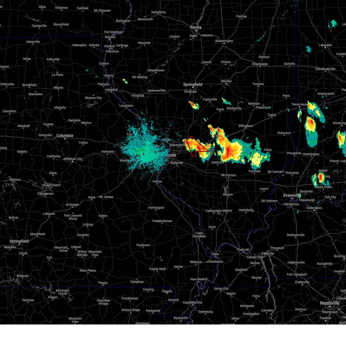
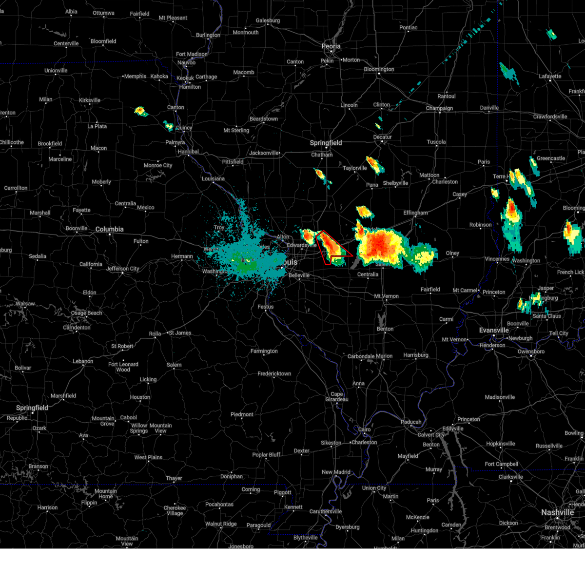
| 3/14/2025 10:44 PM CDT | Quarter sized hail reported 2.2 miles NNW of Highland, IL, ham operator reporting quarter size hail. |
| 3/14/2025 10:40 PM CDT | Quarter sized hail reported 3.3 miles NNW of Highland, IL |
| 3/14/2025 10:21 PM CDT |
 At 1021 pm cdt, a severe thunderstorm capable of producing a tornado was located over highland, moving northeast at 50 mph (radar indicated rotation). Hazards include tornado and golf ball size hail. Flying debris will be dangerous to those caught without shelter. mobile homes will be damaged or destroyed. damage to roofs, windows and vehicles will occur. tree damage is likely. locations impacted include, highland, greenville, breese, carlyle, trenton, aviston, st. rose, st. jacob, marine, pocahontas, mulberry grove, tamalco, beaver creek, jamestown, woburn, pleasant mound, pierron, keyesport, grantfork and smithboro. this includes the following state parks, carlyle lake recreational area. This includes interstate 70 in illinois between exits 24 and 52. At 1021 pm cdt, a severe thunderstorm capable of producing a tornado was located over highland, moving northeast at 50 mph (radar indicated rotation). Hazards include tornado and golf ball size hail. Flying debris will be dangerous to those caught without shelter. mobile homes will be damaged or destroyed. damage to roofs, windows and vehicles will occur. tree damage is likely. locations impacted include, highland, greenville, breese, carlyle, trenton, aviston, st. rose, st. jacob, marine, pocahontas, mulberry grove, tamalco, beaver creek, jamestown, woburn, pleasant mound, pierron, keyesport, grantfork and smithboro. this includes the following state parks, carlyle lake recreational area. This includes interstate 70 in illinois between exits 24 and 52.
|
| 3/14/2025 10:08 PM CDT |
 Torlsx the national weather service in st louis has issued a * tornado warning for, bond county in south central illinois, northern clinton county in south central illinois, southeastern madison county in southwestern illinois, northeastern saint clair county in southwestern illinois, * until 1100 pm cdt. * at 1008 pm cdt, a severe thunderstorm capable of producing a tornado was located over st. jacob, or near troy, moving northeast at 50 mph (radar indicated rotation). Hazards include tornado and half dollar size hail. Flying debris will be dangerous to those caught without shelter. mobile homes will be damaged or destroyed. damage to roofs, windows and vehicles will occur. Tree damage is likely. Torlsx the national weather service in st louis has issued a * tornado warning for, bond county in south central illinois, northern clinton county in south central illinois, southeastern madison county in southwestern illinois, northeastern saint clair county in southwestern illinois, * until 1100 pm cdt. * at 1008 pm cdt, a severe thunderstorm capable of producing a tornado was located over st. jacob, or near troy, moving northeast at 50 mph (radar indicated rotation). Hazards include tornado and half dollar size hail. Flying debris will be dangerous to those caught without shelter. mobile homes will be damaged or destroyed. damage to roofs, windows and vehicles will occur. Tree damage is likely.
|
| 7/29/2024 10:09 PM CDT |
 The storm which prompted the warning has weakened below severe limits, and no longer poses an immediate threat to life or property. therefore, the warning will be allowed to expire. a severe thunderstorm watch remains in effect until 300 am cdt for south central illinois. to report severe weather, contact your nearest law enforcement agency. they will relay your report to the national weather service st louis. The storm which prompted the warning has weakened below severe limits, and no longer poses an immediate threat to life or property. therefore, the warning will be allowed to expire. a severe thunderstorm watch remains in effect until 300 am cdt for south central illinois. to report severe weather, contact your nearest law enforcement agency. they will relay your report to the national weather service st louis.
|
| 7/29/2024 9:31 PM CDT |
 At 931 pm cdt, a severe thunderstorm was located near marine, moving southeast at 30 mph (radar indicated). Hazards include 60 mph wind gusts and quarter size hail. Hail damage to vehicles is expected. expect wind damage to roofs, siding, and trees. locations impacted include, highland, breese, carlyle, trenton, aviston, st. rose, st. jacob, beckemeyer, marine, pocahontas, alhambra, beaver creek, boulder, jamestown, pierron, keyesport, grantfork, old ripley, kaufman, and stolletown. this also includes carlyle lake recreational area. This includes interstate 70 in illinois between exits 21 and 36. At 931 pm cdt, a severe thunderstorm was located near marine, moving southeast at 30 mph (radar indicated). Hazards include 60 mph wind gusts and quarter size hail. Hail damage to vehicles is expected. expect wind damage to roofs, siding, and trees. locations impacted include, highland, breese, carlyle, trenton, aviston, st. rose, st. jacob, beckemeyer, marine, pocahontas, alhambra, beaver creek, boulder, jamestown, pierron, keyesport, grantfork, old ripley, kaufman, and stolletown. this also includes carlyle lake recreational area. This includes interstate 70 in illinois between exits 21 and 36.
|
| 7/29/2024 9:17 PM CDT |
 the tornado warning has been cancelled and is no longer in effect the tornado warning has been cancelled and is no longer in effect
|
| 7/29/2024 9:16 PM CDT |
 Svrlsx the national weather service in st louis has issued a * severe thunderstorm warning for, northern clinton county in south central illinois, southern bond county in south central illinois, eastern madison county in southwestern illinois, * until 1015 pm cdt. * at 916 pm cdt, a severe thunderstorm was located over worden, moving southeast at 30 mph (radar indicated). Hazards include 60 mph wind gusts and quarter size hail. Hail damage to vehicles is expected. Expect wind damage to roofs, siding, and trees. Svrlsx the national weather service in st louis has issued a * severe thunderstorm warning for, northern clinton county in south central illinois, southern bond county in south central illinois, eastern madison county in southwestern illinois, * until 1015 pm cdt. * at 916 pm cdt, a severe thunderstorm was located over worden, moving southeast at 30 mph (radar indicated). Hazards include 60 mph wind gusts and quarter size hail. Hail damage to vehicles is expected. Expect wind damage to roofs, siding, and trees.
|
| 7/29/2024 9:04 PM CDT |
 At 904 pm cdt, a severe thunderstorm capable of producing a tornado was located near pocahontas, moving southeast at 30 mph (radar indicated rotation). Hazards include tornado and quarter size hail. Flying debris will be dangerous to those caught without shelter. mobile homes will be damaged or destroyed. damage to roofs, windows, and vehicles will occur. tree damage is likely. this dangerous storm will be near, pocahontas around 910 pm cdt. This includes interstate 70 in illinois between exits 30 and 36. At 904 pm cdt, a severe thunderstorm capable of producing a tornado was located near pocahontas, moving southeast at 30 mph (radar indicated rotation). Hazards include tornado and quarter size hail. Flying debris will be dangerous to those caught without shelter. mobile homes will be damaged or destroyed. damage to roofs, windows, and vehicles will occur. tree damage is likely. this dangerous storm will be near, pocahontas around 910 pm cdt. This includes interstate 70 in illinois between exits 30 and 36.
|
| 7/29/2024 8:50 PM CDT |
 Torlsx the national weather service in st louis has issued a * tornado warning for, southwestern bond county in south central illinois, eastern madison county in southwestern illinois, * until 930 pm cdt. * at 850 pm cdt, a severe thunderstorm capable of producing a tornado was located over alhambra, moving southeast at 35 mph (radar indicated rotation). Hazards include tornado and quarter size hail. Flying debris will be dangerous to those caught without shelter. mobile homes will be damaged or destroyed. damage to roofs, windows, and vehicles will occur. tree damage is likely. this dangerous storm will be near, highland around 855 pm cdt. this includes the following highways, interstate 70 in illinois between exits 24 and 36. Interstate 55 in illinois between exits 30 and 37. Torlsx the national weather service in st louis has issued a * tornado warning for, southwestern bond county in south central illinois, eastern madison county in southwestern illinois, * until 930 pm cdt. * at 850 pm cdt, a severe thunderstorm capable of producing a tornado was located over alhambra, moving southeast at 35 mph (radar indicated rotation). Hazards include tornado and quarter size hail. Flying debris will be dangerous to those caught without shelter. mobile homes will be damaged or destroyed. damage to roofs, windows, and vehicles will occur. tree damage is likely. this dangerous storm will be near, highland around 855 pm cdt. this includes the following highways, interstate 70 in illinois between exits 24 and 36. Interstate 55 in illinois between exits 30 and 37.
|
| 5/26/2024 6:33 PM CDT | Quarter sized hail reported 2.2 miles NNW of Highland, IL |
| 5/26/2024 6:16 PM CDT |
 Svrlsx the national weather service in st louis has issued a * severe thunderstorm warning for, northern clinton county in south central illinois, bond county in south central illinois, eastern madison county in southwestern illinois, western fayette county in south central illinois, * until 715 pm cdt. * at 616 pm cdt, a severe thunderstorm was located over pocahontas, moving east at 40 mph (radar indicated). Hazards include 60 mph wind gusts and quarter size hail. Hail damage to vehicles is expected. expect wind damage to roofs, siding, and trees. this severe thunderstorm will be near, greenville around 620 pm cdt. mulberry grove around 630 pm cdt. this includes the following highways, interstate 70 in illinois between exits 24 and 52. interstate 55 in illinois between exits 30 and 37. This also includes carlyle lake recreational area. Svrlsx the national weather service in st louis has issued a * severe thunderstorm warning for, northern clinton county in south central illinois, bond county in south central illinois, eastern madison county in southwestern illinois, western fayette county in south central illinois, * until 715 pm cdt. * at 616 pm cdt, a severe thunderstorm was located over pocahontas, moving east at 40 mph (radar indicated). Hazards include 60 mph wind gusts and quarter size hail. Hail damage to vehicles is expected. expect wind damage to roofs, siding, and trees. this severe thunderstorm will be near, greenville around 620 pm cdt. mulberry grove around 630 pm cdt. this includes the following highways, interstate 70 in illinois between exits 24 and 52. interstate 55 in illinois between exits 30 and 37. This also includes carlyle lake recreational area.
|
| 5/26/2024 5:55 PM CDT |
 At 554 pm cdt, a severe thunderstorm was located over marine, moving east at 40 mph (radar indicated). Hazards include two inch hail and 60 mph wind gusts. People and animals outdoors will be injured. expect hail damage to roofs, siding, windows, and vehicles. expect wind damage to roofs, siding, and trees. locations impacted include, highland. this includes the following highways, interstate 70 in illinois between exits 21 and 30. Interstate 55 in illinois between exits 23 and 30. At 554 pm cdt, a severe thunderstorm was located over marine, moving east at 40 mph (radar indicated). Hazards include two inch hail and 60 mph wind gusts. People and animals outdoors will be injured. expect hail damage to roofs, siding, windows, and vehicles. expect wind damage to roofs, siding, and trees. locations impacted include, highland. this includes the following highways, interstate 70 in illinois between exits 21 and 30. Interstate 55 in illinois between exits 23 and 30.
|
| 5/26/2024 5:29 PM CDT |
 Svrlsx the national weather service in st louis has issued a * severe thunderstorm warning for, madison county in southwestern illinois, * until 630 pm cdt. * at 529 pm cdt, a severe thunderstorm was located over granite city, moving east at 35 mph (radar indicated). Hazards include ping pong ball size hail and 60 mph wind gusts. People and animals outdoors will be injured. expect hail damage to roofs, siding, windows, and vehicles. expect wind damage to roofs, siding, and trees. this severe thunderstorm will be near, collinsville, glen carbon, troy, maryville, and pontoon beach around 535 pm cdt. other locations in the path of this severe thunderstorm include st. jacob, highland and marine. this includes the following highways, interstate 70 in illinois between exits 21 and 30. Interstate 55 in illinois between exits 23 and 37. Svrlsx the national weather service in st louis has issued a * severe thunderstorm warning for, madison county in southwestern illinois, * until 630 pm cdt. * at 529 pm cdt, a severe thunderstorm was located over granite city, moving east at 35 mph (radar indicated). Hazards include ping pong ball size hail and 60 mph wind gusts. People and animals outdoors will be injured. expect hail damage to roofs, siding, windows, and vehicles. expect wind damage to roofs, siding, and trees. this severe thunderstorm will be near, collinsville, glen carbon, troy, maryville, and pontoon beach around 535 pm cdt. other locations in the path of this severe thunderstorm include st. jacob, highland and marine. this includes the following highways, interstate 70 in illinois between exits 21 and 30. Interstate 55 in illinois between exits 23 and 37.
|
| 5/8/2024 6:12 PM CDT |
 The storm which prompted the warning has weakened below severe limits, and has exited the warned area. therefore, the warning will be allowed to expire. however, small hail and heavy rain are still possible with this thunderstorm. a tornado watch remains in effect until midnight cdt for southwestern illinois. to report severe weather, contact your nearest law enforcement agency. they will relay your report to the national weather service st louis. The storm which prompted the warning has weakened below severe limits, and has exited the warned area. therefore, the warning will be allowed to expire. however, small hail and heavy rain are still possible with this thunderstorm. a tornado watch remains in effect until midnight cdt for southwestern illinois. to report severe weather, contact your nearest law enforcement agency. they will relay your report to the national weather service st louis.
|
| 5/8/2024 6:05 PM CDT |
 At 604 pm cdt, a severe thunderstorm was located over trenton, moving northeast at 45 mph (radar indicated). Hazards include 60 mph wind gusts and quarter size hail. Hail damage to vehicles is expected. expect wind damage to roofs, siding, and trees. locations impacted include, o'fallon, shiloh, highland, mascoutah, greenville, breese, lebanon, new baden, scott afb, trenton, aviston, st. rose, albers, pocahontas, beaver creek, jamestown, pierron, summerfield, keyesport, and dudleyville. this includes the following highways, interstate 70 in illinois near exit 41. Interstate 64 in illinois between exits 19 and 27. At 604 pm cdt, a severe thunderstorm was located over trenton, moving northeast at 45 mph (radar indicated). Hazards include 60 mph wind gusts and quarter size hail. Hail damage to vehicles is expected. expect wind damage to roofs, siding, and trees. locations impacted include, o'fallon, shiloh, highland, mascoutah, greenville, breese, lebanon, new baden, scott afb, trenton, aviston, st. rose, albers, pocahontas, beaver creek, jamestown, pierron, summerfield, keyesport, and dudleyville. this includes the following highways, interstate 70 in illinois near exit 41. Interstate 64 in illinois between exits 19 and 27.
|
| 5/8/2024 5:52 PM CDT |
 the severe thunderstorm warning has been cancelled and is no longer in effect the severe thunderstorm warning has been cancelled and is no longer in effect
|
| 5/8/2024 5:52 PM CDT |
 At 551 pm cdt, a severe thunderstorm was located near freeburg, moving northeast at 35 mph (radar indicated). Hazards include 60 mph wind gusts and quarter size hail. Hail damage to vehicles is expected. expect wind damage to roofs, siding, and trees. locations impacted include, belleville, o'fallon, fairview heights, swansea, shiloh, highland, mascoutah, greenville, breese, lebanon, freeburg, new baden, scott afb, trenton, aviston, st. rose, albers, st. jacob, pocahontas, and mulberry grove. this includes the following highways, interstate 70 in illinois between exits 30 and 52. Interstate 64 in illinois between exits 14 and 27. At 551 pm cdt, a severe thunderstorm was located near freeburg, moving northeast at 35 mph (radar indicated). Hazards include 60 mph wind gusts and quarter size hail. Hail damage to vehicles is expected. expect wind damage to roofs, siding, and trees. locations impacted include, belleville, o'fallon, fairview heights, swansea, shiloh, highland, mascoutah, greenville, breese, lebanon, freeburg, new baden, scott afb, trenton, aviston, st. rose, albers, st. jacob, pocahontas, and mulberry grove. this includes the following highways, interstate 70 in illinois between exits 30 and 52. Interstate 64 in illinois between exits 14 and 27.
|
| 5/8/2024 5:41 PM CDT |
 At 541 pm cdt, a severe thunderstorm was located over st. jacob, moving northeast at 45 mph (radar indicated). Hazards include 60 mph wind gusts and quarter size hail. Hail damage to vehicles is expected. expect wind damage to roofs, siding, and trees. locations impacted include, belleville, o'fallon, east st. louis, collinsville, fairview heights, swansea, shiloh, highland, troy, maryville, mascoutah, greenville, centreville, breese, lebanon, freeburg, caseyville, washington park, new baden, and scott afb. this includes the following highways, interstate 70 in illinois between exits 21 and 52. Interstate 64 in illinois between exits 9 and 27. At 541 pm cdt, a severe thunderstorm was located over st. jacob, moving northeast at 45 mph (radar indicated). Hazards include 60 mph wind gusts and quarter size hail. Hail damage to vehicles is expected. expect wind damage to roofs, siding, and trees. locations impacted include, belleville, o'fallon, east st. louis, collinsville, fairview heights, swansea, shiloh, highland, troy, maryville, mascoutah, greenville, centreville, breese, lebanon, freeburg, caseyville, washington park, new baden, and scott afb. this includes the following highways, interstate 70 in illinois between exits 21 and 52. Interstate 64 in illinois between exits 9 and 27.
|
| 5/8/2024 5:28 PM CDT |
 Svrlsx the national weather service in st louis has issued a * severe thunderstorm warning for, northwestern clinton county in south central illinois, bond county in south central illinois, southeastern madison county in southwestern illinois, southeastern montgomery county in south central illinois, northeastern st. clair county in southwestern illinois, * until 615 pm cdt. * at 528 pm cdt, a severe thunderstorm was located over o'fallon, moving northeast at 60 mph (trained weather spotters). Hazards include 60 mph wind gusts and quarter size hail. Hail damage to vehicles is expected. Expect wind damage to roofs, siding, and trees. Svrlsx the national weather service in st louis has issued a * severe thunderstorm warning for, northwestern clinton county in south central illinois, bond county in south central illinois, southeastern madison county in southwestern illinois, southeastern montgomery county in south central illinois, northeastern st. clair county in southwestern illinois, * until 615 pm cdt. * at 528 pm cdt, a severe thunderstorm was located over o'fallon, moving northeast at 60 mph (trained weather spotters). Hazards include 60 mph wind gusts and quarter size hail. Hail damage to vehicles is expected. Expect wind damage to roofs, siding, and trees.
|
| 5/4/2024 5:35 PM CDT |
 Svrlsx the national weather service in st louis has issued a * severe thunderstorm warning for, clinton county in south central illinois, southeastern bond county in south central illinois, southeastern madison county in southwestern illinois, northwestern washington county in south central illinois, northeastern st. clair county in southwestern illinois, * until 600 pm cdt. * at 535 pm cdt, severe thunderstorms were located along a line extending from st. jacob to near trenton to near new baden to near freeburg, moving east at 35 mph (radar indicated). Hazards include 60 mph wind gusts and quarter size hail. Hail damage to vehicles is expected. expect wind damage to roofs, siding, and trees. severe thunderstorms will be near, highland, new baden, trenton, aviston, albers, and new memphis around 540 pm cdt. breese, st. rose, and germantown around 550 pm cdt. This includes interstate 64 in illinois between exits 19 and 41. Svrlsx the national weather service in st louis has issued a * severe thunderstorm warning for, clinton county in south central illinois, southeastern bond county in south central illinois, southeastern madison county in southwestern illinois, northwestern washington county in south central illinois, northeastern st. clair county in southwestern illinois, * until 600 pm cdt. * at 535 pm cdt, severe thunderstorms were located along a line extending from st. jacob to near trenton to near new baden to near freeburg, moving east at 35 mph (radar indicated). Hazards include 60 mph wind gusts and quarter size hail. Hail damage to vehicles is expected. expect wind damage to roofs, siding, and trees. severe thunderstorms will be near, highland, new baden, trenton, aviston, albers, and new memphis around 540 pm cdt. breese, st. rose, and germantown around 550 pm cdt. This includes interstate 64 in illinois between exits 19 and 41.
|
| 5/4/2024 5:13 PM CDT |
 Svrlsx the national weather service in st louis has issued a * severe thunderstorm warning for, bond county in south central illinois, northeastern madison county in southwestern illinois, * until 600 pm cdt. * at 513 pm cdt, severe thunderstorms were located along a line extending from livingston to near st. jacob, moving east at 30 mph (radar indicated). Hazards include 60 mph wind gusts and quarter size hail. Hail damage to vehicles is expected. expect wind damage to roofs, siding, and trees. severe thunderstorms will be near, highland, marine, and alhambra around 520 pm cdt. sorento around 525 pm cdt. reno around 530 pm cdt. other locations in the path of these severe thunderstorms include pocahontas and greenville. This includes interstate 70 in illinois between exits 24 and 52. Svrlsx the national weather service in st louis has issued a * severe thunderstorm warning for, bond county in south central illinois, northeastern madison county in southwestern illinois, * until 600 pm cdt. * at 513 pm cdt, severe thunderstorms were located along a line extending from livingston to near st. jacob, moving east at 30 mph (radar indicated). Hazards include 60 mph wind gusts and quarter size hail. Hail damage to vehicles is expected. expect wind damage to roofs, siding, and trees. severe thunderstorms will be near, highland, marine, and alhambra around 520 pm cdt. sorento around 525 pm cdt. reno around 530 pm cdt. other locations in the path of these severe thunderstorms include pocahontas and greenville. This includes interstate 70 in illinois between exits 24 and 52.
|
| 4/29/2024 2:14 AM CDT |
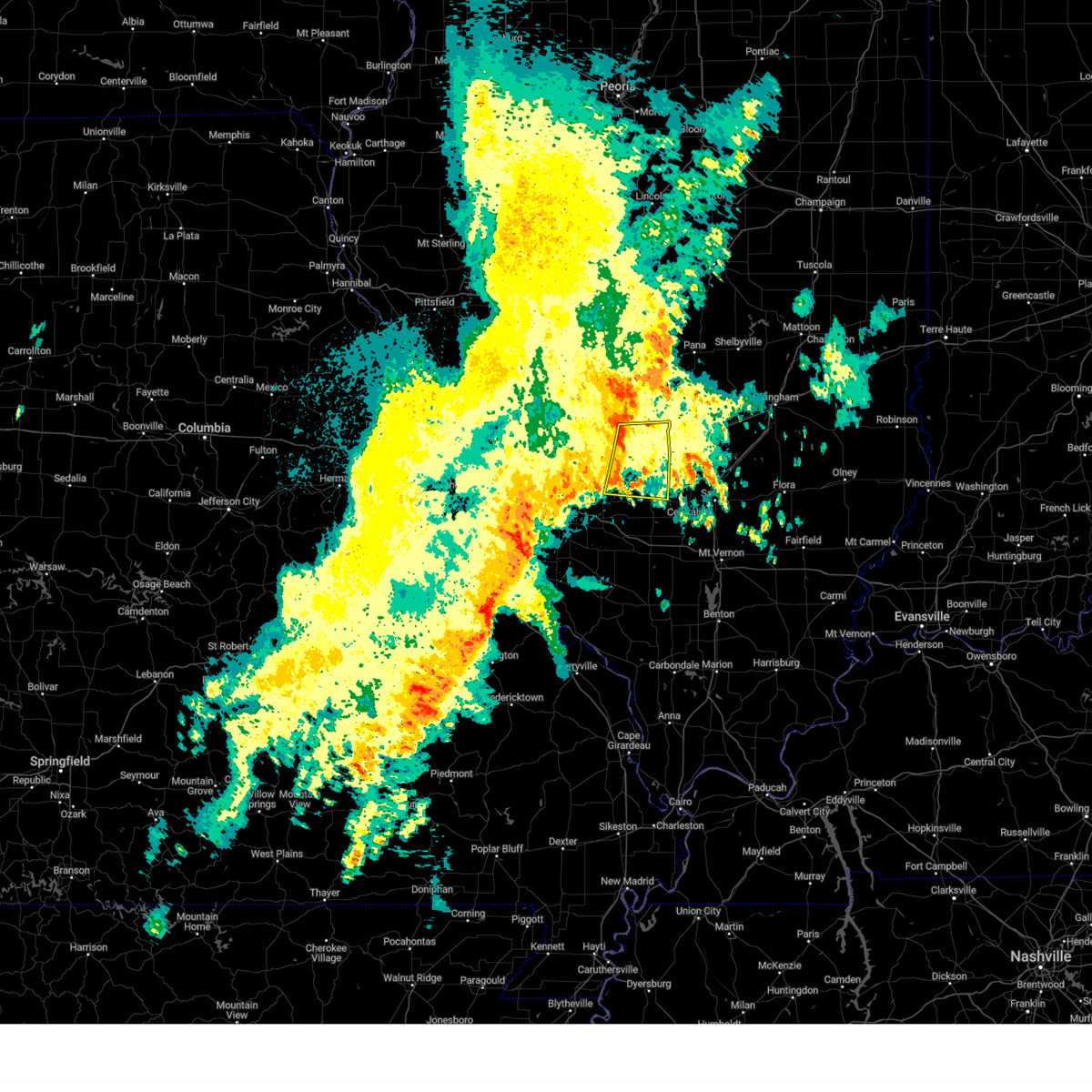 the severe thunderstorm warning has been cancelled and is no longer in effect the severe thunderstorm warning has been cancelled and is no longer in effect
|
| 4/29/2024 2:14 AM CDT |
 At 213 am cdt, a severe thunderstorm was located over pocahontas, moving east at 35 mph (radar indicated). Hazards include 60 mph wind gusts. Expect damage to roofs, siding, and trees. locations impacted include, highland, greenville, carlyle, st. rose, pocahontas, mulberry grove, tamalco, sorento, beaver creek, woburn, reno, jamestown, pleasant mound, pierron, keyesport, smithboro, old ripley, dudleyville, and stolletown. this also includes carlyle lake recreational area. This includes interstate 70 in illinois between exits 30 and 52. At 213 am cdt, a severe thunderstorm was located over pocahontas, moving east at 35 mph (radar indicated). Hazards include 60 mph wind gusts. Expect damage to roofs, siding, and trees. locations impacted include, highland, greenville, carlyle, st. rose, pocahontas, mulberry grove, tamalco, sorento, beaver creek, woburn, reno, jamestown, pleasant mound, pierron, keyesport, smithboro, old ripley, dudleyville, and stolletown. this also includes carlyle lake recreational area. This includes interstate 70 in illinois between exits 30 and 52.
|
| 4/29/2024 2:02 AM CDT |
 Svrlsx the national weather service in st louis has issued a * severe thunderstorm warning for, northern clinton county in south central illinois, bond county in south central illinois, eastern madison county in southwestern illinois, northeastern st. clair county in southwestern illinois, * until 245 am cdt. * at 202 am cdt, a severe thunderstorm was located over highland, moving east at 35 mph (radar indicated). Hazards include 60 mph wind gusts. expect damage to roofs, siding, and trees Svrlsx the national weather service in st louis has issued a * severe thunderstorm warning for, northern clinton county in south central illinois, bond county in south central illinois, eastern madison county in southwestern illinois, northeastern st. clair county in southwestern illinois, * until 245 am cdt. * at 202 am cdt, a severe thunderstorm was located over highland, moving east at 35 mph (radar indicated). Hazards include 60 mph wind gusts. expect damage to roofs, siding, and trees
|
| 4/18/2024 6:10 PM CDT |
 Torlsx the national weather service in st louis has issued a * tornado warning for, clinton county in south central illinois, bond county in south central illinois, eastern madison county in southwestern illinois, northern washington county in south central illinois, northeastern st. clair county in southwestern illinois, * until 715 pm cdt. * at 610 pm cdt, severe thunderstorms capable of producing both tornadoes and extensive straight line wind damage were located along a line extending from livingston to near o'fallon to near millstadt, moving east at 45 mph (radar indicated rotation). Hazards include tornado. Flying debris will be dangerous to those caught without shelter. mobile homes will be damaged or destroyed. damage to roofs, windows, and vehicles will occur. tree damage is likely. these dangerous storms will be near, belleville, o'fallon, swansea, shiloh, highland, mascoutah, lebanon, freeburg, scott afb, and smithton around 615 pm cdt. trenton and sorento around 620 pm cdt. new baden, aviston, pocahontas, and reno around 625 pm cdt. st. rose, albers, jamestown, and new memphis around 630 pm cdt. other locations in the path of these tornadic storms include greenville, breese, germantown, woburn, okawville, beckemeyer, beaver creek, carlyle, mulberry grove, tamalco and boulder. this also includes carlyle lake recreational area. this includes the following highways, interstate 70 in illinois between exits 24 and 52. Interstate 64 in illinois between exits 12 and 41. Torlsx the national weather service in st louis has issued a * tornado warning for, clinton county in south central illinois, bond county in south central illinois, eastern madison county in southwestern illinois, northern washington county in south central illinois, northeastern st. clair county in southwestern illinois, * until 715 pm cdt. * at 610 pm cdt, severe thunderstorms capable of producing both tornadoes and extensive straight line wind damage were located along a line extending from livingston to near o'fallon to near millstadt, moving east at 45 mph (radar indicated rotation). Hazards include tornado. Flying debris will be dangerous to those caught without shelter. mobile homes will be damaged or destroyed. damage to roofs, windows, and vehicles will occur. tree damage is likely. these dangerous storms will be near, belleville, o'fallon, swansea, shiloh, highland, mascoutah, lebanon, freeburg, scott afb, and smithton around 615 pm cdt. trenton and sorento around 620 pm cdt. new baden, aviston, pocahontas, and reno around 625 pm cdt. st. rose, albers, jamestown, and new memphis around 630 pm cdt. other locations in the path of these tornadic storms include greenville, breese, germantown, woburn, okawville, beckemeyer, beaver creek, carlyle, mulberry grove, tamalco and boulder. this also includes carlyle lake recreational area. this includes the following highways, interstate 70 in illinois between exits 24 and 52. Interstate 64 in illinois between exits 12 and 41.
|
| 4/18/2024 6:06 PM CDT |
 the severe thunderstorm warning has been cancelled and is no longer in effect the severe thunderstorm warning has been cancelled and is no longer in effect
|
| 4/18/2024 6:06 PM CDT |
 At 605 pm cdt, severe thunderstorms were located along a line extending from staunton to columbia, moving east at 55 mph (radar indicated). Hazards include 60 mph wind gusts and quarter size hail. Hail damage to vehicles is expected. expect wind damage to roofs, siding, and trees. locations impacted include, st. louis, belleville, granite city, o'fallon, east st. louis, collinsville, edwardsville, fairview heights, cahokia, swansea, glen carbon, shiloh, wood river, highland, troy, waterloo, columbia, bethalto, maryville, and mascoutah. this also includes horseshoe lake state park. this includes the following highways, interstate 70 in illinois between exits 21 and 30. interstate 55 in illinois between exits 23 and 37. Interstate 64 in illinois between exits 9 and 23. At 605 pm cdt, severe thunderstorms were located along a line extending from staunton to columbia, moving east at 55 mph (radar indicated). Hazards include 60 mph wind gusts and quarter size hail. Hail damage to vehicles is expected. expect wind damage to roofs, siding, and trees. locations impacted include, st. louis, belleville, granite city, o'fallon, east st. louis, collinsville, edwardsville, fairview heights, cahokia, swansea, glen carbon, shiloh, wood river, highland, troy, waterloo, columbia, bethalto, maryville, and mascoutah. this also includes horseshoe lake state park. this includes the following highways, interstate 70 in illinois between exits 21 and 30. interstate 55 in illinois between exits 23 and 37. Interstate 64 in illinois between exits 9 and 23.
|
| 4/18/2024 5:51 PM CDT |
 At 551 pm cdt, severe thunderstorms were located along a line extending from near bunker hill to near arnold, moving east at 55 mph (radar indicated). Hazards include 60 mph wind gusts and quarter size hail. Hail damage to vehicles is expected. expect wind damage to roofs, siding, and trees. locations impacted include, st. louis, florissant, belleville, university city, granite city, o'fallon, alton, kirkwood, east st. louis, hazelwood, collinsville, edwardsville, webster groves, ferguson, arnold, manchester, godfrey, creve coeur, fairview heights, and overland. this also includes scott joplin historic site, confluence state park, mastodon historic site, and horseshoe lake state park. this includes the following highways, interstate 70 in illinois between exits 21 and 30. interstate 55 in illinois between exits 23 and 37. interstate 64 in illinois between exits 9 and 23. interstate 44 in missouri between exits 269 and 277. Interstate 55 in missouri between exits 187 and 191. At 551 pm cdt, severe thunderstorms were located along a line extending from near bunker hill to near arnold, moving east at 55 mph (radar indicated). Hazards include 60 mph wind gusts and quarter size hail. Hail damage to vehicles is expected. expect wind damage to roofs, siding, and trees. locations impacted include, st. louis, florissant, belleville, university city, granite city, o'fallon, alton, kirkwood, east st. louis, hazelwood, collinsville, edwardsville, webster groves, ferguson, arnold, manchester, godfrey, creve coeur, fairview heights, and overland. this also includes scott joplin historic site, confluence state park, mastodon historic site, and horseshoe lake state park. this includes the following highways, interstate 70 in illinois between exits 21 and 30. interstate 55 in illinois between exits 23 and 37. interstate 64 in illinois between exits 9 and 23. interstate 44 in missouri between exits 269 and 277. Interstate 55 in missouri between exits 187 and 191.
|
| 4/18/2024 5:39 PM CDT |
 Svrlsx the national weather service in st louis has issued a * severe thunderstorm warning for, northwestern monroe county in southwestern illinois, madison county in southwestern illinois, st. clair county in southwestern illinois, st. louis city in east central missouri, east central st. charles county in east central missouri, northeastern jefferson county in east central missouri, central st. louis county in east central missouri, * until 645 pm cdt. * at 539 pm cdt, severe thunderstorms were located along a line extending from near brighton to high ridge, moving east at 55 mph (radar indicated). Hazards include 60 mph wind gusts and quarter size hail. Hail damage to vehicles is expected. Expect wind damage to roofs, siding, and trees. Svrlsx the national weather service in st louis has issued a * severe thunderstorm warning for, northwestern monroe county in southwestern illinois, madison county in southwestern illinois, st. clair county in southwestern illinois, st. louis city in east central missouri, east central st. charles county in east central missouri, northeastern jefferson county in east central missouri, central st. louis county in east central missouri, * until 645 pm cdt. * at 539 pm cdt, severe thunderstorms were located along a line extending from near brighton to high ridge, moving east at 55 mph (radar indicated). Hazards include 60 mph wind gusts and quarter size hail. Hail damage to vehicles is expected. Expect wind damage to roofs, siding, and trees.
|
| 4/2/2024 2:40 AM CDT |
 The storm which prompted the warning has weakened below severe limits, and has exited the warned area. therefore, the warning will be allowed to expire. however, gusty winds and heavy rain are still possible with this thunderstorm. a tornado watch remains in effect until 300 am cdt for south central and southwestern illinois. The storm which prompted the warning has weakened below severe limits, and has exited the warned area. therefore, the warning will be allowed to expire. however, gusty winds and heavy rain are still possible with this thunderstorm. a tornado watch remains in effect until 300 am cdt for south central and southwestern illinois.
|
| 4/2/2024 2:30 AM CDT |
 At 230 am cdt, a severe thunderstorm was located over trenton, moving east at 50 mph (radar indicated). Hazards include 60 mph wind gusts and quarter size hail. Hail damage to vehicles is expected. expect wind damage to roofs, siding, and trees. locations impacted include, highland, mascoutah, lebanon, freeburg, new baden, scott afb, trenton, aviston, albers, st. jacob, new memphis, st. libory, johannisburg, damiansville, summerfield, fayetteville, venedy, and stone church. This includes interstate 64 in illinois between exits 23 and 34. At 230 am cdt, a severe thunderstorm was located over trenton, moving east at 50 mph (radar indicated). Hazards include 60 mph wind gusts and quarter size hail. Hail damage to vehicles is expected. expect wind damage to roofs, siding, and trees. locations impacted include, highland, mascoutah, lebanon, freeburg, new baden, scott afb, trenton, aviston, albers, st. jacob, new memphis, st. libory, johannisburg, damiansville, summerfield, fayetteville, venedy, and stone church. This includes interstate 64 in illinois between exits 23 and 34.
|
| 4/2/2024 2:14 AM CDT |
 the severe thunderstorm warning has been cancelled and is no longer in effect the severe thunderstorm warning has been cancelled and is no longer in effect
|
| 4/2/2024 2:14 AM CDT |
 At 214 am cdt, a severe thunderstorm was located over shiloh, moving east at 50 mph (public). Hazards include golf ball size hail and 60 mph wind gusts. People and animals outdoors will be injured. expect hail damage to roofs, siding, windows, and vehicles. expect wind damage to roofs, siding, and trees. locations impacted include, belleville, o'fallon, east st. louis, collinsville, fairview heights, swansea, shiloh, highland, mascoutah, lebanon, freeburg, caseyville, millstadt, new baden, scott afb, smithton, trenton, aviston, albers, and st. jacob. This includes interstate 64 in illinois between exits 12 and 34. At 214 am cdt, a severe thunderstorm was located over shiloh, moving east at 50 mph (public). Hazards include golf ball size hail and 60 mph wind gusts. People and animals outdoors will be injured. expect hail damage to roofs, siding, windows, and vehicles. expect wind damage to roofs, siding, and trees. locations impacted include, belleville, o'fallon, east st. louis, collinsville, fairview heights, swansea, shiloh, highland, mascoutah, lebanon, freeburg, caseyville, millstadt, new baden, scott afb, smithton, trenton, aviston, albers, and st. jacob. This includes interstate 64 in illinois between exits 12 and 34.
|
| 4/2/2024 2:04 AM CDT |
 the severe thunderstorm warning has been cancelled and is no longer in effect the severe thunderstorm warning has been cancelled and is no longer in effect
|
| 4/2/2024 2:04 AM CDT |
 At 203 am cdt, a severe thunderstorm was located near millstadt, moving east at 50 mph (public. one inch hail was reported north of columbia at 158 am). Hazards include golf ball size hail and 60 mph wind gusts. People and animals outdoors will be injured. expect hail damage to roofs, siding, windows, and vehicles. expect wind damage to roofs, siding, and trees. locations impacted include, belleville, o'fallon, east st. louis, collinsville, fairview heights, cahokia, swansea, shiloh, highland, waterloo, columbia, mascoutah, centreville, lebanon, freeburg, caseyville, washington park, dupo, millstadt, and madison. This includes interstate 64 in illinois between exits 9 and 34. At 203 am cdt, a severe thunderstorm was located near millstadt, moving east at 50 mph (public. one inch hail was reported north of columbia at 158 am). Hazards include golf ball size hail and 60 mph wind gusts. People and animals outdoors will be injured. expect hail damage to roofs, siding, windows, and vehicles. expect wind damage to roofs, siding, and trees. locations impacted include, belleville, o'fallon, east st. louis, collinsville, fairview heights, cahokia, swansea, shiloh, highland, waterloo, columbia, mascoutah, centreville, lebanon, freeburg, caseyville, washington park, dupo, millstadt, and madison. This includes interstate 64 in illinois between exits 9 and 34.
|
| 4/2/2024 1:57 AM CDT |
 Svrlsx the national weather service in st louis has issued a * severe thunderstorm warning for, western clinton county in south central illinois, northern monroe county in southwestern illinois, southeastern madison county in southwestern illinois, west central washington county in south central illinois, st. clair county in southwestern illinois, southern st. louis city in east central missouri, northeastern jefferson county in east central missouri, south central st. louis county in east central missouri, * until 245 am cdt. * at 157 am cdt, a severe thunderstorm was located over dupo, moving east at 50 mph (radar indicated). Hazards include golf ball size hail and 60 mph wind gusts. People and animals outdoors will be injured. expect hail damage to roofs, siding, windows, and vehicles. Expect wind damage to roofs, siding, and trees. Svrlsx the national weather service in st louis has issued a * severe thunderstorm warning for, western clinton county in south central illinois, northern monroe county in southwestern illinois, southeastern madison county in southwestern illinois, west central washington county in south central illinois, st. clair county in southwestern illinois, southern st. louis city in east central missouri, northeastern jefferson county in east central missouri, south central st. louis county in east central missouri, * until 245 am cdt. * at 157 am cdt, a severe thunderstorm was located over dupo, moving east at 50 mph (radar indicated). Hazards include golf ball size hail and 60 mph wind gusts. People and animals outdoors will be injured. expect hail damage to roofs, siding, windows, and vehicles. Expect wind damage to roofs, siding, and trees.
|
| 4/1/2024 11:46 PM CDT |
 the severe thunderstorm warning has been cancelled and is no longer in effect the severe thunderstorm warning has been cancelled and is no longer in effect
|
| 4/1/2024 11:31 PM CDT |
 At 1131 pm cdt, a severe thunderstorm was located over st. louis, moving northeast at 50 mph (trained weather spotters reported quarter sized hail in rock hill and kirkwood). Hazards include 60 mph wind gusts and quarter size hail. Hail damage to vehicles is expected. expect wind damage to roofs, siding, and trees. locations impacted include, st. louis, belleville, granite city, o'fallon, east st. louis, collinsville, edwardsville, fairview heights, cahokia, glen carbon, wood river, highland, troy, maryville, pontoon beach, centreville, lebanon, caseyville, washington park, and madison. this also includes horseshoe lake state park. this includes the following highways, interstate 70 in illinois between exits 21 and 30. interstate 55 in illinois between exits 23 and 33. Interstate 64 in illinois between exits 9 and 14. At 1131 pm cdt, a severe thunderstorm was located over st. louis, moving northeast at 50 mph (trained weather spotters reported quarter sized hail in rock hill and kirkwood). Hazards include 60 mph wind gusts and quarter size hail. Hail damage to vehicles is expected. expect wind damage to roofs, siding, and trees. locations impacted include, st. louis, belleville, granite city, o'fallon, east st. louis, collinsville, edwardsville, fairview heights, cahokia, glen carbon, wood river, highland, troy, maryville, pontoon beach, centreville, lebanon, caseyville, washington park, and madison. this also includes horseshoe lake state park. this includes the following highways, interstate 70 in illinois between exits 21 and 30. interstate 55 in illinois between exits 23 and 33. Interstate 64 in illinois between exits 9 and 14.
|
| 4/1/2024 11:26 PM CDT |
 Svrlsx the national weather service in st louis has issued a * severe thunderstorm warning for, madison county in southwestern illinois, northern st. clair county in southwestern illinois, * until 1215 am cdt. * at 1126 pm cdt, a severe thunderstorm was located over richmond heights, moving east at 50 mph (trained weather spotters). Hazards include 60 mph wind gusts and quarter size hail. Hail damage to vehicles is expected. Expect wind damage to roofs, siding, and trees. Svrlsx the national weather service in st louis has issued a * severe thunderstorm warning for, madison county in southwestern illinois, northern st. clair county in southwestern illinois, * until 1215 am cdt. * at 1126 pm cdt, a severe thunderstorm was located over richmond heights, moving east at 50 mph (trained weather spotters). Hazards include 60 mph wind gusts and quarter size hail. Hail damage to vehicles is expected. Expect wind damage to roofs, siding, and trees.
|
| 4/1/2024 7:23 PM CDT |
 the severe thunderstorm warning has been cancelled and is no longer in effect the severe thunderstorm warning has been cancelled and is no longer in effect
|
| 4/1/2024 7:13 PM CDT |
 At 713 pm cdt, a severe thunderstorm was located over hartford, moving east at 35 mph (radar indicated). Hazards include ping pong ball size hail and 60 mph wind gusts. People and animals outdoors will be injured. expect hail damage to roofs, siding, windows, and vehicles. expect wind damage to roofs, siding, and trees. locations impacted include, granite city, edwardsville, glen carbon, wood river, highland, bethalto, pontoon beach, madison, east alton, south roxana, roxana, hartford, worden, marine, livingston, alhambra, rosewood heights, carpenter, hamel, and grantfork. This includes interstate 55 in illinois between exits 23 and 33. At 713 pm cdt, a severe thunderstorm was located over hartford, moving east at 35 mph (radar indicated). Hazards include ping pong ball size hail and 60 mph wind gusts. People and animals outdoors will be injured. expect hail damage to roofs, siding, windows, and vehicles. expect wind damage to roofs, siding, and trees. locations impacted include, granite city, edwardsville, glen carbon, wood river, highland, bethalto, pontoon beach, madison, east alton, south roxana, roxana, hartford, worden, marine, livingston, alhambra, rosewood heights, carpenter, hamel, and grantfork. This includes interstate 55 in illinois between exits 23 and 33.
|
| 4/1/2024 6:53 PM CDT |
 Svrlsx the national weather service in st louis has issued a * severe thunderstorm warning for, madison county in southwestern illinois, * until 800 pm cdt. * at 652 pm cdt, a severe thunderstorm was located over dellwood, moving east at 40 mph (radar indicated). Hazards include ping pong ball size hail and 60 mph wind gusts. People and animals outdoors will be injured. expect hail damage to roofs, siding, windows, and vehicles. Expect wind damage to roofs, siding, and trees. Svrlsx the national weather service in st louis has issued a * severe thunderstorm warning for, madison county in southwestern illinois, * until 800 pm cdt. * at 652 pm cdt, a severe thunderstorm was located over dellwood, moving east at 40 mph (radar indicated). Hazards include ping pong ball size hail and 60 mph wind gusts. People and animals outdoors will be injured. expect hail damage to roofs, siding, windows, and vehicles. Expect wind damage to roofs, siding, and trees.
|
| 3/14/2024 7:09 PM CDT |
 the severe thunderstorm warning has been cancelled and is no longer in effect the severe thunderstorm warning has been cancelled and is no longer in effect
|
| 3/14/2024 7:01 PM CDT |
 the severe thunderstorm warning has been cancelled and is no longer in effect the severe thunderstorm warning has been cancelled and is no longer in effect
|
| 3/14/2024 7:01 PM CDT |
 At 700 pm cdt, a severe thunderstorm was located over edwardsville, moving east at 55 mph (radar indicated). Hazards include 60 mph wind gusts and quarter size hail. Hail damage to vehicles is expected. expect wind damage to roofs, siding, and trees. locations impacted include, granite city, edwardsville, glen carbon, wood river, highland, troy, bethalto, maryville, pontoon beach, east alton, south roxana, roxana, hartford, st. jacob, marine, alhambra, rosewood heights, carpenter, hamel, and pierron. this includes the following highways, interstate 70 in illinois between exits 21 and 30. Interstate 55 in illinois between exits 23 and 30. At 700 pm cdt, a severe thunderstorm was located over edwardsville, moving east at 55 mph (radar indicated). Hazards include 60 mph wind gusts and quarter size hail. Hail damage to vehicles is expected. expect wind damage to roofs, siding, and trees. locations impacted include, granite city, edwardsville, glen carbon, wood river, highland, troy, bethalto, maryville, pontoon beach, east alton, south roxana, roxana, hartford, st. jacob, marine, alhambra, rosewood heights, carpenter, hamel, and pierron. this includes the following highways, interstate 70 in illinois between exits 21 and 30. Interstate 55 in illinois between exits 23 and 30.
|
| 3/14/2024 6:42 PM CDT |
 Svrlsx the national weather service in st louis has issued a * severe thunderstorm warning for, central madison county in southwestern illinois, northeastern st. charles county in east central missouri, northeastern st. louis county in east central missouri, * until 730 pm cdt. * at 642 pm cdt, a severe thunderstorm was located over black jack, moving east at 55 mph (radar indicated). Hazards include 60 mph wind gusts and quarter size hail. Hail damage to vehicles is expected. Expect wind damage to roofs, siding, and trees. Svrlsx the national weather service in st louis has issued a * severe thunderstorm warning for, central madison county in southwestern illinois, northeastern st. charles county in east central missouri, northeastern st. louis county in east central missouri, * until 730 pm cdt. * at 642 pm cdt, a severe thunderstorm was located over black jack, moving east at 55 mph (radar indicated). Hazards include 60 mph wind gusts and quarter size hail. Hail damage to vehicles is expected. Expect wind damage to roofs, siding, and trees.
|
| 3/14/2024 6:06 PM CDT |
 the severe thunderstorm warning has been cancelled and is no longer in effect the severe thunderstorm warning has been cancelled and is no longer in effect
|
| 3/14/2024 6:06 PM CDT |
 At 606 pm cdt, a severe thunderstorm was located over collinsville, moving northeast at 45 mph (radar indicated). Hazards include 60 mph wind gusts and half dollar size hail. Hail damage to vehicles is expected. expect wind damage to roofs, siding, and trees. locations impacted include, belleville, granite city, o'fallon, east st. louis, collinsville, fairview heights, cahokia, swansea, shiloh, highland, troy, maryville, pontoon beach, centreville, lebanon, caseyville, washington park, madison, venice, and cahokia parks airport. This includes interstate 64 in illinois between exits 9 and 19. At 606 pm cdt, a severe thunderstorm was located over collinsville, moving northeast at 45 mph (radar indicated). Hazards include 60 mph wind gusts and half dollar size hail. Hail damage to vehicles is expected. expect wind damage to roofs, siding, and trees. locations impacted include, belleville, granite city, o'fallon, east st. louis, collinsville, fairview heights, cahokia, swansea, shiloh, highland, troy, maryville, pontoon beach, centreville, lebanon, caseyville, washington park, madison, venice, and cahokia parks airport. This includes interstate 64 in illinois between exits 9 and 19.
|
| 3/14/2024 5:55 PM CDT |
 At 554 pm cdt, a severe thunderstorm was located over east st. louis, moving northeast at 40 mph (trained weather spotters reported quarter size hail in south st. louis city). Hazards include ping pong ball size hail and 60 mph wind gusts. People and animals outdoors will be injured. expect hail damage to roofs, siding, windows, and vehicles. expect wind damage to roofs, siding, and trees. locations impacted include, st. louis, belleville, granite city, o'fallon, east st. louis, collinsville, fairview heights, cahokia, swansea, shiloh, highland, troy, maryville, pontoon beach, centreville, lebanon, caseyville, washington park, madison, and venice. this also includes scott joplin historic site and horseshoe lake state park. This includes interstate 64 in illinois between exits 9 and 19. At 554 pm cdt, a severe thunderstorm was located over east st. louis, moving northeast at 40 mph (trained weather spotters reported quarter size hail in south st. louis city). Hazards include ping pong ball size hail and 60 mph wind gusts. People and animals outdoors will be injured. expect hail damage to roofs, siding, windows, and vehicles. expect wind damage to roofs, siding, and trees. locations impacted include, st. louis, belleville, granite city, o'fallon, east st. louis, collinsville, fairview heights, cahokia, swansea, shiloh, highland, troy, maryville, pontoon beach, centreville, lebanon, caseyville, washington park, madison, and venice. this also includes scott joplin historic site and horseshoe lake state park. This includes interstate 64 in illinois between exits 9 and 19.
|
| 3/14/2024 5:40 PM CDT |
 Svrlsx the national weather service in st louis has issued a * severe thunderstorm warning for, southeastern madison county in southwestern illinois, northwestern st. clair county in southwestern illinois, southern st. louis city in east central missouri, * until 630 pm cdt. * at 539 pm cdt, a cluster of severe thunderstorms were located near east carondelet, moving northeast at 45 mph (trained weather spotters. numerous reports of large hail). Hazards include ping pong ball size hail and 60 mph wind gusts. People and animals outdoors will be injured. expect hail damage to roofs, siding, windows, and vehicles. Expect wind damage to roofs, siding, and trees. Svrlsx the national weather service in st louis has issued a * severe thunderstorm warning for, southeastern madison county in southwestern illinois, northwestern st. clair county in southwestern illinois, southern st. louis city in east central missouri, * until 630 pm cdt. * at 539 pm cdt, a cluster of severe thunderstorms were located near east carondelet, moving northeast at 45 mph (trained weather spotters. numerous reports of large hail). Hazards include ping pong ball size hail and 60 mph wind gusts. People and animals outdoors will be injured. expect hail damage to roofs, siding, windows, and vehicles. Expect wind damage to roofs, siding, and trees.
|
| 3/14/2024 5:28 PM CDT |
 At 527 pm cdt, a severe thunderstorm was located over marine, moving east at 50 mph (at 526 pm, trained weather spotters reported golf ball sized hail southwest of edwardsville, il). Hazards include golf ball size hail and 60 mph wind gusts. People and animals outdoors will be injured. expect hail damage to roofs, siding, windows, and vehicles. expect wind damage to roofs, siding, and trees. locations impacted include, edwardsville, glen carbon, highland, troy, maryville, worden, marine, livingston, alhambra, carpenter, hamel, pierron, grantfork, new douglas, williamson, fruit, kaufman, and kuhn. this includes the following highways, interstate 70 in illinois between exits 21 and 30. Interstate 55 in illinois between exits 23 and 37. At 527 pm cdt, a severe thunderstorm was located over marine, moving east at 50 mph (at 526 pm, trained weather spotters reported golf ball sized hail southwest of edwardsville, il). Hazards include golf ball size hail and 60 mph wind gusts. People and animals outdoors will be injured. expect hail damage to roofs, siding, windows, and vehicles. expect wind damage to roofs, siding, and trees. locations impacted include, edwardsville, glen carbon, highland, troy, maryville, worden, marine, livingston, alhambra, carpenter, hamel, pierron, grantfork, new douglas, williamson, fruit, kaufman, and kuhn. this includes the following highways, interstate 70 in illinois between exits 21 and 30. Interstate 55 in illinois between exits 23 and 37.
|
| 3/14/2024 5:25 PM CDT |
 Svrlsx the national weather service in st louis has issued a * severe thunderstorm warning for, northeastern madison county in southwestern illinois, * until 615 pm cdt. * at 525 pm cdt, a severe thunderstorm was located near marine, moving east at 50 mph (radar indicated). Hazards include ping pong ball size hail and 60 mph wind gusts. People and animals outdoors will be injured. expect hail damage to roofs, siding, windows, and vehicles. Expect wind damage to roofs, siding, and trees. Svrlsx the national weather service in st louis has issued a * severe thunderstorm warning for, northeastern madison county in southwestern illinois, * until 615 pm cdt. * at 525 pm cdt, a severe thunderstorm was located near marine, moving east at 50 mph (radar indicated). Hazards include ping pong ball size hail and 60 mph wind gusts. People and animals outdoors will be injured. expect hail damage to roofs, siding, windows, and vehicles. Expect wind damage to roofs, siding, and trees.
|
| 3/14/2024 4:58 PM CDT |
 At 457 pm cdt, a severe thunderstorm was located near marine, moving northeast at 35 mph (at 450 pm, trained weather spotters reported up to golf ball sized hail in granite city and edwardsville, il). Hazards include golf ball size hail and 60 mph wind gusts. People and animals outdoors will be injured. expect hail damage to roofs, siding, windows, and vehicles. expect wind damage to roofs, siding, and trees. locations impacted include, collinsville, edwardsville, glen carbon, highland, troy, maryville, st. jacob, marine, alhambra, hamel, pierron, grantfork, new douglas, fruit, kaufman, and kuhn. this includes the following highways, interstate 70 in illinois between exits 21 and 30. Interstate 55 in illinois between exits 23 and 33. At 457 pm cdt, a severe thunderstorm was located near marine, moving northeast at 35 mph (at 450 pm, trained weather spotters reported up to golf ball sized hail in granite city and edwardsville, il). Hazards include golf ball size hail and 60 mph wind gusts. People and animals outdoors will be injured. expect hail damage to roofs, siding, windows, and vehicles. expect wind damage to roofs, siding, and trees. locations impacted include, collinsville, edwardsville, glen carbon, highland, troy, maryville, st. jacob, marine, alhambra, hamel, pierron, grantfork, new douglas, fruit, kaufman, and kuhn. this includes the following highways, interstate 70 in illinois between exits 21 and 30. Interstate 55 in illinois between exits 23 and 33.
|
| 3/14/2024 4:58 PM CDT |
 the severe thunderstorm warning has been cancelled and is no longer in effect the severe thunderstorm warning has been cancelled and is no longer in effect
|
| 3/14/2024 4:25 PM CDT |
 Svrlsx the national weather service in st louis has issued a * severe thunderstorm warning for, madison county in southwestern illinois, northern st. clair county in southwestern illinois, southeastern st. louis city in east central missouri, * until 530 pm cdt. * at 425 pm cdt, a severe thunderstorm was located over brooklyn, moving northeast at 35 mph (radar indicated). Hazards include ping pong ball size hail and 60 mph wind gusts. People and animals outdoors will be injured. expect hail damage to roofs, siding, windows, and vehicles. Expect wind damage to roofs, siding, and trees. Svrlsx the national weather service in st louis has issued a * severe thunderstorm warning for, madison county in southwestern illinois, northern st. clair county in southwestern illinois, southeastern st. louis city in east central missouri, * until 530 pm cdt. * at 425 pm cdt, a severe thunderstorm was located over brooklyn, moving northeast at 35 mph (radar indicated). Hazards include ping pong ball size hail and 60 mph wind gusts. People and animals outdoors will be injured. expect hail damage to roofs, siding, windows, and vehicles. Expect wind damage to roofs, siding, and trees.
|
| 3/14/2024 8:19 AM CDT |
 Svrlsx the national weather service in st louis has issued a * severe thunderstorm warning for, clinton county in south central illinois, bond county in south central illinois, eastern madison county in southwestern illinois, southwestern fayette county in south central illinois, northeastern st. clair county in southwestern illinois, * until 900 am cdt. * at 818 am cdt, severe thunderstorms were located along a line extending from livingston to belleville, moving northeast at 50 mph (radar indicated). Hazards include 60 mph wind gusts. expect damage to roofs, siding, and trees Svrlsx the national weather service in st louis has issued a * severe thunderstorm warning for, clinton county in south central illinois, bond county in south central illinois, eastern madison county in southwestern illinois, southwestern fayette county in south central illinois, northeastern st. clair county in southwestern illinois, * until 900 am cdt. * at 818 am cdt, severe thunderstorms were located along a line extending from livingston to belleville, moving northeast at 50 mph (radar indicated). Hazards include 60 mph wind gusts. expect damage to roofs, siding, and trees
|
| 7/29/2023 5:18 PM CDT |
 At 517 pm cdt, severe thunderstorms were located along a line extending from near mulberry grove to near wamac to near pinckneyville, moving east at 40 mph (radar indicated). Hazards include 70 mph wind gusts and quarter size hail. Hail damage to vehicles is expected. expect considerable tree damage. wind damage is also likely to mobile homes, roofs, and outbuildings. locations impacted include, centralia, centralia, sandoval, wamac, central city, irvington, mulberry grove, ashley, shattuc, boulder, odin, patoka, fairman, salem, vandalia, shobonier, kinmundy, farina, omega, stephen forbes station and helm. this also includes carlyle lake recreational area. this includes the following highways, interstate 70 in illinois between exits 24 and 68. interstate 55 in illinois near exit 37. interstate 57 in illinois between exits 109 and 135. interstate 64 in illinois between exits 34 and 61. thunderstorm damage threat, considerable hail threat, radar indicated max hail size, 1. 00 in wind threat, radar indicated max wind gust, 70 mph. At 517 pm cdt, severe thunderstorms were located along a line extending from near mulberry grove to near wamac to near pinckneyville, moving east at 40 mph (radar indicated). Hazards include 70 mph wind gusts and quarter size hail. Hail damage to vehicles is expected. expect considerable tree damage. wind damage is also likely to mobile homes, roofs, and outbuildings. locations impacted include, centralia, centralia, sandoval, wamac, central city, irvington, mulberry grove, ashley, shattuc, boulder, odin, patoka, fairman, salem, vandalia, shobonier, kinmundy, farina, omega, stephen forbes station and helm. this also includes carlyle lake recreational area. this includes the following highways, interstate 70 in illinois between exits 24 and 68. interstate 55 in illinois near exit 37. interstate 57 in illinois between exits 109 and 135. interstate 64 in illinois between exits 34 and 61. thunderstorm damage threat, considerable hail threat, radar indicated max hail size, 1. 00 in wind threat, radar indicated max wind gust, 70 mph.
|
| 7/29/2023 4:55 PM CDT | Report of four broken power poles within the cit in madison county IL, 2.1 miles N of Highland, IL |
| 7/29/2023 4:47 PM CDT |
 At 447 pm cdt, severe thunderstorms were located along a line extending from near alhambra to albers to near bremen, moving east at 40 mph (radar indicated). Hazards include 70 mph wind gusts and quarter size hail. Hail damage to vehicles is expected. expect considerable tree damage. wind damage is also likely to mobile homes, roofs, and outbuildings. severe thunderstorms will be near, breese, sparta, steeleville, aviston, okawville, st. rose, germantown, percy, coulterville, and tilden around 450 pm cdt. beckemeyer around 455 pm cdt. greenville, carlyle, nashville, beaver creek, and reno around 500 pm cdt. other locations in the path of these severe thunderstorms include tamalco, centralia, wamac, irvington, mulberry grove, shattuc, boulder, centralia, sandoval, central city, ashley, odin, patoka, fairman, salem and shobonier. this includes the following highways, interstate 70 in illinois between exits 24 and 68. interstate 55 in illinois near exit 37. interstate 57 in illinois between exits 109 and 135. interstate 64 in illinois between exits 34 and 61. interstate 55 in missouri between exits 141 and 154. this also includes hawn state park, felix valle house state park, and carlyle lake recreational area. thunderstorm damage threat, considerable hail threat, radar indicated max hail size, 1. 00 in wind threat, radar indicated max wind gust, 70 mph. At 447 pm cdt, severe thunderstorms were located along a line extending from near alhambra to albers to near bremen, moving east at 40 mph (radar indicated). Hazards include 70 mph wind gusts and quarter size hail. Hail damage to vehicles is expected. expect considerable tree damage. wind damage is also likely to mobile homes, roofs, and outbuildings. severe thunderstorms will be near, breese, sparta, steeleville, aviston, okawville, st. rose, germantown, percy, coulterville, and tilden around 450 pm cdt. beckemeyer around 455 pm cdt. greenville, carlyle, nashville, beaver creek, and reno around 500 pm cdt. other locations in the path of these severe thunderstorms include tamalco, centralia, wamac, irvington, mulberry grove, shattuc, boulder, centralia, sandoval, central city, ashley, odin, patoka, fairman, salem and shobonier. this includes the following highways, interstate 70 in illinois between exits 24 and 68. interstate 55 in illinois near exit 37. interstate 57 in illinois between exits 109 and 135. interstate 64 in illinois between exits 34 and 61. interstate 55 in missouri between exits 141 and 154. this also includes hawn state park, felix valle house state park, and carlyle lake recreational area. thunderstorm damage threat, considerable hail threat, radar indicated max hail size, 1. 00 in wind threat, radar indicated max wind gust, 70 mph.
|
| 7/29/2023 4:39 PM CDT |
 At 438 pm cdt, severe thunderstorms were located along a line extending from livingston to near aviston to near red bud, moving east at 40 mph (radar indicated). Hazards include 70 mph wind gusts and quarter size hail. Hail damage to vehicles is expected. expect considerable tree damage. wind damage is also likely to mobile homes, roofs, and outbuildings. these severe storms will be near, breese, new baden, marissa, aviston, st. rose, germantown, albers, pocahontas, baldwin, and jamestown around 445 pm cdt. other locations in the path of these severe thunderstorms include sparta, okawville, tilden, carlyle, beckemeyer, lively grove, beaver creek, greenville and coulterville. this also includes felix valle house state park and horseshoe lake state park. this includes the following highways, interstate 70 in illinois between exits 21 and 45. interstate 55 in illinois between exits 23 and 30. interstate 64 in illinois between exits 9 and 41. interstate 55 in missouri between exits 157 and 170. thunderstorm damage threat, considerable hail threat, radar indicated max hail size, 1. 00 in wind threat, radar indicated max wind gust, 70 mph. At 438 pm cdt, severe thunderstorms were located along a line extending from livingston to near aviston to near red bud, moving east at 40 mph (radar indicated). Hazards include 70 mph wind gusts and quarter size hail. Hail damage to vehicles is expected. expect considerable tree damage. wind damage is also likely to mobile homes, roofs, and outbuildings. these severe storms will be near, breese, new baden, marissa, aviston, st. rose, germantown, albers, pocahontas, baldwin, and jamestown around 445 pm cdt. other locations in the path of these severe thunderstorms include sparta, okawville, tilden, carlyle, beckemeyer, lively grove, beaver creek, greenville and coulterville. this also includes felix valle house state park and horseshoe lake state park. this includes the following highways, interstate 70 in illinois between exits 21 and 45. interstate 55 in illinois between exits 23 and 30. interstate 64 in illinois between exits 9 and 41. interstate 55 in missouri between exits 157 and 170. thunderstorm damage threat, considerable hail threat, radar indicated max hail size, 1. 00 in wind threat, radar indicated max wind gust, 70 mph.
|
| 7/29/2023 4:28 PM CDT |
 At 427 pm cdt, severe thunderstorms were located along a line extending from near prairietown to near st. jacob to near red bud, moving east at 40 mph. these are destructive storms for st. clair, monroe, and randolph counties in illinois (trained weather spotters). Hazards include 80 mph wind gusts and quarter size hail. Flying debris will be dangerous to those caught without shelter. mobile homes will be heavily damaged. expect considerable damage to roofs, windows, and vehicles. extensive tree damage and power outages are likely. these severe storms will be near, highland, mascoutah, red bud, new baden, scott afb, trenton, new athens, aviston, marine, and alhambra around 435 pm cdt. other locations in the path of these severe thunderstorms include marissa, st. rose, albers, baldwin, new memphis, breese, germantown, pocahontas, jamestown, sparta, okawville, tilden, carlyle, beckemeyer, lively grove, greenville, coulterville and beaver creek. this also includes felix valle house state park and horseshoe lake state park. this includes the following highways, interstate 70 in illinois between exits 21 and 45. interstate 55 in illinois between exits 23 and 30. interstate 64 in illinois between exits 9 and 41. interstate 55 in missouri between exits 157 and 170. thunderstorm damage threat, destructive hail threat, radar indicated max hail size, 1. 00 in wind threat, observed max wind gust, 80 mph. At 427 pm cdt, severe thunderstorms were located along a line extending from near prairietown to near st. jacob to near red bud, moving east at 40 mph. these are destructive storms for st. clair, monroe, and randolph counties in illinois (trained weather spotters). Hazards include 80 mph wind gusts and quarter size hail. Flying debris will be dangerous to those caught without shelter. mobile homes will be heavily damaged. expect considerable damage to roofs, windows, and vehicles. extensive tree damage and power outages are likely. these severe storms will be near, highland, mascoutah, red bud, new baden, scott afb, trenton, new athens, aviston, marine, and alhambra around 435 pm cdt. other locations in the path of these severe thunderstorms include marissa, st. rose, albers, baldwin, new memphis, breese, germantown, pocahontas, jamestown, sparta, okawville, tilden, carlyle, beckemeyer, lively grove, greenville, coulterville and beaver creek. this also includes felix valle house state park and horseshoe lake state park. this includes the following highways, interstate 70 in illinois between exits 21 and 45. interstate 55 in illinois between exits 23 and 30. interstate 64 in illinois between exits 9 and 41. interstate 55 in missouri between exits 157 and 170. thunderstorm damage threat, destructive hail threat, radar indicated max hail size, 1. 00 in wind threat, observed max wind gust, 80 mph.
|
| 7/29/2023 4:16 PM CDT |
 At 413 pm cdt, severe thunderstorms were located along a line extending from near bethalto to near collinsville to 9 miles north of bloomsdale, moving east at 40 mph. these are destructive storms for many areas in madison, st clair, and monroe counties in illinois (trained weather spotters. at 354 pm a wind gust of 80 mph was recorded at lambert international airport). Hazards include 80 mph wind gusts and quarter size hail. Flying debris will be dangerous to those caught without shelter. mobile homes will be heavily damaged. expect considerable damage to roofs, windows, and vehicles. extensive tree damage and power outages are likely. severe thunderstorms will be near, belleville, o`fallon, edwardsville, swansea, glen carbon, shiloh, troy, maryville, lebanon, and freeburg around 420 pm cdt. mascoutah, st. jacob, and marine around 425 pm cdt. highland, new baden, trenton, new athens, and alhambra around 430 pm cdt. other locations in the path of these severe thunderstorms include aviston, baldwin, marissa, st. rose, albers, new memphis, breese, germantown, pocahontas, jamestown and sparta. this includes the following highways, interstate 70 in illinois between exits 21 and 45. interstate 55 in illinois between exits 23 and 30. interstate 64 in illinois between exits 9 and 41. interstate 55 in missouri between exits 157 and 170. this also includes felix valle house state park and horseshoe lake state park. thunderstorm damage threat, destructive hail threat, radar indicated max hail size, 1. 00 in wind threat, observed max wind gust, 80 mph. At 413 pm cdt, severe thunderstorms were located along a line extending from near bethalto to near collinsville to 9 miles north of bloomsdale, moving east at 40 mph. these are destructive storms for many areas in madison, st clair, and monroe counties in illinois (trained weather spotters. at 354 pm a wind gust of 80 mph was recorded at lambert international airport). Hazards include 80 mph wind gusts and quarter size hail. Flying debris will be dangerous to those caught without shelter. mobile homes will be heavily damaged. expect considerable damage to roofs, windows, and vehicles. extensive tree damage and power outages are likely. severe thunderstorms will be near, belleville, o`fallon, edwardsville, swansea, glen carbon, shiloh, troy, maryville, lebanon, and freeburg around 420 pm cdt. mascoutah, st. jacob, and marine around 425 pm cdt. highland, new baden, trenton, new athens, and alhambra around 430 pm cdt. other locations in the path of these severe thunderstorms include aviston, baldwin, marissa, st. rose, albers, new memphis, breese, germantown, pocahontas, jamestown and sparta. this includes the following highways, interstate 70 in illinois between exits 21 and 45. interstate 55 in illinois between exits 23 and 30. interstate 64 in illinois between exits 9 and 41. interstate 55 in missouri between exits 157 and 170. this also includes felix valle house state park and horseshoe lake state park. thunderstorm damage threat, destructive hail threat, radar indicated max hail size, 1. 00 in wind threat, observed max wind gust, 80 mph.
|
| 7/29/2023 3:57 PM CDT |
 At 356 pm cdt, severe thunderstorms were located along a line extending from near jerseyville to madison to oakville, moving southeast at 45 mph (trained weather spotters. widespread wind damage reported across northern st. charles county). Hazards include 70 mph wind gusts and quarter size hail. Hail damage to vehicles is expected. expect considerable tree damage. wind damage is also likely to mobile homes, roofs, and outbuildings. severe thunderstorms will be near, belleville, granite city, alton, east st. louis, collinsville, edwardsville, godfrey, fairview heights, cahokia, and glen carbon around 400 pm cdt. o`fallon, swansea, maryville, and millstadt around 405 pm cdt. shiloh, troy, smithton, and dorsey around 410 pm cdt. lebanon, freeburg, scott afb, and prairietown around 415 pm cdt. other locations in the path of these severe thunderstorms include mascoutah, new athens, carpenter, new baden, st. jacob, worden, marine, highland, marissa and alhambra. this includes the following highways, interstate 70 in illinois between exits 21 and 30. interstate 55 in illinois between exits 23 and 41. interstate 64 in illinois between exits 9 and 27. interstate 44 in missouri between exits 272 and 277. interstate 55 in missouri between exits 170 and 191. this also includes scott joplin historic site, confluence state park, mastodon historic site, sandy creek covered bridge historic site, gov. dunklin`s grave historic site, and horseshoe lake state park. thunderstorm damage threat, considerable hail threat, radar indicated max hail size, 1. 00 in wind threat, observed max wind gust, 70 mph. At 356 pm cdt, severe thunderstorms were located along a line extending from near jerseyville to madison to oakville, moving southeast at 45 mph (trained weather spotters. widespread wind damage reported across northern st. charles county). Hazards include 70 mph wind gusts and quarter size hail. Hail damage to vehicles is expected. expect considerable tree damage. wind damage is also likely to mobile homes, roofs, and outbuildings. severe thunderstorms will be near, belleville, granite city, alton, east st. louis, collinsville, edwardsville, godfrey, fairview heights, cahokia, and glen carbon around 400 pm cdt. o`fallon, swansea, maryville, and millstadt around 405 pm cdt. shiloh, troy, smithton, and dorsey around 410 pm cdt. lebanon, freeburg, scott afb, and prairietown around 415 pm cdt. other locations in the path of these severe thunderstorms include mascoutah, new athens, carpenter, new baden, st. jacob, worden, marine, highland, marissa and alhambra. this includes the following highways, interstate 70 in illinois between exits 21 and 30. interstate 55 in illinois between exits 23 and 41. interstate 64 in illinois between exits 9 and 27. interstate 44 in missouri between exits 272 and 277. interstate 55 in missouri between exits 170 and 191. this also includes scott joplin historic site, confluence state park, mastodon historic site, sandy creek covered bridge historic site, gov. dunklin`s grave historic site, and horseshoe lake state park. thunderstorm damage threat, considerable hail threat, radar indicated max hail size, 1. 00 in wind threat, observed max wind gust, 70 mph.
|
| 7/20/2023 11:29 AM CDT |
 At 1128 am cdt, severe thunderstorms were located along a line extending from wamac to 7 miles south of beckemeyer to near lebanon, moving southeast at 30 mph (radar indicated). Hazards include 60 mph wind gusts and penny size hail. Expect damage to roofs, siding, and trees. locations impacted include, o`fallon, edwardsville, glen carbon, shiloh, troy, maryville, mascoutah, breese, lebanon, new baden, carlyle, nashville, scott afb, centralia, trenton, aviston, okawville, st. rose, germantown, and albers. this also includes carlyle lake recreational area. this includes interstate 64 in illinois between exits 19 and 61. hail threat, radar indicated max hail size, 0. 75 in wind threat, radar indicated max wind gust, 60 mph. At 1128 am cdt, severe thunderstorms were located along a line extending from wamac to 7 miles south of beckemeyer to near lebanon, moving southeast at 30 mph (radar indicated). Hazards include 60 mph wind gusts and penny size hail. Expect damage to roofs, siding, and trees. locations impacted include, o`fallon, edwardsville, glen carbon, shiloh, troy, maryville, mascoutah, breese, lebanon, new baden, carlyle, nashville, scott afb, centralia, trenton, aviston, okawville, st. rose, germantown, and albers. this also includes carlyle lake recreational area. this includes interstate 64 in illinois between exits 19 and 61. hail threat, radar indicated max hail size, 0. 75 in wind threat, radar indicated max wind gust, 60 mph.
|
| 7/20/2023 11:12 AM CDT |
 At 1112 am cdt, severe thunderstorms were located along a line extending from near carlyle to near breese to near troy, moving southeast at 20 mph (radar indicated). Hazards include 60 mph wind gusts and quarter size hail. Hail damage to vehicles is expected. Expect wind damage to roofs, siding, and trees. At 1112 am cdt, severe thunderstorms were located along a line extending from near carlyle to near breese to near troy, moving southeast at 20 mph (radar indicated). Hazards include 60 mph wind gusts and quarter size hail. Hail damage to vehicles is expected. Expect wind damage to roofs, siding, and trees.
|
| 7/20/2023 10:13 AM CDT |
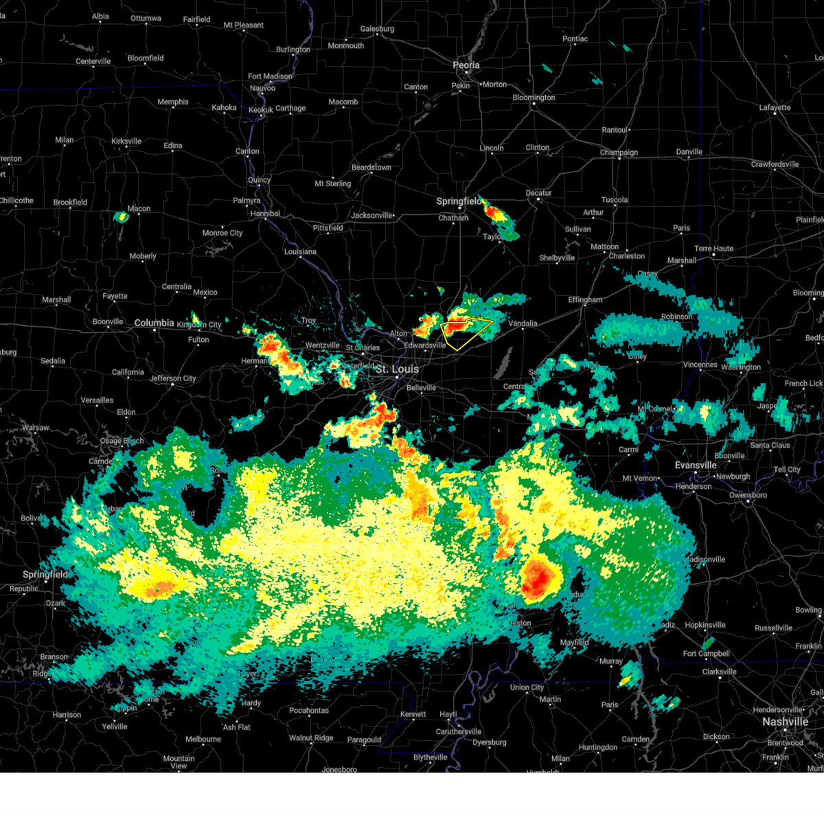 At 1013 am cdt, a severe thunderstorm was located near livingston, moving southeast at 30 mph (radar indicated). Hazards include 60 mph wind gusts and quarter size hail. Hail damage to vehicles is expected. expect wind damage to roofs, siding, and trees. locations impacted include, highland, livingston, alhambra, sorento, reno, panama, grantfork, new douglas, williamson, and old ripley. this includes interstate 55 in illinois near exit 37. hail threat, radar indicated max hail size, 1. 00 in wind threat, radar indicated max wind gust, 60 mph. At 1013 am cdt, a severe thunderstorm was located near livingston, moving southeast at 30 mph (radar indicated). Hazards include 60 mph wind gusts and quarter size hail. Hail damage to vehicles is expected. expect wind damage to roofs, siding, and trees. locations impacted include, highland, livingston, alhambra, sorento, reno, panama, grantfork, new douglas, williamson, and old ripley. this includes interstate 55 in illinois near exit 37. hail threat, radar indicated max hail size, 1. 00 in wind threat, radar indicated max wind gust, 60 mph.
|
| 7/20/2023 9:45 AM CDT |
 At 944 am cdt, a severe thunderstorm was located over mount clare, moving southeast at 30 mph (radar indicated). Hazards include 60 mph wind gusts and quarter size hail. Hail damage to vehicles is expected. Expect wind damage to roofs, siding, and trees. At 944 am cdt, a severe thunderstorm was located over mount clare, moving southeast at 30 mph (radar indicated). Hazards include 60 mph wind gusts and quarter size hail. Hail damage to vehicles is expected. Expect wind damage to roofs, siding, and trees.
|
| 7/16/2023 3:33 PM CDT |
 At 332 pm cdt, severe thunderstorms were located along a line extending from spanish lake to st. louis to concord, moving east at 35 mph (radar indicated). Hazards include 60 mph wind gusts and nickel size hail. expect damage to roofs, siding, and trees At 332 pm cdt, severe thunderstorms were located along a line extending from spanish lake to st. louis to concord, moving east at 35 mph (radar indicated). Hazards include 60 mph wind gusts and nickel size hail. expect damage to roofs, siding, and trees
|
| 7/14/2023 8:54 PM CDT |
 At 854 pm cdt, a severe thunderstorm was located near st. jacob, moving northeast at 35 mph (radar indicated). Hazards include 60 mph wind gusts and penny size hail. Expect damage to roofs, siding, and trees. this severe storm will be near, highland around 900 pm cdt. this includes the following highways, interstate 70 in illinois between exits 21 and 30. interstate 64 in illinois between exits 9 and 27. hail threat, radar indicated max hail size, 0. 75 in wind threat, radar indicated max wind gust, 60 mph. At 854 pm cdt, a severe thunderstorm was located near st. jacob, moving northeast at 35 mph (radar indicated). Hazards include 60 mph wind gusts and penny size hail. Expect damage to roofs, siding, and trees. this severe storm will be near, highland around 900 pm cdt. this includes the following highways, interstate 70 in illinois between exits 21 and 30. interstate 64 in illinois between exits 9 and 27. hail threat, radar indicated max hail size, 0. 75 in wind threat, radar indicated max wind gust, 60 mph.
|
| 7/14/2023 8:40 PM CDT |
 At 840 pm cdt, a severe thunderstorm was located over lebanon, moving northeast at 35 mph (radar indicated). Hazards include 60 mph wind gusts and penny size hail. Expect damage to roofs, siding, and trees. this severe thunderstorm will be near, lebanon around 845 pm cdt. st. jacob around 850 pm cdt. highland around 855 pm cdt. this includes the following highways, interstate 70 in illinois between exits 21 and 30. interstate 64 in illinois between exits 9 and 27. hail threat, radar indicated max hail size, 0. 75 in wind threat, radar indicated max wind gust, 60 mph. At 840 pm cdt, a severe thunderstorm was located over lebanon, moving northeast at 35 mph (radar indicated). Hazards include 60 mph wind gusts and penny size hail. Expect damage to roofs, siding, and trees. this severe thunderstorm will be near, lebanon around 845 pm cdt. st. jacob around 850 pm cdt. highland around 855 pm cdt. this includes the following highways, interstate 70 in illinois between exits 21 and 30. interstate 64 in illinois between exits 9 and 27. hail threat, radar indicated max hail size, 0. 75 in wind threat, radar indicated max wind gust, 60 mph.
|
| 7/2/2023 1:25 AM CDT |
 The severe thunderstorm warning for west central clinton county in south central illinois, eastern madison and northeastern st. clair counties in southwestern illinois will expire at 130 am cdt, the storms which prompted the warning have weakened below severe limits, and no longer pose an immediate threat to life or property. therefore, the warning will be allowed to expire. however, heavy rain is still possible with these thunderstorms. The severe thunderstorm warning for west central clinton county in south central illinois, eastern madison and northeastern st. clair counties in southwestern illinois will expire at 130 am cdt, the storms which prompted the warning have weakened below severe limits, and no longer pose an immediate threat to life or property. therefore, the warning will be allowed to expire. however, heavy rain is still possible with these thunderstorms.
|
| 7/2/2023 1:21 AM CDT |
 At 121 am cdt, severe thunderstorms were located along a line extending from worden to trenton, moving northeast at 50 mph (radar indicated). Hazards include 60 mph wind gusts. Expect damage to roofs, siding, and trees. locations impacted include, edwardsville, glen carbon, highland, troy, maryville, mascoutah, lebanon, new baden, scott afb, trenton, aviston, st. jacob, worden, marine, livingston, alhambra, carpenter, hamel, summerfield, and grantfork. this includes the following highways, interstate 70 in illinois between exits 21 and 30. interstate 55 in illinois between exits 23 and 37. interstate 64 in illinois between exits 23 and 27. hail threat, radar indicated max hail size, <. 75 in wind threat, radar indicated max wind gust, 60 mph. At 121 am cdt, severe thunderstorms were located along a line extending from worden to trenton, moving northeast at 50 mph (radar indicated). Hazards include 60 mph wind gusts. Expect damage to roofs, siding, and trees. locations impacted include, edwardsville, glen carbon, highland, troy, maryville, mascoutah, lebanon, new baden, scott afb, trenton, aviston, st. jacob, worden, marine, livingston, alhambra, carpenter, hamel, summerfield, and grantfork. this includes the following highways, interstate 70 in illinois between exits 21 and 30. interstate 55 in illinois between exits 23 and 37. interstate 64 in illinois between exits 23 and 27. hail threat, radar indicated max hail size, <. 75 in wind threat, radar indicated max wind gust, 60 mph.
|
| 7/2/2023 1:07 AM CDT |
 At 106 am cdt, severe thunderstorms were located along a line extending from bethalto to shiloh, moving northeast at 50 mph (trained weather spotters reported 60 mph winds in belleville, il). Hazards include 60 mph wind gusts. Expect damage to roofs, siding, and trees. locations impacted include, belleville, granite city, o`fallon, collinsville, edwardsville, fairview heights, swansea, glen carbon, shiloh, wood river, highland, troy, maryville, mascoutah, pontoon beach, lebanon, caseyville, madison, new baden, and scott afb. this also includes horseshoe lake state park. this includes the following highways, interstate 70 in illinois between exits 21 and 30. interstate 55 in illinois between exits 23 and 37. interstate 64 in illinois between exits 9 and 27. hail threat, radar indicated max hail size, <. 75 in wind threat, observed max wind gust, 60 mph. At 106 am cdt, severe thunderstorms were located along a line extending from bethalto to shiloh, moving northeast at 50 mph (trained weather spotters reported 60 mph winds in belleville, il). Hazards include 60 mph wind gusts. Expect damage to roofs, siding, and trees. locations impacted include, belleville, granite city, o`fallon, collinsville, edwardsville, fairview heights, swansea, glen carbon, shiloh, wood river, highland, troy, maryville, mascoutah, pontoon beach, lebanon, caseyville, madison, new baden, and scott afb. this also includes horseshoe lake state park. this includes the following highways, interstate 70 in illinois between exits 21 and 30. interstate 55 in illinois between exits 23 and 37. interstate 64 in illinois between exits 9 and 27. hail threat, radar indicated max hail size, <. 75 in wind threat, observed max wind gust, 60 mph.
|
| 7/2/2023 12:45 AM CDT |
 At 1245 am cdt, severe thunderstorms were located along a line extending from black jack to near columbia, moving northeast at 50 mph (radar indicated). Hazards include 60 mph wind gusts and nickel size hail. expect damage to roofs, siding, and trees At 1245 am cdt, severe thunderstorms were located along a line extending from black jack to near columbia, moving northeast at 50 mph (radar indicated). Hazards include 60 mph wind gusts and nickel size hail. expect damage to roofs, siding, and trees
|
| 7/1/2023 4:40 PM CDT |
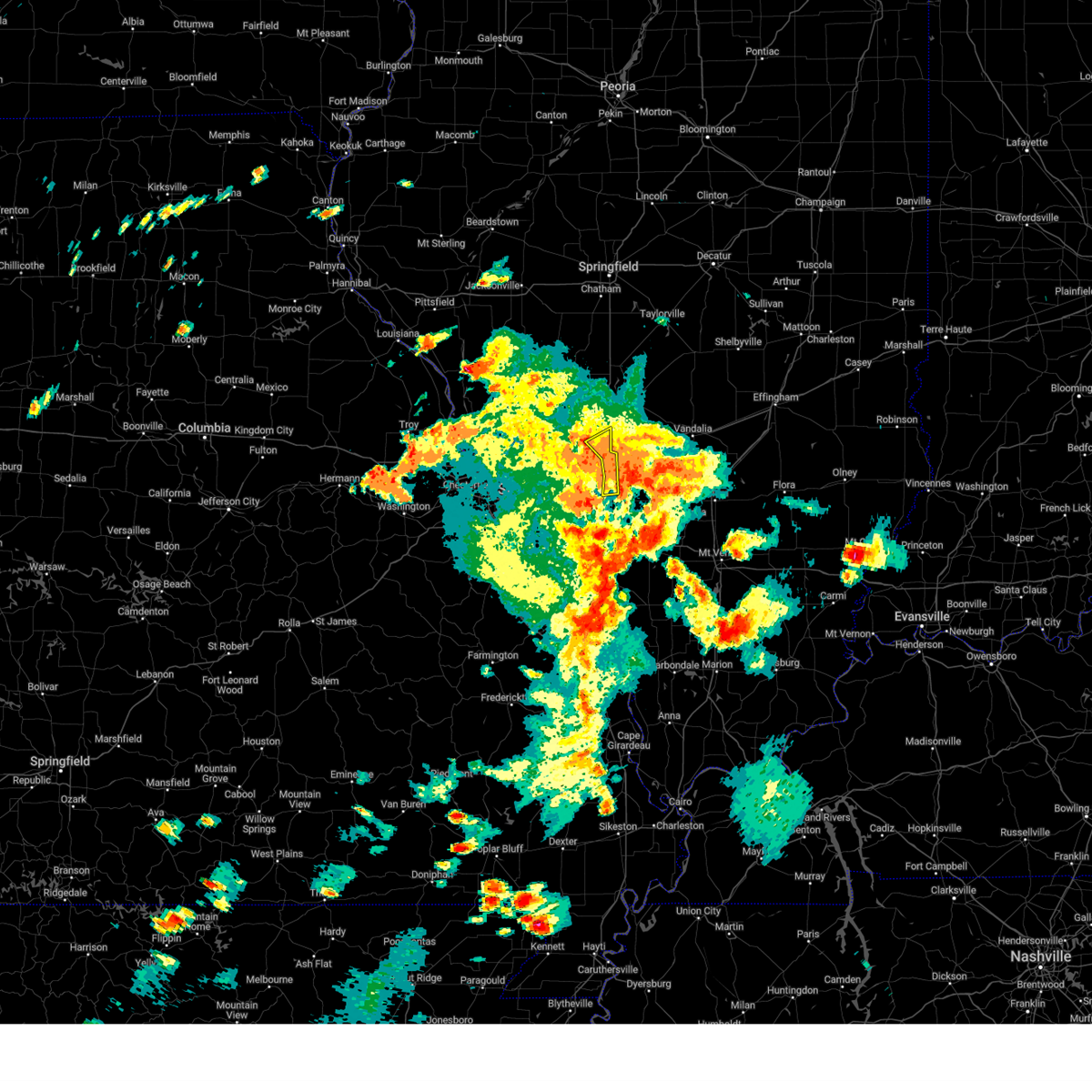 The severe thunderstorm warning for eastern madison county in southwestern illinois will expire at 445 pm cdt, the storms which prompted the warning have moved out of the area. therefore, the warning will be allowed to expire. a severe thunderstorm watch remains in effect until 900 pm cdt for south central and southwestern illinois. The severe thunderstorm warning for eastern madison county in southwestern illinois will expire at 445 pm cdt, the storms which prompted the warning have moved out of the area. therefore, the warning will be allowed to expire. a severe thunderstorm watch remains in effect until 900 pm cdt for south central and southwestern illinois.
|
| 7/1/2023 4:33 PM CDT |
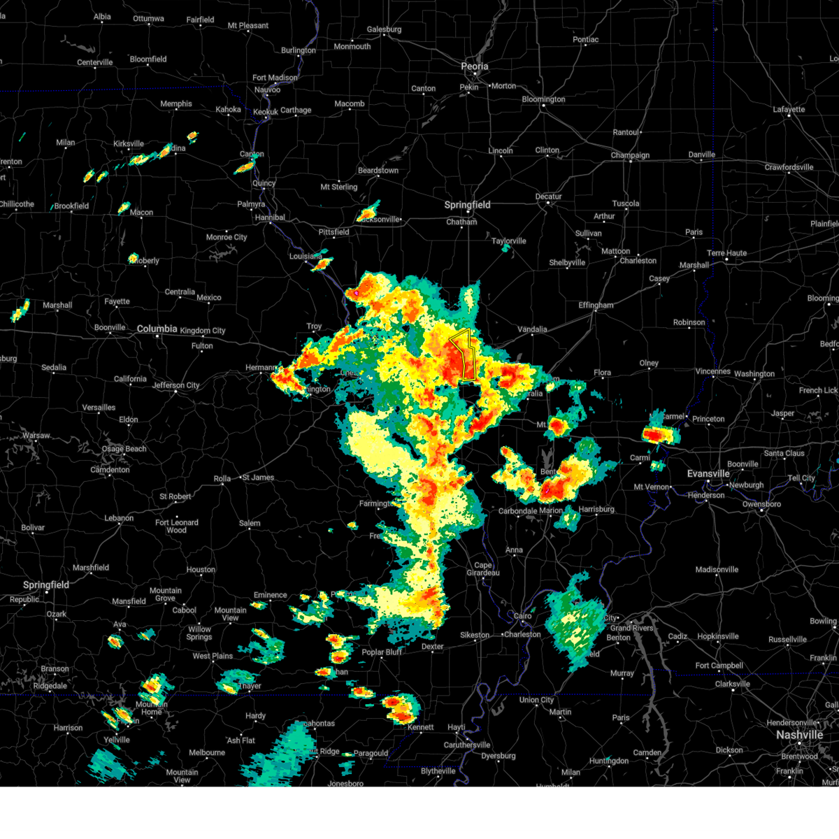 At 432 pm cdt, severe thunderstorms were located along a line extending from livingston to 6 miles southwest of reno to near pocahontas to st. rose, moving east at 40 mph (radar indicated). Hazards include 60 mph wind gusts and quarter size hail. Hail damage to vehicles is expected. expect wind damage to roofs, siding, and trees. locations impacted include, highland, alhambra, pierron, grantfork, and new douglas. this includes the following highways, interstate 70 in illinois near exit 30. interstate 55 in illinois near exit 33. hail threat, radar indicated max hail size, 1. 00 in wind threat, radar indicated max wind gust, 60 mph. At 432 pm cdt, severe thunderstorms were located along a line extending from livingston to 6 miles southwest of reno to near pocahontas to st. rose, moving east at 40 mph (radar indicated). Hazards include 60 mph wind gusts and quarter size hail. Hail damage to vehicles is expected. expect wind damage to roofs, siding, and trees. locations impacted include, highland, alhambra, pierron, grantfork, and new douglas. this includes the following highways, interstate 70 in illinois near exit 30. interstate 55 in illinois near exit 33. hail threat, radar indicated max hail size, 1. 00 in wind threat, radar indicated max wind gust, 60 mph.
|
| 7/1/2023 4:12 PM CDT |
 At 411 pm cdt, severe thunderstorms were located along a line extending from near bethalto to near marine to near st. jacob to lebanon, moving northeast at 50 mph (radar indicated). Hazards include 70 mph wind gusts and quarter size hail. Hail damage to vehicles is expected. expect considerable tree damage. wind damage is also likely to mobile homes, roofs, and outbuildings. locations impacted include, o`fallon, edwardsville, glen carbon, shiloh, wood river, highland, troy, bethalto, lebanon, east alton, south roxana, roxana, hartford, st. jacob, worden, marine, livingston, alhambra, carpenter, and rosewood heights. this includes the following highways, interstate 70 in illinois between exits 21 and 30. interstate 55 in illinois between exits 23 and 37. Interstate 64 in illinois near exit 19. At 411 pm cdt, severe thunderstorms were located along a line extending from near bethalto to near marine to near st. jacob to lebanon, moving northeast at 50 mph (radar indicated). Hazards include 70 mph wind gusts and quarter size hail. Hail damage to vehicles is expected. expect considerable tree damage. wind damage is also likely to mobile homes, roofs, and outbuildings. locations impacted include, o`fallon, edwardsville, glen carbon, shiloh, wood river, highland, troy, bethalto, lebanon, east alton, south roxana, roxana, hartford, st. jacob, worden, marine, livingston, alhambra, carpenter, and rosewood heights. this includes the following highways, interstate 70 in illinois between exits 21 and 30. interstate 55 in illinois between exits 23 and 37. Interstate 64 in illinois near exit 19.
|
| 7/1/2023 3:58 PM CDT |
 At 358 pm cdt, severe thunderstorms were located along a line extending from near east alton to pontoon beach to collinsville to near fairview heights, moving east at 40 mph (radar indicated). Hazards include 70 mph wind gusts and quarter size hail. Hail damage to vehicles is expected. expect considerable tree damage. Wind damage is also likely to mobile homes, roofs, and outbuildings. At 358 pm cdt, severe thunderstorms were located along a line extending from near east alton to pontoon beach to collinsville to near fairview heights, moving east at 40 mph (radar indicated). Hazards include 70 mph wind gusts and quarter size hail. Hail damage to vehicles is expected. expect considerable tree damage. Wind damage is also likely to mobile homes, roofs, and outbuildings.
|
| 6/30/2023 10:05 PM CDT |
 At 1005 pm cdt, a severe thunderstorm was located over highland, moving east at 20 mph (radar indicated). Hazards include 60 mph wind gusts and half dollar size hail. Hail damage to vehicles is expected. expect wind damage to roofs, siding, and trees. locations impacted include, st. louis, belleville, granite city, o`fallon, east st. louis, collinsville, edwardsville, fairview heights, cahokia, glen carbon, shiloh, highland, troy, maryville, pontoon beach, centreville, lebanon, caseyville, washington park, and madison. this also includes horseshoe lake state park. this includes the following highways, interstate 70 in illinois between exits 21 and 30. interstate 55 in illinois near exit 23. interstate 64 in illinois between exits 9 and 14. hail threat, radar indicated max hail size, 1. 25 in wind threat, radar indicated max wind gust, 60 mph. At 1005 pm cdt, a severe thunderstorm was located over highland, moving east at 20 mph (radar indicated). Hazards include 60 mph wind gusts and half dollar size hail. Hail damage to vehicles is expected. expect wind damage to roofs, siding, and trees. locations impacted include, st. louis, belleville, granite city, o`fallon, east st. louis, collinsville, edwardsville, fairview heights, cahokia, glen carbon, shiloh, highland, troy, maryville, pontoon beach, centreville, lebanon, caseyville, washington park, and madison. this also includes horseshoe lake state park. this includes the following highways, interstate 70 in illinois between exits 21 and 30. interstate 55 in illinois near exit 23. interstate 64 in illinois between exits 9 and 14. hail threat, radar indicated max hail size, 1. 25 in wind threat, radar indicated max wind gust, 60 mph.
|
| 6/30/2023 9:56 PM CDT |
 At 955 pm cdt, a severe thunderstorm was located over highland, moving east at 20 mph (radar indicated). Hazards include 60 mph wind gusts and half dollar size hail. Hail damage to vehicles is expected. expect wind damage to roofs, siding, and trees. locations impacted include, st. louis, belleville, granite city, o`fallon, east st. louis, collinsville, edwardsville, fairview heights, cahokia, glen carbon, shiloh, highland, troy, maryville, pontoon beach, centreville, lebanon, caseyville, washington park, and madison. this also includes scott joplin historic site and horseshoe lake state park. this includes the following highways, interstate 70 in illinois between exits 21 and 30. interstate 55 in illinois near exit 23. interstate 64 in illinois between exits 9 and 14. hail threat, radar indicated max hail size, 1. 25 in wind threat, radar indicated max wind gust, 60 mph. At 955 pm cdt, a severe thunderstorm was located over highland, moving east at 20 mph (radar indicated). Hazards include 60 mph wind gusts and half dollar size hail. Hail damage to vehicles is expected. expect wind damage to roofs, siding, and trees. locations impacted include, st. louis, belleville, granite city, o`fallon, east st. louis, collinsville, edwardsville, fairview heights, cahokia, glen carbon, shiloh, highland, troy, maryville, pontoon beach, centreville, lebanon, caseyville, washington park, and madison. this also includes scott joplin historic site and horseshoe lake state park. this includes the following highways, interstate 70 in illinois between exits 21 and 30. interstate 55 in illinois near exit 23. interstate 64 in illinois between exits 9 and 14. hail threat, radar indicated max hail size, 1. 25 in wind threat, radar indicated max wind gust, 60 mph.
|
| 6/30/2023 9:44 PM CDT |
 At 944 pm cdt, a severe thunderstorm was located over collinsville, moving east at 30 mph (radar indicated). Hazards include 60 mph wind gusts and quarter size hail. Hail damage to vehicles is expected. expect wind damage to roofs, siding, and trees. locations impacted include, st. louis, belleville, granite city, o`fallon, east st. louis, collinsville, edwardsville, fairview heights, cahokia, glen carbon, shiloh, highland, troy, maryville, pontoon beach, centreville, lebanon, caseyville, washington park, and madison. this also includes scott joplin historic site and horseshoe lake state park. this includes the following highways, interstate 70 in illinois between exits 21 and 30. interstate 55 in illinois near exit 23. interstate 64 in illinois between exits 9 and 14. hail threat, radar indicated max hail size, 1. 00 in wind threat, radar indicated max wind gust, 60 mph. At 944 pm cdt, a severe thunderstorm was located over collinsville, moving east at 30 mph (radar indicated). Hazards include 60 mph wind gusts and quarter size hail. Hail damage to vehicles is expected. expect wind damage to roofs, siding, and trees. locations impacted include, st. louis, belleville, granite city, o`fallon, east st. louis, collinsville, edwardsville, fairview heights, cahokia, glen carbon, shiloh, highland, troy, maryville, pontoon beach, centreville, lebanon, caseyville, washington park, and madison. this also includes scott joplin historic site and horseshoe lake state park. this includes the following highways, interstate 70 in illinois between exits 21 and 30. interstate 55 in illinois near exit 23. interstate 64 in illinois between exits 9 and 14. hail threat, radar indicated max hail size, 1. 00 in wind threat, radar indicated max wind gust, 60 mph.
|
| 6/30/2023 9:30 PM CDT |
 At 930 pm cdt, a severe thunderstorm was located over fairmont city, moving east at 30 mph (radar indicated). Hazards include 60 mph wind gusts and penny size hail. expect damage to roofs, siding, and trees At 930 pm cdt, a severe thunderstorm was located over fairmont city, moving east at 30 mph (radar indicated). Hazards include 60 mph wind gusts and penny size hail. expect damage to roofs, siding, and trees
|
| 6/30/2023 8:53 PM CDT |
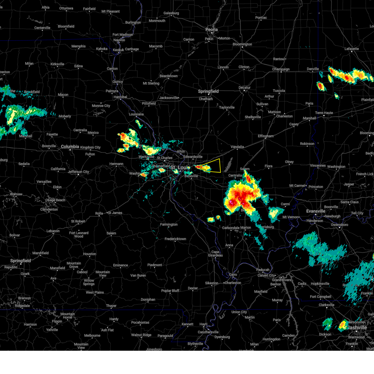 At 853 pm cdt, a severe thunderstorm was located near st. jacob, moving east at 35 mph (trained weather spotters). Hazards include 60 mph wind gusts and quarter size hail. Hail damage to vehicles is expected. expect wind damage to roofs, siding, and trees. locations impacted include, highland, breese, aviston, st. rose, st. jacob, jamestown, pierron, and stolletown. hail threat, radar indicated max hail size, 1. 00 in wind threat, radar indicated max wind gust, 60 mph. At 853 pm cdt, a severe thunderstorm was located near st. jacob, moving east at 35 mph (trained weather spotters). Hazards include 60 mph wind gusts and quarter size hail. Hail damage to vehicles is expected. expect wind damage to roofs, siding, and trees. locations impacted include, highland, breese, aviston, st. rose, st. jacob, jamestown, pierron, and stolletown. hail threat, radar indicated max hail size, 1. 00 in wind threat, radar indicated max wind gust, 60 mph.
|
| 6/30/2023 8:47 PM CDT |
 At 847 pm cdt, a severe thunderstorm was located over st. jacob, moving east at 35 mph (ham radio operators reported half dollar sized hail in troy). Hazards include 60 mph wind gusts and half dollar size hail. Hail damage to vehicles is expected. expect wind damage to roofs, siding, and trees. locations impacted include, highland, breese, aviston, st. rose, st. jacob, jamestown, pierron, and stolletown. hail threat, radar indicated max hail size, 1. 25 in wind threat, radar indicated max wind gust, 60 mph. At 847 pm cdt, a severe thunderstorm was located over st. jacob, moving east at 35 mph (ham radio operators reported half dollar sized hail in troy). Hazards include 60 mph wind gusts and half dollar size hail. Hail damage to vehicles is expected. expect wind damage to roofs, siding, and trees. locations impacted include, highland, breese, aviston, st. rose, st. jacob, jamestown, pierron, and stolletown. hail threat, radar indicated max hail size, 1. 25 in wind threat, radar indicated max wind gust, 60 mph.
|
| 6/30/2023 8:38 PM CDT |
 At 838 pm cdt, a severe thunderstorm was located over troy, moving east at 35 mph (radar indicated). Hazards include 60 mph wind gusts and quarter size hail. Hail damage to vehicles is expected. Expect wind damage to roofs, siding, and trees. At 838 pm cdt, a severe thunderstorm was located over troy, moving east at 35 mph (radar indicated). Hazards include 60 mph wind gusts and quarter size hail. Hail damage to vehicles is expected. Expect wind damage to roofs, siding, and trees.
|
| 5/13/2023 4:12 PM CDT |
 The severe thunderstorm warning for west central clinton county in south central illinois, southeastern madison and northeastern st. clair counties in southwestern illinois will expire at 415 pm cdt, the storm which prompted the warning has moved out of the area. therefore, the warning will be allowed to expire. a severe thunderstorm watch remains in effect until 700 pm cdt for south central and southwestern illinois. The severe thunderstorm warning for west central clinton county in south central illinois, southeastern madison and northeastern st. clair counties in southwestern illinois will expire at 415 pm cdt, the storm which prompted the warning has moved out of the area. therefore, the warning will be allowed to expire. a severe thunderstorm watch remains in effect until 700 pm cdt for south central and southwestern illinois.
|
| 5/13/2023 4:01 PM CDT |
 At 400 pm cdt, a severe thunderstorm was located over st. rose, moving east at 30 mph (radar indicated). Hazards include 60 mph wind gusts and nickel size hail. Expect damage to roofs, siding, and trees. locations impacted include, highland, lebanon, new baden, trenton, aviston, albers, st. jacob, pierron, and summerfield. hail threat, radar indicated max hail size, 0. 88 in wind threat, radar indicated max wind gust, 60 mph. At 400 pm cdt, a severe thunderstorm was located over st. rose, moving east at 30 mph (radar indicated). Hazards include 60 mph wind gusts and nickel size hail. Expect damage to roofs, siding, and trees. locations impacted include, highland, lebanon, new baden, trenton, aviston, albers, st. jacob, pierron, and summerfield. hail threat, radar indicated max hail size, 0. 88 in wind threat, radar indicated max wind gust, 60 mph.
|
| 5/13/2023 3:43 PM CDT |
 At 343 pm cdt, a severe thunderstorm was located near st. jacob, moving east at 30 mph (radar indicated). Hazards include 60 mph wind gusts and quarter size hail. Hail damage to vehicles is expected. expect wind damage to roofs, siding, and trees. locations impacted include, o`fallon, glen carbon, shiloh, highland, troy, maryville, mascoutah, lebanon, new baden, trenton, aviston, albers, st. jacob, marine, pierron, summerfield, and kuhn. this includes the following highways, interstate 70 in illinois between exits 21 and 30. interstate 64 in illinois between exits 14 and 19. hail threat, radar indicated max hail size, 1. 00 in wind threat, radar indicated max wind gust, 60 mph. At 343 pm cdt, a severe thunderstorm was located near st. jacob, moving east at 30 mph (radar indicated). Hazards include 60 mph wind gusts and quarter size hail. Hail damage to vehicles is expected. expect wind damage to roofs, siding, and trees. locations impacted include, o`fallon, glen carbon, shiloh, highland, troy, maryville, mascoutah, lebanon, new baden, trenton, aviston, albers, st. jacob, marine, pierron, summerfield, and kuhn. this includes the following highways, interstate 70 in illinois between exits 21 and 30. interstate 64 in illinois between exits 14 and 19. hail threat, radar indicated max hail size, 1. 00 in wind threat, radar indicated max wind gust, 60 mph.
|
| 5/13/2023 3:26 PM CDT |
 At 325 pm cdt, a severe thunderstorm was located near troy, moving east at 25 mph (radar indicated). Hazards include ping pong ball size hail and 60 mph wind gusts. People and animals outdoors will be injured. expect hail damage to roofs, siding, windows, and vehicles. Expect wind damage to roofs, siding, and trees. At 325 pm cdt, a severe thunderstorm was located near troy, moving east at 25 mph (radar indicated). Hazards include ping pong ball size hail and 60 mph wind gusts. People and animals outdoors will be injured. expect hail damage to roofs, siding, windows, and vehicles. Expect wind damage to roofs, siding, and trees.
|
| 5/7/2023 5:26 PM CDT |
 The severe thunderstorm warning for west central clinton county in south central illinois, southeastern madison and northeastern st. clair counties in southwestern illinois will expire at 530 pm cdt, the storm which prompted the warning has weakened below severe limits, and no longer poses an immediate threat to life or property. therefore, the warning will be allowed to expire. a severe thunderstorm watch remains in effect until 900 pm cdt for south central and southwestern illinois. to report severe weather, contact your nearest law enforcement agency. they will relay your report to the national weather service st louis. remember, a severe thunderstorm warning still remains in effect for southwestern clinton county and southeastern st. clair county until 6 pm. The severe thunderstorm warning for west central clinton county in south central illinois, southeastern madison and northeastern st. clair counties in southwestern illinois will expire at 530 pm cdt, the storm which prompted the warning has weakened below severe limits, and no longer poses an immediate threat to life or property. therefore, the warning will be allowed to expire. a severe thunderstorm watch remains in effect until 900 pm cdt for south central and southwestern illinois. to report severe weather, contact your nearest law enforcement agency. they will relay your report to the national weather service st louis. remember, a severe thunderstorm warning still remains in effect for southwestern clinton county and southeastern st. clair county until 6 pm.
|
| 5/7/2023 5:07 PM CDT |
 At 507 pm cdt, a severe thunderstorm was located over lebanon, moving northeast at 20 mph (trained weather spotters). Hazards include ping pong ball size hail and 60 mph wind gusts. People and animals outdoors will be injured. expect hail damage to roofs, siding, windows, and vehicles. expect wind damage to roofs, siding, and trees. locations impacted include, o`fallon, fairview heights, swansea, shiloh, highland, troy, mascoutah, breese, lebanon, new baden, scott afb, trenton, aviston, st. jacob, marine, and summerfield. this includes the following highways, interstate 70 in illinois between exits 21 and 24. interstate 64 in illinois between exits 12 and 27. hail threat, radar indicated max hail size, 1. 50 in wind threat, radar indicated max wind gust, 60 mph. At 507 pm cdt, a severe thunderstorm was located over lebanon, moving northeast at 20 mph (trained weather spotters). Hazards include ping pong ball size hail and 60 mph wind gusts. People and animals outdoors will be injured. expect hail damage to roofs, siding, windows, and vehicles. expect wind damage to roofs, siding, and trees. locations impacted include, o`fallon, fairview heights, swansea, shiloh, highland, troy, mascoutah, breese, lebanon, new baden, scott afb, trenton, aviston, st. jacob, marine, and summerfield. this includes the following highways, interstate 70 in illinois between exits 21 and 24. interstate 64 in illinois between exits 12 and 27. hail threat, radar indicated max hail size, 1. 50 in wind threat, radar indicated max wind gust, 60 mph.
|
| 5/7/2023 4:51 PM CDT |
 At 450 pm cdt, a severe thunderstorm was located over scott afb, moving northeast at 20 mph (at 448 pm, law enforcement reported at least quarter sized hail in o`fallon, illinois). Hazards include 60 mph wind gusts and quarter size hail. Hail damage to vehicles is expected. Expect wind damage to roofs, siding, and trees. At 450 pm cdt, a severe thunderstorm was located over scott afb, moving northeast at 20 mph (at 448 pm, law enforcement reported at least quarter sized hail in o`fallon, illinois). Hazards include 60 mph wind gusts and quarter size hail. Hail damage to vehicles is expected. Expect wind damage to roofs, siding, and trees.
|
| 4/15/2023 7:56 PM CDT |
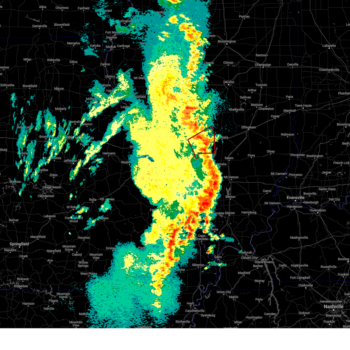 The tornado warning for bond county in south central illinois, eastern madison county in southwestern illinois and south central montgomery counties in south central illinois will expire at 800 pm cdt, the storm which prompted the warning has moved out of the area. therefore, the warning will be allowed to expire. a tornado watch remains in effect until 1000 pm cdt for south central and southwestern illinois. remember, a severe thunderstorm warning still remains in effect for eastern bond county and southeastern montgomery county until 845 pm. The tornado warning for bond county in south central illinois, eastern madison county in southwestern illinois and south central montgomery counties in south central illinois will expire at 800 pm cdt, the storm which prompted the warning has moved out of the area. therefore, the warning will be allowed to expire. a tornado watch remains in effect until 1000 pm cdt for south central and southwestern illinois. remember, a severe thunderstorm warning still remains in effect for eastern bond county and southeastern montgomery county until 845 pm.
|
| 4/15/2023 7:39 PM CDT |
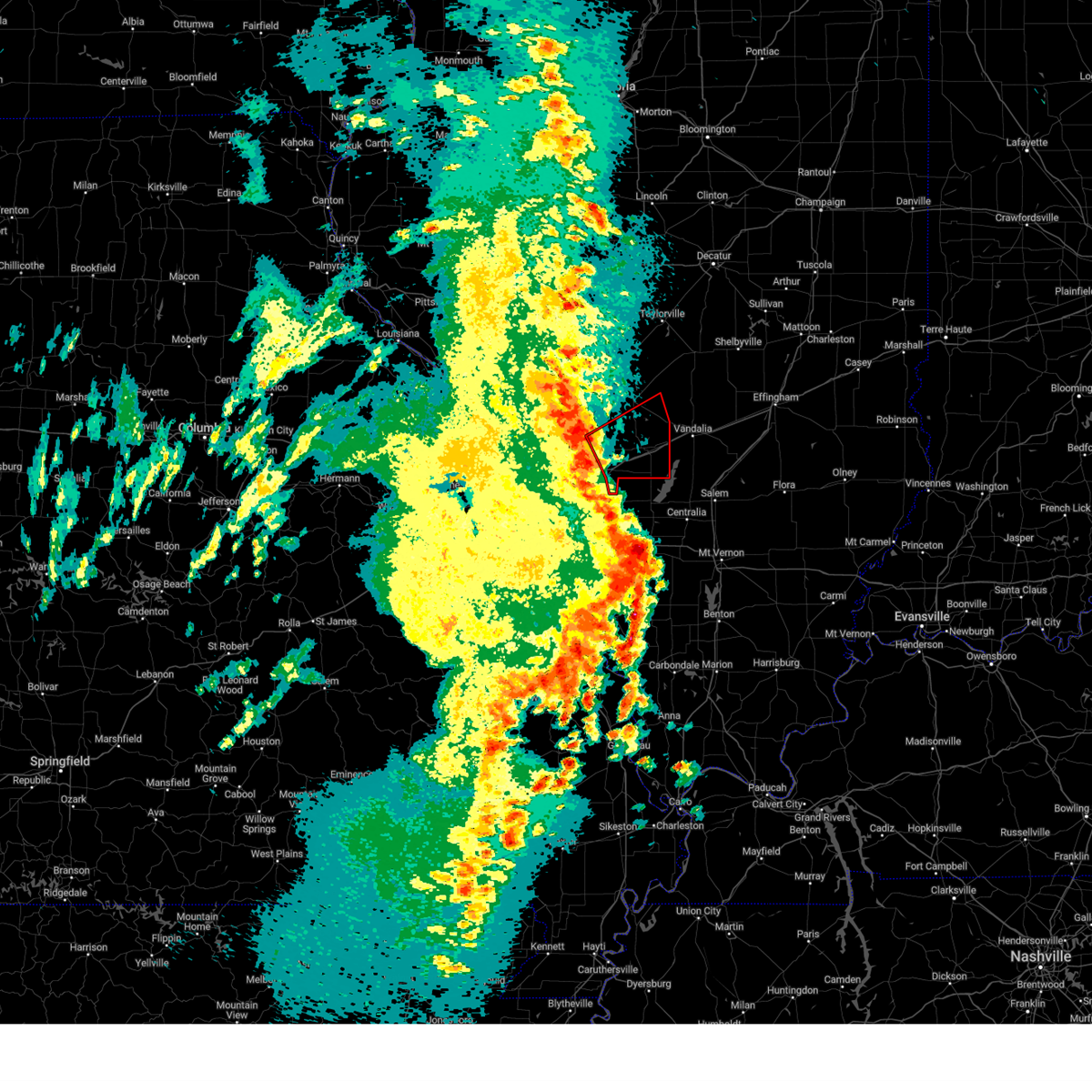 At 739 pm cdt, a severe thunderstorm capable of producing a tornado was located over highland, moving northeast at 35 mph (radar indicated rotation). Hazards include tornado. Flying debris will be dangerous to those caught without shelter. mobile homes will be damaged or destroyed. damage to roofs, windows, and vehicles will occur. tree damage is likely. locations impacted include, highland, pocahontas, greenville and mulberry grove. this includes the following highways, interstate 70 in illinois between exits 30 and 52. Interstate 55 in illinois near exit 37. At 739 pm cdt, a severe thunderstorm capable of producing a tornado was located over highland, moving northeast at 35 mph (radar indicated rotation). Hazards include tornado. Flying debris will be dangerous to those caught without shelter. mobile homes will be damaged or destroyed. damage to roofs, windows, and vehicles will occur. tree damage is likely. locations impacted include, highland, pocahontas, greenville and mulberry grove. this includes the following highways, interstate 70 in illinois between exits 30 and 52. Interstate 55 in illinois near exit 37.
|
| 4/15/2023 7:13 PM CDT |
 At 713 pm cdt, a severe thunderstorm capable of producing a tornado was located over fairview heights, moving northeast at 35 mph (radar indicated rotation). Hazards include tornado. Flying debris will be dangerous to those caught without shelter. mobile homes will be damaged or destroyed. damage to roofs, windows, and vehicles will occur. tree damage is likely. this dangerous storm will be near, st. jacob around 725 pm cdt. other locations in the path of this tornadic thunderstorm include highland and pocahontas. this includes the following highways, interstate 70 in illinois between exits 21 and 52. Interstate 55 in illinois between exits 30 and 37. At 713 pm cdt, a severe thunderstorm capable of producing a tornado was located over fairview heights, moving northeast at 35 mph (radar indicated rotation). Hazards include tornado. Flying debris will be dangerous to those caught without shelter. mobile homes will be damaged or destroyed. damage to roofs, windows, and vehicles will occur. tree damage is likely. this dangerous storm will be near, st. jacob around 725 pm cdt. other locations in the path of this tornadic thunderstorm include highland and pocahontas. this includes the following highways, interstate 70 in illinois between exits 21 and 52. Interstate 55 in illinois between exits 30 and 37.
|
| 2/22/2023 2:57 PM CST |
 The severe thunderstorm warning for western clinton and southwestern bond counties in south central illinois, southeastern madison county in southwestern illinois, northwestern washington county in south central illinois and eastern st. clair counties in southwestern illinois will expire at 300 pm cst, the storms which prompted the warning have moved out of the area. therefore, the warning will be allowed to expire. a tornado watch remains in effect until 600 pm cst for south central and southwestern illinois. The severe thunderstorm warning for western clinton and southwestern bond counties in south central illinois, southeastern madison county in southwestern illinois, northwestern washington county in south central illinois and eastern st. clair counties in southwestern illinois will expire at 300 pm cst, the storms which prompted the warning have moved out of the area. therefore, the warning will be allowed to expire. a tornado watch remains in effect until 600 pm cst for south central and southwestern illinois.
|
| 2/22/2023 2:42 PM CST | Downed power pole in clinton county IL, 7.2 miles WNW of Highland, IL |
| 2/22/2023 2:38 PM CST | Tree uprooted and siding damage on hom in clinton county IL, 6.5 miles NW of Highland, IL |
| 2/22/2023 2:38 PM CST |
 At 237 pm cst, severe thunderstorms were located along a line extending from near highland to trenton to near new memphis, moving northeast at 55 mph (radar indicated). Hazards include 60 mph wind gusts. Expect damage to roofs, siding, and trees. locations impacted include, highland, mascoutah, breese, lebanon, new baden, scott afb, trenton, new athens, aviston, okawville, st. rose, germantown, albers, st. jacob, beckemeyer, pocahontas, new memphis, jamestown, st. libory and pierron. this includes the following highways, interstate 70 in illinois between exits 30 and 36. Interstate 64 in illinois between exits 23 and 41. At 237 pm cst, severe thunderstorms were located along a line extending from near highland to trenton to near new memphis, moving northeast at 55 mph (radar indicated). Hazards include 60 mph wind gusts. Expect damage to roofs, siding, and trees. locations impacted include, highland, mascoutah, breese, lebanon, new baden, scott afb, trenton, new athens, aviston, okawville, st. rose, germantown, albers, st. jacob, beckemeyer, pocahontas, new memphis, jamestown, st. libory and pierron. this includes the following highways, interstate 70 in illinois between exits 30 and 36. Interstate 64 in illinois between exits 23 and 41.
|
| 2/22/2023 2:36 PM CST | Large limbs down and a power line dow in madison county IL, 2.8 miles NNW of Highland, IL |
| 2/22/2023 2:33 PM CST | Multiple road signs blown ove in madison county IL, 2.2 miles NNW of Highland, IL |
| 2/22/2023 2:23 PM CST |
 At 222 pm cst, severe thunderstorms were located along a line extending from troy to near lebanon to freeburg, moving northeast at 50 mph (radar indicated). Hazards include 60 mph wind gusts. Expect damage to roofs, siding, and trees. locations impacted include, st. jacob, highland, new baden, st. rose, new memphis, trenton, albers, pocahontas, jamestown, aviston, germantown, breese and beckemeyer. this includes the following highways, interstate 70 in illinois between exits 30 and 36. Interstate 64 in illinois between exits 12 and 41. At 222 pm cst, severe thunderstorms were located along a line extending from troy to near lebanon to freeburg, moving northeast at 50 mph (radar indicated). Hazards include 60 mph wind gusts. Expect damage to roofs, siding, and trees. locations impacted include, st. jacob, highland, new baden, st. rose, new memphis, trenton, albers, pocahontas, jamestown, aviston, germantown, breese and beckemeyer. this includes the following highways, interstate 70 in illinois between exits 30 and 36. Interstate 64 in illinois between exits 12 and 41.
|
| 2/22/2023 2:01 PM CST |
 At 200 pm cst, severe thunderstorms were located along a line extending from brooklyn to near centreville to near fountain, moving northeast at 45 mph (radar indicated). Hazards include 60 mph wind gusts. Expect damage to roofs, siding, and trees. severe thunderstorms will be near, east st. louis, centreville, washington park, madison, fairmont city and alorton around 205 pm cst. belleville, collinsville, fairview heights and swansea around 210 pm cst. shiloh and caseyville around 215 pm cst. o`fallon, troy, maryville, lebanon, scott afb and smithton around 220 pm cst. other locations in the path of these severe thunderstorms include freeburg, new athens, mascoutah, trenton, st. jacob, aviston, highland, new baden, st. rose and new memphis. this includes the following highways, interstate 70 in illinois between exits 24 and 36. Interstate 64 in illinois between exits 9 and 41. At 200 pm cst, severe thunderstorms were located along a line extending from brooklyn to near centreville to near fountain, moving northeast at 45 mph (radar indicated). Hazards include 60 mph wind gusts. Expect damage to roofs, siding, and trees. severe thunderstorms will be near, east st. louis, centreville, washington park, madison, fairmont city and alorton around 205 pm cst. belleville, collinsville, fairview heights and swansea around 210 pm cst. shiloh and caseyville around 215 pm cst. o`fallon, troy, maryville, lebanon, scott afb and smithton around 220 pm cst. other locations in the path of these severe thunderstorms include freeburg, new athens, mascoutah, trenton, st. jacob, aviston, highland, new baden, st. rose and new memphis. this includes the following highways, interstate 70 in illinois between exits 24 and 36. Interstate 64 in illinois between exits 9 and 41.
|
| 8/3/2022 5:49 PM CDT |
 At 549 pm cdt, severe thunderstorms were located along a line extending from 6 miles west of ramsey to near highland to near trenton, moving east at 35 mph (trained weather spotters). Hazards include 60 mph wind gusts. Expect damage to roofs, siding, and trees. locations impacted include, ramsey, germantown, beaver creek, beckemeyer, carlyle, tamalco and boulder. this also includes ramsey lake state park and carlyle lake recreational area. this includes the following highways, interstate 70 in illinois between exits 24 and 68. interstate 64 in illinois between exits 19 and 41. hail threat, observed max hail size, <. 75 in wind threat, radar indicated max wind gust, 60 mph. At 549 pm cdt, severe thunderstorms were located along a line extending from 6 miles west of ramsey to near highland to near trenton, moving east at 35 mph (trained weather spotters). Hazards include 60 mph wind gusts. Expect damage to roofs, siding, and trees. locations impacted include, ramsey, germantown, beaver creek, beckemeyer, carlyle, tamalco and boulder. this also includes ramsey lake state park and carlyle lake recreational area. this includes the following highways, interstate 70 in illinois between exits 24 and 68. interstate 64 in illinois between exits 19 and 41. hail threat, observed max hail size, <. 75 in wind threat, radar indicated max wind gust, 60 mph.
|
| 8/3/2022 5:34 PM CDT |
 At 534 pm cdt, severe thunderstorms were located along a line extending from near reno to near lebanon, moving southeast at 30 mph (radar indicated). Hazards include 60 mph wind gusts and nickel size hail. Expect damage to roofs, siding, and trees. severe thunderstorms will be near, new baden and trenton around 545 pm cdt. greenville, aviston, woburn and van burensburg around 550 pm cdt. other locations in the path of these severe thunderstorms include breese, albers, new memphis, germantown, mulberry grove, okawville and shobonier. this includes the following highways, interstate 70 in illinois between exits 24 and 68. interstate 64 in illinois between exits 19 and 41. this also includes ramsey lake state park and carlyle lake recreational area. hail threat, radar indicated max hail size, 0. 88 in wind threat, radar indicated max wind gust, 60 mph. At 534 pm cdt, severe thunderstorms were located along a line extending from near reno to near lebanon, moving southeast at 30 mph (radar indicated). Hazards include 60 mph wind gusts and nickel size hail. Expect damage to roofs, siding, and trees. severe thunderstorms will be near, new baden and trenton around 545 pm cdt. greenville, aviston, woburn and van burensburg around 550 pm cdt. other locations in the path of these severe thunderstorms include breese, albers, new memphis, germantown, mulberry grove, okawville and shobonier. this includes the following highways, interstate 70 in illinois between exits 24 and 68. interstate 64 in illinois between exits 19 and 41. this also includes ramsey lake state park and carlyle lake recreational area. hail threat, radar indicated max hail size, 0. 88 in wind threat, radar indicated max wind gust, 60 mph.
|
| 8/3/2022 5:25 PM CDT |
 At 525 pm cdt, a severe thunderstorm was located near troy, moving east at 25 mph (radar indicated). Hazards include 70 mph wind gusts. Expect considerable tree damage. damage is likely to mobile homes, roofs, and outbuildings. locations impacted include, st. jacob, marine and highland. this includes the following highways, interstate 70 in illinois between exits 21 and 24. interstate 55 in illinois near exit 23. interstate 64 in illinois near exit 14. thunderstorm damage threat, considerable hail threat, radar indicated max hail size, <. 75 in wind threat, radar indicated max wind gust, 70 mph. At 525 pm cdt, a severe thunderstorm was located near troy, moving east at 25 mph (radar indicated). Hazards include 70 mph wind gusts. Expect considerable tree damage. damage is likely to mobile homes, roofs, and outbuildings. locations impacted include, st. jacob, marine and highland. this includes the following highways, interstate 70 in illinois between exits 21 and 24. interstate 55 in illinois near exit 23. interstate 64 in illinois near exit 14. thunderstorm damage threat, considerable hail threat, radar indicated max hail size, <. 75 in wind threat, radar indicated max wind gust, 70 mph.
|
| 8/3/2022 5:05 PM CDT |
 At 505 pm cdt, a severe thunderstorm was located over pontoon beach, moving east at 25 mph (radar indicated). Hazards include 70 mph wind gusts and penny size hail. Expect considerable tree damage. damage is likely to mobile homes, roofs, and outbuildings. this severe thunderstorm will be near, edwardsville and maryville around 515 pm cdt. troy around 520 pm cdt. glen carbon around 525 pm cdt. other locations in the path of this severe thunderstorm include st. jacob, marine and highland. this includes the following highways, interstate 70 in illinois between exits 21 and 24. interstate 55 in illinois between exits 23 and 30. interstate 64 in illinois between exits 9 and 14. this also includes horseshoe lake state park. thunderstorm damage threat, considerable hail threat, radar indicated max hail size, 0. 75 in wind threat, radar indicated max wind gust, 70 mph. At 505 pm cdt, a severe thunderstorm was located over pontoon beach, moving east at 25 mph (radar indicated). Hazards include 70 mph wind gusts and penny size hail. Expect considerable tree damage. damage is likely to mobile homes, roofs, and outbuildings. this severe thunderstorm will be near, edwardsville and maryville around 515 pm cdt. troy around 520 pm cdt. glen carbon around 525 pm cdt. other locations in the path of this severe thunderstorm include st. jacob, marine and highland. this includes the following highways, interstate 70 in illinois between exits 21 and 24. interstate 55 in illinois between exits 23 and 30. interstate 64 in illinois between exits 9 and 14. this also includes horseshoe lake state park. thunderstorm damage threat, considerable hail threat, radar indicated max hail size, 0. 75 in wind threat, radar indicated max wind gust, 70 mph.
|
| 6/17/2022 5:36 AM CDT |
 At 536 am cdt, severe thunderstorms were located along a line extending from marine to o`fallon to near murphy, moving east at 35 mph (trained weather spotters). Hazards include 60 mph wind gusts and penny size hail. Expect damage to roofs, siding, and trees. locations impacted include, belleville, o`fallon, fairview heights, swansea, shiloh, troy, caseyville, st. jacob, marine, highland, lebanon, scott afb, valmeyer, fountain, columbia, new baden, waterloo, millstadt, smithton and freeburg. this also includes mastodon historic site, sandy creek covered bridge historic site, and gov. dunklin`s grave historic site. this includes the following highways, interstate 70 in illinois between exits 21 and 30. interstate 55 in illinois near exit 23. interstate 64 in illinois between exits 9 and 27. interstate 55 in missouri between exits 178 and 187. hail threat, radar indicated max hail size, 0. 75 in wind threat, radar indicated max wind gust, 60 mph. At 536 am cdt, severe thunderstorms were located along a line extending from marine to o`fallon to near murphy, moving east at 35 mph (trained weather spotters). Hazards include 60 mph wind gusts and penny size hail. Expect damage to roofs, siding, and trees. locations impacted include, belleville, o`fallon, fairview heights, swansea, shiloh, troy, caseyville, st. jacob, marine, highland, lebanon, scott afb, valmeyer, fountain, columbia, new baden, waterloo, millstadt, smithton and freeburg. this also includes mastodon historic site, sandy creek covered bridge historic site, and gov. dunklin`s grave historic site. this includes the following highways, interstate 70 in illinois between exits 21 and 30. interstate 55 in illinois near exit 23. interstate 64 in illinois between exits 9 and 27. interstate 55 in missouri between exits 178 and 187. hail threat, radar indicated max hail size, 0. 75 in wind threat, radar indicated max wind gust, 60 mph.
|
| 6/17/2022 5:07 AM CDT |
 At 507 am cdt, severe thunderstorms were located along a line extending from near south roxana to st. louis to pacific, moving east at 35 mph (trained weather spotters). Hazards include 60 mph wind gusts and penny size hail. Expect damage to roofs, siding, and trees. severe thunderstorms will be near, granite city, cahokia, pontoon beach, dupo, madison, venice, cahokia parks airport, lemay, brooklyn and east carondelet around 515 am cdt. edwardsville, maryville, centreville, fairmont city and alorton around 520 am cdt. east st. louis, glen carbon, troy and washington park around 525 am cdt. other locations in the path of these severe thunderstorms include collinsville, fairview heights, caseyville, high ridge, belleville, swansea, shiloh, fenton, murphy, antonia, st. jacob, marine, o`fallon, arnold, barnhart, highland, lebanon, lakeshire, scott afb, green park, imperial, sappington, concord, oakville, mehlville, st. george, valmeyer, bella villa and fountain. this includes the following highways, interstate 70 in illinois between exits 21 and 30. interstate 55 in illinois near exit 23. interstate 64 in illinois between exits 9 and 27. interstate 44 in missouri between exits 251 and 277. interstate 55 in missouri between exits 178 and 191. this also includes route 66 state park, castlewood state park, mastodon historic site, sandy creek covered bridge historic site, gov. dunklin`s grave historic site, robertsville state park, and horseshoe lake state park. hail threat, radar indicated max hail size, 0. 75 in wind threat, radar indicated max wind gust, 60 mph. At 507 am cdt, severe thunderstorms were located along a line extending from near south roxana to st. louis to pacific, moving east at 35 mph (trained weather spotters). Hazards include 60 mph wind gusts and penny size hail. Expect damage to roofs, siding, and trees. severe thunderstorms will be near, granite city, cahokia, pontoon beach, dupo, madison, venice, cahokia parks airport, lemay, brooklyn and east carondelet around 515 am cdt. edwardsville, maryville, centreville, fairmont city and alorton around 520 am cdt. east st. louis, glen carbon, troy and washington park around 525 am cdt. other locations in the path of these severe thunderstorms include collinsville, fairview heights, caseyville, high ridge, belleville, swansea, shiloh, fenton, murphy, antonia, st. jacob, marine, o`fallon, arnold, barnhart, highland, lebanon, lakeshire, scott afb, green park, imperial, sappington, concord, oakville, mehlville, st. george, valmeyer, bella villa and fountain. this includes the following highways, interstate 70 in illinois between exits 21 and 30. interstate 55 in illinois near exit 23. interstate 64 in illinois between exits 9 and 27. interstate 44 in missouri between exits 251 and 277. interstate 55 in missouri between exits 178 and 191. this also includes route 66 state park, castlewood state park, mastodon historic site, sandy creek covered bridge historic site, gov. dunklin`s grave historic site, robertsville state park, and horseshoe lake state park. hail threat, radar indicated max hail size, 0. 75 in wind threat, radar indicated max wind gust, 60 mph.
|
| 6/12/2022 11:23 AM CDT |
 The severe thunderstorm warning for northern bond county in south central illinois, northeastern madison county in southwestern illinois and southwestern montgomery counties in south central illinois will expire at 1130 am cdt, the storm which prompted the warning has moved out of the area. therefore, the warning will be allowed to expire. remember, a severe thunderstorm warning still remains in effect for southern bond county until 1200 pm. The severe thunderstorm warning for northern bond county in south central illinois, northeastern madison county in southwestern illinois and southwestern montgomery counties in south central illinois will expire at 1130 am cdt, the storm which prompted the warning has moved out of the area. therefore, the warning will be allowed to expire. remember, a severe thunderstorm warning still remains in effect for southern bond county until 1200 pm.
|
| 6/12/2022 11:11 AM CDT |
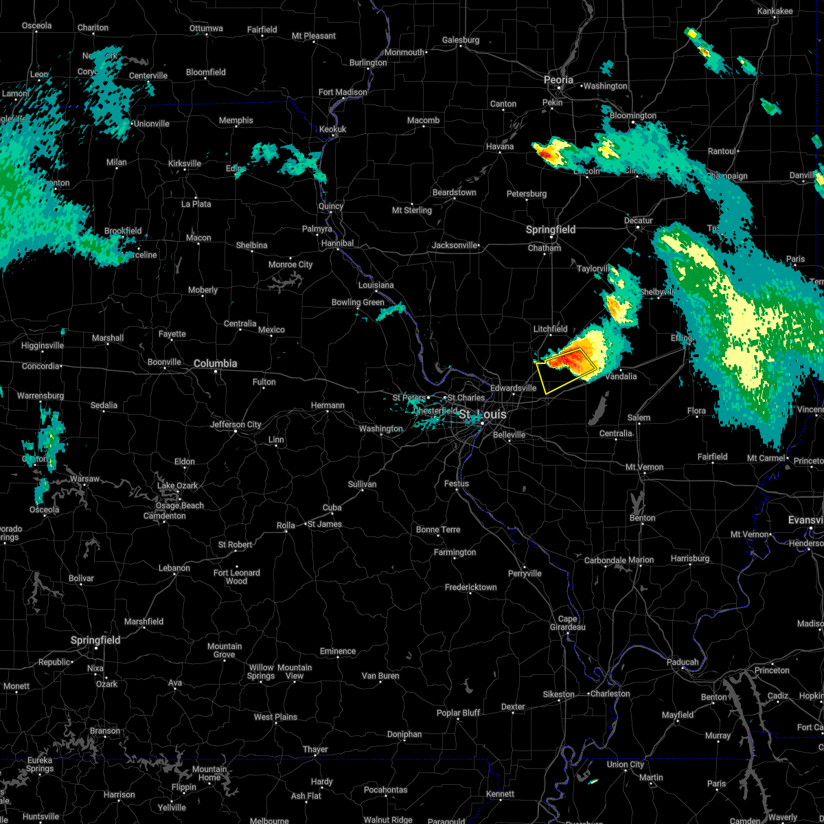 At 1111 am cdt, a severe thunderstorm was located over reno, moving southeast at 35 mph (radar indicated). Hazards include ping pong ball size hail and 60 mph wind gusts. People and animals outdoors will be injured. expect hail damage to roofs, siding, windows, and vehicles. expect wind damage to roofs, siding, and trees. locations impacted include, highland, livingston, sorento, reno, woburn, panama, grantfork, new douglas, williamson, donnellson and old ripley. this includes interstate 55 in illinois near exit 37. hail threat, radar indicated max hail size, 1. 50 in wind threat, radar indicated max wind gust, 60 mph. At 1111 am cdt, a severe thunderstorm was located over reno, moving southeast at 35 mph (radar indicated). Hazards include ping pong ball size hail and 60 mph wind gusts. People and animals outdoors will be injured. expect hail damage to roofs, siding, windows, and vehicles. expect wind damage to roofs, siding, and trees. locations impacted include, highland, livingston, sorento, reno, woburn, panama, grantfork, new douglas, williamson, donnellson and old ripley. this includes interstate 55 in illinois near exit 37. hail threat, radar indicated max hail size, 1. 50 in wind threat, radar indicated max wind gust, 60 mph.
|
| 6/12/2022 10:54 AM CDT |
 At 1052 am cdt, a severe thunderstorm was located near litchfield, moving southeast at 40 mph (at 1048 am, emergency management reported quarter-sized hail in litchfield). Hazards include ping pong ball size hail and 60 mph wind gusts. People and animals outdoors will be injured. expect hail damage to roofs, siding, windows, and vehicles. expect wind damage to roofs, siding, and trees. locations impacted include, sorento and reno. this also includes lake lou yaeger. this includes interstate 55 in illinois between exits 37 and 52. hail threat, radar indicated max hail size, 1. 50 in wind threat, radar indicated max wind gust, 60 mph. At 1052 am cdt, a severe thunderstorm was located near litchfield, moving southeast at 40 mph (at 1048 am, emergency management reported quarter-sized hail in litchfield). Hazards include ping pong ball size hail and 60 mph wind gusts. People and animals outdoors will be injured. expect hail damage to roofs, siding, windows, and vehicles. expect wind damage to roofs, siding, and trees. locations impacted include, sorento and reno. this also includes lake lou yaeger. this includes interstate 55 in illinois between exits 37 and 52. hail threat, radar indicated max hail size, 1. 50 in wind threat, radar indicated max wind gust, 60 mph.
|
| 6/12/2022 10:43 AM CDT |
 At 1043 am cdt, a severe thunderstorm was located over litchfield, moving southeast at 35 mph (radar indicated). Hazards include ping pong ball size hail and 60 mph wind gusts. People and animals outdoors will be injured. expect hail damage to roofs, siding, windows, and vehicles. expect wind damage to roofs, siding, and trees. this severe thunderstorm will be near, taylor springs around 1055 am cdt. other locations in the path of this severe thunderstorm include sorento, reno and woburn. this includes interstate 55 in illinois between exits 41 and 52. this also includes lake lou yaeger. hail threat, radar indicated max hail size, 1. 50 in wind threat, radar indicated max wind gust, 60 mph. At 1043 am cdt, a severe thunderstorm was located over litchfield, moving southeast at 35 mph (radar indicated). Hazards include ping pong ball size hail and 60 mph wind gusts. People and animals outdoors will be injured. expect hail damage to roofs, siding, windows, and vehicles. expect wind damage to roofs, siding, and trees. this severe thunderstorm will be near, taylor springs around 1055 am cdt. other locations in the path of this severe thunderstorm include sorento, reno and woburn. this includes interstate 55 in illinois between exits 41 and 52. this also includes lake lou yaeger. hail threat, radar indicated max hail size, 1. 50 in wind threat, radar indicated max wind gust, 60 mph.
|
| 5/19/2022 6:09 PM CDT |
 At 608 pm cdt, severe thunderstorms were located along a line extending from brighton to near prairietown to near pocahontas, moving northeast at 30 mph (radar indicated). Hazards include 60 mph wind gusts. Expect damage to roofs, siding, and trees. locations impacted include, staunton and livingston. this includes the following highways, interstate 70 in illinois between exits 30 and 36. Interstate 55 in illinois between exits 30 and 37. At 608 pm cdt, severe thunderstorms were located along a line extending from brighton to near prairietown to near pocahontas, moving northeast at 30 mph (radar indicated). Hazards include 60 mph wind gusts. Expect damage to roofs, siding, and trees. locations impacted include, staunton and livingston. this includes the following highways, interstate 70 in illinois between exits 30 and 36. Interstate 55 in illinois between exits 30 and 37.
|
| 5/19/2022 6:00 PM CDT | House damage included shingles and small pieces of roof missing in addition to buckled siding. a large camper was shifted 7 feet... and lawn furniture and playground eq in madison county IL, 2.3 miles NW of Highland, IL |
| 5/19/2022 5:46 PM CDT |
 At 545 pm cdt, severe thunderstorms were located along a line extending from near alton to near highland, moving northeast at 35 mph (radar indicated). Hazards include 60 mph wind gusts. Expect damage to roofs, siding, and trees. severe thunderstorms will be near, st. jacob and marine around 550 pm cdt. highland around 555 pm cdt. pocahontas, dorsey and prairietown around 605 pm cdt. other locations in the path of these severe thunderstorms include bunker hill, shipman and staunton. this includes the following highways, interstate 70 in illinois between exits 21 and 36. interstate 55 in illinois between exits 23 and 37. This also includes confluence state park. At 545 pm cdt, severe thunderstorms were located along a line extending from near alton to near highland, moving northeast at 35 mph (radar indicated). Hazards include 60 mph wind gusts. Expect damage to roofs, siding, and trees. severe thunderstorms will be near, st. jacob and marine around 550 pm cdt. highland around 555 pm cdt. pocahontas, dorsey and prairietown around 605 pm cdt. other locations in the path of these severe thunderstorms include bunker hill, shipman and staunton. this includes the following highways, interstate 70 in illinois between exits 21 and 36. interstate 55 in illinois between exits 23 and 37. This also includes confluence state park.
|
| 10/24/2021 10:03 PM CDT |
 At 1003 pm cdt, a severe squall line capable of producing both tornadoes and extensive straight line wind damage was located along a line extending from near highland to near st. rose to near albers, moving east at 65 mph (radar indicated rotation). Hazards include tornado. Flying debris will be dangerous to those caught without shelter. mobile homes will be damaged or destroyed. damage to roofs, windows, and vehicles will occur. tree damage is likely. locations impacted include, beckemeyer, carlyle, beaver creek, greenville, tamalco and mulberry grove. This includes interstate 70 in illinois between exits 30 and 52. At 1003 pm cdt, a severe squall line capable of producing both tornadoes and extensive straight line wind damage was located along a line extending from near highland to near st. rose to near albers, moving east at 65 mph (radar indicated rotation). Hazards include tornado. Flying debris will be dangerous to those caught without shelter. mobile homes will be damaged or destroyed. damage to roofs, windows, and vehicles will occur. tree damage is likely. locations impacted include, beckemeyer, carlyle, beaver creek, greenville, tamalco and mulberry grove. This includes interstate 70 in illinois between exits 30 and 52.
|
| 10/24/2021 9:48 PM CDT |
 At 947 pm cdt, severe thunderstorms capable of producing both tornadoes and extensive straight line wind damage were located along a line extending from near troy to near scott afb, moving east at 50 mph (radar indicated rotation). Hazards include tornado. Flying debris will be dangerous to those caught without shelter. mobile homes will be damaged or destroyed. damage to roofs, windows, and vehicles will occur. tree damage is likely. these dangerous storms will be near, new baden and st. jacob around 955 pm cdt. trenton, albers and marine around 1000 pm cdt. highland, aviston and germantown around 1005 pm cdt. other locations in the path of these tornadic storms include breese, st. rose, beckemeyer, pocahontas, jamestown, carlyle, beaver creek, greenville, tamalco and mulberry grove. This includes interstate 70 in illinois between exits 21 and 52. At 947 pm cdt, severe thunderstorms capable of producing both tornadoes and extensive straight line wind damage were located along a line extending from near troy to near scott afb, moving east at 50 mph (radar indicated rotation). Hazards include tornado. Flying debris will be dangerous to those caught without shelter. mobile homes will be damaged or destroyed. damage to roofs, windows, and vehicles will occur. tree damage is likely. these dangerous storms will be near, new baden and st. jacob around 955 pm cdt. trenton, albers and marine around 1000 pm cdt. highland, aviston and germantown around 1005 pm cdt. other locations in the path of these tornadic storms include breese, st. rose, beckemeyer, pocahontas, jamestown, carlyle, beaver creek, greenville, tamalco and mulberry grove. This includes interstate 70 in illinois between exits 21 and 52.
|
| 7/10/2021 3:18 PM CDT |
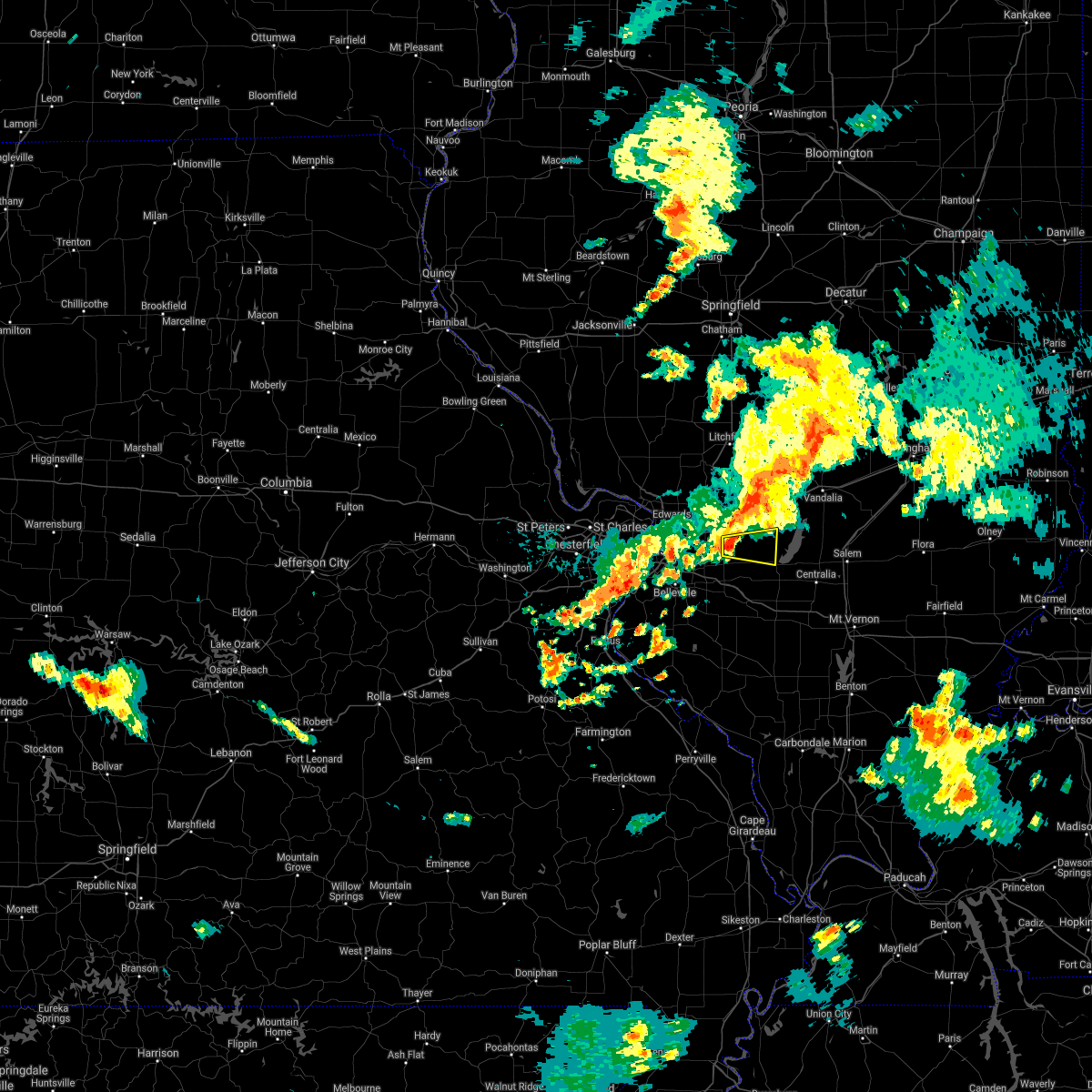 At 317 pm cdt, a severe thunderstorm was located near highland, moving east at 35 mph (radar indicated). Hazards include 60 mph wind gusts. Expect damage to roofs, siding, and trees. this severe storm will be near, st. rose around 325 pm cdt. Other locations in the path of this severe thunderstorm include jamestown, beaver creek and carlyle. At 317 pm cdt, a severe thunderstorm was located near highland, moving east at 35 mph (radar indicated). Hazards include 60 mph wind gusts. Expect damage to roofs, siding, and trees. this severe storm will be near, st. rose around 325 pm cdt. Other locations in the path of this severe thunderstorm include jamestown, beaver creek and carlyle.
|
| 7/10/2021 3:05 PM CDT |
 At 305 pm cdt, a severe thunderstorm was located over st. jacob, moving east at 30 mph (radar indicated). Hazards include 60 mph wind gusts. Expect damage to roofs, siding, and trees. this severe thunderstorm will be near, trenton around 315 pm cdt. aviston around 325 pm cdt. other locations in the path of this severe thunderstorm include breese, st. Rose, jamestown, beckemeyer, carlyle and beaver creek. At 305 pm cdt, a severe thunderstorm was located over st. jacob, moving east at 30 mph (radar indicated). Hazards include 60 mph wind gusts. Expect damage to roofs, siding, and trees. this severe thunderstorm will be near, trenton around 315 pm cdt. aviston around 325 pm cdt. other locations in the path of this severe thunderstorm include breese, st. Rose, jamestown, beckemeyer, carlyle and beaver creek.
|
| 7/10/2021 1:32 AM CDT |
 At 132 am cdt, severe thunderstorms were located along a line extending from near edwardsville to near shiloh to near fountain, moving east at 30 mph (trained weather spotters reported a 72 mph wind gust in o`fallon illinois). Hazards include 70 mph wind gusts. Expect considerable tree damage. damage is likely to mobile homes, roofs, and outbuildings. locations impacted include, belleville, o`fallon, collinsville, edwardsville, fairview heights, swansea, glen carbon, shiloh, highland, troy, waterloo, maryville, mascoutah, breese, lebanon, freeburg, millstadt, red bud, new baden and scott afb. this includes the following highways, interstate 70 in illinois between exits 21 and 36. interstate 55 in illinois near exit 23. Interstate 64 in illinois between exits 12 and 41. At 132 am cdt, severe thunderstorms were located along a line extending from near edwardsville to near shiloh to near fountain, moving east at 30 mph (trained weather spotters reported a 72 mph wind gust in o`fallon illinois). Hazards include 70 mph wind gusts. Expect considerable tree damage. damage is likely to mobile homes, roofs, and outbuildings. locations impacted include, belleville, o`fallon, collinsville, edwardsville, fairview heights, swansea, glen carbon, shiloh, highland, troy, waterloo, maryville, mascoutah, breese, lebanon, freeburg, millstadt, red bud, new baden and scott afb. this includes the following highways, interstate 70 in illinois between exits 21 and 36. interstate 55 in illinois near exit 23. Interstate 64 in illinois between exits 12 and 41.
|
| 7/10/2021 1:16 AM CDT |
 At 115 am cdt, severe thunderstorms were located along a line extending from near roxana to near belleville to near arnold, moving east at 30 mph (trained weather spotters). Hazards include 70 mph wind gusts. Expect considerable tree damage. damage is likely to mobile homes, roofs, and outbuildings. locations impacted include, fairview heights, millstadt, belleville, edwardsville, swansea, shiloh, columbia, maryville, freeburg, smithton, glen carbon, troy, waterloo, lebanon, scott afb, mascoutah, marine, new design, new baden, st. jacob and highland. this also includes mastodon historic site, gov. dunklin`s grave historic site, and horseshoe lake state park. this includes the following highways, interstate 70 in illinois between exits 21 and 36. interstate 55 in illinois near exit 23. interstate 64 in illinois between exits 9 and 41. Interstate 55 in missouri between exits 180 and 190. At 115 am cdt, severe thunderstorms were located along a line extending from near roxana to near belleville to near arnold, moving east at 30 mph (trained weather spotters). Hazards include 70 mph wind gusts. Expect considerable tree damage. damage is likely to mobile homes, roofs, and outbuildings. locations impacted include, fairview heights, millstadt, belleville, edwardsville, swansea, shiloh, columbia, maryville, freeburg, smithton, glen carbon, troy, waterloo, lebanon, scott afb, mascoutah, marine, new design, new baden, st. jacob and highland. this also includes mastodon historic site, gov. dunklin`s grave historic site, and horseshoe lake state park. this includes the following highways, interstate 70 in illinois between exits 21 and 36. interstate 55 in illinois near exit 23. interstate 64 in illinois between exits 9 and 41. Interstate 55 in missouri between exits 180 and 190.
|
| 7/10/2021 12:54 AM CDT |
 At 1254 am cdt, severe thunderstorms were located along a line extending from alton to near east carondelet to high ridge, moving east at 30 mph (lambert airport reported a wind gust near 70 mph). Hazards include 70 mph wind gusts. Expect considerable tree damage. damage is likely to mobile homes, roofs, and outbuildings. these severe storms will be near, cahokia, columbia, dupo, cahokia parks airport, east alton, fairmont city, brooklyn and east carondelet around 100 am cdt. other locations in the path of these severe thunderstorms include wood river, centreville, washington park, alorton, hartford, rosewood heights, east st. louis, bethalto, pontoon beach, millstadt, south roxana, roxana, fairview heights, oakville, swansea, valmeyer, fountain, belleville, edwardsville, shiloh, maryville, smithton, glen carbon, troy, waterloo, freeburg, lebanon and scott afb. this also includes scott joplin historic site, mastodon historic site, gov. dunklin`s grave historic site, and horseshoe lake state park. this includes the following highways, interstate 70 in illinois between exits 21 and 36. interstate 55 in illinois near exit 23. interstate 64 in illinois between exits 9 and 41. Interstate 55 in missouri between exits 180 and 191. At 1254 am cdt, severe thunderstorms were located along a line extending from alton to near east carondelet to high ridge, moving east at 30 mph (lambert airport reported a wind gust near 70 mph). Hazards include 70 mph wind gusts. Expect considerable tree damage. damage is likely to mobile homes, roofs, and outbuildings. these severe storms will be near, cahokia, columbia, dupo, cahokia parks airport, east alton, fairmont city, brooklyn and east carondelet around 100 am cdt. other locations in the path of these severe thunderstorms include wood river, centreville, washington park, alorton, hartford, rosewood heights, east st. louis, bethalto, pontoon beach, millstadt, south roxana, roxana, fairview heights, oakville, swansea, valmeyer, fountain, belleville, edwardsville, shiloh, maryville, smithton, glen carbon, troy, waterloo, freeburg, lebanon and scott afb. this also includes scott joplin historic site, mastodon historic site, gov. dunklin`s grave historic site, and horseshoe lake state park. this includes the following highways, interstate 70 in illinois between exits 21 and 36. interstate 55 in illinois near exit 23. interstate 64 in illinois between exits 9 and 41. Interstate 55 in missouri between exits 180 and 191.
|
| 7/10/2021 12:42 AM CDT |
 At 1242 am cdt, severe thunderstorms were located along a line extending from near portage des sioux to mackenzie to near byrnes mill, moving east at 30 mph (trained weather spotters). Hazards include 60 mph wind gusts. Expect damage to roofs, siding, and trees. severe thunderstorms will be near, lemay, mehlville, affton, spanish lake, green park, st. george, bella villa, west alton and east carondelet around 1250 am cdt. cahokia, columbia, dupo, cahokia parks airport and brooklyn around 1255 am cdt. st. louis, alton, centreville, east alton, fairmont city and alorton around 100 am cdt. other locations in the path of these severe thunderstorms include arnold, wood river, washington park, south roxana, roxana, hartford, rosewood heights, east st. louis, fairview heights, bethalto, pontoon beach, millstadt, barnhart, oakville, imperial, belleville, edwardsville, swansea, shiloh, valmeyer, fountain, maryville, freeburg, smithton, glen carbon, troy and waterloo. this includes the following highways, interstate 70 in illinois between exits 21 and 36. interstate 55 in illinois near exit 23. interstate 64 in illinois between exits 9 and 41. interstate 55 in missouri between exits 180 and 191. this also includes scott joplin historic site, mastodon historic site, gov. Dunklin`s grave historic site, and horseshoe lake state park. At 1242 am cdt, severe thunderstorms were located along a line extending from near portage des sioux to mackenzie to near byrnes mill, moving east at 30 mph (trained weather spotters). Hazards include 60 mph wind gusts. Expect damage to roofs, siding, and trees. severe thunderstorms will be near, lemay, mehlville, affton, spanish lake, green park, st. george, bella villa, west alton and east carondelet around 1250 am cdt. cahokia, columbia, dupo, cahokia parks airport and brooklyn around 1255 am cdt. st. louis, alton, centreville, east alton, fairmont city and alorton around 100 am cdt. other locations in the path of these severe thunderstorms include arnold, wood river, washington park, south roxana, roxana, hartford, rosewood heights, east st. louis, fairview heights, bethalto, pontoon beach, millstadt, barnhart, oakville, imperial, belleville, edwardsville, swansea, shiloh, valmeyer, fountain, maryville, freeburg, smithton, glen carbon, troy and waterloo. this includes the following highways, interstate 70 in illinois between exits 21 and 36. interstate 55 in illinois near exit 23. interstate 64 in illinois between exits 9 and 41. interstate 55 in missouri between exits 180 and 191. this also includes scott joplin historic site, mastodon historic site, gov. Dunklin`s grave historic site, and horseshoe lake state park.
|
| 3/27/2021 7:43 PM CDT |
 At 742 pm cdt, severe thunderstorms were located along a line extending from van burensburg to near beaver creek to near lively grove, moving east at 40 mph (public. numerous trees and powerlines were reported snapped in st. jacobs and south of pocahontas). Hazards include 60 mph wind gusts and quarter size hail. Hail damage to vehicles is expected. Expect wind damage to roofs, siding, and trees. At 742 pm cdt, severe thunderstorms were located along a line extending from van burensburg to near beaver creek to near lively grove, moving east at 40 mph (public. numerous trees and powerlines were reported snapped in st. jacobs and south of pocahontas). Hazards include 60 mph wind gusts and quarter size hail. Hail damage to vehicles is expected. Expect wind damage to roofs, siding, and trees.
|
| 3/27/2021 7:23 PM CDT |
 At 722 pm cdt, a severe thunderstorm capable of producing a tornado was located near highland, moving east at 45 mph (radar indicated rotation). Hazards include tornado and quarter size hail. Flying debris will be dangerous to those caught without shelter. mobile homes will be damaged or destroyed. damage to roofs, windows, and vehicles will occur. tree damage is likely. this dangerous storm will be near, pocahontas and jamestown around 730 pm cdt. beaver creek around 735 pm cdt. greenville around 740 pm cdt. tamalco around 745 pm cdt. mulberry grove around 750 pm cdt. other locations impacted by this tornadic thunderstorm include smithboro, pleasant mound, keyesport, grantfork, pierron, dudleyville and stolletown. This includes interstate 70 in illinois between exits 30 and 52. At 722 pm cdt, a severe thunderstorm capable of producing a tornado was located near highland, moving east at 45 mph (radar indicated rotation). Hazards include tornado and quarter size hail. Flying debris will be dangerous to those caught without shelter. mobile homes will be damaged or destroyed. damage to roofs, windows, and vehicles will occur. tree damage is likely. this dangerous storm will be near, pocahontas and jamestown around 730 pm cdt. beaver creek around 735 pm cdt. greenville around 740 pm cdt. tamalco around 745 pm cdt. mulberry grove around 750 pm cdt. other locations impacted by this tornadic thunderstorm include smithboro, pleasant mound, keyesport, grantfork, pierron, dudleyville and stolletown. This includes interstate 70 in illinois between exits 30 and 52.
|
| 3/27/2021 7:17 PM CDT | Storm damage reported in madison county IL, 2.4 miles NNW of Highland, IL |
| 3/27/2021 7:17 PM CDT | Report from mping: trees uprooted or snapped; roof blown of in madison county IL, 2.1 miles N of Highland, IL |
| 3/27/2021 7:17 PM CDT |
 At 717 pm cdt, a severe thunderstorm was located over highland, moving east at 45 mph (radar indicated). Hazards include 60 mph wind gusts and quarter size hail. Hail damage to vehicles is expected. expect wind damage to roofs, siding, and trees. locations impacted include, o`fallon, edwardsville, glen carbon, shiloh, highland, troy, maryville, greenville, breese, lebanon, carlyle, trenton, aviston, st. rose, st. jacob, marine, pocahontas, alhambra, tamalco and beaver creek. this also includes carlyle lake recreational area. this includes the following highways, interstate 70 in illinois between exits 21 and 45. Interstate 55 in illinois between exits 23 and 30. At 717 pm cdt, a severe thunderstorm was located over highland, moving east at 45 mph (radar indicated). Hazards include 60 mph wind gusts and quarter size hail. Hail damage to vehicles is expected. expect wind damage to roofs, siding, and trees. locations impacted include, o`fallon, edwardsville, glen carbon, shiloh, highland, troy, maryville, greenville, breese, lebanon, carlyle, trenton, aviston, st. rose, st. jacob, marine, pocahontas, alhambra, tamalco and beaver creek. this also includes carlyle lake recreational area. this includes the following highways, interstate 70 in illinois between exits 21 and 45. Interstate 55 in illinois between exits 23 and 30.
|
| 3/27/2021 7:15 PM CDT | Heavy damage to several buildings... multiple trees uproote in madison county IL, 2.1 miles N of Highland, IL |
| 3/27/2021 7:03 PM CDT |
 At 703 pm cdt, a severe thunderstorm capable of producing a tornado was located near troy, moving east at 45 mph (radar indicated rotation). Hazards include tornado and quarter size hail. Flying debris will be dangerous to those caught without shelter. mobile homes will be damaged or destroyed. damage to roofs, windows, and vehicles will occur. tree damage is likely. this dangerous storm will be near, highland around 720 pm cdt. st. rose around 725 pm cdt. pocahontas and jamestown around 730 pm cdt. beaver creek around 740 pm cdt. tamalco around 745 pm cdt. other locations impacted by this tornadic thunderstorm include kuhn, smithboro, pleasant mound, keyesport, grantfork, pierron, dudleyville and stolletown. This includes interstate 70 in illinois between exits 21 and 52. At 703 pm cdt, a severe thunderstorm capable of producing a tornado was located near troy, moving east at 45 mph (radar indicated rotation). Hazards include tornado and quarter size hail. Flying debris will be dangerous to those caught without shelter. mobile homes will be damaged or destroyed. damage to roofs, windows, and vehicles will occur. tree damage is likely. this dangerous storm will be near, highland around 720 pm cdt. st. rose around 725 pm cdt. pocahontas and jamestown around 730 pm cdt. beaver creek around 740 pm cdt. tamalco around 745 pm cdt. other locations impacted by this tornadic thunderstorm include kuhn, smithboro, pleasant mound, keyesport, grantfork, pierron, dudleyville and stolletown. This includes interstate 70 in illinois between exits 21 and 52.
|
| 3/27/2021 6:56 PM CDT |
 At 655 pm cdt, a severe thunderstorm was located over maryville, moving east at 45 mph (radar indicated). Hazards include 60 mph wind gusts and quarter size hail. Hail damage to vehicles is expected. Expect wind damage to roofs, siding, and trees. At 655 pm cdt, a severe thunderstorm was located over maryville, moving east at 45 mph (radar indicated). Hazards include 60 mph wind gusts and quarter size hail. Hail damage to vehicles is expected. Expect wind damage to roofs, siding, and trees.
|
| 8/10/2020 6:22 PM CDT |
 At 622 pm cdt, severe thunderstorms were located along a line extending from glen carbon to near waterloo to near olympian village, moving east at 40 mph (trained weather spotters). Hazards include 70 mph wind gusts. Expect considerable tree damage. damage is likely to mobile homes, roofs, and outbuildings. locations impacted include, st. louis, belleville, granite city, o`fallon, east st. louis, collinsville, fairview heights, cahokia, swansea, glen carbon, shiloh, highland, troy, waterloo, columbia, maryville, mascoutah, pontoon beach, centreville and breese. this also includes scott joplin historic site, carlyle lake recreational area, and horseshoe lake state park. This includes interstate 64 in illinois between exits 9 and 61. At 622 pm cdt, severe thunderstorms were located along a line extending from glen carbon to near waterloo to near olympian village, moving east at 40 mph (trained weather spotters). Hazards include 70 mph wind gusts. Expect considerable tree damage. damage is likely to mobile homes, roofs, and outbuildings. locations impacted include, st. louis, belleville, granite city, o`fallon, east st. louis, collinsville, fairview heights, cahokia, swansea, glen carbon, shiloh, highland, troy, waterloo, columbia, maryville, mascoutah, pontoon beach, centreville and breese. this also includes scott joplin historic site, carlyle lake recreational area, and horseshoe lake state park. This includes interstate 64 in illinois between exits 9 and 61.
|
| 8/10/2020 6:12 PM CDT |
 At 612 pm cdt, severe thunderstorms were located along a line extending from near hartford to near fountain to de soto, moving east at 40 mph (trained weather spotters reported trees and power lines down in arnold). Hazards include 60 mph wind gusts. Expect damage to roofs, siding, and trees. locations impacted include, st. louis, belleville, university city, granite city, o`fallon, east st. louis, collinsville, edwardsville, webster groves, ferguson, arnold, fairview heights, clayton, cahokia, jennings, swansea, glen carbon, shiloh, crestwood and festus. this also includes scott joplin historic site, mastodon historic site, gov. dunklin`s grave historic site, carlyle lake recreational area, and horseshoe lake state park. this includes the following highways, interstate 70 in illinois between exits 21 and 30. interstate 55 in illinois near exit 23. interstate 64 in illinois between exits 9 and 61. Interstate 55 in missouri between exits 170 and 191. At 612 pm cdt, severe thunderstorms were located along a line extending from near hartford to near fountain to de soto, moving east at 40 mph (trained weather spotters reported trees and power lines down in arnold). Hazards include 60 mph wind gusts. Expect damage to roofs, siding, and trees. locations impacted include, st. louis, belleville, university city, granite city, o`fallon, east st. louis, collinsville, edwardsville, webster groves, ferguson, arnold, fairview heights, clayton, cahokia, jennings, swansea, glen carbon, shiloh, crestwood and festus. this also includes scott joplin historic site, mastodon historic site, gov. dunklin`s grave historic site, carlyle lake recreational area, and horseshoe lake state park. this includes the following highways, interstate 70 in illinois between exits 21 and 30. interstate 55 in illinois near exit 23. interstate 64 in illinois between exits 9 and 61. Interstate 55 in missouri between exits 170 and 191.
|
| 8/10/2020 5:59 PM CDT |
 At 559 pm cdt, severe thunderstorms were located along a line extending from black jack to near antonia to near de soto, moving east at 40 mph (trained weather spotters). Hazards include 60 mph wind gusts. expect damage to roofs, siding, and trees At 559 pm cdt, severe thunderstorms were located along a line extending from black jack to near antonia to near de soto, moving east at 40 mph (trained weather spotters). Hazards include 60 mph wind gusts. expect damage to roofs, siding, and trees
|
| 8/10/2020 5:35 PM CDT |
 At 535 pm cdt, severe thunderstorms were located along a line extending from worden to chesterfield to near miramiguoa park, moving southeast at 45 mph (trained weather spotters reported power outages and roof damge in st. charles county). Hazards include 60 mph wind gusts. Expect damage to roofs, siding, and trees. locations impacted include, st. louis, st. charles, st. peters, florissant, chesterfield, belleville, wildwood, university city, ballwin, granite city, wentzville, o`fallon, alton, kirkwood, maryland heights, east st. louis, hazelwood, collinsville, edwardsville and webster groves. this also includes babler memorial state park, scott joplin historic site, route 66 state park, castlewood state park, confluence state park, mastodon historic site, sandy creek covered bridge historic site, gov. dunklin`s grave historic site, first missouri state capitol historic site, robertsville state park, and horseshoe lake state park. this includes the following highways, interstate 70 in illinois between exits 21 and 30. interstate 55 in illinois between exits 23 and 44. interstate 64 in illinois between exits 9 and 27. interstate 44 in missouri between exits 230 and 277. interstate 55 in missouri between exits 175 and 191. Interstate 70 in missouri between exits 212 and 231. At 535 pm cdt, severe thunderstorms were located along a line extending from worden to chesterfield to near miramiguoa park, moving southeast at 45 mph (trained weather spotters reported power outages and roof damge in st. charles county). Hazards include 60 mph wind gusts. Expect damage to roofs, siding, and trees. locations impacted include, st. louis, st. charles, st. peters, florissant, chesterfield, belleville, wildwood, university city, ballwin, granite city, wentzville, o`fallon, alton, kirkwood, maryland heights, east st. louis, hazelwood, collinsville, edwardsville and webster groves. this also includes babler memorial state park, scott joplin historic site, route 66 state park, castlewood state park, confluence state park, mastodon historic site, sandy creek covered bridge historic site, gov. dunklin`s grave historic site, first missouri state capitol historic site, robertsville state park, and horseshoe lake state park. this includes the following highways, interstate 70 in illinois between exits 21 and 30. interstate 55 in illinois between exits 23 and 44. interstate 64 in illinois between exits 9 and 27. interstate 44 in missouri between exits 230 and 277. interstate 55 in missouri between exits 175 and 191. Interstate 70 in missouri between exits 212 and 231.
|
| 8/10/2020 5:16 PM CDT |
 At 514 pm cdt, severe thunderstorms were located along a line extending from near bunker hill to near st. paul to beaufort, moving southeast at 45 mph (law enforcement). Hazards include 60 mph wind gusts. expect damage to roofs, siding, and trees At 514 pm cdt, severe thunderstorms were located along a line extending from near bunker hill to near st. paul to beaufort, moving southeast at 45 mph (law enforcement). Hazards include 60 mph wind gusts. expect damage to roofs, siding, and trees
|
| 7/15/2020 5:19 PM CDT |
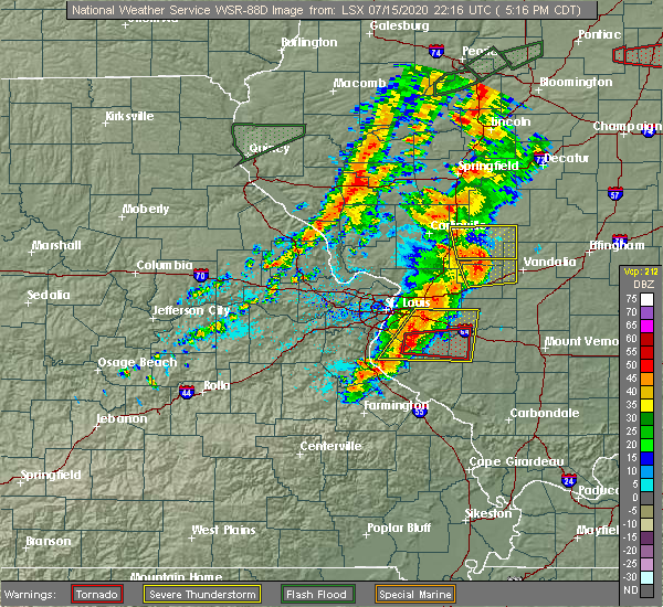 At 519 pm cdt, a severe thunderstorm was located over highland, moving east at 35 mph (radar indicated). Hazards include 60 mph wind gusts. expect damage to roofs, siding, and trees At 519 pm cdt, a severe thunderstorm was located over highland, moving east at 35 mph (radar indicated). Hazards include 60 mph wind gusts. expect damage to roofs, siding, and trees
|
| 7/15/2020 4:41 PM CDT |
 At 440 pm cdt, severe thunderstorms were located along a line extending from near dorsey to near edwardsville to pontoon beach to east st. louis to imperial, moving east at 55 mph (trained weather spotters. wind damage has been reported around alton, wood river, and roxana). Hazards include 70 mph wind gusts and nickel size hail. Expect considerable tree damage. damage is likely to mobile homes, roofs, and outbuildings. locations impacted include, st. louis, belleville, granite city, o`fallon, alton, east st. louis, collinsville, edwardsville, fairview heights, cahokia, swansea, glen carbon, shiloh, wood river, highland, troy, waterloo, columbia, bethalto and maryville. this also includes horseshoe lake state park. this includes the following highways, interstate 70 in illinois between exits 21 and 30. interstate 55 in illinois between exits 23 and 37. Interstate 64 in illinois between exits 9 and 27. At 440 pm cdt, severe thunderstorms were located along a line extending from near dorsey to near edwardsville to pontoon beach to east st. louis to imperial, moving east at 55 mph (trained weather spotters. wind damage has been reported around alton, wood river, and roxana). Hazards include 70 mph wind gusts and nickel size hail. Expect considerable tree damage. damage is likely to mobile homes, roofs, and outbuildings. locations impacted include, st. louis, belleville, granite city, o`fallon, alton, east st. louis, collinsville, edwardsville, fairview heights, cahokia, swansea, glen carbon, shiloh, wood river, highland, troy, waterloo, columbia, bethalto and maryville. this also includes horseshoe lake state park. this includes the following highways, interstate 70 in illinois between exits 21 and 30. interstate 55 in illinois between exits 23 and 37. Interstate 64 in illinois between exits 9 and 27.
|
| 7/15/2020 4:30 PM CDT |
 At 429 pm cdt, severe thunderstorms were located along a line extending from near alton to fountain, moving east at 50 mph (radar indicated). Hazards include 70 mph wind gusts and nickel size hail. Expect considerable tree damage. damage is likely to mobile homes, roofs, and outbuildings. locations impacted include, st. louis, belleville, granite city, o`fallon, alton, east st. louis, collinsville, edwardsville, godfrey, fairview heights, cahokia, swansea, glen carbon, shiloh, wood river, highland, troy, waterloo, columbia and bethalto. this also includes horseshoe lake state park. this includes the following highways, interstate 70 in illinois between exits 21 and 30. interstate 55 in illinois between exits 23 and 37. Interstate 64 in illinois between exits 9 and 27. At 429 pm cdt, severe thunderstorms were located along a line extending from near alton to fountain, moving east at 50 mph (radar indicated). Hazards include 70 mph wind gusts and nickel size hail. Expect considerable tree damage. damage is likely to mobile homes, roofs, and outbuildings. locations impacted include, st. louis, belleville, granite city, o`fallon, alton, east st. louis, collinsville, edwardsville, godfrey, fairview heights, cahokia, swansea, glen carbon, shiloh, wood river, highland, troy, waterloo, columbia and bethalto. this also includes horseshoe lake state park. this includes the following highways, interstate 70 in illinois between exits 21 and 30. interstate 55 in illinois between exits 23 and 37. Interstate 64 in illinois between exits 9 and 27.
|
| 7/15/2020 4:20 PM CDT |
 At 420 pm cdt, severe thunderstorms were located along a line extending from near godfrey to near antonia, moving east at 45 mph (radar indicated). Hazards include 60 mph wind gusts and nickel size hail. expect damage to roofs, siding, and trees At 420 pm cdt, severe thunderstorms were located along a line extending from near godfrey to near antonia, moving east at 45 mph (radar indicated). Hazards include 60 mph wind gusts and nickel size hail. expect damage to roofs, siding, and trees
|
| 4/28/2020 8:53 PM CDT |
 At 853 pm cdt, a severe thunderstorm capable of producing a tornado was located near highland, moving east at 40 mph (radar indicated rotation). Hazards include tornado. Flying debris will be dangerous to those caught without shelter. mobile homes will be damaged or destroyed. damage to roofs, windows, and vehicles will occur. tree damage is likely. this dangerous storm will be near, breese and st. rose around 900 pm cdt. germantown and jamestown around 905 pm cdt. beckemeyer and beaver creek around 910 pm cdt. carlyle around 915 pm cdt. tamalco around 920 pm cdt. Other locations impacted by this tornadic thunderstorm include keyesport, posey, huey and stolletown. At 853 pm cdt, a severe thunderstorm capable of producing a tornado was located near highland, moving east at 40 mph (radar indicated rotation). Hazards include tornado. Flying debris will be dangerous to those caught without shelter. mobile homes will be damaged or destroyed. damage to roofs, windows, and vehicles will occur. tree damage is likely. this dangerous storm will be near, breese and st. rose around 900 pm cdt. germantown and jamestown around 905 pm cdt. beckemeyer and beaver creek around 910 pm cdt. carlyle around 915 pm cdt. tamalco around 920 pm cdt. Other locations impacted by this tornadic thunderstorm include keyesport, posey, huey and stolletown.
|
| 3/27/2020 3:58 AM CDT | Ping Pong Ball sized hail reported 3.3 miles NNW of Highland, IL, report from mping: ping pong ball (1.50 in.). |
| 3/27/2020 3:44 AM CDT |
 At 344 am cdt, a severe thunderstorm was located near edwardsville, moving east at 65 mph (radar indicated). Hazards include quarter size hail. damage to vehicles is expected At 344 am cdt, a severe thunderstorm was located near edwardsville, moving east at 65 mph (radar indicated). Hazards include quarter size hail. damage to vehicles is expected
|
| 3/27/2020 3:36 AM CDT |
 At 335 am cdt, severe thunderstorms were located near pocahontas and wood river, moving east at 60 mph (public). Hazards include quarter size hail. Damage to vehicles is expected. locations impacted include, granite city, alton, collinsville, edwardsville, godfrey, glen carbon, wood river, highland, troy, bethalto, maryville, pontoon beach, staunton, madison, venice, east alton, south roxana, roxana, hartford and st. jacob. this also includes horseshoe lake state park. this includes the following highways, interstate 70 in illinois between exits 21 and 30. Interstate 55 in illinois between exits 23 and 37. At 335 am cdt, severe thunderstorms were located near pocahontas and wood river, moving east at 60 mph (public). Hazards include quarter size hail. Damage to vehicles is expected. locations impacted include, granite city, alton, collinsville, edwardsville, godfrey, glen carbon, wood river, highland, troy, bethalto, maryville, pontoon beach, staunton, madison, venice, east alton, south roxana, roxana, hartford and st. jacob. this also includes horseshoe lake state park. this includes the following highways, interstate 70 in illinois between exits 21 and 30. Interstate 55 in illinois between exits 23 and 37.
|
| 3/27/2020 3:24 AM CDT |
 At 322 am cdt, severe thunderstorms were located near carpenter, il, north of bridgeton, mo, and southwest of old monroe, mo, all moving east at 60 mph (public). Hazards include quarter size hail. Damage to vehicles is expected. locations impacted include, st. louis, o`fallon, st. charles, st. peters, florissant, chesterfield, university city, granite city, wentzville, alton, maryland heights, hazelwood, collinsville, edwardsville, ferguson, godfrey, creve coeur, overland, jennings and lake st. louis. this also includes confluence state park, first missouri state capitol historic site, pere marquette state park, and horseshoe lake state park. this includes the following highways, interstate 70 in illinois between exits 21 and 30. interstate 55 in illinois between exits 23 and 37. Interstate 70 in missouri between exits 203 and 231. At 322 am cdt, severe thunderstorms were located near carpenter, il, north of bridgeton, mo, and southwest of old monroe, mo, all moving east at 60 mph (public). Hazards include quarter size hail. Damage to vehicles is expected. locations impacted include, st. louis, o`fallon, st. charles, st. peters, florissant, chesterfield, university city, granite city, wentzville, alton, maryland heights, hazelwood, collinsville, edwardsville, ferguson, godfrey, creve coeur, overland, jennings and lake st. louis. this also includes confluence state park, first missouri state capitol historic site, pere marquette state park, and horseshoe lake state park. this includes the following highways, interstate 70 in illinois between exits 21 and 30. interstate 55 in illinois between exits 23 and 37. Interstate 70 in missouri between exits 203 and 231.
|
| 3/27/2020 2:51 AM CDT |
 At 250 am cdt, a severe thunderstorm was located near bridgeton, moving east at 60 mph (public). Hazards include quarter size hail. damage to vehicles is expected At 250 am cdt, a severe thunderstorm was located near bridgeton, moving east at 60 mph (public). Hazards include quarter size hail. damage to vehicles is expected
|
| 11/26/2019 10:59 PM CST |
 At 1058 pm cst, a severe thunderstorm capable of producing a tornado was located over trenton, moving northeast at 55 mph (radar indicated rotation). Hazards include tornado. Flying debris will be dangerous to those caught without shelter. mobile homes will be damaged or destroyed. damage to roofs, windows, and vehicles will occur. tree damage is likely. this dangerous storm will be near, breese and st. rose around 1105 pm cst. other locations impacted by this tornadic thunderstorm include bartelso and damiansville. This includes interstate 64 in illinois near exit 34. At 1058 pm cst, a severe thunderstorm capable of producing a tornado was located over trenton, moving northeast at 55 mph (radar indicated rotation). Hazards include tornado. Flying debris will be dangerous to those caught without shelter. mobile homes will be damaged or destroyed. damage to roofs, windows, and vehicles will occur. tree damage is likely. this dangerous storm will be near, breese and st. rose around 1105 pm cst. other locations impacted by this tornadic thunderstorm include bartelso and damiansville. This includes interstate 64 in illinois near exit 34.
|
| 11/26/2019 10:37 PM CST |
 At 1037 pm cst, a severe thunderstorm capable of producing a tornado was located over freeburg, moving northeast at 45 mph (radar indicated rotation). Hazards include tornado. Flying debris will be dangerous to those caught without shelter. mobile homes will be damaged or destroyed. damage to roofs, windows, and vehicles will occur. tree damage is likely. this dangerous storm will be near, mascoutah around 1045 pm cst. scott afb around 1050 pm cst. lebanon, new baden and new memphis around 1055 pm cst. trenton, aviston and albers around 1105 pm cst. germantown around 1110 pm cst. breese and st. rose around 1115 pm cst. other locations impacted by this tornadic thunderstorm include bartelso, summerfield and damiansville. This includes interstate 64 in illinois between exits 19 and 34. At 1037 pm cst, a severe thunderstorm capable of producing a tornado was located over freeburg, moving northeast at 45 mph (radar indicated rotation). Hazards include tornado. Flying debris will be dangerous to those caught without shelter. mobile homes will be damaged or destroyed. damage to roofs, windows, and vehicles will occur. tree damage is likely. this dangerous storm will be near, mascoutah around 1045 pm cst. scott afb around 1050 pm cst. lebanon, new baden and new memphis around 1055 pm cst. trenton, aviston and albers around 1105 pm cst. germantown around 1110 pm cst. breese and st. rose around 1115 pm cst. other locations impacted by this tornadic thunderstorm include bartelso, summerfield and damiansville. This includes interstate 64 in illinois between exits 19 and 34.
|
| 7/17/2019 6:03 PM CDT |
 At 603 pm cdt, severe thunderstorms were located along a line extending from near reno to near cahokia, moving southeast at 45 mph (radar indicated). Hazards include 60 mph wind gusts. Expect damage to roofs, siding, and trees. locations impacted include, st. louis, st. charles, florissant, belleville, university city, granite city, o`fallon, alton, maryland heights, east st. louis, hazelwood, collinsville, edwardsville, ferguson, creve coeur, fairview heights, overland, clayton, cahokia and jennings. this also includes scott joplin historic site, confluence state park, first missouri state capitol historic site, and horseshoe lake state park. this includes the following highways, interstate 70 in illinois between exits 21 and 45. interstate 55 in illinois between exits 23 and 44. interstate 64 in illinois between exits 9 and 12. Interstate 70 in missouri near exit 231. At 603 pm cdt, severe thunderstorms were located along a line extending from near reno to near cahokia, moving southeast at 45 mph (radar indicated). Hazards include 60 mph wind gusts. Expect damage to roofs, siding, and trees. locations impacted include, st. louis, st. charles, florissant, belleville, university city, granite city, o`fallon, alton, maryland heights, east st. louis, hazelwood, collinsville, edwardsville, ferguson, creve coeur, fairview heights, overland, clayton, cahokia and jennings. this also includes scott joplin historic site, confluence state park, first missouri state capitol historic site, and horseshoe lake state park. this includes the following highways, interstate 70 in illinois between exits 21 and 45. interstate 55 in illinois between exits 23 and 44. interstate 64 in illinois between exits 9 and 12. Interstate 70 in missouri near exit 231.
|
| 7/17/2019 5:52 PM CDT |
 At 551 pm cdt, severe thunderstorms were located along a line extending from near sorento to pagedale, moving southeast at 45 mph (radar indicated). Hazards include 60 mph wind gusts. Expect damage to roofs, siding, and trees. locations impacted include, st. louis, st. charles, florissant, belleville, university city, granite city, o`fallon, alton, maryland heights, east st. louis, hazelwood, collinsville, edwardsville, ferguson, godfrey, creve coeur, fairview heights, overland, clayton and cahokia. this also includes scott joplin historic site, confluence state park, first missouri state capitol historic site, and horseshoe lake state park. this includes the following highways, interstate 70 in illinois between exits 21 and 45. interstate 55 in illinois between exits 23 and 44. interstate 64 in illinois between exits 9 and 12. Interstate 70 in missouri near exit 231. At 551 pm cdt, severe thunderstorms were located along a line extending from near sorento to pagedale, moving southeast at 45 mph (radar indicated). Hazards include 60 mph wind gusts. Expect damage to roofs, siding, and trees. locations impacted include, st. louis, st. charles, florissant, belleville, university city, granite city, o`fallon, alton, maryland heights, east st. louis, hazelwood, collinsville, edwardsville, ferguson, godfrey, creve coeur, fairview heights, overland, clayton and cahokia. this also includes scott joplin historic site, confluence state park, first missouri state capitol historic site, and horseshoe lake state park. this includes the following highways, interstate 70 in illinois between exits 21 and 45. interstate 55 in illinois between exits 23 and 44. interstate 64 in illinois between exits 9 and 12. Interstate 70 in missouri near exit 231.
|
| 7/17/2019 5:42 PM CDT |
 At 541 pm cdt, severe thunderstorms were located along a line extending from near mount olive to bridgeton, moving southeast at 45 mph (radar indicated). Hazards include 60 mph wind gusts. Expect damage to roofs, siding, and trees. locations impacted include, st. louis, st. charles, florissant, belleville, university city, granite city, o`fallon, alton, maryland heights, east st. louis, hazelwood, collinsville, edwardsville, ferguson, godfrey, creve coeur, fairview heights, overland, clayton and cahokia. this also includes scott joplin historic site, confluence state park, first missouri state capitol historic site, and horseshoe lake state park. this includes the following highways, interstate 70 in illinois between exits 21 and 45. interstate 55 in illinois between exits 23 and 44. interstate 64 in illinois between exits 9 and 12. Interstate 70 in missouri near exit 231. At 541 pm cdt, severe thunderstorms were located along a line extending from near mount olive to bridgeton, moving southeast at 45 mph (radar indicated). Hazards include 60 mph wind gusts. Expect damage to roofs, siding, and trees. locations impacted include, st. louis, st. charles, florissant, belleville, university city, granite city, o`fallon, alton, maryland heights, east st. louis, hazelwood, collinsville, edwardsville, ferguson, godfrey, creve coeur, fairview heights, overland, clayton and cahokia. this also includes scott joplin historic site, confluence state park, first missouri state capitol historic site, and horseshoe lake state park. this includes the following highways, interstate 70 in illinois between exits 21 and 45. interstate 55 in illinois between exits 23 and 44. interstate 64 in illinois between exits 9 and 12. Interstate 70 in missouri near exit 231.
|
| 7/17/2019 5:27 PM CDT |
 At 526 pm cdt, severe thunderstorms were located along a line extending from near carlinville to near orchard farms, moving southeast at 45 mph (trained weather spotters reported damage across northeast missouri and western illinois with this line of storms). Hazards include 60 mph wind gusts. expect damage to roofs, siding, and trees At 526 pm cdt, severe thunderstorms were located along a line extending from near carlinville to near orchard farms, moving southeast at 45 mph (trained weather spotters reported damage across northeast missouri and western illinois with this line of storms). Hazards include 60 mph wind gusts. expect damage to roofs, siding, and trees
|
| 6/26/2019 4:35 PM CDT |
 At 434 pm cdt, a severe thunderstorm was located over st. jacob, moving east at 25 mph (radar indicated). Hazards include 60 mph wind gusts and quarter size hail. Hail damage to vehicles is expected. expect wind damage to roofs, siding, and trees. locations impacted include, edwardsville, glen carbon, highland, troy, st. jacob, worden, marine, livingston, alhambra, hamel, williamson, fruit, kaufman and kuhn. this includes the following highways, interstate 70 in illinois between exits 21 and 24. Interstate 55 in illinois between exits 23 and 37. At 434 pm cdt, a severe thunderstorm was located over st. jacob, moving east at 25 mph (radar indicated). Hazards include 60 mph wind gusts and quarter size hail. Hail damage to vehicles is expected. expect wind damage to roofs, siding, and trees. locations impacted include, edwardsville, glen carbon, highland, troy, st. jacob, worden, marine, livingston, alhambra, hamel, williamson, fruit, kaufman and kuhn. this includes the following highways, interstate 70 in illinois between exits 21 and 24. Interstate 55 in illinois between exits 23 and 37.
|
| 6/26/2019 4:15 PM CDT |
 At 358 pm cdt, severe thunderstorms were located along a line extending from near west alton to washington park, moving northeast at 25 mph (radar indicated). Hazards include 60 mph wind gusts and quarter size hail. Hail damage to vehicles is expected. Expect wind damage to roofs, siding, and trees. At 358 pm cdt, severe thunderstorms were located along a line extending from near west alton to washington park, moving northeast at 25 mph (radar indicated). Hazards include 60 mph wind gusts and quarter size hail. Hail damage to vehicles is expected. Expect wind damage to roofs, siding, and trees.
|
| 6/26/2019 3:58 PM CDT |
 At 358 pm cdt, severe thunderstorms were located along a line extending from near west alton to washington park, moving northeast at 25 mph (radar indicated). Hazards include 60 mph wind gusts and quarter size hail. Hail damage to vehicles is expected. Expect wind damage to roofs, siding, and trees. At 358 pm cdt, severe thunderstorms were located along a line extending from near west alton to washington park, moving northeast at 25 mph (radar indicated). Hazards include 60 mph wind gusts and quarter size hail. Hail damage to vehicles is expected. Expect wind damage to roofs, siding, and trees.
|
| 6/21/2019 12:58 PM CDT |
 The severe thunderstorm warning for west central bond county in south central illinois, north central monroe, central madison, st. clair counties in southwestern illinois and south central st. louis counties in east central missouri and southern st. louis city will expire at 100 pm cdt, the storms which prompted the warning have weakened below severe limits, and no longer pose an immediate threat to life or property. therefore, the warning will be allowed to expire. however heavy rain and lightning are still possible with these thunderstorms. a severe thunderstorm watch remains in effect until 400 pm cdt for south central and southwestern illinois, and east central missouri. The severe thunderstorm warning for west central bond county in south central illinois, north central monroe, central madison, st. clair counties in southwestern illinois and south central st. louis counties in east central missouri and southern st. louis city will expire at 100 pm cdt, the storms which prompted the warning have weakened below severe limits, and no longer pose an immediate threat to life or property. therefore, the warning will be allowed to expire. however heavy rain and lightning are still possible with these thunderstorms. a severe thunderstorm watch remains in effect until 400 pm cdt for south central and southwestern illinois, and east central missouri.
|
| 6/21/2019 12:52 PM CDT |
 At 1251 pm cdt, severe thunderstorms were located along a line extending from near highland to smithton, moving southeast at 45 mph (radar indicated). Hazards include 60 mph wind gusts and penny size hail. Expect damage to roofs, siding, and trees. locations impacted include, st. louis, belleville, granite city, o`fallon, east st. louis, collinsville, edwardsville, fairview heights, cahokia, swansea, glen carbon, shiloh, highland, troy, columbia, sunset hills, maryville, mascoutah, pontoon beach and centreville. this also includes scott joplin historic site and horseshoe lake state park. this includes the following highways, interstate 70 in illinois between exits 21 and 24. interstate 55 in illinois between exits 23 and 37. Interstate 64 in illinois between exits 9 and 23. At 1251 pm cdt, severe thunderstorms were located along a line extending from near highland to smithton, moving southeast at 45 mph (radar indicated). Hazards include 60 mph wind gusts and penny size hail. Expect damage to roofs, siding, and trees. locations impacted include, st. louis, belleville, granite city, o`fallon, east st. louis, collinsville, edwardsville, fairview heights, cahokia, swansea, glen carbon, shiloh, highland, troy, columbia, sunset hills, maryville, mascoutah, pontoon beach and centreville. this also includes scott joplin historic site and horseshoe lake state park. this includes the following highways, interstate 70 in illinois between exits 21 and 24. interstate 55 in illinois between exits 23 and 37. Interstate 64 in illinois between exits 9 and 23.
|
| 6/21/2019 11:54 AM CDT |
 At 1154 am cdt, severe thunderstorms were located along a line extending from near elsah to near defiance, moving southeast at 45 mph (radar indicated). Hazards include 60 mph wind gusts and penny size hail. expect damage to roofs, siding, and trees At 1154 am cdt, severe thunderstorms were located along a line extending from near elsah to near defiance, moving southeast at 45 mph (radar indicated). Hazards include 60 mph wind gusts and penny size hail. expect damage to roofs, siding, and trees
|
| 6/16/2019 1:55 AM CDT |
 The severe thunderstorm warning for northern clinton, bond counties in south central illinois and southeastern madison counties in southwestern illinois will expire at 200 am cdt, the storm which prompted the warning has weakened below severe limits, and no longer poses an immediate threat to life or property. therefore, the warning will be allowed to expire. however small hail, gusty winds and heavy rain are still possible with this thunderstorm. The severe thunderstorm warning for northern clinton, bond counties in south central illinois and southeastern madison counties in southwestern illinois will expire at 200 am cdt, the storm which prompted the warning has weakened below severe limits, and no longer poses an immediate threat to life or property. therefore, the warning will be allowed to expire. however small hail, gusty winds and heavy rain are still possible with this thunderstorm.
|
| 6/16/2019 1:43 AM CDT |
 At 142 am cdt, a severe thunderstorm was located over highland, moving east at 45 mph (radar indicated). Hazards include 60 mph wind gusts and quarter size hail. Hail damage to vehicles is expected. expect wind damage to roofs, siding, and trees. locations impacted include, collinsville, edwardsville, glen carbon, highland, troy, maryville, greenville, pontoon beach, carlyle, south roxana, roxana, st. rose, st. jacob, marine, pocahontas, alhambra, mulberry grove, tamalco, beaver creek and woburn. this also includes carlyle lake recreational area. this includes the following highways, interstate 70 in illinois between exits 21 and 52. Interstate 55 in illinois near exit 23. At 142 am cdt, a severe thunderstorm was located over highland, moving east at 45 mph (radar indicated). Hazards include 60 mph wind gusts and quarter size hail. Hail damage to vehicles is expected. expect wind damage to roofs, siding, and trees. locations impacted include, collinsville, edwardsville, glen carbon, highland, troy, maryville, greenville, pontoon beach, carlyle, south roxana, roxana, st. rose, st. jacob, marine, pocahontas, alhambra, mulberry grove, tamalco, beaver creek and woburn. this also includes carlyle lake recreational area. this includes the following highways, interstate 70 in illinois between exits 21 and 52. Interstate 55 in illinois near exit 23.
|
| 6/16/2019 1:28 AM CDT |
 At 128 am cdt, a severe thunderstorm was located over troy, moving east at 45 mph (radar indicated). Hazards include 60 mph wind gusts and quarter size hail. Hail damage to vehicles is expected. expect wind damage to roofs, siding, and trees. locations impacted include, collinsville, edwardsville, glen carbon, highland, troy, maryville, greenville, pontoon beach, carlyle, south roxana, roxana, st. rose, st. jacob, marine, pocahontas, alhambra, mulberry grove, tamalco, beaver creek and woburn. this also includes carlyle lake recreational area. this includes the following highways, interstate 70 in illinois between exits 21 and 52. Interstate 55 in illinois near exit 23. At 128 am cdt, a severe thunderstorm was located over troy, moving east at 45 mph (radar indicated). Hazards include 60 mph wind gusts and quarter size hail. Hail damage to vehicles is expected. expect wind damage to roofs, siding, and trees. locations impacted include, collinsville, edwardsville, glen carbon, highland, troy, maryville, greenville, pontoon beach, carlyle, south roxana, roxana, st. rose, st. jacob, marine, pocahontas, alhambra, mulberry grove, tamalco, beaver creek and woburn. this also includes carlyle lake recreational area. this includes the following highways, interstate 70 in illinois between exits 21 and 52. Interstate 55 in illinois near exit 23.
|
| 6/16/2019 1:14 AM CDT |
 At 114 am cdt, a severe thunderstorm was located over pontoon beach, moving east at 55 mph (radar indicated). Hazards include 60 mph wind gusts and quarter size hail. Hail damage to vehicles is expected. Expect wind damage to roofs, siding, and trees. At 114 am cdt, a severe thunderstorm was located over pontoon beach, moving east at 55 mph (radar indicated). Hazards include 60 mph wind gusts and quarter size hail. Hail damage to vehicles is expected. Expect wind damage to roofs, siding, and trees.
|
| 5/23/2019 4:33 AM CDT |
 At 433 am cdt, a severe thunderstorm was located over scott afb, moving east at 50 mph (radar indicated). Hazards include 60 mph wind gusts and half dollar size hail. Hail damage to vehicles is expected. expect wind damage to roofs, siding, and trees. locations impacted include, belleville, o`fallon, collinsville, fairview heights, swansea, shiloh, highland, troy, mascoutah, breese, lebanon, new baden, carlyle, scott afb, trenton, aviston, st. rose, germantown, albers and st. jacob. This includes interstate 64 in illinois between exits 14 and 34. At 433 am cdt, a severe thunderstorm was located over scott afb, moving east at 50 mph (radar indicated). Hazards include 60 mph wind gusts and half dollar size hail. Hail damage to vehicles is expected. expect wind damage to roofs, siding, and trees. locations impacted include, belleville, o`fallon, collinsville, fairview heights, swansea, shiloh, highland, troy, mascoutah, breese, lebanon, new baden, carlyle, scott afb, trenton, aviston, st. rose, germantown, albers and st. jacob. This includes interstate 64 in illinois between exits 14 and 34.
|
| 5/23/2019 4:01 AM CDT |
 At 400 am cdt, a severe thunderstorm was located over o`fallon, moving east at 45 mph (automated observation system). Hazards include 60 mph wind gusts. expect damage to roofs, siding, and trees At 400 am cdt, a severe thunderstorm was located over o`fallon, moving east at 45 mph (automated observation system). Hazards include 60 mph wind gusts. expect damage to roofs, siding, and trees
|
| 5/21/2019 2:36 PM CDT |
 At 736 pm cdt, severe thunderstorms were located along a line extending from shipman to carpenter to near lebanon, moving northeast at 45 mph (radar indicated). Hazards include 60 mph wind gusts and penny size hail. expect damage to roofs, siding, and trees At 736 pm cdt, severe thunderstorms were located along a line extending from shipman to carpenter to near lebanon, moving northeast at 45 mph (radar indicated). Hazards include 60 mph wind gusts and penny size hail. expect damage to roofs, siding, and trees
|
| 5/21/2019 2:08 PM CDT |
 At 708 pm cdt, a severe thunderstorm capable of producing a tornado was located over madison, moving northeast at 45 mph (radar indicated rotation). Hazards include tornado. Flying debris will be dangerous to those caught without shelter. mobile homes will be damaged or destroyed. damage to roofs, windows, and vehicles will occur. tree damage is likely. this dangerous storm will be near, collinsville around 715 pm cdt. maryville and south roxana around 720 pm cdt. edwardsville and troy around 725 pm cdt. glen carbon around 730 pm cdt. marine around 735 pm cdt. highland around 740 pm cdt. other locations impacted by this tornadic thunderstorm include kaufman, kuhn, poag, fruit, mitchell and hamel. this also includes horseshoe lake state park. this includes the following highways, interstate 70 in illinois between exits 21 and 24. interstate 55 in illinois between exits 23 and 30. Interstate 64 in illinois between exits 9 and 14. At 708 pm cdt, a severe thunderstorm capable of producing a tornado was located over madison, moving northeast at 45 mph (radar indicated rotation). Hazards include tornado. Flying debris will be dangerous to those caught without shelter. mobile homes will be damaged or destroyed. damage to roofs, windows, and vehicles will occur. tree damage is likely. this dangerous storm will be near, collinsville around 715 pm cdt. maryville and south roxana around 720 pm cdt. edwardsville and troy around 725 pm cdt. glen carbon around 730 pm cdt. marine around 735 pm cdt. highland around 740 pm cdt. other locations impacted by this tornadic thunderstorm include kaufman, kuhn, poag, fruit, mitchell and hamel. this also includes horseshoe lake state park. this includes the following highways, interstate 70 in illinois between exits 21 and 24. interstate 55 in illinois between exits 23 and 30. Interstate 64 in illinois between exits 9 and 14.
|
| 4/18/2019 1:44 AM CDT |
 At 143 am cdt, a severe thunderstorm was located over st. jacob, moving northeast at 55 mph (trained weather spotters. half dollar size hail was reported in caseyville). Hazards include half dollar size hail. Damage to vehicles is expected. locations impacted include, highland, troy, st. rose, st. jacob, marine, pocahontas, alhambra, jamestown, pierron, grantfork, new douglas, old ripley, fruit, kaufman and kuhn. this includes the following highways, interstate 70 in illinois between exits 21 and 36. Interstate 55 in illinois near exit 23. At 143 am cdt, a severe thunderstorm was located over st. jacob, moving northeast at 55 mph (trained weather spotters. half dollar size hail was reported in caseyville). Hazards include half dollar size hail. Damage to vehicles is expected. locations impacted include, highland, troy, st. rose, st. jacob, marine, pocahontas, alhambra, jamestown, pierron, grantfork, new douglas, old ripley, fruit, kaufman and kuhn. this includes the following highways, interstate 70 in illinois between exits 21 and 36. Interstate 55 in illinois near exit 23.
|
| 4/18/2019 1:35 AM CDT |
 At 135 am cdt, a severe thunderstorm was located near troy, moving northeast at 60 mph (radar indicated). Hazards include quarter size hail. Damage to vehicles is expected. locations impacted include, o`fallon, collinsville, edwardsville, fairview heights, glen carbon, shiloh, highland, troy, maryville, mascoutah, breese, lebanon, caseyville, scott afb, trenton, aviston, st. rose, st. jacob, beckemeyer and marine. this includes the following highways, interstate 70 in illinois between exits 21 and 36. interstate 55 in illinois near exit 23. Interstate 64 in illinois between exits 14 and 23. At 135 am cdt, a severe thunderstorm was located near troy, moving northeast at 60 mph (radar indicated). Hazards include quarter size hail. Damage to vehicles is expected. locations impacted include, o`fallon, collinsville, edwardsville, fairview heights, glen carbon, shiloh, highland, troy, maryville, mascoutah, breese, lebanon, caseyville, scott afb, trenton, aviston, st. rose, st. jacob, beckemeyer and marine. this includes the following highways, interstate 70 in illinois between exits 21 and 36. interstate 55 in illinois near exit 23. Interstate 64 in illinois between exits 14 and 23.
|
| 4/18/2019 1:24 AM CDT |
 At 124 am cdt, a severe thunderstorm was located over washington park, moving northeast at 60 mph (radar indicated). Hazards include quarter size hail. damage to vehicles is expected At 124 am cdt, a severe thunderstorm was located over washington park, moving northeast at 60 mph (radar indicated). Hazards include quarter size hail. damage to vehicles is expected
|
| 7/1/2018 6:03 PM CDT |
 At 603 pm cdt, severe thunderstorms were located along a line extending from morrisonville to roxana, moving east at 30 mph (radar indicated). Hazards include 60 mph wind gusts and penny size hail. expect damage to roofs, siding, and trees At 603 pm cdt, severe thunderstorms were located along a line extending from morrisonville to roxana, moving east at 30 mph (radar indicated). Hazards include 60 mph wind gusts and penny size hail. expect damage to roofs, siding, and trees
|
| 6/28/2018 6:28 PM CDT |
 At 628 pm cdt, severe thunderstorms were located along a line extending from near watson to near kinmundy to near okawville to cahokia, moving southeast at 60 mph (trained weather spotters. many trees and power lines have been reported down). Hazards include 60 mph wind gusts. Expect damage to roofs, siding, and trees. locations impacted include, st. louis, belleville, o`fallon, east st. louis, collinsville, fairview heights, cahokia, swansea, centralia, shiloh, highland, waterloo, columbia, salem, mascoutah, centreville, breese, lebanon, freeburg and caseyville. this also includes carlyle lake recreational area. this includes the following highways, interstate 57 in illinois between exits 116 and 135. Interstate 64 in illinois between exits 9 and 41. At 628 pm cdt, severe thunderstorms were located along a line extending from near watson to near kinmundy to near okawville to cahokia, moving southeast at 60 mph (trained weather spotters. many trees and power lines have been reported down). Hazards include 60 mph wind gusts. Expect damage to roofs, siding, and trees. locations impacted include, st. louis, belleville, o`fallon, east st. louis, collinsville, fairview heights, cahokia, swansea, centralia, shiloh, highland, waterloo, columbia, salem, mascoutah, centreville, breese, lebanon, freeburg and caseyville. this also includes carlyle lake recreational area. this includes the following highways, interstate 57 in illinois between exits 116 and 135. Interstate 64 in illinois between exits 9 and 41.
|
| 6/28/2018 6:25 PM CDT |
 A severe thunderstorm warning remains in effect until 645 pm cdt for clinton and southern bond counties in south central illinois. monroe county in southwestern illinois. northern washington county in south central illinois. southeastern madison county in southwestern illinois. marion and southern fayette counties in south central illinois. st. Clair county in southwestern illinois. A severe thunderstorm warning remains in effect until 645 pm cdt for clinton and southern bond counties in south central illinois. monroe county in southwestern illinois. northern washington county in south central illinois. southeastern madison county in southwestern illinois. marion and southern fayette counties in south central illinois. st. Clair county in southwestern illinois.
|
| 6/28/2018 6:06 PM CDT |
 A severe thunderstorm warning remains in effect until 645 pm cdt for bond county in south central illinois. monroe county in southwestern illinois. southeastern montgomery county in south central illinois. st. clair county in southwestern illinois. clinton and northern washington counties in south central illinois. southeastern madison county in southwestern illinois. Marion and. A severe thunderstorm warning remains in effect until 645 pm cdt for bond county in south central illinois. monroe county in southwestern illinois. southeastern montgomery county in south central illinois. st. clair county in southwestern illinois. clinton and northern washington counties in south central illinois. southeastern madison county in southwestern illinois. Marion and.
|
| 6/28/2018 6:06 PM CDT |
 At 605 pm cdt, severe thunderstorms were located along a line extending from 6 miles east of cowden to near mulberry grove to highland to st. louis, moving south at 35 mph (trained weather spotters. numerous trees and power lines have been reported down across the area). Hazards include 60 mph wind gusts. Expect damage to roofs, siding, and trees. locations impacted include, st. louis, chesterfield, belleville, university city, ballwin, granite city, o`fallon, kirkwood, maryland heights, east st. louis, collinsville, edwardsville, webster groves, ferguson, arnold, manchester, creve coeur, fairview heights, overland and clayton. this also includes scott joplin historic site, mastodon historic site, carlyle lake recreational area, and horseshoe lake state park. this includes the following highways, interstate 70 in illinois between exits 21 and 76. interstate 55 in illinois near exit 23. interstate 57 in illinois between exits 116 and 135. interstate 64 in illinois between exits 9 and 41. interstate 44 in missouri between exits 272 and 277. Interstate 55 in missouri between exits 187 and 191. At 605 pm cdt, severe thunderstorms were located along a line extending from 6 miles east of cowden to near mulberry grove to highland to st. louis, moving south at 35 mph (trained weather spotters. numerous trees and power lines have been reported down across the area). Hazards include 60 mph wind gusts. Expect damage to roofs, siding, and trees. locations impacted include, st. louis, chesterfield, belleville, university city, ballwin, granite city, o`fallon, kirkwood, maryland heights, east st. louis, collinsville, edwardsville, webster groves, ferguson, arnold, manchester, creve coeur, fairview heights, overland and clayton. this also includes scott joplin historic site, mastodon historic site, carlyle lake recreational area, and horseshoe lake state park. this includes the following highways, interstate 70 in illinois between exits 21 and 76. interstate 55 in illinois near exit 23. interstate 57 in illinois between exits 116 and 135. interstate 64 in illinois between exits 9 and 41. interstate 44 in missouri between exits 272 and 277. Interstate 55 in missouri between exits 187 and 191.
|
| 6/28/2018 5:55 PM CDT | Several wooden fences down. power outages also reporte in madison county IL, 2.1 miles N of Highland, IL |
| 6/28/2018 5:22 PM CDT |
 At 521 pm cdt, severe thunderstorms were located along a line extending from near taylorville to witt to near carlinville to near orchard farms, moving southeast at 60 mph (trained weather spotters. numerous trees and power lines have been reported down when this line of storms moved through parts of missouri and illinois). Hazards include 60 mph wind gusts. expect damage to roofs, siding, and trees At 521 pm cdt, severe thunderstorms were located along a line extending from near taylorville to witt to near carlinville to near orchard farms, moving southeast at 60 mph (trained weather spotters. numerous trees and power lines have been reported down when this line of storms moved through parts of missouri and illinois). Hazards include 60 mph wind gusts. expect damage to roofs, siding, and trees
|
| 5/20/2018 6:45 AM CDT |
 At 644 am cdt, a severe thunderstorm was located over alhambra, moving east at 35 mph (radar indicated). Hazards include 60 mph wind gusts and quarter size hail. Hail damage to vehicles is expected. expect wind damage to roofs, siding, and trees. locations impacted include, highland, staunton, livingston, alhambra, grantfork, new douglas, williamson, walshville and kaufman. This includes interstate 55 in illinois between exits 33 and 37. At 644 am cdt, a severe thunderstorm was located over alhambra, moving east at 35 mph (radar indicated). Hazards include 60 mph wind gusts and quarter size hail. Hail damage to vehicles is expected. expect wind damage to roofs, siding, and trees. locations impacted include, highland, staunton, livingston, alhambra, grantfork, new douglas, williamson, walshville and kaufman. This includes interstate 55 in illinois between exits 33 and 37.
|
| 5/20/2018 6:32 AM CDT |
 At 632 am cdt, a severe thunderstorm was located over carpenter, moving east at 30 mph (radar indicated). Hazards include 60 mph wind gusts and quarter size hail. Hail damage to vehicles is expected. expect wind damage to roofs, siding, and trees. locations impacted include, alton, edwardsville, glen carbon, wood river, highland, bethalto, pontoon beach, staunton, east alton, south roxana, roxana, hartford, worden, marine, livingston, alhambra, prairietown, dorsey, carpenter and rosewood heights. This includes interstate 55 in illinois between exits 23 and 41. At 632 am cdt, a severe thunderstorm was located over carpenter, moving east at 30 mph (radar indicated). Hazards include 60 mph wind gusts and quarter size hail. Hail damage to vehicles is expected. expect wind damage to roofs, siding, and trees. locations impacted include, alton, edwardsville, glen carbon, wood river, highland, bethalto, pontoon beach, staunton, east alton, south roxana, roxana, hartford, worden, marine, livingston, alhambra, prairietown, dorsey, carpenter and rosewood heights. This includes interstate 55 in illinois between exits 23 and 41.
|
| 5/20/2018 6:16 AM CDT |
 At 615 am cdt, a severe thunderstorm was located over wood river, moving east at 25 mph (trained weather spotters). Hazards include 60 mph wind gusts and quarter size hail. Hail damage to vehicles is expected. Expect wind damage to roofs, siding, and trees. At 615 am cdt, a severe thunderstorm was located over wood river, moving east at 25 mph (trained weather spotters). Hazards include 60 mph wind gusts and quarter size hail. Hail damage to vehicles is expected. Expect wind damage to roofs, siding, and trees.
|
| 5/14/2018 7:02 PM CDT |
 A severe thunderstorm warning remains in effect until 745 pm cdt for clinton and bond counties in south central illinois. eastern madison county in southwestern illinois and montgomery counties in south central illinois. At 702 pm cdt, severe thunderstorms were located along a line extending from near morrisonville to near aviston, moving east at 30. A severe thunderstorm warning remains in effect until 745 pm cdt for clinton and bond counties in south central illinois. eastern madison county in southwestern illinois and montgomery counties in south central illinois. At 702 pm cdt, severe thunderstorms were located along a line extending from near morrisonville to near aviston, moving east at 30.
|
| 5/14/2018 6:35 PM CDT |
 At 635 pm cdt, severe thunderstorms were located along a line extending from near girard to near lebanon, moving east at 30 mph (radar indicated). Hazards include 60 mph wind gusts. expect damage to roofs, siding, and trees At 635 pm cdt, severe thunderstorms were located along a line extending from near girard to near lebanon, moving east at 30 mph (radar indicated). Hazards include 60 mph wind gusts. expect damage to roofs, siding, and trees
|
| 5/14/2018 6:01 PM CDT |
 At 600 pm cdt, severe thunderstorms were located along a line extending from near greenfield to spanish lake, moving east at 45 mph (trained weather spotters). Hazards include 60 mph wind gusts. expect damage to roofs, siding, and trees At 600 pm cdt, severe thunderstorms were located along a line extending from near greenfield to spanish lake, moving east at 45 mph (trained weather spotters). Hazards include 60 mph wind gusts. expect damage to roofs, siding, and trees
|
| 5/6/2018 7:13 PM CDT |
 At 713 pm cdt, a severe thunderstorm was located near highland, moving southeast at 20 mph (radar indicated). Hazards include 60 mph wind gusts and quarter size hail. Hail damage to vehicles is expected. expect wind damage to roofs, siding, and trees. locations impacted include, highland, st. jacob, marine, pierron and grantfork. This includes interstate 70 in illinois between exits 21 and 30. At 713 pm cdt, a severe thunderstorm was located near highland, moving southeast at 20 mph (radar indicated). Hazards include 60 mph wind gusts and quarter size hail. Hail damage to vehicles is expected. expect wind damage to roofs, siding, and trees. locations impacted include, highland, st. jacob, marine, pierron and grantfork. This includes interstate 70 in illinois between exits 21 and 30.
|
| 5/6/2018 6:41 PM CDT |
 At 641 pm cdt, a severe thunderstorm was located over livingston, moving south at 15 mph (radar indicated). Hazards include 60 mph wind gusts and quarter size hail. Hail damage to vehicles is expected. Expect wind damage to roofs, siding, and trees. At 641 pm cdt, a severe thunderstorm was located over livingston, moving south at 15 mph (radar indicated). Hazards include 60 mph wind gusts and quarter size hail. Hail damage to vehicles is expected. Expect wind damage to roofs, siding, and trees.
|
| 11/5/2017 4:08 PM CDT |
 At 308 pm cst, a severe thunderstorm was located near highland, moving east at 45 mph (trained weather spotters). Hazards include two inch hail. People and animals outdoors will be injured. expect damage to roofs, siding, windows, and vehicles. locations impacted include, highland, breese, carlyle, trenton, aviston, st. rose, germantown, beckemeyer, pocahontas, tamalco, beaver creek, boulder, shattuc, jamestown, pierron, keyesport, grantfork, huey, dudleyville and stolletown. this also includes carlyle lake recreational area. this includes interstate 70 in illinois between exits 30 and 36. A tornado watch remains in effect until 700 pm cst for south central and southwestern illinois. At 308 pm cst, a severe thunderstorm was located near highland, moving east at 45 mph (trained weather spotters). Hazards include two inch hail. People and animals outdoors will be injured. expect damage to roofs, siding, windows, and vehicles. locations impacted include, highland, breese, carlyle, trenton, aviston, st. rose, germantown, beckemeyer, pocahontas, tamalco, beaver creek, boulder, shattuc, jamestown, pierron, keyesport, grantfork, huey, dudleyville and stolletown. this also includes carlyle lake recreational area. this includes interstate 70 in illinois between exits 30 and 36. A tornado watch remains in effect until 700 pm cst for south central and southwestern illinois.
|
| 11/5/2017 4:00 PM CDT |
 At 259 pm cst, a severe thunderstorm was located over st. jacob, moving east at 50 mph (trained weather spotters. history of large hail with numerous reports). Hazards include golf ball size hail and 60 mph wind gusts. People and animals outdoors will be injured. expect hail damage to roofs, siding, windows, and vehicles. expect wind damage to roofs, siding, and trees. locations impacted include, o`fallon, troy, lebanon, st. jacob, marine, alhambra, fruit, kaufman and kuhn. this includes interstate 70 in illinois between exits 21 and 24. A tornado watch remains in effect until 700 pm cst for south central and southwestern illinois. At 259 pm cst, a severe thunderstorm was located over st. jacob, moving east at 50 mph (trained weather spotters. history of large hail with numerous reports). Hazards include golf ball size hail and 60 mph wind gusts. People and animals outdoors will be injured. expect hail damage to roofs, siding, windows, and vehicles. expect wind damage to roofs, siding, and trees. locations impacted include, o`fallon, troy, lebanon, st. jacob, marine, alhambra, fruit, kaufman and kuhn. this includes interstate 70 in illinois between exits 21 and 24. A tornado watch remains in effect until 700 pm cst for south central and southwestern illinois.
|
| 11/5/2017 3:55 PM CDT |
 At 254 pm cst, a severe thunderstorm was located over troy, moving east at 50 mph (trained weather spotters. numerous reports). Hazards include golf ball size hail. People and animals outdoors will be injured. Expect damage to roofs, siding, windows, and vehicles. At 254 pm cst, a severe thunderstorm was located over troy, moving east at 50 mph (trained weather spotters. numerous reports). Hazards include golf ball size hail. People and animals outdoors will be injured. Expect damage to roofs, siding, windows, and vehicles.
|
| 11/5/2017 3:50 PM CDT |
 At 249 pm cst, a severe thunderstorm was located over maryville, moving east at 50 mph (law enforcement. golf ball size hail reported in collinsville). Hazards include golf ball size hail and 60 mph wind gusts. People and animals outdoors will be injured. expect hail damage to roofs, siding, windows, and vehicles. expect wind damage to roofs, siding, and trees. locations impacted include, o`fallon, collinsville, edwardsville, fairview heights, glen carbon, troy, maryville, pontoon beach, lebanon, caseyville, roxana, st. jacob, marine, alhambra, fruit, kaufman and kuhn. this includes the following highways, interstate 70 in illinois between exits 21 and 24. interstate 55 in illinois near exit 23. interstate 64 in illinois near exit 9. A tornado watch remains in effect until 700 pm cst for south central and southwestern illinois. At 249 pm cst, a severe thunderstorm was located over maryville, moving east at 50 mph (law enforcement. golf ball size hail reported in collinsville). Hazards include golf ball size hail and 60 mph wind gusts. People and animals outdoors will be injured. expect hail damage to roofs, siding, windows, and vehicles. expect wind damage to roofs, siding, and trees. locations impacted include, o`fallon, collinsville, edwardsville, fairview heights, glen carbon, troy, maryville, pontoon beach, lebanon, caseyville, roxana, st. jacob, marine, alhambra, fruit, kaufman and kuhn. this includes the following highways, interstate 70 in illinois between exits 21 and 24. interstate 55 in illinois near exit 23. interstate 64 in illinois near exit 9. A tornado watch remains in effect until 700 pm cst for south central and southwestern illinois.
|
| 11/5/2017 3:41 PM CDT |
 At 240 pm cst, a severe thunderstorm was located over pontoon beach, moving east at 55 mph (trained weather spotters. numerous reports of large hail have been received with this storm). Hazards include golf ball size hail and 60 mph wind gusts. People and animals outdoors will be injured. expect hail damage to roofs, siding, windows, and vehicles. expect wind damage to roofs, siding, and trees. locations impacted include, st. louis, granite city, o`fallon, east st. louis, collinsville, edwardsville, fairview heights, glen carbon, troy, maryville, pontoon beach, centreville, lebanon, caseyville, washington park, madison, venice, fairmont city, south roxana and roxana. this also includes horseshoe lake state park. this includes the following highways, interstate 70 in illinois between exits 21 and 24. interstate 55 in illinois near exit 23. interstate 64 in illinois near exit 9. A tornado watch remains in effect until 700 pm cst for south central and southwestern illinois, and east central missouri. At 240 pm cst, a severe thunderstorm was located over pontoon beach, moving east at 55 mph (trained weather spotters. numerous reports of large hail have been received with this storm). Hazards include golf ball size hail and 60 mph wind gusts. People and animals outdoors will be injured. expect hail damage to roofs, siding, windows, and vehicles. expect wind damage to roofs, siding, and trees. locations impacted include, st. louis, granite city, o`fallon, east st. louis, collinsville, edwardsville, fairview heights, glen carbon, troy, maryville, pontoon beach, centreville, lebanon, caseyville, washington park, madison, venice, fairmont city, south roxana and roxana. this also includes horseshoe lake state park. this includes the following highways, interstate 70 in illinois between exits 21 and 24. interstate 55 in illinois near exit 23. interstate 64 in illinois near exit 9. A tornado watch remains in effect until 700 pm cst for south central and southwestern illinois, and east central missouri.
|
| 11/5/2017 3:27 PM CDT |
 At 227 pm cst, a severe thunderstorm was located over northwoods, moving east at 40 mph (radar indicated). Hazards include golf ball size hail and 60 mph wind gusts. People and animals outdoors will be injured. expect hail damage to roofs, siding, windows, and vehicles. Expect wind damage to roofs, siding, and trees. At 227 pm cst, a severe thunderstorm was located over northwoods, moving east at 40 mph (radar indicated). Hazards include golf ball size hail and 60 mph wind gusts. People and animals outdoors will be injured. expect hail damage to roofs, siding, windows, and vehicles. Expect wind damage to roofs, siding, and trees.
|
| 9/4/2017 6:53 PM CDT |
 At 652 pm cdt, severe thunderstorms were located along a line extending from near reno to alton, moving southeast at 25 mph (radar indicated). Hazards include 60 mph wind gusts and nickel size hail. expect damage to roofs, siding, and trees At 652 pm cdt, severe thunderstorms were located along a line extending from near reno to alton, moving southeast at 25 mph (radar indicated). Hazards include 60 mph wind gusts and nickel size hail. expect damage to roofs, siding, and trees
|
| 8/3/2017 5:49 PM CDT |
 At 548 pm cdt, a severe thunderstorm was located west of pocahontas, moving east at 35 mph (radar indicated). Hazards include 60 mph wind gusts and quarter size hail. Hail damage to vehicles is expected. Expect wind damage to roofs, siding, and trees. At 548 pm cdt, a severe thunderstorm was located west of pocahontas, moving east at 35 mph (radar indicated). Hazards include 60 mph wind gusts and quarter size hail. Hail damage to vehicles is expected. Expect wind damage to roofs, siding, and trees.
|
| 7/23/2017 4:12 AM CDT |
 At 411 am cdt, severe thunderstorms were located along a line extending from near reno to near st. rose to near okawville, moving east at 35 mph (trained weather spotters). Hazards include 70 mph wind gusts and half dollar size hail. Hail damage to vehicles is expected. expect considerable tree damage. wind damage is also likely to mobile homes, roofs, and outbuildings. locations impacted include, highland, greenville, breese, new baden, carlyle, nashville, centralia, trenton, aviston, okawville, st. rose, germantown, albers, wamac, beckemeyer, livingston, pocahontas, alhambra, irvington and mulberry grove. this also includes carlyle lake recreational area. this includes the following highways, interstate 70 in illinois between exits 24 and 52. interstate 55 in illinois near exit 37. Interstate 64 in illinois between exits 27 and 61. At 411 am cdt, severe thunderstorms were located along a line extending from near reno to near st. rose to near okawville, moving east at 35 mph (trained weather spotters). Hazards include 70 mph wind gusts and half dollar size hail. Hail damage to vehicles is expected. expect considerable tree damage. wind damage is also likely to mobile homes, roofs, and outbuildings. locations impacted include, highland, greenville, breese, new baden, carlyle, nashville, centralia, trenton, aviston, okawville, st. rose, germantown, albers, wamac, beckemeyer, livingston, pocahontas, alhambra, irvington and mulberry grove. this also includes carlyle lake recreational area. this includes the following highways, interstate 70 in illinois between exits 24 and 52. interstate 55 in illinois near exit 37. Interstate 64 in illinois between exits 27 and 61.
|
| 7/23/2017 3:48 AM CDT |
 At 348 am cdt, severe thunderstorms were located along a line extending from near livingston to near st. jacob to near new memphis, moving east at 35 mph (radar indicated). Hazards include 70 mph wind gusts and half dollar size hail. Hail damage to vehicles is expected. expect considerable tree damage. Wind damage is also likely to mobile homes, roofs, and outbuildings. At 348 am cdt, severe thunderstorms were located along a line extending from near livingston to near st. jacob to near new memphis, moving east at 35 mph (radar indicated). Hazards include 70 mph wind gusts and half dollar size hail. Hail damage to vehicles is expected. expect considerable tree damage. Wind damage is also likely to mobile homes, roofs, and outbuildings.
|
| 7/23/2017 3:42 AM CDT |
 At 341 am cdt, a severe thunderstorm was located near edwardsville, moving east at 35 mph (radar indicated. at 333 am a wind gust of 61 mph was reported at alton regional airport). Hazards include 70 mph wind gusts and half dollar size hail. Hail damage to vehicles is expected. expect considerable tree damage. wind damage is also likely to mobile homes, roofs, and outbuildings. locations impacted include, granite city, alton, collinsville, edwardsville, glen carbon, wood river, highland, troy, bethalto, maryville, pontoon beach, staunton, madison, venice, east alton, fairmont city, south roxana, roxana, hartford and st. jacob. this also includes horseshoe lake state park. this includes the following highways, interstate 70 in illinois between exits 21 and 30. Interstate 55 in illinois between exits 23 and 37. At 341 am cdt, a severe thunderstorm was located near edwardsville, moving east at 35 mph (radar indicated. at 333 am a wind gust of 61 mph was reported at alton regional airport). Hazards include 70 mph wind gusts and half dollar size hail. Hail damage to vehicles is expected. expect considerable tree damage. wind damage is also likely to mobile homes, roofs, and outbuildings. locations impacted include, granite city, alton, collinsville, edwardsville, glen carbon, wood river, highland, troy, bethalto, maryville, pontoon beach, staunton, madison, venice, east alton, fairmont city, south roxana, roxana, hartford and st. jacob. this also includes horseshoe lake state park. this includes the following highways, interstate 70 in illinois between exits 21 and 30. Interstate 55 in illinois between exits 23 and 37.
|
| 7/23/2017 3:14 AM CDT |
 At 314 am cdt, a severe thunderstorm was located over hartford, moving east at 45 mph (radar indicated). Hazards include 70 mph wind gusts and quarter size hail. Hail damage to vehicles is expected. expect considerable tree damage. Wind damage is also likely to mobile homes, roofs, and outbuildings. At 314 am cdt, a severe thunderstorm was located over hartford, moving east at 45 mph (radar indicated). Hazards include 70 mph wind gusts and quarter size hail. Hail damage to vehicles is expected. expect considerable tree damage. Wind damage is also likely to mobile homes, roofs, and outbuildings.
|
| 6/16/2017 4:47 PM CDT |
 At 447 pm cdt, a severe thunderstorm was located near carpenter, moving east at 5 mph (radar indicated). Hazards include 60 mph wind gusts and quarter size hail. Hail damage to vehicles is expected. expect wind damage to roofs, siding, and trees. locations impacted include, edwardsville, glen carbon, highland, troy, staunton, worden, marine, livingston, alhambra, carpenter, hamel, grantfork, new douglas, williamson, fruit, kaufman and kuhn. this includes the following highways, interstate 70 in illinois between exits 21 and 30. Interstate 55 in illinois between exits 23 and 37. At 447 pm cdt, a severe thunderstorm was located near carpenter, moving east at 5 mph (radar indicated). Hazards include 60 mph wind gusts and quarter size hail. Hail damage to vehicles is expected. expect wind damage to roofs, siding, and trees. locations impacted include, edwardsville, glen carbon, highland, troy, staunton, worden, marine, livingston, alhambra, carpenter, hamel, grantfork, new douglas, williamson, fruit, kaufman and kuhn. this includes the following highways, interstate 70 in illinois between exits 21 and 30. Interstate 55 in illinois between exits 23 and 37.
|
| 6/16/2017 4:26 PM CDT |
 At 426 pm cdt, a severe thunderstorm was located over carpenter, moving east at 10 mph (radar indicated). Hazards include 60 mph wind gusts and quarter size hail. Hail damage to vehicles is expected. Expect wind damage to roofs, siding, and trees. At 426 pm cdt, a severe thunderstorm was located over carpenter, moving east at 10 mph (radar indicated). Hazards include 60 mph wind gusts and quarter size hail. Hail damage to vehicles is expected. Expect wind damage to roofs, siding, and trees.
|
| 5/19/2017 6:00 AM CDT |
 At 559 am cdt, severe thunderstorms were located along a line extending from near palmyra to near jamestown, moving northeast at 60 mph. these are very dangerous storms (trained weather spotters). Hazards include 80 mph wind gusts. Flying debris will be dangerous to those caught without shelter. mobile homes will be heavily damaged. expect considerable damage to roofs, windows, and vehicles. extensive tree damage and power outages are likely. locations impacted include, edwardsville, glen carbon, highland, troy, mascoutah, staunton, breese, lebanon, new baden, scott afb, trenton, aviston, st. rose, germantown, albers, st. jacob, worden, marine, livingston and alhambra. this includes the following highways, interstate 70 in illinois between exits 21 and 30. interstate 55 in illinois between exits 23 and 37. Interstate 64 in illinois between exits 23 and 27. At 559 am cdt, severe thunderstorms were located along a line extending from near palmyra to near jamestown, moving northeast at 60 mph. these are very dangerous storms (trained weather spotters). Hazards include 80 mph wind gusts. Flying debris will be dangerous to those caught without shelter. mobile homes will be heavily damaged. expect considerable damage to roofs, windows, and vehicles. extensive tree damage and power outages are likely. locations impacted include, edwardsville, glen carbon, highland, troy, mascoutah, staunton, breese, lebanon, new baden, scott afb, trenton, aviston, st. rose, germantown, albers, st. jacob, worden, marine, livingston and alhambra. this includes the following highways, interstate 70 in illinois between exits 21 and 30. interstate 55 in illinois between exits 23 and 37. Interstate 64 in illinois between exits 23 and 27.
|
| 5/19/2017 5:51 AM CDT |
 At 550 am cdt, severe thunderstorms were located along a line extending from 7 miles east of greenfield to aviston, moving east at 60 mph. these are very dangerous storms (trained weather spotters). Hazards include 80 mph wind gusts. Flying debris will be dangerous to those caught without shelter. mobile homes will be heavily damaged. expect considerable damage to roofs, windows, and vehicles. extensive tree damage and power outages are likely. locations impacted include, belleville, granite city, o`fallon, alton, east st. louis, collinsville, edwardsville, godfrey, fairview heights, swansea, glen carbon, shiloh, wood river, highland, troy, bethalto, maryville, mascoutah, pontoon beach and centreville. this also includes horseshoe lake state park. this includes the following highways, interstate 70 in illinois between exits 21 and 30. interstate 55 in illinois between exits 23 and 37. Interstate 64 in illinois between exits 9 and 27. At 550 am cdt, severe thunderstorms were located along a line extending from 7 miles east of greenfield to aviston, moving east at 60 mph. these are very dangerous storms (trained weather spotters). Hazards include 80 mph wind gusts. Flying debris will be dangerous to those caught without shelter. mobile homes will be heavily damaged. expect considerable damage to roofs, windows, and vehicles. extensive tree damage and power outages are likely. locations impacted include, belleville, granite city, o`fallon, alton, east st. louis, collinsville, edwardsville, godfrey, fairview heights, swansea, glen carbon, shiloh, wood river, highland, troy, bethalto, maryville, mascoutah, pontoon beach and centreville. this also includes horseshoe lake state park. this includes the following highways, interstate 70 in illinois between exits 21 and 30. interstate 55 in illinois between exits 23 and 37. Interstate 64 in illinois between exits 9 and 27.
|
| 5/19/2017 5:30 AM CDT |
 At 530 am cdt, severe thunderstorms were located along a line extending from old kane to near freeburg, moving northeast at 55 mph. these are very dangerous storms (radar indicated). Hazards include 80 mph wind gusts. Flying debris will be dangerous to those caught without shelter. mobile homes will be heavily damaged. expect considerable damage to roofs, windows, and vehicles. extensive tree damage and power outages are likely. locations impacted include, st. louis, belleville, granite city, o`fallon, alton, east st. louis, collinsville, edwardsville, godfrey, fairview heights, cahokia, swansea, glen carbon, shiloh, wood river, highland, troy, columbia, bethalto and jerseyville. this also includes horseshoe lake state park. this includes the following highways, interstate 70 in illinois between exits 21 and 30. interstate 55 in illinois between exits 23 and 37. Interstate 64 in illinois between exits 9 and 27. At 530 am cdt, severe thunderstorms were located along a line extending from old kane to near freeburg, moving northeast at 55 mph. these are very dangerous storms (radar indicated). Hazards include 80 mph wind gusts. Flying debris will be dangerous to those caught without shelter. mobile homes will be heavily damaged. expect considerable damage to roofs, windows, and vehicles. extensive tree damage and power outages are likely. locations impacted include, st. louis, belleville, granite city, o`fallon, alton, east st. louis, collinsville, edwardsville, godfrey, fairview heights, cahokia, swansea, glen carbon, shiloh, wood river, highland, troy, columbia, bethalto and jerseyville. this also includes horseshoe lake state park. this includes the following highways, interstate 70 in illinois between exits 21 and 30. interstate 55 in illinois between exits 23 and 37. Interstate 64 in illinois between exits 9 and 27.
|
| 5/19/2017 5:13 AM CDT |
 At 513 am cdt, severe thunderstorms were located along a line extending from near hardin to near waterloo, moving northeast at 60 mph (radar indicated). Hazards include 70 mph wind gusts. Expect considerable tree damage. Damage is likely to mobile homes, roofs, and outbuildings. At 513 am cdt, severe thunderstorms were located along a line extending from near hardin to near waterloo, moving northeast at 60 mph (radar indicated). Hazards include 70 mph wind gusts. Expect considerable tree damage. Damage is likely to mobile homes, roofs, and outbuildings.
|
| 3/1/2017 2:29 AM CST |
 At 229 am cst, a severe thunderstorm was located over o`fallon, moving east at 60 mph (radar indicated). Hazards include 60 mph wind gusts. Expect damage to roofs, siding, and trees. locations impacted include, belleville, o`fallon, east st. louis, collinsville, fairview heights, cahokia, swansea, shiloh, highland, troy, columbia, maryville, mascoutah, pontoon beach, centreville, lebanon, freeburg, caseyville, washington park and dupo. this includes interstate 64 in illinois between exits 9 and 27. A tornado watch remains in effect until 400 am cst for south central and southwestern illinois. At 229 am cst, a severe thunderstorm was located over o`fallon, moving east at 60 mph (radar indicated). Hazards include 60 mph wind gusts. Expect damage to roofs, siding, and trees. locations impacted include, belleville, o`fallon, east st. louis, collinsville, fairview heights, cahokia, swansea, shiloh, highland, troy, columbia, maryville, mascoutah, pontoon beach, centreville, lebanon, freeburg, caseyville, washington park and dupo. this includes interstate 64 in illinois between exits 9 and 27. A tornado watch remains in effect until 400 am cst for south central and southwestern illinois.
|
| 3/1/2017 2:15 AM CST |
 At 214 am cst, a severe thunderstorm was located over east carondelet, moving east at 55 mph (radar indicated). Hazards include 60 mph wind gusts. expect damage to roofs, siding, and trees At 214 am cst, a severe thunderstorm was located over east carondelet, moving east at 55 mph (radar indicated). Hazards include 60 mph wind gusts. expect damage to roofs, siding, and trees
|
| 2/28/2017 6:09 PM CST |
 The severe thunderstorm warning for western bond county in south central illinois, eastern madison and north central st. clair counties in southwestern illinois will expire at 615 pm cst, the storm which prompted the warning has weakened below severe limits, and has exited the warned area. therefore, the warning will be allowed to expire. a tornado watch remains in effect until 900 pm cst for south central and southwestern illinois. The severe thunderstorm warning for western bond county in south central illinois, eastern madison and north central st. clair counties in southwestern illinois will expire at 615 pm cst, the storm which prompted the warning has weakened below severe limits, and has exited the warned area. therefore, the warning will be allowed to expire. a tornado watch remains in effect until 900 pm cst for south central and southwestern illinois.
|
| 2/28/2017 5:51 PM CST |
 At 551 pm cst, a severe thunderstorm was located over marine, moving northeast at 65 mph (trained weather spotters). Hazards include two inch hail and 60 mph wind gusts. People and animals outdoors will be injured. expect hail damage to roofs, siding, windows, and vehicles. expect wind damage to roofs, siding, and trees. locations impacted include, o`fallon, collinsville, edwardsville, glen carbon, highland, troy, maryville, st. jacob, marine, pocahontas, alhambra, sorento, beaver creek, hamel, pierron, grantfork, new douglas, old ripley, fruit and kaufman. this includes the following highways, interstate 70 in illinois between exits 21 and 41. interstate 55 in illinois between exits 23 and 30. A tornado watch remains in effect until 900 pm cst for south central and southwestern illinois. At 551 pm cst, a severe thunderstorm was located over marine, moving northeast at 65 mph (trained weather spotters). Hazards include two inch hail and 60 mph wind gusts. People and animals outdoors will be injured. expect hail damage to roofs, siding, windows, and vehicles. expect wind damage to roofs, siding, and trees. locations impacted include, o`fallon, collinsville, edwardsville, glen carbon, highland, troy, maryville, st. jacob, marine, pocahontas, alhambra, sorento, beaver creek, hamel, pierron, grantfork, new douglas, old ripley, fruit and kaufman. this includes the following highways, interstate 70 in illinois between exits 21 and 41. interstate 55 in illinois between exits 23 and 30. A tornado watch remains in effect until 900 pm cst for south central and southwestern illinois.
|
| 2/28/2017 5:29 PM CST |
 At 529 pm cst, a severe thunderstorm was located over alorton, moving northeast at 65 mph (trained weather spotters). Hazards include golf ball size hail and 60 mph wind gusts. People and animals outdoors will be injured. expect hail damage to roofs, siding, windows, and vehicles. Expect wind damage to roofs, siding, and trees. At 529 pm cst, a severe thunderstorm was located over alorton, moving northeast at 65 mph (trained weather spotters). Hazards include golf ball size hail and 60 mph wind gusts. People and animals outdoors will be injured. expect hail damage to roofs, siding, windows, and vehicles. Expect wind damage to roofs, siding, and trees.
|
| 7/13/2016 4:41 PM CDT |
 The severe thunderstorm warning for washington, clinton, bond and montgomery counties in south central illinois, eastern madison and northeastern randolph counties in southwestern illinois will expire at 445 pm cdt, the storms which prompted the warning have moved out of the area. therefore the warning will be allowed to expire. however gusty winds are still possible with these thunderstorms. a severe thunderstorm watch remains in effect until 900 pm cdt for southwestern illinois. to report severe weather, contact your nearest law enforcement agency. they will relay your report to the national weather service st louis. The severe thunderstorm warning for washington, clinton, bond and montgomery counties in south central illinois, eastern madison and northeastern randolph counties in southwestern illinois will expire at 445 pm cdt, the storms which prompted the warning have moved out of the area. therefore the warning will be allowed to expire. however gusty winds are still possible with these thunderstorms. a severe thunderstorm watch remains in effect until 900 pm cdt for southwestern illinois. to report severe weather, contact your nearest law enforcement agency. they will relay your report to the national weather service st louis.
|
| 7/13/2016 4:32 PM CDT |
 At 432 pm cdt, severe thunderstorms were located along a line extending from near taylorville to near pinckneyville, moving east at 65 mph (trained weather spotters). Hazards include 70 mph wind gusts. Expect considerable tree damage. damage is likely to mobile homes, roofs, and outbuildings. locations impacted include, highland, greenville, litchfield, hillsboro, breese, sparta, new baden, carlyle, nashville, nokomis, trenton, aviston, okawville, st. rose, germantown, albers, beckemeyer, raymond, coulterville and tilden. this also includes lake lou yaeger. this includes the following highways, interstate 70 in illinois between exits 30 and 52. interstate 55 in illinois between exits 52 and 63. Interstate 64 in illinois between exits 34 and 50. At 432 pm cdt, severe thunderstorms were located along a line extending from near taylorville to near pinckneyville, moving east at 65 mph (trained weather spotters). Hazards include 70 mph wind gusts. Expect considerable tree damage. damage is likely to mobile homes, roofs, and outbuildings. locations impacted include, highland, greenville, litchfield, hillsboro, breese, sparta, new baden, carlyle, nashville, nokomis, trenton, aviston, okawville, st. rose, germantown, albers, beckemeyer, raymond, coulterville and tilden. this also includes lake lou yaeger. this includes the following highways, interstate 70 in illinois between exits 30 and 52. interstate 55 in illinois between exits 52 and 63. Interstate 64 in illinois between exits 34 and 50.
|
| 7/13/2016 4:21 PM CDT | Numerous trees down around the city in madison county IL, 2.1 miles N of Highland, IL |
| 7/13/2016 4:21 PM CDT | One large tree...one foot in diameter...and several 6-8 inch in diameter branches dow in madison county IL, 6.2 miles N of Highland, IL |
| 7/13/2016 4:15 PM CDT | 3 tree limbs 8 inches in diameter and an additional 3 limbs 3 to 5 inches in diameter down along highway 16 in madison county IL, 4.8 miles N of Highland, IL |
| 7/13/2016 4:15 PM CDT | One large tree...one foot in diameter...and several 6-8 inch in diameter branches dow in madison county IL, 6.2 miles N of Highland, IL |
| 7/13/2016 4:12 PM CDT | Large tree limbs down in madison county IL, 2.1 miles N of Highland, IL |
| 7/13/2016 4:11 PM CDT |
 At 410 pm cdt, severe thunderstorms were located along a line extending from near farmersville to near baldwin, moving east at 50 mph (trained weather spotters. numerous reports of wind damage and measured wind gusts of 60 to 70 mph). Hazards include 70 mph wind gusts. Expect considerable tree damage. damage is likely to mobile homes, roofs, and outbuildings. locations impacted include, belleville, o`fallon, east st. louis, collinsville, edwardsville, fairview heights, swansea, glen carbon, shiloh, wood river, highland, troy, waterloo, bethalto, maryville, mascoutah, greenville, litchfield, hillsboro and carlinville. this also includes lake lou yaeger. this includes the following highways, interstate 70 in illinois between exits 21 and 52. interstate 55 in illinois between exits 23 and 63. Interstate 64 in illinois between exits 9 and 50. At 410 pm cdt, severe thunderstorms were located along a line extending from near farmersville to near baldwin, moving east at 50 mph (trained weather spotters. numerous reports of wind damage and measured wind gusts of 60 to 70 mph). Hazards include 70 mph wind gusts. Expect considerable tree damage. damage is likely to mobile homes, roofs, and outbuildings. locations impacted include, belleville, o`fallon, east st. louis, collinsville, edwardsville, fairview heights, swansea, glen carbon, shiloh, wood river, highland, troy, waterloo, bethalto, maryville, mascoutah, greenville, litchfield, hillsboro and carlinville. this also includes lake lou yaeger. this includes the following highways, interstate 70 in illinois between exits 21 and 52. interstate 55 in illinois between exits 23 and 63. Interstate 64 in illinois between exits 9 and 50.
|
| 7/13/2016 4:10 PM CDT | Trees and power lines down in madison county IL, 2.1 miles N of Highland, IL |
| 7/13/2016 3:48 PM CDT |
 At 347 pm cdt, severe thunderstorms were located along a line extending from near palmyra to 6 miles south of new design, moving east at 50 mph (trained weather spotters. numerous reports of wind damage and measured winds of 60 to 70 mph). Hazards include 70 mph wind gusts. Expect considerable tree damage. Damage is likely to mobile homes, roofs, and outbuildings. At 347 pm cdt, severe thunderstorms were located along a line extending from near palmyra to 6 miles south of new design, moving east at 50 mph (trained weather spotters. numerous reports of wind damage and measured winds of 60 to 70 mph). Hazards include 70 mph wind gusts. Expect considerable tree damage. Damage is likely to mobile homes, roofs, and outbuildings.
|
| 5/11/2016 2:58 PM CDT |
 At 258 pm cdt, severe thunderstorms were located along a line extending from near beaver creek to nashville, moving east at 55 mph (trained weather spotters). Hazards include 70 mph wind gusts and ping pong ball size hail. People and animals outdoors will be injured. expect hail damage to roofs, siding, windows, and vehicles. expect considerable tree damage. wind damage is also likely to mobile homes, roofs, and outbuildings. locations impacted include, highland, vandalia, greenville, breese, new baden, carlyle, nashville, centralia, trenton, aviston, okawville, st. rose, germantown, albers, wamac, beckemeyer, livingston, pocahontas, lively grove and alhambra. this also includes carlyle lake recreational area. this includes the following highways, interstate 70 in illinois between exits 30 and 61. interstate 55 in illinois near exit 37. Interstate 64 in illinois between exits 34 and 61. At 258 pm cdt, severe thunderstorms were located along a line extending from near beaver creek to nashville, moving east at 55 mph (trained weather spotters). Hazards include 70 mph wind gusts and ping pong ball size hail. People and animals outdoors will be injured. expect hail damage to roofs, siding, windows, and vehicles. expect considerable tree damage. wind damage is also likely to mobile homes, roofs, and outbuildings. locations impacted include, highland, vandalia, greenville, breese, new baden, carlyle, nashville, centralia, trenton, aviston, okawville, st. rose, germantown, albers, wamac, beckemeyer, livingston, pocahontas, lively grove and alhambra. this also includes carlyle lake recreational area. this includes the following highways, interstate 70 in illinois between exits 30 and 61. interstate 55 in illinois near exit 37. Interstate 64 in illinois between exits 34 and 61.
|
| 5/11/2016 2:42 PM CDT |
 At 242 pm cdt, severe thunderstorms were located along a line extending from near pocahontas to near okawville, moving east at 60 mph (radar indicated). Hazards include 70 mph wind gusts and half dollar size hail. Hail damage to vehicles is expected. expect considerable tree damage. wind damage is also likely to mobile homes, roofs, and outbuildings. locations impacted include, highland, vandalia, greenville, breese, new baden, carlyle, nashville, centralia, trenton, aviston, okawville, st. rose, germantown, albers, wamac, beckemeyer, livingston, pocahontas, lively grove and alhambra. this also includes carlyle lake recreational area. this includes the following highways, interstate 70 in illinois between exits 30 and 61. interstate 55 in illinois near exit 37. Interstate 64 in illinois between exits 34 and 61. At 242 pm cdt, severe thunderstorms were located along a line extending from near pocahontas to near okawville, moving east at 60 mph (radar indicated). Hazards include 70 mph wind gusts and half dollar size hail. Hail damage to vehicles is expected. expect considerable tree damage. wind damage is also likely to mobile homes, roofs, and outbuildings. locations impacted include, highland, vandalia, greenville, breese, new baden, carlyle, nashville, centralia, trenton, aviston, okawville, st. rose, germantown, albers, wamac, beckemeyer, livingston, pocahontas, lively grove and alhambra. this also includes carlyle lake recreational area. this includes the following highways, interstate 70 in illinois between exits 30 and 61. interstate 55 in illinois near exit 37. Interstate 64 in illinois between exits 34 and 61.
|
| 5/11/2016 2:32 PM CDT |
 At 232 pm cdt, severe thunderstorms were located along a line extending from near alhambra to 6 miles northeast of new athens, moving east at 55 mph (radar indicated). Hazards include 60 mph wind gusts and half dollar size hail. Hail damage to vehicles is expected. Expect wind damage to roofs, siding, and trees. At 232 pm cdt, severe thunderstorms were located along a line extending from near alhambra to 6 miles northeast of new athens, moving east at 55 mph (radar indicated). Hazards include 60 mph wind gusts and half dollar size hail. Hail damage to vehicles is expected. Expect wind damage to roofs, siding, and trees.
|
| 5/7/2016 5:20 PM CDT |
 At 519 pm cdt, severe thunderstorms were located along a line extending from 6 miles west of wrights corner to albers, moving east at 60 mph (trained weather spotters). Hazards include 70 mph wind gusts. Expect considerable tree damage. damage is likely to mobile homes, roofs, and outbuildings. locations impacted include, belleville, o`fallon, shiloh, highland, mascoutah, vandalia, greenville, breese, lebanon, new baden, carlyle, scott afb, centralia, trenton, aviston, st. elmo, st. rose, germantown, albers and wamac. this also includes ramsey lake state park and carlyle lake recreational area. this includes the following highways, interstate 70 in illinois between exits 30 and 76. interstate 57 in illinois near exit 135. Interstate 64 in illinois between exits 19 and 34. At 519 pm cdt, severe thunderstorms were located along a line extending from 6 miles west of wrights corner to albers, moving east at 60 mph (trained weather spotters). Hazards include 70 mph wind gusts. Expect considerable tree damage. damage is likely to mobile homes, roofs, and outbuildings. locations impacted include, belleville, o`fallon, shiloh, highland, mascoutah, vandalia, greenville, breese, lebanon, new baden, carlyle, scott afb, centralia, trenton, aviston, st. elmo, st. rose, germantown, albers and wamac. this also includes ramsey lake state park and carlyle lake recreational area. this includes the following highways, interstate 70 in illinois between exits 30 and 76. interstate 57 in illinois near exit 135. Interstate 64 in illinois between exits 19 and 34.
|
| 5/7/2016 5:00 PM CDT | Branches of a 6 ft diameter maple snapped about 30 ft above the ground. time estimate in madison county IL, 4 miles WNW of Highland, IL |
| 5/7/2016 4:58 PM CDT |
 At 457 pm cdt, severe thunderstorms were located along a line extending from 6 miles southeast of witt to near caseyville, moving southeast at 55 mph (trained weather spotters). Hazards include 70 mph wind gusts. Expect considerable tree damage. Damage is likely to mobile homes, roofs, and outbuildings. At 457 pm cdt, severe thunderstorms were located along a line extending from 6 miles southeast of witt to near caseyville, moving southeast at 55 mph (trained weather spotters). Hazards include 70 mph wind gusts. Expect considerable tree damage. Damage is likely to mobile homes, roofs, and outbuildings.
|
| 5/7/2016 4:57 PM CDT | Large tree limbs and branches greater than two inches diameter downed. snapped off six inch diameter maple tre in madison county IL, 4 miles WNW of Highland, IL |
| 5/7/2016 4:52 PM CDT |
 At 451 pm cdt, severe thunderstorms were located along a line extending from alhambra to near pontoon beach, moving southeast at 60 mph (trained weather spotters). Hazards include 70 mph wind gusts. Expect considerable tree damage. damage is likely to mobile homes, roofs, and outbuildings. locations impacted include, granite city, collinsville, edwardsville, glen carbon, wood river, highland, troy, maryville, pontoon beach, madison, venice, south roxana, roxana, hartford, st. jacob, worden, marine, livingston, alhambra and carpenter. this also includes horseshoe lake state park. this includes the following highways, interstate 70 in illinois between exits 21 and 30. Interstate 55 in illinois between exits 23 and 33. At 451 pm cdt, severe thunderstorms were located along a line extending from alhambra to near pontoon beach, moving southeast at 60 mph (trained weather spotters). Hazards include 70 mph wind gusts. Expect considerable tree damage. damage is likely to mobile homes, roofs, and outbuildings. locations impacted include, granite city, collinsville, edwardsville, glen carbon, wood river, highland, troy, maryville, pontoon beach, madison, venice, south roxana, roxana, hartford, st. jacob, worden, marine, livingston, alhambra and carpenter. this also includes horseshoe lake state park. this includes the following highways, interstate 70 in illinois between exits 21 and 30. Interstate 55 in illinois between exits 23 and 33.
|
| 5/7/2016 4:24 PM CDT |
 At 424 pm cdt, severe thunderstorms were located along a line extending from near brighton to 6 miles west of orchard farms, moving southeast at 55 mph (nws observation). Hazards include 70 mph wind gusts. Expect considerable tree damage. Damage is likely to mobile homes, roofs, and outbuildings. At 424 pm cdt, severe thunderstorms were located along a line extending from near brighton to 6 miles west of orchard farms, moving southeast at 55 mph (nws observation). Hazards include 70 mph wind gusts. Expect considerable tree damage. Damage is likely to mobile homes, roofs, and outbuildings.
|
| 4/30/2016 8:37 PM CDT |
 At 836 pm cdt, a severe thunderstorm was located near highland, moving east at 25 mph (trained weather spotters). Hazards include quarter size hail. Damage to vehicles is expected. locations impacted include, belleville, o`fallon, east st. louis, collinsville, edwardsville, fairview heights, swansea, glen carbon, shiloh, highland, troy, maryville, mascoutah, greenville, breese, lebanon, caseyville, new baden, scott afb and trenton. this includes the following highways, interstate 70 in illinois between exits 21 and 41. interstate 55 in illinois near exit 23. Interstate 64 in illinois between exits 12 and 34. At 836 pm cdt, a severe thunderstorm was located near highland, moving east at 25 mph (trained weather spotters). Hazards include quarter size hail. Damage to vehicles is expected. locations impacted include, belleville, o`fallon, east st. louis, collinsville, edwardsville, fairview heights, swansea, glen carbon, shiloh, highland, troy, maryville, mascoutah, greenville, breese, lebanon, caseyville, new baden, scott afb and trenton. this includes the following highways, interstate 70 in illinois between exits 21 and 41. interstate 55 in illinois near exit 23. Interstate 64 in illinois between exits 12 and 34.
|
| 4/30/2016 8:09 PM CDT |
 At 808 pm cdt, a severe thunderstorm was located near collinsville, moving east at 20 mph (trained weather spotters). Hazards include ping pong ball size hail. People and animals outdoors will be injured. Expect damage to roofs, siding, windows, and vehicles. At 808 pm cdt, a severe thunderstorm was located near collinsville, moving east at 20 mph (trained weather spotters). Hazards include ping pong ball size hail. People and animals outdoors will be injured. Expect damage to roofs, siding, windows, and vehicles.
|
| 4/26/2016 3:09 PM CDT |
 At 309 pm cdt, severe thunderstorms were located along a line extending from troy to near new baden to 6 miles south of new memphis, moving east at 35 mph (law enforcement reported a semi blown over near new baden). Hazards include 60 mph wind gusts. Expect damage to roofs. siding. and trees. locations impacted include, highland, breese, new baden, carlyle, trenton, aviston, okawville, st. rose, germantown, albers, st. jacob, beckemeyer, jamestown, new memphis, st. libory, bartelso, johannisburg, damiansville, summerfield and covington. This includes interstate 64 in illinois between exits 27 and 41. At 309 pm cdt, severe thunderstorms were located along a line extending from troy to near new baden to 6 miles south of new memphis, moving east at 35 mph (law enforcement reported a semi blown over near new baden). Hazards include 60 mph wind gusts. Expect damage to roofs. siding. and trees. locations impacted include, highland, breese, new baden, carlyle, trenton, aviston, okawville, st. rose, germantown, albers, st. jacob, beckemeyer, jamestown, new memphis, st. libory, bartelso, johannisburg, damiansville, summerfield and covington. This includes interstate 64 in illinois between exits 27 and 41.
|
| 4/26/2016 3:01 PM CDT |
 At 300 pm cdt, severe thunderstorms were located along a line extending from maryville to near lebanon to 6 miles southeast of freeburg, moving east at 35 mph (radar indicated). Hazards include 60 mph wind gusts. Expect damage to roofs. siding. And trees. At 300 pm cdt, severe thunderstorms were located along a line extending from maryville to near lebanon to 6 miles southeast of freeburg, moving east at 35 mph (radar indicated). Hazards include 60 mph wind gusts. Expect damage to roofs. siding. And trees.
|
| 3/15/2016 7:49 PM CDT |
 At 748 pm cdt, a severe thunderstorm was located near pocahontas, moving northeast at 65 mph (radar indicated). Hazards include 60 mph wind gusts and quarter size hail. Hail damage to vehicles is expected. expect wind damage to roofs, siding and trees. locations impacted include, highland, greenville, pocahontas, pierron and grantfork. This includes interstate 70 in illinois between exits 30 and 41. At 748 pm cdt, a severe thunderstorm was located near pocahontas, moving northeast at 65 mph (radar indicated). Hazards include 60 mph wind gusts and quarter size hail. Hail damage to vehicles is expected. expect wind damage to roofs, siding and trees. locations impacted include, highland, greenville, pocahontas, pierron and grantfork. This includes interstate 70 in illinois between exits 30 and 41.
|
| 3/15/2016 7:41 PM CDT |
 At 740 pm cdt, a severe thunderstorm was located near highland, moving east at 65 mph (radar indicated). Hazards include 60 mph wind gusts and quarter size hail. Hail damage to vehicles is expected. expect wind damage to roofs, siding and trees. locations impacted include, highland, greenville, st. jacob, marine, pocahontas, tamalco, beaver creek, jamestown, pierron, keyesport, grantfork, smithboro, dudleyville and stolletown. This includes interstate 70 in illinois between exits 24 and 45. At 740 pm cdt, a severe thunderstorm was located near highland, moving east at 65 mph (radar indicated). Hazards include 60 mph wind gusts and quarter size hail. Hail damage to vehicles is expected. expect wind damage to roofs, siding and trees. locations impacted include, highland, greenville, st. jacob, marine, pocahontas, tamalco, beaver creek, jamestown, pierron, keyesport, grantfork, smithboro, dudleyville and stolletown. This includes interstate 70 in illinois between exits 24 and 45.
|
| 3/15/2016 7:31 PM CDT |
 At 731 pm cdt, a severe thunderstorm was located over st. jacob, moving east at 50 mph (radar indicated). Hazards include 60 mph wind gusts and quarter size hail. Hail damage to vehicles is expected. Expect wind damage to roofs, siding and trees. At 731 pm cdt, a severe thunderstorm was located over st. jacob, moving east at 50 mph (radar indicated). Hazards include 60 mph wind gusts and quarter size hail. Hail damage to vehicles is expected. Expect wind damage to roofs, siding and trees.
|
| 12/23/2015 8:50 AM CST | At 849 am cst, severe thunderstorms were located along a line extending from east gillespie to near alhambra to highland, moving northeast at 70 mph (radar indicated). Hazards include 60 mph wind gusts. Expect damage to roofs. Siding and trees. |
| 8/18/2015 5:02 PM CDT |
 At 502 pm cdt, a severe thunderstorm was located over alhambra, moving northeast at 45 mph (radar indicated). Hazards include 60 mph wind gusts. Expect damage to roofs. Siding and trees. At 502 pm cdt, a severe thunderstorm was located over alhambra, moving northeast at 45 mph (radar indicated). Hazards include 60 mph wind gusts. Expect damage to roofs. Siding and trees.
|
| 8/9/2015 9:07 PM CDT |
 At 907 pm cdt, severe thunderstorms were located along a line extending from near dorsey to near carpenter to near lebanon, moving east at 30 mph (radar indicated). Hazards include 60 mph wind gusts. Expect damage to roofs. siding and trees. locations impacted include, belleville, granite city, o`fallon, alton, east st. louis, collinsville, edwardsville, godfrey, fairview heights, swansea, glen carbon, shiloh, wood river, highland, troy, bethalto, maryville, pontoon beach, centreville and staunton. this warning also includes horseshoe lake state park. this includes the following highways, interstate 70 in illinois between exits 21 and 24. interstate 55 in illinois between exits 23 and 33. Interstate 64 in illinois between exits 9 and 19. At 907 pm cdt, severe thunderstorms were located along a line extending from near dorsey to near carpenter to near lebanon, moving east at 30 mph (radar indicated). Hazards include 60 mph wind gusts. Expect damage to roofs. siding and trees. locations impacted include, belleville, granite city, o`fallon, alton, east st. louis, collinsville, edwardsville, godfrey, fairview heights, swansea, glen carbon, shiloh, wood river, highland, troy, bethalto, maryville, pontoon beach, centreville and staunton. this warning also includes horseshoe lake state park. this includes the following highways, interstate 70 in illinois between exits 21 and 24. interstate 55 in illinois between exits 23 and 33. Interstate 64 in illinois between exits 9 and 19.
|
| 8/9/2015 8:58 PM CDT |
 At 857 pm cdt, severe thunderstorms were located along a line extending from godfrey to near edwardsville to near collinsville, moving east at 45 mph (radar indicated). Hazards include 60 mph wind gusts. Expect damage to roofs. siding and trees. locations impacted include, st. louis, florissant, belleville, granite city, o`fallon, alton, east st. louis, collinsville, edwardsville, ferguson, godfrey, fairview heights, cahokia, jennings, swansea, glen carbon, shiloh, bellefontaine neighbors, wood river and highland. this warning also includes , scott joplin historic site, confluence state park, and horseshoe lake state park. this includes the following highways, interstate 70 in illinois between exits 21 and 24. interstate 55 in illinois between exits 23 and 33. Interstate 64 in illinois between exits 9 and 19. At 857 pm cdt, severe thunderstorms were located along a line extending from godfrey to near edwardsville to near collinsville, moving east at 45 mph (radar indicated). Hazards include 60 mph wind gusts. Expect damage to roofs. siding and trees. locations impacted include, st. louis, florissant, belleville, granite city, o`fallon, alton, east st. louis, collinsville, edwardsville, ferguson, godfrey, fairview heights, cahokia, jennings, swansea, glen carbon, shiloh, bellefontaine neighbors, wood river and highland. this warning also includes , scott joplin historic site, confluence state park, and horseshoe lake state park. this includes the following highways, interstate 70 in illinois between exits 21 and 24. interstate 55 in illinois between exits 23 and 33. Interstate 64 in illinois between exits 9 and 19.
|
| 8/9/2015 8:35 PM CDT |
 At 835 pm cdt, severe thunderstorms were located along a line extending from grafton to black jack to st. louis, moving east at 30 mph (radar indicated). Hazards include 60 mph wind gusts. Expect damage to roofs. Siding and trees. At 835 pm cdt, severe thunderstorms were located along a line extending from grafton to black jack to st. louis, moving east at 30 mph (radar indicated). Hazards include 60 mph wind gusts. Expect damage to roofs. Siding and trees.
|
| 6/25/2015 7:29 PM CDT |
 At 727 pm cdt, a severe thunderstorm was located near o`fallon, and moving southeast at 35 mph (trained weather spotters reported tree damage in collinsville and quarter size hail in fairview heights). Hazards include 60 mph wind gusts and quarter size hail. Hail damage to vehicles is expected. expect wind damage to roofs, siding and trees. locations impacted include, scott afb, lebanon, mascoutah, new baden, st. jacob, trenton and summerfield. this warning includes horseshoe lake state park. This warning also includes, interstate 64 in illinois from exit 9 to exit 34. At 727 pm cdt, a severe thunderstorm was located near o`fallon, and moving southeast at 35 mph (trained weather spotters reported tree damage in collinsville and quarter size hail in fairview heights). Hazards include 60 mph wind gusts and quarter size hail. Hail damage to vehicles is expected. expect wind damage to roofs, siding and trees. locations impacted include, scott afb, lebanon, mascoutah, new baden, st. jacob, trenton and summerfield. this warning includes horseshoe lake state park. This warning also includes, interstate 64 in illinois from exit 9 to exit 34.
|
| 5/24/2015 10:15 PM CDT | At 1012 pm cdt, severe thunderstorms were located along a line extending from litchfield to 6 miles west of nashville, and moving northeast at 45 mph (radar indicated). Hazards include 60 mph wind gusts. Expect damage to roofs. Siding and trees. |
| 5/24/2015 9:47 PM CDT | At 943 pm cdt, severe thunderstorms were located along a line extending from carpenter to st. jacob to scott afb to new athens, and moving northeast at 25 mph (radar indicated). Hazards include 60 mph wind gusts. Expect damage to roofs. siding and trees. locations impacted include, mascoutah, new baden, highland, marine, st. jacob, alhambra, new memphis, trenton, albers, aviston, hamel, kaufman, summerfield, grantfork, new douglas and damiansville. this warning also includes, interstate 70 in illinois from exit 21 to exit 30. interstate 55 in illinois from exit 23 to exit 30. Interstate 64 in illinois from exit 14 to exit 41. |
| 5/24/2015 9:27 PM CDT | At 925 pm cdt, severe thunderstorms were located along a line extending from glen carbon to shiloh to new athens, and moving northeast at 25 mph (radar indicated). Hazards include 60 mph wind gusts. Expect damage to roofs. Siding and trees. |
| 5/10/2015 6:02 PM CDT | At 601 pm cdt, severe thunderstorms were located along a line extending from marine to aviston to albers, and moving east at 45 mph (radar indicated). Hazards include 60 mph wind gusts. Expect damage to roofs. siding and trees. locations impacted include, highland, breese, carlyle, germantown, st. rose, alhambra, jamestown, beckemeyer, pocahontas, beaver creek, grantfork, bartelso, stolletown, pierron and posey. this warning also includes, interstate 70 in illinois from exit 21 to exit 36. interstate 55 in illinois near exit 23. 75in. |
| 5/10/2015 5:44 PM CDT | At 542 pm cdt, severe thunderstorms were located along a line extending from collinsville to mascoutah to 6 miles south of mascoutah, and moving east at 45 mph (radar indicated). Hazards include 60 mph wind gusts. Expect damage to roofs. Siding and trees. |
| 4/9/2015 7:49 PM CDT | A severe thunderstorm warning remains in effect for southwestern montgomery and madison counties until 815 pm cdt. at 747 pm cdt. a severe thunderstorm was located near edwardsville. and moving east at 60 mph. hazard. 70 mph wind gusts and nickel size hail. source. Trained weather spotters. |
| 4/9/2015 7:39 PM CDT | A severe thunderstorm warning remains in effect for northern st. louis city. northeastern st. louis. extreme east central st. charles. southwestern montgomery and madison counties until 815 pm cdt. at 736 pm cdt. a severe thunderstorm was located near riverview. And moving east at 60 mph. |
| 4/9/2015 7:39 PM CDT | A severe thunderstorm warning remains in effect for northern st. louis city. northeastern st. louis. extreme east central st. charles. southwestern montgomery and madison counties until 815 pm cdt. at 736 pm cdt. a severe thunderstorm was located near riverview. And moving east at 60 mph. |
| 4/9/2015 7:27 PM CDT | The national weather service in st louis has issued a * severe thunderstorm warning for. madison county in southwest illinois. southwestern montgomery county in south central illinois. east central st. charles county in east central missouri. northeastern st. Louis county in east central missouri. |
| 4/9/2015 7:27 PM CDT | The national weather service in st louis has issued a * severe thunderstorm warning for. madison county in southwest illinois. southwestern montgomery county in south central illinois. east central st. charles county in east central missouri. northeastern st. Louis county in east central missouri. |
| 5/26/2014 4:47 PM CDT | Estimated gust to 50 mph snapped 14 inch limb from a cherry tree in madison county IL, 3.1 miles NW of Highland, IL |
| 2/20/2014 4:00 PM CST | Storm damage reported in madison county IL, 4.8 miles N of Highland, IL |
| 2/20/2014 4:00 PM CST | Siding blown off houses...estimated winds over 60 mph in madison county IL, 3.3 miles NNW of Highland, IL |
| 2/20/2014 4:00 PM CST | Siding and shingles blown off of homes...small trees also blown dow in madison county IL, 2.1 miles N of Highland, IL |
| 8/16/2012 4:00 PM CDT | Tree snapped by high winds...time estimated. also storm total rainfall of 1.56 inche in madison county IL, 2.1 miles N of Highland, IL |
| 4/26/2012 12:30 AM CDT | Quarter sized hail reported 5.5 miles N of Highland, IL |
| 4/26/2012 12:25 AM CDT | Golf Ball sized hail reported 4.1 miles N of Highland, IL, 1.0 inch to 1.75 inch hail covered the ground 2 miles south of highland illinois. the hail has covered the ground and a fog bank has developed. |
| 1/1/0001 12:00 AM | 2-3 inch limbs down in madison county IL, 2.1 miles N of Highland, IL |
| 1/1/0001 12:00 AM | Corragated metal removed from building...small tree limbs also snapped off tree in madison county IL, 4 miles WNW of Highland, IL |
| 1/1/0001 12:00 AM | Storm damage reported in madison county IL, 4.1 miles N of Highland, IL |
| 1/1/0001 12:00 AM | Most homes damaged near intersection of 40 and 143... holes in siding... trees blown dow in madison county IL, 2.1 miles N of Highland, IL |
| 1/1/0001 12:00 AM | Power outages in madison county IL, 2.1 miles N of Highland, IL |
| 1/1/0001 12:00 AM | Most homes damaged near intersection of 40 and 143... holes in siding... trees blown dow in madison county IL, 2.1 miles N of Highland, IL |
Hail Maps for Highland, IL
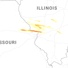

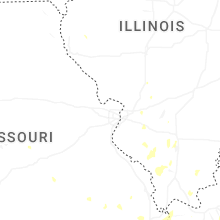
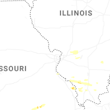
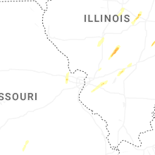


Connect with Interactive Hail Maps