

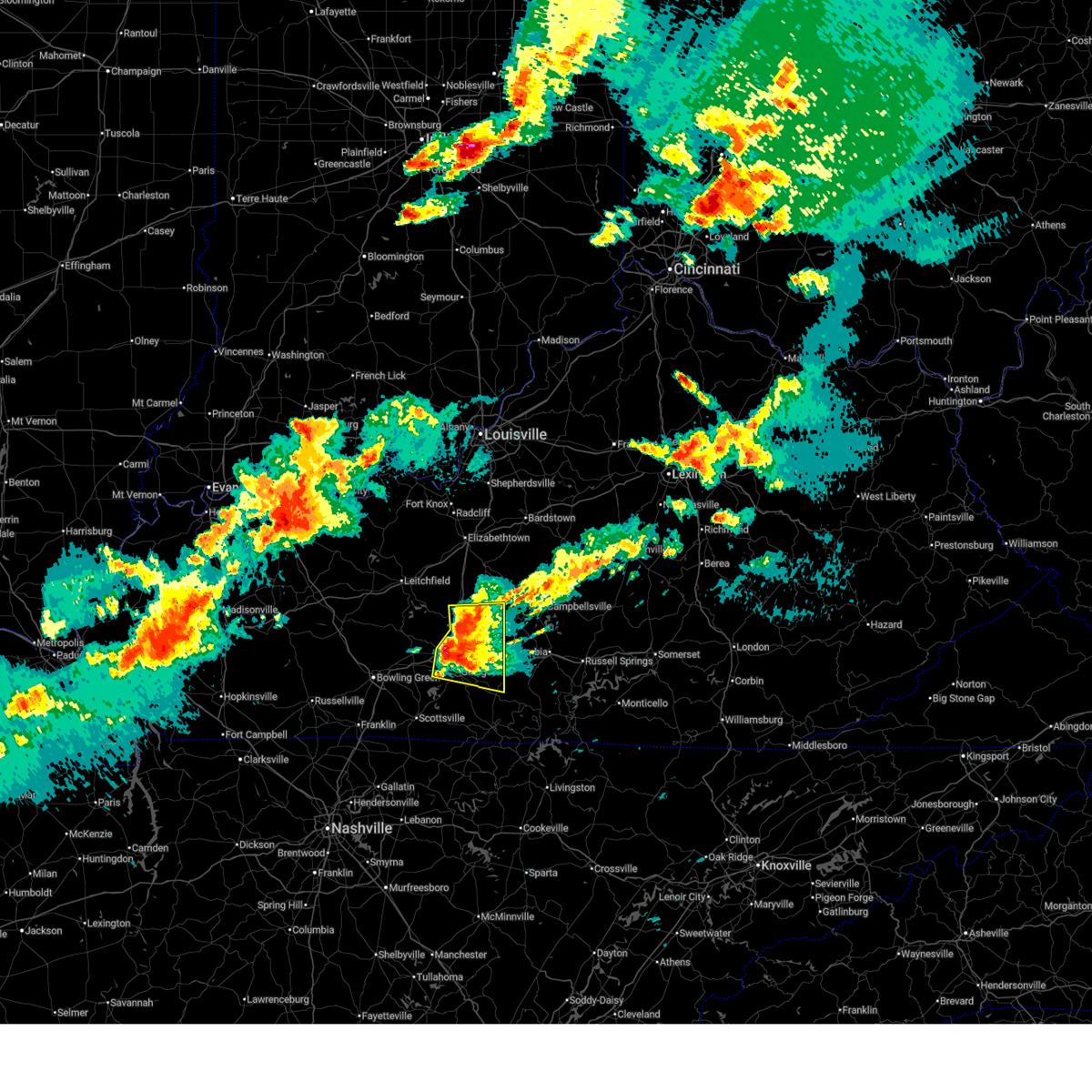
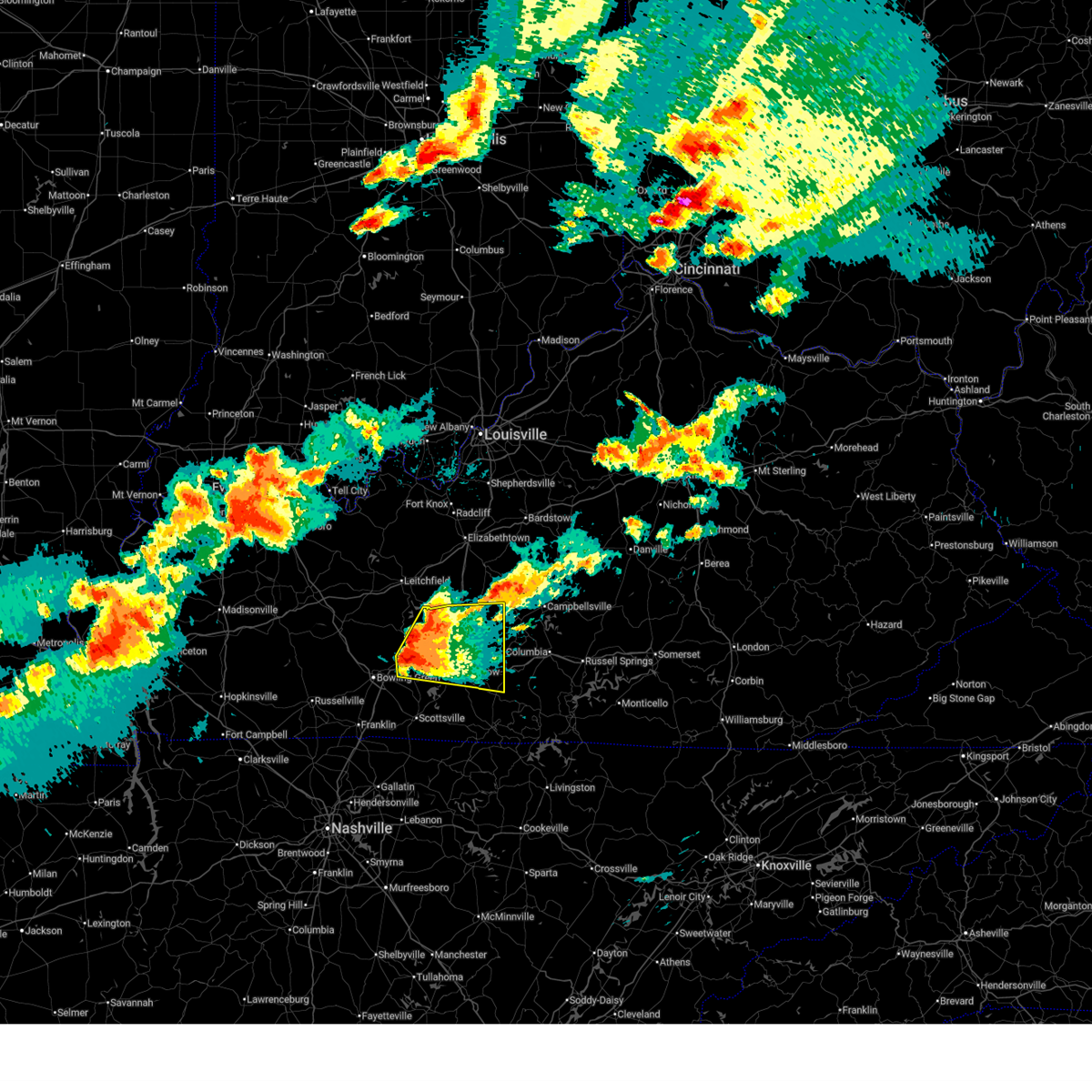
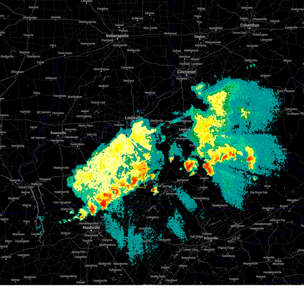
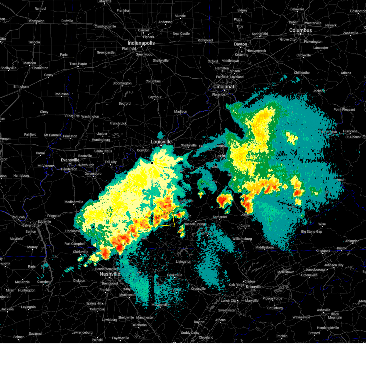
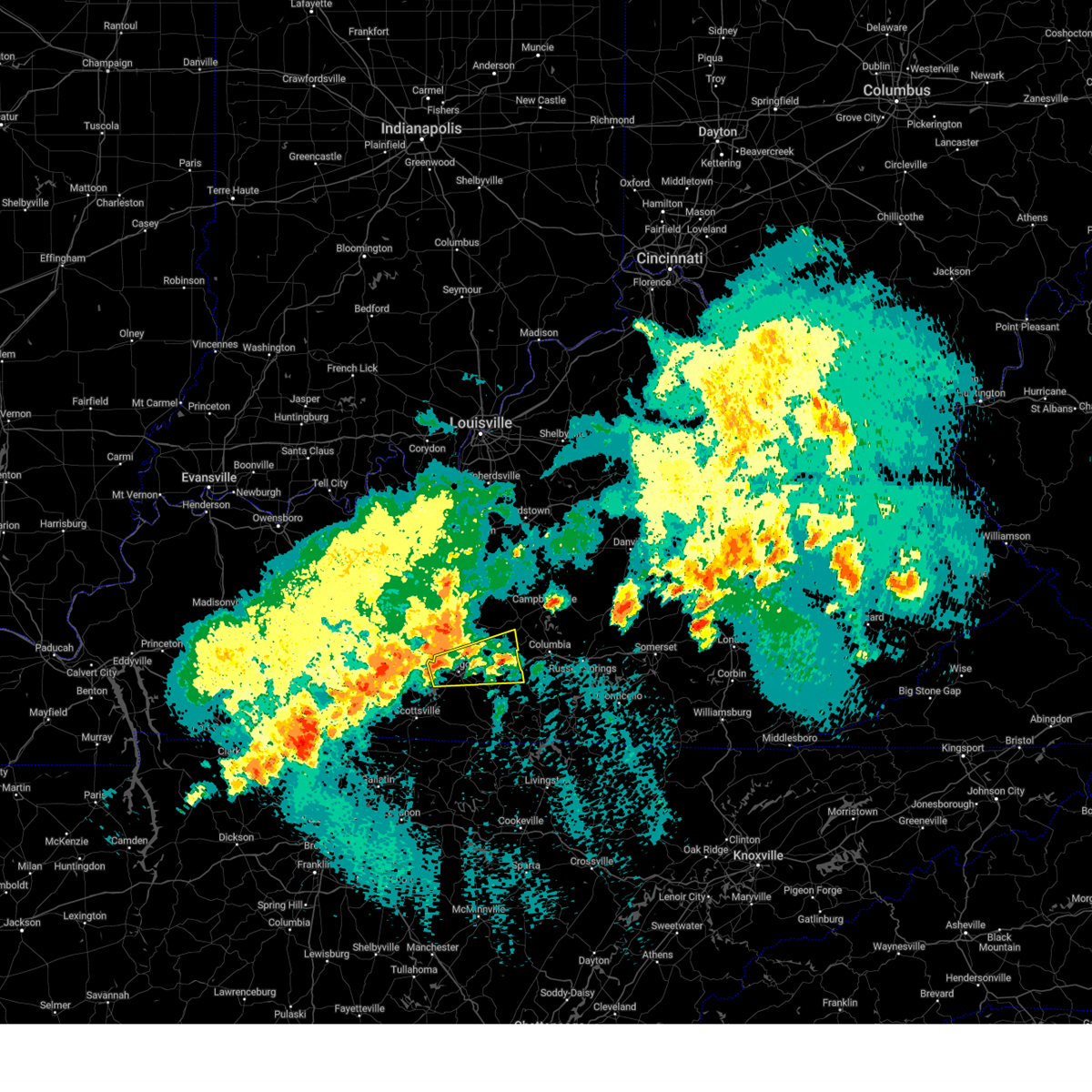
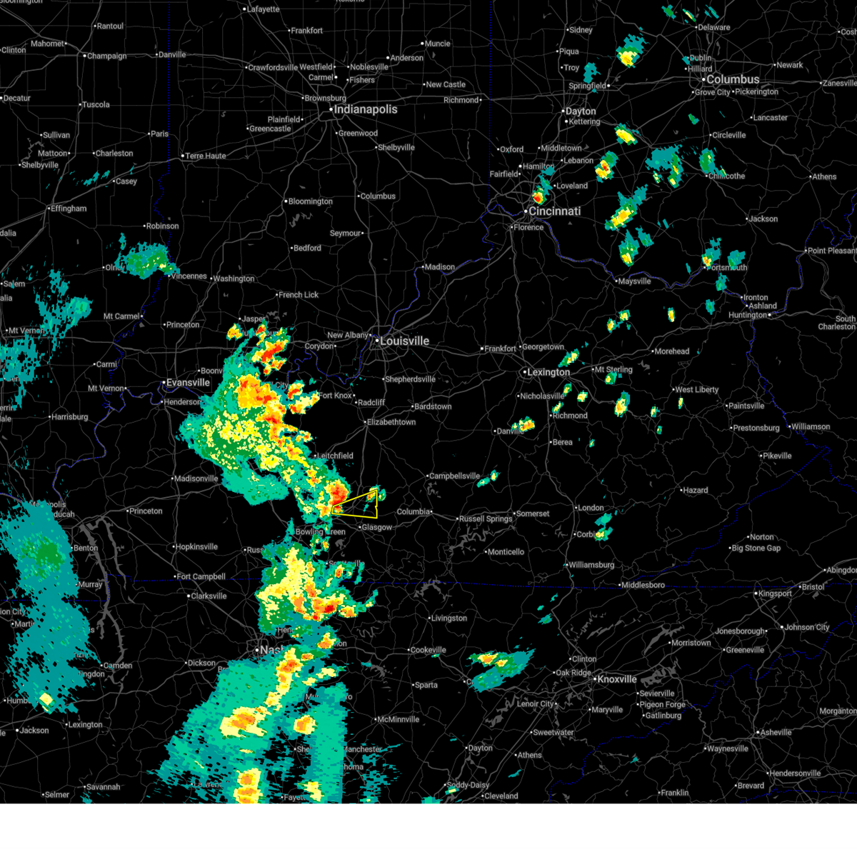
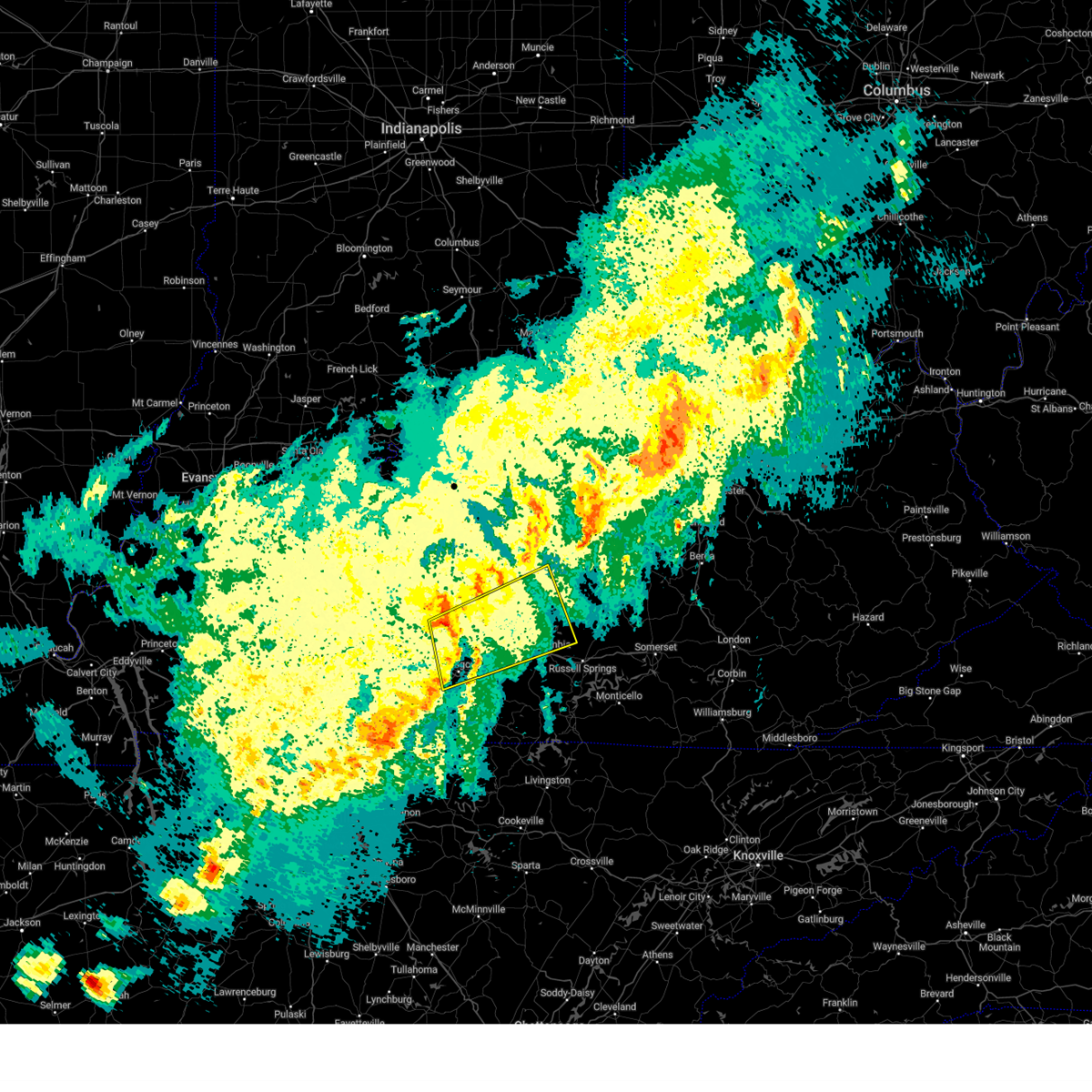
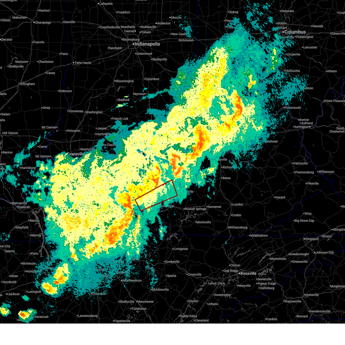
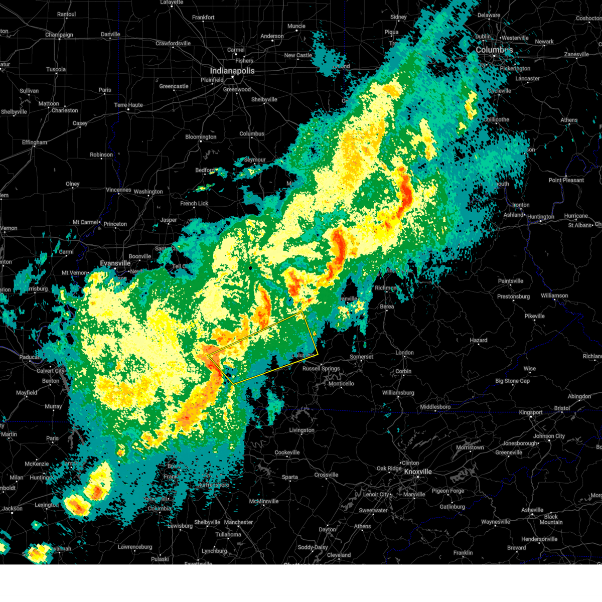
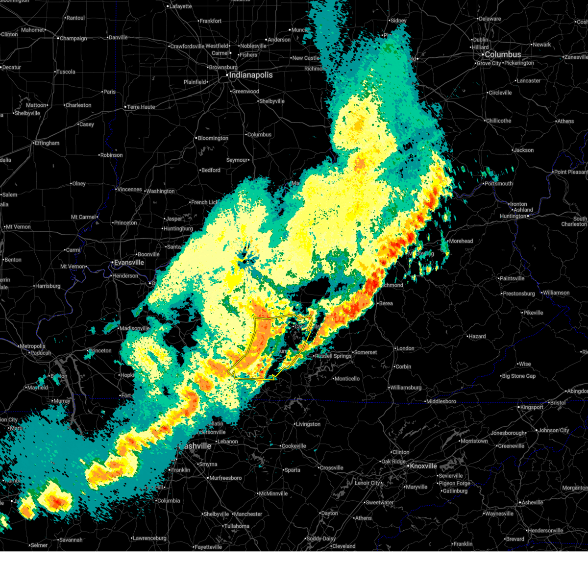
Hail Map for Hiseville, KY
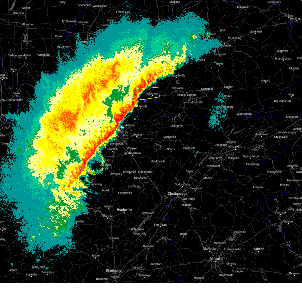
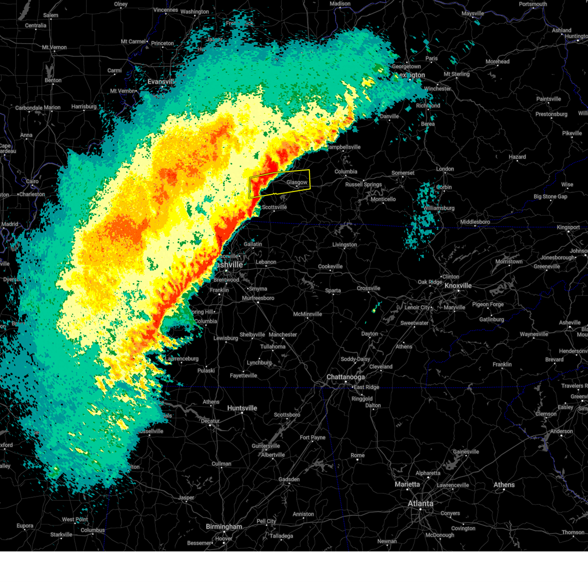
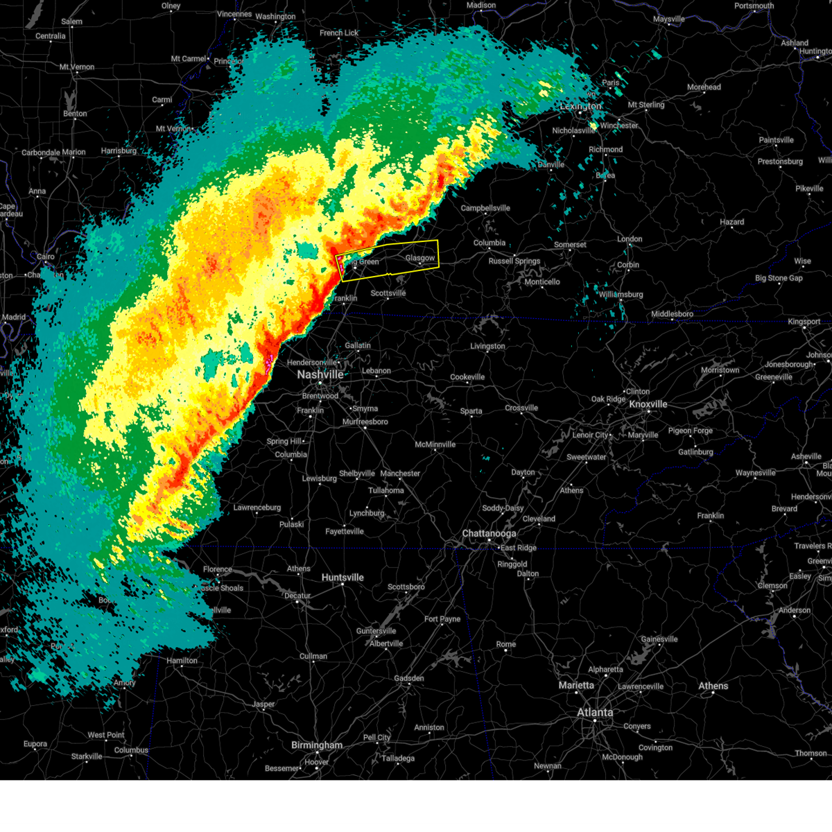
The Hiseville, KY area has had 2 reports of on-the-ground hail by trained spotters, and has been under severe weather warnings 8 times during the past 12 months. Doppler radar has detected hail at or near Hiseville, KY on 57 occasions.
| Name: | Hiseville, KY |
| Where Located: | 61.4 miles S of Louisville, KY |
| Map: | Google Map for Hiseville, KY |
| Population: | 240 |
| Housing Units: | 110 |
| More Info: | Search Google for Hiseville, KY |
2
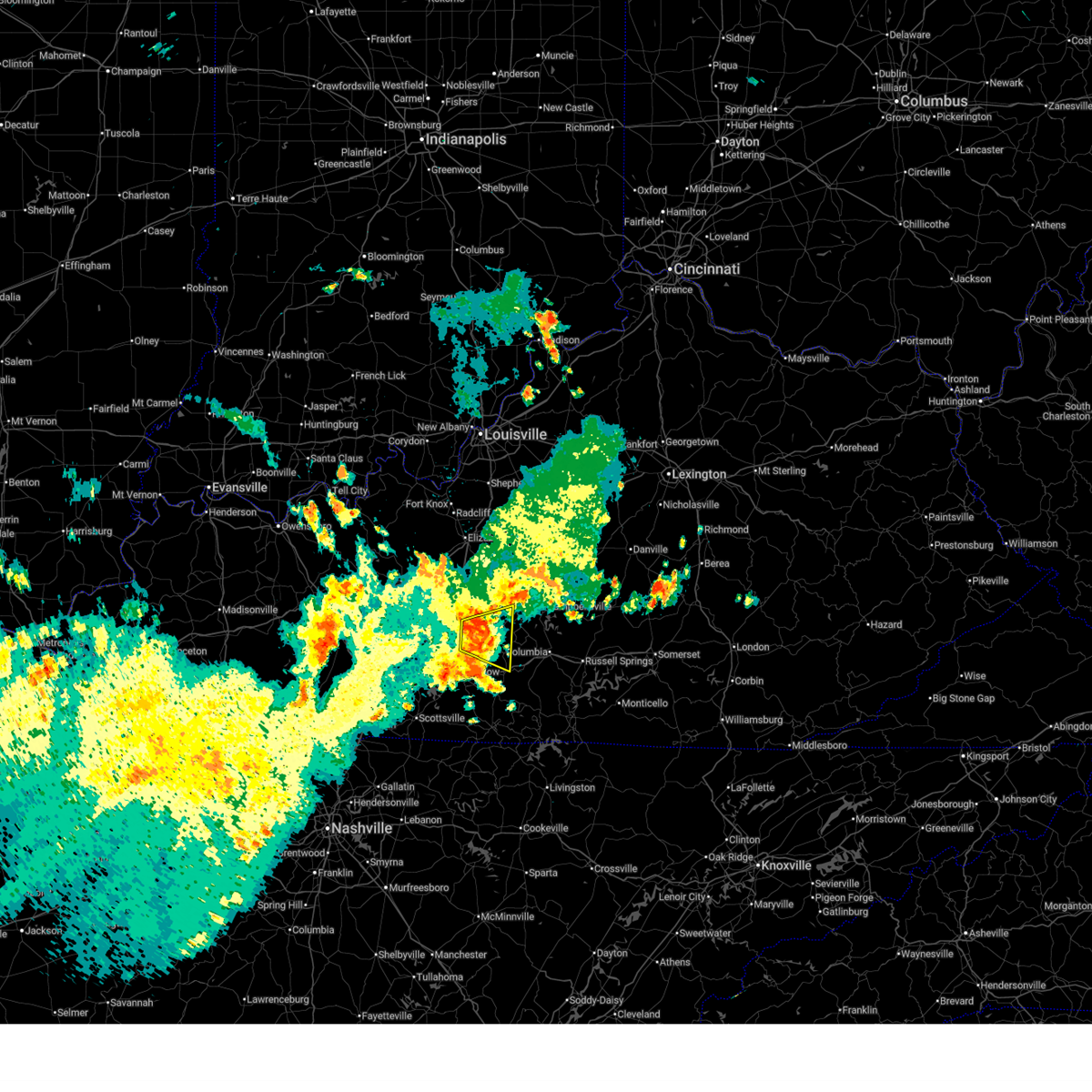
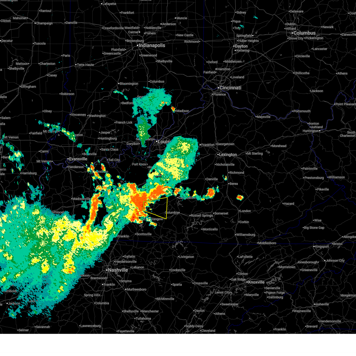
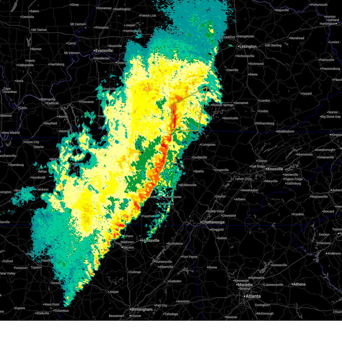
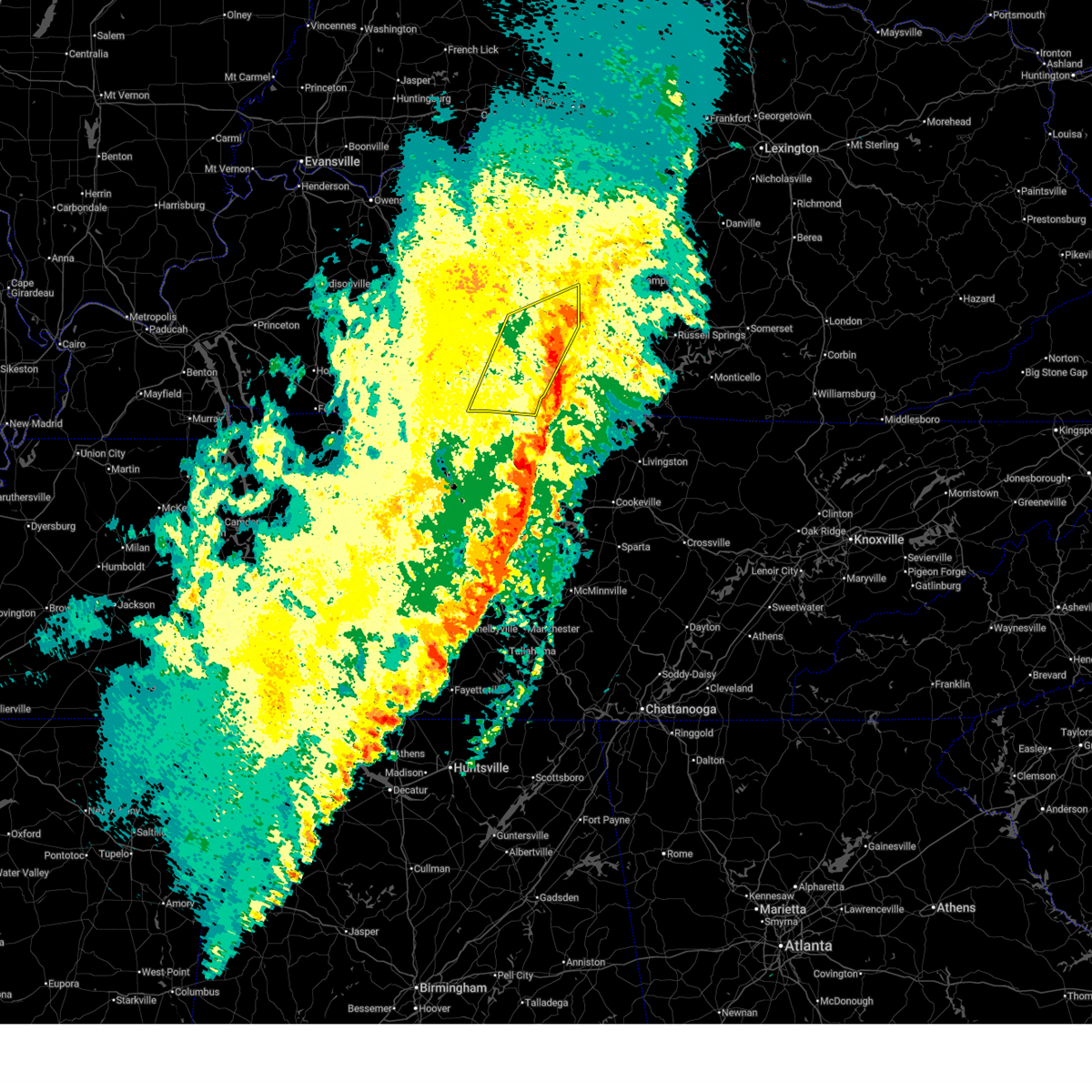
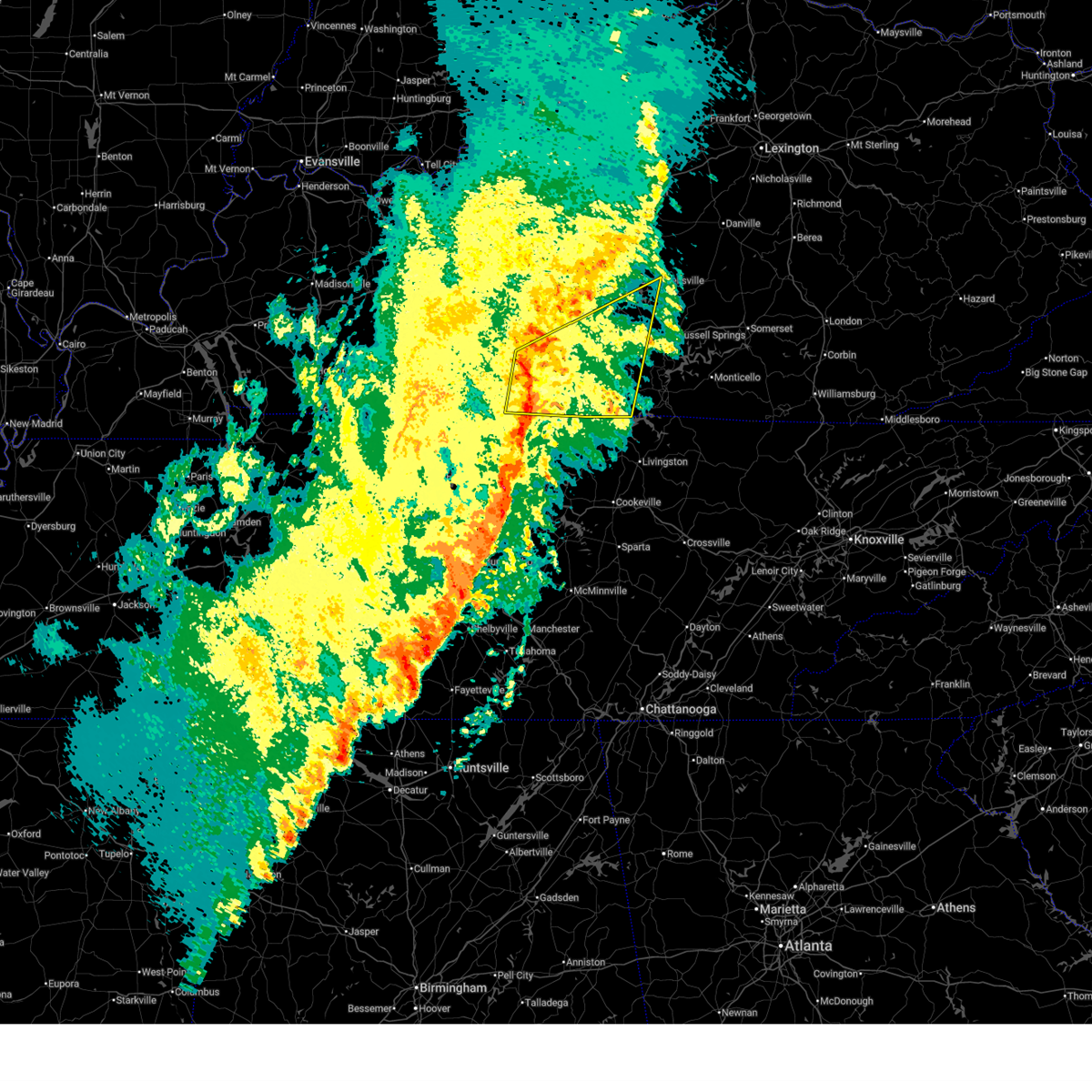
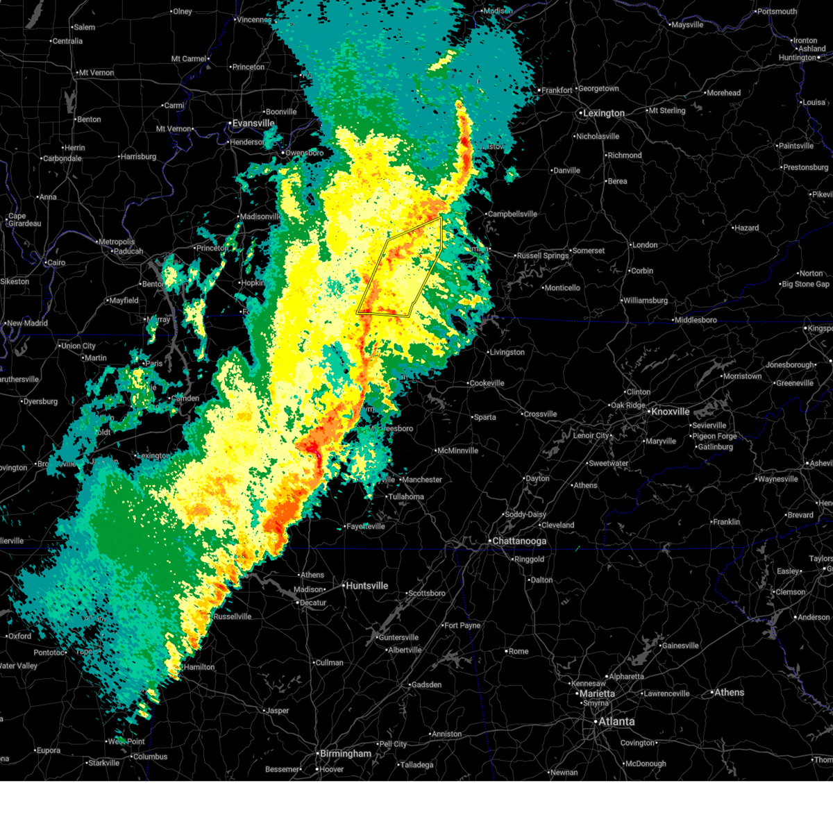
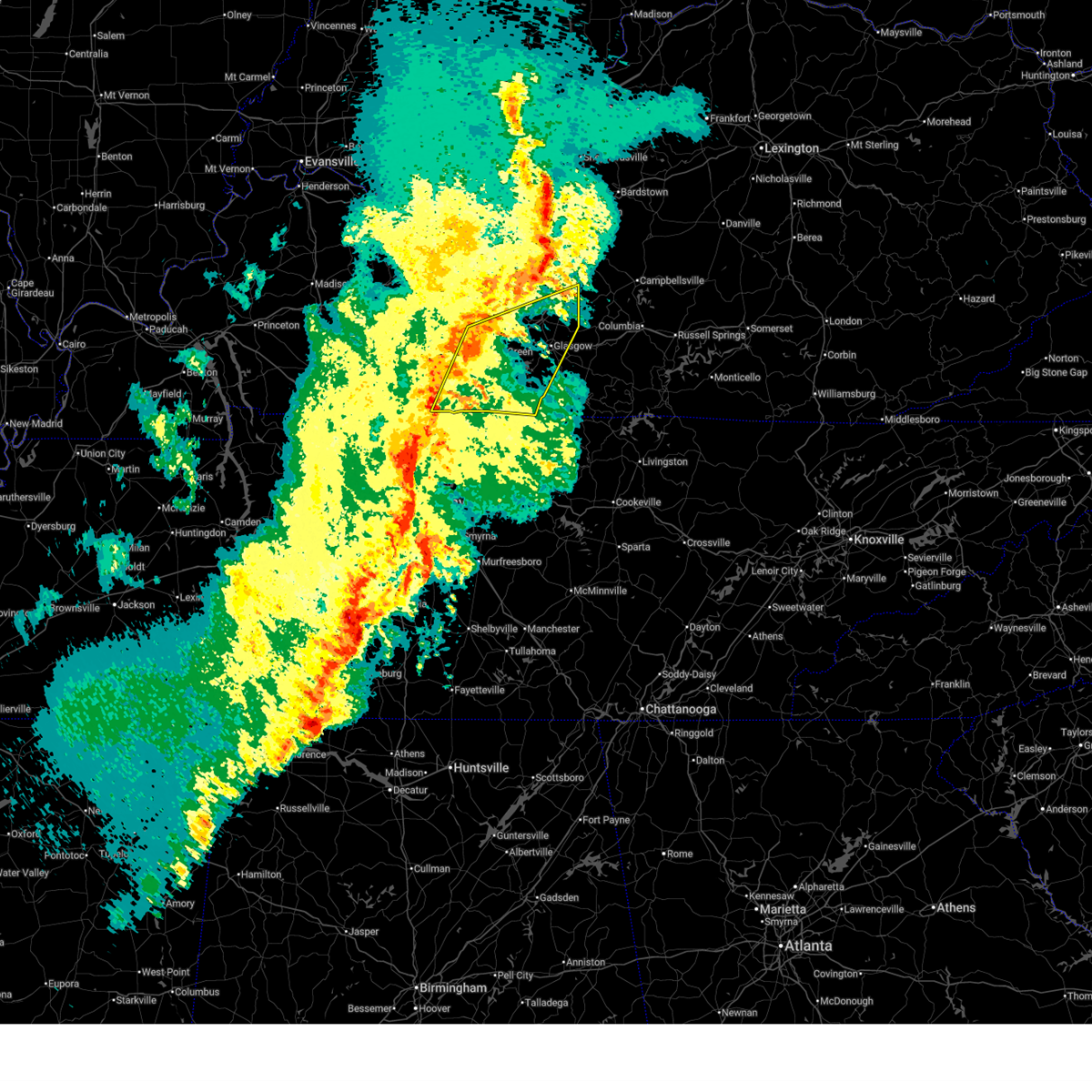
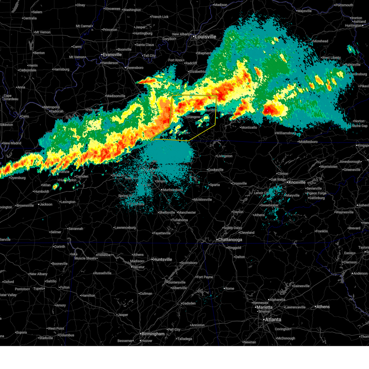
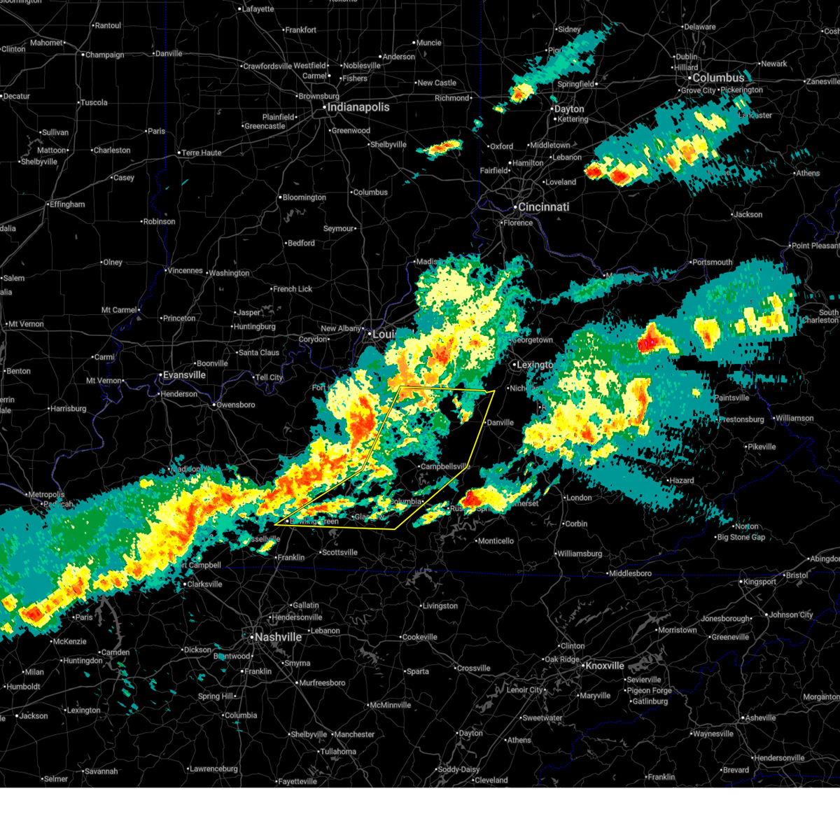
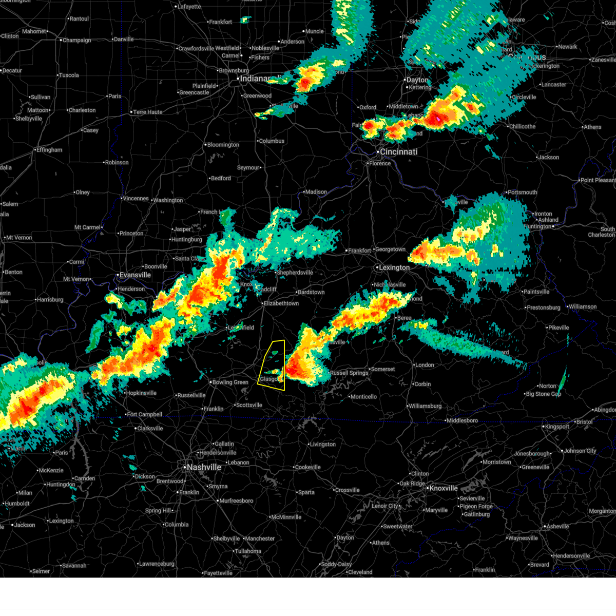
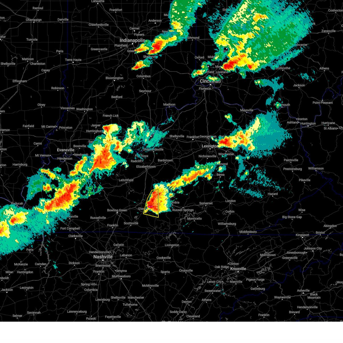
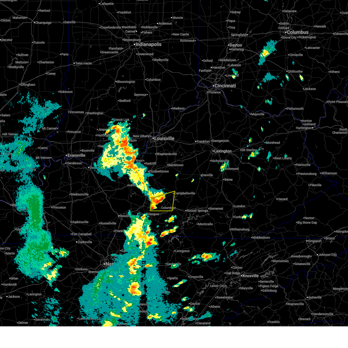
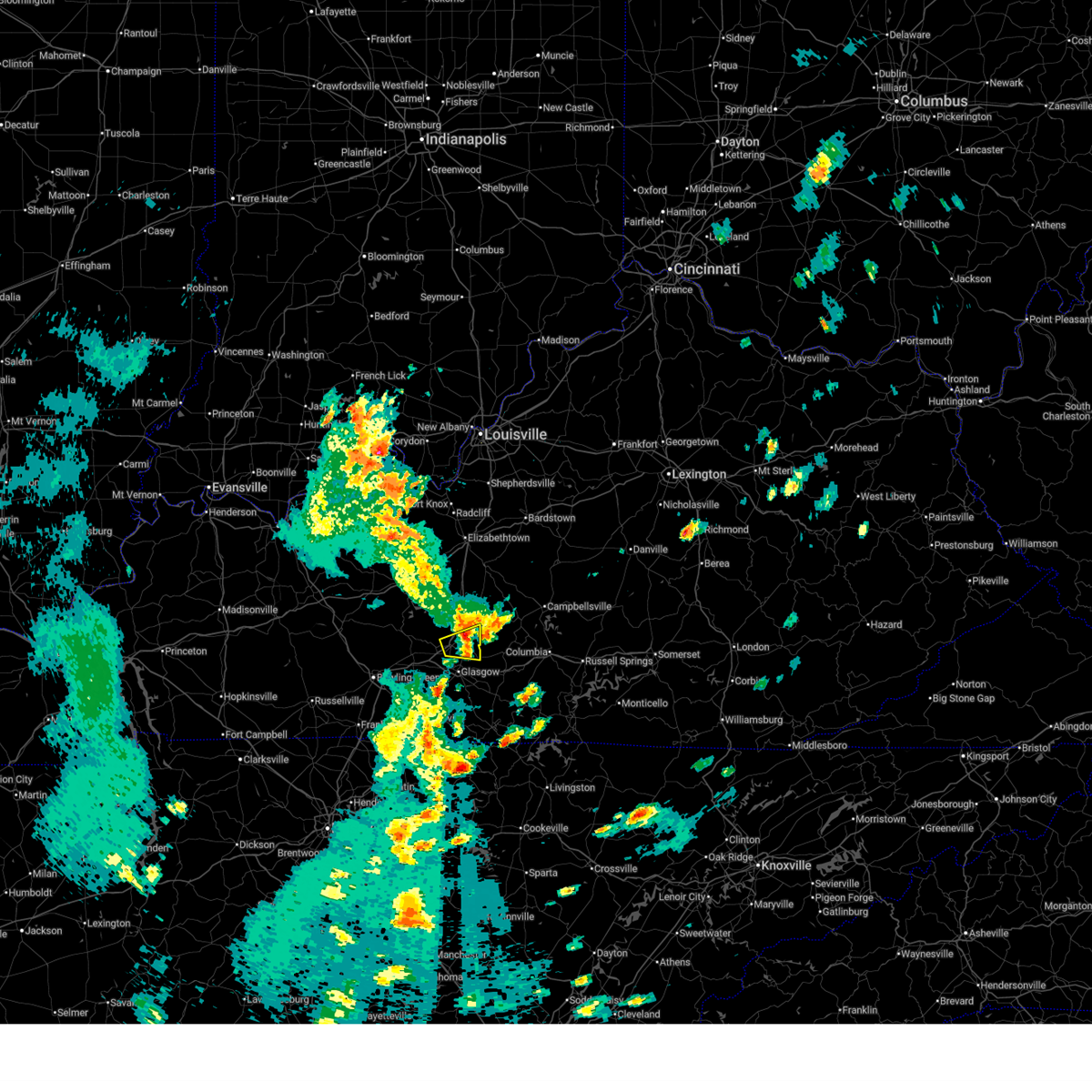
The Top Recent Hail Date for Hiseville, KY is Friday, May 16, 2025 (7th out of 57)

Hail and Wind Damage Spotted near Hiseville, KY
| Date / Time | Report Details |
|---|---|
| 7/9/2026 10:59 PM CDT |
 At 1059 pm cdt, a severe thunderstorm was located near three springs, moving east at 40 mph (radar indicated). Hazards include 60 mph wind gusts. Expect damage to roofs, siding, and trees. Locations impacted include, munfordville, three springs, monroe, horse cave, little barren, node, donansburg, whickerville, knob lick, and grab. At 1059 pm cdt, a severe thunderstorm was located near three springs, moving east at 40 mph (radar indicated). Hazards include 60 mph wind gusts. Expect damage to roofs, siding, and trees. Locations impacted include, munfordville, three springs, monroe, horse cave, little barren, node, donansburg, whickerville, knob lick, and grab.
|
| 7/9/2026 10:39 PM CDT |
 Svrlmk the national weather service in louisville has issued a * severe thunderstorm warning for, southwestern green county in central kentucky, southeastern hart county in central kentucky, northeastern barren county in south central kentucky, northwestern metcalfe county in south central kentucky, * until 1115 pm cdt. * at 1038 pm cdt, a severe thunderstorm was located near munfordville, moving east at 40 mph (radar indicated). Hazards include 60 mph wind gusts. expect damage to roofs, siding, and trees Svrlmk the national weather service in louisville has issued a * severe thunderstorm warning for, southwestern green county in central kentucky, southeastern hart county in central kentucky, northeastern barren county in south central kentucky, northwestern metcalfe county in south central kentucky, * until 1115 pm cdt. * at 1038 pm cdt, a severe thunderstorm was located near munfordville, moving east at 40 mph (radar indicated). Hazards include 60 mph wind gusts. expect damage to roofs, siding, and trees
|
| 3/15/2026 11:43 PM CDT |
 the severe thunderstorm warning has been cancelled and is no longer in effect the severe thunderstorm warning has been cancelled and is no longer in effect
|
| 3/15/2026 11:43 PM CDT |
 At 1243 am edt/1143 pm cdt/, severe thunderstorms were located along a line extending from near three springs to 8 miles west of tompkinsville, moving northeast at 85 mph (radar indicated). Hazards include 60 mph wind gusts. Expect damage to roofs, siding, and trees. Locations impacted include, glasgow, columbia, tompkinsville, edmonton, burkesville, leslie, gamaliel, pickett, absher, and node. At 1243 am edt/1143 pm cdt/, severe thunderstorms were located along a line extending from near three springs to 8 miles west of tompkinsville, moving northeast at 85 mph (radar indicated). Hazards include 60 mph wind gusts. Expect damage to roofs, siding, and trees. Locations impacted include, glasgow, columbia, tompkinsville, edmonton, burkesville, leslie, gamaliel, pickett, absher, and node.
|
| 3/15/2026 11:37 PM CDT |
 The storms which prompted the warning have moved out of the area. therefore, the warning has been allowed to expire. a tornado watch remains in effect until 400 am cdt for south central kentucky. to report severe weather, contact your nearest law enforcement agency. they will relay your report to the national weather service louisville. The storms which prompted the warning have moved out of the area. therefore, the warning has been allowed to expire. a tornado watch remains in effect until 400 am cdt for south central kentucky. to report severe weather, contact your nearest law enforcement agency. they will relay your report to the national weather service louisville.
|
| 3/15/2026 11:26 PM CDT |
 Svrlmk the national weather service in louisville has issued a * severe thunderstorm warning for, southern green county in central kentucky, monroe county in south central kentucky, southeastern taylor county in central kentucky, eastern allen county in south central kentucky, cumberland county in south central kentucky, barren county in south central kentucky, western adair county in south central kentucky, metcalfe county in south central kentucky, * until 115 am edt/1215 am cdt/. * at 1226 am edt/1126 pm cdt/, severe thunderstorms were located along a line extending from 6 miles southwest of glasgow to near lafayette, moving northeast at 85 mph (radar indicated). Hazards include 60 mph wind gusts. expect damage to roofs, siding, and trees Svrlmk the national weather service in louisville has issued a * severe thunderstorm warning for, southern green county in central kentucky, monroe county in south central kentucky, southeastern taylor county in central kentucky, eastern allen county in south central kentucky, cumberland county in south central kentucky, barren county in south central kentucky, western adair county in south central kentucky, metcalfe county in south central kentucky, * until 115 am edt/1215 am cdt/. * at 1226 am edt/1126 pm cdt/, severe thunderstorms were located along a line extending from 6 miles southwest of glasgow to near lafayette, moving northeast at 85 mph (radar indicated). Hazards include 60 mph wind gusts. expect damage to roofs, siding, and trees
|
| 3/15/2026 11:11 PM CDT |
 At 1111 pm cdt, severe thunderstorms were located along a line extending from 8 miles northwest of glasgow to 7 miles northwest of westmoreland, moving east at 45 mph (radar indicated). Hazards include 60 mph wind gusts. Expect damage to roofs, siding, and trees. Locations impacted include, glasgow, scottsville, munfordville, three springs, horse cave, cave city, smiths grove, park city, oakland, and fountain run. At 1111 pm cdt, severe thunderstorms were located along a line extending from 8 miles northwest of glasgow to 7 miles northwest of westmoreland, moving east at 45 mph (radar indicated). Hazards include 60 mph wind gusts. Expect damage to roofs, siding, and trees. Locations impacted include, glasgow, scottsville, munfordville, three springs, horse cave, cave city, smiths grove, park city, oakland, and fountain run.
|
| 3/15/2026 10:46 PM CDT |
 Svrlmk the national weather service in louisville has issued a * severe thunderstorm warning for, simpson county in south central kentucky, southern hart county in central kentucky, allen county in south central kentucky, warren county in south central kentucky, barren county in south central kentucky, northwestern metcalfe county in south central kentucky, southeastern edmonson county in south central kentucky, * until 1130 pm cdt. * at 1046 pm cdt, severe thunderstorms were located along a line extending from 6 miles northeast of plum springs to 7 miles north of cross plains, moving east at 45 mph (radar indicated). Hazards include 60 mph wind gusts. expect damage to roofs, siding, and trees Svrlmk the national weather service in louisville has issued a * severe thunderstorm warning for, simpson county in south central kentucky, southern hart county in central kentucky, allen county in south central kentucky, warren county in south central kentucky, barren county in south central kentucky, northwestern metcalfe county in south central kentucky, southeastern edmonson county in south central kentucky, * until 1130 pm cdt. * at 1046 pm cdt, severe thunderstorms were located along a line extending from 6 miles northeast of plum springs to 7 miles north of cross plains, moving east at 45 mph (radar indicated). Hazards include 60 mph wind gusts. expect damage to roofs, siding, and trees
|
| 5/16/2025 11:33 PM EDT |
 The storms which prompted the warning have moved out of the area. therefore, the warning has been allowed to expire. however, gusty winds and heavy rain are still possible with these thunderstorms. a tornado watch remains in effect until 100 am edt/midnight cdt/ for south central kentucky. a tornado watch also remains in effect until 300 am edt/200 am cdt/ for south central and central kentucky. The storms which prompted the warning have moved out of the area. therefore, the warning has been allowed to expire. however, gusty winds and heavy rain are still possible with these thunderstorms. a tornado watch remains in effect until 100 am edt/midnight cdt/ for south central kentucky. a tornado watch also remains in effect until 300 am edt/200 am cdt/ for south central and central kentucky.
|
| 5/16/2025 10:26 PM CDT |
 Svrlmk the national weather service in louisville has issued a * severe thunderstorm warning for, green county in central kentucky, northwestern monroe county in south central kentucky, southeastern simpson county in south central kentucky, hart county in central kentucky, south central taylor county in central kentucky, allen county in south central kentucky, east central warren county in south central kentucky, northwestern cumberland county in south central kentucky, barren county in south central kentucky, southwestern adair county in south central kentucky, metcalfe county in south central kentucky, eastern edmonson county in south central kentucky, * until 1215 am edt/1115 pm cdt/. * at 1125 pm edt/1025 pm cdt/, severe thunderstorms were located along a line extending from near brownsville to 7 miles north of scottsville to near portland, moving east at 60 mph (radar indicated). Hazards include 70 mph wind gusts. Expect considerable tree damage. Damage is likely to mobile homes, roofs, and outbuildings. Svrlmk the national weather service in louisville has issued a * severe thunderstorm warning for, green county in central kentucky, northwestern monroe county in south central kentucky, southeastern simpson county in south central kentucky, hart county in central kentucky, south central taylor county in central kentucky, allen county in south central kentucky, east central warren county in south central kentucky, northwestern cumberland county in south central kentucky, barren county in south central kentucky, southwestern adair county in south central kentucky, metcalfe county in south central kentucky, eastern edmonson county in south central kentucky, * until 1215 am edt/1115 pm cdt/. * at 1125 pm edt/1025 pm cdt/, severe thunderstorms were located along a line extending from near brownsville to 7 miles north of scottsville to near portland, moving east at 60 mph (radar indicated). Hazards include 70 mph wind gusts. Expect considerable tree damage. Damage is likely to mobile homes, roofs, and outbuildings.
|
| 5/16/2025 10:40 PM EDT |
 Svrlmk the national weather service in louisville has issued a * severe thunderstorm warning for, central nelson county in central kentucky, eastern larue county in central kentucky, marion county in central kentucky, eastern hart county in central kentucky, taylor county in central kentucky, west central jessamine county in central kentucky, northwestern casey county in central kentucky, central adair county in south central kentucky, southeastern edmonson county in south central kentucky, mercer county in central kentucky, green county in central kentucky, central warren county in south central kentucky, washington county in central kentucky, boyle county in central kentucky, barren county in south central kentucky, metcalfe county in south central kentucky, * until 1130 pm edt/1030 pm cdt/. * at 1040 pm edt/940 pm cdt/, severe thunderstorms were located along a line extending from 9 miles west of bardstown to 9 miles west of munfordville to near memphis junction, moving east at 65 mph (radar indicated). Hazards include 70 mph wind gusts and penny size hail. Expect considerable tree damage. Damage is likely to mobile homes, roofs, and outbuildings. Svrlmk the national weather service in louisville has issued a * severe thunderstorm warning for, central nelson county in central kentucky, eastern larue county in central kentucky, marion county in central kentucky, eastern hart county in central kentucky, taylor county in central kentucky, west central jessamine county in central kentucky, northwestern casey county in central kentucky, central adair county in south central kentucky, southeastern edmonson county in south central kentucky, mercer county in central kentucky, green county in central kentucky, central warren county in south central kentucky, washington county in central kentucky, boyle county in central kentucky, barren county in south central kentucky, metcalfe county in south central kentucky, * until 1130 pm edt/1030 pm cdt/. * at 1040 pm edt/940 pm cdt/, severe thunderstorms were located along a line extending from 9 miles west of bardstown to 9 miles west of munfordville to near memphis junction, moving east at 65 mph (radar indicated). Hazards include 70 mph wind gusts and penny size hail. Expect considerable tree damage. Damage is likely to mobile homes, roofs, and outbuildings.
|
| 5/16/2025 8:44 PM CDT |
 The storm which prompted the warning has weakened below severe limits, and has exited the warned area. therefore, the warning will be allowed to expire. a tornado watch remains in effect until 200 am cdt for south central and central kentucky. to report severe weather, contact your nearest law enforcement agency. they will relay your report to the national weather service louisville. The storm which prompted the warning has weakened below severe limits, and has exited the warned area. therefore, the warning will be allowed to expire. a tornado watch remains in effect until 200 am cdt for south central and central kentucky. to report severe weather, contact your nearest law enforcement agency. they will relay your report to the national weather service louisville.
|
| 5/16/2025 8:26 PM CDT |
 At 826 pm cdt, a severe thunderstorm was located near glasgow, moving east at 45 mph (radar indicated). Hazards include two inch hail and 70 mph wind gusts. People and animals outdoors will be injured. expect hail damage to roofs, siding, windows, and vehicles. expect considerable tree damage. wind damage is also likely to mobile homes, roofs, and outbuildings. Locations impacted include, glasgow, edmonton, three springs, monroe, little barren, lobb, node, coral hill, donansburg, and lecta. At 826 pm cdt, a severe thunderstorm was located near glasgow, moving east at 45 mph (radar indicated). Hazards include two inch hail and 70 mph wind gusts. People and animals outdoors will be injured. expect hail damage to roofs, siding, windows, and vehicles. expect considerable tree damage. wind damage is also likely to mobile homes, roofs, and outbuildings. Locations impacted include, glasgow, edmonton, three springs, monroe, little barren, lobb, node, coral hill, donansburg, and lecta.
|
| 5/16/2025 8:14 PM CDT |
 the severe thunderstorm warning has been cancelled and is no longer in effect the severe thunderstorm warning has been cancelled and is no longer in effect
|
| 5/16/2025 8:14 PM CDT |
 At 814 pm cdt, a severe thunderstorm was located 7 miles northwest of glasgow, moving east at 45 mph (radar indicated). Hazards include two inch hail and 70 mph wind gusts. People and animals outdoors will be injured. expect hail damage to roofs, siding, windows, and vehicles. expect considerable tree damage. wind damage is also likely to mobile homes, roofs, and outbuildings. Locations impacted include, glasgow, munfordville, edmonton, three springs, monroe, horse cave, cave city, park city, red cross, and lobb. At 814 pm cdt, a severe thunderstorm was located 7 miles northwest of glasgow, moving east at 45 mph (radar indicated). Hazards include two inch hail and 70 mph wind gusts. People and animals outdoors will be injured. expect hail damage to roofs, siding, windows, and vehicles. expect considerable tree damage. wind damage is also likely to mobile homes, roofs, and outbuildings. Locations impacted include, glasgow, munfordville, edmonton, three springs, monroe, horse cave, cave city, park city, red cross, and lobb.
|
| 5/16/2025 7:59 PM CDT |
 Svrlmk the national weather service in louisville has issued a * severe thunderstorm warning for, southwestern green county in central kentucky, hart county in central kentucky, northeastern warren county in south central kentucky, barren county in south central kentucky, western metcalfe county in south central kentucky, eastern edmonson county in south central kentucky, * until 845 pm cdt. * at 759 pm cdt, a severe thunderstorm was located 9 miles east of plum springs, moving east at 45 mph (radar indicated). Hazards include two inch hail and 70 mph wind gusts. People and animals outdoors will be injured. expect hail damage to roofs, siding, windows, and vehicles. expect considerable tree damage. Wind damage is also likely to mobile homes, roofs, and outbuildings. Svrlmk the national weather service in louisville has issued a * severe thunderstorm warning for, southwestern green county in central kentucky, hart county in central kentucky, northeastern warren county in south central kentucky, barren county in south central kentucky, western metcalfe county in south central kentucky, eastern edmonson county in south central kentucky, * until 845 pm cdt. * at 759 pm cdt, a severe thunderstorm was located 9 miles east of plum springs, moving east at 45 mph (radar indicated). Hazards include two inch hail and 70 mph wind gusts. People and animals outdoors will be injured. expect hail damage to roofs, siding, windows, and vehicles. expect considerable tree damage. Wind damage is also likely to mobile homes, roofs, and outbuildings.
|
| 5/16/2025 10:44 AM CDT |
 The storm which prompted the warning has weakened below severe limits, and no longer poses an immediate threat to life or property. therefore, the warning will be allowed to expire. however, small hail and gusty winds are still possible with this thunderstorm. a severe thunderstorm watch remains in effect until 1100 am cdt for south central and central kentucky. The storm which prompted the warning has weakened below severe limits, and no longer poses an immediate threat to life or property. therefore, the warning will be allowed to expire. however, small hail and gusty winds are still possible with this thunderstorm. a severe thunderstorm watch remains in effect until 1100 am cdt for south central and central kentucky.
|
| 5/16/2025 10:37 AM CDT |
 At 1037 am cdt, a severe thunderstorm was located 7 miles south of three springs, moving east at 50 mph (radar indicated). Hazards include 60 mph wind gusts and quarter size hail. Hail damage to vehicles is expected. expect wind damage to roofs, siding, and trees. Locations impacted include, edmonton, center, echo, cork, little barren, node, crailhope, knob lick, exie, and savoyard. At 1037 am cdt, a severe thunderstorm was located 7 miles south of three springs, moving east at 50 mph (radar indicated). Hazards include 60 mph wind gusts and quarter size hail. Hail damage to vehicles is expected. expect wind damage to roofs, siding, and trees. Locations impacted include, edmonton, center, echo, cork, little barren, node, crailhope, knob lick, exie, and savoyard.
|
| 5/16/2025 10:32 AM CDT |
 At 1032 am cdt, a severe thunderstorm was located 5 miles northeast of glasgow, moving east at 55 mph (radar indicated). Hazards include 60 mph wind gusts and quarter size hail. Hail damage to vehicles is expected. expect wind damage to roofs, siding, and trees. Locations impacted include, glasgow, edmonton, little barren, node, coral hill, lecta, knob lick, exie, savoyard, and goodnight. At 1032 am cdt, a severe thunderstorm was located 5 miles northeast of glasgow, moving east at 55 mph (radar indicated). Hazards include 60 mph wind gusts and quarter size hail. Hail damage to vehicles is expected. expect wind damage to roofs, siding, and trees. Locations impacted include, glasgow, edmonton, little barren, node, coral hill, lecta, knob lick, exie, savoyard, and goodnight.
|
| 5/16/2025 10:21 AM CDT |
 Svrlmk the national weather service in louisville has issued a * severe thunderstorm warning for, southwestern green county in central kentucky, northern barren county in south central kentucky, metcalfe county in south central kentucky, * until 1045 am cdt. * at 1021 am cdt, a severe thunderstorm was located near glasgow, moving east at 55 mph (radar indicated). Hazards include 60 mph wind gusts and quarter size hail. Hail damage to vehicles is expected. Expect wind damage to roofs, siding, and trees. Svrlmk the national weather service in louisville has issued a * severe thunderstorm warning for, southwestern green county in central kentucky, northern barren county in south central kentucky, metcalfe county in south central kentucky, * until 1045 am cdt. * at 1021 am cdt, a severe thunderstorm was located near glasgow, moving east at 55 mph (radar indicated). Hazards include 60 mph wind gusts and quarter size hail. Hail damage to vehicles is expected. Expect wind damage to roofs, siding, and trees.
|
| 5/2/2025 2:25 PM CDT |
 Svrlmk the national weather service in louisville has issued a * severe thunderstorm warning for, green county in central kentucky, southeastern hart county in central kentucky, south central taylor county in central kentucky, northeastern barren county in south central kentucky, west central adair county in south central kentucky, northern metcalfe county in south central kentucky, * until 400 pm edt/300 pm cdt/. * at 325 pm edt/225 pm cdt/, a severe thunderstorm was located near three springs, moving east at 30 mph (radar indicated). Hazards include 60 mph wind gusts and quarter size hail. Hail damage to vehicles is expected. Expect wind damage to roofs, siding, and trees. Svrlmk the national weather service in louisville has issued a * severe thunderstorm warning for, green county in central kentucky, southeastern hart county in central kentucky, south central taylor county in central kentucky, northeastern barren county in south central kentucky, west central adair county in south central kentucky, northern metcalfe county in south central kentucky, * until 400 pm edt/300 pm cdt/. * at 325 pm edt/225 pm cdt/, a severe thunderstorm was located near three springs, moving east at 30 mph (radar indicated). Hazards include 60 mph wind gusts and quarter size hail. Hail damage to vehicles is expected. Expect wind damage to roofs, siding, and trees.
|
| 5/2/2025 2:16 PM CDT |
 The storm which prompted the warning has weakened below severe limits, and has exited the warned area. therefore, the warning has been allowed to expire. a severe thunderstorm watch remains in effect until 500 pm cdt for south central and central kentucky. to report severe weather, contact your nearest law enforcement agency. they will relay your report to the national weather service louisville. The storm which prompted the warning has weakened below severe limits, and has exited the warned area. therefore, the warning has been allowed to expire. a severe thunderstorm watch remains in effect until 500 pm cdt for south central and central kentucky. to report severe weather, contact your nearest law enforcement agency. they will relay your report to the national weather service louisville.
|
| 5/2/2025 2:04 PM CDT |
 At 203 pm cdt, a severe thunderstorm was located 9 miles north of glasgow, moving east at 30 mph (radar indicated). Hazards include 60 mph wind gusts and quarter size hail. Hail damage to vehicles is expected. expect wind damage to roofs, siding, and trees. Locations impacted include, horse cave, cave city, bunnell crossing, legrande, bear wallow, uno, griderville, seymour, goodnight, and hiseville. At 203 pm cdt, a severe thunderstorm was located 9 miles north of glasgow, moving east at 30 mph (radar indicated). Hazards include 60 mph wind gusts and quarter size hail. Hail damage to vehicles is expected. expect wind damage to roofs, siding, and trees. Locations impacted include, horse cave, cave city, bunnell crossing, legrande, bear wallow, uno, griderville, seymour, goodnight, and hiseville.
|
| 5/2/2025 2:04 PM CDT |
 the severe thunderstorm warning has been cancelled and is no longer in effect the severe thunderstorm warning has been cancelled and is no longer in effect
|
| 5/2/2025 1:51 PM CDT |
 Svrlmk the national weather service in louisville has issued a * severe thunderstorm warning for, south central hart county in central kentucky, northeastern barren county in south central kentucky, southeastern edmonson county in south central kentucky, * until 215 pm cdt. * at 151 pm cdt, a severe thunderstorm was located 11 miles east of brownsville, moving east at 30 mph (radar indicated). Hazards include 60 mph wind gusts and quarter size hail. Hail damage to vehicles is expected. Expect wind damage to roofs, siding, and trees. Svrlmk the national weather service in louisville has issued a * severe thunderstorm warning for, south central hart county in central kentucky, northeastern barren county in south central kentucky, southeastern edmonson county in south central kentucky, * until 215 pm cdt. * at 151 pm cdt, a severe thunderstorm was located 11 miles east of brownsville, moving east at 30 mph (radar indicated). Hazards include 60 mph wind gusts and quarter size hail. Hail damage to vehicles is expected. Expect wind damage to roofs, siding, and trees.
|
| 4/5/2025 5:56 PM CDT |
 Svrlmk the national weather service in louisville has issued a * severe thunderstorm warning for, southwestern green county in central kentucky, eastern barren county in south central kentucky, metcalfe county in south central kentucky, * until 630 pm cdt. * at 556 pm cdt, severe thunderstorms were located along a line extending from near glasgow to 12 miles northwest of tompkinsville, moving northeast at 40 mph (radar indicated). Hazards include 60 mph wind gusts. expect damage to roofs, siding, and trees Svrlmk the national weather service in louisville has issued a * severe thunderstorm warning for, southwestern green county in central kentucky, eastern barren county in south central kentucky, metcalfe county in south central kentucky, * until 630 pm cdt. * at 556 pm cdt, severe thunderstorms were located along a line extending from near glasgow to 12 miles northwest of tompkinsville, moving northeast at 40 mph (radar indicated). Hazards include 60 mph wind gusts. expect damage to roofs, siding, and trees
|
| 4/4/2025 4:11 PM CDT |
 Svrlmk the national weather service in louisville has issued a * severe thunderstorm warning for, south central hart county in central kentucky, northeastern barren county in south central kentucky, * until 445 pm cdt. * at 410 pm cdt, a severe thunderstorm was located 9 miles north of glasgow, moving northeast at 20 mph (radar indicated). Hazards include 60 mph wind gusts and quarter size hail. Hail damage to vehicles is expected. Expect wind damage to roofs, siding, and trees. Svrlmk the national weather service in louisville has issued a * severe thunderstorm warning for, south central hart county in central kentucky, northeastern barren county in south central kentucky, * until 445 pm cdt. * at 410 pm cdt, a severe thunderstorm was located 9 miles north of glasgow, moving northeast at 20 mph (radar indicated). Hazards include 60 mph wind gusts and quarter size hail. Hail damage to vehicles is expected. Expect wind damage to roofs, siding, and trees.
|
| 4/3/2025 2:14 AM EDT |
 the tornado warning has been cancelled and is no longer in effect the tornado warning has been cancelled and is no longer in effect
|
| 4/3/2025 2:14 AM EDT |
 At 213 am edt/113 am cdt/, a severe thunderstorm capable of producing a tornado was located 8 miles northeast of three springs, moving northeast at 60 mph (radar indicated rotation). Hazards include tornado. Flying debris will be dangerous to those caught without shelter. mobile homes will be damaged or destroyed. damage to roofs, windows, and vehicles will occur. tree damage is likely. this dangerous storm will be near, campbellsville around 225 am edt. Other locations impacted by this tornadic thunderstorm include lobb, arista, south campbellsville, savoyard, pierce, white rose, hatcher, gabe, pascal, and coakley. At 213 am edt/113 am cdt/, a severe thunderstorm capable of producing a tornado was located 8 miles northeast of three springs, moving northeast at 60 mph (radar indicated rotation). Hazards include tornado. Flying debris will be dangerous to those caught without shelter. mobile homes will be damaged or destroyed. damage to roofs, windows, and vehicles will occur. tree damage is likely. this dangerous storm will be near, campbellsville around 225 am edt. Other locations impacted by this tornadic thunderstorm include lobb, arista, south campbellsville, savoyard, pierce, white rose, hatcher, gabe, pascal, and coakley.
|
| 4/3/2025 1:10 AM CDT |
 At 210 am edt/110 am cdt/, a severe thunderstorm was located over three springs, moving northeast at 80 mph (radar indicated). Hazards include 70 mph wind gusts. Expect considerable tree damage. damage is likely to mobile homes, roofs, and outbuildings. Locations impacted include, glasgow, campbellsville, columbia, greensburg, munfordville, three springs, monroe, horse cave, cave city, and park city. At 210 am edt/110 am cdt/, a severe thunderstorm was located over three springs, moving northeast at 80 mph (radar indicated). Hazards include 70 mph wind gusts. Expect considerable tree damage. damage is likely to mobile homes, roofs, and outbuildings. Locations impacted include, glasgow, campbellsville, columbia, greensburg, munfordville, three springs, monroe, horse cave, cave city, and park city.
|
| 4/3/2025 1:10 AM CDT |
 the severe thunderstorm warning has been cancelled and is no longer in effect the severe thunderstorm warning has been cancelled and is no longer in effect
|
| 4/3/2025 1:02 AM CDT |
 Torlmk the national weather service in louisville has issued a * tornado warning for, green county in central kentucky, southwestern marion county in central kentucky, southern hart county in central kentucky, taylor county in central kentucky, northeastern barren county in south central kentucky, northwestern metcalfe county in south central kentucky, east central edmonson county in south central kentucky, * until 230 am edt/130 am cdt/. * at 202 am edt/102 am cdt/, a severe thunderstorm capable of producing a tornado was located 8 miles south of munfordville, moving northeast at 80 mph (radar indicated rotation). Hazards include tornado. Flying debris will be dangerous to those caught without shelter. mobile homes will be damaged or destroyed. damage to roofs, windows, and vehicles will occur. tree damage is likely. this dangerous storm will be near, three springs around 110 am cdt. greensburg around 120 am cdt. campbellsville around 225 am edt. Other locations impacted by this tornadic thunderstorm include logsdon valley, lobb, cave city, arista, south campbellsville, savoyard, goodnight, mammoth cave, pierce, and white rose. Torlmk the national weather service in louisville has issued a * tornado warning for, green county in central kentucky, southwestern marion county in central kentucky, southern hart county in central kentucky, taylor county in central kentucky, northeastern barren county in south central kentucky, northwestern metcalfe county in south central kentucky, east central edmonson county in south central kentucky, * until 230 am edt/130 am cdt/. * at 202 am edt/102 am cdt/, a severe thunderstorm capable of producing a tornado was located 8 miles south of munfordville, moving northeast at 80 mph (radar indicated rotation). Hazards include tornado. Flying debris will be dangerous to those caught without shelter. mobile homes will be damaged or destroyed. damage to roofs, windows, and vehicles will occur. tree damage is likely. this dangerous storm will be near, three springs around 110 am cdt. greensburg around 120 am cdt. campbellsville around 225 am edt. Other locations impacted by this tornadic thunderstorm include logsdon valley, lobb, cave city, arista, south campbellsville, savoyard, goodnight, mammoth cave, pierce, and white rose.
|
| 4/3/2025 12:51 AM CDT |
 Svrlmk the national weather service in louisville has issued a * severe thunderstorm warning for, green county in central kentucky, southeastern larue county in central kentucky, southwestern marion county in central kentucky, hart county in central kentucky, taylor county in central kentucky, north central allen county in south central kentucky, northeastern warren county in south central kentucky, barren county in south central kentucky, central adair county in south central kentucky, northern metcalfe county in south central kentucky, southern edmonson county in south central kentucky, * until 230 am edt/130 am cdt/. * at 150 am edt/1250 am cdt/, a severe thunderstorm was located 10 miles east of plum springs, moving northeast at 80 mph (radar indicated). Hazards include 60 mph wind gusts. expect damage to roofs, siding, and trees Svrlmk the national weather service in louisville has issued a * severe thunderstorm warning for, green county in central kentucky, southeastern larue county in central kentucky, southwestern marion county in central kentucky, hart county in central kentucky, taylor county in central kentucky, north central allen county in south central kentucky, northeastern warren county in south central kentucky, barren county in south central kentucky, central adair county in south central kentucky, northern metcalfe county in south central kentucky, southern edmonson county in south central kentucky, * until 230 am edt/130 am cdt/. * at 150 am edt/1250 am cdt/, a severe thunderstorm was located 10 miles east of plum springs, moving northeast at 80 mph (radar indicated). Hazards include 60 mph wind gusts. expect damage to roofs, siding, and trees
|
| 3/30/2025 10:38 PM CDT |
 Svrlmk the national weather service in louisville has issued a * severe thunderstorm warning for, green county in central kentucky, eastern hart county in central kentucky, taylor county in central kentucky, barren county in south central kentucky, central adair county in south central kentucky, metcalfe county in south central kentucky, * until 1215 am edt/1115 pm cdt/. * at 1138 pm edt/1038 pm cdt/, severe thunderstorms were located along a line extending from 8 miles south of hodgenville to 10 miles northwest of greensburg to 7 miles southwest of three springs to 10 miles southwest of glasgow, moving east at 65 mph (radar indicated). Hazards include 60 mph wind gusts. expect damage to roofs, siding, and trees Svrlmk the national weather service in louisville has issued a * severe thunderstorm warning for, green county in central kentucky, eastern hart county in central kentucky, taylor county in central kentucky, barren county in south central kentucky, central adair county in south central kentucky, metcalfe county in south central kentucky, * until 1215 am edt/1115 pm cdt/. * at 1138 pm edt/1038 pm cdt/, severe thunderstorms were located along a line extending from 8 miles south of hodgenville to 10 miles northwest of greensburg to 7 miles southwest of three springs to 10 miles southwest of glasgow, moving east at 65 mph (radar indicated). Hazards include 60 mph wind gusts. expect damage to roofs, siding, and trees
|
| 3/30/2025 10:06 PM CDT |
 Svrlmk the national weather service in louisville has issued a * severe thunderstorm warning for, southeastern logan county in south central kentucky, simpson county in south central kentucky, hart county in central kentucky, western allen county in south central kentucky, northeastern butler county in south central kentucky, southeastern grayson county in central kentucky, warren county in south central kentucky, northern barren county in south central kentucky, edmonson county in south central kentucky, * until 1045 pm cdt. * at 1005 pm cdt, severe thunderstorms were located along a line extending from 12 miles northwest of brownsville to 8 miles north of plum springs to 11 miles south of russellville, moving east at 60 mph (radar indicated). Hazards include 60 mph wind gusts and penny size hail. expect damage to roofs, siding, and trees Svrlmk the national weather service in louisville has issued a * severe thunderstorm warning for, southeastern logan county in south central kentucky, simpson county in south central kentucky, hart county in central kentucky, western allen county in south central kentucky, northeastern butler county in south central kentucky, southeastern grayson county in central kentucky, warren county in south central kentucky, northern barren county in south central kentucky, edmonson county in south central kentucky, * until 1045 pm cdt. * at 1005 pm cdt, severe thunderstorms were located along a line extending from 12 miles northwest of brownsville to 8 miles north of plum springs to 11 miles south of russellville, moving east at 60 mph (radar indicated). Hazards include 60 mph wind gusts and penny size hail. expect damage to roofs, siding, and trees
|
| 2/15/2025 10:16 PM CST |
 At 1016 pm cst, a severe thunderstorm was located 10 miles southeast of brownsville, moving east at 65 mph (radar indicated). Hazards include 60 mph wind gusts and nickel size hail. Expect damage to roofs, siding, and trees. Locations impacted include, bowling green, glasgow, cave city, smiths grove, park city, oakland, three forks, red cross, hardcastle, and coral hill. At 1016 pm cst, a severe thunderstorm was located 10 miles southeast of brownsville, moving east at 65 mph (radar indicated). Hazards include 60 mph wind gusts and nickel size hail. Expect damage to roofs, siding, and trees. Locations impacted include, bowling green, glasgow, cave city, smiths grove, park city, oakland, three forks, red cross, hardcastle, and coral hill.
|
| 2/15/2025 10:08 PM CST |
 At 1008 pm cst, a severe thunderstorm was located near plum springs, moving east at 55 mph (radar indicated). Hazards include 60 mph wind gusts and nickel size hail. Expect damage to roofs, siding, and trees. Locations impacted include, bowling green, glasgow, plum springs, crestmoor, memphis junction, mount victor, cave city, smiths grove, park city, and oakland. At 1008 pm cst, a severe thunderstorm was located near plum springs, moving east at 55 mph (radar indicated). Hazards include 60 mph wind gusts and nickel size hail. Expect damage to roofs, siding, and trees. Locations impacted include, bowling green, glasgow, plum springs, crestmoor, memphis junction, mount victor, cave city, smiths grove, park city, and oakland.
|
| 2/15/2025 9:46 PM CST |
 Svrlmk the national weather service in louisville has issued a * severe thunderstorm warning for, warren county in south central kentucky, northern barren county in south central kentucky, western metcalfe county in south central kentucky, southeastern edmonson county in south central kentucky, * until 1030 pm cst. * at 945 pm cst, a severe thunderstorm was located over memphis junction, moving east at 65 mph (radar indicated). Hazards include 60 mph wind gusts and nickel size hail. expect damage to roofs, siding, and trees Svrlmk the national weather service in louisville has issued a * severe thunderstorm warning for, warren county in south central kentucky, northern barren county in south central kentucky, western metcalfe county in south central kentucky, southeastern edmonson county in south central kentucky, * until 1030 pm cst. * at 945 pm cst, a severe thunderstorm was located over memphis junction, moving east at 65 mph (radar indicated). Hazards include 60 mph wind gusts and nickel size hail. expect damage to roofs, siding, and trees
|
| 7/30/2024 1:33 PM CDT |
 Svrlmk the national weather service in louisville has issued a * severe thunderstorm warning for, southeastern marion county in central kentucky, russell county in south central kentucky, taylor county in central kentucky, casey county in central kentucky, adair county in south central kentucky, western lincoln county in central kentucky, southwestern mercer county in central kentucky, central clinton county in south central kentucky, southern green county in central kentucky, central monroe county in south central kentucky, southeastern washington county in central kentucky, boyle county in central kentucky, cumberland county in south central kentucky, eastern barren county in south central kentucky, metcalfe county in south central kentucky, * until 330 pm edt/230 pm cdt/. * at 231 pm edt/131 pm cdt/, severe thunderstorms were located along a line extending from near bardstown to 11 miles northwest of campbellsville to 7 miles west of greensburg to 10 miles east of brownsville, moving southeast at 50 mph (radar indicated). Hazards include 60 mph wind gusts and penny size hail. expect damage to roofs, siding, and trees Svrlmk the national weather service in louisville has issued a * severe thunderstorm warning for, southeastern marion county in central kentucky, russell county in south central kentucky, taylor county in central kentucky, casey county in central kentucky, adair county in south central kentucky, western lincoln county in central kentucky, southwestern mercer county in central kentucky, central clinton county in south central kentucky, southern green county in central kentucky, central monroe county in south central kentucky, southeastern washington county in central kentucky, boyle county in central kentucky, cumberland county in south central kentucky, eastern barren county in south central kentucky, metcalfe county in south central kentucky, * until 330 pm edt/230 pm cdt/. * at 231 pm edt/131 pm cdt/, severe thunderstorms were located along a line extending from near bardstown to 11 miles northwest of campbellsville to 7 miles west of greensburg to 10 miles east of brownsville, moving southeast at 50 mph (radar indicated). Hazards include 60 mph wind gusts and penny size hail. expect damage to roofs, siding, and trees
|
| 5/26/2024 11:07 PM CDT |
 Svrlmk the national weather service in louisville has issued a * severe thunderstorm warning for, green county in central kentucky, monroe county in south central kentucky, southeastern hart county in central kentucky, south central taylor county in central kentucky, southeastern allen county in south central kentucky, cumberland county in south central kentucky, eastern barren county in south central kentucky, adair county in south central kentucky, metcalfe county in south central kentucky, * until 1245 am edt/1145 pm cdt/. * at 1207 am edt/1107 pm cdt/, severe thunderstorms were located along a line extending from 12 miles northwest of greensburg to 7 miles north of lafayette, moving east at 55 mph (radar indicated). Hazards include 60 mph wind gusts and quarter size hail. Hail damage to vehicles is expected. Expect wind damage to roofs, siding, and trees. Svrlmk the national weather service in louisville has issued a * severe thunderstorm warning for, green county in central kentucky, monroe county in south central kentucky, southeastern hart county in central kentucky, south central taylor county in central kentucky, southeastern allen county in south central kentucky, cumberland county in south central kentucky, eastern barren county in south central kentucky, adair county in south central kentucky, metcalfe county in south central kentucky, * until 1245 am edt/1145 pm cdt/. * at 1207 am edt/1107 pm cdt/, severe thunderstorms were located along a line extending from 12 miles northwest of greensburg to 7 miles north of lafayette, moving east at 55 mph (radar indicated). Hazards include 60 mph wind gusts and quarter size hail. Hail damage to vehicles is expected. Expect wind damage to roofs, siding, and trees.
|
| 5/26/2024 10:40 PM CDT |
 Svrlmk the national weather service in louisville has issued a * severe thunderstorm warning for, west central monroe county in south central kentucky, southeastern simpson county in south central kentucky, hart county in central kentucky, allen county in south central kentucky, southeastern warren county in south central kentucky, barren county in south central kentucky, eastern edmonson county in south central kentucky, * until 1115 pm cdt. * at 1040 pm cdt, severe thunderstorms were located along a line extending from 12 miles northwest of munfordville to 6 miles northwest of portland, moving east at 50 mph (radar indicated). Hazards include 60 mph wind gusts and quarter size hail. Hail damage to vehicles is expected. Expect wind damage to roofs, siding, and trees. Svrlmk the national weather service in louisville has issued a * severe thunderstorm warning for, west central monroe county in south central kentucky, southeastern simpson county in south central kentucky, hart county in central kentucky, allen county in south central kentucky, southeastern warren county in south central kentucky, barren county in south central kentucky, eastern edmonson county in south central kentucky, * until 1115 pm cdt. * at 1040 pm cdt, severe thunderstorms were located along a line extending from 12 miles northwest of munfordville to 6 miles northwest of portland, moving east at 50 mph (radar indicated). Hazards include 60 mph wind gusts and quarter size hail. Hail damage to vehicles is expected. Expect wind damage to roofs, siding, and trees.
|
| 5/8/2024 7:53 PM CDT |
 The storm which prompted the warning has weakened below severe limits, and has exited the warned area. therefore, the warning will be allowed to expire. however, gusty winds and heavy rain are still possible with this thunderstorm. a tornado watch remains in effect until 900 pm cdt for south central and central kentucky. The storm which prompted the warning has weakened below severe limits, and has exited the warned area. therefore, the warning will be allowed to expire. however, gusty winds and heavy rain are still possible with this thunderstorm. a tornado watch remains in effect until 900 pm cdt for south central and central kentucky.
|
| 5/8/2024 7:33 PM CDT |
 Svrlmk the national weather service in louisville has issued a * severe thunderstorm warning for, southern hart county in central kentucky, southeastern grayson county in central kentucky, northeastern warren county in south central kentucky, northern barren county in south central kentucky, northwestern metcalfe county in south central kentucky, edmonson county in south central kentucky, * until 800 pm cdt. * at 732 pm cdt, a severe thunderstorm was located near brownsville, moving east at 40 mph (radar indicated). Hazards include 60 mph wind gusts and quarter size hail. Hail damage to vehicles is expected. Expect wind damage to roofs, siding, and trees. Svrlmk the national weather service in louisville has issued a * severe thunderstorm warning for, southern hart county in central kentucky, southeastern grayson county in central kentucky, northeastern warren county in south central kentucky, northern barren county in south central kentucky, northwestern metcalfe county in south central kentucky, edmonson county in south central kentucky, * until 800 pm cdt. * at 732 pm cdt, a severe thunderstorm was located near brownsville, moving east at 40 mph (radar indicated). Hazards include 60 mph wind gusts and quarter size hail. Hail damage to vehicles is expected. Expect wind damage to roofs, siding, and trees.
|
| 5/8/2024 2:49 PM CDT |
 the severe thunderstorm warning has been cancelled and is no longer in effect the severe thunderstorm warning has been cancelled and is no longer in effect
|
| 5/8/2024 2:49 PM CDT |
 At 248 pm cdt, a severe thunderstorm was located 8 miles north of glasgow, moving east at 35 mph (radar indicated). Hazards include ping pong ball size hail and 60 mph wind gusts. People and animals outdoors will be injured. expect hail damage to roofs, siding, windows, and vehicles. expect wind damage to roofs, siding, and trees. Locations impacted include, glasgow, munfordville, three springs, monroe, horse cave, cave city, park city, rowletts, node, and coral hill. At 248 pm cdt, a severe thunderstorm was located 8 miles north of glasgow, moving east at 35 mph (radar indicated). Hazards include ping pong ball size hail and 60 mph wind gusts. People and animals outdoors will be injured. expect hail damage to roofs, siding, windows, and vehicles. expect wind damage to roofs, siding, and trees. Locations impacted include, glasgow, munfordville, three springs, monroe, horse cave, cave city, park city, rowletts, node, and coral hill.
|
| 5/8/2024 2:33 PM CDT |
 Svrlmk the national weather service in louisville has issued a * severe thunderstorm warning for, southeastern hart county in central kentucky, northern barren county in south central kentucky, northwestern metcalfe county in south central kentucky, southeastern edmonson county in south central kentucky, * until 315 pm cdt. * at 232 pm cdt, a severe thunderstorm was located 9 miles southeast of brownsville, moving east at 35 mph (radar indicated). Hazards include ping pong ball size hail and 60 mph wind gusts. People and animals outdoors will be injured. expect hail damage to roofs, siding, windows, and vehicles. Expect wind damage to roofs, siding, and trees. Svrlmk the national weather service in louisville has issued a * severe thunderstorm warning for, southeastern hart county in central kentucky, northern barren county in south central kentucky, northwestern metcalfe county in south central kentucky, southeastern edmonson county in south central kentucky, * until 315 pm cdt. * at 232 pm cdt, a severe thunderstorm was located 9 miles southeast of brownsville, moving east at 35 mph (radar indicated). Hazards include ping pong ball size hail and 60 mph wind gusts. People and animals outdoors will be injured. expect hail damage to roofs, siding, windows, and vehicles. Expect wind damage to roofs, siding, and trees.
|
| 3/14/2024 11:43 PM CDT |
 the severe thunderstorm warning has been cancelled and is no longer in effect the severe thunderstorm warning has been cancelled and is no longer in effect
|
| 3/14/2024 11:27 PM CDT |
 Svrlmk the national weather service in louisville has issued a * severe thunderstorm warning for, northwestern green county in central kentucky, south central larue county in central kentucky, hart county in central kentucky, west central taylor county in central kentucky, northeastern barren county in south central kentucky, northwestern metcalfe county in south central kentucky, east central edmonson county in south central kentucky, * until 100 am edt/midnight cdt/. * at 1227 am edt/1127 pm cdt/, severe thunderstorms were located along a line extending from 9 miles south of hodgenville to 11 miles southwest of munfordville, moving east at 35 mph (radar indicated). Hazards include 60 mph wind gusts. expect damage to roofs, siding, and trees Svrlmk the national weather service in louisville has issued a * severe thunderstorm warning for, northwestern green county in central kentucky, south central larue county in central kentucky, hart county in central kentucky, west central taylor county in central kentucky, northeastern barren county in south central kentucky, northwestern metcalfe county in south central kentucky, east central edmonson county in south central kentucky, * until 100 am edt/midnight cdt/. * at 1227 am edt/1127 pm cdt/, severe thunderstorms were located along a line extending from 9 miles south of hodgenville to 11 miles southwest of munfordville, moving east at 35 mph (radar indicated). Hazards include 60 mph wind gusts. expect damage to roofs, siding, and trees
|
| 3/6/2024 10:06 AM EST |
 Torlmk the national weather service in louisville has issued a * this is a test message. tornado warning for, meade county in central kentucky, larue county in central kentucky, jessamine county in central kentucky, nicholas county in central kentucky, adair county in south central kentucky, bourbon county in central kentucky, warren county in south central kentucky, cumberland county in south central kentucky, henry county in central kentucky, russell county in south central kentucky, taylor county in central kentucky, jefferson county in central kentucky, hardin county in central kentucky, spencer county in central kentucky, scott county in central kentucky, hancock county in central kentucky, trimble county in central kentucky, monroe county in south central kentucky, metcalfe county in south central kentucky, shelby county in central kentucky, logan county in south central kentucky, nelson county in central kentucky, anderson county in central kentucky, clark county in central kentucky, marion county in central kentucky, simpson county in south central kentucky, grayson county in central kentucky, casey county in central kentucky, franklin county in central kentucky, edmonson county in south central kentucky, lincoln county in central kentucky, woodford county in central kentucky, butler county in south central kentucky, madison county in central kentucky, barren county in south central kentucky, ohio county in central kentucky, oldham county in central kentucky, garrard county in central kentucky, hart county in central kentucky, bullitt county in central kentucky, harrison county in central kentucky, mercer county in central kentucky, clinton county in south central kentucky, green county in central kentucky, allen county in south central kentucky, washington county in central kentucky, boyle county in central kentucky, breckinridge county in central kentucky, fayette county in central kentucky, * this is a test message. until 1030 am est/930 am cst/. * this is a test message. Torlmk the national weather service in louisville has issued a * this is a test message. tornado warning for, meade county in central kentucky, larue county in central kentucky, jessamine county in central kentucky, nicholas county in central kentucky, adair county in south central kentucky, bourbon county in central kentucky, warren county in south central kentucky, cumberland county in south central kentucky, henry county in central kentucky, russell county in south central kentucky, taylor county in central kentucky, jefferson county in central kentucky, hardin county in central kentucky, spencer county in central kentucky, scott county in central kentucky, hancock county in central kentucky, trimble county in central kentucky, monroe county in south central kentucky, metcalfe county in south central kentucky, shelby county in central kentucky, logan county in south central kentucky, nelson county in central kentucky, anderson county in central kentucky, clark county in central kentucky, marion county in central kentucky, simpson county in south central kentucky, grayson county in central kentucky, casey county in central kentucky, franklin county in central kentucky, edmonson county in south central kentucky, lincoln county in central kentucky, woodford county in central kentucky, butler county in south central kentucky, madison county in central kentucky, barren county in south central kentucky, ohio county in central kentucky, oldham county in central kentucky, garrard county in central kentucky, hart county in central kentucky, bullitt county in central kentucky, harrison county in central kentucky, mercer county in central kentucky, clinton county in south central kentucky, green county in central kentucky, allen county in south central kentucky, washington county in central kentucky, boyle county in central kentucky, breckinridge county in central kentucky, fayette county in central kentucky, * this is a test message. until 1030 am est/930 am cst/. * this is a test message.
|
| 12/9/2023 3:48 PM CST |
 At 348 pm cst, a severe thunderstorm was located 8 miles northwest of glasgow, moving northeast at 35 mph (radar indicated). Hazards include 60 mph wind gusts. expect damage to roofs, siding, and trees At 348 pm cst, a severe thunderstorm was located 8 miles northwest of glasgow, moving northeast at 35 mph (radar indicated). Hazards include 60 mph wind gusts. expect damage to roofs, siding, and trees
|
| 7/18/2023 12:29 PM CDT |
 At 1228 pm cdt, a severe thunderstorm was located 11 miles southeast of munfordville, moving southeast at 20 mph (radar indicated). Hazards include 70 mph wind gusts and ping pong ball size hail. People and animals outdoors will be injured. expect hail damage to roofs, siding, windows, and vehicles. expect considerable tree damage. wind damage is also likely to mobile homes, roofs, and outbuildings. Locations impacted include, center, cork, little barren, node, crailhope, knob lick, exie, savoyard, park and liletown. At 1228 pm cdt, a severe thunderstorm was located 11 miles southeast of munfordville, moving southeast at 20 mph (radar indicated). Hazards include 70 mph wind gusts and ping pong ball size hail. People and animals outdoors will be injured. expect hail damage to roofs, siding, windows, and vehicles. expect considerable tree damage. wind damage is also likely to mobile homes, roofs, and outbuildings. Locations impacted include, center, cork, little barren, node, crailhope, knob lick, exie, savoyard, park and liletown.
|
| 7/18/2023 12:20 PM CDT |
 At 1220 pm cdt, a severe thunderstorm was located 9 miles southeast of munfordville, moving east at 20 mph (radar indicated). Hazards include 70 mph wind gusts and half dollar size hail. Hail damage to vehicles is expected. expect considerable tree damage. Wind damage is also likely to mobile homes, roofs, and outbuildings. At 1220 pm cdt, a severe thunderstorm was located 9 miles southeast of munfordville, moving east at 20 mph (radar indicated). Hazards include 70 mph wind gusts and half dollar size hail. Hail damage to vehicles is expected. expect considerable tree damage. Wind damage is also likely to mobile homes, roofs, and outbuildings.
|
| 7/2/2023 8:52 PM EDT |
 The severe thunderstorm warning for green, southeastern hart, southeastern taylor, northeastern barren, central adair and northwestern metcalfe counties will expire at 900 pm edt/800 pm cdt/, the storm which prompted the warning has weakened below severe limits, and no longer poses an immediate threat to life or property. therefore, the warning will be allowed to expire. a severe thunderstorm watch remains in effect until 1000 pm edt/900 pm cdt/ for south central and central kentucky. The severe thunderstorm warning for green, southeastern hart, southeastern taylor, northeastern barren, central adair and northwestern metcalfe counties will expire at 900 pm edt/800 pm cdt/, the storm which prompted the warning has weakened below severe limits, and no longer poses an immediate threat to life or property. therefore, the warning will be allowed to expire. a severe thunderstorm watch remains in effect until 1000 pm edt/900 pm cdt/ for south central and central kentucky.
|
| 7/2/2023 8:14 PM EDT |
 At 814 pm edt/714 pm cdt/, a severe thunderstorm was located 8 miles southwest of greensburg, moving east at 45 mph (radar indicated). Hazards include 60 mph wind gusts. expect damage to roofs, siding, and trees At 814 pm edt/714 pm cdt/, a severe thunderstorm was located 8 miles southwest of greensburg, moving east at 45 mph (radar indicated). Hazards include 60 mph wind gusts. expect damage to roofs, siding, and trees
|
| 6/30/2023 5:28 PM CDT |
 At 527 pm cdt, a severe thunderstorm was located east of glasgow, moving southeast at 20 mph (radar indicated). Hazards include 60 mph wind gusts and half dollar size hail. Hail damage to vehicles is expected. expect wind damage to roofs, siding, and trees. locations impacted include, glasgow, edmonton, cave city, oil city, echo, coral hill, griderville, pritchardsville, lecta, and glasgow municipal airport. hail threat, radar indicated max hail size, 1. 25 in wind threat, radar indicated max wind gust, 60 mph. At 527 pm cdt, a severe thunderstorm was located east of glasgow, moving southeast at 20 mph (radar indicated). Hazards include 60 mph wind gusts and half dollar size hail. Hail damage to vehicles is expected. expect wind damage to roofs, siding, and trees. locations impacted include, glasgow, edmonton, cave city, oil city, echo, coral hill, griderville, pritchardsville, lecta, and glasgow municipal airport. hail threat, radar indicated max hail size, 1. 25 in wind threat, radar indicated max wind gust, 60 mph.
|
| 6/30/2023 5:13 PM CDT |
 At 512 pm cdt, a severe thunderstorm was located 7 miles northeast of glasgow, moving southeast at 20 mph (radar indicated). Hazards include 60 mph wind gusts and quarter size hail. Hail damage to vehicles is expected. Expect wind damage to roofs, siding, and trees. At 512 pm cdt, a severe thunderstorm was located 7 miles northeast of glasgow, moving southeast at 20 mph (radar indicated). Hazards include 60 mph wind gusts and quarter size hail. Hail damage to vehicles is expected. Expect wind damage to roofs, siding, and trees.
|
| 6/29/2023 4:58 PM CDT |
 The severe thunderstorm warning for northeastern barren county will expire at 500 pm cdt, the storm which prompted the warning has weakened below severe limits and has exited the warned area. however gusty winds to 45 mph are still possible. a severe thunderstorm watch remains in effect until 800 pm cdt for south central kentucky. The severe thunderstorm warning for northeastern barren county will expire at 500 pm cdt, the storm which prompted the warning has weakened below severe limits and has exited the warned area. however gusty winds to 45 mph are still possible. a severe thunderstorm watch remains in effect until 800 pm cdt for south central kentucky.
|
| 6/29/2023 4:45 PM CDT |
 At 444 pm cdt, a severe thunderstorm was located north of glasgow, moving southeast at 45 mph (radar indicated). Hazards include 60 mph wind gusts. Expect damage to roofs, siding, and trees. locations impacted include, glasgow, oil city, eighty eight, bristletown, coral hill, griderville, pritchardsville, lecta, glasgow municipal airport, and goodnight. hail threat, radar indicated max hail size, <. 75 in wind threat, radar indicated max wind gust, 60 mph. At 444 pm cdt, a severe thunderstorm was located north of glasgow, moving southeast at 45 mph (radar indicated). Hazards include 60 mph wind gusts. Expect damage to roofs, siding, and trees. locations impacted include, glasgow, oil city, eighty eight, bristletown, coral hill, griderville, pritchardsville, lecta, glasgow municipal airport, and goodnight. hail threat, radar indicated max hail size, <. 75 in wind threat, radar indicated max wind gust, 60 mph.
|
| 6/29/2023 4:25 PM CDT |
 At 424 pm cdt, a severe thunderstorm was located 8 miles southwest of munfordville, moving southeast at 50 mph (radar indicated). Hazards include 60 mph wind gusts and nickel size hail. expect damage to roofs, siding, and trees At 424 pm cdt, a severe thunderstorm was located 8 miles southwest of munfordville, moving southeast at 50 mph (radar indicated). Hazards include 60 mph wind gusts and nickel size hail. expect damage to roofs, siding, and trees
|
| 6/25/2023 10:42 PM CDT |
 At 1142 pm edt/1042 pm cdt/, severe thunderstorms were located along a line extending from 6 miles northwest of greensburg to 14 miles north of edmonton to 7 miles northwest of glasgow, moving southeast at 50 mph (radar indicated). Hazards include 70 mph wind gusts and half dollar size hail. Hail damage to vehicles is expected. expect considerable tree damage. wind damage is also likely to mobile homes, roofs, and outbuildings. Locations impacted include, glasgow, columbia, greensburg, edmonton, monroe, horse cave, cave city, park city, pickett and absher. At 1142 pm edt/1042 pm cdt/, severe thunderstorms were located along a line extending from 6 miles northwest of greensburg to 14 miles north of edmonton to 7 miles northwest of glasgow, moving southeast at 50 mph (radar indicated). Hazards include 70 mph wind gusts and half dollar size hail. Hail damage to vehicles is expected. expect considerable tree damage. wind damage is also likely to mobile homes, roofs, and outbuildings. Locations impacted include, glasgow, columbia, greensburg, edmonton, monroe, horse cave, cave city, park city, pickett and absher.
|
| 6/25/2023 10:27 PM CDT |
 At 1127 pm edt/1027 pm cdt/, severe thunderstorms were located along a line extending from 11 miles south of hodgenville to 6 miles east of munfordville to 6 miles east of brownsville, moving southeast at 50 mph (radar indicated). Hazards include 70 mph wind gusts and half dollar size hail. Hail damage to vehicles is expected. expect considerable tree damage. Wind damage is also likely to mobile homes, roofs, and outbuildings. At 1127 pm edt/1027 pm cdt/, severe thunderstorms were located along a line extending from 11 miles south of hodgenville to 6 miles east of munfordville to 6 miles east of brownsville, moving southeast at 50 mph (radar indicated). Hazards include 70 mph wind gusts and half dollar size hail. Hail damage to vehicles is expected. expect considerable tree damage. Wind damage is also likely to mobile homes, roofs, and outbuildings.
|
| 5/16/2023 1:50 PM CDT |
 At 150 pm cdt, a severe thunderstorm was located near glasgow, moving east at 40 mph (radar indicated). Hazards include 60 mph wind gusts and quarter size hail. Hail damage to vehicles is expected. expect wind damage to roofs, siding, and trees. locations impacted include, glasgow, oil city, echo, coral hill, griderville, pritchardsville, lecta, glasgow municipal airport, savoyard and goodnight. hail threat, radar indicated max hail size, 1. 00 in wind threat, radar indicated max wind gust, 60 mph. At 150 pm cdt, a severe thunderstorm was located near glasgow, moving east at 40 mph (radar indicated). Hazards include 60 mph wind gusts and quarter size hail. Hail damage to vehicles is expected. expect wind damage to roofs, siding, and trees. locations impacted include, glasgow, oil city, echo, coral hill, griderville, pritchardsville, lecta, glasgow municipal airport, savoyard and goodnight. hail threat, radar indicated max hail size, 1. 00 in wind threat, radar indicated max wind gust, 60 mph.
|
| 5/16/2023 1:39 PM CDT |
 At 138 pm cdt, a severe thunderstorm was located near glasgow, moving east at 40 mph (radar indicated). Hazards include 60 mph wind gusts and quarter size hail. Hail damage to vehicles is expected. Expect wind damage to roofs, siding, and trees. At 138 pm cdt, a severe thunderstorm was located near glasgow, moving east at 40 mph (radar indicated). Hazards include 60 mph wind gusts and quarter size hail. Hail damage to vehicles is expected. Expect wind damage to roofs, siding, and trees.
|
| 4/5/2023 6:01 PM EDT |
 At 601 pm edt/501 pm cdt/, severe thunderstorms were located along a line extending from near lawrenceburg to 12 miles north of red boiling springs, moving east at 40 mph (radar indicated). Hazards include 60 mph wind gusts. Expect damage to roofs, siding, and trees. locations impacted include, lawrenceburg, tompkinsville, versailles and burkesville. hail threat, radar indicated max hail size, <. 75 in wind threat, radar indicated max wind gust, 60 mph. At 601 pm edt/501 pm cdt/, severe thunderstorms were located along a line extending from near lawrenceburg to 12 miles north of red boiling springs, moving east at 40 mph (radar indicated). Hazards include 60 mph wind gusts. Expect damage to roofs, siding, and trees. locations impacted include, lawrenceburg, tompkinsville, versailles and burkesville. hail threat, radar indicated max hail size, <. 75 in wind threat, radar indicated max wind gust, 60 mph.
|
| 4/5/2023 5:38 PM EDT |
 At 538 pm edt/438 pm cdt/, severe thunderstorms were located along a line extending from 8 miles southeast of taylorsville to 9 miles north of lafayette, moving east at 60 mph (radar indicated). Hazards include 60 mph wind gusts. Expect damage to roofs, siding, and trees. severe thunderstorms will be near, tompkinsville around 455 pm cdt. lawrenceburg around 555 pm edt. other locations in the path of these severe thunderstorms include versailles and burkesville. hail threat, radar indicated max hail size, <. 75 in wind threat, radar indicated max wind gust, 60 mph. At 538 pm edt/438 pm cdt/, severe thunderstorms were located along a line extending from 8 miles southeast of taylorsville to 9 miles north of lafayette, moving east at 60 mph (radar indicated). Hazards include 60 mph wind gusts. Expect damage to roofs, siding, and trees. severe thunderstorms will be near, tompkinsville around 455 pm cdt. lawrenceburg around 555 pm edt. other locations in the path of these severe thunderstorms include versailles and burkesville. hail threat, radar indicated max hail size, <. 75 in wind threat, radar indicated max wind gust, 60 mph.
|
| 4/5/2023 4:26 PM CDT |
 At 525 pm edt/425 pm cdt/, severe thunderstorms were located along a line extending from 6 miles southeast of hodgenville to 6 miles north of westmoreland, moving east at 45 mph (radar indicated). Hazards include 60 mph wind gusts. Expect damage to roofs, siding, and trees. locations impacted include, glasgow, scottsville, hodgenville, munfordville, horse cave, cave city, park city, bonnieville, fountain run and boundary oak. hail threat, radar indicated max hail size, <. 75 in wind threat, radar indicated max wind gust, 60 mph. At 525 pm edt/425 pm cdt/, severe thunderstorms were located along a line extending from 6 miles southeast of hodgenville to 6 miles north of westmoreland, moving east at 45 mph (radar indicated). Hazards include 60 mph wind gusts. Expect damage to roofs, siding, and trees. locations impacted include, glasgow, scottsville, hodgenville, munfordville, horse cave, cave city, park city, bonnieville, fountain run and boundary oak. hail threat, radar indicated max hail size, <. 75 in wind threat, radar indicated max wind gust, 60 mph.
|
| 4/5/2023 3:57 PM CDT |
 At 457 pm edt/357 pm cdt/, severe thunderstorms were located along a line extending from 13 miles east of leitchfield to near portland, moving east at 45 mph (radar indicated). Hazards include 60 mph wind gusts. expect damage to roofs, siding, and trees At 457 pm edt/357 pm cdt/, severe thunderstorms were located along a line extending from 13 miles east of leitchfield to near portland, moving east at 45 mph (radar indicated). Hazards include 60 mph wind gusts. expect damage to roofs, siding, and trees
|
| 3/3/2023 12:29 PM CST |
 At 129 pm est/1229 pm cst/, severe thunderstorms were located along a line extending from near glasgow to 12 miles northeast of lafayette to near red boiling springs, moving northeast at 65 mph (radar indicated). Hazards include 70 mph wind gusts. Expect considerable tree damage. damage is likely to mobile homes, roofs, and outbuildings. severe thunderstorms will be near, glasgow around 1235 pm cst. tompkinsville and three springs around 1245 pm cst. Other locations in the path of these severe thunderstorms include edmonton. At 129 pm est/1229 pm cst/, severe thunderstorms were located along a line extending from near glasgow to 12 miles northeast of lafayette to near red boiling springs, moving northeast at 65 mph (radar indicated). Hazards include 70 mph wind gusts. Expect considerable tree damage. damage is likely to mobile homes, roofs, and outbuildings. severe thunderstorms will be near, glasgow around 1235 pm cst. tompkinsville and three springs around 1245 pm cst. Other locations in the path of these severe thunderstorms include edmonton.
|
| 3/3/2023 12:03 PM CST |
 At 1203 pm cst, a severe thunderstorm was located 8 miles southwest of glasgow, moving northeast at 90 mph (radar indicated). Hazards include 70 mph wind gusts. Expect considerable tree damage. damage is likely to mobile homes, roofs, and outbuildings. this severe thunderstorm will be near, three springs around 1215 pm cst. time, mot, loc 1803z 215deg 102kt 3690 8600 thunderstorm damage threat, considerable hail threat, radar indicated max hail size, <. 75 in wind threat, radar indicated max wind gust, 70 mph. At 1203 pm cst, a severe thunderstorm was located 8 miles southwest of glasgow, moving northeast at 90 mph (radar indicated). Hazards include 70 mph wind gusts. Expect considerable tree damage. damage is likely to mobile homes, roofs, and outbuildings. this severe thunderstorm will be near, three springs around 1215 pm cst. time, mot, loc 1803z 215deg 102kt 3690 8600 thunderstorm damage threat, considerable hail threat, radar indicated max hail size, <. 75 in wind threat, radar indicated max wind gust, 70 mph.
|
| 1/3/2023 7:27 AM CST |
 At 727 am cst, a severe thunderstorm was located near glasgow, moving northeast at 55 mph (radar indicated). Hazards include 70 mph wind gusts. Expect considerable tree damage. damage is likely to mobile homes, roofs, and outbuildings. this severe thunderstorm will be near, glasgow around 735 am cst. Other locations in the path of this severe thunderstorm include edmonton. At 727 am cst, a severe thunderstorm was located near glasgow, moving northeast at 55 mph (radar indicated). Hazards include 70 mph wind gusts. Expect considerable tree damage. damage is likely to mobile homes, roofs, and outbuildings. this severe thunderstorm will be near, glasgow around 735 am cst. Other locations in the path of this severe thunderstorm include edmonton.
|
| 5/19/2022 2:23 PM CDT |
 At 222 pm cdt, a severe thunderstorm was located 9 miles south of munfordville, moving east at 35 mph (trained weather spotters). Hazards include 60 mph wind gusts and quarter size hail. Hail damage to vehicles is expected. expect wind damage to roofs, siding, and trees. this severe thunderstorm will remain over mainly rural areas of southwestern green, southeastern hart, northeastern barren and northwestern metcalfe counties, including the following locations, center, little barren, node, donansburg, griderville, cave city, monroe, crailhope, whickerville and grab. hail threat, observed max hail size, 1. 00 in wind threat, radar indicated max wind gust, 60 mph. At 222 pm cdt, a severe thunderstorm was located 9 miles south of munfordville, moving east at 35 mph (trained weather spotters). Hazards include 60 mph wind gusts and quarter size hail. Hail damage to vehicles is expected. expect wind damage to roofs, siding, and trees. this severe thunderstorm will remain over mainly rural areas of southwestern green, southeastern hart, northeastern barren and northwestern metcalfe counties, including the following locations, center, little barren, node, donansburg, griderville, cave city, monroe, crailhope, whickerville and grab. hail threat, observed max hail size, 1. 00 in wind threat, radar indicated max wind gust, 60 mph.
|
| 5/19/2022 2:20 PM CDT |
 At 220 pm cdt, a severe thunderstorm was located 8 miles north of glasgow, moving east at 20 mph (trained weather spotters). Hazards include 60 mph wind gusts and quarter size hail. Hail damage to vehicles is expected. expect wind damage to roofs, siding, and trees. this severe thunderstorm will remain over mainly rural areas of south central hart and northeastern barren counties, including the following locations, griderville, cave city, horse cave, bear wallow and goodnight. hail threat, observed max hail size, 1. 00 in wind threat, radar indicated max wind gust, 60 mph. At 220 pm cdt, a severe thunderstorm was located 8 miles north of glasgow, moving east at 20 mph (trained weather spotters). Hazards include 60 mph wind gusts and quarter size hail. Hail damage to vehicles is expected. expect wind damage to roofs, siding, and trees. this severe thunderstorm will remain over mainly rural areas of south central hart and northeastern barren counties, including the following locations, griderville, cave city, horse cave, bear wallow and goodnight. hail threat, observed max hail size, 1. 00 in wind threat, radar indicated max wind gust, 60 mph.
|
| 5/19/2022 1:57 PM CDT |
 At 157 pm cdt, a severe thunderstorm was located 9 miles northwest of glasgow, moving east at 20 mph (radar indicated). Hazards include 60 mph wind gusts and quarter size hail. Hail damage to vehicles is expected. expect wind damage to roofs, siding, and trees. this severe thunderstorm will be near, glasgow around 215 pm cdt. hail threat, radar indicated max hail size, 1. 00 in wind threat, radar indicated max wind gust, 60 mph. At 157 pm cdt, a severe thunderstorm was located 9 miles northwest of glasgow, moving east at 20 mph (radar indicated). Hazards include 60 mph wind gusts and quarter size hail. Hail damage to vehicles is expected. expect wind damage to roofs, siding, and trees. this severe thunderstorm will be near, glasgow around 215 pm cdt. hail threat, radar indicated max hail size, 1. 00 in wind threat, radar indicated max wind gust, 60 mph.
|
| 4/13/2022 7:01 PM CDT |
 At 801 pm edt/701 pm cdt/, severe thunderstorms were located along a line extending from 8 miles northwest of elizabethtown to 11 miles east of plum springs, moving northeast at 65 mph (radar indicated). Hazards include 70 mph wind gusts and quarter size hail. Hail damage to vehicles is expected. expect considerable tree damage. wind damage is also likely to mobile homes, roofs, and outbuildings. severe thunderstorms will be near, elizabethtown around 805 pm edt. Other locations in the path of these severe thunderstorms include three springs and greensburg. At 801 pm edt/701 pm cdt/, severe thunderstorms were located along a line extending from 8 miles northwest of elizabethtown to 11 miles east of plum springs, moving northeast at 65 mph (radar indicated). Hazards include 70 mph wind gusts and quarter size hail. Hail damage to vehicles is expected. expect considerable tree damage. wind damage is also likely to mobile homes, roofs, and outbuildings. severe thunderstorms will be near, elizabethtown around 805 pm edt. Other locations in the path of these severe thunderstorms include three springs and greensburg.
|
| 1/1/2022 12:41 PM CST |
 At 1241 pm cst, a severe thunderstorm was located 7 miles east of glasgow, moving east at 70 mph (radar indicated). Hazards include 70 mph wind gusts. Expect considerable tree damage. damage is likely to mobile homes, roofs, and outbuildings. This severe thunderstorm will remain over mainly rural areas of northeastern barren and northern metcalfe counties, including the following locations, wisdom, clarks corner, echo, cork, node, coral hill, knob lick, beechville, slick rock and savoyard. At 1241 pm cst, a severe thunderstorm was located 7 miles east of glasgow, moving east at 70 mph (radar indicated). Hazards include 70 mph wind gusts. Expect considerable tree damage. damage is likely to mobile homes, roofs, and outbuildings. This severe thunderstorm will remain over mainly rural areas of northeastern barren and northern metcalfe counties, including the following locations, wisdom, clarks corner, echo, cork, node, coral hill, knob lick, beechville, slick rock and savoyard.
|
| 1/1/2022 12:32 PM CST |
 At 1231 pm cst, a severe thunderstorm capable of producing a tornado was located 11 miles southeast of munfordville, moving northeast at 65 mph (radar indicated rotation). Hazards include tornado. Flying debris will be dangerous to those caught without shelter. mobile homes will be damaged or destroyed. damage to roofs, windows, and vehicles will occur. tree damage is likely. Locations impacted include, monroe, center, donansburg, crailhope, whickerville, grab, savoyard, hiseville, park and bunnell crossing. At 1231 pm cst, a severe thunderstorm capable of producing a tornado was located 11 miles southeast of munfordville, moving northeast at 65 mph (radar indicated rotation). Hazards include tornado. Flying debris will be dangerous to those caught without shelter. mobile homes will be damaged or destroyed. damage to roofs, windows, and vehicles will occur. tree damage is likely. Locations impacted include, monroe, center, donansburg, crailhope, whickerville, grab, savoyard, hiseville, park and bunnell crossing.
|
| 1/1/2022 12:30 PM CST |
 At 1230 pm cst, a severe thunderstorm was located near glasgow, moving east at 70 mph (radar indicated). Hazards include 70 mph wind gusts. Expect considerable tree damage. damage is likely to mobile homes, roofs, and outbuildings. This severe thunderstorm will be near, edmonton around 1245 pm cst. At 1230 pm cst, a severe thunderstorm was located near glasgow, moving east at 70 mph (radar indicated). Hazards include 70 mph wind gusts. Expect considerable tree damage. damage is likely to mobile homes, roofs, and outbuildings. This severe thunderstorm will be near, edmonton around 1245 pm cst.
|
| 1/1/2022 12:21 PM CST |
 At 1221 pm cst, a severe thunderstorm capable of producing a tornado was located 9 miles north of glasgow, moving northeast at 70 mph (radar indicated rotation). Hazards include tornado. Flying debris will be dangerous to those caught without shelter. mobile homes will be damaged or destroyed. damage to roofs, windows, and vehicles will occur. tree damage is likely. Locations impacted include, monroe, horse cave, cave city, lobb, donansburg, whickerville, grab, savoyard, goodnight and bunnell crossing. At 1221 pm cst, a severe thunderstorm capable of producing a tornado was located 9 miles north of glasgow, moving northeast at 70 mph (radar indicated rotation). Hazards include tornado. Flying debris will be dangerous to those caught without shelter. mobile homes will be damaged or destroyed. damage to roofs, windows, and vehicles will occur. tree damage is likely. Locations impacted include, monroe, horse cave, cave city, lobb, donansburg, whickerville, grab, savoyard, goodnight and bunnell crossing.
|
| 1/1/2022 12:08 PM CST |
 At 1208 pm cst, a severe thunderstorm capable of producing a tornado was located 10 miles southeast of brownsville, moving northeast at 70 mph (radar indicated rotation). Hazards include tornado. Flying debris will be dangerous to those caught without shelter. mobile homes will be damaged or destroyed. damage to roofs, windows, and vehicles will occur. Tree damage is likely. At 1208 pm cst, a severe thunderstorm capable of producing a tornado was located 10 miles southeast of brownsville, moving northeast at 70 mph (radar indicated rotation). Hazards include tornado. Flying debris will be dangerous to those caught without shelter. mobile homes will be damaged or destroyed. damage to roofs, windows, and vehicles will occur. Tree damage is likely.
|
| 1/1/2022 4:55 AM CST |
 At 455 am cst, a severe thunderstorm was located 7 miles northeast of glasgow, moving east at 55 mph (radar indicated). Hazards include ping pong ball size hail and 60 mph wind gusts. People and animals outdoors will be injured. expect hail damage to roofs, siding, windows, and vehicles. expect wind damage to roofs, siding, and trees. locations impacted include, edmonton. hail threat, radar indicated max hail size, 1. 50 in wind threat, radar indicated max wind gust, 60 mph. At 455 am cst, a severe thunderstorm was located 7 miles northeast of glasgow, moving east at 55 mph (radar indicated). Hazards include ping pong ball size hail and 60 mph wind gusts. People and animals outdoors will be injured. expect hail damage to roofs, siding, windows, and vehicles. expect wind damage to roofs, siding, and trees. locations impacted include, edmonton. hail threat, radar indicated max hail size, 1. 50 in wind threat, radar indicated max wind gust, 60 mph.
|
| 1/1/2022 4:39 AM CST |
 At 439 am cst, a severe thunderstorm was located 8 miles west of glasgow, moving east at 55 mph (radar indicated). Hazards include 60 mph wind gusts and quarter size hail. Hail damage to vehicles is expected. expect wind damage to roofs, siding, and trees. this severe thunderstorm will be near, glasgow around 450 am cst. Other locations in the path of this severe thunderstorm include edmonton. At 439 am cst, a severe thunderstorm was located 8 miles west of glasgow, moving east at 55 mph (radar indicated). Hazards include 60 mph wind gusts and quarter size hail. Hail damage to vehicles is expected. expect wind damage to roofs, siding, and trees. this severe thunderstorm will be near, glasgow around 450 am cst. Other locations in the path of this severe thunderstorm include edmonton.
|
| 1/1/2022 2:21 AM CST |
 At 221 am cst, a severe thunderstorm was located 7 miles northeast of glasgow, moving east at 50 mph (radar indicated). Hazards include 60 mph wind gusts and penny size hail. Expect damage to roofs, siding, and trees. this severe thunderstorm will remain over mainly rural areas of southwestern green, northeastern barren and northwestern metcalfe counties, including the following locations, center, echo, cork, little barren, node, coral hill, lecta, crailhope, knob lick and savoyard. hail threat, radar indicated max hail size, 0. 75 in wind threat, radar indicated max wind gust, 60 mph. At 221 am cst, a severe thunderstorm was located 7 miles northeast of glasgow, moving east at 50 mph (radar indicated). Hazards include 60 mph wind gusts and penny size hail. Expect damage to roofs, siding, and trees. this severe thunderstorm will remain over mainly rural areas of southwestern green, northeastern barren and northwestern metcalfe counties, including the following locations, center, echo, cork, little barren, node, coral hill, lecta, crailhope, knob lick and savoyard. hail threat, radar indicated max hail size, 0. 75 in wind threat, radar indicated max wind gust, 60 mph.
|
| 12/11/2021 3:47 AM CST |
 At 447 am est/347 am cst/, severe thunderstorms were located along a line extending from 14 miles east of leitchfield to 8 miles northwest of westmoreland, moving east at 50 mph (radar indicated). Hazards include 60 mph wind gusts. Expect damage to roofs, siding, and trees. these severe thunderstorms will remain over mainly rural areas of larue, southwestern marion, hart, northwestern taylor, southeastern grayson, south central hardin, eastern edmonson, green, monroe, allen, southeastern warren, barren and metcalfe counties, including the following locations, logsdon valley, node, broad ford, haywood, austin, settle, new roe, lone star, pascal and oil city. hail threat, radar indicated max hail size, <. 75 in wind threat, radar indicated max wind gust, 60 mph. At 447 am est/347 am cst/, severe thunderstorms were located along a line extending from 14 miles east of leitchfield to 8 miles northwest of westmoreland, moving east at 50 mph (radar indicated). Hazards include 60 mph wind gusts. Expect damage to roofs, siding, and trees. these severe thunderstorms will remain over mainly rural areas of larue, southwestern marion, hart, northwestern taylor, southeastern grayson, south central hardin, eastern edmonson, green, monroe, allen, southeastern warren, barren and metcalfe counties, including the following locations, logsdon valley, node, broad ford, haywood, austin, settle, new roe, lone star, pascal and oil city. hail threat, radar indicated max hail size, <. 75 in wind threat, radar indicated max wind gust, 60 mph.
|
| 3/12/2020 7:48 PM CDT |
 At 747 pm cdt, a severe thunderstorm was located 11 miles east of brownsville, moving southeast at 40 mph (radar indicated). Hazards include 60 mph wind gusts and quarter size hail. Hail damage to vehicles is expected. Expect wind damage to roofs, siding, and trees. At 747 pm cdt, a severe thunderstorm was located 11 miles east of brownsville, moving southeast at 40 mph (radar indicated). Hazards include 60 mph wind gusts and quarter size hail. Hail damage to vehicles is expected. Expect wind damage to roofs, siding, and trees.
|
| 1/11/2020 10:28 AM CST |
 At 1028 am cst, severe thunderstorms were from 6 miles southwest of munfordville to near glasgow to 17 miles northeast of scottsville, moving northeast at 70 mph (radar indicated). Hazards include 60 mph wind gusts. Expect damage to roofs, siding, and trees. Locations impacted include, glasgow, munfordville, horse cave, cave city, park city, eighty eight, rowletts, logsdon valley, coral hill, and pritchardsville. At 1028 am cst, severe thunderstorms were from 6 miles southwest of munfordville to near glasgow to 17 miles northeast of scottsville, moving northeast at 70 mph (radar indicated). Hazards include 60 mph wind gusts. Expect damage to roofs, siding, and trees. Locations impacted include, glasgow, munfordville, horse cave, cave city, park city, eighty eight, rowletts, logsdon valley, coral hill, and pritchardsville.
|
| 1/11/2020 10:17 AM CST |
 At 1016 am cst, severe thunderstorms were from 12 miles west of glasgow to near scottsville, moving northeast at 70 mph (radar indicated). Hazards include 60 mph wind gusts. expect damage to roofs, siding, and trees At 1016 am cst, severe thunderstorms were from 12 miles west of glasgow to near scottsville, moving northeast at 70 mph (radar indicated). Hazards include 60 mph wind gusts. expect damage to roofs, siding, and trees
|
| 6/23/2019 3:46 PM CDT |
 At 346 pm cdt, a severe thunderstorm was located 8 miles north of glasgow, moving northeast at 35 mph (radar indicated). Hazards include 60 mph wind gusts and penny size hail. expect damage to roofs, siding, and trees At 346 pm cdt, a severe thunderstorm was located 8 miles north of glasgow, moving northeast at 35 mph (radar indicated). Hazards include 60 mph wind gusts and penny size hail. expect damage to roofs, siding, and trees
|
| 6/21/2019 8:09 PM CDT |
 At 809 pm cdt, a severe thunderstorm was located near glasgow, moving east at 45 mph (radar indicated). Hazards include 60 mph wind gusts. Expect damage to roofs, siding, and trees. Locations impacted include, glasgow, edmonton, eighty eight, coral hill, pritchardsville, lecta, haywood, willow shade, nobob and knob lick. At 809 pm cdt, a severe thunderstorm was located near glasgow, moving east at 45 mph (radar indicated). Hazards include 60 mph wind gusts. Expect damage to roofs, siding, and trees. Locations impacted include, glasgow, edmonton, eighty eight, coral hill, pritchardsville, lecta, haywood, willow shade, nobob and knob lick.
|
| 6/21/2019 8:00 PM CDT |
 At 759 pm cdt, a severe thunderstorm was located near glasgow, moving southeast at 45 mph (radar indicated). Hazards include 60 mph wind gusts. expect damage to roofs, siding, and trees At 759 pm cdt, a severe thunderstorm was located near glasgow, moving southeast at 45 mph (radar indicated). Hazards include 60 mph wind gusts. expect damage to roofs, siding, and trees
|
| 11/5/2018 10:18 PM CST |
 At 1018 pm cst, a severe thunderstorm capable of producing a tornado was located 10 miles northeast of glasgow, moving east at 45 mph (radar indicated rotation). Hazards include tornado. Flying debris will be dangerous to those caught without shelter. mobile homes will be damaged or destroyed. damage to roofs, windows, and vehicles will occur. Tree damage is likely. At 1018 pm cst, a severe thunderstorm capable of producing a tornado was located 10 miles northeast of glasgow, moving east at 45 mph (radar indicated rotation). Hazards include tornado. Flying debris will be dangerous to those caught without shelter. mobile homes will be damaged or destroyed. damage to roofs, windows, and vehicles will occur. Tree damage is likely.
|
| 7/20/2018 5:24 PM CDT | Quarter sized hail reported 4.4 miles WNW of Hiseville, KY |
| 6/26/2018 12:55 PM CDT |
 The national weather service in louisville has issued a * severe thunderstorm warning for. southwestern green county in central kentucky. northwestern cumberland county in south central kentucky. northeastern barren county in south central kentucky. Metcalfe county in south central kentucky. The national weather service in louisville has issued a * severe thunderstorm warning for. southwestern green county in central kentucky. northwestern cumberland county in south central kentucky. northeastern barren county in south central kentucky. Metcalfe county in south central kentucky.
|
| 6/11/2018 4:18 PM CDT | Communications tower buckle in green county KY, 9.7 miles WSW of Hiseville, KY |
| 6/11/2018 4:18 PM CDT | Road closed due to downed tree in metcalfe county KY, 6.7 miles SW of Hiseville, KY |
| 6/11/2018 3:55 PM CDT |
 At 355 pm cdt, a severe thunderstorm was located 10 miles southeast of munfordville, moving southeast at 15 mph (radar indicated). Hazards include 60 mph wind gusts and quarter size hail. Hail damage to vehicles is expected. Expect wind damage to roofs, siding, and trees. At 355 pm cdt, a severe thunderstorm was located 10 miles southeast of munfordville, moving southeast at 15 mph (radar indicated). Hazards include 60 mph wind gusts and quarter size hail. Hail damage to vehicles is expected. Expect wind damage to roofs, siding, and trees.
|
| 5/31/2018 3:10 PM CDT |
 At 310 pm cdt, severe thunderstorms were located along a line extending from near munfordville to 11 miles northwest of glasgow, moving east at 25 mph (radar indicated). Hazards include 60 mph wind gusts and penny size hail. expect damage to roofs, siding, and trees At 310 pm cdt, severe thunderstorms were located along a line extending from near munfordville to 11 miles northwest of glasgow, moving east at 25 mph (radar indicated). Hazards include 60 mph wind gusts and penny size hail. expect damage to roofs, siding, and trees
|
| 2/24/2018 10:20 PM CST |
 At 1019 pm cst, a severe thunderstorm was located 8 miles southwest of munfordville, moving east at 45 mph (radar indicated). Hazards include 60 mph wind gusts. Expect damage to roofs, siding, and trees. locations impacted include, glasgow, munfordville, horse cave, cave city, rowletts, logsdon valley, coral hill, knob lick, savoyard and goodnight. A tornado watch remains in effect until 200 am cst for south central and central kentucky. At 1019 pm cst, a severe thunderstorm was located 8 miles southwest of munfordville, moving east at 45 mph (radar indicated). Hazards include 60 mph wind gusts. Expect damage to roofs, siding, and trees. locations impacted include, glasgow, munfordville, horse cave, cave city, rowletts, logsdon valley, coral hill, knob lick, savoyard and goodnight. A tornado watch remains in effect until 200 am cst for south central and central kentucky.
|
| 2/24/2018 10:05 PM CST |
 At 1004 pm cst, a severe thunderstorm was located 8 miles southeast of brownsville, moving east at 45 mph (radar indicated. 58 mph winds were reported in bowling green). Hazards include 60 mph wind gusts. Expect damage to roofs, siding, and trees. locations impacted include, glasgow, munfordville, brownsville, horse cave, cave city, park city, chalybeate, red cross, logsdon valley and coral hill. A tornado watch remains in effect until 200 am cst for south central and central kentucky. At 1004 pm cst, a severe thunderstorm was located 8 miles southeast of brownsville, moving east at 45 mph (radar indicated. 58 mph winds were reported in bowling green). Hazards include 60 mph wind gusts. Expect damage to roofs, siding, and trees. locations impacted include, glasgow, munfordville, brownsville, horse cave, cave city, park city, chalybeate, red cross, logsdon valley and coral hill. A tornado watch remains in effect until 200 am cst for south central and central kentucky.
|
| 2/24/2018 9:51 PM CST |
 At 950 pm cst, a severe thunderstorm was located near plum springs, moving east at 45 mph (radar indicated). Hazards include 60 mph wind gusts. expect damage to roofs, siding, and trees At 950 pm cst, a severe thunderstorm was located near plum springs, moving east at 45 mph (radar indicated). Hazards include 60 mph wind gusts. expect damage to roofs, siding, and trees
|
| 11/18/2017 4:52 PM CST |
 At 452 pm cst, a severe thunderstorm was located 12 miles southeast of munfordville, moving east at 60 mph (radar indicated). Hazards include 60 mph wind gusts and penny size hail. expect damage to roofs, siding, and trees At 452 pm cst, a severe thunderstorm was located 12 miles southeast of munfordville, moving east at 60 mph (radar indicated). Hazards include 60 mph wind gusts and penny size hail. expect damage to roofs, siding, and trees
|
| 5/27/2017 7:09 PM CDT |
 At 808 pm edt/708 pm cdt/, severe thunderstorms were located along a line extending from 6 miles southeast of greensburg to near edmonton to near glasgow, moving southeast at 40 mph (radar indicated). Hazards include 60 mph wind gusts. expect damage to roofs, siding, and trees At 808 pm edt/708 pm cdt/, severe thunderstorms were located along a line extending from 6 miles southeast of greensburg to near edmonton to near glasgow, moving southeast at 40 mph (radar indicated). Hazards include 60 mph wind gusts. expect damage to roofs, siding, and trees
|
| 4/30/2017 4:35 PM CDT |
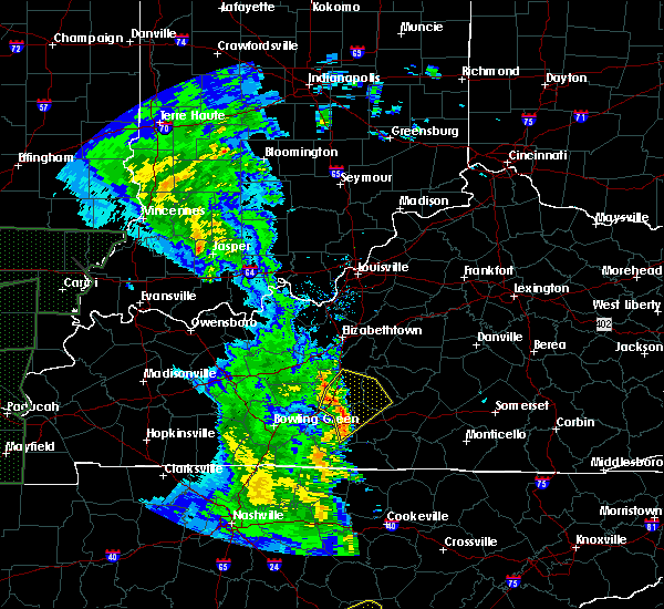 At 434 pm cdt, severe thunderstorms were located along a line extending from near munfordville to 17 miles northwest of edmonton to 6 miles east of glasgow, moving northeast at 50 mph (radar indicated. at 4:20 pm cdt a 54 mph wind gust was reported at the barren county kentucky mesonet site west of glasgow. this site likely missed the strongest winds from this storm). Hazards include 70 mph wind gusts. Expect considerable tree damage. damage is likely to mobile homes, roofs, and outbuildings. Locations impacted include, greensburg, munfordville, monroe, horse cave, bonnieville, logsdon valley, lobb, node, coral hill and fry. At 434 pm cdt, severe thunderstorms were located along a line extending from near munfordville to 17 miles northwest of edmonton to 6 miles east of glasgow, moving northeast at 50 mph (radar indicated. at 4:20 pm cdt a 54 mph wind gust was reported at the barren county kentucky mesonet site west of glasgow. this site likely missed the strongest winds from this storm). Hazards include 70 mph wind gusts. Expect considerable tree damage. damage is likely to mobile homes, roofs, and outbuildings. Locations impacted include, greensburg, munfordville, monroe, horse cave, bonnieville, logsdon valley, lobb, node, coral hill and fry.
|
| 4/30/2017 4:22 PM CDT |
 At 422 pm cdt, severe thunderstorms were located along a line extending from 13 miles southwest of munfordville to near glasgow to 15 miles west of edmonton, moving northeast at 60 mph (radar indicated). Hazards include 70 mph wind gusts. Expect considerable tree damage. Damage is likely to mobile homes, roofs, and outbuildings. At 422 pm cdt, severe thunderstorms were located along a line extending from 13 miles southwest of munfordville to near glasgow to 15 miles west of edmonton, moving northeast at 60 mph (radar indicated). Hazards include 70 mph wind gusts. Expect considerable tree damage. Damage is likely to mobile homes, roofs, and outbuildings.
|
| 4/5/2017 5:09 PM CDT |
 At 509 pm cdt, a severe thunderstorm was located 12 miles southeast of munfordville, moving northeast at 55 mph (radar indicated). Hazards include ping pong ball size hail and 60 mph wind gusts. People and animals outdoors will be injured. expect hail damage to roofs, siding, windows, and vehicles. expect wind damage to roofs, siding, and trees. locations impacted include, monroe, center, little barren, node, crailhope, whickerville, knob lick, savoyard, hiseville and park. A tornado watch remains in effect until 900 pm cdt for south central and central kentucky. At 509 pm cdt, a severe thunderstorm was located 12 miles southeast of munfordville, moving northeast at 55 mph (radar indicated). Hazards include ping pong ball size hail and 60 mph wind gusts. People and animals outdoors will be injured. expect hail damage to roofs, siding, windows, and vehicles. expect wind damage to roofs, siding, and trees. locations impacted include, monroe, center, little barren, node, crailhope, whickerville, knob lick, savoyard, hiseville and park. A tornado watch remains in effect until 900 pm cdt for south central and central kentucky.
|
| 4/5/2017 5:03 PM CDT |
 At 503 pm cdt, a severe thunderstorm was located 7 miles northeast of glasgow, moving northeast at 55 mph (radar indicated). Hazards include ping pong ball size hail and 60 mph wind gusts. People and animals outdoors will be injured. expect hail damage to roofs, siding, windows, and vehicles. expect wind damage to roofs, siding, and trees. locations impacted include, glasgow, monroe, horse cave, cave city, little barren, node, coral hill, lecta, whickerville and knob lick. A tornado watch remains in effect until 900 pm cdt for south central and central kentucky. At 503 pm cdt, a severe thunderstorm was located 7 miles northeast of glasgow, moving northeast at 55 mph (radar indicated). Hazards include ping pong ball size hail and 60 mph wind gusts. People and animals outdoors will be injured. expect hail damage to roofs, siding, windows, and vehicles. expect wind damage to roofs, siding, and trees. locations impacted include, glasgow, monroe, horse cave, cave city, little barren, node, coral hill, lecta, whickerville and knob lick. A tornado watch remains in effect until 900 pm cdt for south central and central kentucky.
|
| 4/5/2017 4:55 PM CDT |
 At 455 pm cdt, a severe thunderstorm was located near glasgow, moving northeast at 55 mph (radar indicated). Hazards include 60 mph wind gusts and quarter size hail. Hail damage to vehicles is expected. Expect wind damage to roofs, siding, and trees. At 455 pm cdt, a severe thunderstorm was located near glasgow, moving northeast at 55 mph (radar indicated). Hazards include 60 mph wind gusts and quarter size hail. Hail damage to vehicles is expected. Expect wind damage to roofs, siding, and trees.
|
| 3/27/2017 4:29 PM CDT |
 At 428 pm cdt, severe thunderstorms were located along a line extending from near plum springs to 9 miles southeast of mount victor to 9 miles northwest of westmoreland, moving east at 50 mph (radar indicated). Hazards include 60 mph wind gusts and quarter size hail. Hail damage to vehicles is expected. Expect wind damage to roofs, siding, and trees. At 428 pm cdt, severe thunderstorms were located along a line extending from near plum springs to 9 miles southeast of mount victor to 9 miles northwest of westmoreland, moving east at 50 mph (radar indicated). Hazards include 60 mph wind gusts and quarter size hail. Hail damage to vehicles is expected. Expect wind damage to roofs, siding, and trees.
|
| 3/1/2017 7:33 AM CST |
 At 833 am est/733 am cst/, severe thunderstorms were located along a line extending from 7 miles east of campbellsville to 7 miles northwest of glasgow to near westmoreland, moving east at 50 mph (radar indicated). Hazards include 60 mph wind gusts. Expect damage to roofs, siding, and trees. locations impacted include, glasgow, campbellsville, columbia, scottsville, tompkinsville, greensburg, edmonton, leslie, gamaliel and fountain run. a tornado watch remains in effect until 900 am est/800 am cst/ for central kentucky. A tornado watch also remains in effect until 1100 am est/1000 am cst/ for south central and central kentucky. At 833 am est/733 am cst/, severe thunderstorms were located along a line extending from 7 miles east of campbellsville to 7 miles northwest of glasgow to near westmoreland, moving east at 50 mph (radar indicated). Hazards include 60 mph wind gusts. Expect damage to roofs, siding, and trees. locations impacted include, glasgow, campbellsville, columbia, scottsville, tompkinsville, greensburg, edmonton, leslie, gamaliel and fountain run. a tornado watch remains in effect until 900 am est/800 am cst/ for central kentucky. A tornado watch also remains in effect until 1100 am est/1000 am cst/ for south central and central kentucky.
|
| 3/1/2017 7:09 AM CST |
 At 808 am est/708 am cst/, severe thunderstorms were located along a line extending from near campbellsville to near plum springs to 6 miles north of cross plains, moving east at 50 mph (radar indicated). Hazards include 60 mph wind gusts. expect damage to roofs, siding, and trees At 808 am est/708 am cst/, severe thunderstorms were located along a line extending from near campbellsville to near plum springs to 6 miles north of cross plains, moving east at 50 mph (radar indicated). Hazards include 60 mph wind gusts. expect damage to roofs, siding, and trees
|
| 3/1/2017 7:00 AM CST |
 At 759 am est/659 am cst/, severe thunderstorms were located along a line extending from 10 miles east of morgantown to 7 miles north of campbellsville, moving southeast at 50 mph (radar indicated). Hazards include 60 mph wind gusts. Expect damage to roofs, siding, and trees. locations impacted include, campbellsville, morgantown, greensburg, munfordville, brownsville, monroe, horse cave, cave city, park city and bonnieville. a tornado watch remains in effect until 900 am est/800 am cst/ for south central and central kentucky. A tornado watch also remains in effect until 1100 am est/1000 am cst/ for south central and central kentucky. At 759 am est/659 am cst/, severe thunderstorms were located along a line extending from 10 miles east of morgantown to 7 miles north of campbellsville, moving southeast at 50 mph (radar indicated). Hazards include 60 mph wind gusts. Expect damage to roofs, siding, and trees. locations impacted include, campbellsville, morgantown, greensburg, munfordville, brownsville, monroe, horse cave, cave city, park city and bonnieville. a tornado watch remains in effect until 900 am est/800 am cst/ for south central and central kentucky. A tornado watch also remains in effect until 1100 am est/1000 am cst/ for south central and central kentucky.
|
| 3/1/2017 6:52 AM CST |
 At 651 am cst, severe thunderstorms were located along a line extending from 10 miles east of dunmor to 10 miles north of springfield, moving east at 50 mph (radar indicated). Hazards include 60 mph wind gusts. Expect damage to roofs, siding, and trees. locations impacted include, bowling green, glasgow, russellville, scottsville, plum springs, memphis junction, mount victor, delafield, crestmoor and anderson. a tornado watch remains in effect until 800 am cst for south central and central kentucky. A tornado watch also remains in effect until 1000 am cst for south central and central kentucky. At 651 am cst, severe thunderstorms were located along a line extending from 10 miles east of dunmor to 10 miles north of springfield, moving east at 50 mph (radar indicated). Hazards include 60 mph wind gusts. Expect damage to roofs, siding, and trees. locations impacted include, bowling green, glasgow, russellville, scottsville, plum springs, memphis junction, mount victor, delafield, crestmoor and anderson. a tornado watch remains in effect until 800 am cst for south central and central kentucky. A tornado watch also remains in effect until 1000 am cst for south central and central kentucky.
|
| 3/1/2017 6:43 AM CST |
 At 743 am est/643 am cst/, severe thunderstorms were located along a line extending from 11 miles northeast of morgantown to near campbellsville, moving southeast at 50 mph (radar indicated). Hazards include 60 mph wind gusts. Expect damage to roofs, siding, and trees. locations impacted include, campbellsville, hodgenville, morgantown, greensburg, munfordville, brownsville, casey, monroe, lee and horse cave. a tornado watch remains in effect until 900 am est/800 am cst/ for south central and central kentucky. A tornado watch also remains in effect until 1100 am est/1000 am cst/ for south central and central kentucky. At 743 am est/643 am cst/, severe thunderstorms were located along a line extending from 11 miles northeast of morgantown to near campbellsville, moving southeast at 50 mph (radar indicated). Hazards include 60 mph wind gusts. Expect damage to roofs, siding, and trees. locations impacted include, campbellsville, hodgenville, morgantown, greensburg, munfordville, brownsville, casey, monroe, lee and horse cave. a tornado watch remains in effect until 900 am est/800 am cst/ for south central and central kentucky. A tornado watch also remains in effect until 1100 am est/1000 am cst/ for south central and central kentucky.
|
| 3/1/2017 6:41 AM CST |
 At 740 am est/640 am cst/, severe thunderstorms were located along a line extending from 11 miles northeast of morgantown to near campbellsville, moving southeast at 100 mph (radar indicated). Hazards include 60 mph wind gusts. expect damage to roofs, siding, and trees At 740 am est/640 am cst/, severe thunderstorms were located along a line extending from 11 miles northeast of morgantown to near campbellsville, moving southeast at 100 mph (radar indicated). Hazards include 60 mph wind gusts. expect damage to roofs, siding, and trees
|
| 3/1/2017 6:29 AM CST |
 At 629 am cst, severe thunderstorms were located along a line extending from near weir to near guthrie, moving east at 65 mph (radar indicated). Hazards include 70 mph wind gusts and nickel size hail. Expect considerable tree damage. Damage is likely to mobile homes, roofs, and outbuildings. At 629 am cst, severe thunderstorms were located along a line extending from near weir to near guthrie, moving east at 65 mph (radar indicated). Hazards include 70 mph wind gusts and nickel size hail. Expect considerable tree damage. Damage is likely to mobile homes, roofs, and outbuildings.
|
| 3/1/2017 6:25 AM CST |
 At 725 am est/625 am cst/, severe thunderstorms were located along a line extending from near hodgenville to near morgantown, moving southeast at 55 mph (radar indicated). Hazards include 60 mph wind gusts and penny size hail. Expect damage to roofs, siding, and trees. locations impacted include, leitchfield, hodgenville, morgantown, munfordville, brownsville, casey, monroe, lee, beaver dam and horse cave. a tornado watch remains in effect until 900 am est/800 am cst/ for south central and central kentucky. A tornado watch also remains in effect until 1100 am est/1000 am cst/ for south central and central kentucky. At 725 am est/625 am cst/, severe thunderstorms were located along a line extending from near hodgenville to near morgantown, moving southeast at 55 mph (radar indicated). Hazards include 60 mph wind gusts and penny size hail. Expect damage to roofs, siding, and trees. locations impacted include, leitchfield, hodgenville, morgantown, munfordville, brownsville, casey, monroe, lee, beaver dam and horse cave. a tornado watch remains in effect until 900 am est/800 am cst/ for south central and central kentucky. A tornado watch also remains in effect until 1100 am est/1000 am cst/ for south central and central kentucky.
|
| 3/1/2017 6:08 AM CST |
 At 708 am est/608 am cst/, severe thunderstorms were located along a line extending from near elizabethtown to 10 miles south of hartford, moving southeast at 80 mph (radar indicated). Hazards include 65 mph wind gusts and nickel size hail. expect damage to roofs, siding, and trees At 708 am est/608 am cst/, severe thunderstorms were located along a line extending from near elizabethtown to 10 miles south of hartford, moving southeast at 80 mph (radar indicated). Hazards include 65 mph wind gusts and nickel size hail. expect damage to roofs, siding, and trees
|
| 7/7/2016 3:54 PM CDT |
 At 354 pm cdt, severe thunderstorms were located along a line extending from 6 miles north of greensburg to 10 miles south of columbia, moving east at 45 mph. law enforcement reported trees down all over the county, with a tree on a structure on water street in greensburg (law enforcement). Hazards include 70 mph wind gusts. Expect considerable tree damage. damage is likely to mobile homes, roofs, and outbuildings. Locations impacted include, greensburg, edmonton, monroe, summersville, sparksville, new liberty, bliss, wisdom, newt and defries. At 354 pm cdt, severe thunderstorms were located along a line extending from 6 miles north of greensburg to 10 miles south of columbia, moving east at 45 mph. law enforcement reported trees down all over the county, with a tree on a structure on water street in greensburg (law enforcement). Hazards include 70 mph wind gusts. Expect considerable tree damage. damage is likely to mobile homes, roofs, and outbuildings. Locations impacted include, greensburg, edmonton, monroe, summersville, sparksville, new liberty, bliss, wisdom, newt and defries.
|
| 7/7/2016 3:47 PM CDT |
 At 346 pm cdt, severe thunderstorms were located along a line extending from 9 miles northwest of greensburg to 10 miles southwest of columbia, moving east at 45 mph (radar indicated). Hazards include 70 mph wind gusts. Expect considerable tree damage. damage is likely to mobile homes, roofs, and outbuildings. Locations impacted include, greensburg, edmonton, monroe, summersville, sparksville, new liberty, bliss, wisdom, newt and defries. At 346 pm cdt, severe thunderstorms were located along a line extending from 9 miles northwest of greensburg to 10 miles southwest of columbia, moving east at 45 mph (radar indicated). Hazards include 70 mph wind gusts. Expect considerable tree damage. damage is likely to mobile homes, roofs, and outbuildings. Locations impacted include, greensburg, edmonton, monroe, summersville, sparksville, new liberty, bliss, wisdom, newt and defries.
|
| 7/7/2016 3:29 PM CDT |
 At 328 pm cdt, severe thunderstorms were located along and behind a line extending from 8 miles north of munfordville to near edmonton, moving east at 50 mph. the strongest winds were shown to be near munfordville (radar indicated). Hazards include 70 mph wind gusts. Expect considerable tree damage. Damage is likely to mobile homes, roofs, and outbuildings. At 328 pm cdt, severe thunderstorms were located along and behind a line extending from 8 miles north of munfordville to near edmonton, moving east at 50 mph. the strongest winds were shown to be near munfordville (radar indicated). Hazards include 70 mph wind gusts. Expect considerable tree damage. Damage is likely to mobile homes, roofs, and outbuildings.
|
| 7/6/2016 3:51 PM CDT |
 At 351 pm cdt, severe thunderstorms were located along a line extending from near munfordville to 12 miles west of tompkinsville, moving east at 45 mph (radar indicated). Hazards include 60 mph wind gusts and penny size hail. Expect damage to roofs. siding. And trees. At 351 pm cdt, severe thunderstorms were located along a line extending from near munfordville to 12 miles west of tompkinsville, moving east at 45 mph (radar indicated). Hazards include 60 mph wind gusts and penny size hail. Expect damage to roofs. siding. And trees.
|
| 7/4/2016 1:57 PM CDT | Several trees down across the area in metcalfe county KY, 4.5 miles SW of Hiseville, KY |
| 7/4/2016 1:57 PM CDT | Metal rool peeled off bar in metcalfe county KY, 5.9 miles WSW of Hiseville, KY |
| 7/4/2016 1:44 PM CDT |
 At 144 pm cdt, a severe thunderstorm was located 10 miles east of mount victor, moving east at 55 mph (radar indicated). Hazards include 60 mph wind gusts. Expect damage to roofs. siding. And trees. At 144 pm cdt, a severe thunderstorm was located 10 miles east of mount victor, moving east at 55 mph (radar indicated). Hazards include 60 mph wind gusts. Expect damage to roofs. siding. And trees.
|
| 7/3/2016 2:42 PM CDT |
 At 242 pm cdt, a severe thunderstorm was located 8 miles northeast of glasgow, moving east at 15 mph (radar indicated). Hazards include 60 mph wind gusts and penny size hail. Expect damage to roofs. siding. And trees. At 242 pm cdt, a severe thunderstorm was located 8 miles northeast of glasgow, moving east at 15 mph (radar indicated). Hazards include 60 mph wind gusts and penny size hail. Expect damage to roofs. siding. And trees.
|
| 5/10/2016 6:27 PM CDT |
 At 627 pm cdt, a severe thunderstorm was located 7 miles southeast of munfordville, moving east at 20 mph (radar indicated). Hazards include 60 mph wind gusts and quarter size hail. Hail damage to vehicles is expected. Expect wind damage to roofs, siding, and trees. At 627 pm cdt, a severe thunderstorm was located 7 miles southeast of munfordville, moving east at 20 mph (radar indicated). Hazards include 60 mph wind gusts and quarter size hail. Hail damage to vehicles is expected. Expect wind damage to roofs, siding, and trees.
|
| 5/4/2016 3:38 PM CDT |
 At 338 pm cdt, a severe thunderstorm was located near glasgow, moving southeast at 25 mph (radar indicated). Hazards include quarter size hail. damage to vehicles is expected At 338 pm cdt, a severe thunderstorm was located near glasgow, moving southeast at 25 mph (radar indicated). Hazards include quarter size hail. damage to vehicles is expected
|
| 3/31/2016 5:04 PM CDT |
 At 504 pm cdt, a severe thunderstorm was located 10 miles north of edmonton, moving northeast at 110 mph (radar indicated). Hazards include 60 mph wind gusts. Expect damage to roofs. siding. and trees. Locations impacted include, glasgow, columbia, greensburg, edmonton, monroe, horse cave, kino, new liberty, bliss and wisdom. At 504 pm cdt, a severe thunderstorm was located 10 miles north of edmonton, moving northeast at 110 mph (radar indicated). Hazards include 60 mph wind gusts. Expect damage to roofs. siding. and trees. Locations impacted include, glasgow, columbia, greensburg, edmonton, monroe, horse cave, kino, new liberty, bliss and wisdom.
|
| 3/31/2016 4:45 PM CDT |
 At 444 pm cdt, a severe thunderstorm was located near glasgow, moving northeast at 45 mph (radar indicated). Hazards include 60 mph wind gusts. Expect damage to roofs. siding. And trees. At 444 pm cdt, a severe thunderstorm was located near glasgow, moving northeast at 45 mph (radar indicated). Hazards include 60 mph wind gusts. Expect damage to roofs. siding. And trees.
|
| 3/31/2016 4:21 PM CDT |
 At 420 pm cdt, a severe thunderstorm was located near plum springs, moving east at 55 mph (radar indicated). Hazards include 60 mph wind gusts and penny size hail. Expect damage to roofs. siding. And trees. At 420 pm cdt, a severe thunderstorm was located near plum springs, moving east at 55 mph (radar indicated). Hazards include 60 mph wind gusts and penny size hail. Expect damage to roofs. siding. And trees.
|
| 6/26/2015 3:30 PM CDT | At 328 pm cdt, a severe thunderstorm was located 11 miles southeast of munfordville, and moving northeast at 20 mph (radar indicated). Hazards include 60 mph wind gusts and nickel size hail. Expect damage to roofs. Siding and trees. |
| 6/26/2015 3:13 PM CDT | At 311 pm cdt, a severe thunderstorm capable of producing a tornado was located 8 miles north of glasgow, and moving east at 20 mph (radar indicated rotation). Hazards include tornado. Flying debris will be dangerous to those caught without shelter. mobile homes will be damaged or destroyed. damage to roofs, windows and vehicles will occur. Locations impacted include, griderville, bear wallow, hiseville, halfway, uno, seymour, park, savoyard, legrande, three springs, center, rex, pascal, bunnell crossing, whickerville, node, hardyville and monroe. |
| 6/26/2015 3:01 PM CDT | At 259 pm cdt, a severe thunderstorm capable of producing a tornado was located 8 miles northwest of glasgow, and moving east at 20 mph (radar indicated rotation). Hazards include tornado. Flying debris will be dangerous to those caught without shelter. mobile homes will be damaged or destroyed. damage to roofs, windows and vehicles will occur. This dangerous storm will affect mainly rural areas of northeastern barren, northwestern metcalfe and southeastern hart counties, including the following locations, horse cave, griderville, goodnight, bear wallow, hiseville, halfway, uno, seymour, park and legrande. |
| 6/26/2015 2:55 PM CDT | At 254 pm cdt, severe thunderstorms were located along a line extending from 11 miles northwest of glasgow to delafield, and moving northeast at 15 mph (radar indicated). Hazards include 60 mph wind gusts. Expect damage to roofs. siding and trees. Locations impacted include, munfordville, girkin, cave city, union city, cedar spring, sand hill, pig, sloans crossing, chalybeate, horse cave, elko, nick, rhoda, mammoth cave, northtown, arthur, bear wallow, griderville, goodnight and uno. |
| 6/26/2015 2:46 PM CDT | At 244 pm cdt, severe thunderstorms were located along a line extending from 12 miles northwest of glasgow to delafield, and moving northeast at 15 mph (radar indicated). Hazards include 60 mph wind gusts and quarter size hail. Hail damage to vehicles is expected. Expect wind damage to roofs, siding and trees. |
| 6/21/2015 11:08 PM CDT | Several trees and power lines down on crenshaw cassady rd and cave ridge - new liberty r in metcalfe county KY, 5.5 miles WNW of Hiseville, KY |
| 6/21/2015 11:08 PM CDT |
 At 1106 pm cdt, a severe thunderstorm was located 7 miles northwest of edmonton, and moving east at 30 mph (radar indicated). Hazards include 60 mph wind gusts and quarter size hail. Hail damage to vehicles is expected. Expect wind damage to roofs, siding and trees. At 1106 pm cdt, a severe thunderstorm was located 7 miles northwest of edmonton, and moving east at 30 mph (radar indicated). Hazards include 60 mph wind gusts and quarter size hail. Hail damage to vehicles is expected. Expect wind damage to roofs, siding and trees.
|
| 4/10/2015 3:00 AM CDT | A severe thunderstorm warning remains in effect for eastern hart. green. eastern barren. western monroe and metcalfe counties until 315 am cdt. at 259 am cdt. a severe thunderstorm was located 8 miles northeast of glasgow. and moving northeast at 50 mph. hazard. 60 mph wind gusts. |
| 4/10/2015 2:36 AM CDT | The national weather service in louisville has issued a * severe thunderstorm warning for. southeastern allen county in south central kentucky. barren county in south central kentucky. green county in south central kentucky. Hart county in south central kentucky. |
| 6/27/2013 6:08 PM CDT | Viewer reported trees down in center in metcalfe county KY, 7.7 miles WSW of Hiseville, KY |
| 7/19/2012 8:25 PM CDT | 4 barns completely destroyed...3 others damaged with lots of trees down as well near intersection of ky 1048 and herbert hodges rd in metcalfe county KY, 8.3 miles WSW of Hiseville, KY |
| 4/26/2012 4:18 AM CDT | One house lost roof...four houses with roof damage along crenshaw roa in metcalfe county KY, 5.7 miles WNW of Hiseville, KY |
| 1/1/0001 12:00 AM | Homes and garages damage in barren county KY, 0.3 miles ENE of Hiseville, KY |
| 1/1/0001 12:00 AM | Quarter sized hail reported 4.8 miles W of Hiseville, KY |
| 1/1/0001 12:00 AM | Trees and power lines dow in barren county KY, 0.3 miles ENE of Hiseville, KY |
| 1/1/0001 12:00 AM | A few trees and powerlines down on ridge bay drive and gold point circle. reported by dispatc in barren county KY, 2.1 miles WNW of Hiseville, KY |
Hail Maps for Hiseville, KY


Connect with Interactive Hail Maps