

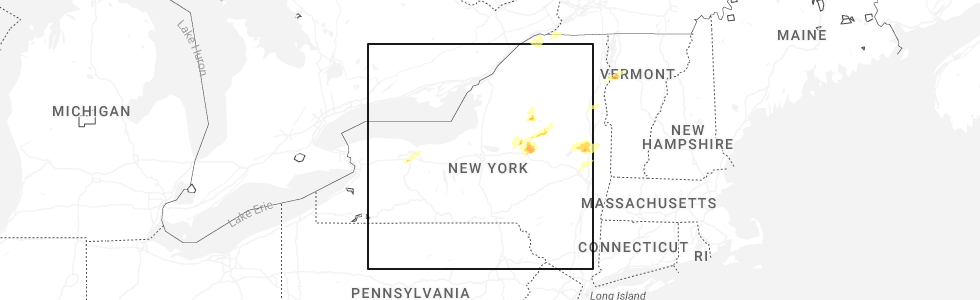
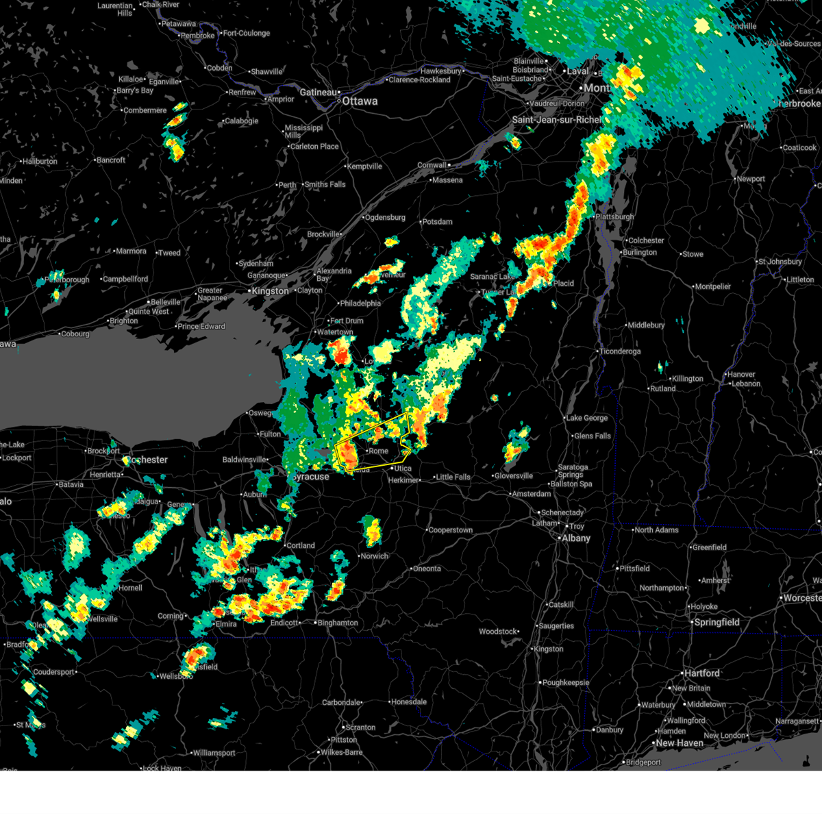
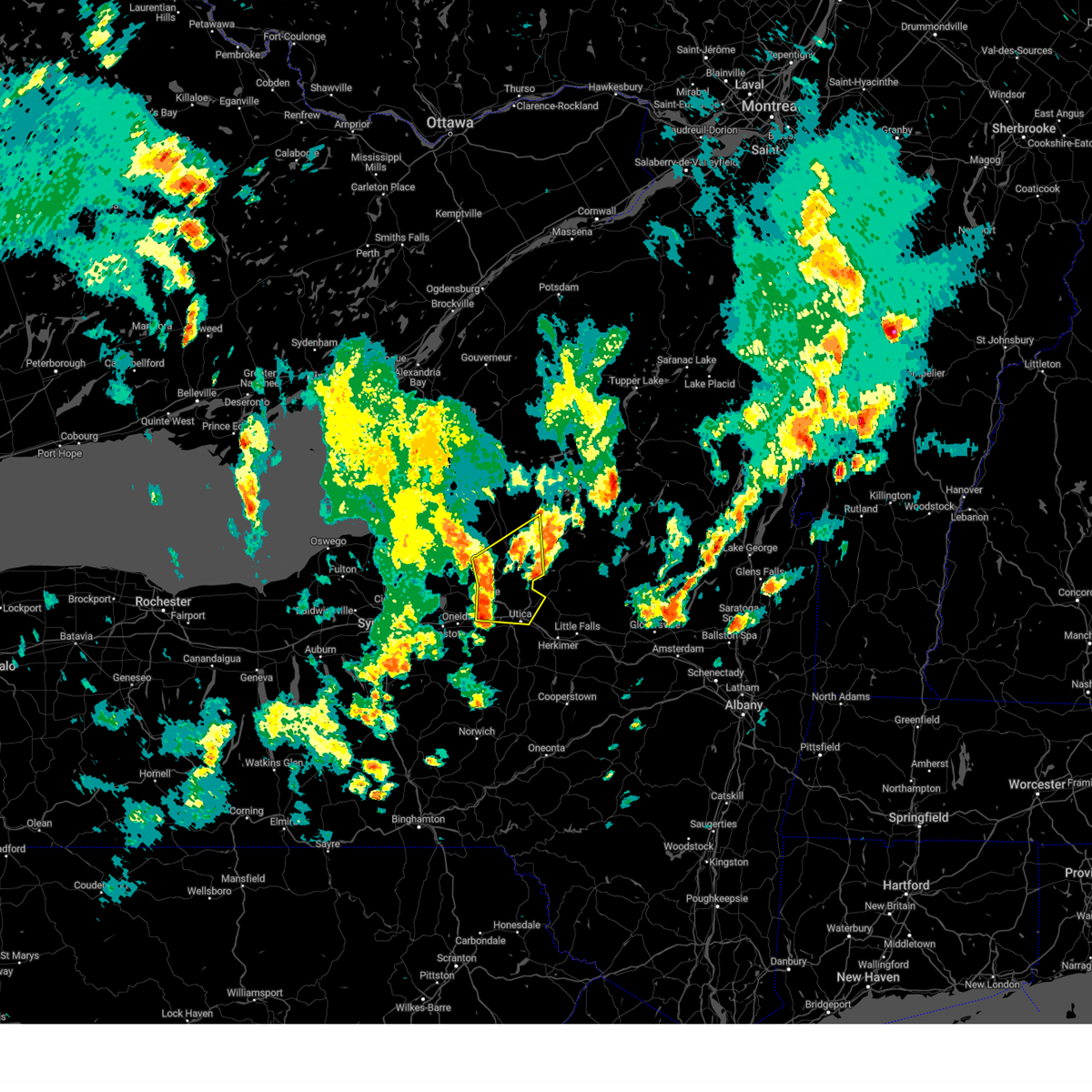
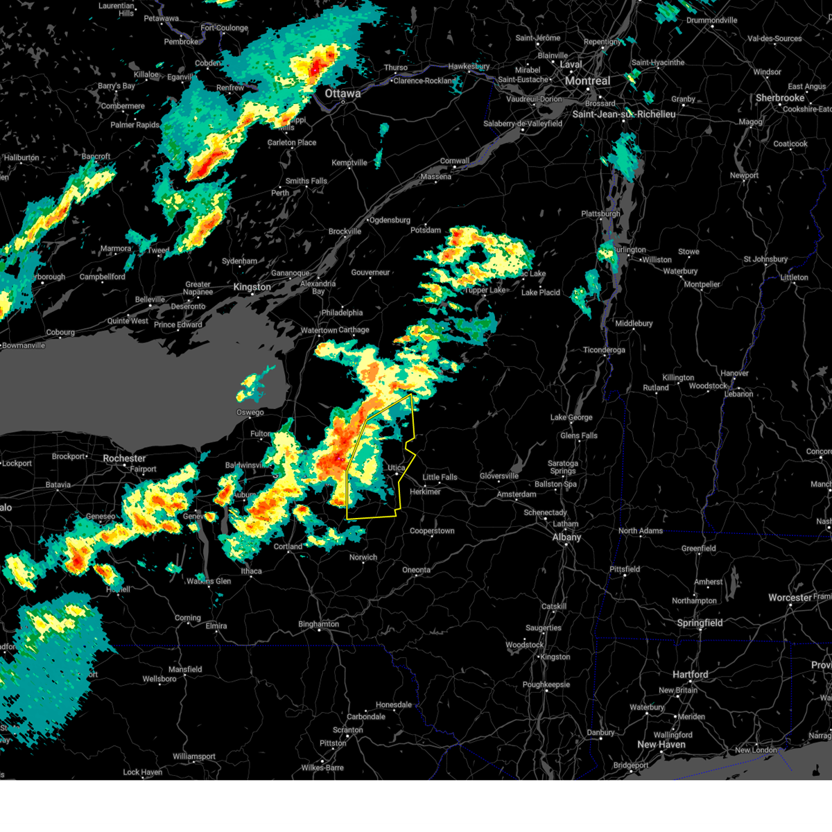
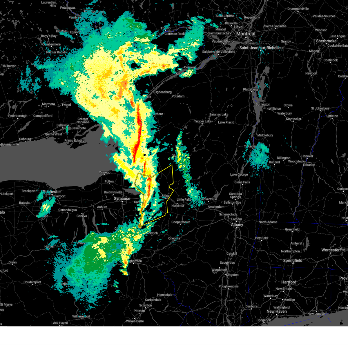
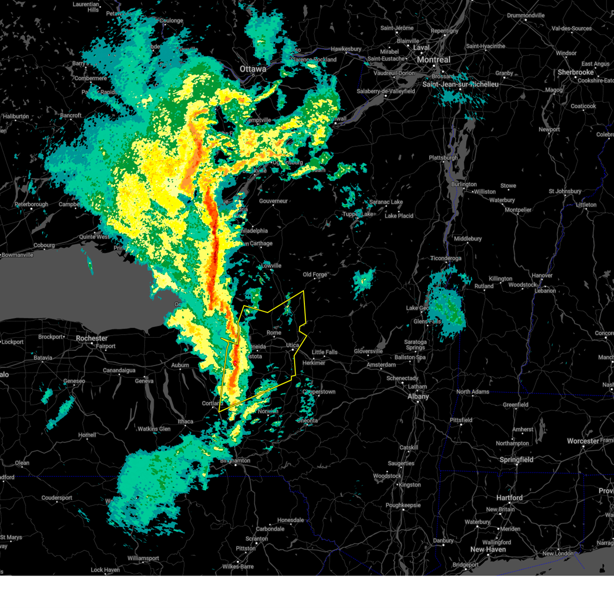
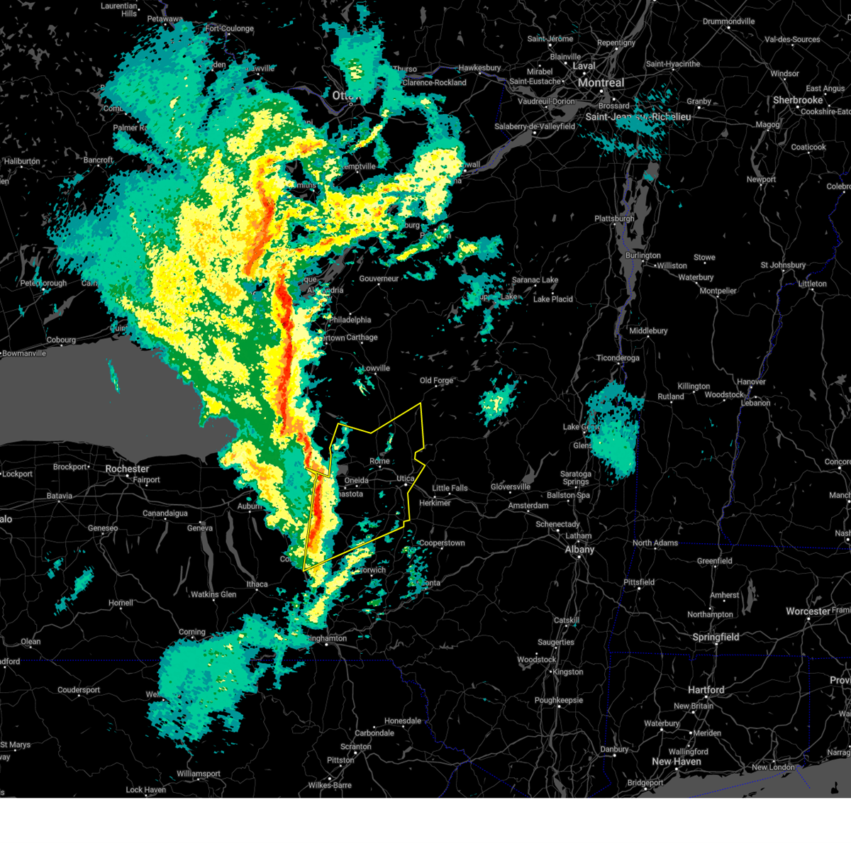
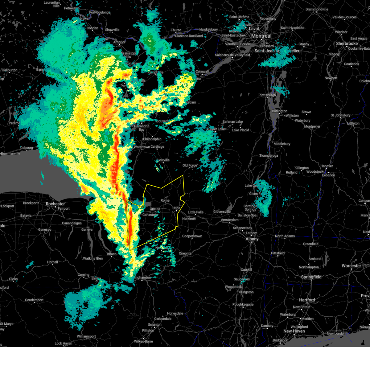
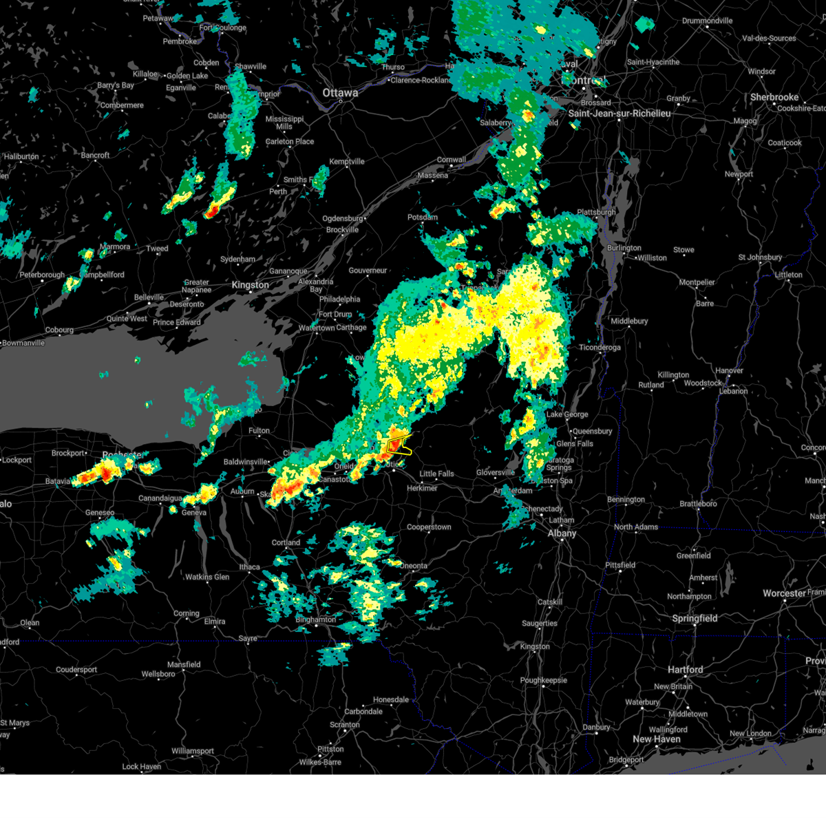
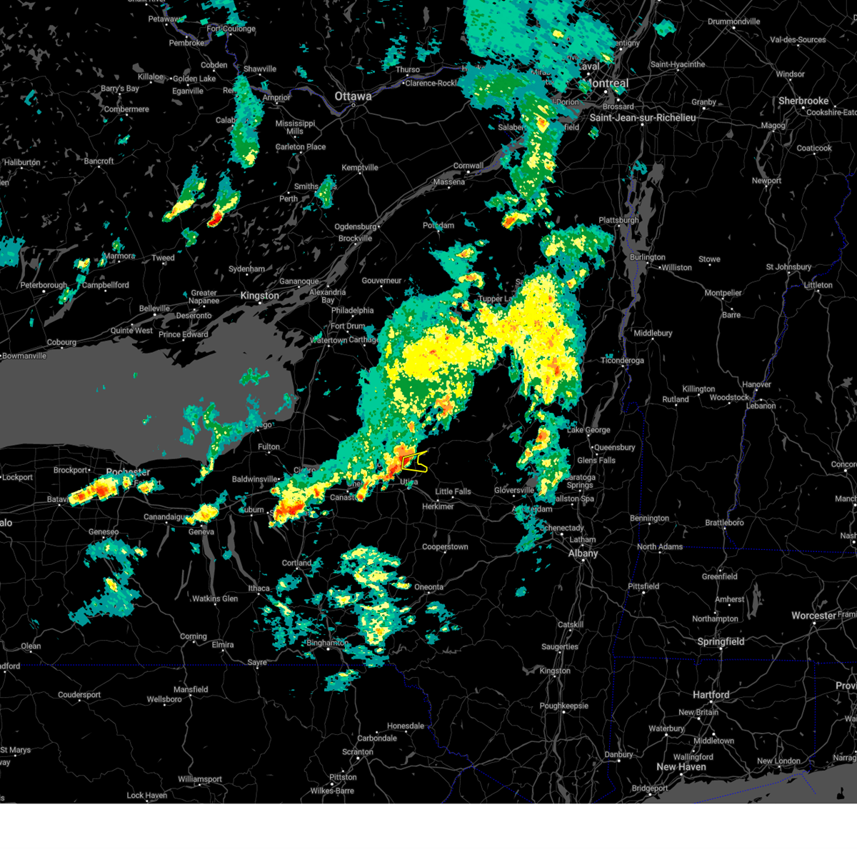
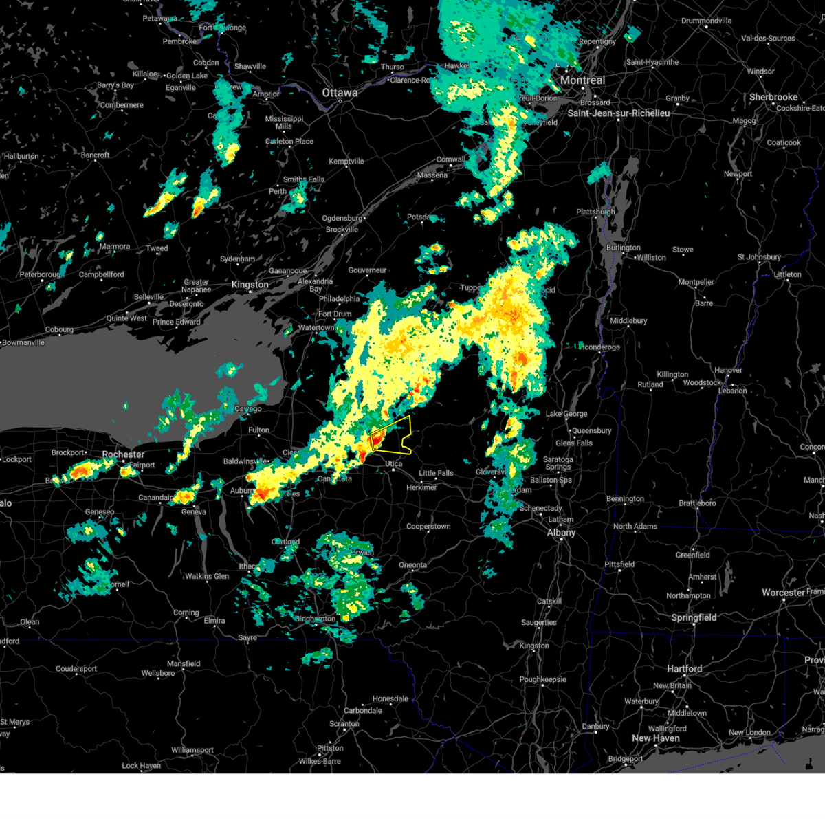
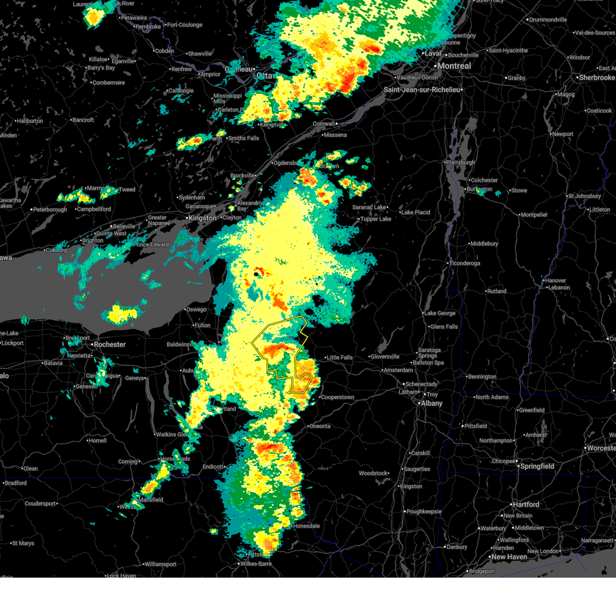
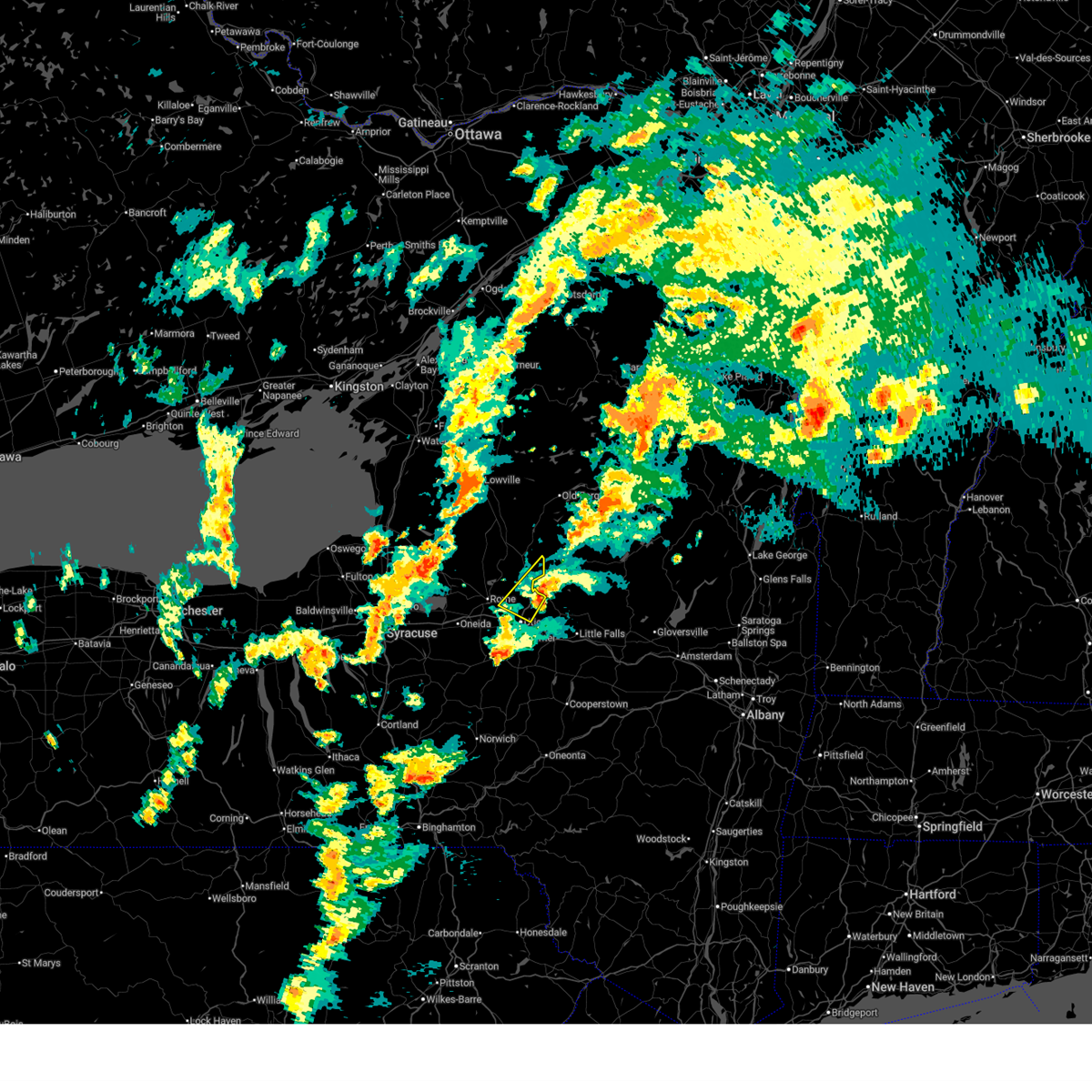
Hail Map for Holland Patent, NY
The Holland Patent, NY area has had 5 reports of on-the-ground hail by trained spotters, and has been under severe weather warnings 8 times during the past 12 months. Doppler radar has detected hail at or near Holland Patent, NY on 22 occasions.
| Name: | Holland Patent, NY |
| Where Located: | 46.8 miles ENE of Syracuse, NY |
| Map: | Google Map for Holland Patent, NY |
| Population: | 458 |
| Housing Units: | 231 |
| More Info: | Search Google for Holland Patent, NY |
2
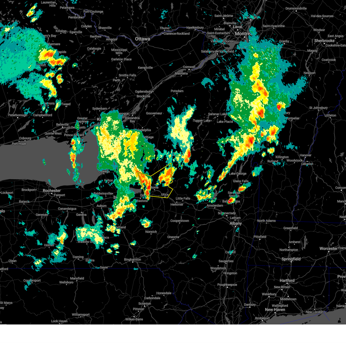
The Top Recent Hail Date for Holland Patent, NY is Saturday, May 17, 2025 (8th out of 22)
Hail and Wind Damage Spotted near Holland Patent, NY
| Date / Time | Report Details |
|---|---|
| 4/16/2026 7:58 PM EDT |
 At 758 pm edt, a severe thunderstorm was located over sherrill, or near oneida, moving east at 45 mph (radar indicated). Hazards include 60 mph wind gusts and penny size hail. Expect damage to roofs, siding, and trees. Locations impacted include, utica, rome, oneida, kirkland, verona, westmoreland, trenton, paris, deerfield, and floyd. At 758 pm edt, a severe thunderstorm was located over sherrill, or near oneida, moving east at 45 mph (radar indicated). Hazards include 60 mph wind gusts and penny size hail. Expect damage to roofs, siding, and trees. Locations impacted include, utica, rome, oneida, kirkland, verona, westmoreland, trenton, paris, deerfield, and floyd.
|
| 4/16/2026 7:35 PM EDT |
 Svrbgm the national weather service in binghamton has issued a * severe thunderstorm warning for, southern oneida county in central new york, northwestern madison county in central new york, * until 830 pm edt. * at 735 pm edt, a severe thunderstorm was located over manlius, or 9 miles east of syracuse, moving east at 45 mph (radar indicated). Hazards include 60 mph wind gusts and penny size hail. expect damage to roofs, siding, and trees Svrbgm the national weather service in binghamton has issued a * severe thunderstorm warning for, southern oneida county in central new york, northwestern madison county in central new york, * until 830 pm edt. * at 735 pm edt, a severe thunderstorm was located over manlius, or 9 miles east of syracuse, moving east at 45 mph (radar indicated). Hazards include 60 mph wind gusts and penny size hail. expect damage to roofs, siding, and trees
|
| 7/13/2025 6:03 PM EDT |
 the severe thunderstorm warning has been cancelled and is no longer in effect the severe thunderstorm warning has been cancelled and is no longer in effect
|
| 7/13/2025 5:46 PM EDT |
 At 546 pm edt, a severe thunderstorm was located over new london, or near rome, moving east at 35 mph (radar indicated). Hazards include 60 mph wind gusts. Expect damage to roofs, siding, and trees. Locations impacted include, rome, oneida, lee, verona, westmoreland, vienna, trenton, floyd, whitesboro, and oriskany. At 546 pm edt, a severe thunderstorm was located over new london, or near rome, moving east at 35 mph (radar indicated). Hazards include 60 mph wind gusts. Expect damage to roofs, siding, and trees. Locations impacted include, rome, oneida, lee, verona, westmoreland, vienna, trenton, floyd, whitesboro, and oriskany.
|
| 7/13/2025 5:46 PM EDT |
 the severe thunderstorm warning has been cancelled and is no longer in effect the severe thunderstorm warning has been cancelled and is no longer in effect
|
| 7/13/2025 5:30 PM EDT |
 Svrbgm the national weather service in binghamton has issued a * severe thunderstorm warning for, central oneida county in central new york, north central madison county in central new york, * until 630 pm edt. * at 530 pm edt, a severe thunderstorm was located near verona beach, or near oneida, moving east at 35 mph (radar indicated). Hazards include 60 mph wind gusts. expect damage to roofs, siding, and trees Svrbgm the national weather service in binghamton has issued a * severe thunderstorm warning for, central oneida county in central new york, north central madison county in central new york, * until 630 pm edt. * at 530 pm edt, a severe thunderstorm was located near verona beach, or near oneida, moving east at 35 mph (radar indicated). Hazards include 60 mph wind gusts. expect damage to roofs, siding, and trees
|
| 6/22/2025 3:40 AM EDT |
 At 340 am edt, severe thunderstorms were located along a line extending from 6 miles east of ohio to near floyd to near camden, moving east at 35 mph (radar indicated). Hazards include 70 mph wind gusts and penny size hail. Expect considerable tree damage. damage is likely to mobile homes, roofs, and outbuildings. Locations impacted include, utica, rome, oneida, kirkland, lee, verona, westmoreland, vienna, trenton, and paris. At 340 am edt, severe thunderstorms were located along a line extending from 6 miles east of ohio to near floyd to near camden, moving east at 35 mph (radar indicated). Hazards include 70 mph wind gusts and penny size hail. Expect considerable tree damage. damage is likely to mobile homes, roofs, and outbuildings. Locations impacted include, utica, rome, oneida, kirkland, lee, verona, westmoreland, vienna, trenton, and paris.
|
| 6/22/2025 3:14 AM EDT |
 Svrbgm the national weather service in binghamton has issued a * severe thunderstorm warning for, oneida county in central new york, * until 415 am edt. * at 314 am edt, severe thunderstorms were located along a line extending from 8 miles southeast of mckeever to 9 miles north of delta lake to 9 miles southwest of redfield, moving southeast at 35 mph (radar indicated). Hazards include 60 mph wind gusts and penny size hail. expect damage to roofs, siding, and trees Svrbgm the national weather service in binghamton has issued a * severe thunderstorm warning for, oneida county in central new york, * until 415 am edt. * at 314 am edt, severe thunderstorms were located along a line extending from 8 miles southeast of mckeever to 9 miles north of delta lake to 9 miles southwest of redfield, moving southeast at 35 mph (radar indicated). Hazards include 60 mph wind gusts and penny size hail. expect damage to roofs, siding, and trees
|
| 5/17/2025 3:59 PM EDT |
 The storm which prompted the warning is moving out of the area. therefore, the warning will be allowed to expire. a severe thunderstorm watch remains in effect until 800 pm edt for central new york. The storm which prompted the warning is moving out of the area. therefore, the warning will be allowed to expire. a severe thunderstorm watch remains in effect until 800 pm edt for central new york.
|
| 5/17/2025 3:41 PM EDT |
 At 340 pm edt, a severe thunderstorm was located over remsen, or 10 miles southeast of boonville, moving east at 55 mph (radar indicated). Hazards include 60 mph wind gusts and nickel size hail. Expect damage to roofs, siding, and trees. Locations impacted include, utica, rome, westmoreland, trenton, deerfield, floyd, whitesboro, new york mills, yorkville, and boonville. At 340 pm edt, a severe thunderstorm was located over remsen, or 10 miles southeast of boonville, moving east at 55 mph (radar indicated). Hazards include 60 mph wind gusts and nickel size hail. Expect damage to roofs, siding, and trees. Locations impacted include, utica, rome, westmoreland, trenton, deerfield, floyd, whitesboro, new york mills, yorkville, and boonville.
|
| 5/17/2025 3:30 PM EDT |
 At 330 pm edt, a severe thunderstorm was located near delta lake, or 8 miles northeast of rome, moving east at 55 mph (radar indicated). Hazards include 60 mph wind gusts and nickel size hail. Expect damage to roofs, siding, and trees. Locations impacted include, utica, rome, lee, verona, westmoreland, trenton, deerfield, floyd, whitesboro, and new york mills. At 330 pm edt, a severe thunderstorm was located near delta lake, or 8 miles northeast of rome, moving east at 55 mph (radar indicated). Hazards include 60 mph wind gusts and nickel size hail. Expect damage to roofs, siding, and trees. Locations impacted include, utica, rome, lee, verona, westmoreland, trenton, deerfield, floyd, whitesboro, and new york mills.
|
| 5/17/2025 3:05 PM EDT |
 Svrbgm the national weather service in binghamton has issued a * severe thunderstorm warning for, oneida county in central new york, * until 400 pm edt. * at 304 pm edt, a severe thunderstorm was located 7 miles west of vienna, or 8 miles southwest of camden, moving east at 55 mph (radar indicated). Hazards include 60 mph wind gusts and nickel size hail. expect damage to roofs, siding, and trees Svrbgm the national weather service in binghamton has issued a * severe thunderstorm warning for, oneida county in central new york, * until 400 pm edt. * at 304 pm edt, a severe thunderstorm was located 7 miles west of vienna, or 8 miles southwest of camden, moving east at 55 mph (radar indicated). Hazards include 60 mph wind gusts and nickel size hail. expect damage to roofs, siding, and trees
|
| 4/29/2025 6:20 PM EDT |
 the severe thunderstorm warning has been cancelled and is no longer in effect the severe thunderstorm warning has been cancelled and is no longer in effect
|
| 4/29/2025 5:44 PM EDT |
 Svrbgm the national weather service in binghamton has issued a * severe thunderstorm warning for, oneida county in central new york, central madison county in central new york, * until 630 pm edt. * at 544 pm edt, severe thunderstorms were located along a line extending from near boonville to new london to nelson, moving east at 55 mph (radar indicated). Hazards include 60 mph wind gusts and quarter size hail. Hail damage to vehicles is expected. Expect wind damage to roofs, siding, and trees. Svrbgm the national weather service in binghamton has issued a * severe thunderstorm warning for, oneida county in central new york, central madison county in central new york, * until 630 pm edt. * at 544 pm edt, severe thunderstorms were located along a line extending from near boonville to new london to nelson, moving east at 55 mph (radar indicated). Hazards include 60 mph wind gusts and quarter size hail. Hail damage to vehicles is expected. Expect wind damage to roofs, siding, and trees.
|
| 3/16/2025 6:05 PM EDT |
 The storms which prompted the warning have weakened below severe limits, and no longer pose an immediate threat to life or property. therefore, the warning has been allowed to expire. a severe thunderstorm watch remains in effect until 700 pm edt for central new york. to report severe weather, contact your nearest law enforcement agency. they will relay your report to the national weather service binghamton. The storms which prompted the warning have weakened below severe limits, and no longer pose an immediate threat to life or property. therefore, the warning has been allowed to expire. a severe thunderstorm watch remains in effect until 700 pm edt for central new york. to report severe weather, contact your nearest law enforcement agency. they will relay your report to the national weather service binghamton.
|
| 3/16/2025 5:47 PM EDT |
 At 547 pm edt, severe thunderstorms were located along a line extending from 6 miles northwest of boonville to near waterville, moving northeast at 60 mph (new york state mesonet reported a 62 mph gust in fayetteville). Hazards include 60 mph wind gusts. Expect damage to roofs, siding, and trees. Locations impacted include, hubbardsville, west eaton, alder creek, pierceville, sherrill, delta lake state park, utica, otselic, remsen, and forestport. At 547 pm edt, severe thunderstorms were located along a line extending from 6 miles northwest of boonville to near waterville, moving northeast at 60 mph (new york state mesonet reported a 62 mph gust in fayetteville). Hazards include 60 mph wind gusts. Expect damage to roofs, siding, and trees. Locations impacted include, hubbardsville, west eaton, alder creek, pierceville, sherrill, delta lake state park, utica, otselic, remsen, and forestport.
|
| 3/16/2025 5:32 PM EDT |
 the severe thunderstorm warning has been cancelled and is no longer in effect the severe thunderstorm warning has been cancelled and is no longer in effect
|
| 3/16/2025 5:32 PM EDT |
 At 531 pm edt, severe thunderstorms located along a line extending from 7 miles southwest of highmarket to hamilton, moving northeast at 60 mph (62 mph wind gust at the fayetteville new york state mesonet site). Hazards include 60 mph wind gusts. Expect damage to roofs, siding, and trees. Locations impacted include, hubbardsville, west eaton, alder creek, pierceville, florence, sherrill, delta lake state park, blossvale, new london, and utica. At 531 pm edt, severe thunderstorms located along a line extending from 7 miles southwest of highmarket to hamilton, moving northeast at 60 mph (62 mph wind gust at the fayetteville new york state mesonet site). Hazards include 60 mph wind gusts. Expect damage to roofs, siding, and trees. Locations impacted include, hubbardsville, west eaton, alder creek, pierceville, florence, sherrill, delta lake state park, blossvale, new london, and utica.
|
| 3/16/2025 5:11 PM EDT |
 At 510 pm edt, severe thunderstorms were located along a line extending from 10 miles northeast of central square to near cuyler, moving northeast at 60 mph (the new york mesonet recorded a gust of 62 mph in fayetteville). Hazards include 70 mph wind gusts. Expect considerable tree damage. damage is likely to mobile homes, roofs, and outbuildings. Locations impacted include, union corners, pierceville, florence, blossvale, new london, remsen, colemans, manlius, westmoreland, and verona mills. At 510 pm edt, severe thunderstorms were located along a line extending from 10 miles northeast of central square to near cuyler, moving northeast at 60 mph (the new york mesonet recorded a gust of 62 mph in fayetteville). Hazards include 70 mph wind gusts. Expect considerable tree damage. damage is likely to mobile homes, roofs, and outbuildings. Locations impacted include, union corners, pierceville, florence, blossvale, new london, remsen, colemans, manlius, westmoreland, and verona mills.
|
| 3/16/2025 5:06 PM EDT |
 At 506 pm edt, severe thunderstorms were located along a line extending from 7 miles northeast of central square to near cuyler, moving northeast at 60 mph (radar indicated). Hazards include 60 mph wind gusts. Expect damage to roofs, siding, and trees. Locations impacted include, union corners, pierceville, florence, blossvale, new london, remsen, colemans, manlius, westmoreland, and verona mills. At 506 pm edt, severe thunderstorms were located along a line extending from 7 miles northeast of central square to near cuyler, moving northeast at 60 mph (radar indicated). Hazards include 60 mph wind gusts. Expect damage to roofs, siding, and trees. Locations impacted include, union corners, pierceville, florence, blossvale, new london, remsen, colemans, manlius, westmoreland, and verona mills.
|
| 3/16/2025 4:57 PM EDT |
 Svrbgm the national weather service in binghamton has issued a * severe thunderstorm warning for, oneida county in central new york, madison county in central new york, northeastern cortland county in central new york, eastern onondaga county in central new york, northwestern chenango county in central new york, * until 600 pm edt. * at 457 pm edt, severe thunderstorms were located along a line extending from central square to near mcgraw, moving northeast at 55 mph (radar indicated). Hazards include 60 mph wind gusts. expect damage to roofs, siding, and trees Svrbgm the national weather service in binghamton has issued a * severe thunderstorm warning for, oneida county in central new york, madison county in central new york, northeastern cortland county in central new york, eastern onondaga county in central new york, northwestern chenango county in central new york, * until 600 pm edt. * at 457 pm edt, severe thunderstorms were located along a line extending from central square to near mcgraw, moving northeast at 55 mph (radar indicated). Hazards include 60 mph wind gusts. expect damage to roofs, siding, and trees
|
| 8/11/2024 6:03 PM EDT |
 the severe thunderstorm warning has been cancelled and is no longer in effect the severe thunderstorm warning has been cancelled and is no longer in effect
|
| 8/11/2024 5:55 PM EDT |
 At 555 pm edt, a severe thunderstorm was located over barnveld, or 10 miles north of utica, moving east at 35 mph (public reported wind damage such as downed trees and wires). Hazards include 60 mph wind gusts and quarter size hail. Hail damage to vehicles is expected. expect wind damage to roofs, siding, and trees. Locations impacted include, trenton, holland patent, prospect, barneveld, barnveld, hinckley, and trenton falls. At 555 pm edt, a severe thunderstorm was located over barnveld, or 10 miles north of utica, moving east at 35 mph (public reported wind damage such as downed trees and wires). Hazards include 60 mph wind gusts and quarter size hail. Hail damage to vehicles is expected. expect wind damage to roofs, siding, and trees. Locations impacted include, trenton, holland patent, prospect, barneveld, barnveld, hinckley, and trenton falls.
|
| 8/11/2024 5:41 PM EDT |
 Svrbgm the national weather service in binghamton has issued a * severe thunderstorm warning for, east central oneida county in central new york, * until 630 pm edt. * at 540 pm edt, a severe thunderstorm was located near steuben, or 8 miles northeast of rome, moving east at 40 mph (public has reported wind damage such as downed trees and wires). Hazards include 60 mph wind gusts and quarter size hail. Hail damage to vehicles is expected. Expect wind damage to roofs, siding, and trees. Svrbgm the national weather service in binghamton has issued a * severe thunderstorm warning for, east central oneida county in central new york, * until 630 pm edt. * at 540 pm edt, a severe thunderstorm was located near steuben, or 8 miles northeast of rome, moving east at 40 mph (public has reported wind damage such as downed trees and wires). Hazards include 60 mph wind gusts and quarter size hail. Hail damage to vehicles is expected. Expect wind damage to roofs, siding, and trees.
|
| 7/16/2024 3:42 PM EDT |
 At 327 pm edt, a confirmed tornado was near rome, moving east at 35 mph (radar confirmed tornado). Hazards include damaging tornado. Flying debris will be dangerous to those caught without shelter. mobile homes will be damaged or destroyed. damage to roofs, windows, and vehicles will occur. tree damage is likely. this tornado will be near, trenton, steuben, and holland patent around 345 pm edt. Remsen and trenton falls around 350 pm edt. At 327 pm edt, a confirmed tornado was near rome, moving east at 35 mph (radar confirmed tornado). Hazards include damaging tornado. Flying debris will be dangerous to those caught without shelter. mobile homes will be damaged or destroyed. damage to roofs, windows, and vehicles will occur. tree damage is likely. this tornado will be near, trenton, steuben, and holland patent around 345 pm edt. Remsen and trenton falls around 350 pm edt.
|
| 7/16/2024 3:31 PM EDT |
 At 331 pm edt, a confirmed tornado was located over rome, moving east at 35 mph (radar confirmed tornado). Hazards include damaging tornado. Flying debris will be dangerous to those caught without shelter. mobile homes will be damaged or destroyed. damage to roofs, windows, and vehicles will occur. tree damage is likely. this tornado will be near, rome, floyd, and delta lake around 335 pm edt. holland patent and stittville around 340 pm edt. steuben around 345 pm edt. Trenton, remsen, and trenton falls around 350 pm edt. At 331 pm edt, a confirmed tornado was located over rome, moving east at 35 mph (radar confirmed tornado). Hazards include damaging tornado. Flying debris will be dangerous to those caught without shelter. mobile homes will be damaged or destroyed. damage to roofs, windows, and vehicles will occur. tree damage is likely. this tornado will be near, rome, floyd, and delta lake around 335 pm edt. holland patent and stittville around 340 pm edt. steuben around 345 pm edt. Trenton, remsen, and trenton falls around 350 pm edt.
|
| 7/16/2024 3:25 PM EDT |
 Torbgm the national weather service in binghamton has issued a * tornado warning for, east central oneida county in central new york, * until 400 pm edt. * at 325 pm edt, a severe thunderstorm capable of producing a tornado was located over rome, moving east at 35 mph (radar indicated rotation). Hazards include tornado. Flying debris will be dangerous to those caught without shelter. mobile homes will be damaged or destroyed. damage to roofs, windows, and vehicles will occur. tree damage is likely. this dangerous storm will be near, rome and delta lake around 330 pm edt. floyd around 335 pm edt. holland patent and stittville around 340 pm edt. steuben around 345 pm edt. Trenton, remsen, and trenton falls around 350 pm edt. Torbgm the national weather service in binghamton has issued a * tornado warning for, east central oneida county in central new york, * until 400 pm edt. * at 325 pm edt, a severe thunderstorm capable of producing a tornado was located over rome, moving east at 35 mph (radar indicated rotation). Hazards include tornado. Flying debris will be dangerous to those caught without shelter. mobile homes will be damaged or destroyed. damage to roofs, windows, and vehicles will occur. tree damage is likely. this dangerous storm will be near, rome and delta lake around 330 pm edt. floyd around 335 pm edt. holland patent and stittville around 340 pm edt. steuben around 345 pm edt. Trenton, remsen, and trenton falls around 350 pm edt.
|
| 7/15/2024 8:13 PM EDT |
 The storm which prompted the warning has moved out of the area. therefore, the warning will be allowed to expire. however, gusty winds are still possible with this thunderstorm. a severe thunderstorm watch remains in effect until 900 pm edt for central new york. to report severe weather, contact your nearest law enforcement agency. they will relay your report to the national weather service binghamton. The storm which prompted the warning has moved out of the area. therefore, the warning will be allowed to expire. however, gusty winds are still possible with this thunderstorm. a severe thunderstorm watch remains in effect until 900 pm edt for central new york. to report severe weather, contact your nearest law enforcement agency. they will relay your report to the national weather service binghamton.
|
| 7/15/2024 7:56 PM EDT |
 At 756 pm edt, a severe thunderstorm was located over yorkville, or near utica, moving northeast at 45 mph (radar indicated). Hazards include 60 mph wind gusts and penny size hail. Expect damage to roofs, siding, and trees. Locations impacted include, utica, rome, oneida, kirkland, verona, westmoreland, trenton, paris, deerfield, and floyd. At 756 pm edt, a severe thunderstorm was located over yorkville, or near utica, moving northeast at 45 mph (radar indicated). Hazards include 60 mph wind gusts and penny size hail. Expect damage to roofs, siding, and trees. Locations impacted include, utica, rome, oneida, kirkland, verona, westmoreland, trenton, paris, deerfield, and floyd.
|
| 7/15/2024 7:56 PM EDT |
 the severe thunderstorm warning has been cancelled and is no longer in effect the severe thunderstorm warning has been cancelled and is no longer in effect
|
| 7/15/2024 7:28 PM EDT |
 Svrbgm the national weather service in binghamton has issued a * severe thunderstorm warning for, southern oneida county in central new york, northwestern otsego county in central new york, madison county in central new york, * until 815 pm edt. * at 727 pm edt, a severe thunderstorm was located over morrisville, or 8 miles northwest of hamilton, moving northeast at 45 mph (radar indicated). Hazards include 70 mph wind gusts and penny size hail. Expect considerable tree damage. Damage is likely to mobile homes, roofs, and outbuildings. Svrbgm the national weather service in binghamton has issued a * severe thunderstorm warning for, southern oneida county in central new york, northwestern otsego county in central new york, madison county in central new york, * until 815 pm edt. * at 727 pm edt, a severe thunderstorm was located over morrisville, or 8 miles northwest of hamilton, moving northeast at 45 mph (radar indicated). Hazards include 70 mph wind gusts and penny size hail. Expect considerable tree damage. Damage is likely to mobile homes, roofs, and outbuildings.
|
| 7/10/2024 6:52 PM EDT |
 the severe thunderstorm warning has been cancelled and is no longer in effect the severe thunderstorm warning has been cancelled and is no longer in effect
|
| 7/10/2024 6:39 PM EDT |
 Svrbgm the national weather service in binghamton has issued a * severe thunderstorm warning for, east central oneida county in central new york, * until 715 pm edt. * at 638 pm edt, a severe thunderstorm was located near trenton falls, or 8 miles northeast of utica, moving northeast at 45 mph (radar indicated). Hazards include 60 mph wind gusts and nickel size hail. expect damage to roofs, siding, and trees Svrbgm the national weather service in binghamton has issued a * severe thunderstorm warning for, east central oneida county in central new york, * until 715 pm edt. * at 638 pm edt, a severe thunderstorm was located near trenton falls, or 8 miles northeast of utica, moving northeast at 45 mph (radar indicated). Hazards include 60 mph wind gusts and nickel size hail. expect damage to roofs, siding, and trees
|
| 7/10/2024 6:18 PM EDT |
 At 617 pm edt, a severe thunderstorm was located over westmoreland, or near new hartford, moving northeast at 50 mph (radar indicated). Hazards include 60 mph wind gusts and nickel size hail. Expect damage to roofs, siding, and trees. Locations impacted include, rome, kirkland, verona, westmoreland, trenton, floyd, whitesboro, new york mills, yorkville, and clinton. At 617 pm edt, a severe thunderstorm was located over westmoreland, or near new hartford, moving northeast at 50 mph (radar indicated). Hazards include 60 mph wind gusts and nickel size hail. Expect damage to roofs, siding, and trees. Locations impacted include, rome, kirkland, verona, westmoreland, trenton, floyd, whitesboro, new york mills, yorkville, and clinton.
|
| 7/10/2024 6:18 PM EDT |
 the severe thunderstorm warning has been cancelled and is no longer in effect the severe thunderstorm warning has been cancelled and is no longer in effect
|
| 7/10/2024 6:04 PM EDT |
 At 603 pm edt, a severe thunderstorm was located over vernon, or 8 miles east of oneida, moving northeast at 40 mph (radar indicated). Hazards include 60 mph wind gusts and nickel size hail. Expect damage to roofs, siding, and trees. Locations impacted include, rome, oneida, kirkland, verona, westmoreland, trenton, floyd, whitesboro, new york mills, and sherrill. At 603 pm edt, a severe thunderstorm was located over vernon, or 8 miles east of oneida, moving northeast at 40 mph (radar indicated). Hazards include 60 mph wind gusts and nickel size hail. Expect damage to roofs, siding, and trees. Locations impacted include, rome, oneida, kirkland, verona, westmoreland, trenton, floyd, whitesboro, new york mills, and sherrill.
|
| 7/10/2024 5:55 PM EDT |
 Svrbgm the national weather service in binghamton has issued a * severe thunderstorm warning for, central oneida county in central new york, central madison county in central new york, * until 645 pm edt. * at 555 pm edt, a severe thunderstorm was located over stockbridge, or near oneida, moving northeast at 40 mph (radar indicated). Hazards include 60 mph wind gusts and nickel size hail. expect damage to roofs, siding, and trees Svrbgm the national weather service in binghamton has issued a * severe thunderstorm warning for, central oneida county in central new york, central madison county in central new york, * until 645 pm edt. * at 555 pm edt, a severe thunderstorm was located over stockbridge, or near oneida, moving northeast at 40 mph (radar indicated). Hazards include 60 mph wind gusts and nickel size hail. expect damage to roofs, siding, and trees
|
| 7/10/2024 2:17 PM EDT |
 the severe thunderstorm warning has been cancelled and is no longer in effect the severe thunderstorm warning has been cancelled and is no longer in effect
|
| 7/10/2024 2:10 PM EDT |
 At 210 pm edt, a severe thunderstorm was located over new hartford, moving northeast at 45 mph (radar indicated). Hazards include 60 mph wind gusts and nickel size hail. Expect damage to roofs, siding, and trees. Locations impacted include, utica, kirkland, trenton, paris, deerfield, whitesboro, new york mills, yorkville, clinton, and new hartford. At 210 pm edt, a severe thunderstorm was located over new hartford, moving northeast at 45 mph (radar indicated). Hazards include 60 mph wind gusts and nickel size hail. Expect damage to roofs, siding, and trees. Locations impacted include, utica, kirkland, trenton, paris, deerfield, whitesboro, new york mills, yorkville, clinton, and new hartford.
|
| 7/10/2024 2:01 PM EDT |
 Svrbgm the national weather service in binghamton has issued a * severe thunderstorm warning for, southeastern oneida county in central new york, * until 245 pm edt. * at 201 pm edt, a severe thunderstorm was located over waterville, or 9 miles southwest of new hartford, moving northeast at 45 mph (radar indicated). Hazards include 60 mph wind gusts and nickel size hail. expect damage to roofs, siding, and trees Svrbgm the national weather service in binghamton has issued a * severe thunderstorm warning for, southeastern oneida county in central new york, * until 245 pm edt. * at 201 pm edt, a severe thunderstorm was located over waterville, or 9 miles southwest of new hartford, moving northeast at 45 mph (radar indicated). Hazards include 60 mph wind gusts and nickel size hail. expect damage to roofs, siding, and trees
|
| 5/27/2024 3:04 PM EDT |
 Svrbgm the national weather service in binghamton has issued a * severe thunderstorm warning for, east central oneida county in central new york, * until 330 pm edt. * at 304 pm edt, a severe thunderstorm was located over floyd, or 7 miles east of rome, moving northeast at 40 mph (radar indicated). Hazards include 60 mph wind gusts. expect damage to roofs, siding, and trees Svrbgm the national weather service in binghamton has issued a * severe thunderstorm warning for, east central oneida county in central new york, * until 330 pm edt. * at 304 pm edt, a severe thunderstorm was located over floyd, or 7 miles east of rome, moving northeast at 40 mph (radar indicated). Hazards include 60 mph wind gusts. expect damage to roofs, siding, and trees
|
| 8/12/2023 7:40 PM EDT |
 At 740 pm edt, a severe thunderstorm was located over hinckley, or 14 miles north of utica, moving northeast at 45 mph (radar indicated). Hazards include 60 mph wind gusts and half dollar size hail. Hail damage to vehicles is expected. expect wind damage to roofs, siding, and trees. locations impacted include, trenton, deerfield, steuben, remsen, holland patent, prospect, barneveld, alder creek, barnveld and hinckley. hail threat, radar indicated max hail size, 1. 25 in wind threat, radar indicated max wind gust, 60 mph. At 740 pm edt, a severe thunderstorm was located over hinckley, or 14 miles north of utica, moving northeast at 45 mph (radar indicated). Hazards include 60 mph wind gusts and half dollar size hail. Hail damage to vehicles is expected. expect wind damage to roofs, siding, and trees. locations impacted include, trenton, deerfield, steuben, remsen, holland patent, prospect, barneveld, alder creek, barnveld and hinckley. hail threat, radar indicated max hail size, 1. 25 in wind threat, radar indicated max wind gust, 60 mph.
|
| 8/12/2023 7:28 PM EDT |
 At 728 pm edt, a severe thunderstorm was located over holland patent, or 9 miles north of utica, moving northeast at 45 mph (radar indicated). Hazards include 60 mph wind gusts and half dollar size hail. Hail damage to vehicles is expected. Expect wind damage to roofs, siding, and trees. At 728 pm edt, a severe thunderstorm was located over holland patent, or 9 miles north of utica, moving northeast at 45 mph (radar indicated). Hazards include 60 mph wind gusts and half dollar size hail. Hail damage to vehicles is expected. Expect wind damage to roofs, siding, and trees.
|
| 8/12/2023 7:23 PM EDT |
 At 723 pm edt, a severe thunderstorm was located over floyd, or near rome, moving northeast at 30 mph (radar indicated). Hazards include ping pong ball size hail and 60 mph wind gusts. People and animals outdoors will be injured. expect hail damage to roofs, siding, windows, and vehicles. expect wind damage to roofs, siding, and trees. locations impacted include, rome, kirkland, westmoreland, trenton, floyd, whitesboro, yorkville, oriskany, steuben and holland patent. hail threat, radar indicated max hail size, 1. 50 in wind threat, radar indicated max wind gust, 60 mph. At 723 pm edt, a severe thunderstorm was located over floyd, or near rome, moving northeast at 30 mph (radar indicated). Hazards include ping pong ball size hail and 60 mph wind gusts. People and animals outdoors will be injured. expect hail damage to roofs, siding, windows, and vehicles. expect wind damage to roofs, siding, and trees. locations impacted include, rome, kirkland, westmoreland, trenton, floyd, whitesboro, yorkville, oriskany, steuben and holland patent. hail threat, radar indicated max hail size, 1. 50 in wind threat, radar indicated max wind gust, 60 mph.
|
| 8/12/2023 7:14 PM EDT |
 At 714 pm edt, a severe thunderstorm was located near rome, moving northeast at 30 mph (radar indicated). Hazards include ping pong ball size hail and 60 mph wind gusts. People and animals outdoors will be injured. expect hail damage to roofs, siding, windows, and vehicles. expect wind damage to roofs, siding, and trees. locations impacted include, rome, kirkland, verona, westmoreland, trenton, floyd, whitesboro, new york mills, yorkville and oriskany. hail threat, radar indicated max hail size, 1. 50 in wind threat, radar indicated max wind gust, 60 mph. At 714 pm edt, a severe thunderstorm was located near rome, moving northeast at 30 mph (radar indicated). Hazards include ping pong ball size hail and 60 mph wind gusts. People and animals outdoors will be injured. expect hail damage to roofs, siding, windows, and vehicles. expect wind damage to roofs, siding, and trees. locations impacted include, rome, kirkland, verona, westmoreland, trenton, floyd, whitesboro, new york mills, yorkville and oriskany. hail threat, radar indicated max hail size, 1. 50 in wind threat, radar indicated max wind gust, 60 mph.
|
| 8/12/2023 6:58 PM EDT |
 At 658 pm edt, a severe thunderstorm was located over verona, or near oneida, moving northeast at 30 mph (radar indicated). Hazards include ping pong ball size hail and 60 mph wind gusts. People and animals outdoors will be injured. expect hail damage to roofs, siding, windows, and vehicles. Expect wind damage to roofs, siding, and trees. At 658 pm edt, a severe thunderstorm was located over verona, or near oneida, moving northeast at 30 mph (radar indicated). Hazards include ping pong ball size hail and 60 mph wind gusts. People and animals outdoors will be injured. expect hail damage to roofs, siding, windows, and vehicles. Expect wind damage to roofs, siding, and trees.
|
| 8/7/2023 7:46 PM EDT |
 At 746 pm edt, a severe thunderstorm was located over holland patent, or 11 miles east of rome, moving northeast at 40 mph (radar indicated). Hazards include 60 mph wind gusts and penny size hail. Expect damage to roofs, siding, and trees. locations impacted include, trenton, forestport, steuben, remsen, holland patent, prospect, barneveld, alder creek, barnveld and hinckley. hail threat, radar indicated max hail size, 0. 75 in wind threat, radar indicated max wind gust, 60 mph. At 746 pm edt, a severe thunderstorm was located over holland patent, or 11 miles east of rome, moving northeast at 40 mph (radar indicated). Hazards include 60 mph wind gusts and penny size hail. Expect damage to roofs, siding, and trees. locations impacted include, trenton, forestport, steuben, remsen, holland patent, prospect, barneveld, alder creek, barnveld and hinckley. hail threat, radar indicated max hail size, 0. 75 in wind threat, radar indicated max wind gust, 60 mph.
|
| 8/7/2023 7:27 PM EDT |
 At 727 pm edt, a severe thunderstorm was located over oriskany, or 7 miles southeast of rome, moving northeast at 25 mph (radar indicated). Hazards include 60 mph wind gusts and penny size hail. expect damage to roofs, siding, and trees At 727 pm edt, a severe thunderstorm was located over oriskany, or 7 miles southeast of rome, moving northeast at 25 mph (radar indicated). Hazards include 60 mph wind gusts and penny size hail. expect damage to roofs, siding, and trees
|
| 8/4/2023 3:11 PM EDT |
 At 311 pm edt, a severe thunderstorm was located over holland patent, or 10 miles north of utica, moving east at 20 mph (radar indicated). Hazards include 60 mph wind gusts. Expect damage to roofs, siding, and trees. locations impacted include, trenton, holland patent, barneveld, stittville, trenton falls and barnveld. hail threat, radar indicated max hail size, <. 75 in wind threat, radar indicated max wind gust, 60 mph. At 311 pm edt, a severe thunderstorm was located over holland patent, or 10 miles north of utica, moving east at 20 mph (radar indicated). Hazards include 60 mph wind gusts. Expect damage to roofs, siding, and trees. locations impacted include, trenton, holland patent, barneveld, stittville, trenton falls and barnveld. hail threat, radar indicated max hail size, <. 75 in wind threat, radar indicated max wind gust, 60 mph.
|
| 8/4/2023 2:55 PM EDT |
 At 254 pm edt, a severe thunderstorm was located near floyd, or 8 miles east of rome, moving east at 20 mph (radar indicated). Hazards include 60 mph wind gusts and quarter size hail. Hail damage to vehicles is expected. Expect wind damage to roofs, siding, and trees. At 254 pm edt, a severe thunderstorm was located near floyd, or 8 miles east of rome, moving east at 20 mph (radar indicated). Hazards include 60 mph wind gusts and quarter size hail. Hail damage to vehicles is expected. Expect wind damage to roofs, siding, and trees.
|
| 8/4/2023 11:48 AM EDT |
 At 1148 am edt, a severe thunderstorm was located near trenton falls, or 8 miles north of utica, moving east at 20 mph (radar indicated). Hazards include 60 mph wind gusts and quarter size hail. Hail damage to vehicles is expected. expect wind damage to roofs, siding, and trees. locations impacted include, trenton, holland patent, prospect, barneveld, barnveld, hinckley and trenton falls. hail threat, radar indicated max hail size, 1. 00 in wind threat, radar indicated max wind gust, 60 mph. At 1148 am edt, a severe thunderstorm was located near trenton falls, or 8 miles north of utica, moving east at 20 mph (radar indicated). Hazards include 60 mph wind gusts and quarter size hail. Hail damage to vehicles is expected. expect wind damage to roofs, siding, and trees. locations impacted include, trenton, holland patent, prospect, barneveld, barnveld, hinckley and trenton falls. hail threat, radar indicated max hail size, 1. 00 in wind threat, radar indicated max wind gust, 60 mph.
|
| 8/4/2023 11:34 AM EDT | Half Dollar sized hail reported 1.8 miles NE of Holland Patent, NY, picture on social media. |
| 8/4/2023 11:28 AM EDT |
 At 1128 am edt, a severe thunderstorm was located over stittville, or 8 miles north of utica, moving east at 10 mph (radar indicated). Hazards include 60 mph wind gusts and quarter size hail. Hail damage to vehicles is expected. Expect wind damage to roofs, siding, and trees. At 1128 am edt, a severe thunderstorm was located over stittville, or 8 miles north of utica, moving east at 10 mph (radar indicated). Hazards include 60 mph wind gusts and quarter size hail. Hail damage to vehicles is expected. Expect wind damage to roofs, siding, and trees.
|
| 7/24/2023 1:59 PM EDT |
 At 159 pm edt, severe thunderstorms were located along a line extending from 6 miles northwest of canastota to near delta lake to northwood, moving north at 15 mph (radar indicated). Hazards include 60 mph wind gusts and quarter size hail. Hail damage to vehicles is expected. Expect wind damage to roofs, siding, and trees. At 159 pm edt, severe thunderstorms were located along a line extending from 6 miles northwest of canastota to near delta lake to northwood, moving north at 15 mph (radar indicated). Hazards include 60 mph wind gusts and quarter size hail. Hail damage to vehicles is expected. Expect wind damage to roofs, siding, and trees.
|
| 7/24/2023 1:40 PM EDT |
 At 140 pm edt, a severe thunderstorm was located over floyd, or 7 miles east of rome, moving northeast at 25 mph (radar indicated). Hazards include 60 mph wind gusts and quarter size hail. Hail damage to vehicles is expected. expect wind damage to roofs, siding, and trees. locations impacted include, rome, trenton, floyd, whitesboro, oriskany, steuben, remsen, holland patent, prospect and barneveld. hail threat, radar indicated max hail size, 1. 00 in wind threat, radar indicated max wind gust, 60 mph. At 140 pm edt, a severe thunderstorm was located over floyd, or 7 miles east of rome, moving northeast at 25 mph (radar indicated). Hazards include 60 mph wind gusts and quarter size hail. Hail damage to vehicles is expected. expect wind damage to roofs, siding, and trees. locations impacted include, rome, trenton, floyd, whitesboro, oriskany, steuben, remsen, holland patent, prospect and barneveld. hail threat, radar indicated max hail size, 1. 00 in wind threat, radar indicated max wind gust, 60 mph.
|
| 7/24/2023 1:15 PM EDT |
 At 115 pm edt, a severe thunderstorm was located over westmoreland, or 7 miles west of new hartford, moving northeast at 20 mph (radar indicated). Hazards include 60 mph wind gusts and quarter size hail. Hail damage to vehicles is expected. Expect wind damage to roofs, siding, and trees. At 115 pm edt, a severe thunderstorm was located over westmoreland, or 7 miles west of new hartford, moving northeast at 20 mph (radar indicated). Hazards include 60 mph wind gusts and quarter size hail. Hail damage to vehicles is expected. Expect wind damage to roofs, siding, and trees.
|
| 7/15/2023 1:53 AM EDT |
 The severe thunderstorm warning for southeastern oneida county will expire at 200 am edt, the storm which prompted the warning has weakened below severe limits, and no longer poses an immediate threat to life or property. therefore, the warning will be allowed to expire. however small hail and gusty winds are still possible with this thunderstorm. The severe thunderstorm warning for southeastern oneida county will expire at 200 am edt, the storm which prompted the warning has weakened below severe limits, and no longer poses an immediate threat to life or property. therefore, the warning will be allowed to expire. however small hail and gusty winds are still possible with this thunderstorm.
|
| 7/15/2023 1:37 AM EDT |
 At 137 am edt, a severe thunderstorm was located over yorkville, or over utica, moving northeast at 20 mph (radar indicated). Hazards include 60 mph wind gusts and penny size hail. Expect damage to roofs, siding, and trees. locations impacted include, utica, trenton, deerfield, whitesboro, new york mills, yorkville, clinton, new hartford, oriskany and holland patent. hail threat, radar indicated max hail size, 0. 75 in wind threat, radar indicated max wind gust, 60 mph. At 137 am edt, a severe thunderstorm was located over yorkville, or over utica, moving northeast at 20 mph (radar indicated). Hazards include 60 mph wind gusts and penny size hail. Expect damage to roofs, siding, and trees. locations impacted include, utica, trenton, deerfield, whitesboro, new york mills, yorkville, clinton, new hartford, oriskany and holland patent. hail threat, radar indicated max hail size, 0. 75 in wind threat, radar indicated max wind gust, 60 mph.
|
| 7/15/2023 1:21 AM EDT |
 At 120 am edt, a cluster of severe thunderstorms was located over clinton and clayville, moving northeast at 25 mph (radar indicated). Hazards include 60 mph wind gusts and quarter size hail. Hail damage to vehicles is expected. Expect wind damage to roofs, siding, and trees. At 120 am edt, a cluster of severe thunderstorms was located over clinton and clayville, moving northeast at 25 mph (radar indicated). Hazards include 60 mph wind gusts and quarter size hail. Hail damage to vehicles is expected. Expect wind damage to roofs, siding, and trees.
|
| 7/13/2023 3:56 PM EDT |
 At 356 pm edt, a severe thunderstorm was located over new york mills, or over new hartford, moving northeast at 35 mph (radar indicated). Hazards include 60 mph wind gusts and quarter size hail. Hail damage to vehicles is expected. Expect wind damage to roofs, siding, and trees. At 356 pm edt, a severe thunderstorm was located over new york mills, or over new hartford, moving northeast at 35 mph (radar indicated). Hazards include 60 mph wind gusts and quarter size hail. Hail damage to vehicles is expected. Expect wind damage to roofs, siding, and trees.
|
| 7/13/2023 3:51 PM EDT |
 At 351 pm edt, severe thunderstorms were located along a line extending from near nicks lake campground to trenton, moving northeast at 60 mph (radar indicated). Hazards include 60 mph wind gusts and penny size hail. Expect damage to roofs, siding, and trees. locations impacted include, trenton, forestport, steuben, remsen, holland patent, prospect, barneveld, alder creek, stittville and barnveld. hail threat, radar indicated max hail size, 0. 75 in wind threat, radar indicated max wind gust, 60 mph. At 351 pm edt, severe thunderstorms were located along a line extending from near nicks lake campground to trenton, moving northeast at 60 mph (radar indicated). Hazards include 60 mph wind gusts and penny size hail. Expect damage to roofs, siding, and trees. locations impacted include, trenton, forestport, steuben, remsen, holland patent, prospect, barneveld, alder creek, stittville and barnveld. hail threat, radar indicated max hail size, 0. 75 in wind threat, radar indicated max wind gust, 60 mph.
|
| 7/13/2023 3:27 PM EDT |
 At 327 pm edt, severe thunderstorms were located along a line extending from 7 miles southwest of mckeever to near floyd, moving east at 35 mph (radar indicated). Hazards include 60 mph wind gusts and penny size hail. expect damage to roofs, siding, and trees At 327 pm edt, severe thunderstorms were located along a line extending from 7 miles southwest of mckeever to near floyd, moving east at 35 mph (radar indicated). Hazards include 60 mph wind gusts and penny size hail. expect damage to roofs, siding, and trees
|
| 10/13/2022 2:18 PM EDT |
 At 218 pm edt, severe thunderstorms were located along a line extending from highmarket to near new london, moving east at 35 mph (radar indicated). Hazards include 60 mph wind gusts. Expect damage to roofs, siding, and trees. locations impacted include, rome, lee, floyd, boonville, forestport, steuben, ava, holland patent, alder creek and stittville. hail threat, radar indicated max hail size, <. 75 in wind threat, radar indicated max wind gust, 60 mph. At 218 pm edt, severe thunderstorms were located along a line extending from highmarket to near new london, moving east at 35 mph (radar indicated). Hazards include 60 mph wind gusts. Expect damage to roofs, siding, and trees. locations impacted include, rome, lee, floyd, boonville, forestport, steuben, ava, holland patent, alder creek and stittville. hail threat, radar indicated max hail size, <. 75 in wind threat, radar indicated max wind gust, 60 mph.
|
| 10/13/2022 2:06 PM EDT |
 At 206 pm edt, severe thunderstorms were located along a line extending from 6 miles west of highmarket to verona beach, moving east at 35 mph (radar indicated). Hazards include 60 mph wind gusts. Expect damage to roofs, siding, and trees. locations impacted include, rome, lee, vienna, floyd, camden, boonville, forestport, steuben, sylvan beach and ava. hail threat, radar indicated max hail size, <. 75 in wind threat, radar indicated max wind gust, 60 mph. At 206 pm edt, severe thunderstorms were located along a line extending from 6 miles west of highmarket to verona beach, moving east at 35 mph (radar indicated). Hazards include 60 mph wind gusts. Expect damage to roofs, siding, and trees. locations impacted include, rome, lee, vienna, floyd, camden, boonville, forestport, steuben, sylvan beach and ava. hail threat, radar indicated max hail size, <. 75 in wind threat, radar indicated max wind gust, 60 mph.
|
| 10/13/2022 1:46 PM EDT |
 At 146 pm edt, severe thunderstorms were located along a line extending from near redfield to bridgeport, moving east at 35 mph (radar indicated). Hazards include 60 mph wind gusts. expect damage to roofs, siding, and trees At 146 pm edt, severe thunderstorms were located along a line extending from near redfield to bridgeport, moving east at 35 mph (radar indicated). Hazards include 60 mph wind gusts. expect damage to roofs, siding, and trees
|
| 5/16/2022 2:41 PM EDT |
 At 240 pm edt, severe thunderstorms were located along a line extending from near boonville to near brookfield to near pittsfield, moving northeast at 50 mph (radar indicated). Hazards include 60 mph wind gusts and penny size hail. Expect damage to roofs, siding, and trees. locations impacted include, utica, rome, kirkland, westmoreland, trenton, paris, deerfield, floyd, whitesboro and new york mills. hail threat, radar indicated max hail size, 0. 75 in wind threat, radar indicated max wind gust, 60 mph. At 240 pm edt, severe thunderstorms were located along a line extending from near boonville to near brookfield to near pittsfield, moving northeast at 50 mph (radar indicated). Hazards include 60 mph wind gusts and penny size hail. Expect damage to roofs, siding, and trees. locations impacted include, utica, rome, kirkland, westmoreland, trenton, paris, deerfield, floyd, whitesboro and new york mills. hail threat, radar indicated max hail size, 0. 75 in wind threat, radar indicated max wind gust, 60 mph.
|
| 5/16/2022 2:16 PM EDT |
 At 215 pm edt, severe thunderstorms were located along a line extending from 8 miles northeast of taberg to near poolville to near norwich to near morris, moving northeast at 55 mph (radar indicated). Hazards include 60 mph wind gusts and penny size hail. expect damage to roofs, siding, and trees At 215 pm edt, severe thunderstorms were located along a line extending from 8 miles northeast of taberg to near poolville to near norwich to near morris, moving northeast at 55 mph (radar indicated). Hazards include 60 mph wind gusts and penny size hail. expect damage to roofs, siding, and trees
|
| 7/20/2021 7:04 PM EDT |
 At 703 pm edt, severe thunderstorms were located along a line extending from 7 miles southeast of mckeever to hinckley to new york mills, moving east at 70 mph (radar indicated. there have been multiple reports of trees down with these storms). Hazards include 70 mph wind gusts and quarter size hail. Hail damage to vehicles is expected. expect considerable tree damage. wind damage is also likely to mobile homes, roofs, and outbuildings. Locations impacted include, utica, rome, kirkland, verona, westmoreland, trenton, paris, deerfield, floyd and whitesboro. At 703 pm edt, severe thunderstorms were located along a line extending from 7 miles southeast of mckeever to hinckley to new york mills, moving east at 70 mph (radar indicated. there have been multiple reports of trees down with these storms). Hazards include 70 mph wind gusts and quarter size hail. Hail damage to vehicles is expected. expect considerable tree damage. wind damage is also likely to mobile homes, roofs, and outbuildings. Locations impacted include, utica, rome, kirkland, verona, westmoreland, trenton, paris, deerfield, floyd and whitesboro.
|
| 7/20/2021 7:02 PM EDT | Strong thunderstorms winds knocked tree down along roa in oneida county NY, 0.1 miles E of Holland Patent, NY |
| 7/20/2021 7:01 PM EDT |
 At 700 pm edt, severe thunderstorms were located along a line extending from near mckeever to remsen to clark mills, moving east at 70 mph (radar indicated). Hazards include 60 mph wind gusts and quarter size hail. Hail damage to vehicles is expected. expect wind damage to roofs, siding, and trees. Locations impacted include, utica, rome, kirkland, verona, westmoreland, trenton, paris, deerfield, floyd and whitesboro. At 700 pm edt, severe thunderstorms were located along a line extending from near mckeever to remsen to clark mills, moving east at 70 mph (radar indicated). Hazards include 60 mph wind gusts and quarter size hail. Hail damage to vehicles is expected. expect wind damage to roofs, siding, and trees. Locations impacted include, utica, rome, kirkland, verona, westmoreland, trenton, paris, deerfield, floyd and whitesboro.
|
| 7/20/2021 6:44 PM EDT |
 At 644 pm edt, severe thunderstorms were located along a line extending from 8 miles north of boonville to near delta lake to near verona, moving east at 70 mph (radar indicated). Hazards include 60 mph wind gusts and quarter size hail. Hail damage to vehicles is expected. Expect wind damage to roofs, siding, and trees. At 644 pm edt, severe thunderstorms were located along a line extending from 8 miles north of boonville to near delta lake to near verona, moving east at 70 mph (radar indicated). Hazards include 60 mph wind gusts and quarter size hail. Hail damage to vehicles is expected. Expect wind damage to roofs, siding, and trees.
|
| 7/13/2021 10:51 PM EDT |
 At 1050 pm edt, severe thunderstorms were located along a line extending from near boonville to floyd, moving east at 30 mph (radar indicated). Hazards include 60 mph wind gusts. expect damage to roofs, siding, and trees At 1050 pm edt, severe thunderstorms were located along a line extending from near boonville to floyd, moving east at 30 mph (radar indicated). Hazards include 60 mph wind gusts. expect damage to roofs, siding, and trees
|
| 7/13/2021 10:35 PM EDT |
 At 1034 pm edt, severe thunderstorms were located along a line extending from 8 miles north of taberg to near rome to peterboro, moving northeast at 40 mph (radar indicated). Hazards include 60 mph wind gusts. Expect damage to roofs, siding, and trees. Locations impacted include, utica, rome, sullivan, oneida, kirkland, lenox, lee, verona, westmoreland and vienna. At 1034 pm edt, severe thunderstorms were located along a line extending from 8 miles north of taberg to near rome to peterboro, moving northeast at 40 mph (radar indicated). Hazards include 60 mph wind gusts. Expect damage to roofs, siding, and trees. Locations impacted include, utica, rome, sullivan, oneida, kirkland, lenox, lee, verona, westmoreland and vienna.
|
| 7/13/2021 9:57 PM EDT |
 At 956 pm edt, severe thunderstorms were located along a line extending from near cicero to near watervale to near truxton, moving east at 40 mph (radar indicated). Hazards include 60 mph wind gusts. expect damage to roofs, siding, and trees At 956 pm edt, severe thunderstorms were located along a line extending from near cicero to near watervale to near truxton, moving east at 40 mph (radar indicated). Hazards include 60 mph wind gusts. expect damage to roofs, siding, and trees
|
| 7/8/2021 7:50 PM EDT |
 At 749 pm edt, a severe thunderstorm was located near alder creek, or 8 miles southeast of boonville, moving northeast at 40 mph (radar indicated). Hazards include 60 mph wind gusts. Expect damage to roofs, siding, and trees. Locations impacted include, trenton, forestport, steuben, remsen, holland patent, prospect, barneveld, alder creek, stittville and barnveld. At 749 pm edt, a severe thunderstorm was located near alder creek, or 8 miles southeast of boonville, moving northeast at 40 mph (radar indicated). Hazards include 60 mph wind gusts. Expect damage to roofs, siding, and trees. Locations impacted include, trenton, forestport, steuben, remsen, holland patent, prospect, barneveld, alder creek, stittville and barnveld.
|
| 7/8/2021 7:30 PM EDT |
 At 730 pm edt, a severe thunderstorm was located over delta lake, or near rome, moving northeast at 40 mph (radar indicated). Hazards include 60 mph wind gusts. expect damage to roofs, siding, and trees At 730 pm edt, a severe thunderstorm was located over delta lake, or near rome, moving northeast at 40 mph (radar indicated). Hazards include 60 mph wind gusts. expect damage to roofs, siding, and trees
|
| 6/28/2021 6:20 PM EDT |
 At 619 pm edt, a severe thunderstorm was located over lee, or near rome, moving east at 25 mph (radar indicated). Hazards include 60 mph wind gusts. expect damage to roofs, siding, and trees At 619 pm edt, a severe thunderstorm was located over lee, or near rome, moving east at 25 mph (radar indicated). Hazards include 60 mph wind gusts. expect damage to roofs, siding, and trees
|
| 6/21/2021 6:46 PM EDT |
 At 646 pm edt, severe thunderstorms were located along a line extending from nicks lake campground to near peterboro, moving northeast at 50 mph (radar indicated). Hazards include 60 mph wind gusts and quarter size hail. Hail damage to vehicles is expected. expect wind damage to roofs, siding, and trees. Locations impacted include, utica, rome, oneida, kirkland, westmoreland, eaton, trenton, paris, deerfield and hamilton. At 646 pm edt, severe thunderstorms were located along a line extending from nicks lake campground to near peterboro, moving northeast at 50 mph (radar indicated). Hazards include 60 mph wind gusts and quarter size hail. Hail damage to vehicles is expected. expect wind damage to roofs, siding, and trees. Locations impacted include, utica, rome, oneida, kirkland, westmoreland, eaton, trenton, paris, deerfield and hamilton.
|
| 6/21/2021 6:05 PM EDT |
 At 605 pm edt, severe thunderstorms were located along a line extending from 8 miles south of highmarket to preble, moving northeast at 45 mph (radar indicated). Hazards include 60 mph wind gusts and quarter size hail. Hail damage to vehicles is expected. Expect wind damage to roofs, siding, and trees. At 605 pm edt, severe thunderstorms were located along a line extending from 8 miles south of highmarket to preble, moving northeast at 45 mph (radar indicated). Hazards include 60 mph wind gusts and quarter size hail. Hail damage to vehicles is expected. Expect wind damage to roofs, siding, and trees.
|
| 6/21/2021 5:16 PM EDT |
 At 515 pm edt, severe thunderstorms were located along a line extending from blossvale to oriskany, moving northeast at 35 mph (radar). Hazards include 60 mph wind gusts and quarter size hail. Hail damage to vehicles is expected. expect wind damage to roofs, siding, and trees. locations impacted include, utica, rome, oneida, kirkland, lenox, lee, verona, westmoreland, vienna and canastota. Law enforcement reported multiple trees and wires down with these thunderstorms. At 515 pm edt, severe thunderstorms were located along a line extending from blossvale to oriskany, moving northeast at 35 mph (radar). Hazards include 60 mph wind gusts and quarter size hail. Hail damage to vehicles is expected. expect wind damage to roofs, siding, and trees. locations impacted include, utica, rome, oneida, kirkland, lenox, lee, verona, westmoreland, vienna and canastota. Law enforcement reported multiple trees and wires down with these thunderstorms.
|
| 6/21/2021 4:41 PM EDT |
 At 441 pm edt, severe thunderstorms were located along a line extending from near kirkville to stockbridge, moving northeast at 35 mph (radar indicated). Hazards include 60 mph wind gusts and quarter size hail. Hail damage to vehicles is expected. Expect wind damage to roofs, siding, and trees. At 441 pm edt, severe thunderstorms were located along a line extending from near kirkville to stockbridge, moving northeast at 35 mph (radar indicated). Hazards include 60 mph wind gusts and quarter size hail. Hail damage to vehicles is expected. Expect wind damage to roofs, siding, and trees.
|
| 6/21/2021 3:33 PM EDT |
 At 333 pm edt, a severe thunderstorm was located near delta lake, or 7 miles northeast of rome, moving northeast at 40 mph (radar indicated). Hazards include 60 mph wind gusts and half dollar size hail. Hail damage to vehicles is expected. Expect wind damage to roofs, siding, and trees. At 333 pm edt, a severe thunderstorm was located near delta lake, or 7 miles northeast of rome, moving northeast at 40 mph (radar indicated). Hazards include 60 mph wind gusts and half dollar size hail. Hail damage to vehicles is expected. Expect wind damage to roofs, siding, and trees.
|
| 6/14/2021 1:54 AM EDT |
 At 154 am edt, severe thunderstorms were located along a line extending from 6 miles north of forestport to stittville to near bridgewater, moving east at 30 mph (radar indicated). Hazards include 60 mph wind gusts. Expect damage to roofs, siding, and trees. Locations impacted include, utica, rome, kirkland, trenton, paris, deerfield, floyd, whitesboro, new york mills and yorkville. At 154 am edt, severe thunderstorms were located along a line extending from 6 miles north of forestport to stittville to near bridgewater, moving east at 30 mph (radar indicated). Hazards include 60 mph wind gusts. Expect damage to roofs, siding, and trees. Locations impacted include, utica, rome, kirkland, trenton, paris, deerfield, floyd, whitesboro, new york mills and yorkville.
|
| 6/14/2021 1:41 AM EDT |
 At 141 am edt, severe thunderstorms were located along a line extending from near boonville to near waterville, moving east at 40 mph (radar indicated). Hazards include 60 mph wind gusts. expect damage to roofs, siding, and trees At 141 am edt, severe thunderstorms were located along a line extending from near boonville to near waterville, moving east at 40 mph (radar indicated). Hazards include 60 mph wind gusts. expect damage to roofs, siding, and trees
|
| 6/14/2021 1:20 AM EDT |
 At 120 am edt, severe thunderstorms were located along a line extending from near boonville to oriskany, moving east at 25 mph (radar indicated). Hazards include 60 mph wind gusts. Expect damage to roofs, siding, and trees. these severe storms will be near, oriskany and stittville around 125 am edt. boonville and holland patent around 130 am edt. barnveld around 135 am edt. trenton falls around 140 am edt. Forestport and alder creek around 145 am edt. At 120 am edt, severe thunderstorms were located along a line extending from near boonville to oriskany, moving east at 25 mph (radar indicated). Hazards include 60 mph wind gusts. Expect damage to roofs, siding, and trees. these severe storms will be near, oriskany and stittville around 125 am edt. boonville and holland patent around 130 am edt. barnveld around 135 am edt. trenton falls around 140 am edt. Forestport and alder creek around 145 am edt.
|
| 6/14/2021 1:00 AM EDT |
 At 100 am edt, severe thunderstorms were located along a line extending from 8 miles southwest of highmarket to near rome, moving east at 25 mph (radar indicated). Hazards include 60 mph wind gusts. Expect damage to roofs, siding, and trees. severe thunderstorms will be near, delta lake around 110 am edt. rome around 115 am edt. floyd and oriskany around 120 am edt. stittville around 130 am edt. holland patent around 135 am edt. boonville around 140 am edt. Trenton, forestport and trenton falls around 145 am edt. At 100 am edt, severe thunderstorms were located along a line extending from 8 miles southwest of highmarket to near rome, moving east at 25 mph (radar indicated). Hazards include 60 mph wind gusts. Expect damage to roofs, siding, and trees. severe thunderstorms will be near, delta lake around 110 am edt. rome around 115 am edt. floyd and oriskany around 120 am edt. stittville around 130 am edt. holland patent around 135 am edt. boonville around 140 am edt. Trenton, forestport and trenton falls around 145 am edt.
|
| 5/26/2021 2:08 PM EDT |
 At 207 pm edt, severe thunderstorms were located along a line extending from 8 miles east of forestport to near taylor, moving east at 40 mph (reports of trees and wires downed in onondaga and madison counties). Hazards include 60 mph wind gusts and penny size hail. Expect damage to roofs, siding, and trees. Locations impacted include, utica, rome, oneida, kirkland, westmoreland, eaton, trenton, paris, deerfield and hamilton. At 207 pm edt, severe thunderstorms were located along a line extending from 8 miles east of forestport to near taylor, moving east at 40 mph (reports of trees and wires downed in onondaga and madison counties). Hazards include 60 mph wind gusts and penny size hail. Expect damage to roofs, siding, and trees. Locations impacted include, utica, rome, oneida, kirkland, westmoreland, eaton, trenton, paris, deerfield and hamilton.
|
| 5/26/2021 1:57 PM EDT |
 A severe thunderstorm warning remains in effect until 215 pm edt for oneida. madison. northeastern cortland. southeastern onondaga and northwestern chenango counties. At 155 pm edt, severe thunderstorms were located along a line extending from near forestport to near east homer, moving east at 40 mph. A severe thunderstorm warning remains in effect until 215 pm edt for oneida. madison. northeastern cortland. southeastern onondaga and northwestern chenango counties. At 155 pm edt, severe thunderstorms were located along a line extending from near forestport to near east homer, moving east at 40 mph.
|
| 5/26/2021 1:36 PM EDT |
 At 135 pm edt, severe thunderstorms were located along a line extending from 6 miles west of boonville to near sempronius, moving east at 40 mph (law enforcement has reported numerous trees and wires down in onondaga county). Hazards include 60 mph wind gusts and penny size hail. Expect damage to roofs, siding, and trees. Locations impacted include, syracuse, utica, rome, de witt, sullivan, oneida, kirkland, lenox, pompey and lee. At 135 pm edt, severe thunderstorms were located along a line extending from 6 miles west of boonville to near sempronius, moving east at 40 mph (law enforcement has reported numerous trees and wires down in onondaga county). Hazards include 60 mph wind gusts and penny size hail. Expect damage to roofs, siding, and trees. Locations impacted include, syracuse, utica, rome, de witt, sullivan, oneida, kirkland, lenox, pompey and lee.
|
| 5/26/2021 1:19 PM EDT |
 At 118 pm edt, severe thunderstorms were located along a line extending from 8 miles east of redfield to genoa, moving east at 40 mph (trees and wires downed in marcellus). Hazards include 60 mph wind gusts and penny size hail. expect damage to roofs, siding, and trees At 118 pm edt, severe thunderstorms were located along a line extending from 8 miles east of redfield to genoa, moving east at 40 mph (trees and wires downed in marcellus). Hazards include 60 mph wind gusts and penny size hail. expect damage to roofs, siding, and trees
|
| 11/15/2020 6:45 PM EST |
 At 642 pm est, severe thunderstorms were located along a line extending from highmarket to sullivan, moving east at 55 mph (radar indicated. wind gusts to 58 mph were also measured from this line when it went through syracuse airport). Hazards include 60 mph wind gusts. Expect damage to roofs, siding, and trees. Locations impacted include, rome, sullivan, oneida, kirkland, lenox, lee, verona, westmoreland, vienna and chittenango. At 642 pm est, severe thunderstorms were located along a line extending from highmarket to sullivan, moving east at 55 mph (radar indicated. wind gusts to 58 mph were also measured from this line when it went through syracuse airport). Hazards include 60 mph wind gusts. Expect damage to roofs, siding, and trees. Locations impacted include, rome, sullivan, oneida, kirkland, lenox, lee, verona, westmoreland, vienna and chittenango.
|
| 11/15/2020 6:24 PM EST |
 At 623 pm est, severe thunderstorms were located along a line extending from near redfield to near la fayette, moving east at 55 mph (radar indicated. syracuse airport also just measured a gust to 58 mph). Hazards include 60 mph wind gusts. expect damage to roofs, siding, and trees At 623 pm est, severe thunderstorms were located along a line extending from near redfield to near la fayette, moving east at 55 mph (radar indicated. syracuse airport also just measured a gust to 58 mph). Hazards include 60 mph wind gusts. expect damage to roofs, siding, and trees
|
| 10/10/2020 5:55 PM EDT |
 The severe thunderstorm warning for east central oneida county will expire at 600 pm edt, the storm which prompted the warning has moved out of the area. therefore, the warning will be allowed to expire. The severe thunderstorm warning for east central oneida county will expire at 600 pm edt, the storm which prompted the warning has moved out of the area. therefore, the warning will be allowed to expire.
|
| 10/10/2020 5:44 PM EDT |
 At 544 pm edt, a severe thunderstorm was located over trenton falls, or 9 miles north of utica, moving east at 55 mph (radar indicated). Hazards include 60 mph wind gusts and quarter size hail. Hail damage to vehicles is expected. expect wind damage to roofs, siding, and trees. Locations impacted include, trenton, remsen, holland patent, prospect, barneveld, barnveld, hinckley, stittville and trenton falls. At 544 pm edt, a severe thunderstorm was located over trenton falls, or 9 miles north of utica, moving east at 55 mph (radar indicated). Hazards include 60 mph wind gusts and quarter size hail. Hail damage to vehicles is expected. expect wind damage to roofs, siding, and trees. Locations impacted include, trenton, remsen, holland patent, prospect, barneveld, barnveld, hinckley, stittville and trenton falls.
|
| 10/10/2020 5:30 PM EDT |
 At 530 pm edt, a severe thunderstorm was located over floyd, or near rome, moving east at 55 mph (radar indicated). Hazards include 60 mph wind gusts and quarter size hail. Hail damage to vehicles is expected. expect wind damage to roofs, siding, and trees. Locations impacted include, rome, trenton, floyd, steuben, remsen, holland patent, prospect, barneveld, stittville and barnveld. At 530 pm edt, a severe thunderstorm was located over floyd, or near rome, moving east at 55 mph (radar indicated). Hazards include 60 mph wind gusts and quarter size hail. Hail damage to vehicles is expected. expect wind damage to roofs, siding, and trees. Locations impacted include, rome, trenton, floyd, steuben, remsen, holland patent, prospect, barneveld, stittville and barnveld.
|
| 10/10/2020 5:18 PM EDT |
 At 518 pm edt, a severe thunderstorm was located over lee, or near rome, moving east at 55 mph (radar indicated). Hazards include 60 mph wind gusts and quarter size hail. Hail damage to vehicles is expected. Expect wind damage to roofs, siding, and trees. At 518 pm edt, a severe thunderstorm was located over lee, or near rome, moving east at 55 mph (radar indicated). Hazards include 60 mph wind gusts and quarter size hail. Hail damage to vehicles is expected. Expect wind damage to roofs, siding, and trees.
|
| 5/15/2020 4:07 PM EDT |
 At 406 pm edt, severe thunderstorms were located along a line extending from near boonville to kirkville, moving southeast at 55 mph (radar indicated). Hazards include 60 mph wind gusts and quarter size hail. Hail damage to vehicles is expected. Expect wind damage to roofs, siding, and trees. At 406 pm edt, severe thunderstorms were located along a line extending from near boonville to kirkville, moving southeast at 55 mph (radar indicated). Hazards include 60 mph wind gusts and quarter size hail. Hail damage to vehicles is expected. Expect wind damage to roofs, siding, and trees.
|
| 3/20/2020 2:59 PM EDT |
 A severe thunderstorm warning remains in effect until 330 pm edt for northern oneida county. at 258 pm edt, severe thunderstorms were located along a line extending from near highmarket to 7 miles west of camden, moving east at 60 mph. hazard. 60 mph wind gusts. A severe thunderstorm warning remains in effect until 330 pm edt for northern oneida county. at 258 pm edt, severe thunderstorms were located along a line extending from near highmarket to 7 miles west of camden, moving east at 60 mph. hazard. 60 mph wind gusts.
|
| 3/20/2020 2:50 PM EDT |
 At 250 pm edt, severe thunderstorms were located along a line extending from 6 miles southwest of highmarket to 6 miles east of central square, moving east at 60 mph (radar indicated). Hazards include 60 mph wind gusts. Expect damage to roofs, siding, and trees. Locations impacted include, clay, rome, cicero, lysander, baldwinsville, lee, vienna, trenton, camden and boonville. At 250 pm edt, severe thunderstorms were located along a line extending from 6 miles southwest of highmarket to 6 miles east of central square, moving east at 60 mph (radar indicated). Hazards include 60 mph wind gusts. Expect damage to roofs, siding, and trees. Locations impacted include, clay, rome, cicero, lysander, baldwinsville, lee, vienna, trenton, camden and boonville.
|
| 3/20/2020 2:29 PM EDT |
 At 229 pm edt, severe thunderstorms were located along a line extending from 8 miles northwest of central square to cato, moving east at 85 mph (radar indicated). Hazards include 60 mph wind gusts. expect damage to roofs, siding, and trees At 229 pm edt, severe thunderstorms were located along a line extending from 8 miles northwest of central square to cato, moving east at 85 mph (radar indicated). Hazards include 60 mph wind gusts. expect damage to roofs, siding, and trees
|
| 10/31/2019 7:56 PM EDT |
 At 755 pm edt, gusty showers were located along a line extending from dannemora to 6 miles southeast of wawbeek, moving northeast at 65 mph. go indoors if trick or treating (radar indicated). Hazards include 60 mph wind gusts. Expect damage to roofs, siding, and trees. Locations impacted include, utica, kirkland, westmoreland, trenton, deerfield, whitesboro, new york mills, yorkville, clinton and new hartford. At 755 pm edt, gusty showers were located along a line extending from dannemora to 6 miles southeast of wawbeek, moving northeast at 65 mph. go indoors if trick or treating (radar indicated). Hazards include 60 mph wind gusts. Expect damage to roofs, siding, and trees. Locations impacted include, utica, kirkland, westmoreland, trenton, deerfield, whitesboro, new york mills, yorkville, clinton and new hartford.
|
| 10/31/2019 7:09 PM EDT |
 At 707 pm edt, gusty showers were located along a line extending from piercefield to 6 miles west of nicks lake campground, moving northeast at 65 mph. these showers have produced wind gusts earlier this evening that have resulted in trees down. seek shelter if trick or treating (radar indicated). Hazards include 60 mph wind gusts. expect damage to roofs, siding, and trees At 707 pm edt, gusty showers were located along a line extending from piercefield to 6 miles west of nicks lake campground, moving northeast at 65 mph. these showers have produced wind gusts earlier this evening that have resulted in trees down. seek shelter if trick or treating (radar indicated). Hazards include 60 mph wind gusts. expect damage to roofs, siding, and trees
|
| 10/31/2019 6:16 PM EDT |
 At 616 pm edt, severe thunderstorms were located along a line extending from lowville to near bridgeport, moving northeast at 65 mph. seek shleter if out trick or treating (radar indicated). Hazards include 60 mph wind gusts. expect damage to roofs, siding, and trees At 616 pm edt, severe thunderstorms were located along a line extending from lowville to near bridgeport, moving northeast at 65 mph. seek shleter if out trick or treating (radar indicated). Hazards include 60 mph wind gusts. expect damage to roofs, siding, and trees
|
| 8/18/2019 3:30 PM EDT | Tree down blocking roadwa in oneida county NY, 3.5 miles N of Holland Patent, NY |
| 8/18/2019 3:30 PM EDT | Tree down blocking roadwa in oneida county NY, 3.5 miles N of Holland Patent, NY |
| 8/18/2019 3:29 PM EDT |
 The national weather service in binghamton has issued a * severe thunderstorm warning for. east central oneida county in central new york. until 400 pm edt. At 329 pm edt, a severe thunderstorm was located over stittville, or 7 miles north of utica, moving east at 20 mph. The national weather service in binghamton has issued a * severe thunderstorm warning for. east central oneida county in central new york. until 400 pm edt. At 329 pm edt, a severe thunderstorm was located over stittville, or 7 miles north of utica, moving east at 20 mph.
|
| 8/17/2019 3:23 PM EDT |
 At 322 pm edt, a severe thunderstorm was located over rome, moving east at 35 mph (radar indicated). Hazards include 60 mph wind gusts. Expect damage to roofs, siding, and trees. Locations impacted include, rome, trenton, floyd, whitesboro, oriskany, remsen, holland patent, prospect, barneveld and stittville. At 322 pm edt, a severe thunderstorm was located over rome, moving east at 35 mph (radar indicated). Hazards include 60 mph wind gusts. Expect damage to roofs, siding, and trees. Locations impacted include, rome, trenton, floyd, whitesboro, oriskany, remsen, holland patent, prospect, barneveld and stittville.
|
| 8/17/2019 2:59 PM EDT |
 The national weather service in binghamton has issued a * severe thunderstorm warning for. east central oneida county in central new york. until 400 pm edt. At 259 pm edt, a severe thunderstorm was located near verona beach, or near oneida, moving east at 35 mph. The national weather service in binghamton has issued a * severe thunderstorm warning for. east central oneida county in central new york. until 400 pm edt. At 259 pm edt, a severe thunderstorm was located near verona beach, or near oneida, moving east at 35 mph.
|
| 8/16/2019 4:33 PM EDT |
 At 432 pm edt, a severe thunderstorm was located over floyd, or 7 miles east of rome, moving east at 10 mph (radar indicated). Hazards include 60 mph wind gusts and quarter size hail. Hail damage to vehicles is expected. Expect wind damage to roofs, siding, and trees. At 432 pm edt, a severe thunderstorm was located over floyd, or 7 miles east of rome, moving east at 10 mph (radar indicated). Hazards include 60 mph wind gusts and quarter size hail. Hail damage to vehicles is expected. Expect wind damage to roofs, siding, and trees.
|
| 7/20/2019 6:43 PM EDT |
 At 642 pm edt, a severe thunderstorm was located over rome, moving east at 25 mph (law enforcement has reported numerous trees down with this storm). Hazards include 60 mph wind gusts and penny size hail. expect damage to roofs, siding, and trees At 642 pm edt, a severe thunderstorm was located over rome, moving east at 25 mph (law enforcement has reported numerous trees down with this storm). Hazards include 60 mph wind gusts and penny size hail. expect damage to roofs, siding, and trees
|
| 6/20/2019 1:33 PM EDT |
 At 132 pm edt, the leading edge of a cluster of severe thunderstorms was located along a line extending from boonville to near alder creek to near delta lake, moving east at 45 mph (radar indicated). Hazards include 60 mph wind gusts. Expect damage to roofs, siding, and trees. Locations impacted include, rome, floyd, boonville, steuben, ava, holland patent, stittville, delta lake, stokes corner and hawkinsville. At 132 pm edt, the leading edge of a cluster of severe thunderstorms was located along a line extending from boonville to near alder creek to near delta lake, moving east at 45 mph (radar indicated). Hazards include 60 mph wind gusts. Expect damage to roofs, siding, and trees. Locations impacted include, rome, floyd, boonville, steuben, ava, holland patent, stittville, delta lake, stokes corner and hawkinsville.
|
| 6/20/2019 1:20 PM EDT |
 At 119 pm edt, a severe thunderstorm was located near taberg, or 9 miles northeast of camden, moving east at 20 mph (radar indicated). Hazards include 70 mph wind gusts. Expect considerable tree damage. damage is likely to mobile homes, roofs, and outbuildings. Locations impacted include, rome, lee, vienna, floyd, boonville, steuben, ava, holland patent, stittville and blossvale. At 119 pm edt, a severe thunderstorm was located near taberg, or 9 miles northeast of camden, moving east at 20 mph (radar indicated). Hazards include 70 mph wind gusts. Expect considerable tree damage. damage is likely to mobile homes, roofs, and outbuildings. Locations impacted include, rome, lee, vienna, floyd, boonville, steuben, ava, holland patent, stittville and blossvale.
|
| 6/20/2019 1:08 PM EDT |
 At 107 pm edt, severe thunderstorms were located along a line extending from 8 miles north of taberg to near camden to near vienna, moving east at 30 mph (radar indicated). Hazards include 60 mph wind gusts. Expect damage to roofs, siding, and trees. Locations impacted include, rome, lee, vienna, floyd, camden, boonville, steuben, florence, ava and holland patent. At 107 pm edt, severe thunderstorms were located along a line extending from 8 miles north of taberg to near camden to near vienna, moving east at 30 mph (radar indicated). Hazards include 60 mph wind gusts. Expect damage to roofs, siding, and trees. Locations impacted include, rome, lee, vienna, floyd, camden, boonville, steuben, florence, ava and holland patent.
|
| 6/20/2019 12:49 PM EDT |
 At 1249 pm edt, a severe thunderstorm was located near camden, moving east at 25 mph (radar indicated). Hazards include 60 mph wind gusts. expect damage to roofs, siding, and trees At 1249 pm edt, a severe thunderstorm was located near camden, moving east at 25 mph (radar indicated). Hazards include 60 mph wind gusts. expect damage to roofs, siding, and trees
|
| 5/23/2019 8:24 PM EDT |
 At 824 pm edt, a severe thunderstorm capable of producing a tornado was located near newport, or 7 miles northeast of utica, moving east at 60 mph (radar indicated rotation). Hazards include tornado and quarter size hail. Flying debris will be dangerous to those caught without shelter. mobile homes will be damaged or destroyed. damage to roofs, windows, and vehicles will occur. tree damage is likely. This tornadic thunderstorm will remain over mainly rural areas of east central oneida county. At 824 pm edt, a severe thunderstorm capable of producing a tornado was located near newport, or 7 miles northeast of utica, moving east at 60 mph (radar indicated rotation). Hazards include tornado and quarter size hail. Flying debris will be dangerous to those caught without shelter. mobile homes will be damaged or destroyed. damage to roofs, windows, and vehicles will occur. tree damage is likely. This tornadic thunderstorm will remain over mainly rural areas of east central oneida county.
|
| 5/23/2019 8:14 PM EDT | Wires down in oneida county NY, 0.1 miles E of Holland Patent, NY |
| 5/23/2019 8:08 PM EDT |
 At 808 pm edt, a severe thunderstorm capable of producing a tornado was located near floyd, or near rome, moving east at 60 mph (radar indicated rotation). Hazards include tornado and quarter size hail. Flying debris will be dangerous to those caught without shelter. mobile homes will be damaged or destroyed. damage to roofs, windows, and vehicles will occur. tree damage is likely. This dangerous storm will be near, holland patent around 815 pm edt. At 808 pm edt, a severe thunderstorm capable of producing a tornado was located near floyd, or near rome, moving east at 60 mph (radar indicated rotation). Hazards include tornado and quarter size hail. Flying debris will be dangerous to those caught without shelter. mobile homes will be damaged or destroyed. damage to roofs, windows, and vehicles will occur. tree damage is likely. This dangerous storm will be near, holland patent around 815 pm edt.
|
| 5/23/2019 7:57 PM EDT |
 At 757 pm edt, severe thunderstorms were located along a line extending from near mckeever to near delta lake to sylvan beach, moving east at 50 mph (radar indicated). Hazards include 70 mph wind gusts and nickel size hail. Expect considerable tree damage. damage is likely to mobile homes, roofs, and outbuildings. these severe storms will be near, floyd around 805 pm edt. steuben, holland patent and stittville around 810 pm edt. Trenton, remsen and barnveld around 815 pm edt. At 757 pm edt, severe thunderstorms were located along a line extending from near mckeever to near delta lake to sylvan beach, moving east at 50 mph (radar indicated). Hazards include 70 mph wind gusts and nickel size hail. Expect considerable tree damage. damage is likely to mobile homes, roofs, and outbuildings. these severe storms will be near, floyd around 805 pm edt. steuben, holland patent and stittville around 810 pm edt. Trenton, remsen and barnveld around 815 pm edt.
|
| 5/23/2019 7:45 PM EDT |
 At 745 pm edt, severe thunderstorms were located along a line extending from 7 miles southeast of whetstone gulf state park to near taberg to 7 miles northeast of bridgeport, moving east at 50 mph (radar indicated). Hazards include 60 mph wind gusts and penny size hail. Expect damage to trees and wires. severe thunderstorms will be near, rome and delta lake around 800 pm edt. floyd and steuben around 805 pm edt. trenton, remsen and holland patent around 810 pm edt. Trenton falls, barnveld and hinckley around 815 pm edt. At 745 pm edt, severe thunderstorms were located along a line extending from 7 miles southeast of whetstone gulf state park to near taberg to 7 miles northeast of bridgeport, moving east at 50 mph (radar indicated). Hazards include 60 mph wind gusts and penny size hail. Expect damage to trees and wires. severe thunderstorms will be near, rome and delta lake around 800 pm edt. floyd and steuben around 805 pm edt. trenton, remsen and holland patent around 810 pm edt. Trenton falls, barnveld and hinckley around 815 pm edt.
|
| 5/19/2019 5:38 PM EDT |
 At 538 pm edt, a severe thunderstorm was located over stittville, or 9 miles east of rome, moving east at 35 mph (radar indicated). Hazards include 60 mph wind gusts. Expect damage to roofs, siding, and trees. Locations impacted include, trenton, steuben, remsen, holland patent, prospect, barneveld, barnveld, hinckley, stittville and trenton falls. At 538 pm edt, a severe thunderstorm was located over stittville, or 9 miles east of rome, moving east at 35 mph (radar indicated). Hazards include 60 mph wind gusts. Expect damage to roofs, siding, and trees. Locations impacted include, trenton, steuben, remsen, holland patent, prospect, barneveld, barnveld, hinckley, stittville and trenton falls.
|
| 5/19/2019 5:27 PM EDT |
 At 527 pm edt, a severe thunderstorm was located near rome, moving east at 35 mph (radar indicated). Hazards include 60 mph wind gusts and quarter size hail. Hail damage to vehicles is expected. expect wind damage to roofs, siding, and trees. Locations impacted include, rome, westmoreland, trenton, floyd, oriskany, steuben, remsen, holland patent, prospect and barneveld. At 527 pm edt, a severe thunderstorm was located near rome, moving east at 35 mph (radar indicated). Hazards include 60 mph wind gusts and quarter size hail. Hail damage to vehicles is expected. expect wind damage to roofs, siding, and trees. Locations impacted include, rome, westmoreland, trenton, floyd, oriskany, steuben, remsen, holland patent, prospect and barneveld.
|
| 5/19/2019 5:14 PM EDT |
 At 514 pm edt, a severe thunderstorm was located over new london, or near rome, moving east at 35 mph (radar indicated). Hazards include 60 mph wind gusts and quarter size hail. Hail damage to vehicles is expected. Expect wind damage to roofs, siding, and trees. At 514 pm edt, a severe thunderstorm was located over new london, or near rome, moving east at 35 mph (radar indicated). Hazards include 60 mph wind gusts and quarter size hail. Hail damage to vehicles is expected. Expect wind damage to roofs, siding, and trees.
|
| 5/19/2019 4:10 PM EDT |
 The severe thunderstorm warning for northeastern oneida county will expire at 415 pm edt, the storm which prompted the warning has moved out of the area. therefore, the warning will be allowed to expire. a severe thunderstorm watch remains in effect until 900 pm edt for central new york. to report severe weather, contact your nearest law enforcement agency. they will relay your report to the national weather service binghamton. The severe thunderstorm warning for northeastern oneida county will expire at 415 pm edt, the storm which prompted the warning has moved out of the area. therefore, the warning will be allowed to expire. a severe thunderstorm watch remains in effect until 900 pm edt for central new york. to report severe weather, contact your nearest law enforcement agency. they will relay your report to the national weather service binghamton.
|
| 5/19/2019 4:00 PM EDT |
 At 337 pm edt, a severe thunderstorm was located near delta lake, or 7 miles north of rome, moving east at 40 mph (radar indicated). Hazards include ping pong ball size hail and 60 mph wind gusts. People and animals outdoors will be injured. expect hail damage to roofs, siding, windows, and vehicles. Expect wind damage to roofs, siding, and trees. At 337 pm edt, a severe thunderstorm was located near delta lake, or 7 miles north of rome, moving east at 40 mph (radar indicated). Hazards include ping pong ball size hail and 60 mph wind gusts. People and animals outdoors will be injured. expect hail damage to roofs, siding, windows, and vehicles. Expect wind damage to roofs, siding, and trees.
|
| 5/19/2019 3:38 PM EDT |
 At 337 pm edt, a severe thunderstorm was located near delta lake, or 7 miles north of rome, moving east at 40 mph (radar indicated). Hazards include ping pong ball size hail and 60 mph wind gusts. People and animals outdoors will be injured. expect hail damage to roofs, siding, windows, and vehicles. Expect wind damage to roofs, siding, and trees. At 337 pm edt, a severe thunderstorm was located near delta lake, or 7 miles north of rome, moving east at 40 mph (radar indicated). Hazards include ping pong ball size hail and 60 mph wind gusts. People and animals outdoors will be injured. expect hail damage to roofs, siding, windows, and vehicles. Expect wind damage to roofs, siding, and trees.
|
| 5/19/2019 3:15 PM EDT |
 At 315 pm edt, a severe thunderstorm was located over northwood, or 13 miles southeast of boonville, moving east at 50 mph (radar indicated). Hazards include 60 mph wind gusts and half dollar size hail. Hail damage to vehicles is expected. expect wind damage to roofs, siding, and trees. Locations impacted include, trenton, steuben, remsen, prospect, barneveld, alder creek, barnveld, hinckley, trenton falls and north western. At 315 pm edt, a severe thunderstorm was located over northwood, or 13 miles southeast of boonville, moving east at 50 mph (radar indicated). Hazards include 60 mph wind gusts and half dollar size hail. Hail damage to vehicles is expected. expect wind damage to roofs, siding, and trees. Locations impacted include, trenton, steuben, remsen, prospect, barneveld, alder creek, barnveld, hinckley, trenton falls and north western.
|
| 5/19/2019 3:03 PM EDT |
 At 303 pm edt, a severe thunderstorm was located over steuben, or 11 miles south of boonville, moving east at 50 mph (radar indicated). Hazards include 60 mph wind gusts and quarter size hail. Hail damage to vehicles is expected. expect wind damage to roofs, siding, and trees. Locations impacted include, rome, trenton, floyd, steuben, remsen, holland patent, prospect, barneveld, alder creek and barnveld. At 303 pm edt, a severe thunderstorm was located over steuben, or 11 miles south of boonville, moving east at 50 mph (radar indicated). Hazards include 60 mph wind gusts and quarter size hail. Hail damage to vehicles is expected. expect wind damage to roofs, siding, and trees. Locations impacted include, rome, trenton, floyd, steuben, remsen, holland patent, prospect, barneveld, alder creek and barnveld.
|
| 5/19/2019 2:57 PM EDT |
 The national weather service in binghamton has issued a * severe thunderstorm warning for. east central oneida county in central new york. until 345 pm edt. At 257 pm edt, a severe thunderstorm was located over delta lake, or near rome, moving east at 50 mph. The national weather service in binghamton has issued a * severe thunderstorm warning for. east central oneida county in central new york. until 345 pm edt. At 257 pm edt, a severe thunderstorm was located over delta lake, or near rome, moving east at 50 mph.
|
| 7/16/2018 8:23 PM EDT |
 At 822 pm edt, severe thunderstorms were located along a line extending from near delta lake to near augusta, moving east at 40 mph (radar indicated). Hazards include 60 mph wind gusts and penny size hail. Some trees and wires downed due to gusty winds. these severe storms will be near, delta lake around 825 pm edt. clark mills around 830 pm edt. new hartford, oriskany and steuben around 835 pm edt. utica, trenton and new york mills around 840 pm edt. Hinckley around 845 pm edt. At 822 pm edt, severe thunderstorms were located along a line extending from near delta lake to near augusta, moving east at 40 mph (radar indicated). Hazards include 60 mph wind gusts and penny size hail. Some trees and wires downed due to gusty winds. these severe storms will be near, delta lake around 825 pm edt. clark mills around 830 pm edt. new hartford, oriskany and steuben around 835 pm edt. utica, trenton and new york mills around 840 pm edt. Hinckley around 845 pm edt.
|
| 7/16/2018 7:43 PM EDT |
 At 742 pm edt, severe thunderstorms were located along a line extending from near bridgeport to near fabius, moving east at 40 mph (radar indicated). Hazards include 60 mph wind gusts and penny size hail. Trees and wires may come down due to the wind. severe thunderstorms will be near, verona beach and erieville around 755 pm edt. vienna, nelson and sylvan beach around 800 pm edt. morrisville, peterboro and new london around 805 pm edt. hamilton, stockbridge and pecksport around 810 pm edt. sherrill, augusta and madison around 815 pm edt. vernon and delta lake around 820 pm edt. rome and waterville around 825 pm edt. Westmoreland, clinton and clark mills around 830 pm edt. At 742 pm edt, severe thunderstorms were located along a line extending from near bridgeport to near fabius, moving east at 40 mph (radar indicated). Hazards include 60 mph wind gusts and penny size hail. Trees and wires may come down due to the wind. severe thunderstorms will be near, verona beach and erieville around 755 pm edt. vienna, nelson and sylvan beach around 800 pm edt. morrisville, peterboro and new london around 805 pm edt. hamilton, stockbridge and pecksport around 810 pm edt. sherrill, augusta and madison around 815 pm edt. vernon and delta lake around 820 pm edt. rome and waterville around 825 pm edt. Westmoreland, clinton and clark mills around 830 pm edt.
|
| 5/4/2018 6:47 PM EDT | Numerous trees and wires dow in oneida county NY, 1.8 miles NE of Holland Patent, NY |
| 5/4/2018 6:37 PM EDT |
 At 637 pm edt, severe thunderstorms were located along a line extending from near mckeever to near steuben to floyd to near augusta, moving east at 50 mph (radar indicated). Hazards include 60 mph wind gusts. Expect damage to trees, and power lines. severe thunderstorms will be near, steuben around 640 pm edt. forestport, remsen and holland patent around 645 pm edt. utica, trenton and trenton falls around 650 pm edt. A tornado watch remains in effect until 1000 pm edt for central new york. At 637 pm edt, severe thunderstorms were located along a line extending from near mckeever to near steuben to floyd to near augusta, moving east at 50 mph (radar indicated). Hazards include 60 mph wind gusts. Expect damage to trees, and power lines. severe thunderstorms will be near, steuben around 640 pm edt. forestport, remsen and holland patent around 645 pm edt. utica, trenton and trenton falls around 650 pm edt. A tornado watch remains in effect until 1000 pm edt for central new york.
|
| 5/4/2018 6:29 PM EDT |
 At 627 pm edt, severe thunderstorms were located along a line extending from 6 miles north of boonville to 6 miles north of delta lake to rome to oneida, moving east at 55 mph (radar indicated). Hazards include 60 mph wind gusts. Expect damage to trees, and power lines. locations impacted include, utica, rome, sullivan, oneida, kirkland, lenox, lee, verona, westmoreland and vienna. A tornado watch remains in effect until 1000 pm edt for oneida county. At 627 pm edt, severe thunderstorms were located along a line extending from 6 miles north of boonville to 6 miles north of delta lake to rome to oneida, moving east at 55 mph (radar indicated). Hazards include 60 mph wind gusts. Expect damage to trees, and power lines. locations impacted include, utica, rome, sullivan, oneida, kirkland, lenox, lee, verona, westmoreland and vienna. A tornado watch remains in effect until 1000 pm edt for oneida county.
|
| 5/4/2018 5:57 PM EDT |
 At 557 pm edt, severe thunderstorms were located along a line extending from near redfield to 9 miles west of camden to bridgeport to syracuse, moving east at 55 mph (radar indicated). Hazards include 60 mph wind gusts. Expect damage to trees, and power lines. severe thunderstorms will be near, camden and verona beach around 610 pm edt. vienna, sylvan beach and taberg around 615 pm edt. lenox, lee and canastota around 620 pm edt. oneida and boonville around 625 pm edt. rome, verona and sherrill around 630 pm edt. floyd and stittville around 635 pm edt. westmoreland, clinton and forestport around 640 pm edt. utica, new hartford and trenton around 645 pm edt. A tornado watch remains in effect until 1000 pm edt for central new york. At 557 pm edt, severe thunderstorms were located along a line extending from near redfield to 9 miles west of camden to bridgeport to syracuse, moving east at 55 mph (radar indicated). Hazards include 60 mph wind gusts. Expect damage to trees, and power lines. severe thunderstorms will be near, camden and verona beach around 610 pm edt. vienna, sylvan beach and taberg around 615 pm edt. lenox, lee and canastota around 620 pm edt. oneida and boonville around 625 pm edt. rome, verona and sherrill around 630 pm edt. floyd and stittville around 635 pm edt. westmoreland, clinton and forestport around 640 pm edt. utica, new hartford and trenton around 645 pm edt. A tornado watch remains in effect until 1000 pm edt for central new york.
|
| 10/15/2017 7:04 PM EDT |
 At 703 pm edt, severe thunderstorms were located along a line extending from 6 miles south of nicks lake campground to holland patent to new york mills to near peterboro to near fabius to scott, moving east at 55 mph (radar indicated). Hazards include 60 mph wind gusts. Expect damage to trees and power lines. severe thunderstorms will be near, utica, new hartford and trenton around 710 pm edt. nelson around 715 pm edt. clinton, waterville and pierceville around 720 pm edt. clayville around 725 pm edt. lebanon, otselic and georgetown around 730 pm edt. brookfield, earlville and smyrna around 735 pm edt. sherburne, bridgewater and unadilla forks around 740 pm edt. Edmeston, columbus and south brookfield around 745 pm edt. At 703 pm edt, severe thunderstorms were located along a line extending from 6 miles south of nicks lake campground to holland patent to new york mills to near peterboro to near fabius to scott, moving east at 55 mph (radar indicated). Hazards include 60 mph wind gusts. Expect damage to trees and power lines. severe thunderstorms will be near, utica, new hartford and trenton around 710 pm edt. nelson around 715 pm edt. clinton, waterville and pierceville around 720 pm edt. clayville around 725 pm edt. lebanon, otselic and georgetown around 730 pm edt. brookfield, earlville and smyrna around 735 pm edt. sherburne, bridgewater and unadilla forks around 740 pm edt. Edmeston, columbus and south brookfield around 745 pm edt.
|
| 10/15/2017 6:08 PM EDT |
 At 607 pm edt, severe thunderstorms were located along a line extending from 7 miles northwest of redfield to i-81 exit 33 to near phoenix to near camillus to sennett to cayuga, moving east at 45 mph (radar indicated). Hazards include 60 mph wind gusts. Expect damage to trees and power lines. severe thunderstorms will be near, brewerton around 615 pm edt. syracuse, cicero and galeville around 620 pm edt. owasco around 625 pm edt. camden, manlius and niles around 630 pm edt. kirkville around 635 pm edt. sullivan, chittenango and taberg around 640 pm edt. pompey, vienna and canastota around 645 pm edt. Boonville, lenox and tully around 650 pm edt. At 607 pm edt, severe thunderstorms were located along a line extending from 7 miles northwest of redfield to i-81 exit 33 to near phoenix to near camillus to sennett to cayuga, moving east at 45 mph (radar indicated). Hazards include 60 mph wind gusts. Expect damage to trees and power lines. severe thunderstorms will be near, brewerton around 615 pm edt. syracuse, cicero and galeville around 620 pm edt. owasco around 625 pm edt. camden, manlius and niles around 630 pm edt. kirkville around 635 pm edt. sullivan, chittenango and taberg around 640 pm edt. pompey, vienna and canastota around 645 pm edt. Boonville, lenox and tully around 650 pm edt.
|
| 8/22/2017 5:05 PM EDT |
 The severe thunderstorm warning for east central oneida county will expire at 515 pm edt, the storm which prompted the warning has moved out of the area. therefore the warning will be allowed to expire. a tornado watch remains in effect until 900 pm edt for central new york. The severe thunderstorm warning for east central oneida county will expire at 515 pm edt, the storm which prompted the warning has moved out of the area. therefore the warning will be allowed to expire. a tornado watch remains in effect until 900 pm edt for central new york.
|
| 8/22/2017 4:44 PM EDT |
 At 444 pm edt, a severe thunderstorm was located over oriskany, or near utica, moving east at 40 mph (radar indicated). Hazards include 60 mph wind gusts and quarter size hail. Minor hail damage to vehicles is possible. expect wind to cause damage to trees, and power lines. this severe thunderstorm will be near, trenton, trenton falls and barnveld around 455 pm edt. A tornado watch remains in effect until 900 pm edt for central new york. At 444 pm edt, a severe thunderstorm was located over oriskany, or near utica, moving east at 40 mph (radar indicated). Hazards include 60 mph wind gusts and quarter size hail. Minor hail damage to vehicles is possible. expect wind to cause damage to trees, and power lines. this severe thunderstorm will be near, trenton, trenton falls and barnveld around 455 pm edt. A tornado watch remains in effect until 900 pm edt for central new york.
|
| 8/22/2017 4:29 PM EDT |
 At 428 pm edt, a severe thunderstorm capable of producing a tornado was located over vernon, or 7 miles south of rome, moving east at 35 mph (radar indicated rotation). Hazards include tornado and quarter size hail. Flying debris will be dangerous to those caught without shelter. mobile homes will be damaged or destroyed. damage to roofs, windows, and vehicles will occur. tree damage is likely. this dangerous storm will be near, westmoreland around 435 pm edt. clinton and clark mills around 440 pm edt. Utica, new hartford and floyd around 445 pm edt. At 428 pm edt, a severe thunderstorm capable of producing a tornado was located over vernon, or 7 miles south of rome, moving east at 35 mph (radar indicated rotation). Hazards include tornado and quarter size hail. Flying debris will be dangerous to those caught without shelter. mobile homes will be damaged or destroyed. damage to roofs, windows, and vehicles will occur. tree damage is likely. this dangerous storm will be near, westmoreland around 435 pm edt. clinton and clark mills around 440 pm edt. Utica, new hartford and floyd around 445 pm edt.
|
| 8/22/2017 4:21 PM EDT |
 At 420 pm edt, a severe thunderstorm capable of producing a tornado was located over verona, or near oneida, moving east at 45 mph (radar indicated rotation). Hazards include tornado. Flying debris will be dangerous to those caught without shelter. mobile homes will be damaged or destroyed. damage to roofs, windows, and vehicles will occur. tree damage is likely. this dangerous storm will be near, westmoreland and clinton around 430 pm edt. floyd, oriskany and clark mills around 435 pm edt. new hartford, new york mills and yorkville around 440 pm edt. Utica and holland patent around 445 pm edt. At 420 pm edt, a severe thunderstorm capable of producing a tornado was located over verona, or near oneida, moving east at 45 mph (radar indicated rotation). Hazards include tornado. Flying debris will be dangerous to those caught without shelter. mobile homes will be damaged or destroyed. damage to roofs, windows, and vehicles will occur. tree damage is likely. this dangerous storm will be near, westmoreland and clinton around 430 pm edt. floyd, oriskany and clark mills around 435 pm edt. new hartford, new york mills and yorkville around 440 pm edt. Utica and holland patent around 445 pm edt.
|
| 8/22/2017 4:10 PM EDT |
 At 410 pm edt, a severe thunderstorm capable of producing a tornado was located over canastota, or near oneida, moving east at 40 mph (radar indicated rotation). Hazards include tornado. Flying debris will be dangerous to those caught without shelter. mobile homes will be damaged or destroyed. damage to roofs, windows, and vehicles will occur. tree damage is likely. this dangerous storm will be near, oneida around 415 pm edt. verona, sherrill and new london around 420 pm edt. vernon around 425 pm edt. westmoreland around 430 pm edt. clinton, oriskany and clark mills around 435 pm edt. new hartford, floyd and new york mills around 440 pm edt. Utica and holland patent around 445 pm edt. At 410 pm edt, a severe thunderstorm capable of producing a tornado was located over canastota, or near oneida, moving east at 40 mph (radar indicated rotation). Hazards include tornado. Flying debris will be dangerous to those caught without shelter. mobile homes will be damaged or destroyed. damage to roofs, windows, and vehicles will occur. tree damage is likely. this dangerous storm will be near, oneida around 415 pm edt. verona, sherrill and new london around 420 pm edt. vernon around 425 pm edt. westmoreland around 430 pm edt. clinton, oriskany and clark mills around 435 pm edt. new hartford, floyd and new york mills around 440 pm edt. Utica and holland patent around 445 pm edt.
|
| 7/17/2017 12:44 PM EDT |
 At 1244 pm edt, a severe thunderstorm was located over westmoreland, or near new hartford, moving northeast at 30 mph (radar indicated). Hazards include 60 mph wind gusts and quarter size hail. Minor hail damage to vehicles is possible. expect wind to cause damage to trees, and power lines. this severe thunderstorm will be near, new hartford and oriskany around 1250 pm edt. floyd, new york mills and yorkville around 1255 pm edt. utica and stittville around 100 pm edt. holland patent around 105 pm edt. barnveld around 110 pm edt. Trenton and trenton falls around 115 pm edt. At 1244 pm edt, a severe thunderstorm was located over westmoreland, or near new hartford, moving northeast at 30 mph (radar indicated). Hazards include 60 mph wind gusts and quarter size hail. Minor hail damage to vehicles is possible. expect wind to cause damage to trees, and power lines. this severe thunderstorm will be near, new hartford and oriskany around 1250 pm edt. floyd, new york mills and yorkville around 1255 pm edt. utica and stittville around 100 pm edt. holland patent around 105 pm edt. barnveld around 110 pm edt. Trenton and trenton falls around 115 pm edt.
|
| 7/17/2017 12:35 PM EDT | Quarter sized hail reported 0.1 miles E of Holland Patent, NY, mostly quarter size hail with a few golf ball sized. also large tree limbs fell. |
| 7/17/2017 12:28 PM EDT |
 At 1228 pm edt, a severe thunderstorm was located over holland patent, or 10 miles north of utica, moving northeast at 25 mph (radar indicated). Hazards include 60 mph wind gusts and quarter size hail. Minor hail damage to vehicles is possible. expect wind to cause damage to trees, and power lines. this severe thunderstorm will be near, trenton, barnveld and trenton falls around 1240 pm edt. remsen around 1245 pm edt. Hinckley around 1250 pm edt. At 1228 pm edt, a severe thunderstorm was located over holland patent, or 10 miles north of utica, moving northeast at 25 mph (radar indicated). Hazards include 60 mph wind gusts and quarter size hail. Minor hail damage to vehicles is possible. expect wind to cause damage to trees, and power lines. this severe thunderstorm will be near, trenton, barnveld and trenton falls around 1240 pm edt. remsen around 1245 pm edt. Hinckley around 1250 pm edt.
|
| 7/14/2017 3:28 PM EDT |
 At 328 pm edt, a severe thunderstorm was located over holland patent, or 10 miles north of utica, moving east at 20 mph (radar indicated). Hazards include 60 mph wind gusts and quarter size hail. Minor hail damage to vehicles is possible. expect wind to cause damage to trees, and power lines. this severe thunderstorm will be near, trenton, remsen and barnveld around 335 pm edt. trenton falls around 340 pm edt. Hinckley around 345 pm edt. At 328 pm edt, a severe thunderstorm was located over holland patent, or 10 miles north of utica, moving east at 20 mph (radar indicated). Hazards include 60 mph wind gusts and quarter size hail. Minor hail damage to vehicles is possible. expect wind to cause damage to trees, and power lines. this severe thunderstorm will be near, trenton, remsen and barnveld around 335 pm edt. trenton falls around 340 pm edt. Hinckley around 345 pm edt.
|
| 7/14/2017 2:24 PM EDT |
 At 224 pm edt, a severe thunderstorm was located over taberg, or near camden, moving east at 25 mph (radar indicated). Hazards include quarter size hail. Minor damage to vehicles is possible. this severe thunderstorm will be near, delta lake around 245 pm edt. rome around 250 pm edt. floyd around 300 pm edt. steuben and stittville around 310 pm edt. holland patent around 315 pm edt. trenton, remsen and barnveld around 320 pm edt. trenton falls around 325 pm edt. Hinckley around 330 pm edt. At 224 pm edt, a severe thunderstorm was located over taberg, or near camden, moving east at 25 mph (radar indicated). Hazards include quarter size hail. Minor damage to vehicles is possible. this severe thunderstorm will be near, delta lake around 245 pm edt. rome around 250 pm edt. floyd around 300 pm edt. steuben and stittville around 310 pm edt. holland patent around 315 pm edt. trenton, remsen and barnveld around 320 pm edt. trenton falls around 325 pm edt. Hinckley around 330 pm edt.
|
| 5/30/2017 4:45 PM EDT |
 At 443 pm edt, a severe thunderstorm was located near canastota, or 9 miles northwest of oneida, moving east at 30 mph (law enforcement). Hazards include 60 mph wind gusts dowing trees and wires. Expect damage to roofs, siding, and trees. this severe thunderstorm will be near, canastota around 450 pm edt. lenox, wampsville and verona beach around 455 pm edt. oneida, vienna and sylvan beach around 500 pm edt. sherrill around 505 pm edt. verona, vernon and new london around 510 pm edt. westmoreland and delta lake around 525 pm edt. rome and clark mills around 530 pm edt. Floyd and oriskany around 535 pm edt. At 443 pm edt, a severe thunderstorm was located near canastota, or 9 miles northwest of oneida, moving east at 30 mph (law enforcement). Hazards include 60 mph wind gusts dowing trees and wires. Expect damage to roofs, siding, and trees. this severe thunderstorm will be near, canastota around 450 pm edt. lenox, wampsville and verona beach around 455 pm edt. oneida, vienna and sylvan beach around 500 pm edt. sherrill around 505 pm edt. verona, vernon and new london around 510 pm edt. westmoreland and delta lake around 525 pm edt. rome and clark mills around 530 pm edt. Floyd and oriskany around 535 pm edt.
|
| 5/1/2017 7:16 PM EDT |
 At 716 pm edt, a severe thunderstorm was located over new london, or near rome, moving northeast at 55 mph (radar indicated). Hazards include 60 mph wind gusts. Expect damage to roofs, siding, and trees. this severe thunderstorm will be near, rome, floyd and delta lake around 725 pm edt. holland patent and stittville around 730 pm edt. trenton, steuben and barnveld around 735 pm edt. forestport, remsen and hinckley around 740 pm edt. A tornado watch remains in effect until 1000 pm edt for central new york. At 716 pm edt, a severe thunderstorm was located over new london, or near rome, moving northeast at 55 mph (radar indicated). Hazards include 60 mph wind gusts. Expect damage to roofs, siding, and trees. this severe thunderstorm will be near, rome, floyd and delta lake around 725 pm edt. holland patent and stittville around 730 pm edt. trenton, steuben and barnveld around 735 pm edt. forestport, remsen and hinckley around 740 pm edt. A tornado watch remains in effect until 1000 pm edt for central new york.
|
| 9/8/2016 3:01 PM EDT |
 At 300 pm edt, a line of severe thunderstorms was located near boonville, moving east at 30 mph (radar indicated). Hazards include 60 mph wind gusts. Expect damage to roofs. siding. and trees. this severe storm will be near, boonville around 305 pm edt. Forestport and alder creek around 315 pm edt. At 300 pm edt, a line of severe thunderstorms was located near boonville, moving east at 30 mph (radar indicated). Hazards include 60 mph wind gusts. Expect damage to roofs. siding. and trees. this severe storm will be near, boonville around 305 pm edt. Forestport and alder creek around 315 pm edt.
|
| 9/8/2016 2:32 PM EDT |
 At 231 pm edt, a line of severe thunderstorm was located near redfield, or 9 miles north of camden, moving east at 40 mph (radar indicated). Hazards include 60 mph wind gusts. Expect damage to roofs. siding. and trees. this severe thunderstorm will be near, boonville around 310 pm edt. Forestport and alder creek around 315 pm edt. At 231 pm edt, a line of severe thunderstorm was located near redfield, or 9 miles north of camden, moving east at 40 mph (radar indicated). Hazards include 60 mph wind gusts. Expect damage to roofs. siding. and trees. this severe thunderstorm will be near, boonville around 310 pm edt. Forestport and alder creek around 315 pm edt.
|
| 8/13/2016 5:32 PM EDT |
 At 532 pm edt, a severe thunderstorm was located over floyd, or 7 miles east of rome, moving east at 35 mph (radar indicated). Hazards include 60 mph wind gusts and quarter size hail. Hail damage to vehicles is expected. expect wind damage to roofs, siding, and trees. this severe storm will be near, holland patent around 540 pm edt. Trenton, barnveld and trenton falls around 545 pm edt. At 532 pm edt, a severe thunderstorm was located over floyd, or 7 miles east of rome, moving east at 35 mph (radar indicated). Hazards include 60 mph wind gusts and quarter size hail. Hail damage to vehicles is expected. expect wind damage to roofs, siding, and trees. this severe storm will be near, holland patent around 540 pm edt. Trenton, barnveld and trenton falls around 545 pm edt.
|
| 8/13/2016 5:14 PM EDT |
 At 514 pm edt, a severe thunderstorm was located near rome, moving east at 35 mph (radar indicated). Hazards include 60 mph wind gusts and quarter size hail. Hail damage to vehicles is expected. expect wind damage to roofs, siding, and trees. this severe thunderstorm will be near, delta lake around 520 pm edt. floyd and oriskany around 530 pm edt. steuben and stittville around 535 pm edt. holland patent around 540 pm edt. Trenton, remsen and trenton falls around 545 pm edt. At 514 pm edt, a severe thunderstorm was located near rome, moving east at 35 mph (radar indicated). Hazards include 60 mph wind gusts and quarter size hail. Hail damage to vehicles is expected. expect wind damage to roofs, siding, and trees. this severe thunderstorm will be near, delta lake around 520 pm edt. floyd and oriskany around 530 pm edt. steuben and stittville around 535 pm edt. holland patent around 540 pm edt. Trenton, remsen and trenton falls around 545 pm edt.
|
| 7/23/2016 6:38 PM EDT |
 At 638 pm edt, a severe thunderstorm was located over delta lake, or near rome, moving southeast at 30 mph (radar indicated). Hazards include 60 mph wind gusts and quarter size hail. Hail damage to vehicles is expected. expect wind damage to roofs, siding, and trees. this severe thunderstorm will be near, floyd around 650 pm edt. stittville around 655 pm edt. westmoreland and oriskany around 700 pm edt. new york mills, yorkville and clark mills around 705 pm edt. utica, new hartford and clinton around 710 pm edt. Waterville and clayville around 715 pm edt. At 638 pm edt, a severe thunderstorm was located over delta lake, or near rome, moving southeast at 30 mph (radar indicated). Hazards include 60 mph wind gusts and quarter size hail. Hail damage to vehicles is expected. expect wind damage to roofs, siding, and trees. this severe thunderstorm will be near, floyd around 650 pm edt. stittville around 655 pm edt. westmoreland and oriskany around 700 pm edt. new york mills, yorkville and clark mills around 705 pm edt. utica, new hartford and clinton around 710 pm edt. Waterville and clayville around 715 pm edt.
|
| 7/13/2016 5:23 PM EDT |
 At 522 pm edt, a severe thunderstorm was located near verona beach, or near oneida, moving east at 30 mph (trained weather spotters). Hazards include 70 mph wind gusts. Expect considerable tree damage. damage is likely to mobile homes, roofs, and outbuildings. this severe thunderstorm will be near, oneida around 525 pm edt. new london around 530 pm edt. verona and sherrill around 535 pm edt. vernon around 540 pm edt. westmoreland around 550 pm edt. floyd, clinton and clark mills around 555 pm edt. Utica, new hartford and new york mills around 600 pm edt. At 522 pm edt, a severe thunderstorm was located near verona beach, or near oneida, moving east at 30 mph (trained weather spotters). Hazards include 70 mph wind gusts. Expect considerable tree damage. damage is likely to mobile homes, roofs, and outbuildings. this severe thunderstorm will be near, oneida around 525 pm edt. new london around 530 pm edt. verona and sherrill around 535 pm edt. vernon around 540 pm edt. westmoreland around 550 pm edt. floyd, clinton and clark mills around 555 pm edt. Utica, new hartford and new york mills around 600 pm edt.
|
| 7/13/2016 5:15 PM EDT |
 At 515 pm edt, a severe thunderstorm was located near verona beach, or near oneida, moving east at 35 mph (trained weather spotters). Hazards include 70 mph wind gusts. Expect considerable tree damage. damage is likely to mobile homes, roofs, and outbuildings. this severe storm will be near, verona, sherrill and new london around 525 pm edt. Westmoreland and vernon around 530 pm edt. At 515 pm edt, a severe thunderstorm was located near verona beach, or near oneida, moving east at 35 mph (trained weather spotters). Hazards include 70 mph wind gusts. Expect considerable tree damage. damage is likely to mobile homes, roofs, and outbuildings. this severe storm will be near, verona, sherrill and new london around 525 pm edt. Westmoreland and vernon around 530 pm edt.
|
| 7/13/2016 4:48 PM EDT |
 At 448 pm edt, a severe thunderstorm was located over sylvan beach, or 8 miles south of camden, moving east at 45 mph (radar indicated). Hazards include 60 mph wind gusts and quarter size hail. Hail damage to vehicles is expected. expect wind damage to roofs, siding, and trees. this severe thunderstorm will be near, taberg around 455 pm edt. lee, verona and new london around 500 pm edt. rome, westmoreland and delta lake around 510 pm edt. floyd, oriskany and clark mills around 515 pm edt. new york mills, yorkville and steuben around 520 pm edt. Utica, trenton and barnveld around 525 pm edt. At 448 pm edt, a severe thunderstorm was located over sylvan beach, or 8 miles south of camden, moving east at 45 mph (radar indicated). Hazards include 60 mph wind gusts and quarter size hail. Hail damage to vehicles is expected. expect wind damage to roofs, siding, and trees. this severe thunderstorm will be near, taberg around 455 pm edt. lee, verona and new london around 500 pm edt. rome, westmoreland and delta lake around 510 pm edt. floyd, oriskany and clark mills around 515 pm edt. new york mills, yorkville and steuben around 520 pm edt. Utica, trenton and barnveld around 525 pm edt.
|
| 6/28/2016 2:37 PM EDT |
 At 236 pm edt, a severe thunderstorm was located over waterville, or 10 miles northeast of hamilton, moving northeast at 40 mph (radar indicated). Hazards include ping pong ball size hail and 60 mph wind gusts. People and animals outdoors will be injured. expect hail damage to roofs, siding, windows, and vehicles. expect wind damage to roofs, siding, and trees. this severe thunderstorm will be near, new hartford, clinton and clayville around 245 pm edt. utica, new york mills and yorkville around 250 pm edt. holland patent around 255 pm edt. Trenton, remsen and trenton falls around 300 pm edt. At 236 pm edt, a severe thunderstorm was located over waterville, or 10 miles northeast of hamilton, moving northeast at 40 mph (radar indicated). Hazards include ping pong ball size hail and 60 mph wind gusts. People and animals outdoors will be injured. expect hail damage to roofs, siding, windows, and vehicles. expect wind damage to roofs, siding, and trees. this severe thunderstorm will be near, new hartford, clinton and clayville around 245 pm edt. utica, new york mills and yorkville around 250 pm edt. holland patent around 255 pm edt. Trenton, remsen and trenton falls around 300 pm edt.
|
| 6/21/2016 12:51 AM EDT |
 At 1250 am edt, a severe thunderstorm was located over steuben, or 10 miles south of boonville, moving east at 50 mph (radar indicated. this severe storm will be near, trenton, forestport and remsen around 1255 am edt. hinckley around 100 am edt). Hazards include 40 to 60 mph wind gusts. At 1250 am edt, a severe thunderstorm was located over steuben, or 10 miles south of boonville, moving east at 50 mph (radar indicated. this severe storm will be near, trenton, forestport and remsen around 1255 am edt. hinckley around 100 am edt). Hazards include 40 to 60 mph wind gusts.
|
| 6/21/2016 12:20 AM EDT |
 At 1219 am edt, a severe thunderstorm was located near verona beach, or 7 miles south of camden, moving east at 50 mph (radar indicated). Hazards include 60 mph wind gusts. Expect damage to roofs. siding. and trees. this severe thunderstorm will be near, blossvale, taberg and new london around 1230 am edt. lee around 1235 am edt. delta lake around 1240 am edt. rome and floyd around 1245 am edt. steuben and holland patent around 1250 am edt. trenton, remsen and alder creek around 1255 am edt. Forestport and hinckley around 100 am edt. At 1219 am edt, a severe thunderstorm was located near verona beach, or 7 miles south of camden, moving east at 50 mph (radar indicated). Hazards include 60 mph wind gusts. Expect damage to roofs. siding. and trees. this severe thunderstorm will be near, blossvale, taberg and new london around 1230 am edt. lee around 1235 am edt. delta lake around 1240 am edt. rome and floyd around 1245 am edt. steuben and holland patent around 1250 am edt. trenton, remsen and alder creek around 1255 am edt. Forestport and hinckley around 100 am edt.
|
| 6/20/2016 11:57 PM EDT |
 At 1157 pm edt, severe thunderstorms were located along a line extending from near forestport to near steuben to near vernon, moving east at 60 mph (radar indicated). Hazards include 60 mph wind gusts and penny size hail. Expect damage to roofs. siding. and trees. severe thunderstorms will be near, trenton, remsen and barnveld around 1205 am edt. new york mills, yorkville and hinckley around 1210 am edt. Utica and clayville around 1215 am edt. At 1157 pm edt, severe thunderstorms were located along a line extending from near forestport to near steuben to near vernon, moving east at 60 mph (radar indicated). Hazards include 60 mph wind gusts and penny size hail. Expect damage to roofs. siding. and trees. severe thunderstorms will be near, trenton, remsen and barnveld around 1205 am edt. new york mills, yorkville and hinckley around 1210 am edt. Utica and clayville around 1215 am edt.
|
| 6/12/2015 6:11 PM EDT |
 At 611 pm edt, a severe thunderstorm was located over new hartford, moving east at 30 mph (radar indicated). Hazards include 60 mph wind gusts. Expect damage to roofs. siding and trees. this severe thunderstorm will remain over mainly rural areas of central madison and southeastern oneida counties. A tornado watch remains in effect until 1100 pm edt for central new york. At 611 pm edt, a severe thunderstorm was located over new hartford, moving east at 30 mph (radar indicated). Hazards include 60 mph wind gusts. Expect damage to roofs. siding and trees. this severe thunderstorm will remain over mainly rural areas of central madison and southeastern oneida counties. A tornado watch remains in effect until 1100 pm edt for central new york.
|
| 6/12/2015 5:33 PM EDT |
 At 532 pm edt, a severe thunderstorm was located over oneida, moving east at 30 mph (radar indicated). Hazards include 70 mph wind gusts. Expect considerable tree damage. damage is likely to mobile homes, roofs and outbuildings. this severe thunderstorm will be near, verona around 540 pm edt. vernon around 545 pm edt. westmoreland around 555 pm edt. clinton and clark mills around 600 pm edt. new hartford, floyd and oriskany around 605 pm edt. new york mills, yorkville and stittville around 610 pm edt. utica around 615 pm edt. A tornado watch remains in effect until 1100 pm edt for central new york. At 532 pm edt, a severe thunderstorm was located over oneida, moving east at 30 mph (radar indicated). Hazards include 70 mph wind gusts. Expect considerable tree damage. damage is likely to mobile homes, roofs and outbuildings. this severe thunderstorm will be near, verona around 540 pm edt. vernon around 545 pm edt. westmoreland around 555 pm edt. clinton and clark mills around 600 pm edt. new hartford, floyd and oriskany around 605 pm edt. new york mills, yorkville and stittville around 610 pm edt. utica around 615 pm edt. A tornado watch remains in effect until 1100 pm edt for central new york.
|
| 6/8/2015 2:09 PM EDT |
 At 209 pm edt, a severe thunderstorm was located near de ruyter, or 14 miles west of hamilton, moving east at 55 mph (radar indicated). Hazards include 60 mph wind gusts. Expect damage to roofs. siding and trees. this severe storm will be near, nelson and erieville around 215 pm edt. morrisville, lebanon and pierceville around 220 pm edt. hamilton, stockbridge and pecksport around 225 pm edt. augusta, madison and solsville around 230 pm edt. waterville around 235 pm edt. clinton and bridgewater around 240 pm edt. utica, new hartford and clayville around 245 pm edt. A tornado watch remains in effect until 800 pm edt for central new york. At 209 pm edt, a severe thunderstorm was located near de ruyter, or 14 miles west of hamilton, moving east at 55 mph (radar indicated). Hazards include 60 mph wind gusts. Expect damage to roofs. siding and trees. this severe storm will be near, nelson and erieville around 215 pm edt. morrisville, lebanon and pierceville around 220 pm edt. hamilton, stockbridge and pecksport around 225 pm edt. augusta, madison and solsville around 230 pm edt. waterville around 235 pm edt. clinton and bridgewater around 240 pm edt. utica, new hartford and clayville around 245 pm edt. A tornado watch remains in effect until 800 pm edt for central new york.
|
| 6/8/2015 1:49 PM EDT |
 At 149 pm edt, a severe thunderstorm was located over preble, or 9 miles north of cortland, moving northeast at 55 mph (radar indicated). Hazards include 60 mph wind gusts. Expect damage to roofs. siding and trees. this severe thunderstorm will be near, truxton around 155 pm edt. pompey, cuyler and fabius around 200 pm edt. de ruyter around 205 pm edt. cazenovia around 210 pm edt. nelson and erieville around 215 pm edt. morrisville, peterboro and pierceville around 220 pm edt. hamilton, stockbridge and madison around 225 pm edt. augusta and solsville around 230 pm edt. A tornado watch remains in effect until 800 pm edt for central new york. At 149 pm edt, a severe thunderstorm was located over preble, or 9 miles north of cortland, moving northeast at 55 mph (radar indicated). Hazards include 60 mph wind gusts. Expect damage to roofs. siding and trees. this severe thunderstorm will be near, truxton around 155 pm edt. pompey, cuyler and fabius around 200 pm edt. de ruyter around 205 pm edt. cazenovia around 210 pm edt. nelson and erieville around 215 pm edt. morrisville, peterboro and pierceville around 220 pm edt. hamilton, stockbridge and madison around 225 pm edt. augusta and solsville around 230 pm edt. A tornado watch remains in effect until 800 pm edt for central new york.
|
| 6/8/2015 1:22 PM EDT |
 At 121 pm edt, a severe thunderstorm was located near verona beach, or 8 miles southwest of camden, moving east at 55 mph (radar indicated). Hazards include 60 mph wind gusts. Expect damage to roofs. siding and trees. this severe thunderstorm will be near, camden, vienna and sylvan beach around 125 pm edt. blossvale, taberg and new london around 130 pm edt. lee around 135 pm edt. rome and delta lake around 140 pm edt. boonville and steuben around 145 pm edt. Remsen around 150 pm edt. At 121 pm edt, a severe thunderstorm was located near verona beach, or 8 miles southwest of camden, moving east at 55 mph (radar indicated). Hazards include 60 mph wind gusts. Expect damage to roofs. siding and trees. this severe thunderstorm will be near, camden, vienna and sylvan beach around 125 pm edt. blossvale, taberg and new london around 130 pm edt. lee around 135 pm edt. rome and delta lake around 140 pm edt. boonville and steuben around 145 pm edt. Remsen around 150 pm edt.
|
| 7/2/2014 8:30 PM EDT | 911 center reports multiple trees down from near floyd to trenton falls in oneida county NY, 0.1 miles E of Holland Patent, NY |
| 7/2/2014 8:26 PM EDT | Trees and wires down in oneida county NY, 1.8 miles NE of Holland Patent, NY |
| 7/19/2013 9:25 PM EDT | Two gazebos destroyed by high wind in oneida county NY, 1.8 miles NE of Holland Patent, NY |
| 7/23/2012 8:30 PM EDT | Quarter sized hail reported 1.8 miles NE of Holland Patent, NY |
| 7/23/2012 8:15 PM EDT | Half Dollar sized hail reported 1.8 miles NE of Holland Patent, NY |
| 1/1/0001 12:00 AM | Quarter sized hail reported 0.1 miles E of Holland Patent, NY |
Hail Maps for Holland Patent, NY


Connect with Interactive Hail Maps