

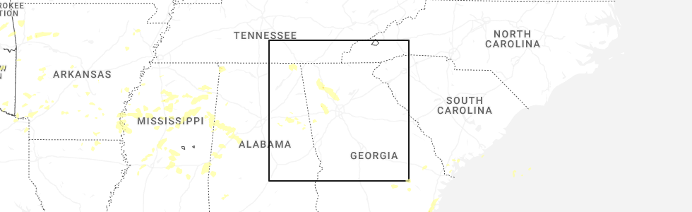
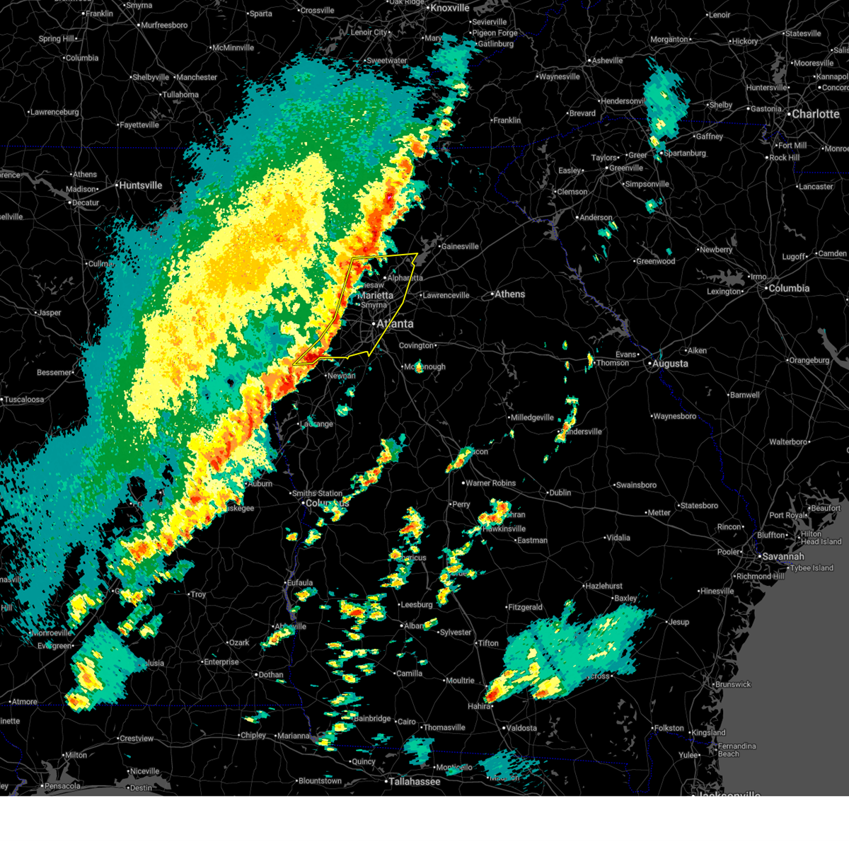
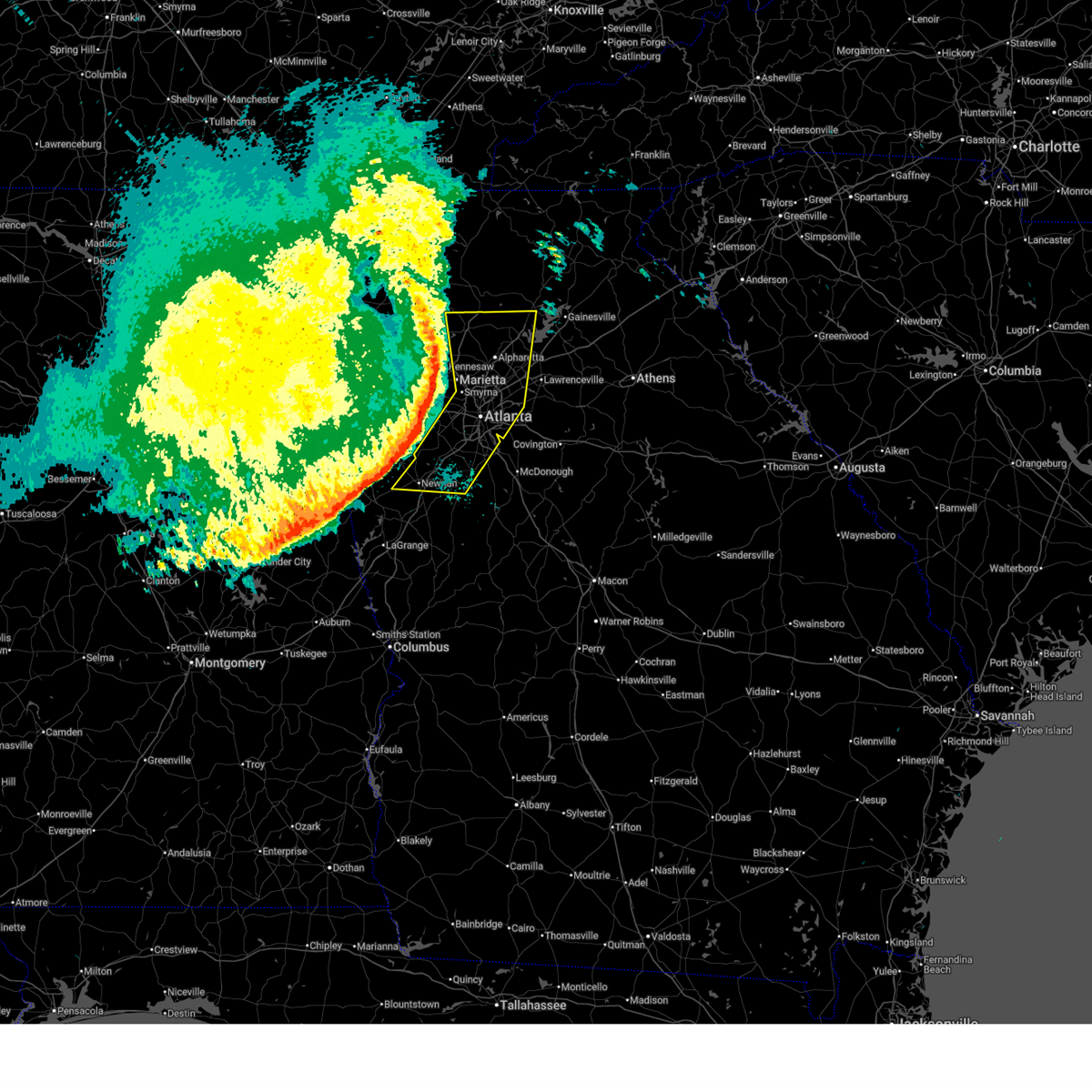
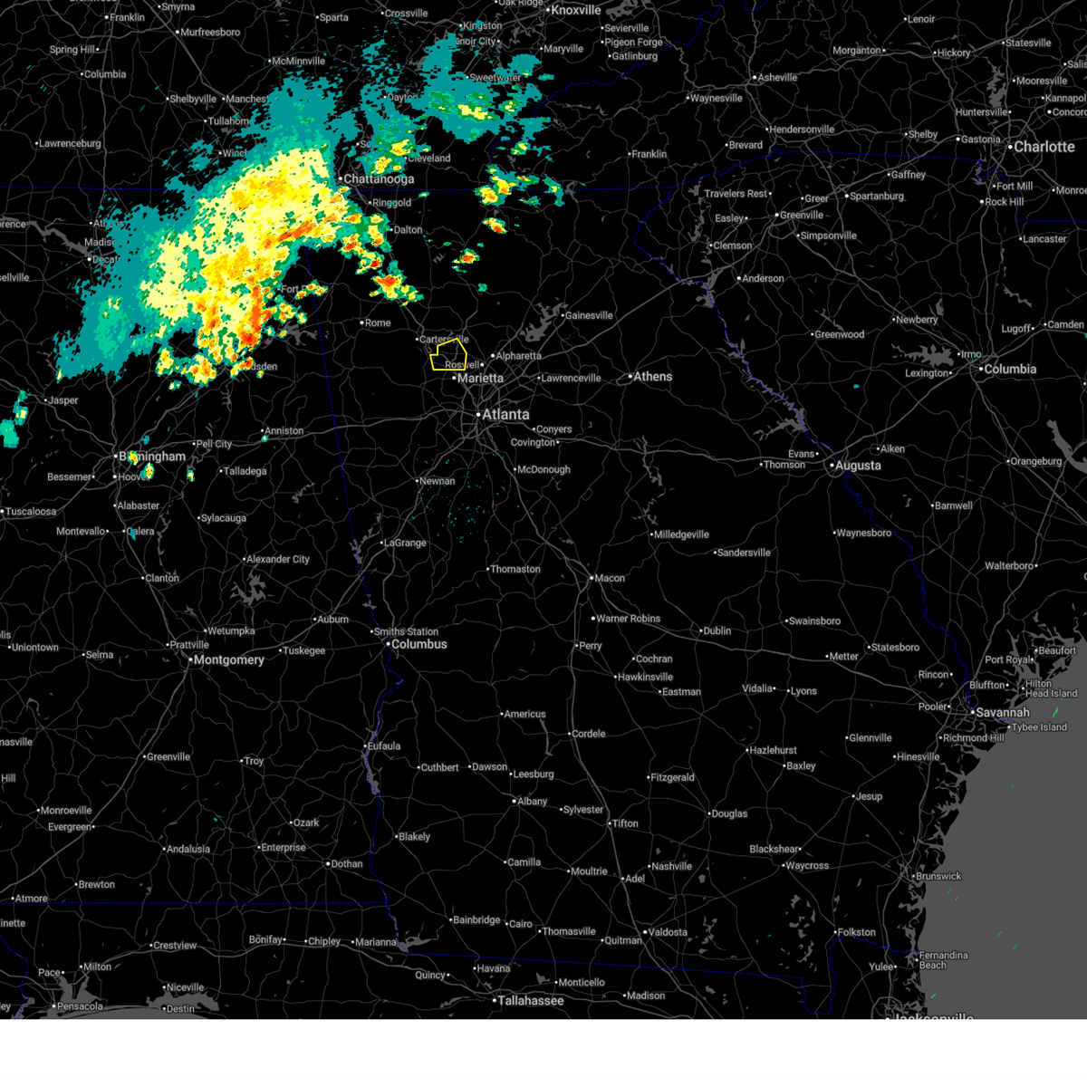
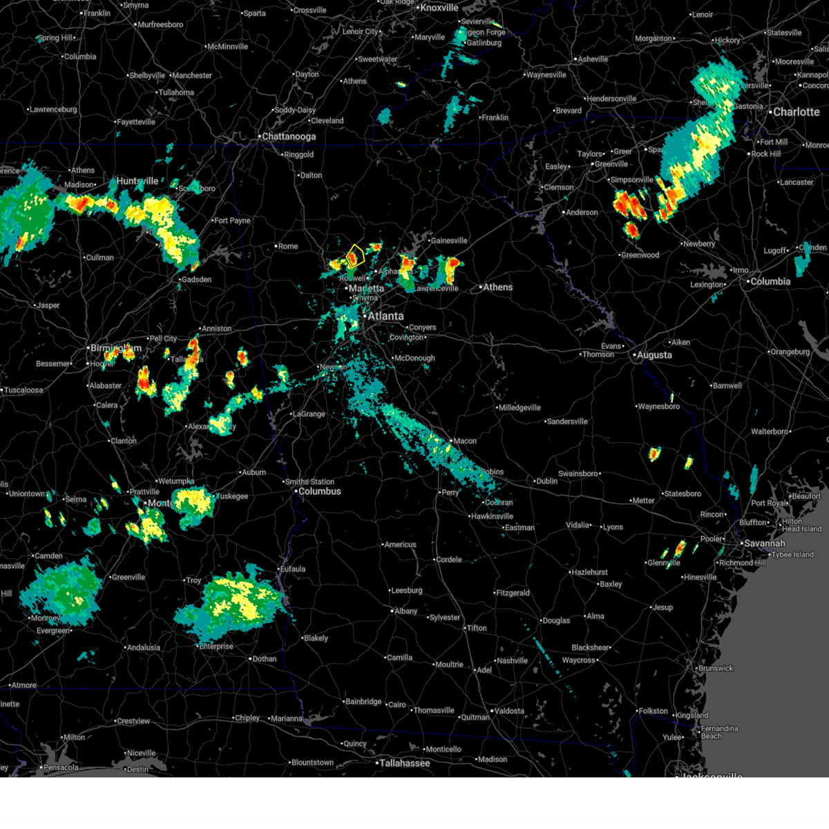
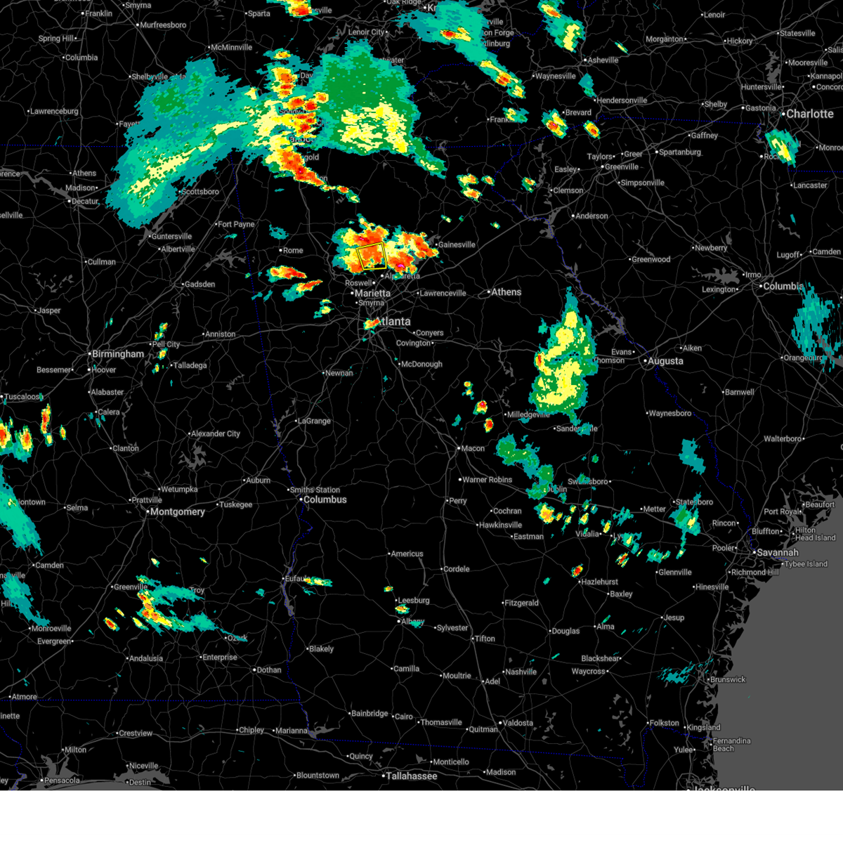
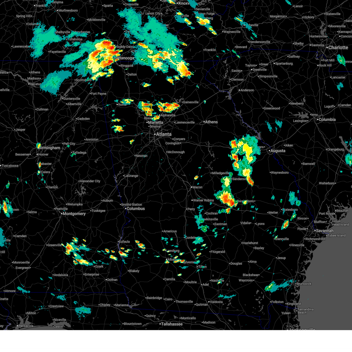
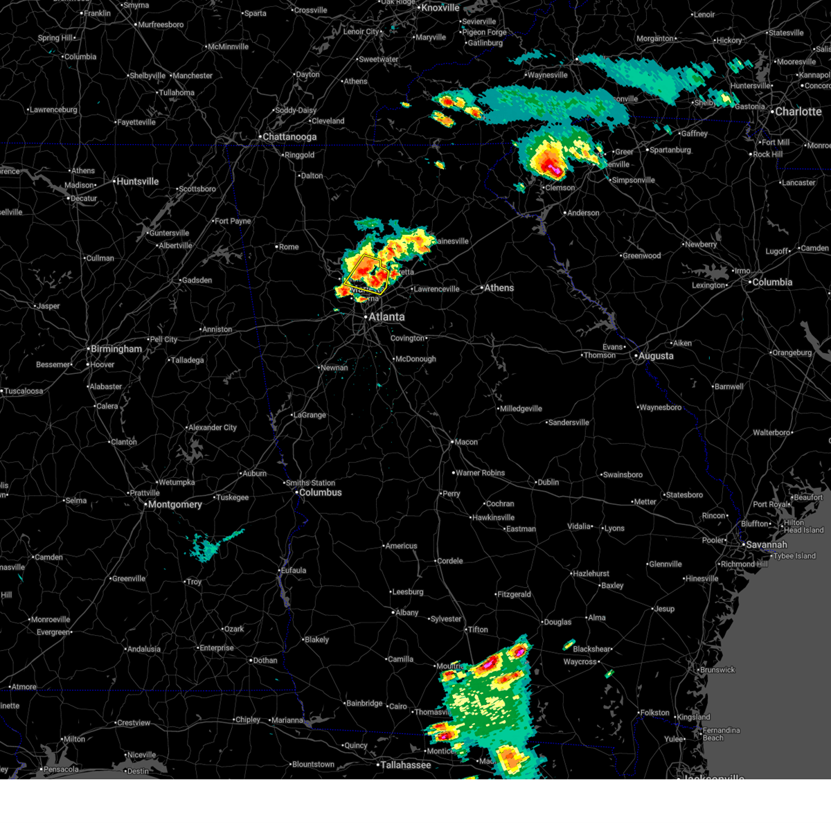
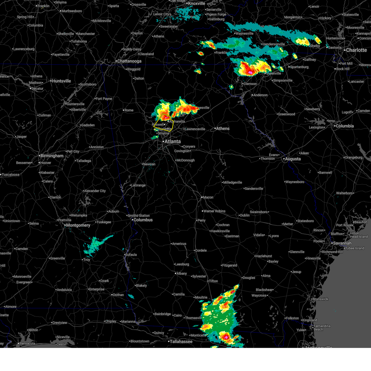
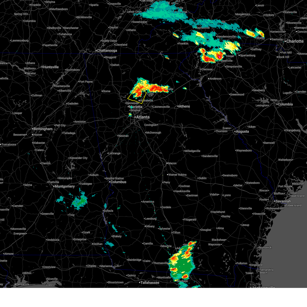
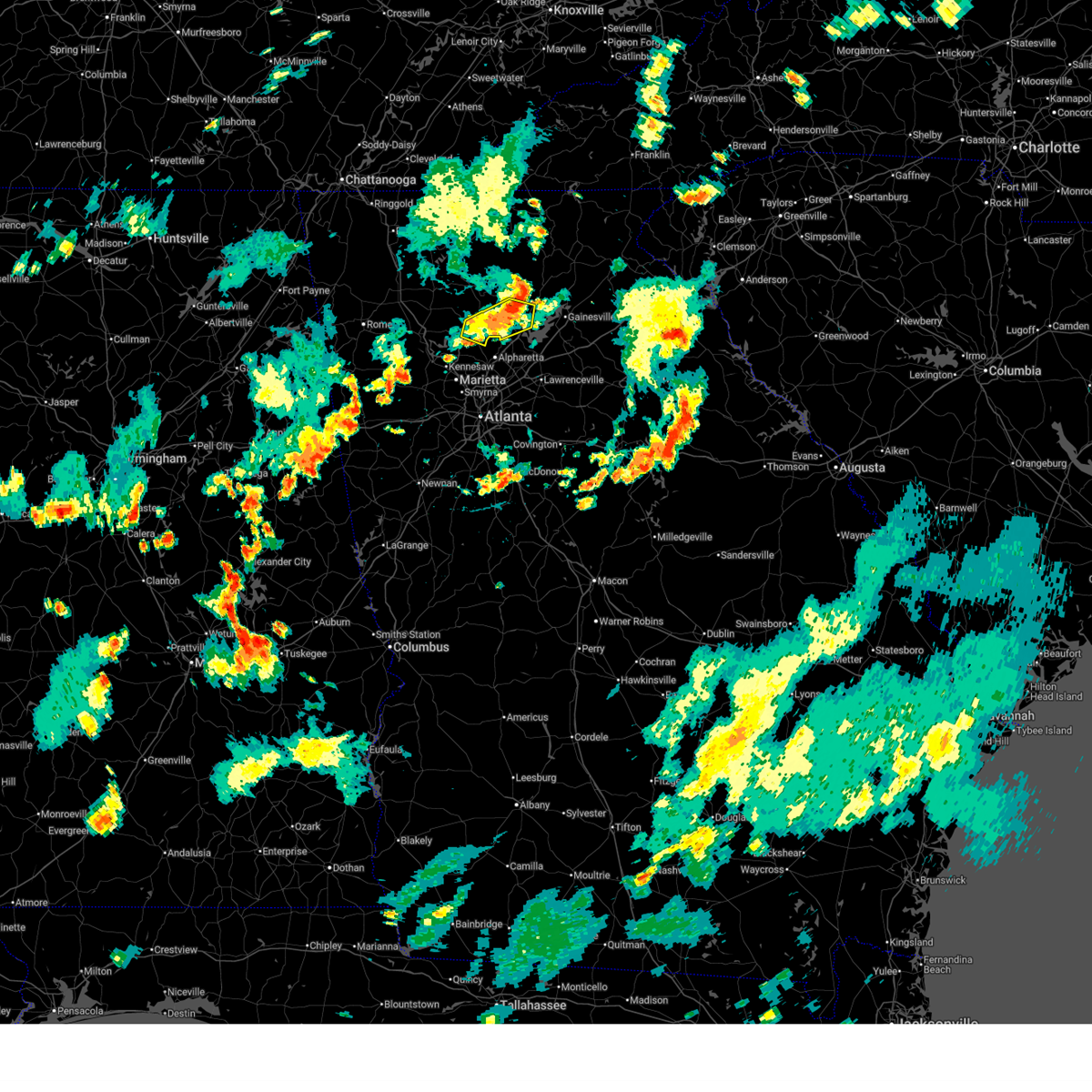
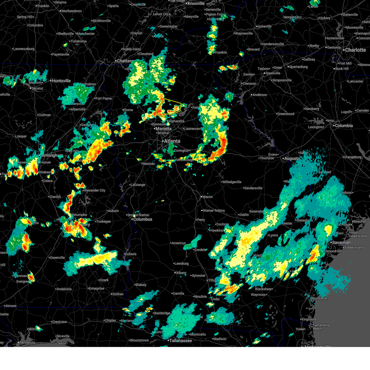
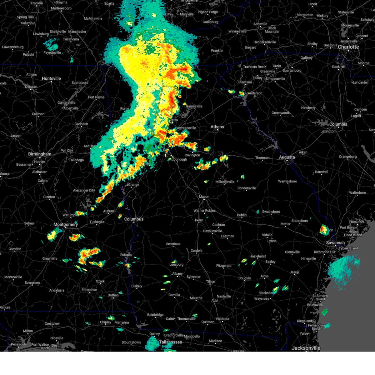
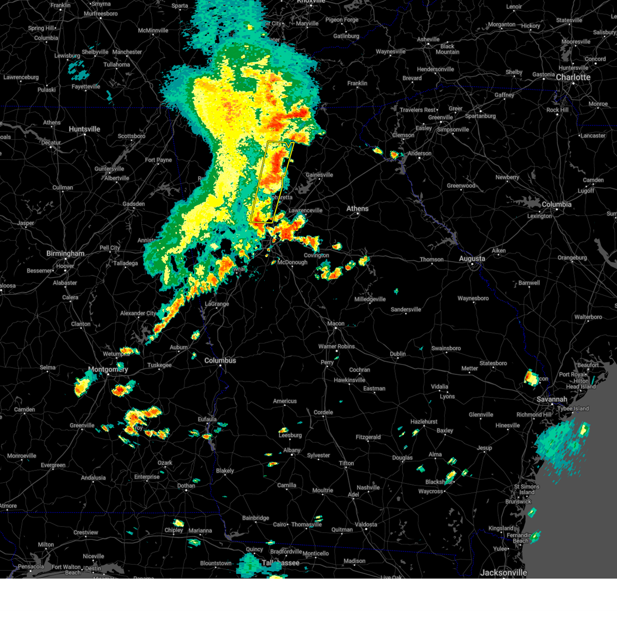
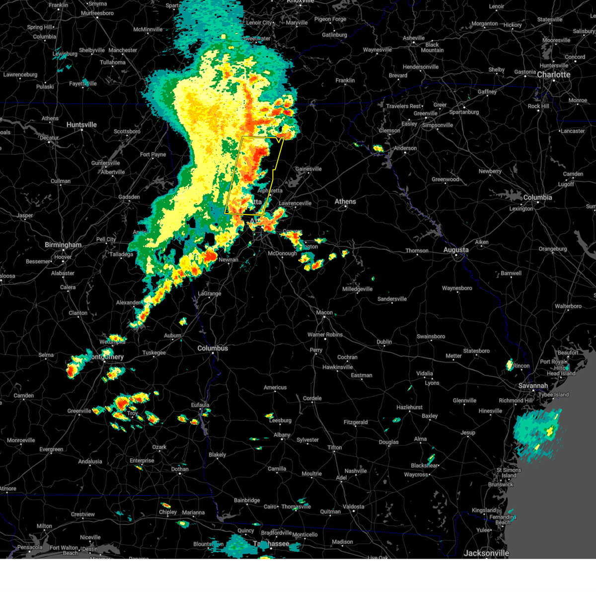
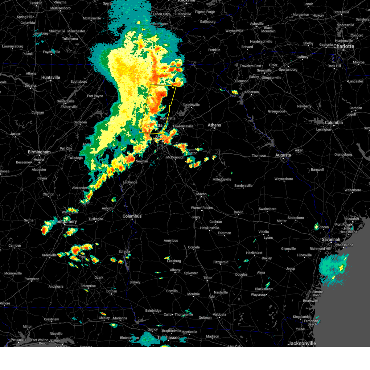
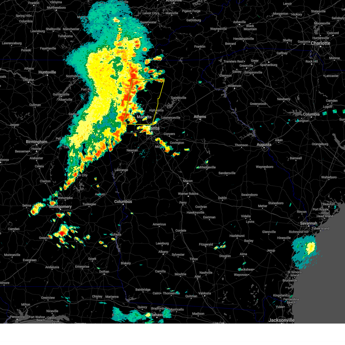
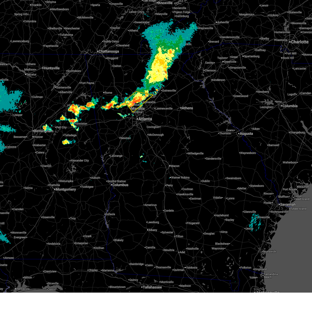
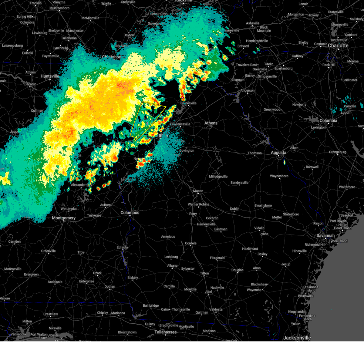
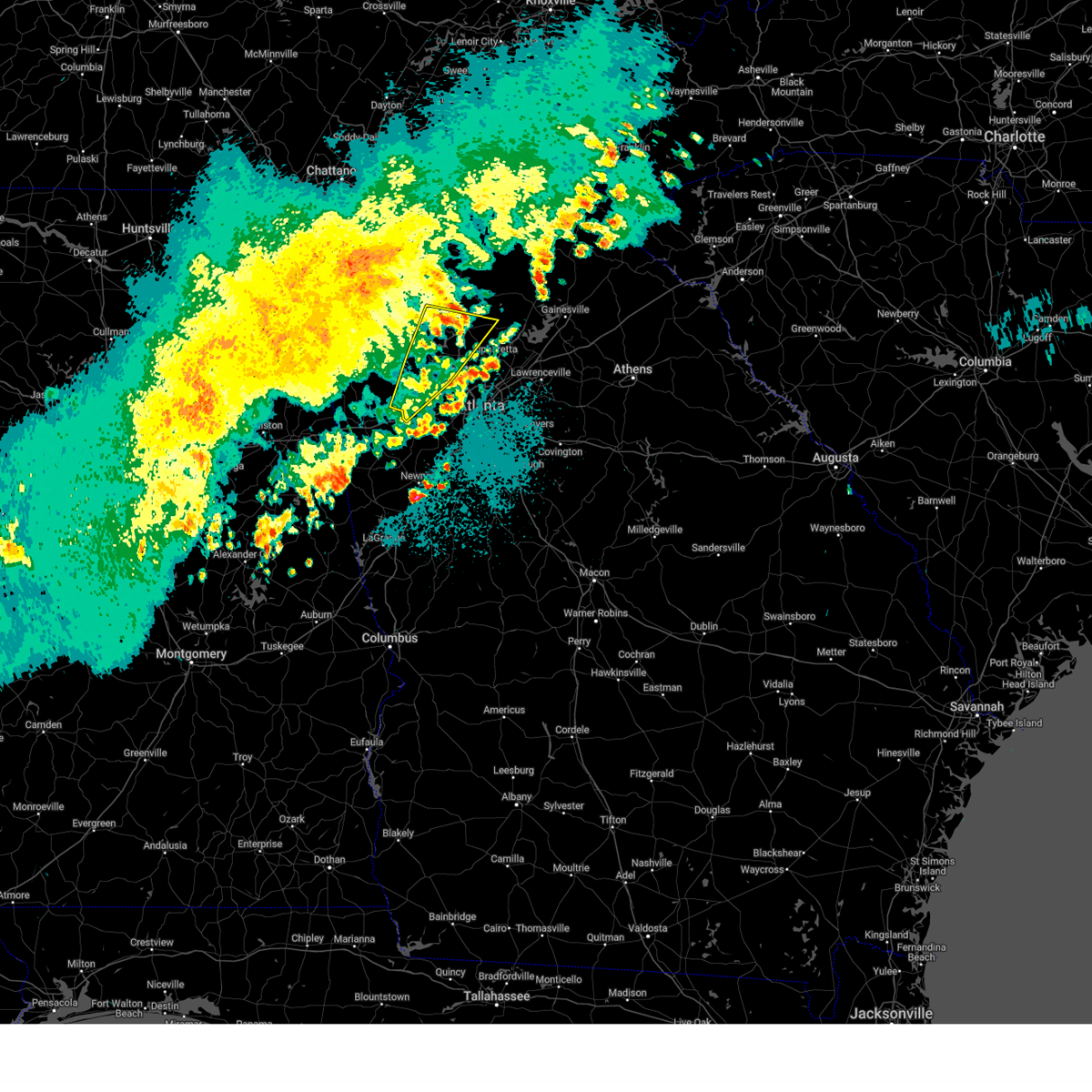
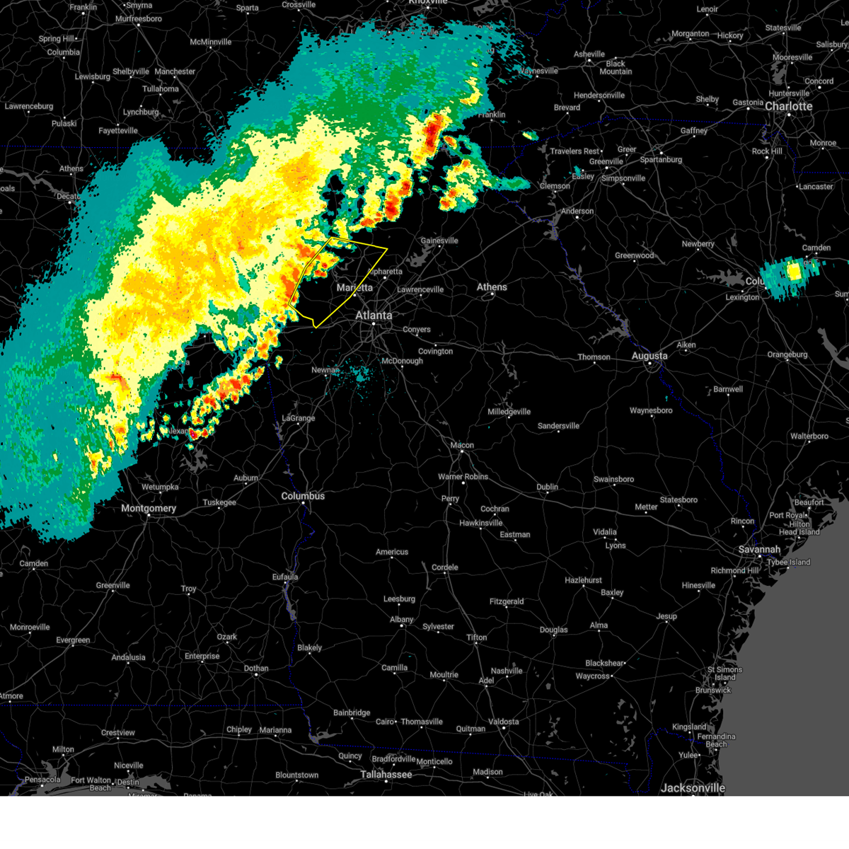
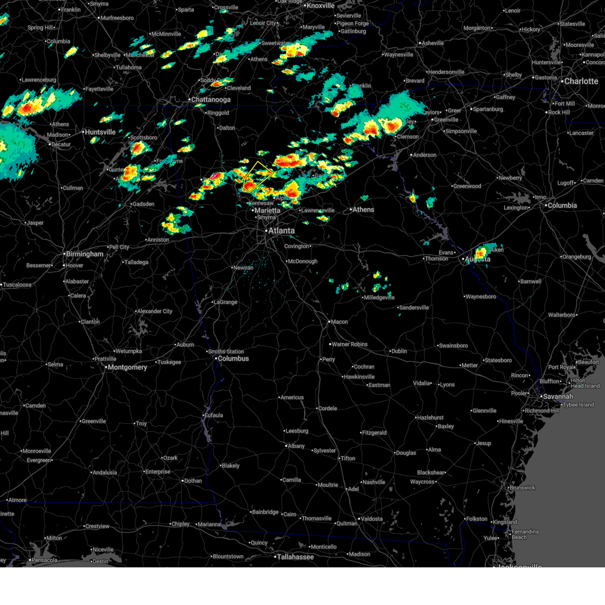
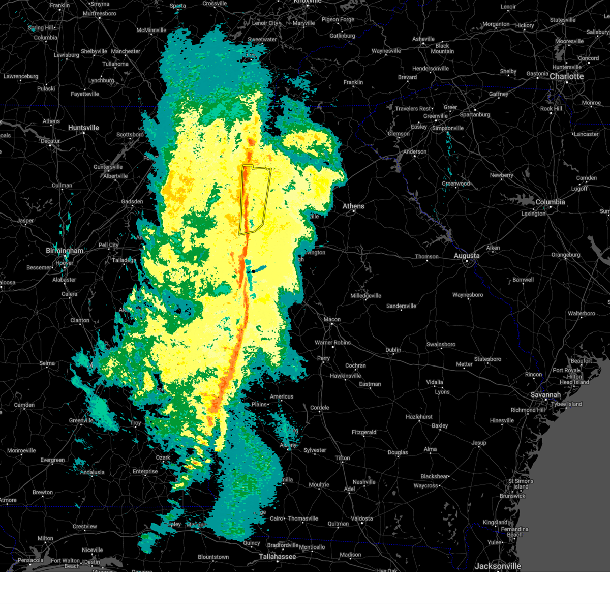
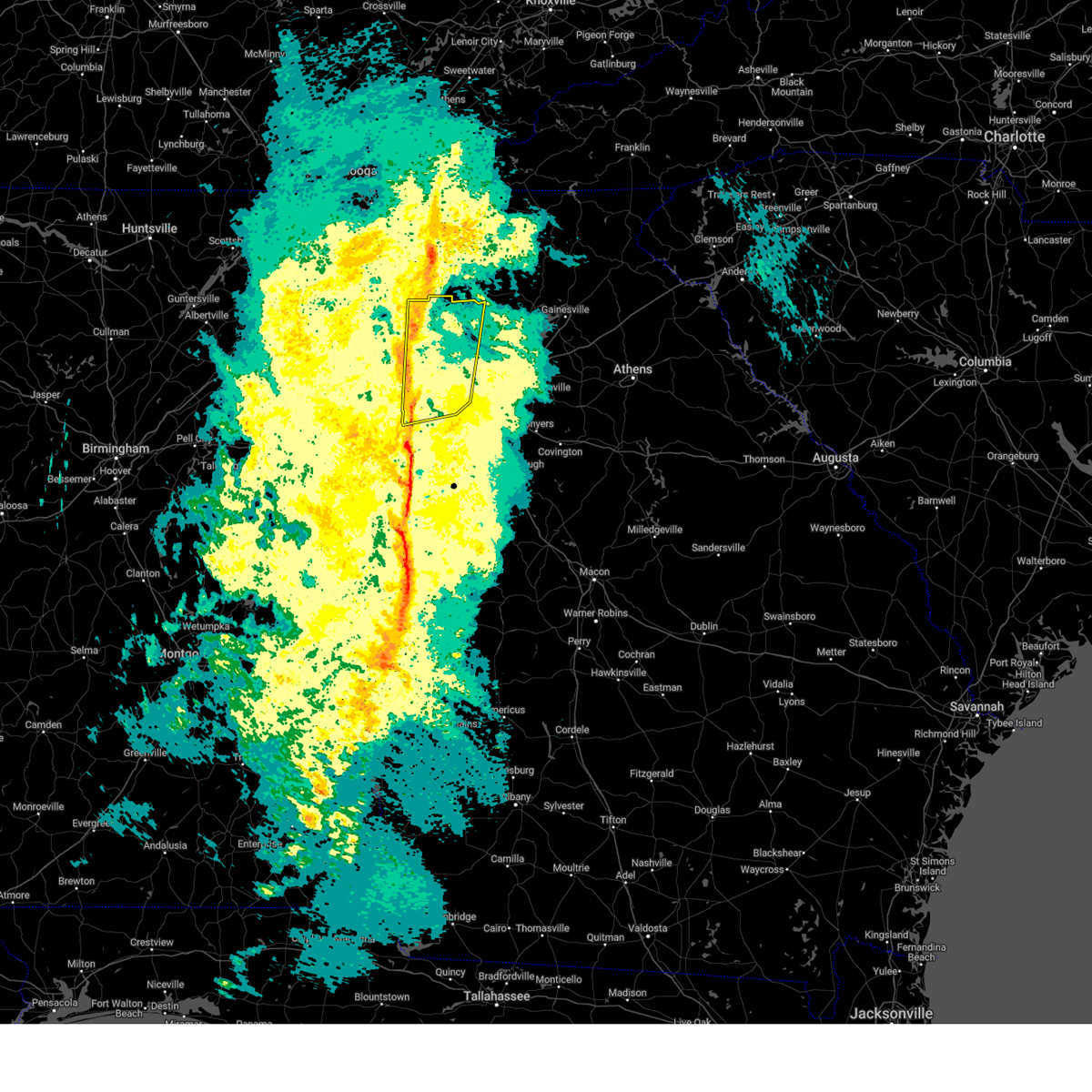
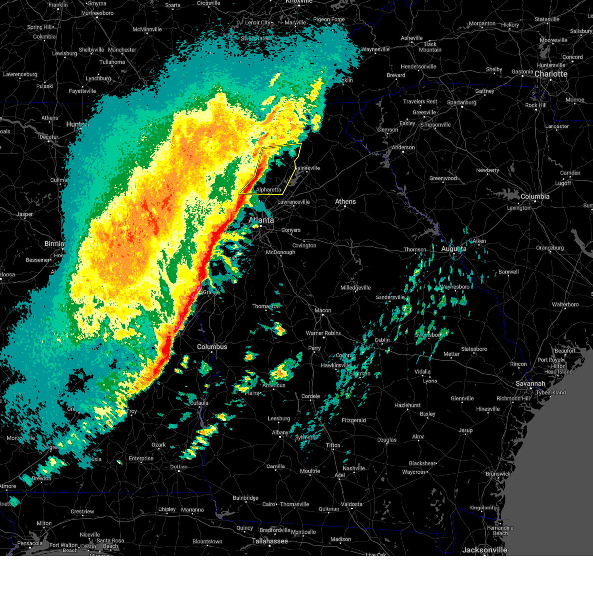
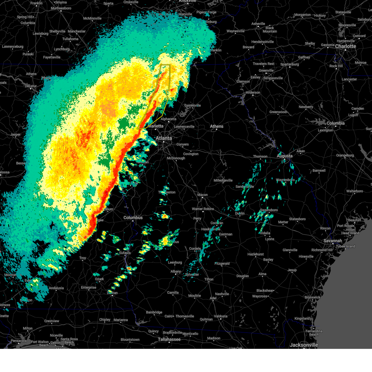
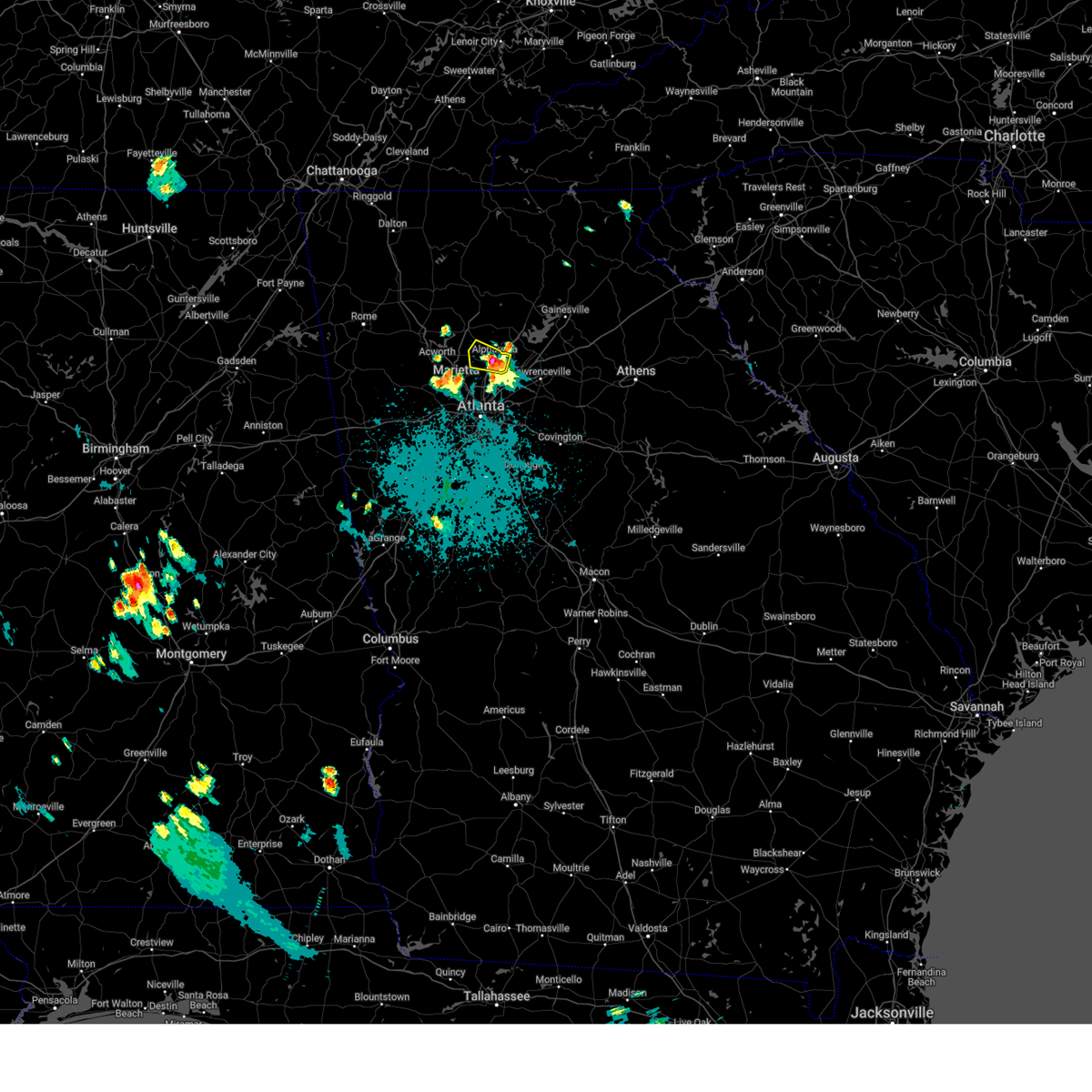
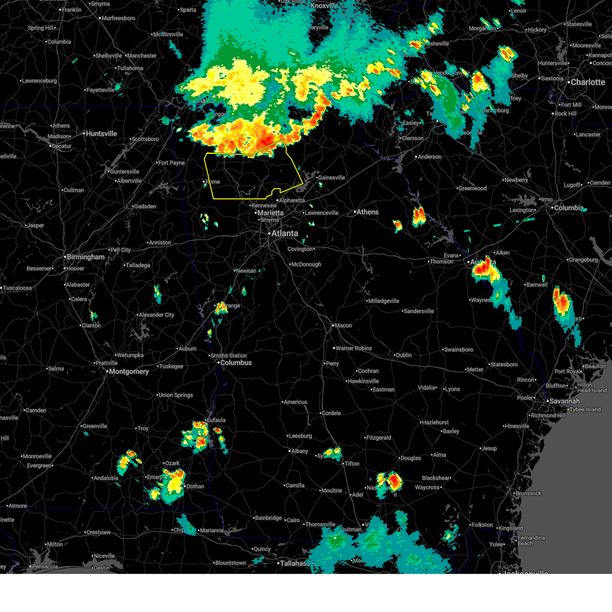
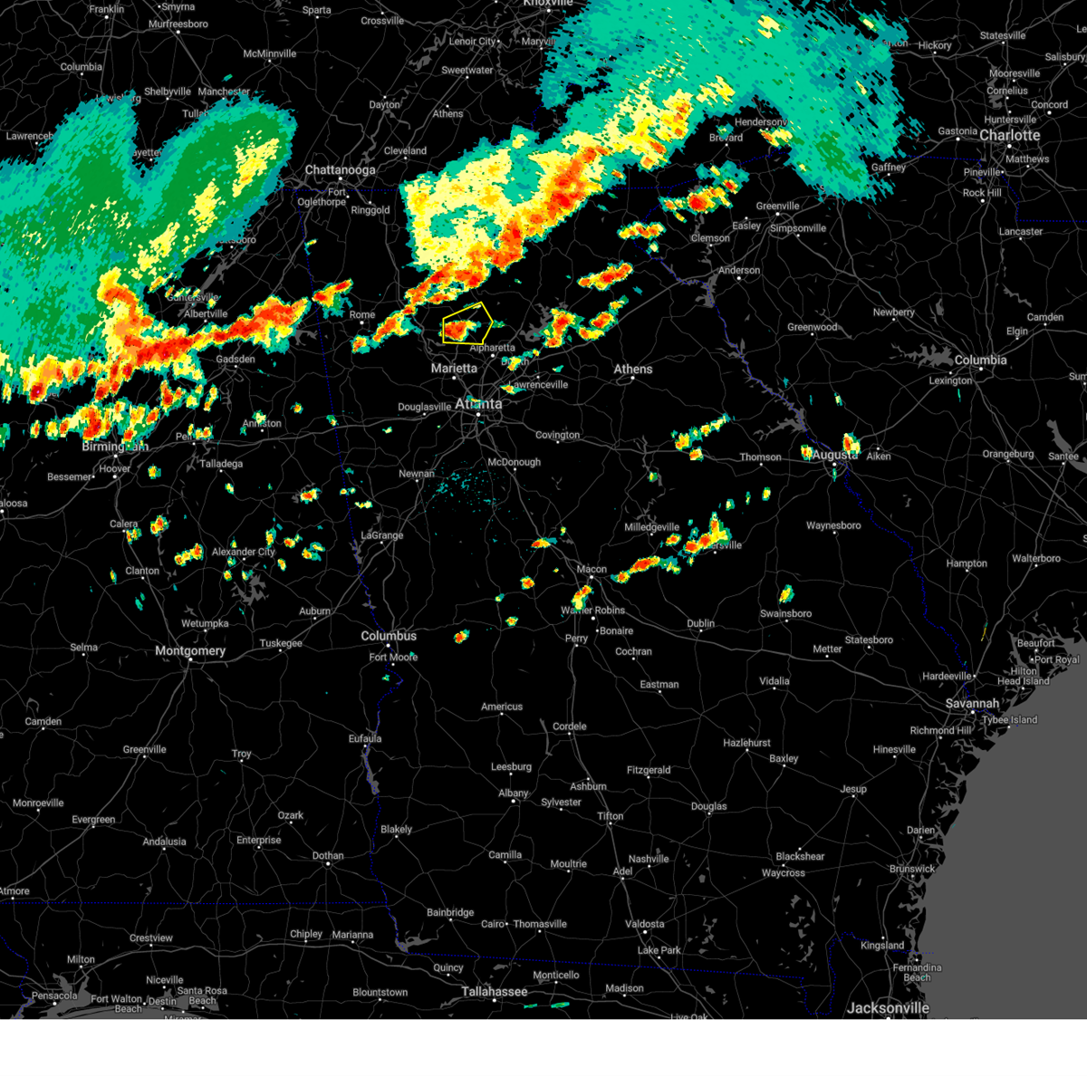
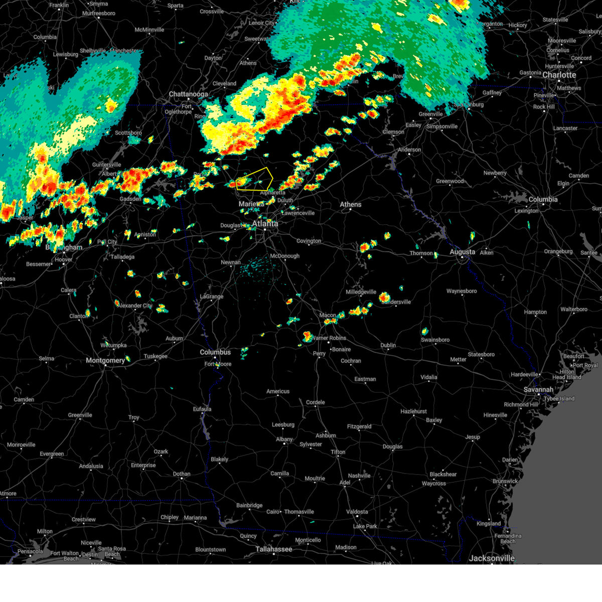
Hail Map for Holly Springs, GA
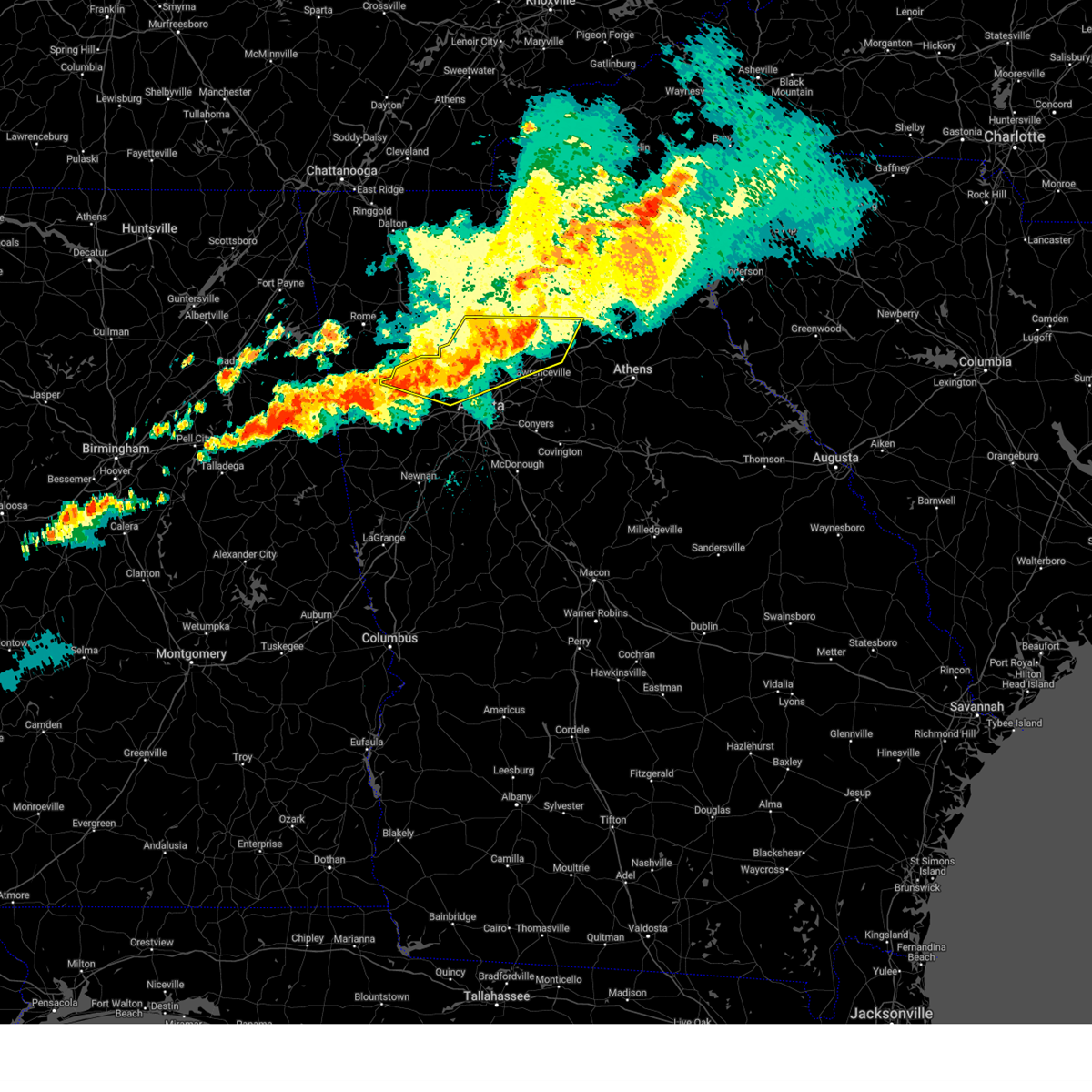
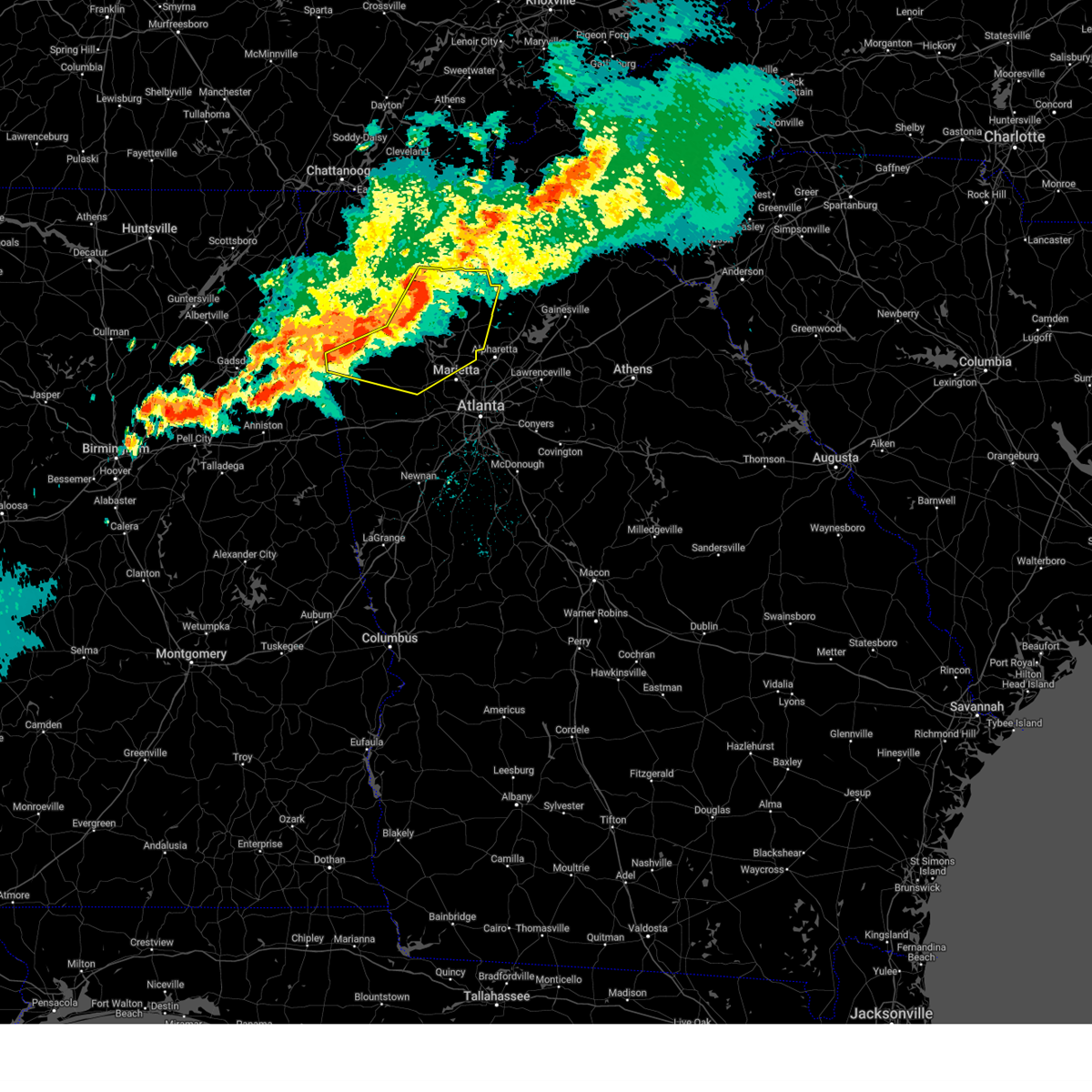
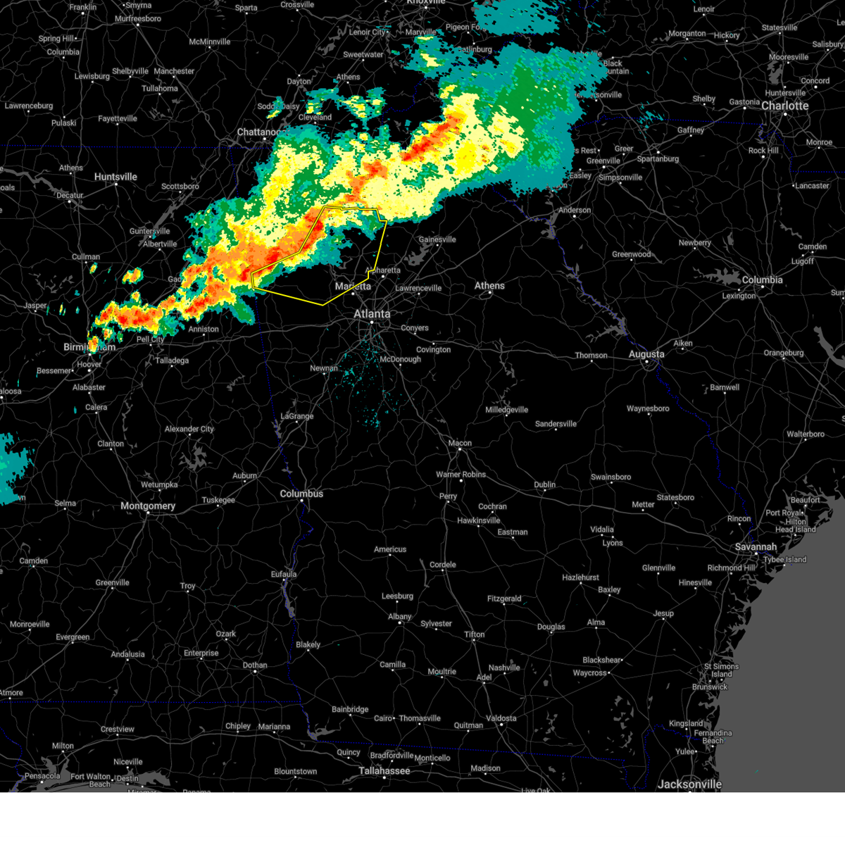
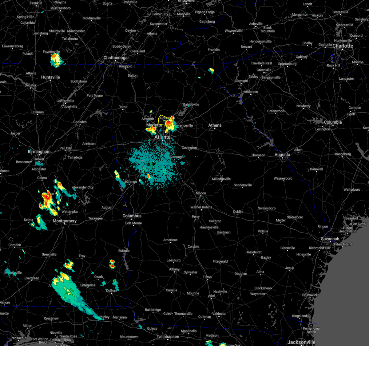
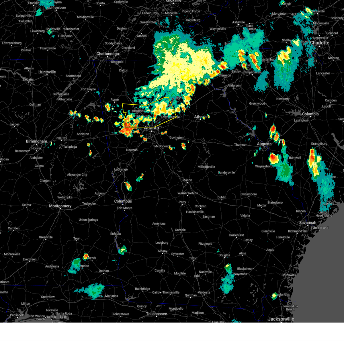
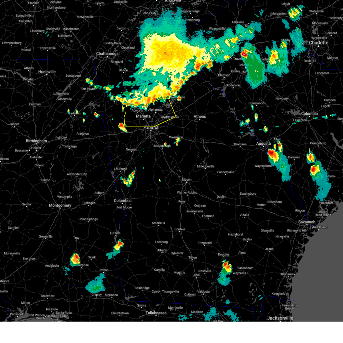
The Holly Springs, GA area has had 0 reports of on-the-ground hail by trained spotters, and has been under severe weather warnings 12 times during the past 12 months. Doppler radar has detected hail at or near Holly Springs, GA on 41 occasions.
| Name: | Holly Springs, GA |
| Where Located: | 29.1 miles N of Atlanta, GA |
| Map: | Google Map for Holly Springs, GA |
| Population: | 9189 |
| Housing Units: | 3695 |
| More Info: | Search Google for Holly Springs, GA |
3
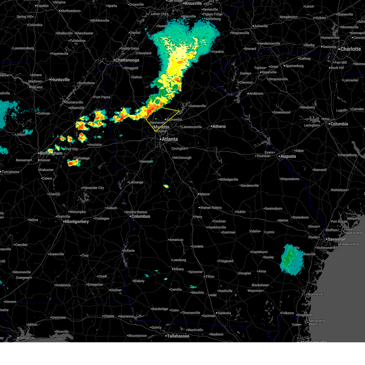
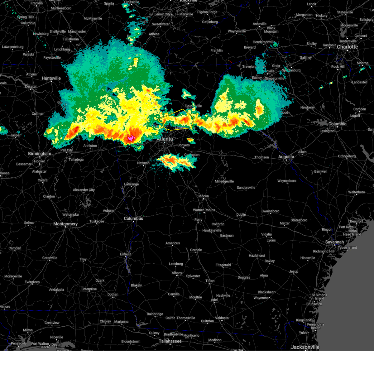
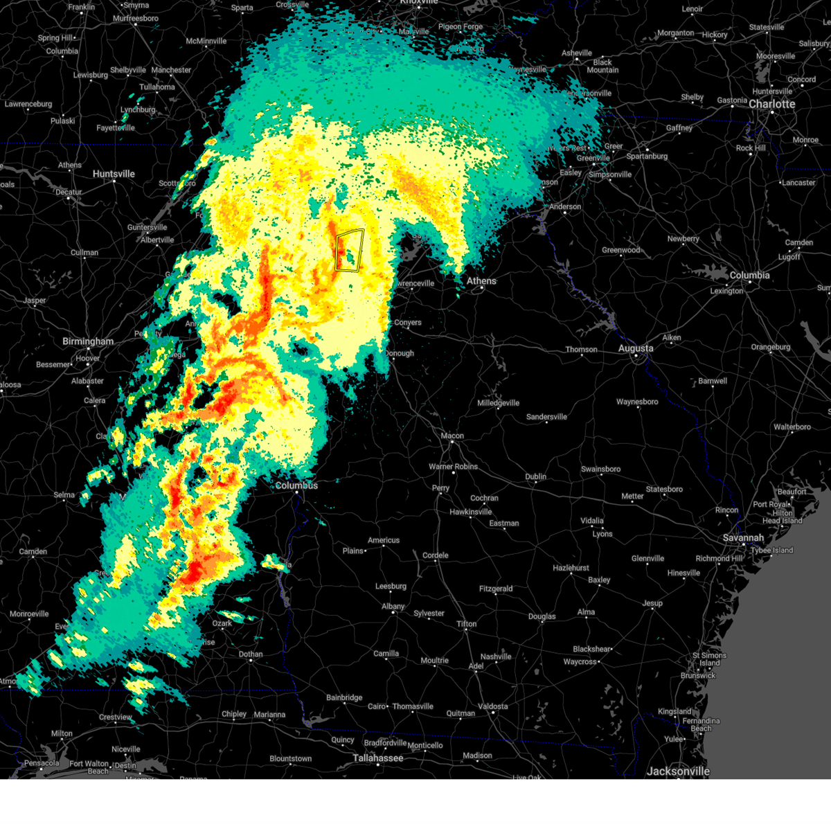
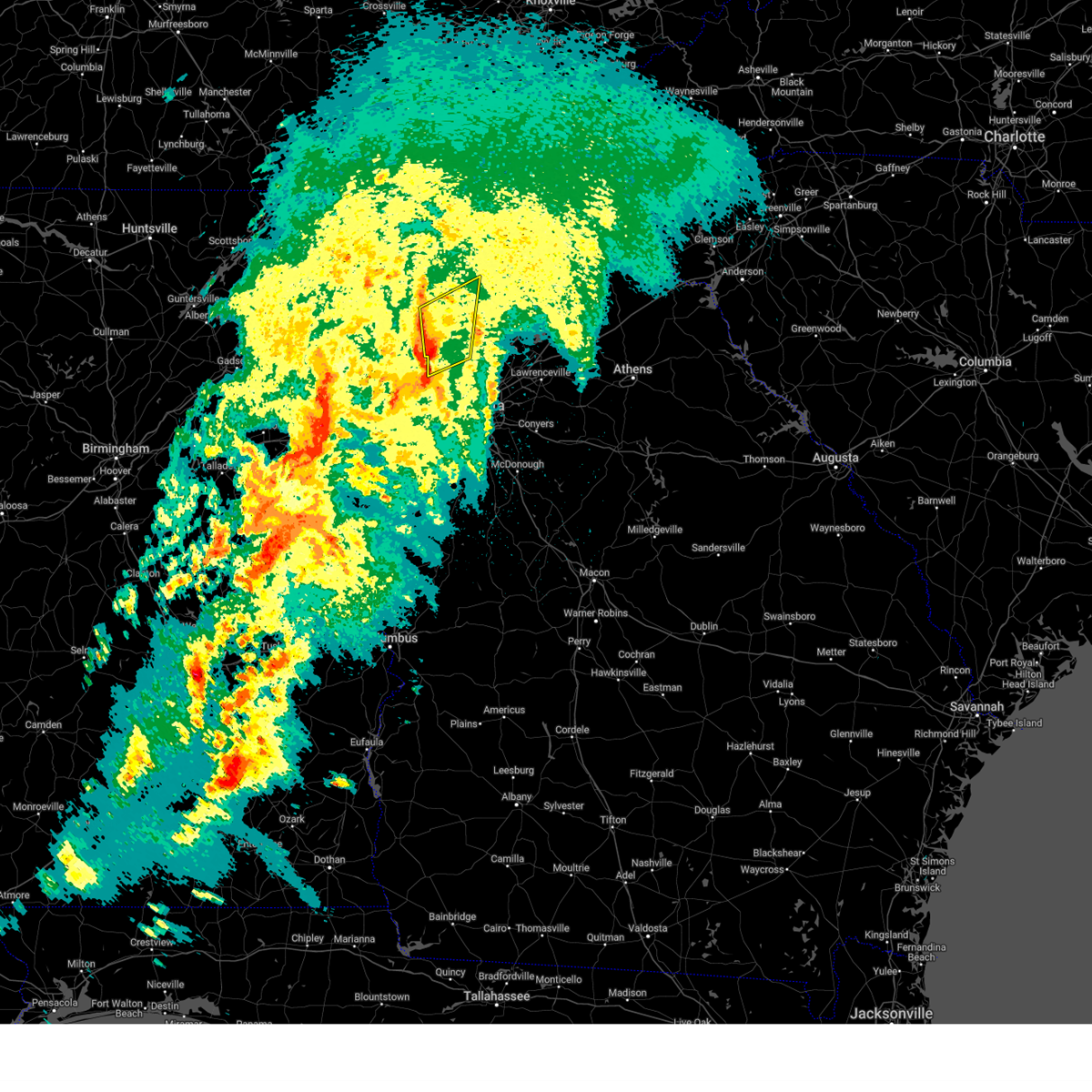
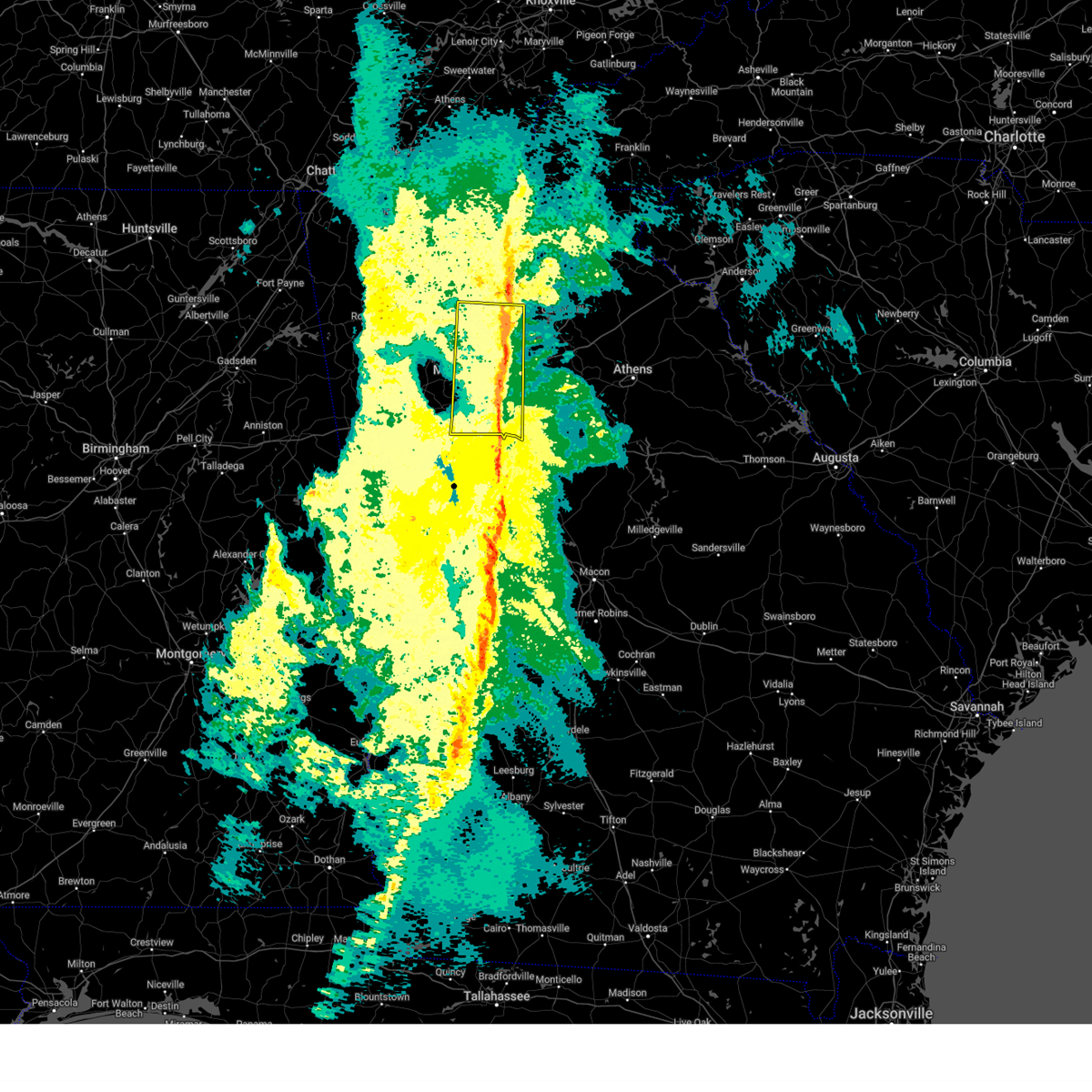
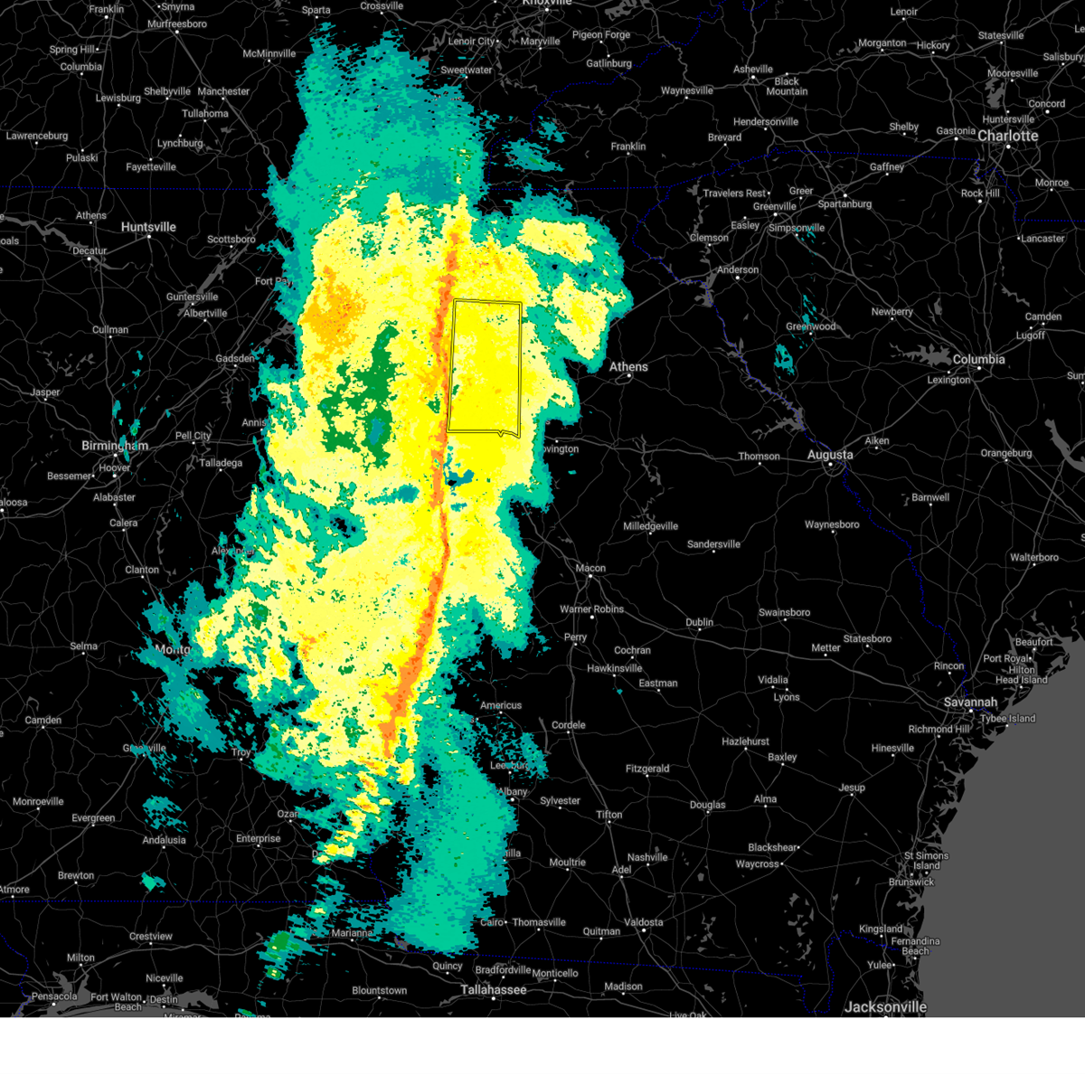
The Top Recent Hail Date for Holly Springs, GA is Sunday, May 25, 2025 (4th out of 41)
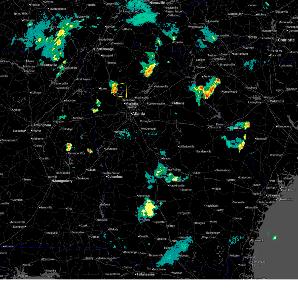
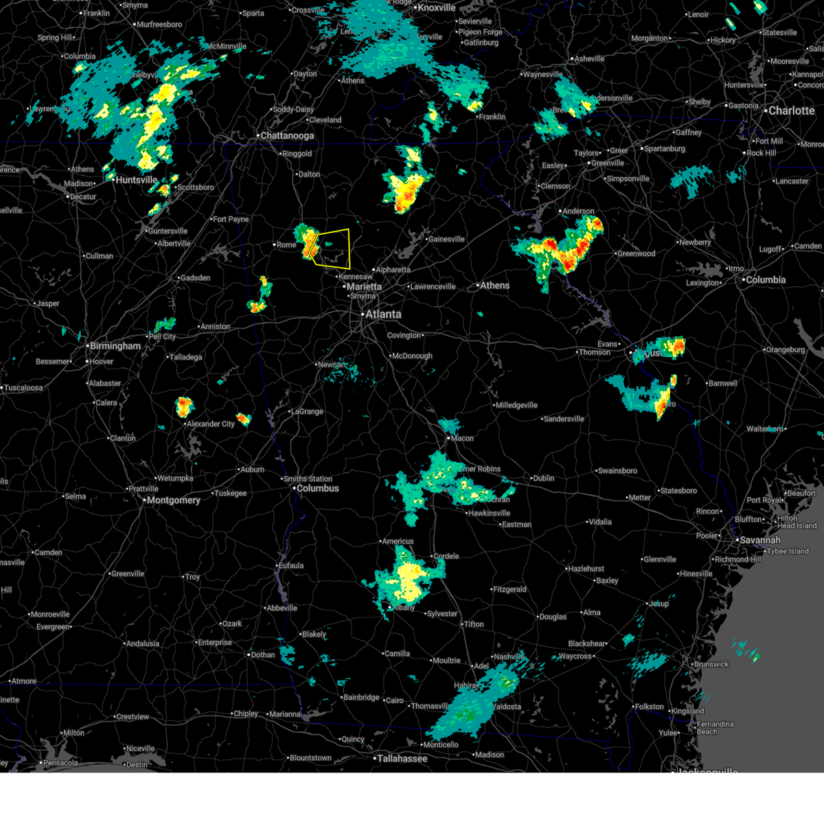
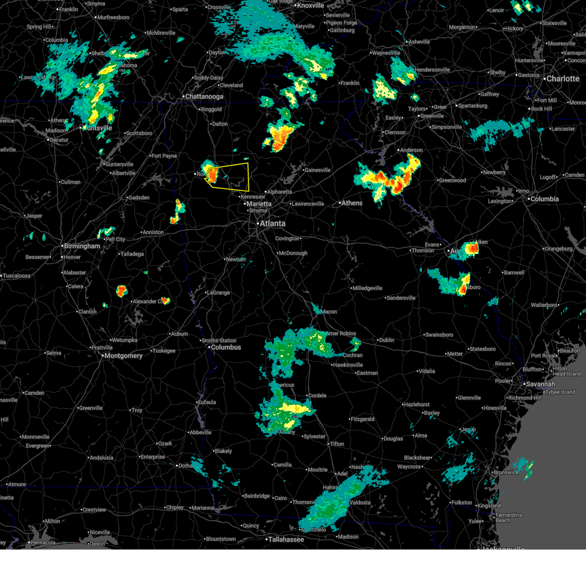
Hail and Wind Damage Spotted near Holly Springs, GA
| Date / Time | Report Details |
|---|---|
| 6/22/2026 9:07 PM EDT |
 The storm which prompted the warning has weakened below severe limits, and no longer poses an immediate threat to life or property. therefore, the warning will be allowed to expire. a severe thunderstorm watch remains in effect until 1100 pm edt for north central and northwestern georgia. The storm which prompted the warning has weakened below severe limits, and no longer poses an immediate threat to life or property. therefore, the warning will be allowed to expire. a severe thunderstorm watch remains in effect until 1100 pm edt for north central and northwestern georgia.
|
| 6/22/2026 9:04 PM EDT |
 At 904 pm edt, a severe thunderstorm was located near sutallee, or 8 miles northeast of cartersville, moving east at 35 mph (radar indicated). Hazards include 60 mph wind gusts and penny size hail. Expect damage to roofs, siding, and trees. Locations impacted include, canton, cartersville, woodstock, holly springs, emerson, white, waleska, lake arrowhead, kellogg creek, red top mountain state park, oak grove, little river landing, george washington carver st pk, lebanon, sutallee, hobgood park, and bridgemill. At 904 pm edt, a severe thunderstorm was located near sutallee, or 8 miles northeast of cartersville, moving east at 35 mph (radar indicated). Hazards include 60 mph wind gusts and penny size hail. Expect damage to roofs, siding, and trees. Locations impacted include, canton, cartersville, woodstock, holly springs, emerson, white, waleska, lake arrowhead, kellogg creek, red top mountain state park, oak grove, little river landing, george washington carver st pk, lebanon, sutallee, hobgood park, and bridgemill.
|
| 6/22/2026 9:02 PM EDT |
 At 901 pm edt, a severe thunderstorm was located near sutallee, or 7 miles northeast of cartersville, moving east at 35 mph (radar indicated). Hazards include 60 mph wind gusts and penny size hail. Expect damage to roofs, siding, and trees. Locations impacted include, canton, cartersville, woodstock, holly springs, emerson, white, waleska, lake arrowhead, kellogg creek, red top mountain state park, oak grove, little river landing, george washington carver st pk, lebanon, sutallee, hobgood park, and bridgemill. At 901 pm edt, a severe thunderstorm was located near sutallee, or 7 miles northeast of cartersville, moving east at 35 mph (radar indicated). Hazards include 60 mph wind gusts and penny size hail. Expect damage to roofs, siding, and trees. Locations impacted include, canton, cartersville, woodstock, holly springs, emerson, white, waleska, lake arrowhead, kellogg creek, red top mountain state park, oak grove, little river landing, george washington carver st pk, lebanon, sutallee, hobgood park, and bridgemill.
|
| 6/22/2026 8:40 PM EDT |
 Svrffc the national weather service in peachtree city has issued a * severe thunderstorm warning for, western cherokee county in north central georgia, bartow county in northwestern georgia, * until 915 pm edt. * at 839 pm edt, a severe thunderstorm was located over kingston, or 8 miles northwest of cartersville, moving east at 35 mph (radar indicated). Hazards include 60 mph wind gusts and penny size hail. expect damage to roofs, siding, and trees Svrffc the national weather service in peachtree city has issued a * severe thunderstorm warning for, western cherokee county in north central georgia, bartow county in northwestern georgia, * until 915 pm edt. * at 839 pm edt, a severe thunderstorm was located over kingston, or 8 miles northwest of cartersville, moving east at 35 mph (radar indicated). Hazards include 60 mph wind gusts and penny size hail. expect damage to roofs, siding, and trees
|
| 3/16/2026 5:32 AM EDT |
 the severe thunderstorm warning has been cancelled and is no longer in effect the severe thunderstorm warning has been cancelled and is no longer in effect
|
| 3/16/2026 5:32 AM EDT |
 At 532 am edt, severe thunderstorms were located along a line extending from hickory flat to near chattahoochee hill, moving east at 55 mph (radar indicated). Hazards include 60 mph wind gusts. Expect damage to roofs, siding, and trees. Locations impacted include, atlanta, marietta, douglasville, canton, decatur, cumming, mountain park, peachtree corners, city of south fulton, sandy springs, roswell, johns creek, alpharetta, smyrna, dunwoody, east point, milton, kennesaw, duluth, and woodstock. At 532 am edt, severe thunderstorms were located along a line extending from hickory flat to near chattahoochee hill, moving east at 55 mph (radar indicated). Hazards include 60 mph wind gusts. Expect damage to roofs, siding, and trees. Locations impacted include, atlanta, marietta, douglasville, canton, decatur, cumming, mountain park, peachtree corners, city of south fulton, sandy springs, roswell, johns creek, alpharetta, smyrna, dunwoody, east point, milton, kennesaw, duluth, and woodstock.
|
| 3/16/2026 5:18 AM EDT |
 the severe thunderstorm warning has been cancelled and is no longer in effect the severe thunderstorm warning has been cancelled and is no longer in effect
|
| 3/16/2026 5:16 AM EDT |
 Svrffc the national weather service in peachtree city has issued a * severe thunderstorm warning for, eastern paulding county in northwestern georgia, southern cherokee county in north central georgia, northwestern dekalb county in north central georgia, southwestern forsyth county in north central georgia, eastern carroll county in northwestern georgia, cobb county in north central georgia, douglas county in north central georgia, northwestern gwinnett county in north central georgia, northwestern clayton county in north central georgia, fulton county in north central georgia, southeastern bartow county in northwestern georgia, * until 600 am edt. * at 516 am edt, severe thunderstorms were located along a line extending from near oak grove to near lowell, moving east at 55 mph (radar indicated). Hazards include 60 mph wind gusts. expect damage to roofs, siding, and trees Svrffc the national weather service in peachtree city has issued a * severe thunderstorm warning for, eastern paulding county in northwestern georgia, southern cherokee county in north central georgia, northwestern dekalb county in north central georgia, southwestern forsyth county in north central georgia, eastern carroll county in northwestern georgia, cobb county in north central georgia, douglas county in north central georgia, northwestern gwinnett county in north central georgia, northwestern clayton county in north central georgia, fulton county in north central georgia, southeastern bartow county in northwestern georgia, * until 600 am edt. * at 516 am edt, severe thunderstorms were located along a line extending from near oak grove to near lowell, moving east at 55 mph (radar indicated). Hazards include 60 mph wind gusts. expect damage to roofs, siding, and trees
|
| 3/16/2026 4:52 AM EDT |
 Svrffc the national weather service in peachtree city has issued a * severe thunderstorm warning for, western cherokee county in north central georgia, west central dawson county in north central georgia, southeastern gordon county in northwestern georgia, pickens county in north central georgia, bartow county in northwestern georgia, * until 530 am edt. * at 452 am edt, severe thunderstorms were located along a line extending from near hinton to stilesboro, moving northeast at 45 mph (radar indicated). Hazards include 60 mph wind gusts. expect damage to roofs, siding, and trees Svrffc the national weather service in peachtree city has issued a * severe thunderstorm warning for, western cherokee county in north central georgia, west central dawson county in north central georgia, southeastern gordon county in northwestern georgia, pickens county in north central georgia, bartow county in northwestern georgia, * until 530 am edt. * at 452 am edt, severe thunderstorms were located along a line extending from near hinton to stilesboro, moving northeast at 45 mph (radar indicated). Hazards include 60 mph wind gusts. expect damage to roofs, siding, and trees
|
| 11/25/2025 8:05 AM EST |
 Svrffc the national weather service in peachtree city has issued a * severe thunderstorm warning for, cherokee county in north central georgia, dekalb county in north central georgia, fayette county in north central georgia, forsyth county in north central georgia, eastern cobb county in north central georgia, eastern douglas county in north central georgia, western gwinnett county in north central georgia, northern coweta county in west central georgia, clayton county in north central georgia, fulton county in north central georgia, * until 845 am est. * at 804 am est, severe thunderstorms were located along a line extending from near george washington carver st pk to near douglasville to centralhatchee, moving east at 50 mph (radar indicated). Hazards include 60 mph wind gusts. expect damage to roofs, siding, and trees Svrffc the national weather service in peachtree city has issued a * severe thunderstorm warning for, cherokee county in north central georgia, dekalb county in north central georgia, fayette county in north central georgia, forsyth county in north central georgia, eastern cobb county in north central georgia, eastern douglas county in north central georgia, western gwinnett county in north central georgia, northern coweta county in west central georgia, clayton county in north central georgia, fulton county in north central georgia, * until 845 am est. * at 804 am est, severe thunderstorms were located along a line extending from near george washington carver st pk to near douglasville to centralhatchee, moving east at 50 mph (radar indicated). Hazards include 60 mph wind gusts. expect damage to roofs, siding, and trees
|
| 9/6/2025 2:36 PM EDT |
 At 236 pm edt, a severe thunderstorm was located over kennesaw state university, or 7 miles north of marietta, moving east at 15 mph (radar indicated). Hazards include 60 mph wind gusts and dime size hail. Expect damage to roofs, siding, and trees. Locations impacted include, kennesaw, woodstock, lebanon, kellogg creek, sandy plains, oak grove, kennesaw state university, and hobgood park. At 236 pm edt, a severe thunderstorm was located over kennesaw state university, or 7 miles north of marietta, moving east at 15 mph (radar indicated). Hazards include 60 mph wind gusts and dime size hail. Expect damage to roofs, siding, and trees. Locations impacted include, kennesaw, woodstock, lebanon, kellogg creek, sandy plains, oak grove, kennesaw state university, and hobgood park.
|
| 9/6/2025 2:18 PM EDT |
 Svrffc the national weather service in peachtree city has issued a * severe thunderstorm warning for, southwestern cherokee county in north central georgia, northwestern cobb county in north central georgia, * until 245 pm edt. * at 217 pm edt, a severe thunderstorm was located over acworth, or 9 miles northwest of marietta, moving east at 10 mph (radar indicated). Hazards include 60 mph wind gusts and penny size hail. expect damage to roofs, siding, and trees Svrffc the national weather service in peachtree city has issued a * severe thunderstorm warning for, southwestern cherokee county in north central georgia, northwestern cobb county in north central georgia, * until 245 pm edt. * at 217 pm edt, a severe thunderstorm was located over acworth, or 9 miles northwest of marietta, moving east at 10 mph (radar indicated). Hazards include 60 mph wind gusts and penny size hail. expect damage to roofs, siding, and trees
|
| 6/28/2025 9:16 PM EDT |
 Svrffc the national weather service in peachtree city has issued a * severe thunderstorm warning for, south central cherokee county in north central georgia, * until 945 pm edt. * at 915 pm edt, a severe thunderstorm was located over holly springs, or near canton, and is nearly stationary (radar indicated). Hazards include 60 mph wind gusts and penny size hail. expect damage to roofs, siding, and trees Svrffc the national weather service in peachtree city has issued a * severe thunderstorm warning for, south central cherokee county in north central georgia, * until 945 pm edt. * at 915 pm edt, a severe thunderstorm was located over holly springs, or near canton, and is nearly stationary (radar indicated). Hazards include 60 mph wind gusts and penny size hail. expect damage to roofs, siding, and trees
|
| 6/27/2025 6:37 PM EDT |
 The storm which prompted the warning has weakened below severe limits, and has exited the warned area. therefore, the warning will be allowed to expire. however, gusty winds and heavy rain are still possible with this thunderstorm. The storm which prompted the warning has weakened below severe limits, and has exited the warned area. therefore, the warning will be allowed to expire. however, gusty winds and heavy rain are still possible with this thunderstorm.
|
| 6/27/2025 6:12 PM EDT |
 The storm which prompted the warning has weakened below severe limits, and no longer poses an immediate threat to life or property. therefore, the warning will be allowed to expire. however, gusty winds and heavy rain are still possible with this thunderstorm. The storm which prompted the warning has weakened below severe limits, and no longer poses an immediate threat to life or property. therefore, the warning will be allowed to expire. however, gusty winds and heavy rain are still possible with this thunderstorm.
|
| 6/27/2025 6:11 PM EDT |
 Svrffc the national weather service in peachtree city has issued a * severe thunderstorm warning for, southeastern cherokee county in north central georgia, northeastern fulton county in north central georgia, * until 645 pm edt. * at 611 pm edt, a severe thunderstorm was located over union hill, or near canton, and is nearly stationary (radar indicated). Hazards include 60 mph wind gusts and nickel size hail. expect damage to roofs, siding, and trees Svrffc the national weather service in peachtree city has issued a * severe thunderstorm warning for, southeastern cherokee county in north central georgia, northeastern fulton county in north central georgia, * until 645 pm edt. * at 611 pm edt, a severe thunderstorm was located over union hill, or near canton, and is nearly stationary (radar indicated). Hazards include 60 mph wind gusts and nickel size hail. expect damage to roofs, siding, and trees
|
| 6/27/2025 5:48 PM EDT |
 Svrffc the national weather service in peachtree city has issued a * severe thunderstorm warning for, southwestern cherokee county in north central georgia, * until 615 pm edt. * at 548 pm edt, a severe thunderstorm was located over lebanon, or near canton, moving north at 15 mph (radar indicated). Hazards include 60 mph wind gusts and quarter size hail. Hail damage to vehicles is expected. Expect wind damage to roofs, siding, and trees. Svrffc the national weather service in peachtree city has issued a * severe thunderstorm warning for, southwestern cherokee county in north central georgia, * until 615 pm edt. * at 548 pm edt, a severe thunderstorm was located over lebanon, or near canton, moving north at 15 mph (radar indicated). Hazards include 60 mph wind gusts and quarter size hail. Hail damage to vehicles is expected. Expect wind damage to roofs, siding, and trees.
|
| 6/26/2025 5:05 PM EDT |
 The storm which prompted the warning has moved out of the area. therefore, the warning will be allowed to expire. The storm which prompted the warning has moved out of the area. therefore, the warning will be allowed to expire.
|
| 6/26/2025 4:39 PM EDT |
 Svrffc the national weather service in peachtree city has issued a * severe thunderstorm warning for, southeastern cherokee county in north central georgia, northwestern dekalb county in north central georgia, northeastern cobb county in north central georgia, west central gwinnett county in north central georgia, northeastern fulton county in north central georgia, * until 515 pm edt. * at 439 pm edt, a severe thunderstorm was located over milton, or near mountain park, moving southwest at 10 mph (radar indicated). Hazards include 60 mph wind gusts and quarter size hail. Hail damage to vehicles is expected. Expect wind damage to roofs, siding, and trees. Svrffc the national weather service in peachtree city has issued a * severe thunderstorm warning for, southeastern cherokee county in north central georgia, northwestern dekalb county in north central georgia, northeastern cobb county in north central georgia, west central gwinnett county in north central georgia, northeastern fulton county in north central georgia, * until 515 pm edt. * at 439 pm edt, a severe thunderstorm was located over milton, or near mountain park, moving southwest at 10 mph (radar indicated). Hazards include 60 mph wind gusts and quarter size hail. Hail damage to vehicles is expected. Expect wind damage to roofs, siding, and trees.
|
| 6/26/2025 4:14 PM EDT |
 Svrffc the national weather service in peachtree city has issued a * severe thunderstorm warning for, eastern cherokee county in north central georgia, southwestern forsyth county in north central georgia, northeastern fulton county in north central georgia, * until 445 pm edt. * at 414 pm edt, a severe thunderstorm was located over holbrook, or 7 miles west of cumming, moving southwest at 5 mph (radar indicated). Hazards include 60 mph wind gusts and quarter size hail. Hail damage to vehicles is expected. Expect wind damage to roofs, siding, and trees. Svrffc the national weather service in peachtree city has issued a * severe thunderstorm warning for, eastern cherokee county in north central georgia, southwestern forsyth county in north central georgia, northeastern fulton county in north central georgia, * until 445 pm edt. * at 414 pm edt, a severe thunderstorm was located over holbrook, or 7 miles west of cumming, moving southwest at 5 mph (radar indicated). Hazards include 60 mph wind gusts and quarter size hail. Hail damage to vehicles is expected. Expect wind damage to roofs, siding, and trees.
|
| 6/14/2025 6:19 PM EDT |
 the severe thunderstorm warning has been cancelled and is no longer in effect the severe thunderstorm warning has been cancelled and is no longer in effect
|
| 6/14/2025 6:19 PM EDT |
 At 618 pm edt, a severe thunderstorm was located over lathemtown, or 10 miles east of canton, moving northeast at 25 mph (radar indicated). Hazards include 60 mph wind gusts and dime size hail. Expect damage to roofs, siding, and trees. Locations impacted include, canton, cumming, holly springs, ball ground, free home, buffington, hickory flat, drew, union hill, coal mountain, hightower, matt, silver city, hollis lathem reservoir, holbrook, lathemtown, and ducktown. At 618 pm edt, a severe thunderstorm was located over lathemtown, or 10 miles east of canton, moving northeast at 25 mph (radar indicated). Hazards include 60 mph wind gusts and dime size hail. Expect damage to roofs, siding, and trees. Locations impacted include, canton, cumming, holly springs, ball ground, free home, buffington, hickory flat, drew, union hill, coal mountain, hightower, matt, silver city, hollis lathem reservoir, holbrook, lathemtown, and ducktown.
|
| 6/14/2025 6:02 PM EDT |
 Svrffc the national weather service in peachtree city has issued a * severe thunderstorm warning for, eastern cherokee county in north central georgia, northwestern forsyth county in north central georgia, southwestern dawson county in north central georgia, southeastern pickens county in north central georgia, * until 645 pm edt. * at 602 pm edt, a severe thunderstorm was located over buffington, or near canton, moving northeast at 25 mph (radar indicated). Hazards include 60 mph wind gusts and dime size hail. expect damage to roofs, siding, and trees Svrffc the national weather service in peachtree city has issued a * severe thunderstorm warning for, eastern cherokee county in north central georgia, northwestern forsyth county in north central georgia, southwestern dawson county in north central georgia, southeastern pickens county in north central georgia, * until 645 pm edt. * at 602 pm edt, a severe thunderstorm was located over buffington, or near canton, moving northeast at 25 mph (radar indicated). Hazards include 60 mph wind gusts and dime size hail. expect damage to roofs, siding, and trees
|
| 6/7/2025 5:52 PM EDT |
 The storms which prompted the warning have weakened below severe limits, and have exited the warned area. therefore, the warning will be allowed to expire. however, gusty winds and heavy rain are still possible with these thunderstorms. a severe thunderstorm watch remains in effect until 900 pm edt for north central georgia. remember, a severe thunderstorm warning still remains in effect for eastern pickens and western dawson counties. The storms which prompted the warning have weakened below severe limits, and have exited the warned area. therefore, the warning will be allowed to expire. however, gusty winds and heavy rain are still possible with these thunderstorms. a severe thunderstorm watch remains in effect until 900 pm edt for north central georgia. remember, a severe thunderstorm warning still remains in effect for eastern pickens and western dawson counties.
|
| 6/7/2025 5:47 PM EDT |
 At 547 pm edt, severe thunderstorms were located along a line extending from roy to jim r miller park, moving east at 45 mph (radar indicated). Hazards include 60 mph wind gusts. Expect damage to roofs, siding, and trees. Locations impacted include, atlanta, marietta, canton, jasper, mountain park, sandy springs, roswell, alpharetta, smyrna, milton, kennesaw, woodstock, holly springs, ball ground, nelson, free home, fair oaks, buffington, mount bethel, and amicalola falls state park. At 547 pm edt, severe thunderstorms were located along a line extending from roy to jim r miller park, moving east at 45 mph (radar indicated). Hazards include 60 mph wind gusts. Expect damage to roofs, siding, and trees. Locations impacted include, atlanta, marietta, canton, jasper, mountain park, sandy springs, roswell, alpharetta, smyrna, milton, kennesaw, woodstock, holly springs, ball ground, nelson, free home, fair oaks, buffington, mount bethel, and amicalola falls state park.
|
| 6/7/2025 5:47 PM EDT |
 the severe thunderstorm warning has been cancelled and is no longer in effect the severe thunderstorm warning has been cancelled and is no longer in effect
|
| 6/7/2025 5:35 PM EDT |
 the severe thunderstorm warning has been cancelled and is no longer in effect the severe thunderstorm warning has been cancelled and is no longer in effect
|
| 6/7/2025 5:35 PM EDT |
 At 535 pm edt, severe thunderstorms were located along a line extending from near talona to near powder springs, moving east at 45 mph (radar indicated). Hazards include 60 mph wind gusts. Expect damage to roofs, siding, and trees. Locations impacted include, atlanta, marietta, canton, cartersville, dallas, jasper, mountain park, sandy springs, roswell, alpharetta, smyrna, milton, kennesaw, woodstock, acworth, powder springs, holly springs, hiram, emerson, and ball ground. At 535 pm edt, severe thunderstorms were located along a line extending from near talona to near powder springs, moving east at 45 mph (radar indicated). Hazards include 60 mph wind gusts. Expect damage to roofs, siding, and trees. Locations impacted include, atlanta, marietta, canton, cartersville, dallas, jasper, mountain park, sandy springs, roswell, alpharetta, smyrna, milton, kennesaw, woodstock, acworth, powder springs, holly springs, hiram, emerson, and ball ground.
|
| 6/7/2025 5:14 PM EDT |
 Svrffc the national weather service in peachtree city has issued a * severe thunderstorm warning for, central paulding county in northwestern georgia, cherokee county in north central georgia, cobb county in north central georgia, west central lumpkin county in north central georgia, southern gilmer county in north central georgia, south central murray county in northwestern georgia, western dawson county in north central georgia, eastern gordon county in northwestern georgia, north central fulton county in north central georgia, pickens county in north central georgia, bartow county in northwestern georgia, * until 600 pm edt. * at 513 pm edt, severe thunderstorms were located along a line extending from carters to near yorkville, moving east at 40 mph (radar indicated). Hazards include 60 mph wind gusts. expect damage to roofs, siding, and trees Svrffc the national weather service in peachtree city has issued a * severe thunderstorm warning for, central paulding county in northwestern georgia, cherokee county in north central georgia, cobb county in north central georgia, west central lumpkin county in north central georgia, southern gilmer county in north central georgia, south central murray county in northwestern georgia, western dawson county in north central georgia, eastern gordon county in northwestern georgia, north central fulton county in north central georgia, pickens county in north central georgia, bartow county in northwestern georgia, * until 600 pm edt. * at 513 pm edt, severe thunderstorms were located along a line extending from carters to near yorkville, moving east at 40 mph (radar indicated). Hazards include 60 mph wind gusts. expect damage to roofs, siding, and trees
|
| 5/25/2025 8:31 PM EDT |
 The storms which prompted the warning have moved out of the area. therefore, the warning will be allowed to expire. a severe thunderstorm warning still remains in effect for northeastern cobb and northeastern fulton counties until 900 pm edt. a severe thunderstorm watch remains in effect until midnight edt for north central and northwestern georgia. The storms which prompted the warning have moved out of the area. therefore, the warning will be allowed to expire. a severe thunderstorm warning still remains in effect for northeastern cobb and northeastern fulton counties until 900 pm edt. a severe thunderstorm watch remains in effect until midnight edt for north central and northwestern georgia.
|
| 5/25/2025 8:07 PM EDT |
 Svrffc the national weather service in peachtree city has issued a * severe thunderstorm warning for, southern cherokee county in north central georgia, southwestern forsyth county in north central georgia, northeastern cobb county in north central georgia, northeastern fulton county in north central georgia, * until 830 pm edt. * at 807 pm edt, severe thunderstorms were located along a line extending from buffington to oak grove, moving southeast at 35 mph (radar indicated). Hazards include 60 mph wind gusts and quarter size hail. Hail damage to vehicles is expected. Expect wind damage to roofs, siding, and trees. Svrffc the national weather service in peachtree city has issued a * severe thunderstorm warning for, southern cherokee county in north central georgia, southwestern forsyth county in north central georgia, northeastern cobb county in north central georgia, northeastern fulton county in north central georgia, * until 830 pm edt. * at 807 pm edt, severe thunderstorms were located along a line extending from buffington to oak grove, moving southeast at 35 mph (radar indicated). Hazards include 60 mph wind gusts and quarter size hail. Hail damage to vehicles is expected. Expect wind damage to roofs, siding, and trees.
|
| 5/21/2025 12:54 AM EDT |
 The storms which prompted the warning have moved out of the area. therefore, the warning will be allowed to expire. a tornado watch remains in effect until 200 am edt for north central and northwestern georgia. remember, a severe thunderstorm warning still remains in effect for cobb, fulton, forsyth, hall, gwinnett, and dekalb. The storms which prompted the warning have moved out of the area. therefore, the warning will be allowed to expire. a tornado watch remains in effect until 200 am edt for north central and northwestern georgia. remember, a severe thunderstorm warning still remains in effect for cobb, fulton, forsyth, hall, gwinnett, and dekalb.
|
| 5/21/2025 12:47 AM EDT |
 the severe thunderstorm warning has been cancelled and is no longer in effect the severe thunderstorm warning has been cancelled and is no longer in effect
|
| 5/21/2025 12:47 AM EDT |
 At 1247 am edt, severe thunderstorms were located along a line extending from murrayville to near sugar hill to white water park, moving east at 50 mph (radar indicated). Hazards include 60 mph wind gusts and quarter size hail. Hail damage to vehicles is expected. expect wind damage to roofs, siding, and trees. Locations impacted include, atlanta, marietta, gainesville, canton, dallas, cumming, peachtree corners, mountain park, sandy springs, roswell, johns creek, alpharetta, smyrna, dunwoody, milton, kennesaw, duluth, woodstock, acworth, and sugar hill. At 1247 am edt, severe thunderstorms were located along a line extending from murrayville to near sugar hill to white water park, moving east at 50 mph (radar indicated). Hazards include 60 mph wind gusts and quarter size hail. Hail damage to vehicles is expected. expect wind damage to roofs, siding, and trees. Locations impacted include, atlanta, marietta, gainesville, canton, dallas, cumming, peachtree corners, mountain park, sandy springs, roswell, johns creek, alpharetta, smyrna, dunwoody, milton, kennesaw, duluth, woodstock, acworth, and sugar hill.
|
| 5/21/2025 12:19 AM EDT |
 Svrffc the national weather service in peachtree city has issued a * severe thunderstorm warning for, central paulding county in northwestern georgia, cherokee county in north central georgia, northwestern dekalb county in north central georgia, forsyth county in north central georgia, cobb county in north central georgia, northern gwinnett county in north central georgia, southern dawson county in north central georgia, hall county in north central georgia, northeastern fulton county in north central georgia, southeastern pickens county in north central georgia, * until 100 am edt. * at 1219 am edt, severe thunderstorms were located along a line extending from near marblehill to lebanon to near braswell, moving east at 50 mph (radar indicated). Hazards include 60 mph wind gusts and quarter size hail. Hail damage to vehicles is expected. Expect wind damage to roofs, siding, and trees. Svrffc the national weather service in peachtree city has issued a * severe thunderstorm warning for, central paulding county in northwestern georgia, cherokee county in north central georgia, northwestern dekalb county in north central georgia, forsyth county in north central georgia, cobb county in north central georgia, northern gwinnett county in north central georgia, southern dawson county in north central georgia, hall county in north central georgia, northeastern fulton county in north central georgia, southeastern pickens county in north central georgia, * until 100 am edt. * at 1219 am edt, severe thunderstorms were located along a line extending from near marblehill to lebanon to near braswell, moving east at 50 mph (radar indicated). Hazards include 60 mph wind gusts and quarter size hail. Hail damage to vehicles is expected. Expect wind damage to roofs, siding, and trees.
|
| 5/20/2025 11:51 PM EDT |
 At 1151 pm edt, severe thunderstorms were located along a line extending from near roundtop to near kingston to near etna, moving east at 40 mph (radar indicated). Hazards include 60 mph wind gusts. Expect damage to roofs, siding, and trees. Locations impacted include, marietta, canton, cartersville, dallas, cedartown, jasper, kennesaw, woodstock, acworth, holly springs, adairsville, rockmart, euharlee, hiram, emerson, ball ground, nelson, aragon, cave spring, and white. At 1151 pm edt, severe thunderstorms were located along a line extending from near roundtop to near kingston to near etna, moving east at 40 mph (radar indicated). Hazards include 60 mph wind gusts. Expect damage to roofs, siding, and trees. Locations impacted include, marietta, canton, cartersville, dallas, cedartown, jasper, kennesaw, woodstock, acworth, holly springs, adairsville, rockmart, euharlee, hiram, emerson, ball ground, nelson, aragon, cave spring, and white.
|
| 5/20/2025 11:49 PM EDT |
 Svrffc the national weather service in peachtree city has issued a * severe thunderstorm warning for, northern paulding county in northwestern georgia, cherokee county in north central georgia, northwestern cobb county in north central georgia, southeastern floyd county in northwestern georgia, southeastern gordon county in northwestern georgia, polk county in northwestern georgia, pickens county in north central georgia, bartow county in northwestern georgia, * until 1230 am edt. * at 1148 pm edt, severe thunderstorms were located along a line extending from near roundtop to kingston to near etna, moving east at 40 mph (radar indicated). Hazards include 60 mph wind gusts. expect damage to roofs, siding, and trees Svrffc the national weather service in peachtree city has issued a * severe thunderstorm warning for, northern paulding county in northwestern georgia, cherokee county in north central georgia, northwestern cobb county in north central georgia, southeastern floyd county in northwestern georgia, southeastern gordon county in northwestern georgia, polk county in northwestern georgia, pickens county in north central georgia, bartow county in northwestern georgia, * until 1230 am edt. * at 1148 pm edt, severe thunderstorms were located along a line extending from near roundtop to kingston to near etna, moving east at 40 mph (radar indicated). Hazards include 60 mph wind gusts. expect damage to roofs, siding, and trees
|
| 5/2/2025 9:29 PM EDT |
 the severe thunderstorm warning has been cancelled and is no longer in effect the severe thunderstorm warning has been cancelled and is no longer in effect
|
| 5/2/2025 9:21 PM EDT |
 At 920 pm edt, severe thunderstorms were located along a line extending from birmingham to near douglasville, moving east at 45 mph (radar indicated). Hazards include 60 mph wind gusts and penny size hail. Expect damage to roofs, siding, and trees. Locations impacted include, marietta, canton, cartersville, dallas, kennesaw, woodstock, acworth, villa rica, powder springs, holly springs, hiram, emerson, white, waleska, buffington, hickory flat, burnt hickory ridge, kellogg creek, lost mountain park, and red top mountain state park. At 920 pm edt, severe thunderstorms were located along a line extending from birmingham to near douglasville, moving east at 45 mph (radar indicated). Hazards include 60 mph wind gusts and penny size hail. Expect damage to roofs, siding, and trees. Locations impacted include, marietta, canton, cartersville, dallas, kennesaw, woodstock, acworth, villa rica, powder springs, holly springs, hiram, emerson, white, waleska, buffington, hickory flat, burnt hickory ridge, kellogg creek, lost mountain park, and red top mountain state park.
|
| 5/2/2025 9:21 PM EDT |
 the severe thunderstorm warning has been cancelled and is no longer in effect the severe thunderstorm warning has been cancelled and is no longer in effect
|
| 5/2/2025 8:49 PM EDT |
 Svrffc the national weather service in peachtree city has issued a * severe thunderstorm warning for, paulding county in northwestern georgia, cherokee county in north central georgia, northeastern haralson county in northwestern georgia, northwestern cobb county in north central georgia, northwestern douglas county in north central georgia, eastern polk county in northwestern georgia, southeastern bartow county in northwestern georgia, * until 945 pm edt. * at 849 pm edt, severe thunderstorms were located along a line extending from near sutallee to near draketown, moving southeast at 45 mph (radar indicated). Hazards include 60 mph wind gusts. expect damage to roofs, siding, and trees Svrffc the national weather service in peachtree city has issued a * severe thunderstorm warning for, paulding county in northwestern georgia, cherokee county in north central georgia, northeastern haralson county in northwestern georgia, northwestern cobb county in north central georgia, northwestern douglas county in north central georgia, eastern polk county in northwestern georgia, southeastern bartow county in northwestern georgia, * until 945 pm edt. * at 849 pm edt, severe thunderstorms were located along a line extending from near sutallee to near draketown, moving southeast at 45 mph (radar indicated). Hazards include 60 mph wind gusts. expect damage to roofs, siding, and trees
|
| 5/2/2025 1:11 PM EDT |
 Svrffc the national weather service in peachtree city has issued a * severe thunderstorm warning for, northwestern cherokee county in north central georgia, south central pickens county in north central georgia, * until 200 pm edt. * at 111 pm edt, a severe thunderstorm was located over sutallee, or near canton, moving northeast at 20 mph (radar indicated). Hazards include 60 mph wind gusts and quarter size hail. Hail damage to vehicles is expected. Expect wind damage to roofs, siding, and trees. Svrffc the national weather service in peachtree city has issued a * severe thunderstorm warning for, northwestern cherokee county in north central georgia, south central pickens county in north central georgia, * until 200 pm edt. * at 111 pm edt, a severe thunderstorm was located over sutallee, or near canton, moving northeast at 20 mph (radar indicated). Hazards include 60 mph wind gusts and quarter size hail. Hail damage to vehicles is expected. Expect wind damage to roofs, siding, and trees.
|
| 4/10/2025 8:48 PM EDT |
 the severe thunderstorm warning has been cancelled and is no longer in effect the severe thunderstorm warning has been cancelled and is no longer in effect
|
| 4/10/2025 8:24 PM EDT |
 At 823 pm edt, severe thunderstorms were located along a line extending from near rest haven to sweat mountain, moving southeast at 20 mph (public). Hazards include golf ball size hail and 60 mph wind gusts. People and animals outdoors will be injured. expect hail damage to roofs, siding, windows, and vehicles. expect wind damage to roofs, siding, and trees. Locations impacted include, drew, duluth, suwanee, rest haven, buford dam-lake lanier parks, johns creek, brookwood, alpharetta, lake lanier islands, hog mountain, berkeley lake, cumming, birmingham, buford, aqualand park, roswell, peachtree corners, sugar hill, mountain park, and flowery branch. At 823 pm edt, severe thunderstorms were located along a line extending from near rest haven to sweat mountain, moving southeast at 20 mph (public). Hazards include golf ball size hail and 60 mph wind gusts. People and animals outdoors will be injured. expect hail damage to roofs, siding, windows, and vehicles. expect wind damage to roofs, siding, and trees. Locations impacted include, drew, duluth, suwanee, rest haven, buford dam-lake lanier parks, johns creek, brookwood, alpharetta, lake lanier islands, hog mountain, berkeley lake, cumming, birmingham, buford, aqualand park, roswell, peachtree corners, sugar hill, mountain park, and flowery branch.
|
| 4/10/2025 8:18 PM EDT |
 Svrffc the national weather service in peachtree city has issued a * severe thunderstorm warning for, southeastern cherokee county in north central georgia, central forsyth county in north central georgia, northern gwinnett county in north central georgia, southwestern hall county in north central georgia, northeastern fulton county in north central georgia, * until 900 pm edt. * at 818 pm edt, severe thunderstorms were located along a line extending from rest haven to sweat mountain, moving southeast at 20 mph (radar indicated). Hazards include 60 mph wind gusts and half dollar size hail. Hail damage to vehicles is expected. Expect wind damage to roofs, siding, and trees. Svrffc the national weather service in peachtree city has issued a * severe thunderstorm warning for, southeastern cherokee county in north central georgia, central forsyth county in north central georgia, northern gwinnett county in north central georgia, southwestern hall county in north central georgia, northeastern fulton county in north central georgia, * until 900 pm edt. * at 818 pm edt, severe thunderstorms were located along a line extending from rest haven to sweat mountain, moving southeast at 20 mph (radar indicated). Hazards include 60 mph wind gusts and half dollar size hail. Hail damage to vehicles is expected. Expect wind damage to roofs, siding, and trees.
|
| 4/10/2025 7:47 PM EDT |
 Svrffc the national weather service in peachtree city has issued a * severe thunderstorm warning for, southern cherokee county in north central georgia, southwestern forsyth county in north central georgia, northern cobb county in north central georgia, northeastern fulton county in north central georgia, * until 830 pm edt. * at 747 pm edt, a severe thunderstorm was located over acworth, or 8 miles southeast of cartersville, moving east at 45 mph (emergency management). Hazards include golf ball size hail. People and animals outdoors will be injured. Expect damage to roofs, siding, windows, and vehicles. Svrffc the national weather service in peachtree city has issued a * severe thunderstorm warning for, southern cherokee county in north central georgia, southwestern forsyth county in north central georgia, northern cobb county in north central georgia, northeastern fulton county in north central georgia, * until 830 pm edt. * at 747 pm edt, a severe thunderstorm was located over acworth, or 8 miles southeast of cartersville, moving east at 45 mph (emergency management). Hazards include golf ball size hail. People and animals outdoors will be injured. Expect damage to roofs, siding, windows, and vehicles.
|
| 3/16/2025 12:28 AM EDT |
 The storms which prompted the warning have weakened below severe limits, and no longer pose an immediate threat to life or property. therefore, the warning will be allowed to expire. a tornado watch remains in effect until 400 am edt for north central georgia. The storms which prompted the warning have weakened below severe limits, and no longer pose an immediate threat to life or property. therefore, the warning will be allowed to expire. a tornado watch remains in effect until 400 am edt for north central georgia.
|
| 3/16/2025 12:13 AM EDT |
 At 1213 am edt, severe thunderstorms were located along a line extending from near salacoa valley to oak grove, moving northeast at 40 mph (radar indicated). Hazards include 60 mph wind gusts. Expect damage to roofs, siding, and trees. Locations impacted include, little river landing, lebanon, lake arrowhead, waleska, kellogg creek, oak grove, holly springs, sutallee, hobgood park, canton, bridgemill, and woodstock. At 1213 am edt, severe thunderstorms were located along a line extending from near salacoa valley to oak grove, moving northeast at 40 mph (radar indicated). Hazards include 60 mph wind gusts. Expect damage to roofs, siding, and trees. Locations impacted include, little river landing, lebanon, lake arrowhead, waleska, kellogg creek, oak grove, holly springs, sutallee, hobgood park, canton, bridgemill, and woodstock.
|
| 3/16/2025 12:13 AM EDT |
 the severe thunderstorm warning has been cancelled and is no longer in effect the severe thunderstorm warning has been cancelled and is no longer in effect
|
| 3/15/2025 11:59 PM EDT |
 Svrffc the national weather service in peachtree city has issued a * severe thunderstorm warning for, cherokee county in north central georgia, northwestern cobb county in north central georgia, southwestern pickens county in north central georgia, eastern bartow county in northwestern georgia, * until 1230 am edt. * at 1159 pm edt, severe thunderstorms were located along a line extending from pine log to near cross roads, moving east at 40 mph (radar indicated). Hazards include 60 mph wind gusts. expect damage to roofs, siding, and trees Svrffc the national weather service in peachtree city has issued a * severe thunderstorm warning for, cherokee county in north central georgia, northwestern cobb county in north central georgia, southwestern pickens county in north central georgia, eastern bartow county in northwestern georgia, * until 1230 am edt. * at 1159 pm edt, severe thunderstorms were located along a line extending from pine log to near cross roads, moving east at 40 mph (radar indicated). Hazards include 60 mph wind gusts. expect damage to roofs, siding, and trees
|
| 3/5/2025 2:37 AM EST |
 The storms which prompted the warning have weakened below severe limits, and no longer pose an immediate threat to life or property. therefore, the warning will be allowed to expire. a severe thunderstorm watch remains in effect until 400 am est for north central georgia. The storms which prompted the warning have weakened below severe limits, and no longer pose an immediate threat to life or property. therefore, the warning will be allowed to expire. a severe thunderstorm watch remains in effect until 400 am est for north central georgia.
|
| 3/5/2025 2:07 AM EST |
 Svrffc the national weather service in peachtree city has issued a * severe thunderstorm warning for, cherokee county in north central georgia, dekalb county in north central georgia, forsyth county in north central georgia, eastern cobb county in north central georgia, western gwinnett county in north central georgia, south central dawson county in north central georgia, fulton county in north central georgia, * until 245 am est. * at 207 am est, severe thunderstorms were located along a line extending from near talmadge to near east point, moving east at 35 mph (radar indicated). Hazards include 60 mph wind gusts. expect damage to roofs, siding, and trees Svrffc the national weather service in peachtree city has issued a * severe thunderstorm warning for, cherokee county in north central georgia, dekalb county in north central georgia, forsyth county in north central georgia, eastern cobb county in north central georgia, western gwinnett county in north central georgia, south central dawson county in north central georgia, fulton county in north central georgia, * until 245 am est. * at 207 am est, severe thunderstorms were located along a line extending from near talmadge to near east point, moving east at 35 mph (radar indicated). Hazards include 60 mph wind gusts. expect damage to roofs, siding, and trees
|
| 3/5/2025 1:52 AM EST |
 At 151 am est, severe thunderstorms were located along a line extending from near salacoa valley to sweetwater creek state park, moving east at 25 mph (radar indicated). Hazards include 60 mph wind gusts. Expect damage to roofs, siding, and trees. Locations impacted include, marietta, douglasville, canton, mountain park, roswell, smyrna, kennesaw, woodstock, acworth, powder springs, holly springs, austell, ball ground, nelson, waleska, lithia springs, fair oaks, buffington, hickory flat, and kellogg creek. At 151 am est, severe thunderstorms were located along a line extending from near salacoa valley to sweetwater creek state park, moving east at 25 mph (radar indicated). Hazards include 60 mph wind gusts. Expect damage to roofs, siding, and trees. Locations impacted include, marietta, douglasville, canton, mountain park, roswell, smyrna, kennesaw, woodstock, acworth, powder springs, holly springs, austell, ball ground, nelson, waleska, lithia springs, fair oaks, buffington, hickory flat, and kellogg creek.
|
| 3/5/2025 1:52 AM EST |
 the severe thunderstorm warning has been cancelled and is no longer in effect the severe thunderstorm warning has been cancelled and is no longer in effect
|
| 3/5/2025 1:25 AM EST |
 Svrffc the national weather service in peachtree city has issued a * severe thunderstorm warning for, paulding county in northwestern georgia, cherokee county in north central georgia, cobb county in north central georgia, northern douglas county in north central georgia, eastern bartow county in northwestern georgia, * until 215 am est. * at 125 am est, severe thunderstorms were located along a line extending from funkhouser to winston, moving east at 25 mph (radar indicated). Hazards include 60 mph wind gusts. expect damage to roofs, siding, and trees Svrffc the national weather service in peachtree city has issued a * severe thunderstorm warning for, paulding county in northwestern georgia, cherokee county in north central georgia, cobb county in north central georgia, northern douglas county in north central georgia, eastern bartow county in northwestern georgia, * until 215 am est. * at 125 am est, severe thunderstorms were located along a line extending from funkhouser to winston, moving east at 25 mph (radar indicated). Hazards include 60 mph wind gusts. expect damage to roofs, siding, and trees
|
| 3/5/2025 12:51 AM EST |
 Svrffc the national weather service in peachtree city has issued a * severe thunderstorm warning for, paulding county in northwestern georgia, northeastern carroll county in northwestern georgia, northern douglas county in north central georgia, southeastern floyd county in northwestern georgia, gordon county in northwestern georgia, western cherokee county in north central georgia, northeastern haralson county in northwestern georgia, cobb county in north central georgia, southwestern gilmer county in north central georgia, southern murray county in northwestern georgia, eastern polk county in northwestern georgia, pickens county in north central georgia, bartow county in northwestern georgia, * until 130 am est. * at 1250 am est, severe thunderstorms were located along a line extending from near resaca to near euharlee to near abilene, moving east at 30 mph (radar indicated). Hazards include 60 mph wind gusts. expect damage to roofs, siding, and trees Svrffc the national weather service in peachtree city has issued a * severe thunderstorm warning for, paulding county in northwestern georgia, northeastern carroll county in northwestern georgia, northern douglas county in north central georgia, southeastern floyd county in northwestern georgia, gordon county in northwestern georgia, western cherokee county in north central georgia, northeastern haralson county in northwestern georgia, cobb county in north central georgia, southwestern gilmer county in north central georgia, southern murray county in northwestern georgia, eastern polk county in northwestern georgia, pickens county in north central georgia, bartow county in northwestern georgia, * until 130 am est. * at 1250 am est, severe thunderstorms were located along a line extending from near resaca to near euharlee to near abilene, moving east at 30 mph (radar indicated). Hazards include 60 mph wind gusts. expect damage to roofs, siding, and trees
|
| 2/16/2025 4:11 AM EST |
 Svrffc the national weather service in peachtree city has issued a * severe thunderstorm warning for, central cherokee county in north central georgia, forsyth county in north central georgia, southern lumpkin county in north central georgia, dawson county in north central georgia, northeastern fulton county in north central georgia, eastern pickens county in north central georgia, * until 445 am est. * at 411 am est, severe thunderstorms were located along a line extending from near lake tamarack to buffington to oak grove, moving east at 60 mph (radar indicated). Hazards include 60 mph wind gusts. expect damage to roofs, siding, and trees Svrffc the national weather service in peachtree city has issued a * severe thunderstorm warning for, central cherokee county in north central georgia, forsyth county in north central georgia, southern lumpkin county in north central georgia, dawson county in north central georgia, northeastern fulton county in north central georgia, eastern pickens county in north central georgia, * until 445 am est. * at 411 am est, severe thunderstorms were located along a line extending from near lake tamarack to buffington to oak grove, moving east at 60 mph (radar indicated). Hazards include 60 mph wind gusts. expect damage to roofs, siding, and trees
|
| 2/16/2025 4:03 AM EST |
 the severe thunderstorm warning has been cancelled and is no longer in effect the severe thunderstorm warning has been cancelled and is no longer in effect
|
| 2/16/2025 4:03 AM EST |
 At 402 am est, severe thunderstorms were located along a line extending from near william l. davenport refuge to near east ellijay to near waleska to near red top mountain state park to burnt hickory ridge, moving east at 45 mph (radar indicated). Hazards include 60 mph wind gusts. Expect damage to roofs, siding, and trees. Locations impacted include, canton, cartersville, jasper, ellijay, blue ridge, kennesaw, woodstock, acworth, holly springs, emerson, ball ground, nelson, waleska, east ellijay, talking rock, buffington, hickory flat, sequoyah lake, burnt hickory ridge, and kellogg creek. At 402 am est, severe thunderstorms were located along a line extending from near william l. davenport refuge to near east ellijay to near waleska to near red top mountain state park to burnt hickory ridge, moving east at 45 mph (radar indicated). Hazards include 60 mph wind gusts. Expect damage to roofs, siding, and trees. Locations impacted include, canton, cartersville, jasper, ellijay, blue ridge, kennesaw, woodstock, acworth, holly springs, emerson, ball ground, nelson, waleska, east ellijay, talking rock, buffington, hickory flat, sequoyah lake, burnt hickory ridge, and kellogg creek.
|
| 2/16/2025 3:37 AM EST |
 Svrffc the national weather service in peachtree city has issued a * severe thunderstorm warning for, northeastern paulding county in northwestern georgia, cherokee county in north central georgia, northwestern cobb county in north central georgia, gilmer county in north central georgia, murray county in northwestern georgia, southeastern floyd county in northwestern georgia, eastern whitfield county in northwestern georgia, gordon county in northwestern georgia, central polk county in northwestern georgia, pickens county in north central georgia, northwestern fannin county in north central georgia, bartow county in northwestern georgia, * until 430 am est. * at 337 am est, severe thunderstorms were located along a line extending from gap springs to near north georgia speedway to near adairsville to near taylorsville to near fish creek, moving east at 45 mph (radar indicated). Hazards include 60 mph wind gusts. expect damage to roofs, siding, and trees Svrffc the national weather service in peachtree city has issued a * severe thunderstorm warning for, northeastern paulding county in northwestern georgia, cherokee county in north central georgia, northwestern cobb county in north central georgia, gilmer county in north central georgia, murray county in northwestern georgia, southeastern floyd county in northwestern georgia, eastern whitfield county in northwestern georgia, gordon county in northwestern georgia, central polk county in northwestern georgia, pickens county in north central georgia, northwestern fannin county in north central georgia, bartow county in northwestern georgia, * until 430 am est. * at 337 am est, severe thunderstorms were located along a line extending from gap springs to near north georgia speedway to near adairsville to near taylorsville to near fish creek, moving east at 45 mph (radar indicated). Hazards include 60 mph wind gusts. expect damage to roofs, siding, and trees
|
| 8/29/2024 8:50 PM EDT |
 At 849 pm edt, a severe thunderstorm was located over alpharetta, or near mountain park, moving west at 15 mph (trained weather spotters). Hazards include 60 mph wind gusts and half dollar size hail. Hail damage to vehicles is expected. expect wind damage to roofs, siding, and trees. Locations impacted include, mountain park, peachtree corners, roswell, alpharetta, and sweat mountain. At 849 pm edt, a severe thunderstorm was located over alpharetta, or near mountain park, moving west at 15 mph (trained weather spotters). Hazards include 60 mph wind gusts and half dollar size hail. Hail damage to vehicles is expected. expect wind damage to roofs, siding, and trees. Locations impacted include, mountain park, peachtree corners, roswell, alpharetta, and sweat mountain.
|
| 8/29/2024 8:43 PM EDT |
 Svrffc the national weather service in peachtree city has issued a * severe thunderstorm warning for, south central cherokee county in north central georgia, northeastern cobb county in north central georgia, northeastern fulton county in north central georgia, * until 930 pm edt. * at 843 pm edt, a severe thunderstorm was located over alpharetta, or near peachtree corners, moving west at 15 mph (radar indicated). Hazards include 60 mph wind gusts and penny size hail. expect damage to roofs, siding, and trees Svrffc the national weather service in peachtree city has issued a * severe thunderstorm warning for, south central cherokee county in north central georgia, northeastern cobb county in north central georgia, northeastern fulton county in north central georgia, * until 930 pm edt. * at 843 pm edt, a severe thunderstorm was located over alpharetta, or near peachtree corners, moving west at 15 mph (radar indicated). Hazards include 60 mph wind gusts and penny size hail. expect damage to roofs, siding, and trees
|
| 7/30/2024 8:21 PM EDT |
 The storms which prompted the warning have weakened below severe limits, and no longer pose an immediate threat to life or property. therefore, the warning will be allowed to expire. a severe thunderstorm watch remains in effect until 1100 pm edt for north central and northwestern georgia. The storms which prompted the warning have weakened below severe limits, and no longer pose an immediate threat to life or property. therefore, the warning will be allowed to expire. a severe thunderstorm watch remains in effect until 1100 pm edt for north central and northwestern georgia.
|
| 7/30/2024 7:52 PM EDT |
 Svrffc the national weather service in peachtree city has issued a * severe thunderstorm warning for, paulding county in northwestern georgia, southern cherokee county in north central georgia, northwestern dekalb county in north central georgia, forsyth county in north central georgia, cobb county in north central georgia, central gwinnett county in north central georgia, southwestern hall county in north central georgia, northeastern fulton county in north central georgia, southern bartow county in northwestern georgia, * until 830 pm edt. * at 752 pm edt, severe thunderstorms were located along a line extending from near silver city to holly springs to near kingston, moving south at 30 mph (radar indicated). Hazards include 60 mph wind gusts and quarter size hail. Hail damage to vehicles is expected. Expect wind damage to roofs, siding, and trees. Svrffc the national weather service in peachtree city has issued a * severe thunderstorm warning for, paulding county in northwestern georgia, southern cherokee county in north central georgia, northwestern dekalb county in north central georgia, forsyth county in north central georgia, cobb county in north central georgia, central gwinnett county in north central georgia, southwestern hall county in north central georgia, northeastern fulton county in north central georgia, southern bartow county in northwestern georgia, * until 830 pm edt. * at 752 pm edt, severe thunderstorms were located along a line extending from near silver city to holly springs to near kingston, moving south at 30 mph (radar indicated). Hazards include 60 mph wind gusts and quarter size hail. Hail damage to vehicles is expected. Expect wind damage to roofs, siding, and trees.
|
| 7/30/2024 7:17 PM EDT |
 Svrffc the national weather service in peachtree city has issued a * severe thunderstorm warning for, cherokee county in north central georgia, northern forsyth county in north central georgia, southeastern gilmer county in north central georgia, eastern floyd county in northwestern georgia, dawson county in north central georgia, gordon county in northwestern georgia, pickens county in north central georgia, bartow county in northwestern georgia, * until 800 pm edt. * at 716 pm edt, severe thunderstorms were located along a line extending from near amicalola falls state park to hinton to near everett springs, moving south at 35 mph (radar indicated). Hazards include 60 mph wind gusts and quarter size hail. Hail damage to vehicles is expected. Expect wind damage to roofs, siding, and trees. Svrffc the national weather service in peachtree city has issued a * severe thunderstorm warning for, cherokee county in north central georgia, northern forsyth county in north central georgia, southeastern gilmer county in north central georgia, eastern floyd county in northwestern georgia, dawson county in north central georgia, gordon county in northwestern georgia, pickens county in north central georgia, bartow county in northwestern georgia, * until 800 pm edt. * at 716 pm edt, severe thunderstorms were located along a line extending from near amicalola falls state park to hinton to near everett springs, moving south at 35 mph (radar indicated). Hazards include 60 mph wind gusts and quarter size hail. Hail damage to vehicles is expected. Expect wind damage to roofs, siding, and trees.
|
| 7/29/2024 8:10 PM EDT |
 The storms which prompted the warning have moved out of the area. therefore, the warning will be allowed to expire. The storms which prompted the warning have moved out of the area. therefore, the warning will be allowed to expire.
|
| 7/29/2024 7:36 PM EDT |
 Svrffc the national weather service in peachtree city has issued a * severe thunderstorm warning for, northeastern paulding county in northwestern georgia, southwestern cherokee county in north central georgia, northern cobb county in north central georgia, northeastern fulton county in north central georgia, southeastern bartow county in northwestern georgia, * until 815 pm edt. * at 735 pm edt, severe thunderstorms were located along a line extending from near cassville to near red top mountain state park to bridgemill, moving southeast at 20 mph (radar indicated). Hazards include 60 mph wind gusts and penny size hail. expect damage to roofs, siding, and trees Svrffc the national weather service in peachtree city has issued a * severe thunderstorm warning for, northeastern paulding county in northwestern georgia, southwestern cherokee county in north central georgia, northern cobb county in north central georgia, northeastern fulton county in north central georgia, southeastern bartow county in northwestern georgia, * until 815 pm edt. * at 735 pm edt, severe thunderstorms were located along a line extending from near cassville to near red top mountain state park to bridgemill, moving southeast at 20 mph (radar indicated). Hazards include 60 mph wind gusts and penny size hail. expect damage to roofs, siding, and trees
|
| 5/9/2024 7:42 AM EDT |
 Svrffc the national weather service in peachtree city has issued a * severe thunderstorm warning for, paulding county in northwestern georgia, southern cherokee county in north central georgia, northwestern dekalb county in north central georgia, southwestern forsyth county in north central georgia, northeastern haralson county in northwestern georgia, cobb county in north central georgia, northeastern douglas county in north central georgia, northern gwinnett county in north central georgia, northeastern fulton county in north central georgia, eastern polk county in northwestern georgia, southern bartow county in northwestern georgia, * until 830 am edt. * at 742 am edt, a severe thunderstorm was located over acworth, or 10 miles northwest of marietta, moving southeast at 65 mph (radar indicated). Hazards include 60 mph wind gusts and penny size hail. expect damage to roofs, siding, and trees Svrffc the national weather service in peachtree city has issued a * severe thunderstorm warning for, paulding county in northwestern georgia, southern cherokee county in north central georgia, northwestern dekalb county in north central georgia, southwestern forsyth county in north central georgia, northeastern haralson county in northwestern georgia, cobb county in north central georgia, northeastern douglas county in north central georgia, northern gwinnett county in north central georgia, northeastern fulton county in north central georgia, eastern polk county in northwestern georgia, southern bartow county in northwestern georgia, * until 830 am edt. * at 742 am edt, a severe thunderstorm was located over acworth, or 10 miles northwest of marietta, moving southeast at 65 mph (radar indicated). Hazards include 60 mph wind gusts and penny size hail. expect damage to roofs, siding, and trees
|
| 5/9/2024 7:01 AM EDT |
 Svrffc the national weather service in peachtree city has issued a * severe thunderstorm warning for, cherokee county in north central georgia, southern lumpkin county in north central georgia, southeastern gilmer county in north central georgia, floyd county in northwestern georgia, dawson county in north central georgia, southern gordon county in northwestern georgia, pickens county in north central georgia, southern chattooga county in northwestern georgia, bartow county in northwestern georgia, * until 745 am edt. * at 701 am edt, severe thunderstorms were located along a line extending from amicalola falls state park to near broomtown, moving southeast at 55 mph (radar indicated). Hazards include 60 mph wind gusts. expect damage to roofs, siding, and trees Svrffc the national weather service in peachtree city has issued a * severe thunderstorm warning for, cherokee county in north central georgia, southern lumpkin county in north central georgia, southeastern gilmer county in north central georgia, floyd county in northwestern georgia, dawson county in north central georgia, southern gordon county in northwestern georgia, pickens county in north central georgia, southern chattooga county in northwestern georgia, bartow county in northwestern georgia, * until 745 am edt. * at 701 am edt, severe thunderstorms were located along a line extending from amicalola falls state park to near broomtown, moving southeast at 55 mph (radar indicated). Hazards include 60 mph wind gusts. expect damage to roofs, siding, and trees
|
| 8/28/2023 7:07 PM EDT |
 The severe thunderstorm warning for southern cherokee, northwestern dekalb, southwestern forsyth, cobb, southwestern gwinnett and northeastern fulton counties will expire at 715 pm edt, the storm which prompted the warning has weakened below severe limits, and no longer poses an immediate threat to life or property. therefore, the warning will be allowed to expire. however, heavy rain is still possible with this thunderstorm. The severe thunderstorm warning for southern cherokee, northwestern dekalb, southwestern forsyth, cobb, southwestern gwinnett and northeastern fulton counties will expire at 715 pm edt, the storm which prompted the warning has weakened below severe limits, and no longer poses an immediate threat to life or property. therefore, the warning will be allowed to expire. however, heavy rain is still possible with this thunderstorm.
|
| 8/28/2023 6:34 PM EDT |
 At 633 pm edt, a severe thunderstorm was located over dobbins air reserve base, or near marietta, moving northeast at 15 mph (radar indicated). Hazards include 60 mph wind gusts and nickel size hail. expect damage to roofs, siding, and trees At 633 pm edt, a severe thunderstorm was located over dobbins air reserve base, or near marietta, moving northeast at 15 mph (radar indicated). Hazards include 60 mph wind gusts and nickel size hail. expect damage to roofs, siding, and trees
|
| 8/28/2023 5:53 PM EDT |
 The severe thunderstorm warning for southern cherokee, northwestern dekalb, eastern cobb and north central fulton counties will expire at 600 pm edt, the storm which prompted the warning has weakened below severe limits, and no longer poses an immediate threat to life or property. therefore, the warning will be allowed to expire. however, heavy rain is still possible with this thunderstorm. The severe thunderstorm warning for southern cherokee, northwestern dekalb, eastern cobb and north central fulton counties will expire at 600 pm edt, the storm which prompted the warning has weakened below severe limits, and no longer poses an immediate threat to life or property. therefore, the warning will be allowed to expire. however, heavy rain is still possible with this thunderstorm.
|
| 8/28/2023 5:12 PM EDT |
 At 512 pm edt, a severe thunderstorm was located over vinings, or near marietta, moving north at 30 mph (radar indicated). Hazards include 60 mph wind gusts and nickel size hail. expect damage to roofs, siding, and trees At 512 pm edt, a severe thunderstorm was located over vinings, or near marietta, moving north at 30 mph (radar indicated). Hazards include 60 mph wind gusts and nickel size hail. expect damage to roofs, siding, and trees
|
| 8/7/2023 5:05 PM EDT |
 The severe thunderstorm warning for southern cherokee, forsyth, northeastern gwinnett, southern hall and northeastern fulton counties will expire at 515 pm edt, the storms which prompted the warning have weakened below severe limits, and have exited the warned area. therefore, the warning will be allowed to expire. a severe thunderstorm watch remains in effect until 800 pm edt for north central, northeastern and northwestern georgia. The severe thunderstorm warning for southern cherokee, forsyth, northeastern gwinnett, southern hall and northeastern fulton counties will expire at 515 pm edt, the storms which prompted the warning have weakened below severe limits, and have exited the warned area. therefore, the warning will be allowed to expire. a severe thunderstorm watch remains in effect until 800 pm edt for north central, northeastern and northwestern georgia.
|
| 8/7/2023 4:33 PM EDT |
 At 432 pm edt, severe thunderstorms were located along a line extending from matt to birmingham to near george washington carver state park, moving east at 35 mph (radar indicated). Hazards include 60 mph wind gusts and quarter size hail. Hail damage to vehicles is expected. Expect wind damage to roofs, siding, and trees. At 432 pm edt, severe thunderstorms were located along a line extending from matt to birmingham to near george washington carver state park, moving east at 35 mph (radar indicated). Hazards include 60 mph wind gusts and quarter size hail. Hail damage to vehicles is expected. Expect wind damage to roofs, siding, and trees.
|
| 8/7/2023 4:24 PM EDT |
 At 424 pm edt, severe thunderstorms were located along a line extending from near clermont to near lathemtown to george washington carver st pk, moving east at 65 mph (radar indicated). Hazards include 60 mph wind gusts and quarter size hail. Hail damage to vehicles is expected. expect wind damage to roofs, siding, and trees. locations impacted include, gainesville, canton, cartersville, woodstock, holly springs, emerson, ball ground, clermont, free home, buffington, dougherty, hickory flat, kellogg creek, red top mountain state park, hightower, matt, murrayville, lathemtown, hobgood park, and war hill park. hail threat, radar indicated max hail size, 1. 00 in wind threat, radar indicated max wind gust, 60 mph. At 424 pm edt, severe thunderstorms were located along a line extending from near clermont to near lathemtown to george washington carver st pk, moving east at 65 mph (radar indicated). Hazards include 60 mph wind gusts and quarter size hail. Hail damage to vehicles is expected. expect wind damage to roofs, siding, and trees. locations impacted include, gainesville, canton, cartersville, woodstock, holly springs, emerson, ball ground, clermont, free home, buffington, dougherty, hickory flat, kellogg creek, red top mountain state park, hightower, matt, murrayville, lathemtown, hobgood park, and war hill park. hail threat, radar indicated max hail size, 1. 00 in wind threat, radar indicated max wind gust, 60 mph.
|
| 8/7/2023 4:03 PM EDT |
 At 403 pm edt, severe thunderstorms were located along a line extending from near lake tamarack to near cartersville to taylorsville, moving east at 30 mph (radar indicated). Hazards include 60 mph wind gusts and quarter size hail. Hail damage to vehicles is expected. Expect wind damage to roofs, siding, and trees. At 403 pm edt, severe thunderstorms were located along a line extending from near lake tamarack to near cartersville to taylorsville, moving east at 30 mph (radar indicated). Hazards include 60 mph wind gusts and quarter size hail. Hail damage to vehicles is expected. Expect wind damage to roofs, siding, and trees.
|
| 8/7/2023 3:43 PM EDT |
 At 342 pm edt, a severe thunderstorm was located over canton, moving east at 30 mph (radar indicated). Hazards include 60 mph wind gusts and penny size hail. Expect damage to roofs, siding, and trees. locations impacted include, canton, holly springs, ball ground, waleska, buffington, little river landing, hickory flat, union hill, lake arrowhead, lathemtown, sutallee, and bridgemill. hail threat, radar indicated max hail size, 0. 75 in wind threat, radar indicated max wind gust, 60 mph. At 342 pm edt, a severe thunderstorm was located over canton, moving east at 30 mph (radar indicated). Hazards include 60 mph wind gusts and penny size hail. Expect damage to roofs, siding, and trees. locations impacted include, canton, holly springs, ball ground, waleska, buffington, little river landing, hickory flat, union hill, lake arrowhead, lathemtown, sutallee, and bridgemill. hail threat, radar indicated max hail size, 0. 75 in wind threat, radar indicated max wind gust, 60 mph.
|
| 8/7/2023 3:20 PM EDT |
 At 320 pm edt, a severe thunderstorm was located over sutallee, or 9 miles east of cartersville, moving east at 30 mph (radar indicated). Hazards include 60 mph wind gusts and penny size hail. expect damage to roofs, siding, and trees At 320 pm edt, a severe thunderstorm was located over sutallee, or 9 miles east of cartersville, moving east at 30 mph (radar indicated). Hazards include 60 mph wind gusts and penny size hail. expect damage to roofs, siding, and trees
|
| 7/28/2023 6:45 PM EDT |
 At 643 pm edt, a severe thunderstorm was located over milton, or 7 miles northeast of mountain park, and is nearly stationary (tree damage has been reported with this storm). Hazards include 60 mph wind gusts. Expect damage to roofs, siding, and trees. locations impacted include, mountain park, peachtree corners, sandy springs, roswell, johns creek, alpharetta, milton, woodstock, holly springs, berkeley lake, sweat mountain, and brookwood. hail threat, radar indicated max hail size, <. 75 in wind threat, radar indicated max wind gust, 60 mph. At 643 pm edt, a severe thunderstorm was located over milton, or 7 miles northeast of mountain park, and is nearly stationary (tree damage has been reported with this storm). Hazards include 60 mph wind gusts. Expect damage to roofs, siding, and trees. locations impacted include, mountain park, peachtree corners, sandy springs, roswell, johns creek, alpharetta, milton, woodstock, holly springs, berkeley lake, sweat mountain, and brookwood. hail threat, radar indicated max hail size, <. 75 in wind threat, radar indicated max wind gust, 60 mph.
|
| 7/28/2023 6:17 PM EDT |
 At 617 pm edt, a severe thunderstorm was located over milton, or 7 miles northeast of mountain park, and is nearly stationary (radar indicated). Hazards include 60 mph wind gusts. expect damage to roofs, siding, and trees At 617 pm edt, a severe thunderstorm was located over milton, or 7 miles northeast of mountain park, and is nearly stationary (radar indicated). Hazards include 60 mph wind gusts. expect damage to roofs, siding, and trees
|
| 7/20/2023 6:23 PM EDT |
 The severe thunderstorm warning for central cherokee county will expire at 630 pm edt, the storm which prompted the warning has moved out of the area. therefore, the warning will be allowed to expire. however gusty winds and heavy rain are still possible with this thunderstorm. a severe thunderstorm watch remains in effect until 1000 pm edt for north central and northwestern georgia. The severe thunderstorm warning for central cherokee county will expire at 630 pm edt, the storm which prompted the warning has moved out of the area. therefore, the warning will be allowed to expire. however gusty winds and heavy rain are still possible with this thunderstorm. a severe thunderstorm watch remains in effect until 1000 pm edt for north central and northwestern georgia.
|
| 7/20/2023 5:40 PM EDT |
 At 539 pm edt, a severe thunderstorm was located over lake arrowhead, or near canton, moving southeast at 35 mph (emergency management). Hazards include 60 mph wind gusts. expect damage to roofs, siding, and trees At 539 pm edt, a severe thunderstorm was located over lake arrowhead, or near canton, moving southeast at 35 mph (emergency management). Hazards include 60 mph wind gusts. expect damage to roofs, siding, and trees
|
| 6/25/2023 6:00 PM EDT |
 At 600 pm edt, severe thunderstorms were located along a line extending from near alpharetta to near taylorsville to near yorkville to near clem, moving southeast at 45 mph (radar indicated). Hazards include 60 mph wind gusts and penny size hail. expect damage to roofs, siding, and trees At 600 pm edt, severe thunderstorms were located along a line extending from near alpharetta to near taylorsville to near yorkville to near clem, moving southeast at 45 mph (radar indicated). Hazards include 60 mph wind gusts and penny size hail. expect damage to roofs, siding, and trees
|
| 6/25/2023 5:46 PM EDT |
 At 546 pm edt, severe thunderstorms were located along a line extending from coosa to drew, moving southeast at 30 mph (radar indicated). Hazards include 60 mph wind gusts and penny size hail. Expect damage to roofs, siding, and trees. locations impacted include, rome, canton, cartersville, mountain park, roswell, johns creek, alpharetta, milton, woodstock, holly springs, adairsville, euharlee, emerson, ball ground, cave spring, white, waleska, kingston, free home and shannon. hail threat, radar indicated max hail size, 0. 75 in wind threat, radar indicated max wind gust, 60 mph. At 546 pm edt, severe thunderstorms were located along a line extending from coosa to drew, moving southeast at 30 mph (radar indicated). Hazards include 60 mph wind gusts and penny size hail. Expect damage to roofs, siding, and trees. locations impacted include, rome, canton, cartersville, mountain park, roswell, johns creek, alpharetta, milton, woodstock, holly springs, adairsville, euharlee, emerson, ball ground, cave spring, white, waleska, kingston, free home and shannon. hail threat, radar indicated max hail size, 0. 75 in wind threat, radar indicated max wind gust, 60 mph.
|
| 6/25/2023 5:43 PM EDT |
 At 543 pm edt, severe thunderstorms were located along a line extending from banks crossing to milton, moving southeast at 45 mph (radar indicated). Hazards include 60 mph wind gusts and penny size hail. expect damage to roofs, siding, and trees At 543 pm edt, severe thunderstorms were located along a line extending from banks crossing to milton, moving southeast at 45 mph (radar indicated). Hazards include 60 mph wind gusts and penny size hail. expect damage to roofs, siding, and trees
|
| 6/25/2023 5:14 PM EDT |
 At 514 pm edt, severe thunderstorms were located along a line extending from lyerly to reavis mountain, moving southeast at 25 mph (radar indicated). Hazards include 60 mph wind gusts and penny size hail. expect damage to roofs, siding, and trees At 514 pm edt, severe thunderstorms were located along a line extending from lyerly to reavis mountain, moving southeast at 25 mph (radar indicated). Hazards include 60 mph wind gusts and penny size hail. expect damage to roofs, siding, and trees
|
| 3/3/2023 5:00 PM EST |
 At 500 pm est, a severe thunderstorm was located over roswell, or near mountain park, moving northeast at 80 mph (radar indicated). Hazards include 60 mph wind gusts. expect damage to roofs, siding, and trees At 500 pm est, a severe thunderstorm was located over roswell, or near mountain park, moving northeast at 80 mph (radar indicated). Hazards include 60 mph wind gusts. expect damage to roofs, siding, and trees
|
| 3/3/2023 4:24 PM EST |
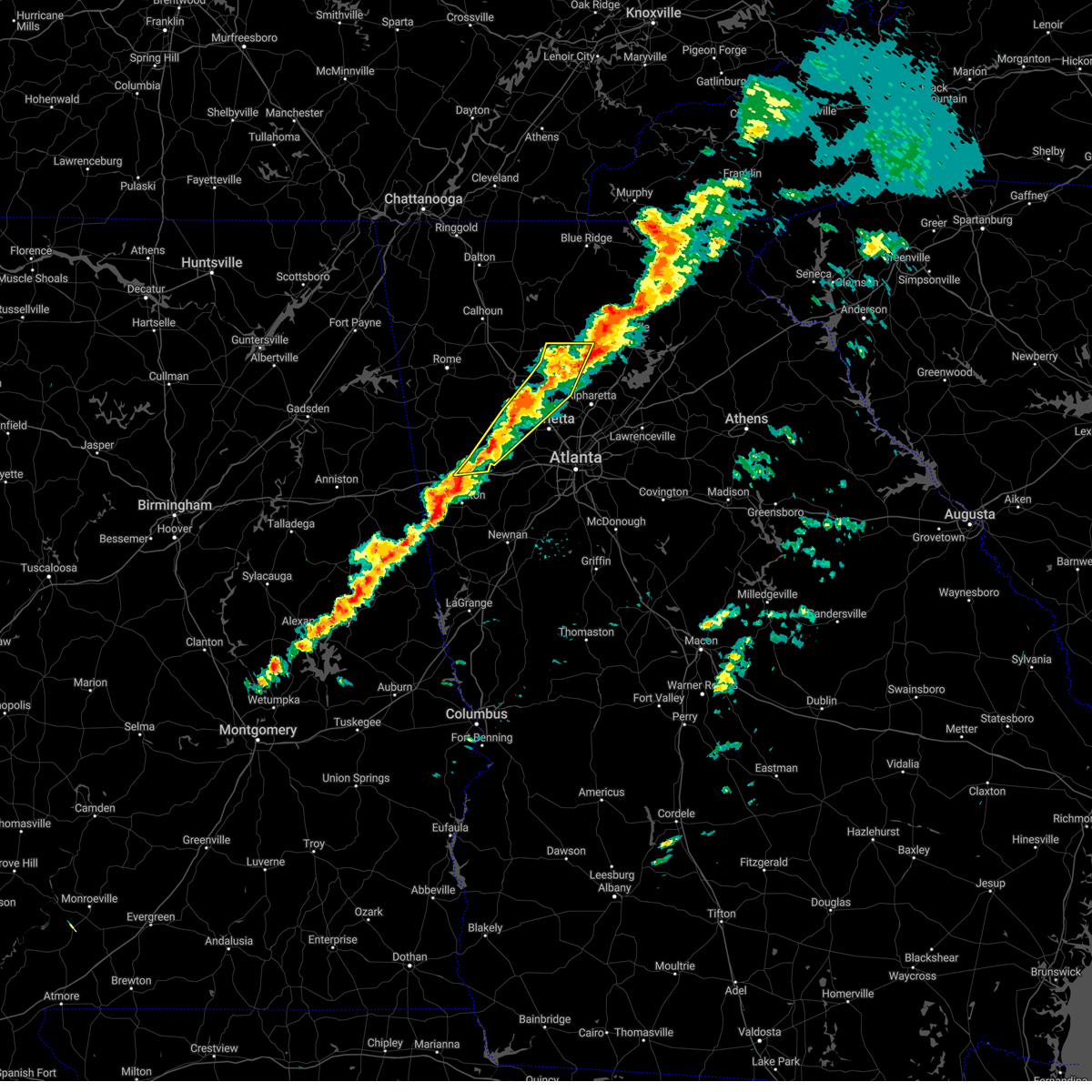 At 424 pm est, severe thunderstorms were located along a line extending from marblehill to near lebanon to near new georgia, moving east at 45 mph (radar indicated). Hazards include 60 mph wind gusts. Expect damage to roofs, siding, and trees. locations impacted include, marietta, canton, dallas, kennesaw, woodstock, acworth, villa rica, holly springs, temple, hiram, emerson, ball ground, nelson, waleska, buffington, hickory flat, burnt hickory ridge, kellogg creek, red top mountain state park and lost mountain park. hail threat, radar indicated max hail size, <. 75 in wind threat, radar indicated max wind gust, 60 mph. At 424 pm est, severe thunderstorms were located along a line extending from marblehill to near lebanon to near new georgia, moving east at 45 mph (radar indicated). Hazards include 60 mph wind gusts. Expect damage to roofs, siding, and trees. locations impacted include, marietta, canton, dallas, kennesaw, woodstock, acworth, villa rica, holly springs, temple, hiram, emerson, ball ground, nelson, waleska, buffington, hickory flat, burnt hickory ridge, kellogg creek, red top mountain state park and lost mountain park. hail threat, radar indicated max hail size, <. 75 in wind threat, radar indicated max wind gust, 60 mph.
|
| 3/3/2023 4:11 PM EST |
 At 411 pm est, severe thunderstorms were located along a line extending from ball ground to buffington to acworth, moving east at 55 mph (radar indicated). Hazards include 60 mph wind gusts. expect damage to roofs, siding, and trees At 411 pm est, severe thunderstorms were located along a line extending from ball ground to buffington to acworth, moving east at 55 mph (radar indicated). Hazards include 60 mph wind gusts. expect damage to roofs, siding, and trees
|
| 3/3/2023 4:05 PM EST |
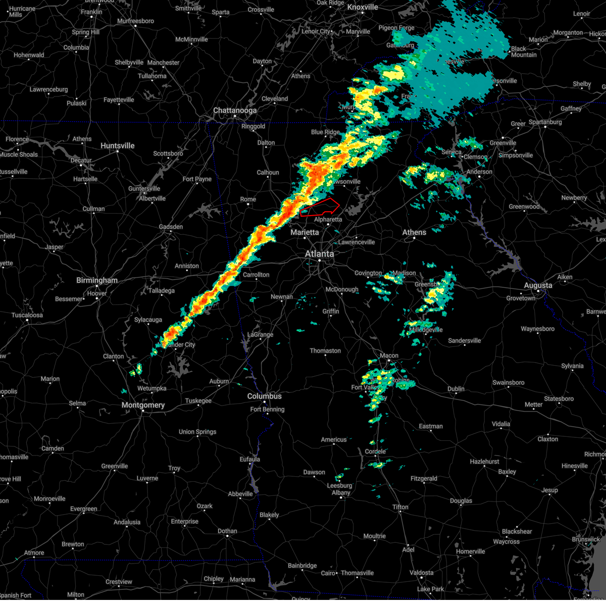 At 404 pm est, a severe thunderstorm capable of producing a tornado was located over bridgemill, or near canton, moving east at 50 mph (radar indicated rotation). Hazards include tornado. Flying debris will be dangerous to those caught without shelter. mobile homes will be damaged or destroyed. damage to roofs, windows, and vehicles will occur. Tree damage is likely. At 404 pm est, a severe thunderstorm capable of producing a tornado was located over bridgemill, or near canton, moving east at 50 mph (radar indicated rotation). Hazards include tornado. Flying debris will be dangerous to those caught without shelter. mobile homes will be damaged or destroyed. damage to roofs, windows, and vehicles will occur. Tree damage is likely.
|
| 3/3/2023 3:45 PM EST |
 At 344 pm est, severe thunderstorms were located along a line extending from funkhouser to near stilesboro to muscadine, moving east at 40 mph (radar indicated). Hazards include 60 mph wind gusts. expect damage to roofs, siding, and trees At 344 pm est, severe thunderstorms were located along a line extending from funkhouser to near stilesboro to muscadine, moving east at 40 mph (radar indicated). Hazards include 60 mph wind gusts. expect damage to roofs, siding, and trees
|
| 8/5/2022 6:38 PM EDT |
 The severe thunderstorm warning for southern cherokee, southwestern forsyth, northeastern cobb and northeastern fulton counties will expire at 645 pm edt, the storm which prompted the warning has weakened below severe limits, and no longer poses an immediate threat to life or property. therefore, the warning will be allowed to expire. however small hail, gusty winds and heavy rain are still possible with this thunderstorm. The severe thunderstorm warning for southern cherokee, southwestern forsyth, northeastern cobb and northeastern fulton counties will expire at 645 pm edt, the storm which prompted the warning has weakened below severe limits, and no longer poses an immediate threat to life or property. therefore, the warning will be allowed to expire. however small hail, gusty winds and heavy rain are still possible with this thunderstorm.
|
| 8/5/2022 6:12 PM EDT |
 At 612 pm edt, a severe thunderstorm was located over sweat mountain, or over mountain park, moving north at 30 mph (radar indicated). Hazards include ping pong ball size hail. People and animals outdoors will be injured. Expect damage to roofs, siding, windows, and vehicles. At 612 pm edt, a severe thunderstorm was located over sweat mountain, or over mountain park, moving north at 30 mph (radar indicated). Hazards include ping pong ball size hail. People and animals outdoors will be injured. Expect damage to roofs, siding, windows, and vehicles.
|
| 7/8/2022 9:44 PM EDT |
 At 944 pm edt, severe thunderstorms were located along a line extending from hightower to milton to near sweat mountain, moving southeast at 30 mph (radar indicated). Hazards include 60 mph wind gusts. Expect damage to roofs, siding, and trees. locations impacted include, canton, cumming, sandy springs, roswell, alpharetta, milton, woodstock, holly springs, free home, buffington, hickory flat, drew, union hill, sweat mountain, hightower, birmingham, matt, little river landing, lebanon and holbrook. hail threat, radar indicated max hail size, <. 75 in wind threat, radar indicated max wind gust, 60 mph. At 944 pm edt, severe thunderstorms were located along a line extending from hightower to milton to near sweat mountain, moving southeast at 30 mph (radar indicated). Hazards include 60 mph wind gusts. Expect damage to roofs, siding, and trees. locations impacted include, canton, cumming, sandy springs, roswell, alpharetta, milton, woodstock, holly springs, free home, buffington, hickory flat, drew, union hill, sweat mountain, hightower, birmingham, matt, little river landing, lebanon and holbrook. hail threat, radar indicated max hail size, <. 75 in wind threat, radar indicated max wind gust, 60 mph.
|
| 7/8/2022 9:26 PM EDT |
 At 926 pm edt, severe thunderstorms were located along a line extending from ball ground to near buffington to lebanon, moving southeast at 30 mph (radar indicated). Hazards include 60 mph wind gusts. expect damage to roofs, siding, and trees At 926 pm edt, severe thunderstorms were located along a line extending from ball ground to near buffington to lebanon, moving southeast at 30 mph (radar indicated). Hazards include 60 mph wind gusts. expect damage to roofs, siding, and trees
|
| 6/17/2022 5:11 PM EDT |
 At 510 pm edt, a severe thunderstorm was located over kennesaw state university, or 7 miles north of marietta, moving southeast at 25 mph (radar indicated). Hazards include 60 mph wind gusts and quarter size hail. Hail damage to vehicles is expected. Expect wind damage to roofs, siding, and trees. At 510 pm edt, a severe thunderstorm was located over kennesaw state university, or 7 miles north of marietta, moving southeast at 25 mph (radar indicated). Hazards include 60 mph wind gusts and quarter size hail. Hail damage to vehicles is expected. Expect wind damage to roofs, siding, and trees.
|
| 6/17/2022 4:43 PM EDT |
 At 443 pm edt, a severe thunderstorm was located near white, or 7 miles northeast of cartersville, moving southeast at 40 mph (radar indicated). Hazards include 60 mph wind gusts and quarter size hail. Hail damage to vehicles is expected. Expect wind damage to roofs, siding, and trees. At 443 pm edt, a severe thunderstorm was located near white, or 7 miles northeast of cartersville, moving southeast at 40 mph (radar indicated). Hazards include 60 mph wind gusts and quarter size hail. Hail damage to vehicles is expected. Expect wind damage to roofs, siding, and trees.
|
| 2/17/2022 9:18 PM EST |
 At 918 pm est, severe thunderstorms were located along a line extending from fausett lake to near ball ground to near white, moving east at 60 mph (radar indicated). Hazards include 60 mph wind gusts. Expect damage to roofs, siding, and trees. Locations impacted include, canton, cartersville, jasper, ball ground, nelson, white, waleska, kingston, cassville, buffington, lake arrowhead, marblehill, juno, salacoa valley, lake tamarack, hollis lathem reservoir, sutallee, tate, reavis mountain and mckee. At 918 pm est, severe thunderstorms were located along a line extending from fausett lake to near ball ground to near white, moving east at 60 mph (radar indicated). Hazards include 60 mph wind gusts. Expect damage to roofs, siding, and trees. Locations impacted include, canton, cartersville, jasper, ball ground, nelson, white, waleska, kingston, cassville, buffington, lake arrowhead, marblehill, juno, salacoa valley, lake tamarack, hollis lathem reservoir, sutallee, tate, reavis mountain and mckee.
|
| 2/17/2022 9:01 PM EST |
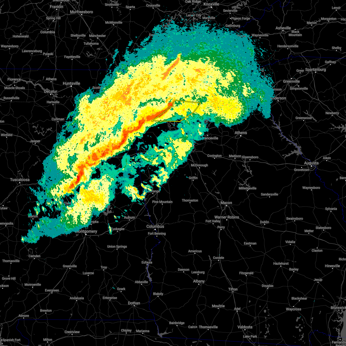 At 900 pm est, severe thunderstorms were located along a line extending from blaine to near white to near kingston, moving east at 60 mph (radar indicated). Hazards include 60 mph wind gusts. expect damage to roofs, siding, and trees At 900 pm est, severe thunderstorms were located along a line extending from blaine to near white to near kingston, moving east at 60 mph (radar indicated). Hazards include 60 mph wind gusts. expect damage to roofs, siding, and trees
|
| 12/29/2021 11:26 PM EST |
 At 1125 pm est, severe thunderstorms were located along a line extending from marblehill to hollis lathem reservoir to lathemtown to hickory flat to near due west, moving east at 55 mph (radar indicated). Hazards include 60 mph wind gusts. Expect damage to roofs, siding, and trees. locations impacted include, marietta, canton, cumming, dawsonville, sandy springs, roswell, johns creek, alpharetta, milton, kennesaw, woodstock, acworth, holly springs, ball ground, braswell, free home, buffington, dougherty, hickory flat and kellogg creek. hail threat, radar indicated max hail size, <. 75 in wind threat, radar indicated max wind gust, 60 mph. At 1125 pm est, severe thunderstorms were located along a line extending from marblehill to hollis lathem reservoir to lathemtown to hickory flat to near due west, moving east at 55 mph (radar indicated). Hazards include 60 mph wind gusts. Expect damage to roofs, siding, and trees. locations impacted include, marietta, canton, cumming, dawsonville, sandy springs, roswell, johns creek, alpharetta, milton, kennesaw, woodstock, acworth, holly springs, ball ground, braswell, free home, buffington, dougherty, hickory flat and kellogg creek. hail threat, radar indicated max hail size, <. 75 in wind threat, radar indicated max wind gust, 60 mph.
|
| 12/29/2021 11:08 PM EST |
 At 1108 pm est, severe thunderstorms were located along a line extending from near salacoa valley to waleska to little river landing to emerson to near braswell, moving east at 55 mph (radar indicated). Hazards include 60 mph wind gusts. expect damage to roofs, siding, and trees At 1108 pm est, severe thunderstorms were located along a line extending from near salacoa valley to waleska to little river landing to emerson to near braswell, moving east at 55 mph (radar indicated). Hazards include 60 mph wind gusts. expect damage to roofs, siding, and trees
|
| 12/29/2021 10:45 PM EST |
 At 1045 pm est, severe thunderstorms were located along a line extending from adairsville to near cassville to esom hill, moving east at 50 mph (radar indicated). Hazards include 60 mph wind gusts. Expect damage to roofs, siding, and trees. locations impacted include, canton, cartersville, dallas, cedartown, kennesaw, woodstock, acworth, holly springs, adairsville, rockmart, euharlee, hiram, emerson, ball ground, aragon, cave spring, white, waleska, kingston and braswell. hail threat, radar indicated max hail size, <. 75 in wind threat, radar indicated max wind gust, 60 mph. At 1045 pm est, severe thunderstorms were located along a line extending from adairsville to near cassville to esom hill, moving east at 50 mph (radar indicated). Hazards include 60 mph wind gusts. Expect damage to roofs, siding, and trees. locations impacted include, canton, cartersville, dallas, cedartown, kennesaw, woodstock, acworth, holly springs, adairsville, rockmart, euharlee, hiram, emerson, ball ground, aragon, cave spring, white, waleska, kingston and braswell. hail threat, radar indicated max hail size, <. 75 in wind threat, radar indicated max wind gust, 60 mph.
|
| 12/29/2021 10:31 PM EST |
 At 1031 pm est, severe thunderstorms were located along a line extending from pinson to near lindale to near pleasant gap, moving east at 60 mph (radar indicated). Hazards include 60 mph wind gusts. expect damage to roofs, siding, and trees At 1031 pm est, severe thunderstorms were located along a line extending from pinson to near lindale to near pleasant gap, moving east at 60 mph (radar indicated). Hazards include 60 mph wind gusts. expect damage to roofs, siding, and trees
|
| 5/4/2021 2:57 PM EDT |
 The national weather service in peachtree city has issued a * severe thunderstorm warning for. paulding county in northwestern georgia. southwestern cherokee county in north central georgia. haralson county in northwestern georgia. Cobb county in north central georgia. The national weather service in peachtree city has issued a * severe thunderstorm warning for. paulding county in northwestern georgia. southwestern cherokee county in north central georgia. haralson county in northwestern georgia. Cobb county in north central georgia.
|
| 3/25/2021 9:46 PM EDT |
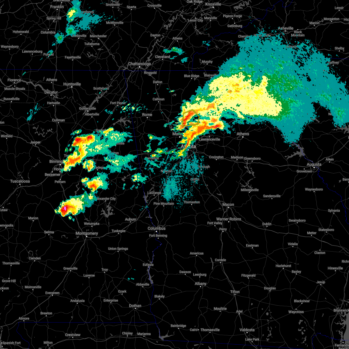 At 945 pm edt, a severe thunderstorm was located over buffington, or near canton, moving east at 45 mph (radar indicated). Hazards include 60 mph wind gusts and half dollar size hail. Hail damage to vehicles is expected. expect wind damage to roofs, siding, and trees. Locations impacted include, canton, holly springs, ball ground, free home, buffington, hickory flat, drew, union hill, birmingham, holbrook, lathemtown, ducktown and reavis mountain. At 945 pm edt, a severe thunderstorm was located over buffington, or near canton, moving east at 45 mph (radar indicated). Hazards include 60 mph wind gusts and half dollar size hail. Hail damage to vehicles is expected. expect wind damage to roofs, siding, and trees. Locations impacted include, canton, holly springs, ball ground, free home, buffington, hickory flat, drew, union hill, birmingham, holbrook, lathemtown, ducktown and reavis mountain.
|
| 3/25/2021 9:37 PM EDT |
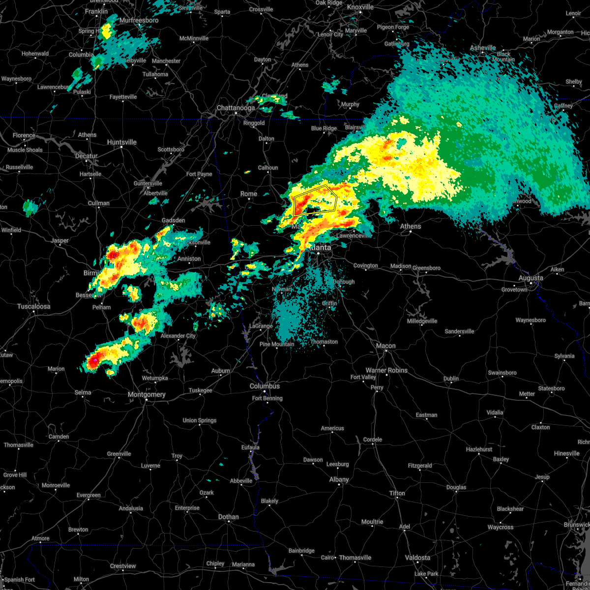 At 937 pm edt, a severe thunderstorm was located over bridgemill, or near canton, moving east at 50 mph (radar indicated). Hazards include 60 mph wind gusts and quarter size hail. Hail damage to vehicles is expected. expect wind damage to roofs, siding, and trees. Locations impacted include, canton, woodstock, holly springs, ball ground, free home, buffington, hickory flat, drew, union hill, kellogg creek, birmingham, little river landing, lebanon, holbrook, lathemtown, ducktown, sutallee, reavis mountain, hobgood park and bridgemill. At 937 pm edt, a severe thunderstorm was located over bridgemill, or near canton, moving east at 50 mph (radar indicated). Hazards include 60 mph wind gusts and quarter size hail. Hail damage to vehicles is expected. expect wind damage to roofs, siding, and trees. Locations impacted include, canton, woodstock, holly springs, ball ground, free home, buffington, hickory flat, drew, union hill, kellogg creek, birmingham, little river landing, lebanon, holbrook, lathemtown, ducktown, sutallee, reavis mountain, hobgood park and bridgemill.
|
| 3/25/2021 9:25 PM EDT |
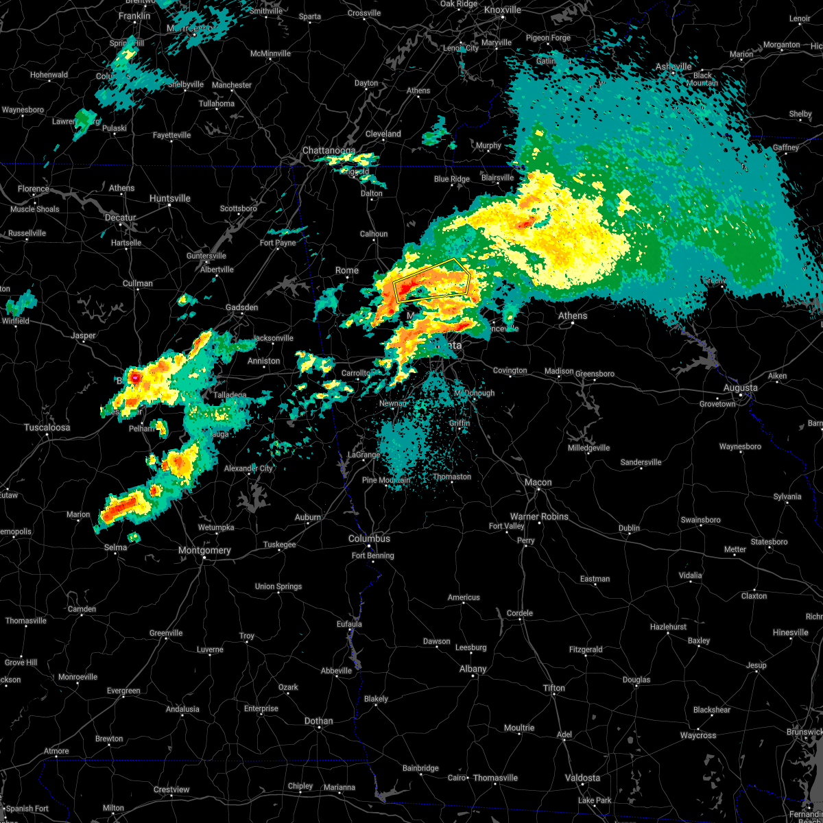 At 925 pm edt, a severe thunderstorm was located over red top mountain state park, or near cartersville, moving east at 45 mph (radar indicated). Hazards include 60 mph wind gusts and quarter size hail. Hail damage to vehicles is expected. Expect wind damage to roofs, siding, and trees. At 925 pm edt, a severe thunderstorm was located over red top mountain state park, or near cartersville, moving east at 45 mph (radar indicated). Hazards include 60 mph wind gusts and quarter size hail. Hail damage to vehicles is expected. Expect wind damage to roofs, siding, and trees.
|
| 3/25/2021 8:21 PM EDT |
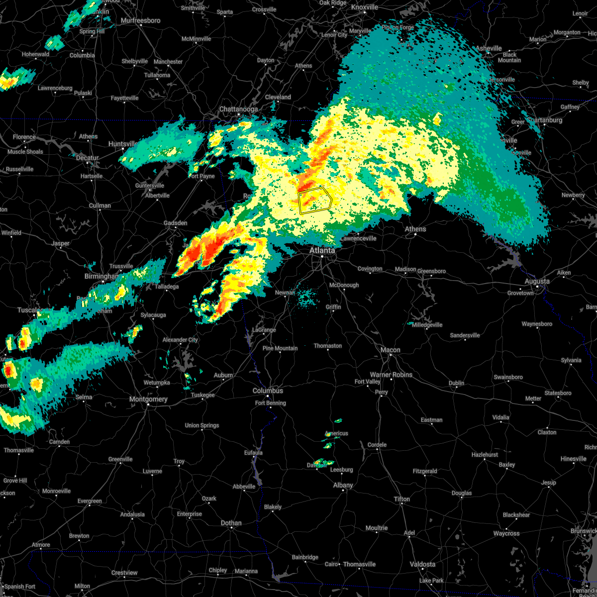 At 819 pm edt, a severe thunderstorm was located over canton, moving east at 55 mph (radar indicated). Hazards include 60 mph wind gusts and penny size hail. Expect damage to roofs, siding, and trees. Locations impacted include, canton, holly springs, ball ground, waleska, buffington, little river landing, hickory flat, union hill, lake arrowhead, lathemtown, sutallee and bridgemill. At 819 pm edt, a severe thunderstorm was located over canton, moving east at 55 mph (radar indicated). Hazards include 60 mph wind gusts and penny size hail. Expect damage to roofs, siding, and trees. Locations impacted include, canton, holly springs, ball ground, waleska, buffington, little river landing, hickory flat, union hill, lake arrowhead, lathemtown, sutallee and bridgemill.
|
| 3/25/2021 8:06 PM EDT |
 At 805 pm edt, a severe thunderstorm was located over red top mountain state park, or near cartersville, moving east at 45 mph (radar indicated). Hazards include 60 mph wind gusts and penny size hail. Expect damage to roofs, siding, and trees. Locations impacted include, canton, cartersville, milton, woodstock, holly springs, emerson, ball ground, white, waleska, free home, buffington, hickory flat, kellogg creek, red top mountain state park, lathemtown, hobgood park, union hill, lake arrowhead, birmingham and little river landing. At 805 pm edt, a severe thunderstorm was located over red top mountain state park, or near cartersville, moving east at 45 mph (radar indicated). Hazards include 60 mph wind gusts and penny size hail. Expect damage to roofs, siding, and trees. Locations impacted include, canton, cartersville, milton, woodstock, holly springs, emerson, ball ground, white, waleska, free home, buffington, hickory flat, kellogg creek, red top mountain state park, lathemtown, hobgood park, union hill, lake arrowhead, birmingham and little river landing.
|
| 3/25/2021 7:45 PM EDT |
 At 745 pm edt, a severe thunderstorm was located over stilesboro, or 8 miles southwest of cartersville, moving east at 55 mph (radar indicated). Hazards include 60 mph wind gusts and penny size hail. expect damage to roofs, siding, and trees At 745 pm edt, a severe thunderstorm was located over stilesboro, or 8 miles southwest of cartersville, moving east at 55 mph (radar indicated). Hazards include 60 mph wind gusts and penny size hail. expect damage to roofs, siding, and trees
|
| 3/25/2021 3:38 PM EDT |
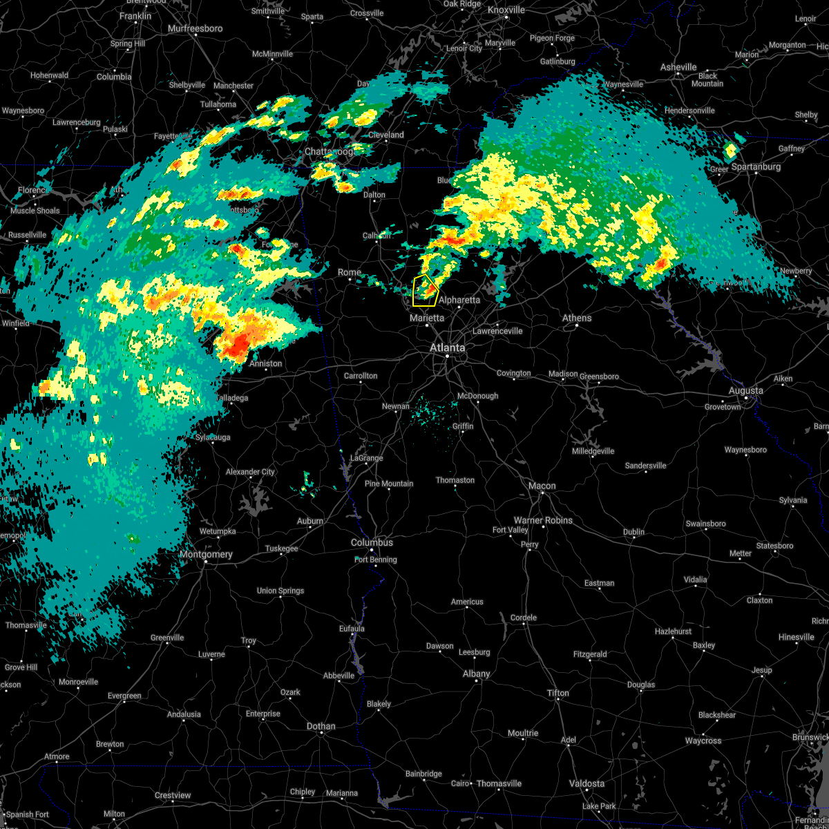 At 333 pm edt, a severe thunderstorm was located over george washington carver st pk, or 8 miles east of cartersville, moving east at 35 mph (radar indicated). Hazards include 60 mph wind gusts. Expect damage to roofs, siding, and trees. Locations impacted include, canton, woodstock, holly springs, little river landing, lebanon, kellogg creek, oak grove, sutallee, hobgood park and bridgemill. At 333 pm edt, a severe thunderstorm was located over george washington carver st pk, or 8 miles east of cartersville, moving east at 35 mph (radar indicated). Hazards include 60 mph wind gusts. Expect damage to roofs, siding, and trees. Locations impacted include, canton, woodstock, holly springs, little river landing, lebanon, kellogg creek, oak grove, sutallee, hobgood park and bridgemill.
|
| 3/25/2021 3:33 PM EDT |
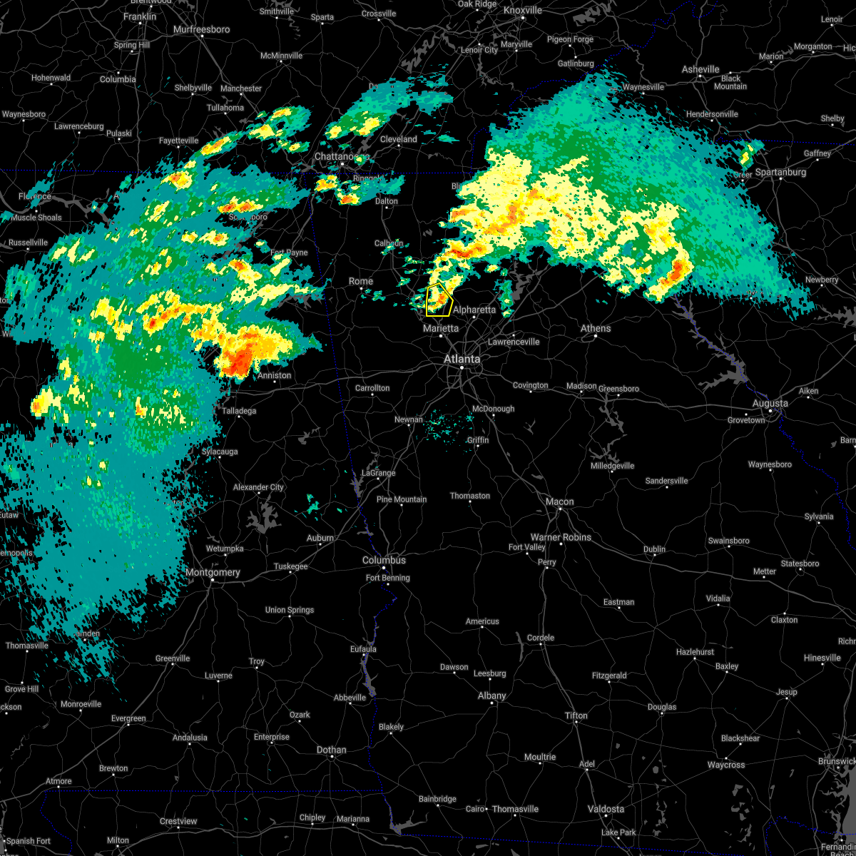 At 333 pm edt, a severe thunderstorm was located over george washington carver st pk, or 8 miles east of cartersville, moving east at 35 mph (radar indicated). Hazards include 60 mph wind gusts. Expect damage to roofs, siding, and trees. Locations impacted include, canton, woodstock, holly springs, little river landing, lebanon, kellogg creek, oak grove, sutallee, hobgood park and bridgemill. At 333 pm edt, a severe thunderstorm was located over george washington carver st pk, or 8 miles east of cartersville, moving east at 35 mph (radar indicated). Hazards include 60 mph wind gusts. Expect damage to roofs, siding, and trees. Locations impacted include, canton, woodstock, holly springs, little river landing, lebanon, kellogg creek, oak grove, sutallee, hobgood park and bridgemill.
|
| 3/25/2021 3:22 PM EDT |
 At 322 pm edt, a severe thunderstorm was located over emerson, or near cartersville, moving east at 35 mph (radar indicated). Hazards include 60 mph wind gusts and penny size hail. Expect damage to roofs, siding, and trees. Locations impacted include, canton, cartersville, kennesaw, woodstock, acworth, holly springs, emerson, kellogg creek, red top mountain state park, oak grove, little river landing, george washington carver st pk, lebanon, sutallee, hobgood park and bridgemill. At 322 pm edt, a severe thunderstorm was located over emerson, or near cartersville, moving east at 35 mph (radar indicated). Hazards include 60 mph wind gusts and penny size hail. Expect damage to roofs, siding, and trees. Locations impacted include, canton, cartersville, kennesaw, woodstock, acworth, holly springs, emerson, kellogg creek, red top mountain state park, oak grove, little river landing, george washington carver st pk, lebanon, sutallee, hobgood park and bridgemill.
|
| 3/25/2021 3:07 PM EDT |
 At 307 pm edt, a severe thunderstorm was located near stilesboro, or 10 miles southwest of cartersville, moving east at 35 mph (trained weather spotters). Hazards include 60 mph wind gusts and penny size hail. expect damage to roofs, siding, and trees At 307 pm edt, a severe thunderstorm was located near stilesboro, or 10 miles southwest of cartersville, moving east at 35 mph (trained weather spotters). Hazards include 60 mph wind gusts and penny size hail. expect damage to roofs, siding, and trees
|
| 3/25/2021 1:30 PM EDT |
 At 130 pm edt, a severe thunderstorm was located near birmingham, or 9 miles southeast of canton, moving east at 60 mph (radar indicated). Hazards include 60 mph wind gusts and quarter size hail. Hail damage to vehicles is expected. Expect wind damage to roofs, siding, and trees. At 130 pm edt, a severe thunderstorm was located near birmingham, or 9 miles southeast of canton, moving east at 60 mph (radar indicated). Hazards include 60 mph wind gusts and quarter size hail. Hail damage to vehicles is expected. Expect wind damage to roofs, siding, and trees.
|
| 3/25/2021 1:04 PM EDT |
 At 104 pm edt, a severe thunderstorm was located near emerson, or near cartersville, moving east at 70 mph (radar indicated). Hazards include 60 mph wind gusts and quarter size hail. Hail damage to vehicles is expected. Expect wind damage to roofs, siding, and trees. At 104 pm edt, a severe thunderstorm was located near emerson, or near cartersville, moving east at 70 mph (radar indicated). Hazards include 60 mph wind gusts and quarter size hail. Hail damage to vehicles is expected. Expect wind damage to roofs, siding, and trees.
|
| 8/30/2020 7:54 PM EDT |
 The national weather service in peachtree city has issued a * severe thunderstorm warning for. southern cherokee county in north central georgia. northeastern cobb county in north central georgia. north central fulton county in north central georgia. Until 830 pm edt. The national weather service in peachtree city has issued a * severe thunderstorm warning for. southern cherokee county in north central georgia. northeastern cobb county in north central georgia. north central fulton county in north central georgia. Until 830 pm edt.
|
| 8/19/2020 5:51 PM EDT |
 At 551 pm edt, a severe thunderstorm was located over sandy plains, or near marietta, and is nearly stationary (radar indicated). Hazards include quarter size hail. damage to vehicles is expected At 551 pm edt, a severe thunderstorm was located over sandy plains, or near marietta, and is nearly stationary (radar indicated). Hazards include quarter size hail. damage to vehicles is expected
|
| 8/10/2020 2:54 PM EDT |
 At 253 pm edt, severe thunderstorms were located along a line extending from woodstock to cumming and chestatee, moving southeast at 40 mph (radar indicated). Hazards include 60 mph wind gusts and nickel size hail. expect damage to roofs, siding, and trees At 253 pm edt, severe thunderstorms were located along a line extending from woodstock to cumming and chestatee, moving southeast at 40 mph (radar indicated). Hazards include 60 mph wind gusts and nickel size hail. expect damage to roofs, siding, and trees
|
| 8/6/2020 6:20 PM EDT |
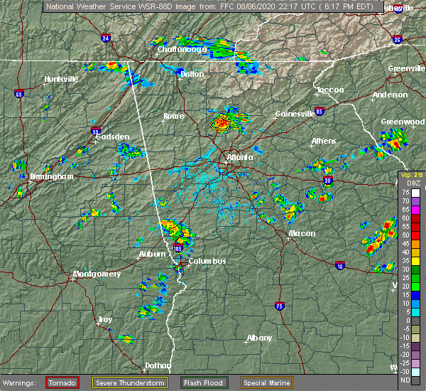 The severe thunderstorm warning for central cherokee county will expire at 630 pm edt, the storm which prompted the warning has weakened below severe limits, and no longer poses an immediate threat to life or property. therefore, the warning will be allowed to expire. however gusty winds and heavy rain are still possible with this thunderstorm. The severe thunderstorm warning for central cherokee county will expire at 630 pm edt, the storm which prompted the warning has weakened below severe limits, and no longer poses an immediate threat to life or property. therefore, the warning will be allowed to expire. however gusty winds and heavy rain are still possible with this thunderstorm.
|
| 8/6/2020 6:05 PM EDT |
 At 604 pm edt, a severe thunderstorm was centered 4 miles southwest of canton, moving northeast at 15 mph (radar indicated). Hazards include 60 mph wind gusts and penny size hail. Expect damage to roofs, siding, and trees. Locations impacted include, canton, holly springs, buffington, hickory flat and bridgemill. At 604 pm edt, a severe thunderstorm was centered 4 miles southwest of canton, moving northeast at 15 mph (radar indicated). Hazards include 60 mph wind gusts and penny size hail. Expect damage to roofs, siding, and trees. Locations impacted include, canton, holly springs, buffington, hickory flat and bridgemill.
|
| 8/6/2020 5:52 PM EDT |
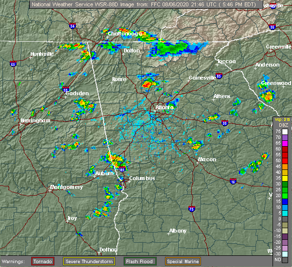 At 552 pm edt, a severe thunderstorm was located over bridgemill, or near canton, moving northeast at 15 mph (radar indicated). Hazards include 60 mph wind gusts and penny size hail. expect damage to roofs, siding, and trees At 552 pm edt, a severe thunderstorm was located over bridgemill, or near canton, moving northeast at 15 mph (radar indicated). Hazards include 60 mph wind gusts and penny size hail. expect damage to roofs, siding, and trees
|
| 7/25/2020 5:05 PM EDT |
 The severe thunderstorm warning for southwestern cherokee and northern cobb counties will expire at 515 pm edt, the severe thunderstorm which prompted the warning has weakened. therefore, the warning will be allowed to expire. The severe thunderstorm warning for southwestern cherokee and northern cobb counties will expire at 515 pm edt, the severe thunderstorm which prompted the warning has weakened. therefore, the warning will be allowed to expire.
|
| 7/25/2020 4:33 PM EDT |
 At 433 pm edt, a severe thunderstorm was located over kennesaw state university, or 8 miles north of marietta, moving south at 5 mph (radar indicated). Hazards include 60 mph wind gusts and quarter size hail. Hail damage to vehicles is expected. Expect wind damage to roofs, siding, and trees. At 433 pm edt, a severe thunderstorm was located over kennesaw state university, or 8 miles north of marietta, moving south at 5 mph (radar indicated). Hazards include 60 mph wind gusts and quarter size hail. Hail damage to vehicles is expected. Expect wind damage to roofs, siding, and trees.
|
| 7/15/2020 4:12 PM EDT |
 The severe thunderstorm warning for southwestern cherokee county will expire at 415 pm edt, the storm which prompted the warning has weakened below severe limits, and has exited the warned area. therefore, the warning will be allowed to expire. to report severe weather, contact your nearest law enforcement agency. they will relay your report to the national weather service peachtree city. The severe thunderstorm warning for southwestern cherokee county will expire at 415 pm edt, the storm which prompted the warning has weakened below severe limits, and has exited the warned area. therefore, the warning will be allowed to expire. to report severe weather, contact your nearest law enforcement agency. they will relay your report to the national weather service peachtree city.
|
| 7/15/2020 3:40 PM EDT |
 At 340 pm edt, a severe thunderstorm was located near lebanon, or 7 miles south of canton, moving north at 15 mph (radar indicated). Hazards include 60 mph wind gusts and quarter size hail. Hail damage to vehicles is expected. Expect wind damage to roofs, siding, and trees. At 340 pm edt, a severe thunderstorm was located near lebanon, or 7 miles south of canton, moving north at 15 mph (radar indicated). Hazards include 60 mph wind gusts and quarter size hail. Hail damage to vehicles is expected. Expect wind damage to roofs, siding, and trees.
|
| 7/10/2020 4:00 PM EDT |
 At 400 pm edt, a severe thunderstorm was located over canton, moving southeast at 20 mph (radar indicated). Hazards include 60 mph wind gusts and quarter size hail. Hail damage to vehicles is expected. Expect wind damage to roofs, siding, and trees. At 400 pm edt, a severe thunderstorm was located over canton, moving southeast at 20 mph (radar indicated). Hazards include 60 mph wind gusts and quarter size hail. Hail damage to vehicles is expected. Expect wind damage to roofs, siding, and trees.
|
| 6/14/2020 6:01 PM EDT |
 At 600 pm edt, a severe thunderstorm was located over lake arrowhead, or near canton, moving southeast at 15 mph (radar indicated). Hazards include 60 mph wind gusts and quarter size hail. Hail damage to vehicles is expected. Expect wind damage to roofs, siding, and trees. At 600 pm edt, a severe thunderstorm was located over lake arrowhead, or near canton, moving southeast at 15 mph (radar indicated). Hazards include 60 mph wind gusts and quarter size hail. Hail damage to vehicles is expected. Expect wind damage to roofs, siding, and trees.
|
| 5/22/2020 12:38 PM EDT |
 At 1237 pm edt, a severe thunderstorm was located over union hill, or near canton, moving east at 35 mph (radar indicated). Hazards include 60 mph wind gusts and quarter size hail. Hail damage to vehicles is expected. Expect wind damage to roofs, siding, and trees. At 1237 pm edt, a severe thunderstorm was located over union hill, or near canton, moving east at 35 mph (radar indicated). Hazards include 60 mph wind gusts and quarter size hail. Hail damage to vehicles is expected. Expect wind damage to roofs, siding, and trees.
|
| 4/13/2020 2:22 AM EDT |
 At 222 am edt, a severe thunderstorm was located over roswell, or 11 miles northeast of marietta, moving east at 85 mph (radar indicated). Hazards include 60 mph wind gusts. expect damage to roofs, siding, and trees At 222 am edt, a severe thunderstorm was located over roswell, or 11 miles northeast of marietta, moving east at 85 mph (radar indicated). Hazards include 60 mph wind gusts. expect damage to roofs, siding, and trees
|
| 4/13/2020 1:49 AM EDT |
 At 148 am edt, a severe thunderstorm capable of producing a tornado was located over holly springs, or near canton, moving northeast at 55 mph (radar indicated rotation). Hazards include tornado. Flying debris will be dangerous to those caught without shelter. mobile homes will be damaged or destroyed. damage to roofs, windows, and vehicles will occur. tree damage is likely. Locations impacted include, canton, woodstock, holly springs, ball ground, buffington, hickory flat, lebanon, union hill, bridgemill and little river landing. At 148 am edt, a severe thunderstorm capable of producing a tornado was located over holly springs, or near canton, moving northeast at 55 mph (radar indicated rotation). Hazards include tornado. Flying debris will be dangerous to those caught without shelter. mobile homes will be damaged or destroyed. damage to roofs, windows, and vehicles will occur. tree damage is likely. Locations impacted include, canton, woodstock, holly springs, ball ground, buffington, hickory flat, lebanon, union hill, bridgemill and little river landing.
|
| 4/13/2020 1:44 AM EDT |
 At 144 am edt, a severe thunderstorm capable of producing a tornado was located over hobgood park, or 8 miles southwest of canton, moving east at 55 mph (radar indicated rotation). Hazards include tornado. Flying debris will be dangerous to those caught without shelter. mobile homes will be damaged or destroyed. damage to roofs, windows, and vehicles will occur. Tree damage is likely. At 144 am edt, a severe thunderstorm capable of producing a tornado was located over hobgood park, or 8 miles southwest of canton, moving east at 55 mph (radar indicated rotation). Hazards include tornado. Flying debris will be dangerous to those caught without shelter. mobile homes will be damaged or destroyed. damage to roofs, windows, and vehicles will occur. Tree damage is likely.
|
| 4/13/2020 1:43 AM EDT |
 At 143 am edt, severe thunderstorms were located along a line extending from near juno to lebanon, moving east at 55 mph (radar indicated). Hazards include 60 mph wind gusts. Expect damage to roofs, siding, and trees. Locations impacted include, canton, cartersville, dallas, kennesaw, woodstock, acworth, holly springs, rockmart, emerson, ball ground, waleska, braswell, free home, buffington, yorkville, hickory flat, burnt hickory ridge, kellogg creek, red top mountain state park and cross roads. At 143 am edt, severe thunderstorms were located along a line extending from near juno to lebanon, moving east at 55 mph (radar indicated). Hazards include 60 mph wind gusts. Expect damage to roofs, siding, and trees. Locations impacted include, canton, cartersville, dallas, kennesaw, woodstock, acworth, holly springs, rockmart, emerson, ball ground, waleska, braswell, free home, buffington, yorkville, hickory flat, burnt hickory ridge, kellogg creek, red top mountain state park and cross roads.
|
| 4/13/2020 1:20 AM EDT |
 At 120 am edt, severe thunderstorms were located along a line extending from waleska to burnt hickory ridge, moving east at 55 mph (radar indicated). Hazards include 60 mph wind gusts. Expect damage to roofs, siding, and trees. Locations impacted include, canton, cartersville, dallas, kennesaw, woodstock, acworth, holly springs, rockmart, euharlee, emerson, ball ground, aragon, white, waleska, braswell, taylorsville, free home, cassville, buffington and yorkville. At 120 am edt, severe thunderstorms were located along a line extending from waleska to burnt hickory ridge, moving east at 55 mph (radar indicated). Hazards include 60 mph wind gusts. Expect damage to roofs, siding, and trees. Locations impacted include, canton, cartersville, dallas, kennesaw, woodstock, acworth, holly springs, rockmart, euharlee, emerson, ball ground, aragon, white, waleska, braswell, taylorsville, free home, cassville, buffington and yorkville.
|
| 4/13/2020 1:05 AM EDT |
 At 105 am edt, severe thunderstorms were located along a line extending from near white to van wert, moving east at 55 mph (radar indicated). Hazards include 60 mph wind gusts. Expect damage to roofs, siding, and trees. Locations impacted include, marietta, canton, cartersville, dallas, buchanan, kennesaw, woodstock, acworth, powder springs, holly springs, adairsville, rockmart, euharlee, hiram, emerson, ball ground, aragon, white, waleska and kingston. At 105 am edt, severe thunderstorms were located along a line extending from near white to van wert, moving east at 55 mph (radar indicated). Hazards include 60 mph wind gusts. Expect damage to roofs, siding, and trees. Locations impacted include, marietta, canton, cartersville, dallas, buchanan, kennesaw, woodstock, acworth, powder springs, holly springs, adairsville, rockmart, euharlee, hiram, emerson, ball ground, aragon, white, waleska and kingston.
|
| 4/13/2020 12:54 AM EDT |
 At 1254 am edt, severe thunderstorms were located along a line extending from near kingston to near antioch, moving east at 55 mph (radar indicated). Hazards include 60 mph wind gusts. expect damage to roofs, siding, and trees At 1254 am edt, severe thunderstorms were located along a line extending from near kingston to near antioch, moving east at 55 mph (radar indicated). Hazards include 60 mph wind gusts. expect damage to roofs, siding, and trees
|
| 3/24/2020 11:40 PM EDT |
 The severe thunderstorm warning for northeastern paulding, southwestern cherokee, northwestern cobb and southeastern bartow counties will expire at 1145 pm edt, the storm which prompted the warning has moved out of the area. therefore, the warning will be allowed to expire. a tornado watch remains in effect until 100 am edt for northwestern georgia. remember, a severe thunderstorm warning still remains in effect for cobb county until 1215 am edt. The severe thunderstorm warning for northeastern paulding, southwestern cherokee, northwestern cobb and southeastern bartow counties will expire at 1145 pm edt, the storm which prompted the warning has moved out of the area. therefore, the warning will be allowed to expire. a tornado watch remains in effect until 100 am edt for northwestern georgia. remember, a severe thunderstorm warning still remains in effect for cobb county until 1215 am edt.
|
| 3/24/2020 11:22 PM EDT |
 At 1122 pm edt, a severe thunderstorm was located near emerson, or 2 miles south of cartersville, moving east at 50 mph (radar indicated). Hazards include 60 mph wind gusts and nickel size hail. Expect damage to roofs, siding, and trees. Locations impacted include, canton, cartersville, kennesaw, woodstock, acworth, holly springs, emerson, hickory flat, kellogg creek, red top mountain state park, oak grove, kennesaw state university, little river landing, george washington carver st pk, lebanon, stilesboro, hobgood park and bridgemill. At 1122 pm edt, a severe thunderstorm was located near emerson, or 2 miles south of cartersville, moving east at 50 mph (radar indicated). Hazards include 60 mph wind gusts and nickel size hail. Expect damage to roofs, siding, and trees. Locations impacted include, canton, cartersville, kennesaw, woodstock, acworth, holly springs, emerson, hickory flat, kellogg creek, red top mountain state park, oak grove, kennesaw state university, little river landing, george washington carver st pk, lebanon, stilesboro, hobgood park and bridgemill.
|
| 3/24/2020 11:07 PM EDT |
 At 1107 pm edt, a severe thunderstorm was located over euharlee, or 9 miles west of cartersville, moving east at 50 mph (radar indicated). Hazards include 60 mph wind gusts and quarter size hail. Hail damage to vehicles is expected. expect wind damage to roofs, siding, and trees. Locations impacted include, canton, cartersville, kennesaw, woodstock, acworth, holly springs, euharlee, emerson, taylorsville, hickory flat, kellogg creek, red top mountain state park, oak grove, kennesaw state university, little river landing, george washington carver st pk, lebanon, stilesboro, hobgood park and bridgemill. At 1107 pm edt, a severe thunderstorm was located over euharlee, or 9 miles west of cartersville, moving east at 50 mph (radar indicated). Hazards include 60 mph wind gusts and quarter size hail. Hail damage to vehicles is expected. expect wind damage to roofs, siding, and trees. Locations impacted include, canton, cartersville, kennesaw, woodstock, acworth, holly springs, euharlee, emerson, taylorsville, hickory flat, kellogg creek, red top mountain state park, oak grove, kennesaw state university, little river landing, george washington carver st pk, lebanon, stilesboro, hobgood park and bridgemill.
|
| 3/24/2020 10:55 PM EDT |
 The national weather service in peachtree city has issued a * severe thunderstorm warning for. northeastern paulding county in northwestern georgia. cherokee county in north central georgia. northwestern cobb county in north central georgia. Floyd county in northwestern georgia. The national weather service in peachtree city has issued a * severe thunderstorm warning for. northeastern paulding county in northwestern georgia. cherokee county in north central georgia. northwestern cobb county in north central georgia. Floyd county in northwestern georgia.
|
| 2/6/2020 7:03 AM EST |
 At 703 am est, severe thunderstorms were located along a line extending from near emerson to lost mountain park, moving northeast at 55 mph (radar indicated). Hazards include 60 mph wind gusts. Expect damage to roofs, siding, and trees. Locations impacted include, marietta, canton, cartersville, kennesaw, woodstock, acworth, holly springs, emerson, kellogg creek, red top mountain state park, lost mountain park, oak grove, kennesaw state university, little river landing, george washington carver st pk, lebanon, due west, sandy plains, sutallee and hobgood park. At 703 am est, severe thunderstorms were located along a line extending from near emerson to lost mountain park, moving northeast at 55 mph (radar indicated). Hazards include 60 mph wind gusts. Expect damage to roofs, siding, and trees. Locations impacted include, marietta, canton, cartersville, kennesaw, woodstock, acworth, holly springs, emerson, kellogg creek, red top mountain state park, lost mountain park, oak grove, kennesaw state university, little river landing, george washington carver st pk, lebanon, due west, sandy plains, sutallee and hobgood park.
|
| 2/6/2020 6:47 AM EST |
 At 646 am est, severe thunderstorms were located along a line extending from braswell to near new georgia, moving northeast at 60 mph (radar indicated). Hazards include 60 mph wind gusts. expect damage to roofs, siding, and trees At 646 am est, severe thunderstorms were located along a line extending from braswell to near new georgia, moving northeast at 60 mph (radar indicated). Hazards include 60 mph wind gusts. expect damage to roofs, siding, and trees
|
| 1/11/2020 4:51 PM EST |
 At 450 pm est, severe thunderstorms were located along a line extending from salacoa valley to whitesburg, moving east at 45 mph (radar indicated). Hazards include 60 mph wind gusts. expect damage to roofs, siding, and trees At 450 pm est, severe thunderstorms were located along a line extending from salacoa valley to whitesburg, moving east at 45 mph (radar indicated). Hazards include 60 mph wind gusts. expect damage to roofs, siding, and trees
|
| 8/19/2019 4:20 PM EDT |
 At 347 pm edt, a severe thunderstorm was located over buffington, or near canton, moving south at 10 mph (radar indicated). Hazards include 60 mph wind gusts and half dollar size hail. Hail damage to vehicles is expected. Expect wind damage to roofs, siding, and trees. At 347 pm edt, a severe thunderstorm was located over buffington, or near canton, moving south at 10 mph (radar indicated). Hazards include 60 mph wind gusts and half dollar size hail. Hail damage to vehicles is expected. Expect wind damage to roofs, siding, and trees.
|
| 8/19/2019 3:48 PM EDT |
 The national weather service in peachtree city has issued a * severe thunderstorm warning for. central cherokee county in north central georgia. southwestern forsyth county in north central georgia. north central fulton county in north central georgia. Until 430 pm edt. The national weather service in peachtree city has issued a * severe thunderstorm warning for. central cherokee county in north central georgia. southwestern forsyth county in north central georgia. north central fulton county in north central georgia. Until 430 pm edt.
|
| 8/14/2019 6:06 PM EDT |
 At 606 pm edt, a severe thunderstorm was located over oak grove, or 9 miles northwest of marietta, moving southeast at 30 mph (radar indicated). Hazards include 60 mph wind gusts and quarter size hail. Hail damage to vehicles is expected. expect wind damage to roofs, siding, and trees. Locations impacted include, atlanta, marietta, canton, sandy springs, roswell, alpharetta, smyrna, kennesaw, woodstock, acworth, holly springs, emerson, fair oaks, mount bethel, hickory flat, kellogg creek, red top mountain state park, cross roads, due west and sandy plains. At 606 pm edt, a severe thunderstorm was located over oak grove, or 9 miles northwest of marietta, moving southeast at 30 mph (radar indicated). Hazards include 60 mph wind gusts and quarter size hail. Hail damage to vehicles is expected. expect wind damage to roofs, siding, and trees. Locations impacted include, atlanta, marietta, canton, sandy springs, roswell, alpharetta, smyrna, kennesaw, woodstock, acworth, holly springs, emerson, fair oaks, mount bethel, hickory flat, kellogg creek, red top mountain state park, cross roads, due west and sandy plains.
|
| 8/14/2019 5:51 PM EDT |
 At 550 pm edt, a severe thunderstorm was located over emerson, or near cartersville, moving southeast at 30 mph (radar indicated). Hazards include 60 mph wind gusts and quarter size hail. Hail damage to vehicles is expected. Expect wind damage to roofs, siding, and trees. At 550 pm edt, a severe thunderstorm was located over emerson, or near cartersville, moving southeast at 30 mph (radar indicated). Hazards include 60 mph wind gusts and quarter size hail. Hail damage to vehicles is expected. Expect wind damage to roofs, siding, and trees.
|
| 7/8/2019 2:27 PM EDT |
 At 226 pm edt, a severe thunderstorm was located over holly springs, or near canton, moving south at 15 mph (radar indicated). Hazards include 60 mph wind gusts and quarter size hail. Hail damage to vehicles is expected. Expect wind damage to roofs, siding, and trees. At 226 pm edt, a severe thunderstorm was located over holly springs, or near canton, moving south at 15 mph (radar indicated). Hazards include 60 mph wind gusts and quarter size hail. Hail damage to vehicles is expected. Expect wind damage to roofs, siding, and trees.
|
| 6/24/2019 6:15 PM EDT |
 At 615 pm edt, a severe thunderstorm was located over due west, or 8 miles northeast of dallas, moving east at 30 mph (radar indicated). Hazards include 60 mph wind gusts and quarter size hail. Hail damage to vehicles is expected. Expect wind damage to roofs, siding, and trees. At 615 pm edt, a severe thunderstorm was located over due west, or 8 miles northeast of dallas, moving east at 30 mph (radar indicated). Hazards include 60 mph wind gusts and quarter size hail. Hail damage to vehicles is expected. Expect wind damage to roofs, siding, and trees.
|
| 6/24/2019 5:50 PM EDT |
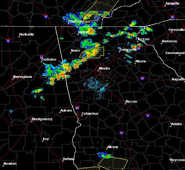 At 550 pm edt, a severe thunderstorm was located over buffington, or near canton, moving east at 35 mph (radar indicated). Hazards include 60 mph wind gusts. Expect damage to roofs, siding, and trees. Locations impacted include, canton, cartersville, woodstock, holly springs, emerson, ball ground, nelson, waleska, free home, buffington, hickory flat, union hill, lake arrowhead, red top mountain state park, little river landing, george washington carver st pk, lebanon, holbrook, lathemtown and sutallee. At 550 pm edt, a severe thunderstorm was located over buffington, or near canton, moving east at 35 mph (radar indicated). Hazards include 60 mph wind gusts. Expect damage to roofs, siding, and trees. Locations impacted include, canton, cartersville, woodstock, holly springs, emerson, ball ground, nelson, waleska, free home, buffington, hickory flat, union hill, lake arrowhead, red top mountain state park, little river landing, george washington carver st pk, lebanon, holbrook, lathemtown and sutallee.
|
| 6/24/2019 5:35 PM EDT |
 At 534 pm edt, a severe thunderstorm was located over lake arrowhead, or near canton, moving east at 35 mph (radar indicated). Hazards include 60 mph wind gusts. expect damage to roofs, siding, and trees At 534 pm edt, a severe thunderstorm was located over lake arrowhead, or near canton, moving east at 35 mph (radar indicated). Hazards include 60 mph wind gusts. expect damage to roofs, siding, and trees
|
| 6/22/2019 1:17 AM EDT |
 At 116 am edt, severe thunderstorms were located along a line extending from near sautee to canton, moving southeast at 45 mph (radar indicated). Hazards include 60 mph wind gusts. expect damage to roofs, siding, and trees At 116 am edt, severe thunderstorms were located along a line extending from near sautee to canton, moving southeast at 45 mph (radar indicated). Hazards include 60 mph wind gusts. expect damage to roofs, siding, and trees
|
| 6/22/2019 12:49 AM EDT |
 The national weather service in peachtree city has issued a * severe thunderstorm warning for. cherokee county in north central georgia. northwestern forsyth county in north central georgia. lumpkin county in north central georgia. Dawson county in north central georgia. The national weather service in peachtree city has issued a * severe thunderstorm warning for. cherokee county in north central georgia. northwestern forsyth county in north central georgia. lumpkin county in north central georgia. Dawson county in north central georgia.
|
| 7/21/2018 6:10 AM EDT |
 At 610 am edt, a severe thunderstorm was located over woodstock, or 9 miles north of marietta, moving southeast at 35 mph (radar indicated). Hazards include 60 mph wind gusts and quarter size hail. Hail damage to vehicles is expected. Expect wind damage to roofs, siding, and trees. At 610 am edt, a severe thunderstorm was located over woodstock, or 9 miles north of marietta, moving southeast at 35 mph (radar indicated). Hazards include 60 mph wind gusts and quarter size hail. Hail damage to vehicles is expected. Expect wind damage to roofs, siding, and trees.
|
| 6/28/2018 12:03 PM EDT |
 At 1202 pm edt, severe thunderstorms were located along a line extending from near canton to near white, moving south at 45 mph (radar indicated). Hazards include 60 mph wind gusts. Expect damage to roofs, siding, and trees. Locations impacted include, canton, cartersville, woodstock, holly springs, ball ground, white, waleska, buffington, hickory flat, union hill, lake arrowhead, kellogg creek, folsom, little river landing, george washington carver st pk, lebanon, salacoa valley, pine log, lathemtown and sutallee. At 1202 pm edt, severe thunderstorms were located along a line extending from near canton to near white, moving south at 45 mph (radar indicated). Hazards include 60 mph wind gusts. Expect damage to roofs, siding, and trees. Locations impacted include, canton, cartersville, woodstock, holly springs, ball ground, white, waleska, buffington, hickory flat, union hill, lake arrowhead, kellogg creek, folsom, little river landing, george washington carver st pk, lebanon, salacoa valley, pine log, lathemtown and sutallee.
|
| 6/28/2018 11:37 AM EDT |
 At 1137 am edt, severe thunderstorms were located along a line extending from near roundtop to ranger to near tilton, moving south at 40 mph (radar indicated). Hazards include 60 mph wind gusts. expect damage to roofs, siding, and trees At 1137 am edt, severe thunderstorms were located along a line extending from near roundtop to ranger to near tilton, moving south at 40 mph (radar indicated). Hazards include 60 mph wind gusts. expect damage to roofs, siding, and trees
|
| 6/1/2018 3:30 PM EDT |
 At 330 pm edt, a severe thunderstorm was located over hobgood park, or 8 miles southwest of canton, moving east at 15 mph (radar indicated). Hazards include 60 mph wind gusts and quarter size hail. Hail damage to vehicles is expected. Expect wind damage to roofs, siding, and trees. At 330 pm edt, a severe thunderstorm was located over hobgood park, or 8 miles southwest of canton, moving east at 15 mph (radar indicated). Hazards include 60 mph wind gusts and quarter size hail. Hail damage to vehicles is expected. Expect wind damage to roofs, siding, and trees.
|
| 6/1/2018 1:13 AM EDT |
 At 112 am edt, severe thunderstorms were located along a line extending from near cumming to near red top mountain state park, moving south at 25 mph (radar indicated). Hazards include 60 mph wind gusts and quarter size hail. Hail damage to vehicles is expected. expect wind damage to roofs, siding, and trees. Locations impacted include, canton, cartersville, cumming, milton, woodstock, holly springs, emerson, free home, buffington, hickory flat, drew, kellogg creek, red top mountain state park, coal mountain, hightower, matt, lathemtown, hobgood park, union hill and lake arrowhead. At 112 am edt, severe thunderstorms were located along a line extending from near cumming to near red top mountain state park, moving south at 25 mph (radar indicated). Hazards include 60 mph wind gusts and quarter size hail. Hail damage to vehicles is expected. expect wind damage to roofs, siding, and trees. Locations impacted include, canton, cartersville, cumming, milton, woodstock, holly springs, emerson, free home, buffington, hickory flat, drew, kellogg creek, red top mountain state park, coal mountain, hightower, matt, lathemtown, hobgood park, union hill and lake arrowhead.
|
| 6/1/2018 12:44 AM EDT |
 At 1243 am edt, severe thunderstorms were located along a line extending from silver city to near white, moving south at 25 mph (radar indicated). Hazards include 60 mph wind gusts and quarter size hail. Hail damage to vehicles is expected. Expect wind damage to roofs, siding, and trees. At 1243 am edt, severe thunderstorms were located along a line extending from silver city to near white, moving south at 25 mph (radar indicated). Hazards include 60 mph wind gusts and quarter size hail. Hail damage to vehicles is expected. Expect wind damage to roofs, siding, and trees.
|
| 7/6/2017 4:00 PM EDT |
 At 400 pm edt, a severe thunderstorm was located over hickory flat, or near canton, moving east at 35 mph (radar indicated). Hazards include 60 mph wind gusts and quarter size hail. Hail damage to vehicles is expected. expect wind damage to roofs, siding, and trees. Locations impacted include, canton, roswell, alpharetta, milton, woodstock, holly springs, waleska, free home, buffington, hickory flat, union hill, lake arrowhead, kellogg creek, oak grove, birmingham, little river landing, lebanon, holbrook, lathemtown and sutallee. At 400 pm edt, a severe thunderstorm was located over hickory flat, or near canton, moving east at 35 mph (radar indicated). Hazards include 60 mph wind gusts and quarter size hail. Hail damage to vehicles is expected. expect wind damage to roofs, siding, and trees. Locations impacted include, canton, roswell, alpharetta, milton, woodstock, holly springs, waleska, free home, buffington, hickory flat, union hill, lake arrowhead, kellogg creek, oak grove, birmingham, little river landing, lebanon, holbrook, lathemtown and sutallee.
|
| 7/6/2017 3:44 PM EDT |
 At 343 pm edt, a severe thunderstorm was located over little river landing, or 7 miles southwest of canton, moving east at 35 mph (radar indicated). Hazards include 60 mph wind gusts and quarter size hail. Hail damage to vehicles is expected. expect wind damage to roofs, siding, and trees. Locations impacted include, canton, cartersville, roswell, alpharetta, milton, kennesaw, woodstock, acworth, holly springs, emerson, waleska, free home, buffington, hickory flat, kellogg creek, red top mountain state park, lathemtown, hobgood park, union hill and lake arrowhead. At 343 pm edt, a severe thunderstorm was located over little river landing, or 7 miles southwest of canton, moving east at 35 mph (radar indicated). Hazards include 60 mph wind gusts and quarter size hail. Hail damage to vehicles is expected. expect wind damage to roofs, siding, and trees. Locations impacted include, canton, cartersville, roswell, alpharetta, milton, kennesaw, woodstock, acworth, holly springs, emerson, waleska, free home, buffington, hickory flat, kellogg creek, red top mountain state park, lathemtown, hobgood park, union hill and lake arrowhead.
|
| 7/6/2017 3:30 PM EDT |
 At 330 pm edt, a severe thunderstorm was located over red top mountain state park, or near cartersville, moving east at 35 mph (radar indicated). Hazards include 60 mph wind gusts and quarter size hail. Hail damage to vehicles is expected. Expect wind damage to roofs, siding, and trees. At 330 pm edt, a severe thunderstorm was located over red top mountain state park, or near cartersville, moving east at 35 mph (radar indicated). Hazards include 60 mph wind gusts and quarter size hail. Hail damage to vehicles is expected. Expect wind damage to roofs, siding, and trees.
|
| 6/23/2017 7:59 PM EDT |
 At 757 pm edt, severe thunderstorms were located along a line extending from near free home to near milton to alpharetta, moving northeast at 45 mph. a second storm was located along a line from kennesaw to jim miller park moving northeast at 45 mph (radar indicated). Hazards include 60 mph wind gusts. Expect damage to roofs, siding, and trees. Locations impacted include, marietta, canton, cumming, sandy springs, roswell, johns creek, alpharetta, dunwoody, milton, kennesaw, woodstock, acworth, sugar hill, powder springs, holly springs, berkeley lake, free home, fair oaks, buffington and mount bethel. At 757 pm edt, severe thunderstorms were located along a line extending from near free home to near milton to alpharetta, moving northeast at 45 mph. a second storm was located along a line from kennesaw to jim miller park moving northeast at 45 mph (radar indicated). Hazards include 60 mph wind gusts. Expect damage to roofs, siding, and trees. Locations impacted include, marietta, canton, cumming, sandy springs, roswell, johns creek, alpharetta, dunwoody, milton, kennesaw, woodstock, acworth, sugar hill, powder springs, holly springs, berkeley lake, free home, fair oaks, buffington and mount bethel.
|
| 6/23/2017 7:26 PM EDT |
 At 726 pm edt, severe thunderstorms were located along a line extending from hobgood park to kennesaw state university to lost mountain park, moving northeast at 40 mph (radar indicated). Hazards include 60 mph wind gusts. expect damage to roofs, siding, and trees At 726 pm edt, severe thunderstorms were located along a line extending from hobgood park to kennesaw state university to lost mountain park, moving northeast at 40 mph (radar indicated). Hazards include 60 mph wind gusts. expect damage to roofs, siding, and trees
|
| 6/23/2017 7:19 PM EDT |
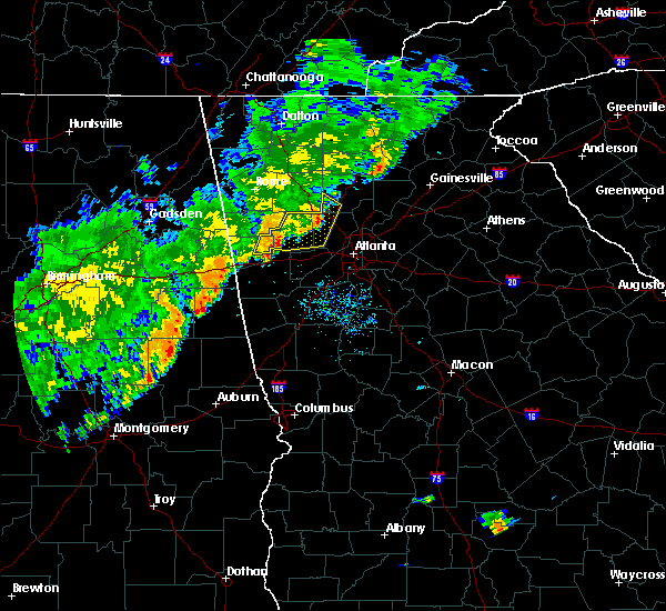 At 717 pm edt, severe thunderstorms were located along a line extending from near cartersville to near acworth to near dallas, moving east at 40 mph (radar indicated). Hazards include 60 mph wind gusts. Expect damage to roofs, siding, and trees. Locations impacted include, marietta, dallas, buchanan, kennesaw, woodstock, acworth, powder springs, austell, hiram, braswell, yorkville, burnt hickory ridge, kellogg creek, lost mountain park, cross roads, draketown, due west, new hope, hobgood park and eubank lake. At 717 pm edt, severe thunderstorms were located along a line extending from near cartersville to near acworth to near dallas, moving east at 40 mph (radar indicated). Hazards include 60 mph wind gusts. Expect damage to roofs, siding, and trees. Locations impacted include, marietta, dallas, buchanan, kennesaw, woodstock, acworth, powder springs, austell, hiram, braswell, yorkville, burnt hickory ridge, kellogg creek, lost mountain park, cross roads, draketown, due west, new hope, hobgood park and eubank lake.
|
| 6/23/2017 6:45 PM EDT |
 At 644 pm edt, severe thunderstorms were located along a line extending from near seney to near van wert to buchanan, moving east at 40 mph (radar indicated). Hazards include 60 mph wind gusts. expect damage to roofs, siding, and trees At 644 pm edt, severe thunderstorms were located along a line extending from near seney to near van wert to buchanan, moving east at 40 mph (radar indicated). Hazards include 60 mph wind gusts. expect damage to roofs, siding, and trees
|
| 6/23/2017 6:36 PM EDT |
 The severe thunderstorm warning for western cherokee, southern murray, western gilmer, gordon, pickens and bartow counties will expire at 645 pm edt, the storms which prompted the warning have weakened below severe limits, and no longer pose an immediate threat to life or property. therefore the warning will be allowed to expire. however gusty winds and heavy rain are still possible with these thunderstorms. a tornado watch remains in effect until 900 pm edt for northwestern georgia. The severe thunderstorm warning for western cherokee, southern murray, western gilmer, gordon, pickens and bartow counties will expire at 645 pm edt, the storms which prompted the warning have weakened below severe limits, and no longer pose an immediate threat to life or property. therefore the warning will be allowed to expire. however gusty winds and heavy rain are still possible with these thunderstorms. a tornado watch remains in effect until 900 pm edt for northwestern georgia.
|
| 6/23/2017 6:11 PM EDT |
 At 611 pm edt, severe thunderstorms were located along a line extending from near resaca to sonoraville to near euharlee, moving northeast at 55 mph (radar indicated). Hazards include 60 mph wind gusts. expect damage to roofs, siding, and trees At 611 pm edt, severe thunderstorms were located along a line extending from near resaca to sonoraville to near euharlee, moving northeast at 55 mph (radar indicated). Hazards include 60 mph wind gusts. expect damage to roofs, siding, and trees
|
| 6/22/2017 4:26 PM EDT |
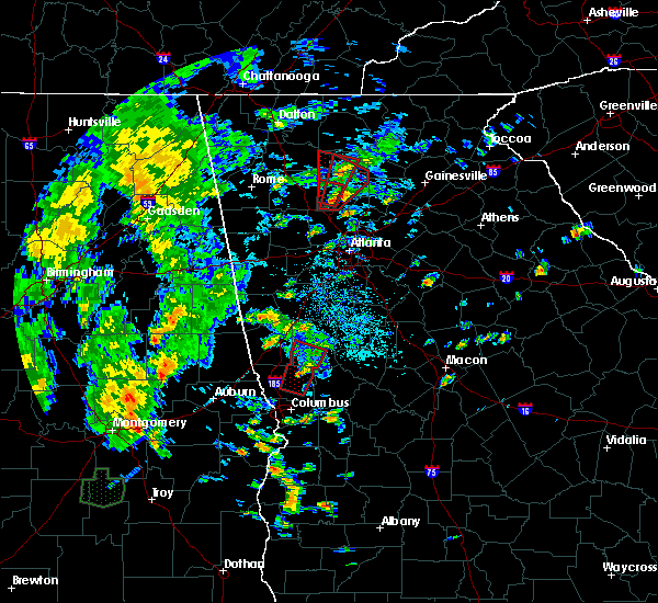 At 426 pm edt, a severe thunderstorm capable of producing a tornado was located over hobgood park, or 7 miles southwest of canton, moving northeast at 25 mph (radar indicated rotation). Hazards include tornado. Flying debris will be dangerous to those caught without shelter. mobile homes will be damaged or destroyed. damage to roofs, windows, and vehicles will occur. Tree damage is likely. At 426 pm edt, a severe thunderstorm capable of producing a tornado was located over hobgood park, or 7 miles southwest of canton, moving northeast at 25 mph (radar indicated rotation). Hazards include tornado. Flying debris will be dangerous to those caught without shelter. mobile homes will be damaged or destroyed. damage to roofs, windows, and vehicles will occur. Tree damage is likely.
|
| 6/22/2017 4:20 PM EDT |
 At 419 pm edt, a severe thunderstorm capable of producing a tornado was located over hobgood park, or 10 miles southwest of canton, moving northeast at 20 mph (radar indicated rotation). Hazards include tornado. Flying debris will be dangerous to those caught without shelter. mobile homes will be damaged or destroyed. damage to roofs, windows, and vehicles will occur. tree damage is likely. Locations impacted include, canton, woodstock, holly springs, little river landing, lebanon, lake arrowhead, kellogg creek, oak grove, sutallee, hobgood park and bridgemill. At 419 pm edt, a severe thunderstorm capable of producing a tornado was located over hobgood park, or 10 miles southwest of canton, moving northeast at 20 mph (radar indicated rotation). Hazards include tornado. Flying debris will be dangerous to those caught without shelter. mobile homes will be damaged or destroyed. damage to roofs, windows, and vehicles will occur. tree damage is likely. Locations impacted include, canton, woodstock, holly springs, little river landing, lebanon, lake arrowhead, kellogg creek, oak grove, sutallee, hobgood park and bridgemill.
|
| 6/22/2017 4:13 PM EDT |
 At 413 pm edt, a severe thunderstorm capable of producing a tornado was located over george washington carver st pk, or 9 miles east of cartersville, moving north at 25 mph (radar indicated rotation). Hazards include tornado. Flying debris will be dangerous to those caught without shelter. mobile homes will be damaged or destroyed. damage to roofs, windows, and vehicles will occur. tree damage is likely. Locations impacted include, canton, kennesaw, woodstock, acworth, holly springs, lake arrowhead, kellogg creek, oak grove, kennesaw state university, little river landing, lebanon, sutallee, hobgood park and bridgemill. At 413 pm edt, a severe thunderstorm capable of producing a tornado was located over george washington carver st pk, or 9 miles east of cartersville, moving north at 25 mph (radar indicated rotation). Hazards include tornado. Flying debris will be dangerous to those caught without shelter. mobile homes will be damaged or destroyed. damage to roofs, windows, and vehicles will occur. tree damage is likely. Locations impacted include, canton, kennesaw, woodstock, acworth, holly springs, lake arrowhead, kellogg creek, oak grove, kennesaw state university, little river landing, lebanon, sutallee, hobgood park and bridgemill.
|
| 6/22/2017 3:47 PM EDT |
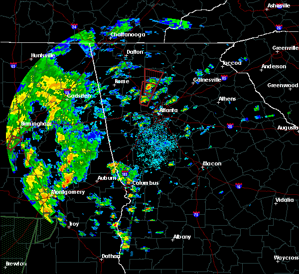 At 346 pm edt, a severe thunderstorm capable of producing a tornado was located over lost mountain park, or 8 miles northeast of dallas, moving north at 25 mph (radar indicated rotation). Hazards include tornado. Flying debris will be dangerous to those caught without shelter. mobile homes will be damaged or destroyed. damage to roofs, windows, and vehicles will occur. Tree damage is likely. At 346 pm edt, a severe thunderstorm capable of producing a tornado was located over lost mountain park, or 8 miles northeast of dallas, moving north at 25 mph (radar indicated rotation). Hazards include tornado. Flying debris will be dangerous to those caught without shelter. mobile homes will be damaged or destroyed. damage to roofs, windows, and vehicles will occur. Tree damage is likely.
|
| 6/22/2017 3:40 PM EDT |
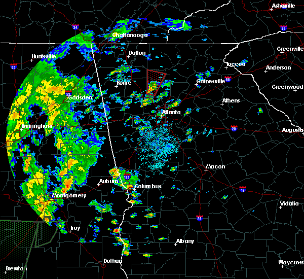 At 340 pm edt, severe thunderstorms capable of producing both tornadoes and extensive straight line wind damage were located over sutallee, or 7 miles west of canton, moving north at 25 mph (radar indicated rotation). Hazards include tornado. Flying debris will be dangerous to those caught without shelter. mobile homes will be damaged or destroyed. damage to roofs, windows, and vehicles will occur. Tree damage is likely. At 340 pm edt, severe thunderstorms capable of producing both tornadoes and extensive straight line wind damage were located over sutallee, or 7 miles west of canton, moving north at 25 mph (radar indicated rotation). Hazards include tornado. Flying debris will be dangerous to those caught without shelter. mobile homes will be damaged or destroyed. damage to roofs, windows, and vehicles will occur. Tree damage is likely.
|
| 6/14/2017 7:53 PM EDT |
 At 753 pm edt, a severe thunderstorm was located over canton, moving east at 10 mph (radar indicated). Hazards include 60 mph wind gusts. expect damage to roofs, siding, and trees At 753 pm edt, a severe thunderstorm was located over canton, moving east at 10 mph (radar indicated). Hazards include 60 mph wind gusts. expect damage to roofs, siding, and trees
|
| 3/21/2017 8:14 PM EDT |
 At 812 pm edt, severe thunderstorms were located extending from near hightower to near canton to near taylorsville to near forney, moving southeast at 50 mph (radar indicated, plus multiple reports of very strong winds knocking down trees and powerlines across northwest georgia). Hazards include 60 mph wind gusts and nickel size hail. expect damage to roofs, siding, and trees At 812 pm edt, severe thunderstorms were located extending from near hightower to near canton to near taylorsville to near forney, moving southeast at 50 mph (radar indicated, plus multiple reports of very strong winds knocking down trees and powerlines across northwest georgia). Hazards include 60 mph wind gusts and nickel size hail. expect damage to roofs, siding, and trees
|
| 7/21/2016 4:12 PM EDT |
 At 412 pm edt, a severe thunderstorm was located near free home, or 8 miles east of canton, moving southeast at 15 mph (radar indicated). Hazards include 60 mph wind gusts. Expect damage to roofs. siding. and trees. Other locations in the warning include but are not limited to canton, ball ground, nelson, free home, buffington, drew, lathemtown, holbrook, hightower, union hill, ducktown and reavis mountain. At 412 pm edt, a severe thunderstorm was located near free home, or 8 miles east of canton, moving southeast at 15 mph (radar indicated). Hazards include 60 mph wind gusts. Expect damage to roofs. siding. and trees. Other locations in the warning include but are not limited to canton, ball ground, nelson, free home, buffington, drew, lathemtown, holbrook, hightower, union hill, ducktown and reavis mountain.
|
| 7/21/2016 3:39 PM EDT |
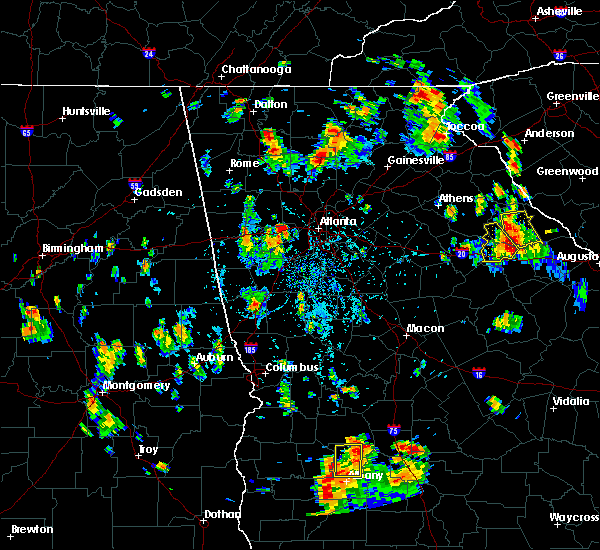 At 339 pm edt, a severe thunderstorm was located near ball ground, or 8 miles northeast of canton, moving southeast at 15 mph (radar indicated). Hazards include 60 mph wind gusts and quarter size hail. Hail damage to vehicles is expected. expect wind damage to roofs, siding, and trees. Other locations in the warning include but are not limited to canton, ball ground, nelson, buffington, free home, lathemtown, holbrook, union hill, tate, drew, marblehill, hightower, ducktown and reavis mountain. At 339 pm edt, a severe thunderstorm was located near ball ground, or 8 miles northeast of canton, moving southeast at 15 mph (radar indicated). Hazards include 60 mph wind gusts and quarter size hail. Hail damage to vehicles is expected. expect wind damage to roofs, siding, and trees. Other locations in the warning include but are not limited to canton, ball ground, nelson, buffington, free home, lathemtown, holbrook, union hill, tate, drew, marblehill, hightower, ducktown and reavis mountain.
|
| 7/11/2016 6:41 PM EDT |
 At 640 pm edt, severe thunderstorms were located along a line extending from 7 miles west of holly springs to near free home to near milton, moving northeast at 35 mph (spotter indicated). Hazards include 60 mph wind gusts and quarter size hail. Hail damage to vehicles is expected. expect wind damage to roofs, siding, and trees. Other locations in the warning include but are not limited to canton, cartersville, cumming, roswell, johns creek, alpharetta, milton, woodstock, holly springs, berkeley lake, emerson, white, waleska, buffington, free home, lathemtown, holbrook, lebanon, union hill and red top mountain state park. At 640 pm edt, severe thunderstorms were located along a line extending from 7 miles west of holly springs to near free home to near milton, moving northeast at 35 mph (spotter indicated). Hazards include 60 mph wind gusts and quarter size hail. Hail damage to vehicles is expected. expect wind damage to roofs, siding, and trees. Other locations in the warning include but are not limited to canton, cartersville, cumming, roswell, johns creek, alpharetta, milton, woodstock, holly springs, berkeley lake, emerson, white, waleska, buffington, free home, lathemtown, holbrook, lebanon, union hill and red top mountain state park.
|
| 7/11/2016 6:12 PM EDT |
 At 612 pm edt, severe thunderstorms were located along a line extending from 7 miles southwest of emerson to near kennesaw to near roswell, moving northeast at 20 mph (radar indicated). Hazards include 60 mph wind gusts and quarter size hail. Hail damage to vehicles is expected. expect wind damage to roofs, siding, and trees. Other locations in the warning include but are not limited to marietta, canton, cartersville, cumming, sandy springs, roswell, johns creek, alpharetta, dunwoody, milton, kennesaw, woodstock, acworth, holly springs, berkeley lake, emerson, white, waleska, braswell and buffington. At 612 pm edt, severe thunderstorms were located along a line extending from 7 miles southwest of emerson to near kennesaw to near roswell, moving northeast at 20 mph (radar indicated). Hazards include 60 mph wind gusts and quarter size hail. Hail damage to vehicles is expected. expect wind damage to roofs, siding, and trees. Other locations in the warning include but are not limited to marietta, canton, cartersville, cumming, sandy springs, roswell, johns creek, alpharetta, dunwoody, milton, kennesaw, woodstock, acworth, holly springs, berkeley lake, emerson, white, waleska, braswell and buffington.
|
| 6/17/2016 1:08 PM EDT |
 The severe thunderstorm warning for southwestern cherokee, north central cobb and eastern bartow counties will expire at 115 pm edt, the storm which prompted the warning is weakening but remains near severe limits. the warning will be allowed to expire. however small hail and gusty winds are still possible with this thunderstorm. The severe thunderstorm warning for southwestern cherokee, north central cobb and eastern bartow counties will expire at 115 pm edt, the storm which prompted the warning is weakening but remains near severe limits. the warning will be allowed to expire. however small hail and gusty winds are still possible with this thunderstorm.
|
| 6/17/2016 12:32 PM EDT |
 At 1231 pm edt, a severe thunderstorm was located over white, or northeast of cartersville, moving southeast at 25 mph (radar indicated). Hazards include 60 mph wind gusts and quarter size hail. Hail damage to vehicles is expected. expect wind damage to roofs, siding, and trees. Other locations in the warning include but are not limited to marietta, canton, cartersville, kennesaw, woodstock, acworth, holly springs, emerson, white, kennesaw state university, sweat mountain, lebanon, red top mountain state park, bridgemill, sandy plains, hobgood park, kellogg creek, sutallee, little river landing and george washington carver state park. At 1231 pm edt, a severe thunderstorm was located over white, or northeast of cartersville, moving southeast at 25 mph (radar indicated). Hazards include 60 mph wind gusts and quarter size hail. Hail damage to vehicles is expected. expect wind damage to roofs, siding, and trees. Other locations in the warning include but are not limited to marietta, canton, cartersville, kennesaw, woodstock, acworth, holly springs, emerson, white, kennesaw state university, sweat mountain, lebanon, red top mountain state park, bridgemill, sandy plains, hobgood park, kellogg creek, sutallee, little river landing and george washington carver state park.
|
| 4/6/2016 11:29 PM EDT |
 At 1129 pm edt, a severe thunderstorm was located over holly springs, or near canton, moving east at 35 mph (radar indicated). Hazards include 60 mph wind gusts and quarter size hail. Hail damage to vehicles is expected. expect wind damage to roofs, siding, and trees. Other locations in the warning include but are not limited to canton, cumming, roswell, alpharetta, milton, woodstock, sugar hill, holly springs, buffington, free home, lathemtown, holbrook, lebanon, union hill, drew, hickory flat, matt, birmingham, hightower and ducktown. At 1129 pm edt, a severe thunderstorm was located over holly springs, or near canton, moving east at 35 mph (radar indicated). Hazards include 60 mph wind gusts and quarter size hail. Hail damage to vehicles is expected. expect wind damage to roofs, siding, and trees. Other locations in the warning include but are not limited to canton, cumming, roswell, alpharetta, milton, woodstock, sugar hill, holly springs, buffington, free home, lathemtown, holbrook, lebanon, union hill, drew, hickory flat, matt, birmingham, hightower and ducktown.
|
| 4/6/2016 11:02 PM EDT |
 At 1102 pm edt, a severe thunderstorm was located near ball ground, or near canton, moving northeast at 35 mph (radar indicated). Hazards include 60 mph wind gusts and quarter size hail. Hail damage to vehicles is expected. expect wind damage to roofs, siding, and trees. Other locations in the warning include but are not limited to gainesville, canton, cumming, dahlonega, jasper, dawsonville, flowery branch, oakwood, ball ground, nelson, waleska, buffington, free home, dougherty, lathemtown, holbrook, aqualand park, union hill, drew and matt. At 1102 pm edt, a severe thunderstorm was located near ball ground, or near canton, moving northeast at 35 mph (radar indicated). Hazards include 60 mph wind gusts and quarter size hail. Hail damage to vehicles is expected. expect wind damage to roofs, siding, and trees. Other locations in the warning include but are not limited to gainesville, canton, cumming, dahlonega, jasper, dawsonville, flowery branch, oakwood, ball ground, nelson, waleska, buffington, free home, dougherty, lathemtown, holbrook, aqualand park, union hill, drew and matt.
|
| 4/6/2016 10:31 PM EDT |
 At 1030 pm edt, a severe thunderstorm was located over holly springs, or near canton, moving east at 40 mph (radar indicated). Hazards include 60 mph wind gusts and quarter size hail. Hail damage to vehicles is expected. expect wind damage to roofs, siding, and trees. Other locations in the warning include but are not limited to canton, cumming, roswell, johns creek, alpharetta, milton, woodstock, sugar hill, suwanee, buford, holly springs, ball ground, buffington, free home, lathemtown, holbrook, lebanon, union hill, bridgemill and kellogg creek. At 1030 pm edt, a severe thunderstorm was located over holly springs, or near canton, moving east at 40 mph (radar indicated). Hazards include 60 mph wind gusts and quarter size hail. Hail damage to vehicles is expected. expect wind damage to roofs, siding, and trees. Other locations in the warning include but are not limited to canton, cumming, roswell, johns creek, alpharetta, milton, woodstock, sugar hill, suwanee, buford, holly springs, ball ground, buffington, free home, lathemtown, holbrook, lebanon, union hill, bridgemill and kellogg creek.
|
| 4/6/2016 10:14 PM EDT |
 At 1013 pm edt, a severe thunderstorm was located over cassville, or near cartersville, moving northeast at 30 mph (public). Hazards include quarter size to golf ball size hail. Damage to vehicles is expected. Other locations in the warning include but are not limited to canton, cartersville, woodstock, holly springs, emerson, white, waleska, pine log, funkhouser, salacoa valley, lebanon, red top mountain state park, bridgemill, lake arrowhead, hobgood park, kellogg creek, sutallee, little river landing and george washington carver st pk. At 1013 pm edt, a severe thunderstorm was located over cassville, or near cartersville, moving northeast at 30 mph (public). Hazards include quarter size to golf ball size hail. Damage to vehicles is expected. Other locations in the warning include but are not limited to canton, cartersville, woodstock, holly springs, emerson, white, waleska, pine log, funkhouser, salacoa valley, lebanon, red top mountain state park, bridgemill, lake arrowhead, hobgood park, kellogg creek, sutallee, little river landing and george washington carver st pk.
|
| 4/6/2016 9:57 PM EDT |
 At 957 pm edt, a severe thunderstorm was located over euharlee, or near cartersville, moving northeast at 30 mph (radar indicated). Hazards include 60 mph wind gusts and quarter size hail. Hail damage to vehicles is expected. expect wind damage to roofs, siding, and trees. Other locations in the warning include but are not limited to canton, cartersville, woodstock, holly springs, adairsville, euharlee, emerson, white, waleska, kingston, taylorsville, cassville, funkhouser, salacoa valley, lebanon, red top mountain state park, bridgemill, kellogg creek, folsom and george washington carver st pk. At 957 pm edt, a severe thunderstorm was located over euharlee, or near cartersville, moving northeast at 30 mph (radar indicated). Hazards include 60 mph wind gusts and quarter size hail. Hail damage to vehicles is expected. expect wind damage to roofs, siding, and trees. Other locations in the warning include but are not limited to canton, cartersville, woodstock, holly springs, adairsville, euharlee, emerson, white, waleska, kingston, taylorsville, cassville, funkhouser, salacoa valley, lebanon, red top mountain state park, bridgemill, kellogg creek, folsom and george washington carver st pk.
|
| 12/24/2015 6:11 AM EST | The severe thunderstorm warning for southwestern cherokee, northern cobb and southeastern bartow counties will expire at 615 am est, the storm which prompted the warning has weakened below severe limits, and no longer pose an immediate threat to life or property. therefore the warning will be allowed to expire. however lightning and heavy rain are still possible with this thunderstorm. |
| 12/24/2015 5:44 AM EST | At 543 am est, a severe thunderstorm was located near acworth, or 8 miles south of cartersville, moving northeast at 40 mph (radar indicated). Hazards include 60 mph wind gusts. Expect damage to roofs. siding and trees. Other locations in the warning include but are not limited to marietta, canton, kennesaw, woodstock, acworth, holly springs, emerson, kennesaw state university, sweat mountain, lebanon, red top mountain state park, sandy plains, bridgemill, hobgood park, kellogg creek, hickory flat, sutallee, little river landing, george washington carver st pk and oak grove. |
| 7/14/2015 9:06 PM EDT |
 At 905 pm edt, severe thunderstorms were located extending from near milton to sandy springs, austell, douglasville and dallas, moving southeast at 45 mph (radar indicated). Hazards include 60 mph wind gusts and quarter size hail. Hail damage to vehicles is expected. expect wind damage to roofs, siding and trees. Other locations in the warning include but are not limited to atlanta, marietta, douglasville, lawrenceville, canton, cartersville, decatur, dallas, sandy springs, roswell, johns creek, alpharetta, smyrna, dunwoody, east point, milton, kennesaw, duluth, woodstock and acworth. At 905 pm edt, severe thunderstorms were located extending from near milton to sandy springs, austell, douglasville and dallas, moving southeast at 45 mph (radar indicated). Hazards include 60 mph wind gusts and quarter size hail. Hail damage to vehicles is expected. expect wind damage to roofs, siding and trees. Other locations in the warning include but are not limited to atlanta, marietta, douglasville, lawrenceville, canton, cartersville, decatur, dallas, sandy springs, roswell, johns creek, alpharetta, smyrna, dunwoody, east point, milton, kennesaw, duluth, woodstock and acworth.
|
| 7/14/2015 8:44 PM EDT |
 At 843 pm edt, severe thunderstorms were located extending from near waleska to woodstock to southwest of kennesaw to near dallas to aragon, moving southeast at 55 mph (radar indicated). Hazards include 70 mph wind gusts and quarter size hail. Hail damage to vehicles is expected. expect considerable tree damage. wind damage is also likely to mobile homes, roofs and outbuildings. Other locations in the warning include but are not limited to atlanta, marietta, douglasville, lawrenceville, canton, cartersville, decatur, dallas, buchanan, sandy springs, roswell, johns creek, alpharetta, smyrna, dunwoody, east point, milton, kennesaw, duluth and woodstock. At 843 pm edt, severe thunderstorms were located extending from near waleska to woodstock to southwest of kennesaw to near dallas to aragon, moving southeast at 55 mph (radar indicated). Hazards include 70 mph wind gusts and quarter size hail. Hail damage to vehicles is expected. expect considerable tree damage. wind damage is also likely to mobile homes, roofs and outbuildings. Other locations in the warning include but are not limited to atlanta, marietta, douglasville, lawrenceville, canton, cartersville, decatur, dallas, buchanan, sandy springs, roswell, johns creek, alpharetta, smyrna, dunwoody, east point, milton, kennesaw, duluth and woodstock.
|
| 7/14/2015 8:36 PM EDT |
 At 835 pm edt, severe thunderstorms were located extending from near waleska to near canton to acworth to southwest of emerson to near braswell, moving southeast at 45 mph (radar indicated). Hazards include 70 mph wind gusts and quarter size hail. Hail damage to vehicles is expected. expect considerable tree damage. wind damage is also likely to mobile homes, roofs and outbuildings. Other locations in the warning include but are not limited to marietta, canton, cartersville, jasper, smyrna, kennesaw, woodstock, acworth, powder springs, holly springs, hiram, emerson, ball ground, nelson, white, waleska, talking rock, buffington, fair oaks and fairmount. At 835 pm edt, severe thunderstorms were located extending from near waleska to near canton to acworth to southwest of emerson to near braswell, moving southeast at 45 mph (radar indicated). Hazards include 70 mph wind gusts and quarter size hail. Hail damage to vehicles is expected. expect considerable tree damage. wind damage is also likely to mobile homes, roofs and outbuildings. Other locations in the warning include but are not limited to marietta, canton, cartersville, jasper, smyrna, kennesaw, woodstock, acworth, powder springs, holly springs, hiram, emerson, ball ground, nelson, white, waleska, talking rock, buffington, fair oaks and fairmount.
|
| 7/14/2015 8:22 PM EDT |
 At 821 pm edt, severe thunderstorms were located extending from east of resaca to west of waleska to near white and euharlee to northwest of taylorsville, moving southeast at 50 mph (radar indicated). Hazards include 60 mph wind gusts and quarter size hail. Hail damage to vehicles is expected. expect wind damage to roofs, siding and trees. Other locations in the warning include but are not limited to marietta, canton, cartersville, jasper, smyrna, kennesaw, woodstock, acworth, powder springs, holly springs, hiram, emerson, ball ground, nelson, white, waleska, talking rock, buffington, fair oaks and fairmount. At 821 pm edt, severe thunderstorms were located extending from east of resaca to west of waleska to near white and euharlee to northwest of taylorsville, moving southeast at 50 mph (radar indicated). Hazards include 60 mph wind gusts and quarter size hail. Hail damage to vehicles is expected. expect wind damage to roofs, siding and trees. Other locations in the warning include but are not limited to marietta, canton, cartersville, jasper, smyrna, kennesaw, woodstock, acworth, powder springs, holly springs, hiram, emerson, ball ground, nelson, white, waleska, talking rock, buffington, fair oaks and fairmount.
|
| 6/26/2015 4:40 PM EDT | At 440 pm edt, a severe thunderstorm was located over canton, and is nearly stationary (radar indicated). Hazards include 60 mph wind gusts and nickel size hail. Expect damage to roofs. siding and trees. Other locations in the warning include but are not limited to canton, ball ground, nelson, buffington and reavis mountain. |
| 6/9/2015 4:20 AM EDT | The cherokee county emergency manager reported trees...power lines and power poles down and blocking new light roa in cherokee county GA, 1.4 miles SSW of Holly Springs, GA |
| 4/20/2015 1:33 PM EDT | At 132 pm edt, a severe thunderstorm was located over buffington, or near canton, moving east at 30 mph (radar indicated). Hazards include 60 mph wind gusts and quarter size hail. Hail damage to vehicles is expected. expect wind damage to roofs, siding and trees. other locations in the warning include but are not limited to canton, cumming, dawsonville, ball ground, buffington, free home, dougherty, lathemtown, holbrook, union hill, war hill park, chestatee, drew, hickory flat, matt, hightower, ducktown, silver city, coal mountain and hollis lathem reservoir. a tornado watch remains in effect until 800 pm edt for north central georgia. 1. 00in. |
| 4/20/2015 6:26 AM EDT | At 626 am edt, a severe thunderstorm was located over canton, moving northeast at 50 mph (radar indicated). Hazards include 60 mph wind gusts and quarter size hail. Hail damage to vehicles is expected. expect wind damage to roofs, siding and trees. other locations in the warning include but are not limited to canton, holly springs, ball ground, nelson, waleska, free home, buffington, marblehill, lathemtown, tate and reavis mountain. 1. 00in. |
| 4/19/2015 11:42 AM EDT | At 1141 am edt, severe thunderstorms were located along a line extending from 9 miles northwest of talking rock to near dallas, moving northeast at 40 mph (radar indicated). Hazards include 60 mph wind gusts. Expect damage to roofs. siding and trees. other locations in the warning include but are not limited to canton, cartersville, jasper, ellijay, woodstock, emerson, white, waleska, east ellijay, talking rock, cassville, fairmount, ranger, funkhouser, salacoa valley, red top mountain state park, bridgemill, kellogg creek, hinton and talona. a tornado watch remains in effect until 300 pm edt for northwestern georgia. Possible. |
| 4/19/2015 11:24 AM EDT | At 1124 am edt, severe thunderstorms were located along a line extending from 7 miles east of calhoun to 6 miles south of braswell, moving northeast at 40 mph (radar indicated). Hazards include 60 mph wind gusts. Expect damage to roofs. siding and trees. other locations in the warning include but are not limited to canton, cartersville, calhoun, dallas, jasper, ellijay, kennesaw, acworth, adairsville, rockmart, euharlee, emerson, white, waleska, kingston, east ellijay, braswell, taylorsville, talking rock and cassville. a tornado watch remains in effect until 300 pm edt for northwestern georgia. Possible. |
| 4/2/2015 6:25 PM EDT | The severe thunderstorm warning for central pickens and cherokee counties will expire at 630 pm edt. the storms which prompted the warning have weakened below severe limits. and are exited the warned area. Therefore the warning will be allowed to expire. |
| 4/2/2015 6:03 PM EDT | A severe thunderstorm warning remains in effect until 630 pm edt for central pickens and cherokee counties. at 603 pm edt. severe thunderstorms were located along a line extending from near talking rock to near canton to holly springs. moving east at 30 mph. hazard. 60 mph wind gusts and quarter size hail. |
| 4/2/2015 5:42 PM EDT | The national weather service in peachtree city has issued a * severe thunderstorm warning for. central pickens county in north central georgia. eastern bartow county in northwestern georgia. cherokee county in north central georgia. Until 630 pm edt. |
| 1/1/0001 12:00 AM | Cherokee county emergency management relayed a report of damage along sixes road near holly spring in cherokee county GA, 1.2 miles E of Holly Springs, GA |
| 1/1/0001 12:00 AM | Amateur radio relayed reports of multiple downed trees in the area of bascom and carmel roads west of interstate 575 in cherokee count in cherokee county GA, 1.8 miles ESE of Holly Springs, GA |
| 1/1/0001 12:00 AM | Large tree down on n. victoria rd in cherokee county GA, 1.5 miles N of Holly Springs, GA |
| 1/1/0001 12:00 AM | Cherokee county emegency management relayed a report of trees down blocking the roa in cherokee county GA, 5.2 miles W of Holly Springs, GA |
Hail Maps for Holly Springs, GA


Connect with Interactive Hail Maps