

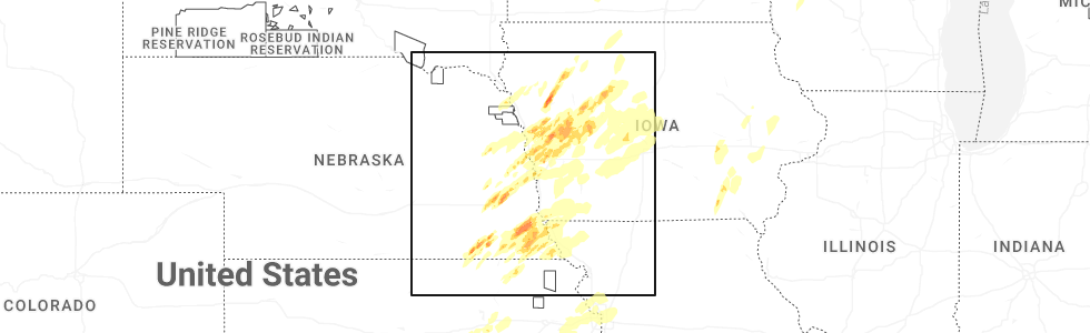
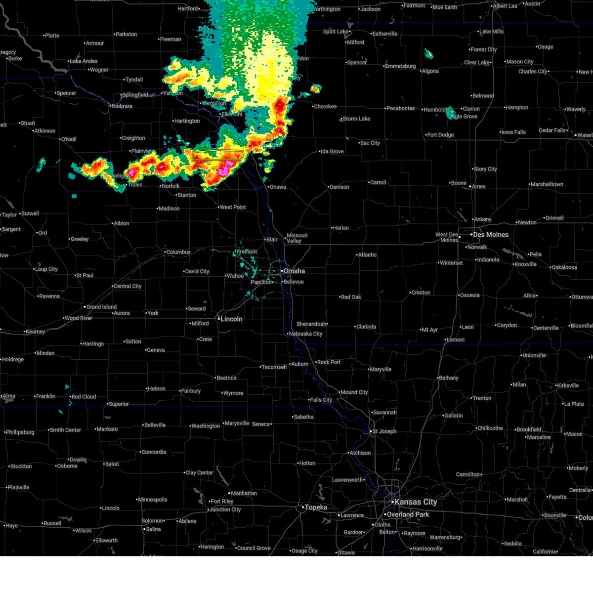
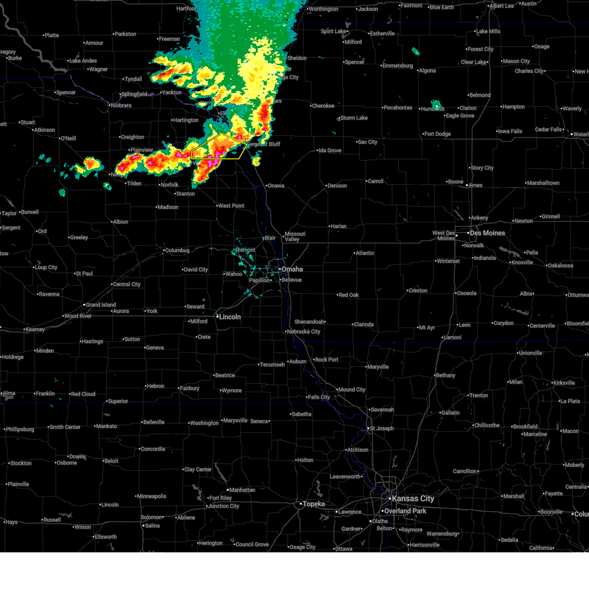
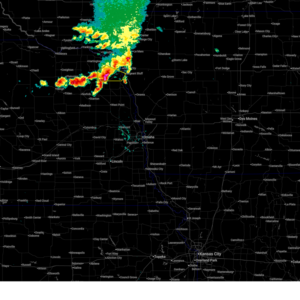
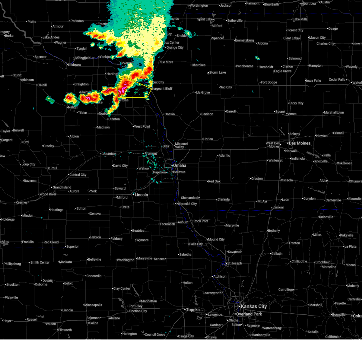
Hail Map for Homer, NE
The Homer, NE area has had 5 reports of on-the-ground hail by trained spotters, and has been under severe weather warnings 12 times during the past 12 months. Doppler radar has detected hail at or near Homer, NE on 77 occasions, including 7 occasions during the past year.
| Name: | Homer, NE |
| Where Located: | 69.5 miles WSW of Storm Lake, IA |
| Map: | Google Map for Homer, NE |
| Population: | 549 |
| Housing Units: | 228 |
| More Info: | Search Google for Homer, NE |
1
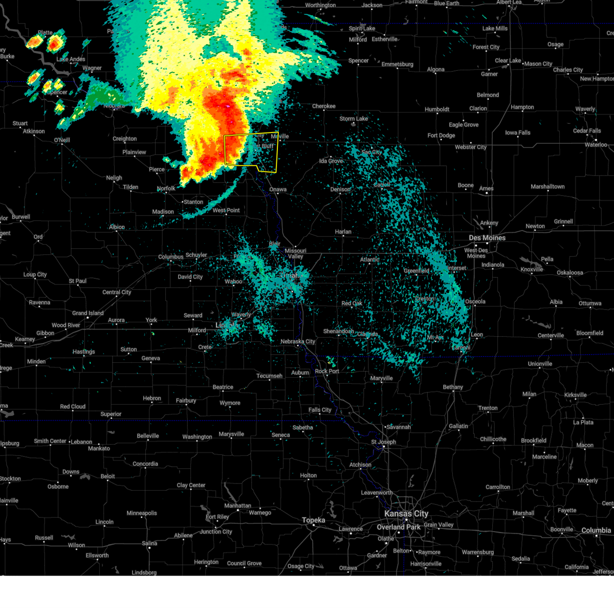
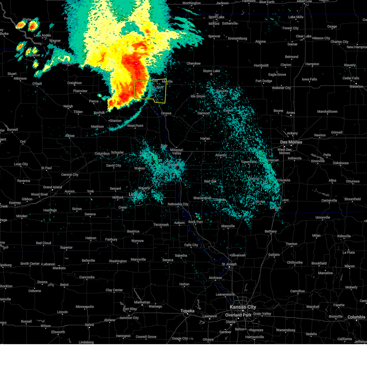
The Top Recent Hail Date for Homer, NE is Thursday, April 23, 2026 (3rd out of 77)
Hail and Wind Damage Spotted near Homer, NE
| Date / Time | Report Details |
|---|---|
| 6/30/2026 1:14 AM CDT |
 Svrfsd the national weather service in sioux falls has issued a * severe thunderstorm warning for, northwestern woodbury county in west central iowa, southwestern sioux county in northwestern iowa, plymouth county in northwestern iowa, dakota county in northeastern nebraska, northeastern dixon county in northeastern nebraska, southeastern clay county in southeastern south dakota, union county in southeastern south dakota, * until 200 am cdt. * at 113 am cdt, severe thunderstorms were located along a line extending from newcastle to ponca to near homer, moving northeast at 50 mph (radar indicated). Hazards include 70 mph wind gusts and quarter size hail. Hail damage to vehicles is expected. expect considerable tree damage. wind damage is also likely to mobile homes, roofs, and outbuildings. severe thunderstorms will be near, sioux city, south sioux city, sergeant bluff, north sioux city, elk point, dakota city, jefferson, jackson in dakota county, and ponca state park around 120 am cdt. akron around 130 am cdt. hinton around 135 am cdt. merrill around 140 am cdt. le mars, hawarden, and craig around 145 am cdt. Other locations impacted by these severe thunderstorms include chatsworth, brunsville, waterbury, westfield, and winnebago reservation. Svrfsd the national weather service in sioux falls has issued a * severe thunderstorm warning for, northwestern woodbury county in west central iowa, southwestern sioux county in northwestern iowa, plymouth county in northwestern iowa, dakota county in northeastern nebraska, northeastern dixon county in northeastern nebraska, southeastern clay county in southeastern south dakota, union county in southeastern south dakota, * until 200 am cdt. * at 113 am cdt, severe thunderstorms were located along a line extending from newcastle to ponca to near homer, moving northeast at 50 mph (radar indicated). Hazards include 70 mph wind gusts and quarter size hail. Hail damage to vehicles is expected. expect considerable tree damage. wind damage is also likely to mobile homes, roofs, and outbuildings. severe thunderstorms will be near, sioux city, south sioux city, sergeant bluff, north sioux city, elk point, dakota city, jefferson, jackson in dakota county, and ponca state park around 120 am cdt. akron around 130 am cdt. hinton around 135 am cdt. merrill around 140 am cdt. le mars, hawarden, and craig around 145 am cdt. Other locations impacted by these severe thunderstorms include chatsworth, brunsville, waterbury, westfield, and winnebago reservation.
|
| 6/30/2026 1:06 AM CDT |
 At 105 am cdt, severe thunderstorms were located along a line extending from 8 miles southwest of newcastle to martinsburg to near emerson, moving northeast at 45 mph (radar indicated). Hazards include 70 mph wind gusts and half dollar size hail. Hail damage to vehicles is expected. expect considerable tree damage. wind damage is also likely to mobile homes, roofs, and outbuildings. these severe storms will be near, ponca, newcastle, hubbard, and ponca state park around 110 am cdt. jackson in dakota county around 115 am cdt. Other locations impacted by these severe thunderstorms include waterbury. At 105 am cdt, severe thunderstorms were located along a line extending from 8 miles southwest of newcastle to martinsburg to near emerson, moving northeast at 45 mph (radar indicated). Hazards include 70 mph wind gusts and half dollar size hail. Hail damage to vehicles is expected. expect considerable tree damage. wind damage is also likely to mobile homes, roofs, and outbuildings. these severe storms will be near, ponca, newcastle, hubbard, and ponca state park around 110 am cdt. jackson in dakota county around 115 am cdt. Other locations impacted by these severe thunderstorms include waterbury.
|
| 6/30/2026 1:00 AM CDT |
 At 100 am cdt, severe thunderstorms were located along a line extending from 6 miles north of dixon in dixon county to near martinsburg to near emerson, moving northeast at 45 mph (radar indicated). Hazards include 60 mph wind gusts and half dollar size hail. Hail damage to vehicles is expected. expect wind damage to roofs, siding, and trees. these severe storms will be near, ponca and martinsburg around 105 am cdt. newcastle, hubbard, jackson in dakota county, and ponca state park around 110 am cdt. Other locations impacted by these severe thunderstorms include waterbury. At 100 am cdt, severe thunderstorms were located along a line extending from 6 miles north of dixon in dixon county to near martinsburg to near emerson, moving northeast at 45 mph (radar indicated). Hazards include 60 mph wind gusts and half dollar size hail. Hail damage to vehicles is expected. expect wind damage to roofs, siding, and trees. these severe storms will be near, ponca and martinsburg around 105 am cdt. newcastle, hubbard, jackson in dakota county, and ponca state park around 110 am cdt. Other locations impacted by these severe thunderstorms include waterbury.
|
| 6/30/2026 12:40 AM CDT |
 Svrfsd the national weather service in sioux falls has issued a * severe thunderstorm warning for, dakota county in northeastern nebraska, dixon county in northeastern nebraska, * until 130 am cdt. * at 1240 am cdt, severe thunderstorms were located along a line extending from near belden to near carroll to near wayne, moving northeast at 45 mph (radar indicated). Hazards include ping pong ball size hail and 60 mph wind gusts. People and animals outdoors will be injured. expect hail damage to roofs, siding, windows, and vehicles. expect wind damage to roofs, siding, and trees. severe thunderstorms will be near, concord and dixon in dixon county around 1245 am cdt. allen around 1255 am cdt. martinsburg around 100 am cdt. newcastle around 105 am cdt. ponca, maskell, and ponca state park around 110 am cdt. jackson in dakota county around 115 am cdt. Other locations impacted by these severe thunderstorms include waterbury. Svrfsd the national weather service in sioux falls has issued a * severe thunderstorm warning for, dakota county in northeastern nebraska, dixon county in northeastern nebraska, * until 130 am cdt. * at 1240 am cdt, severe thunderstorms were located along a line extending from near belden to near carroll to near wayne, moving northeast at 45 mph (radar indicated). Hazards include ping pong ball size hail and 60 mph wind gusts. People and animals outdoors will be injured. expect hail damage to roofs, siding, windows, and vehicles. expect wind damage to roofs, siding, and trees. severe thunderstorms will be near, concord and dixon in dixon county around 1245 am cdt. allen around 1255 am cdt. martinsburg around 100 am cdt. newcastle around 105 am cdt. ponca, maskell, and ponca state park around 110 am cdt. jackson in dakota county around 115 am cdt. Other locations impacted by these severe thunderstorms include waterbury.
|
| 5/17/2026 7:40 PM CDT |
 At 739 pm cdt, severe thunderstorms were located along a line extending from near sioux city to 7 miles northeast of salix to near whiting, moving northeast at 60 mph (mesonet. at 731 pm cdt, a personal weather station near salix, ia reported a 69 mph wind gust). Hazards include 70 mph wind gusts and half dollar size hail. Hail damage to vehicles is expected. expect considerable tree damage. wind damage is also likely to mobile homes, roofs, and outbuildings. these severe storms will be near, moville, hinton, lawton, and hornick around 745 pm cdt. kingsley, merrill, anthon, and smithland around 750 pm cdt. Other locations in the path of these severe thunderstorms include le mars, pierson, remsen, correctionville, washta, quimby, cushing, marcus, cleghorn, cherokee, holstein and aurelia. At 739 pm cdt, severe thunderstorms were located along a line extending from near sioux city to 7 miles northeast of salix to near whiting, moving northeast at 60 mph (mesonet. at 731 pm cdt, a personal weather station near salix, ia reported a 69 mph wind gust). Hazards include 70 mph wind gusts and half dollar size hail. Hail damage to vehicles is expected. expect considerable tree damage. wind damage is also likely to mobile homes, roofs, and outbuildings. these severe storms will be near, moville, hinton, lawton, and hornick around 745 pm cdt. kingsley, merrill, anthon, and smithland around 750 pm cdt. Other locations in the path of these severe thunderstorms include le mars, pierson, remsen, correctionville, washta, quimby, cushing, marcus, cleghorn, cherokee, holstein and aurelia.
|
| 5/17/2026 7:32 PM CDT |
 Svrfsd the national weather service in sioux falls has issued a * severe thunderstorm warning for, cherokee county in northwestern iowa, woodbury county in west central iowa, eastern plymouth county in northwestern iowa, ida county in west central iowa, dakota county in northeastern nebraska, southeastern union county in southeastern south dakota, * until 830 pm cdt. * at 732 pm cdt, severe thunderstorms were located along a line extending from near sioux city to salix to near macy, moving northeast at 60 mph (radar indicated). Hazards include 70 mph wind gusts and quarter size hail. Hail damage to vehicles is expected. expect considerable tree damage. wind damage is also likely to mobile homes, roofs, and outbuildings. severe thunderstorms will be near, moville, sloan, hinton, lawton, and hornick around 740 pm cdt. kingsley, anthon, and smithland around 750 pm cdt. Other locations in the path of these severe thunderstorms include remsen, correctionville, pierson, marcus, washta, quimby, cleghorn, cushing, cherokee, holstein and aurelia. Svrfsd the national weather service in sioux falls has issued a * severe thunderstorm warning for, cherokee county in northwestern iowa, woodbury county in west central iowa, eastern plymouth county in northwestern iowa, ida county in west central iowa, dakota county in northeastern nebraska, southeastern union county in southeastern south dakota, * until 830 pm cdt. * at 732 pm cdt, severe thunderstorms were located along a line extending from near sioux city to salix to near macy, moving northeast at 60 mph (radar indicated). Hazards include 70 mph wind gusts and quarter size hail. Hail damage to vehicles is expected. expect considerable tree damage. wind damage is also likely to mobile homes, roofs, and outbuildings. severe thunderstorms will be near, moville, sloan, hinton, lawton, and hornick around 740 pm cdt. kingsley, anthon, and smithland around 750 pm cdt. Other locations in the path of these severe thunderstorms include remsen, correctionville, pierson, marcus, washta, quimby, cleghorn, cushing, cherokee, holstein and aurelia.
|
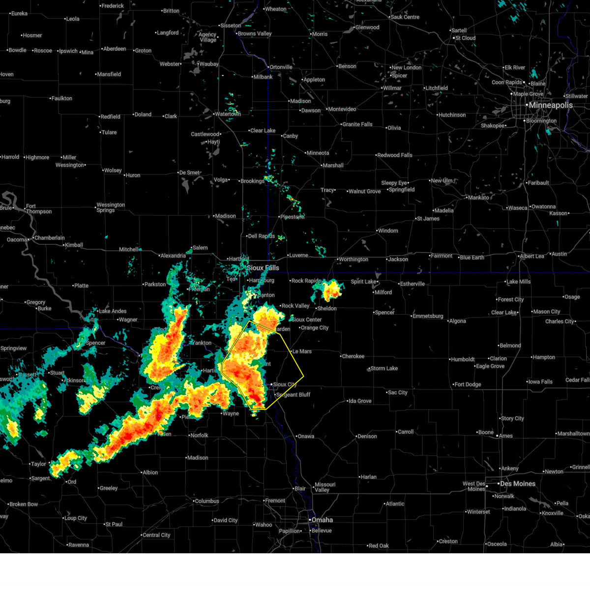
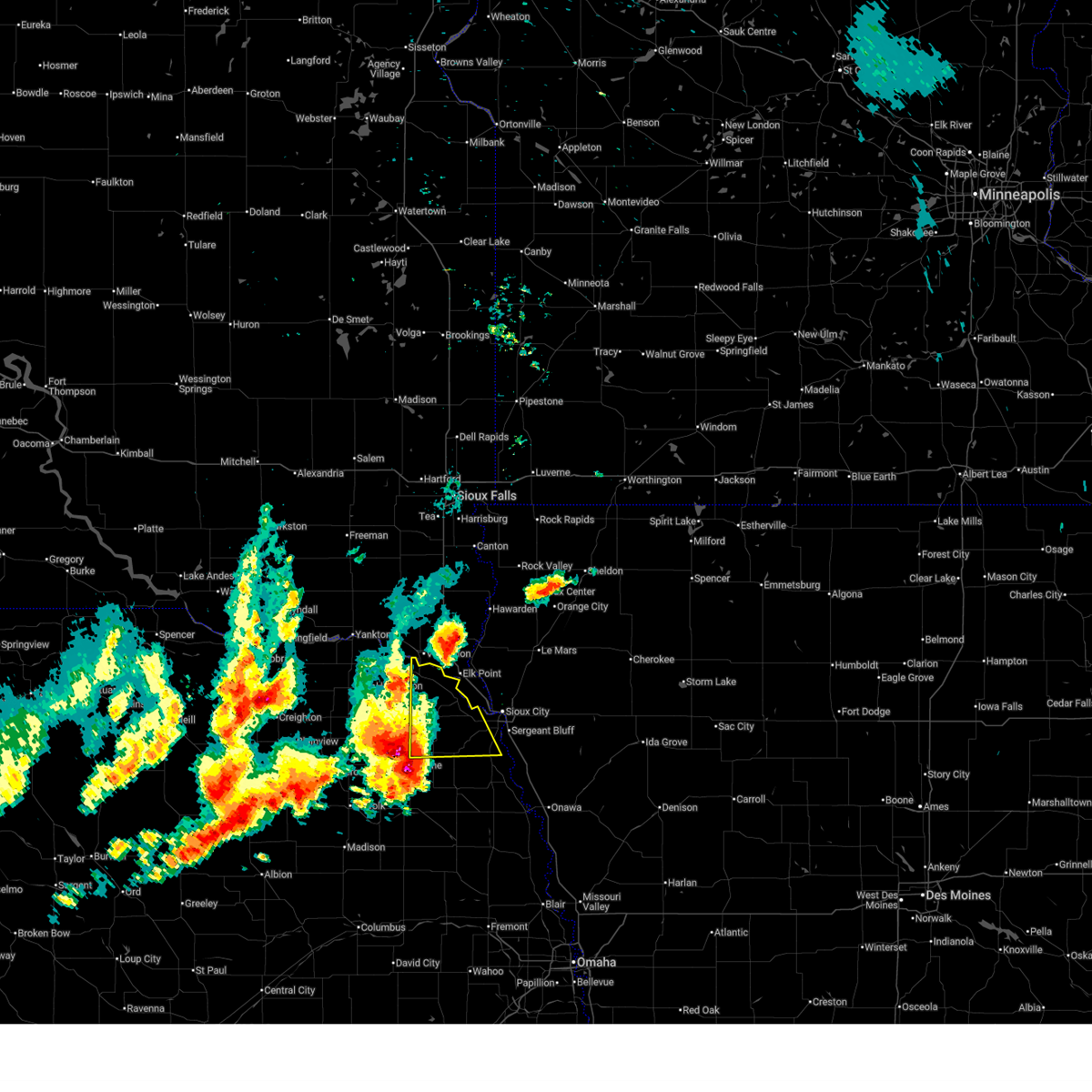
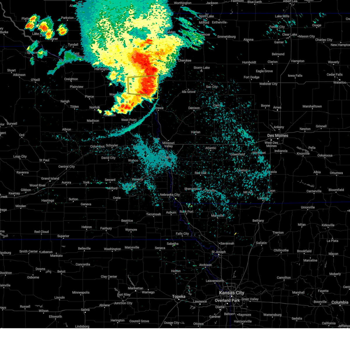
| 4/23/2026 12:12 PM CDT |
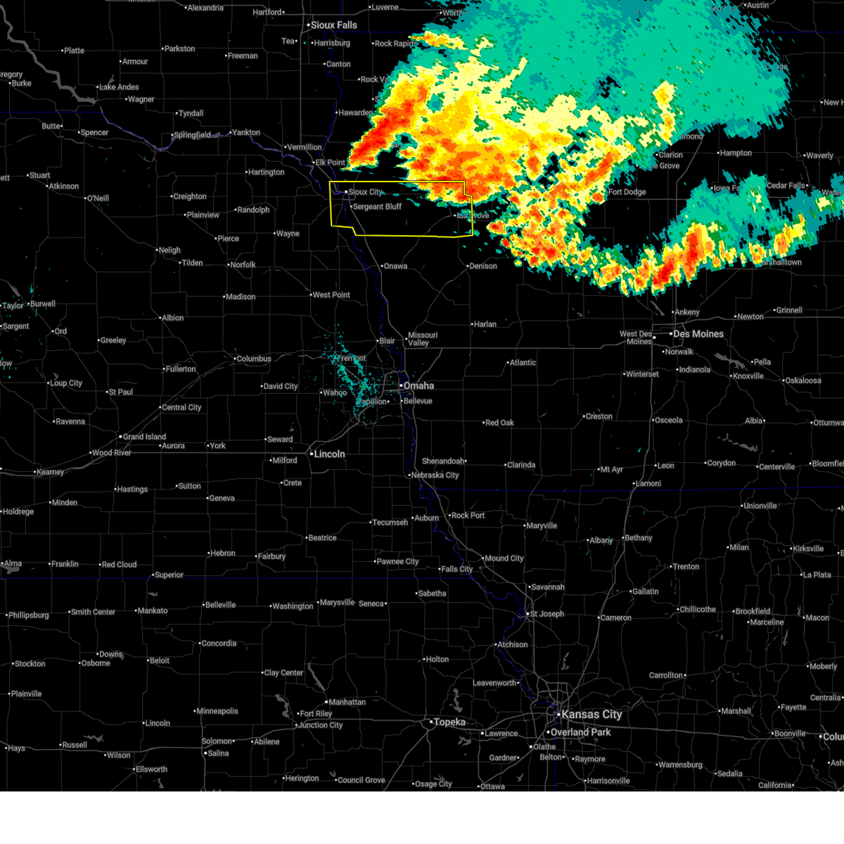
 Svrfsd the national weather service in sioux falls has issued a * severe thunderstorm warning for, western woodbury county in west central iowa, southeastern dakota county in northeastern nebraska, * until 100 pm cdt. * at 1212 pm cdt, a severe thunderstorm was located over homer, or 15 miles southwest of sioux city, moving northeast at 35 mph (radar indicated). Hazards include 60 mph wind gusts and half dollar size hail. Hail damage to vehicles is expected. expect wind damage to roofs, siding, and trees. this severe thunderstorm will be near, sioux city, south sioux city, sergeant bluff, dakota city, and homer around 1215 pm cdt. salix around 1220 pm cdt. Other locations in the path of this severe thunderstorm include lawton. Svrfsd the national weather service in sioux falls has issued a * severe thunderstorm warning for, western woodbury county in west central iowa, southeastern dakota county in northeastern nebraska, * until 100 pm cdt. * at 1212 pm cdt, a severe thunderstorm was located over homer, or 15 miles southwest of sioux city, moving northeast at 35 mph (radar indicated). Hazards include 60 mph wind gusts and half dollar size hail. Hail damage to vehicles is expected. expect wind damage to roofs, siding, and trees. this severe thunderstorm will be near, sioux city, south sioux city, sergeant bluff, dakota city, and homer around 1215 pm cdt. salix around 1220 pm cdt. Other locations in the path of this severe thunderstorm include lawton.
|
| 9/14/2025 5:01 PM CDT | Svrfsd the national weather service in sioux falls has issued a * severe thunderstorm warning for, western woodbury county in west central iowa, eastern dakota county in northeastern nebraska, * until 530 pm cdt. * at 501 pm cdt, a severe thunderstorm was located near winnebago, or 17 miles south of sioux city, moving north at 35 mph (radar indicated). Hazards include 60 mph wind gusts and quarter size hail. Hail damage to vehicles is expected. expect wind damage to roofs, siding, and trees. this severe thunderstorm will be near, sioux city, sergeant bluff, sloan, homer, and salix around 505 pm cdt. south sioux city and dakota city around 510 pm cdt. lawton around 520 pm cdt. Other locations impacted by this severe thunderstorm include bronson. |
| 7/28/2025 1:53 AM CDT |
 At 153 am cdt, severe thunderstorms were located along a line extending from sioux city to near sac city, moving east at 40 mph (sddot site reported a wind gust of 59 mph at 1:36 am cdt 3 southeast of jeffers). Hazards include 60 mph wind gusts and quarter size hail. Hail damage to vehicles is expected. expect wind damage to roofs, siding, and trees. These severe storms will be near, sioux city, moville, holstein, lawton, correctionville, galva, pierson, and cushing around 200 am cdt. At 153 am cdt, severe thunderstorms were located along a line extending from sioux city to near sac city, moving east at 40 mph (sddot site reported a wind gust of 59 mph at 1:36 am cdt 3 southeast of jeffers). Hazards include 60 mph wind gusts and quarter size hail. Hail damage to vehicles is expected. expect wind damage to roofs, siding, and trees. These severe storms will be near, sioux city, moville, holstein, lawton, correctionville, galva, pierson, and cushing around 200 am cdt.
|
| 7/28/2025 1:41 AM CDT |
 Svrfsd the national weather service in sioux falls has issued a * severe thunderstorm warning for, woodbury county in west central iowa, ida county in west central iowa, eastern dakota county in northeastern nebraska, southeastern union county in southeastern south dakota, * until 230 am cdt. * at 141 am cdt, severe thunderstorms were located along a line extending from near north sioux city to near newell, moving south at 40 mph (radar indicated). Hazards include 60 mph wind gusts and quarter size hail. Hail damage to vehicles is expected. expect wind damage to roofs, siding, and trees. severe thunderstorms will be near, sioux city, south sioux city, north sioux city, moville, holstein, lawton, correctionville, galva, pierson, and cushing around 145 am cdt. sergeant bluff, dakota city, and anthon around 155 am cdt. ida grove, battle creek, and arthur around 200 am cdt. Other locations in the path of these severe thunderstorms include salix, danbury, sloan, hornick and smithland. Svrfsd the national weather service in sioux falls has issued a * severe thunderstorm warning for, woodbury county in west central iowa, ida county in west central iowa, eastern dakota county in northeastern nebraska, southeastern union county in southeastern south dakota, * until 230 am cdt. * at 141 am cdt, severe thunderstorms were located along a line extending from near north sioux city to near newell, moving south at 40 mph (radar indicated). Hazards include 60 mph wind gusts and quarter size hail. Hail damage to vehicles is expected. expect wind damage to roofs, siding, and trees. severe thunderstorms will be near, sioux city, south sioux city, north sioux city, moville, holstein, lawton, correctionville, galva, pierson, and cushing around 145 am cdt. sergeant bluff, dakota city, and anthon around 155 am cdt. ida grove, battle creek, and arthur around 200 am cdt. Other locations in the path of these severe thunderstorms include salix, danbury, sloan, hornick and smithland.
|
| 7/7/2025 8:43 PM CDT |
 At 843 pm cdt, severe thunderstorms were located along a line extending from near moville to 6 miles north of hornick, moving east at 30 mph (radar indicated). Hazards include 60 mph wind gusts. Expect damage to roofs, siding, and trees. these severe storms will be near, moville and kingsley around 850 pm cdt. Other locations in the path of these severe thunderstorms include anthon, pierson, smithland, correctionville, danbury and cushing. At 843 pm cdt, severe thunderstorms were located along a line extending from near moville to 6 miles north of hornick, moving east at 30 mph (radar indicated). Hazards include 60 mph wind gusts. Expect damage to roofs, siding, and trees. these severe storms will be near, moville and kingsley around 850 pm cdt. Other locations in the path of these severe thunderstorms include anthon, pierson, smithland, correctionville, danbury and cushing.
|
| 7/7/2025 8:34 PM CDT |
 Svrfsd the national weather service in sioux falls has issued a * severe thunderstorm warning for, woodbury county in west central iowa, southeastern plymouth county in northwestern iowa, southern dakota county in northeastern nebraska, * until 930 pm cdt. * at 834 pm cdt, severe thunderstorms were located along a line extending from lawton to sloan, moving southeast at 50 mph (radar indicated). Hazards include 60 mph wind gusts. Expect damage to roofs, siding, and trees. severe thunderstorms will be near, hornick around 840 pm cdt. Smithland around 850 pm cdt. Svrfsd the national weather service in sioux falls has issued a * severe thunderstorm warning for, woodbury county in west central iowa, southeastern plymouth county in northwestern iowa, southern dakota county in northeastern nebraska, * until 930 pm cdt. * at 834 pm cdt, severe thunderstorms were located along a line extending from lawton to sloan, moving southeast at 50 mph (radar indicated). Hazards include 60 mph wind gusts. Expect damage to roofs, siding, and trees. severe thunderstorms will be near, hornick around 840 pm cdt. Smithland around 850 pm cdt.
|
| 6/16/2025 5:26 PM CDT |
 The storm which prompted the warning has moved out of the area. therefore, the warning will be allowed to expire. a severe thunderstorm watch remains in effect until midnight cdt for west central iowa, and northeastern nebraska. The storm which prompted the warning has moved out of the area. therefore, the warning will be allowed to expire. a severe thunderstorm watch remains in effect until midnight cdt for west central iowa, and northeastern nebraska.
|
| 6/16/2025 5:21 PM CDT |
 At 521 pm cdt, a severe thunderstorm was located over winnebago, or 17 miles south of sioux city, moving southeast at 35 mph (public). Hazards include 60 mph wind gusts and quarter size hail. Hail damage to vehicles is expected. expect wind damage to roofs, siding, and trees. This severe thunderstorm will remain over mainly rural areas of southern dakota and southwestern dixon counties, including the following locations, winnebago reservation. At 521 pm cdt, a severe thunderstorm was located over winnebago, or 17 miles south of sioux city, moving southeast at 35 mph (public). Hazards include 60 mph wind gusts and quarter size hail. Hail damage to vehicles is expected. expect wind damage to roofs, siding, and trees. This severe thunderstorm will remain over mainly rural areas of southern dakota and southwestern dixon counties, including the following locations, winnebago reservation.
|
| 6/16/2025 5:21 PM CDT |
 the severe thunderstorm warning has been cancelled and is no longer in effect the severe thunderstorm warning has been cancelled and is no longer in effect
|
| 6/16/2025 5:10 PM CDT |
 At 510 pm cdt, a severe thunderstorm was located near emerson, or 18 miles southwest of sioux city, moving southeast at 35 mph (public report of trees down 3 miles north of dixon). Hazards include 60 mph wind gusts and quarter size hail. Hail damage to vehicles is expected. expect wind damage to roofs, siding, and trees. This severe storm will be near, homer around 515 pm cdt. At 510 pm cdt, a severe thunderstorm was located near emerson, or 18 miles southwest of sioux city, moving southeast at 35 mph (public report of trees down 3 miles north of dixon). Hazards include 60 mph wind gusts and quarter size hail. Hail damage to vehicles is expected. expect wind damage to roofs, siding, and trees. This severe storm will be near, homer around 515 pm cdt.
|
| 6/16/2025 4:55 PM CDT |
 At 455 pm cdt, a severe thunderstorm was located near allen, or 14 miles south of ponca, moving southeast at 35 mph (radar indicated). Hazards include 60 mph wind gusts and quarter size hail. Hail damage to vehicles is expected. expect wind damage to roofs, siding, and trees. this severe storm will be near, emerson and hubbard around 500 pm cdt. Other locations in the path of this severe thunderstorm include homer. At 455 pm cdt, a severe thunderstorm was located near allen, or 14 miles south of ponca, moving southeast at 35 mph (radar indicated). Hazards include 60 mph wind gusts and quarter size hail. Hail damage to vehicles is expected. expect wind damage to roofs, siding, and trees. this severe storm will be near, emerson and hubbard around 500 pm cdt. Other locations in the path of this severe thunderstorm include homer.
|
| 6/16/2025 4:45 PM CDT |
 Svrfsd the national weather service in sioux falls has issued a * severe thunderstorm warning for, west central woodbury county in west central iowa, dakota county in northeastern nebraska, southwestern dixon county in northeastern nebraska, * until 530 pm cdt. * at 444 pm cdt, a severe thunderstorm was located over allen, or 13 miles northeast of wayne, moving southeast at 35 mph (radar indicated). Hazards include 60 mph wind gusts and quarter size hail. Hail damage to vehicles is expected. expect wind damage to roofs, siding, and trees. this severe thunderstorm will be near, allen around 450 pm cdt. emerson around 455 pm cdt. hubbard around 500 pm cdt. Other locations in the path of this severe thunderstorm include homer. Svrfsd the national weather service in sioux falls has issued a * severe thunderstorm warning for, west central woodbury county in west central iowa, dakota county in northeastern nebraska, southwestern dixon county in northeastern nebraska, * until 530 pm cdt. * at 444 pm cdt, a severe thunderstorm was located over allen, or 13 miles northeast of wayne, moving southeast at 35 mph (radar indicated). Hazards include 60 mph wind gusts and quarter size hail. Hail damage to vehicles is expected. expect wind damage to roofs, siding, and trees. this severe thunderstorm will be near, allen around 450 pm cdt. emerson around 455 pm cdt. hubbard around 500 pm cdt. Other locations in the path of this severe thunderstorm include homer.
|
| 4/17/2025 8:08 PM CDT | Quarter sized hail reported 1.3 miles SSW of Homer, NE |
| 4/17/2025 8:06 PM CDT | Ping Pong Ball sized hail reported 1.2 miles S of Homer, NE |
| 7/29/2024 11:51 PM CDT |
 The storms which prompted the warning have moved out of the area. therefore, the warning will be allowed to expire. however, gusty winds up to 60 mph are still possible with these thunderstorms as they move further east into woodbury county. additional warnings have been issued downstream. a severe thunderstorm watch remains in effect until 200 am cdt for west central iowa, northeastern nebraska, and southeastern south dakota. to report severe weather, contact your nearest law enforcement agency. they will relay your report to the national weather service sioux falls. The storms which prompted the warning have moved out of the area. therefore, the warning will be allowed to expire. however, gusty winds up to 60 mph are still possible with these thunderstorms as they move further east into woodbury county. additional warnings have been issued downstream. a severe thunderstorm watch remains in effect until 200 am cdt for west central iowa, northeastern nebraska, and southeastern south dakota. to report severe weather, contact your nearest law enforcement agency. they will relay your report to the national weather service sioux falls.
|
| 7/29/2024 11:32 PM CDT |
 At 1131 pm cdt, severe thunderstorms were located along a line extending from near north sioux city to near dakota city to 6 miles east of emerson, moving east at 50 mph (trained weather spotters). Hazards include 60 mph wind gusts. at 1124 pm cdt a 59 mph wind gust was reported from a personal weather station west of dakota dunes. Expect damage to roofs, siding, and trees. these severe storms will be near, sioux city, south sioux city, sergeant bluff, dakota city, and homer around 1135 pm cdt. lawton and salix around 1140 pm cdt. Sloan around 1145 pm cdt. At 1131 pm cdt, severe thunderstorms were located along a line extending from near north sioux city to near dakota city to 6 miles east of emerson, moving east at 50 mph (trained weather spotters). Hazards include 60 mph wind gusts. at 1124 pm cdt a 59 mph wind gust was reported from a personal weather station west of dakota dunes. Expect damage to roofs, siding, and trees. these severe storms will be near, sioux city, south sioux city, sergeant bluff, dakota city, and homer around 1135 pm cdt. lawton and salix around 1140 pm cdt. Sloan around 1145 pm cdt.
|
| 7/29/2024 11:28 PM CDT |
 Svrfsd the national weather service in sioux falls has issued a * severe thunderstorm warning for, western woodbury county in west central iowa, dakota county in northeastern nebraska, east central dixon county in northeastern nebraska, southeastern union county in southeastern south dakota, * until midnight cdt. * at 1128 pm cdt, a severe thunderstorm was located near north sioux city, or near sioux city, moving east at 55 mph (radar indicated). Hazards include 60 mph wind gusts. Expect damage to roofs, siding, and trees. This severe thunderstorm will be near, sioux city, sergeant bluff, and lawton around 1135 pm cdt. Svrfsd the national weather service in sioux falls has issued a * severe thunderstorm warning for, western woodbury county in west central iowa, dakota county in northeastern nebraska, east central dixon county in northeastern nebraska, southeastern union county in southeastern south dakota, * until midnight cdt. * at 1128 pm cdt, a severe thunderstorm was located near north sioux city, or near sioux city, moving east at 55 mph (radar indicated). Hazards include 60 mph wind gusts. Expect damage to roofs, siding, and trees. This severe thunderstorm will be near, sioux city, sergeant bluff, and lawton around 1135 pm cdt.
|
| 5/21/2024 6:19 AM CDT |
 the severe thunderstorm warning has been cancelled and is no longer in effect the severe thunderstorm warning has been cancelled and is no longer in effect
|
| 5/21/2024 6:19 AM CDT |
 At 619 am cdt, severe thunderstorms were located along a line extending from near north sioux city to near salix to near whiting, moving northeast at 65 mph (radar indicated). Hazards include 60 mph wind gusts. Expect damage to roofs, siding, and trees. these severe storms will be near, sioux city, south sioux city, north sioux city, lawton, and hornick around 625 am cdt. Other locations in the path of these severe thunderstorms include smithland. At 619 am cdt, severe thunderstorms were located along a line extending from near north sioux city to near salix to near whiting, moving northeast at 65 mph (radar indicated). Hazards include 60 mph wind gusts. Expect damage to roofs, siding, and trees. these severe storms will be near, sioux city, south sioux city, north sioux city, lawton, and hornick around 625 am cdt. Other locations in the path of these severe thunderstorms include smithland.
|
| 5/21/2024 6:05 AM CDT |
 Svrfsd the national weather service in sioux falls has issued a * severe thunderstorm warning for, western woodbury county in west central iowa, dakota county in northeastern nebraska, south central dixon county in northeastern nebraska, southeastern union county in southeastern south dakota, * until 630 am cdt. * at 603 am cdt, severe thunderstorms were located along a line extending from near emerson to walthill to 6 miles south of decatur, moving northeast at 65 mph (radar indicated). Hazards include 60 mph wind gusts. Expect damage to roofs, siding, and trees. severe thunderstorms will be near, sioux city, dakota city, sloan, homer, salix, hubbard, and jackson in dakota county around 615 am cdt. South sioux city, sergeant bluff, hornick and north sioux city around 620 am cdt. Svrfsd the national weather service in sioux falls has issued a * severe thunderstorm warning for, western woodbury county in west central iowa, dakota county in northeastern nebraska, south central dixon county in northeastern nebraska, southeastern union county in southeastern south dakota, * until 630 am cdt. * at 603 am cdt, severe thunderstorms were located along a line extending from near emerson to walthill to 6 miles south of decatur, moving northeast at 65 mph (radar indicated). Hazards include 60 mph wind gusts. Expect damage to roofs, siding, and trees. severe thunderstorms will be near, sioux city, dakota city, sloan, homer, salix, hubbard, and jackson in dakota county around 615 am cdt. South sioux city, sergeant bluff, hornick and north sioux city around 620 am cdt.
|
| 5/20/2024 10:48 PM CDT |
 At 1046 pm cdt, severe thunderstorms were located along a line extending from near sergeant bluff to 6 miles northeast of hornick to mapleton, moving northeast at 50 mph (trained weather spotters. at 1046 pm, the sioux city asos recorded a 72 mph wind gust). Hazards include 70 mph wind gusts and half dollar size hail. Hail damage to vehicles is expected. expect considerable tree damage. wind damage is also likely to mobile homes, roofs, and outbuildings. Locations impacted include, moville, lawton, anthon, danbury, battle creek, correctionville, pierson, ida grove, cushing and holstein. At 1046 pm cdt, severe thunderstorms were located along a line extending from near sergeant bluff to 6 miles northeast of hornick to mapleton, moving northeast at 50 mph (trained weather spotters. at 1046 pm, the sioux city asos recorded a 72 mph wind gust). Hazards include 70 mph wind gusts and half dollar size hail. Hail damage to vehicles is expected. expect considerable tree damage. wind damage is also likely to mobile homes, roofs, and outbuildings. Locations impacted include, moville, lawton, anthon, danbury, battle creek, correctionville, pierson, ida grove, cushing and holstein.
|
| 5/20/2024 10:19 PM CDT |
 Svrfsd the national weather service in sioux falls has issued a * severe thunderstorm warning for, woodbury county in west central iowa, ida county in west central iowa, eastern dakota county in northeastern nebraska, * until 1115 pm cdt. * at 1018 pm cdt, severe thunderstorms were located along a line extending from near walthill to near onawa, moving northeast at 30 mph (radar indicated). Hazards include 60 mph wind gusts and half dollar size hail. Hail damage to vehicles is expected. expect wind damage to roofs, siding, and trees. severe thunderstorms will be near, sloan and hornick around 1030 pm cdt. smithland around 1035 pm cdt. Other locations in the path of these severe thunderstorms include salix, danbury and anthon. Svrfsd the national weather service in sioux falls has issued a * severe thunderstorm warning for, woodbury county in west central iowa, ida county in west central iowa, eastern dakota county in northeastern nebraska, * until 1115 pm cdt. * at 1018 pm cdt, severe thunderstorms were located along a line extending from near walthill to near onawa, moving northeast at 30 mph (radar indicated). Hazards include 60 mph wind gusts and half dollar size hail. Hail damage to vehicles is expected. expect wind damage to roofs, siding, and trees. severe thunderstorms will be near, sloan and hornick around 1030 pm cdt. smithland around 1035 pm cdt. Other locations in the path of these severe thunderstorms include salix, danbury and anthon.
|
| 7/24/2023 3:04 AM CDT |
 At 304 am cdt, a severe thunderstorm was located over laurel, or 13 miles northwest of wayne, moving east at 40 mph (radar indicated). Hazards include quarter size hail. Damage to vehicles is expected. this severe thunderstorm will be near, concord and dixon in dixon county around 315 am cdt. other locations in the path of this severe thunderstorm include allen, martinsburg, emerson, sioux city, south sioux city, dakota city, homer, hubbard and jackson in dakota county. hail threat, radar indicated max hail size, 1. 00 in wind threat, radar indicated max wind gust, <50 mph. At 304 am cdt, a severe thunderstorm was located over laurel, or 13 miles northwest of wayne, moving east at 40 mph (radar indicated). Hazards include quarter size hail. Damage to vehicles is expected. this severe thunderstorm will be near, concord and dixon in dixon county around 315 am cdt. other locations in the path of this severe thunderstorm include allen, martinsburg, emerson, sioux city, south sioux city, dakota city, homer, hubbard and jackson in dakota county. hail threat, radar indicated max hail size, 1. 00 in wind threat, radar indicated max wind gust, <50 mph.
|
| 7/12/2023 5:27 AM CDT |
 At 525 am cdt, severe thunderstorms were located along a line extending from 6 miles south of granville to near hinton to near winnebago, moving east at 50 mph (radar indicated). Hazards include 70 mph wind gusts. Expect considerable tree damage. damage is likely to mobile homes, roofs, and outbuildings. these severe storms will be near, remsen and marcus around 530 am cdt. other locations in the path of these severe thunderstorms include moville, cleghorn, kingsley, pierson and larrabee. at 514 pm cdt, a 59 mph wind gust was measured by a personal weather station 2 miles west of mccook lake. thunderstorm damage threat, considerable hail threat, radar indicated max hail size, <. 75 in wind threat, observed max wind gust, 70 mph. At 525 am cdt, severe thunderstorms were located along a line extending from 6 miles south of granville to near hinton to near winnebago, moving east at 50 mph (radar indicated). Hazards include 70 mph wind gusts. Expect considerable tree damage. damage is likely to mobile homes, roofs, and outbuildings. these severe storms will be near, remsen and marcus around 530 am cdt. other locations in the path of these severe thunderstorms include moville, cleghorn, kingsley, pierson and larrabee. at 514 pm cdt, a 59 mph wind gust was measured by a personal weather station 2 miles west of mccook lake. thunderstorm damage threat, considerable hail threat, radar indicated max hail size, <. 75 in wind threat, observed max wind gust, 70 mph.
|
| 7/12/2023 5:13 AM CDT |
 At 512 am cdt, severe thunderstorms were located along a line extending from struble to 7 miles northwest of hinton to near wakefield, moving southeast at 35 mph (radar indicated). Hazards include 70 mph wind gusts and quarter size hail. Hail damage to vehicles is expected. expect considerable tree damage. wind damage is also likely to mobile homes, roofs, and outbuildings. severe thunderstorms will be near, north sioux city and hubbard around 515 am cdt. emerson and merrill around 520 am cdt. le mars and hinton around 525 am cdt. sioux city, south sioux city and homer around 530 am cdt. other locations in the path of these severe thunderstorms include sergeant bluff, dakota city, remsen, marcus, lawton, moville, kingsley, salix, cleghorn, sloan and pierson. thunderstorm damage threat, considerable hail threat, radar indicated max hail size, 1. 00 in wind threat, observed max wind gust, 70 mph. At 512 am cdt, severe thunderstorms were located along a line extending from struble to 7 miles northwest of hinton to near wakefield, moving southeast at 35 mph (radar indicated). Hazards include 70 mph wind gusts and quarter size hail. Hail damage to vehicles is expected. expect considerable tree damage. wind damage is also likely to mobile homes, roofs, and outbuildings. severe thunderstorms will be near, north sioux city and hubbard around 515 am cdt. emerson and merrill around 520 am cdt. le mars and hinton around 525 am cdt. sioux city, south sioux city and homer around 530 am cdt. other locations in the path of these severe thunderstorms include sergeant bluff, dakota city, remsen, marcus, lawton, moville, kingsley, salix, cleghorn, sloan and pierson. thunderstorm damage threat, considerable hail threat, radar indicated max hail size, 1. 00 in wind threat, observed max wind gust, 70 mph.
|
| 7/12/2023 5:04 AM CDT |
 At 502 am cdt, severe thunderstorms were located along a line extending from near ireton to 7 miles southeast of akron to near wayne, moving southeast at 50 mph (radar indicated). Hazards include 70 mph wind gusts. Expect considerable tree damage. damage is likely to mobile homes, roofs, and outbuildings. locations impacted include, north sioux city, ireton, jefferson, craig, maurice, struble, le mars, south sioux city, hinton, merrill, emerson and homer. at 439 am cdt, winds to 65 mph were measured 2 miles north northeast of burbank. at 430 am cdt, an 80 mph wind gust was reported by the south dakota road weather information system site 3 miles south southwest of beresford. thunderstorm damage threat, considerable hail threat, radar indicated max hail size, <. 75 in wind threat, observed max wind gust, 70 mph. At 502 am cdt, severe thunderstorms were located along a line extending from near ireton to 7 miles southeast of akron to near wayne, moving southeast at 50 mph (radar indicated). Hazards include 70 mph wind gusts. Expect considerable tree damage. damage is likely to mobile homes, roofs, and outbuildings. locations impacted include, north sioux city, ireton, jefferson, craig, maurice, struble, le mars, south sioux city, hinton, merrill, emerson and homer. at 439 am cdt, winds to 65 mph were measured 2 miles north northeast of burbank. at 430 am cdt, an 80 mph wind gust was reported by the south dakota road weather information system site 3 miles south southwest of beresford. thunderstorm damage threat, considerable hail threat, radar indicated max hail size, <. 75 in wind threat, observed max wind gust, 70 mph.
|
| 7/12/2023 4:29 AM CDT |
 At 428 am cdt, severe thunderstorms were located along a line extending from beresford to 7 miles west of union grove state park to near plainview, moving east at 60 mph (radar indicated). Hazards include 70 mph wind gusts. Expect considerable tree damage. damage is likely to mobile homes, roofs, and outbuildings. severe thunderstorms will be near, vermillion, beresford and union grove state park around 435 am cdt. alcester around 440 am cdt. hawarden around 445 am cdt. other locations in the path of these severe thunderstorms include akron, ireton, maurice, craig, merrill, concord, dixon in dixon county, struble, le mars and allen. thunderstorm damage threat, considerable hail threat, radar indicated max hail size, <. 75 in wind threat, radar indicated max wind gust, 70 mph. At 428 am cdt, severe thunderstorms were located along a line extending from beresford to 7 miles west of union grove state park to near plainview, moving east at 60 mph (radar indicated). Hazards include 70 mph wind gusts. Expect considerable tree damage. damage is likely to mobile homes, roofs, and outbuildings. severe thunderstorms will be near, vermillion, beresford and union grove state park around 435 am cdt. alcester around 440 am cdt. hawarden around 445 am cdt. other locations in the path of these severe thunderstorms include akron, ireton, maurice, craig, merrill, concord, dixon in dixon county, struble, le mars and allen. thunderstorm damage threat, considerable hail threat, radar indicated max hail size, <. 75 in wind threat, radar indicated max wind gust, 70 mph.
|
| 7/4/2023 6:56 PM CDT |
 The severe thunderstorm warning for southwestern woodbury and southeastern dakota counties will expire at 700 pm cdt, the storm which prompted the warning has moved out of the area. therefore, the warning will be allowed to expire. however gusty winds are still possible with this thunderstorm. a severe thunderstorm watch remains in effect until 1000 pm cdt for west central iowa, and northeastern nebraska. remember, a severe thunderstorm warning still remains in effect for southern woodbury county. The severe thunderstorm warning for southwestern woodbury and southeastern dakota counties will expire at 700 pm cdt, the storm which prompted the warning has moved out of the area. therefore, the warning will be allowed to expire. however gusty winds are still possible with this thunderstorm. a severe thunderstorm watch remains in effect until 1000 pm cdt for west central iowa, and northeastern nebraska. remember, a severe thunderstorm warning still remains in effect for southern woodbury county.
|
| 7/4/2023 6:26 PM CDT |
 At 626 pm cdt, a severe thunderstorm was located over winnebago, or 17 miles south of sioux city, moving east at 25 mph (radar indicated). Hazards include 60 mph wind gusts and quarter size hail. Hail damage to vehicles is expected. expect wind damage to roofs, siding, and trees. locations impacted include, salix, sloan and hornick. hail threat, radar indicated max hail size, 1. 00 in wind threat, radar indicated max wind gust, 60 mph. At 626 pm cdt, a severe thunderstorm was located over winnebago, or 17 miles south of sioux city, moving east at 25 mph (radar indicated). Hazards include 60 mph wind gusts and quarter size hail. Hail damage to vehicles is expected. expect wind damage to roofs, siding, and trees. locations impacted include, salix, sloan and hornick. hail threat, radar indicated max hail size, 1. 00 in wind threat, radar indicated max wind gust, 60 mph.
|
| 7/4/2023 6:10 PM CDT |
 At 610 pm cdt, a severe thunderstorm was located near winnebago, or 19 miles southwest of sioux city, moving east at 25 mph (radar indicated). Hazards include 60 mph wind gusts and quarter size hail. Hail damage to vehicles is expected. expect wind damage to roofs, siding, and trees. this severe thunderstorm will be near, homer around 620 pm cdt. other locations in the path of this severe thunderstorm include salix, sloan and hornick. hail threat, radar indicated max hail size, 1. 00 in wind threat, radar indicated max wind gust, 60 mph. At 610 pm cdt, a severe thunderstorm was located near winnebago, or 19 miles southwest of sioux city, moving east at 25 mph (radar indicated). Hazards include 60 mph wind gusts and quarter size hail. Hail damage to vehicles is expected. expect wind damage to roofs, siding, and trees. this severe thunderstorm will be near, homer around 620 pm cdt. other locations in the path of this severe thunderstorm include salix, sloan and hornick. hail threat, radar indicated max hail size, 1. 00 in wind threat, radar indicated max wind gust, 60 mph.
|
| 7/4/2023 5:36 PM CDT |
 At 536 pm cdt, a severe thunderstorm was located over hubbard, or 10 miles southwest of sioux city, moving east at 35 mph (radar indicated). Hazards include 60 mph wind gusts. Expect damage to roofs, siding, and trees. locations impacted include, sioux city, south sioux city, sergeant bluff, dakota city, homer, hubbard, jackson in dakota county, waterbury and winnebago reservation. hail threat, radar indicated max hail size, <. 75 in wind threat, radar indicated max wind gust, 60 mph. At 536 pm cdt, a severe thunderstorm was located over hubbard, or 10 miles southwest of sioux city, moving east at 35 mph (radar indicated). Hazards include 60 mph wind gusts. Expect damage to roofs, siding, and trees. locations impacted include, sioux city, south sioux city, sergeant bluff, dakota city, homer, hubbard, jackson in dakota county, waterbury and winnebago reservation. hail threat, radar indicated max hail size, <. 75 in wind threat, radar indicated max wind gust, 60 mph.
|
| 7/4/2023 5:25 PM CDT |
 At 523 pm cdt, a severe thunderstorm was located near allen, or 8 miles south of ponca, moving southeast at 25 mph (trained weather spotters. at 509 pm, a trained weather spotter reported up to two inch in diameter branches down in martinsburg!). Hazards include 60 mph wind gusts. Expect damage to roofs, siding, and trees. locations impacted include, sioux city, south sioux city, sergeant bluff, dakota city, homer, allen, hubbard, jackson in dakota county, martinsburg, waterbury and winnebago reservation. hail threat, radar indicated max hail size, <. 75 in wind threat, radar indicated max wind gust, 60 mph. At 523 pm cdt, a severe thunderstorm was located near allen, or 8 miles south of ponca, moving southeast at 25 mph (trained weather spotters. at 509 pm, a trained weather spotter reported up to two inch in diameter branches down in martinsburg!). Hazards include 60 mph wind gusts. Expect damage to roofs, siding, and trees. locations impacted include, sioux city, south sioux city, sergeant bluff, dakota city, homer, allen, hubbard, jackson in dakota county, martinsburg, waterbury and winnebago reservation. hail threat, radar indicated max hail size, <. 75 in wind threat, radar indicated max wind gust, 60 mph.
|
| 7/4/2023 5:17 PM CDT |
 At 516 pm cdt, a severe thunderstorm was located near martinsburg, or 7 miles south of ponca, moving east at 25 mph (radar indicated). Hazards include 60 mph wind gusts. Expect damage to roofs, siding, and trees. locations impacted include, hubbard, jackson in dakota county, homer, sioux city, south sioux city, sergeant bluff and dakota city. hail threat, radar indicated max hail size, <. 75 in wind threat, radar indicated max wind gust, 60 mph. At 516 pm cdt, a severe thunderstorm was located near martinsburg, or 7 miles south of ponca, moving east at 25 mph (radar indicated). Hazards include 60 mph wind gusts. Expect damage to roofs, siding, and trees. locations impacted include, hubbard, jackson in dakota county, homer, sioux city, south sioux city, sergeant bluff and dakota city. hail threat, radar indicated max hail size, <. 75 in wind threat, radar indicated max wind gust, 60 mph.
|
| 7/4/2023 5:05 PM CDT |
 At 505 pm cdt, a severe thunderstorm was located over martinsburg, or 9 miles southwest of ponca, moving southeast at 40 mph (radar indicated). Hazards include 60 mph wind gusts. Expect damage to roofs, siding, and trees. this severe thunderstorm will be near, hubbard and jackson in dakota county around 525 pm cdt. other locations in the path of this severe thunderstorm include homer, sioux city, south sioux city, dakota city and sergeant bluff. hail threat, radar indicated max hail size, <. 75 in wind threat, radar indicated max wind gust, 60 mph. At 505 pm cdt, a severe thunderstorm was located over martinsburg, or 9 miles southwest of ponca, moving southeast at 40 mph (radar indicated). Hazards include 60 mph wind gusts. Expect damage to roofs, siding, and trees. this severe thunderstorm will be near, hubbard and jackson in dakota county around 525 pm cdt. other locations in the path of this severe thunderstorm include homer, sioux city, south sioux city, dakota city and sergeant bluff. hail threat, radar indicated max hail size, <. 75 in wind threat, radar indicated max wind gust, 60 mph.
|
| 5/12/2023 7:27 PM CDT |
 At 727 pm cdt, a severe thunderstorm was located over homer, or 12 miles southwest of sioux city, moving north at 40 mph (radar indicated). Hazards include 60 mph wind gusts. Expect damage to roofs, siding, and trees. this severe thunderstorm will be near, dakota city and hubbard around 735 pm cdt. sioux city, south sioux city and jackson in dakota county around 740 pm cdt. Other locations in the path of this severe thunderstorm include north sioux city. At 727 pm cdt, a severe thunderstorm was located over homer, or 12 miles southwest of sioux city, moving north at 40 mph (radar indicated). Hazards include 60 mph wind gusts. Expect damage to roofs, siding, and trees. this severe thunderstorm will be near, dakota city and hubbard around 735 pm cdt. sioux city, south sioux city and jackson in dakota county around 740 pm cdt. Other locations in the path of this severe thunderstorm include north sioux city.
|
| 7/5/2022 5:26 PM CDT |
 The severe thunderstorm warning for southwestern cherokee, woodbury, southern sioux, plymouth, dakota, dixon, southeastern clay and union counties will expire at 530 pm cdt, the storms which prompted the warning have weakened. therefore, the warning will be allowed to expire. however gusty winds to 50 mph and heavy rain are still possible with these thunderstorms. a severe thunderstorm watch remains in effect until 700 pm cdt for northwestern and west central iowa, northeastern nebraska, and southeastern south dakota. The severe thunderstorm warning for southwestern cherokee, woodbury, southern sioux, plymouth, dakota, dixon, southeastern clay and union counties will expire at 530 pm cdt, the storms which prompted the warning have weakened. therefore, the warning will be allowed to expire. however gusty winds to 50 mph and heavy rain are still possible with these thunderstorms. a severe thunderstorm watch remains in effect until 700 pm cdt for northwestern and west central iowa, northeastern nebraska, and southeastern south dakota.
|
| 7/5/2022 4:45 PM CDT |
 At 445 pm cdt, severe thunderstorms were located along a line extending from near marcus to near lawton to near emerson, moving southeast at 50 mph (trained weather spotters). Hazards include 70 mph wind gusts. at 428 pm cdt, a 64 mph gust was reported at sioux gateway airport. Expect considerable tree damage. damage is likely to mobile homes, roofs, and outbuildings. these severe storms will be near, moville, kingsley, marcus and lawton around 450 pm cdt. salix around 455 pm cdt. sloan and pierson around 500 pm cdt. correctionville, anthon and hornick around 505 pm cdt. smithland around 515 pm cdt. cushing around 520 pm cdt. danbury around 525 pm cdt. other locations impacted by these severe thunderstorms include bronson, oyens, brunsville, waterbury, oto, chatsworth and westfield. thunderstorm damage threat, considerable hail threat, radar indicated max hail size, <. 75 in wind threat, radar indicated max wind gust, 70 mph. At 445 pm cdt, severe thunderstorms were located along a line extending from near marcus to near lawton to near emerson, moving southeast at 50 mph (trained weather spotters). Hazards include 70 mph wind gusts. at 428 pm cdt, a 64 mph gust was reported at sioux gateway airport. Expect considerable tree damage. damage is likely to mobile homes, roofs, and outbuildings. these severe storms will be near, moville, kingsley, marcus and lawton around 450 pm cdt. salix around 455 pm cdt. sloan and pierson around 500 pm cdt. correctionville, anthon and hornick around 505 pm cdt. smithland around 515 pm cdt. cushing around 520 pm cdt. danbury around 525 pm cdt. other locations impacted by these severe thunderstorms include bronson, oyens, brunsville, waterbury, oto, chatsworth and westfield. thunderstorm damage threat, considerable hail threat, radar indicated max hail size, <. 75 in wind threat, radar indicated max wind gust, 70 mph.
|
| 7/5/2022 4:23 PM CDT |
 At 422 pm cdt, severe thunderstorms were located along a line extending from near sioux center to 8 miles northeast of jefferson to near dixon in dixon county, moving southeast at 50 mph (radar indicated). Hazards include 70 mph wind gusts. Expect considerable tree damage. damage is likely to mobile homes, roofs, and outbuildings. severe thunderstorms will be near, orange city, north sioux city, alton, merrill and struble around 430 pm cdt. hinton around 435 pm cdt. sioux city, le mars and south sioux city around 440 pm cdt. other locations in the path of these severe thunderstorms include sergeant bluff, dakota city, remsen, wakefield, moville, kingsley, marcus, lawton, emerson, hubbard, homer, salix, sloan, pierson, anthon and hornick. thunderstorm damage threat, considerable hail threat, radar indicated max hail size, <. 75 in wind threat, radar indicated max wind gust, 70 mph. At 422 pm cdt, severe thunderstorms were located along a line extending from near sioux center to 8 miles northeast of jefferson to near dixon in dixon county, moving southeast at 50 mph (radar indicated). Hazards include 70 mph wind gusts. Expect considerable tree damage. damage is likely to mobile homes, roofs, and outbuildings. severe thunderstorms will be near, orange city, north sioux city, alton, merrill and struble around 430 pm cdt. hinton around 435 pm cdt. sioux city, le mars and south sioux city around 440 pm cdt. other locations in the path of these severe thunderstorms include sergeant bluff, dakota city, remsen, wakefield, moville, kingsley, marcus, lawton, emerson, hubbard, homer, salix, sloan, pierson, anthon and hornick. thunderstorm damage threat, considerable hail threat, radar indicated max hail size, <. 75 in wind threat, radar indicated max wind gust, 70 mph.
|
| 5/12/2022 7:07 PM CDT |
 At 707 pm cdt, severe thunderstorms were located along a line extending from near newcastle to near sloan, moving northeast at 60 mph (radar indicated). Hazards include golf ball size hail and 70 mph wind gusts. People and animals outdoors will be injured. expect hail damage to roofs, siding, windows, and vehicles. expect considerable tree damage. wind damage is also likely to mobile homes, roofs, and outbuildings. these severe storms will be near, sloan and salix around 710 pm cdt. ponca, hornick and ponca state park around 715 pm cdt. vermillion, elk point and jefferson around 720 pm cdt. other locations in the path of these severe thunderstorms include lawton, moville, anthon, akron, kingsley, correctionville, alcester, pierson, hawarden, ireton, washta and craig. thunderstorm damage threat, considerable hail threat, radar indicated max hail size, 1. 75 in wind threat, radar indicated max wind gust, 70 mph. At 707 pm cdt, severe thunderstorms were located along a line extending from near newcastle to near sloan, moving northeast at 60 mph (radar indicated). Hazards include golf ball size hail and 70 mph wind gusts. People and animals outdoors will be injured. expect hail damage to roofs, siding, windows, and vehicles. expect considerable tree damage. wind damage is also likely to mobile homes, roofs, and outbuildings. these severe storms will be near, sloan and salix around 710 pm cdt. ponca, hornick and ponca state park around 715 pm cdt. vermillion, elk point and jefferson around 720 pm cdt. other locations in the path of these severe thunderstorms include lawton, moville, anthon, akron, kingsley, correctionville, alcester, pierson, hawarden, ireton, washta and craig. thunderstorm damage threat, considerable hail threat, radar indicated max hail size, 1. 75 in wind threat, radar indicated max wind gust, 70 mph.
|
| 5/12/2022 7:02 PM CDT |
 At 702 pm cdt, severe thunderstorms were located along a line extending from 8 miles west of martinsburg to near whiting, moving northeast at 60 mph (radar indicated). Hazards include 70 mph wind gusts and half dollar size hail. Hail damage to vehicles is expected. expect considerable tree damage. wind damage is also likely to mobile homes, roofs, and outbuildings. severe thunderstorms will be near, sloan and salix around 710 pm cdt. hornick and ponca state park around 715 pm cdt. vermillion, elk point and jefferson around 720 pm cdt. other locations in the path of these severe thunderstorms include lawton, moville, anthon, akron, kingsley, correctionville, pierson, alcester, hawarden, ireton, washta, craig and struble. thunderstorm damage threat, considerable hail threat, radar indicated max hail size, 1. 25 in wind threat, radar indicated max wind gust, 70 mph. At 702 pm cdt, severe thunderstorms were located along a line extending from 8 miles west of martinsburg to near whiting, moving northeast at 60 mph (radar indicated). Hazards include 70 mph wind gusts and half dollar size hail. Hail damage to vehicles is expected. expect considerable tree damage. wind damage is also likely to mobile homes, roofs, and outbuildings. severe thunderstorms will be near, sloan and salix around 710 pm cdt. hornick and ponca state park around 715 pm cdt. vermillion, elk point and jefferson around 720 pm cdt. other locations in the path of these severe thunderstorms include lawton, moville, anthon, akron, kingsley, correctionville, pierson, alcester, hawarden, ireton, washta, craig and struble. thunderstorm damage threat, considerable hail threat, radar indicated max hail size, 1. 25 in wind threat, radar indicated max wind gust, 70 mph.
|
| 5/12/2022 6:49 PM CDT |
 At 649 pm cdt, a severe thunderstorm was located near jackson in dakota county, or near ponca, moving north at 50 mph (radar indicated). Hazards include 70 mph wind gusts and half dollar size hail. Hail damage to vehicles is expected. expect considerable tree damage. wind damage is also likely to mobile homes, roofs, and outbuildings. locations impacted include, jefferson, ponca state park, elk point and hinton. thunderstorm damage threat, considerable hail threat, radar indicated max hail size, 1. 25 in wind threat, radar indicated max wind gust, 70 mph. At 649 pm cdt, a severe thunderstorm was located near jackson in dakota county, or near ponca, moving north at 50 mph (radar indicated). Hazards include 70 mph wind gusts and half dollar size hail. Hail damage to vehicles is expected. expect considerable tree damage. wind damage is also likely to mobile homes, roofs, and outbuildings. locations impacted include, jefferson, ponca state park, elk point and hinton. thunderstorm damage threat, considerable hail threat, radar indicated max hail size, 1. 25 in wind threat, radar indicated max wind gust, 70 mph.
|
| 5/12/2022 6:29 PM CDT |
 At 629 pm cdt, a severe thunderstorm was located over emerson, or 20 miles south of ponca, moving north at 50 mph (radar indicated). Hazards include 70 mph wind gusts and half dollar size hail. Hail damage to vehicles is expected. expect considerable tree damage. wind damage is also likely to mobile homes, roofs, and outbuildings. this severe thunderstorm will be near, homer around 635 pm cdt. allen and hubbard around 640 pm cdt. dakota city and jackson in dakota county around 645 pm cdt. other locations in the path of this severe thunderstorm include sioux city, south sioux city, martinsburg, ponca, north sioux city, jefferson, ponca state park, elk point and hinton. thunderstorm damage threat, considerable hail threat, radar indicated max hail size, 1. 25 in wind threat, radar indicated max wind gust, 70 mph. At 629 pm cdt, a severe thunderstorm was located over emerson, or 20 miles south of ponca, moving north at 50 mph (radar indicated). Hazards include 70 mph wind gusts and half dollar size hail. Hail damage to vehicles is expected. expect considerable tree damage. wind damage is also likely to mobile homes, roofs, and outbuildings. this severe thunderstorm will be near, homer around 635 pm cdt. allen and hubbard around 640 pm cdt. dakota city and jackson in dakota county around 645 pm cdt. other locations in the path of this severe thunderstorm include sioux city, south sioux city, martinsburg, ponca, north sioux city, jefferson, ponca state park, elk point and hinton. thunderstorm damage threat, considerable hail threat, radar indicated max hail size, 1. 25 in wind threat, radar indicated max wind gust, 70 mph.
|
| 5/12/2022 4:20 PM CDT |
 At 420 pm cdt, severe thunderstorms were located along a line extending from 8 miles south of yankton to 6 miles west of dixon in dixon county to 7 miles south of stanton, moving east at 70 mph (radar indicated). Hazards include 70 mph wind gusts and half dollar size hail. Hail damage to vehicles is expected. expect considerable tree damage. wind damage is also likely to mobile homes, roofs, and outbuildings. severe thunderstorms will be near, concord and dixon in dixon county around 425 pm cdt. wakefield around 430 pm cdt. emerson, allen, newcastle, meckling, martinsburg and maskell around 435 pm cdt. vermillion and ponca around 440 pm cdt. elk point, homer, hubbard, jackson in dakota county and ponca state park around 445 pm cdt. north sioux city, dakota city, jefferson and union grove state park around 450 pm cdt. sioux city, beresford, south sioux city and sergeant bluff around 455 pm cdt. akron, sloan, hinton, lawton, alcester and merrill around 500 pm cdt. Other locations impacted by these severe thunderstorms include bronson, chatsworth, waterbury and westfield. At 420 pm cdt, severe thunderstorms were located along a line extending from 8 miles south of yankton to 6 miles west of dixon in dixon county to 7 miles south of stanton, moving east at 70 mph (radar indicated). Hazards include 70 mph wind gusts and half dollar size hail. Hail damage to vehicles is expected. expect considerable tree damage. wind damage is also likely to mobile homes, roofs, and outbuildings. severe thunderstorms will be near, concord and dixon in dixon county around 425 pm cdt. wakefield around 430 pm cdt. emerson, allen, newcastle, meckling, martinsburg and maskell around 435 pm cdt. vermillion and ponca around 440 pm cdt. elk point, homer, hubbard, jackson in dakota county and ponca state park around 445 pm cdt. north sioux city, dakota city, jefferson and union grove state park around 450 pm cdt. sioux city, beresford, south sioux city and sergeant bluff around 455 pm cdt. akron, sloan, hinton, lawton, alcester and merrill around 500 pm cdt. Other locations impacted by these severe thunderstorms include bronson, chatsworth, waterbury and westfield.
|
| 12/15/2021 4:10 PM CST | Electric pole blown down. time estimated from rada in dakota county NE, 0.2 miles N of Homer, NE |
| 12/15/2021 4:00 PM CST |
 At 359 pm cst, a severe thunderstorm capable of producing a tornado was located near pender, or 27 miles southwest of sioux city, moving northeast at 50 mph (radar indicated rotation). Hazards include tornado. Flying debris will be dangerous to those caught without shelter. mobile homes will be damaged or destroyed. damage to roofs, windows, and vehicles will occur. tree damage is likely. this dangerous storm will be near, homer and hubbard around 420 pm cst. dakota city and jackson in dakota county around 425 pm cst. sioux city, south sioux city and sergeant bluff around 430 pm cst. North sioux city around 435 pm cst. At 359 pm cst, a severe thunderstorm capable of producing a tornado was located near pender, or 27 miles southwest of sioux city, moving northeast at 50 mph (radar indicated rotation). Hazards include tornado. Flying debris will be dangerous to those caught without shelter. mobile homes will be damaged or destroyed. damage to roofs, windows, and vehicles will occur. tree damage is likely. this dangerous storm will be near, homer and hubbard around 420 pm cst. dakota city and jackson in dakota county around 425 pm cst. sioux city, south sioux city and sergeant bluff around 430 pm cst. North sioux city around 435 pm cst.
|
| 12/15/2021 3:44 PM CST |
 At 343 pm cst, severe thunderstorms were located along a line extending from near wayne to near pender to near uehling, moving northeast at 70 mph (radar indicated). Hazards include 70 mph wind gusts and penny size hail. Expect considerable tree damage. damage is likely to mobile homes, roofs, and outbuildings. these severe storms will be near, allen around 355 pm cst. homer and martinsburg around 400 pm cst. sioux city metro and salix around 405 pm cst. elk point, jefferson and ponca state park around 410 pm cst. lawton around 415 pm cst. moville and hornick around 420 pm cst. Other locations impacted by these severe thunderstorms include bronson and waterbury. At 343 pm cst, severe thunderstorms were located along a line extending from near wayne to near pender to near uehling, moving northeast at 70 mph (radar indicated). Hazards include 70 mph wind gusts and penny size hail. Expect considerable tree damage. damage is likely to mobile homes, roofs, and outbuildings. these severe storms will be near, allen around 355 pm cst. homer and martinsburg around 400 pm cst. sioux city metro and salix around 405 pm cst. elk point, jefferson and ponca state park around 410 pm cst. lawton around 415 pm cst. moville and hornick around 420 pm cst. Other locations impacted by these severe thunderstorms include bronson and waterbury.
|
| 12/15/2021 3:23 PM CST |
 At 322 pm cst, severe thunderstorms were located along a line extending from hadar to 6 miles south of pilger to 6 miles south of dodge, moving northeast at 65 mph (radar indicated). Hazards include 70 mph wind gusts and penny size hail. Expect considerable tree damage. damage is likely to mobile homes, roofs, and outbuildings. severe thunderstorms will be near, emerson, concord and dixon in dixon county around 350 pm cst. allen around 355 pm cst. homer, hubbard and martinsburg around 400 pm cst. ponca, dakota city, salix and newcastle around 405 pm cst. sioux city, south sioux city, sergeant bluff and ponca state park around 410 pm cst. elk point, sloan, lawton, jefferson and hornick around 415 pm cst. moville around 420 pm cst. Other locations impacted by these severe thunderstorms include bronson and waterbury. At 322 pm cst, severe thunderstorms were located along a line extending from hadar to 6 miles south of pilger to 6 miles south of dodge, moving northeast at 65 mph (radar indicated). Hazards include 70 mph wind gusts and penny size hail. Expect considerable tree damage. damage is likely to mobile homes, roofs, and outbuildings. severe thunderstorms will be near, emerson, concord and dixon in dixon county around 350 pm cst. allen around 355 pm cst. homer, hubbard and martinsburg around 400 pm cst. ponca, dakota city, salix and newcastle around 405 pm cst. sioux city, south sioux city, sergeant bluff and ponca state park around 410 pm cst. elk point, sloan, lawton, jefferson and hornick around 415 pm cst. moville around 420 pm cst. Other locations impacted by these severe thunderstorms include bronson and waterbury.
|
| 8/6/2021 12:10 AM CDT |
 At 1209 am cdt, a severe thunderstorm was located over dakota city, or near sioux city, moving southeast at 30 mph (radar indicated). Hazards include 60 mph wind gusts and penny size hail. Expect damage to roofs, siding, and trees. this severe thunderstorm will be near, sergeant bluff around 1220 am cdt. salix around 1235 am cdt. sloan around 1245 am cdt. hornick around 1255 am cdt. hail threat, radar indicated max hail size, 0. 75 in wind threat, radar indicated max wind gust, 60 mph. At 1209 am cdt, a severe thunderstorm was located over dakota city, or near sioux city, moving southeast at 30 mph (radar indicated). Hazards include 60 mph wind gusts and penny size hail. Expect damage to roofs, siding, and trees. this severe thunderstorm will be near, sergeant bluff around 1220 am cdt. salix around 1235 am cdt. sloan around 1245 am cdt. hornick around 1255 am cdt. hail threat, radar indicated max hail size, 0. 75 in wind threat, radar indicated max wind gust, 60 mph.
|
| 7/9/2021 12:09 AM CDT |
 At 1209 am cdt, a severe thunderstorm was located near hubbard, or 15 miles southwest of sioux city, moving southeast at 45 mph (radar indicated). Hazards include ping pong ball size hail and 60 mph wind gusts. People and animals outdoors will be injured. expect hail damage to roofs, siding, windows, and vehicles. expect wind damage to roofs, siding, and trees. this severe storm will be near, homer around 1215 am cdt. salix around 1230 am cdt. Sloan around 1235 am cdt. At 1209 am cdt, a severe thunderstorm was located near hubbard, or 15 miles southwest of sioux city, moving southeast at 45 mph (radar indicated). Hazards include ping pong ball size hail and 60 mph wind gusts. People and animals outdoors will be injured. expect hail damage to roofs, siding, windows, and vehicles. expect wind damage to roofs, siding, and trees. this severe storm will be near, homer around 1215 am cdt. salix around 1230 am cdt. Sloan around 1235 am cdt.
|
| 7/8/2021 11:45 PM CDT |
 At 1144 pm cdt, a severe thunderstorm was located over allen, or 11 miles southwest of ponca, moving east at 45 mph (radar indicated). Hazards include ping pong ball size hail and 60 mph wind gusts. People and animals outdoors will be injured. expect hail damage to roofs, siding, windows, and vehicles. expect wind damage to roofs, siding, and trees. this severe thunderstorm will be near, hubbard and jackson in dakota county around 1205 am cdt. homer around 1210 am cdt. sioux city, south sioux city and dakota city around 1215 am cdt. sergeant bluff around 1220 am cdt. salix around 1225 am cdt. sloan around 1230 am cdt. Other locations impacted by this severe thunderstorm include bronson and waterbury. At 1144 pm cdt, a severe thunderstorm was located over allen, or 11 miles southwest of ponca, moving east at 45 mph (radar indicated). Hazards include ping pong ball size hail and 60 mph wind gusts. People and animals outdoors will be injured. expect hail damage to roofs, siding, windows, and vehicles. expect wind damage to roofs, siding, and trees. this severe thunderstorm will be near, hubbard and jackson in dakota county around 1205 am cdt. homer around 1210 am cdt. sioux city, south sioux city and dakota city around 1215 am cdt. sergeant bluff around 1220 am cdt. salix around 1225 am cdt. sloan around 1230 am cdt. Other locations impacted by this severe thunderstorm include bronson and waterbury.
|
| 10/11/2020 7:42 PM CDT |
 The severe thunderstorm warning for western woodbury, central plymouth, dakota and southeastern union counties will expire at 745 pm cdt, the storms which prompted the warning have weakened below severe limits, and no longer pose an immediate threat to life or property. therefore, the warning will be allowed to expire. however gusty winds are still possible with these thunderstorms. a severe thunderstorm watch remains in effect until midnight cdt for northwestern and west central iowa, northeastern nebraska, and southeastern south dakota. The severe thunderstorm warning for western woodbury, central plymouth, dakota and southeastern union counties will expire at 745 pm cdt, the storms which prompted the warning have weakened below severe limits, and no longer pose an immediate threat to life or property. therefore, the warning will be allowed to expire. however gusty winds are still possible with these thunderstorms. a severe thunderstorm watch remains in effect until midnight cdt for northwestern and west central iowa, northeastern nebraska, and southeastern south dakota.
|
| 10/11/2020 6:55 PM CDT |
 At 655 pm cdt, severe thunderstorms were located along a line extending from near merrill to 6 miles east of emerson, moving northeast at 30 mph (radar indicated). Hazards include 60 mph wind gusts and quarter size hail. Hail damage to vehicles is expected. expect wind damage to roofs, siding, and trees. severe thunderstorms will be near, hinton and merrill around 700 pm cdt. hubbard around 710 pm cdt. le mars around 720 pm cdt. sergeant bluff, dakota city and salix around 730 pm cdt. sioux city and south sioux city around 735 pm cdt. lawton around 745 pm cdt. Other locations impacted by these severe thunderstorms include bronson, brunsville and oyens. At 655 pm cdt, severe thunderstorms were located along a line extending from near merrill to 6 miles east of emerson, moving northeast at 30 mph (radar indicated). Hazards include 60 mph wind gusts and quarter size hail. Hail damage to vehicles is expected. expect wind damage to roofs, siding, and trees. severe thunderstorms will be near, hinton and merrill around 700 pm cdt. hubbard around 710 pm cdt. le mars around 720 pm cdt. sergeant bluff, dakota city and salix around 730 pm cdt. sioux city and south sioux city around 735 pm cdt. lawton around 745 pm cdt. Other locations impacted by these severe thunderstorms include bronson, brunsville and oyens.
|
| 7/6/2020 6:48 PM CDT |
 At 648 pm cdt, severe thunderstorms were located along a line extending from near jefferson to near north sioux city to near hubbard, moving east at 25 mph (radar indicated). Hazards include 70 mph wind gusts and penny size hail. Expect considerable tree damage. damage is likely to mobile homes, roofs, and outbuildings. these severe storms will be near, sioux city, south sioux city and dakota city around 700 pm cdt. sergeant bluff, hinton and homer around 705 pm cdt. Other locations impacted by these severe thunderstorms include waterbury and westfield. At 648 pm cdt, severe thunderstorms were located along a line extending from near jefferson to near north sioux city to near hubbard, moving east at 25 mph (radar indicated). Hazards include 70 mph wind gusts and penny size hail. Expect considerable tree damage. damage is likely to mobile homes, roofs, and outbuildings. these severe storms will be near, sioux city, south sioux city and dakota city around 700 pm cdt. sergeant bluff, hinton and homer around 705 pm cdt. Other locations impacted by these severe thunderstorms include waterbury and westfield.
|
| 7/6/2020 6:31 PM CDT |
 At 630 pm cdt, severe thunderstorms were located along a line extending from near elk point to near ponca to near allen, moving east at 20 mph (radar indicated). Hazards include 70 mph wind gusts and penny size hail. Expect considerable tree damage. damage is likely to mobile homes, roofs, and outbuildings. severe thunderstorms will be near, jefferson around 640 pm cdt. north sioux city, emerson and jackson in dakota county around 645 pm cdt. hubbard around 655 pm cdt. sioux city, south sioux city and dakota city around 710 pm cdt. sergeant bluff, hinton and homer around 715 pm cdt. Other locations impacted by these severe thunderstorms include waterbury and westfield. At 630 pm cdt, severe thunderstorms were located along a line extending from near elk point to near ponca to near allen, moving east at 20 mph (radar indicated). Hazards include 70 mph wind gusts and penny size hail. Expect considerable tree damage. damage is likely to mobile homes, roofs, and outbuildings. severe thunderstorms will be near, jefferson around 640 pm cdt. north sioux city, emerson and jackson in dakota county around 645 pm cdt. hubbard around 655 pm cdt. sioux city, south sioux city and dakota city around 710 pm cdt. sergeant bluff, hinton and homer around 715 pm cdt. Other locations impacted by these severe thunderstorms include waterbury and westfield.
|
| 7/3/2020 5:52 PM CDT |
 At 551 pm cdt, a severe thunderstorm was located over ponca state park, or near ponca, moving south at 25 mph (public. at 5:30 pm, 3 inch tree branches were damaged by strong thunderstorm winds in elk point). Hazards include 60 mph wind gusts and quarter size hail. Hail damage to vehicles is expected. expect wind damage to roofs, siding, and trees. this severe storm will be near, jefferson around 555 pm cdt. ponca around 600 pm cdt. north sioux city around 605 pm cdt. jackson in dakota county around 625 pm cdt. hubbard around 635 pm cdt. emerson and homer around 645 pm cdt. Other locations impacted by this severe thunderstorm include waterbury. At 551 pm cdt, a severe thunderstorm was located over ponca state park, or near ponca, moving south at 25 mph (public. at 5:30 pm, 3 inch tree branches were damaged by strong thunderstorm winds in elk point). Hazards include 60 mph wind gusts and quarter size hail. Hail damage to vehicles is expected. expect wind damage to roofs, siding, and trees. this severe storm will be near, jefferson around 555 pm cdt. ponca around 600 pm cdt. north sioux city around 605 pm cdt. jackson in dakota county around 625 pm cdt. hubbard around 635 pm cdt. emerson and homer around 645 pm cdt. Other locations impacted by this severe thunderstorm include waterbury.
|
| 7/3/2020 5:25 PM CDT |
 At 525 pm cdt, a severe thunderstorm was located near elk point, or 9 miles southeast of vermillion, moving south at 35 mph (ground observation station. at 5:09 pm, a wind gust measured at 74 mph was reported southwest of junction city). Hazards include 70 mph wind gusts and quarter size hail. Hail damage to vehicles is expected. expect considerable tree damage. wind damage is also likely to mobile homes, roofs, and outbuildings. this severe thunderstorm will be near, newcastle around 530 pm cdt. ponca state park around 535 pm cdt. ponca around 540 pm cdt. martinsburg around 550 pm cdt. allen around 600 pm cdt. wakefield and emerson around 615 pm cdt. Other locations impacted by this severe thunderstorm include waterbury. At 525 pm cdt, a severe thunderstorm was located near elk point, or 9 miles southeast of vermillion, moving south at 35 mph (ground observation station. at 5:09 pm, a wind gust measured at 74 mph was reported southwest of junction city). Hazards include 70 mph wind gusts and quarter size hail. Hail damage to vehicles is expected. expect considerable tree damage. wind damage is also likely to mobile homes, roofs, and outbuildings. this severe thunderstorm will be near, newcastle around 530 pm cdt. ponca state park around 535 pm cdt. ponca around 540 pm cdt. martinsburg around 550 pm cdt. allen around 600 pm cdt. wakefield and emerson around 615 pm cdt. Other locations impacted by this severe thunderstorm include waterbury.
|
| 5/24/2020 4:21 AM CDT |
 At 420 am cdt, severe thunderstorms were located along a line extending from near hawarden to 8 miles northwest of hinton to near homer, moving northeast at 40 mph (radar indicated). Hazards include 70 mph wind gusts. Expect considerable tree damage. damage is likely to mobile homes, roofs, and outbuildings. these severe storms will be near, hinton around 425 am cdt. merrill around 430 am cdt. craig around 435 am cdt. sioux city, sergeant bluff, dakota city and salix around 440 am cdt. le mars and struble around 445 am cdt. remsen and lawton around 455 am cdt. moville around 505 am cdt. pierson around 515 am cdt. Other locations impacted by these severe thunderstorms include bronson, oyens, brunsville, westfield and chatsworth. At 420 am cdt, severe thunderstorms were located along a line extending from near hawarden to 8 miles northwest of hinton to near homer, moving northeast at 40 mph (radar indicated). Hazards include 70 mph wind gusts. Expect considerable tree damage. damage is likely to mobile homes, roofs, and outbuildings. these severe storms will be near, hinton around 425 am cdt. merrill around 430 am cdt. craig around 435 am cdt. sioux city, sergeant bluff, dakota city and salix around 440 am cdt. le mars and struble around 445 am cdt. remsen and lawton around 455 am cdt. moville around 505 am cdt. pierson around 515 am cdt. Other locations impacted by these severe thunderstorms include bronson, oyens, brunsville, westfield and chatsworth.
|
| 5/24/2020 4:09 AM CDT |
 At 408 am cdt, severe thunderstorms were located along a line extending from near union grove state park to near jefferson to near hubbard, moving east at 45 mph (public. at 355 am cdt, a measured wind gust of 61 mph was reported 4 miles east of vermillion). Hazards include 70 mph wind gusts. Expect considerable tree damage. damage is likely to mobile homes, roofs, and outbuildings. these severe storms will be near, hinton around 420 am cdt. dakota city and merrill around 425 am cdt. sioux city, south sioux city, sergeant bluff and salix around 430 am cdt. kingsley and lawton around 440 am cdt. remsen around 445 am cdt. moville around 450 am cdt. pierson around 500 am cdt. Other locations impacted by these severe thunderstorms include bronson, oyens, brunsville, waterbury, westfield and chatsworth. At 408 am cdt, severe thunderstorms were located along a line extending from near union grove state park to near jefferson to near hubbard, moving east at 45 mph (public. at 355 am cdt, a measured wind gust of 61 mph was reported 4 miles east of vermillion). Hazards include 70 mph wind gusts. Expect considerable tree damage. damage is likely to mobile homes, roofs, and outbuildings. these severe storms will be near, hinton around 420 am cdt. dakota city and merrill around 425 am cdt. sioux city, south sioux city, sergeant bluff and salix around 430 am cdt. kingsley and lawton around 440 am cdt. remsen around 445 am cdt. moville around 450 am cdt. pierson around 500 am cdt. Other locations impacted by these severe thunderstorms include bronson, oyens, brunsville, waterbury, westfield and chatsworth.
|
| 5/24/2020 3:50 AM CDT |
 At 350 am cdt, severe thunderstorms were located along a line extending from near wakonda to near ponca state park to near wakefield, moving east at 45 mph (radar indicated). Hazards include 70 mph wind gusts. Expect considerable tree damage. damage is likely to mobile homes, roofs, and outbuildings. severe thunderstorms will be near, ponca, elk point and ponca state park around 355 am cdt. emerson around 400 am cdt. north sioux city and jefferson around 405 am cdt. hubbard around 410 am cdt. hinton and homer around 420 am cdt. sioux city, dakota city and merrill around 425 am cdt. sergeant bluff and salix around 430 am cdt. kingsley and lawton around 440 am cdt. Other locations impacted by these severe thunderstorms include bronson, oyens, brunsville, waterbury, westfield and chatsworth. At 350 am cdt, severe thunderstorms were located along a line extending from near wakonda to near ponca state park to near wakefield, moving east at 45 mph (radar indicated). Hazards include 70 mph wind gusts. Expect considerable tree damage. damage is likely to mobile homes, roofs, and outbuildings. severe thunderstorms will be near, ponca, elk point and ponca state park around 355 am cdt. emerson around 400 am cdt. north sioux city and jefferson around 405 am cdt. hubbard around 410 am cdt. hinton and homer around 420 am cdt. sioux city, dakota city and merrill around 425 am cdt. sergeant bluff and salix around 430 am cdt. kingsley and lawton around 440 am cdt. Other locations impacted by these severe thunderstorms include bronson, oyens, brunsville, waterbury, westfield and chatsworth.
|
| 8/18/2019 1:37 AM CDT |
 The severe thunderstorm warning for dakota and south central dixon counties will expire at 145 am cdt, the storm which prompted the warning has weakened below severe limits, and no longer poses an immediate threat to life or property. therefore, the warning will be allowed to expire. however gusty winds and heavy rain are still possible with this thunderstorm. a severe thunderstorm watch remains in effect until 200 am cdt for west central iowa, northeastern nebraska, and southeastern south dakota. The severe thunderstorm warning for dakota and south central dixon counties will expire at 145 am cdt, the storm which prompted the warning has weakened below severe limits, and no longer poses an immediate threat to life or property. therefore, the warning will be allowed to expire. however gusty winds and heavy rain are still possible with this thunderstorm. a severe thunderstorm watch remains in effect until 200 am cdt for west central iowa, northeastern nebraska, and southeastern south dakota.
|
| 8/18/2019 1:18 AM CDT |
 At 117 am cdt, a severe thunderstorm was located near allen, or 10 miles south of ponca, moving east at 30 mph (radar indicated). Hazards include 60 mph wind gusts and quarter size hail. Hail damage to vehicles is expected. expect wind damage to roofs, siding, and trees. this severe storm will be near, hubbard and jackson in dakota county around 135 am cdt. south sioux city, dakota city and homer around 145 am cdt. Other locations impacted by this severe thunderstorm include waterbury. At 117 am cdt, a severe thunderstorm was located near allen, or 10 miles south of ponca, moving east at 30 mph (radar indicated). Hazards include 60 mph wind gusts and quarter size hail. Hail damage to vehicles is expected. expect wind damage to roofs, siding, and trees. this severe storm will be near, hubbard and jackson in dakota county around 135 am cdt. south sioux city, dakota city and homer around 145 am cdt. Other locations impacted by this severe thunderstorm include waterbury.
|
| 8/18/2019 1:03 AM CDT |
 At 103 am cdt, a severe thunderstorm was located over allen, or 13 miles southwest of ponca, moving east at 30 mph (radar indicated). Hazards include 60 mph wind gusts and quarter size hail. Hail damage to vehicles is expected. expect wind damage to roofs, siding, and trees. this severe thunderstorm will be near, hubbard and jackson in dakota county around 135 am cdt. dakota city and homer around 145 am cdt. Other locations impacted by this severe thunderstorm include waterbury. At 103 am cdt, a severe thunderstorm was located over allen, or 13 miles southwest of ponca, moving east at 30 mph (radar indicated). Hazards include 60 mph wind gusts and quarter size hail. Hail damage to vehicles is expected. expect wind damage to roofs, siding, and trees. this severe thunderstorm will be near, hubbard and jackson in dakota county around 135 am cdt. dakota city and homer around 145 am cdt. Other locations impacted by this severe thunderstorm include waterbury.
|
| 8/26/2018 8:51 AM CDT |
 The severe thunderstorm warning for dakota and south central dixon counties will expire at 900 am cdt, the storm which prompted the warning has weakened below severe limits, and no longer poses an immediate threat to life or property. therefore, the warning will be allowed to expire. The severe thunderstorm warning for dakota and south central dixon counties will expire at 900 am cdt, the storm which prompted the warning has weakened below severe limits, and no longer poses an immediate threat to life or property. therefore, the warning will be allowed to expire.
|
| 8/26/2018 8:41 AM CDT |
 At 841 am cdt, a severe thunderstorm was located near emerson, or 19 miles south of ponca, moving northeast at 20 mph (radar indicated). Hazards include 60 mph wind gusts and quarter size hail. Hail damage to vehicles is expected. expect wind damage to roofs, siding, and trees. This severe storm will be near, homer, hubbard and jackson in dakota county around 900 am cdt. At 841 am cdt, a severe thunderstorm was located near emerson, or 19 miles south of ponca, moving northeast at 20 mph (radar indicated). Hazards include 60 mph wind gusts and quarter size hail. Hail damage to vehicles is expected. expect wind damage to roofs, siding, and trees. This severe storm will be near, homer, hubbard and jackson in dakota county around 900 am cdt.
|
| 8/26/2018 8:14 AM CDT |
 At 814 am cdt, a severe thunderstorm was located near wakefield, or 27 miles south of ponca, moving northeast at 40 mph (radar indicated). Hazards include 60 mph wind gusts and quarter size hail. Hail damage to vehicles is expected. expect wind damage to roofs, siding, and trees. this severe thunderstorm will be near, emerson around 830 am cdt. hubbard around 845 am cdt. Homer and jackson in dakota county around 850 am cdt. At 814 am cdt, a severe thunderstorm was located near wakefield, or 27 miles south of ponca, moving northeast at 40 mph (radar indicated). Hazards include 60 mph wind gusts and quarter size hail. Hail damage to vehicles is expected. expect wind damage to roofs, siding, and trees. this severe thunderstorm will be near, emerson around 830 am cdt. hubbard around 845 am cdt. Homer and jackson in dakota county around 850 am cdt.
|
| 6/13/2017 9:16 PM CDT |
 At 916 pm cdt, a severe thunderstorm was located over dakota city, or near sioux city, moving northeast at 55 mph (radar indicated). Hazards include 70 mph wind gusts and nickel size hail. Expect considerable tree damage. damage is likely to mobile homes, roofs, and outbuildings. this severe thunderstorm will be near, lawton around 925 pm cdt. moville around 935 pm cdt. kingsley around 940 pm cdt. pierson around 945 pm cdt. cleghorn around 1000 pm cdt. other locations impacted by this severe thunderstorm include bronson and oto. A tornado watch remains in effect until 200 am cdt for northwestern and west central iowa, northeastern nebraska, and southeastern south dakota. At 916 pm cdt, a severe thunderstorm was located over dakota city, or near sioux city, moving northeast at 55 mph (radar indicated). Hazards include 70 mph wind gusts and nickel size hail. Expect considerable tree damage. damage is likely to mobile homes, roofs, and outbuildings. this severe thunderstorm will be near, lawton around 925 pm cdt. moville around 935 pm cdt. kingsley around 940 pm cdt. pierson around 945 pm cdt. cleghorn around 1000 pm cdt. other locations impacted by this severe thunderstorm include bronson and oto. A tornado watch remains in effect until 200 am cdt for northwestern and west central iowa, northeastern nebraska, and southeastern south dakota.
|
| 8/23/2016 1:00 PM CDT | Trees and power lines dow in dakota county NE, 0.2 miles N of Homer, NE |
| 8/11/2016 6:11 PM CDT |
 The severe thunderstorm warning for southern dakota county will expire at 615 pm cdt, the storm which prompted the warning has moved out of the area. therefore, the warning will be allowed to expire. however gusty winds and heavy rain are still possible with this thunderstorm. a severe thunderstorm watch remains in effect until 1100 pm cdt for west central iowa, and northeastern nebraska. The severe thunderstorm warning for southern dakota county will expire at 615 pm cdt, the storm which prompted the warning has moved out of the area. therefore, the warning will be allowed to expire. however gusty winds and heavy rain are still possible with this thunderstorm. a severe thunderstorm watch remains in effect until 1100 pm cdt for west central iowa, and northeastern nebraska.
|
| 8/11/2016 6:00 PM CDT | Tree down...time estimated from rada in dakota county NE, 0.2 miles N of Homer, NE |
| 8/11/2016 5:55 PM CDT |
 At 553 pm cdt, a severe thunderstorm was located over emerson, or 17 miles south of ponca, moving east at 30 mph (radar indicated). Hazards include 60 mph wind gusts and penny size hail. Expect damage to roofs. siding. and trees. This severe storm will be near, homer around 615 pm cdt. At 553 pm cdt, a severe thunderstorm was located over emerson, or 17 miles south of ponca, moving east at 30 mph (radar indicated). Hazards include 60 mph wind gusts and penny size hail. Expect damage to roofs. siding. and trees. This severe storm will be near, homer around 615 pm cdt.
|
| 8/11/2016 5:37 PM CDT |
 At 537 pm cdt, a severe thunderstorm was located over wakefield, or 19 miles southwest of ponca, moving east at 30 mph (radar indicated). Hazards include 60 mph wind gusts and penny size hail. Expect damage to roofs. siding. and trees. this severe thunderstorm will be near, emerson around 550 pm cdt. Homer around 615 pm cdt. At 537 pm cdt, a severe thunderstorm was located over wakefield, or 19 miles southwest of ponca, moving east at 30 mph (radar indicated). Hazards include 60 mph wind gusts and penny size hail. Expect damage to roofs. siding. and trees. this severe thunderstorm will be near, emerson around 550 pm cdt. Homer around 615 pm cdt.
|
| 6/17/2016 11:26 PM CDT |
 The severe thunderstorm warning for western woodbury, southwestern dixon, dakota and southeastern union counties will expire at 1130 pm cdt, the storms which prompted the warning have weakened below severe limits, and no longer pose an immediate threat to life or property. therefore, the warning will be allowed to expire. however gusty winds up to 45 mph are still possible with these thunderstorms. to report severe weather, contact your nearest law enforcement agency. they will relay your report to the national weather service sioux falls. The severe thunderstorm warning for western woodbury, southwestern dixon, dakota and southeastern union counties will expire at 1130 pm cdt, the storms which prompted the warning have weakened below severe limits, and no longer pose an immediate threat to life or property. therefore, the warning will be allowed to expire. however gusty winds up to 45 mph are still possible with these thunderstorms. to report severe weather, contact your nearest law enforcement agency. they will relay your report to the national weather service sioux falls.
|
| 6/17/2016 11:09 PM CDT |
 At 1109 pm cdt, severe thunderstorms were located along a line extending from near wisner to 7 miles northeast of onawa, moving south at 25 mph (radar indicated). Hazards include 60 mph wind gusts. Expect damage to roofs. siding. and trees. Locations impacted include, sioux city, south sioux city, sergeant bluff, north sioux city, dakota city, wakefield, sloan, lawton, emerson, homer, allen, salix, hubbard, hornick, smithland, jackson in dakota county, concord, martinsburg, dixon in dixon county and bronson. At 1109 pm cdt, severe thunderstorms were located along a line extending from near wisner to 7 miles northeast of onawa, moving south at 25 mph (radar indicated). Hazards include 60 mph wind gusts. Expect damage to roofs. siding. and trees. Locations impacted include, sioux city, south sioux city, sergeant bluff, north sioux city, dakota city, wakefield, sloan, lawton, emerson, homer, allen, salix, hubbard, hornick, smithland, jackson in dakota county, concord, martinsburg, dixon in dixon county and bronson.
|
| 6/17/2016 10:41 PM CDT |
 At 1041 pm cdt, severe thunderstorms were located along a line extending from near wakefield to near smithland, moving south at 25 mph (radar indicated). Hazards include 60 mph wind gusts. Expect damage to roofs. siding. and trees. These severe thunderstorms will remain over mainly rural areas of western woodbury, southwestern dixon, dakota and southeastern union counties, including the following locations: waterbury and bronson. At 1041 pm cdt, severe thunderstorms were located along a line extending from near wakefield to near smithland, moving south at 25 mph (radar indicated). Hazards include 60 mph wind gusts. Expect damage to roofs. siding. and trees. These severe thunderstorms will remain over mainly rural areas of western woodbury, southwestern dixon, dakota and southeastern union counties, including the following locations: waterbury and bronson.
|
| 6/17/2016 10:16 PM CDT |
 At 1014 pm cdt, severe thunderstorms were located along a line extending from 8 miles north of bloomfield to hubbard, moving south at 15 mph (trained weather spotters. this storm has had a history of producing tree damage in new castle). Hazards include 70 mph wind gusts and quarter size hail. Hail damage to vehicles is expected. expect considerable tree damage. wind damage is also likely to mobile homes, roofs, and outbuildings. these severe storms will be near, hubbard and jackson in dakota county around 1020 pm cdt. homer around 1030 pm cdt. emerson around 1045 pm cdt. Other locations impacted by these severe thunderstorms include waterbury, lewis and clark state recreation area, gayville, westfield and gavins point dam and campgrounds. At 1014 pm cdt, severe thunderstorms were located along a line extending from 8 miles north of bloomfield to hubbard, moving south at 15 mph (trained weather spotters. this storm has had a history of producing tree damage in new castle). Hazards include 70 mph wind gusts and quarter size hail. Hail damage to vehicles is expected. expect considerable tree damage. wind damage is also likely to mobile homes, roofs, and outbuildings. these severe storms will be near, hubbard and jackson in dakota county around 1020 pm cdt. homer around 1030 pm cdt. emerson around 1045 pm cdt. Other locations impacted by these severe thunderstorms include waterbury, lewis and clark state recreation area, gayville, westfield and gavins point dam and campgrounds.
|
| 6/17/2016 9:53 PM CDT |
 At 952 pm cdt, severe thunderstorms were located along a line extending from 7 miles southwest of lewis and clark state recreation area to jackson in dakota county, moving south at 15 mph (radar indicated). Hazards include 60 mph wind gusts and quarter size hail. Hail damage to vehicles is expected. expect wind damage to roofs, siding, and trees. severe thunderstorms will be near, jackson in dakota county around 1000 pm cdt. hubbard around 1010 pm cdt. homer around 1030 pm cdt. emerson around 1045 pm cdt. Other locations impacted by these severe thunderstorms include waterbury, lewis and clark state recreation area, gayville, westfield and gavins point dam and campgrounds. At 952 pm cdt, severe thunderstorms were located along a line extending from 7 miles southwest of lewis and clark state recreation area to jackson in dakota county, moving south at 15 mph (radar indicated). Hazards include 60 mph wind gusts and quarter size hail. Hail damage to vehicles is expected. expect wind damage to roofs, siding, and trees. severe thunderstorms will be near, jackson in dakota county around 1000 pm cdt. hubbard around 1010 pm cdt. homer around 1030 pm cdt. emerson around 1045 pm cdt. Other locations impacted by these severe thunderstorms include waterbury, lewis and clark state recreation area, gayville, westfield and gavins point dam and campgrounds.
|
| 7/17/2015 11:16 PM CDT |
 At 1115 pm cdt, a severe thunderstorm was located near north sioux city, or near sioux city, moving east at 25 mph (radar indicated). Hazards include 70 mph wind gusts. Expect considerable tree damage. damage is likely to mobile homes, roofs and outbuildings. this severe storm will be near, hinton around 1135 pm cdt. other locations impacted by this severe thunderstorm include westfield and bronson. At 1113 pm cdt, 65 mph winds and tree damage were reported by a trained weather spotter on the northwest side of sioux city. At 1115 pm cdt, a severe thunderstorm was located near north sioux city, or near sioux city, moving east at 25 mph (radar indicated). Hazards include 70 mph wind gusts. Expect considerable tree damage. damage is likely to mobile homes, roofs and outbuildings. this severe storm will be near, hinton around 1135 pm cdt. other locations impacted by this severe thunderstorm include westfield and bronson. At 1113 pm cdt, 65 mph winds and tree damage were reported by a trained weather spotter on the northwest side of sioux city.
|
| 7/17/2015 10:53 PM CDT |
 At 1052 pm cdt, a severe thunderstorm was located over ponca state park, or near ponca, moving east at 25 mph (radar indicated). Hazards include 60 mph wind gusts. Expect damage to roofs. siding and trees. this severe thunderstorm will be near, jefferson around 1105 pm cdt. north sioux city around 1110 pm cdt. hinton around 1140 pm cdt. Other locations impacted by this severe thunderstorm include westfield and bronson. At 1052 pm cdt, a severe thunderstorm was located over ponca state park, or near ponca, moving east at 25 mph (radar indicated). Hazards include 60 mph wind gusts. Expect damage to roofs. siding and trees. this severe thunderstorm will be near, jefferson around 1105 pm cdt. north sioux city around 1110 pm cdt. hinton around 1140 pm cdt. Other locations impacted by this severe thunderstorm include westfield and bronson.
|
| 8/31/2014 5:40 PM CDT | Storm damage reported in dakota county NE, 4 miles S of Homer, NE |
| 6/30/2014 10:40 AM CDT | 6 inch diameter tree branches downed in dakota county NE, 0.2 miles N of Homer, NE |
| 8/18/2011 5:20 PM CDT | Tea Cup sized hail reported 0.2 miles N of Homer, NE |
| 8/18/2011 5:16 PM CDT | Tennis Ball sized hail reported 0.2 miles N of Homer, NE |
| 1/1/0001 12:00 AM | Golf Ball sized hail reported 0.6 miles ENE of Homer, NE, mostly pea size to quarter size but did find one to the size of a golf ball |
Hail Maps for Homer, NE
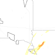
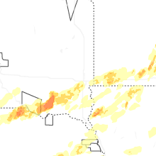

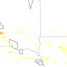
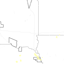
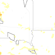
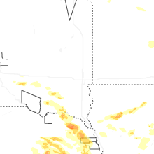
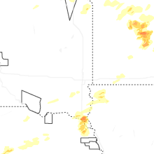


Connect with Interactive Hail Maps