

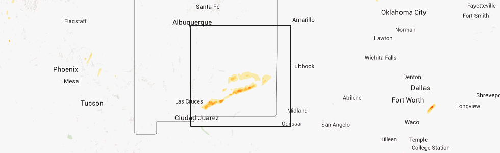
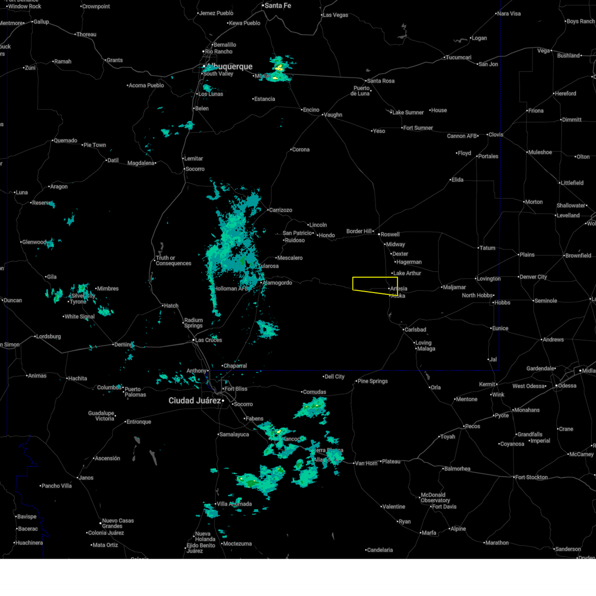
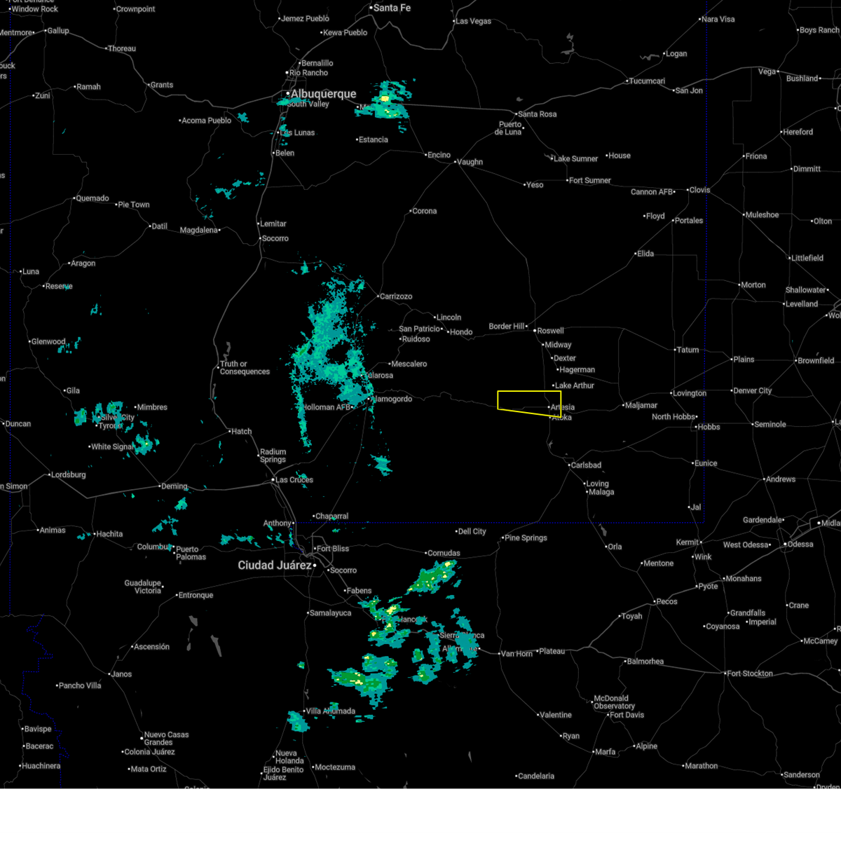
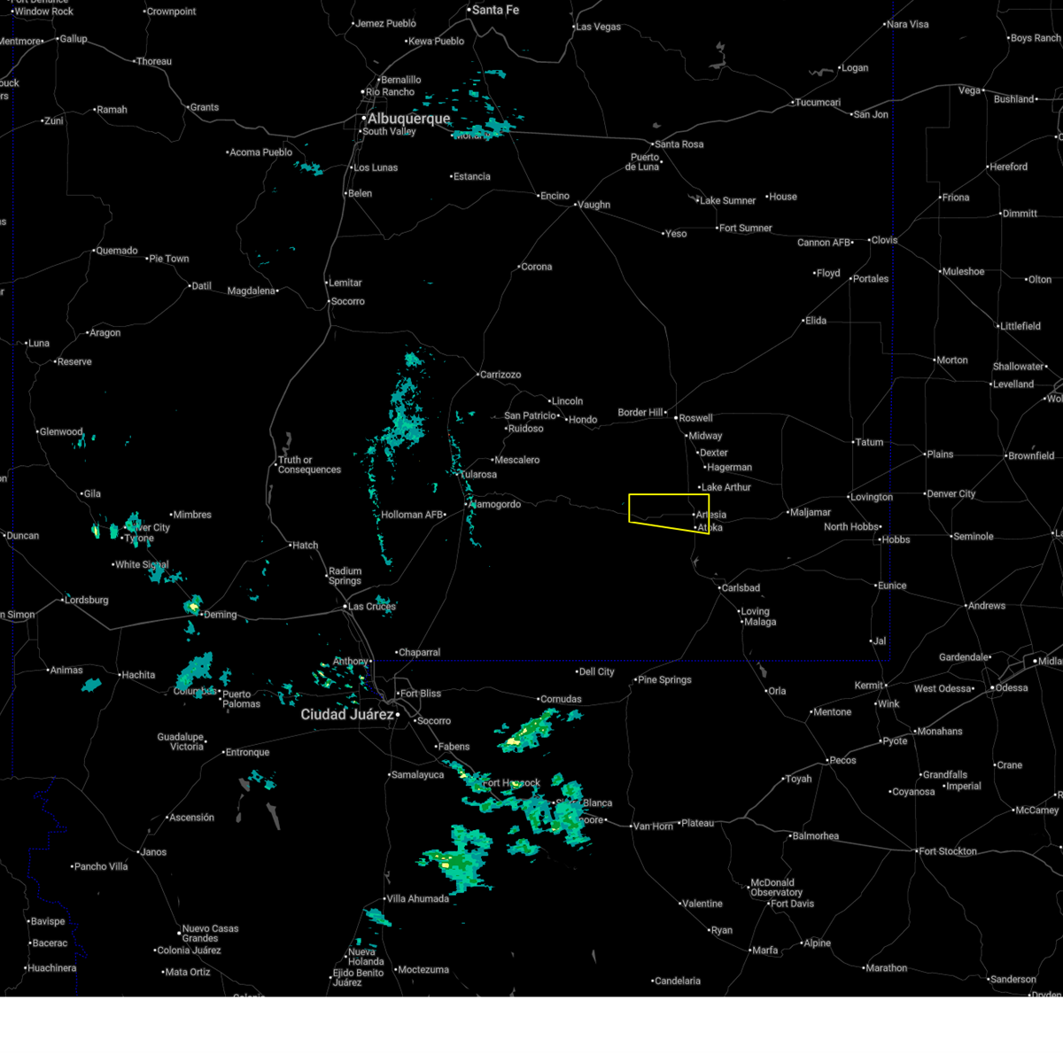
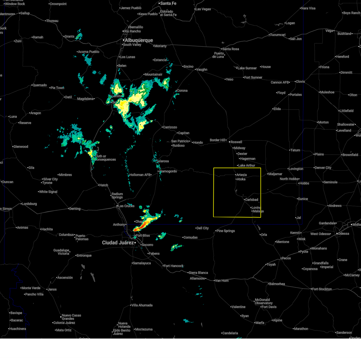
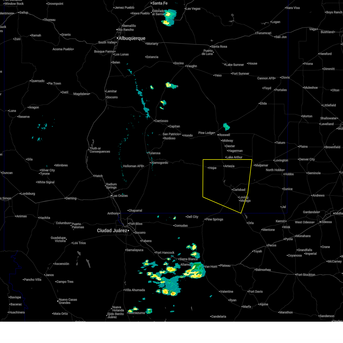
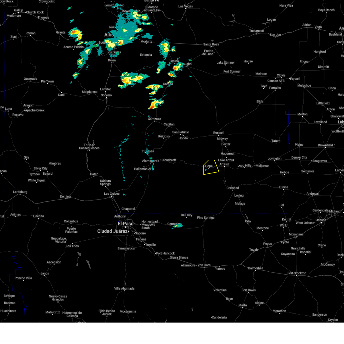
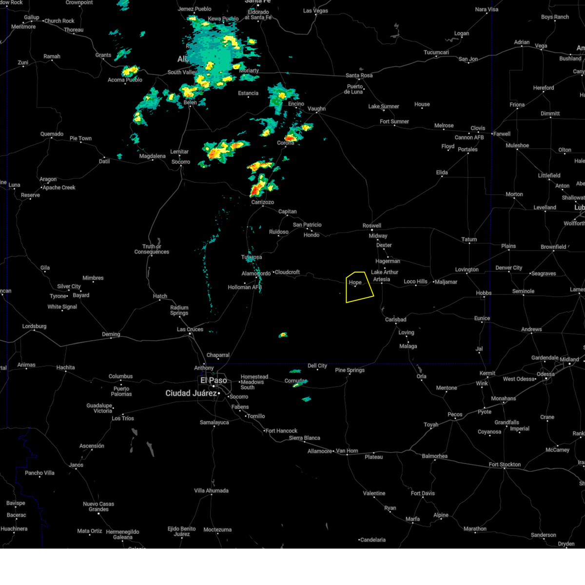
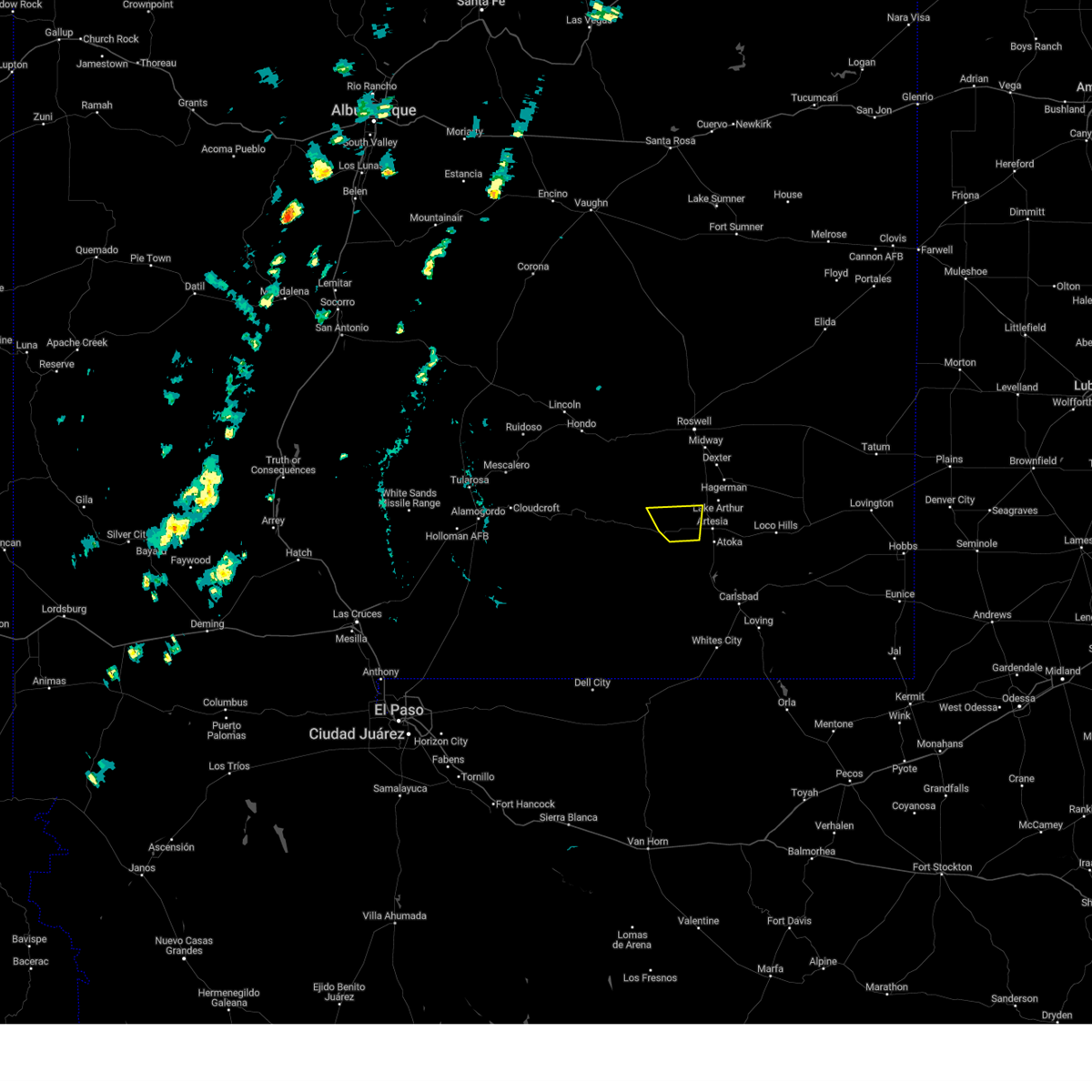
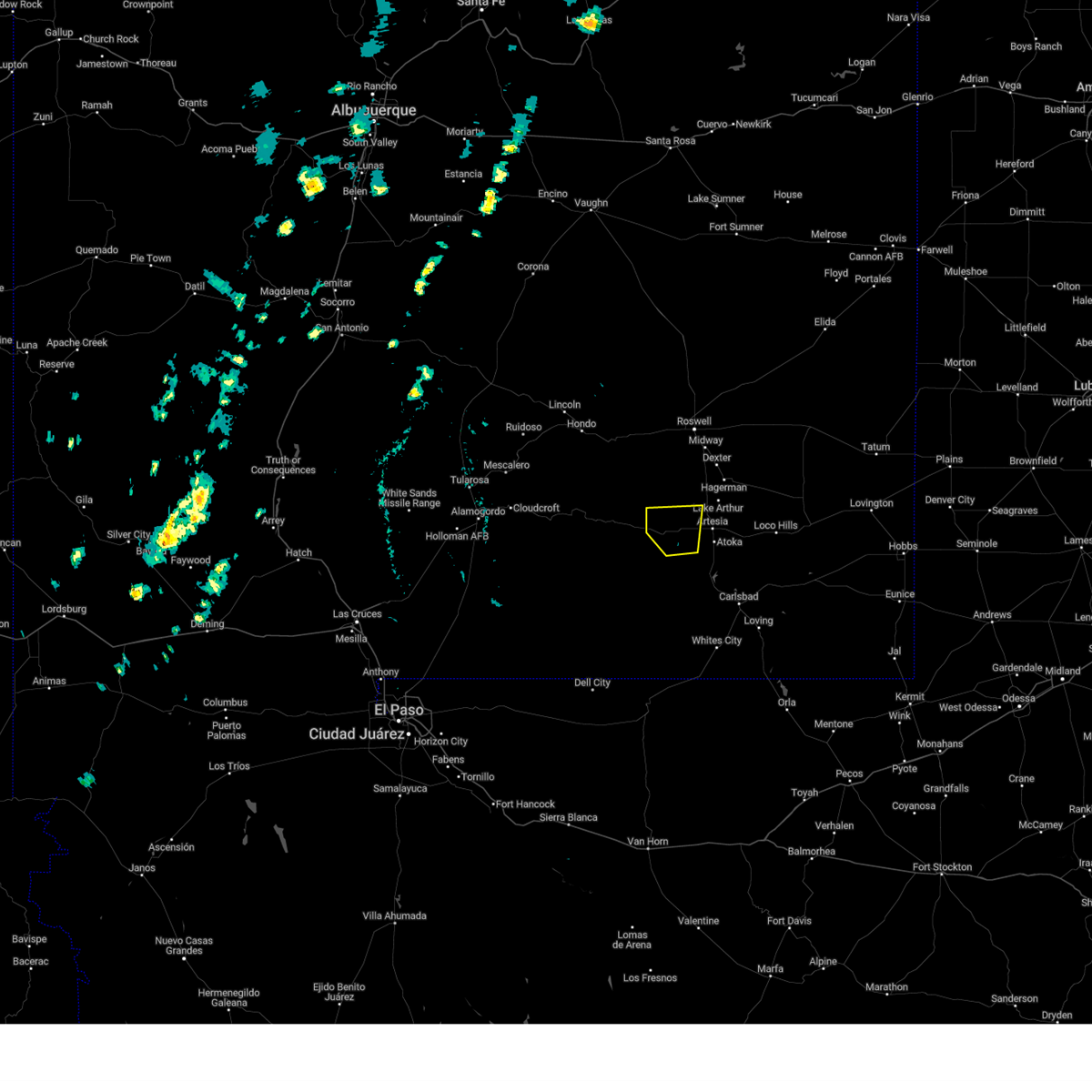
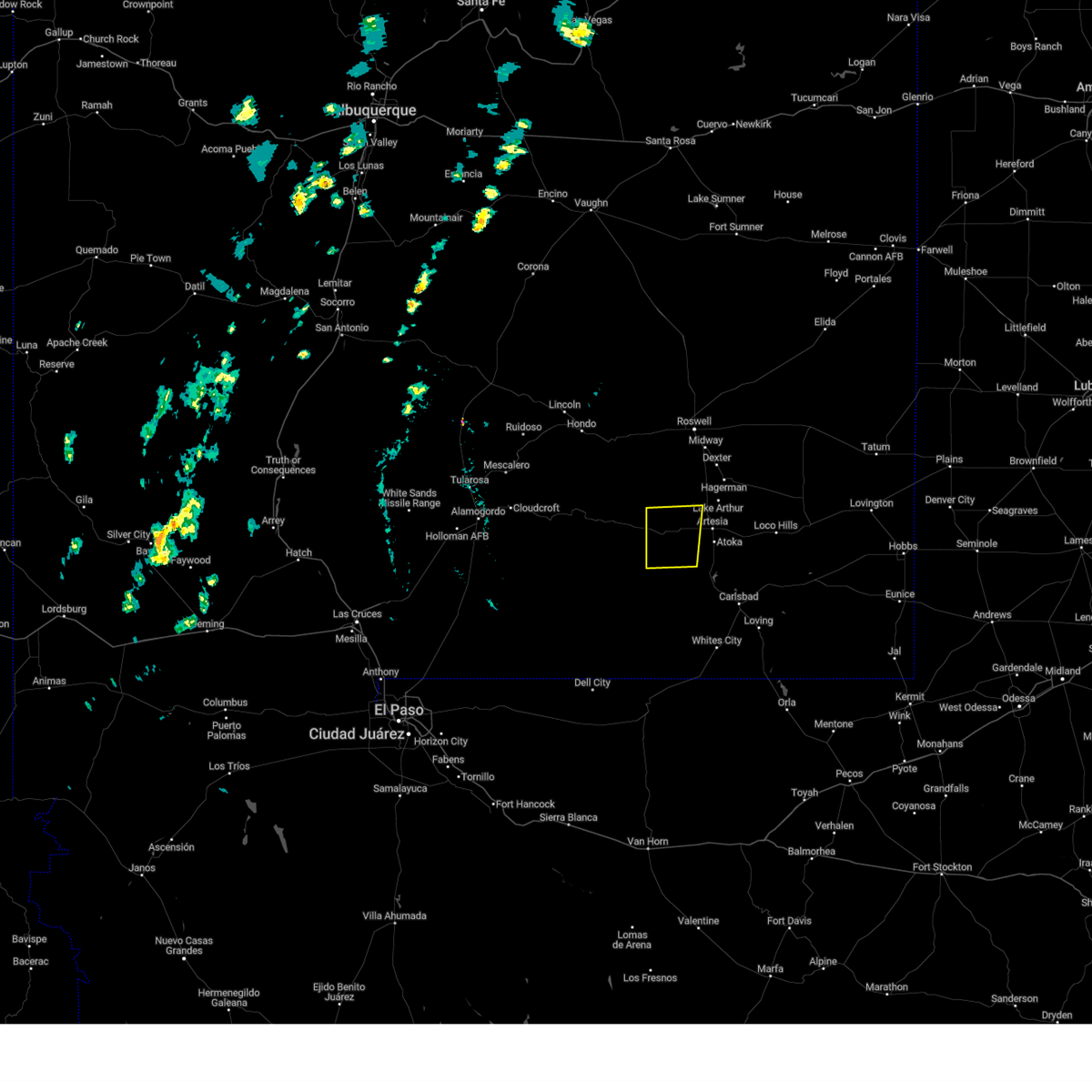
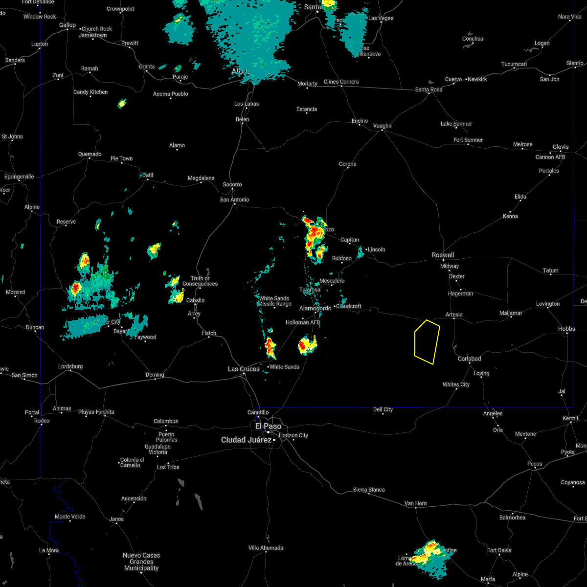
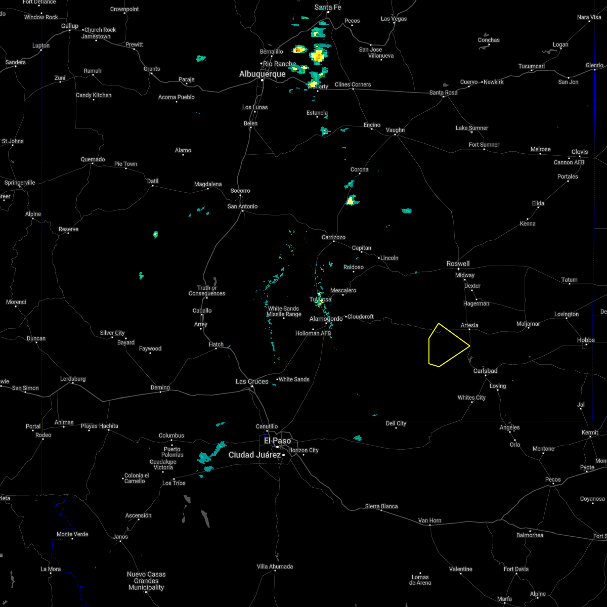
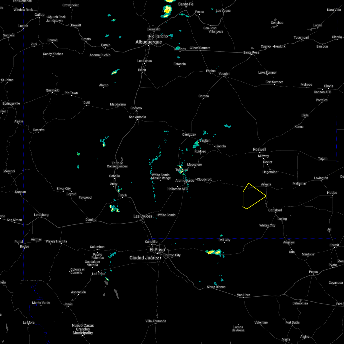
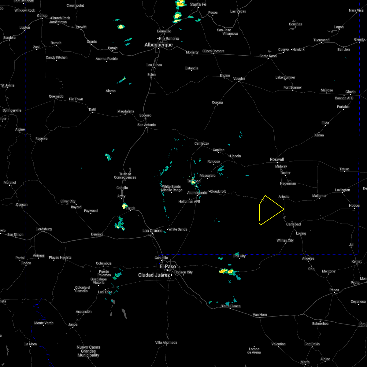
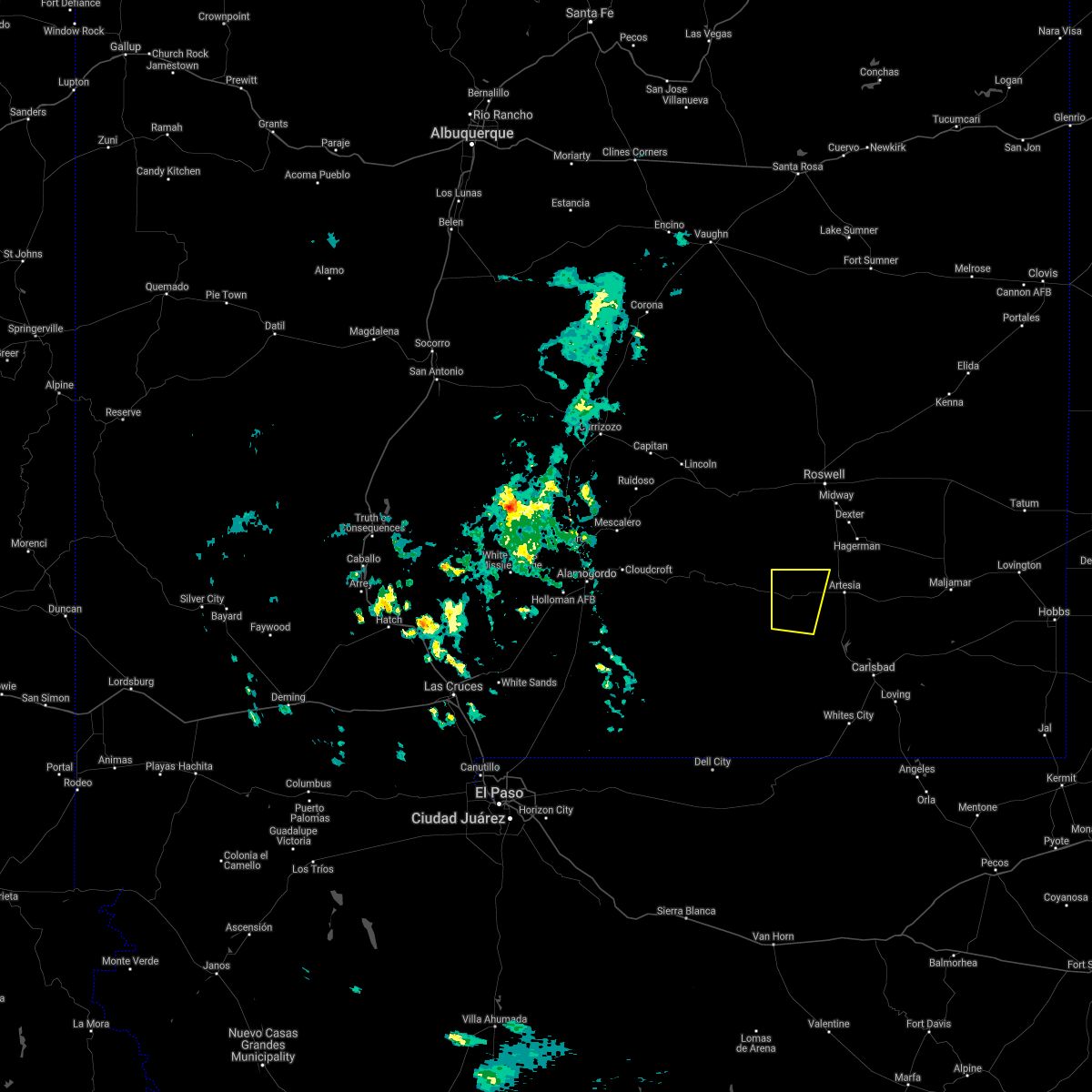
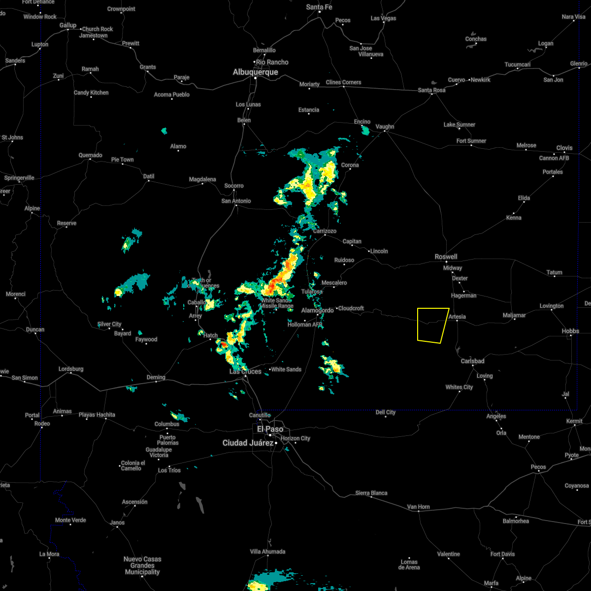
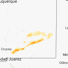
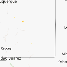
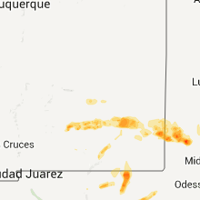
Hail Map for Hope, NM
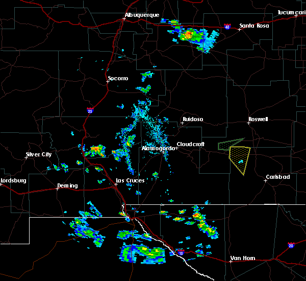
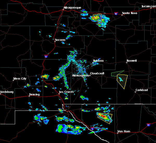
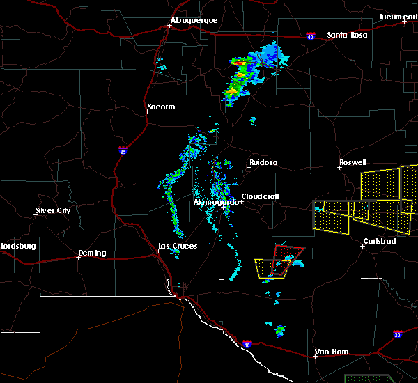
The Hope, NM area has had 10 reports of on-the-ground hail by trained spotters, and has been under severe weather warnings 6 times during the past 12 months. Doppler radar has detected hail at or near Hope, NM on 9 occasions.
| Name: | Hope, NM |
| Where Located: | 41.7 miles SSW of Roswell, NM |
| Map: | Google Map for Hope, NM |
| Population: | 105 |
| Housing Units: | 64 |
| More Info: | Search Google for Hope, NM |
5
The Top Recent Hail Date for Hope, NM is Thursday, October 11, 2012 (1st out of 9)
Hail and Wind Damage Spotted near Hope, NM
| Date / Time | Report Details |
|---|---|
| 6/24/2026 9:35 PM MDT |
 The storm which prompted the warning has weakened below severe limits, and no longer poses an immediate threat to life or property. therefore, the warning will be allowed to expire. The storm which prompted the warning has weakened below severe limits, and no longer poses an immediate threat to life or property. therefore, the warning will be allowed to expire.
|
| 6/24/2026 9:24 PM MDT |
 At 923 pm mdt, a severe thunderstorm was located near artesia, moving east at 15 mph (radar indicated). Hazards include 60 mph wind gusts and nickel size hail. Expect damage to roofs, siding, and trees. Locations impacted include, artesia and artesia municipal airport. At 923 pm mdt, a severe thunderstorm was located near artesia, moving east at 15 mph (radar indicated). Hazards include 60 mph wind gusts and nickel size hail. Expect damage to roofs, siding, and trees. Locations impacted include, artesia and artesia municipal airport.
|
| 6/24/2026 9:03 PM MDT |
 Svrmaf the national weather service in midland has issued a * severe thunderstorm warning for, northwestern eddy county in southeastern new mexico, * until 945 pm mdt. * at 902 pm mdt, a severe thunderstorm was located 8 miles northeast of hope, moving east at 15 mph (radar indicated). Hazards include 60 mph wind gusts and quarter size hail. Hail damage to vehicles is expected. Expect wind damage to roofs, siding, and trees. Svrmaf the national weather service in midland has issued a * severe thunderstorm warning for, northwestern eddy county in southeastern new mexico, * until 945 pm mdt. * at 902 pm mdt, a severe thunderstorm was located 8 miles northeast of hope, moving east at 15 mph (radar indicated). Hazards include 60 mph wind gusts and quarter size hail. Hail damage to vehicles is expected. Expect wind damage to roofs, siding, and trees.
|
| 6/2/2026 7:12 PM MDT |
 Svrmaf the national weather service in midland has issued a * severe thunderstorm warning for, eddy county in southeastern new mexico, * until 800 pm mdt. * at 712 pm mdt, a severe thunderstorm was located over brantley lake state park, or 12 miles northwest of carlsbad, moving northeast at 25 mph (radar indicated). Hazards include 60 mph wind gusts and quarter size hail. Hail damage to vehicles is expected. Expect wind damage to roofs, siding, and trees. Svrmaf the national weather service in midland has issued a * severe thunderstorm warning for, eddy county in southeastern new mexico, * until 800 pm mdt. * at 712 pm mdt, a severe thunderstorm was located over brantley lake state park, or 12 miles northwest of carlsbad, moving northeast at 25 mph (radar indicated). Hazards include 60 mph wind gusts and quarter size hail. Hail damage to vehicles is expected. Expect wind damage to roofs, siding, and trees.
|
| 9/13/2025 8:03 PM MDT | the severe thunderstorm warning has been cancelled and is no longer in effect |
| 9/13/2025 7:44 PM MDT | Svrmaf the national weather service in midland has issued a * severe thunderstorm warning for, northwestern eddy county in southeastern new mexico, * until 845 pm mdt. * at 743 pm mdt, a severe thunderstorm was located near hope, moving northeast at 25 mph (radar indicated). Hazards include quarter size hail. damage to vehicles is expected |
| 6/15/2025 3:25 PM MDT |
 Svrmaf the national weather service in midland has issued a * severe thunderstorm warning for, eddy county in southeastern new mexico, * until 430 pm mdt. * at 324 pm mdt, severe thunderstorms were located along a line extending from near artesia to 8 miles southwest of seven rivers airport to 13 miles north of carlsbad caverns national park, moving east at 30 mph (radar indicated). Hazards include 70 mph wind gusts and quarter size hail. Hail damage to vehicles is expected. expect considerable tree damage. Wind damage is also likely to mobile homes, roofs, and outbuildings. Svrmaf the national weather service in midland has issued a * severe thunderstorm warning for, eddy county in southeastern new mexico, * until 430 pm mdt. * at 324 pm mdt, severe thunderstorms were located along a line extending from near artesia to 8 miles southwest of seven rivers airport to 13 miles north of carlsbad caverns national park, moving east at 30 mph (radar indicated). Hazards include 70 mph wind gusts and quarter size hail. Hail damage to vehicles is expected. expect considerable tree damage. Wind damage is also likely to mobile homes, roofs, and outbuildings.
|
| 5/4/2025 5:11 PM MDT | Quarter sized hail reported 2.3 miles WSW of Hope, NM, report from mping: quarter (1.00 in.). |
| 5/4/2025 4:50 PM MDT |
 At 450 pm mdt, a severe thunderstorm was located near hope, moving northeast at 30 mph (radar indicated). Hazards include ping pong ball size hail and 60 mph wind gusts. People and animals outdoors will be injured. expect hail damage to roofs, siding, windows, and vehicles. expect wind damage to roofs, siding, and trees. Locations impacted include, hope. At 450 pm mdt, a severe thunderstorm was located near hope, moving northeast at 30 mph (radar indicated). Hazards include ping pong ball size hail and 60 mph wind gusts. People and animals outdoors will be injured. expect hail damage to roofs, siding, windows, and vehicles. expect wind damage to roofs, siding, and trees. Locations impacted include, hope.
|
| 5/4/2025 4:33 PM MDT |
 Svrmaf the national weather service in midland has issued a * severe thunderstorm warning for, northwestern eddy county in southeastern new mexico, * until 515 pm mdt. * at 433 pm mdt, a severe thunderstorm was located 11 miles southwest of hope, moving east at 25 mph (radar indicated). Hazards include 60 mph wind gusts and quarter size hail. Hail damage to vehicles is expected. Expect wind damage to roofs, siding, and trees. Svrmaf the national weather service in midland has issued a * severe thunderstorm warning for, northwestern eddy county in southeastern new mexico, * until 515 pm mdt. * at 433 pm mdt, a severe thunderstorm was located 11 miles southwest of hope, moving east at 25 mph (radar indicated). Hazards include 60 mph wind gusts and quarter size hail. Hail damage to vehicles is expected. Expect wind damage to roofs, siding, and trees.
|
| 7/10/2024 4:36 PM MDT | Mesonet station dunn5 dunken 2 ne (dunken in chaves county NM, 25.8 miles E of Hope, NM |
| 6/12/2024 4:45 PM MDT | Ping Pong Ball sized hail reported 0.3 miles SE of Hope, NM |
| 6/1/2024 6:36 PM MDT | Mesonet station dunn5 dunken 2 ne (dunken in chaves county NM, 25.8 miles E of Hope, NM |
| 10/2/2023 1:51 PM MDT |
 At 151 pm mdt, a severe thunderstorm was located near hope, moving north at 35 mph (radar indicated). Hazards include 60 mph wind gusts and half dollar size hail. Hail damage to vehicles is expected. expect wind damage to roofs, siding, and trees. locations impacted include, hope. hail threat, radar indicated max hail size, 1. 25 in wind threat, radar indicated max wind gust, 60 mph. At 151 pm mdt, a severe thunderstorm was located near hope, moving north at 35 mph (radar indicated). Hazards include 60 mph wind gusts and half dollar size hail. Hail damage to vehicles is expected. expect wind damage to roofs, siding, and trees. locations impacted include, hope. hail threat, radar indicated max hail size, 1. 25 in wind threat, radar indicated max wind gust, 60 mph.
|
| 10/2/2023 1:44 PM MDT |
 At 144 pm mdt, a severe thunderstorm was located near hope, moving north at 35 mph (radar indicated). Hazards include golf ball size hail and 70 mph wind gusts. People and animals outdoors will be injured. expect hail damage to roofs, siding, windows, and vehicles. expect considerable tree damage. wind damage is also likely to mobile homes, roofs, and outbuildings. locations impacted include, hope. thunderstorm damage threat, considerable hail threat, radar indicated max hail size, 1. 75 in wind threat, radar indicated max wind gust, 70 mph. At 144 pm mdt, a severe thunderstorm was located near hope, moving north at 35 mph (radar indicated). Hazards include golf ball size hail and 70 mph wind gusts. People and animals outdoors will be injured. expect hail damage to roofs, siding, windows, and vehicles. expect considerable tree damage. wind damage is also likely to mobile homes, roofs, and outbuildings. locations impacted include, hope. thunderstorm damage threat, considerable hail threat, radar indicated max hail size, 1. 75 in wind threat, radar indicated max wind gust, 70 mph.
|
| 10/2/2023 1:33 PM MDT |
 At 133 pm mdt, a severe thunderstorm was located 7 miles southeast of hope, moving north at 35 mph (radar indicated). Hazards include golf ball size hail and 70 mph wind gusts. People and animals outdoors will be injured. expect hail damage to roofs, siding, windows, and vehicles. expect considerable tree damage. Wind damage is also likely to mobile homes, roofs, and outbuildings. At 133 pm mdt, a severe thunderstorm was located 7 miles southeast of hope, moving north at 35 mph (radar indicated). Hazards include golf ball size hail and 70 mph wind gusts. People and animals outdoors will be injured. expect hail damage to roofs, siding, windows, and vehicles. expect considerable tree damage. Wind damage is also likely to mobile homes, roofs, and outbuildings.
|
| 6/3/2022 2:55 PM MDT | Quarter sized hail reported 18.8 miles ESE of Hope, NM, quarter size hail along u.s. 82. |
| 7/11/2021 4:31 PM MDT |
 At 430 pm mdt, a severe thunderstorm was located near hope, moving southwest at 20 mph (radar indicated). Hazards include 60 mph wind gusts and quarter size hail. Hail damage to vehicles is expected. Expect wind damage to roofs, siding, and trees. At 430 pm mdt, a severe thunderstorm was located near hope, moving southwest at 20 mph (radar indicated). Hazards include 60 mph wind gusts and quarter size hail. Hail damage to vehicles is expected. Expect wind damage to roofs, siding, and trees.
|
| 7/11/2021 4:02 PM MDT |
 At 402 pm mdt, a severe thunderstorm was located near hope, moving south at 25 mph (radar indicated). Hazards include 60 mph wind gusts and half dollar size hail. Hail damage to vehicles is expected. expect wind damage to roofs, siding, and trees. Locations impacted include, artesia, hope and artesia municipal airport. At 402 pm mdt, a severe thunderstorm was located near hope, moving south at 25 mph (radar indicated). Hazards include 60 mph wind gusts and half dollar size hail. Hail damage to vehicles is expected. expect wind damage to roofs, siding, and trees. Locations impacted include, artesia, hope and artesia municipal airport.
|
| 7/11/2021 3:28 PM MDT |
 At 328 pm mdt, a severe thunderstorm was located 16 miles north of hope, moving southwest at 25 mph (radar indicated). Hazards include two inch hail and 60 mph wind gusts. People and animals outdoors will be injured. expect hail damage to roofs, siding, windows, and vehicles. Expect wind damage to roofs, siding, and trees. At 328 pm mdt, a severe thunderstorm was located 16 miles north of hope, moving southwest at 25 mph (radar indicated). Hazards include two inch hail and 60 mph wind gusts. People and animals outdoors will be injured. expect hail damage to roofs, siding, windows, and vehicles. Expect wind damage to roofs, siding, and trees.
|
| 5/22/2021 4:02 PM MDT |
 At 402 pm mdt, a severe thunderstorm was located 16 miles south of hope, moving northeast at 10 mph (radar indicated). Hazards include 60 mph wind gusts and half dollar size hail. Hail damage to vehicles is expected. expect wind damage to roofs, siding, and trees. Locations impacted include, hope. At 402 pm mdt, a severe thunderstorm was located 16 miles south of hope, moving northeast at 10 mph (radar indicated). Hazards include 60 mph wind gusts and half dollar size hail. Hail damage to vehicles is expected. expect wind damage to roofs, siding, and trees. Locations impacted include, hope.
|
| 5/22/2021 3:31 PM MDT |
 At 331 pm mdt, a severe thunderstorm was located 16 miles south of hope, moving northeast at 15 mph (radar indicated). Hazards include golf ball size hail and 60 mph wind gusts. People and animals outdoors will be injured. expect hail damage to roofs, siding, windows, and vehicles. expect wind damage to roofs, siding, and trees. Locations impacted include, hope. At 331 pm mdt, a severe thunderstorm was located 16 miles south of hope, moving northeast at 15 mph (radar indicated). Hazards include golf ball size hail and 60 mph wind gusts. People and animals outdoors will be injured. expect hail damage to roofs, siding, windows, and vehicles. expect wind damage to roofs, siding, and trees. Locations impacted include, hope.
|
| 5/22/2021 3:21 PM MDT |
 At 320 pm mdt, a severe thunderstorm was located 15 miles north of lincoln national forest, or 19 miles south of hope, moving northeast at 15 mph (radar indicated). Hazards include 60 mph wind gusts and quarter size hail. Hail damage to vehicles is expected. Expect wind damage to roofs, siding, and trees. At 320 pm mdt, a severe thunderstorm was located 15 miles north of lincoln national forest, or 19 miles south of hope, moving northeast at 15 mph (radar indicated). Hazards include 60 mph wind gusts and quarter size hail. Hail damage to vehicles is expected. Expect wind damage to roofs, siding, and trees.
|
| 5/14/2021 4:04 PM MDT |
 At 404 pm mdt, a severe thunderstorm was located over hope, and is nearly stationary (radar indicated). Hazards include 60 mph wind gusts and quarter size hail. Hail damage to vehicles is expected. expect wind damage to roofs, siding, and trees. Locations impacted include, hope. At 404 pm mdt, a severe thunderstorm was located over hope, and is nearly stationary (radar indicated). Hazards include 60 mph wind gusts and quarter size hail. Hail damage to vehicles is expected. expect wind damage to roofs, siding, and trees. Locations impacted include, hope.
|
| 5/14/2021 3:46 PM MDT |
 At 346 pm mdt, a severe thunderstorm was located over hope, and is nearly stationary (radar indicated). Hazards include 60 mph wind gusts and half dollar size hail. Hail damage to vehicles is expected. Expect wind damage to roofs, siding, and trees. At 346 pm mdt, a severe thunderstorm was located over hope, and is nearly stationary (radar indicated). Hazards include 60 mph wind gusts and half dollar size hail. Hail damage to vehicles is expected. Expect wind damage to roofs, siding, and trees.
|
| 7/14/2020 5:36 PM MDT | Dunken raw in chaves county NM, 25.8 miles E of Hope, NM |
| 6/23/2020 8:17 PM MDT |
 At 815 pm mdt, a line of severe thunderstorms was located from 10 miles southeast of caprock to near artesia. the line of storms were moving to the south at 30 mph (radar indicated). Hazards include 60 mph wind gusts and quarter size hail. Hail damage to vehicles is expected. expect wind damage to roofs, siding, and trees. Locations impacted include, hobbs, artesia, lovington, tatum, hope, humble city, maljamar, crossroads, seven rivers airport, mcdonald, brantley lake state park, lea county zip franklin memorial airport, loco hills, artesia municipal airport, dayton, gladiola, tatum airport, lakewood, knowles and atoka. At 815 pm mdt, a line of severe thunderstorms was located from 10 miles southeast of caprock to near artesia. the line of storms were moving to the south at 30 mph (radar indicated). Hazards include 60 mph wind gusts and quarter size hail. Hail damage to vehicles is expected. expect wind damage to roofs, siding, and trees. Locations impacted include, hobbs, artesia, lovington, tatum, hope, humble city, maljamar, crossroads, seven rivers airport, mcdonald, brantley lake state park, lea county zip franklin memorial airport, loco hills, artesia municipal airport, dayton, gladiola, tatum airport, lakewood, knowles and atoka.
|
| 6/23/2020 7:44 PM MDT |
 At 743 pm mdt, a line of severe thunderstorm was located from near caprock to artesia. the line of storms were moving southeast at 30 mph (radar indicated). Hazards include 60 mph wind gusts and quarter size hail. Hail damage to vehicles is expected. Expect wind damage to roofs, siding, and trees. At 743 pm mdt, a line of severe thunderstorm was located from near caprock to artesia. the line of storms were moving southeast at 30 mph (radar indicated). Hazards include 60 mph wind gusts and quarter size hail. Hail damage to vehicles is expected. Expect wind damage to roofs, siding, and trees.
|
| 6/13/2019 6:30 PM MDT |
 At 629 pm mdt, a severe thunderstorm was located 8 miles southeast of hope, moving southeast at 25 mph (radar indicated). Hazards include 60 mph wind gusts and quarter size hail. Hail damage to vehicles is expected. expect wind damage to roofs, siding, and trees. Locations impacted include, hope. At 629 pm mdt, a severe thunderstorm was located 8 miles southeast of hope, moving southeast at 25 mph (radar indicated). Hazards include 60 mph wind gusts and quarter size hail. Hail damage to vehicles is expected. expect wind damage to roofs, siding, and trees. Locations impacted include, hope.
|
| 6/13/2019 6:10 PM MDT | Golf Ball sized hail reported 0.3 miles SE of Hope, NM |
| 6/13/2019 6:10 PM MDT |
 At 610 pm mdt, a severe thunderstorm was located near hope, moving southeast at 30 mph (public). Hazards include golf ball size hail and 60 mph wind gusts. People and animals outdoors will be injured. expect hail damage to roofs, siding, windows, and vehicles. Expect wind damage to roofs, siding, and trees. At 610 pm mdt, a severe thunderstorm was located near hope, moving southeast at 30 mph (public). Hazards include golf ball size hail and 60 mph wind gusts. People and animals outdoors will be injured. expect hail damage to roofs, siding, windows, and vehicles. Expect wind damage to roofs, siding, and trees.
|
| 6/4/2019 3:00 PM MDT | Hen Egg sized hail reported 27.5 miles E of Hope, NM |
| 6/4/2019 2:54 PM MDT | Ping Pong Ball sized hail reported 22.8 miles ESE of Hope, NM |
| 6/4/2019 2:42 PM MDT | Half Dollar sized hail reported 27.5 miles E of Hope, NM, hail is reported to be covering highway 82. |
| 6/2/2019 7:15 PM MDT | Half Dollar sized hail reported 0.3 miles SE of Hope, NM |
| 6/2/2019 6:57 PM MDT |
 At 655 pm mdt, a severe thunderstorm was located 7 miles northwest of hope, moving east at 25 mph (radar indicated). Hazards include 60 mph wind gusts and half dollar size hail. Hail damage to vehicles is expected. Expect wind damage to roofs, siding, and trees. At 655 pm mdt, a severe thunderstorm was located 7 miles northwest of hope, moving east at 25 mph (radar indicated). Hazards include 60 mph wind gusts and half dollar size hail. Hail damage to vehicles is expected. Expect wind damage to roofs, siding, and trees.
|
| 6/2/2019 6:03 PM MDT |
 At 603 pm mdt, a severe thunderstorm was located 10 miles northeast of hope, moving east at 25 mph (radar indicated). Hazards include 60 mph wind gusts and quarter size hail. Hail damage to vehicles is expected. Expect wind damage to roofs, siding, and trees. At 603 pm mdt, a severe thunderstorm was located 10 miles northeast of hope, moving east at 25 mph (radar indicated). Hazards include 60 mph wind gusts and quarter size hail. Hail damage to vehicles is expected. Expect wind damage to roofs, siding, and trees.
|
| 6/3/2018 8:30 PM MDT |
 At 930 pm cdt/830 pm mdt/, severe thunderstorms were located along a line extending from 10 miles southeast of hagerman to 20 miles east of avalon to 15 miles northeast of red bluff reservoir to 13 miles south of orla, moving northeast at 40 mph (radar indicated). Hazards include 70 mph wind gusts and ping pong ball size hail. People and animals outdoors will be injured. expect hail damage to roofs, siding, windows, and vehicles. expect considerable tree damage. Wind damage is also likely to mobile homes, roofs, and outbuildings. At 930 pm cdt/830 pm mdt/, severe thunderstorms were located along a line extending from 10 miles southeast of hagerman to 20 miles east of avalon to 15 miles northeast of red bluff reservoir to 13 miles south of orla, moving northeast at 40 mph (radar indicated). Hazards include 70 mph wind gusts and ping pong ball size hail. People and animals outdoors will be injured. expect hail damage to roofs, siding, windows, and vehicles. expect considerable tree damage. Wind damage is also likely to mobile homes, roofs, and outbuildings.
|
| 6/3/2018 8:10 PM MDT |
 At 910 pm cdt/810 pm mdt/, severe thunderstorms were located along a line extending from near artesia to near carlsbad north to near red bluff reservoir to 28 miles southwest of orla, moving northeast at 35 mph (radar indicated). Hazards include 70 mph wind gusts and ping pong ball size hail. People and animals outdoors will be injured. expect hail damage to roofs, siding, windows, and vehicles. expect considerable tree damage. Wind damage is also likely to mobile homes, roofs, and outbuildings. At 910 pm cdt/810 pm mdt/, severe thunderstorms were located along a line extending from near artesia to near carlsbad north to near red bluff reservoir to 28 miles southwest of orla, moving northeast at 35 mph (radar indicated). Hazards include 70 mph wind gusts and ping pong ball size hail. People and animals outdoors will be injured. expect hail damage to roofs, siding, windows, and vehicles. expect considerable tree damage. Wind damage is also likely to mobile homes, roofs, and outbuildings.
|
| 5/23/2018 5:50 PM MDT |
 The severe thunderstorm warning for northwestern eddy county will expire at 600 pm mdt, the storm which prompted the warning has weakened below severe limits, and no longer poses an immediate threat to life or property. therefore, the warning will be allowed to expire. a severe thunderstorm watch remains in effect until 900 pm mdt for southeastern new mexico. The severe thunderstorm warning for northwestern eddy county will expire at 600 pm mdt, the storm which prompted the warning has weakened below severe limits, and no longer poses an immediate threat to life or property. therefore, the warning will be allowed to expire. a severe thunderstorm watch remains in effect until 900 pm mdt for southeastern new mexico.
|
| 5/23/2018 5:36 PM MDT |
 At 536 pm mdt, a severe thunderstorm was located 7 miles northeast of hope, moving northeast at 10 mph (radar indicated). Hazards include 60 mph wind gusts and quarter size hail. Hail damage to vehicles is expected. expect wind damage to roofs, siding, and trees. Locations impacted include, artesia, hope, atoka, artesia municipal airport and dayton. At 536 pm mdt, a severe thunderstorm was located 7 miles northeast of hope, moving northeast at 10 mph (radar indicated). Hazards include 60 mph wind gusts and quarter size hail. Hail damage to vehicles is expected. expect wind damage to roofs, siding, and trees. Locations impacted include, artesia, hope, atoka, artesia municipal airport and dayton.
|
| 5/23/2018 5:20 PM MDT |
 At 519 pm mdt, a severe thunderstorm was located 9 miles west of artesia, moving east at 35 mph (radar indicated). Hazards include two inch hail and 70 mph wind gusts. People and animals outdoors will be injured. expect hail damage to roofs, siding, windows, and vehicles. expect considerable tree damage. wind damage is also likely to mobile homes, roofs, and outbuildings. Locations impacted include, artesia, hope, atoka, artesia municipal airport and dayton. At 519 pm mdt, a severe thunderstorm was located 9 miles west of artesia, moving east at 35 mph (radar indicated). Hazards include two inch hail and 70 mph wind gusts. People and animals outdoors will be injured. expect hail damage to roofs, siding, windows, and vehicles. expect considerable tree damage. wind damage is also likely to mobile homes, roofs, and outbuildings. Locations impacted include, artesia, hope, atoka, artesia municipal airport and dayton.
|
| 5/23/2018 5:05 PM MDT |
 At 505 pm mdt, a severe thunderstorm was located 7 miles northeast of hope, moving east at 20 mph (radar indicated). Hazards include 60 mph wind gusts and half dollar size hail. Hail damage to vehicles is expected. Expect wind damage to roofs, siding, and trees. At 505 pm mdt, a severe thunderstorm was located 7 miles northeast of hope, moving east at 20 mph (radar indicated). Hazards include 60 mph wind gusts and half dollar size hail. Hail damage to vehicles is expected. Expect wind damage to roofs, siding, and trees.
|
| 5/23/2018 3:53 PM MDT |
 At 353 pm mdt, a severe thunderstorm was located near hope, moving northeast at 15 mph (radar indicated). Hazards include 60 mph wind gusts and quarter size hail. Hail damage to vehicles is expected. expect wind damage to roofs, siding, and trees. Locations impacted include, hope. At 353 pm mdt, a severe thunderstorm was located near hope, moving northeast at 15 mph (radar indicated). Hazards include 60 mph wind gusts and quarter size hail. Hail damage to vehicles is expected. expect wind damage to roofs, siding, and trees. Locations impacted include, hope.
|
| 5/23/2018 3:28 PM MDT |
 The national weather service in midland has issued a * severe thunderstorm warning for. northwestern eddy county in southeastern new mexico. until 400 pm mdt. At 328 pm mdt, a severe thunderstorm was located near hope, moving north at 20 mph. The national weather service in midland has issued a * severe thunderstorm warning for. northwestern eddy county in southeastern new mexico. until 400 pm mdt. At 328 pm mdt, a severe thunderstorm was located near hope, moving north at 20 mph.
|
| 5/8/2017 7:03 PM MDT |
 At 702 pm mdt, a severe thunderstorm was located 11 miles northeast of hope, moving north at 30 mph (radar indicated). Hazards include 60 mph wind gusts and quarter size hail. Hail damage to vehicles is expected. expect wind damage to roofs, siding, and trees. Locations impacted include, open country of extreme northwestern eddy county. At 702 pm mdt, a severe thunderstorm was located 11 miles northeast of hope, moving north at 30 mph (radar indicated). Hazards include 60 mph wind gusts and quarter size hail. Hail damage to vehicles is expected. expect wind damage to roofs, siding, and trees. Locations impacted include, open country of extreme northwestern eddy county.
|
| 5/8/2017 6:43 PM MDT |
 At 642 pm mdt, a severe thunderstorm was located 7 miles east of hope, moving north at 25 mph (radar indicated). Hazards include 60 mph wind gusts and quarter size hail. Hail damage to vehicles is expected. Expect wind damage to roofs, siding, and trees. At 642 pm mdt, a severe thunderstorm was located 7 miles east of hope, moving north at 25 mph (radar indicated). Hazards include 60 mph wind gusts and quarter size hail. Hail damage to vehicles is expected. Expect wind damage to roofs, siding, and trees.
|
| 9/17/2016 3:24 PM MDT |
 At 323 pm mdt, a severe thunderstorm was located 13 miles north of hope, moving southeast at 15 mph (trained weather spotters indicated a rotating wall cloud). Hazards include ping pong ball size hail and 60 mph wind gusts. People and animals outdoors will be injured. expect hail damage to roofs, siding, windows, and vehicles. Expect wind damage to roofs, siding, and trees. At 323 pm mdt, a severe thunderstorm was located 13 miles north of hope, moving southeast at 15 mph (trained weather spotters indicated a rotating wall cloud). Hazards include ping pong ball size hail and 60 mph wind gusts. People and animals outdoors will be injured. expect hail damage to roofs, siding, windows, and vehicles. Expect wind damage to roofs, siding, and trees.
|
| 9/15/2016 7:24 PM MDT |
 At 723 pm mdt, a severe thunderstorm was located near hope, moving east at 20 mph (radar indicated). Hazards include 60 mph wind gusts and quarter size hail. Hail damage to vehicles is expected. expect wind damage to roofs, siding, and trees. Locations impacted include, hope and artesia municipal airport. At 723 pm mdt, a severe thunderstorm was located near hope, moving east at 20 mph (radar indicated). Hazards include 60 mph wind gusts and quarter size hail. Hail damage to vehicles is expected. expect wind damage to roofs, siding, and trees. Locations impacted include, hope and artesia municipal airport.
|
| 9/15/2016 6:53 PM MDT |
 At 652 pm mdt, a severe thunderstorm was located 7 miles west of hope, moving east at 20 mph (radar indicated). Hazards include 60 mph wind gusts and half dollar size hail. Hail damage to vehicles is expected. Expect wind damage to roofs, siding, and trees. At 652 pm mdt, a severe thunderstorm was located 7 miles west of hope, moving east at 20 mph (radar indicated). Hazards include 60 mph wind gusts and half dollar size hail. Hail damage to vehicles is expected. Expect wind damage to roofs, siding, and trees.
|
| 9/15/2016 4:34 PM MDT |
 At 433 pm mdt, a severe thunderstorm was located 3 miles southeast of hope, moving southeast at 10 mph (radar indicated). Hazards include golf ball size hail and 70 mph wind gusts. People and animals outdoors will be injured. expect hail damage to roofs, siding, windows, and vehicles. expect considerable tree damage. wind damage is also likely to mobile homes, roofs, and outbuildings. Locations impacted include, artesia, hope, artesia municipal airport, atoka and dayton. At 433 pm mdt, a severe thunderstorm was located 3 miles southeast of hope, moving southeast at 10 mph (radar indicated). Hazards include golf ball size hail and 70 mph wind gusts. People and animals outdoors will be injured. expect hail damage to roofs, siding, windows, and vehicles. expect considerable tree damage. wind damage is also likely to mobile homes, roofs, and outbuildings. Locations impacted include, artesia, hope, artesia municipal airport, atoka and dayton.
|
| 9/15/2016 4:23 PM MDT |
 At 422 pm mdt, a confirmed tornado was located near hope, moving southeast at 20 mph (emergency management confirmed tornado). Hazards include damaging tornado and golf ball size hail. Flying debris will be dangerous to those caught without shelter. mobile homes will be damaged or destroyed. damage to roofs, windows, and vehicles will occur. tree damage is likely. Locations impacted include, hope area. At 422 pm mdt, a confirmed tornado was located near hope, moving southeast at 20 mph (emergency management confirmed tornado). Hazards include damaging tornado and golf ball size hail. Flying debris will be dangerous to those caught without shelter. mobile homes will be damaged or destroyed. damage to roofs, windows, and vehicles will occur. tree damage is likely. Locations impacted include, hope area.
|
| 9/15/2016 4:08 PM MDT |
 At 407 pm mdt, a tornado producing storm was located near over hope, moving southeast at 40 mph (radar confirmed tornado). Hazards include damaging tornado and golf ball size hail. Flying debris will be dangerous to those caught without shelter. mobile homes will be damaged or destroyed. damage to roofs, windows, and vehicles will occur. tree damage is likely. This tornadic thunderstorm will remain over mainly rural areas of northwestern eddy county. At 407 pm mdt, a tornado producing storm was located near over hope, moving southeast at 40 mph (radar confirmed tornado). Hazards include damaging tornado and golf ball size hail. Flying debris will be dangerous to those caught without shelter. mobile homes will be damaged or destroyed. damage to roofs, windows, and vehicles will occur. tree damage is likely. This tornadic thunderstorm will remain over mainly rural areas of northwestern eddy county.
|
| 9/15/2016 4:00 PM MDT |
 At 400 pm mdt, a severe thunderstorm was located over hope, moving southeast at 25 mph (radar indicated). Hazards include 60 mph wind gusts and half dollar size hail. Hail damage to vehicles is expected. Expect wind damage to roofs, siding, and trees. At 400 pm mdt, a severe thunderstorm was located over hope, moving southeast at 25 mph (radar indicated). Hazards include 60 mph wind gusts and half dollar size hail. Hail damage to vehicles is expected. Expect wind damage to roofs, siding, and trees.
|
| 9/15/2016 3:35 PM MDT |
 At 334 pm mdt, a severe thunderstorm was located near hope, moving east at 15 mph (radar indicated). Hazards include 60 mph wind gusts and quarter size hail. Hail damage to vehicles is expected. expect wind damage to roofs, siding, and trees. Locations impacted include, artesia, hope and artesia municipal airport. At 334 pm mdt, a severe thunderstorm was located near hope, moving east at 15 mph (radar indicated). Hazards include 60 mph wind gusts and quarter size hail. Hail damage to vehicles is expected. expect wind damage to roofs, siding, and trees. Locations impacted include, artesia, hope and artesia municipal airport.
|
| 9/15/2016 3:02 PM MDT |
 At 301 pm mdt, a severe thunderstorm was located 11 miles northwest of hope, moving southeast at 35 mph (radar indicated). Hazards include 60 mph wind gusts and quarter size hail. Hail damage to vehicles is expected. Expect wind damage to roofs, siding, and trees. At 301 pm mdt, a severe thunderstorm was located 11 miles northwest of hope, moving southeast at 35 mph (radar indicated). Hazards include 60 mph wind gusts and quarter size hail. Hail damage to vehicles is expected. Expect wind damage to roofs, siding, and trees.
|
| 5/31/2016 2:47 PM MDT |
 At 247 pm mdt, a severe thunderstorm was located 9 miles west of artesia municipal airport, or 13 miles west of artesia, moving east at 20 mph (radar indicated). Hazards include 60 mph wind gusts and quarter size hail. Hail damage to vehicles is expected. expect wind damage to roofs, siding, and trees. Locations impacted include, artesia, cottonwood, artesia municipal airport and hope. At 247 pm mdt, a severe thunderstorm was located 9 miles west of artesia municipal airport, or 13 miles west of artesia, moving east at 20 mph (radar indicated). Hazards include 60 mph wind gusts and quarter size hail. Hail damage to vehicles is expected. expect wind damage to roofs, siding, and trees. Locations impacted include, artesia, cottonwood, artesia municipal airport and hope.
|
| 5/31/2016 2:14 PM MDT |
 At 214 pm mdt, a severe thunderstorm was located 20 miles west of artesia municipal airport, or 23 miles west of artesia, moving east at 20 mph (radar indicated). Hazards include 60 mph wind gusts and quarter size hail. Hail damage to vehicles is expected. Expect wind damage to roofs, siding, and trees. At 214 pm mdt, a severe thunderstorm was located 20 miles west of artesia municipal airport, or 23 miles west of artesia, moving east at 20 mph (radar indicated). Hazards include 60 mph wind gusts and quarter size hail. Hail damage to vehicles is expected. Expect wind damage to roofs, siding, and trees.
|
| 5/13/2016 4:12 PM MDT | The severe thunderstorm warning for northwestern eddy county will expire at 415 pm mdt, the storm which prompted the warning has weakened below severe limits, and no longer pose an immediate threat to life or property. therefore the warning will be allowed to expire. however small hail is still possible with this thunderstorm. |
| 5/13/2016 3:57 PM MDT |
 At 357 pm mdt, a severe thunderstorm was located 9 miles west of artesia municipal airport, or 12 miles west of artesia, moving southeast at 15 mph (radar indicated). Hazards include 60 mph wind gusts and quarter size hail. Hail damage to vehicles is expected. expect wind damage to roofs, siding, and trees. Locations impacted include, artesia, artesia municipal airport and hope. At 357 pm mdt, a severe thunderstorm was located 9 miles west of artesia municipal airport, or 12 miles west of artesia, moving southeast at 15 mph (radar indicated). Hazards include 60 mph wind gusts and quarter size hail. Hail damage to vehicles is expected. expect wind damage to roofs, siding, and trees. Locations impacted include, artesia, artesia municipal airport and hope.
|
| 5/13/2016 3:33 PM MDT |
 At 332 pm mdt, a severe thunderstorm was located 15 miles west of artesia municipal airport, or 18 miles west of artesia, moving southeast at 20 mph (radar indicated). Hazards include 60 mph wind gusts and quarter size hail. Hail damage to vehicles is expected. Expect wind damage to roofs, siding, and trees. At 332 pm mdt, a severe thunderstorm was located 15 miles west of artesia municipal airport, or 18 miles west of artesia, moving southeast at 20 mph (radar indicated). Hazards include 60 mph wind gusts and quarter size hail. Hail damage to vehicles is expected. Expect wind damage to roofs, siding, and trees.
|
| 10/21/2015 10:39 PM MDT |
 At 1138 pm cdt/1038 pm mdt/, doppler radar indicated a line of severe thunderstorms capable of producing quarter size hail and damaging winds in excess of 60 mph. these storms were located along a line extending from near eunice to 7 miles west of winkler county airport, and moving northeast at 35 mph. At 1138 pm cdt/1038 pm mdt/, doppler radar indicated a line of severe thunderstorms capable of producing quarter size hail and damaging winds in excess of 60 mph. these storms were located along a line extending from near eunice to 7 miles west of winkler county airport, and moving northeast at 35 mph.
|
| 10/3/2015 6:06 PM MDT |
 At 604 pm mdt, a trained spotter reported nickel size hail and 50 mph winds in lakewood. at 605 pm mdt, severe thunderstorms were located along a line extending from near atoka to 12 miles east of lincoln national forest, moving northeast at 40 mph (radar indicated). Hazards include 60 mph wind gusts and quarter size hail. Hail damage to vehicles is expected. expect wind damage to roofs, siding and trees. Locations impacted include, carlsbad, artesia, carlsbad north, seven rivers, cottonwood, lake avalon, lakewood, dayton, artesia municipal airport, avalon, atoka, cavern city air terminal, brantley lake state park, lincoln national forest, hope, seven rivers airport and living desert state park. At 604 pm mdt, a trained spotter reported nickel size hail and 50 mph winds in lakewood. at 605 pm mdt, severe thunderstorms were located along a line extending from near atoka to 12 miles east of lincoln national forest, moving northeast at 40 mph (radar indicated). Hazards include 60 mph wind gusts and quarter size hail. Hail damage to vehicles is expected. expect wind damage to roofs, siding and trees. Locations impacted include, carlsbad, artesia, carlsbad north, seven rivers, cottonwood, lake avalon, lakewood, dayton, artesia municipal airport, avalon, atoka, cavern city air terminal, brantley lake state park, lincoln national forest, hope, seven rivers airport and living desert state park.
|
| 10/3/2015 5:58 PM MDT |
 At 558 pm mdt, severe thunderstorms were located along a line extending from atoka to 10 miles east of lincoln national forest, moving east at 25 mph (radar indicated). Hazards include 60 mph wind gusts and quarter size hail. Hail damage to vehicles is expected. expect wind damage to roofs, siding and trees. Locations impacted include, carlsbad, artesia, carlsbad north, seven rivers, cottonwood, lake avalon, lakewood, dayton, artesia municipal airport, avalon, atoka, cavern city air terminal, brantley lake state park, lincoln national forest, hope, seven rivers airport and living desert state park. At 558 pm mdt, severe thunderstorms were located along a line extending from atoka to 10 miles east of lincoln national forest, moving east at 25 mph (radar indicated). Hazards include 60 mph wind gusts and quarter size hail. Hail damage to vehicles is expected. expect wind damage to roofs, siding and trees. Locations impacted include, carlsbad, artesia, carlsbad north, seven rivers, cottonwood, lake avalon, lakewood, dayton, artesia municipal airport, avalon, atoka, cavern city air terminal, brantley lake state park, lincoln national forest, hope, seven rivers airport and living desert state park.
|
| 10/3/2015 5:30 PM MDT |
 At 529 pm mdt, severe thunderstorms were located along a line extending from 11 miles southwest of artesia municipal airport to near lincoln national forest, moving northeast at 30 mph (radar indicated). Hazards include 60 mph wind gusts and quarter size hail. Hail damage to vehicles is expected. Expect wind damage to roofs, siding and trees. At 529 pm mdt, severe thunderstorms were located along a line extending from 11 miles southwest of artesia municipal airport to near lincoln national forest, moving northeast at 30 mph (radar indicated). Hazards include 60 mph wind gusts and quarter size hail. Hail damage to vehicles is expected. Expect wind damage to roofs, siding and trees.
|
| 10/3/2015 5:07 PM MDT |
 At 507 pm mdt, a severe thunderstorm was located 7 miles northwest of artesia municipal airport, or 10 miles northwest of artesia, moving northeast at 20 mph (radar indicated). Hazards include 60 mph wind gusts and quarter size hail. Hail damage to vehicles is expected. expect wind damage to roofs, siding and trees. Locations impacted include, artesia, cottonwood, artesia municipal airport and hope. At 507 pm mdt, a severe thunderstorm was located 7 miles northwest of artesia municipal airport, or 10 miles northwest of artesia, moving northeast at 20 mph (radar indicated). Hazards include 60 mph wind gusts and quarter size hail. Hail damage to vehicles is expected. expect wind damage to roofs, siding and trees. Locations impacted include, artesia, cottonwood, artesia municipal airport and hope.
|
| 10/3/2015 4:44 PM MDT |
 At 444 pm mdt, a severe thunderstorm was located 9 miles west of artesia municipal airport, or 12 miles west of artesia, moving northeast at 25 mph (radar indicated). Hazards include 60 mph wind gusts and quarter size hail. Hail damage to vehicles is expected. Expect wind damage to roofs, siding and trees. At 444 pm mdt, a severe thunderstorm was located 9 miles west of artesia municipal airport, or 12 miles west of artesia, moving northeast at 25 mph (radar indicated). Hazards include 60 mph wind gusts and quarter size hail. Hail damage to vehicles is expected. Expect wind damage to roofs, siding and trees.
|
| 6/13/2015 3:03 PM MDT |
 At 301 pm mdt, a severe thunderstorm was located 24 miles southwest of artesia municipal airport, and moving southeast at 20 mph (radar indicated). Hazards include 60 mph wind gusts and half dollar size hail. Hail damage to vehicles is expected. expect wind damage to roofs, siding and trees. In addition, heavy rainfall may result in areas of flash flooding. At 301 pm mdt, a severe thunderstorm was located 24 miles southwest of artesia municipal airport, and moving southeast at 20 mph (radar indicated). Hazards include 60 mph wind gusts and half dollar size hail. Hail damage to vehicles is expected. expect wind damage to roofs, siding and trees. In addition, heavy rainfall may result in areas of flash flooding.
|
| 5/4/2015 4:00 PM MDT | At 358 pm mdt, a severe thunderstorm was located 18 miles west of artesia municipal airport, and moving northeast at 30 mph (radar indicated). Hazards include 60 mph wind gusts and quarter size hail. Hail damage to vehicles is expected. Expect wind damage to roofs, siding and trees. |
| 5/7/2012 3:00 PM MDT | Quarter sized hail reported 29.3 miles ESE of Hope, NM |
| 6/6/2011 2:05 PM MDT | Quarter sized hail reported 31.5 miles ESE of Hope, NM, quarter size hail. |
Hail Maps for Hope, NM


Connect with Interactive Hail Maps