

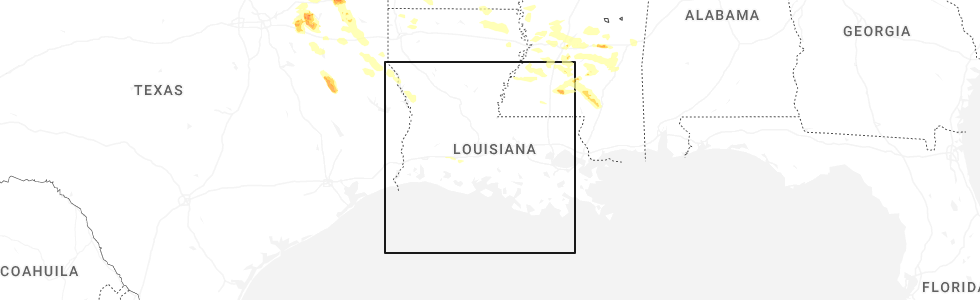
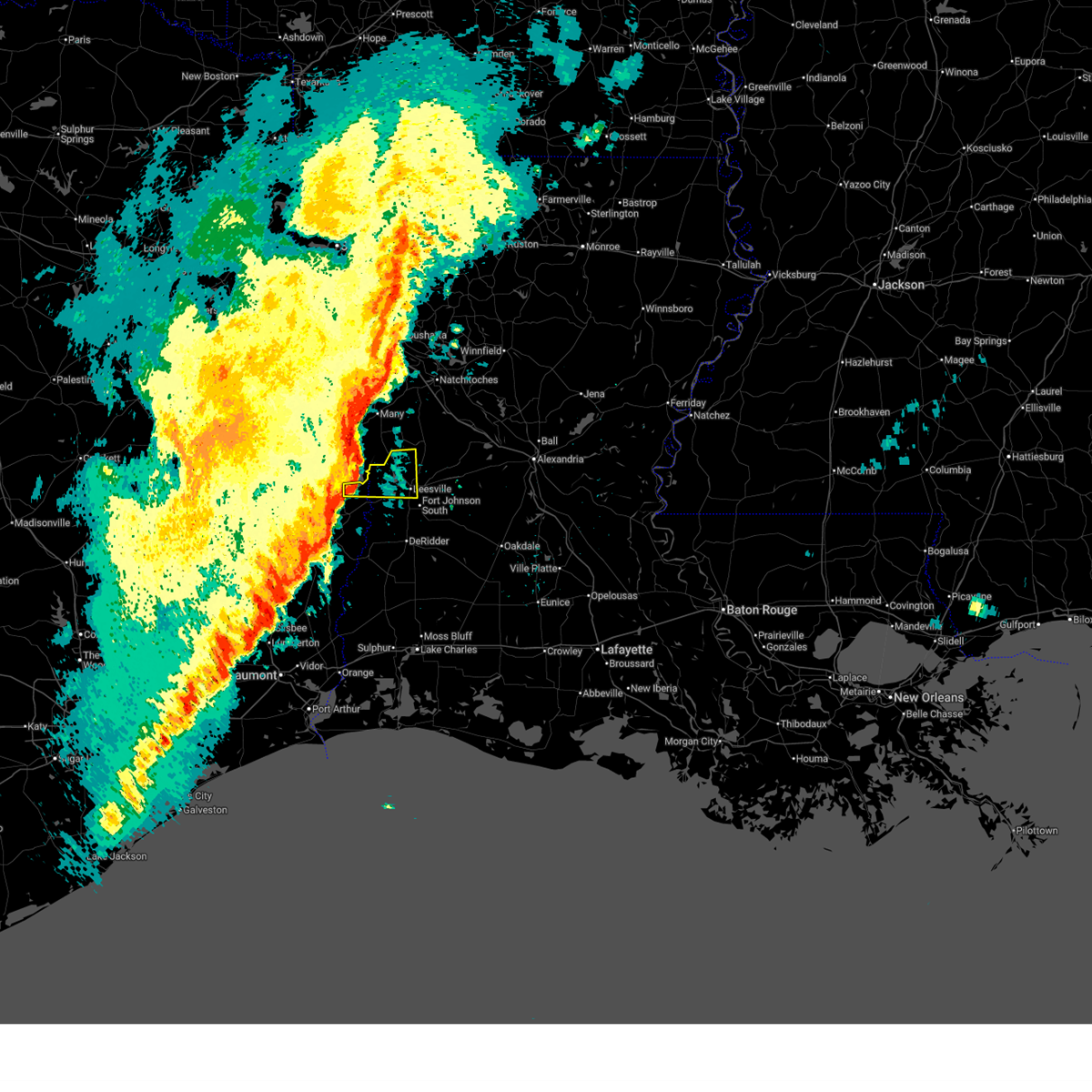
Hail Map for Hornbeck, LA
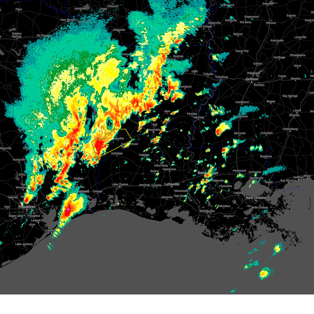
The Hornbeck, LA area has had 2 reports of on-the-ground hail by trained spotters, and has been under severe weather warnings 12 times during the past 12 months. Doppler radar has detected hail at or near Hornbeck, LA on 67 occasions, including 4 occasions during the past year.
| Name: | Hornbeck, LA |
| Where Located: | 78.3 miles E of Lufkin, TX |
| Map: | Google Map for Hornbeck, LA |
| Population: | 480 |
| Housing Units: | 237 |
| More Info: | Search Google for Hornbeck, LA |
0
The Top Recent Hail Date for Hornbeck, LA is Friday, April 24, 2026 (67th out of 67)
Hail and Wind Damage Spotted near Hornbeck, LA
| Date / Time | Report Details |
|---|---|
| 5/23/2026 10:05 AM CDT |
 At 1005 am cdt, a severe thunderstorm was located over burr ferry, or 7 miles southeast of toledo bend dam, moving east at 45 mph (radar indicated). Hazards include 60 mph wind gusts. Expect damage to roofs, siding, and trees. Locations impacted include, de ridder, leesville, rosepine, anacoco, fort polk, pitkin, sugartown, slagle, new llano, lacamp, fullerton, hutton, kurthwood, cravens, simpson, and pickering. At 1005 am cdt, a severe thunderstorm was located over burr ferry, or 7 miles southeast of toledo bend dam, moving east at 45 mph (radar indicated). Hazards include 60 mph wind gusts. Expect damage to roofs, siding, and trees. Locations impacted include, de ridder, leesville, rosepine, anacoco, fort polk, pitkin, sugartown, slagle, new llano, lacamp, fullerton, hutton, kurthwood, cravens, simpson, and pickering.
|
| 5/23/2026 9:29 AM CDT |
 At 927 am cdt, a severe thunderstorm was located near toledo bend dam, moving northeast at 35 mph (radar indicated). Hazards include 70 mph wind gusts. Expect considerable tree damage. damage is likely to mobile homes, roofs, and outbuildings. Locations impacted include, de ridder, leesville, newton, rosepine, anacoco, fort polk, sugartown, slagle, toledo bend dam, pitkin, burkeville, new llano, hornbeck, hutton, mayflower, kurthwood, junction, stringtown, lacamp, and fullerton. At 927 am cdt, a severe thunderstorm was located near toledo bend dam, moving northeast at 35 mph (radar indicated). Hazards include 70 mph wind gusts. Expect considerable tree damage. damage is likely to mobile homes, roofs, and outbuildings. Locations impacted include, de ridder, leesville, newton, rosepine, anacoco, fort polk, sugartown, slagle, toledo bend dam, pitkin, burkeville, new llano, hornbeck, hutton, mayflower, kurthwood, junction, stringtown, lacamp, and fullerton.
|
| 5/23/2026 9:18 AM CDT |
 At 917 am cdt, a severe thunderstorm was located near mayflower, or near burkeville, moving east at 60 mph (radar indicated). Hazards include 70 mph wind gusts. Expect considerable tree damage. damage is likely to mobile homes, roofs, and outbuildings. Locations impacted include, de ridder, jasper, leesville, newton, rosepine, anacoco, fort polk, sugartown, slagle, toledo bend dam, pitkin, burkeville, new llano, hornbeck, browndell, hutton, mayflower, kurthwood, harrisburg, and junction. At 917 am cdt, a severe thunderstorm was located near mayflower, or near burkeville, moving east at 60 mph (radar indicated). Hazards include 70 mph wind gusts. Expect considerable tree damage. damage is likely to mobile homes, roofs, and outbuildings. Locations impacted include, de ridder, jasper, leesville, newton, rosepine, anacoco, fort polk, sugartown, slagle, toledo bend dam, pitkin, burkeville, new llano, hornbeck, browndell, hutton, mayflower, kurthwood, harrisburg, and junction.
|
| 5/8/2026 8:48 PM CDT |
 Svrlch the national weather service in lake charles has issued a * severe thunderstorm warning for, northern vernon parish in west central louisiana, northeastern newton county in southeastern texas, * until 945 pm cdt. * at 847 pm cdt, a severe thunderstorm was located over burr ferry, or 9 miles southeast of toledo bend dam, moving northeast at 40 mph (radar indicated). Hazards include 60 mph wind gusts and half dollar size hail. Hail damage to vehicles is expected. Expect wind damage to roofs, siding, and trees. Svrlch the national weather service in lake charles has issued a * severe thunderstorm warning for, northern vernon parish in west central louisiana, northeastern newton county in southeastern texas, * until 945 pm cdt. * at 847 pm cdt, a severe thunderstorm was located over burr ferry, or 9 miles southeast of toledo bend dam, moving northeast at 40 mph (radar indicated). Hazards include 60 mph wind gusts and half dollar size hail. Hail damage to vehicles is expected. Expect wind damage to roofs, siding, and trees.
|
| 2/14/2026 7:44 PM CST |
 At 744 pm cst, a severe thunderstorm was located over leesville, moving east at 35 mph (radar indicated). Hazards include 60 mph wind gusts. Expect damage to roofs, siding, and trees. Locations impacted include, leesville, anacoco, new llano, and hornbeck. At 744 pm cst, a severe thunderstorm was located over leesville, moving east at 35 mph (radar indicated). Hazards include 60 mph wind gusts. Expect damage to roofs, siding, and trees. Locations impacted include, leesville, anacoco, new llano, and hornbeck.
|
| 2/14/2026 7:44 PM CST |
 the severe thunderstorm warning has been cancelled and is no longer in effect the severe thunderstorm warning has been cancelled and is no longer in effect
|
| 2/14/2026 7:13 PM CST |
 Svrlch the national weather service in lake charles has issued a * severe thunderstorm warning for, northwestern vernon parish in west central louisiana, northeastern newton county in southeastern texas, * until 800 pm cst. * at 713 pm cst, a severe thunderstorm was located over toledo bend dam, moving east at 35 mph (radar indicated). Hazards include 60 mph wind gusts. expect damage to roofs, siding, and trees Svrlch the national weather service in lake charles has issued a * severe thunderstorm warning for, northwestern vernon parish in west central louisiana, northeastern newton county in southeastern texas, * until 800 pm cst. * at 713 pm cst, a severe thunderstorm was located over toledo bend dam, moving east at 35 mph (radar indicated). Hazards include 60 mph wind gusts. expect damage to roofs, siding, and trees
|
| 2/14/2026 7:07 PM CST |
 At 707 pm cst, a severe thunderstorm was located near toledo bend dam, moving east at 45 mph (radar indicated). Hazards include 60 mph wind gusts. Expect damage to roofs, siding, and trees. Locations impacted include, toledo bend dam, hornbeck, burr ferry, and mayflower. At 707 pm cst, a severe thunderstorm was located near toledo bend dam, moving east at 45 mph (radar indicated). Hazards include 60 mph wind gusts. Expect damage to roofs, siding, and trees. Locations impacted include, toledo bend dam, hornbeck, burr ferry, and mayflower.
|
| 2/14/2026 6:57 PM CST |
 the severe thunderstorm warning has been cancelled and is no longer in effect the severe thunderstorm warning has been cancelled and is no longer in effect
|
| 2/14/2026 6:57 PM CST |
 At 657 pm cst, a severe thunderstorm was located near mayflower, or 9 miles west of toledo bend dam, moving east at 45 mph (radar indicated). Hazards include 60 mph wind gusts. Expect damage to roofs, siding, and trees. Locations impacted include, toledo bend dam, hornbeck, burr ferry, and mayflower. At 657 pm cst, a severe thunderstorm was located near mayflower, or 9 miles west of toledo bend dam, moving east at 45 mph (radar indicated). Hazards include 60 mph wind gusts. Expect damage to roofs, siding, and trees. Locations impacted include, toledo bend dam, hornbeck, burr ferry, and mayflower.
|
| 2/14/2026 6:48 PM CST |
 Svrlch the national weather service in lake charles has issued a * severe thunderstorm warning for, northwestern vernon parish in west central louisiana, northern newton county in southeastern texas, northeastern jasper county in southeastern texas, * until 715 pm cst. * at 648 pm cst, a severe thunderstorm was located 7 miles east of browndell, or 15 miles northwest of burkeville, moving east at 45 mph (radar indicated). Hazards include 60 mph wind gusts. expect damage to roofs, siding, and trees Svrlch the national weather service in lake charles has issued a * severe thunderstorm warning for, northwestern vernon parish in west central louisiana, northern newton county in southeastern texas, northeastern jasper county in southeastern texas, * until 715 pm cst. * at 648 pm cst, a severe thunderstorm was located 7 miles east of browndell, or 15 miles northwest of burkeville, moving east at 45 mph (radar indicated). Hazards include 60 mph wind gusts. expect damage to roofs, siding, and trees
|
| 10/28/2025 5:04 PM CDT | Svrlch the national weather service in lake charles has issued a * severe thunderstorm warning for, northwestern vernon parish in west central louisiana, * until 530 pm cdt. * at 503 pm cdt, a severe thunderstorm was located near hornbeck, or 9 miles northwest of anacoco, moving southeast at 25 mph (radar indicated). Hazards include 60 mph wind gusts and quarter size hail. Hail damage to vehicles is expected. Expect wind damage to roofs, siding, and trees. |
| 6/11/2025 2:52 PM CDT |
 Svrlch the national weather service in lake charles has issued a * severe thunderstorm warning for, northwestern vernon parish in west central louisiana, northeastern newton county in southeastern texas, * until 315 pm cdt. * at 252 pm cdt, a severe thunderstorm was located over burr ferry, or near toledo bend dam, moving north at 35 mph (radar indicated). Hazards include 60 mph wind gusts. expect damage to roofs, siding, and trees Svrlch the national weather service in lake charles has issued a * severe thunderstorm warning for, northwestern vernon parish in west central louisiana, northeastern newton county in southeastern texas, * until 315 pm cdt. * at 252 pm cdt, a severe thunderstorm was located over burr ferry, or near toledo bend dam, moving north at 35 mph (radar indicated). Hazards include 60 mph wind gusts. expect damage to roofs, siding, and trees
|
| 5/27/2025 3:34 AM CDT |
 Svrlch the national weather service in lake charles has issued a * severe thunderstorm warning for, northwestern rapides parish in central louisiana, northeastern vernon parish in west central louisiana, * until 430 am cdt. * at 333 am cdt, a severe thunderstorm was located near slagle, moving northeast at 25 mph (radar indicated). Hazards include 70 mph wind gusts and penny size hail. Expect considerable tree damage. Damage is likely to mobile homes, roofs, and outbuildings. Svrlch the national weather service in lake charles has issued a * severe thunderstorm warning for, northwestern rapides parish in central louisiana, northeastern vernon parish in west central louisiana, * until 430 am cdt. * at 333 am cdt, a severe thunderstorm was located near slagle, moving northeast at 25 mph (radar indicated). Hazards include 70 mph wind gusts and penny size hail. Expect considerable tree damage. Damage is likely to mobile homes, roofs, and outbuildings.
|
| 5/27/2025 2:53 AM CDT |
 At 253 am cdt, a severe thunderstorm was located near toledo bend dam, moving northeast at 45 mph (radar indicated). Hazards include 60 mph wind gusts. Expect damage to roofs, siding, and trees. Locations impacted include, anacoco, toledo bend dam, hornbeck, burr ferry, and evans. At 253 am cdt, a severe thunderstorm was located near toledo bend dam, moving northeast at 45 mph (radar indicated). Hazards include 60 mph wind gusts. Expect damage to roofs, siding, and trees. Locations impacted include, anacoco, toledo bend dam, hornbeck, burr ferry, and evans.
|
| 5/27/2025 2:37 AM CDT |
 Svrlch the national weather service in lake charles has issued a * severe thunderstorm warning for, western vernon parish in west central louisiana, northeastern newton county in southeastern texas, * until 330 am cdt. * at 237 am cdt, a severe thunderstorm was located near burr ferry, or near burkeville, moving northeast at 40 mph (radar indicated). Hazards include 60 mph wind gusts. expect damage to roofs, siding, and trees Svrlch the national weather service in lake charles has issued a * severe thunderstorm warning for, western vernon parish in west central louisiana, northeastern newton county in southeastern texas, * until 330 am cdt. * at 237 am cdt, a severe thunderstorm was located near burr ferry, or near burkeville, moving northeast at 40 mph (radar indicated). Hazards include 60 mph wind gusts. expect damage to roofs, siding, and trees
|
| 3/31/2025 3:09 AM CDT |
 The storm which prompted the warning has weakened below severe limits, and no longer poses an immediate threat to life or property. therefore, the warning will be allowed to expire. a severe thunderstorm watch remains in effect until 800 am cdt for central, southwestern and west central louisiana. The storm which prompted the warning has weakened below severe limits, and no longer poses an immediate threat to life or property. therefore, the warning will be allowed to expire. a severe thunderstorm watch remains in effect until 800 am cdt for central, southwestern and west central louisiana.
|
| 3/31/2025 2:54 AM CDT |
 At 254 am cdt, a severe thunderstorm was located near slagle, moving southeast at 40 mph (radar indicated). Hazards include 60 mph wind gusts and quarter size hail. Hail damage to vehicles is expected. expect wind damage to roofs, siding, and trees. Locations impacted include, leesville, hornbeck, anacoco, lacamp, fullerton, hutton, clifton, flatwoods, fort johnson, new llano, pitkin, kurthwood, leander, pickering, slagle, cravens, and simpson. At 254 am cdt, a severe thunderstorm was located near slagle, moving southeast at 40 mph (radar indicated). Hazards include 60 mph wind gusts and quarter size hail. Hail damage to vehicles is expected. expect wind damage to roofs, siding, and trees. Locations impacted include, leesville, hornbeck, anacoco, lacamp, fullerton, hutton, clifton, flatwoods, fort johnson, new llano, pitkin, kurthwood, leander, pickering, slagle, cravens, and simpson.
|
| 3/31/2025 2:14 AM CDT |
 Svrlch the national weather service in lake charles has issued a * severe thunderstorm warning for, northwestern rapides parish in central louisiana, vernon parish in west central louisiana, * until 315 am cdt. * at 214 am cdt, a severe thunderstorm was located 11 miles northwest of hornbeck, or 15 miles north of toledo bend dam, moving southeast at 40 mph (radar indicated). Hazards include 60 mph wind gusts and quarter size hail. Hail damage to vehicles is expected. Expect wind damage to roofs, siding, and trees. Svrlch the national weather service in lake charles has issued a * severe thunderstorm warning for, northwestern rapides parish in central louisiana, vernon parish in west central louisiana, * until 315 am cdt. * at 214 am cdt, a severe thunderstorm was located 11 miles northwest of hornbeck, or 15 miles north of toledo bend dam, moving southeast at 40 mph (radar indicated). Hazards include 60 mph wind gusts and quarter size hail. Hail damage to vehicles is expected. Expect wind damage to roofs, siding, and trees.
|
| 3/4/2025 11:03 AM CST |
 At 1102 am cst, a severe thunderstorm capable of producing a tornado was located near anacoco, moving east at 60 mph (radar indicated rotation). Hazards include tornado. Flying debris will be dangerous to those caught without shelter. mobile homes will be damaged or destroyed. damage to roofs, windows, and vehicles will occur. tree damage is likely. This tornadic thunderstorm will remain over mainly rural areas of north central vernon parish. At 1102 am cst, a severe thunderstorm capable of producing a tornado was located near anacoco, moving east at 60 mph (radar indicated rotation). Hazards include tornado. Flying debris will be dangerous to those caught without shelter. mobile homes will be damaged or destroyed. damage to roofs, windows, and vehicles will occur. tree damage is likely. This tornadic thunderstorm will remain over mainly rural areas of north central vernon parish.
|
| 3/4/2025 10:59 AM CST | Picture of limbs down. one landed on a vehicl in vernon county LA, 0.5 miles SE of Hornbeck, LA |
| 3/4/2025 10:59 AM CST |
 the severe thunderstorm warning has been cancelled and is no longer in effect the severe thunderstorm warning has been cancelled and is no longer in effect
|
| 3/4/2025 10:59 AM CST |
 At 1059 am cst, severe thunderstorms were located along a line extending from 8 miles northwest of kurthwood to near stringtown, moving east at 80 mph (radar indicated). Hazards include 60 mph wind gusts. Expect damage to roofs, siding, and trees. Locations impacted include, toledo bend dam, leesville, hornbeck, anacoco, lacamp, hutton, burr ferry, rosepine, de ridder, fort johnson, new llano, kurthwood, evans, pickering, slagle, junction, stringtown, cravens, simpson, and merryville. At 1059 am cst, severe thunderstorms were located along a line extending from 8 miles northwest of kurthwood to near stringtown, moving east at 80 mph (radar indicated). Hazards include 60 mph wind gusts. Expect damage to roofs, siding, and trees. Locations impacted include, toledo bend dam, leesville, hornbeck, anacoco, lacamp, hutton, burr ferry, rosepine, de ridder, fort johnson, new llano, kurthwood, evans, pickering, slagle, junction, stringtown, cravens, simpson, and merryville.
|
| 3/4/2025 10:56 AM CST |
 Torlch the national weather service in lake charles has issued a * tornado warning for, northwestern vernon parish in west central louisiana, northeastern newton county in southeastern texas, * until 1130 am cst. * at 1056 am cst, a severe thunderstorm capable of producing a tornado was located near burkeville, moving northeast at 70 mph (radar indicated rotation). Hazards include tornado. Flying debris will be dangerous to those caught without shelter. mobile homes will be damaged or destroyed. damage to roofs, windows, and vehicles will occur. tree damage is likely. this dangerous storm will be near, burr ferry around 1100 am cst. new llano, anacoco, and leesville around 1105 am cst. hornbeck around 1110 am cst. kurthwood around 1115 am cst. hutton around 1125 am cst. Other locations impacted by this tornadic thunderstorm include wiergate, evans, pickering, and simpson. Torlch the national weather service in lake charles has issued a * tornado warning for, northwestern vernon parish in west central louisiana, northeastern newton county in southeastern texas, * until 1130 am cst. * at 1056 am cst, a severe thunderstorm capable of producing a tornado was located near burkeville, moving northeast at 70 mph (radar indicated rotation). Hazards include tornado. Flying debris will be dangerous to those caught without shelter. mobile homes will be damaged or destroyed. damage to roofs, windows, and vehicles will occur. tree damage is likely. this dangerous storm will be near, burr ferry around 1100 am cst. new llano, anacoco, and leesville around 1105 am cst. hornbeck around 1110 am cst. kurthwood around 1115 am cst. hutton around 1125 am cst. Other locations impacted by this tornadic thunderstorm include wiergate, evans, pickering, and simpson.
|
| 3/4/2025 10:49 AM CST |
 Torlch the national weather service in lake charles has issued a * tornado warning for, northwestern vernon parish in west central louisiana, * until 1115 am cst. * at 1048 am cst, a severe thunderstorm capable of producing a tornado was located near toledo bend dam, moving east at 60 mph (radar indicated rotation). Hazards include tornado. Flying debris will be dangerous to those caught without shelter. mobile homes will be damaged or destroyed. damage to roofs, windows, and vehicles will occur. tree damage is likely. This dangerous storm will be near, anacoco and hornbeck around 1055 am cst. Torlch the national weather service in lake charles has issued a * tornado warning for, northwestern vernon parish in west central louisiana, * until 1115 am cst. * at 1048 am cst, a severe thunderstorm capable of producing a tornado was located near toledo bend dam, moving east at 60 mph (radar indicated rotation). Hazards include tornado. Flying debris will be dangerous to those caught without shelter. mobile homes will be damaged or destroyed. damage to roofs, windows, and vehicles will occur. tree damage is likely. This dangerous storm will be near, anacoco and hornbeck around 1055 am cst.
|
| 3/4/2025 10:43 AM CST |
 Svrlch the national weather service in lake charles has issued a * severe thunderstorm warning for, northwestern beauregard parish in southwestern louisiana, vernon parish in west central louisiana, northern newton county in southeastern texas, northeastern jasper county in southeastern texas, * until 1130 am cst. * at 1042 am cst, severe thunderstorms were located along a line extending from near toledo bend dam to near kirbyville, moving northeast at 80 mph (radar indicated). Hazards include 60 mph wind gusts. expect damage to roofs, siding, and trees Svrlch the national weather service in lake charles has issued a * severe thunderstorm warning for, northwestern beauregard parish in southwestern louisiana, vernon parish in west central louisiana, northern newton county in southeastern texas, northeastern jasper county in southeastern texas, * until 1130 am cst. * at 1042 am cst, severe thunderstorms were located along a line extending from near toledo bend dam to near kirbyville, moving northeast at 80 mph (radar indicated). Hazards include 60 mph wind gusts. expect damage to roofs, siding, and trees
|
| 12/28/2024 3:14 PM CST |
 At 314 pm cst, a severe thunderstorm was located near burkeville, moving northeast at 45 mph (radar indicated). Hazards include 60 mph wind gusts and nickel size hail. Expect damage to roofs, siding, and trees. Locations impacted include, toledo bend dam, leesville, hornbeck, anacoco, burr ferry, mayflower, wiergate, fort johnson, new llano, newton, kurthwood, evans, pickering, slagle, burkeville, stringtown, and simpson. At 314 pm cst, a severe thunderstorm was located near burkeville, moving northeast at 45 mph (radar indicated). Hazards include 60 mph wind gusts and nickel size hail. Expect damage to roofs, siding, and trees. Locations impacted include, toledo bend dam, leesville, hornbeck, anacoco, burr ferry, mayflower, wiergate, fort johnson, new llano, newton, kurthwood, evans, pickering, slagle, burkeville, stringtown, and simpson.
|
| 12/28/2024 2:58 PM CST |
 Svrlch the national weather service in lake charles has issued a * severe thunderstorm warning for, northwestern vernon parish in west central louisiana, northern newton county in southeastern texas, * until 400 pm cst. * at 258 pm cst, a severe thunderstorm was located near farrsville, or near burkeville, moving northeast at 40 mph (radar indicated). Hazards include 60 mph wind gusts and quarter size hail. Hail damage to vehicles is expected. Expect wind damage to roofs, siding, and trees. Svrlch the national weather service in lake charles has issued a * severe thunderstorm warning for, northwestern vernon parish in west central louisiana, northern newton county in southeastern texas, * until 400 pm cst. * at 258 pm cst, a severe thunderstorm was located near farrsville, or near burkeville, moving northeast at 40 mph (radar indicated). Hazards include 60 mph wind gusts and quarter size hail. Hail damage to vehicles is expected. Expect wind damage to roofs, siding, and trees.
|
| 11/18/2024 6:13 PM CST |
 the tornado warning has been cancelled and is no longer in effect the tornado warning has been cancelled and is no longer in effect
|
| 11/18/2024 5:58 PM CST |
 Torlch the national weather service in lake charles has issued a * tornado warning for, northwestern vernon parish in west central louisiana, northeastern newton county in southeastern texas, * until 630 pm cst. * at 558 pm cst, a severe thunderstorm capable of producing a tornado was located near toledo bend dam, moving northeast at 40 mph (radar indicated rotation). Hazards include tornado. Flying debris will be dangerous to those caught without shelter. mobile homes will be damaged or destroyed. damage to roofs, windows, and vehicles will occur. tree damage is likely. this dangerous storm will be near, toledo bend dam around 605 pm cst. Anacoco and hornbeck around 615 pm cst. Torlch the national weather service in lake charles has issued a * tornado warning for, northwestern vernon parish in west central louisiana, northeastern newton county in southeastern texas, * until 630 pm cst. * at 558 pm cst, a severe thunderstorm capable of producing a tornado was located near toledo bend dam, moving northeast at 40 mph (radar indicated rotation). Hazards include tornado. Flying debris will be dangerous to those caught without shelter. mobile homes will be damaged or destroyed. damage to roofs, windows, and vehicles will occur. tree damage is likely. this dangerous storm will be near, toledo bend dam around 605 pm cst. Anacoco and hornbeck around 615 pm cst.
|
| 6/4/2024 3:22 PM CDT |
 The storm which prompted the warning has moved out of the area. therefore, the warning will be allowed to expire. however heavy rain is still possible with this thunderstorm. a severe thunderstorm watch remains in effect until 800 pm cdt for central, southwestern and west central louisiana. The storm which prompted the warning has moved out of the area. therefore, the warning will be allowed to expire. however heavy rain is still possible with this thunderstorm. a severe thunderstorm watch remains in effect until 800 pm cdt for central, southwestern and west central louisiana.
|
| 6/4/2024 2:25 PM CDT |
 The storm which prompted the warning has moved out of the area. therefore, the warning will be allowed to expire. The storm which prompted the warning has moved out of the area. therefore, the warning will be allowed to expire.
|
| 6/4/2024 2:24 PM CDT |
 Svrlch the national weather service in lake charles has issued a * severe thunderstorm warning for, central rapides parish in central louisiana, northern beauregard parish in southwestern louisiana, vernon parish in west central louisiana, northeastern newton county in southeastern texas, * until 330 pm cdt. * at 224 pm cdt, a severe thunderstorm was located near hutton, or 12 miles northeast of slagle, moving east at 15 mph (radar indicated). Hazards include 60 mph wind gusts and penny size hail. expect damage to roofs, siding, and trees Svrlch the national weather service in lake charles has issued a * severe thunderstorm warning for, central rapides parish in central louisiana, northern beauregard parish in southwestern louisiana, vernon parish in west central louisiana, northeastern newton county in southeastern texas, * until 330 pm cdt. * at 224 pm cdt, a severe thunderstorm was located near hutton, or 12 miles northeast of slagle, moving east at 15 mph (radar indicated). Hazards include 60 mph wind gusts and penny size hail. expect damage to roofs, siding, and trees
|
| 6/4/2024 2:07 PM CDT |
 At 207 pm cdt, a severe thunderstorm was located near flatwoods, or 10 miles southwest of lena, moving east at 55 mph (radar indicated). Hazards include 60 mph wind gusts and penny size hail. Expect damage to roofs, siding, and trees. Locations impacted include, alexandria, pineville, leesville, boyce, anacoco, hineston, lena, alexandria international airport, slagle, fort johnson, new llano, hornbeck, lacamp, hutton, clifton, flatwoods, otis, kurthwood, leander, and sieper. At 207 pm cdt, a severe thunderstorm was located near flatwoods, or 10 miles southwest of lena, moving east at 55 mph (radar indicated). Hazards include 60 mph wind gusts and penny size hail. Expect damage to roofs, siding, and trees. Locations impacted include, alexandria, pineville, leesville, boyce, anacoco, hineston, lena, alexandria international airport, slagle, fort johnson, new llano, hornbeck, lacamp, hutton, clifton, flatwoods, otis, kurthwood, leander, and sieper.
|
| 6/4/2024 1:33 PM CDT |
 Svrlch the national weather service in lake charles has issued a * severe thunderstorm warning for, northwestern rapides parish in central louisiana, northern vernon parish in west central louisiana, * until 230 pm cdt. * at 133 pm cdt, a severe thunderstorm was located near many, or 18 miles north of anacoco, moving east at 45 mph (radar indicated). Hazards include 60 mph wind gusts and penny size hail. expect damage to roofs, siding, and trees Svrlch the national weather service in lake charles has issued a * severe thunderstorm warning for, northwestern rapides parish in central louisiana, northern vernon parish in west central louisiana, * until 230 pm cdt. * at 133 pm cdt, a severe thunderstorm was located near many, or 18 miles north of anacoco, moving east at 45 mph (radar indicated). Hazards include 60 mph wind gusts and penny size hail. expect damage to roofs, siding, and trees
|
| 6/1/2024 8:16 PM CDT |
 At 816 pm cdt, severe thunderstorms were located along a line extending from near kurthwood to near slagle to near leesville to 6 miles west of new llano, moving east at 45 mph (radar indicated). Hazards include 70 mph wind gusts and quarter size hail. Hail damage to vehicles is expected. expect considerable tree damage. wind damage is also likely to mobile homes, roofs, and outbuildings. Locations impacted include, leesville, anacoco, fort johnson, slagle, new llano, hornbeck, lacamp, fullerton, hutton, kurthwood, cravens, simpson, and pickering. At 816 pm cdt, severe thunderstorms were located along a line extending from near kurthwood to near slagle to near leesville to 6 miles west of new llano, moving east at 45 mph (radar indicated). Hazards include 70 mph wind gusts and quarter size hail. Hail damage to vehicles is expected. expect considerable tree damage. wind damage is also likely to mobile homes, roofs, and outbuildings. Locations impacted include, leesville, anacoco, fort johnson, slagle, new llano, hornbeck, lacamp, fullerton, hutton, kurthwood, cravens, simpson, and pickering.
|
| 6/1/2024 8:00 PM CDT |
 At 800 pm cdt, severe thunderstorms were located along a line extending from 12 miles southeast of many to hornbeck to near anacoco to toledo bend dam, moving east at 50 mph (radar indicated). Hazards include 70 mph wind gusts and quarter size hail. Hail damage to vehicles is expected. expect considerable tree damage. wind damage is also likely to mobile homes, roofs, and outbuildings. Locations impacted include, leesville, anacoco, fort johnson, slagle, new llano, hornbeck, lacamp, fullerton, hutton, kurthwood, cravens, simpson, and pickering. At 800 pm cdt, severe thunderstorms were located along a line extending from 12 miles southeast of many to hornbeck to near anacoco to toledo bend dam, moving east at 50 mph (radar indicated). Hazards include 70 mph wind gusts and quarter size hail. Hail damage to vehicles is expected. expect considerable tree damage. wind damage is also likely to mobile homes, roofs, and outbuildings. Locations impacted include, leesville, anacoco, fort johnson, slagle, new llano, hornbeck, lacamp, fullerton, hutton, kurthwood, cravens, simpson, and pickering.
|
| 6/1/2024 7:49 PM CDT |
 Svrlch the national weather service in lake charles has issued a * severe thunderstorm warning for, vernon parish in west central louisiana, * until 845 pm cdt. * at 749 pm cdt, severe thunderstorms were located along a line extending from 8 miles northwest of hornbeck to 6 miles north of toledo bend dam to near mayflower, moving southeast at 45 mph (radar indicated). Hazards include 70 mph wind gusts and quarter size hail. Hail damage to vehicles is expected. expect considerable tree damage. Wind damage is also likely to mobile homes, roofs, and outbuildings. Svrlch the national weather service in lake charles has issued a * severe thunderstorm warning for, vernon parish in west central louisiana, * until 845 pm cdt. * at 749 pm cdt, severe thunderstorms were located along a line extending from 8 miles northwest of hornbeck to 6 miles north of toledo bend dam to near mayflower, moving southeast at 45 mph (radar indicated). Hazards include 70 mph wind gusts and quarter size hail. Hail damage to vehicles is expected. expect considerable tree damage. Wind damage is also likely to mobile homes, roofs, and outbuildings.
|
| 6/1/2024 5:16 PM CDT |
 the severe thunderstorm warning has been cancelled and is no longer in effect the severe thunderstorm warning has been cancelled and is no longer in effect
|
| 6/1/2024 5:05 PM CDT |
 Svrlch the national weather service in lake charles has issued a * severe thunderstorm warning for, northwestern vernon parish in west central louisiana, * until 530 pm cdt. * at 505 pm cdt, a severe thunderstorm was located near anacoco, moving east at 15 mph (radar indicated). Hazards include 60 mph wind gusts and quarter size hail. Hail damage to vehicles is expected. Expect wind damage to roofs, siding, and trees. Svrlch the national weather service in lake charles has issued a * severe thunderstorm warning for, northwestern vernon parish in west central louisiana, * until 530 pm cdt. * at 505 pm cdt, a severe thunderstorm was located near anacoco, moving east at 15 mph (radar indicated). Hazards include 60 mph wind gusts and quarter size hail. Hail damage to vehicles is expected. Expect wind damage to roofs, siding, and trees.
|
| 5/30/2024 8:59 PM CDT |
 The storms which prompted the warning have moved out of the area with the exception of eastern vernon parish where a new warning has been issued. therefore, the warning will be allowed to expire. however gusty winds and heavy rain are still possible with these thunderstorms. a severe thunderstorm watch remains in effect until 1100 pm cdt for central and west central louisiana, and southeastern texas. to report severe weather, contact your nearest law enforcement agency. they will relay your report to the national weather service lake charles. The storms which prompted the warning have moved out of the area with the exception of eastern vernon parish where a new warning has been issued. therefore, the warning will be allowed to expire. however gusty winds and heavy rain are still possible with these thunderstorms. a severe thunderstorm watch remains in effect until 1100 pm cdt for central and west central louisiana, and southeastern texas. to report severe weather, contact your nearest law enforcement agency. they will relay your report to the national weather service lake charles.
|
| 5/30/2024 8:40 PM CDT |
 the severe thunderstorm warning has been cancelled and is no longer in effect the severe thunderstorm warning has been cancelled and is no longer in effect
|
| 5/30/2024 8:40 PM CDT |
 At 839 pm cdt, severe thunderstorms were located along a line extending from 10 miles west of hutton to kurthwood to near new llano to near rosepine, moving east at 50 mph (radar indicated). Hazards include 70 mph wind gusts and nickel size hail. Expect considerable tree damage. damage is likely to mobile homes, roofs, and outbuildings. Locations impacted include, leesville, rosepine, anacoco, fort johnson, slagle, new llano, hornbeck, lacamp, fullerton, hutton, burr ferry, kurthwood, cravens, simpson, evans, and pickering. At 839 pm cdt, severe thunderstorms were located along a line extending from 10 miles west of hutton to kurthwood to near new llano to near rosepine, moving east at 50 mph (radar indicated). Hazards include 70 mph wind gusts and nickel size hail. Expect considerable tree damage. damage is likely to mobile homes, roofs, and outbuildings. Locations impacted include, leesville, rosepine, anacoco, fort johnson, slagle, new llano, hornbeck, lacamp, fullerton, hutton, burr ferry, kurthwood, cravens, simpson, evans, and pickering.
|
| 5/30/2024 8:31 PM CDT |
 At 829 pm cdt, severe thunderstorms were located along a line extending from 11 miles northwest of kurthwood to 6 miles east of hornbeck to near leesville to near junction, moving east at 35 mph. these are destructive storms for vernon parish (radar indicated). Hazards include 80 mph wind gusts and nickel size hail. Flying debris will be dangerous to those caught without shelter. mobile homes will be heavily damaged. expect considerable damage to roofs, windows, and vehicles. extensive tree damage and power outages are likely. Locations impacted include, leesville, rosepine, anacoco, toledo bend dam, fort johnson, slagle, burkeville, new llano, hornbeck, lacamp, fullerton, hutton, burr ferry, kurthwood, stringtown, cravens, simpson, evans, and pickering. At 829 pm cdt, severe thunderstorms were located along a line extending from 11 miles northwest of kurthwood to 6 miles east of hornbeck to near leesville to near junction, moving east at 35 mph. these are destructive storms for vernon parish (radar indicated). Hazards include 80 mph wind gusts and nickel size hail. Flying debris will be dangerous to those caught without shelter. mobile homes will be heavily damaged. expect considerable damage to roofs, windows, and vehicles. extensive tree damage and power outages are likely. Locations impacted include, leesville, rosepine, anacoco, toledo bend dam, fort johnson, slagle, burkeville, new llano, hornbeck, lacamp, fullerton, hutton, burr ferry, kurthwood, stringtown, cravens, simpson, evans, and pickering.
|
| 5/30/2024 8:21 PM CDT |
 At 820 pm cdt, severe thunderstorms were located along a line extending from 10 miles southeast of many to hornbeck to 6 miles northeast of burr ferry to near stringtown, moving east at 35 mph. these are destructive storms for northern and central vernon parish (radar indicated). Hazards include 80 mph wind gusts and nickel size hail. Flying debris will be dangerous to those caught without shelter. mobile homes will be heavily damaged. expect considerable damage to roofs, windows, and vehicles. extensive tree damage and power outages are likely. Locations impacted include, leesville, rosepine, anacoco, toledo bend dam, fort johnson, slagle, burkeville, new llano, hornbeck, lacamp, farrsville, fullerton, hutton, burr ferry, mayflower, jamestown, kurthwood, stringtown, cravens, and simpson. At 820 pm cdt, severe thunderstorms were located along a line extending from 10 miles southeast of many to hornbeck to 6 miles northeast of burr ferry to near stringtown, moving east at 35 mph. these are destructive storms for northern and central vernon parish (radar indicated). Hazards include 80 mph wind gusts and nickel size hail. Flying debris will be dangerous to those caught without shelter. mobile homes will be heavily damaged. expect considerable damage to roofs, windows, and vehicles. extensive tree damage and power outages are likely. Locations impacted include, leesville, rosepine, anacoco, toledo bend dam, fort johnson, slagle, burkeville, new llano, hornbeck, lacamp, farrsville, fullerton, hutton, burr ferry, mayflower, jamestown, kurthwood, stringtown, cravens, and simpson.
|
| 5/30/2024 7:58 PM CDT |
 Svrlch the national weather service in lake charles has issued a * severe thunderstorm warning for, vernon parish in west central louisiana, northern newton county in southeastern texas, * until 900 pm cdt. * at 758 pm cdt, severe thunderstorms were located along a line extending from near zwolle to 10 miles east of hemphill to near toledo bend dam to harrisburg, moving east at 35 mph (radar indicated). Hazards include 60 mph wind gusts and penny size hail. expect damage to roofs, siding, and trees Svrlch the national weather service in lake charles has issued a * severe thunderstorm warning for, vernon parish in west central louisiana, northern newton county in southeastern texas, * until 900 pm cdt. * at 758 pm cdt, severe thunderstorms were located along a line extending from near zwolle to 10 miles east of hemphill to near toledo bend dam to harrisburg, moving east at 35 mph (radar indicated). Hazards include 60 mph wind gusts and penny size hail. expect damage to roofs, siding, and trees
|
| 5/16/2024 3:40 PM CDT |
 Svrlch the national weather service in lake charles has issued a * severe thunderstorm warning for, western rapides parish in central louisiana, vernon parish in west central louisiana, northeastern allen parish in southwestern louisiana, northeastern newton county in southeastern texas, * until 445 pm cdt. * at 339 pm cdt, a severe thunderstorm was located near burr ferry, or near toledo bend dam, moving east at 50 mph (radar indicated). Hazards include 60 mph wind gusts and quarter size hail. Hail damage to vehicles is expected. Expect wind damage to roofs, siding, and trees. Svrlch the national weather service in lake charles has issued a * severe thunderstorm warning for, western rapides parish in central louisiana, vernon parish in west central louisiana, northeastern allen parish in southwestern louisiana, northeastern newton county in southeastern texas, * until 445 pm cdt. * at 339 pm cdt, a severe thunderstorm was located near burr ferry, or near toledo bend dam, moving east at 50 mph (radar indicated). Hazards include 60 mph wind gusts and quarter size hail. Hail damage to vehicles is expected. Expect wind damage to roofs, siding, and trees.
|
| 4/29/2024 12:13 AM CDT |
 Svrlch the national weather service in lake charles has issued a * severe thunderstorm warning for, western vernon parish in west central louisiana, northeastern tyler county in southeastern texas, northern newton county in southeastern texas, northeastern jasper county in southeastern texas, * until 1245 am cdt. * at 1212 am cdt, severe thunderstorms were located along a line extending from near toledo bend dam to near jamestown to near magnolia springs, moving east at 35 mph (radar indicated). Hazards include 60 mph wind gusts and penny size hail. expect damage to roofs, siding, and trees Svrlch the national weather service in lake charles has issued a * severe thunderstorm warning for, western vernon parish in west central louisiana, northeastern tyler county in southeastern texas, northern newton county in southeastern texas, northeastern jasper county in southeastern texas, * until 1245 am cdt. * at 1212 am cdt, severe thunderstorms were located along a line extending from near toledo bend dam to near jamestown to near magnolia springs, moving east at 35 mph (radar indicated). Hazards include 60 mph wind gusts and penny size hail. expect damage to roofs, siding, and trees
|
| 11/20/2023 1:47 PM CST |
 At 147 pm cst, a severe thunderstorm was located near toledo bend dam, moving northeast at 25 mph (radar indicated). Hazards include 60 mph wind gusts and quarter size hail. Hail damage to vehicles is expected. Expect wind damage to roofs, siding, and trees. At 147 pm cst, a severe thunderstorm was located near toledo bend dam, moving northeast at 25 mph (radar indicated). Hazards include 60 mph wind gusts and quarter size hail. Hail damage to vehicles is expected. Expect wind damage to roofs, siding, and trees.
|
| 9/8/2023 11:52 AM CDT |
 At 1152 am cdt, a severe thunderstorm was located near kurthwood, or 12 miles northeast of anacoco, moving south at 25 mph (radar indicated). Hazards include 60 mph wind gusts and quarter size hail. Hail damage to vehicles is expected. Expect wind damage to roofs, siding, and trees. At 1152 am cdt, a severe thunderstorm was located near kurthwood, or 12 miles northeast of anacoco, moving south at 25 mph (radar indicated). Hazards include 60 mph wind gusts and quarter size hail. Hail damage to vehicles is expected. Expect wind damage to roofs, siding, and trees.
|
| 6/12/2023 3:24 PM CDT |
 At 323 pm cdt, severe thunderstorms were located along a line extending from 8 miles north of toledo bend dam to near hutton, moving south at 30 mph (radar indicated). Hazards include 70 mph wind gusts and quarter size hail. Hail damage to vehicles is expected. expect considerable tree damage. Wind damage is also likely to mobile homes, roofs, and outbuildings. At 323 pm cdt, severe thunderstorms were located along a line extending from 8 miles north of toledo bend dam to near hutton, moving south at 30 mph (radar indicated). Hazards include 70 mph wind gusts and quarter size hail. Hail damage to vehicles is expected. expect considerable tree damage. Wind damage is also likely to mobile homes, roofs, and outbuildings.
|
| 6/12/2023 3:09 PM CDT |
 At 309 pm cdt, severe thunderstorms were located along a line extending from 11 miles southeast of milam to near hornbeck to near kurthwood to near flatwoods, moving southeast at 25 mph (radar indicated. these storms have had a history of producing quarter size hail and downed trees and power lines across central and eastern sabine parish). Hazards include 60 mph wind gusts and half dollar size hail. Hail damage to vehicles is expected. expect wind damage to roofs, siding, and trees. locations impacted include, florien, fisher, kisatchie, negreet, mount carmel, bellwood and gorum. hail threat, radar indicated max hail size, 1. 25 in wind threat, radar indicated max wind gust, 60 mph. At 309 pm cdt, severe thunderstorms were located along a line extending from 11 miles southeast of milam to near hornbeck to near kurthwood to near flatwoods, moving southeast at 25 mph (radar indicated. these storms have had a history of producing quarter size hail and downed trees and power lines across central and eastern sabine parish). Hazards include 60 mph wind gusts and half dollar size hail. Hail damage to vehicles is expected. expect wind damage to roofs, siding, and trees. locations impacted include, florien, fisher, kisatchie, negreet, mount carmel, bellwood and gorum. hail threat, radar indicated max hail size, 1. 25 in wind threat, radar indicated max wind gust, 60 mph.
|
| 6/12/2023 2:51 PM CDT |
 At 251 pm cdt, severe thunderstorms were located along a line extending from milam to 6 miles south of many to 7 miles northeast of hornbeck to 10 miles north of hutton, moving southeast at 35 mph (radar indicated. quarter size hail has been reported in zwolle with these storms, and trees and power lines have been blown down as well across eastern sabine and western natchitoches parishes). Hazards include 60 mph wind gusts and half dollar size hail. Hail damage to vehicles is expected. expect wind damage to roofs, siding, and trees. locations impacted include, milam, many, florien, fisher, kisatchie, negreet, mount carmel, bellwood, columbus and gorum. hail threat, radar indicated max hail size, 1. 25 in wind threat, radar indicated max wind gust, 60 mph. At 251 pm cdt, severe thunderstorms were located along a line extending from milam to 6 miles south of many to 7 miles northeast of hornbeck to 10 miles north of hutton, moving southeast at 35 mph (radar indicated. quarter size hail has been reported in zwolle with these storms, and trees and power lines have been blown down as well across eastern sabine and western natchitoches parishes). Hazards include 60 mph wind gusts and half dollar size hail. Hail damage to vehicles is expected. expect wind damage to roofs, siding, and trees. locations impacted include, milam, many, florien, fisher, kisatchie, negreet, mount carmel, bellwood, columbus and gorum. hail threat, radar indicated max hail size, 1. 25 in wind threat, radar indicated max wind gust, 60 mph.
|
| 6/12/2023 2:31 PM CDT |
 At 230 pm cdt, severe thunderstorms were located along a line extending from near san augustine to 9 miles south of natchitoches, moving southeast at 25 mph (radar indicated). Hazards include 60 mph wind gusts and half dollar size hail. Hail damage to vehicles is expected. Expect wind damage to roofs, siding, and trees. At 230 pm cdt, severe thunderstorms were located along a line extending from near san augustine to 9 miles south of natchitoches, moving southeast at 25 mph (radar indicated). Hazards include 60 mph wind gusts and half dollar size hail. Hail damage to vehicles is expected. Expect wind damage to roofs, siding, and trees.
|
| 4/15/2023 8:59 PM CDT |
 At 858 pm cdt, a severe thunderstorm was located near toledo bend dam, moving east at 30 mph (radar indicated). Hazards include two inch hail and 60 mph wind gusts. People and animals outdoors will be injured. expect hail damage to roofs, siding, windows, and vehicles. expect wind damage to roofs, siding, and trees. locations impacted include, leesville, anacoco, toledo bend dam and hornbeck. thunderstorm damage threat, considerable hail threat, radar indicated max hail size, 2. 00 in wind threat, radar indicated max wind gust, 60 mph. At 858 pm cdt, a severe thunderstorm was located near toledo bend dam, moving east at 30 mph (radar indicated). Hazards include two inch hail and 60 mph wind gusts. People and animals outdoors will be injured. expect hail damage to roofs, siding, windows, and vehicles. expect wind damage to roofs, siding, and trees. locations impacted include, leesville, anacoco, toledo bend dam and hornbeck. thunderstorm damage threat, considerable hail threat, radar indicated max hail size, 2. 00 in wind threat, radar indicated max wind gust, 60 mph.
|
| 4/15/2023 8:42 PM CDT |
 At 842 pm cdt, a severe thunderstorm was located 8 miles north of mayflower, or 10 miles west of toledo bend dam, moving east at 30 mph (radar indicated). Hazards include ping pong ball size hail and 60 mph wind gusts. People and animals outdoors will be injured. expect hail damage to roofs, siding, windows, and vehicles. Expect wind damage to roofs, siding, and trees. At 842 pm cdt, a severe thunderstorm was located 8 miles north of mayflower, or 10 miles west of toledo bend dam, moving east at 30 mph (radar indicated). Hazards include ping pong ball size hail and 60 mph wind gusts. People and animals outdoors will be injured. expect hail damage to roofs, siding, windows, and vehicles. Expect wind damage to roofs, siding, and trees.
|
| 3/26/2023 3:00 PM CDT |
 At 300 pm cdt, a severe thunderstorm was located 9 miles northwest of kurthwood, or 13 miles north of anacoco, moving northeast at 55 mph (radar indicated). Hazards include ping pong ball size hail and 60 mph wind gusts. People and animals outdoors will be injured. expect hail damage to roofs, siding, windows, and vehicles. expect wind damage to roofs, siding, and trees. locations impacted include, anacoco and hornbeck. hail threat, radar indicated max hail size, 1. 50 in wind threat, radar indicated max wind gust, 60 mph. At 300 pm cdt, a severe thunderstorm was located 9 miles northwest of kurthwood, or 13 miles north of anacoco, moving northeast at 55 mph (radar indicated). Hazards include ping pong ball size hail and 60 mph wind gusts. People and animals outdoors will be injured. expect hail damage to roofs, siding, windows, and vehicles. expect wind damage to roofs, siding, and trees. locations impacted include, anacoco and hornbeck. hail threat, radar indicated max hail size, 1. 50 in wind threat, radar indicated max wind gust, 60 mph.
|
| 3/26/2023 2:47 PM CDT |
 At 246 pm cdt, a severe thunderstorm was located near hornbeck, or 10 miles northwest of anacoco, moving northeast at 55 mph (radar indicated). Hazards include ping pong ball size hail and 60 mph wind gusts. People and animals outdoors will be injured. expect hail damage to roofs, siding, windows, and vehicles. Expect wind damage to roofs, siding, and trees. At 246 pm cdt, a severe thunderstorm was located near hornbeck, or 10 miles northwest of anacoco, moving northeast at 55 mph (radar indicated). Hazards include ping pong ball size hail and 60 mph wind gusts. People and animals outdoors will be injured. expect hail damage to roofs, siding, windows, and vehicles. Expect wind damage to roofs, siding, and trees.
|
| 9/7/2022 5:55 PM CDT |
 At 555 pm cdt, severe thunderstorms were located along a line extending from 7 miles north of toledo bend dam to near mayflower to 7 miles west of rosepine, moving west at 30 mph (radar indicated). Hazards include two inch hail and 70 mph wind gusts. People and animals outdoors will be injured. expect hail damage to roofs, siding, windows, and vehicles. expect considerable tree damage. wind damage is also likely to mobile homes, roofs, and outbuildings. locations impacted include, newton, anacoco, toledo bend dam, burkeville, hornbeck, browndell, farrsville, burr ferry, mayflower, jamestown, harrisburg, stringtown, wiergate and evans. thunderstorm damage threat, considerable hail threat, radar indicated max hail size, 2. 00 in wind threat, radar indicated max wind gust, 70 mph. At 555 pm cdt, severe thunderstorms were located along a line extending from 7 miles north of toledo bend dam to near mayflower to 7 miles west of rosepine, moving west at 30 mph (radar indicated). Hazards include two inch hail and 70 mph wind gusts. People and animals outdoors will be injured. expect hail damage to roofs, siding, windows, and vehicles. expect considerable tree damage. wind damage is also likely to mobile homes, roofs, and outbuildings. locations impacted include, newton, anacoco, toledo bend dam, burkeville, hornbeck, browndell, farrsville, burr ferry, mayflower, jamestown, harrisburg, stringtown, wiergate and evans. thunderstorm damage threat, considerable hail threat, radar indicated max hail size, 2. 00 in wind threat, radar indicated max wind gust, 70 mph.
|
| 9/7/2022 5:28 PM CDT |
 At 527 pm cdt, severe thunderstorms were located along a line extending from near many to 6 miles southwest of anacoco to near rosepine, moving southwest at 35 mph (radar indicated). Hazards include 70 mph wind gusts and quarter size hail. Hail damage to vehicles is expected. expect considerable tree damage. Wind damage is also likely to mobile homes, roofs, and outbuildings. At 527 pm cdt, severe thunderstorms were located along a line extending from near many to 6 miles southwest of anacoco to near rosepine, moving southwest at 35 mph (radar indicated). Hazards include 70 mph wind gusts and quarter size hail. Hail damage to vehicles is expected. expect considerable tree damage. Wind damage is also likely to mobile homes, roofs, and outbuildings.
|
| 8/22/2022 1:59 PM CDT | At 159 pm cdt, a severe thunderstorm was located 7 miles west of leesville, moving northeast at 45 mph (radar indicated). Hazards include 60 mph wind gusts. Expect damage to roofs, siding, and trees. locations impacted include, leesville, anacoco, slagle, fort polk, new llano, hornbeck, kurthwood, burr ferry and evans. hail threat, radar indicated max hail size, <. 75 in wind threat, radar indicated max wind gust, 60 mph. |
| 8/22/2022 1:59 PM CDT | At 159 pm cdt, a severe thunderstorm was located 7 miles west of leesville, moving northeast at 45 mph (radar indicated). Hazards include 60 mph wind gusts. Expect damage to roofs, siding, and trees. locations impacted include, leesville, anacoco, slagle, fort polk, new llano, hornbeck, kurthwood, burr ferry and evans. hail threat, radar indicated max hail size, <. 75 in wind threat, radar indicated max wind gust, 60 mph. |
| 8/22/2022 1:48 PM CDT | At 147 pm cdt, a severe thunderstorm was located over burr ferry, or 8 miles southeast of toledo bend dam, moving northeast at 50 mph (radar indicated). Hazards include 60 mph wind gusts. expect damage to roofs, siding, and trees |
| 8/22/2022 1:48 PM CDT | At 147 pm cdt, a severe thunderstorm was located over burr ferry, or 8 miles southeast of toledo bend dam, moving northeast at 50 mph (radar indicated). Hazards include 60 mph wind gusts. expect damage to roofs, siding, and trees |
| 6/10/2022 2:14 PM CDT |
 At 214 pm cdt, severe thunderstorms were located along a line extending from 12 miles south of natchitoches to near anacoco, moving southeast at 25 mph (radar indicated). Hazards include 70 mph wind gusts and ping pong ball size hail. People and animals outdoors will be injured. expect hail damage to roofs, siding, windows, and vehicles. expect considerable tree damage. Wind damage is also likely to mobile homes, roofs, and outbuildings. At 214 pm cdt, severe thunderstorms were located along a line extending from 12 miles south of natchitoches to near anacoco, moving southeast at 25 mph (radar indicated). Hazards include 70 mph wind gusts and ping pong ball size hail. People and animals outdoors will be injured. expect hail damage to roofs, siding, windows, and vehicles. expect considerable tree damage. Wind damage is also likely to mobile homes, roofs, and outbuildings.
|
| 5/24/2022 6:49 PM CDT |
 At 648 pm cdt, severe thunderstorms were located along a line extending from near sugartown to tulla to near bancroft, moving north at 60 mph (radar indicated). Hazards include 60 mph wind gusts. expect damage to roofs, siding, and trees At 648 pm cdt, severe thunderstorms were located along a line extending from near sugartown to tulla to near bancroft, moving north at 60 mph (radar indicated). Hazards include 60 mph wind gusts. expect damage to roofs, siding, and trees
|
| 5/9/2021 7:46 PM CDT |
 At 746 pm cdt, severe thunderstorms were located along a line extending from near anacoco to 6 miles west of new llano to 8 miles east of burr ferry to 7 miles west of rosepine to near junction, moving east at 40 mph (radar indicated). Hazards include 60 mph wind gusts and quarter size hail. Hail damage to vehicles is expected. expect wind damage to roofs, siding, and trees. Locations impacted include, de ridder, leesville, rosepine, anacoco, fort polk, slagle, new llano, hornbeck, hutton, kurthwood, junction, cravens, simpson and pickering. At 746 pm cdt, severe thunderstorms were located along a line extending from near anacoco to 6 miles west of new llano to 8 miles east of burr ferry to 7 miles west of rosepine to near junction, moving east at 40 mph (radar indicated). Hazards include 60 mph wind gusts and quarter size hail. Hail damage to vehicles is expected. expect wind damage to roofs, siding, and trees. Locations impacted include, de ridder, leesville, rosepine, anacoco, fort polk, slagle, new llano, hornbeck, hutton, kurthwood, junction, cravens, simpson and pickering.
|
| 5/9/2021 7:22 PM CDT |
 At 721 pm cdt, severe thunderstorms were located along a line extending from 11 miles east of hemphill to near toledo bend dam to 6 miles east of mayflower to burkeville to near jamestown, moving east at 40 mph (radar indicated). Hazards include 60 mph wind gusts and quarter size hail. Hail damage to vehicles is expected. Expect wind damage to roofs, siding, and trees. At 721 pm cdt, severe thunderstorms were located along a line extending from 11 miles east of hemphill to near toledo bend dam to 6 miles east of mayflower to burkeville to near jamestown, moving east at 40 mph (radar indicated). Hazards include 60 mph wind gusts and quarter size hail. Hail damage to vehicles is expected. Expect wind damage to roofs, siding, and trees.
|
| 4/23/2021 7:15 PM CDT |
 At 714 pm cdt, a severe thunderstorm was located over burr ferry, or near toledo bend dam, moving northeast at 65 mph (radar indicated). Hazards include 60 mph wind gusts and nickel size hail. expect damage to roofs, siding, and trees At 714 pm cdt, a severe thunderstorm was located over burr ferry, or near toledo bend dam, moving northeast at 65 mph (radar indicated). Hazards include 60 mph wind gusts and nickel size hail. expect damage to roofs, siding, and trees
|
| 8/15/2020 8:50 PM CDT |
 At 849 pm cdt, severe thunderstorms were located along a line extending from near hornbeck to near rosepine to near tulla, moving west at 10 mph (radar indicated). Hazards include 60 mph wind gusts and quarter size hail. Hail damage to vehicles is expected. Expect wind damage to roofs, siding, and trees. At 849 pm cdt, severe thunderstorms were located along a line extending from near hornbeck to near rosepine to near tulla, moving west at 10 mph (radar indicated). Hazards include 60 mph wind gusts and quarter size hail. Hail damage to vehicles is expected. Expect wind damage to roofs, siding, and trees.
|
| 5/20/2020 10:50 AM CDT |
 At 1049 am cdt, a severe thunderstorm was located near hornbeck, or 8 miles west of anacoco, moving southeast at 20 mph (radar indicated). Hazards include quarter size hail. damage to vehicles is expected At 1049 am cdt, a severe thunderstorm was located near hornbeck, or 8 miles west of anacoco, moving southeast at 20 mph (radar indicated). Hazards include quarter size hail. damage to vehicles is expected
|
| 5/20/2020 9:35 AM CDT | Quarter sized hail reported 0.5 miles SE of Hornbeck, LA, broadcast media relayed report of hail up to quarter size in hornbeck from 930 to 940 am. |
| 4/29/2020 3:23 AM CDT |
 At 322 am cdt, severe thunderstorms were located along a line extending from 6 miles southeast of archie to 6 miles east of fort polk to near colmesneil, moving south at 45 mph (radar indicated). Hazards include 60 mph wind gusts and quarter size hail. Hail damage to vehicles is expected. expect wind damage to roofs, siding, and trees. locations impacted include, alexandria, pineville, de ridder, oakdale, jasper, leesville, marksville, woodville, newton, kirbyville, rosepine, glenmora, merryville, boyce, moreauville, anacoco, cheneyville, colmesneil, elizabeth and chester. This includes interstate 49 between mile markers 54 and 109. At 322 am cdt, severe thunderstorms were located along a line extending from 6 miles southeast of archie to 6 miles east of fort polk to near colmesneil, moving south at 45 mph (radar indicated). Hazards include 60 mph wind gusts and quarter size hail. Hail damage to vehicles is expected. expect wind damage to roofs, siding, and trees. locations impacted include, alexandria, pineville, de ridder, oakdale, jasper, leesville, marksville, woodville, newton, kirbyville, rosepine, glenmora, merryville, boyce, moreauville, anacoco, cheneyville, colmesneil, elizabeth and chester. This includes interstate 49 between mile markers 54 and 109.
|
| 4/29/2020 2:47 AM CDT |
 At 247 am cdt, severe thunderstorms were located along a line extending from near rosefield to near kurthwood to near huntington, moving south at 40 mph (radar indicated). Hazards include 60 mph wind gusts and quarter size hail. Hail damage to vehicles is expected. Expect wind damage to roofs, siding, and trees. At 247 am cdt, severe thunderstorms were located along a line extending from near rosefield to near kurthwood to near huntington, moving south at 40 mph (radar indicated). Hazards include 60 mph wind gusts and quarter size hail. Hail damage to vehicles is expected. Expect wind damage to roofs, siding, and trees.
|
| 4/22/2020 2:20 PM CDT |
 At 219 pm cdt, a severe thunderstorm was located over anacoco, moving east at 45 mph (radar indicated). Hazards include quarter size hail. damage to vehicles is expected At 219 pm cdt, a severe thunderstorm was located over anacoco, moving east at 45 mph (radar indicated). Hazards include quarter size hail. damage to vehicles is expected
|
| 4/19/2020 4:49 PM CDT |
 At 449 pm cdt, a severe thunderstorm was located near anacoco, moving east at 50 mph (radar indicated). Hazards include 70 mph wind gusts and half dollar size hail. Hail damage to vehicles is expected. expect considerable tree damage. Wind damage is also likely to mobile homes, roofs, and outbuildings. At 449 pm cdt, a severe thunderstorm was located near anacoco, moving east at 50 mph (radar indicated). Hazards include 70 mph wind gusts and half dollar size hail. Hail damage to vehicles is expected. expect considerable tree damage. Wind damage is also likely to mobile homes, roofs, and outbuildings.
|
| 1/11/2020 2:40 AM CST |
 At 238 am cst, severe thunderstorms were located along a line extending from near hornbeck to near bivens to 22 miles southeast of high island, moving east at 40 mph (radar indicated. at 2:22 am cst jack brooks airport in beaumont reported a wind gust to 69 mph). Hazards include 70 mph wind gusts. Expect considerable tree damage. damage is likely to mobile homes, roofs, and outbuildings. locations impacted include, beaumont, lake charles, port arthur, sulphur, orange, nederland, groves, port neches, vidor, bridge city, leesville, west orange, vinton, newton, rosepine, merryville, anacoco, singer, sabine pass and johnsons bayou. this includes the following highways, interstate 10 in texas between mile markers 880 and 860. interstate 10 in louisiana between mile markers 1 and 26. Interstate 210 near mile marker 1. At 238 am cst, severe thunderstorms were located along a line extending from near hornbeck to near bivens to 22 miles southeast of high island, moving east at 40 mph (radar indicated. at 2:22 am cst jack brooks airport in beaumont reported a wind gust to 69 mph). Hazards include 70 mph wind gusts. Expect considerable tree damage. damage is likely to mobile homes, roofs, and outbuildings. locations impacted include, beaumont, lake charles, port arthur, sulphur, orange, nederland, groves, port neches, vidor, bridge city, leesville, west orange, vinton, newton, rosepine, merryville, anacoco, singer, sabine pass and johnsons bayou. this includes the following highways, interstate 10 in texas between mile markers 880 and 860. interstate 10 in louisiana between mile markers 1 and 26. Interstate 210 near mile marker 1.
|
| 1/11/2020 2:16 AM CST |
 At 216 am cst, severe thunderstorms were located along a line extending from 7 miles north of toledo bend dam to call to 16 miles south of high island, moving east at 40 mph (radar indicated). Hazards include 60 mph wind gusts. expect damage to roofs, siding, and trees At 216 am cst, severe thunderstorms were located along a line extending from 7 miles north of toledo bend dam to call to 16 miles south of high island, moving east at 40 mph (radar indicated). Hazards include 60 mph wind gusts. expect damage to roofs, siding, and trees
|
| 5/8/2019 5:56 PM CDT |
 At 556 pm cdt, severe thunderstorms were located along a line extending from near kurthwood to 7 miles southwest of anacoco, moving northeast at 25 mph (radar indicated). Hazards include 60 mph wind gusts and penny size hail. expect damage to roofs, siding, and trees At 556 pm cdt, severe thunderstorms were located along a line extending from near kurthwood to 7 miles southwest of anacoco, moving northeast at 25 mph (radar indicated). Hazards include 60 mph wind gusts and penny size hail. expect damage to roofs, siding, and trees
|
| 5/8/2019 5:22 PM CDT |
 At 522 pm cdt, severe thunderstorms were located along a line extending from near hornbeck to near toledo bend dam, moving east at 35 mph (radar indicated). Hazards include 60 mph wind gusts and penny size hail. expect damage to roofs, siding, and trees At 522 pm cdt, severe thunderstorms were located along a line extending from near hornbeck to near toledo bend dam, moving east at 35 mph (radar indicated). Hazards include 60 mph wind gusts and penny size hail. expect damage to roofs, siding, and trees
|
| 4/13/2019 2:01 AM CDT |
 At 201 am cdt, a severe thunderstorm was located near hornbeck, or near anacoco, moving northeast at 40 mph (radar indicated). Hazards include 60 mph wind gusts and quarter size hail. Hail damage to vehicles is expected. expect wind damage to roofs, siding, and trees. Locations impacted include, anacoco and hornbeck. At 201 am cdt, a severe thunderstorm was located near hornbeck, or near anacoco, moving northeast at 40 mph (radar indicated). Hazards include 60 mph wind gusts and quarter size hail. Hail damage to vehicles is expected. expect wind damage to roofs, siding, and trees. Locations impacted include, anacoco and hornbeck.
|
| 4/13/2019 1:47 AM CDT |
 At 146 am cdt, a severe thunderstorm was located 7 miles southwest of hornbeck, or 7 miles west of anacoco, moving northeast at 45 mph (radar indicated). Hazards include 60 mph wind gusts and quarter size hail. Hail damage to vehicles is expected. expect wind damage to roofs, siding, and trees. Locations impacted include, anacoco and hornbeck. At 146 am cdt, a severe thunderstorm was located 7 miles southwest of hornbeck, or 7 miles west of anacoco, moving northeast at 45 mph (radar indicated). Hazards include 60 mph wind gusts and quarter size hail. Hail damage to vehicles is expected. expect wind damage to roofs, siding, and trees. Locations impacted include, anacoco and hornbeck.
|
| 4/13/2019 1:28 AM CDT |
 At 128 am cdt, a severe thunderstorm was located near toledo bend dam, moving east at 30 mph (radar indicated). Hazards include 60 mph wind gusts and penny size hail. expect damage to roofs, siding, and trees At 128 am cdt, a severe thunderstorm was located near toledo bend dam, moving east at 30 mph (radar indicated). Hazards include 60 mph wind gusts and penny size hail. expect damage to roofs, siding, and trees
|
| 4/7/2019 3:19 PM CDT |
 At 318 pm cdt, severe thunderstorms were located along a line extending from 8 miles west of toledo bend dam to near fort polk, moving northeast at 45 mph (radar indicated). Hazards include 60 mph wind gusts. Expect damage to roofs, siding, and trees. Locations impacted include, leesville, rosepine, anacoco, toledo bend dam, slagle, fort polk, deridder, new llano, hornbeck, burr ferry, kurthwood, evans and pickering. At 318 pm cdt, severe thunderstorms were located along a line extending from 8 miles west of toledo bend dam to near fort polk, moving northeast at 45 mph (radar indicated). Hazards include 60 mph wind gusts. Expect damage to roofs, siding, and trees. Locations impacted include, leesville, rosepine, anacoco, toledo bend dam, slagle, fort polk, deridder, new llano, hornbeck, burr ferry, kurthwood, evans and pickering.
|
| 4/7/2019 2:56 PM CDT |
 At 256 pm cdt, severe thunderstorms were located along a line extending from near ebenezer to near bon weir, moving northeast at 50 mph (radar indicated). Hazards include 60 mph wind gusts. expect damage to roofs, siding, and trees At 256 pm cdt, severe thunderstorms were located along a line extending from near ebenezer to near bon weir, moving northeast at 50 mph (radar indicated). Hazards include 60 mph wind gusts. expect damage to roofs, siding, and trees
|
| 4/7/2019 2:47 PM CDT |
 At 246 pm cdt, a severe thunderstorm capable of producing a tornado was located over new llano, or over leesville, moving north at 25 mph (radar indicated rotation). Hazards include tornado. Flying debris will be dangerous to those caught without shelter. mobile homes will be damaged or destroyed. damage to roofs, windows, and vehicles will occur. tree damage is likely. this dangerous storm will be near, leesville around 255 pm cdt. anacoco around 310 pm cdt. Hornbeck around 315 pm cdt. At 246 pm cdt, a severe thunderstorm capable of producing a tornado was located over new llano, or over leesville, moving north at 25 mph (radar indicated rotation). Hazards include tornado. Flying debris will be dangerous to those caught without shelter. mobile homes will be damaged or destroyed. damage to roofs, windows, and vehicles will occur. tree damage is likely. this dangerous storm will be near, leesville around 255 pm cdt. anacoco around 310 pm cdt. Hornbeck around 315 pm cdt.
|
| 7/29/2018 4:37 PM CDT |
 At 437 pm cdt, severe thunderstorms were located along a line extending from near hemphill to near martinsville, moving south at 30 mph (radar indicated). Hazards include 60 mph wind gusts. Expect damage to roofs, siding, and trees. Locations impacted include, center, milam, san augustine, zwolle, hemphill, melrose, patroon, martinsville, bland lake, neuville, rosevine, macune, shelbyville, florien, chireno, huxley, jericho, stockman, hurstown and denning. At 437 pm cdt, severe thunderstorms were located along a line extending from near hemphill to near martinsville, moving south at 30 mph (radar indicated). Hazards include 60 mph wind gusts. Expect damage to roofs, siding, and trees. Locations impacted include, center, milam, san augustine, zwolle, hemphill, melrose, patroon, martinsville, bland lake, neuville, rosevine, macune, shelbyville, florien, chireno, huxley, jericho, stockman, hurstown and denning.
|
| 7/29/2018 4:08 PM CDT |
 At 407 pm cdt, severe thunderstorms were located along a line extending from near zwolle to near tenaha, moving south at 25 mph (radar indicated). Hazards include 60 mph wind gusts. expect damage to roofs, siding, and trees At 407 pm cdt, severe thunderstorms were located along a line extending from near zwolle to near tenaha, moving south at 25 mph (radar indicated). Hazards include 60 mph wind gusts. expect damage to roofs, siding, and trees
|
| 4/6/2018 11:47 PM CDT |
 At 1147 pm cdt, severe thunderstorms were located along a line extending from 12 miles east of milam to 6 miles west of pineland to 6 miles southeast of huntington, moving southeast at 25 mph (radar indicated). Hazards include 60 mph wind gusts and quarter size hail. Hail damage to vehicles is expected. Expect wind damage to roofs, siding, and trees. At 1147 pm cdt, severe thunderstorms were located along a line extending from 12 miles east of milam to 6 miles west of pineland to 6 miles southeast of huntington, moving southeast at 25 mph (radar indicated). Hazards include 60 mph wind gusts and quarter size hail. Hail damage to vehicles is expected. Expect wind damage to roofs, siding, and trees.
|
| 4/6/2018 10:29 PM CDT |
 At 1028 pm cdt, severe thunderstorms were located along a line extending from near walters to near alexandria international airport to 9 miles west of hornbeck, moving southeast at 25 mph (radar indicated). Hazards include 60 mph wind gusts and quarter size hail. Hail damage to vehicles is expected. Expect wind damage to roofs, siding, and trees. At 1028 pm cdt, severe thunderstorms were located along a line extending from near walters to near alexandria international airport to 9 miles west of hornbeck, moving southeast at 25 mph (radar indicated). Hazards include 60 mph wind gusts and quarter size hail. Hail damage to vehicles is expected. Expect wind damage to roofs, siding, and trees.
|
| 4/3/2018 5:38 PM CDT |
 At 537 pm cdt, a severe thunderstorm was located near hornbeck, or 10 miles northwest of anacoco, moving east at 40 mph (radar indicated). Hazards include 60 mph wind gusts and penny size hail. expect damage to roofs, siding, and trees At 537 pm cdt, a severe thunderstorm was located near hornbeck, or 10 miles northwest of anacoco, moving east at 40 mph (radar indicated). Hazards include 60 mph wind gusts and penny size hail. expect damage to roofs, siding, and trees
|
| 3/18/2018 9:27 PM CDT |
 At 927 pm cdt, severe thunderstorms were located along a line extending from near slagle to leesville, moving east at 20 mph (radar indicated. at 9:15 pm, nickel sized hail was reported in leesville). Hazards include 60 mph wind gusts and quarter size hail. Hail damage to vehicles is expected. expect wind damage to roofs, siding, and trees. Locations impacted include, leesville, rosepine, anacoco, toledo bend dam, fort polk, slagle, deridder, new llano, hornbeck, burr ferry, kurthwood, evans and pickering. At 927 pm cdt, severe thunderstorms were located along a line extending from near slagle to leesville, moving east at 20 mph (radar indicated. at 9:15 pm, nickel sized hail was reported in leesville). Hazards include 60 mph wind gusts and quarter size hail. Hail damage to vehicles is expected. expect wind damage to roofs, siding, and trees. Locations impacted include, leesville, rosepine, anacoco, toledo bend dam, fort polk, slagle, deridder, new llano, hornbeck, burr ferry, kurthwood, evans and pickering.
|
| 3/18/2018 9:08 PM CDT |
 At 906 pm cdt, severe thunderstorms were located along a line extending from near slagle to near new llano, moving northeast at 20 mph. another severe thunderstorm entering northern newton county texas is likely to continue east at 40 mph and move into western vernon parish within the hour (radar indicated). Hazards include 60 mph wind gusts and quarter size hail. Hail damage to vehicles is expected. Expect wind damage to roofs, siding, and trees. At 906 pm cdt, severe thunderstorms were located along a line extending from near slagle to near new llano, moving northeast at 20 mph. another severe thunderstorm entering northern newton county texas is likely to continue east at 40 mph and move into western vernon parish within the hour (radar indicated). Hazards include 60 mph wind gusts and quarter size hail. Hail damage to vehicles is expected. Expect wind damage to roofs, siding, and trees.
|
| 2/21/2018 8:32 AM CST |
 At 831 am cst, a severe thunderstorm capable of producing a tornado was located near burr ferry, or 10 miles northwest of rosepine, moving northeast at 30 mph (radar indicated rotation). Hazards include tornado. Flying debris will be dangerous to those caught without shelter. mobile homes will be damaged or destroyed. damage to roofs, windows, and vehicles will occur. tree damage is likely. this dangerous storm will be near, burr ferry around 840 am cst. fort polk around 850 am cst. new llano around 855 am cst. leesville and anacoco around 900 am cst. Other locations impacted by this tornadic thunderstorm include evans and pickering. At 831 am cst, a severe thunderstorm capable of producing a tornado was located near burr ferry, or 10 miles northwest of rosepine, moving northeast at 30 mph (radar indicated rotation). Hazards include tornado. Flying debris will be dangerous to those caught without shelter. mobile homes will be damaged or destroyed. damage to roofs, windows, and vehicles will occur. tree damage is likely. this dangerous storm will be near, burr ferry around 840 am cst. fort polk around 850 am cst. new llano around 855 am cst. leesville and anacoco around 900 am cst. Other locations impacted by this tornadic thunderstorm include evans and pickering.
|
| 8/26/2017 3:38 PM CDT |
 At 338 pm cdt, a severe thunderstorm capable of producing a tornado was located over new llano, or near leesville, moving northwest at 25 mph (radar indicated rotation). Hazards include tornado. Flying debris will be dangerous to those caught without shelter. mobile homes will be damaged or destroyed. damage to roofs, windows, and vehicles will occur. tree damage is likely. this dangerous storm will be near, anacoco around 405 pm cdt. hornbeck around 415 pm cdt. Other locations impacted by this tornadic thunderstorm include pickering. At 338 pm cdt, a severe thunderstorm capable of producing a tornado was located over new llano, or near leesville, moving northwest at 25 mph (radar indicated rotation). Hazards include tornado. Flying debris will be dangerous to those caught without shelter. mobile homes will be damaged or destroyed. damage to roofs, windows, and vehicles will occur. tree damage is likely. this dangerous storm will be near, anacoco around 405 pm cdt. hornbeck around 415 pm cdt. Other locations impacted by this tornadic thunderstorm include pickering.
|
| 5/28/2017 8:10 PM CDT |
 At 809 pm cdt, severe thunderstorms were located along a line extending from near montgomery to 6 miles south of slagle, moving southeast at 35 mph (radar indicated). Hazards include 60 mph wind gusts and nickel size hail. Expect damage to roofs, siding, and trees. Locations impacted include, leesville, boyce, anacoco, hineston, lena, pitkin, slagle, fort polk, hornbeck, lacamp, fullerton, hutton, clifton, flatwoods, otis, kurthwood, leander, sieper, gardner and cravens. At 809 pm cdt, severe thunderstorms were located along a line extending from near montgomery to 6 miles south of slagle, moving southeast at 35 mph (radar indicated). Hazards include 60 mph wind gusts and nickel size hail. Expect damage to roofs, siding, and trees. Locations impacted include, leesville, boyce, anacoco, hineston, lena, pitkin, slagle, fort polk, hornbeck, lacamp, fullerton, hutton, clifton, flatwoods, otis, kurthwood, leander, sieper, gardner and cravens.
|
| 5/28/2017 7:46 PM CDT |
 At 746 pm cdt, severe thunderstorms were located along a line extending from 10 miles south of natchitoches to near burr ferry to near browndell, moving southeast at 40 mph (radar indicated). Hazards include 60 mph wind gusts and nickel size hail. Expect damage to roofs, siding, and trees. Locations impacted include, leesville, newton, rosepine, boyce, anacoco, fort polk, de ridder, sugartown, slagle, toledo bend dam, hineston, lena, pitkin, burkeville, deridder, new llano, colfax, hornbeck, hutton and flatwoods. At 746 pm cdt, severe thunderstorms were located along a line extending from 10 miles south of natchitoches to near burr ferry to near browndell, moving southeast at 40 mph (radar indicated). Hazards include 60 mph wind gusts and nickel size hail. Expect damage to roofs, siding, and trees. Locations impacted include, leesville, newton, rosepine, boyce, anacoco, fort polk, de ridder, sugartown, slagle, toledo bend dam, hineston, lena, pitkin, burkeville, deridder, new llano, colfax, hornbeck, hutton and flatwoods.
|
| 5/28/2017 7:42 PM CDT | Sheriffs dept reports tree down rte 473 in hornbec in vernon county LA, 0.5 miles SE of Hornbeck, LA |
| 5/28/2017 7:19 PM CDT |
 At 715 pm cdt, severe thunderstorms were located along a line extending from 15 miles west of natchitoches to 7 miles southeast of hemphill to 10 miles southeast of etoile, moving southeast at 45 mph (radar indicated). Hazards include 60 mph wind gusts and nickel size hail. expect damage to roofs, siding, and trees At 715 pm cdt, severe thunderstorms were located along a line extending from 15 miles west of natchitoches to 7 miles southeast of hemphill to 10 miles southeast of etoile, moving southeast at 45 mph (radar indicated). Hazards include 60 mph wind gusts and nickel size hail. expect damage to roofs, siding, and trees
|
| 5/3/2017 7:06 PM CDT |
 At 659 pm cdt, severe thunderstorms were located along a line extending from 7 miles north of ball to near anacoco, moving east at 20 mph (radar indicated). Hazards include 60 mph wind gusts. expect damage to roofs, siding, and trees At 659 pm cdt, severe thunderstorms were located along a line extending from 7 miles north of ball to near anacoco, moving east at 20 mph (radar indicated). Hazards include 60 mph wind gusts. expect damage to roofs, siding, and trees
|
| 5/3/2017 8:50 AM CDT |
 At 850 am cdt, a severe thunderstorm was located over singer, moving north at 40 mph (radar indicated). Hazards include golf ball size hail and 60 mph wind gusts. People and animals outdoors will be injured. expect hail damage to roofs, siding, windows, and vehicles. Expect wind damage to roofs, siding, and trees. At 850 am cdt, a severe thunderstorm was located over singer, moving north at 40 mph (radar indicated). Hazards include golf ball size hail and 60 mph wind gusts. People and animals outdoors will be injured. expect hail damage to roofs, siding, windows, and vehicles. Expect wind damage to roofs, siding, and trees.
|
| 4/30/2017 1:56 AM CDT |
 At 155 am cdt, severe thunderstorms were located along a line extending from 6 miles northeast of toledo bend dam to near lacamp, moving north at 45 mph (radar indicated). Hazards include 60 mph wind gusts and quarter size hail. Hail damage to vehicles is expected. expect wind damage to roofs, siding, and trees. locations impacted include, anacoco, slagle, hornbeck, hutton, kurthwood and simpson. A tornado watch remains in effect until 900 am cdt for central and west central louisiana. At 155 am cdt, severe thunderstorms were located along a line extending from 6 miles northeast of toledo bend dam to near lacamp, moving north at 45 mph (radar indicated). Hazards include 60 mph wind gusts and quarter size hail. Hail damage to vehicles is expected. expect wind damage to roofs, siding, and trees. locations impacted include, anacoco, slagle, hornbeck, hutton, kurthwood and simpson. A tornado watch remains in effect until 900 am cdt for central and west central louisiana.
|
| 4/30/2017 1:30 AM CDT |
 At 129 am cdt, severe thunderstorms were located along a line extending from 6 miles north of hornbeck to 6 miles north of cravens, moving northeast at 45 mph (radar indicated). Hazards include 60 mph wind gusts and quarter size hail. Hail damage to vehicles is expected. Expect wind damage to roofs, siding, and trees. At 129 am cdt, severe thunderstorms were located along a line extending from 6 miles north of hornbeck to 6 miles north of cravens, moving northeast at 45 mph (radar indicated). Hazards include 60 mph wind gusts and quarter size hail. Hail damage to vehicles is expected. Expect wind damage to roofs, siding, and trees.
|
| 4/26/2017 6:38 PM CDT |
 At 638 pm cdt, severe thunderstorms were located along a line extending from leesville to 6 miles north of trout creek, moving east at 45 mph (radar indicated). Hazards include 60 mph wind gusts and quarter size hail. Hail damage to vehicles is expected. expect wind damage to roofs, siding, and trees. locations impacted include, leesville, newton, kirbyville, anacoco, call, bon weir, slagle, burkeville, fort polk, new llano, hornbeck, trout creek, hutton, burr ferry, kurthwood, stringtown, roganville, bleakwood, wiergate and evans. A tornado watch remains in effect until 1100 pm cdt for central, southwestern and west central louisiana, and southeastern texas. At 638 pm cdt, severe thunderstorms were located along a line extending from leesville to 6 miles north of trout creek, moving east at 45 mph (radar indicated). Hazards include 60 mph wind gusts and quarter size hail. Hail damage to vehicles is expected. expect wind damage to roofs, siding, and trees. locations impacted include, leesville, newton, kirbyville, anacoco, call, bon weir, slagle, burkeville, fort polk, new llano, hornbeck, trout creek, hutton, burr ferry, kurthwood, stringtown, roganville, bleakwood, wiergate and evans. A tornado watch remains in effect until 1100 pm cdt for central, southwestern and west central louisiana, and southeastern texas.
|
| 4/26/2017 6:22 PM CDT |
 At 621 pm cdt, severe thunderstorms were located along a line extending from near burr ferry to near mt. union, moving east at 45 mph (radar indicated). Hazards include 60 mph wind gusts and quarter size hail. Hail damage to vehicles is expected. expect wind damage to roofs, siding, and trees. locations impacted include, leesville, newton, kirbyville, anacoco, slagle, toledo bend dam, call, bon weir, burkeville, fort polk, new llano, hornbeck, trout creek, hutton, mayflower, kurthwood, stringtown, farrsville, magnolia springs and burr ferry. A tornado watch remains in effect until 1100 pm cdt for central, southwestern and west central louisiana, and southeastern texas. At 621 pm cdt, severe thunderstorms were located along a line extending from near burr ferry to near mt. union, moving east at 45 mph (radar indicated). Hazards include 60 mph wind gusts and quarter size hail. Hail damage to vehicles is expected. expect wind damage to roofs, siding, and trees. locations impacted include, leesville, newton, kirbyville, anacoco, slagle, toledo bend dam, call, bon weir, burkeville, fort polk, new llano, hornbeck, trout creek, hutton, mayflower, kurthwood, stringtown, farrsville, magnolia springs and burr ferry. A tornado watch remains in effect until 1100 pm cdt for central, southwestern and west central louisiana, and southeastern texas.
|
| 4/26/2017 5:57 PM CDT |
 The national weather service in lake charles has issued a * severe thunderstorm warning for. western vernon parish in west central louisiana. southeastern tyler county in southeastern texas. newton county in southeastern texas. Northeastern jasper county in southeastern texas. The national weather service in lake charles has issued a * severe thunderstorm warning for. western vernon parish in west central louisiana. southeastern tyler county in southeastern texas. newton county in southeastern texas. Northeastern jasper county in southeastern texas.
|
| 4/2/2017 3:25 PM CDT |
 At 324 pm cdt, severe thunderstorms were located along a line extending from 7 miles southeast of many to 6 miles west of new llano to near stringtown, moving northeast at 50 mph (radar indicated). Hazards include 60 mph wind gusts. expect damage to roofs, siding, and trees At 324 pm cdt, severe thunderstorms were located along a line extending from 7 miles southeast of many to 6 miles west of new llano to near stringtown, moving northeast at 50 mph (radar indicated). Hazards include 60 mph wind gusts. expect damage to roofs, siding, and trees
|
| 4/2/2017 3:17 PM CDT |
 At 316 pm cdt, severe thunderstorms were located along a line extending from near hornbeck to near newton, moving northeast at 25 mph (radar indicated). Hazards include 60 mph wind gusts and nickel size hail. Expect damage to roofs, siding, and trees. locations impacted include, anacoco, toledo bend dam, burkeville, hornbeck, burr ferry, stringtown and evans. A tornado watch remains in effect until 900 pm cdt for southwestern and west central louisiana, and southeastern texas. At 316 pm cdt, severe thunderstorms were located along a line extending from near hornbeck to near newton, moving northeast at 25 mph (radar indicated). Hazards include 60 mph wind gusts and nickel size hail. Expect damage to roofs, siding, and trees. locations impacted include, anacoco, toledo bend dam, burkeville, hornbeck, burr ferry, stringtown and evans. A tornado watch remains in effect until 900 pm cdt for southwestern and west central louisiana, and southeastern texas.
|
| 4/2/2017 3:03 PM CDT |
 At 302 pm cdt, severe thunderstorms were located along a line extending from toledo bend dam to near kirbyville, moving east at 30 mph (radar indicated). Hazards include 70 mph wind gusts and nickel size hail. Expect considerable tree damage. damage is likely to mobile homes, roofs, and outbuildings. locations impacted include, newton, anacoco, toledo bend dam, bon weir, burkeville, hornbeck, farrsville, burr ferry, mayflower, jamestown, stringtown, wiergate and evans. A tornado watch remains in effect until 900 pm cdt for southwestern and west central louisiana, and southeastern texas. At 302 pm cdt, severe thunderstorms were located along a line extending from toledo bend dam to near kirbyville, moving east at 30 mph (radar indicated). Hazards include 70 mph wind gusts and nickel size hail. Expect considerable tree damage. damage is likely to mobile homes, roofs, and outbuildings. locations impacted include, newton, anacoco, toledo bend dam, bon weir, burkeville, hornbeck, farrsville, burr ferry, mayflower, jamestown, stringtown, wiergate and evans. A tornado watch remains in effect until 900 pm cdt for southwestern and west central louisiana, and southeastern texas.
|
| 4/2/2017 2:42 PM CDT |
 At 242 pm cdt, severe thunderstorms were located along a line extending from 6 miles west of toledo bend dam to near fred, moving east at 20 mph (radar indicated). Hazards include 70 mph wind gusts and quarter size hail. Hail damage to vehicles is expected. expect considerable tree damage. Wind damage is also likely to mobile homes, roofs, and outbuildings. At 242 pm cdt, severe thunderstorms were located along a line extending from 6 miles west of toledo bend dam to near fred, moving east at 20 mph (radar indicated). Hazards include 70 mph wind gusts and quarter size hail. Hail damage to vehicles is expected. expect considerable tree damage. Wind damage is also likely to mobile homes, roofs, and outbuildings.
|
| 1/2/2017 10:27 AM CST |
 At 1026 am cst, severe thunderstorms were located along a line extending from near hutton to near buhler, moving east at 45 mph (radar indicated). Hazards include 70 mph wind gusts. Expect considerable tree damage. damage is likely to mobile homes, roofs, and outbuildings. locations impacted include, leesville, rosepine, merryville, anacoco, de ridder, deweyville, ragley, fort polk, fields, singer, slagle, deridder, dequincy, new llano, hornbeck, lacamp, cravens, hutton, fullerton and tulla. A tornado watch remains in effect until 200 pm cst for west central, central and southwestern louisiana, and southeastern texas. At 1026 am cst, severe thunderstorms were located along a line extending from near hutton to near buhler, moving east at 45 mph (radar indicated). Hazards include 70 mph wind gusts. Expect considerable tree damage. damage is likely to mobile homes, roofs, and outbuildings. locations impacted include, leesville, rosepine, merryville, anacoco, de ridder, deweyville, ragley, fort polk, fields, singer, slagle, deridder, dequincy, new llano, hornbeck, lacamp, cravens, hutton, fullerton and tulla. A tornado watch remains in effect until 200 pm cst for west central, central and southwestern louisiana, and southeastern texas.
|
| 1/2/2017 10:08 AM CST |
 At 1007 am cst, severe thunderstorms were located along a line extending from near kurthwood to lunita, moving east at 55 mph (radar indicated). Hazards include 70 mph wind gusts. Expect considerable tree damage. damage is likely to mobile homes, roofs, and outbuildings. locations impacted include, leesville, rosepine, merryville, anacoco, de ridder, deweyville, bon weir, ragley, fort polk, fields, toledo bend dam, singer, slagle, deridder, dequincy, new llano, hornbeck, lacamp, cravens and hutton. A tornado watch remains in effect until 200 pm cst for west central, central and southwestern louisiana, and southeastern texas. At 1007 am cst, severe thunderstorms were located along a line extending from near kurthwood to lunita, moving east at 55 mph (radar indicated). Hazards include 70 mph wind gusts. Expect considerable tree damage. damage is likely to mobile homes, roofs, and outbuildings. locations impacted include, leesville, rosepine, merryville, anacoco, de ridder, deweyville, bon weir, ragley, fort polk, fields, toledo bend dam, singer, slagle, deridder, dequincy, new llano, hornbeck, lacamp, cravens and hutton. A tornado watch remains in effect until 200 pm cst for west central, central and southwestern louisiana, and southeastern texas.
|
| 1/2/2017 9:46 AM CST |
 At 946 am cst, severe thunderstorms were located along a line extending from near hornbeck to near deweyville, moving east at 30 mph (radar indicated). Hazards include 70 mph wind gusts. Expect considerable tree damage. Damage is likely to mobile homes, roofs, and outbuildings. At 946 am cst, severe thunderstorms were located along a line extending from near hornbeck to near deweyville, moving east at 30 mph (radar indicated). Hazards include 70 mph wind gusts. Expect considerable tree damage. Damage is likely to mobile homes, roofs, and outbuildings.
|
| 1/2/2017 9:39 AM CST |
 At 939 am cst, a severe thunderstorm was located near toledo bend dam, moving east at 40 mph (radar indicated). Hazards include 70 mph wind gusts. Expect considerable tree damage. damage is likely to mobile homes, roofs, and outbuildings. locations impacted include, leesville, anacoco, toledo bend dam, burkeville, fort polk, new llano, hornbeck, farrsville, burr ferry, mayflower and wiergate. A tornado watch remains in effect until 200 pm cst for west central louisiana, and southeastern texas. At 939 am cst, a severe thunderstorm was located near toledo bend dam, moving east at 40 mph (radar indicated). Hazards include 70 mph wind gusts. Expect considerable tree damage. damage is likely to mobile homes, roofs, and outbuildings. locations impacted include, leesville, anacoco, toledo bend dam, burkeville, fort polk, new llano, hornbeck, farrsville, burr ferry, mayflower and wiergate. A tornado watch remains in effect until 200 pm cst for west central louisiana, and southeastern texas.
|
| 1/2/2017 9:11 AM CST |
 At 911 am cst, a severe thunderstorm was located near browndell, or 12 miles north of jasper, moving northeast at 35 mph (radar indicated). Hazards include 70 mph wind gusts. Expect considerable tree damage. Damage is likely to mobile homes, roofs, and outbuildings. At 911 am cst, a severe thunderstorm was located near browndell, or 12 miles north of jasper, moving northeast at 35 mph (radar indicated). Hazards include 70 mph wind gusts. Expect considerable tree damage. Damage is likely to mobile homes, roofs, and outbuildings.
|
| 6/18/2016 2:05 PM CDT |
 At 203 pm cdt, a severe thunderstorm was located between fort polk and 5 miles northwest of leesville, moving south at 35 mph (radar indicated). Hazards include 60 mph wind gusts. Expect damage to roofs. siding. and trees. Locations impacted include, leesville, rosepine, anacoco, fort polk, slagle, deridder, new llano, hornbeck, burr ferry, evans and pickering. At 203 pm cdt, a severe thunderstorm was located between fort polk and 5 miles northwest of leesville, moving south at 35 mph (radar indicated). Hazards include 60 mph wind gusts. Expect damage to roofs. siding. and trees. Locations impacted include, leesville, rosepine, anacoco, fort polk, slagle, deridder, new llano, hornbeck, burr ferry, evans and pickering.
|
| 6/18/2016 1:28 PM CDT |
 At 127 pm cdt, a severe thunderstorm was located near slagle, moving south at 35 mph (radar indicated). Hazards include 60 mph wind gusts. Expect damage to roofs. siding. And trees. At 127 pm cdt, a severe thunderstorm was located near slagle, moving south at 35 mph (radar indicated). Hazards include 60 mph wind gusts. Expect damage to roofs. siding. And trees.
|
| 5/27/2016 4:20 PM CDT |
 At 419 pm cdt, severe thunderstorms were located along a line extending from 6 miles east of mayflower to near deweyville, moving east at 35 mph (radar indicated). Hazards include 60 mph wind gusts. Expect damage to roofs. siding. And trees. At 419 pm cdt, severe thunderstorms were located along a line extending from 6 miles east of mayflower to near deweyville, moving east at 35 mph (radar indicated). Hazards include 60 mph wind gusts. Expect damage to roofs. siding. And trees.
|
| 4/27/2016 7:46 AM CDT |
 At 746 am cdt, severe thunderstorms were located along a line extending from near hornbeck to near rosepine to near longville to near moss bluff to 6 miles northeast of holly beach to 25 miles south of johnsons bayou, moving east at 45 mph (radar indicated). Hazards include 60 mph wind gusts and penny size hail. Expect damage to roofs. siding. And trees. At 746 am cdt, severe thunderstorms were located along a line extending from near hornbeck to near rosepine to near longville to near moss bluff to 6 miles northeast of holly beach to 25 miles south of johnsons bayou, moving east at 45 mph (radar indicated). Hazards include 60 mph wind gusts and penny size hail. Expect damage to roofs. siding. And trees.
|
| 3/17/2016 4:03 PM CDT |
 At 402 pm cdt, severe thunderstorms were located along a line extending from near alexandria to near burr ferry, moving southeast at 35 mph (radar indicated). Hazards include 60 mph wind gusts and quarter size hail. Hail damage to vehicles is expected. expect wind damage to roofs, siding and trees. Locations impacted include, alexandria, pineville, leesville, boyce, anacoco, lena, fort polk, hineston, alexandria international airport, slagle, ball, new llano, colfax, hornbeck, lacamp, libuse, flatwoods, paradise, hutton and clifton. At 402 pm cdt, severe thunderstorms were located along a line extending from near alexandria to near burr ferry, moving southeast at 35 mph (radar indicated). Hazards include 60 mph wind gusts and quarter size hail. Hail damage to vehicles is expected. expect wind damage to roofs, siding and trees. Locations impacted include, alexandria, pineville, leesville, boyce, anacoco, lena, fort polk, hineston, alexandria international airport, slagle, ball, new llano, colfax, hornbeck, lacamp, libuse, flatwoods, paradise, hutton and clifton.
|
| 3/17/2016 3:39 PM CDT |
 At 339 pm cdt, severe thunderstorms were located along a line extending from near boyce to 6 miles north of toledo bend dam, moving southeast at 35 mph (radar indicated). Hazards include 60 mph wind gusts and quarter size hail. Hail damage to vehicles is expected. Expect wind damage to roofs, siding and trees. At 339 pm cdt, severe thunderstorms were located along a line extending from near boyce to 6 miles north of toledo bend dam, moving southeast at 35 mph (radar indicated). Hazards include 60 mph wind gusts and quarter size hail. Hail damage to vehicles is expected. Expect wind damage to roofs, siding and trees.
|
| 1/21/2016 4:37 AM CST |
 At 436 am cst, a severe thunderstorm was located 10 miles west of hornbeck, or 13 miles north of toledo bend dam, moving northeast at 35 mph (radar indicated). Hazards include 60 mph wind gusts and half dollar size hail. Hail damage to vehicles is expected. expect wind damage to roofs, siding, and trees. Locations impacted include, florien, negreet and columbus. At 436 am cst, a severe thunderstorm was located 10 miles west of hornbeck, or 13 miles north of toledo bend dam, moving northeast at 35 mph (radar indicated). Hazards include 60 mph wind gusts and half dollar size hail. Hail damage to vehicles is expected. expect wind damage to roofs, siding, and trees. Locations impacted include, florien, negreet and columbus.
|
| 5/27/2015 5:35 AM CDT | At 535 am cdt, doppler radar indicated a line of severe thunderstorms capable of producing damaging winds in excess of 60 mph. these storms were located along a line extending from near hornbeck to near merryville to near old salem, and moving east at 30 mph. nickel size hail may also accompany the damaging winds. |
| 5/25/2015 9:44 PM CDT | At 943 pm cdt, doppler radar indicated a line of severe thunderstorms capable of producing quarter size hail and damaging winds in excess of 60 mph. these storms were located along a line extending from 7 miles south of many to near bancroft, and moving east at 35 mph. |
| 4/27/2015 6:58 AM CDT | At 658 am cdt, doppler radar indicated a line of severe thunderstorms capable of producing quarter size hail and damaging winds in excess of 60 mph. these storms were located along a line extending from near anacoco to near cravens to near sulphur, and moving east at 55 mph. |
| 4/27/2015 6:50 AM CDT | At 649 am cdt, local law enforcement reported a line of severe thunderstorms producing quarter size hail and damaging winds in excess of 60 mph. these storms were located along a line extending from near leesville to near rosepine to near edgerly, moving east at 55 mph. locations impacted include, lake charles, sulphur, leesville, westlake, vinton, rosepine, merryville, anacoco, de ridder, moss bluff, starks, dry creek, pitkin, ragley, fort polk, fields, sugartown, de quincy, singer and slagle. a tornado watch remains in effect until 900 am cdt for southeastern texas. a tornado watch also remains in effect until 100 pm cdt for southwestern louisiana and southeastern texas. |
| 4/27/2015 6:21 AM CDT | At 621 am cdt, doppler radar indicated a line of severe thunderstorms capable of producing damaging winds in excess of 60 mph. these storms were located along a line extending from near mayflower to stringtown to near mauriceville, and moving east at 55 mph. |
| 1/1/0001 12:00 AM | Half Dollar sized hail reported 0.5 miles SE of Hornbeck, LA, public reported hail for approximately 2-3 mins with hail size ranging nickel to half-dollar as shown in pictures sent to tv station. |
Hail Maps for Hornbeck, LA
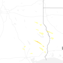
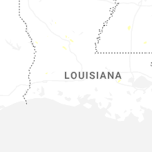
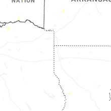


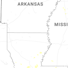

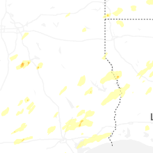


Connect with Interactive Hail Maps