

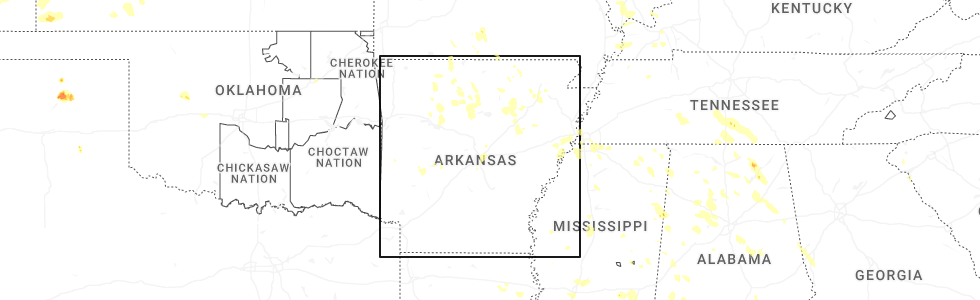
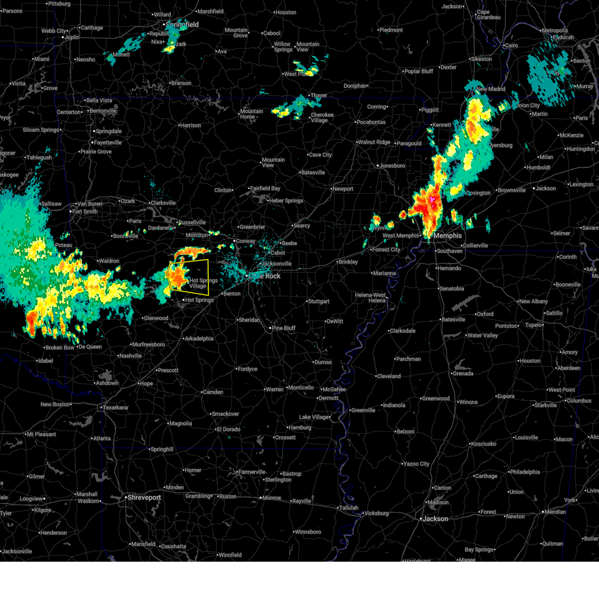
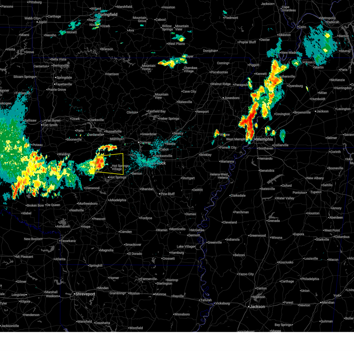
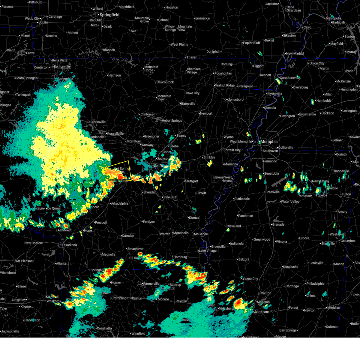
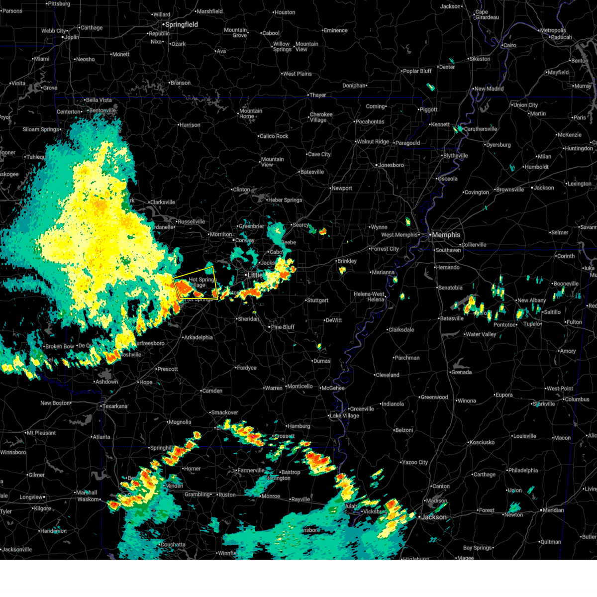
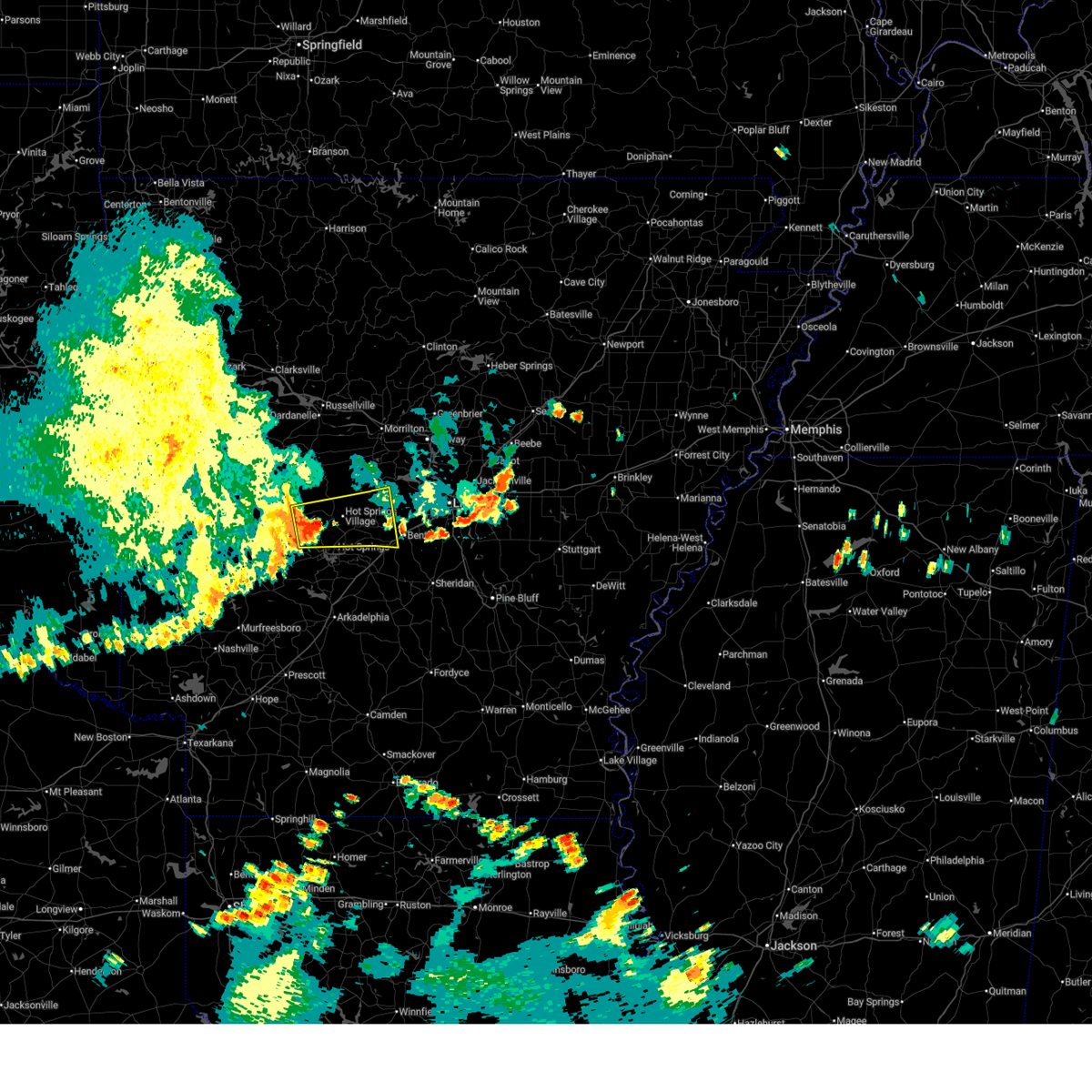
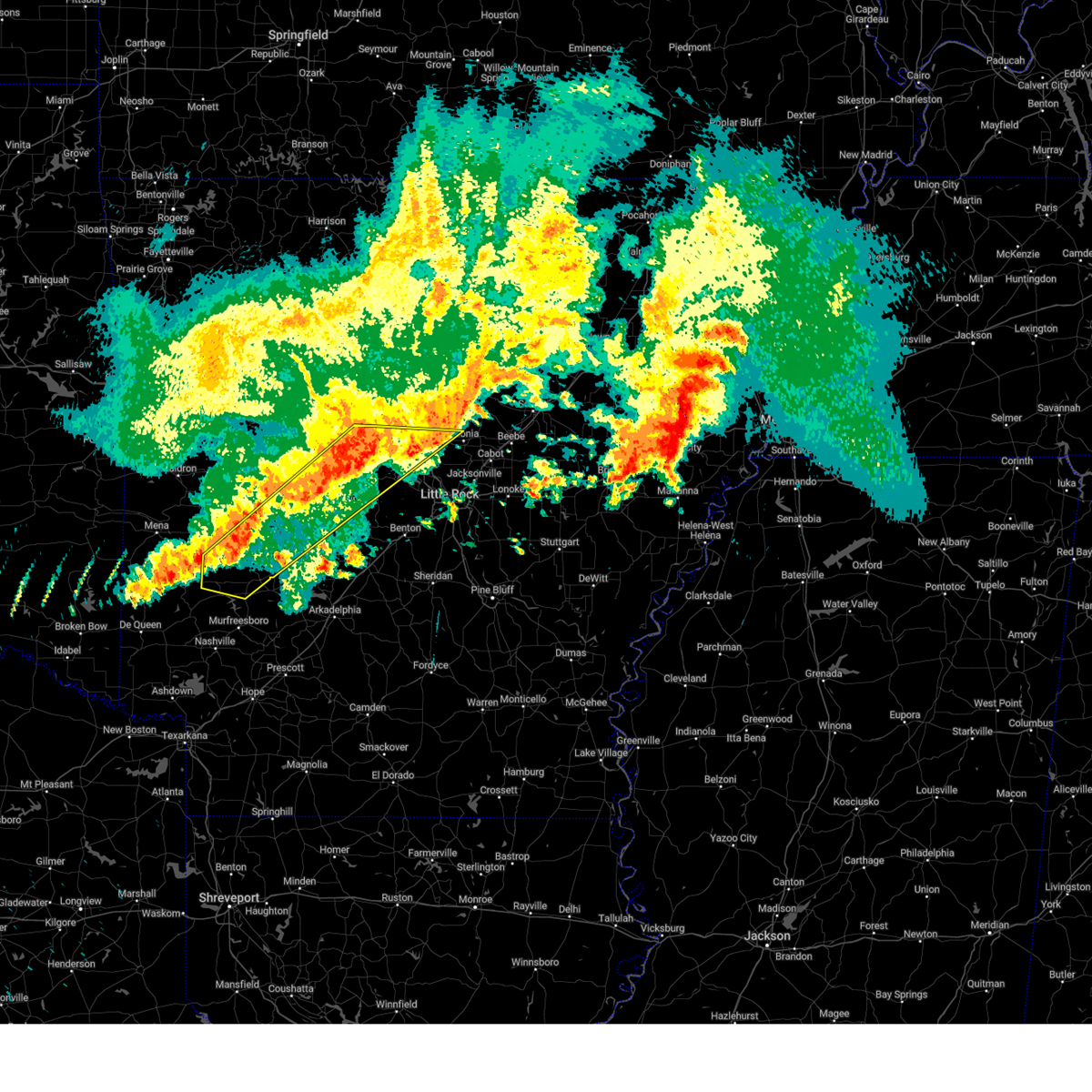
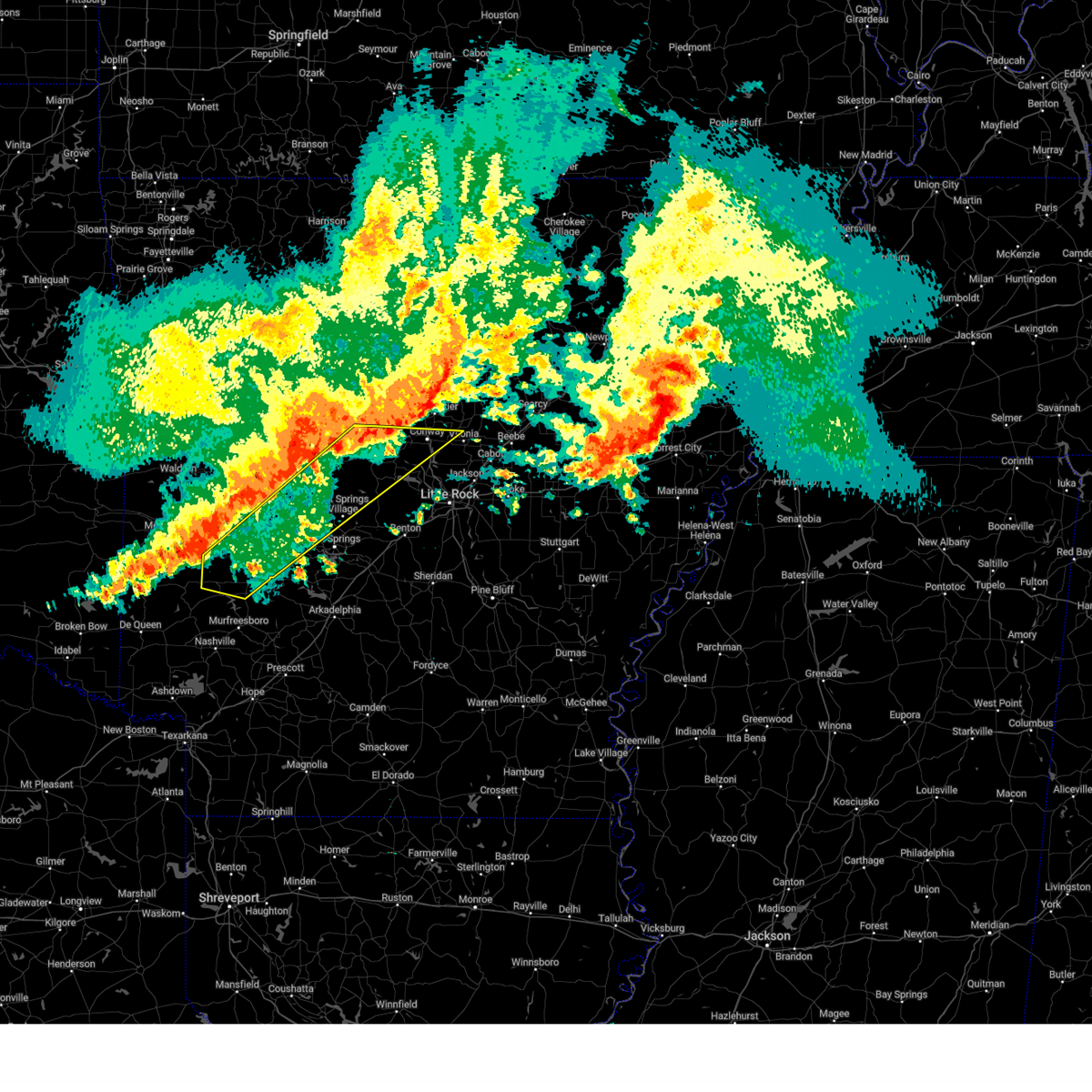
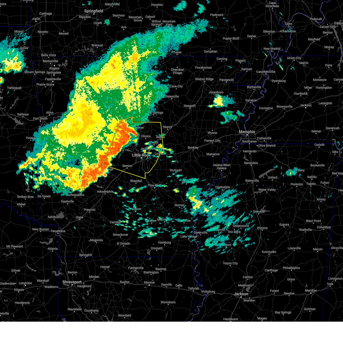
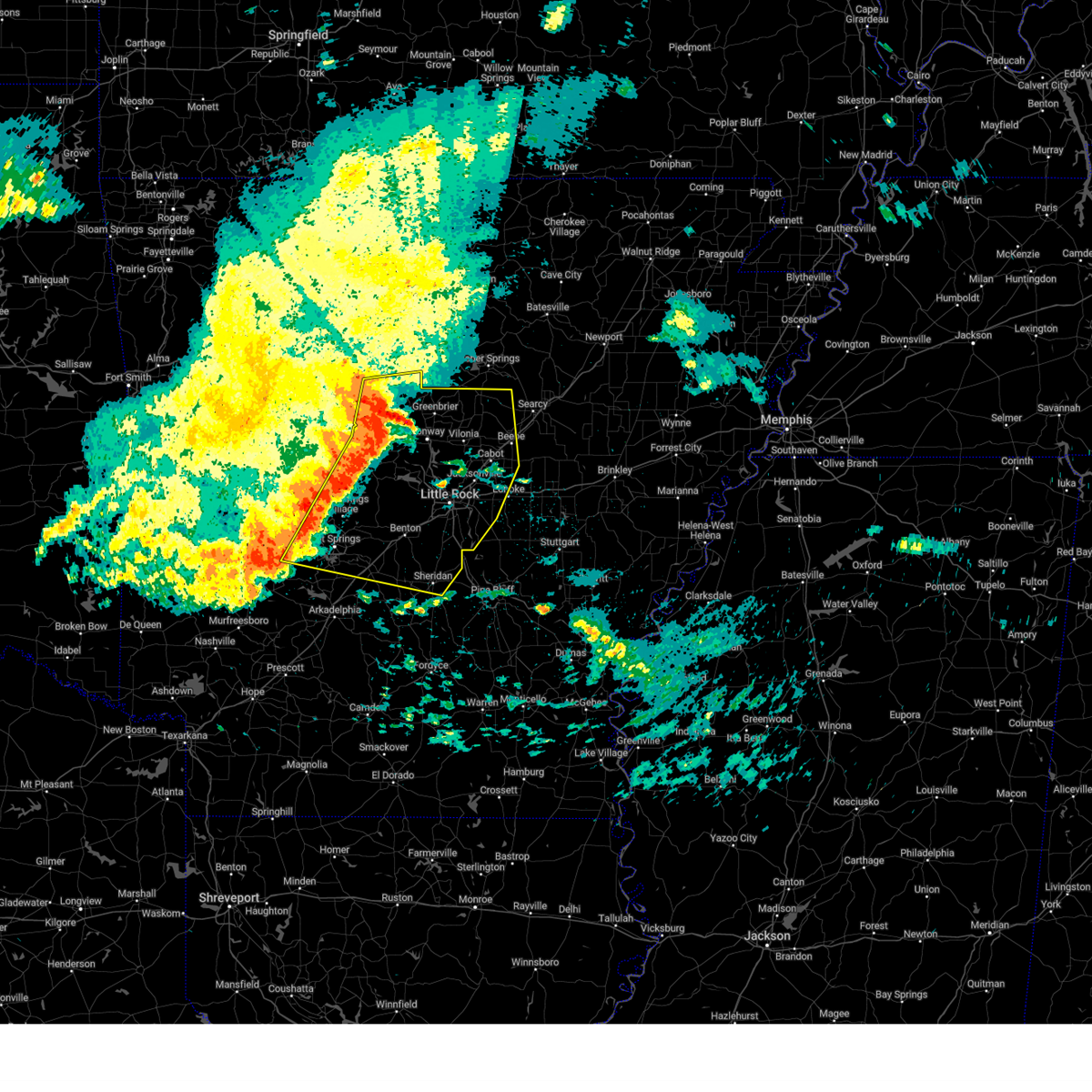
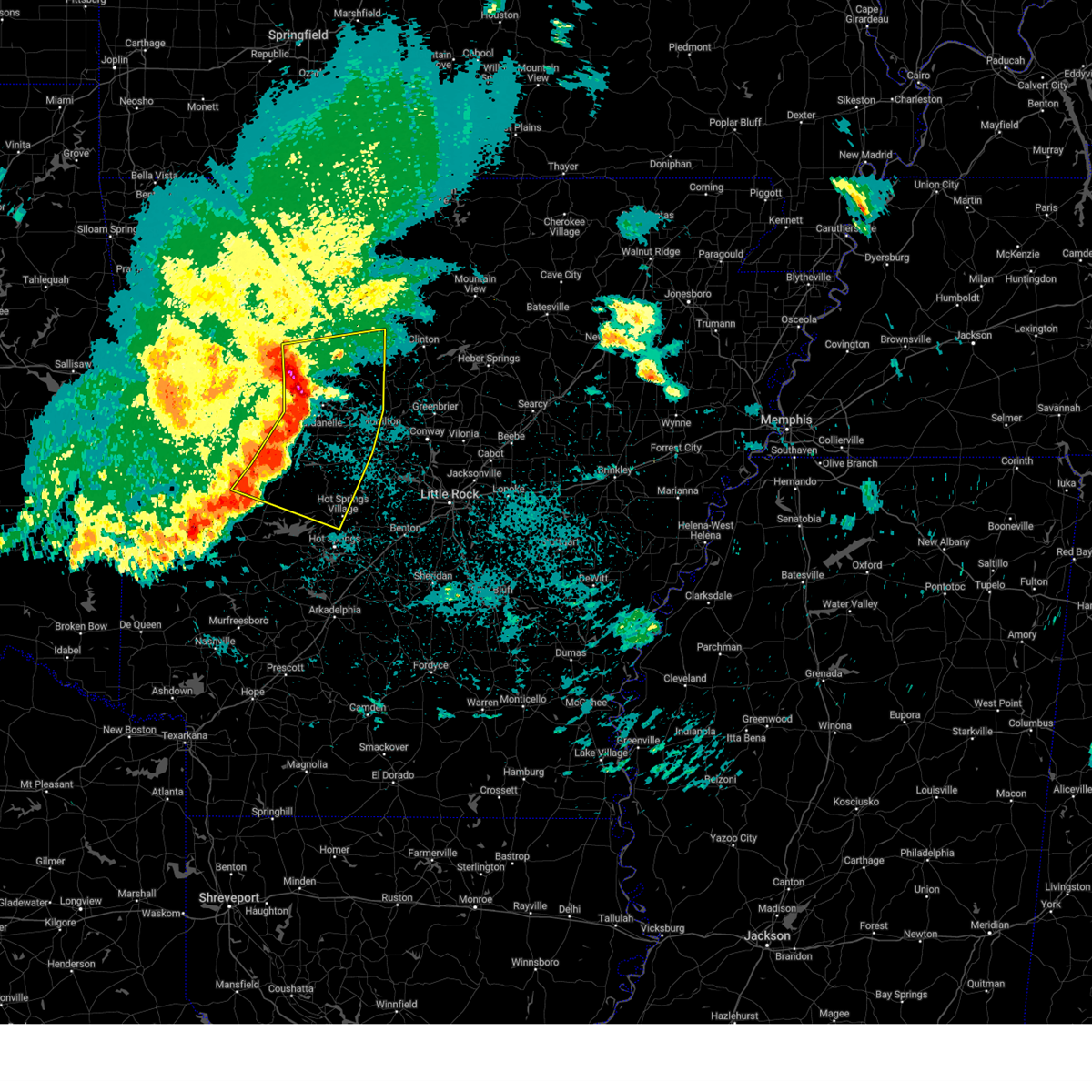
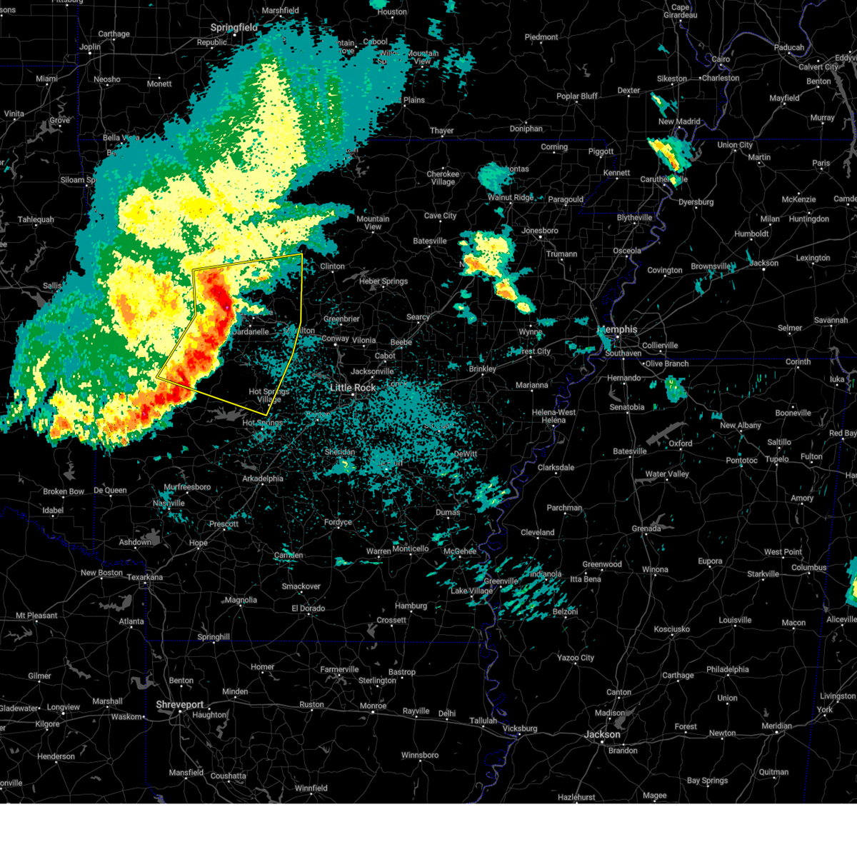
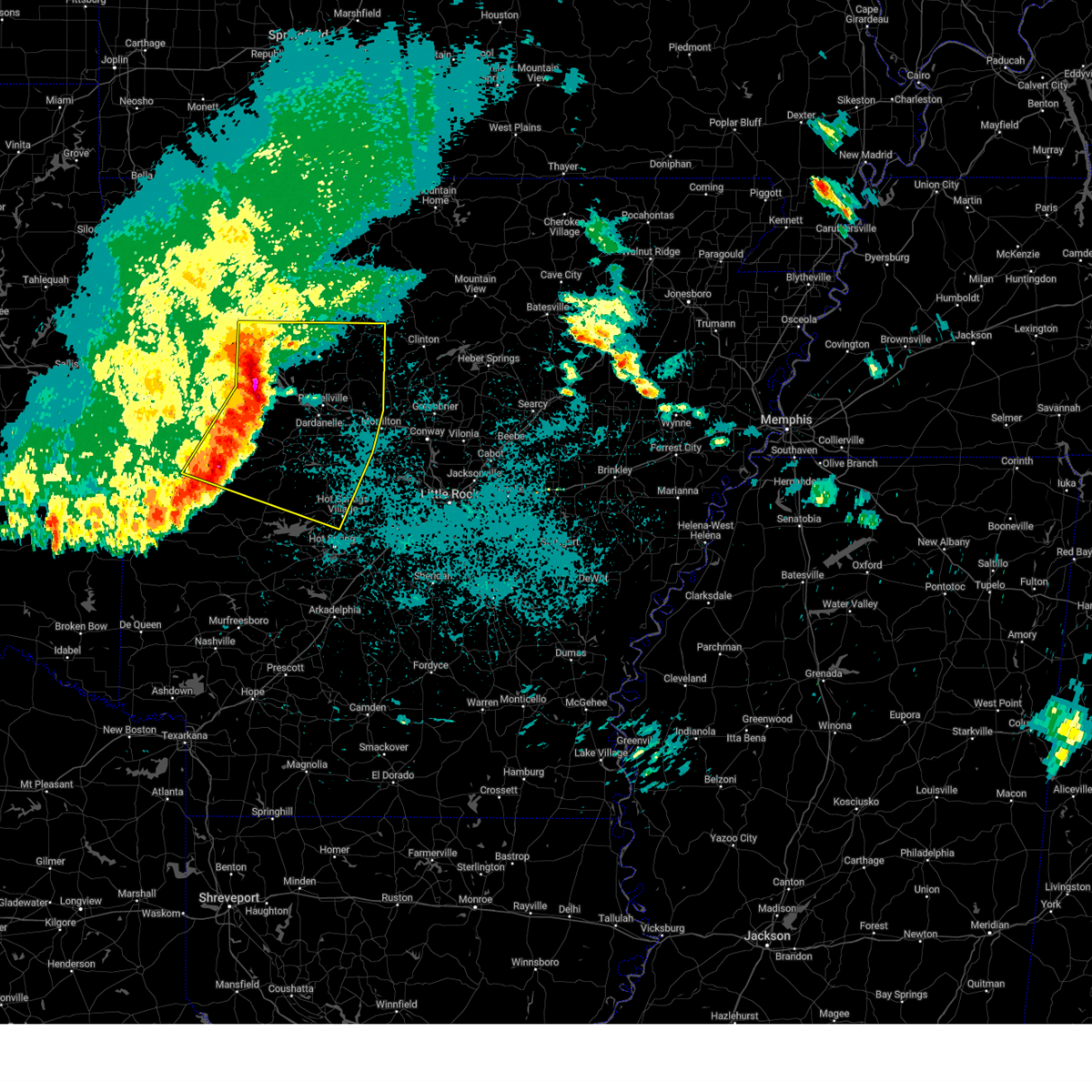
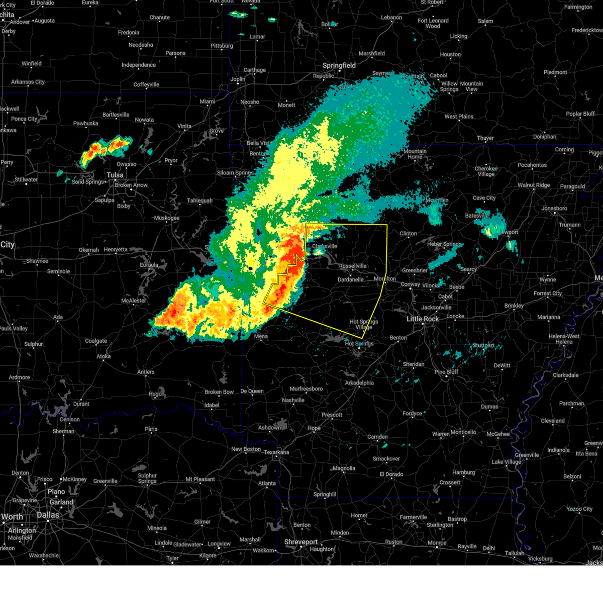
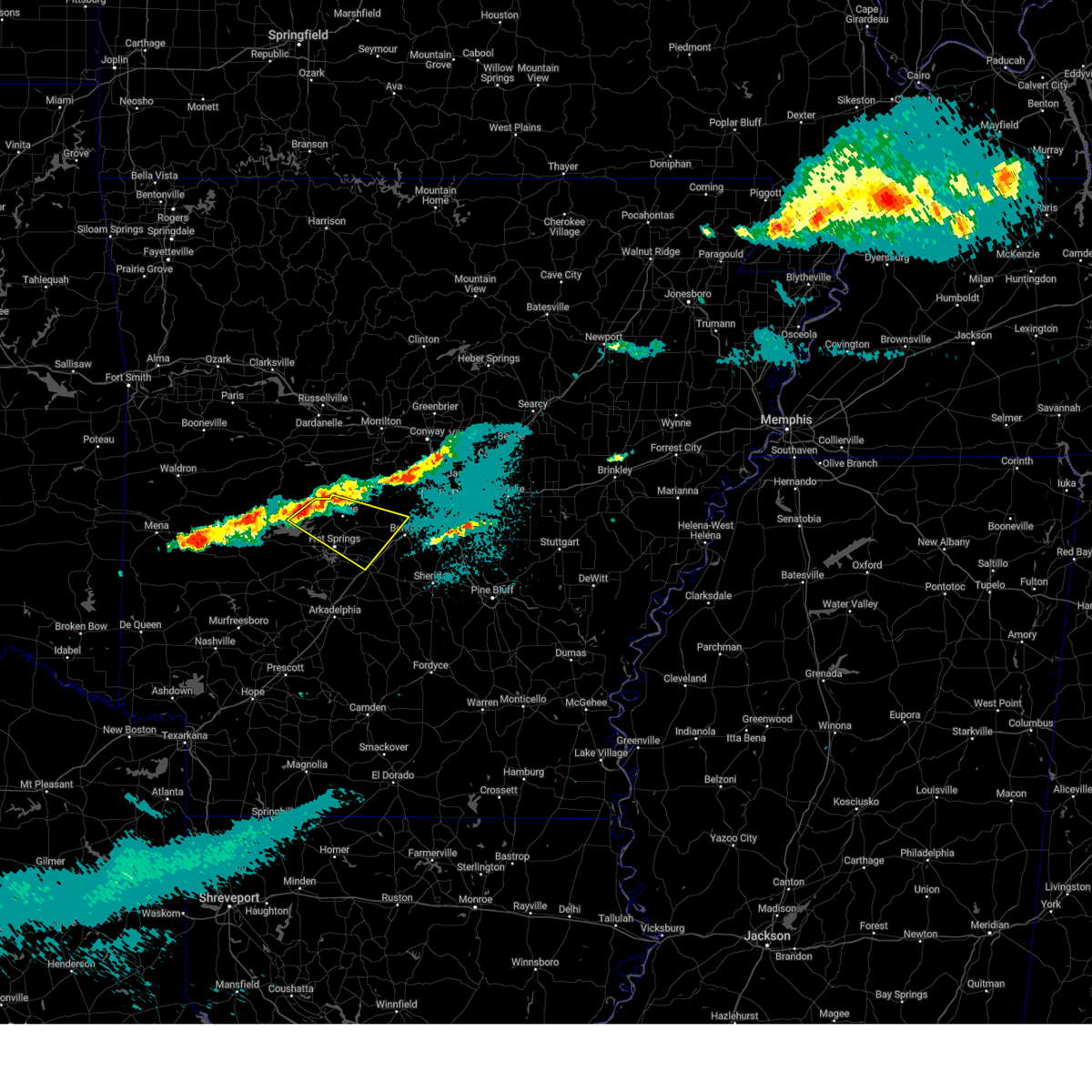
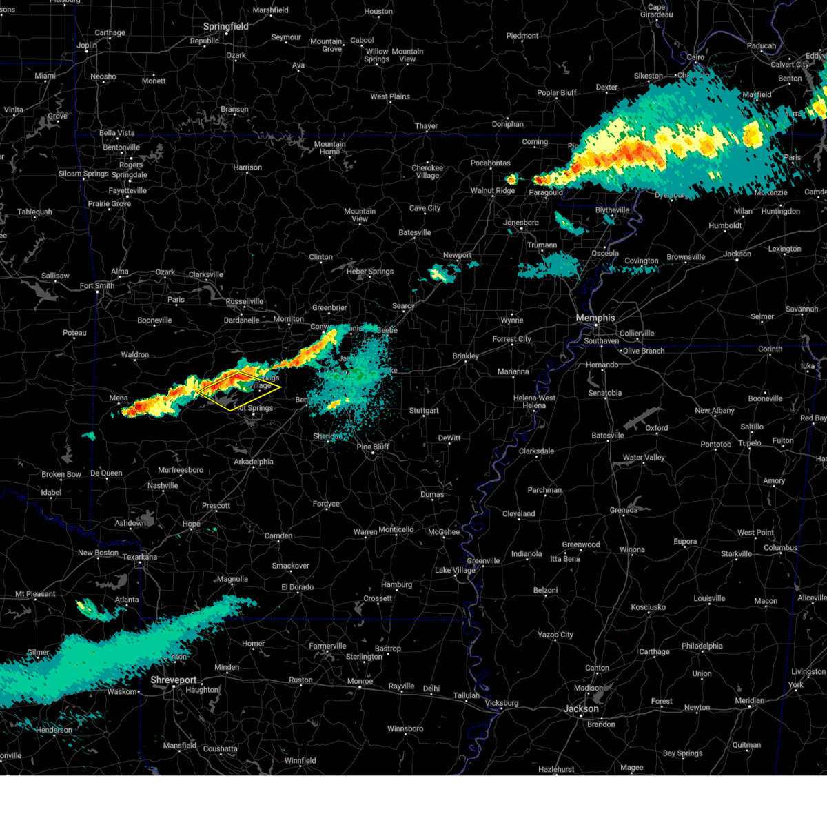
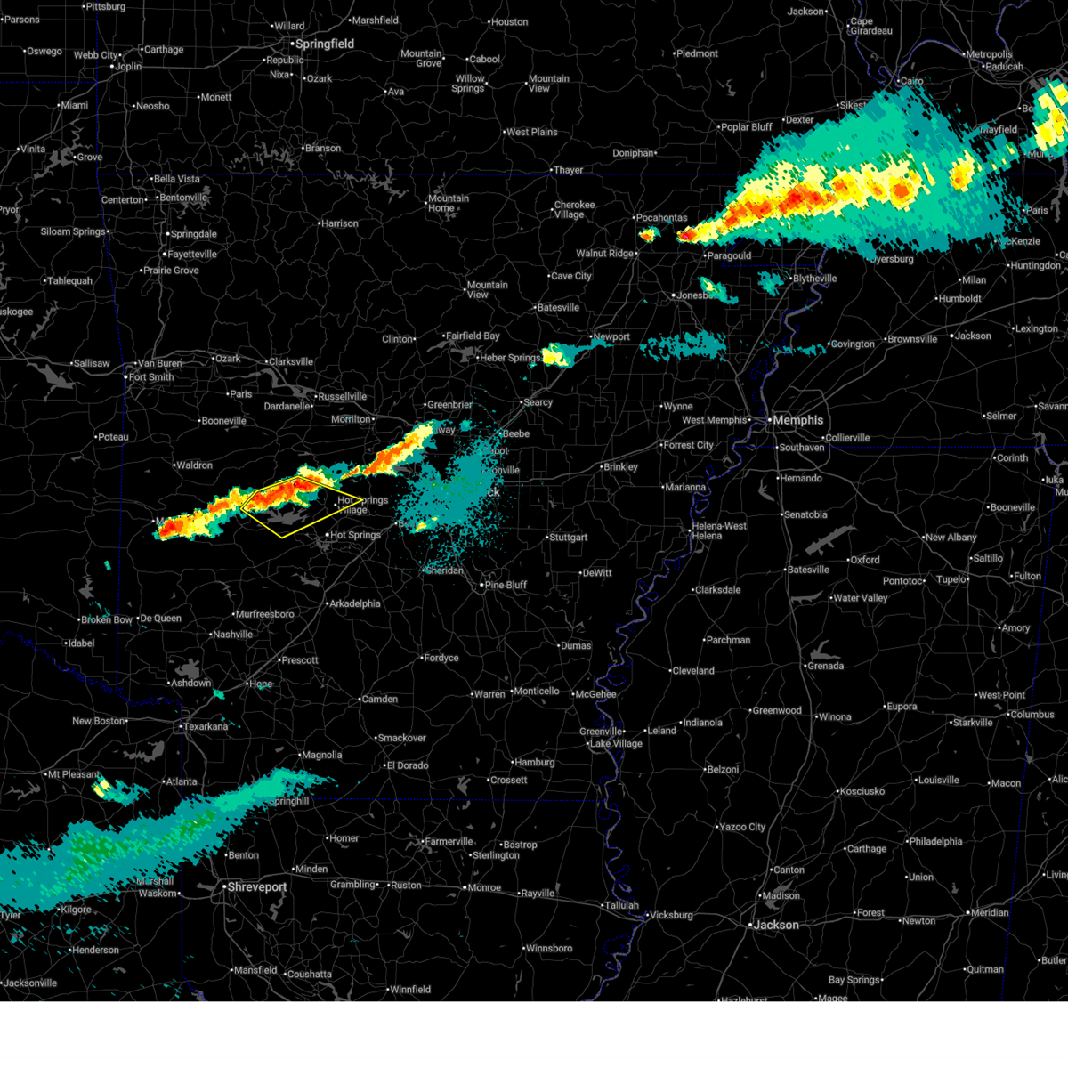
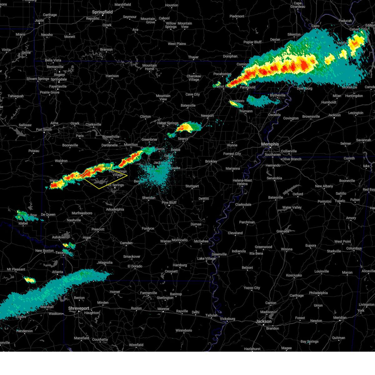
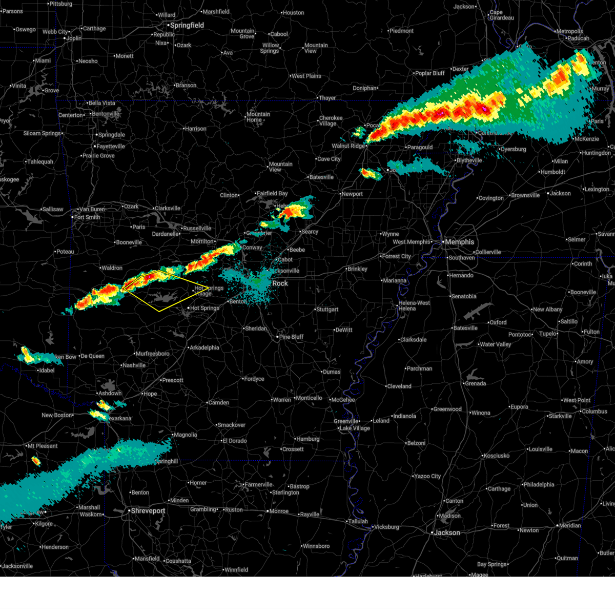
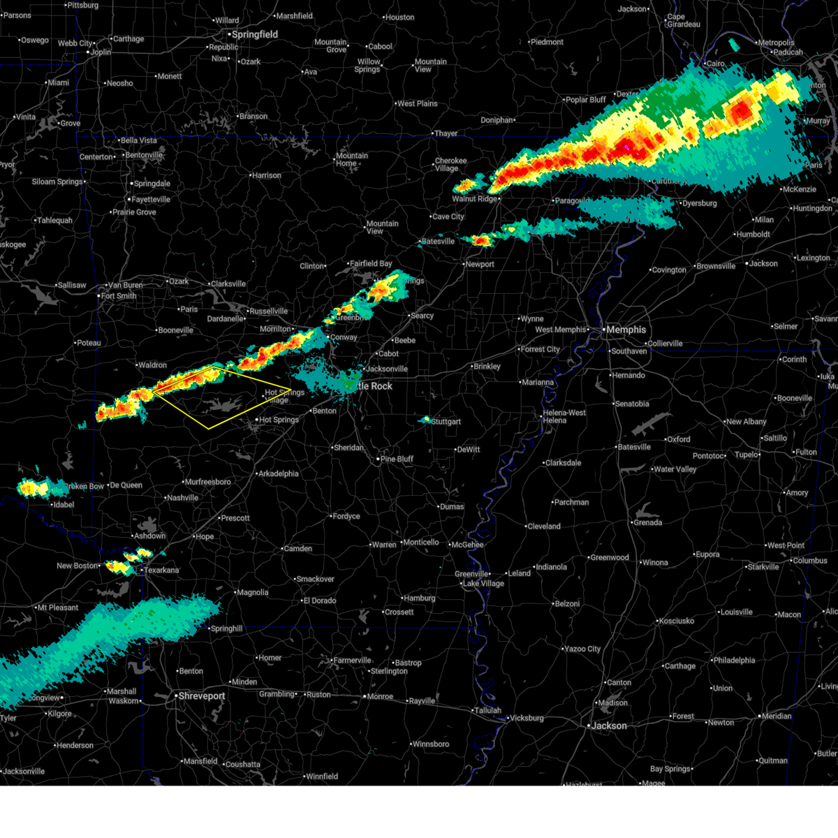
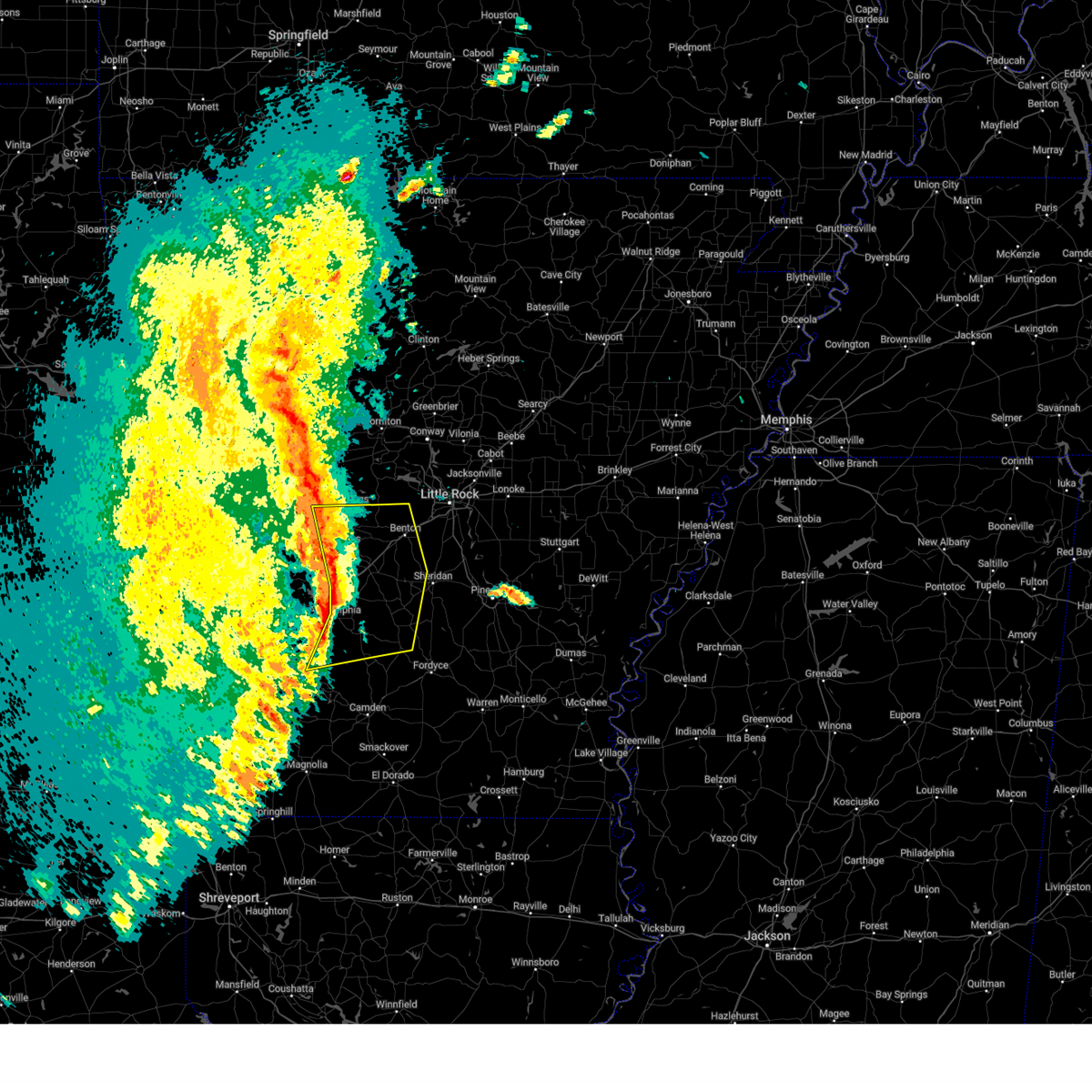
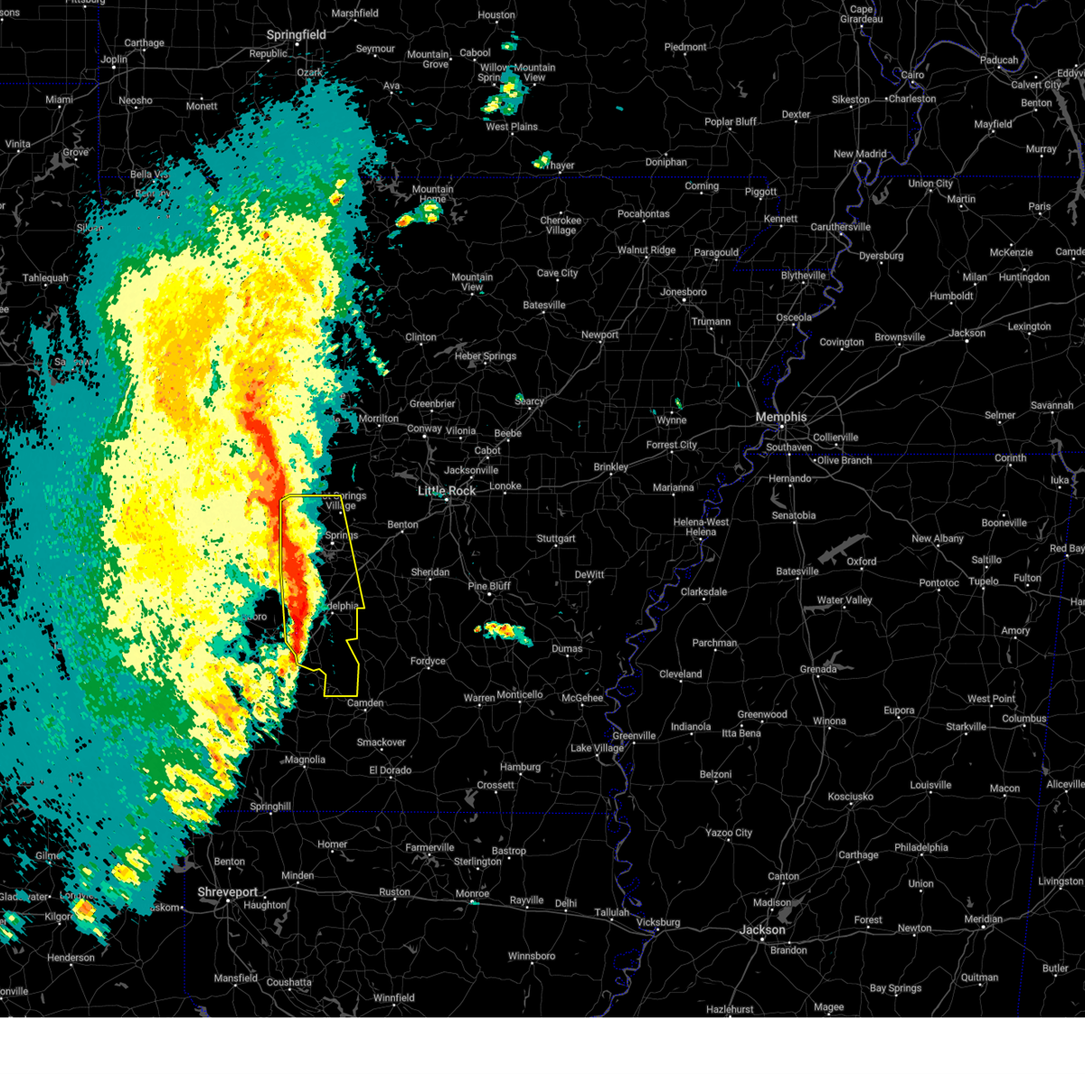
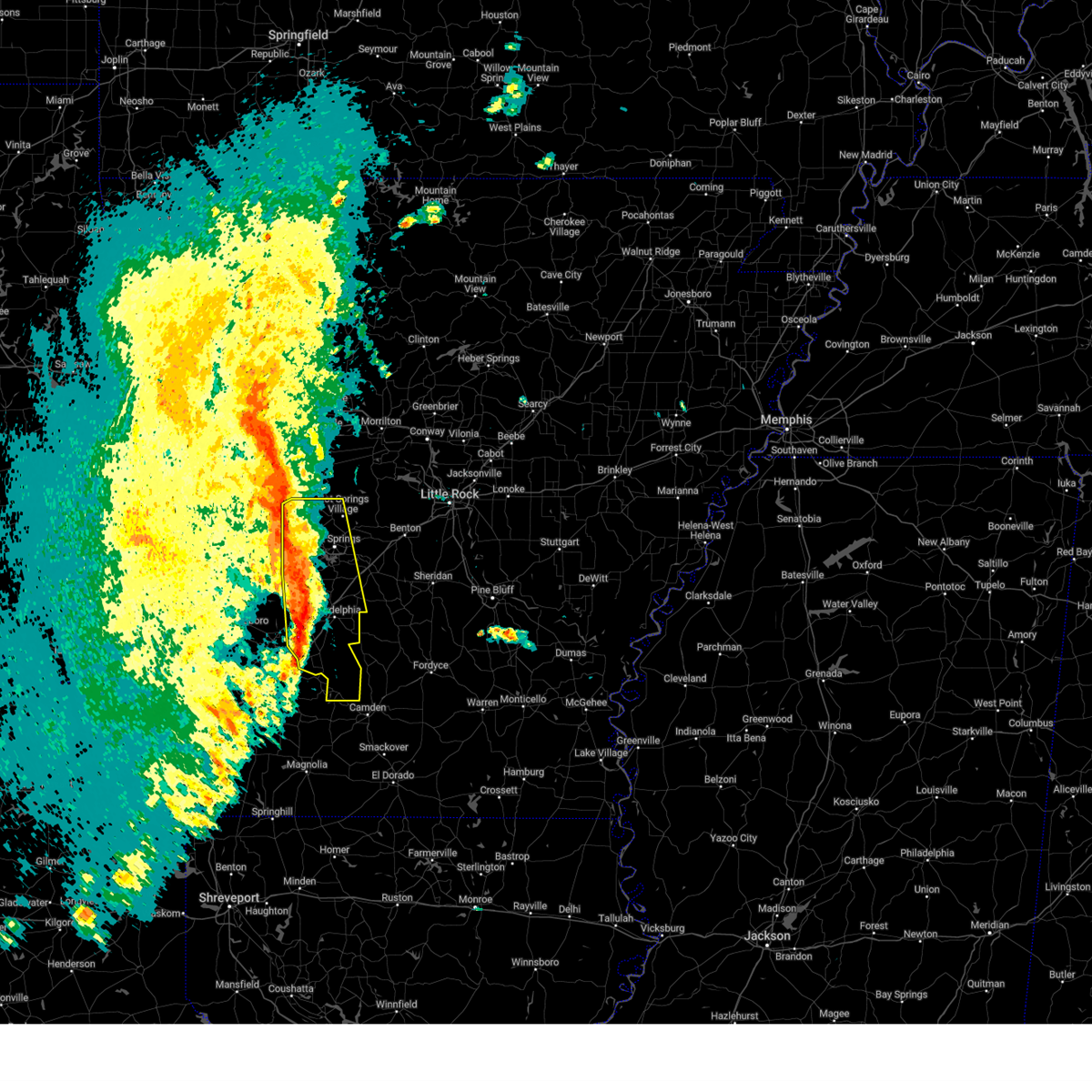
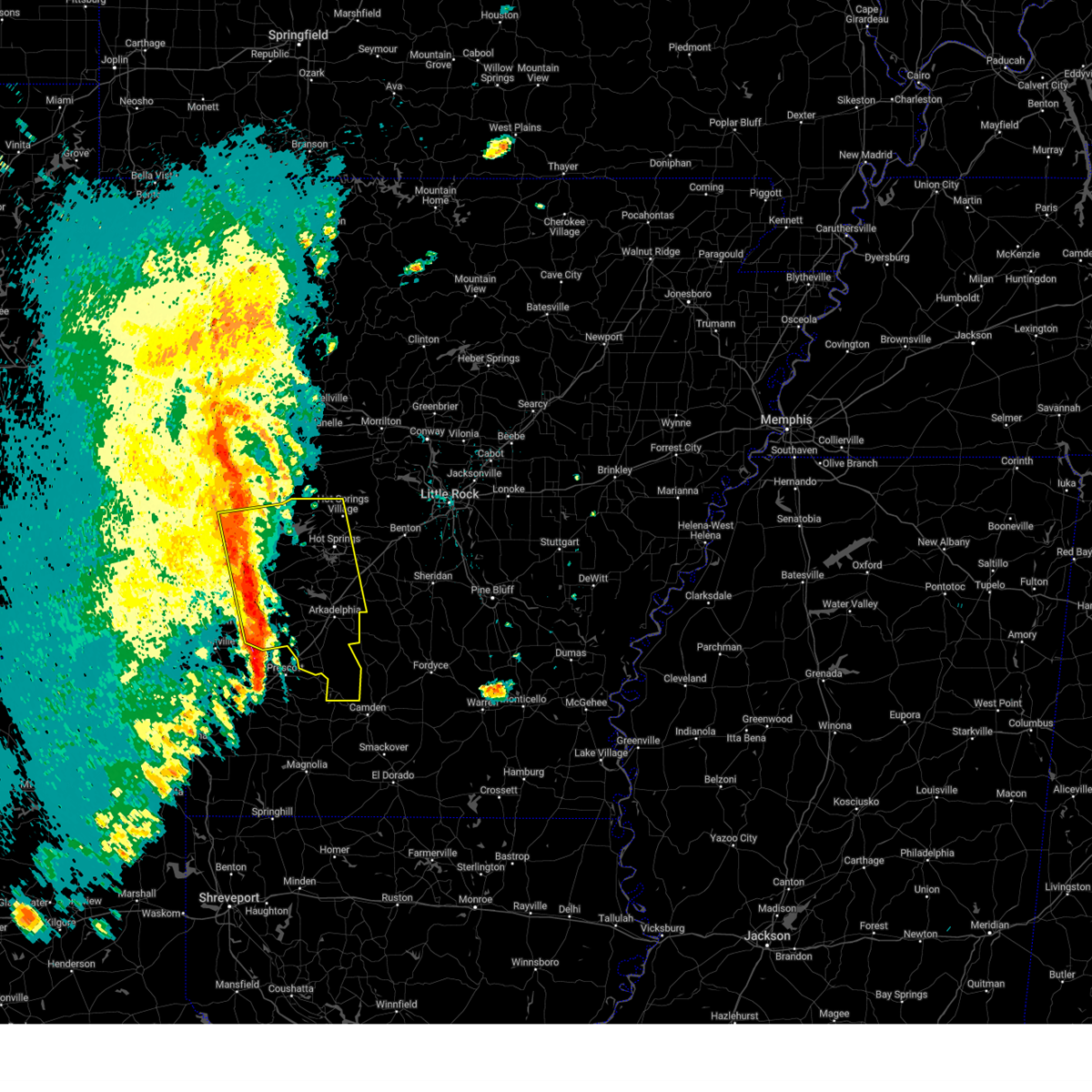
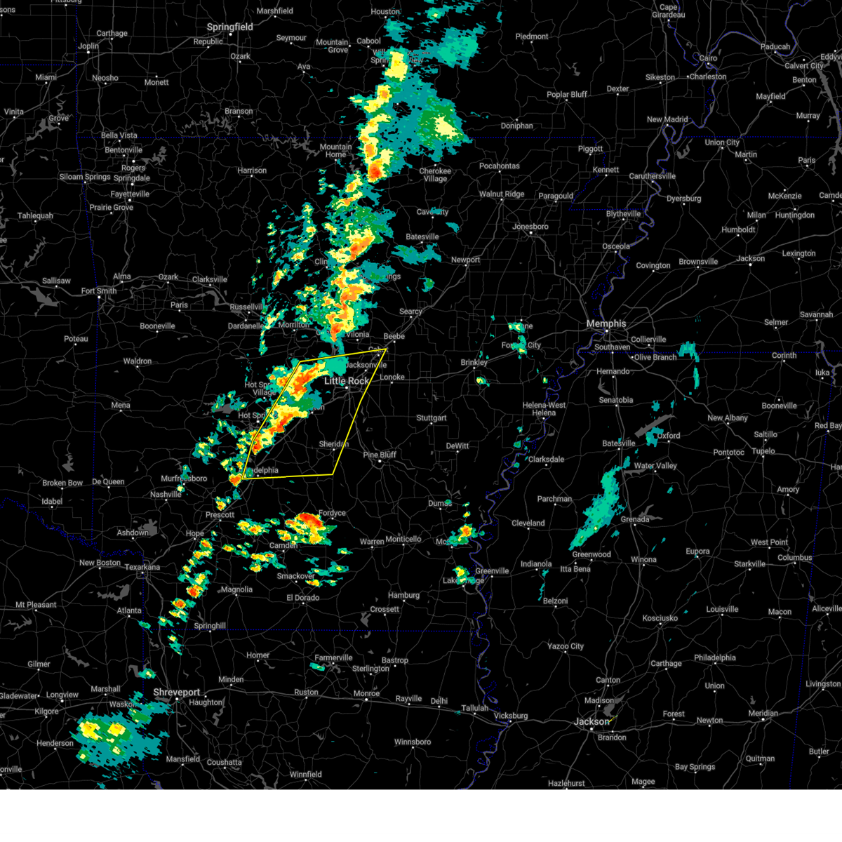
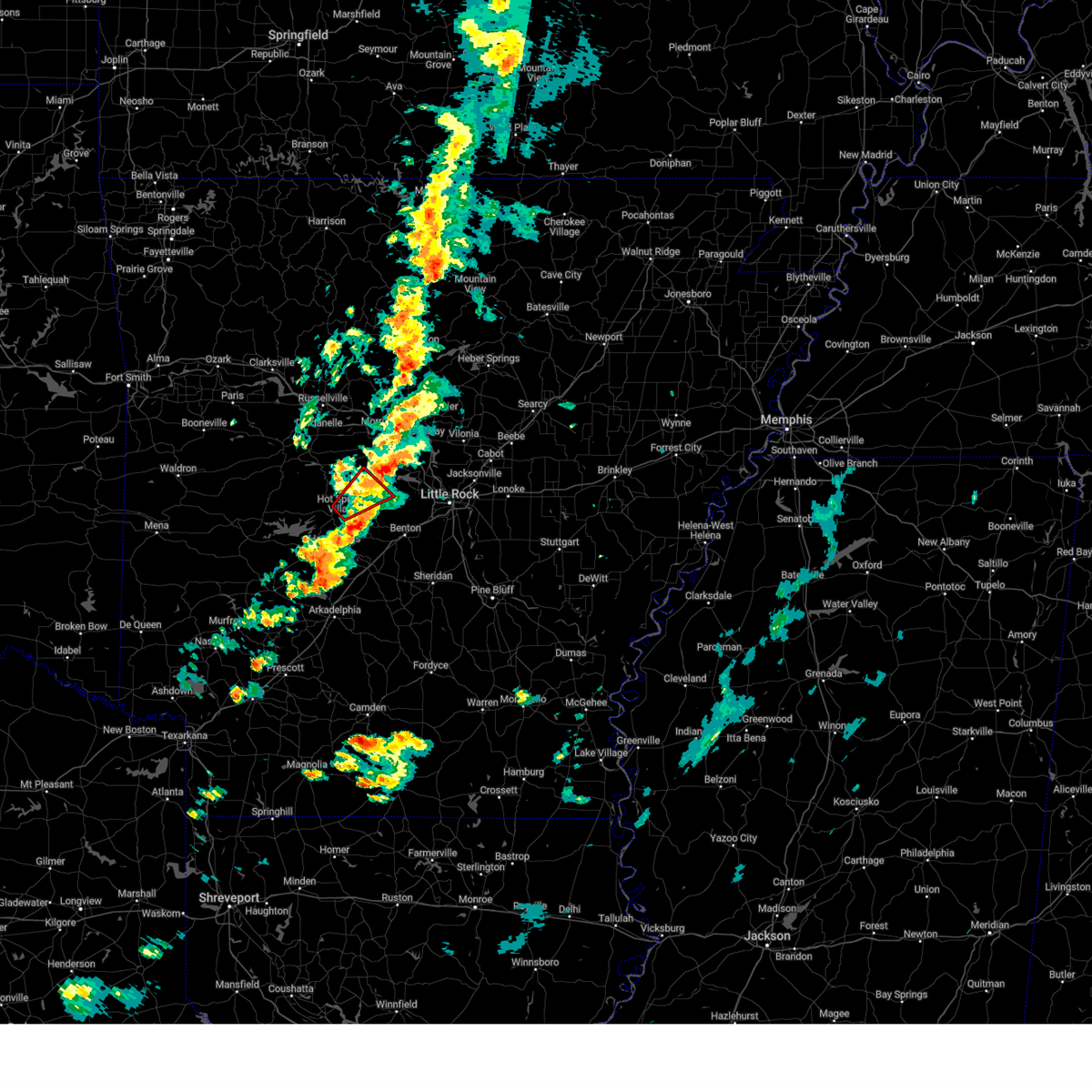
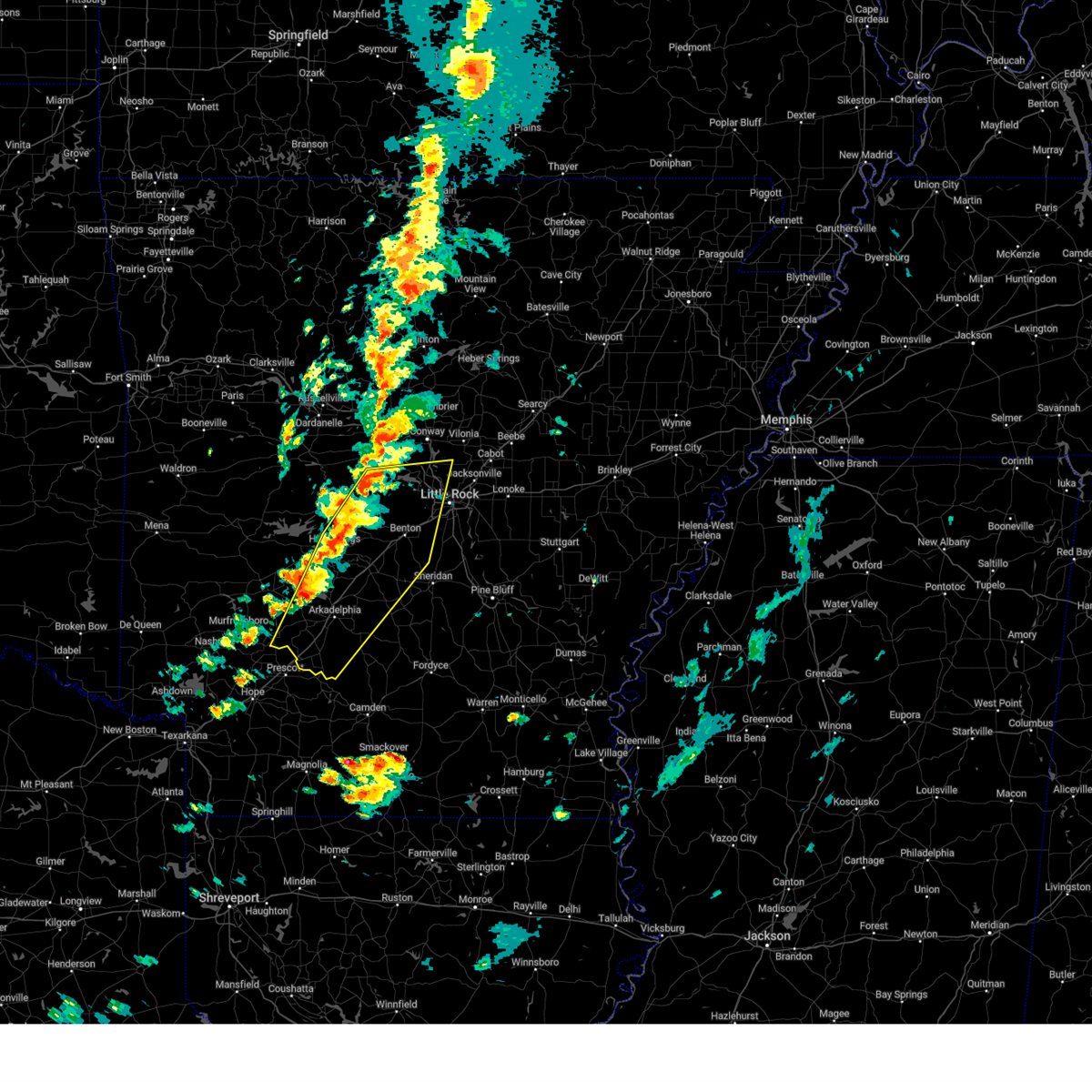
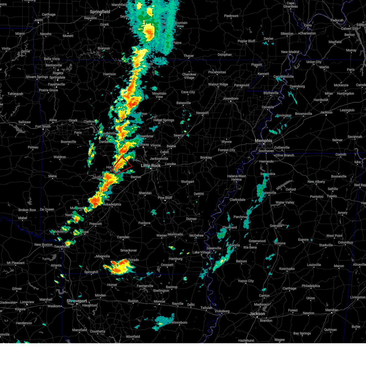
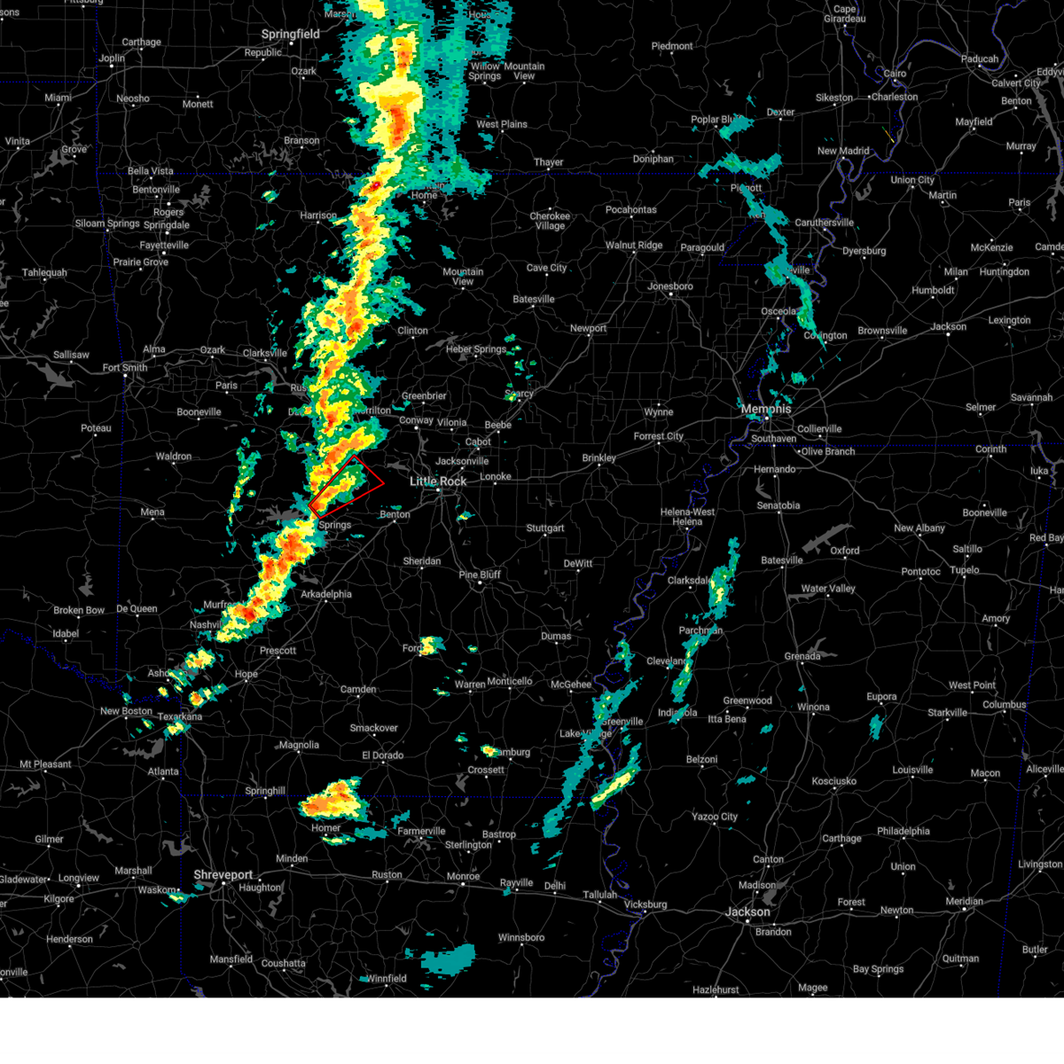
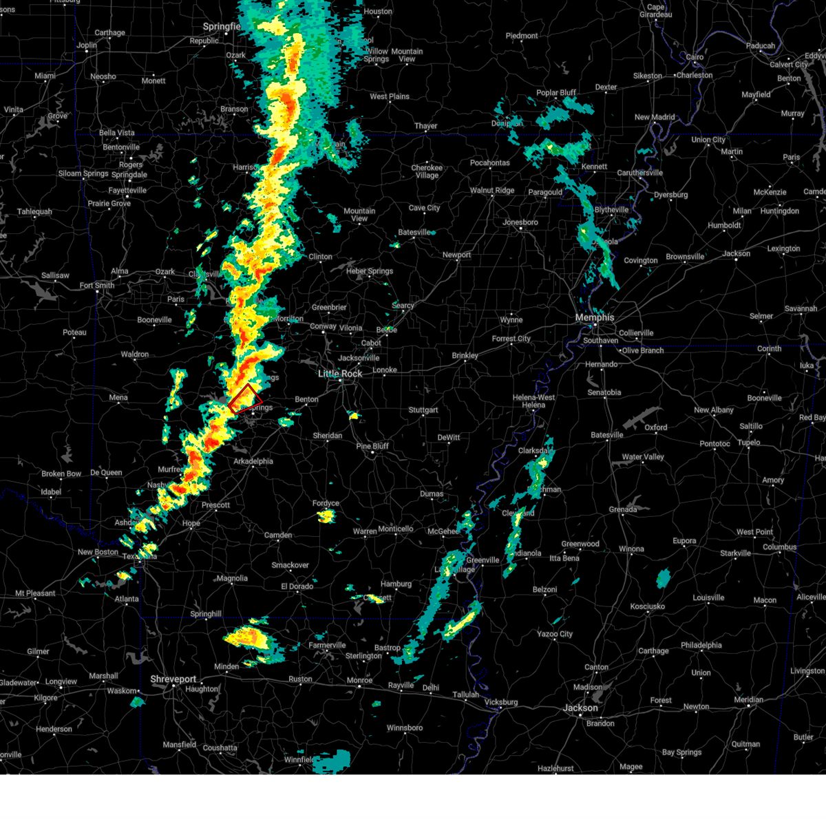
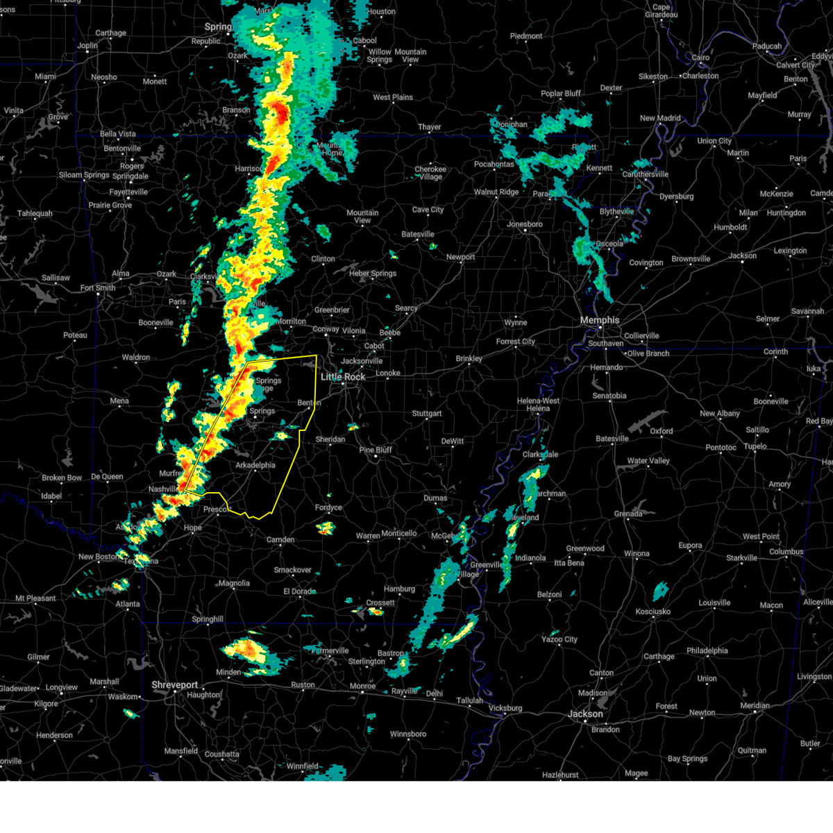
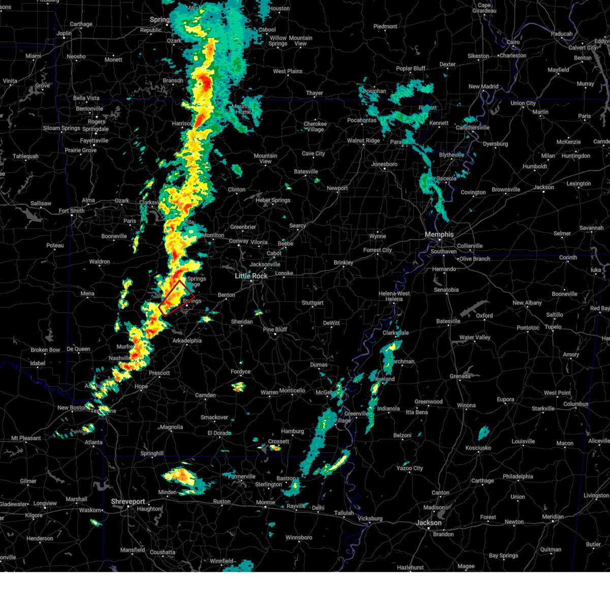
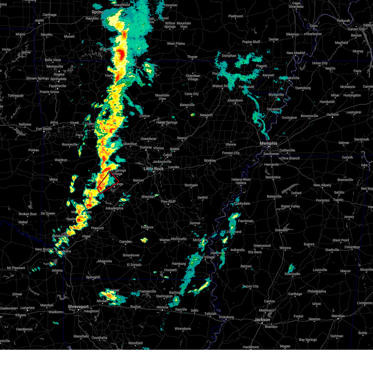
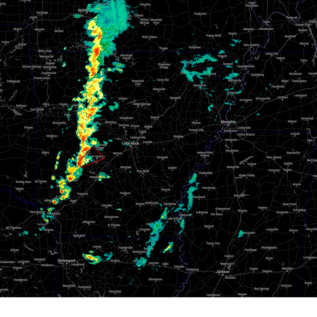
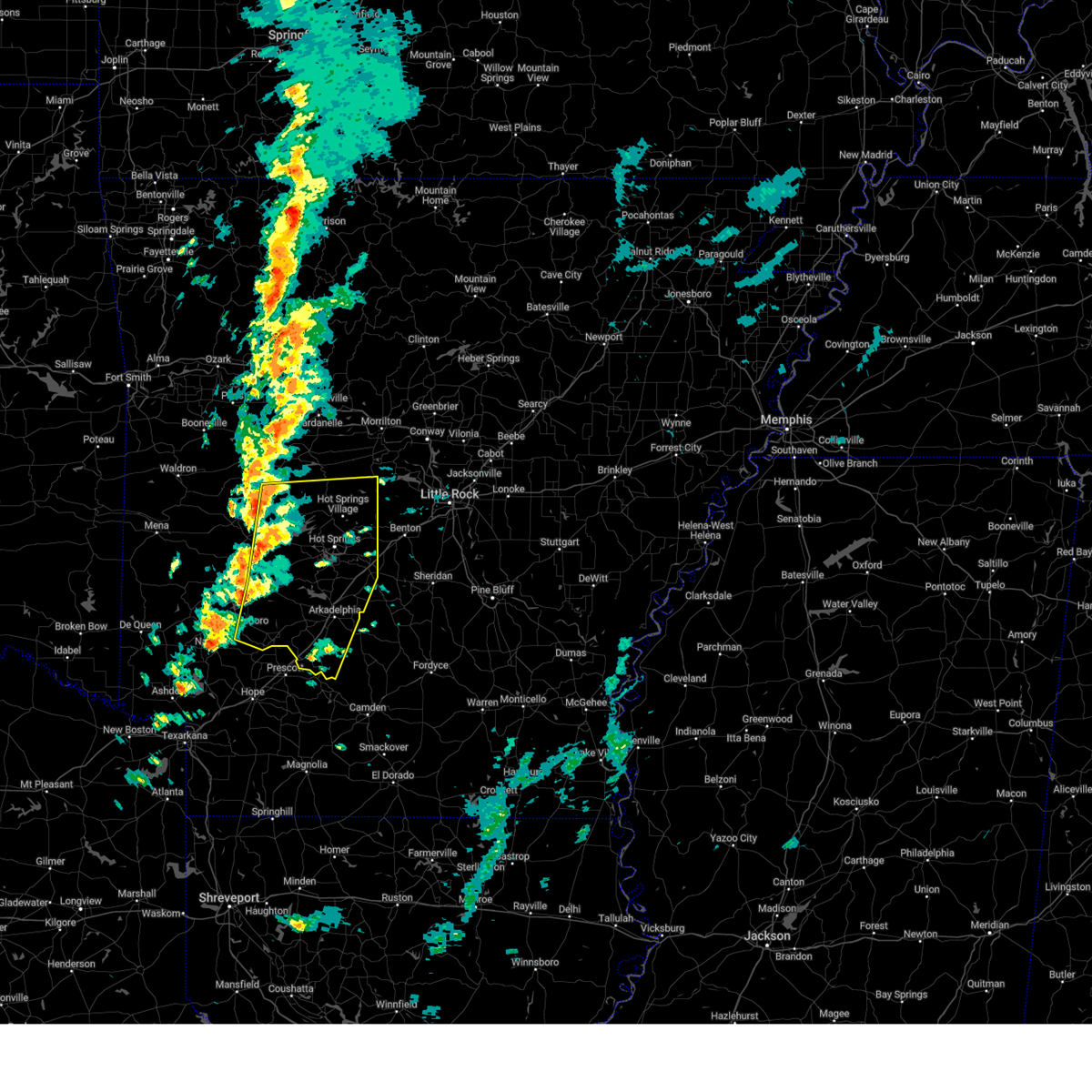
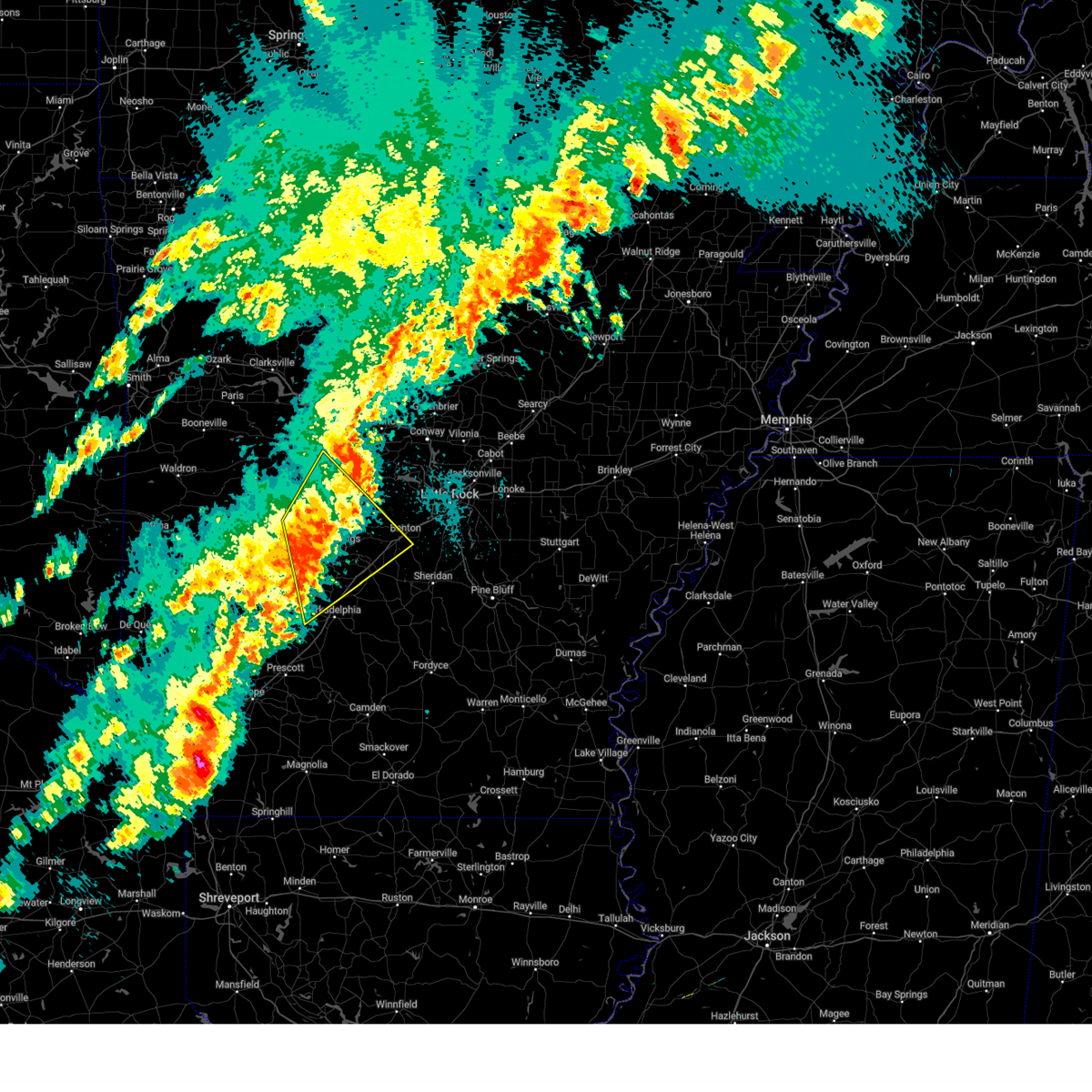
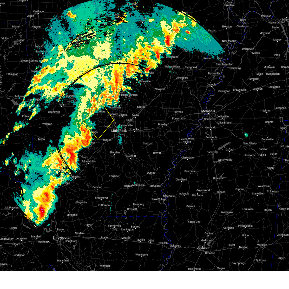
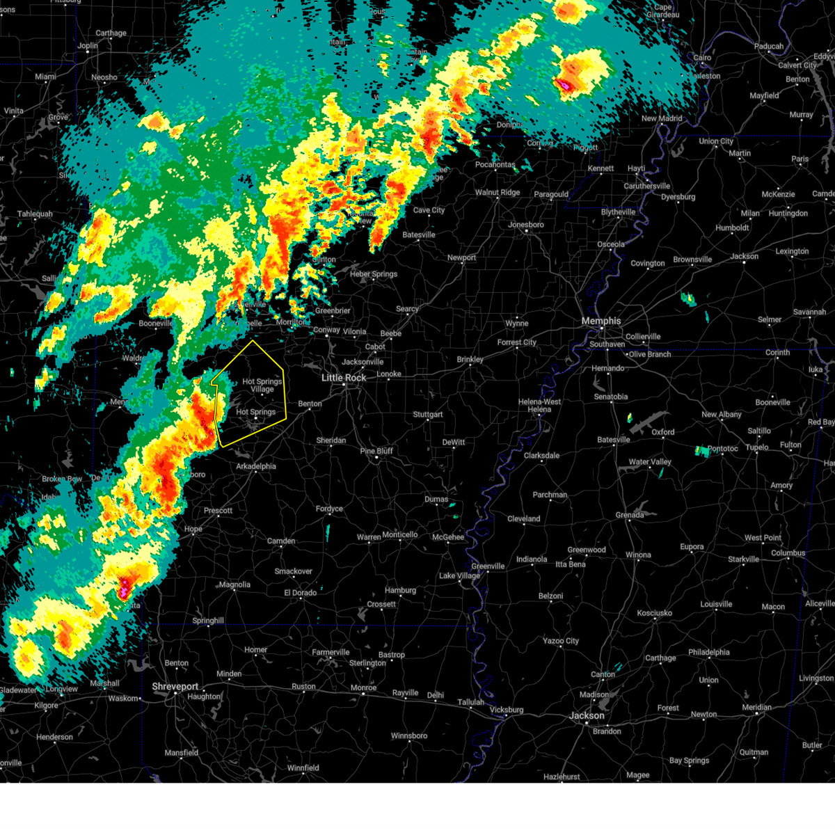
Hail Map for Hot Springs Village, AR
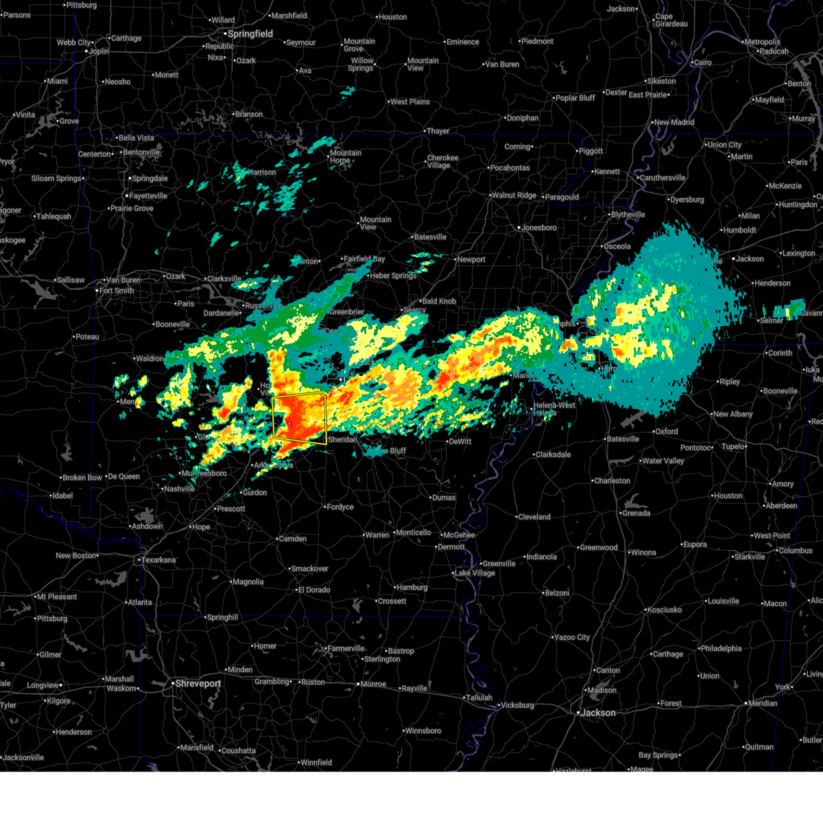
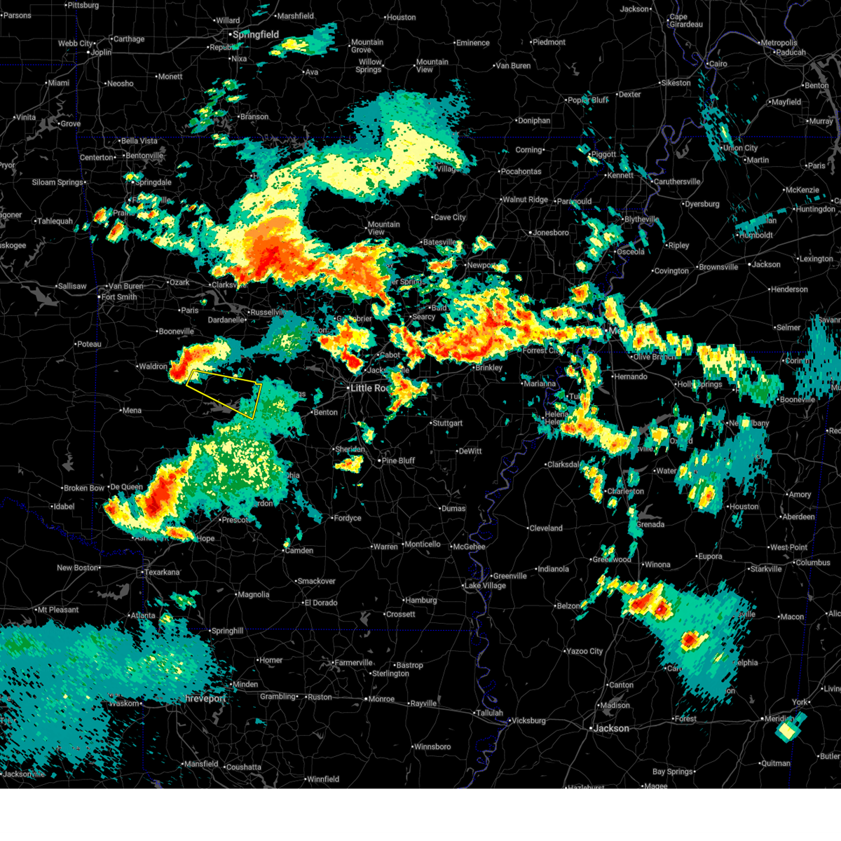
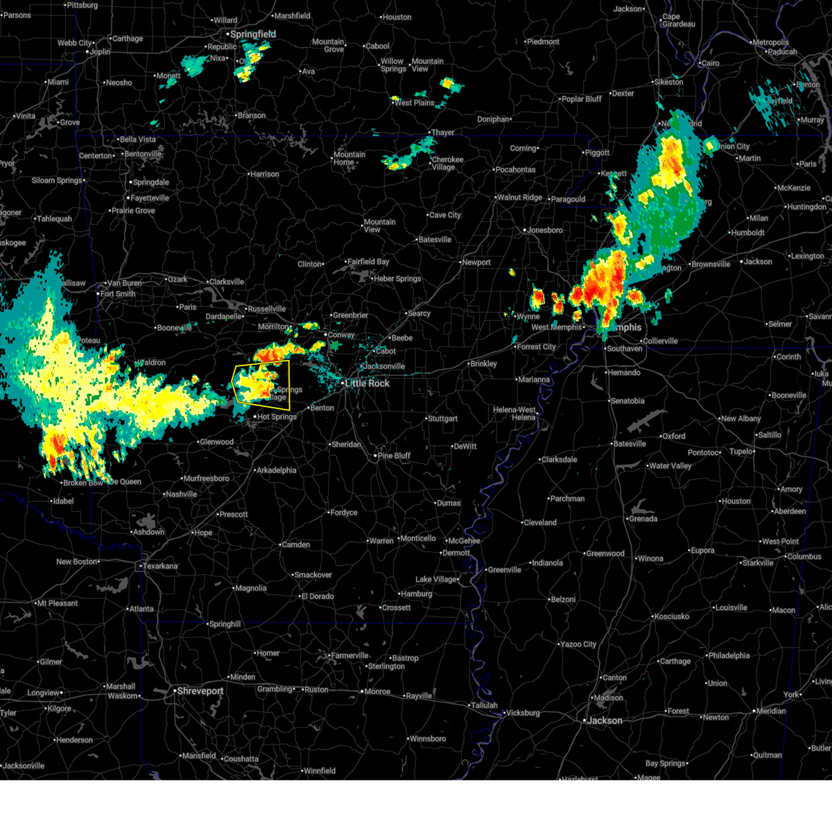
The Hot Springs Village, AR area has had 20 reports of on-the-ground hail by trained spotters, and has been under severe weather warnings 15 times during the past 12 months. Doppler radar has detected hail at or near Hot Springs Village, AR on 125 occasions, including 4 occasions during the past year.
| Name: | Hot Springs Village, AR |
| Where Located: | 38.9 miles W of Little Rock, AR |
| Map: | Google Map for Hot Springs Village, AR |
| Population: | 12807 |
| Housing Units: | 7963 |
| More Info: | Search Google for Hot Springs Village, AR |
0
The Top Recent Hail Date for Hot Springs Village, AR is Monday, June 1, 2026 (82nd out of 125)
Hail and Wind Damage Spotted near Hot Springs Village, AR
| Date / Time | Report Details |
|---|---|
| 5/6/2026 3:17 AM CDT |
 At 317 am cdt, a severe thunderstorm was located over traskwood, or 7 miles northeast of malvern, moving east at 60 mph (radar indicated). Hazards include golf ball size hail. People and animals outdoors will be injured. expect damage to roofs, siding, windows, and vehicles. Locations impacted include, benton, bryant, malvern, sheridan, haskell, shannon hills, rockport, traskwood, tull, prattsville, poyen, perla, lonsdale, salem in saline county, otter creek, jenkins ferry state park, alexander, bauxite, belfast, magnet cove,. At 317 am cdt, a severe thunderstorm was located over traskwood, or 7 miles northeast of malvern, moving east at 60 mph (radar indicated). Hazards include golf ball size hail. People and animals outdoors will be injured. expect damage to roofs, siding, windows, and vehicles. Locations impacted include, benton, bryant, malvern, sheridan, haskell, shannon hills, rockport, traskwood, tull, prattsville, poyen, perla, lonsdale, salem in saline county, otter creek, jenkins ferry state park, alexander, bauxite, belfast, magnet cove,.
|
| 5/6/2026 3:00 AM CDT |
 Svrlzk the national weather service in little rock has issued a * severe thunderstorm warning for, northwestern grant county in central arkansas, southeastern garland county in central arkansas, southeastern saline county in central arkansas, northeastern hot spring county in southwestern arkansas, * until 345 am cdt. * at 300 am cdt, a severe thunderstorm was located near hot springs, moving east at 60 mph (radar indicated). Hazards include quarter size hail. damage to vehicles is expected Svrlzk the national weather service in little rock has issued a * severe thunderstorm warning for, northwestern grant county in central arkansas, southeastern garland county in central arkansas, southeastern saline county in central arkansas, northeastern hot spring county in southwestern arkansas, * until 345 am cdt. * at 300 am cdt, a severe thunderstorm was located near hot springs, moving east at 60 mph (radar indicated). Hazards include quarter size hail. damage to vehicles is expected
|
| 5/6/2026 2:34 AM CDT |
 Svrlzk the national weather service in little rock has issued a * severe thunderstorm warning for, northwestern clark county in southwestern arkansas, north central pike county in southwestern arkansas, southern garland county in central arkansas, western saline county in central arkansas, central hot spring county in southwestern arkansas, southeastern montgomery county in western arkansas, * until 315 am cdt. * at 234 am cdt, a severe thunderstorm was located near glenwood, or 10 miles southeast of mount ida, moving east at 50 mph (radar indicated). Hazards include quarter size hail. damage to vehicles is expected Svrlzk the national weather service in little rock has issued a * severe thunderstorm warning for, northwestern clark county in southwestern arkansas, north central pike county in southwestern arkansas, southern garland county in central arkansas, western saline county in central arkansas, central hot spring county in southwestern arkansas, southeastern montgomery county in western arkansas, * until 315 am cdt. * at 234 am cdt, a severe thunderstorm was located near glenwood, or 10 miles southeast of mount ida, moving east at 50 mph (radar indicated). Hazards include quarter size hail. damage to vehicles is expected
|
| 4/28/2026 7:29 PM CDT |
 the severe thunderstorm warning has been cancelled and is no longer in effect the severe thunderstorm warning has been cancelled and is no longer in effect
|
| 4/28/2026 7:04 PM CDT |
 Svrlzk the national weather service in little rock has issued a * severe thunderstorm warning for, southwestern perry county in central arkansas, northwestern garland county in central arkansas, southwestern yell county in central arkansas, northeastern montgomery county in western arkansas, * until 745 pm cdt. * at 704 pm cdt, a severe thunderstorm was located near muddy creek wma, or 16 miles north of mount ida, moving east at 45 mph (radar indicated). Hazards include 60 mph wind gusts and quarter size hail. Hail damage to vehicles is expected. Expect wind damage to roofs, siding, and trees. Svrlzk the national weather service in little rock has issued a * severe thunderstorm warning for, southwestern perry county in central arkansas, northwestern garland county in central arkansas, southwestern yell county in central arkansas, northeastern montgomery county in western arkansas, * until 745 pm cdt. * at 704 pm cdt, a severe thunderstorm was located near muddy creek wma, or 16 miles north of mount ida, moving east at 45 mph (radar indicated). Hazards include 60 mph wind gusts and quarter size hail. Hail damage to vehicles is expected. Expect wind damage to roofs, siding, and trees.
|
| 3/15/2026 5:12 PM CDT |
 A tornado watch remains in effect until 900 pm cdt for central and southwestern arkansas. remember, a severe thunderstorm warning still remains in effect for garland and hot spring counties until 6 pm cdt. A tornado watch remains in effect until 900 pm cdt for central and southwestern arkansas. remember, a severe thunderstorm warning still remains in effect for garland and hot spring counties until 6 pm cdt.
|
| 3/15/2026 4:53 PM CDT |
 At 453 pm cdt, severe thunderstorms were located along a line extending from hot springs national park to near rockwell to near degray lake state park, moving east at 50 mph (radar indicated). Hazards include 60 mph wind gusts and quarter size hail. Hail damage to vehicles is expected. expect wind damage to roofs, siding, and trees. Locations impacted include, hot springs, hot springs village, malvern, mountain pine, rockport, lonsdale, hot springs memorial field, lake ouachita state park, lofton, rockwell, degray lake state park, hot springs national park, donaldson, friendship, bismarck, magnet cove, oaklawn racetrack, de roche, gulpha gorge, hempwallace,. At 453 pm cdt, severe thunderstorms were located along a line extending from hot springs national park to near rockwell to near degray lake state park, moving east at 50 mph (radar indicated). Hazards include 60 mph wind gusts and quarter size hail. Hail damage to vehicles is expected. expect wind damage to roofs, siding, and trees. Locations impacted include, hot springs, hot springs village, malvern, mountain pine, rockport, lonsdale, hot springs memorial field, lake ouachita state park, lofton, rockwell, degray lake state park, hot springs national park, donaldson, friendship, bismarck, magnet cove, oaklawn racetrack, de roche, gulpha gorge, hempwallace,.
|
| 3/15/2026 4:53 PM CDT |
 the severe thunderstorm warning has been cancelled and is no longer in effect the severe thunderstorm warning has been cancelled and is no longer in effect
|
| 3/15/2026 4:37 PM CDT |
 the severe thunderstorm warning has been cancelled and is no longer in effect the severe thunderstorm warning has been cancelled and is no longer in effect
|
| 3/15/2026 4:37 PM CDT |
 At 437 pm cdt, severe thunderstorms were located along a line extending from 6 miles northeast of meyers to near lofton to 8 miles east of amity, moving east at 55 mph (radar indicated). Hazards include 60 mph wind gusts and quarter size hail. Hail damage to vehicles is expected. expect wind damage to roofs, siding, and trees. Locations impacted include, hot springs, hot springs village, malvern, mountain pine, rockport, amity, lonsdale, hot springs memorial field, meyers, lake ouachita state park, lofton, rockwell, degray lake state park, hot springs national park, donaldson, friendship, bismarck, magnet cove, oaklawn racetrack, bonnerdale,. At 437 pm cdt, severe thunderstorms were located along a line extending from 6 miles northeast of meyers to near lofton to 8 miles east of amity, moving east at 55 mph (radar indicated). Hazards include 60 mph wind gusts and quarter size hail. Hail damage to vehicles is expected. expect wind damage to roofs, siding, and trees. Locations impacted include, hot springs, hot springs village, malvern, mountain pine, rockport, amity, lonsdale, hot springs memorial field, meyers, lake ouachita state park, lofton, rockwell, degray lake state park, hot springs national park, donaldson, friendship, bismarck, magnet cove, oaklawn racetrack, bonnerdale,.
|
| 3/15/2026 4:28 PM CDT |
 Svrlzk the national weather service in little rock has issued a * severe thunderstorm warning for, northwestern clark county in southwestern arkansas, northeastern pike county in southwestern arkansas, garland county in central arkansas, central hot spring county in southwestern arkansas, southeastern montgomery county in western arkansas, * until 515 pm cdt. * at 427 pm cdt, severe thunderstorms were located along a line extending from 8 miles northwest of meyers to near glenwood, moving east at 55 mph (radar indicated). Hazards include 60 mph wind gusts and quarter size hail. Hail damage to vehicles is expected. Expect wind damage to roofs, siding, and trees. Svrlzk the national weather service in little rock has issued a * severe thunderstorm warning for, northwestern clark county in southwestern arkansas, northeastern pike county in southwestern arkansas, garland county in central arkansas, central hot spring county in southwestern arkansas, southeastern montgomery county in western arkansas, * until 515 pm cdt. * at 427 pm cdt, severe thunderstorms were located along a line extending from 8 miles northwest of meyers to near glenwood, moving east at 55 mph (radar indicated). Hazards include 60 mph wind gusts and quarter size hail. Hail damage to vehicles is expected. Expect wind damage to roofs, siding, and trees.
|
| 9/24/2025 12:25 AM CDT | Svrlzk the national weather service in little rock has issued a * severe thunderstorm warning for, western garland county in central arkansas, south central yell county in central arkansas, northwestern hot spring county in southwestern arkansas, northeastern montgomery county in western arkansas, * until 100 am cdt. * at 1225 am cdt, a severe thunderstorm was located 10 miles west of lake ouachita state park, or 15 miles east of mount ida, moving east at 30 mph (radar indicated). Hazards include 60 mph wind gusts and quarter size hail. Hail damage to vehicles is expected. Expect wind damage to roofs, siding, and trees. |
| 6/30/2025 10:13 PM CDT |
 The storm which prompted the warning has weakened below severe limits, and no longer poses an immediate threat to life or property. therefore, the warning will be allowed to expire. however gusty winds are still possible with this thunderstorm. The storm which prompted the warning has weakened below severe limits, and no longer poses an immediate threat to life or property. therefore, the warning will be allowed to expire. however gusty winds are still possible with this thunderstorm.
|
| 6/30/2025 10:01 PM CDT |
 At 1000 pm cdt, a severe thunderstorm was located near jessieville, or near hot springs village, moving east at 30 mph (radar indicated). Hazards include 60 mph wind gusts. Expect damage to roofs, siding, and trees. Locations impacted include, hot springs village, jessieville, lake ouachita state park, williams junction, mountain valley, long mountain, paron, hamilton, crows, hollis, owensville, reform, nance,. At 1000 pm cdt, a severe thunderstorm was located near jessieville, or near hot springs village, moving east at 30 mph (radar indicated). Hazards include 60 mph wind gusts. Expect damage to roofs, siding, and trees. Locations impacted include, hot springs village, jessieville, lake ouachita state park, williams junction, mountain valley, long mountain, paron, hamilton, crows, hollis, owensville, reform, nance,.
|
| 6/30/2025 9:40 PM CDT |
 Svrlzk the national weather service in little rock has issued a * severe thunderstorm warning for, southwestern perry county in central arkansas, northern garland county in central arkansas, northwestern saline county in central arkansas, * until 1015 pm cdt. * at 939 pm cdt, a severe thunderstorm was located 7 miles north of lake ouachita state park, or 15 miles west of hot springs village, moving east at 30 mph (radar indicated). Hazards include 60 mph wind gusts. expect damage to roofs, siding, and trees Svrlzk the national weather service in little rock has issued a * severe thunderstorm warning for, southwestern perry county in central arkansas, northern garland county in central arkansas, northwestern saline county in central arkansas, * until 1015 pm cdt. * at 939 pm cdt, a severe thunderstorm was located 7 miles north of lake ouachita state park, or 15 miles west of hot springs village, moving east at 30 mph (radar indicated). Hazards include 60 mph wind gusts. expect damage to roofs, siding, and trees
|
| 6/14/2025 4:43 PM CDT |
 the severe thunderstorm warning has been cancelled and is no longer in effect the severe thunderstorm warning has been cancelled and is no longer in effect
|
| 6/14/2025 4:30 PM CDT |
 At 430 pm cdt, a severe thunderstorm was located over hot springs village, moving east at 30 mph (radar indicated). Hazards include 60 mph wind gusts and penny size hail. Expect damage to roofs, siding, and trees. Locations impacted include, nance, jessieville, mountain valley, hot springs national park, paron, gulpha gorge, hamilton, crows, bland, haskell, reform, lonsdale, owensville, hot springs village, grape, hot springs,. At 430 pm cdt, a severe thunderstorm was located over hot springs village, moving east at 30 mph (radar indicated). Hazards include 60 mph wind gusts and penny size hail. Expect damage to roofs, siding, and trees. Locations impacted include, nance, jessieville, mountain valley, hot springs national park, paron, gulpha gorge, hamilton, crows, bland, haskell, reform, lonsdale, owensville, hot springs village, grape, hot springs,.
|
| 6/14/2025 4:10 PM CDT |
 Svrlzk the national weather service in little rock has issued a * severe thunderstorm warning for, central garland county in central arkansas, western saline county in central arkansas, * until 500 pm cdt. * at 410 pm cdt, a severe thunderstorm was located near lake ouachita state park, or 14 miles northwest of hot springs, moving east at 25 mph (radar indicated). Hazards include 60 mph wind gusts and penny size hail. expect damage to roofs, siding, and trees Svrlzk the national weather service in little rock has issued a * severe thunderstorm warning for, central garland county in central arkansas, western saline county in central arkansas, * until 500 pm cdt. * at 410 pm cdt, a severe thunderstorm was located near lake ouachita state park, or 14 miles northwest of hot springs, moving east at 25 mph (radar indicated). Hazards include 60 mph wind gusts and penny size hail. expect damage to roofs, siding, and trees
|
| 6/7/2025 8:35 AM CDT |
 At 835 am cdt, severe thunderstorms were located along a line extending from near houston to near albert pike recreation area, moving east at 40 mph (radar indicated). Hazards include 60 mph wind gusts and quarter size hail. Hail damage to vehicles is expected. expect wind damage to roofs, siding, and trees. Locations impacted include, sequoya park, nimrod, little italy, mt tabor, oak grove in perry county, little missouri falls recreatio, lena landing rec area, perry, oppelo, thornburg, pleasant valley in perry county, story, cherry hill in perry county, fourche, bear creek public use area, wye, perryville, deberrie, glenwood, crystal springs landing,. At 835 am cdt, severe thunderstorms were located along a line extending from near houston to near albert pike recreation area, moving east at 40 mph (radar indicated). Hazards include 60 mph wind gusts and quarter size hail. Hail damage to vehicles is expected. expect wind damage to roofs, siding, and trees. Locations impacted include, sequoya park, nimrod, little italy, mt tabor, oak grove in perry county, little missouri falls recreatio, lena landing rec area, perry, oppelo, thornburg, pleasant valley in perry county, story, cherry hill in perry county, fourche, bear creek public use area, wye, perryville, deberrie, glenwood, crystal springs landing,.
|
| 6/7/2025 8:17 AM CDT |
 Svrlzk the national weather service in little rock has issued a * severe thunderstorm warning for, perry county in central arkansas, northwestern pike county in southwestern arkansas, southern conway county in central arkansas, southern faulkner county in central arkansas, western garland county in central arkansas, northwestern saline county in central arkansas, southeastern yell county in central arkansas, west central hot spring county in southwestern arkansas, montgomery county in western arkansas, northwestern pulaski county in central arkansas, * until 900 am cdt. * at 816 am cdt, severe thunderstorms were located along a line extending from petit jean state park to near caney creek wilderness, moving east at 30 mph (radar indicated). Hazards include 60 mph wind gusts and quarter size hail. Hail damage to vehicles is expected. Expect wind damage to roofs, siding, and trees. Svrlzk the national weather service in little rock has issued a * severe thunderstorm warning for, perry county in central arkansas, northwestern pike county in southwestern arkansas, southern conway county in central arkansas, southern faulkner county in central arkansas, western garland county in central arkansas, northwestern saline county in central arkansas, southeastern yell county in central arkansas, west central hot spring county in southwestern arkansas, montgomery county in western arkansas, northwestern pulaski county in central arkansas, * until 900 am cdt. * at 816 am cdt, severe thunderstorms were located along a line extending from petit jean state park to near caney creek wilderness, moving east at 30 mph (radar indicated). Hazards include 60 mph wind gusts and quarter size hail. Hail damage to vehicles is expected. Expect wind damage to roofs, siding, and trees.
|
| 6/7/2025 7:30 AM CDT |
 Svrlzk the national weather service in little rock has issued a * severe thunderstorm warning for, searcy county in north central arkansas, southwestern izard county in north central arkansas, southeastern johnson county in western arkansas, van buren county in north central arkansas, southeastern baxter county in north central arkansas, eastern scott county in western arkansas, northern polk county in western arkansas, yell county in central arkansas, pope county in central arkansas, western stone county in north central arkansas, eastern logan county in western arkansas, southeastern newton county in north central arkansas, perry county in central arkansas, southeastern marion county in north central arkansas, conway county in central arkansas, garland county in central arkansas, northwestern saline county in central arkansas, west central hot spring county in southwestern arkansas, montgomery county in western arkansas, * until 815 am cdt. * at 729 am cdt, severe thunderstorms were located along a line extending from near rush to near hatfield, moving southeast at 30 mph (radar indicated). Hazards include 60 mph wind gusts and penny size hail. expect damage to roofs, siding, and trees Svrlzk the national weather service in little rock has issued a * severe thunderstorm warning for, searcy county in north central arkansas, southwestern izard county in north central arkansas, southeastern johnson county in western arkansas, van buren county in north central arkansas, southeastern baxter county in north central arkansas, eastern scott county in western arkansas, northern polk county in western arkansas, yell county in central arkansas, pope county in central arkansas, western stone county in north central arkansas, eastern logan county in western arkansas, southeastern newton county in north central arkansas, perry county in central arkansas, southeastern marion county in north central arkansas, conway county in central arkansas, garland county in central arkansas, northwestern saline county in central arkansas, west central hot spring county in southwestern arkansas, montgomery county in western arkansas, * until 815 am cdt. * at 729 am cdt, severe thunderstorms were located along a line extending from near rush to near hatfield, moving southeast at 30 mph (radar indicated). Hazards include 60 mph wind gusts and penny size hail. expect damage to roofs, siding, and trees
|
| 5/18/2025 6:24 AM CDT |
 At 623 am cdt, severe thunderstorms were located along a line extending from bethlehem to near toad suck to near little italy to 10 miles south of williams junction, moving east at 55 mph (radar indicated). Hazards include 70 mph wind gusts and quarter size hail. Hail damage to vehicles is expected. expect considerable tree damage. wind damage is also likely to mobile homes, roofs, and outbuildings. Locations impacted include, park hill, otter creek, hill creek, old austin, furlow, palarm, antioch in white county, mayflower, oak grove in perry county, twin groves, ironton, quapaw quarter, hillcrest neighborhood, meto, haskell, kerr, floyd, vilonia, olmstead, bryant,. At 623 am cdt, severe thunderstorms were located along a line extending from bethlehem to near toad suck to near little italy to 10 miles south of williams junction, moving east at 55 mph (radar indicated). Hazards include 70 mph wind gusts and quarter size hail. Hail damage to vehicles is expected. expect considerable tree damage. wind damage is also likely to mobile homes, roofs, and outbuildings. Locations impacted include, park hill, otter creek, hill creek, old austin, furlow, palarm, antioch in white county, mayflower, oak grove in perry county, twin groves, ironton, quapaw quarter, hillcrest neighborhood, meto, haskell, kerr, floyd, vilonia, olmstead, bryant,.
|
| 5/18/2025 6:24 AM CDT |
 the severe thunderstorm warning has been cancelled and is no longer in effect the severe thunderstorm warning has been cancelled and is no longer in effect
|
| 5/18/2025 6:14 AM CDT |
 At 614 am cdt, severe thunderstorms were located along a line extending from blick to near morrilton to near williams junction to hot springs national park, moving east at 55 mph (radar indicated). Hazards include 70 mph wind gusts and quarter size hail. Hail damage to vehicles is expected. expect considerable tree damage. wind damage is also likely to mobile homes, roofs, and outbuildings. Locations impacted include, park hill, otter creek, oaklawn racetrack, old austin, traskwood, palarm, antioch in white county, mayflower, twin groves, meto, vilonia, bryant, perryville, the heights, bethlehem, aplin, lake ouachita state park, congo, blick, sylvan hills,. At 614 am cdt, severe thunderstorms were located along a line extending from blick to near morrilton to near williams junction to hot springs national park, moving east at 55 mph (radar indicated). Hazards include 70 mph wind gusts and quarter size hail. Hail damage to vehicles is expected. expect considerable tree damage. wind damage is also likely to mobile homes, roofs, and outbuildings. Locations impacted include, park hill, otter creek, oaklawn racetrack, old austin, traskwood, palarm, antioch in white county, mayflower, twin groves, meto, vilonia, bryant, perryville, the heights, bethlehem, aplin, lake ouachita state park, congo, blick, sylvan hills,.
|
| 5/18/2025 6:14 AM CDT |
 the severe thunderstorm warning has been cancelled and is no longer in effect the severe thunderstorm warning has been cancelled and is no longer in effect
|
| 5/18/2025 5:57 AM CDT |
 Svrlzk the national weather service in little rock has issued a * severe thunderstorm warning for, perry county in central arkansas, northwestern lonoke county in central arkansas, northern grant county in central arkansas, conway county in central arkansas, faulkner county in central arkansas, southwestern white county in central arkansas, garland county in central arkansas, saline county in central arkansas, northeastern yell county in central arkansas, northeastern hot spring county in southwestern arkansas, pulaski county in central arkansas, southeastern pope county in central arkansas, * until 700 am cdt. * at 556 am cdt, severe thunderstorms were located along a line extending from broomfield to pottsville to near ola to 13 miles southeast of muddy creek wma, moving east at 70 mph (radar indicated). Hazards include 70 mph wind gusts and quarter size hail. Hail damage to vehicles is expected. expect considerable tree damage. Wind damage is also likely to mobile homes, roofs, and outbuildings. Svrlzk the national weather service in little rock has issued a * severe thunderstorm warning for, perry county in central arkansas, northwestern lonoke county in central arkansas, northern grant county in central arkansas, conway county in central arkansas, faulkner county in central arkansas, southwestern white county in central arkansas, garland county in central arkansas, saline county in central arkansas, northeastern yell county in central arkansas, northeastern hot spring county in southwestern arkansas, pulaski county in central arkansas, southeastern pope county in central arkansas, * until 700 am cdt. * at 556 am cdt, severe thunderstorms were located along a line extending from broomfield to pottsville to near ola to 13 miles southeast of muddy creek wma, moving east at 70 mph (radar indicated). Hazards include 70 mph wind gusts and quarter size hail. Hail damage to vehicles is expected. expect considerable tree damage. Wind damage is also likely to mobile homes, roofs, and outbuildings.
|
| 5/18/2025 5:45 AM CDT |
 At 545 am cdt, severe thunderstorms were located along a line extending from near dover to russellville to ola to 10 miles south of plainview in yell county, moving east at 50 mph (radar indicated). Hazards include 70 mph wind gusts and quarter size hail. Hail damage to vehicles is expected. expect considerable tree damage. wind damage is also likely to mobile homes, roofs, and outbuildings. Locations impacted include, wing, ola, long pool campground, atkins, mt tabor, pleasant valley in pope county, lena landing rec area, oak grove in pope county, carter cove park, mt george, jessieville, wonderview, aplin, hector, delaware, treat, knoxville, gum log, dardanelle, moreland,. At 545 am cdt, severe thunderstorms were located along a line extending from near dover to russellville to ola to 10 miles south of plainview in yell county, moving east at 50 mph (radar indicated). Hazards include 70 mph wind gusts and quarter size hail. Hail damage to vehicles is expected. expect considerable tree damage. wind damage is also likely to mobile homes, roofs, and outbuildings. Locations impacted include, wing, ola, long pool campground, atkins, mt tabor, pleasant valley in pope county, lena landing rec area, oak grove in pope county, carter cove park, mt george, jessieville, wonderview, aplin, hector, delaware, treat, knoxville, gum log, dardanelle, moreland,.
|
| 5/18/2025 5:34 AM CDT |
 At 534 am cdt, severe thunderstorms were located along a line extending from near holman to near lake dardanelle state park to near danville to 7 miles southeast of fourche valley, moving east at 50 mph (radar indicated). Hazards include 70 mph wind gusts and quarter size hail. Hail damage to vehicles is expected. expect considerable tree damage. wind damage is also likely to mobile homes, roofs, and outbuildings. Locations impacted include, clarksville, wing, ola, long pool campground, atkins, mt tabor, pleasant valley in pope county, lena landing rec area, oak grove in pope county, blue ball, carter cove park, harmony, mt george, waltreak, jessieville, wonderview, aplin, hector, delaware, treat,. At 534 am cdt, severe thunderstorms were located along a line extending from near holman to near lake dardanelle state park to near danville to 7 miles southeast of fourche valley, moving east at 50 mph (radar indicated). Hazards include 70 mph wind gusts and quarter size hail. Hail damage to vehicles is expected. expect considerable tree damage. wind damage is also likely to mobile homes, roofs, and outbuildings. Locations impacted include, clarksville, wing, ola, long pool campground, atkins, mt tabor, pleasant valley in pope county, lena landing rec area, oak grove in pope county, blue ball, carter cove park, harmony, mt george, waltreak, jessieville, wonderview, aplin, hector, delaware, treat,.
|
| 5/18/2025 5:25 AM CDT |
 At 524 am cdt, severe thunderstorms were located along a line extending from near clarksville to near piney in garland county to near danville to near fourche valley, moving east at 55 mph (radar indicated). Hazards include 70 mph wind gusts and quarter size hail. Hail damage to vehicles is expected. expect considerable tree damage. wind damage is also likely to mobile homes, roofs, and outbuildings. Locations impacted include, clarksville, wing, ola, fort douglas, long pool campground, atkins, mt tabor, haw creek falls campground, pleasant valley in pope county, lena landing rec area, wolf pen campground, oak grove in pope county, blue ball, devils knob, carter cove park, harmony, mt george, waltreak, jessieville, wonderview,. At 524 am cdt, severe thunderstorms were located along a line extending from near clarksville to near piney in garland county to near danville to near fourche valley, moving east at 55 mph (radar indicated). Hazards include 70 mph wind gusts and quarter size hail. Hail damage to vehicles is expected. expect considerable tree damage. wind damage is also likely to mobile homes, roofs, and outbuildings. Locations impacted include, clarksville, wing, ola, fort douglas, long pool campground, atkins, mt tabor, haw creek falls campground, pleasant valley in pope county, lena landing rec area, wolf pen campground, oak grove in pope county, blue ball, devils knob, carter cove park, harmony, mt george, waltreak, jessieville, wonderview,.
|
| 5/18/2025 5:10 AM CDT |
 Svrlzk the national weather service in little rock has issued a * severe thunderstorm warning for, logan county in western arkansas, johnson county in western arkansas, perry county in central arkansas, northwestern van buren county in north central arkansas, central conway county in central arkansas, northwestern garland county in central arkansas, northeastern scott county in western arkansas, northwestern saline county in central arkansas, yell county in central arkansas, northeastern montgomery county in western arkansas, pope county in central arkansas, * until 600 am cdt. * at 509 am cdt, severe thunderstorms were located along a line extending from 6 miles northwest of woodland to near subiaco to blue mountain to 6 miles west of gravelly, moving east at 50 mph (radar indicated). Hazards include 70 mph wind gusts and quarter size hail. Hail damage to vehicles is expected. expect considerable tree damage. Wind damage is also likely to mobile homes, roofs, and outbuildings. Svrlzk the national weather service in little rock has issued a * severe thunderstorm warning for, logan county in western arkansas, johnson county in western arkansas, perry county in central arkansas, northwestern van buren county in north central arkansas, central conway county in central arkansas, northwestern garland county in central arkansas, northeastern scott county in western arkansas, northwestern saline county in central arkansas, yell county in central arkansas, northeastern montgomery county in western arkansas, pope county in central arkansas, * until 600 am cdt. * at 509 am cdt, severe thunderstorms were located along a line extending from 6 miles northwest of woodland to near subiaco to blue mountain to 6 miles west of gravelly, moving east at 50 mph (radar indicated). Hazards include 70 mph wind gusts and quarter size hail. Hail damage to vehicles is expected. expect considerable tree damage. Wind damage is also likely to mobile homes, roofs, and outbuildings.
|
| 5/16/2025 10:03 PM CDT |
 At 1002 pm cdt, a severe thunderstorm was located 8 miles north of lonsdale, or 11 miles east of hot springs village, moving east at 45 mph (radar indicated). Hazards include 60 mph wind gusts and nickel size hail. Expect damage to roofs, siding, and trees. Locations impacted include, crows, bland, owensville, congo, grape,. At 1002 pm cdt, a severe thunderstorm was located 8 miles north of lonsdale, or 11 miles east of hot springs village, moving east at 45 mph (radar indicated). Hazards include 60 mph wind gusts and nickel size hail. Expect damage to roofs, siding, and trees. Locations impacted include, crows, bland, owensville, congo, grape,.
|
| 5/16/2025 10:03 PM CDT |
 the severe thunderstorm warning has been cancelled and is no longer in effect the severe thunderstorm warning has been cancelled and is no longer in effect
|
| 5/16/2025 9:54 PM CDT | Quarter sized hail reported 1.1 miles S of Hot Springs Village, AR |
| 5/16/2025 9:54 PM CDT |
 the severe thunderstorm warning has been cancelled and is no longer in effect the severe thunderstorm warning has been cancelled and is no longer in effect
|
| 5/16/2025 9:54 PM CDT |
 At 952 pm cdt, a severe thunderstorm was located over hot springs village, moving east at 35 mph (radar indicated. this storm has a history of observed reports of hail size as large as 2 inches). Hazards include ping pong ball size hail and 60 mph wind gusts. People and animals outdoors will be injured. expect hail damage to roofs, siding, windows, and vehicles. expect wind damage to roofs, siding, and trees. Locations impacted include, nance, grape, crows, bland, lonsdale, owensville, congo, hot springs village,. At 952 pm cdt, a severe thunderstorm was located over hot springs village, moving east at 35 mph (radar indicated. this storm has a history of observed reports of hail size as large as 2 inches). Hazards include ping pong ball size hail and 60 mph wind gusts. People and animals outdoors will be injured. expect hail damage to roofs, siding, windows, and vehicles. expect wind damage to roofs, siding, and trees. Locations impacted include, nance, grape, crows, bland, lonsdale, owensville, congo, hot springs village,.
|
| 5/16/2025 9:44 PM CDT |
 At 944 pm cdt, a severe thunderstorm was located over jessieville, or near hot springs village, moving east at 40 mph (radar indicated). Hazards include two inch hail and 60 mph wind gusts. People and animals outdoors will be injured. expect hail damage to roofs, siding, windows, and vehicles. expect wind damage to roofs, siding, and trees. Locations impacted include, nance, grape, jessieville, crows, bland, mountain valley, lonsdale, owensville, congo, hot springs village,. At 944 pm cdt, a severe thunderstorm was located over jessieville, or near hot springs village, moving east at 40 mph (radar indicated). Hazards include two inch hail and 60 mph wind gusts. People and animals outdoors will be injured. expect hail damage to roofs, siding, windows, and vehicles. expect wind damage to roofs, siding, and trees. Locations impacted include, nance, grape, jessieville, crows, bland, mountain valley, lonsdale, owensville, congo, hot springs village,.
|
| 5/16/2025 9:43 PM CDT | Hen Egg sized hail reported 4.5 miles E of Hot Springs Village, AR |
| 5/16/2025 9:36 PM CDT |
 At 936 pm cdt, a severe thunderstorm was located near jessieville, or 9 miles west of hot springs village, moving east at 30 mph (radar indicated). Hazards include two inch hail and 60 mph wind gusts. People and animals outdoors will be injured. expect hail damage to roofs, siding, windows, and vehicles. expect wind damage to roofs, siding, and trees. Locations impacted include, magnet cove, nance, mountain pine, jessieville, mountain valley, lake ouachita state park, congo, lena landing rec area, hot springs national park, lake catherine state park, gulpha gorge, grape, hamilton, crows, bland, lonsdale, owensville, hot springs, hot springs village, rockport,. At 936 pm cdt, a severe thunderstorm was located near jessieville, or 9 miles west of hot springs village, moving east at 30 mph (radar indicated). Hazards include two inch hail and 60 mph wind gusts. People and animals outdoors will be injured. expect hail damage to roofs, siding, windows, and vehicles. expect wind damage to roofs, siding, and trees. Locations impacted include, magnet cove, nance, mountain pine, jessieville, mountain valley, lake ouachita state park, congo, lena landing rec area, hot springs national park, lake catherine state park, gulpha gorge, grape, hamilton, crows, bland, lonsdale, owensville, hot springs, hot springs village, rockport,.
|
| 5/16/2025 9:32 PM CDT |
 At 932 pm cdt, a severe thunderstorm was located near lake ouachita state park, or 11 miles west of hot springs village, moving east at 30 mph (radar indicated). Hazards include ping pong ball size hail and 60 mph wind gusts. People and animals outdoors will be injured. expect hail damage to roofs, siding, windows, and vehicles. expect wind damage to roofs, siding, and trees. Locations impacted include, magnet cove, nance, mountain pine, jessieville, mountain valley, lake ouachita state park, congo, lena landing rec area, hot springs national park, lake catherine state park, gulpha gorge, grape, hamilton, crows, bland, lonsdale, owensville, hot springs, hot springs village, oaklawn racetrack,. At 932 pm cdt, a severe thunderstorm was located near lake ouachita state park, or 11 miles west of hot springs village, moving east at 30 mph (radar indicated). Hazards include ping pong ball size hail and 60 mph wind gusts. People and animals outdoors will be injured. expect hail damage to roofs, siding, windows, and vehicles. expect wind damage to roofs, siding, and trees. Locations impacted include, magnet cove, nance, mountain pine, jessieville, mountain valley, lake ouachita state park, congo, lena landing rec area, hot springs national park, lake catherine state park, gulpha gorge, grape, hamilton, crows, bland, lonsdale, owensville, hot springs, hot springs village, oaklawn racetrack,.
|
| 5/16/2025 9:25 PM CDT |
 Svrlzk the national weather service in little rock has issued a * severe thunderstorm warning for, central garland county in central arkansas, southwestern saline county in central arkansas, northeastern hot spring county in southwestern arkansas, * until 1015 pm cdt. * at 925 pm cdt, a severe thunderstorm was located near lake ouachita state park, or 14 miles west of hot springs village, moving east at 35 mph (radar indicated). Hazards include 60 mph wind gusts and quarter size hail. Hail damage to vehicles is expected. Expect wind damage to roofs, siding, and trees. Svrlzk the national weather service in little rock has issued a * severe thunderstorm warning for, central garland county in central arkansas, southwestern saline county in central arkansas, northeastern hot spring county in southwestern arkansas, * until 1015 pm cdt. * at 925 pm cdt, a severe thunderstorm was located near lake ouachita state park, or 14 miles west of hot springs village, moving east at 35 mph (radar indicated). Hazards include 60 mph wind gusts and quarter size hail. Hail damage to vehicles is expected. Expect wind damage to roofs, siding, and trees.
|
| 5/16/2025 9:17 PM CDT |
 At 916 pm cdt, severe thunderstorms were located along a line extending from near jessieville to near lake ouachita state park to 11 miles northeast of mount ida, moving east at 35 mph (radar indicated). Hazards include 60 mph wind gusts and quarter size hail. Hail damage to vehicles is expected. expect wind damage to roofs, siding, and trees. Locations impacted include, lena landing rec area, hamilton, mountain pine, jessieville, avant, mt tabor, fannie, mountain valley, lake ouachita state park, hot springs village, washita,. At 916 pm cdt, severe thunderstorms were located along a line extending from near jessieville to near lake ouachita state park to 11 miles northeast of mount ida, moving east at 35 mph (radar indicated). Hazards include 60 mph wind gusts and quarter size hail. Hail damage to vehicles is expected. expect wind damage to roofs, siding, and trees. Locations impacted include, lena landing rec area, hamilton, mountain pine, jessieville, avant, mt tabor, fannie, mountain valley, lake ouachita state park, hot springs village, washita,.
|
| 5/16/2025 9:17 PM CDT |
 the severe thunderstorm warning has been cancelled and is no longer in effect the severe thunderstorm warning has been cancelled and is no longer in effect
|
| 5/16/2025 9:09 PM CDT |
 At 909 pm cdt, severe thunderstorms were located along a line extending from 7 miles northwest of jessieville to 7 miles northwest of lake ouachita state park to 9 miles northeast of mount ida, moving east at 40 mph (radar indicated). Hazards include 60 mph wind gusts and quarter size hail. Hail damage to vehicles is expected. expect wind damage to roofs, siding, and trees. Locations impacted include, mountain pine, gibbs, crystal springs landing, jessieville, mt tabor, fannie, mountain valley, lake ouachita state park, lena landing rec area, hamilton, avant, crystal springs, story, washita, hot springs village,. At 909 pm cdt, severe thunderstorms were located along a line extending from 7 miles northwest of jessieville to 7 miles northwest of lake ouachita state park to 9 miles northeast of mount ida, moving east at 40 mph (radar indicated). Hazards include 60 mph wind gusts and quarter size hail. Hail damage to vehicles is expected. expect wind damage to roofs, siding, and trees. Locations impacted include, mountain pine, gibbs, crystal springs landing, jessieville, mt tabor, fannie, mountain valley, lake ouachita state park, lena landing rec area, hamilton, avant, crystal springs, story, washita, hot springs village,.
|
| 5/16/2025 9:01 PM CDT |
 At 900 pm cdt, severe thunderstorms were located along a line extending from 12 miles northwest of lake ouachita state park to 6 miles northeast of mauldin, moving east at 45 mph (radar indicated). Hazards include 60 mph wind gusts and quarter size hail. Hail damage to vehicles is expected. expect wind damage to roofs, siding, and trees. Locations impacted include, mountain pine, gibbs, crystal springs landing, jessieville, mt tabor, fannie, mountain valley, lake ouachita state park, lena landing rec area, hamilton, avant, crystal springs, story, washita, hot springs village,. At 900 pm cdt, severe thunderstorms were located along a line extending from 12 miles northwest of lake ouachita state park to 6 miles northeast of mauldin, moving east at 45 mph (radar indicated). Hazards include 60 mph wind gusts and quarter size hail. Hail damage to vehicles is expected. expect wind damage to roofs, siding, and trees. Locations impacted include, mountain pine, gibbs, crystal springs landing, jessieville, mt tabor, fannie, mountain valley, lake ouachita state park, lena landing rec area, hamilton, avant, crystal springs, story, washita, hot springs village,.
|
| 5/16/2025 8:50 PM CDT |
 At 850 pm cdt, severe thunderstorms were located along a line extending from 10 miles east of muddy creek wma to 6 miles northeast of oden, moving east at 35 mph (radar indicated). Hazards include 60 mph wind gusts and quarter size hail. Hail damage to vehicles is expected. expect wind damage to roofs, siding, and trees. Locations impacted include, chula, mountain pine, gibbs, crystal springs landing, jessieville, mt tabor, fannie, mountain valley, lake ouachita state park, lena landing rec area, silver, hamilton, avant, onyx, sims, crystal springs, story, washita, muddy creek wma, hot springs village,. At 850 pm cdt, severe thunderstorms were located along a line extending from 10 miles east of muddy creek wma to 6 miles northeast of oden, moving east at 35 mph (radar indicated). Hazards include 60 mph wind gusts and quarter size hail. Hail damage to vehicles is expected. expect wind damage to roofs, siding, and trees. Locations impacted include, chula, mountain pine, gibbs, crystal springs landing, jessieville, mt tabor, fannie, mountain valley, lake ouachita state park, lena landing rec area, silver, hamilton, avant, onyx, sims, crystal springs, story, washita, muddy creek wma, hot springs village,.
|
| 5/16/2025 8:50 PM CDT |
 the severe thunderstorm warning has been cancelled and is no longer in effect the severe thunderstorm warning has been cancelled and is no longer in effect
|
| 5/16/2025 8:41 PM CDT |
 Svrlzk the national weather service in little rock has issued a * severe thunderstorm warning for, southwestern perry county in central arkansas, northwestern garland county in central arkansas, southeastern scott county in western arkansas, west central saline county in central arkansas, southwestern yell county in central arkansas, northern montgomery county in western arkansas, * until 930 pm cdt. * at 840 pm cdt, severe thunderstorms were located along a line extending from near muddy creek wma to 6 miles north of oden, moving east at 35 mph (radar indicated). Hazards include 60 mph wind gusts and quarter size hail. Hail damage to vehicles is expected. Expect wind damage to roofs, siding, and trees. Svrlzk the national weather service in little rock has issued a * severe thunderstorm warning for, southwestern perry county in central arkansas, northwestern garland county in central arkansas, southeastern scott county in western arkansas, west central saline county in central arkansas, southwestern yell county in central arkansas, northern montgomery county in western arkansas, * until 930 pm cdt. * at 840 pm cdt, severe thunderstorms were located along a line extending from near muddy creek wma to 6 miles north of oden, moving east at 35 mph (radar indicated). Hazards include 60 mph wind gusts and quarter size hail. Hail damage to vehicles is expected. Expect wind damage to roofs, siding, and trees.
|
| 4/30/2025 4:41 PM CDT | Numerous trees blown down in hot springs villag in garland county AR, 2.9 miles E of Hot Springs Village, AR |
| 4/30/2025 4:18 PM CDT |
 Svrlzk the national weather service in little rock has issued a * severe thunderstorm warning for, eastern clark county in southwestern arkansas, western grant county in central arkansas, northwestern dallas county in southwestern arkansas, central garland county in central arkansas, central saline county in central arkansas, hot spring county in southwestern arkansas, * until 515 pm cdt. * at 417 pm cdt, severe thunderstorms were located along a line extending from near jessieville to near hot springs to 9 miles northeast of degray lake state park to near caddo valley to gurdon, moving northeast at 35 mph (radar indicated). Hazards include 60 mph wind gusts. expect damage to roofs, siding, and trees Svrlzk the national weather service in little rock has issued a * severe thunderstorm warning for, eastern clark county in southwestern arkansas, western grant county in central arkansas, northwestern dallas county in southwestern arkansas, central garland county in central arkansas, central saline county in central arkansas, hot spring county in southwestern arkansas, * until 515 pm cdt. * at 417 pm cdt, severe thunderstorms were located along a line extending from near jessieville to near hot springs to 9 miles northeast of degray lake state park to near caddo valley to gurdon, moving northeast at 35 mph (radar indicated). Hazards include 60 mph wind gusts. expect damage to roofs, siding, and trees
|
| 4/30/2025 3:56 PM CDT |
 the severe thunderstorm warning has been cancelled and is no longer in effect the severe thunderstorm warning has been cancelled and is no longer in effect
|
| 4/30/2025 3:56 PM CDT |
 At 355 pm cdt, severe thunderstorms were located along a line extending from 7 miles northwest of lake ouachita state park to near arkadelphia to near whelen springs, moving east at 40 mph (radar indicated). Hazards include 60 mph wind gusts. Expect damage to roofs, siding, and trees. Locations impacted include, gum springs in clark county, oaklawn racetrack, curtis, bonnerdale, mt tabor, vaden, caddo valley, lena landing rec area, white oak lake state park, de roche, okolona, burtsell, red oak, crystal springs landing, jessieville, meyers, social hill, whelen springs, alpine, lake ouachita state park,. At 355 pm cdt, severe thunderstorms were located along a line extending from 7 miles northwest of lake ouachita state park to near arkadelphia to near whelen springs, moving east at 40 mph (radar indicated). Hazards include 60 mph wind gusts. Expect damage to roofs, siding, and trees. Locations impacted include, gum springs in clark county, oaklawn racetrack, curtis, bonnerdale, mt tabor, vaden, caddo valley, lena landing rec area, white oak lake state park, de roche, okolona, burtsell, red oak, crystal springs landing, jessieville, meyers, social hill, whelen springs, alpine, lake ouachita state park,.
|
| 4/30/2025 3:25 PM CDT |
 Svrlzk the national weather service in little rock has issued a * severe thunderstorm warning for, clark county in southwestern arkansas, pike county in southwestern arkansas, northwestern ouachita county in southwestern arkansas, garland county in central arkansas, central hot spring county in southwestern arkansas, montgomery county in western arkansas, * until 430 pm cdt. * at 324 pm cdt, severe thunderstorms were located along a line extending from near mauldin to 9 miles northeast of crater of diamonds state park to near perrytown, moving east at 40 mph (radar indicated). Hazards include 60 mph wind gusts and quarter size hail. Hail damage to vehicles is expected. Expect wind damage to roofs, siding, and trees. Svrlzk the national weather service in little rock has issued a * severe thunderstorm warning for, clark county in southwestern arkansas, pike county in southwestern arkansas, northwestern ouachita county in southwestern arkansas, garland county in central arkansas, central hot spring county in southwestern arkansas, montgomery county in western arkansas, * until 430 pm cdt. * at 324 pm cdt, severe thunderstorms were located along a line extending from near mauldin to 9 miles northeast of crater of diamonds state park to near perrytown, moving east at 40 mph (radar indicated). Hazards include 60 mph wind gusts and quarter size hail. Hail damage to vehicles is expected. Expect wind damage to roofs, siding, and trees.
|
| 4/20/2025 6:10 PM CDT |
 Svrlzk the national weather service in little rock has issued a * severe thunderstorm warning for, northeastern clark county in southwestern arkansas, southeastern perry county in central arkansas, northwestern lonoke county in central arkansas, grant county in central arkansas, south central faulkner county in central arkansas, north central dallas county in southwestern arkansas, southeastern garland county in central arkansas, saline county in central arkansas, hot spring county in southwestern arkansas, pulaski county in central arkansas, * until 700 pm cdt. * at 610 pm cdt, severe thunderstorms were located along a line extending from near pinnacle mountain state park to near malvern to near gurdon, moving northeast at 45 mph (radar indicated). Hazards include 60 mph wind gusts and penny size hail. expect damage to roofs, siding, and trees Svrlzk the national weather service in little rock has issued a * severe thunderstorm warning for, northeastern clark county in southwestern arkansas, southeastern perry county in central arkansas, northwestern lonoke county in central arkansas, grant county in central arkansas, south central faulkner county in central arkansas, north central dallas county in southwestern arkansas, southeastern garland county in central arkansas, saline county in central arkansas, hot spring county in southwestern arkansas, pulaski county in central arkansas, * until 700 pm cdt. * at 610 pm cdt, severe thunderstorms were located along a line extending from near pinnacle mountain state park to near malvern to near gurdon, moving northeast at 45 mph (radar indicated). Hazards include 60 mph wind gusts and penny size hail. expect damage to roofs, siding, and trees
|
| 4/20/2025 5:38 PM CDT |
 The storm which prompted the warning has moved out of the area. therefore, the warning will be allowed to expire. a tornado watch remains in effect until 700 pm cdt for central arkansas. The storm which prompted the warning has moved out of the area. therefore, the warning will be allowed to expire. a tornado watch remains in effect until 700 pm cdt for central arkansas.
|
| 4/20/2025 5:27 PM CDT |
 Svrlzk the national weather service in little rock has issued a * severe thunderstorm warning for, clark county in southwestern arkansas, southeastern perry county in central arkansas, southeastern pike county in southwestern arkansas, northwestern grant county in central arkansas, southwestern faulkner county in central arkansas, northwestern dallas county in southwestern arkansas, eastern garland county in central arkansas, saline county in central arkansas, hot spring county in southwestern arkansas, northwestern pulaski county in central arkansas, * until 615 pm cdt. * at 526 pm cdt, severe thunderstorms were located along a line extending from near wye mountain to near lonsdale to 6 miles northeast of halfway, moving northeast at 50 mph (radar indicated). Hazards include 60 mph wind gusts and penny size hail. expect damage to roofs, siding, and trees Svrlzk the national weather service in little rock has issued a * severe thunderstorm warning for, clark county in southwestern arkansas, southeastern perry county in central arkansas, southeastern pike county in southwestern arkansas, northwestern grant county in central arkansas, southwestern faulkner county in central arkansas, northwestern dallas county in southwestern arkansas, eastern garland county in central arkansas, saline county in central arkansas, hot spring county in southwestern arkansas, northwestern pulaski county in central arkansas, * until 615 pm cdt. * at 526 pm cdt, severe thunderstorms were located along a line extending from near wye mountain to near lonsdale to 6 miles northeast of halfway, moving northeast at 50 mph (radar indicated). Hazards include 60 mph wind gusts and penny size hail. expect damage to roofs, siding, and trees
|
| 4/20/2025 5:12 PM CDT |
 At 512 pm cdt, a severe thunderstorm capable of producing a tornado was located near hot springs village, moving northeast at 45 mph (radar indicated rotation). Hazards include tornado. Flying debris will be dangerous to those caught without shelter. mobile homes will be damaged or destroyed. damage to roofs, windows, and vehicles will occur. tree damage is likely. Locations impacted include, reform, long mountain, paron, hot springs village,. At 512 pm cdt, a severe thunderstorm capable of producing a tornado was located near hot springs village, moving northeast at 45 mph (radar indicated rotation). Hazards include tornado. Flying debris will be dangerous to those caught without shelter. mobile homes will be damaged or destroyed. damage to roofs, windows, and vehicles will occur. tree damage is likely. Locations impacted include, reform, long mountain, paron, hot springs village,.
|
| 4/20/2025 5:10 PM CDT |
 Torlzk the national weather service in little rock has issued a * tornado warning for, central garland county in central arkansas, * until 600 pm cdt. * at 510 pm cdt, a severe thunderstorm capable of producing a tornado was located over lofton, or 9 miles southwest of hot springs, moving northeast at 35 mph (radar indicated rotation). Hazards include tornado. Flying debris will be dangerous to those caught without shelter. mobile homes will be damaged or destroyed. damage to roofs, windows, and vehicles will occur. Tree damage is likely. Torlzk the national weather service in little rock has issued a * tornado warning for, central garland county in central arkansas, * until 600 pm cdt. * at 510 pm cdt, a severe thunderstorm capable of producing a tornado was located over lofton, or 9 miles southwest of hot springs, moving northeast at 35 mph (radar indicated rotation). Hazards include tornado. Flying debris will be dangerous to those caught without shelter. mobile homes will be damaged or destroyed. damage to roofs, windows, and vehicles will occur. Tree damage is likely.
|
| 4/20/2025 5:00 PM CDT |
 Torlzk the national weather service in little rock has issued a * tornado warning for, south central perry county in central arkansas, north central garland county in central arkansas, northwestern saline county in central arkansas, * until 545 pm cdt. * at 500 pm cdt, a severe thunderstorm capable of producing a tornado was located over jessieville, or near hot springs village, moving northeast at 45 mph (radar indicated rotation). Hazards include tornado. Flying debris will be dangerous to those caught without shelter. mobile homes will be damaged or destroyed. damage to roofs, windows, and vehicles will occur. Tree damage is likely. Torlzk the national weather service in little rock has issued a * tornado warning for, south central perry county in central arkansas, north central garland county in central arkansas, northwestern saline county in central arkansas, * until 545 pm cdt. * at 500 pm cdt, a severe thunderstorm capable of producing a tornado was located over jessieville, or near hot springs village, moving northeast at 45 mph (radar indicated rotation). Hazards include tornado. Flying debris will be dangerous to those caught without shelter. mobile homes will be damaged or destroyed. damage to roofs, windows, and vehicles will occur. Tree damage is likely.
|
| 4/20/2025 4:46 PM CDT |
 At 445 pm cdt, a severe thunderstorm capable of producing a tornado was located over mountain pine, or 8 miles northwest of hot springs, moving northeast at 40 mph (radar indicated rotation). Hazards include tornado. Flying debris will be dangerous to those caught without shelter. mobile homes will be damaged or destroyed. damage to roofs, windows, and vehicles will occur. tree damage is likely. Locations impacted include, mountain valley, lake ouachita state park, mountain pine, hot springs village,. At 445 pm cdt, a severe thunderstorm capable of producing a tornado was located over mountain pine, or 8 miles northwest of hot springs, moving northeast at 40 mph (radar indicated rotation). Hazards include tornado. Flying debris will be dangerous to those caught without shelter. mobile homes will be damaged or destroyed. damage to roofs, windows, and vehicles will occur. tree damage is likely. Locations impacted include, mountain valley, lake ouachita state park, mountain pine, hot springs village,.
|
| 4/20/2025 4:41 PM CDT |
 Svrlzk the national weather service in little rock has issued a * severe thunderstorm warning for, clark county in southwestern arkansas, southern perry county in central arkansas, eastern pike county in southwestern arkansas, northwestern dallas county in southwestern arkansas, garland county in central arkansas, saline county in central arkansas, hot spring county in southwestern arkansas, southeastern montgomery county in western arkansas, northwestern pulaski county in central arkansas, * until 530 pm cdt. * at 441 pm cdt, severe thunderstorms were located along a line extending from 11 miles north of jessieville to rockwell to near blevins, moving east at 55 mph (radar indicated). Hazards include 60 mph wind gusts and penny size hail. expect damage to roofs, siding, and trees Svrlzk the national weather service in little rock has issued a * severe thunderstorm warning for, clark county in southwestern arkansas, southern perry county in central arkansas, eastern pike county in southwestern arkansas, northwestern dallas county in southwestern arkansas, garland county in central arkansas, saline county in central arkansas, hot spring county in southwestern arkansas, southeastern montgomery county in western arkansas, northwestern pulaski county in central arkansas, * until 530 pm cdt. * at 441 pm cdt, severe thunderstorms were located along a line extending from 11 miles north of jessieville to rockwell to near blevins, moving east at 55 mph (radar indicated). Hazards include 60 mph wind gusts and penny size hail. expect damage to roofs, siding, and trees
|
| 4/20/2025 4:41 PM CDT |
 At 441 pm cdt, a severe thunderstorm capable of producing a tornado was located near mountain pine, or 11 miles west of hot springs, moving northeast at 45 mph (radar indicated rotation). Hazards include tornado. Flying debris will be dangerous to those caught without shelter. mobile homes will be damaged or destroyed. damage to roofs, windows, and vehicles will occur. tree damage is likely. Locations impacted include, royal, hamilton, mountain pine, meyers, sunshine, mountain valley, lake ouachita state park, pearcy, crystal springs, hot springs national park, hot springs, hot springs village,. At 441 pm cdt, a severe thunderstorm capable of producing a tornado was located near mountain pine, or 11 miles west of hot springs, moving northeast at 45 mph (radar indicated rotation). Hazards include tornado. Flying debris will be dangerous to those caught without shelter. mobile homes will be damaged or destroyed. damage to roofs, windows, and vehicles will occur. tree damage is likely. Locations impacted include, royal, hamilton, mountain pine, meyers, sunshine, mountain valley, lake ouachita state park, pearcy, crystal springs, hot springs national park, hot springs, hot springs village,.
|
| 4/20/2025 4:41 PM CDT |
 The tornadic thunderstorm which prompted the warning has 0moved out of the warned area. therefore, the warning has been cancelled. a tornado watch remains in effect until 700 pm cdt for central arkansas. The tornadic thunderstorm which prompted the warning has 0moved out of the warned area. therefore, the warning has been cancelled. a tornado watch remains in effect until 700 pm cdt for central arkansas.
|
| 4/20/2025 4:34 PM CDT |
 At 433 pm cdt, a confirmed tornado was located near meyers, or 14 miles west of hot springs, moving northeast at 50 mph (broadcast media confirmed tornado). Hazards include damaging tornado. Flying debris will be dangerous to those caught without shelter. mobile homes will be damaged or destroyed. damage to roofs, windows, and vehicles will occur. tree damage is likely. Locations impacted include, royal, hamilton, mountain pine, meyers, sunshine, mountain valley, lake ouachita state park, pearcy, crystal springs, hot springs national park, hot springs, hot springs village,. At 433 pm cdt, a confirmed tornado was located near meyers, or 14 miles west of hot springs, moving northeast at 50 mph (broadcast media confirmed tornado). Hazards include damaging tornado. Flying debris will be dangerous to those caught without shelter. mobile homes will be damaged or destroyed. damage to roofs, windows, and vehicles will occur. tree damage is likely. Locations impacted include, royal, hamilton, mountain pine, meyers, sunshine, mountain valley, lake ouachita state park, pearcy, crystal springs, hot springs national park, hot springs, hot springs village,.
|
| 4/20/2025 4:34 PM CDT |
 the tornado warning has been cancelled and is no longer in effect the tornado warning has been cancelled and is no longer in effect
|
| 4/20/2025 4:25 PM CDT |
 At 424 pm cdt, a severe thunderstorm capable of producing a tornado was located over meyers, or 17 miles southeast of mount ida, moving northeast at 50 mph (radar indicated rotation). Hazards include tornado. Flying debris will be dangerous to those caught without shelter. mobile homes will be damaged or destroyed. damage to roofs, windows, and vehicles will occur. tree damage is likely. Locations impacted include, hot springs memorial field, oaklawn racetrack, mountain pine, bonnerdale, crystal springs landing, meyers, sunshine, mountain valley, lake ouachita state park, lofton, rockwell, royal, hot springs national park, gulpha gorge, hamilton, hempwallace, pearcy, crystal springs, hot springs, lena landing rec area,. At 424 pm cdt, a severe thunderstorm capable of producing a tornado was located over meyers, or 17 miles southeast of mount ida, moving northeast at 50 mph (radar indicated rotation). Hazards include tornado. Flying debris will be dangerous to those caught without shelter. mobile homes will be damaged or destroyed. damage to roofs, windows, and vehicles will occur. tree damage is likely. Locations impacted include, hot springs memorial field, oaklawn racetrack, mountain pine, bonnerdale, crystal springs landing, meyers, sunshine, mountain valley, lake ouachita state park, lofton, rockwell, royal, hot springs national park, gulpha gorge, hamilton, hempwallace, pearcy, crystal springs, hot springs, lena landing rec area,.
|
| 4/20/2025 4:25 PM CDT |
 the tornado warning has been cancelled and is no longer in effect the tornado warning has been cancelled and is no longer in effect
|
| 4/20/2025 4:16 PM CDT |
 Torlzk the national weather service in little rock has issued a * tornado warning for, northwestern clark county in southwestern arkansas, northeastern pike county in southwestern arkansas, central garland county in central arkansas, west central hot spring county in southwestern arkansas, southeastern montgomery county in western arkansas, * until 500 pm cdt. * at 415 pm cdt, a severe thunderstorm capable of producing a tornado was located near glenwood, or 15 miles southeast of mount ida, moving northeast at 50 mph (radar indicated rotation). Hazards include tornado. Flying debris will be dangerous to those caught without shelter. mobile homes will be damaged or destroyed. damage to roofs, windows, and vehicles will occur. Tree damage is likely. Torlzk the national weather service in little rock has issued a * tornado warning for, northwestern clark county in southwestern arkansas, northeastern pike county in southwestern arkansas, central garland county in central arkansas, west central hot spring county in southwestern arkansas, southeastern montgomery county in western arkansas, * until 500 pm cdt. * at 415 pm cdt, a severe thunderstorm capable of producing a tornado was located near glenwood, or 15 miles southeast of mount ida, moving northeast at 50 mph (radar indicated rotation). Hazards include tornado. Flying debris will be dangerous to those caught without shelter. mobile homes will be damaged or destroyed. damage to roofs, windows, and vehicles will occur. Tree damage is likely.
|
| 4/20/2025 4:01 PM CDT |
 Svrlzk the national weather service in little rock has issued a * severe thunderstorm warning for, clark county in southwestern arkansas, southwestern perry county in central arkansas, eastern pike county in southwestern arkansas, garland county in central arkansas, western saline county in central arkansas, south central yell county in central arkansas, hot spring county in southwestern arkansas, eastern montgomery county in western arkansas, * until 445 pm cdt. * at 401 pm cdt, severe thunderstorms were located along a line extending from 9 miles southeast of fourche valley to near amity to near crater of diamonds state park, moving northeast at 65 mph (radar indicated). Hazards include 60 mph wind gusts and quarter size hail. Hail damage to vehicles is expected. Expect wind damage to roofs, siding, and trees. Svrlzk the national weather service in little rock has issued a * severe thunderstorm warning for, clark county in southwestern arkansas, southwestern perry county in central arkansas, eastern pike county in southwestern arkansas, garland county in central arkansas, western saline county in central arkansas, south central yell county in central arkansas, hot spring county in southwestern arkansas, eastern montgomery county in western arkansas, * until 445 pm cdt. * at 401 pm cdt, severe thunderstorms were located along a line extending from 9 miles southeast of fourche valley to near amity to near crater of diamonds state park, moving northeast at 65 mph (radar indicated). Hazards include 60 mph wind gusts and quarter size hail. Hail damage to vehicles is expected. Expect wind damage to roofs, siding, and trees.
|
| 4/5/2025 11:01 AM CDT |
 At 1101 am cdt, severe thunderstorms were located along a line extending from near otter creek to 9 miles north of camden, moving east at 45 mph (radar indicated). Hazards include 60 mph wind gusts and nickel size hail. Expect damage to roofs, siding, and trees. Locations impacted include, lono, otter creek, magnet cove, tulip, east camden, traskwood, harmony grove, ouachita, vaden, gifford, malvern, glen rose, carthage, white oak lake state park, bauxite, jenkins ferry state park, belfast, quapaw quarter, hillcrest neighborhood, dalark,. At 1101 am cdt, severe thunderstorms were located along a line extending from near otter creek to 9 miles north of camden, moving east at 45 mph (radar indicated). Hazards include 60 mph wind gusts and nickel size hail. Expect damage to roofs, siding, and trees. Locations impacted include, lono, otter creek, magnet cove, tulip, east camden, traskwood, harmony grove, ouachita, vaden, gifford, malvern, glen rose, carthage, white oak lake state park, bauxite, jenkins ferry state park, belfast, quapaw quarter, hillcrest neighborhood, dalark,.
|
| 4/5/2025 10:47 AM CDT |
 At 1047 am cdt, severe thunderstorms were located along a line extending from near salem in saline county to near poison springs state park, moving east at 45 mph (radar indicated). Hazards include 60 mph wind gusts and nickel size hail. Expect damage to roofs, siding, and trees. Locations impacted include, otter creek, traskwood, ouachita, jenkins ferry state park, de roche, quapaw quarter, hillcrest neighborhood, dalark, haskell, buena vista, bryant, camden, red oak, princeton, social hill, holly springs, whelen springs, baseline, congo, troy,. At 1047 am cdt, severe thunderstorms were located along a line extending from near salem in saline county to near poison springs state park, moving east at 45 mph (radar indicated). Hazards include 60 mph wind gusts and nickel size hail. Expect damage to roofs, siding, and trees. Locations impacted include, otter creek, traskwood, ouachita, jenkins ferry state park, de roche, quapaw quarter, hillcrest neighborhood, dalark, haskell, buena vista, bryant, camden, red oak, princeton, social hill, holly springs, whelen springs, baseline, congo, troy,.
|
| 4/5/2025 10:27 AM CDT |
 Svrlzk the national weather service in little rock has issued a * severe thunderstorm warning for, eastern clark county in southwestern arkansas, western grant county in central arkansas, western calhoun county in southwestern arkansas, dallas county in southwestern arkansas, ouachita county in southwestern arkansas, southeastern garland county in central arkansas, saline county in central arkansas, hot spring county in southwestern arkansas, central pulaski county in central arkansas, * until 1115 am cdt. * at 1026 am cdt, severe thunderstorms were located along a line extending from near lonsdale to rosston, moving east at 45 mph (radar indicated). Hazards include 60 mph wind gusts and nickel size hail. expect damage to roofs, siding, and trees Svrlzk the national weather service in little rock has issued a * severe thunderstorm warning for, eastern clark county in southwestern arkansas, western grant county in central arkansas, western calhoun county in southwestern arkansas, dallas county in southwestern arkansas, ouachita county in southwestern arkansas, southeastern garland county in central arkansas, saline county in central arkansas, hot spring county in southwestern arkansas, central pulaski county in central arkansas, * until 1115 am cdt. * at 1026 am cdt, severe thunderstorms were located along a line extending from near lonsdale to rosston, moving east at 45 mph (radar indicated). Hazards include 60 mph wind gusts and nickel size hail. expect damage to roofs, siding, and trees
|
| 4/4/2025 8:06 PM CDT |
 the severe thunderstorm warning has been cancelled and is no longer in effect the severe thunderstorm warning has been cancelled and is no longer in effect
|
| 4/4/2025 8:06 PM CDT |
 At 806 pm cdt, severe thunderstorms were located along a line extending from 7 miles northeast of jessieville to hot springs memorial field, moving northeast at 50 mph (radar indicated). Hazards include 60 mph wind gusts and nickel size hail. Expect damage to roofs, siding, and trees. Locations impacted include, hot springs memorial field, nimrod, magnet cove, oaklawn racetrack, mountain pine, birta, lena landing rec area, gulpha gorge, hamilton, haskell, owensville, red oak, nance, jessieville, mountain valley, lake ouachita state park, rockwell, hot springs national park, lake catherine state park, pettyview,. At 806 pm cdt, severe thunderstorms were located along a line extending from 7 miles northeast of jessieville to hot springs memorial field, moving northeast at 50 mph (radar indicated). Hazards include 60 mph wind gusts and nickel size hail. Expect damage to roofs, siding, and trees. Locations impacted include, hot springs memorial field, nimrod, magnet cove, oaklawn racetrack, mountain pine, birta, lena landing rec area, gulpha gorge, hamilton, haskell, owensville, red oak, nance, jessieville, mountain valley, lake ouachita state park, rockwell, hot springs national park, lake catherine state park, pettyview,.
|
| 4/4/2025 7:53 PM CDT |
 Svrlzk the national weather service in little rock has issued a * severe thunderstorm warning for, north central clark county in southwestern arkansas, southwestern perry county in central arkansas, garland county in central arkansas, western saline county in central arkansas, south central yell county in central arkansas, central hot spring county in southwestern arkansas, * until 845 pm cdt. * at 753 pm cdt, severe thunderstorms were located along a line extending from near lake ouachita state park to near degray lake state park, moving northeast at 40 mph (radar indicated). Hazards include 60 mph wind gusts and nickel size hail. expect damage to roofs, siding, and trees Svrlzk the national weather service in little rock has issued a * severe thunderstorm warning for, north central clark county in southwestern arkansas, southwestern perry county in central arkansas, garland county in central arkansas, western saline county in central arkansas, south central yell county in central arkansas, central hot spring county in southwestern arkansas, * until 845 pm cdt. * at 753 pm cdt, severe thunderstorms were located along a line extending from near lake ouachita state park to near degray lake state park, moving northeast at 40 mph (radar indicated). Hazards include 60 mph wind gusts and nickel size hail. expect damage to roofs, siding, and trees
|
| 4/4/2025 7:39 PM CDT |
 Svrlzk the national weather service in little rock has issued a * severe thunderstorm warning for, perry county in central arkansas, conway county in central arkansas, southwestern faulkner county in central arkansas, northwestern saline county in central arkansas, east central yell county in central arkansas, northwestern pulaski county in central arkansas, southeastern pope county in central arkansas, * until 830 pm cdt. * at 739 pm cdt, severe thunderstorms were located along a line extending from 7 miles east of ola to 7 miles northeast of hot springs village, moving northeast at 40 mph (radar indicated). Hazards include 60 mph wind gusts and nickel size hail. expect damage to roofs, siding, and trees Svrlzk the national weather service in little rock has issued a * severe thunderstorm warning for, perry county in central arkansas, conway county in central arkansas, southwestern faulkner county in central arkansas, northwestern saline county in central arkansas, east central yell county in central arkansas, northwestern pulaski county in central arkansas, southeastern pope county in central arkansas, * until 830 pm cdt. * at 739 pm cdt, severe thunderstorms were located along a line extending from 7 miles east of ola to 7 miles northeast of hot springs village, moving northeast at 40 mph (radar indicated). Hazards include 60 mph wind gusts and nickel size hail. expect damage to roofs, siding, and trees
|
| 4/4/2025 7:03 PM CDT |
 the severe thunderstorm warning has been cancelled and is no longer in effect the severe thunderstorm warning has been cancelled and is no longer in effect
|
| 4/4/2025 7:03 PM CDT |
 At 702 pm cdt, severe thunderstorms were located along a line extending from 14 miles southeast of fourche valley to lake ouachita state park to near lofton, moving northeast at 45 mph (radar indicated). Hazards include 60 mph wind gusts and quarter size hail. Hail damage to vehicles is expected. expect wind damage to roofs, siding, and trees. Locations impacted include, hot springs memorial field, nimrod, oaklawn racetrack, mountain pine, bonnerdale, sunshine, mt tabor, royal, lena landing rec area, casa, point cedar, gulpha gorge, hamilton, hempwallace, owensville, red oak, deberrie, crystal springs landing, jessieville, meyers,. At 702 pm cdt, severe thunderstorms were located along a line extending from 14 miles southeast of fourche valley to lake ouachita state park to near lofton, moving northeast at 45 mph (radar indicated). Hazards include 60 mph wind gusts and quarter size hail. Hail damage to vehicles is expected. expect wind damage to roofs, siding, and trees. Locations impacted include, hot springs memorial field, nimrod, oaklawn racetrack, mountain pine, bonnerdale, sunshine, mt tabor, royal, lena landing rec area, casa, point cedar, gulpha gorge, hamilton, hempwallace, owensville, red oak, deberrie, crystal springs landing, jessieville, meyers,.
|
| 4/4/2025 6:54 PM CDT |
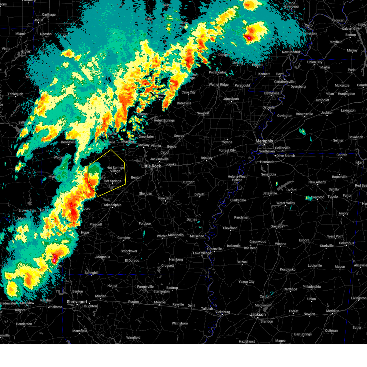 Svrlzk the national weather service in little rock has issued a * severe thunderstorm warning for, western perry county in central arkansas, garland county in central arkansas, western saline county in central arkansas, southeastern yell county in central arkansas, northwestern hot spring county in southwestern arkansas, northeastern montgomery county in western arkansas, * until 745 pm cdt. * at 654 pm cdt, severe thunderstorms were located along a line extending from 13 miles east of muddy creek wma to 6 miles west of mountain pine to near lofton, moving northeast at 45 mph (radar indicated). Hazards include 60 mph wind gusts and half dollar size hail. Hail damage to vehicles is expected. Expect wind damage to roofs, siding, and trees. Svrlzk the national weather service in little rock has issued a * severe thunderstorm warning for, western perry county in central arkansas, garland county in central arkansas, western saline county in central arkansas, southeastern yell county in central arkansas, northwestern hot spring county in southwestern arkansas, northeastern montgomery county in western arkansas, * until 745 pm cdt. * at 654 pm cdt, severe thunderstorms were located along a line extending from 13 miles east of muddy creek wma to 6 miles west of mountain pine to near lofton, moving northeast at 45 mph (radar indicated). Hazards include 60 mph wind gusts and half dollar size hail. Hail damage to vehicles is expected. Expect wind damage to roofs, siding, and trees.
|
| 4/4/2025 4:44 PM CDT |
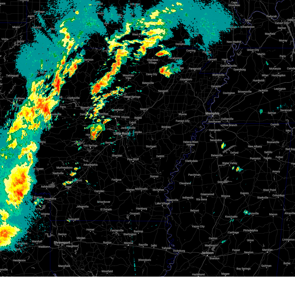 At 443 pm cdt, a severe thunderstorm was located 9 miles northeast of jessieville, or 9 miles north of hot springs village, moving northeast at 45 mph (radar indicated). Hazards include 60 mph wind gusts and quarter size hail. Hail damage to vehicles is expected. expect wind damage to roofs, siding, and trees. Locations impacted include, long mountain, reform, hot springs village,. At 443 pm cdt, a severe thunderstorm was located 9 miles northeast of jessieville, or 9 miles north of hot springs village, moving northeast at 45 mph (radar indicated). Hazards include 60 mph wind gusts and quarter size hail. Hail damage to vehicles is expected. expect wind damage to roofs, siding, and trees. Locations impacted include, long mountain, reform, hot springs village,.
|
| 4/4/2025 4:35 PM CDT |
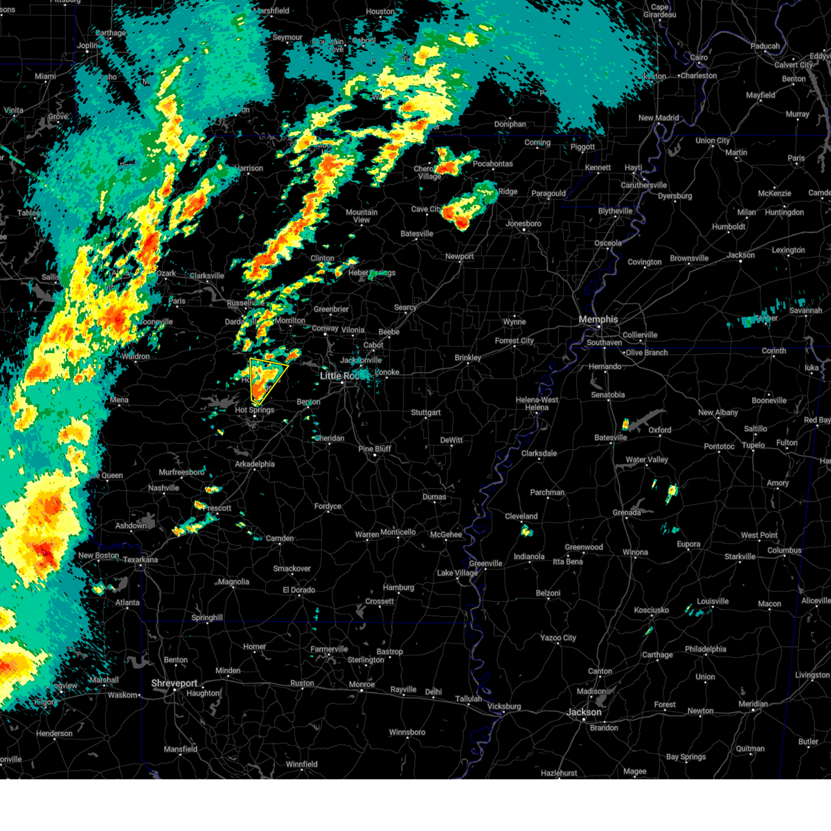 At 434 pm cdt, a severe thunderstorm was located near hot springs village, moving northeast at 40 mph (radar indicated). Hazards include 60 mph wind gusts and quarter size hail. Hail damage to vehicles is expected. expect wind damage to roofs, siding, and trees. Locations impacted include, jessieville, reform, mountain valley, long mountain, hot springs village,. At 434 pm cdt, a severe thunderstorm was located near hot springs village, moving northeast at 40 mph (radar indicated). Hazards include 60 mph wind gusts and quarter size hail. Hail damage to vehicles is expected. expect wind damage to roofs, siding, and trees. Locations impacted include, jessieville, reform, mountain valley, long mountain, hot springs village,.
|
| 4/4/2025 4:22 PM CDT |
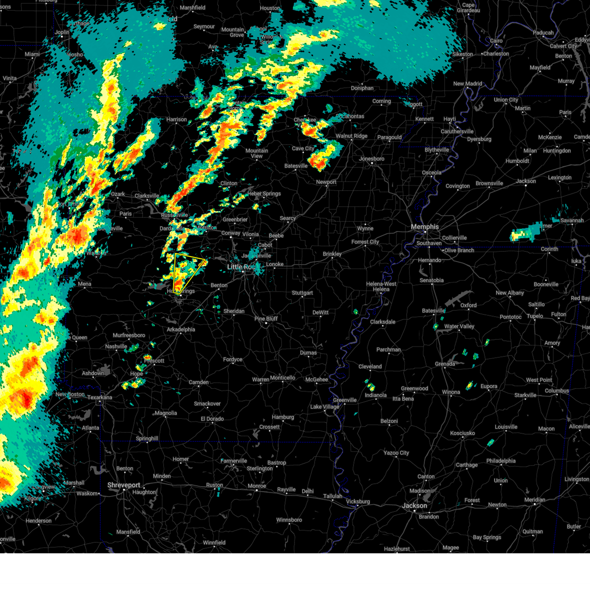 At 421 pm cdt, a severe thunderstorm was located near jessieville, or near hot springs village, moving northeast at 45 mph (radar indicated). Hazards include 60 mph wind gusts and quarter size hail. Hail damage to vehicles is expected. expect wind damage to roofs, siding, and trees. Locations impacted include, long mountain, hamilton, jessieville, hollis, reform, mountain valley, hot springs village, hot springs national park, hot springs,. At 421 pm cdt, a severe thunderstorm was located near jessieville, or near hot springs village, moving northeast at 45 mph (radar indicated). Hazards include 60 mph wind gusts and quarter size hail. Hail damage to vehicles is expected. expect wind damage to roofs, siding, and trees. Locations impacted include, long mountain, hamilton, jessieville, hollis, reform, mountain valley, hot springs village, hot springs national park, hot springs,.
|
| 4/4/2025 4:09 PM CDT |
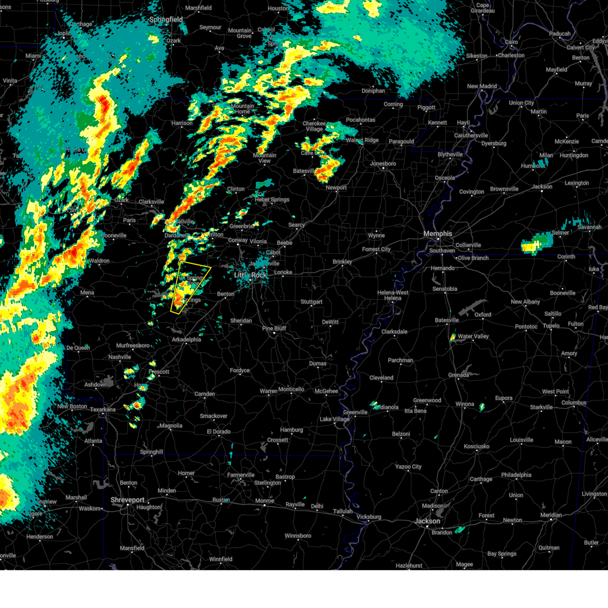 Svrlzk the national weather service in little rock has issued a * severe thunderstorm warning for, southwestern perry county in central arkansas, central garland county in central arkansas, northwestern saline county in central arkansas, * until 500 pm cdt. * at 409 pm cdt, a severe thunderstorm was located over lofton, or 9 miles southwest of hot springs, moving northeast at 45 mph (radar indicated). Hazards include 60 mph wind gusts and quarter size hail. Hail damage to vehicles is expected. Expect wind damage to roofs, siding, and trees. Svrlzk the national weather service in little rock has issued a * severe thunderstorm warning for, southwestern perry county in central arkansas, central garland county in central arkansas, northwestern saline county in central arkansas, * until 500 pm cdt. * at 409 pm cdt, a severe thunderstorm was located over lofton, or 9 miles southwest of hot springs, moving northeast at 45 mph (radar indicated). Hazards include 60 mph wind gusts and quarter size hail. Hail damage to vehicles is expected. Expect wind damage to roofs, siding, and trees.
|
| 4/2/2025 5:07 PM CDT |
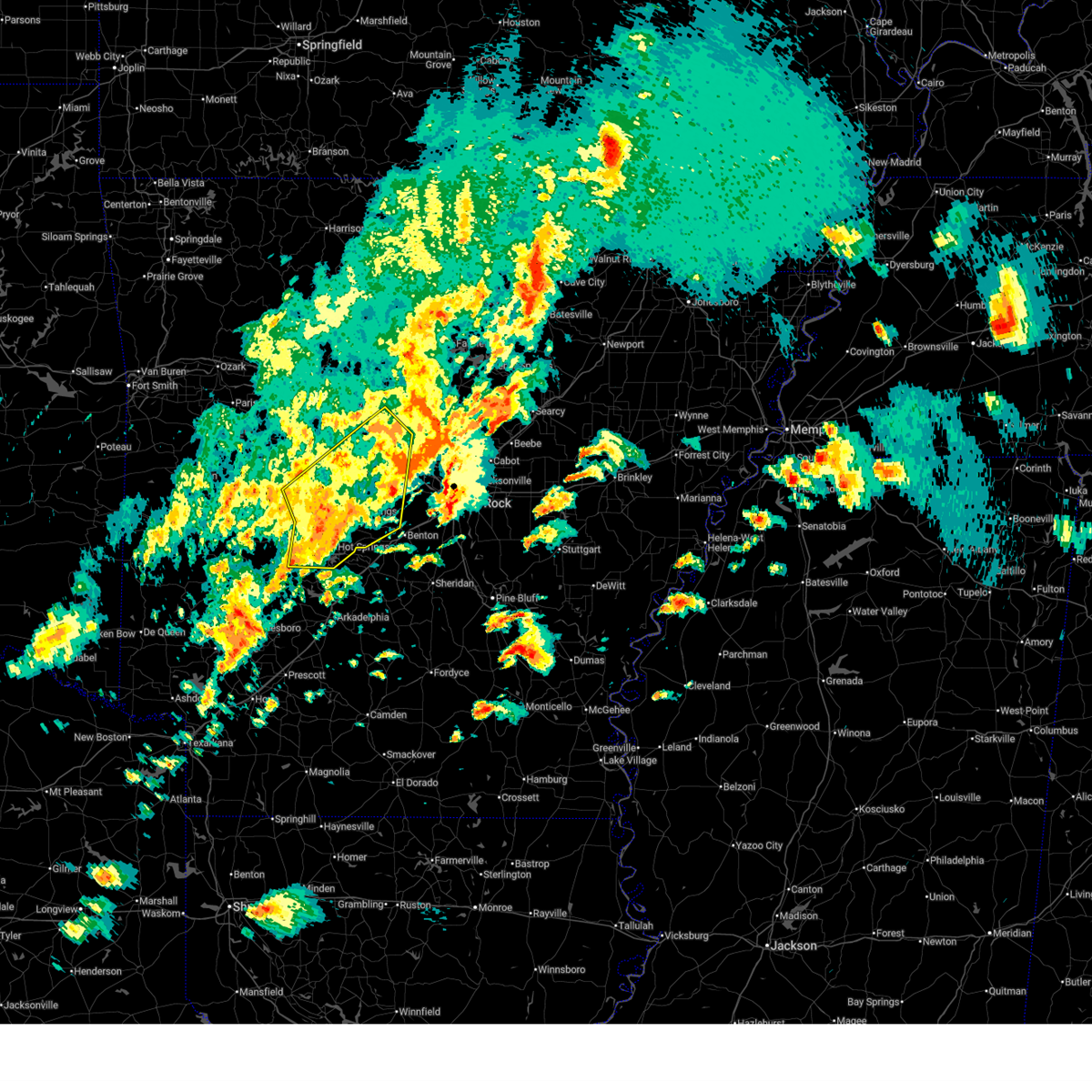 the severe thunderstorm warning has been cancelled and is no longer in effect the severe thunderstorm warning has been cancelled and is no longer in effect
|
| 4/2/2025 4:50 PM CDT |
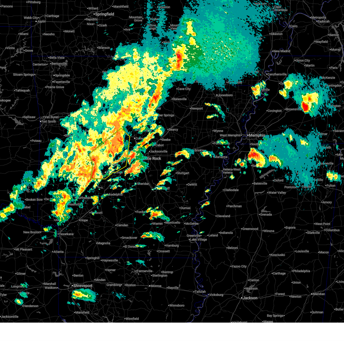 Svrlzk the national weather service in little rock has issued a * severe thunderstorm warning for, perry county in central arkansas, southeastern conway county in central arkansas, west central faulkner county in central arkansas, garland county in central arkansas, northwestern saline county in central arkansas, south central yell county in central arkansas, northwestern pulaski county in central arkansas, * until 530 pm cdt. * at 450 pm cdt, severe thunderstorms were located along a line extending from 12 miles south of plainview in yell county to 6 miles north of lake ouachita state park to near mountain pine, moving northeast at 60 mph (radar indicated). Hazards include 60 mph wind gusts. expect damage to roofs, siding, and trees Svrlzk the national weather service in little rock has issued a * severe thunderstorm warning for, perry county in central arkansas, southeastern conway county in central arkansas, west central faulkner county in central arkansas, garland county in central arkansas, northwestern saline county in central arkansas, south central yell county in central arkansas, northwestern pulaski county in central arkansas, * until 530 pm cdt. * at 450 pm cdt, severe thunderstorms were located along a line extending from 12 miles south of plainview in yell county to 6 miles north of lake ouachita state park to near mountain pine, moving northeast at 60 mph (radar indicated). Hazards include 60 mph wind gusts. expect damage to roofs, siding, and trees
|
| 3/14/2025 9:35 PM CDT |
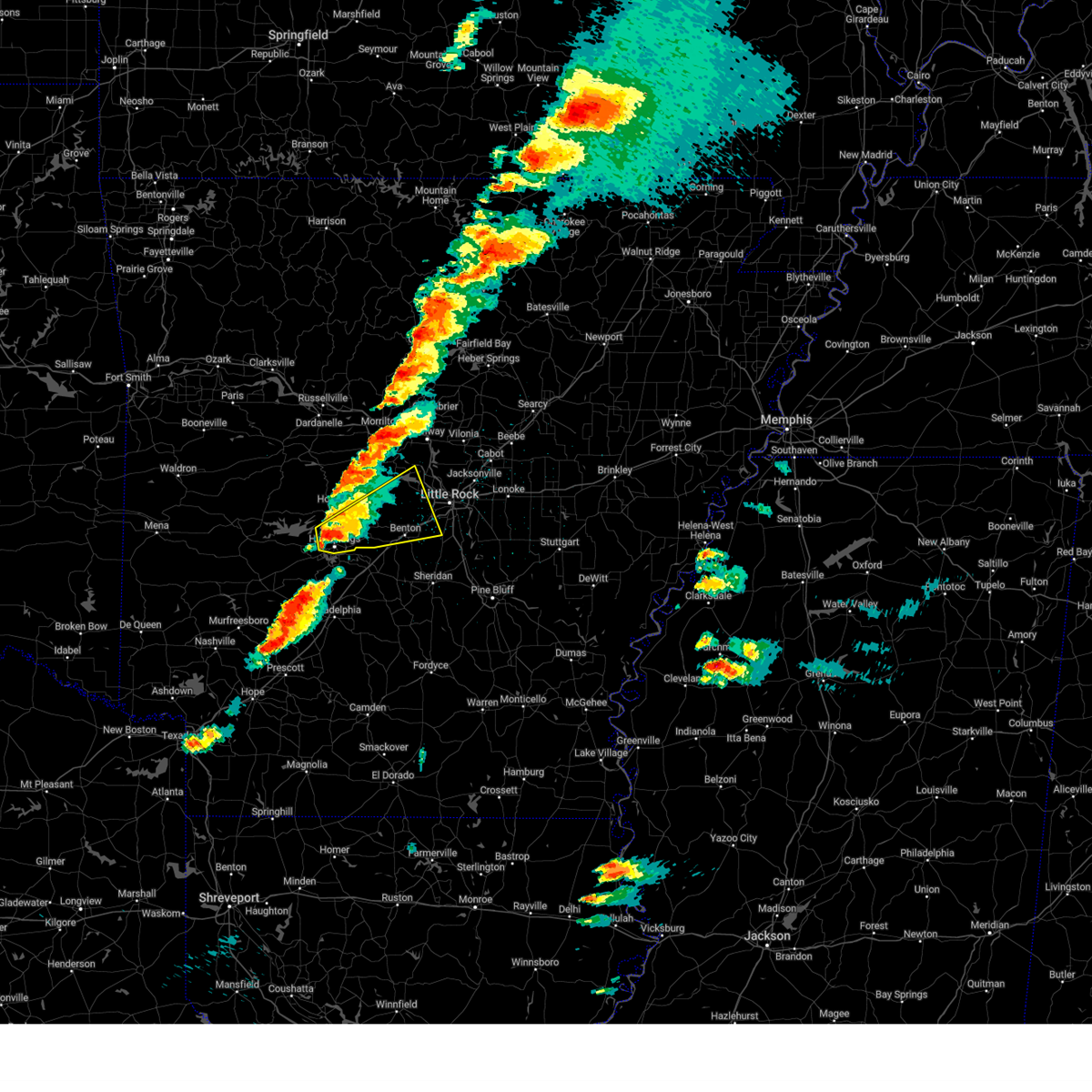 Svrlzk the national weather service in little rock has issued a * severe thunderstorm warning for, eastern garland county in central arkansas, saline county in central arkansas, central pulaski county in central arkansas, * until 1015 pm cdt. * at 935 pm cdt, a severe thunderstorm was located over hot springs national park, or near hot springs, moving northeast at 50 mph (radar indicated). Hazards include 60 mph wind gusts and quarter size hail. Hail damage to vehicles is expected. Expect wind damage to roofs, siding, and trees. Svrlzk the national weather service in little rock has issued a * severe thunderstorm warning for, eastern garland county in central arkansas, saline county in central arkansas, central pulaski county in central arkansas, * until 1015 pm cdt. * at 935 pm cdt, a severe thunderstorm was located over hot springs national park, or near hot springs, moving northeast at 50 mph (radar indicated). Hazards include 60 mph wind gusts and quarter size hail. Hail damage to vehicles is expected. Expect wind damage to roofs, siding, and trees.
|
| 8/18/2024 9:34 PM CDT |
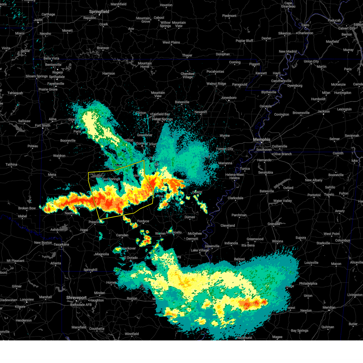 the severe thunderstorm warning has been cancelled and is no longer in effect the severe thunderstorm warning has been cancelled and is no longer in effect
|
| 8/18/2024 9:13 PM CDT |
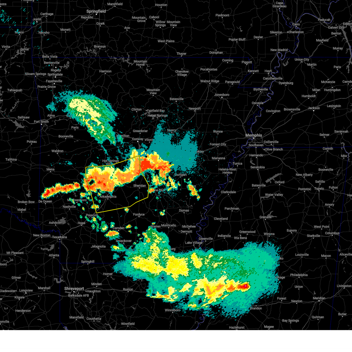 At 912 pm cdt, severe thunderstorms were located along a line extending from near cane creek to near perla to near degray lake state park, moving south at 55 mph (radar indicated). Hazards include 60 mph wind gusts and nickel size hail. Expect damage to roofs, siding, and trees. Locations impacted include, little rock, hot springs, benton, west little rock, maumelle, bryant, hot springs village, arkadelphia, malvern, sheridan, southwest little rock, haskell, shannon hills, gurdon, mountain pine, rockport, caddo valley, traskwood, leola, tull,. At 912 pm cdt, severe thunderstorms were located along a line extending from near cane creek to near perla to near degray lake state park, moving south at 55 mph (radar indicated). Hazards include 60 mph wind gusts and nickel size hail. Expect damage to roofs, siding, and trees. Locations impacted include, little rock, hot springs, benton, west little rock, maumelle, bryant, hot springs village, arkadelphia, malvern, sheridan, southwest little rock, haskell, shannon hills, gurdon, mountain pine, rockport, caddo valley, traskwood, leola, tull,.
|
| 8/18/2024 8:57 PM CDT |
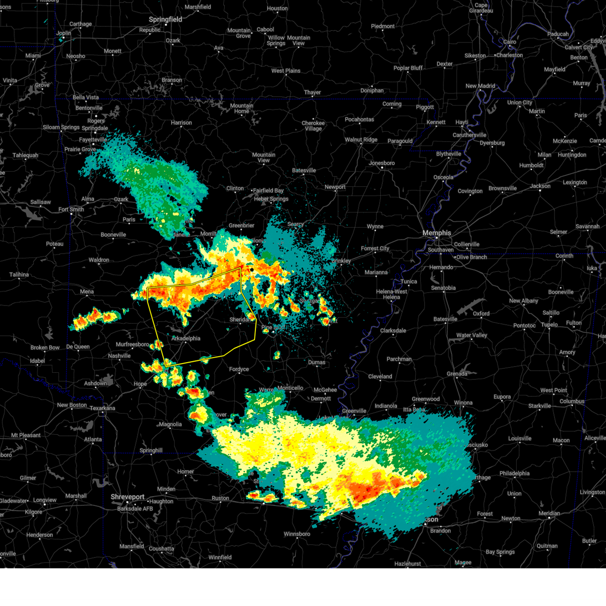 Svrlzk the national weather service in little rock has issued a * severe thunderstorm warning for, clark county in southwestern arkansas, grant county in central arkansas, northern dallas county in southwestern arkansas, garland county in central arkansas, saline county in central arkansas, hot spring county in southwestern arkansas, southeastern montgomery county in western arkansas, central pulaski county in central arkansas, * until 945 pm cdt. * at 856 pm cdt, severe thunderstorms were located along a line extending from near roland in pulaski county to near hot springs village to 7 miles west of lake ouachita state park, moving south at 50 mph (radar indicated). Hazards include 60 mph wind gusts and nickel size hail. expect damage to roofs, siding, and trees Svrlzk the national weather service in little rock has issued a * severe thunderstorm warning for, clark county in southwestern arkansas, grant county in central arkansas, northern dallas county in southwestern arkansas, garland county in central arkansas, saline county in central arkansas, hot spring county in southwestern arkansas, southeastern montgomery county in western arkansas, central pulaski county in central arkansas, * until 945 pm cdt. * at 856 pm cdt, severe thunderstorms were located along a line extending from near roland in pulaski county to near hot springs village to 7 miles west of lake ouachita state park, moving south at 50 mph (radar indicated). Hazards include 60 mph wind gusts and nickel size hail. expect damage to roofs, siding, and trees
|
| 8/18/2024 8:49 PM CDT |
 the severe thunderstorm warning has been cancelled and is no longer in effect the severe thunderstorm warning has been cancelled and is no longer in effect
|
| 8/18/2024 8:49 PM CDT |
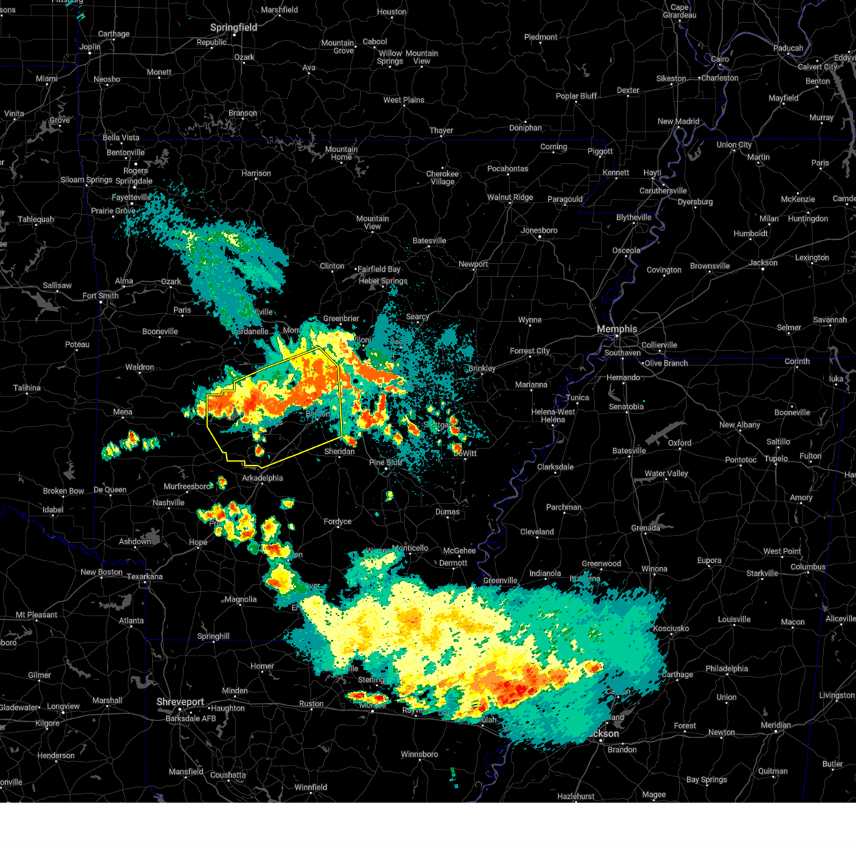 At 848 pm cdt, severe thunderstorms were located along a line extending from near salem in saline county to near hot springs national park to near meyers, moving south at 50 mph (radar indicated). Hazards include 60 mph wind gusts and nickel size hail. Expect damage to roofs, siding, and trees. Locations impacted include, little rock, hot springs, benton, west little rock, maumelle, bryant, hot springs village, malvern, perryville, southwest little rock, haskell, shannon hills, mayflower, mountain pine, rockport, traskwood, tull, perla, houston, lonsdale,. At 848 pm cdt, severe thunderstorms were located along a line extending from near salem in saline county to near hot springs national park to near meyers, moving south at 50 mph (radar indicated). Hazards include 60 mph wind gusts and nickel size hail. Expect damage to roofs, siding, and trees. Locations impacted include, little rock, hot springs, benton, west little rock, maumelle, bryant, hot springs village, malvern, perryville, southwest little rock, haskell, shannon hills, mayflower, mountain pine, rockport, traskwood, tull, perla, houston, lonsdale,.
|
| 8/18/2024 8:33 PM CDT |
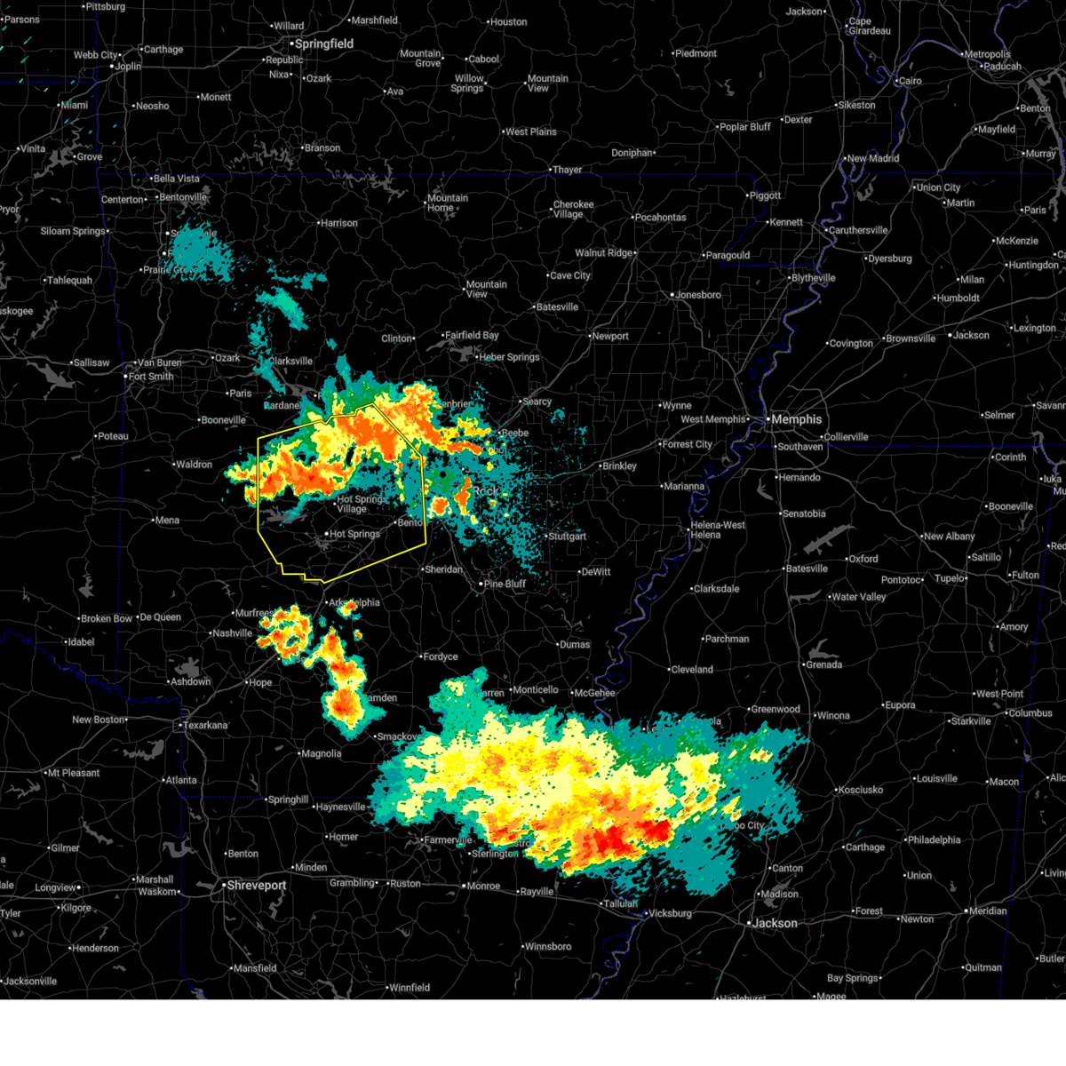 At 833 pm cdt, severe thunderstorms were located along a line extending from 7 miles southeast of williams junction to near jessieville to 6 miles west of lake ouachita state park, moving south at 55 mph (radar indicated). Hazards include 60 mph wind gusts and nickel size hail. Expect damage to roofs, siding, and trees. Locations impacted include, little rock, hot springs, benton, west little rock, maumelle, bryant, hot springs village, malvern, morrilton, danville, perryville, southwest little rock, haskell, shannon hills, mayflower, ola, oppelo, mountain pine, rockport, traskwood,. At 833 pm cdt, severe thunderstorms were located along a line extending from 7 miles southeast of williams junction to near jessieville to 6 miles west of lake ouachita state park, moving south at 55 mph (radar indicated). Hazards include 60 mph wind gusts and nickel size hail. Expect damage to roofs, siding, and trees. Locations impacted include, little rock, hot springs, benton, west little rock, maumelle, bryant, hot springs village, malvern, morrilton, danville, perryville, southwest little rock, haskell, shannon hills, mayflower, ola, oppelo, mountain pine, rockport, traskwood,.
|
| 8/18/2024 8:23 PM CDT |
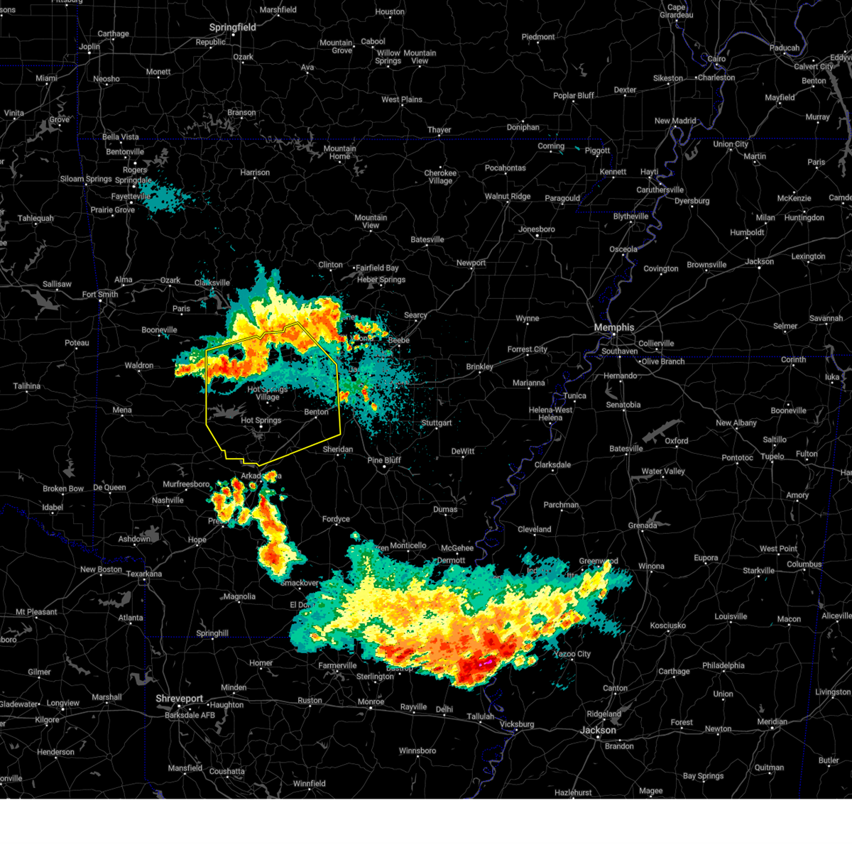 At 823 pm cdt, severe thunderstorms were located along a line extending from near wye mountain to 11 miles northwest of jessieville to 12 miles northwest of lake ouachita state park, moving south at 55 mph (radar indicated). Hazards include 70 mph wind gusts and nickel size hail. Expect considerable tree damage. damage is likely to mobile homes, roofs, and outbuildings. Locations impacted include, little rock, hot springs, benton, west little rock, maumelle, bryant, hot springs village, malvern, morrilton, danville, perryville, southwest little rock, haskell, shannon hills, mayflower, ola, oppelo, mountain pine, rockport, traskwood,. At 823 pm cdt, severe thunderstorms were located along a line extending from near wye mountain to 11 miles northwest of jessieville to 12 miles northwest of lake ouachita state park, moving south at 55 mph (radar indicated). Hazards include 70 mph wind gusts and nickel size hail. Expect considerable tree damage. damage is likely to mobile homes, roofs, and outbuildings. Locations impacted include, little rock, hot springs, benton, west little rock, maumelle, bryant, hot springs village, malvern, morrilton, danville, perryville, southwest little rock, haskell, shannon hills, mayflower, ola, oppelo, mountain pine, rockport, traskwood,.
|
| 8/18/2024 8:13 PM CDT |
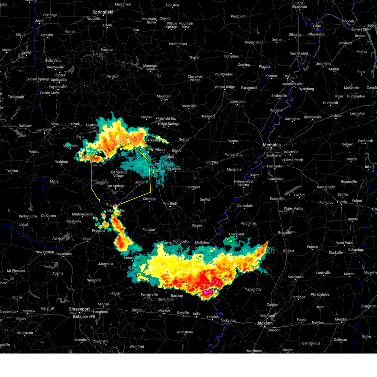 Svrlzk the national weather service in little rock has issued a * severe thunderstorm warning for, perry county in central arkansas, northwestern grant county in central arkansas, southwestern conway county in central arkansas, southwestern faulkner county in central arkansas, garland county in central arkansas, saline county in central arkansas, southeastern yell county in central arkansas, hot spring county in southwestern arkansas, northeastern montgomery county in western arkansas, northwestern pulaski county in central arkansas, * until 900 pm cdt. * at 812 pm cdt, severe thunderstorms were located along a line extending from perry to near ola to 8 miles east of fourche valley, moving south at 50 mph (radar indicated). Hazards include 70 mph wind gusts and nickel size hail. Expect considerable tree damage. Damage is likely to mobile homes, roofs, and outbuildings. Svrlzk the national weather service in little rock has issued a * severe thunderstorm warning for, perry county in central arkansas, northwestern grant county in central arkansas, southwestern conway county in central arkansas, southwestern faulkner county in central arkansas, garland county in central arkansas, saline county in central arkansas, southeastern yell county in central arkansas, hot spring county in southwestern arkansas, northeastern montgomery county in western arkansas, northwestern pulaski county in central arkansas, * until 900 pm cdt. * at 812 pm cdt, severe thunderstorms were located along a line extending from perry to near ola to 8 miles east of fourche valley, moving south at 50 mph (radar indicated). Hazards include 70 mph wind gusts and nickel size hail. Expect considerable tree damage. Damage is likely to mobile homes, roofs, and outbuildings.
|
| 8/17/2024 1:18 AM CDT |
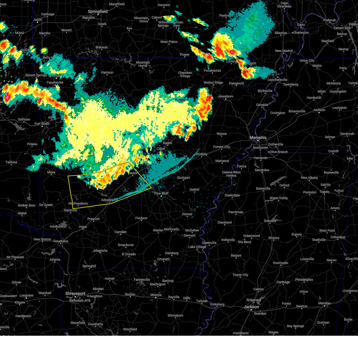 the severe thunderstorm warning has been cancelled and is no longer in effect the severe thunderstorm warning has been cancelled and is no longer in effect
|
| 8/17/2024 1:05 AM CDT |
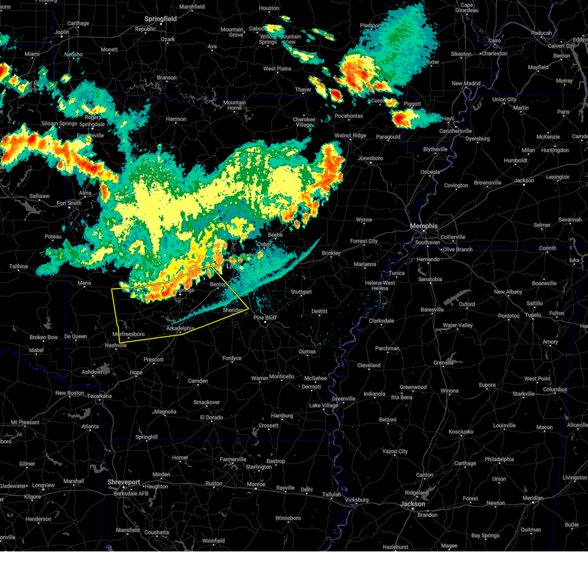 At 105 am cdt, severe thunderstorms were located along a line extending from near cane creek to near degray lake state park to near narrows dam, moving south at 45 mph (radar indicated). Hazards include 60 mph wind gusts. Expect damage to roofs, siding, and trees. Locations impacted include, hot springs, benton, bryant, hot springs village, arkadelphia, malvern, sheridan, murfreesboro, mount ida, haskell, glenwood, mountain pine, rockport, amity, caddo valley, traskwood, tull, norman, prattsville, poyen,. At 105 am cdt, severe thunderstorms were located along a line extending from near cane creek to near degray lake state park to near narrows dam, moving south at 45 mph (radar indicated). Hazards include 60 mph wind gusts. Expect damage to roofs, siding, and trees. Locations impacted include, hot springs, benton, bryant, hot springs village, arkadelphia, malvern, sheridan, murfreesboro, mount ida, haskell, glenwood, mountain pine, rockport, amity, caddo valley, traskwood, tull, norman, prattsville, poyen,.
|
| 8/17/2024 12:44 AM CDT |
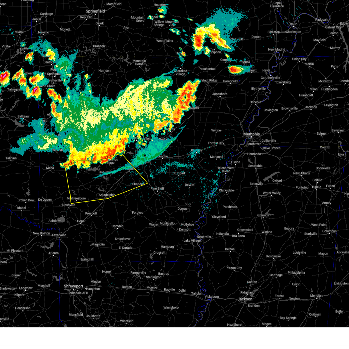 Svrlzk the national weather service in little rock has issued a * severe thunderstorm warning for, northern clark county in southwestern arkansas, pike county in southwestern arkansas, northern grant county in central arkansas, garland county in central arkansas, saline county in central arkansas, hot spring county in southwestern arkansas, montgomery county in western arkansas, * until 130 am cdt. * at 1244 am cdt, severe thunderstorms were located along a line extending from near benton to near lofton to near little missouri falls recreation area, moving southeast at 50 mph (radar indicated). Hazards include 60 mph wind gusts. expect damage to roofs, siding, and trees Svrlzk the national weather service in little rock has issued a * severe thunderstorm warning for, northern clark county in southwestern arkansas, pike county in southwestern arkansas, northern grant county in central arkansas, garland county in central arkansas, saline county in central arkansas, hot spring county in southwestern arkansas, montgomery county in western arkansas, * until 130 am cdt. * at 1244 am cdt, severe thunderstorms were located along a line extending from near benton to near lofton to near little missouri falls recreation area, moving southeast at 50 mph (radar indicated). Hazards include 60 mph wind gusts. expect damage to roofs, siding, and trees
|
| 7/8/2024 9:14 PM CDT |
 the tornado warning has been cancelled and is no longer in effect the tornado warning has been cancelled and is no longer in effect
|
| 7/8/2024 8:57 PM CDT |
 At 857 pm cdt, a severe thunderstorm capable of producing a tornado was located near hot springs village, moving northwest at 25 mph (radar indicated rotation). Hazards include tornado. Flying debris will be dangerous to those caught without shelter. mobile homes will be damaged or destroyed. damage to roofs, windows, and vehicles will occur. tree damage is likely. Locations impacted include, hot springs, hot springs village, jessieville, hot springs national park, mountain valley, hamilton,. At 857 pm cdt, a severe thunderstorm capable of producing a tornado was located near hot springs village, moving northwest at 25 mph (radar indicated rotation). Hazards include tornado. Flying debris will be dangerous to those caught without shelter. mobile homes will be damaged or destroyed. damage to roofs, windows, and vehicles will occur. tree damage is likely. Locations impacted include, hot springs, hot springs village, jessieville, hot springs national park, mountain valley, hamilton,.
|
| 7/8/2024 8:41 PM CDT |
 Torlzk the national weather service in little rock has issued a * tornado warning for, central garland county in central arkansas, northwestern saline county in central arkansas, * until 930 pm cdt. * at 840 pm cdt, a severe thunderstorm capable of producing a tornado was located near hot springs, moving north at 25 mph (radar indicated rotation). Hazards include tornado. Flying debris will be dangerous to those caught without shelter. mobile homes will be damaged or destroyed. damage to roofs, windows, and vehicles will occur. Tree damage is likely. Torlzk the national weather service in little rock has issued a * tornado warning for, central garland county in central arkansas, northwestern saline county in central arkansas, * until 930 pm cdt. * at 840 pm cdt, a severe thunderstorm capable of producing a tornado was located near hot springs, moving north at 25 mph (radar indicated rotation). Hazards include tornado. Flying debris will be dangerous to those caught without shelter. mobile homes will be damaged or destroyed. damage to roofs, windows, and vehicles will occur. Tree damage is likely.
|
| 5/24/2024 9:41 PM CDT |
 At 941 pm cdt, severe thunderstorms were located along a line extending from 9 miles north of hot springs village to near salem in saline county to near traskwood, moving east at 60 mph (radar indicated). Hazards include 60 mph wind gusts and quarter size hail. Hail damage to vehicles is expected. expect wind damage to roofs, siding, and trees. Locations impacted include, little rock, benton, west little rock, bryant, hot springs village, malvern, sheridan, perryville, southwest little rock, haskell, shannon hills, rockport, traskwood, tull, prattsville, poyen, perla, lonsdale, otter creek, jenkins ferry state park,. At 941 pm cdt, severe thunderstorms were located along a line extending from 9 miles north of hot springs village to near salem in saline county to near traskwood, moving east at 60 mph (radar indicated). Hazards include 60 mph wind gusts and quarter size hail. Hail damage to vehicles is expected. expect wind damage to roofs, siding, and trees. Locations impacted include, little rock, benton, west little rock, bryant, hot springs village, malvern, sheridan, perryville, southwest little rock, haskell, shannon hills, rockport, traskwood, tull, prattsville, poyen, perla, lonsdale, otter creek, jenkins ferry state park,.
|
| 5/24/2024 9:28 PM CDT |
 the severe thunderstorm warning has been cancelled and is no longer in effect the severe thunderstorm warning has been cancelled and is no longer in effect
|
| 5/24/2024 9:28 PM CDT |
 At 928 pm cdt, severe thunderstorms were located along a line extending from near jessieville to lonsdale to perla, moving northeast at 60 mph (radar indicated). Hazards include 60 mph wind gusts and nickel size hail. Expect damage to roofs, siding, and trees. Locations impacted include, little rock, hot springs, benton, west little rock, bryant, hot springs village, malvern, sheridan, perryville, southwest little rock, haskell, shannon hills, mountain pine, rockport, traskwood, tull, prattsville, poyen, perla, lonsdale,. At 928 pm cdt, severe thunderstorms were located along a line extending from near jessieville to lonsdale to perla, moving northeast at 60 mph (radar indicated). Hazards include 60 mph wind gusts and nickel size hail. Expect damage to roofs, siding, and trees. Locations impacted include, little rock, hot springs, benton, west little rock, bryant, hot springs village, malvern, sheridan, perryville, southwest little rock, haskell, shannon hills, mountain pine, rockport, traskwood, tull, prattsville, poyen, perla, lonsdale,.
|
| 5/24/2024 9:11 PM CDT |
 Svrlzk the national weather service in little rock has issued a * severe thunderstorm warning for, northeastern clark county in southwestern arkansas, central perry county in central arkansas, northwestern grant county in central arkansas, garland county in central arkansas, saline county in central arkansas, hot spring county in southwestern arkansas, west central pulaski county in central arkansas, * until 1000 pm cdt. * at 911 pm cdt, severe thunderstorms were located along a line extending from near lake ouachita state park to 6 miles southeast of hot springs to near caddo valley, moving northeast at 60 mph (radar indicated). Hazards include 60 mph wind gusts and nickel size hail. expect damage to roofs, siding, and trees Svrlzk the national weather service in little rock has issued a * severe thunderstorm warning for, northeastern clark county in southwestern arkansas, central perry county in central arkansas, northwestern grant county in central arkansas, garland county in central arkansas, saline county in central arkansas, hot spring county in southwestern arkansas, west central pulaski county in central arkansas, * until 1000 pm cdt. * at 911 pm cdt, severe thunderstorms were located along a line extending from near lake ouachita state park to 6 miles southeast of hot springs to near caddo valley, moving northeast at 60 mph (radar indicated). Hazards include 60 mph wind gusts and nickel size hail. expect damage to roofs, siding, and trees
|
| 5/24/2024 8:43 PM CDT |
 At 843 pm cdt, a severe thunderstorm was located near degray lake state park, or 14 miles northwest of arkadelphia, moving northeast at 35 mph (radar indicated). Hazards include 60 mph wind gusts and quarter size hail. Hail damage to vehicles is expected. expect wind damage to roofs, siding, and trees. Locations impacted include, hot springs, hot springs village, arkadelphia, malvern, mountain pine, rockport, caddo valley, perla, hot springs memorial field, lofton, rockwell, degray lake state park, hot springs national park, donaldson, friendship, bismarck, alpine, magnet cove, lono, oaklawn racetrack,. At 843 pm cdt, a severe thunderstorm was located near degray lake state park, or 14 miles northwest of arkadelphia, moving northeast at 35 mph (radar indicated). Hazards include 60 mph wind gusts and quarter size hail. Hail damage to vehicles is expected. expect wind damage to roofs, siding, and trees. Locations impacted include, hot springs, hot springs village, arkadelphia, malvern, mountain pine, rockport, caddo valley, perla, hot springs memorial field, lofton, rockwell, degray lake state park, hot springs national park, donaldson, friendship, bismarck, alpine, magnet cove, lono, oaklawn racetrack,.
|
| 5/24/2024 8:34 PM CDT |
 At 833 pm cdt, a severe thunderstorm was located 8 miles west of degray lake state park, or 16 miles northwest of arkadelphia, moving northeast at 35 mph. this storm has a history of producing two inch hail most recently in amity (radar indicated). Hazards include two inch hail and 60 mph wind gusts. People and animals outdoors will be injured. expect hail damage to roofs, siding, windows, and vehicles. expect wind damage to roofs, siding, and trees. Locations impacted include, hot springs, hot springs village, arkadelphia, malvern, mountain pine, rockport, amity, caddo valley, perla, hot springs memorial field, lofton, rockwell, degray lake state park, hot springs national park, donaldson, friendship, bismarck, alpine, magnet cove, lono,. At 833 pm cdt, a severe thunderstorm was located 8 miles west of degray lake state park, or 16 miles northwest of arkadelphia, moving northeast at 35 mph. this storm has a history of producing two inch hail most recently in amity (radar indicated). Hazards include two inch hail and 60 mph wind gusts. People and animals outdoors will be injured. expect hail damage to roofs, siding, windows, and vehicles. expect wind damage to roofs, siding, and trees. Locations impacted include, hot springs, hot springs village, arkadelphia, malvern, mountain pine, rockport, amity, caddo valley, perla, hot springs memorial field, lofton, rockwell, degray lake state park, hot springs national park, donaldson, friendship, bismarck, alpine, magnet cove, lono,.
|
| 5/24/2024 8:27 PM CDT |
 Svrlzk the national weather service in little rock has issued a * severe thunderstorm warning for, northern clark county in southwestern arkansas, southeastern garland county in central arkansas, hot spring county in southwestern arkansas, * until 915 pm cdt. * at 827 pm cdt, a severe thunderstorm was located near amity, or 18 miles northwest of arkadelphia, moving northeast at 35 mph (radar indicated). Hazards include 60 mph wind gusts and quarter size hail. Hail damage to vehicles is expected. Expect wind damage to roofs, siding, and trees. Svrlzk the national weather service in little rock has issued a * severe thunderstorm warning for, northern clark county in southwestern arkansas, southeastern garland county in central arkansas, hot spring county in southwestern arkansas, * until 915 pm cdt. * at 827 pm cdt, a severe thunderstorm was located near amity, or 18 miles northwest of arkadelphia, moving northeast at 35 mph (radar indicated). Hazards include 60 mph wind gusts and quarter size hail. Hail damage to vehicles is expected. Expect wind damage to roofs, siding, and trees.
|
| 5/24/2024 4:39 AM CDT |
 Svrlzk the national weather service in little rock has issued a * severe thunderstorm warning for, northwestern grant county in central arkansas, southeastern garland county in central arkansas, central saline county in central arkansas, eastern hot spring county in southwestern arkansas, * until 515 am cdt. * at 439 am cdt, a severe thunderstorm was located near rockport, or 7 miles northwest of malvern, moving northeast at 50 mph (radar indicated). Hazards include 60 mph wind gusts and quarter size hail. Hail damage to vehicles is expected. Expect wind damage to roofs, siding, and trees. Svrlzk the national weather service in little rock has issued a * severe thunderstorm warning for, northwestern grant county in central arkansas, southeastern garland county in central arkansas, central saline county in central arkansas, eastern hot spring county in southwestern arkansas, * until 515 am cdt. * at 439 am cdt, a severe thunderstorm was located near rockport, or 7 miles northwest of malvern, moving northeast at 50 mph (radar indicated). Hazards include 60 mph wind gusts and quarter size hail. Hail damage to vehicles is expected. Expect wind damage to roofs, siding, and trees.
|
| 5/22/2024 3:13 AM CDT |
 At 312 am cdt, a severe thunderstorm was located over lake ouachita state park, or 12 miles northwest of hot springs, moving east at 30 mph (radar indicated). Hazards include 60 mph wind gusts and quarter size hail. Hail damage to vehicles is expected. expect wind damage to roofs, siding, and trees. Locations impacted include, hot springs, hot springs village, mountain pine, hot springs national park, jessieville, lake ouachita state park, lena landing rec area, gulpha gorge, hamilton, mountain valley,. At 312 am cdt, a severe thunderstorm was located over lake ouachita state park, or 12 miles northwest of hot springs, moving east at 30 mph (radar indicated). Hazards include 60 mph wind gusts and quarter size hail. Hail damage to vehicles is expected. expect wind damage to roofs, siding, and trees. Locations impacted include, hot springs, hot springs village, mountain pine, hot springs national park, jessieville, lake ouachita state park, lena landing rec area, gulpha gorge, hamilton, mountain valley,.
|
| 5/22/2024 3:13 AM CDT |
 the severe thunderstorm warning has been cancelled and is no longer in effect the severe thunderstorm warning has been cancelled and is no longer in effect
|
| 5/22/2024 3:04 AM CDT |
 At 303 am cdt, a severe thunderstorm was located near lake ouachita state park, or 15 miles northwest of hot springs, moving east at 35 mph (radar indicated). Hazards include 60 mph wind gusts and half dollar size hail. Hail damage to vehicles is expected. expect wind damage to roofs, siding, and trees. Locations impacted include, hot springs, hot springs village, mountain pine, hot springs national park, jessieville, lake ouachita state park, avant, lena landing rec area, gulpha gorge, hamilton, mt tabor, mountain valley,. At 303 am cdt, a severe thunderstorm was located near lake ouachita state park, or 15 miles northwest of hot springs, moving east at 35 mph (radar indicated). Hazards include 60 mph wind gusts and half dollar size hail. Hail damage to vehicles is expected. expect wind damage to roofs, siding, and trees. Locations impacted include, hot springs, hot springs village, mountain pine, hot springs national park, jessieville, lake ouachita state park, avant, lena landing rec area, gulpha gorge, hamilton, mt tabor, mountain valley,.
|
| 5/22/2024 3:04 AM CDT |
 the severe thunderstorm warning has been cancelled and is no longer in effect the severe thunderstorm warning has been cancelled and is no longer in effect
|
| 5/22/2024 2:50 AM CDT |
 At 249 am cdt, a severe thunderstorm was located 13 miles west of lake ouachita state park, or 14 miles northeast of mount ida, moving east at 35 mph (radar indicated). Hazards include ping pong ball size hail and 60 mph wind gusts. People and animals outdoors will be injured. expect hail damage to roofs, siding, windows, and vehicles. expect wind damage to roofs, siding, and trees. Locations impacted include, hot springs, hot springs village, mountain pine, jessieville, lake ouachita state park, hot springs national park, avant, mt tabor, fannie, mountain valley, lena landing rec area, gulpha gorge, hamilton,. At 249 am cdt, a severe thunderstorm was located 13 miles west of lake ouachita state park, or 14 miles northeast of mount ida, moving east at 35 mph (radar indicated). Hazards include ping pong ball size hail and 60 mph wind gusts. People and animals outdoors will be injured. expect hail damage to roofs, siding, windows, and vehicles. expect wind damage to roofs, siding, and trees. Locations impacted include, hot springs, hot springs village, mountain pine, jessieville, lake ouachita state park, hot springs national park, avant, mt tabor, fannie, mountain valley, lena landing rec area, gulpha gorge, hamilton,.
|
| 5/22/2024 2:44 AM CDT |
 Svrlzk the national weather service in little rock has issued a * severe thunderstorm warning for, southwestern perry county in central arkansas, garland county in central arkansas, northwestern saline county in central arkansas, south central yell county in central arkansas, northeastern montgomery county in western arkansas, * until 330 am cdt. * at 243 am cdt, a severe thunderstorm was located 11 miles northeast of mount ida, moving east at 35 mph (radar indicated). Hazards include 60 mph wind gusts and quarter size hail. Hail damage to vehicles is expected. Expect wind damage to roofs, siding, and trees. Svrlzk the national weather service in little rock has issued a * severe thunderstorm warning for, southwestern perry county in central arkansas, garland county in central arkansas, northwestern saline county in central arkansas, south central yell county in central arkansas, northeastern montgomery county in western arkansas, * until 330 am cdt. * at 243 am cdt, a severe thunderstorm was located 11 miles northeast of mount ida, moving east at 35 mph (radar indicated). Hazards include 60 mph wind gusts and quarter size hail. Hail damage to vehicles is expected. Expect wind damage to roofs, siding, and trees.
|
| 5/8/2024 2:07 AM CDT |
 the severe thunderstorm warning has been cancelled and is no longer in effect the severe thunderstorm warning has been cancelled and is no longer in effect
|
| 5/8/2024 2:07 AM CDT |
 At 207 am cdt, severe thunderstorms were located along a line extending from 7 miles southwest of williams junction to near salem in saline county, moving northeast at 35 mph (radar indicated). Hazards include ping pong ball size hail and 60 mph wind gusts. People and animals outdoors will be injured. expect hail damage to roofs, siding, windows, and vehicles. expect wind damage to roofs, siding, and trees. Locations impacted include, little rock, benton, west little rock, bryant, southwest little rock, shannon hills, otter creek, ironton, geyer springs, mabelvale, salem in saline county, williams junction, chenal valley, sweet home, alexander, baseline, avilla, thornburg, congo, paron,. At 207 am cdt, severe thunderstorms were located along a line extending from 7 miles southwest of williams junction to near salem in saline county, moving northeast at 35 mph (radar indicated). Hazards include ping pong ball size hail and 60 mph wind gusts. People and animals outdoors will be injured. expect hail damage to roofs, siding, windows, and vehicles. expect wind damage to roofs, siding, and trees. Locations impacted include, little rock, benton, west little rock, bryant, southwest little rock, shannon hills, otter creek, ironton, geyer springs, mabelvale, salem in saline county, williams junction, chenal valley, sweet home, alexander, baseline, avilla, thornburg, congo, paron,.
|
| 5/8/2024 1:54 AM CDT |
 At 154 am cdt, severe thunderstorms were located along a line extending from near hot springs village to 7 miles north of lonsdale, moving east at 30 mph (radar indicated). Hazards include golf ball size hail and 60 mph wind gusts. People and animals outdoors will be injured. expect hail damage to roofs, siding, windows, and vehicles. expect wind damage to roofs, siding, and trees. Locations impacted include, little rock, benton, west little rock, bryant, hot springs village, southwest little rock, shannon hills, lonsdale, otter creek, ironton, jessieville, geyer springs, mabelvale, salem in saline county, williams junction, chenal valley, sweet home, alexander, baseline, avilla,. At 154 am cdt, severe thunderstorms were located along a line extending from near hot springs village to 7 miles north of lonsdale, moving east at 30 mph (radar indicated). Hazards include golf ball size hail and 60 mph wind gusts. People and animals outdoors will be injured. expect hail damage to roofs, siding, windows, and vehicles. expect wind damage to roofs, siding, and trees. Locations impacted include, little rock, benton, west little rock, bryant, hot springs village, southwest little rock, shannon hills, lonsdale, otter creek, ironton, jessieville, geyer springs, mabelvale, salem in saline county, williams junction, chenal valley, sweet home, alexander, baseline, avilla,.
|
| 5/8/2024 1:43 AM CDT |
 Svrlzk the national weather service in little rock has issued a * severe thunderstorm warning for, south central perry county in central arkansas, northeastern garland county in central arkansas, saline county in central arkansas, west central pulaski county in central arkansas, * until 230 am cdt. * at 142 am cdt, severe thunderstorms were located along a line extending from near hot springs village to 6 miles northwest of lonsdale, moving east at 30 mph (radar indicated). Hazards include ping pong ball size hail and 60 mph wind gusts. People and animals outdoors will be injured. expect hail damage to roofs, siding, windows, and vehicles. Expect wind damage to roofs, siding, and trees. Svrlzk the national weather service in little rock has issued a * severe thunderstorm warning for, south central perry county in central arkansas, northeastern garland county in central arkansas, saline county in central arkansas, west central pulaski county in central arkansas, * until 230 am cdt. * at 142 am cdt, severe thunderstorms were located along a line extending from near hot springs village to 6 miles northwest of lonsdale, moving east at 30 mph (radar indicated). Hazards include ping pong ball size hail and 60 mph wind gusts. People and animals outdoors will be injured. expect hail damage to roofs, siding, windows, and vehicles. Expect wind damage to roofs, siding, and trees.
|
| 5/8/2024 1:11 AM CDT |
 the severe thunderstorm warning has been cancelled and is no longer in effect the severe thunderstorm warning has been cancelled and is no longer in effect
|
| 5/8/2024 1:11 AM CDT |
 At 110 am cdt, a severe thunderstorm was located over hot springs national park, or over hot springs, moving east at 25 mph (radar indicated). Hazards include 60 mph wind gusts and quarter size hail. Hail damage to vehicles is expected. expect wind damage to roofs, siding, and trees. Locations impacted include, hot springs, benton, hot springs village, haskell, lonsdale, hot springs memorial field, hot springs national park, rockwell, oaklawn racetrack, nance, mountain valley, gulpha gorge, crows, owensville, shaw,. At 110 am cdt, a severe thunderstorm was located over hot springs national park, or over hot springs, moving east at 25 mph (radar indicated). Hazards include 60 mph wind gusts and quarter size hail. Hail damage to vehicles is expected. expect wind damage to roofs, siding, and trees. Locations impacted include, hot springs, benton, hot springs village, haskell, lonsdale, hot springs memorial field, hot springs national park, rockwell, oaklawn racetrack, nance, mountain valley, gulpha gorge, crows, owensville, shaw,.
|
| 5/8/2024 1:03 AM CDT |
 Torlzk the national weather service in little rock has issued a * tornado warning for, southeastern garland county in central arkansas, south central saline county in central arkansas, northeastern hot spring county in southwestern arkansas, * until 145 am cdt. * at 103 am cdt, a severe thunderstorm capable of producing a tornado was located near hot springs, moving east at 25 mph (radar indicated rotation). Hazards include tornado. Flying debris will be dangerous to those caught without shelter. mobile homes will be damaged or destroyed. damage to roofs, windows, and vehicles will occur. Tree damage is likely. Torlzk the national weather service in little rock has issued a * tornado warning for, southeastern garland county in central arkansas, south central saline county in central arkansas, northeastern hot spring county in southwestern arkansas, * until 145 am cdt. * at 103 am cdt, a severe thunderstorm capable of producing a tornado was located near hot springs, moving east at 25 mph (radar indicated rotation). Hazards include tornado. Flying debris will be dangerous to those caught without shelter. mobile homes will be damaged or destroyed. damage to roofs, windows, and vehicles will occur. Tree damage is likely.
|
| 5/8/2024 12:56 AM CDT |
 Svrlzk the national weather service in little rock has issued a * severe thunderstorm warning for, south central perry county in central arkansas, garland county in central arkansas, western saline county in central arkansas, northeastern hot spring county in southwestern arkansas, * until 145 am cdt. * at 1256 am cdt, a severe thunderstorm was located near rockwell, or 7 miles west of hot springs, moving east at 25 mph (radar indicated). Hazards include 60 mph wind gusts and quarter size hail. Hail damage to vehicles is expected. Expect wind damage to roofs, siding, and trees. Svrlzk the national weather service in little rock has issued a * severe thunderstorm warning for, south central perry county in central arkansas, garland county in central arkansas, western saline county in central arkansas, northeastern hot spring county in southwestern arkansas, * until 145 am cdt. * at 1256 am cdt, a severe thunderstorm was located near rockwell, or 7 miles west of hot springs, moving east at 25 mph (radar indicated). Hazards include 60 mph wind gusts and quarter size hail. Hail damage to vehicles is expected. Expect wind damage to roofs, siding, and trees.
|
| 5/8/2024 12:15 AM CDT |
 Svrlzk the national weather service in little rock has issued a * severe thunderstorm warning for, southwestern perry county in central arkansas, garland county in central arkansas, northwestern hot spring county in southwestern arkansas, * until 100 am cdt. * at 1215 am cdt, a severe thunderstorm was located near lofton, or 15 miles southwest of hot springs, moving northeast at 30 mph (radar indicated). Hazards include 60 mph wind gusts and quarter size hail. Hail damage to vehicles is expected. Expect wind damage to roofs, siding, and trees. Svrlzk the national weather service in little rock has issued a * severe thunderstorm warning for, southwestern perry county in central arkansas, garland county in central arkansas, northwestern hot spring county in southwestern arkansas, * until 100 am cdt. * at 1215 am cdt, a severe thunderstorm was located near lofton, or 15 miles southwest of hot springs, moving northeast at 30 mph (radar indicated). Hazards include 60 mph wind gusts and quarter size hail. Hail damage to vehicles is expected. Expect wind damage to roofs, siding, and trees.
|
| 5/4/2024 4:49 PM CDT |
 the severe thunderstorm warning has been cancelled and is no longer in effect the severe thunderstorm warning has been cancelled and is no longer in effect
|
| 5/4/2024 4:29 PM CDT |
 At 429 pm cdt, a severe thunderstorm was located over hot springs village, moving southeast at 10 mph (radar indicated). Hazards include 60 mph wind gusts and quarter size hail. Hail damage to vehicles is expected. expect wind damage to roofs, siding, and trees. Locations impacted include, hot springs village, owensville,. At 429 pm cdt, a severe thunderstorm was located over hot springs village, moving southeast at 10 mph (radar indicated). Hazards include 60 mph wind gusts and quarter size hail. Hail damage to vehicles is expected. expect wind damage to roofs, siding, and trees. Locations impacted include, hot springs village, owensville,.
|
| 5/4/2024 4:21 PM CDT | Quarter sized hail reported 2.4 miles ENE of Hot Springs Village, AR |
| 5/4/2024 4:16 PM CDT |
 Svrlzk the national weather service in little rock has issued a * severe thunderstorm warning for, northeastern garland county in central arkansas, west central saline county in central arkansas, * until 500 pm cdt. * at 415 pm cdt, a severe thunderstorm was located over hot springs village, moving southeast at 10 mph (radar indicated). Hazards include 60 mph wind gusts and quarter size hail. Hail damage to vehicles is expected. Expect wind damage to roofs, siding, and trees. Svrlzk the national weather service in little rock has issued a * severe thunderstorm warning for, northeastern garland county in central arkansas, west central saline county in central arkansas, * until 500 pm cdt. * at 415 pm cdt, a severe thunderstorm was located over hot springs village, moving southeast at 10 mph (radar indicated). Hazards include 60 mph wind gusts and quarter size hail. Hail damage to vehicles is expected. Expect wind damage to roofs, siding, and trees.
|
| 5/4/2024 11:04 AM CDT |
 the severe thunderstorm warning has been cancelled and is no longer in effect the severe thunderstorm warning has been cancelled and is no longer in effect
|
| 5/4/2024 11:01 AM CDT |
 At 1101 am cdt, a severe thunderstorm was located near hot springs village, moving east at 20 mph (radar indicated). Hazards include 60 mph wind gusts and quarter size hail. Hail damage to vehicles is expected. expect wind damage to roofs, siding, and trees. Locations impacted include, hot springs village,. At 1101 am cdt, a severe thunderstorm was located near hot springs village, moving east at 20 mph (radar indicated). Hazards include 60 mph wind gusts and quarter size hail. Hail damage to vehicles is expected. expect wind damage to roofs, siding, and trees. Locations impacted include, hot springs village,.
|
| 5/4/2024 10:50 AM CDT |
 At 1050 am cdt, a severe thunderstorm was located near hot springs village, moving east at 20 mph (radar indicated). Hazards include 60 mph wind gusts and quarter size hail. Hail damage to vehicles is expected. expect wind damage to roofs, siding, and trees. Locations impacted include, hot springs village, mountain valley,. At 1050 am cdt, a severe thunderstorm was located near hot springs village, moving east at 20 mph (radar indicated). Hazards include 60 mph wind gusts and quarter size hail. Hail damage to vehicles is expected. expect wind damage to roofs, siding, and trees. Locations impacted include, hot springs village, mountain valley,.
|
| 5/4/2024 10:42 AM CDT |
 Svrlzk the national weather service in little rock has issued a * severe thunderstorm warning for, northeastern garland county in central arkansas, west central saline county in central arkansas, * until 1115 am cdt. * at 1042 am cdt, a severe thunderstorm was located near jessieville, or near hot springs village, moving east at 20 mph (radar indicated). Hazards include 60 mph wind gusts and quarter size hail. Hail damage to vehicles is expected. Expect wind damage to roofs, siding, and trees. Svrlzk the national weather service in little rock has issued a * severe thunderstorm warning for, northeastern garland county in central arkansas, west central saline county in central arkansas, * until 1115 am cdt. * at 1042 am cdt, a severe thunderstorm was located near jessieville, or near hot springs village, moving east at 20 mph (radar indicated). Hazards include 60 mph wind gusts and quarter size hail. Hail damage to vehicles is expected. Expect wind damage to roofs, siding, and trees.
|
| 5/3/2024 5:32 AM CDT |
 At 531 am cdt, a severe thunderstorm was located near meyers, or 13 miles west of hot springs, moving east at 35 mph (radar indicated). Hazards include 60 mph wind gusts and quarter size hail. Hail damage to vehicles is expected. expect wind damage to roofs, siding, and trees. Locations impacted include, hot springs, hot springs village, mountain pine, hot springs memorial field, meyers, lake ouachita state park, lofton, rockwell, hot springs national park, red oak, oaklawn racetrack, crystal springs landing, sunshine, mountain valley, royal, gulpha gorge, pettyview, hempwallace, pearcy, crystal springs,. At 531 am cdt, a severe thunderstorm was located near meyers, or 13 miles west of hot springs, moving east at 35 mph (radar indicated). Hazards include 60 mph wind gusts and quarter size hail. Hail damage to vehicles is expected. expect wind damage to roofs, siding, and trees. Locations impacted include, hot springs, hot springs village, mountain pine, hot springs memorial field, meyers, lake ouachita state park, lofton, rockwell, hot springs national park, red oak, oaklawn racetrack, crystal springs landing, sunshine, mountain valley, royal, gulpha gorge, pettyview, hempwallace, pearcy, crystal springs,.
|
| 5/3/2024 5:32 AM CDT |
 the severe thunderstorm warning has been cancelled and is no longer in effect the severe thunderstorm warning has been cancelled and is no longer in effect
|
| 5/3/2024 5:14 AM CDT |
 Svrlzk the national weather service in little rock has issued a * severe thunderstorm warning for, southwestern garland county in central arkansas, west central hot spring county in southwestern arkansas, southeastern montgomery county in western arkansas, * until 600 am cdt. * at 514 am cdt, a severe thunderstorm was located near meyers, or 10 miles east of mount ida, moving east at 35 mph (radar indicated). Hazards include 60 mph wind gusts and half dollar size hail. Hail damage to vehicles is expected. Expect wind damage to roofs, siding, and trees. Svrlzk the national weather service in little rock has issued a * severe thunderstorm warning for, southwestern garland county in central arkansas, west central hot spring county in southwestern arkansas, southeastern montgomery county in western arkansas, * until 600 am cdt. * at 514 am cdt, a severe thunderstorm was located near meyers, or 10 miles east of mount ida, moving east at 35 mph (radar indicated). Hazards include 60 mph wind gusts and half dollar size hail. Hail damage to vehicles is expected. Expect wind damage to roofs, siding, and trees.
|
| 4/26/2024 6:42 PM CDT |
 At 642 pm cdt, a severe thunderstorm was located 7 miles northeast of lonsdale, or 11 miles northwest of benton, moving northeast at 50 mph (radar indicated). Hazards include ping pong ball size hail and 60 mph wind gusts. People and animals outdoors will be injured. expect hail damage to roofs, siding, windows, and vehicles. expect wind damage to roofs, siding, and trees. Locations impacted include, little rock, conway, maumelle, hot springs village, mayflower, houston, little italy, morgan, chenal valley, roland in pulaski county, pinnacle mountain state park, wye mountain, williams junction, marche, bigelow, fourche, avilla, antioch in perry county, natural steps, palarm,. At 642 pm cdt, a severe thunderstorm was located 7 miles northeast of lonsdale, or 11 miles northwest of benton, moving northeast at 50 mph (radar indicated). Hazards include ping pong ball size hail and 60 mph wind gusts. People and animals outdoors will be injured. expect hail damage to roofs, siding, windows, and vehicles. expect wind damage to roofs, siding, and trees. Locations impacted include, little rock, conway, maumelle, hot springs village, mayflower, houston, little italy, morgan, chenal valley, roland in pulaski county, pinnacle mountain state park, wye mountain, williams junction, marche, bigelow, fourche, avilla, antioch in perry county, natural steps, palarm,.
|
| 4/26/2024 6:42 PM CDT |
 the severe thunderstorm warning has been cancelled and is no longer in effect the severe thunderstorm warning has been cancelled and is no longer in effect
|
| 4/26/2024 6:37 PM CDT |
 Svrlzk the national weather service in little rock has issued a * severe thunderstorm warning for, eastern perry county in central arkansas, southwestern faulkner county in central arkansas, southeastern garland county in central arkansas, central saline county in central arkansas, north central hot spring county in southwestern arkansas, northwestern pulaski county in central arkansas, * until 715 pm cdt. * at 636 pm cdt, a severe thunderstorm was located over lonsdale, or 11 miles southeast of hot springs village, moving northeast at 50 mph (radar indicated). Hazards include 60 mph wind gusts and quarter size hail. Hail damage to vehicles is expected. Expect wind damage to roofs, siding, and trees. Svrlzk the national weather service in little rock has issued a * severe thunderstorm warning for, eastern perry county in central arkansas, southwestern faulkner county in central arkansas, southeastern garland county in central arkansas, central saline county in central arkansas, north central hot spring county in southwestern arkansas, northwestern pulaski county in central arkansas, * until 715 pm cdt. * at 636 pm cdt, a severe thunderstorm was located over lonsdale, or 11 miles southeast of hot springs village, moving northeast at 50 mph (radar indicated). Hazards include 60 mph wind gusts and quarter size hail. Hail damage to vehicles is expected. Expect wind damage to roofs, siding, and trees.
|
| 3/14/2024 9:53 PM CDT |
 the severe thunderstorm warning has been cancelled and is no longer in effect the severe thunderstorm warning has been cancelled and is no longer in effect
|
| 3/14/2024 9:40 PM CDT |
 At 940 pm cdt, a severe thunderstorm was located near jessieville, or 7 miles northwest of hot springs village, moving east at 25 mph (radar indicated). Hazards include two inch hail and 60 mph wind gusts. People and animals outdoors will be injured. expect hail damage to roofs, siding, windows, and vehicles. expect wind damage to roofs, siding, and trees. Locations impacted include, hot springs village, jessieville, hamilton,. At 940 pm cdt, a severe thunderstorm was located near jessieville, or 7 miles northwest of hot springs village, moving east at 25 mph (radar indicated). Hazards include two inch hail and 60 mph wind gusts. People and animals outdoors will be injured. expect hail damage to roofs, siding, windows, and vehicles. expect wind damage to roofs, siding, and trees. Locations impacted include, hot springs village, jessieville, hamilton,.
|
| 3/14/2024 9:29 PM CDT |
 At 928 pm cdt, a severe thunderstorm was located near jessieville, or 9 miles northwest of hot springs village, moving east at 25 mph (radar indicated). Hazards include golf ball size hail and 60 mph wind gusts. People and animals outdoors will be injured. expect hail damage to roofs, siding, windows, and vehicles. expect wind damage to roofs, siding, and trees. Locations impacted include, hot springs village, jessieville, lena landing rec area, hamilton,. At 928 pm cdt, a severe thunderstorm was located near jessieville, or 9 miles northwest of hot springs village, moving east at 25 mph (radar indicated). Hazards include golf ball size hail and 60 mph wind gusts. People and animals outdoors will be injured. expect hail damage to roofs, siding, windows, and vehicles. expect wind damage to roofs, siding, and trees. Locations impacted include, hot springs village, jessieville, lena landing rec area, hamilton,.
|
| 3/14/2024 9:29 PM CDT |
 the severe thunderstorm warning has been cancelled and is no longer in effect the severe thunderstorm warning has been cancelled and is no longer in effect
|
| 3/14/2024 9:22 PM CDT |
 Svrlzk the national weather service in little rock has issued a * severe thunderstorm warning for, southwestern perry county in central arkansas, northwestern garland county in central arkansas, northwestern saline county in central arkansas, south central yell county in central arkansas, * until 1015 pm cdt. * at 921 pm cdt, a severe thunderstorm was located 8 miles northwest of lake ouachita state park, or 19 miles west of hot springs village, moving east at 25 mph (radar indicated). Hazards include 60 mph wind gusts and half dollar size hail. Hail damage to vehicles is expected. Expect wind damage to roofs, siding, and trees. Svrlzk the national weather service in little rock has issued a * severe thunderstorm warning for, southwestern perry county in central arkansas, northwestern garland county in central arkansas, northwestern saline county in central arkansas, south central yell county in central arkansas, * until 1015 pm cdt. * at 921 pm cdt, a severe thunderstorm was located 8 miles northwest of lake ouachita state park, or 19 miles west of hot springs village, moving east at 25 mph (radar indicated). Hazards include 60 mph wind gusts and half dollar size hail. Hail damage to vehicles is expected. Expect wind damage to roofs, siding, and trees.
|
| 3/14/2024 8:34 PM CDT |
 At 831 pm cdt, a severe thunderstorm was located 10 miles north of lonsdale, or 10 miles east of hot springs village, moving east at 30 mph. this is a destructive storm for paron (radar indicated). Hazards include baseball size hail and 60 mph wind gusts. People and animals outdoors will be severely injured. expect shattered windows, extensive damage to roofs, siding, and vehicles. Locations impacted include, little rock, west little rock, hot springs village, chenal valley, pinnacle mountain state park, avilla, paron, bland, reform, ferndale,. At 831 pm cdt, a severe thunderstorm was located 10 miles north of lonsdale, or 10 miles east of hot springs village, moving east at 30 mph. this is a destructive storm for paron (radar indicated). Hazards include baseball size hail and 60 mph wind gusts. People and animals outdoors will be severely injured. expect shattered windows, extensive damage to roofs, siding, and vehicles. Locations impacted include, little rock, west little rock, hot springs village, chenal valley, pinnacle mountain state park, avilla, paron, bland, reform, ferndale,.
|
| 3/14/2024 8:34 PM CDT |
 the severe thunderstorm warning has been cancelled and is no longer in effect the severe thunderstorm warning has been cancelled and is no longer in effect
|
| 3/14/2024 8:28 PM CDT | Half Dollar sized hail reported 2.9 miles E of Hot Springs Village, AR |
| 3/14/2024 8:27 PM CDT |
 Torlzk the national weather service in little rock has issued a * tornado warning for, northwestern saline county in central arkansas, * until 900 pm cdt. * at 826 pm cdt, a severe thunderstorm capable of producing a tornado was located near hot springs village, moving northeast at 20 mph (radar indicated rotation). Hazards include tornado and baseball size hail. Flying debris will be dangerous to those caught without shelter. mobile homes will be damaged or destroyed. damage to roofs, windows, and vehicles will occur. Tree damage is likely. Torlzk the national weather service in little rock has issued a * tornado warning for, northwestern saline county in central arkansas, * until 900 pm cdt. * at 826 pm cdt, a severe thunderstorm capable of producing a tornado was located near hot springs village, moving northeast at 20 mph (radar indicated rotation). Hazards include tornado and baseball size hail. Flying debris will be dangerous to those caught without shelter. mobile homes will be damaged or destroyed. damage to roofs, windows, and vehicles will occur. Tree damage is likely.
|
| 3/14/2024 8:19 PM CDT |
 the tornado warning has been cancelled and is no longer in effect the tornado warning has been cancelled and is no longer in effect
|
| 3/14/2024 8:19 PM CDT |
 At 818 pm cdt, a confirmed tornado was located over hot springs village, moving northeast at 15 mph (radar confirmed tornado). Hazards include damaging tornado and baseball size hail. Flying debris will be dangerous to those caught without shelter. mobile homes will be damaged or destroyed. damage to roofs, windows, and vehicles will occur. tree damage is likely. Locations impacted include, hot springs village,. At 818 pm cdt, a confirmed tornado was located over hot springs village, moving northeast at 15 mph (radar confirmed tornado). Hazards include damaging tornado and baseball size hail. Flying debris will be dangerous to those caught without shelter. mobile homes will be damaged or destroyed. damage to roofs, windows, and vehicles will occur. tree damage is likely. Locations impacted include, hot springs village,.
|
| 3/14/2024 8:09 PM CDT | Roof blown off hous in garland county AR, 4.6 miles ENE of Hot Springs Village, AR |
| 3/14/2024 8:06 PM CDT |
 At 805 pm cdt, a confirmed tornado was located over hot springs village, moving northeast at 25 mph (radar confirmed tornado). Hazards include damaging tornado and baseball size hail. Flying debris will be dangerous to those caught without shelter. mobile homes will be damaged or destroyed. damage to roofs, windows, and vehicles will occur. tree damage is likely. Locations impacted include, hot springs village,. At 805 pm cdt, a confirmed tornado was located over hot springs village, moving northeast at 25 mph (radar confirmed tornado). Hazards include damaging tornado and baseball size hail. Flying debris will be dangerous to those caught without shelter. mobile homes will be damaged or destroyed. damage to roofs, windows, and vehicles will occur. tree damage is likely. Locations impacted include, hot springs village,.
|
| 3/14/2024 8:05 PM CDT | Baseball sized hail reported 6 miles ESE of Hot Springs Village, AR |
| 3/14/2024 7:58 PM CDT |
 Torlzk the national weather service in little rock has issued a * tornado warning for, northeastern garland county in central arkansas, northwestern saline county in central arkansas, * until 830 pm cdt. * at 758 pm cdt, a severe thunderstorm capable of producing a tornado was located near jessieville, or near hot springs village, moving northeast at 25 mph (radar indicated rotation). Hazards include tornado. Flying debris will be dangerous to those caught without shelter. mobile homes will be damaged or destroyed. damage to roofs, windows, and vehicles will occur. Tree damage is likely. Torlzk the national weather service in little rock has issued a * tornado warning for, northeastern garland county in central arkansas, northwestern saline county in central arkansas, * until 830 pm cdt. * at 758 pm cdt, a severe thunderstorm capable of producing a tornado was located near jessieville, or near hot springs village, moving northeast at 25 mph (radar indicated rotation). Hazards include tornado. Flying debris will be dangerous to those caught without shelter. mobile homes will be damaged or destroyed. damage to roofs, windows, and vehicles will occur. Tree damage is likely.
|
| 3/14/2024 7:55 PM CDT |
 Svrlzk the national weather service in little rock has issued a * severe thunderstorm warning for, southeastern perry county in central arkansas, southwestern faulkner county in central arkansas, northeastern garland county in central arkansas, northwestern saline county in central arkansas, northwestern pulaski county in central arkansas, * until 900 pm cdt. * at 754 pm cdt, a severe thunderstorm was located near jessieville, or near hot springs village, moving northeast at 30 mph (radar indicated). Hazards include tennis ball size hail and 60 mph wind gusts. People and animals outdoors will be injured. expect hail damage to roofs, siding, windows, and vehicles. Expect wind damage to roofs, siding, and trees. Svrlzk the national weather service in little rock has issued a * severe thunderstorm warning for, southeastern perry county in central arkansas, southwestern faulkner county in central arkansas, northeastern garland county in central arkansas, northwestern saline county in central arkansas, northwestern pulaski county in central arkansas, * until 900 pm cdt. * at 754 pm cdt, a severe thunderstorm was located near jessieville, or near hot springs village, moving northeast at 30 mph (radar indicated). Hazards include tennis ball size hail and 60 mph wind gusts. People and animals outdoors will be injured. expect hail damage to roofs, siding, windows, and vehicles. Expect wind damage to roofs, siding, and trees.
|
| 3/14/2024 7:45 PM CDT |
 At 745 pm cdt, a severe thunderstorm was located over jessieville, or 7 miles west of hot springs village, moving northeast at 30 mph (radar indicated). Hazards include tennis ball size hail and 60 mph wind gusts. People and animals outdoors will be injured. expect hail damage to roofs, siding, windows, and vehicles. expect wind damage to roofs, siding, and trees. Locations impacted include, hot springs village, mountain pine, jessieville, lake ouachita state park, lena landing rec area, hamilton, mountain valley,. At 745 pm cdt, a severe thunderstorm was located over jessieville, or 7 miles west of hot springs village, moving northeast at 30 mph (radar indicated). Hazards include tennis ball size hail and 60 mph wind gusts. People and animals outdoors will be injured. expect hail damage to roofs, siding, windows, and vehicles. expect wind damage to roofs, siding, and trees. Locations impacted include, hot springs village, mountain pine, jessieville, lake ouachita state park, lena landing rec area, hamilton, mountain valley,.
|
| 3/14/2024 7:42 PM CDT |
 At 742 pm cdt, a severe thunderstorm was located over jessieville, or 7 miles west of hot springs village, moving northeast at 40 mph (radar indicated). Hazards include ping pong ball size hail and 60 mph wind gusts. People and animals outdoors will be injured. expect hail damage to roofs, siding, windows, and vehicles. expect wind damage to roofs, siding, and trees. Locations impacted include, hot springs village, mountain pine, jessieville, lake ouachita state park, lena landing rec area, hamilton, mountain valley,. At 742 pm cdt, a severe thunderstorm was located over jessieville, or 7 miles west of hot springs village, moving northeast at 40 mph (radar indicated). Hazards include ping pong ball size hail and 60 mph wind gusts. People and animals outdoors will be injured. expect hail damage to roofs, siding, windows, and vehicles. expect wind damage to roofs, siding, and trees. Locations impacted include, hot springs village, mountain pine, jessieville, lake ouachita state park, lena landing rec area, hamilton, mountain valley,.
|
| 3/14/2024 7:12 PM CDT |
 Svrlzk the national weather service in little rock has issued a * severe thunderstorm warning for, south central perry county in central arkansas, northern garland county in central arkansas, northwestern saline county in central arkansas, * until 800 pm cdt. * at 712 pm cdt, a severe thunderstorm was located 9 miles west of lake ouachita state park, or 16 miles east of mount ida, moving northeast at 30 mph (radar indicated). Hazards include 60 mph wind gusts and quarter size hail. Hail damage to vehicles is expected. Expect wind damage to roofs, siding, and trees. Svrlzk the national weather service in little rock has issued a * severe thunderstorm warning for, south central perry county in central arkansas, northern garland county in central arkansas, northwestern saline county in central arkansas, * until 800 pm cdt. * at 712 pm cdt, a severe thunderstorm was located 9 miles west of lake ouachita state park, or 16 miles east of mount ida, moving northeast at 30 mph (radar indicated). Hazards include 60 mph wind gusts and quarter size hail. Hail damage to vehicles is expected. Expect wind damage to roofs, siding, and trees.
|
| 2/9/2024 5:49 PM CST |
 At 549 pm cst, a severe thunderstorm was located near lonsdale, or near hot springs village, moving east at 35 mph. hail was measured at 2.00 inches in hot springs (radar indicated). Hazards include tennis ball size hail and 60 mph wind gusts. People and animals outdoors will be injured. expect hail damage to roofs, siding, windows, and vehicles. expect wind damage to roofs, siding, and trees. locations impacted include, hot springs village, lonsdale, owensville, thunderstorm damage threat, considerable hail threat, observed max hail size, 2. 50 in wind threat, radar indicated max wind gust, 60 mph. At 549 pm cst, a severe thunderstorm was located near lonsdale, or near hot springs village, moving east at 35 mph. hail was measured at 2.00 inches in hot springs (radar indicated). Hazards include tennis ball size hail and 60 mph wind gusts. People and animals outdoors will be injured. expect hail damage to roofs, siding, windows, and vehicles. expect wind damage to roofs, siding, and trees. locations impacted include, hot springs village, lonsdale, owensville, thunderstorm damage threat, considerable hail threat, observed max hail size, 2. 50 in wind threat, radar indicated max wind gust, 60 mph.
|
| 2/9/2024 5:46 PM CST |
 At 545 pm cst, a severe thunderstorm was located near lonsdale, or 8 miles southeast of hot springs village, moving east at 50 mph. hail measured at 2.00 inches was observed in hot springs (radar indicated). Hazards include tennis ball size hail and 60 mph wind gusts. People and animals outdoors will be injured. expect hail damage to roofs, siding, windows, and vehicles. Expect wind damage to roofs, siding, and trees. At 545 pm cst, a severe thunderstorm was located near lonsdale, or 8 miles southeast of hot springs village, moving east at 50 mph. hail measured at 2.00 inches was observed in hot springs (radar indicated). Hazards include tennis ball size hail and 60 mph wind gusts. People and animals outdoors will be injured. expect hail damage to roofs, siding, windows, and vehicles. Expect wind damage to roofs, siding, and trees.
|
| 2/9/2024 5:27 PM CST |
 At 527 pm cst, a severe thunderstorm was located near hot springs national park, or near hot springs, moving east at 35 mph. hail has already been measured at 1.5 inches in royal (radar indicated). Hazards include two inch hail. People and animals outdoors will be injured. expect damage to roofs, siding, windows, and vehicles. locations impacted include, hot springs, hot springs village, mountain pine, lonsdale, hot springs memorial field, hot springs national park, rockwell, oaklawn racetrack, gulpha gorge, mountain valley, owensville, thunderstorm damage threat, considerable hail threat, observed max hail size, 2. 00 in wind threat, radar indicated max wind gust, <50 mph. At 527 pm cst, a severe thunderstorm was located near hot springs national park, or near hot springs, moving east at 35 mph. hail has already been measured at 1.5 inches in royal (radar indicated). Hazards include two inch hail. People and animals outdoors will be injured. expect damage to roofs, siding, windows, and vehicles. locations impacted include, hot springs, hot springs village, mountain pine, lonsdale, hot springs memorial field, hot springs national park, rockwell, oaklawn racetrack, gulpha gorge, mountain valley, owensville, thunderstorm damage threat, considerable hail threat, observed max hail size, 2. 00 in wind threat, radar indicated max wind gust, <50 mph.
|
| 2/9/2024 5:24 PM CST |
 At 522 pm cst, a severe thunderstorm was located over mountain pine, or 7 miles northwest of hot springs, moving east at 35 mph. hail up to 1.5 inches was observed in royal (radar indicated). Hazards include half dollar size hail. Damage to vehicles is expected. locations impacted include, hot springs, hot springs village, mountain pine, lonsdale, hot springs memorial field, lake ouachita state park, hot springs national park, rockwell, oaklawn racetrack, mountain valley, gulpha gorge, owensville, sunshine, royal, hail threat, observed max hail size, 1. 25 in wind threat, radar indicated max wind gust, <50 mph. At 522 pm cst, a severe thunderstorm was located over mountain pine, or 7 miles northwest of hot springs, moving east at 35 mph. hail up to 1.5 inches was observed in royal (radar indicated). Hazards include half dollar size hail. Damage to vehicles is expected. locations impacted include, hot springs, hot springs village, mountain pine, lonsdale, hot springs memorial field, lake ouachita state park, hot springs national park, rockwell, oaklawn racetrack, mountain valley, gulpha gorge, owensville, sunshine, royal, hail threat, observed max hail size, 1. 25 in wind threat, radar indicated max wind gust, <50 mph.
|
| 2/9/2024 5:13 PM CST |
 At 512 pm cst, a severe thunderstorm was located near mountain pine, or 11 miles west of hot springs, moving east at 35 mph (radar indicated). Hazards include half dollar size hail. damage to vehicles is expected At 512 pm cst, a severe thunderstorm was located near mountain pine, or 11 miles west of hot springs, moving east at 35 mph (radar indicated). Hazards include half dollar size hail. damage to vehicles is expected
|
| 1/11/2024 11:08 PM CST |
 At 1108 pm cst, severe thunderstorms were located along a line extending from williams junction to 11 miles southwest of wye mountain to near hot springs village, moving northeast at 60 mph (radar indicated). Hazards include 60 mph wind gusts and quarter size hail. Hail damage to vehicles is expected. expect wind damage to roofs, siding, and trees. locations impacted include, little rock, north little rock, benton, west little rock, maumelle, bryant, hot springs village, southwest little rock, mayflower, otter creek, burns park, morgan, marche, chenal valley, oak grove in pulaski county, roland in pulaski county, pinnacle mountain state park, camp robinson, salem in saline county, williams junction, hail threat, radar indicated max hail size, 1. 00 in wind threat, radar indicated max wind gust, 60 mph. At 1108 pm cst, severe thunderstorms were located along a line extending from williams junction to 11 miles southwest of wye mountain to near hot springs village, moving northeast at 60 mph (radar indicated). Hazards include 60 mph wind gusts and quarter size hail. Hail damage to vehicles is expected. expect wind damage to roofs, siding, and trees. locations impacted include, little rock, north little rock, benton, west little rock, maumelle, bryant, hot springs village, southwest little rock, mayflower, otter creek, burns park, morgan, marche, chenal valley, oak grove in pulaski county, roland in pulaski county, pinnacle mountain state park, camp robinson, salem in saline county, williams junction, hail threat, radar indicated max hail size, 1. 00 in wind threat, radar indicated max wind gust, 60 mph.
|
| 1/11/2024 10:52 PM CST |
 At 1051 pm cst, severe thunderstorms were located along a line extending from 9 miles northwest of hot springs village to near jessieville to near mountain pine, moving northeast at 55 mph (radar indicated). Hazards include 60 mph wind gusts and quarter size hail. Hail damage to vehicles is expected. Expect wind damage to roofs, siding, and trees. At 1051 pm cst, severe thunderstorms were located along a line extending from 9 miles northwest of hot springs village to near jessieville to near mountain pine, moving northeast at 55 mph (radar indicated). Hazards include 60 mph wind gusts and quarter size hail. Hail damage to vehicles is expected. Expect wind damage to roofs, siding, and trees.
|
| 1/11/2024 10:42 PM CST |
 At 1042 pm cst, a severe thunderstorm was located near mountain pine, or 10 miles west of hot springs, moving east at 50 mph (radar indicated). Hazards include 60 mph wind gusts and quarter size hail. Hail damage to vehicles is expected. expect wind damage to roofs, siding, and trees. locations impacted include, hot springs, hot springs village, mountain pine, hot springs memorial field, meyers, jessieville, lake ouachita state park, lofton, rockwell, hot springs national park, red oak, oaklawn racetrack, crystal springs landing, sunshine, mountain valley, royal, gulpha gorge, pettyview, hempwallace, pearcy, hail threat, radar indicated max hail size, 1. 00 in wind threat, radar indicated max wind gust, 60 mph. At 1042 pm cst, a severe thunderstorm was located near mountain pine, or 10 miles west of hot springs, moving east at 50 mph (radar indicated). Hazards include 60 mph wind gusts and quarter size hail. Hail damage to vehicles is expected. expect wind damage to roofs, siding, and trees. locations impacted include, hot springs, hot springs village, mountain pine, hot springs memorial field, meyers, jessieville, lake ouachita state park, lofton, rockwell, hot springs national park, red oak, oaklawn racetrack, crystal springs landing, sunshine, mountain valley, royal, gulpha gorge, pettyview, hempwallace, pearcy, hail threat, radar indicated max hail size, 1. 00 in wind threat, radar indicated max wind gust, 60 mph.
|
| 1/11/2024 10:31 PM CST |
 At 1031 pm cst, a severe thunderstorm was located near meyers, or 13 miles southeast of mount ida, moving east at 45 mph (radar indicated). Hazards include 60 mph wind gusts and quarter size hail. Hail damage to vehicles is expected. expect wind damage to roofs, siding, and trees. locations impacted include, hot springs, hot springs village, mountain pine, hot springs memorial field, meyers, jessieville, lake ouachita state park, lofton, rockwell, hot springs national park, oaklawn racetrack, bonnerdale, sunshine, royal, point cedar, gulpha gorge, hempwallace, red oak, crystal springs landing, welsh, hail threat, radar indicated max hail size, 1. 00 in wind threat, radar indicated max wind gust, 60 mph. At 1031 pm cst, a severe thunderstorm was located near meyers, or 13 miles southeast of mount ida, moving east at 45 mph (radar indicated). Hazards include 60 mph wind gusts and quarter size hail. Hail damage to vehicles is expected. expect wind damage to roofs, siding, and trees. locations impacted include, hot springs, hot springs village, mountain pine, hot springs memorial field, meyers, jessieville, lake ouachita state park, lofton, rockwell, hot springs national park, oaklawn racetrack, bonnerdale, sunshine, royal, point cedar, gulpha gorge, hempwallace, red oak, crystal springs landing, welsh, hail threat, radar indicated max hail size, 1. 00 in wind threat, radar indicated max wind gust, 60 mph.
|
| 1/11/2024 10:15 PM CST |
 At 1014 pm cst, a severe thunderstorm was located near glenwood, or 12 miles south of mount ida, moving east at 45 mph (radar indicated). Hazards include 60 mph wind gusts and quarter size hail. Hail damage to vehicles is expected. Expect wind damage to roofs, siding, and trees. At 1014 pm cst, a severe thunderstorm was located near glenwood, or 12 miles south of mount ida, moving east at 45 mph (radar indicated). Hazards include 60 mph wind gusts and quarter size hail. Hail damage to vehicles is expected. Expect wind damage to roofs, siding, and trees.
|
| 12/9/2023 12:32 AM CST |
 At 1231 am cst, severe thunderstorms were located along a line extending from 7 miles northeast of lonsdale to near haskell to near rockport, moving east at 35 mph (radar indicated). Hazards include 60 mph wind gusts. Expect damage to roofs, siding, and trees. locations impacted include, benton, bryant, malvern, haskell, rockport, traskwood, lonsdale, salem in saline county, magnet cove, nance, glen rose, lake catherine state park, grape, crows, owensville, shaw, hail threat, radar indicated max hail size, <. 75 in wind threat, radar indicated max wind gust, 60 mph. At 1231 am cst, severe thunderstorms were located along a line extending from 7 miles northeast of lonsdale to near haskell to near rockport, moving east at 35 mph (radar indicated). Hazards include 60 mph wind gusts. Expect damage to roofs, siding, and trees. locations impacted include, benton, bryant, malvern, haskell, rockport, traskwood, lonsdale, salem in saline county, magnet cove, nance, glen rose, lake catherine state park, grape, crows, owensville, shaw, hail threat, radar indicated max hail size, <. 75 in wind threat, radar indicated max wind gust, 60 mph.
|
| 12/9/2023 12:21 AM CST |
 At 1221 am cst, severe thunderstorms were located along a line extending from 9 miles southeast of hot springs village to near lonsdale to near rockport, moving east at 50 mph (radar indicated). Hazards include 60 mph wind gusts. Expect damage to roofs, siding, and trees. locations impacted include, hot springs, benton, bryant, malvern, haskell, rockport, traskwood, lonsdale, salem in saline county, hot springs national park, magnet cove, red oak, nance, glen rose, lake catherine state park, grape, crows, owensville, oaklawn racetrack, shaw, hail threat, radar indicated max hail size, <. 75 in wind threat, radar indicated max wind gust, 60 mph. At 1221 am cst, severe thunderstorms were located along a line extending from 9 miles southeast of hot springs village to near lonsdale to near rockport, moving east at 50 mph (radar indicated). Hazards include 60 mph wind gusts. Expect damage to roofs, siding, and trees. locations impacted include, hot springs, benton, bryant, malvern, haskell, rockport, traskwood, lonsdale, salem in saline county, hot springs national park, magnet cove, red oak, nance, glen rose, lake catherine state park, grape, crows, owensville, oaklawn racetrack, shaw, hail threat, radar indicated max hail size, <. 75 in wind threat, radar indicated max wind gust, 60 mph.
|
| 12/9/2023 12:10 AM CST |
 At 1209 am cst, a severe thunderstorm was located near lofton, or 1 mile west of hot springs, moving east at 40 mph (radar indicated). Hazards include 60 mph wind gusts and quarter size hail. Hail damage to vehicles is expected. Expect wind damage to roofs, siding, and trees. At 1209 am cst, a severe thunderstorm was located near lofton, or 1 mile west of hot springs, moving east at 40 mph (radar indicated). Hazards include 60 mph wind gusts and quarter size hail. Hail damage to vehicles is expected. Expect wind damage to roofs, siding, and trees.
|
| 12/9/2023 12:00 AM CST |
 At 1200 am cst, a group of severe thunderstorms were located near piney in garland county, or 8 miles west of hot springs, and the other east of mountain pine, both moving east at 35 mph. the storm now east of mountain pine has a history of producing up to ping pong ball sized hail (public). Hazards include ping pong ball size hail and 60 mph wind gusts. People and animals outdoors will be injured. expect hail damage to roofs, siding, windows, and vehicles. expect wind damage to roofs, siding, and trees. locations impacted include, hot springs, hot springs village, mountain pine, hot springs memorial field, jessieville, lake ouachita state park, rockwell, hot springs national park, magnet cove, red oak, oaklawn racetrack, sunshine, mountain valley, royal, lake catherine state park, gulpha gorge, hempwallace, hail threat, observed max hail size, 1. 50 in wind threat, radar indicated max wind gust, 60 mph. At 1200 am cst, a group of severe thunderstorms were located near piney in garland county, or 8 miles west of hot springs, and the other east of mountain pine, both moving east at 35 mph. the storm now east of mountain pine has a history of producing up to ping pong ball sized hail (public). Hazards include ping pong ball size hail and 60 mph wind gusts. People and animals outdoors will be injured. expect hail damage to roofs, siding, windows, and vehicles. expect wind damage to roofs, siding, and trees. locations impacted include, hot springs, hot springs village, mountain pine, hot springs memorial field, jessieville, lake ouachita state park, rockwell, hot springs national park, magnet cove, red oak, oaklawn racetrack, sunshine, mountain valley, royal, lake catherine state park, gulpha gorge, hempwallace, hail threat, observed max hail size, 1. 50 in wind threat, radar indicated max wind gust, 60 mph.
|
| 12/8/2023 11:48 PM CST |
 At 1147 pm cst, a severe thunderstorm was located near mountain pine, or 12 miles west of hot springs, moving east at 35 mph (radar indicated). Hazards include 60 mph wind gusts and quarter size hail. Hail damage to vehicles is expected. expect wind damage to roofs, siding, and trees. locations impacted include, hot springs, hot springs village, mountain pine, hot springs memorial field, meyers, jessieville, lake ouachita state park, rockwell, hot springs national park, magnet cove, red oak, oaklawn racetrack, crystal springs landing, sunshine, mountain valley, royal, lena landing rec area, lake catherine state park, gulpha gorge, hamilton, hail threat, radar indicated max hail size, 1. 00 in wind threat, radar indicated max wind gust, 60 mph. At 1147 pm cst, a severe thunderstorm was located near mountain pine, or 12 miles west of hot springs, moving east at 35 mph (radar indicated). Hazards include 60 mph wind gusts and quarter size hail. Hail damage to vehicles is expected. expect wind damage to roofs, siding, and trees. locations impacted include, hot springs, hot springs village, mountain pine, hot springs memorial field, meyers, jessieville, lake ouachita state park, rockwell, hot springs national park, magnet cove, red oak, oaklawn racetrack, crystal springs landing, sunshine, mountain valley, royal, lena landing rec area, lake catherine state park, gulpha gorge, hamilton, hail threat, radar indicated max hail size, 1. 00 in wind threat, radar indicated max wind gust, 60 mph.
|
| 12/8/2023 11:37 PM CST |
 At 1136 pm cst, a severe thunderstorm was located near meyers, or 13 miles east of mount ida, moving east at 35 mph (radar indicated). Hazards include 60 mph wind gusts and quarter size hail. Hail damage to vehicles is expected. Expect wind damage to roofs, siding, and trees. At 1136 pm cst, a severe thunderstorm was located near meyers, or 13 miles east of mount ida, moving east at 35 mph (radar indicated). Hazards include 60 mph wind gusts and quarter size hail. Hail damage to vehicles is expected. Expect wind damage to roofs, siding, and trees.
|
| 9/6/2023 3:02 PM CDT |
 At 301 pm cdt, a severe thunderstorm was located over lonsdale, or 11 miles southeast of hot springs village, moving southeast at 25 mph (radar indicated). Hazards include 60 mph wind gusts and quarter size hail. Hail damage to vehicles is expected. Expect wind damage to roofs, siding, and trees. At 301 pm cdt, a severe thunderstorm was located over lonsdale, or 11 miles southeast of hot springs village, moving southeast at 25 mph (radar indicated). Hazards include 60 mph wind gusts and quarter size hail. Hail damage to vehicles is expected. Expect wind damage to roofs, siding, and trees.
|
| 7/21/2023 9:31 AM CDT |
 At 931 am cdt, a severe thunderstorm was located 11 miles southeast of ola, or 18 miles northwest of hot springs village, moving east at 40 mph (radar indicated). Hazards include 60 mph wind gusts and quarter size hail. Hail damage to vehicles is expected. Expect wind damage to roofs, siding, and trees. At 931 am cdt, a severe thunderstorm was located 11 miles southeast of ola, or 18 miles northwest of hot springs village, moving east at 40 mph (radar indicated). Hazards include 60 mph wind gusts and quarter size hail. Hail damage to vehicles is expected. Expect wind damage to roofs, siding, and trees.
|
| 7/3/2023 5:44 PM CDT |
 At 543 pm cdt, severe thunderstorms were located from 4 miles southwest of hot springs village to hot springs, moving east at 15 mph (radar indicated). Hazards include 60 mph wind gusts and quarter size hail. Hail damage to vehicles is expected. expect wind damage to roofs, siding, and trees. locations impacted include, hot springs, hot springs village, hot springs memorial field, hot springs national park, rockwell, oaklawn racetrack, gulpha gorge, hail threat, radar indicated max hail size, 1. 00 in wind threat, radar indicated max wind gust, 60 mph. At 543 pm cdt, severe thunderstorms were located from 4 miles southwest of hot springs village to hot springs, moving east at 15 mph (radar indicated). Hazards include 60 mph wind gusts and quarter size hail. Hail damage to vehicles is expected. expect wind damage to roofs, siding, and trees. locations impacted include, hot springs, hot springs village, hot springs memorial field, hot springs national park, rockwell, oaklawn racetrack, gulpha gorge, hail threat, radar indicated max hail size, 1. 00 in wind threat, radar indicated max wind gust, 60 mph.
|
| 7/3/2023 5:30 PM CDT |
 At 530 pm cdt, a severe thunderstorm was located over piney in garland county, or near hot springs, moving east at 15 mph (radar indicated). Hazards include 60 mph wind gusts and quarter size hail. Hail damage to vehicles is expected. Expect wind damage to roofs, siding, and trees. At 530 pm cdt, a severe thunderstorm was located over piney in garland county, or near hot springs, moving east at 15 mph (radar indicated). Hazards include 60 mph wind gusts and quarter size hail. Hail damage to vehicles is expected. Expect wind damage to roofs, siding, and trees.
|
| 6/27/2023 1:37 PM CDT |
 The severe thunderstorm warning for perry, garland, northwestern saline, central yell and northeastern montgomery counties will expire at 145 pm cdt, the storm which prompted the warning has weakened below severe limits, and no longer poses an immediate threat to life or property. therefore, the warning will be allowed to expire. however gusty winds are still possible with this thunderstorm. a severe thunderstorm watch remains in effect until 500 pm cdt for central and western arkansas. The severe thunderstorm warning for perry, garland, northwestern saline, central yell and northeastern montgomery counties will expire at 145 pm cdt, the storm which prompted the warning has weakened below severe limits, and no longer poses an immediate threat to life or property. therefore, the warning will be allowed to expire. however gusty winds are still possible with this thunderstorm. a severe thunderstorm watch remains in effect until 500 pm cdt for central and western arkansas.
|
| 6/27/2023 1:25 PM CDT |
 At 125 pm cdt, a severe thunderstorm was located 9 miles north of jessieville, or 15 miles northwest of hot springs village, moving southeast at 55 mph (radar indicated). Hazards include 60 mph wind gusts and quarter size hail. Hail damage to vehicles is expected. expect wind damage to roofs, siding, and trees. locations impacted include, hot springs, hot springs village, perryville, ola, mountain pine, adona, plainview in yell county, jessieville, petit jean river wma, lake ouachita state park, hot springs national park, williams junction, avant, casa, aplin, birta, antioch in perry county, nimrod, oaklawn racetrack, kingston, hail threat, radar indicated max hail size, 1. 00 in wind threat, radar indicated max wind gust, 60 mph. At 125 pm cdt, a severe thunderstorm was located 9 miles north of jessieville, or 15 miles northwest of hot springs village, moving southeast at 55 mph (radar indicated). Hazards include 60 mph wind gusts and quarter size hail. Hail damage to vehicles is expected. expect wind damage to roofs, siding, and trees. locations impacted include, hot springs, hot springs village, perryville, ola, mountain pine, adona, plainview in yell county, jessieville, petit jean river wma, lake ouachita state park, hot springs national park, williams junction, avant, casa, aplin, birta, antioch in perry county, nimrod, oaklawn racetrack, kingston, hail threat, radar indicated max hail size, 1. 00 in wind threat, radar indicated max wind gust, 60 mph.
|
| 6/27/2023 12:59 PM CDT |
 At 1258 pm cdt, a severe thunderstorm was located near danville, moving southeast at 50 mph (radar indicated). Hazards include 60 mph wind gusts and quarter size hail. Hail damage to vehicles is expected. Expect wind damage to roofs, siding, and trees. At 1258 pm cdt, a severe thunderstorm was located near danville, moving southeast at 50 mph (radar indicated). Hazards include 60 mph wind gusts and quarter size hail. Hail damage to vehicles is expected. Expect wind damage to roofs, siding, and trees.
|
| 6/25/2023 10:42 PM CDT |
 At 1042 pm cdt, a severe thunderstorm was located near rockport, or near malvern, moving southeast at 25 mph (radar indicated). Hazards include 60 mph wind gusts and quarter size hail. Hail damage to vehicles is expected. Expect wind damage to roofs, siding, and trees. At 1042 pm cdt, a severe thunderstorm was located near rockport, or near malvern, moving southeast at 25 mph (radar indicated). Hazards include 60 mph wind gusts and quarter size hail. Hail damage to vehicles is expected. Expect wind damage to roofs, siding, and trees.
|
| 6/25/2023 10:14 PM CDT |
 At 1014 pm cdt, a severe thunderstorm was located near hot springs national park, or near hot springs, moving southeast at 20 mph (radar indicated). Hazards include 60 mph wind gusts and quarter size hail. Hail damage to vehicles is expected. Expect wind damage to roofs, siding, and trees. At 1014 pm cdt, a severe thunderstorm was located near hot springs national park, or near hot springs, moving southeast at 20 mph (radar indicated). Hazards include 60 mph wind gusts and quarter size hail. Hail damage to vehicles is expected. Expect wind damage to roofs, siding, and trees.
|
| 6/25/2023 9:20 PM CDT |
 At 919 pm cdt, a severe thunderstorm was located near hot springs village, moving southeast at 35 mph (radar indicated). Hazards include golf ball size hail and 60 mph wind gusts. People and animals outdoors will be injured. expect hail damage to roofs, siding, windows, and vehicles. Expect wind damage to roofs, siding, and trees. At 919 pm cdt, a severe thunderstorm was located near hot springs village, moving southeast at 35 mph (radar indicated). Hazards include golf ball size hail and 60 mph wind gusts. People and animals outdoors will be injured. expect hail damage to roofs, siding, windows, and vehicles. Expect wind damage to roofs, siding, and trees.
|
| 6/25/2023 9:03 PM CDT |
 At 900 pm cdt, a severe thunderstorm was located near lake ouachita state park, or 14 miles west of hot springs village, moving southeast at 30 mph. this is a destructive storm for lake ouachita state park and hot springs village (radar indicated). Hazards include baseball size hail and 70 mph wind gusts. People and animals outdoors will be severely injured. expect shattered windows, extensive damage to roofs, siding, and vehicles. locations impacted include, hot springs village, mountain pine, jessieville, lake ouachita state park, lena landing rec area, hamilton, mt tabor, mountain valley, thunderstorm damage threat, destructive hail threat, radar indicated max hail size, 2. 75 in wind threat, radar indicated max wind gust, 70 mph. At 900 pm cdt, a severe thunderstorm was located near lake ouachita state park, or 14 miles west of hot springs village, moving southeast at 30 mph. this is a destructive storm for lake ouachita state park and hot springs village (radar indicated). Hazards include baseball size hail and 70 mph wind gusts. People and animals outdoors will be severely injured. expect shattered windows, extensive damage to roofs, siding, and vehicles. locations impacted include, hot springs village, mountain pine, jessieville, lake ouachita state park, lena landing rec area, hamilton, mt tabor, mountain valley, thunderstorm damage threat, destructive hail threat, radar indicated max hail size, 2. 75 in wind threat, radar indicated max wind gust, 70 mph.
|
| 6/25/2023 8:44 PM CDT |
 At 844 pm cdt, a severe thunderstorm was located 12 miles northwest of lake ouachita state park, or 20 miles south of danville, moving southeast at 30 mph (radar indicated). Hazards include two inch hail and 60 mph wind gusts. People and animals outdoors will be injured. expect hail damage to roofs, siding, windows, and vehicles. Expect wind damage to roofs, siding, and trees. At 844 pm cdt, a severe thunderstorm was located 12 miles northwest of lake ouachita state park, or 20 miles south of danville, moving southeast at 30 mph (radar indicated). Hazards include two inch hail and 60 mph wind gusts. People and animals outdoors will be injured. expect hail damage to roofs, siding, windows, and vehicles. Expect wind damage to roofs, siding, and trees.
|
| 6/25/2023 7:39 PM CDT |
 At 738 pm cdt, scattered strong to severe thunderstorms were located from fourche valley to 9 miles northeast of jessieville, moving southeast at 35 mph (radar indicated). Hazards include 60 mph wind gusts and quarter size hail. Hail damage to vehicles is expected. Expect wind damage to roofs, siding, and trees. At 738 pm cdt, scattered strong to severe thunderstorms were located from fourche valley to 9 miles northeast of jessieville, moving southeast at 35 mph (radar indicated). Hazards include 60 mph wind gusts and quarter size hail. Hail damage to vehicles is expected. Expect wind damage to roofs, siding, and trees.
|
| 6/25/2023 7:15 PM CDT |
 At 715 pm cdt, severe thunderstorms were located along a line extending from near orion to near tull to near hot springs village, moving southeast at 40 mph (radar indicated). Hazards include 60 mph wind gusts and nickel size hail. Expect damage to roofs, siding, and trees. locations impacted include, little rock, pine bluff, benton, bryant, hot springs village, sheridan, southwest little rock, white hall, haskell, shannon hills, redfield, rockport, traskwood, tull, prattsville, poyen, lonsdale, otter creek, cane creek, ironton, hail threat, radar indicated max hail size, 0. 88 in wind threat, radar indicated max wind gust, 60 mph. At 715 pm cdt, severe thunderstorms were located along a line extending from near orion to near tull to near hot springs village, moving southeast at 40 mph (radar indicated). Hazards include 60 mph wind gusts and nickel size hail. Expect damage to roofs, siding, and trees. locations impacted include, little rock, pine bluff, benton, bryant, hot springs village, sheridan, southwest little rock, white hall, haskell, shannon hills, redfield, rockport, traskwood, tull, prattsville, poyen, lonsdale, otter creek, cane creek, ironton, hail threat, radar indicated max hail size, 0. 88 in wind threat, radar indicated max wind gust, 60 mph.
|
| 6/25/2023 7:04 PM CDT |
 At 704 pm cdt, severe thunderstorms were located along a line extending from near east end to tull to near hot springs village, moving southeast at 35 mph (radar indicated). Hazards include ping pong ball size hail and 60 mph wind gusts. People and animals outdoors will be injured. expect hail damage to roofs, siding, windows, and vehicles. expect wind damage to roofs, siding, and trees. locations impacted include, little rock, pine bluff, hot springs, benton, west little rock, maumelle, bryant, hot springs village, malvern, sheridan, southwest little rock, white hall, haskell, shannon hills, redfield, mountain pine, rockport, traskwood, leola, tull, hail threat, radar indicated max hail size, 1. 50 in wind threat, radar indicated max wind gust, 60 mph. At 704 pm cdt, severe thunderstorms were located along a line extending from near east end to tull to near hot springs village, moving southeast at 35 mph (radar indicated). Hazards include ping pong ball size hail and 60 mph wind gusts. People and animals outdoors will be injured. expect hail damage to roofs, siding, windows, and vehicles. expect wind damage to roofs, siding, and trees. locations impacted include, little rock, pine bluff, hot springs, benton, west little rock, maumelle, bryant, hot springs village, malvern, sheridan, southwest little rock, white hall, haskell, shannon hills, redfield, mountain pine, rockport, traskwood, leola, tull, hail threat, radar indicated max hail size, 1. 50 in wind threat, radar indicated max wind gust, 60 mph.
|
| 6/25/2023 6:41 PM CDT |
 At 640 pm cdt, severe thunderstorms were located along a line extending from near otter creek to near salem in saline county to 7 miles northeast of jessieville, moving southeast at 35 mph (radar indicated). Hazards include 60 mph wind gusts and penny size hail. expect damage to roofs, siding, and trees At 640 pm cdt, severe thunderstorms were located along a line extending from near otter creek to near salem in saline county to 7 miles northeast of jessieville, moving southeast at 35 mph (radar indicated). Hazards include 60 mph wind gusts and penny size hail. expect damage to roofs, siding, and trees
|
| 6/25/2023 6:30 PM CDT |
 At 630 pm cdt, severe thunderstorms were located along a line extending from 7 miles west of chenal valley to 8 miles south of williams junction to 8 miles southeast of plainview in yell county, moving south at 30 mph (radar indicated). Hazards include 70 mph wind gusts and nickel size hail. Expect considerable tree damage. damage is likely to mobile homes, roofs, and outbuildings. locations impacted include, little rock, benton, west little rock, bryant, hot springs village, perryville, shannon hills, ola, adona, otter creek, little italy, roland in pulaski county, jessieville, petit jean river wma, lake ouachita state park, salem in saline county, williams junction, chenal valley, pinnacle mountain state park, wye mountain, thunderstorm damage threat, considerable hail threat, radar indicated max hail size, 0. 88 in wind threat, radar indicated max wind gust, 70 mph. At 630 pm cdt, severe thunderstorms were located along a line extending from 7 miles west of chenal valley to 8 miles south of williams junction to 8 miles southeast of plainview in yell county, moving south at 30 mph (radar indicated). Hazards include 70 mph wind gusts and nickel size hail. Expect considerable tree damage. damage is likely to mobile homes, roofs, and outbuildings. locations impacted include, little rock, benton, west little rock, bryant, hot springs village, perryville, shannon hills, ola, adona, otter creek, little italy, roland in pulaski county, jessieville, petit jean river wma, lake ouachita state park, salem in saline county, williams junction, chenal valley, pinnacle mountain state park, wye mountain, thunderstorm damage threat, considerable hail threat, radar indicated max hail size, 0. 88 in wind threat, radar indicated max wind gust, 70 mph.
|
| 6/25/2023 6:15 PM CDT |
 At 614 pm cdt, severe thunderstorms were located along a line extending from 6 miles south of little italy to near williams junction to near plainview in yell county, moving south at 30 mph (radar indicated). Hazards include 60 mph wind gusts and quarter size hail. Hail damage to vehicles is expected. expect wind damage to roofs, siding, and trees. locations impacted include, little rock, conway, benton, west little rock, bryant, hot springs village, perryville, shannon hills, ola, oppelo, perry, adona, houston, otter creek, little italy, roland in pulaski county, jessieville, petit jean river wma, lake ouachita state park, salem in saline county, hail threat, radar indicated max hail size, 1. 00 in wind threat, radar indicated max wind gust, 60 mph. At 614 pm cdt, severe thunderstorms were located along a line extending from 6 miles south of little italy to near williams junction to near plainview in yell county, moving south at 30 mph (radar indicated). Hazards include 60 mph wind gusts and quarter size hail. Hail damage to vehicles is expected. expect wind damage to roofs, siding, and trees. locations impacted include, little rock, conway, benton, west little rock, bryant, hot springs village, perryville, shannon hills, ola, oppelo, perry, adona, houston, otter creek, little italy, roland in pulaski county, jessieville, petit jean river wma, lake ouachita state park, salem in saline county, hail threat, radar indicated max hail size, 1. 00 in wind threat, radar indicated max wind gust, 60 mph.
|
| 6/25/2023 5:55 PM CDT |
 At 554 pm cdt, severe thunderstorms were located along a line extending from adona to near ola, moving south at 30 mph (radar indicated). Hazards include 60 mph wind gusts and quarter size hail. Hail damage to vehicles is expected. Expect wind damage to roofs, siding, and trees. At 554 pm cdt, severe thunderstorms were located along a line extending from adona to near ola, moving south at 30 mph (radar indicated). Hazards include 60 mph wind gusts and quarter size hail. Hail damage to vehicles is expected. Expect wind damage to roofs, siding, and trees.
|
| 6/18/2023 1:40 AM CDT |
 At 140 am cdt, severe thunderstorms were located along a line extending from 11 miles southwest of adona to 8 miles southwest of williams junction to 6 miles northeast of lonsdale to poyen, moving east at 35 mph (radar indicated). Hazards include 60 mph wind gusts and penny size hail. Expect damage to roofs, siding, and trees. locations impacted include, little rock, north little rock, conway, benton, west little rock, maumelle, bryant, hot springs village, malvern, downtown little rock, morrilton, sheridan, perryville, north little rock airport, southwest little rock, haskell, shannon hills, mayflower, wrightsville, argenta, hail threat, radar indicated max hail size, 0. 75 in wind threat, radar indicated max wind gust, 60 mph. At 140 am cdt, severe thunderstorms were located along a line extending from 11 miles southwest of adona to 8 miles southwest of williams junction to 6 miles northeast of lonsdale to poyen, moving east at 35 mph (radar indicated). Hazards include 60 mph wind gusts and penny size hail. Expect damage to roofs, siding, and trees. locations impacted include, little rock, north little rock, conway, benton, west little rock, maumelle, bryant, hot springs village, malvern, downtown little rock, morrilton, sheridan, perryville, north little rock airport, southwest little rock, haskell, shannon hills, mayflower, wrightsville, argenta, hail threat, radar indicated max hail size, 0. 75 in wind threat, radar indicated max wind gust, 60 mph.
|
| 6/18/2023 1:22 AM CDT |
 At 121 am cdt, severe thunderstorms were located along a line extending from 9 miles north of jessieville to near hot springs village to lonsdale to 7 miles south of malvern, moving northeast at 40 mph (radar indicated). Hazards include 60 mph wind gusts and penny size hail. expect damage to roofs, siding, and trees At 121 am cdt, severe thunderstorms were located along a line extending from 9 miles north of jessieville to near hot springs village to lonsdale to 7 miles south of malvern, moving northeast at 40 mph (radar indicated). Hazards include 60 mph wind gusts and penny size hail. expect damage to roofs, siding, and trees
|
| 6/16/2023 3:06 PM CDT |
 At 305 pm cdt, a severe thunderstorm was located over lonsdale, or 9 miles southeast of hot springs village, moving southeast at 30 mph. this storm has a history of producing baseball sized hail, and hail- induced damage to buildings. this is a destructive storm for haskell and traskwood in saline county, and tull in northern grant county (emergency management). Hazards include baseball size hail and 60 mph wind gusts. People and animals outdoors will be severely injured. expect shattered windows, extensive damage to roofs, siding, and vehicles. locations impacted include, benton, bryant, malvern, sheridan, haskell, rockport, traskwood, leola, tull, prattsville, poyen, perla, lonsdale, cane creek, jenkins ferry state park, east end, orion, thiel, salem in saline county, dogwood, thunderstorm damage threat, destructive hail threat, observed max hail size, 2. 75 in wind threat, radar indicated max wind gust, 60 mph. At 305 pm cdt, a severe thunderstorm was located over lonsdale, or 9 miles southeast of hot springs village, moving southeast at 30 mph. this storm has a history of producing baseball sized hail, and hail- induced damage to buildings. this is a destructive storm for haskell and traskwood in saline county, and tull in northern grant county (emergency management). Hazards include baseball size hail and 60 mph wind gusts. People and animals outdoors will be severely injured. expect shattered windows, extensive damage to roofs, siding, and vehicles. locations impacted include, benton, bryant, malvern, sheridan, haskell, rockport, traskwood, leola, tull, prattsville, poyen, perla, lonsdale, cane creek, jenkins ferry state park, east end, orion, thiel, salem in saline county, dogwood, thunderstorm damage threat, destructive hail threat, observed max hail size, 2. 75 in wind threat, radar indicated max wind gust, 60 mph.
|
| 6/16/2023 2:56 PM CDT |
 At 255 pm cdt, a severe thunderstorm was located near lonsdale, or 10 miles west of benton, moving southeast at 35 mph. this storm has a history of producing baseball sized hail, and damage from hail, most recently in hot springs village. this is a destructive storm for lonsdale in garland county, haskell, and potentially benton in saline county (radar indicated). Hazards include baseball size hail and 60 mph wind gusts. People and animals outdoors will be severely injured. Expect shattered windows, extensive damage to roofs, siding, and vehicles. At 255 pm cdt, a severe thunderstorm was located near lonsdale, or 10 miles west of benton, moving southeast at 35 mph. this storm has a history of producing baseball sized hail, and damage from hail, most recently in hot springs village. this is a destructive storm for lonsdale in garland county, haskell, and potentially benton in saline county (radar indicated). Hazards include baseball size hail and 60 mph wind gusts. People and animals outdoors will be severely injured. Expect shattered windows, extensive damage to roofs, siding, and vehicles.
|
| 6/16/2023 2:51 PM CDT |
 At 250 pm cdt, a severe thunderstorm was located over lonsdale, or 11 miles southeast of hot springs village, moving southeast at 45 mph. this is a destructive storm for the garland and saline county border region. this storm has a history of producing up to baseball sized hail and damage to buildings, most recently in hot springs village (emergency management). Hazards include baseball size hail and 60 mph wind gusts. People and animals outdoors will be severely injured. expect shattered windows, extensive damage to roofs, siding, and vehicles. locations impacted include, hot springs village, rockport, lonsdale, salem in saline county, avilla, magnet cove, nance, grape, bland, crows, owensville, congo, thunderstorm damage threat, destructive hail threat, observed max hail size, 2. 75 in wind threat, radar indicated max wind gust, 60 mph. At 250 pm cdt, a severe thunderstorm was located over lonsdale, or 11 miles southeast of hot springs village, moving southeast at 45 mph. this is a destructive storm for the garland and saline county border region. this storm has a history of producing up to baseball sized hail and damage to buildings, most recently in hot springs village (emergency management). Hazards include baseball size hail and 60 mph wind gusts. People and animals outdoors will be severely injured. expect shattered windows, extensive damage to roofs, siding, and vehicles. locations impacted include, hot springs village, rockport, lonsdale, salem in saline county, avilla, magnet cove, nance, grape, bland, crows, owensville, congo, thunderstorm damage threat, destructive hail threat, observed max hail size, 2. 75 in wind threat, radar indicated max wind gust, 60 mph.
|
| 6/16/2023 2:39 PM CDT | Baseball sized hail reported 2.9 miles E of Hot Springs Village, AR, emergency manager reports the ponce center in hot springs village as well as residential areas damaged by baseball size hail. |
| 6/16/2023 2:39 PM CDT |
 At 239 pm cdt, a severe thunderstorm was located near hot springs village, moving southeast at 45 mph. this is a destructive storm for hot springs village in garland county, and portions of west-northwestern saline county (radar indicated). Hazards include baseball size hail and 60 mph wind gusts. People and animals outdoors will be severely injured. expect shattered windows, extensive damage to roofs, siding, and vehicles. locations impacted include, hot springs, hot springs village, malvern, rockport, lonsdale, hot springs national park, salem in saline county, avilla, magnet cove, nance, mountain valley, congo, lake catherine state park, gulpha gorge, grape, bland, crows, owensville, thunderstorm damage threat, destructive hail threat, radar indicated max hail size, 2. 75 in wind threat, radar indicated max wind gust, 60 mph. At 239 pm cdt, a severe thunderstorm was located near hot springs village, moving southeast at 45 mph. this is a destructive storm for hot springs village in garland county, and portions of west-northwestern saline county (radar indicated). Hazards include baseball size hail and 60 mph wind gusts. People and animals outdoors will be severely injured. expect shattered windows, extensive damage to roofs, siding, and vehicles. locations impacted include, hot springs, hot springs village, malvern, rockport, lonsdale, hot springs national park, salem in saline county, avilla, magnet cove, nance, mountain valley, congo, lake catherine state park, gulpha gorge, grape, bland, crows, owensville, thunderstorm damage threat, destructive hail threat, radar indicated max hail size, 2. 75 in wind threat, radar indicated max wind gust, 60 mph.
|
| 6/16/2023 2:38 PM CDT | Quarter sized hail reported 3 miles ESE of Hot Springs Village, AR, report from mping: quarter (1.00 in.). |
| 6/16/2023 2:35 PM CDT | Quarter sized hail reported 2.9 miles E of Hot Springs Village, AR, report from mping: quarter (1.00 in.). |
| 6/16/2023 2:30 PM CDT |
 At 229 pm cdt, a severe thunderstorm was located over hot springs village, moving southeast at 45 mph. this is a destructive storm for hot springs village in garland county (radar indicated). Hazards include baseball size hail and 60 mph wind gusts. People and animals outdoors will be severely injured. expect shattered windows, extensive damage to roofs, siding, and vehicles. locations impacted include, hot springs, hot springs village, malvern, rockport, lonsdale, jessieville, hot springs national park, salem in saline county, avilla, magnet cove, nance, mountain valley, congo, lake catherine state park, gulpha gorge, grape, bland, crows, owensville, thunderstorm damage threat, destructive hail threat, radar indicated max hail size, 2. 75 in wind threat, radar indicated max wind gust, 60 mph. At 229 pm cdt, a severe thunderstorm was located over hot springs village, moving southeast at 45 mph. this is a destructive storm for hot springs village in garland county (radar indicated). Hazards include baseball size hail and 60 mph wind gusts. People and animals outdoors will be severely injured. expect shattered windows, extensive damage to roofs, siding, and vehicles. locations impacted include, hot springs, hot springs village, malvern, rockport, lonsdale, jessieville, hot springs national park, salem in saline county, avilla, magnet cove, nance, mountain valley, congo, lake catherine state park, gulpha gorge, grape, bland, crows, owensville, thunderstorm damage threat, destructive hail threat, radar indicated max hail size, 2. 75 in wind threat, radar indicated max wind gust, 60 mph.
|
| 6/16/2023 2:26 PM CDT | Golf Ball sized hail reported 7 miles ESE of Hot Springs Village, AR |
| 6/16/2023 2:18 PM CDT |
 At 218 pm cdt, a severe thunderstorm was located near jessieville, or 11 miles northwest of hot springs village, moving southeast at 40 mph (radar indicated). Hazards include two inch hail and 60 mph wind gusts. People and animals outdoors will be injured. expect hail damage to roofs, siding, windows, and vehicles. Expect wind damage to roofs, siding, and trees. At 218 pm cdt, a severe thunderstorm was located near jessieville, or 11 miles northwest of hot springs village, moving southeast at 40 mph (radar indicated). Hazards include two inch hail and 60 mph wind gusts. People and animals outdoors will be injured. expect hail damage to roofs, siding, windows, and vehicles. Expect wind damage to roofs, siding, and trees.
|
| 6/14/2023 6:27 PM CDT |
 At 625 pm cdt, a severe thunderstorm was located over rockport, or over malvern, moving east at 40 mph. this is a destructive storm for the locations within the warning polygon, falling hail can be deadly; take cover now! this storm has a history of baseball size hail and 70 mph winds! (radar indicated). Hazards include baseball size hail and 70 mph wind gusts. People and animals outdoors will be severely injured. Expect shattered windows, extensive damage to roofs, siding, and vehicles. At 625 pm cdt, a severe thunderstorm was located over rockport, or over malvern, moving east at 40 mph. this is a destructive storm for the locations within the warning polygon, falling hail can be deadly; take cover now! this storm has a history of baseball size hail and 70 mph winds! (radar indicated). Hazards include baseball size hail and 70 mph wind gusts. People and animals outdoors will be severely injured. Expect shattered windows, extensive damage to roofs, siding, and vehicles.
|
| 6/14/2023 6:19 PM CDT |
 At 617 pm cdt, a severe thunderstorm was located near poyen, or 8 miles southeast of malvern, moving southeast at 55 mph. this is a destructive storm for locations within the warning polygon and the community of malvern. take cover now, large hail falling can be deadly! (radar indicated). Hazards include baseball size hail and 70 mph wind gusts. People and animals outdoors will be severely injured. expect shattered windows, extensive damage to roofs, siding, and vehicles. locations impacted include, hot springs, hot springs village, malvern, haskell, rockport, traskwood, perla, lonsdale, donaldson, friendship, magnet cove, red oak, nance, social hill, gifford, glen rose, de roche, lake catherine state park, willow, midway in hot spring county, thunderstorm damage threat, destructive hail threat, observed max hail size, 2. 75 in wind threat, radar indicated max wind gust, 70 mph. At 617 pm cdt, a severe thunderstorm was located near poyen, or 8 miles southeast of malvern, moving southeast at 55 mph. this is a destructive storm for locations within the warning polygon and the community of malvern. take cover now, large hail falling can be deadly! (radar indicated). Hazards include baseball size hail and 70 mph wind gusts. People and animals outdoors will be severely injured. expect shattered windows, extensive damage to roofs, siding, and vehicles. locations impacted include, hot springs, hot springs village, malvern, haskell, rockport, traskwood, perla, lonsdale, donaldson, friendship, magnet cove, red oak, nance, social hill, gifford, glen rose, de roche, lake catherine state park, willow, midway in hot spring county, thunderstorm damage threat, destructive hail threat, observed max hail size, 2. 75 in wind threat, radar indicated max wind gust, 70 mph.
|
| 6/14/2023 6:11 PM CDT |
 At 611 pm cdt, a severe thunderstorm was located near malvern, moving southeast at 55 mph (radar indicated). Hazards include baseball size hail and 70 mph wind gusts. People and animals outdoors will be severely injured. expect shattered windows, extensive damage to roofs, siding, and vehicles. locations impacted include, hot springs, hot springs village, malvern, haskell, rockport, traskwood, perla, lonsdale, hot springs memorial field, hot springs national park, rockwell, donaldson, friendship, magnet cove, oaklawn racetrack, gifford, glen rose, de roche, gulpha gorge, midway in hot spring county, thunderstorm damage threat, destructive hail threat, observed max hail size, 2. 75 in wind threat, radar indicated max wind gust, 70 mph. At 611 pm cdt, a severe thunderstorm was located near malvern, moving southeast at 55 mph (radar indicated). Hazards include baseball size hail and 70 mph wind gusts. People and animals outdoors will be severely injured. expect shattered windows, extensive damage to roofs, siding, and vehicles. locations impacted include, hot springs, hot springs village, malvern, haskell, rockport, traskwood, perla, lonsdale, hot springs memorial field, hot springs national park, rockwell, donaldson, friendship, magnet cove, oaklawn racetrack, gifford, glen rose, de roche, gulpha gorge, midway in hot spring county, thunderstorm damage threat, destructive hail threat, observed max hail size, 2. 75 in wind threat, radar indicated max wind gust, 70 mph.
|
| 6/14/2023 6:00 PM CDT |
 At 558 pm cdt, a severe thunderstorm was located near hot springs, moving southeast at 55 mph. this is a destructive storm for locations within the warning polygon and the city of hot springs. take cover now! large falling hail can be deadly! (radar indicated). Hazards include baseball size hail and 70 mph wind gusts. People and animals outdoors will be severely injured. expect shattered windows, extensive damage to roofs, siding, and vehicles. locations impacted include, hot springs, hot springs village, malvern, haskell, mountain pine, rockport, traskwood, perla, lonsdale, hot springs memorial field, lake ouachita state park, lofton, rockwell, hot springs national park, donaldson, friendship, bismarck, magnet cove, oaklawn racetrack, sunshine, thunderstorm damage threat, destructive hail threat, observed max hail size, 2. 75 in wind threat, radar indicated max wind gust, 70 mph. At 558 pm cdt, a severe thunderstorm was located near hot springs, moving southeast at 55 mph. this is a destructive storm for locations within the warning polygon and the city of hot springs. take cover now! large falling hail can be deadly! (radar indicated). Hazards include baseball size hail and 70 mph wind gusts. People and animals outdoors will be severely injured. expect shattered windows, extensive damage to roofs, siding, and vehicles. locations impacted include, hot springs, hot springs village, malvern, haskell, mountain pine, rockport, traskwood, perla, lonsdale, hot springs memorial field, lake ouachita state park, lofton, rockwell, hot springs national park, donaldson, friendship, bismarck, magnet cove, oaklawn racetrack, sunshine, thunderstorm damage threat, destructive hail threat, observed max hail size, 2. 75 in wind threat, radar indicated max wind gust, 70 mph.
|
| 6/14/2023 5:51 PM CDT |
 At 550 pm cdt, a severe thunderstorm was located over rockwell, or near hot springs, moving southeast at 55 mph. this is a destructive storm for the city of hot springs and surrounding communities, take cover now, large hail can be deadly! (radar indicated). Hazards include baseball size hail and 60 mph wind gusts. People and animals outdoors will be severely injured. expect shattered windows, extensive damage to roofs, siding, and vehicles. locations impacted include, hot springs, hot springs village, malvern, haskell, mountain pine, rockport, traskwood, perla, lonsdale, hot springs memorial field, meyers, lake ouachita state park, lofton, rockwell, hot springs national park, donaldson, friendship, bismarck, magnet cove, oaklawn racetrack, thunderstorm damage threat, destructive hail threat, observed max hail size, 2. 75 in wind threat, radar indicated max wind gust, 60 mph. At 550 pm cdt, a severe thunderstorm was located over rockwell, or near hot springs, moving southeast at 55 mph. this is a destructive storm for the city of hot springs and surrounding communities, take cover now, large hail can be deadly! (radar indicated). Hazards include baseball size hail and 60 mph wind gusts. People and animals outdoors will be severely injured. expect shattered windows, extensive damage to roofs, siding, and vehicles. locations impacted include, hot springs, hot springs village, malvern, haskell, mountain pine, rockport, traskwood, perla, lonsdale, hot springs memorial field, meyers, lake ouachita state park, lofton, rockwell, hot springs national park, donaldson, friendship, bismarck, magnet cove, oaklawn racetrack, thunderstorm damage threat, destructive hail threat, observed max hail size, 2. 75 in wind threat, radar indicated max wind gust, 60 mph.
|
| 6/14/2023 5:42 PM CDT |
 At 542 pm cdt, a severe thunderstorm was located near mountain pine, or 11 miles west of hot springs, moving southeast at 50 mph (radar indicated). Hazards include two inch hail and 60 mph wind gusts. People and animals outdoors will be injured. expect hail damage to roofs, siding, windows, and vehicles. Expect wind damage to roofs, siding, and trees. At 542 pm cdt, a severe thunderstorm was located near mountain pine, or 11 miles west of hot springs, moving southeast at 50 mph (radar indicated). Hazards include two inch hail and 60 mph wind gusts. People and animals outdoors will be injured. expect hail damage to roofs, siding, windows, and vehicles. Expect wind damage to roofs, siding, and trees.
|
| 6/14/2023 5:30 PM CDT |
 At 529 pm cdt, a severe thunderstorm was located 8 miles northwest of lake ouachita state park, or 19 miles northwest of hot springs, moving east at 55 mph. this is a destructive storm for areas within the warning and the lake ouachita and hot springs areas. take cover now, large hail can be deadly! (radar indicated). Hazards include baseball size hail and 60 mph wind gusts. People and animals outdoors will be severely injured. expect shattered windows, extensive damage to roofs, siding, and vehicles. locations impacted include, hot springs, hot springs village, mountain pine, hot springs memorial field, jessieville, lake ouachita state park, rockwell, hot springs national park, avant, oaklawn racetrack, crystal springs landing, mt tabor, fannie, mountain valley, royal, lena landing rec area, gulpha gorge, hamilton, onyx, story, thunderstorm damage threat, destructive hail threat, radar indicated max hail size, 2. 75 in wind threat, radar indicated max wind gust, 60 mph. At 529 pm cdt, a severe thunderstorm was located 8 miles northwest of lake ouachita state park, or 19 miles northwest of hot springs, moving east at 55 mph. this is a destructive storm for areas within the warning and the lake ouachita and hot springs areas. take cover now, large hail can be deadly! (radar indicated). Hazards include baseball size hail and 60 mph wind gusts. People and animals outdoors will be severely injured. expect shattered windows, extensive damage to roofs, siding, and vehicles. locations impacted include, hot springs, hot springs village, mountain pine, hot springs memorial field, jessieville, lake ouachita state park, rockwell, hot springs national park, avant, oaklawn racetrack, crystal springs landing, mt tabor, fannie, mountain valley, royal, lena landing rec area, gulpha gorge, hamilton, onyx, story, thunderstorm damage threat, destructive hail threat, radar indicated max hail size, 2. 75 in wind threat, radar indicated max wind gust, 60 mph.
|
| 6/14/2023 5:21 PM CDT |
 At 520 pm cdt, a severe thunderstorm was located 13 miles southeast of muddy creek wma, or 14 miles northeast of mount ida, moving east at 55 mph. this is a destructive storm for locations within the warning including lake ouachita and hot springs! take cover immediately! (radar indicated). Hazards include baseball size hail and 60 mph wind gusts. People and animals outdoors will be severely injured. expect shattered windows, extensive damage to roofs, siding, and vehicles. locations impacted include, hot springs, hot springs village, mountain pine, hot springs memorial field, jessieville, lake ouachita state park, rockwell, hot springs national park, avant, chula, oaklawn racetrack, gibbs, crystal springs landing, mt tabor, fannie, mountain valley, royal, lena landing rec area, gulpha gorge, hamilton, thunderstorm damage threat, destructive hail threat, radar indicated max hail size, 2. 75 in wind threat, radar indicated max wind gust, 60 mph. At 520 pm cdt, a severe thunderstorm was located 13 miles southeast of muddy creek wma, or 14 miles northeast of mount ida, moving east at 55 mph. this is a destructive storm for locations within the warning including lake ouachita and hot springs! take cover immediately! (radar indicated). Hazards include baseball size hail and 60 mph wind gusts. People and animals outdoors will be severely injured. expect shattered windows, extensive damage to roofs, siding, and vehicles. locations impacted include, hot springs, hot springs village, mountain pine, hot springs memorial field, jessieville, lake ouachita state park, rockwell, hot springs national park, avant, chula, oaklawn racetrack, gibbs, crystal springs landing, mt tabor, fannie, mountain valley, royal, lena landing rec area, gulpha gorge, hamilton, thunderstorm damage threat, destructive hail threat, radar indicated max hail size, 2. 75 in wind threat, radar indicated max wind gust, 60 mph.
|
| 6/14/2023 5:10 PM CDT |
 At 509 pm cdt, a severe thunderstorm was located near muddy creek wma, or 12 miles north of mount ida, moving east at 55 mph (radar indicated). Hazards include two inch hail and 60 mph wind gusts. People and animals outdoors will be injured. expect hail damage to roofs, siding, windows, and vehicles. Expect wind damage to roofs, siding, and trees. At 509 pm cdt, a severe thunderstorm was located near muddy creek wma, or 12 miles north of mount ida, moving east at 55 mph (radar indicated). Hazards include two inch hail and 60 mph wind gusts. People and animals outdoors will be injured. expect hail damage to roofs, siding, windows, and vehicles. Expect wind damage to roofs, siding, and trees.
|
| 6/14/2023 4:43 PM CDT |
 At 442 pm cdt, a severe thunderstorm was located over lonsdale, or 9 miles southeast of hot springs village, moving east at 30 mph (radar indicated). Hazards include two inch hail and 60 mph wind gusts. People and animals outdoors will be injured. expect hail damage to roofs, siding, windows, and vehicles. expect wind damage to roofs, siding, and trees. locations impacted include, benton, bryant, hot springs village, haskell, traskwood, tull, lonsdale, salem in saline county, otter creek, alexander, bauxite, avilla, magnet cove, fenter, nance, shaw, congo, glen rose, buie, grape, thunderstorm damage threat, considerable hail threat, radar indicated max hail size, 2. 00 in wind threat, radar indicated max wind gust, 60 mph. At 442 pm cdt, a severe thunderstorm was located over lonsdale, or 9 miles southeast of hot springs village, moving east at 30 mph (radar indicated). Hazards include two inch hail and 60 mph wind gusts. People and animals outdoors will be injured. expect hail damage to roofs, siding, windows, and vehicles. expect wind damage to roofs, siding, and trees. locations impacted include, benton, bryant, hot springs village, haskell, traskwood, tull, lonsdale, salem in saline county, otter creek, alexander, bauxite, avilla, magnet cove, fenter, nance, shaw, congo, glen rose, buie, grape, thunderstorm damage threat, considerable hail threat, radar indicated max hail size, 2. 00 in wind threat, radar indicated max wind gust, 60 mph.
|
| 6/14/2023 4:32 PM CDT |
 At 432 pm cdt, a severe thunderstorm was located near hot springs village, moving east at 30 mph (radar indicated). Hazards include 60 mph wind gusts and quarter size hail. Hail damage to vehicles is expected. Expect wind damage to roofs, siding, and trees. At 432 pm cdt, a severe thunderstorm was located near hot springs village, moving east at 30 mph (radar indicated). Hazards include 60 mph wind gusts and quarter size hail. Hail damage to vehicles is expected. Expect wind damage to roofs, siding, and trees.
|
| 6/14/2023 12:48 AM CDT |
 At 1247 am cdt, a severe thunderstorm was located 9 miles northwest of salem in saline county, or 12 miles northwest of benton, moving east at 45 mph (radar indicated). Hazards include quarter size hail. Damage to vehicles is expected. locations impacted include, little rock, north little rock, benton, west little rock, maumelle, bryant, hot springs village, downtown little rock, southwest little rock, argenta, otter creek, burns park, marche, chenal valley, oak grove in pulaski county, pinnacle mountain state park, sweet home, geyer springs, mabelvale, salem in saline county, hail threat, radar indicated max hail size, 1. 00 in wind threat, radar indicated max wind gust, <50 mph. At 1247 am cdt, a severe thunderstorm was located 9 miles northwest of salem in saline county, or 12 miles northwest of benton, moving east at 45 mph (radar indicated). Hazards include quarter size hail. Damage to vehicles is expected. locations impacted include, little rock, north little rock, benton, west little rock, maumelle, bryant, hot springs village, downtown little rock, southwest little rock, argenta, otter creek, burns park, marche, chenal valley, oak grove in pulaski county, pinnacle mountain state park, sweet home, geyer springs, mabelvale, salem in saline county, hail threat, radar indicated max hail size, 1. 00 in wind threat, radar indicated max wind gust, <50 mph.
|
| 6/14/2023 12:38 AM CDT |
 At 1237 am cdt, a severe thunderstorm was located near hot springs village, moving east at 45 mph (radar indicated). Hazards include quarter size hail. damage to vehicles is expected At 1237 am cdt, a severe thunderstorm was located near hot springs village, moving east at 45 mph (radar indicated). Hazards include quarter size hail. damage to vehicles is expected
|
| 6/14/2023 12:27 AM CDT |
 At 1227 am cdt, a severe thunderstorm was located over hot springs village, moving east at 50 mph (radar indicated). Hazards include quarter size hail. Damage to vehicles is expected. locations impacted include, hot springs, hot springs village, hot springs national park, jessieville, gulpha gorge, crows, mountain valley, owensville, reform, hail threat, radar indicated max hail size, 1. 00 in wind threat, radar indicated max wind gust, <50 mph. At 1227 am cdt, a severe thunderstorm was located over hot springs village, moving east at 50 mph (radar indicated). Hazards include quarter size hail. Damage to vehicles is expected. locations impacted include, hot springs, hot springs village, hot springs national park, jessieville, gulpha gorge, crows, mountain valley, owensville, reform, hail threat, radar indicated max hail size, 1. 00 in wind threat, radar indicated max wind gust, <50 mph.
|
| 6/14/2023 12:18 AM CDT |
 At 1217 am cdt, a severe thunderstorm was located near hot springs national park, or near hot springs, moving east at 50 mph (radar indicated). Hazards include half dollar size hail. Damage to vehicles is expected. locations impacted include, hot springs, hot springs village, mountain pine, lonsdale, hot springs memorial field, jessieville, lake ouachita state park, rockwell, hot springs national park, oaklawn racetrack, nance, mountain valley, gulpha gorge, crows, owensville, reform, hail threat, radar indicated max hail size, 1. 25 in wind threat, radar indicated max wind gust, <50 mph. At 1217 am cdt, a severe thunderstorm was located near hot springs national park, or near hot springs, moving east at 50 mph (radar indicated). Hazards include half dollar size hail. Damage to vehicles is expected. locations impacted include, hot springs, hot springs village, mountain pine, lonsdale, hot springs memorial field, jessieville, lake ouachita state park, rockwell, hot springs national park, oaklawn racetrack, nance, mountain valley, gulpha gorge, crows, owensville, reform, hail threat, radar indicated max hail size, 1. 25 in wind threat, radar indicated max wind gust, <50 mph.
|
| 6/14/2023 12:06 AM CDT |
 At 1205 am cdt, a severe thunderstorm was located near mountain pine, or 10 miles west of hot springs, moving east at 50 mph. this is a destructive storm for areas near hot springs! (radar indicated). Hazards include baseball size hail. People and animals outdoors will be severely injured. expect shattered windows, extensive damage to roofs, siding, and vehicles. locations impacted include, hot springs, hot springs village, mountain pine, lonsdale, hot springs memorial field, jessieville, lake ouachita state park, lofton, rockwell, hot springs national park, avant, magnet cove, oaklawn racetrack, sunshine, royal, lena landing rec area, gulpha gorge, hamilton, hempwallace, owensville, thunderstorm damage threat, destructive hail threat, radar indicated max hail size, 2. 75 in wind threat, radar indicated max wind gust, <50 mph. At 1205 am cdt, a severe thunderstorm was located near mountain pine, or 10 miles west of hot springs, moving east at 50 mph. this is a destructive storm for areas near hot springs! (radar indicated). Hazards include baseball size hail. People and animals outdoors will be severely injured. expect shattered windows, extensive damage to roofs, siding, and vehicles. locations impacted include, hot springs, hot springs village, mountain pine, lonsdale, hot springs memorial field, jessieville, lake ouachita state park, lofton, rockwell, hot springs national park, avant, magnet cove, oaklawn racetrack, sunshine, royal, lena landing rec area, gulpha gorge, hamilton, hempwallace, owensville, thunderstorm damage threat, destructive hail threat, radar indicated max hail size, 2. 75 in wind threat, radar indicated max wind gust, <50 mph.
|
| 6/13/2023 11:58 PM CDT |
 At 1158 pm cdt, a severe thunderstorm was located near meyers, or 15 miles west of hot springs, moving east at 50 mph. this is a destructive storm for areas near hot springs (radar indicated). Hazards include baseball size hail. People and animals outdoors will be severely injured. Expect shattered windows, extensive damage to roofs, siding, and vehicles. At 1158 pm cdt, a severe thunderstorm was located near meyers, or 15 miles west of hot springs, moving east at 50 mph. this is a destructive storm for areas near hot springs (radar indicated). Hazards include baseball size hail. People and animals outdoors will be severely injured. Expect shattered windows, extensive damage to roofs, siding, and vehicles.
|
| 5/19/2023 9:08 PM CDT |
 At 907 pm cdt, severe thunderstorms were located along a line extending from near lake ouachita state park to hot springs national park to near lofton, moving southeast at 35 mph (radar indicated). Hazards include 60 mph wind gusts. Expect damage to roofs, siding, and trees. locations impacted include, hot springs, hot springs village, mountain pine, hot springs memorial field, jessieville, lofton, rockwell, hot springs national park, lake ouachita state park, degray lake state park, bismarck, red oak, oaklawn racetrack, sunshine, mountain valley, royal, de roche, lake catherine state park, gulpha gorge, pettyview, hail threat, radar indicated max hail size, <. 75 in wind threat, radar indicated max wind gust, 60 mph. At 907 pm cdt, severe thunderstorms were located along a line extending from near lake ouachita state park to hot springs national park to near lofton, moving southeast at 35 mph (radar indicated). Hazards include 60 mph wind gusts. Expect damage to roofs, siding, and trees. locations impacted include, hot springs, hot springs village, mountain pine, hot springs memorial field, jessieville, lofton, rockwell, hot springs national park, lake ouachita state park, degray lake state park, bismarck, red oak, oaklawn racetrack, sunshine, mountain valley, royal, de roche, lake catherine state park, gulpha gorge, pettyview, hail threat, radar indicated max hail size, <. 75 in wind threat, radar indicated max wind gust, 60 mph.
|
| 5/19/2023 8:45 PM CDT |
 At 845 pm cdt, severe thunderstorms were located along a line extending from 12 miles west of jessieville to near lake ouachita state park to 7 miles north of meyers, moving southeast at 35 mph (radar indicated). Hazards include 60 mph wind gusts. expect damage to roofs, siding, and trees At 845 pm cdt, severe thunderstorms were located along a line extending from 12 miles west of jessieville to near lake ouachita state park to 7 miles north of meyers, moving southeast at 35 mph (radar indicated). Hazards include 60 mph wind gusts. expect damage to roofs, siding, and trees
|
| 5/19/2023 8:39 PM CDT |
 The severe thunderstorm warning for southeastern garland, south central saline and northeastern hot spring counties will expire at 845 pm cdt, the storm which prompted the warning has moved out of the area. therefore, the warning will be allowed to expire. a severe thunderstorm watch remains in effect until 900 pm cdt for central and southwestern arkansas. remember, a severe thunderstorm warning still remains in effect for portions of hot spring county until 915 pm cdt. The severe thunderstorm warning for southeastern garland, south central saline and northeastern hot spring counties will expire at 845 pm cdt, the storm which prompted the warning has moved out of the area. therefore, the warning will be allowed to expire. a severe thunderstorm watch remains in effect until 900 pm cdt for central and southwestern arkansas. remember, a severe thunderstorm warning still remains in effect for portions of hot spring county until 915 pm cdt.
|
| 5/19/2023 8:17 PM CDT |
 At 817 pm cdt, a severe thunderstorm was located near hot springs, moving east at 30 mph (radar indicated). Hazards include quarter size hail. Damage to vehicles is expected. locations impacted include, hot springs, malvern, rockport, perla, lonsdale, hot springs memorial field, hot springs national park, magnet cove, red oak, oaklawn racetrack, nance, gifford, glen rose, lake catherine state park, gulpha gorge, hail threat, radar indicated max hail size, 1. 00 in wind threat, radar indicated max wind gust, <50 mph. At 817 pm cdt, a severe thunderstorm was located near hot springs, moving east at 30 mph (radar indicated). Hazards include quarter size hail. Damage to vehicles is expected. locations impacted include, hot springs, malvern, rockport, perla, lonsdale, hot springs memorial field, hot springs national park, magnet cove, red oak, oaklawn racetrack, nance, gifford, glen rose, lake catherine state park, gulpha gorge, hail threat, radar indicated max hail size, 1. 00 in wind threat, radar indicated max wind gust, <50 mph.
|
| 5/19/2023 8:02 PM CDT |
 At 802 pm cdt, a severe thunderstorm was located near jessieville, or near hot springs village, moving east at 25 mph (radar indicated). Hazards include 60 mph wind gusts and quarter size hail. Hail damage to vehicles is expected. Expect wind damage to roofs, siding, and trees. At 802 pm cdt, a severe thunderstorm was located near jessieville, or near hot springs village, moving east at 25 mph (radar indicated). Hazards include 60 mph wind gusts and quarter size hail. Hail damage to vehicles is expected. Expect wind damage to roofs, siding, and trees.
|
| 5/19/2023 8:01 PM CDT |
 At 801 pm cdt, a severe thunderstorm was located over piney in garland county, or near hot springs, moving east at 25 mph (radar indicated). Hazards include quarter size hail. damage to vehicles is expected At 801 pm cdt, a severe thunderstorm was located over piney in garland county, or near hot springs, moving east at 25 mph (radar indicated). Hazards include quarter size hail. damage to vehicles is expected
|
| 5/19/2023 7:32 PM CDT |
 At 732 pm cdt, a severe thunderstorm was located near mountain pine, or 13 miles west of hot springs, moving east at 30 mph (radar indicated). Hazards include 60 mph wind gusts and quarter size hail. Hail damage to vehicles is expected. Expect wind damage to roofs, siding, and trees. At 732 pm cdt, a severe thunderstorm was located near mountain pine, or 13 miles west of hot springs, moving east at 30 mph (radar indicated). Hazards include 60 mph wind gusts and quarter size hail. Hail damage to vehicles is expected. Expect wind damage to roofs, siding, and trees.
|
| 5/19/2023 7:28 PM CDT |
 At 728 pm cdt, a severe thunderstorm was located near lake ouachita state park, or 16 miles northwest of hot springs, moving east at 25 mph (radar indicated). Hazards include 60 mph wind gusts and quarter size hail. Hail damage to vehicles is expected. expect wind damage to roofs, siding, and trees. locations impacted include, hot springs, hot springs village, mountain pine, hot springs national park, jessieville, lake ouachita state park, avant, lena landing rec area, hamilton, crystal springs landing, mountain valley, hail threat, radar indicated max hail size, 1. 00 in wind threat, radar indicated max wind gust, 60 mph. At 728 pm cdt, a severe thunderstorm was located near lake ouachita state park, or 16 miles northwest of hot springs, moving east at 25 mph (radar indicated). Hazards include 60 mph wind gusts and quarter size hail. Hail damage to vehicles is expected. expect wind damage to roofs, siding, and trees. locations impacted include, hot springs, hot springs village, mountain pine, hot springs national park, jessieville, lake ouachita state park, avant, lena landing rec area, hamilton, crystal springs landing, mountain valley, hail threat, radar indicated max hail size, 1. 00 in wind threat, radar indicated max wind gust, 60 mph.
|
| 5/19/2023 7:06 PM CDT |
 At 706 pm cdt, a severe thunderstorm was located 10 miles east of mount ida, moving east at 25 mph (radar indicated). Hazards include 60 mph wind gusts and quarter size hail. Hail damage to vehicles is expected. Expect wind damage to roofs, siding, and trees. At 706 pm cdt, a severe thunderstorm was located 10 miles east of mount ida, moving east at 25 mph (radar indicated). Hazards include 60 mph wind gusts and quarter size hail. Hail damage to vehicles is expected. Expect wind damage to roofs, siding, and trees.
|
| 4/15/2023 6:47 PM CDT |
 At 646 pm cdt, severe thunderstorms were located along a line extending from near mount vernon to 6 miles northwest of olmstead to 6 miles southwest of chenal valley to near lonsdale, moving east at 40 mph (radar indicated). Hazards include 60 mph wind gusts and quarter size hail. Hail damage to vehicles is expected. expect wind damage to roofs, siding, and trees. locations impacted include, little rock, north little rock, benton, sherwood, jacksonville, cabot, searcy, west little rock, maumelle, bryant, downtown little rock, north little rock airport, little rock afb, southwest little rock, beebe, ward, haskell, vilonia, shannon hills, mayflower, hail threat, radar indicated max hail size, 1. 00 in wind threat, radar indicated max wind gust, 60 mph. At 646 pm cdt, severe thunderstorms were located along a line extending from near mount vernon to 6 miles northwest of olmstead to 6 miles southwest of chenal valley to near lonsdale, moving east at 40 mph (radar indicated). Hazards include 60 mph wind gusts and quarter size hail. Hail damage to vehicles is expected. expect wind damage to roofs, siding, and trees. locations impacted include, little rock, north little rock, benton, sherwood, jacksonville, cabot, searcy, west little rock, maumelle, bryant, downtown little rock, north little rock airport, little rock afb, southwest little rock, beebe, ward, haskell, vilonia, shannon hills, mayflower, hail threat, radar indicated max hail size, 1. 00 in wind threat, radar indicated max wind gust, 60 mph.
|
| 4/15/2023 6:29 PM CDT |
 At 629 pm cdt, severe thunderstorms were located along a line extending from greenbrier to near little italy to 9 miles south of williams junction to hot springs national park, moving east at 40 mph (radar indicated). Hazards include 60 mph wind gusts and quarter size hail. Hail damage to vehicles is expected. Expect wind damage to roofs, siding, and trees. At 629 pm cdt, severe thunderstorms were located along a line extending from greenbrier to near little italy to 9 miles south of williams junction to hot springs national park, moving east at 40 mph (radar indicated). Hazards include 60 mph wind gusts and quarter size hail. Hail damage to vehicles is expected. Expect wind damage to roofs, siding, and trees.
|
| 4/15/2023 6:03 PM CDT |
 At 602 pm cdt, severe thunderstorms were located along a line extending from near bethlehem to perry to near jessieville to near lake ouachita state park, moving east at 45 mph (radar indicated). Hazards include 60 mph wind gusts and quarter size hail. Hail damage to vehicles is expected. expect wind damage to roofs, siding, and trees. locations impacted include, conway, hot springs, maumelle, hot springs village, morrilton, perryville, greenbrier, vilonia, mayflower, wooster, oppelo, mountain pine, guy, enola, twin groves, menifee, perry, adona, houston, lonsdale, hail threat, radar indicated max hail size, 1. 00 in wind threat, radar indicated max wind gust, 60 mph. At 602 pm cdt, severe thunderstorms were located along a line extending from near bethlehem to perry to near jessieville to near lake ouachita state park, moving east at 45 mph (radar indicated). Hazards include 60 mph wind gusts and quarter size hail. Hail damage to vehicles is expected. expect wind damage to roofs, siding, and trees. locations impacted include, conway, hot springs, maumelle, hot springs village, morrilton, perryville, greenbrier, vilonia, mayflower, wooster, oppelo, mountain pine, guy, enola, twin groves, menifee, perry, adona, houston, lonsdale, hail threat, radar indicated max hail size, 1. 00 in wind threat, radar indicated max wind gust, 60 mph.
|
| 4/15/2023 5:44 PM CDT |
 At 544 pm cdt, severe thunderstorms were located along a line extending from near hattieville to near adona to 10 miles northwest of lake ouachita state park to 8 miles northeast of mount ida, moving east at 45 mph (radar indicated). Hazards include 60 mph wind gusts and quarter size hail. Hail damage to vehicles is expected. Expect wind damage to roofs, siding, and trees. At 544 pm cdt, severe thunderstorms were located along a line extending from near hattieville to near adona to 10 miles northwest of lake ouachita state park to 8 miles northeast of mount ida, moving east at 45 mph (radar indicated). Hazards include 60 mph wind gusts and quarter size hail. Hail damage to vehicles is expected. Expect wind damage to roofs, siding, and trees.
|
| 3/24/2023 4:41 PM CDT |
 At 441 pm cdt, severe thunderstorms were located along a line extending from near hot springs to 7 miles southwest of rockport to arkadelphia, moving northeast at 55 mph (radar indicated). Hazards include 60 mph wind gusts and penny size hail. Expect damage to roofs, siding, and trees. locations impacted include, hot springs, benton, hot springs village, arkadelphia, malvern, haskell, rockport, caddo valley, traskwood, leola, tull, prattsville, poyen, perla, lonsdale, jenkins ferry state park, thiel, hot springs national park, donaldson, friendship, hail threat, radar indicated max hail size, 0. 75 in wind threat, radar indicated max wind gust, 60 mph. At 441 pm cdt, severe thunderstorms were located along a line extending from near hot springs to 7 miles southwest of rockport to arkadelphia, moving northeast at 55 mph (radar indicated). Hazards include 60 mph wind gusts and penny size hail. Expect damage to roofs, siding, and trees. locations impacted include, hot springs, benton, hot springs village, arkadelphia, malvern, haskell, rockport, caddo valley, traskwood, leola, tull, prattsville, poyen, perla, lonsdale, jenkins ferry state park, thiel, hot springs national park, donaldson, friendship, hail threat, radar indicated max hail size, 0. 75 in wind threat, radar indicated max wind gust, 60 mph.
|
| 3/24/2023 4:28 PM CDT |
 At 428 pm cdt, severe thunderstorms were located along a line extending from rockwell to near gum springs in clark county, moving northeast at 50 mph (radar indicated). Hazards include 60 mph wind gusts and penny size hail. expect damage to roofs, siding, and trees At 428 pm cdt, severe thunderstorms were located along a line extending from rockwell to near gum springs in clark county, moving northeast at 50 mph (radar indicated). Hazards include 60 mph wind gusts and penny size hail. expect damage to roofs, siding, and trees
|
| 3/3/2023 12:17 AM CST |
 At 1217 am cst, severe thunderstorms were located along a line extending from lonsdale to 12 miles west of leola to near poison springs state park, moving east at 40 mph (radar indicated). Hazards include 60 mph wind gusts and penny size hail. Expect damage to roofs, siding, and trees. Locations impacted include, benton, bryant, hot springs village, camden, malvern, haskell, rockport, traskwood, leola, tull, sparkman, carthage, prattsville, poyen, chidester, perla, lonsdale, white oak lake state park, jenkins ferry state park, salem in saline county,. At 1217 am cst, severe thunderstorms were located along a line extending from lonsdale to 12 miles west of leola to near poison springs state park, moving east at 40 mph (radar indicated). Hazards include 60 mph wind gusts and penny size hail. Expect damage to roofs, siding, and trees. Locations impacted include, benton, bryant, hot springs village, camden, malvern, haskell, rockport, traskwood, leola, tull, sparkman, carthage, prattsville, poyen, chidester, perla, lonsdale, white oak lake state park, jenkins ferry state park, salem in saline county,.
|
| 3/2/2023 11:43 PM CST |
 At 1141 pm cst, severe thunderstorms were located along a line extending from near hot springs national park to near caddo valley to rosston, moving east at 40 mph (radar indicated). Hazards include 60 mph wind gusts and penny size hail. expect damage to roofs, siding, and trees At 1141 pm cst, severe thunderstorms were located along a line extending from near hot springs national park to near caddo valley to rosston, moving east at 40 mph (radar indicated). Hazards include 60 mph wind gusts and penny size hail. expect damage to roofs, siding, and trees
|
| 3/2/2023 11:31 PM CST |
 At 1130 pm cst, severe thunderstorms were located along a line extending from 8 miles northwest of lake ouachita state park to near degray lake state park to 6 miles southwest of beirne, moving east at 40 mph (radar indicated). Hazards include 60 mph wind gusts and penny size hail. Expect damage to roofs, siding, and trees. Locations impacted include, hot springs, hot springs village, arkadelphia, gurdon, mountain pine, caddo valley, okolona, whelen springs, beirne, hot springs memorial field, gum springs in clark county, halfway, richwoods, jessieville, lake ouachita state park, lofton, rockwell, degray lake state park, hot springs national park, avant,. At 1130 pm cst, severe thunderstorms were located along a line extending from 8 miles northwest of lake ouachita state park to near degray lake state park to 6 miles southwest of beirne, moving east at 40 mph (radar indicated). Hazards include 60 mph wind gusts and penny size hail. Expect damage to roofs, siding, and trees. Locations impacted include, hot springs, hot springs village, arkadelphia, gurdon, mountain pine, caddo valley, okolona, whelen springs, beirne, hot springs memorial field, gum springs in clark county, halfway, richwoods, jessieville, lake ouachita state park, lofton, rockwell, degray lake state park, hot springs national park, avant,.
|
| 3/2/2023 11:08 PM CST |
 At 1107 pm cst, severe thunderstorms were located along a line extending from 10 miles southeast of muddy creek wma to amity to near blevins, moving east at 40 mph (radar indicated). Hazards include 60 mph wind gusts and penny size hail. Expect damage to roofs, siding, and trees. Locations impacted include, hot springs, hot springs village, arkadelphia, glenwood, gurdon, mountain pine, amity, caddo valley, okolona, whelen springs, beirne, gum springs in clark county, meyers, jessieville, lake ouachita state park, lofton, rockwell, degray lake state park, hot springs memorial field, halfway,. At 1107 pm cst, severe thunderstorms were located along a line extending from 10 miles southeast of muddy creek wma to amity to near blevins, moving east at 40 mph (radar indicated). Hazards include 60 mph wind gusts and penny size hail. Expect damage to roofs, siding, and trees. Locations impacted include, hot springs, hot springs village, arkadelphia, glenwood, gurdon, mountain pine, amity, caddo valley, okolona, whelen springs, beirne, gum springs in clark county, meyers, jessieville, lake ouachita state park, lofton, rockwell, degray lake state park, hot springs memorial field, halfway,.
|
| 3/2/2023 10:46 PM CST |
 At 1045 pm cst, severe thunderstorms were located along a line extending from near oden to near daisy state park to near washington, moving east at 40 mph (radar indicated). Hazards include 60 mph wind gusts and penny size hail. expect damage to roofs, siding, and trees At 1045 pm cst, severe thunderstorms were located along a line extending from near oden to near daisy state park to near washington, moving east at 40 mph (radar indicated). Hazards include 60 mph wind gusts and penny size hail. expect damage to roofs, siding, and trees
|
| 3/1/2023 6:58 PM CST |
 The severe thunderstorm warning for east central garland, central saline and northeastern hot spring counties will expire at 700 pm cst, the storm which prompted the warning has moved out of the area. therefore, the warning will be allowed to expire. a tornado watch remains in effect until 1000 pm cst for central and southwestern arkansas. remember, a severe thunderstorm warning still remains in effect for eastern saline county until 730 cst. The severe thunderstorm warning for east central garland, central saline and northeastern hot spring counties will expire at 700 pm cst, the storm which prompted the warning has moved out of the area. therefore, the warning will be allowed to expire. a tornado watch remains in effect until 1000 pm cst for central and southwestern arkansas. remember, a severe thunderstorm warning still remains in effect for eastern saline county until 730 cst.
|
| 3/1/2023 6:43 PM CST |
 At 643 pm cst, a severe thunderstorm was located near lonsdale, or 8 miles west of benton, moving east at 60 mph (radar indicated). Hazards include golf ball size hail and 60 mph wind gusts. People and animals outdoors will be injured. expect hail damage to roofs, siding, windows, and vehicles. Expect wind damage to roofs, siding, and trees. At 643 pm cst, a severe thunderstorm was located near lonsdale, or 8 miles west of benton, moving east at 60 mph (radar indicated). Hazards include golf ball size hail and 60 mph wind gusts. People and animals outdoors will be injured. expect hail damage to roofs, siding, windows, and vehicles. Expect wind damage to roofs, siding, and trees.
|
| 3/1/2023 6:38 PM CST |
 At 637 pm cst, a severe thunderstorm was located over lonsdale, or 10 miles southeast of hot springs village, moving east at 60 mph (radar indicated). Hazards include golf ball size hail and 60 mph wind gusts. People and animals outdoors will be injured. expect hail damage to roofs, siding, windows, and vehicles. expect wind damage to roofs, siding, and trees. locations impacted include, benton, hot springs village, haskell, rockport, traskwood, lonsdale, salem in saline county, avilla, magnet cove, nance, congo, glen rose, grape, bland, crows, owensville, thunderstorm damage threat, considerable hail threat, radar indicated max hail size, 1. 75 in wind threat, radar indicated max wind gust, 60 mph. At 637 pm cst, a severe thunderstorm was located over lonsdale, or 10 miles southeast of hot springs village, moving east at 60 mph (radar indicated). Hazards include golf ball size hail and 60 mph wind gusts. People and animals outdoors will be injured. expect hail damage to roofs, siding, windows, and vehicles. expect wind damage to roofs, siding, and trees. locations impacted include, benton, hot springs village, haskell, rockport, traskwood, lonsdale, salem in saline county, avilla, magnet cove, nance, congo, glen rose, grape, bland, crows, owensville, thunderstorm damage threat, considerable hail threat, radar indicated max hail size, 1. 75 in wind threat, radar indicated max wind gust, 60 mph.
|
| 3/1/2023 6:26 PM CST |
 At 626 pm cst, a severe thunderstorm was located near hot springs national park, or near hot springs, moving east at 60 mph (radar indicated). Hazards include ping pong ball size hail and 60 mph wind gusts. People and animals outdoors will be injured. expect hail damage to roofs, siding, windows, and vehicles. expect wind damage to roofs, siding, and trees. locations impacted include, hot springs, benton, hot springs village, haskell, rockport, traskwood, lonsdale, hot springs memorial field, hot springs national park, rockwell, salem in saline county, avilla, magnet cove, oaklawn racetrack, glen rose, gulpha gorge, owensville, red oak, nance, mountain valley, hail threat, radar indicated max hail size, 1. 50 in wind threat, radar indicated max wind gust, 60 mph. At 626 pm cst, a severe thunderstorm was located near hot springs national park, or near hot springs, moving east at 60 mph (radar indicated). Hazards include ping pong ball size hail and 60 mph wind gusts. People and animals outdoors will be injured. expect hail damage to roofs, siding, windows, and vehicles. expect wind damage to roofs, siding, and trees. locations impacted include, hot springs, benton, hot springs village, haskell, rockport, traskwood, lonsdale, hot springs memorial field, hot springs national park, rockwell, salem in saline county, avilla, magnet cove, oaklawn racetrack, glen rose, gulpha gorge, owensville, red oak, nance, mountain valley, hail threat, radar indicated max hail size, 1. 50 in wind threat, radar indicated max wind gust, 60 mph.
|
| 3/1/2023 6:14 PM CST |
 At 614 pm cst, a severe thunderstorm was located near mountain pine, or 8 miles west of hot springs, moving east at 60 mph (radar indicated). Hazards include ping pong ball size hail and 60 mph wind gusts. People and animals outdoors will be injured. expect hail damage to roofs, siding, windows, and vehicles. Expect wind damage to roofs, siding, and trees. At 614 pm cst, a severe thunderstorm was located near mountain pine, or 8 miles west of hot springs, moving east at 60 mph (radar indicated). Hazards include ping pong ball size hail and 60 mph wind gusts. People and animals outdoors will be injured. expect hail damage to roofs, siding, windows, and vehicles. Expect wind damage to roofs, siding, and trees.
|
| 3/1/2023 6:02 PM CST |
 At 602 pm cst, a severe thunderstorm capable of producing a tornado was located over meyers, or 15 miles east of mount ida, moving east at 55 mph (radar indicated rotation). Hazards include tornado and two inch hail. Flying debris will be dangerous to those caught without shelter. mobile homes will be damaged or destroyed. damage to roofs, windows, and vehicles will occur. tree damage is likely. Locations impacted include, hot springs, hot springs village, mountain pine, lonsdale, hot springs memorial field, meyers, jessieville, lake ouachita state park, rockwell, hot springs national park, avant, magnet cove, oaklawn racetrack, crystal springs landing, sunshine, mountain valley, royal, lena landing rec area, silver, lake catherine state park,. At 602 pm cst, a severe thunderstorm capable of producing a tornado was located over meyers, or 15 miles east of mount ida, moving east at 55 mph (radar indicated rotation). Hazards include tornado and two inch hail. Flying debris will be dangerous to those caught without shelter. mobile homes will be damaged or destroyed. damage to roofs, windows, and vehicles will occur. tree damage is likely. Locations impacted include, hot springs, hot springs village, mountain pine, lonsdale, hot springs memorial field, meyers, jessieville, lake ouachita state park, rockwell, hot springs national park, avant, magnet cove, oaklawn racetrack, crystal springs landing, sunshine, mountain valley, royal, lena landing rec area, silver, lake catherine state park,.
|
| 3/1/2023 5:53 PM CST |
 At 552 pm cst, a severe thunderstorm capable of producing a tornado was located near mount ida, moving east at 60 mph. this storm has a history of producing up to two inch hail as well, most recently in mount ida (radar indicated rotation). Hazards include tornado and hail up to two inches in diameter. Flying debris will be dangerous to those caught without shelter. mobile homes will be damaged or destroyed. damage to roofs, windows, and vehicles will occur. Tree damage is likely. At 552 pm cst, a severe thunderstorm capable of producing a tornado was located near mount ida, moving east at 60 mph. this storm has a history of producing up to two inch hail as well, most recently in mount ida (radar indicated rotation). Hazards include tornado and hail up to two inches in diameter. Flying debris will be dangerous to those caught without shelter. mobile homes will be damaged or destroyed. damage to roofs, windows, and vehicles will occur. Tree damage is likely.
|
| 1/2/2023 3:00 PM CST | Multiple reports of damage to homes in jessieville along with the jessieville high school football stadiu in garland county AR, 6.7 miles ESE of Hot Springs Village, AR |
| 1/2/2023 2:44 PM CST |
 At 243 pm cst, a severe thunderstorm capable of producing a tornado was located over jessieville, or 7 miles northwest of hot springs village, moving northeast at 40 mph (radar indicated rotation). Hazards include tornado. Flying debris will be dangerous to those caught without shelter. mobile homes will be damaged or destroyed. damage to roofs, windows, and vehicles will occur. Tree damage is likely. At 243 pm cst, a severe thunderstorm capable of producing a tornado was located over jessieville, or 7 miles northwest of hot springs village, moving northeast at 40 mph (radar indicated rotation). Hazards include tornado. Flying debris will be dangerous to those caught without shelter. mobile homes will be damaged or destroyed. damage to roofs, windows, and vehicles will occur. Tree damage is likely.
|
| 11/4/2022 10:51 PM CDT |
 At 1051 pm cdt, severe thunderstorms were located along a line extending from near mayflower to west little rock to near salem in saline county, moving northeast at 45 mph (radar indicated). Hazards include 60 mph wind gusts and quarter size hail. Hail damage to vehicles is expected. expect wind damage to roofs, siding, and trees. locations impacted include, little rock, north little rock, conway, benton, west little rock, maumelle, bryant, hot springs village, perryville, southwest little rock, greenbrier, haskell, shannon hills, mayflower, wooster, oppelo, traskwood, menifee, perry, adona, hail threat, radar indicated max hail size, 1. 00 in wind threat, radar indicated max wind gust, 60 mph. At 1051 pm cdt, severe thunderstorms were located along a line extending from near mayflower to west little rock to near salem in saline county, moving northeast at 45 mph (radar indicated). Hazards include 60 mph wind gusts and quarter size hail. Hail damage to vehicles is expected. expect wind damage to roofs, siding, and trees. locations impacted include, little rock, north little rock, conway, benton, west little rock, maumelle, bryant, hot springs village, perryville, southwest little rock, greenbrier, haskell, shannon hills, mayflower, wooster, oppelo, traskwood, menifee, perry, adona, hail threat, radar indicated max hail size, 1. 00 in wind threat, radar indicated max wind gust, 60 mph.
|
| 11/4/2022 10:18 PM CDT |
 At 1017 pm cdt, severe thunderstorms were located along a line extending from 8 miles southwest of williams junction to lonsdale to 8 miles east of hot springs, moving northeast at 45 mph (radar indicated). Hazards include 60 mph wind gusts and quarter size hail. Hail damage to vehicles is expected. Expect wind damage to roofs, siding, and trees. At 1017 pm cdt, severe thunderstorms were located along a line extending from 8 miles southwest of williams junction to lonsdale to 8 miles east of hot springs, moving northeast at 45 mph (radar indicated). Hazards include 60 mph wind gusts and quarter size hail. Hail damage to vehicles is expected. Expect wind damage to roofs, siding, and trees.
|
| 10/15/2022 6:51 PM CDT |
 At 650 pm cdt, a severe thunderstorm was located near lonsdale, or 10 miles west of benton, moving southeast at 20 mph (radar indicated). Hazards include golf ball size hail and 60 mph wind gusts. People and animals outdoors will be injured. expect hail damage to roofs, siding, windows, and vehicles. expect wind damage to roofs, siding, and trees. locations impacted include, benton, bryant, haskell, traskwood, salem in saline county, alexander, bauxite, avilla, nance, congo, grape, bland, crows, owensville, thunderstorm damage threat, considerable hail threat, radar indicated max hail size, 1. 75 in wind threat, radar indicated max wind gust, 60 mph. At 650 pm cdt, a severe thunderstorm was located near lonsdale, or 10 miles west of benton, moving southeast at 20 mph (radar indicated). Hazards include golf ball size hail and 60 mph wind gusts. People and animals outdoors will be injured. expect hail damage to roofs, siding, windows, and vehicles. expect wind damage to roofs, siding, and trees. locations impacted include, benton, bryant, haskell, traskwood, salem in saline county, alexander, bauxite, avilla, nance, congo, grape, bland, crows, owensville, thunderstorm damage threat, considerable hail threat, radar indicated max hail size, 1. 75 in wind threat, radar indicated max wind gust, 60 mph.
|
| 10/15/2022 6:40 PM CDT |
 At 640 pm cdt, a severe thunderstorm was located 7 miles north of lonsdale, or 8 miles east of hot springs village, moving southeast at 20 mph (radar indicated). Hazards include ping pong ball size hail and 60 mph wind gusts. People and animals outdoors will be injured. expect hail damage to roofs, siding, windows, and vehicles. Expect wind damage to roofs, siding, and trees. At 640 pm cdt, a severe thunderstorm was located 7 miles north of lonsdale, or 8 miles east of hot springs village, moving southeast at 20 mph (radar indicated). Hazards include ping pong ball size hail and 60 mph wind gusts. People and animals outdoors will be injured. expect hail damage to roofs, siding, windows, and vehicles. Expect wind damage to roofs, siding, and trees.
|
| 10/15/2022 6:32 PM CDT |
 At 631 pm cdt, a severe thunderstorm was located 7 miles northwest of salem in saline county, or 10 miles northwest of benton, moving east at 20 mph (radar indicated). Hazards include ping pong ball size hail and 60 mph wind gusts. People and animals outdoors will be injured. expect hail damage to roofs, siding, windows, and vehicles. expect wind damage to roofs, siding, and trees. locations impacted include, hot springs village, bland, crows, owensville, paron, grape, hail threat, radar indicated max hail size, 1. 50 in wind threat, radar indicated max wind gust, 60 mph. At 631 pm cdt, a severe thunderstorm was located 7 miles northwest of salem in saline county, or 10 miles northwest of benton, moving east at 20 mph (radar indicated). Hazards include ping pong ball size hail and 60 mph wind gusts. People and animals outdoors will be injured. expect hail damage to roofs, siding, windows, and vehicles. expect wind damage to roofs, siding, and trees. locations impacted include, hot springs village, bland, crows, owensville, paron, grape, hail threat, radar indicated max hail size, 1. 50 in wind threat, radar indicated max wind gust, 60 mph.
|
| 10/15/2022 6:31 PM CDT |
 At 630 pm cdt, a severe thunderstorm was located 7 miles northwest of salem in saline county, or 10 miles northwest of benton, moving east at 20 mph (radar indicated). Hazards include ping pong ball size hail and 60 mph wind gusts. People and animals outdoors will be injured. expect hail damage to roofs, siding, windows, and vehicles. expect wind damage to roofs, siding, and trees. locations impacted include, hot springs village, paron, grape, bland, crows, owensville, reform, hail threat, radar indicated max hail size, 1. 50 in wind threat, radar indicated max wind gust, 60 mph. At 630 pm cdt, a severe thunderstorm was located 7 miles northwest of salem in saline county, or 10 miles northwest of benton, moving east at 20 mph (radar indicated). Hazards include ping pong ball size hail and 60 mph wind gusts. People and animals outdoors will be injured. expect hail damage to roofs, siding, windows, and vehicles. expect wind damage to roofs, siding, and trees. locations impacted include, hot springs village, paron, grape, bland, crows, owensville, reform, hail threat, radar indicated max hail size, 1. 50 in wind threat, radar indicated max wind gust, 60 mph.
|
| 10/15/2022 6:22 PM CDT |
 At 622 pm cdt, a severe thunderstorm was located 10 miles northwest of salem in saline county, or 12 miles northwest of benton, moving east at 20 mph (radar indicated). Hazards include 60 mph wind gusts and half dollar size hail. Hail damage to vehicles is expected. expect wind damage to roofs, siding, and trees. locations impacted include, hot springs village, paron, grape, bland, crows, owensville, reform, hail threat, radar indicated max hail size, 1. 25 in wind threat, radar indicated max wind gust, 60 mph. At 622 pm cdt, a severe thunderstorm was located 10 miles northwest of salem in saline county, or 12 miles northwest of benton, moving east at 20 mph (radar indicated). Hazards include 60 mph wind gusts and half dollar size hail. Hail damage to vehicles is expected. expect wind damage to roofs, siding, and trees. locations impacted include, hot springs village, paron, grape, bland, crows, owensville, reform, hail threat, radar indicated max hail size, 1. 25 in wind threat, radar indicated max wind gust, 60 mph.
|
| 10/15/2022 6:14 PM CDT |
 At 613 pm cdt, a severe thunderstorm was located 10 miles south of williams junction, or 11 miles northeast of hot springs village, moving east at 20 mph (radar indicated). Hazards include 60 mph wind gusts and quarter size hail. Hail damage to vehicles is expected. expect wind damage to roofs, siding, and trees. locations impacted include, hot springs village, paron, grape, bland, crows, owensville, reform, hail threat, radar indicated max hail size, 1. 00 in wind threat, radar indicated max wind gust, 60 mph. At 613 pm cdt, a severe thunderstorm was located 10 miles south of williams junction, or 11 miles northeast of hot springs village, moving east at 20 mph (radar indicated). Hazards include 60 mph wind gusts and quarter size hail. Hail damage to vehicles is expected. expect wind damage to roofs, siding, and trees. locations impacted include, hot springs village, paron, grape, bland, crows, owensville, reform, hail threat, radar indicated max hail size, 1. 00 in wind threat, radar indicated max wind gust, 60 mph.
|
| 10/15/2022 5:56 PM CDT |
 At 556 pm cdt, a severe thunderstorm was located 7 miles northeast of hot springs village, moving east at 20 mph (radar indicated). Hazards include 60 mph wind gusts and quarter size hail. Hail damage to vehicles is expected. Expect wind damage to roofs, siding, and trees. At 556 pm cdt, a severe thunderstorm was located 7 miles northeast of hot springs village, moving east at 20 mph (radar indicated). Hazards include 60 mph wind gusts and quarter size hail. Hail damage to vehicles is expected. Expect wind damage to roofs, siding, and trees.
|
| 10/15/2022 5:46 PM CDT |
 At 545 pm cdt, a severe thunderstorm was located near hot springs village, moving southeast at 10 mph (radar indicated). Hazards include 60 mph wind gusts and quarter size hail. Hail damage to vehicles is expected. expect wind damage to roofs, siding, and trees. locations impacted include, hot springs village, paron, reform, hail threat, radar indicated max hail size, 1. 00 in wind threat, radar indicated max wind gust, 60 mph. At 545 pm cdt, a severe thunderstorm was located near hot springs village, moving southeast at 10 mph (radar indicated). Hazards include 60 mph wind gusts and quarter size hail. Hail damage to vehicles is expected. expect wind damage to roofs, siding, and trees. locations impacted include, hot springs village, paron, reform, hail threat, radar indicated max hail size, 1. 00 in wind threat, radar indicated max wind gust, 60 mph.
|
| 10/15/2022 5:37 PM CDT |
 At 537 pm cdt, a severe thunderstorm was located near hot springs village, moving southeast at 10 mph (radar indicated). Hazards include 60 mph wind gusts and quarter size hail. Hail damage to vehicles is expected. expect wind damage to roofs, siding, and trees. locations impacted include, hot springs village, jessieville, reform, paron, hail threat, radar indicated max hail size, 1. 00 in wind threat, radar indicated max wind gust, 60 mph. At 537 pm cdt, a severe thunderstorm was located near hot springs village, moving southeast at 10 mph (radar indicated). Hazards include 60 mph wind gusts and quarter size hail. Hail damage to vehicles is expected. expect wind damage to roofs, siding, and trees. locations impacted include, hot springs village, jessieville, reform, paron, hail threat, radar indicated max hail size, 1. 00 in wind threat, radar indicated max wind gust, 60 mph.
|
| 10/15/2022 5:26 PM CDT |
 At 526 pm cdt, a severe thunderstorm was located near hot springs village, moving southeast at 10 mph (radar indicated). Hazards include 60 mph wind gusts and quarter size hail. Hail damage to vehicles is expected. expect wind damage to roofs, siding, and trees. locations impacted include, hot springs village, jessieville, reform, paron, hail threat, radar indicated max hail size, 1. 00 in wind threat, radar indicated max wind gust, 60 mph. At 526 pm cdt, a severe thunderstorm was located near hot springs village, moving southeast at 10 mph (radar indicated). Hazards include 60 mph wind gusts and quarter size hail. Hail damage to vehicles is expected. expect wind damage to roofs, siding, and trees. locations impacted include, hot springs village, jessieville, reform, paron, hail threat, radar indicated max hail size, 1. 00 in wind threat, radar indicated max wind gust, 60 mph.
|
| 10/15/2022 5:12 PM CDT |
 At 511 pm cdt, a severe thunderstorm was located near jessieville, or 8 miles north of hot springs village, moving southeast at 10 mph (radar indicated). Hazards include 60 mph wind gusts and half dollar size hail. Hail damage to vehicles is expected. Expect wind damage to roofs, siding, and trees. At 511 pm cdt, a severe thunderstorm was located near jessieville, or 8 miles north of hot springs village, moving southeast at 10 mph (radar indicated). Hazards include 60 mph wind gusts and half dollar size hail. Hail damage to vehicles is expected. Expect wind damage to roofs, siding, and trees.
|
| 10/15/2022 4:51 PM CDT |
 At 451 pm cdt, a severe thunderstorm was located 7 miles northeast of jessieville, or 8 miles north of hot springs village, moving southeast at 15 mph (radar indicated). Hazards include 60 mph wind gusts and quarter size hail. Hail damage to vehicles is expected. expect wind damage to roofs, siding, and trees. locations impacted include, hot springs village, hail threat, radar indicated max hail size, 1. 00 in wind threat, radar indicated max wind gust, 60 mph. At 451 pm cdt, a severe thunderstorm was located 7 miles northeast of jessieville, or 8 miles north of hot springs village, moving southeast at 15 mph (radar indicated). Hazards include 60 mph wind gusts and quarter size hail. Hail damage to vehicles is expected. expect wind damage to roofs, siding, and trees. locations impacted include, hot springs village, hail threat, radar indicated max hail size, 1. 00 in wind threat, radar indicated max wind gust, 60 mph.
|
| 10/15/2022 4:43 PM CDT |
 At 442 pm cdt, a severe thunderstorm was located 8 miles northeast of jessieville, or 10 miles north of hot springs village, moving southeast at 15 mph (radar indicated). Hazards include ping pong ball size hail and 60 mph wind gusts. People and animals outdoors will be injured. expect hail damage to roofs, siding, windows, and vehicles. expect wind damage to roofs, siding, and trees. locations impacted include, hot springs village, hail threat, radar indicated max hail size, 1. 50 in wind threat, radar indicated max wind gust, 60 mph. At 442 pm cdt, a severe thunderstorm was located 8 miles northeast of jessieville, or 10 miles north of hot springs village, moving southeast at 15 mph (radar indicated). Hazards include ping pong ball size hail and 60 mph wind gusts. People and animals outdoors will be injured. expect hail damage to roofs, siding, windows, and vehicles. expect wind damage to roofs, siding, and trees. locations impacted include, hot springs village, hail threat, radar indicated max hail size, 1. 50 in wind threat, radar indicated max wind gust, 60 mph.
|
| 10/15/2022 4:34 PM CDT |
 At 434 pm cdt, a severe thunderstorm was located 8 miles north of jessieville, or 12 miles northwest of hot springs village, moving southeast at 15 mph (radar indicated). Hazards include ping pong ball size hail and 60 mph wind gusts. People and animals outdoors will be injured. expect hail damage to roofs, siding, windows, and vehicles. expect wind damage to roofs, siding, and trees. locations impacted include, hot springs village, long mountain, hail threat, radar indicated max hail size, 1. 50 in wind threat, radar indicated max wind gust, 60 mph. At 434 pm cdt, a severe thunderstorm was located 8 miles north of jessieville, or 12 miles northwest of hot springs village, moving southeast at 15 mph (radar indicated). Hazards include ping pong ball size hail and 60 mph wind gusts. People and animals outdoors will be injured. expect hail damage to roofs, siding, windows, and vehicles. expect wind damage to roofs, siding, and trees. locations impacted include, hot springs village, long mountain, hail threat, radar indicated max hail size, 1. 50 in wind threat, radar indicated max wind gust, 60 mph.
|
| 10/15/2022 4:24 PM CDT |
 At 424 pm cdt, a severe thunderstorm was located 10 miles north of jessieville, or 15 miles northwest of hot springs village, moving southeast at 15 mph (radar indicated). Hazards include 60 mph wind gusts and half dollar size hail. Hail damage to vehicles is expected. Expect wind damage to roofs, siding, and trees. At 424 pm cdt, a severe thunderstorm was located 10 miles north of jessieville, or 15 miles northwest of hot springs village, moving southeast at 15 mph (radar indicated). Hazards include 60 mph wind gusts and half dollar size hail. Hail damage to vehicles is expected. Expect wind damage to roofs, siding, and trees.
|
| 10/15/2022 4:16 PM CDT |
 At 415 pm cdt, a severe thunderstorm was located 12 miles southeast of ola, or 18 miles northwest of hot springs village, moving southeast at 15 mph (radar indicated). Hazards include ping pong ball size hail and 60 mph wind gusts. People and animals outdoors will be injured. expect hail damage to roofs, siding, windows, and vehicles. expect wind damage to roofs, siding, and trees. locations impacted include, hollis, hail threat, radar indicated max hail size, 1. 50 in wind threat, radar indicated max wind gust, 60 mph. At 415 pm cdt, a severe thunderstorm was located 12 miles southeast of ola, or 18 miles northwest of hot springs village, moving southeast at 15 mph (radar indicated). Hazards include ping pong ball size hail and 60 mph wind gusts. People and animals outdoors will be injured. expect hail damage to roofs, siding, windows, and vehicles. expect wind damage to roofs, siding, and trees. locations impacted include, hollis, hail threat, radar indicated max hail size, 1. 50 in wind threat, radar indicated max wind gust, 60 mph.
|
| 10/15/2022 4:09 PM CDT |
 At 408 pm cdt, a severe thunderstorm was located 10 miles southeast of ola, or 18 miles southeast of danville, moving southeast at 15 mph (radar indicated). Hazards include golf ball size hail and 60 mph wind gusts. People and animals outdoors will be injured. expect hail damage to roofs, siding, windows, and vehicles. expect wind damage to roofs, siding, and trees. locations impacted include, hollis, fourche junction, deberrie, thunderstorm damage threat, considerable hail threat, radar indicated max hail size, 1. 75 in wind threat, radar indicated max wind gust, 60 mph. At 408 pm cdt, a severe thunderstorm was located 10 miles southeast of ola, or 18 miles southeast of danville, moving southeast at 15 mph (radar indicated). Hazards include golf ball size hail and 60 mph wind gusts. People and animals outdoors will be injured. expect hail damage to roofs, siding, windows, and vehicles. expect wind damage to roofs, siding, and trees. locations impacted include, hollis, fourche junction, deberrie, thunderstorm damage threat, considerable hail threat, radar indicated max hail size, 1. 75 in wind threat, radar indicated max wind gust, 60 mph.
|
| 10/15/2022 4:03 PM CDT |
 At 403 pm cdt, a severe thunderstorm was located 9 miles southeast of ola, or 16 miles southeast of danville, moving southeast at 15 mph (radar indicated). Hazards include golf ball size hail and 60 mph wind gusts. People and animals outdoors will be injured. expect hail damage to roofs, siding, windows, and vehicles. expect wind damage to roofs, siding, and trees. locations impacted include, hollis, garden point recreation area, fourche junction, deberrie, thunderstorm damage threat, considerable hail threat, radar indicated max hail size, 1. 75 in wind threat, radar indicated max wind gust, 60 mph. At 403 pm cdt, a severe thunderstorm was located 9 miles southeast of ola, or 16 miles southeast of danville, moving southeast at 15 mph (radar indicated). Hazards include golf ball size hail and 60 mph wind gusts. People and animals outdoors will be injured. expect hail damage to roofs, siding, windows, and vehicles. expect wind damage to roofs, siding, and trees. locations impacted include, hollis, garden point recreation area, fourche junction, deberrie, thunderstorm damage threat, considerable hail threat, radar indicated max hail size, 1. 75 in wind threat, radar indicated max wind gust, 60 mph.
|
| 10/15/2022 3:56 PM CDT |
 At 356 pm cdt, a severe thunderstorm was located 8 miles southeast of plainview in yell county, or 15 miles southeast of danville, moving southeast at 15 mph (radar indicated). Hazards include ping pong ball size hail and 60 mph wind gusts. People and animals outdoors will be injured. expect hail damage to roofs, siding, windows, and vehicles. expect wind damage to roofs, siding, and trees. locations impacted include, hollis, garden point recreation area, fourche junction, hail threat, observed max hail size, 1. 50 in wind threat, radar indicated max wind gust, 60 mph. At 356 pm cdt, a severe thunderstorm was located 8 miles southeast of plainview in yell county, or 15 miles southeast of danville, moving southeast at 15 mph (radar indicated). Hazards include ping pong ball size hail and 60 mph wind gusts. People and animals outdoors will be injured. expect hail damage to roofs, siding, windows, and vehicles. expect wind damage to roofs, siding, and trees. locations impacted include, hollis, garden point recreation area, fourche junction, hail threat, observed max hail size, 1. 50 in wind threat, radar indicated max wind gust, 60 mph.
|
| 10/15/2022 3:48 PM CDT |
 At 348 pm cdt, a severe thunderstorm was located near plainview in yell county, or 13 miles southeast of danville, moving southeast at 15 mph (radar indicated). Hazards include 60 mph wind gusts and half dollar size hail. Hail damage to vehicles is expected. Expect wind damage to roofs, siding, and trees. At 348 pm cdt, a severe thunderstorm was located near plainview in yell county, or 13 miles southeast of danville, moving southeast at 15 mph (radar indicated). Hazards include 60 mph wind gusts and half dollar size hail. Hail damage to vehicles is expected. Expect wind damage to roofs, siding, and trees.
|
| 8/16/2022 2:38 PM CDT |
 At 238 pm cdt, a severe thunderstorm was located near benton, moving east at 20 mph (radar indicated). Hazards include 60 mph wind gusts and penny size hail. expect damage to roofs, siding, and trees At 238 pm cdt, a severe thunderstorm was located near benton, moving east at 20 mph (radar indicated). Hazards include 60 mph wind gusts and penny size hail. expect damage to roofs, siding, and trees
|
| 8/15/2022 4:16 PM CDT |
 At 416 pm cdt, a severe thunderstorm was located over hot springs national park, or near hot springs, and is nearly stationary (radar indicated). Hazards include 60 mph wind gusts and quarter size hail. Hail damage to vehicles is expected. Expect wind damage to roofs, siding, and trees. At 416 pm cdt, a severe thunderstorm was located over hot springs national park, or near hot springs, and is nearly stationary (radar indicated). Hazards include 60 mph wind gusts and quarter size hail. Hail damage to vehicles is expected. Expect wind damage to roofs, siding, and trees.
|
| 8/2/2022 2:50 PM CDT |
 At 249 pm cdt, a severe thunderstorm was located over hot springs village, moving east at 5 mph (radar indicated). Hazards include 60 mph wind gusts and quarter size hail. Hail damage to vehicles is expected. expect wind damage to roofs, siding, and trees. locations impacted include, hot springs village, owensville, hail threat, radar indicated max hail size, 1. 00 in wind threat, radar indicated max wind gust, 60 mph. At 249 pm cdt, a severe thunderstorm was located over hot springs village, moving east at 5 mph (radar indicated). Hazards include 60 mph wind gusts and quarter size hail. Hail damage to vehicles is expected. expect wind damage to roofs, siding, and trees. locations impacted include, hot springs village, owensville, hail threat, radar indicated max hail size, 1. 00 in wind threat, radar indicated max wind gust, 60 mph.
|
| 8/2/2022 2:34 PM CDT |
 At 233 pm cdt, a severe thunderstorm was located over hot springs village, moving northeast at 5 mph (radar indicated). Hazards include 60 mph wind gusts and quarter size hail. Hail damage to vehicles is expected. Expect wind damage to roofs, siding, and trees. At 233 pm cdt, a severe thunderstorm was located over hot springs village, moving northeast at 5 mph (radar indicated). Hazards include 60 mph wind gusts and quarter size hail. Hail damage to vehicles is expected. Expect wind damage to roofs, siding, and trees.
|
| 7/12/2022 7:52 PM CDT |
 The severe thunderstorm warning for southwestern perry, northwestern garland, south central yell and northeastern montgomery counties will expire at 800 pm cdt, the severe thunderstorm which prompted the warning has weakened. therefore, the warning will be allowd to expire. however gusty winds are still possible with this thunderstorm. The severe thunderstorm warning for southwestern perry, northwestern garland, south central yell and northeastern montgomery counties will expire at 800 pm cdt, the severe thunderstorm which prompted the warning has weakened. therefore, the warning will be allowd to expire. however gusty winds are still possible with this thunderstorm.
|
| 7/12/2022 7:22 PM CDT |
 At 722 pm cdt, a severe thunderstorm was located 10 miles northwest of lake ouachita state park, or 20 miles northeast of mount ida, and is nearly stationary (radar indicated). Hazards include 60 mph wind gusts and quarter size hail. Hail damage to vehicles is expected. Expect wind damage to roofs, siding, and trees. At 722 pm cdt, a severe thunderstorm was located 10 miles northwest of lake ouachita state park, or 20 miles northeast of mount ida, and is nearly stationary (radar indicated). Hazards include 60 mph wind gusts and quarter size hail. Hail damage to vehicles is expected. Expect wind damage to roofs, siding, and trees.
|
| 6/8/2022 8:20 AM CDT |
 At 820 am cdt, severe thunderstorms were located along a line extending from near little italy to near wye mountain to 8 miles north of hot springs village, moving southeast at 30 mph (radar indicated). Hazards include 60 mph wind gusts and penny size hail. Expect damage to roofs, siding, and trees. locations impacted include, little rock, north little rock, conway, west little rock, maumelle, hot springs village, vilonia, mayflower, menifee, houston, pickles gap, little italy, morgan, marche, chenal valley, oak grove in pulaski county, olmstead, roland in pulaski county, pinnacle mountain state park, gibson, this includes interstate 40 between mile markers 117 and 147. hail threat, radar indicated max hail size, 0. 75 in wind threat, radar indicated max wind gust, 60 mph. At 820 am cdt, severe thunderstorms were located along a line extending from near little italy to near wye mountain to 8 miles north of hot springs village, moving southeast at 30 mph (radar indicated). Hazards include 60 mph wind gusts and penny size hail. Expect damage to roofs, siding, and trees. locations impacted include, little rock, north little rock, conway, west little rock, maumelle, hot springs village, vilonia, mayflower, menifee, houston, pickles gap, little italy, morgan, marche, chenal valley, oak grove in pulaski county, olmstead, roland in pulaski county, pinnacle mountain state park, gibson, this includes interstate 40 between mile markers 117 and 147. hail threat, radar indicated max hail size, 0. 75 in wind threat, radar indicated max wind gust, 60 mph.
|
| 6/8/2022 8:09 AM CDT |
 At 808 am cdt, severe thunderstorms were located along a line extending from near toad suck to near houston to near williams junction to 10 miles north of jessieville, moving east at 35 mph (radar indicated). Hazards include 60 mph wind gusts and quarter size hail. Hail damage to vehicles is expected. expect wind damage to roofs, siding, and trees. locations impacted include, little rock, north little rock, conway, west little rock, maumelle, hot springs village, morrilton, perryville, vilonia, mayflower, oppelo, menifee, perry, adona, houston, sequoya park, little italy, olmstead, roland in pulaski county, toad suck, this includes interstate 40 between mile markers 107 and 147. hail threat, radar indicated max hail size, 1. 00 in wind threat, radar indicated max wind gust, 60 mph. At 808 am cdt, severe thunderstorms were located along a line extending from near toad suck to near houston to near williams junction to 10 miles north of jessieville, moving east at 35 mph (radar indicated). Hazards include 60 mph wind gusts and quarter size hail. Hail damage to vehicles is expected. expect wind damage to roofs, siding, and trees. locations impacted include, little rock, north little rock, conway, west little rock, maumelle, hot springs village, morrilton, perryville, vilonia, mayflower, oppelo, menifee, perry, adona, houston, sequoya park, little italy, olmstead, roland in pulaski county, toad suck, this includes interstate 40 between mile markers 107 and 147. hail threat, radar indicated max hail size, 1. 00 in wind threat, radar indicated max wind gust, 60 mph.
|
| 6/8/2022 7:57 AM CDT |
 At 757 am cdt, severe thunderstorms were located along a line extending from near oppelo to perry to 6 miles south of adona to 10 miles southeast of plainview in yell county, moving east at 35 mph (radar indicated). Hazards include 60 mph wind gusts and quarter size hail. Hail damage to vehicles is expected. expect wind damage to roofs, siding, and trees. locations impacted include, little rock, north little rock, conway, west little rock, maumelle, hot springs village, morrilton, perryville, vilonia, mayflower, oppelo, menifee, perry, adona, houston, sequoya park, little italy, olmstead, roland in pulaski county, toad suck, this includes interstate 40 between mile markers 101 and 147. hail threat, radar indicated max hail size, 1. 00 in wind threat, radar indicated max wind gust, 60 mph. At 757 am cdt, severe thunderstorms were located along a line extending from near oppelo to perry to 6 miles south of adona to 10 miles southeast of plainview in yell county, moving east at 35 mph (radar indicated). Hazards include 60 mph wind gusts and quarter size hail. Hail damage to vehicles is expected. expect wind damage to roofs, siding, and trees. locations impacted include, little rock, north little rock, conway, west little rock, maumelle, hot springs village, morrilton, perryville, vilonia, mayflower, oppelo, menifee, perry, adona, houston, sequoya park, little italy, olmstead, roland in pulaski county, toad suck, this includes interstate 40 between mile markers 101 and 147. hail threat, radar indicated max hail size, 1. 00 in wind threat, radar indicated max wind gust, 60 mph.
|
| 6/8/2022 7:42 AM CDT |
 At 742 am cdt, severe thunderstorms were located along a line extending from near atkins to petit jean state park to 7 miles east of ola to near plainview in yell county, moving east at 45 mph (radar indicated). Hazards include 60 mph wind gusts and quarter size hail. Hail damage to vehicles is expected. Expect wind damage to roofs, siding, and trees. At 742 am cdt, severe thunderstorms were located along a line extending from near atkins to petit jean state park to 7 miles east of ola to near plainview in yell county, moving east at 45 mph (radar indicated). Hazards include 60 mph wind gusts and quarter size hail. Hail damage to vehicles is expected. Expect wind damage to roofs, siding, and trees.
|
| 5/21/2022 8:57 PM CDT |
 At 856 pm cdt, severe thunderstorms were located along a line extending from burns park to near benton, moving east at 35 mph (radar indicated). Hazards include 60 mph wind gusts and quarter size hail. Hail damage to vehicles is expected. Expect wind damage to roofs, siding, and trees. At 856 pm cdt, severe thunderstorms were located along a line extending from burns park to near benton, moving east at 35 mph (radar indicated). Hazards include 60 mph wind gusts and quarter size hail. Hail damage to vehicles is expected. Expect wind damage to roofs, siding, and trees.
|
| 5/21/2022 8:15 PM CDT |
 At 814 pm cdt, severe thunderstorms were located along a line extending from pinnacle mountain state park to near hot springs village to near lofton, moving east at 55 mph (radar indicated). Hazards include 60 mph wind gusts and quarter size hail. Hail damage to vehicles is expected. Expect wind damage to roofs, siding, and trees. At 814 pm cdt, severe thunderstorms were located along a line extending from pinnacle mountain state park to near hot springs village to near lofton, moving east at 55 mph (radar indicated). Hazards include 60 mph wind gusts and quarter size hail. Hail damage to vehicles is expected. Expect wind damage to roofs, siding, and trees.
|
| 5/21/2022 7:58 PM CDT |
 At 758 pm cdt, a severe thunderstorm capable of producing a tornado was located over hot springs village, moving east at 20 mph (radar indicated rotation). Hazards include tornado. Flying debris will be dangerous to those caught without shelter. mobile homes will be damaged or destroyed. damage to roofs, windows, and vehicles will occur. tree damage is likely. Locations impacted include, hot springs village,. At 758 pm cdt, a severe thunderstorm capable of producing a tornado was located over hot springs village, moving east at 20 mph (radar indicated rotation). Hazards include tornado. Flying debris will be dangerous to those caught without shelter. mobile homes will be damaged or destroyed. damage to roofs, windows, and vehicles will occur. tree damage is likely. Locations impacted include, hot springs village,.
|
| 5/21/2022 7:41 PM CDT |
 At 741 pm cdt, a severe thunderstorm capable of producing a tornado was located near jessieville, or near hot springs village, moving northeast at 30 mph (radar indicated rotation). Hazards include tornado. Flying debris will be dangerous to those caught without shelter. mobile homes will be damaged or destroyed. damage to roofs, windows, and vehicles will occur. Tree damage is likely. At 741 pm cdt, a severe thunderstorm capable of producing a tornado was located near jessieville, or near hot springs village, moving northeast at 30 mph (radar indicated rotation). Hazards include tornado. Flying debris will be dangerous to those caught without shelter. mobile homes will be damaged or destroyed. damage to roofs, windows, and vehicles will occur. Tree damage is likely.
|
| 5/21/2022 7:27 PM CDT |
 At 726 pm cdt, a severe thunderstorm capable of producing a tornado was located over mountain pine, or 8 miles northwest of hot springs, moving northeast at 15 mph (radar indicated rotation). Hazards include tornado and quarter size hail. Flying debris will be dangerous to those caught without shelter. mobile homes will be damaged or destroyed. damage to roofs, windows, and vehicles will occur. tree damage is likely. Locations impacted include, hot springs, hot springs village, mountain pine, jessieville, lake ouachita state park, hamilton, mountain valley,. At 726 pm cdt, a severe thunderstorm capable of producing a tornado was located over mountain pine, or 8 miles northwest of hot springs, moving northeast at 15 mph (radar indicated rotation). Hazards include tornado and quarter size hail. Flying debris will be dangerous to those caught without shelter. mobile homes will be damaged or destroyed. damage to roofs, windows, and vehicles will occur. tree damage is likely. Locations impacted include, hot springs, hot springs village, mountain pine, jessieville, lake ouachita state park, hamilton, mountain valley,.
|
| 5/21/2022 7:17 PM CDT |
 At 717 pm cdt, a severe thunderstorm capable of producing a tornado was located over mountain pine, or 8 miles northwest of hot springs, moving northeast at 20 mph (radar indicated rotation). Hazards include tornado and quarter size hail. Flying debris will be dangerous to those caught without shelter. mobile homes will be damaged or destroyed. damage to roofs, windows, and vehicles will occur. Tree damage is likely. At 717 pm cdt, a severe thunderstorm capable of producing a tornado was located over mountain pine, or 8 miles northwest of hot springs, moving northeast at 20 mph (radar indicated rotation). Hazards include tornado and quarter size hail. Flying debris will be dangerous to those caught without shelter. mobile homes will be damaged or destroyed. damage to roofs, windows, and vehicles will occur. Tree damage is likely.
|
| 5/15/2022 3:51 PM CDT |
 At 350 pm cdt, severe thunderstorms were located along a line extending from 7 miles south of adona to near lake ouachita state park to near muddy creek wma, moving southeast at 40 mph. these storms have a history of wind damage and large hail! (law enforcement). Hazards include 70 mph wind gusts and half dollar size hail. Hail damage to vehicles is expected. expect considerable tree damage. Wind damage is also likely to mobile homes, roofs, and outbuildings. At 350 pm cdt, severe thunderstorms were located along a line extending from 7 miles south of adona to near lake ouachita state park to near muddy creek wma, moving southeast at 40 mph. these storms have a history of wind damage and large hail! (law enforcement). Hazards include 70 mph wind gusts and half dollar size hail. Hail damage to vehicles is expected. expect considerable tree damage. Wind damage is also likely to mobile homes, roofs, and outbuildings.
|
| 5/15/2022 3:25 PM CDT |
 At 325 pm cdt, severe thunderstorms were located along a line extending from 7 miles southwest of adona to 10 miles south of plainview in yell county to near gravelly, moving southeast at 30 mph (radar indicated). Hazards include 60 mph wind gusts and half dollar size hail. Hail damage to vehicles is expected. Expect wind damage to roofs, siding, and trees. At 325 pm cdt, severe thunderstorms were located along a line extending from 7 miles southwest of adona to 10 miles south of plainview in yell county to near gravelly, moving southeast at 30 mph (radar indicated). Hazards include 60 mph wind gusts and half dollar size hail. Hail damage to vehicles is expected. Expect wind damage to roofs, siding, and trees.
|
| 4/16/2022 6:18 AM CDT |
 At 618 am cdt, severe thunderstorms were located along a line extending from near mountain pine to rockwell to 6 miles southeast of lofton to near degray lake state park to amity, moving east at 40 mph (radar indicated). Hazards include golf ball size hail and 60 mph wind gusts. People and animals outdoors will be injured. expect hail damage to roofs, siding, windows, and vehicles. expect wind damage to roofs, siding, and trees. locations impacted include, hot springs, hot springs village, arkadelphia, malvern, glenwood, mountain pine, rockport, amity, caddo valley, perla, lonsdale, gum springs in clark county, meyers, lake ouachita state park, lofton, rockwell, degray lake state park, hot springs memorial field, halfway, richwoods, this includes interstate 30 between mile markers 62 and 106. thunderstorm damage threat, considerable hail threat, radar indicated max hail size, 1. 75 in wind threat, radar indicated max wind gust, 60 mph. At 618 am cdt, severe thunderstorms were located along a line extending from near mountain pine to rockwell to 6 miles southeast of lofton to near degray lake state park to amity, moving east at 40 mph (radar indicated). Hazards include golf ball size hail and 60 mph wind gusts. People and animals outdoors will be injured. expect hail damage to roofs, siding, windows, and vehicles. expect wind damage to roofs, siding, and trees. locations impacted include, hot springs, hot springs village, arkadelphia, malvern, glenwood, mountain pine, rockport, amity, caddo valley, perla, lonsdale, gum springs in clark county, meyers, lake ouachita state park, lofton, rockwell, degray lake state park, hot springs memorial field, halfway, richwoods, this includes interstate 30 between mile markers 62 and 106. thunderstorm damage threat, considerable hail threat, radar indicated max hail size, 1. 75 in wind threat, radar indicated max wind gust, 60 mph.
|
| 4/16/2022 6:14 AM CDT |
 At 611 am cdt, severe thunderstorms were located along a line extending from lake ouachita state park to piney in garland county to near lofton to 8 miles northwest of degray lake state park to near amity, moving southeast at 25 mph (radar indicated). Hazards include ping pong ball size hail and 60 mph wind gusts. People and animals outdoors will be injured. expect hail damage to roofs, siding, windows, and vehicles. expect wind damage to roofs, siding, and trees. locations impacted include, hot springs, hot springs village, arkadelphia, malvern, glenwood, mountain pine, rockport, amity, caddo valley, perla, lonsdale, gum springs in clark county, meyers, jessieville, lake ouachita state park, lofton, rockwell, degray lake state park, hot springs memorial field, halfway, this includes interstate 30 between mile markers 62 and 106. hail threat, radar indicated max hail size, 1. 50 in wind threat, radar indicated max wind gust, 60 mph. At 611 am cdt, severe thunderstorms were located along a line extending from lake ouachita state park to piney in garland county to near lofton to 8 miles northwest of degray lake state park to near amity, moving southeast at 25 mph (radar indicated). Hazards include ping pong ball size hail and 60 mph wind gusts. People and animals outdoors will be injured. expect hail damage to roofs, siding, windows, and vehicles. expect wind damage to roofs, siding, and trees. locations impacted include, hot springs, hot springs village, arkadelphia, malvern, glenwood, mountain pine, rockport, amity, caddo valley, perla, lonsdale, gum springs in clark county, meyers, jessieville, lake ouachita state park, lofton, rockwell, degray lake state park, hot springs memorial field, halfway, this includes interstate 30 between mile markers 62 and 106. hail threat, radar indicated max hail size, 1. 50 in wind threat, radar indicated max wind gust, 60 mph.
|
| 4/16/2022 5:58 AM CDT |
 At 558 am cdt, severe thunderstorms were located along a line extending from near lake ouachita state park to near piney in garland county to lofton to 7 miles southeast of meyers to near glenwood, moving southeast at 35 mph (radar indicated). Hazards include 60 mph wind gusts and quarter size hail. Hail damage to vehicles is expected. expect wind damage to roofs, siding, and trees. locations impacted include, hot springs, hot springs village, arkadelphia, malvern, glenwood, mountain pine, rockport, amity, caddo valley, norman, perla, lonsdale, gum springs in clark county, meyers, jessieville, lake ouachita state park, lofton, rockwell, degray lake state park, hot springs memorial field, this includes interstate 30 between mile markers 62 and 106. hail threat, radar indicated max hail size, 1. 00 in wind threat, radar indicated max wind gust, 60 mph. At 558 am cdt, severe thunderstorms were located along a line extending from near lake ouachita state park to near piney in garland county to lofton to 7 miles southeast of meyers to near glenwood, moving southeast at 35 mph (radar indicated). Hazards include 60 mph wind gusts and quarter size hail. Hail damage to vehicles is expected. expect wind damage to roofs, siding, and trees. locations impacted include, hot springs, hot springs village, arkadelphia, malvern, glenwood, mountain pine, rockport, amity, caddo valley, norman, perla, lonsdale, gum springs in clark county, meyers, jessieville, lake ouachita state park, lofton, rockwell, degray lake state park, hot springs memorial field, this includes interstate 30 between mile markers 62 and 106. hail threat, radar indicated max hail size, 1. 00 in wind threat, radar indicated max wind gust, 60 mph.
|
| 4/16/2022 5:40 AM CDT |
 At 539 am cdt, severe thunderstorms were located along a line extending from 13 miles northwest of mountain pine to near lake ouachita state park to near meyers to 9 miles west of lofton to near glenwood, moving southeast at 40 mph (radar indicated). Hazards include 60 mph wind gusts and half dollar size hail. Hail damage to vehicles is expected. Expect wind damage to roofs, siding, and trees. At 539 am cdt, severe thunderstorms were located along a line extending from 13 miles northwest of mountain pine to near lake ouachita state park to near meyers to 9 miles west of lofton to near glenwood, moving southeast at 40 mph (radar indicated). Hazards include 60 mph wind gusts and half dollar size hail. Hail damage to vehicles is expected. Expect wind damage to roofs, siding, and trees.
|
| 4/13/2022 12:18 PM CDT |
 At 1217 pm cdt, severe thunderstorms were located along a line extending from adona to 7 miles south of williams junction to near lonsdale, moving northeast at 65 mph (radar indicated). Hazards include 60 mph wind gusts and penny size hail. expect damage to roofs, siding, and trees At 1217 pm cdt, severe thunderstorms were located along a line extending from adona to 7 miles south of williams junction to near lonsdale, moving northeast at 65 mph (radar indicated). Hazards include 60 mph wind gusts and penny size hail. expect damage to roofs, siding, and trees
|
| 4/13/2022 12:12 PM CDT |
 At 1211 pm cdt, severe thunderstorms were located along a line extending from 10 miles southwest of adona to 6 miles south of hot springs village to near gum springs in clark county, moving northeast at 60 mph (radar indicated). Hazards include 60 mph wind gusts and nickel size hail. Expect damage to roofs, siding, and trees. Locations impacted include, hot springs, hot springs village, arkadelphia, malvern, mountain pine, rockport, caddo valley, okolona, lonsdale, hot springs memorial field, gum springs in clark county, richwoods, jessieville, rockwell, degray lake state park, hot springs national park, lake ouachita state park, donaldson, friendship, bismarck, this includes interstate 30 between mile markers 62 and 99. At 1211 pm cdt, severe thunderstorms were located along a line extending from 10 miles southwest of adona to 6 miles south of hot springs village to near gum springs in clark county, moving northeast at 60 mph (radar indicated). Hazards include 60 mph wind gusts and nickel size hail. Expect damage to roofs, siding, and trees. Locations impacted include, hot springs, hot springs village, arkadelphia, malvern, mountain pine, rockport, caddo valley, okolona, lonsdale, hot springs memorial field, gum springs in clark county, richwoods, jessieville, rockwell, degray lake state park, hot springs national park, lake ouachita state park, donaldson, friendship, bismarck, this includes interstate 30 between mile markers 62 and 99.
|
| 4/13/2022 11:56 AM CDT |
 At 1155 am cdt, severe thunderstorms were located along a line extending from hollis to near piney to okolona, moving northeast at 60 mph (radar indicated). Hazards include 60 mph wind gusts and nickel size hail. Expect damage to roofs, siding, and trees. Locations impacted include, hot springs, hot springs village, arkadelphia, malvern, mountain pine, rockport, caddo valley, okolona, lonsdale, gum springs in clark county, meyers, jessieville, lake ouachita state park, lofton, rockwell, degray lake state park, hot springs memorial field, halfway, richwoods, hot springs national park, this includes interstate 30 between mile markers 62 and 99. At 1155 am cdt, severe thunderstorms were located along a line extending from hollis to near piney to okolona, moving northeast at 60 mph (radar indicated). Hazards include 60 mph wind gusts and nickel size hail. Expect damage to roofs, siding, and trees. Locations impacted include, hot springs, hot springs village, arkadelphia, malvern, mountain pine, rockport, caddo valley, okolona, lonsdale, gum springs in clark county, meyers, jessieville, lake ouachita state park, lofton, rockwell, degray lake state park, hot springs memorial field, halfway, richwoods, hot springs national park, this includes interstate 30 between mile markers 62 and 99.
|
| 4/13/2022 11:41 AM CDT |
 At 1140 am cdt, severe thunderstorms were located along a line extending from 5 mile northeast of mount ida to near meyers to 8 miles east of crater of diamonds state park, moving northeast at 65 mph (radar indicated). Hazards include 60 mph wind gusts and nickel size hail. expect damage to roofs, siding, and trees At 1140 am cdt, severe thunderstorms were located along a line extending from 5 mile northeast of mount ida to near meyers to 8 miles east of crater of diamonds state park, moving northeast at 65 mph (radar indicated). Hazards include 60 mph wind gusts and nickel size hail. expect damage to roofs, siding, and trees
|
| 4/11/2022 8:16 PM CDT |
 At 816 pm cdt, a severe thunderstorm capable of producing a tornado was located 2 miles north of lonsdale, moving east at 30 mph (radar indicated rotation). Hazards include tornado and ping pong ball size hail. Flying debris will be dangerous to those caught without shelter. mobile homes will be damaged or destroyed. damage to roofs, windows, and vehicles will occur. tree damage is likely. Locations impacted include, benton, hot springs village, crows, bland, owensville, grape,. At 816 pm cdt, a severe thunderstorm capable of producing a tornado was located 2 miles north of lonsdale, moving east at 30 mph (radar indicated rotation). Hazards include tornado and ping pong ball size hail. Flying debris will be dangerous to those caught without shelter. mobile homes will be damaged or destroyed. damage to roofs, windows, and vehicles will occur. tree damage is likely. Locations impacted include, benton, hot springs village, crows, bland, owensville, grape,.
|
| 4/11/2022 7:53 PM CDT |
 At 753 pm cdt, a severe thunderstorm capable of producing a tornado was located near jessieville, or near hot springs village, moving east at 30 mph (radar indicated rotation). Hazards include tornado and half dollar size hail. Flying debris will be dangerous to those caught without shelter. mobile homes will be damaged or destroyed. damage to roofs, windows, and vehicles will occur. Tree damage is likely. At 753 pm cdt, a severe thunderstorm capable of producing a tornado was located near jessieville, or near hot springs village, moving east at 30 mph (radar indicated rotation). Hazards include tornado and half dollar size hail. Flying debris will be dangerous to those caught without shelter. mobile homes will be damaged or destroyed. damage to roofs, windows, and vehicles will occur. Tree damage is likely.
|
| 4/11/2022 7:52 PM CDT | Quarter sized hail reported 6.3 miles E of Hot Springs Village, AR |
| 4/11/2022 7:46 PM CDT |
 At 746 pm cdt, a severe thunderstorm was located near jessieville, or 7 miles west of hot springs village, moving east at 30 mph (radar indicated). Hazards include 60 mph wind gusts and half dollar size hail. Hail damage to vehicles is expected. expect wind damage to roofs, siding, and trees. Locations impacted include, hot springs, hot springs village, mountain pine, jessieville, lake ouachita state park, hot springs national park, hamilton, crows, mountain valley, reform, owensville, paron,. At 746 pm cdt, a severe thunderstorm was located near jessieville, or 7 miles west of hot springs village, moving east at 30 mph (radar indicated). Hazards include 60 mph wind gusts and half dollar size hail. Hail damage to vehicles is expected. expect wind damage to roofs, siding, and trees. Locations impacted include, hot springs, hot springs village, mountain pine, jessieville, lake ouachita state park, hot springs national park, hamilton, crows, mountain valley, reform, owensville, paron,.
|
| 4/11/2022 7:31 PM CDT |
 At 731 pm cdt, a severe thunderstorm was located over lake ouachita state park, or 10 miles northwest of hot springs, moving east at 35 mph (radar indicated). Hazards include 60 mph wind gusts and half dollar size hail. Hail damage to vehicles is expected. Expect wind damage to roofs, siding, and trees. At 731 pm cdt, a severe thunderstorm was located over lake ouachita state park, or 10 miles northwest of hot springs, moving east at 35 mph (radar indicated). Hazards include 60 mph wind gusts and half dollar size hail. Hail damage to vehicles is expected. Expect wind damage to roofs, siding, and trees.
|
| 12/10/2021 7:22 PM CST |
 At 722 pm cst, a severe thunderstorm was located near hot springs national park, or near hot springs, moving northeast at 60 mph (radar indicated). Hazards include 60 mph wind gusts and quarter size hail. Hail damage to vehicles is expected. expect wind damage to roofs, siding, and trees. locations impacted include, hot springs, hot springs village, mountain pine, hot springs national park, jessieville, lake ouachita state park, gulpha gorge, mountain valley, hail threat, radar indicated max hail size, 1. 00 in wind threat, radar indicated max wind gust, 60 mph. At 722 pm cst, a severe thunderstorm was located near hot springs national park, or near hot springs, moving northeast at 60 mph (radar indicated). Hazards include 60 mph wind gusts and quarter size hail. Hail damage to vehicles is expected. expect wind damage to roofs, siding, and trees. locations impacted include, hot springs, hot springs village, mountain pine, hot springs national park, jessieville, lake ouachita state park, gulpha gorge, mountain valley, hail threat, radar indicated max hail size, 1. 00 in wind threat, radar indicated max wind gust, 60 mph.
|
| 12/10/2021 7:06 PM CST |
 At 705 pm cst, a severe thunderstorm was located over meyers, or 15 miles west of hot springs, moving northeast at 60 mph (radar indicated). Hazards include 60 mph wind gusts and quarter size hail. Hail damage to vehicles is expected. Expect wind damage to roofs, siding, and trees. At 705 pm cst, a severe thunderstorm was located over meyers, or 15 miles west of hot springs, moving northeast at 60 mph (radar indicated). Hazards include 60 mph wind gusts and quarter size hail. Hail damage to vehicles is expected. Expect wind damage to roofs, siding, and trees.
|
| 10/24/2021 11:30 PM CDT |
 At 1129 pm cdt, a severe thunderstorm was located over hot springs village, moving east at 35 mph (radar indicated). Hazards include 60 mph wind gusts and quarter size hail. Hail damage to vehicles is expected. Expect wind damage to roofs, siding, and trees. At 1129 pm cdt, a severe thunderstorm was located over hot springs village, moving east at 35 mph (radar indicated). Hazards include 60 mph wind gusts and quarter size hail. Hail damage to vehicles is expected. Expect wind damage to roofs, siding, and trees.
|
| 10/15/2021 1:55 PM CDT |
 At 153 pm cdt, a severe thunderstorm was located 9 miles southeast of plainview in yell county, or 15 miles southeast of danville, moving east at 50 mph (radar indicated). Hazards include 60 mph wind gusts and quarter size hail. Hail damage to vehicles is expected. expect wind damage to roofs, siding, and trees. locations impacted include, hot springs village, jessieville, carter cove park, hamilton, fourche junction, mt tabor, hollis, garden point recreation area, sunlight bay park, nimrod, hail threat, radar indicated max hail size, 1. 00 in wind threat, radar indicated max wind gust, 60 mph. At 153 pm cdt, a severe thunderstorm was located 9 miles southeast of plainview in yell county, or 15 miles southeast of danville, moving east at 50 mph (radar indicated). Hazards include 60 mph wind gusts and quarter size hail. Hail damage to vehicles is expected. expect wind damage to roofs, siding, and trees. locations impacted include, hot springs village, jessieville, carter cove park, hamilton, fourche junction, mt tabor, hollis, garden point recreation area, sunlight bay park, nimrod, hail threat, radar indicated max hail size, 1. 00 in wind threat, radar indicated max wind gust, 60 mph.
|
| 10/15/2021 1:30 PM CDT |
 At 129 pm cdt, a severe thunderstorm was located near muddy creek wma, or 17 miles north of mount ida, moving east at 50 mph (radar indicated). Hazards include 60 mph wind gusts and quarter size hail. Hail damage to vehicles is expected. Expect wind damage to roofs, siding, and trees. At 129 pm cdt, a severe thunderstorm was located near muddy creek wma, or 17 miles north of mount ida, moving east at 50 mph (radar indicated). Hazards include 60 mph wind gusts and quarter size hail. Hail damage to vehicles is expected. Expect wind damage to roofs, siding, and trees.
|
| 6/7/2021 5:25 PM CDT |
 At 524 pm cdt, severe thunderstorms were located along a line extending from 7 miles southwest of malvern to near perla to near poyen to jenkins ferry state park to near dogwood, moving northeast at 25 mph (radar indicated). Hazards include 60 mph wind gusts. Expect damage to roofs, siding, and trees. Locations impacted include, benton, bryant, malvern, haskell, rockport, traskwood, leola, tull, prattsville, poyen, perla, lonsdale, jenkins ferry state park, thiel, salem in saline county, dogwood, bauxite, donaldson, belfast, magnet cove, this includes interstate 30 between mile markers 87 and 121. At 524 pm cdt, severe thunderstorms were located along a line extending from 7 miles southwest of malvern to near perla to near poyen to jenkins ferry state park to near dogwood, moving northeast at 25 mph (radar indicated). Hazards include 60 mph wind gusts. Expect damage to roofs, siding, and trees. Locations impacted include, benton, bryant, malvern, haskell, rockport, traskwood, leola, tull, prattsville, poyen, perla, lonsdale, jenkins ferry state park, thiel, salem in saline county, dogwood, bauxite, donaldson, belfast, magnet cove, this includes interstate 30 between mile markers 87 and 121.
|
| 6/7/2021 4:56 PM CDT |
 The national weather service in little rock has issued a * severe thunderstorm warning for. northeastern clark county in southwestern arkansas. western grant county in central arkansas. northwestern dallas county in southwestern arkansas. Southeastern garland county in central arkansas. The national weather service in little rock has issued a * severe thunderstorm warning for. northeastern clark county in southwestern arkansas. western grant county in central arkansas. northwestern dallas county in southwestern arkansas. Southeastern garland county in central arkansas.
|
| 5/18/2021 7:22 PM CDT |
 The severe thunderstorm warning for central perry, western conway, north central garland, northwestern saline and southeastern pope counties will expire at 730 pm cdt, the storms which prompted the warning have weakened below severe limits, and no longer pose an immediate threat to life or property. therefore, the warning will be allowed to expire. however small hail, gusty winds and heavy rain are still possible with these thunderstorms. a severe thunderstorm watch remains in effect until 900 pm cdt for central arkansas. The severe thunderstorm warning for central perry, western conway, north central garland, northwestern saline and southeastern pope counties will expire at 730 pm cdt, the storms which prompted the warning have weakened below severe limits, and no longer pose an immediate threat to life or property. therefore, the warning will be allowed to expire. however small hail, gusty winds and heavy rain are still possible with these thunderstorms. a severe thunderstorm watch remains in effect until 900 pm cdt for central arkansas.
|
| 5/18/2021 7:13 PM CDT |
 At 712 pm cdt, severe thunderstorms were located along a line extending from near jerusalem to near williams junction to 6 miles northeast of hot springs village, moving northeast at 25 mph (radar indicated). Hazards include 60 mph wind gusts and quarter size hail. Hail damage to vehicles is expected. expect wind damage to roofs, siding, and trees. Locations impacted include, russellville, hot springs village, perryville, atkins, pottsville, oppelo, perry, adona, sequoya park, happy bend, petit jean state park, jessieville, galla creek wma, casa, aplin, appleton, ada, holla bend, blackwell, economy, this includes interstate 40 between mile markers 83 and 103. At 712 pm cdt, severe thunderstorms were located along a line extending from near jerusalem to near williams junction to 6 miles northeast of hot springs village, moving northeast at 25 mph (radar indicated). Hazards include 60 mph wind gusts and quarter size hail. Hail damage to vehicles is expected. expect wind damage to roofs, siding, and trees. Locations impacted include, russellville, hot springs village, perryville, atkins, pottsville, oppelo, perry, adona, sequoya park, happy bend, petit jean state park, jessieville, galla creek wma, casa, aplin, appleton, ada, holla bend, blackwell, economy, this includes interstate 40 between mile markers 83 and 103.
|
| 5/18/2021 7:10 PM CDT | Trees were blown down near hot springs villag in saline county AR, 0.6 miles WNW of Hot Springs Village, AR |
| 5/18/2021 6:46 PM CDT |
 At 645 pm cdt, severe thunderstorms were located along a line extending from near taral to 13 miles southwest of adona to near jessieville, moving northeast at 35 mph (radar indicated). Hazards include 70 mph wind gusts and quarter size hail. Hail damage to vehicles is expected. expect considerable tree damage. wind damage is also likely to mobile homes, roofs, and outbuildings. Locations impacted include, russellville, hot springs village, perryville, dardanelle, atkins, pottsville, ola, oppelo, perry, adona, sequoya park, carden bottoms, happy bend, petit jean state park, jessieville, petit jean river wma, lake ouachita state park, galla creek wma, mosley, mt nebo state park, this includes interstate 40 between mile markers 83 and 103. At 645 pm cdt, severe thunderstorms were located along a line extending from near taral to 13 miles southwest of adona to near jessieville, moving northeast at 35 mph (radar indicated). Hazards include 70 mph wind gusts and quarter size hail. Hail damage to vehicles is expected. expect considerable tree damage. wind damage is also likely to mobile homes, roofs, and outbuildings. Locations impacted include, russellville, hot springs village, perryville, dardanelle, atkins, pottsville, ola, oppelo, perry, adona, sequoya park, carden bottoms, happy bend, petit jean state park, jessieville, petit jean river wma, lake ouachita state park, galla creek wma, mosley, mt nebo state park, this includes interstate 40 between mile markers 83 and 103.
|
| 5/18/2021 6:27 PM CDT |
 At 626 pm cdt, severe thunderstorms were located along a line extending from near mt nebo state park to 8 miles northwest of jessieville to near mountain pine, moving northeast at 30 mph (radar indicated). Hazards include 70 mph wind gusts and quarter size hail. Hail damage to vehicles is expected. expect considerable tree damage. Wind damage is also likely to mobile homes, roofs, and outbuildings. At 626 pm cdt, severe thunderstorms were located along a line extending from near mt nebo state park to 8 miles northwest of jessieville to near mountain pine, moving northeast at 30 mph (radar indicated). Hazards include 70 mph wind gusts and quarter size hail. Hail damage to vehicles is expected. expect considerable tree damage. Wind damage is also likely to mobile homes, roofs, and outbuildings.
|
| 5/18/2021 6:22 PM CDT |
 At 606 pm cdt, severe thunderstorms were located along a line extending from 6 miles west of danville to 9 miles southeast of fourche valley to 10 miles west of lake ouachita state park to near amity to 11 miles south of glenwood, moving northeast at 35 mph. wind damage has been reported with these thunderstorms! (public). Hazards include 60 mph wind gusts and quarter size hail. Hail damage to vehicles is expected. Expect wind damage to roofs, siding, and trees. At 606 pm cdt, severe thunderstorms were located along a line extending from 6 miles west of danville to 9 miles southeast of fourche valley to 10 miles west of lake ouachita state park to near amity to 11 miles south of glenwood, moving northeast at 35 mph. wind damage has been reported with these thunderstorms! (public). Hazards include 60 mph wind gusts and quarter size hail. Hail damage to vehicles is expected. Expect wind damage to roofs, siding, and trees.
|
| 5/18/2021 6:06 PM CDT |
 At 606 pm cdt, severe thunderstorms were located along a line extending from 6 miles west of danville to 9 miles southeast of fourche valley to 10 miles west of lake ouachita state park to near amity to 11 miles south of glenwood, moving northeast at 35 mph. wind damage has been reported with these thunderstorms! (public). Hazards include 60 mph wind gusts and quarter size hail. Hail damage to vehicles is expected. Expect wind damage to roofs, siding, and trees. At 606 pm cdt, severe thunderstorms were located along a line extending from 6 miles west of danville to 9 miles southeast of fourche valley to 10 miles west of lake ouachita state park to near amity to 11 miles south of glenwood, moving northeast at 35 mph. wind damage has been reported with these thunderstorms! (public). Hazards include 60 mph wind gusts and quarter size hail. Hail damage to vehicles is expected. Expect wind damage to roofs, siding, and trees.
|
| 5/4/2021 2:16 AM CDT |
 At 215 am cdt, severe thunderstorms were located along a line extending from near toad suck to near roland in pulaski county to near haskell, moving northeast at 60 mph (radar indicated). Hazards include 70 mph wind gusts and quarter size hail. Hail damage to vehicles is expected. expect considerable tree damage. wind damage is also likely to mobile homes, roofs, and outbuildings. locations impacted include, little rock, north little rock, conway, benton, west little rock, maumelle, bryant, hot springs village, southwest little rock, haskell, shannon hills, mayflower, wooster, menifee, houston, otter creek, little italy, roland in pulaski county, toad suck, camp robinson, this includes the following highways, interstate 30 between mile markers 110 and 134. interstate 40 between mile markers 111 and 151. interstate 430 between mile markers 1 and 12. Interstate 630 between mile markers 3 and 7. At 215 am cdt, severe thunderstorms were located along a line extending from near toad suck to near roland in pulaski county to near haskell, moving northeast at 60 mph (radar indicated). Hazards include 70 mph wind gusts and quarter size hail. Hail damage to vehicles is expected. expect considerable tree damage. wind damage is also likely to mobile homes, roofs, and outbuildings. locations impacted include, little rock, north little rock, conway, benton, west little rock, maumelle, bryant, hot springs village, southwest little rock, haskell, shannon hills, mayflower, wooster, menifee, houston, otter creek, little italy, roland in pulaski county, toad suck, camp robinson, this includes the following highways, interstate 30 between mile markers 110 and 134. interstate 40 between mile markers 111 and 151. interstate 430 between mile markers 1 and 12. Interstate 630 between mile markers 3 and 7.
|
| 5/4/2021 2:08 AM CDT |
 The severe thunderstorm warning for southern garland, west central saline and northeastern hot spring counties will expire at 215 am cdt, the storm which prompted the warning has moved out of the area. therefore, the warning will be allowed to expire. a severe thunderstorm watch remains in effect until 400 am cdt for central and southwestern arkansas. The severe thunderstorm warning for southern garland, west central saline and northeastern hot spring counties will expire at 215 am cdt, the storm which prompted the warning has moved out of the area. therefore, the warning will be allowed to expire. a severe thunderstorm watch remains in effect until 400 am cdt for central and southwestern arkansas.
|
| 5/4/2021 2:07 AM CDT |
 The severe thunderstorm warning for southwestern perry, north central garland and northwestern saline counties will expire at 215 am cdt, the storm which prompted the warning has moved out of the area. therefore, the warning will be allowed to expire. a severe thunderstorm watch remains in effect until 400 am cdt for central arkansas. The severe thunderstorm warning for southwestern perry, north central garland and northwestern saline counties will expire at 215 am cdt, the storm which prompted the warning has moved out of the area. therefore, the warning will be allowed to expire. a severe thunderstorm watch remains in effect until 400 am cdt for central arkansas.
|
| 5/4/2021 2:03 AM CDT |
 At 202 am cdt, severe thunderstorms were located along a line extending from near perryville to 8 miles south of williams junction to near rockport, moving northeast at 55 mph (radar indicated). Hazards include 70 mph wind gusts and quarter size hail. an automated station in hot springs recently recorded a 71 mph wind gust. Hail damage to vehicles is expected. expect considerable tree damage. Wind damage is also likely to mobile homes, roofs, and outbuildings. At 202 am cdt, severe thunderstorms were located along a line extending from near perryville to 8 miles south of williams junction to near rockport, moving northeast at 55 mph (radar indicated). Hazards include 70 mph wind gusts and quarter size hail. an automated station in hot springs recently recorded a 71 mph wind gust. Hail damage to vehicles is expected. expect considerable tree damage. Wind damage is also likely to mobile homes, roofs, and outbuildings.
|
| 5/4/2021 1:53 AM CDT |
 At 153 am cdt, a severe thunderstorm was located 8 miles north of jessieville, or 14 miles northwest of hot springs village, moving northeast at 50 mph (radar indicated). Hazards include 60 mph wind gusts and quarter size hail. Hail damage to vehicles is expected. expect wind damage to roofs, siding, and trees. Locations impacted include, hot springs village, jessieville, lake ouachita state park, hamilton, hollis, mountain valley, lena landing rec area,. At 153 am cdt, a severe thunderstorm was located 8 miles north of jessieville, or 14 miles northwest of hot springs village, moving northeast at 50 mph (radar indicated). Hazards include 60 mph wind gusts and quarter size hail. Hail damage to vehicles is expected. expect wind damage to roofs, siding, and trees. Locations impacted include, hot springs village, jessieville, lake ouachita state park, hamilton, hollis, mountain valley, lena landing rec area,.
|
| 5/4/2021 1:41 AM CDT |
 At 141 am cdt, a severe thunderstorm was located over lofton, or 12 miles southwest of hot springs, moving northeast at 45 mph (radar indicated). Hazards include 60 mph wind gusts and quarter size hail. Hail damage to vehicles is expected. Expect wind damage to roofs, siding, and trees. At 141 am cdt, a severe thunderstorm was located over lofton, or 12 miles southwest of hot springs, moving northeast at 45 mph (radar indicated). Hazards include 60 mph wind gusts and quarter size hail. Hail damage to vehicles is expected. Expect wind damage to roofs, siding, and trees.
|
| 5/4/2021 1:38 AM CDT |
 At 138 am cdt, a severe thunderstorm was located near lake ouachita state park, or 16 miles northwest of hot springs, moving northeast at 45 mph (radar indicated). Hazards include golf ball size hail and 60 mph wind gusts. People and animals outdoors will be injured. expect hail damage to roofs, siding, windows, and vehicles. expect wind damage to roofs, siding, and trees. Locations impacted include, hot springs village, jessieville, lake ouachita state park, avant, lena landing rec area, hamilton, mt tabor, hollis, mountain valley,. At 138 am cdt, a severe thunderstorm was located near lake ouachita state park, or 16 miles northwest of hot springs, moving northeast at 45 mph (radar indicated). Hazards include golf ball size hail and 60 mph wind gusts. People and animals outdoors will be injured. expect hail damage to roofs, siding, windows, and vehicles. expect wind damage to roofs, siding, and trees. Locations impacted include, hot springs village, jessieville, lake ouachita state park, avant, lena landing rec area, hamilton, mt tabor, hollis, mountain valley,.
|
| 5/4/2021 1:31 AM CDT |
 At 131 am cdt, a severe thunderstorm was located near lake ouachita state park, or 16 miles northwest of hot springs, moving northeast at 45 mph (radar indicated). Hazards include 60 mph wind gusts and quarter size hail. Hail damage to vehicles is expected. Expect wind damage to roofs, siding, and trees. At 131 am cdt, a severe thunderstorm was located near lake ouachita state park, or 16 miles northwest of hot springs, moving northeast at 45 mph (radar indicated). Hazards include 60 mph wind gusts and quarter size hail. Hail damage to vehicles is expected. Expect wind damage to roofs, siding, and trees.
|
| 3/25/2021 12:53 AM CDT |
 The severe thunderstorm warning for northwestern grant, east central garland, southern saline and northeastern hot spring counties will expire at 100 am cdt, the storm which prompted the warning has weakened below severe limits, and no longer poses an immediate threat to life or property. therefore, the warning will be allowed to expire. however heavy rain is still possible with this thunderstorm. The severe thunderstorm warning for northwestern grant, east central garland, southern saline and northeastern hot spring counties will expire at 100 am cdt, the storm which prompted the warning has weakened below severe limits, and no longer poses an immediate threat to life or property. therefore, the warning will be allowed to expire. however heavy rain is still possible with this thunderstorm.
|
| 3/25/2021 12:38 AM CDT |
 At 1237 am cdt, a severe thunderstorm was located near perla, or near malvern, moving northeast at 50 mph (radar indicated). Hazards include quarter size hail. Damage to vehicles is expected. Locations impacted include, benton, hot springs village, malvern, haskell, rockport, traskwood, tull, poyen, perla, lonsdale, bauxite, magnet cove, fenter, nance, gifford, shaw, glen rose, crows, owensville, this includes interstate 30 between mile markers 98 and 116. At 1237 am cdt, a severe thunderstorm was located near perla, or near malvern, moving northeast at 50 mph (radar indicated). Hazards include quarter size hail. Damage to vehicles is expected. Locations impacted include, benton, hot springs village, malvern, haskell, rockport, traskwood, tull, poyen, perla, lonsdale, bauxite, magnet cove, fenter, nance, gifford, shaw, glen rose, crows, owensville, this includes interstate 30 between mile markers 98 and 116.
|
| 3/25/2021 12:31 AM CDT |
 At 1230 am cdt, a severe thunderstorm was located over malvern, moving northeast at 50 mph (radar indicated). Hazards include 60 mph wind gusts and half dollar size hail. Hail damage to vehicles is expected. expect wind damage to roofs, siding, and trees. Locations impacted include, hot springs, benton, hot springs village, malvern, haskell, rockport, traskwood, tull, poyen, perla, lonsdale, bauxite, magnet cove, fenter, nance, social hill, gifford, shaw, glen rose, lake catherine state park, this includes interstate 30 between mile markers 91 and 116. At 1230 am cdt, a severe thunderstorm was located over malvern, moving northeast at 50 mph (radar indicated). Hazards include 60 mph wind gusts and half dollar size hail. Hail damage to vehicles is expected. expect wind damage to roofs, siding, and trees. Locations impacted include, hot springs, benton, hot springs village, malvern, haskell, rockport, traskwood, tull, poyen, perla, lonsdale, bauxite, magnet cove, fenter, nance, social hill, gifford, shaw, glen rose, lake catherine state park, this includes interstate 30 between mile markers 91 and 116.
|
| 3/25/2021 12:19 AM CDT |
 At 1219 am cdt, a severe thunderstorm was located near jessieville, or 12 miles northwest of hot springs village, moving northeast at 40 mph (radar indicated). Hazards include 60 mph wind gusts and quarter size hail. Hail damage to vehicles is expected. expect wind damage to roofs, siding, and trees. Locations impacted include, hot springs village, jessieville, williams junction, casa, aplin, nimrod, deberrie, long mountain, hamilton, fourche junction, thornburg, hollis, cherry hill in perry county,. At 1219 am cdt, a severe thunderstorm was located near jessieville, or 12 miles northwest of hot springs village, moving northeast at 40 mph (radar indicated). Hazards include 60 mph wind gusts and quarter size hail. Hail damage to vehicles is expected. expect wind damage to roofs, siding, and trees. Locations impacted include, hot springs village, jessieville, williams junction, casa, aplin, nimrod, deberrie, long mountain, hamilton, fourche junction, thornburg, hollis, cherry hill in perry county,.
|
| 3/25/2021 12:16 AM CDT |
 At 1216 am cdt, a severe thunderstorm was located 9 miles east of arkadelphia, moving northeast at 45 mph (radar indicated). Hazards include 60 mph wind gusts and half dollar size hail. Hail damage to vehicles is expected. Expect wind damage to roofs, siding, and trees. At 1216 am cdt, a severe thunderstorm was located 9 miles east of arkadelphia, moving northeast at 45 mph (radar indicated). Hazards include 60 mph wind gusts and half dollar size hail. Hail damage to vehicles is expected. Expect wind damage to roofs, siding, and trees.
|
| 3/25/2021 12:05 AM CDT |
 At 1205 am cdt, a severe thunderstorm was located near lake ouachita state park, or 15 miles west of hot springs village, moving northeast at 40 mph (radar indicated). Hazards include 60 mph wind gusts and half dollar size hail. Hail damage to vehicles is expected. Expect wind damage to roofs, siding, and trees. At 1205 am cdt, a severe thunderstorm was located near lake ouachita state park, or 15 miles west of hot springs village, moving northeast at 40 mph (radar indicated). Hazards include 60 mph wind gusts and half dollar size hail. Hail damage to vehicles is expected. Expect wind damage to roofs, siding, and trees.
|
| 8/29/2020 9:07 PM CDT |
 At 906 pm cdt, severe thunderstorms were located along a line extending from near mountain pine to near meyers to near norman, moving south at 30 mph (radar indicated). Hazards include 60 mph wind gusts and penny size hail. Expect damage to roofs, siding, and trees. Locations impacted include, hot springs, hot springs village, mount ida, mountain pine, hot springs memorial field, meyers, jessieville, lake ouachita state park, lofton, rockwell, hot springs national park, mauldin, avant, bismarck, oaklawn racetrack, bonnerdale, mt tabor, sunshine, royal, lena landing rec area,. At 906 pm cdt, severe thunderstorms were located along a line extending from near mountain pine to near meyers to near norman, moving south at 30 mph (radar indicated). Hazards include 60 mph wind gusts and penny size hail. Expect damage to roofs, siding, and trees. Locations impacted include, hot springs, hot springs village, mount ida, mountain pine, hot springs memorial field, meyers, jessieville, lake ouachita state park, lofton, rockwell, hot springs national park, mauldin, avant, bismarck, oaklawn racetrack, bonnerdale, mt tabor, sunshine, royal, lena landing rec area,.
|
| 8/29/2020 8:43 PM CDT |
 At 842 pm cdt, severe thunderstorms were located along a line extending from 13 miles northwest of mountain pine to 10 miles west of lake ouachita state park to 7 miles east of mount ida to near mauldin, moving southeast at 25 mph (radar indicated). Hazards include 60 mph wind gusts and nickel size hail. expect damage to roofs, siding, and trees At 842 pm cdt, severe thunderstorms were located along a line extending from 13 miles northwest of mountain pine to 10 miles west of lake ouachita state park to 7 miles east of mount ida to near mauldin, moving southeast at 25 mph (radar indicated). Hazards include 60 mph wind gusts and nickel size hail. expect damage to roofs, siding, and trees
|
| 8/14/2020 6:13 AM CDT |
 At 613 am cdt, severe thunderstorms were located along a line extending from near hot springs to near degray lake state park to 8 miles south of amity, moving southeast at 35 mph (radar indicated). Hazards include 60 mph wind gusts. Expect damage to roofs, siding, and trees. Locations impacted include, hot springs, hot springs village, arkadelphia, malvern, murfreesboro, glenwood, gurdon, mountain pine, rockport, amity, caddo valley, perla, okolona, daisy, lonsdale, whelen springs, beirne, gum springs in clark county, daisy state park, crater of diamonds state park, this includes interstate 30 between mile markers 53 and 106. At 613 am cdt, severe thunderstorms were located along a line extending from near hot springs to near degray lake state park to 8 miles south of amity, moving southeast at 35 mph (radar indicated). Hazards include 60 mph wind gusts. Expect damage to roofs, siding, and trees. Locations impacted include, hot springs, hot springs village, arkadelphia, malvern, murfreesboro, glenwood, gurdon, mountain pine, rockport, amity, caddo valley, perla, okolona, daisy, lonsdale, whelen springs, beirne, gum springs in clark county, daisy state park, crater of diamonds state park, this includes interstate 30 between mile markers 53 and 106.
|
| 8/14/2020 5:57 AM CDT |
 A severe thunderstorm warning remains in effect until 630 am cdt for clark. pike. northwestern dallas. garland. southwestern saline. hot spring and montgomery counties. At 556 am cdt, severe thunderstorms were located along a line extending from near piney in garland county to near lofton to near glenwood, moving south at 35 mph. A severe thunderstorm warning remains in effect until 630 am cdt for clark. pike. northwestern dallas. garland. southwestern saline. hot spring and montgomery counties. At 556 am cdt, severe thunderstorms were located along a line extending from near piney in garland county to near lofton to near glenwood, moving south at 35 mph.
|
| 8/14/2020 5:29 AM CDT |
 At 528 am cdt, severe thunderstorms were located along a line extending from 9 miles northwest of lake ouachita state park to 9 miles northwest of meyers to near norman, moving south at 35 mph (radar indicated). Hazards include 60 mph wind gusts. expect damage to roofs, siding, and trees At 528 am cdt, severe thunderstorms were located along a line extending from 9 miles northwest of lake ouachita state park to 9 miles northwest of meyers to near norman, moving south at 35 mph (radar indicated). Hazards include 60 mph wind gusts. expect damage to roofs, siding, and trees
|
| 7/9/2020 1:39 PM CDT |
 At 139 pm cdt, severe thunderstorms were located along a line extending from houston to near jessieville to 10 miles west of lake ouachita state park, moving southeast at 45 mph (radar indicated). Hazards include 60 mph wind gusts. expect damage to roofs, siding, and trees At 139 pm cdt, severe thunderstorms were located along a line extending from houston to near jessieville to 10 miles west of lake ouachita state park, moving southeast at 45 mph (radar indicated). Hazards include 60 mph wind gusts. expect damage to roofs, siding, and trees
|
| 6/29/2020 12:38 PM CDT |
 At 1238 pm cdt, a severe thunderstorm was located over hot springs memorial field, or near hot springs, moving northeast at 15 mph (radar indicated). Hazards include 60 mph wind gusts and quarter size hail. Hail damage to vehicles is expected. Expect wind damage to roofs, siding, and trees. At 1238 pm cdt, a severe thunderstorm was located over hot springs memorial field, or near hot springs, moving northeast at 15 mph (radar indicated). Hazards include 60 mph wind gusts and quarter size hail. Hail damage to vehicles is expected. Expect wind damage to roofs, siding, and trees.
|
| 6/23/2020 12:08 PM CDT |
 At 1207 pm cdt, a severe thunderstorm was located 7 miles northeast of jessieville, or 8 miles north of hot springs village, moving northeast at 10 mph (radar indicated). Hazards include 60 mph wind gusts and quarter size hail. Hail damage to vehicles is expected. Expect wind damage to roofs, siding, and trees. At 1207 pm cdt, a severe thunderstorm was located 7 miles northeast of jessieville, or 8 miles north of hot springs village, moving northeast at 10 mph (radar indicated). Hazards include 60 mph wind gusts and quarter size hail. Hail damage to vehicles is expected. Expect wind damage to roofs, siding, and trees.
|
| 6/23/2020 11:48 AM CDT |
 At 1148 am cdt, severe thunderstorms were located along a line extending from near mountain pine to near traskwood to 6 miles southeast of sheridan, moving east at 45 mph (radar indicated). Hazards include 60 mph wind gusts and quarter size hail. Hail damage to vehicles is expected. expect wind damage to roofs, siding, and trees. locations impacted include, pine bluff, hot springs, benton, bryant, hot springs village, malvern, sheridan, white hall, haskell, shannon hills, redfield, mountain pine, rockport, traskwood, tull, prattsville, poyen, perla, lonsdale, cane creek, this includes the following highways, interstate 30 between mile markers 96 and 126. Interstate 530 between mile markers 10 and 12, and between mile markers 18 and 38. At 1148 am cdt, severe thunderstorms were located along a line extending from near mountain pine to near traskwood to 6 miles southeast of sheridan, moving east at 45 mph (radar indicated). Hazards include 60 mph wind gusts and quarter size hail. Hail damage to vehicles is expected. expect wind damage to roofs, siding, and trees. locations impacted include, pine bluff, hot springs, benton, bryant, hot springs village, malvern, sheridan, white hall, haskell, shannon hills, redfield, mountain pine, rockport, traskwood, tull, prattsville, poyen, perla, lonsdale, cane creek, this includes the following highways, interstate 30 between mile markers 96 and 126. Interstate 530 between mile markers 10 and 12, and between mile markers 18 and 38.
|
| 6/23/2020 11:30 AM CDT |
 At 1130 am cdt, severe thunderstorms were located along a line extending from near meyers to near rockport to near dogwood, moving east at 45 mph (radar indicated). Hazards include 60 mph wind gusts and quarter size hail. Hail damage to vehicles is expected. Expect wind damage to roofs, siding, and trees. At 1130 am cdt, severe thunderstorms were located along a line extending from near meyers to near rockport to near dogwood, moving east at 45 mph (radar indicated). Hazards include 60 mph wind gusts and quarter size hail. Hail damage to vehicles is expected. Expect wind damage to roofs, siding, and trees.
|
| 5/23/2020 1:18 AM CDT |
 At 118 am cdt, severe thunderstorms were located along a line extending from near wye mountain to 8 miles northeast of lonsdale, moving east at 30 mph (radar indicated). Hazards include 60 mph wind gusts and quarter size hail. Hail damage to vehicles is expected. expect wind damage to roofs, siding, and trees. Locations impacted include, little rock, conway, benton, west little rock, maumelle, bryant, hot springs village, perryville, haskell, mayflower, perry, adona, houston, little italy, chenal valley, roland in pulaski county, pinnacle mountain state park, jessieville, wye mountain, salem in saline county, this includes interstate 30 between mile markers 111 and 124. At 118 am cdt, severe thunderstorms were located along a line extending from near wye mountain to 8 miles northeast of lonsdale, moving east at 30 mph (radar indicated). Hazards include 60 mph wind gusts and quarter size hail. Hail damage to vehicles is expected. expect wind damage to roofs, siding, and trees. Locations impacted include, little rock, conway, benton, west little rock, maumelle, bryant, hot springs village, perryville, haskell, mayflower, perry, adona, houston, little italy, chenal valley, roland in pulaski county, pinnacle mountain state park, jessieville, wye mountain, salem in saline county, this includes interstate 30 between mile markers 111 and 124.
|
| 5/23/2020 12:48 AM CDT |
 At 1246 am cdt, severe thunderstorms were located along a line extending from adona to near hot springs village, moving east at 30 mph (radar indicated). Hazards include 60 mph wind gusts and quarter size hail. Hail damage to vehicles is expected. expect wind damage to roofs, siding, and trees. Locations impacted include, little rock, conway, benton, west little rock, maumelle, bryant, hot springs village, perryville, haskell, mayflower, oppelo, perry, adona, houston, sequoya park, little italy, roland in pulaski county, jessieville, toad suck, salem in saline county, this includes interstate 30 between mile markers 111 and 124. At 1246 am cdt, severe thunderstorms were located along a line extending from adona to near hot springs village, moving east at 30 mph (radar indicated). Hazards include 60 mph wind gusts and quarter size hail. Hail damage to vehicles is expected. expect wind damage to roofs, siding, and trees. Locations impacted include, little rock, conway, benton, west little rock, maumelle, bryant, hot springs village, perryville, haskell, mayflower, oppelo, perry, adona, houston, sequoya park, little italy, roland in pulaski county, jessieville, toad suck, salem in saline county, this includes interstate 30 between mile markers 111 and 124.
|
| 5/23/2020 12:41 AM CDT |
 At 1240 am cdt, severe thunderstorms were located along a line extending from near adona to near jessieville, moving east at 30 mph (radar indicated). Hazards include 60 mph wind gusts and quarter size hail. Hail damage to vehicles is expected. Expect wind damage to roofs, siding, and trees. At 1240 am cdt, severe thunderstorms were located along a line extending from near adona to near jessieville, moving east at 30 mph (radar indicated). Hazards include 60 mph wind gusts and quarter size hail. Hail damage to vehicles is expected. Expect wind damage to roofs, siding, and trees.
|
| 4/28/2020 10:54 PM CDT |
 At 1054 pm cdt, severe thunderstorms were located along a line extending from near vilonia to gibson to burns park to near shannon hills to near haskell, moving southeast at 50 mph (radar indicated). Hazards include 70 mph wind gusts and penny size hail. Expect considerable tree damage. damage is likely to mobile homes, roofs, and outbuildings. locations impacted include, little rock, north little rock, conway, benton, sherwood, west little rock, maumelle, bryant, hot springs village, downtown little rock, north little rock airport, southwest little rock, haskell, vilonia, shannon hills, mayflower, argenta, traskwood, lonsdale, otter creek, this includes the following highways, interstate 30 between mile markers 106 and 137, and between mile markers 141 and 142. interstate 40 between mile markers 126 and 153. interstate 430 between mile markers 1 and 12. Interstate 630 between mile markers 1 and 7. At 1054 pm cdt, severe thunderstorms were located along a line extending from near vilonia to gibson to burns park to near shannon hills to near haskell, moving southeast at 50 mph (radar indicated). Hazards include 70 mph wind gusts and penny size hail. Expect considerable tree damage. damage is likely to mobile homes, roofs, and outbuildings. locations impacted include, little rock, north little rock, conway, benton, sherwood, west little rock, maumelle, bryant, hot springs village, downtown little rock, north little rock airport, southwest little rock, haskell, vilonia, shannon hills, mayflower, argenta, traskwood, lonsdale, otter creek, this includes the following highways, interstate 30 between mile markers 106 and 137, and between mile markers 141 and 142. interstate 40 between mile markers 126 and 153. interstate 430 between mile markers 1 and 12. Interstate 630 between mile markers 1 and 7.
|
| 4/28/2020 10:32 PM CDT |
 At 1031 pm cdt, severe thunderstorms were located along a line extending from near jessieville to meyers to near norman, moving southeast at 40 mph (radar indicated). Hazards include 60 mph wind gusts and quarter size hail. Hail damage to vehicles is expected. Expect wind damage to roofs, siding, and trees. At 1031 pm cdt, severe thunderstorms were located along a line extending from near jessieville to meyers to near norman, moving southeast at 40 mph (radar indicated). Hazards include 60 mph wind gusts and quarter size hail. Hail damage to vehicles is expected. Expect wind damage to roofs, siding, and trees.
|
| 4/28/2020 10:27 PM CDT |
 At 1027 pm cdt, a severe thunderstorm was located near toad suck, or 7 miles southwest of conway, moving southeast at 50 mph (radar indicated). Hazards include 70 mph wind gusts and penny size hail. Expect considerable tree damage. damage is likely to mobile homes, roofs, and outbuildings. locations impacted include, little rock, north little rock, conway, benton, sherwood, west little rock, maumelle, bryant, hot springs village, downtown little rock, north little rock airport, southwest little rock, greenbrier, haskell, vilonia, shannon hills, mayflower, argenta, wooster, traskwood, this includes the following highways, interstate 30 between mile markers 106 and 137, and between mile markers 141 and 142. interstate 40 between mile markers 118 and 153. interstate 430 between mile markers 1 and 12. Interstate 630 between mile markers 1 and 7. At 1027 pm cdt, a severe thunderstorm was located near toad suck, or 7 miles southwest of conway, moving southeast at 50 mph (radar indicated). Hazards include 70 mph wind gusts and penny size hail. Expect considerable tree damage. damage is likely to mobile homes, roofs, and outbuildings. locations impacted include, little rock, north little rock, conway, benton, sherwood, west little rock, maumelle, bryant, hot springs village, downtown little rock, north little rock airport, southwest little rock, greenbrier, haskell, vilonia, shannon hills, mayflower, argenta, wooster, traskwood, this includes the following highways, interstate 30 between mile markers 106 and 137, and between mile markers 141 and 142. interstate 40 between mile markers 118 and 153. interstate 430 between mile markers 1 and 12. Interstate 630 between mile markers 1 and 7.
|
| 4/28/2020 10:13 PM CDT |
 At 1012 pm cdt, severe thunderstorms were located along a line extending from 9 miles northwest of lake ouachita state park to 9 miles northeast of mount ida to mimosa, moving southeast at 45 mph (radar indicated). Hazards include 60 mph wind gusts and quarter size hail. Hail damage to vehicles is expected. expect wind damage to roofs, siding, and trees. Locations impacted include, hot springs village, mount ida, mountain pine, norman, oden, mimosa, little missouri falls recreatio, meyers, jessieville, lake ouachita state park, mauldin, albert pike recreation area, avant, black springs, bonnerdale, mt tabor, sunshine, fannie, royal, pine ridge,. At 1012 pm cdt, severe thunderstorms were located along a line extending from 9 miles northwest of lake ouachita state park to 9 miles northeast of mount ida to mimosa, moving southeast at 45 mph (radar indicated). Hazards include 60 mph wind gusts and quarter size hail. Hail damage to vehicles is expected. expect wind damage to roofs, siding, and trees. Locations impacted include, hot springs village, mount ida, mountain pine, norman, oden, mimosa, little missouri falls recreatio, meyers, jessieville, lake ouachita state park, mauldin, albert pike recreation area, avant, black springs, bonnerdale, mt tabor, sunshine, fannie, royal, pine ridge,.
|
| 4/28/2020 10:09 PM CDT |
 At 1009 pm cdt, severe thunderstorms were located along a line extending from near lanty to near adona to 9 miles northwest of jessieville, moving southeast at 45 mph (radar indicated). Hazards include 60 mph wind gusts and quarter size hail. Hail damage to vehicles is expected. Expect wind damage to roofs, siding, and trees. At 1009 pm cdt, severe thunderstorms were located along a line extending from near lanty to near adona to 9 miles northwest of jessieville, moving southeast at 45 mph (radar indicated). Hazards include 60 mph wind gusts and quarter size hail. Hail damage to vehicles is expected. Expect wind damage to roofs, siding, and trees.
|
| 4/28/2020 9:48 PM CDT |
 At 947 pm cdt, severe thunderstorms were located along a line extending from fourche valley to near muddy creek wma to 9 miles northwest of oden, moving southeast at 40 mph (radar indicated). Hazards include 60 mph wind gusts and quarter size hail. Hail damage to vehicles is expected. Expect wind damage to roofs, siding, and trees. At 947 pm cdt, severe thunderstorms were located along a line extending from fourche valley to near muddy creek wma to 9 miles northwest of oden, moving southeast at 40 mph (radar indicated). Hazards include 60 mph wind gusts and quarter size hail. Hail damage to vehicles is expected. Expect wind damage to roofs, siding, and trees.
|
| 4/24/2020 11:10 PM CDT |
 At 1110 pm cdt, severe thunderstorms were located along a line extending from near rose bud to marche to 8 miles northwest of salem in saline county, moving east at 45 mph (radar indicated). Hazards include 60 mph wind gusts and quarter size hail. Hail damage to vehicles is expected. expect wind damage to roofs, siding, and trees. locations impacted include, little rock, north little rock, conway, cabot, west little rock, maumelle, hot springs village, greenbrier, vilonia, mayflower, wooster, quitman, guy, rose bud, enola, twin groves, mount vernon, little italy, olmstead, roland in pulaski county, this includes the following highways, interstate 40 between mile markers 122 and 148. Interstate 430 between mile markers 7 and 12. At 1110 pm cdt, severe thunderstorms were located along a line extending from near rose bud to marche to 8 miles northwest of salem in saline county, moving east at 45 mph (radar indicated). Hazards include 60 mph wind gusts and quarter size hail. Hail damage to vehicles is expected. expect wind damage to roofs, siding, and trees. locations impacted include, little rock, north little rock, conway, cabot, west little rock, maumelle, hot springs village, greenbrier, vilonia, mayflower, wooster, quitman, guy, rose bud, enola, twin groves, mount vernon, little italy, olmstead, roland in pulaski county, this includes the following highways, interstate 40 between mile markers 122 and 148. Interstate 430 between mile markers 7 and 12.
|
| 4/24/2020 10:43 PM CDT |
 At 1042 pm cdt, a severe thunderstorm was located near williams junction, or 12 miles north of hot springs village, moving east at 45 mph (radar indicated). Hazards include 60 mph wind gusts and quarter size hail. Hail damage to vehicles is expected. expect wind damage to roofs, siding, and trees. Locations impacted include, hot springs village, jessieville, williams junction, nimrod, long mountain, deberrie, hamilton, hollis, reform, thornburg,. At 1042 pm cdt, a severe thunderstorm was located near williams junction, or 12 miles north of hot springs village, moving east at 45 mph (radar indicated). Hazards include 60 mph wind gusts and quarter size hail. Hail damage to vehicles is expected. expect wind damage to roofs, siding, and trees. Locations impacted include, hot springs village, jessieville, williams junction, nimrod, long mountain, deberrie, hamilton, hollis, reform, thornburg,.
|
| 4/24/2020 10:37 PM CDT |
 At 1037 pm cdt, severe thunderstorms were located along a line extending from near claude to near houston to near jessieville, moving east at 45 mph (radar indicated). Hazards include 60 mph wind gusts and quarter size hail. Hail damage to vehicles is expected. Expect wind damage to roofs, siding, and trees. At 1037 pm cdt, severe thunderstorms were located along a line extending from near claude to near houston to near jessieville, moving east at 45 mph (radar indicated). Hazards include 60 mph wind gusts and quarter size hail. Hail damage to vehicles is expected. Expect wind damage to roofs, siding, and trees.
|
| 4/24/2020 10:22 PM CDT |
 At 1022 pm cdt, a severe thunderstorm was located 11 miles south of plainview in yell county, or 16 miles southeast of danville, moving northeast at 50 mph (radar indicated). Hazards include golf ball size hail and 60 mph wind gusts. People and animals outdoors will be injured. expect hail damage to roofs, siding, windows, and vehicles. expect wind damage to roofs, siding, and trees. Locations impacted include, carter cove park, lena landing rec area, mt tabor, hamilton,. At 1022 pm cdt, a severe thunderstorm was located 11 miles south of plainview in yell county, or 16 miles southeast of danville, moving northeast at 50 mph (radar indicated). Hazards include golf ball size hail and 60 mph wind gusts. People and animals outdoors will be injured. expect hail damage to roofs, siding, windows, and vehicles. expect wind damage to roofs, siding, and trees. Locations impacted include, carter cove park, lena landing rec area, mt tabor, hamilton,.
|
| 4/24/2020 10:19 PM CDT |
 At 1018 pm cdt, a severe thunderstorms were located 9 miles south of plainview in yell county, or 15 miles southeast of danville, moving east at 50 mph (radar indicated). Hazards include ping pong ball size hail and 60 mph wind gusts. People and animals outdoors will be injured. expect hail damage to roofs, siding, windows, and vehicles. Expect wind damage to roofs, siding, and trees. At 1018 pm cdt, a severe thunderstorms were located 9 miles south of plainview in yell county, or 15 miles southeast of danville, moving east at 50 mph (radar indicated). Hazards include ping pong ball size hail and 60 mph wind gusts. People and animals outdoors will be injured. expect hail damage to roofs, siding, windows, and vehicles. Expect wind damage to roofs, siding, and trees.
|
| 4/24/2020 10:13 PM CDT |
 At 1013 pm cdt, a severe thunderstorm was located 13 miles southeast of fourche valley, or 18 miles south of danville, moving northeast at 40 mph (radar indicated). Hazards include golf ball size hail and 60 mph wind gusts. People and animals outdoors will be injured. expect hail damage to roofs, siding, windows, and vehicles. expect wind damage to roofs, siding, and trees. Locations impacted include, avant, carter cove park, lena landing rec area, silver, hamilton, mt tabor, fannie, onyx, story, washita,. At 1013 pm cdt, a severe thunderstorm was located 13 miles southeast of fourche valley, or 18 miles south of danville, moving northeast at 40 mph (radar indicated). Hazards include golf ball size hail and 60 mph wind gusts. People and animals outdoors will be injured. expect hail damage to roofs, siding, windows, and vehicles. expect wind damage to roofs, siding, and trees. Locations impacted include, avant, carter cove park, lena landing rec area, silver, hamilton, mt tabor, fannie, onyx, story, washita,.
|
| 4/24/2020 9:51 PM CDT |
 At 950 pm cdt, a severe thunderstorm was located near mauldin, or near mount ida, moving northeast at 45 mph (radar indicated). Hazards include golf ball size hail and 60 mph wind gusts. People and animals outdoors will be injured. expect hail damage to roofs, siding, windows, and vehicles. expect wind damage to roofs, siding, and trees. Locations impacted include, mount ida, mauldin, jessieville, avant, carter cove park, gibbs, pencil bluff, mt tabor, fannie, lena landing rec area, silver, hamilton, onyx, sims, hurricane grove, story, washita,. At 950 pm cdt, a severe thunderstorm was located near mauldin, or near mount ida, moving northeast at 45 mph (radar indicated). Hazards include golf ball size hail and 60 mph wind gusts. People and animals outdoors will be injured. expect hail damage to roofs, siding, windows, and vehicles. expect wind damage to roofs, siding, and trees. Locations impacted include, mount ida, mauldin, jessieville, avant, carter cove park, gibbs, pencil bluff, mt tabor, fannie, lena landing rec area, silver, hamilton, onyx, sims, hurricane grove, story, washita,.
|
| 4/24/2020 9:43 PM CDT |
 At 942 pm cdt, a severe thunderstorm was located over mauldin, or over mount ida, moving northeast at 50 mph (radar indicated). Hazards include 60 mph wind gusts and half dollar size hail. Hail damage to vehicles is expected. Expect wind damage to roofs, siding, and trees. At 942 pm cdt, a severe thunderstorm was located over mauldin, or over mount ida, moving northeast at 50 mph (radar indicated). Hazards include 60 mph wind gusts and half dollar size hail. Hail damage to vehicles is expected. Expect wind damage to roofs, siding, and trees.
|
| 4/12/2020 7:51 PM CDT |
 At 750 pm cdt, severe thunderstorms were located along a line extending from near salem in saline county to tull to thiel to 6 miles west of carthage to near sparkman, moving east at 60 mph (radar indicated). Hazards include 60 mph wind gusts and quarter size hail. Hail damage to vehicles is expected. expect wind damage to roofs, siding, and trees. Locations impacted include, benton, hot springs village, malvern, haskell, rockport, traskwood, tull, sparkman, prattsville, poyen, perla, lonsdale, jenkins ferry state park, thiel, magnet cove, lono, gifford, glen rose, buie, dalark, this includes interstate 30 between mile markers 99 and 116. At 750 pm cdt, severe thunderstorms were located along a line extending from near salem in saline county to tull to thiel to 6 miles west of carthage to near sparkman, moving east at 60 mph (radar indicated). Hazards include 60 mph wind gusts and quarter size hail. Hail damage to vehicles is expected. expect wind damage to roofs, siding, and trees. Locations impacted include, benton, hot springs village, malvern, haskell, rockport, traskwood, tull, sparkman, prattsville, poyen, perla, lonsdale, jenkins ferry state park, thiel, magnet cove, lono, gifford, glen rose, buie, dalark, this includes interstate 30 between mile markers 99 and 116.
|
| 4/12/2020 7:37 PM CDT |
 At 737 pm cdt, severe thunderstorms were located along a line extending from 6 miles east of hot springs village to near rockport to 8 miles south of perla to 13 miles east of arkadelphia to near sparkman, moving east at 80 mph (radar indicated). Hazards include 60 mph wind gusts and quarter size hail. Hail damage to vehicles is expected. expect wind damage to roofs, siding, and trees. Locations impacted include, hot springs, benton, hot springs village, arkadelphia, malvern, haskell, gurdon, rockport, caddo valley, traskwood, tull, sparkman, prattsville, poyen, perla, lonsdale, gum springs in clark county, jenkins ferry state park, richwoods, thiel, this includes interstate 30 between mile markers 68 and 117. At 737 pm cdt, severe thunderstorms were located along a line extending from 6 miles east of hot springs village to near rockport to 8 miles south of perla to 13 miles east of arkadelphia to near sparkman, moving east at 80 mph (radar indicated). Hazards include 60 mph wind gusts and quarter size hail. Hail damage to vehicles is expected. expect wind damage to roofs, siding, and trees. Locations impacted include, hot springs, benton, hot springs village, arkadelphia, malvern, haskell, gurdon, rockport, caddo valley, traskwood, tull, sparkman, prattsville, poyen, perla, lonsdale, gum springs in clark county, jenkins ferry state park, richwoods, thiel, this includes interstate 30 between mile markers 68 and 117.
|
| 4/12/2020 7:35 PM CDT |
 At 734 pm cdt, severe thunderstorms were located along a line extending from near smyrna to cleveland to near menifee to near little italy to near hot springs village, moving east at 40 mph (radar indicated). Hazards include 60 mph wind gusts and quarter size hail. Hail damage to vehicles is expected. expect wind damage to roofs, siding, and trees. locations impacted include, conway, hot springs village, morrilton, menifee, houston, bethlehem, hill creek, little italy, solgohachia, claude, cleveland, dabney, catholic point, middleton, smyrna, lanty, toad suck, st. Vincent, wye mountain, blick, this includes interstate 40 between mile markers 108 and 122. At 734 pm cdt, severe thunderstorms were located along a line extending from near smyrna to cleveland to near menifee to near little italy to near hot springs village, moving east at 40 mph (radar indicated). Hazards include 60 mph wind gusts and quarter size hail. Hail damage to vehicles is expected. expect wind damage to roofs, siding, and trees. locations impacted include, conway, hot springs village, morrilton, menifee, houston, bethlehem, hill creek, little italy, solgohachia, claude, cleveland, dabney, catholic point, middleton, smyrna, lanty, toad suck, st. Vincent, wye mountain, blick, this includes interstate 40 between mile markers 108 and 122.
|
| 4/12/2020 7:33 PM CDT |
 At 732 pm cdt, severe thunderstorms were located along a line extending from near dabney to near cleveland to near menifee to little italy to 7 miles east of hot springs village, moving east at 45 mph (radar indicated). Hazards include 60 mph wind gusts and quarter size hail. Hail damage to vehicles is expected. Expect wind damage to roofs, siding, and trees. At 732 pm cdt, severe thunderstorms were located along a line extending from near dabney to near cleveland to near menifee to little italy to 7 miles east of hot springs village, moving east at 45 mph (radar indicated). Hazards include 60 mph wind gusts and quarter size hail. Hail damage to vehicles is expected. Expect wind damage to roofs, siding, and trees.
|
| 4/12/2020 7:28 PM CDT |
 At 728 pm cdt, severe thunderstorms were located along a line extending from near hot springs village to 7 miles southeast of hot springs to near caddo valley to gum springs in clark county to near gurdon, moving east at 70 mph (radar indicated). Hazards include 60 mph wind gusts and quarter size hail. Hail damage to vehicles is expected. expect wind damage to roofs, siding, and trees. Locations impacted include, hot springs, benton, hot springs village, arkadelphia, malvern, haskell, gurdon, mountain pine, rockport, caddo valley, traskwood, tull, sparkman, prattsville, poyen, perla, okolona, lonsdale, gum springs in clark county, jenkins ferry state park, this includes interstate 30 between mile markers 55 and 117. At 728 pm cdt, severe thunderstorms were located along a line extending from near hot springs village to 7 miles southeast of hot springs to near caddo valley to gum springs in clark county to near gurdon, moving east at 70 mph (radar indicated). Hazards include 60 mph wind gusts and quarter size hail. Hail damage to vehicles is expected. expect wind damage to roofs, siding, and trees. Locations impacted include, hot springs, benton, hot springs village, arkadelphia, malvern, haskell, gurdon, mountain pine, rockport, caddo valley, traskwood, tull, sparkman, prattsville, poyen, perla, okolona, lonsdale, gum springs in clark county, jenkins ferry state park, this includes interstate 30 between mile markers 55 and 117.
|
| 4/12/2020 7:25 PM CDT |
 At 724 pm cdt, severe thunderstorms were located along a line extending from smyrna to jerusalem to near morrilton to near houston to near hot springs village, moving east at 50 mph (radar indicated). Hazards include 60 mph wind gusts and quarter size hail. Hail damage to vehicles is expected. expect wind damage to roofs, siding, and trees. Locations impacted include, conway, hot springs village, morrilton, perryville, atkins, oppelo, hector, menifee, perry, adona, houston, bethlehem, sequoya park, hill creek, little italy, happy bend, dabney, hattieville, jerusalem, jessieville, this includes interstate 40 between mile markers 90 and 122. At 724 pm cdt, severe thunderstorms were located along a line extending from smyrna to jerusalem to near morrilton to near houston to near hot springs village, moving east at 50 mph (radar indicated). Hazards include 60 mph wind gusts and quarter size hail. Hail damage to vehicles is expected. expect wind damage to roofs, siding, and trees. Locations impacted include, conway, hot springs village, morrilton, perryville, atkins, oppelo, hector, menifee, perry, adona, houston, bethlehem, sequoya park, hill creek, little italy, happy bend, dabney, hattieville, jerusalem, jessieville, this includes interstate 40 between mile markers 90 and 122.
|
| 4/12/2020 7:16 PM CDT |
 At 714 pm cdt, severe thunderstorms were located along a line extending from 6 miles east of bertha to near jerusalem to near happy bend to near adona to near jessieville, moving east at 45 mph (radar indicated). Hazards include 60 mph wind gusts and quarter size hail. Hail damage to vehicles is expected. expect wind damage to roofs, siding, and trees. Locations impacted include, conway, hot springs village, morrilton, perryville, atkins, pottsville, dover, oppelo, hector, menifee, perry, adona, houston, bethlehem, sequoya park, hill creek, little italy, happy bend, dabney, hattieville, this includes interstate 40 between mile markers 87 and 122. At 714 pm cdt, severe thunderstorms were located along a line extending from 6 miles east of bertha to near jerusalem to near happy bend to near adona to near jessieville, moving east at 45 mph (radar indicated). Hazards include 60 mph wind gusts and quarter size hail. Hail damage to vehicles is expected. expect wind damage to roofs, siding, and trees. Locations impacted include, conway, hot springs village, morrilton, perryville, atkins, pottsville, dover, oppelo, hector, menifee, perry, adona, houston, bethlehem, sequoya park, hill creek, little italy, happy bend, dabney, hattieville, this includes interstate 40 between mile markers 87 and 122.
|
| 4/12/2020 7:10 PM CDT |
 At 710 pm cdt, severe thunderstorms were located along a line extending from near lake ouachita state park to near lofton to near amity to 8 miles west of halfway to near crater of diamonds state park, moving east at 70 mph (radar indicated). Hazards include 60 mph wind gusts and quarter size hail. Hail damage to vehicles is expected. Expect wind damage to roofs, siding, and trees. At 710 pm cdt, severe thunderstorms were located along a line extending from near lake ouachita state park to near lofton to near amity to 8 miles west of halfway to near crater of diamonds state park, moving east at 70 mph (radar indicated). Hazards include 60 mph wind gusts and quarter size hail. Hail damage to vehicles is expected. Expect wind damage to roofs, siding, and trees.
|
| 4/12/2020 6:56 PM CDT |
 At 655 pm cdt, severe thunderstorms were located along a line extending from near rosetta to near dover to near dardanelle to near ola to 12 miles northwest of lake ouachita state park, moving east at 40 mph (radar indicated). Hazards include 60 mph wind gusts and quarter size hail. Hail damage to vehicles is expected. Expect wind damage to roofs, siding, and trees. At 655 pm cdt, severe thunderstorms were located along a line extending from near rosetta to near dover to near dardanelle to near ola to 12 miles northwest of lake ouachita state park, moving east at 40 mph (radar indicated). Hazards include 60 mph wind gusts and quarter size hail. Hail damage to vehicles is expected. Expect wind damage to roofs, siding, and trees.
|
| 1/10/2020 11:37 PM CST |
 At 1136 pm cst, severe thunderstorms were located along a line extending from near mayflower to near chenal valley to near haskell to perla, moving east at 30 mph (radar indicated). Hazards include 60 mph wind gusts. Expect damage to roofs, siding, and trees. locations impacted include, little rock, north little rock, hot springs, benton, west little rock, maumelle, bryant, hot springs village, malvern, haskell, rockport, traskwood, perla, lonsdale, hot springs memorial field, morgan, chenal valley, pinnacle mountain state park, rockwell, hot springs national park, this includes the following highways, interstate 30 between mile markers 88 and 123. Interstate 40 near mile marker 142. At 1136 pm cst, severe thunderstorms were located along a line extending from near mayflower to near chenal valley to near haskell to perla, moving east at 30 mph (radar indicated). Hazards include 60 mph wind gusts. Expect damage to roofs, siding, and trees. locations impacted include, little rock, north little rock, hot springs, benton, west little rock, maumelle, bryant, hot springs village, malvern, haskell, rockport, traskwood, perla, lonsdale, hot springs memorial field, morgan, chenal valley, pinnacle mountain state park, rockwell, hot springs national park, this includes the following highways, interstate 30 between mile markers 88 and 123. Interstate 40 near mile marker 142.
|
| 1/10/2020 10:44 PM CST |
 At 1044 pm cst, severe thunderstorms were located along a line extending from 8 miles west of williams junction to near hot springs village to piney in garland county to near lofton, moving east at 30 mph (radar indicated). Hazards include 60 mph wind gusts. expect damage to roofs, siding, and trees At 1044 pm cst, severe thunderstorms were located along a line extending from 8 miles west of williams junction to near hot springs village to piney in garland county to near lofton, moving east at 30 mph (radar indicated). Hazards include 60 mph wind gusts. expect damage to roofs, siding, and trees
|
| 1/10/2020 10:31 PM CST |
 At 1031 pm cst, severe thunderstorms were located along a line extending from 11 miles southwest of adona to lake ouachita state park to near meyers to near amity, moving east at 30 mph (radar indicated). Hazards include 60 mph wind gusts. Expect damage to roofs, siding, and trees. Locations impacted include, hot springs, hot springs village, glenwood, mountain pine, lonsdale, hot springs memorial field, meyers, jessieville, lake ouachita state park, lofton, rockwell, hot springs national park, williams junction, avant, bismarck, oaklawn racetrack, bonnerdale, mt tabor, sunshine, royal,. At 1031 pm cst, severe thunderstorms were located along a line extending from 11 miles southwest of adona to lake ouachita state park to near meyers to near amity, moving east at 30 mph (radar indicated). Hazards include 60 mph wind gusts. Expect damage to roofs, siding, and trees. Locations impacted include, hot springs, hot springs village, glenwood, mountain pine, lonsdale, hot springs memorial field, meyers, jessieville, lake ouachita state park, lofton, rockwell, hot springs national park, williams junction, avant, bismarck, oaklawn racetrack, bonnerdale, mt tabor, sunshine, royal,.
|
| 1/10/2020 9:40 PM CST |
 At 940 pm cst, severe thunderstorms were located along a line extending from near plainview in yell county to 14 miles northwest of lake ouachita state park to near mount ida to 7 miles east of albert pike recreation area, moving east at 35 mph (radar indicated). Hazards include 60 mph wind gusts and quarter size hail. Hail damage to vehicles is expected. Expect wind damage to roofs, siding, and trees. At 940 pm cst, severe thunderstorms were located along a line extending from near plainview in yell county to 14 miles northwest of lake ouachita state park to near mount ida to 7 miles east of albert pike recreation area, moving east at 35 mph (radar indicated). Hazards include 60 mph wind gusts and quarter size hail. Hail damage to vehicles is expected. Expect wind damage to roofs, siding, and trees.
|
| 10/21/2019 3:50 AM CDT |
 The severe thunderstorm warning for clark, central garland, central saline and hot spring counties will expire at 400 am cdt, the storms which prompted the warning have weakened below severe limits, and no longer pose an immediate threat to life or property. therefore, the warning will be allowed to expire. however gusty winds and heavy rain are still possible with these thunderstorms. a tornado watch remains in effect until 600 am cdt for central and southwestern arkansas. The severe thunderstorm warning for clark, central garland, central saline and hot spring counties will expire at 400 am cdt, the storms which prompted the warning have weakened below severe limits, and no longer pose an immediate threat to life or property. therefore, the warning will be allowed to expire. however gusty winds and heavy rain are still possible with these thunderstorms. a tornado watch remains in effect until 600 am cdt for central and southwestern arkansas.
|
| 10/21/2019 3:33 AM CDT |
 At 333 am cdt, severe thunderstorms were located along a line extending from 7 miles east of hot springs village to halfway, moving east at 65 mph (radar indicated). Hazards include 60 mph wind gusts. Expect damage to roofs, siding, and trees. Locations impacted include, hot springs, benton, hot springs village, arkadelphia, malvern, haskell, gurdon, mountain pine, rockport, caddo valley, traskwood, perla, okolona, lonsdale, beirne, gum springs in clark county, jessieville, lofton, rockwell, degray lake state park, this includes interstate 30 between mile markers 53 and 114. At 333 am cdt, severe thunderstorms were located along a line extending from 7 miles east of hot springs village to halfway, moving east at 65 mph (radar indicated). Hazards include 60 mph wind gusts. Expect damage to roofs, siding, and trees. Locations impacted include, hot springs, benton, hot springs village, arkadelphia, malvern, haskell, gurdon, mountain pine, rockport, caddo valley, traskwood, perla, okolona, lonsdale, beirne, gum springs in clark county, jessieville, lofton, rockwell, degray lake state park, this includes interstate 30 between mile markers 53 and 114.
|
| 10/21/2019 3:08 AM CDT |
 At 308 am cdt, severe thunderstorms were located along a line extending from near mountain pine to 6 miles southwest of crater of diamonds state park, moving east at 65 mph (radar indicated). Hazards include 60 mph wind gusts and quarter size hail. Hail damage to vehicles is expected. Expect wind damage to roofs, siding, and trees. At 308 am cdt, severe thunderstorms were located along a line extending from near mountain pine to 6 miles southwest of crater of diamonds state park, moving east at 65 mph (radar indicated). Hazards include 60 mph wind gusts and quarter size hail. Hail damage to vehicles is expected. Expect wind damage to roofs, siding, and trees.
|
| 10/21/2019 2:50 AM CDT |
 At 249 am cdt, severe thunderstorms were located along a line extending from 6 miles west of carden bottoms to 11 miles southeast of ola to lake ouachita state park, moving east at 65 mph (radar indicated). Hazards include 60 mph wind gusts and quarter size hail. Hail damage to vehicles is expected. expect wind damage to roofs, siding, and trees. Locations impacted include, hot springs, russellville, hot springs village, morrilton, perryville, dardanelle, atkins, pottsville, ola, london, oppelo, mountain pine, perry, adona, sequoya park, lake dardanelle state park, happy bend, hattieville, jerusalem, jessieville, this includes interstate 40 between mile markers 78 and 106. At 249 am cdt, severe thunderstorms were located along a line extending from 6 miles west of carden bottoms to 11 miles southeast of ola to lake ouachita state park, moving east at 65 mph (radar indicated). Hazards include 60 mph wind gusts and quarter size hail. Hail damage to vehicles is expected. expect wind damage to roofs, siding, and trees. Locations impacted include, hot springs, russellville, hot springs village, morrilton, perryville, dardanelle, atkins, pottsville, ola, london, oppelo, mountain pine, perry, adona, sequoya park, lake dardanelle state park, happy bend, hattieville, jerusalem, jessieville, this includes interstate 40 between mile markers 78 and 106.
|
| 10/21/2019 2:31 AM CDT |
 At 230 am cdt, severe thunderstorms were located along a line extending from near danville to 9 miles southeast of fourche valley to 7 miles east of mount ida, moving east at 65 mph (radar indicated). Hazards include 60 mph wind gusts and quarter size hail. Hail damage to vehicles is expected. Expect wind damage to roofs, siding, and trees. At 230 am cdt, severe thunderstorms were located along a line extending from near danville to 9 miles southeast of fourche valley to 7 miles east of mount ida, moving east at 65 mph (radar indicated). Hazards include 60 mph wind gusts and quarter size hail. Hail damage to vehicles is expected. Expect wind damage to roofs, siding, and trees.
|
| 10/21/2019 1:44 AM CDT |
 At 144 am cdt, severe thunderstorms were located along a line extending from near toad suck to near pinnacle mountain state park to haskell, moving east at 55 mph (radar indicated). Hazards include 60 mph wind gusts and quarter size hail. Hail damage to vehicles is expected. expect wind damage to roofs, siding, and trees. locations impacted include, little rock, conway, hot springs, benton, west little rock, maumelle, bryant, hot springs village, malvern, haskell, rockport, traskwood, tull, menifee, perla, houston, lonsdale, little italy, roland in pulaski county, toad suck, this includes the following highways, interstate 30 between mile markers 87 and 125. Interstate 40 between mile markers 115 and 118. At 144 am cdt, severe thunderstorms were located along a line extending from near toad suck to near pinnacle mountain state park to haskell, moving east at 55 mph (radar indicated). Hazards include 60 mph wind gusts and quarter size hail. Hail damage to vehicles is expected. expect wind damage to roofs, siding, and trees. locations impacted include, little rock, conway, hot springs, benton, west little rock, maumelle, bryant, hot springs village, malvern, haskell, rockport, traskwood, tull, menifee, perla, houston, lonsdale, little italy, roland in pulaski county, toad suck, this includes the following highways, interstate 30 between mile markers 87 and 125. Interstate 40 between mile markers 115 and 118.
|
| 10/21/2019 1:42 AM CDT |
 At 142 am cdt, a severe thunderstorm was located near amity, or 21 miles northwest of arkadelphia, moving east at 65 mph (radar indicated). Hazards include 60 mph wind gusts and quarter size hail. Hail damage to vehicles is expected. expect wind damage to roofs, siding, and trees. Locations impacted include, hot springs, arkadelphia, malvern, glenwood, amity, caddo valley, traskwood, tull, perla, hot springs memorial field, lofton, rockwell, degray lake state park, hot springs national park, donaldson, friendship, bismarck, alpine, oaklawn racetrack, bonnerdale, this includes interstate 30 between mile markers 75 and 90. At 142 am cdt, a severe thunderstorm was located near amity, or 21 miles northwest of arkadelphia, moving east at 65 mph (radar indicated). Hazards include 60 mph wind gusts and quarter size hail. Hail damage to vehicles is expected. expect wind damage to roofs, siding, and trees. Locations impacted include, hot springs, arkadelphia, malvern, glenwood, amity, caddo valley, traskwood, tull, perla, hot springs memorial field, lofton, rockwell, degray lake state park, hot springs national park, donaldson, friendship, bismarck, alpine, oaklawn racetrack, bonnerdale, this includes interstate 30 between mile markers 75 and 90.
|
| 10/21/2019 1:30 AM CDT |
 At 130 am cdt, a severe thunderstorm was located 7 miles east of daisy state park, or 12 miles north of murfreesboro, moving east at 65 mph (radar indicated). Hazards include 60 mph wind gusts and quarter size hail. Hail damage to vehicles is expected. Expect wind damage to roofs, siding, and trees. At 130 am cdt, a severe thunderstorm was located 7 miles east of daisy state park, or 12 miles north of murfreesboro, moving east at 65 mph (radar indicated). Hazards include 60 mph wind gusts and quarter size hail. Hail damage to vehicles is expected. Expect wind damage to roofs, siding, and trees.
|
| 10/21/2019 1:19 AM CDT |
 At 119 am cdt, severe thunderstorms were located along a line extending from 10 miles northeast of jessieville to 6 miles southeast of hot springs memorial field to 6 miles northeast of halfway, moving east at 50 mph (radar indicated). Hazards include 60 mph wind gusts and quarter size hail. Hail damage to vehicles is expected. expect wind damage to roofs, siding, and trees. Locations impacted include, hot springs, hot springs village, amity, caddo valley, okolona, hot springs memorial field, halfway, jessieville, lofton, rockwell, degray lake state park, hot springs national park, delight, bismarck, antoine, alpine, nimrod, oaklawn racetrack, sunshine, de roche, this includes interstate 30 between mile markers 62 and 65. At 119 am cdt, severe thunderstorms were located along a line extending from 10 miles northeast of jessieville to 6 miles southeast of hot springs memorial field to 6 miles northeast of halfway, moving east at 50 mph (radar indicated). Hazards include 60 mph wind gusts and quarter size hail. Hail damage to vehicles is expected. expect wind damage to roofs, siding, and trees. Locations impacted include, hot springs, hot springs village, amity, caddo valley, okolona, hot springs memorial field, halfway, jessieville, lofton, rockwell, degray lake state park, hot springs national park, delight, bismarck, antoine, alpine, nimrod, oaklawn racetrack, sunshine, de roche, this includes interstate 30 between mile markers 62 and 65.
|
| 10/21/2019 1:11 AM CDT |
 At 111 am cdt, severe thunderstorms were located along a line extending from 9 miles southeast of ola to near hot springs village to near degray lake state park, moving east at 55 mph (radar indicated). Hazards include 60 mph wind gusts and quarter size hail. Hail damage to vehicles is expected. Expect wind damage to roofs, siding, and trees. At 111 am cdt, severe thunderstorms were located along a line extending from 9 miles southeast of ola to near hot springs village to near degray lake state park, moving east at 55 mph (radar indicated). Hazards include 60 mph wind gusts and quarter size hail. Hail damage to vehicles is expected. Expect wind damage to roofs, siding, and trees.
|
| 10/21/2019 1:03 AM CDT |
 At 102 am cdt, severe thunderstorms were located along a line extending from 6 miles northwest of jessieville to near lofton to 7 miles west of halfway, moving east at 50 mph (radar indicated). Hazards include 60 mph wind gusts and quarter size hail. Hail damage to vehicles is expected. expect wind damage to roofs, siding, and trees. Locations impacted include, hot springs, hot springs village, mountain pine, amity, caddo valley, okolona, hot springs memorial field, halfway, meyers, jessieville, lake ouachita state park, lofton, rockwell, degray lake state park, hot springs national park, delight, avant, bismarck, antoine, alpine, this includes interstate 30 between mile markers 62 and 65. At 102 am cdt, severe thunderstorms were located along a line extending from 6 miles northwest of jessieville to near lofton to 7 miles west of halfway, moving east at 50 mph (radar indicated). Hazards include 60 mph wind gusts and quarter size hail. Hail damage to vehicles is expected. expect wind damage to roofs, siding, and trees. Locations impacted include, hot springs, hot springs village, mountain pine, amity, caddo valley, okolona, hot springs memorial field, halfway, meyers, jessieville, lake ouachita state park, lofton, rockwell, degray lake state park, hot springs national park, delight, avant, bismarck, antoine, alpine, this includes interstate 30 between mile markers 62 and 65.
|
| 10/21/2019 12:46 AM CDT |
 At 1246 am cdt, severe thunderstorms were located along a line extending from 12 miles northwest of lake ouachita state park to amity to crater of diamonds state park, moving east at 50 mph (radar indicated). Hazards include 60 mph wind gusts and quarter size hail. Hail damage to vehicles is expected. Expect wind damage to roofs, siding, and trees. At 1246 am cdt, severe thunderstorms were located along a line extending from 12 miles northwest of lake ouachita state park to amity to crater of diamonds state park, moving east at 50 mph (radar indicated). Hazards include 60 mph wind gusts and quarter size hail. Hail damage to vehicles is expected. Expect wind damage to roofs, siding, and trees.
|
| 6/23/2019 3:29 PM CDT |
 At 329 pm cdt, severe thunderstorms were located along a line extending from meto to benton to mountain pine, moving south at 35 mph (radar indicated). Hazards include 60 mph wind gusts and penny size hail. expect damage to roofs, siding, and trees At 329 pm cdt, severe thunderstorms were located along a line extending from meto to benton to mountain pine, moving south at 35 mph (radar indicated). Hazards include 60 mph wind gusts and penny size hail. expect damage to roofs, siding, and trees
|
| 6/23/2019 2:50 PM CDT |
 At 250 pm cdt, a severe thunderstorm was located 7 miles north of hot springs village, moving southeast at 25 mph (radar indicated). Hazards include 60 mph wind gusts and penny size hail. expect damage to roofs, siding, and trees At 250 pm cdt, a severe thunderstorm was located 7 miles north of hot springs village, moving southeast at 25 mph (radar indicated). Hazards include 60 mph wind gusts and penny size hail. expect damage to roofs, siding, and trees
|
| 6/19/2019 9:12 PM CDT |
 The severe thunderstorm warning for south central perry, central garland, saline and northeastern hot spring counties will expire at 915 pm cdt, the storms which prompted the warning have moved east of the warned area. therefore, the warning will be allowed to expire. a tornado watch remains in effect until midnight cdt for central and southwestern arkansas. a severe thunderstorm watch remains in effect until 400 am cdt for central arkansas. &&. The severe thunderstorm warning for south central perry, central garland, saline and northeastern hot spring counties will expire at 915 pm cdt, the storms which prompted the warning have moved east of the warned area. therefore, the warning will be allowed to expire. a tornado watch remains in effect until midnight cdt for central and southwestern arkansas. a severe thunderstorm watch remains in effect until 400 am cdt for central arkansas. &&.
|
| 6/19/2019 8:41 PM CDT |
 At 841 pm cdt, severe thunderstorms were located along a line extending from near jessieville to near hot springs village to near traskwood, moving east at 45 mph (radar indicated). Hazards include 60 mph wind gusts and nickel size hail. Expect damage to roofs, siding, and trees. locations impacted include, hot springs, benton, bryant, hot springs village, malvern, haskell, rockport, traskwood, perla, lonsdale, jessieville, hot springs national park, salem in saline county, williams junction, bauxite, avilla, magnet cove, oaklawn racetrack, shaw, glen rose, this includes interstate 30 between mile markers 91 and 122. A tornado watch remains in effect until midnight cdt for central and southwestern arkansas. At 841 pm cdt, severe thunderstorms were located along a line extending from near jessieville to near hot springs village to near traskwood, moving east at 45 mph (radar indicated). Hazards include 60 mph wind gusts and nickel size hail. Expect damage to roofs, siding, and trees. locations impacted include, hot springs, benton, bryant, hot springs village, malvern, haskell, rockport, traskwood, perla, lonsdale, jessieville, hot springs national park, salem in saline county, williams junction, bauxite, avilla, magnet cove, oaklawn racetrack, shaw, glen rose, this includes interstate 30 between mile markers 91 and 122. A tornado watch remains in effect until midnight cdt for central and southwestern arkansas.
|
| 6/19/2019 8:26 PM CDT |
 At 826 pm cdt, severe thunderstorms were located along a line extending from 8 miles west of jessieville to near hot springs national park to 9 miles west of rockport, moving east at 45 mph (radar indicated). Hazards include 60 mph wind gusts and quarter size hail. Hail damage to vehicles is expected. Expect wind damage to roofs, siding, and trees. At 826 pm cdt, severe thunderstorms were located along a line extending from 8 miles west of jessieville to near hot springs national park to 9 miles west of rockport, moving east at 45 mph (radar indicated). Hazards include 60 mph wind gusts and quarter size hail. Hail damage to vehicles is expected. Expect wind damage to roofs, siding, and trees.
|
| 6/19/2019 8:20 PM CDT |
 At 820 pm cdt, severe thunderstorms were located along a line extending from 7 miles northwest of lake ouachita state park to mountain pine to near rockwell, moving east at 40 mph (radar indicated). Hazards include 60 mph wind gusts and quarter size hail. Hail damage to vehicles is expected. expect wind damage to roofs, siding, and trees. Locations impacted include, hot springs, hot springs village, mountain pine, hot springs memorial field, lake ouachita state park, lofton, rockwell, hot springs national park, jessieville, avant, oaklawn racetrack, crystal springs landing, sunshine, mountain valley, royal, lena landing rec area, gulpha gorge, hamilton, hempwallace, pearcy, a tornado watch remains in effect until midnight cdt for central, western and southwestern arkansas. At 820 pm cdt, severe thunderstorms were located along a line extending from 7 miles northwest of lake ouachita state park to mountain pine to near rockwell, moving east at 40 mph (radar indicated). Hazards include 60 mph wind gusts and quarter size hail. Hail damage to vehicles is expected. expect wind damage to roofs, siding, and trees. Locations impacted include, hot springs, hot springs village, mountain pine, hot springs memorial field, lake ouachita state park, lofton, rockwell, hot springs national park, jessieville, avant, oaklawn racetrack, crystal springs landing, sunshine, mountain valley, royal, lena landing rec area, gulpha gorge, hamilton, hempwallace, pearcy, a tornado watch remains in effect until midnight cdt for central, western and southwestern arkansas.
|
| 6/19/2019 7:54 PM CDT |
 At 753 pm cdt, severe thunderstorms were located along a line extending from near mount ida to 6 miles north of glenwood, moving east at 30 mph (radar indicated). Hazards include 60 mph wind gusts and half dollar size hail. Hail damage to vehicles is expected. Expect wind damage to roofs, siding, and trees. At 753 pm cdt, severe thunderstorms were located along a line extending from near mount ida to 6 miles north of glenwood, moving east at 30 mph (radar indicated). Hazards include 60 mph wind gusts and half dollar size hail. Hail damage to vehicles is expected. Expect wind damage to roofs, siding, and trees.
|
| 5/20/2019 4:52 PM CDT |
 At 451 pm cdt, a severe thunderstorm was located 8 miles southwest of adona, or 12 miles west of perryville, moving north at 30 mph (radar indicated). Hazards include golf ball size hail and 60 mph wind gusts. People and animals outdoors will be injured. expect hail damage to roofs, siding, windows, and vehicles. expect wind damage to roofs, siding, and trees. Locations impacted include, hot springs village, perryville, wye mountain, williams junction, bigelow, fourche, antioch in perry county, wye, oak grove in perry county, long mountain, paron, thornburg, pleasant valley in perry county, reform, cherry hill in perry county,. At 451 pm cdt, a severe thunderstorm was located 8 miles southwest of adona, or 12 miles west of perryville, moving north at 30 mph (radar indicated). Hazards include golf ball size hail and 60 mph wind gusts. People and animals outdoors will be injured. expect hail damage to roofs, siding, windows, and vehicles. expect wind damage to roofs, siding, and trees. Locations impacted include, hot springs village, perryville, wye mountain, williams junction, bigelow, fourche, antioch in perry county, wye, oak grove in perry county, long mountain, paron, thornburg, pleasant valley in perry county, reform, cherry hill in perry county,.
|
| 5/20/2019 4:38 PM CDT |
 At 438 pm cdt, a severe thunderstorm was located 12 miles north of jessieville, or 15 miles southwest of perryville, moving north at 30 mph (radar indicated). Hazards include golf ball size hail and 60 mph wind gusts. People and animals outdoors will be injured. expect hail damage to roofs, siding, windows, and vehicles. expect wind damage to roofs, siding, and trees. Locations impacted include, hot springs village, perryville, adona, jessieville, wye mountain, williams junction, bigelow, casa, aplin, fourche, antioch in perry county, wye, deberrie, oak grove in perry county, long mountain, paron, thornburg, pleasant valley in perry county, reform, cherry hill in perry county,. At 438 pm cdt, a severe thunderstorm was located 12 miles north of jessieville, or 15 miles southwest of perryville, moving north at 30 mph (radar indicated). Hazards include golf ball size hail and 60 mph wind gusts. People and animals outdoors will be injured. expect hail damage to roofs, siding, windows, and vehicles. expect wind damage to roofs, siding, and trees. Locations impacted include, hot springs village, perryville, adona, jessieville, wye mountain, williams junction, bigelow, casa, aplin, fourche, antioch in perry county, wye, deberrie, oak grove in perry county, long mountain, paron, thornburg, pleasant valley in perry county, reform, cherry hill in perry county,.
|
| 5/20/2019 4:18 PM CDT |
 At 418 pm cdt, a severe thunderstorm was located over jessieville, or 8 miles northwest of hot springs village, moving north at 30 mph (radar indicated). Hazards include golf ball size hail and 60 mph wind gusts. People and animals outdoors will be injured. expect hail damage to roofs, siding, windows, and vehicles. expect wind damage to roofs, siding, and trees. Locations impacted include, hot springs village, perryville, adona, jessieville, wye mountain, williams junction, bigelow, casa, aplin, fourche, antioch in perry county, nimrod, oak grove in perry county, hamilton, thornburg, pleasant valley in perry county, owensville, cherry hill in perry county, wye, deberrie,. At 418 pm cdt, a severe thunderstorm was located over jessieville, or 8 miles northwest of hot springs village, moving north at 30 mph (radar indicated). Hazards include golf ball size hail and 60 mph wind gusts. People and animals outdoors will be injured. expect hail damage to roofs, siding, windows, and vehicles. expect wind damage to roofs, siding, and trees. Locations impacted include, hot springs village, perryville, adona, jessieville, wye mountain, williams junction, bigelow, casa, aplin, fourche, antioch in perry county, nimrod, oak grove in perry county, hamilton, thornburg, pleasant valley in perry county, owensville, cherry hill in perry county, wye, deberrie,.
|
| 5/20/2019 4:11 PM CDT |
 The national weather service in little rock has issued a * severe thunderstorm warning for. perry county in central arkansas. northeastern garland county in central arkansas. northwestern saline county in central arkansas. East central yell county in central arkansas. The national weather service in little rock has issued a * severe thunderstorm warning for. perry county in central arkansas. northeastern garland county in central arkansas. northwestern saline county in central arkansas. East central yell county in central arkansas.
|
| 5/18/2019 4:05 PM CDT |
 At 405 pm cdt, a severe thunderstorm was located over degray lake state park, or 10 miles north of arkadelphia, moving northeast at 30 mph (radar indicated). Hazards include 60 mph wind gusts and quarter size hail. Hail damage to vehicles is expected. Expect wind damage to roofs, siding, and trees. At 405 pm cdt, a severe thunderstorm was located over degray lake state park, or 10 miles north of arkadelphia, moving northeast at 30 mph (radar indicated). Hazards include 60 mph wind gusts and quarter size hail. Hail damage to vehicles is expected. Expect wind damage to roofs, siding, and trees.
|
| 4/6/2019 2:04 PM CDT |
 At 203 pm cdt, a severe thunderstorm was located near lofton, or 11 miles southwest of hot springs, moving north at 50 mph (radar indicated). Hazards include 60 mph wind gusts and quarter size hail. Hail damage to vehicles is expected. expect wind damage to roofs, siding, and trees. Locations impacted include, hot springs, hot springs village, lonsdale, hot springs memorial field, lofton, rockwell, degray lake state park, hot springs national park, bismarck, magnet cove, red oak, oaklawn racetrack, mountain valley, de roche, lake catherine state park, gulpha gorge, pettyview, hempwallace, point cedar,. At 203 pm cdt, a severe thunderstorm was located near lofton, or 11 miles southwest of hot springs, moving north at 50 mph (radar indicated). Hazards include 60 mph wind gusts and quarter size hail. Hail damage to vehicles is expected. expect wind damage to roofs, siding, and trees. Locations impacted include, hot springs, hot springs village, lonsdale, hot springs memorial field, lofton, rockwell, degray lake state park, hot springs national park, bismarck, magnet cove, red oak, oaklawn racetrack, mountain valley, de roche, lake catherine state park, gulpha gorge, pettyview, hempwallace, point cedar,.
|
| 4/6/2019 1:51 PM CDT |
 At 151 pm cdt, a severe thunderstorm was located near degray lake state park, or near arkadelphia, moving northeast at 45 mph (radar indicated). Hazards include 60 mph wind gusts and quarter size hail. Hail damage to vehicles is expected. Expect wind damage to roofs, siding, and trees. At 151 pm cdt, a severe thunderstorm was located near degray lake state park, or near arkadelphia, moving northeast at 45 mph (radar indicated). Hazards include 60 mph wind gusts and quarter size hail. Hail damage to vehicles is expected. Expect wind damage to roofs, siding, and trees.
|
| 3/9/2019 8:45 AM CST |
 At 844 am cst, severe thunderstorms were located along a line extending from 7 miles east of ola to 7 miles northeast of jessieville to near hot springs national park, moving northeast at 75 mph (radar indicated). Hazards include 60 mph wind gusts and quarter size hail. Hail damage to vehicles is expected. Expect wind damage to roofs, siding, and trees. At 844 am cst, severe thunderstorms were located along a line extending from 7 miles east of ola to 7 miles northeast of jessieville to near hot springs national park, moving northeast at 75 mph (radar indicated). Hazards include 60 mph wind gusts and quarter size hail. Hail damage to vehicles is expected. Expect wind damage to roofs, siding, and trees.
|
| 3/9/2019 8:40 AM CST |
 At 839 am cst, a severe thunderstorm was located near jessieville, or near hot springs village, moving east at 70 mph (radar indicated). Hazards include 60 mph wind gusts and quarter size hail. Hail damage to vehicles is expected. expect wind damage to roofs, siding, and trees. Locations impacted include, hot springs, benton, bryant, hot springs village, perryville, haskell, shannon hills, mountain pine, rockport, traskwood, lonsdale, jessieville, lake ouachita state park, lofton, rockwell, salem in saline county, williams junction, hot springs memorial field, hot springs national park, otter creek, this includes interstate 30 between mile markers 99 and 126. At 839 am cst, a severe thunderstorm was located near jessieville, or near hot springs village, moving east at 70 mph (radar indicated). Hazards include 60 mph wind gusts and quarter size hail. Hail damage to vehicles is expected. expect wind damage to roofs, siding, and trees. Locations impacted include, hot springs, benton, bryant, hot springs village, perryville, haskell, shannon hills, mountain pine, rockport, traskwood, lonsdale, jessieville, lake ouachita state park, lofton, rockwell, salem in saline county, williams junction, hot springs memorial field, hot springs national park, otter creek, this includes interstate 30 between mile markers 99 and 126.
|
| 3/9/2019 8:20 AM CST |
 At 820 am cst, a severe thunderstorm was located 7 miles north of meyers, or 14 miles east of mount ida, moving east at 75 mph (radar indicated). Hazards include 60 mph wind gusts and quarter size hail. Hail damage to vehicles is expected. Expect wind damage to roofs, siding, and trees. At 820 am cst, a severe thunderstorm was located 7 miles north of meyers, or 14 miles east of mount ida, moving east at 75 mph (radar indicated). Hazards include 60 mph wind gusts and quarter size hail. Hail damage to vehicles is expected. Expect wind damage to roofs, siding, and trees.
|
| 2/7/2019 8:02 AM CST |
 At 802 am cst, a severe thunderstorm was located near lonsdale, or near hot springs village, moving northeast at 65 mph (radar indicated). Hazards include 60 mph wind gusts and quarter size hail. Hail damage to vehicles is expected. Expect wind damage to roofs, siding, and trees. At 802 am cst, a severe thunderstorm was located near lonsdale, or near hot springs village, moving northeast at 65 mph (radar indicated). Hazards include 60 mph wind gusts and quarter size hail. Hail damage to vehicles is expected. Expect wind damage to roofs, siding, and trees.
|
| 8/30/2018 8:50 PM CDT |
 At 849 pm cdt, a severe thunderstorm was located 7 miles northeast of mauldin, or 7 miles northeast of mount ida, moving southeast at 25 mph (radar indicated). Hazards include 60 mph wind gusts and quarter size hail. Hail damage to vehicles is expected. expect wind damage to roofs, siding, and trees. Locations impacted include, hot springs village, mount ida, mountain pine, oden, meyers, jessieville, lake ouachita state park, lofton, mauldin, muddy creek wma, rockwell, avant, fannie, mt tabor, sunshine, royal, lena landing rec area, hamilton, hempwallace, story,. At 849 pm cdt, a severe thunderstorm was located 7 miles northeast of mauldin, or 7 miles northeast of mount ida, moving southeast at 25 mph (radar indicated). Hazards include 60 mph wind gusts and quarter size hail. Hail damage to vehicles is expected. expect wind damage to roofs, siding, and trees. Locations impacted include, hot springs village, mount ida, mountain pine, oden, meyers, jessieville, lake ouachita state park, lofton, mauldin, muddy creek wma, rockwell, avant, fannie, mt tabor, sunshine, royal, lena landing rec area, hamilton, hempwallace, story,.
|
| 8/30/2018 8:13 PM CDT |
 At 813 pm cdt, a severe thunderstorm was located 8 miles north of oden, or 16 miles northwest of mount ida, moving east at 40 mph (radar indicated). Hazards include 60 mph wind gusts and quarter size hail. Hail damage to vehicles is expected. Expect wind damage to roofs, siding, and trees. At 813 pm cdt, a severe thunderstorm was located 8 miles north of oden, or 16 miles northwest of mount ida, moving east at 40 mph (radar indicated). Hazards include 60 mph wind gusts and quarter size hail. Hail damage to vehicles is expected. Expect wind damage to roofs, siding, and trees.
|
| 8/19/2018 9:37 PM CDT |
 At 936 pm cdt, severe thunderstorms were located along a line extending from near perryville to near tull, moving east at 30 mph (radar indicated). Hazards include 60 mph wind gusts and nickel size hail. expect damage to roofs, siding, and trees At 936 pm cdt, severe thunderstorms were located along a line extending from near perryville to near tull, moving east at 30 mph (radar indicated). Hazards include 60 mph wind gusts and nickel size hail. expect damage to roofs, siding, and trees
|
| 8/19/2018 9:26 PM CDT |
 At 926 pm cdt, severe thunderstorms were located along a line extending from 10 miles southwest of adona to 6 miles east of hot springs village to near traskwood, moving east at 35 mph (radar indicated). Hazards include 60 mph wind gusts and nickel size hail. Expect damage to roofs, siding, and trees. Locations impacted include, benton, hot springs village, malvern, haskell, rockport, traskwood, tull, perla, adona, lonsdale, williams junction, salem in saline county, bauxite, aplin, magnet cove, nimrod, gifford, shaw, glen rose, owensville,. At 926 pm cdt, severe thunderstorms were located along a line extending from 10 miles southwest of adona to 6 miles east of hot springs village to near traskwood, moving east at 35 mph (radar indicated). Hazards include 60 mph wind gusts and nickel size hail. Expect damage to roofs, siding, and trees. Locations impacted include, benton, hot springs village, malvern, haskell, rockport, traskwood, tull, perla, adona, lonsdale, williams junction, salem in saline county, bauxite, aplin, magnet cove, nimrod, gifford, shaw, glen rose, owensville,.
|
| 8/19/2018 9:13 PM CDT |
 At 913 pm cdt, severe thunderstorms were located along a line extending from 7 miles southeast of ola to hot springs village to perla, moving east at 35 mph (radar indicated). Hazards include 60 mph wind gusts and nickel size hail. expect damage to roofs, siding, and trees At 913 pm cdt, severe thunderstorms were located along a line extending from 7 miles southeast of ola to hot springs village to perla, moving east at 35 mph (radar indicated). Hazards include 60 mph wind gusts and nickel size hail. expect damage to roofs, siding, and trees
|
| 8/19/2018 9:06 PM CDT |
 At 906 pm cdt, severe thunderstorms were located along a line extending from 15 miles southeast of ola to near jessieville to near perla to 7 miles southwest of leola to near sparkman, moving east at 40 mph (radar indicated). Hazards include 60 mph wind gusts and nickel size hail. Expect damage to roofs, siding, and trees. Locations impacted include, hot springs, hot springs village, malvern, haskell, rockport, traskwood, leola, tull, sparkman, carthage, prattsville, poyen, perla, lonsdale, jenkins ferry state park, jessieville, thiel, hot springs national park, hot springs memorial field, lake ouachita state park,. At 906 pm cdt, severe thunderstorms were located along a line extending from 15 miles southeast of ola to near jessieville to near perla to 7 miles southwest of leola to near sparkman, moving east at 40 mph (radar indicated). Hazards include 60 mph wind gusts and nickel size hail. Expect damage to roofs, siding, and trees. Locations impacted include, hot springs, hot springs village, malvern, haskell, rockport, traskwood, leola, tull, sparkman, carthage, prattsville, poyen, perla, lonsdale, jenkins ferry state park, jessieville, thiel, hot springs national park, hot springs memorial field, lake ouachita state park,.
|
| 8/19/2018 8:55 PM CDT |
 At 855 pm cdt, severe thunderstorms were located along a line extending from 12 miles south of plainview in yell county to near jessieville to near rockport to 14 miles west of leola to near sparkman, moving east at 40 mph (radar indicated). Hazards include 60 mph wind gusts and nickel size hail. Expect damage to roofs, siding, and trees. Locations impacted include, hot springs, hot springs village, arkadelphia, malvern, haskell, mountain pine, rockport, caddo valley, traskwood, leola, tull, sparkman, carthage, prattsville, poyen, perla, lonsdale, gum springs in clark county, jenkins ferry state park, jessieville,. At 855 pm cdt, severe thunderstorms were located along a line extending from 12 miles south of plainview in yell county to near jessieville to near rockport to 14 miles west of leola to near sparkman, moving east at 40 mph (radar indicated). Hazards include 60 mph wind gusts and nickel size hail. Expect damage to roofs, siding, and trees. Locations impacted include, hot springs, hot springs village, arkadelphia, malvern, haskell, mountain pine, rockport, caddo valley, traskwood, leola, tull, sparkman, carthage, prattsville, poyen, perla, lonsdale, gum springs in clark county, jenkins ferry state park, jessieville,.
|
| 8/19/2018 8:46 PM CDT |
 At 845 pm cdt, severe thunderstorms were located along a line extending from 12 miles south of plainview in yell county to 6 miles north of lake ouachita state park to 8 miles southeast of hot springs memorial field to 8 miles east of arkadelphia to 7 miles east of gurdon, moving east at 40 mph (radar indicated). Hazards include 60 mph wind gusts and nickel size hail. expect damage to roofs, siding, and trees At 845 pm cdt, severe thunderstorms were located along a line extending from 12 miles south of plainview in yell county to 6 miles north of lake ouachita state park to 8 miles southeast of hot springs memorial field to 8 miles east of arkadelphia to 7 miles east of gurdon, moving east at 40 mph (radar indicated). Hazards include 60 mph wind gusts and nickel size hail. expect damage to roofs, siding, and trees
|
| 7/12/2018 3:25 PM CDT |
 At 325 pm cdt, a severe thunderstorm was located over lonsdale, or 10 miles southeast of hot springs village, moving northwest at 5 mph (radar indicated). Hazards include 60 mph wind gusts and penny size hail. expect damage to roofs, siding, and trees At 325 pm cdt, a severe thunderstorm was located over lonsdale, or 10 miles southeast of hot springs village, moving northwest at 5 mph (radar indicated). Hazards include 60 mph wind gusts and penny size hail. expect damage to roofs, siding, and trees
|
| 6/23/2018 4:47 AM CDT |
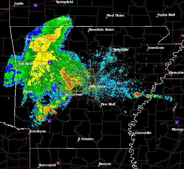 At 447 am cdt, severe thunderstorms were located along a line extending from near carden bottoms to near jessieville, moving east at 50 mph (radar indicated). Hazards include 60 mph wind gusts and penny size hail. expect damage to roofs, siding, and trees At 447 am cdt, severe thunderstorms were located along a line extending from near carden bottoms to near jessieville, moving east at 50 mph (radar indicated). Hazards include 60 mph wind gusts and penny size hail. expect damage to roofs, siding, and trees
|
| 6/23/2018 4:32 AM CDT |
 At 432 am cdt, a severe thunderstorm was located 8 miles north of jessieville, or 14 miles northwest of hot springs village, moving east at 55 mph (radar indicated). Hazards include 60 mph wind gusts and penny size hail. Expect damage to roofs, siding, and trees. Locations impacted include, hot springs village, lonsdale, jessieville, williams junction, lake ouachita state park, antioch in perry county, deberrie, mountain valley, lena landing rec area, long mountain, paron, hamilton, thornburg, crows, hollis, reform, owensville, nance,. At 432 am cdt, a severe thunderstorm was located 8 miles north of jessieville, or 14 miles northwest of hot springs village, moving east at 55 mph (radar indicated). Hazards include 60 mph wind gusts and penny size hail. Expect damage to roofs, siding, and trees. Locations impacted include, hot springs village, lonsdale, jessieville, williams junction, lake ouachita state park, antioch in perry county, deberrie, mountain valley, lena landing rec area, long mountain, paron, hamilton, thornburg, crows, hollis, reform, owensville, nance,.
|
| 6/23/2018 4:17 AM CDT |
 At 416 am cdt, a severe thunderstorm was located 14 miles southeast of fourche valley, or 19 miles south of danville, moving east at 55 mph (radar indicated). Hazards include 60 mph wind gusts and penny size hail. expect damage to roofs, siding, and trees At 416 am cdt, a severe thunderstorm was located 14 miles southeast of fourche valley, or 19 miles south of danville, moving east at 55 mph (radar indicated). Hazards include 60 mph wind gusts and penny size hail. expect damage to roofs, siding, and trees
|
| 6/9/2018 3:58 PM CDT |
 At 341 pm cdt, a severe thunderstorm was located near rockport, or 7 miles northwest of malvern, and is nearly stationary (radar indicated). Hazards include 60 mph wind gusts and quarter size hail. Hail damage to vehicles is expected. Expect wind damage to roofs, siding, and trees. At 341 pm cdt, a severe thunderstorm was located near rockport, or 7 miles northwest of malvern, and is nearly stationary (radar indicated). Hazards include 60 mph wind gusts and quarter size hail. Hail damage to vehicles is expected. Expect wind damage to roofs, siding, and trees.
|
| 6/9/2018 3:41 PM CDT |
 At 341 pm cdt, a severe thunderstorm was located near rockport, or 7 miles northwest of malvern, and is nearly stationary (radar indicated). Hazards include 60 mph wind gusts and quarter size hail. Hail damage to vehicles is expected. Expect wind damage to roofs, siding, and trees. At 341 pm cdt, a severe thunderstorm was located near rockport, or 7 miles northwest of malvern, and is nearly stationary (radar indicated). Hazards include 60 mph wind gusts and quarter size hail. Hail damage to vehicles is expected. Expect wind damage to roofs, siding, and trees.
|
| 6/8/2018 3:54 PM CDT |
 At 354 pm cdt, a severe thunderstorm was located over lake ouachita state park, or 11 miles northwest of hot springs, and is nearly stationary (radar indicated). Hazards include 60 mph wind gusts and quarter size hail. Hail damage to vehicles is expected. Expect wind damage to roofs, siding, and trees. At 354 pm cdt, a severe thunderstorm was located over lake ouachita state park, or 11 miles northwest of hot springs, and is nearly stationary (radar indicated). Hazards include 60 mph wind gusts and quarter size hail. Hail damage to vehicles is expected. Expect wind damage to roofs, siding, and trees.
|
| 6/2/2018 7:43 PM CDT |
 At 733 pm cdt, a severe thunderstorm was located near hot springs national park, or near hot springs village, moving southeast at 15 mph (radar indicated). Hazards include 60 mph wind gusts and half dollar size hail. Hail damage to vehicles is expected. expect wind damage to roofs, siding, and trees. Locations impacted include, hot springs, hot springs village, malvern, rockport, traskwood, lonsdale, hot springs memorial field, jessieville, hot springs national park, magnet cove, red oak, oaklawn racetrack, nance, mountain valley, glen rose, de roche, lake catherine state park, gulpha gorge, owensville,. At 733 pm cdt, a severe thunderstorm was located near hot springs national park, or near hot springs village, moving southeast at 15 mph (radar indicated). Hazards include 60 mph wind gusts and half dollar size hail. Hail damage to vehicles is expected. expect wind damage to roofs, siding, and trees. Locations impacted include, hot springs, hot springs village, malvern, rockport, traskwood, lonsdale, hot springs memorial field, jessieville, hot springs national park, magnet cove, red oak, oaklawn racetrack, nance, mountain valley, glen rose, de roche, lake catherine state park, gulpha gorge, owensville,.
|
| 6/2/2018 7:33 PM CDT |
 At 733 pm cdt, a severe thunderstorm was located near hot springs national park, or near hot springs village, moving southeast at 15 mph (radar indicated). Hazards include 60 mph wind gusts and half dollar size hail. Hail damage to vehicles is expected. expect wind damage to roofs, siding, and trees. Locations impacted include, hot springs, hot springs village, malvern, rockport, traskwood, lonsdale, hot springs memorial field, jessieville, hot springs national park, magnet cove, red oak, oaklawn racetrack, nance, mountain valley, glen rose, de roche, lake catherine state park, gulpha gorge, owensville,. At 733 pm cdt, a severe thunderstorm was located near hot springs national park, or near hot springs village, moving southeast at 15 mph (radar indicated). Hazards include 60 mph wind gusts and half dollar size hail. Hail damage to vehicles is expected. expect wind damage to roofs, siding, and trees. Locations impacted include, hot springs, hot springs village, malvern, rockport, traskwood, lonsdale, hot springs memorial field, jessieville, hot springs national park, magnet cove, red oak, oaklawn racetrack, nance, mountain valley, glen rose, de roche, lake catherine state park, gulpha gorge, owensville,.
|
| 6/2/2018 7:27 PM CDT | Half Dollar sized hail reported 2.9 miles E of Hot Springs Village, AR, haill fell near lake desoto. |
| 6/2/2018 7:24 PM CDT |
 At 724 pm cdt, a severe thunderstorm was located near jessieville, or near hot springs village, moving southeast at 15 mph (radar indicated). Hazards include two inch hail and 60 mph wind gusts. People and animals outdoors will be injured. expect hail damage to roofs, siding, windows, and vehicles. Expect wind damage to roofs, siding, and trees. At 724 pm cdt, a severe thunderstorm was located near jessieville, or near hot springs village, moving southeast at 15 mph (radar indicated). Hazards include two inch hail and 60 mph wind gusts. People and animals outdoors will be injured. expect hail damage to roofs, siding, windows, and vehicles. Expect wind damage to roofs, siding, and trees.
|
| 6/2/2018 7:20 PM CDT | Hen Egg sized hail reported 6.7 miles ENE of Hot Springs Village, AR |
| 6/2/2018 7:15 PM CDT | Quarter sized hail reported 2.9 miles E of Hot Springs Village, AR, quarter sized hail has been falling for 10-15 minutes on the west side of hot springs village. |
| 6/2/2018 7:15 PM CDT | Ping Pong Ball sized hail reported 2.9 miles E of Hot Springs Village, AR |
| 6/2/2018 7:14 PM CDT |
 At 713 pm cdt, a severe thunderstorm was located near jessieville, or near hot springs village, moving southeast at 15 mph. this is a very dangerous storm (radar indicated). Hazards include baseball size hail and 70 mph wind gusts. People and animals outdoors will be severely injured. expect shattered windows, extensive damage to roofs, siding, and vehicles. Locations impacted include, hot springs, hot springs village, hot springs national park, jessieville, lake ouachita state park, gulpha gorge, hamilton, bland, crows, mountain valley, owensville,. At 713 pm cdt, a severe thunderstorm was located near jessieville, or near hot springs village, moving southeast at 15 mph. this is a very dangerous storm (radar indicated). Hazards include baseball size hail and 70 mph wind gusts. People and animals outdoors will be severely injured. expect shattered windows, extensive damage to roofs, siding, and vehicles. Locations impacted include, hot springs, hot springs village, hot springs national park, jessieville, lake ouachita state park, gulpha gorge, hamilton, bland, crows, mountain valley, owensville,.
|
| 6/2/2018 6:59 PM CDT |
 At 659 pm cdt, a severe thunderstorm was located over jessieville, or 7 miles northwest of hot springs village, moving southeast at 15 mph (radar indicated). Hazards include two inch hail and 60 mph wind gusts. People and animals outdoors will be injured. expect hail damage to roofs, siding, windows, and vehicles. expect wind damage to roofs, siding, and trees. Locations impacted include, hot springs, hot springs village, hot springs national park, jessieville, lake ouachita state park, gulpha gorge, hamilton, bland, crows, mountain valley, owensville,. At 659 pm cdt, a severe thunderstorm was located over jessieville, or 7 miles northwest of hot springs village, moving southeast at 15 mph (radar indicated). Hazards include two inch hail and 60 mph wind gusts. People and animals outdoors will be injured. expect hail damage to roofs, siding, windows, and vehicles. expect wind damage to roofs, siding, and trees. Locations impacted include, hot springs, hot springs village, hot springs national park, jessieville, lake ouachita state park, gulpha gorge, hamilton, bland, crows, mountain valley, owensville,.
|
| 6/2/2018 6:45 PM CDT |
 At 645 pm cdt, a severe thunderstorm was located near jessieville, or 11 miles northwest of hot springs village, moving southeast at 15 mph (radar indicated). Hazards include 60 mph wind gusts and half dollar size hail. Hail damage to vehicles is expected. Expect wind damage to roofs, siding, and trees. At 645 pm cdt, a severe thunderstorm was located near jessieville, or 11 miles northwest of hot springs village, moving southeast at 15 mph (radar indicated). Hazards include 60 mph wind gusts and half dollar size hail. Hail damage to vehicles is expected. Expect wind damage to roofs, siding, and trees.
|
| 6/2/2018 6:19 PM CDT |
 At 619 pm cdt, a severe thunderstorm was located 7 miles northwest of jessieville, or 14 miles northwest of hot springs village, moving southeast at 15 mph (radar indicated). Hazards include 60 mph wind gusts and quarter size hail. Hail damage to vehicles is expected. expect wind damage to roofs, siding, and trees. Locations impacted include, hot springs village, jessieville, aplin, antioch in perry county, nimrod, deberrie, mountain valley, long mountain, hamilton, fourche junction, thornburg, hollis, reform,. At 619 pm cdt, a severe thunderstorm was located 7 miles northwest of jessieville, or 14 miles northwest of hot springs village, moving southeast at 15 mph (radar indicated). Hazards include 60 mph wind gusts and quarter size hail. Hail damage to vehicles is expected. expect wind damage to roofs, siding, and trees. Locations impacted include, hot springs village, jessieville, aplin, antioch in perry county, nimrod, deberrie, mountain valley, long mountain, hamilton, fourche junction, thornburg, hollis, reform,.
|
| 6/2/2018 5:59 PM CDT |
 At 559 pm cdt, a severe thunderstorm was located 9 miles northwest of jessieville, or 15 miles northwest of hot springs village, moving southeast at 20 mph (radar indicated). Hazards include 60 mph wind gusts and quarter size hail. Hail damage to vehicles is expected. Expect wind damage to roofs, siding, and trees. At 559 pm cdt, a severe thunderstorm was located 9 miles northwest of jessieville, or 15 miles northwest of hot springs village, moving southeast at 20 mph (radar indicated). Hazards include 60 mph wind gusts and quarter size hail. Hail damage to vehicles is expected. Expect wind damage to roofs, siding, and trees.
|
| 6/2/2018 5:49 PM CDT |
 At 549 pm cdt, a severe thunderstorm was located 11 miles northwest of jessieville, or 18 miles southeast of danville, moving east at 15 mph (radar indicated). Hazards include 60 mph wind gusts and quarter size hail. Hail damage to vehicles is expected. expect wind damage to roofs, siding, and trees. Locations impacted include, hot springs village, jessieville, casa, carter cove park, nimrod, fourche junction, hollis, sunlight bay park, garden point recreation area,. At 549 pm cdt, a severe thunderstorm was located 11 miles northwest of jessieville, or 18 miles southeast of danville, moving east at 15 mph (radar indicated). Hazards include 60 mph wind gusts and quarter size hail. Hail damage to vehicles is expected. expect wind damage to roofs, siding, and trees. Locations impacted include, hot springs village, jessieville, casa, carter cove park, nimrod, fourche junction, hollis, sunlight bay park, garden point recreation area,.
|
| 6/2/2018 5:32 PM CDT |
 At 532 pm cdt, a severe thunderstorm was located 7 miles south of plainview in yell county, or 13 miles southeast of danville, moving east at 15 mph (radar indicated). Hazards include 60 mph wind gusts and quarter size hail. Hail damage to vehicles is expected. expect wind damage to roofs, siding, and trees. Locations impacted include, hot springs village, plainview in yell county, jessieville, casa, birta, carter cove park, rover, nimrod, fourche junction, hollis, sunlight bay park, garden point recreation area,. At 532 pm cdt, a severe thunderstorm was located 7 miles south of plainview in yell county, or 13 miles southeast of danville, moving east at 15 mph (radar indicated). Hazards include 60 mph wind gusts and quarter size hail. Hail damage to vehicles is expected. expect wind damage to roofs, siding, and trees. Locations impacted include, hot springs village, plainview in yell county, jessieville, casa, birta, carter cove park, rover, nimrod, fourche junction, hollis, sunlight bay park, garden point recreation area,.
|
| 6/2/2018 5:21 PM CDT |
 At 521 pm cdt, a severe thunderstorm was located 7 miles south of plainview in yell county, or 11 miles south of danville, moving east at 15 mph (radar indicated). Hazards include 60 mph wind gusts and quarter size hail. Hail damage to vehicles is expected. Expect wind damage to roofs, siding, and trees. At 521 pm cdt, a severe thunderstorm was located 7 miles south of plainview in yell county, or 11 miles south of danville, moving east at 15 mph (radar indicated). Hazards include 60 mph wind gusts and quarter size hail. Hail damage to vehicles is expected. Expect wind damage to roofs, siding, and trees.
|
| 4/13/2018 9:56 PM CDT |
 At 956 pm cdt, severe thunderstorms were located along a line extending from near maumelle to near chenal valley to near lonsdale to 8 miles west of degray lake state park, moving east at 35 mph (radar indicated). Hazards include 60 mph wind gusts and penny size hail. Expect damage to roofs, siding, and trees. Locations impacted include, little rock, north little rock, conway, hot springs, west little rock, maumelle, hot springs village, arkadelphia, malvern, murfreesboro, greenbrier, vilonia, mayflower, wooster, mountain pine, quitman, rockport, amity, guy, caddo valley, a tornado watch remains in effect until 600 am cdt for central, southwestern and north central arkansas. At 956 pm cdt, severe thunderstorms were located along a line extending from near maumelle to near chenal valley to near lonsdale to 8 miles west of degray lake state park, moving east at 35 mph (radar indicated). Hazards include 60 mph wind gusts and penny size hail. Expect damage to roofs, siding, and trees. Locations impacted include, little rock, north little rock, conway, hot springs, west little rock, maumelle, hot springs village, arkadelphia, malvern, murfreesboro, greenbrier, vilonia, mayflower, wooster, mountain pine, quitman, rockport, amity, guy, caddo valley, a tornado watch remains in effect until 600 am cdt for central, southwestern and north central arkansas.
|
| 4/13/2018 9:17 PM CDT |
 The national weather service in little rock has issued a * tornado warning for. central garland county in central arkansas. southeastern montgomery county in western arkansas. Until 1000 pm cdt * at 916 pm cdt, a severe thunderstorm capable of producing a tornado. The national weather service in little rock has issued a * tornado warning for. central garland county in central arkansas. southeastern montgomery county in western arkansas. Until 1000 pm cdt * at 916 pm cdt, a severe thunderstorm capable of producing a tornado.
|
| 4/13/2018 9:13 PM CDT |
 At 912 pm cdt, severe thunderstorms were located along a line extending from near hattieville to 6 miles southwest of perryville to 7 miles north of meyers to narrows dam, moving east at 45 mph (radar indicated). Hazards include 60 mph wind gusts and penny size hail. expect damage to roofs, siding, and trees At 912 pm cdt, severe thunderstorms were located along a line extending from near hattieville to 6 miles southwest of perryville to 7 miles north of meyers to narrows dam, moving east at 45 mph (radar indicated). Hazards include 60 mph wind gusts and penny size hail. expect damage to roofs, siding, and trees
|
| 4/13/2018 8:48 PM CDT |
 At 846 pm cdt, severe thunderstorms were located along a line extending from near dover to ola to mount ida to 5 miles northwest of murfreesboro, moving east at 45 mph (radar indicated). Hazards include 60 mph wind gusts and penny size hail. Expect damage to roofs, siding, and trees. Locations impacted include, hot springs, russellville, hot springs village, morrilton, murfreesboro, perryville, mount ida, dardanelle, atkins, pottsville, glenwood, ola, oppelo, mountain pine, amity, caddo valley, norman, perry, adona, houston, a tornado watch remains in effect until 1000 pm cdt for central, western and southwestern arkansas. At 846 pm cdt, severe thunderstorms were located along a line extending from near dover to ola to mount ida to 5 miles northwest of murfreesboro, moving east at 45 mph (radar indicated). Hazards include 60 mph wind gusts and penny size hail. Expect damage to roofs, siding, and trees. Locations impacted include, hot springs, russellville, hot springs village, morrilton, murfreesboro, perryville, mount ida, dardanelle, atkins, pottsville, glenwood, ola, oppelo, mountain pine, amity, caddo valley, norman, perry, adona, houston, a tornado watch remains in effect until 1000 pm cdt for central, western and southwestern arkansas.
|
| 4/13/2018 8:13 PM CDT |
 At 813 pm cdt, severe thunderstorms were located along a line extending from near lamar to near fourche valley to 7 miles southeast of muddy creek wma to 6 miles north of daisy to near center point, moving east at 35 mph (radar indicated). Hazards include 60 mph wind gusts and quarter size hail. Hail damage to vehicles is expected. Expect wind damage to roofs, siding, and trees. At 813 pm cdt, severe thunderstorms were located along a line extending from near lamar to near fourche valley to 7 miles southeast of muddy creek wma to 6 miles north of daisy to near center point, moving east at 35 mph (radar indicated). Hazards include 60 mph wind gusts and quarter size hail. Hail damage to vehicles is expected. Expect wind damage to roofs, siding, and trees.
|
| 3/10/2018 8:38 PM CDT |
 At 738 pm cst, severe thunderstorms were located along a line extending from pinnacle mountain state park to 10 miles northwest of salem in saline county, moving east at 35 mph (radar indicated). Hazards include 60 mph wind gusts and quarter size hail. Hail damage to vehicles is expected. Expect wind damage to roofs, siding, and trees. At 738 pm cst, severe thunderstorms were located along a line extending from pinnacle mountain state park to 10 miles northwest of salem in saline county, moving east at 35 mph (radar indicated). Hazards include 60 mph wind gusts and quarter size hail. Hail damage to vehicles is expected. Expect wind damage to roofs, siding, and trees.
|
| 3/10/2018 8:35 PM CDT |
 At 735 pm cst, severe thunderstorms were located along a line extending from near lonsdale to near bryant to near ironton to cane creek, moving east at 15 mph (radar indicated). Hazards include golf ball size hail and 60 mph wind gusts. People and animals outdoors will be injured. expect hail damage to roofs, siding, windows, and vehicles. expect wind damage to roofs, siding, and trees. Locations impacted include, little rock, benton, bryant, hot springs village, southwest little rock, white hall, haskell, shannon hills, england, wrightsville, redfield, traskwood, tull, keo, lonsdale, otter creek, cane creek, ironton, estes, toltec mounds state park,. At 735 pm cst, severe thunderstorms were located along a line extending from near lonsdale to near bryant to near ironton to cane creek, moving east at 15 mph (radar indicated). Hazards include golf ball size hail and 60 mph wind gusts. People and animals outdoors will be injured. expect hail damage to roofs, siding, windows, and vehicles. expect wind damage to roofs, siding, and trees. Locations impacted include, little rock, benton, bryant, hot springs village, southwest little rock, white hall, haskell, shannon hills, england, wrightsville, redfield, traskwood, tull, keo, lonsdale, otter creek, cane creek, ironton, estes, toltec mounds state park,.
|
| 3/10/2018 8:28 PM CDT |
 At 727 pm cst, severe thunderstorms were located along a line extending from near roland in pulaski county to near williams junction, moving east at 30 mph (radar indicated). Hazards include 60 mph wind gusts and quarter size hail. Hail damage to vehicles is expected. expect wind damage to roofs, siding, and trees. Locations impacted include, little rock, west little rock, maumelle, hot springs village, pinnacle mountain state park, little italy, wye mountain, chenal valley, williams junction, roland in pulaski county, avilla, wye, natural steps, oak grove in perry county, paron, bland, pleasant valley in perry county, ferndale,. At 727 pm cst, severe thunderstorms were located along a line extending from near roland in pulaski county to near williams junction, moving east at 30 mph (radar indicated). Hazards include 60 mph wind gusts and quarter size hail. Hail damage to vehicles is expected. expect wind damage to roofs, siding, and trees. Locations impacted include, little rock, west little rock, maumelle, hot springs village, pinnacle mountain state park, little italy, wye mountain, chenal valley, williams junction, roland in pulaski county, avilla, wye, natural steps, oak grove in perry county, paron, bland, pleasant valley in perry county, ferndale,.
|
| 3/10/2018 8:24 PM CDT |
 At 724 pm cst, a cluster of severe thunderstorms were located from lonsdale to benton to shannon hills to near cane creek, moving east at 15 mph (radar indicated). Hazards include 60 mph wind gusts and quarter size hail. Hail damage to vehicles is expected. Expect wind damage to roofs, siding, and trees. At 724 pm cst, a cluster of severe thunderstorms were located from lonsdale to benton to shannon hills to near cane creek, moving east at 15 mph (radar indicated). Hazards include 60 mph wind gusts and quarter size hail. Hail damage to vehicles is expected. Expect wind damage to roofs, siding, and trees.
|
| 3/10/2018 8:11 PM CDT |
 At 711 pm cst, severe thunderstorms were located along a line extending from near perryville to 6 miles north of hot springs village, moving southeast at 35 mph (radar indicated). Hazards include 60 mph wind gusts and quarter size hail. Hail damage to vehicles is expected. expect wind damage to roofs, siding, and trees. Locations impacted include, little rock, benton, west little rock, maumelle, bryant, hot springs village, perryville, haskell, traskwood, lonsdale, little italy, chenal valley, roland in pulaski county, pinnacle mountain state park, wye mountain, salem in saline county, williams junction, avilla, antioch in perry county, natural steps,. At 711 pm cst, severe thunderstorms were located along a line extending from near perryville to 6 miles north of hot springs village, moving southeast at 35 mph (radar indicated). Hazards include 60 mph wind gusts and quarter size hail. Hail damage to vehicles is expected. expect wind damage to roofs, siding, and trees. Locations impacted include, little rock, benton, west little rock, maumelle, bryant, hot springs village, perryville, haskell, traskwood, lonsdale, little italy, chenal valley, roland in pulaski county, pinnacle mountain state park, wye mountain, salem in saline county, williams junction, avilla, antioch in perry county, natural steps,.
|
| 3/10/2018 7:52 PM CDT |
 At 652 pm cst, severe thunderstorms were located along a line extending from near adona to 9 miles north of jessieville, moving southeast at 35 mph (radar indicated). Hazards include 60 mph wind gusts and half dollar size hail. Hail damage to vehicles is expected. Expect wind damage to roofs, siding, and trees. At 652 pm cst, severe thunderstorms were located along a line extending from near adona to 9 miles north of jessieville, moving southeast at 35 mph (radar indicated). Hazards include 60 mph wind gusts and half dollar size hail. Hail damage to vehicles is expected. Expect wind damage to roofs, siding, and trees.
|
| 3/10/2018 7:33 PM CDT |
 At 617 pm cst, a severe thunderstorm was located near petit jean river wma, or near danville, moving southeast at 35 mph (radar indicated). Hazards include 60 mph wind gusts and half dollar size hail. Hail damage to vehicles is expected. Expect wind damage to roofs, siding, and trees. At 617 pm cst, a severe thunderstorm was located near petit jean river wma, or near danville, moving southeast at 35 mph (radar indicated). Hazards include 60 mph wind gusts and half dollar size hail. Hail damage to vehicles is expected. Expect wind damage to roofs, siding, and trees.
|
| 3/10/2018 7:17 PM CDT |
 At 617 pm cst, a severe thunderstorm was located near petit jean river wma, or near danville, moving southeast at 35 mph (radar indicated). Hazards include 60 mph wind gusts and half dollar size hail. Hail damage to vehicles is expected. Expect wind damage to roofs, siding, and trees. At 617 pm cst, a severe thunderstorm was located near petit jean river wma, or near danville, moving southeast at 35 mph (radar indicated). Hazards include 60 mph wind gusts and half dollar size hail. Hail damage to vehicles is expected. Expect wind damage to roofs, siding, and trees.
|
| 2/24/2018 3:25 PM CST |
 At 325 pm cst, severe thunderstorms were located along a line extending from toad suck to near salem in saline county to near rockport, moving east at 45 mph (radar indicated). Hazards include 60 mph wind gusts. expect damage to roofs, siding, and trees At 325 pm cst, severe thunderstorms were located along a line extending from toad suck to near salem in saline county to near rockport, moving east at 45 mph (radar indicated). Hazards include 60 mph wind gusts. expect damage to roofs, siding, and trees
|
| 2/24/2018 3:11 PM CST |
 At 311 pm cst, severe thunderstorms were located along a line extending from near wye mountain to near malvern to 6 miles west of richwoods, moving east at 50 mph (radar indicated). Hazards include 60 mph wind gusts. Expect damage to roofs, siding, and trees. locations impacted include, little rock, north little rock, conway, hot springs, benton, west little rock, maumelle, bryant, hot springs village, arkadelphia, malvern, perryville, southwest little rock, haskell, shannon hills, mayflower, gurdon, rockport, caddo valley, traskwood, this includes the following highways, interstate 30 between mile markers 55 and 129. interstate 40 between mile markers 127 and 142. interstate 430 between mile markers 1 and 5, and near mile marker 9. A tornado watch remains in effect until 600 pm cst for central and southwestern arkansas. At 311 pm cst, severe thunderstorms were located along a line extending from near wye mountain to near malvern to 6 miles west of richwoods, moving east at 50 mph (radar indicated). Hazards include 60 mph wind gusts. Expect damage to roofs, siding, and trees. locations impacted include, little rock, north little rock, conway, hot springs, benton, west little rock, maumelle, bryant, hot springs village, arkadelphia, malvern, perryville, southwest little rock, haskell, shannon hills, mayflower, gurdon, rockport, caddo valley, traskwood, this includes the following highways, interstate 30 between mile markers 55 and 129. interstate 40 between mile markers 127 and 142. interstate 430 between mile markers 1 and 5, and near mile marker 9. A tornado watch remains in effect until 600 pm cst for central and southwestern arkansas.
|
| 2/24/2018 2:52 PM CST |
 At 251 pm cst, severe thunderstorms were located along a line extending from 7 miles southwest of adona to near rockwell to 9 miles west of halfway, moving east at 50 mph (radar indicated). Hazards include 60 mph wind gusts. Expect damage to roofs, siding, and trees. locations impacted include, little rock, north little rock, conway, hot springs, benton, west little rock, maumelle, bryant, hot springs village, arkadelphia, malvern, perryville, southwest little rock, haskell, shannon hills, mayflower, gurdon, mountain pine, rockport, amity, this includes the following highways, interstate 30 between mile markers 55 and 129. interstate 40 between mile markers 127 and 142. interstate 430 between mile markers 1 and 5, and near mile marker 9. A tornado watch remains in effect until 600 pm cst for central and southwestern arkansas. At 251 pm cst, severe thunderstorms were located along a line extending from 7 miles southwest of adona to near rockwell to 9 miles west of halfway, moving east at 50 mph (radar indicated). Hazards include 60 mph wind gusts. Expect damage to roofs, siding, and trees. locations impacted include, little rock, north little rock, conway, hot springs, benton, west little rock, maumelle, bryant, hot springs village, arkadelphia, malvern, perryville, southwest little rock, haskell, shannon hills, mayflower, gurdon, mountain pine, rockport, amity, this includes the following highways, interstate 30 between mile markers 55 and 129. interstate 40 between mile markers 127 and 142. interstate 430 between mile markers 1 and 5, and near mile marker 9. A tornado watch remains in effect until 600 pm cst for central and southwestern arkansas.
|
| 2/24/2018 2:42 PM CST |
 At 242 pm cst, severe thunderstorms were located along a line extending from 7 miles southeast of ola to lofton to near crater of diamonds state park, moving east at 50 mph (radar indicated). Hazards include 60 mph wind gusts. expect damage to roofs, siding, and trees At 242 pm cst, severe thunderstorms were located along a line extending from 7 miles southeast of ola to lofton to near crater of diamonds state park, moving east at 50 mph (radar indicated). Hazards include 60 mph wind gusts. expect damage to roofs, siding, and trees
|
| 2/24/2018 2:36 PM CST |
 At 236 pm cst, severe thunderstorms were located along a line extending from 12 miles southeast of ola to near piney in garland county to 9 miles northeast of murfreesboro, moving east at 35 mph (radar indicated). Hazards include 60 mph wind gusts. Expect damage to roofs, siding, and trees. Locations impacted include, hot springs, hot springs village, murfreesboro, perryville, glenwood, mountain pine, amity, houston, okolona, crater of diamonds state park, narrows dam, jessieville, meyers, lake ouachita state park, lofton, rockwell, degray lake state park, piney in garland county, williams junction, hot springs memorial field, a tornado watch remains in effect until 600 pm cst for central, western and southwestern arkansas. At 236 pm cst, severe thunderstorms were located along a line extending from 12 miles southeast of ola to near piney in garland county to 9 miles northeast of murfreesboro, moving east at 35 mph (radar indicated). Hazards include 60 mph wind gusts. Expect damage to roofs, siding, and trees. Locations impacted include, hot springs, hot springs village, murfreesboro, perryville, glenwood, mountain pine, amity, houston, okolona, crater of diamonds state park, narrows dam, jessieville, meyers, lake ouachita state park, lofton, rockwell, degray lake state park, piney in garland county, williams junction, hot springs memorial field, a tornado watch remains in effect until 600 pm cst for central, western and southwestern arkansas.
|
| 2/24/2018 2:06 PM CST |
 At 205 pm cst, severe thunderstorms were located along a line extending from 9 miles southwest of plainview in yell county to 7 miles southeast of mount ida to near corinth, moving east at 35 mph (radar indicated). Hazards include 60 mph wind gusts. expect damage to roofs, siding, and trees At 205 pm cst, severe thunderstorms were located along a line extending from 9 miles southwest of plainview in yell county to 7 miles southeast of mount ida to near corinth, moving east at 35 mph (radar indicated). Hazards include 60 mph wind gusts. expect damage to roofs, siding, and trees
|
| 1/21/2018 11:36 PM CST |
 At 1135 pm cst, a severe thunderstorm was located near mountain pine, or 10 miles northwest of hot springs, moving northeast at 55 mph (radar indicated). Hazards include 60 mph wind gusts and penny size hail. Expect damage to roofs, siding, and trees. Locations impacted include, hot springs, hot springs village, mountain pine, jessieville, lake ouachita state park, hot springs national park, piney in garland county, crystal springs landing, sunshine, mountain valley, royal, gulpha gorge, hamilton, crystal springs, lena landing rec area, pearcy, a tornado watch remains in effect until 400 am cst for central arkansas. At 1135 pm cst, a severe thunderstorm was located near mountain pine, or 10 miles northwest of hot springs, moving northeast at 55 mph (radar indicated). Hazards include 60 mph wind gusts and penny size hail. Expect damage to roofs, siding, and trees. Locations impacted include, hot springs, hot springs village, mountain pine, jessieville, lake ouachita state park, hot springs national park, piney in garland county, crystal springs landing, sunshine, mountain valley, royal, gulpha gorge, hamilton, crystal springs, lena landing rec area, pearcy, a tornado watch remains in effect until 400 am cst for central arkansas.
|
| 1/21/2018 11:26 PM CST |
 At 1124 pm cst, a severe thunderstorm capable of producing a tornado was located near meyers, or 16 miles east of mount ida, moving northeast at 55 mph (radar indicated rotation). Hazards include tornado. Flying debris will be dangerous to those caught without shelter. mobile homes will be damaged or destroyed. damage to roofs, windows, and vehicles will occur. tree damage is likely. Locations impacted include, hot springs, hot springs village, mountain pine, jessieville, meyers, lake ouachita state park, hot springs national park, piney in garland county, crystal springs landing, sunshine, mountain valley, royal, hamilton, owensville, crystal springs, lena landing rec area, pearcy,. At 1124 pm cst, a severe thunderstorm capable of producing a tornado was located near meyers, or 16 miles east of mount ida, moving northeast at 55 mph (radar indicated rotation). Hazards include tornado. Flying debris will be dangerous to those caught without shelter. mobile homes will be damaged or destroyed. damage to roofs, windows, and vehicles will occur. tree damage is likely. Locations impacted include, hot springs, hot springs village, mountain pine, jessieville, meyers, lake ouachita state park, hot springs national park, piney in garland county, crystal springs landing, sunshine, mountain valley, royal, hamilton, owensville, crystal springs, lena landing rec area, pearcy,.
|
| 1/21/2018 11:20 PM CST |
 At 1120 pm cst, a severe thunderstorm capable of producing a tornado was located near meyers, or 14 miles southeast of mount ida, moving northeast at 50 mph (radar indicated rotation). Hazards include tornado. Flying debris will be dangerous to those caught without shelter. mobile homes will be damaged or destroyed. damage to roofs, windows, and vehicles will occur. Tree damage is likely. At 1120 pm cst, a severe thunderstorm capable of producing a tornado was located near meyers, or 14 miles southeast of mount ida, moving northeast at 50 mph (radar indicated rotation). Hazards include tornado. Flying debris will be dangerous to those caught without shelter. mobile homes will be damaged or destroyed. damage to roofs, windows, and vehicles will occur. Tree damage is likely.
|
| 1/21/2018 11:18 PM CST |
 At 1117 pm cst, a severe thunderstorm was located near meyers, or 15 miles southeast of mount ida, moving northeast at 50 mph (radar indicated). Hazards include 60 mph wind gusts and penny size hail. Expect damage to roofs, siding, and trees. Locations impacted include, hot springs, hot springs village, mountain pine, hot springs memorial field, jessieville, meyers, lake ouachita state park, rockwell, hot springs national park, piney in garland county, crystal springs landing, sunshine, welsh, mountain valley, royal, lena landing rec area, gulpha gorge, hamilton, hempwallace, pearcy, a tornado watch remains in effect until 400 am cst for central, western and southwestern arkansas. At 1117 pm cst, a severe thunderstorm was located near meyers, or 15 miles southeast of mount ida, moving northeast at 50 mph (radar indicated). Hazards include 60 mph wind gusts and penny size hail. Expect damage to roofs, siding, and trees. Locations impacted include, hot springs, hot springs village, mountain pine, hot springs memorial field, jessieville, meyers, lake ouachita state park, rockwell, hot springs national park, piney in garland county, crystal springs landing, sunshine, welsh, mountain valley, royal, lena landing rec area, gulpha gorge, hamilton, hempwallace, pearcy, a tornado watch remains in effect until 400 am cst for central, western and southwestern arkansas.
|
| 1/21/2018 11:02 PM CST |
 At 1101 pm cst, a severe thunderstorm was located 6 miles southwest of glenwood, or 14 miles north of murfreesboro, moving northeast at 50 mph (radar indicated). Hazards include 60 mph wind gusts and penny size hail. expect damage to roofs, siding, and trees At 1101 pm cst, a severe thunderstorm was located 6 miles southwest of glenwood, or 14 miles north of murfreesboro, moving northeast at 50 mph (radar indicated). Hazards include 60 mph wind gusts and penny size hail. expect damage to roofs, siding, and trees
|
| 10/22/2017 3:20 AM CDT |
 At 319 am cdt, severe thunderstorms were located along a line extending from whipple to near conway to 8 miles east of hot springs village, moving east at 35 mph (radar indicated). Hazards include 60 mph wind gusts. Expect damage to roofs, siding, and trees. Locations impacted include, conway, maumelle, hot springs village, greenbrier, mayflower, wooster, guy, damascus, twin groves, menifee, bethlehem, hill creek, little italy, roland in pulaski county, whipple, toad suck, williams junction, pickles gap, catholic point, pinnacle mountain state park, this includes interstate 40 between mile markers 114 and 140. At 319 am cdt, severe thunderstorms were located along a line extending from whipple to near conway to 8 miles east of hot springs village, moving east at 35 mph (radar indicated). Hazards include 60 mph wind gusts. Expect damage to roofs, siding, and trees. Locations impacted include, conway, maumelle, hot springs village, greenbrier, mayflower, wooster, guy, damascus, twin groves, menifee, bethlehem, hill creek, little italy, roland in pulaski county, whipple, toad suck, williams junction, pickles gap, catholic point, pinnacle mountain state park, this includes interstate 40 between mile markers 114 and 140.
|
| 10/22/2017 3:12 AM CDT |
 At 311 am cdt, severe thunderstorms were located along a line extending from near hot springs village to hot springs memorial field to near lofton, moving east at 35 mph (radar indicated). Hazards include 60 mph wind gusts. expect damage to roofs, siding, and trees At 311 am cdt, severe thunderstorms were located along a line extending from near hot springs village to hot springs memorial field to near lofton, moving east at 35 mph (radar indicated). Hazards include 60 mph wind gusts. expect damage to roofs, siding, and trees
|
| 10/22/2017 2:48 AM CDT |
 At 247 am cdt, severe thunderstorms were located along a line extending from near hector to near petit jean state park to 8 miles northwest of jessieville, moving east at 35 mph (radar indicated). Hazards include 60 mph wind gusts. expect damage to roofs, siding, and trees At 247 am cdt, severe thunderstorms were located along a line extending from near hector to near petit jean state park to 8 miles northwest of jessieville, moving east at 35 mph (radar indicated). Hazards include 60 mph wind gusts. expect damage to roofs, siding, and trees
|
| 10/22/2017 2:15 AM CDT |
 At 214 am cdt, severe thunderstorms were located along a line extending from near clarksville to near danville to near muddy creek wma, moving east at 35 mph (radar indicated). Hazards include 60 mph wind gusts. expect damage to roofs, siding, and trees At 214 am cdt, severe thunderstorms were located along a line extending from near clarksville to near danville to near muddy creek wma, moving east at 35 mph (radar indicated). Hazards include 60 mph wind gusts. expect damage to roofs, siding, and trees
|
| 6/23/2017 5:04 PM CDT |
 The national weather service in little rock has issued a * severe thunderstorm warning for. garland county in central arkansas. northwestern saline county in central arkansas. hot spring county in southwestern arkansas. Until 545 pm cdt. The national weather service in little rock has issued a * severe thunderstorm warning for. garland county in central arkansas. northwestern saline county in central arkansas. hot spring county in southwestern arkansas. Until 545 pm cdt.
|
| 6/18/2017 11:30 AM CDT | Report on socia media of trees blown down on the desoto golf course in hot springs villag in garland county AR, 2.9 miles E of Hot Springs Village, AR |
| 6/18/2017 11:08 AM CDT |
 At 1108 am cdt, severe thunderstorms were located along a line extending from 10 miles south of plainview in yell county to mountain pine to 6 miles south of meyers, moving east at 45 mph (radar indicated). Hazards include 60 mph wind gusts and nickel size hail. Expect damage to roofs, siding, and trees. Locations impacted include, hot springs, hot springs village, malvern, mountain pine, rockport, lonsdale, hot springs memorial field, jessieville, meyers, lake ouachita state park, lofton, rockwell, hot springs national park, piney in garland county, avant, bismarck, magnet cove, oaklawn racetrack, bonnerdale, mt tabor, this includes interstate 30 between mile markers 89 and 93. At 1108 am cdt, severe thunderstorms were located along a line extending from 10 miles south of plainview in yell county to mountain pine to 6 miles south of meyers, moving east at 45 mph (radar indicated). Hazards include 60 mph wind gusts and nickel size hail. Expect damage to roofs, siding, and trees. Locations impacted include, hot springs, hot springs village, malvern, mountain pine, rockport, lonsdale, hot springs memorial field, jessieville, meyers, lake ouachita state park, lofton, rockwell, hot springs national park, piney in garland county, avant, bismarck, magnet cove, oaklawn racetrack, bonnerdale, mt tabor, this includes interstate 30 between mile markers 89 and 93.
|
| 6/18/2017 10:49 AM CDT |
 At 1049 am cdt, severe thunderstorms were located along a line extending from near fourche valley to 10 miles north of meyers to near glenwood, moving east at 45 mph (radar indicated). Hazards include 60 mph wind gusts and nickel size hail. expect damage to roofs, siding, and trees At 1049 am cdt, severe thunderstorms were located along a line extending from near fourche valley to 10 miles north of meyers to near glenwood, moving east at 45 mph (radar indicated). Hazards include 60 mph wind gusts and nickel size hail. expect damage to roofs, siding, and trees
|
| 6/3/2017 1:52 PM CDT |
 The severe thunderstorm warning for northwestern garland county will expire at 200 pm cdt, the storm which prompted the warning has weakened below severe limits, and no longer poses an immediate threat to life or property. therefore, the warning will be allowed to expire. The severe thunderstorm warning for northwestern garland county will expire at 200 pm cdt, the storm which prompted the warning has weakened below severe limits, and no longer poses an immediate threat to life or property. therefore, the warning will be allowed to expire.
|
| 6/3/2017 1:32 PM CDT |
 At 132 pm cdt, a severe thunderstorm was located over lake ouachita state park, or 9 miles northwest of hot springs, moving north at 15 mph (radar indicated). Hazards include 60 mph wind gusts and quarter size hail. Hail damage to vehicles is expected. Expect wind damage to roofs, siding, and trees. At 132 pm cdt, a severe thunderstorm was located over lake ouachita state park, or 9 miles northwest of hot springs, moving north at 15 mph (radar indicated). Hazards include 60 mph wind gusts and quarter size hail. Hail damage to vehicles is expected. Expect wind damage to roofs, siding, and trees.
|
| 5/28/2017 2:43 AM CDT |
 At 242 am cdt, severe thunderstorms were located along a line extending from near hot springs village to near rockwell to 6 miles southwest of degray lake state park to 6 miles west of okolona, moving southeast at 45 mph (radar indicated). Hazards include 60 mph wind gusts and nickel size hail. Expect damage to roofs, siding, and trees. Locations impacted include, hot springs, hot springs village, mountain pine, amity, okolona, lonsdale, hot springs memorial field, halfway, crater of diamonds state park, jessieville, lofton, rockwell, degray lake state park, hot springs national park, piney in garland county, delight, bismarck, antoine, billstown, alpine,. At 242 am cdt, severe thunderstorms were located along a line extending from near hot springs village to near rockwell to 6 miles southwest of degray lake state park to 6 miles west of okolona, moving southeast at 45 mph (radar indicated). Hazards include 60 mph wind gusts and nickel size hail. Expect damage to roofs, siding, and trees. Locations impacted include, hot springs, hot springs village, mountain pine, amity, okolona, lonsdale, hot springs memorial field, halfway, crater of diamonds state park, jessieville, lofton, rockwell, degray lake state park, hot springs national park, piney in garland county, delight, bismarck, antoine, billstown, alpine,.
|
| 5/28/2017 2:38 AM CDT |
 The tornado warning for southwestern perry, north central garland and northwestern saline counties will expire at 245 am cdt, the tornadic thunderstorm which prompted the warning has weakened. therefore, the warning will be allowed to expire. a severe thunderstorm watch remains in effect until 800 am cdt for central arkansas. &&. The tornado warning for southwestern perry, north central garland and northwestern saline counties will expire at 245 am cdt, the tornadic thunderstorm which prompted the warning has weakened. therefore, the warning will be allowed to expire. a severe thunderstorm watch remains in effect until 800 am cdt for central arkansas. &&.
|
| 5/28/2017 2:29 AM CDT |
 At 229 am cdt, a severe thunderstorm capable of producing a tornado was located 8 miles northwest of jessieville, or 15 miles northwest of hot springs village, moving southeast at 30 mph (radar indicated rotation). Hazards include tornado. Flying debris will be dangerous to those caught without shelter. mobile homes will be damaged or destroyed. damage to roofs, windows, and vehicles will occur. tree damage is likely. Locations impacted include, hot springs village, jessieville,. At 229 am cdt, a severe thunderstorm capable of producing a tornado was located 8 miles northwest of jessieville, or 15 miles northwest of hot springs village, moving southeast at 30 mph (radar indicated rotation). Hazards include tornado. Flying debris will be dangerous to those caught without shelter. mobile homes will be damaged or destroyed. damage to roofs, windows, and vehicles will occur. tree damage is likely. Locations impacted include, hot springs village, jessieville,.
|
| 5/28/2017 2:18 AM CDT |
 At 218 am cdt, a severe thunderstorm capable of producing a tornado was located 10 miles south of plainview in yell county, or 15 miles southeast of danville, moving southeast at 40 mph (radar indicated rotation). Hazards include tornado. Flying debris will be dangerous to those caught without shelter. mobile homes will be damaged or destroyed. damage to roofs, windows, and vehicles will occur. Tree damage is likely. At 218 am cdt, a severe thunderstorm capable of producing a tornado was located 10 miles south of plainview in yell county, or 15 miles southeast of danville, moving southeast at 40 mph (radar indicated rotation). Hazards include tornado. Flying debris will be dangerous to those caught without shelter. mobile homes will be damaged or destroyed. damage to roofs, windows, and vehicles will occur. Tree damage is likely.
|
| 5/28/2017 2:07 AM CDT |
 At 206 am cdt, severe thunderstorms were located along a line extending from fourche valley to 9 miles northeast of mount ida to near daisy to 6 miles west of center point, moving east at 50 mph (radar indicated). Hazards include 60 mph wind gusts and nickel size hail. expect damage to roofs, siding, and trees At 206 am cdt, severe thunderstorms were located along a line extending from fourche valley to 9 miles northeast of mount ida to near daisy to 6 miles west of center point, moving east at 50 mph (radar indicated). Hazards include 60 mph wind gusts and nickel size hail. expect damage to roofs, siding, and trees
|
| 4/29/2017 11:37 PM CDT |
 At 1136 pm cdt, severe thunderstorms were located along a line extending from near clinton to springhill to 6 miles west of chenal valley, moving northeast at 55 mph (radar indicated). Hazards include 60 mph wind gusts and penny size hail. Expect damage to roofs, siding, and trees. locations impacted include, little rock, north little rock, conway, sherwood, jacksonville, cabot, west little rock, maumelle, bryant, hot springs village, downtown little rock, heber springs, lonoke, clinton, fairfield bay, north little rock airport, little rock afb, southwest little rock, beebe, greenbrier, this includes the following highways, interstate 30 between mile markers 127 and 142. interstate 40 between mile markers 119 and 173. interstate 430 between mile markers 1 and 12. interstate 530 between mile markers 1 and 3. interstate 630 between mile markers 1 and 7. interstate 440 between mile markers 1 and 14. Us highway 67 between mile markers 1 and 27. At 1136 pm cdt, severe thunderstorms were located along a line extending from near clinton to springhill to 6 miles west of chenal valley, moving northeast at 55 mph (radar indicated). Hazards include 60 mph wind gusts and penny size hail. Expect damage to roofs, siding, and trees. locations impacted include, little rock, north little rock, conway, sherwood, jacksonville, cabot, west little rock, maumelle, bryant, hot springs village, downtown little rock, heber springs, lonoke, clinton, fairfield bay, north little rock airport, little rock afb, southwest little rock, beebe, greenbrier, this includes the following highways, interstate 30 between mile markers 127 and 142. interstate 40 between mile markers 119 and 173. interstate 430 between mile markers 1 and 12. interstate 530 between mile markers 1 and 3. interstate 630 between mile markers 1 and 7. interstate 440 between mile markers 1 and 14. Us highway 67 between mile markers 1 and 27.
|
| 4/29/2017 11:13 PM CDT |
 At 1113 pm cdt, severe thunderstorms were located along a line extending from near cleveland to near houston to near lonsdale, moving northeast at 55 mph (radar indicated). Hazards include 60 mph wind gusts and penny size hail. expect damage to roofs, siding, and trees At 1113 pm cdt, severe thunderstorms were located along a line extending from near cleveland to near houston to near lonsdale, moving northeast at 55 mph (radar indicated). Hazards include 60 mph wind gusts and penny size hail. expect damage to roofs, siding, and trees
|
| 4/29/2017 11:05 PM CDT |
 At 1104 pm cdt, severe thunderstorms were located along a line extending from near atkins to perry to near hot springs village, moving northeast at 60 mph (radar indicated). Hazards include 60 mph wind gusts and penny size hail. Expect damage to roofs, siding, and trees. locations impacted include, hot springs, benton, russellville, bryant, hot springs village, morrilton, perryville, haskell, atkins, pottsville, oppelo, mountain pine, traskwood, menifee, perry, adona, houston, lonsdale, bethlehem, sequoya park, this includes the following highways, interstate 30 between mile markers 103 and 121. Interstate 40 between mile markers 84 and 118. At 1104 pm cdt, severe thunderstorms were located along a line extending from near atkins to perry to near hot springs village, moving northeast at 60 mph (radar indicated). Hazards include 60 mph wind gusts and penny size hail. Expect damage to roofs, siding, and trees. locations impacted include, hot springs, benton, russellville, bryant, hot springs village, morrilton, perryville, haskell, atkins, pottsville, oppelo, mountain pine, traskwood, menifee, perry, adona, houston, lonsdale, bethlehem, sequoya park, this includes the following highways, interstate 30 between mile markers 103 and 121. Interstate 40 between mile markers 84 and 118.
|
| 4/29/2017 10:56 PM CDT |
 At 1048 pm cdt, severe thunderstorms were located along a line extending from 6 miles south of dardanelle to 11 miles southwest of adona to near mountain pine, moving northeast at 60 mph (radar indicated). Hazards include 60 mph wind gusts and penny size hail. Expect damage to roofs, siding, and trees. locations impacted include, hot springs, benton, russellville, bryant, hot springs village, morrilton, perryville, dardanelle, haskell, atkins, pottsville, ola, oppelo, mountain pine, traskwood, menifee, perry, adona, houston, lonsdale, this includes the following highways, interstate 30 between mile markers 103 and 121. Interstate 40 between mile markers 84 and 118. At 1048 pm cdt, severe thunderstorms were located along a line extending from 6 miles south of dardanelle to 11 miles southwest of adona to near mountain pine, moving northeast at 60 mph (radar indicated). Hazards include 60 mph wind gusts and penny size hail. Expect damage to roofs, siding, and trees. locations impacted include, hot springs, benton, russellville, bryant, hot springs village, morrilton, perryville, dardanelle, haskell, atkins, pottsville, ola, oppelo, mountain pine, traskwood, menifee, perry, adona, houston, lonsdale, this includes the following highways, interstate 30 between mile markers 103 and 121. Interstate 40 between mile markers 84 and 118.
|
| 4/29/2017 10:48 PM CDT |
 At 1048 pm cdt, severe thunderstorms were located along a line extending from 6 miles south of dardanelle to 11 miles southwest of adona to near mountain pine, moving northeast at 60 mph (radar indicated). Hazards include 60 mph wind gusts and penny size hail. Expect damage to roofs, siding, and trees. locations impacted include, hot springs, benton, russellville, bryant, hot springs village, morrilton, perryville, dardanelle, haskell, atkins, pottsville, ola, oppelo, mountain pine, traskwood, menifee, perry, adona, houston, lonsdale, this includes the following highways, interstate 30 between mile markers 103 and 121. Interstate 40 between mile markers 84 and 118. At 1048 pm cdt, severe thunderstorms were located along a line extending from 6 miles south of dardanelle to 11 miles southwest of adona to near mountain pine, moving northeast at 60 mph (radar indicated). Hazards include 60 mph wind gusts and penny size hail. Expect damage to roofs, siding, and trees. locations impacted include, hot springs, benton, russellville, bryant, hot springs village, morrilton, perryville, dardanelle, haskell, atkins, pottsville, ola, oppelo, mountain pine, traskwood, menifee, perry, adona, houston, lonsdale, this includes the following highways, interstate 30 between mile markers 103 and 121. Interstate 40 between mile markers 84 and 118.
|
| 4/29/2017 10:27 PM CDT |
 At 1026 pm cdt, severe thunderstorms were located along a line extending from 7 miles southwest of plainview in yell county to 6 miles northwest of lake ouachita state park to near amity, moving northeast at 60 mph (radar indicated). Hazards include 60 mph wind gusts and nickel size hail. expect damage to roofs, siding, and trees At 1026 pm cdt, severe thunderstorms were located along a line extending from 7 miles southwest of plainview in yell county to 6 miles northwest of lake ouachita state park to near amity, moving northeast at 60 mph (radar indicated). Hazards include 60 mph wind gusts and nickel size hail. expect damage to roofs, siding, and trees
|
| 4/29/2017 9:24 PM CDT |
 At 923 pm cdt, severe thunderstorms were located along a line extending from near atkins to oppelo to near williams junction, moving northeast at 55 mph (radar indicated). Hazards include 70 mph wind gusts and penny size hail. Expect considerable tree damage. damage is likely to mobile homes, roofs, and outbuildings. locations impacted include, hot springs village, morrilton, perryville, atkins, oppelo, perry, adona, houston, sequoya park, carden bottoms, happy bend, solgohachia, hattieville, petit jean state park, jessieville, galla creek wma, st. Vincent, williams junction, wye mountain, plumerville, this includes interstate 40 between mile markers 90 and 112. At 923 pm cdt, severe thunderstorms were located along a line extending from near atkins to oppelo to near williams junction, moving northeast at 55 mph (radar indicated). Hazards include 70 mph wind gusts and penny size hail. Expect considerable tree damage. damage is likely to mobile homes, roofs, and outbuildings. locations impacted include, hot springs village, morrilton, perryville, atkins, oppelo, perry, adona, houston, sequoya park, carden bottoms, happy bend, solgohachia, hattieville, petit jean state park, jessieville, galla creek wma, st. Vincent, williams junction, wye mountain, plumerville, this includes interstate 40 between mile markers 90 and 112.
|
| 4/29/2017 9:17 PM CDT |
 At 916 pm cdt, severe thunderstorms were located along a line extending from 5 miles south of pottsville to adona to 5 miles north of jessieville, moving northeast at 55 mph (radar indicated). Hazards include 70 mph wind gusts and penny size hail. Expect considerable tree damage. damage is likely to mobile homes, roofs, and outbuildings. locations impacted include, hot springs village, morrilton, perryville, atkins, oppelo, perry, adona, houston, sequoya park, carden bottoms, happy bend, solgohachia, hattieville, petit jean state park, jessieville, galla creek wma, st. Vincent, williams junction, wye mountain, plumerville, this includes interstate 40 between mile markers 91 and 112. At 916 pm cdt, severe thunderstorms were located along a line extending from 5 miles south of pottsville to adona to 5 miles north of jessieville, moving northeast at 55 mph (radar indicated). Hazards include 70 mph wind gusts and penny size hail. Expect considerable tree damage. damage is likely to mobile homes, roofs, and outbuildings. locations impacted include, hot springs village, morrilton, perryville, atkins, oppelo, perry, adona, houston, sequoya park, carden bottoms, happy bend, solgohachia, hattieville, petit jean state park, jessieville, galla creek wma, st. Vincent, williams junction, wye mountain, plumerville, this includes interstate 40 between mile markers 91 and 112.
|
| 4/29/2017 9:06 PM CDT |
 At 905 pm cdt, severe thunderstorms were located along a line extending from ola to 12 miles southeast of plainview in yell county to near lake ouachita state park, moving northeast at 50 mph (radar indicated). Hazards include 70 mph wind gusts and penny size hail. Expect considerable tree damage. damage is likely to mobile homes, roofs, and outbuildings. Locations impacted include, ola, plainview in yell county, jessieville, birta, carter cove park, lena landing rec area, nimrod, hamilton, fourche junction, hollis, sunlight bay park, garden point recreation area,. At 905 pm cdt, severe thunderstorms were located along a line extending from ola to 12 miles southeast of plainview in yell county to near lake ouachita state park, moving northeast at 50 mph (radar indicated). Hazards include 70 mph wind gusts and penny size hail. Expect considerable tree damage. damage is likely to mobile homes, roofs, and outbuildings. Locations impacted include, ola, plainview in yell county, jessieville, birta, carter cove park, lena landing rec area, nimrod, hamilton, fourche junction, hollis, sunlight bay park, garden point recreation area,.
|
| 4/29/2017 8:59 PM CDT |
 At 858 pm cdt, severe thunderstorms were located along a line extending from ola to 13 miles southeast of plainview in yell county to near lake ouachita state park, moving northeast at 50 mph (radar indicated). Hazards include 70 mph wind gusts and penny size hail. Expect considerable tree damage. Damage is likely to mobile homes, roofs, and outbuildings. At 858 pm cdt, severe thunderstorms were located along a line extending from ola to 13 miles southeast of plainview in yell county to near lake ouachita state park, moving northeast at 50 mph (radar indicated). Hazards include 70 mph wind gusts and penny size hail. Expect considerable tree damage. Damage is likely to mobile homes, roofs, and outbuildings.
|
| 4/29/2017 8:49 PM CDT |
 At 848 pm cdt, severe thunderstorms were located along a line extending from 7 miles east of fourche valley to 11 miles northwest of lake ouachita state park to near meyers, moving northeast at 50 mph (radar indicated). Hazards include 70 mph wind gusts and penny size hail. Expect considerable tree damage. damage is likely to mobile homes, roofs, and outbuildings. Locations impacted include, hot springs village, ola, mountain pine, plainview in yell county, jessieville, meyers, lake ouachita state park, avant, birta, carter cove park, nimrod, crystal springs landing, mt tabor, fannie, lena landing rec area, hamilton, fourche junction, hollis, fourche mountain recreation are, onyx,. At 848 pm cdt, severe thunderstorms were located along a line extending from 7 miles east of fourche valley to 11 miles northwest of lake ouachita state park to near meyers, moving northeast at 50 mph (radar indicated). Hazards include 70 mph wind gusts and penny size hail. Expect considerable tree damage. damage is likely to mobile homes, roofs, and outbuildings. Locations impacted include, hot springs village, ola, mountain pine, plainview in yell county, jessieville, meyers, lake ouachita state park, avant, birta, carter cove park, nimrod, crystal springs landing, mt tabor, fannie, lena landing rec area, hamilton, fourche junction, hollis, fourche mountain recreation are, onyx,.
|
| 4/29/2017 8:36 PM CDT |
 At 835 pm cdt, severe thunderstorms were located along a line extending from 5 miles north of story to 12 miles east of mount ida to 6 miles southwest of meyers, moving northeast at 50 mph (radar indicated). Hazards include 70 mph wind gusts and penny size hail. Expect considerable tree damage. damage is likely to mobile homes, roofs, and outbuildings. Locations impacted include, hot springs village, glenwood, ola, mountain pine, plainview in yell county, jessieville, meyers, petit jean river wma, lake ouachita state park, avant, birta, nimrod, wing, kingston, mt tabor, fannie, lena landing rec area, rover, hamilton, story,. At 835 pm cdt, severe thunderstorms were located along a line extending from 5 miles north of story to 12 miles east of mount ida to 6 miles southwest of meyers, moving northeast at 50 mph (radar indicated). Hazards include 70 mph wind gusts and penny size hail. Expect considerable tree damage. damage is likely to mobile homes, roofs, and outbuildings. Locations impacted include, hot springs village, glenwood, ola, mountain pine, plainview in yell county, jessieville, meyers, petit jean river wma, lake ouachita state park, avant, birta, nimrod, wing, kingston, mt tabor, fannie, lena landing rec area, rover, hamilton, story,.
|
| 3/29/2017 10:30 PM CDT |
 At 1030 pm cdt, a severe thunderstorm capable of producing a tornado was located 7 miles west of lake ouachita state park, or 16 miles west of hot springs, moving northeast at 40 mph (radar indicated rotation). Hazards include tornado. Flying debris will be dangerous to those caught without shelter. mobile homes will be damaged or destroyed. damage to roofs, windows, and vehicles will occur. Tree damage is likely. At 1030 pm cdt, a severe thunderstorm capable of producing a tornado was located 7 miles west of lake ouachita state park, or 16 miles west of hot springs, moving northeast at 40 mph (radar indicated rotation). Hazards include tornado. Flying debris will be dangerous to those caught without shelter. mobile homes will be damaged or destroyed. damage to roofs, windows, and vehicles will occur. Tree damage is likely.
|
| 3/29/2017 10:20 PM CDT |
 At 1020 pm cdt, a cluster of severe thunderstorms was located 7 miles northwest of meyers, or 10 miles east of mount ida, moving northeast at 45 mph (radar indicated). Hazards include 60 mph wind gusts and penny size hail. expect damage to roofs, siding, and trees At 1020 pm cdt, a cluster of severe thunderstorms was located 7 miles northwest of meyers, or 10 miles east of mount ida, moving northeast at 45 mph (radar indicated). Hazards include 60 mph wind gusts and penny size hail. expect damage to roofs, siding, and trees
|
| 3/24/2017 10:30 PM CDT |
 At 1030 pm cdt, severe thunderstorms were located along a line extending from near lonsdale to near rockport to near perla to 10 miles south of malvern, moving northeast at 45 mph (radar indicated). Hazards include 60 mph wind gusts. expect damage to roofs, siding, and trees At 1030 pm cdt, severe thunderstorms were located along a line extending from near lonsdale to near rockport to near perla to 10 miles south of malvern, moving northeast at 45 mph (radar indicated). Hazards include 60 mph wind gusts. expect damage to roofs, siding, and trees
|
| 3/24/2017 10:12 PM CDT |
 At 1011 pm cdt, a severe thunderstorm capable of producing a tornado was located over hot springs village, moving north at 30 mph (radar indicated rotation, but a spotter did see a funnel cloud around the magic springs amusement park). Hazards include tornado. Flying debris will be dangerous to those caught without shelter. mobile homes will be damaged or destroyed. damage to roofs, windows, and vehicles will occur. tree damage is likely. Locations impacted include, hot springs village,. At 1011 pm cdt, a severe thunderstorm capable of producing a tornado was located over hot springs village, moving north at 30 mph (radar indicated rotation, but a spotter did see a funnel cloud around the magic springs amusement park). Hazards include tornado. Flying debris will be dangerous to those caught without shelter. mobile homes will be damaged or destroyed. damage to roofs, windows, and vehicles will occur. tree damage is likely. Locations impacted include, hot springs village,.
|
| 3/24/2017 10:01 PM CDT |
 At 1001 pm cdt, a severe thunderstorm capable of producing a tornado was located near hot springs national park, or near hot springs, moving north at 35 mph (radar indicated rotation). Hazards include tornado. Flying debris will be dangerous to those caught without shelter. mobile homes will be damaged or destroyed. damage to roofs, windows, and vehicles will occur. Tree damage is likely. At 1001 pm cdt, a severe thunderstorm capable of producing a tornado was located near hot springs national park, or near hot springs, moving north at 35 mph (radar indicated rotation). Hazards include tornado. Flying debris will be dangerous to those caught without shelter. mobile homes will be damaged or destroyed. damage to roofs, windows, and vehicles will occur. Tree damage is likely.
|
| 3/24/2017 9:45 PM CDT |
 At 945 pm cdt, a severe thunderstorm was located over hot springs memorial field, or over hot springs, moving northeast at 35 mph (radar indicated). Hazards include 60 mph wind gusts. expect damage to roofs, siding, and trees At 945 pm cdt, a severe thunderstorm was located over hot springs memorial field, or over hot springs, moving northeast at 35 mph (radar indicated). Hazards include 60 mph wind gusts. expect damage to roofs, siding, and trees
|
| 2/28/2017 5:25 PM CST |
 At 525 pm cst, a severe thunderstorm capable of producing a tornado was located over jessieville, or near hot springs village, moving northeast at 45 mph (radar indicated rotation). Hazards include tornado and ping pong ball size hail. Flying debris will be dangerous to those caught without shelter. mobile homes will be damaged or destroyed. damage to roofs, windows, and vehicles will occur. tree damage is likely. Locations impacted include, hot springs village, jessieville, reform, paron,. At 525 pm cst, a severe thunderstorm capable of producing a tornado was located over jessieville, or near hot springs village, moving northeast at 45 mph (radar indicated rotation). Hazards include tornado and ping pong ball size hail. Flying debris will be dangerous to those caught without shelter. mobile homes will be damaged or destroyed. damage to roofs, windows, and vehicles will occur. tree damage is likely. Locations impacted include, hot springs village, jessieville, reform, paron,.
|
| 2/28/2017 5:16 PM CST |
 At 515 pm cst, a severe thunderstorm capable of producing a tornado was located near hot springs village, moving northeast at 40 mph (radar indicated rotation). Hazards include tornado and baseball size hail. Flying debris will be dangerous to those caught without shelter. mobile homes will be damaged or destroyed. damage to roofs, windows, and vehicles will occur. tree damage is likely. Locations impacted include, hot springs village, jessieville, lake ouachita state park, lena landing rec area, paron, hamilton, reform,. At 515 pm cst, a severe thunderstorm capable of producing a tornado was located near hot springs village, moving northeast at 40 mph (radar indicated rotation). Hazards include tornado and baseball size hail. Flying debris will be dangerous to those caught without shelter. mobile homes will be damaged or destroyed. damage to roofs, windows, and vehicles will occur. tree damage is likely. Locations impacted include, hot springs village, jessieville, lake ouachita state park, lena landing rec area, paron, hamilton, reform,.
|
| 2/28/2017 5:04 PM CST |
 At 503 pm cst, a severe thunderstorm capable of producing a tornado was located near jessieville, or 10 miles west of hot springs village, moving northeast at 40 mph (radar indicated rotation). Hazards include tornado and ping pong ball size hail. Flying debris will be dangerous to those caught without shelter. mobile homes will be damaged or destroyed. damage to roofs, windows, and vehicles will occur. Tree damage is likely. At 503 pm cst, a severe thunderstorm capable of producing a tornado was located near jessieville, or 10 miles west of hot springs village, moving northeast at 40 mph (radar indicated rotation). Hazards include tornado and ping pong ball size hail. Flying debris will be dangerous to those caught without shelter. mobile homes will be damaged or destroyed. damage to roofs, windows, and vehicles will occur. Tree damage is likely.
|
| 2/28/2017 5:00 PM CST | Trees down on a hous in garland county AR, 2.9 miles E of Hot Springs Village, AR |
| 2/28/2017 4:53 PM CST |
 At 453 pm cst, a severe thunderstorm was located 8 miles north of meyers, or 14 miles east of mount ida, moving northeast at 40 mph (radar indicated). Hazards include 70 mph wind gusts and quarter size hail. Hail damage to vehicles is expected. expect considerable tree damage. wind damage is also likely to mobile homes, roofs, and outbuildings. Locations impacted include, hot springs village, mountain pine, jessieville, lake ouachita state park, avant, lena landing rec area, hamilton, crystal springs landing, mt tabor, mountain valley, crystal springs, a tornado watch remains in effect until 1000 pm cst for central and western arkansas. At 453 pm cst, a severe thunderstorm was located 8 miles north of meyers, or 14 miles east of mount ida, moving northeast at 40 mph (radar indicated). Hazards include 70 mph wind gusts and quarter size hail. Hail damage to vehicles is expected. expect considerable tree damage. wind damage is also likely to mobile homes, roofs, and outbuildings. Locations impacted include, hot springs village, mountain pine, jessieville, lake ouachita state park, avant, lena landing rec area, hamilton, crystal springs landing, mt tabor, mountain valley, crystal springs, a tornado watch remains in effect until 1000 pm cst for central and western arkansas.
|
| 2/28/2017 4:36 PM CST |
 At 436 pm cst, a severe thunderstorm was located 7 miles north of meyers, or 13 miles east of mount ida, moving northeast at 30 mph (radar indicated). Hazards include ping pong ball size hail and 60 mph wind gusts. People and animals outdoors will be injured. expect hail damage to roofs, siding, windows, and vehicles. Expect wind damage to roofs, siding, and trees. At 436 pm cst, a severe thunderstorm was located 7 miles north of meyers, or 13 miles east of mount ida, moving northeast at 30 mph (radar indicated). Hazards include ping pong ball size hail and 60 mph wind gusts. People and animals outdoors will be injured. expect hail damage to roofs, siding, windows, and vehicles. Expect wind damage to roofs, siding, and trees.
|
| 2/28/2017 4:33 PM CST |
 At 432 pm cst, a severe thunderstorm was located over jessieville, or 7 miles northwest of hot springs village, moving northeast at 40 mph (radar indicated). Hazards include ping pong ball size hail and 60 mph wind gusts. People and animals outdoors will be injured. expect hail damage to roofs, siding, windows, and vehicles. Expect wind damage to roofs, siding, and trees. At 432 pm cst, a severe thunderstorm was located over jessieville, or 7 miles northwest of hot springs village, moving northeast at 40 mph (radar indicated). Hazards include ping pong ball size hail and 60 mph wind gusts. People and animals outdoors will be injured. expect hail damage to roofs, siding, windows, and vehicles. Expect wind damage to roofs, siding, and trees.
|
| 2/7/2017 5:46 AM CST |
 At 546 am cst, a severe thunderstorm was located over hot springs, moving east at 45 mph (radar indicated). Hazards include 60 mph wind gusts and quarter size hail. Hail damage to vehicles is expected. expect wind damage to roofs, siding, and trees. Locations impacted include, hot springs, benton, hot springs village, haskell, mountain pine, lonsdale, hot springs memorial field, rockwell, hot springs national park, piney in garland county, oaklawn racetrack, nance, gulpha gorge, grape, bland, crows, owensville, this includes interstate 30 between mile markers 108 and 117. At 546 am cst, a severe thunderstorm was located over hot springs, moving east at 45 mph (radar indicated). Hazards include 60 mph wind gusts and quarter size hail. Hail damage to vehicles is expected. expect wind damage to roofs, siding, and trees. Locations impacted include, hot springs, benton, hot springs village, haskell, mountain pine, lonsdale, hot springs memorial field, rockwell, hot springs national park, piney in garland county, oaklawn racetrack, nance, gulpha gorge, grape, bland, crows, owensville, this includes interstate 30 between mile markers 108 and 117.
|
| 2/7/2017 5:33 AM CST |
 At 533 am cst, a severe thunderstorm was located over piney in garland county, or near hot springs, moving east at 45 mph (radar indicated). Hazards include 60 mph wind gusts and quarter size hail. Hail damage to vehicles is expected. Expect wind damage to roofs, siding, and trees. At 533 am cst, a severe thunderstorm was located over piney in garland county, or near hot springs, moving east at 45 mph (radar indicated). Hazards include 60 mph wind gusts and quarter size hail. Hail damage to vehicles is expected. Expect wind damage to roofs, siding, and trees.
|
| 8/9/2016 3:08 PM CDT |
 The severe thunderstorm warning for northwestern saline, south central perry and northeastern garland counties will expire at 315 pm cdt, the severe thunderstorm which prompted the warning has weakened. therefore the warning will be allowed to expire. however gusty winds and heavy rain are still possible with this thunderstorm. The severe thunderstorm warning for northwestern saline, south central perry and northeastern garland counties will expire at 315 pm cdt, the severe thunderstorm which prompted the warning has weakened. therefore the warning will be allowed to expire. however gusty winds and heavy rain are still possible with this thunderstorm.
|
| 8/9/2016 2:45 PM CDT |
 At 245 pm cdt, a severe thunderstorm was located 9 miles north of jessieville, or 12 miles north of hot springs village, moving southeast at 15 mph (radar indicated). Hazards include 60 mph wind gusts and nickel size hail. Expect damage to roofs. siding. And trees. At 245 pm cdt, a severe thunderstorm was located 9 miles north of jessieville, or 12 miles north of hot springs village, moving southeast at 15 mph (radar indicated). Hazards include 60 mph wind gusts and nickel size hail. Expect damage to roofs. siding. And trees.
|
| 7/24/2016 5:59 PM CDT |
 At 559 pm cdt, severe thunderstorms were located along a line extending from near jessieville to 8 miles southwest of williams junction to near wye mountain, moving south at 5 mph (radar indicated). Hazards include 60 mph wind gusts. Expect damage to roofs. siding. and trees. Locations impacted include, hot springs village, jessieville, williams junction, antioch in perry county, thornburg, long mountain, reform, paron, mountain valley,. At 559 pm cdt, severe thunderstorms were located along a line extending from near jessieville to 8 miles southwest of williams junction to near wye mountain, moving south at 5 mph (radar indicated). Hazards include 60 mph wind gusts. Expect damage to roofs. siding. and trees. Locations impacted include, hot springs village, jessieville, williams junction, antioch in perry county, thornburg, long mountain, reform, paron, mountain valley,.
|
| 7/24/2016 5:47 PM CDT |
 At 547 pm cdt, severe thunderstorms were located along a line extending from 7 miles northeast of jessieville to near williams junction, moving southeast at 5 mph (radar indicated). Hazards include 60 mph wind gusts. Expect damage to roofs. siding. And trees. At 547 pm cdt, severe thunderstorms were located along a line extending from 7 miles northeast of jessieville to near williams junction, moving southeast at 5 mph (radar indicated). Hazards include 60 mph wind gusts. Expect damage to roofs. siding. And trees.
|
| 7/22/2016 6:04 PM CDT |
 At 603 pm cdt, a severe thunderstorm was located over hot springs village, and is nearly stationary (radar indicated). Hazards include 60 mph wind gusts and nickel size hail. Expect damage to roofs. siding. And trees. At 603 pm cdt, a severe thunderstorm was located over hot springs village, and is nearly stationary (radar indicated). Hazards include 60 mph wind gusts and nickel size hail. Expect damage to roofs. siding. And trees.
|
| 7/15/2016 6:43 PM CDT |
 At 643 pm cdt, a severe thunderstorm was located 3 miles south of paron, or 11 miles east of hot springs village, moving northeast at 5 mph (radar indicated). Hazards include 60 mph wind gusts and quarter size hail. Hail damage to vehicles is expected. expect wind damage to roofs, siding, and trees. Locations impacted include, hot springs village, avilla, owensville, bland, crows, grape, paron,. At 643 pm cdt, a severe thunderstorm was located 3 miles south of paron, or 11 miles east of hot springs village, moving northeast at 5 mph (radar indicated). Hazards include 60 mph wind gusts and quarter size hail. Hail damage to vehicles is expected. expect wind damage to roofs, siding, and trees. Locations impacted include, hot springs village, avilla, owensville, bland, crows, grape, paron,.
|
| 7/15/2016 6:29 PM CDT |
 At 629 pm cdt, a severe thunderstorm was located 10 miles east of hot springs village, moving northeast at 5 mph (radar indicated). Hazards include 60 mph wind gusts and quarter size hail. Hail damage to vehicles is expected. Expect wind damage to roofs, siding, and trees. At 629 pm cdt, a severe thunderstorm was located 10 miles east of hot springs village, moving northeast at 5 mph (radar indicated). Hazards include 60 mph wind gusts and quarter size hail. Hail damage to vehicles is expected. Expect wind damage to roofs, siding, and trees.
|
| 7/14/2016 4:59 PM CDT |
 At 458 pm cdt, severe thunderstorms were located along a line extending from near lake ouachita state park to 7 miles southwest of meyers to near umpire, moving east at 45 mph (radar indicated). Hazards include 60 mph wind gusts and quarter size hail. Hail damage to vehicles is expected. Expect wind damage to roofs, siding, and trees. At 458 pm cdt, severe thunderstorms were located along a line extending from near lake ouachita state park to 7 miles southwest of meyers to near umpire, moving east at 45 mph (radar indicated). Hazards include 60 mph wind gusts and quarter size hail. Hail damage to vehicles is expected. Expect wind damage to roofs, siding, and trees.
|
| 7/14/2016 4:58 PM CDT |
 At 457 pm cdt, severe thunderstorms were located along a line extending from near petit jean state park to near jessieville to near glenwood, moving southeast at 55 mph (trained weather spotters). Hazards include 60 mph wind gusts and quarter size hail. Hail damage to vehicles is expected. expect wind damage to roofs, siding, and trees. Locations impacted include, hot springs, hot springs village, morrilton, perryville, mount ida, ola, oppelo, mountain pine, norman, menifee, perry, adona, houston, hartley, piney in garland county, mimosa, hot springs national park, petit jean river wma, petit jean state park, lake ouachita state park,. At 457 pm cdt, severe thunderstorms were located along a line extending from near petit jean state park to near jessieville to near glenwood, moving southeast at 55 mph (trained weather spotters). Hazards include 60 mph wind gusts and quarter size hail. Hail damage to vehicles is expected. expect wind damage to roofs, siding, and trees. Locations impacted include, hot springs, hot springs village, morrilton, perryville, mount ida, ola, oppelo, mountain pine, norman, menifee, perry, adona, houston, hartley, piney in garland county, mimosa, hot springs national park, petit jean river wma, petit jean state park, lake ouachita state park,.
|
| 7/14/2016 4:29 PM CDT |
 At 427 pm cdt, severe thunderstorms were located along a line extending from 7 miles north of holman to danville to near caney creek wilderness, moving east at 60 mph (spotters and emergency management officials have reported wind damage with this line of storms across much of western arkansas). Hazards include 60 mph wind gusts and quarter size hail. Hail damage to vehicles is expected. Expect wind damage to roofs, siding, and trees. At 427 pm cdt, severe thunderstorms were located along a line extending from 7 miles north of holman to danville to near caney creek wilderness, moving east at 60 mph (spotters and emergency management officials have reported wind damage with this line of storms across much of western arkansas). Hazards include 60 mph wind gusts and quarter size hail. Hail damage to vehicles is expected. Expect wind damage to roofs, siding, and trees.
|
| 6/27/2016 12:52 AM CDT |
 At 1252 am cdt, a severe thunderstorm was located 7 miles northwest of haskell, or 7 miles west of benton, moving northeast at 55 mph (radar indicated). Hazards include 60 mph wind gusts. Expect damage to roofs. siding. and trees. Locations impacted include, hot springs, benton, bryant, hot springs village, haskell, rockport, traskwood, lonsdale, salem in saline county, hot springs national park, hot springs memorial field, bauxite, avilla, magnet cove, red oak, owensville, nance, grape, oaklawn racetrack, bland,. At 1252 am cdt, a severe thunderstorm was located 7 miles northwest of haskell, or 7 miles west of benton, moving northeast at 55 mph (radar indicated). Hazards include 60 mph wind gusts. Expect damage to roofs. siding. and trees. Locations impacted include, hot springs, benton, bryant, hot springs village, haskell, rockport, traskwood, lonsdale, salem in saline county, hot springs national park, hot springs memorial field, bauxite, avilla, magnet cove, red oak, owensville, nance, grape, oaklawn racetrack, bland,.
|
| 6/27/2016 12:35 AM CDT |
 At 1234 am cdt, a severe thunderstorm was located near hot springs, moving northeast at 55 mph (radar indicated). Hazards include 60 mph wind gusts. Expect damage to roofs. siding. And trees. At 1234 am cdt, a severe thunderstorm was located near hot springs, moving northeast at 55 mph (radar indicated). Hazards include 60 mph wind gusts. Expect damage to roofs. siding. And trees.
|
| 5/29/2016 2:46 PM CDT |
 At 246 pm cdt, a severe thunderstorm was located 6 miles west of salem in saline county, or 8 miles northwest of benton, moving east at 20 mph (radar indicated). Hazards include 60 mph wind gusts and half dollar size hail. Hail damage to vehicles is expected. expect wind damage to roofs, siding, and trees. Locations impacted include, benton, hot springs village, salem in saline coun, avilla, owensville, bland, crows, congo, grape,. At 246 pm cdt, a severe thunderstorm was located 6 miles west of salem in saline county, or 8 miles northwest of benton, moving east at 20 mph (radar indicated). Hazards include 60 mph wind gusts and half dollar size hail. Hail damage to vehicles is expected. expect wind damage to roofs, siding, and trees. Locations impacted include, benton, hot springs village, salem in saline coun, avilla, owensville, bland, crows, congo, grape,.
|
| 5/29/2016 2:38 PM CDT | Quarter sized hail reported 4.9 miles WNW of Hot Springs Village, AR, it was still hailing...with dime to quarter size stones on the east side of hot springs village. |
| 5/29/2016 2:29 PM CDT |
 At 228 pm cdt, a severe thunderstorm was located near hot springs village, moving east at 20 mph (radar indicated). Hazards include 60 mph wind gusts and half dollar size hail. Hail damage to vehicles is expected. Expect wind damage to roofs, siding, and trees. At 228 pm cdt, a severe thunderstorm was located near hot springs village, moving east at 20 mph (radar indicated). Hazards include 60 mph wind gusts and half dollar size hail. Hail damage to vehicles is expected. Expect wind damage to roofs, siding, and trees.
|
| 5/29/2016 2:25 PM CDT | Quarter sized hail reported 4.9 miles WNW of Hot Springs Village, AR |
| 5/29/2016 2:14 PM CDT |
 At 213 pm cdt, a severe thunderstorm was located near hot springs national park, moving east at 30 mph (radar indicated). Hazards include 60 mph wind gusts. Expect damage to roofs. siding. and trees. Locations impacted include, hot springs, hot springs village, malvern, mountain pine, rockport, perla, lonsdale, piney in garland county, lake ouachita state park, rockwell, jessieville, magnet cove, central, red oak, royal, social hill, owensville, nance,. At 213 pm cdt, a severe thunderstorm was located near hot springs national park, moving east at 30 mph (radar indicated). Hazards include 60 mph wind gusts. Expect damage to roofs. siding. and trees. Locations impacted include, hot springs, hot springs village, malvern, mountain pine, rockport, perla, lonsdale, piney in garland county, lake ouachita state park, rockwell, jessieville, magnet cove, central, red oak, royal, social hill, owensville, nance,.
|
| 5/29/2016 2:09 PM CDT |
 At 207 pm cdt, a severe thunderstorm was located near lake ouachita state park, or 8 miles north of hot springs, moving east at 30 mph (radar indicated). Hazards include 60 mph wind gusts. Expect damage to roofs. siding. And trees. At 207 pm cdt, a severe thunderstorm was located near lake ouachita state park, or 8 miles north of hot springs, moving east at 30 mph (radar indicated). Hazards include 60 mph wind gusts. Expect damage to roofs. siding. And trees.
|
| 5/12/2016 6:41 AM CDT |
 The severe thunderstorm warning for northwestern pulaski, northwestern saline, west central faulkner, eastern perry and southeastern conway counties will expire at 645 am cdt, the storms which prompted the warning have weakened below severe limits, and no longer pose an immediate threat to life or property. therefore the warning will be allowed to expire. however gusty winds and heavy rain are still possible with these thunderstorms. The severe thunderstorm warning for northwestern pulaski, northwestern saline, west central faulkner, eastern perry and southeastern conway counties will expire at 645 am cdt, the storms which prompted the warning have weakened below severe limits, and no longer pose an immediate threat to life or property. therefore the warning will be allowed to expire. however gusty winds and heavy rain are still possible with these thunderstorms.
|
| 5/12/2016 6:29 AM CDT |
 At 628 am cdt, severe thunderstorms were located along a line extending from near perryville to 6 miles east of hot springs village, moving east at 40 mph (radar indicated). Hazards include 60 mph wind gusts and nickel size hail. Expect damage to roofs. siding. and trees. Locations impacted include, conway, benton, hot springs village, perryville, oppelo, menifee, perry, adona, houston, salem in saline coun, williams junction, toad suck, little italy, wye mountain, bigelow, fourche, avilla, antioch in perry cou, wye, thornburg,. At 628 am cdt, severe thunderstorms were located along a line extending from near perryville to 6 miles east of hot springs village, moving east at 40 mph (radar indicated). Hazards include 60 mph wind gusts and nickel size hail. Expect damage to roofs. siding. and trees. Locations impacted include, conway, benton, hot springs village, perryville, oppelo, menifee, perry, adona, houston, salem in saline coun, williams junction, toad suck, little italy, wye mountain, bigelow, fourche, avilla, antioch in perry cou, wye, thornburg,.
|
| 5/12/2016 6:12 AM CDT |
 At 611 am cdt, severe thunderstorms were located along a line extending from 7 miles southwest of adona to near jessieville, moving east at 40 mph (radar indicated). Hazards include 60 mph wind gusts and quarter size hail. Hail damage to vehicles is expected. Expect wind damage to roofs, siding, and trees. At 611 am cdt, severe thunderstorms were located along a line extending from 7 miles southwest of adona to near jessieville, moving east at 40 mph (radar indicated). Hazards include 60 mph wind gusts and quarter size hail. Hail damage to vehicles is expected. Expect wind damage to roofs, siding, and trees.
|
| 5/9/2016 10:05 PM CDT |
 At 1005 pm cdt, a severe thunderstorm was located near hot springs village, moving northeast at 40 mph (radar indicated). Hazards include 60 mph wind gusts and quarter size hail. Hail damage to vehicles is expected. expect wind damage to roofs, siding, and trees. Locations impacted include, hot springs, benton, bryant, hot springs village, mountain pine, salem in saline coun, williams junction, jessieville, lake ouachita state , wye mountain, hot springs national, piney in garland cou, avant, avilla, wye, royal, paron, owensville, grape, bland, a tornado watch remains in effect until 200 am cdt for central arkansas. At 1005 pm cdt, a severe thunderstorm was located near hot springs village, moving northeast at 40 mph (radar indicated). Hazards include 60 mph wind gusts and quarter size hail. Hail damage to vehicles is expected. expect wind damage to roofs, siding, and trees. Locations impacted include, hot springs, benton, bryant, hot springs village, mountain pine, salem in saline coun, williams junction, jessieville, lake ouachita state , wye mountain, hot springs national, piney in garland cou, avant, avilla, wye, royal, paron, owensville, grape, bland, a tornado watch remains in effect until 200 am cdt for central arkansas.
|
| 5/9/2016 9:50 PM CDT |
 At 950 pm cdt, a severe thunderstorm was located near lake ouachita state park, or 10 miles northwest of hot springs, moving northeast at 40 mph (radar indicated). Hazards include 60 mph wind gusts and nickel size hail. Expect damage to roofs. siding. And trees. At 950 pm cdt, a severe thunderstorm was located near lake ouachita state park, or 10 miles northwest of hot springs, moving northeast at 40 mph (radar indicated). Hazards include 60 mph wind gusts and nickel size hail. Expect damage to roofs. siding. And trees.
|
| 3/30/2016 5:55 PM CDT |
 The severe thunderstorm warning for central saline, northwestern grant, eastern garland and northeastern hot spring counties will expire at 600 pm cdt, the storm which prompted the warning has weakened below severe limits, and no longer pose an immediate threat to life or property. therefore the warning will be allowed to expire. The severe thunderstorm warning for central saline, northwestern grant, eastern garland and northeastern hot spring counties will expire at 600 pm cdt, the storm which prompted the warning has weakened below severe limits, and no longer pose an immediate threat to life or property. therefore the warning will be allowed to expire.
|
| 3/30/2016 5:42 PM CDT |
 At 542 pm cdt, a severe thunderstorm was located 9 miles west of rockport, or 10 miles west of malvern, moving northeast at 55 mph (radar indicated). Hazards include 60 mph wind gusts. Expect damage to roofs. siding. and trees. Locations impacted include, hot springs, benton, hot springs village, malvern, haskell, rockport, traskwood, tull, perla, lonsdale, piney in garland cou, hot springs national, hot springs memorial, rockwell, magnet cove, red oak, social hill, owensville, pettyview, nance,. At 542 pm cdt, a severe thunderstorm was located 9 miles west of rockport, or 10 miles west of malvern, moving northeast at 55 mph (radar indicated). Hazards include 60 mph wind gusts. Expect damage to roofs. siding. and trees. Locations impacted include, hot springs, benton, hot springs village, malvern, haskell, rockport, traskwood, tull, perla, lonsdale, piney in garland cou, hot springs national, hot springs memorial, rockwell, magnet cove, red oak, social hill, owensville, pettyview, nance,.
|
| 3/30/2016 5:20 PM CDT |
 At 520 pm cdt, a severe thunderstorm was located 8 miles west of degray lake state park, or 14 miles northwest of arkadelphia, moving northeast at 65 mph (radar indicated). Hazards include 60 mph wind gusts. Expect damage to roofs. siding. And trees. At 520 pm cdt, a severe thunderstorm was located 8 miles west of degray lake state park, or 14 miles northwest of arkadelphia, moving northeast at 65 mph (radar indicated). Hazards include 60 mph wind gusts. Expect damage to roofs. siding. And trees.
|
| 3/13/2016 6:40 PM CDT |
 At 639 pm cdt, a severe thunderstorm was located 9 miles northeast of jessieville, or 9 miles north of hot springs village, moving northeast at 25 mph (radar indicated). Hazards include 60 mph wind gusts and quarter size hail. Hail damage to vehicles is expected. Expect wind damage to roofs, siding, and trees. At 639 pm cdt, a severe thunderstorm was located 9 miles northeast of jessieville, or 9 miles north of hot springs village, moving northeast at 25 mph (radar indicated). Hazards include 60 mph wind gusts and quarter size hail. Hail damage to vehicles is expected. Expect wind damage to roofs, siding, and trees.
|
| 3/13/2016 5:35 PM CDT | Tea Cup sized hail reported 8.2 miles SE of Hot Springs Village, AR, two to three inch diameter hail was reported two miles north of jessieville. |
| 3/13/2016 5:28 PM CDT |
 At 527 pm cdt, a confirmed tornado was located northwest of jessieville, or 11 miles northwest of hot springs village, moving northeast at 35 mph (public confirmed tornado). Hazards include damaging tornado and baseball size hail. Flying debris will be dangerous to those caught without shelter. mobile homes will be damaged or destroyed. damage to roofs, windows, and vehicles will occur. Tree damage is likely. At 527 pm cdt, a confirmed tornado was located northwest of jessieville, or 11 miles northwest of hot springs village, moving northeast at 35 mph (public confirmed tornado). Hazards include damaging tornado and baseball size hail. Flying debris will be dangerous to those caught without shelter. mobile homes will be damaged or destroyed. damage to roofs, windows, and vehicles will occur. Tree damage is likely.
|
| 3/13/2016 5:26 PM CDT |
 At 526 pm cdt, a severe thunderstorm was located near jessieville, or 12 miles northwest of hot springs village, moving east at 35 mph. this is a very dangerous storm (trained weather spotters). Hazards include 80 mph wind gusts and baseball size hail. Flying debris will be dangerous to those caught without shelter. mobile homes will be heavily damaged. expect considerable damage to roofs, windows, and vehicles. extensive tree damage and power outages are likely. locations impacted include, hot springs village, adona, jessieville, lake ouachita state park, aplin, hamilton, hollis, deberrie, lena landing rec area, long mountain, mountain valley and nimrod. A tornado watch remains in effect until 800 pm cdt for central arkansas. At 526 pm cdt, a severe thunderstorm was located near jessieville, or 12 miles northwest of hot springs village, moving east at 35 mph. this is a very dangerous storm (trained weather spotters). Hazards include 80 mph wind gusts and baseball size hail. Flying debris will be dangerous to those caught without shelter. mobile homes will be heavily damaged. expect considerable damage to roofs, windows, and vehicles. extensive tree damage and power outages are likely. locations impacted include, hot springs village, adona, jessieville, lake ouachita state park, aplin, hamilton, hollis, deberrie, lena landing rec area, long mountain, mountain valley and nimrod. A tornado watch remains in effect until 800 pm cdt for central arkansas.
|
| 3/13/2016 5:09 PM CDT |
 At 508 pm cdt, a severe thunderstorm was located 9 miles northwest of lake ouachita state park, or 19 miles west of hot springs village, moving northeast at 40 mph. this is a very dangerous storm (trained weather spotters and emergency managers). Hazards include 80 mph wind gusts and baseball size hail. Flying debris will be dangerous to those caught without shelter. mobile homes will be heavily damaged. expect considerable damage to roofs, windows, and vehicles. extensive tree damage and power outages are likely. locations impacted include, hot springs village, mountain pine, adona, jessieville, lake ouachita state park, avant, aplin, deberrie, long mountain, owensville, hamilton, mt tabor, hollis, lena landing rec area, nimrod and mountain valley. A tornado watch remains in effect until 800 pm cdt for western arkansas. At 508 pm cdt, a severe thunderstorm was located 9 miles northwest of lake ouachita state park, or 19 miles west of hot springs village, moving northeast at 40 mph. this is a very dangerous storm (trained weather spotters and emergency managers). Hazards include 80 mph wind gusts and baseball size hail. Flying debris will be dangerous to those caught without shelter. mobile homes will be heavily damaged. expect considerable damage to roofs, windows, and vehicles. extensive tree damage and power outages are likely. locations impacted include, hot springs village, mountain pine, adona, jessieville, lake ouachita state park, avant, aplin, deberrie, long mountain, owensville, hamilton, mt tabor, hollis, lena landing rec area, nimrod and mountain valley. A tornado watch remains in effect until 800 pm cdt for western arkansas.
|
| 3/13/2016 4:52 PM CDT |
 At 451 pm cdt, a severe thunderstorm was located 14 miles west of lake ouachita state park, or 15 miles northeast of mount ida, moving northeast at 45 mph. this is a very dangerous storm (trained weather spotters). Hazards include 80 mph wind gusts and two inch hail. Flying debris will be dangerous to those caught without shelter. mobile homes will be heavily damaged. expect considerable damage to roofs, windows, and vehicles. Extensive tree damage and power outages are likely. At 451 pm cdt, a severe thunderstorm was located 14 miles west of lake ouachita state park, or 15 miles northeast of mount ida, moving northeast at 45 mph. this is a very dangerous storm (trained weather spotters). Hazards include 80 mph wind gusts and two inch hail. Flying debris will be dangerous to those caught without shelter. mobile homes will be heavily damaged. expect considerable damage to roofs, windows, and vehicles. Extensive tree damage and power outages are likely.
|
| 12/23/2015 7:58 AM CST | At 757 am cst, severe thunderstorms were located along a line extending from near dabney to near jessieville, moving northeast at 35 mph (radar indicated). Hazards include 70 mph wind gusts. Expect considerable tree damage. damage is likely to mobile homes, roofs, and outbuildings. locations impacted include, conway, hot springs village, morrilton, clinton, fairfield bay, perryville, atkins, oppelo, damascus, twin groves, menifee, shirley, perry, adona, houston, bethlehem, catholic point, solgohachia, st. vincent and springfield. A tornado watch remains in effect until 100 pm cst for north central arkansas. |
| 12/23/2015 7:39 AM CST | At 738 am cst, severe thunderstorms were located along a line extending from near dabney to near lake ouachita state park, moving east at 35 mph (radar indicated). Hazards include 70 mph wind gusts. Expect considerable tree damage. Damage is likely to mobile homes, roofs, and outbuildings. |
| 12/23/2015 7:17 AM CST | At 717 am cst, severe thunderstorms were located along a line extending from near lamar to 11 miles northeast of mount ida, moving east at 55 mph (radar indicated). Hazards include 70 mph wind gusts. Expect considerable tree damage. Damage is likely to mobile homes, roofs, and outbuildings. |
| 8/31/2015 2:19 PM CDT |
 At 217 pm cdt, a severe thunderstorm was located 7 miles northwest of benton, moving northeast at 10 mph (radar indicated). Hazards include 60 mph wind gusts and quarter size hail. Hail damage to vehicles is expected. Expect wind damage to roofs, siding and trees. At 217 pm cdt, a severe thunderstorm was located 7 miles northwest of benton, moving northeast at 10 mph (radar indicated). Hazards include 60 mph wind gusts and quarter size hail. Hail damage to vehicles is expected. Expect wind damage to roofs, siding and trees.
|
| 6/26/2015 6:46 PM CDT | At 644 pm cdt, severe thunderstorms were located along a line extending from conway to roland to 7 miles southeast of lake winona, and moving east at 35 mph (radar indicated). Hazards include 60 mph wind gusts and nickel size hail. Expect damage to roofs. Siding and trees. |
| 6/26/2015 6:25 PM CDT | At 620 pm cdt, severe thunderstorms were located along a line extending from morrilton to perryville and jessieville, and moving east at 30 mph (radar indicated). Hazards include 60 mph wind gusts and nickel size hail. Expect damage to roofs. Siding and trees. |
| 6/26/2015 6:16 PM CDT | At 610 pm cdt, severe thunderstorms were located along a line extending from pottsville to adona to 8 miles north of crystal springs, and moving east at 30 mph (radar indicated). Hazards include 60 mph wind gusts and quarter size hail. Hail damage to vehicles is expected. Expect wind damage to roofs, siding and trees. |
| 6/26/2015 5:49 PM CDT | At 547 pm cdt, severe thunderstorms were located along a line extending from 8 miles east of nimrod lake to washita, and moving east at 25 mph (radar indicated). Hazards include 60 mph wind gusts and quarter size hail. Hail damage to vehicles is expected. Expect wind damage to roofs, siding and trees. |
| 5/29/2015 8:07 PM CDT | The severe thunderstorm warning for central saline, west central pulaski, northeastern hot spring and extreme east central garland counties will expire at 815 pm cdt, the storm which prompted the warning has weakened below severe limits, and no longer poses an immediate threat to life or property. |
| 5/29/2015 7:28 PM CDT | At 726 pm cdt, a severe thunderstorm was located near traskwood, and moving north at 30 mph (radar indicated). Hazards include 60 mph wind gusts and quarter size hail. Hail damage to vehicles is expected. Expect wind damage to roofs, siding and trees. |
| 5/29/2015 6:49 PM CDT | At 645 pm cdt, severe thunderstorms were located along a line extending from mountain pine to hot springs to lake catherine, and moving north at 45 mph (radar indicated). Hazards include 60 mph wind gusts and quarter size hail. Hail damage to vehicles is expected. Expect wind damage to roofs, siding and trees. |
| 5/25/2015 8:06 PM CDT | At 804 pm cdt, severe thunderstorms were located along a line extending from paron to poyen and holly springs, and moving east at 50 mph (radar indicated). Hazards include 70 mph wind gusts and nickel size hail. Expect considerable tree damage. Damage is likely to mobile homes, roofs and outbuildings. |
| 5/25/2015 7:45 PM CDT | Widespread trees down across the city...with numerous trees on house in saline county AR, 0.6 miles WNW of Hot Springs Village, AR |
| 5/25/2015 7:37 PM CDT | At 736 pm cdt, severe thunderstorms were located along a line extending from lena lndg rec area to hot springs to caddo valley to whelen springs, and moving east at 50 mph (radar indicated). Hazards include 70 mph wind gusts and nickel size hail. Expect considerable tree damage. Damage is likely to mobile homes, roofs and outbuildings. |
| 5/25/2015 7:29 PM CDT | At 727 pm cdt, severe thunderstorms were located along a line extending from hartman to mosley to lena lndg rec area, and moving northeast at 45 mph (radar indicated). Hazards include 70 mph wind gusts and nickel size hail. Expect considerable tree damage. Damage is likely to mobile homes, roofs and outbuildings. |
| 5/25/2015 7:23 PM CDT | At 720 pm cdt, severe thunderstorms were located along a line extending from 6 miles northwest of lena lndg rec area to degray lake sp to 7 miles west of beirne, and moving east at 45 mph (radar indicated). Hazards include 70 mph wind gusts and nickel size hail. Expect considerable tree damage. Damage is likely to mobile homes, roofs and outbuildings. |
| 5/25/2015 7:05 PM CDT | At 701 pm cdt, severe thunderstorms were located along a line extending from 6 miles north of ratcliff to fourche valley to mt ida, and moving northeast at 50 mph (radar indicated). Hazards include 70 mph wind gusts and nickel size hail. Expect considerable tree damage. Damage is likely to mobile homes, roofs and outbuildings. |
| 5/25/2015 6:50 PM CDT | At 648 pm cdt, severe thunderstorms were located along a line extending from sims to glenwood to 5 miles west of blevins, and moving east at 50 mph (radar indicated). Hazards include 70 mph wind gusts and nickel size hail. Expect considerable tree damage. Damage is likely to mobile homes, roofs and outbuildings. |
| 5/24/2015 3:49 PM CDT | At 347 pm cdt, severe thunderstorms were located along a line extending from 8 miles east of nimrod lake to haskell, and moving north at 50 mph (radar indicated). Hazards include 60 mph wind gusts. Expect damage to roofs. Siding and trees. |
| 5/24/2015 3:25 PM CDT | At 316 pm cdt, severe thunderstorms were located along a line extending from mountain pine to malvern, and moving north at 50 mph (radar indicated). Hazards include 60 mph wind gusts. Expect damage to roofs. Siding and trees. |
| 5/24/2015 3:14 PM CDT | At 313 pm cdt, severe thunderstorms were located along a line extending from piney to 13 miles east of caddo valley, and moving north at 50 mph (radar indicated). Hazards include 60 mph wind gusts. Expect damage to roofs. Siding and trees. |
| 5/24/2015 2:51 PM CDT | At 249 pm cdt, severe thunderstorms were located along a line extending from degray lake to 6 miles southwest of sparkman, and moving north at 50 mph (radar indicated). Hazards include 60 mph wind gusts. Expect damage to roofs. Siding and trees. |
| 4/19/2015 7:18 PM CDT | The national weather service in little rock has issued a * severe thunderstorm warning for. south central faulkner county in central arkansas. northeastern garland county in central arkansas. central pulaski county in central arkansas. Northwestern saline county in central arkansas. |
| 4/19/2015 5:49 PM CDT | At 546 pm cdt, a severe thunderstorm was located near lake catherine, and moving east at 35 mph. another storm was located 5 miles southwest of malvern, and may become severe (radar indicated). Hazards include golf ball size hail and 60 mph wind gusts. People and animals outdoors will be injured. expect hail damage to roofs, siding, windows and vehicles. Expect wind damage to roofs, siding and trees. |
| 4/19/2015 5:36 PM CDT | At 532 pm cdt, a severe thunderstorm was located near hot springs, and moving east at 35 mph. other storms were developing farther south toward midway and donaldson, and may become severe (radar indicated). Hazards include tennis ball size hail and 60 mph wind gusts. People and animals outdoors will be injured. expect hail damage to roofs, siding, windows and vehicles. Expect wind damage to roofs, siding and trees. |
| 4/19/2015 5:16 PM CDT | A severe thunderstorm warning remains in effect for central saline. hot spring. northwestern grant and southeastern garland counties until 600 pm cdt. at 514 pm cdt. a severe thunderstorm was located near pettyview. and moving northeast at 35 mph. hazard. Ping pong ball to tennis ball size hail and 60 mph wind. |
| 4/19/2015 5:04 PM CDT | At 501 pm cdt, a severe thunderstorm was located near bonnerdale, and moving east at 35 mph. other storms were popping up in the warning area, and may become severe (radar indicated). Hazards include half dollar size hail. damage to vehicles is expected |
| 4/19/2015 4:57 PM CDT | At 454 pm cdt, a severe thunderstorm was located near meyers, and moving east at 35 mph (radar indicated). Hazards include quarter to half dollar size hail. damage to vehicles is expected |
| 4/19/2015 4:43 PM CDT | The national weather service in little rock has issued a * severe thunderstorm warning for. garland county in central arkansas. southeastern montgomery county in western arkansas. until 530 pm cdt * at 441 pm cdt. A severe thunderstorm was located near glenwood. |
| 4/9/2015 8:08 PM CDT | A severe thunderstorm warning remains in effect for northwestern saline. northwestern pulaski. eastern perry. northern garland. southwestern faulkner and south central conway counties until 830 pm cdt. at 805 pm cdt. Severe thunderstorms were located along a line extending from williams junction to 6 miles northeast of lena lndg. |
| 4/9/2015 7:57 PM CDT | The national weather service in little rock has issued a * severe thunderstorm warning for. southwestern conway county in central arkansas. southwestern faulkner county in central arkansas. northern garland county in central arkansas. Perry county in central arkansas. |
| 4/9/2015 6:28 PM CDT | The severe thunderstorm warning for eastern garland county will expire at 630 pm cdt. the storm which prompted the warning has weakened and moved out of the warned area. additional strong thunderstorms are still possible. And a severe thunderstorm watch remains in effect until 10 pm. |
| 4/9/2015 6:10 PM CDT | A severe thunderstorm warning remains in effect for eastern garland county until 630 pm cdt. at 609 pm cdt. a severe thunderstorm was located near hot springs memorial field. and moving northeast at 45 mph. hazard. 60 mph wind gusts and quarter size hail. source. Radar indicated. |
| 4/9/2015 5:42 PM CDT | The national weather service in little rock has issued a * severe thunderstorm warning for. northwestern clark county in southwest arkansas. garland county in central arkansas. northwestern hot spring county in southwest arkansas. Southeastern montgomery county in western arkansas. |
| 4/9/2015 5:31 PM CDT | A severe thunderstorm warning remains in effect for saline. central pulaski and east central garland counties until 545 pm cdt. at 528 pm cdt. severe thunderstorms were located along a line extending from 5 miles east of lake balboa to lake norrell to hurricane lake. and moving northeast at 35 mph. hazard. Ping pong ball size hail and 60 mph wind gusts. |
| 4/9/2015 5:22 PM CDT | The national weather service in little rock has issued a * severe thunderstorm warning for. east central garland county in central arkansas. central pulaski county in central arkansas. saline county in central arkansas. Until 545 pm cdt. |
| 4/1/2015 7:50 PM CDT | A severe thunderstorm warning remains in effect for central saline. northeastern hot spring and southeastern garland counties until 815 pm cdt. at 747 pm cdt. a severe thunderstorm was located near lake catherine. and moving northeast at 40 mph. hazard. 60 mph wind gusts and half dollar size hail. |
| 4/1/2015 7:35 PM CDT | The national weather service in little rock has issued a * severe thunderstorm warning for. southeastern garland county in central arkansas. northeastern hot spring county in southwest arkansas. central saline county in central arkansas. Until 815 pm cdt. |
| 4/1/2015 7:15 PM CDT | The national weather service in little rock has issued a * severe thunderstorm warning for. southeastern garland county in central arkansas. extreme north central hot spring county in southwest arkansas. west central saline county in central arkansas. Until 745 pm cdt. |
| 4/1/2015 7:03 PM CDT | The national weather service in little rock has issued a * severe thunderstorm warning for. southeastern garland county in central arkansas. north central hot spring county in southwest arkansas. central saline county in central arkansas. Until 730 pm cdt. |
| 4/1/2015 6:40 PM CDT | The national weather service in little rock has issued a * severe thunderstorm warning for. eastern garland county in central arkansas. west central saline county in central arkansas. until 730 pm cdt * at 639 pm cdt. a severe thunderstorm was located near lofton. And. |
| 10/13/2014 7:26 AM CDT | Large limbs were blown dow in garland county AR, 7.3 miles ESE of Hot Springs Village, AR |
| 10/2/2014 7:35 PM CDT | Tree down on highway 5 in owensvill in saline county AR, 8 miles WNW of Hot Springs Village, AR |
| 7/8/2014 8:45 PM CDT | A tree fell and was blocking highway in garland county AR, 3.7 miles NW of Hot Springs Village, AR |
| 5/30/2013 8:45 PM CDT | Trees were snapped or uprooted. lake winona road is blocked by trees and completely impassabl in saline county AR, 10.7 miles SSW of Hot Springs Village, AR |
| 5/30/2013 7:50 PM CDT | Chruch was reported to be detroyed in paro in saline county AR, 11.3 miles SW of Hot Springs Village, AR |
| 9/7/2012 8:25 PM CDT | Trees were downed at crow in saline county AR, 10.7 miles WNW of Hot Springs Village, AR |
| 1/1/0001 12:00 AM | Trees reported down along hwy in saline county AR, 10.7 miles WNW of Hot Springs Village, AR |
| 1/1/0001 12:00 AM | Ambulance service reported several trees were down along hwy 5 east of owensvill in saline county AR, 10.2 miles WNW of Hot Springs Village, AR |
| 1/1/0001 12:00 AM | Power lines and power poles are down across jessievill in garland county AR, 7.3 miles ESE of Hot Springs Village, AR |
| 1/1/0001 12:00 AM | Quarter sized hail reported 7.3 miles ESE of Hot Springs Village, AR, hail fell for atleast five minutes. |
| 1/1/0001 12:00 AM | Quarter sized hail reported 7.3 miles ESE of Hot Springs Village, AR, hail fell for atleast five minutes. |
| 1/1/0001 12:00 AM | Highway 7 was blocked by debris in garland county AR, 2.9 miles E of Hot Springs Village, AR |
| 1/1/0001 12:00 AM | Trees were reported down on houses on escuadron lane and trees on a gazebo and houses on encantado lane in garland county AR, 2.9 miles E of Hot Springs Village, AR |
| 1/1/0001 12:00 AM | Quarter sized hail reported 2.5 miles WNW of Hot Springs Village, AR |
| 1/1/0001 12:00 AM | Trees were blown down near highway 5 and owensville cutoff road. several trees fell on the arkansas forestry commission building near the intersectio in saline county AR, 8 miles WNW of Hot Springs Village, AR |
| 1/1/0001 12:00 AM | Numerous trees were blown down. a fence was blown down as well. the report is from the alum fork cooperative observing statio in saline county AR, 11.7 miles SW of Hot Springs Village, AR |
Hail Maps for Hot Springs Village, AR
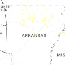
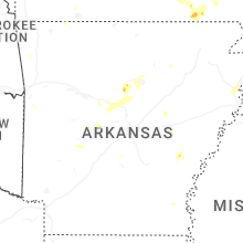
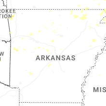
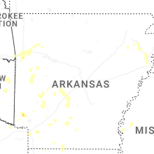
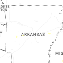


Connect with Interactive Hail Maps