

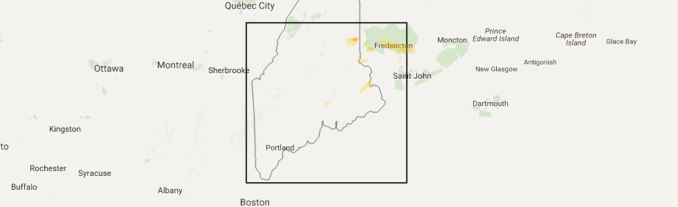
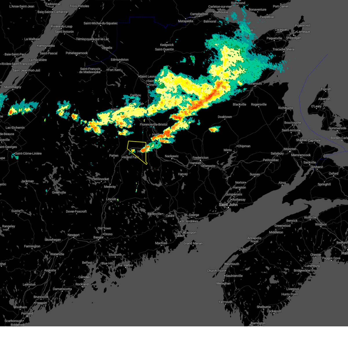
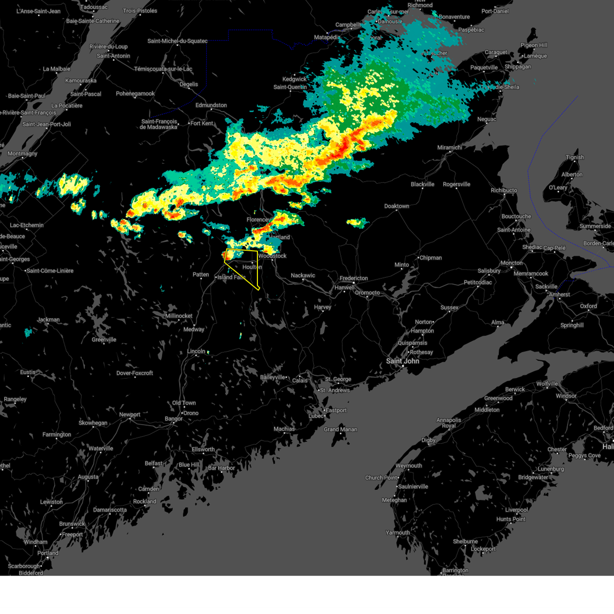
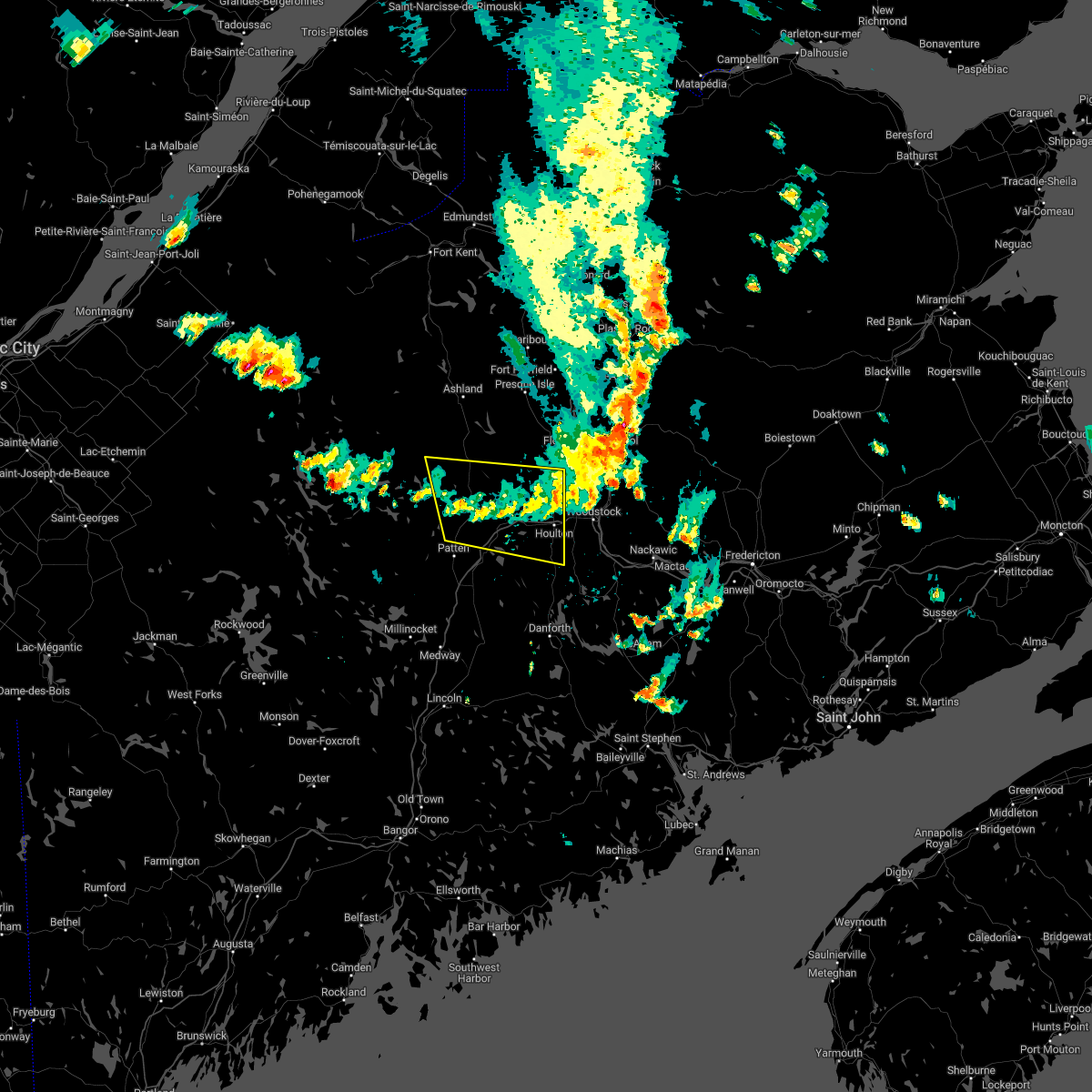
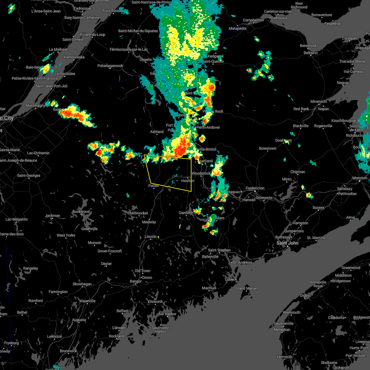
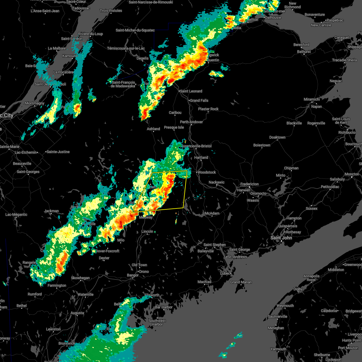
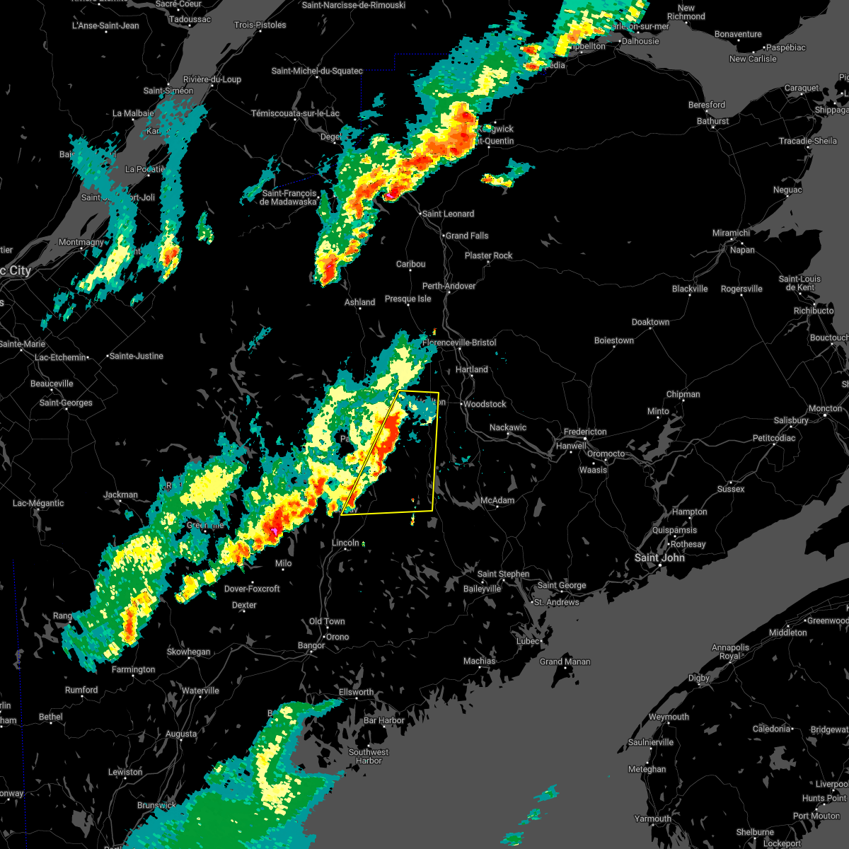
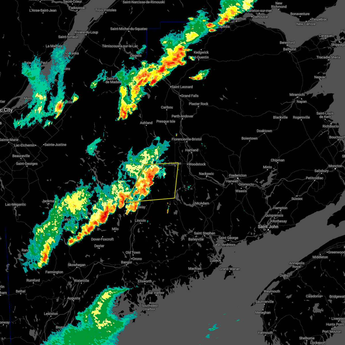
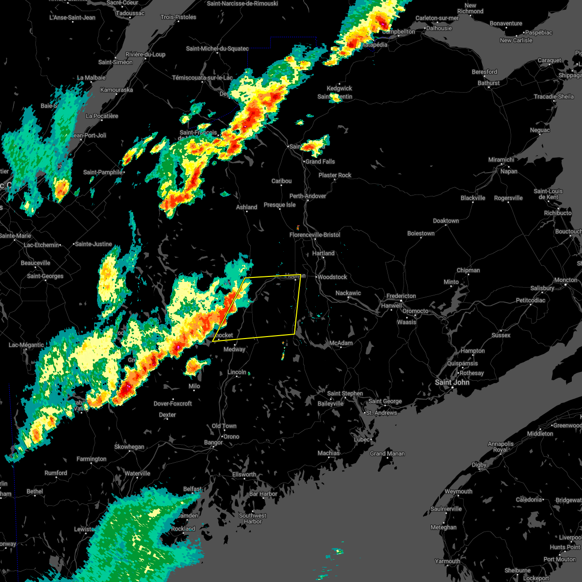
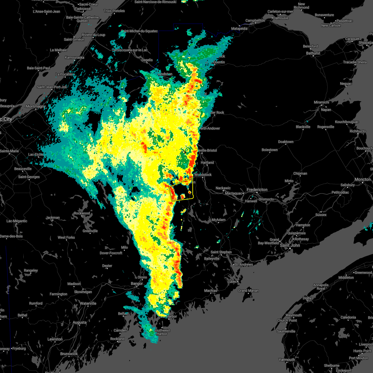
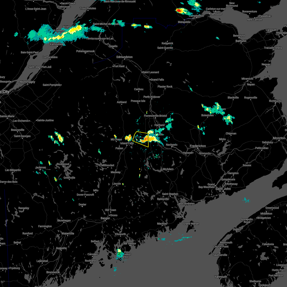
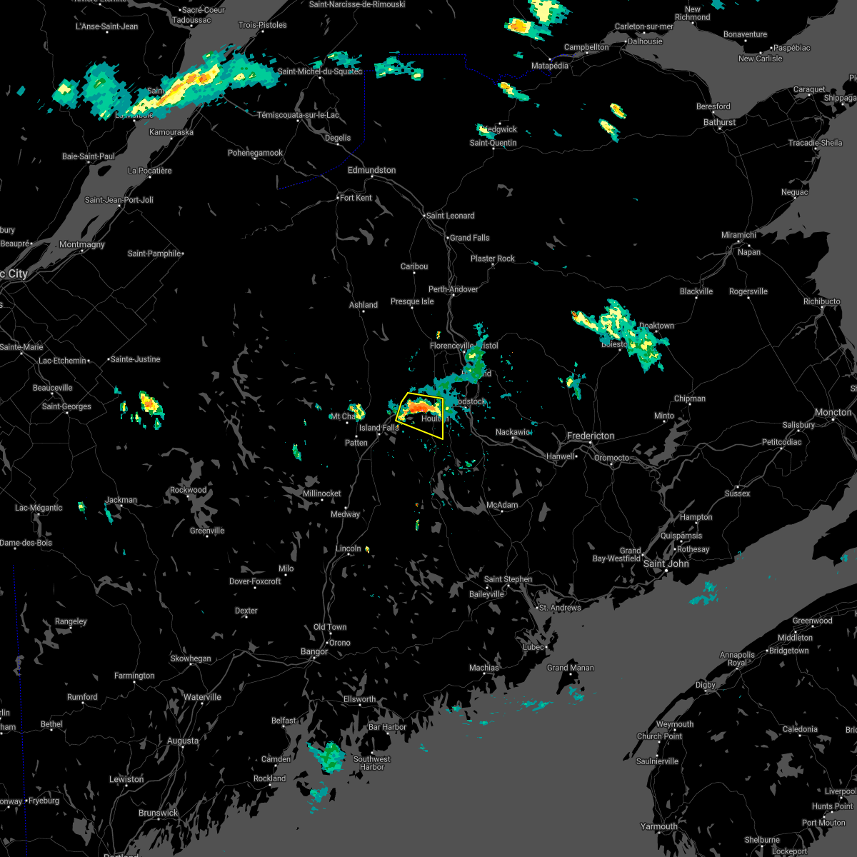
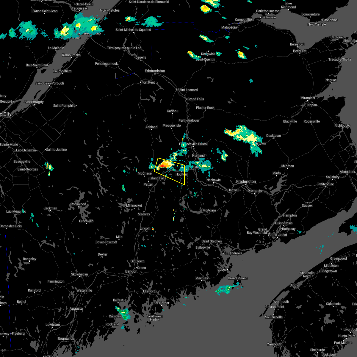
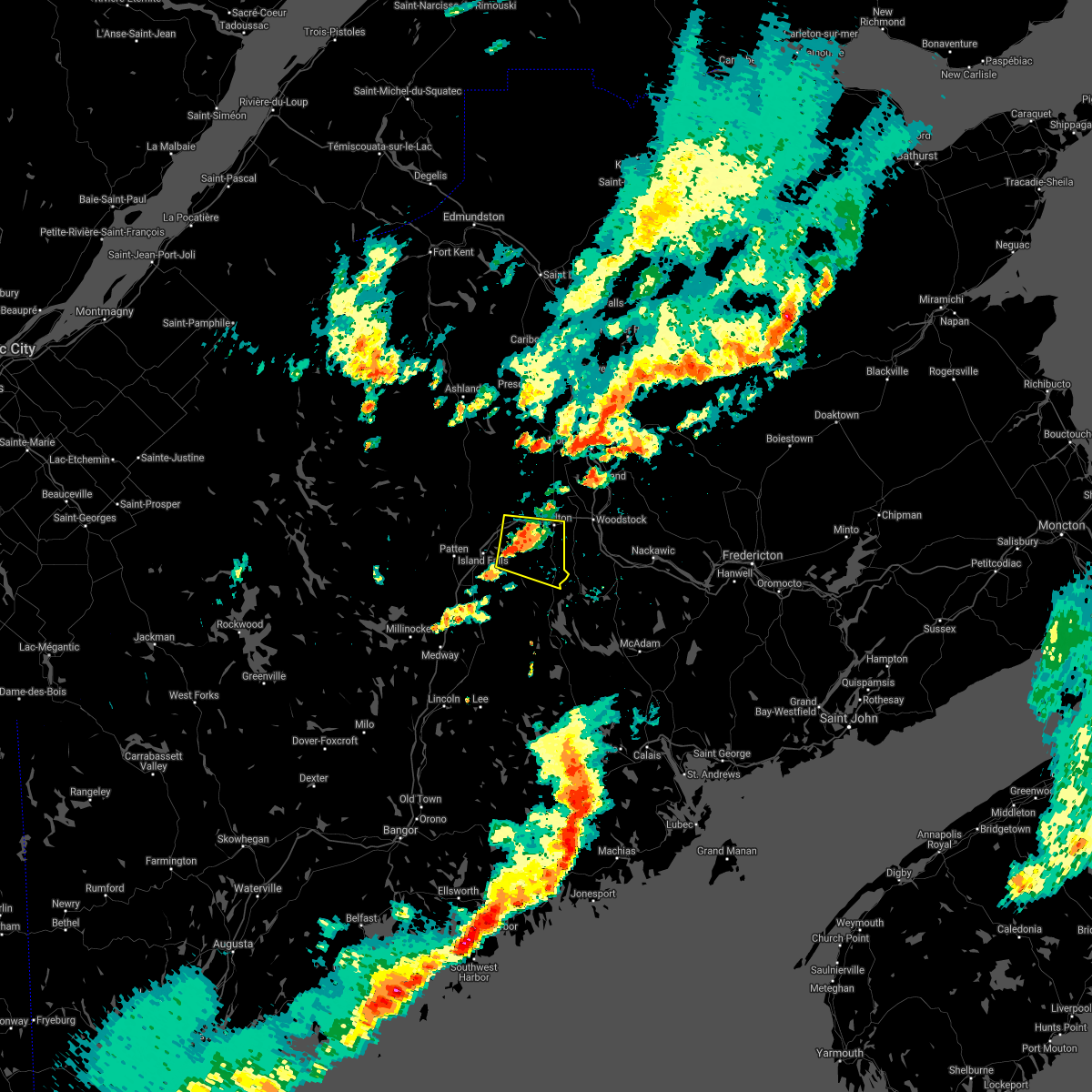
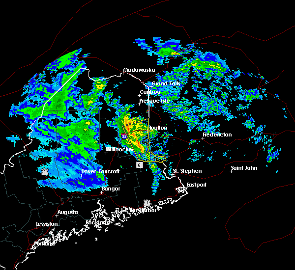
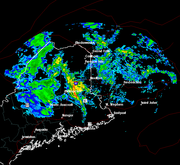
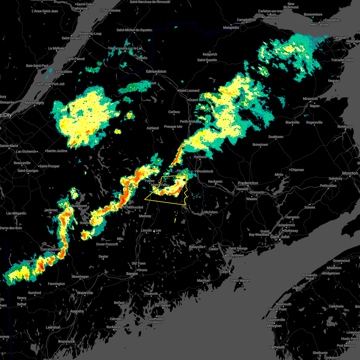
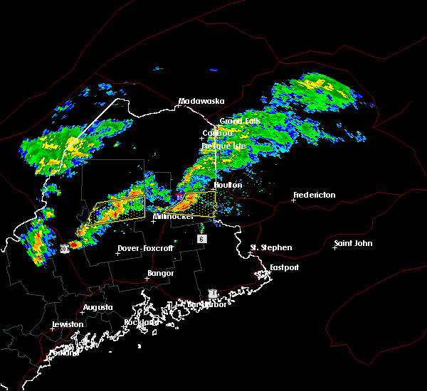
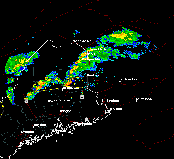
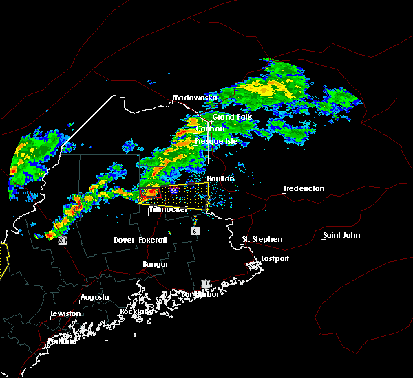
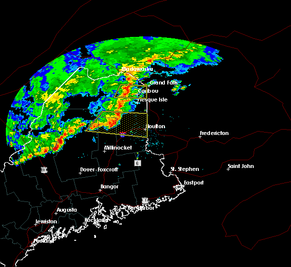
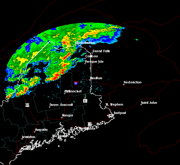
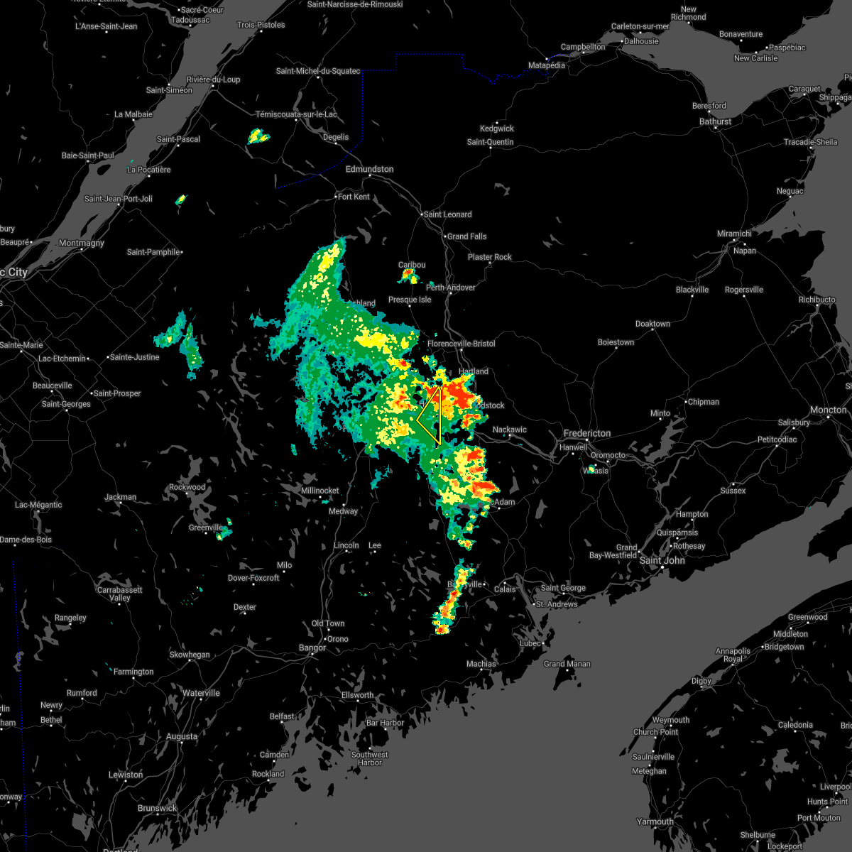
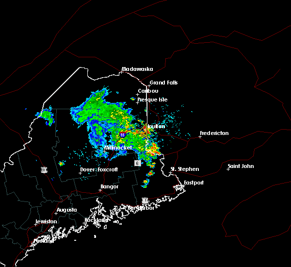
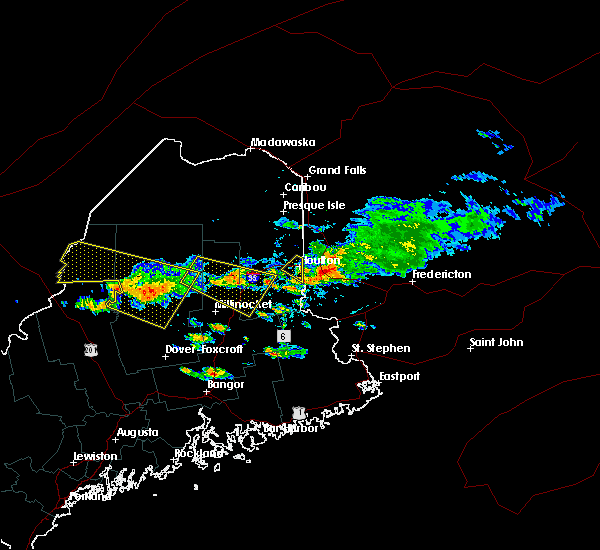
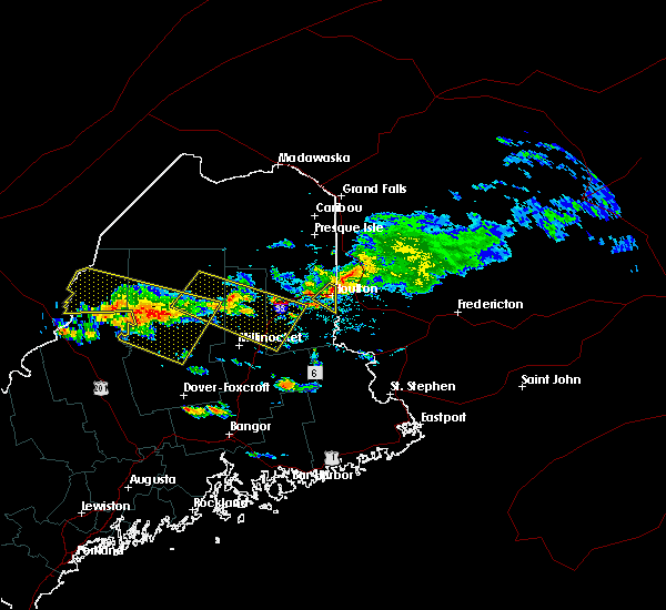
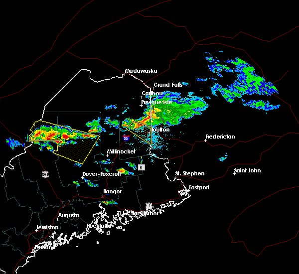
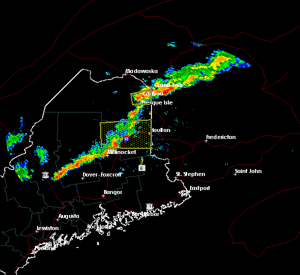
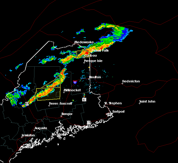
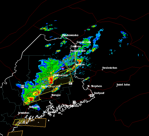
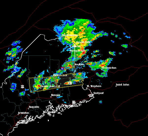
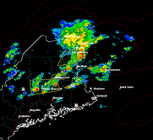
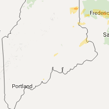
Hail Map for Houlton, ME
The Houlton, ME area has had 18 reports of on-the-ground hail by trained spotters, and has been under severe weather warnings 3 times during the past 12 months. Doppler radar has detected hail at or near Houlton, ME on 2 occasions.
| Name: | Houlton, ME |
| Where Located: | 51.4 miles S of Caribou, ME |
| Map: | Google Map for Houlton, ME |
| Population: | 4856 |
| Housing Units: | 2269 |
| More Info: | Search Google for Houlton, ME |
0
The Top Recent Hail Date for Houlton, ME is Saturday, August 6, 2016 (2nd out of 2)
Hail and Wind Damage Spotted near Houlton, ME
| Date / Time | Report Details |
|---|---|
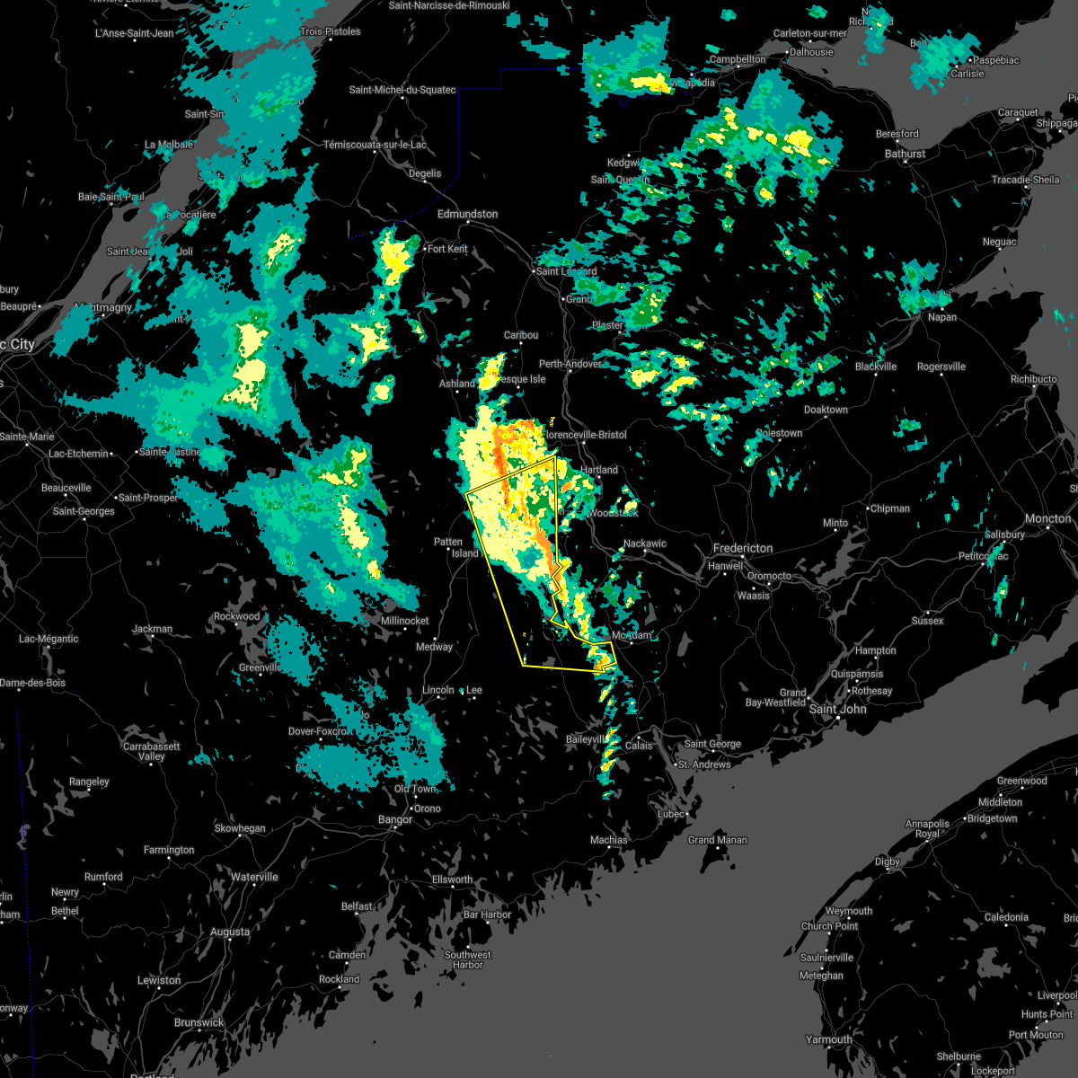
| 9/7/2023 7:30 PM EDT | Several trees reported down across river road in oakfiel in aroostook county ME, 16 miles E of Houlton, ME |
| 7/28/2023 5:11 PM EDT |
 The severe thunderstorm warning for southeastern aroostook county will expire at 515 pm edt, the storm which prompted the warning has moved out of the area. therefore, the warning will be allowed to expire. however small hail and gusty winds are still possible with this thunderstorm. The severe thunderstorm warning for southeastern aroostook county will expire at 515 pm edt, the storm which prompted the warning has moved out of the area. therefore, the warning will be allowed to expire. however small hail and gusty winds are still possible with this thunderstorm.
|
| 7/28/2023 4:43 PM EDT |
 At 443 pm edt, a severe thunderstorm was located over smyrna, or 10 miles west of houlton, moving east at 35 mph (radar indicated). Hazards include 60 mph wind gusts and penny size hail. Expect damage to trees and power lines. locations impacted include, houlton, hodgdon, smyrna, amity, cary plantation, smyrna mills, dudley township, littleton, linneus, oakfield, new limerick, ludlow, cary and north amity. this includes the following highways, interstate 95 between mile markers 287 and 304. us highway 1 between north amity and houlton. hail threat, radar indicated max hail size, 0. 75 in wind threat, radar indicated max wind gust, 60 mph. At 443 pm edt, a severe thunderstorm was located over smyrna, or 10 miles west of houlton, moving east at 35 mph (radar indicated). Hazards include 60 mph wind gusts and penny size hail. Expect damage to trees and power lines. locations impacted include, houlton, hodgdon, smyrna, amity, cary plantation, smyrna mills, dudley township, littleton, linneus, oakfield, new limerick, ludlow, cary and north amity. this includes the following highways, interstate 95 between mile markers 287 and 304. us highway 1 between north amity and houlton. hail threat, radar indicated max hail size, 0. 75 in wind threat, radar indicated max wind gust, 60 mph.
|
| 7/28/2023 4:22 PM EDT |
 At 422 pm edt, a severe thunderstorm was located 8 miles northwest of smyrna mills, or 16 miles northeast of patten, moving east at 35 mph (radar indicated). Hazards include 60 mph wind gusts and penny size hail. expect damage to trees and power lines At 422 pm edt, a severe thunderstorm was located 8 miles northwest of smyrna mills, or 16 miles northeast of patten, moving east at 35 mph (radar indicated). Hazards include 60 mph wind gusts and penny size hail. expect damage to trees and power lines
|
| 7/19/2022 4:40 PM EDT |
 The severe thunderstorm warning for east central aroostook and northern penobscot counties will expire at 445 pm edt, the storms which prompted the warning have weakened below severe limits, but frequent cloud to ground lightning and heavy downpours are still likely. therefore, the warning will be allowed to expire. however gusty winds are still possible with these thunderstorms. The severe thunderstorm warning for east central aroostook and northern penobscot counties will expire at 445 pm edt, the storms which prompted the warning have weakened below severe limits, but frequent cloud to ground lightning and heavy downpours are still likely. therefore, the warning will be allowed to expire. however gusty winds are still possible with these thunderstorms.
|
| 7/19/2022 4:21 PM EDT |
 At 421 pm edt, severe thunderstorms were located along a line extending from 13 miles southeast of bridgewater to 11 miles northwest of smyrna mills, moving southeast at 70 mph (radar indicated). Hazards include 60 mph wind gusts. expect damage to trees and power lines At 421 pm edt, severe thunderstorms were located along a line extending from 13 miles southeast of bridgewater to 11 miles northwest of smyrna mills, moving southeast at 70 mph (radar indicated). Hazards include 60 mph wind gusts. expect damage to trees and power lines
|
| 7/12/2022 7:42 PM EDT |
 The severe thunderstorm warning for southeastern aroostook and north central penobscot counties will expire at 745 pm edt, the storms which prompted the warning have moved out of the area. therefore, the warning will be allowed to expire. remember, a severe thunderstorm warning still remains in effect for southeastern aroostook county to the canadian border. The severe thunderstorm warning for southeastern aroostook and north central penobscot counties will expire at 745 pm edt, the storms which prompted the warning have moved out of the area. therefore, the warning will be allowed to expire. remember, a severe thunderstorm warning still remains in effect for southeastern aroostook county to the canadian border.
|
| 7/12/2022 7:40 PM EDT |
 At 740 pm edt, severe thunderstorms were located along a line extending from near smyrna to near medway, moving east at 40 mph (radar indicated). Hazards include 60 mph wind gusts and quarter size hail. Minor hail damage to vehicles is possible. Expect wind damage to trees and power lines. At 740 pm edt, severe thunderstorms were located along a line extending from near smyrna to near medway, moving east at 40 mph (radar indicated). Hazards include 60 mph wind gusts and quarter size hail. Minor hail damage to vehicles is possible. Expect wind damage to trees and power lines.
|
| 7/12/2022 7:30 PM EDT |
 At 730 pm edt, severe thunderstorms were located along a line extending from near smyrna to 9 miles south of sherman, moving east at 35 mph (radar indicated). Hazards include 60 mph wind gusts and quarter size hail. Minor hail damage to vehicles is possible. expect wind damage to trees and power lines. locations impacted include, houlton, millinocket, patten, east millinocket, medway, hodgdon, sherman, island falls, smyrna, amity, mount chase, haynesville, sherman station, cary plantation, smyrna mills, reed plantation, southeastern katahdin woods and waters national monument, linneus, oakfield and new limerick. hail threat, radar indicated max hail size, 1. 00 in wind threat, radar indicated max wind gust, 60 mph. At 730 pm edt, severe thunderstorms were located along a line extending from near smyrna to 9 miles south of sherman, moving east at 35 mph (radar indicated). Hazards include 60 mph wind gusts and quarter size hail. Minor hail damage to vehicles is possible. expect wind damage to trees and power lines. locations impacted include, houlton, millinocket, patten, east millinocket, medway, hodgdon, sherman, island falls, smyrna, amity, mount chase, haynesville, sherman station, cary plantation, smyrna mills, reed plantation, southeastern katahdin woods and waters national monument, linneus, oakfield and new limerick. hail threat, radar indicated max hail size, 1. 00 in wind threat, radar indicated max wind gust, 60 mph.
|
| 7/12/2022 6:59 PM EDT |
 At 658 pm edt, severe thunderstorms were located along a line extending from near mount chase to near millinocket, moving east at 35 mph (radar indicated). Hazards include 60 mph wind gusts and quarter size hail. Minor hail damage to vehicles is possible. Expect wind damage to trees and power lines. At 658 pm edt, severe thunderstorms were located along a line extending from near mount chase to near millinocket, moving east at 35 mph (radar indicated). Hazards include 60 mph wind gusts and quarter size hail. Minor hail damage to vehicles is possible. Expect wind damage to trees and power lines.
|
| 9/6/2021 6:51 PM EDT |
 At 651 pm edt, a severe thunderstorm was located 9 miles east of island falls, or 16 miles southwest of houlton, moving east at 35 mph (radar indicated). Hazards include 60 mph wind gusts and quarter size hail. Minor hail damage to vehicles is possible. Expect wind damage to trees and power lines. At 651 pm edt, a severe thunderstorm was located 9 miles east of island falls, or 16 miles southwest of houlton, moving east at 35 mph (radar indicated). Hazards include 60 mph wind gusts and quarter size hail. Minor hail damage to vehicles is possible. Expect wind damage to trees and power lines.
|
| 6/5/2021 5:56 PM EDT |
 The severe thunderstorm warning for southeastern aroostook county will expire at 600 pm edt, the storm which prompted the warning has weakened below severe limits, but frequent cloud to ground lightning, gusty winds and heavy downpours are still likely. therefore, the warning will be allowed to expire. The severe thunderstorm warning for southeastern aroostook county will expire at 600 pm edt, the storm which prompted the warning has weakened below severe limits, but frequent cloud to ground lightning, gusty winds and heavy downpours are still likely. therefore, the warning will be allowed to expire.
|
| 6/5/2021 5:40 PM EDT |
 At 539 pm edt, a severe thunderstorm was located near houlton, moving east at 35 mph (radar indicated). Hazards include 60 mph wind gusts and quarter size hail. Minor hail damage to vehicles is possible. expect wind damage to trees and power lines. Locations impacted include, houlton, hodgdon, smyrna, cary plantation, dudley township, littleton, linneus, oakfield, new limerick and ludlow. At 539 pm edt, a severe thunderstorm was located near houlton, moving east at 35 mph (radar indicated). Hazards include 60 mph wind gusts and quarter size hail. Minor hail damage to vehicles is possible. expect wind damage to trees and power lines. Locations impacted include, houlton, hodgdon, smyrna, cary plantation, dudley township, littleton, linneus, oakfield, new limerick and ludlow.
|
| 6/5/2021 5:20 PM EDT |
 At 519 pm edt, a severe thunderstorm was located near smyrna mills, or 18 miles west of houlton, moving east at 40 mph (radar indicated). Hazards include 60 mph wind gusts and quarter size hail. Minor hail damage to vehicles is possible. Expect wind damage to trees and power lines. At 519 pm edt, a severe thunderstorm was located near smyrna mills, or 18 miles west of houlton, moving east at 40 mph (radar indicated). Hazards include 60 mph wind gusts and quarter size hail. Minor hail damage to vehicles is possible. Expect wind damage to trees and power lines.
|
| 5/26/2021 4:28 PM EDT | Large tree down from estimated 50mph wind gust. time estimated by rada in aroostook county ME, 0.6 miles NE of Houlton, ME |
| 5/21/2021 3:20 PM EDT |
 At 320 pm edt, a severe thunderstorm was located near houlton, moving southeast at 25 mph. strong winds may arrive before rain (radar indicated). Hazards include 60 mph wind gusts. Expect damage to trees and power lines. Locations impacted include, houlton, hodgdon, littleton, monticello, new limerick and ludlow. At 320 pm edt, a severe thunderstorm was located near houlton, moving southeast at 25 mph. strong winds may arrive before rain (radar indicated). Hazards include 60 mph wind gusts. Expect damage to trees and power lines. Locations impacted include, houlton, hodgdon, littleton, monticello, new limerick and ludlow.
|
| 5/21/2021 3:07 PM EDT |
 At 307 pm edt, a severe thunderstorm was located 8 miles north of houlton, moving southeast at 25 mph (radar indicated). Hazards include 60 mph wind gusts. expect damage to trees and power lines At 307 pm edt, a severe thunderstorm was located 8 miles north of houlton, moving southeast at 25 mph (radar indicated). Hazards include 60 mph wind gusts. expect damage to trees and power lines
|
| 8/25/2020 5:11 PM EDT |
 At 511 pm edt, a severe thunderstorm was located over cary plantation, or 10 miles south of houlton, moving east at 30 mph (radar indicated). Hazards include 60 mph wind gusts and penny size hail. Expect damage to trees and power lines. Locations impacted include, houlton, hodgdon, amity, cary plantation, linneus, cary, north amity and forkstown. At 511 pm edt, a severe thunderstorm was located over cary plantation, or 10 miles south of houlton, moving east at 30 mph (radar indicated). Hazards include 60 mph wind gusts and penny size hail. Expect damage to trees and power lines. Locations impacted include, houlton, hodgdon, amity, cary plantation, linneus, cary, north amity and forkstown.
|
| 8/25/2020 4:42 PM EDT |
 At 442 pm edt, a severe thunderstorm was located 9 miles southeast of smyrna mills, or 12 miles southwest of houlton, moving east at 30 mph (radar indicated). Hazards include 60 mph wind gusts and penny size hail. expect damage to trees and power lines At 442 pm edt, a severe thunderstorm was located 9 miles southeast of smyrna mills, or 12 miles southwest of houlton, moving east at 30 mph (radar indicated). Hazards include 60 mph wind gusts and penny size hail. expect damage to trees and power lines
|
| 8/10/2019 5:38 PM EDT | Quarter sized hail reported 8.1 miles ENE of Houlton, ME, social media report of quarter sized hail in new limerick. |
| 8/10/2019 5:20 PM EDT | Ping Pong Ball sized hail reported 16.6 miles E of Houlton, ME, photo of road covered in large hail along keith brook rd. |
| 8/10/2019 5:20 PM EDT | Ping Pong Ball sized hail reported 15.9 miles E of Houlton, ME, public report of ping pong ball sized hail near gas station in oakfield. |
| 8/10/2019 5:15 PM EDT | Quarter sized hail reported 15.9 miles E of Houlton, ME, social media report of hail larger than a nickel near i-95. |
| 7/6/2019 2:50 PM EDT |
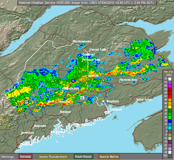 At 247 pm edt, a severe thunderstorm was located over hodgdon, or near houlton, moving southeast at 35 mph. at 244 pm, law enforcement reported trees and wires down on foxcroft road, north of houlton (law enforcement). Hazards include 60 mph wind gusts. Expect damage to trees and power lines. Locations impacted include, houlton, hodgdon, smyrna, amity, cary plantation, littleton, linneus, oakfield, new limerick, ludlow, cary, north amity and forkstown. At 247 pm edt, a severe thunderstorm was located over hodgdon, or near houlton, moving southeast at 35 mph. at 244 pm, law enforcement reported trees and wires down on foxcroft road, north of houlton (law enforcement). Hazards include 60 mph wind gusts. Expect damage to trees and power lines. Locations impacted include, houlton, hodgdon, smyrna, amity, cary plantation, littleton, linneus, oakfield, new limerick, ludlow, cary, north amity and forkstown.
|
| 7/6/2019 2:32 PM EDT | Large tree down on us 1. the tree was large enough to completely block the roa in aroostook county ME, 7.3 miles S of Houlton, ME |
| 7/6/2019 2:19 PM EDT |
 At 218 pm edt, a severe thunderstorm was located over smyrna, or 15 miles west of houlton, moving southeast at 35 mph (radar indicated). Hazards include 60 mph wind gusts. expect damage to trees and power lines At 218 pm edt, a severe thunderstorm was located over smyrna, or 15 miles west of houlton, moving southeast at 35 mph (radar indicated). Hazards include 60 mph wind gusts. expect damage to trees and power lines
|
| 11/3/2018 6:56 PM EDT |
 The severe thunderstorm warning for northwestern washington, southeastern aroostook and northeastern penobscot counties will expire at 700 pm edt, the storms which prompted the warning are moving out of the area. therefore, the warning will be allowed to expire. to report severe weather, contact your nearest law enforcement agency. they will relay your report to the national weather service caribou maine. The severe thunderstorm warning for northwestern washington, southeastern aroostook and northeastern penobscot counties will expire at 700 pm edt, the storms which prompted the warning are moving out of the area. therefore, the warning will be allowed to expire. to report severe weather, contact your nearest law enforcement agency. they will relay your report to the national weather service caribou maine.
|
| 11/3/2018 6:40 PM EDT |
 At 638 pm edt, a broken line of severe storms were located along a line extending from near dudley township to 8 miles south of wytopitlock, moving east-northeast at 55 mph (radar indicated). Hazards include 60 mph wind gusts. Expect damage to trees and power lines. Locations impacted include, houlton, danforth, vanceboro, hodgdon, island falls, bridgewater, smyrna, amity, topsfield, haynesville, dudley township, cary plantation, smyrna mills, reed plantation, codyville plantation, littleton, linneus, monticello, oakfield and new limerick. At 638 pm edt, a broken line of severe storms were located along a line extending from near dudley township to 8 miles south of wytopitlock, moving east-northeast at 55 mph (radar indicated). Hazards include 60 mph wind gusts. Expect damage to trees and power lines. Locations impacted include, houlton, danforth, vanceboro, hodgdon, island falls, bridgewater, smyrna, amity, topsfield, haynesville, dudley township, cary plantation, smyrna mills, reed plantation, codyville plantation, littleton, linneus, monticello, oakfield and new limerick.
|
| 11/3/2018 6:20 PM EDT |
 At 619 pm edt, severe thunderstorms were located along a line extending from 6 miles west of smyrna mills to 7 miles west of springfield, moving east-northeast at 50 mph (radar indicated). Hazards include 60 mph wind gusts. expect damage to trees and power lines At 619 pm edt, severe thunderstorms were located along a line extending from 6 miles west of smyrna mills to 7 miles west of springfield, moving east-northeast at 50 mph (radar indicated). Hazards include 60 mph wind gusts. expect damage to trees and power lines
|
| 8/29/2018 6:42 PM EDT |
 The severe thunderstorm warning for southeastern aroostook and central penobscot counties will expire at 645 pm edt, the storm which prompted the warning has weakened below severe limits, but cloud to ground lightning and heavy downpours are still likely. therefore, the warning will be allowed to expire. a severe thunderstorm watch remains in effect until 1100 pm edt for east central maine. The severe thunderstorm warning for southeastern aroostook and central penobscot counties will expire at 645 pm edt, the storm which prompted the warning has weakened below severe limits, but cloud to ground lightning and heavy downpours are still likely. therefore, the warning will be allowed to expire. a severe thunderstorm watch remains in effect until 1100 pm edt for east central maine.
|
| 8/29/2018 6:17 PM EDT |
 At 616 pm edt, a severe thunderstorm was located from near dyer brook south to just east of sherman, moving east at 40 mph (radar indicated). Hazards include 60 mph wind gusts and penny size hail. Expect damage to trees and power lines. this severe storm will be near, hodgdon and cary plantation around 640 pm edt. amity around 645 pm edt. Other locations impacted by this severe thunderstorm include silver ridge, forkstown, orient, benedicta, glenwood, linneus, weston, and cary. At 616 pm edt, a severe thunderstorm was located from near dyer brook south to just east of sherman, moving east at 40 mph (radar indicated). Hazards include 60 mph wind gusts and penny size hail. Expect damage to trees and power lines. this severe storm will be near, hodgdon and cary plantation around 640 pm edt. amity around 645 pm edt. Other locations impacted by this severe thunderstorm include silver ridge, forkstown, orient, benedicta, glenwood, linneus, weston, and cary.
|
| 8/29/2018 5:59 PM EDT |
 At 556 pm edt, a severe thunderstorm was located near stacyville, sherman, and island falls, moving east at 40 mph (radar indicated). Hazards include 70 mph wind gusts and quarter size hail. Minor hail damage to vehicles is possible. expect considerable tree damage. wind damage is also likely to mobile homes, roofs, and outbuildings. this severe storm will impact i-95 from mile marker 258 north, and will be near houlton, hodgdon and cary plantation around 640 pm edt. Other locations impacted by this severe thunderstorm include silver ridge, forkstown, orient, benedicta, glenwood, new limerick, linneus, hersey and weston. At 556 pm edt, a severe thunderstorm was located near stacyville, sherman, and island falls, moving east at 40 mph (radar indicated). Hazards include 70 mph wind gusts and quarter size hail. Minor hail damage to vehicles is possible. expect considerable tree damage. wind damage is also likely to mobile homes, roofs, and outbuildings. this severe storm will impact i-95 from mile marker 258 north, and will be near houlton, hodgdon and cary plantation around 640 pm edt. Other locations impacted by this severe thunderstorm include silver ridge, forkstown, orient, benedicta, glenwood, new limerick, linneus, hersey and weston.
|
| 8/29/2018 5:44 PM EDT |
 At 542 pm edt, a severe thunderstorm was located over katahdin woods and waters national monument, or 5 miles west of patten, moving east at 40 mph (radar indicated). Hazards include 70 mph wind gusts and quarter size hail. Minor hail damage to vehicles is possible. expect considerable tree damage. wind damage is also likely to mobile homes, roofs, and outbuildings. this severe thunderstorm will be near, patten around 555 pm edt. sherman around 600 pm edt. island falls around 610 pm edt. houlton, hodgdon and cary plantation around 640 pm edt. Other locations impacted by this severe thunderstorm include silver ridge, forkstown, orient, benedicta, glenwood, stacyville, new limerick, linneus, hersey and weston. At 542 pm edt, a severe thunderstorm was located over katahdin woods and waters national monument, or 5 miles west of patten, moving east at 40 mph (radar indicated). Hazards include 70 mph wind gusts and quarter size hail. Minor hail damage to vehicles is possible. expect considerable tree damage. wind damage is also likely to mobile homes, roofs, and outbuildings. this severe thunderstorm will be near, patten around 555 pm edt. sherman around 600 pm edt. island falls around 610 pm edt. houlton, hodgdon and cary plantation around 640 pm edt. Other locations impacted by this severe thunderstorm include silver ridge, forkstown, orient, benedicta, glenwood, stacyville, new limerick, linneus, hersey and weston.
|
| 8/7/2018 2:15 PM EDT | Spotter reports a few trees down on school house rd in orien in aroostook county ME, 21.8 miles N of Houlton, ME |
| 9/27/2017 8:05 PM EDT |
 At 804 pm edt, a severe thunderstorm was located 7 miles northeast of shin pond, or 13 miles north of patten, moving east at 55 mph (radar indicated). Hazards include 60 mph wind gusts. Expect damage to trees and power lines. locations impacted include, houlton, hodgdon, bridgewater, smyrna, masardis, mount chase, oxbow, dudley township, cary plantation, smyrna mills, scopan, littleton, linneus, monticello, oakfield, blaine, new limerick, ludlow, merrill and cary. this includes the following highways, interstate 95 between mile makers 281 and 304. us highway 1 between cary and bridgewater. State highway 11 near knowles corner. At 804 pm edt, a severe thunderstorm was located 7 miles northeast of shin pond, or 13 miles north of patten, moving east at 55 mph (radar indicated). Hazards include 60 mph wind gusts. Expect damage to trees and power lines. locations impacted include, houlton, hodgdon, bridgewater, smyrna, masardis, mount chase, oxbow, dudley township, cary plantation, smyrna mills, scopan, littleton, linneus, monticello, oakfield, blaine, new limerick, ludlow, merrill and cary. this includes the following highways, interstate 95 between mile makers 281 and 304. us highway 1 between cary and bridgewater. State highway 11 near knowles corner.
|
| 9/27/2017 7:40 PM EDT |
 At 738 pm edt, a severe thunderstorm was located from northern baxter state park to near oxbow, moving east at 55 mph. the storm will reach the new brunswick border around 830 to 845 pm (radar indicated). Hazards include 60 mph wind gusts. expect damage to trees and power lines At 738 pm edt, a severe thunderstorm was located from northern baxter state park to near oxbow, moving east at 55 mph. the storm will reach the new brunswick border around 830 to 845 pm (radar indicated). Hazards include 60 mph wind gusts. expect damage to trees and power lines
|
| 8/11/2017 12:58 PM EDT |
 The severe thunderstorm warning for southeastern aroostook county will expire at 100 pm edt, the storm which prompted the warning has moved out of the area. therefore the warning will be allowed to expire. however small hail is still possible with this thunderstorm. The severe thunderstorm warning for southeastern aroostook county will expire at 100 pm edt, the storm which prompted the warning has moved out of the area. therefore the warning will be allowed to expire. however small hail is still possible with this thunderstorm.
|
| 8/11/2017 12:31 PM EDT |
 At 1230 pm edt, a severe thunderstorm was located near hodgdon, or near houlton, moving northeast at 30 mph (trained weather spotters). Hazards include 60 mph wind gusts and quarter size hail. Minor hail damage to vehicles is possible. Expect wind damage to trees and power lines. At 1230 pm edt, a severe thunderstorm was located near hodgdon, or near houlton, moving northeast at 30 mph (trained weather spotters). Hazards include 60 mph wind gusts and quarter size hail. Minor hail damage to vehicles is possible. Expect wind damage to trees and power lines.
|
| 8/11/2017 12:29 PM EDT | Quarter sized hail reported 0.6 miles SE of Houlton, ME |
| 6/12/2017 4:50 PM EDT |
 The severe thunderstorm warning for southeastern aroostook county will expire at 500 pm edt, the storm which prompted the warning has moved out of the area. therefore the warning will be allowed to expire. The severe thunderstorm warning for southeastern aroostook county will expire at 500 pm edt, the storm which prompted the warning has moved out of the area. therefore the warning will be allowed to expire.
|
| 6/12/2017 4:46 PM EDT | Trees and power lines down...putnam ave...north st... rte 1 in houlton in aroostook county ME, 0.6 miles SE of Houlton, ME |
| 6/12/2017 4:31 PM EDT |
 At 430 pm edt, a severe thunderstorm was located over houlton, moving southeast at 45 mph (radar indicated). Hazards include 60 mph wind gusts and penny size hail. Expect damage to trees and power lines. locations impacted include, houlton, hodgdon, cary plantation, littleton, linneus, new limerick and ludlow. this includes the following highways, interstate 95 between mile makers 297 and 304. Us highway 1 between hodgdon and littleton. At 430 pm edt, a severe thunderstorm was located over houlton, moving southeast at 45 mph (radar indicated). Hazards include 60 mph wind gusts and penny size hail. Expect damage to trees and power lines. locations impacted include, houlton, hodgdon, cary plantation, littleton, linneus, new limerick and ludlow. this includes the following highways, interstate 95 between mile makers 297 and 304. Us highway 1 between hodgdon and littleton.
|
| 6/12/2017 4:08 PM EDT |
 At 408 pm edt, a severe thunderstorm was located over dudley township, or 16 miles northwest of houlton, moving southeast at 45 mph (radar indicated). Hazards include 60 mph wind gusts and penny size hail. expect damage to trees and power lines At 408 pm edt, a severe thunderstorm was located over dudley township, or 16 miles northwest of houlton, moving southeast at 45 mph (radar indicated). Hazards include 60 mph wind gusts and penny size hail. expect damage to trees and power lines
|
| 5/18/2017 10:09 PM EDT |
 At 1008 pm edt, a severe thunderstorm was located over hodgdon, or near houlton, moving northeast at 45 mph (radar indicated). Hazards include 60 mph wind gusts. expect damage to trees and power lines At 1008 pm edt, a severe thunderstorm was located over hodgdon, or near houlton, moving northeast at 45 mph (radar indicated). Hazards include 60 mph wind gusts. expect damage to trees and power lines
|
| 8/6/2016 1:26 PM EDT | Ping Pong Ball sized hail reported 6.6 miles S of Houlton, ME, report from social media. time estimated from radar |
| 8/6/2016 1:25 PM EDT | Quarter sized hail reported 7.3 miles S of Houlton, ME, quarter-size hail reported in littleton via wagm social media |
| 8/6/2016 1:25 PM EDT | Multiple trees down on wires in several locations across littleto in aroostook county ME, 6.7 miles SSE of Houlton, ME |
| 7/2/2016 1:26 PM EDT | The severe thunderstorm warning for southeastern aroostook county will expire at 130 pm edt, the severe thunderstorm which prompted the warning has weakened. therefore, the warning will be allowed to expire. |
| 7/2/2016 1:06 PM EDT | Quarter sized hail reported 2 miles SSW of Houlton, ME, via media fb page |
| 7/2/2016 1:03 PM EDT |
 At 102 pm edt, a severe thunderstorm was located near houlton, moving northeast at 60 mph (trained weather spotters). Hazards include quarter size hail. damage to vehicles is expected At 102 pm edt, a severe thunderstorm was located near houlton, moving northeast at 60 mph (trained weather spotters). Hazards include quarter size hail. damage to vehicles is expected
|
| 7/2/2016 12:58 PM EDT | Quarter sized hail reported 0.4 miles S of Houlton, ME, nws employee reports 1 inch hail at houlton fair |
| 9/9/2015 6:23 PM EDT |
 At 621 pm edt, a severe thunderstorm was located near houlton, moving east at 30 mph (radar indicated). Hazards include 60 mph wind gusts. Expect possible tree damage. Locations impacted include, houlton, patten, hodgdon, sherman, island falls, bridgewater, smyrna, amity, mount chase, haynesville, dudley township, sherman station, shin pond, smyrna mills, cary plantation, littleton, linneus, monticello, oakfield and new limerick. At 621 pm edt, a severe thunderstorm was located near houlton, moving east at 30 mph (radar indicated). Hazards include 60 mph wind gusts. Expect possible tree damage. Locations impacted include, houlton, patten, hodgdon, sherman, island falls, bridgewater, smyrna, amity, mount chase, haynesville, dudley township, sherman station, shin pond, smyrna mills, cary plantation, littleton, linneus, monticello, oakfield and new limerick.
|
| 9/9/2015 5:44 PM EDT |
 At 543 pm edt, a severe thunderstorm was located over grand lake matagamon, or 7 miles northwest of patten, moving east at 35 mph (radar indicated). Hazards include 60 mph wind gusts. expect damage to trees with downed power lines At 543 pm edt, a severe thunderstorm was located over grand lake matagamon, or 7 miles northwest of patten, moving east at 35 mph (radar indicated). Hazards include 60 mph wind gusts. expect damage to trees with downed power lines
|
| 8/4/2015 4:23 PM EDT |
 The severe thunderstorm warning for east central aroostook county will expire at 430 pm edt, the severe thunderstorm which prompted the warning has moved out of the warned area. therefore the warning will be allowed to expire. a severe thunderstorm watch remains in effect until 800 pm edt for northern maine. The severe thunderstorm warning for east central aroostook county will expire at 430 pm edt, the severe thunderstorm which prompted the warning has moved out of the warned area. therefore the warning will be allowed to expire. a severe thunderstorm watch remains in effect until 800 pm edt for northern maine.
|
| 8/4/2015 4:09 PM EDT |
 At 408 pm edt, a severe thunderstorm was located 11 miles southeast of bridgewater and is nearly stationary (radar indicated). Hazards include 60 mph wind gusts and quarter size hail. Hail damage to vehicles is expected. expect wind damage to roofs, siding and trees. Locations impacted include, houlton, mars hill, hodgdon, bridgewater, smyrna, amity, dudley township, cary plantation, littleton, linneus, monticello, oakfield, blaine, westfield, new limerick, ludlow, merrill, cary, saint croix and dudley. At 408 pm edt, a severe thunderstorm was located 11 miles southeast of bridgewater and is nearly stationary (radar indicated). Hazards include 60 mph wind gusts and quarter size hail. Hail damage to vehicles is expected. expect wind damage to roofs, siding and trees. Locations impacted include, houlton, mars hill, hodgdon, bridgewater, smyrna, amity, dudley township, cary plantation, littleton, linneus, monticello, oakfield, blaine, westfield, new limerick, ludlow, merrill, cary, saint croix and dudley.
|
| 8/4/2015 3:55 PM EDT | Quarter sized hail reported 7.6 miles SSE of Houlton, ME, picture posted to social media... time estimated from radar |
| 8/4/2015 3:55 PM EDT | Half Dollar sized hail reported 7.3 miles S of Houlton, ME, picture posted to social media |
| 8/4/2015 3:50 PM EDT | Quarter sized hail reported 8.5 miles SE of Houlton, ME |
| 8/4/2015 3:50 PM EDT | Golf Ball sized hail reported 6.7 miles SE of Houlton, ME, picture posted on social media... time estimated from radar |
| 8/4/2015 3:41 PM EDT |
 At 340 pm edt, a severe thunderstorm was located 7 miles east of dudley township, or 8 miles northwest of houlton, moving northeast at 35 mph (radar indicated). Hazards include 60 mph wind gusts and quarter size hail. Hail damage to vehicles is expected. Expect wind damage to roofs, siding and trees. At 340 pm edt, a severe thunderstorm was located 7 miles east of dudley township, or 8 miles northwest of houlton, moving northeast at 35 mph (radar indicated). Hazards include 60 mph wind gusts and quarter size hail. Hail damage to vehicles is expected. Expect wind damage to roofs, siding and trees.
|
| 8/4/2015 3:25 PM EDT | Quarter sized hail reported 15.8 miles E of Houlton, ME, picture posted to social media... time estimated from radar |
| 8/4/2015 3:23 PM EDT | Half Dollar sized hail reported 17.1 miles E of Houlton, ME, picture posted to social media. also report of a tree down. time estimated by radar |
| 8/4/2015 3:22 PM EDT | Golf Ball sized hail reported 19.3 miles E of Houlton, ME, golf ball-sized hail report from social media. |
| 8/1/2015 2:36 PM EDT |
 At 235 pm edt, a severe thunderstorm located 15 miles west of houlton, moving northeast at 30 mph. Hazards include 60 mph wind gusts and quarter size hail. Hail damage to vehicles is expected. expect wind damage to roofs, siding and trees. Locations impacted include, houlton, hodgdon, island falls, smyrna, dudley township, smyrna mills, littleton, linneus, monticello, oakfield, new limerick, ludlow, dyer brook and dudley. At 235 pm edt, a severe thunderstorm located 15 miles west of houlton, moving northeast at 30 mph. Hazards include 60 mph wind gusts and quarter size hail. Hail damage to vehicles is expected. expect wind damage to roofs, siding and trees. Locations impacted include, houlton, hodgdon, island falls, smyrna, dudley township, smyrna mills, littleton, linneus, monticello, oakfield, new limerick, ludlow, dyer brook and dudley.
|
| 8/1/2015 2:24 PM EDT |
 At 224 pm edt, doppler radar indicated a severe thunderstorm capable of producing quarter size hail and damaging winds in excess of 60 mph. this storm was located near smyrna mills, or 11 miles west of houlton, and moving northeast at 40 mph. At 224 pm edt, doppler radar indicated a severe thunderstorm capable of producing quarter size hail and damaging winds in excess of 60 mph. this storm was located near smyrna mills, or 11 miles west of houlton, and moving northeast at 40 mph.
|
| 5/30/2015 10:17 PM EDT | At 1017 pm edt, a severe thunderstorm was located 7 miles west of dudley township, or 19 miles northeast of patten, moving east at 50 mph (radar indicated). Hazards include 60 mph wind gusts. Expect damage to roofs. Siding and trees. |
| 5/28/2015 1:30 PM EDT | At 128 pm edt, a severe thunderstorm was located over hodgdon, or near houlton, moving northeast at 20 mph (radar indicated). Hazards include 60 mph wind gusts and quarter size hail. Wind damage is possible. Locations impacted include, houlton, hodgdon, smyrna, amity, cary plantation, littleton, linneus, oakfield, new limerick, ludlow. |
| 5/28/2015 1:01 PM EDT | At 1257 pm edt, a severe thunderstorm was located near sherman, or 11 miles south of patten, and moving northeast at 15 mph (radar indicated). Hazards include 60 mph wind gusts and quarter size hail. Wind damage possible to siding and trees. Locations impacted include, houlton, hodgdon, sherman, island falls, smyrna, amity, cary plantation, littleton, linneus, oakfield, new limerick, ludlow, crystal, cary, dyer brook, hersey, glenwood, north amity, benedicta and forkstown. |
| 5/28/2015 12:44 PM EDT | At 1241 pm edt, severe thunderstorms were located near sherman and island falls and were moving northeast at 20 mph (radar indicated). Hazards include 60 mph wind gusts and quarter size hail. possible wind damage to siding and trees |
| 5/27/2015 8:27 PM EDT | The severe thunderstorm warning for southeastern aroostook, northeastern penobscot and northwestern washington counties will expire at 830 pm edt, the severe thunderstorm which prompted the warning has !** weakened. moved out of the warned area. therefore the warning will be allowed to expire. |
| 5/27/2015 7:44 PM EDT | At 743 pm edt, a severe thunderstorm was located 8 miles northeast of millinocket, moving northeast at 35 mph (radar indicated). Hazards include 60 mph wind gusts. Expect damage to roofs. Siding and trees. |
| 7/2/2014 6:41 PM EDT | Aroostook so reported a tree down into power lines 1591 bangor road. rte 2a near grammys county in in aroostook county ME, 8.5 miles NE of Houlton, ME |
| 7/2/2014 6:30 PM EDT | Trees down between island falls and oakfiel in aroostook county ME, 18.3 miles ENE of Houlton, ME |
| 7/2/2014 6:00 PM EDT | Trees down between island falls and oakfiel in aroostook county ME, 18.3 miles ENE of Houlton, ME |
| 7/2/2014 5:52 PM EDT | Trees down on burton road... summerville road... ben hill road... drews mill road... and rt 1 in aroostook county ME, 10.8 miles ENE of Houlton, ME |
| 7/2/2014 5:52 PM EDT | Trees down on burton road... summerville road... ben hill road... drews mill road... and rt 1 in aroostook county ME, 8.5 miles NE of Houlton, ME |
| 9/11/2013 5:20 PM EDT | Trees donw on power lines...power outages in aroostook county ME, 0.6 miles SE of Houlton, ME |
| 9/11/2013 5:10 PM EDT | Quarter sized hail reported 8.5 miles NE of Houlton, ME, quarter sized hail |
| 9/11/2013 5:00 PM EDT | Multiple trees down on cherry street. power outages. time is estimated based on rada in aroostook county ME, 12.8 miles S of Houlton, ME |
| 9/11/2013 4:50 PM EDT | Trees down on power lines at the houlton littleton town line in aroostook county ME, 7.3 miles S of Houlton, ME |
| 9/11/2013 4:50 PM EDT | Trees down in aroostook county ME, 12.8 miles S of Houlton, ME |
| 9/11/2013 4:35 PM EDT | Many trees down along rte 1 in littleto in aroostook county ME, 7.3 miles S of Houlton, ME |
| 7/19/2013 7:30 PM EDT | Large tree down on the carson road. time is estimate in aroostook county ME, 7.3 miles S of Houlton, ME |
| 6/2/2013 8:15 PM EDT | Trees down. time is estimate in aroostook county ME, 0.6 miles SE of Houlton, ME |
| 6/2/2013 8:10 PM EDT | Trees down. time is estimate in aroostook county ME, 0.6 miles SE of Houlton, ME |
| 6/2/2013 7:45 PM EDT | Barn roof blown off. time is estimated in aroostook county ME, 6.4 miles ENE of Houlton, ME |
| 6/2/2013 3:40 PM EDT | Trees down along i95. time is estimate in aroostook county ME, 17.1 miles E of Houlton, ME |
| 6/2/2013 3:30 PM EDT | Large tree and branches down on ludlow r in aroostook county ME, 10.1 miles E of Houlton, ME |
| 6/2/2013 3:30 PM EDT | Trees down along us route 1.time is estimate in aroostook county ME, 12.8 miles S of Houlton, ME |
| 6/2/2013 3:15 PM EDT | Trees down on route 11. time is estimate in aroostook county ME, 15.4 miles E of Houlton, ME |
| 6/30/2012 4:42 PM EDT | Trees down on ridge road in aroostook county ME, 15.4 miles E of Houlton, ME |
| 1/1/0001 12:00 AM | Tree down on power line in aroostook county ME, 8.5 miles NE of Houlton, ME |
| 1/1/0001 12:00 AM | Large 200 year old tree was uprooted. other smaller trees also topple in aroostook county ME, 7.3 miles S of Houlton, ME |
| 1/1/0001 12:00 AM | Quarter sized hail reported 12.8 miles S of Houlton, ME |
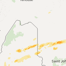
Hail Maps for Houlton, ME
Connect with Interactive Hail Maps