

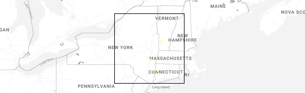
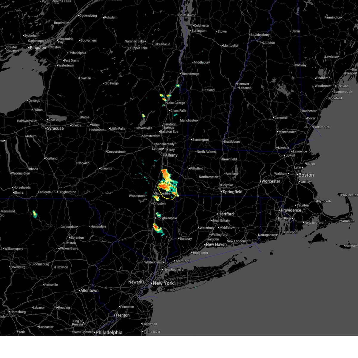
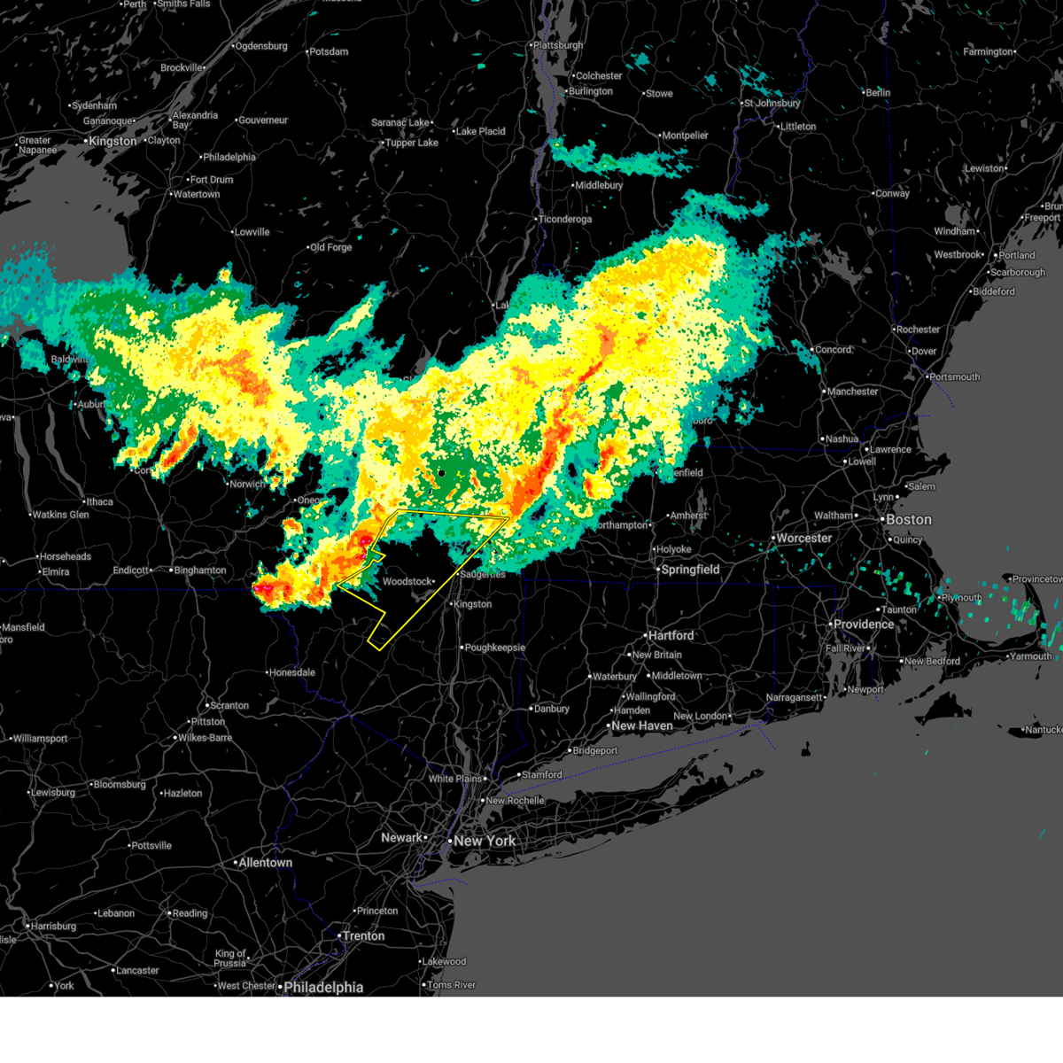
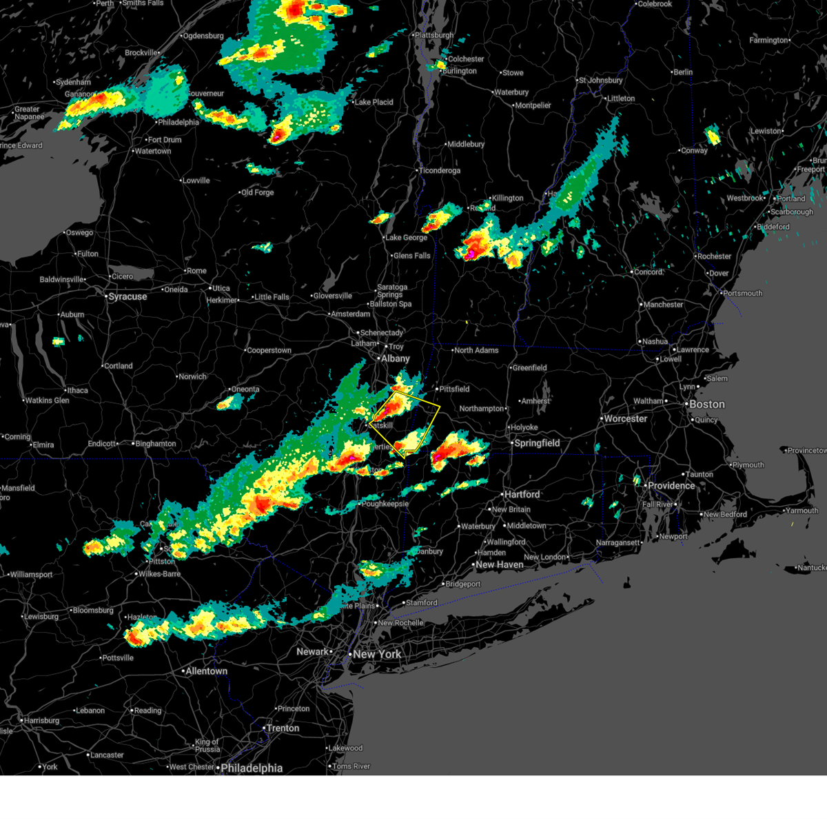
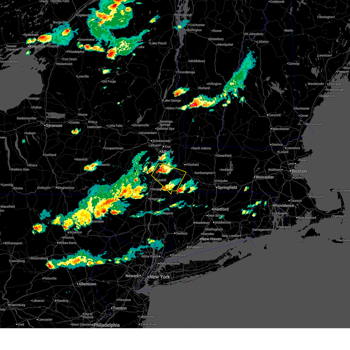
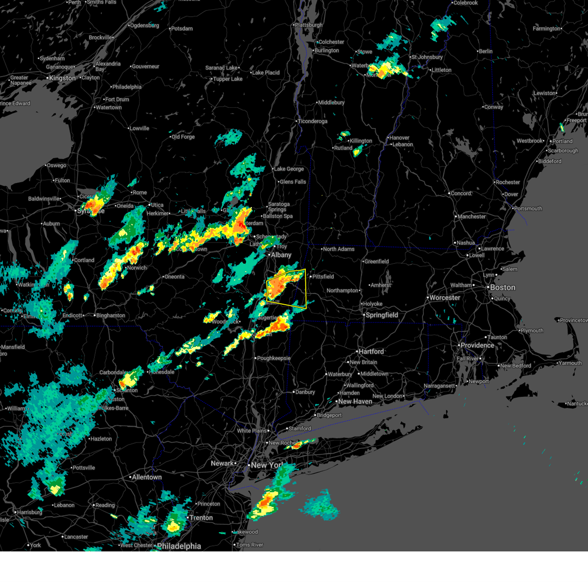
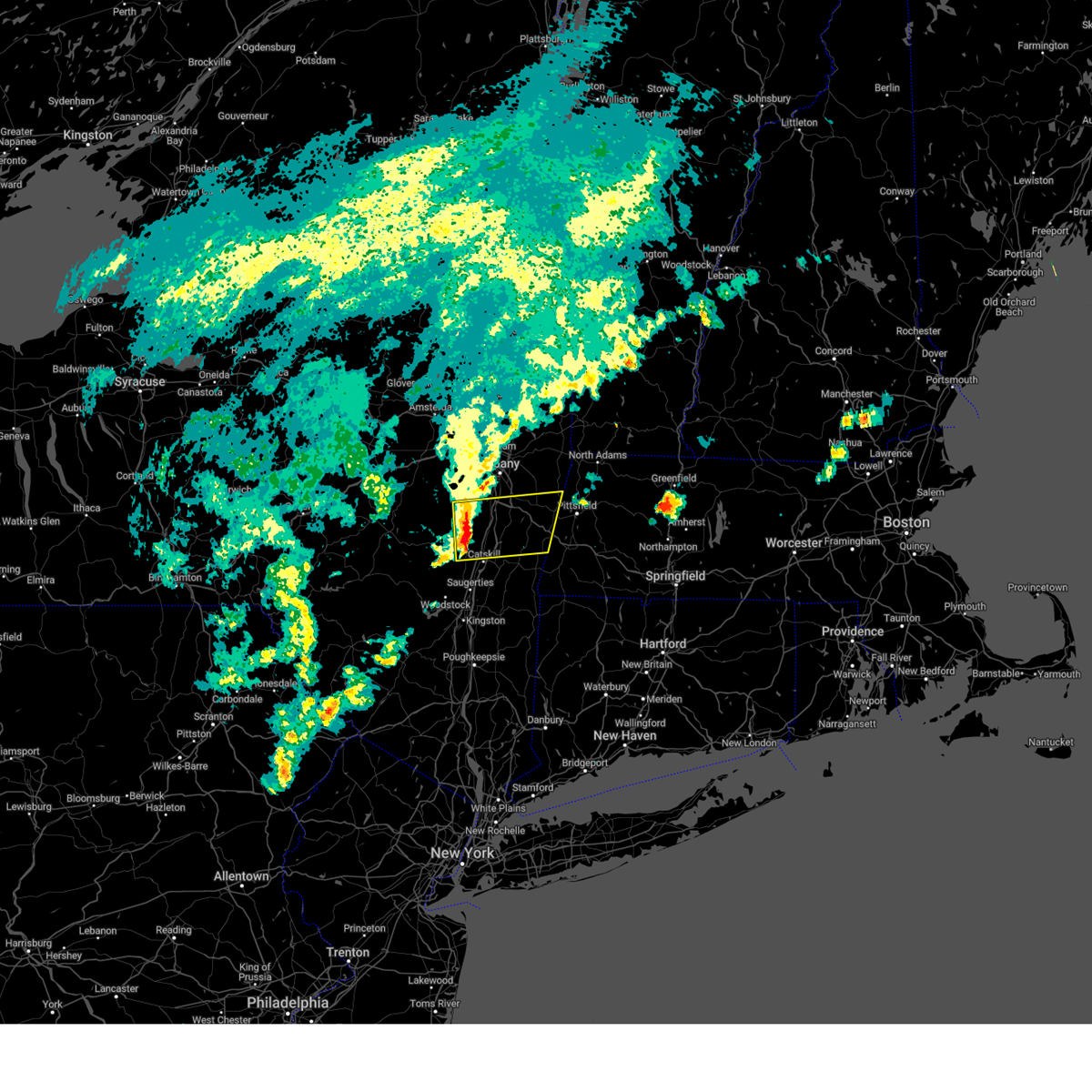
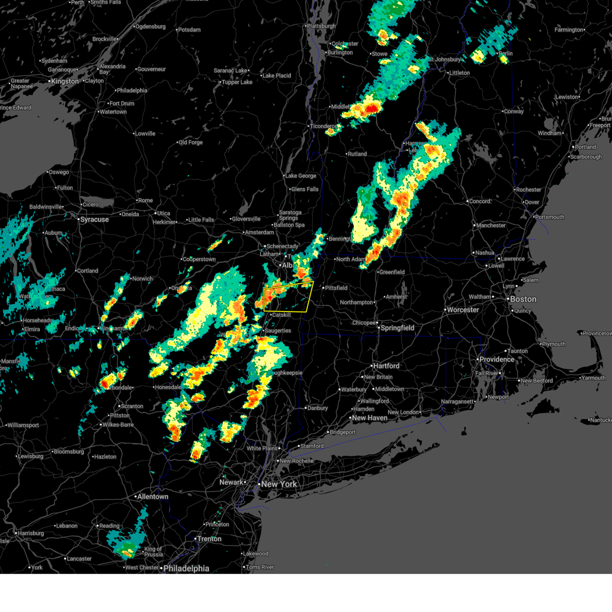
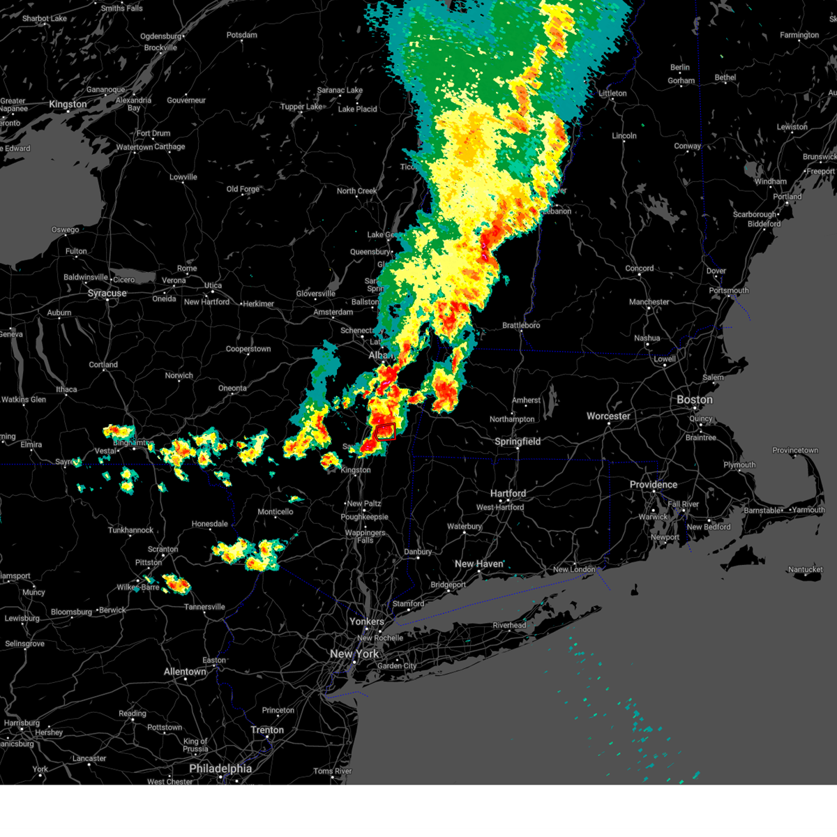
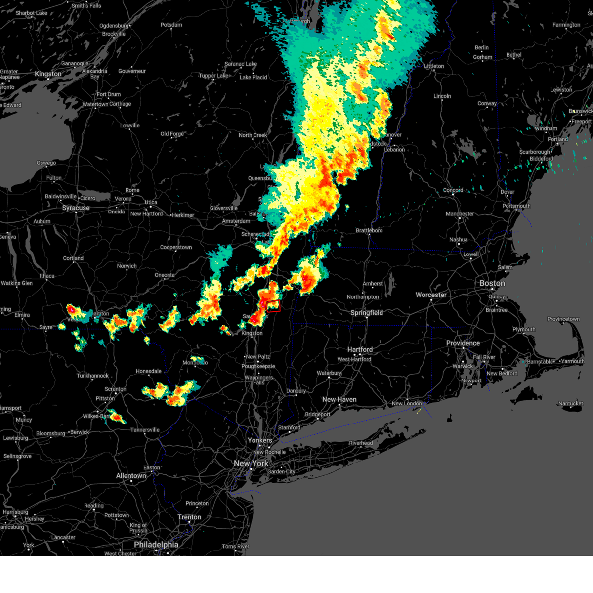
Hail Map for Hudson, NY
The Hudson, NY area has had 4 reports of on-the-ground hail by trained spotters, and has been under severe weather warnings 21 times during the past 12 months. Doppler radar has detected hail at or near Hudson, NY on 34 occasions, including 4 occasions during the past year.
| Name: | Hudson, NY |
| Where Located: | 39.7 miles SSE of Schenectady, NY |
| Map: | Google Map for Hudson, NY |
| Population: | 6713 |
| Housing Units: | 3315 |
| More Info: | Search Google for Hudson, NY |
1
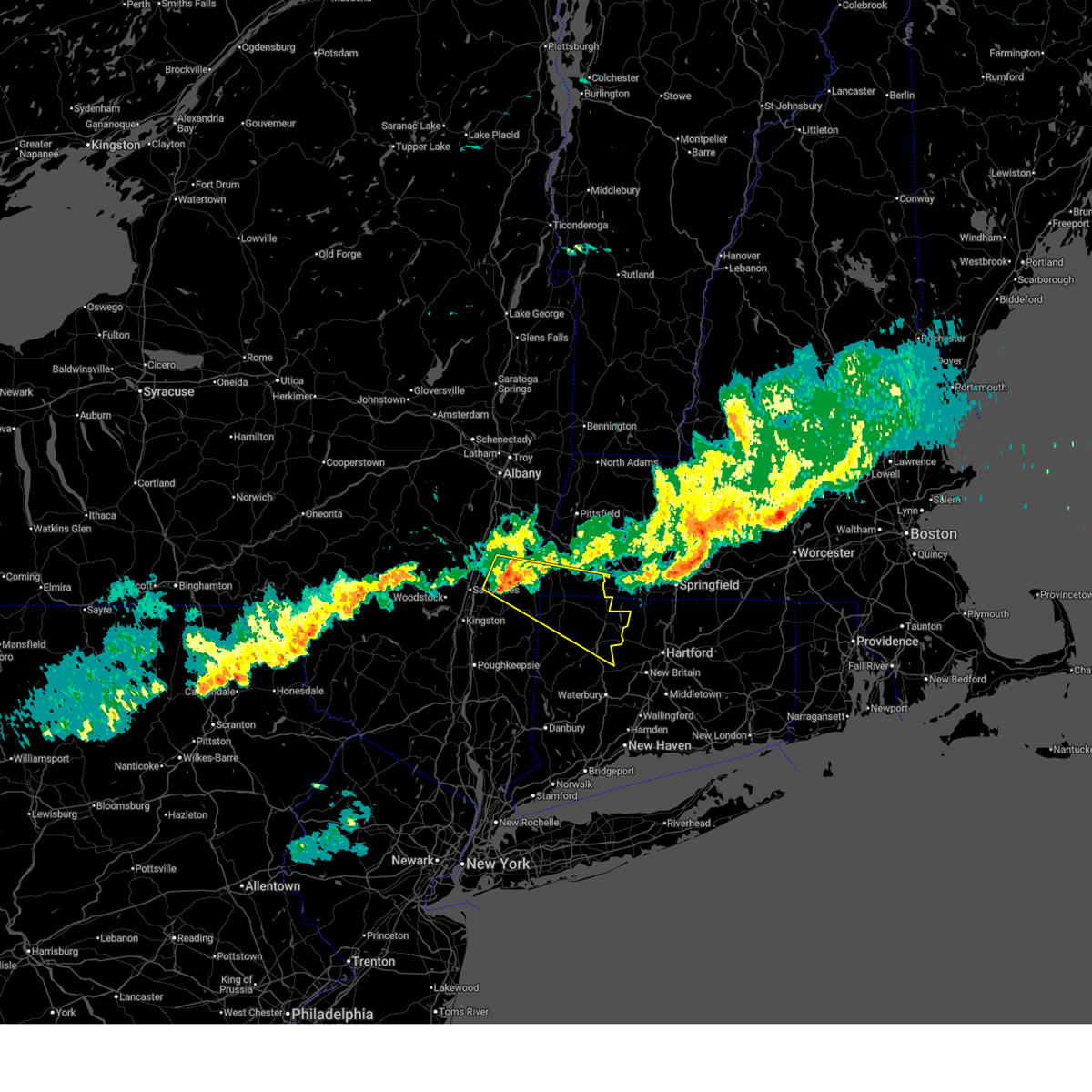
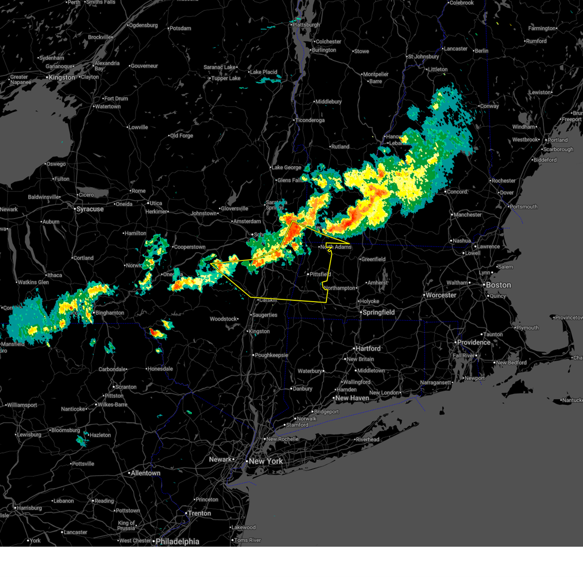
The Top Recent Hail Date for Hudson, NY is Wednesday, August 13, 2025 (9th out of 34)
Hail and Wind Damage Spotted near Hudson, NY
| Date / Time | Report Details |
|---|---|
| 7/1/2026 10:26 PM EDT | Svraly the national weather service in albany has issued a * severe thunderstorm warning for, north central litchfield county in northern connecticut, berkshire county in western massachusetts, columbia county in east central new york, southeastern greene county in east central new york, * until 1130 pm edt. * at 1026 pm edt, severe thunderstorms were located along a line extending from near nassau to near milton, moving east at 45 mph (radar indicated). Hazards include 60 mph wind gusts and nickel size hail. expect damage to roofs, siding, and trees |
| 6/30/2026 6:05 PM EDT |
 Svraly the national weather service in albany has issued a * severe thunderstorm warning for, northwestern litchfield county in northern connecticut, southwestern berkshire county in western massachusetts, southern columbia county in east central new york, * until 700 pm edt. * at 605 pm edt, a severe thunderstorm was located over catskill, moving east at 25 mph (radar indicated). Hazards include 60 mph wind gusts and quarter size hail. Hail damage to vehicles is expected. Expect wind damage to roofs, siding, and trees. Svraly the national weather service in albany has issued a * severe thunderstorm warning for, northwestern litchfield county in northern connecticut, southwestern berkshire county in western massachusetts, southern columbia county in east central new york, * until 700 pm edt. * at 605 pm edt, a severe thunderstorm was located over catskill, moving east at 25 mph (radar indicated). Hazards include 60 mph wind gusts and quarter size hail. Hail damage to vehicles is expected. Expect wind damage to roofs, siding, and trees.
|
| 6/30/2026 5:55 PM EDT | Trees and wires down in the city of hudso in columbia county NY, 0.1 miles ESE of Hudson, NY |
| 6/30/2026 5:37 PM EDT |
 At 536 pm edt, a severe thunderstorm was located near coxsackie, or 10 miles north of hudson, moving east at 35 mph (radar indicated). Hazards include 60 mph wind gusts. Expect damage to roofs, siding, and trees. Locations impacted include, hudson, chatham, claverack, new baltimore, coxsackie, valatie, athens, austerlitz, philmont, kinderhook, lorenz park, claverack-red mills, ghent, stockport, stuyvesant, hillsdale, rossman, result, north hillsdale, and otter hook. At 536 pm edt, a severe thunderstorm was located near coxsackie, or 10 miles north of hudson, moving east at 35 mph (radar indicated). Hazards include 60 mph wind gusts. Expect damage to roofs, siding, and trees. Locations impacted include, hudson, chatham, claverack, new baltimore, coxsackie, valatie, athens, austerlitz, philmont, kinderhook, lorenz park, claverack-red mills, ghent, stockport, stuyvesant, hillsdale, rossman, result, north hillsdale, and otter hook.
|
| 6/30/2026 5:14 PM EDT |
 Svraly the national weather service in albany has issued a * severe thunderstorm warning for, central columbia county in east central new york, southwestern albany county in east central new york, northeastern greene county in east central new york, * until 615 pm edt. * at 513 pm edt, a severe thunderstorm was located near westerlo, or 17 miles southwest of delmar, moving east at 35 mph (radar indicated). Hazards include 60 mph wind gusts. expect damage to roofs, siding, and trees Svraly the national weather service in albany has issued a * severe thunderstorm warning for, central columbia county in east central new york, southwestern albany county in east central new york, northeastern greene county in east central new york, * until 615 pm edt. * at 513 pm edt, a severe thunderstorm was located near westerlo, or 17 miles southwest of delmar, moving east at 35 mph (radar indicated). Hazards include 60 mph wind gusts. expect damage to roofs, siding, and trees
|
| 6/11/2026 2:56 PM EDT | Wires down in the road near the intersection of church road and willowbrook road in the town of livingsto in columbia county NY, 8.4 miles N of Hudson, NY |
| 6/11/2026 2:45 PM EDT | Tree down along intersection of schneider road and cr10 in the town of livingsto in columbia county NY, 7 miles N of Hudson, NY |
| 6/11/2026 2:38 PM EDT |
 Svraly the national weather service in albany has issued a * severe thunderstorm warning for, southwestern columbia county in east central new york, * until 345 pm edt. * at 237 pm edt, a severe thunderstorm was located over livingston, or near catskill, moving southeast at 15 mph (radar indicated). Hazards include 60 mph wind gusts and penny size hail. expect damage to roofs, siding, and trees Svraly the national weather service in albany has issued a * severe thunderstorm warning for, southwestern columbia county in east central new york, * until 345 pm edt. * at 237 pm edt, a severe thunderstorm was located over livingston, or near catskill, moving southeast at 15 mph (radar indicated). Hazards include 60 mph wind gusts and penny size hail. expect damage to roofs, siding, and trees
|
| 4/14/2026 7:50 PM EDT |
 Svraly the national weather service in albany has issued a * severe thunderstorm warning for, northern litchfield county in northern connecticut, southern berkshire county in western massachusetts, northeastern dutchess county in east central new york, southern columbia county in east central new york, * until 845 pm edt. * at 749 pm edt, a severe thunderstorm was located near livingston, or 9 miles southeast of hudson, moving southeast at 50 mph (radar indicated). Hazards include 60 mph wind gusts and nickel size hail. expect damage to roofs, siding, and trees Svraly the national weather service in albany has issued a * severe thunderstorm warning for, northern litchfield county in northern connecticut, southern berkshire county in western massachusetts, northeastern dutchess county in east central new york, southern columbia county in east central new york, * until 845 pm edt. * at 749 pm edt, a severe thunderstorm was located near livingston, or 9 miles southeast of hudson, moving southeast at 50 mph (radar indicated). Hazards include 60 mph wind gusts and nickel size hail. expect damage to roofs, siding, and trees
|
| 4/14/2026 7:08 PM EDT |
 At 707 pm edt, severe thunderstorms were located along a line extending from hawley to near becket to near housatonic, moving east at 65 mph (public. at 6:58 pm, the pittsfield airport had a wind gust to 59 mph). Hazards include 60 mph wind gusts. Expect damage to roofs, siding, and trees. Locations impacted include, pittsfield, hudson, chatham, monroe, adams, lee, lenox, cheshire, coxsackie, valatie, becket, athens, austerlitz, otis, philmont, kinderhook, florida, savoy, lorenz park, and housatonic. At 707 pm edt, severe thunderstorms were located along a line extending from hawley to near becket to near housatonic, moving east at 65 mph (public. at 6:58 pm, the pittsfield airport had a wind gust to 59 mph). Hazards include 60 mph wind gusts. Expect damage to roofs, siding, and trees. Locations impacted include, pittsfield, hudson, chatham, monroe, adams, lee, lenox, cheshire, coxsackie, valatie, becket, athens, austerlitz, otis, philmont, kinderhook, florida, savoy, lorenz park, and housatonic.
|
| 4/14/2026 6:51 PM EDT |
 At 651 pm edt, severe thunderstorms were located along a line extending from florida to near cheshire to near chatham to 10 miles south of westerlo, moving southeast at 50 mph (radar indicated). Hazards include 60 mph wind gusts. Expect damage to roofs, siding, and trees. Locations impacted include, pittsfield, north adams, hudson, chatham, adams, williamstown, lee, lenox, new baltimore, cheshire, coxsackie, new lebanon, valatie, becket, athens, austerlitz, otis, philmont, kinderhook, and stamford. At 651 pm edt, severe thunderstorms were located along a line extending from florida to near cheshire to near chatham to 10 miles south of westerlo, moving southeast at 50 mph (radar indicated). Hazards include 60 mph wind gusts. Expect damage to roofs, siding, and trees. Locations impacted include, pittsfield, north adams, hudson, chatham, adams, williamstown, lee, lenox, new baltimore, cheshire, coxsackie, new lebanon, valatie, becket, athens, austerlitz, otis, philmont, kinderhook, and stamford.
|
| 4/14/2026 6:51 PM EDT |
 the severe thunderstorm warning has been cancelled and is no longer in effect the severe thunderstorm warning has been cancelled and is no longer in effect
|
| 4/14/2026 6:23 PM EDT |
 Svraly the national weather service in albany has issued a * severe thunderstorm warning for, berkshire county in western massachusetts, northern columbia county in east central new york, southern albany county in east central new york, northeastern greene county in east central new york, southeastern schoharie county in east central new york, rensselaer county in east central new york, southwestern bennington county in southern vermont, south central windham county in southern vermont, * until 730 pm edt. * at 623 pm edt, severe thunderstorms were located along a line extending from near hoosick falls to averill park to near selkirk to breakabeen, moving southeast at 40 mph (radar indicated). Hazards include 60 mph wind gusts. expect damage to roofs, siding, and trees Svraly the national weather service in albany has issued a * severe thunderstorm warning for, berkshire county in western massachusetts, northern columbia county in east central new york, southern albany county in east central new york, northeastern greene county in east central new york, southeastern schoharie county in east central new york, rensselaer county in east central new york, southwestern bennington county in southern vermont, south central windham county in southern vermont, * until 730 pm edt. * at 623 pm edt, severe thunderstorms were located along a line extending from near hoosick falls to averill park to near selkirk to breakabeen, moving southeast at 40 mph (radar indicated). Hazards include 60 mph wind gusts. expect damage to roofs, siding, and trees
|
| 3/31/2026 9:25 PM EDT |
 Svraly the national weather service in albany has issued a * severe thunderstorm warning for, northwestern litchfield county in northern connecticut, southern berkshire county in western massachusetts, northeastern ulster county in east central new york, northern dutchess county in east central new york, columbia county in east central new york, eastern greene county in east central new york, * until 1030 pm edt. * at 925 pm edt, a severe thunderstorm was located over lorenz park, or near hudson, moving east at 40 mph (radar indicated). Hazards include 60 mph wind gusts and quarter size hail. Hail damage to vehicles is expected. Expect wind damage to roofs, siding, and trees. Svraly the national weather service in albany has issued a * severe thunderstorm warning for, northwestern litchfield county in northern connecticut, southern berkshire county in western massachusetts, northeastern ulster county in east central new york, northern dutchess county in east central new york, columbia county in east central new york, eastern greene county in east central new york, * until 1030 pm edt. * at 925 pm edt, a severe thunderstorm was located over lorenz park, or near hudson, moving east at 40 mph (radar indicated). Hazards include 60 mph wind gusts and quarter size hail. Hail damage to vehicles is expected. Expect wind damage to roofs, siding, and trees.
|
| 3/31/2026 9:07 PM EDT |
 The storms which prompted the warning have weakened below severe limits, and no longer pose an immediate threat to life or property. therefore, the warning will be allowed to expire. a severe thunderstorm watch remains in effect until 1100 pm edt for east central new york. The storms which prompted the warning have weakened below severe limits, and no longer pose an immediate threat to life or property. therefore, the warning will be allowed to expire. a severe thunderstorm watch remains in effect until 1100 pm edt for east central new york.
|
| 3/31/2026 8:58 PM EDT | Tree downed across new york route 9j. the road was closed between stuyvesant falls road and day roa in columbia county NY, 6.3 miles S of Hudson, NY |
| 3/31/2026 8:42 PM EDT |
 the severe thunderstorm warning has been cancelled and is no longer in effect the severe thunderstorm warning has been cancelled and is no longer in effect
|
| 3/31/2026 8:42 PM EDT |
 At 842 pm edt, severe thunderstorms were located along a line extending from 8 miles east of windham to near swan lake, moving east at 35 mph (radar indicated). Hazards include 60 mph wind gusts and quarter size hail. Hail damage to vehicles is expected. expect wind damage to roofs, siding, and trees. Locations impacted include, hudson, catskill, hunter, woodstock, coxsackie, windham, athens, lorenz park, west hurley, north-south lake campground, woodland valley campground, west shokan, kenneth l wilson campground, phoenicia, mount tremper, lanesville, olivebridge, cairo, veteran, and shandaken. At 842 pm edt, severe thunderstorms were located along a line extending from 8 miles east of windham to near swan lake, moving east at 35 mph (radar indicated). Hazards include 60 mph wind gusts and quarter size hail. Hail damage to vehicles is expected. expect wind damage to roofs, siding, and trees. Locations impacted include, hudson, catskill, hunter, woodstock, coxsackie, windham, athens, lorenz park, west hurley, north-south lake campground, woodland valley campground, west shokan, kenneth l wilson campground, phoenicia, mount tremper, lanesville, olivebridge, cairo, veteran, and shandaken.
|
| 3/31/2026 8:18 PM EDT |
 Svraly the national weather service in albany has issued a * severe thunderstorm warning for, northwestern ulster county in east central new york, west central columbia county in east central new york, greene county in east central new york, south central schoharie county in east central new york, * until 915 pm edt. * at 817 pm edt, severe thunderstorms were located along a line extending from near gilboa to hankins, moving east at 35 mph (radar indicated). Hazards include 60 mph wind gusts and quarter size hail. Hail damage to vehicles is expected. Expect wind damage to roofs, siding, and trees. Svraly the national weather service in albany has issued a * severe thunderstorm warning for, northwestern ulster county in east central new york, west central columbia county in east central new york, greene county in east central new york, south central schoharie county in east central new york, * until 915 pm edt. * at 817 pm edt, severe thunderstorms were located along a line extending from near gilboa to hankins, moving east at 35 mph (radar indicated). Hazards include 60 mph wind gusts and quarter size hail. Hail damage to vehicles is expected. Expect wind damage to roofs, siding, and trees.
|
| 8/13/2025 2:32 PM EDT |
 The storm which prompted the warning has weakened below severe limits, and no longer poses an immediate threat to life or property. therefore, the warning has been allowed to expire. however, gusty winds and heavy rain are still possible with this thunderstorm. The storm which prompted the warning has weakened below severe limits, and no longer poses an immediate threat to life or property. therefore, the warning has been allowed to expire. however, gusty winds and heavy rain are still possible with this thunderstorm.
|
| 8/13/2025 1:25 PM EDT |
 Svraly the national weather service in albany has issued a * severe thunderstorm warning for, northwestern columbia county in east central new york, eastern greene county in east central new york, * until 230 pm edt. * at 125 pm edt, a severe thunderstorm was located 9 miles south of westerlo, or 14 miles northwest of catskill, moving southeast at 15 mph (radar indicated). Hazards include 60 mph wind gusts and quarter size hail. Hail damage to vehicles is expected. Expect wind damage to roofs, siding, and trees. Svraly the national weather service in albany has issued a * severe thunderstorm warning for, northwestern columbia county in east central new york, eastern greene county in east central new york, * until 230 pm edt. * at 125 pm edt, a severe thunderstorm was located 9 miles south of westerlo, or 14 miles northwest of catskill, moving southeast at 15 mph (radar indicated). Hazards include 60 mph wind gusts and quarter size hail. Hail damage to vehicles is expected. Expect wind damage to roofs, siding, and trees.
|
| 7/3/2025 5:26 PM EDT |
 The storm which prompted the warning has weakened below severe limits, and has exited the warned area. therefore, the warning will be allowed to expire. a severe thunderstorm watch remains in effect until 1000 pm edt for northern connecticut, western massachusetts, and east central new york. The storm which prompted the warning has weakened below severe limits, and has exited the warned area. therefore, the warning will be allowed to expire. a severe thunderstorm watch remains in effect until 1000 pm edt for northern connecticut, western massachusetts, and east central new york.
|
| 7/3/2025 4:48 PM EDT |
 the severe thunderstorm warning has been cancelled and is no longer in effect the severe thunderstorm warning has been cancelled and is no longer in effect
|
| 7/3/2025 4:48 PM EDT |
 At 448 pm edt, a severe thunderstorm was located near philmont, or near hudson, moving southeast at 20 mph (radar indicated). Hazards include 60 mph wind gusts and quarter size hail. Hail damage to vehicles is expected. expect wind damage to roofs, siding, and trees. Locations impacted include, great barrington, hudson, chatham, claverack, lee, lenox, copake, austerlitz, philmont, lorenz park, claverack-red mills, housatonic, ghent, stockport, stockbridge, hillsdale, richmond, taghkanic, west stockbridge, and alford. At 448 pm edt, a severe thunderstorm was located near philmont, or near hudson, moving southeast at 20 mph (radar indicated). Hazards include 60 mph wind gusts and quarter size hail. Hail damage to vehicles is expected. expect wind damage to roofs, siding, and trees. Locations impacted include, great barrington, hudson, chatham, claverack, lee, lenox, copake, austerlitz, philmont, lorenz park, claverack-red mills, housatonic, ghent, stockport, stockbridge, hillsdale, richmond, taghkanic, west stockbridge, and alford.
|
| 7/3/2025 4:28 PM EDT |
 Svraly the national weather service in albany has issued a * severe thunderstorm warning for, southwestern berkshire county in western massachusetts, columbia county in east central new york, northeastern greene county in east central new york, * until 530 pm edt. * at 427 pm edt, a severe thunderstorm was located over coxsackie, or 7 miles north of hudson, moving southeast at 25 mph (radar indicated). Hazards include 60 mph wind gusts and quarter size hail. Hail damage to vehicles is expected. Expect wind damage to roofs, siding, and trees. Svraly the national weather service in albany has issued a * severe thunderstorm warning for, southwestern berkshire county in western massachusetts, columbia county in east central new york, northeastern greene county in east central new york, * until 530 pm edt. * at 427 pm edt, a severe thunderstorm was located over coxsackie, or 7 miles north of hudson, moving southeast at 25 mph (radar indicated). Hazards include 60 mph wind gusts and quarter size hail. Hail damage to vehicles is expected. Expect wind damage to roofs, siding, and trees.
|
| 7/1/2025 3:42 PM EDT |
 Svraly the national weather service in albany has issued a * severe thunderstorm warning for, southwestern berkshire county in western massachusetts, northeastern columbia county in east central new york, * until 430 pm edt. * at 342 pm edt, a severe thunderstorm was located near chatham, moving east at 25 mph (radar indicated). Hazards include 60 mph wind gusts. expect damage to roofs, siding, and trees Svraly the national weather service in albany has issued a * severe thunderstorm warning for, southwestern berkshire county in western massachusetts, northeastern columbia county in east central new york, * until 430 pm edt. * at 342 pm edt, a severe thunderstorm was located near chatham, moving east at 25 mph (radar indicated). Hazards include 60 mph wind gusts. expect damage to roofs, siding, and trees
|
| 5/3/2025 12:57 PM EDT |
 Svraly the national weather service in albany has issued a * severe thunderstorm warning for, northern columbia county in east central new york, southeastern albany county in east central new york, northeastern greene county in east central new york, southern rensselaer county in east central new york, * until 130 pm edt. * at 1257 pm edt, a severe thunderstorm was located near coxsackie, or 10 miles north of catskill, moving east at 35 mph (radar indicated). Hazards include 60 mph wind gusts and quarter size hail. Hail damage to vehicles is expected. Expect wind damage to roofs, siding, and trees. Svraly the national weather service in albany has issued a * severe thunderstorm warning for, northern columbia county in east central new york, southeastern albany county in east central new york, northeastern greene county in east central new york, southern rensselaer county in east central new york, * until 130 pm edt. * at 1257 pm edt, a severe thunderstorm was located near coxsackie, or 10 miles north of catskill, moving east at 35 mph (radar indicated). Hazards include 60 mph wind gusts and quarter size hail. Hail damage to vehicles is expected. Expect wind damage to roofs, siding, and trees.
|
| 7/17/2024 4:06 PM EDT |
 The storm which prompted the warning has weakened below severe limits, and has exited the warned area. therefore, the warning will be allowed to expire. a severe thunderstorm watch remains in effect until 800 pm edt for western massachusetts, and east central new york. The storm which prompted the warning has weakened below severe limits, and has exited the warned area. therefore, the warning will be allowed to expire. a severe thunderstorm watch remains in effect until 800 pm edt for western massachusetts, and east central new york.
|
| 7/17/2024 3:46 PM EDT |
 At 345 pm edt, a severe thunderstorm was located near chatham, moving east at 30 mph (radar indicated). Hazards include 60 mph wind gusts and quarter size hail. Hail damage to vehicles is expected. expect wind damage to roofs, siding, and trees. Locations impacted include, hudson, chatham, new baltimore, coxsackie, new lebanon, valatie, athens, austerlitz, philmont, kinderhook, lorenz park, ghent, stockport, stuyvesant, canaan, rossman, rayville, otter hook, riders mills, and climax. At 345 pm edt, a severe thunderstorm was located near chatham, moving east at 30 mph (radar indicated). Hazards include 60 mph wind gusts and quarter size hail. Hail damage to vehicles is expected. expect wind damage to roofs, siding, and trees. Locations impacted include, hudson, chatham, new baltimore, coxsackie, new lebanon, valatie, athens, austerlitz, philmont, kinderhook, lorenz park, ghent, stockport, stuyvesant, canaan, rossman, rayville, otter hook, riders mills, and climax.
|
| 7/17/2024 3:11 PM EDT |
 Svraly the national weather service in albany has issued a * severe thunderstorm warning for, northern columbia county in east central new york, northeastern greene county in east central new york, * until 415 pm edt. * at 311 pm edt, a severe thunderstorm was located over coxsackie, or 7 miles north of hudson, moving east at 30 mph (radar indicated). Hazards include 60 mph wind gusts and quarter size hail. Hail damage to vehicles is expected. Expect wind damage to roofs, siding, and trees. Svraly the national weather service in albany has issued a * severe thunderstorm warning for, northern columbia county in east central new york, northeastern greene county in east central new york, * until 415 pm edt. * at 311 pm edt, a severe thunderstorm was located over coxsackie, or 7 miles north of hudson, moving east at 30 mph (radar indicated). Hazards include 60 mph wind gusts and quarter size hail. Hail damage to vehicles is expected. Expect wind damage to roofs, siding, and trees.
|
| 9/8/2023 6:13 PM EDT |
 At 613 pm edt, severe thunderstorms were located along a line extending from near new baltimore to athens, moving northeast at 25 mph (radar indicated). Hazards include 60 mph wind gusts. Expect damage to roofs, siding, and trees. locations impacted include, hudson, chatham, coxsackie, athens, philmont, kinderhook, lorenz park, ghent, stockport, stuyvesant, stuyvesant falls, columbiaville, omi, mellenville, stottville, rossman, stockport station, brick tavern, sunnyside and pulvers. hail threat, radar indicated max hail size, <. 75 in wind threat, radar indicated max wind gust, 60 mph. At 613 pm edt, severe thunderstorms were located along a line extending from near new baltimore to athens, moving northeast at 25 mph (radar indicated). Hazards include 60 mph wind gusts. Expect damage to roofs, siding, and trees. locations impacted include, hudson, chatham, coxsackie, athens, philmont, kinderhook, lorenz park, ghent, stockport, stuyvesant, stuyvesant falls, columbiaville, omi, mellenville, stottville, rossman, stockport station, brick tavern, sunnyside and pulvers. hail threat, radar indicated max hail size, <. 75 in wind threat, radar indicated max wind gust, 60 mph.
|
| 9/8/2023 5:54 PM EDT |
 At 554 pm edt, severe thunderstorms were located along a line extending from near coxsackie to near milton, moving northeast at 25 mph (radar indicated). Hazards include 60 mph wind gusts and quarter size hail. Hail damage to vehicles is expected. Expect wind damage to roofs, siding, and trees. At 554 pm edt, severe thunderstorms were located along a line extending from near coxsackie to near milton, moving northeast at 25 mph (radar indicated). Hazards include 60 mph wind gusts and quarter size hail. Hail damage to vehicles is expected. Expect wind damage to roofs, siding, and trees.
|
| 9/7/2023 8:24 PM EDT |
 At 823 pm edt, severe thunderstorms were located along a line extending from near coxsackie to near pine plains to near dover plains, moving northeast at 45 mph (radar indicated). Hazards include 60 mph wind gusts and quarter size hail. Hail damage to vehicles is expected. expect wind damage to roofs, siding, and trees. locations impacted include, hudson, catskill, claverack, amenia, livingston, copake, pine plains, clermont, athens, ancram, millbrook, philmont, millerton, lorenz park, stanfordville, claverack-red mills, dover plains, cairo, bethel and stockport. hail threat, radar indicated max hail size, 1. 00 in wind threat, radar indicated max wind gust, 60 mph. At 823 pm edt, severe thunderstorms were located along a line extending from near coxsackie to near pine plains to near dover plains, moving northeast at 45 mph (radar indicated). Hazards include 60 mph wind gusts and quarter size hail. Hail damage to vehicles is expected. expect wind damage to roofs, siding, and trees. locations impacted include, hudson, catskill, claverack, amenia, livingston, copake, pine plains, clermont, athens, ancram, millbrook, philmont, millerton, lorenz park, stanfordville, claverack-red mills, dover plains, cairo, bethel and stockport. hail threat, radar indicated max hail size, 1. 00 in wind threat, radar indicated max wind gust, 60 mph.
|
| 9/7/2023 8:22 PM EDT |
 At 822 pm edt, a severe thunderstorm was located near chatham, moving northeast at 40 mph (radar indicated). Hazards include 60 mph wind gusts and quarter size hail. Hail damage to vehicles is expected. Expect wind damage to roofs, siding, and trees. At 822 pm edt, a severe thunderstorm was located near chatham, moving northeast at 40 mph (radar indicated). Hazards include 60 mph wind gusts and quarter size hail. Hail damage to vehicles is expected. Expect wind damage to roofs, siding, and trees.
|
| 9/7/2023 8:00 PM EDT |
 At 800 pm edt, severe thunderstorms were located along a line extending from near hunter to rhinebeck to near fishkill, moving east at 35 mph (radar indicated). Hazards include 60 mph wind gusts and quarter size hail. Hail damage to vehicles is expected. Expect wind damage to roofs, siding, and trees. At 800 pm edt, severe thunderstorms were located along a line extending from near hunter to rhinebeck to near fishkill, moving east at 35 mph (radar indicated). Hazards include 60 mph wind gusts and quarter size hail. Hail damage to vehicles is expected. Expect wind damage to roofs, siding, and trees.
|
| 9/7/2023 7:54 PM EDT |
 At 754 pm edt, a severe thunderstorm was located near highland, or near poughkeepsie, moving north at 40 mph (radar indicated). Hazards include 60 mph wind gusts and quarter size hail. Hail damage to vehicles is expected. expect wind damage to roofs, siding, and trees. locations impacted include, kingston, new paltz, hudson, catskill, saugerties, rhinebeck, hunter, wallkill, hyde park, milton, plattekill, hurley, woodstock, highland, red hook, windham, athens, prattsville, high falls and tillson. hail threat, radar indicated max hail size, 1. 00 in wind threat, radar indicated max wind gust, 60 mph. At 754 pm edt, a severe thunderstorm was located near highland, or near poughkeepsie, moving north at 40 mph (radar indicated). Hazards include 60 mph wind gusts and quarter size hail. Hail damage to vehicles is expected. expect wind damage to roofs, siding, and trees. locations impacted include, kingston, new paltz, hudson, catskill, saugerties, rhinebeck, hunter, wallkill, hyde park, milton, plattekill, hurley, woodstock, highland, red hook, windham, athens, prattsville, high falls and tillson. hail threat, radar indicated max hail size, 1. 00 in wind threat, radar indicated max wind gust, 60 mph.
|
| 9/7/2023 7:21 PM EDT |
 At 721 pm edt, a severe thunderstorm was located near kerhonkson, or 7 miles northeast of ellenville, moving northeast at 50 mph (radar indicated). Hazards include 60 mph wind gusts and quarter size hail. Hail damage to vehicles is expected. Expect wind damage to roofs, siding, and trees. At 721 pm edt, a severe thunderstorm was located near kerhonkson, or 7 miles northeast of ellenville, moving northeast at 50 mph (radar indicated). Hazards include 60 mph wind gusts and quarter size hail. Hail damage to vehicles is expected. Expect wind damage to roofs, siding, and trees.
|
| 8/4/2023 5:54 PM EDT |
 The severe thunderstorm warning for central columbia and east central greene counties will expire at 600 pm edt, the storms which prompted the warning have weakened below severe limits, and no longer pose an immediate threat to life or property. therefore, the warning will be allowed to expire. a severe thunderstorm watch remains in effect until 800 pm edt for east central new york. The severe thunderstorm warning for central columbia and east central greene counties will expire at 600 pm edt, the storms which prompted the warning have weakened below severe limits, and no longer pose an immediate threat to life or property. therefore, the warning will be allowed to expire. a severe thunderstorm watch remains in effect until 800 pm edt for east central new york.
|
| 8/4/2023 5:48 PM EDT |
 At 548 pm edt, severe thunderstorms were located along a line extending from near chatham to philmont to near livingston, moving east at 35 mph (radar indicated). Hazards include 60 mph wind gusts and quarter size hail. Hail damage to vehicles is expected. expect wind damage to roofs, siding, and trees. locations impacted include, hudson, catskill, chatham, claverack, livingston, athens, philmont, kinderhook, lorenz park, claverack-red mills, ghent, stockport, taghkanic, hamburg light, jefferson heights, burden dock, greenport center, mellenville, burden and churchtown. hail threat, radar indicated max hail size, 1. 00 in wind threat, radar indicated max wind gust, 60 mph. At 548 pm edt, severe thunderstorms were located along a line extending from near chatham to philmont to near livingston, moving east at 35 mph (radar indicated). Hazards include 60 mph wind gusts and quarter size hail. Hail damage to vehicles is expected. expect wind damage to roofs, siding, and trees. locations impacted include, hudson, catskill, chatham, claverack, livingston, athens, philmont, kinderhook, lorenz park, claverack-red mills, ghent, stockport, taghkanic, hamburg light, jefferson heights, burden dock, greenport center, mellenville, burden and churchtown. hail threat, radar indicated max hail size, 1. 00 in wind threat, radar indicated max wind gust, 60 mph.
|
| 8/4/2023 5:25 PM EDT |
 At 525 pm edt, severe thunderstorms were located along a line extending from new baltimore to near coxsackie to near north-south lake campground, moving east at 30 mph (radar indicated). Hazards include 60 mph wind gusts and quarter size hail. Hail damage to vehicles is expected. expect wind damage to roofs, siding, and trees. locations impacted include, hudson, catskill, chatham, claverack, livingston, new baltimore, ravena, coxsackie, clermont, valatie, athens, philmont, kinderhook, lorenz park, north-south lake campground, claverack-red mills, coeymans, cairo, ghent and stockport. hail threat, radar indicated max hail size, 1. 00 in wind threat, radar indicated max wind gust, 60 mph. At 525 pm edt, severe thunderstorms were located along a line extending from new baltimore to near coxsackie to near north-south lake campground, moving east at 30 mph (radar indicated). Hazards include 60 mph wind gusts and quarter size hail. Hail damage to vehicles is expected. expect wind damage to roofs, siding, and trees. locations impacted include, hudson, catskill, chatham, claverack, livingston, new baltimore, ravena, coxsackie, clermont, valatie, athens, philmont, kinderhook, lorenz park, north-south lake campground, claverack-red mills, coeymans, cairo, ghent and stockport. hail threat, radar indicated max hail size, 1. 00 in wind threat, radar indicated max wind gust, 60 mph.
|
| 8/4/2023 4:54 PM EDT |
 At 454 pm edt, severe thunderstorms were located along a line extending from westerlo to 6 miles southeast of preston hollow to near windham, moving east at 35 mph (radar indicated). Hazards include 60 mph wind gusts and quarter size hail. Hail damage to vehicles is expected. Expect wind damage to roofs, siding, and trees. At 454 pm edt, severe thunderstorms were located along a line extending from westerlo to 6 miles southeast of preston hollow to near windham, moving east at 35 mph (radar indicated). Hazards include 60 mph wind gusts and quarter size hail. Hail damage to vehicles is expected. Expect wind damage to roofs, siding, and trees.
|
| 7/27/2023 2:32 PM EDT |
 At 232 pm edt, a severe thunderstorm was located over livingston, or 9 miles southeast of catskill, moving east at 30 mph (radar indicated). Hazards include 60 mph wind gusts and nickel size hail. expect damage to roofs, siding, and trees At 232 pm edt, a severe thunderstorm was located over livingston, or 9 miles southeast of catskill, moving east at 30 mph (radar indicated). Hazards include 60 mph wind gusts and nickel size hail. expect damage to roofs, siding, and trees
|
| 7/16/2023 6:18 AM EDT | Tree down on wires. town of livingsto in columbia county NY, 7.6 miles N of Hudson, NY |
| 7/16/2023 6:02 AM EDT |
 At 602 am edt, a severe thunderstorm capable of producing a tornado was located near stanfordville, or near rhinebeck, moving northeast at 15 mph (radar indicated rotation). Hazards include tornado. Flying debris will be dangerous to those caught without shelter. mobile homes will be damaged or destroyed. damage to roofs, windows, and vehicles will occur. tree damage is likely. this dangerous storm will be near, pine plains and ancram around 630 am edt. other locations impacted by this tornadic thunderstorm include pachin mills, ancramdale, kerleys corners, alford, churchtown, linden acres, linlithgo mills, north hillsdale, shunpike and nevis. please report hail size, damaging winds and reports of trees down to the national weather service by email at alb. stormreport@noaa. gov, on facebook at www. facebook. Com/nwsalbany or twitter @nwsalbany. At 602 am edt, a severe thunderstorm capable of producing a tornado was located near stanfordville, or near rhinebeck, moving northeast at 15 mph (radar indicated rotation). Hazards include tornado. Flying debris will be dangerous to those caught without shelter. mobile homes will be damaged or destroyed. damage to roofs, windows, and vehicles will occur. tree damage is likely. this dangerous storm will be near, pine plains and ancram around 630 am edt. other locations impacted by this tornadic thunderstorm include pachin mills, ancramdale, kerleys corners, alford, churchtown, linden acres, linlithgo mills, north hillsdale, shunpike and nevis. please report hail size, damaging winds and reports of trees down to the national weather service by email at alb. stormreport@noaa. gov, on facebook at www. facebook. Com/nwsalbany or twitter @nwsalbany.
|
| 7/13/2023 7:50 PM EDT |
 The tornado warning for west central columbia county will expire at 800 pm edt, the storm which prompted the warning has moved out of the area. therefore, the warning will be allowed to expire. a severe thunderstorm watch remains in effect until 1000 pm edt for east central new york. The tornado warning for west central columbia county will expire at 800 pm edt, the storm which prompted the warning has moved out of the area. therefore, the warning will be allowed to expire. a severe thunderstorm watch remains in effect until 1000 pm edt for east central new york.
|
| 7/13/2023 7:34 PM EDT |
 At 734 pm edt, a severe thunderstorm capable of producing a tornado was located over claverack, or near hudson, moving east at 35 mph (radar indicated rotation). Hazards include tornado and quarter size hail. Flying debris will be dangerous to those caught without shelter. mobile homes will be damaged or destroyed. damage to roofs, windows, and vehicles will occur. tree damage is likely. This tornadic thunderstorm will remain over mainly rural areas of west central columbia county, including the following locations, linlithgo mills, red mills, upper hollowville, greenport center, mellenville, churchtown and hollowville. At 734 pm edt, a severe thunderstorm capable of producing a tornado was located over claverack, or near hudson, moving east at 35 mph (radar indicated rotation). Hazards include tornado and quarter size hail. Flying debris will be dangerous to those caught without shelter. mobile homes will be damaged or destroyed. damage to roofs, windows, and vehicles will occur. tree damage is likely. This tornadic thunderstorm will remain over mainly rural areas of west central columbia county, including the following locations, linlithgo mills, red mills, upper hollowville, greenport center, mellenville, churchtown and hollowville.
|
| 7/13/2023 7:22 PM EDT |
 At 722 pm edt, a severe thunderstorm capable of producing a tornado was located near milton, or near catskill, moving east at 25 mph (radar indicated rotation). Hazards include tornado and quarter size hail. Flying debris will be dangerous to those caught without shelter. mobile homes will be damaged or destroyed. damage to roofs, windows, and vehicles will occur. tree damage is likely. this dangerous storm will be near, catskill around 730 pm edt. livingston around 735 pm edt. hudson and lorenz park around 740 pm edt. claverack and claverack-red mills around 745 pm edt. other locations impacted by this tornadic thunderstorm include hamburg light, glenco mills, oak hill landing, upper hollowville, cauterskill, burden dock, linlithgo, greenport center, mellenville and burden. please report hail size, damaging winds and reports of trees down to the national weather service by email at alb. stormreport@noaa. gov, on facebook at www. facebook. Com/nwsalbany or twitter @nwsalbany. At 722 pm edt, a severe thunderstorm capable of producing a tornado was located near milton, or near catskill, moving east at 25 mph (radar indicated rotation). Hazards include tornado and quarter size hail. Flying debris will be dangerous to those caught without shelter. mobile homes will be damaged or destroyed. damage to roofs, windows, and vehicles will occur. tree damage is likely. this dangerous storm will be near, catskill around 730 pm edt. livingston around 735 pm edt. hudson and lorenz park around 740 pm edt. claverack and claverack-red mills around 745 pm edt. other locations impacted by this tornadic thunderstorm include hamburg light, glenco mills, oak hill landing, upper hollowville, cauterskill, burden dock, linlithgo, greenport center, mellenville and burden. please report hail size, damaging winds and reports of trees down to the national weather service by email at alb. stormreport@noaa. gov, on facebook at www. facebook. Com/nwsalbany or twitter @nwsalbany.
|
| 7/13/2023 7:11 PM EDT |
 At 711 pm edt, a severe thunderstorm was located over woodstock, or 8 miles west of saugerties, moving northeast at 30 mph (radar indicated). Hazards include 60 mph wind gusts and quarter size hail. Hail damage to vehicles is expected. Expect wind damage to roofs, siding, and trees. At 711 pm edt, a severe thunderstorm was located over woodstock, or 8 miles west of saugerties, moving northeast at 30 mph (radar indicated). Hazards include 60 mph wind gusts and quarter size hail. Hail damage to vehicles is expected. Expect wind damage to roofs, siding, and trees.
|
| 7/13/2023 6:31 PM EDT |
 At 631 pm edt, a severe thunderstorm was located over athens, or near hudson, moving northeast at 35 mph (radar indicated). Hazards include 60 mph wind gusts and quarter size hail. Hail damage to vehicles is expected. Expect wind damage to roofs, siding, and trees. At 631 pm edt, a severe thunderstorm was located over athens, or near hudson, moving northeast at 35 mph (radar indicated). Hazards include 60 mph wind gusts and quarter size hail. Hail damage to vehicles is expected. Expect wind damage to roofs, siding, and trees.
|
| 7/13/2023 6:11 PM EDT |
 At 610 pm edt, a severe thunderstorm was located over lorenz park, or over hudson, moving east at 10 mph (radar indicated). Hazards include 60 mph wind gusts and quarter size hail. Hail damage to vehicles is expected. Expect wind damage to roofs, siding, and trees. At 610 pm edt, a severe thunderstorm was located over lorenz park, or over hudson, moving east at 10 mph (radar indicated). Hazards include 60 mph wind gusts and quarter size hail. Hail damage to vehicles is expected. Expect wind damage to roofs, siding, and trees.
|
| 7/13/2023 6:02 PM EDT |
 At 602 pm edt, a severe thunderstorm was located over athens, or over hudson, moving northeast at 25 mph (radar indicated). Hazards include 60 mph wind gusts and quarter size hail. Hail damage to vehicles is expected. expect wind damage to roofs, siding, and trees. Locations impacted include, hudson, catskill, new baltimore, ravena, coxsackie, valatie, athens, kinderhook, lorenz park, north-south lake campground, coeymans, cairo, stockport, stuyvesant, germantown, coeymans hollow, burden dock, rossman, result and earlton. At 602 pm edt, a severe thunderstorm was located over athens, or over hudson, moving northeast at 25 mph (radar indicated). Hazards include 60 mph wind gusts and quarter size hail. Hail damage to vehicles is expected. expect wind damage to roofs, siding, and trees. Locations impacted include, hudson, catskill, new baltimore, ravena, coxsackie, valatie, athens, kinderhook, lorenz park, north-south lake campground, coeymans, cairo, stockport, stuyvesant, germantown, coeymans hollow, burden dock, rossman, result and earlton.
|
| 7/13/2023 5:28 PM EDT |
 At 527 pm edt, a severe thunderstorm was located near milton, or near catskill, moving northeast at 25 mph (radar indicated). Hazards include 60 mph wind gusts and quarter size hail. Hail damage to vehicles is expected. Expect wind damage to roofs, siding, and trees. At 527 pm edt, a severe thunderstorm was located near milton, or near catskill, moving northeast at 25 mph (radar indicated). Hazards include 60 mph wind gusts and quarter size hail. Hail damage to vehicles is expected. Expect wind damage to roofs, siding, and trees.
|
| 7/4/2023 9:18 PM EDT |
 At 917 pm edt, a severe thunderstorm was located near kinderhook, or near chatham, moving south at 20 mph (radar indicated). Hazards include 60 mph wind gusts and quarter size hail. Hail damage to vehicles is expected. expect wind damage to roofs, siding, and trees. locations impacted include, chatham, claverack, livingston, valatie, philmont, kinderhook, lorenz park, claverack-red mills, ghent, stockport, hillsdale, taghkanic, churchtown, rossman, linlithgo mills, north hillsdale, brick tavern, harlemville, west ghent and buckleyville. hail threat, radar indicated max hail size, 1. 00 in wind threat, radar indicated max wind gust, 60 mph. At 917 pm edt, a severe thunderstorm was located near kinderhook, or near chatham, moving south at 20 mph (radar indicated). Hazards include 60 mph wind gusts and quarter size hail. Hail damage to vehicles is expected. expect wind damage to roofs, siding, and trees. locations impacted include, chatham, claverack, livingston, valatie, philmont, kinderhook, lorenz park, claverack-red mills, ghent, stockport, hillsdale, taghkanic, churchtown, rossman, linlithgo mills, north hillsdale, brick tavern, harlemville, west ghent and buckleyville. hail threat, radar indicated max hail size, 1. 00 in wind threat, radar indicated max wind gust, 60 mph.
|
| 7/4/2023 8:56 PM EDT |
 At 856 pm edt, a severe thunderstorm was located over new baltimore, or 8 miles southwest of nassau, moving south at 20 mph (radar indicated). Hazards include 60 mph wind gusts and quarter size hail. Hail damage to vehicles is expected. Expect wind damage to roofs, siding, and trees. At 856 pm edt, a severe thunderstorm was located over new baltimore, or 8 miles southwest of nassau, moving south at 20 mph (radar indicated). Hazards include 60 mph wind gusts and quarter size hail. Hail damage to vehicles is expected. Expect wind damage to roofs, siding, and trees.
|
| 8/26/2022 1:29 PM EDT | Tree down on wires on falls rd town of ghen in columbia county NY, 7.2 miles SSW of Hudson, NY |
| 7/24/2022 8:37 PM EDT |
 At 836 pm edt, severe thunderstorms were located along a line extending from near valatie to near livingston to near sharon, moving east at 35 mph (radar indicated). Hazards include 60 mph wind gusts. expect damage to roofs, siding, and trees At 836 pm edt, severe thunderstorms were located along a line extending from near valatie to near livingston to near sharon, moving east at 35 mph (radar indicated). Hazards include 60 mph wind gusts. expect damage to roofs, siding, and trees
|
| 7/24/2022 8:32 PM EDT | Downed tree and wires on ny 9g between ny 23 and middle r in columbia county NY, 2.5 miles ENE of Hudson, NY |
| 7/24/2022 8:22 PM EDT |
 At 821 pm edt, severe thunderstorms were located along a line extending from near athens to near red hook to near newburgh, moving east at 40 mph (radar indicated. at 8:15 pm the red hook mesonet site reported a wind gust of 45 mph). Hazards include 60 mph wind gusts. Expect damage to roofs, siding, and trees. locations impacted include, poughkeepsie, kingston, beacon, new paltz, hudson, catskill, saugerties, rhinebeck, pawling, chatham, wallkill, hyde park, milton, plattekill, pleasant valley, hurley, claverack, wappingers falls, amenia and livingston. hail threat, radar indicated max hail size, <. 75 in wind threat, observed max wind gust, 60 mph. At 821 pm edt, severe thunderstorms were located along a line extending from near athens to near red hook to near newburgh, moving east at 40 mph (radar indicated. at 8:15 pm the red hook mesonet site reported a wind gust of 45 mph). Hazards include 60 mph wind gusts. Expect damage to roofs, siding, and trees. locations impacted include, poughkeepsie, kingston, beacon, new paltz, hudson, catskill, saugerties, rhinebeck, pawling, chatham, wallkill, hyde park, milton, plattekill, pleasant valley, hurley, claverack, wappingers falls, amenia and livingston. hail threat, radar indicated max hail size, <. 75 in wind threat, observed max wind gust, 60 mph.
|
| 7/24/2022 8:11 PM EDT |
 At 810 pm edt, severe thunderstorms were located along a line extending from 7 miles north of north-south lake campground to rhinebeck to near gardnertown, moving east at 40 mph (between 7:45 and 7:50 pm, the high falls mesonet camera showed large downed tree limbs as a result of this storm). Hazards include 60 mph wind gusts. Expect damage to roofs, siding, and trees. locations impacted include, poughkeepsie, kingston, beacon, new paltz, hudson, ellenville, catskill, saugerties, rhinebeck, pawling, chatham, hunter, wallkill, hyde park, milton, plattekill, pleasant valley, hurley, claverack and woodstock. hail threat, radar indicated max hail size, <. 75 in wind threat, observed max wind gust, 60 mph. At 810 pm edt, severe thunderstorms were located along a line extending from 7 miles north of north-south lake campground to rhinebeck to near gardnertown, moving east at 40 mph (between 7:45 and 7:50 pm, the high falls mesonet camera showed large downed tree limbs as a result of this storm). Hazards include 60 mph wind gusts. Expect damage to roofs, siding, and trees. locations impacted include, poughkeepsie, kingston, beacon, new paltz, hudson, ellenville, catskill, saugerties, rhinebeck, pawling, chatham, hunter, wallkill, hyde park, milton, plattekill, pleasant valley, hurley, claverack and woodstock. hail threat, radar indicated max hail size, <. 75 in wind threat, observed max wind gust, 60 mph.
|
| 7/24/2022 7:51 PM EDT |
 At 749 pm edt, severe thunderstorms were located along a line extending from near windham to near olivebridge to near bloomingburg, moving east at 40 mph (emergency management reported trees and wires down in the towns of kerhonkson with this line of storms). Hazards include 60 mph wind gusts. expect damage to roofs, siding, and trees At 749 pm edt, severe thunderstorms were located along a line extending from near windham to near olivebridge to near bloomingburg, moving east at 40 mph (emergency management reported trees and wires down in the towns of kerhonkson with this line of storms). Hazards include 60 mph wind gusts. expect damage to roofs, siding, and trees
|
| 7/24/2022 7:36 PM EDT |
 At 736 pm edt, severe thunderstorms were located along a line extending from near grafton to stephentown to near chatham, moving east at 40 mph (radar indicated). Hazards include 60 mph wind gusts. Expect damage to roofs, siding, and trees. locations impacted include, pittsfield, bennington, north adams, hudson, hoosick falls, chatham, nassau, adams, williamstown, lee, lenox, pownal, cheshire, stephentown, coxsackie, new lebanon, grafton, berlin, valatie and becket. hail threat, radar indicated max hail size, <. 75 in wind threat, radar indicated max wind gust, 60 mph. At 736 pm edt, severe thunderstorms were located along a line extending from near grafton to stephentown to near chatham, moving east at 40 mph (radar indicated). Hazards include 60 mph wind gusts. Expect damage to roofs, siding, and trees. locations impacted include, pittsfield, bennington, north adams, hudson, hoosick falls, chatham, nassau, adams, williamstown, lee, lenox, pownal, cheshire, stephentown, coxsackie, new lebanon, grafton, berlin, valatie and becket. hail threat, radar indicated max hail size, <. 75 in wind threat, radar indicated max wind gust, 60 mph.
|
| 7/24/2022 7:14 PM EDT |
 At 714 pm edt, severe thunderstorms were located along a line extending from near latham to near castleton-on-hudson to 6 miles west of athens, moving east at 50 mph (radar indicated). Hazards include 60 mph wind gusts. expect damage to roofs, siding, and trees At 714 pm edt, severe thunderstorms were located along a line extending from near latham to near castleton-on-hudson to 6 miles west of athens, moving east at 50 mph (radar indicated). Hazards include 60 mph wind gusts. expect damage to roofs, siding, and trees
|
| 7/12/2022 4:50 PM EDT |
 At 450 pm edt, severe thunderstorms were located along a line extending from adams to near chatham, moving east at 45 mph (radar indicated). Hazards include 70 mph wind gusts. Expect considerable tree damage. damage is likely to mobile homes, roofs, and outbuildings. locations impacted include, pittsfield, great barrington, hudson, catskill, chatham, claverack, lee, lenox, livingston, copake, sheffield, stephentown, coxsackie, pine plains, new lebanon, clermont, valatie, becket, athens and austerlitz. thunderstorm damage threat, considerable hail threat, radar indicated max hail size, <. 75 in wind threat, radar indicated max wind gust, 70 mph. At 450 pm edt, severe thunderstorms were located along a line extending from adams to near chatham, moving east at 45 mph (radar indicated). Hazards include 70 mph wind gusts. Expect considerable tree damage. damage is likely to mobile homes, roofs, and outbuildings. locations impacted include, pittsfield, great barrington, hudson, catskill, chatham, claverack, lee, lenox, livingston, copake, sheffield, stephentown, coxsackie, pine plains, new lebanon, clermont, valatie, becket, athens and austerlitz. thunderstorm damage threat, considerable hail threat, radar indicated max hail size, <. 75 in wind threat, radar indicated max wind gust, 70 mph.
|
| 7/12/2022 4:37 PM EDT | Tree down on route 20 near stottvill in columbia county NY, 3.2 miles SSW of Hudson, NY |
| 7/12/2022 4:32 PM EDT |
 At 432 pm edt, severe thunderstorms were located along a line extending from near hancock to near athens, moving east at 45 mph (radar indicated). Hazards include 60 mph wind gusts. expect damage to roofs, siding, and trees At 432 pm edt, severe thunderstorms were located along a line extending from near hancock to near athens, moving east at 45 mph (radar indicated). Hazards include 60 mph wind gusts. expect damage to roofs, siding, and trees
|
| 5/22/2022 6:12 PM EDT | Tree down on roxbury road in claverack. damage due to strong winds from an outflow boundar in columbia county NY, 5.6 miles W of Hudson, NY |
| 5/22/2022 6:11 PM EDT | Tree down on route 217 near coons road. damage due to strong winds from an outflow boundar in columbia county NY, 4.6 miles W of Hudson, NY |
| 5/16/2022 5:17 PM EDT |
 At 516 pm edt, a severe thunderstorm was located near stamford, or 7 miles southeast of bennington, moving northeast at 60 mph (radar indicated). Hazards include 60 mph wind gusts and quarter size hail. Hail damage to vehicles is expected. expect wind damage to roofs, siding, and trees. locations impacted include, pittsfield, bennington, great barrington, hudson, chatham, williamstown, claverack, lee, lenox, livingston, copake, pownal, sheffield, pine plains, new lebanon, clermont, red hook, valatie, athens and austerlitz. hail threat, radar indicated max hail size, 1. 00 in wind threat, radar indicated max wind gust, 60 mph. At 516 pm edt, a severe thunderstorm was located near stamford, or 7 miles southeast of bennington, moving northeast at 60 mph (radar indicated). Hazards include 60 mph wind gusts and quarter size hail. Hail damage to vehicles is expected. expect wind damage to roofs, siding, and trees. locations impacted include, pittsfield, bennington, great barrington, hudson, chatham, williamstown, claverack, lee, lenox, livingston, copake, pownal, sheffield, pine plains, new lebanon, clermont, red hook, valatie, athens and austerlitz. hail threat, radar indicated max hail size, 1. 00 in wind threat, radar indicated max wind gust, 60 mph.
|
| 5/16/2022 4:45 PM EDT |
 At 444 pm edt, severe thunderstorms were located along a line extending from near mechanicville to near grafton to austerlitz to chester, moving east at 50 mph (radar indicated). Hazards include 60 mph wind gusts and quarter size hail. Hail damage to vehicles is expected. expect wind damage to roofs, siding, and trees. locations impacted include, troy, clifton park, east greenbush, watervliet, rensselaer, hudson, mechanicville, saugerties, nassau, claverack, ballston spa, menands, livingston, green island, waterford, clermont, valatie, castleton-on-hudson, philmont and kinderhook. hail threat, radar indicated max hail size, 1. 00 in wind threat, radar indicated max wind gust, 60 mph. At 444 pm edt, severe thunderstorms were located along a line extending from near mechanicville to near grafton to austerlitz to chester, moving east at 50 mph (radar indicated). Hazards include 60 mph wind gusts and quarter size hail. Hail damage to vehicles is expected. expect wind damage to roofs, siding, and trees. locations impacted include, troy, clifton park, east greenbush, watervliet, rensselaer, hudson, mechanicville, saugerties, nassau, claverack, ballston spa, menands, livingston, green island, waterford, clermont, valatie, castleton-on-hudson, philmont and kinderhook. hail threat, radar indicated max hail size, 1. 00 in wind threat, radar indicated max wind gust, 60 mph.
|
| 5/16/2022 4:31 PM EDT |
 At 431 pm edt, a severe thunderstorm was located over nassau, moving northeast at 50 mph (radar indicated). Hazards include 60 mph wind gusts and quarter size hail. Hail damage to vehicles is expected. Expect wind damage to roofs, siding, and trees. At 431 pm edt, a severe thunderstorm was located over nassau, moving northeast at 50 mph (radar indicated). Hazards include 60 mph wind gusts and quarter size hail. Hail damage to vehicles is expected. Expect wind damage to roofs, siding, and trees.
|
| 5/16/2022 4:27 PM EDT |
 At 426 pm edt, severe thunderstorms were located along a line extending from near chatham to near pine plains to near hopewell junction, moving northeast at 75 mph (radar indicated). Hazards include 60 mph wind gusts and quarter size hail. Hail damage to vehicles is expected. Expect wind damage to roofs, siding, and trees. At 426 pm edt, severe thunderstorms were located along a line extending from near chatham to near pine plains to near hopewell junction, moving northeast at 75 mph (radar indicated). Hazards include 60 mph wind gusts and quarter size hail. Hail damage to vehicles is expected. Expect wind damage to roofs, siding, and trees.
|
| 5/16/2022 4:12 PM EDT |
 At 412 pm edt, severe thunderstorms were located along a line extending from near duanesburg to near feura bush to milton to near sheffield, moving northeast at 50 mph (radar indicated). Hazards include 60 mph wind gusts and quarter size hail. Hail damage to vehicles is expected. Expect wind damage to roofs, siding, and trees. At 412 pm edt, severe thunderstorms were located along a line extending from near duanesburg to near feura bush to milton to near sheffield, moving northeast at 50 mph (radar indicated). Hazards include 60 mph wind gusts and quarter size hail. Hail damage to vehicles is expected. Expect wind damage to roofs, siding, and trees.
|
| 3/7/2022 8:50 PM EST |
 At 849 pm est, severe thunderstorms were located along a line extending from near new lebanon to new paltz, moving east at 55 mph (radar indicated). Hazards include 60 mph wind gusts. Expect damage to roofs, siding, and trees. these severe storms will be near, new lebanon around 855 pm est. lenox around 900 pm est. pittsfield, pleasant valley, lee and red oaks mill around 905 pm est. becket and millbrook around 910 pm est. middlefield, dover plains and wingdale around 920 pm est. sherman, kent and gaylordsville around 925 pm est. new milford around 930 pm est. new preston around 935 pm est. Other locations impacted by these severe thunderstorms include norrie heights, lithgow, hoxie corner, south amenia, pleasant ridge, jackson corners, verbank, bulls bridge, niverville and dempsey landing. At 849 pm est, severe thunderstorms were located along a line extending from near new lebanon to new paltz, moving east at 55 mph (radar indicated). Hazards include 60 mph wind gusts. Expect damage to roofs, siding, and trees. these severe storms will be near, new lebanon around 855 pm est. lenox around 900 pm est. pittsfield, pleasant valley, lee and red oaks mill around 905 pm est. becket and millbrook around 910 pm est. middlefield, dover plains and wingdale around 920 pm est. sherman, kent and gaylordsville around 925 pm est. new milford around 930 pm est. new preston around 935 pm est. Other locations impacted by these severe thunderstorms include norrie heights, lithgow, hoxie corner, south amenia, pleasant ridge, jackson corners, verbank, bulls bridge, niverville and dempsey landing.
|
| 3/7/2022 8:41 PM EST |
 At 841 pm est, severe thunderstorms were located along a line extending from near valatie to near kerhonkson, moving east at 55 mph (radar indicated). Hazards include 60 mph wind gusts. Expect damage to roofs, siding, and trees. severe thunderstorms will be near, chatham and valatie around 845 pm est. austerlitz around 850 pm est. hyde park, highland and new lebanon around 855 pm est. poughkeepsie, lenox, fairview and red oaks mill around 900 pm est. pittsfield, pleasant valley and lee around 905 pm est. becket and millbrook around 910 pm est. dover plains around 915 pm est. sherman, kent, middlefield, gaylordsville and wingdale around 920 pm est. other locations impacted by these severe thunderstorms include norrie heights, lithgow, hoxie corner, south amenia, pleasant ridge, jackson corners, verbank, bulls bridge, niverville and dempsey landing. please report hail size, damaging winds and reports of trees down to the national weather service by email at alb. stormreport@noaa. gov, on facebook at www. facebook. com/nwsalbany or twitter @nwsalbany hail threat, radar indicated max hail size, <. 75 in wind threat, radar indicated max wind gust, 60 mph. At 841 pm est, severe thunderstorms were located along a line extending from near valatie to near kerhonkson, moving east at 55 mph (radar indicated). Hazards include 60 mph wind gusts. Expect damage to roofs, siding, and trees. severe thunderstorms will be near, chatham and valatie around 845 pm est. austerlitz around 850 pm est. hyde park, highland and new lebanon around 855 pm est. poughkeepsie, lenox, fairview and red oaks mill around 900 pm est. pittsfield, pleasant valley and lee around 905 pm est. becket and millbrook around 910 pm est. dover plains around 915 pm est. sherman, kent, middlefield, gaylordsville and wingdale around 920 pm est. other locations impacted by these severe thunderstorms include norrie heights, lithgow, hoxie corner, south amenia, pleasant ridge, jackson corners, verbank, bulls bridge, niverville and dempsey landing. please report hail size, damaging winds and reports of trees down to the national weather service by email at alb. stormreport@noaa. gov, on facebook at www. facebook. com/nwsalbany or twitter @nwsalbany hail threat, radar indicated max hail size, <. 75 in wind threat, radar indicated max wind gust, 60 mph.
|
| 9/15/2021 4:31 PM EDT |
 At 431 pm edt, a severe thunderstorm was located over lorenz park, or near hudson, moving northeast at 35 mph (radar indicated). Hazards include 60 mph wind gusts and quarter size hail. Hail damage to vehicles is expected. Expect wind damage to roofs, siding, and trees. At 431 pm edt, a severe thunderstorm was located over lorenz park, or near hudson, moving northeast at 35 mph (radar indicated). Hazards include 60 mph wind gusts and quarter size hail. Hail damage to vehicles is expected. Expect wind damage to roofs, siding, and trees.
|
| 9/8/2021 8:58 PM EDT |
 The severe thunderstorm warning for northeastern ulster, west central columbia and southeastern greene counties will expire at 900 pm edt, the storm which prompted the warning has weakened below severe limits, and no longer poses an immediate threat to life or property. therefore, the warning will be allowed to expire. however gusty winds and heavy rain are still possible with this thunderstorm. a severe thunderstorm watch remains in effect until midnight edt for east central new york. The severe thunderstorm warning for northeastern ulster, west central columbia and southeastern greene counties will expire at 900 pm edt, the storm which prompted the warning has weakened below severe limits, and no longer poses an immediate threat to life or property. therefore, the warning will be allowed to expire. however gusty winds and heavy rain are still possible with this thunderstorm. a severe thunderstorm watch remains in effect until midnight edt for east central new york.
|
| 9/8/2021 8:18 PM EDT |
 At 817 pm edt, a severe thunderstorm was located near north-south lake campground, or 7 miles north of saugerties, moving east at 30 mph (radar indicated). Hazards include 60 mph wind gusts. expect damage to roofs, siding, and trees At 817 pm edt, a severe thunderstorm was located near north-south lake campground, or 7 miles north of saugerties, moving east at 30 mph (radar indicated). Hazards include 60 mph wind gusts. expect damage to roofs, siding, and trees
|
| 8/12/2021 4:29 PM EDT |
 At 428 pm edt, a severe thunderstorm was located over austerlitz, or 8 miles east of chatham, moving east at 35 mph (radar indicated). Hazards include 60 mph wind gusts and penny size hail. expect damage to roofs, siding, and trees At 428 pm edt, a severe thunderstorm was located over austerlitz, or 8 miles east of chatham, moving east at 35 mph (radar indicated). Hazards include 60 mph wind gusts and penny size hail. expect damage to roofs, siding, and trees
|
| 7/17/2021 6:21 PM EDT |
 The severe thunderstorm warning for southwestern berkshire, columbia and southeastern greene counties will expire at 630 pm edt, the storm which prompted the warning has weakened below severe limits, and no longer poses an immediate threat to life or property. therefore, the warning will be allowed to expire. however heavy rain is still possible with this thunderstorm. a severe thunderstorm watch remains in effect until 1100 pm edt for western massachusetts, and east central new york. The severe thunderstorm warning for southwestern berkshire, columbia and southeastern greene counties will expire at 630 pm edt, the storm which prompted the warning has weakened below severe limits, and no longer poses an immediate threat to life or property. therefore, the warning will be allowed to expire. however heavy rain is still possible with this thunderstorm. a severe thunderstorm watch remains in effect until 1100 pm edt for western massachusetts, and east central new york.
|
| 7/17/2021 6:00 PM EDT |
 At 559 pm edt, a severe thunderstorm was located over philmont, or 7 miles south of chatham, moving northeast at 30 mph (radar indicated). Hazards include 60 mph wind gusts and quarter size hail. Hail damage to vehicles is expected. expect wind damage to roofs, siding, and trees. Locations impacted include, pittsfield, great barrington, hudson, catskill, chatham, claverack, lenox, livingston, coxsackie, clermont, valatie, athens, austerlitz, philmont, kinderhook, lorenz park, claverack-red mills, housatonic, ghent and stockport. At 559 pm edt, a severe thunderstorm was located over philmont, or 7 miles south of chatham, moving northeast at 30 mph (radar indicated). Hazards include 60 mph wind gusts and quarter size hail. Hail damage to vehicles is expected. expect wind damage to roofs, siding, and trees. Locations impacted include, pittsfield, great barrington, hudson, catskill, chatham, claverack, lenox, livingston, coxsackie, clermont, valatie, athens, austerlitz, philmont, kinderhook, lorenz park, claverack-red mills, housatonic, ghent and stockport.
|
| 7/17/2021 5:25 PM EDT |
 At 525 pm edt, a severe thunderstorm was located near clermont, or 10 miles east of saugerties, moving northeast at 30 mph (radar indicated). Hazards include 60 mph wind gusts and half dollar size hail. Hail damage to vehicles is expected. Expect wind damage to roofs, siding, and trees. At 525 pm edt, a severe thunderstorm was located near clermont, or 10 miles east of saugerties, moving northeast at 30 mph (radar indicated). Hazards include 60 mph wind gusts and half dollar size hail. Hail damage to vehicles is expected. Expect wind damage to roofs, siding, and trees.
|
| 7/8/2021 12:56 AM EDT |
 The severe thunderstorm warning for northeastern ulster, northwestern dutchess, southwestern columbia and southeastern greene counties will expire at 100 am edt, the storm which prompted the warning has weakened below severe limits, and no longer poses an immediate threat to life or property. therefore, the warning will be allowed to expire. however gusty winds and heavy rain are still possible with this thunderstorm. a severe thunderstorm watch remains in effect until 100 am edt for east central new york. The severe thunderstorm warning for northeastern ulster, northwestern dutchess, southwestern columbia and southeastern greene counties will expire at 100 am edt, the storm which prompted the warning has weakened below severe limits, and no longer poses an immediate threat to life or property. therefore, the warning will be allowed to expire. however gusty winds and heavy rain are still possible with this thunderstorm. a severe thunderstorm watch remains in effect until 100 am edt for east central new york.
|
| 7/8/2021 12:31 AM EDT |
 At 1230 am edt, a severe thunderstorm was located over red hook, or near saugerties, moving northeast at 40 mph (radar indicated). Hazards include 60 mph wind gusts and penny size hail. Expect damage to roofs, siding, and trees. Locations impacted include, kingston, hudson, catskill, saugerties, rhinebeck, claverack, livingston, pine plains, clermont, red hook, ancram, philmont, saugerties south, claverack-red mills, lake katrine, staatsburg, ghent, veteran, milan and germantown. At 1230 am edt, a severe thunderstorm was located over red hook, or near saugerties, moving northeast at 40 mph (radar indicated). Hazards include 60 mph wind gusts and penny size hail. Expect damage to roofs, siding, and trees. Locations impacted include, kingston, hudson, catskill, saugerties, rhinebeck, claverack, livingston, pine plains, clermont, red hook, ancram, philmont, saugerties south, claverack-red mills, lake katrine, staatsburg, ghent, veteran, milan and germantown.
|
| 7/8/2021 12:22 AM EDT |
 At 1221 am edt, severe thunderstorms were located along a line extending from near westerlo to near milton to near rhinebeck, moving northeast at 45 mph (radar indicated). Hazards include 60 mph wind gusts and penny size hail. Expect damage to roofs, siding, and trees. locations impacted include, kingston, east greenbush, hudson, catskill, saugerties, rhinebeck, chatham, hunter, delmar, hurley, claverack, woodstock, livingston, new baltimore, westerlo, ravena, coxsackie, berne, voorheesville and pine plains. These storms have a history of producing tree damage in ulster county. At 1221 am edt, severe thunderstorms were located along a line extending from near westerlo to near milton to near rhinebeck, moving northeast at 45 mph (radar indicated). Hazards include 60 mph wind gusts and penny size hail. Expect damage to roofs, siding, and trees. locations impacted include, kingston, east greenbush, hudson, catskill, saugerties, rhinebeck, chatham, hunter, delmar, hurley, claverack, woodstock, livingston, new baltimore, westerlo, ravena, coxsackie, berne, voorheesville and pine plains. These storms have a history of producing tree damage in ulster county.
|
| 7/8/2021 12:00 AM EDT |
 At 1159 pm edt, severe thunderstorms were located along a line extending from gilboa to west hurley to near new paltz, moving northeast at 50 mph (radar indicated). Hazards include 60 mph wind gusts and penny size hail. expect damage to roofs, siding, and trees At 1159 pm edt, severe thunderstorms were located along a line extending from gilboa to west hurley to near new paltz, moving northeast at 50 mph (radar indicated). Hazards include 60 mph wind gusts and penny size hail. expect damage to roofs, siding, and trees
|
| 7/7/2021 3:46 PM EDT |
 At 346 pm edt, a severe thunderstorm was located over philmont, or 7 miles south of chatham, moving southeast at 25 mph (radar indicated). Hazards include 60 mph wind gusts and penny size hail. Expect damage to roofs, siding, and trees. Locations impacted include, chatham, claverack, copake, valatie, austerlitz, philmont, kinderhook, claverack-red mills, lorenz park, ghent, stockport, hillsdale, taghkanic, chatham center, weed mines, greenport center, mellenville, churchtown, craryville and red rock. At 346 pm edt, a severe thunderstorm was located over philmont, or 7 miles south of chatham, moving southeast at 25 mph (radar indicated). Hazards include 60 mph wind gusts and penny size hail. Expect damage to roofs, siding, and trees. Locations impacted include, chatham, claverack, copake, valatie, austerlitz, philmont, kinderhook, claverack-red mills, lorenz park, ghent, stockport, hillsdale, taghkanic, chatham center, weed mines, greenport center, mellenville, churchtown, craryville and red rock.
|
| 7/7/2021 3:29 PM EDT |
 At 328 pm edt, a severe thunderstorm was located near lorenz park, or near hudson, moving southeast at 25 mph (radar indicated). Hazards include 60 mph wind gusts and penny size hail. expect damage to roofs, siding, and trees At 328 pm edt, a severe thunderstorm was located near lorenz park, or near hudson, moving southeast at 25 mph (radar indicated). Hazards include 60 mph wind gusts and penny size hail. expect damage to roofs, siding, and trees
|
| 7/7/2021 3:17 PM EDT | Route 9j closed between day road and route 26a near stockport due to downed trees in columbia county NY, 5.6 miles S of Hudson, NY |
| 6/29/2021 11:26 PM EDT |
 At 1126 pm edt, a severe thunderstorm was located over livingston, or 8 miles southeast of catskill, moving east at 25 mph (radar indicated). Hazards include 60 mph wind gusts. Expect damage to roofs, siding, and trees. Locations impacted include, hudson, claverack, livingston, copake, clermont, austerlitz, philmont, lorenz park, claverack-red mills, ghent, germantown, hillsdale, taghkanic, burden dock, burden, churchtown, linlithgo mills, north hillsdale, nevis and brick tavern. At 1126 pm edt, a severe thunderstorm was located over livingston, or 8 miles southeast of catskill, moving east at 25 mph (radar indicated). Hazards include 60 mph wind gusts. Expect damage to roofs, siding, and trees. Locations impacted include, hudson, claverack, livingston, copake, clermont, austerlitz, philmont, lorenz park, claverack-red mills, ghent, germantown, hillsdale, taghkanic, burden dock, burden, churchtown, linlithgo mills, north hillsdale, nevis and brick tavern.
|
| 6/29/2021 11:05 PM EDT |
 At 1104 pm edt, a severe thunderstorm was located near catskill, moving east at 15 mph (radar indicated). Hazards include 60 mph wind gusts. expect damage to roofs, siding, and trees At 1104 pm edt, a severe thunderstorm was located near catskill, moving east at 15 mph (radar indicated). Hazards include 60 mph wind gusts. expect damage to roofs, siding, and trees
|
| 6/21/2021 10:10 PM EDT | Tree and wires down. time estimated by rada in columbia county NY, 5.6 miles N of Hudson, NY |
| 6/21/2021 10:07 PM EDT |
 At 1006 pm edt, a severe thunderstorm was located near livingston, or 9 miles southeast of hudson, moving northeast at 40 mph (radar indicated). Hazards include 60 mph wind gusts. Expect damage to roofs, siding, and trees. Locations impacted include, hudson, rhinebeck, chatham, claverack, livingston, copake, pine plains, clermont, red hook, valatie, athens, austerlitz, ancram, philmont, kinderhook, millerton, lorenz park, stanfordville, claverack-red mills and staatsburg. At 1006 pm edt, a severe thunderstorm was located near livingston, or 9 miles southeast of hudson, moving northeast at 40 mph (radar indicated). Hazards include 60 mph wind gusts. Expect damage to roofs, siding, and trees. Locations impacted include, hudson, rhinebeck, chatham, claverack, livingston, copake, pine plains, clermont, red hook, valatie, athens, austerlitz, ancram, philmont, kinderhook, millerton, lorenz park, stanfordville, claverack-red mills and staatsburg.
|
| 6/21/2021 9:49 PM EDT |
 At 949 pm edt, a severe thunderstorm was located over clermont, or near saugerties, moving northeast at 40 mph (radar indicated). Hazards include 60 mph wind gusts. expect damage to roofs, siding, and trees At 949 pm edt, a severe thunderstorm was located over clermont, or near saugerties, moving northeast at 40 mph (radar indicated). Hazards include 60 mph wind gusts. expect damage to roofs, siding, and trees
|
| 5/26/2021 5:54 PM EDT |
 At 554 pm edt, a severe thunderstorm was located near livingston, or near hudson, moving southeast at 25 mph (radar indicated). Hazards include 60 mph wind gusts. expect damage to roofs, siding, and trees At 554 pm edt, a severe thunderstorm was located near livingston, or near hudson, moving southeast at 25 mph (radar indicated). Hazards include 60 mph wind gusts. expect damage to roofs, siding, and trees
|
| 10/7/2020 4:39 PM EDT | Downed wires resulted in road closure on rte 66 at rte 9 in columbia county NY, 3.3 miles WSW of Hudson, NY |
| 10/7/2020 4:27 PM EDT |
 At 426 pm edt, severe thunderstorms were located along a line extending from near townshend to wilmington to near rowe to pittsfield to near chatham to near coxsackie to 6 miles south of prattsville, moving southeast at 105 mph (radar indicated). Hazards include 70 mph wind gusts. Expect considerable tree damage. Damage is likely to mobile homes, roofs, and outbuildings. At 426 pm edt, severe thunderstorms were located along a line extending from near townshend to wilmington to near rowe to pittsfield to near chatham to near coxsackie to 6 miles south of prattsville, moving southeast at 105 mph (radar indicated). Hazards include 70 mph wind gusts. Expect considerable tree damage. Damage is likely to mobile homes, roofs, and outbuildings.
|
| 10/7/2020 4:09 PM EDT |
 At 408 pm edt, a severe thunderstorm was located near pownal, or near bennington, moving east at 70 mph. this is a very dangerous storm (radar indicated). Hazards include 80 mph wind gusts and nickel size hail. Flying debris will be dangerous to those caught without shelter. mobile homes will be heavily damaged. expect considerable damage to roofs, windows, and vehicles. extensive tree damage and power outages are likely. Locations impacted include, albany, troy, pittsfield, bennington, kingston, east greenbush, cohoes, north adams, brattleboro, watervliet, rensselaer, colonie, great barrington, new paltz, hudson, ellenville, catskill, saugerties, hoosick falls and bellows falls. At 408 pm edt, a severe thunderstorm was located near pownal, or near bennington, moving east at 70 mph. this is a very dangerous storm (radar indicated). Hazards include 80 mph wind gusts and nickel size hail. Flying debris will be dangerous to those caught without shelter. mobile homes will be heavily damaged. expect considerable damage to roofs, windows, and vehicles. extensive tree damage and power outages are likely. Locations impacted include, albany, troy, pittsfield, bennington, kingston, east greenbush, cohoes, north adams, brattleboro, watervliet, rensselaer, colonie, great barrington, new paltz, hudson, ellenville, catskill, saugerties, hoosick falls and bellows falls.
|
| 10/7/2020 3:56 PM EDT |
 At 356 pm edt, severe thunderstorms were located along a line extending from near pawlet to center brunswick to near davenport, moving southeast at 80 mph (radar indicated). Hazards include 70 mph wind gusts. Expect considerable tree damage. Damage is likely to mobile homes, roofs, and outbuildings. At 356 pm edt, severe thunderstorms were located along a line extending from near pawlet to center brunswick to near davenport, moving southeast at 80 mph (radar indicated). Hazards include 70 mph wind gusts. Expect considerable tree damage. Damage is likely to mobile homes, roofs, and outbuildings.
|
| 7/23/2020 6:12 PM EDT | Downed tree and wires on county route 10 in columbia county NY, 7.6 miles N of Hudson, NY |
| 7/2/2020 6:52 PM EDT |
 The severe thunderstorm warning for west central columbia and southeastern greene counties will expire at 700 pm edt, the storm which prompted the warning has weakened below severe limits, and no longer poses an immediate threat to life or property. therefore, the warning will be allowed to expire. The severe thunderstorm warning for west central columbia and southeastern greene counties will expire at 700 pm edt, the storm which prompted the warning has weakened below severe limits, and no longer poses an immediate threat to life or property. therefore, the warning will be allowed to expire.
|
| 7/2/2020 6:48 PM EDT |
 At 647 pm edt, a severe thunderstorm was located over high falls, or near catskill, moving south at 15 mph (radar indicated). Hazards include 60 mph wind gusts. Expect damage to roofs, siding, and trees. Locations impacted include, hudson, catskill, livingston, athens, germantown, athens station, hamburg light, oak hill landing, jefferson heights, leeds, cauterskill, burden dock, linlithgo, burden, bingham mills, kiskatom, blue store, greendale, cairo junction and alsen. At 647 pm edt, a severe thunderstorm was located over high falls, or near catskill, moving south at 15 mph (radar indicated). Hazards include 60 mph wind gusts. Expect damage to roofs, siding, and trees. Locations impacted include, hudson, catskill, livingston, athens, germantown, athens station, hamburg light, oak hill landing, jefferson heights, leeds, cauterskill, burden dock, linlithgo, burden, bingham mills, kiskatom, blue store, greendale, cairo junction and alsen.
|
| 7/2/2020 6:35 PM EDT |
 At 634 pm edt, a severe thunderstorm was located near great barrington, moving south at 35 mph (radar indicated). Hazards include 60 mph wind gusts. Expect damage to roofs, siding, and trees. Locations impacted include, great barrington, hudson, chatham, claverack, valatie, austerlitz, philmont, kinderhook, lorenz park, claverack-red mills, housatonic, ghent, stockport, stuyvesant, stockbridge, hillsdale, richmond, taghkanic, west stockbridge and monterey. At 634 pm edt, a severe thunderstorm was located near great barrington, moving south at 35 mph (radar indicated). Hazards include 60 mph wind gusts. Expect damage to roofs, siding, and trees. Locations impacted include, great barrington, hudson, chatham, claverack, valatie, austerlitz, philmont, kinderhook, lorenz park, claverack-red mills, housatonic, ghent, stockport, stuyvesant, stockbridge, hillsdale, richmond, taghkanic, west stockbridge and monterey.
|
| 7/2/2020 6:24 PM EDT |
 At 624 pm edt, a severe thunderstorm was located over austerlitz, or 8 miles southeast of chatham, moving south at 35 mph (radar indicated). Hazards include 60 mph wind gusts. Expect damage to roofs, siding, and trees. Locations impacted include, great barrington, hudson, chatham, claverack, new baltimore, coxsackie, new lebanon, valatie, austerlitz, philmont, kinderhook, lorenz park, claverack-red mills, housatonic, coeymans, ghent, stockport, stuyvesant, stockbridge and hillsdale. At 624 pm edt, a severe thunderstorm was located over austerlitz, or 8 miles southeast of chatham, moving south at 35 mph (radar indicated). Hazards include 60 mph wind gusts. Expect damage to roofs, siding, and trees. Locations impacted include, great barrington, hudson, chatham, claverack, new baltimore, coxsackie, new lebanon, valatie, austerlitz, philmont, kinderhook, lorenz park, claverack-red mills, housatonic, coeymans, ghent, stockport, stuyvesant, stockbridge and hillsdale.
|
| 7/2/2020 6:20 PM EDT |
 At 620 pm edt, a severe thunderstorm was located near north-south lake campground, or 8 miles northwest of catskill, moving south at 15 mph (radar indicated). Hazards include 60 mph wind gusts. Expect damage to roofs, siding, and trees. Locations impacted include, hudson, catskill, livingston, coxsackie, athens, north-south lake campground, cairo, germantown, burden dock, burden, round top, result, earlton, kiskatom, sunside, climax, cairo junction, oak hill landing, leeds and gayhead. At 620 pm edt, a severe thunderstorm was located near north-south lake campground, or 8 miles northwest of catskill, moving south at 15 mph (radar indicated). Hazards include 60 mph wind gusts. Expect damage to roofs, siding, and trees. Locations impacted include, hudson, catskill, livingston, coxsackie, athens, north-south lake campground, cairo, germantown, burden dock, burden, round top, result, earlton, kiskatom, sunside, climax, cairo junction, oak hill landing, leeds and gayhead.
|
| 7/2/2020 6:14 PM EDT |
 At 611 pm edt, a severe thunderstorm was located near chatham, moving south at 35 mph. a new york state mesonet station in kinderhook, ny gusted to 51mph as a result of these thunderstorms (radar indicated). Hazards include 60 mph wind gusts. Expect damage to roofs, siding, and trees. Locations impacted include, great barrington, hudson, chatham, nassau, claverack, new baltimore, ravena, coxsackie, new lebanon, valatie, austerlitz, castleton-on-hudson, philmont, kinderhook, lorenz park, selkirk, claverack-red mills, housatonic, coeymans and ghent. At 611 pm edt, a severe thunderstorm was located near chatham, moving south at 35 mph. a new york state mesonet station in kinderhook, ny gusted to 51mph as a result of these thunderstorms (radar indicated). Hazards include 60 mph wind gusts. Expect damage to roofs, siding, and trees. Locations impacted include, great barrington, hudson, chatham, nassau, claverack, new baltimore, ravena, coxsackie, new lebanon, valatie, austerlitz, castleton-on-hudson, philmont, kinderhook, lorenz park, selkirk, claverack-red mills, housatonic, coeymans and ghent.
|
| 7/2/2020 6:12 PM EDT | Tree and wires down orchard rd in columbia county NY, 4.8 miles WNW of Hudson, NY |
| 7/2/2020 6:07 PM EDT | Tree down on wires delaware ave in columbia county NY, 1.5 miles SSW of Hudson, NY |
| 7/2/2020 6:07 PM EDT |
 At 607 pm edt, a severe thunderstorm was located 10 miles north of north-south lake campground, or 11 miles northwest of catskill, moving south at 15 mph (radar indicated). Hazards include 60 mph wind gusts. expect damage to roofs, siding, and trees At 607 pm edt, a severe thunderstorm was located 10 miles north of north-south lake campground, or 11 miles northwest of catskill, moving south at 15 mph (radar indicated). Hazards include 60 mph wind gusts. expect damage to roofs, siding, and trees
|
| 7/2/2020 5:48 PM EDT |
 At 548 pm edt, a severe thunderstorm was located near nassau, moving south at 35 mph (radar indicated). Hazards include 60 mph wind gusts. expect damage to roofs, siding, and trees At 548 pm edt, a severe thunderstorm was located near nassau, moving south at 35 mph (radar indicated). Hazards include 60 mph wind gusts. expect damage to roofs, siding, and trees
|
| 5/15/2020 7:31 PM EDT | Wires down on county route 31 in town of livingston in columbia county NY, 5.9 miles NNE of Hudson, NY |
| 5/15/2020 7:10 PM EDT | Wires down on county route 31 in town of livingston..corrected event time in columbia county NY, 5.9 miles NNE of Hudson, NY |
| 5/15/2020 6:42 PM EDT |
 At 642 pm edt, severe thunderstorms were located along a line extending from near ravena to kenneth l wilson campground, moving east at 50 mph (radar indicated). Hazards include 60 mph wind gusts and penny size hail. expect damage to roofs, siding, and trees At 642 pm edt, severe thunderstorms were located along a line extending from near ravena to kenneth l wilson campground, moving east at 50 mph (radar indicated). Hazards include 60 mph wind gusts and penny size hail. expect damage to roofs, siding, and trees
|
| 11/1/2019 12:24 AM EDT |
 At 1223 am edt, a severe thunderstorm was located near savoy, or 10 miles south of north adams, moving east at 65 mph (radar indicated). Hazards include 60 mph wind gusts. Expect damage to roofs, siding, and trees. Locations impacted include, albany, troy, east greenbush, watervliet, rensselaer, hudson, catskill, chatham, nassau, claverack, menands, livingston, copake, new baltimore, ravena, stephentown, coxsackie, green island, new lebanon and grafton. At 1223 am edt, a severe thunderstorm was located near savoy, or 10 miles south of north adams, moving east at 65 mph (radar indicated). Hazards include 60 mph wind gusts. Expect damage to roofs, siding, and trees. Locations impacted include, albany, troy, east greenbush, watervliet, rensselaer, hudson, catskill, chatham, nassau, claverack, menands, livingston, copake, new baltimore, ravena, stephentown, coxsackie, green island, new lebanon and grafton.
|
| 10/31/2019 11:54 PM EDT |
 At 1153 pm edt, a severe thunderstorm was located over kinderhook, or near chatham, moving east at 60 mph (radar indicated). Hazards include 60 mph wind gusts. expect damage to roofs, siding, and trees At 1153 pm edt, a severe thunderstorm was located over kinderhook, or near chatham, moving east at 60 mph (radar indicated). Hazards include 60 mph wind gusts. expect damage to roofs, siding, and trees
|
| 8/21/2019 5:51 PM EDT |
 The national weather service in albany has issued a * severe thunderstorm warning for. northeastern ulster county in east central new york. northeastern dutchess county in east central new york. columbia county in east central new york. Eastern greene county in east central new york. The national weather service in albany has issued a * severe thunderstorm warning for. northeastern ulster county in east central new york. northeastern dutchess county in east central new york. columbia county in east central new york. Eastern greene county in east central new york.
|
| 8/18/2019 7:19 PM EDT |
 At 718 pm edt, severe thunderstorms were located along a line extending from near westerlo to near north-south lake campground to hurley, moving northeast at 25 mph (radar indicated). Hazards include 60 mph wind gusts. expect damage to roofs, siding, and trees At 718 pm edt, severe thunderstorms were located along a line extending from near westerlo to near north-south lake campground to hurley, moving northeast at 25 mph (radar indicated). Hazards include 60 mph wind gusts. expect damage to roofs, siding, and trees
|
| 8/8/2019 5:33 PM EDT |
 At 533 pm edt, severe thunderstorms were located along a line extending from near wynantskill to nassau to clermont, moving east at 50 mph (trained weather spotters). Hazards include 60 mph wind gusts. expect damage to roofs, siding, and trees At 533 pm edt, severe thunderstorms were located along a line extending from near wynantskill to nassau to clermont, moving east at 50 mph (trained weather spotters). Hazards include 60 mph wind gusts. expect damage to roofs, siding, and trees
|
| 8/3/2019 4:17 PM EDT |
 At 416 pm edt, a severe thunderstorm was located near north-south lake campground, or 10 miles northwest of catskill, moving southeast at 30 mph (radar indicated). Hazards include 60 mph wind gusts and quarter size hail. Hail damage to vehicles is expected. Expect wind damage to roofs, siding, and trees. At 416 pm edt, a severe thunderstorm was located near north-south lake campground, or 10 miles northwest of catskill, moving southeast at 30 mph (radar indicated). Hazards include 60 mph wind gusts and quarter size hail. Hail damage to vehicles is expected. Expect wind damage to roofs, siding, and trees.
|
| 7/30/2019 1:31 PM EDT |
 At 130 pm edt, a severe thunderstorm was located over lorenz park, or near hudson, moving east at 25 mph (radar indicated). Hazards include 60 mph wind gusts. Expect damage to roofs, siding, and trees. Locations impacted include, hudson, chatham, kinderhook, stockport, germantown, burden, rossman, and rayville. At 130 pm edt, a severe thunderstorm was located over lorenz park, or near hudson, moving east at 25 mph (radar indicated). Hazards include 60 mph wind gusts. Expect damage to roofs, siding, and trees. Locations impacted include, hudson, chatham, kinderhook, stockport, germantown, burden, rossman, and rayville.
|
| 7/30/2019 1:13 PM EDT | 2 trees dow in columbia county NY, 0.6 miles E of Hudson, NY |
| 7/30/2019 12:58 PM EDT |
 At 1257 pm edt, a severe thunderstorm was located over athens, or over hudson, moving northeast at 20 mph (radar indicated). Hazards include 60 mph wind gusts. expect damage to roofs, siding, and trees At 1257 pm edt, a severe thunderstorm was located over athens, or over hudson, moving northeast at 20 mph (radar indicated). Hazards include 60 mph wind gusts. expect damage to roofs, siding, and trees
|
| 7/6/2019 5:10 PM EDT |
 At 509 pm edt, a severe thunderstorm was located over clermont, or 8 miles east of saugerties, moving southeast at 20 mph (radar indicated). Hazards include 60 mph wind gusts and quarter size hail. Hail damage to vehicles is expected. expect wind damage to roofs, siding, and trees. Locations impacted include, hudson, catskill, claverack, columbiaville, brick tavern, greendale, cheviot and north germantown. At 509 pm edt, a severe thunderstorm was located over clermont, or 8 miles east of saugerties, moving southeast at 20 mph (radar indicated). Hazards include 60 mph wind gusts and quarter size hail. Hail damage to vehicles is expected. expect wind damage to roofs, siding, and trees. Locations impacted include, hudson, catskill, claverack, columbiaville, brick tavern, greendale, cheviot and north germantown.
|
| 7/6/2019 4:40 PM EDT | Metal shed destroyed at lowes and blown into walmart in greenpor in columbia county NY, 2.6 miles SW of Hudson, NY |
| 7/6/2019 4:28 PM EDT |
 At 428 pm edt, a severe thunderstorm was located near catskill, moving southeast at 40 mph (radar indicated). Hazards include 60 mph wind gusts and quarter size hail. Hail damage to vehicles is expected. Expect wind damage to roofs, siding, and trees. At 428 pm edt, a severe thunderstorm was located near catskill, moving southeast at 40 mph (radar indicated). Hazards include 60 mph wind gusts and quarter size hail. Hail damage to vehicles is expected. Expect wind damage to roofs, siding, and trees.
|
| 7/6/2019 2:46 PM EDT | Metal shed destroyed at lowes and blown into walmart in greenpor in columbia county NY, 2.6 miles SW of Hudson, NY |
| 7/6/2019 2:44 PM EDT |
 At 243 pm edt, a severe thunderstorm was located over lorenz park, or near hudson, moving southeast at 15 mph. damage has been reported with this storm (radar indicated). Hazards include 60 mph wind gusts and penny size hail. expect damage to roofs, siding, and trees At 243 pm edt, a severe thunderstorm was located over lorenz park, or near hudson, moving southeast at 15 mph. damage has been reported with this storm (radar indicated). Hazards include 60 mph wind gusts and penny size hail. expect damage to roofs, siding, and trees
|
| 9/6/2018 2:28 PM EDT |
 At 228 pm edt, a severe thunderstorm was located over philmont, or near chatham, moving east at 25 mph (radar indicated). Hazards include 60 mph wind gusts and penny size hail. Expect damage to roofs, siding, and trees. This severe thunderstorm will remain over mainly rural areas of central columbia county, including the following locations, upper hollowville, new concord, greenport center, omi, mellenville, stottville, red mills, ghent, arnolds mill and brick tavern. At 228 pm edt, a severe thunderstorm was located over philmont, or near chatham, moving east at 25 mph (radar indicated). Hazards include 60 mph wind gusts and penny size hail. Expect damage to roofs, siding, and trees. This severe thunderstorm will remain over mainly rural areas of central columbia county, including the following locations, upper hollowville, new concord, greenport center, omi, mellenville, stottville, red mills, ghent, arnolds mill and brick tavern.
|
| 9/6/2018 2:13 PM EDT |
 At 212 pm edt, a severe thunderstorm was located over coxsackie, or near hudson, moving east at 20 mph (radar indicated). Hazards include 60 mph wind gusts and penny size hail. Expect damage to roofs, siding, and trees. this severe thunderstorm will be near, valatie and claverack-red mills around 220 pm edt. claverack around 225 pm edt. philmont around 230 pm edt. chatham around 235 pm edt. Other locations impacted by this severe thunderstorm include stuyvesant falls, hamburg light, chatham center, stuyvesant, columbiaville, greenport center, mellenville, west coxsackie, rossman and otter hook. At 212 pm edt, a severe thunderstorm was located over coxsackie, or near hudson, moving east at 20 mph (radar indicated). Hazards include 60 mph wind gusts and penny size hail. Expect damage to roofs, siding, and trees. this severe thunderstorm will be near, valatie and claverack-red mills around 220 pm edt. claverack around 225 pm edt. philmont around 230 pm edt. chatham around 235 pm edt. Other locations impacted by this severe thunderstorm include stuyvesant falls, hamburg light, chatham center, stuyvesant, columbiaville, greenport center, mellenville, west coxsackie, rossman and otter hook.
|
| 8/7/2018 5:39 PM EDT | Trees down on vehicles along robinson stree in columbia county NY, 0.9 miles SE of Hudson, NY |
| 8/7/2018 5:10 PM EDT |
 At 508 pm edt, a severe thunderstorm was located over philmont, or 7 miles south of chatham, moving east at 30 mph. another severe storm was located in berkshire county near pittsfield, moving east at 30 mph (radar indicated). Hazards include 60 mph wind gusts and quarter size hail. Hail damage to vehicles is expected. expect wind damage to roofs, siding, and trees. this severe storm will be near, austerlitz around 525 pm edt. housatonic around 535 pm edt. Other locations impacted by this severe thunderstorm include barkerville, alford, rossman, glendale, rayville, riders mills, north hillsdale, williamsville, brick tavern and harlemville. At 508 pm edt, a severe thunderstorm was located over philmont, or 7 miles south of chatham, moving east at 30 mph. another severe storm was located in berkshire county near pittsfield, moving east at 30 mph (radar indicated). Hazards include 60 mph wind gusts and quarter size hail. Hail damage to vehicles is expected. expect wind damage to roofs, siding, and trees. this severe storm will be near, austerlitz around 525 pm edt. housatonic around 535 pm edt. Other locations impacted by this severe thunderstorm include barkerville, alford, rossman, glendale, rayville, riders mills, north hillsdale, williamsville, brick tavern and harlemville.
|
| 8/7/2018 5:10 PM EDT |
 A severe thunderstorm warning remains in effect until 545 pm edt for west central berkshire and northern columbia counties. at 508 pm edt, a severe thunderstorm was located over philmont, or 7 miles south of chatham, moving east at 30 mph. Another severe storm was located in berkshire county near pittsfield, moving east at 30 mph. A severe thunderstorm warning remains in effect until 545 pm edt for west central berkshire and northern columbia counties. at 508 pm edt, a severe thunderstorm was located over philmont, or 7 miles south of chatham, moving east at 30 mph. Another severe storm was located in berkshire county near pittsfield, moving east at 30 mph.
|
| 8/7/2018 5:07 PM EDT | Trees and wires down which are burnin in columbia county NY, 0.1 miles ESE of Hudson, NY |
| 8/7/2018 4:38 PM EDT |
 At 437 pm edt, a severe thunderstorm was located over lorenz park, or near hudson, moving east at 40 mph (radar indicated). Hazards include 60 mph wind gusts and quarter size hail. Hail damage to vehicles is expected. expect wind damage to roofs, siding, and trees. this severe thunderstorm will be near, valatie and philmont around 445 pm edt. chatham around 450 pm edt. austerlitz around 500 pm edt. housatonic around 510 pm edt. lenox around 515 pm edt. pittsfield around 525 pm edt. Other locations impacted by this severe thunderstorm include barkerville, alford, rossman, glendale, rayville, otter hook, riders mills, north hillsdale, williamsville and climax. At 437 pm edt, a severe thunderstorm was located over lorenz park, or near hudson, moving east at 40 mph (radar indicated). Hazards include 60 mph wind gusts and quarter size hail. Hail damage to vehicles is expected. expect wind damage to roofs, siding, and trees. this severe thunderstorm will be near, valatie and philmont around 445 pm edt. chatham around 450 pm edt. austerlitz around 500 pm edt. housatonic around 510 pm edt. lenox around 515 pm edt. pittsfield around 525 pm edt. Other locations impacted by this severe thunderstorm include barkerville, alford, rossman, glendale, rayville, otter hook, riders mills, north hillsdale, williamsville and climax.
|
| 8/4/2018 7:22 PM EDT |
 The severe thunderstorm warning for central berkshire, central columbia and northeastern greene counties will expire at 730 pm edt, the storms which prompted the warning have weakened below severe limits, and no longer pose an immediate threat to life or property. therefore, the warning will be allowed to expire. however gusty winds in excess of 40 mph are still possible with these thunderstorms. The severe thunderstorm warning for central berkshire, central columbia and northeastern greene counties will expire at 730 pm edt, the storms which prompted the warning have weakened below severe limits, and no longer pose an immediate threat to life or property. therefore, the warning will be allowed to expire. however gusty winds in excess of 40 mph are still possible with these thunderstorms.
|
| 8/4/2018 7:08 PM EDT |
 At 708 pm edt, severe thunderstorms were located along a line extending from near coxsackie to chatham to near hancock, moving south at 30 mph (radar indicated). Hazards include 60 mph wind gusts. Expect damage to roofs, siding, and trees. these severe storms will be near, pittsfield, athens, austerlitz and philmont around 720 pm edt. hudson, lenox and lorenz park around 725 pm edt. great barrington, claverack, lee, claverack-red mills and housatonic around 730 pm edt. Other locations impacted by these severe thunderstorms include rossman, glendale, otter hook, north hillsdale, brick tavern, lenox dale, harlemville, the center at lenox, dalton and adams junction. At 708 pm edt, severe thunderstorms were located along a line extending from near coxsackie to chatham to near hancock, moving south at 30 mph (radar indicated). Hazards include 60 mph wind gusts. Expect damage to roofs, siding, and trees. these severe storms will be near, pittsfield, athens, austerlitz and philmont around 720 pm edt. hudson, lenox and lorenz park around 725 pm edt. great barrington, claverack, lee, claverack-red mills and housatonic around 730 pm edt. Other locations impacted by these severe thunderstorms include rossman, glendale, otter hook, north hillsdale, brick tavern, lenox dale, harlemville, the center at lenox, dalton and adams junction.
|
| 8/4/2018 6:35 PM EDT |
 At 635 pm edt, severe thunderstorms were located along a line extending from guilderland to near berlin, moving southeast at 30 mph (radar indicated). Hazards include 60 mph wind gusts. Expect damage to roofs, siding, and trees. severe thunderstorms will be near, berlin around 640 pm edt. east greenbush, hancock and new ashford around 650 pm edt. castleton-on-hudson and selkirk around 655 pm edt. ravena and cheshire around 700 pm edt. nassau and new baltimore around 705 pm edt. pittsfield around 710 pm edt. coxsackie, valatie and kinderhook around 715 pm edt. chatham around 725 pm edt. Other locations impacted by these severe thunderstorms include bleecker stadium, brookview, van hoesen station, north hancock, cheshire harbor, beckers corners, otter hook, harlemville, south schodack and houcks corners. At 635 pm edt, severe thunderstorms were located along a line extending from guilderland to near berlin, moving southeast at 30 mph (radar indicated). Hazards include 60 mph wind gusts. Expect damage to roofs, siding, and trees. severe thunderstorms will be near, berlin around 640 pm edt. east greenbush, hancock and new ashford around 650 pm edt. castleton-on-hudson and selkirk around 655 pm edt. ravena and cheshire around 700 pm edt. nassau and new baltimore around 705 pm edt. pittsfield around 710 pm edt. coxsackie, valatie and kinderhook around 715 pm edt. chatham around 725 pm edt. Other locations impacted by these severe thunderstorms include bleecker stadium, brookview, van hoesen station, north hancock, cheshire harbor, beckers corners, otter hook, harlemville, south schodack and houcks corners.
|
| 8/3/2018 4:56 PM EDT |
 At 456 pm edt, a severe thunderstorm was located near philmont, or 9 miles south of chatham, moving northeast at 35 mph (radar indicated). Hazards include 60 mph wind gusts. Expect damage to roofs, siding, and trees. this severe storm will be near, chatham and austerlitz around 510 pm edt. new lebanon around 515 pm edt. Other locations impacted by this severe thunderstorm include burden, churchtown, rossman, rayville, riders mills, linlithgo mills, north hillsdale, brick tavern, harlemville and west ghent. At 456 pm edt, a severe thunderstorm was located near philmont, or 9 miles south of chatham, moving northeast at 35 mph (radar indicated). Hazards include 60 mph wind gusts. Expect damage to roofs, siding, and trees. this severe storm will be near, chatham and austerlitz around 510 pm edt. new lebanon around 515 pm edt. Other locations impacted by this severe thunderstorm include burden, churchtown, rossman, rayville, riders mills, linlithgo mills, north hillsdale, brick tavern, harlemville and west ghent.
|
| 8/3/2018 4:27 PM EDT |
 At 427 pm edt, a severe thunderstorm was located over red hook, or near rhinebeck, moving north at 40 mph (radar indicated). Hazards include 60 mph wind gusts and quarter size hail. Hail damage to vehicles is expected. expect wind damage to roofs, siding, and trees. this severe thunderstorm will be near, clermont around 435 pm edt. livingston around 440 pm edt. catskill, claverack and claverack-red mills around 450 pm edt. hudson, athens and lorenz park around 455 pm edt. coxsackie around 505 pm edt. new baltimore, valatie and kinderhook around 510 pm edt. Other locations impacted by this severe thunderstorm include ancramdale, burden, rossman, rayville, otter hook, riders mills, north hillsdale, kiskatom, climax and brick tavern. At 427 pm edt, a severe thunderstorm was located over red hook, or near rhinebeck, moving north at 40 mph (radar indicated). Hazards include 60 mph wind gusts and quarter size hail. Hail damage to vehicles is expected. expect wind damage to roofs, siding, and trees. this severe thunderstorm will be near, clermont around 435 pm edt. livingston around 440 pm edt. catskill, claverack and claverack-red mills around 450 pm edt. hudson, athens and lorenz park around 455 pm edt. coxsackie around 505 pm edt. new baltimore, valatie and kinderhook around 510 pm edt. Other locations impacted by this severe thunderstorm include ancramdale, burden, rossman, rayville, otter hook, riders mills, north hillsdale, kiskatom, climax and brick tavern.
|
| 7/27/2018 5:13 PM EDT |
 At 513 pm edt, a severe thunderstorm was located over saugerties south, or over saugerties, moving northeast at 30 mph (radar indicated). Hazards include 60 mph wind gusts and quarter size hail. Hail damage to vehicles is expected. expect wind damage to roofs, siding, and trees. this severe storm will be near, red hook around 520 pm edt. clermont around 530 pm edt. catskill around 535 pm edt. livingston around 540 pm edt. hudson, claverack, philmont and claverack-red mills around 545 pm edt. Other locations impacted by this severe thunderstorm include kerleys corners, quarryville, burden dock, manorville, katsbaan, burden, churchtown, linden acres, linlithgo mills and kiskatom. At 513 pm edt, a severe thunderstorm was located over saugerties south, or over saugerties, moving northeast at 30 mph (radar indicated). Hazards include 60 mph wind gusts and quarter size hail. Hail damage to vehicles is expected. expect wind damage to roofs, siding, and trees. this severe storm will be near, red hook around 520 pm edt. clermont around 530 pm edt. catskill around 535 pm edt. livingston around 540 pm edt. hudson, claverack, philmont and claverack-red mills around 545 pm edt. Other locations impacted by this severe thunderstorm include kerleys corners, quarryville, burden dock, manorville, katsbaan, burden, churchtown, linden acres, linlithgo mills and kiskatom.
|
| 7/27/2018 4:49 PM EDT |
 At 449 pm edt, a severe thunderstorm was located over kenneth l wilson campground, or 10 miles west of kingston, moving northeast at 30 mph (radar indicated). Hazards include 60 mph wind gusts and quarter size hail. Hail damage to vehicles is expected. expect wind damage to roofs, siding, and trees. this severe thunderstorm will be near, west hurley around 455 pm edt. hurley and woodstock around 500 pm edt. kingston and lake katrine around 510 pm edt. saugerties, red hook and saugerties south around 520 pm edt. clermont around 530 pm edt. catskill and livingston around 540 pm edt. hudson, claverack, philmont and claverack-red mills around 545 pm edt. Other locations impacted by this severe thunderstorm include rolling meadows, kerleys corners, glenford, atwood, manorville, katsbaan, shultis corners, sweet meadows, pacama and brodhead. At 449 pm edt, a severe thunderstorm was located over kenneth l wilson campground, or 10 miles west of kingston, moving northeast at 30 mph (radar indicated). Hazards include 60 mph wind gusts and quarter size hail. Hail damage to vehicles is expected. expect wind damage to roofs, siding, and trees. this severe thunderstorm will be near, west hurley around 455 pm edt. hurley and woodstock around 500 pm edt. kingston and lake katrine around 510 pm edt. saugerties, red hook and saugerties south around 520 pm edt. clermont around 530 pm edt. catskill and livingston around 540 pm edt. hudson, claverack, philmont and claverack-red mills around 545 pm edt. Other locations impacted by this severe thunderstorm include rolling meadows, kerleys corners, glenford, atwood, manorville, katsbaan, shultis corners, sweet meadows, pacama and brodhead.
|
| 5/15/2018 3:40 PM EDT | Hen Egg sized hail reported 7.6 miles N of Hudson, NY |
| 5/15/2018 2:43 PM EDT |
 At 243 pm edt, a severe thunderstorm was located over kenneth l wilson campground, or 11 miles south of hunter, moving east at 40 mph (radar indicated). Hazards include 60 mph wind gusts and quarter size hail. Hail damage to vehicles is expected. expect wind damage to roofs, siding, and trees. this severe storm will be near, woodstock and west hurley around 250 pm edt. saugerties, lake katrine and saugerties south around 300 pm edt. other locations impacted by this severe thunderstorm include quarryville, glenford, manorville, katsbaan, shultis corners, sweet meadows, tannersville, kiskatom, zena and high woods. A tornado watch remains in effect until 800 pm edt for east central new york. At 243 pm edt, a severe thunderstorm was located over kenneth l wilson campground, or 11 miles south of hunter, moving east at 40 mph (radar indicated). Hazards include 60 mph wind gusts and quarter size hail. Hail damage to vehicles is expected. expect wind damage to roofs, siding, and trees. this severe storm will be near, woodstock and west hurley around 250 pm edt. saugerties, lake katrine and saugerties south around 300 pm edt. other locations impacted by this severe thunderstorm include quarryville, glenford, manorville, katsbaan, shultis corners, sweet meadows, tannersville, kiskatom, zena and high woods. A tornado watch remains in effect until 800 pm edt for east central new york.
|
| 5/15/2018 2:20 PM EDT |
 At 220 pm edt, a severe thunderstorm was located near fleischmanns, or 19 miles southwest of hunter, moving east at 35 mph (radar indicated). Hazards include 60 mph wind gusts and quarter size hail. Hail damage to vehicles is expected. expect wind damage to roofs, siding, and trees. this severe thunderstorm will be near, woodland valley campground around 235 pm edt. phoenicia and mount tremper around 240 pm edt. lanesville around 245 pm edt. kenneth l wilson campground around 250 pm edt. woodstock and west hurley around 255 pm edt. saugerties, north-south lake campground and saugerties south around 300 pm edt. other locations impacted by this severe thunderstorm include quarryville, glenford, manorville, katsbaan, oliverea, shultis corners, sweet meadows, tannersville, kiskatom and zena. A tornado watch remains in effect until 800 pm edt for east central new york. At 220 pm edt, a severe thunderstorm was located near fleischmanns, or 19 miles southwest of hunter, moving east at 35 mph (radar indicated). Hazards include 60 mph wind gusts and quarter size hail. Hail damage to vehicles is expected. expect wind damage to roofs, siding, and trees. this severe thunderstorm will be near, woodland valley campground around 235 pm edt. phoenicia and mount tremper around 240 pm edt. lanesville around 245 pm edt. kenneth l wilson campground around 250 pm edt. woodstock and west hurley around 255 pm edt. saugerties, north-south lake campground and saugerties south around 300 pm edt. other locations impacted by this severe thunderstorm include quarryville, glenford, manorville, katsbaan, oliverea, shultis corners, sweet meadows, tannersville, kiskatom and zena. A tornado watch remains in effect until 800 pm edt for east central new york.
|
| 5/15/2018 2:13 PM EDT |
 At 212 pm edt, a severe thunderstorm was located near lanesville, or near hunter, moving east at 40 mph (radar indicated). Hazards include ping pong ball size hail and 60 mph wind gusts. People and animals outdoors will be injured. expect hail damage to roofs, siding, windows, and vehicles. expect wind damage to roofs, siding, and trees. this severe storm will be near, north-south lake campground around 225 pm edt. saugerties and saugerties south around 230 pm edt. catskill and clermont around 240 pm edt. hudson, claverack, livingston and claverack-red mills around 245 pm edt. A tornado watch remains in effect until 800 pm edt for east central new york. At 212 pm edt, a severe thunderstorm was located near lanesville, or near hunter, moving east at 40 mph (radar indicated). Hazards include ping pong ball size hail and 60 mph wind gusts. People and animals outdoors will be injured. expect hail damage to roofs, siding, windows, and vehicles. expect wind damage to roofs, siding, and trees. this severe storm will be near, north-south lake campground around 225 pm edt. saugerties and saugerties south around 230 pm edt. catskill and clermont around 240 pm edt. hudson, claverack, livingston and claverack-red mills around 245 pm edt. A tornado watch remains in effect until 800 pm edt for east central new york.
|
| 5/15/2018 1:55 PM EDT |
 At 155 pm edt, a severe thunderstorm was located near phoenicia, or 11 miles southwest of hunter, moving east at 55 mph (radar indicated). Hazards include 60 mph wind gusts and quarter size hail. Hail damage to vehicles is expected. expect wind damage to roofs, siding, and trees. this severe thunderstorm will be near, lanesville and mount tremper around 200 pm edt. hunter around 205 pm edt. woodstock around 210 pm edt. saugerties and north-south lake campground around 215 pm edt. saugerties south around 220 pm edt. catskill and clermont around 225 pm edt. hudson, claverack, livingston, athens, claverack-red mills and lorenz park around 230 pm edt. philmont around 235 pm edt. A tornado watch remains in effect until 800 pm edt for east central new york. At 155 pm edt, a severe thunderstorm was located near phoenicia, or 11 miles southwest of hunter, moving east at 55 mph (radar indicated). Hazards include 60 mph wind gusts and quarter size hail. Hail damage to vehicles is expected. expect wind damage to roofs, siding, and trees. this severe thunderstorm will be near, lanesville and mount tremper around 200 pm edt. hunter around 205 pm edt. woodstock around 210 pm edt. saugerties and north-south lake campground around 215 pm edt. saugerties south around 220 pm edt. catskill and clermont around 225 pm edt. hudson, claverack, livingston, athens, claverack-red mills and lorenz park around 230 pm edt. philmont around 235 pm edt. A tornado watch remains in effect until 800 pm edt for east central new york.
|
| 5/4/2018 9:20 PM EDT | Tree and wires dow in columbia county NY, 5 miles WSW of Hudson, NY |
| 5/4/2018 9:17 PM EDT |
 At 916 pm edt, severe thunderstorms were located along a line extending from near philmont to near livingston to hurley, moving east at 50 mph (radar indicated). Hazards include 60 mph wind gusts. Expect damage to roofs, siding, and trees. these severe storms will be near, claverack, livingston, philmont and claverack-red mills around 920 pm edt. copake and ancram around 930 pm edt. Other locations impacted by these severe thunderstorms include norrie heights, maple hill, atwood, lithgow, katsbaan, shultis corners, pacama, brodhead, burden and linden acres. At 916 pm edt, severe thunderstorms were located along a line extending from near philmont to near livingston to hurley, moving east at 50 mph (radar indicated). Hazards include 60 mph wind gusts. Expect damage to roofs, siding, and trees. these severe storms will be near, claverack, livingston, philmont and claverack-red mills around 920 pm edt. copake and ancram around 930 pm edt. Other locations impacted by these severe thunderstorms include norrie heights, maple hill, atwood, lithgow, katsbaan, shultis corners, pacama, brodhead, burden and linden acres.
|
| 5/4/2018 9:14 PM EDT |
 At 913 pm edt, severe thunderstorms were located along a line extending from new lebanon to claverack-red mills, moving east at 55 mph (radar indicated). Hazards include 60 mph wind gusts. Expect damage to roofs, siding, and trees. severe thunderstorms will be near, lenox around 920 pm edt. great barrington, becket and housatonic around 935 pm edt. sheffield around 940 pm edt. sandisfield around 950 pm edt. Other locations impacted by these severe thunderstorms include hartsville, konkapot, alford, churchtown, montville, glendale, north hillsdale, williamsville, brick tavern and lenox dale. At 913 pm edt, severe thunderstorms were located along a line extending from new lebanon to claverack-red mills, moving east at 55 mph (radar indicated). Hazards include 60 mph wind gusts. Expect damage to roofs, siding, and trees. severe thunderstorms will be near, lenox around 920 pm edt. great barrington, becket and housatonic around 935 pm edt. sheffield around 940 pm edt. sandisfield around 950 pm edt. Other locations impacted by these severe thunderstorms include hartsville, konkapot, alford, churchtown, montville, glendale, north hillsdale, williamsville, brick tavern and lenox dale.
|
| 5/4/2018 8:34 PM EDT |
 At 833 pm edt, severe thunderstorms were located along a line extending from near windham to near fleischmanns to 6 miles northwest of willowemoc, moving east at 55 mph (radar indicated). Hazards include 60 mph wind gusts. Expect damage to roofs, siding, and trees. severe thunderstorms will be near, windham around 840 pm edt. phoenicia around 845 pm edt. hunter and lanesville around 850 pm edt. woodland valley campground around 855 pm edt. hudson, catskill, woodstock, coxsackie, athens, lorenz park, west shokan and north-south lake campground around 900 pm edt. saugerties, claverack, olivebridge, claverack-red mills and lake katrine around 905 pm edt. red hook, philmont, saugerties south and high falls around 910 pm edt. hurley, livingston, clermont and tillson around 915 pm edt. Other locations impacted by these severe thunderstorms include norrie heights, maple hill, atwood, lithgow, katsbaan, shultis corners, pacama, brodhead, burden and linden acres. At 833 pm edt, severe thunderstorms were located along a line extending from near windham to near fleischmanns to 6 miles northwest of willowemoc, moving east at 55 mph (radar indicated). Hazards include 60 mph wind gusts. Expect damage to roofs, siding, and trees. severe thunderstorms will be near, windham around 840 pm edt. phoenicia around 845 pm edt. hunter and lanesville around 850 pm edt. woodland valley campground around 855 pm edt. hudson, catskill, woodstock, coxsackie, athens, lorenz park, west shokan and north-south lake campground around 900 pm edt. saugerties, claverack, olivebridge, claverack-red mills and lake katrine around 905 pm edt. red hook, philmont, saugerties south and high falls around 910 pm edt. hurley, livingston, clermont and tillson around 915 pm edt. Other locations impacted by these severe thunderstorms include norrie heights, maple hill, atwood, lithgow, katsbaan, shultis corners, pacama, brodhead, burden and linden acres.
|
| 5/4/2018 5:03 PM EDT |
 At 501 pm edt, a severe thunderstorm was located near livingston, or near catskill, moving northeast at 60 mph (radar indicated). Hazards include 60 mph wind gusts and penny size hail. Expect damage to trees and power lines. this severe thunderstorm will be near, hudson around 505 pm edt. claverack, athens, claverack-red mills and lorenz park around 510 pm edt. philmont around 515 pm edt. chatham around 520 pm edt. austerlitz and housatonic around 525 pm edt. new lebanon around 530 pm edt. lee and lenox around 535 pm edt. pittsfield around 540 pm edt. Other locations impacted by this severe thunderstorm include cheshire harbor, burden, glendale, north hillsdale, brick tavern, lenox dale, harlemville, the center at lenox, dalton and adams junction. At 501 pm edt, a severe thunderstorm was located near livingston, or near catskill, moving northeast at 60 mph (radar indicated). Hazards include 60 mph wind gusts and penny size hail. Expect damage to trees and power lines. this severe thunderstorm will be near, hudson around 505 pm edt. claverack, athens, claverack-red mills and lorenz park around 510 pm edt. philmont around 515 pm edt. chatham around 520 pm edt. austerlitz and housatonic around 525 pm edt. new lebanon around 530 pm edt. lee and lenox around 535 pm edt. pittsfield around 540 pm edt. Other locations impacted by this severe thunderstorm include cheshire harbor, burden, glendale, north hillsdale, brick tavern, lenox dale, harlemville, the center at lenox, dalton and adams junction.
|
| 10/24/2017 2:57 PM EDT |
 At 257 pm edt, a severe thunderstorm was located over philmont, or near hudson, moving north at 55 mph (radar indicated). Hazards include 60 mph wind gusts. Expect damage to trees, and power lines. this severe thunderstorm will be near, chatham and kinderhook around 305 pm edt. valatie around 310 pm edt. nassau around 315 pm edt. stephentown around 320 pm edt. west sand lake around 325 pm edt. averill park around 330 pm edt. berlin around 335 pm edt. grafton around 340 pm edt. Other locations impacted by this severe thunderstorm include petersburg junction, west stephentown, jacks corners, burden, churchtown, millers corners, rossman, rayville, riders mills and taborton. At 257 pm edt, a severe thunderstorm was located over philmont, or near hudson, moving north at 55 mph (radar indicated). Hazards include 60 mph wind gusts. Expect damage to trees, and power lines. this severe thunderstorm will be near, chatham and kinderhook around 305 pm edt. valatie around 310 pm edt. nassau around 315 pm edt. stephentown around 320 pm edt. west sand lake around 325 pm edt. averill park around 330 pm edt. berlin around 335 pm edt. grafton around 340 pm edt. Other locations impacted by this severe thunderstorm include petersburg junction, west stephentown, jacks corners, burden, churchtown, millers corners, rossman, rayville, riders mills and taborton.
|
| 7/13/2017 1:39 PM EDT |
 At 139 pm edt, a severe thunderstorm was located over livingston, or near hudson, moving east at 20 mph (radar indicated). Hazards include 60 mph wind gusts and quarter size hail. Minor damage to vehicles is possible. expect wind damage to trees, and power lines. this severe thunderstorm will be near, ancram around 205 pm edt. copake around 215 pm edt. great barrington around 240 pm edt. Other locations impacted by this severe thunderstorm include ancramdale, weed mines, greenport center, burden, churchtown, craryville, newsboy statue, linlithgo mills, alander and martindale. At 139 pm edt, a severe thunderstorm was located over livingston, or near hudson, moving east at 20 mph (radar indicated). Hazards include 60 mph wind gusts and quarter size hail. Minor damage to vehicles is possible. expect wind damage to trees, and power lines. this severe thunderstorm will be near, ancram around 205 pm edt. copake around 215 pm edt. great barrington around 240 pm edt. Other locations impacted by this severe thunderstorm include ancramdale, weed mines, greenport center, burden, churchtown, craryville, newsboy statue, linlithgo mills, alander and martindale.
|
| 7/13/2017 1:39 PM EDT |
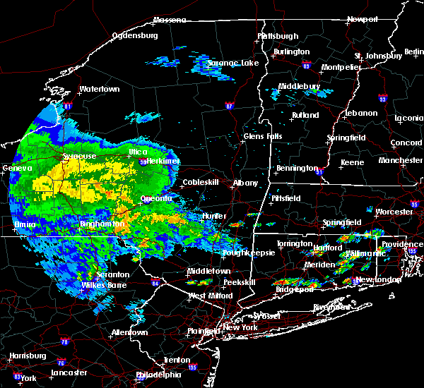 At 139 pm edt, a severe thunderstorm was located over livingston, or near hudson, moving east at 20 mph (radar indicated). Hazards include 60 mph wind gusts and quarter size hail. Minor damage to vehicles is possible. expect wind damage to trees, and power lines. this severe thunderstorm will be near, ancram around 205 pm edt. copake around 215 pm edt. great barrington around 240 pm edt. Other locations impacted by this severe thunderstorm include ancramdale, weed mines, greenport center, burden, churchtown, craryville, newsboy statue, linlithgo mills, alander and martindale. At 139 pm edt, a severe thunderstorm was located over livingston, or near hudson, moving east at 20 mph (radar indicated). Hazards include 60 mph wind gusts and quarter size hail. Minor damage to vehicles is possible. expect wind damage to trees, and power lines. this severe thunderstorm will be near, ancram around 205 pm edt. copake around 215 pm edt. great barrington around 240 pm edt. Other locations impacted by this severe thunderstorm include ancramdale, weed mines, greenport center, burden, churchtown, craryville, newsboy statue, linlithgo mills, alander and martindale.
|
| 7/13/2017 1:33 PM EDT | Trees and wires down on orchard rd in columbia county NY, 5.5 miles N of Hudson, NY |
| 5/31/2017 5:22 PM EDT |
 At 521 pm edt, a severe thunderstorm was located over chatham, moving east at 30 mph (radar indicated). Hazards include 60 mph wind gusts and quarter size hail. Hail damage to vehicles is expected. expect wind damage to roofs, siding, and trees. This severe storm will be near, austerlitz around 535 pm edt. At 521 pm edt, a severe thunderstorm was located over chatham, moving east at 30 mph (radar indicated). Hazards include 60 mph wind gusts and quarter size hail. Hail damage to vehicles is expected. expect wind damage to roofs, siding, and trees. This severe storm will be near, austerlitz around 535 pm edt.
|
| 5/31/2017 4:59 PM EDT |
 At 458 pm edt, a severe thunderstorm was located over coxsackie, or near hudson, moving east at 25 mph (radar indicated). Hazards include 60 mph wind gusts and quarter size hail. Hail damage to vehicles is expected. expect wind damage to roofs, siding, and trees. this severe thunderstorm will be near, lorenz park around 505 pm edt. claverack-red mills around 510 pm edt. philmont around 520 pm edt. chatham around 525 pm edt. Austerlitz around 540 pm edt. At 458 pm edt, a severe thunderstorm was located over coxsackie, or near hudson, moving east at 25 mph (radar indicated). Hazards include 60 mph wind gusts and quarter size hail. Hail damage to vehicles is expected. expect wind damage to roofs, siding, and trees. this severe thunderstorm will be near, lorenz park around 505 pm edt. claverack-red mills around 510 pm edt. philmont around 520 pm edt. chatham around 525 pm edt. Austerlitz around 540 pm edt.
|
| 5/18/2017 8:33 PM EDT |
 At 833 pm edt, severe thunderstorms were located along a line extending from near westerlo to 6 miles southeast of preston hollow to near windham, moving east at 50 mph (radar indicated). Hazards include 60 mph wind gusts and quarter size hail. Hail damage to vehicles is expected. expect wind damage to roofs, siding, and trees. severe thunderstorms will be near, new baltimore, ravena and selkirk around 845 pm edt. coxsackie and castleton-on-hudson around 850 pm edt. catskill and nassau around 855 pm edt. hudson, valatie, athens, kinderhook and lorenz park around 900 pm edt. chatham, claverack and claverack-red mills around 905 pm edt. new lebanon and philmont around 910 pm edt. pittsfield and austerlitz around 915 pm edt. Other locations impacted by these severe thunderstorms include van hoesen station, burden, dormansville, rossman, rayville, otter hook, riders mills, north hillsdale, kiskatom and sunside. At 833 pm edt, severe thunderstorms were located along a line extending from near westerlo to 6 miles southeast of preston hollow to near windham, moving east at 50 mph (radar indicated). Hazards include 60 mph wind gusts and quarter size hail. Hail damage to vehicles is expected. expect wind damage to roofs, siding, and trees. severe thunderstorms will be near, new baltimore, ravena and selkirk around 845 pm edt. coxsackie and castleton-on-hudson around 850 pm edt. catskill and nassau around 855 pm edt. hudson, valatie, athens, kinderhook and lorenz park around 900 pm edt. chatham, claverack and claverack-red mills around 905 pm edt. new lebanon and philmont around 910 pm edt. pittsfield and austerlitz around 915 pm edt. Other locations impacted by these severe thunderstorms include van hoesen station, burden, dormansville, rossman, rayville, otter hook, riders mills, north hillsdale, kiskatom and sunside.
|
| 5/1/2017 9:25 PM EDT |
 At 925 pm edt, severe thunderstorms were located along a line extending from near galway to duanesburg to near windham to hortonville, moving east at 65 mph (radar indicated). Hazards include 70 mph wind gusts. Expect considerable tree damage. Damage is likely to mobile homes, roofs, and outbuildings. At 925 pm edt, severe thunderstorms were located along a line extending from near galway to duanesburg to near windham to hortonville, moving east at 65 mph (radar indicated). Hazards include 70 mph wind gusts. Expect considerable tree damage. Damage is likely to mobile homes, roofs, and outbuildings.
|
| 3/8/2017 2:41 PM EST |
 The severe thunderstorm warning for eastern schenectady. columbia. albany. eastern greene. saratoga. southern washington and rensselaer counties will expire at 245 pm est. the storms which prompted the warning have moved out of the warned area. Therefore, the warning will be allowed to expire. The severe thunderstorm warning for eastern schenectady. columbia. albany. eastern greene. saratoga. southern washington and rensselaer counties will expire at 245 pm est. the storms which prompted the warning have moved out of the warned area. Therefore, the warning will be allowed to expire.
|
| 3/8/2017 2:11 PM EST |
 At 211 pm est, severe thunderstorms were located along a line extending from near fort edward to catskill, moving east at 50 mph (radar indicated). Hazards include 60 mph wind gusts. Expect damage to roofs, siding, and trees. these severe storms will be near, fort edward around 215 pm est. philmont around 225 pm est. chatham and salem around 230 pm est. Austerlitz around 235 pm est. At 211 pm est, severe thunderstorms were located along a line extending from near fort edward to catskill, moving east at 50 mph (radar indicated). Hazards include 60 mph wind gusts. Expect damage to roofs, siding, and trees. these severe storms will be near, fort edward around 215 pm est. philmont around 225 pm est. chatham and salem around 230 pm est. Austerlitz around 235 pm est.
|
| 3/8/2017 1:45 PM EST |
 At 145 pm est, severe thunderstorms were located along a line extending from edinburg to near hunter, moving east at 55 mph (radar indicated). Hazards include 60 mph wind gusts. Expect damage to roofs, siding, and trees. severe thunderstorms will be near, corinth around 200 pm est. saratoga springs and catskill around 205 pm est. hudson, claverack, livingston, athens, claverack-red mills and lorenz park around 210 pm est. fort edward and philmont around 215 pm est. austerlitz around 225 pm est. salem around 230 pm est. Other locations impacted by these severe thunderstorms include deans corners, charleston, bleecker stadium, glenridge, hoffmans, west berne, huntersland, wayville, broome center and wiley corners. At 145 pm est, severe thunderstorms were located along a line extending from edinburg to near hunter, moving east at 55 mph (radar indicated). Hazards include 60 mph wind gusts. Expect damage to roofs, siding, and trees. severe thunderstorms will be near, corinth around 200 pm est. saratoga springs and catskill around 205 pm est. hudson, claverack, livingston, athens, claverack-red mills and lorenz park around 210 pm est. fort edward and philmont around 215 pm est. austerlitz around 225 pm est. salem around 230 pm est. Other locations impacted by these severe thunderstorms include deans corners, charleston, bleecker stadium, glenridge, hoffmans, west berne, huntersland, wayville, broome center and wiley corners.
|
| 2/25/2017 6:08 PM EST |
 At 608 pm est, a severe thunderstorm was located over nassau, moving northeast at 55 mph (radar indicated). Hazards include 60 mph wind gusts. Expect damage to roofs, siding, and trees. this severe thunderstorm will be near, stephentown and averill park around 620 pm est. hancock around 625 pm est. new ashford around 630 pm est. north adams, adams and williamstown around 640 pm est. Other locations impacted by this severe thunderstorm include brookview, norrie heights, van hoesen station, katsbaan, north hancock, cheshire harbor, burden, linden acres, salisbury and otter hook. At 608 pm est, a severe thunderstorm was located over nassau, moving northeast at 55 mph (radar indicated). Hazards include 60 mph wind gusts. Expect damage to roofs, siding, and trees. this severe thunderstorm will be near, stephentown and averill park around 620 pm est. hancock around 625 pm est. new ashford around 630 pm est. north adams, adams and williamstown around 640 pm est. Other locations impacted by this severe thunderstorm include brookview, norrie heights, van hoesen station, katsbaan, north hancock, cheshire harbor, burden, linden acres, salisbury and otter hook.
|
| 9/11/2016 8:00 AM EDT | 6 trees down in columbia county NY, 3.3 miles WSW of Hudson, NY |
| 9/11/2016 7:53 AM EDT |
 At 752 am edt, severe thunderstorms were located along a line extending from near nassau to near philmont to near stanfordville, moving east at 35 mph (radar indicated). Hazards include 60 mph wind gusts. Expect damage to roofs. siding. and trees. these severe storms will be near, copake around 800 am edt. great barrington, new lebanon and housatonic around 810 am edt. sheffield around 820 am edt. pittsfield and lenox around 825 am edt. lee around 830 am edt. Other locations impacted by these severe thunderstorms include east chatham, riders, elizaville, lenox house country shops, braeside, berkshire heights, lanesborough, new lebanon center, copake falls and east hillsdale. At 752 am edt, severe thunderstorms were located along a line extending from near nassau to near philmont to near stanfordville, moving east at 35 mph (radar indicated). Hazards include 60 mph wind gusts. Expect damage to roofs. siding. and trees. these severe storms will be near, copake around 800 am edt. great barrington, new lebanon and housatonic around 810 am edt. sheffield around 820 am edt. pittsfield and lenox around 825 am edt. lee around 830 am edt. Other locations impacted by these severe thunderstorms include east chatham, riders, elizaville, lenox house country shops, braeside, berkshire heights, lanesborough, new lebanon center, copake falls and east hillsdale.
|
| 9/11/2016 7:26 AM EDT |
 At 726 am edt, severe thunderstorms were located along a line extending from near selkirk to near athens to lake katrine, moving east at 35 mph (radar indicated). Hazards include 60 mph wind gusts. Expect damage to roofs. siding. and trees. severe thunderstorms will be near, athens around 730 am edt. east greenbush, hudson, red hook and lorenz park around 735 am edt. claverack and claverack-red mills around 740 am edt. nassau, valatie, philmont and kinderhook around 745 am edt. pine plains around 755 am edt. copake and stephentown around 800 am edt. great barrington, new lebanon and housatonic around 810 am edt. lenox and sheffield around 820 am edt. Other locations impacted by these severe thunderstorms include cheviot, elizaville, lenox house country shops, fitchs wharf, dunham hollow, mount ross, mellenville, callanans corners, mahkeenac heights and ancramdale. At 726 am edt, severe thunderstorms were located along a line extending from near selkirk to near athens to lake katrine, moving east at 35 mph (radar indicated). Hazards include 60 mph wind gusts. Expect damage to roofs. siding. and trees. severe thunderstorms will be near, athens around 730 am edt. east greenbush, hudson, red hook and lorenz park around 735 am edt. claverack and claverack-red mills around 740 am edt. nassau, valatie, philmont and kinderhook around 745 am edt. pine plains around 755 am edt. copake and stephentown around 800 am edt. great barrington, new lebanon and housatonic around 810 am edt. lenox and sheffield around 820 am edt. Other locations impacted by these severe thunderstorms include cheviot, elizaville, lenox house country shops, fitchs wharf, dunham hollow, mount ross, mellenville, callanans corners, mahkeenac heights and ancramdale.
|
| 8/13/2016 8:25 PM EDT | Trees and wires down on yates road in columbia county NY, 4.2 miles NNW of Hudson, NY |
| 8/13/2016 8:16 PM EDT |
 At 816 pm edt, severe thunderstorms were located along a line extending from catskill to tillson, moving east at 50 mph (radar indicated). Hazards include 60 mph wind gusts and quarter size hail. Hail damage to vehicles is expected. expect wind damage to roofs, siding, and trees. these severe storms will be near, hudson, catskill, livingston, athens and lorenz park around 820 pm edt. claverack and claverack-red mills around 825 pm edt. red hook around 830 pm edt. Other locations impacted by these severe thunderstorms include pataukunk, cheviot, lakes mills bridge, halihan hill, elizaville, blue mountain, hillside, fitchs wharf, netherwood and rosendale. At 816 pm edt, severe thunderstorms were located along a line extending from catskill to tillson, moving east at 50 mph (radar indicated). Hazards include 60 mph wind gusts and quarter size hail. Hail damage to vehicles is expected. expect wind damage to roofs, siding, and trees. these severe storms will be near, hudson, catskill, livingston, athens and lorenz park around 820 pm edt. claverack and claverack-red mills around 825 pm edt. red hook around 830 pm edt. Other locations impacted by these severe thunderstorms include pataukunk, cheviot, lakes mills bridge, halihan hill, elizaville, blue mountain, hillside, fitchs wharf, netherwood and rosendale.
|
| 8/13/2016 7:48 PM EDT |
 At 748 pm edt, severe thunderstorms were located along a line extending from near lanesville to near woodridge, moving east at 25 mph (radar indicated). Hazards include 60 mph wind gusts and quarter size hail. Hail damage to vehicles is expected. expect wind damage to roofs, siding, and trees. severe thunderstorms will be near, woodstock, lanesville, west hurley and kenneth l wilson campground around 755 pm edt. north- south lake campground around 805 pm edt. saugerties and kerhonkson around 815 pm edt. saugerties south around 820 pm edt. clermont around 830 pm edt. catskill around 835 pm edt. hudson, livingston and athens around 840 pm edt. new paltz, hyde park, claverack, high falls, claverack-red mills, tillson and lorenz park around 845 pm edt. Other locations impacted by these severe thunderstorms include maplecrest, pataukunk, edgewood, libertyville, ohioville, chevio t, lakes mills bridge, elizaville, shandaken and hillside. At 748 pm edt, severe thunderstorms were located along a line extending from near lanesville to near woodridge, moving east at 25 mph (radar indicated). Hazards include 60 mph wind gusts and quarter size hail. Hail damage to vehicles is expected. expect wind damage to roofs, siding, and trees. severe thunderstorms will be near, woodstock, lanesville, west hurley and kenneth l wilson campground around 755 pm edt. north- south lake campground around 805 pm edt. saugerties and kerhonkson around 815 pm edt. saugerties south around 820 pm edt. clermont around 830 pm edt. catskill around 835 pm edt. hudson, livingston and athens around 840 pm edt. new paltz, hyde park, claverack, high falls, claverack-red mills, tillson and lorenz park around 845 pm edt. Other locations impacted by these severe thunderstorms include maplecrest, pataukunk, edgewood, libertyville, ohioville, chevio t, lakes mills bridge, elizaville, shandaken and hillside.
|
| 8/12/2016 4:07 PM EDT |
 At 405 pm edt, severe thunderstorms were located along a line extending from delmar to near westerlo, moving southeast at 35 mph (radar indicated). Hazards include 60 mph wind gusts. Expect damage to roofs. siding. and trees. Locations impacted include, albany, east greenbush, rensselaer, colonie, hudson, nassau, delmar, guilderland, menands, new baltimore, westerlo, ravena, stephentown, coxsackie, voorheesville, valatie, altamont, athens, castleton-on-hudson and kinderhook. At 405 pm edt, severe thunderstorms were located along a line extending from delmar to near westerlo, moving southeast at 35 mph (radar indicated). Hazards include 60 mph wind gusts. Expect damage to roofs. siding. and trees. Locations impacted include, albany, east greenbush, rensselaer, colonie, hudson, nassau, delmar, guilderland, menands, new baltimore, westerlo, ravena, stephentown, coxsackie, voorheesville, valatie, altamont, athens, castleton-on-hudson and kinderhook.
|
| 8/12/2016 3:26 PM EDT |
 At 325 pm edt, severe thunderstorms were located along a line extending from 6 miles northwest of delanson to near cobleskill, moving southeast at 35 mph (radar indicated). Hazards include 60 mph wind gusts. Expect damage to roofs. siding. And trees. At 325 pm edt, severe thunderstorms were located along a line extending from 6 miles northwest of delanson to near cobleskill, moving southeast at 35 mph (radar indicated). Hazards include 60 mph wind gusts. Expect damage to roofs. siding. And trees.
|
| 7/25/2016 2:17 PM EDT |
 At 217 pm edt, severe thunderstorms were located along a line extending from near claverack to dover plains to near beacon, moving east at 45 mph (radar indicated). Hazards include 60 mph wind gusts and quarter size hail. Hail damage to vehicles is expected. Expect wind damage to roofs, siding, and trees. At 217 pm edt, severe thunderstorms were located along a line extending from near claverack to dover plains to near beacon, moving east at 45 mph (radar indicated). Hazards include 60 mph wind gusts and quarter size hail. Hail damage to vehicles is expected. Expect wind damage to roofs, siding, and trees.
|
| 2/24/2016 11:47 PM EST |
 At 1146 pm est, severe thunderstorms were located along a line extending from near claverack-red mills to near pawling, moving northeast at 60 mph (radar indicated). Hazards include 60 mph wind gusts. Expect damage to roofs. siding and trees. these severe storms will be near, claverack, philmont, claverack-red mills and lorenz park around 1150 pm est. dover plains around 1155 pm est. new milford, kent and new preston around 1200 am est. Other locations impacted by these severe thunderstorms include dean corners, konkapot, arthursburg, the cedars, elizaville, sharon valley, birch groves, minortown, macdonnell heights and netherwood. At 1146 pm est, severe thunderstorms were located along a line extending from near claverack-red mills to near pawling, moving northeast at 60 mph (radar indicated). Hazards include 60 mph wind gusts. Expect damage to roofs. siding and trees. these severe storms will be near, claverack, philmont, claverack-red mills and lorenz park around 1150 pm est. dover plains around 1155 pm est. new milford, kent and new preston around 1200 am est. Other locations impacted by these severe thunderstorms include dean corners, konkapot, arthursburg, the cedars, elizaville, sharon valley, birch groves, minortown, macdonnell heights and netherwood.
|
| 2/24/2016 11:22 PM EST |
 At 1121 pm est, severe thunderstorms were located along a line extending from near saugerties to near fahnestock state park, moving northeast at 70 mph (radar indicated). Hazards include 60 mph wind gusts. Expect damage to roofs. siding and trees. severe thunderstorms will be near, saugerties, woodstock, saugerties south and lake katrine around 1125 pm est. clermont, hopewell junction and myers corner around 1130 pm est. hudson, catskill, pawling and livingston around 1135 pm est. claverack, athens, philmont, wingdale, claverack-red mills and lorenz park around 1140 pm est. new milford, sherman, kent, gaylordsville and dover plains around 1145 pm est. new preston around 1150 pm est. cornwall bridge around 1155 pm est. litchfield around 1200 am est. Other locations impacted by these severe thunderstorms include ohioville, arthursburg, the cedars, sharon valley, birch groves, macdonnell heights, east cornwall, mount ross, east kingston and kelly corner. At 1121 pm est, severe thunderstorms were located along a line extending from near saugerties to near fahnestock state park, moving northeast at 70 mph (radar indicated). Hazards include 60 mph wind gusts. Expect damage to roofs. siding and trees. severe thunderstorms will be near, saugerties, woodstock, saugerties south and lake katrine around 1125 pm est. clermont, hopewell junction and myers corner around 1130 pm est. hudson, catskill, pawling and livingston around 1135 pm est. claverack, athens, philmont, wingdale, claverack-red mills and lorenz park around 1140 pm est. new milford, sherman, kent, gaylordsville and dover plains around 1145 pm est. new preston around 1150 pm est. cornwall bridge around 1155 pm est. litchfield around 1200 am est. Other locations impacted by these severe thunderstorms include ohioville, arthursburg, the cedars, sharon valley, birch groves, macdonnell heights, east cornwall, mount ross, east kingston and kelly corner.
|
| 8/15/2015 6:21 PM EDT |
 The severe thunderstorm warning for southwestern columbia county will expire at 630 pm edt, the storm which prompted the warning has weakened below severe limits and exited the warned area. therefore the warning will be allowed to expire. The severe thunderstorm warning for southwestern columbia county will expire at 630 pm edt, the storm which prompted the warning has weakened below severe limits and exited the warned area. therefore the warning will be allowed to expire.
|
| 8/15/2015 6:02 PM EDT |
 At 602 pm edt, a severe thunderstorm was located near claverack, or near hudson, moving east at 20 mph (radar indicated). Hazards include 60 mph wind gusts and quarter size hail. Hail damage to vehicles is expected. expect wind damage to roofs, siding and trees. this severe storm will be near, copake around 625 pm edt. Other locations impacted by this severe thunderstorm include hollowville, west taghkanic, craryville, linlithgo mills, new forge, hillsdale, east taghkanic, linlithgo, churchtown and upper hollowville. At 602 pm edt, a severe thunderstorm was located near claverack, or near hudson, moving east at 20 mph (radar indicated). Hazards include 60 mph wind gusts and quarter size hail. Hail damage to vehicles is expected. expect wind damage to roofs, siding and trees. this severe storm will be near, copake around 625 pm edt. Other locations impacted by this severe thunderstorm include hollowville, west taghkanic, craryville, linlithgo mills, new forge, hillsdale, east taghkanic, linlithgo, churchtown and upper hollowville.
|
| 8/15/2015 5:47 PM EDT |
 At 546 pm edt, a severe thunderstorm was located over chatham, moving east at 25 mph (radar indicated). Hazards include 60 mph wind gusts and quarter size hail. Hail damage to vehicles is expected. expect wind damage to roofs, siding and trees. this severe storm will be near, chatham around 550 pm edt. Other locations impacted by this severe thunderstorm include columbiaville, east chatham, stockport, roberts hill, limestreet, brick tavern, fitchs wharf, otter hook, mellenville and new concord. At 546 pm edt, a severe thunderstorm was located over chatham, moving east at 25 mph (radar indicated). Hazards include 60 mph wind gusts and quarter size hail. Hail damage to vehicles is expected. expect wind damage to roofs, siding and trees. this severe storm will be near, chatham around 550 pm edt. Other locations impacted by this severe thunderstorm include columbiaville, east chatham, stockport, roberts hill, limestreet, brick tavern, fitchs wharf, otter hook, mellenville and new concord.
|
| 8/15/2015 5:39 PM EDT |
 At 539 pm edt, a severe thunderstorm was located over catskill, moving east at 20 mph (radar indicated). Hazards include 60 mph wind gusts and quarter size hail. Hail damage to vehicles is expected. expect wind damage to roofs, siding and trees. this severe thunderstorm will be near, clermont and athens around 545 pm edt. hudson around 550 pm edt. livingston and claverack-red mills around 555 pm edt. claverack around 600 pm edt. copake around 625 pm edt. Other locations impacted by this severe thunderstorm include cauterskill, hollowville, smith landing, cheviot, oak hill landing, new forge, alsen, kiskatom, east taghkanic and martindale. At 539 pm edt, a severe thunderstorm was located over catskill, moving east at 20 mph (radar indicated). Hazards include 60 mph wind gusts and quarter size hail. Hail damage to vehicles is expected. expect wind damage to roofs, siding and trees. this severe thunderstorm will be near, clermont and athens around 545 pm edt. hudson around 550 pm edt. livingston and claverack-red mills around 555 pm edt. claverack around 600 pm edt. copake around 625 pm edt. Other locations impacted by this severe thunderstorm include cauterskill, hollowville, smith landing, cheviot, oak hill landing, new forge, alsen, kiskatom, east taghkanic and martindale.
|
| 8/15/2015 5:01 PM EDT |
 At 501 pm edt, a severe thunderstorm was located 9 miles west of coxsackie, or 12 miles northwest of catskill, moving east at 25 mph (radar indicated). Hazards include 60 mph wind gusts and quarter size hail. Hail damage to vehicles is expected. expect wind damage to roofs, siding and trees. this severe thunderstorm will be near, coxsackie around 525 pm edt. hudson, athens and lorenz park around 530 pm edt. claverack-red mills around 535 pm edt. valatie and kinderhook around 540 pm edt. philmont around 545 pm edt. chatham around 550 pm edt. Other locations impacted by this severe thunderstorm include east chatham, lakes mills bridge, stockport, roberts hill, fitchs wharf, mellenville, rossman, south cairo, east greenville and niverville. At 501 pm edt, a severe thunderstorm was located 9 miles west of coxsackie, or 12 miles northwest of catskill, moving east at 25 mph (radar indicated). Hazards include 60 mph wind gusts and quarter size hail. Hail damage to vehicles is expected. expect wind damage to roofs, siding and trees. this severe thunderstorm will be near, coxsackie around 525 pm edt. hudson, athens and lorenz park around 530 pm edt. claverack-red mills around 535 pm edt. valatie and kinderhook around 540 pm edt. philmont around 545 pm edt. chatham around 550 pm edt. Other locations impacted by this severe thunderstorm include east chatham, lakes mills bridge, stockport, roberts hill, fitchs wharf, mellenville, rossman, south cairo, east greenville and niverville.
|
| 6/23/2015 4:11 PM EDT |
 At 410 pm edt, a severe thunderstorm was located near philmont, or 9 miles west of great barrington, moving northeast at 45 mph (radar indicated). Hazards include 60 mph wind gusts and quarter size hail. Hail damage to vehicles is expected. expect wind damage to roofs, siding and trees. this severe thunderstorm will be near, great barrington, austerlitz and housatonic around 420 pm edt. lenox around 430 pm edt. lee around 435 pm edt. becket around 445 pm edt. chester and middlefield around 450 pm edt. cummington and plainfield around 500 pm edt. Other locations impacted by this severe thunderstorm include hollowville, lenox house country shops, berkshire heights, williamsville, copake falls, east hillsdale, mellenville, mahkeenac heights, east lee and mahkeenac terrace. At 410 pm edt, a severe thunderstorm was located near philmont, or 9 miles west of great barrington, moving northeast at 45 mph (radar indicated). Hazards include 60 mph wind gusts and quarter size hail. Hail damage to vehicles is expected. expect wind damage to roofs, siding and trees. this severe thunderstorm will be near, great barrington, austerlitz and housatonic around 420 pm edt. lenox around 430 pm edt. lee around 435 pm edt. becket around 445 pm edt. chester and middlefield around 450 pm edt. cummington and plainfield around 500 pm edt. Other locations impacted by this severe thunderstorm include hollowville, lenox house country shops, berkshire heights, williamsville, copake falls, east hillsdale, mellenville, mahkeenac heights, east lee and mahkeenac terrace.
|
| 6/12/2015 9:33 PM EDT |
 At 932 pm edt, severe thunderstorms were located along a line extending from near delmar to near athens to near lanesville, moving east at 45 mph (radar indicated). Hazards include 60 mph wind gusts and penny size hail. Expect damage to roofs. siding and trees. these severe storms will be near, rensselaer, catskill, delmar, ravena, coxsackie, castleton-on-hudson and selkirk around 935 pm edt. east greenbush, hudson, athens, lorenz park and claverack-red mills around 940 pm edt. nassau and claverack around 945 pm edt. saugerties, chatham and philmont around 950 pm edt. saugerties south around 955 pm edt. livingston and clermont around 1000 pm edt. other locations impacted by these severe thunderstorms include maplecrest, edgewood, east chatham, riders, cheviot, denault corners, lakes mills bridge, braeside, shandaken and blue mountain. A tornado watch remains in effect until 1100 pm edt for east central new york. At 932 pm edt, severe thunderstorms were located along a line extending from near delmar to near athens to near lanesville, moving east at 45 mph (radar indicated). Hazards include 60 mph wind gusts and penny size hail. Expect damage to roofs. siding and trees. these severe storms will be near, rensselaer, catskill, delmar, ravena, coxsackie, castleton-on-hudson and selkirk around 935 pm edt. east greenbush, hudson, athens, lorenz park and claverack-red mills around 940 pm edt. nassau and claverack around 945 pm edt. saugerties, chatham and philmont around 950 pm edt. saugerties south around 955 pm edt. livingston and clermont around 1000 pm edt. other locations impacted by these severe thunderstorms include maplecrest, edgewood, east chatham, riders, cheviot, denault corners, lakes mills bridge, braeside, shandaken and blue mountain. A tornado watch remains in effect until 1100 pm edt for east central new york.
|
| 6/12/2015 8:56 PM EDT |
 At 856 pm edt, severe thunderstorms were located along a line extending from schoharie to near gilboa to near arkville, moving east at 40 mph (radar indicated). Hazards include 60 mph wind gusts and penny size hail. Expect damage to roofs. siding and trees. severe thunderstorms will be near, middleburgh around 900 pm edt. berne, windham, preston hollow and preston-potter hollow around 910 pm edt. westerlo around 920 pm edt. voorheesville and lanesville around 925 pm edt. hunter and feura bush around 930 pm edt. delmar, ravena and selkirk around 935 pm edt. rensselaer, woodstock, coxsackie, castleton-on-hudson and north-south lake campground around 940 pm edt. east greenbush, hudson, catskill and athens around 945 pm edt. other locations impacted by these severe thunderstorms include maplecrest, south westerlo, edgewood, cheviot, denault corners, lakes mills bridge, oak hill, shandaken, huntersland and fitchs wharf. A tornado watch remains in effect until 1100 pm edt for east central new york. At 856 pm edt, severe thunderstorms were located along a line extending from schoharie to near gilboa to near arkville, moving east at 40 mph (radar indicated). Hazards include 60 mph wind gusts and penny size hail. Expect damage to roofs. siding and trees. severe thunderstorms will be near, middleburgh around 900 pm edt. berne, windham, preston hollow and preston-potter hollow around 910 pm edt. westerlo around 920 pm edt. voorheesville and lanesville around 925 pm edt. hunter and feura bush around 930 pm edt. delmar, ravena and selkirk around 935 pm edt. rensselaer, woodstock, coxsackie, castleton-on-hudson and north-south lake campground around 940 pm edt. east greenbush, hudson, catskill and athens around 945 pm edt. other locations impacted by these severe thunderstorms include maplecrest, south westerlo, edgewood, cheviot, denault corners, lakes mills bridge, oak hill, shandaken, huntersland and fitchs wharf. A tornado watch remains in effect until 1100 pm edt for east central new york.
|
| 5/27/2015 5:22 PM EDT | Tree down on wires in columbia county NY, 0.6 miles E of Hudson, NY |
| 6/18/2014 1:15 AM EDT | Trees and wires dow in columbia county NY, 1.2 miles NW of Hudson, NY |
| 6/18/2014 1:15 AM EDT | Trees and wires dow in columbia county NY, 0.6 miles E of Hudson, NY |
| 10/7/2013 3:17 PM EDT | Trees and wires down on fingar r in columbia county NY, 1.2 miles NW of Hudson, NY |
| 5/29/2013 8:10 PM EDT | Multiple trees dow in columbia county NY, 1.2 miles NW of Hudson, NY |
| 5/29/2013 8:10 PM EDT | Partial collapse of building and multiple trees dow in columbia county NY, 0.6 miles E of Hudson, NY |
| 5/29/2013 8:05 PM EDT | Trees and wires down in columbia county NY, 1.2 miles NW of Hudson, NY |
| 6/22/2012 2:45 PM EDT | Golf Ball sized hail reported 1.2 miles NW of Hudson, NY |
| 6/22/2012 2:35 PM EDT | Numerous trees and wires down in columbia county NY, 0.6 miles E of Hudson, NY |
| 1/1/0001 12:00 AM | Ping Pong Ball sized hail reported 0.6 miles E of Hudson, NY |
| 1/1/0001 12:00 AM | Golf Ball sized hail reported 0.6 miles E of Hudson, NY |
Hail Maps for Hudson, NY
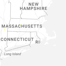
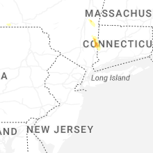
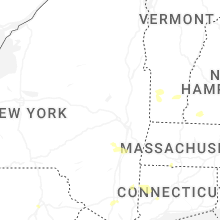

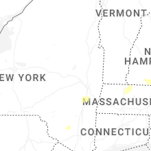


Connect with Interactive Hail Maps