

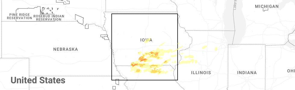
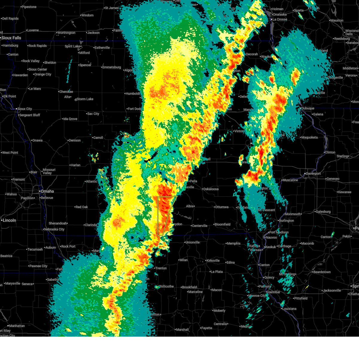
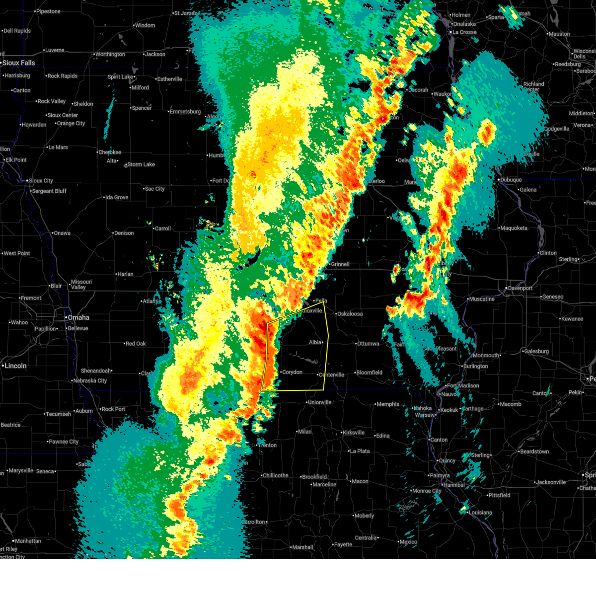
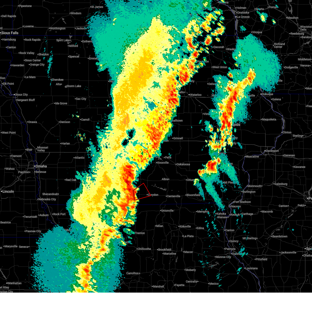
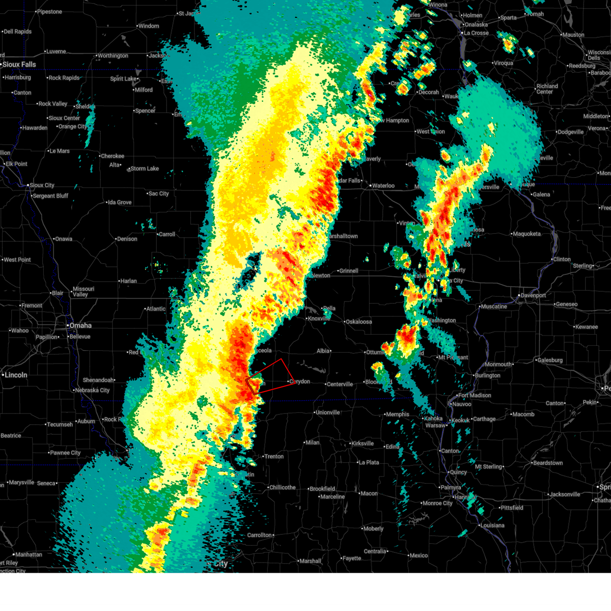
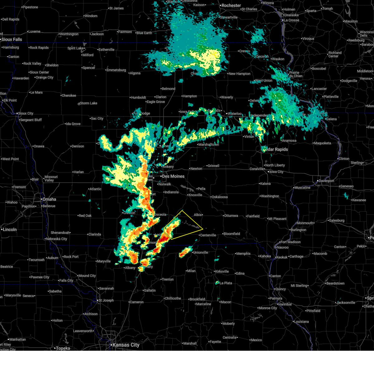
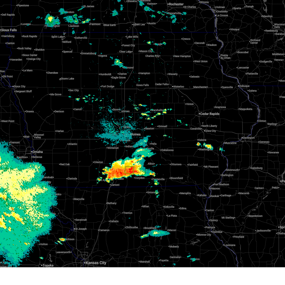
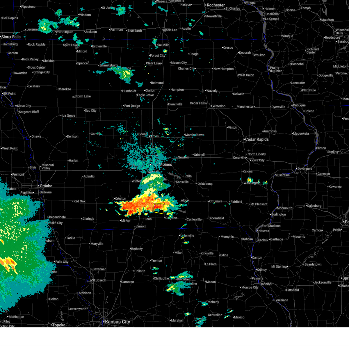
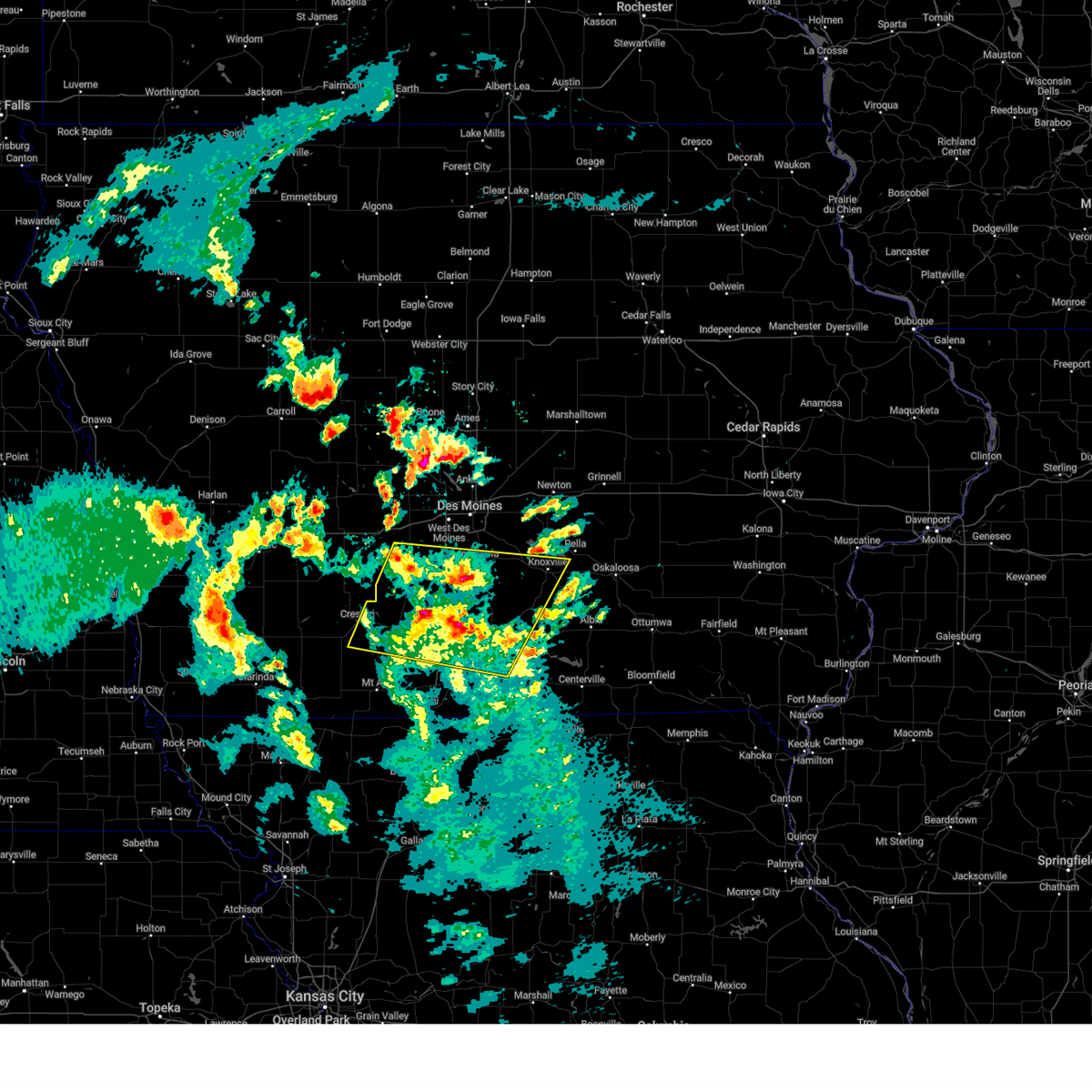
Hail Map for Humeston, IA
The Humeston, IA area has had 7 reports of on-the-ground hail by trained spotters, and has been under severe weather warnings 31 times during the past 12 months. Doppler radar has detected hail at or near Humeston, IA on 70 occasions, including 9 occasions during the past year.
| Name: | Humeston, IA |
| Where Located: | 50.7 miles S of Des Moines, IA |
| Map: | Google Map for Humeston, IA |
| Population: | 494 |
| Housing Units: | 294 |
| More Info: | Search Google for Humeston, IA |
5
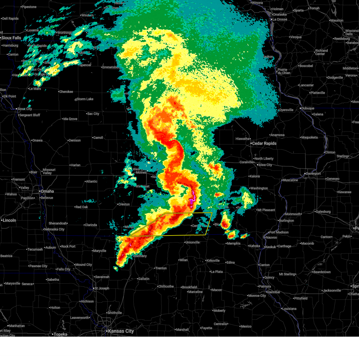
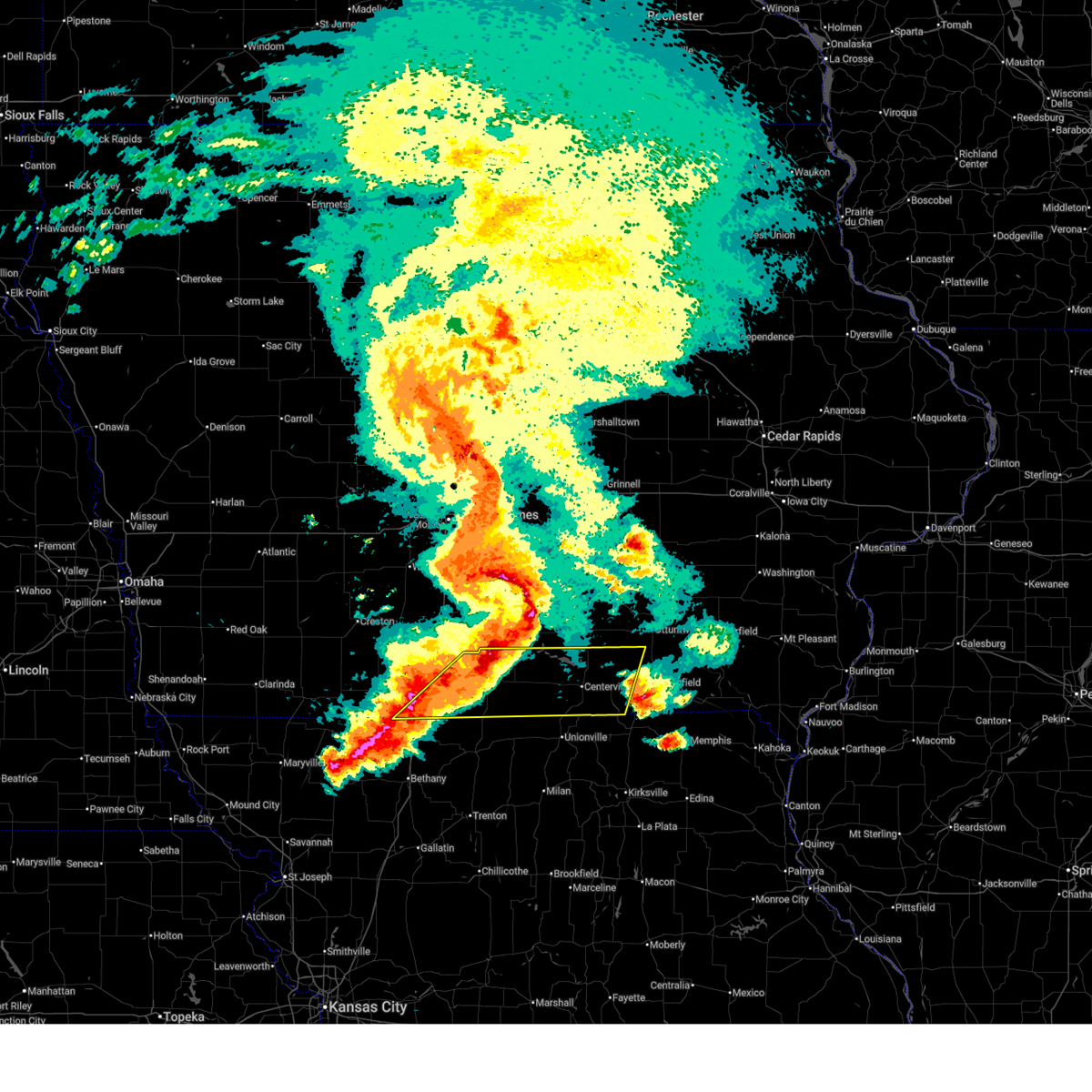
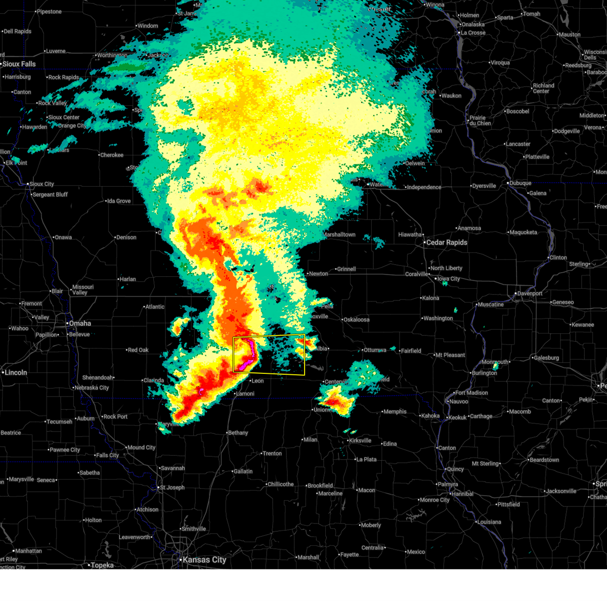
The Top Recent Hail Date for Humeston, IA is Thursday, June 11, 2026 (3rd out of 70)
Hail and Wind Damage Spotted near Humeston, IA
| Date / Time | Report Details |
|---|---|
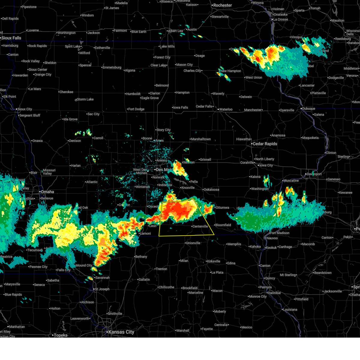
| 6/11/2026 8:05 AM CDT |
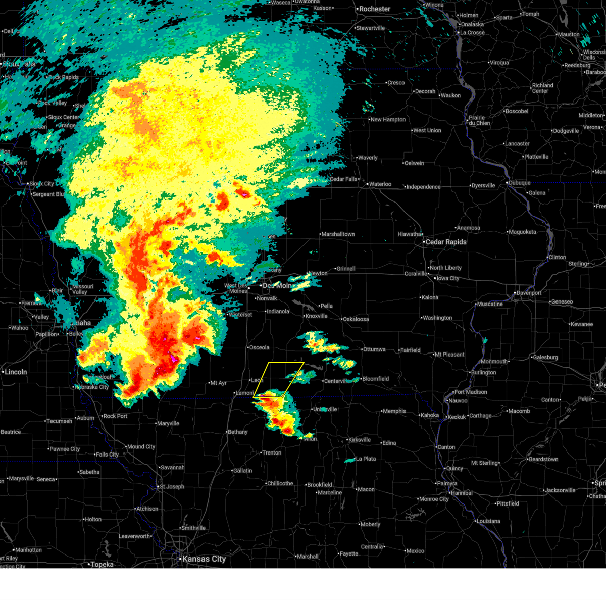
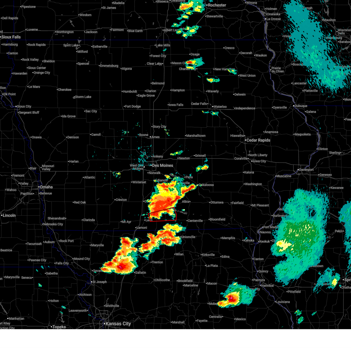
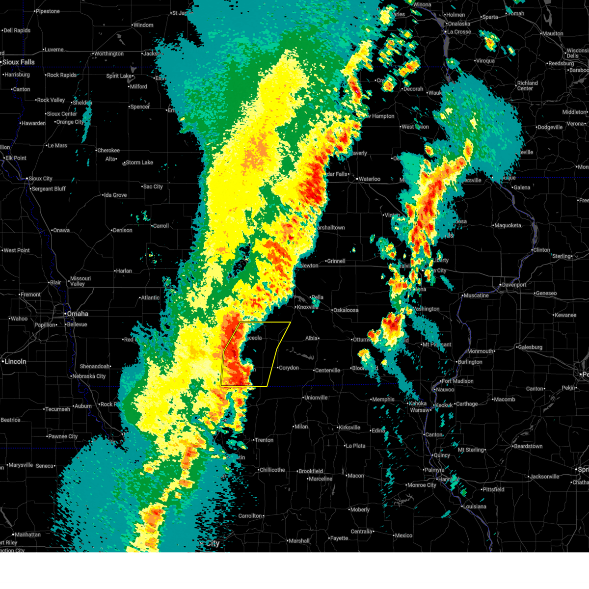
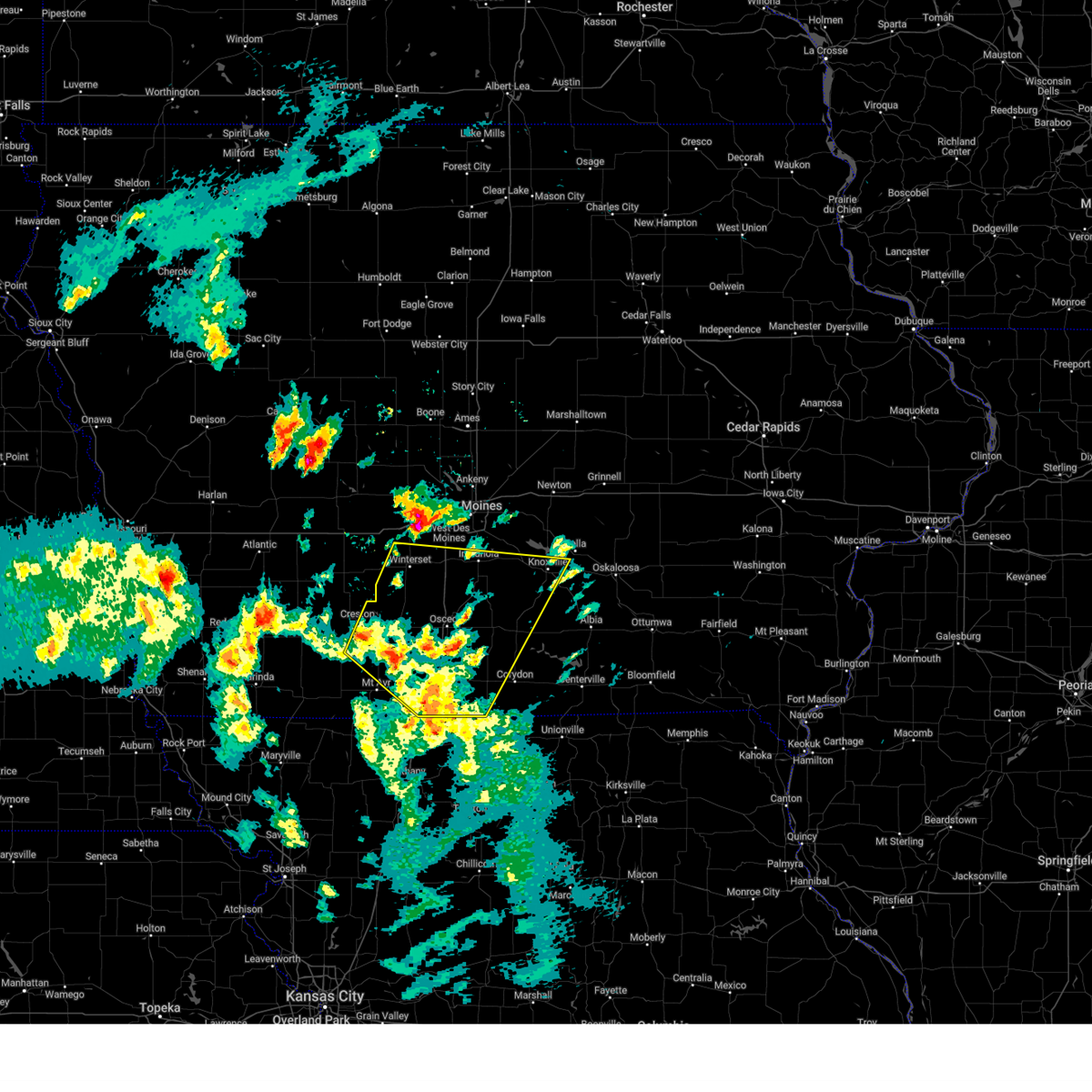
 At 805 am cdt, severe thunderstorms were located along a line extending from 4 miles northwest of moravia to near promise city to near mercer, moving east at 55 mph (radar indicated). Hazards include 60 mph wind gusts and quarter size hail. Hail damage to vehicles is expected. expect wind damage to roofs, siding, and trees. locations impacted include, centerville, leon, corydon, lamoni, lake sundown, rathbun lake, seymour, moravia, moulton, allerton, humeston, mystic, cincinnati, lineville, davis city, exline, promise city, unionville, numa, and rathbun. This includes interstate 35 between mile markers 1 and 10. At 805 am cdt, severe thunderstorms were located along a line extending from 4 miles northwest of moravia to near promise city to near mercer, moving east at 55 mph (radar indicated). Hazards include 60 mph wind gusts and quarter size hail. Hail damage to vehicles is expected. expect wind damage to roofs, siding, and trees. locations impacted include, centerville, leon, corydon, lamoni, lake sundown, rathbun lake, seymour, moravia, moulton, allerton, humeston, mystic, cincinnati, lineville, davis city, exline, promise city, unionville, numa, and rathbun. This includes interstate 35 between mile markers 1 and 10.
|
| 6/11/2026 7:49 AM CDT |
 Svrdmx the national weather service in des moines has issued a * severe thunderstorm warning for, southern lucas county in south central iowa, southern monroe county in south central iowa, decatur county in south central iowa, western davis county in southeastern iowa, southwestern wapello county in southeastern iowa, wayne county in south central iowa, southeastern ringgold county in south central iowa, appanoose county in south central iowa, * until 845 am cdt. * at 748 am cdt, severe thunderstorms were located along a line extending from 6 miles southeast of russell to allerton to 4 miles north of cainsville, moving east at 65 mph (trained weather spotters. the lamoni airport recently gusted to 64 mph). Hazards include 70 mph wind gusts and quarter size hail. Hail damage to vehicles is expected. expect considerable tree damage. Wind damage is also likely to mobile homes, roofs, and outbuildings. Svrdmx the national weather service in des moines has issued a * severe thunderstorm warning for, southern lucas county in south central iowa, southern monroe county in south central iowa, decatur county in south central iowa, western davis county in southeastern iowa, southwestern wapello county in southeastern iowa, wayne county in south central iowa, southeastern ringgold county in south central iowa, appanoose county in south central iowa, * until 845 am cdt. * at 748 am cdt, severe thunderstorms were located along a line extending from 6 miles southeast of russell to allerton to 4 miles north of cainsville, moving east at 65 mph (trained weather spotters. the lamoni airport recently gusted to 64 mph). Hazards include 70 mph wind gusts and quarter size hail. Hail damage to vehicles is expected. expect considerable tree damage. Wind damage is also likely to mobile homes, roofs, and outbuildings.
|
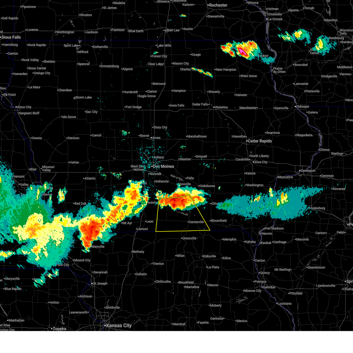
| 6/11/2026 7:15 AM CDT |
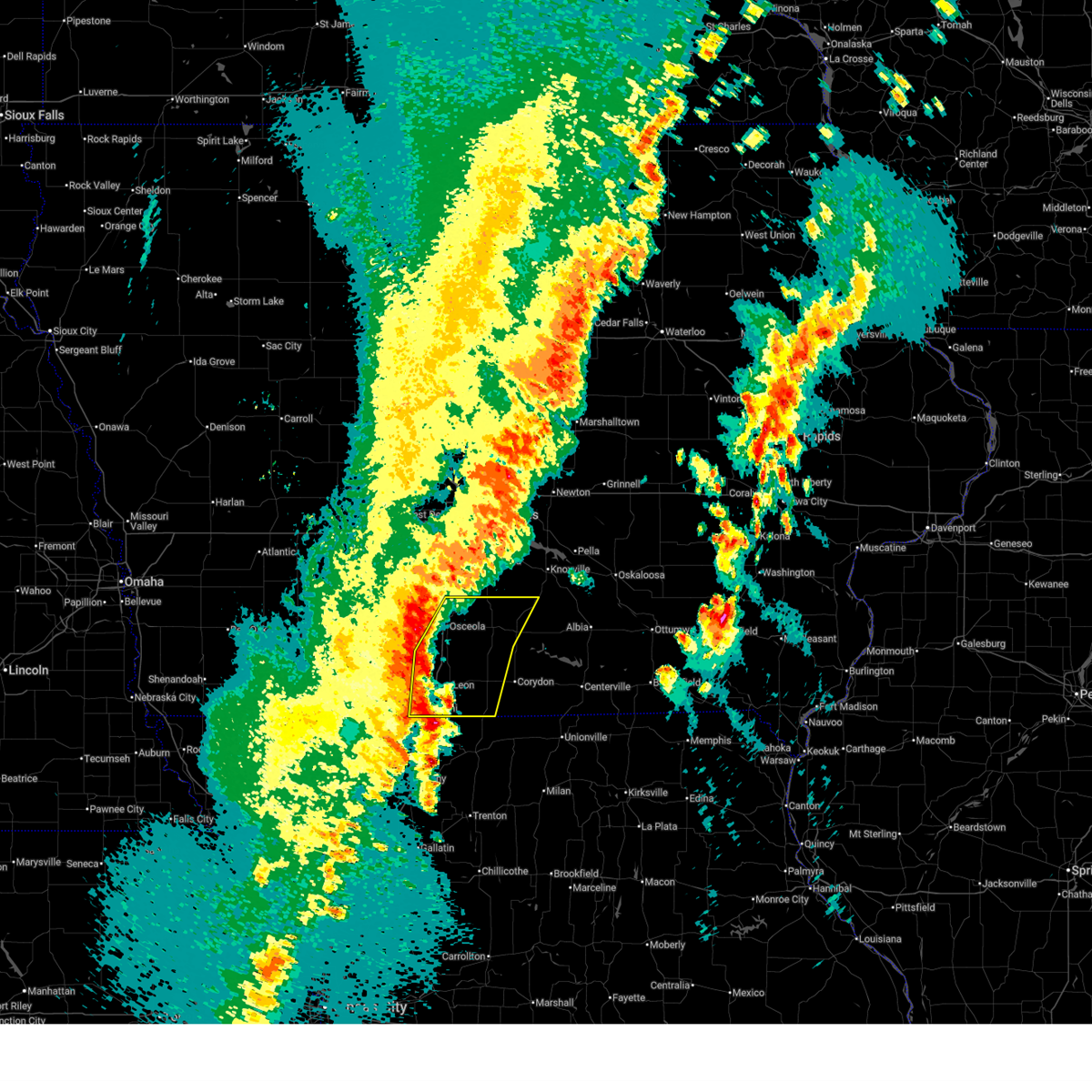
 Svrdmx the national weather service in des moines has issued a * severe thunderstorm warning for, lucas county in south central iowa, northern decatur county in south central iowa, northern wayne county in south central iowa, clarke county in south central iowa, * until 800 am cdt. * at 713 am cdt, a severe thunderstorm was located near osceola, moving east at 55 mph. this is a destructive storm (radar indicated). Hazards include 80 mph wind gusts and quarter size hail. Flying debris will be dangerous to those caught without shelter. mobile homes will be heavily damaged. expect considerable damage to roofs, windows, and vehicles. Extensive tree damage and power outages are likely. Svrdmx the national weather service in des moines has issued a * severe thunderstorm warning for, lucas county in south central iowa, northern decatur county in south central iowa, northern wayne county in south central iowa, clarke county in south central iowa, * until 800 am cdt. * at 713 am cdt, a severe thunderstorm was located near osceola, moving east at 55 mph. this is a destructive storm (radar indicated). Hazards include 80 mph wind gusts and quarter size hail. Flying debris will be dangerous to those caught without shelter. mobile homes will be heavily damaged. expect considerable damage to roofs, windows, and vehicles. Extensive tree damage and power outages are likely.
|
| 6/11/2026 6:29 AM CDT |
 Svrdmx the national weather service in des moines has issued a * severe thunderstorm warning for, southeastern decatur county in south central iowa, wayne county in south central iowa, * until 715 am cdt. * at 628 am cdt, a severe thunderstorm was located near lineville, or 13 miles southeast of leon, moving northeast at 55 mph (radar indicated). Hazards include 60 mph wind gusts and quarter size hail. Hail damage to vehicles is expected. Expect wind damage to roofs, siding, and trees. Svrdmx the national weather service in des moines has issued a * severe thunderstorm warning for, southeastern decatur county in south central iowa, wayne county in south central iowa, * until 715 am cdt. * at 628 am cdt, a severe thunderstorm was located near lineville, or 13 miles southeast of leon, moving northeast at 55 mph (radar indicated). Hazards include 60 mph wind gusts and quarter size hail. Hail damage to vehicles is expected. Expect wind damage to roofs, siding, and trees.
|
| 6/10/2026 4:54 PM CDT |
 At 454 pm cdt, a severe thunderstorm was located over chariton municipal airport, or 5 miles west of chariton, moving east at 35 mph (radar indicated). Hazards include 60 mph wind gusts and quarter size hail. Hail damage to vehicles is expected. expect wind damage to roofs, siding, and trees. Locations impacted include, chariton, lucas, derby, red haw lake state park, and chariton municipal airport. At 454 pm cdt, a severe thunderstorm was located over chariton municipal airport, or 5 miles west of chariton, moving east at 35 mph (radar indicated). Hazards include 60 mph wind gusts and quarter size hail. Hail damage to vehicles is expected. expect wind damage to roofs, siding, and trees. Locations impacted include, chariton, lucas, derby, red haw lake state park, and chariton municipal airport.
|
| 6/10/2026 4:27 PM CDT |
 Svrdmx the national weather service in des moines has issued a * severe thunderstorm warning for, western lucas county in south central iowa, northeastern decatur county in south central iowa, northwestern wayne county in south central iowa, southeastern clarke county in south central iowa, * until 515 pm cdt. * at 426 pm cdt, a severe thunderstorm was located over weldon, or 9 miles south of osceola, moving northeast at 45 mph (radar indicated). Hazards include 60 mph wind gusts and quarter size hail. Hail damage to vehicles is expected. Expect wind damage to roofs, siding, and trees. Svrdmx the national weather service in des moines has issued a * severe thunderstorm warning for, western lucas county in south central iowa, northeastern decatur county in south central iowa, northwestern wayne county in south central iowa, southeastern clarke county in south central iowa, * until 515 pm cdt. * at 426 pm cdt, a severe thunderstorm was located over weldon, or 9 miles south of osceola, moving northeast at 45 mph (radar indicated). Hazards include 60 mph wind gusts and quarter size hail. Hail damage to vehicles is expected. Expect wind damage to roofs, siding, and trees.
|
| 6/10/2026 4:18 PM CDT |
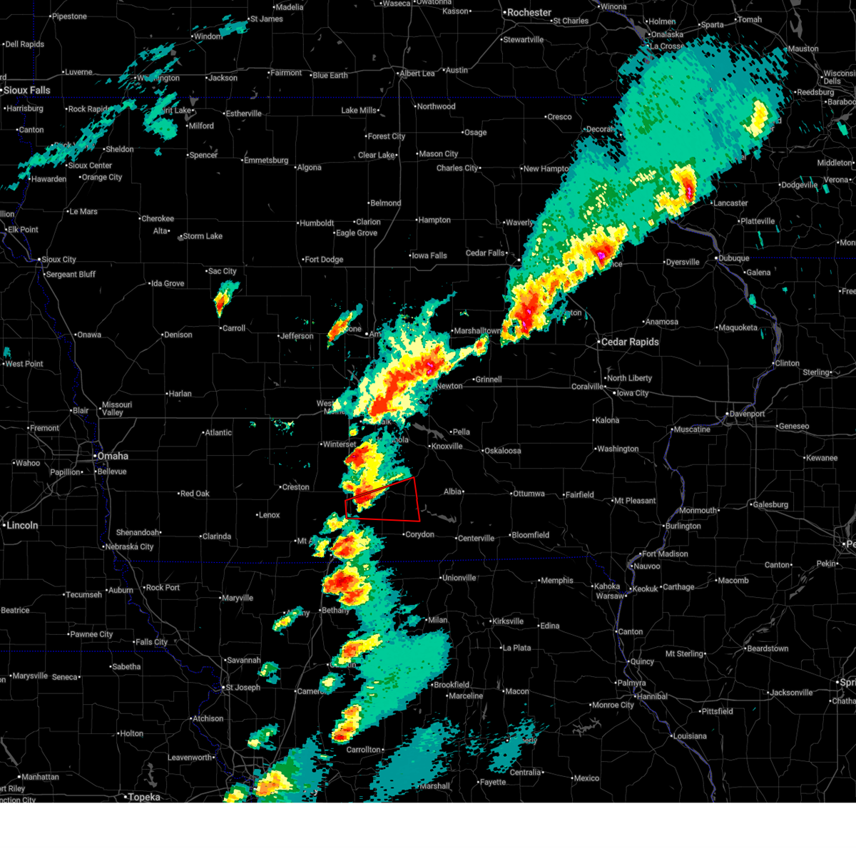
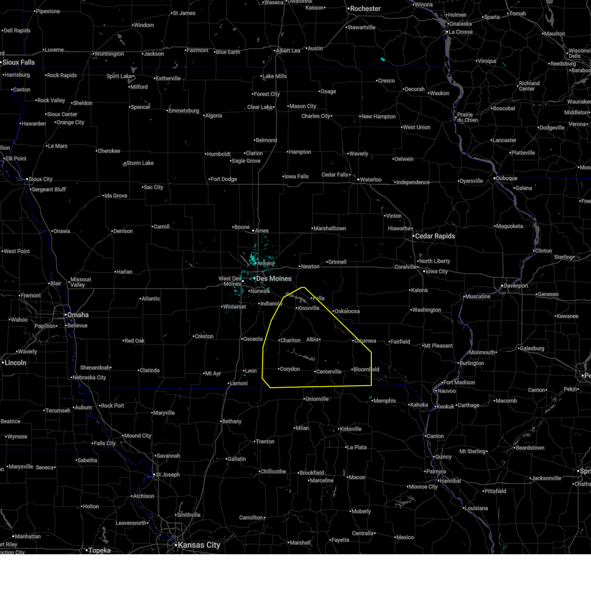
 At 417 pm cdt, a severe thunderstorm capable of producing a tornado was located over millerton, or 6 miles northeast of corydon, moving east at 45 mph (radar indicated rotation). Hazards include tornado and quarter size hail. Flying debris will be dangerous to those caught without shelter. mobile homes will be damaged or destroyed. damage to roofs, windows, and vehicles will occur. tree damage is likely. This tornadic thunderstorm will remain over mainly rural areas of southeastern lucas, east central decatur and northern wayne counties, including the following locations, millerton, garden grove, and humeston. At 417 pm cdt, a severe thunderstorm capable of producing a tornado was located over millerton, or 6 miles northeast of corydon, moving east at 45 mph (radar indicated rotation). Hazards include tornado and quarter size hail. Flying debris will be dangerous to those caught without shelter. mobile homes will be damaged or destroyed. damage to roofs, windows, and vehicles will occur. tree damage is likely. This tornadic thunderstorm will remain over mainly rural areas of southeastern lucas, east central decatur and northern wayne counties, including the following locations, millerton, garden grove, and humeston.
|
| 6/10/2026 3:59 PM CDT |
 At 359 pm cdt, a confirmed tornado was located 5 miles south of humeston, or 10 miles west of corydon, moving east at 40 mph (law enforcement confirmed tornado. fire chief in humeston reported several touchdowns). Hazards include damaging tornado and ping pong ball size hail. Flying debris will be dangerous to those caught without shelter. mobile homes will be damaged or destroyed. damage to roofs, windows, and vehicles will occur. tree damage is likely. this tornado will be near, corydon and millerton around 410 pm cdt. Other locations impacted by this tornadic thunderstorm include millerton, garden grove, promise city, and humeston. At 359 pm cdt, a confirmed tornado was located 5 miles south of humeston, or 10 miles west of corydon, moving east at 40 mph (law enforcement confirmed tornado. fire chief in humeston reported several touchdowns). Hazards include damaging tornado and ping pong ball size hail. Flying debris will be dangerous to those caught without shelter. mobile homes will be damaged or destroyed. damage to roofs, windows, and vehicles will occur. tree damage is likely. this tornado will be near, corydon and millerton around 410 pm cdt. Other locations impacted by this tornadic thunderstorm include millerton, garden grove, promise city, and humeston.
|
| 6/10/2026 3:56 PM CDT |
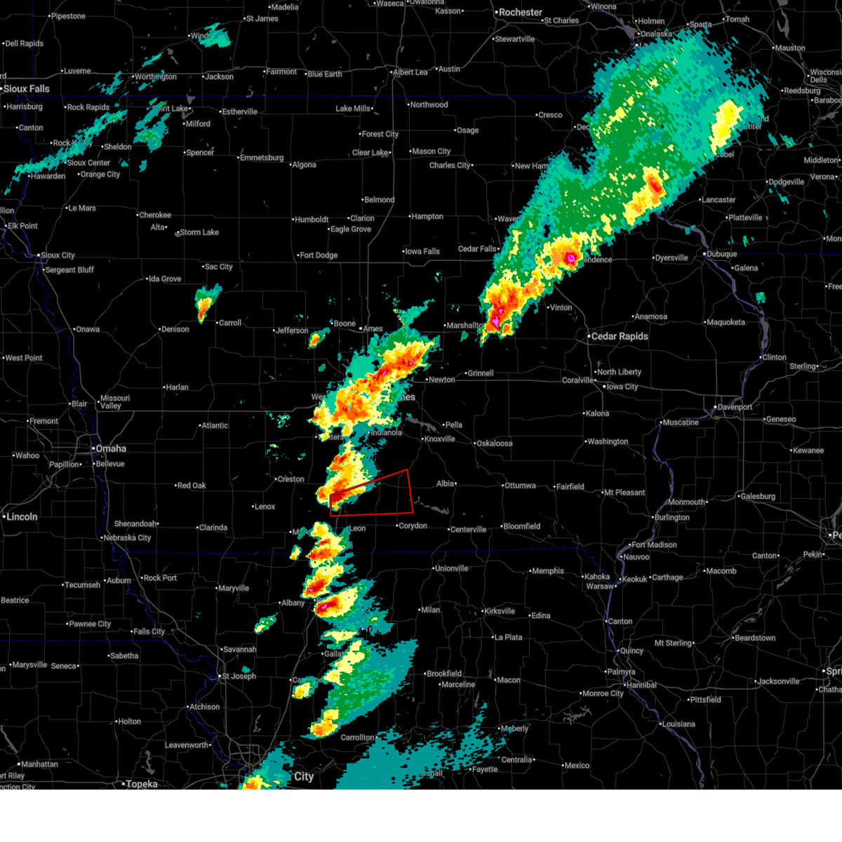
 At 355 pm cdt, a severe thunderstorm capable of producing a tornado was located near garden grove, or 10 miles east of leon, moving east at 35 mph (radar indicated rotation). Hazards include tornado and ping pong ball size hail. Flying debris will be dangerous to those caught without shelter. mobile homes will be damaged or destroyed. damage to roofs, windows, and vehicles will occur. tree damage is likely. this dangerous storm will be near, corydon around 410 pm cdt. millerton around 420 pm cdt. promise city around 430 pm cdt. Other locations impacted by this tornadic thunderstorm include millerton, garden grove, promise city, and humeston. At 355 pm cdt, a severe thunderstorm capable of producing a tornado was located near garden grove, or 10 miles east of leon, moving east at 35 mph (radar indicated rotation). Hazards include tornado and ping pong ball size hail. Flying debris will be dangerous to those caught without shelter. mobile homes will be damaged or destroyed. damage to roofs, windows, and vehicles will occur. tree damage is likely. this dangerous storm will be near, corydon around 410 pm cdt. millerton around 420 pm cdt. promise city around 430 pm cdt. Other locations impacted by this tornadic thunderstorm include millerton, garden grove, promise city, and humeston.
|
| 6/10/2026 3:44 PM CDT |
 Tordmx the national weather service in des moines has issued a * tornado warning for, southeastern lucas county in south central iowa, northeastern decatur county in south central iowa, northern wayne county in south central iowa, * until 430 pm cdt. * at 344 pm cdt, a severe thunderstorm capable of producing a tornado was located near leon, moving east at 45 mph (radar indicated rotation). Hazards include tornado and quarter size hail. Flying debris will be dangerous to those caught without shelter. mobile homes will be damaged or destroyed. damage to roofs, windows, and vehicles will occur. tree damage is likely. this dangerous storm will be near, garden grove around 350 pm cdt. corydon and millerton around 405 pm cdt. Other locations impacted by this tornadic thunderstorm include millerton, garden grove, promise city, and humeston. Tordmx the national weather service in des moines has issued a * tornado warning for, southeastern lucas county in south central iowa, northeastern decatur county in south central iowa, northern wayne county in south central iowa, * until 430 pm cdt. * at 344 pm cdt, a severe thunderstorm capable of producing a tornado was located near leon, moving east at 45 mph (radar indicated rotation). Hazards include tornado and quarter size hail. Flying debris will be dangerous to those caught without shelter. mobile homes will be damaged or destroyed. damage to roofs, windows, and vehicles will occur. tree damage is likely. this dangerous storm will be near, garden grove around 350 pm cdt. corydon and millerton around 405 pm cdt. Other locations impacted by this tornadic thunderstorm include millerton, garden grove, promise city, and humeston.
|
| 6/10/2026 3:42 PM CDT |
 Svrdmx the national weather service in des moines has issued a * severe thunderstorm warning for, south central lucas county in south central iowa, northeastern decatur county in south central iowa, northern wayne county in south central iowa, * until 430 pm cdt. * at 341 pm cdt, a severe thunderstorm was located over leon, moving east at 40 mph (radar indicated). Hazards include 60 mph wind gusts and quarter size hail. Hail damage to vehicles is expected. Expect wind damage to roofs, siding, and trees. Svrdmx the national weather service in des moines has issued a * severe thunderstorm warning for, south central lucas county in south central iowa, northeastern decatur county in south central iowa, northern wayne county in south central iowa, * until 430 pm cdt. * at 341 pm cdt, a severe thunderstorm was located over leon, moving east at 40 mph (radar indicated). Hazards include 60 mph wind gusts and quarter size hail. Hail damage to vehicles is expected. Expect wind damage to roofs, siding, and trees.
|
| 6/6/2026 1:55 AM CDT |
 The storms which prompted the warning have weakened below severe limits, and no longer pose an immediate threat to life or property. therefore, the warning will be allowed to expire. however, gusty winds are still possible with these thunderstorms. a severe thunderstorm watch remains in effect until 300 am cdt for south central and southeastern iowa. The storms which prompted the warning have weakened below severe limits, and no longer pose an immediate threat to life or property. therefore, the warning will be allowed to expire. however, gusty winds are still possible with these thunderstorms. a severe thunderstorm watch remains in effect until 300 am cdt for south central and southeastern iowa.
|
| 6/6/2026 1:19 AM CDT |
 At 119 am cdt, severe thunderstorms were located along a line extending from near albia municipal airport to rathbun lake to near millerton, moving south at 10 mph (radar indicated). Hazards include 60 mph wind gusts and quarter size hail. Hail damage to vehicles is expected. expect wind damage to roofs, siding, and trees. Locations impacted include, centerville, chariton, albia, corydon, lake sundown, rathbun lake, seymour, moravia, moulton, russell, lovilia, allerton, humeston, mystic, cincinnati, lineville, lucas, exline, williamson, and derby. At 119 am cdt, severe thunderstorms were located along a line extending from near albia municipal airport to rathbun lake to near millerton, moving south at 10 mph (radar indicated). Hazards include 60 mph wind gusts and quarter size hail. Hail damage to vehicles is expected. expect wind damage to roofs, siding, and trees. Locations impacted include, centerville, chariton, albia, corydon, lake sundown, rathbun lake, seymour, moravia, moulton, russell, lovilia, allerton, humeston, mystic, cincinnati, lineville, lucas, exline, williamson, and derby.
|
| 6/6/2026 12:42 AM CDT |
 Svrdmx the national weather service in des moines has issued a * severe thunderstorm warning for, lucas county in south central iowa, monroe county in south central iowa, southwestern davis county in southeastern iowa, wayne county in south central iowa, appanoose county in south central iowa, * until 200 am cdt. * at 1242 am cdt, severe thunderstorms were located along a line extending from near albia to near melrose to 4 miles south of chariton municipal airport, moving south at 20 mph (radar indicated). Hazards include 60 mph wind gusts and quarter size hail. Hail damage to vehicles is expected. Expect wind damage to roofs, siding, and trees. Svrdmx the national weather service in des moines has issued a * severe thunderstorm warning for, lucas county in south central iowa, monroe county in south central iowa, southwestern davis county in southeastern iowa, wayne county in south central iowa, appanoose county in south central iowa, * until 200 am cdt. * at 1242 am cdt, severe thunderstorms were located along a line extending from near albia to near melrose to 4 miles south of chariton municipal airport, moving south at 20 mph (radar indicated). Hazards include 60 mph wind gusts and quarter size hail. Hail damage to vehicles is expected. Expect wind damage to roofs, siding, and trees.
|
| 5/15/2026 8:35 PM CDT |
 At 834 pm cdt, severe thunderstorms were located along a line extending from near ackworth to near lacona to near derby, moving east at 55 mph (radar indicated). Hazards include 60 mph wind gusts. Expect damage to roofs, siding, and trees. Locations impacted include, chariton, melcher-dallas, milo, russell, humeston, lacona, lucas, woodburn, williamson, derby, millerton, le roy, red haw lake state park, otter creek county park, chariton municipal airport, and lake ahquabi state park. At 834 pm cdt, severe thunderstorms were located along a line extending from near ackworth to near lacona to near derby, moving east at 55 mph (radar indicated). Hazards include 60 mph wind gusts. Expect damage to roofs, siding, and trees. Locations impacted include, chariton, melcher-dallas, milo, russell, humeston, lacona, lucas, woodburn, williamson, derby, millerton, le roy, red haw lake state park, otter creek county park, chariton municipal airport, and lake ahquabi state park.
|
| 5/15/2026 8:06 PM CDT |
 Svrdmx the national weather service in des moines has issued a * severe thunderstorm warning for, lucas county in south central iowa, northeastern decatur county in south central iowa, southeastern madison county in south central iowa, southwestern marion county in south central iowa, northern wayne county in south central iowa, clarke county in south central iowa, warren county in south central iowa, * until 845 pm cdt. * at 805 pm cdt, severe thunderstorms were located along a line extending from near winterset to 5 miles north of murray to 6 miles northwest of van wert, moving east at 55 mph (radar indicated). Hazards include 60 mph wind gusts and penny size hail. expect damage to roofs, siding, and trees Svrdmx the national weather service in des moines has issued a * severe thunderstorm warning for, lucas county in south central iowa, northeastern decatur county in south central iowa, southeastern madison county in south central iowa, southwestern marion county in south central iowa, northern wayne county in south central iowa, clarke county in south central iowa, warren county in south central iowa, * until 845 pm cdt. * at 805 pm cdt, severe thunderstorms were located along a line extending from near winterset to 5 miles north of murray to 6 miles northwest of van wert, moving east at 55 mph (radar indicated). Hazards include 60 mph wind gusts and penny size hail. expect damage to roofs, siding, and trees
|
| 4/23/2026 9:16 PM CDT |
 At 915 pm cdt, severe thunderstorms were located along a line extending from 4 miles north of williamson to 4 miles northeast of millerton to near powersville, moving east at 50 mph (radar indicated). Hazards include 60 mph wind gusts and penny size hail. Expect damage to roofs, siding, and trees. Locations impacted include, chariton, humeston, lineville, lucas, williamson, derby, clio, south lineville, chariton municipal airport, and red haw lake state park. At 915 pm cdt, severe thunderstorms were located along a line extending from 4 miles north of williamson to 4 miles northeast of millerton to near powersville, moving east at 50 mph (radar indicated). Hazards include 60 mph wind gusts and penny size hail. Expect damage to roofs, siding, and trees. Locations impacted include, chariton, humeston, lineville, lucas, williamson, derby, clio, south lineville, chariton municipal airport, and red haw lake state park.
|
| 4/23/2026 9:02 PM CDT |
 Svrdmx the national weather service in des moines has issued a * severe thunderstorm warning for, lucas county in south central iowa, monroe county in south central iowa, southern marion county in south central iowa, wayne county in south central iowa, southwestern mahaska county in south central iowa, appanoose county in south central iowa, southeastern warren county in south central iowa, * until 1000 pm cdt. * at 901 pm cdt, severe thunderstorms were located along a line extending from 4 miles southeast of otter creek county park to near humeston to near lineville, moving northeast at 40 mph (radar indicated). Hazards include 60 mph wind gusts and penny size hail. expect damage to roofs, siding, and trees Svrdmx the national weather service in des moines has issued a * severe thunderstorm warning for, lucas county in south central iowa, monroe county in south central iowa, southern marion county in south central iowa, wayne county in south central iowa, southwestern mahaska county in south central iowa, appanoose county in south central iowa, southeastern warren county in south central iowa, * until 1000 pm cdt. * at 901 pm cdt, severe thunderstorms were located along a line extending from 4 miles southeast of otter creek county park to near humeston to near lineville, moving northeast at 40 mph (radar indicated). Hazards include 60 mph wind gusts and penny size hail. expect damage to roofs, siding, and trees
|
| 4/23/2026 8:58 PM CDT | Local fire department reported 60-70 mph wind gus in wayne county IA, 0.6 miles S of Humeston, IA |
| 4/23/2026 8:57 PM CDT |
 At 857 pm cdt, a severe thunderstorm capable of producing a tornado was located near garden grove, or 11 miles northeast of leon, moving northeast at 50 mph (radar indicated rotation). Hazards include tornado. Flying debris will be dangerous to those caught without shelter. mobile homes will be damaged or destroyed. damage to roofs, windows, and vehicles will occur. tree damage is likely. this dangerous storm will be near, humeston around 900 pm cdt. Other locations impacted by this tornadic thunderstorm include garden grove, humeston, derby, and allerton. At 857 pm cdt, a severe thunderstorm capable of producing a tornado was located near garden grove, or 11 miles northeast of leon, moving northeast at 50 mph (radar indicated rotation). Hazards include tornado. Flying debris will be dangerous to those caught without shelter. mobile homes will be damaged or destroyed. damage to roofs, windows, and vehicles will occur. tree damage is likely. this dangerous storm will be near, humeston around 900 pm cdt. Other locations impacted by this tornadic thunderstorm include garden grove, humeston, derby, and allerton.
|
| 4/23/2026 8:49 PM CDT |
 Tordmx the national weather service in des moines has issued a * tornado warning for, south central lucas county in south central iowa, eastern decatur county in south central iowa, northwestern wayne county in south central iowa, * until 930 pm cdt. * at 848 pm cdt, a severe thunderstorm capable of producing a tornado was located near leon, moving northeast at 50 mph (radar indicated rotation). Hazards include tornado. Flying debris will be dangerous to those caught without shelter. mobile homes will be damaged or destroyed. damage to roofs, windows, and vehicles will occur. tree damage is likely. this dangerous storm will be near, humeston, garden grove, and le roy around 855 pm cdt. derby around 905 pm cdt. Other locations impacted by this tornadic thunderstorm include garden grove, derby, humeston, allerton, and le roy. Tordmx the national weather service in des moines has issued a * tornado warning for, south central lucas county in south central iowa, eastern decatur county in south central iowa, northwestern wayne county in south central iowa, * until 930 pm cdt. * at 848 pm cdt, a severe thunderstorm capable of producing a tornado was located near leon, moving northeast at 50 mph (radar indicated rotation). Hazards include tornado. Flying debris will be dangerous to those caught without shelter. mobile homes will be damaged or destroyed. damage to roofs, windows, and vehicles will occur. tree damage is likely. this dangerous storm will be near, humeston, garden grove, and le roy around 855 pm cdt. derby around 905 pm cdt. Other locations impacted by this tornadic thunderstorm include garden grove, derby, humeston, allerton, and le roy.
|
| 4/23/2026 8:43 PM CDT |
 At 842 pm cdt, severe thunderstorms were located along a line extending from near new virginia to 4 miles northwest of van wert to 4 miles southeast of lamoni, moving east at 30 mph (lamoni airport gusted to 70 mph at 837 pm). Hazards include 70 mph wind gusts and quarter size hail. Hail damage to vehicles is expected. expect considerable tree damage. wind damage is also likely to mobile homes, roofs, and outbuildings. locations impacted include, osceola, chariton, leon, lamoni, lakeside casino, humeston, new virginia, grand river, van wert, lineville, lucas, garden grove, davis city, woodburn, decatur, williamson, weldon, derby, clio, and pleasanton. This includes interstate 35 between mile markers 2 and 44. At 842 pm cdt, severe thunderstorms were located along a line extending from near new virginia to 4 miles northwest of van wert to 4 miles southeast of lamoni, moving east at 30 mph (lamoni airport gusted to 70 mph at 837 pm). Hazards include 70 mph wind gusts and quarter size hail. Hail damage to vehicles is expected. expect considerable tree damage. wind damage is also likely to mobile homes, roofs, and outbuildings. locations impacted include, osceola, chariton, leon, lamoni, lakeside casino, humeston, new virginia, grand river, van wert, lineville, lucas, garden grove, davis city, woodburn, decatur, williamson, weldon, derby, clio, and pleasanton. This includes interstate 35 between mile markers 2 and 44.
|
| 4/23/2026 8:38 PM CDT |
 Svrdmx the national weather service in des moines has issued a * severe thunderstorm warning for, lucas county in south central iowa, decatur county in south central iowa, southwestern marion county in south central iowa, western wayne county in south central iowa, clarke county in south central iowa, southern warren county in south central iowa, * until 930 pm cdt. * at 837 pm cdt, severe thunderstorms were located along a line extending from new virginia to 6 miles northwest of van wert to 4 miles south of lamoni, moving east at 25 mph (radar indicated). Hazards include 60 mph wind gusts and quarter size hail. Hail damage to vehicles is expected. Expect wind damage to roofs, siding, and trees. Svrdmx the national weather service in des moines has issued a * severe thunderstorm warning for, lucas county in south central iowa, decatur county in south central iowa, southwestern marion county in south central iowa, western wayne county in south central iowa, clarke county in south central iowa, southern warren county in south central iowa, * until 930 pm cdt. * at 837 pm cdt, severe thunderstorms were located along a line extending from new virginia to 6 miles northwest of van wert to 4 miles south of lamoni, moving east at 25 mph (radar indicated). Hazards include 60 mph wind gusts and quarter size hail. Hail damage to vehicles is expected. Expect wind damage to roofs, siding, and trees.
|
| 4/15/2026 5:08 PM CDT |
 At 508 pm cdt, a severe thunderstorm capable of producing a tornado was located over le roy, or 12 miles southeast of osceola, moving east at 45 mph (radar indicated rotation). Hazards include tornado and ping pong ball size hail. Flying debris will be dangerous to those caught without shelter. mobile homes will be damaged or destroyed. damage to roofs, windows, and vehicles will occur. tree damage is likely. this dangerous storm will be near, humeston and derby around 515 pm cdt. red haw lake state park around 530 pm cdt. russell around 535 pm cdt. other locations impacted by this tornadic thunderstorm include williamson, weldon, red haw lake state park, derby, humeston, millerton, lucas, le roy, chariton municipal airport, and woodburn. This includes interstate 35 between mile markers 22 and 29. At 508 pm cdt, a severe thunderstorm capable of producing a tornado was located over le roy, or 12 miles southeast of osceola, moving east at 45 mph (radar indicated rotation). Hazards include tornado and ping pong ball size hail. Flying debris will be dangerous to those caught without shelter. mobile homes will be damaged or destroyed. damage to roofs, windows, and vehicles will occur. tree damage is likely. this dangerous storm will be near, humeston and derby around 515 pm cdt. red haw lake state park around 530 pm cdt. russell around 535 pm cdt. other locations impacted by this tornadic thunderstorm include williamson, weldon, red haw lake state park, derby, humeston, millerton, lucas, le roy, chariton municipal airport, and woodburn. This includes interstate 35 between mile markers 22 and 29.
|
| 4/15/2026 4:58 PM CDT |
 Tordmx the national weather service in des moines has issued a * tornado warning for, lucas county in south central iowa, northeastern decatur county in south central iowa, northwestern wayne county in south central iowa, southeastern clarke county in south central iowa, * until 545 pm cdt. * at 457 pm cdt, a severe thunderstorm capable of producing a tornado was located over van wert, or 9 miles north of leon, moving east at 45 mph (radar indicated rotation). Hazards include tornado and ping pong ball size hail. Flying debris will be dangerous to those caught without shelter. mobile homes will be damaged or destroyed. damage to roofs, windows, and vehicles will occur. tree damage is likely. this dangerous storm will be near, le roy around 505 pm cdt. humeston and derby around 515 pm cdt. russell and red haw lake state park around 535 pm cdt. other locations impacted by this tornadic thunderstorm include red haw lake state park, derby, millerton, lucas, woodburn, van wert, williamson, weldon, humeston, and le roy. This includes interstate 35 between mile markers 20 and 29. Tordmx the national weather service in des moines has issued a * tornado warning for, lucas county in south central iowa, northeastern decatur county in south central iowa, northwestern wayne county in south central iowa, southeastern clarke county in south central iowa, * until 545 pm cdt. * at 457 pm cdt, a severe thunderstorm capable of producing a tornado was located over van wert, or 9 miles north of leon, moving east at 45 mph (radar indicated rotation). Hazards include tornado and ping pong ball size hail. Flying debris will be dangerous to those caught without shelter. mobile homes will be damaged or destroyed. damage to roofs, windows, and vehicles will occur. tree damage is likely. this dangerous storm will be near, le roy around 505 pm cdt. humeston and derby around 515 pm cdt. russell and red haw lake state park around 535 pm cdt. other locations impacted by this tornadic thunderstorm include red haw lake state park, derby, millerton, lucas, woodburn, van wert, williamson, weldon, humeston, and le roy. This includes interstate 35 between mile markers 20 and 29.
|
| 4/2/2026 2:06 PM CDT |
 Svrdmx the national weather service in des moines has issued a * severe thunderstorm warning for, southeastern lucas county in south central iowa, southwestern monroe county in south central iowa, northern wayne county in south central iowa, northwestern appanoose county in south central iowa, * until 245 pm cdt. * at 206 pm cdt, a severe thunderstorm was located over allerton, or near corydon, moving northeast at 45 mph (radar indicated). Hazards include 60 mph wind gusts. expect damage to roofs, siding, and trees Svrdmx the national weather service in des moines has issued a * severe thunderstorm warning for, southeastern lucas county in south central iowa, southwestern monroe county in south central iowa, northern wayne county in south central iowa, northwestern appanoose county in south central iowa, * until 245 pm cdt. * at 206 pm cdt, a severe thunderstorm was located over allerton, or near corydon, moving northeast at 45 mph (radar indicated). Hazards include 60 mph wind gusts. expect damage to roofs, siding, and trees
|
| 9/17/2025 5:19 PM CDT | the severe thunderstorm warning has been cancelled and is no longer in effect |
| 9/17/2025 5:11 PM CDT | At 510 pm cdt, severe thunderstorms were located along a line extending from new virginia to 5 miles north of lucas to derby, moving northeast at 40 mph (radar indicated). Hazards include 60 mph wind gusts and quarter size hail. Hail damage to vehicles is expected. expect wind damage to roofs, siding, and trees. locations impacted include, chariton, humeston, lucas, garden grove, woodburn, derby, le roy, and chariton municipal airport. This includes interstate 35 between mile markers 38 and 41. |
| 9/17/2025 5:03 PM CDT | Svrdmx the national weather service in des moines has issued a * severe thunderstorm warning for, east central decatur county in south central iowa, northwestern wayne county in south central iowa, * until 530 pm cdt. * at 503 pm cdt, a severe thunderstorm was located 6 miles northwest of clio, or 9 miles west of corydon, moving north at 10 mph (radar indicated). Hazards include 60 mph wind gusts and quarter size hail. Hail damage to vehicles is expected. Expect wind damage to roofs, siding, and trees. |
| 9/17/2025 4:55 PM CDT | Svrdmx the national weather service in des moines has issued a * severe thunderstorm warning for, western lucas county in south central iowa, northeastern decatur county in south central iowa, northwestern wayne county in south central iowa, clarke county in south central iowa, southwestern warren county in south central iowa, * until 530 pm cdt. * at 455 pm cdt, severe thunderstorms were located along a line extending from 4 miles southeast of truro to 4 miles northwest of woodburn to near garden grove, moving northeast at 30 mph (radar indicated). Hazards include 60 mph wind gusts and quarter size hail. Hail damage to vehicles is expected. Expect wind damage to roofs, siding, and trees. |
| 7/19/2025 11:46 PM CDT |
 the severe thunderstorm warning has been cancelled and is no longer in effect the severe thunderstorm warning has been cancelled and is no longer in effect
|
| 7/19/2025 11:13 PM CDT |
 Svrdmx the national weather service in des moines has issued a * severe thunderstorm warning for, southwestern lucas county in south central iowa, northwestern wayne county in south central iowa, * until midnight cdt. * at 1112 pm cdt, a severe thunderstorm was located near derby, or 12 miles southwest of chariton, moving east at 15 mph (radar indicated). Hazards include 60 mph wind gusts and quarter size hail. Hail damage to vehicles is expected. Expect wind damage to roofs, siding, and trees. Svrdmx the national weather service in des moines has issued a * severe thunderstorm warning for, southwestern lucas county in south central iowa, northwestern wayne county in south central iowa, * until midnight cdt. * at 1112 pm cdt, a severe thunderstorm was located near derby, or 12 miles southwest of chariton, moving east at 15 mph (radar indicated). Hazards include 60 mph wind gusts and quarter size hail. Hail damage to vehicles is expected. Expect wind damage to roofs, siding, and trees.
|
| 3/14/2025 5:26 PM CDT |
 At 526 pm cdt, severe thunderstorms were located along a line extending from 4 miles west of macksburg to near new virginia to near chariton, moving north at 60 mph (radar indicated). Hazards include 70 mph wind gusts and quarter size hail. Hail damage to vehicles is expected. expect considerable tree damage. wind damage is also likely to mobile homes, roofs, and outbuildings. locations impacted include, lacona, truro, red haw lake state park, lake ahquabi state park, sandyville, spring hill, melcher-dallas, thayer, martensdale, creston municipal airport, otter creek county park, ackworth, murray, lorimor, osceola, arispe, williamson, humeston, macksburg, and pleasantville. This includes interstate 35 between mile markers 21 and 61. At 526 pm cdt, severe thunderstorms were located along a line extending from 4 miles west of macksburg to near new virginia to near chariton, moving north at 60 mph (radar indicated). Hazards include 70 mph wind gusts and quarter size hail. Hail damage to vehicles is expected. expect considerable tree damage. wind damage is also likely to mobile homes, roofs, and outbuildings. locations impacted include, lacona, truro, red haw lake state park, lake ahquabi state park, sandyville, spring hill, melcher-dallas, thayer, martensdale, creston municipal airport, otter creek county park, ackworth, murray, lorimor, osceola, arispe, williamson, humeston, macksburg, and pleasantville. This includes interstate 35 between mile markers 21 and 61.
|
| 3/14/2025 5:01 PM CDT |
 Svrdmx the national weather service in des moines has issued a * severe thunderstorm warning for, lucas county in south central iowa, decatur county in south central iowa, madison county in south central iowa, southern marion county in south central iowa, union county in south central iowa, western wayne county in south central iowa, northeastern ringgold county in south central iowa, clarke county in south central iowa, warren county in south central iowa, * until 545 pm cdt. * at 500 pm cdt, severe thunderstorms were located along a line extending from 4 miles southwest of macksburg to 4 miles west of woodburn to near lineville, moving north at 65 mph (radar indicated). Hazards include 70 mph wind gusts and nickel size hail. Expect considerable tree damage. Damage is likely to mobile homes, roofs, and outbuildings. Svrdmx the national weather service in des moines has issued a * severe thunderstorm warning for, lucas county in south central iowa, decatur county in south central iowa, madison county in south central iowa, southern marion county in south central iowa, union county in south central iowa, western wayne county in south central iowa, northeastern ringgold county in south central iowa, clarke county in south central iowa, warren county in south central iowa, * until 545 pm cdt. * at 500 pm cdt, severe thunderstorms were located along a line extending from 4 miles southwest of macksburg to 4 miles west of woodburn to near lineville, moving north at 65 mph (radar indicated). Hazards include 70 mph wind gusts and nickel size hail. Expect considerable tree damage. Damage is likely to mobile homes, roofs, and outbuildings.
|
| 7/31/2024 8:59 PM CDT |
 The storms which prompted the warning have weakened below severe limits, and no longer pose an immediate threat to life or property. therefore, the warning will be allowed to expire. a severe thunderstorm watch remains in effect until 100 am cdt for south central and southeastern iowa. The storms which prompted the warning have weakened below severe limits, and no longer pose an immediate threat to life or property. therefore, the warning will be allowed to expire. a severe thunderstorm watch remains in effect until 100 am cdt for south central and southeastern iowa.
|
| 7/31/2024 8:47 PM CDT |
 the severe thunderstorm warning has been cancelled and is no longer in effect the severe thunderstorm warning has been cancelled and is no longer in effect
|
| 7/31/2024 8:47 PM CDT |
 At 845 pm cdt, severe thunderstorms were located along a line extending from 4 miles east of melcher-dallas to 6 miles east of millerton to near south lineville, moving east at 50 mph (radar indicated). Hazards include 60 mph wind gusts. Expect damage to roofs, siding, and trees. locations impacted include, oskaloosa, centerville, osceola, chariton, albia, leon, corydon, lamoni, melcher-dallas, eddyville, lake sundown, rathbun lake, seymour, moravia, moulton, russell, lovilia, allerton, humeston, and beacon. This includes interstate 35 between mile markers 1 and 30. At 845 pm cdt, severe thunderstorms were located along a line extending from 4 miles east of melcher-dallas to 6 miles east of millerton to near south lineville, moving east at 50 mph (radar indicated). Hazards include 60 mph wind gusts. Expect damage to roofs, siding, and trees. locations impacted include, oskaloosa, centerville, osceola, chariton, albia, leon, corydon, lamoni, melcher-dallas, eddyville, lake sundown, rathbun lake, seymour, moravia, moulton, russell, lovilia, allerton, humeston, and beacon. This includes interstate 35 between mile markers 1 and 30.
|
| 7/31/2024 8:21 PM CDT |
 Svrdmx the national weather service in des moines has issued a * severe thunderstorm warning for, monroe county in south central iowa, lucas county in south central iowa, decatur county in south central iowa, southeastern madison county in south central iowa, southern marion county in south central iowa, wayne county in south central iowa, southwestern mahaska county in south central iowa, southeastern ringgold county in south central iowa, appanoose county in south central iowa, clarke county in south central iowa, southern warren county in south central iowa, * until 900 pm cdt. * at 821 pm cdt, severe thunderstorms were located along a line extending from near otter creek county park to humeston to near nine eagles state park, moving east at 70 mph (radar indicated). Hazards include 60 mph wind gusts. lamoni airport gusted to 59 mph. expect damage to roofs, siding, and trees Svrdmx the national weather service in des moines has issued a * severe thunderstorm warning for, monroe county in south central iowa, lucas county in south central iowa, decatur county in south central iowa, southeastern madison county in south central iowa, southern marion county in south central iowa, wayne county in south central iowa, southwestern mahaska county in south central iowa, southeastern ringgold county in south central iowa, appanoose county in south central iowa, clarke county in south central iowa, southern warren county in south central iowa, * until 900 pm cdt. * at 821 pm cdt, severe thunderstorms were located along a line extending from near otter creek county park to humeston to near nine eagles state park, moving east at 70 mph (radar indicated). Hazards include 60 mph wind gusts. lamoni airport gusted to 59 mph. expect damage to roofs, siding, and trees
|
| 7/30/2024 3:45 AM CDT |
 At 344 am cdt, severe thunderstorms were located along a line extending from near pella to near hamilton to 5 miles north of honey creek state park to plano to 5 miles south of allerton, moving southeast at 50 mph (automated systems. at 335 am, a measured wind gust of 66 mph was reported at the chariton airport). Hazards include 70 mph wind gusts. Expect considerable tree damage. damage is likely to mobile homes, roofs, and outbuildings. these severe storms will be near, centerville, albia, rathbun lake, seymour, moravia, mystic, bussey and cincinnati around 350 am cdt. eddyville, lake sundown, beacon, exline, unionville, udell and sharon bluffs state park around 355 am cdt. moulton and blakesburg around 400 am cdt. Other locations in the path of these severe thunderstorms include chillicothe, lake wapello state park, ottumwa, drakesville, kirkville, bloomfield, ottumwa industrial airport, bloomfield municipal airport and floris. At 344 am cdt, severe thunderstorms were located along a line extending from near pella to near hamilton to 5 miles north of honey creek state park to plano to 5 miles south of allerton, moving southeast at 50 mph (automated systems. at 335 am, a measured wind gust of 66 mph was reported at the chariton airport). Hazards include 70 mph wind gusts. Expect considerable tree damage. damage is likely to mobile homes, roofs, and outbuildings. these severe storms will be near, centerville, albia, rathbun lake, seymour, moravia, mystic, bussey and cincinnati around 350 am cdt. eddyville, lake sundown, beacon, exline, unionville, udell and sharon bluffs state park around 355 am cdt. moulton and blakesburg around 400 am cdt. Other locations in the path of these severe thunderstorms include chillicothe, lake wapello state park, ottumwa, drakesville, kirkville, bloomfield, ottumwa industrial airport, bloomfield municipal airport and floris.
|
| 7/30/2024 3:40 AM CDT |
 Svrdmx the national weather service in des moines has issued a * severe thunderstorm warning for, lucas county in south central iowa, monroe county in south central iowa, marion county in south central iowa, davis county in southeastern iowa, wapello county in southeastern iowa, wayne county in south central iowa, southwestern mahaska county in south central iowa, appanoose county in south central iowa, southeastern warren county in south central iowa, * until 445 am cdt. * at 339 am cdt, severe thunderstorms were located along a line extending from pella municipal airport to hamilton to near melrose to 4 miles north of promise city to near allerton, moving southeast at 50 mph (radar indicated). Hazards include 60 mph wind gusts. Expect damage to roofs, siding, and trees. severe thunderstorms will be near, pella, albia, rathbun lake, seymour, moravia, lovilia, mystic and bussey around 345 am cdt. centerville, cincinnati, albia municipal airport and centerville municipal airport around 350 am cdt. eddyville, lake sundown, beacon, exline, unionville, udell and sharon bluffs state park around 355 am cdt. Other locations in the path of these severe thunderstorms include blakesburg, moulton, chillicothe, lake wapello state park, drakesville, kirkville, ottumwa, bloomfield, ottumwa industrial airport and bloomfield municipal airport. Svrdmx the national weather service in des moines has issued a * severe thunderstorm warning for, lucas county in south central iowa, monroe county in south central iowa, marion county in south central iowa, davis county in southeastern iowa, wapello county in southeastern iowa, wayne county in south central iowa, southwestern mahaska county in south central iowa, appanoose county in south central iowa, southeastern warren county in south central iowa, * until 445 am cdt. * at 339 am cdt, severe thunderstorms were located along a line extending from pella municipal airport to hamilton to near melrose to 4 miles north of promise city to near allerton, moving southeast at 50 mph (radar indicated). Hazards include 60 mph wind gusts. Expect damage to roofs, siding, and trees. severe thunderstorms will be near, pella, albia, rathbun lake, seymour, moravia, lovilia, mystic and bussey around 345 am cdt. centerville, cincinnati, albia municipal airport and centerville municipal airport around 350 am cdt. eddyville, lake sundown, beacon, exline, unionville, udell and sharon bluffs state park around 355 am cdt. Other locations in the path of these severe thunderstorms include blakesburg, moulton, chillicothe, lake wapello state park, drakesville, kirkville, ottumwa, bloomfield, ottumwa industrial airport and bloomfield municipal airport.
|
| 7/10/2024 2:10 PM CDT |
 Svrdmx the national weather service in des moines has issued a * severe thunderstorm warning for, southwestern monroe county in south central iowa, southeastern lucas county in south central iowa, wayne county in south central iowa, northwestern appanoose county in south central iowa, * until 300 pm cdt. * at 210 pm cdt, a severe thunderstorm was located near millerton, or 8 miles north of corydon, moving southeast at 30 mph (radar indicated). Hazards include 60 mph wind gusts and quarter size hail. Hail damage to vehicles is expected. Expect wind damage to roofs, siding, and trees. Svrdmx the national weather service in des moines has issued a * severe thunderstorm warning for, southwestern monroe county in south central iowa, southeastern lucas county in south central iowa, wayne county in south central iowa, northwestern appanoose county in south central iowa, * until 300 pm cdt. * at 210 pm cdt, a severe thunderstorm was located near millerton, or 8 miles north of corydon, moving southeast at 30 mph (radar indicated). Hazards include 60 mph wind gusts and quarter size hail. Hail damage to vehicles is expected. Expect wind damage to roofs, siding, and trees.
|
| 7/10/2024 2:02 PM CDT |
 At 202 pm cdt, a severe thunderstorm was located over derby, or 11 miles southwest of chariton, moving southeast at 30 mph (radar indicated). Hazards include 60 mph wind gusts and quarter size hail. Hail damage to vehicles is expected. expect wind damage to roofs, siding, and trees. Locations impacted include, chariton, humeston, lucas, garden grove, derby, le roy, chariton municipal airport, and red haw lake state park. At 202 pm cdt, a severe thunderstorm was located over derby, or 11 miles southwest of chariton, moving southeast at 30 mph (radar indicated). Hazards include 60 mph wind gusts and quarter size hail. Hail damage to vehicles is expected. expect wind damage to roofs, siding, and trees. Locations impacted include, chariton, humeston, lucas, garden grove, derby, le roy, chariton municipal airport, and red haw lake state park.
|
| 7/10/2024 1:46 PM CDT |
 At 145 pm cdt, a severe thunderstorm was located over woodburn, or 8 miles east of osceola, moving southeast at 30 mph (radar indicated). Hazards include ping pong ball size hail and 60 mph wind gusts. People and animals outdoors will be injured. expect hail damage to roofs, siding, windows, and vehicles. expect wind damage to roofs, siding, and trees. Locations impacted include, chariton, humeston, lucas, garden grove, woodburn, derby, le roy, chariton municipal airport, and red haw lake state park. At 145 pm cdt, a severe thunderstorm was located over woodburn, or 8 miles east of osceola, moving southeast at 30 mph (radar indicated). Hazards include ping pong ball size hail and 60 mph wind gusts. People and animals outdoors will be injured. expect hail damage to roofs, siding, windows, and vehicles. expect wind damage to roofs, siding, and trees. Locations impacted include, chariton, humeston, lucas, garden grove, woodburn, derby, le roy, chariton municipal airport, and red haw lake state park.
|
| 7/10/2024 1:34 PM CDT |
 Svrdmx the national weather service in des moines has issued a * severe thunderstorm warning for, southwestern lucas county in south central iowa, northeastern decatur county in south central iowa, northwestern wayne county in south central iowa, eastern clarke county in south central iowa, * until 215 pm cdt. * at 134 pm cdt, a severe thunderstorm was located near osceola, moving southeast at 30 mph (radar indicated). Hazards include 60 mph wind gusts and quarter size hail. Hail damage to vehicles is expected. Expect wind damage to roofs, siding, and trees. Svrdmx the national weather service in des moines has issued a * severe thunderstorm warning for, southwestern lucas county in south central iowa, northeastern decatur county in south central iowa, northwestern wayne county in south central iowa, eastern clarke county in south central iowa, * until 215 pm cdt. * at 134 pm cdt, a severe thunderstorm was located near osceola, moving southeast at 30 mph (radar indicated). Hazards include 60 mph wind gusts and quarter size hail. Hail damage to vehicles is expected. Expect wind damage to roofs, siding, and trees.
|
| 6/25/2024 8:15 PM CDT |
 At 815 pm cdt, a severe thunderstorm was located near promise city, or 6 miles east of corydon, moving southeast at 30 mph (radar indicated). Hazards include 60 mph wind gusts and quarter size hail. Hail damage to vehicles is expected. expect wind damage to roofs, siding, and trees. Locations impacted include, centerville, corydon, rathbun lake, seymour, allerton, humeston, mystic, promise city, numa, plano, millerton, and centerville municipal airport. At 815 pm cdt, a severe thunderstorm was located near promise city, or 6 miles east of corydon, moving southeast at 30 mph (radar indicated). Hazards include 60 mph wind gusts and quarter size hail. Hail damage to vehicles is expected. expect wind damage to roofs, siding, and trees. Locations impacted include, centerville, corydon, rathbun lake, seymour, allerton, humeston, mystic, promise city, numa, plano, millerton, and centerville municipal airport.
|
| 6/25/2024 8:15 PM CDT |
 the severe thunderstorm warning has been cancelled and is no longer in effect the severe thunderstorm warning has been cancelled and is no longer in effect
|
| 6/25/2024 7:45 PM CDT |
 Svrdmx the national weather service in des moines has issued a * severe thunderstorm warning for, southwestern monroe county in south central iowa, southern lucas county in south central iowa, wayne county in south central iowa, northwestern appanoose county in south central iowa, * until 830 pm cdt. * at 745 pm cdt, a severe thunderstorm was located near millerton, or 8 miles northeast of corydon, moving south at 20 mph (radar indicated). Hazards include 60 mph wind gusts and half dollar size hail. Hail damage to vehicles is expected. Expect wind damage to roofs, siding, and trees. Svrdmx the national weather service in des moines has issued a * severe thunderstorm warning for, southwestern monroe county in south central iowa, southern lucas county in south central iowa, wayne county in south central iowa, northwestern appanoose county in south central iowa, * until 830 pm cdt. * at 745 pm cdt, a severe thunderstorm was located near millerton, or 8 miles northeast of corydon, moving south at 20 mph (radar indicated). Hazards include 60 mph wind gusts and half dollar size hail. Hail damage to vehicles is expected. Expect wind damage to roofs, siding, and trees.
|
| 5/24/2024 4:20 AM CDT |
 The storm which prompted the warning has weakened below severe limits, and no longer appears capable of producing a tornado. therefore, the warning will be allowed to expire. a severe thunderstorm watch remains in effect until 1000 am cdt for south central iowa. to report severe weather, contact your nearest law enforcement agency. they will relay your report to the national weather service des moines . remember, a severe thunderstorm warning still remains in effect. The storm which prompted the warning has weakened below severe limits, and no longer appears capable of producing a tornado. therefore, the warning will be allowed to expire. a severe thunderstorm watch remains in effect until 1000 am cdt for south central iowa. to report severe weather, contact your nearest law enforcement agency. they will relay your report to the national weather service des moines . remember, a severe thunderstorm warning still remains in effect.
|
| 5/24/2024 4:04 AM CDT |
 At 404 am cdt, a severe thunderstorm capable of producing a tornado was located near humeston, or 7 miles northwest of corydon, moving northeast at 30 mph (radar indicated rotation). Hazards include tornado and two inch hail. Flying debris will be dangerous to those caught without shelter. mobile homes will be damaged or destroyed. damage to roofs, windows, and vehicles will occur. tree damage is likely. this dangerous storm will be near, millerton around 410 am cdt. Other locations impacted by this tornadic thunderstorm include millerton, russell, melrose, red haw lake state park, and humeston. At 404 am cdt, a severe thunderstorm capable of producing a tornado was located near humeston, or 7 miles northwest of corydon, moving northeast at 30 mph (radar indicated rotation). Hazards include tornado and two inch hail. Flying debris will be dangerous to those caught without shelter. mobile homes will be damaged or destroyed. damage to roofs, windows, and vehicles will occur. tree damage is likely. this dangerous storm will be near, millerton around 410 am cdt. Other locations impacted by this tornadic thunderstorm include millerton, russell, melrose, red haw lake state park, and humeston.
|
| 5/24/2024 4:00 AM CDT |
 Tordmx the national weather service in des moines has issued a * tornado warning for, southeastern lucas county in south central iowa, southwestern monroe county in south central iowa, northern wayne county in south central iowa, * until 430 am cdt. * at 359 am cdt, a severe thunderstorm capable of producing a tornado was located near humeston, or 7 miles northwest of corydon, moving northeast at 40 mph (radar indicated rotation). Hazards include tornado and quarter size hail. Flying debris will be dangerous to those caught without shelter. mobile homes will be damaged or destroyed. damage to roofs, windows, and vehicles will occur. tree damage is likely. this dangerous storm will be near, millerton around 405 am cdt. rathbun lake and russell around 420 am cdt. Other locations impacted by this tornadic thunderstorm include millerton, russell, melrose, red haw lake state park, and humeston. Tordmx the national weather service in des moines has issued a * tornado warning for, southeastern lucas county in south central iowa, southwestern monroe county in south central iowa, northern wayne county in south central iowa, * until 430 am cdt. * at 359 am cdt, a severe thunderstorm capable of producing a tornado was located near humeston, or 7 miles northwest of corydon, moving northeast at 40 mph (radar indicated rotation). Hazards include tornado and quarter size hail. Flying debris will be dangerous to those caught without shelter. mobile homes will be damaged or destroyed. damage to roofs, windows, and vehicles will occur. tree damage is likely. this dangerous storm will be near, millerton around 405 am cdt. rathbun lake and russell around 420 am cdt. Other locations impacted by this tornadic thunderstorm include millerton, russell, melrose, red haw lake state park, and humeston.
|
| 5/24/2024 3:58 AM CDT | Tennis Ball sized hail reported 0.1 miles NE of Humeston, IA, social media photo of tennis ball sized hail near humeston. relayed via broadcast media. |
| 5/24/2024 3:53 AM CDT | Hen Egg sized hail reported 0.1 miles NE of Humeston, IA, delayed report - media picture of 2 inch hail near humeston. |
| 5/24/2024 3:48 AM CDT |
 At 347 am cdt, a severe thunderstorm capable of producing a tornado was located near garden grove, or 11 miles east of leon, moving northeast at 40 mph (radar indicated rotation). Hazards include tornado and ping pong ball size hail. Flying debris will be dangerous to those caught without shelter. mobile homes will be damaged or destroyed. damage to roofs, windows, and vehicles will occur. tree damage is likely. this dangerous storm will be near, humeston around 355 am cdt. millerton around 405 am cdt. Other locations impacted by this tornadic thunderstorm include garden grove, derby, humeston, millerton, le roy, chariton municipal airport, and red haw lake state park. At 347 am cdt, a severe thunderstorm capable of producing a tornado was located near garden grove, or 11 miles east of leon, moving northeast at 40 mph (radar indicated rotation). Hazards include tornado and ping pong ball size hail. Flying debris will be dangerous to those caught without shelter. mobile homes will be damaged or destroyed. damage to roofs, windows, and vehicles will occur. tree damage is likely. this dangerous storm will be near, humeston around 355 am cdt. millerton around 405 am cdt. Other locations impacted by this tornadic thunderstorm include garden grove, derby, humeston, millerton, le roy, chariton municipal airport, and red haw lake state park.
|
| 5/24/2024 3:37 AM CDT |
 Tordmx the national weather service in des moines has issued a * tornado warning for, southwestern lucas county in south central iowa, northeastern decatur county in south central iowa, northern wayne county in south central iowa, * until 400 am cdt. * at 337 am cdt, a severe thunderstorm capable of producing a tornado was located near garden grove, or 7 miles east of leon, moving northeast at 50 mph (radar indicated rotation). Hazards include tornado. Flying debris will be dangerous to those caught without shelter. mobile homes will be damaged or destroyed. damage to roofs, windows, and vehicles will occur. tree damage is likely. this dangerous storm will be near, humeston and garden grove around 340 am cdt. derby around 350 am cdt. Other locations impacted by this tornadic thunderstorm include garden grove, derby, humeston, millerton, le roy, chariton municipal airport, and red haw lake state park. Tordmx the national weather service in des moines has issued a * tornado warning for, southwestern lucas county in south central iowa, northeastern decatur county in south central iowa, northern wayne county in south central iowa, * until 400 am cdt. * at 337 am cdt, a severe thunderstorm capable of producing a tornado was located near garden grove, or 7 miles east of leon, moving northeast at 50 mph (radar indicated rotation). Hazards include tornado. Flying debris will be dangerous to those caught without shelter. mobile homes will be damaged or destroyed. damage to roofs, windows, and vehicles will occur. tree damage is likely. this dangerous storm will be near, humeston and garden grove around 340 am cdt. derby around 350 am cdt. Other locations impacted by this tornadic thunderstorm include garden grove, derby, humeston, millerton, le roy, chariton municipal airport, and red haw lake state park.
|
| 5/24/2024 3:26 AM CDT |
 Svrdmx the national weather service in des moines has issued a * severe thunderstorm warning for, southwestern lucas county in south central iowa, eastern decatur county in south central iowa, northwestern wayne county in south central iowa, southeastern clarke county in south central iowa, * until 415 am cdt. * at 326 am cdt, a severe thunderstorm was located near leon, moving northeast at 30 mph (radar indicated). Hazards include ping pong ball size hail. People and animals outdoors will be injured. Expect damage to roofs, siding, windows, and vehicles. Svrdmx the national weather service in des moines has issued a * severe thunderstorm warning for, southwestern lucas county in south central iowa, eastern decatur county in south central iowa, northwestern wayne county in south central iowa, southeastern clarke county in south central iowa, * until 415 am cdt. * at 326 am cdt, a severe thunderstorm was located near leon, moving northeast at 30 mph (radar indicated). Hazards include ping pong ball size hail. People and animals outdoors will be injured. Expect damage to roofs, siding, windows, and vehicles.
|
| 5/7/2024 1:02 AM CDT |
 the severe thunderstorm warning has been cancelled and is no longer in effect the severe thunderstorm warning has been cancelled and is no longer in effect
|
| 5/7/2024 1:02 AM CDT |
 At 101 am cdt, severe thunderstorms were located along a line extending from near lake ahquabi state park to near corydon, moving northeast at 50 mph (radar indicated). Hazards include 60 mph wind gusts and penny size hail. Expect damage to roofs, siding, and trees. Locations impacted include, chariton, corydon, allerton, humeston, new virginia, lineville, lucas, garden grove, woodburn, williamson, derby, clio, millerton, south lineville, le roy, red haw lake state park, and chariton municipal airport. At 101 am cdt, severe thunderstorms were located along a line extending from near lake ahquabi state park to near corydon, moving northeast at 50 mph (radar indicated). Hazards include 60 mph wind gusts and penny size hail. Expect damage to roofs, siding, and trees. Locations impacted include, chariton, corydon, allerton, humeston, new virginia, lineville, lucas, garden grove, woodburn, williamson, derby, clio, millerton, south lineville, le roy, red haw lake state park, and chariton municipal airport.
|
| 5/7/2024 12:33 AM CDT |
 Svrdmx the national weather service in des moines has issued a * severe thunderstorm warning for, lucas county in south central iowa, decatur county in south central iowa, southeastern madison county in south central iowa, wayne county in south central iowa, clarke county in south central iowa, southwestern warren county in south central iowa, * until 115 am cdt. * at 1232 am cdt, severe thunderstorms were located along a line extending from 5 miles south of murray roadside rest area to nine eagles state park, moving north at 65 mph (radar indicated). Hazards include 60 mph wind gusts and penny size hail. expect damage to roofs, siding, and trees Svrdmx the national weather service in des moines has issued a * severe thunderstorm warning for, lucas county in south central iowa, decatur county in south central iowa, southeastern madison county in south central iowa, wayne county in south central iowa, clarke county in south central iowa, southwestern warren county in south central iowa, * until 115 am cdt. * at 1232 am cdt, severe thunderstorms were located along a line extending from 5 miles south of murray roadside rest area to nine eagles state park, moving north at 65 mph (radar indicated). Hazards include 60 mph wind gusts and penny size hail. expect damage to roofs, siding, and trees
|
| 4/30/2024 6:57 PM CDT |
 At 656 pm cdt, a severe thunderstorm was located over le roy, or 13 miles northeast of leon, moving east at 35 mph (trained weather spotters reported quarter sized hail near garden grove in northeast decatur county). Hazards include ping pong ball size hail and 60 mph wind gusts. People and animals outdoors will be injured. expect hail damage to roofs, siding, windows, and vehicles. expect wind damage to roofs, siding, and trees. locations impacted include, osceola, chariton, russell, humeston, van wert, lucas, garden grove, woodburn, williamson, weldon, derby, millerton, le roy, red haw lake state park, and chariton municipal airport. This includes interstate 35 between mile markers 21 and 34. At 656 pm cdt, a severe thunderstorm was located over le roy, or 13 miles northeast of leon, moving east at 35 mph (trained weather spotters reported quarter sized hail near garden grove in northeast decatur county). Hazards include ping pong ball size hail and 60 mph wind gusts. People and animals outdoors will be injured. expect hail damage to roofs, siding, windows, and vehicles. expect wind damage to roofs, siding, and trees. locations impacted include, osceola, chariton, russell, humeston, van wert, lucas, garden grove, woodburn, williamson, weldon, derby, millerton, le roy, red haw lake state park, and chariton municipal airport. This includes interstate 35 between mile markers 21 and 34.
|
| 4/30/2024 6:26 PM CDT |
 Svrdmx the national weather service in des moines has issued a * severe thunderstorm warning for, southern lucas county in south central iowa, northern decatur county in south central iowa, northern wayne county in south central iowa, southern clarke county in south central iowa, * until 730 pm cdt. * at 625 pm cdt, a severe thunderstorm was located near grand river, or 7 miles northwest of leon, moving east at 35 mph (radar indicated). Hazards include ping pong ball size hail and 60 mph wind gusts. People and animals outdoors will be injured. expect hail damage to roofs, siding, windows, and vehicles. Expect wind damage to roofs, siding, and trees. Svrdmx the national weather service in des moines has issued a * severe thunderstorm warning for, southern lucas county in south central iowa, northern decatur county in south central iowa, northern wayne county in south central iowa, southern clarke county in south central iowa, * until 730 pm cdt. * at 625 pm cdt, a severe thunderstorm was located near grand river, or 7 miles northwest of leon, moving east at 35 mph (radar indicated). Hazards include ping pong ball size hail and 60 mph wind gusts. People and animals outdoors will be injured. expect hail damage to roofs, siding, windows, and vehicles. Expect wind damage to roofs, siding, and trees.
|
| 4/16/2024 12:38 PM CDT |
 At 1238 pm cdt, a severe thunderstorm was located over millerton, or 7 miles north of corydon, moving north at 50 mph (radar indicated). Hazards include 60 mph wind gusts and quarter size hail. Hail damage to vehicles is expected. expect wind damage to roofs, siding, and trees. Locations impacted include, corydon, allerton, humeston, derby, and millerton. At 1238 pm cdt, a severe thunderstorm was located over millerton, or 7 miles north of corydon, moving north at 50 mph (radar indicated). Hazards include 60 mph wind gusts and quarter size hail. Hail damage to vehicles is expected. expect wind damage to roofs, siding, and trees. Locations impacted include, corydon, allerton, humeston, derby, and millerton.
|
| 4/16/2024 12:18 PM CDT |
 Svrdmx the national weather service in des moines has issued a * severe thunderstorm warning for, southwestern lucas county in south central iowa, wayne county in south central iowa, * until 115 pm cdt. * at 1218 pm cdt, a severe thunderstorm was located over clio, or 10 miles southwest of corydon, moving north at 50 mph (radar indicated). Hazards include 60 mph wind gusts and quarter size hail. Hail damage to vehicles is expected. Expect wind damage to roofs, siding, and trees. Svrdmx the national weather service in des moines has issued a * severe thunderstorm warning for, southwestern lucas county in south central iowa, wayne county in south central iowa, * until 115 pm cdt. * at 1218 pm cdt, a severe thunderstorm was located over clio, or 10 miles southwest of corydon, moving north at 50 mph (radar indicated). Hazards include 60 mph wind gusts and quarter size hail. Hail damage to vehicles is expected. Expect wind damage to roofs, siding, and trees.
|
| 7/12/2023 8:30 AM CDT |
 At 829 am cdt, severe thunderstorms were located along a line extending from near russell to near clio to near ridgeway, moving east at 60 mph (radar indicated). Hazards include 60 mph wind gusts and nickel size hail. Expect damage to roofs, siding, and trees. locations impacted include, rathbun lake, russell, melrose, honey creek state park and rathbun. hail threat, radar indicated max hail size, 0. 88 in wind threat, radar indicated max wind gust, 60 mph. At 829 am cdt, severe thunderstorms were located along a line extending from near russell to near clio to near ridgeway, moving east at 60 mph (radar indicated). Hazards include 60 mph wind gusts and nickel size hail. Expect damage to roofs, siding, and trees. locations impacted include, rathbun lake, russell, melrose, honey creek state park and rathbun. hail threat, radar indicated max hail size, 0. 88 in wind threat, radar indicated max wind gust, 60 mph.
|
| 7/12/2023 7:59 AM CDT |
 At 759 am cdt, severe thunderstorms were located along a line extending from near osceola to near decatur city to irena, moving east at 60 mph (radar indicated). Hazards include 60 mph wind gusts and nickel size hail. Expect damage to roofs, siding, and trees. severe thunderstorms will be near, leon, woodburn, decatur city and weldon around 805 am cdt. davis city, le roy and nine eagles state park around 810 am cdt. humeston and derby around 815 am cdt. other locations in the path of these severe thunderstorms include allerton, lineville, clio, millerton, rathbun lake, promise city, plano, mystic, numa, rathbun and honey creek state park. this includes interstate 35 between mile markers 1 and 33. hail threat, radar indicated max hail size, 0. 88 in wind threat, radar indicated max wind gust, 60 mph. At 759 am cdt, severe thunderstorms were located along a line extending from near osceola to near decatur city to irena, moving east at 60 mph (radar indicated). Hazards include 60 mph wind gusts and nickel size hail. Expect damage to roofs, siding, and trees. severe thunderstorms will be near, leon, woodburn, decatur city and weldon around 805 am cdt. davis city, le roy and nine eagles state park around 810 am cdt. humeston and derby around 815 am cdt. other locations in the path of these severe thunderstorms include allerton, lineville, clio, millerton, rathbun lake, promise city, plano, mystic, numa, rathbun and honey creek state park. this includes interstate 35 between mile markers 1 and 33. hail threat, radar indicated max hail size, 0. 88 in wind threat, radar indicated max wind gust, 60 mph.
|
| 6/30/2023 7:54 AM CDT |
 At 753 am cdt, severe thunderstorms were located along a line extending from near millerton to near powersville, moving east at 45 mph (radar indicated). Hazards include 60 mph wind gusts and penny size hail. Expect damage to roofs, siding, and trees. severe thunderstorms will be near, seymour around 805 am cdt. rathbun lake around 810 am cdt. other locations in the path of these severe thunderstorms include melrose, numa, cincinnati, honey creek state park, centerville municipal airport, exline, rathbun, albia, moravia, albia municipal airport, lake sundown, moulton and unionville. hail threat, radar indicated max hail size, 0. 75 in wind threat, radar indicated max wind gust, 60 mph. At 753 am cdt, severe thunderstorms were located along a line extending from near millerton to near powersville, moving east at 45 mph (radar indicated). Hazards include 60 mph wind gusts and penny size hail. Expect damage to roofs, siding, and trees. severe thunderstorms will be near, seymour around 805 am cdt. rathbun lake around 810 am cdt. other locations in the path of these severe thunderstorms include melrose, numa, cincinnati, honey creek state park, centerville municipal airport, exline, rathbun, albia, moravia, albia municipal airport, lake sundown, moulton and unionville. hail threat, radar indicated max hail size, 0. 75 in wind threat, radar indicated max wind gust, 60 mph.
|
| 6/30/2023 7:43 AM CDT |
 At 742 am cdt, severe thunderstorms were located along a line extending from east peru to 5 miles southeast of leon, moving east at 50 mph (law enforcement). Hazards include 60 mph wind gusts and quarter size hail. Hail damage to vehicles is expected. expect wind damage to roofs, siding, and trees. locations impacted include, clio, allerton, corydon, millerton, seymour, promise city, rathbun lake and plano. this includes interstate 35 between mile markers 16 and 32. hail threat, radar indicated max hail size, 1. 00 in wind threat, observed max wind gust, 60 mph. At 742 am cdt, severe thunderstorms were located along a line extending from east peru to 5 miles southeast of leon, moving east at 50 mph (law enforcement). Hazards include 60 mph wind gusts and quarter size hail. Hail damage to vehicles is expected. expect wind damage to roofs, siding, and trees. locations impacted include, clio, allerton, corydon, millerton, seymour, promise city, rathbun lake and plano. this includes interstate 35 between mile markers 16 and 32. hail threat, radar indicated max hail size, 1. 00 in wind threat, observed max wind gust, 60 mph.
|
| 6/30/2023 7:25 AM CDT |
 At 724 am cdt, severe thunderstorms were located along a line extending from macksburg to lamoni, moving east at 50 mph (law enforcement). Hazards include 70 mph wind gusts and quarter size hail. Hail damage to vehicles is expected. expect considerable tree damage. wind damage is also likely to mobile homes, roofs, and outbuildings. these severe storms will be near, davis city around 730 am cdt. other locations in the path of these severe thunderstorms include leon, decatur city, pleasanton, nine eagles state park, east peru, truro, st. charles, st. marys, clio, allerton, indianola, corydon, lake ahquabi state park and otter creek county park. this includes interstate 35 between mile markers 1 and 52. thunderstorm damage threat, considerable hail threat, radar indicated max hail size, 1. 00 in wind threat, observed max wind gust, 70 mph. At 724 am cdt, severe thunderstorms were located along a line extending from macksburg to lamoni, moving east at 50 mph (law enforcement). Hazards include 70 mph wind gusts and quarter size hail. Hail damage to vehicles is expected. expect considerable tree damage. wind damage is also likely to mobile homes, roofs, and outbuildings. these severe storms will be near, davis city around 730 am cdt. other locations in the path of these severe thunderstorms include leon, decatur city, pleasanton, nine eagles state park, east peru, truro, st. charles, st. marys, clio, allerton, indianola, corydon, lake ahquabi state park and otter creek county park. this includes interstate 35 between mile markers 1 and 52. thunderstorm damage threat, considerable hail threat, radar indicated max hail size, 1. 00 in wind threat, observed max wind gust, 70 mph.
|
| 6/30/2023 7:10 AM CDT |
 At 709 am cdt, severe thunderstorms were located along a line extending from macksburg to lamoni, moving east at 50 mph (law enforcement). Hazards include 70 mph wind gusts and quarter size hail. Hail damage to vehicles is expected. expect considerable tree damage. wind damage is also likely to mobile homes, roofs, and outbuildings. these severe storms will be near, davis city around 715 am cdt. leon, decatur city, pleasanton and nine eagles state park around 720 am cdt. other locations in the path of these severe thunderstorms include east peru, truro, avenue of the saints event center, st. charles, bevington, st. marys, clio, allerton, indianola, corydon, lake ahquabi state park and otter creek county park. this includes interstate 35 between mile markers 1 and 56. thunderstorm damage threat, considerable hail threat, radar indicated max hail size, 1. 00 in wind threat, observed max wind gust, 70 mph. At 709 am cdt, severe thunderstorms were located along a line extending from macksburg to lamoni, moving east at 50 mph (law enforcement). Hazards include 70 mph wind gusts and quarter size hail. Hail damage to vehicles is expected. expect considerable tree damage. wind damage is also likely to mobile homes, roofs, and outbuildings. these severe storms will be near, davis city around 715 am cdt. leon, decatur city, pleasanton and nine eagles state park around 720 am cdt. other locations in the path of these severe thunderstorms include east peru, truro, avenue of the saints event center, st. charles, bevington, st. marys, clio, allerton, indianola, corydon, lake ahquabi state park and otter creek county park. this includes interstate 35 between mile markers 1 and 56. thunderstorm damage threat, considerable hail threat, radar indicated max hail size, 1. 00 in wind threat, observed max wind gust, 70 mph.
|
| 6/30/2023 7:04 AM CDT |
 At 703 am cdt, severe thunderstorms were located along a line extending from near macksburg to near lamoni, moving east at 50 mph (law enforcement). Hazards include 60 mph wind gusts and quarter size hail. Hail damage to vehicles is expected. expect wind damage to roofs, siding, and trees. severe thunderstorms will be near, lamoni municipal airport around 710 am cdt. lorimor, davis city, decatur city and nine eagles state park around 715 am cdt. leon and pleasanton around 720 am cdt. other locations in the path of these severe thunderstorms include truro, east peru, avenue of the saints event center, st. charles, new virginia, st. marys, bevington, clio, allerton and lake ahquabi state park. this includes interstate 35 between mile markers 1 and 56. hail threat, radar indicated max hail size, 1. 00 in wind threat, observed max wind gust, 60 mph. At 703 am cdt, severe thunderstorms were located along a line extending from near macksburg to near lamoni, moving east at 50 mph (law enforcement). Hazards include 60 mph wind gusts and quarter size hail. Hail damage to vehicles is expected. expect wind damage to roofs, siding, and trees. severe thunderstorms will be near, lamoni municipal airport around 710 am cdt. lorimor, davis city, decatur city and nine eagles state park around 715 am cdt. leon and pleasanton around 720 am cdt. other locations in the path of these severe thunderstorms include truro, east peru, avenue of the saints event center, st. charles, new virginia, st. marys, bevington, clio, allerton and lake ahquabi state park. this includes interstate 35 between mile markers 1 and 56. hail threat, radar indicated max hail size, 1. 00 in wind threat, observed max wind gust, 60 mph.
|
| 6/29/2023 9:04 AM CDT |
 At 903 am cdt, a severe thunderstorm was located over leon, moving east at 45 mph (trained weather spotters. the lamoni airport recently reported a gust to 67 mph). Hazards include 60 mph wind gusts. Expect damage to roofs, siding, and trees. this severe thunderstorm will be near, garden grove around 915 am cdt. other locations in the path of this severe thunderstorm include allerton, corydon, millerton, promise city, rathbun lake, plano, mystic and honey creek state park. this includes interstate 35 between mile markers 6 and 20. hail threat, radar indicated max hail size, <. 75 in wind threat, observed max wind gust, 60 mph. At 903 am cdt, a severe thunderstorm was located over leon, moving east at 45 mph (trained weather spotters. the lamoni airport recently reported a gust to 67 mph). Hazards include 60 mph wind gusts. Expect damage to roofs, siding, and trees. this severe thunderstorm will be near, garden grove around 915 am cdt. other locations in the path of this severe thunderstorm include allerton, corydon, millerton, promise city, rathbun lake, plano, mystic and honey creek state park. this includes interstate 35 between mile markers 6 and 20. hail threat, radar indicated max hail size, <. 75 in wind threat, observed max wind gust, 60 mph.
|
| 5/7/2023 11:10 PM CDT |
 The severe thunderstorm warning for western lucas, northeastern decatur, northwestern wayne and southeastern warren counties will expire at 1115 pm cdt, the storm which prompted the warning has weakened below severe limits, and no longer poses an immediate threat to life or property. therefore, the warning will be allowed to expire. however gusty winds are still possible with this thunderstorm. a severe thunderstorm watch remains in effect until midnight cdt for south central iowa. The severe thunderstorm warning for western lucas, northeastern decatur, northwestern wayne and southeastern warren counties will expire at 1115 pm cdt, the storm which prompted the warning has weakened below severe limits, and no longer poses an immediate threat to life or property. therefore, the warning will be allowed to expire. however gusty winds are still possible with this thunderstorm. a severe thunderstorm watch remains in effect until midnight cdt for south central iowa.
|
| 5/7/2023 11:01 PM CDT |
 At 1100 pm cdt, a severe thunderstorm was located near chariton municipal airport, or 5 miles northwest of chariton, moving east at 35 mph (radar indicated). Hazards include 60 mph wind gusts. Expect damage to roofs, siding, and trees. locations impacted include, chariton, humeston, lacona, lucas, derby and chariton municipal airport. hail threat, observed max hail size, <. 75 in wind threat, radar indicated max wind gust, 60 mph. At 1100 pm cdt, a severe thunderstorm was located near chariton municipal airport, or 5 miles northwest of chariton, moving east at 35 mph (radar indicated). Hazards include 60 mph wind gusts. Expect damage to roofs, siding, and trees. locations impacted include, chariton, humeston, lacona, lucas, derby and chariton municipal airport. hail threat, observed max hail size, <. 75 in wind threat, radar indicated max wind gust, 60 mph.
|
| 5/7/2023 10:49 PM CDT |
 At 1048 pm cdt, a severe thunderstorm was located over lucas, or 10 miles west of chariton, moving east at 35 mph (emergency management. at 1041 pm, quarter sized hail was reported near stephens state forest). Hazards include 60 mph wind gusts and quarter size hail. Hail damage to vehicles is expected. expect wind damage to roofs, siding, and trees. locations impacted include, chariton municipal airport, chariton and lacona. hail threat, observed max hail size, 1. 00 in wind threat, radar indicated max wind gust, 60 mph. At 1048 pm cdt, a severe thunderstorm was located over lucas, or 10 miles west of chariton, moving east at 35 mph (emergency management. at 1041 pm, quarter sized hail was reported near stephens state forest). Hazards include 60 mph wind gusts and quarter size hail. Hail damage to vehicles is expected. expect wind damage to roofs, siding, and trees. locations impacted include, chariton municipal airport, chariton and lacona. hail threat, observed max hail size, 1. 00 in wind threat, radar indicated max wind gust, 60 mph.
|
| 5/7/2023 10:29 PM CDT |
 At 1028 pm cdt, a severe thunderstorm was located near osceola, moving east at 35 mph (radar indicated). Hazards include 60 mph wind gusts and quarter size hail. Hail damage to vehicles is expected. expect wind damage to roofs, siding, and trees. this severe thunderstorm will be near, woodburn around 1040 pm cdt. other locations in the path of this severe thunderstorm include lucas, chariton municipal airport, chariton and lacona. this includes interstate 35 between mile markers 18 and 39. hail threat, radar indicated max hail size, 1. 00 in wind threat, radar indicated max wind gust, 60 mph. At 1028 pm cdt, a severe thunderstorm was located near osceola, moving east at 35 mph (radar indicated). Hazards include 60 mph wind gusts and quarter size hail. Hail damage to vehicles is expected. expect wind damage to roofs, siding, and trees. this severe thunderstorm will be near, woodburn around 1040 pm cdt. other locations in the path of this severe thunderstorm include lucas, chariton municipal airport, chariton and lacona. this includes interstate 35 between mile markers 18 and 39. hail threat, radar indicated max hail size, 1. 00 in wind threat, radar indicated max wind gust, 60 mph.
|
| 11/4/2022 7:39 AM CDT |
 At 738 am cdt, a severe thunderstorm was located near garden grove, or 6 miles northeast of leon, moving northeast at 55 mph (radar indicated). Hazards include 60 mph wind gusts and quarter size hail. Hail damage to vehicles is expected. expect wind damage to roofs, siding, and trees. this severe thunderstorm will be near, le roy around 745 am cdt. humeston around 750 am cdt. derby around 755 am cdt. other locations in the path of this severe thunderstorm include lucas, chariton, red haw lake state park and chariton municipal airport. hail threat, radar indicated max hail size, 1. 00 in wind threat, radar indicated max wind gust, 60 mph. At 738 am cdt, a severe thunderstorm was located near garden grove, or 6 miles northeast of leon, moving northeast at 55 mph (radar indicated). Hazards include 60 mph wind gusts and quarter size hail. Hail damage to vehicles is expected. expect wind damage to roofs, siding, and trees. this severe thunderstorm will be near, le roy around 745 am cdt. humeston around 750 am cdt. derby around 755 am cdt. other locations in the path of this severe thunderstorm include lucas, chariton, red haw lake state park and chariton municipal airport. hail threat, radar indicated max hail size, 1. 00 in wind threat, radar indicated max wind gust, 60 mph.
|
| 6/7/2022 8:54 PM CDT |
 At 854 pm cdt, a severe thunderstorm was located near leon, moving southeast at 45 mph (radar indicated). Hazards include 60 mph wind gusts and quarter size hail. Hail damage to vehicles is expected. expect wind damage to roofs, siding, and trees. this severe thunderstorm will remain over mainly rural areas of northern decatur and northwestern wayne counties, including the following locations, garden grove, le roy, humeston and van wert. hail threat, radar indicated max hail size, 1. 00 in wind threat, radar indicated max wind gust, 60 mph. At 854 pm cdt, a severe thunderstorm was located near leon, moving southeast at 45 mph (radar indicated). Hazards include 60 mph wind gusts and quarter size hail. Hail damage to vehicles is expected. expect wind damage to roofs, siding, and trees. this severe thunderstorm will remain over mainly rural areas of northern decatur and northwestern wayne counties, including the following locations, garden grove, le roy, humeston and van wert. hail threat, radar indicated max hail size, 1. 00 in wind threat, radar indicated max wind gust, 60 mph.
|
| 6/7/2022 8:41 PM CDT |
 At 841 pm cdt, a severe thunderstorm was located 7 miles northwest of leon, moving southeast at 35 mph (radar indicated). Hazards include 60 mph wind gusts and quarter size hail. Hail damage to vehicles is expected. expect wind damage to roofs, siding, and trees. this severe storm will be near, decatur city and weldon around 845 pm cdt. other locations in the path of this severe thunderstorm include leon and garden grove. hail threat, radar indicated max hail size, 1. 00 in wind threat, radar indicated max wind gust, 60 mph. At 841 pm cdt, a severe thunderstorm was located 7 miles northwest of leon, moving southeast at 35 mph (radar indicated). Hazards include 60 mph wind gusts and quarter size hail. Hail damage to vehicles is expected. expect wind damage to roofs, siding, and trees. this severe storm will be near, decatur city and weldon around 845 pm cdt. other locations in the path of this severe thunderstorm include leon and garden grove. hail threat, radar indicated max hail size, 1. 00 in wind threat, radar indicated max wind gust, 60 mph.
|
| 6/7/2022 8:28 PM CDT |
 At 828 pm cdt, a severe thunderstorm was located 7 miles east of sun valley lake, or 13 miles southwest of osceola, moving southeast at 45 mph (radar indicated). Hazards include 60 mph wind gusts and quarter size hail. Hail damage to vehicles is expected. expect wind damage to roofs, siding, and trees. this severe thunderstorm will be near, van wert, decatur city and weldon around 840 pm cdt. leon around 845 pm cdt. other locations in the path of this severe thunderstorm include garden grove. this includes interstate 35 between mile markers 4 and 32. hail threat, radar indicated max hail size, 1. 00 in wind threat, radar indicated max wind gust, 60 mph. At 828 pm cdt, a severe thunderstorm was located 7 miles east of sun valley lake, or 13 miles southwest of osceola, moving southeast at 45 mph (radar indicated). Hazards include 60 mph wind gusts and quarter size hail. Hail damage to vehicles is expected. expect wind damage to roofs, siding, and trees. this severe thunderstorm will be near, van wert, decatur city and weldon around 840 pm cdt. leon around 845 pm cdt. other locations in the path of this severe thunderstorm include garden grove. this includes interstate 35 between mile markers 4 and 32. hail threat, radar indicated max hail size, 1. 00 in wind threat, radar indicated max wind gust, 60 mph.
|
| 6/6/2022 2:18 PM CDT |
 At 218 pm cdt, severe thunderstorms were located along a line extending from near knoxville to 10 miles southeast of melcher-dallas to 13 miles northwest of corydon, moving east at 40 mph (radar indicated). Hazards include 60 mph wind gusts. Expect damage to roofs, siding, and trees. locations impacted include, knoxville, chariton, corydon, melcher-dallas, knoxville raceway, rathbun lake, russell, lovilia, allerton, humeston, bussey, harvey, lucas, williamson, hamilton, derby, melrose, marysville, millerton and le roy. hail threat, radar indicated max hail size, <. 75 in wind threat, radar indicated max wind gust, 60 mph. At 218 pm cdt, severe thunderstorms were located along a line extending from near knoxville to 10 miles southeast of melcher-dallas to 13 miles northwest of corydon, moving east at 40 mph (radar indicated). Hazards include 60 mph wind gusts. Expect damage to roofs, siding, and trees. locations impacted include, knoxville, chariton, corydon, melcher-dallas, knoxville raceway, rathbun lake, russell, lovilia, allerton, humeston, bussey, harvey, lucas, williamson, hamilton, derby, melrose, marysville, millerton and le roy. hail threat, radar indicated max hail size, <. 75 in wind threat, radar indicated max wind gust, 60 mph.
|
| 6/6/2022 2:05 PM CDT |
 At 205 pm cdt, severe thunderstorms were located along a line extending from near pleasantville to near melcher-dallas to 11 miles southeast of osceola, moving southeast at 35 mph (radar indicated). Hazards include 60 mph wind gusts. Expect damage to roofs, siding, and trees. locations impacted include, melcher-dallas, williamson, knoxville, knoxville raceway, derby, knoxville municipal airport, lovilia, harvey, corydon, allerton, marysville, millerton, bussey and hamilton. hail threat, radar indicated max hail size, <. 75 in wind threat, radar indicated max wind gust, 60 mph. At 205 pm cdt, severe thunderstorms were located along a line extending from near pleasantville to near melcher-dallas to 11 miles southeast of osceola, moving southeast at 35 mph (radar indicated). Hazards include 60 mph wind gusts. Expect damage to roofs, siding, and trees. locations impacted include, melcher-dallas, williamson, knoxville, knoxville raceway, derby, knoxville municipal airport, lovilia, harvey, corydon, allerton, marysville, millerton, bussey and hamilton. hail threat, radar indicated max hail size, <. 75 in wind threat, radar indicated max wind gust, 60 mph.
|
| 6/6/2022 1:46 PM CDT |
 At 145 pm cdt, severe thunderstorms were located along a line extending from near indianola to 8 miles west of melcher-dallas to 6 miles southwest of osceola, moving southeast at 35 mph (radar indicated). Hazards include 60 mph wind gusts. Expect damage to roofs, siding, and trees. severe thunderstorms will be near, milo, lacona and sandyville around 150 pm cdt. pleasantville, melcher-dallas and williamson around 200 pm cdt. garden grove around 205 pm cdt. other locations in the path of these severe thunderstorms include le roy, knoxville, knoxville raceway, humeston, derby, knoxville municipal airport, lovilia, corydon, allerton, bussey, harvey, hamilton, marysville and millerton. this includes interstate 35 between mile markers 27 and 35. hail threat, radar indicated max hail size, <. 75 in wind threat, radar indicated max wind gust, 60 mph. At 145 pm cdt, severe thunderstorms were located along a line extending from near indianola to 8 miles west of melcher-dallas to 6 miles southwest of osceola, moving southeast at 35 mph (radar indicated). Hazards include 60 mph wind gusts. Expect damage to roofs, siding, and trees. severe thunderstorms will be near, milo, lacona and sandyville around 150 pm cdt. pleasantville, melcher-dallas and williamson around 200 pm cdt. garden grove around 205 pm cdt. other locations in the path of these severe thunderstorms include le roy, knoxville, knoxville raceway, humeston, derby, knoxville municipal airport, lovilia, corydon, allerton, bussey, harvey, hamilton, marysville and millerton. this includes interstate 35 between mile markers 27 and 35. hail threat, radar indicated max hail size, <. 75 in wind threat, radar indicated max wind gust, 60 mph.
|
| 5/31/2022 2:09 AM CDT |
 At 209 am cdt, a severe thunderstorm was located near chariton, moving northeast at 55 mph (radar indicated). Hazards include 60 mph wind gusts and quarter size hail. Hail damage to vehicles is expected. expect wind damage to roofs, siding, and trees. locations impacted include, williamson. hail threat, radar indicated max hail size, 1. 00 in wind threat, radar indicated max wind gust, 60 mph. At 209 am cdt, a severe thunderstorm was located near chariton, moving northeast at 55 mph (radar indicated). Hazards include 60 mph wind gusts and quarter size hail. Hail damage to vehicles is expected. expect wind damage to roofs, siding, and trees. locations impacted include, williamson. hail threat, radar indicated max hail size, 1. 00 in wind threat, radar indicated max wind gust, 60 mph.
|
| 5/31/2022 1:57 AM CDT |
 At 157 am cdt, a severe thunderstorm was located 12 miles southwest of chariton, moving northeast at 45 mph (radar indicated). Hazards include 60 mph wind gusts and quarter size hail. Hail damage to vehicles is expected. expect wind damage to roofs, siding, and trees. this severe thunderstorm will be near, derby around 200 am cdt. lucas around 205 am cdt. chariton municipal airport around 210 am cdt. chariton and red haw lake state park around 215 am cdt. other locations in the path of this severe thunderstorm include russell and williamson. hail threat, radar indicated max hail size, 1. 00 in wind threat, radar indicated max wind gust, 60 mph. At 157 am cdt, a severe thunderstorm was located 12 miles southwest of chariton, moving northeast at 45 mph (radar indicated). Hazards include 60 mph wind gusts and quarter size hail. Hail damage to vehicles is expected. expect wind damage to roofs, siding, and trees. this severe thunderstorm will be near, derby around 200 am cdt. lucas around 205 am cdt. chariton municipal airport around 210 am cdt. chariton and red haw lake state park around 215 am cdt. other locations in the path of this severe thunderstorm include russell and williamson. hail threat, radar indicated max hail size, 1. 00 in wind threat, radar indicated max wind gust, 60 mph.
|
| 4/23/2022 7:39 PM CDT |
 At 738 pm cdt, severe thunderstorms were located along a line extending from osceola to near leon, moving northeast at 55 mph (radar indicated). Hazards include 60 mph wind gusts. expect damage to roofs, siding, and trees At 738 pm cdt, severe thunderstorms were located along a line extending from osceola to near leon, moving northeast at 55 mph (radar indicated). Hazards include 60 mph wind gusts. expect damage to roofs, siding, and trees
|
| 3/5/2022 5:23 PM CST |
 At 522 pm cst, a confirmed large and extremely dangerous tornado was located 13 miles northwest of corydon, moving northeast at 45 mph. this is a particularly dangerous situation. take cover now! (radar confirmed tornado). Hazards include damaging tornado. You are in a life-threatening situation. flying debris may be deadly to those caught without shelter. mobile homes will be destroyed. Considerable damage to homes, businesses, and vehicles is likely and complete destruction is possible. At 522 pm cst, a confirmed large and extremely dangerous tornado was located 13 miles northwest of corydon, moving northeast at 45 mph. this is a particularly dangerous situation. take cover now! (radar confirmed tornado). Hazards include damaging tornado. You are in a life-threatening situation. flying debris may be deadly to those caught without shelter. mobile homes will be destroyed. Considerable damage to homes, businesses, and vehicles is likely and complete destruction is possible.
|
| 3/5/2022 5:03 PM CST |
 At 503 pm cst, a severe thunderstorm capable of producing a tornado was located over leon, moving northeast at 45 mph (radar indicated rotation). Hazards include tornado and ping pong ball size hail. Flying debris will be dangerous to those caught without shelter. mobile homes will be damaged or destroyed. damage to roofs, windows, and vehicles will occur. tree damage is likely. this tornadic thunderstorm will remain over mainly rural areas of southwestern lucas, northeastern decatur and northwestern wayne counties, including the following locations, garden grove, derby, decatur city, humeston, millerton, le roy and chariton municipal airport. This includes interstate 35 between mile markers 13 and 14. At 503 pm cst, a severe thunderstorm capable of producing a tornado was located over leon, moving northeast at 45 mph (radar indicated rotation). Hazards include tornado and ping pong ball size hail. Flying debris will be dangerous to those caught without shelter. mobile homes will be damaged or destroyed. damage to roofs, windows, and vehicles will occur. tree damage is likely. this tornadic thunderstorm will remain over mainly rural areas of southwestern lucas, northeastern decatur and northwestern wayne counties, including the following locations, garden grove, derby, decatur city, humeston, millerton, le roy and chariton municipal airport. This includes interstate 35 between mile markers 13 and 14.
|
| 3/5/2022 4:56 PM CST |
 At 455 pm cst, a severe thunderstorm was located near leon, moving northeast at 45 mph (radar indicated). Hazards include ping pong ball size hail and 60 mph wind gusts. People and animals outdoors will be injured. expect hail damage to roofs, siding, windows, and vehicles. expect wind damage to roofs, siding, and trees. this severe thunderstorm will be near, leon around 500 pm cst. This includes interstate 35 between mile markers 5 and 24. At 455 pm cst, a severe thunderstorm was located near leon, moving northeast at 45 mph (radar indicated). Hazards include ping pong ball size hail and 60 mph wind gusts. People and animals outdoors will be injured. expect hail damage to roofs, siding, windows, and vehicles. expect wind damage to roofs, siding, and trees. this severe thunderstorm will be near, leon around 500 pm cst. This includes interstate 35 between mile markers 5 and 24.
|
| 12/15/2021 6:49 PM CST |
 At 649 pm cst, severe thunderstorms were located along a line extending from melcher-dallas to 12 miles south of corydon, moving east at 50 mph (radar indicated). Hazards include 60 mph wind gusts. Expect damage to roofs, siding, and trees. Locations impacted include, chariton, corydon, rathbun lake, seymour, russell, allerton, humeston, lineville, lucas, garden grove, woodburn, williamson, derby, melrose, promise city, clio, plano, marysville, pleasanton and millerton. At 649 pm cst, severe thunderstorms were located along a line extending from melcher-dallas to 12 miles south of corydon, moving east at 50 mph (radar indicated). Hazards include 60 mph wind gusts. Expect damage to roofs, siding, and trees. Locations impacted include, chariton, corydon, rathbun lake, seymour, russell, allerton, humeston, lineville, lucas, garden grove, woodburn, williamson, derby, melrose, promise city, clio, plano, marysville, pleasanton and millerton.
|
| 12/15/2021 6:13 PM CST |
 At 613 pm cst, severe thunderstorms were located along a line extending from near new virginia to 7 miles southeast of lamoni, moving east at 50 mph (radar indicated). Hazards include 60 mph wind gusts. Expect damage to roofs, siding, and trees. these severe thunderstorms will remain over mainly rural areas of western monroe, lucas, decatur, southwestern marion, wayne, western appanoose, clarke and southern warren counties, including the following locations, melrose, red haw lake state park, pleasanton, promise city, clio, williamson, nine eagles state park, decatur city, humeston and lineville. This includes interstate 35 between mile markers 4 and 44. At 613 pm cst, severe thunderstorms were located along a line extending from near new virginia to 7 miles southeast of lamoni, moving east at 50 mph (radar indicated). Hazards include 60 mph wind gusts. Expect damage to roofs, siding, and trees. these severe thunderstorms will remain over mainly rural areas of western monroe, lucas, decatur, southwestern marion, wayne, western appanoose, clarke and southern warren counties, including the following locations, melrose, red haw lake state park, pleasanton, promise city, clio, williamson, nine eagles state park, decatur city, humeston and lineville. This includes interstate 35 between mile markers 4 and 44.
|
| 6/20/2021 6:15 PM CDT |
 At 615 pm cdt, a severe thunderstorm was located 11 miles west of corydon, moving east at 35 mph (radar indicated). Hazards include ping pong ball size hail and 60 mph wind gusts. People and animals outdoors will be injured. expect hail damage to roofs, siding, windows, and vehicles. Expect wind damage to roofs, siding, and trees. At 615 pm cdt, a severe thunderstorm was located 11 miles west of corydon, moving east at 35 mph (radar indicated). Hazards include ping pong ball size hail and 60 mph wind gusts. People and animals outdoors will be injured. expect hail damage to roofs, siding, windows, and vehicles. Expect wind damage to roofs, siding, and trees.
|
| 6/20/2021 5:35 PM CDT |
 At 535 pm cdt, a severe thunderstorm was located near leon, moving east at 35 mph (radar indicated). Hazards include 60 mph wind gusts and quarter size hail. Hail damage to vehicles is expected. expect wind damage to roofs, siding, and trees. this severe thunderstorm will remain over mainly rural areas of southwestern lucas, northern decatur, western wayne and southern clarke counties, including the following locations, garden grove, weldon, decatur city, humeston, grand river, le roy, clio, van wert and derby. This includes interstate 35 between mile markers 13 and 28. At 535 pm cdt, a severe thunderstorm was located near leon, moving east at 35 mph (radar indicated). Hazards include 60 mph wind gusts and quarter size hail. Hail damage to vehicles is expected. expect wind damage to roofs, siding, and trees. this severe thunderstorm will remain over mainly rural areas of southwestern lucas, northern decatur, western wayne and southern clarke counties, including the following locations, garden grove, weldon, decatur city, humeston, grand river, le roy, clio, van wert and derby. This includes interstate 35 between mile markers 13 and 28.
|
| 6/18/2021 11:38 PM CDT |
 At 1138 pm cdt, a severe thunderstorm was located 9 miles southwest of chariton, moving southeast at 30 mph (radar indicated). Hazards include ping pong ball size hail and 60 mph wind gusts. People and animals outdoors will be injured. expect hail damage to roofs, siding, windows, and vehicles. expect wind damage to roofs, siding, and trees. Locations impacted include, chariton, corydon, russell, allerton, humeston, lucas, derby, millerton, red haw lake state park and chariton municipal airport. At 1138 pm cdt, a severe thunderstorm was located 9 miles southwest of chariton, moving southeast at 30 mph (radar indicated). Hazards include ping pong ball size hail and 60 mph wind gusts. People and animals outdoors will be injured. expect hail damage to roofs, siding, windows, and vehicles. expect wind damage to roofs, siding, and trees. Locations impacted include, chariton, corydon, russell, allerton, humeston, lucas, derby, millerton, red haw lake state park and chariton municipal airport.
|
| 6/18/2021 11:37 PM CDT | Corrects previous tstm wnd dmg report from 2 e humeston. power pole snapped at base and another three-fourths of the way up. time estimated from rada in wayne county IA, 2 miles W of Humeston, IA |
| 6/18/2021 11:25 PM CDT |
 At 1125 pm cdt, a severe thunderstorm was located 11 miles east of osceola, moving southeast at 30 mph (radar indicated). Hazards include ping pong ball size hail and 60 mph wind gusts. People and animals outdoors will be injured. expect hail damage to roofs, siding, windows, and vehicles. Expect wind damage to roofs, siding, and trees. At 1125 pm cdt, a severe thunderstorm was located 11 miles east of osceola, moving southeast at 30 mph (radar indicated). Hazards include ping pong ball size hail and 60 mph wind gusts. People and animals outdoors will be injured. expect hail damage to roofs, siding, windows, and vehicles. Expect wind damage to roofs, siding, and trees.
|
| 6/18/2021 11:37 AM CDT | Power pole snapped at base and another three-fourths of the way up. time estimated from rada in wayne county IA, 2 miles W of Humeston, IA |
| 8/10/2020 11:28 AM CDT |
 At 1128 am cdt, severe thunderstorms were located along a line extending from 6 miles southwest of monroe to 6 miles south of melcher-dallas to 11 miles northwest of corydon, moving east at 50 mph (radar indicated). Hazards include 60 mph wind gusts. expect damage to roofs, siding, and trees At 1128 am cdt, severe thunderstorms were located along a line extending from 6 miles southwest of monroe to 6 miles south of melcher-dallas to 11 miles northwest of corydon, moving east at 50 mph (radar indicated). Hazards include 60 mph wind gusts. expect damage to roofs, siding, and trees
|
| 7/11/2020 8:35 PM CDT |
 At 835 pm cdt, a severe thunderstorm was located 7 miles southwest of chariton, moving southeast at 45 mph (radar indicated). Hazards include 60 mph wind gusts and quarter size hail. Hail damage to vehicles is expected. expect wind damage to roofs, siding, and trees. Locations impacted include, humeston, derby, millerton and chariton municipal airport. At 835 pm cdt, a severe thunderstorm was located 7 miles southwest of chariton, moving southeast at 45 mph (radar indicated). Hazards include 60 mph wind gusts and quarter size hail. Hail damage to vehicles is expected. expect wind damage to roofs, siding, and trees. Locations impacted include, humeston, derby, millerton and chariton municipal airport.
|
| 7/11/2020 8:27 PM CDT |
 At 826 pm cdt, a severe thunderstorm was located 11 miles west of chariton, moving southeast at 35 mph (radar indicated). Hazards include 60 mph wind gusts and quarter size hail. Hail damage to vehicles is expected. expect wind damage to roofs, siding, and trees. Locations impacted include, humeston, lucas, woodburn, derby, millerton, le roy and chariton municipal airport. At 826 pm cdt, a severe thunderstorm was located 11 miles west of chariton, moving southeast at 35 mph (radar indicated). Hazards include 60 mph wind gusts and quarter size hail. Hail damage to vehicles is expected. expect wind damage to roofs, siding, and trees. Locations impacted include, humeston, lucas, woodburn, derby, millerton, le roy and chariton municipal airport.
|
| 7/11/2020 8:14 PM CDT |
 At 813 pm cdt, a severe thunderstorm was located 8 miles northeast of osceola, moving southeast at 35 mph (radar indicated). Hazards include 60 mph wind gusts and quarter size hail. Hail damage to vehicles is expected. Expect wind damage to roofs, siding, and trees. At 813 pm cdt, a severe thunderstorm was located 8 miles northeast of osceola, moving southeast at 35 mph (radar indicated). Hazards include 60 mph wind gusts and quarter size hail. Hail damage to vehicles is expected. Expect wind damage to roofs, siding, and trees.
|
| 5/25/2020 5:47 PM CDT |
 At 547 pm cdt, a severe thunderstorm was located 10 miles southwest of chariton, moving north at 40 mph (radar indicated). Hazards include 60 mph wind gusts and penny size hail. Expect damage to roofs, siding, and trees. Locations impacted include, chariton, corydon, russell, humeston, lucas, woodburn, williamson, derby, millerton, le roy, red haw lake state park and chariton municipal airport. At 547 pm cdt, a severe thunderstorm was located 10 miles southwest of chariton, moving north at 40 mph (radar indicated). Hazards include 60 mph wind gusts and penny size hail. Expect damage to roofs, siding, and trees. Locations impacted include, chariton, corydon, russell, humeston, lucas, woodburn, williamson, derby, millerton, le roy, red haw lake state park and chariton municipal airport.
|
| 5/25/2020 5:31 PM CDT |
 At 531 pm cdt, a severe thunderstorm was located 7 miles west of corydon, moving north at 40 mph (radar indicated). Hazards include 60 mph wind gusts and penny size hail. expect damage to roofs, siding, and trees At 531 pm cdt, a severe thunderstorm was located 7 miles west of corydon, moving north at 40 mph (radar indicated). Hazards include 60 mph wind gusts and penny size hail. expect damage to roofs, siding, and trees
|
| 8/20/2019 6:36 AM CDT |
 At 636 am cdt, the leading edge of severe thunderstorms was located along a line extending from near keswick to 7 miles southwest of delta to near albia to 9 miles south of chariton, moving east at 65 mph (radar indicated). Hazards include 60 mph wind gusts. Expect damage to roofs, siding, and trees. locations impacted include, oskaloosa, pella, grinnell, knoxville, osceola, chariton, albia, montezuma, brooklyn, new sharon, melcher-dallas, eddyville, knoxville raceway, rock creek lake, lakeside casino, lake red rock, victor, sully, murray and fremont. this includes the following highways, interstate 35 between mile markers 30 and 42. Interstate 80 between mile markers 172 and 204. At 636 am cdt, the leading edge of severe thunderstorms was located along a line extending from near keswick to 7 miles southwest of delta to near albia to 9 miles south of chariton, moving east at 65 mph (radar indicated). Hazards include 60 mph wind gusts. Expect damage to roofs, siding, and trees. locations impacted include, oskaloosa, pella, grinnell, knoxville, osceola, chariton, albia, montezuma, brooklyn, new sharon, melcher-dallas, eddyville, knoxville raceway, rock creek lake, lakeside casino, lake red rock, victor, sully, murray and fremont. this includes the following highways, interstate 35 between mile markers 30 and 42. Interstate 80 between mile markers 172 and 204.
|
| 8/20/2019 6:34 AM CDT |
 The national weather service in des moines has issued a * severe thunderstorm warning for. southern monroe county in south central iowa. southeastern lucas county in south central iowa. wapello county in southeastern iowa. Davis county in southeastern iowa. The national weather service in des moines has issued a * severe thunderstorm warning for. southern monroe county in south central iowa. southeastern lucas county in south central iowa. wapello county in southeastern iowa. Davis county in southeastern iowa.
|
| 8/20/2019 5:55 AM CDT |
 The national weather service in des moines has issued a * severe thunderstorm warning for. monroe county in south central iowa. poweshiek county in central iowa. lucas county in south central iowa. Marion county in south central iowa. The national weather service in des moines has issued a * severe thunderstorm warning for. monroe county in south central iowa. poweshiek county in central iowa. lucas county in south central iowa. Marion county in south central iowa.
|
| 7/17/2019 1:25 PM CDT |
 The severe thunderstorm warning for southern lucas, northeastern decatur, northwestern wayne and southeastern clarke counties will expire at 130 pm cdt, the storm which prompted the warning has weakened below severe limits, and has exited much of the warned area. therefore, the warning will be allowed to expire. a severe thunderstorm watch remains in effect until 700 pm cdt for south central iowa. The severe thunderstorm warning for southern lucas, northeastern decatur, northwestern wayne and southeastern clarke counties will expire at 130 pm cdt, the storm which prompted the warning has weakened below severe limits, and has exited much of the warned area. therefore, the warning will be allowed to expire. a severe thunderstorm watch remains in effect until 700 pm cdt for south central iowa.
|
| 7/17/2019 1:05 PM CDT |
 At 105 pm cdt, a severe thunderstorm was located 11 miles southeast of osceola, moving southeast at 30 mph (radar indicated). Hazards include 60 mph wind gusts and quarter size hail. Hail damage to vehicles is expected. expect wind damage to roofs, siding, and trees. Locations impacted include, chariton, russell, humeston, lucas, garden grove, woodburn, derby, le roy, red haw lake state park and chariton municipal airport. At 105 pm cdt, a severe thunderstorm was located 11 miles southeast of osceola, moving southeast at 30 mph (radar indicated). Hazards include 60 mph wind gusts and quarter size hail. Hail damage to vehicles is expected. expect wind damage to roofs, siding, and trees. Locations impacted include, chariton, russell, humeston, lucas, garden grove, woodburn, derby, le roy, red haw lake state park and chariton municipal airport.
|
| 7/17/2019 12:39 PM CDT |
 At 1239 pm cdt, a severe thunderstorm was located over lakeside casino, or over osceola, moving southeast at 35 mph (radar indicated). Hazards include 60 mph wind gusts and quarter size hail. Hail damage to vehicles is expected. Expect wind damage to roofs, siding, and trees. At 1239 pm cdt, a severe thunderstorm was located over lakeside casino, or over osceola, moving southeast at 35 mph (radar indicated). Hazards include 60 mph wind gusts and quarter size hail. Hail damage to vehicles is expected. Expect wind damage to roofs, siding, and trees.
|
| 6/25/2019 11:40 PM CDT |
 The severe thunderstorm warning for east central decatur and western wayne counties will expire at 1145 pm cdt, the storm which prompted the warning has moved out of the area. therefore, the warning will be allowed to expire. a severe thunderstorm watch remains in effect until midnight cdt for south central iowa. to report severe weather, contact your nearest law enforcement agency. they will relay your report to the national weather service des moines. remember, a severe thunderstorm warning still remains in effect for central and southern wayne county until midnight. The severe thunderstorm warning for east central decatur and western wayne counties will expire at 1145 pm cdt, the storm which prompted the warning has moved out of the area. therefore, the warning will be allowed to expire. a severe thunderstorm watch remains in effect until midnight cdt for south central iowa. to report severe weather, contact your nearest law enforcement agency. they will relay your report to the national weather service des moines. remember, a severe thunderstorm warning still remains in effect for central and southern wayne county until midnight.
|
| 6/25/2019 11:13 PM CDT |
 At 1112 pm cdt, a severe thunderstorm was located 10 miles west of corydon, moving southeast at 35 mph (radar indicated). Hazards include 60 mph wind gusts and quarter size hail. Hail damage to vehicles is expected. expect wind damage to roofs, siding, and trees. Locations impacted include, corydon, allerton, humeston, lineville, garden grove and clio. At 1112 pm cdt, a severe thunderstorm was located 10 miles west of corydon, moving southeast at 35 mph (radar indicated). Hazards include 60 mph wind gusts and quarter size hail. Hail damage to vehicles is expected. expect wind damage to roofs, siding, and trees. Locations impacted include, corydon, allerton, humeston, lineville, garden grove and clio.
|
| 6/25/2019 11:02 PM CDT |
 At 1102 pm cdt, a severe thunderstorm was located 9 miles east of leon, moving southeast at 35 mph (radar indicated). Hazards include 60 mph wind gusts and quarter size hail. Hail damage to vehicles is expected. Expect wind damage to roofs, siding, and trees. At 1102 pm cdt, a severe thunderstorm was located 9 miles east of leon, moving southeast at 35 mph (radar indicated). Hazards include 60 mph wind gusts and quarter size hail. Hail damage to vehicles is expected. Expect wind damage to roofs, siding, and trees.
|
| 6/25/2019 9:43 PM CDT |
 At 942 pm cdt, a severe thunderstorm was located 11 miles southeast of osceola, moving east at 25 mph. there are additional storms near osceola and thayer that will move east southeast (radar indicated). Hazards include quarter size hail. damage to vehicles is expected At 942 pm cdt, a severe thunderstorm was located 11 miles southeast of osceola, moving east at 25 mph. there are additional storms near osceola and thayer that will move east southeast (radar indicated). Hazards include quarter size hail. damage to vehicles is expected
|
| 6/25/2019 9:28 PM CDT |
 At 928 pm cdt, a severe thunderstorm was located 8 miles south of osceola, moving east at 30 mph (radar indicated). Hazards include quarter size hail. Damage to vehicles is expected. locations impacted include, osceola, humeston, van wert, garden grove, weldon, derby and le roy. This includes interstate 35 between mile markers 18 and 34. At 928 pm cdt, a severe thunderstorm was located 8 miles south of osceola, moving east at 30 mph (radar indicated). Hazards include quarter size hail. Damage to vehicles is expected. locations impacted include, osceola, humeston, van wert, garden grove, weldon, derby and le roy. This includes interstate 35 between mile markers 18 and 34.
|
| 6/25/2019 9:11 PM CDT |
 At 911 pm cdt, a severe thunderstorm was located 7 miles southwest of osceola, moving east at 35 mph (radar indicated). Hazards include quarter size hail. Damage to vehicles is expected. locations impacted include, osceola, leon, murray, humeston, van wert, garden grove, weldon, derby, le roy and murray roadside rest area. This includes interstate 35 between mile markers 16 and 34. At 911 pm cdt, a severe thunderstorm was located 7 miles southwest of osceola, moving east at 35 mph (radar indicated). Hazards include quarter size hail. Damage to vehicles is expected. locations impacted include, osceola, leon, murray, humeston, van wert, garden grove, weldon, derby, le roy and murray roadside rest area. This includes interstate 35 between mile markers 16 and 34.
|
| 6/25/2019 9:09 PM CDT |
 At 909 pm cdt, a severe thunderstorm was located 8 miles southwest of lakeside casino, or 8 miles southwest of osceola, moving east at 35 mph (radar indicated). Hazards include quarter size hail. Damage to vehicles is expected. locations impacted include, osceola, leon, murray, humeston, van wert, garden grove, weldon, derby, thayer, le roy and murray roadside rest area. This includes interstate 35 between mile markers 16 and 34. At 909 pm cdt, a severe thunderstorm was located 8 miles southwest of lakeside casino, or 8 miles southwest of osceola, moving east at 35 mph (radar indicated). Hazards include quarter size hail. Damage to vehicles is expected. locations impacted include, osceola, leon, murray, humeston, van wert, garden grove, weldon, derby, thayer, le roy and murray roadside rest area. This includes interstate 35 between mile markers 16 and 34.
|
| 6/25/2019 9:00 PM CDT |
 At 859 pm cdt, a severe thunderstorm was located 9 miles northeast of sun valley lake, or 11 miles southwest of osceola, moving east at 35 mph (radar indicated). Hazards include quarter size hail. Damage to vehicles is expected. locations impacted include, osceola, leon, murray, humeston, van wert, garden grove, weldon, derby, thayer, le roy and murray roadside rest area. This includes interstate 35 between mile markers 16 and 34. At 859 pm cdt, a severe thunderstorm was located 9 miles northeast of sun valley lake, or 11 miles southwest of osceola, moving east at 35 mph (radar indicated). Hazards include quarter size hail. Damage to vehicles is expected. locations impacted include, osceola, leon, murray, humeston, van wert, garden grove, weldon, derby, thayer, le roy and murray roadside rest area. This includes interstate 35 between mile markers 16 and 34.
|
| 6/25/2019 8:52 PM CDT |
 At 852 pm cdt, a severe thunderstorm was located 8 miles north of sun valley lake, or 14 miles west of osceola, moving east at 35 mph (radar indicated). Hazards include golf ball size hail. People and animals outdoors will be injured. expect damage to roofs, siding, windows, and vehicles. locations impacted include, osceola, leon, afton, murray, humeston, van wert, garden grove, weldon, derby, arispe, thayer, le roy and murray roadside rest area. This includes interstate 35 between mile markers 16 and 34. At 852 pm cdt, a severe thunderstorm was located 8 miles north of sun valley lake, or 14 miles west of osceola, moving east at 35 mph (radar indicated). Hazards include golf ball size hail. People and animals outdoors will be injured. expect damage to roofs, siding, windows, and vehicles. locations impacted include, osceola, leon, afton, murray, humeston, van wert, garden grove, weldon, derby, arispe, thayer, le roy and murray roadside rest area. This includes interstate 35 between mile markers 16 and 34.
|
| 6/25/2019 8:49 PM CDT |
 At 849 pm cdt, a severe thunderstorm was located 9 miles north of sun valley lake, or 14 miles east of creston, moving east at 35 mph (radar indicated). Hazards include quarter size hail. damage to vehicles is expected At 849 pm cdt, a severe thunderstorm was located 9 miles north of sun valley lake, or 14 miles east of creston, moving east at 35 mph (radar indicated). Hazards include quarter size hail. damage to vehicles is expected
|
| 6/25/2019 6:00 PM CDT | Quarter sized hail reported 2.8 miles SW of Humeston, IA, via social media - delayed report. |
| 6/25/2019 5:55 PM CDT | Quarter sized hail reported 0.1 miles NE of Humeston, IA, reported at 6:04 pm radar indicated time was 5:55 pm. |
| 6/25/2019 5:44 PM CDT |
 At 543 pm cdt, a severe thunderstorm was located 11 miles southeast of osceola, moving east at 25 mph (radar indicated). Hazards include 60 mph wind gusts and half dollar size hail. Hail damage to vehicles is expected. Expect wind damage to roofs, siding, and trees. At 543 pm cdt, a severe thunderstorm was located 11 miles southeast of osceola, moving east at 25 mph (radar indicated). Hazards include 60 mph wind gusts and half dollar size hail. Hail damage to vehicles is expected. Expect wind damage to roofs, siding, and trees.
|
| 5/28/2019 8:13 AM CDT |
 The severe thunderstorm warning for southwestern lucas, northeastern decatur, northwestern wayne and southeastern clarke counties will expire at 815 am cdt, the storm which prompted the warning has weakened below severe limits, and no longer poses an immediate threat to life or property. therefore, the warning will be allowed to expire. however gusty winds are still possible with this thunderstorm. a severe thunderstorm watch remains in effect until 1100 am cdt for south central iowa. The severe thunderstorm warning for southwestern lucas, northeastern decatur, northwestern wayne and southeastern clarke counties will expire at 815 am cdt, the storm which prompted the warning has weakened below severe limits, and no longer poses an immediate threat to life or property. therefore, the warning will be allowed to expire. however gusty winds are still possible with this thunderstorm. a severe thunderstorm watch remains in effect until 1100 am cdt for south central iowa.
|
| 5/28/2019 8:06 AM CDT |
 At 805 am cdt, a severe thunderstorm was located 9 miles southwest of chariton, moving east at 45 mph (radar indicated). Hazards include 60 mph wind gusts and quarter size hail. Hail damage to vehicles is expected. expect wind damage to roofs, siding, and trees. Locations impacted include, chariton, corydon, humeston, lucas, woodburn, derby, millerton, le roy and chariton municipal airport. At 805 am cdt, a severe thunderstorm was located 9 miles southwest of chariton, moving east at 45 mph (radar indicated). Hazards include 60 mph wind gusts and quarter size hail. Hail damage to vehicles is expected. expect wind damage to roofs, siding, and trees. Locations impacted include, chariton, corydon, humeston, lucas, woodburn, derby, millerton, le roy and chariton municipal airport.
|
| 5/28/2019 7:56 AM CDT |
 At 755 am cdt, a severe thunderstorm was located 11 miles southeast of osceola, moving east at 45 mph (radar indicated). Hazards include 60 mph wind gusts and quarter size hail. Hail damage to vehicles is expected. expect wind damage to roofs, siding, and trees. locations impacted include, chariton, corydon, humeston, lucas, garden grove, woodburn, weldon, derby, millerton, le roy and chariton municipal airport. This includes interstate 35 between mile markers 30 and 32. At 755 am cdt, a severe thunderstorm was located 11 miles southeast of osceola, moving east at 45 mph (radar indicated). Hazards include 60 mph wind gusts and quarter size hail. Hail damage to vehicles is expected. expect wind damage to roofs, siding, and trees. locations impacted include, chariton, corydon, humeston, lucas, garden grove, woodburn, weldon, derby, millerton, le roy and chariton municipal airport. This includes interstate 35 between mile markers 30 and 32.
|
| 5/28/2019 7:35 AM CDT |
 The national weather service in des moines has issued a * severe thunderstorm warning for. southwestern lucas county in south central iowa. northeastern decatur county in south central iowa. northwestern wayne county in south central iowa. Southern clarke county in south central iowa. The national weather service in des moines has issued a * severe thunderstorm warning for. southwestern lucas county in south central iowa. northeastern decatur county in south central iowa. northwestern wayne county in south central iowa. Southern clarke county in south central iowa.
|
| 10/8/2018 7:11 PM CDT |
 At 711 pm cdt, a severe thunderstorm was located near leon, moving northeast at 45 mph (radar indicated). Hazards include 60 mph wind gusts and quarter size hail. Hail damage to vehicles is expected. Expect wind damage to roofs, siding, and trees. At 711 pm cdt, a severe thunderstorm was located near leon, moving northeast at 45 mph (radar indicated). Hazards include 60 mph wind gusts and quarter size hail. Hail damage to vehicles is expected. Expect wind damage to roofs, siding, and trees.
|
| 8/28/2018 4:57 PM CDT |
 At 457 pm cdt, a severe thunderstorm was located 11 miles west of corydon, moving northeast at 45 mph (radar indicated). Hazards include ping pong ball size hail and 60 mph wind gusts. People and animals outdoors will be injured. expect hail damage to roofs, siding, windows, and vehicles. expect wind damage to roofs, siding, and trees. Locations impacted include, leon, allerton, humeston, lineville, davis city, clio, pleasanton, south lineville and nine eagles state park. At 457 pm cdt, a severe thunderstorm was located 11 miles west of corydon, moving northeast at 45 mph (radar indicated). Hazards include ping pong ball size hail and 60 mph wind gusts. People and animals outdoors will be injured. expect hail damage to roofs, siding, windows, and vehicles. expect wind damage to roofs, siding, and trees. Locations impacted include, leon, allerton, humeston, lineville, davis city, clio, pleasanton, south lineville and nine eagles state park.
|
| 8/28/2018 4:50 PM CDT |
 At 450 pm cdt, a severe thunderstorm was located 7 miles southwest of chariton, moving east at 45 mph (radar indicated). Hazards include 60 mph wind gusts and penny size hail. expect damage to roofs, siding, and trees At 450 pm cdt, a severe thunderstorm was located 7 miles southwest of chariton, moving east at 45 mph (radar indicated). Hazards include 60 mph wind gusts and penny size hail. expect damage to roofs, siding, and trees
|
| 8/28/2018 4:38 PM CDT |
 At 438 pm cdt, a severe thunderstorm was located 7 miles south of leon, moving northeast at 45 mph (radar indicated). Hazards include 60 mph wind gusts and half dollar size hail. Hail damage to vehicles is expected. Expect wind damage to roofs, siding, and trees. At 438 pm cdt, a severe thunderstorm was located 7 miles south of leon, moving northeast at 45 mph (radar indicated). Hazards include 60 mph wind gusts and half dollar size hail. Hail damage to vehicles is expected. Expect wind damage to roofs, siding, and trees.
|
| 6/28/2018 12:57 PM CDT |
 At 1256 pm cdt, severe thunderstorms were located along a line extending from near corydon to near mercer, moving east at 40 mph (radar indicated). Hazards include 60 mph wind gusts and penny size hail. expect damage to roofs, siding, and trees At 1256 pm cdt, severe thunderstorms were located along a line extending from near corydon to near mercer, moving east at 40 mph (radar indicated). Hazards include 60 mph wind gusts and penny size hail. expect damage to roofs, siding, and trees
|
| 6/28/2018 12:50 PM CDT |
 At 1250 pm cdt, severe thunderstorms were located along a line extending from near chariton to near corydon to 6 miles northwest of mercer, moving southeast at 50 mph. these are very dangerous storms (trained weather spotters. these storms have a history of widespread wind damage). Hazards include 80 mph wind gusts and nickel size hail. Flying debris will be dangerous to those caught without shelter. mobile homes will be heavily damaged. expect considerable damage to roofs, windows, and vehicles. extensive tree damage and power outages are likely. Locations impacted include, chariton, corydon, rathbun lake, seymour, russell, allerton, humeston, lineville, lucas, garden grove, woodburn, derby, promise city, clio, pleasanton, millerton, south lineville, le roy, red haw lake state park and chariton municipal airport. At 1250 pm cdt, severe thunderstorms were located along a line extending from near chariton to near corydon to 6 miles northwest of mercer, moving southeast at 50 mph. these are very dangerous storms (trained weather spotters. these storms have a history of widespread wind damage). Hazards include 80 mph wind gusts and nickel size hail. Flying debris will be dangerous to those caught without shelter. mobile homes will be heavily damaged. expect considerable damage to roofs, windows, and vehicles. extensive tree damage and power outages are likely. Locations impacted include, chariton, corydon, rathbun lake, seymour, russell, allerton, humeston, lineville, lucas, garden grove, woodburn, derby, promise city, clio, pleasanton, millerton, south lineville, le roy, red haw lake state park and chariton municipal airport.
|
| 6/28/2018 12:31 PM CDT |
 At 1230 pm cdt, severe thunderstorms were located along a line extending from 9 miles southwest of melcher-dallas to 7 miles west of chariton to near leon, moving east at 55 mph. these are very dangerous storms (trained weather spotters. a measured gust of 68 mph was reported in indianola at 1215pm. stronger winds to 80 mph are possible). Hazards include 80 mph wind gusts and nickel size hail. Flying debris will be dangerous to those caught without shelter. mobile homes will be heavily damaged. expect considerable damage to roofs, windows, and vehicles. extensive tree damage and power outages are likely. locations impacted include, osceola, chariton, leon, corydon, lamoni, lakeside casino, rathbun lake, seymour, russell, allerton, humeston, new virginia, van wert, lineville, lucas, garden grove, davis city, woodburn, decatur city and weldon. This includes interstate 35 between mile markers 1 and 51. At 1230 pm cdt, severe thunderstorms were located along a line extending from 9 miles southwest of melcher-dallas to 7 miles west of chariton to near leon, moving east at 55 mph. these are very dangerous storms (trained weather spotters. a measured gust of 68 mph was reported in indianola at 1215pm. stronger winds to 80 mph are possible). Hazards include 80 mph wind gusts and nickel size hail. Flying debris will be dangerous to those caught without shelter. mobile homes will be heavily damaged. expect considerable damage to roofs, windows, and vehicles. extensive tree damage and power outages are likely. locations impacted include, osceola, chariton, leon, corydon, lamoni, lakeside casino, rathbun lake, seymour, russell, allerton, humeston, new virginia, van wert, lineville, lucas, garden grove, davis city, woodburn, decatur city and weldon. This includes interstate 35 between mile markers 1 and 51.
|
| 6/28/2018 12:18 PM CDT |
 At 1217 pm cdt, severe thunderstorms were located along a line extending from 10 miles northeast of lakeside casino to 8 miles southeast of osceola to near lamoni, moving southeast at 50 mph (trained weather spotters. these storms have a history of producing widespread wind damage). Hazards include 70 mph wind gusts and nickel size hail. Expect considerable tree damage. damage is likely to mobile homes, roofs, and outbuildings. locations impacted include, osceola, chariton, leon, corydon, lamoni, lakeside casino, rathbun lake, murray, seymour, russell, allerton, humeston, new virginia, kellerton, grand river, van wert, lineville, lucas, garden grove and davis city. This includes interstate 35 between mile markers 1 and 51. At 1217 pm cdt, severe thunderstorms were located along a line extending from 10 miles northeast of lakeside casino to 8 miles southeast of osceola to near lamoni, moving southeast at 50 mph (trained weather spotters. these storms have a history of producing widespread wind damage). Hazards include 70 mph wind gusts and nickel size hail. Expect considerable tree damage. damage is likely to mobile homes, roofs, and outbuildings. locations impacted include, osceola, chariton, leon, corydon, lamoni, lakeside casino, rathbun lake, murray, seymour, russell, allerton, humeston, new virginia, kellerton, grand river, van wert, lineville, lucas, garden grove and davis city. This includes interstate 35 between mile markers 1 and 51.
|
| 6/28/2018 12:04 PM CDT |
 At 1202 pm cdt, severe thunderstorms were located along a line extending from 8 miles north of lakeside casino to 8 miles southwest of osceola to 7 miles east of mount ayr, moving southeast at 55 mph (trained weather spotters. these storms have produced widespread 60 to 70 mph wind gusts with widespread wind damage). Hazards include 70 mph wind gusts and nickel size hail. Expect considerable tree damage. Damage is likely to mobile homes, roofs, and outbuildings. At 1202 pm cdt, severe thunderstorms were located along a line extending from 8 miles north of lakeside casino to 8 miles southwest of osceola to 7 miles east of mount ayr, moving southeast at 55 mph (trained weather spotters. these storms have produced widespread 60 to 70 mph wind gusts with widespread wind damage). Hazards include 70 mph wind gusts and nickel size hail. Expect considerable tree damage. Damage is likely to mobile homes, roofs, and outbuildings.
|
| 5/29/2018 5:14 PM CDT | Delayed report: multiple tree limbs down... in excess of 3 inches in diamete in wayne county IA, 0.1 miles NE of Humeston, IA |
| 5/14/2018 9:01 PM CDT |
 At 901 pm cdt, a severe thunderstorm was located 9 miles north of corydon, moving northeast at 25 mph (radar indicated). Hazards include half dollar size hail. Damage to vehicles is expected. Locations impacted include, humeston, derby and millerton. At 901 pm cdt, a severe thunderstorm was located 9 miles north of corydon, moving northeast at 25 mph (radar indicated). Hazards include half dollar size hail. Damage to vehicles is expected. Locations impacted include, humeston, derby and millerton.
|
| 5/14/2018 8:50 PM CDT | Half Dollar sized hail reported 0.1 miles NE of Humeston, IA |
| 5/14/2018 8:49 PM CDT |
 At 849 pm cdt, a severe thunderstorm was located 10 miles northwest of corydon, moving northeast at 25 mph (trained weather spotters). Hazards include half dollar size hail. damage to vehicles is expected At 849 pm cdt, a severe thunderstorm was located 10 miles northwest of corydon, moving northeast at 25 mph (trained weather spotters). Hazards include half dollar size hail. damage to vehicles is expected
|
| 5/14/2018 8:47 PM CDT | Golf Ball sized hail reported 1.1 miles E of Humeston, IA |
| 5/17/2017 4:05 PM CDT |
 At 404 pm cdt, severe thunderstorms were located along a line extending from 8 miles southwest of indianola to 7 miles southeast of corydon, moving northeast at 65 mph (radar indicated). Hazards include 60 mph wind gusts. Expect damage to roofs, siding, and trees. locations impacted include, indianola, chariton, corydon, milo, hartford, russell, allerton, humeston, new virginia, lacona, lucas, garden grove, woodburn, williamson, derby, promise city, ackworth, clio, swan and sandyville. this includes interstate 35 between mile markers 41 and 45. A tornado watch remains in effect until 700 pm cdt for south central and central iowa. At 404 pm cdt, severe thunderstorms were located along a line extending from 8 miles southwest of indianola to 7 miles southeast of corydon, moving northeast at 65 mph (radar indicated). Hazards include 60 mph wind gusts. Expect damage to roofs, siding, and trees. locations impacted include, indianola, chariton, corydon, milo, hartford, russell, allerton, humeston, new virginia, lacona, lucas, garden grove, woodburn, williamson, derby, promise city, ackworth, clio, swan and sandyville. this includes interstate 35 between mile markers 41 and 45. A tornado watch remains in effect until 700 pm cdt for south central and central iowa.
|
| 5/17/2017 3:47 PM CDT |
 At 347 pm cdt, a severe thunderstorm was located 8 miles south of osceola, moving northeast at 65 mph (radar indicated). Hazards include 60 mph wind gusts. expect damage to roofs, siding, and trees At 347 pm cdt, a severe thunderstorm was located 8 miles south of osceola, moving northeast at 65 mph (radar indicated). Hazards include 60 mph wind gusts. expect damage to roofs, siding, and trees
|
| 3/6/2017 8:20 PM CST |
 The severe thunderstorm warning for eastern decatur and wayne counties will expire at 830 pm cst, the storm which prompted the warning has moved out of the area. therefore the warning will be allowed to expire. however gusty winds are still possible with this thunderstorm. a tornado watch remains in effect until 1000 pm cst for south central iowa. remember, a severe thunderstorm warning still remains in effect for portions of eastern wayne county. The severe thunderstorm warning for eastern decatur and wayne counties will expire at 830 pm cst, the storm which prompted the warning has moved out of the area. therefore the warning will be allowed to expire. however gusty winds are still possible with this thunderstorm. a tornado watch remains in effect until 1000 pm cst for south central iowa. remember, a severe thunderstorm warning still remains in effect for portions of eastern wayne county.
|
| 3/6/2017 7:59 PM CST |
 At 758 pm cst, a severe thunderstorm was located 7 miles north of corydon, moving northeast at 60 mph (trained weather spotters. these storms have a history of producing winds in excess of 70 mph). Hazards include 60 mph wind gusts and quarter size hail. Hail damage to vehicles is expected. expect wind damage to roofs, siding, and trees. locations impacted include, corydon, rathbun lake, seymour, allerton, humeston, lineville, garden grove, promise city, clio, millerton, south lineville and le roy. A tornado watch remains in effect until 1000 pm cst for south central iowa. At 758 pm cst, a severe thunderstorm was located 7 miles north of corydon, moving northeast at 60 mph (trained weather spotters. these storms have a history of producing winds in excess of 70 mph). Hazards include 60 mph wind gusts and quarter size hail. Hail damage to vehicles is expected. expect wind damage to roofs, siding, and trees. locations impacted include, corydon, rathbun lake, seymour, allerton, humeston, lineville, garden grove, promise city, clio, millerton, south lineville and le roy. A tornado watch remains in effect until 1000 pm cst for south central iowa.
|
| 3/6/2017 7:31 PM CST |
 At 731 pm cst, a severe thunderstorm was located near lamoni, or near leon, moving northeast at 60 mph (radar indicated). Hazards include 60 mph wind gusts and quarter size hail. Hail damage to vehicles is expected. Expect wind damage to roofs, siding, and trees. At 731 pm cst, a severe thunderstorm was located near lamoni, or near leon, moving northeast at 60 mph (radar indicated). Hazards include 60 mph wind gusts and quarter size hail. Hail damage to vehicles is expected. Expect wind damage to roofs, siding, and trees.
|
| 7/19/2016 2:42 PM CDT |
 At 241 pm cdt, severe thunderstorms were located along a line extending from near rathbun lake to 11 miles southeast of corydon to 8 miles northeast of mercer, moving southeast at 40 mph (radar indicated. at 220pm...60 mph winds were reported near chariton). Hazards include 70 mph wind gusts. Expect considerable tree damage. damage is likely to mobile homes, roofs, and outbuildings. Locations impacted include, centerville, chariton, leon, corydon, rathbun lake, seymour, russell, allerton, humeston, mystic, cincinnati, lineville, garden grove, davis city, exline, derby, promise city, numa, clio and plano. At 241 pm cdt, severe thunderstorms were located along a line extending from near rathbun lake to 11 miles southeast of corydon to 8 miles northeast of mercer, moving southeast at 40 mph (radar indicated. at 220pm...60 mph winds were reported near chariton). Hazards include 70 mph wind gusts. Expect considerable tree damage. damage is likely to mobile homes, roofs, and outbuildings. Locations impacted include, centerville, chariton, leon, corydon, rathbun lake, seymour, russell, allerton, humeston, mystic, cincinnati, lineville, garden grove, davis city, exline, derby, promise city, numa, clio and plano.
|
| 7/19/2016 2:23 PM CDT |
 At 222 pm cdt, severe thunderstorms were located along a line extending from near chariton to near corydon to near leon, moving southeast at 40 mph (radar indicated). Hazards include 70 mph wind gusts and quarter size hail. Hail damage to vehicles is expected. expect considerable tree damage. wind damage is also likely to mobile homes, roofs, and outbuildings. Locations impacted include, centerville, chariton, leon, corydon, rathbun lake, seymour, russell, allerton, humeston, mystic, cincinnati, van wert, lineville, lucas, garden grove, davis city, decatur city, exline, williamson and weldon. At 222 pm cdt, severe thunderstorms were located along a line extending from near chariton to near corydon to near leon, moving southeast at 40 mph (radar indicated). Hazards include 70 mph wind gusts and quarter size hail. Hail damage to vehicles is expected. expect considerable tree damage. wind damage is also likely to mobile homes, roofs, and outbuildings. Locations impacted include, centerville, chariton, leon, corydon, rathbun lake, seymour, russell, allerton, humeston, mystic, cincinnati, van wert, lineville, lucas, garden grove, davis city, decatur city, exline, williamson and weldon.
|
| 7/19/2016 2:20 PM CDT |
 At 220 pm cdt, severe thunderstorms were located along a line extending from 7 miles east of chariton to corydon to near leon, moving southeast at 50 mph (radar indicated). Hazards include 70 mph wind gusts and quarter size hail. Hail damage to vehicles is expected. expect considerable tree damage. wind damage is also likely to mobile homes, roofs, and outbuildings. Locations impacted include, osceola, chariton, leon, lamoni, sun valley lake, lakeside casino, milo, russell, humeston, lacona, grand river, van wert, lucas, garden grove, davis city, woodburn, decatur city, williamson, weldon and derby. At 220 pm cdt, severe thunderstorms were located along a line extending from 7 miles east of chariton to corydon to near leon, moving southeast at 50 mph (radar indicated). Hazards include 70 mph wind gusts and quarter size hail. Hail damage to vehicles is expected. expect considerable tree damage. wind damage is also likely to mobile homes, roofs, and outbuildings. Locations impacted include, osceola, chariton, leon, lamoni, sun valley lake, lakeside casino, milo, russell, humeston, lacona, grand river, van wert, lucas, garden grove, davis city, woodburn, decatur city, williamson, weldon and derby.
|
| 7/19/2016 2:11 PM CDT |
 At 211 pm cdt, severe thunderstorms were located along a line extending from near chariton to 10 miles northwest of corydon to near leon, moving southeast at 40 mph (radar indicated). Hazards include 60 mph wind gusts and penny size hail. Expect damage to roofs. siding. And trees. At 211 pm cdt, severe thunderstorms were located along a line extending from near chariton to 10 miles northwest of corydon to near leon, moving southeast at 40 mph (radar indicated). Hazards include 60 mph wind gusts and penny size hail. Expect damage to roofs. siding. And trees.
|
| 7/19/2016 2:03 PM CDT |
 At 202 pm cdt, severe thunderstorms were located along a line extending from 9 miles northwest of chariton to 14 miles southeast of osceola to near sun valley lake, moving southeast at 25 mph (public. at 155pm...60 mph winds and penny sized hail was reported about 9 miles southeast of new virginia). Hazards include 60 mph wind gusts and penny size hail. Expect damage to roofs. siding. and trees. Locations impacted include, osceola, chariton, leon, lamoni, sun valley lake, lakeside casino, milo, russell, humeston, lacona, grand river, van wert, lucas, garden grove, davis city, woodburn, decatur city, williamson, weldon and derby. At 202 pm cdt, severe thunderstorms were located along a line extending from 9 miles northwest of chariton to 14 miles southeast of osceola to near sun valley lake, moving southeast at 25 mph (public. at 155pm...60 mph winds and penny sized hail was reported about 9 miles southeast of new virginia). Hazards include 60 mph wind gusts and penny size hail. Expect damage to roofs. siding. and trees. Locations impacted include, osceola, chariton, leon, lamoni, sun valley lake, lakeside casino, milo, russell, humeston, lacona, grand river, van wert, lucas, garden grove, davis city, woodburn, decatur city, williamson, weldon and derby.
|
| 7/19/2016 1:48 PM CDT |
 At 148 pm cdt, severe thunderstorms were located along a line extending from 12 miles south of indianola to near osceola to sun valley lake, moving southeast at 35 mph (radar indicated). Hazards include 60 mph wind gusts and quarter size hail. Hail damage to vehicles is expected. Expect wind damage to roofs, siding, and trees. At 148 pm cdt, severe thunderstorms were located along a line extending from 12 miles south of indianola to near osceola to sun valley lake, moving southeast at 35 mph (radar indicated). Hazards include 60 mph wind gusts and quarter size hail. Hail damage to vehicles is expected. Expect wind damage to roofs, siding, and trees.
|
| 11/11/2015 2:55 PM CST |
 At 255 pm cst, a severe thunderstorm was located over osceola, moving northeast at 50 mph (radar indicated). Hazards include 60 mph wind gusts. Expect damage to roofs. Siding and trees. At 255 pm cst, a severe thunderstorm was located over osceola, moving northeast at 50 mph (radar indicated). Hazards include 60 mph wind gusts. Expect damage to roofs. Siding and trees.
|
| 11/11/2015 2:39 PM CST |
 At 239 pm cst, a severe thunderstorm was located near lamoni, or 9 miles southwest of leon, moving northeast at 55 mph (radar indicated). Hazards include quarter size hail. damage to vehicles is expected At 239 pm cst, a severe thunderstorm was located near lamoni, or 9 miles southwest of leon, moving northeast at 55 mph (radar indicated). Hazards include quarter size hail. damage to vehicles is expected
|
| 9/17/2015 10:21 PM CDT |
 At 1021 pm cdt, a severe thunderstorm was located near leon, moving east at 30 mph (radar indicated). Hazards include 60 mph wind gusts and quarter size hail. Hail damage to vehicles is expected. expect wind damage to roofs, siding and trees. locations impacted include, leon, humeston, grand river, van wert, garden grove, decatur city, weldon and le roy. This includes interstate 35 between mile markers 11 and 24. At 1021 pm cdt, a severe thunderstorm was located near leon, moving east at 30 mph (radar indicated). Hazards include 60 mph wind gusts and quarter size hail. Hail damage to vehicles is expected. expect wind damage to roofs, siding and trees. locations impacted include, leon, humeston, grand river, van wert, garden grove, decatur city, weldon and le roy. This includes interstate 35 between mile markers 11 and 24.
|
| 9/17/2015 9:59 PM CDT |
 At 959 pm cdt, a severe thunderstorm was located 8 miles southeast of sun valley lake, or 9 miles northwest of leon, moving east at 35 mph (radar indicated). Hazards include 60 mph wind gusts and quarter size hail. Hail damage to vehicles is expected. Expect wind damage to roofs, siding and trees. At 959 pm cdt, a severe thunderstorm was located 8 miles southeast of sun valley lake, or 9 miles northwest of leon, moving east at 35 mph (radar indicated). Hazards include 60 mph wind gusts and quarter size hail. Hail damage to vehicles is expected. Expect wind damage to roofs, siding and trees.
|
| 8/2/2015 7:28 PM CDT |
 At 728 pm cdt, severe thunderstorms were located along a line extending from 7 miles southwest of rathbun lake to corydon to 13 miles east of leon, moving southeast at 25 mph (radar indicated). Hazards include 60 mph wind gusts and half dollar size hail. Hail damage to vehicles is expected. expect wind damage to roofs, siding and trees. Locations impacted include, corydon, rathbun lake, seymour, allerton, humeston, cincinnati, lineville, garden grove, promise city, numa, clio, plano, millerton and south lineville. At 728 pm cdt, severe thunderstorms were located along a line extending from 7 miles southwest of rathbun lake to corydon to 13 miles east of leon, moving southeast at 25 mph (radar indicated). Hazards include 60 mph wind gusts and half dollar size hail. Hail damage to vehicles is expected. expect wind damage to roofs, siding and trees. Locations impacted include, corydon, rathbun lake, seymour, allerton, humeston, cincinnati, lineville, garden grove, promise city, numa, clio, plano, millerton and south lineville.
|
| 8/2/2015 7:19 PM CDT |
 At 719 pm cdt, severe thunderstorms were located along a line extending from 7 miles west of rathbun lake to 3 miles north of corydon to 12 miles east of leon, moving south at 25 mph (radar indicated). Hazards include 60 mph wind gusts and quarter size hail. Hail damage to vehicles is expected. Expect wind damage to roofs, siding and trees. At 719 pm cdt, severe thunderstorms were located along a line extending from 7 miles west of rathbun lake to 3 miles north of corydon to 12 miles east of leon, moving south at 25 mph (radar indicated). Hazards include 60 mph wind gusts and quarter size hail. Hail damage to vehicles is expected. Expect wind damage to roofs, siding and trees.
|
| 7/28/2015 9:53 PM CDT |
 At 953 pm cdt, severe thunderstorms were located along a line extending from 6 miles west of rathbun lake to 4 miles south of corydon to 7 miles northwest of mercer, moving southeast at 50 mph (radar indicated). Hazards include 60 mph wind gusts. Expect damage to roofs. siding and trees. Locations impacted include, leon, corydon, rathbun lake, seymour, allerton, humeston, lineville, garden grove, derby, promise city, clio, pleasanton, millerton, south lineville, le roy and nine eagles state park. At 953 pm cdt, severe thunderstorms were located along a line extending from 6 miles west of rathbun lake to 4 miles south of corydon to 7 miles northwest of mercer, moving southeast at 50 mph (radar indicated). Hazards include 60 mph wind gusts. Expect damage to roofs. siding and trees. Locations impacted include, leon, corydon, rathbun lake, seymour, allerton, humeston, lineville, garden grove, derby, promise city, clio, pleasanton, millerton, south lineville, le roy and nine eagles state park.
|
| 7/28/2015 9:26 PM CDT |
 At 926 pm cdt, severe thunderstorms were located along a line extending from 7 miles west of chariton to 9 miles northeast of leon to 6 miles northwest of lamoni, moving southeast at 40 mph (radar indicated). Hazards include 60 mph wind gusts. Expect damage to roofs. Siding and trees. At 926 pm cdt, severe thunderstorms were located along a line extending from 7 miles west of chariton to 9 miles northeast of leon to 6 miles northwest of lamoni, moving southeast at 40 mph (radar indicated). Hazards include 60 mph wind gusts. Expect damage to roofs. Siding and trees.
|
| 6/24/2015 10:00 PM CDT |
 At 959 pm cdt, severe thunderstorms were located along a line extending from 6 miles east of rathbun lake to near corydon to 8 miles northeast of leon, moving southeast at 30 mph (trained weather spotters). Hazards include 60 mph wind gusts and quarter size hail. Hail damage to vehicles is expected. expect wind damage to roofs, siding and trees. locations impacted include, centerville, corydon, rathbun lake, seymour, allerton, humeston, mystic, cincinnati, lineville, garden grove, exline, promise city, numa, clio, plano, pleasanton, millerton, le roy and centerville municipal airport. A tornado watch remains in effect until 200 am cdt for south central iowa. At 959 pm cdt, severe thunderstorms were located along a line extending from 6 miles east of rathbun lake to near corydon to 8 miles northeast of leon, moving southeast at 30 mph (trained weather spotters). Hazards include 60 mph wind gusts and quarter size hail. Hail damage to vehicles is expected. expect wind damage to roofs, siding and trees. locations impacted include, centerville, corydon, rathbun lake, seymour, allerton, humeston, mystic, cincinnati, lineville, garden grove, exline, promise city, numa, clio, plano, pleasanton, millerton, le roy and centerville municipal airport. A tornado watch remains in effect until 200 am cdt for south central iowa.
|
| 6/24/2015 9:17 PM CDT |
 At 917 pm cdt, severe thunderstorms were located along a line extending from 6 miles east of chariton to 9 miles southeast of osceola to 8 miles northeast of sun valley lake, moving southeast at 50 mph (trained weather spotters). Hazards include 60 mph wind gusts. Expect damage to roofs. Siding and trees. At 917 pm cdt, severe thunderstorms were located along a line extending from 6 miles east of chariton to 9 miles southeast of osceola to 8 miles northeast of sun valley lake, moving southeast at 50 mph (trained weather spotters). Hazards include 60 mph wind gusts. Expect damage to roofs. Siding and trees.
|
| 6/7/2015 3:57 PM CDT | At 357 pm cdt, a severe thunderstorm was located 9 miles northwest of corydon, moving east at 30 mph (radar indicated). Hazards include quarter size hail. damage to vehicles is expected |
| 5/4/2015 8:32 PM CDT | At 831 pm cdt, a severe thunderstorm was located 5 miles west of corydon, moving northeast at 40 mph (radar indicated). Hazards include 60 mph wind gusts and quarter size hail. Hail damage to vehicles is expected. expect wind damage to roofs, siding and trees. locations impacted include, corydon, rathbun lake, russell, allerton, humeston, promise city, clio, plano, millerton and red haw lake state park. 1. 00in. |
| 5/4/2015 8:08 PM CDT | At 808 pm cdt, a severe thunderstorm was located 11 miles east of leon, moving northeast at 40 mph (radar indicated). Hazards include 60 mph wind gusts and quarter size hail. Hail damage to vehicles is expected. Expect wind damage to roofs, siding and trees. |
| 4/9/2015 1:34 PM CDT | A severe thunderstorm warning remains in effect until 145 pm cdt for northwestern wayne and south central lucas counties. at 134 pm cdt. a severe thunderstorm was located 8 miles northwest of corydon. moving northeast at 45 mph. hazard. ping pong ball size hail and 60 mph wind gusts. source. Radar indicated. |
| 4/9/2015 1:18 PM CDT | A severe thunderstorm warning remains in effect until 145 pm cdt for northwestern wayne. southwestern lucas and northeastern decatur counties. at 118 pm cdt. a severe thunderstorm was located 4 miles east of leon. moving northeast at 45 mph. hazard. Ping pong ball size hail and 60 mph wind gusts. |
| 4/9/2015 1:12 PM CDT | The national weather service in des moines has issued a * severe thunderstorm warning for. northwestern wayne county in south central iowa. southwestern lucas county in south central iowa. northeastern decatur county in south central iowa. Until 145 pm cdt. |
| 5/28/2013 6:25 PM CDT | Half Dollar sized hail reported 0.1 miles NE of Humeston, IA, social media report of quarter to half dollar size hail in humeston |
Hail Maps for Humeston, IA

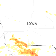

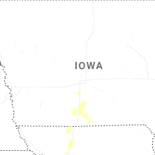
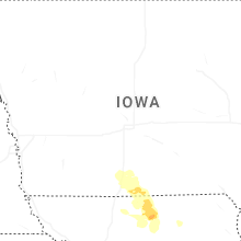
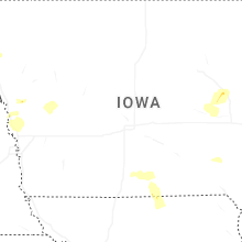


Connect with Interactive Hail Maps