

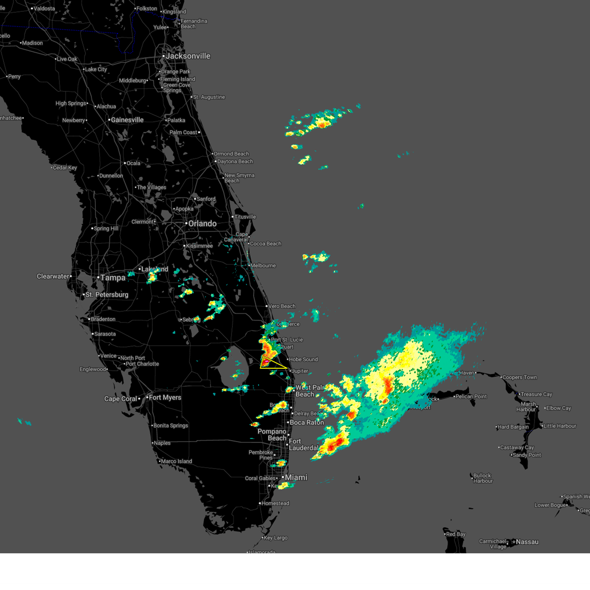
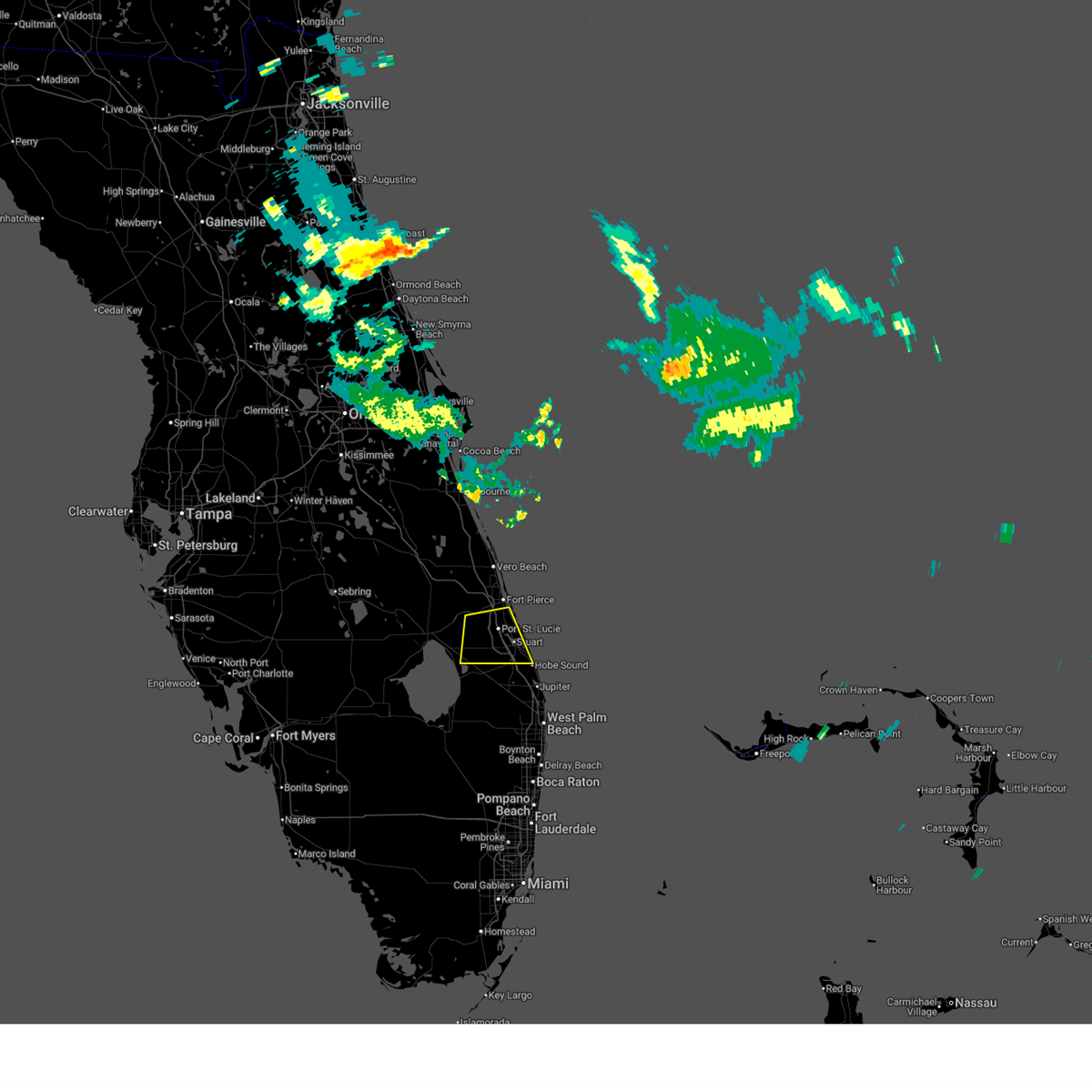
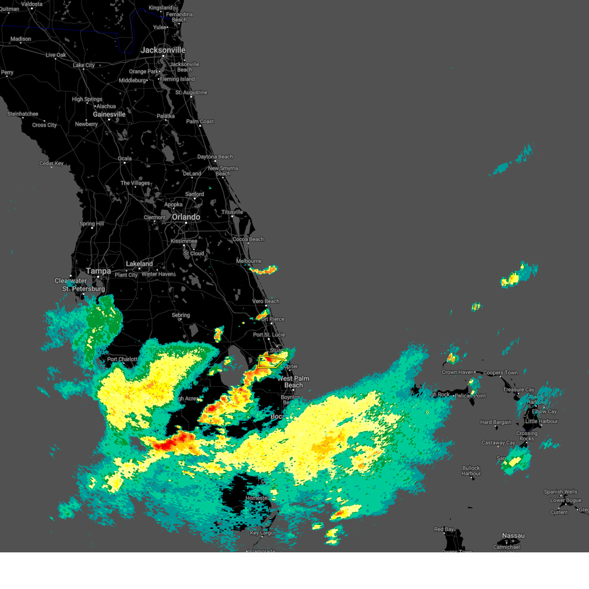
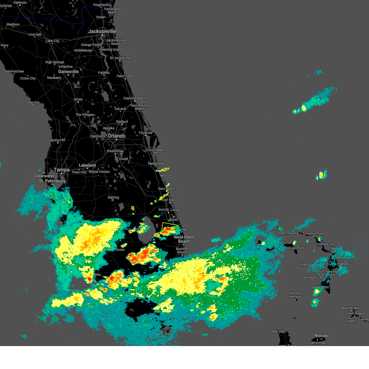
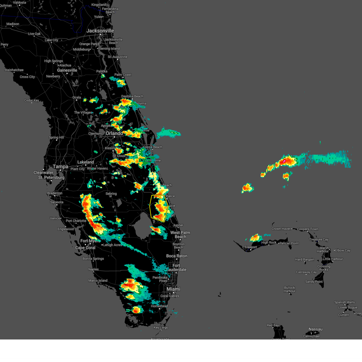
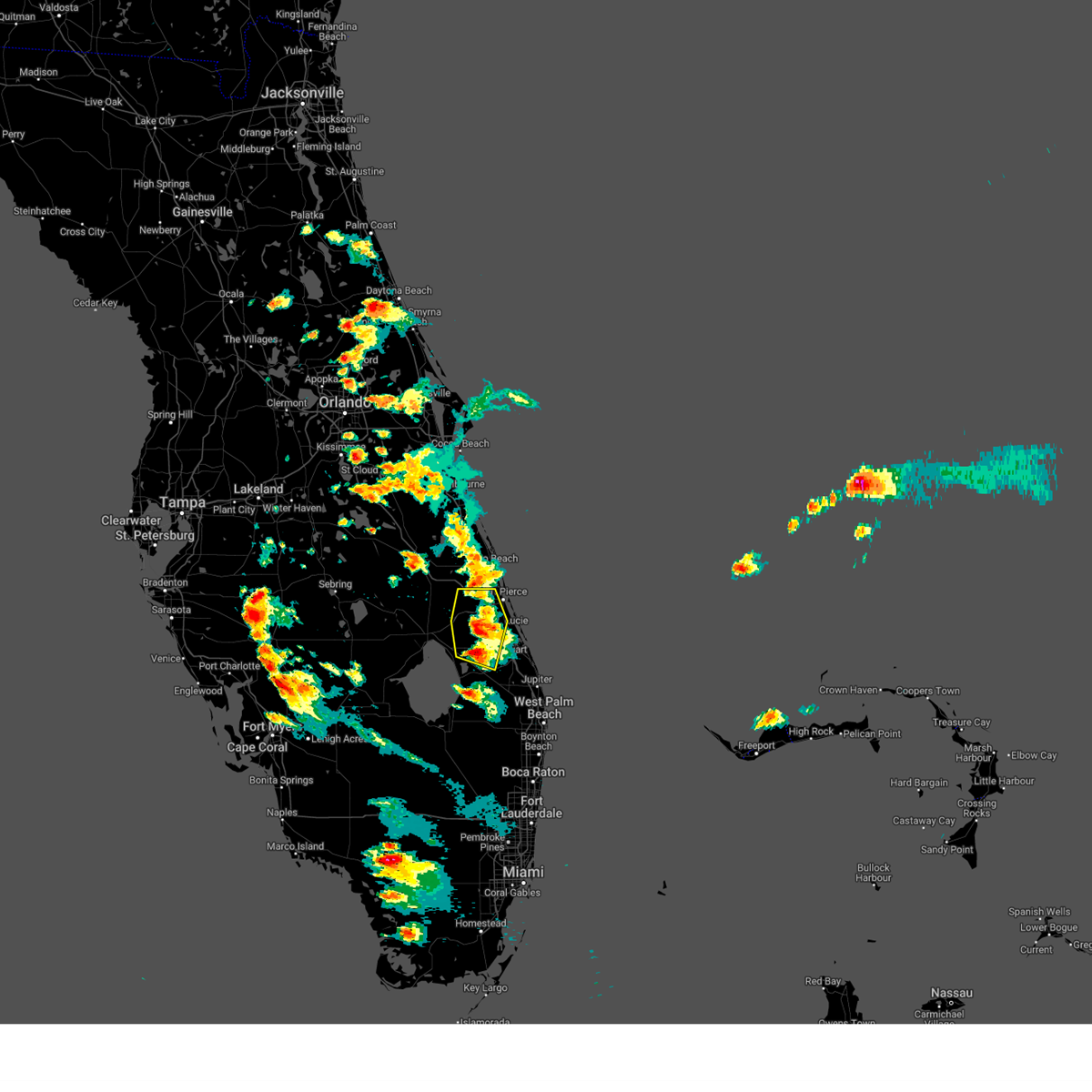
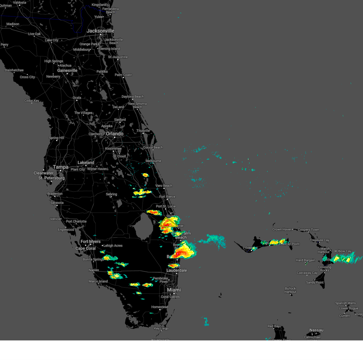
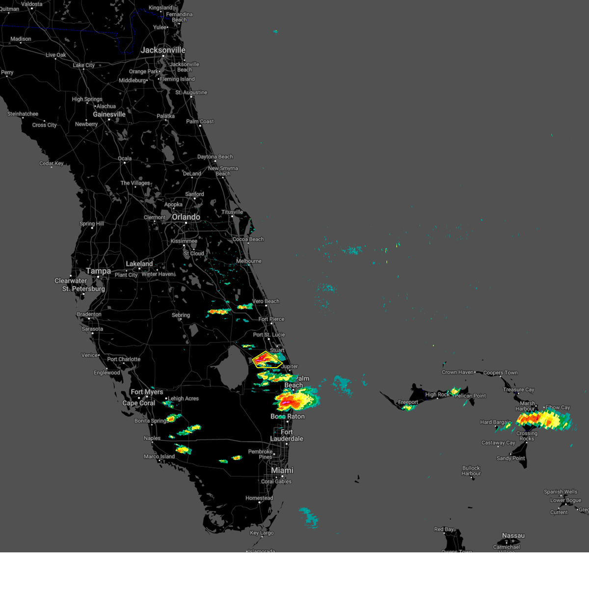
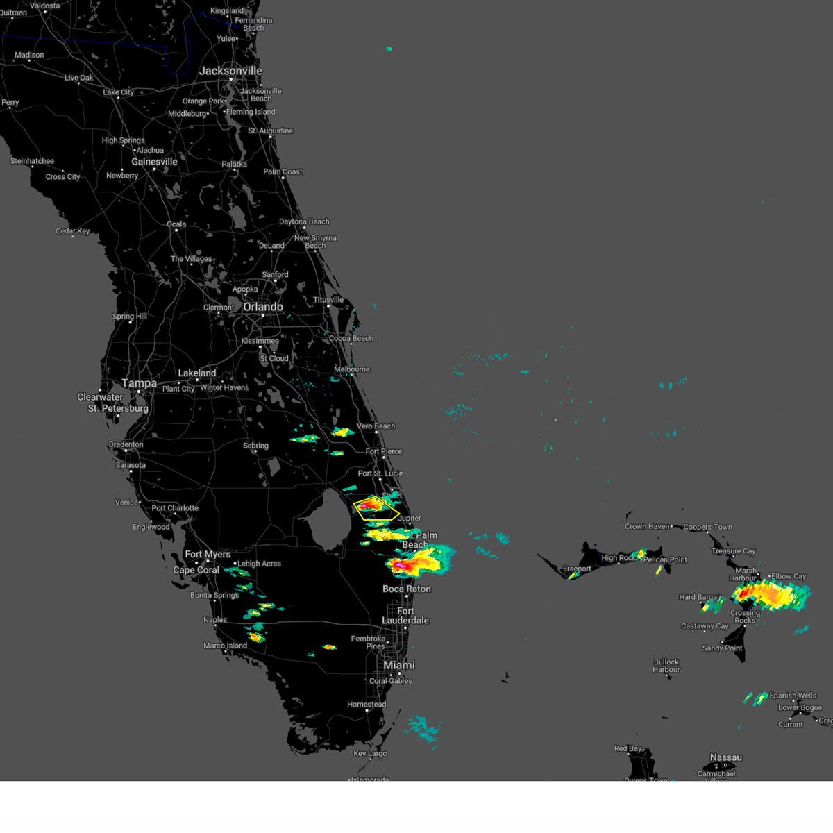
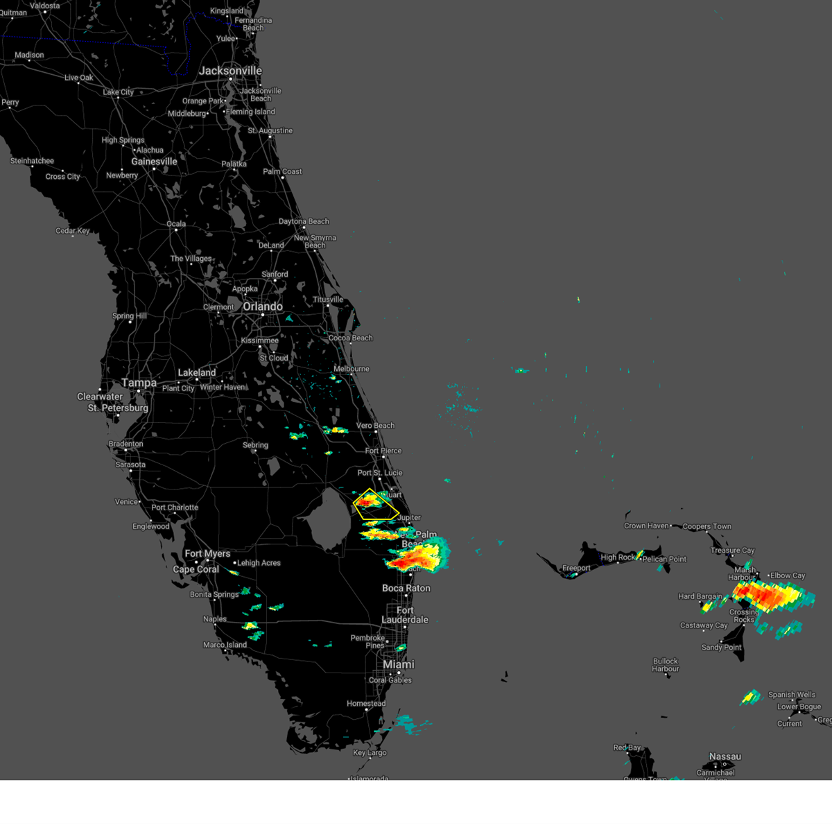
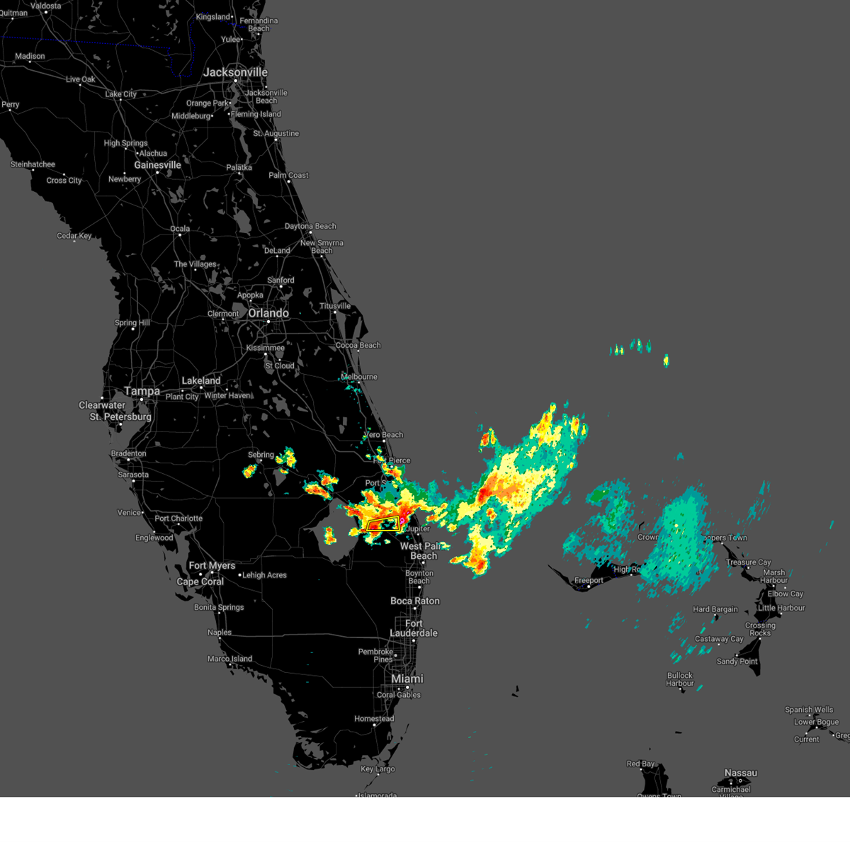
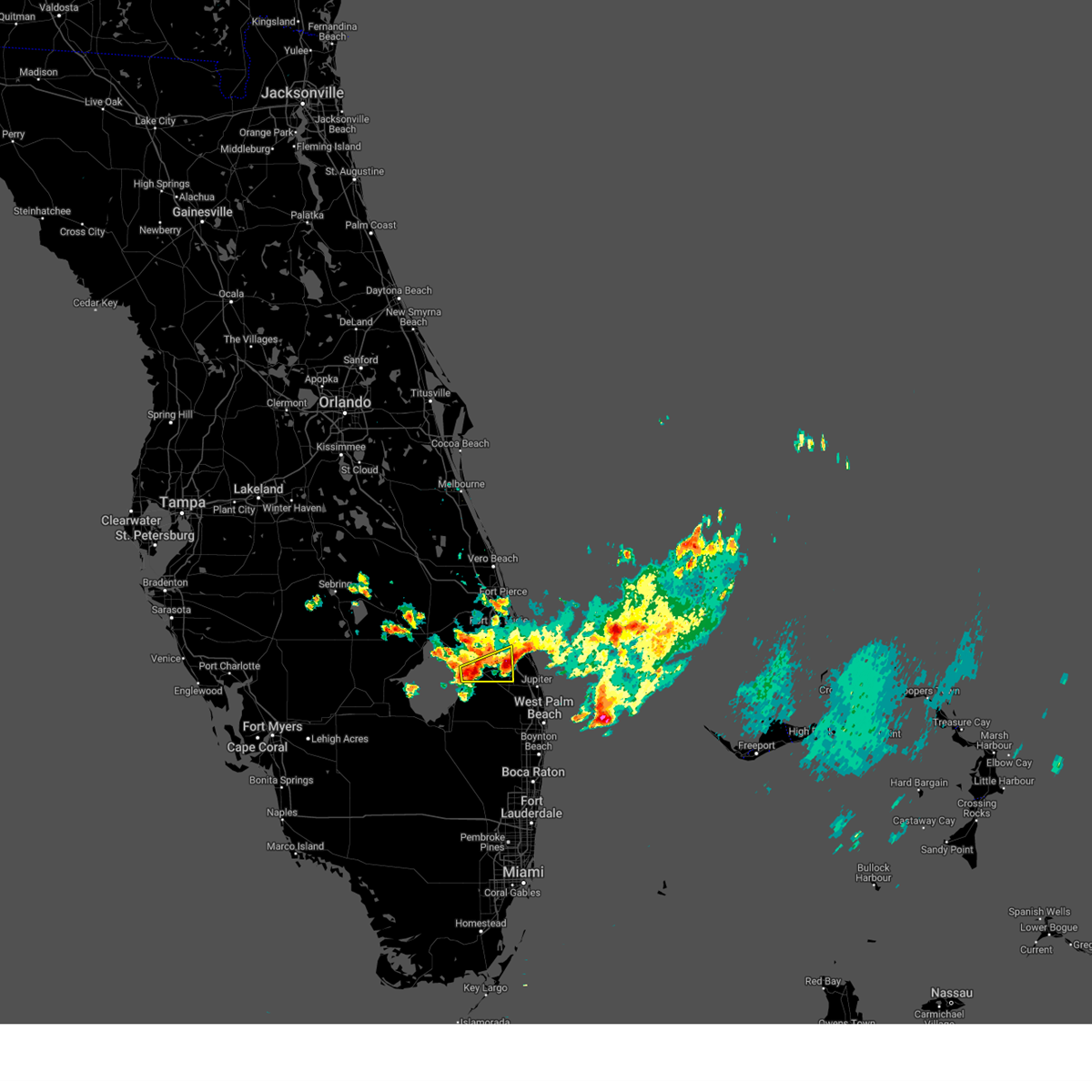
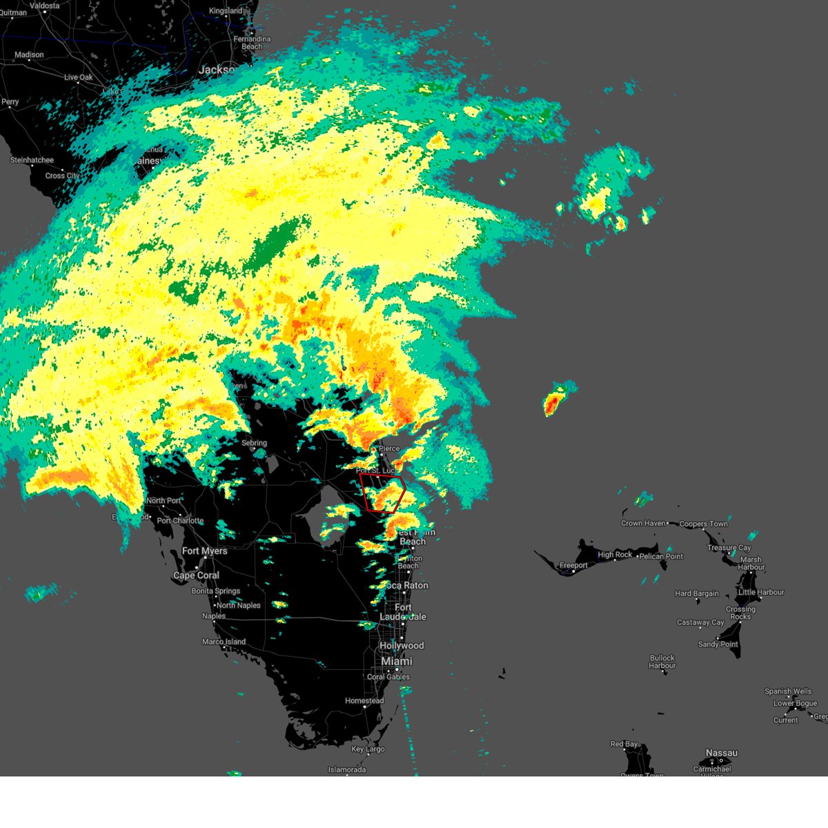
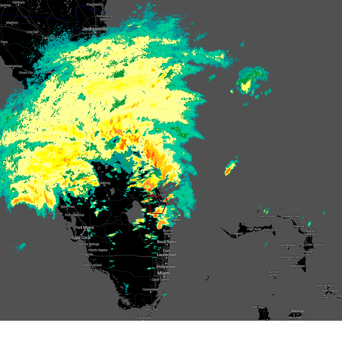
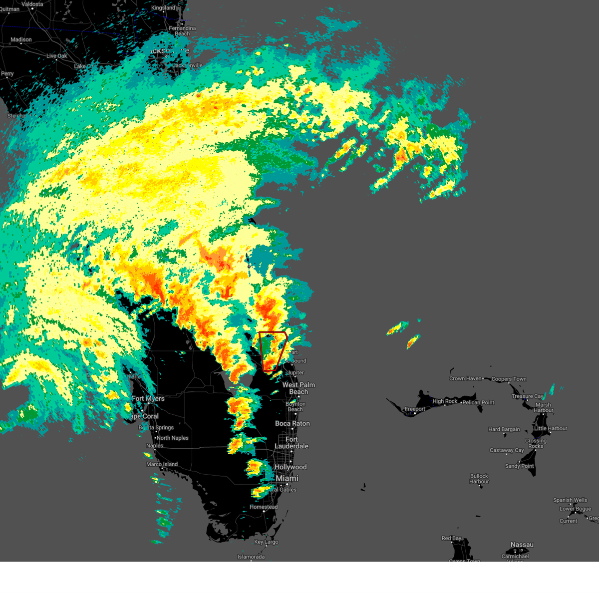
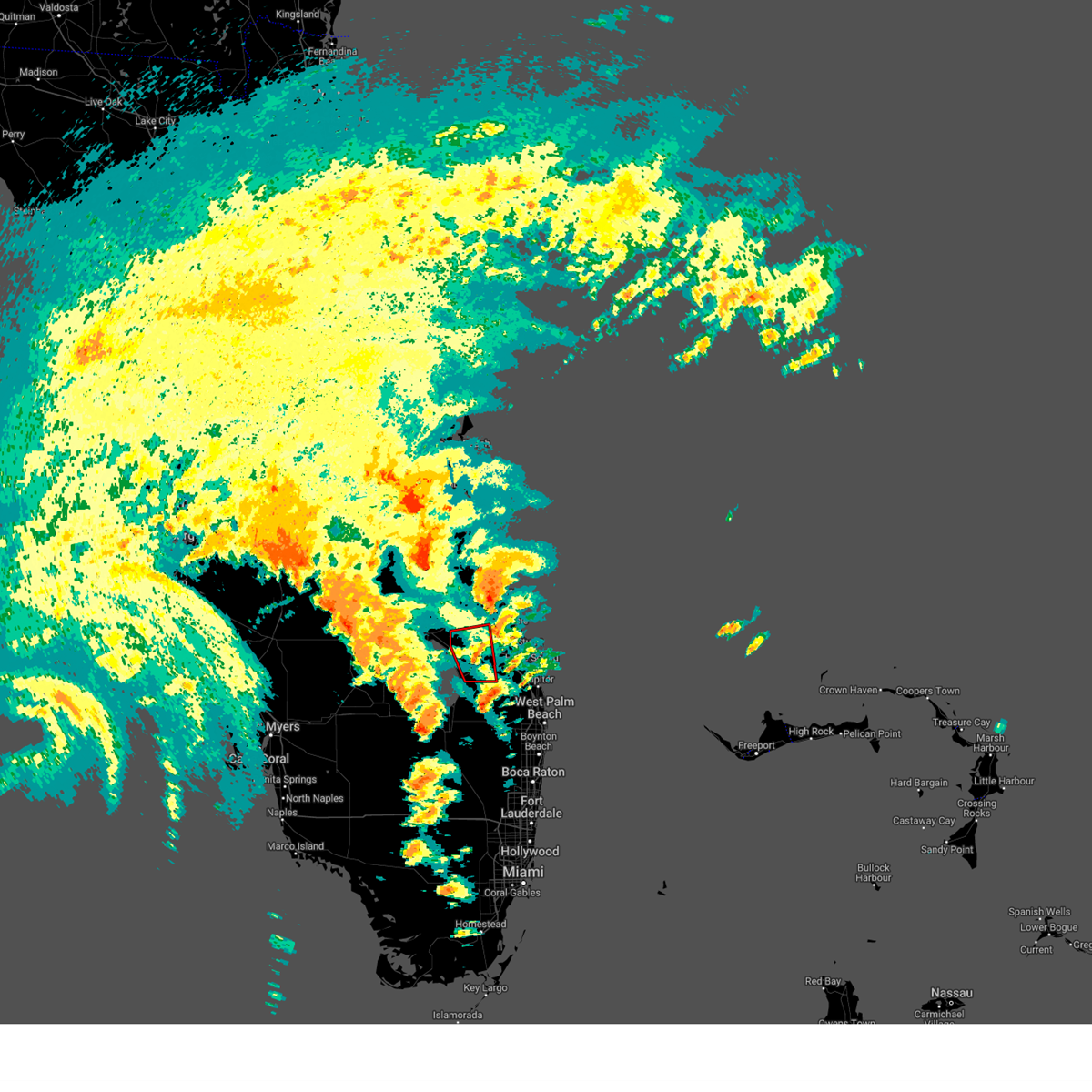
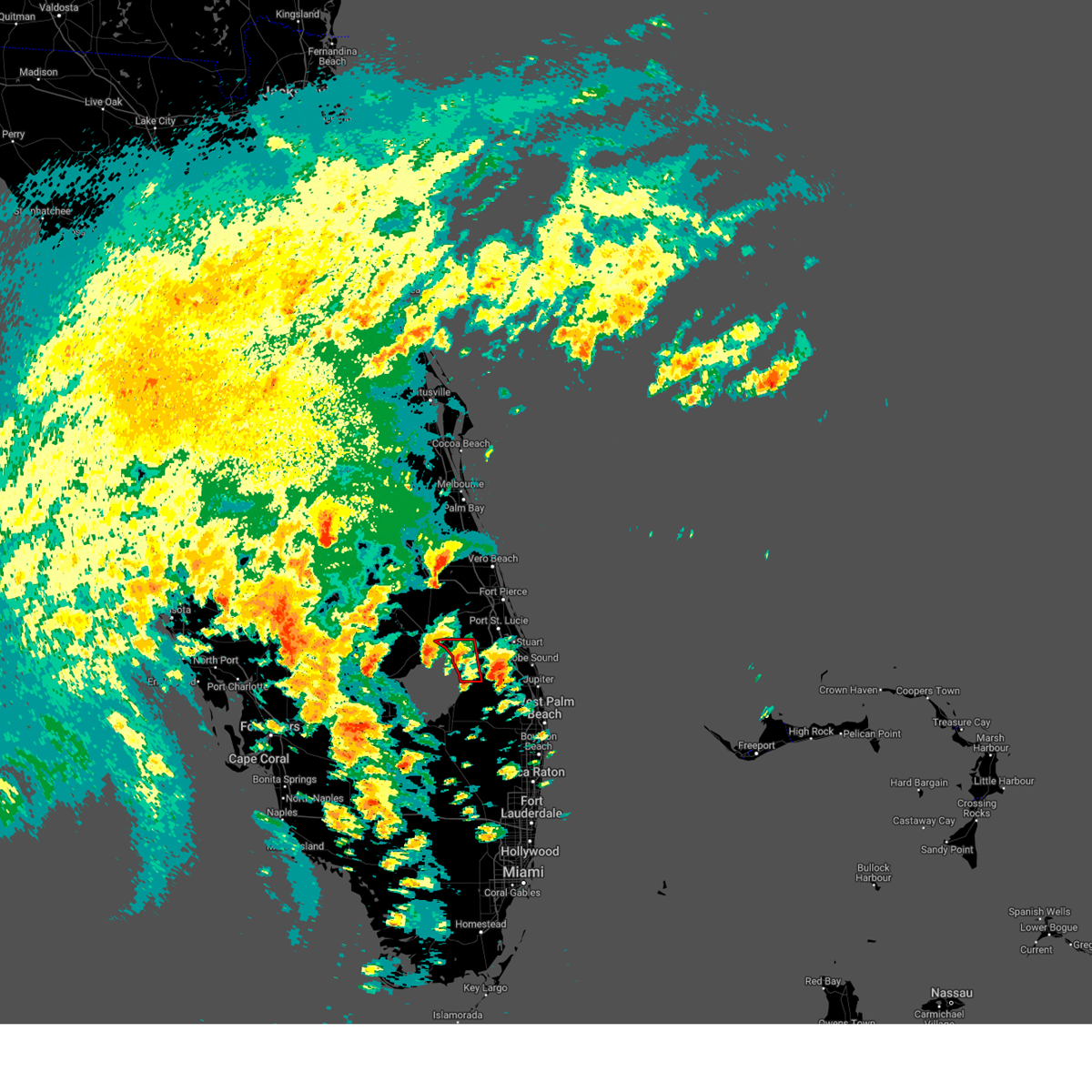
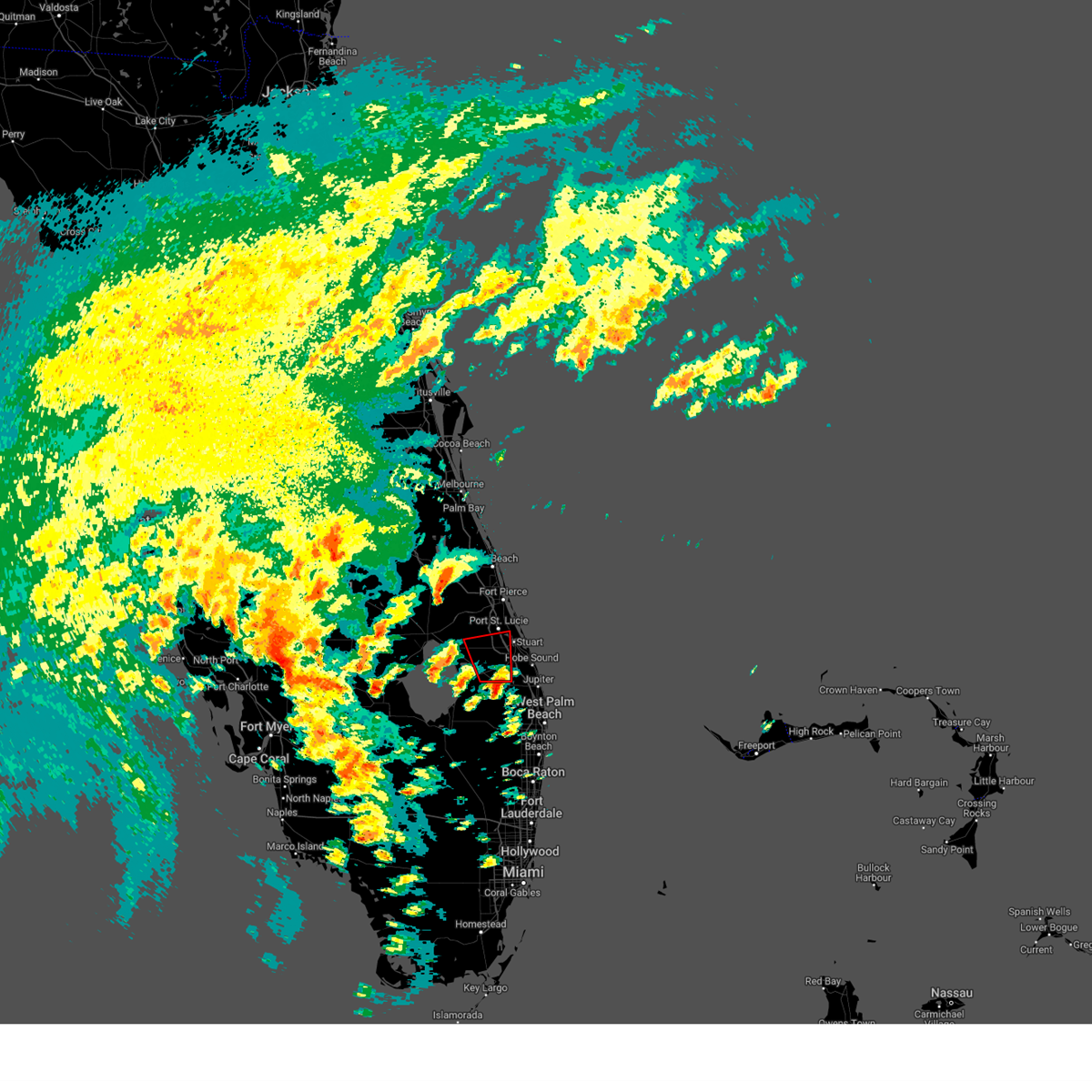
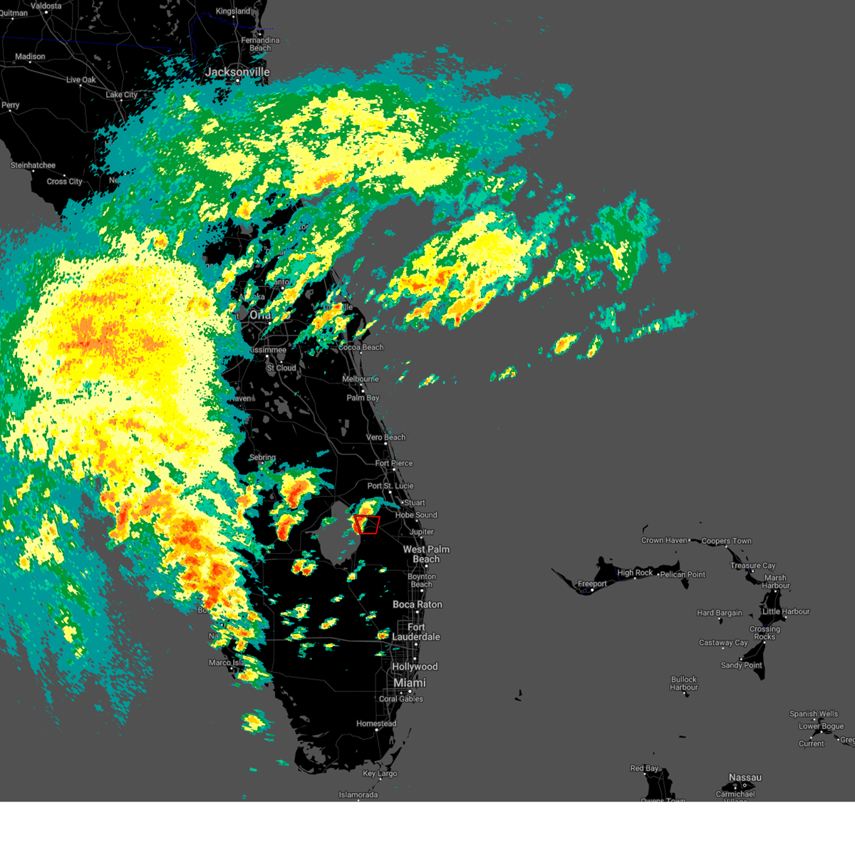
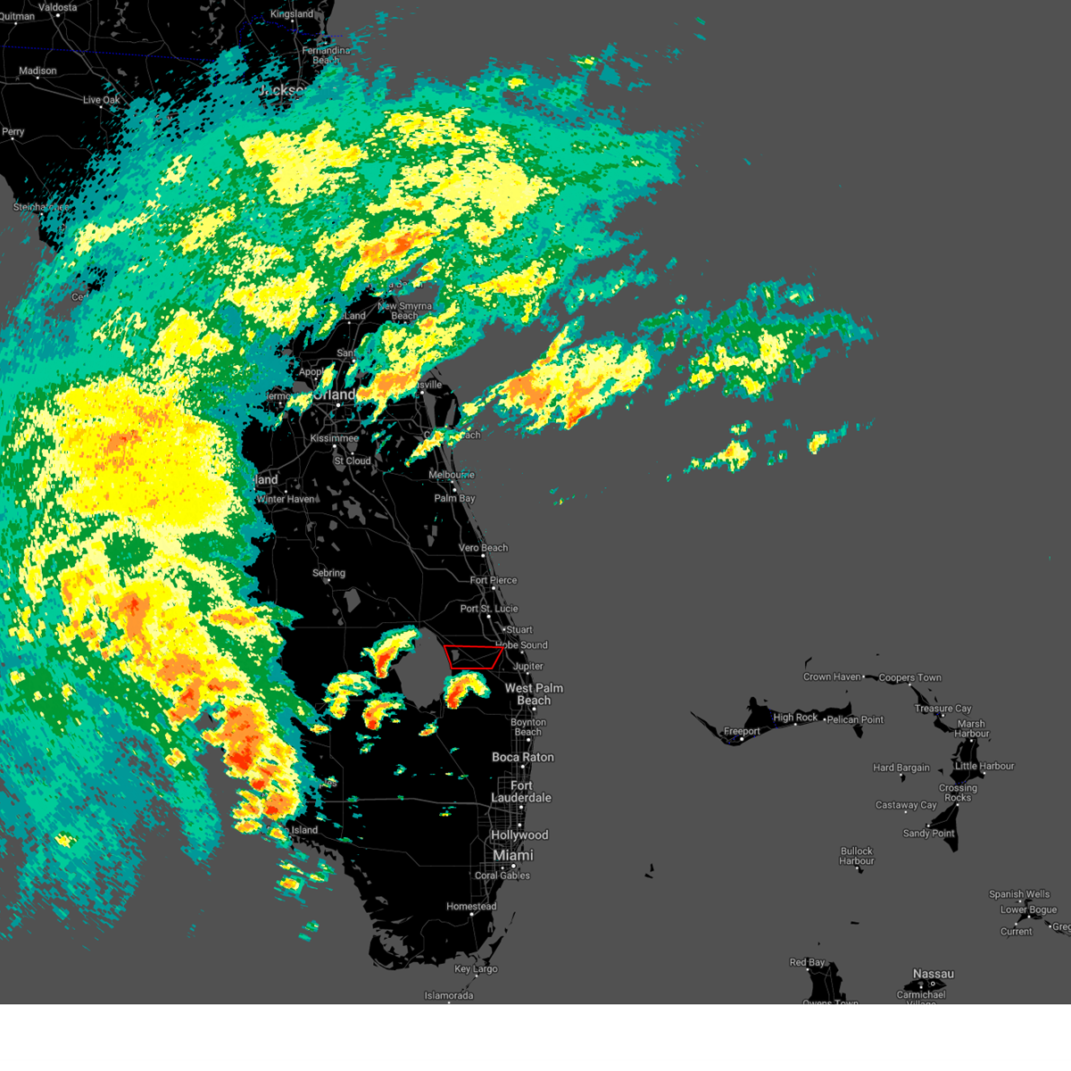
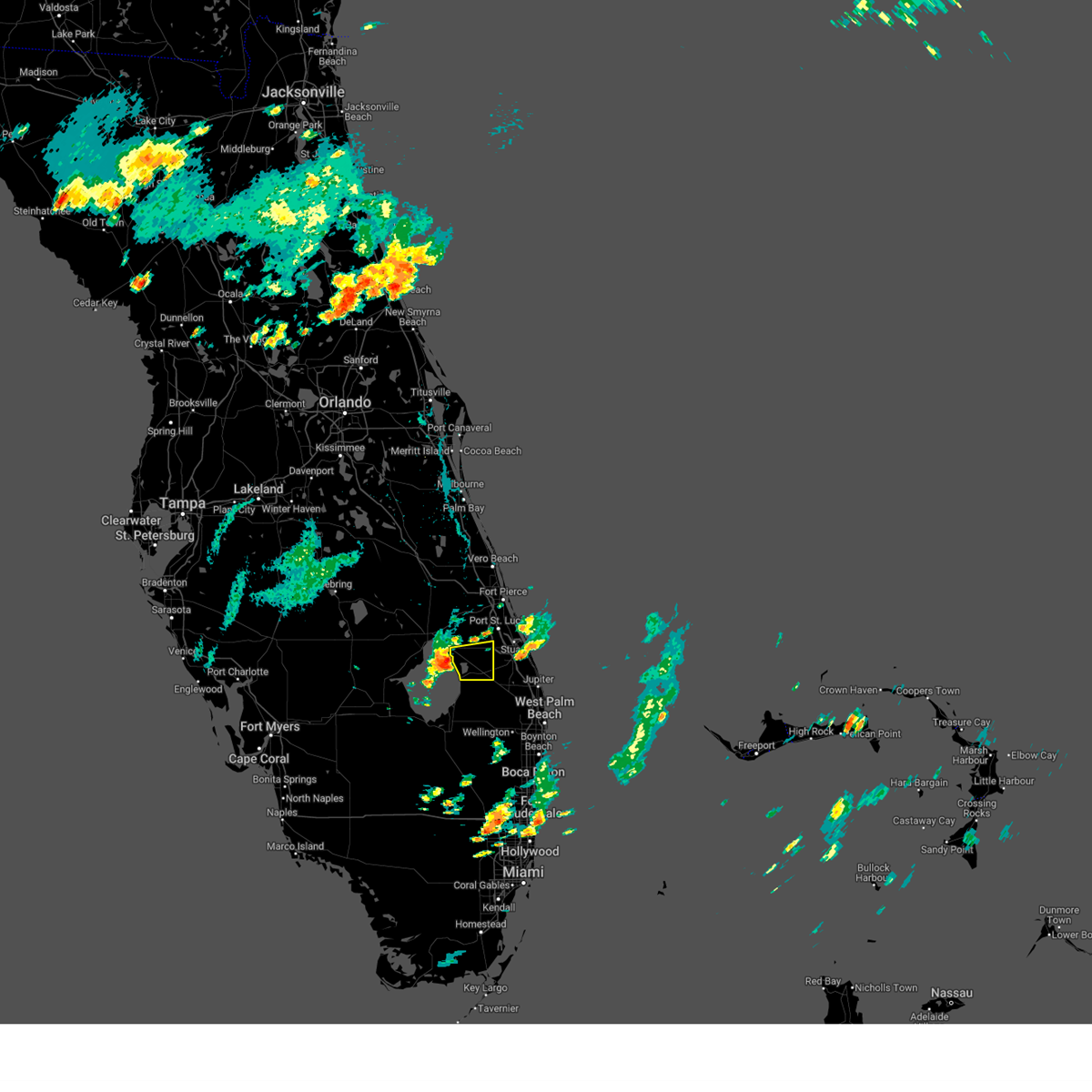
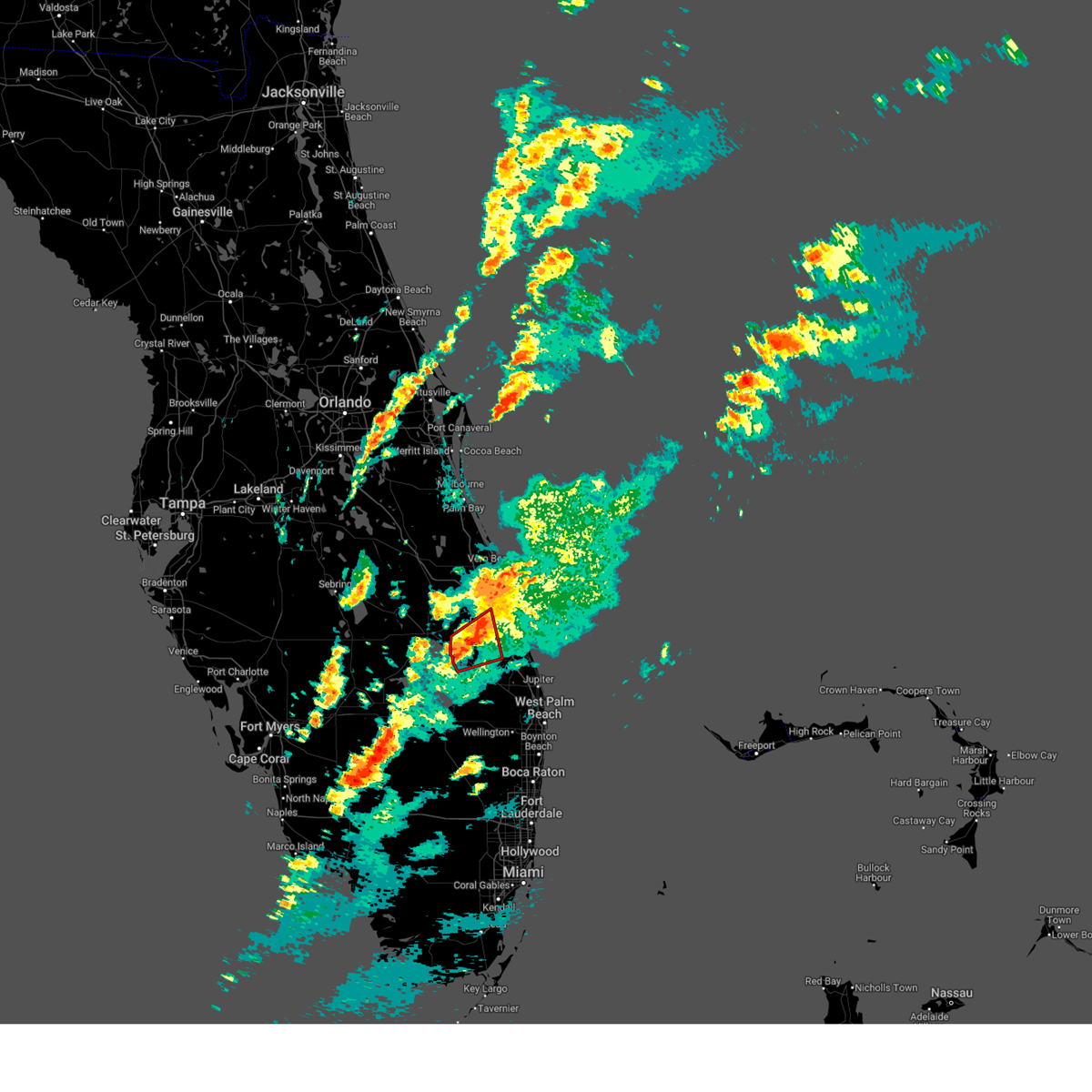
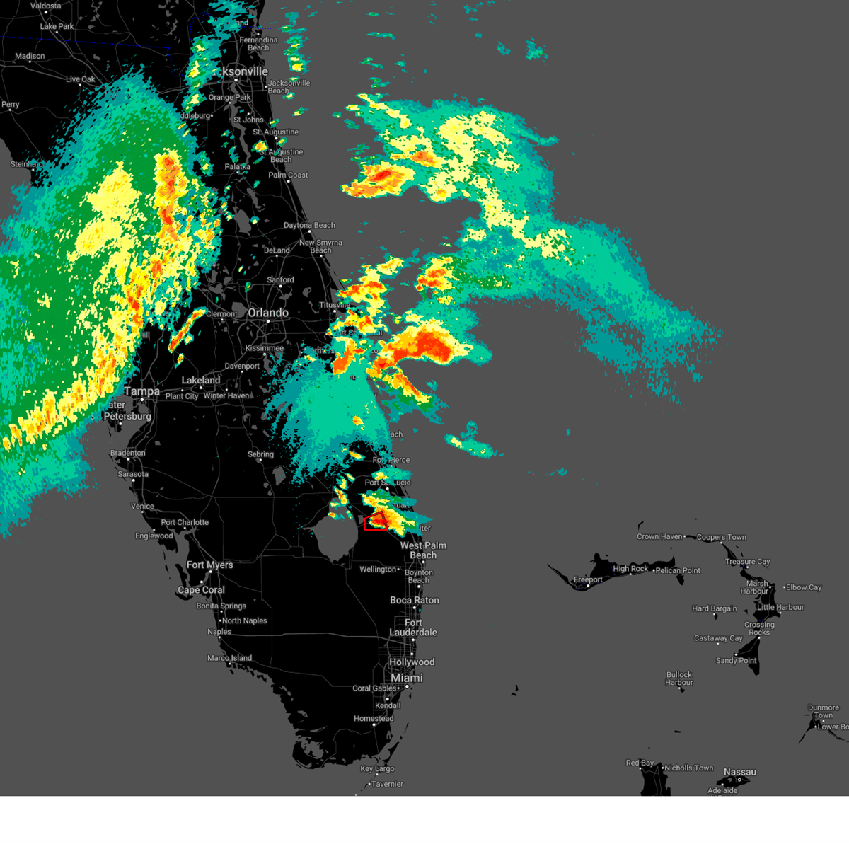
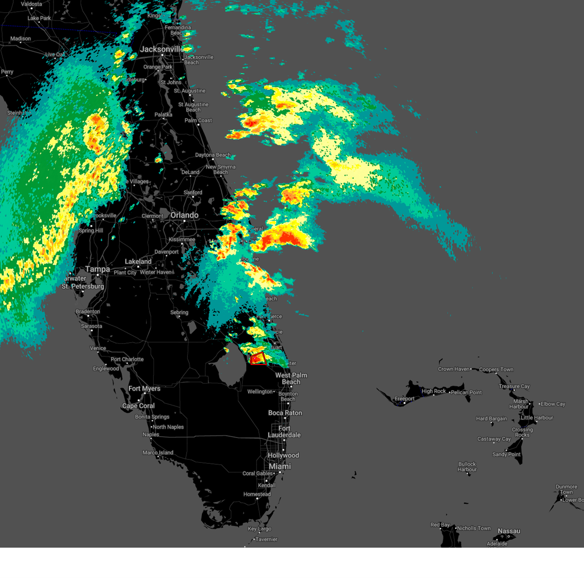
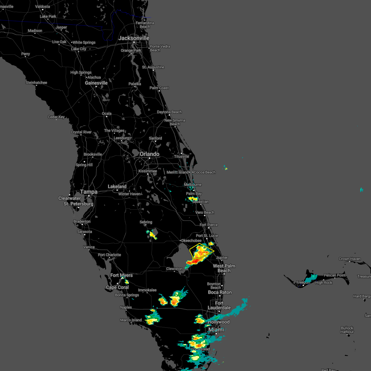
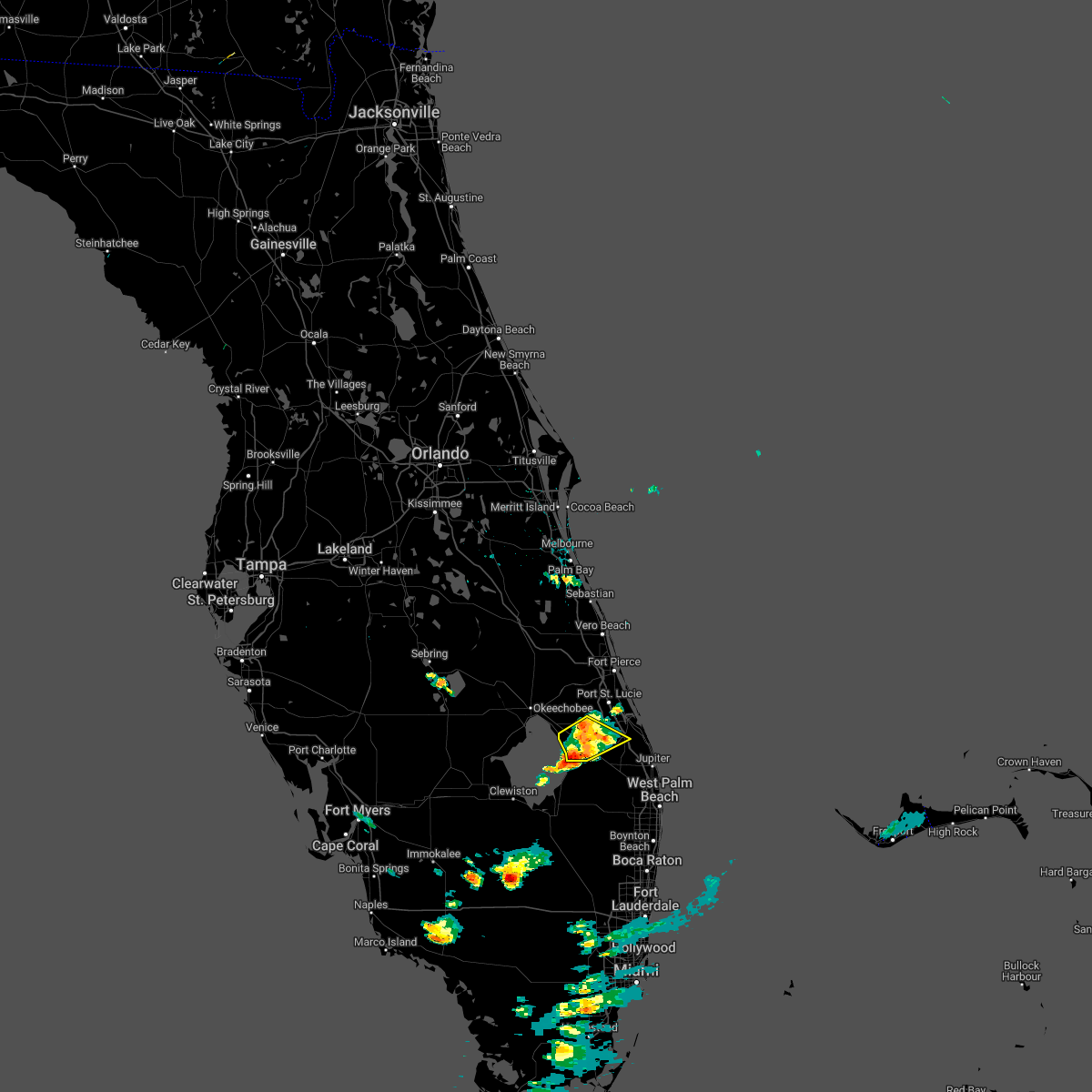
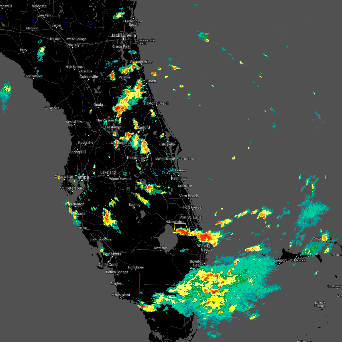
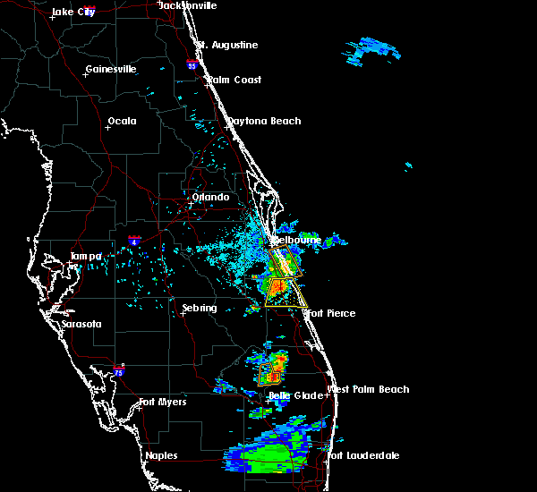
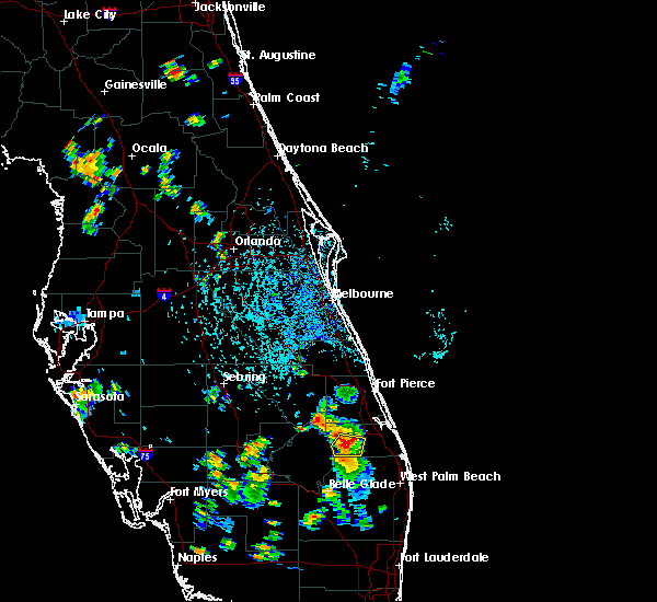
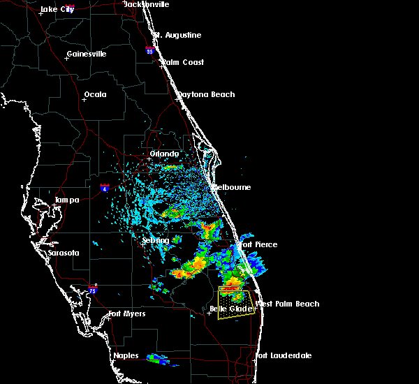
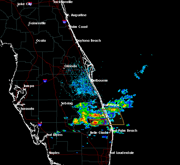
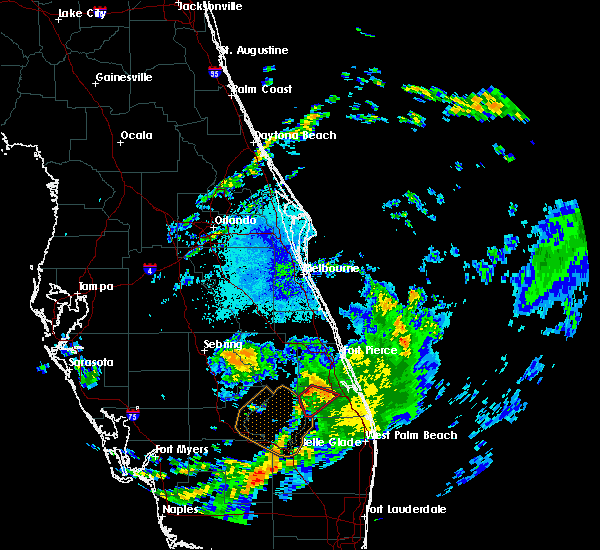
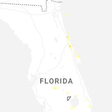
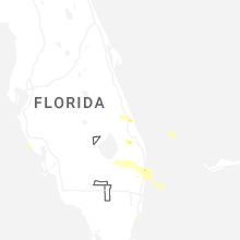
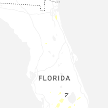
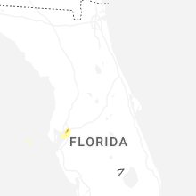
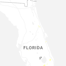
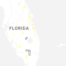
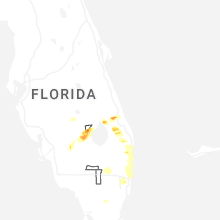
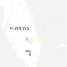
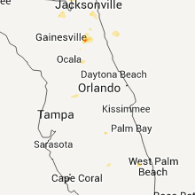
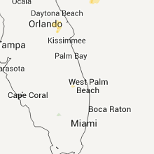
Hail Map for Indiantown, FL
The Indiantown, FL area has had 2 reports of on-the-ground hail by trained spotters, and has been under severe weather warnings 2 times during the past 12 months. Doppler radar has detected hail at or near Indiantown, FL on 61 occasions, including 3 occasions during the past year.
| Name: | Indiantown, FL |
| Where Located: | 18.1 miles SSW of Port Saint Lucie, FL |
| Map: | Google Map for Indiantown, FL |
| Population: | 6083 |
| Housing Units: | 1794 |
| More Info: | Search Google for Indiantown, FL |
1
The Top Recent Hail Date for Indiantown, FL is Saturday, February 28, 2026 (11th out of 61)

Hail and Wind Damage Spotted near Indiantown, FL
| Date / Time | Report Details |
|---|---|
| 2/28/2026 5:44 PM EST |
 Svrmlb the national weather service in melbourne has issued a * severe thunderstorm warning for, south central martin county in east central florida, * until 615 pm est. * at 543 pm est, a severe thunderstorm was located near indiantown, moving southeast at 30 mph (radar indicated). Hazards include 60 mph wind gusts and quarter size hail. Hail damage to vehicles is expected. Expect wind damage to roofs, siding, and trees. Svrmlb the national weather service in melbourne has issued a * severe thunderstorm warning for, south central martin county in east central florida, * until 615 pm est. * at 543 pm est, a severe thunderstorm was located near indiantown, moving southeast at 30 mph (radar indicated). Hazards include 60 mph wind gusts and quarter size hail. Hail damage to vehicles is expected. Expect wind damage to roofs, siding, and trees.
|
| 7/13/2025 6:31 PM EDT |
 Svrmlb the national weather service in melbourne has issued a * severe thunderstorm warning for, southern st. lucie county in east central florida, central martin county in east central florida, * until 700 pm edt. * at 630 pm edt, a severe thunderstorm was located over tradition, or near port saint lucie, moving south at 20 mph (radar indicated). Hazards include 60 mph wind gusts and penny size hail. expect damage to roofs, siding, and trees Svrmlb the national weather service in melbourne has issued a * severe thunderstorm warning for, southern st. lucie county in east central florida, central martin county in east central florida, * until 700 pm edt. * at 630 pm edt, a severe thunderstorm was located over tradition, or near port saint lucie, moving south at 20 mph (radar indicated). Hazards include 60 mph wind gusts and penny size hail. expect damage to roofs, siding, and trees
|
| 6/2/2025 5:23 PM EDT |
 The storm which prompted the warning has moved out of the area. therefore, the warning will be allowed to expire. however gusty winds are still possible with this thunderstorm. The storm which prompted the warning has moved out of the area. therefore, the warning will be allowed to expire. however gusty winds are still possible with this thunderstorm.
|
| 6/2/2025 5:03 PM EDT |
 Svrmlb the national weather service in melbourne has issued a * severe thunderstorm warning for, southeastern martin county in east central florida, * until 530 pm edt. * at 503 pm edt, a severe thunderstorm was located near indiantown, moving north at 10 mph (radar indicated). Hazards include 60 mph wind gusts and quarter size hail. Hail damage to vehicles is expected. Expect wind damage to roofs, siding, and trees. Svrmlb the national weather service in melbourne has issued a * severe thunderstorm warning for, southeastern martin county in east central florida, * until 530 pm edt. * at 503 pm edt, a severe thunderstorm was located near indiantown, moving north at 10 mph (radar indicated). Hazards include 60 mph wind gusts and quarter size hail. Hail damage to vehicles is expected. Expect wind damage to roofs, siding, and trees.
|
| 5/24/2025 5:03 PM EDT |
 At 502 pm edt, a severe thunderstorm was located 7 miles northwest of indiantown, and is nearly stationary. multiple strong storms within this warning are trending downward, but will keep the warning going for a little while longer (radar indicated). Hazards include 60 mph wind gusts and quarter size hail. Hail damage to vehicles is expected. expect wind damage to roofs, siding, and trees. Locations impacted include, port saint lucie, fort pierce, indiantown, white city, and port saint lucie river park. At 502 pm edt, a severe thunderstorm was located 7 miles northwest of indiantown, and is nearly stationary. multiple strong storms within this warning are trending downward, but will keep the warning going for a little while longer (radar indicated). Hazards include 60 mph wind gusts and quarter size hail. Hail damage to vehicles is expected. expect wind damage to roofs, siding, and trees. Locations impacted include, port saint lucie, fort pierce, indiantown, white city, and port saint lucie river park.
|
| 5/24/2025 4:47 PM EDT |
 Svrmlb the national weather service in melbourne has issued a * severe thunderstorm warning for, st. lucie county in east central florida, northwestern martin county in east central florida, * until 530 pm edt. * at 446 pm edt, a severe thunderstorm was located over tradition, or 7 miles west of port saint lucie, moving northeast at 10 mph. another potential severe storm was located north of indiantown in martin county (radar indicated). Hazards include 60 mph wind gusts and quarter size hail. Hail damage to vehicles is expected. Expect wind damage to roofs, siding, and trees. Svrmlb the national weather service in melbourne has issued a * severe thunderstorm warning for, st. lucie county in east central florida, northwestern martin county in east central florida, * until 530 pm edt. * at 446 pm edt, a severe thunderstorm was located over tradition, or 7 miles west of port saint lucie, moving northeast at 10 mph. another potential severe storm was located north of indiantown in martin county (radar indicated). Hazards include 60 mph wind gusts and quarter size hail. Hail damage to vehicles is expected. Expect wind damage to roofs, siding, and trees.
|
| 5/23/2025 3:29 PM EDT |
 Svrmlb the national weather service in melbourne has issued a * severe thunderstorm warning for, southeastern martin county in east central florida, * until 400 pm edt. * at 329 pm edt, a severe thunderstorm was located 7 miles southeast of indiantown, moving southeast at 25 mph (radar indicated). Hazards include two inch hail and 60 mph wind gusts. People and animals outdoors will be injured. expect hail damage to roofs, siding, windows, and vehicles. expect wind damage to roofs, siding, and trees. This severe thunderstorm will remain over mainly rural areas of southeastern martin county. Svrmlb the national weather service in melbourne has issued a * severe thunderstorm warning for, southeastern martin county in east central florida, * until 400 pm edt. * at 329 pm edt, a severe thunderstorm was located 7 miles southeast of indiantown, moving southeast at 25 mph (radar indicated). Hazards include two inch hail and 60 mph wind gusts. People and animals outdoors will be injured. expect hail damage to roofs, siding, windows, and vehicles. expect wind damage to roofs, siding, and trees. This severe thunderstorm will remain over mainly rural areas of southeastern martin county.
|
| 5/23/2025 3:18 PM EDT | Hen Egg sized hail reported 0.7 miles S of Indiantown, FL, trained spotter in indiantown reports hail up to 2 inches in diameter. |
| 5/23/2025 3:09 PM EDT |
 At 308 pm edt, a severe thunderstorm was located over indiantown, moving southeast at 10 mph (radar indicated). Hazards include tennis ball size hail and 60 mph wind gusts. People and animals outdoors will be injured. expect hail damage to roofs, siding, windows, and vehicles. expect wind damage to roofs, siding, and trees. Locations impacted include, indiantown. At 308 pm edt, a severe thunderstorm was located over indiantown, moving southeast at 10 mph (radar indicated). Hazards include tennis ball size hail and 60 mph wind gusts. People and animals outdoors will be injured. expect hail damage to roofs, siding, windows, and vehicles. expect wind damage to roofs, siding, and trees. Locations impacted include, indiantown.
|
| 5/23/2025 3:00 PM EDT |
 At 300 pm edt, a severe thunderstorm was located over indiantown, moving southeast at 10 mph (radar indicated). Hazards include tennis ball size hail and 60 mph wind gusts. People and animals outdoors will be injured. expect hail damage to roofs, siding, windows, and vehicles. expect wind damage to roofs, siding, and trees. Locations impacted include, indiantown. At 300 pm edt, a severe thunderstorm was located over indiantown, moving southeast at 10 mph (radar indicated). Hazards include tennis ball size hail and 60 mph wind gusts. People and animals outdoors will be injured. expect hail damage to roofs, siding, windows, and vehicles. expect wind damage to roofs, siding, and trees. Locations impacted include, indiantown.
|
| 5/23/2025 2:49 PM EDT |
 Svrmlb the national weather service in melbourne has issued a * severe thunderstorm warning for, southwestern martin county in east central florida, * until 330 pm edt. * at 248 pm edt, a severe thunderstorm was located near indiantown, moving southeast at 10 mph (radar indicated). Hazards include ping pong ball size hail and 60 mph wind gusts. People and animals outdoors will be injured. expect hail damage to roofs, siding, windows, and vehicles. Expect wind damage to roofs, siding, and trees. Svrmlb the national weather service in melbourne has issued a * severe thunderstorm warning for, southwestern martin county in east central florida, * until 330 pm edt. * at 248 pm edt, a severe thunderstorm was located near indiantown, moving southeast at 10 mph (radar indicated). Hazards include ping pong ball size hail and 60 mph wind gusts. People and animals outdoors will be injured. expect hail damage to roofs, siding, windows, and vehicles. Expect wind damage to roofs, siding, and trees.
|
| 3/25/2025 7:54 PM EDT |
 At 754 pm edt, a severe thunderstorm was located near indiantown, moving east at 25 mph (radar indicated). Hazards include 60 mph wind gusts and quarter size hail. Hail damage to vehicles is expected. expect wind damage to roofs, siding, and trees. Locations impacted include, indiantown. At 754 pm edt, a severe thunderstorm was located near indiantown, moving east at 25 mph (radar indicated). Hazards include 60 mph wind gusts and quarter size hail. Hail damage to vehicles is expected. expect wind damage to roofs, siding, and trees. Locations impacted include, indiantown.
|
| 3/25/2025 7:41 PM EDT |
 Svrmlb the national weather service in melbourne has issued a * severe thunderstorm warning for, southwestern martin county in east central florida, * until 815 pm edt. * at 741 pm edt, a severe thunderstorm was located near indiantown, moving east at 30 mph (radar indicated). Hazards include 60 mph wind gusts and quarter size hail. Hail damage to vehicles is expected. Expect wind damage to roofs, siding, and trees. Svrmlb the national weather service in melbourne has issued a * severe thunderstorm warning for, southwestern martin county in east central florida, * until 815 pm edt. * at 741 pm edt, a severe thunderstorm was located near indiantown, moving east at 30 mph (radar indicated). Hazards include 60 mph wind gusts and quarter size hail. Hail damage to vehicles is expected. Expect wind damage to roofs, siding, and trees.
|
| 10/9/2024 5:13 PM EDT |
 At 513 pm edt, a confirmed tornado was located near palm city, moving north at 40 mph (radar confirmed tornado). Hazards include damaging tornado. Flying debris will be dangerous to those caught without shelter. mobile homes will be damaged or destroyed. damage to roofs, windows, and vehicles will occur. tree damage is likely. this tornado will be near, stuart, palm city, and jensen beach around 520 pm edt. port saint lucie around 530 pm edt. Other locations impacted by this tornadic thunderstorm include rio. At 513 pm edt, a confirmed tornado was located near palm city, moving north at 40 mph (radar confirmed tornado). Hazards include damaging tornado. Flying debris will be dangerous to those caught without shelter. mobile homes will be damaged or destroyed. damage to roofs, windows, and vehicles will occur. tree damage is likely. this tornado will be near, stuart, palm city, and jensen beach around 520 pm edt. port saint lucie around 530 pm edt. Other locations impacted by this tornadic thunderstorm include rio.
|
| 10/9/2024 4:59 PM EDT |
 Tormlb the national weather service in melbourne has issued a * tornado warning for, southeastern st. lucie county in east central florida, central martin county in east central florida, * until 530 pm edt. * at 458 pm edt, a severe thunderstorm capable of producing a tornado was located 8 miles southeast of indiantown, moving north at 40 mph (radar indicated rotation). Hazards include tornado. Flying debris will be dangerous to those caught without shelter. mobile homes will be damaged or destroyed. damage to roofs, windows, and vehicles will occur. tree damage is likely. this dangerous storm will be near, palm city around 510 pm edt. stuart, jensen beach, and north river shores around 520 pm edt. port saint lucie around 530 pm edt. Other locations impacted by this tornadic thunderstorm include rio. Tormlb the national weather service in melbourne has issued a * tornado warning for, southeastern st. lucie county in east central florida, central martin county in east central florida, * until 530 pm edt. * at 458 pm edt, a severe thunderstorm capable of producing a tornado was located 8 miles southeast of indiantown, moving north at 40 mph (radar indicated rotation). Hazards include tornado. Flying debris will be dangerous to those caught without shelter. mobile homes will be damaged or destroyed. damage to roofs, windows, and vehicles will occur. tree damage is likely. this dangerous storm will be near, palm city around 510 pm edt. stuart, jensen beach, and north river shores around 520 pm edt. port saint lucie around 530 pm edt. Other locations impacted by this tornadic thunderstorm include rio.
|
| 10/9/2024 3:21 PM EDT |
 Tormlb the national weather service in melbourne has issued a * tornado warning for, southeastern st. lucie county in east central florida, central martin county in east central florida, * until 400 pm edt. * at 321 pm edt, a tornado producing storm was located near indiantown, moving north at 40 mph (radar confirmed tornado). Hazards include damaging tornado. Flying debris will be dangerous to those caught without shelter. mobile homes will be damaged or destroyed. damage to roofs, windows, and vehicles will occur. tree damage is likely. this tornadic storm will be near, palm city around 330 pm edt. port saint lucie, walton, and stuart around 340 pm edt. fort pierce, saint lucie nuclear power plant, and fort pierce south around 350 pm edt. Other locations impacted by this tornadic thunderstorm include hutchinson island south. Tormlb the national weather service in melbourne has issued a * tornado warning for, southeastern st. lucie county in east central florida, central martin county in east central florida, * until 400 pm edt. * at 321 pm edt, a tornado producing storm was located near indiantown, moving north at 40 mph (radar confirmed tornado). Hazards include damaging tornado. Flying debris will be dangerous to those caught without shelter. mobile homes will be damaged or destroyed. damage to roofs, windows, and vehicles will occur. tree damage is likely. this tornadic storm will be near, palm city around 330 pm edt. port saint lucie, walton, and stuart around 340 pm edt. fort pierce, saint lucie nuclear power plant, and fort pierce south around 350 pm edt. Other locations impacted by this tornadic thunderstorm include hutchinson island south.
|
| 10/9/2024 2:58 PM EDT |
 Tormlb the national weather service in melbourne has issued a * tornado warning for, southwestern st. lucie county in east central florida, western martin county in east central florida, * until 345 pm edt. * at 257 pm edt, a severe thunderstorm capable of producing a tornado was located 10 miles northwest of lion country safari park, or 10 miles east of canal point, moving north at 35 mph (radar indicated rotation). Hazards include tornado. Flying debris will be dangerous to those caught without shelter. mobile homes will be damaged or destroyed. damage to roofs, windows, and vehicles will occur. tree damage is likely. This dangerous storm will be near, indiantown around 310 pm edt. Tormlb the national weather service in melbourne has issued a * tornado warning for, southwestern st. lucie county in east central florida, western martin county in east central florida, * until 345 pm edt. * at 257 pm edt, a severe thunderstorm capable of producing a tornado was located 10 miles northwest of lion country safari park, or 10 miles east of canal point, moving north at 35 mph (radar indicated rotation). Hazards include tornado. Flying debris will be dangerous to those caught without shelter. mobile homes will be damaged or destroyed. damage to roofs, windows, and vehicles will occur. tree damage is likely. This dangerous storm will be near, indiantown around 310 pm edt.
|
| 10/9/2024 1:50 PM EDT |
 Tormlb the national weather service in melbourne has issued a * tornado warning for, southeastern okeechobee county in east central florida, western martin county in east central florida, * until 230 pm edt. * at 150 pm edt, a severe thunderstorm capable of producing a tornado was located near j and s fish camp, moving north at 30 mph (radar indicated rotation). Hazards include tornado. Flying debris will be dangerous to those caught without shelter. mobile homes will be damaged or destroyed. damage to roofs, windows, and vehicles will occur. tree damage is likely. this dangerous storm will be near, j and s fish camp around 200 pm edt. Other locations impacted by this tornadic thunderstorm include port mayaca. Tormlb the national weather service in melbourne has issued a * tornado warning for, southeastern okeechobee county in east central florida, western martin county in east central florida, * until 230 pm edt. * at 150 pm edt, a severe thunderstorm capable of producing a tornado was located near j and s fish camp, moving north at 30 mph (radar indicated rotation). Hazards include tornado. Flying debris will be dangerous to those caught without shelter. mobile homes will be damaged or destroyed. damage to roofs, windows, and vehicles will occur. tree damage is likely. this dangerous storm will be near, j and s fish camp around 200 pm edt. Other locations impacted by this tornadic thunderstorm include port mayaca.
|
| 10/9/2024 1:32 PM EDT |
 Tormlb the national weather service in melbourne has issued a * tornado warning for, south central st. lucie county in east central florida, central martin county in east central florida, * until 215 pm edt. * at 131 pm edt, a severe thunderstorm capable of producing a tornado was located 9 miles southeast of indiantown, moving north at 35 mph (radar indicated rotation). Hazards include tornado. Flying debris will be dangerous to those caught without shelter. mobile homes will be damaged or destroyed. damage to roofs, windows, and vehicles will occur. tree damage is likely. This dangerous storm will be near, indiantown around 140 pm edt. Tormlb the national weather service in melbourne has issued a * tornado warning for, south central st. lucie county in east central florida, central martin county in east central florida, * until 215 pm edt. * at 131 pm edt, a severe thunderstorm capable of producing a tornado was located 9 miles southeast of indiantown, moving north at 35 mph (radar indicated rotation). Hazards include tornado. Flying debris will be dangerous to those caught without shelter. mobile homes will be damaged or destroyed. damage to roofs, windows, and vehicles will occur. tree damage is likely. This dangerous storm will be near, indiantown around 140 pm edt.
|
| 10/9/2024 12:20 PM EDT |
 At 1220 pm edt, a confirmed tornado was located over canal point, moving north at 30 mph (public confirmed tornado). Hazards include damaging tornado. Flying debris will be dangerous to those caught without shelter. mobile homes will be damaged or destroyed. damage to roofs, windows, and vehicles will occur. tree damage is likely. This tornadic thunderstorm will remain over mainly rural areas of southwestern martin county, including the following locations, port mayaca. At 1220 pm edt, a confirmed tornado was located over canal point, moving north at 30 mph (public confirmed tornado). Hazards include damaging tornado. Flying debris will be dangerous to those caught without shelter. mobile homes will be damaged or destroyed. damage to roofs, windows, and vehicles will occur. tree damage is likely. This tornadic thunderstorm will remain over mainly rural areas of southwestern martin county, including the following locations, port mayaca.
|
| 10/9/2024 12:09 PM EDT |
 At 1208 pm edt, a severe thunderstorm capable of producing a tornado was located 7 miles southeast of j and s fish camp, moving north at 30 mph (radar indicated rotation). Hazards include tornado. Flying debris will be dangerous to those caught without shelter. mobile homes will be damaged or destroyed. damage to roofs, windows, and vehicles will occur. tree damage is likely. this dangerous storm will be near, j and s fish camp around 1210 pm edt. Other locations impacted by this tornadic thunderstorm include port mayaca. At 1208 pm edt, a severe thunderstorm capable of producing a tornado was located 7 miles southeast of j and s fish camp, moving north at 30 mph (radar indicated rotation). Hazards include tornado. Flying debris will be dangerous to those caught without shelter. mobile homes will be damaged or destroyed. damage to roofs, windows, and vehicles will occur. tree damage is likely. this dangerous storm will be near, j and s fish camp around 1210 pm edt. Other locations impacted by this tornadic thunderstorm include port mayaca.
|
| 10/9/2024 11:45 AM EDT |
 Tormlb the national weather service in melbourne has issued a * tornado warning for, southwestern martin county in east central florida, * until 1230 pm edt. * at 1145 am edt, a severe thunderstorm capable of producing a tornado was located near canal point, moving north at 30 mph (radar indicated rotation). Hazards include tornado. Flying debris will be dangerous to those caught without shelter. mobile homes will be damaged or destroyed. damage to roofs, windows, and vehicles will occur. tree damage is likely. this dangerous storm will be near, j and s fish camp around 1220 pm edt. Other locations impacted by this tornadic thunderstorm include port mayaca. Tormlb the national weather service in melbourne has issued a * tornado warning for, southwestern martin county in east central florida, * until 1230 pm edt. * at 1145 am edt, a severe thunderstorm capable of producing a tornado was located near canal point, moving north at 30 mph (radar indicated rotation). Hazards include tornado. Flying debris will be dangerous to those caught without shelter. mobile homes will be damaged or destroyed. damage to roofs, windows, and vehicles will occur. tree damage is likely. this dangerous storm will be near, j and s fish camp around 1220 pm edt. Other locations impacted by this tornadic thunderstorm include port mayaca.
|
| 7/10/2024 6:58 PM EDT |
 the severe thunderstorm warning has been cancelled and is no longer in effect the severe thunderstorm warning has been cancelled and is no longer in effect
|
| 7/10/2024 6:41 PM EDT |
 Svrmlb the national weather service in melbourne has issued a * severe thunderstorm warning for, southwestern martin county in east central florida, * until 715 pm edt. * at 640 pm edt, a severe thunderstorm was located near indiantown, moving southeast at 25 mph (radar indicated). Hazards include 60 mph wind gusts. expect damage to roofs, siding, and trees Svrmlb the national weather service in melbourne has issued a * severe thunderstorm warning for, southwestern martin county in east central florida, * until 715 pm edt. * at 640 pm edt, a severe thunderstorm was located near indiantown, moving southeast at 25 mph (radar indicated). Hazards include 60 mph wind gusts. expect damage to roofs, siding, and trees
|
| 5/19/2024 6:20 PM EDT |
 At 620 pm edt, a severe thunderstorm was located near indiantown, moving northeast at 15 mph (radar indicated). Hazards include 70 mph wind gusts and ping pong ball size hail. People and animals outdoors will be injured. expect hail damage to roofs, siding, windows, and vehicles. expect considerable tree damage. wind damage is also likely to mobile homes, roofs, and outbuildings. Locations impacted include, indiantown. At 620 pm edt, a severe thunderstorm was located near indiantown, moving northeast at 15 mph (radar indicated). Hazards include 70 mph wind gusts and ping pong ball size hail. People and animals outdoors will be injured. expect hail damage to roofs, siding, windows, and vehicles. expect considerable tree damage. wind damage is also likely to mobile homes, roofs, and outbuildings. Locations impacted include, indiantown.
|
| 5/19/2024 6:12 PM EDT |
 At 611 pm edt, a severe thunderstorm was located near indiantown, moving northeast at 20 mph (radar indicated). Hazards include ping pong ball size hail and 60 mph wind gusts. People and animals outdoors will be injured. expect hail damage to roofs, siding, windows, and vehicles. expect wind damage to roofs, siding, and trees. Locations impacted include, indiantown. At 611 pm edt, a severe thunderstorm was located near indiantown, moving northeast at 20 mph (radar indicated). Hazards include ping pong ball size hail and 60 mph wind gusts. People and animals outdoors will be injured. expect hail damage to roofs, siding, windows, and vehicles. expect wind damage to roofs, siding, and trees. Locations impacted include, indiantown.
|
| 5/19/2024 5:59 PM EDT |
 Svrmlb the national weather service in melbourne has issued a * severe thunderstorm warning for, southeastern martin county in east central florida, * until 645 pm edt. * at 559 pm edt, a severe thunderstorm was located 7 miles south of indiantown, moving northeast at 15 mph (radar indicated). Hazards include 60 mph wind gusts and quarter size hail. Hail damage to vehicles is expected. Expect wind damage to roofs, siding, and trees. Svrmlb the national weather service in melbourne has issued a * severe thunderstorm warning for, southeastern martin county in east central florida, * until 645 pm edt. * at 559 pm edt, a severe thunderstorm was located 7 miles south of indiantown, moving northeast at 15 mph (radar indicated). Hazards include 60 mph wind gusts and quarter size hail. Hail damage to vehicles is expected. Expect wind damage to roofs, siding, and trees.
|
| 5/19/2024 3:08 PM EDT |
 Svrmlb the national weather service in melbourne has issued a * severe thunderstorm warning for, southeastern st. lucie county in east central florida, central martin county in east central florida, * until 345 pm edt. * at 308 pm edt, a severe thunderstorm was located over palm city, moving east at 35 mph (radar indicated). Hazards include 60 mph wind gusts and quarter size hail. Hail damage to vehicles is expected. Expect wind damage to roofs, siding, and trees. Svrmlb the national weather service in melbourne has issued a * severe thunderstorm warning for, southeastern st. lucie county in east central florida, central martin county in east central florida, * until 345 pm edt. * at 308 pm edt, a severe thunderstorm was located over palm city, moving east at 35 mph (radar indicated). Hazards include 60 mph wind gusts and quarter size hail. Hail damage to vehicles is expected. Expect wind damage to roofs, siding, and trees.
|
| 1/9/2024 9:07 PM EST |
 At 905 pm est, severe thunderstorms were located along a line extending from near fort pierce inlet, moving northeast at 70 mph (radar indicated). Hazards include 60 mph wind gusts. Expect damage to roofs, siding, and trees. Locations impacted include, port saint lucie, walton, fort pierce, stuart, and indiantown. At 905 pm est, severe thunderstorms were located along a line extending from near fort pierce inlet, moving northeast at 70 mph (radar indicated). Hazards include 60 mph wind gusts. Expect damage to roofs, siding, and trees. Locations impacted include, port saint lucie, walton, fort pierce, stuart, and indiantown.
|
| 1/9/2024 8:34 PM EST |
 At 833 pm est, severe thunderstorms were located along a line extending from pointe west to near treasure island, moving northeast at 70 mph (radar indicated). Hazards include 60 mph wind gusts. expect damage to roofs, siding, and trees At 833 pm est, severe thunderstorms were located along a line extending from pointe west to near treasure island, moving northeast at 70 mph (radar indicated). Hazards include 60 mph wind gusts. expect damage to roofs, siding, and trees
|
| 1/6/2024 2:10 PM EST |
 At 210 pm est, a severe thunderstorm capable of producing a tornado was located near indiantown, moving east at 30 mph (radar indicated rotation). Hazards include tornado. Flying debris will be dangerous to those caught without shelter. mobile homes will be damaged or destroyed. damage to roofs, windows, and vehicles will occur. tree damage is likely. this dangerous storm will be near, stuart and palm city around 220 pm est. jensen beach, port salerno, and sewall`s point around 230 pm est. Other locations impacted by this tornadic thunderstorm include rio. At 210 pm est, a severe thunderstorm capable of producing a tornado was located near indiantown, moving east at 30 mph (radar indicated rotation). Hazards include tornado. Flying debris will be dangerous to those caught without shelter. mobile homes will be damaged or destroyed. damage to roofs, windows, and vehicles will occur. tree damage is likely. this dangerous storm will be near, stuart and palm city around 220 pm est. jensen beach, port salerno, and sewall`s point around 230 pm est. Other locations impacted by this tornadic thunderstorm include rio.
|
| 6/9/2023 4:23 PM EDT |
 At 423 pm edt, a severe thunderstorm was located over j and s fish camp, moving east at 20 mph (radar indicated). Hazards include 60 mph wind gusts and penny size hail. expect damage to roofs, siding, and trees At 423 pm edt, a severe thunderstorm was located over j and s fish camp, moving east at 20 mph (radar indicated). Hazards include 60 mph wind gusts and penny size hail. expect damage to roofs, siding, and trees
|
| 4/30/2023 8:15 AM EDT |
 At 815 am edt, a severe thunderstorm capable of producing a tornado was located 8 miles southwest of tradition, or 9 miles north of indiantown, moving east at 20 mph (radar indicated rotation). Hazards include tornado. Flying debris will be dangerous to those caught without shelter. mobile homes will be damaged or destroyed. damage to roofs, windows, and vehicles will occur. tree damage is likely. this tornadic thunderstorm will remain over mainly rural areas of southwestern st. Lucie and northwestern martin counties, including the following locations, tradition field. At 815 am edt, a severe thunderstorm capable of producing a tornado was located 8 miles southwest of tradition, or 9 miles north of indiantown, moving east at 20 mph (radar indicated rotation). Hazards include tornado. Flying debris will be dangerous to those caught without shelter. mobile homes will be damaged or destroyed. damage to roofs, windows, and vehicles will occur. tree damage is likely. this tornadic thunderstorm will remain over mainly rural areas of southwestern st. Lucie and northwestern martin counties, including the following locations, tradition field.
|
| 4/27/2023 9:11 PM EDT |
 The tornado warning for southwestern martin county will expire at 915 pm edt, the storm which prompted the warning has weakened below severe limits, and no longer appears capable of producing a tornado, however there remains some weak rotation. therefore, the warning will be allowed to expire. however small hail, gusty winds and heavy rain are still possible with this thunderstorm. a severe thunderstorm watch remains in effect until 1000 pm edt for east central florida. to report severe weather, contact your nearest law enforcement agency. they will relay your report to the national weather service melbourne. The tornado warning for southwestern martin county will expire at 915 pm edt, the storm which prompted the warning has weakened below severe limits, and no longer appears capable of producing a tornado, however there remains some weak rotation. therefore, the warning will be allowed to expire. however small hail, gusty winds and heavy rain are still possible with this thunderstorm. a severe thunderstorm watch remains in effect until 1000 pm edt for east central florida. to report severe weather, contact your nearest law enforcement agency. they will relay your report to the national weather service melbourne.
|
| 4/27/2023 8:51 PM EDT |
 At 851 pm edt, a severe thunderstorm capable of producing a tornado was located near indiantown, moving northeast at 10 mph (radar indicated rotation). Hazards include tornado and quarter size hail. Flying debris will be dangerous to those caught without shelter. mobile homes will be damaged or destroyed. damage to roofs, windows, and vehicles will occur. tree damage is likely. This dangerous storm will be near, indiantown around 920 pm edt. At 851 pm edt, a severe thunderstorm capable of producing a tornado was located near indiantown, moving northeast at 10 mph (radar indicated rotation). Hazards include tornado and quarter size hail. Flying debris will be dangerous to those caught without shelter. mobile homes will be damaged or destroyed. damage to roofs, windows, and vehicles will occur. tree damage is likely. This dangerous storm will be near, indiantown around 920 pm edt.
|
| 4/27/2023 8:39 PM EDT |
 At 838 pm edt, a severe thunderstorm capable of producing a tornado was located near indiantown, moving northeast at 15 mph (radar indicated rotation). Hazards include tornado and quarter size hail. Flying debris will be dangerous to those caught without shelter. mobile homes will be damaged or destroyed. damage to roofs, windows, and vehicles will occur. tree damage is likely. This dangerous storm will be near, indiantown around 900 pm edt. At 838 pm edt, a severe thunderstorm capable of producing a tornado was located near indiantown, moving northeast at 15 mph (radar indicated rotation). Hazards include tornado and quarter size hail. Flying debris will be dangerous to those caught without shelter. mobile homes will be damaged or destroyed. damage to roofs, windows, and vehicles will occur. tree damage is likely. This dangerous storm will be near, indiantown around 900 pm edt.
|
| 5/20/2022 2:05 PM EDT |
 At 205 pm edt, a severe thunderstorm was located 8 miles east of indiantown, moving northeast at 20 mph (radar indicated). Hazards include 60 mph wind gusts and quarter size hail. Hail damage to vehicles is expected. Expect wind damage to roofs, siding, and trees. At 205 pm edt, a severe thunderstorm was located 8 miles east of indiantown, moving northeast at 20 mph (radar indicated). Hazards include 60 mph wind gusts and quarter size hail. Hail damage to vehicles is expected. Expect wind damage to roofs, siding, and trees.
|
| 4/18/2022 6:07 PM EDT |
 The severe thunderstorm warning for western martin county will expire at 615 pm edt, the severe thunderstorm which prompted the warning has moved out of the warned area. therefore, the warning will be allowed to expire. however heavy rain is still possible with this thunderstorm. to report severe weather, contact your nearest law enforcement agency. they will relay your report to the national weather service melbourne. The severe thunderstorm warning for western martin county will expire at 615 pm edt, the severe thunderstorm which prompted the warning has moved out of the warned area. therefore, the warning will be allowed to expire. however heavy rain is still possible with this thunderstorm. to report severe weather, contact your nearest law enforcement agency. they will relay your report to the national weather service melbourne.
|
| 4/18/2022 6:00 PM EDT |
 At 600 pm edt, a severe thunderstorm was located near indiantown, moving southeast at 10 mph (public). Hazards include 60 mph wind gusts and half dollar size hail. Hail damage to vehicles is expected. expect wind damage to roofs, siding, and trees. locations impacted include, indiantown, j and s fish camp and port mayaca. hail threat, observed max hail size, 1. 25 in wind threat, radar indicated max wind gust, 60 mph. At 600 pm edt, a severe thunderstorm was located near indiantown, moving southeast at 10 mph (public). Hazards include 60 mph wind gusts and half dollar size hail. Hail damage to vehicles is expected. expect wind damage to roofs, siding, and trees. locations impacted include, indiantown, j and s fish camp and port mayaca. hail threat, observed max hail size, 1. 25 in wind threat, radar indicated max wind gust, 60 mph.
|
| 4/18/2022 5:39 PM EDT |
 At 539 pm edt, a severe thunderstorm was located 8 miles northeast of j and s fish camp, moving southeast at 10 mph (public). Hazards include 60 mph wind gusts and half dollar size hail. Hail damage to vehicles is expected. expect wind damage to roofs, siding, and trees. locations impacted include, indiantown, j and s fish camp, tradition and port mayaca. hail threat, observed max hail size, 1. 25 in wind threat, radar indicated max wind gust, 60 mph. At 539 pm edt, a severe thunderstorm was located 8 miles northeast of j and s fish camp, moving southeast at 10 mph (public). Hazards include 60 mph wind gusts and half dollar size hail. Hail damage to vehicles is expected. expect wind damage to roofs, siding, and trees. locations impacted include, indiantown, j and s fish camp, tradition and port mayaca. hail threat, observed max hail size, 1. 25 in wind threat, radar indicated max wind gust, 60 mph.
|
| 4/18/2022 5:27 PM EDT |
 At 527 pm edt, a severe thunderstorm was located 8 miles northeast of j and s fish camp, moving southeast at 10 mph (radar indicated). Hazards include 60 mph wind gusts and quarter size hail. Hail damage to vehicles is expected. Expect wind damage to roofs, siding, and trees. At 527 pm edt, a severe thunderstorm was located 8 miles northeast of j and s fish camp, moving southeast at 10 mph (radar indicated). Hazards include 60 mph wind gusts and quarter size hail. Hail damage to vehicles is expected. Expect wind damage to roofs, siding, and trees.
|
| 4/6/2022 3:02 PM EDT |
 At 302 pm edt, a severe thunderstorm was located near indiantown, moving northeast at 30 mph (radar indicated). Hazards include 60 mph wind gusts and quarter size hail. Hail damage to vehicles is expected. expect wind damage to roofs, siding, and trees. locations impacted include, indiantown and palm city. hail threat, radar indicated max hail size, 1. 00 in wind threat, radar indicated max wind gust, 60 mph. At 302 pm edt, a severe thunderstorm was located near indiantown, moving northeast at 30 mph (radar indicated). Hazards include 60 mph wind gusts and quarter size hail. Hail damage to vehicles is expected. expect wind damage to roofs, siding, and trees. locations impacted include, indiantown and palm city. hail threat, radar indicated max hail size, 1. 00 in wind threat, radar indicated max wind gust, 60 mph.
|
| 4/6/2022 2:47 PM EDT |
 At 246 pm edt, a severe thunderstorm was located near indiantown, moving northeast at 30 mph (radar indicated). Hazards include 60 mph wind gusts and quarter size hail. Hail damage to vehicles is expected. Expect wind damage to roofs, siding, and trees. At 246 pm edt, a severe thunderstorm was located near indiantown, moving northeast at 30 mph (radar indicated). Hazards include 60 mph wind gusts and quarter size hail. Hail damage to vehicles is expected. Expect wind damage to roofs, siding, and trees.
|
| 11/5/2021 2:08 AM EDT |
 At 207 am edt, a severe thunderstorm was located 9 miles southeast of indiantown, moving northeast at 20 mph (radar indicated). Hazards include 60 mph wind gusts and quarter size hail. Hail damage to vehicles is expected. expect wind damage to roofs, siding, and trees. this severe thunderstorm will remain over mainly rural areas of southeastern martin county. hail threat, radar indicated max hail size, 1. 00 in wind threat, radar indicated max wind gust, 60 mph. At 207 am edt, a severe thunderstorm was located 9 miles southeast of indiantown, moving northeast at 20 mph (radar indicated). Hazards include 60 mph wind gusts and quarter size hail. Hail damage to vehicles is expected. expect wind damage to roofs, siding, and trees. this severe thunderstorm will remain over mainly rural areas of southeastern martin county. hail threat, radar indicated max hail size, 1. 00 in wind threat, radar indicated max wind gust, 60 mph.
|
| 7/12/2021 2:05 PM EDT |
 At 205 pm edt, a severe thunderstorm was located 7 miles northwest of indiantown, moving northwest at 15 mph (radar indicated). Hazards include 60 mph wind gusts and quarter size hail. Hail damage to vehicles is expected. expect wind damage to roofs, siding, and trees. Locations impacted include, indiantown and j and s fish camp. At 205 pm edt, a severe thunderstorm was located 7 miles northwest of indiantown, moving northwest at 15 mph (radar indicated). Hazards include 60 mph wind gusts and quarter size hail. Hail damage to vehicles is expected. expect wind damage to roofs, siding, and trees. Locations impacted include, indiantown and j and s fish camp.
|
| 7/12/2021 1:51 PM EDT |
 At 150 pm edt, a severe thunderstorm was located over indiantown, moving northwest at 15 mph (radar indicated). Hazards include 60 mph wind gusts and quarter size hail. Hail damage to vehicles is expected. Expect wind damage to roofs, siding, and trees. At 150 pm edt, a severe thunderstorm was located over indiantown, moving northwest at 15 mph (radar indicated). Hazards include 60 mph wind gusts and quarter size hail. Hail damage to vehicles is expected. Expect wind damage to roofs, siding, and trees.
|
| 4/11/2021 3:10 PM EDT |
 The severe thunderstorm warning for st. lucie, southeastern okeechobee and martin counties will expire at 315 pm edt, the storm which prompted the warning has moved out of the area. therefore, the warning will be allowed to expire. however gusty winds over 40 mph are still occurring with this thunderstorm. a severe thunderstorm watch remains in effect until 400 pm edt for east central florida. to report severe weather, contact your nearest law enforcement agency. they will relay your report to the national weather service melbourne. The severe thunderstorm warning for st. lucie, southeastern okeechobee and martin counties will expire at 315 pm edt, the storm which prompted the warning has moved out of the area. therefore, the warning will be allowed to expire. however gusty winds over 40 mph are still occurring with this thunderstorm. a severe thunderstorm watch remains in effect until 400 pm edt for east central florida. to report severe weather, contact your nearest law enforcement agency. they will relay your report to the national weather service melbourne.
|
| 4/11/2021 2:56 PM EDT |
 At 256 pm edt, a severe thunderstorm was located near palm city, moving southeast at 45 mph (radar indicated). Hazards include 70 mph wind gusts and quarter size hail. Hail damage to vehicles is expected. expect considerable tree damage. wind damage is also likely to mobile homes, roofs, and outbuildings. Locations impacted include, port saint lucie, jupiter, walton, fort pierce and stuart. At 256 pm edt, a severe thunderstorm was located near palm city, moving southeast at 45 mph (radar indicated). Hazards include 70 mph wind gusts and quarter size hail. Hail damage to vehicles is expected. expect considerable tree damage. wind damage is also likely to mobile homes, roofs, and outbuildings. Locations impacted include, port saint lucie, jupiter, walton, fort pierce and stuart.
|
| 4/11/2021 2:45 PM EDT | Off-duty nws meteorologist reported a metal awning ripped off a clubhouse near indianwood gulf club. other minor damage occurred to signs nearb in martin county FL, 0.6 miles E of Indiantown, FL |
| 4/11/2021 2:17 PM EDT |
 At 217 pm edt, a severe thunderstorm was located 10 miles west of treasure coast airport, or 11 miles southwest of indrio, moving southeast at 45 mph (radar indicated). Hazards include 70 mph wind gusts. Expect considerable tree damage. Damage is likely to mobile homes, roofs, and outbuildings. At 217 pm edt, a severe thunderstorm was located 10 miles west of treasure coast airport, or 11 miles southwest of indrio, moving southeast at 45 mph (radar indicated). Hazards include 70 mph wind gusts. Expect considerable tree damage. Damage is likely to mobile homes, roofs, and outbuildings.
|
| 6/23/2020 8:59 PM EDT |
 At 858 pm edt, a severe thunderstorm was located 8 miles north of canal point, moving east at 10 mph (radar indicated). Hazards include 60 mph wind gusts and penny size hail. expect damage to roofs, siding, and trees At 858 pm edt, a severe thunderstorm was located 8 miles north of canal point, moving east at 10 mph (radar indicated). Hazards include 60 mph wind gusts and penny size hail. expect damage to roofs, siding, and trees
|
| 5/21/2020 3:09 PM EDT |
 At 309 pm edt, a severe thunderstorm was located 9 miles east of indiantown, moving north at 10 mph (radar indicated). Hazards include 60 mph wind gusts and quarter size hail. Hail damage to vehicles is expected. Expect wind damage to roofs, siding, and trees. At 309 pm edt, a severe thunderstorm was located 9 miles east of indiantown, moving north at 10 mph (radar indicated). Hazards include 60 mph wind gusts and quarter size hail. Hail damage to vehicles is expected. Expect wind damage to roofs, siding, and trees.
|
| 7/3/2019 3:14 PM EDT |
 At 313 pm edt, a severe thunderstorm was located over indiantown, moving south at 5 mph (radar indicated). Hazards include 60 mph wind gusts and penny size hail. expect damage to roofs, siding, and trees At 313 pm edt, a severe thunderstorm was located over indiantown, moving south at 5 mph (radar indicated). Hazards include 60 mph wind gusts and penny size hail. expect damage to roofs, siding, and trees
|
| 5/7/2019 3:13 PM EDT |
 At 312 pm edt, a severe thunderstorm was located near indiantown, and is nearly stationary (radar indicated). Hazards include 60 mph wind gusts and penny size hail. Expect damage to roofs, siding, and trees. This severe thunderstorm will remain over mainly rural areas of south central martin county. At 312 pm edt, a severe thunderstorm was located near indiantown, and is nearly stationary (radar indicated). Hazards include 60 mph wind gusts and penny size hail. Expect damage to roofs, siding, and trees. This severe thunderstorm will remain over mainly rural areas of south central martin county.
|
| 5/7/2019 2:36 PM EDT |
 At 235 pm edt, a severe thunderstorm was located 7 miles north of indiantown, moving southeast at 15 mph (radar indicated). Hazards include 60 mph wind gusts and quarter size hail. Hail damage to vehicles is expected. Expect wind damage to roofs, siding, and trees. At 235 pm edt, a severe thunderstorm was located 7 miles north of indiantown, moving southeast at 15 mph (radar indicated). Hazards include 60 mph wind gusts and quarter size hail. Hail damage to vehicles is expected. Expect wind damage to roofs, siding, and trees.
|
| 5/5/2019 3:36 PM EDT |
 At 336 pm edt, a severe thunderstorm was located near j and s fish camp, moving east at 30 mph (radar indicated). Hazards include 60 mph wind gusts. Expect damage to roofs, siding, and trees. Locations impacted include, indiantown and port mayaca. At 336 pm edt, a severe thunderstorm was located near j and s fish camp, moving east at 30 mph (radar indicated). Hazards include 60 mph wind gusts. Expect damage to roofs, siding, and trees. Locations impacted include, indiantown and port mayaca.
|
| 5/5/2019 3:12 PM EDT |
 At 312 pm edt, a severe thunderstorm was located near j and s fish camp, moving east at 15 mph (radar indicated). Hazards include 60 mph wind gusts. expect damage to roofs, siding, and trees At 312 pm edt, a severe thunderstorm was located near j and s fish camp, moving east at 15 mph (radar indicated). Hazards include 60 mph wind gusts. expect damage to roofs, siding, and trees
|
| 4/2/2019 3:08 PM EDT |
 The tornado warning for south central martin county will expire at 315 pm edt, the storm which prompted the warning has weakened and no longer appears capable of producing a tornado. therefore, the tornado warning will be allowed to expire. however gusty winds, lightning and heavy rain are still possible with this thunderstorm. The tornado warning for south central martin county will expire at 315 pm edt, the storm which prompted the warning has weakened and no longer appears capable of producing a tornado. therefore, the tornado warning will be allowed to expire. however gusty winds, lightning and heavy rain are still possible with this thunderstorm.
|
| 4/2/2019 3:02 PM EDT |
 At 301 pm edt, a severe thunderstorm capable of producing a tornado was located 4 miles south of indiantown, moving east at 25 mph (radar indicated rotation). Hazards include tornado. Flying debris will be dangerous to those caught without shelter. mobile homes will be damaged or destroyed. damage to roofs, windows, and vehicles will occur. tree damage is likely. Locations impacted include, indiantown. At 301 pm edt, a severe thunderstorm capable of producing a tornado was located 4 miles south of indiantown, moving east at 25 mph (radar indicated rotation). Hazards include tornado. Flying debris will be dangerous to those caught without shelter. mobile homes will be damaged or destroyed. damage to roofs, windows, and vehicles will occur. tree damage is likely. Locations impacted include, indiantown.
|
| 4/2/2019 2:50 PM EDT |
 At 248 pm edt, a severe thunderstorm capable of producing a tornado was located 7 miles southwest of indiantown, moving east at 25 mph (radar indicated rotation). Hazards include tornado and quarter size hail. Flying debris will be dangerous to those caught without shelter. mobile homes will be damaged or destroyed. damage to roofs, windows, and vehicles will occur. tree damage is likely. This dangerous storm will be near, indiantown around 300 pm edt. At 248 pm edt, a severe thunderstorm capable of producing a tornado was located 7 miles southwest of indiantown, moving east at 25 mph (radar indicated rotation). Hazards include tornado and quarter size hail. Flying debris will be dangerous to those caught without shelter. mobile homes will be damaged or destroyed. damage to roofs, windows, and vehicles will occur. tree damage is likely. This dangerous storm will be near, indiantown around 300 pm edt.
|
| 4/2/2019 2:41 PM EDT |
 At 240 pm edt, a severe thunderstorm capable of producing a tornado was located near j and s fish camp, moving east at 25 mph (radar indicated rotation). Hazards include tornado and quarter size hail. Flying debris will be dangerous to those caught without shelter. mobile homes will be damaged or destroyed. damage to roofs, windows, and vehicles will occur. tree damage is likely. This dangerous storm will be near, indiantown around 300 pm edt. At 240 pm edt, a severe thunderstorm capable of producing a tornado was located near j and s fish camp, moving east at 25 mph (radar indicated rotation). Hazards include tornado and quarter size hail. Flying debris will be dangerous to those caught without shelter. mobile homes will be damaged or destroyed. damage to roofs, windows, and vehicles will occur. tree damage is likely. This dangerous storm will be near, indiantown around 300 pm edt.
|
| 4/2/2019 2:39 PM EDT |
 At 239 pm edt, a severe thunderstorm was located near j and s fish camp, moving east at 25 mph (radar indicated). Hazards include 60 mph wind gusts. expect damage to roofs, siding, and trees At 239 pm edt, a severe thunderstorm was located near j and s fish camp, moving east at 25 mph (radar indicated). Hazards include 60 mph wind gusts. expect damage to roofs, siding, and trees
|
| 8/9/2018 9:26 PM EDT |
 The severe thunderstorm warning for southwestern martin county will expire at 930 pm edt, the storm which prompted the warning has moved out of the area. therefore, the warning will be allowed to expire. however gusty winds and heavy rain are still possible with this thunderstorm. The severe thunderstorm warning for southwestern martin county will expire at 930 pm edt, the storm which prompted the warning has moved out of the area. therefore, the warning will be allowed to expire. however gusty winds and heavy rain are still possible with this thunderstorm.
|
| 8/9/2018 9:08 PM EDT |
 At 908 pm edt, a severe thunderstorm was located 7 miles southeast of j and s fish camp, moving southeast at 10 mph (radar indicated). Hazards include 60 mph wind gusts. Expect damage to roofs, siding, and trees. Locations impacted include, indiantown and port mayaca. At 908 pm edt, a severe thunderstorm was located 7 miles southeast of j and s fish camp, moving southeast at 10 mph (radar indicated). Hazards include 60 mph wind gusts. Expect damage to roofs, siding, and trees. Locations impacted include, indiantown and port mayaca.
|
| 8/9/2018 8:55 PM EDT |
 At 855 pm edt, a severe thunderstorm was located near j and s fish camp, moving southeast at 10 mph (radar indicated). Hazards include 60 mph wind gusts. expect damage to roofs, siding, and trees At 855 pm edt, a severe thunderstorm was located near j and s fish camp, moving southeast at 10 mph (radar indicated). Hazards include 60 mph wind gusts. expect damage to roofs, siding, and trees
|
| 5/14/2018 12:23 PM EDT | Possible tornado. two barns damaged and siding off a hous in the 3000 block of sw deer run avenue in western martin co. time estimated by rada in martin county FL, 4.6 miles SE of Indiantown, FL |
| 4/24/2018 2:40 PM EDT |
 The tornado warning for western martin county will expire at 245 pm edt, the storm which prompted the warning has weakened below severe limits, and no longer appears capable of producing a tornado. therefore the warning will be allowed to expire. however gusty winds and small hail are possible with the thunderstorms. The tornado warning for western martin county will expire at 245 pm edt, the storm which prompted the warning has weakened below severe limits, and no longer appears capable of producing a tornado. therefore the warning will be allowed to expire. however gusty winds and small hail are possible with the thunderstorms.
|
| 4/24/2018 2:16 PM EDT |
 At 216 pm edt, a severe thunderstorm capable of producing a tornado was located over indiantown, moving east at 20 mph (radar indicated rotation). Hazards include tornado and quarter size hail. Flying debris will be dangerous to those caught without shelter. mobile homes will be damaged or destroyed. damage to roofs, windows, and vehicles will occur. tree damage is likely. This dangerous storm will be near, indiantown around 230 pm edt. At 216 pm edt, a severe thunderstorm capable of producing a tornado was located over indiantown, moving east at 20 mph (radar indicated rotation). Hazards include tornado and quarter size hail. Flying debris will be dangerous to those caught without shelter. mobile homes will be damaged or destroyed. damage to roofs, windows, and vehicles will occur. tree damage is likely. This dangerous storm will be near, indiantown around 230 pm edt.
|
| 4/24/2018 2:12 PM EDT |
 At 212 pm edt, a severe thunderstorm was located near indiantown, moving east at 20 mph (radar indicated). Hazards include 70 mph wind gusts and quarter size hail. Hail damage to vehicles is expected. expect considerable tree damage. Wind damage is also likely to mobile homes, roofs, and outbuildings. At 212 pm edt, a severe thunderstorm was located near indiantown, moving east at 20 mph (radar indicated). Hazards include 70 mph wind gusts and quarter size hail. Hail damage to vehicles is expected. expect considerable tree damage. Wind damage is also likely to mobile homes, roofs, and outbuildings.
|
| 7/31/2017 9:25 PM EDT |
 The tornado warning for western martin county will expire at 930 pm edt, the thunderstorm which prompted the warning has weakened. therefore, the warning will be allowed to expire. however gusty winds are still possible with this thunderstorm. The tornado warning for western martin county will expire at 930 pm edt, the thunderstorm which prompted the warning has weakened. therefore, the warning will be allowed to expire. however gusty winds are still possible with this thunderstorm.
|
| 7/31/2017 9:08 PM EDT |
 At 905 pm edt, a severe thunderstorm capable of producing a tornado was over rural western martin county just east of lake okeechobee moving northeast at 20 mph (radar indicated rotation). Hazards include tornado. Flying debris will be dangerous to those caught without shelter. mobile homes will be damaged or destroyed. damage to roofs, windows, and vehicles will occur. tree damage is likely. Locations impacted include, the storm will continue moving northeast over western martin county through 920 pm. At 905 pm edt, a severe thunderstorm capable of producing a tornado was over rural western martin county just east of lake okeechobee moving northeast at 20 mph (radar indicated rotation). Hazards include tornado. Flying debris will be dangerous to those caught without shelter. mobile homes will be damaged or destroyed. damage to roofs, windows, and vehicles will occur. tree damage is likely. Locations impacted include, the storm will continue moving northeast over western martin county through 920 pm.
|
| 7/31/2017 8:57 PM EDT |
 At 856 pm edt, a severe thunderstorm capable of producing a tornado was located near j and s fish camp, moving northeast at 35 mph (radar indicated rotation). Hazards include tornado. Flying debris will be dangerous to those caught without shelter. mobile homes will be damaged or destroyed. damage to roofs, windows, and vehicles will occur. tree damage is likely. this dangerous storm will be north of, indiantown around 910 pm edt. Other locations impacted by this tornadic thunderstorm include port mayaca. At 856 pm edt, a severe thunderstorm capable of producing a tornado was located near j and s fish camp, moving northeast at 35 mph (radar indicated rotation). Hazards include tornado. Flying debris will be dangerous to those caught without shelter. mobile homes will be damaged or destroyed. damage to roofs, windows, and vehicles will occur. tree damage is likely. this dangerous storm will be north of, indiantown around 910 pm edt. Other locations impacted by this tornadic thunderstorm include port mayaca.
|
| 9/30/2016 4:43 PM EDT |
 At 443 pm edt, a severe thunderstorm was located near indiantown, moving north at 10 mph (radar indicated). Hazards include 60 mph wind gusts and quarter size hail. Hail damage to vehicles is expected. Expect wind damage to roofs, siding, and trees. At 443 pm edt, a severe thunderstorm was located near indiantown, moving north at 10 mph (radar indicated). Hazards include 60 mph wind gusts and quarter size hail. Hail damage to vehicles is expected. Expect wind damage to roofs, siding, and trees.
|
| 1/15/2016 1:24 PM EST |
 The severe thunderstorm warning for southwestern martin county will expire at 130 pm est, the storm which prompted the warning has weakened below severe limits, and no longer poses an immediate threat to life or property. therefore the warning will be allowed to expire. however gusty winds are still possible. a tornado watch remains in effect until 500 pm est for portions of east central florida. The severe thunderstorm warning for southwestern martin county will expire at 130 pm est, the storm which prompted the warning has weakened below severe limits, and no longer poses an immediate threat to life or property. therefore the warning will be allowed to expire. however gusty winds are still possible. a tornado watch remains in effect until 500 pm est for portions of east central florida.
|
| 1/15/2016 12:59 PM EST |
 At 1259 pm est, a severe thunderstorm was located near j and s fish camp, moving east at 50 mph (radar indicated). Hazards include 60 mph wind gusts. Expect damage to roofs. Siding and trees. At 1259 pm est, a severe thunderstorm was located near j and s fish camp, moving east at 50 mph (radar indicated). Hazards include 60 mph wind gusts. Expect damage to roofs. Siding and trees.
|
| 6/30/2015 10:05 PM EDT |
 At 1003 pm edt, doppler radar indicated a line of strong to severe thunderstorms capable of producing damaging winds up to 60 mph. these storms were located along a line extending from 8 miles west of tradition to taylor creek, moving southeast at 20 mph. locations impacted include, greater okeechobee, indiantown and port mayaca. At 1003 pm edt, doppler radar indicated a line of strong to severe thunderstorms capable of producing damaging winds up to 60 mph. these storms were located along a line extending from 8 miles west of tradition to taylor creek, moving southeast at 20 mph. locations impacted include, greater okeechobee, indiantown and port mayaca.
|
| 6/30/2015 9:47 PM EDT |
 At 945 pm edt, doppler radar indicated a severe thunderstorm capable of producing damaging winds in excess of 60 mph. this storm was located near j and s fish camp, and moving southeast at 25 mph. At 945 pm edt, doppler radar indicated a severe thunderstorm capable of producing damaging winds in excess of 60 mph. this storm was located near j and s fish camp, and moving southeast at 25 mph.
|
| 5/22/2015 3:24 PM EDT | At 323 pm edt, doppler radar indicated a severe thunderstorm capable of producing quarter size hail and damaging winds in excess of 60 mph. this storm was located near indiantown, and moving northwest at 10 mph. |
| 4/28/2015 12:59 PM EDT | At 1256 pm edt, doppler radar indicated severe thunderstorms capable of producing damaging winds in excess of 60 mph. these storms were just east of indiantown and near palm city. these storms were moving east at 35 to 40 mph toward the coast. locations impacted include, port saint lucie, walton, stuart, indiantown, hobe sound, and tequesta. |
| 4/28/2015 12:43 PM EDT | At 1240 pm edt, doppler radar indicated severe thunderstorms capable of producing damaging winds in excess of 60 mph. these storms were located near j and s fish camp, and just west of port saint lucie, moving east at 40 mph. |
| 4/27/2015 6:28 PM EDT | At 625 pm edt, doppler radar indicated a severe thunderstorm capable of producing quarter size hail and damaging winds in excess of 60 mph. this storm was located 5 miles northwest of indiantown, and moving east at 50 mph. another severe storm was 5 miles west of stuart and also moving east at 50 mph. |
| 4/27/2015 6:15 PM EDT | At 613 pm edt, doppler radar indicated a severe thunderstorm capable of producing quarter size hail and damaging winds in excess of 60 mph. this storm was located 15 miles north of indiantown, moving east at 50 mph. an additional severe storm was near j and s fish camp moving east at 50 mph. locations impacted include, port saint lucie, stuart, jensen beach and port salerno. |
| 4/27/2015 5:27 PM EDT | At 526 pm edt, doppler radar indicated a severe thunderstorm capable of producing damaging winds in excess of 58 mph. this storm was located over okeechobee, and moving east at 50 mph. penny size hail may also accompany the damaging winds. |
| 5/21/2013 5:30 PM EDT | Martin county fire rescue reported 12 inch diameter 15-20 ft palm tree fell onto vehicle on sw seminole drive. time estimated from rada in martin county FL, 0.9 miles NW of Indiantown, FL |
| 5/17/2012 1:45 AM EDT | Tree down on sr 710 in allapattah flats area. time estimated by rada in martin county FL, 5.1 miles ESE of Indiantown, FL |
| 1/1/0001 12:00 AM | 1 building dest in martin county FL, 0.7 miles N of Indiantown, FL |
| 1/1/0001 12:00 AM | Barn knocked down. reported by martin county sherif in martin county FL, 1.5 miles SSE of Indiantown, FL |
| 1/1/0001 12:00 AM | 1 building dest in martin county FL, 0.7 miles N of Indiantown, FL |
| 6/15/2011 5:45 PM EDT | Golf Ball sized hail reported 10.2 miles SSE of Indiantown, FL, public report relayed through sheriffs office of golf ball size hail near martin hwy at fox brown rd. |
Hail Maps for Indiantown, FL


Connect with Interactive Hail Maps