

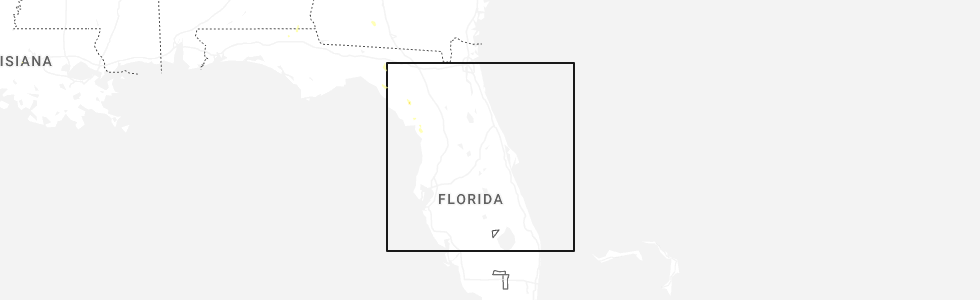
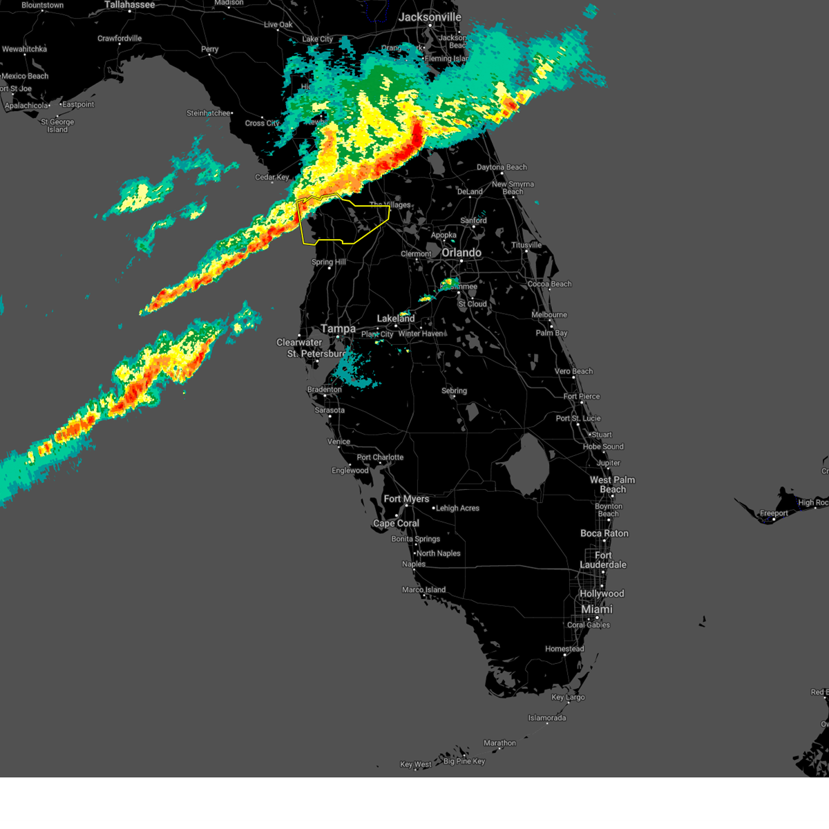
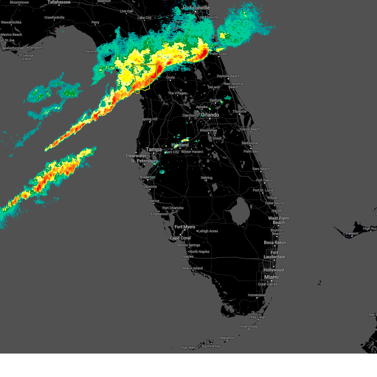
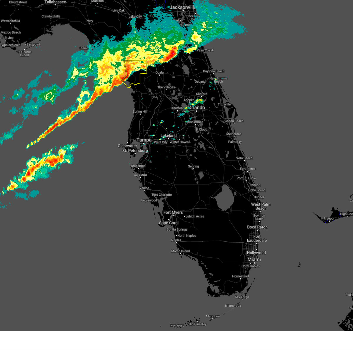
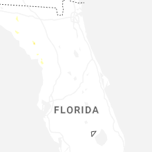
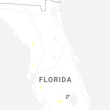
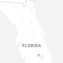
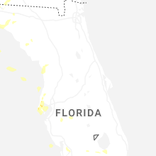
Hail Map for Inglis, FL
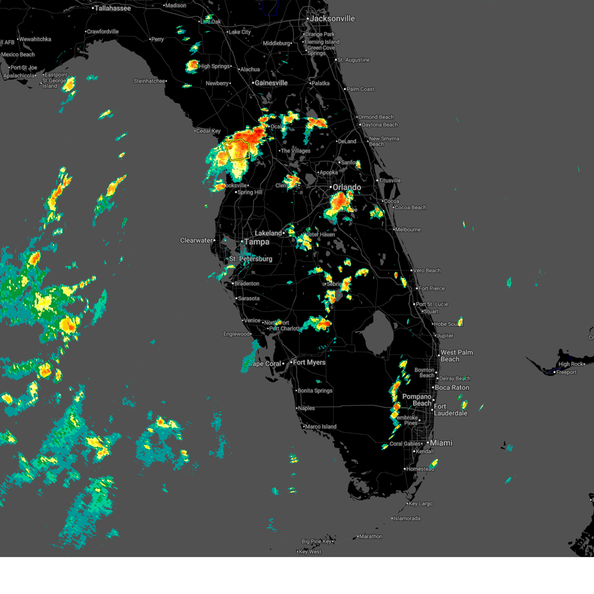
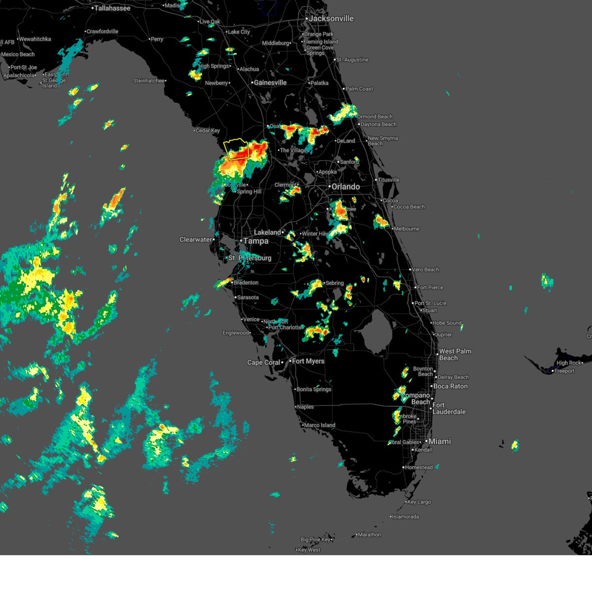
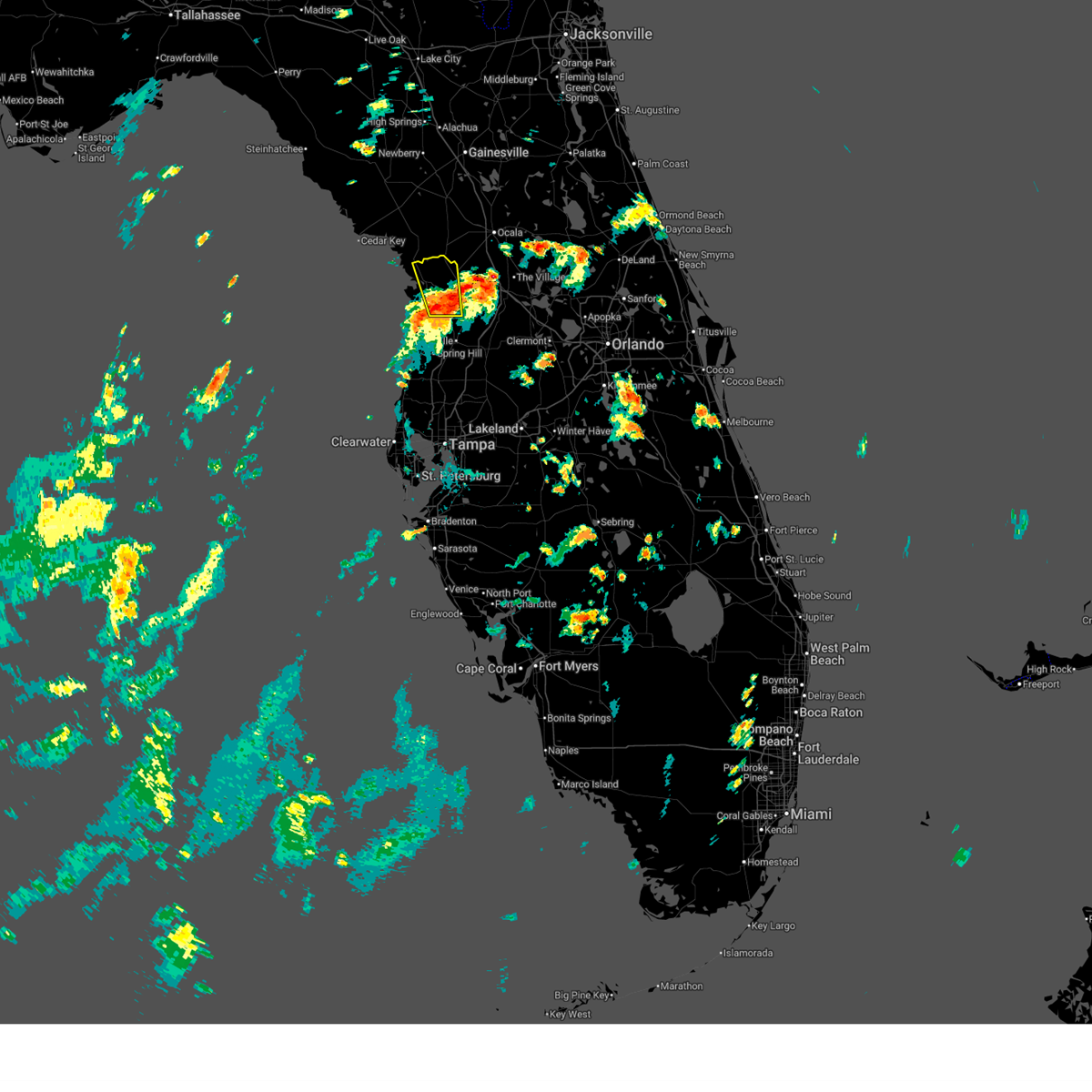
The Inglis, FL area has had 0 reports of on-the-ground hail by trained spotters, and has been under severe weather warnings 5 times during the past 12 months. Doppler radar has detected hail at or near Inglis, FL on 33 occasions, including 4 occasions during the past year.
| Name: | Inglis, FL |
| Where Located: | 85.2 miles WNW of Orlando, FL |
| Map: | Google Map for Inglis, FL |
| Population: | 1325 |
| Housing Units: | 823 |
| More Info: | Search Google for Inglis, FL |
4
The Top Recent Hail Date for Inglis, FL is Friday, April 3, 2026 (5th out of 33)
Hail and Wind Damage Spotted near Inglis, FL
| Date / Time | Report Details |
|---|---|
| 7/24/2025 8:38 PM EDT |
 The storm which prompted the warning has weakened below severe limits, and no longer poses an immediate threat to life or property. therefore, the warning will be allowed to expire. The storm which prompted the warning has weakened below severe limits, and no longer poses an immediate threat to life or property. therefore, the warning will be allowed to expire.
|
| 7/24/2025 8:13 PM EDT |
 Svrtbw the national weather service in ruskin has issued a * severe thunderstorm warning for, northwestern citrus county in west central florida, southeastern levy county in northern florida, * until 845 pm edt. * at 813 pm edt, a severe thunderstorm was located 10 miles west of rainbow lakes estates, moving west at 15 mph (radar indicated). Hazards include 60 mph wind gusts and penny size hail. expect damage to roofs, siding, and trees Svrtbw the national weather service in ruskin has issued a * severe thunderstorm warning for, northwestern citrus county in west central florida, southeastern levy county in northern florida, * until 845 pm edt. * at 813 pm edt, a severe thunderstorm was located 10 miles west of rainbow lakes estates, moving west at 15 mph (radar indicated). Hazards include 60 mph wind gusts and penny size hail. expect damage to roofs, siding, and trees
|
| 7/16/2025 6:11 PM EDT |
 The storm which prompted the warning has weakened below severe limits, and has exited the warned area. therefore, the warning will be allowed to expire. however, gusty winds are still possible with this thunderstorm. The storm which prompted the warning has weakened below severe limits, and has exited the warned area. therefore, the warning will be allowed to expire. however, gusty winds are still possible with this thunderstorm.
|
| 7/16/2025 5:54 PM EDT |
 At 554 pm edt, a severe thunderstorm was located near black diamond, or near beverly hills, moving north at 25 mph (radar indicated). Hazards include 60 mph wind gusts. Expect damage to roofs, siding, and trees. Locations impacted include, lecanto, citronelle, crystal manor, crystal oaks, inverness highlands north, citrus springs, crystal river airport, pine ridge, beverly hills, and citrus hills. At 554 pm edt, a severe thunderstorm was located near black diamond, or near beverly hills, moving north at 25 mph (radar indicated). Hazards include 60 mph wind gusts. Expect damage to roofs, siding, and trees. Locations impacted include, lecanto, citronelle, crystal manor, crystal oaks, inverness highlands north, citrus springs, crystal river airport, pine ridge, beverly hills, and citrus hills.
|
| 7/16/2025 5:41 PM EDT |
 Svrtbw the national weather service in ruskin has issued a * severe thunderstorm warning for, central citrus county in west central florida, * until 615 pm edt. * at 541 pm edt, a severe thunderstorm was located near homosassa springs, moving north at 25 mph (radar indicated). Hazards include 60 mph wind gusts. expect damage to roofs, siding, and trees Svrtbw the national weather service in ruskin has issued a * severe thunderstorm warning for, central citrus county in west central florida, * until 615 pm edt. * at 541 pm edt, a severe thunderstorm was located near homosassa springs, moving north at 25 mph (radar indicated). Hazards include 60 mph wind gusts. expect damage to roofs, siding, and trees
|
| 1/19/2025 7:38 AM EST |
 Svrtbw the national weather service in ruskin has issued a * severe thunderstorm warning for, citrus county in west central florida, northwestern sumter county in central florida, * until 830 am est. * at 738 am est, severe thunderstorms were located along a line extending from 14 miles northwest of crystal river airport to 11 miles west of homosassa to 28 miles west of pine island, moving east at 50 mph (radar indicated). Hazards include 60 mph wind gusts. expect damage to roofs, siding, and trees Svrtbw the national weather service in ruskin has issued a * severe thunderstorm warning for, citrus county in west central florida, northwestern sumter county in central florida, * until 830 am est. * at 738 am est, severe thunderstorms were located along a line extending from 14 miles northwest of crystal river airport to 11 miles west of homosassa to 28 miles west of pine island, moving east at 50 mph (radar indicated). Hazards include 60 mph wind gusts. expect damage to roofs, siding, and trees
|
| 1/19/2025 7:13 AM EST |
 The storms which prompted the warning have moved out of the area. therefore, the warning will be allowed to expire. however, gusty winds are still possible with these thunderstorms. The storms which prompted the warning have moved out of the area. therefore, the warning will be allowed to expire. however, gusty winds are still possible with these thunderstorms.
|
| 1/19/2025 6:50 AM EST |
 Svrtbw the national weather service in ruskin has issued a * severe thunderstorm warning for, southeastern levy county in northern florida, * until 715 am est. * at 650 am est, severe thunderstorms were located along a line extending from 9 miles southeast of chiefland to 16 miles southwest of williston highlands to 22 miles northwest of crystal river airport, moving east at 55 mph (radar indicated). Hazards include 60 mph wind gusts. expect damage to roofs, siding, and trees Svrtbw the national weather service in ruskin has issued a * severe thunderstorm warning for, southeastern levy county in northern florida, * until 715 am est. * at 650 am est, severe thunderstorms were located along a line extending from 9 miles southeast of chiefland to 16 miles southwest of williston highlands to 22 miles northwest of crystal river airport, moving east at 55 mph (radar indicated). Hazards include 60 mph wind gusts. expect damage to roofs, siding, and trees
|
| 5/17/2024 9:08 AM EDT |
 The storm which prompted the warning has weakened below severe limits, and no longer poses an immediate threat to life or property. therefore, the warning will be allowed to expire. however, gusty winds are still possible with this thunderstorm. The storm which prompted the warning has weakened below severe limits, and no longer poses an immediate threat to life or property. therefore, the warning will be allowed to expire. however, gusty winds are still possible with this thunderstorm.
|
| 5/17/2024 8:09 AM EDT |
 Svrtbw the national weather service in ruskin has issued a * severe thunderstorm warning for, northwestern citrus county in west central florida, levy county in northern florida, * until 915 am edt. * at 809 am edt, a severe thunderstorm was located 15 miles south of fowlers bluff, or 25 miles southwest of chiefland, moving northeast at 25 mph (radar indicated). Hazards include 70 mph wind gusts. Expect considerable tree damage. Damage is likely to mobile homes, roofs, and outbuildings. Svrtbw the national weather service in ruskin has issued a * severe thunderstorm warning for, northwestern citrus county in west central florida, levy county in northern florida, * until 915 am edt. * at 809 am edt, a severe thunderstorm was located 15 miles south of fowlers bluff, or 25 miles southwest of chiefland, moving northeast at 25 mph (radar indicated). Hazards include 70 mph wind gusts. Expect considerable tree damage. Damage is likely to mobile homes, roofs, and outbuildings.
|
| 4/11/2024 11:29 AM EDT |
 Svrtbw the national weather service in ruskin has issued a * severe thunderstorm warning for, citrus county in west central florida, northern sumter county in central florida, northern hernando county in west central florida, southeastern levy county in northern florida, * until noon edt. * at 1129 am edt, severe thunderstorms were located along a line extending from 7 miles northwest of crystal river airport to black diamond to near inverness highlands north, moving northeast at 50 mph (radar indicated). Hazards include 60 mph wind gusts. expect damage to roofs, siding, and trees Svrtbw the national weather service in ruskin has issued a * severe thunderstorm warning for, citrus county in west central florida, northern sumter county in central florida, northern hernando county in west central florida, southeastern levy county in northern florida, * until noon edt. * at 1129 am edt, severe thunderstorms were located along a line extending from 7 miles northwest of crystal river airport to black diamond to near inverness highlands north, moving northeast at 50 mph (radar indicated). Hazards include 60 mph wind gusts. expect damage to roofs, siding, and trees
|
| 10/12/2023 5:54 AM EDT |
 The tornado warning for north central citrus and southeastern levy counties will expire at 600 am edt, the storm which prompted the warning has weakened below severe limits, and no longer appears capable of producing a tornado. therefore, the warning will be allowed to expire. however, gusty winds and heavy rain are still possible with this thunderstorm. a tornado watch remains in effect until 900 am edt for northern and west central florida. The tornado warning for north central citrus and southeastern levy counties will expire at 600 am edt, the storm which prompted the warning has weakened below severe limits, and no longer appears capable of producing a tornado. therefore, the warning will be allowed to expire. however, gusty winds and heavy rain are still possible with this thunderstorm. a tornado watch remains in effect until 900 am edt for northern and west central florida.
|
| 10/12/2023 5:46 AM EDT |
 At 546 am edt, a severe thunderstorm capable of producing a tornado was located 12 miles north of crystal river airport, or 13 miles southwest of rainbow lakes estates, moving northeast at 45 mph (radar indicated rotation). Hazards include tornado. Flying debris will be dangerous to those caught without shelter. mobile homes will be damaged or destroyed. damage to roofs, windows, and vehicles will occur. tree damage is likely. Locations impacted include, inglis, lebanon, citronelle, crystal manor, and citrus springs. At 546 am edt, a severe thunderstorm capable of producing a tornado was located 12 miles north of crystal river airport, or 13 miles southwest of rainbow lakes estates, moving northeast at 45 mph (radar indicated rotation). Hazards include tornado. Flying debris will be dangerous to those caught without shelter. mobile homes will be damaged or destroyed. damage to roofs, windows, and vehicles will occur. tree damage is likely. Locations impacted include, inglis, lebanon, citronelle, crystal manor, and citrus springs.
|
| 10/12/2023 5:34 AM EDT |
 At 533 am edt, a severe thunderstorm capable of producing a tornado was located 11 miles northwest of crystal river airport, or 15 miles northwest of homosassa springs, moving northeast at 45 mph (radar indicated rotation). Hazards include tornado. Flying debris will be dangerous to those caught without shelter. mobile homes will be damaged or destroyed. damage to roofs, windows, and vehicles will occur. tree damage is likely. This tornadic thunderstorm will remain over mainly rural areas of northwestern citrus and southeastern levy counties, including the following locations, lebanon, citronelle, crystal manor, inglis, and citrus springs. At 533 am edt, a severe thunderstorm capable of producing a tornado was located 11 miles northwest of crystal river airport, or 15 miles northwest of homosassa springs, moving northeast at 45 mph (radar indicated rotation). Hazards include tornado. Flying debris will be dangerous to those caught without shelter. mobile homes will be damaged or destroyed. damage to roofs, windows, and vehicles will occur. tree damage is likely. This tornadic thunderstorm will remain over mainly rural areas of northwestern citrus and southeastern levy counties, including the following locations, lebanon, citronelle, crystal manor, inglis, and citrus springs.
|
| 5/12/2023 7:02 PM EDT |
 At 702 pm edt, a severe thunderstorm was located 12 miles northwest of crystal river airport, or 14 miles northwest of beverly hills, moving southwest at 10 mph (radar indicated). Hazards include quarter size hail. damage to vehicles is expected At 702 pm edt, a severe thunderstorm was located 12 miles northwest of crystal river airport, or 14 miles northwest of beverly hills, moving southwest at 10 mph (radar indicated). Hazards include quarter size hail. damage to vehicles is expected
|
| 5/11/2023 6:17 PM EDT |
 At 617 pm edt, a severe thunderstorm was located 7 miles north of crystal river airport, or 9 miles northwest of beverly hills, moving east at 10 mph (radar indicated). Hazards include 60 mph wind gusts and quarter size hail. Hail damage to vehicles is expected. expect wind damage to roofs, siding, and trees. locations impacted include, inglis, pine ridge, citronelle, crystal manor, crystal river airport, homosassa springs, homosassa, black diamond, and citrus springs. hail threat, radar indicated max hail size, 1. 00 in wind threat, radar indicated max wind gust, 60 mph. At 617 pm edt, a severe thunderstorm was located 7 miles north of crystal river airport, or 9 miles northwest of beverly hills, moving east at 10 mph (radar indicated). Hazards include 60 mph wind gusts and quarter size hail. Hail damage to vehicles is expected. expect wind damage to roofs, siding, and trees. locations impacted include, inglis, pine ridge, citronelle, crystal manor, crystal river airport, homosassa springs, homosassa, black diamond, and citrus springs. hail threat, radar indicated max hail size, 1. 00 in wind threat, radar indicated max wind gust, 60 mph.
|
| 5/11/2023 5:59 PM EDT |
 At 558 pm edt, a severe thunderstorm was located near crystal river airport, or 9 miles west of beverly hills, moving north at 10 mph (radar indicated). Hazards include 60 mph wind gusts and quarter size hail. Hail damage to vehicles is expected. Expect wind damage to roofs, siding, and trees. At 558 pm edt, a severe thunderstorm was located near crystal river airport, or 9 miles west of beverly hills, moving north at 10 mph (radar indicated). Hazards include 60 mph wind gusts and quarter size hail. Hail damage to vehicles is expected. Expect wind damage to roofs, siding, and trees.
|
| 9/8/2022 7:25 AM EDT |
 At 725 am edt, a severe thunderstorm capable of producing a tornado was located 13 miles west of rainbow lakes estates, moving northeast at 15 mph (radar indicated rotation). Hazards include tornado. Flying debris will be dangerous to those caught without shelter. mobile homes will be damaged or destroyed. damage to roofs, windows, and vehicles will occur. tree damage is likely. This tornadic thunderstorm will remain over mainly rural areas of southeastern levy county, including the following locations, lebanon and inglis. At 725 am edt, a severe thunderstorm capable of producing a tornado was located 13 miles west of rainbow lakes estates, moving northeast at 15 mph (radar indicated rotation). Hazards include tornado. Flying debris will be dangerous to those caught without shelter. mobile homes will be damaged or destroyed. damage to roofs, windows, and vehicles will occur. tree damage is likely. This tornadic thunderstorm will remain over mainly rural areas of southeastern levy county, including the following locations, lebanon and inglis.
|
| 5/31/2022 4:49 PM EDT |
 At 448 pm edt, a severe thunderstorm was located near crystal river airport, or 9 miles west of beverly hills, moving southwest at 15 mph (radar indicated). Hazards include 60 mph wind gusts and quarter size hail. Hail damage to vehicles is expected. Expect wind damage to roofs, siding, and trees. At 448 pm edt, a severe thunderstorm was located near crystal river airport, or 9 miles west of beverly hills, moving southwest at 15 mph (radar indicated). Hazards include 60 mph wind gusts and quarter size hail. Hail damage to vehicles is expected. Expect wind damage to roofs, siding, and trees.
|
| 4/7/2022 9:00 AM EDT |
 At 900 am edt, a severe thunderstorm was located 18 miles northwest of crystal river airport, or 22 miles northwest of homosassa springs, moving east at 35 mph (radar indicated). Hazards include 60 mph wind gusts and quarter size hail. Hail damage to vehicles is expected. Expect wind damage to roofs, siding, and trees. At 900 am edt, a severe thunderstorm was located 18 miles northwest of crystal river airport, or 22 miles northwest of homosassa springs, moving east at 35 mph (radar indicated). Hazards include 60 mph wind gusts and quarter size hail. Hail damage to vehicles is expected. Expect wind damage to roofs, siding, and trees.
|
| 3/12/2022 7:37 AM EST | Public reports to emergency manager of trees down and a 5-wheel truck and trailer over turned with people trapped inside. near inglis and highway 4 in levy county FL, 0.3 miles E of Inglis, FL |
| 3/12/2022 7:37 AM EST | Numerous trees and lower lines down. two truck/trailers were over turned... people were trapped inside. roof torn off mobile hom in levy county FL, 4.6 miles W of Inglis, FL |
| 3/12/2022 7:22 AM EST |
 At 721 am est, severe thunderstorms were located along a line extending from 16 miles west of rainbow lakes estates to 28 miles west of pine island, moving east at 40 mph (radar indicated). Hazards include 60 mph wind gusts. expect damage to roofs, siding, and trees At 721 am est, severe thunderstorms were located along a line extending from 16 miles west of rainbow lakes estates to 28 miles west of pine island, moving east at 40 mph (radar indicated). Hazards include 60 mph wind gusts. expect damage to roofs, siding, and trees
|
| 7/22/2020 3:00 PM EDT | Levy county fr reports tree down on a powerlines. time estimated by rada in levy county FL, 4.6 miles W of Inglis, FL |
| 4/20/2020 9:20 AM EDT | Caller reported tree damage on cr336 near cr 337 blocking both lanes near rainbow lake estate in levy county FL, 9 miles SW of Inglis, FL |
| 4/20/2020 9:12 AM EDT |
 At 912 am edt, severe thunderstorms were located along a line extending from 9 miles southwest of williston highlands to 9 miles southwest of rainbow lakes estates, moving east at 40 mph (radar indicated). Hazards include 60 mph wind gusts and nickel size hail. expect damage to roofs, siding, and trees At 912 am edt, severe thunderstorms were located along a line extending from 9 miles southwest of williston highlands to 9 miles southwest of rainbow lakes estates, moving east at 40 mph (radar indicated). Hazards include 60 mph wind gusts and nickel size hail. expect damage to roofs, siding, and trees
|
| 4/20/2020 8:43 AM EDT |
 At 842 am edt, severe thunderstorms were located along a line extending from 11 miles south of chiefland to 18 miles west of rainbow lakes estates, moving east at 40 mph (radar indicated). Hazards include 60 mph wind gusts and nickel size hail. expect damage to roofs, siding, and trees At 842 am edt, severe thunderstorms were located along a line extending from 11 miles south of chiefland to 18 miles west of rainbow lakes estates, moving east at 40 mph (radar indicated). Hazards include 60 mph wind gusts and nickel size hail. expect damage to roofs, siding, and trees
|
| 2/6/2020 9:28 PM EST |
 At 928 pm est, severe thunderstorms were located along a line extending from 8 miles northwest of archer to 37 miles west of harbor bluffs, moving east at 35 mph (radar indicated). Hazards include 60 mph wind gusts. expect damage to roofs, siding, and trees At 928 pm est, severe thunderstorms were located along a line extending from 8 miles northwest of archer to 37 miles west of harbor bluffs, moving east at 35 mph (radar indicated). Hazards include 60 mph wind gusts. expect damage to roofs, siding, and trees
|
| 2/6/2020 8:33 PM EST |
 At 831 pm est, severe thunderstorms were located along a line extending from near cross city to 59 miles west of hudson, moving east at 35 mph (radar indicated). Hazards include 60 mph wind gusts. expect damage to roofs, siding, and trees At 831 pm est, severe thunderstorms were located along a line extending from near cross city to 59 miles west of hudson, moving east at 35 mph (radar indicated). Hazards include 60 mph wind gusts. expect damage to roofs, siding, and trees
|
| 6/28/2019 6:54 PM EDT | Trees down on houses in yankeetown... f in levy county FL, 1.6 miles ESE of Inglis, FL |
| 4/19/2019 11:42 AM EDT |
 At 1142 am edt, a severe thunderstorm was located 7 miles northwest of crystal river airport, or 12 miles west of beverly hills, moving northeast at 60 mph (radar indicated). Hazards include 60 mph wind gusts. expect damage to roofs, siding, and trees At 1142 am edt, a severe thunderstorm was located 7 miles northwest of crystal river airport, or 12 miles west of beverly hills, moving northeast at 60 mph (radar indicated). Hazards include 60 mph wind gusts. expect damage to roofs, siding, and trees
|
| 7/22/2018 7:15 PM EDT |
 At 713 pm edt, a severe thunderstorm was located near crystal river airport, or 7 miles west of beverly hills, moving east at 25 mph (radar indicated). Hazards include 60 mph wind gusts and nickel size hail. expect damage to roofs, siding, and trees At 713 pm edt, a severe thunderstorm was located near crystal river airport, or 7 miles west of beverly hills, moving east at 25 mph (radar indicated). Hazards include 60 mph wind gusts and nickel size hail. expect damage to roofs, siding, and trees
|
| 4/7/2018 4:26 PM EDT |
 At 425 pm edt, severe thunderstorms were located along a line extending from fanning springs to 30 miles west of homosassa, moving east at 40 mph (radar indicated). Hazards include 60 mph wind gusts and penny size hail. Expect damage to roofs, siding, and trees. Locations impacted include, chiefland, bronson, inglis, fanning springs, otter creek, lebanon and manatee springs state park. At 425 pm edt, severe thunderstorms were located along a line extending from fanning springs to 30 miles west of homosassa, moving east at 40 mph (radar indicated). Hazards include 60 mph wind gusts and penny size hail. Expect damage to roofs, siding, and trees. Locations impacted include, chiefland, bronson, inglis, fanning springs, otter creek, lebanon and manatee springs state park.
|
| 4/7/2018 4:01 PM EDT |
 At 400 pm edt, severe thunderstorms were located along a line extending from 7 miles east of horseshoe point to 35 miles southwest of fowlers bluff, moving east at 40 mph (radar indicated). Hazards include 60 mph wind gusts and penny size hail. expect damage to roofs, siding, and trees At 400 pm edt, severe thunderstorms were located along a line extending from 7 miles east of horseshoe point to 35 miles southwest of fowlers bluff, moving east at 40 mph (radar indicated). Hazards include 60 mph wind gusts and penny size hail. expect damage to roofs, siding, and trees
|
| 8/24/2017 8:07 PM EDT |
 At 806 pm edt, a severe thunderstorm was located near black diamond, or 7 miles northwest of beverly hills, and is nearly stationary (radar indicated). Hazards include 60 mph wind gusts and nickel size hail. expect damage to roofs, siding, and trees At 806 pm edt, a severe thunderstorm was located near black diamond, or 7 miles northwest of beverly hills, and is nearly stationary (radar indicated). Hazards include 60 mph wind gusts and nickel size hail. expect damage to roofs, siding, and trees
|
| 5/24/2017 12:08 PM EDT |
 At 1207 pm edt, severe thunderstorms were located along a line extending from 5 miles southwest of alachua to 20 miles northwest of crystal river airport, moving northeast at 45 mph (radar indicated). Hazards include 60 mph wind gusts. Expect damage to roofs, siding, and trees. Locations impacted include, williston, bronson, williston highlands, east bronson, williston municipal airport, inglis, otter creek and lebanon. At 1207 pm edt, severe thunderstorms were located along a line extending from 5 miles southwest of alachua to 20 miles northwest of crystal river airport, moving northeast at 45 mph (radar indicated). Hazards include 60 mph wind gusts. Expect damage to roofs, siding, and trees. Locations impacted include, williston, bronson, williston highlands, east bronson, williston municipal airport, inglis, otter creek and lebanon.
|
| 5/24/2017 11:51 AM EDT |
 At 1150 am edt, severe thunderstorms were located along a line extending from near trenton to 20 miles west of homosassa, moving northeast at 35 mph (radar indicated). Hazards include 60 mph wind gusts. expect damage to roofs, siding, and trees At 1150 am edt, severe thunderstorms were located along a line extending from near trenton to 20 miles west of homosassa, moving northeast at 35 mph (radar indicated). Hazards include 60 mph wind gusts. expect damage to roofs, siding, and trees
|
| 2/7/2017 10:17 PM EST |
 At 1017 pm est, severe thunderstorms were located along a line extending from 6 miles northeast of williston to 12 miles northwest of black diamond to 15 miles west of weeki wachee gardens, moving east at 45 mph (radar indicated). Hazards include 60 mph wind gusts and penny size hail. Expect damage to roofs, siding, and trees. Locations impacted include, williston, beverly hills, homosassa springs, williston highlands, crystal river airport, williston municipal airport, black diamond, homosassa, east bronson, inglis, citronelle, crystal manor, crystal oaks, citrus springs, lebanon, pine ridge and lecanto. At 1017 pm est, severe thunderstorms were located along a line extending from 6 miles northeast of williston to 12 miles northwest of black diamond to 15 miles west of weeki wachee gardens, moving east at 45 mph (radar indicated). Hazards include 60 mph wind gusts and penny size hail. Expect damage to roofs, siding, and trees. Locations impacted include, williston, beverly hills, homosassa springs, williston highlands, crystal river airport, williston municipal airport, black diamond, homosassa, east bronson, inglis, citronelle, crystal manor, crystal oaks, citrus springs, lebanon, pine ridge and lecanto.
|
| 2/7/2017 10:03 PM EST |
 At 1002 pm est, severe thunderstorms were located along a line extending from near east bronson to 19 miles northwest of crystal river airport to 30 miles west of weeki wachee gardens, moving east at 35 mph (radar indicated). Hazards include 60 mph wind gusts and penny size hail. Expect damage to roofs, siding, and trees. Locations impacted include, williston, bronson, beverly hills, homosassa springs, williston highlands, east bronson, crystal river airport, williston municipal airport, black diamond, homosassa, inglis, otter creek, citronelle, crystal manor, crystal oaks, citrus springs, lebanon, pine ridge and lecanto. At 1002 pm est, severe thunderstorms were located along a line extending from near east bronson to 19 miles northwest of crystal river airport to 30 miles west of weeki wachee gardens, moving east at 35 mph (radar indicated). Hazards include 60 mph wind gusts and penny size hail. Expect damage to roofs, siding, and trees. Locations impacted include, williston, bronson, beverly hills, homosassa springs, williston highlands, east bronson, crystal river airport, williston municipal airport, black diamond, homosassa, inglis, otter creek, citronelle, crystal manor, crystal oaks, citrus springs, lebanon, pine ridge and lecanto.
|
| 2/7/2017 9:40 PM EST |
 At 939 pm est, severe thunderstorms were located along a line extending from near trenton to 21 miles south of fowlers bluff to 38 miles west of homosassa, moving east at 45 mph (radar indicated). Hazards include 60 mph wind gusts and penny size hail. expect damage to roofs, siding, and trees At 939 pm est, severe thunderstorms were located along a line extending from near trenton to 21 miles south of fowlers bluff to 38 miles west of homosassa, moving east at 45 mph (radar indicated). Hazards include 60 mph wind gusts and penny size hail. expect damage to roofs, siding, and trees
|
| 2/7/2017 9:08 PM EST |
 At 907 pm est, severe thunderstorms were located along a line extending from near horseshoe point to 28 miles southwest of fowlers bluff to 62 miles south of steinhatchee, moving east at 60 mph (radar indicated). Hazards include 60 mph wind gusts and penny size hail. expect damage to roofs, siding, and trees At 907 pm est, severe thunderstorms were located along a line extending from near horseshoe point to 28 miles southwest of fowlers bluff to 62 miles south of steinhatchee, moving east at 60 mph (radar indicated). Hazards include 60 mph wind gusts and penny size hail. expect damage to roofs, siding, and trees
|
| 1/7/2017 1:48 AM EST |
 At 148 am est, a severe thunderstorm capable of producing a tornado was located 7 miles northwest of crystal river airport, or 11 miles northwest of homosassa springs, moving east at 30 mph (radar indicated rotation). Hazards include tornado. Flying debris will be dangerous to those caught without shelter. mobile homes will be damaged or destroyed. damage to roofs, windows, and vehicles will occur. Tree damage is likely. At 148 am est, a severe thunderstorm capable of producing a tornado was located 7 miles northwest of crystal river airport, or 11 miles northwest of homosassa springs, moving east at 30 mph (radar indicated rotation). Hazards include tornado. Flying debris will be dangerous to those caught without shelter. mobile homes will be damaged or destroyed. damage to roofs, windows, and vehicles will occur. Tree damage is likely.
|
| 1/15/2016 8:38 AM EST |
 At 838 am est, severe thunderstorms were located along a line extending from 6 miles south of bronson to 12 miles west of rainbow lakes estates to 25 miles west of weeki wachee gardens, moving east at 55 mph (radar indicated). Hazards include 60 mph wind gusts. Expect damage to roofs. siding and trees. Locations impacted include, inverness, williston, bronson, homosassa springs, beverly hills, inverness highlands north, crystal river airport, black diamond, east bronson, homosassa, williston highlands, inverness highlands south, inverness airport, williston municipal airport, hernando, sugarmill woods, inglis, green acres, brent wood and lebanon. At 838 am est, severe thunderstorms were located along a line extending from 6 miles south of bronson to 12 miles west of rainbow lakes estates to 25 miles west of weeki wachee gardens, moving east at 55 mph (radar indicated). Hazards include 60 mph wind gusts. Expect damage to roofs. siding and trees. Locations impacted include, inverness, williston, bronson, homosassa springs, beverly hills, inverness highlands north, crystal river airport, black diamond, east bronson, homosassa, williston highlands, inverness highlands south, inverness airport, williston municipal airport, hernando, sugarmill woods, inglis, green acres, brent wood and lebanon.
|
| 1/15/2016 7:47 AM EST |
 At 746 am est, severe thunderstorms were located along a line extending from 12 miles south of horseshoe point to 32 miles southwest of fowlers bluff to 63 miles west of beacon square, moving east at 60 mph (radar indicated). Hazards include 60 mph wind gusts and penny size hail. Expect damage to roofs. Siding and trees. At 746 am est, severe thunderstorms were located along a line extending from 12 miles south of horseshoe point to 32 miles southwest of fowlers bluff to 63 miles west of beacon square, moving east at 60 mph (radar indicated). Hazards include 60 mph wind gusts and penny size hail. Expect damage to roofs. Siding and trees.
|
Hail Maps for Inglis, FL


Connect with Interactive Hail Maps