

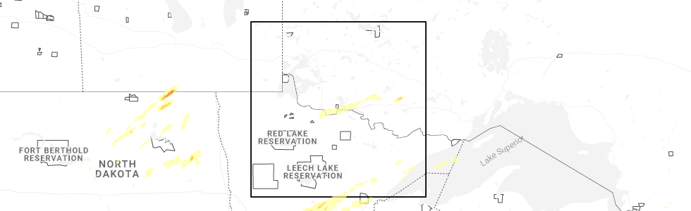
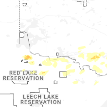
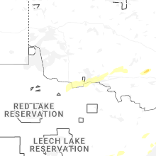
Hail Map for International Falls, MN
The International Falls, MN area has had 9 reports of on-the-ground hail by trained spotters, and has been under severe weather warnings 9 times during the past 12 months. Doppler radar has detected hail at or near International Falls, MN on 31 occasions, including 2 occasions during the past year.
| Name: | International Falls, MN |
| Where Located: | 0.8 miles SSW of International Falls, MN |
| Map: | Google Map for International Falls, MN |
| Population: | 6424 |
| Housing Units: | 3157 |
| More Info: | Search Google for International Falls, MN |
3
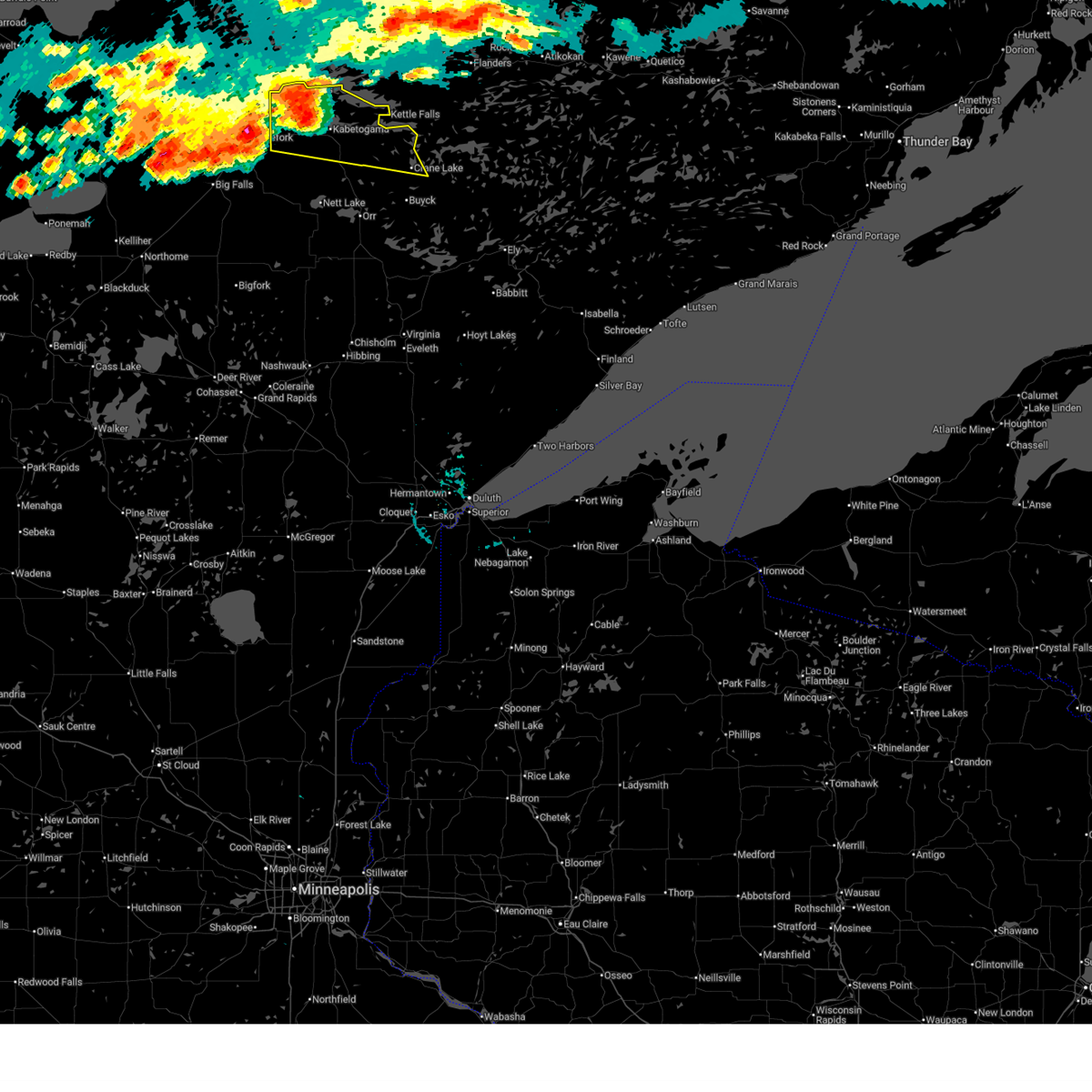
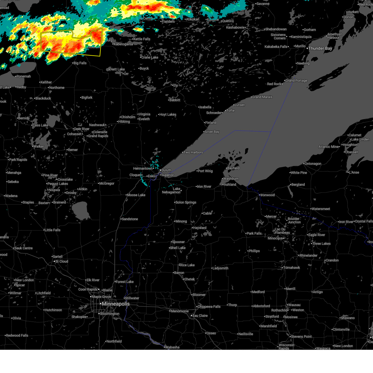
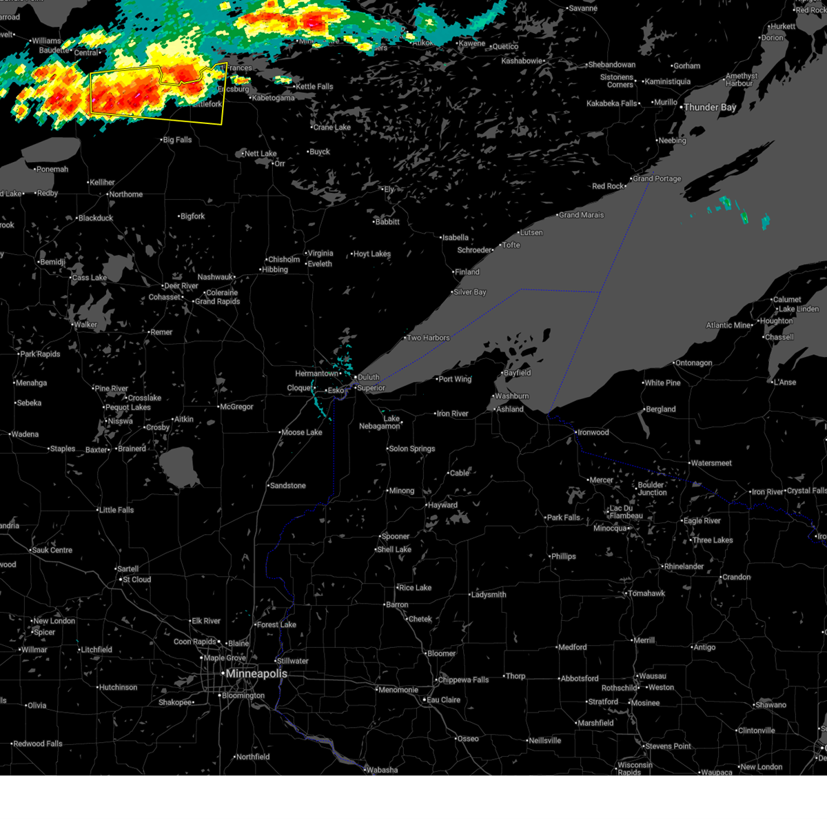
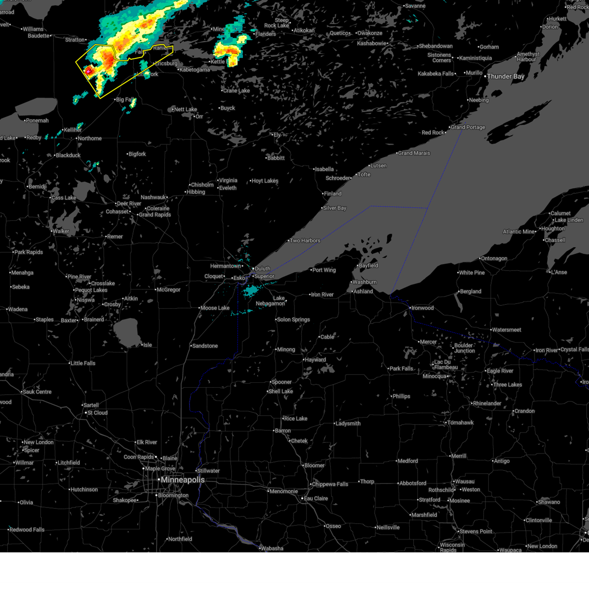
The Top Recent Hail Date for International Falls, MN is Sunday, June 22, 2025 (9th out of 31)
Hail and Wind Damage Spotted near International Falls, MN
| Date / Time | Report Details |
|---|---|
| 7/4/2025 3:04 PM CDT |
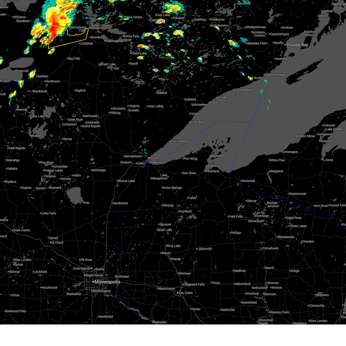
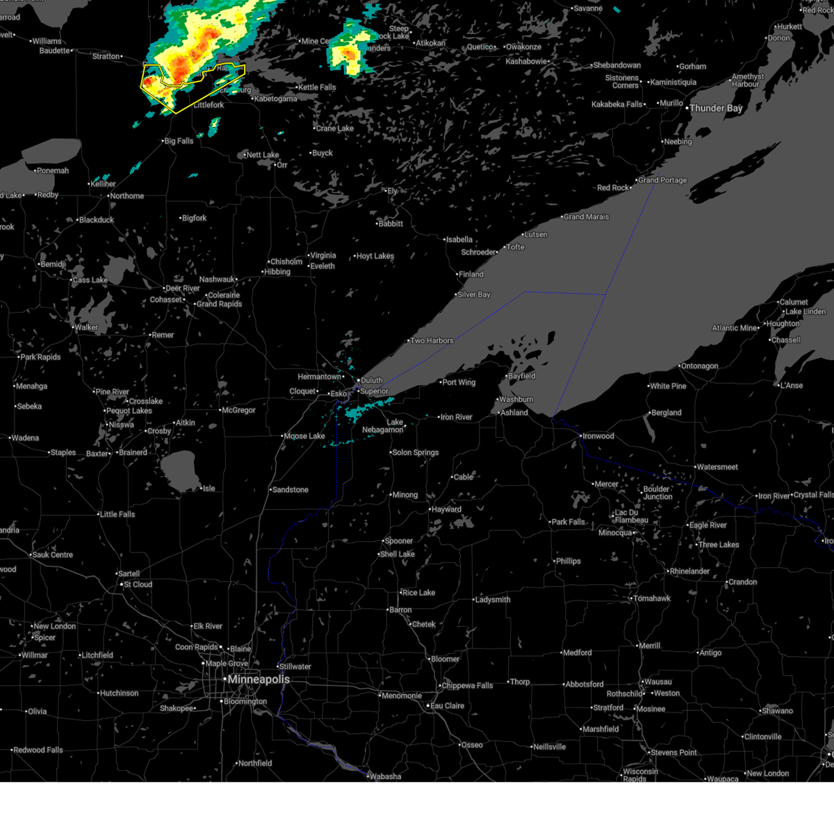
 Svrdlh the national weather service in duluth mn has issued a * severe thunderstorm warning for, northeastern koochiching county in north central minnesota, northwestern st. louis county in northeastern minnesota, * until 400 pm cdt. * at 303 pm cdt, a severe thunderstorm was located near rainy lake west, or 10 miles east of international falls, moving east at 35 mph. this is a destructive storm for far northeast koochiching and far northwestern st. louis county. this includes internationall falls (radar indicated). Hazards include 80 mph wind gusts and golf ball size hail. Flying debris will be dangerous to those caught without shelter. mobile homes will be heavily damaged. expect considerable damage to roofs, windows, and vehicles. extensive tree damage and power outages are likely. this severe thunderstorm will be near, rainy lake west, voyageurs national park, and kabetogama lake around 310 pm cdt. Rainy lake east around 315 pm cdt. Svrdlh the national weather service in duluth mn has issued a * severe thunderstorm warning for, northeastern koochiching county in north central minnesota, northwestern st. louis county in northeastern minnesota, * until 400 pm cdt. * at 303 pm cdt, a severe thunderstorm was located near rainy lake west, or 10 miles east of international falls, moving east at 35 mph. this is a destructive storm for far northeast koochiching and far northwestern st. louis county. this includes internationall falls (radar indicated). Hazards include 80 mph wind gusts and golf ball size hail. Flying debris will be dangerous to those caught without shelter. mobile homes will be heavily damaged. expect considerable damage to roofs, windows, and vehicles. extensive tree damage and power outages are likely. this severe thunderstorm will be near, rainy lake west, voyageurs national park, and kabetogama lake around 310 pm cdt. Rainy lake east around 315 pm cdt.
|
| 7/4/2025 2:59 PM CDT | Corrects previous non thunderstorm wind gust report from 1 s international falls to a thunderstorm wind gust. asos station kinl international falls airpor in koochiching county MN, 1.5 miles NNW of International Falls, MN |
| 7/4/2025 2:53 PM CDT |
 At 253 pm cdt, severe thunderstorms were located along a line extending from 13 miles southwest of birchdale to near international falls, moving east at 20 mph (radar indicated). Hazards include 60 mph wind gusts and quarter size hail. Hail damage to vehicles is expected. expect wind damage to roofs, siding, and trees. Locations impacted include, international falls, pelland and loman. At 253 pm cdt, severe thunderstorms were located along a line extending from 13 miles southwest of birchdale to near international falls, moving east at 20 mph (radar indicated). Hazards include 60 mph wind gusts and quarter size hail. Hail damage to vehicles is expected. expect wind damage to roofs, siding, and trees. Locations impacted include, international falls, pelland and loman.
|
| 7/4/2025 2:33 PM CDT |
 Svrdlh the national weather service in duluth mn has issued a * severe thunderstorm warning for, northern koochiching county in north central minnesota, * until 315 pm cdt. * at 233 pm cdt, severe thunderstorms were located along a line extending from 18 miles southwest of birchdale to pelland, moving east at 20 mph (radar indicated). Hazards include 60 mph wind gusts and quarter size hail. Hail damage to vehicles is expected. expect wind damage to roofs, siding, and trees. severe thunderstorms will be near, pelland and loman around 240 pm cdt. International falls around 245 pm cdt. Svrdlh the national weather service in duluth mn has issued a * severe thunderstorm warning for, northern koochiching county in north central minnesota, * until 315 pm cdt. * at 233 pm cdt, severe thunderstorms were located along a line extending from 18 miles southwest of birchdale to pelland, moving east at 20 mph (radar indicated). Hazards include 60 mph wind gusts and quarter size hail. Hail damage to vehicles is expected. expect wind damage to roofs, siding, and trees. severe thunderstorms will be near, pelland and loman around 240 pm cdt. International falls around 245 pm cdt.
|
| 6/22/2025 9:30 PM CDT |
 At 930 pm cdt, severe thunderstorms were located along a line extending from near birchdale to franz jevne state park to 11 miles southwest of manitou, moving east at 30 mph (radar indicated). Hazards include 60 mph wind gusts and quarter size hail. Hail damage to vehicles is expected. expect wind damage to roofs, siding, and trees. these severe storms will be near, manitou around 935 pm cdt. Other locations in the path of these severe thunderstorms include loman and pelland. At 930 pm cdt, severe thunderstorms were located along a line extending from near birchdale to franz jevne state park to 11 miles southwest of manitou, moving east at 30 mph (radar indicated). Hazards include 60 mph wind gusts and quarter size hail. Hail damage to vehicles is expected. expect wind damage to roofs, siding, and trees. these severe storms will be near, manitou around 935 pm cdt. Other locations in the path of these severe thunderstorms include loman and pelland.
|
| 6/22/2025 9:19 PM CDT |
 Svrdlh the national weather service in duluth mn has issued a * severe thunderstorm warning for, northern koochiching county in north central minnesota, * until 1015 pm cdt. * at 919 pm cdt, severe thunderstorms were located along a line extending from near franz jevne state park to near birchdale, moving east at 30 mph (radar indicated). Hazards include 60 mph wind gusts and quarter size hail. Hail damage to vehicles is expected. expect wind damage to roofs, siding, and trees. severe thunderstorms will be near, birchdale around 925 pm cdt. manitou around 930 pm cdt. Other locations in the path of these severe thunderstorms include loman. Svrdlh the national weather service in duluth mn has issued a * severe thunderstorm warning for, northern koochiching county in north central minnesota, * until 1015 pm cdt. * at 919 pm cdt, severe thunderstorms were located along a line extending from near franz jevne state park to near birchdale, moving east at 30 mph (radar indicated). Hazards include 60 mph wind gusts and quarter size hail. Hail damage to vehicles is expected. expect wind damage to roofs, siding, and trees. severe thunderstorms will be near, birchdale around 925 pm cdt. manitou around 930 pm cdt. Other locations in the path of these severe thunderstorms include loman.
|
| 6/22/2025 3:56 PM CDT |
 The storm which prompted the warning has moved out of the area. therefore, the warning will be allowed to expire. a tornado watch remains in effect until 1000 pm cdt for north central minnesota. The storm which prompted the warning has moved out of the area. therefore, the warning will be allowed to expire. a tornado watch remains in effect until 1000 pm cdt for north central minnesota.
|
| 6/22/2025 3:36 PM CDT |
 At 336 pm cdt, a severe thunderstorm was located near loman, or 16 miles west of international falls, moving northeast at 55 mph (radar indicated). Hazards include 60 mph wind gusts and quarter size hail. Hail damage to vehicles is expected. expect wind damage to roofs, siding, and trees. This severe thunderstorm will remain over mainly rural areas of northeastern koochiching county, including the following locations, ranier and island view. At 336 pm cdt, a severe thunderstorm was located near loman, or 16 miles west of international falls, moving northeast at 55 mph (radar indicated). Hazards include 60 mph wind gusts and quarter size hail. Hail damage to vehicles is expected. expect wind damage to roofs, siding, and trees. This severe thunderstorm will remain over mainly rural areas of northeastern koochiching county, including the following locations, ranier and island view.
|
| 6/22/2025 3:20 PM CDT |
 At 320 pm cdt, a severe thunderstorm was located over loman, or 21 miles west of international falls, moving northeast at 55 mph (radar indicated). Hazards include 60 mph wind gusts and quarter size hail. Hail damage to vehicles is expected. expect wind damage to roofs, siding, and trees. This severe storm will be near, loman around 325 pm cdt. At 320 pm cdt, a severe thunderstorm was located over loman, or 21 miles west of international falls, moving northeast at 55 mph (radar indicated). Hazards include 60 mph wind gusts and quarter size hail. Hail damage to vehicles is expected. expect wind damage to roofs, siding, and trees. This severe storm will be near, loman around 325 pm cdt.
|
| 6/22/2025 3:09 PM CDT |
 Svrdlh the national weather service in duluth mn has issued a * severe thunderstorm warning for, northern koochiching county in north central minnesota, * until 400 pm cdt. * at 308 pm cdt, a severe thunderstorm was located 13 miles south of birchdale, or 33 miles west of international falls, moving northeast at 55 mph (radar indicated). Hazards include 60 mph wind gusts and half dollar size hail. Hail damage to vehicles is expected. expect wind damage to roofs, siding, and trees. This severe thunderstorm will be near, loman around 320 pm cdt. Svrdlh the national weather service in duluth mn has issued a * severe thunderstorm warning for, northern koochiching county in north central minnesota, * until 400 pm cdt. * at 308 pm cdt, a severe thunderstorm was located 13 miles south of birchdale, or 33 miles west of international falls, moving northeast at 55 mph (radar indicated). Hazards include 60 mph wind gusts and half dollar size hail. Hail damage to vehicles is expected. expect wind damage to roofs, siding, and trees. This severe thunderstorm will be near, loman around 320 pm cdt.
|
| 7/13/2024 9:19 PM CDT |
 the severe thunderstorm warning has been cancelled and is no longer in effect the severe thunderstorm warning has been cancelled and is no longer in effect
|
| 7/13/2024 8:51 PM CDT |
 Svrdlh the national weather service in duluth mn has issued a * severe thunderstorm warning for, northeastern koochiching county in north central minnesota, northwestern st. louis county in northeastern minnesota, * until 930 pm cdt. * at 850 pm cdt, a severe thunderstorm was located 9 miles northwest of international falls, moving southeast at 40 mph (radar indicated). Hazards include 60 mph wind gusts and half dollar size hail. Hail damage to vehicles is expected. expect wind damage to roofs, siding, and trees. this severe thunderstorm will be near, international falls and rainy lake west around 900 pm cdt. Other locations in the path of this severe thunderstorm include voyageurs national park and kabetogama lake. Svrdlh the national weather service in duluth mn has issued a * severe thunderstorm warning for, northeastern koochiching county in north central minnesota, northwestern st. louis county in northeastern minnesota, * until 930 pm cdt. * at 850 pm cdt, a severe thunderstorm was located 9 miles northwest of international falls, moving southeast at 40 mph (radar indicated). Hazards include 60 mph wind gusts and half dollar size hail. Hail damage to vehicles is expected. expect wind damage to roofs, siding, and trees. this severe thunderstorm will be near, international falls and rainy lake west around 900 pm cdt. Other locations in the path of this severe thunderstorm include voyageurs national park and kabetogama lake.
|
| 6/18/2024 6:01 AM CDT |
 the severe thunderstorm warning has been cancelled and is no longer in effect the severe thunderstorm warning has been cancelled and is no longer in effect
|
| 6/18/2024 5:53 AM CDT |
 At 553 am cdt, severe thunderstorms were located along a line extending from near international falls to 9 miles southeast of littlefork to 14 miles east of big falls, moving east at 40 mph (radar indicated). Hazards include 60 mph wind gusts and penny size hail. Expect damage to roofs, siding, and trees. Locations impacted include, rainy lake west, voyageurs national park and kabetogama lake. At 553 am cdt, severe thunderstorms were located along a line extending from near international falls to 9 miles southeast of littlefork to 14 miles east of big falls, moving east at 40 mph (radar indicated). Hazards include 60 mph wind gusts and penny size hail. Expect damage to roofs, siding, and trees. Locations impacted include, rainy lake west, voyageurs national park and kabetogama lake.
|
| 6/18/2024 5:38 AM CDT |
 At 536 am cdt, severe thunderstorms were located along a line extending from 7 miles north of pelland to 7 miles south of littlefork to 6 miles southeast of big falls, moving east at 40 mph (radar indicated). Hazards include 60 mph wind gusts and penny size hail. Expect damage to roofs, siding, and trees. these severe storms will be near, international falls, littlefork, and pelland around 540 am cdt. Other locations in the path of these severe thunderstorms include rainy lake west, voyageurs national park and kabetogama lake. At 536 am cdt, severe thunderstorms were located along a line extending from 7 miles north of pelland to 7 miles south of littlefork to 6 miles southeast of big falls, moving east at 40 mph (radar indicated). Hazards include 60 mph wind gusts and penny size hail. Expect damage to roofs, siding, and trees. these severe storms will be near, international falls, littlefork, and pelland around 540 am cdt. Other locations in the path of these severe thunderstorms include rainy lake west, voyageurs national park and kabetogama lake.
|
| 6/18/2024 5:21 AM CDT |
 At 521 am cdt, severe thunderstorms were located along a line extending from 7 miles north of loman to 6 miles north of big falls to near margie, moving east at 40 mph (radar indicated). Hazards include 60 mph wind gusts and quarter size hail. Hail damage to vehicles is expected. expect wind damage to roofs, siding, and trees. these severe storms will be near, big falls around 525 am cdt. Other locations in the path of these severe thunderstorms include littlefork, pelland, international falls, rainy lake west, voyageurs national park and kabetogama lake. At 521 am cdt, severe thunderstorms were located along a line extending from 7 miles north of loman to 6 miles north of big falls to near margie, moving east at 40 mph (radar indicated). Hazards include 60 mph wind gusts and quarter size hail. Hail damage to vehicles is expected. expect wind damage to roofs, siding, and trees. these severe storms will be near, big falls around 525 am cdt. Other locations in the path of these severe thunderstorms include littlefork, pelland, international falls, rainy lake west, voyageurs national park and kabetogama lake.
|
| 6/18/2024 5:09 AM CDT |
 Svrdlh the national weather service in duluth mn has issued a * severe thunderstorm warning for, central koochiching county in north central minnesota, * until 615 am cdt. * at 509 am cdt, severe thunderstorms were located along a line extending from near manitou to 6 miles northwest of big falls to margie, moving east at 40 mph (radar indicated). Hazards include 60 mph wind gusts and quarter size hail. Hail damage to vehicles is expected. expect wind damage to roofs, siding, and trees. severe thunderstorms will be near, big falls and loman around 515 am cdt. littlefork and pelland around 525 am cdt. Other locations in the path of these severe thunderstorms include international falls, rainy lake west, voyageurs national park and kabetogama lake. Svrdlh the national weather service in duluth mn has issued a * severe thunderstorm warning for, central koochiching county in north central minnesota, * until 615 am cdt. * at 509 am cdt, severe thunderstorms were located along a line extending from near manitou to 6 miles northwest of big falls to margie, moving east at 40 mph (radar indicated). Hazards include 60 mph wind gusts and quarter size hail. Hail damage to vehicles is expected. expect wind damage to roofs, siding, and trees. severe thunderstorms will be near, big falls and loman around 515 am cdt. littlefork and pelland around 525 am cdt. Other locations in the path of these severe thunderstorms include international falls, rainy lake west, voyageurs national park and kabetogama lake.
|
| 8/8/2023 3:10 PM CDT | Quarter sized hail reported 20.7 miles WNW of International Falls, MN, pea to quarter size hail. time estimated from radar. |
| 8/8/2023 2:55 PM CDT | Quarter sized hail reported 13 miles NW of International Falls, MN, mostly dime size hail with a few hailstones around quarter size. time approximate. storm started around two thirty pm and was ending around time of phone call around th |
| 8/5/2022 1:34 PM CDT |
 At 133 pm cdt, a severe thunderstorm was located 10 miles southwest of loman, or 27 miles southwest of international falls, moving east at 45 mph (radar indicated). Hazards include ping pong ball size hail and 60 mph wind gusts. People and animals outdoors will be injured. expect hail damage to roofs, siding, windows, and vehicles. expect wind damage to roofs, siding, and trees. this severe thunderstorm will be near, loman around 145 pm cdt. other locations in the path of this severe thunderstorm include littlefork and pelland. hail threat, radar indicated max hail size, 1. 50 in wind threat, radar indicated max wind gust, 60 mph. At 133 pm cdt, a severe thunderstorm was located 10 miles southwest of loman, or 27 miles southwest of international falls, moving east at 45 mph (radar indicated). Hazards include ping pong ball size hail and 60 mph wind gusts. People and animals outdoors will be injured. expect hail damage to roofs, siding, windows, and vehicles. expect wind damage to roofs, siding, and trees. this severe thunderstorm will be near, loman around 145 pm cdt. other locations in the path of this severe thunderstorm include littlefork and pelland. hail threat, radar indicated max hail size, 1. 50 in wind threat, radar indicated max wind gust, 60 mph.
|
| 5/30/2022 7:45 PM CDT | Large pine tree down. report from social media. time estimated by rada in koochiching county MN, 0.1 miles N of International Falls, MN |
| 10/10/2021 3:43 PM CDT | Report of tree down on powerline at or near kabetogama visitor center. time estimated from rada in st. louis county MN, 20.3 miles WNW of International Falls, MN |
| 7/28/2021 2:18 PM CDT |
 At 218 pm cdt, a severe thunderstorm was located near kabetogama, or 16 miles east of international falls, moving southeast at 50 mph (radar indicated). Hazards include 60 mph wind gusts and penny size hail. Expect damage to roofs, siding, and trees. Locations impacted include, kabetogama lake, crane lake and buyck. At 218 pm cdt, a severe thunderstorm was located near kabetogama, or 16 miles east of international falls, moving southeast at 50 mph (radar indicated). Hazards include 60 mph wind gusts and penny size hail. Expect damage to roofs, siding, and trees. Locations impacted include, kabetogama lake, crane lake and buyck.
|
| 7/28/2021 2:07 PM CDT |
 At 207 pm cdt, a severe thunderstorm was located over rainy lake west, or 9 miles east of international falls, moving southeast at 45 mph (radar indicated). Hazards include 60 mph wind gusts and nickel size hail. Expect damage to roofs, siding, and trees. this severe storm will be near, voyageurs national park around 210 pm cdt. Other locations in the path of this severe thunderstorm include kabetogama, kabetogama lake, crane lake and buyck. At 207 pm cdt, a severe thunderstorm was located over rainy lake west, or 9 miles east of international falls, moving southeast at 45 mph (radar indicated). Hazards include 60 mph wind gusts and nickel size hail. Expect damage to roofs, siding, and trees. this severe storm will be near, voyageurs national park around 210 pm cdt. Other locations in the path of this severe thunderstorm include kabetogama, kabetogama lake, crane lake and buyck.
|
| 7/28/2021 1:54 PM CDT |
 At 153 pm cdt, a severe thunderstorm was located 8 miles northeast of international falls, moving southeast at 50 mph (radar indicated). Hazards include 60 mph wind gusts. Expect damage to roofs, siding, and trees. this severe thunderstorm will be near, voyageurs national park around 205 pm cdt. Other locations in the path of this severe thunderstorm include kabetogama, kabetogama lake, crane lake and buyck. At 153 pm cdt, a severe thunderstorm was located 8 miles northeast of international falls, moving southeast at 50 mph (radar indicated). Hazards include 60 mph wind gusts. Expect damage to roofs, siding, and trees. this severe thunderstorm will be near, voyageurs national park around 205 pm cdt. Other locations in the path of this severe thunderstorm include kabetogama, kabetogama lake, crane lake and buyck.
|
| 7/23/2021 4:30 PM CDT | Koochiching county dispatch reported a tree down on a power line along county road 2 just south of cripple creek. time estimated from rada in koochiching county MN, 2.2 miles NNE of International Falls, MN |
| 7/23/2021 4:28 PM CDT |
 At 428 pm cdt, severe thunderstorms were located along a line extending from near rainy lake west, to 6 miles south of international falls, to near littlefork, moving east at 35 mph (radar indicated). Hazards include 60 mph wind gusts and quarter size hail. Hail damage to vehicles is expected. expect wind damage to roofs, siding, and trees. severe thunderstorms will be near, voyageurs national park around 435 pm cdt. rainy lake west around 440 pm cdt. rainy lake east around 445 pm cdt. Other locations in the path of these severe thunderstorms include kabetogama and kabetogama lake. At 428 pm cdt, severe thunderstorms were located along a line extending from near rainy lake west, to 6 miles south of international falls, to near littlefork, moving east at 35 mph (radar indicated). Hazards include 60 mph wind gusts and quarter size hail. Hail damage to vehicles is expected. expect wind damage to roofs, siding, and trees. severe thunderstorms will be near, voyageurs national park around 435 pm cdt. rainy lake west around 440 pm cdt. rainy lake east around 445 pm cdt. Other locations in the path of these severe thunderstorms include kabetogama and kabetogama lake.
|
| 6/9/2021 7:20 PM CDT | Trees down. estimated 60 to 70 mph wind in st. louis county MN, 35.9 miles W of International Falls, MN |
| 7/15/2019 1:06 PM CDT |
 The severe thunderstorm warning for central koochiching county will expire at 115 pm cdt, the storms which prompted the warning have weakened below severe limits, and no longer pose an immediate threat to life or property. therefore, the warning will be allowed to expire. however small hail, gusty winds, and heavy rain are still possible with these thunderstorms. remember, a severe thunderstorm warning still remains in effect for southwest koochiching county until 145 pm. The severe thunderstorm warning for central koochiching county will expire at 115 pm cdt, the storms which prompted the warning have weakened below severe limits, and no longer pose an immediate threat to life or property. therefore, the warning will be allowed to expire. however small hail, gusty winds, and heavy rain are still possible with these thunderstorms. remember, a severe thunderstorm warning still remains in effect for southwest koochiching county until 145 pm.
|
| 7/15/2019 12:55 PM CDT |
 At 1254 pm cdt, severe thunderstorms were located along a line extending from 9 miles east of manitou, to loman, to 12 miles north of big falls, moving east at 35 mph (radar indicated). Hazards include 60 mph wind gusts and quarter size hail. Hail damage to vehicles is expected. expect wind damage to roofs, siding, and trees. Locations impacted include, international falls, littlefork, pelland, loman, rainy lake west, ranier, ericksburg, indus, and bois forte reservation. At 1254 pm cdt, severe thunderstorms were located along a line extending from 9 miles east of manitou, to loman, to 12 miles north of big falls, moving east at 35 mph (radar indicated). Hazards include 60 mph wind gusts and quarter size hail. Hail damage to vehicles is expected. expect wind damage to roofs, siding, and trees. Locations impacted include, international falls, littlefork, pelland, loman, rainy lake west, ranier, ericksburg, indus, and bois forte reservation.
|
| 7/15/2019 12:35 PM CDT |
 At 1234 pm cdt, severe thunderstorms were located along a line extending from near manitou, to 8 miles southeast of birchdale, to 14 miles southwest of loman, moving east at 35 mph (radar indicated). Hazards include 60 mph wind gusts and quarter size hail. Hail damage to vehicles is expected. Expect wind damage to roofs, siding, and trees. At 1234 pm cdt, severe thunderstorms were located along a line extending from near manitou, to 8 miles southeast of birchdale, to 14 miles southwest of loman, moving east at 35 mph (radar indicated). Hazards include 60 mph wind gusts and quarter size hail. Hail damage to vehicles is expected. Expect wind damage to roofs, siding, and trees.
|
| 6/4/2019 1:07 PM CDT | Quarter sized hail reported 13 miles NW of International Falls, MN, radar estimated time. |
| 8/27/2018 1:35 AM CDT | Multiple large trees uproote in koochiching county MN, 0.9 miles NNE of International Falls, MN |
| 7/4/2018 7:31 AM CDT |
 At 731 am cdt, a severe thunderstorm was located near loman, or 18 miles southwest of international falls, moving east at 40 mph (radar indicated). Hazards include 60 mph wind gusts and quarter size hail. Hail damage to vehicles is expected. expect wind damage to roofs, siding, and trees. Locations impacted include, international falls, littlefork, pelland, loman, manitou, ranier, and ericksburg. At 731 am cdt, a severe thunderstorm was located near loman, or 18 miles southwest of international falls, moving east at 40 mph (radar indicated). Hazards include 60 mph wind gusts and quarter size hail. Hail damage to vehicles is expected. expect wind damage to roofs, siding, and trees. Locations impacted include, international falls, littlefork, pelland, loman, manitou, ranier, and ericksburg.
|
| 7/4/2018 7:07 AM CDT |
 At 707 am cdt, a severe thunderstorm was located 15 miles southwest of loman, or 33 miles southwest of international falls, moving east at 50 mph (radar indicated). Hazards include 60 mph wind gusts and half dollar size hail. Hail damage to vehicles is expected. expect wind damage to roofs, siding, and trees. Locations impacted include, international falls, littlefork, pelland, loman, manitou, ranier, and ericksburg. At 707 am cdt, a severe thunderstorm was located 15 miles southwest of loman, or 33 miles southwest of international falls, moving east at 50 mph (radar indicated). Hazards include 60 mph wind gusts and half dollar size hail. Hail damage to vehicles is expected. expect wind damage to roofs, siding, and trees. Locations impacted include, international falls, littlefork, pelland, loman, manitou, ranier, and ericksburg.
|
| 6/29/2018 6:36 AM CDT |
 At 635 am cdt, severe thunderstorms were located along a line extending from 10 miles north of big falls, to 15 miles south of littlefork, to 18 miles northwest of togo, to 6 miles east of effie, to near bigfork, to near marcell, moving east at 80 mph. these are very dangerous storms (radar indicated). Hazards include 80 mph wind gusts. Flying debris will be dangerous to those caught without shelter. mobile homes will be heavily damaged. expect considerable damage to roofs, windows, and vehicles. extensive tree damage and power outages are likely. Locations impacted include, hibbing, international falls, lake vermilion, mountain iron, littlefork, cook, tower, marcell, bigfork, nett lake, orr, big falls, meadow brook, ash lake, kabetogama, effie, squaw lake, crane lake, gheen, and pelland. At 635 am cdt, severe thunderstorms were located along a line extending from 10 miles north of big falls, to 15 miles south of littlefork, to 18 miles northwest of togo, to 6 miles east of effie, to near bigfork, to near marcell, moving east at 80 mph. these are very dangerous storms (radar indicated). Hazards include 80 mph wind gusts. Flying debris will be dangerous to those caught without shelter. mobile homes will be heavily damaged. expect considerable damage to roofs, windows, and vehicles. extensive tree damage and power outages are likely. Locations impacted include, hibbing, international falls, lake vermilion, mountain iron, littlefork, cook, tower, marcell, bigfork, nett lake, orr, big falls, meadow brook, ash lake, kabetogama, effie, squaw lake, crane lake, gheen, and pelland.
|
| 6/29/2018 6:18 AM CDT |
 At 617 am cdt, severe thunderstorms were located along a line extending from 12 miles northeast of waskish, to near margie, to 11 miles southeast of gemmell, to oslund, to near lake winnibigoshish, moving east at 75 mph. these are very dangerous storms (radar indicated. trained spotters near kelliher and northwest of bemidji reported numerous trees down with this storm). Hazards include 80 mph wind gusts. Flying debris will be dangerous to those caught without shelter. mobile homes will be heavily damaged. expect considerable damage to roofs, windows, and vehicles. Extensive tree damage and power outages are likely. At 617 am cdt, severe thunderstorms were located along a line extending from 12 miles northeast of waskish, to near margie, to 11 miles southeast of gemmell, to oslund, to near lake winnibigoshish, moving east at 75 mph. these are very dangerous storms (radar indicated. trained spotters near kelliher and northwest of bemidji reported numerous trees down with this storm). Hazards include 80 mph wind gusts. Flying debris will be dangerous to those caught without shelter. mobile homes will be heavily damaged. expect considerable damage to roofs, windows, and vehicles. Extensive tree damage and power outages are likely.
|
| 7/21/2016 1:13 AM CDT |
 At 112 am cdt, severe thunderstorms were located along a line extending from 13 miles northeast of international falls, to 10 miles northwest of togo, moving east at 40 mph (radar indicated). Hazards include 60 mph wind gusts and quarter size hail. Hail damage to vehicles is expected. expect wind damage to roofs, siding, and trees. severe thunderstorms will be near, voyageurs national park around 125 am cdt. rainy lake around 130 am cdt. orr around 145 am cdt. gheen around 150 am cdt. lake vermilion around 205 am cdt. other locations impacted by these severe thunderstorms include loon lake, echo lake, trout lake, island view, sand point lake, ericksburg, greaney, black duck lake, lac la croix and ray. This line of storms will also impact the boundary waters canoe area wilderness. At 112 am cdt, severe thunderstorms were located along a line extending from 13 miles northeast of international falls, to 10 miles northwest of togo, moving east at 40 mph (radar indicated). Hazards include 60 mph wind gusts and quarter size hail. Hail damage to vehicles is expected. expect wind damage to roofs, siding, and trees. severe thunderstorms will be near, voyageurs national park around 125 am cdt. rainy lake around 130 am cdt. orr around 145 am cdt. gheen around 150 am cdt. lake vermilion around 205 am cdt. other locations impacted by these severe thunderstorms include loon lake, echo lake, trout lake, island view, sand point lake, ericksburg, greaney, black duck lake, lac la croix and ray. This line of storms will also impact the boundary waters canoe area wilderness.
|
| 7/21/2016 1:05 AM CDT |
 At 105 am cdt, severe thunderstorms were located along a line extending from 11 miles north of international falls, to 15 miles east of big falls, moving east at 55 mph (radar indicated). Hazards include 60 mph wind gusts and half dollar size hail. Hail damage to vehicles is expected. expect wind damage to roofs, siding, and trees. Locations impacted include, international falls, littlefork, big falls, pelland, rainy lake, kabetogama lake, ranier, island view, ericksburg, ray and grand falls. At 105 am cdt, severe thunderstorms were located along a line extending from 11 miles north of international falls, to 15 miles east of big falls, moving east at 55 mph (radar indicated). Hazards include 60 mph wind gusts and half dollar size hail. Hail damage to vehicles is expected. expect wind damage to roofs, siding, and trees. Locations impacted include, international falls, littlefork, big falls, pelland, rainy lake, kabetogama lake, ranier, island view, ericksburg, ray and grand falls.
|
| 7/21/2016 12:52 AM CDT |
 At 1252 am cdt, severe thunderstorms were located along a line extending from 14 miles northwest of international falls, to 6 miles southeast of big falls, moving east at 55 mph (radar indicated). Hazards include 60 mph wind gusts and half dollar size hail. Hail damage to vehicles is expected. expect wind damage to roofs, siding, and trees. Locations impacted include, international falls, littlefork, big falls, loman, margie, pelland, manitou, rainy lake, kabetogama lake, ranier, grand falls, island view, indus, ericksburg and ray. At 1252 am cdt, severe thunderstorms were located along a line extending from 14 miles northwest of international falls, to 6 miles southeast of big falls, moving east at 55 mph (radar indicated). Hazards include 60 mph wind gusts and half dollar size hail. Hail damage to vehicles is expected. expect wind damage to roofs, siding, and trees. Locations impacted include, international falls, littlefork, big falls, loman, margie, pelland, manitou, rainy lake, kabetogama lake, ranier, grand falls, island view, indus, ericksburg and ray.
|
| 7/21/2016 12:41 AM CDT |
 At 1241 am cdt, severe thunderstorms were located along a line extending from 12 miles northeast of manitou, to near margie, moving east at 55 mph (radar indicated). Hazards include 60 mph wind gusts and half dollar size hail. Hail damage to vehicles is expected. expect wind damage to roofs, siding, and trees. These severe thunderstorms will remain over mainly rural areas of koochiching county, including the following locations: ranier, island view, franz jevne state park, indus, ericksburg, ray and grand falls. At 1241 am cdt, severe thunderstorms were located along a line extending from 12 miles northeast of manitou, to near margie, moving east at 55 mph (radar indicated). Hazards include 60 mph wind gusts and half dollar size hail. Hail damage to vehicles is expected. expect wind damage to roofs, siding, and trees. These severe thunderstorms will remain over mainly rural areas of koochiching county, including the following locations: ranier, island view, franz jevne state park, indus, ericksburg, ray and grand falls.
|
| 7/21/2016 12:26 AM CDT |
 At 1226 am cdt, severe thunderstorms were located along a line extending from 7 miles north of birchdale, to 8 miles north of gemmell, moving east at 55 mph (radar indicated). Hazards include 60 mph wind gusts and half dollar size hail. Hail damage to vehicles is expected. expect wind damage to roofs, siding, and trees. these severe storms will be near, manitou around 1230 am cdt. margie around 1240 am cdt. big falls around 1245 am cdt. Other locations impacted by these severe thunderstorms include island view, indus, ericksburg, ranier, ray and grand falls. At 1226 am cdt, severe thunderstorms were located along a line extending from 7 miles north of birchdale, to 8 miles north of gemmell, moving east at 55 mph (radar indicated). Hazards include 60 mph wind gusts and half dollar size hail. Hail damage to vehicles is expected. expect wind damage to roofs, siding, and trees. these severe storms will be near, manitou around 1230 am cdt. margie around 1240 am cdt. big falls around 1245 am cdt. Other locations impacted by these severe thunderstorms include island view, indus, ericksburg, ranier, ray and grand falls.
|
| 7/21/2016 12:09 AM CDT |
 At 1208 am cdt, severe thunderstorms were located along a line extending from 6 miles east of baudette, to near waskish, moving east at 55 mph (radar indicated). Hazards include 60 mph wind gusts and half dollar size hail. Hail damage to vehicles is expected. expect wind damage to roofs, siding, and trees. severe thunderstorms will be near, birchdale around 1225 am cdt. manitou around 1230 am cdt. margie around 1240 am cdt. big falls around 1245 am cdt. other locations impacted by these severe thunderstorms include island view, indus, ericksburg, ranier, ray and grand falls. It will also affect voyageurs national park. At 1208 am cdt, severe thunderstorms were located along a line extending from 6 miles east of baudette, to near waskish, moving east at 55 mph (radar indicated). Hazards include 60 mph wind gusts and half dollar size hail. Hail damage to vehicles is expected. expect wind damage to roofs, siding, and trees. severe thunderstorms will be near, birchdale around 1225 am cdt. manitou around 1230 am cdt. margie around 1240 am cdt. big falls around 1245 am cdt. other locations impacted by these severe thunderstorms include island view, indus, ericksburg, ranier, ray and grand falls. It will also affect voyageurs national park.
|
| 6/25/2016 5:06 AM CDT |
 At 502 am cdt, a severe thunderstorm was located near big falls, or 33 miles southwest of international falls, moving east at 40 mph (radar indicated). Hazards include ping pong ball size hail. winds to 40 mph. Expect damage to roofs. siding. windows. trees and vehicles. this severe thunderstorm will impact the areas of big falls, littlefork. Pelland, international falls and ranier through 530 am cdt. At 502 am cdt, a severe thunderstorm was located near big falls, or 33 miles southwest of international falls, moving east at 40 mph (radar indicated). Hazards include ping pong ball size hail. winds to 40 mph. Expect damage to roofs. siding. windows. trees and vehicles. this severe thunderstorm will impact the areas of big falls, littlefork. Pelland, international falls and ranier through 530 am cdt.
|
| 6/25/2016 4:43 AM CDT |
 At 442 am cdt, a severe thunderstorm was located 13 miles northwest of big falls, or 36 miles southwest of international falls, moving northeast at 40 mph (radar indicated). Hazards include half dollar size hail. Damage to vehicles and trees can be expected. this severe storm will be near, loman around 510 am cdt. littlefork around 520 am cdt. pelland around 525 am cdt. International falls and rainier around 530 am cdt. At 442 am cdt, a severe thunderstorm was located 13 miles northwest of big falls, or 36 miles southwest of international falls, moving northeast at 40 mph (radar indicated). Hazards include half dollar size hail. Damage to vehicles and trees can be expected. this severe storm will be near, loman around 510 am cdt. littlefork around 520 am cdt. pelland around 525 am cdt. International falls and rainier around 530 am cdt.
|
| 6/25/2016 4:38 AM CDT |
 At 437 am cdt, a severe thunderstorm was located 15 miles northwest of margie, or 40 miles southwest of international falls, moving northeast at 40 mph (radar indicated. immediately). Hazards include half dollar size hail. Damage to vehicles and trees can be expected. this severe thunderstorm will be near, loman around 510 am cdt. littlefork around 520 am cdt. pelland around 525 am cdt. International falls and ranier around 530 am cdt. At 437 am cdt, a severe thunderstorm was located 15 miles northwest of margie, or 40 miles southwest of international falls, moving northeast at 40 mph (radar indicated. immediately). Hazards include half dollar size hail. Damage to vehicles and trees can be expected. this severe thunderstorm will be near, loman around 510 am cdt. littlefork around 520 am cdt. pelland around 525 am cdt. International falls and ranier around 530 am cdt.
|
| 6/19/2016 9:45 AM CDT | Half Dollar sized hail reported 11.5 miles W of International Falls, MN, time estimated from radar. report from voyageurs natl. park ranger. |
| 6/19/2016 9:43 AM CDT | Hen Egg sized hail reported 5.3 miles NE of International Falls, MN, mainly 1.75 inch hail but several 2 inch hail stones. |
| 6/19/2016 9:30 AM CDT | Quarter sized hail reported 0.5 miles ENE of International Falls, MN, . |
| 6/19/2016 9:27 AM CDT |
 At 926 am cdt, a large and dangerous severe thunderstorm was located over pelland, or 7 miles southwest of international falls, moving east at 45 mph (radar indicated). Hazards include tennis ball size hail and 70 mph wind gusts. People and animals outdoors will be injured. expect hail damage to roofs, siding, windows, and vehicles. expect considerable tree damage. Wind damage is also likely to mobile homes, roofs, and outbuildings. At 926 am cdt, a large and dangerous severe thunderstorm was located over pelland, or 7 miles southwest of international falls, moving east at 45 mph (radar indicated). Hazards include tennis ball size hail and 70 mph wind gusts. People and animals outdoors will be injured. expect hail damage to roofs, siding, windows, and vehicles. expect considerable tree damage. Wind damage is also likely to mobile homes, roofs, and outbuildings.
|
| 6/19/2016 9:25 AM CDT | Tennis Ball sized hail reported 8.9 miles NE of International Falls, MN, . |
| 6/19/2016 9:20 AM CDT |
 At 920 am cdt, a large and dangerous severe thunderstorm was located near pelland, or 13 miles southwest of international falls, moving east at 50 mph (radar indicated). Hazards include tennis ball size hail and 70 mph wind gusts. People and animals outdoors will be injured. expect hail damage to roofs, siding, windows, and vehicles. expect considerable tree damage. wind damage is also likely to mobile homes, roofs, and outbuildings. this severe storm will be near, international falls around 930 am cdt. this storm will also affect highway 11 between loman and international falls, and highway 71 between littlefork and international falls. Other locations impacted by this severe thunderstorm include ericksburg and ranier. At 920 am cdt, a large and dangerous severe thunderstorm was located near pelland, or 13 miles southwest of international falls, moving east at 50 mph (radar indicated). Hazards include tennis ball size hail and 70 mph wind gusts. People and animals outdoors will be injured. expect hail damage to roofs, siding, windows, and vehicles. expect considerable tree damage. wind damage is also likely to mobile homes, roofs, and outbuildings. this severe storm will be near, international falls around 930 am cdt. this storm will also affect highway 11 between loman and international falls, and highway 71 between littlefork and international falls. Other locations impacted by this severe thunderstorm include ericksburg and ranier.
|
| 6/19/2016 9:07 AM CDT |
 At 907 am cdt, a large and dangerous severe thunderstorm was located near loman, or 21 miles southwest of international falls, moving east at 50 mph (radar indicated). Hazards include tennis ball size hail and 70 mph wind gusts. People and animals outdoors will be injured. expect hail damage to roofs, siding, windows, and vehicles. expect considerable tree damage. wind damage is also likely to mobile homes, roofs, and outbuildings. locations impacted include, international falls, littlefork, pelland, loman, manitou, rainy lake, ranier, island view, indus, ericksburg and ray. This also includes highway 11 between international falls and loman, highway 71 between littlefork and pelland and the rainy river west of international falls. At 907 am cdt, a large and dangerous severe thunderstorm was located near loman, or 21 miles southwest of international falls, moving east at 50 mph (radar indicated). Hazards include tennis ball size hail and 70 mph wind gusts. People and animals outdoors will be injured. expect hail damage to roofs, siding, windows, and vehicles. expect considerable tree damage. wind damage is also likely to mobile homes, roofs, and outbuildings. locations impacted include, international falls, littlefork, pelland, loman, manitou, rainy lake, ranier, island view, indus, ericksburg and ray. This also includes highway 11 between international falls and loman, highway 71 between littlefork and pelland and the rainy river west of international falls.
|
| 6/19/2016 8:56 AM CDT |
 At 856 am cdt, a large and dangerous severe thunderstorm was located 9 miles southwest of loman, or 28 miles southwest of international falls, moving east at 55 mph (radar indicated). Hazards include tennis ball size hail and 70 mph wind gusts. People and animals outdoors will be injured. expect hail damage to roofs, siding, windows, and vehicles. expect considerable tree damage. wind damage is also likely to mobile homes, roofs, and outbuildings. locations impacted include, international falls, littlefork, pelland, loman, manitou, rainy lake, ranier, island view, indus, ericksburg and ray. This also includes highways 11, 71, 53 and the rainy river west of international falls. At 856 am cdt, a large and dangerous severe thunderstorm was located 9 miles southwest of loman, or 28 miles southwest of international falls, moving east at 55 mph (radar indicated). Hazards include tennis ball size hail and 70 mph wind gusts. People and animals outdoors will be injured. expect hail damage to roofs, siding, windows, and vehicles. expect considerable tree damage. wind damage is also likely to mobile homes, roofs, and outbuildings. locations impacted include, international falls, littlefork, pelland, loman, manitou, rainy lake, ranier, island view, indus, ericksburg and ray. This also includes highways 11, 71, 53 and the rainy river west of international falls.
|
| 6/19/2016 8:44 AM CDT |
 At 843 am cdt, a large and dangerous severe thunderstorm was located 9 miles south of birchdale, or 33 miles west of international falls, moving east at 60 mph (radar indicated). Hazards include tennis ball size hail and 70 mph wind gusts. People and animals outdoors will be injured. expect hail damage to roofs, siding, windows, and vehicles. expect considerable tree damage. Wind damage is also likely to mobile homes, roofs, and outbuildings. At 843 am cdt, a large and dangerous severe thunderstorm was located 9 miles south of birchdale, or 33 miles west of international falls, moving east at 60 mph (radar indicated). Hazards include tennis ball size hail and 70 mph wind gusts. People and animals outdoors will be injured. expect hail damage to roofs, siding, windows, and vehicles. expect considerable tree damage. Wind damage is also likely to mobile homes, roofs, and outbuildings.
|
| 8/12/2015 11:20 PM CDT |
 At 1119 pm cdt, severe thunderstorms were located along a line extending from near international falls to 9 miles south of littlefork, moving east at 30 mph (radar indicated). Hazards include 70 mph wind gusts and ping pong ball size hail. People and animals outdoors will be injured. expect hail damage to roofs, siding, windows and vehicles. expect considerable tree damage. wind damage is also likely to mobile homes, roofs and outbuildings. severe thunderstorms will be near, international falls around 1125 pm cdt. voyageurs national park and rainy lake around 1145 pm cdt. Other locations impacted by these severe thunderstorms include island view, ericksburg, ranier and ray. At 1119 pm cdt, severe thunderstorms were located along a line extending from near international falls to 9 miles south of littlefork, moving east at 30 mph (radar indicated). Hazards include 70 mph wind gusts and ping pong ball size hail. People and animals outdoors will be injured. expect hail damage to roofs, siding, windows and vehicles. expect considerable tree damage. wind damage is also likely to mobile homes, roofs and outbuildings. severe thunderstorms will be near, international falls around 1125 pm cdt. voyageurs national park and rainy lake around 1145 pm cdt. Other locations impacted by these severe thunderstorms include island view, ericksburg, ranier and ray.
|
| 6/29/2015 7:58 AM CDT | Quarter sized hail reported 20.3 miles WNW of International Falls, MN |
| 7/21/2014 11:50 PM CDT | Power outag in koochiching county MN, 11 miles ENE of International Falls, MN |
| 6/21/2014 6:30 PM CDT | Golf Ball sized hail reported 19.9 miles E of International Falls, MN |
| 6/10/2012 7:45 PM CDT | Storm damage reported in st. louis county MN, 19.5 miles WNW of International Falls, MN |
| 1/1/0001 12:00 AM | Report of power lines down near the intersection of hwy. 53 and county road 33 in koochiching county MN, 3.1 miles NW of International Falls, MN |
Hail Maps for International Falls, MN


Connect with Interactive Hail Maps