

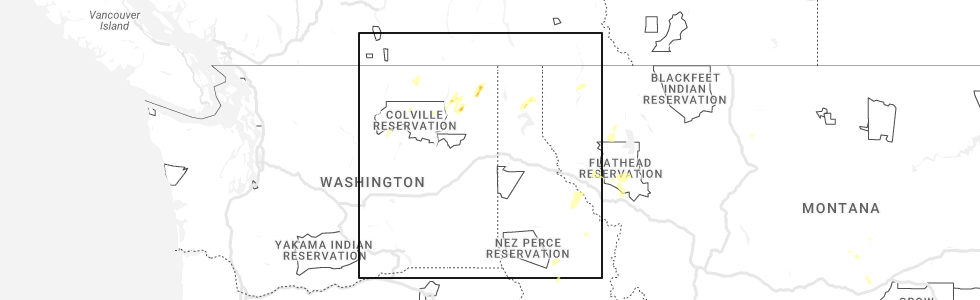
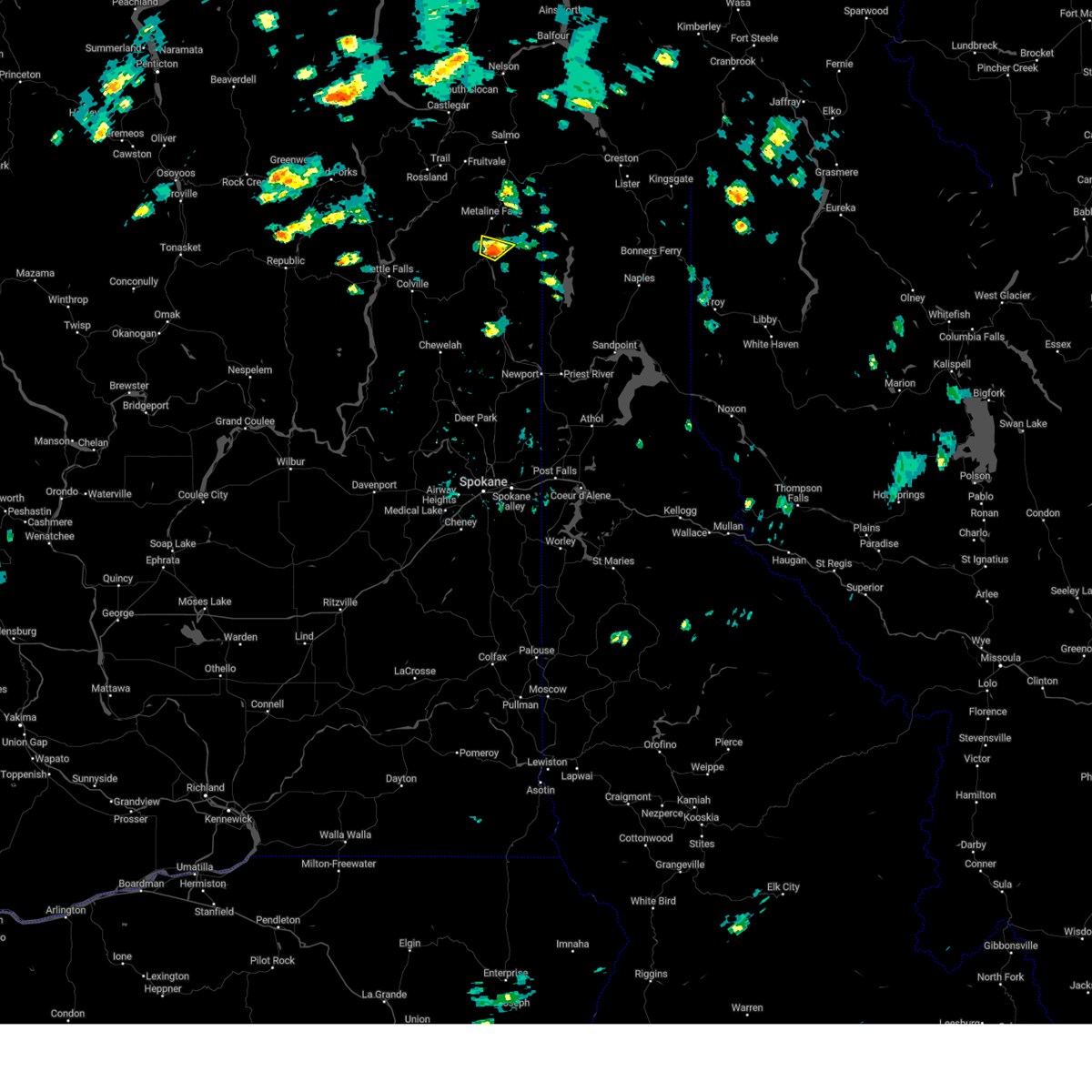
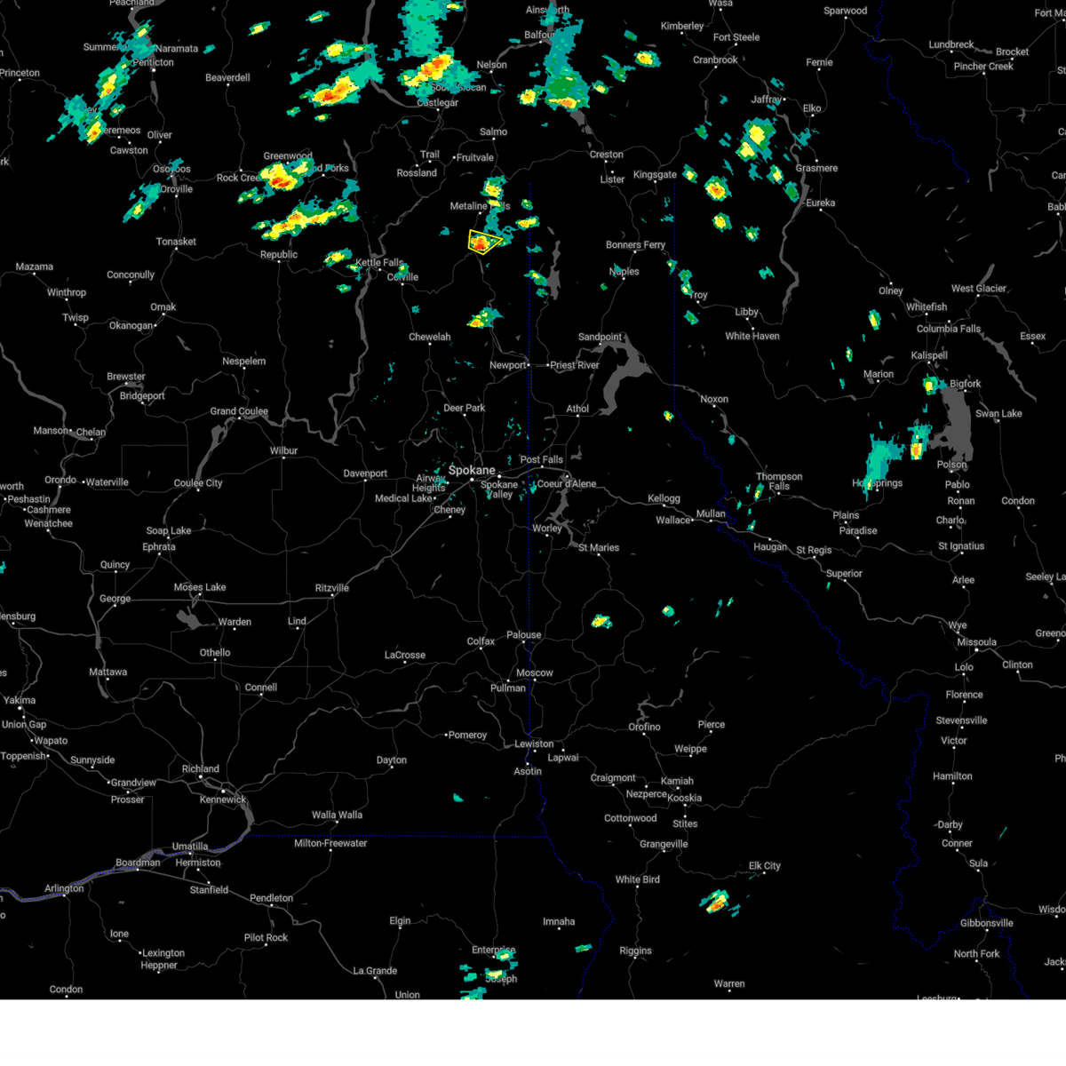
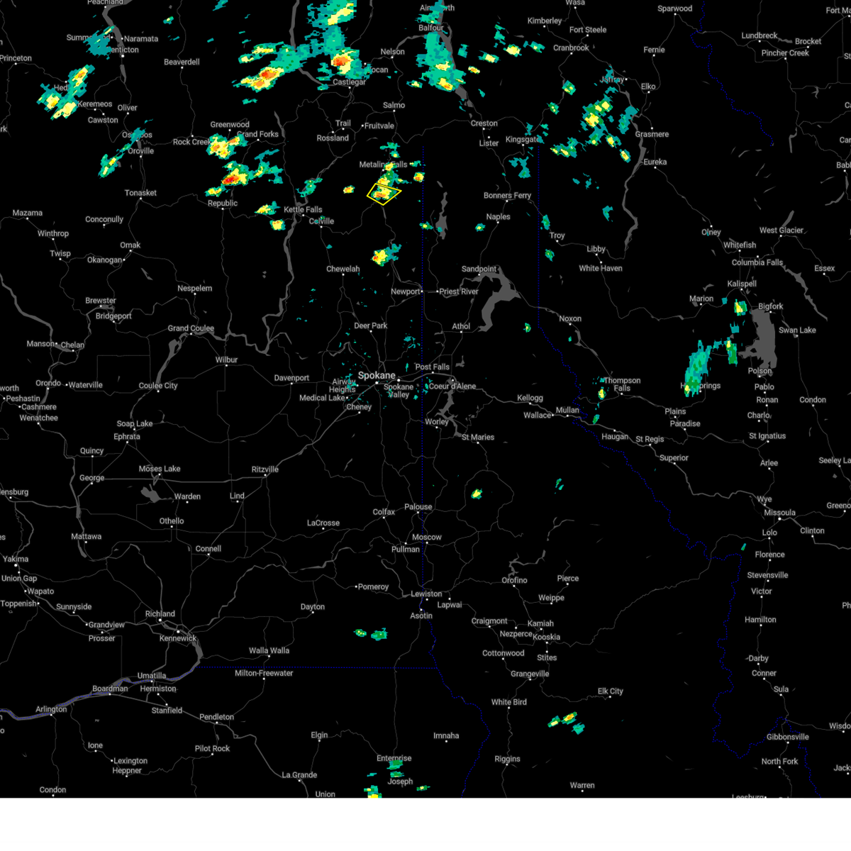
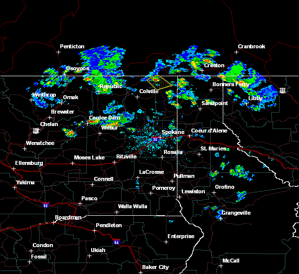
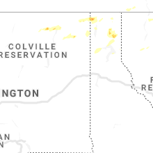
Hail Map for Ione, WA
The Ione, WA area has had 5 reports of on-the-ground hail by trained spotters, and has been under severe weather warnings 6 times during the past 12 months. Doppler radar has detected hail at or near Ione, WA on 6 occasions, including 1 occasion during the past year.
| Name: | Ione, WA |
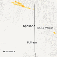
| Where Located: | 74.8 miles N of Spokane, WA |
| Map: | Google Map for Ione, WA |
| Population: | 447 |
| Housing Units: | 237 |
| More Info: | Search Google for Ione, WA |
0
The Top Recent Hail Date for Ione, WA is Sunday, May 21, 2023 (3rd out of 6)
Hail and Wind Damage Spotted near Ione, WA
| Date / Time | Report Details |
|---|---|
| 5/21/2023 3:10 PM PDT |
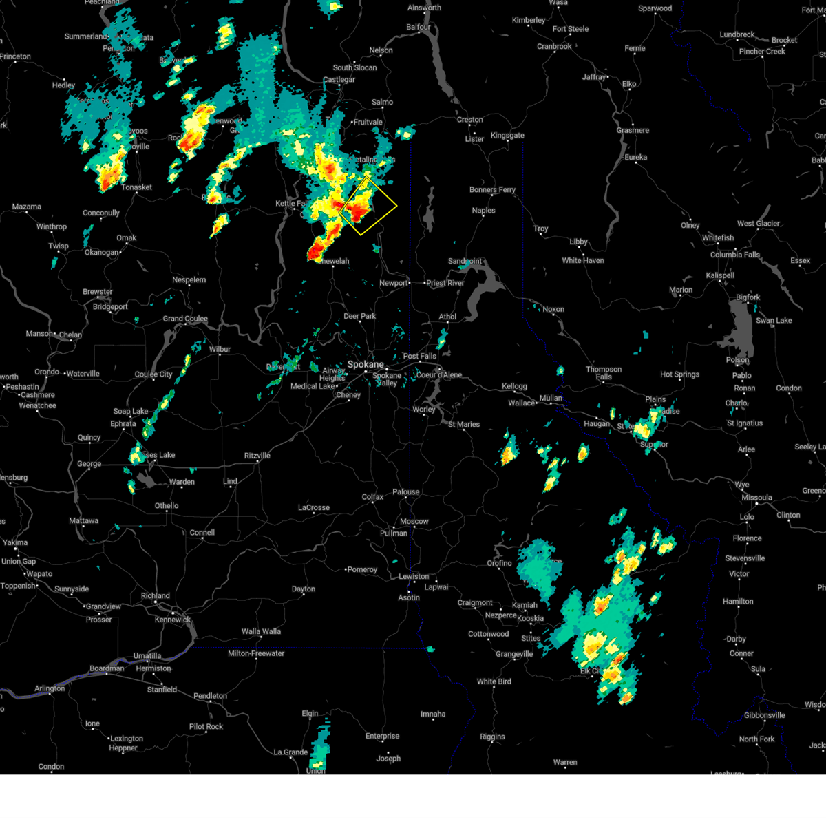 At 310 pm pdt, a severe thunderstorm was located 19 miles east of colville, or 38 miles northwest of priest river, moving northeast at 10 mph (radar indicated). Hazards include 60 mph wind gusts and quarter size hail. Hail damage to vehicles is expected. Expect wind damage to roofs, siding, and trees. At 310 pm pdt, a severe thunderstorm was located 19 miles east of colville, or 38 miles northwest of priest river, moving northeast at 10 mph (radar indicated). Hazards include 60 mph wind gusts and quarter size hail. Hail damage to vehicles is expected. Expect wind damage to roofs, siding, and trees.
|
| 5/20/2023 4:49 PM PDT |
 At 448 pm pdt, a severe thunderstorm was located 22 miles northeast of colville moving northeast at 5 mph (radar indicated). Hazards include quarter size hail. Damage to vehicles is expected. locations impacted include, ione. hail threat, radar indicated max hail size, 1. 00 in wind threat, radar indicated max wind gust, <50 mph. At 448 pm pdt, a severe thunderstorm was located 22 miles northeast of colville moving northeast at 5 mph (radar indicated). Hazards include quarter size hail. Damage to vehicles is expected. locations impacted include, ione. hail threat, radar indicated max hail size, 1. 00 in wind threat, radar indicated max wind gust, <50 mph.
|
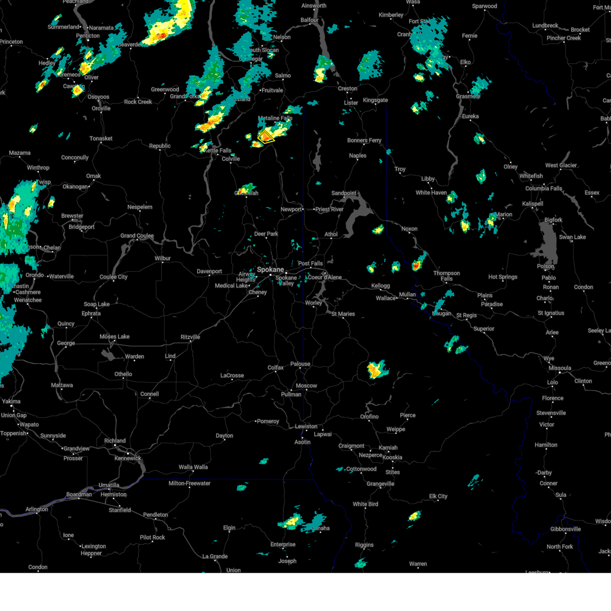
| 5/20/2023 4:37 PM PDT |
 At 436 pm pdt, a severe thunderstorm was located 21 miles northeast of colville moving northeast at 5 mph (radar indicated). Hazards include quarter size hail. damage to vehicles is expected At 436 pm pdt, a severe thunderstorm was located 21 miles northeast of colville moving northeast at 5 mph (radar indicated). Hazards include quarter size hail. damage to vehicles is expected
|
| 5/20/2023 2:21 PM PDT |
 The severe thunderstorm warning for central pend oreille county will expire at 230 pm pdt, the storm which prompted the warning has weakened below severe limits. therefore, the warning will be allowed to expire. however, small hail is still possible with this thunderstorm. The severe thunderstorm warning for central pend oreille county will expire at 230 pm pdt, the storm which prompted the warning has weakened below severe limits. therefore, the warning will be allowed to expire. however, small hail is still possible with this thunderstorm.
|
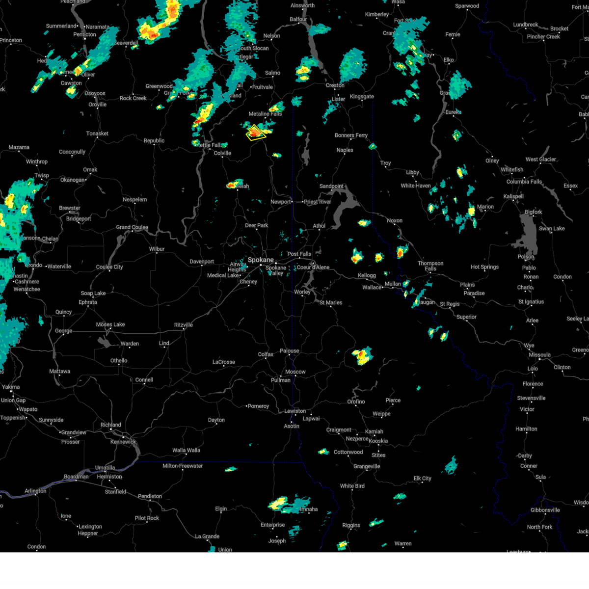
| 5/20/2023 2:14 PM PDT |
 At 214 pm pdt, a severe thunderstorm was located 2 miles east of ione, moving northeast at 5 mph (radar indicated). Hazards include quarter size hail. Damage to vehicles is expected. locations impacted include, ione. hail threat, radar indicated max hail size, 1. 00 in wind threat, radar indicated max wind gust, <50 mph. At 214 pm pdt, a severe thunderstorm was located 2 miles east of ione, moving northeast at 5 mph (radar indicated). Hazards include quarter size hail. Damage to vehicles is expected. locations impacted include, ione. hail threat, radar indicated max hail size, 1. 00 in wind threat, radar indicated max wind gust, <50 mph.
|
| 5/20/2023 2:04 PM PDT |
 At 203 pm pdt, a severe thunderstorm was located 21 miles west of nordman moving northeast at 5 mph (radar indicated). Hazards include quarter size hail. damage to vehicles is expected At 203 pm pdt, a severe thunderstorm was located 21 miles west of nordman moving northeast at 5 mph (radar indicated). Hazards include quarter size hail. damage to vehicles is expected
|
| 6/21/2018 4:54 PM PDT |
 At 438 pm pdt, a severe thunderstorm was located 28 miles northwest of nordman, or 52 miles northwest of priest river, moving south at 15 mph (radar indicated). Hazards include quarter size hail. Damage to vehicles is expected. Locations impacted include, ione, metaline falls and metaline. At 438 pm pdt, a severe thunderstorm was located 28 miles northwest of nordman, or 52 miles northwest of priest river, moving south at 15 mph (radar indicated). Hazards include quarter size hail. Damage to vehicles is expected. Locations impacted include, ione, metaline falls and metaline.
|
| 6/21/2018 4:38 PM PDT |
 At 438 pm pdt, a severe thunderstorm was located 28 miles northwest of nordman, or 52 miles northwest of priest river, moving south at 15 mph (radar indicated). Hazards include quarter size hail. Damage to vehicles is expected. Locations impacted include, ione, metaline falls and metaline. At 438 pm pdt, a severe thunderstorm was located 28 miles northwest of nordman, or 52 miles northwest of priest river, moving south at 15 mph (radar indicated). Hazards include quarter size hail. Damage to vehicles is expected. Locations impacted include, ione, metaline falls and metaline.
|
| 6/21/2018 4:16 PM PDT |
 At 416 pm pdt, a severe thunderstorm was located 30 miles northeast of colville, or 56 miles west of bonners ferry, moving southeast at 15 mph (radar indicated). Hazards include half dollar size hail. damage to vehicles is expected At 416 pm pdt, a severe thunderstorm was located 30 miles northeast of colville, or 56 miles west of bonners ferry, moving southeast at 15 mph (radar indicated). Hazards include half dollar size hail. damage to vehicles is expected
|
| 6/29/2015 7:30 PM PDT | Multiple trees and a power line down across highway 20 at mile post 390. time was based off of rada in pend oreille county WA, 7.9 miles NNW of Ione, WA |
| 5/30/2015 8:05 PM PDT | Half Dollar sized hail reported 1.5 miles SSW of Ione, WA |
| 5/30/2015 7:59 PM PDT | At 757 pm pdt, a trained weather spotters reported a severe thunderstorm producing large hail up to one inch 8 miles southeast of northport. this thunderstorms is capable of producing large hail up to ping pong ball size and damaging winds in excess of 60 mph. this storm was located 23 miles northwest of nordman, or 47 miles northwest of priest river, moving southeast at 15 mph. this locations impacted include, ione, metaline falls, metaline and noisy creek campground. |
| 5/30/2015 7:30 PM PDT | At 729 pm pdt, doppler radar indicated a severe thunderstorm capable of producing large hail up to ping pong ball size. this storm was located 22 miles northeast of colville, or 57 miles northwest of priest river, and moving southeast at 20 mph. |
| 8/25/2013 10:00 PM PDT | Numerous power outages due to trees on power lines in pend oreille county WA, 3.5 miles NNW of Ione, WA |
| 6/23/2012 10:20 AM PDT | Quarter sized hail reported 10.3 miles NNW of Ione, WA, public report |
| 6/23/2012 10:08 AM PDT | Quarter sized hail reported 2.5 miles NW of Ione, WA |
| 6/23/2012 9:32 AM PDT | Quarter sized hail reported 0.1 miles SW of Ione, WA, nickel to quarter size hail observed. |
| 6/23/2012 9:14 AM PDT | Quarter sized hail reported 4.2 miles W of Ione, WA |
Hail Maps for Ione, WA


Connect with Interactive Hail Maps