

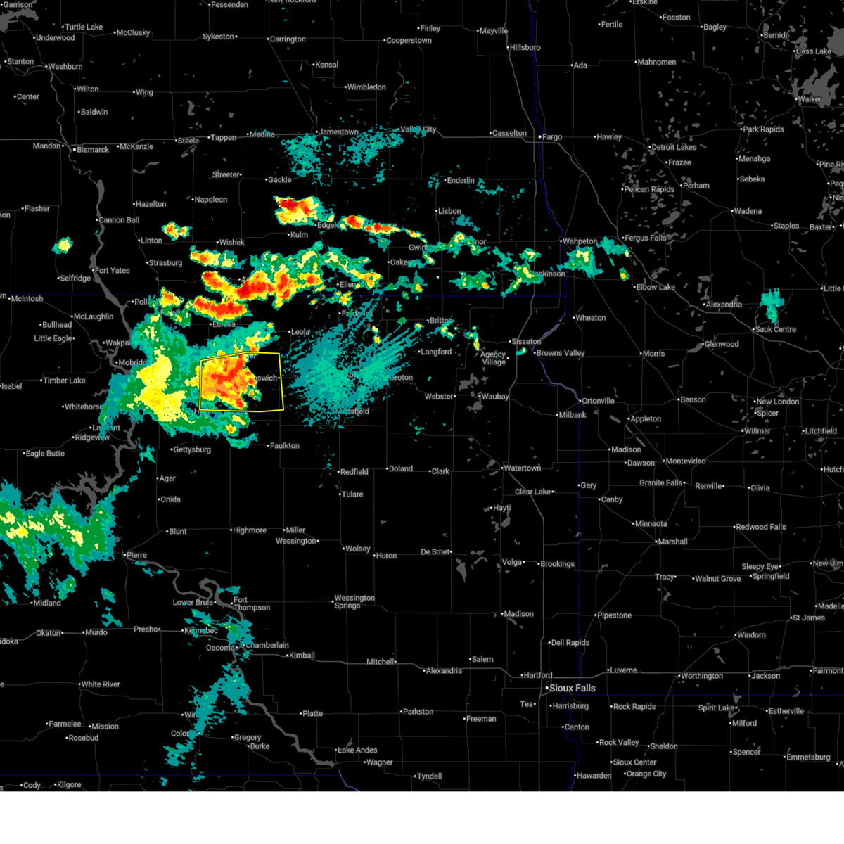
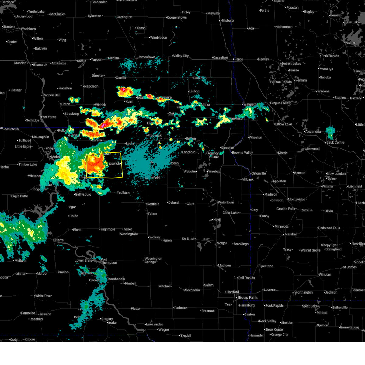
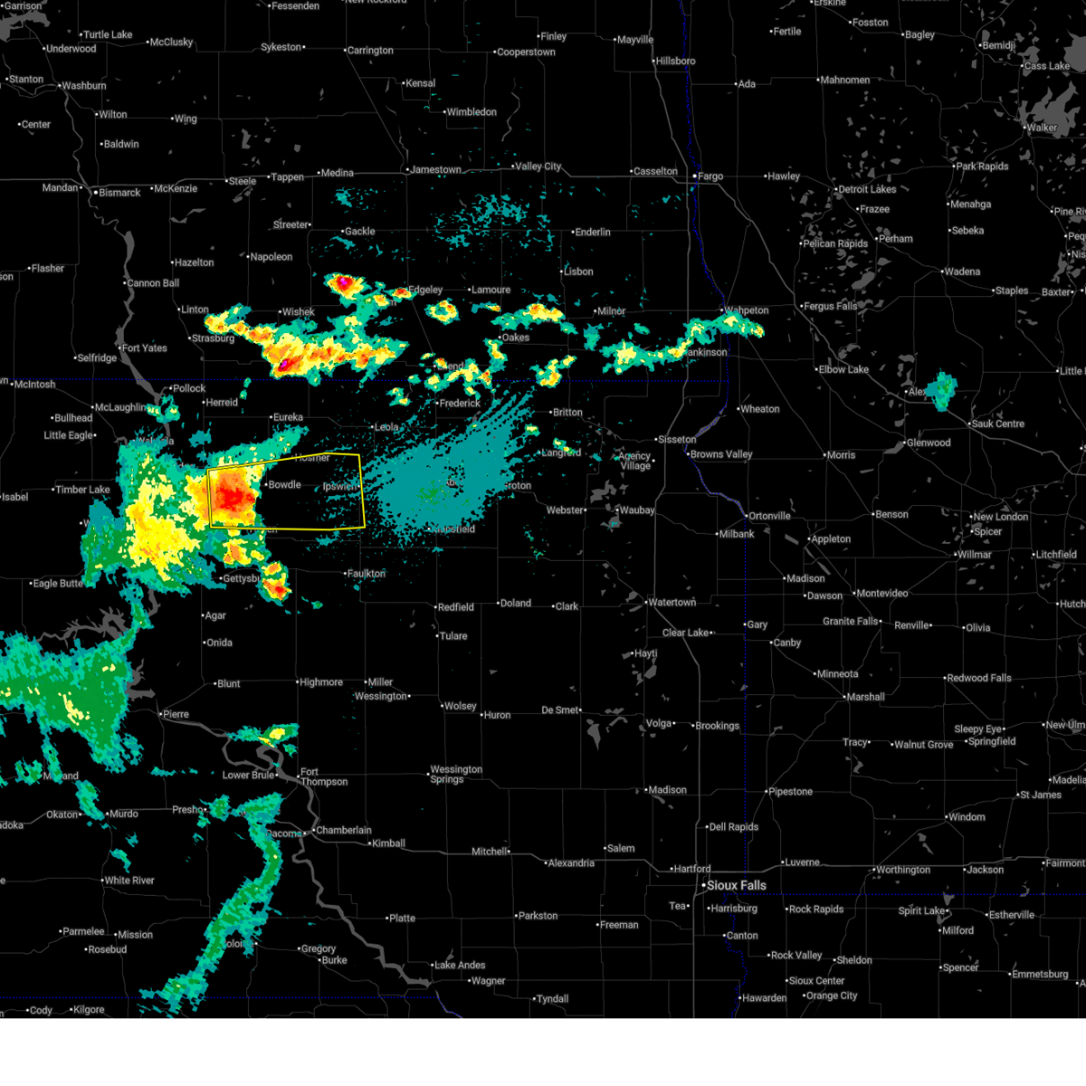
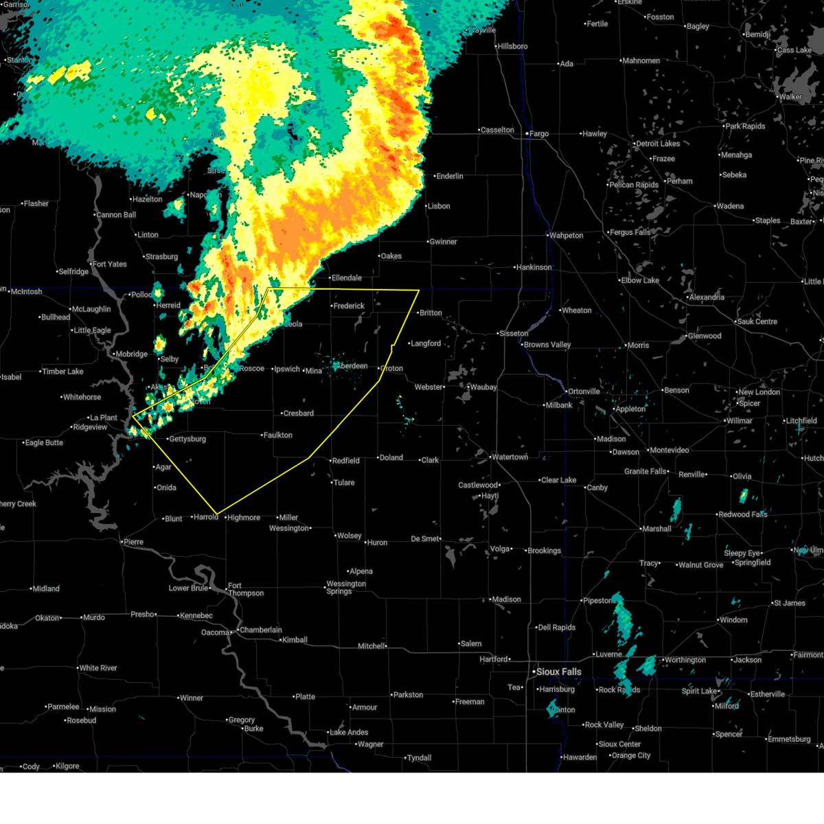
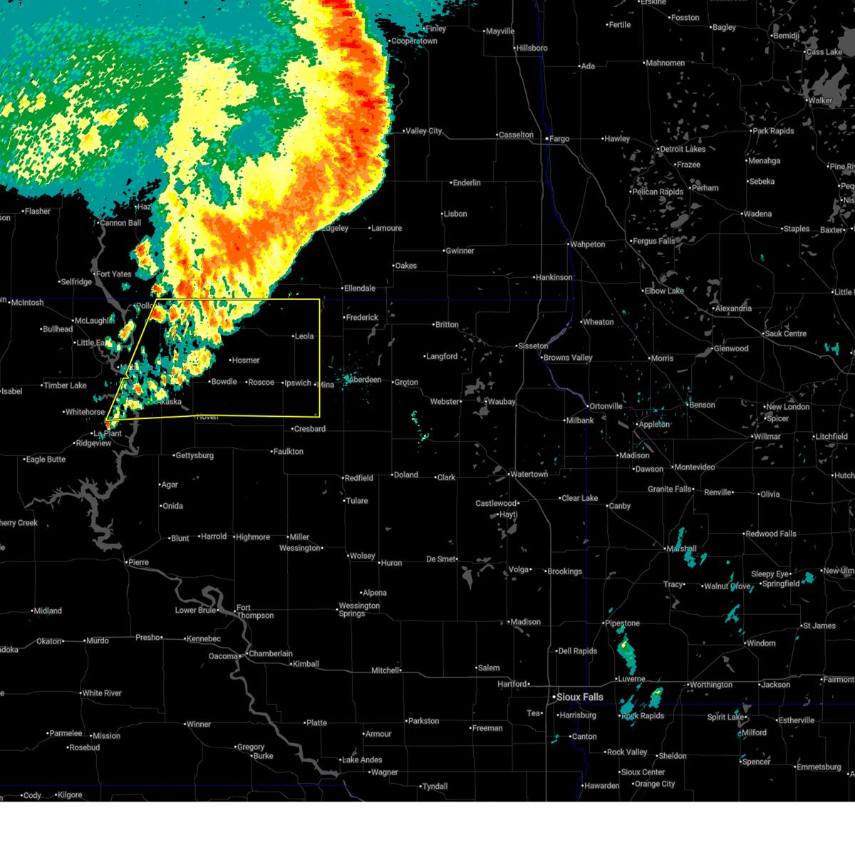
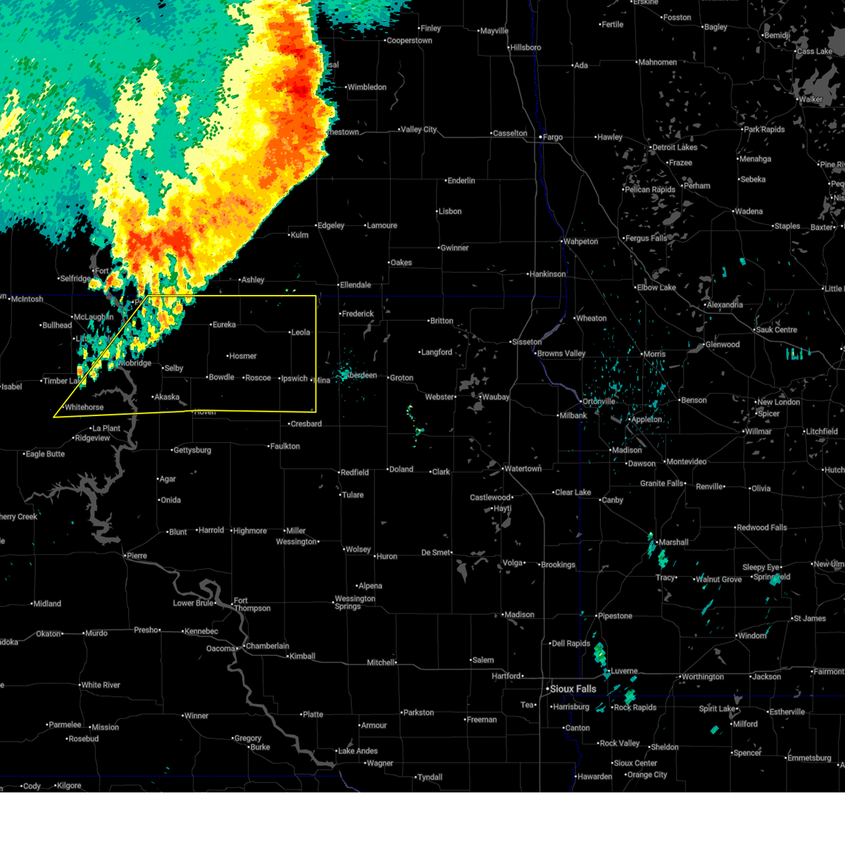
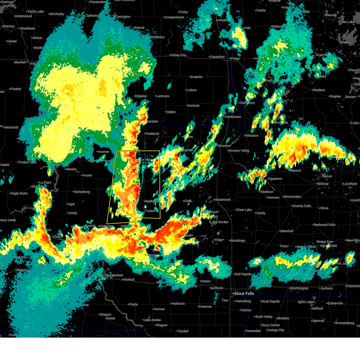
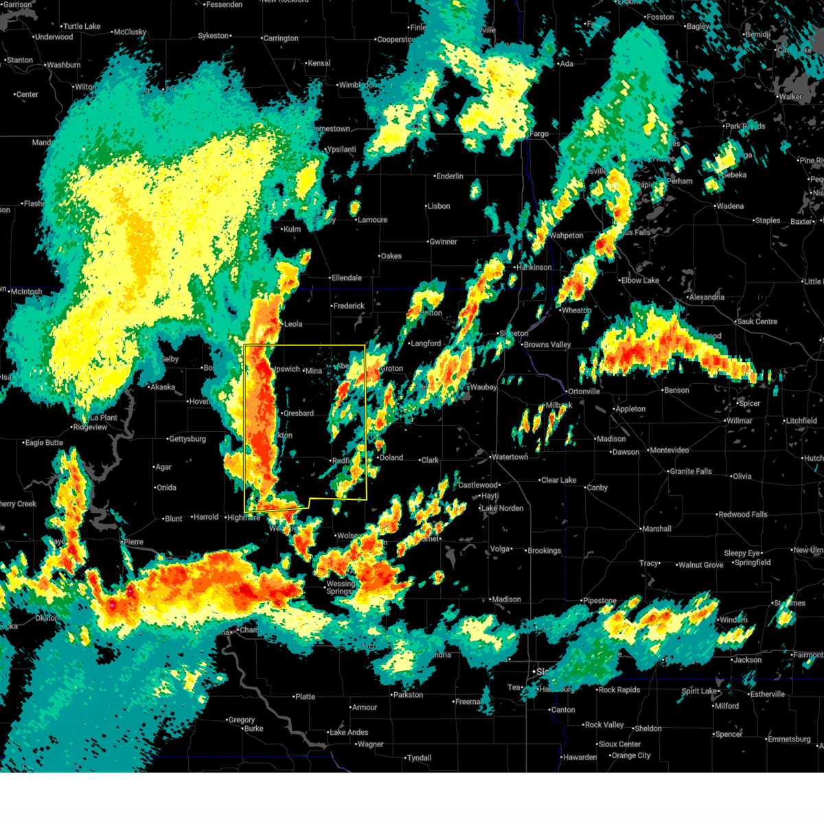
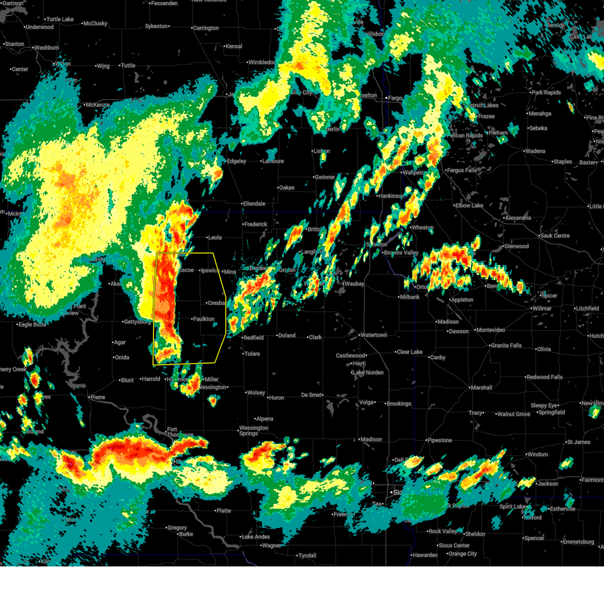
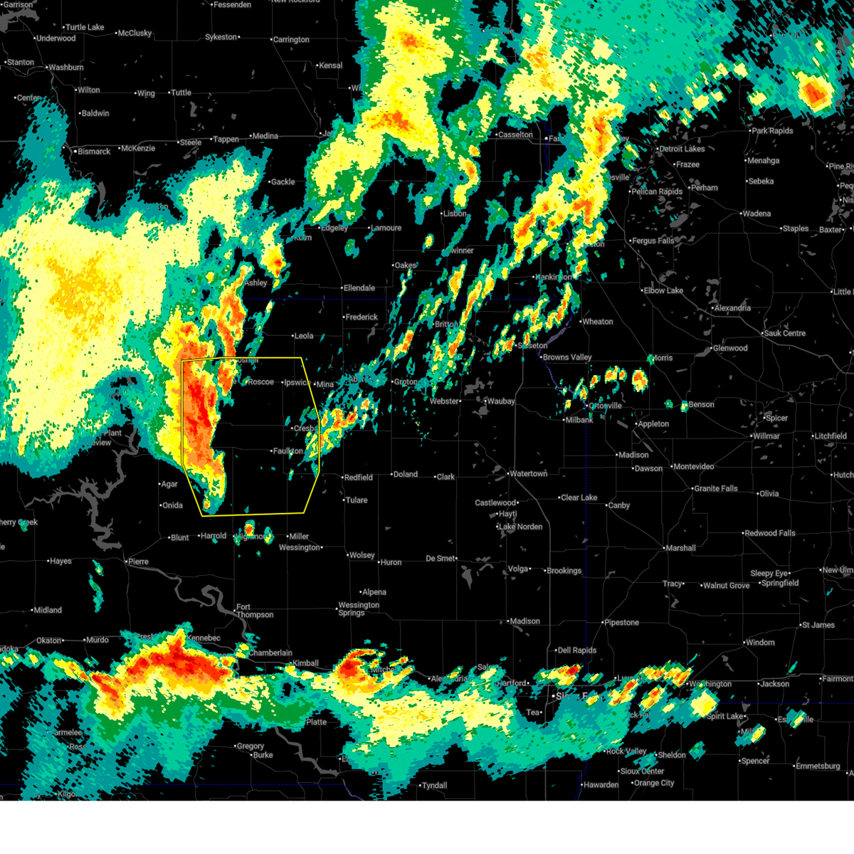
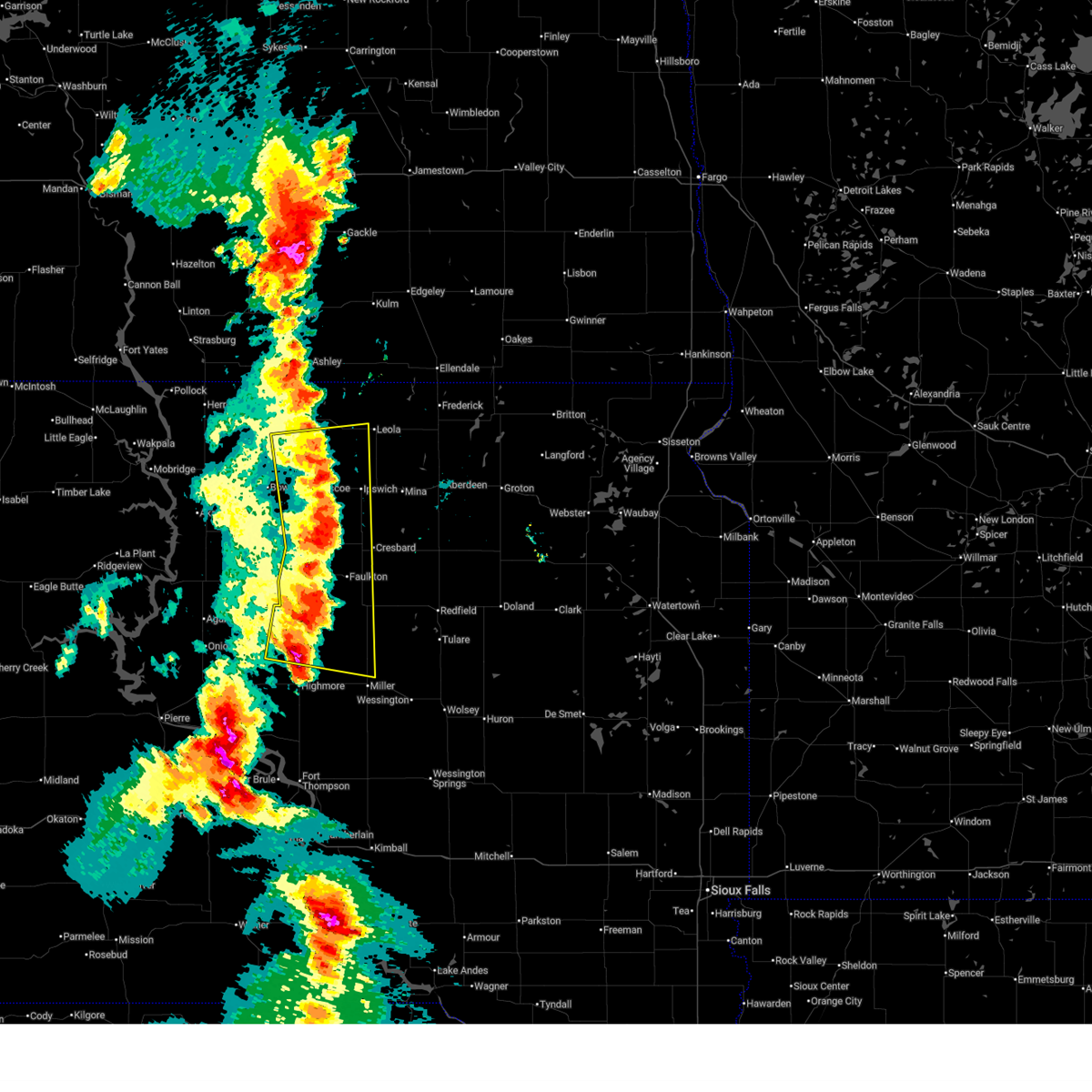
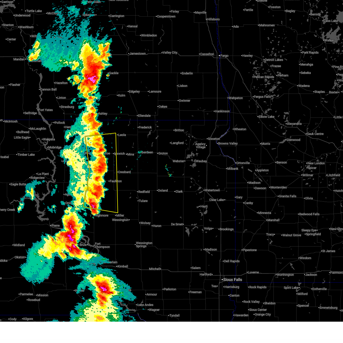
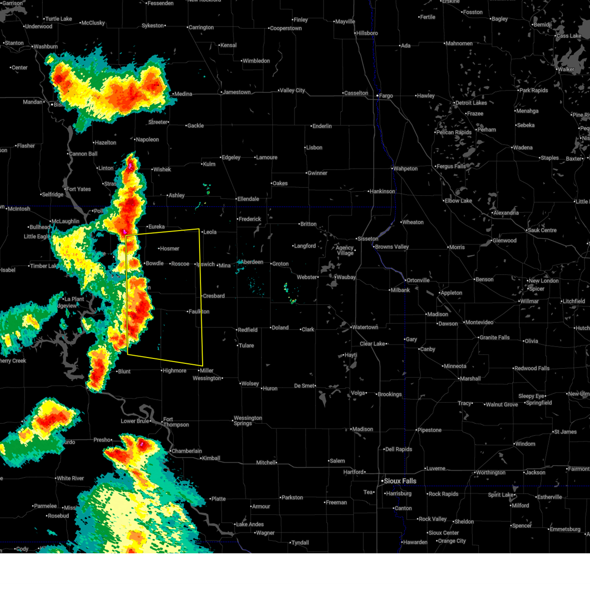
Hail Map for Ipswich, SD
The Ipswich, SD area has had 20 reports of on-the-ground hail by trained spotters, and has been under severe weather warnings 26 times during the past 12 months. Doppler radar has detected hail at or near Ipswich, SD on 51 occasions, including 5 occasions during the past year.
| Name: | Ipswich, SD |
| Where Located: | 26.4 miles W of Aberdeen, SD |
| Map: | Google Map for Ipswich, SD |
| Population: | 954 |
| Housing Units: | 441 |
| More Info: | Search Google for Ipswich, SD |
1
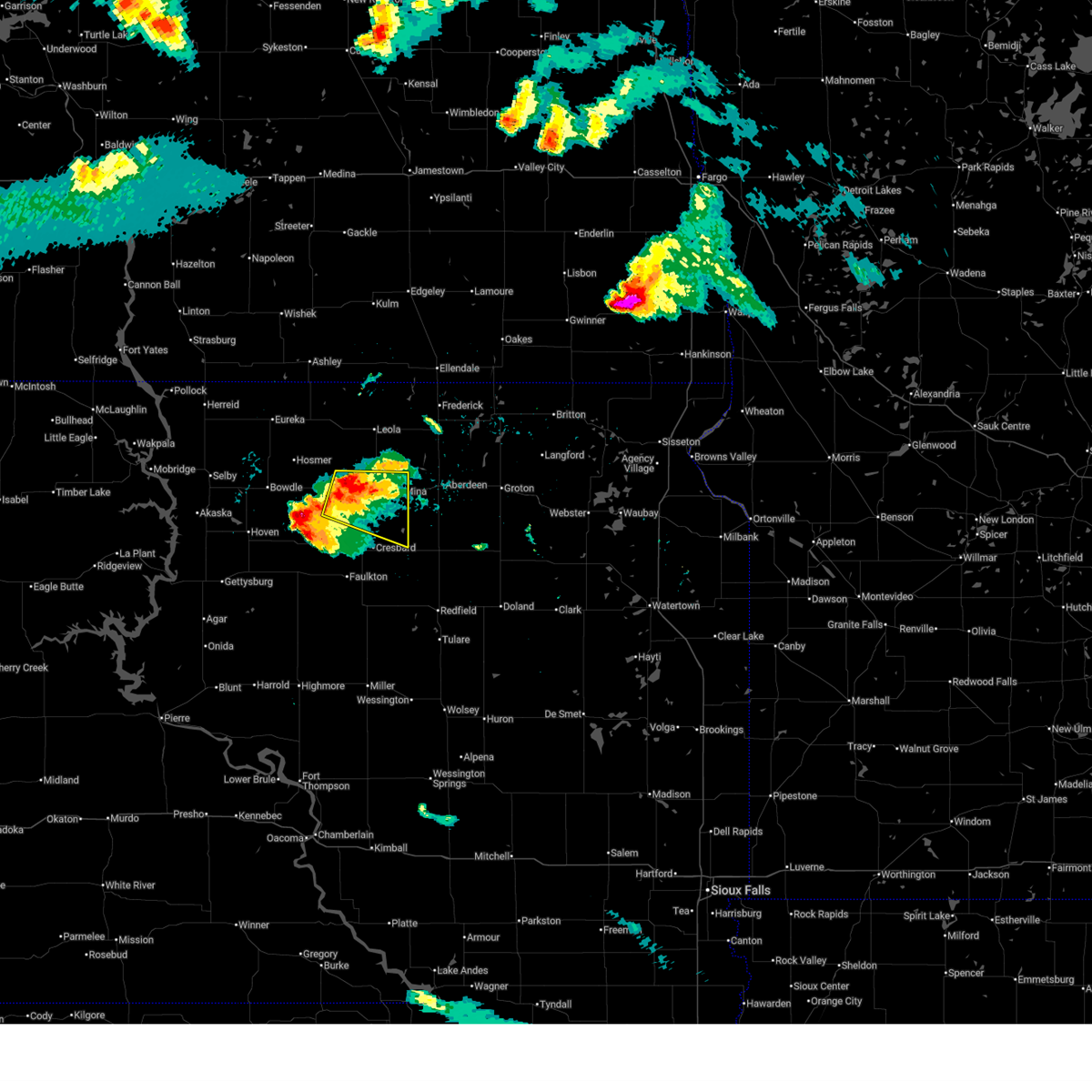
The Top Recent Hail Date for Ipswich, SD is Wednesday, July 23, 2025 (7th out of 51)
Hail and Wind Damage Spotted near Ipswich, SD
| Date / Time | Report Details |
|---|---|
| 6/9/2026 11:39 PM CDT |
 The storms which prompted the warning have moved out of the area. therefore, the warning will be allowed to expire. a tornado watch remains in effect until midnight cdt for north central south dakota. a severe thunderstorm watch remains in effect until 400 am cdt for northeastern south dakota. The storms which prompted the warning have moved out of the area. therefore, the warning will be allowed to expire. a tornado watch remains in effect until midnight cdt for north central south dakota. a severe thunderstorm watch remains in effect until 400 am cdt for northeastern south dakota.
|
| 6/9/2026 11:15 PM CDT | Mesonet station awms2 aberdeen 10wsw (sd mesonet in brown county SD, 17.2 miles W of Ipswich, SD |
| 6/9/2026 11:15 PM CDT | Storm damage reported in edmunds county SD, 14.1 miles W of Ipswich, SD |
| 6/9/2026 10:48 PM CDT |
 Svrabr the national weather service in aberdeen has issued a * severe thunderstorm warning for, eastern edmunds county in north central south dakota, northwestern brown county in northeastern south dakota, eastern mcpherson county in north central south dakota, * until 1145 pm cdt. * at 1048 pm cdt, severe thunderstorms were located along a line extending from 6 miles north of long lake to near blumengard colony, moving northeast at 35 mph (radar indicated). Hazards include 60 mph wind gusts. Expect damage to roofs, siding, and trees. severe thunderstorms will be near, ipswich, leola, pembrook colony, plainview colony, and cravens corner around 1055 pm cdt. deerfield colony around 1100 pm cdt. spring creek colony and long lake colony around 1105 pm cdt. Other locations in the path of these severe thunderstorms include mina lake rec area, grassland colony, wetonka, mina, forbes, elm lake and richmond lake rec area. Svrabr the national weather service in aberdeen has issued a * severe thunderstorm warning for, eastern edmunds county in north central south dakota, northwestern brown county in northeastern south dakota, eastern mcpherson county in north central south dakota, * until 1145 pm cdt. * at 1048 pm cdt, severe thunderstorms were located along a line extending from 6 miles north of long lake to near blumengard colony, moving northeast at 35 mph (radar indicated). Hazards include 60 mph wind gusts. Expect damage to roofs, siding, and trees. severe thunderstorms will be near, ipswich, leola, pembrook colony, plainview colony, and cravens corner around 1055 pm cdt. deerfield colony around 1100 pm cdt. spring creek colony and long lake colony around 1105 pm cdt. Other locations in the path of these severe thunderstorms include mina lake rec area, grassland colony, wetonka, mina, forbes, elm lake and richmond lake rec area.
|
| 8/16/2025 2:33 AM CDT |
 Svrabr the national weather service in aberdeen has issued a * severe thunderstorm warning for, northwestern edmunds county in north central south dakota, southwestern mcpherson county in north central south dakota, * until 330 am cdt. * at 233 am cdt, a severe thunderstorm was located over hosmer, or 10 miles northeast of bowdle, moving east at 35 mph (radar indicated). Hazards include 60 mph wind gusts and half dollar size hail. Hail damage to vehicles is expected. expect wind damage to roofs, siding, and trees. This severe thunderstorm will remain over mainly rural areas of northwestern edmunds and southwestern mcpherson counties. Svrabr the national weather service in aberdeen has issued a * severe thunderstorm warning for, northwestern edmunds county in north central south dakota, southwestern mcpherson county in north central south dakota, * until 330 am cdt. * at 233 am cdt, a severe thunderstorm was located over hosmer, or 10 miles northeast of bowdle, moving east at 35 mph (radar indicated). Hazards include 60 mph wind gusts and half dollar size hail. Hail damage to vehicles is expected. expect wind damage to roofs, siding, and trees. This severe thunderstorm will remain over mainly rural areas of northwestern edmunds and southwestern mcpherson counties.
|
| 8/15/2025 5:06 AM CDT |
 The storm which prompted the warning has weakened below severe limits, and no longer poses an immediate threat to life or property. therefore, the warning will be allowed to expire. however, small hail is still possible with this thunderstorm. The storm which prompted the warning has weakened below severe limits, and no longer poses an immediate threat to life or property. therefore, the warning will be allowed to expire. however, small hail is still possible with this thunderstorm.
|
| 8/15/2025 4:52 AM CDT |
 At 451 am cdt, a severe thunderstorm was located over roscoe, moving east at 45 mph (radar indicated). Hazards include 60 mph wind gusts and nickel size hail. Expect damage to roofs, siding, and trees. Locations impacted include, roscoe and ipswich. At 451 am cdt, a severe thunderstorm was located over roscoe, moving east at 45 mph (radar indicated). Hazards include 60 mph wind gusts and nickel size hail. Expect damage to roofs, siding, and trees. Locations impacted include, roscoe and ipswich.
|
| 8/15/2025 4:52 AM CDT |
 the severe thunderstorm warning has been cancelled and is no longer in effect the severe thunderstorm warning has been cancelled and is no longer in effect
|
| 8/15/2025 4:31 AM CDT |
 Svrabr the national weather service in aberdeen has issued a * severe thunderstorm warning for, edmunds county in north central south dakota, eastern walworth county in north central south dakota, * until 515 am cdt. * at 430 am cdt, a severe thunderstorm was located near bowdle, moving east at 45 mph (radar indicated). Hazards include 60 mph wind gusts and nickel size hail. Expect damage to roofs, siding, and trees. this severe thunderstorm will be near, bowdle around 435 am cdt. roscoe around 445 am cdt. Other locations in the path of this severe thunderstorm include ipswich. Svrabr the national weather service in aberdeen has issued a * severe thunderstorm warning for, edmunds county in north central south dakota, eastern walworth county in north central south dakota, * until 515 am cdt. * at 430 am cdt, a severe thunderstorm was located near bowdle, moving east at 45 mph (radar indicated). Hazards include 60 mph wind gusts and nickel size hail. Expect damage to roofs, siding, and trees. this severe thunderstorm will be near, bowdle around 435 am cdt. roscoe around 445 am cdt. Other locations in the path of this severe thunderstorm include ipswich.
|
| 8/8/2025 3:29 AM CDT |
 Svrabr the national weather service in aberdeen has issued a * severe thunderstorm warning for, edmunds county in north central south dakota, northern hand county in central south dakota, northeastern sully county in central south dakota, northwestern marshall county in northeastern south dakota, northern hyde county in central south dakota, brown county in northeastern south dakota, faulk county in north central south dakota, potter county in north central south dakota, eastern mcpherson county in north central south dakota, northwestern spink county in northeastern south dakota, southeastern walworth county in north central south dakota, * until 415 am cdt. * at 329 am cdt, severe thunderstorms were located along a line extending from near elm lake to near leola to near roscoe to near lebanon, moving southeast at 50 mph (radar indicated). Hazards include 60 mph wind gusts. Expect damage to roofs, siding, and trees. severe thunderstorms will be near, ipswich, frederick, pembrook colony, deerfield colony, grassland colony, brentwood colony, lebanon, seneca, onaka, and long lake colony around 335 am cdt. mina lake rec area, norbeck, richmond lake rec area, and barnard around 340 am cdt. westport, evergreen colony, mina, and burkmere around 345 am cdt. Other locations in the path of these severe thunderstorms include aberdeen, faulkton, cresbard, sand lake wildlife refuge, north scatterwood lake, columbia, devoe, south scatterwood lake, warner, bath, mansfield, orient, chelsea, tacoma park, miranda and putney. Svrabr the national weather service in aberdeen has issued a * severe thunderstorm warning for, edmunds county in north central south dakota, northern hand county in central south dakota, northeastern sully county in central south dakota, northwestern marshall county in northeastern south dakota, northern hyde county in central south dakota, brown county in northeastern south dakota, faulk county in north central south dakota, potter county in north central south dakota, eastern mcpherson county in north central south dakota, northwestern spink county in northeastern south dakota, southeastern walworth county in north central south dakota, * until 415 am cdt. * at 329 am cdt, severe thunderstorms were located along a line extending from near elm lake to near leola to near roscoe to near lebanon, moving southeast at 50 mph (radar indicated). Hazards include 60 mph wind gusts. Expect damage to roofs, siding, and trees. severe thunderstorms will be near, ipswich, frederick, pembrook colony, deerfield colony, grassland colony, brentwood colony, lebanon, seneca, onaka, and long lake colony around 335 am cdt. mina lake rec area, norbeck, richmond lake rec area, and barnard around 340 am cdt. westport, evergreen colony, mina, and burkmere around 345 am cdt. Other locations in the path of these severe thunderstorms include aberdeen, faulkton, cresbard, sand lake wildlife refuge, north scatterwood lake, columbia, devoe, south scatterwood lake, warner, bath, mansfield, orient, chelsea, tacoma park, miranda and putney.
|
| 8/8/2025 3:07 AM CDT |
 At 305 am cdt/205 am mdt/, severe thunderstorms were located along a line extending from near long lake to 8 miles south of swan creek rec area, moving east at 75 mph (radar indicated). Hazards include 60 mph wind gusts. Expect damage to roofs, siding, and trees. Locations impacted include, bowdle, hosmer, long lake, lowry, hillsview, new town corner, spring creek colony, forbes, leola, roscoe, elm lake, plainview colony, ipswich, deerfield colony, grassland colony, long lake colony, wetonka, loyalton, cravens corner, mina lake rec area, pembrook colony, blumengard colony and mina. At 305 am cdt/205 am mdt/, severe thunderstorms were located along a line extending from near long lake to 8 miles south of swan creek rec area, moving east at 75 mph (radar indicated). Hazards include 60 mph wind gusts. Expect damage to roofs, siding, and trees. Locations impacted include, bowdle, hosmer, long lake, lowry, hillsview, new town corner, spring creek colony, forbes, leola, roscoe, elm lake, plainview colony, ipswich, deerfield colony, grassland colony, long lake colony, wetonka, loyalton, cravens corner, mina lake rec area, pembrook colony, blumengard colony and mina.
|
| 8/8/2025 3:07 AM CDT |
 the severe thunderstorm warning has been cancelled and is no longer in effect the severe thunderstorm warning has been cancelled and is no longer in effect
|
| 8/8/2025 2:42 AM CDT |
 Svrabr the national weather service in aberdeen has issued a * severe thunderstorm warning for, edmunds county in north central south dakota, southeastern corson county in north central south dakota, campbell county in north central south dakota, north central potter county in north central south dakota, northeastern dewey county in north central south dakota, mcpherson county in north central south dakota, walworth county in north central south dakota, * until 345 am cdt/245 am mdt/. * at 242 am cdt/142 am mdt/, severe thunderstorms were located along a line extending from artas to near ridgeview, moving east at 65 mph (radar indicated). Hazards include 60 mph wind gusts. Expect damage to roofs, siding, and trees. severe thunderstorms will be near, selby, glenham, artas, greenway, new everets resort, and lake hiddenwood rec area around 245 am cdt. promise and blackfoot around 145 am mdt. eureka and swan creek rec area around 250 am cdt. java and akaska around 255 am cdt. hillsview around 300 am cdt. Other locations in the path of these severe thunderstorms include long lake, lowry, new town corner, bowdle, hosmer, spring creek colony, leola, roscoe, forbes and elm lake. Svrabr the national weather service in aberdeen has issued a * severe thunderstorm warning for, edmunds county in north central south dakota, southeastern corson county in north central south dakota, campbell county in north central south dakota, north central potter county in north central south dakota, northeastern dewey county in north central south dakota, mcpherson county in north central south dakota, walworth county in north central south dakota, * until 345 am cdt/245 am mdt/. * at 242 am cdt/142 am mdt/, severe thunderstorms were located along a line extending from artas to near ridgeview, moving east at 65 mph (radar indicated). Hazards include 60 mph wind gusts. Expect damage to roofs, siding, and trees. severe thunderstorms will be near, selby, glenham, artas, greenway, new everets resort, and lake hiddenwood rec area around 245 am cdt. promise and blackfoot around 145 am mdt. eureka and swan creek rec area around 250 am cdt. java and akaska around 255 am cdt. hillsview around 300 am cdt. Other locations in the path of these severe thunderstorms include long lake, lowry, new town corner, bowdle, hosmer, spring creek colony, leola, roscoe, forbes and elm lake.
|
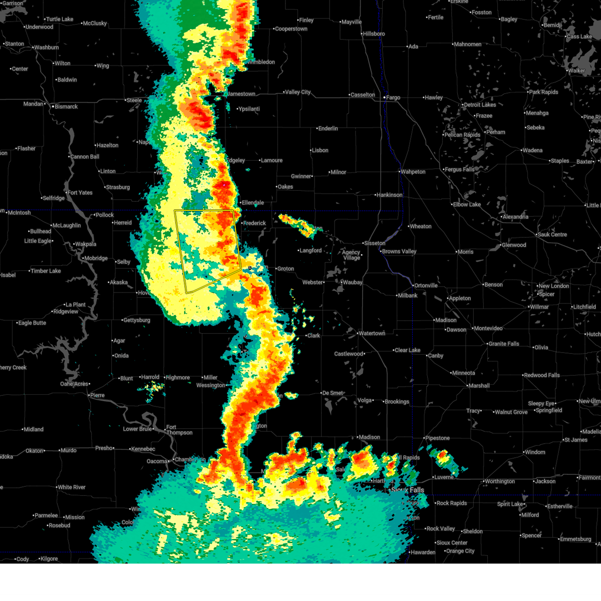
| 7/28/2025 5:39 PM CDT | Ping Pong Ball sized hail reported 13.4 miles N of Ipswich, SD |
| 7/23/2025 8:36 AM CDT |
 At 836 am cdt, severe thunderstorms were located along a line extending from near richmond lake rec area to 6 miles southeast of burdette, moving east at 40 mph (radar indicated). Hazards include 60 mph wind gusts and nickel size hail. Expect damage to roofs, siding, and trees. Locations impacted include, aberdeen, redfield, warner, mellette, tulare, northville, ashton, mansfield, athol, twin lakes, glendale colony, bath, frankfort, spink colony, brentford, stratford, hutterville colony, camrose colony and tacoma park. At 836 am cdt, severe thunderstorms were located along a line extending from near richmond lake rec area to 6 miles southeast of burdette, moving east at 40 mph (radar indicated). Hazards include 60 mph wind gusts and nickel size hail. Expect damage to roofs, siding, and trees. Locations impacted include, aberdeen, redfield, warner, mellette, tulare, northville, ashton, mansfield, athol, twin lakes, glendale colony, bath, frankfort, spink colony, brentford, stratford, hutterville colony, camrose colony and tacoma park.
|
| 7/23/2025 8:30 AM CDT | Mesonet station 173 craven (sddot in edmunds county SD, 4.9 miles W of Ipswich, SD |
| 7/23/2025 8:25 AM CDT | Mesonet station 173 craven (sddot in edmunds county SD, 4.9 miles W of Ipswich, SD |
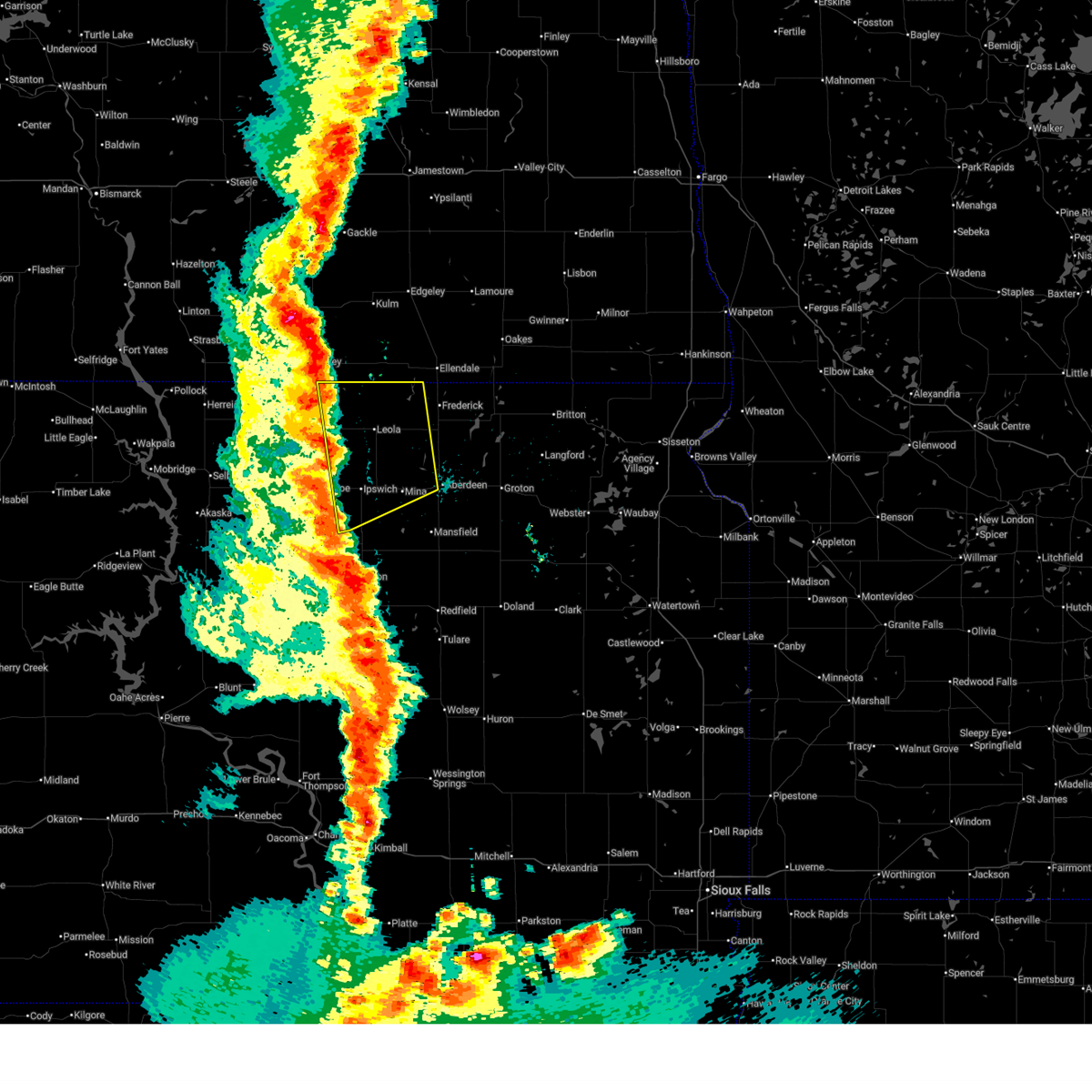
| 7/23/2025 8:13 AM CDT |
 Svrabr the national weather service in aberdeen has issued a * severe thunderstorm warning for, eastern edmunds county in north central south dakota, northern hand county in central south dakota, southwestern brown county in northeastern south dakota, faulk county in north central south dakota, spink county in northeastern south dakota, * until 915 am cdt. * at 812 am cdt, severe thunderstorms were located along a line extending from deerfield colony to 6 miles southwest of burdette, moving east at 40 mph (radar indicated). Hazards include 70 mph wind gusts and nickel size hail. Expect considerable tree damage. damage is likely to mobile homes, roofs, and outbuildings. severe thunderstorms will be near, mina lake rec area, zell, burdette, rockham, chelsea, mina, south scatterwood lake, north scatterwood lake, and cottonwood lake around 820 am cdt. richmond lake rec area around 825 am cdt. northville, mansfield, athol, and twin lakes around 830 am cdt. Other locations in the path of these severe thunderstorms include aberdeen, redfield, warner, mellette, tulare, ashton, spottswood, glendale colony, bath, frankfort, spink colony, brentford, stratford, hutterville colony, camrose colony and tacoma park. Svrabr the national weather service in aberdeen has issued a * severe thunderstorm warning for, eastern edmunds county in north central south dakota, northern hand county in central south dakota, southwestern brown county in northeastern south dakota, faulk county in north central south dakota, spink county in northeastern south dakota, * until 915 am cdt. * at 812 am cdt, severe thunderstorms were located along a line extending from deerfield colony to 6 miles southwest of burdette, moving east at 40 mph (radar indicated). Hazards include 70 mph wind gusts and nickel size hail. Expect considerable tree damage. damage is likely to mobile homes, roofs, and outbuildings. severe thunderstorms will be near, mina lake rec area, zell, burdette, rockham, chelsea, mina, south scatterwood lake, north scatterwood lake, and cottonwood lake around 820 am cdt. richmond lake rec area around 825 am cdt. northville, mansfield, athol, and twin lakes around 830 am cdt. Other locations in the path of these severe thunderstorms include aberdeen, redfield, warner, mellette, tulare, ashton, spottswood, glendale colony, bath, frankfort, spink colony, brentford, stratford, hutterville colony, camrose colony and tacoma park.
|
| 7/23/2025 7:44 AM CDT |
 At 743 am cdt, severe thunderstorms were located along a line extending from near roscoe to 8 miles west of orient to 10 miles northwest of ree heights, moving east at 40 mph (radar indicated. at at 710 am cdt, sdsu mesonet reported wind gust of 76 miles per hour in lowry). Hazards include 70 mph wind gusts and half dollar size hail. Hail damage to vehicles is expected. expect considerable tree damage. wind damage is also likely to mobile homes, roofs, and outbuildings. Locations impacted include, faulkton, roscoe, orient, thunderbird colony, norbeck, loyalton, polo, blumengard colony, evergreen colony, miranda, ipswich, pembrook colony, cresbard, rockham, devoe, cravens corner, zell and south scatterwood lake. At 743 am cdt, severe thunderstorms were located along a line extending from near roscoe to 8 miles west of orient to 10 miles northwest of ree heights, moving east at 40 mph (radar indicated. at at 710 am cdt, sdsu mesonet reported wind gust of 76 miles per hour in lowry). Hazards include 70 mph wind gusts and half dollar size hail. Hail damage to vehicles is expected. expect considerable tree damage. wind damage is also likely to mobile homes, roofs, and outbuildings. Locations impacted include, faulkton, roscoe, orient, thunderbird colony, norbeck, loyalton, polo, blumengard colony, evergreen colony, miranda, ipswich, pembrook colony, cresbard, rockham, devoe, cravens corner, zell and south scatterwood lake.
|
| 7/23/2025 7:44 AM CDT |
 the severe thunderstorm warning has been cancelled and is no longer in effect the severe thunderstorm warning has been cancelled and is no longer in effect
|
| 7/23/2025 7:27 AM CDT |
 Svrabr the national weather service in aberdeen has issued a * severe thunderstorm warning for, edmunds county in north central south dakota, northern hand county in central south dakota, northeastern sully county in central south dakota, northern hyde county in central south dakota, faulk county in north central south dakota, eastern potter county in north central south dakota, eastern walworth county in north central south dakota, * until 815 am cdt. * at 726 am cdt, severe thunderstorms were located along a line extending from 7 miles north of bowdle to near seneca to 13 miles north of highmore, moving east at 45 mph (radar indicated. at 710 am cdt, sdsu mesonet reported wind gust of 76 miles per hour in lowry). Hazards include 70 mph wind gusts and penny size hail. Expect considerable tree damage. damage is likely to mobile homes, roofs, and outbuildings. severe thunderstorms will be near, hosmer, brentwood colony, onaka, and burkmere around 730 am cdt. roscoe, thunderbird colony, and loyalton around 735 am cdt. faulkton, norbeck, and blumengard colony around 740 am cdt. evergreen colony, orient, and polo around 745 am cdt. Other locations in the path of these severe thunderstorms include miranda, ipswich, pembrook colony, cresbard, plainview colony, devoe, rockham, cravens corner, deerfield colony, zell, chelsea, south scatterwood lake and north scatterwood lake. Svrabr the national weather service in aberdeen has issued a * severe thunderstorm warning for, edmunds county in north central south dakota, northern hand county in central south dakota, northeastern sully county in central south dakota, northern hyde county in central south dakota, faulk county in north central south dakota, eastern potter county in north central south dakota, eastern walworth county in north central south dakota, * until 815 am cdt. * at 726 am cdt, severe thunderstorms were located along a line extending from 7 miles north of bowdle to near seneca to 13 miles north of highmore, moving east at 45 mph (radar indicated. at 710 am cdt, sdsu mesonet reported wind gust of 76 miles per hour in lowry). Hazards include 70 mph wind gusts and penny size hail. Expect considerable tree damage. damage is likely to mobile homes, roofs, and outbuildings. severe thunderstorms will be near, hosmer, brentwood colony, onaka, and burkmere around 730 am cdt. roscoe, thunderbird colony, and loyalton around 735 am cdt. faulkton, norbeck, and blumengard colony around 740 am cdt. evergreen colony, orient, and polo around 745 am cdt. Other locations in the path of these severe thunderstorms include miranda, ipswich, pembrook colony, cresbard, plainview colony, devoe, rockham, cravens corner, deerfield colony, zell, chelsea, south scatterwood lake and north scatterwood lake.
|
| 7/9/2025 8:46 PM CDT |
 At 846 pm cdt, severe thunderstorms were located along a line extending from 9 miles southeast of new town corner to near brentwood colony to 14 miles west of polo, moving east at 40 mph (trained weather spotters). Hazards include 60 mph wind gusts. Expect damage to roofs, siding, and trees. Locations impacted include, faulkton, evergreen colony, norbeck, blumengard colony, ipswich, pembrook colony, plainview colony, orient, polo and miranda. At 846 pm cdt, severe thunderstorms were located along a line extending from 9 miles southeast of new town corner to near brentwood colony to 14 miles west of polo, moving east at 40 mph (trained weather spotters). Hazards include 60 mph wind gusts. Expect damage to roofs, siding, and trees. Locations impacted include, faulkton, evergreen colony, norbeck, blumengard colony, ipswich, pembrook colony, plainview colony, orient, polo and miranda.
|
| 7/9/2025 8:46 PM CDT |
 the severe thunderstorm warning has been cancelled and is no longer in effect the severe thunderstorm warning has been cancelled and is no longer in effect
|
| 7/9/2025 8:10 PM CDT |
 Svrabr the national weather service in aberdeen has issued a * severe thunderstorm warning for, edmunds county in north central south dakota, northwestern hand county in central south dakota, northeastern sully county in central south dakota, northern hyde county in central south dakota, faulk county in north central south dakota, southeastern campbell county in north central south dakota, eastern potter county in north central south dakota, southwestern mcpherson county in north central south dakota, eastern walworth county in north central south dakota, * until 915 pm cdt. * at 808 pm cdt, severe thunderstorms were located along a line extending from 10 miles north of java to near lebanon to 7 miles south of cottonwood lake near agar, moving east at 40 mph (trained weather spotters. at between 735 and 750 pm weather stations near agar and onida recorded wind gusts of 71 mph). Hazards include 70 mph wind gusts. Expect considerable tree damage. damage is likely to mobile homes, roofs, and outbuildings. severe thunderstorms will be near, bowdle, tolstoy, hillsview, and stone lake around 815 pm cdt. seneca and onaka around 820 pm cdt. hosmer around 825 pm cdt. Other locations in the path of these severe thunderstorms include roscoe, brentwood colony, thunderbird colony, burkmere, loyalton, norbeck, blumengard colony, faulkton and evergreen colony. Svrabr the national weather service in aberdeen has issued a * severe thunderstorm warning for, edmunds county in north central south dakota, northwestern hand county in central south dakota, northeastern sully county in central south dakota, northern hyde county in central south dakota, faulk county in north central south dakota, southeastern campbell county in north central south dakota, eastern potter county in north central south dakota, southwestern mcpherson county in north central south dakota, eastern walworth county in north central south dakota, * until 915 pm cdt. * at 808 pm cdt, severe thunderstorms were located along a line extending from 10 miles north of java to near lebanon to 7 miles south of cottonwood lake near agar, moving east at 40 mph (trained weather spotters. at between 735 and 750 pm weather stations near agar and onida recorded wind gusts of 71 mph). Hazards include 70 mph wind gusts. Expect considerable tree damage. damage is likely to mobile homes, roofs, and outbuildings. severe thunderstorms will be near, bowdle, tolstoy, hillsview, and stone lake around 815 pm cdt. seneca and onaka around 820 pm cdt. hosmer around 825 pm cdt. Other locations in the path of these severe thunderstorms include roscoe, brentwood colony, thunderbird colony, burkmere, loyalton, norbeck, blumengard colony, faulkton and evergreen colony.
|
| 6/29/2025 8:57 PM CDT |
 At 856 pm cdt, severe thunderstorms were located along a line extending from cravens corner to near mina to near mansfield to 6 miles west of athol, moving east at 55 mph (radar indicated. at 840 pm cdt, cresbard measured a gust to 68 mph). Hazards include 70 mph wind gusts and penny size hail. Expect considerable tree damage. damage is likely to mobile homes, roofs, and outbuildings. Locations impacted include, aberdeen, warner, mina lake rec area, mellette, northville, mansfield, athol, mina, cravens corner, ashton, richmond lake rec area, bath, brentford, stratford, hutterville colony, groton, ferney and tacoma park. At 856 pm cdt, severe thunderstorms were located along a line extending from cravens corner to near mina to near mansfield to 6 miles west of athol, moving east at 55 mph (radar indicated. at 840 pm cdt, cresbard measured a gust to 68 mph). Hazards include 70 mph wind gusts and penny size hail. Expect considerable tree damage. damage is likely to mobile homes, roofs, and outbuildings. Locations impacted include, aberdeen, warner, mina lake rec area, mellette, northville, mansfield, athol, mina, cravens corner, ashton, richmond lake rec area, bath, brentford, stratford, hutterville colony, groton, ferney and tacoma park.
|
| 6/29/2025 8:37 PM CDT |
 Svrabr the national weather service in aberdeen has issued a * severe thunderstorm warning for, edmunds county in north central south dakota, southern brown county in northeastern south dakota, faulk county in north central south dakota, northern spink county in northeastern south dakota, * until 945 pm cdt. * at 837 pm cdt, severe thunderstorms were located along a line extending from near roscoe to near pembrook colony to cresbard to near miranda, moving east at 45 mph (radar indicated). Hazards include 60 mph wind gusts and penny size hail. Expect damage to roofs, siding, and trees. severe thunderstorms will be near, ipswich, pembrook colony, rockham, chelsea, devoe, south scatterwood lake, north scatterwood lake, and cravens corner around 845 pm cdt. mina lake rec area and mina around 850 pm cdt. northville, plainview colony, mansfield, and athol around 855 pm cdt. Other locations in the path of these severe thunderstorms include warner, mellette, deerfield colony, aberdeen, ashton, richmond lake rec area, bath, brentford, stratford, hutterville colony, westport, ferney and tacoma park. Svrabr the national weather service in aberdeen has issued a * severe thunderstorm warning for, edmunds county in north central south dakota, southern brown county in northeastern south dakota, faulk county in north central south dakota, northern spink county in northeastern south dakota, * until 945 pm cdt. * at 837 pm cdt, severe thunderstorms were located along a line extending from near roscoe to near pembrook colony to cresbard to near miranda, moving east at 45 mph (radar indicated). Hazards include 60 mph wind gusts and penny size hail. Expect damage to roofs, siding, and trees. severe thunderstorms will be near, ipswich, pembrook colony, rockham, chelsea, devoe, south scatterwood lake, north scatterwood lake, and cravens corner around 845 pm cdt. mina lake rec area and mina around 850 pm cdt. northville, plainview colony, mansfield, and athol around 855 pm cdt. Other locations in the path of these severe thunderstorms include warner, mellette, deerfield colony, aberdeen, ashton, richmond lake rec area, bath, brentford, stratford, hutterville colony, westport, ferney and tacoma park.
|
| 6/19/2025 8:54 PM CDT | Quarter sized hail reported 13.6 miles N of Ipswich, SD, pea sized hail... with a few quarters mixed in. |
| 6/19/2025 8:44 PM CDT |
 At 844 pm cdt, a severe thunderstorm was located near pembrook colony, or 7 miles south of ipswich, moving east at 25 mph (radar indicated). Hazards include 60 mph wind gusts and quarter size hail. Hail damage to vehicles is expected. expect wind damage to roofs, siding, and trees. Locations impacted include, pembrook colony, north scatterwood lake and south scatterwood lake. At 844 pm cdt, a severe thunderstorm was located near pembrook colony, or 7 miles south of ipswich, moving east at 25 mph (radar indicated). Hazards include 60 mph wind gusts and quarter size hail. Hail damage to vehicles is expected. expect wind damage to roofs, siding, and trees. Locations impacted include, pembrook colony, north scatterwood lake and south scatterwood lake.
|
| 6/19/2025 8:27 PM CDT |
 Svrabr the national weather service in aberdeen has issued a * severe thunderstorm warning for, eastern edmunds county in north central south dakota, northeastern faulk county in north central south dakota, * until 915 pm cdt. * at 827 pm cdt, a severe thunderstorm was located near ipswich, moving east at 20 mph (radar indicated). Hazards include 60 mph wind gusts and quarter size hail. Hail damage to vehicles is expected. expect wind damage to roofs, siding, and trees. This severe thunderstorm will be near, ipswich and pembrook colony around 830 pm cdt. Svrabr the national weather service in aberdeen has issued a * severe thunderstorm warning for, eastern edmunds county in north central south dakota, northeastern faulk county in north central south dakota, * until 915 pm cdt. * at 827 pm cdt, a severe thunderstorm was located near ipswich, moving east at 20 mph (radar indicated). Hazards include 60 mph wind gusts and quarter size hail. Hail damage to vehicles is expected. expect wind damage to roofs, siding, and trees. This severe thunderstorm will be near, ipswich and pembrook colony around 830 pm cdt.
|
| 6/19/2025 8:10 PM CDT |
 The storm which prompted the warning has weakened below severe limits, and no longer poses an immediate threat to life or property. therefore, the warning will be allowed to expire. however, small hail and gusty winds are still possible with this thunderstorm. The storm which prompted the warning has weakened below severe limits, and no longer poses an immediate threat to life or property. therefore, the warning will be allowed to expire. however, small hail and gusty winds are still possible with this thunderstorm.
|
| 6/19/2025 7:50 PM CDT |
 At 750 pm cdt, a severe thunderstorm was located near roscoe, moving southeast at 20 mph (radar indicated). Hazards include 60 mph wind gusts and quarter size hail. Hail damage to vehicles is expected. expect wind damage to roofs, siding, and trees. Locations impacted include, ipswich. At 750 pm cdt, a severe thunderstorm was located near roscoe, moving southeast at 20 mph (radar indicated). Hazards include 60 mph wind gusts and quarter size hail. Hail damage to vehicles is expected. expect wind damage to roofs, siding, and trees. Locations impacted include, ipswich.
|
| 6/19/2025 7:35 PM CDT |
 Svrabr the national weather service in aberdeen has issued a * severe thunderstorm warning for, eastern edmunds county in north central south dakota, * until 815 pm cdt. * at 735 pm cdt, a severe thunderstorm was located near roscoe, moving southeast at 20 mph (radar indicated). Hazards include 60 mph wind gusts and half dollar size hail. Hail damage to vehicles is expected. expect wind damage to roofs, siding, and trees. This severe thunderstorm will be near, roscoe around 740 pm cdt. Svrabr the national weather service in aberdeen has issued a * severe thunderstorm warning for, eastern edmunds county in north central south dakota, * until 815 pm cdt. * at 735 pm cdt, a severe thunderstorm was located near roscoe, moving southeast at 20 mph (radar indicated). Hazards include 60 mph wind gusts and half dollar size hail. Hail damage to vehicles is expected. expect wind damage to roofs, siding, and trees. This severe thunderstorm will be near, roscoe around 740 pm cdt.
|
| 6/27/2024 11:42 PM CDT |
 Svrabr the national weather service in aberdeen has issued a * severe thunderstorm warning for, eastern edmunds county in north central south dakota, hand county in central south dakota, hyde county in central south dakota, southwestern brown county in northeastern south dakota, faulk county in north central south dakota, southeastern mcpherson county in north central south dakota, western spink county in northeastern south dakota, * until 1245 am cdt. * at 1142 pm cdt, severe thunderstorms were located along a line extending from 10 miles northwest of plainview colony to near west bend rec area, moving east at 45 mph (radar indicated). Hazards include 60 mph wind gusts. Expect damage to roofs, siding, and trees. severe thunderstorms will be near, highmore, brentwood colony, thunderbird colony, norbeck, burkmere, lake sharpe, loyalton, and blumengard colony around 1145 pm cdt. ipswich, faulkton, plainview colony, and stephan around 1150 pm cdt. pembrook colony, deerfield colony, evergreen colony, orient, and cravens corner around 1155 pm cdt. cresbard, ree heights, long lake colony, and polo around 1200 am cdt. other locations in the path of these severe thunderstorms include mina lake rec area, miller dale colony, devoe, wetonka, mina, miranda, miller, south scatterwood lake, north scatterwood lake, richmond lake rec area, st. Lawrence, rockham, chelsea, sunshine bible academy, pleasant valley country church, aberdeen, zell and burdette. Svrabr the national weather service in aberdeen has issued a * severe thunderstorm warning for, eastern edmunds county in north central south dakota, hand county in central south dakota, hyde county in central south dakota, southwestern brown county in northeastern south dakota, faulk county in north central south dakota, southeastern mcpherson county in north central south dakota, western spink county in northeastern south dakota, * until 1245 am cdt. * at 1142 pm cdt, severe thunderstorms were located along a line extending from 10 miles northwest of plainview colony to near west bend rec area, moving east at 45 mph (radar indicated). Hazards include 60 mph wind gusts. Expect damage to roofs, siding, and trees. severe thunderstorms will be near, highmore, brentwood colony, thunderbird colony, norbeck, burkmere, lake sharpe, loyalton, and blumengard colony around 1145 pm cdt. ipswich, faulkton, plainview colony, and stephan around 1150 pm cdt. pembrook colony, deerfield colony, evergreen colony, orient, and cravens corner around 1155 pm cdt. cresbard, ree heights, long lake colony, and polo around 1200 am cdt. other locations in the path of these severe thunderstorms include mina lake rec area, miller dale colony, devoe, wetonka, mina, miranda, miller, south scatterwood lake, north scatterwood lake, richmond lake rec area, st. Lawrence, rockham, chelsea, sunshine bible academy, pleasant valley country church, aberdeen, zell and burdette.
|
| 5/23/2024 4:28 PM CDT |
 the severe thunderstorm warning has been cancelled and is no longer in effect the severe thunderstorm warning has been cancelled and is no longer in effect
|
| 5/23/2024 4:09 PM CDT |
 Svrabr the national weather service in aberdeen has issued a * severe thunderstorm warning for, southeastern edmunds county in north central south dakota, northern faulk county in north central south dakota, * until 515 pm cdt. * at 409 pm cdt, a severe thunderstorm was located near norbeck, or near faulkton, moving northeast at 25 mph (radar indicated). Hazards include 60 mph wind gusts and quarter size hail. Hail damage to vehicles is expected. expect wind damage to roofs, siding, and trees. this severe thunderstorm will be near, evergreen colony around 415 pm cdt. Cresbard and blumengard colony around 420 pm cdt. Svrabr the national weather service in aberdeen has issued a * severe thunderstorm warning for, southeastern edmunds county in north central south dakota, northern faulk county in north central south dakota, * until 515 pm cdt. * at 409 pm cdt, a severe thunderstorm was located near norbeck, or near faulkton, moving northeast at 25 mph (radar indicated). Hazards include 60 mph wind gusts and quarter size hail. Hail damage to vehicles is expected. expect wind damage to roofs, siding, and trees. this severe thunderstorm will be near, evergreen colony around 415 pm cdt. Cresbard and blumengard colony around 420 pm cdt.
|
| 5/17/2024 9:58 PM CDT |
 The storms which prompted the warning have moved out of the area. therefore, the warning will be allowed to expire. however, gusty winds are still possible with these thunderstorms. a severe thunderstorm watch remains in effect until midnight cdt for north central and northeastern south dakota. The storms which prompted the warning have moved out of the area. therefore, the warning will be allowed to expire. however, gusty winds are still possible with these thunderstorms. a severe thunderstorm watch remains in effect until midnight cdt for north central and northeastern south dakota.
|
| 5/17/2024 9:25 PM CDT | Storm damage reported in edmunds county SD, 1.1 miles ESE of Ipswich, SD |
| 5/17/2024 9:08 PM CDT |
 Svrabr the national weather service in aberdeen has issued a * severe thunderstorm warning for, edmunds county in north central south dakota, northwestern brown county in northeastern south dakota, eastern mcpherson county in north central south dakota, * until 1000 pm cdt. * at 908 pm cdt, severe thunderstorms were located along a line extending from 6 miles west of spring creek colony to 8 miles north of onaka, moving east at 45 mph (radar indicated). Hazards include 60 mph wind gusts. Expect damage to roofs, siding, and trees. severe thunderstorms will be near, leola, roscoe, spring creek colony, plainview colony, and forbes around 915 pm cdt. ipswich and elm lake around 920 pm cdt. deerfield colony, grassland colony, and long lake colony around 925 pm cdt. Other locations in the path of these severe thunderstorms include pembrook colony, wetonka, cravens corner, frederick, mina lake rec area, mina, richmond lake rec area and barnard. Svrabr the national weather service in aberdeen has issued a * severe thunderstorm warning for, edmunds county in north central south dakota, northwestern brown county in northeastern south dakota, eastern mcpherson county in north central south dakota, * until 1000 pm cdt. * at 908 pm cdt, severe thunderstorms were located along a line extending from 6 miles west of spring creek colony to 8 miles north of onaka, moving east at 45 mph (radar indicated). Hazards include 60 mph wind gusts. Expect damage to roofs, siding, and trees. severe thunderstorms will be near, leola, roscoe, spring creek colony, plainview colony, and forbes around 915 pm cdt. ipswich and elm lake around 920 pm cdt. deerfield colony, grassland colony, and long lake colony around 925 pm cdt. Other locations in the path of these severe thunderstorms include pembrook colony, wetonka, cravens corner, frederick, mina lake rec area, mina, richmond lake rec area and barnard.
|
| 8/5/2022 7:48 PM CDT | Half Dollar sized hail reported 13.2 miles W of Ipswich, SD, relayed via social media with photo. radar estimated time. |
| 8/5/2022 7:09 PM CDT |
 At 708 pm cdt, a severe thunderstorm was located near cresbard, or 13 miles south of ipswich, moving northeast at 45 mph (radar indicated). Hazards include two inch hail and 70 mph wind gusts. People and animals outdoors will be injured. expect hail damage to roofs, siding, windows, and vehicles. expect considerable tree damage. wind damage is also likely to mobile homes, roofs, and outbuildings. this severe thunderstorm will be near, pembrook colony around 720 pm cdt. ipswich around 725 pm cdt. other locations in the path of this severe thunderstorm include mina, cravens corner, mina lake rec area and deerfield colony. thunderstorm damage threat, considerable hail threat, radar indicated max hail size, 2. 00 in wind threat, radar indicated max wind gust, 70 mph. At 708 pm cdt, a severe thunderstorm was located near cresbard, or 13 miles south of ipswich, moving northeast at 45 mph (radar indicated). Hazards include two inch hail and 70 mph wind gusts. People and animals outdoors will be injured. expect hail damage to roofs, siding, windows, and vehicles. expect considerable tree damage. wind damage is also likely to mobile homes, roofs, and outbuildings. this severe thunderstorm will be near, pembrook colony around 720 pm cdt. ipswich around 725 pm cdt. other locations in the path of this severe thunderstorm include mina, cravens corner, mina lake rec area and deerfield colony. thunderstorm damage threat, considerable hail threat, radar indicated max hail size, 2. 00 in wind threat, radar indicated max wind gust, 70 mph.
|
| 7/23/2022 6:38 AM CDT |
 At 638 am cdt, a severe thunderstorm was located near long lake colony, or 12 miles northeast of ipswich, moving east at 50 mph (radar indicated). Hazards include 60 mph wind gusts and half dollar size hail. Hail damage to vehicles is expected. expect wind damage to roofs, siding, and trees. this severe thunderstorm will be near, richmond lake rec area around 650 am cdt. aberdeen around 655 am cdt. other locations in the path of this severe thunderstorm include bath, columbia, tacoma park, putney and groton. hail threat, radar indicated max hail size, 1. 25 in wind threat, radar indicated max wind gust, 60 mph. At 638 am cdt, a severe thunderstorm was located near long lake colony, or 12 miles northeast of ipswich, moving east at 50 mph (radar indicated). Hazards include 60 mph wind gusts and half dollar size hail. Hail damage to vehicles is expected. expect wind damage to roofs, siding, and trees. this severe thunderstorm will be near, richmond lake rec area around 650 am cdt. aberdeen around 655 am cdt. other locations in the path of this severe thunderstorm include bath, columbia, tacoma park, putney and groton. hail threat, radar indicated max hail size, 1. 25 in wind threat, radar indicated max wind gust, 60 mph.
|
| 7/21/2022 8:33 PM CDT |
 At 833 pm cdt, a severe thunderstorm was located near ipswich, moving southeast at 45 mph (radar indicated). Hazards include 60 mph wind gusts and half dollar size hail. Hail damage to vehicles is expected. expect wind damage to roofs, siding, and trees. locations impacted include, ipswich, pembrook colony, plainview colony, deerfield colony, mina, cravens corner and mina lake rec area. hail threat, radar indicated max hail size, 1. 25 in wind threat, radar indicated max wind gust, 60 mph. At 833 pm cdt, a severe thunderstorm was located near ipswich, moving southeast at 45 mph (radar indicated). Hazards include 60 mph wind gusts and half dollar size hail. Hail damage to vehicles is expected. expect wind damage to roofs, siding, and trees. locations impacted include, ipswich, pembrook colony, plainview colony, deerfield colony, mina, cravens corner and mina lake rec area. hail threat, radar indicated max hail size, 1. 25 in wind threat, radar indicated max wind gust, 60 mph.
|
| 7/21/2022 8:12 PM CDT |
 At 812 pm cdt, a severe thunderstorm was located 7 miles northeast of hosmer, or 16 miles southeast of eureka, moving southeast at 45 mph (radar indicated). Hazards include ping pong ball size hail and 60 mph wind gusts. People and animals outdoors will be injured. expect hail damage to roofs, siding, windows, and vehicles. Expect wind damage to roofs, siding, and trees. At 812 pm cdt, a severe thunderstorm was located 7 miles northeast of hosmer, or 16 miles southeast of eureka, moving southeast at 45 mph (radar indicated). Hazards include ping pong ball size hail and 60 mph wind gusts. People and animals outdoors will be injured. expect hail damage to roofs, siding, windows, and vehicles. Expect wind damage to roofs, siding, and trees.
|
| 7/3/2022 11:20 PM CDT | Mesonet station 173 craven (sddot in edmunds county SD, 4.9 miles W of Ipswich, SD |
| 7/3/2022 11:19 PM CDT | Telephone call repor in edmunds county SD, 0.4 miles S of Ipswich, SD |
| 7/3/2022 10:59 PM CDT |
 At 1059 pm cdt, a severe thunderstorm was located near ipswich, moving east at 30 mph (radar indicated). Hazards include half dollar size hail. Damage to vehicles is expected. this severe thunderstorm will be near, ipswich around 1105 pm cdt. pembrook colony around 1110 pm cdt. other locations in the path of this severe thunderstorm include cravens corner, mina and mina lake rec area. hail threat, radar indicated max hail size, 1. 25 in wind threat, radar indicated max wind gust, <50 mph. At 1059 pm cdt, a severe thunderstorm was located near ipswich, moving east at 30 mph (radar indicated). Hazards include half dollar size hail. Damage to vehicles is expected. this severe thunderstorm will be near, ipswich around 1105 pm cdt. pembrook colony around 1110 pm cdt. other locations in the path of this severe thunderstorm include cravens corner, mina and mina lake rec area. hail threat, radar indicated max hail size, 1. 25 in wind threat, radar indicated max wind gust, <50 mph.
|
| 6/24/2022 8:43 PM CDT | Storm damage reported in edmunds county SD, 9.1 miles SW of Ipswich, SD |
| 6/20/2022 9:28 PM CDT |
 At 927 pm cdt, a severe thunderstorm was located over aberdeen, moving northeast at 60 mph (radar indicated). Hazards include 60 mph wind gusts. Expect damage to roofs, siding, and trees. locations impacted include, columbia, putney and tacoma park. hail threat, radar indicated max hail size, <. 75 in wind threat, radar indicated max wind gust, 60 mph. At 927 pm cdt, a severe thunderstorm was located over aberdeen, moving northeast at 60 mph (radar indicated). Hazards include 60 mph wind gusts. Expect damage to roofs, siding, and trees. locations impacted include, columbia, putney and tacoma park. hail threat, radar indicated max hail size, <. 75 in wind threat, radar indicated max wind gust, 60 mph.
|
| 6/20/2022 9:16 PM CDT |
 At 916 pm cdt, a severe thunderstorm was located 7 miles southeast of mina, or 10 miles southwest of aberdeen, moving northeast at 60 mph (trained weather spotters). Hazards include 80 mph wind gusts and quarter size hail. Flying debris will be dangerous to those caught without shelter. mobile homes will be heavily damaged. expect considerable damage to roofs, windows, and vehicles. extensive tree damage and power outages are likely. this severe storm will be near, warner around 920 pm cdt. aberdeen around 925 pm cdt. Other locations in the path of this severe thunderstorm include bath, columbia, tacoma park and putney. At 916 pm cdt, a severe thunderstorm was located 7 miles southeast of mina, or 10 miles southwest of aberdeen, moving northeast at 60 mph (trained weather spotters). Hazards include 80 mph wind gusts and quarter size hail. Flying debris will be dangerous to those caught without shelter. mobile homes will be heavily damaged. expect considerable damage to roofs, windows, and vehicles. extensive tree damage and power outages are likely. this severe storm will be near, warner around 920 pm cdt. aberdeen around 925 pm cdt. Other locations in the path of this severe thunderstorm include bath, columbia, tacoma park and putney.
|
| 6/20/2022 9:05 PM CDT |
 At 905 pm cdt, a severe thunderstorm was located over north scatterwood lake, or 16 miles southeast of ipswich, moving northeast at 60 mph (trained weather spotters). Hazards include 80 mph wind gusts and quarter size hail. Flying debris will be dangerous to those caught without shelter. mobile homes will be heavily damaged. expect considerable damage to roofs, windows, and vehicles. extensive tree damage and power outages are likely. this severe thunderstorm will be near, mina around 915 pm cdt. warner around 920 pm cdt. aberdeen around 925 pm cdt. other locations in the path of this severe thunderstorm include bath, columbia, tacoma park and putney. thunderstorm damage threat, destructive hail threat, radar indicated max hail size, 1. 00 in wind threat, radar indicated max wind gust, 80 mph. At 905 pm cdt, a severe thunderstorm was located over north scatterwood lake, or 16 miles southeast of ipswich, moving northeast at 60 mph (trained weather spotters). Hazards include 80 mph wind gusts and quarter size hail. Flying debris will be dangerous to those caught without shelter. mobile homes will be heavily damaged. expect considerable damage to roofs, windows, and vehicles. extensive tree damage and power outages are likely. this severe thunderstorm will be near, mina around 915 pm cdt. warner around 920 pm cdt. aberdeen around 925 pm cdt. other locations in the path of this severe thunderstorm include bath, columbia, tacoma park and putney. thunderstorm damage threat, destructive hail threat, radar indicated max hail size, 1. 00 in wind threat, radar indicated max wind gust, 80 mph.
|
| 6/20/2022 9:00 PM CDT | Storm damage reported in edmunds county SD, 12.4 miles NNE of Ipswich, SD |
| 6/14/2022 4:30 AM CDT | Storm damage reported in edmunds county SD, 13.1 miles W of Ipswich, SD |
| 6/14/2022 3:54 AM CDT |
 At 353 am cdt, a severe thunderstorm was located near roscoe, or 16 miles west of ipswich, moving northeast at 55 mph. this is a destructive storm (radar indicated). Hazards include 80 mph wind gusts and ping pong ball size hail. Flying debris will be dangerous to those caught without shelter. mobile homes will be heavily damaged. expect considerable damage to roofs, windows, and vehicles. extensive tree damage and power outages are likely. this severe thunderstorm will be near, ipswich around 410 am cdt. Other locations in the path of this severe thunderstorm include plainview colony, cravens corner, deerfield colony, wetonka, long lake colony and grassland colony. At 353 am cdt, a severe thunderstorm was located near roscoe, or 16 miles west of ipswich, moving northeast at 55 mph. this is a destructive storm (radar indicated). Hazards include 80 mph wind gusts and ping pong ball size hail. Flying debris will be dangerous to those caught without shelter. mobile homes will be heavily damaged. expect considerable damage to roofs, windows, and vehicles. extensive tree damage and power outages are likely. this severe thunderstorm will be near, ipswich around 410 am cdt. Other locations in the path of this severe thunderstorm include plainview colony, cravens corner, deerfield colony, wetonka, long lake colony and grassland colony.
|
| 5/12/2022 5:37 PM CDT |
 At 537 pm cdt, severe thunderstorms were located along a line extending from near blumengard colony to near northville to near ashton, moving north at 55 mph (radar indicated). Hazards include 70 mph wind gusts and ping pong ball size hail. People and animals outdoors will be injured. expect hail damage to roofs, siding, windows, and vehicles. expect considerable tree damage. wind damage is also likely to mobile homes, roofs, and outbuildings. severe thunderstorms will be near, pembrook colony around 545 pm cdt. ipswich and warner around 550 pm cdt. cravens corner around 555 pm cdt. Other locations in the path of these severe thunderstorms include aberdeen, stratford, plainview colony, deerfield colony, long lake colony, richmond lake rec area, bath, leola, westport, putney, tacoma park and barnard. At 537 pm cdt, severe thunderstorms were located along a line extending from near blumengard colony to near northville to near ashton, moving north at 55 mph (radar indicated). Hazards include 70 mph wind gusts and ping pong ball size hail. People and animals outdoors will be injured. expect hail damage to roofs, siding, windows, and vehicles. expect considerable tree damage. wind damage is also likely to mobile homes, roofs, and outbuildings. severe thunderstorms will be near, pembrook colony around 545 pm cdt. ipswich and warner around 550 pm cdt. cravens corner around 555 pm cdt. Other locations in the path of these severe thunderstorms include aberdeen, stratford, plainview colony, deerfield colony, long lake colony, richmond lake rec area, bath, leola, westport, putney, tacoma park and barnard.
|
| 5/12/2022 5:24 PM CDT |
 At 524 pm cdt, a severe thunderstorm was located near cresbard, or 9 miles northeast of faulkton, moving north at 55 mph (radar indicated). Hazards include ping pong ball size hail and 60 mph wind gusts. People and animals outdoors will be injured. expect hail damage to roofs, siding, windows, and vehicles. expect wind damage to roofs, siding, and trees. locations impacted include, pembrook colony and ipswich. hail threat, radar indicated max hail size, 1. 50 in wind threat, radar indicated max wind gust, 60 mph. At 524 pm cdt, a severe thunderstorm was located near cresbard, or 9 miles northeast of faulkton, moving north at 55 mph (radar indicated). Hazards include ping pong ball size hail and 60 mph wind gusts. People and animals outdoors will be injured. expect hail damage to roofs, siding, windows, and vehicles. expect wind damage to roofs, siding, and trees. locations impacted include, pembrook colony and ipswich. hail threat, radar indicated max hail size, 1. 50 in wind threat, radar indicated max wind gust, 60 mph.
|
| 5/12/2022 5:08 PM CDT |
 At 508 pm cdt, a severe thunderstorm was located near faulkton, moving north at 60 mph (radar indicated). Hazards include two inch hail and 70 mph wind gusts. People and animals outdoors will be injured. expect hail damage to roofs, siding, windows, and vehicles. expect considerable tree damage. wind damage is also likely to mobile homes, roofs, and outbuildings. this severe storm will be near, devoe around 515 pm cdt. other locations in the path of this severe thunderstorm include cresbard, pembrook colony and ipswich. thunderstorm damage threat, considerable hail threat, radar indicated max hail size, 2. 00 in wind threat, radar indicated max wind gust, 70 mph. At 508 pm cdt, a severe thunderstorm was located near faulkton, moving north at 60 mph (radar indicated). Hazards include two inch hail and 70 mph wind gusts. People and animals outdoors will be injured. expect hail damage to roofs, siding, windows, and vehicles. expect considerable tree damage. wind damage is also likely to mobile homes, roofs, and outbuildings. this severe storm will be near, devoe around 515 pm cdt. other locations in the path of this severe thunderstorm include cresbard, pembrook colony and ipswich. thunderstorm damage threat, considerable hail threat, radar indicated max hail size, 2. 00 in wind threat, radar indicated max wind gust, 70 mph.
|
| 5/12/2022 4:55 PM CDT |
 At 455 pm cdt, a severe thunderstorm was located near orient, or 12 miles south of faulkton, moving north at 65 mph (radar indicated). Hazards include 70 mph wind gusts and ping pong ball size hail. People and animals outdoors will be injured. expect hail damage to roofs, siding, windows, and vehicles. expect considerable tree damage. wind damage is also likely to mobile homes, roofs, and outbuildings. this severe thunderstorm will be near, faulkton and miranda around 505 pm cdt. cresbard and devoe around 515 pm cdt. other locations in the path of this severe thunderstorm include ipswich and pembrook colony. thunderstorm damage threat, considerable hail threat, radar indicated max hail size, 1. 50 in wind threat, radar indicated max wind gust, 70 mph. At 455 pm cdt, a severe thunderstorm was located near orient, or 12 miles south of faulkton, moving north at 65 mph (radar indicated). Hazards include 70 mph wind gusts and ping pong ball size hail. People and animals outdoors will be injured. expect hail damage to roofs, siding, windows, and vehicles. expect considerable tree damage. wind damage is also likely to mobile homes, roofs, and outbuildings. this severe thunderstorm will be near, faulkton and miranda around 505 pm cdt. cresbard and devoe around 515 pm cdt. other locations in the path of this severe thunderstorm include ipswich and pembrook colony. thunderstorm damage threat, considerable hail threat, radar indicated max hail size, 1. 50 in wind threat, radar indicated max wind gust, 70 mph.
|
| 5/7/2022 7:55 PM CDT |
 At 755 pm cdt, a severe thunderstorm was located over mina, or 11 miles east of ipswich, moving northeast at 35 mph (radar indicated). Hazards include 60 mph wind gusts and quarter size hail. Hail damage to vehicles is expected. expect wind damage to roofs, siding, and trees. Locations impacted include, richmond lake rec area and aberdeen. At 755 pm cdt, a severe thunderstorm was located over mina, or 11 miles east of ipswich, moving northeast at 35 mph (radar indicated). Hazards include 60 mph wind gusts and quarter size hail. Hail damage to vehicles is expected. expect wind damage to roofs, siding, and trees. Locations impacted include, richmond lake rec area and aberdeen.
|
| 5/7/2022 7:45 PM CDT |
 At 745 pm cdt, a severe thunderstorm was located over ipswich, moving northeast at 35 mph (radar indicated). Hazards include 60 mph wind gusts and quarter size hail. Hail damage to vehicles is expected. expect wind damage to roofs, siding, and trees. this severe thunderstorm will be near, mina and deerfield colony around 800 pm cdt. long lake colony around 805 pm cdt. other locations in the path of this severe thunderstorm include wetonka, mina lake rec area and richmond lake rec area. hail threat, radar indicated max hail size, 1. 00 in wind threat, radar indicated max wind gust, 60 mph. At 745 pm cdt, a severe thunderstorm was located over ipswich, moving northeast at 35 mph (radar indicated). Hazards include 60 mph wind gusts and quarter size hail. Hail damage to vehicles is expected. expect wind damage to roofs, siding, and trees. this severe thunderstorm will be near, mina and deerfield colony around 800 pm cdt. long lake colony around 805 pm cdt. other locations in the path of this severe thunderstorm include wetonka, mina lake rec area and richmond lake rec area. hail threat, radar indicated max hail size, 1. 00 in wind threat, radar indicated max wind gust, 60 mph.
|
| 5/7/2022 7:30 PM CDT |
 At 730 pm cdt, a severe thunderstorm was located near ipswich, moving northeast at 35 mph (radar indicated). Hazards include 60 mph wind gusts and quarter size hail. Hail damage to vehicles is expected. expect wind damage to roofs, siding, and trees. locations impacted include, ipswich and pembrook colony. hail threat, radar indicated max hail size, 1. 00 in wind threat, radar indicated max wind gust, 60 mph. At 730 pm cdt, a severe thunderstorm was located near ipswich, moving northeast at 35 mph (radar indicated). Hazards include 60 mph wind gusts and quarter size hail. Hail damage to vehicles is expected. expect wind damage to roofs, siding, and trees. locations impacted include, ipswich and pembrook colony. hail threat, radar indicated max hail size, 1. 00 in wind threat, radar indicated max wind gust, 60 mph.
|
| 5/7/2022 7:02 PM CDT |
 At 701 pm cdt, a severe thunderstorm was located 7 miles north of onaka, or 22 miles southwest of ipswich, moving northeast at 35 mph (radar indicated). Hazards include 60 mph wind gusts and quarter size hail. Hail damage to vehicles is expected. expect wind damage to roofs, siding, and trees. this severe thunderstorm will be near, loyalton around 715 pm cdt. roscoe around 720 pm cdt. other locations in the path of this severe thunderstorm include ipswich and pembrook colony. hail threat, radar indicated max hail size, 1. 00 in wind threat, radar indicated max wind gust, 60 mph. At 701 pm cdt, a severe thunderstorm was located 7 miles north of onaka, or 22 miles southwest of ipswich, moving northeast at 35 mph (radar indicated). Hazards include 60 mph wind gusts and quarter size hail. Hail damage to vehicles is expected. expect wind damage to roofs, siding, and trees. this severe thunderstorm will be near, loyalton around 715 pm cdt. roscoe around 720 pm cdt. other locations in the path of this severe thunderstorm include ipswich and pembrook colony. hail threat, radar indicated max hail size, 1. 00 in wind threat, radar indicated max wind gust, 60 mph.
|
| 5/7/2022 6:16 PM CDT |
 At 616 pm cdt, a severe thunderstorm was located near lebanon, or 15 miles northeast of gettysburg, moving northeast at 55 mph (radar indicated). Hazards include quarter size hail. Damage to vehicles is expected. this severe thunderstorm will be near, tolstoy around 625 pm cdt. onaka around 630 pm cdt. other locations in the path of this severe thunderstorm include loyalton, roscoe, ipswich and pembrook colony. hail threat, radar indicated max hail size, 1. 00 in wind threat, radar indicated max wind gust, <50 mph. At 616 pm cdt, a severe thunderstorm was located near lebanon, or 15 miles northeast of gettysburg, moving northeast at 55 mph (radar indicated). Hazards include quarter size hail. Damage to vehicles is expected. this severe thunderstorm will be near, tolstoy around 625 pm cdt. onaka around 630 pm cdt. other locations in the path of this severe thunderstorm include loyalton, roscoe, ipswich and pembrook colony. hail threat, radar indicated max hail size, 1. 00 in wind threat, radar indicated max wind gust, <50 mph.
|
| 4/23/2022 4:10 AM CDT | Measured by a hand held anemomete in edmunds county SD, 1.1 miles NNE of Ipswich, SD |
| 8/28/2021 7:24 AM CDT |
 At 724 am cdt, a severe thunderstorm was located over pembrook colony, or near ipswich, moving east at 40 mph (radar indicated). Hazards include 60 mph wind gusts and quarter size hail. Hail damage to vehicles is expected. expect wind damage to roofs, siding, and trees. this severe thunderstorm will be near, cravens corner around 730 am cdt. other locations in the path of this severe thunderstorm include mina, mina lake rec area and richmond lake rec area. hail threat, radar indicated max hail size, 1. 00 in wind threat, radar indicated max wind gust, 60 mph. At 724 am cdt, a severe thunderstorm was located over pembrook colony, or near ipswich, moving east at 40 mph (radar indicated). Hazards include 60 mph wind gusts and quarter size hail. Hail damage to vehicles is expected. expect wind damage to roofs, siding, and trees. this severe thunderstorm will be near, cravens corner around 730 am cdt. other locations in the path of this severe thunderstorm include mina, mina lake rec area and richmond lake rec area. hail threat, radar indicated max hail size, 1. 00 in wind threat, radar indicated max wind gust, 60 mph.
|
| 8/28/2021 7:15 AM CDT |
 At 715 am cdt, a severe thunderstorm was located near pembrook colony, or 7 miles southwest of ipswich, moving east at 45 mph (radar indicated). Hazards include 60 mph wind gusts and quarter size hail. Hail damage to vehicles is expected. expect wind damage to roofs, siding, and trees. locations impacted include, ipswich. hail threat, radar indicated max hail size, 1. 00 in wind threat, radar indicated max wind gust, 60 mph. At 715 am cdt, a severe thunderstorm was located near pembrook colony, or 7 miles southwest of ipswich, moving east at 45 mph (radar indicated). Hazards include 60 mph wind gusts and quarter size hail. Hail damage to vehicles is expected. expect wind damage to roofs, siding, and trees. locations impacted include, ipswich. hail threat, radar indicated max hail size, 1. 00 in wind threat, radar indicated max wind gust, 60 mph.
|
| 8/28/2021 6:55 AM CDT |
 At 654 am cdt, a severe thunderstorm was located near loyalton, or 19 miles southwest of ipswich, moving east at 45 mph (radar indicated). Hazards include 60 mph wind gusts and quarter size hail. Hail damage to vehicles is expected. expect wind damage to roofs, siding, and trees. this severe thunderstorm will be near, loyalton around 700 am cdt. blumengard colony around 710 am cdt. other locations in the path of this severe thunderstorm include ipswich. hail threat, radar indicated max hail size, 1. 00 in wind threat, radar indicated max wind gust, 60 mph. At 654 am cdt, a severe thunderstorm was located near loyalton, or 19 miles southwest of ipswich, moving east at 45 mph (radar indicated). Hazards include 60 mph wind gusts and quarter size hail. Hail damage to vehicles is expected. expect wind damage to roofs, siding, and trees. this severe thunderstorm will be near, loyalton around 700 am cdt. blumengard colony around 710 am cdt. other locations in the path of this severe thunderstorm include ipswich. hail threat, radar indicated max hail size, 1. 00 in wind threat, radar indicated max wind gust, 60 mph.
|
| 8/28/2021 4:08 AM CDT | Tennis Ball sized hail reported 12.1 miles WNW of Ipswich, SD, measured tennis ball sized hail. several windows broken on house. hail is covering the ground. |
| 8/28/2021 3:56 AM CDT |
 At 356 am cdt, a severe thunderstorm was located over pembrook colony, or 7 miles southeast of ipswich, moving east at 30 mph (radar indicated). Hazards include tennis ball size hail and 60 mph wind gusts. People and animals outdoors will be injured. expect hail damage to roofs, siding, windows, and vehicles. expect wind damage to roofs, siding, and trees. locations impacted include, mina and north scatterwood lake. thunderstorm damage threat, considerable hail threat, radar indicated max hail size, 2. 50 in wind threat, radar indicated max wind gust, 60 mph. At 356 am cdt, a severe thunderstorm was located over pembrook colony, or 7 miles southeast of ipswich, moving east at 30 mph (radar indicated). Hazards include tennis ball size hail and 60 mph wind gusts. People and animals outdoors will be injured. expect hail damage to roofs, siding, windows, and vehicles. expect wind damage to roofs, siding, and trees. locations impacted include, mina and north scatterwood lake. thunderstorm damage threat, considerable hail threat, radar indicated max hail size, 2. 50 in wind threat, radar indicated max wind gust, 60 mph.
|
| 8/28/2021 3:42 AM CDT |
 At 342 am cdt, a severe thunderstorm was located 7 miles northeast of loyalton, or 8 miles southwest of ipswich, moving east at 25 mph (radar indicated). Hazards include tennis ball size hail. People and animals outdoors will be injured. expect damage to roofs, siding, windows, and vehicles. this severe thunderstorm will be near, ipswich around 355 am cdt. pembrook colony around 400 am cdt. other locations in the path of this severe thunderstorm include cravens corner, mina and north scatterwood lake. thunderstorm damage threat, considerable hail threat, radar indicated max hail size, 2. 50 in wind threat, radar indicated max wind gust, <50 mph. At 342 am cdt, a severe thunderstorm was located 7 miles northeast of loyalton, or 8 miles southwest of ipswich, moving east at 25 mph (radar indicated). Hazards include tennis ball size hail. People and animals outdoors will be injured. expect damage to roofs, siding, windows, and vehicles. this severe thunderstorm will be near, ipswich around 355 am cdt. pembrook colony around 400 am cdt. other locations in the path of this severe thunderstorm include cravens corner, mina and north scatterwood lake. thunderstorm damage threat, considerable hail threat, radar indicated max hail size, 2. 50 in wind threat, radar indicated max wind gust, <50 mph.
|
| 8/28/2021 3:36 AM CDT |
 At 336 am cdt, a severe thunderstorm was located over wetonka, or 15 miles northwest of aberdeen, moving east at 45 mph (radar indicated). Hazards include quarter size hail. Damage to vehicles is expected. locations impacted include, richmond lake rec area. hail threat, radar indicated max hail size, 1. 00 in wind threat, radar indicated max wind gust, <50 mph. At 336 am cdt, a severe thunderstorm was located over wetonka, or 15 miles northwest of aberdeen, moving east at 45 mph (radar indicated). Hazards include quarter size hail. Damage to vehicles is expected. locations impacted include, richmond lake rec area. hail threat, radar indicated max hail size, 1. 00 in wind threat, radar indicated max wind gust, <50 mph.
|
| 8/28/2021 3:19 AM CDT |
 At 318 am cdt, a severe thunderstorm was located near plainview colony, or near ipswich, moving east at 45 mph (radar indicated). Hazards include quarter size hail. Damage to vehicles is expected. this severe thunderstorm will be near, deerfield colony around 325 am cdt. long lake colony around 330 am cdt. wetonka and mina lake rec area around 335 am cdt. other locations in the path of this severe thunderstorm include richmond lake rec area. hail threat, radar indicated max hail size, 1. 00 in wind threat, radar indicated max wind gust, <50 mph. At 318 am cdt, a severe thunderstorm was located near plainview colony, or near ipswich, moving east at 45 mph (radar indicated). Hazards include quarter size hail. Damage to vehicles is expected. this severe thunderstorm will be near, deerfield colony around 325 am cdt. long lake colony around 330 am cdt. wetonka and mina lake rec area around 335 am cdt. other locations in the path of this severe thunderstorm include richmond lake rec area. hail threat, radar indicated max hail size, 1. 00 in wind threat, radar indicated max wind gust, <50 mph.
|
| 8/22/2021 5:32 PM CDT | Quarter sized hail reported 9.2 miles W of Ipswich, SD |
| 8/22/2021 5:29 PM CDT | Storm damage reported in edmunds county SD, 13.1 miles W of Ipswich, SD |
| 8/22/2021 5:29 PM CDT |
 At 529 pm cdt, a severe thunderstorm was located near mina lake rec area, or 11 miles east of ipswich, moving northeast at 40 mph (radar indicated). Hazards include 70 mph wind gusts and quarter size hail. Hail damage to vehicles is expected. expect considerable tree damage. wind damage is also likely to mobile homes, roofs, and outbuildings. This severe storm will be near, richmond lake rec area around 540 pm cdt. At 529 pm cdt, a severe thunderstorm was located near mina lake rec area, or 11 miles east of ipswich, moving northeast at 40 mph (radar indicated). Hazards include 70 mph wind gusts and quarter size hail. Hail damage to vehicles is expected. expect considerable tree damage. wind damage is also likely to mobile homes, roofs, and outbuildings. This severe storm will be near, richmond lake rec area around 540 pm cdt.
|
| 8/22/2021 5:21 PM CDT |
 At 521 pm cdt, a severe thunderstorm was located over cravens corner, or near ipswich, moving northeast at 35 mph (radar indicated). Hazards include 60 mph wind gusts and quarter size hail. Hail damage to vehicles is expected. expect wind damage to roofs, siding, and trees. this severe thunderstorm will be near, cravens corner around 525 pm cdt. mina around 535 pm cdt. mina lake rec area around 540 pm cdt. other locations in the path of this severe thunderstorm include richmond lake rec area. hail threat, radar indicated max hail size, 1. 00 in wind threat, radar indicated max wind gust, 60 mph. At 521 pm cdt, a severe thunderstorm was located over cravens corner, or near ipswich, moving northeast at 35 mph (radar indicated). Hazards include 60 mph wind gusts and quarter size hail. Hail damage to vehicles is expected. expect wind damage to roofs, siding, and trees. this severe thunderstorm will be near, cravens corner around 525 pm cdt. mina around 535 pm cdt. mina lake rec area around 540 pm cdt. other locations in the path of this severe thunderstorm include richmond lake rec area. hail threat, radar indicated max hail size, 1. 00 in wind threat, radar indicated max wind gust, 60 mph.
|
| 7/23/2021 11:09 PM CDT |
 The severe thunderstorm warning for central edmunds, southern brown and southeastern mcpherson counties will expire at 1115 pm cdt, the storms which prompted the warning have weakened below severe limits, and no longer pose an immediate threat to life or property. therefore, the warning will be allowed to expire. however gusty winds are still possible with these thunderstorms. a severe thunderstorm watch remains in effect until 200 am cdt for north central and northeastern south dakota. remember, a severe thunderstorm warning still remains in effect for portions of northern brown county until 1115 pm. The severe thunderstorm warning for central edmunds, southern brown and southeastern mcpherson counties will expire at 1115 pm cdt, the storms which prompted the warning have weakened below severe limits, and no longer pose an immediate threat to life or property. therefore, the warning will be allowed to expire. however gusty winds are still possible with these thunderstorms. a severe thunderstorm watch remains in effect until 200 am cdt for north central and northeastern south dakota. remember, a severe thunderstorm warning still remains in effect for portions of northern brown county until 1115 pm.
|
| 7/23/2021 10:57 PM CDT |
 At 1029 pm cdt, severe thunderstorms were located along a line extending from near leola to near plainview colony to near hosmer, moving east at 45 mph (trained weather spotters). Hazards include 60 mph wind gusts and penny size hail. Expect damage to roofs, siding, and trees. severe thunderstorms will be near, leola, deerfield colony and plainview colony around 1035 pm cdt. long lake colony and grassland colony around 1040 pm cdt. wetonka around 1045 pm cdt. Other locations in the path of these severe thunderstorms include mina lake rec area, westport, richmond lake rec area, ipswich, aberdeen, columbia, cravens corner, pembrook colony, bath, putney, mina and tacoma park. At 1029 pm cdt, severe thunderstorms were located along a line extending from near leola to near plainview colony to near hosmer, moving east at 45 mph (trained weather spotters). Hazards include 60 mph wind gusts and penny size hail. Expect damage to roofs, siding, and trees. severe thunderstorms will be near, leola, deerfield colony and plainview colony around 1035 pm cdt. long lake colony and grassland colony around 1040 pm cdt. wetonka around 1045 pm cdt. Other locations in the path of these severe thunderstorms include mina lake rec area, westport, richmond lake rec area, ipswich, aberdeen, columbia, cravens corner, pembrook colony, bath, putney, mina and tacoma park.
|
| 7/23/2021 10:29 PM CDT |
 At 1029 pm cdt, severe thunderstorms were located along a line extending from near leola to near plainview colony to near hosmer, moving east at 45 mph (trained weather spotters). Hazards include 60 mph wind gusts and penny size hail. Expect damage to roofs, siding, and trees. severe thunderstorms will be near, leola, deerfield colony and plainview colony around 1035 pm cdt. long lake colony and grassland colony around 1040 pm cdt. wetonka around 1045 pm cdt. Other locations in the path of these severe thunderstorms include mina lake rec area, westport, richmond lake rec area, ipswich, aberdeen, columbia, cravens corner, pembrook colony, bath, putney, mina and tacoma park. At 1029 pm cdt, severe thunderstorms were located along a line extending from near leola to near plainview colony to near hosmer, moving east at 45 mph (trained weather spotters). Hazards include 60 mph wind gusts and penny size hail. Expect damage to roofs, siding, and trees. severe thunderstorms will be near, leola, deerfield colony and plainview colony around 1035 pm cdt. long lake colony and grassland colony around 1040 pm cdt. wetonka around 1045 pm cdt. Other locations in the path of these severe thunderstorms include mina lake rec area, westport, richmond lake rec area, ipswich, aberdeen, columbia, cravens corner, pembrook colony, bath, putney, mina and tacoma park.
|
| 6/11/2021 3:56 AM CDT |
 The severe thunderstorm warning for edmunds, western faulk, eastern campbell, potter, mcpherson and eastern walworth counties will expire at 400 am cdt, the storm which prompted the warning has weakened below severe limits, and no longer poses an immediate threat to life or property. therefore, the warning will be allowed to expire. a severe thunderstorm watch remains in effect until 700 am cdt for north central south dakota. The severe thunderstorm warning for edmunds, western faulk, eastern campbell, potter, mcpherson and eastern walworth counties will expire at 400 am cdt, the storm which prompted the warning has weakened below severe limits, and no longer poses an immediate threat to life or property. therefore, the warning will be allowed to expire. a severe thunderstorm watch remains in effect until 700 am cdt for north central south dakota.
|
| 6/11/2021 3:16 AM CDT |
 At 316 am cdt, a severe thunderstorm was located near roscoe, or 17 miles west of ipswich, moving northeast at 15 mph (radar indicated). Hazards include 70 mph wind gusts and quarter size hail. Hail damage to vehicles is expected. expect considerable tree damage. wind damage is also likely to mobile homes, roofs, and outbuildings. This severe thunderstorm will remain over mainly rural areas of edmunds, western faulk, eastern campbell, potter, mcpherson and eastern walworth counties. At 316 am cdt, a severe thunderstorm was located near roscoe, or 17 miles west of ipswich, moving northeast at 15 mph (radar indicated). Hazards include 70 mph wind gusts and quarter size hail. Hail damage to vehicles is expected. expect considerable tree damage. wind damage is also likely to mobile homes, roofs, and outbuildings. This severe thunderstorm will remain over mainly rural areas of edmunds, western faulk, eastern campbell, potter, mcpherson and eastern walworth counties.
|
| 6/11/2021 2:37 AM CDT |
 At 237 am cdt, severe thunderstorms were located along a line extending from near venturia to near bowdle to near agar, moving east at 50 mph (radar indicated). Hazards include 60 mph wind gusts. Expect damage to roofs, siding, and trees. severe thunderstorms will be near, bowdle around 240 am cdt. Other locations in the path of these severe thunderstorms include roscoe, ipswich, pembrook colony and cravens corner. At 237 am cdt, severe thunderstorms were located along a line extending from near venturia to near bowdle to near agar, moving east at 50 mph (radar indicated). Hazards include 60 mph wind gusts. Expect damage to roofs, siding, and trees. severe thunderstorms will be near, bowdle around 240 am cdt. Other locations in the path of these severe thunderstorms include roscoe, ipswich, pembrook colony and cravens corner.
|
| 5/23/2021 11:51 PM CDT |
 At 1151 pm cdt, severe thunderstorms were located along a line extending from near venturia to near new town corner to deerfield colony, moving north at 50 mph (radar indicated). Hazards include 60 mph wind gusts. Expect damage to roofs, siding, and trees. Locations impacted include, long lake and leola. At 1151 pm cdt, severe thunderstorms were located along a line extending from near venturia to near new town corner to deerfield colony, moving north at 50 mph (radar indicated). Hazards include 60 mph wind gusts. Expect damage to roofs, siding, and trees. Locations impacted include, long lake and leola.
|
| 5/23/2021 11:30 PM CDT |
 At 1129 pm cdt, severe thunderstorms were located along a line extending from 7 miles southeast of mound city to near hosmer to near pembrook colony, moving north at 45 mph (trained weather spotters. at 1117 pm cdt, a 75 mph wind gust was reported at bowdle). Hazards include 70 mph wind gusts. Expect considerable tree damage. damage is likely to mobile homes, roofs, and outbuildings. severe thunderstorms will be near, hillsview and cravens corner around 1140 pm cdt. Other locations in the path of these severe thunderstorms include artas, new town corner, plainview colony, deerfield colony, long lake and leola. At 1129 pm cdt, severe thunderstorms were located along a line extending from 7 miles southeast of mound city to near hosmer to near pembrook colony, moving north at 45 mph (trained weather spotters. at 1117 pm cdt, a 75 mph wind gust was reported at bowdle). Hazards include 70 mph wind gusts. Expect considerable tree damage. damage is likely to mobile homes, roofs, and outbuildings. severe thunderstorms will be near, hillsview and cravens corner around 1140 pm cdt. Other locations in the path of these severe thunderstorms include artas, new town corner, plainview colony, deerfield colony, long lake and leola.
|
| 7/31/2020 7:53 PM CDT |
 At 753 pm cdt, a severe thunderstorm was located 7 miles northwest of cresbard, or 13 miles north of faulkton, moving east at 45 mph (trained weather spotters). Hazards include 70 mph wind gusts and nickel size hail. Expect considerable tree damage. Damage is likely to mobile homes, roofs, and outbuildings. At 753 pm cdt, a severe thunderstorm was located 7 miles northwest of cresbard, or 13 miles north of faulkton, moving east at 45 mph (trained weather spotters). Hazards include 70 mph wind gusts and nickel size hail. Expect considerable tree damage. Damage is likely to mobile homes, roofs, and outbuildings.
|
| 7/31/2020 7:39 PM CDT | Mesonet station 173 craven (sddot in edmunds county SD, 4.9 miles W of Ipswich, SD |
| 7/4/2020 8:32 PM CDT | Camper tipped over and evergreen tree snapped. time estimated by rada in edmunds county SD, 13.1 miles W of Ipswich, SD |
| 7/4/2020 8:18 PM CDT | Damage was also reported at mina lak in edmunds county SD, 14.6 miles W of Ipswich, SD |
| 6/7/2020 10:05 PM CDT | Report of 72 mph wind at 10:05 pm... 72 at 10:10 pm... and 53 mph at 10:15 p in edmunds county SD, 4.9 miles W of Ipswich, SD |
| 6/7/2020 8:15 PM CDT | Storm damage reported in edmunds county SD, 4.9 miles W of Ipswich, SD |
| 6/7/2020 8:10 PM CDT | Storm damage reported in edmunds county SD, 4.9 miles W of Ipswich, SD |
| 6/7/2020 8:07 PM CDT |
 At 807 pm cdt, a severe thunderstorm was located over cravens corner, or near ipswich, moving northeast at 70 mph (radar indicated). Hazards include 70 mph wind gusts. Expect considerable tree damage. damage is likely to mobile homes, roofs, and outbuildings. Locations impacted include, ipswich, leola, wetonka, pembrook colony, plainview colony, long lake colony, deerfield colony, cravens corner, mina, richmond lake rec area and mina lake rec area. At 807 pm cdt, a severe thunderstorm was located over cravens corner, or near ipswich, moving northeast at 70 mph (radar indicated). Hazards include 70 mph wind gusts. Expect considerable tree damage. damage is likely to mobile homes, roofs, and outbuildings. Locations impacted include, ipswich, leola, wetonka, pembrook colony, plainview colony, long lake colony, deerfield colony, cravens corner, mina, richmond lake rec area and mina lake rec area.
|
| 6/7/2020 7:55 PM CDT |
 At 755 pm cdt, a severe thunderstorm was located near norbeck, or 14 miles south of ipswich, moving northeast at 70 mph (radar indicated). Hazards include 60 mph wind gusts. expect damage to roofs, siding, and trees At 755 pm cdt, a severe thunderstorm was located near norbeck, or 14 miles south of ipswich, moving northeast at 70 mph (radar indicated). Hazards include 60 mph wind gusts. expect damage to roofs, siding, and trees
|
| 6/7/2020 7:51 PM CDT |
 At 750 pm cdt, a severe thunderstorm capable of producing a tornado was located near loyalton, or 15 miles northwest of faulkton, moving north at 80 mph (radar indicated rotation). Hazards include tornado. Flying debris will be dangerous to those caught without shelter. mobile homes will be damaged or destroyed. damage to roofs, windows, and vehicles will occur. tree damage is likely. this dangerous storm will be near, ipswich around 805 pm cdt. Plainview colony around 810 pm cdt. At 750 pm cdt, a severe thunderstorm capable of producing a tornado was located near loyalton, or 15 miles northwest of faulkton, moving north at 80 mph (radar indicated rotation). Hazards include tornado. Flying debris will be dangerous to those caught without shelter. mobile homes will be damaged or destroyed. damage to roofs, windows, and vehicles will occur. tree damage is likely. this dangerous storm will be near, ipswich around 805 pm cdt. Plainview colony around 810 pm cdt.
|
| 6/7/2020 7:06 PM CDT |
 At 706 pm cdt, a severe thunderstorm was located over mina, or 12 miles east of ipswich, moving northeast at 60 mph (radar indicated). Hazards include 60 mph wind gusts and nickel size hail. Expect damage to roofs, siding, and trees. Locations impacted include, aberdeen, ipswich, bath, warner, westport, wetonka, mina, grassland colony, mina lake rec area, south scatterwood lake, pembrook colony, long lake colony, deerfield colony, cravens corner, north scatterwood lake and richmond lake rec area. At 706 pm cdt, a severe thunderstorm was located over mina, or 12 miles east of ipswich, moving northeast at 60 mph (radar indicated). Hazards include 60 mph wind gusts and nickel size hail. Expect damage to roofs, siding, and trees. Locations impacted include, aberdeen, ipswich, bath, warner, westport, wetonka, mina, grassland colony, mina lake rec area, south scatterwood lake, pembrook colony, long lake colony, deerfield colony, cravens corner, north scatterwood lake and richmond lake rec area.
|
| 6/7/2020 7:04 PM CDT | Mesonet station 173 craven (sddot in edmunds county SD, 4.9 miles W of Ipswich, SD |
| 6/7/2020 7:00 PM CDT |
 At 700 pm cdt, a severe thunderstorm was located near mina, or 10 miles east of ipswich, moving northeast at 60 mph (radar indicated). Hazards include 70 mph wind gusts and quarter size hail. Hail damage to vehicles is expected. expect considerable tree damage. wind damage is also likely to mobile homes, roofs, and outbuildings. Locations impacted include, aberdeen, ipswich, bath, warner, westport, wetonka, mina, grassland colony, mina lake rec area, south scatterwood lake, pembrook colony, long lake colony, deerfield colony, cravens corner, north scatterwood lake and richmond lake rec area. At 700 pm cdt, a severe thunderstorm was located near mina, or 10 miles east of ipswich, moving northeast at 60 mph (radar indicated). Hazards include 70 mph wind gusts and quarter size hail. Hail damage to vehicles is expected. expect considerable tree damage. wind damage is also likely to mobile homes, roofs, and outbuildings. Locations impacted include, aberdeen, ipswich, bath, warner, westport, wetonka, mina, grassland colony, mina lake rec area, south scatterwood lake, pembrook colony, long lake colony, deerfield colony, cravens corner, north scatterwood lake and richmond lake rec area.
|
| 6/7/2020 6:50 PM CDT |
 At 649 pm cdt, a severe thunderstorm was located near cresbard, or 12 miles south of ipswich, moving northeast at 60 mph. this is a very dangerous storm (trained weather spotters). Hazards include 80 mph wind gusts and ping pong ball size hail. Flying debris will be dangerous to those caught without shelter. mobile homes will be heavily damaged. expect considerable damage to roofs, windows, and vehicles. extensive tree damage and power outages are likely. Locations impacted include, aberdeen, ipswich, bath, warner, westport, cresbard, wetonka, mina, grassland colony, mina lake rec area, south scatterwood lake, pembrook colony, norbeck, long lake colony, deerfield colony, cravens corner, north scatterwood lake, richmond lake rec area and brentwood colony. At 649 pm cdt, a severe thunderstorm was located near cresbard, or 12 miles south of ipswich, moving northeast at 60 mph. this is a very dangerous storm (trained weather spotters). Hazards include 80 mph wind gusts and ping pong ball size hail. Flying debris will be dangerous to those caught without shelter. mobile homes will be heavily damaged. expect considerable damage to roofs, windows, and vehicles. extensive tree damage and power outages are likely. Locations impacted include, aberdeen, ipswich, bath, warner, westport, cresbard, wetonka, mina, grassland colony, mina lake rec area, south scatterwood lake, pembrook colony, norbeck, long lake colony, deerfield colony, cravens corner, north scatterwood lake, richmond lake rec area and brentwood colony.
|
| 6/7/2020 6:46 PM CDT |
 At 645 pm cdt, a severe thunderstorm was located near cresbard, or 13 miles north of faulkton, moving northeast at 60 mph (radar indicated). Hazards include 70 mph wind gusts and ping pong ball size hail. People and animals outdoors will be injured. expect hail damage to roofs, siding, windows, and vehicles. expect considerable tree damage. Wind damage is also likely to mobile homes, roofs, and outbuildings. At 645 pm cdt, a severe thunderstorm was located near cresbard, or 13 miles north of faulkton, moving northeast at 60 mph (radar indicated). Hazards include 70 mph wind gusts and ping pong ball size hail. People and animals outdoors will be injured. expect hail damage to roofs, siding, windows, and vehicles. expect considerable tree damage. Wind damage is also likely to mobile homes, roofs, and outbuildings.
|
| 6/6/2020 10:52 PM CDT |
 At 1052 pm cdt, severe thunderstorms were located along a line extending from near new everets resort to near gettysburg to near harrold, moving northeast at 55 mph (radar indicated). Hazards include 60 mph wind gusts and penny size hail. expect damage to roofs, siding, and trees At 1052 pm cdt, severe thunderstorms were located along a line extending from near new everets resort to near gettysburg to near harrold, moving northeast at 55 mph (radar indicated). Hazards include 60 mph wind gusts and penny size hail. expect damage to roofs, siding, and trees
|
| 7/19/2019 8:25 AM CDT |
 The severe thunderstorm warning for eastern edmunds, southwestern brown, northeastern faulk, southeastern mcpherson and northwestern spink counties will expire at 830 am cdt, the storm which prompted the warning has weakened below severe limits, and no longer poses an immediate threat to life or property. therefore, the warning will be allowed to expire. however small hail and gusty winds are still possible with this thunderstorm. The severe thunderstorm warning for eastern edmunds, southwestern brown, northeastern faulk, southeastern mcpherson and northwestern spink counties will expire at 830 am cdt, the storm which prompted the warning has weakened below severe limits, and no longer poses an immediate threat to life or property. therefore, the warning will be allowed to expire. however small hail and gusty winds are still possible with this thunderstorm.
|
| 7/19/2019 8:11 AM CDT | Strong wind at the end of the storm blew over a tree. time estimate in edmunds county SD, 9.7 miles WNW of Ipswich, SD |
| 7/19/2019 8:08 AM CDT |
 At 808 am cdt, a severe thunderstorm was located over mina, or 11 miles east of ipswich, moving east at 50 mph (radar indicated). Hazards include 60 mph wind gusts and quarter size hail. Hail damage to vehicles is expected. expect wind damage to roofs, siding, and trees. Locations impacted include, ipswich, northville, cresbard, chelsea, wetonka, mansfield, plainview colony, mina, mina lake rec area, south scatterwood lake, pembrook colony, long lake colony, deerfield colony, cravens corner, north scatterwood lake and richmond lake rec area. At 808 am cdt, a severe thunderstorm was located over mina, or 11 miles east of ipswich, moving east at 50 mph (radar indicated). Hazards include 60 mph wind gusts and quarter size hail. Hail damage to vehicles is expected. expect wind damage to roofs, siding, and trees. Locations impacted include, ipswich, northville, cresbard, chelsea, wetonka, mansfield, plainview colony, mina, mina lake rec area, south scatterwood lake, pembrook colony, long lake colony, deerfield colony, cravens corner, north scatterwood lake and richmond lake rec area.
|
| 7/19/2019 7:59 AM CDT |
 At 758 am cdt, a severe thunderstorm was located over pembrook colony, or near ipswich, moving east at 50 mph (radar indicated). Hazards include 70 mph wind gusts and quarter size hail. Hail damage to vehicles is expected. expect considerable tree damage. wind damage is also likely to mobile homes, roofs, and outbuildings. Locations impacted include, ipswich, roscoe, northville, cresbard, chelsea, wetonka, mansfield, loyalton, plainview colony, mina, mina lake rec area, south scatterwood lake, pembrook colony, norbeck, long lake colony, deerfield colony, cravens corner, north scatterwood lake and richmond lake rec area. At 758 am cdt, a severe thunderstorm was located over pembrook colony, or near ipswich, moving east at 50 mph (radar indicated). Hazards include 70 mph wind gusts and quarter size hail. Hail damage to vehicles is expected. expect considerable tree damage. wind damage is also likely to mobile homes, roofs, and outbuildings. Locations impacted include, ipswich, roscoe, northville, cresbard, chelsea, wetonka, mansfield, loyalton, plainview colony, mina, mina lake rec area, south scatterwood lake, pembrook colony, norbeck, long lake colony, deerfield colony, cravens corner, north scatterwood lake and richmond lake rec area.
|
| 7/19/2019 7:49 AM CDT |
 At 739 am cdt, a severe thunderstorm was located near loyalton, or 14 miles southwest of ipswich, moving east at 50 mph (radar indicated). Hazards include 70 mph wind gusts and quarter size hail. Hail damage to vehicles is expected. expect considerable tree damage. Wind damage is also likely to mobile homes, roofs, and outbuildings. At 739 am cdt, a severe thunderstorm was located near loyalton, or 14 miles southwest of ipswich, moving east at 50 mph (radar indicated). Hazards include 70 mph wind gusts and quarter size hail. Hail damage to vehicles is expected. expect considerable tree damage. Wind damage is also likely to mobile homes, roofs, and outbuildings.
|
| 7/19/2019 7:39 AM CDT |
 At 739 am cdt, a severe thunderstorm was located near loyalton, or 14 miles southwest of ipswich, moving east at 50 mph (radar indicated). Hazards include 70 mph wind gusts and quarter size hail. Hail damage to vehicles is expected. expect considerable tree damage. Wind damage is also likely to mobile homes, roofs, and outbuildings. At 739 am cdt, a severe thunderstorm was located near loyalton, or 14 miles southwest of ipswich, moving east at 50 mph (radar indicated). Hazards include 70 mph wind gusts and quarter size hail. Hail damage to vehicles is expected. expect considerable tree damage. Wind damage is also likely to mobile homes, roofs, and outbuildings.
|
| 7/19/2019 7:29 AM CDT |
 At 728 am cdt, a severe thunderstorm was located over norbeck, or 12 miles north of faulkton, moving east at 55 mph (radar indicated). Hazards include 60 mph wind gusts and quarter size hail. Hail damage to vehicles is expected. expect wind damage to roofs, siding, and trees. Locations impacted include, ipswich, cresbard, tolstoy, devoe, onaka, brentwood colony, loyalton, pembrook colony, norbeck and cravens corner. At 728 am cdt, a severe thunderstorm was located over norbeck, or 12 miles north of faulkton, moving east at 55 mph (radar indicated). Hazards include 60 mph wind gusts and quarter size hail. Hail damage to vehicles is expected. expect wind damage to roofs, siding, and trees. Locations impacted include, ipswich, cresbard, tolstoy, devoe, onaka, brentwood colony, loyalton, pembrook colony, norbeck and cravens corner.
|
| 7/19/2019 7:05 AM CDT |
 At 705 am cdt, a severe thunderstorm was located over tolstoy, or 20 miles northeast of gettysburg, moving east at 55 mph (radar indicated). Hazards include 70 mph wind gusts and quarter size hail. Hail damage to vehicles is expected. expect considerable tree damage. Wind damage is also likely to mobile homes, roofs, and outbuildings. At 705 am cdt, a severe thunderstorm was located over tolstoy, or 20 miles northeast of gettysburg, moving east at 55 mph (radar indicated). Hazards include 70 mph wind gusts and quarter size hail. Hail damage to vehicles is expected. expect considerable tree damage. Wind damage is also likely to mobile homes, roofs, and outbuildings.
|
| 7/17/2019 2:36 AM CDT |
 At 236 am cdt, severe thunderstorms were located along a line extending from near roscoe to 8 miles north of loyalton to near brentwood colony, moving east at 45 mph (radar indicated). Hazards include 60 mph wind gusts. Expect damage to roofs, siding, and trees. Locations impacted include, ipswich, roscoe, loyalton, pembrook colony, plainview colony, deerfield colony and cravens corner. At 236 am cdt, severe thunderstorms were located along a line extending from near roscoe to 8 miles north of loyalton to near brentwood colony, moving east at 45 mph (radar indicated). Hazards include 60 mph wind gusts. Expect damage to roofs, siding, and trees. Locations impacted include, ipswich, roscoe, loyalton, pembrook colony, plainview colony, deerfield colony and cravens corner.
|
| 7/17/2019 2:15 AM CDT |
 At 215 am cdt, severe thunderstorms were located along a line extending from 7 miles west of hillsview to near bowdle to tolstoy, moving east at 45 mph (radar indicated). Hazards include 60 mph wind gusts. expect damage to roofs, siding, and trees At 215 am cdt, severe thunderstorms were located along a line extending from 7 miles west of hillsview to near bowdle to tolstoy, moving east at 45 mph (radar indicated). Hazards include 60 mph wind gusts. expect damage to roofs, siding, and trees
|
| 7/16/2019 8:49 PM CDT | Quarter sized hail reported 9.4 miles NNE of Ipswich, SD |
| 7/16/2019 8:29 PM CDT | Golf Ball sized hail reported 6.3 miles NNE of Ipswich, SD |
| 7/16/2019 7:56 PM CDT |
 At 755 pm cdt, a severe thunderstorm was located over roscoe, or 12 miles west of ipswich, moving southeast at 20 mph (radar indicated). Hazards include ping pong ball size hail and 60 mph wind gusts. People and animals outdoors will be injured. expect hail damage to roofs, siding, windows, and vehicles. Expect wind damage to roofs, siding, and trees. At 755 pm cdt, a severe thunderstorm was located over roscoe, or 12 miles west of ipswich, moving southeast at 20 mph (radar indicated). Hazards include ping pong ball size hail and 60 mph wind gusts. People and animals outdoors will be injured. expect hail damage to roofs, siding, windows, and vehicles. Expect wind damage to roofs, siding, and trees.
|
| 7/4/2018 3:04 AM CDT |
 At 303 am cdt, severe thunderstorms were located along a line extending from 7 miles north of forbes to near leola to near cresbard, moving northeast at 50 mph (trained weather spotters). Hazards include 60 mph wind gusts. Expect damage to roofs, siding, and trees. Locations impacted include, ipswich, leola, forbes, pembrook colony, spring creek colony, plainview colony, long lake colony, deerfield colony, cravens corner and grassland colony. At 303 am cdt, severe thunderstorms were located along a line extending from 7 miles north of forbes to near leola to near cresbard, moving northeast at 50 mph (trained weather spotters). Hazards include 60 mph wind gusts. Expect damage to roofs, siding, and trees. Locations impacted include, ipswich, leola, forbes, pembrook colony, spring creek colony, plainview colony, long lake colony, deerfield colony, cravens corner and grassland colony.
|
| 7/4/2018 2:43 AM CDT |
 At 242 am cdt, severe thunderstorms were located along a line extending from 6 miles southeast of venturia to near brentwood colony, moving northeast at 60 mph (trained weather spotters). Hazards include 70 mph wind gusts. Expect considerable tree damage. Damage is likely to mobile homes, roofs, and outbuildings. At 242 am cdt, severe thunderstorms were located along a line extending from 6 miles southeast of venturia to near brentwood colony, moving northeast at 60 mph (trained weather spotters). Hazards include 70 mph wind gusts. Expect considerable tree damage. Damage is likely to mobile homes, roofs, and outbuildings.
|
| 6/6/2018 1:01 AM CDT |
 At 1259 am cdt, a severe thunderstorm was located over cravens corner, or near ipswich, moving east at 40 mph (trained weather spotters). Hazards include 70 mph wind gusts. Expect considerable tree damage. Damage is likely to mobile homes, roofs, and outbuildings. At 1259 am cdt, a severe thunderstorm was located over cravens corner, or near ipswich, moving east at 40 mph (trained weather spotters). Hazards include 70 mph wind gusts. Expect considerable tree damage. Damage is likely to mobile homes, roofs, and outbuildings.
|
| 6/6/2018 12:41 AM CDT | Storm damage reported in edmunds county SD, 4.9 miles W of Ipswich, SD |
| 6/6/2018 12:21 AM CDT |
 The national weather service in aberdeen has issued a * severe thunderstorm warning for. eastern edmunds county in north central south dakota. southern brown county in northeastern south dakota. northeastern faulk county in north central south dakota. Southeastern mcpherson county in north central south dakota. The national weather service in aberdeen has issued a * severe thunderstorm warning for. eastern edmunds county in north central south dakota. southern brown county in northeastern south dakota. northeastern faulk county in north central south dakota. Southeastern mcpherson county in north central south dakota.
|
| 6/5/2018 11:56 PM CDT |
 At 1155 pm cdt, severe thunderstorms were located along a line extending from 7 miles south of bowdle to near burkmere, moving northeast at 50 mph (radar indicated). Hazards include 70 mph wind gusts and penny size hail. Expect considerable tree damage. Damage is likely to mobile homes, roofs, and outbuildings. At 1155 pm cdt, severe thunderstorms were located along a line extending from 7 miles south of bowdle to near burkmere, moving northeast at 50 mph (radar indicated). Hazards include 70 mph wind gusts and penny size hail. Expect considerable tree damage. Damage is likely to mobile homes, roofs, and outbuildings.
|
| 7/19/2017 10:51 AM CDT |
 The severe thunderstorm warning for southeastern edmunds and northeastern faulk counties will expire at 1100 am cdt, the storm which prompted the warning has weakened below severe limits, and has exited the warned area. therefore, the warning will be allowed to expire. a severe thunderstorm watch remains in effect until 300 pm cdt for north central south dakota. The severe thunderstorm warning for southeastern edmunds and northeastern faulk counties will expire at 1100 am cdt, the storm which prompted the warning has weakened below severe limits, and has exited the warned area. therefore, the warning will be allowed to expire. a severe thunderstorm watch remains in effect until 300 pm cdt for north central south dakota.
|
| 7/19/2017 10:35 AM CDT |
 At 1034 am cdt, a severe thunderstorm was located near cresbard, or 15 miles northeast of faulkton, moving east at 55 mph (radar indicated). Hazards include 60 mph wind gusts and quarter size hail. Hail damage to vehicles is expected. expect wind damage to roofs, siding, and trees. Locations impacted include, ipswich, faulkton, cresbard, brentwood colony, loyalton, pembrook colony and norbeck. At 1034 am cdt, a severe thunderstorm was located near cresbard, or 15 miles northeast of faulkton, moving east at 55 mph (radar indicated). Hazards include 60 mph wind gusts and quarter size hail. Hail damage to vehicles is expected. expect wind damage to roofs, siding, and trees. Locations impacted include, ipswich, faulkton, cresbard, brentwood colony, loyalton, pembrook colony and norbeck.
|
| 7/19/2017 10:30 AM CDT | 50 to 60 mph winds. heavy rain reducing visibility and making travel difficult. some ponding of water in ditche in edmunds county SD, 13.4 miles N of Ipswich, SD |
| 7/19/2017 10:09 AM CDT |
 At 1008 am cdt, a severe thunderstorm was located 7 miles northwest of loyalton, or 20 miles west of ipswich, moving east at 40 mph (radar indicated). Hazards include 60 mph wind gusts and quarter size hail. Hail damage to vehicles is expected. Expect wind damage to roofs, siding, and trees. At 1008 am cdt, a severe thunderstorm was located 7 miles northwest of loyalton, or 20 miles west of ipswich, moving east at 40 mph (radar indicated). Hazards include 60 mph wind gusts and quarter size hail. Hail damage to vehicles is expected. Expect wind damage to roofs, siding, and trees.
|
| 7/5/2017 8:02 PM CDT |
 The national weather service in aberdeen has issued a * severe thunderstorm warning for. northeastern edmunds county in north central south dakota. southwestern mcpherson county in north central south dakota. Until 845 pm cdt * at 802 pm cdt, a severe thunderstorm was located over new town. The national weather service in aberdeen has issued a * severe thunderstorm warning for. northeastern edmunds county in north central south dakota. southwestern mcpherson county in north central south dakota. Until 845 pm cdt * at 802 pm cdt, a severe thunderstorm was located over new town.
|
| 7/5/2017 6:32 PM CDT | Two trees down. winds estimated to be 60 to 70 mp in edmunds county SD, 13.2 miles W of Ipswich, SD |
| 6/13/2017 3:00 AM CDT |
 At 259 am cdt, a severe thunderstorm was located 7 miles north of cresbard, or 12 miles south of ipswich, moving northeast at 50 mph (radar indicated). Hazards include 70 mph wind gusts and penny size hail. Expect considerable tree damage. damage is likely to mobile homes, roofs, and outbuildings. Locations impacted include, ipswich, warner, cresbard, chelsea, devoe, miranda, mansfield, mina, mina lake rec area, south scatterwood lake, pembrook colony, cravens corner, north scatterwood lake and norbeck. At 259 am cdt, a severe thunderstorm was located 7 miles north of cresbard, or 12 miles south of ipswich, moving northeast at 50 mph (radar indicated). Hazards include 70 mph wind gusts and penny size hail. Expect considerable tree damage. damage is likely to mobile homes, roofs, and outbuildings. Locations impacted include, ipswich, warner, cresbard, chelsea, devoe, miranda, mansfield, mina, mina lake rec area, south scatterwood lake, pembrook colony, cravens corner, north scatterwood lake and norbeck.
|
| 6/13/2017 2:39 AM CDT |
 At 239 am cdt, a severe thunderstorm was located near brentwood colony, or 8 miles northwest of faulkton, moving northeast at 55 mph (radar indicated). Hazards include 70 mph wind gusts and penny size hail. Expect considerable tree damage. Damage is likely to mobile homes, roofs, and outbuildings. At 239 am cdt, a severe thunderstorm was located near brentwood colony, or 8 miles northwest of faulkton, moving northeast at 55 mph (radar indicated). Hazards include 70 mph wind gusts and penny size hail. Expect considerable tree damage. Damage is likely to mobile homes, roofs, and outbuildings.
|
| 5/28/2017 4:20 PM CDT | Storm damage reported in edmunds county SD, 13.1 miles W of Ipswich, SD |
| 5/28/2017 4:20 PM CDT | Tree snappe in edmunds county SD, 12.3 miles WSW of Ipswich, SD |
| 8/28/2016 7:45 PM CDT | Quarter sized hail reported 7.5 miles NNW of Ipswich, SD, . |
| 8/28/2016 7:25 PM CDT | Quarter sized hail reported 9.4 miles NNE of Ipswich, SD, . |
| 8/28/2016 7:20 PM CDT | Quarter sized hail reported 8.6 miles N of Ipswich, SD, . |
| 8/28/2016 7:11 PM CDT |
 At 711 pm cdt, a severe thunderstorm was located near pembrook colony, or 7 miles south of ipswich, moving northeast at 20 mph (radar indicated). Hazards include ping pong ball size hail and 60 mph wind gusts. People and animals outdoors will be injured. expect hail damage to roofs, siding, windows, and vehicles. expect wind damage to roofs, siding, and trees. this severe storm will be near, pembrook colony around 720 pm cdt. ipswich around 730 pm cdt. Cravens corner around 740 pm cdt. At 711 pm cdt, a severe thunderstorm was located near pembrook colony, or 7 miles south of ipswich, moving northeast at 20 mph (radar indicated). Hazards include ping pong ball size hail and 60 mph wind gusts. People and animals outdoors will be injured. expect hail damage to roofs, siding, windows, and vehicles. expect wind damage to roofs, siding, and trees. this severe storm will be near, pembrook colony around 720 pm cdt. ipswich around 730 pm cdt. Cravens corner around 740 pm cdt.
|
| 8/28/2016 7:00 PM CDT |
 At 700 pm cdt, a severe thunderstorm was located over pembrook colony, or near ipswich, moving northeast at 30 mph (radar indicated). Hazards include quarter size hail. Damage to vehicles is expected. this severe thunderstorm will be near, ipswich around 710 pm cdt. Cravens corner around 715 pm cdt. At 700 pm cdt, a severe thunderstorm was located over pembrook colony, or near ipswich, moving northeast at 30 mph (radar indicated). Hazards include quarter size hail. Damage to vehicles is expected. this severe thunderstorm will be near, ipswich around 710 pm cdt. Cravens corner around 715 pm cdt.
|
| 8/28/2016 6:45 PM CDT | Quarter sized hail reported 5.1 miles NW of Ipswich, SD, . |
| 8/28/2016 6:37 PM CDT |
 At 636 pm cdt, a severe thunderstorm was located over pembrook colony, or near ipswich, moving northeast at 20 mph (radar indicated). Hazards include quarter size hail. Damage to vehicles is expected. this severe thunderstorm will be near, cravens corner around 645 pm cdt. Mina and mina lake rec area around 700 pm cdt. At 636 pm cdt, a severe thunderstorm was located over pembrook colony, or near ipswich, moving northeast at 20 mph (radar indicated). Hazards include quarter size hail. Damage to vehicles is expected. this severe thunderstorm will be near, cravens corner around 645 pm cdt. Mina and mina lake rec area around 700 pm cdt.
|
| 8/10/2016 9:45 PM CDT | Quarter sized hail reported 10 miles WNW of Ipswich, SD, . |
| 8/10/2016 9:40 PM CDT | 5 to 6 inch diameter branches dow in edmunds county SD, 14.8 miles W of Ipswich, SD |
| 8/10/2016 9:40 PM CDT | Relayed through e in edmunds county SD, 13.1 miles W of Ipswich, SD |
| 8/10/2016 9:30 PM CDT | . in edmunds county SD, 4.9 miles W of Ipswich, SD |
| 8/10/2016 9:20 PM CDT | . in edmunds county SD, 4.9 miles W of Ipswich, SD |
| 8/10/2016 1:55 AM CDT | Craven corner rwi in edmunds county SD, 4.9 miles W of Ipswich, SD |
| 8/10/2016 1:53 AM CDT | Widespread tree damage in ipswic in edmunds county SD, 0.3 miles N of Ipswich, SD |
| 8/10/2016 1:29 AM CDT |
 At 129 am cdt, a severe thunderstorm was located near leola, or 20 miles north of ipswich, moving east at 55 mph (radar indicated). Hazards include 70 mph wind gusts and quarter size hail. Hail damage to vehicles is expected. expect considerable tree damage. wind damage is also likely to mobile homes, roofs, and outbuildings. This severe thunderstorm will remain over mainly rural areas of eastern mcpherson and northeastern edmunds counties. At 129 am cdt, a severe thunderstorm was located near leola, or 20 miles north of ipswich, moving east at 55 mph (radar indicated). Hazards include 70 mph wind gusts and quarter size hail. Hail damage to vehicles is expected. expect considerable tree damage. wind damage is also likely to mobile homes, roofs, and outbuildings. This severe thunderstorm will remain over mainly rural areas of eastern mcpherson and northeastern edmunds counties.
|
| 8/10/2016 1:13 AM CDT |
 At 113 am cdt, severe thunderstorms were located along a line extending from 10 miles east of ashley to 6 miles south of long lake to near hosmer to 6 miles north of onaka, moving east at 55 mph (radar indicated). Hazards include 70 mph wind gusts and quarter size hail. Hail damage to vehicles is expected. expect considerable tree damage. wind damage is also likely to mobile homes, roofs, and outbuildings. these severe storms will be near, leola around 125 am cdt. spring creek colony around 130 am cdt. forbes, plainview colony and pembrook colony around 135 am cdt. deerfield colony and long lake colony around 140 am cdt. Grassland colony around 145 am cdt. At 113 am cdt, severe thunderstorms were located along a line extending from 10 miles east of ashley to 6 miles south of long lake to near hosmer to 6 miles north of onaka, moving east at 55 mph (radar indicated). Hazards include 70 mph wind gusts and quarter size hail. Hail damage to vehicles is expected. expect considerable tree damage. wind damage is also likely to mobile homes, roofs, and outbuildings. these severe storms will be near, leola around 125 am cdt. spring creek colony around 130 am cdt. forbes, plainview colony and pembrook colony around 135 am cdt. deerfield colony and long lake colony around 140 am cdt. Grassland colony around 145 am cdt.
|
| 8/10/2016 12:53 AM CDT |
 At 1252 am cdt, severe thunderstorms were located along a line extending from venturia to 9 miles northeast of java to near hoven, moving east at 45 mph. these are very dangerous storms (radar indicated). Hazards include 80 mph wind gusts and quarter size hail. Flying debris will be dangerous to those caught without shelter. mobile homes will be heavily damaged. expect considerable damage to roofs, windows, and vehicles. extensive tree damage and power outages are likely. severe thunderstorms will be near, hosmer and hillsview around 110 am cdt. roscoe, loyalton and new town corner around 120 am cdt. ipswich and pembrook colony around 135 am cdt. cravens corner around 145 am cdt. leola around 150 am cdt. Grassland colony around 155 am cdt. At 1252 am cdt, severe thunderstorms were located along a line extending from venturia to 9 miles northeast of java to near hoven, moving east at 45 mph. these are very dangerous storms (radar indicated). Hazards include 80 mph wind gusts and quarter size hail. Flying debris will be dangerous to those caught without shelter. mobile homes will be heavily damaged. expect considerable damage to roofs, windows, and vehicles. extensive tree damage and power outages are likely. severe thunderstorms will be near, hosmer and hillsview around 110 am cdt. roscoe, loyalton and new town corner around 120 am cdt. ipswich and pembrook colony around 135 am cdt. cravens corner around 145 am cdt. leola around 150 am cdt. Grassland colony around 155 am cdt.
|
| 7/22/2016 2:29 PM CDT | . in edmunds county SD, 4.9 miles W of Ipswich, SD |
| 7/22/2016 2:23 PM CDT |
 At 222 pm cdt, a severe thunderstorm was located over cravens corner, or near ipswich, moving southeast at 25 mph (public). Hazards include golf ball size hail and 60 mph wind gusts. People and animals outdoors will be injured. expect hail damage to roofs, siding, windows, and vehicles. expect wind damage to roofs, siding, and trees. This severe thunderstorm will remain over mainly rural areas of eastern edmunds county. At 222 pm cdt, a severe thunderstorm was located over cravens corner, or near ipswich, moving southeast at 25 mph (public). Hazards include golf ball size hail and 60 mph wind gusts. People and animals outdoors will be injured. expect hail damage to roofs, siding, windows, and vehicles. expect wind damage to roofs, siding, and trees. This severe thunderstorm will remain over mainly rural areas of eastern edmunds county.
|
| 7/22/2016 2:22 PM CDT | Half Dollar sized hail reported 0.3 miles N of Ipswich, SD, relayed via social media. radar estimated time. |
| 7/22/2016 2:19 PM CDT |
 At 219 pm cdt, a severe thunderstorm was located over cravens corner, or near ipswich, moving southeast at 40 mph (public). Hazards include golf ball size hail and 60 mph wind gusts. People and animals outdoors will be injured. expect hail damage to roofs, siding, windows, and vehicles. expect wind damage to roofs, siding, and trees. this severe thunderstorm will be near, mina around 230 pm cdt. north scatterwood lake around 245 pm cdt. chelsea and south scatterwood lake around 250 pm cdt. mansfield around 255 pm cdt. Northville around 300 pm cdt. At 219 pm cdt, a severe thunderstorm was located over cravens corner, or near ipswich, moving southeast at 40 mph (public). Hazards include golf ball size hail and 60 mph wind gusts. People and animals outdoors will be injured. expect hail damage to roofs, siding, windows, and vehicles. expect wind damage to roofs, siding, and trees. this severe thunderstorm will be near, mina around 230 pm cdt. north scatterwood lake around 245 pm cdt. chelsea and south scatterwood lake around 250 pm cdt. mansfield around 255 pm cdt. Northville around 300 pm cdt.
|
| 7/22/2016 2:14 PM CDT | Golf Ball sized hail reported 3.9 miles E of Ipswich, SD, . |
| 7/22/2016 2:02 PM CDT |
 At 201 pm cdt, a severe thunderstorm was located near ipswich, moving southeast at 35 mph (radar indicated). Hazards include golf ball size hail and 60 mph wind gusts. People and animals outdoors will be injured. expect hail damage to roofs, siding, windows, and vehicles. expect wind damage to roofs, siding, and trees. This severe storm will be near, cravens corner and pembrook colony around 210 pm cdt. At 201 pm cdt, a severe thunderstorm was located near ipswich, moving southeast at 35 mph (radar indicated). Hazards include golf ball size hail and 60 mph wind gusts. People and animals outdoors will be injured. expect hail damage to roofs, siding, windows, and vehicles. expect wind damage to roofs, siding, and trees. This severe storm will be near, cravens corner and pembrook colony around 210 pm cdt.
|
| 7/22/2016 1:48 PM CDT |
 At 148 pm cdt, a severe thunderstorm was located 8 miles west of plainview colony, or 12 miles northwest of ipswich, moving southeast at 35 mph (radar indicated). Hazards include 60 mph wind gusts and half dollar size hail. Hail damage to vehicles is expected. expect wind damage to roofs, siding, and trees. this severe thunderstorm will be near, plainview colony around 200 pm cdt. ipswich around 210 pm cdt. Cravens corner and pembrook colony around 215 pm cdt. At 148 pm cdt, a severe thunderstorm was located 8 miles west of plainview colony, or 12 miles northwest of ipswich, moving southeast at 35 mph (radar indicated). Hazards include 60 mph wind gusts and half dollar size hail. Hail damage to vehicles is expected. expect wind damage to roofs, siding, and trees. this severe thunderstorm will be near, plainview colony around 200 pm cdt. ipswich around 210 pm cdt. Cravens corner and pembrook colony around 215 pm cdt.
|
| 7/16/2016 11:31 PM CDT |
 At 1130 pm cdt, a severe thunderstorm was located near richmond lake rec area, or 8 miles west of aberdeen, moving east at 50 mph (trained weather spotters). Hazards include 70 mph wind gusts. Expect considerable tree damage. damage is likely to mobile homes, roofs, and outbuildings. this severe storm will be near, aberdeen around 1140 pm cdt. bath and columbia around 1150 pm cdt. putney around 1200 am cdt. Groton around 1205 am cdt. At 1130 pm cdt, a severe thunderstorm was located near richmond lake rec area, or 8 miles west of aberdeen, moving east at 50 mph (trained weather spotters). Hazards include 70 mph wind gusts. Expect considerable tree damage. damage is likely to mobile homes, roofs, and outbuildings. this severe storm will be near, aberdeen around 1140 pm cdt. bath and columbia around 1150 pm cdt. putney around 1200 am cdt. Groton around 1205 am cdt.
|
| 7/16/2016 11:20 PM CDT | . in edmunds county SD, 4.9 miles W of Ipswich, SD |
| 7/16/2016 11:09 PM CDT |
 At 1109 pm cdt, a severe thunderstorm was located over ipswich, moving east at 50 mph (emergency management). Hazards include 70 mph wind gusts. Expect considerable tree damage. damage is likely to mobile homes, roofs, and outbuildings. this severe thunderstorm will be near, deerfield colony around 1115 pm cdt. mina lake rec area and mina around 1125 pm cdt. richmond lake rec area around 1130 pm cdt. aberdeen around 1140 pm cdt. bath and columbia around 1150 pm cdt. putney around 1200 am cdt. Groton around 1205 am cdt. At 1109 pm cdt, a severe thunderstorm was located over ipswich, moving east at 50 mph (emergency management). Hazards include 70 mph wind gusts. Expect considerable tree damage. damage is likely to mobile homes, roofs, and outbuildings. this severe thunderstorm will be near, deerfield colony around 1115 pm cdt. mina lake rec area and mina around 1125 pm cdt. richmond lake rec area around 1130 pm cdt. aberdeen around 1140 pm cdt. bath and columbia around 1150 pm cdt. putney around 1200 am cdt. Groton around 1205 am cdt.
|
| 7/16/2016 11:00 PM CDT |
 At 1059 pm cdt, a severe thunderstorm was located near ipswich, moving east at 60 mph (radar indicated). Hazards include 70 mph wind gusts and quarter size hail. Hail damage to vehicles is expected. expect considerable tree damage. wind damage is also likely to mobile homes, roofs, and outbuildings. this severe storm will be near, cravens corner around 1105 pm cdt. Mina and mina lake rec area around 1115 pm cdt. At 1059 pm cdt, a severe thunderstorm was located near ipswich, moving east at 60 mph (radar indicated). Hazards include 70 mph wind gusts and quarter size hail. Hail damage to vehicles is expected. expect considerable tree damage. wind damage is also likely to mobile homes, roofs, and outbuildings. this severe storm will be near, cravens corner around 1105 pm cdt. Mina and mina lake rec area around 1115 pm cdt.
|
| 7/16/2016 10:30 PM CDT |
 At 1029 pm cdt, a severe thunderstorm was located 9 miles southeast of bowdle, or 24 miles west of ipswich, moving east at 60 mph (radar indicated). Hazards include 70 mph wind gusts. Expect considerable tree damage. damage is likely to mobile homes, roofs, and outbuildings. this severe thunderstorm will be near, ipswich and pembrook colony around 1040 pm cdt. mina and cravens corner around 1045 pm cdt. mina lake rec area and richmond lake rec area around 1050 pm cdt. Time, mot, loc 0329z 263deg 117kt 4536 9951. At 1029 pm cdt, a severe thunderstorm was located 9 miles southeast of bowdle, or 24 miles west of ipswich, moving east at 60 mph (radar indicated). Hazards include 70 mph wind gusts. Expect considerable tree damage. damage is likely to mobile homes, roofs, and outbuildings. this severe thunderstorm will be near, ipswich and pembrook colony around 1040 pm cdt. mina and cravens corner around 1045 pm cdt. mina lake rec area and richmond lake rec area around 1050 pm cdt. Time, mot, loc 0329z 263deg 117kt 4536 9951.
|
| 7/16/2016 2:24 PM CDT |
 At 223 pm cdt, a severe thunderstorm was located over loyalton, or 16 miles southwest of ipswich, moving east at 50 mph (radar indicated). Hazards include 60 mph wind gusts and quarter size hail. Hail damage to vehicles is expected. expect wind damage to roofs, siding, and trees. This severe thunderstorm will be near, pembrook colony around 240 pm cdt. At 223 pm cdt, a severe thunderstorm was located over loyalton, or 16 miles southwest of ipswich, moving east at 50 mph (radar indicated). Hazards include 60 mph wind gusts and quarter size hail. Hail damage to vehicles is expected. expect wind damage to roofs, siding, and trees. This severe thunderstorm will be near, pembrook colony around 240 pm cdt.
|
| 7/9/2016 11:10 PM CDT |
 At 1109 pm cdt, severe thunderstorms were located along a line extending from 8 miles northwest of ashley to near onaka, moving east at 55 mph (radar indicated). Hazards include 70 mph wind gusts. Expect considerable tree damage. damage is likely to mobile homes, roofs, and outbuildings. Severe thunderstorms will be near, loyalton around 1120 pm cdt. At 1109 pm cdt, severe thunderstorms were located along a line extending from 8 miles northwest of ashley to near onaka, moving east at 55 mph (radar indicated). Hazards include 70 mph wind gusts. Expect considerable tree damage. damage is likely to mobile homes, roofs, and outbuildings. Severe thunderstorms will be near, loyalton around 1120 pm cdt.
|
| 6/3/2016 1:25 PM CDT |
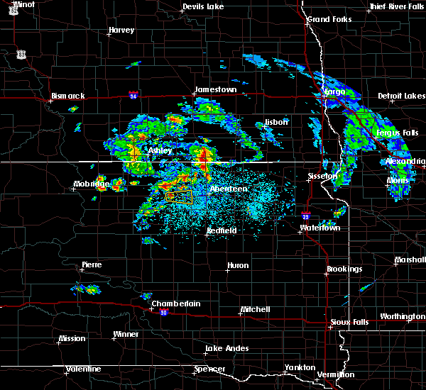 At 124 pm cdt, a severe thunderstorm was located over ipswich, moving east at 40 mph (radar indicated). Hazards include quarter size hail. Damage to vehicles is expected. this severe thunderstorm will be near, cravens corner around 130 pm cdt. Mina lake rec area and mina around 145 pm cdt. At 124 pm cdt, a severe thunderstorm was located over ipswich, moving east at 40 mph (radar indicated). Hazards include quarter size hail. Damage to vehicles is expected. this severe thunderstorm will be near, cravens corner around 130 pm cdt. Mina lake rec area and mina around 145 pm cdt.
|
| 5/30/2016 7:53 PM CDT |
 At 753 pm cdt, a severe thunderstorm was located near plainview colony, or 7 miles northwest of ipswich, moving east at 40 mph (radar indicated). Hazards include 70 mph wind gusts and quarter size hail. Hail damage to vehicles is expected. expect considerable tree damage. wind damage is also likely to mobile homes, roofs, and outbuildings. this severe thunderstorm will be near, plainview colony around 805 pm cdt. deerfield colony around 810 pm cdt. long lake colony around 815 pm cdt. wetonka and grassland colony around 820 pm cdt. richmond lake rec area around 825 pm cdt. westport around 840 pm cdt. Barnard around 845 pm cdt. At 753 pm cdt, a severe thunderstorm was located near plainview colony, or 7 miles northwest of ipswich, moving east at 40 mph (radar indicated). Hazards include 70 mph wind gusts and quarter size hail. Hail damage to vehicles is expected. expect considerable tree damage. wind damage is also likely to mobile homes, roofs, and outbuildings. this severe thunderstorm will be near, plainview colony around 805 pm cdt. deerfield colony around 810 pm cdt. long lake colony around 815 pm cdt. wetonka and grassland colony around 820 pm cdt. richmond lake rec area around 825 pm cdt. westport around 840 pm cdt. Barnard around 845 pm cdt.
|
| 7/25/2015 6:00 PM CDT | Storm damage reported in edmunds county SD, 10 miles N of Ipswich, SD |
| 7/25/2015 6:00 PM CDT |
 At 559 pm cdt, severe thunderstorms were located along a line extending from near pembrook colony to near cresbard to faulkton, moving east at 40 mph. these are very dangerous storms (radar indicated). Hazards include 80 mph wind gusts and penny size hail. Flying debris will be dangerous to those caught without shelter. mobile homes will be heavily damaged. expect considerable damage to roofs, windows and vehicles. extensive tree damage and power outages are likely. severe thunderstorms will be near, miranda and mina around 610 pm cdt. chelsea, south scatterwood lake and north scatterwood lake around 615 pm cdt. northville, rockham and mansfield around 625 pm cdt. mellette and zell around 630 pm cdt. warner around 635 pm cdt. athol around 640 pm cdt. redfield, ashton, brentford and stratford around 645 pm cdt. A tornado watch remains in effect until 1100 pm cdt for northeastern south dakota. At 559 pm cdt, severe thunderstorms were located along a line extending from near pembrook colony to near cresbard to faulkton, moving east at 40 mph. these are very dangerous storms (radar indicated). Hazards include 80 mph wind gusts and penny size hail. Flying debris will be dangerous to those caught without shelter. mobile homes will be heavily damaged. expect considerable damage to roofs, windows and vehicles. extensive tree damage and power outages are likely. severe thunderstorms will be near, miranda and mina around 610 pm cdt. chelsea, south scatterwood lake and north scatterwood lake around 615 pm cdt. northville, rockham and mansfield around 625 pm cdt. mellette and zell around 630 pm cdt. warner around 635 pm cdt. athol around 640 pm cdt. redfield, ashton, brentford and stratford around 645 pm cdt. A tornado watch remains in effect until 1100 pm cdt for northeastern south dakota.
|
| 7/16/2015 3:42 PM CDT |
 At 341 pm cdt, a severe thunderstorm was located 8 miles northeast of roscoe, or 12 miles northwest of ipswich, moving east at 20 mph (radar indicated. at 328 pm cdt...half dollar size hail was reported 7 miles east of hosmer). Hazards include 60 mph wind gusts and nickel size hail. Expect damage to roofs. siding and trees. this severe storm will be near, plainview colony around 410 pm cdt. ipswich around 415 pm cdt. Deerfield colony around 420 pm cdt. At 341 pm cdt, a severe thunderstorm was located 8 miles northeast of roscoe, or 12 miles northwest of ipswich, moving east at 20 mph (radar indicated. at 328 pm cdt...half dollar size hail was reported 7 miles east of hosmer). Hazards include 60 mph wind gusts and nickel size hail. Expect damage to roofs. siding and trees. this severe storm will be near, plainview colony around 410 pm cdt. ipswich around 415 pm cdt. Deerfield colony around 420 pm cdt.
|
| 7/16/2015 3:27 PM CDT |
 At 326 pm cdt, a severe thunderstorm was located 7 miles east of hosmer, or 17 miles northwest of ipswich, moving east at 20 mph (radar indicated). Hazards include 60 mph wind gusts and quarter size hail. Hail damage to vehicles is expected. expect wind damage to roofs, siding and trees. this severe thunderstorm will be near, plainview colony around 410 pm cdt. ipswich around 415 pm cdt. Deerfield colony around 420 pm cdt. At 326 pm cdt, a severe thunderstorm was located 7 miles east of hosmer, or 17 miles northwest of ipswich, moving east at 20 mph (radar indicated). Hazards include 60 mph wind gusts and quarter size hail. Hail damage to vehicles is expected. expect wind damage to roofs, siding and trees. this severe thunderstorm will be near, plainview colony around 410 pm cdt. ipswich around 415 pm cdt. Deerfield colony around 420 pm cdt.
|
| 6/22/2015 2:16 AM CDT |
 At 216 am cdt, a severe thunderstorm was located over hoven, or 18 miles north of gettysburg, moving east at 55 mph (radar indicated). Hazards include 70 mph wind gusts. Expect considerable tree damage. damage is likely to mobile homes, roofs and outbuildings. this severe thunderstorm will be near, tolstoy around 225 am cdt. onaka around 235 am cdt. loyalton and brentwood colony around 245 am cdt. Norbeck around 250 am cdt. At 216 am cdt, a severe thunderstorm was located over hoven, or 18 miles north of gettysburg, moving east at 55 mph (radar indicated). Hazards include 70 mph wind gusts. Expect considerable tree damage. damage is likely to mobile homes, roofs and outbuildings. this severe thunderstorm will be near, tolstoy around 225 am cdt. onaka around 235 am cdt. loyalton and brentwood colony around 245 am cdt. Norbeck around 250 am cdt.
|
| 6/21/2015 11:03 PM CDT |
 At 1103 pm cdt, a severe thunderstorm was located near new town corner, or 12 miles east of eureka, moving southeast at 55 mph (radar indicated). Hazards include 60 mph wind gusts and quarter size hail. Hail damage to vehicles is expected. expect wind damage to roofs, siding and trees. this severe thunderstorm will be near, long lake around 1110 pm cdt. leola around 1125 pm cdt. plainview colony around 1130 pm cdt. long lake colony, deerfield colony and grassland colony around 1135 pm cdt. wetonka around 1140 pm cdt. Richmond lake rec area and mina lake rec area around 1145 pm cdt. At 1103 pm cdt, a severe thunderstorm was located near new town corner, or 12 miles east of eureka, moving southeast at 55 mph (radar indicated). Hazards include 60 mph wind gusts and quarter size hail. Hail damage to vehicles is expected. expect wind damage to roofs, siding and trees. this severe thunderstorm will be near, long lake around 1110 pm cdt. leola around 1125 pm cdt. plainview colony around 1130 pm cdt. long lake colony, deerfield colony and grassland colony around 1135 pm cdt. wetonka around 1140 pm cdt. Richmond lake rec area and mina lake rec area around 1145 pm cdt.
|
| 6/21/2014 6:18 PM CDT | Quarter sized hail reported 5.1 miles NW of Ipswich, SD, nickel to quarter size hail with no apparent damage at time of report |
| 6/13/2014 11:41 PM CDT | Quarter sized hail reported 15.9 miles W of Ipswich, SD, along the brown county and edmunds county line. |
| 6/13/2014 11:41 PM CDT | Quarter sized hail reported 13.1 miles W of Ipswich, SD, mainly nickle size with quarter size mixed in. road was covered with hail |
| 5/30/2014 3:52 PM CDT | Quarter sized hail reported 9.2 miles NNW of Ipswich, SD, hail between quarter size and half dollar size and 1.6 inches of rain |
| 5/30/2014 3:37 PM CDT | Golf Ball sized hail reported 7 miles NNW of Ipswich, SD, golf ball size hail and flooded yard |
| 8/3/2012 6:22 PM CDT | Blew plastic windows out of barn - nssl shave report in edmunds county SD, 12.7 miles NE of Ipswich, SD |
| 8/3/2012 5:15 PM CDT | Nickle hail 0.93 inches rain in edmunds county SD, 10 miles WNW of Ipswich, SD |
| 8/3/2012 4:55 PM CDT | Golf Ball sized hail reported 10.7 miles N of Ipswich, SD |
| 5/19/2012 1:15 AM CDT | Knocked horse fences down along property in edmunds county SD, 9.9 miles W of Ipswich, SD |
| 1/1/0001 12:00 AM | Storm damage reported in edmunds county SD, 10.2 miles WNW of Ipswich, SD |
| 1/1/0001 12:00 AM | Tree branches down. 3 inch diamter branche in edmunds county SD, 9.1 miles NW of Ipswich, SD |
| 1/1/0001 12:00 AM | Winds in excess of 60 mph. highway signs blown ove in edmunds county SD, 10.2 miles W of Ipswich, SD |
Hail Maps for Ipswich, SD
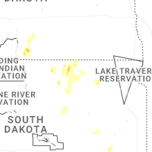
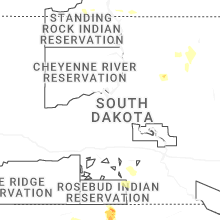

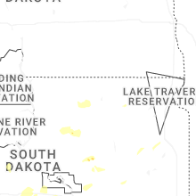
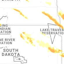


Connect with Interactive Hail Maps