

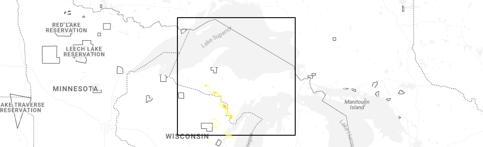
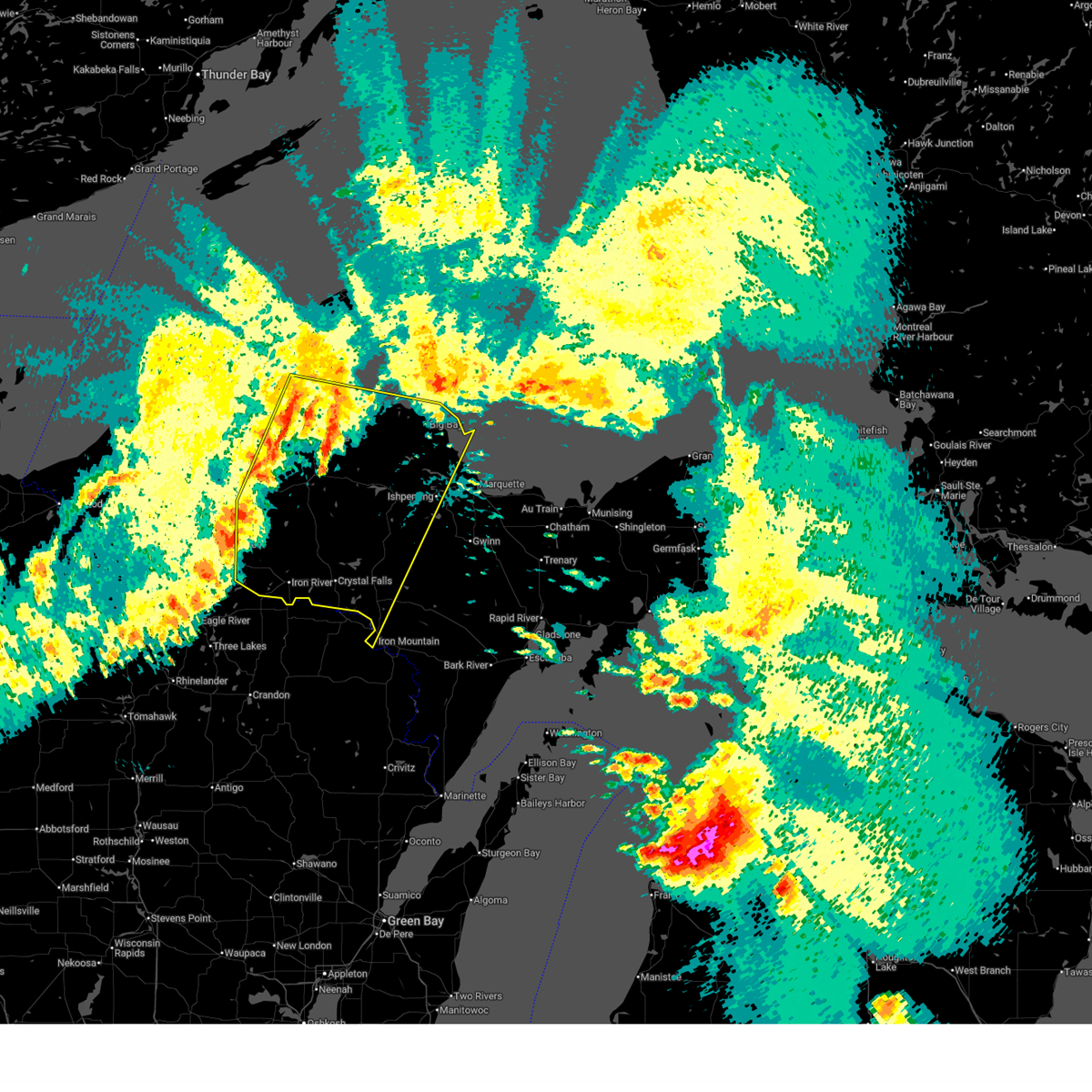
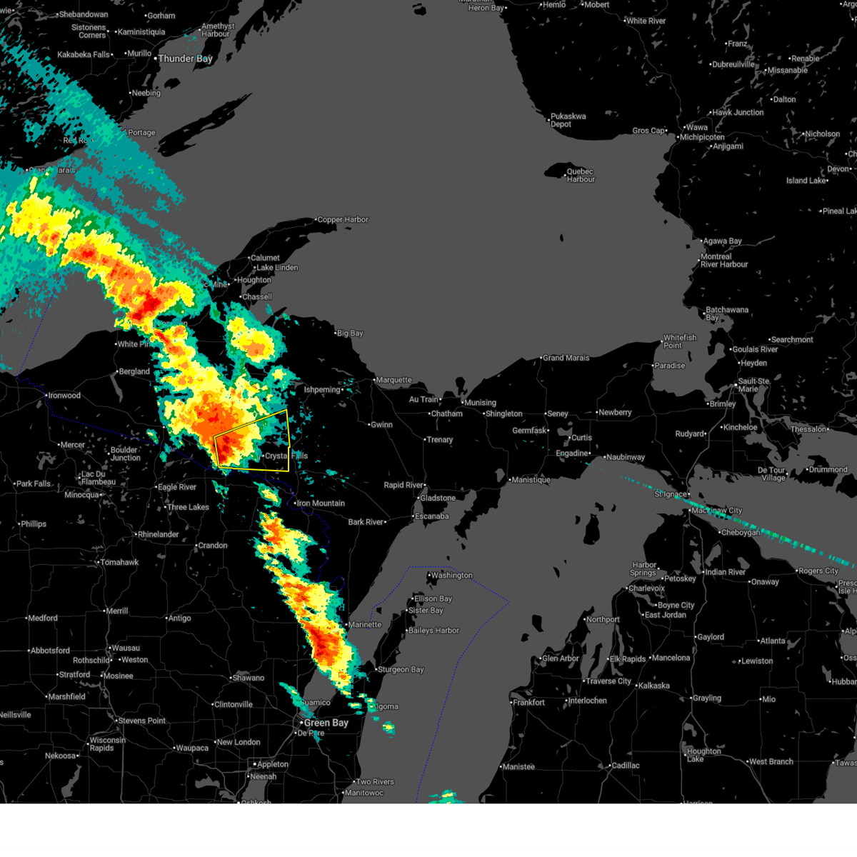
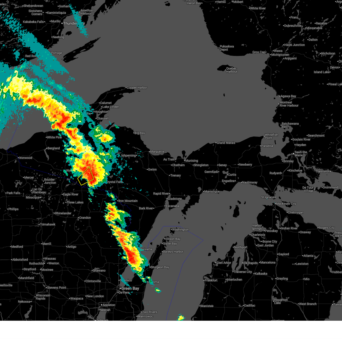
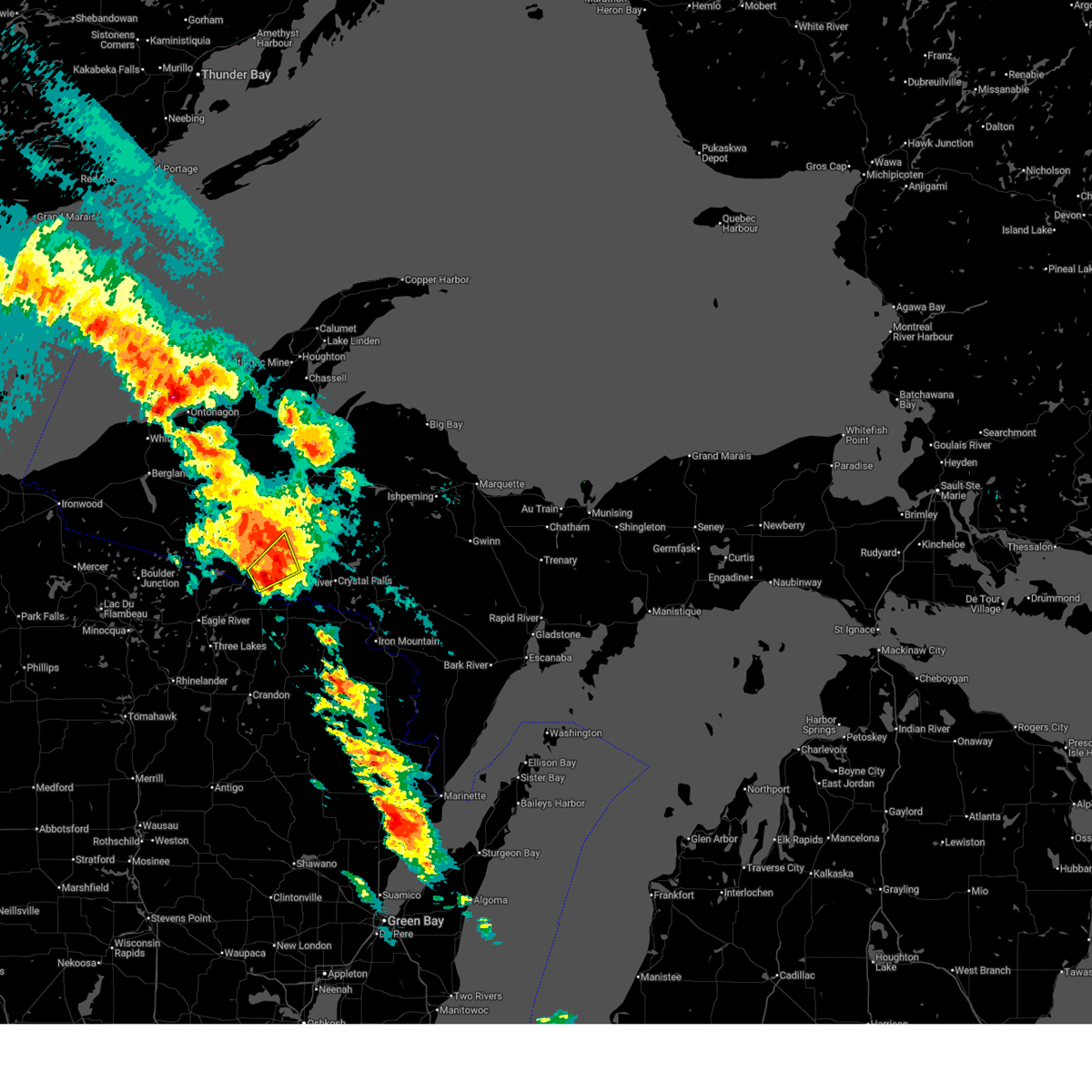
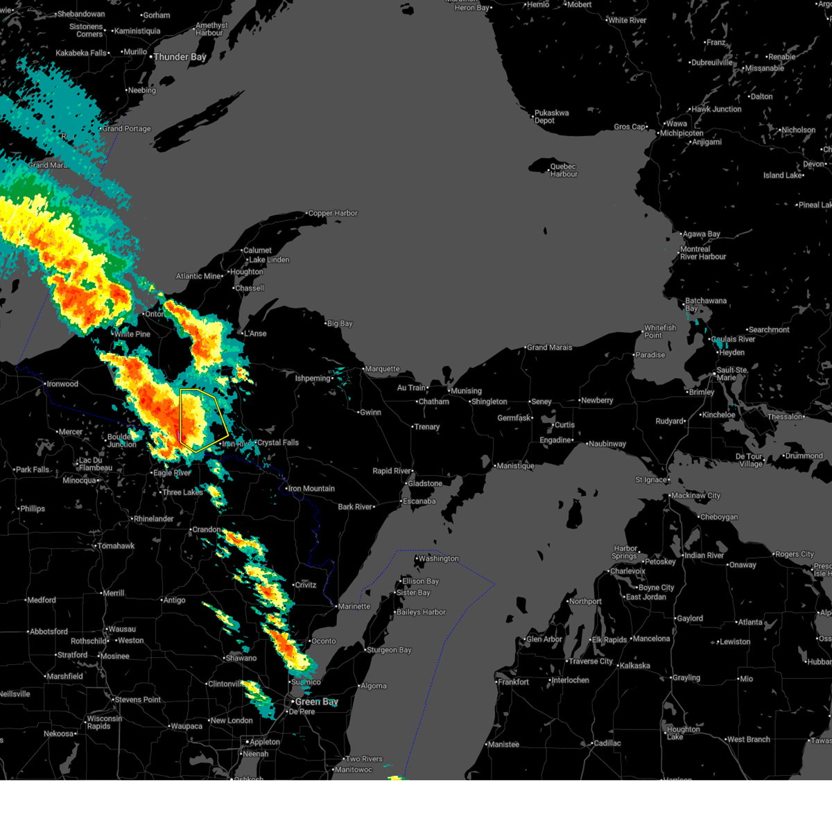
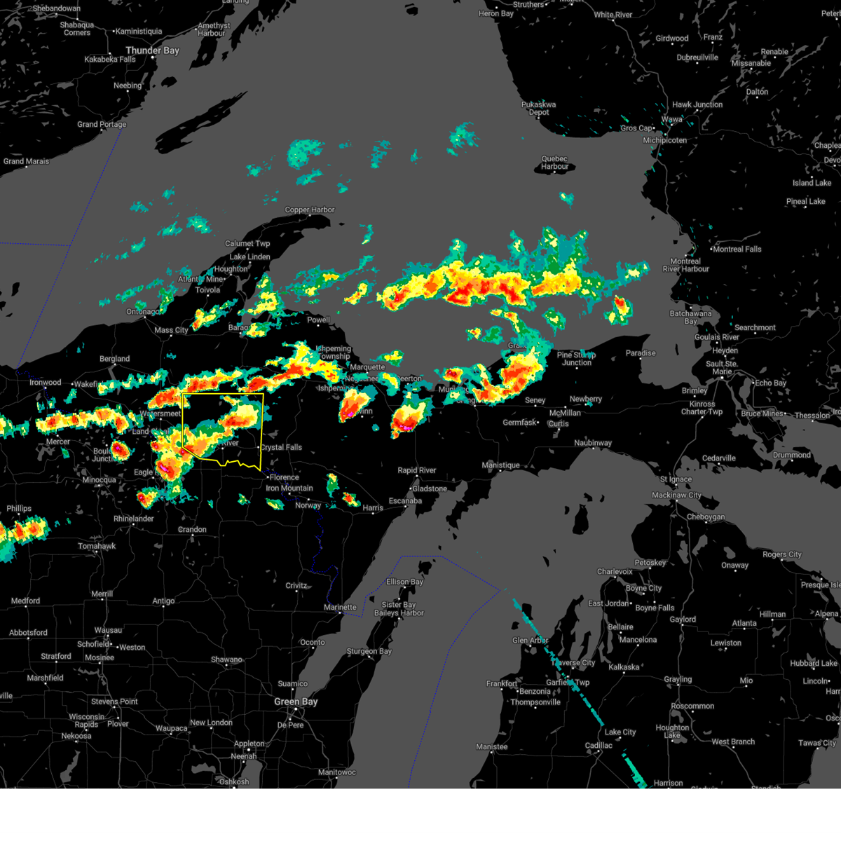
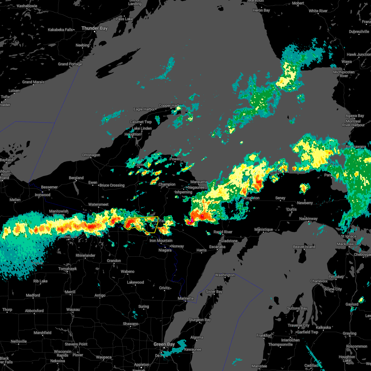
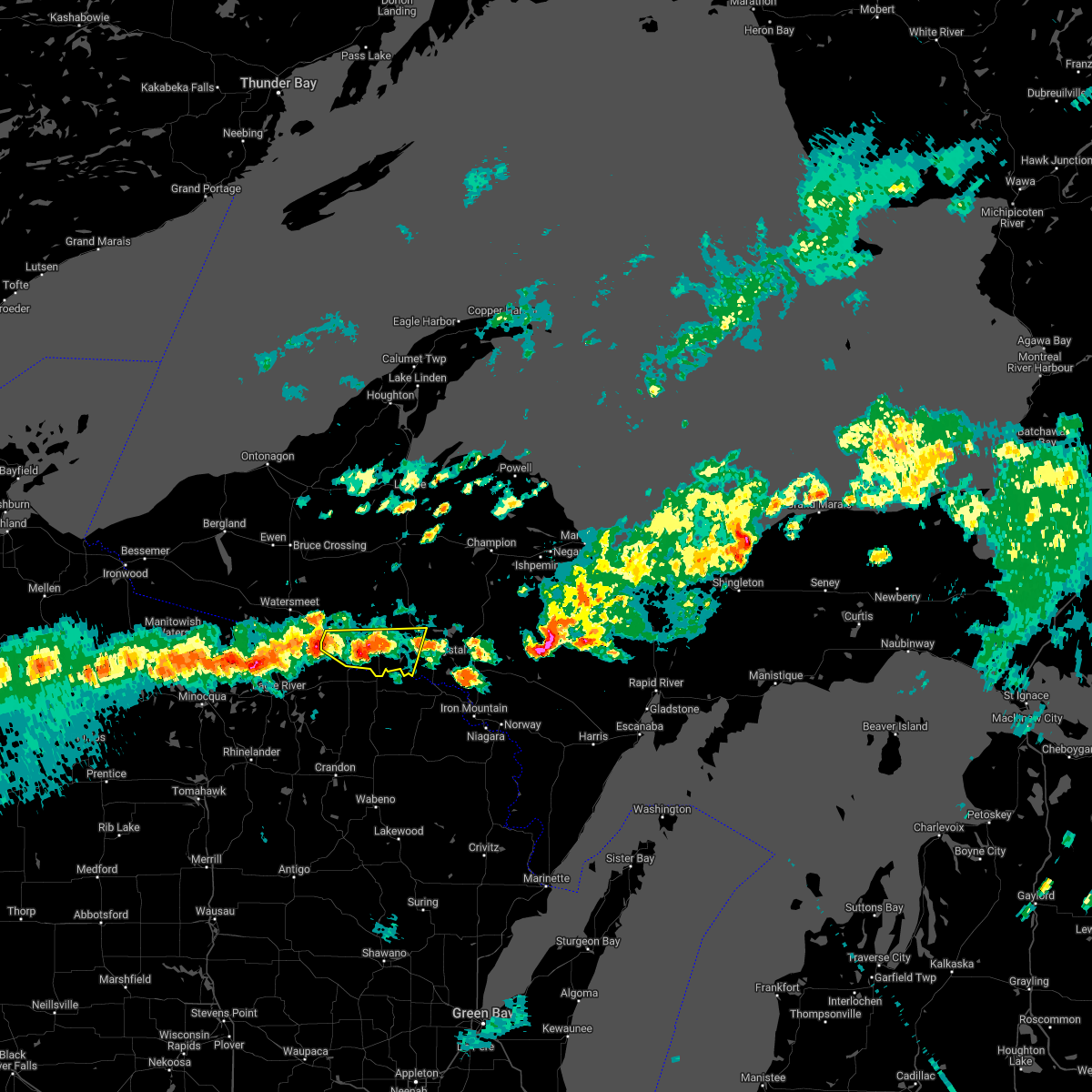
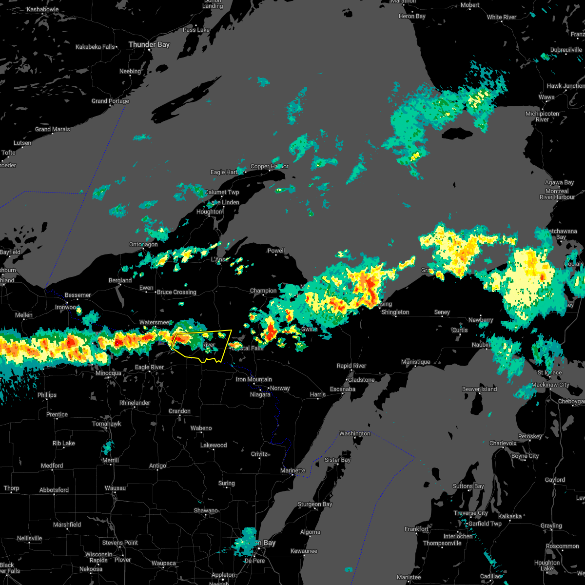
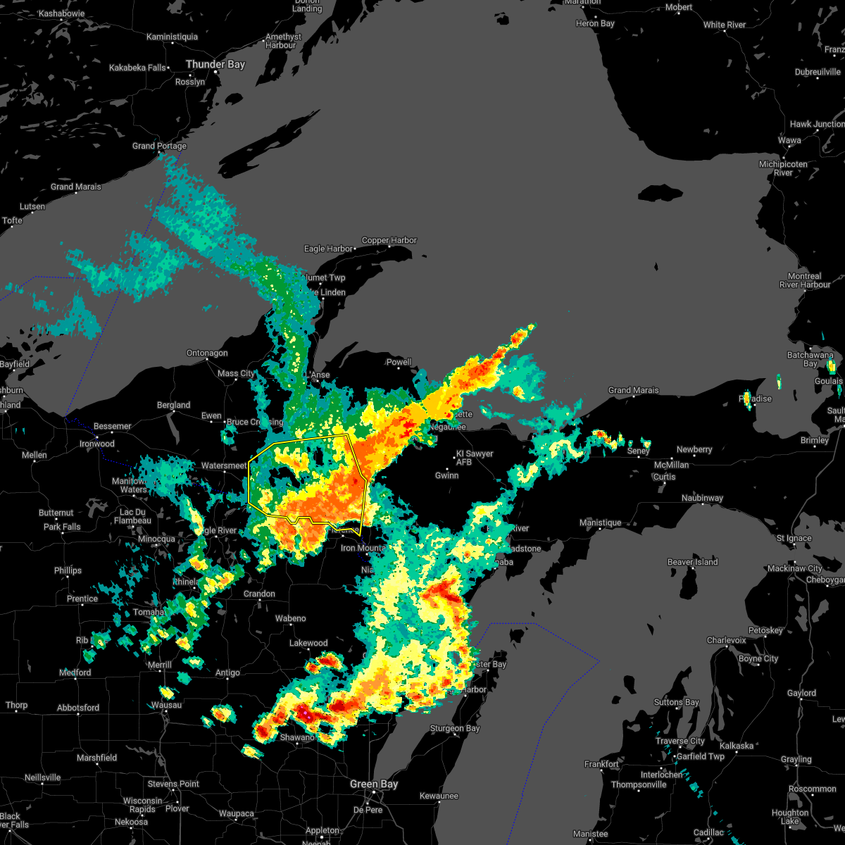
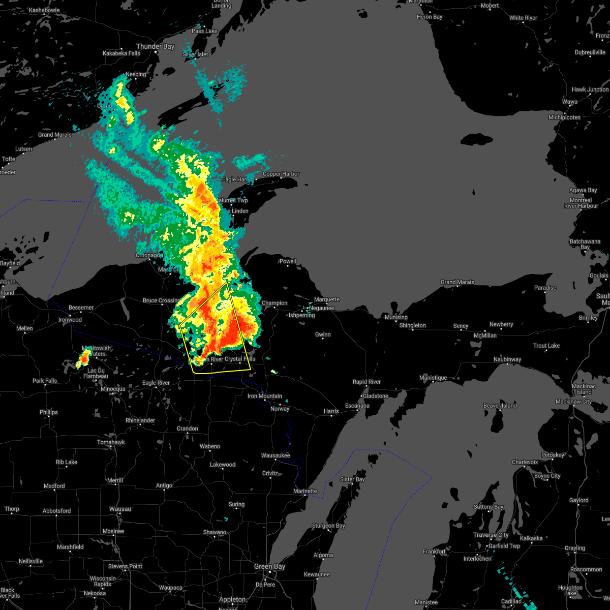
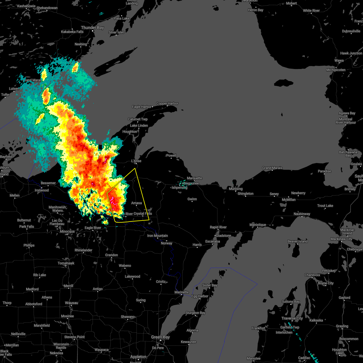
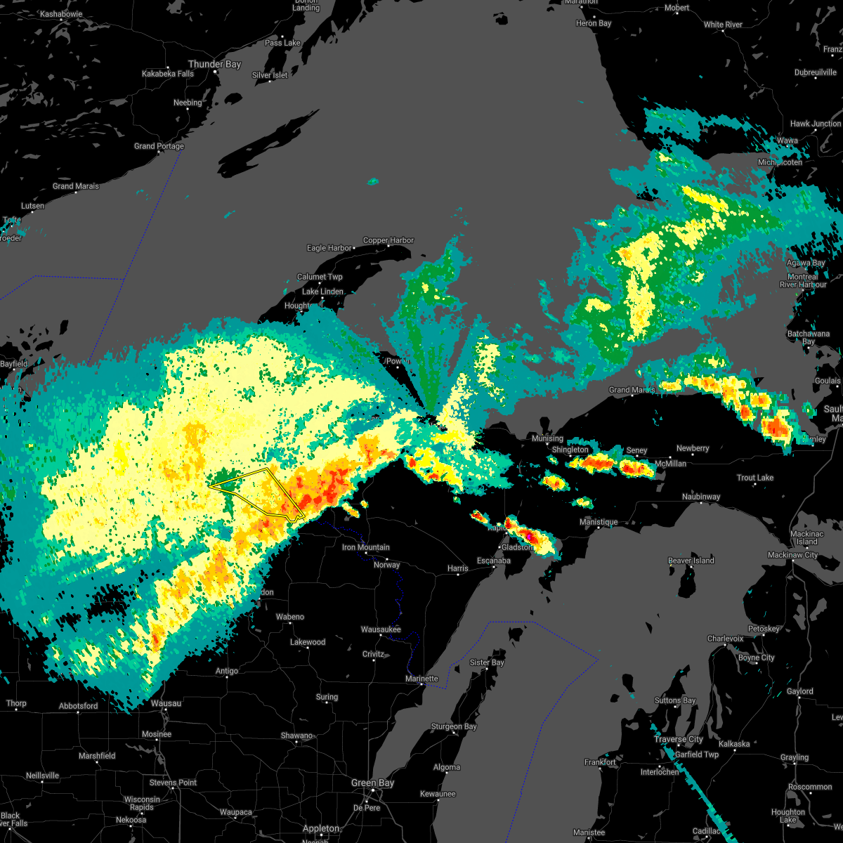
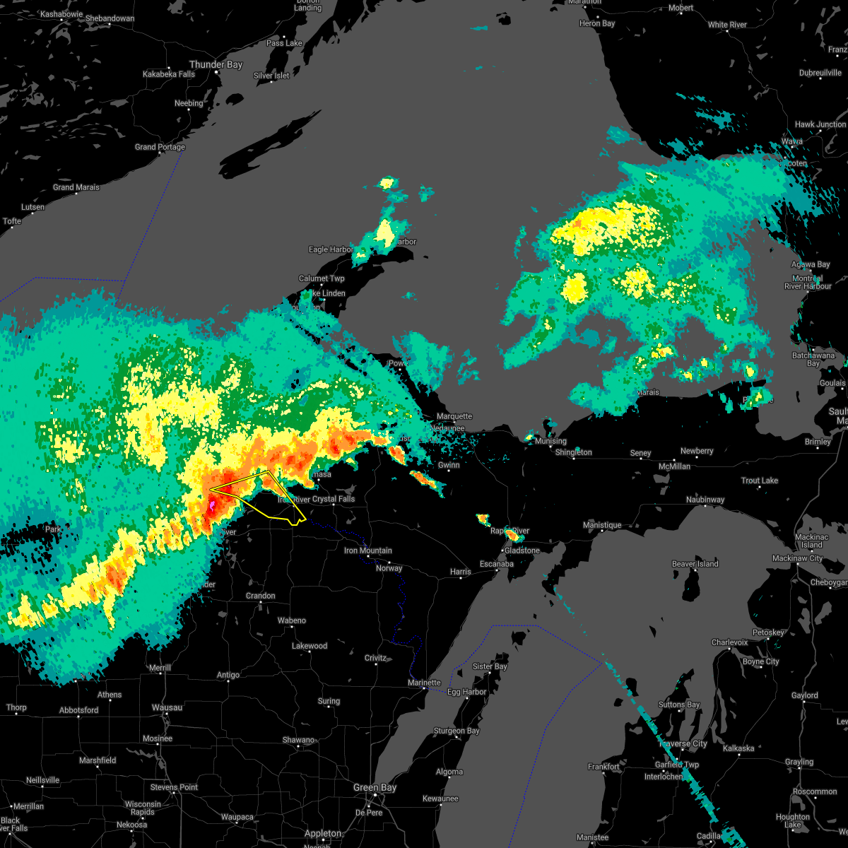
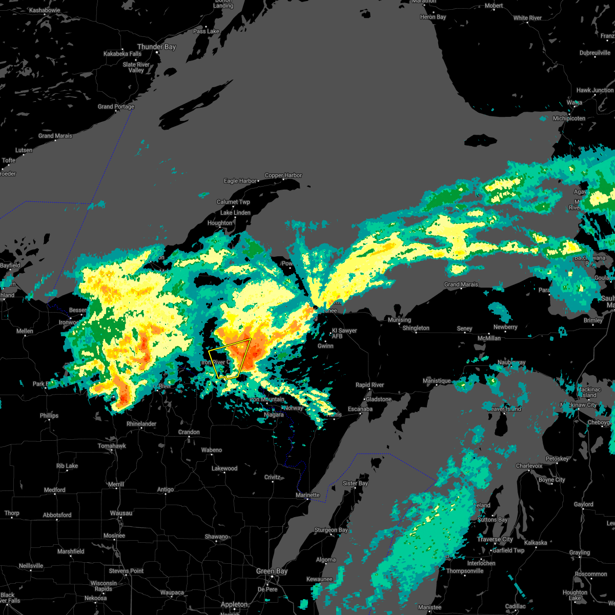
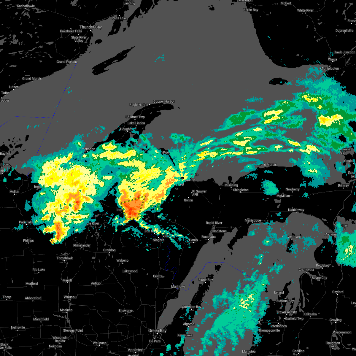
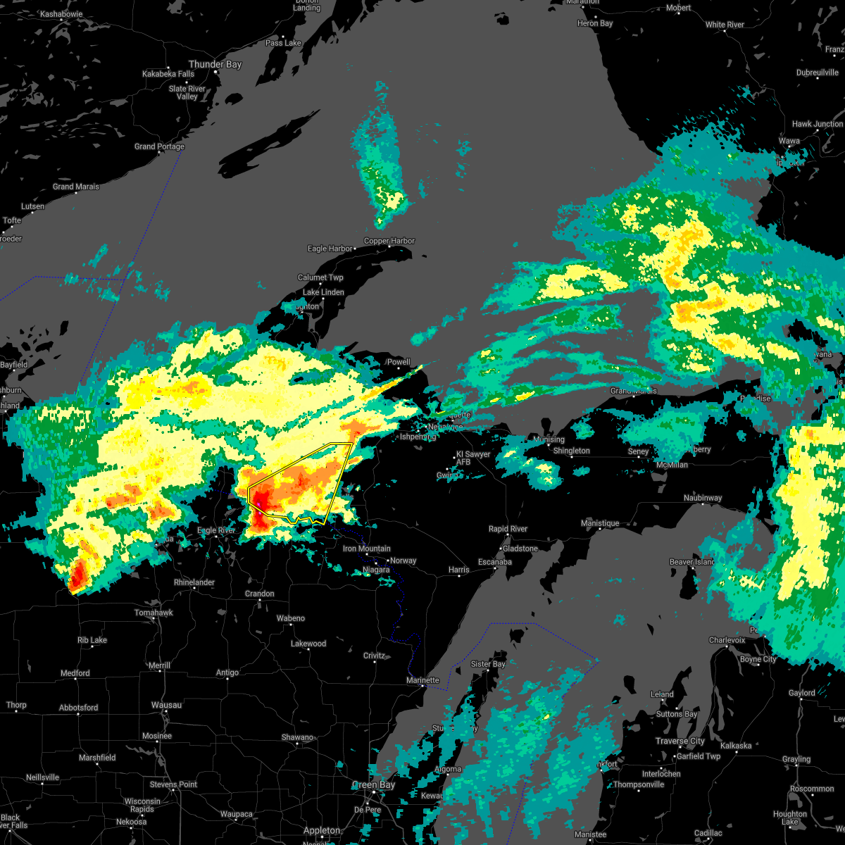
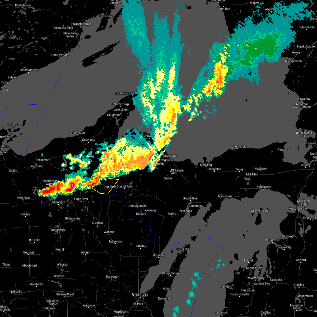
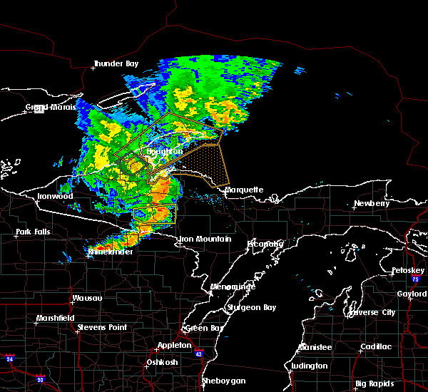
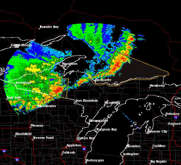
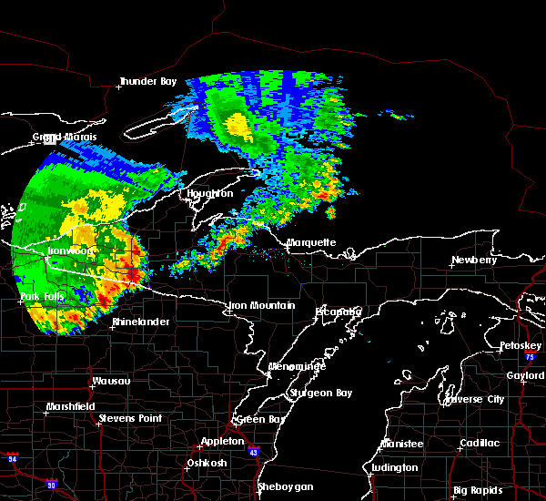
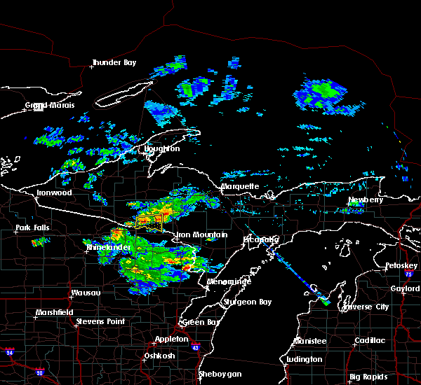
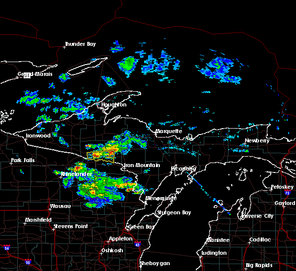
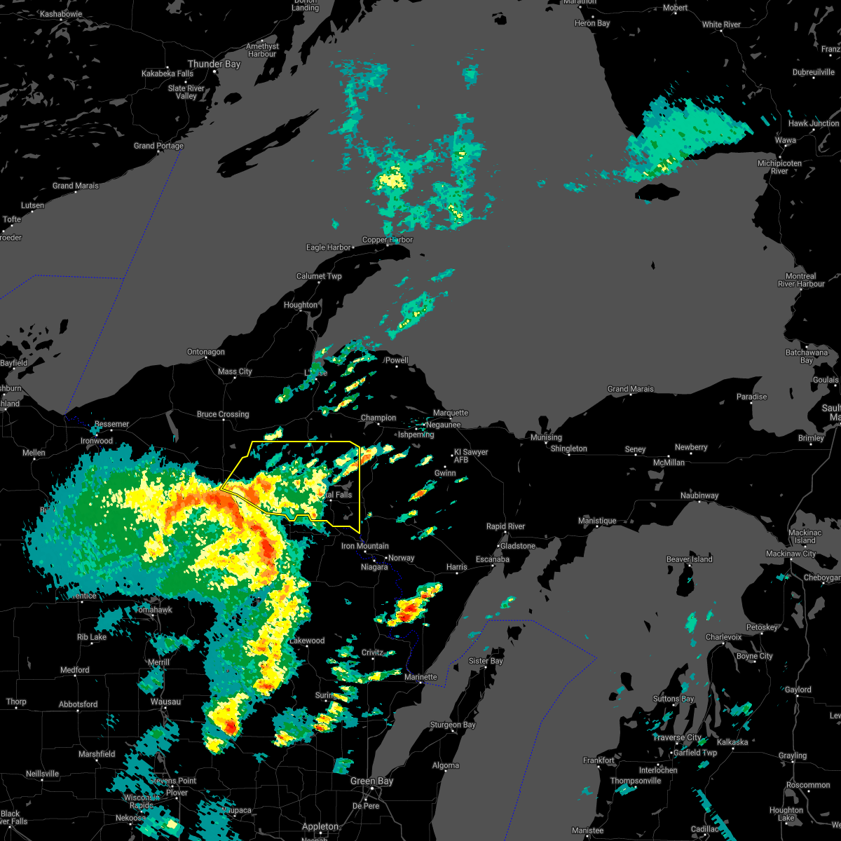
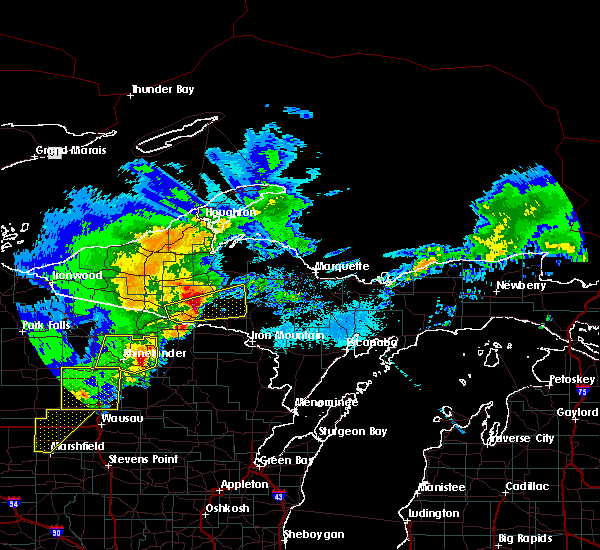
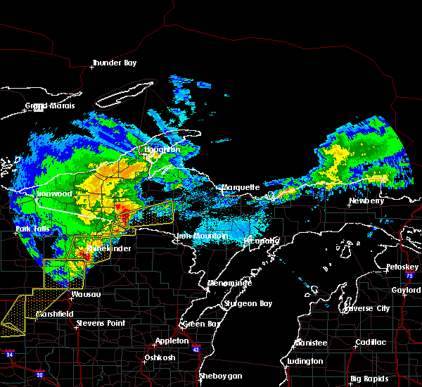
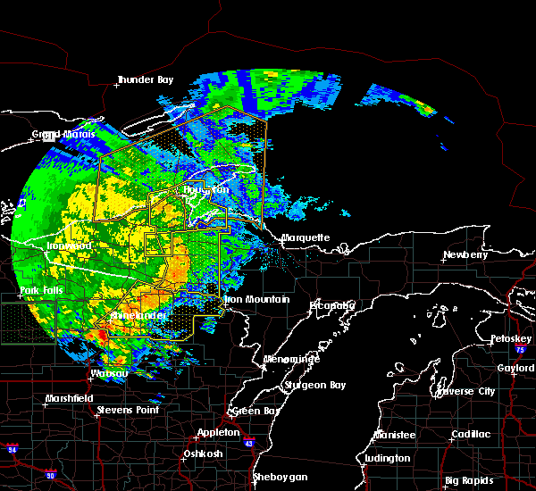
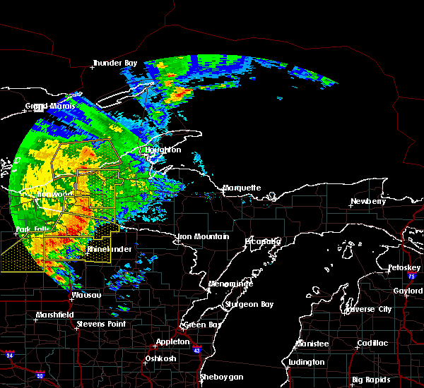
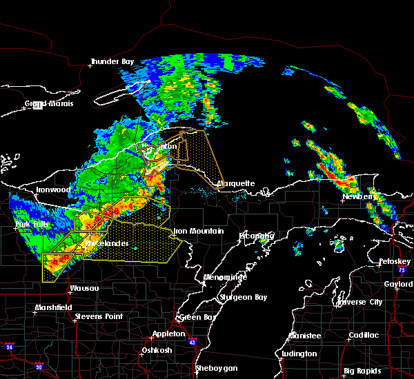
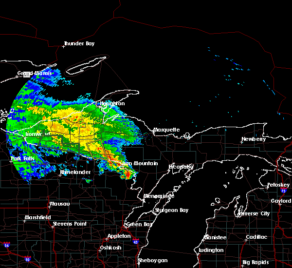
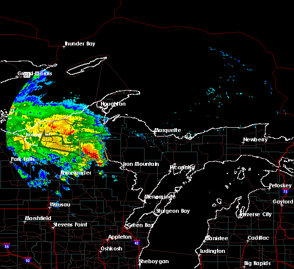
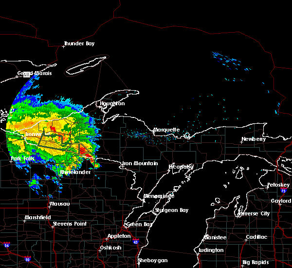
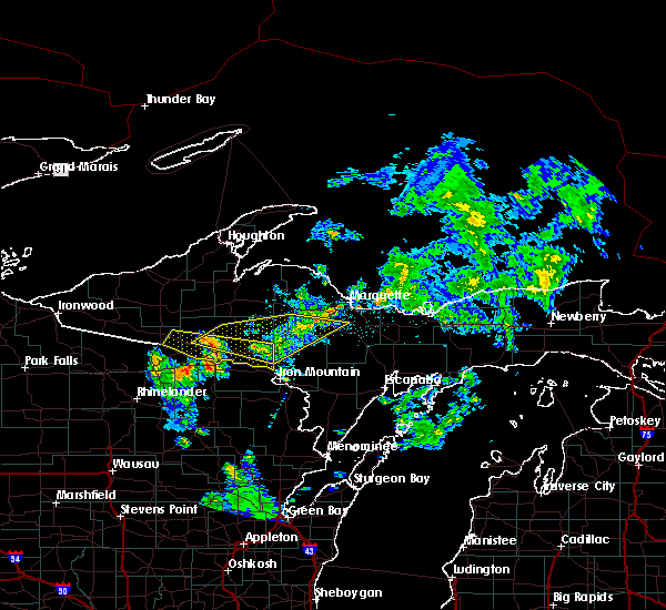
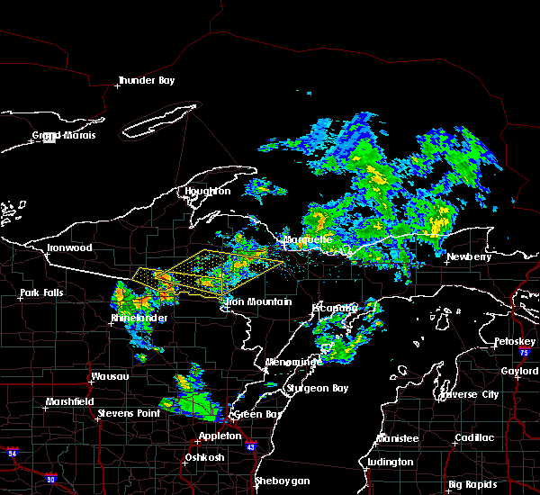
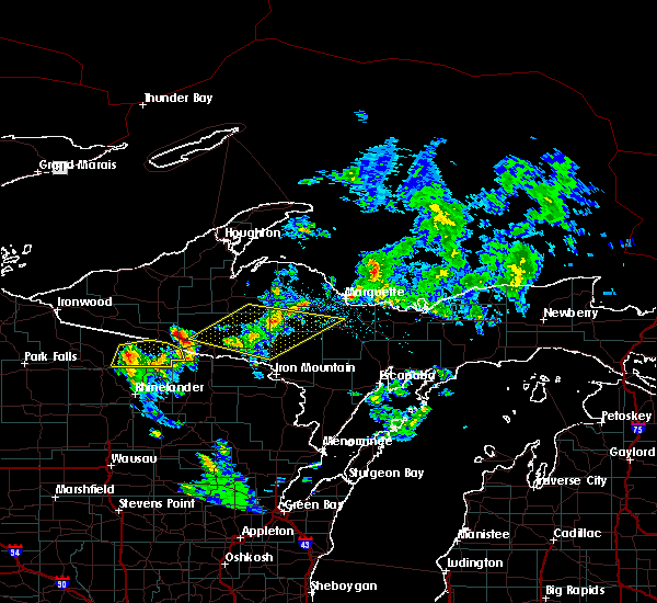
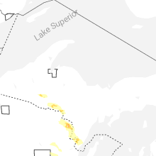
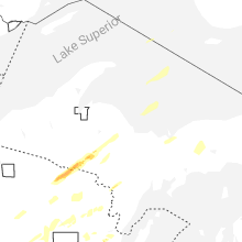
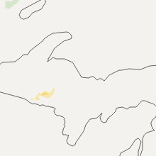
Hail Map for Iron River, MI
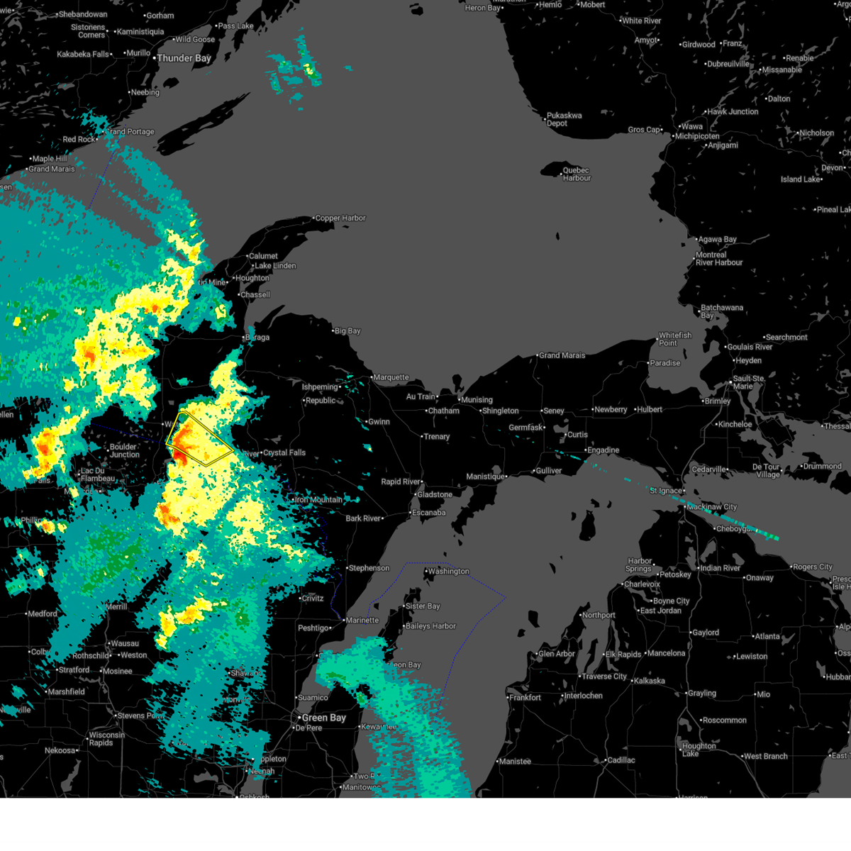
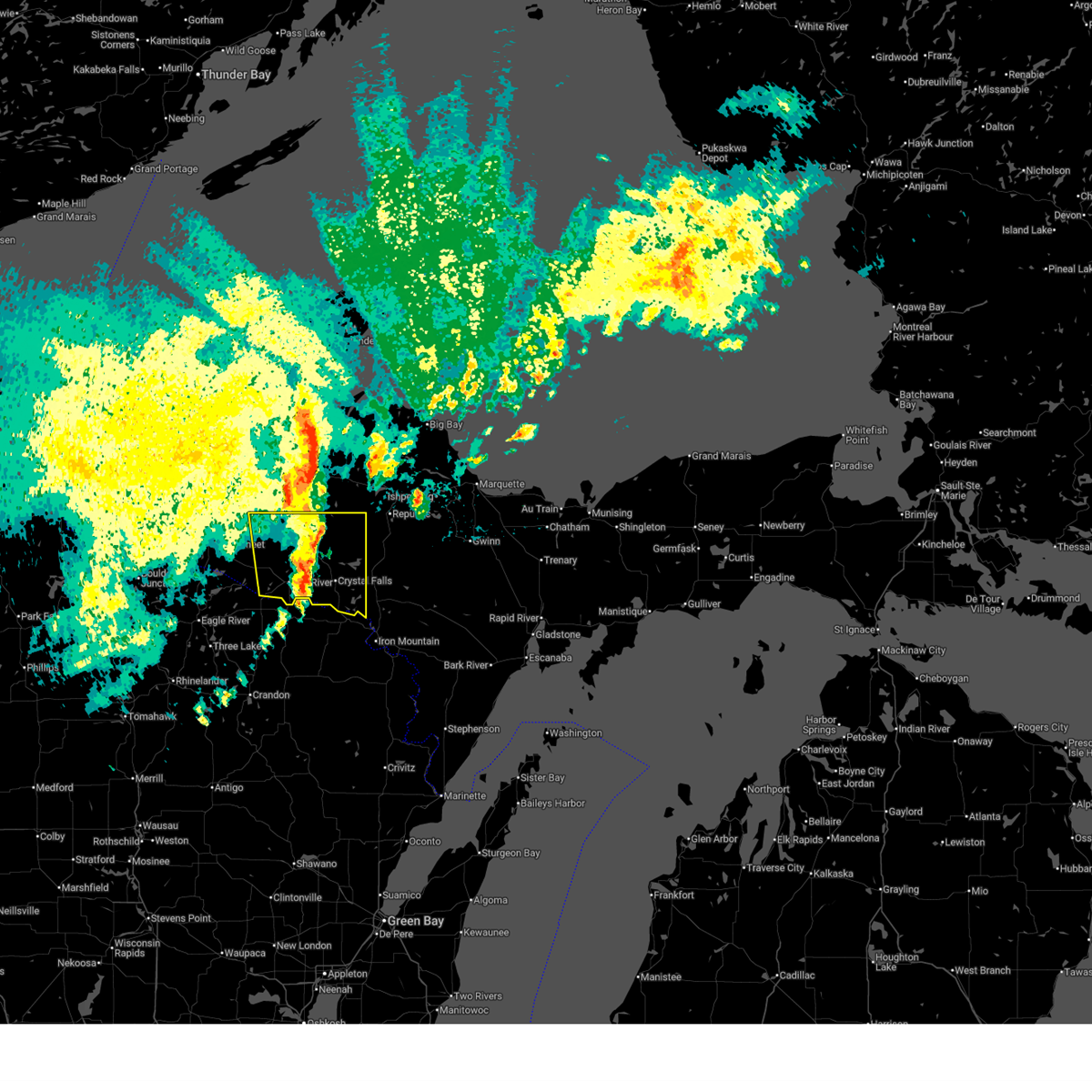
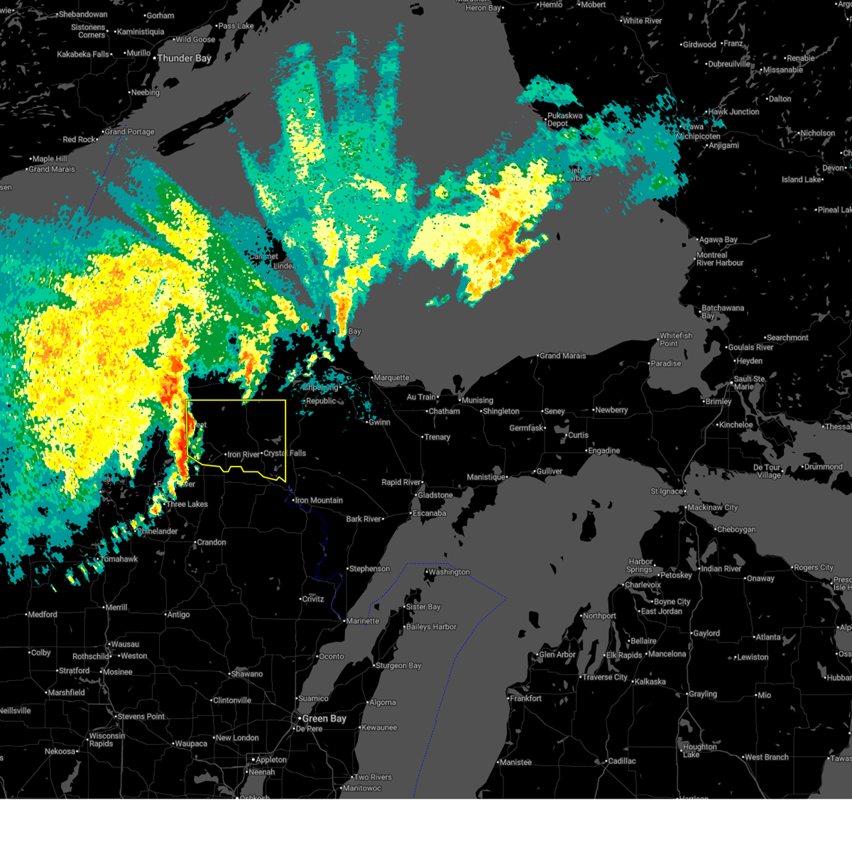
The Iron River, MI area has had 6 reports of on-the-ground hail by trained spotters, and has been under severe weather warnings 4 times during the past 12 months. Doppler radar has detected hail at or near Iron River, MI on 32 occasions, including 1 occasion during the past year.
| Name: | Iron River, MI |
| Where Located: | 48.8 miles NE of Rhinelander, WI |
| Map: | Google Map for Iron River, MI |
| Population: | 3029 |
| Housing Units: | 1770 |
| More Info: | Search Google for Iron River, MI |
0
The Top Recent Hail Date for Iron River, MI is Tuesday, July 8, 2025 (25th out of 32)
Hail and Wind Damage Spotted near Iron River, MI
| Date / Time | Report Details |
|---|---|
| 4/17/2026 5:41 PM CDT |
 Svrmqt the national weather service in marquette has issued a * severe thunderstorm warning for, southwestern iron county in south central upper michigan, southeastern gogebic county in western upper michigan, * until 630 pm cdt. * at 541 pm cdt, a severe thunderstorm was located over phelps, or 15 miles northeast of eagle river, moving northeast at 30 mph (radar indicated). Hazards include 60 mph wind gusts. expect damage to roofs, siding, and trees Svrmqt the national weather service in marquette has issued a * severe thunderstorm warning for, southwestern iron county in south central upper michigan, southeastern gogebic county in western upper michigan, * until 630 pm cdt. * at 541 pm cdt, a severe thunderstorm was located over phelps, or 15 miles northeast of eagle river, moving northeast at 30 mph (radar indicated). Hazards include 60 mph wind gusts. expect damage to roofs, siding, and trees
|
| 7/15/2025 10:06 PM CDT |
 the severe thunderstorm warning has been cancelled and is no longer in effect the severe thunderstorm warning has been cancelled and is no longer in effect
|
| 7/15/2025 9:46 PM CDT |
 At 946 pm cdt, severe thunderstorms were located along a line extending from 10 miles south of sidnaw to near iron river, moving east at 40 mph (radar indicated). Hazards include 60 mph wind gusts. Expect damage to roofs, siding, and trees. locations impacted include, iron river, crystal falls, stambaugh, amasa, u. s. 141 between covington and amasa, caspian, gaastra, alpha, way dam, stager, hagerman lake, and mineral hills. At 946 pm cdt, severe thunderstorms were located along a line extending from 10 miles south of sidnaw to near iron river, moving east at 40 mph (radar indicated). Hazards include 60 mph wind gusts. Expect damage to roofs, siding, and trees. locations impacted include, iron river, crystal falls, stambaugh, amasa, u. s. 141 between covington and amasa, caspian, gaastra, alpha, way dam, stager, hagerman lake, and mineral hills.
|
| 7/15/2025 9:29 PM CDT |
 Svrmqt the national weather service in marquette has issued a * severe thunderstorm warning for, iron county in south central upper michigan, * until 1030 pm cdt. * at 928 pm cdt, severe thunderstorms were located along a line extending from 7 miles southwest of kenton to near phelps, moving east at 40 mph (radar indicated). Hazards include 60 mph wind gusts. expect damage to roofs, siding, and trees Svrmqt the national weather service in marquette has issued a * severe thunderstorm warning for, iron county in south central upper michigan, * until 1030 pm cdt. * at 928 pm cdt, severe thunderstorms were located along a line extending from 7 miles southwest of kenton to near phelps, moving east at 40 mph (radar indicated). Hazards include 60 mph wind gusts. expect damage to roofs, siding, and trees
|
| 6/21/2025 5:56 AM CDT |
 Svrmqt the national weather service in marquette has issued a * severe thunderstorm warning for, iron county in south central upper michigan, northwestern dickinson county in south central upper michigan, northwestern marquette county in north central upper michigan, central houghton county in western upper michigan, baraga county in north central upper michigan, * until 800 am edt/700 am cdt/. * at 655 am edt/555 am cdt/, severe thunderstorms were located along a line extending from near the lower entrance of portage canal to near phelps, moving east at 55 mph (radar indicated). Hazards include 60 mph wind gusts and penny size hail. expect damage to roofs, siding, and trees Svrmqt the national weather service in marquette has issued a * severe thunderstorm warning for, iron county in south central upper michigan, northwestern dickinson county in south central upper michigan, northwestern marquette county in north central upper michigan, central houghton county in western upper michigan, baraga county in north central upper michigan, * until 800 am edt/700 am cdt/. * at 655 am edt/555 am cdt/, severe thunderstorms were located along a line extending from near the lower entrance of portage canal to near phelps, moving east at 55 mph (radar indicated). Hazards include 60 mph wind gusts and penny size hail. expect damage to roofs, siding, and trees
|
| 6/21/2025 2:52 AM CDT |
 Svrmqt the national weather service in marquette has issued a * severe thunderstorm warning for, eastern iron county in south central upper michigan, * until 330 am cdt. * at 252 am cdt, a severe thunderstorm was located over iron river, moving east at 45 mph (radar indicated). Hazards include 60 mph wind gusts and quarter size hail. Hail damage to vehicles is expected. Expect wind damage to roofs, siding, and trees. Svrmqt the national weather service in marquette has issued a * severe thunderstorm warning for, eastern iron county in south central upper michigan, * until 330 am cdt. * at 252 am cdt, a severe thunderstorm was located over iron river, moving east at 45 mph (radar indicated). Hazards include 60 mph wind gusts and quarter size hail. Hail damage to vehicles is expected. Expect wind damage to roofs, siding, and trees.
|
| 6/21/2025 2:52 AM CDT |
 the severe thunderstorm warning has been cancelled and is no longer in effect the severe thunderstorm warning has been cancelled and is no longer in effect
|
| 6/21/2025 2:47 AM CDT |
 At 247 am cdt, a severe thunderstorm was located 10 miles north of iron river, moving northeast at 35 mph (radar indicated). Hazards include 60 mph wind gusts and quarter size hail. Hail damage to vehicles is expected. expect wind damage to roofs, siding, and trees. Locations impacted include, iron river, gibbs city, and mineral hills. At 247 am cdt, a severe thunderstorm was located 10 miles north of iron river, moving northeast at 35 mph (radar indicated). Hazards include 60 mph wind gusts and quarter size hail. Hail damage to vehicles is expected. expect wind damage to roofs, siding, and trees. Locations impacted include, iron river, gibbs city, and mineral hills.
|
| 6/21/2025 2:23 AM CDT |
 Svrmqt the national weather service in marquette has issued a * severe thunderstorm warning for, northwestern iron county in south central upper michigan, * until 315 am cdt. * at 222 am cdt, a severe thunderstorm was located 8 miles northeast of phelps, or 14 miles west of iron river, moving northeast at 35 mph (radar indicated). Hazards include 60 mph wind gusts and quarter size hail. Hail damage to vehicles is expected. Expect wind damage to roofs, siding, and trees. Svrmqt the national weather service in marquette has issued a * severe thunderstorm warning for, northwestern iron county in south central upper michigan, * until 315 am cdt. * at 222 am cdt, a severe thunderstorm was located 8 miles northeast of phelps, or 14 miles west of iron river, moving northeast at 35 mph (radar indicated). Hazards include 60 mph wind gusts and quarter size hail. Hail damage to vehicles is expected. Expect wind damage to roofs, siding, and trees.
|
| 4/28/2025 6:10 PM CDT | Half Dollar sized hail reported 0.3 miles S of Iron River, MI, report via social media. |
| 4/28/2025 5:48 PM CDT | Ping Pong Ball sized hail reported 6.3 miles WNW of Iron River, MI, image from local news. time estimated via radar. |
| 4/28/2025 5:37 PM CDT |
 Svrmqt the national weather service in marquette has issued a * severe thunderstorm warning for, southeastern iron county in south central upper michigan, southwestern marquette county in north central upper michigan, * until 730 pm edt/630 pm cdt/. * at 637 pm edt/537 pm cdt/, a severe thunderstorm was located over wisconsin slough natural area, or 7 miles south of iron river, moving northeast at 70 mph (radar indicated). Hazards include ping pong ball size hail and 60 mph wind gusts. People and animals outdoors will be injured. expect hail damage to roofs, siding, windows, and vehicles. Expect wind damage to roofs, siding, and trees. Svrmqt the national weather service in marquette has issued a * severe thunderstorm warning for, southeastern iron county in south central upper michigan, southwestern marquette county in north central upper michigan, * until 730 pm edt/630 pm cdt/. * at 637 pm edt/537 pm cdt/, a severe thunderstorm was located over wisconsin slough natural area, or 7 miles south of iron river, moving northeast at 70 mph (radar indicated). Hazards include ping pong ball size hail and 60 mph wind gusts. People and animals outdoors will be injured. expect hail damage to roofs, siding, windows, and vehicles. Expect wind damage to roofs, siding, and trees.
|
| 8/27/2024 12:35 AM CDT |
 the severe thunderstorm warning has been cancelled and is no longer in effect the severe thunderstorm warning has been cancelled and is no longer in effect
|
| 8/27/2024 12:13 AM CDT |
 Svrmqt the national weather service in marquette has issued a * severe thunderstorm warning for, iron county in south central upper michigan, southeastern gogebic county in western upper michigan, southwestern houghton county in western upper michigan, southeastern ontonagon county in western upper michigan, southwestern baraga county in north central upper michigan, * until 145 am edt/1245 am cdt/. * at 112 am edt/1212 am cdt/, severe thunderstorms were located along a line extending from 8 miles southeast of northern lake gogebic to 7 miles southeast of paulding to 6 miles east of phelps, moving east at 40 mph (radar indicated). Hazards include 70 mph wind gusts and quarter size hail. Hail damage to vehicles is expected. expect considerable tree damage. Wind damage is also likely to mobile homes, roofs, and outbuildings. Svrmqt the national weather service in marquette has issued a * severe thunderstorm warning for, iron county in south central upper michigan, southeastern gogebic county in western upper michigan, southwestern houghton county in western upper michigan, southeastern ontonagon county in western upper michigan, southwestern baraga county in north central upper michigan, * until 145 am edt/1245 am cdt/. * at 112 am edt/1212 am cdt/, severe thunderstorms were located along a line extending from 8 miles southeast of northern lake gogebic to 7 miles southeast of paulding to 6 miles east of phelps, moving east at 40 mph (radar indicated). Hazards include 70 mph wind gusts and quarter size hail. Hail damage to vehicles is expected. expect considerable tree damage. Wind damage is also likely to mobile homes, roofs, and outbuildings.
|
| 6/19/2024 12:25 AM CDT |
 The storm which prompted the warning has weakened below severe limits, and no longer poses an immediate threat to life or property. therefore, the warning will be allowed to expire. The storm which prompted the warning has weakened below severe limits, and no longer poses an immediate threat to life or property. therefore, the warning will be allowed to expire.
|
| 6/19/2024 12:04 AM CDT |
 At 103 am edt/1203 am cdt/, a severe thunderstorm was located 9 miles northeast of border lakes natural area, or 29 miles northwest of eagle river, moving northeast at 45 mph (radar indicated). Hazards include 60 mph wind gusts. Expect damage to roofs, siding, and trees. Locations impacted include, iron river, porcupine mountains state park, ironwood, bessemer, wakefield, marenisco, hurley, watersmeet, stambaugh, bergland, bruce crossing, and paulding. At 103 am edt/1203 am cdt/, a severe thunderstorm was located 9 miles northeast of border lakes natural area, or 29 miles northwest of eagle river, moving northeast at 45 mph (radar indicated). Hazards include 60 mph wind gusts. Expect damage to roofs, siding, and trees. Locations impacted include, iron river, porcupine mountains state park, ironwood, bessemer, wakefield, marenisco, hurley, watersmeet, stambaugh, bergland, bruce crossing, and paulding.
|
| 6/18/2024 11:47 PM CDT |
 Svrmqt the national weather service in marquette has issued a * severe thunderstorm warning for, iron county in south central upper michigan, gogebic county in western upper michigan, southwestern houghton county in western upper michigan, ontonagon county in western upper michigan, southwestern baraga county in north central upper michigan, * until 130 am edt/1230 am cdt/. * at 1247 am edt/1147 pm cdt/, a severe thunderstorm was located near rice creek natural area, or 19 miles northeast of turtle flambeau flowage, moving northeast at 40 mph (radar indicated). Hazards include 60 mph wind gusts. expect damage to roofs, siding, and trees Svrmqt the national weather service in marquette has issued a * severe thunderstorm warning for, iron county in south central upper michigan, gogebic county in western upper michigan, southwestern houghton county in western upper michigan, ontonagon county in western upper michigan, southwestern baraga county in north central upper michigan, * until 130 am edt/1230 am cdt/. * at 1247 am edt/1147 pm cdt/, a severe thunderstorm was located near rice creek natural area, or 19 miles northeast of turtle flambeau flowage, moving northeast at 40 mph (radar indicated). Hazards include 60 mph wind gusts. expect damage to roofs, siding, and trees
|
| 7/10/2023 6:17 PM CDT |
 At 617 pm cdt, a severe thunderstorm was located near iron river, moving east at 40 mph (radar indicated). Hazards include quarter size hail. Damage to vehicles is expected. locations impacted include, iron river, crystal falls, stambaugh, amasa, u. s. 141 between covington and amasa, caspian, gaastra, alpha, hagerman lake, golden lake, mineral hills and paint lake. hail threat, radar indicated max hail size, 1. 00 in wind threat, radar indicated max wind gust, <50 mph. At 617 pm cdt, a severe thunderstorm was located near iron river, moving east at 40 mph (radar indicated). Hazards include quarter size hail. Damage to vehicles is expected. locations impacted include, iron river, crystal falls, stambaugh, amasa, u. s. 141 between covington and amasa, caspian, gaastra, alpha, hagerman lake, golden lake, mineral hills and paint lake. hail threat, radar indicated max hail size, 1. 00 in wind threat, radar indicated max wind gust, <50 mph.
|
| 7/10/2023 6:07 PM CDT |
 At 607 pm cdt, a severe thunderstorm was located near kentuck lake campground, or 12 miles west of iron river, moving east at 40 mph (radar indicated). Hazards include quarter size hail. damage to vehicles is expected At 607 pm cdt, a severe thunderstorm was located near kentuck lake campground, or 12 miles west of iron river, moving east at 40 mph (radar indicated). Hazards include quarter size hail. damage to vehicles is expected
|
| 6/28/2022 2:58 PM CDT |
 At 257 pm cdt, a severe thunderstorm was located over stambaugh, or near iron river, moving southeast at 30 mph (radar indicated). Hazards include 60 mph wind gusts and quarter size hail. Hail damage to vehicles is expected. expect wind damage to roofs, siding, and trees. this severe thunderstorm will be near, crystal falls around 315 pm cdt. hail threat, radar indicated max hail size, 1. 00 in wind threat, radar indicated max wind gust, 60 mph. At 257 pm cdt, a severe thunderstorm was located over stambaugh, or near iron river, moving southeast at 30 mph (radar indicated). Hazards include 60 mph wind gusts and quarter size hail. Hail damage to vehicles is expected. expect wind damage to roofs, siding, and trees. this severe thunderstorm will be near, crystal falls around 315 pm cdt. hail threat, radar indicated max hail size, 1. 00 in wind threat, radar indicated max wind gust, 60 mph.
|
| 6/28/2022 2:50 PM CDT |
 At 250 pm cdt, a severe thunderstorm was located over stambaugh, or over iron river, moving east at 35 mph (radar indicated). Hazards include 60 mph wind gusts and quarter size hail. Hail damage to vehicles is expected. expect wind damage to roofs, siding, and trees. locations impacted include, iron river, stambaugh, caspian, gaastra, bewabic state park, hagerman lake, golden lake and mineral hills. hail threat, radar indicated max hail size, 1. 00 in wind threat, radar indicated max wind gust, 60 mph. At 250 pm cdt, a severe thunderstorm was located over stambaugh, or over iron river, moving east at 35 mph (radar indicated). Hazards include 60 mph wind gusts and quarter size hail. Hail damage to vehicles is expected. expect wind damage to roofs, siding, and trees. locations impacted include, iron river, stambaugh, caspian, gaastra, bewabic state park, hagerman lake, golden lake and mineral hills. hail threat, radar indicated max hail size, 1. 00 in wind threat, radar indicated max wind gust, 60 mph.
|
| 6/28/2022 2:30 PM CDT |
 At 229 pm cdt, a severe thunderstorm was located 10 miles northeast of phelps, or 12 miles west of iron river, moving east at 35 mph (radar indicated). Hazards include 60 mph wind gusts and quarter size hail. Hail damage to vehicles is expected. Expect wind damage to roofs, siding, and trees. At 229 pm cdt, a severe thunderstorm was located 10 miles northeast of phelps, or 12 miles west of iron river, moving east at 35 mph (radar indicated). Hazards include 60 mph wind gusts and quarter size hail. Hail damage to vehicles is expected. Expect wind damage to roofs, siding, and trees.
|
| 5/12/2022 4:56 PM CDT |
 At 556 pm edt/456 pm cdt/, a severe thunderstorm was located near crystal falls, moving northeast at 20 mph (radar indicated). Hazards include 60 mph wind gusts and quarter size hail. Hail damage to vehicles is expected. expect wind damage to roofs, siding, and trees. locations impacted include, iron river, crystal falls, stambaugh, amasa, channing, caspian, gaastra, alpha, way dam, stager, hagerman lake and perch lake. hail threat, radar indicated max hail size, 1. 00 in wind threat, radar indicated max wind gust, 60 mph. At 556 pm edt/456 pm cdt/, a severe thunderstorm was located near crystal falls, moving northeast at 20 mph (radar indicated). Hazards include 60 mph wind gusts and quarter size hail. Hail damage to vehicles is expected. expect wind damage to roofs, siding, and trees. locations impacted include, iron river, crystal falls, stambaugh, amasa, channing, caspian, gaastra, alpha, way dam, stager, hagerman lake and perch lake. hail threat, radar indicated max hail size, 1. 00 in wind threat, radar indicated max wind gust, 60 mph.
|
| 5/12/2022 4:41 PM CDT |
 At 541 pm edt/441 pm cdt/, a severe thunderstorm was located near stambaugh, or near iron river, moving northeast at 20 mph (radar indicated). Hazards include 60 mph wind gusts and quarter size hail. Hail damage to vehicles is expected. Expect wind damage to roofs, siding, and trees. At 541 pm edt/441 pm cdt/, a severe thunderstorm was located near stambaugh, or near iron river, moving northeast at 20 mph (radar indicated). Hazards include 60 mph wind gusts and quarter size hail. Hail damage to vehicles is expected. Expect wind damage to roofs, siding, and trees.
|
| 5/10/2022 5:02 PM CDT |
 At 501 pm cdt, a severe thunderstorm was located over the wisconsin and upper michigan stateline area in southern iron county shortly (radar indicated). Hazards include quarter size hail. Damage to vehicles is expected. locations impacted include, crystal falls. hail threat, radar indicated max hail size, 1. 00 in wind threat, radar indicated max wind gust, <50 mph. At 501 pm cdt, a severe thunderstorm was located over the wisconsin and upper michigan stateline area in southern iron county shortly (radar indicated). Hazards include quarter size hail. Damage to vehicles is expected. locations impacted include, crystal falls. hail threat, radar indicated max hail size, 1. 00 in wind threat, radar indicated max wind gust, <50 mph.
|
| 5/10/2022 4:47 PM CDT |
 At 446 pm cdt, a severe thunderstorm was located near wisconsin slough natural area, or 7 miles southwest of iron river, moving east at 40 mph (radar indicated). Hazards include quarter size hail. Damage to vehicles is expected. this severe thunderstorm will be near, iron river and stambaugh around 455 pm cdt. other locations in the path of this severe thunderstorm include crystal falls. hail threat, radar indicated max hail size, 1. 00 in wind threat, radar indicated max wind gust, <50 mph. At 446 pm cdt, a severe thunderstorm was located near wisconsin slough natural area, or 7 miles southwest of iron river, moving east at 40 mph (radar indicated). Hazards include quarter size hail. Damage to vehicles is expected. this severe thunderstorm will be near, iron river and stambaugh around 455 pm cdt. other locations in the path of this severe thunderstorm include crystal falls. hail threat, radar indicated max hail size, 1. 00 in wind threat, radar indicated max wind gust, <50 mph.
|
| 8/10/2021 2:09 PM CDT |
 The severe thunderstorm warning for iron, south central houghton and southwestern baraga counties will expire at 315 pm edt/215 pm cdt/, the storm which prompted the warning has moved out of the area. therefore, the warning will be allowed to expire. The severe thunderstorm warning for iron, south central houghton and southwestern baraga counties will expire at 315 pm edt/215 pm cdt/, the storm which prompted the warning has moved out of the area. therefore, the warning will be allowed to expire.
|
| 8/10/2021 2:07 PM CDT |
 At 307 pm edt/207 pm cdt/, a severe thunderstorm was located near amasa, or 14 miles north of crystal falls, moving east at 35 mph (radar indicated). Hazards include 60 mph wind gusts and penny size hail. expect damage to roofs, siding, and trees At 307 pm edt/207 pm cdt/, a severe thunderstorm was located near amasa, or 14 miles north of crystal falls, moving east at 35 mph (radar indicated). Hazards include 60 mph wind gusts and penny size hail. expect damage to roofs, siding, and trees
|
| 8/10/2021 1:29 PM CDT |
 At 229 pm edt/129 pm cdt/, a severe thunderstorm was located 10 miles northwest of iron river, moving northeast at 40 mph (radar indicated). Hazards include 60 mph wind gusts and quarter size hail. Hail damage to vehicles is expected. Expect wind damage to roofs, siding, and trees. At 229 pm edt/129 pm cdt/, a severe thunderstorm was located 10 miles northwest of iron river, moving northeast at 40 mph (radar indicated). Hazards include 60 mph wind gusts and quarter size hail. Hail damage to vehicles is expected. Expect wind damage to roofs, siding, and trees.
|
| 7/26/2021 11:05 PM CDT |
 The severe thunderstorm warning for southwestern iron and southeastern gogebic counties will expire at 1115 pm cdt, the storm which prompted the warning has moved out of the area. therefore, the warning will be allowed to expire. however gusty winds and heavy rain are still possible with this thunderstorm. The severe thunderstorm warning for southwestern iron and southeastern gogebic counties will expire at 1115 pm cdt, the storm which prompted the warning has moved out of the area. therefore, the warning will be allowed to expire. however gusty winds and heavy rain are still possible with this thunderstorm.
|
| 7/26/2021 10:36 PM CDT |
 At 1036 pm cdt, a severe thunderstorm was located near phelps, or 19 miles northeast of eagle river, moving southeast at 35 mph (radar indicated). Hazards include 70 mph wind gusts and quarter size hail. Hail damage to vehicles is expected. expect considerable tree damage. wind damage is also likely to mobile homes, roofs, and outbuildings. Locations impacted include, iron river, stambaugh, caspian, gaastra, tamarack lake, hagerman lake, golden lake and mineral hills. At 1036 pm cdt, a severe thunderstorm was located near phelps, or 19 miles northeast of eagle river, moving southeast at 35 mph (radar indicated). Hazards include 70 mph wind gusts and quarter size hail. Hail damage to vehicles is expected. expect considerable tree damage. wind damage is also likely to mobile homes, roofs, and outbuildings. Locations impacted include, iron river, stambaugh, caspian, gaastra, tamarack lake, hagerman lake, golden lake and mineral hills.
|
| 7/26/2021 10:26 PM CDT |
 At 1025 pm cdt, a severe thunderstorm was located near watersmeet, or 21 miles north of eagle river, moving southeast at 35 mph (radar indicated). Hazards include 60 mph wind gusts and quarter size hail. Hail damage to vehicles is expected. expect wind damage to roofs, siding, and trees. This severe thunderstorm will remain over mainly rural areas of southwestern iron and southeastern gogebic counties, including the following locations, hagerman lake, gaastra, caspian, tamarack lake, golden lake and mineral hills. At 1025 pm cdt, a severe thunderstorm was located near watersmeet, or 21 miles north of eagle river, moving southeast at 35 mph (radar indicated). Hazards include 60 mph wind gusts and quarter size hail. Hail damage to vehicles is expected. expect wind damage to roofs, siding, and trees. This severe thunderstorm will remain over mainly rural areas of southwestern iron and southeastern gogebic counties, including the following locations, hagerman lake, gaastra, caspian, tamarack lake, golden lake and mineral hills.
|
| 6/13/2021 6:29 PM CDT |
 At 628 pm cdt, a severe thunderstorm was located over crystal falls, moving southeast at 60 mph (radar indicated). Hazards include 60 mph wind gusts. Expect damage to roofs, siding, and trees. this severe thunderstorm will be near, channing around 635 pm cdt. Other locations in the path of this severe thunderstorm include felch and norway. At 628 pm cdt, a severe thunderstorm was located over crystal falls, moving southeast at 60 mph (radar indicated). Hazards include 60 mph wind gusts. Expect damage to roofs, siding, and trees. this severe thunderstorm will be near, channing around 635 pm cdt. Other locations in the path of this severe thunderstorm include felch and norway.
|
| 6/8/2021 4:10 PM CDT | Quarter sized hail reported 0.4 miles N of Iron River, MI, via facebook. |
| 9/26/2020 7:53 PM CDT |
 The severe thunderstorm warning for central iron county will expire at 800 pm cdt, the storm which prompted the warning has weakened below severe limits, and has exited the warned area. therefore, the warning will be allowed to expire. however small hail and heavy rain are still possible with this thunderstorm. a severe thunderstorm watch remains in effect until midnight cdt for south central upper michigan. to report severe weather, contact your nearest law enforcement agency. they will relay your report to the national weather service marquette. The severe thunderstorm warning for central iron county will expire at 800 pm cdt, the storm which prompted the warning has weakened below severe limits, and has exited the warned area. therefore, the warning will be allowed to expire. however small hail and heavy rain are still possible with this thunderstorm. a severe thunderstorm watch remains in effect until midnight cdt for south central upper michigan. to report severe weather, contact your nearest law enforcement agency. they will relay your report to the national weather service marquette.
|
| 9/26/2020 7:40 PM CDT |
 At 740 pm cdt, a severe thunderstorm was located near crystal falls, moving east at 50 mph (radar indicated). Hazards include quarter size hail. Damage to vehicles is expected. Locations impacted include, iron river, crystal falls, stambaugh, amasa, caspian, gaastra, alpha, bewabic state park and mineral hills. At 740 pm cdt, a severe thunderstorm was located near crystal falls, moving east at 50 mph (radar indicated). Hazards include quarter size hail. Damage to vehicles is expected. Locations impacted include, iron river, crystal falls, stambaugh, amasa, caspian, gaastra, alpha, bewabic state park and mineral hills.
|
| 9/26/2020 7:14 PM CDT |
 At 714 pm cdt, a severe thunderstorm was located 9 miles northeast of phelps, or 12 miles west of iron river, moving northeast at 50 mph (radar indicated). Hazards include quarter size hail. damage to vehicles is expected At 714 pm cdt, a severe thunderstorm was located 9 miles northeast of phelps, or 12 miles west of iron river, moving northeast at 50 mph (radar indicated). Hazards include quarter size hail. damage to vehicles is expected
|
| 9/25/2020 9:44 PM CDT |
 At 943 pm cdt, a severe thunderstorm was located 10 miles northeast of phelps, or 12 miles west of iron river, moving east-southeast at 40 mph (radar indicated). Hazards include 60 mph wind gusts and quarter size hail. Hail damage to vehicles is expected. expect wind damage to roofs, siding, and trees. Locations impacted include, iron river, stambaugh, caspian, tamarack lake, hagerman lake, gibbs city, golden lake and mineral hills. At 943 pm cdt, a severe thunderstorm was located 10 miles northeast of phelps, or 12 miles west of iron river, moving east-southeast at 40 mph (radar indicated). Hazards include 60 mph wind gusts and quarter size hail. Hail damage to vehicles is expected. expect wind damage to roofs, siding, and trees. Locations impacted include, iron river, stambaugh, caspian, tamarack lake, hagerman lake, gibbs city, golden lake and mineral hills.
|
| 9/25/2020 9:27 PM CDT |
 At 926 pm cdt, a severe thunderstorm was located near watersmeet, or 19 miles north of eagle river, moving east-southeast at 40 mph (radar indicated). Hazards include 60 mph wind gusts and quarter size hail. Hail damage to vehicles is expected. Expect wind damage to roofs, siding, and trees. At 926 pm cdt, a severe thunderstorm was located near watersmeet, or 19 miles north of eagle river, moving east-southeast at 40 mph (radar indicated). Hazards include 60 mph wind gusts and quarter size hail. Hail damage to vehicles is expected. Expect wind damage to roofs, siding, and trees.
|
| 8/9/2020 9:23 PM CDT |
 At 923 pm cdt, a severe thunderstorm was located near stambaugh, or 7 miles southeast of iron river, moving east at 60 mph (radar indicated). Hazards include 60 mph wind gusts and penny size hail. expect damage to roofs, siding, and trees At 923 pm cdt, a severe thunderstorm was located near stambaugh, or 7 miles southeast of iron river, moving east at 60 mph (radar indicated). Hazards include 60 mph wind gusts and penny size hail. expect damage to roofs, siding, and trees
|
| 8/9/2020 8:55 PM CDT |
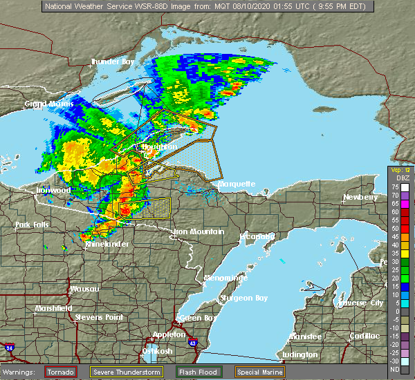 At 854 pm cdt, a severe thunderstorm was located 8 miles north of iron river, moving east at 45 mph (radar indicated). Hazards include 60 mph wind gusts and penny size hail. Expect damage to roofs, siding, and trees. locations impacted include, iron river, crystal falls, amasa, u. s. 141 between covington and amasa, way dam, gibbs city, bone lake and mineral hills. At 854 pm cdt, a severe thunderstorm was located 8 miles north of iron river, moving east at 45 mph (radar indicated). Hazards include 60 mph wind gusts and penny size hail. Expect damage to roofs, siding, and trees. locations impacted include, iron river, crystal falls, amasa, u. s. 141 between covington and amasa, way dam, gibbs city, bone lake and mineral hills.
|
| 8/9/2020 8:44 PM CDT |
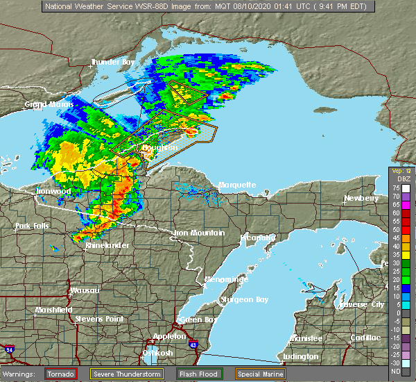 At 844 pm cdt, a severe thunderstorm was located 12 miles northeast of phelps, or 13 miles northwest of iron river, moving east at 45 mph (radar indicated). Hazards include 60 mph wind gusts and penny size hail. expect damage to roofs, siding, and trees At 844 pm cdt, a severe thunderstorm was located 12 miles northeast of phelps, or 13 miles northwest of iron river, moving east at 45 mph (radar indicated). Hazards include 60 mph wind gusts and penny size hail. expect damage to roofs, siding, and trees
|
| 9/24/2019 9:54 PM CDT |
 At 1054 pm edt/954 pm cdt/, severe thunderstorms were located along a line extending from 6 miles east of covington to amasa to near stambaugh, moving east at 35 mph (radar indicated). Hazards include 60 mph wind gusts. expect damage to roofs, siding, and trees At 1054 pm edt/954 pm cdt/, severe thunderstorms were located along a line extending from 6 miles east of covington to amasa to near stambaugh, moving east at 35 mph (radar indicated). Hazards include 60 mph wind gusts. expect damage to roofs, siding, and trees
|
| 8/27/2019 2:36 PM EDT |
 At 234 pm edt/134 pm cdt/, severe thunderstorms were located along a line extending from near nisula to alberta to 6 miles northeast of u.s. 141 between covington and amasa to near iron river, moving east at 45 mph (radar indicated). Hazards include 60 mph wind gusts and penny size hail. expect damage to roofs, siding, and trees At 234 pm edt/134 pm cdt/, severe thunderstorms were located along a line extending from near nisula to alberta to 6 miles northeast of u.s. 141 between covington and amasa to near iron river, moving east at 45 mph (radar indicated). Hazards include 60 mph wind gusts and penny size hail. expect damage to roofs, siding, and trees
|
| 6/17/2018 6:35 PM CDT |
 At 635 pm cdt, a severe thunderstorm was located near iron river, moving east at 45 mph (radar indicated). Hazards include 60 mph wind gusts and quarter size hail. Hail damage to vehicles is expected. expect wind damage to roofs, siding, and trees. Locations impacted include, iron river, stambaugh, amasa, caspian, gaastra, paint lake, bewabic state park, tamarack lake, hagerman lake, gibbs city, golden lake and mineral hills. At 635 pm cdt, a severe thunderstorm was located near iron river, moving east at 45 mph (radar indicated). Hazards include 60 mph wind gusts and quarter size hail. Hail damage to vehicles is expected. expect wind damage to roofs, siding, and trees. Locations impacted include, iron river, stambaugh, amasa, caspian, gaastra, paint lake, bewabic state park, tamarack lake, hagerman lake, gibbs city, golden lake and mineral hills.
|
| 6/17/2018 5:52 PM CDT |
 At 651 pm edt/551 pm cdt/, a severe thunderstorm was located 11 miles northeast of boulder junction, or 21 miles north of eagle river, moving east at 45 mph (radar indicated). Hazards include 70 mph wind gusts and quarter size hail. Hail damage to vehicles is expected. expect considerable tree damage. Wind damage is also likely to mobile homes, roofs, and outbuildings. At 651 pm edt/551 pm cdt/, a severe thunderstorm was located 11 miles northeast of boulder junction, or 21 miles north of eagle river, moving east at 45 mph (radar indicated). Hazards include 70 mph wind gusts and quarter size hail. Hail damage to vehicles is expected. expect considerable tree damage. Wind damage is also likely to mobile homes, roofs, and outbuildings.
|
| 9/22/2017 12:20 PM CDT | Two power poles snapped. several medium to large diameter pines also fell and blocked baumgartner road in stambaugh township. delayed report via social medi in iron county MI, 3.1 miles NE of Iron River, MI |
| 9/22/2017 12:17 PM CDT |
 At 117 pm edt/1217 pm cdt/, severe thunderstorms were located along a line extending from near alberta to 8 miles north of iron river, moving east at 45 mph (radar indicated). Hazards include 60 mph wind gusts and penny size hail. Expect damage to roofs, siding, and trees. locations impacted include, iron river, stambaugh, covington, alberta, amasa, u. s. 141 between covington and amasa, caspian, gaastra, canyon falls, herman, king lake and hagerman lake. At 117 pm edt/1217 pm cdt/, severe thunderstorms were located along a line extending from near alberta to 8 miles north of iron river, moving east at 45 mph (radar indicated). Hazards include 60 mph wind gusts and penny size hail. Expect damage to roofs, siding, and trees. locations impacted include, iron river, stambaugh, covington, alberta, amasa, u. s. 141 between covington and amasa, caspian, gaastra, canyon falls, herman, king lake and hagerman lake.
|
| 9/22/2017 11:47 AM CDT |
 At 1247 pm edt/1147 am cdt/, severe thunderstorms were located along a line extending from 7 miles northeast of bruce crossing to near phelps, moving east at 45 mph (radar indicated). Hazards include 60 mph wind gusts and penny size hail. expect damage to roofs, siding, and trees At 1247 pm edt/1147 am cdt/, severe thunderstorms were located along a line extending from 7 miles northeast of bruce crossing to near phelps, moving east at 45 mph (radar indicated). Hazards include 60 mph wind gusts and penny size hail. expect damage to roofs, siding, and trees
|
| 8/21/2017 6:04 PM CDT |
 At 602 pm cdt, a severe thunderstorm was located from stambaugh to gaastra, or near iron river, moving east at 20 mph. an additional strong storm was located near way dam over eastern iron county (radar indicated). Hazards include 60 mph wind gusts and quarter size hail. Hail damage to vehicles is expected. expect wind damage to roofs, siding, and trees. locations impacted include, crystal falls, stambaugh, caspian, gaastra, alpha, bewabic state park, stager and mineral hills. This storm produced half inch hail in iron river at 557 pm cdt. At 602 pm cdt, a severe thunderstorm was located from stambaugh to gaastra, or near iron river, moving east at 20 mph. an additional strong storm was located near way dam over eastern iron county (radar indicated). Hazards include 60 mph wind gusts and quarter size hail. Hail damage to vehicles is expected. expect wind damage to roofs, siding, and trees. locations impacted include, crystal falls, stambaugh, caspian, gaastra, alpha, bewabic state park, stager and mineral hills. This storm produced half inch hail in iron river at 557 pm cdt.
|
| 8/21/2017 5:50 PM CDT |
 At 550 pm cdt, a severe thunderstorm was located over iron river, moving east at 20 mph (radar indicated). Hazards include 60 mph wind gusts and quarter size hail. Hail damage to vehicles is expected. Expect wind damage to roofs, siding, and trees. At 550 pm cdt, a severe thunderstorm was located over iron river, moving east at 20 mph (radar indicated). Hazards include 60 mph wind gusts and quarter size hail. Hail damage to vehicles is expected. Expect wind damage to roofs, siding, and trees.
|
| 6/11/2017 12:45 PM CDT |
 At 1245 pm cdt, severe thunderstorms were located along a line extending from 8 miles east of phelps to 6 miles northwest of popple river, moving east at 55 mph (radar indicated). Hazards include 60 mph wind gusts and penny size hail. Expect damage to roofs, siding, and trees. Locations impacted include, iron river, crystal falls, stambaugh, caspian, alpha, way dam, bewabic state park, hagerman lake, peavy falls dam and mineral hills. At 1245 pm cdt, severe thunderstorms were located along a line extending from 8 miles east of phelps to 6 miles northwest of popple river, moving east at 55 mph (radar indicated). Hazards include 60 mph wind gusts and penny size hail. Expect damage to roofs, siding, and trees. Locations impacted include, iron river, crystal falls, stambaugh, caspian, alpha, way dam, bewabic state park, hagerman lake, peavy falls dam and mineral hills.
|
| 6/11/2017 12:29 PM CDT |
 At 1229 pm cdt, severe thunderstorms were located along a line extending from 9 miles southwest of iron river to 8 miles west of florence, moving northeast at 45 mph (radar indicated). Hazards include 60 mph wind gusts and penny size hail. expect damage to roofs, siding, and trees At 1229 pm cdt, severe thunderstorms were located along a line extending from 9 miles southwest of iron river to 8 miles west of florence, moving northeast at 45 mph (radar indicated). Hazards include 60 mph wind gusts and penny size hail. expect damage to roofs, siding, and trees
|
| 6/3/2017 4:26 PM CDT |
 At 426 pm cdt, severe thunderstorms were located along a line extending from near u.s. 141 between covington and amasa to near iron river to 11 miles east of phelps, moving east at 30 mph (radar indicated). Hazards include 60 mph wind gusts and quarter size hail. Hail damage to vehicles is expected. expect wind damage to roofs, siding, and trees. locations impacted include, iron river, crystal falls, stambaugh, amasa, u. s. 141 between covington and amasa, caspian, alpha, bewabic state park, hagerman lake, and mineral hills. At 426 pm cdt, severe thunderstorms were located along a line extending from near u.s. 141 between covington and amasa to near iron river to 11 miles east of phelps, moving east at 30 mph (radar indicated). Hazards include 60 mph wind gusts and quarter size hail. Hail damage to vehicles is expected. expect wind damage to roofs, siding, and trees. locations impacted include, iron river, crystal falls, stambaugh, amasa, u. s. 141 between covington and amasa, caspian, alpha, bewabic state park, hagerman lake, and mineral hills.
|
| 6/3/2017 4:06 PM CDT |
 At 405 pm cdt, severe thunderstorms were located along a line extending from 6 miles west of u.s. 141 between covington and amasa to 7 miles northwest of iron river to near phelps, moving east at 30 mph (radar indicated). Hazards include 60 mph wind gusts and quarter size hail. Hail damage to vehicles is expected. expect wind damage to roofs, siding, and trees. locations impacted include, iron river, crystal falls, stambaugh, amasa, u. s. 141 between covington and amasa, caspian, alpha, hagerman lake, golden lake, mineral hills, bewabic state park, and bone lake. At 405 pm cdt, severe thunderstorms were located along a line extending from 6 miles west of u.s. 141 between covington and amasa to 7 miles northwest of iron river to near phelps, moving east at 30 mph (radar indicated). Hazards include 60 mph wind gusts and quarter size hail. Hail damage to vehicles is expected. expect wind damage to roofs, siding, and trees. locations impacted include, iron river, crystal falls, stambaugh, amasa, u. s. 141 between covington and amasa, caspian, alpha, hagerman lake, golden lake, mineral hills, bewabic state park, and bone lake.
|
| 6/3/2017 3:56 PM CDT | Multiple trees down near intersection of us-2 and forest highway 16. large truck is hung up on one of the trees down. source is iron county sherif in iron county MI, 12.4 miles ESE of Iron River, MI |
| 6/3/2017 3:49 PM CDT |
 At 348 pm cdt, severe thunderstorms were located along a line extending from 6 miles south of sidnaw to 14 miles northeast of phelps to 6 miles south of watersmeet, moving east at 30 mph (radar indicated). Hazards include 60 mph wind gusts and quarter size hail. Hail damage to vehicles is expected. Expect wind damage to roofs, siding, and trees. At 348 pm cdt, severe thunderstorms were located along a line extending from 6 miles south of sidnaw to 14 miles northeast of phelps to 6 miles south of watersmeet, moving east at 30 mph (radar indicated). Hazards include 60 mph wind gusts and quarter size hail. Hail damage to vehicles is expected. Expect wind damage to roofs, siding, and trees.
|
| 5/17/2017 4:08 PM CDT |
 At 407 pm cdt, severe thunderstorms were located along a line extending from 8 miles south of kenton to 9 miles west of florence, moving northeast at 50 mph (radar indicated). Hazards include 60 mph wind gusts and penny size hail. Expect damage to roofs, siding, and trees. locations impacted include, iron river, crystal falls, stambaugh, amasa, u. s. 141 between covington and amasa, caspian, gaastra, alpha, way dam, tamarack lake, stager, hagerman lake, golden lake, peavy falls dam, mineral hills, paint lake, bewabic state park, gibbs city and bone lake. At 407 pm cdt, severe thunderstorms were located along a line extending from 8 miles south of kenton to 9 miles west of florence, moving northeast at 50 mph (radar indicated). Hazards include 60 mph wind gusts and penny size hail. Expect damage to roofs, siding, and trees. locations impacted include, iron river, crystal falls, stambaugh, amasa, u. s. 141 between covington and amasa, caspian, gaastra, alpha, way dam, tamarack lake, stager, hagerman lake, golden lake, peavy falls dam, mineral hills, paint lake, bewabic state park, gibbs city and bone lake.
|
| 5/17/2017 3:50 PM CDT |
 At 348 pm cdt, severe thunderstorms were located along a line extending from near phelps to near popple river, moving northeast at 50 mph (radar indicated). Hazards include 60 mph wind gusts and penny size hail. expect damage to roofs, siding, and trees At 348 pm cdt, severe thunderstorms were located along a line extending from near phelps to near popple river, moving northeast at 50 mph (radar indicated). Hazards include 60 mph wind gusts and penny size hail. expect damage to roofs, siding, and trees
|
| 4/10/2017 1:03 AM CDT |
 At 103 am cdt, a severe thunderstorm was located near amasa, or 10 miles north of crystal falls, moving east at 45 mph (radar indicated). Hazards include 60 mph wind gusts and quarter size hail. Hail damage to vehicles is expected. expect wind damage to roofs, siding, and trees. Locations impacted include, rural northeast iron county. At 103 am cdt, a severe thunderstorm was located near amasa, or 10 miles north of crystal falls, moving east at 45 mph (radar indicated). Hazards include 60 mph wind gusts and quarter size hail. Hail damage to vehicles is expected. expect wind damage to roofs, siding, and trees. Locations impacted include, rural northeast iron county.
|
| 4/10/2017 12:45 AM CDT |
 At 1244 am cdt, a severe thunderstorm was located near iron river, moving east at 40 mph (radar indicated). Hazards include 60 mph wind gusts and quarter size hail. Hail damage to vehicles is expected. expect wind damage to roofs, siding, and trees. Locations impacted include, iron river, crystal falls, stambaugh, amasa, caspian, gaastra, way dam, hagerman lake, golden lake, mineral hills, bewabic state park, gibbs city and bone lake. At 1244 am cdt, a severe thunderstorm was located near iron river, moving east at 40 mph (radar indicated). Hazards include 60 mph wind gusts and quarter size hail. Hail damage to vehicles is expected. expect wind damage to roofs, siding, and trees. Locations impacted include, iron river, crystal falls, stambaugh, amasa, caspian, gaastra, way dam, hagerman lake, golden lake, mineral hills, bewabic state park, gibbs city and bone lake.
|
| 4/10/2017 12:30 AM CDT |
 At 1229 am cdt, a severe thunderstorm was located 9 miles west of iron river, moving east at 40 mph (radar indicated). Hazards include 60 mph wind gusts and quarter size hail. Hail damage to vehicles is expected. Expect wind damage to roofs, siding, and trees. At 1229 am cdt, a severe thunderstorm was located 9 miles west of iron river, moving east at 40 mph (radar indicated). Hazards include 60 mph wind gusts and quarter size hail. Hail damage to vehicles is expected. Expect wind damage to roofs, siding, and trees.
|
| 4/10/2017 12:10 AM CDT | Quarter sized hail reported 6.5 miles WSW of Iron River, MI, trained spotter observed 1.0 inch hail along the bates amasa rd. spotter id ir-10. |
| 7/21/2016 6:30 AM CDT | Several trees reported dow in iron county MI, 0.3 miles S of Iron River, MI |
| 7/21/2016 7:30 AM EDT |
 At 727 am edt/627 am cdt/, severe thunderstorms were located along a line extending from near mclain state park to near rabbit bay to near skanee to 6 miles northwest of three lakes to near iron river, moving east at 60 mph (law enforcement. at 725 am edt/625 am cdt/ numerous trees were reported down over houghton and baraga counties, including over roadways). Hazards include 70 mph wind gusts and nickel size hail. Expect considerable tree damage. damage is likely to mobile homes, roofs and outbuildings. locations impacted include, houghton, iron river, l`anse, crystal falls, calumet, hancock, laurium, stambaugh, lake linden, covington, dollar bay, the lower entrance of portage canal, amasa, torch lake, mclain state park, u. s. 141 between covington and amasa, the upper entrance of portage canal, rabbit bay, alberta and point abbaye. At 727 am edt/627 am cdt/, severe thunderstorms were located along a line extending from near mclain state park to near rabbit bay to near skanee to 6 miles northwest of three lakes to near iron river, moving east at 60 mph (law enforcement. at 725 am edt/625 am cdt/ numerous trees were reported down over houghton and baraga counties, including over roadways). Hazards include 70 mph wind gusts and nickel size hail. Expect considerable tree damage. damage is likely to mobile homes, roofs and outbuildings. locations impacted include, houghton, iron river, l`anse, crystal falls, calumet, hancock, laurium, stambaugh, lake linden, covington, dollar bay, the lower entrance of portage canal, amasa, torch lake, mclain state park, u. s. 141 between covington and amasa, the upper entrance of portage canal, rabbit bay, alberta and point abbaye.
|
| 7/21/2016 6:25 AM CDT | Trees dow in iron county MI, 6.9 miles ESE of Iron River, MI |
| 7/21/2016 6:56 AM EDT |
 At 654 am edt/554 am cdt/, severe thunderstorms were located along a line extending from 8 miles east of fourteen mile point to near nisula to 8 miles northwest of kenton to 10 miles southwest of watersmeet, moving east at 65 mph (law enforcement. these storms downed numerous trees and powerlines around mass city and over western gogebic county). Hazards include 70 mph wind gusts and nickel size hail. Expect considerable tree damage. damage is likely to mobile homes, roofs and outbuildings. locations impacted include, houghton, iron river, baraga, l`anse, crystal falls, calumet, hancock, laurium, chassell, stambaugh, lake linden, south range, covington, dollar bay, the lower entrance of portage canal, assinins, amasa, torch lake, mclain state park and u. s. 141 between covington and amasa. At 654 am edt/554 am cdt/, severe thunderstorms were located along a line extending from 8 miles east of fourteen mile point to near nisula to 8 miles northwest of kenton to 10 miles southwest of watersmeet, moving east at 65 mph (law enforcement. these storms downed numerous trees and powerlines around mass city and over western gogebic county). Hazards include 70 mph wind gusts and nickel size hail. Expect considerable tree damage. damage is likely to mobile homes, roofs and outbuildings. locations impacted include, houghton, iron river, baraga, l`anse, crystal falls, calumet, hancock, laurium, chassell, stambaugh, lake linden, south range, covington, dollar bay, the lower entrance of portage canal, assinins, amasa, torch lake, mclain state park and u. s. 141 between covington and amasa.
|
| 7/21/2016 6:46 AM EDT |
 At 645 am edt/545 am cdt/, severe thunderstorms were located along a line extending from near fourteen mile point to near bruce crossing to 7 miles northeast of boulder junction, moving east at 65 mph (radar indicated. this storm downed trees and powerlines it moved through western gogebic county). Hazards include 60 mph wind gusts and nickel size hail. Expect damage to roofs. Siding and trees. At 645 am edt/545 am cdt/, severe thunderstorms were located along a line extending from near fourteen mile point to near bruce crossing to 7 miles northeast of boulder junction, moving east at 65 mph (radar indicated. this storm downed trees and powerlines it moved through western gogebic county). Hazards include 60 mph wind gusts and nickel size hail. Expect damage to roofs. Siding and trees.
|
| 7/5/2016 11:14 PM CDT |
 At 1213 am edt/1113 pm cdt/, a severe thunderstorm was located near watersmeet, or 26 miles northwest of iron river, moving east at 35 mph (radar indicated). Hazards include 60 mph wind gusts. Expect damage to roofs. siding and trees. Locations impacted include, iron river, watersmeet, stambaugh, paulding, caspian, gaastra, gibbs city, paint lake, bond falls, tamarack lake, smoky lake, mineral hills, thousand island lake, hagerman lake and golden lake. At 1213 am edt/1113 pm cdt/, a severe thunderstorm was located near watersmeet, or 26 miles northwest of iron river, moving east at 35 mph (radar indicated). Hazards include 60 mph wind gusts. Expect damage to roofs. siding and trees. Locations impacted include, iron river, watersmeet, stambaugh, paulding, caspian, gaastra, gibbs city, paint lake, bond falls, tamarack lake, smoky lake, mineral hills, thousand island lake, hagerman lake and golden lake.
|
| 7/5/2016 10:45 PM CDT |
 At 1144 pm edt/1044 pm cdt/, a severe thunderstorm was located 9 miles west of watersmeet, or 26 miles north of eagle river, moving east at 45 mph (radar indicated). Hazards include 60 mph wind gusts. Expect damage to roofs. Siding and trees. At 1144 pm edt/1044 pm cdt/, a severe thunderstorm was located 9 miles west of watersmeet, or 26 miles north of eagle river, moving east at 45 mph (radar indicated). Hazards include 60 mph wind gusts. Expect damage to roofs. Siding and trees.
|
| 6/25/2016 9:32 PM CDT |
 At 1032 pm edt/932 pm cdt/, severe thunderstorms were located along a line extending from near alberta to near u.s. 141 between covington and amasa to 6 miles east of stambaugh to near tipler, moving east at 45 mph (radar indicated). Hazards include 60 mph wind gusts and penny size hail. Expect damage to roofs. siding and trees. locations impacted include, iron river, crystal falls, stambaugh, covington, alberta, amasa, u. s. 141 between covington and amasa, three lakes, caspian, gaastra, alpha, way dam, peavy falls dam, stager, canyon falls, king lake, bone lake, bewabic state park, herman and island lake. At 1032 pm edt/932 pm cdt/, severe thunderstorms were located along a line extending from near alberta to near u.s. 141 between covington and amasa to 6 miles east of stambaugh to near tipler, moving east at 45 mph (radar indicated). Hazards include 60 mph wind gusts and penny size hail. Expect damage to roofs. siding and trees. locations impacted include, iron river, crystal falls, stambaugh, covington, alberta, amasa, u. s. 141 between covington and amasa, three lakes, caspian, gaastra, alpha, way dam, peavy falls dam, stager, canyon falls, king lake, bone lake, bewabic state park, herman and island lake.
|
| 6/25/2016 9:22 PM CDT |
 At 1022 pm edt/922 pm cdt/, severe thunderstorms were located along a line extending from 7 miles southeast of nisula to 7 miles west of u.s. 141 between covington and amasa to near iron river to 12 miles west of tipler, moving east at 45 mph (radar indicated). Hazards include 60 mph wind gusts and penny size hail. Expect damage to roofs. siding and trees. locations impacted include, iron river, crystal falls, stambaugh, covington, alberta, sidnaw, amasa, u. s. 141 between covington and amasa, three lakes, caspian, gaastra, alpha, gibbs city, way dam, peavy falls dam, stager, king lake, bewabic state park, herman and perch lake. At 1022 pm edt/922 pm cdt/, severe thunderstorms were located along a line extending from 7 miles southeast of nisula to 7 miles west of u.s. 141 between covington and amasa to near iron river to 12 miles west of tipler, moving east at 45 mph (radar indicated). Hazards include 60 mph wind gusts and penny size hail. Expect damage to roofs. siding and trees. locations impacted include, iron river, crystal falls, stambaugh, covington, alberta, sidnaw, amasa, u. s. 141 between covington and amasa, three lakes, caspian, gaastra, alpha, gibbs city, way dam, peavy falls dam, stager, king lake, bewabic state park, herman and perch lake.
|
| 6/25/2016 9:02 PM CDT |
 At 1001 pm edt/901 pm cdt/, severe thunderstorms were located along a line extending from 8 miles south of mass city to 10 miles south of kenton to near phelps to near eagle river, moving east at 50 mph (radar indicated). Hazards include 60 mph wind gusts and penny size hail. Expect damage to roofs. siding and trees. locations impacted include, iron river, crystal falls, stambaugh, covington, alberta, sidnaw, kenton, amasa, u. s. 141 between covington and amasa, three lakes, caspian, gaastra, alpha, gibbs city, paint lake, way dam, peavy falls dam, stager, king lake and smoky lake. At 1001 pm edt/901 pm cdt/, severe thunderstorms were located along a line extending from 8 miles south of mass city to 10 miles south of kenton to near phelps to near eagle river, moving east at 50 mph (radar indicated). Hazards include 60 mph wind gusts and penny size hail. Expect damage to roofs. siding and trees. locations impacted include, iron river, crystal falls, stambaugh, covington, alberta, sidnaw, kenton, amasa, u. s. 141 between covington and amasa, three lakes, caspian, gaastra, alpha, gibbs city, paint lake, way dam, peavy falls dam, stager, king lake and smoky lake.
|
| 6/25/2016 8:41 PM CDT |
 At 940 pm edt/840 pm cdt/, severe thunderstorms were located along a line extending from 7 miles east of bergland to 7 miles northwest of watersmeet to 12 miles east of boulder junction to 15 miles west of eagle river, moving east at 45 mph (radar indicated). Hazards include 60 mph wind gusts and penny size hail. Expect damage to roofs. Siding and trees. At 940 pm edt/840 pm cdt/, severe thunderstorms were located along a line extending from 7 miles east of bergland to 7 miles northwest of watersmeet to 12 miles east of boulder junction to 15 miles west of eagle river, moving east at 45 mph (radar indicated). Hazards include 60 mph wind gusts and penny size hail. Expect damage to roofs. Siding and trees.
|
| 6/10/2016 5:01 PM CDT |
 At 500 pm cdt, severe thunderstorms were located along a line extending from 7 miles northwest of squaw lake to 8 miles southeast of phelps, moving east at 50 mph (radar indicated). Hazards include 60 mph wind gusts and quarter size hail. Hail damage to vehicles is expected. expect wind damage to roofs, siding and trees. locations impacted include, iron river, crystal falls, stambaugh, amasa, u. s. 141 between covington and amasa, caspian, gaastra, alpha, gibbs city, way dam, stager, smoky lake, bewabic state park, mineral hills, triangle ranch and hagerman lake. A tornado watch remains in effect until 900 pm cdt for central michigan. At 500 pm cdt, severe thunderstorms were located along a line extending from 7 miles northwest of squaw lake to 8 miles southeast of phelps, moving east at 50 mph (radar indicated). Hazards include 60 mph wind gusts and quarter size hail. Hail damage to vehicles is expected. expect wind damage to roofs, siding and trees. locations impacted include, iron river, crystal falls, stambaugh, amasa, u. s. 141 between covington and amasa, caspian, gaastra, alpha, gibbs city, way dam, stager, smoky lake, bewabic state park, mineral hills, triangle ranch and hagerman lake. A tornado watch remains in effect until 900 pm cdt for central michigan.
|
| 6/10/2016 4:44 PM CDT |
 At 444 pm cdt, severe thunderstorms were located along a line extending from u.s. 141 between covington and amasa to near phelps, moving east at 50 mph (radar indicated). Hazards include quarter size hail. damage to vehicles is expected At 444 pm cdt, severe thunderstorms were located along a line extending from u.s. 141 between covington and amasa to near phelps, moving east at 50 mph (radar indicated). Hazards include quarter size hail. damage to vehicles is expected
|
| 9/2/2015 9:55 AM CDT |
 The severe thunderstorm warning for central iron county will expire at 1000 am cdt, the storms which prompted the warning have weakened below severe limits, and no longer pose an immediate threat to life or property. therefore the warning will be allowed to expire. however heavy rain is still possible with these thunderstorms. The severe thunderstorm warning for central iron county will expire at 1000 am cdt, the storms which prompted the warning have weakened below severe limits, and no longer pose an immediate threat to life or property. therefore the warning will be allowed to expire. however heavy rain is still possible with these thunderstorms.
|
| 9/2/2015 9:14 AM CDT |
 At 913 am cdt, severe thunderstorms were located along a line extending from 13 miles east of watersmeet to near tipler, moving east at 20 mph (radar indicated). Hazards include 60 mph wind gusts and quarter size hail. Hail damage to vehicles is expected. expect wind damage to roofs, siding and trees. Locations impacted include, iron river, stambaugh, caspian, gaastra, gibbs city, bewabic state park, mineral hills, perch lake, golden lake and hagerman lake. At 913 am cdt, severe thunderstorms were located along a line extending from 13 miles east of watersmeet to near tipler, moving east at 20 mph (radar indicated). Hazards include 60 mph wind gusts and quarter size hail. Hail damage to vehicles is expected. expect wind damage to roofs, siding and trees. Locations impacted include, iron river, stambaugh, caspian, gaastra, gibbs city, bewabic state park, mineral hills, perch lake, golden lake and hagerman lake.
|
| 9/2/2015 8:55 AM CDT |
 At 854 am cdt, severe thunderstorms were located along a line extending from 10 miles east of watersmeet to near tipler, moving east at 20 mph (radar indicated). Hazards include quarter size hail and 60 mph wind gusts. Hail damage to vehicles is expected. Expect wind damage to roofs, siding and trees. At 854 am cdt, severe thunderstorms were located along a line extending from 10 miles east of watersmeet to near tipler, moving east at 20 mph (radar indicated). Hazards include quarter size hail and 60 mph wind gusts. Hail damage to vehicles is expected. Expect wind damage to roofs, siding and trees.
|
| 6/10/2015 1:15 AM CDT |
 At 114 am cdt, a severe thunderstorm was located near iron river, moving east at 45 mph (radar indicated). Hazards include 60 mph wind gusts. Expect damage to roofs. siding and trees. this severe storm will be near, crystal falls around 135 am cdt. Other locations impacted by this severe thunderstorm include gibbs city, bewabic state park, caspian, way dam, peavy falls dam, mineral hills, stager, hagerman lake, golden lake and gaastra. At 114 am cdt, a severe thunderstorm was located near iron river, moving east at 45 mph (radar indicated). Hazards include 60 mph wind gusts. Expect damage to roofs. siding and trees. this severe storm will be near, crystal falls around 135 am cdt. Other locations impacted by this severe thunderstorm include gibbs city, bewabic state park, caspian, way dam, peavy falls dam, mineral hills, stager, hagerman lake, golden lake and gaastra.
|
| 6/10/2015 1:05 AM CDT |
 At 203 am edt /103 am cdt/, severe thunderstorms were located along a line extending from 6 miles southwest of west ishpeming to near squaw lake, moving east at 60 mph (radar indicated). Hazards include 60 mph wind gusts. Expect damage to roofs. siding and trees. These severe thunderstorms will remain over mainly rural areas of northwestern dickinson, iron and west central marquette counties, including the following locations, gibbs city, bone lake, bewabic state park, way dam, triangle ranch, sagola, big bass lake, silver lake near channing, republic and mineral hills. At 203 am edt /103 am cdt/, severe thunderstorms were located along a line extending from 6 miles southwest of west ishpeming to near squaw lake, moving east at 60 mph (radar indicated). Hazards include 60 mph wind gusts. Expect damage to roofs. siding and trees. These severe thunderstorms will remain over mainly rural areas of northwestern dickinson, iron and west central marquette counties, including the following locations, gibbs city, bone lake, bewabic state park, way dam, triangle ranch, sagola, big bass lake, silver lake near channing, republic and mineral hills.
|
| 6/10/2015 12:56 AM CDT |
 At 1255 am cdt, a severe thunderstorm was located 10 miles southeast of watersmeet, or 18 miles northwest of iron river, moving east at 45 mph (radar indicated). Hazards include 60 mph wind gusts and penny size hail. Expect damage to roofs. siding and trees. this severe thunderstorm will be near, iron river and stambaugh around 120 am cdt. crystal falls around 135 am cdt. Other locations impacted by this severe thunderstorm include gibbs city, peavy falls dam, way dam, caspian, tamarack lake, stager, gaastra, smoky lake, bewabic state park and mineral hills. At 1255 am cdt, a severe thunderstorm was located 10 miles southeast of watersmeet, or 18 miles northwest of iron river, moving east at 45 mph (radar indicated). Hazards include 60 mph wind gusts and penny size hail. Expect damage to roofs. siding and trees. this severe thunderstorm will be near, iron river and stambaugh around 120 am cdt. crystal falls around 135 am cdt. Other locations impacted by this severe thunderstorm include gibbs city, peavy falls dam, way dam, caspian, tamarack lake, stager, gaastra, smoky lake, bewabic state park and mineral hills.
|
| 6/10/2015 12:34 AM CDT |
 At 133 am edt /1233 am cdt/, severe thunderstorms were located along a line extending from near u.s. 141 between covington and amasa to 14 miles northwest of iron river, moving east at 60 mph (radar indicated). Hazards include 60 mph wind gusts and penny size hail. Expect damage to roofs. Siding and trees. At 133 am edt /1233 am cdt/, severe thunderstorms were located along a line extending from near u.s. 141 between covington and amasa to 14 miles northwest of iron river, moving east at 60 mph (radar indicated). Hazards include 60 mph wind gusts and penny size hail. Expect damage to roofs. Siding and trees.
|
| 5/30/2013 4:30 PM CDT | Tree on powerline at sunset lake road and section 16 road. tree of fir in iron county MI, 3.7 miles SW of Iron River, MI |
| 1/1/0001 12:00 AM | Tree down on a wire along hwy 55 in forest county WI, 11.4 miles NE of Iron River, MI |
| 1/1/0001 12:00 AM | Quarter sized hail reported 3.8 miles NE of Iron River, MI, half inch to an inch hail occurring currently. |
| 1/1/0001 12:00 AM | Quarter sized hail reported 6.9 miles WSW of Iron River, MI, lasted for about 7 minutes until 337 am central. tapered off to pea sized hail at that time. |
Hail Maps for Iron River, MI


Connect with Interactive Hail Maps