

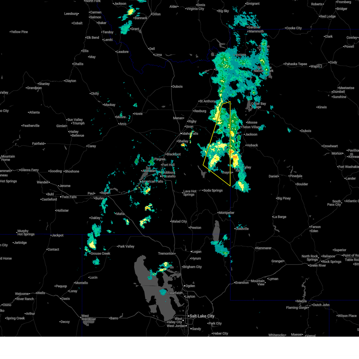
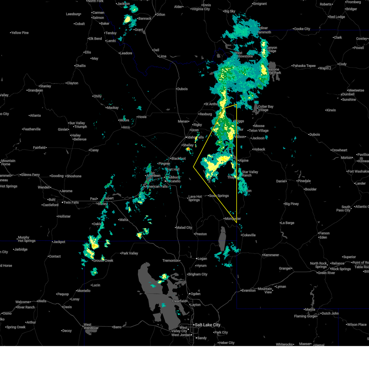
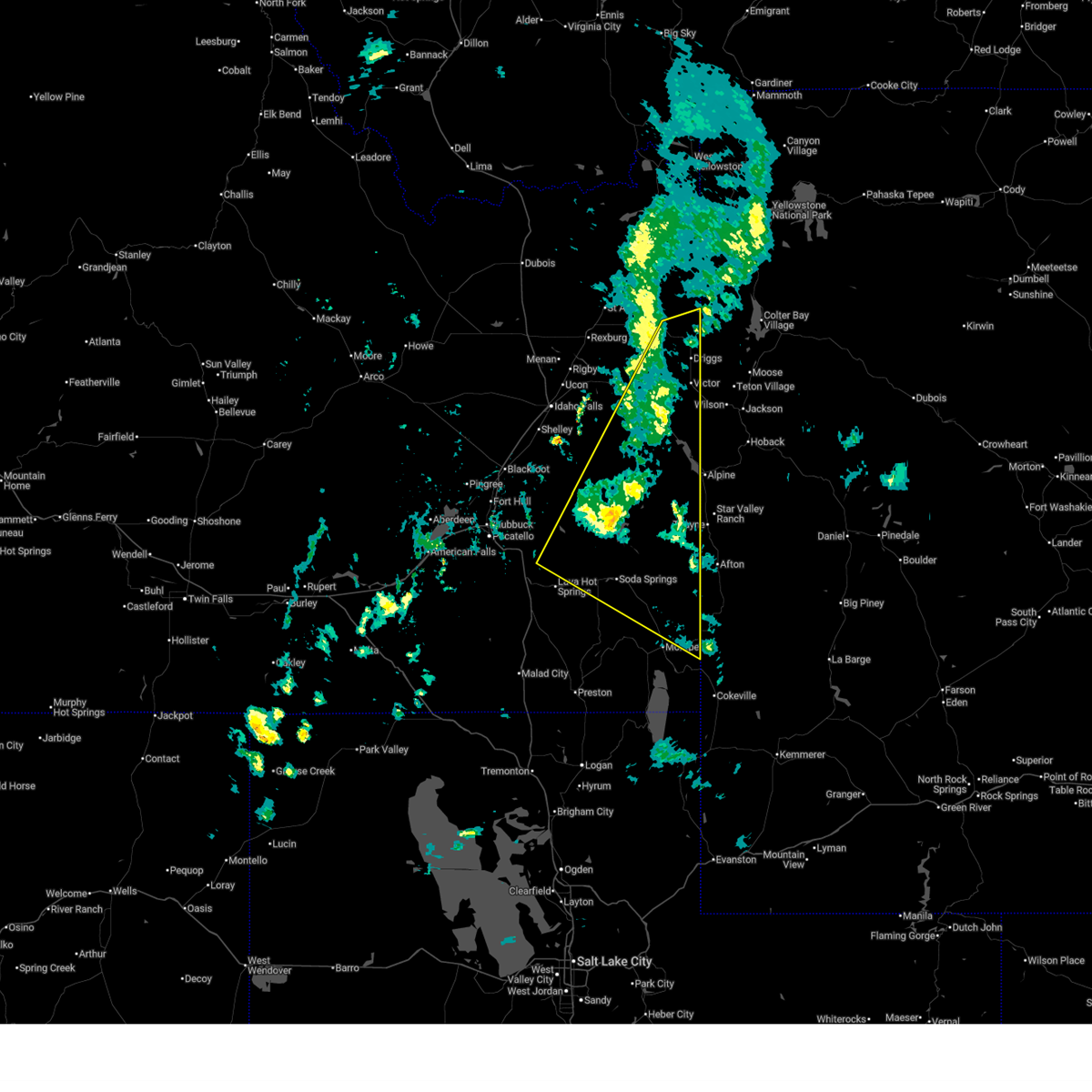
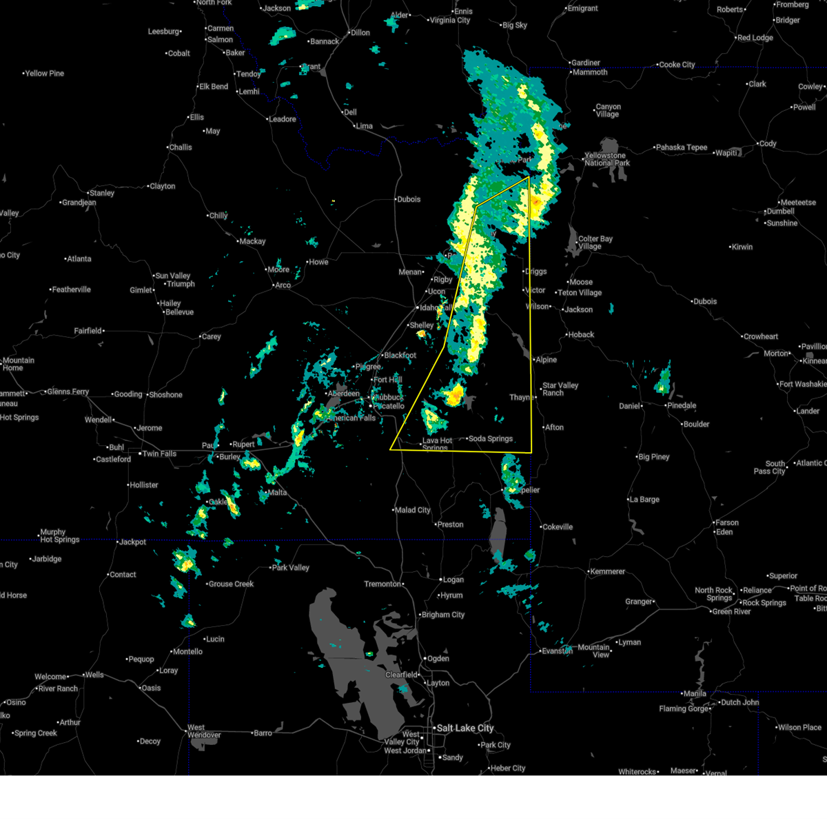
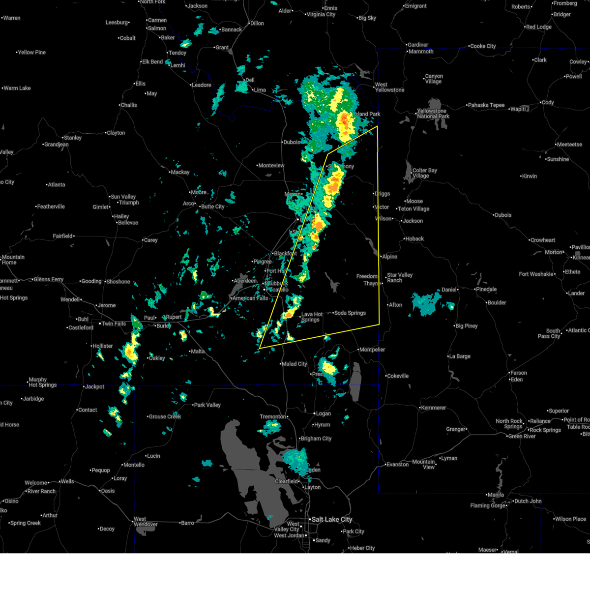
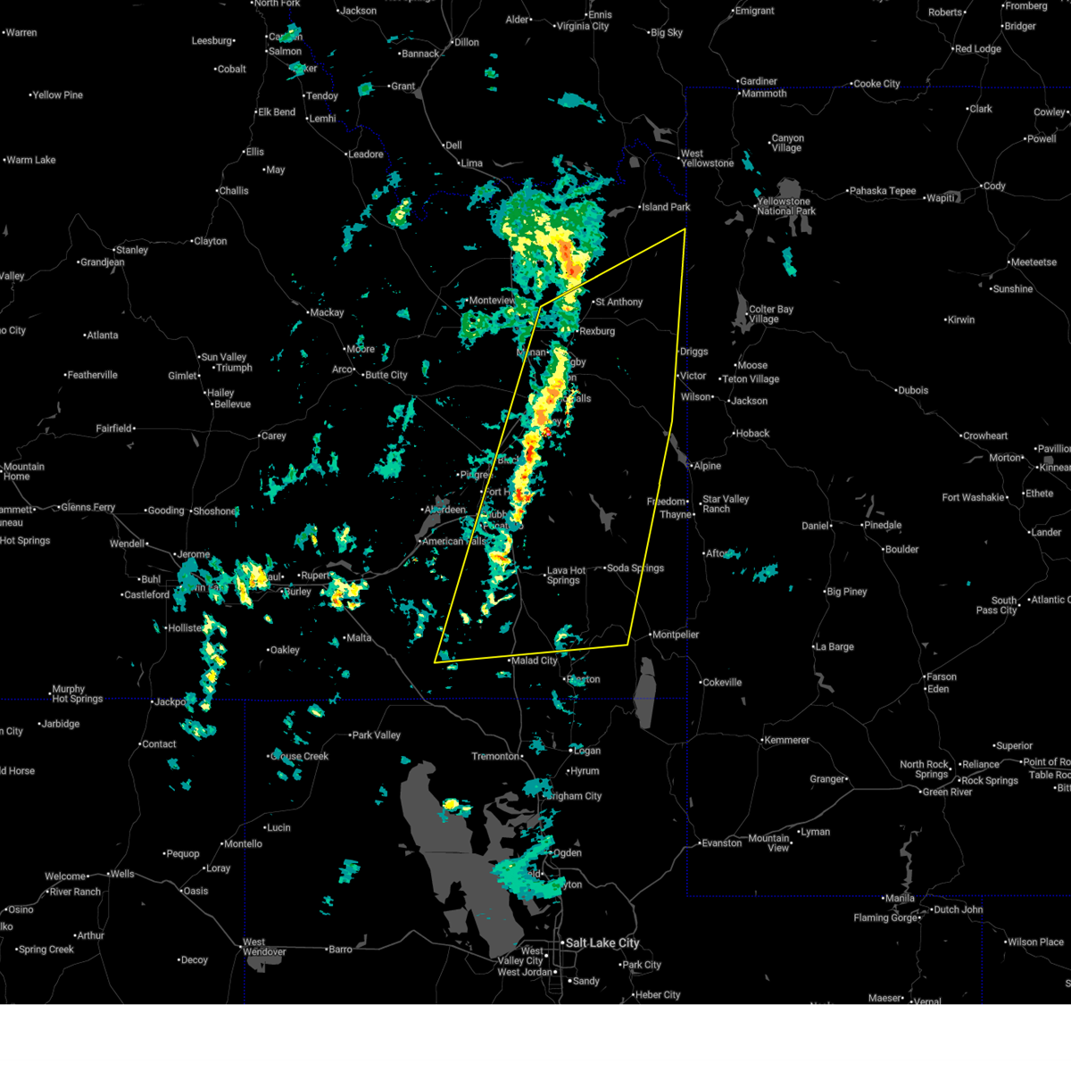
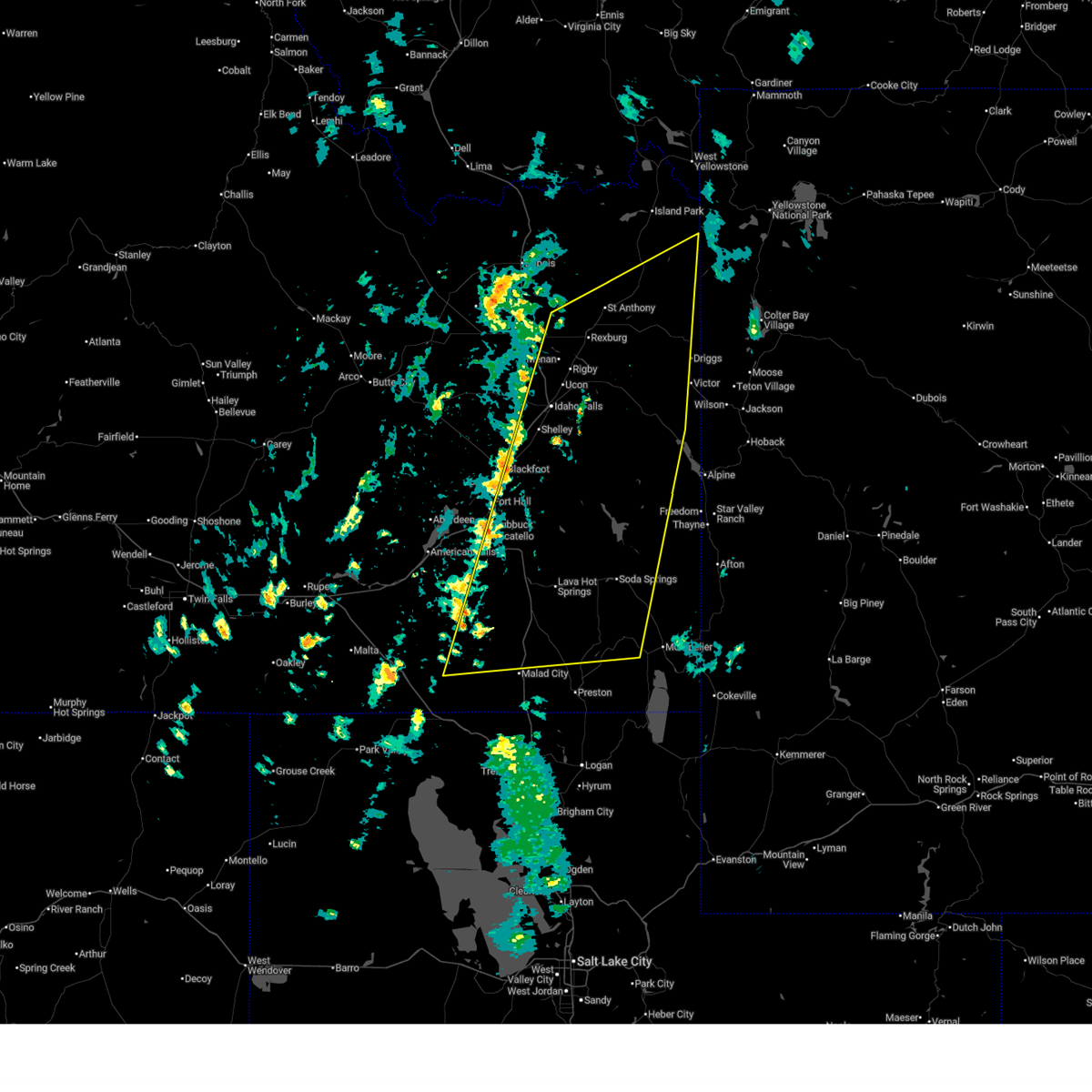
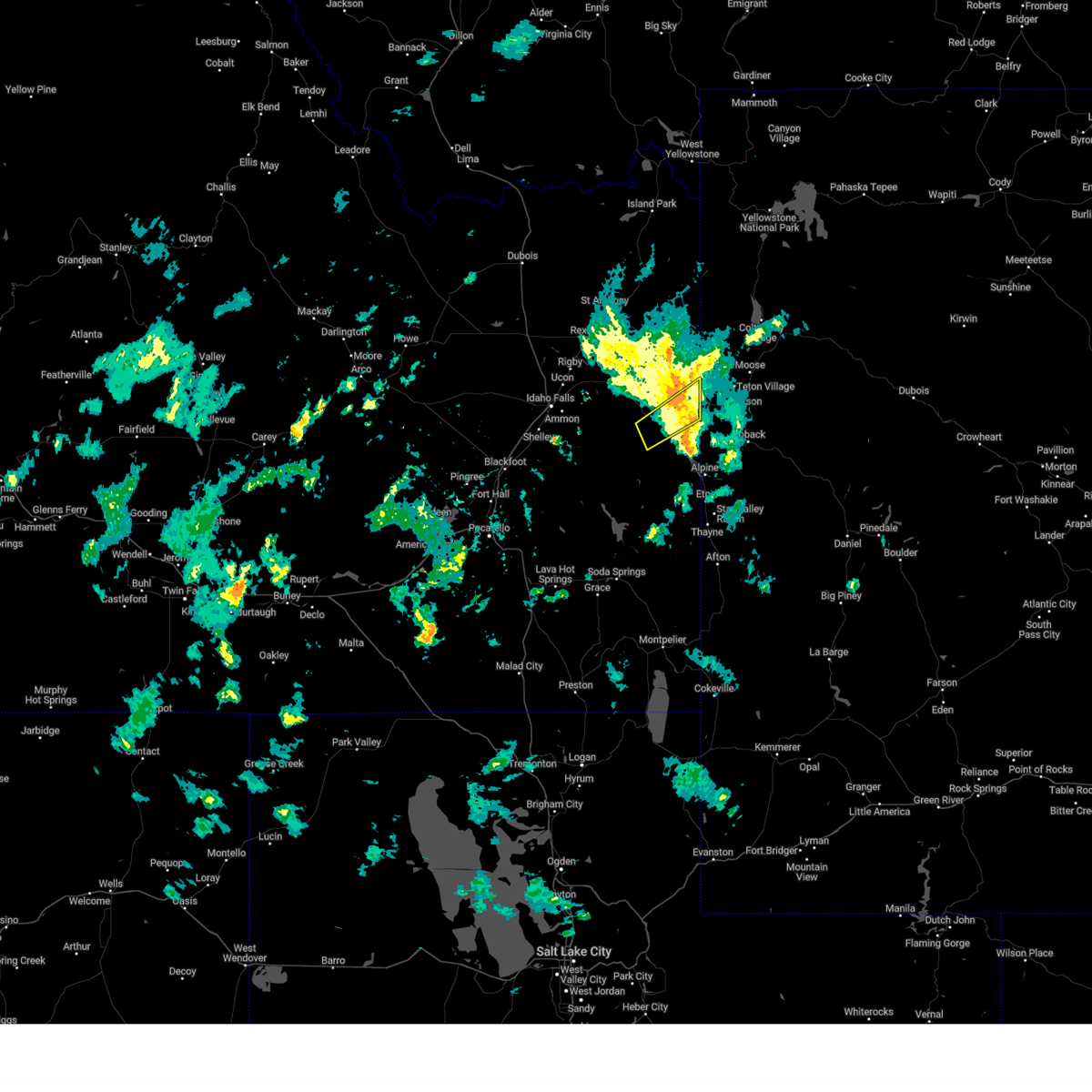
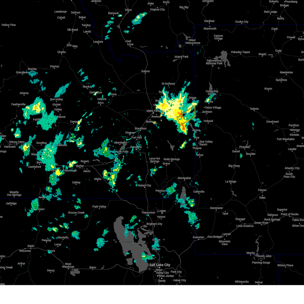
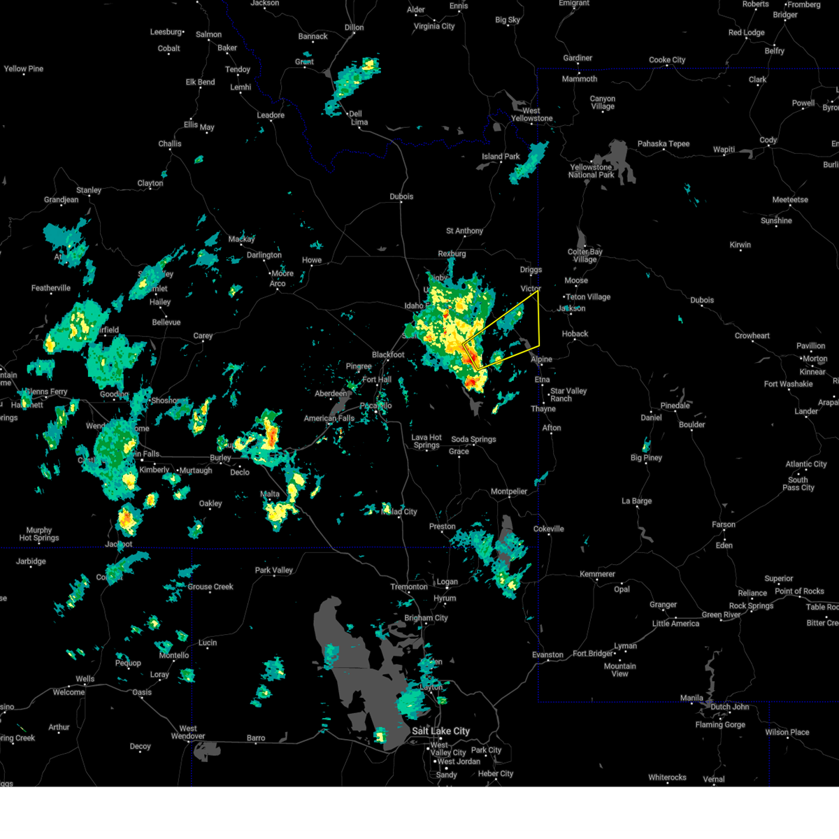
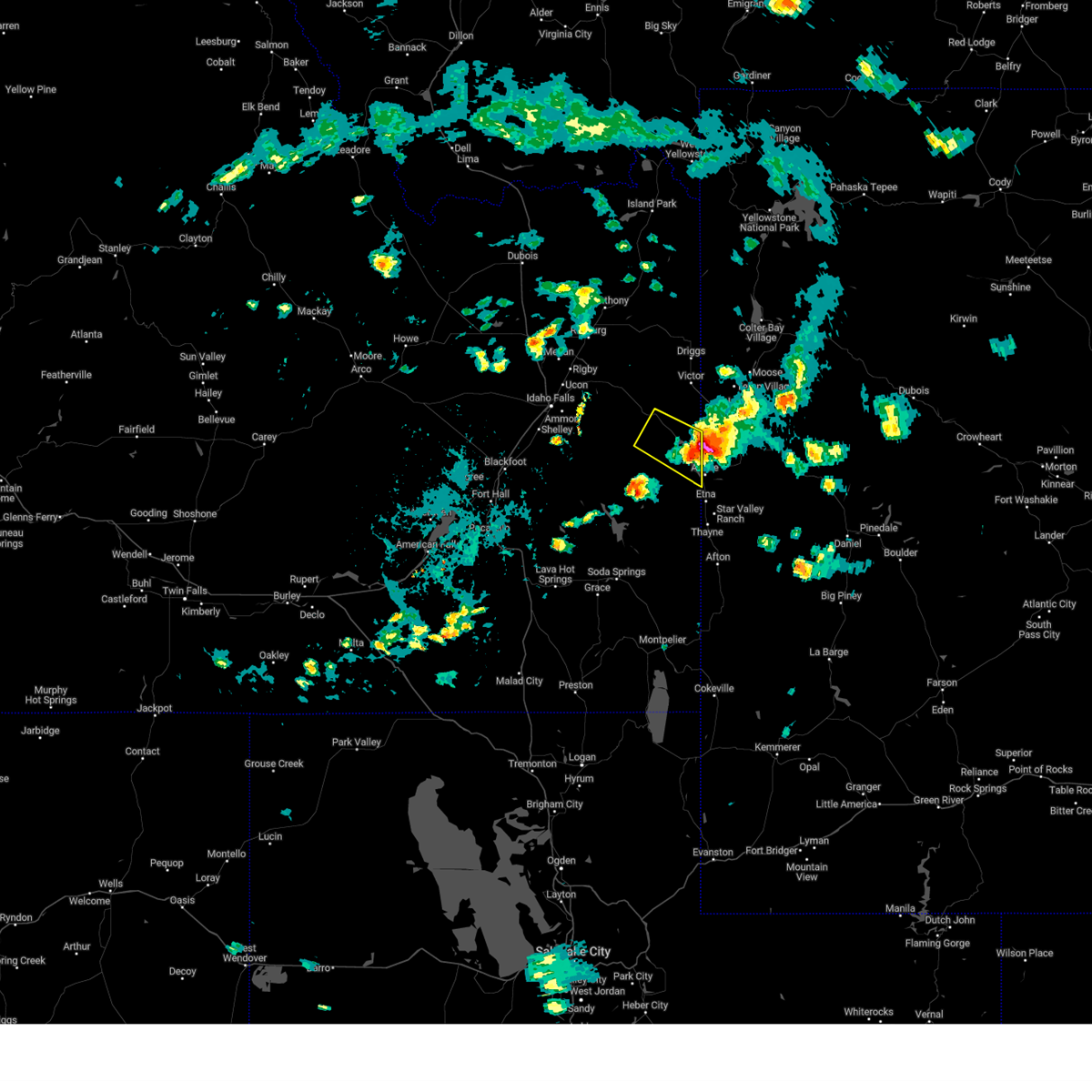
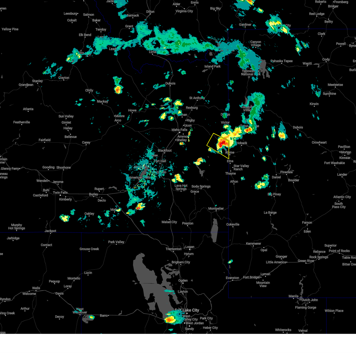
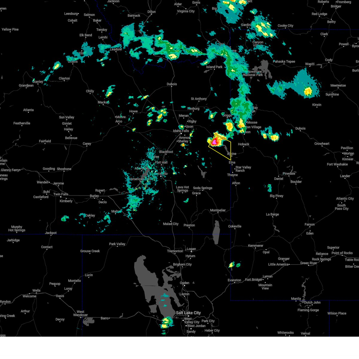
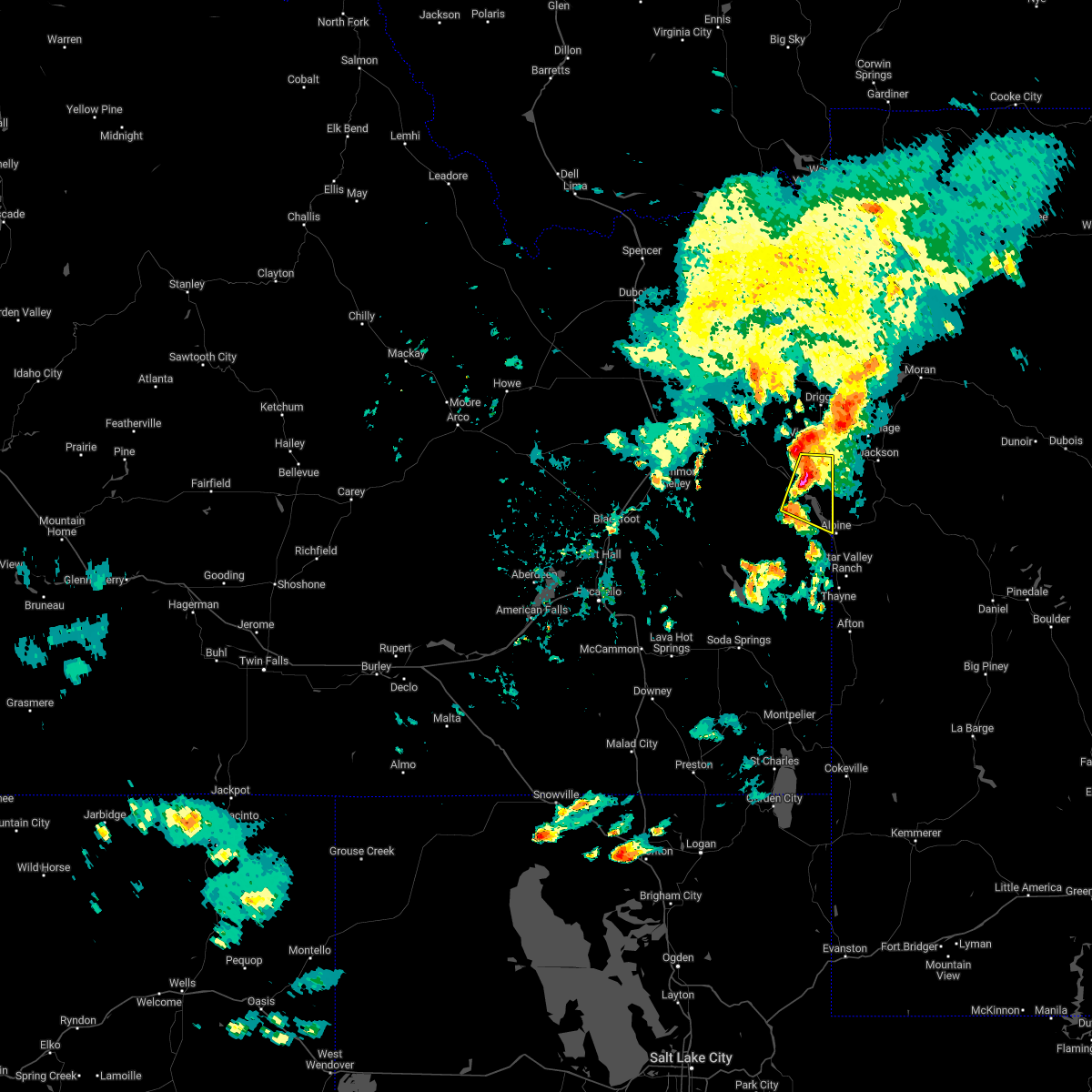
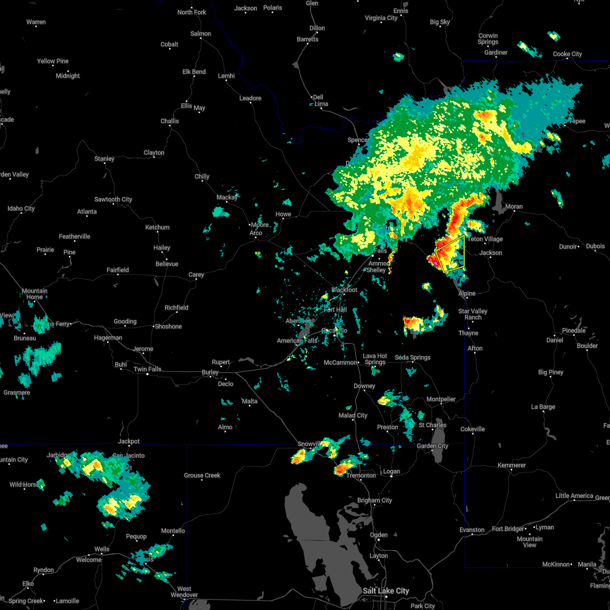
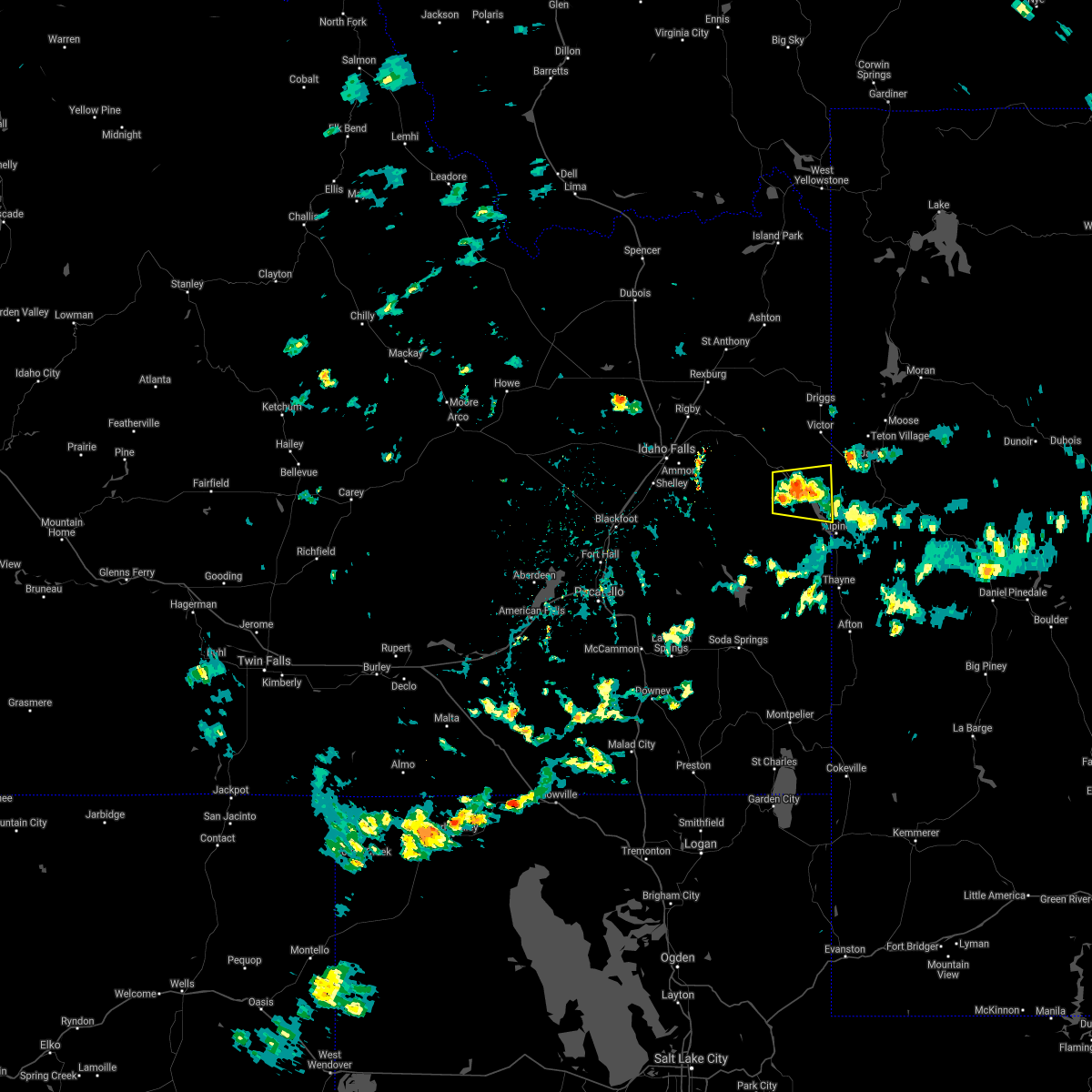
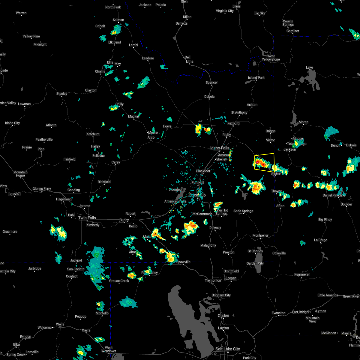
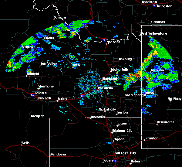
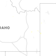
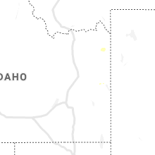
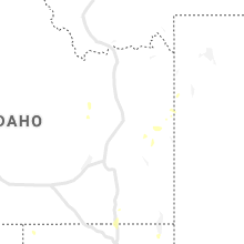
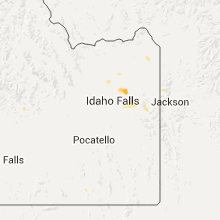
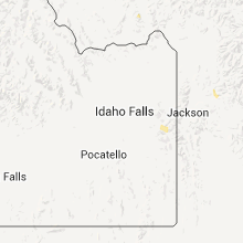
Hail Map for Irwin, ID
The Irwin, ID area has had 3 reports of on-the-ground hail by trained spotters, and has been under severe weather warnings 8 times during the past 12 months. Doppler radar has detected hail at or near Irwin, ID on 16 occasions.
| Name: | Irwin, ID |
| Where Located: | 40.1 miles E of Idaho Falls, ID |
| Map: | Google Map for Irwin, ID |
| Population: | 219 |
| Housing Units: | 166 |
| More Info: | Search Google for Irwin, ID |
2
The Top Recent Hail Date for Irwin, ID is Saturday, August 10, 2024 (5th out of 16)

Hail and Wind Damage Spotted near Irwin, ID
| Date / Time | Report Details |
|---|---|
| 5/13/2026 5:30 PM MDT |
 the severe thunderstorm warning has been cancelled and is no longer in effect the severe thunderstorm warning has been cancelled and is no longer in effect
|
| 5/13/2026 5:30 PM MDT |
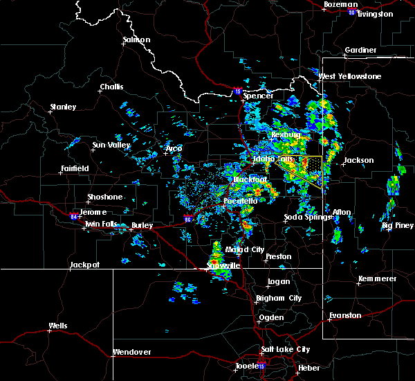
 At 528 pm mdt, a line of severe thunderstorms extend from near clementsville to driggs to alpine, wyoming to wayan, moving northeast at 45 mph (radar indicated and mesonet observations. multiple reports of gusts around 60 mph have been reported along and just behind this line). Hazards include 60 mph wind gusts. Expect damage to roofs, siding, and trees. Locations impacted include, driggs, swan valley, felt, palisades reservoir, wayan, victor, tetonia, irwin, pine creek pass, and grays lake. At 528 pm mdt, a line of severe thunderstorms extend from near clementsville to driggs to alpine, wyoming to wayan, moving northeast at 45 mph (radar indicated and mesonet observations. multiple reports of gusts around 60 mph have been reported along and just behind this line). Hazards include 60 mph wind gusts. Expect damage to roofs, siding, and trees. Locations impacted include, driggs, swan valley, felt, palisades reservoir, wayan, victor, tetonia, irwin, pine creek pass, and grays lake.
|
| 5/13/2026 5:21 PM MDT |
 At 518 pm mdt, a line of severe thunderstorms extended from near driggs to near alpine, wyoming to henry, moving northeast at 40 mph (radar indicated and mesonet observations. reports of gusts around 60 mph have occurred along and just behind the line). Hazards include 60 mph wind gusts. Expect damage to roofs, siding, and trees. Locations impacted include, driggs, swan valley, blackfoot reservoir, felt, wayan, palisades reservoir, victor, tetonia, irwin, henry, cutthroat trout campground, tetonia research station, diamond creek campground, geneva, clear creek ranger station, mill canyon campground, smokey canyon mine, pine creek pass, and grays lake. At 518 pm mdt, a line of severe thunderstorms extended from near driggs to near alpine, wyoming to henry, moving northeast at 40 mph (radar indicated and mesonet observations. reports of gusts around 60 mph have occurred along and just behind the line). Hazards include 60 mph wind gusts. Expect damage to roofs, siding, and trees. Locations impacted include, driggs, swan valley, blackfoot reservoir, felt, wayan, palisades reservoir, victor, tetonia, irwin, henry, cutthroat trout campground, tetonia research station, diamond creek campground, geneva, clear creek ranger station, mill canyon campground, smokey canyon mine, pine creek pass, and grays lake.
|
| 5/13/2026 5:02 PM MDT |
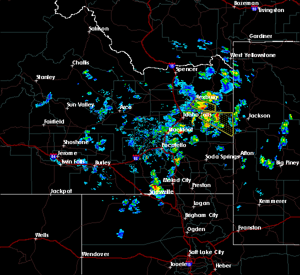
 Svrpih the national weather service in pocatello has issued a * severe thunderstorm warning for, teton county in eastern idaho, caribou county in southeastern idaho, east central bannock county in southeastern idaho, eastern bonneville county in southeastern idaho, southeastern madison county in southeastern idaho, northern bear lake county in southeastern idaho, southeastern bingham county in southeastern idaho, * until 545 pm mdt. * at 459 pm mdt, a line of severe thunderstorms extends from yellowstone national park to driggs to palisades reservoir to near hatch, moving northeast at 40 mph. another line of severe thunderstorms extends from near wayan to geneva, almost moving northeast at 40 mph (radar indicated and mesonet observations. multiple gusts over 58 mph have been reported with these storms). Hazards include 70 mph wind gusts. Expect considerable tree damage. Damage is likely to mobile homes, roofs, and outbuildings. Svrpih the national weather service in pocatello has issued a * severe thunderstorm warning for, teton county in eastern idaho, caribou county in southeastern idaho, east central bannock county in southeastern idaho, eastern bonneville county in southeastern idaho, southeastern madison county in southeastern idaho, northern bear lake county in southeastern idaho, southeastern bingham county in southeastern idaho, * until 545 pm mdt. * at 459 pm mdt, a line of severe thunderstorms extends from yellowstone national park to driggs to palisades reservoir to near hatch, moving northeast at 40 mph. another line of severe thunderstorms extends from near wayan to geneva, almost moving northeast at 40 mph (radar indicated and mesonet observations. multiple gusts over 58 mph have been reported with these storms). Hazards include 70 mph wind gusts. Expect considerable tree damage. Damage is likely to mobile homes, roofs, and outbuildings.
|
| 5/13/2026 4:46 PM MDT |
 At 444 pm mdt, a line of severe thunderstorms extends from near yellowstone national park to clementsville to near swan valley to near bancroft, moving northeast at 40 mph (radar indicated and mesonet observations. reports of gusts over 60 mph have been reported at times along and just behind this line). Hazards include 70 mph wind gusts. Expect considerable tree damage. damage is likely to mobile homes, roofs, and outbuildings. Locations impacted include, soda springs, driggs, ashton, mccammon, lava hot springs, swan valley, blackfoot reservoir, felt, wayan, marysville, palisades reservoir, chesterfield reservoir, victor, grace, tetonia, irwin, drummond, henry, ashton reservoir, and chesterfield. At 444 pm mdt, a line of severe thunderstorms extends from near yellowstone national park to clementsville to near swan valley to near bancroft, moving northeast at 40 mph (radar indicated and mesonet observations. reports of gusts over 60 mph have been reported at times along and just behind this line). Hazards include 70 mph wind gusts. Expect considerable tree damage. damage is likely to mobile homes, roofs, and outbuildings. Locations impacted include, soda springs, driggs, ashton, mccammon, lava hot springs, swan valley, blackfoot reservoir, felt, wayan, marysville, palisades reservoir, chesterfield reservoir, victor, grace, tetonia, irwin, drummond, henry, ashton reservoir, and chesterfield.
|
| 5/13/2026 4:19 PM MDT |
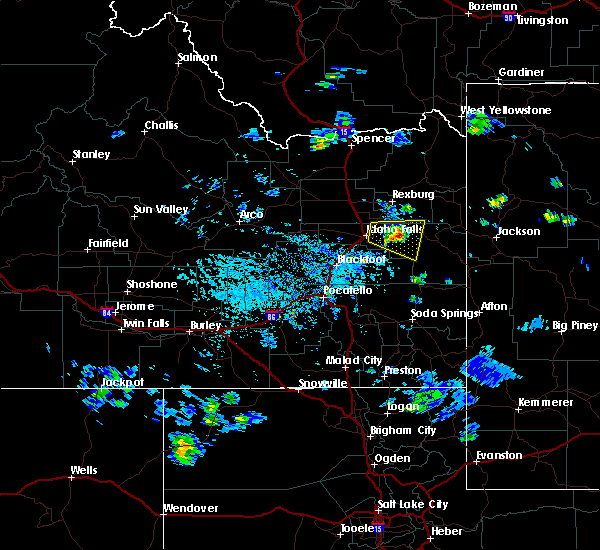
 Svrpih the national weather service in pocatello has issued a * severe thunderstorm warning for, teton county in eastern idaho, caribou county in southeastern idaho, southeastern fremont county in southeastern idaho, north central oneida county in southeastern idaho, southeastern jefferson county in southeastern idaho, eastern bannock county in southeastern idaho, southeastern power county in southeastern idaho, bonneville county in southeastern idaho, madison county in southeastern idaho, northwestern bear lake county in southeastern idaho, southeastern bingham county in southeastern idaho, * until 500 pm mdt. * at 417 pm mdt, a line of severe thunderstorms and associated outflow was located from near ashton hill to bone to chesterfield reservoir to buist , moving northeast at 40 mph (radar indicated and mesonet observations. multiple reports of gusts over 60 mph have been reported along and just behind this line). Hazards include 70 mph wind gusts. Expect considerable tree damage. Damage is likely to mobile homes, roofs, and outbuildings. Svrpih the national weather service in pocatello has issued a * severe thunderstorm warning for, teton county in eastern idaho, caribou county in southeastern idaho, southeastern fremont county in southeastern idaho, north central oneida county in southeastern idaho, southeastern jefferson county in southeastern idaho, eastern bannock county in southeastern idaho, southeastern power county in southeastern idaho, bonneville county in southeastern idaho, madison county in southeastern idaho, northwestern bear lake county in southeastern idaho, southeastern bingham county in southeastern idaho, * until 500 pm mdt. * at 417 pm mdt, a line of severe thunderstorms and associated outflow was located from near ashton hill to bone to chesterfield reservoir to buist , moving northeast at 40 mph (radar indicated and mesonet observations. multiple reports of gusts over 60 mph have been reported along and just behind this line). Hazards include 70 mph wind gusts. Expect considerable tree damage. Damage is likely to mobile homes, roofs, and outbuildings.
|
| 5/13/2026 3:59 PM MDT |
 At 357 pm mdt, a line of severe thunderstorms and associated outflow extends from near saint anthony to bone to near holbrook, moving northeast at 55 mph (radar indicated and mesonet observations. multiple reports of gusts over 60 mph have been reported at times along this line). Hazards include 70 mph wind gusts. Expect considerable tree damage. damage is likely to mobile homes, roofs, and outbuildings. Locations impacted include, idaho falls, pocatello, rexburg, blackfoot, rigby, soda springs, ashton, mccammon, lava hot springs, swan valley, felt, swanlake, ririe reservoir, chesterfield reservoir, goshen, blackfoot reservoir, wayan, marysville, lorenzo, and northern palisades reservoir. At 357 pm mdt, a line of severe thunderstorms and associated outflow extends from near saint anthony to bone to near holbrook, moving northeast at 55 mph (radar indicated and mesonet observations. multiple reports of gusts over 60 mph have been reported at times along this line). Hazards include 70 mph wind gusts. Expect considerable tree damage. damage is likely to mobile homes, roofs, and outbuildings. Locations impacted include, idaho falls, pocatello, rexburg, blackfoot, rigby, soda springs, ashton, mccammon, lava hot springs, swan valley, felt, swanlake, ririe reservoir, chesterfield reservoir, goshen, blackfoot reservoir, wayan, marysville, lorenzo, and northern palisades reservoir.
|
| 5/13/2026 3:30 PM MDT |
 Svrpih the national weather service in pocatello has issued a * severe thunderstorm warning for, teton county in eastern idaho, caribou county in southeastern idaho, southeastern fremont county in southeastern idaho, central oneida county in southeastern idaho, eastern jefferson county in southeastern idaho, bannock county in southeastern idaho, southeastern power county in southeastern idaho, bonneville county in southeastern idaho, madison county in southeastern idaho, northern franklin county in southeastern idaho, northwestern bear lake county in southeastern idaho, southeastern bingham county in southeastern idaho, * until 415 pm mdt. * at 328 pm mdt, a line of severe thunderstorms and associated outflow extends from hamer to near holbrook, moving east northeast at 50 mph (radar indicated and mesonet observations. multiple reports of gusts over 60 mph have been reported, along with blowing dust). Hazards include 70 mph wind gusts. Expect considerable tree damage. Damage is likely to mobile homes, roofs, and outbuildings. Svrpih the national weather service in pocatello has issued a * severe thunderstorm warning for, teton county in eastern idaho, caribou county in southeastern idaho, southeastern fremont county in southeastern idaho, central oneida county in southeastern idaho, eastern jefferson county in southeastern idaho, bannock county in southeastern idaho, southeastern power county in southeastern idaho, bonneville county in southeastern idaho, madison county in southeastern idaho, northern franklin county in southeastern idaho, northwestern bear lake county in southeastern idaho, southeastern bingham county in southeastern idaho, * until 415 pm mdt. * at 328 pm mdt, a line of severe thunderstorms and associated outflow extends from hamer to near holbrook, moving east northeast at 50 mph (radar indicated and mesonet observations. multiple reports of gusts over 60 mph have been reported, along with blowing dust). Hazards include 70 mph wind gusts. Expect considerable tree damage. Damage is likely to mobile homes, roofs, and outbuildings.
|
| 5/11/2025 3:15 PM MDT | Mbwbt mount bair in bonneville county ID, 8.1 miles W of Irwin, ID |
| 5/11/2025 3:14 PM MDT |
 The storm which prompted the warning has moved into western wyoming. therefore, the warning will be allowed to expire. a severe thunderstorm watch remains in effect until 800 pm mdt for eastern and southeastern idaho. The storm which prompted the warning has moved into western wyoming. therefore, the warning will be allowed to expire. a severe thunderstorm watch remains in effect until 800 pm mdt for eastern and southeastern idaho.
|
| 5/11/2025 3:09 PM MDT | Estimated 60-70 mph winds over pine creek pass. time estimated based on rada in bonneville county ID, 12.8 miles S of Irwin, ID |
| 5/11/2025 3:01 PM MDT |
 the severe thunderstorm warning has been cancelled and is no longer in effect the severe thunderstorm warning has been cancelled and is no longer in effect
|
| 5/11/2025 3:01 PM MDT |
 At 300 pm mdt, a severe thunderstorm was located over irwin, or near swan valley, moving northeast at 50 mph (radar indicated). Hazards include 60 mph wind gusts and nickel size hail. Expect damage to roofs, siding, and trees. Locations impacted include, swan valley, irwin, and victor. At 300 pm mdt, a severe thunderstorm was located over irwin, or near swan valley, moving northeast at 50 mph (radar indicated). Hazards include 60 mph wind gusts and nickel size hail. Expect damage to roofs, siding, and trees. Locations impacted include, swan valley, irwin, and victor.
|
| 5/11/2025 2:38 PM MDT |
 Svrpih the national weather service in pocatello has issued a * severe thunderstorm warning for, southeastern teton county in eastern idaho, southeastern bonneville county in southeastern idaho, east central bingham county in southeastern idaho, * until 315 pm mdt. * at 238 pm mdt, a severe thunderstorm was located 12 miles east of bone, or 16 miles southwest of swan valley, moving northeast at 50 mph (radar indicated). Hazards include 60 mph wind gusts and nickel size hail. expect damage to roofs, siding, and trees Svrpih the national weather service in pocatello has issued a * severe thunderstorm warning for, southeastern teton county in eastern idaho, southeastern bonneville county in southeastern idaho, east central bingham county in southeastern idaho, * until 315 pm mdt. * at 238 pm mdt, a severe thunderstorm was located 12 miles east of bone, or 16 miles southwest of swan valley, moving northeast at 50 mph (radar indicated). Hazards include 60 mph wind gusts and nickel size hail. expect damage to roofs, siding, and trees
|
| 8/10/2024 1:55 PM MDT |
 The storm which prompted the warning has moved out of the area. therefore, the warning will be allowed to expire. The storm which prompted the warning has moved out of the area. therefore, the warning will be allowed to expire.
|
| 8/10/2024 1:39 PM MDT |
 At 138 pm mdt, a severe thunderstorm was located near palisades reservoir, moving southeast at 25 mph (radar indicated). Hazards include 60 mph wind gusts and half dollar size hail. Hail damage to vehicles is expected. expect wind damage to roofs, siding, and trees. Locations impacted include, swan valley, palisades reservoir, irwin, and alpine airport. At 138 pm mdt, a severe thunderstorm was located near palisades reservoir, moving southeast at 25 mph (radar indicated). Hazards include 60 mph wind gusts and half dollar size hail. Hail damage to vehicles is expected. expect wind damage to roofs, siding, and trees. Locations impacted include, swan valley, palisades reservoir, irwin, and alpine airport.
|
| 8/10/2024 1:35 PM MDT | Half Dollar sized hail reported 7.3 miles NW of Irwin, ID, *** 4 inj *** boat caught on palisades reservoir as severe thunderstorm moved overhead. video captured heavy hail falling with some stones larger than quarters resultin |
| 8/10/2024 1:30 PM MDT | Half Dollar sized hail reported 5.6 miles NW of Irwin, ID, bear lake em traveling through and sent picture of hail next to a quarter. |
| 8/10/2024 1:21 PM MDT |
 Svrpih the national weather service in pocatello has issued a * severe thunderstorm warning for, east central bonneville county in southeastern idaho, * until 200 pm mdt. * at 120 pm mdt, a severe thunderstorm was located near irwin, or 8 miles south of swan valley, moving southeast at 25 mph (radar indicated). Hazards include 60 mph wind gusts and half dollar size hail. Hail damage to vehicles is expected. Expect wind damage to roofs, siding, and trees. Svrpih the national weather service in pocatello has issued a * severe thunderstorm warning for, east central bonneville county in southeastern idaho, * until 200 pm mdt. * at 120 pm mdt, a severe thunderstorm was located near irwin, or 8 miles south of swan valley, moving southeast at 25 mph (radar indicated). Hazards include 60 mph wind gusts and half dollar size hail. Hail damage to vehicles is expected. Expect wind damage to roofs, siding, and trees.
|
| 9/29/2022 3:08 PM MDT |
 At 307 pm mdt, a severe thunderstorm was located 8 miles south of irwin, or 10 miles west of palisades reservoir, moving northeast at 30 mph (radar indicated). Hazards include quarter size hail. Damage to vehicles is expected. locations impacted include, northern palisades reservoir and irwin. hail threat, radar indicated max hail size, 1. 00 in wind threat, radar indicated max wind gust, <50 mph. At 307 pm mdt, a severe thunderstorm was located 8 miles south of irwin, or 10 miles west of palisades reservoir, moving northeast at 30 mph (radar indicated). Hazards include quarter size hail. Damage to vehicles is expected. locations impacted include, northern palisades reservoir and irwin. hail threat, radar indicated max hail size, 1. 00 in wind threat, radar indicated max wind gust, <50 mph.
|
| 9/29/2022 2:48 PM MDT |
 At 246 pm mdt, a severe thunderstorm was located 16 miles north of wayan, moving northeast at 30 mph (radar indicated). Hazards include quarter size hail. damage to vehicles is expected At 246 pm mdt, a severe thunderstorm was located 16 miles north of wayan, moving northeast at 30 mph (radar indicated). Hazards include quarter size hail. damage to vehicles is expected
|
| 8/2/2022 5:40 PM MDT |
 The severe thunderstorm warning for east central bonneville county will expire at 545 pm mdt, the storm which prompted the warning has weakened below severe limits, and has exited the warned area. therefore, the warning will be allowed to expire. The severe thunderstorm warning for east central bonneville county will expire at 545 pm mdt, the storm which prompted the warning has weakened below severe limits, and has exited the warned area. therefore, the warning will be allowed to expire.
|
| 8/2/2022 5:09 PM MDT |
 At 509 pm mdt, a severe thunderstorm was located near irwin, or 9 miles east of swan valley, moving east at 20 mph (radar indicated). Hazards include quarter size hail. damage to vehicles is expected At 509 pm mdt, a severe thunderstorm was located near irwin, or 9 miles east of swan valley, moving east at 20 mph (radar indicated). Hazards include quarter size hail. damage to vehicles is expected
|
| 8/2/2022 5:06 PM MDT | Quarter sized hail reported 0.6 miles ESE of Irwin, ID |
| 8/2/2022 4:46 PM MDT |
 At 446 pm mdt, a severe thunderstorm was located near swan valley, moving east at 35 mph (radar indicated). Hazards include quarter size hail. damage to vehicles is expected At 446 pm mdt, a severe thunderstorm was located near swan valley, moving east at 35 mph (radar indicated). Hazards include quarter size hail. damage to vehicles is expected
|
| 7/15/2021 4:11 PM MDT |
 The severe thunderstorm warning for east central bonneville county will expire at 415 pm mdt, the storm which prompted the warning has weakened below severe limits, and no longer poses an immediate threat to life or property. therefore, the warning will be allowed to expire. however small hail, gusty winds and locally heavy rain are still possible with this thunderstorm. The severe thunderstorm warning for east central bonneville county will expire at 415 pm mdt, the storm which prompted the warning has weakened below severe limits, and no longer poses an immediate threat to life or property. therefore, the warning will be allowed to expire. however small hail, gusty winds and locally heavy rain are still possible with this thunderstorm.
|
| 7/15/2021 3:44 PM MDT |
 At 343 pm mdt, a severe thunderstorm was located near irwin, or 7 miles south of swan valley, moving east at 20 mph (radar indicated). Hazards include 60 mph wind gusts and quarter size hail. Hail damage to vehicles is expected. Expect wind damage to roofs, siding, and trees. At 343 pm mdt, a severe thunderstorm was located near irwin, or 7 miles south of swan valley, moving east at 20 mph (radar indicated). Hazards include 60 mph wind gusts and quarter size hail. Hail damage to vehicles is expected. Expect wind damage to roofs, siding, and trees.
|
| 6/2/2019 5:24 PM MDT |
 The severe thunderstorm warning for northeastern bonneville county will expire at 530 pm mdt, the storm which prompted the warning has weakened below severe limits, and has exited the warned area. therefore, the warning will be allowed to expire. however heavy rain is still possible with this thunderstorm. to report severe weather, contact your nearest law enforcement agency. they will relay your report to the national weather service pocatello. The severe thunderstorm warning for northeastern bonneville county will expire at 530 pm mdt, the storm which prompted the warning has weakened below severe limits, and has exited the warned area. therefore, the warning will be allowed to expire. however heavy rain is still possible with this thunderstorm. to report severe weather, contact your nearest law enforcement agency. they will relay your report to the national weather service pocatello.
|
| 6/2/2019 5:09 PM MDT |
 At 509 pm mdt, a severe thunderstorm was located near swan valley, and is nearly stationary (radar indicated). Hazards include 60 mph wind gusts and quarter size hail. Hail damage to vehicles is expected. expect wind damage to roofs, siding, and trees. Locations impacted include, swan valley and irwin. At 509 pm mdt, a severe thunderstorm was located near swan valley, and is nearly stationary (radar indicated). Hazards include 60 mph wind gusts and quarter size hail. Hail damage to vehicles is expected. expect wind damage to roofs, siding, and trees. Locations impacted include, swan valley and irwin.
|
| 6/2/2019 4:50 PM MDT |
 At 449 pm mdt, a severe thunderstorm was located near swan valley, and is nearly stationary (radar indicated). Hazards include 60 mph wind gusts and quarter size hail. Hail damage to vehicles is expected. Expect wind damage to roofs, siding, and trees. At 449 pm mdt, a severe thunderstorm was located near swan valley, and is nearly stationary (radar indicated). Hazards include 60 mph wind gusts and quarter size hail. Hail damage to vehicles is expected. Expect wind damage to roofs, siding, and trees.
|
| 5/31/2018 5:15 PM MDT |
 At 514 pm mdt, a line of severe thunderstorms was located from north of roberts to just south of idaho falls, moving east at 35 mph (trained weather spotters. this storm has a history of producing large hail and winds to 50 mph or higher). Hazards include ping pong ball size hail and 60 mph wind gusts. People and animals outdoors will be injured. expect hail damage to roofs, siding, windows, and vehicles. Expect wind damage to roofs, siding, and trees. At 514 pm mdt, a line of severe thunderstorms was located from north of roberts to just south of idaho falls, moving east at 35 mph (trained weather spotters. this storm has a history of producing large hail and winds to 50 mph or higher). Hazards include ping pong ball size hail and 60 mph wind gusts. People and animals outdoors will be injured. expect hail damage to roofs, siding, windows, and vehicles. Expect wind damage to roofs, siding, and trees.
|
| 7/20/2017 2:05 PM MDT |
 At 140 pm mdt, a severe thunderstorm was located 13 miles east of bone or 14 miles southwest of swan valley, moving northeast at 30 mph (radar indicated). Hazards include quarter size hail. damage to vehicles is expected At 140 pm mdt, a severe thunderstorm was located 13 miles east of bone or 14 miles southwest of swan valley, moving northeast at 30 mph (radar indicated). Hazards include quarter size hail. damage to vehicles is expected
|
| 7/20/2017 1:40 PM MDT |
 At 140 pm mdt, a severe thunderstorm was located 13 miles east of bone or 14 miles southwest of swan valley, moving northeast at 30 mph (radar indicated). Hazards include quarter size hail. damage to vehicles is expected At 140 pm mdt, a severe thunderstorm was located 13 miles east of bone or 14 miles southwest of swan valley, moving northeast at 30 mph (radar indicated). Hazards include quarter size hail. damage to vehicles is expected
|
| 10/2/2016 8:17 PM MDT |
 At 817 pm mdt, doppler radar indicated a severe thunderstorm capable of producing a tornado. this dangerous storm was located near blackfoot reservoir. the tornadic storm was nearly stationary. At 817 pm mdt, doppler radar indicated a severe thunderstorm capable of producing a tornado. this dangerous storm was located near blackfoot reservoir. the tornadic storm was nearly stationary.
|
| 7/10/2016 4:27 PM MDT |
 At 427 pm mdt, doppler radar indicated a severe thunderstorm capable of producing quarter size hail and damaging winds in excess of 60 mph. this storm was located 11 miles southeast of bone, or 20 miles northwest of wayan, moving northeast at 45 mph. locations impacted include, swan valley, ririe reservoir, palisades reservoir, ammon, irwin, bone and grays lake. At 427 pm mdt, doppler radar indicated a severe thunderstorm capable of producing quarter size hail and damaging winds in excess of 60 mph. this storm was located 11 miles southeast of bone, or 20 miles northwest of wayan, moving northeast at 45 mph. locations impacted include, swan valley, ririe reservoir, palisades reservoir, ammon, irwin, bone and grays lake.
|
| 7/10/2016 4:04 PM MDT |
 At 404 pm mdt, doppler radar indicated a severe thunderstorm capable of producing quarter size hail and damaging winds in excess of 60 mph. this storm was located 12 miles north of chesterfield reservoir, and moving northeast at 45 mph. At 404 pm mdt, doppler radar indicated a severe thunderstorm capable of producing quarter size hail and damaging winds in excess of 60 mph. this storm was located 12 miles north of chesterfield reservoir, and moving northeast at 45 mph.
|
| 5/8/2016 7:36 PM MDT |
 At 735 pm mdt, doppler radar indicated a severe thunderstorm capable of producing quarter size hail. this storm was located near ririe reservoir. this storm was moving southeast at 10 mph. locations impacted include, swan valley, palisades reservoir, irwin, alpine campground, pine creek pass and alpine airport. At 735 pm mdt, doppler radar indicated a severe thunderstorm capable of producing quarter size hail. this storm was located near ririe reservoir. this storm was moving southeast at 10 mph. locations impacted include, swan valley, palisades reservoir, irwin, alpine campground, pine creek pass and alpine airport.
|
| 5/8/2016 7:16 PM MDT |
 At 715 pm mdt, doppler radar indicated a severe thunderstorm capable of producing quarter size hail. this storm was located 7 miles northeast of ririe reservoir. this storm was moving southeast at 20 mph. At 715 pm mdt, doppler radar indicated a severe thunderstorm capable of producing quarter size hail. this storm was located 7 miles northeast of ririe reservoir. this storm was moving southeast at 20 mph.
|
| 8/27/2015 5:42 PM MDT |
 At 542 pm mdt, doppler radar indicated a severe thunderstorm capable of producing quarter size hail and damaging winds in excess of 60 mph. this storm was located near ririe reservoir, and moving east at 40 mph. At 542 pm mdt, doppler radar indicated a severe thunderstorm capable of producing quarter size hail and damaging winds in excess of 60 mph. this storm was located near ririe reservoir, and moving east at 40 mph.
|
| 8/14/2015 7:58 PM MDT | The severe thunderstorm warning for east central bingham, central jefferson, northeastern caribou, eastern clark, fremont, bonneville, madison and teton counties will expire at 800 pm mdt, the storms which prompted the warning have weakened below severe limits and exited the warned area. therefore the warning will be allowed to expire. however small hail, gusty winds and heavy rain are still possible with these thunderstorms. |
| 8/14/2015 7:42 PM MDT |
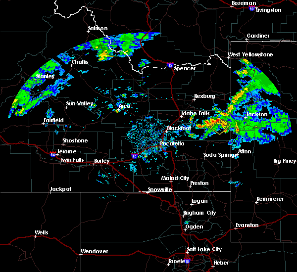
 At 739 pm mdt, doppler radar indicated a line of severe thunderstorms capable of producing damaging winds in excess of 60 mph. these storms were located along a line extending from 10 miles northeast of kilgore to 6 miles southwest of island park reservoir to near felt to 6 miles west of alpine, moving northeast at 55 mph. locations impacted include, rexburg, rigby, driggs, ashton, dubois, swan valley, felt, marysville, lorenzo, henrys lake, ririe reservoir, wayan, idmon, palisades reservoir, blackfoot reservoir, victor, sugar city, teton, ririe and parker. At 739 pm mdt, doppler radar indicated a line of severe thunderstorms capable of producing damaging winds in excess of 60 mph. these storms were located along a line extending from 10 miles northeast of kilgore to 6 miles southwest of island park reservoir to near felt to 6 miles west of alpine, moving northeast at 55 mph. locations impacted include, rexburg, rigby, driggs, ashton, dubois, swan valley, felt, marysville, lorenzo, henrys lake, ririe reservoir, wayan, idmon, palisades reservoir, blackfoot reservoir, victor, sugar city, teton, ririe and parker.
|
| 8/14/2015 7:28 PM MDT |
 At 727 pm mdt, doppler radar indicated a line of severe thunderstorms capable of producing damaging winds in excess of 60 mph. these storms were located along a line extending from 6 miles northwest of kilgore to 11 miles southeast of idmon to 12 miles southeast of teton to near wayan, moving northeast at 55 mph. in addition, multiple reports of 55 to 60 mph winds reported earlier near interstate 15. also, tree limbs were reported down along the salem highway a few minutes ago. locations impacted include, rexburg, rigby, driggs, ashton, dubois, swan valley, felt, marysville, lorenzo, henrys lake, ririe reservoir, wayan, idmon, palisades reservoir, blackfoot reservoir, ammon, victor, iona, sugar city and ucon. At 727 pm mdt, doppler radar indicated a line of severe thunderstorms capable of producing damaging winds in excess of 60 mph. these storms were located along a line extending from 6 miles northwest of kilgore to 11 miles southeast of idmon to 12 miles southeast of teton to near wayan, moving northeast at 55 mph. in addition, multiple reports of 55 to 60 mph winds reported earlier near interstate 15. also, tree limbs were reported down along the salem highway a few minutes ago. locations impacted include, rexburg, rigby, driggs, ashton, dubois, swan valley, felt, marysville, lorenzo, henrys lake, ririe reservoir, wayan, idmon, palisades reservoir, blackfoot reservoir, ammon, victor, iona, sugar city and ucon.
|
| 8/14/2015 7:11 PM MDT |
 At 711 pm mdt, doppler radar indicated a line of severe thunderstorms capable of producing damaging winds in excess of 60 mph. these storms were located along a line extending from spencer to 12 miles east of dubois to near archer to near blackfoot reservoir, and moving northeast at 55 mph. 60 mph winds were recently reported at sage junction. At 711 pm mdt, doppler radar indicated a line of severe thunderstorms capable of producing damaging winds in excess of 60 mph. these storms were located along a line extending from spencer to 12 miles east of dubois to near archer to near blackfoot reservoir, and moving northeast at 55 mph. 60 mph winds were recently reported at sage junction.
|
| 8/5/2015 4:11 PM MDT |
 The severe thunderstorm warning for eastern jefferson, southeastern clark, southern fremont, northeastern bonneville, madison and teton counties will expire at 415 pm mdt, the storms which prompted the warning have weakened below severe limits, and no longer poses an immediate threat to life or property. therefore the warning will be allowed to expire. however small. The severe thunderstorm warning for eastern jefferson, southeastern clark, southern fremont, northeastern bonneville, madison and teton counties will expire at 415 pm mdt, the storms which prompted the warning have weakened below severe limits, and no longer poses an immediate threat to life or property. therefore the warning will be allowed to expire. however small.
|
| 8/5/2015 3:49 PM MDT |
 At 348 pm mdt, doppler radar indicated a line of severe thunderstorms capable of producing damaging winds in excess of 60 mph. these storms were located along a line extending from 8 miles northwest of egin to 7 miles east of teton to near swan valley, moving northeast at 45 mph. locations impacted include, rexburg, rigby, driggs, ashton, swan valley, felt, marysville, lorenzo, ririe reservoir, victor, sugar city, menan, teton, ririe, parker, tetonia, irwin, hamer, drummond and egin. At 348 pm mdt, doppler radar indicated a line of severe thunderstorms capable of producing damaging winds in excess of 60 mph. these storms were located along a line extending from 8 miles northwest of egin to 7 miles east of teton to near swan valley, moving northeast at 45 mph. locations impacted include, rexburg, rigby, driggs, ashton, swan valley, felt, marysville, lorenzo, ririe reservoir, victor, sugar city, menan, teton, ririe, parker, tetonia, irwin, hamer, drummond and egin.
|
| 8/5/2015 3:24 PM MDT |
 At 324 pm mdt, doppler radar indicated a line of severe thunderstorms capable of producing quarter size hail and damaging winds in excess of 60 mph. these storms were located along a line extending from 6 miles southwest of hamer to archer to 12 miles west of swan valley, and moving northeast at 45 mph. At 324 pm mdt, doppler radar indicated a line of severe thunderstorms capable of producing quarter size hail and damaging winds in excess of 60 mph. these storms were located along a line extending from 6 miles southwest of hamer to archer to 12 miles west of swan valley, and moving northeast at 45 mph.
|
| 8/5/2015 3:12 PM MDT |
 At 310 pm mdt, doppler radar indicated a line of severe thunderstorms capable of producing damaging winds in excess of 60 mph. these storms were located along a line extending from near menan to 11 miles northeast of bone to 15 miles northwest of blackfoot reservoir, moving northeast at 55 mph. in addition, 70 to 73 mph winds were reported on top of kettle butte. winds on the valley floor have been reported up to 65 mph recently. locations impacted include, idaho falls, rexburg, rigby, swan valley, ririe reservoir, wayan, goshen, lorenzo, northern palisades reservoir, northern blackfoot reservoir, ammon, shelley, iona, sugar city, ucon, menan, ririe, roberts, firth and lewisville. At 310 pm mdt, doppler radar indicated a line of severe thunderstorms capable of producing damaging winds in excess of 60 mph. these storms were located along a line extending from near menan to 11 miles northeast of bone to 15 miles northwest of blackfoot reservoir, moving northeast at 55 mph. in addition, 70 to 73 mph winds were reported on top of kettle butte. winds on the valley floor have been reported up to 65 mph recently. locations impacted include, idaho falls, rexburg, rigby, swan valley, ririe reservoir, wayan, goshen, lorenzo, northern palisades reservoir, northern blackfoot reservoir, ammon, shelley, iona, sugar city, ucon, menan, ririe, roberts, firth and lewisville.
|
| 8/5/2015 2:55 PM MDT |
 At 254 pm mdt, doppler radar indicated a line of severe thunderstorms capable of producing damaging winds in excess of 60 mph. these storms were located along a line extending from 9 miles southwest of roberts to bone to 9 miles north of chesterfield reservoir, moving northeast at 55 mph. locations impacted include, idaho falls, rexburg, blackfoot, rigby, swan valley, terreton, goshen, lorenzo, ririe reservoir, wayan, northern palisades reservoir, northern blackfoot reservoir, ammon, shelley, iona, sugar city, ucon, menan, ririe and roberts. At 254 pm mdt, doppler radar indicated a line of severe thunderstorms capable of producing damaging winds in excess of 60 mph. these storms were located along a line extending from 9 miles southwest of roberts to bone to 9 miles north of chesterfield reservoir, moving northeast at 55 mph. locations impacted include, idaho falls, rexburg, blackfoot, rigby, swan valley, terreton, goshen, lorenzo, ririe reservoir, wayan, northern palisades reservoir, northern blackfoot reservoir, ammon, shelley, iona, sugar city, ucon, menan, ririe and roberts.
|
| 8/5/2015 2:42 PM MDT |
 At 240 pm mdt, doppler radar and area observations indicated a line of severe thunderstorms capable of producing damaging winds in excess of 60 mph. these storms were located along a line extending from 8 miles east of southeast inl to near goshen to near fort hall mount putnam, and moving east at 55 mph. At 240 pm mdt, doppler radar and area observations indicated a line of severe thunderstorms capable of producing damaging winds in excess of 60 mph. these storms were located along a line extending from 8 miles east of southeast inl to near goshen to near fort hall mount putnam, and moving east at 55 mph.
|
| 6/9/2015 5:23 PM MDT |
 The severe thunderstorm warning for east central bonneville county will expire at 530 pm mdt, the storm which prompted the warning has weakened below severe limits and exited the warned area. therefore the warning will be allowed to expire. The severe thunderstorm warning for east central bonneville county will expire at 530 pm mdt, the storm which prompted the warning has weakened below severe limits and exited the warned area. therefore the warning will be allowed to expire.
|
| 6/9/2015 4:51 PM MDT |
 At 450 pm mdt, doppler radar indicated a severe thunderstorm capable of producing quarter size hail and damaging winds in excess of 60 mph. this storm was located near irwin, or 8 miles southeast of swan valley, and moving southwest at 15 mph. At 450 pm mdt, doppler radar indicated a severe thunderstorm capable of producing quarter size hail and damaging winds in excess of 60 mph. this storm was located near irwin, or 8 miles southeast of swan valley, and moving southwest at 15 mph.
|
| 6/3/2015 6:21 PM MDT | At 620 pm mdt, doppler radar indicated a severe thunderstorm capable of producing half dollar size hail and damaging winds in excess of 60 mph. this storm was located 8 miles southwest of irwin, or 9 miles southwest of swan valley, and moving north at 20 mph. |
| 5/31/2015 10:11 PM MDT | At 1010 pm mdt, doppler radar indicated outflow from thunderstorms capable of producing damaging winds in excess of 60 mph. these storms were located along a line extending from near marysville to near felt to 7 miles south of victor, and moving east at 35 mph. |
| 5/30/2015 7:11 PM MDT | The severe thunderstorm warning for bonneville county will expire at 715 pm mdt, the storms which prompted the warning have weakened below severe limits, and no longer poses an immediate threat to life or property. therefore the warning will be allowed to expire. however gusty winds are still possible with these thunderstorms. |
| 5/30/2015 6:55 PM MDT | At 654 pm mdt, doppler radar indicated a line of severe thunderstorms capable of producing damaging winds in excess of 60 mph. these storms were located along a line extending from 8 miles west of victor to near palisades reservoir, moving east at 45 mph. locations impacted include, swan valley, palisades reservoir, ririe reservoir, irwin, bone, alpine campground, grays lake and alpine airport. |
| 5/30/2015 6:17 PM MDT | At 616 pm mdt, doppler radar indicated a line of severe thunderstorms capable of producing damaging winds in excess of 60 mph. these storms were located along a line extending from 6 miles south of ririe reservoir to 11 miles north of blackfoot reservoir, and moving east at 45 mph. |
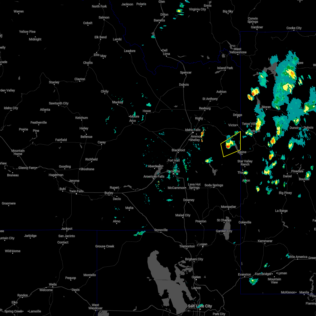
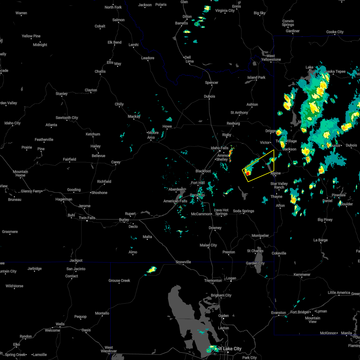
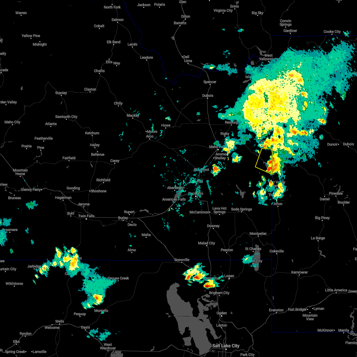
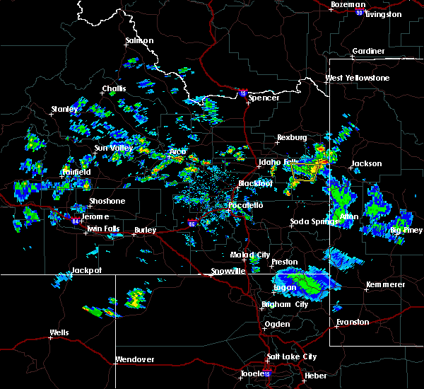
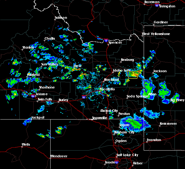
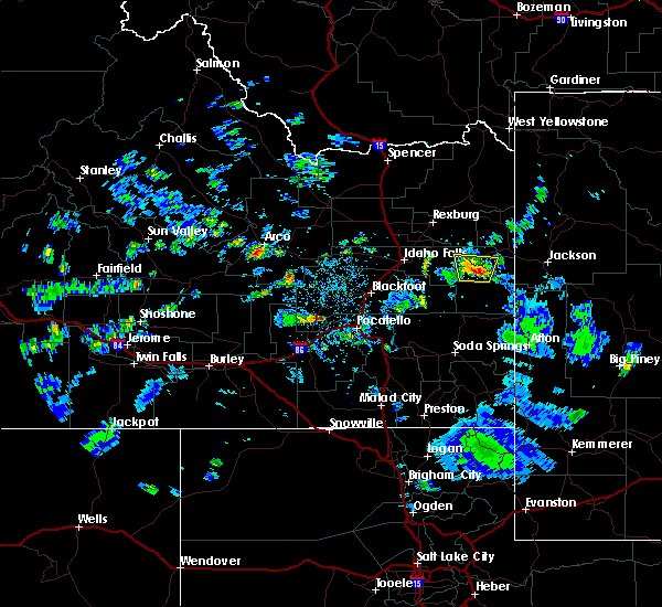
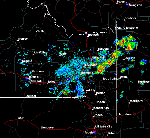
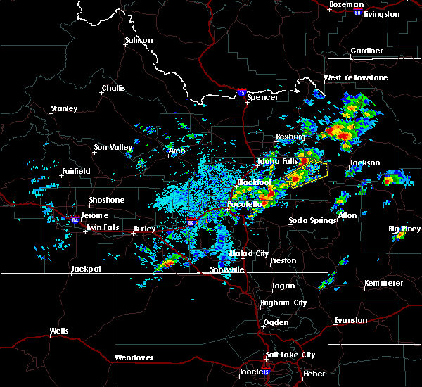
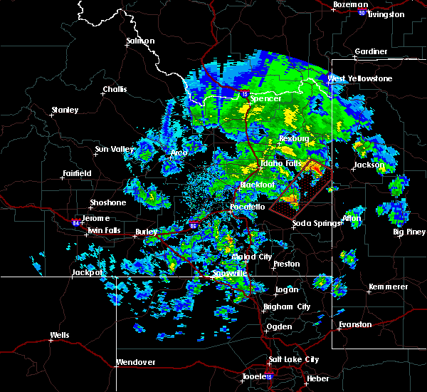
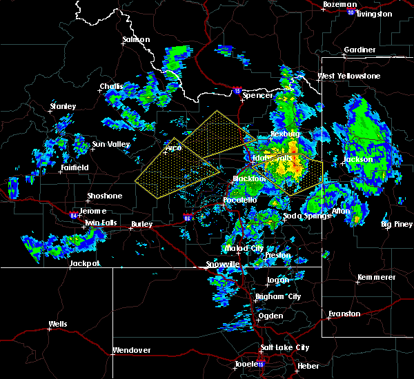
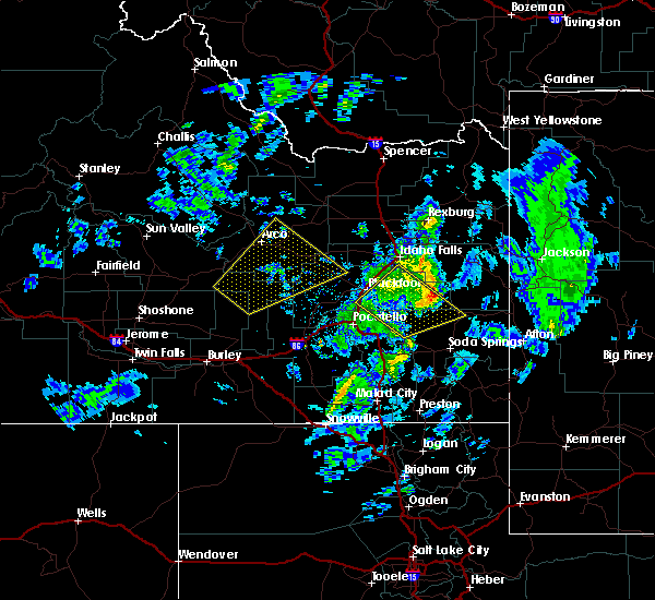
Hail Maps for Irwin, ID


Connect with Interactive Hail Maps