

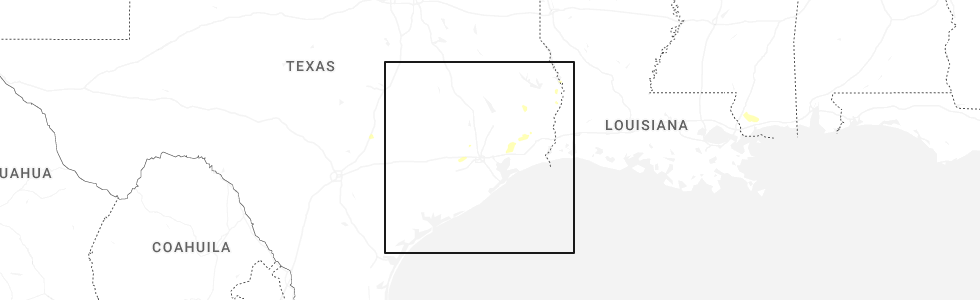
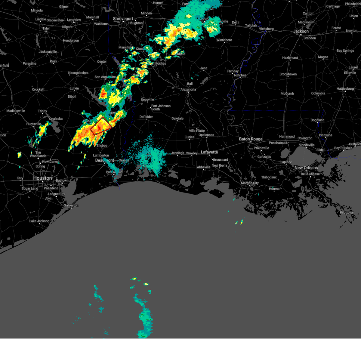
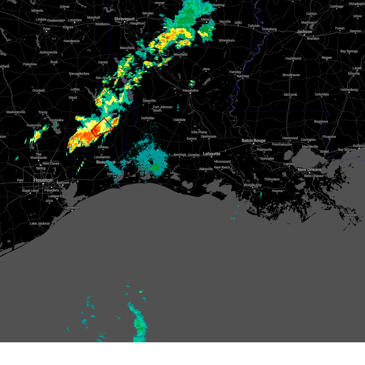
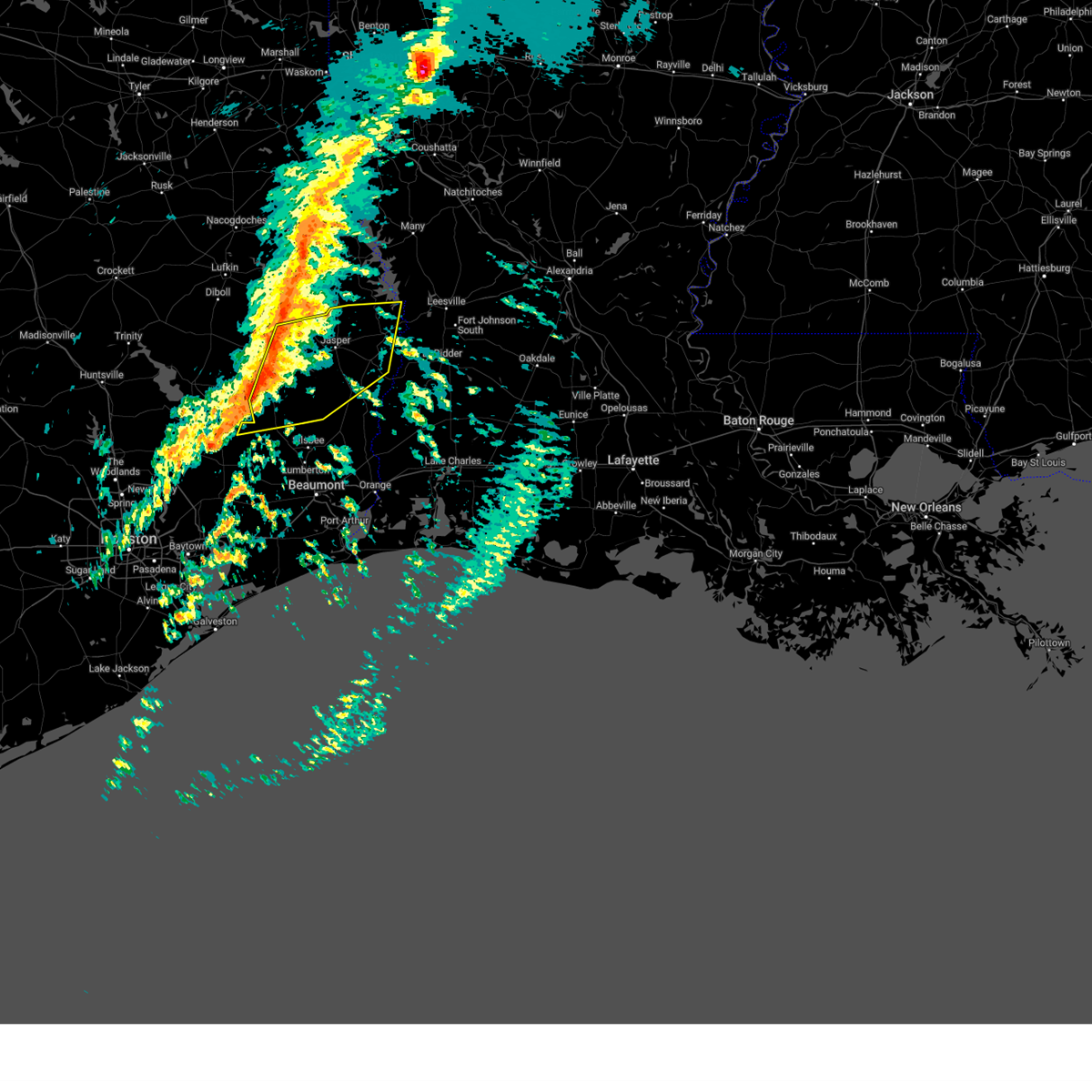
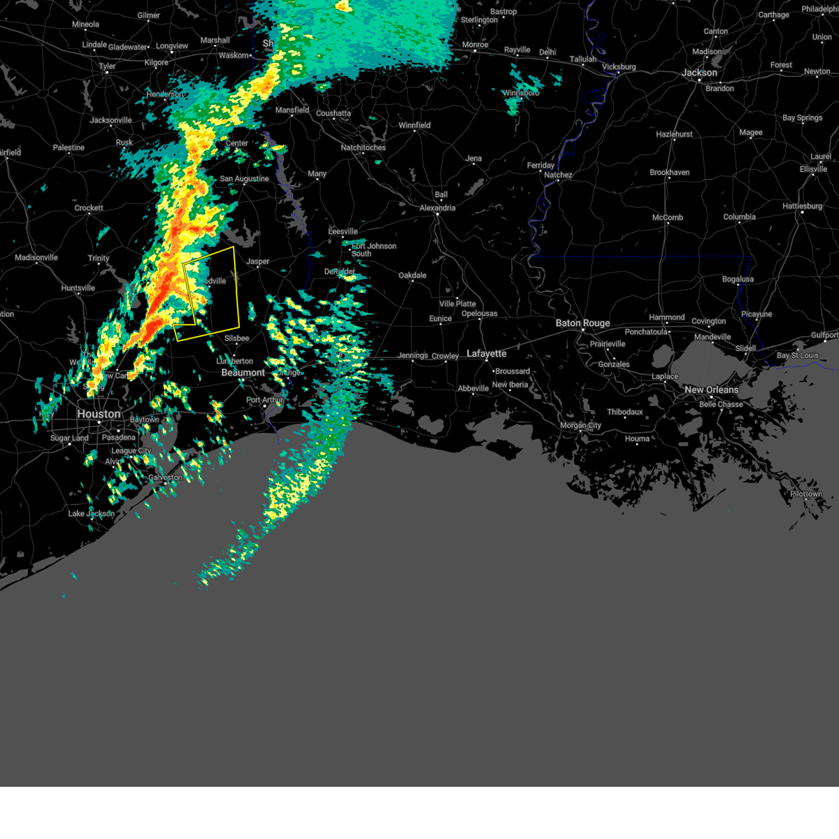
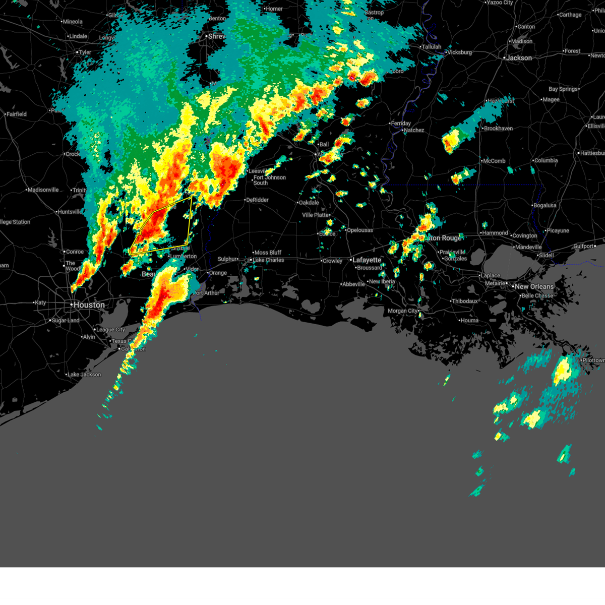
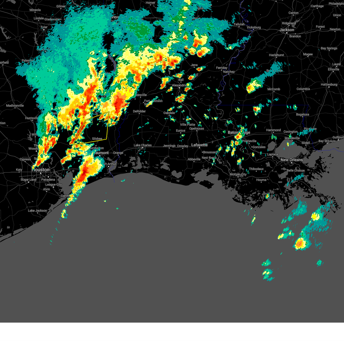
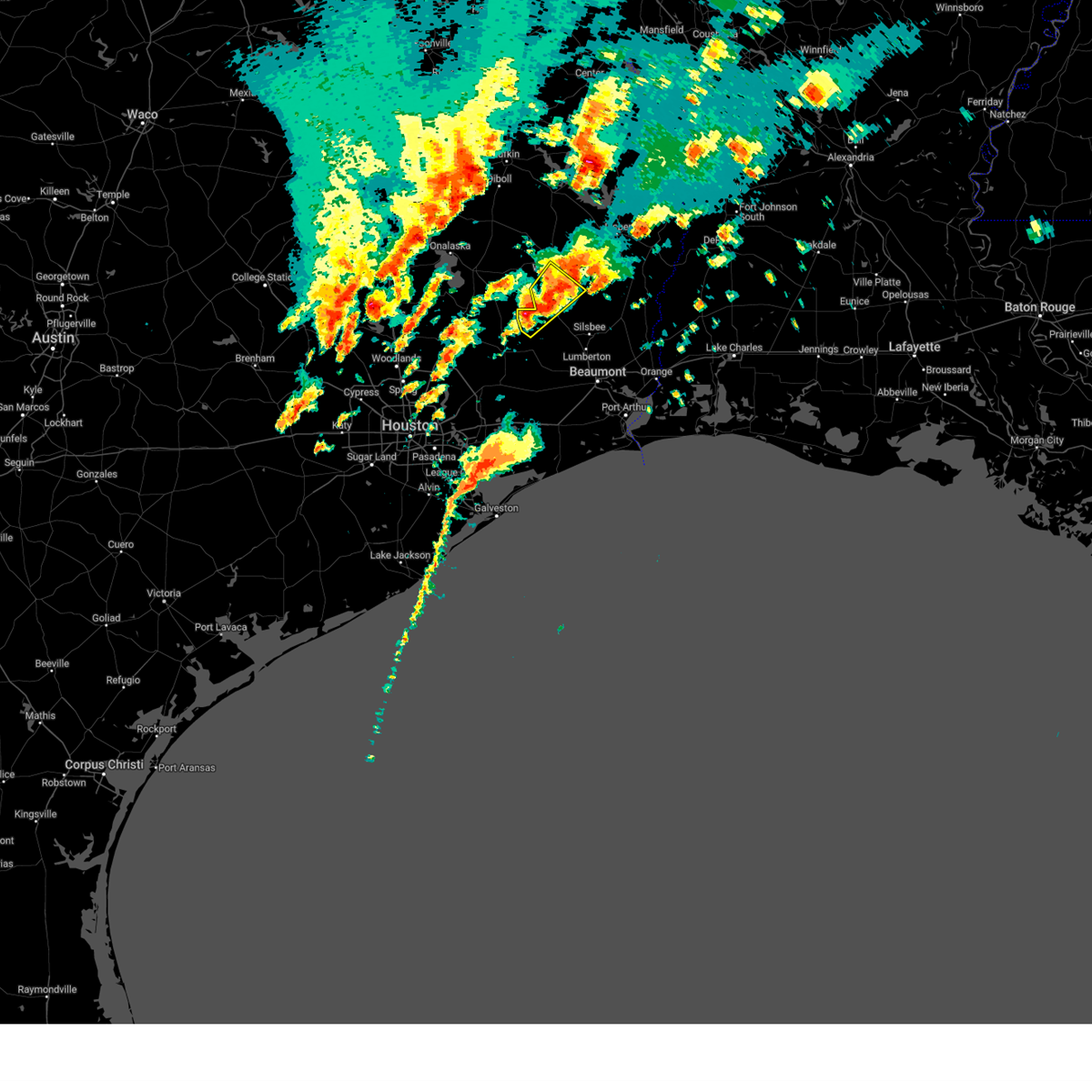
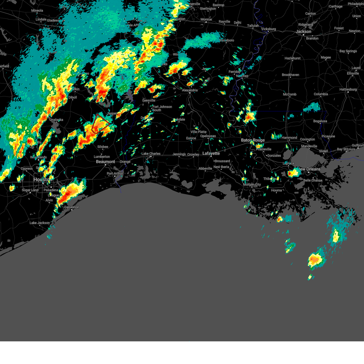
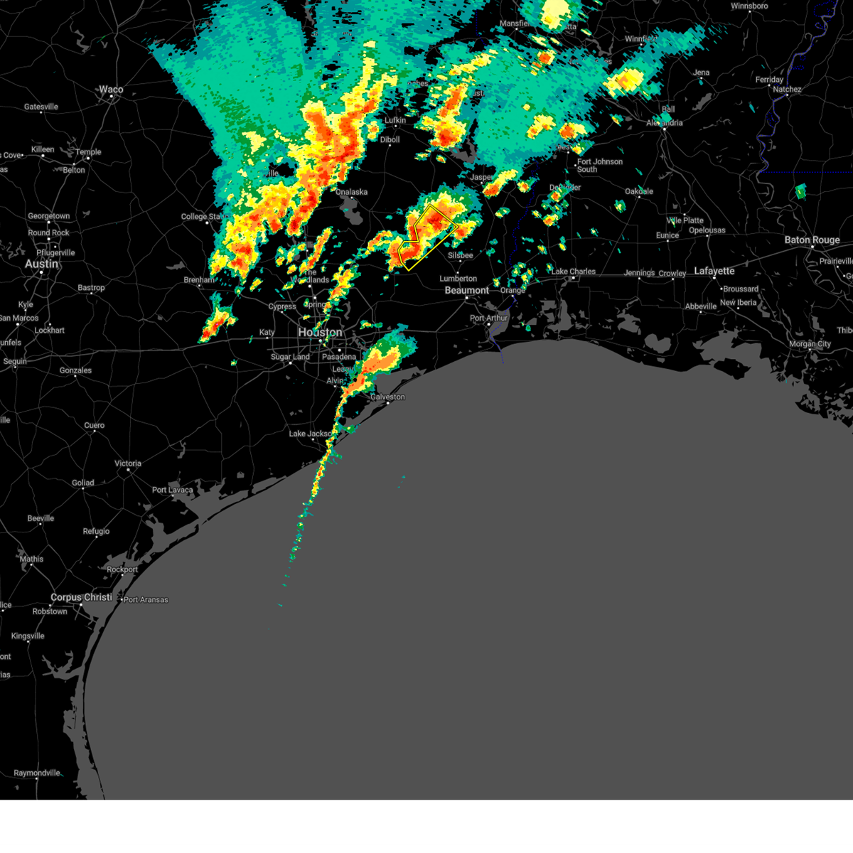
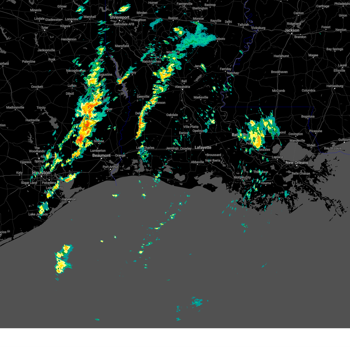
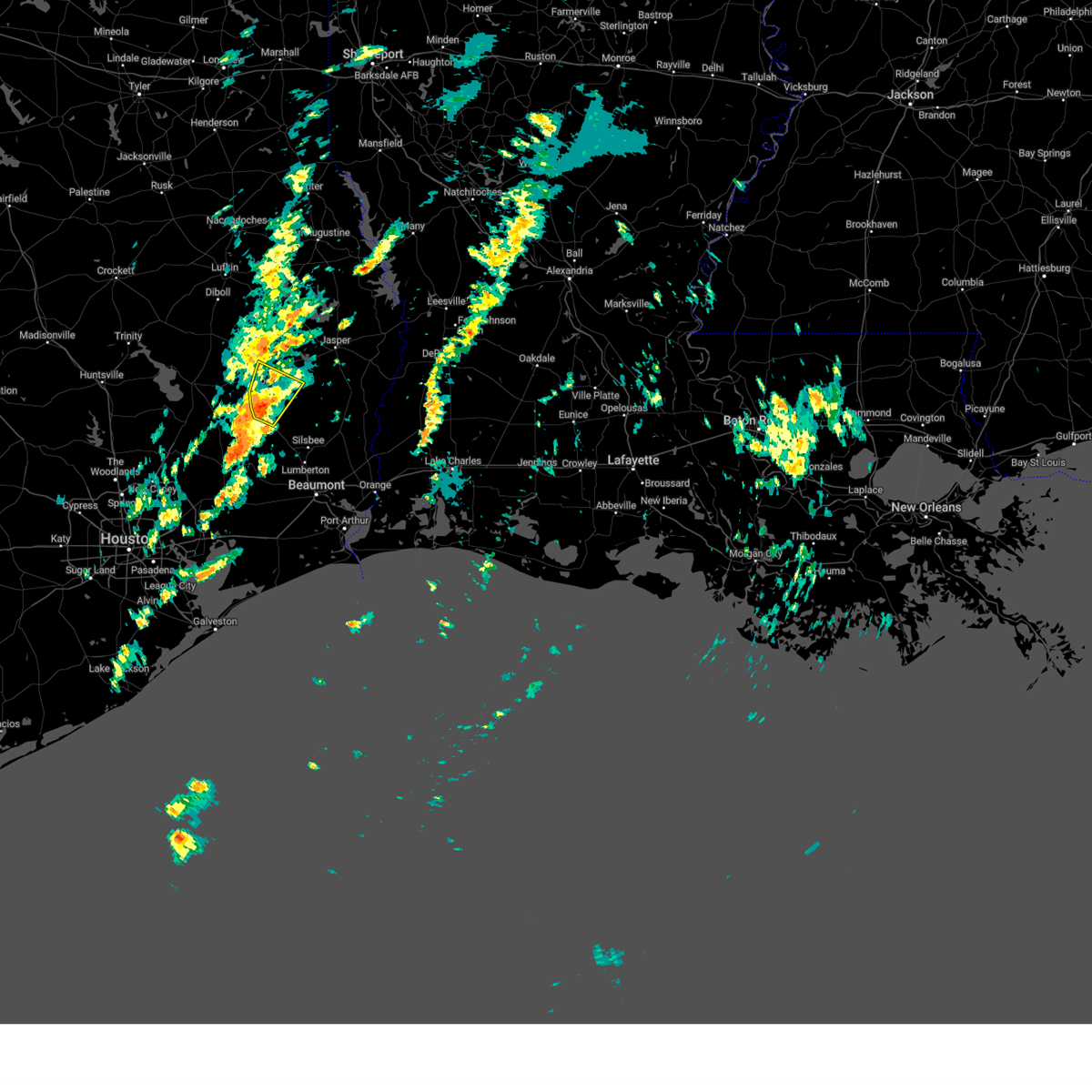
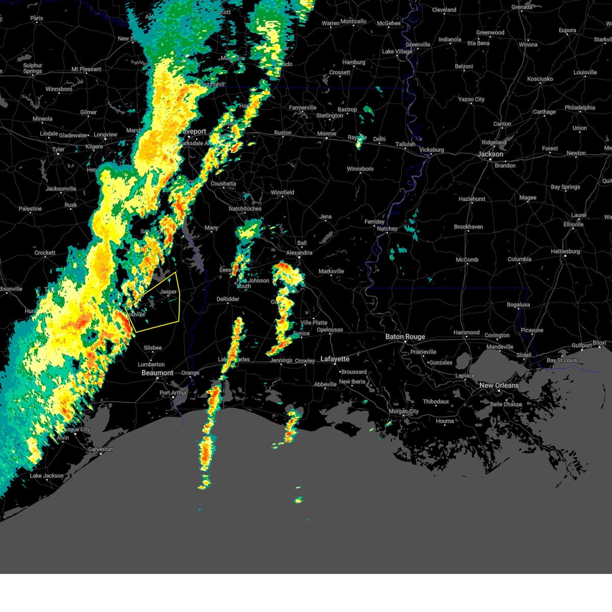
Hail Map for Ivanhoe, TX
The Ivanhoe, TX area has had 6 reports of on-the-ground hail by trained spotters, and has been under severe weather warnings 15 times during the past 12 months. Doppler radar has detected hail at or near Ivanhoe, TX on 69 occasions, including 3 occasions during the past year.
| Name: | Ivanhoe, TX |
| Where Located: | 49.1 miles SSE of Lufkin, TX |
| Map: | Google Map for Ivanhoe, TX |
| Population: | 887 |
| Housing Units: | 577 |
| More Info: | Search Google for Ivanhoe, TX |
1
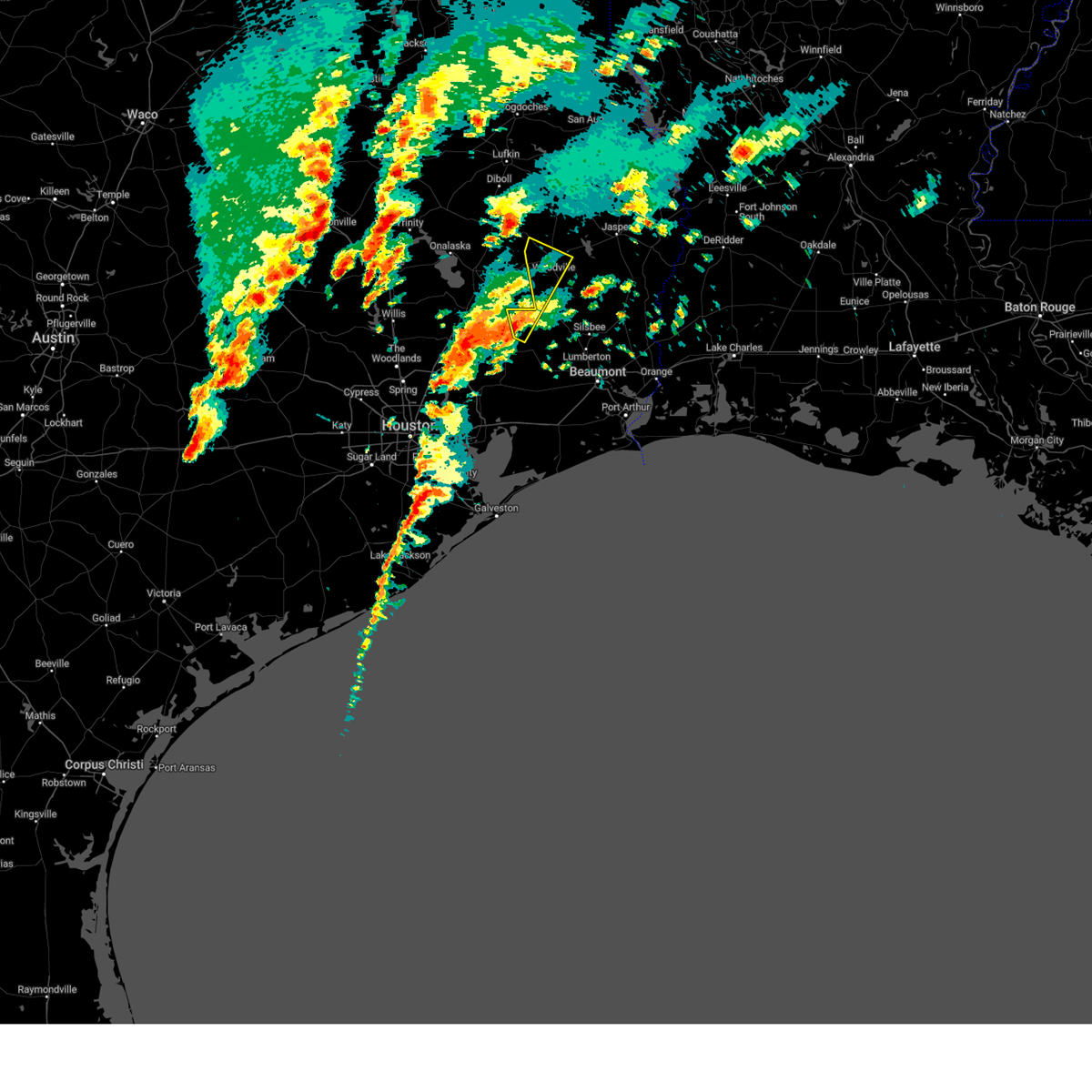
The Top Recent Hail Date for Ivanhoe, TX is Saturday, May 9, 2026 (27th out of 69)
Hail and Wind Damage Spotted near Ivanhoe, TX
| Date / Time | Report Details |
|---|---|
| 5/9/2026 7:01 PM CDT |
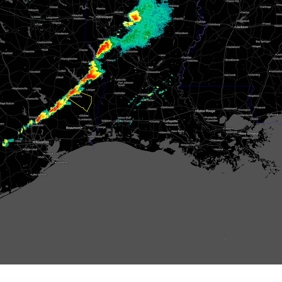
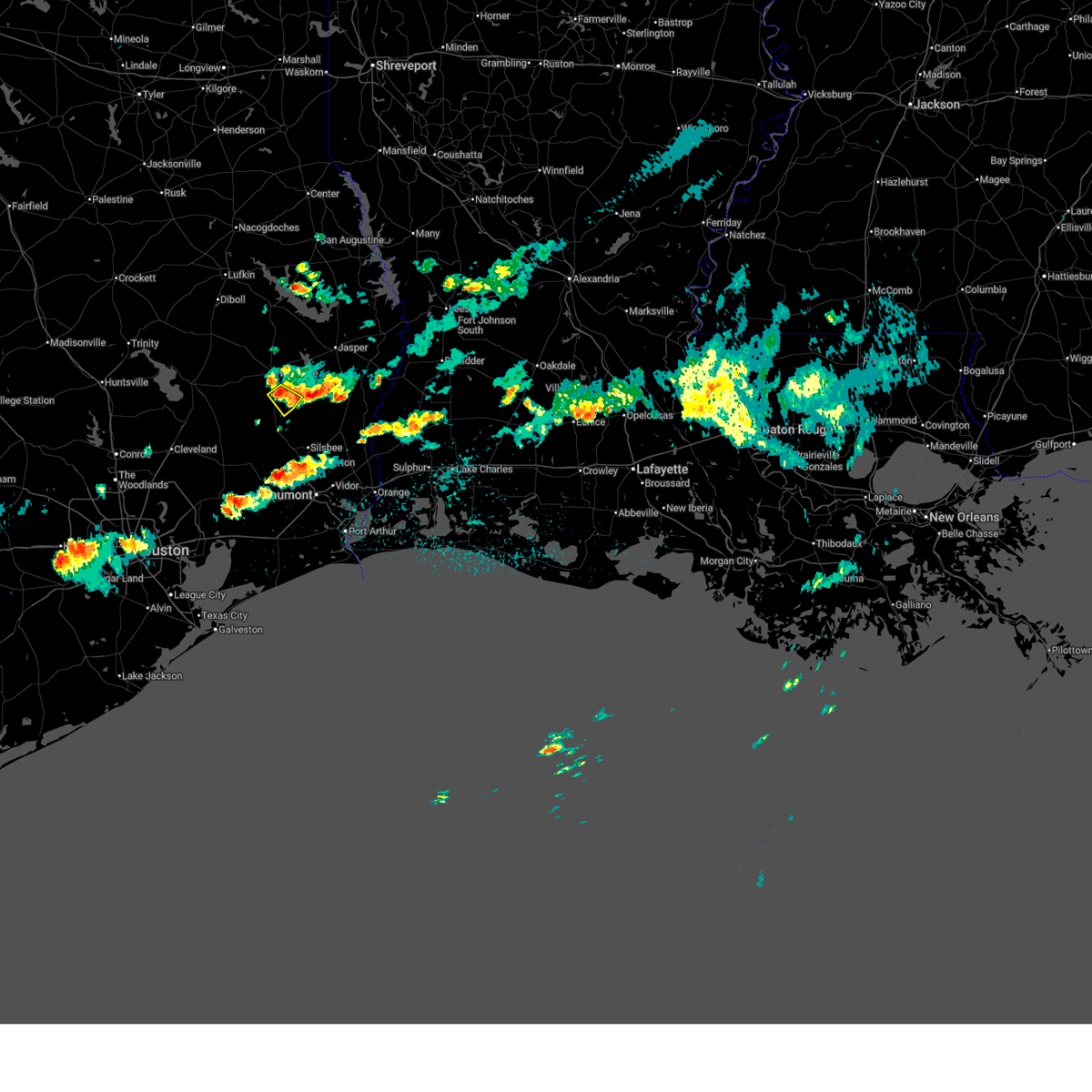 At 701 pm cdt, a severe thunderstorm was located near warren, moving southeast at 10 mph (radar indicated). Hazards include quarter size hail. Damage to vehicles is expected. Locations impacted include, warren, ivanhoe, and hillister. At 701 pm cdt, a severe thunderstorm was located near warren, moving southeast at 10 mph (radar indicated). Hazards include quarter size hail. Damage to vehicles is expected. Locations impacted include, warren, ivanhoe, and hillister.
|
| 5/9/2026 6:42 PM CDT |
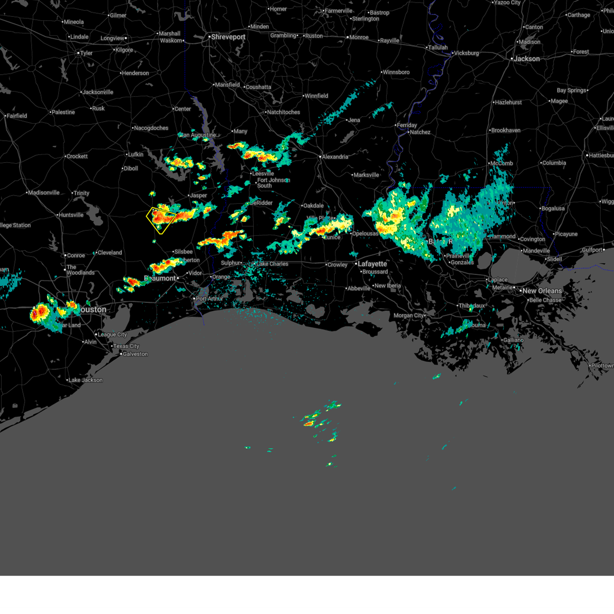 At 642 pm cdt, a severe thunderstorm was located near woodville, moving southeast at 5 mph (radar indicated). Hazards include 60 mph wind gusts and quarter size hail. Hail damage to vehicles is expected. expect wind damage to roofs, siding, and trees. Locations impacted include, woodville, warren, spurger, ivanhoe, and hillister. At 642 pm cdt, a severe thunderstorm was located near woodville, moving southeast at 5 mph (radar indicated). Hazards include 60 mph wind gusts and quarter size hail. Hail damage to vehicles is expected. expect wind damage to roofs, siding, and trees. Locations impacted include, woodville, warren, spurger, ivanhoe, and hillister.
|
| 5/9/2026 6:31 PM CDT |
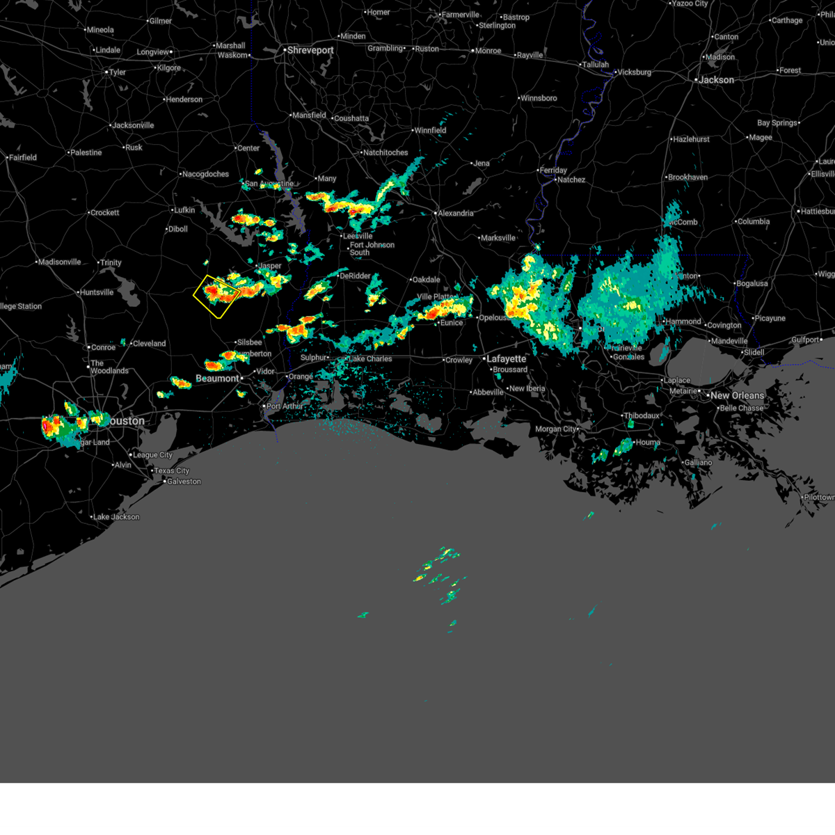 Svrlch the national weather service in lake charles has issued a * severe thunderstorm warning for, southern tyler county in southeastern texas, * until 730 pm cdt. * at 631 pm cdt, a severe thunderstorm was located over woodville, moving southeast at 5 mph (radar indicated). Hazards include 60 mph wind gusts and quarter size hail. Hail damage to vehicles is expected. Expect wind damage to roofs, siding, and trees. Svrlch the national weather service in lake charles has issued a * severe thunderstorm warning for, southern tyler county in southeastern texas, * until 730 pm cdt. * at 631 pm cdt, a severe thunderstorm was located over woodville, moving southeast at 5 mph (radar indicated). Hazards include 60 mph wind gusts and quarter size hail. Hail damage to vehicles is expected. Expect wind damage to roofs, siding, and trees.
|
| 3/15/2026 7:36 PM CDT |
 Svrlch the national weather service in lake charles has issued a * severe thunderstorm warning for, central tyler county in southeastern texas, southeastern jasper county in southeastern texas, * until 830 pm cdt. * at 736 pm cdt, a severe thunderstorm was located near woodville, moving southeast at 30 mph (radar indicated). Hazards include 60 mph wind gusts and half dollar size hail. Hail damage to vehicles is expected. Expect wind damage to roofs, siding, and trees. Svrlch the national weather service in lake charles has issued a * severe thunderstorm warning for, central tyler county in southeastern texas, southeastern jasper county in southeastern texas, * until 830 pm cdt. * at 736 pm cdt, a severe thunderstorm was located near woodville, moving southeast at 30 mph (radar indicated). Hazards include 60 mph wind gusts and half dollar size hail. Hail damage to vehicles is expected. Expect wind damage to roofs, siding, and trees.
|
| 3/11/2026 3:01 PM CDT |
 At 301 pm cdt, severe thunderstorms were located along a line extending from near colmesneil to 6 miles west of town bluff to near village mills, moving northeast at 35 mph (radar indicated). Hazards include 60 mph wind gusts. Expect damage to roofs, siding, and trees. Locations impacted include, woodville, colmesneil, fred, rockland, wildwood, warren, town bluff, caney head, honey island, spurger, village mills, ivanhoe, and hillister. At 301 pm cdt, severe thunderstorms were located along a line extending from near colmesneil to 6 miles west of town bluff to near village mills, moving northeast at 35 mph (radar indicated). Hazards include 60 mph wind gusts. Expect damage to roofs, siding, and trees. Locations impacted include, woodville, colmesneil, fred, rockland, wildwood, warren, town bluff, caney head, honey island, spurger, village mills, ivanhoe, and hillister.
|
| 3/11/2026 2:24 PM CDT |
 At 223 pm cdt, severe thunderstorms were located along a line extending from near alabama-coushatta reservation to 12 miles north of votaw to thicket, moving northeast at 35 mph (radar indicated). Hazards include 60 mph wind gusts. Expect damage to roofs, siding, and trees. Locations impacted include, woodville, colmesneil, chester, fred, rockland, wildwood, warren, town bluff, thicket, caney head, votaw, honey island, spurger, village mills, ivanhoe, and hillister. At 223 pm cdt, severe thunderstorms were located along a line extending from near alabama-coushatta reservation to 12 miles north of votaw to thicket, moving northeast at 35 mph (radar indicated). Hazards include 60 mph wind gusts. Expect damage to roofs, siding, and trees. Locations impacted include, woodville, colmesneil, chester, fred, rockland, wildwood, warren, town bluff, thicket, caney head, votaw, honey island, spurger, village mills, ivanhoe, and hillister.
|
| 3/11/2026 2:12 PM CDT |
 Svrlch the national weather service in lake charles has issued a * severe thunderstorm warning for, tyler county in southeastern texas, northern hardin county in southeastern texas, * until 315 pm cdt. * at 211 pm cdt, severe thunderstorms were located along a line extending from near livingston to 11 miles east of goodrich to 9 miles southwest of votaw, moving northeast at 25 mph (radar indicated). Hazards include 60 mph wind gusts. expect damage to roofs, siding, and trees Svrlch the national weather service in lake charles has issued a * severe thunderstorm warning for, tyler county in southeastern texas, northern hardin county in southeastern texas, * until 315 pm cdt. * at 211 pm cdt, severe thunderstorms were located along a line extending from near livingston to 11 miles east of goodrich to 9 miles southwest of votaw, moving northeast at 25 mph (radar indicated). Hazards include 60 mph wind gusts. expect damage to roofs, siding, and trees
|
| 10/28/2025 4:12 PM CDT | Torlch the national weather service in lake charles has issued a * tornado warning for, southeastern tyler county in southeastern texas, * until 445 pm cdt. * at 412 pm cdt, a severe thunderstorm capable of producing a tornado was located near warren, moving southeast at 25 mph (radar indicated rotation). Hazards include tornado and quarter size hail. Flying debris will be dangerous to those caught without shelter. mobile homes will be damaged or destroyed. damage to roofs, windows, and vehicles will occur. tree damage is likely. this dangerous storm will be near, spurger around 420 pm cdt. fred around 425 pm cdt. Other locations impacted by this tornadic thunderstorm include ivanhoe and hillister. |
| 10/28/2025 3:54 PM CDT | Svrlch the national weather service in lake charles has issued a * severe thunderstorm warning for, central tyler county in southeastern texas, central jasper county in southeastern texas, * until 430 pm cdt. * at 354 pm cdt, a severe thunderstorm was located over woodville, moving east at 25 mph (radar indicated). Hazards include 60 mph wind gusts and half dollar size hail. Hail damage to vehicles is expected. Expect wind damage to roofs, siding, and trees. |
| 10/28/2025 3:43 PM CDT | At 342 pm cdt, a severe thunderstorm was located near chester, moving east at 30 mph (radar indicated). Hazards include 60 mph wind gusts and quarter size hail. Hail damage to vehicles is expected. expect wind damage to roofs, siding, and trees. Locations impacted include, woodville, colmesneil, ivanhoe, and hillister. |
| 10/28/2025 3:30 PM CDT | Svrlch the national weather service in lake charles has issued a * severe thunderstorm warning for, southwestern tyler county in southeastern texas, * until 400 pm cdt. * at 330 pm cdt, a severe thunderstorm was located near chester, moving southeast at 30 mph (radar indicated). Hazards include quarter size hail. damage to vehicles is expected |
| 10/25/2025 5:17 AM CDT | At 517 am cdt, severe thunderstorms were located along a line extending from 6 miles northeast of woodville to near caney head to near bevil oaks, moving east at 35 mph (radar indicated). Hazards include 60 mph wind gusts. Expect damage to roofs, siding, and trees. Locations impacted include, lumberton, jasper, silsbee, woodville, kirbyville, kountze, sour lake, colmesneil, chester, evadale, rockland, warren, town bluff, ebenezer, fred, buna, bevil oaks, weiss bluff, gist, and spurger. |
| 10/25/2025 4:39 AM CDT | Svrlch the national weather service in lake charles has issued a * severe thunderstorm warning for, tyler county in southeastern texas, hardin county in southeastern texas, jasper county in southeastern texas, * until 545 am cdt. * at 439 am cdt, severe thunderstorms were located along a line extending from near alabama-coushatta reservation to near honey island to near anahuac, moving east at 35 mph (radar indicated). Hazards include 60 mph wind gusts. expect damage to roofs, siding, and trees |
| 10/25/2025 4:18 AM CDT | At 417 am cdt, severe thunderstorms were located along a line extending from near livingston to 7 miles southwest of votaw to near dayton, moving east at 40 mph (radar indicated). Hazards include 60 mph wind gusts. Expect damage to roofs, siding, and trees. Locations impacted include, woodville, kountze, sour lake, colmesneil, chester, saratoga, fred, rockland, wildwood, warren, thicket, caney head, votaw, honey island, spurger, batson, village mills, ivanhoe, and hillister. |
| 10/25/2025 3:52 AM CDT | Svrlch the national weather service in lake charles has issued a * severe thunderstorm warning for, tyler county in southeastern texas, hardin county in southeastern texas, * until 445 am cdt. * at 351 am cdt, severe thunderstorms were located along a line extending from near lake livingston state park to near cleveland to atascocita, moving east at 40 mph (radar indicated). Hazards include 60 mph wind gusts. expect damage to roofs, siding, and trees |
| 4/21/2025 2:41 AM CDT |
 the tornado warning has been cancelled and is no longer in effect the tornado warning has been cancelled and is no longer in effect
|
| 4/21/2025 2:23 AM CDT |
 Torlch the national weather service in lake charles has issued a * tornado warning for, southeastern tyler county in southeastern texas, central jasper county in southeastern texas, * until 300 am cdt. * at 223 am cdt, a severe thunderstorm capable of producing a tornado was located near warren, moving northeast at 15 mph (radar indicated rotation). Hazards include tornado. Flying debris will be dangerous to those caught without shelter. mobile homes will be damaged or destroyed. damage to roofs, windows, and vehicles will occur. tree damage is likely. this dangerous storm will be near, spurger around 230 am cdt. Other locations impacted by this tornadic thunderstorm include hillister and ivanhoe. Torlch the national weather service in lake charles has issued a * tornado warning for, southeastern tyler county in southeastern texas, central jasper county in southeastern texas, * until 300 am cdt. * at 223 am cdt, a severe thunderstorm capable of producing a tornado was located near warren, moving northeast at 15 mph (radar indicated rotation). Hazards include tornado. Flying debris will be dangerous to those caught without shelter. mobile homes will be damaged or destroyed. damage to roofs, windows, and vehicles will occur. tree damage is likely. this dangerous storm will be near, spurger around 230 am cdt. Other locations impacted by this tornadic thunderstorm include hillister and ivanhoe.
|
| 3/4/2025 9:59 AM CST |
 Svrlch the national weather service in lake charles has issued a * severe thunderstorm warning for, tyler county in southeastern texas, northwestern newton county in southeastern texas, northern hardin county in southeastern texas, jasper county in southeastern texas, * until 1045 am cst. * at 958 am cst, severe thunderstorms were located along a line extending from near ebenezer to near wildwood, moving northeast at 70 mph (radar indicated). Hazards include 60 mph wind gusts. expect damage to roofs, siding, and trees Svrlch the national weather service in lake charles has issued a * severe thunderstorm warning for, tyler county in southeastern texas, northwestern newton county in southeastern texas, northern hardin county in southeastern texas, jasper county in southeastern texas, * until 1045 am cst. * at 958 am cst, severe thunderstorms were located along a line extending from near ebenezer to near wildwood, moving northeast at 70 mph (radar indicated). Hazards include 60 mph wind gusts. expect damage to roofs, siding, and trees
|
| 3/4/2025 9:22 AM CST |
 Svrlch the national weather service in lake charles has issued a * severe thunderstorm warning for, tyler county in southeastern texas, northern hardin county in southeastern texas, north central jasper county in southeastern texas, * until 1000 am cst. * at 921 am cst, severe thunderstorms were located along a line extending from 7 miles northeast of seven oaks to 11 miles east of cleveland, moving northeast at 45 mph (radar indicated). Hazards include 60 mph wind gusts. expect damage to roofs, siding, and trees Svrlch the national weather service in lake charles has issued a * severe thunderstorm warning for, tyler county in southeastern texas, northern hardin county in southeastern texas, north central jasper county in southeastern texas, * until 1000 am cst. * at 921 am cst, severe thunderstorms were located along a line extending from 7 miles northeast of seven oaks to 11 miles east of cleveland, moving northeast at 45 mph (radar indicated). Hazards include 60 mph wind gusts. expect damage to roofs, siding, and trees
|
| 12/28/2024 3:16 PM CST |
 At 316 pm cst, severe thunderstorms were located along a line extending from 7 miles east of woodville to near honey island, moving east at 20 mph (radar indicated). Hazards include 60 mph wind gusts and nickel size hail. Expect damage to roofs, siding, and trees. locations impacted include, caney head, kountze, honey island, ivanhoe, fred, magnolia springs, mt. Union, wildwood, spurger, warren, hillister, town bluff, village mills, thicket, and silsbee. At 316 pm cst, severe thunderstorms were located along a line extending from 7 miles east of woodville to near honey island, moving east at 20 mph (radar indicated). Hazards include 60 mph wind gusts and nickel size hail. Expect damage to roofs, siding, and trees. locations impacted include, caney head, kountze, honey island, ivanhoe, fred, magnolia springs, mt. Union, wildwood, spurger, warren, hillister, town bluff, village mills, thicket, and silsbee.
|
| 12/28/2024 3:01 PM CST |
 Svrlch the national weather service in lake charles has issued a * severe thunderstorm warning for, southeastern tyler county in southeastern texas, northern hardin county in southeastern texas, southeastern jasper county in southeastern texas, * until 400 pm cst. * at 301 pm cst, severe thunderstorms were located along a line extending from near woodville to thicket, moving northeast at 60 mph (radar indicated). Hazards include 60 mph wind gusts and nickel size hail. expect damage to roofs, siding, and trees Svrlch the national weather service in lake charles has issued a * severe thunderstorm warning for, southeastern tyler county in southeastern texas, northern hardin county in southeastern texas, southeastern jasper county in southeastern texas, * until 400 pm cst. * at 301 pm cst, severe thunderstorms were located along a line extending from near woodville to thicket, moving northeast at 60 mph (radar indicated). Hazards include 60 mph wind gusts and nickel size hail. expect damage to roofs, siding, and trees
|
| 12/28/2024 2:21 PM CST |
 The storm which prompted the warning has weakened below severe limits, and has exited the warned area. therefore, the warning will be allowed to expire. a tornado watch remains in effect until 900 pm cst for southeastern texas. The storm which prompted the warning has weakened below severe limits, and has exited the warned area. therefore, the warning will be allowed to expire. a tornado watch remains in effect until 900 pm cst for southeastern texas.
|
| 12/28/2024 1:55 PM CST |
 At 155 pm cst, a severe thunderstorm was located near wildwood, moving northeast at 30 mph (radar indicated). Hazards include 60 mph wind gusts and penny size hail. Expect damage to roofs, siding, and trees. Locations impacted include, ivanhoe, warren, hillister, village mills, thicket, and wildwood. At 155 pm cst, a severe thunderstorm was located near wildwood, moving northeast at 30 mph (radar indicated). Hazards include 60 mph wind gusts and penny size hail. Expect damage to roofs, siding, and trees. Locations impacted include, ivanhoe, warren, hillister, village mills, thicket, and wildwood.
|
| 12/28/2024 1:53 PM CST |
 At 152 pm cst, a severe thunderstorm capable of producing a tornado was located 7 miles west of spurger, or 7 miles northeast of warren, moving northeast at 35 mph (radar indicated rotation). Hazards include tornado and quarter size hail. Flying debris will be dangerous to those caught without shelter. mobile homes will be damaged or destroyed. damage to roofs, windows, and vehicles will occur. tree damage is likely. this dangerous storm will be near, town bluff around 200 pm cst. Other locations impacted by this tornadic thunderstorm include hillister and ivanhoe. At 152 pm cst, a severe thunderstorm capable of producing a tornado was located 7 miles west of spurger, or 7 miles northeast of warren, moving northeast at 35 mph (radar indicated rotation). Hazards include tornado and quarter size hail. Flying debris will be dangerous to those caught without shelter. mobile homes will be damaged or destroyed. damage to roofs, windows, and vehicles will occur. tree damage is likely. this dangerous storm will be near, town bluff around 200 pm cst. Other locations impacted by this tornadic thunderstorm include hillister and ivanhoe.
|
| 12/28/2024 1:43 PM CST |
 Svrlch the national weather service in lake charles has issued a * severe thunderstorm warning for, southwestern tyler county in southeastern texas, northwestern hardin county in southeastern texas, * until 230 pm cst. * at 143 pm cst, a severe thunderstorm was located over thicket, moving northeast at 30 mph (radar indicated). Hazards include 60 mph wind gusts and penny size hail. expect damage to roofs, siding, and trees Svrlch the national weather service in lake charles has issued a * severe thunderstorm warning for, southwestern tyler county in southeastern texas, northwestern hardin county in southeastern texas, * until 230 pm cst. * at 143 pm cst, a severe thunderstorm was located over thicket, moving northeast at 30 mph (radar indicated). Hazards include 60 mph wind gusts and penny size hail. expect damage to roofs, siding, and trees
|
| 12/28/2024 1:36 PM CST |
 At 136 pm cst, a severe thunderstorm capable of producing a tornado was located over warren, moving northeast at 30 mph (radar indicated rotation). Hazards include tornado and quarter size hail. Flying debris will be dangerous to those caught without shelter. mobile homes will be damaged or destroyed. damage to roofs, windows, and vehicles will occur. tree damage is likely. this dangerous storm will be near, warren around 140 pm cst. woodville around 145 pm cst. spurger around 200 pm cst. Other locations impacted by this tornadic thunderstorm include ivanhoe and hillister. At 136 pm cst, a severe thunderstorm capable of producing a tornado was located over warren, moving northeast at 30 mph (radar indicated rotation). Hazards include tornado and quarter size hail. Flying debris will be dangerous to those caught without shelter. mobile homes will be damaged or destroyed. damage to roofs, windows, and vehicles will occur. tree damage is likely. this dangerous storm will be near, warren around 140 pm cst. woodville around 145 pm cst. spurger around 200 pm cst. Other locations impacted by this tornadic thunderstorm include ivanhoe and hillister.
|
| 12/28/2024 1:28 PM CST |
 Torlch the national weather service in lake charles has issued a * tornado warning for, southeastern tyler county in southeastern texas, central jasper county in southeastern texas, * until 200 pm cst. * at 127 pm cst, a severe thunderstorm capable of producing a tornado was located over wildwood, moving northeast at 30 mph (radar indicated rotation). Hazards include tornado and quarter size hail. Flying debris will be dangerous to those caught without shelter. mobile homes will be damaged or destroyed. damage to roofs, windows, and vehicles will occur. tree damage is likely. this dangerous storm will be near, warren around 135 pm cst. woodville around 145 pm cst. Other locations impacted by this tornadic thunderstorm include ivanhoe and hillister. Torlch the national weather service in lake charles has issued a * tornado warning for, southeastern tyler county in southeastern texas, central jasper county in southeastern texas, * until 200 pm cst. * at 127 pm cst, a severe thunderstorm capable of producing a tornado was located over wildwood, moving northeast at 30 mph (radar indicated rotation). Hazards include tornado and quarter size hail. Flying debris will be dangerous to those caught without shelter. mobile homes will be damaged or destroyed. damage to roofs, windows, and vehicles will occur. tree damage is likely. this dangerous storm will be near, warren around 135 pm cst. woodville around 145 pm cst. Other locations impacted by this tornadic thunderstorm include ivanhoe and hillister.
|
| 12/28/2024 1:16 PM CST |
 At 115 pm cst, a severe thunderstorm capable of producing a tornado was located near wildwood, moving northeast at 45 mph (radar indicated rotation). Hazards include tornado and quarter size hail. Flying debris will be dangerous to those caught without shelter. mobile homes will be damaged or destroyed. damage to roofs, windows, and vehicles will occur. tree damage is likely. this dangerous storm will be near, wildwood and warren around 120 pm cst. woodville around 135 pm cst. Other locations impacted by this tornadic thunderstorm include ivanhoe and hillister. At 115 pm cst, a severe thunderstorm capable of producing a tornado was located near wildwood, moving northeast at 45 mph (radar indicated rotation). Hazards include tornado and quarter size hail. Flying debris will be dangerous to those caught without shelter. mobile homes will be damaged or destroyed. damage to roofs, windows, and vehicles will occur. tree damage is likely. this dangerous storm will be near, wildwood and warren around 120 pm cst. woodville around 135 pm cst. Other locations impacted by this tornadic thunderstorm include ivanhoe and hillister.
|
| 12/28/2024 1:12 PM CST |
 At 112 pm cst, a severe thunderstorm capable of producing a tornado was located near thicket, moving northeast at 45 mph (radar indicated rotation). Hazards include tornado and quarter size hail. Flying debris will be dangerous to those caught without shelter. mobile homes will be damaged or destroyed. damage to roofs, windows, and vehicles will occur. tree damage is likely. this dangerous storm will be near, wildwood around 115 pm cst. village mills around 120 pm cst. Other locations impacted by this tornadic thunderstorm include ivanhoe and hillister. At 112 pm cst, a severe thunderstorm capable of producing a tornado was located near thicket, moving northeast at 45 mph (radar indicated rotation). Hazards include tornado and quarter size hail. Flying debris will be dangerous to those caught without shelter. mobile homes will be damaged or destroyed. damage to roofs, windows, and vehicles will occur. tree damage is likely. this dangerous storm will be near, wildwood around 115 pm cst. village mills around 120 pm cst. Other locations impacted by this tornadic thunderstorm include ivanhoe and hillister.
|
| 12/28/2024 1:05 PM CST |
 Torlch the national weather service in lake charles has issued a * tornado warning for, southwestern tyler county in southeastern texas, northwestern hardin county in southeastern texas, * until 130 pm cst. * at 104 pm cst, a severe thunderstorm capable of producing a tornado was located over thicket, moving northeast at 45 mph (radar indicated rotation). Hazards include tornado and quarter size hail. Flying debris will be dangerous to those caught without shelter. mobile homes will be damaged or destroyed. damage to roofs, windows, and vehicles will occur. tree damage is likely. this dangerous storm will be near, wildwood around 115 pm cst. village mills around 120 pm cst. Other locations impacted by this tornadic thunderstorm include ivanhoe and hillister. Torlch the national weather service in lake charles has issued a * tornado warning for, southwestern tyler county in southeastern texas, northwestern hardin county in southeastern texas, * until 130 pm cst. * at 104 pm cst, a severe thunderstorm capable of producing a tornado was located over thicket, moving northeast at 45 mph (radar indicated rotation). Hazards include tornado and quarter size hail. Flying debris will be dangerous to those caught without shelter. mobile homes will be damaged or destroyed. damage to roofs, windows, and vehicles will occur. tree damage is likely. this dangerous storm will be near, wildwood around 115 pm cst. village mills around 120 pm cst. Other locations impacted by this tornadic thunderstorm include ivanhoe and hillister.
|
| 12/28/2024 12:59 PM CST |
 Svrlch the national weather service in lake charles has issued a * severe thunderstorm warning for, southwestern tyler county in southeastern texas, northwestern hardin county in southeastern texas, * until 145 pm cst. * at 1259 pm cst, a severe thunderstorm was located over votaw, or over thicket, moving northeast at 35 mph (radar indicated). Hazards include 60 mph wind gusts and quarter size hail. Hail damage to vehicles is expected. Expect wind damage to roofs, siding, and trees. Svrlch the national weather service in lake charles has issued a * severe thunderstorm warning for, southwestern tyler county in southeastern texas, northwestern hardin county in southeastern texas, * until 145 pm cst. * at 1259 pm cst, a severe thunderstorm was located over votaw, or over thicket, moving northeast at 35 mph (radar indicated). Hazards include 60 mph wind gusts and quarter size hail. Hail damage to vehicles is expected. Expect wind damage to roofs, siding, and trees.
|
| 11/18/2024 4:00 PM CST |
 the severe thunderstorm warning has been cancelled and is no longer in effect the severe thunderstorm warning has been cancelled and is no longer in effect
|
| 11/18/2024 4:00 PM CST |
 At 359 pm cst, a severe thunderstorm was located near warren, moving northeast at 35 mph (radar indicated). Hazards include 60 mph wind gusts. Expect damage to roofs, siding, and trees. Locations impacted include, woodville, ivanhoe, and hillister. At 359 pm cst, a severe thunderstorm was located near warren, moving northeast at 35 mph (radar indicated). Hazards include 60 mph wind gusts. Expect damage to roofs, siding, and trees. Locations impacted include, woodville, ivanhoe, and hillister.
|
| 11/18/2024 3:44 PM CST |
 Svrlch the national weather service in lake charles has issued a * severe thunderstorm warning for, southwestern tyler county in southeastern texas, north central hardin county in southeastern texas, * until 415 pm cst. * at 343 pm cst, a severe thunderstorm was located near wildwood, moving northeast at 35 mph (radar indicated). Hazards include 60 mph wind gusts. expect damage to roofs, siding, and trees Svrlch the national weather service in lake charles has issued a * severe thunderstorm warning for, southwestern tyler county in southeastern texas, north central hardin county in southeastern texas, * until 415 pm cst. * at 343 pm cst, a severe thunderstorm was located near wildwood, moving northeast at 35 mph (radar indicated). Hazards include 60 mph wind gusts. expect damage to roofs, siding, and trees
|
| 11/5/2024 8:07 AM CST |
 Svrlch the national weather service in lake charles has issued a * severe thunderstorm warning for, central tyler county in southeastern texas, northeastern jasper county in southeastern texas, * until 900 am cst. * at 807 am cst, severe thunderstorms were located along a line extending from woodville to near warren, moving northeast at 35 mph (radar indicated). Hazards include 60 mph wind gusts. expect damage to roofs, siding, and trees Svrlch the national weather service in lake charles has issued a * severe thunderstorm warning for, central tyler county in southeastern texas, northeastern jasper county in southeastern texas, * until 900 am cst. * at 807 am cst, severe thunderstorms were located along a line extending from woodville to near warren, moving northeast at 35 mph (radar indicated). Hazards include 60 mph wind gusts. expect damage to roofs, siding, and trees
|
| 7/17/2024 7:05 PM CDT |
 The storm which prompted the warning has weakened below severe limits, and no longer poses an immediate threat to life or property. therefore, the warning has been allowed to expire. however heavy rain is still possible with this thunderstorm. The storm which prompted the warning has weakened below severe limits, and no longer poses an immediate threat to life or property. therefore, the warning has been allowed to expire. however heavy rain is still possible with this thunderstorm.
|
| 7/17/2024 6:45 PM CDT | Severe thunderstorm wind gusts downed a power line east of ivanho in tyler county TX, 6 miles W of Ivanhoe, TX |
| 7/17/2024 6:10 PM CDT |
 Svrlch the national weather service in lake charles has issued a * severe thunderstorm warning for, southeastern tyler county in southeastern texas, * until 700 pm cdt. * at 610 pm cdt, a severe thunderstorm was located near warren, moving north at 5 mph (radar indicated). Hazards include 60 mph wind gusts and nickel size hail. expect damage to roofs, siding, and trees Svrlch the national weather service in lake charles has issued a * severe thunderstorm warning for, southeastern tyler county in southeastern texas, * until 700 pm cdt. * at 610 pm cdt, a severe thunderstorm was located near warren, moving north at 5 mph (radar indicated). Hazards include 60 mph wind gusts and nickel size hail. expect damage to roofs, siding, and trees
|
| 7/7/2024 1:36 PM CDT |
 At 136 pm cdt, severe thunderstorms were located along a line extending from 6 miles west of jasper to woodville to 10 miles north of votaw, moving northwest at 30 mph (radar indicated). Hazards include 60 mph wind gusts. Expect damage to roofs, siding, and trees. Locations impacted include, jasper, woodville, colmesneil, chester, ebenezer, rockland, ivanhoe, and sam rayburn dam. At 136 pm cdt, severe thunderstorms were located along a line extending from 6 miles west of jasper to woodville to 10 miles north of votaw, moving northwest at 30 mph (radar indicated). Hazards include 60 mph wind gusts. Expect damage to roofs, siding, and trees. Locations impacted include, jasper, woodville, colmesneil, chester, ebenezer, rockland, ivanhoe, and sam rayburn dam.
|
| 7/7/2024 1:18 PM CDT |
 Svrlch the national weather service in lake charles has issued a * severe thunderstorm warning for, tyler county in southeastern texas, northern jasper county in southeastern texas, * until 215 pm cdt. * at 118 pm cdt, severe thunderstorms were located along a line extending from near jasper to 6 miles northeast of warren to near wildwood, moving northwest at 30 mph (radar indicated). Hazards include 60 mph wind gusts. expect damage to roofs, siding, and trees Svrlch the national weather service in lake charles has issued a * severe thunderstorm warning for, tyler county in southeastern texas, northern jasper county in southeastern texas, * until 215 pm cdt. * at 118 pm cdt, severe thunderstorms were located along a line extending from near jasper to 6 miles northeast of warren to near wildwood, moving northwest at 30 mph (radar indicated). Hazards include 60 mph wind gusts. expect damage to roofs, siding, and trees
|
| 5/30/2024 8:40 PM CDT |
 The storms which prompted the warning have weakened below severe limits, and no longer pose an immediate threat to life or property. therefore, the warning will be allowed to expire. a severe thunderstorm watch remains in effect until 1100 pm cdt for southwestern and west central louisiana, and southeastern texas. The storms which prompted the warning have weakened below severe limits, and no longer pose an immediate threat to life or property. therefore, the warning will be allowed to expire. a severe thunderstorm watch remains in effect until 1100 pm cdt for southwestern and west central louisiana, and southeastern texas.
|
| 5/30/2024 8:13 PM CDT |
 The storms which prompted the warning have moved out of the area. therefore, the warning will be allowed to expire. however gusty winds and heavy rain are still possible with these thunderstorms. a severe thunderstorm watch remains in effect until 1100 pm cdt for southeastern texas. The storms which prompted the warning have moved out of the area. therefore, the warning will be allowed to expire. however gusty winds and heavy rain are still possible with these thunderstorms. a severe thunderstorm watch remains in effect until 1100 pm cdt for southeastern texas.
|
| 5/30/2024 8:11 PM CDT |
 Svrlch the national weather service in lake charles has issued a * severe thunderstorm warning for, western beauregard parish in southwestern louisiana, southwestern vernon parish in west central louisiana, northwestern jefferson county in southeastern texas, southern tyler county in southeastern texas, newton county in southeastern texas, hardin county in southeastern texas, northwestern orange county in southeastern texas, jasper county in southeastern texas, * until 845 pm cdt. * at 811 pm cdt, severe thunderstorms were located along a line extending from near newton to near fred to near honey island, moving south at 45 mph (radar indicated). Hazards include 60 mph wind gusts and nickel size hail. expect damage to roofs, siding, and trees Svrlch the national weather service in lake charles has issued a * severe thunderstorm warning for, western beauregard parish in southwestern louisiana, southwestern vernon parish in west central louisiana, northwestern jefferson county in southeastern texas, southern tyler county in southeastern texas, newton county in southeastern texas, hardin county in southeastern texas, northwestern orange county in southeastern texas, jasper county in southeastern texas, * until 845 pm cdt. * at 811 pm cdt, severe thunderstorms were located along a line extending from near newton to near fred to near honey island, moving south at 45 mph (radar indicated). Hazards include 60 mph wind gusts and nickel size hail. expect damage to roofs, siding, and trees
|
| 5/30/2024 8:02 PM CDT | Tyler county sheriff office reports trees and power lines down in the spurger and hillister are in tyler county TX, 7.2 miles W of Ivanhoe, TX |
| 5/30/2024 7:51 PM CDT |
 At 751 pm cdt, severe thunderstorms were located along a line extending from near browndell to 6 miles northeast of town bluff to 6 miles east of alabama-coushatta reservation, moving southeast at 30 mph (radar indicated). Hazards include 60 mph wind gusts and penny size hail. Expect damage to roofs, siding, and trees. locations impacted include, jasper, woodville, colmesneil, ebenezer, warren, town bluff, browndell, magnolia springs, mt. Union, spurger, ivanhoe, sam rayburn dam, and hillister. At 751 pm cdt, severe thunderstorms were located along a line extending from near browndell to 6 miles northeast of town bluff to 6 miles east of alabama-coushatta reservation, moving southeast at 30 mph (radar indicated). Hazards include 60 mph wind gusts and penny size hail. Expect damage to roofs, siding, and trees. locations impacted include, jasper, woodville, colmesneil, ebenezer, warren, town bluff, browndell, magnolia springs, mt. Union, spurger, ivanhoe, sam rayburn dam, and hillister.
|
| 5/30/2024 7:18 PM CDT |
 Svrlch the national weather service in lake charles has issued a * severe thunderstorm warning for, tyler county in southeastern texas, northern jasper county in southeastern texas, * until 815 pm cdt. * at 718 pm cdt, severe thunderstorms were located along a line extending from 12 miles southeast of etoile to 7 miles northeast of chester to 7 miles north of livingston, moving southeast at 25 mph (radar indicated). Hazards include 60 mph wind gusts and penny size hail. expect damage to roofs, siding, and trees Svrlch the national weather service in lake charles has issued a * severe thunderstorm warning for, tyler county in southeastern texas, northern jasper county in southeastern texas, * until 815 pm cdt. * at 718 pm cdt, severe thunderstorms were located along a line extending from 12 miles southeast of etoile to 7 miles northeast of chester to 7 miles north of livingston, moving southeast at 25 mph (radar indicated). Hazards include 60 mph wind gusts and penny size hail. expect damage to roofs, siding, and trees
|
| 5/28/2024 1:28 PM CDT |
 At 128 pm cdt, severe thunderstorms were located along a line extending from near colmesneil to near votaw, moving southeast at 30 mph (radar indicated). Hazards include 60 mph wind gusts and quarter size hail. Hail damage to vehicles is expected. expect wind damage to roofs, siding, and trees. Locations impacted include, woodville, kountze, saratoga, fred, wildwood, warren, town bluff, thicket, votaw, honey island, spurger, village mills, ivanhoe, and hillister. At 128 pm cdt, severe thunderstorms were located along a line extending from near colmesneil to near votaw, moving southeast at 30 mph (radar indicated). Hazards include 60 mph wind gusts and quarter size hail. Hail damage to vehicles is expected. expect wind damage to roofs, siding, and trees. Locations impacted include, woodville, kountze, saratoga, fred, wildwood, warren, town bluff, thicket, votaw, honey island, spurger, village mills, ivanhoe, and hillister.
|
| 5/28/2024 12:46 PM CDT |
 Svrlch the national weather service in lake charles has issued a * severe thunderstorm warning for, tyler county in southeastern texas, western hardin county in southeastern texas, northwestern jasper county in southeastern texas, * until 145 pm cdt. * at 1245 pm cdt, severe thunderstorms were located along a line extending from 6 miles northeast of corrigan to near goodrich, moving southeast at 30 mph (radar indicated). Hazards include 60 mph wind gusts and quarter size hail. Hail damage to vehicles is expected. Expect wind damage to roofs, siding, and trees. Svrlch the national weather service in lake charles has issued a * severe thunderstorm warning for, tyler county in southeastern texas, western hardin county in southeastern texas, northwestern jasper county in southeastern texas, * until 145 pm cdt. * at 1245 pm cdt, severe thunderstorms were located along a line extending from 6 miles northeast of corrigan to near goodrich, moving southeast at 30 mph (radar indicated). Hazards include 60 mph wind gusts and quarter size hail. Hail damage to vehicles is expected. Expect wind damage to roofs, siding, and trees.
|
| 5/16/2024 6:08 PM CDT |
 The storm which prompted the warning has weakened below severe limits, and has exited the warned area. therefore, the warning will be allowed to expire. however gusty winds and heavy rain are still possible with this thunderstorm. a tornado watch remains in effect until 1000 pm cdt for southeastern texas. to report severe weather, contact your nearest law enforcement agency. they will relay your report to the national weather service lake charles. The storm which prompted the warning has weakened below severe limits, and has exited the warned area. therefore, the warning will be allowed to expire. however gusty winds and heavy rain are still possible with this thunderstorm. a tornado watch remains in effect until 1000 pm cdt for southeastern texas. to report severe weather, contact your nearest law enforcement agency. they will relay your report to the national weather service lake charles.
|
| 5/16/2024 5:51 PM CDT |
 At 551 pm cdt, a severe thunderstorm was located 8 miles northwest of wildwood, moving northeast at 50 mph (radar indicated). Hazards include 60 mph wind gusts and quarter size hail. Hail damage to vehicles is expected. expect wind damage to roofs, siding, and trees. Locations impacted include, woodville, warren, thicket, wildwood, votaw, village mills, ivanhoe, and hillister. At 551 pm cdt, a severe thunderstorm was located 8 miles northwest of wildwood, moving northeast at 50 mph (radar indicated). Hazards include 60 mph wind gusts and quarter size hail. Hail damage to vehicles is expected. expect wind damage to roofs, siding, and trees. Locations impacted include, woodville, warren, thicket, wildwood, votaw, village mills, ivanhoe, and hillister.
|
| 5/16/2024 5:48 PM CDT |
 Svrlch the national weather service in lake charles has issued a * severe thunderstorm warning for, southern tyler county in southeastern texas, northwestern hardin county in southeastern texas, * until 615 pm cdt. * at 548 pm cdt, a severe thunderstorm was located 8 miles northeast of votaw, or 10 miles west of wildwood, moving northeast at 50 mph (radar indicated). Hazards include 60 mph wind gusts and quarter size hail. Hail damage to vehicles is expected. Expect wind damage to roofs, siding, and trees. Svrlch the national weather service in lake charles has issued a * severe thunderstorm warning for, southern tyler county in southeastern texas, northwestern hardin county in southeastern texas, * until 615 pm cdt. * at 548 pm cdt, a severe thunderstorm was located 8 miles northeast of votaw, or 10 miles west of wildwood, moving northeast at 50 mph (radar indicated). Hazards include 60 mph wind gusts and quarter size hail. Hail damage to vehicles is expected. Expect wind damage to roofs, siding, and trees.
|
| 5/16/2024 3:52 PM CDT |
 Svrlch the national weather service in lake charles has issued a * severe thunderstorm warning for, tyler county in southeastern texas, northwestern newton county in southeastern texas, northern jasper county in southeastern texas, * until 445 pm cdt. * at 352 pm cdt, a severe thunderstorm was located near woodville, moving northeast at 40 mph (radar indicated). Hazards include 60 mph wind gusts and quarter size hail. Hail damage to vehicles is expected. Expect wind damage to roofs, siding, and trees. Svrlch the national weather service in lake charles has issued a * severe thunderstorm warning for, tyler county in southeastern texas, northwestern newton county in southeastern texas, northern jasper county in southeastern texas, * until 445 pm cdt. * at 352 pm cdt, a severe thunderstorm was located near woodville, moving northeast at 40 mph (radar indicated). Hazards include 60 mph wind gusts and quarter size hail. Hail damage to vehicles is expected. Expect wind damage to roofs, siding, and trees.
|
| 5/5/2024 2:19 AM CDT |
 At 219 am cdt, a severe thunderstorm was located 7 miles northwest of wildwood, moving east at 30 mph (radar indicated). Hazards include quarter size hail. Damage to vehicles is expected. Locations impacted include, warren, wildwood, village mills, ivanhoe, and hillister. At 219 am cdt, a severe thunderstorm was located 7 miles northwest of wildwood, moving east at 30 mph (radar indicated). Hazards include quarter size hail. Damage to vehicles is expected. Locations impacted include, warren, wildwood, village mills, ivanhoe, and hillister.
|
| 5/5/2024 2:01 AM CDT |
 Svrlch the national weather service in lake charles has issued a * severe thunderstorm warning for, southwestern tyler county in southeastern texas, north central hardin county in southeastern texas, * until 230 am cdt. * at 201 am cdt, a severe thunderstorm was located 7 miles north of votaw, or 10 miles northwest of thicket, moving east at 30 mph (radar indicated). Hazards include half dollar size hail. damage to vehicles is expected Svrlch the national weather service in lake charles has issued a * severe thunderstorm warning for, southwestern tyler county in southeastern texas, north central hardin county in southeastern texas, * until 230 am cdt. * at 201 am cdt, a severe thunderstorm was located 7 miles north of votaw, or 10 miles northwest of thicket, moving east at 30 mph (radar indicated). Hazards include half dollar size hail. damage to vehicles is expected
|
| 5/2/2024 4:17 AM CDT |
 At 417 am cdt, severe thunderstorms were located along a line extending from 12 miles southeast of huntington to near rockland to near wildwood, moving northeast at 30 mph (radar indicated). Hazards include 60 mph wind gusts and quarter size hail. Hail damage to vehicles is expected. expect wind damage to roofs, siding, and trees. Locations impacted include, woodville, colmesneil, rockland, ebenezer, town bluff, and ivanhoe. At 417 am cdt, severe thunderstorms were located along a line extending from 12 miles southeast of huntington to near rockland to near wildwood, moving northeast at 30 mph (radar indicated). Hazards include 60 mph wind gusts and quarter size hail. Hail damage to vehicles is expected. expect wind damage to roofs, siding, and trees. Locations impacted include, woodville, colmesneil, rockland, ebenezer, town bluff, and ivanhoe.
|
| 5/2/2024 3:49 AM CDT |
 Svrlch the national weather service in lake charles has issued a * severe thunderstorm warning for, tyler county in southeastern texas, northwestern jasper county in southeastern texas, * until 445 am cdt. * at 348 am cdt, severe thunderstorms were located along a line extending from 10 miles east of corrigan to 6 miles southeast of chester to 10 miles west of warren, moving northeast at 25 mph (radar indicated). Hazards include 60 mph wind gusts and quarter size hail. Hail damage to vehicles is expected. Expect wind damage to roofs, siding, and trees. Svrlch the national weather service in lake charles has issued a * severe thunderstorm warning for, tyler county in southeastern texas, northwestern jasper county in southeastern texas, * until 445 am cdt. * at 348 am cdt, severe thunderstorms were located along a line extending from 10 miles east of corrigan to 6 miles southeast of chester to 10 miles west of warren, moving northeast at 25 mph (radar indicated). Hazards include 60 mph wind gusts and quarter size hail. Hail damage to vehicles is expected. Expect wind damage to roofs, siding, and trees.
|
| 4/9/2024 7:37 PM CDT |
 Svrlch the national weather service in lake charles has issued a * severe thunderstorm warning for, central tyler county in southeastern texas, * until 830 pm cdt. * at 737 pm cdt, a severe thunderstorm was located near woodville, moving northeast at 30 mph (radar indicated). Hazards include 60 mph wind gusts and half dollar size hail. Hail damage to vehicles is expected. Expect wind damage to roofs, siding, and trees. Svrlch the national weather service in lake charles has issued a * severe thunderstorm warning for, central tyler county in southeastern texas, * until 830 pm cdt. * at 737 pm cdt, a severe thunderstorm was located near woodville, moving northeast at 30 mph (radar indicated). Hazards include 60 mph wind gusts and half dollar size hail. Hail damage to vehicles is expected. Expect wind damage to roofs, siding, and trees.
|
| 2/11/2024 2:15 PM CST | Golf Ball sized hail reported 13.7 miles W of Ivanhoe, TX, multiple photos received of hail up to golf ball size in the city of spurger. |
| 2/11/2024 2:05 PM CST | Quarter sized hail reported 13.7 miles W of Ivanhoe, TX, video on twitter. |
| 2/11/2024 1:52 PM CST |
 At 152 pm cst, a severe thunderstorm capable of producing a tornado was located near spurger, or 8 miles southwest of town bluff, moving northeast at 45 mph (radar indicated rotation). Hazards include tornado and quarter size hail. Flying debris will be dangerous to those caught without shelter. mobile homes will be damaged or destroyed. damage to roofs, windows, and vehicles will occur. tree damage is likely. this dangerous storm will be near, town bluff and spurger around 200 pm cst. magnolia springs around 205 pm cst. Other locations impacted by this tornadic thunderstorm include hillister and ivanhoe. At 152 pm cst, a severe thunderstorm capable of producing a tornado was located near spurger, or 8 miles southwest of town bluff, moving northeast at 45 mph (radar indicated rotation). Hazards include tornado and quarter size hail. Flying debris will be dangerous to those caught without shelter. mobile homes will be damaged or destroyed. damage to roofs, windows, and vehicles will occur. tree damage is likely. this dangerous storm will be near, town bluff and spurger around 200 pm cst. magnolia springs around 205 pm cst. Other locations impacted by this tornadic thunderstorm include hillister and ivanhoe.
|
| 2/11/2024 1:50 PM CST |
 At 149 pm cst, a severe thunderstorm was located near woodville, moving northeast at 45 mph (radar indicated). Hazards include 60 mph wind gusts and quarter size hail. Hail damage to vehicles is expected. expect wind damage to roofs, siding, and trees. locations impacted include, woodville, spurger, ivanhoe, and hillister. hail threat, observed max hail size, 1. 00 in wind threat, radar indicated max wind gust, 60 mph. At 149 pm cst, a severe thunderstorm was located near woodville, moving northeast at 45 mph (radar indicated). Hazards include 60 mph wind gusts and quarter size hail. Hail damage to vehicles is expected. expect wind damage to roofs, siding, and trees. locations impacted include, woodville, spurger, ivanhoe, and hillister. hail threat, observed max hail size, 1. 00 in wind threat, radar indicated max wind gust, 60 mph.
|
| 2/11/2024 1:44 PM CST |
 At 143 pm cst, a severe thunderstorm was located near warren, moving northeast at 45 mph (radar indicated). Hazards include 60 mph wind gusts and quarter size hail. Hail damage to vehicles is expected. expect wind damage to roofs, siding, and trees. locations impacted include, woodville, warren, spurger, ivanhoe, and hillister. hail threat, radar indicated max hail size, 1. 00 in wind threat, radar indicated max wind gust, 60 mph. At 143 pm cst, a severe thunderstorm was located near warren, moving northeast at 45 mph (radar indicated). Hazards include 60 mph wind gusts and quarter size hail. Hail damage to vehicles is expected. expect wind damage to roofs, siding, and trees. locations impacted include, woodville, warren, spurger, ivanhoe, and hillister. hail threat, radar indicated max hail size, 1. 00 in wind threat, radar indicated max wind gust, 60 mph.
|
| 2/11/2024 1:28 PM CST |
 At 128 pm cst, a severe thunderstorm was located 8 miles northwest of wildwood, moving northeast at 45 mph (radar indicated). Hazards include 60 mph wind gusts and quarter size hail. Hail damage to vehicles is expected. Expect wind damage to roofs, siding, and trees. At 128 pm cst, a severe thunderstorm was located 8 miles northwest of wildwood, moving northeast at 45 mph (radar indicated). Hazards include 60 mph wind gusts and quarter size hail. Hail damage to vehicles is expected. Expect wind damage to roofs, siding, and trees.
|
| 2/11/2024 12:41 PM CST |
 At 1241 pm cst, a severe thunderstorm was located near alabama-coushatta reservation, or 14 miles west of warren, moving northeast at 45 mph (radar indicated). Hazards include 60 mph wind gusts and half dollar size hail. Hail damage to vehicles is expected. Expect wind damage to roofs, siding, and trees. At 1241 pm cst, a severe thunderstorm was located near alabama-coushatta reservation, or 14 miles west of warren, moving northeast at 45 mph (radar indicated). Hazards include 60 mph wind gusts and half dollar size hail. Hail damage to vehicles is expected. Expect wind damage to roofs, siding, and trees.
|
| 1/25/2024 1:15 AM CST |
 At 114 am cst, a severe thunderstorm was located near kountze, moving north at 50 mph (radar indicated). Hazards include 60 mph wind gusts and quarter size hail. Hail damage to vehicles is expected. Expect wind damage to roofs, siding, and trees. At 114 am cst, a severe thunderstorm was located near kountze, moving north at 50 mph (radar indicated). Hazards include 60 mph wind gusts and quarter size hail. Hail damage to vehicles is expected. Expect wind damage to roofs, siding, and trees.
|
| 12/9/2023 5:56 PM CST |
 At 556 pm cst, a severe thunderstorm was located over warren, moving east at 35 mph (radar indicated). Hazards include 60 mph wind gusts and quarter size hail. Hail damage to vehicles is expected. Expect wind damage to roofs, siding, and trees. At 556 pm cst, a severe thunderstorm was located over warren, moving east at 35 mph (radar indicated). Hazards include 60 mph wind gusts and quarter size hail. Hail damage to vehicles is expected. Expect wind damage to roofs, siding, and trees.
|
| 9/8/2023 1:20 PM CDT |
 At 119 pm cdt, severe thunderstorms were located along a line extending from 7 miles north of chester to roganville, moving south at 35 mph (radar indicated). Hazards include 60 mph wind gusts and penny size hail. expect damage to roofs, siding, and trees At 119 pm cdt, severe thunderstorms were located along a line extending from 7 miles north of chester to roganville, moving south at 35 mph (radar indicated). Hazards include 60 mph wind gusts and penny size hail. expect damage to roofs, siding, and trees
|
| 6/10/2023 8:01 PM CDT |
 At 800 pm cdt, severe thunderstorms were located along a line extending from near magnolia springs to near wildwood, moving southeast at 15 mph (radar indicated). Hazards include ping pong ball size hail and 60 mph wind gusts. People and animals outdoors will be injured. expect hail damage to roofs, siding, windows, and vehicles. expect wind damage to roofs, siding, and trees. locations impacted include, kirbyville, warren, fred, wildwood, spurger, caney head, honey island, magnolia springs, village mills, mt. union, ivanhoe and hillister. hail threat, radar indicated max hail size, 1. 50 in wind threat, radar indicated max wind gust, 60 mph. At 800 pm cdt, severe thunderstorms were located along a line extending from near magnolia springs to near wildwood, moving southeast at 15 mph (radar indicated). Hazards include ping pong ball size hail and 60 mph wind gusts. People and animals outdoors will be injured. expect hail damage to roofs, siding, windows, and vehicles. expect wind damage to roofs, siding, and trees. locations impacted include, kirbyville, warren, fred, wildwood, spurger, caney head, honey island, magnolia springs, village mills, mt. union, ivanhoe and hillister. hail threat, radar indicated max hail size, 1. 50 in wind threat, radar indicated max wind gust, 60 mph.
|
| 6/10/2023 7:53 PM CDT |
 At 753 pm cdt, severe thunderstorms were located along a line extending from near magnolia springs to near wildwood, moving southeast at 15 mph (radar indicated). Hazards include ping pong ball size hail and 60 mph wind gusts. People and animals outdoors will be injured. expect hail damage to roofs, siding, windows, and vehicles. Expect wind damage to roofs, siding, and trees. At 753 pm cdt, severe thunderstorms were located along a line extending from near magnolia springs to near wildwood, moving southeast at 15 mph (radar indicated). Hazards include ping pong ball size hail and 60 mph wind gusts. People and animals outdoors will be injured. expect hail damage to roofs, siding, windows, and vehicles. Expect wind damage to roofs, siding, and trees.
|
| 4/27/2023 12:09 AM CDT |
 At 1208 am cdt, a severe thunderstorm was located near village mills, or near wildwood, moving southeast at 40 mph (radar indicated). Hazards include 70 mph wind gusts and half dollar size hail. Hail damage to vehicles is expected. expect considerable tree damage. wind damage is also likely to mobile homes, roofs, and outbuildings. locations impacted include, lumberton, silsbee, woodville, kountze, fred, wildwood, warren, caney head, mt. union, spurger, village mills, ivanhoe and hillister. thunderstorm damage threat, considerable hail threat, radar indicated max hail size, 1. 25 in wind threat, radar indicated max wind gust, 70 mph. At 1208 am cdt, a severe thunderstorm was located near village mills, or near wildwood, moving southeast at 40 mph (radar indicated). Hazards include 70 mph wind gusts and half dollar size hail. Hail damage to vehicles is expected. expect considerable tree damage. wind damage is also likely to mobile homes, roofs, and outbuildings. locations impacted include, lumberton, silsbee, woodville, kountze, fred, wildwood, warren, caney head, mt. union, spurger, village mills, ivanhoe and hillister. thunderstorm damage threat, considerable hail threat, radar indicated max hail size, 1. 25 in wind threat, radar indicated max wind gust, 70 mph.
|
| 4/26/2023 11:53 PM CDT |
 The severe thunderstorm warning for tyler, north central hardin and northwestern jasper counties will expire at midnight cdt, the storms which prompted the warning continue and are covered by severe thunderstorm warnings 76 and 77. therefore, the warning will be allowed to expire. large hail and gusty winds are still likely with these thunderstorms. a severe thunderstorm watch remains in effect until 500 am cdt for southeastern texas. The severe thunderstorm warning for tyler, north central hardin and northwestern jasper counties will expire at midnight cdt, the storms which prompted the warning continue and are covered by severe thunderstorm warnings 76 and 77. therefore, the warning will be allowed to expire. large hail and gusty winds are still likely with these thunderstorms. a severe thunderstorm watch remains in effect until 500 am cdt for southeastern texas.
|
| 4/26/2023 11:52 PM CDT |
 At 1151 pm cdt, a severe thunderstorm was located near warren, moving southeast at 40 mph (radar indicated). Hazards include 60 mph wind gusts and half dollar size hail. Hail damage to vehicles is expected. Expect wind damage to roofs, siding, and trees. At 1151 pm cdt, a severe thunderstorm was located near warren, moving southeast at 40 mph (radar indicated). Hazards include 60 mph wind gusts and half dollar size hail. Hail damage to vehicles is expected. Expect wind damage to roofs, siding, and trees.
|
| 4/26/2023 11:45 PM CDT |
 At 1144 pm cdt, severe thunderstorms were located along a line extending from 7 miles northeast of rockland to near woodville to 10 miles northwest of wildwood, moving east at 50 mph (trained weather spotters). Hazards include golf ball size hail and 70 mph wind gusts. People and animals outdoors will be injured. expect hail damage to roofs, siding, windows, and vehicles. expect considerable tree damage. wind damage is also likely to mobile homes, roofs, and outbuildings. locations impacted include, woodville, colmesneil, chester, warren, ebenezer, rockland, wildwood, ivanhoe and hillister. thunderstorm damage threat, considerable hail threat, observed max hail size, 1. 75 in wind threat, observed max wind gust, 70 mph. At 1144 pm cdt, severe thunderstorms were located along a line extending from 7 miles northeast of rockland to near woodville to 10 miles northwest of wildwood, moving east at 50 mph (trained weather spotters). Hazards include golf ball size hail and 70 mph wind gusts. People and animals outdoors will be injured. expect hail damage to roofs, siding, windows, and vehicles. expect considerable tree damage. wind damage is also likely to mobile homes, roofs, and outbuildings. locations impacted include, woodville, colmesneil, chester, warren, ebenezer, rockland, wildwood, ivanhoe and hillister. thunderstorm damage threat, considerable hail threat, observed max hail size, 1. 75 in wind threat, observed max wind gust, 70 mph.
|
| 4/26/2023 11:18 PM CDT |
 At 1117 pm cdt, severe thunderstorms were located along a line extending from near huntington to near chester to near livingston, moving southeast at 40 mph (radar indicated). Hazards include ping pong ball size hail and 60 mph wind gusts. People and animals outdoors will be injured. expect hail damage to roofs, siding, windows, and vehicles. Expect wind damage to roofs, siding, and trees. At 1117 pm cdt, severe thunderstorms were located along a line extending from near huntington to near chester to near livingston, moving southeast at 40 mph (radar indicated). Hazards include ping pong ball size hail and 60 mph wind gusts. People and animals outdoors will be injured. expect hail damage to roofs, siding, windows, and vehicles. Expect wind damage to roofs, siding, and trees.
|
| 4/15/2023 6:14 PM CDT |
 At 614 pm cdt, a severe thunderstorm was located near warren, moving east at 10 mph (radar indicated). Hazards include 60 mph wind gusts and half dollar size hail. Hail damage to vehicles is expected. Expect wind damage to roofs, siding, and trees. At 614 pm cdt, a severe thunderstorm was located near warren, moving east at 10 mph (radar indicated). Hazards include 60 mph wind gusts and half dollar size hail. Hail damage to vehicles is expected. Expect wind damage to roofs, siding, and trees.
|
| 4/15/2023 5:50 PM CDT |
 At 549 pm cdt, multiple severe thunderstorms were located over warren, moving east at 15 mph (radar indicated). Hazards include ping pong ball size hail and 60 mph wind gusts. People and animals outdoors will be injured. expect hail damage to roofs, siding, windows, and vehicles. expect wind damage to roofs, siding, and trees. locations impacted include, warren, fred, wildwood, spurger, ivanhoe and hillister. hail threat, radar indicated max hail size, 1. 50 in wind threat, radar indicated max wind gust, 60 mph. At 549 pm cdt, multiple severe thunderstorms were located over warren, moving east at 15 mph (radar indicated). Hazards include ping pong ball size hail and 60 mph wind gusts. People and animals outdoors will be injured. expect hail damage to roofs, siding, windows, and vehicles. expect wind damage to roofs, siding, and trees. locations impacted include, warren, fred, wildwood, spurger, ivanhoe and hillister. hail threat, radar indicated max hail size, 1. 50 in wind threat, radar indicated max wind gust, 60 mph.
|
| 4/15/2023 5:38 PM CDT |
 At 538 pm cdt, a severe thunderstorm was located over warren, moving east at 15 mph (radar indicated). Hazards include 60 mph wind gusts and half dollar size hail. Hail damage to vehicles is expected. expect wind damage to roofs, siding, and trees. locations impacted include, warren, fred, wildwood, spurger, caney head, village mills, ivanhoe and hillister. hail threat, radar indicated max hail size, 1. 25 in wind threat, radar indicated max wind gust, 60 mph. At 538 pm cdt, a severe thunderstorm was located over warren, moving east at 15 mph (radar indicated). Hazards include 60 mph wind gusts and half dollar size hail. Hail damage to vehicles is expected. expect wind damage to roofs, siding, and trees. locations impacted include, warren, fred, wildwood, spurger, caney head, village mills, ivanhoe and hillister. hail threat, radar indicated max hail size, 1. 25 in wind threat, radar indicated max wind gust, 60 mph.
|
| 4/15/2023 5:14 PM CDT |
 At 514 pm cdt, a severe thunderstorm was located near warren, moving east at 20 mph (radar indicated). Hazards include 60 mph wind gusts and quarter size hail. Hail damage to vehicles is expected. Expect wind damage to roofs, siding, and trees. At 514 pm cdt, a severe thunderstorm was located near warren, moving east at 20 mph (radar indicated). Hazards include 60 mph wind gusts and quarter size hail. Hail damage to vehicles is expected. Expect wind damage to roofs, siding, and trees.
|
| 3/26/2023 2:00 PM CDT |
 At 159 pm cdt, a severe thunderstorm was located over town bluff, moving northeast at 50 mph (law enforcement. tyler co 911). Hazards include 60 mph wind gusts and quarter size hail. Hail damage to vehicles is expected. Expect wind damage to roofs, siding, and trees. At 159 pm cdt, a severe thunderstorm was located over town bluff, moving northeast at 50 mph (law enforcement. tyler co 911). Hazards include 60 mph wind gusts and quarter size hail. Hail damage to vehicles is expected. Expect wind damage to roofs, siding, and trees.
|
| 3/26/2023 1:35 PM CDT |
 At 134 pm cdt, a severe thunderstorm was located near woodville, moving northeast at 45 mph (radar indicated). Hazards include 60 mph wind gusts and quarter size hail. Hail damage to vehicles is expected. Expect wind damage to roofs, siding, and trees. At 134 pm cdt, a severe thunderstorm was located near woodville, moving northeast at 45 mph (radar indicated). Hazards include 60 mph wind gusts and quarter size hail. Hail damage to vehicles is expected. Expect wind damage to roofs, siding, and trees.
|
| 1/8/2022 8:10 PM CST |
 At 810 pm cst, a severe thunderstorm capable of producing a tornado was located near woodville, moving northeast at 15 mph (radar indicated rotation). Hazards include tornado. Flying debris will be dangerous to those caught without shelter. mobile homes will be damaged or destroyed. damage to roofs, windows, and vehicles will occur. tree damage is likely. This tornadic thunderstorm will remain over mainly rural areas of central tyler county, including the following locations, ivanhoe. At 810 pm cst, a severe thunderstorm capable of producing a tornado was located near woodville, moving northeast at 15 mph (radar indicated rotation). Hazards include tornado. Flying debris will be dangerous to those caught without shelter. mobile homes will be damaged or destroyed. damage to roofs, windows, and vehicles will occur. tree damage is likely. This tornadic thunderstorm will remain over mainly rural areas of central tyler county, including the following locations, ivanhoe.
|
| 1/8/2022 7:53 PM CST |
 At 753 pm cst, a severe thunderstorm capable of producing a tornado was located near warren, moving northeast at 20 mph (radar indicated rotation). Hazards include tornado. Flying debris will be dangerous to those caught without shelter. mobile homes will be damaged or destroyed. damage to roofs, windows, and vehicles will occur. tree damage is likely. this dangerous storm will be near, woodville around 805 pm cst. Other locations impacted by this tornadic thunderstorm include ivanhoe and hillister. At 753 pm cst, a severe thunderstorm capable of producing a tornado was located near warren, moving northeast at 20 mph (radar indicated rotation). Hazards include tornado. Flying debris will be dangerous to those caught without shelter. mobile homes will be damaged or destroyed. damage to roofs, windows, and vehicles will occur. tree damage is likely. this dangerous storm will be near, woodville around 805 pm cst. Other locations impacted by this tornadic thunderstorm include ivanhoe and hillister.
|
| 5/11/2021 6:36 PM CDT |
 At 635 pm cdt, severe thunderstorms were located along a line extending from 12 miles southeast of huntington to near colmesneil to woodville to 6 miles west of warren to near votaw, moving east at 30 mph (radar indicated). Hazards include 60 mph wind gusts and quarter size hail. Hail damage to vehicles is expected. expect wind damage to roofs, siding, and trees. Locations impacted include, woodville, colmesneil, warren, rockland, ivanhoe and hillister. At 635 pm cdt, severe thunderstorms were located along a line extending from 12 miles southeast of huntington to near colmesneil to woodville to 6 miles west of warren to near votaw, moving east at 30 mph (radar indicated). Hazards include 60 mph wind gusts and quarter size hail. Hail damage to vehicles is expected. expect wind damage to roofs, siding, and trees. Locations impacted include, woodville, colmesneil, warren, rockland, ivanhoe and hillister.
|
| 5/11/2021 5:58 PM CDT |
 At 557 pm cdt, severe thunderstorms were located along a line extending from near diboll to near chester to 6 miles north of alabama-coushatta reservation to 6 miles northeast of goodrich to near shepherd, moving east at 30 mph (radar indicated). Hazards include 60 mph wind gusts and quarter size hail. Hail damage to vehicles is expected. Expect wind damage to roofs, siding, and trees. At 557 pm cdt, severe thunderstorms were located along a line extending from near diboll to near chester to 6 miles north of alabama-coushatta reservation to 6 miles northeast of goodrich to near shepherd, moving east at 30 mph (radar indicated). Hazards include 60 mph wind gusts and quarter size hail. Hail damage to vehicles is expected. Expect wind damage to roofs, siding, and trees.
|
| 5/10/2021 7:20 PM CDT | Hen Egg sized hail reported 234.5 miles SSE of Ivanhoe, TX, 2 diameter hail covering road at fm273 and cr2200 near ivanhoe. |
| 4/23/2021 7:03 PM CDT |
 At 703 pm cdt, severe thunderstorms were located along a line extending from woodville to near wildwood, moving east at 35 mph (radar indicated). Hazards include 60 mph wind gusts and nickel size hail. Expect damage to roofs, siding, and trees. locations impacted include, jasper, woodville, kirbyville, kountze, colmesneil, ebenezer, fred, rockland, wildwood, warren, town bluff, browndell, caney head, honey island, magnolia springs, mt. Union, spurger, roganville, harrisburg and village mills. At 703 pm cdt, severe thunderstorms were located along a line extending from woodville to near wildwood, moving east at 35 mph (radar indicated). Hazards include 60 mph wind gusts and nickel size hail. Expect damage to roofs, siding, and trees. locations impacted include, jasper, woodville, kirbyville, kountze, colmesneil, ebenezer, fred, rockland, wildwood, warren, town bluff, browndell, caney head, honey island, magnolia springs, mt. Union, spurger, roganville, harrisburg and village mills.
|
| 4/23/2021 6:42 PM CDT |
 At 642 pm cdt, severe thunderstorms were located along a line extending from near alabama-coushatta reservation to near votaw, moving east at 35 mph (radar indicated). Hazards include 60 mph wind gusts and nickel size hail. expect damage to roofs, siding, and trees At 642 pm cdt, severe thunderstorms were located along a line extending from near alabama-coushatta reservation to near votaw, moving east at 35 mph (radar indicated). Hazards include 60 mph wind gusts and nickel size hail. expect damage to roofs, siding, and trees
|
| 4/23/2021 5:12 PM CDT |
 At 512 pm cdt, severe thunderstorms were located along a line extending from 12 miles southeast of etoile to woodville, moving northeast at 30 mph (radar indicated). Hazards include 60 mph wind gusts and penny size hail. expect damage to roofs, siding, and trees At 512 pm cdt, severe thunderstorms were located along a line extending from 12 miles southeast of etoile to woodville, moving northeast at 30 mph (radar indicated). Hazards include 60 mph wind gusts and penny size hail. expect damage to roofs, siding, and trees
|
| 1/6/2021 5:56 PM CST |
 At 542 pm cst, a severe thunderstorm was located near woodville, moving east at 20 mph (radar indicated). Hazards include 60 mph wind gusts and penny size hail. Expect damage to roofs, siding, and trees. Locations impacted include, woodville, colmesneil, warren, ivanhoe and hillister. At 542 pm cst, a severe thunderstorm was located near woodville, moving east at 20 mph (radar indicated). Hazards include 60 mph wind gusts and penny size hail. Expect damage to roofs, siding, and trees. Locations impacted include, woodville, colmesneil, warren, ivanhoe and hillister.
|
| 1/6/2021 5:42 PM CST |
 At 542 pm cst, a severe thunderstorm was located near woodville, moving east at 20 mph (radar indicated). Hazards include 60 mph wind gusts and penny size hail. Expect damage to roofs, siding, and trees. Locations impacted include, woodville, colmesneil, warren, ivanhoe and hillister. At 542 pm cst, a severe thunderstorm was located near woodville, moving east at 20 mph (radar indicated). Hazards include 60 mph wind gusts and penny size hail. Expect damage to roofs, siding, and trees. Locations impacted include, woodville, colmesneil, warren, ivanhoe and hillister.
|
| 1/6/2021 5:20 PM CST |
 At 519 pm cst, a severe thunderstorm was located near alabama-coushatta reservation, or 12 miles southwest of woodville, moving east at 30 mph (radar indicated). Hazards include 60 mph wind gusts and penny size hail. expect damage to roofs, siding, and trees At 519 pm cst, a severe thunderstorm was located near alabama-coushatta reservation, or 12 miles southwest of woodville, moving east at 30 mph (radar indicated). Hazards include 60 mph wind gusts and penny size hail. expect damage to roofs, siding, and trees
|
| 8/26/2020 2:40 PM CDT |
 At 238 pm cdt, a severe thunderstorm capable of producing a tornado was located near woodville, moving northwest at 30 mph (radar indicated rotation). Hazards include tornado. Flying debris will be dangerous to those caught without shelter. mobile homes will be damaged or destroyed. damage to roofs, windows, and vehicles will occur. tree damage is likely. This tornadic thunderstorm will remain over mainly rural areas of western tyler county, including the following locations, ivanhoe and hillister. At 238 pm cdt, a severe thunderstorm capable of producing a tornado was located near woodville, moving northwest at 30 mph (radar indicated rotation). Hazards include tornado. Flying debris will be dangerous to those caught without shelter. mobile homes will be damaged or destroyed. damage to roofs, windows, and vehicles will occur. tree damage is likely. This tornadic thunderstorm will remain over mainly rural areas of western tyler county, including the following locations, ivanhoe and hillister.
|
| 8/26/2020 2:24 PM CDT |
 At 223 pm cdt, a severe thunderstorm capable of producing a tornado was located over warren, moving northwest at 30 mph (radar indicated rotation). Hazards include tornado. Flying debris will be dangerous to those caught without shelter. mobile homes will be damaged or destroyed. damage to roofs, windows, and vehicles will occur. tree damage is likely. this dangerous storm will be near, woodville around 240 pm cdt. Other locations impacted by this tornadic thunderstorm include ivanhoe and hillister. At 223 pm cdt, a severe thunderstorm capable of producing a tornado was located over warren, moving northwest at 30 mph (radar indicated rotation). Hazards include tornado. Flying debris will be dangerous to those caught without shelter. mobile homes will be damaged or destroyed. damage to roofs, windows, and vehicles will occur. tree damage is likely. this dangerous storm will be near, woodville around 240 pm cdt. Other locations impacted by this tornadic thunderstorm include ivanhoe and hillister.
|
| 8/26/2020 2:15 PM CDT |
 At 214 pm cdt, a severe thunderstorm capable of producing a tornado was located near warren, moving northwest at 30 mph (radar indicated rotation). Hazards include tornado. Flying debris will be dangerous to those caught without shelter. mobile homes will be damaged or destroyed. damage to roofs, windows, and vehicles will occur. tree damage is likely. this dangerous storm will be near, warren around 225 pm cdt. woodville around 240 pm cdt. Other locations impacted by this tornadic thunderstorm include ivanhoe and hillister. At 214 pm cdt, a severe thunderstorm capable of producing a tornado was located near warren, moving northwest at 30 mph (radar indicated rotation). Hazards include tornado. Flying debris will be dangerous to those caught without shelter. mobile homes will be damaged or destroyed. damage to roofs, windows, and vehicles will occur. tree damage is likely. this dangerous storm will be near, warren around 225 pm cdt. woodville around 240 pm cdt. Other locations impacted by this tornadic thunderstorm include ivanhoe and hillister.
|
| 8/26/2020 2:03 PM CDT |
 At 202 pm cdt, a severe thunderstorm capable of producing a tornado was located over caney head, or near fred, moving northwest at 35 mph (radar indicated rotation). Hazards include tornado. Flying debris will be dangerous to those caught without shelter. mobile homes will be damaged or destroyed. damage to roofs, windows, and vehicles will occur. tree damage is likely. this dangerous storm will be near, warren around 215 pm cdt. Other locations impacted by this tornadic thunderstorm include hillister and ivanhoe. At 202 pm cdt, a severe thunderstorm capable of producing a tornado was located over caney head, or near fred, moving northwest at 35 mph (radar indicated rotation). Hazards include tornado. Flying debris will be dangerous to those caught without shelter. mobile homes will be damaged or destroyed. damage to roofs, windows, and vehicles will occur. tree damage is likely. this dangerous storm will be near, warren around 215 pm cdt. Other locations impacted by this tornadic thunderstorm include hillister and ivanhoe.
|
| 4/29/2020 3:23 AM CDT |
 At 322 am cdt, severe thunderstorms were located along a line extending from 6 miles southeast of archie to 6 miles east of fort polk to near colmesneil, moving south at 45 mph (radar indicated). Hazards include 60 mph wind gusts and quarter size hail. Hail damage to vehicles is expected. expect wind damage to roofs, siding, and trees. locations impacted include, alexandria, pineville, de ridder, oakdale, jasper, leesville, marksville, woodville, newton, kirbyville, rosepine, glenmora, merryville, boyce, moreauville, anacoco, cheneyville, colmesneil, elizabeth and chester. This includes interstate 49 between mile markers 54 and 109. At 322 am cdt, severe thunderstorms were located along a line extending from 6 miles southeast of archie to 6 miles east of fort polk to near colmesneil, moving south at 45 mph (radar indicated). Hazards include 60 mph wind gusts and quarter size hail. Hail damage to vehicles is expected. expect wind damage to roofs, siding, and trees. locations impacted include, alexandria, pineville, de ridder, oakdale, jasper, leesville, marksville, woodville, newton, kirbyville, rosepine, glenmora, merryville, boyce, moreauville, anacoco, cheneyville, colmesneil, elizabeth and chester. This includes interstate 49 between mile markers 54 and 109.
|
| 4/29/2020 2:47 AM CDT |
 At 247 am cdt, severe thunderstorms were located along a line extending from near rosefield to near kurthwood to near huntington, moving south at 40 mph (radar indicated). Hazards include 60 mph wind gusts and quarter size hail. Hail damage to vehicles is expected. Expect wind damage to roofs, siding, and trees. At 247 am cdt, severe thunderstorms were located along a line extending from near rosefield to near kurthwood to near huntington, moving south at 40 mph (radar indicated). Hazards include 60 mph wind gusts and quarter size hail. Hail damage to vehicles is expected. Expect wind damage to roofs, siding, and trees.
|
| 4/24/2020 9:52 PM CDT |
 The severe thunderstorm warning for western tyler county will expire at 1000 pm cdt, the storm which prompted the warning has weakened below severe limits, and no longer poses an immediate threat to life or property. therefore, the warning will be allowed to expire. however small hail is still possible with this thunderstorm. The severe thunderstorm warning for western tyler county will expire at 1000 pm cdt, the storm which prompted the warning has weakened below severe limits, and no longer poses an immediate threat to life or property. therefore, the warning will be allowed to expire. however small hail is still possible with this thunderstorm.
|
| 4/24/2020 9:21 PM CDT |
 At 920 pm cdt, a severe thunderstorm was located 7 miles southeast of corrigan, or 8 miles west of chester, moving southeast at 55 mph (radar indicated). Hazards include 60 mph wind gusts and quarter size hail. Hail damage to vehicles is expected. Expect wind damage to roofs, siding, and trees. At 920 pm cdt, a severe thunderstorm was located 7 miles southeast of corrigan, or 8 miles west of chester, moving southeast at 55 mph (radar indicated). Hazards include 60 mph wind gusts and quarter size hail. Hail damage to vehicles is expected. Expect wind damage to roofs, siding, and trees.
|
| 4/19/2020 9:27 AM CDT |
 At 927 am cdt, a severe thunderstorm was located near woodville, moving northeast at 55 mph (radar indicated). Hazards include quarter size hail. damage to vehicles is expected At 927 am cdt, a severe thunderstorm was located near woodville, moving northeast at 55 mph (radar indicated). Hazards include quarter size hail. damage to vehicles is expected
|
| 4/12/2020 3:17 PM CDT | Quarter sized hail reported 232 miles SSE of Ivanhoe, TX, quarter hail in ivanhoe at 3:17 pm. |
| 1/11/2020 1:09 AM CST |
 At 109 am cst, severe thunderstorms were located along a line extending from 7 miles east of colmesneil to warren to near batson to 6 miles east of old river-winfree, moving east at 40 mph (radar indicated). Hazards include 60 mph wind gusts. expect damage to roofs, siding, and trees At 109 am cst, severe thunderstorms were located along a line extending from 7 miles east of colmesneil to warren to near batson to 6 miles east of old river-winfree, moving east at 40 mph (radar indicated). Hazards include 60 mph wind gusts. expect damage to roofs, siding, and trees
|
| 4/12/2019 11:42 PM CDT |
 At 1142 pm cdt, a severe thunderstorm was located near woodville, moving northeast at 30 mph (radar indicated). Hazards include 60 mph wind gusts and quarter size hail. Hail damage to vehicles is expected. expect wind damage to roofs, siding, and trees. Locations impacted include, jasper, woodville, colmesneil, ebenezer, town bluff, rockland, browndell, ivanhoe, sam rayburn dam and hillister. At 1142 pm cdt, a severe thunderstorm was located near woodville, moving northeast at 30 mph (radar indicated). Hazards include 60 mph wind gusts and quarter size hail. Hail damage to vehicles is expected. expect wind damage to roofs, siding, and trees. Locations impacted include, jasper, woodville, colmesneil, ebenezer, town bluff, rockland, browndell, ivanhoe, sam rayburn dam and hillister.
|
| 4/12/2019 11:21 PM CDT |
 At 1120 pm cdt, severe thunderstorms were located along a line extending from 7 miles northwest of warren to near fred, moving north at 30 mph (radar indicated). Hazards include 60 mph wind gusts and quarter size hail. Hail damage to vehicles is expected. Expect wind damage to roofs, siding, and trees. At 1120 pm cdt, severe thunderstorms were located along a line extending from 7 miles northwest of warren to near fred, moving north at 30 mph (radar indicated). Hazards include 60 mph wind gusts and quarter size hail. Hail damage to vehicles is expected. Expect wind damage to roofs, siding, and trees.
|
| 4/7/2019 2:36 PM CDT |
 At 236 pm cdt, severe thunderstorms were located along a line extending from near town bluff to wrights settlement to 11 miles south of johnsons bayou, moving northeast at 50 mph (radar indicated). Hazards include 60 mph wind gusts and quarter size hail. Hail damage to vehicles is expected. expect wind damage to roofs, siding, and trees. Locations impacted include, beaumont, lake charles, port arthur, sulphur, orange, nederland, groves, port neches, vidor, bridge city, cameron, westlake, west orange, vinton, woodville, kirbyville, colmesneil, chester, singer and johnsons bayou. At 236 pm cdt, severe thunderstorms were located along a line extending from near town bluff to wrights settlement to 11 miles south of johnsons bayou, moving northeast at 50 mph (radar indicated). Hazards include 60 mph wind gusts and quarter size hail. Hail damage to vehicles is expected. expect wind damage to roofs, siding, and trees. Locations impacted include, beaumont, lake charles, port arthur, sulphur, orange, nederland, groves, port neches, vidor, bridge city, cameron, westlake, west orange, vinton, woodville, kirbyville, colmesneil, chester, singer and johnsons bayou.
|
| 4/7/2019 2:10 PM CDT |
 At 210 pm cdt, severe thunderstorms were located along a line extending from near wildwood to near lumberton to 19 miles south of sabine pass, moving northeast at 50 mph (radar indicated). Hazards include 60 mph wind gusts and quarter size hail. Hail damage to vehicles is expected. Expect wind damage to roofs, siding, and trees. At 210 pm cdt, severe thunderstorms were located along a line extending from near wildwood to near lumberton to 19 miles south of sabine pass, moving northeast at 50 mph (radar indicated). Hazards include 60 mph wind gusts and quarter size hail. Hail damage to vehicles is expected. Expect wind damage to roofs, siding, and trees.
|
| 4/7/2019 1:56 PM CDT |
 At 155 pm cdt, severe thunderstorms were located along a line extending from 7 miles east of shepherd to near saratoga to 11 miles east of high island, moving northeast at 55 mph (radar indicated). Hazards include 60 mph wind gusts and quarter size hail. Hail damage to vehicles is expected. expect wind damage to roofs, siding, and trees. Locations impacted include, beaumont, port arthur, nederland, groves, port neches, lumberton, vidor, bridge city, silsbee, woodville, kountze, sour lake, nome, central gardens, warren, thicket, saratoga, hamshire, fred and wildwood. At 155 pm cdt, severe thunderstorms were located along a line extending from 7 miles east of shepherd to near saratoga to 11 miles east of high island, moving northeast at 55 mph (radar indicated). Hazards include 60 mph wind gusts and quarter size hail. Hail damage to vehicles is expected. expect wind damage to roofs, siding, and trees. Locations impacted include, beaumont, port arthur, nederland, groves, port neches, lumberton, vidor, bridge city, silsbee, woodville, kountze, sour lake, nome, central gardens, warren, thicket, saratoga, hamshire, fred and wildwood.
|
| 4/7/2019 1:37 PM CDT |
 At 137 pm cdt, severe thunderstorms were located along a line extending from near cleveland to daisetta to 13 miles southeast of gilchrist, moving northeast at 55 mph (radar indicated). Hazards include 60 mph wind gusts and quarter size hail. Hail damage to vehicles is expected. Expect wind damage to roofs, siding, and trees. At 137 pm cdt, severe thunderstorms were located along a line extending from near cleveland to daisetta to 13 miles southeast of gilchrist, moving northeast at 55 mph (radar indicated). Hazards include 60 mph wind gusts and quarter size hail. Hail damage to vehicles is expected. Expect wind damage to roofs, siding, and trees.
|
| 6/3/2018 7:31 PM CDT |
 At 730 pm cdt, a severe thunderstorm was located over warren, moving south at 30 mph (radar indicated). Hazards include nickel to quarter size hail. Damage to vehicles is expected. Locations impacted include, woodville, colmesneil, chester, warren, wildwood, village mills, ivanhoe and hillister. At 730 pm cdt, a severe thunderstorm was located over warren, moving south at 30 mph (radar indicated). Hazards include nickel to quarter size hail. Damage to vehicles is expected. Locations impacted include, woodville, colmesneil, chester, warren, wildwood, village mills, ivanhoe and hillister.
|
| 6/3/2018 6:59 PM CDT |
 At 659 pm cdt, a severe thunderstorm was located near colmesneil, moving south at 30 mph (radar indicated). Hazards include 60 mph wind gusts and quarter size hail. Hail damage to vehicles is expected. Expect wind damage to roofs, siding, and trees. At 659 pm cdt, a severe thunderstorm was located near colmesneil, moving south at 30 mph (radar indicated). Hazards include 60 mph wind gusts and quarter size hail. Hail damage to vehicles is expected. Expect wind damage to roofs, siding, and trees.
|
| 5/26/2018 7:31 PM CDT |
 At 731 pm cdt, severe thunderstorms were located along a line extending from near alabama-coushatta reservation to near warren, moving south at 35 mph (radar indicated). Hazards include 60 mph wind gusts and quarter size hail. Hail damage to vehicles is expected. Expect wind damage to roofs, siding, and trees. At 731 pm cdt, severe thunderstorms were located along a line extending from near alabama-coushatta reservation to near warren, moving south at 35 mph (radar indicated). Hazards include 60 mph wind gusts and quarter size hail. Hail damage to vehicles is expected. Expect wind damage to roofs, siding, and trees.
|
| 5/26/2018 7:24 PM CDT |
 At 724 pm cdt, severe thunderstorms were located along a line extending from near woodville to near alabama-coushatta reservation, moving southwest at 35 mph (radar indicated). Hazards include 60 mph wind gusts and quarter size hail. Hail damage to vehicles is expected. expect wind damage to roofs, siding, and trees. Locations impacted include, woodville. At 724 pm cdt, severe thunderstorms were located along a line extending from near woodville to near alabama-coushatta reservation, moving southwest at 35 mph (radar indicated). Hazards include 60 mph wind gusts and quarter size hail. Hail damage to vehicles is expected. expect wind damage to roofs, siding, and trees. Locations impacted include, woodville.
|
| 5/26/2018 7:12 PM CDT |
 At 712 pm cdt, severe thunderstorms were located along a line extending from near woodville to 7 miles south of chester, moving southwest at 30 mph (radar indicated). Hazards include golf ball size hail and 70 mph wind gusts. People and animals outdoors will be injured. expect hail damage to roofs, siding, windows, and vehicles. expect considerable tree damage. wind damage is also likely to mobile homes, roofs, and outbuildings. Locations impacted include, woodville, colmesneil, warren, ivanhoe and hillister. At 712 pm cdt, severe thunderstorms were located along a line extending from near woodville to 7 miles south of chester, moving southwest at 30 mph (radar indicated). Hazards include golf ball size hail and 70 mph wind gusts. People and animals outdoors will be injured. expect hail damage to roofs, siding, windows, and vehicles. expect considerable tree damage. wind damage is also likely to mobile homes, roofs, and outbuildings. Locations impacted include, woodville, colmesneil, warren, ivanhoe and hillister.
|
| 5/26/2018 6:57 PM CDT |
 At 657 pm cdt, severe thunderstorms were located along a line extending from near colmesneil to near chester, moving southwest at 25 mph (radar indicated). Hazards include golf ball size hail and 70 mph wind gusts. People and animals outdoors will be injured. expect hail damage to roofs, siding, windows, and vehicles. expect considerable tree damage. wind damage is also likely to mobile homes, roofs, and outbuildings. Locations impacted include, woodville, colmesneil, chester, warren, rockland, ivanhoe and hillister. At 657 pm cdt, severe thunderstorms were located along a line extending from near colmesneil to near chester, moving southwest at 25 mph (radar indicated). Hazards include golf ball size hail and 70 mph wind gusts. People and animals outdoors will be injured. expect hail damage to roofs, siding, windows, and vehicles. expect considerable tree damage. wind damage is also likely to mobile homes, roofs, and outbuildings. Locations impacted include, woodville, colmesneil, chester, warren, rockland, ivanhoe and hillister.
|
| 5/26/2018 6:36 PM CDT |
 At 636 pm cdt, a severe thunderstorm was located over rockland, moving southwest at 35 mph (radar indicated). Hazards include 70 mph wind gusts and half dollar size hail. Hail damage to vehicles is expected. expect considerable tree damage. Wind damage is also likely to mobile homes, roofs, and outbuildings. At 636 pm cdt, a severe thunderstorm was located over rockland, moving southwest at 35 mph (radar indicated). Hazards include 70 mph wind gusts and half dollar size hail. Hail damage to vehicles is expected. expect considerable tree damage. Wind damage is also likely to mobile homes, roofs, and outbuildings.
|
| 5/26/2018 5:46 PM CDT |
 At 546 pm cdt, a severe thunderstorm was located over woodville, moving southwest at 15 mph (radar indicated). Hazards include 60 mph wind gusts and quarter size hail. Hail damage to vehicles is expected. expect wind damage to roofs, siding, and trees. Locations impacted include, woodville, warren, ivanhoe and hillister. At 546 pm cdt, a severe thunderstorm was located over woodville, moving southwest at 15 mph (radar indicated). Hazards include 60 mph wind gusts and quarter size hail. Hail damage to vehicles is expected. expect wind damage to roofs, siding, and trees. Locations impacted include, woodville, warren, ivanhoe and hillister.
|
| 5/26/2018 5:28 PM CDT |
 At 527 pm cdt, a severe thunderstorm was located over woodville, moving southwest at 15 mph (radar indicated). Hazards include 60 mph wind gusts and quarter size hail. Hail damage to vehicles is expected. Expect wind damage to roofs, siding, and trees. At 527 pm cdt, a severe thunderstorm was located over woodville, moving southwest at 15 mph (radar indicated). Hazards include 60 mph wind gusts and quarter size hail. Hail damage to vehicles is expected. Expect wind damage to roofs, siding, and trees.
|
| 5/26/2018 5:18 PM CDT |
 At 518 pm cdt, a severe thunderstorm was located over woodville, moving southwest at 15 mph (radar indicated). Hazards include 60 mph wind gusts and quarter size hail. Hail damage to vehicles is expected. Expect wind damage to roofs, siding, and trees. At 518 pm cdt, a severe thunderstorm was located over woodville, moving southwest at 15 mph (radar indicated). Hazards include 60 mph wind gusts and quarter size hail. Hail damage to vehicles is expected. Expect wind damage to roofs, siding, and trees.
|
| 3/18/2018 9:27 PM CDT |
 At 926 pm cdt, severe thunderstorms were located along a line extending from near warren to near wildwood, moving east at 50 mph. these are very dangerous storms (radar indicated). Hazards include 80 mph wind gusts and quarter size hail. Flying debris will be dangerous to those caught without shelter. mobile homes will be heavily damaged. expect considerable damage to roofs, windows, and vehicles. extensive tree damage and power outages are likely. locations impacted include, woodville, warren, town bluff, fred, wildwood, spurger, caney head, magnolia springs, village mills, mt. Union, ivanhoe and hillister. At 926 pm cdt, severe thunderstorms were located along a line extending from near warren to near wildwood, moving east at 50 mph. these are very dangerous storms (radar indicated). Hazards include 80 mph wind gusts and quarter size hail. Flying debris will be dangerous to those caught without shelter. mobile homes will be heavily damaged. expect considerable damage to roofs, windows, and vehicles. extensive tree damage and power outages are likely. locations impacted include, woodville, warren, town bluff, fred, wildwood, spurger, caney head, magnolia springs, village mills, mt. Union, ivanhoe and hillister.
|
| 3/18/2018 8:56 PM CDT |
 At 856 pm cdt, severe thunderstorms were located along a line extending from 6 miles southwest of alabama-coushatta reservation to 7 miles southeast of shepherd, moving east at 50 mph. these are very dangerous storms (radar indicated). Hazards include 80 mph wind gusts and quarter size hail. Flying debris will be dangerous to those caught without shelter. mobile homes will be heavily damaged. expect considerable damage to roofs, windows, and vehicles. Extensive tree damage and power outages are likely. At 856 pm cdt, severe thunderstorms were located along a line extending from 6 miles southwest of alabama-coushatta reservation to 7 miles southeast of shepherd, moving east at 50 mph. these are very dangerous storms (radar indicated). Hazards include 80 mph wind gusts and quarter size hail. Flying debris will be dangerous to those caught without shelter. mobile homes will be heavily damaged. expect considerable damage to roofs, windows, and vehicles. Extensive tree damage and power outages are likely.
|
| 8/26/2017 3:06 PM CDT |
 At 306 pm cdt, a severe thunderstorm capable of producing a tornado was located over village mills, or near wildwood, moving northwest at 40 mph (radar indicated rotation). Hazards include tornado. Flying debris will be dangerous to those caught without shelter. mobile homes will be damaged or destroyed. damage to roofs, windows, and vehicles will occur. tree damage is likely. this dangerous storm will be near, wildwood around 310 pm cdt. warren around 320 pm cdt. woodville around 330 pm cdt. Other locations impacted by this tornadic thunderstorm include ivanhoe and hillister. At 306 pm cdt, a severe thunderstorm capable of producing a tornado was located over village mills, or near wildwood, moving northwest at 40 mph (radar indicated rotation). Hazards include tornado. Flying debris will be dangerous to those caught without shelter. mobile homes will be damaged or destroyed. damage to roofs, windows, and vehicles will occur. tree damage is likely. this dangerous storm will be near, wildwood around 310 pm cdt. warren around 320 pm cdt. woodville around 330 pm cdt. Other locations impacted by this tornadic thunderstorm include ivanhoe and hillister.
|
| 5/23/2017 7:49 PM CDT |
 At 749 pm cdt, a severe thunderstorm was located 7 miles northwest of warren, moving east at 50 mph (radar indicated). Hazards include 60 mph wind gusts and quarter size hail. Hail damage to vehicles is expected. expect wind damage to roofs, siding, and trees. Locations impacted include, woodville, warren, fred, spurger, ivanhoe and hillister. At 749 pm cdt, a severe thunderstorm was located 7 miles northwest of warren, moving east at 50 mph (radar indicated). Hazards include 60 mph wind gusts and quarter size hail. Hail damage to vehicles is expected. expect wind damage to roofs, siding, and trees. Locations impacted include, woodville, warren, fred, spurger, ivanhoe and hillister.
|
| 5/23/2017 7:38 PM CDT |
 At 738 pm cdt, severe thunderstorms were located along a line extending from 6 miles west of town bluff to near jamestown, moving east at 25 mph (radar indicated). Hazards include 60 mph wind gusts and quarter size hail. Hail damage to vehicles is expected. expect wind damage to roofs, siding, and trees. Locations impacted include, jasper, woodville, town bluff, ivanhoe and hillister. At 738 pm cdt, severe thunderstorms were located along a line extending from 6 miles west of town bluff to near jamestown, moving east at 25 mph (radar indicated). Hazards include 60 mph wind gusts and quarter size hail. Hail damage to vehicles is expected. expect wind damage to roofs, siding, and trees. Locations impacted include, jasper, woodville, town bluff, ivanhoe and hillister.
|
| 5/23/2017 7:29 PM CDT |
 At 729 pm cdt, a severe thunderstorm was located near alabama-coushatta reservation, or 8 miles east of livingston, moving east at 45 mph (radar indicated). Hazards include 60 mph wind gusts and quarter size hail. Hail damage to vehicles is expected. Expect wind damage to roofs, siding, and trees. At 729 pm cdt, a severe thunderstorm was located near alabama-coushatta reservation, or 8 miles east of livingston, moving east at 45 mph (radar indicated). Hazards include 60 mph wind gusts and quarter size hail. Hail damage to vehicles is expected. Expect wind damage to roofs, siding, and trees.
|
| 5/23/2017 7:01 PM CDT |
 At 700 pm cdt, severe thunderstorms were located along a line extending from 7 miles northwest of woodville to near ebenezer, moving east at 25 mph (radar indicated). Hazards include 60 mph wind gusts and quarter size hail. Hail damage to vehicles is expected. Expect wind damage to roofs, siding, and trees. At 700 pm cdt, severe thunderstorms were located along a line extending from 7 miles northwest of woodville to near ebenezer, moving east at 25 mph (radar indicated). Hazards include 60 mph wind gusts and quarter size hail. Hail damage to vehicles is expected. Expect wind damage to roofs, siding, and trees.
|
| 5/20/2017 6:19 PM CDT |
 At 619 pm cdt, a severe thunderstorm was located over warren, moving east at 15 mph (radar indicated). Hazards include quarter size hail. damage to vehicles is expected At 619 pm cdt, a severe thunderstorm was located over warren, moving east at 15 mph (radar indicated). Hazards include quarter size hail. damage to vehicles is expected
|
| 5/3/2017 7:45 PM CDT | Quarter sized hail reported 13.7 miles W of Ivanhoe, TX, public reports quarter size hail in spurger |
| 5/3/2017 7:27 PM CDT |
 At 726 pm cdt, a severe thunderstorm was located near warren, moving east at 50 mph (radar indicated). Hazards include 60 mph wind gusts and quarter size hail. Hail damage to vehicles is expected. Expect wind damage to roofs, siding, and trees. At 726 pm cdt, a severe thunderstorm was located near warren, moving east at 50 mph (radar indicated). Hazards include 60 mph wind gusts and quarter size hail. Hail damage to vehicles is expected. Expect wind damage to roofs, siding, and trees.
|
| 5/3/2017 6:21 PM CDT |
 At 620 pm cdt, severe thunderstorms were located along a line extending from 6 miles southwest of hornbeck to near chester, moving southeast at 40 mph (radar indicated). Hazards include 60 mph wind gusts and quarter size hail. Hail damage to vehicles is expected. Expect wind damage to roofs, siding, and trees. At 620 pm cdt, severe thunderstorms were located along a line extending from 6 miles southwest of hornbeck to near chester, moving southeast at 40 mph (radar indicated). Hazards include 60 mph wind gusts and quarter size hail. Hail damage to vehicles is expected. Expect wind damage to roofs, siding, and trees.
|
| 5/3/2017 7:24 AM CDT |
 The severe thunderstorm warning for tyler and north central hardin counties will expire at 730 am cdt, the storms which prompted the warning have weakened below severe limits, and no longer pose an immediate threat to life or property. therefore the warning will be allowed to expire. however small hail and gusty winds are still possible with these thunderstorms. The severe thunderstorm warning for tyler and north central hardin counties will expire at 730 am cdt, the storms which prompted the warning have weakened below severe limits, and no longer pose an immediate threat to life or property. therefore the warning will be allowed to expire. however small hail and gusty winds are still possible with these thunderstorms.
|
| 5/3/2017 7:00 AM CDT |
 At 658 am cdt, severe thunderstorms were located along a line extending from 6 miles southwest of woodville to 7 miles east of warren, moving north at 40 mph (public reported golf ball size hail in warren). Hazards include golf ball size hail and 60 mph wind gusts. People and animals outdoors will be injured. expect hail damage to roofs, siding, windows, and vehicles. expect wind damage to roofs, siding, and trees. Locations impacted include, woodville, colmesneil, warren, town bluff, wildwood, spurger, village mills, ivanhoe and hillister. At 658 am cdt, severe thunderstorms were located along a line extending from 6 miles southwest of woodville to 7 miles east of warren, moving north at 40 mph (public reported golf ball size hail in warren). Hazards include golf ball size hail and 60 mph wind gusts. People and animals outdoors will be injured. expect hail damage to roofs, siding, windows, and vehicles. expect wind damage to roofs, siding, and trees. Locations impacted include, woodville, colmesneil, warren, town bluff, wildwood, spurger, village mills, ivanhoe and hillister.
|
| 5/3/2017 6:48 AM CDT |
 At 647 am cdt, severe thunderstorms were located along a line extending from near warren to near village mills, moving north at 40 mph (radar indicated). Hazards include 60 mph wind gusts and quarter size hail. Hail damage to vehicles is expected. expect wind damage to roofs, siding, and trees. locations impacted include, silsbee, woodville, kountze, colmesneil, saratoga, fred, wildwood, warren, town bluff, caney head, honey island, mt. Union, spurger, village mills, ivanhoe and hillister. At 647 am cdt, severe thunderstorms were located along a line extending from near warren to near village mills, moving north at 40 mph (radar indicated). Hazards include 60 mph wind gusts and quarter size hail. Hail damage to vehicles is expected. expect wind damage to roofs, siding, and trees. locations impacted include, silsbee, woodville, kountze, colmesneil, saratoga, fred, wildwood, warren, town bluff, caney head, honey island, mt. Union, spurger, village mills, ivanhoe and hillister.
|
| 5/3/2017 6:26 AM CDT |
 At 625 am cdt, severe thunderstorms were located along a line extending from near thicket to near kountze, moving north at 40 mph (radar indicated). Hazards include 60 mph wind gusts and quarter size hail. Hail damage to vehicles is expected. Expect wind damage to roofs, siding, and trees. At 625 am cdt, severe thunderstorms were located along a line extending from near thicket to near kountze, moving north at 40 mph (radar indicated). Hazards include 60 mph wind gusts and quarter size hail. Hail damage to vehicles is expected. Expect wind damage to roofs, siding, and trees.
|
| 4/26/2017 5:57 PM CDT |
 The national weather service in lake charles has issued a * severe thunderstorm warning for. western vernon parish in west central louisiana. southeastern tyler county in southeastern texas. newton county in southeastern texas. Northeastern jasper county in southeastern texas. The national weather service in lake charles has issued a * severe thunderstorm warning for. western vernon parish in west central louisiana. southeastern tyler county in southeastern texas. newton county in southeastern texas. Northeastern jasper county in southeastern texas.
|
| 4/26/2017 5:25 PM CDT |
 At 524 pm cdt, severe thunderstorms were located along a line extending from near ebenezer to near alabama-coushatta reservation, moving east at 40 mph (radar indicated). Hazards include 60 mph wind gusts and quarter size hail. Hail damage to vehicles is expected. Expect wind damage to roofs, siding, and trees. At 524 pm cdt, severe thunderstorms were located along a line extending from near ebenezer to near alabama-coushatta reservation, moving east at 40 mph (radar indicated). Hazards include 60 mph wind gusts and quarter size hail. Hail damage to vehicles is expected. Expect wind damage to roofs, siding, and trees.
|
| 3/29/2017 3:19 PM CDT |
 At 319 pm cdt, a severe thunderstorm capable of producing a tornado was located near warren, moving northeast at 20 mph (radar indicated rotation). Hazards include tornado and ping pong ball size hail. Flying debris will be dangerous to those caught without shelter. mobile homes will be damaged or destroyed. damage to roofs, windows, and vehicles will occur. tree damage is likely. this dangerous storm will be near, spurger around 355 pm cdt. town bluff around 400 pm cdt. Other locations impacted by this tornadic thunderstorm include ivanhoe and hillister. At 319 pm cdt, a severe thunderstorm capable of producing a tornado was located near warren, moving northeast at 20 mph (radar indicated rotation). Hazards include tornado and ping pong ball size hail. Flying debris will be dangerous to those caught without shelter. mobile homes will be damaged or destroyed. damage to roofs, windows, and vehicles will occur. tree damage is likely. this dangerous storm will be near, spurger around 355 pm cdt. town bluff around 400 pm cdt. Other locations impacted by this tornadic thunderstorm include ivanhoe and hillister.
|
| 3/29/2017 3:06 PM CDT |
 At 305 pm cdt, a severe thunderstorm was located near woodville, moving northeast at 25 mph (radar indicated). Hazards include 70 mph wind gusts and penny size hail. Expect considerable tree damage. damage is likely to mobile homes, roofs, and outbuildings. locations impacted include, woodville, warren, town bluff, fred, spurger, ivanhoe and hillister. A tornado watch remains in effect until 900 pm cdt for southeastern texas. At 305 pm cdt, a severe thunderstorm was located near woodville, moving northeast at 25 mph (radar indicated). Hazards include 70 mph wind gusts and penny size hail. Expect considerable tree damage. damage is likely to mobile homes, roofs, and outbuildings. locations impacted include, woodville, warren, town bluff, fred, spurger, ivanhoe and hillister. A tornado watch remains in effect until 900 pm cdt for southeastern texas.
|
| 3/29/2017 2:44 PM CDT |
 At 244 pm cdt, a severe thunderstorm was located near warren, moving northeast at 30 mph (radar indicated). Hazards include 60 mph wind gusts and penny size hail. expect damage to roofs, siding, and trees At 244 pm cdt, a severe thunderstorm was located near warren, moving northeast at 30 mph (radar indicated). Hazards include 60 mph wind gusts and penny size hail. expect damage to roofs, siding, and trees
|
| 3/29/2017 2:30 PM CDT |
 At 230 pm cdt, a severe thunderstorm was located 7 miles northwest of wildwood, moving northeast at 30 mph (radar indicated). Hazards include 60 mph wind gusts and penny size hail. Expect damage to roofs, siding, and trees. locations impacted include, woodville, warren, thicket, wildwood, votaw, honey island, village mills, ivanhoe and hillister. A tornado watch remains in effect until 900 pm cdt for southeastern texas. At 230 pm cdt, a severe thunderstorm was located 7 miles northwest of wildwood, moving northeast at 30 mph (radar indicated). Hazards include 60 mph wind gusts and penny size hail. Expect damage to roofs, siding, and trees. locations impacted include, woodville, warren, thicket, wildwood, votaw, honey island, village mills, ivanhoe and hillister. A tornado watch remains in effect until 900 pm cdt for southeastern texas.
|
| 3/29/2017 2:03 PM CDT |
 At 203 pm cdt, a severe thunderstorm was located near votaw, or 8 miles northwest of thicket, moving northeast at 30 mph (radar indicated). Hazards include 60 mph wind gusts and penny size hail. expect damage to roofs, siding, and trees At 203 pm cdt, a severe thunderstorm was located near votaw, or 8 miles northwest of thicket, moving northeast at 30 mph (radar indicated). Hazards include 60 mph wind gusts and penny size hail. expect damage to roofs, siding, and trees
|
| 1/2/2017 9:07 AM CST |
 At 906 am cst, severe thunderstorms were located along a line extending from near jasper to 7 miles southwest of kountze, moving east at 40 mph (radar indicated). Hazards include 70 mph wind gusts and nickel size hail. Expect considerable tree damage. Damage is likely to mobile homes, roofs, and outbuildings. At 906 am cst, severe thunderstorms were located along a line extending from near jasper to 7 miles southwest of kountze, moving east at 40 mph (radar indicated). Hazards include 70 mph wind gusts and nickel size hail. Expect considerable tree damage. Damage is likely to mobile homes, roofs, and outbuildings.
|
| 1/2/2017 7:25 AM CST |
 At 724 am cst, a severe thunderstorm was located near woodville, moving northeast at 40 mph (radar indicated). Hazards include 60 mph wind gusts and quarter size hail. Hail damage to vehicles is expected. Expect wind damage to roofs, siding, and trees. At 724 am cst, a severe thunderstorm was located near woodville, moving northeast at 40 mph (radar indicated). Hazards include 60 mph wind gusts and quarter size hail. Hail damage to vehicles is expected. Expect wind damage to roofs, siding, and trees.
|
| 5/27/2016 3:23 PM CDT |
 At 323 pm cdt, severe thunderstorms were located along a line extending from near mayflower to near daisetta, moving southeast at 15 mph (radar indicated). Hazards include 60 mph wind gusts. Expect damage to roofs. siding. And trees. At 323 pm cdt, severe thunderstorms were located along a line extending from near mayflower to near daisetta, moving southeast at 15 mph (radar indicated). Hazards include 60 mph wind gusts. Expect damage to roofs. siding. And trees.
|
| 5/27/2016 3:10 PM CDT |
 At 309 pm cdt, severe thunderstorms were located along a line extending from near harrisburg to warren, moving northeast at 25 mph (radar indicated). Hazards include 60 mph wind gusts and nickel size hail. Expect damage to roofs. siding. and trees. Locations impacted include, jasper, woodville, colmesneil, town bluff, ebenezer, burkeville, rockland, browndell, harrisburg, mayflower, farrsville, jamestown, ivanhoe, holly springs, wiergate, sam rayburn dam and hillister. At 309 pm cdt, severe thunderstorms were located along a line extending from near harrisburg to warren, moving northeast at 25 mph (radar indicated). Hazards include 60 mph wind gusts and nickel size hail. Expect damage to roofs. siding. and trees. Locations impacted include, jasper, woodville, colmesneil, town bluff, ebenezer, burkeville, rockland, browndell, harrisburg, mayflower, farrsville, jamestown, ivanhoe, holly springs, wiergate, sam rayburn dam and hillister.
|
| 5/27/2016 2:30 PM CDT |
 At 229 pm cdt, severe thunderstorms were located along a line extending from near harrisburg to 9 miles north of votaw, moving northeast at 30 mph (radar indicated). Hazards include 60 mph wind gusts and nickel size hail. Expect damage to roofs. siding. And trees. At 229 pm cdt, severe thunderstorms were located along a line extending from near harrisburg to 9 miles north of votaw, moving northeast at 30 mph (radar indicated). Hazards include 60 mph wind gusts and nickel size hail. Expect damage to roofs. siding. And trees.
|
| 5/26/2016 7:23 PM CDT |
 At 721 pm cdt, severe thunderstorms were located along a line extending from near shepherd to 9 miles northwest of dayton lakes to 7 miles south of plum grove, moving east at 25 mph (radar indicated). Hazards include 60 mph wind gusts and quarter size hail. Hail damage to vehicles is expected. Expect wind damage to roofs, siding, and trees. At 721 pm cdt, severe thunderstorms were located along a line extending from near shepherd to 9 miles northwest of dayton lakes to 7 miles south of plum grove, moving east at 25 mph (radar indicated). Hazards include 60 mph wind gusts and quarter size hail. Hail damage to vehicles is expected. Expect wind damage to roofs, siding, and trees.
|
| 4/27/2016 5:49 AM CDT |
 At 547 am cdt, severe thunderstorms were located along a line extending from 9 miles north of chester to near warren to near saratoga to daisetta to near la porte, moving east at 50 mph (radar indicated). Hazards include 60 mph wind gusts and penny size hail. Expect damage to roofs. siding. and trees. Locations impacted include, beaumont, lumberton, silsbee, woodville, kountze, sour lake, colmesneil, nome, chester, thicket, fred, saratoga, ebenezer, rockland, town bluff, warren, wildwood, bevil oaks, china and lakeview. At 547 am cdt, severe thunderstorms were located along a line extending from 9 miles north of chester to near warren to near saratoga to daisetta to near la porte, moving east at 50 mph (radar indicated). Hazards include 60 mph wind gusts and penny size hail. Expect damage to roofs. siding. and trees. Locations impacted include, beaumont, lumberton, silsbee, woodville, kountze, sour lake, colmesneil, nome, chester, thicket, fred, saratoga, ebenezer, rockland, town bluff, warren, wildwood, bevil oaks, china and lakeview.
|
| 4/27/2016 5:17 AM CDT |
 At 516 am cdt, severe thunderstorms were located along a line extending from 8 miles east of groveton to near goodrich to 8 miles east of cleveland to near plum grove to brays oaks, moving east at 50 mph (radar indicated). Hazards include 60 mph wind gusts and penny size hail. Expect damage to roofs. siding. And trees. At 516 am cdt, severe thunderstorms were located along a line extending from 8 miles east of groveton to near goodrich to 8 miles east of cleveland to near plum grove to brays oaks, moving east at 50 mph (radar indicated). Hazards include 60 mph wind gusts and penny size hail. Expect damage to roofs. siding. And trees.
|
| 5/25/2015 9:34 PM CDT | At 934 pm cdt, doppler radar indicated a severe thunderstorm capable of producing a tornado. this dangerous storm was located near warren, and moving north at 15 mph. |
| 5/25/2015 9:02 PM CDT | At 901 pm cdt, doppler radar indicated a line of severe thunderstorms capable of producing quarter size hail and damaging winds in excess of 60 mph. these storms were located along a line extending from 6 miles west of pineland to near warren, moving east at 65 mph. locations impacted include, woodville, colmesneil, chester, warren, fred, rockland, town bluff, spurger, ivanhoe and hillister. a tornado watch remains in effect until 200 am cdt for southeastern texas. |
| 5/25/2015 8:26 PM CDT | At 826 pm cdt, doppler radar indicated a line of severe thunderstorms capable of producing damaging winds in excess of 60 mph. these storms were located along a line extending from 9 miles southeast of diboll to near shepherd, and moving east at 65 mph. penny size hail may also accompany the damaging winds. |
| 4/27/2015 5:27 AM CDT | At 526 am cdt, doppler radar indicated a line of severe thunderstorms capable of producing quarter size hail and damaging winds in excess of 60 mph. these storms were located along a line extending from near chester to 7 miles southeast of alabama-coushatta reservation to near batson, moving east at 45 mph. locations impacted include, jasper, silsbee, woodville, kountze, colmesneil, chester, thicket, fred, saratoga, ebenezer, rockland, town bluff, warren, wildwood, browndell, votaw, village mills, caney head, spurger and mt. union. a tornado watch remains in effect until 900 am cdt for southeastern texas. |
| 4/27/2015 5:16 AM CDT | At 515 am cdt, doppler radar indicated a severe thunderstorm capable of producing a tornado. this dangerous storm was located 8 miles east of goodrich, or 11 miles southeast of livingston, and moving east at 60 mph. |
| 4/27/2015 4:59 AM CDT | At 458 am cdt, doppler radar indicated a line of severe thunderstorms capable of producing quarter size hail and damaging winds in excess of 60 mph. these storms were located along a line extending from lufkin to near seven oaks to near kingwood, and moving east at 35 mph. |
| 4/24/2015 12:05 PM CDT | Tree on top of hous in tyler county TX, 13.7 miles W of Ivanhoe, TX |
| 6/13/2014 3:30 PM CDT | Quarter sized hail reported 13.7 miles W of Ivanhoe, TX, kbmt news relayed a public facebook report of quarter size hail in spurger. |
Hail Maps for Ivanhoe, TX
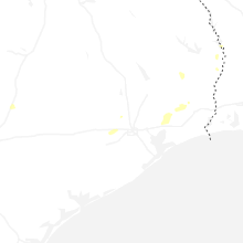
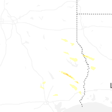
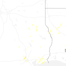
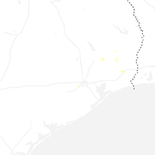
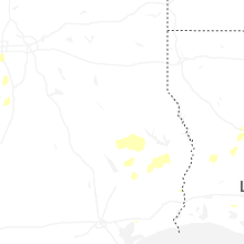
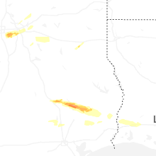


Connect with Interactive Hail Maps