

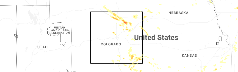
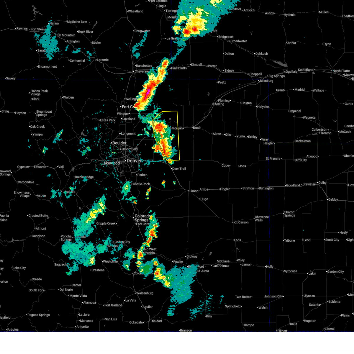
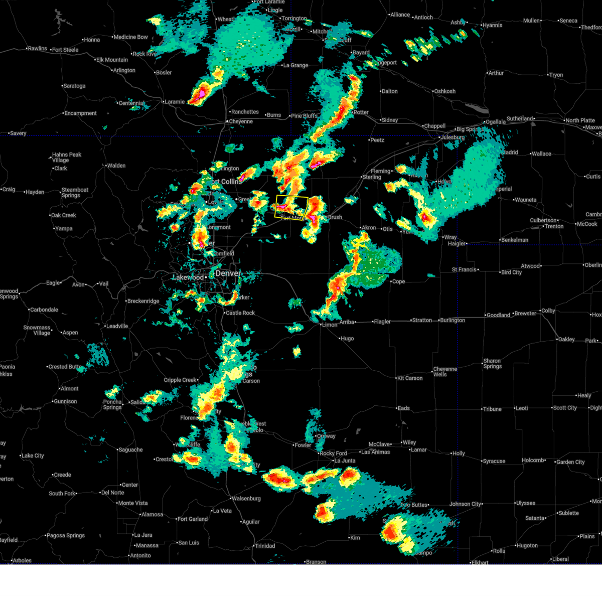
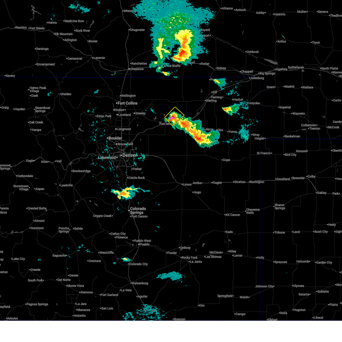
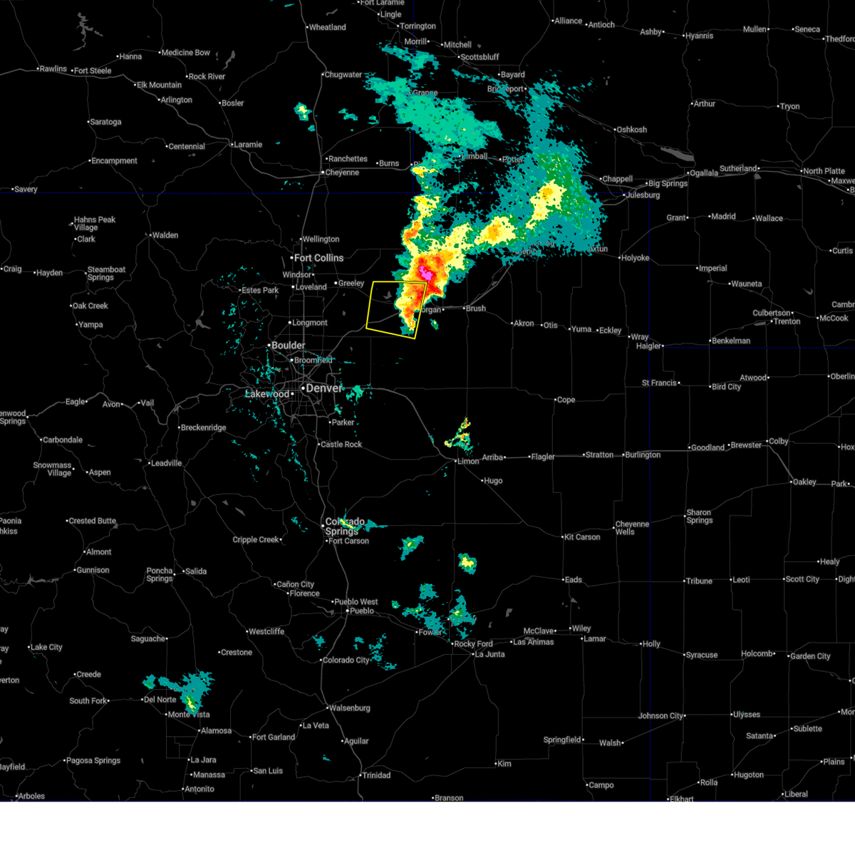
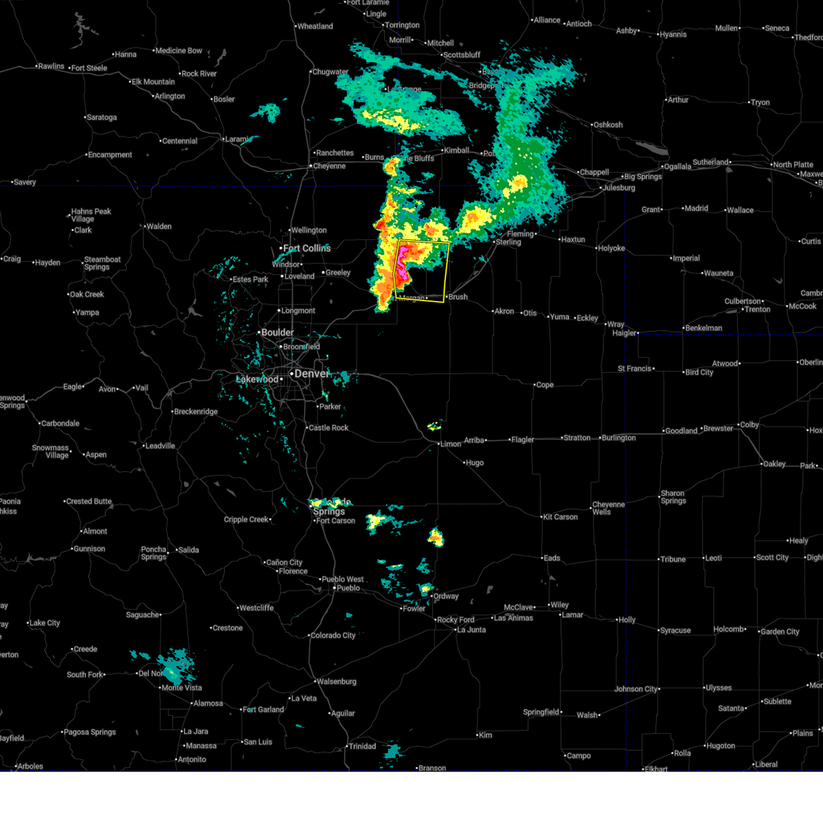
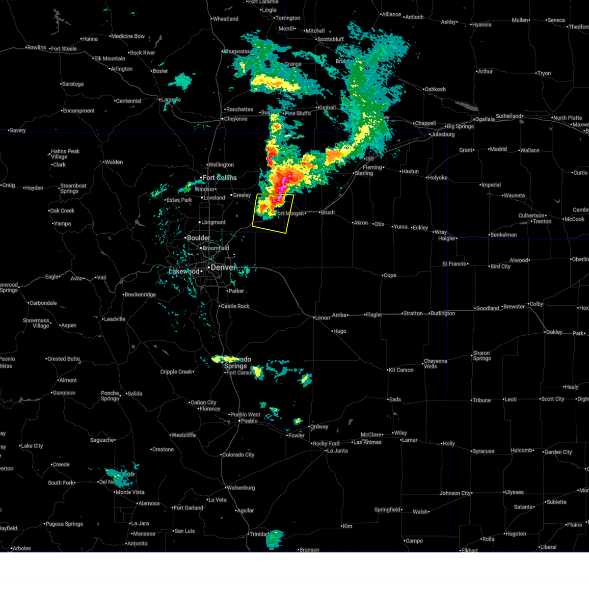
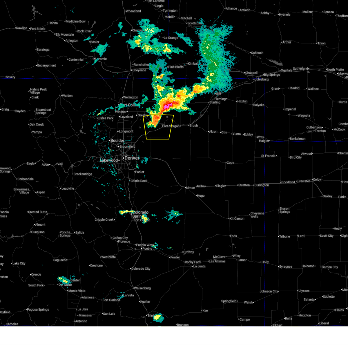
Hail Map for Jackson Lake, CO
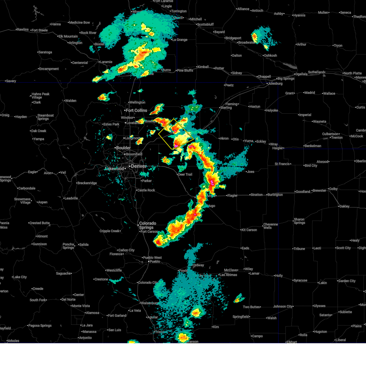
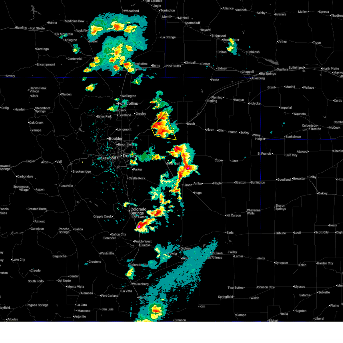
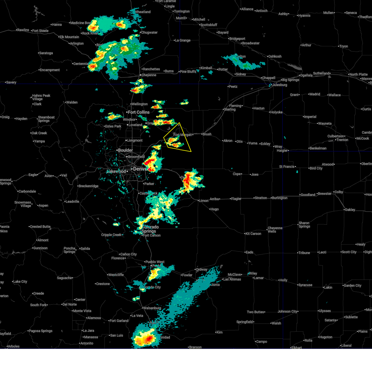
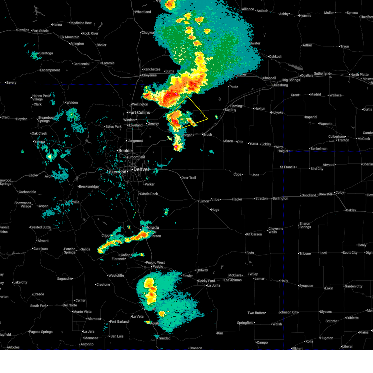
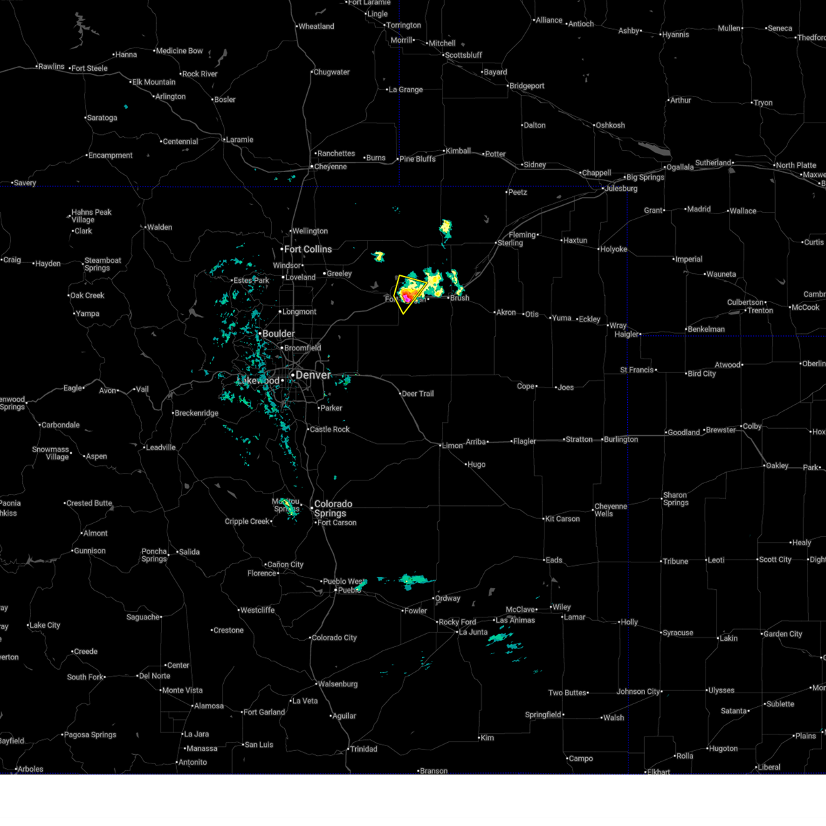
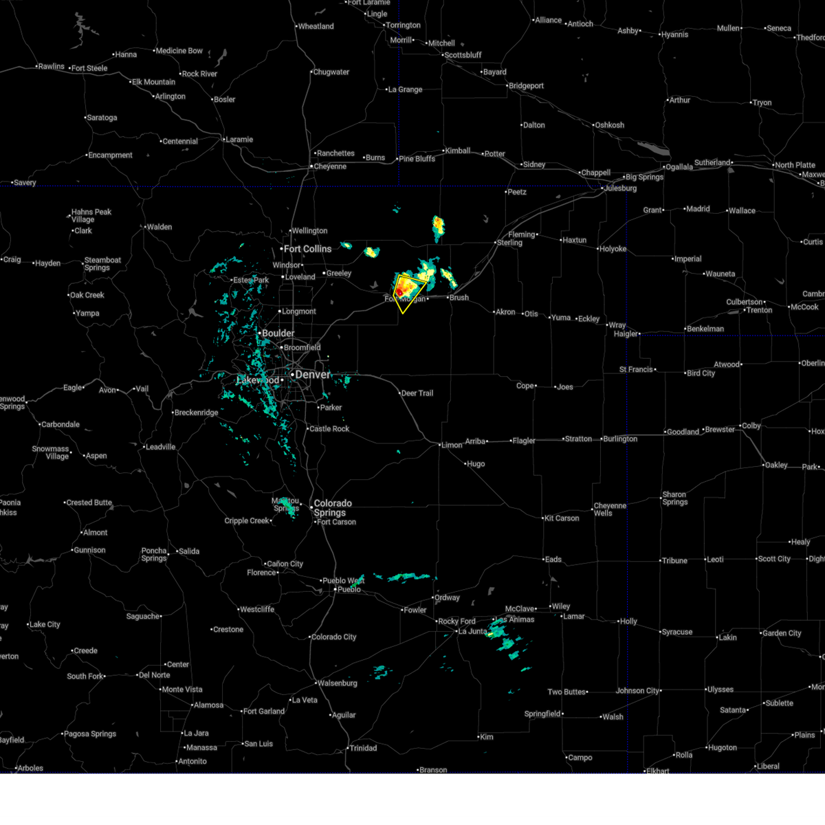
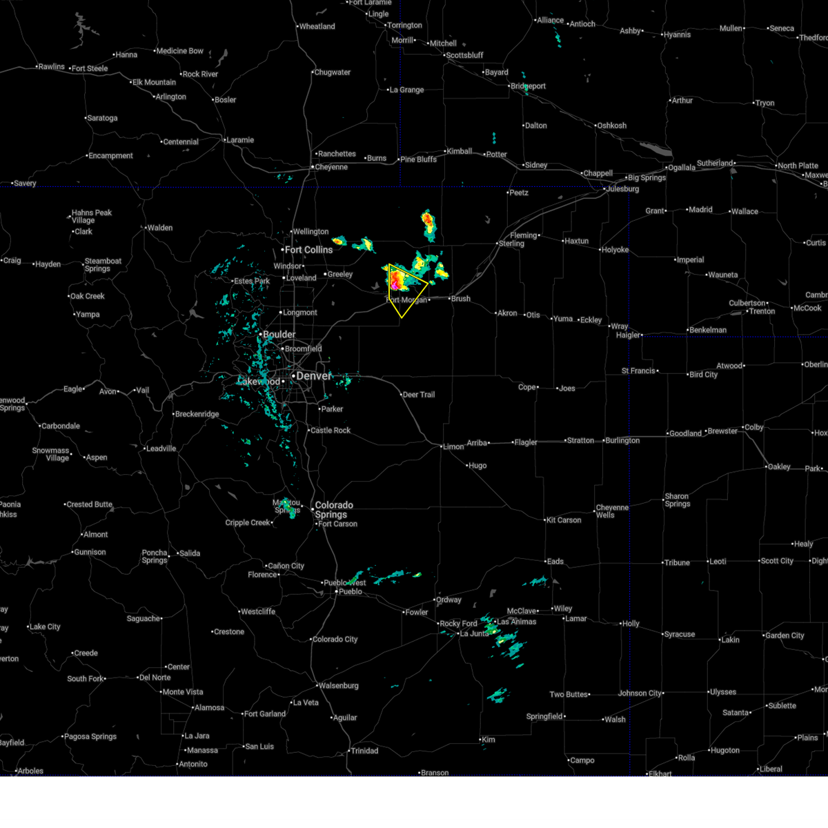
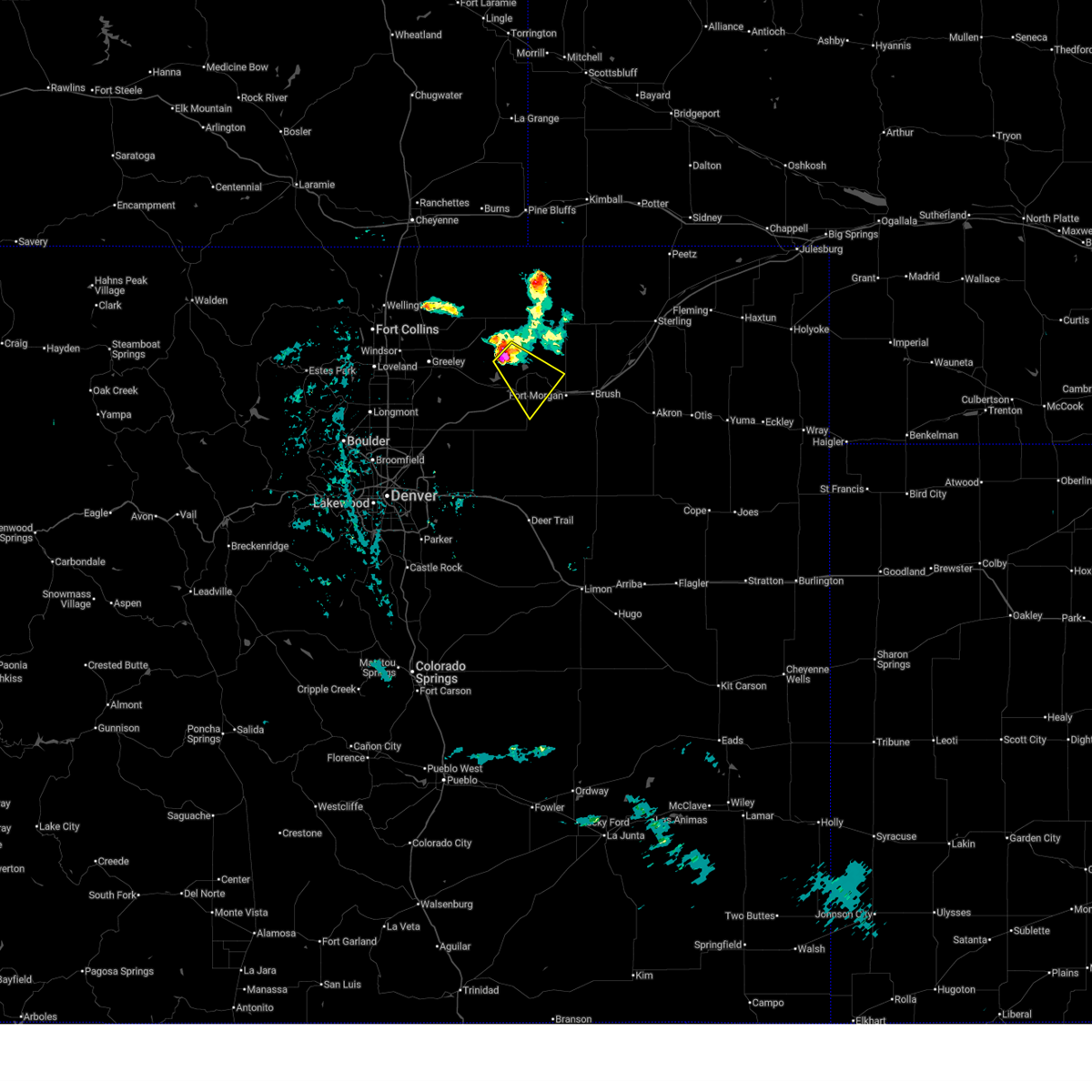
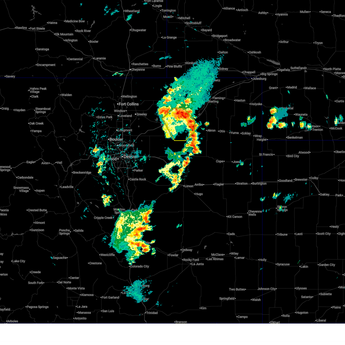
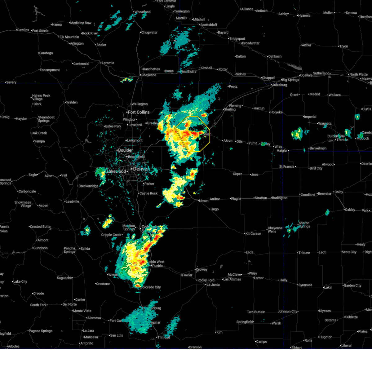
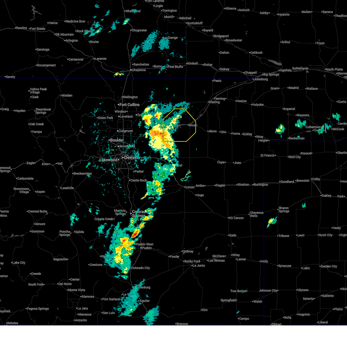
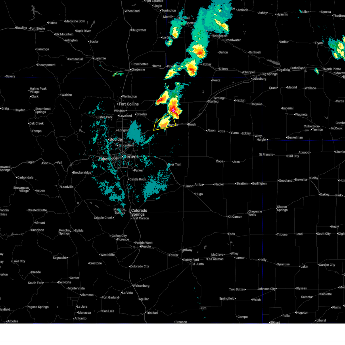
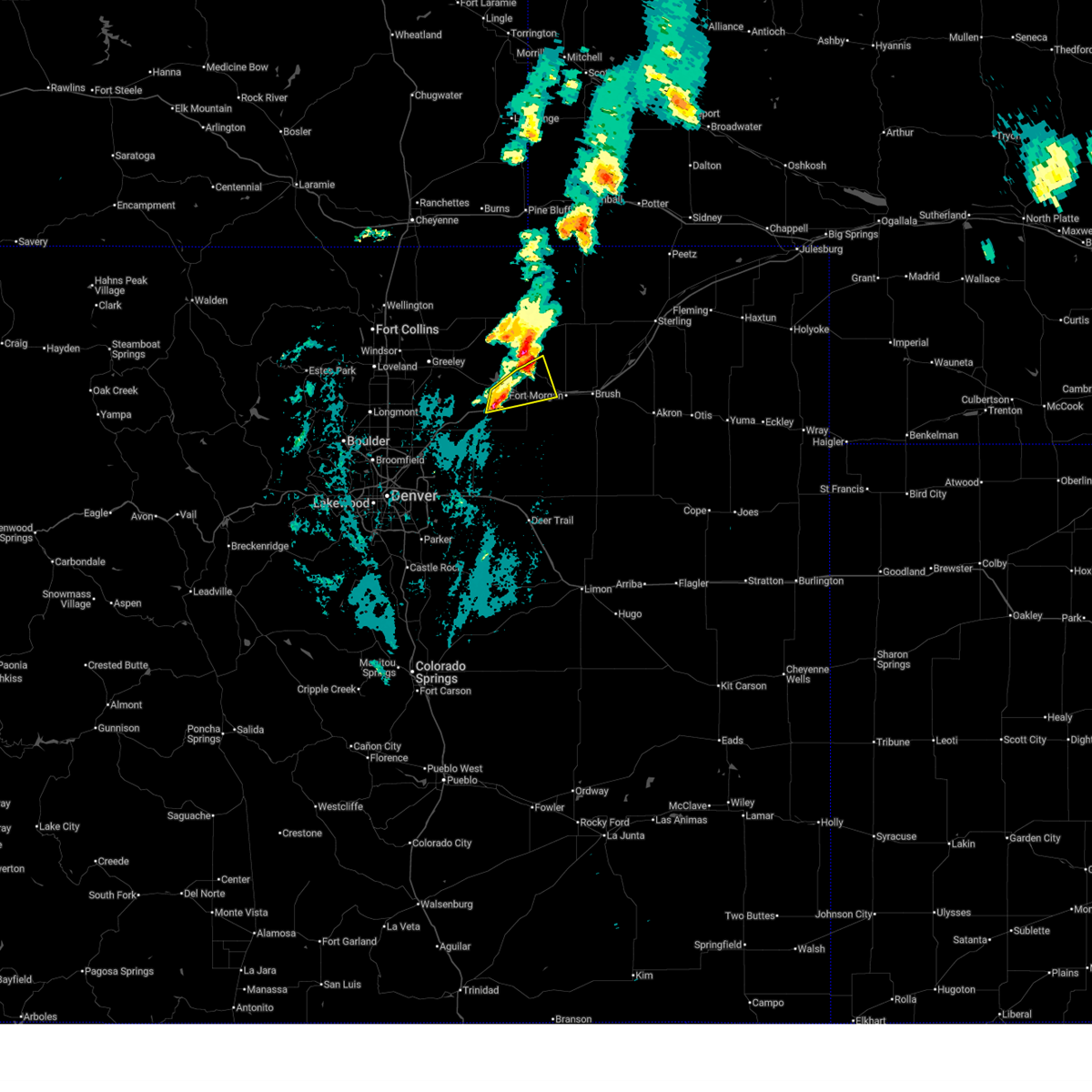
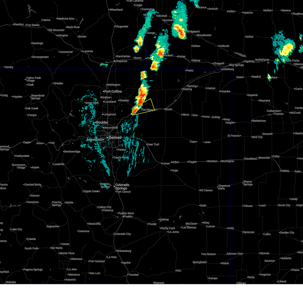
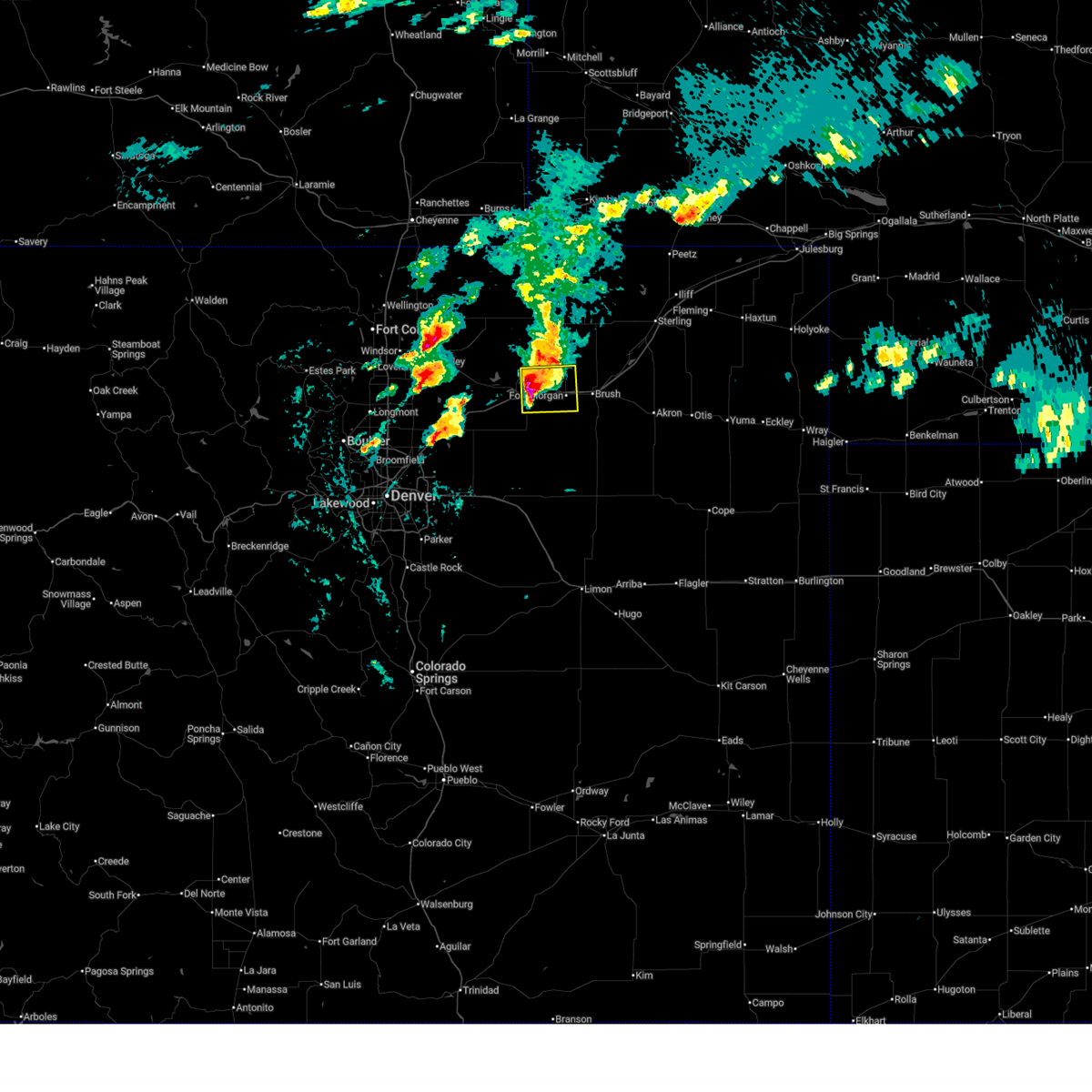
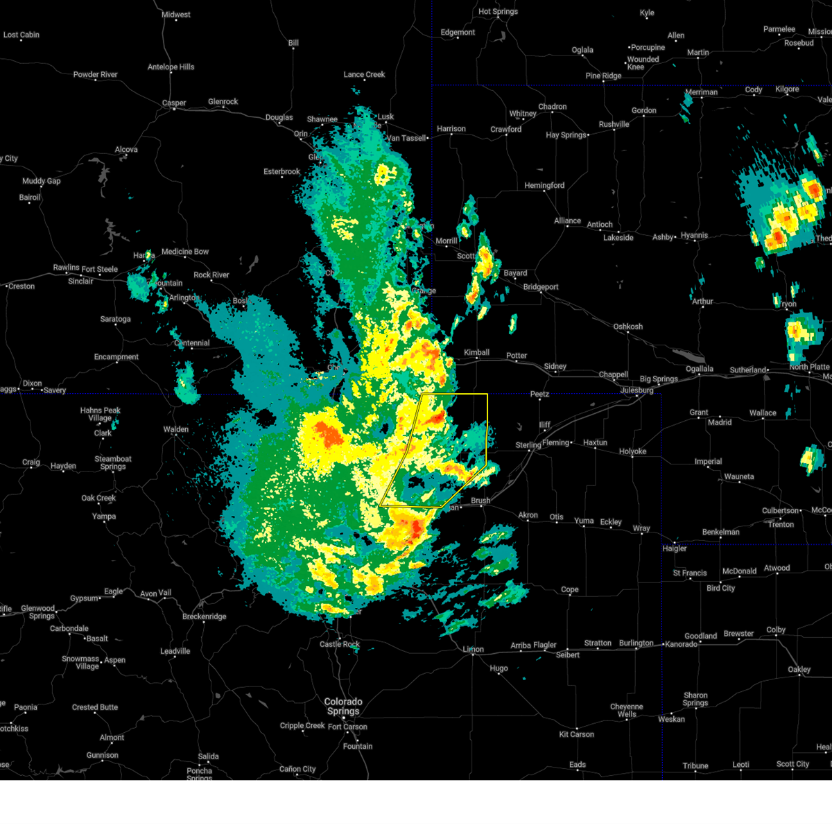
The Jackson Lake, CO area has had 4 reports of on-the-ground hail by trained spotters, and has been under severe weather warnings 27 times during the past 12 months. Doppler radar has detected hail at or near Jackson Lake, CO on 107 occasions, including 9 occasions during the past year.
| Name: | Jackson Lake, CO |
| Where Located: | 65.9 miles NE of Denver, CO |
| Map: | Google Map for Jackson Lake, CO |
| Population: | 154 |
| Housing Units: | 259 |
| More Info: | Search Google for Jackson Lake, CO |
1
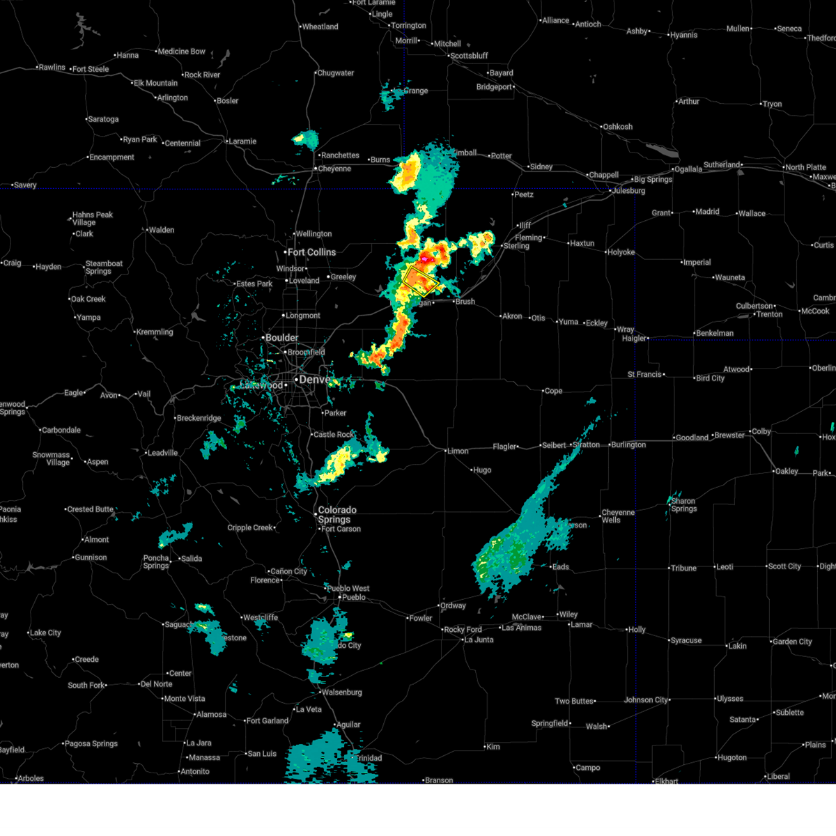
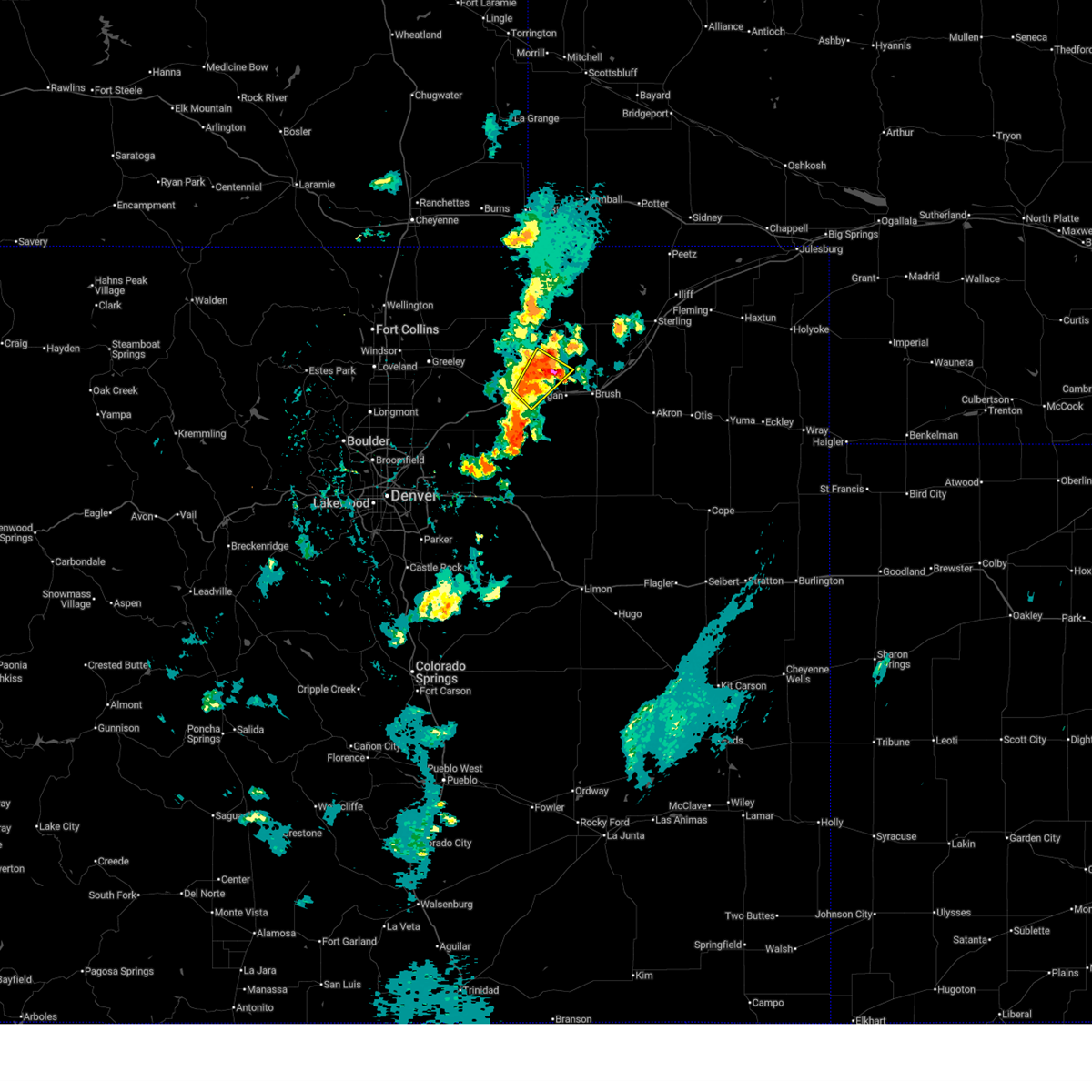
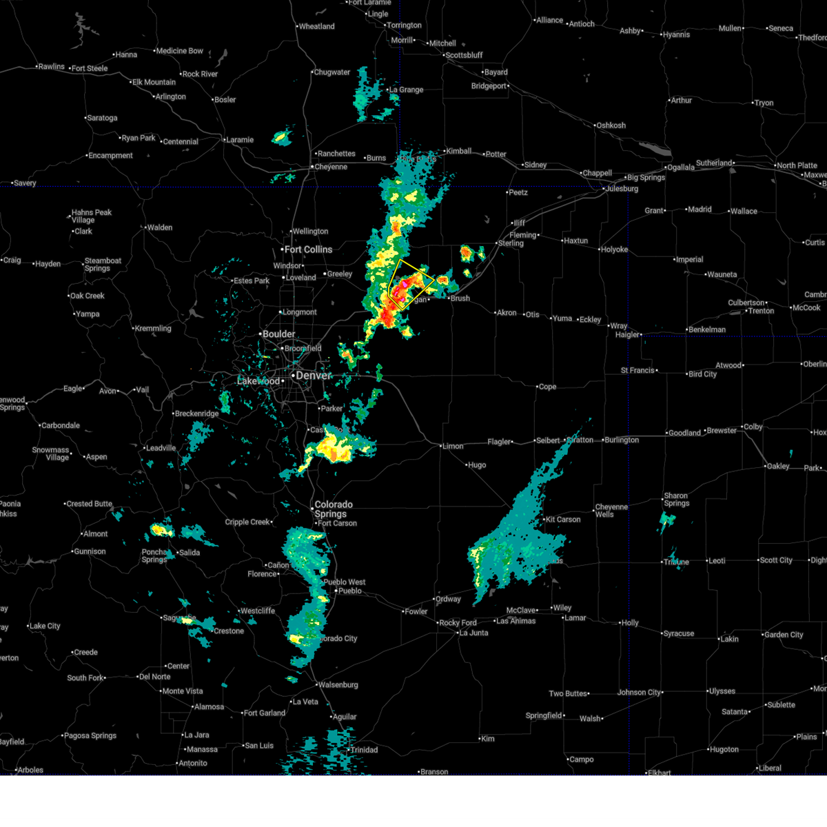
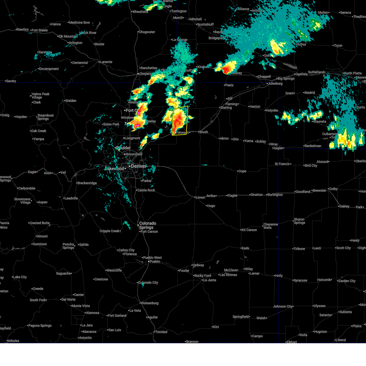
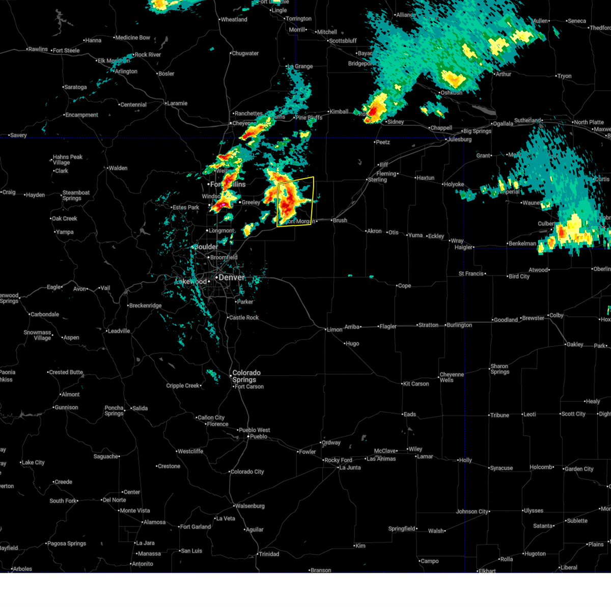
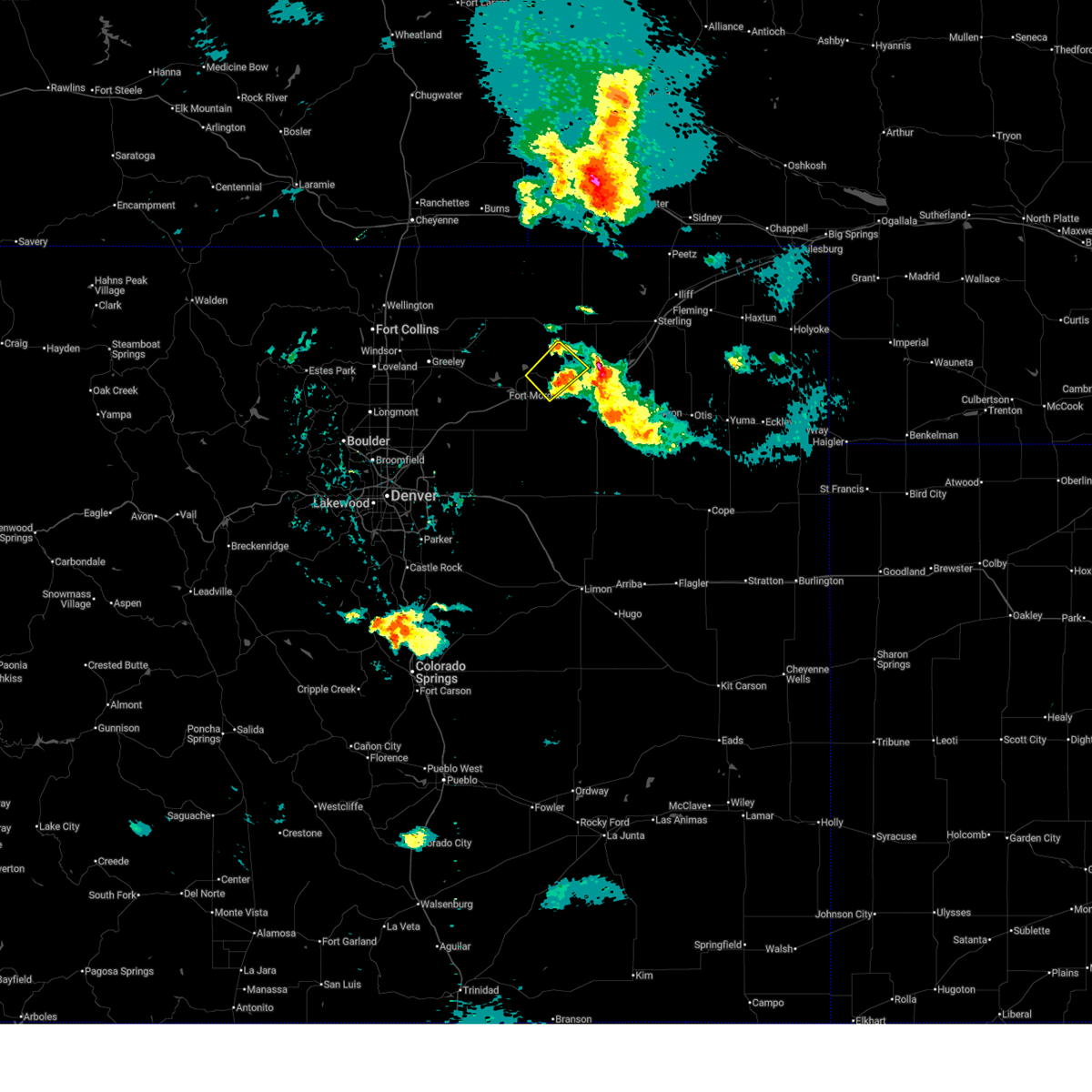
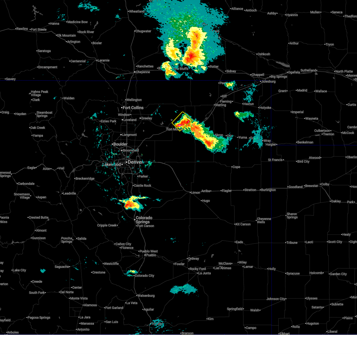
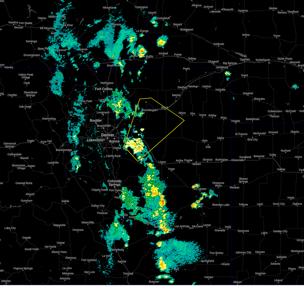
The Top Recent Hail Date for Jackson Lake, CO is Friday, July 11, 2025 (10th out of 107)
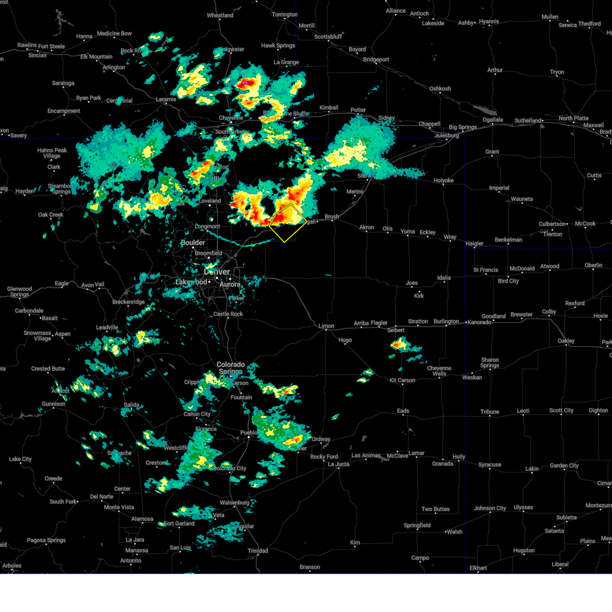
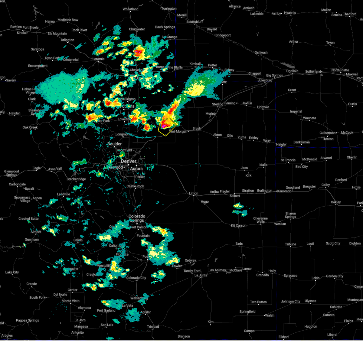
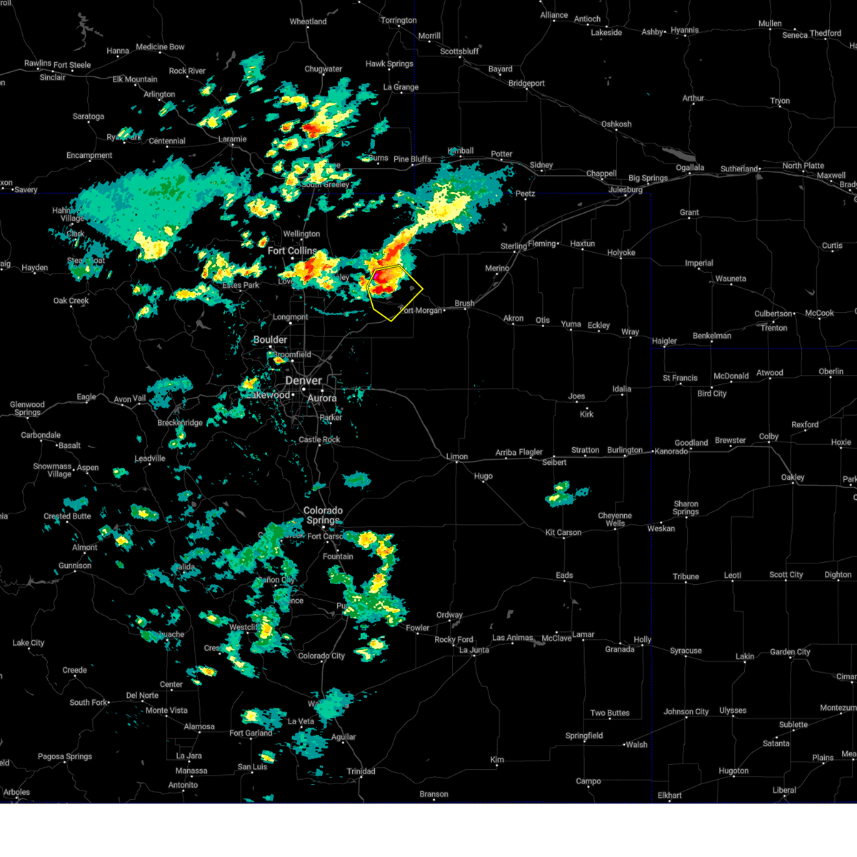
Hail and Wind Damage Spotted near Jackson Lake, CO
| Date / Time | Report Details |
|---|---|
| 6/3/2026 5:20 PM MDT |
 At 520 pm mdt, a severe thunderstorm was located over goodrich, or 15 miles west of fort morgan, moving north at 5 mph (radar indicated). Hazards include quarter size hail. Damage to vehicles is expected. hail may accumulate on roadways causing hazardous travel. Locations impacted include, weldona. At 520 pm mdt, a severe thunderstorm was located over goodrich, or 15 miles west of fort morgan, moving north at 5 mph (radar indicated). Hazards include quarter size hail. Damage to vehicles is expected. hail may accumulate on roadways causing hazardous travel. Locations impacted include, weldona.
|
| 6/3/2026 5:11 PM MDT |
 At 511 pm mdt, a severe thunderstorm was located near goodrich, or 15 miles west of fort morgan, moving north at 5 mph (radar indicated). Hazards include quarter size hail. Damage to vehicles is expected. hail may accumulate on roadways causing hazardous travel. Locations impacted include, wiggins, weldona, goodrich and jackson reservoir. At 511 pm mdt, a severe thunderstorm was located near goodrich, or 15 miles west of fort morgan, moving north at 5 mph (radar indicated). Hazards include quarter size hail. Damage to vehicles is expected. hail may accumulate on roadways causing hazardous travel. Locations impacted include, wiggins, weldona, goodrich and jackson reservoir.
|
| 6/3/2026 4:56 PM MDT |
 Svrbou the national weather service in denver has issued a * severe thunderstorm warning for, northwestern morgan county in northeastern colorado, * until 545 pm mdt. * at 456 pm mdt, a severe thunderstorm was located near orchard, or 15 miles west of fort morgan, moving northeast at 5 mph (radar indicated). Hazards include 60 mph wind gusts and quarter size hail. Hail damage to vehicles is expected. Expect wind damage to roofs, siding, and trees. Svrbou the national weather service in denver has issued a * severe thunderstorm warning for, northwestern morgan county in northeastern colorado, * until 545 pm mdt. * at 456 pm mdt, a severe thunderstorm was located near orchard, or 15 miles west of fort morgan, moving northeast at 5 mph (radar indicated). Hazards include 60 mph wind gusts and quarter size hail. Hail damage to vehicles is expected. Expect wind damage to roofs, siding, and trees.
|
| 8/10/2025 4:42 PM MDT |
 The storm which prompted the warning has weakened below severe limits, and no longer poses an immediate threat to life or property. therefore, the warning will be allowed to expire. however, small hail, gusty winds, and heavy rain are still possible with this thunderstorm. a severe thunderstorm watch remains in effect until 800 pm mdt sunday for a portion of northeast colorado. The storm which prompted the warning has weakened below severe limits, and no longer poses an immediate threat to life or property. therefore, the warning will be allowed to expire. however, small hail, gusty winds, and heavy rain are still possible with this thunderstorm. a severe thunderstorm watch remains in effect until 800 pm mdt sunday for a portion of northeast colorado.
|
| 8/10/2025 3:58 PM MDT |
 The severe thunderstorm warning that was previously in effect has been reissued for weld and morgan counties and is in effect until 445 pm mdt. please refer to that bulletin for the latest severe weather information. a severe thunderstorm watch remains in effect until 800 pm mdt sunday for a portion of northeast colorado. The severe thunderstorm warning that was previously in effect has been reissued for weld and morgan counties and is in effect until 445 pm mdt. please refer to that bulletin for the latest severe weather information. a severe thunderstorm watch remains in effect until 800 pm mdt sunday for a portion of northeast colorado.
|
| 8/10/2025 3:57 PM MDT |
 Svrbou the national weather service in denver has issued a * severe thunderstorm warning for, southwestern morgan county in northeastern colorado, south central weld county in northeastern colorado, * until 445 pm mdt. * at 357 pm mdt, a severe thunderstorm was located 6 miles south of wiggins, or 18 miles southwest of fort morgan, moving northeast at 15 mph (radar indicated). Hazards include 60 mph wind gusts and quarter size hail. Hail damage to vehicles is expected. Expect wind damage to roofs, siding, and trees. Svrbou the national weather service in denver has issued a * severe thunderstorm warning for, southwestern morgan county in northeastern colorado, south central weld county in northeastern colorado, * until 445 pm mdt. * at 357 pm mdt, a severe thunderstorm was located 6 miles south of wiggins, or 18 miles southwest of fort morgan, moving northeast at 15 mph (radar indicated). Hazards include 60 mph wind gusts and quarter size hail. Hail damage to vehicles is expected. Expect wind damage to roofs, siding, and trees.
|
| 8/10/2025 3:19 PM MDT |
 Svrbou the national weather service in denver has issued a * severe thunderstorm warning for, southwestern morgan county in northeastern colorado, south central weld county in northeastern colorado, * until 400 pm mdt. * at 319 pm mdt, a severe thunderstorm was located 8 miles southwest of wiggins, or 22 miles west of fort morgan, moving east at 10 mph (radar indicated). Hazards include 60 mph wind gusts and half dollar size hail. Hail damage to vehicles is expected. Expect wind damage to roofs, siding, and trees. Svrbou the national weather service in denver has issued a * severe thunderstorm warning for, southwestern morgan county in northeastern colorado, south central weld county in northeastern colorado, * until 400 pm mdt. * at 319 pm mdt, a severe thunderstorm was located 8 miles southwest of wiggins, or 22 miles west of fort morgan, moving east at 10 mph (radar indicated). Hazards include 60 mph wind gusts and half dollar size hail. Hail damage to vehicles is expected. Expect wind damage to roofs, siding, and trees.
|
| 7/31/2025 6:25 PM MDT |
 Svrbou the national weather service in denver has issued a * severe thunderstorm warning for, northwestern morgan county in northeastern colorado, northeastern weld county in northeastern colorado, * until 715 pm mdt. * at 625 pm mdt, a severe thunderstorm was located 6 miles northwest of jackson reservoir, or 22 miles northwest of fort morgan, moving northeast at 25 mph (radar indicated). Hazards include 60 mph wind gusts and quarter size hail. Hail damage to vehicles is expected. Expect wind damage to roofs, siding, and trees. Svrbou the national weather service in denver has issued a * severe thunderstorm warning for, northwestern morgan county in northeastern colorado, northeastern weld county in northeastern colorado, * until 715 pm mdt. * at 625 pm mdt, a severe thunderstorm was located 6 miles northwest of jackson reservoir, or 22 miles northwest of fort morgan, moving northeast at 25 mph (radar indicated). Hazards include 60 mph wind gusts and quarter size hail. Hail damage to vehicles is expected. Expect wind damage to roofs, siding, and trees.
|
| 7/24/2025 5:35 PM MDT |
 At 535 pm mdt, severe thunderstorms were located along a line from over riverside reservoir to 9 miles south of leader, or along a line from 25 miles west of fort morgan to 36 miles south of fort morgan, moving northeast at 20 mph (radar indicated). Hazards include 60 mph wind gusts and quarter size hail. Hail damage to vehicles is expected. expect wind damage to roofs, siding, and trees. Locations impacted include, wiggins, hoyt, orchard, goodrich, riverside reservoir, jackson reservoir, roggen, weldona, leader, hoyt beet dump, masters and hardin. At 535 pm mdt, severe thunderstorms were located along a line from over riverside reservoir to 9 miles south of leader, or along a line from 25 miles west of fort morgan to 36 miles south of fort morgan, moving northeast at 20 mph (radar indicated). Hazards include 60 mph wind gusts and quarter size hail. Hail damage to vehicles is expected. expect wind damage to roofs, siding, and trees. Locations impacted include, wiggins, hoyt, orchard, goodrich, riverside reservoir, jackson reservoir, roggen, weldona, leader, hoyt beet dump, masters and hardin.
|
| 7/24/2025 5:12 PM MDT |
 Svrbou the national weather service in denver has issued a * severe thunderstorm warning for, eastern adams county in northeastern colorado, western morgan county in northeastern colorado, south central weld county in northeastern colorado, * until 615 pm mdt. * at 512 pm mdt, severe thunderstorms were located along a line from 7 miles southeast of barnesville to 7 miles northeast of byers, or along a line from 17 miles east of greeley to 39 miles southwest of fort morgan, moving northeast at 25 mph (radar indicated). Hazards include 60 mph wind gusts and quarter size hail. Hail damage to vehicles is expected. Expect wind damage to roofs, siding, and trees. Svrbou the national weather service in denver has issued a * severe thunderstorm warning for, eastern adams county in northeastern colorado, western morgan county in northeastern colorado, south central weld county in northeastern colorado, * until 615 pm mdt. * at 512 pm mdt, severe thunderstorms were located along a line from 7 miles southeast of barnesville to 7 miles northeast of byers, or along a line from 17 miles east of greeley to 39 miles southwest of fort morgan, moving northeast at 25 mph (radar indicated). Hazards include 60 mph wind gusts and quarter size hail. Hail damage to vehicles is expected. Expect wind damage to roofs, siding, and trees.
|
| 7/11/2025 7:10 PM MDT |
 The storm which prompted the warning has weakened below severe limits, and no longer poses an immediate threat to life or property. therefore, the warning will be allowed to expire. however, small hail, gusty winds, and heavy rain are still possible with this thunderstorm. a severe thunderstorm watch remains in effect until 1100 pm mdt friday for a portion of northeast colorado. The storm which prompted the warning has weakened below severe limits, and no longer poses an immediate threat to life or property. therefore, the warning will be allowed to expire. however, small hail, gusty winds, and heavy rain are still possible with this thunderstorm. a severe thunderstorm watch remains in effect until 1100 pm mdt friday for a portion of northeast colorado.
|
| 7/11/2025 6:55 PM MDT |
 At 655 pm mdt, a severe thunderstorm was located over goodrich, or 13 miles west of fort morgan, moving east at 15 mph (radar indicated). Hazards include 60 mph wind gusts and quarter size hail. Hail damage to vehicles is expected. expect wind damage to roofs, siding, and trees. Locations impacted include, goodrich, jackson reservoir, orchard and weldona. At 655 pm mdt, a severe thunderstorm was located over goodrich, or 13 miles west of fort morgan, moving east at 15 mph (radar indicated). Hazards include 60 mph wind gusts and quarter size hail. Hail damage to vehicles is expected. expect wind damage to roofs, siding, and trees. Locations impacted include, goodrich, jackson reservoir, orchard and weldona.
|
| 7/11/2025 6:33 PM MDT |
 Svrbou the national weather service in denver has issued a * severe thunderstorm warning for, northwestern morgan county in northeastern colorado, central weld county in northeastern colorado, * until 715 pm mdt. * at 633 pm mdt, a severe thunderstorm was located over orchard, or 18 miles west of fort morgan, moving east at 15 mph (radar indicated). Hazards include ping pong ball size hail and 60 mph wind gusts. People and animals outdoors will be injured. expect hail damage to roofs, siding, windows, and vehicles. Expect wind damage to roofs, siding, and trees. Svrbou the national weather service in denver has issued a * severe thunderstorm warning for, northwestern morgan county in northeastern colorado, central weld county in northeastern colorado, * until 715 pm mdt. * at 633 pm mdt, a severe thunderstorm was located over orchard, or 18 miles west of fort morgan, moving east at 15 mph (radar indicated). Hazards include ping pong ball size hail and 60 mph wind gusts. People and animals outdoors will be injured. expect hail damage to roofs, siding, windows, and vehicles. Expect wind damage to roofs, siding, and trees.
|
| 7/7/2025 11:00 PM MDT |
 The storm which prompted the warning has weakened below severe limits, and no longer poses an immediate threat to life or property. therefore, the warning has been allowed to expire. however, small hail is still possible with this thunderstorm. The storm which prompted the warning has weakened below severe limits, and no longer poses an immediate threat to life or property. therefore, the warning has been allowed to expire. however, small hail is still possible with this thunderstorm.
|
| 7/7/2025 10:51 PM MDT |
 At 1051 pm mdt, a severe thunderstorm was located near wiggins, or 12 miles west of fort morgan, moving southeast at 20 mph (radar indicated). Hazards include 60 mph wind gusts and half dollar size hail. Hail damage to vehicles is expected. expect wind damage to roofs, siding, and trees. Locations impacted include, wiggins, weldona and goodrich. At 1051 pm mdt, a severe thunderstorm was located near wiggins, or 12 miles west of fort morgan, moving southeast at 20 mph (radar indicated). Hazards include 60 mph wind gusts and half dollar size hail. Hail damage to vehicles is expected. expect wind damage to roofs, siding, and trees. Locations impacted include, wiggins, weldona and goodrich.
|
| 7/7/2025 10:35 PM MDT |
 At 1035 pm mdt, a severe thunderstorm was located over goodrich, or 16 miles west of fort morgan, moving southeast at 25 mph (radar indicated). Hazards include 60 mph wind gusts and half dollar size hail. Hail damage to vehicles is expected. expect wind damage to roofs, siding, and trees. Locations impacted include, wiggins, goodrich, weldona, jackson reservoir and orchard. At 1035 pm mdt, a severe thunderstorm was located over goodrich, or 16 miles west of fort morgan, moving southeast at 25 mph (radar indicated). Hazards include 60 mph wind gusts and half dollar size hail. Hail damage to vehicles is expected. expect wind damage to roofs, siding, and trees. Locations impacted include, wiggins, goodrich, weldona, jackson reservoir and orchard.
|
| 7/7/2025 10:35 PM MDT |
 the severe thunderstorm warning has been cancelled and is no longer in effect the severe thunderstorm warning has been cancelled and is no longer in effect
|
| 7/7/2025 10:16 PM MDT |
 Svrbou the national weather service in denver has issued a * severe thunderstorm warning for, northwestern morgan county in northeastern colorado, central weld county in northeastern colorado, * until 1100 pm mdt. * at 1016 pm mdt, a severe thunderstorm was located 7 miles northwest of orchard, or 24 miles northwest of fort morgan, moving southeast at 25 mph (radar indicated). Hazards include 60 mph wind gusts and half dollar size hail. Hail damage to vehicles is expected. Expect wind damage to roofs, siding, and trees. Svrbou the national weather service in denver has issued a * severe thunderstorm warning for, northwestern morgan county in northeastern colorado, central weld county in northeastern colorado, * until 1100 pm mdt. * at 1016 pm mdt, a severe thunderstorm was located 7 miles northwest of orchard, or 24 miles northwest of fort morgan, moving southeast at 25 mph (radar indicated). Hazards include 60 mph wind gusts and half dollar size hail. Hail damage to vehicles is expected. Expect wind damage to roofs, siding, and trees.
|
| 6/24/2025 4:20 PM MDT |
 The severe thunderstorm warning that was previously in effect has been reissued for morgan county and is in effect until 500 pm mdt. please refer to that bulletin for the latest severe weather information. a severe thunderstorm watch remains in effect until 800 pm mdt tuesday for a portion of northeast colorado. The severe thunderstorm warning that was previously in effect has been reissued for morgan county and is in effect until 500 pm mdt. please refer to that bulletin for the latest severe weather information. a severe thunderstorm watch remains in effect until 800 pm mdt tuesday for a portion of northeast colorado.
|
| 6/24/2025 3:50 PM MDT |
 At 350 pm mdt, severe thunderstorms were located along a line from over weldona to 7 miles south of brush, or along a line from 11 miles northwest of fort morgan to 9 miles southeast of fort morgan, moving northeast at 30 mph (automated weather station reported. at 336 pm, a cdot sensor recorded a 58 mph wind gust near i-76 and highway 34, just east of wiggins). Hazards include 60 mph wind gusts and small hail. Expect damage to roofs, siding, and trees. Locations impacted include, fort morgan, brush, log lane village, hillrose, adena school, antelope springs, twelve-mile corner, weldona, snyder, adena, gary, goodrich, jackson reservoir, orchard and fort morgan airport. At 350 pm mdt, severe thunderstorms were located along a line from over weldona to 7 miles south of brush, or along a line from 11 miles northwest of fort morgan to 9 miles southeast of fort morgan, moving northeast at 30 mph (automated weather station reported. at 336 pm, a cdot sensor recorded a 58 mph wind gust near i-76 and highway 34, just east of wiggins). Hazards include 60 mph wind gusts and small hail. Expect damage to roofs, siding, and trees. Locations impacted include, fort morgan, brush, log lane village, hillrose, adena school, antelope springs, twelve-mile corner, weldona, snyder, adena, gary, goodrich, jackson reservoir, orchard and fort morgan airport.
|
| 6/24/2025 3:25 PM MDT |
 Svrbou the national weather service in denver has issued a * severe thunderstorm warning for, morgan county in northeastern colorado, * until 415 pm mdt. * at 325 pm mdt, severe thunderstorms were located along a line from over wiggins to over adena, or along a line from 17 miles west of fort morgan to 16 miles south of fort morgan, moving northeast at 30 mph (radar indicated). Hazards include 60 mph wind gusts and small hail. expect damage to roofs, siding, and trees Svrbou the national weather service in denver has issued a * severe thunderstorm warning for, morgan county in northeastern colorado, * until 415 pm mdt. * at 325 pm mdt, severe thunderstorms were located along a line from over wiggins to over adena, or along a line from 17 miles west of fort morgan to 16 miles south of fort morgan, moving northeast at 30 mph (radar indicated). Hazards include 60 mph wind gusts and small hail. expect damage to roofs, siding, and trees
|
| 6/22/2025 9:57 PM MDT |
 the severe thunderstorm warning has been cancelled and is no longer in effect the severe thunderstorm warning has been cancelled and is no longer in effect
|
| 6/22/2025 9:44 PM MDT |
 At 944 pm mdt, a severe thunderstorm was located 5 miles southeast of riverside reservoir, or 22 miles west of fort morgan, moving northeast at 25 mph (radar indicated). Hazards include quarter size hail. Damage to vehicles is expected. Locations impacted include, wiggins, orchard, goodrich, jackson reservoir, weldona and masters. At 944 pm mdt, a severe thunderstorm was located 5 miles southeast of riverside reservoir, or 22 miles west of fort morgan, moving northeast at 25 mph (radar indicated). Hazards include quarter size hail. Damage to vehicles is expected. Locations impacted include, wiggins, orchard, goodrich, jackson reservoir, weldona and masters.
|
| 6/22/2025 9:28 PM MDT |
 Svrbou the national weather service in denver has issued a * severe thunderstorm warning for, northwestern morgan county in northeastern colorado, south central weld county in northeastern colorado, * until 1015 pm mdt. * at 928 pm mdt, a severe thunderstorm was located near roggen, or 27 miles southeast of greeley, moving northeast at 25 mph (radar indicated). Hazards include quarter size hail. damage to vehicles is expected Svrbou the national weather service in denver has issued a * severe thunderstorm warning for, northwestern morgan county in northeastern colorado, south central weld county in northeastern colorado, * until 1015 pm mdt. * at 928 pm mdt, a severe thunderstorm was located near roggen, or 27 miles southeast of greeley, moving northeast at 25 mph (radar indicated). Hazards include quarter size hail. damage to vehicles is expected
|
| 6/17/2025 3:48 AM MDT |
 Svrbou the national weather service in denver has issued a * severe thunderstorm warning for, west central morgan county in northeastern colorado, * until 430 am mdt. * at 348 am mdt, a severe thunderstorm was located near weldona, or 10 miles west of fort morgan, moving east at 15 mph. this is a destructive storm for wiggins, wedoona and fort morgan (radar indicated). Hazards include baseball size hail and 60 mph wind gusts. People and animals outdoors will be severely injured. Expect shattered windows, extensive damage to roofs, siding, and vehicles. Svrbou the national weather service in denver has issued a * severe thunderstorm warning for, west central morgan county in northeastern colorado, * until 430 am mdt. * at 348 am mdt, a severe thunderstorm was located near weldona, or 10 miles west of fort morgan, moving east at 15 mph. this is a destructive storm for wiggins, wedoona and fort morgan (radar indicated). Hazards include baseball size hail and 60 mph wind gusts. People and animals outdoors will be severely injured. Expect shattered windows, extensive damage to roofs, siding, and vehicles.
|
| 6/17/2025 3:35 AM MDT |
 At 335 am mdt, severe thunderstorms were located along a line from 9 miles south of keota to over wiggins, or along a line from 26 miles northwest of fort morgan to 13 miles west of fort morgan, moving east at 20 mph (radar indicated). Hazards include ping pong ball size hail and 60 mph wind gusts. People and animals outdoors will be injured. expect hail damage to roofs, siding, windows, and vehicles. expect wind damage to roofs, siding, and trees. Locations impacted include, wiggins, weldona, jackson reservoir, goodrich, orchard and buckingham. At 335 am mdt, severe thunderstorms were located along a line from 9 miles south of keota to over wiggins, or along a line from 26 miles northwest of fort morgan to 13 miles west of fort morgan, moving east at 20 mph (radar indicated). Hazards include ping pong ball size hail and 60 mph wind gusts. People and animals outdoors will be injured. expect hail damage to roofs, siding, windows, and vehicles. expect wind damage to roofs, siding, and trees. Locations impacted include, wiggins, weldona, jackson reservoir, goodrich, orchard and buckingham.
|
| 6/17/2025 3:22 AM MDT |
 Svrbou the national weather service in denver has issued a * severe thunderstorm warning for, northwestern morgan county in northeastern colorado, central weld county in northeastern colorado, * until 400 am mdt. * at 322 am mdt, severe thunderstorms were located along a line from 10 miles south of keota to over wiggins, or along a line from 28 miles northwest of fort morgan to 17 miles west of fort morgan, moving east at 15 mph (radar indicated). Hazards include 60 mph wind gusts and half dollar size hail. Hail damage to vehicles is expected. Expect wind damage to roofs, siding, and trees. Svrbou the national weather service in denver has issued a * severe thunderstorm warning for, northwestern morgan county in northeastern colorado, central weld county in northeastern colorado, * until 400 am mdt. * at 322 am mdt, severe thunderstorms were located along a line from 10 miles south of keota to over wiggins, or along a line from 28 miles northwest of fort morgan to 17 miles west of fort morgan, moving east at 15 mph (radar indicated). Hazards include 60 mph wind gusts and half dollar size hail. Hail damage to vehicles is expected. Expect wind damage to roofs, siding, and trees.
|
| 6/15/2025 5:55 PM MDT |
 The storm which prompted the warning has weakened below severe limits, and has exited the warned area. therefore, the warning will be allowed to expire. a severe thunderstorm watch remains in effect until 1100 pm mdt sunday for a portion of northeast colorado. The storm which prompted the warning has weakened below severe limits, and has exited the warned area. therefore, the warning will be allowed to expire. a severe thunderstorm watch remains in effect until 1100 pm mdt sunday for a portion of northeast colorado.
|
| 6/15/2025 5:41 PM MDT |
 At 541 pm mdt, a severe thunderstorm was located near log lane village, or 6 miles northwest of fort morgan, moving northeast at 15 mph (radar indicated). Hazards include 60 mph wind gusts and quarter size hail. Hail damage to vehicles is expected. expect wind damage to roofs, siding, and trees. Locations impacted include, fort morgan, log lane village, weldona, antelope springs, goodrich and fort morgan airport. At 541 pm mdt, a severe thunderstorm was located near log lane village, or 6 miles northwest of fort morgan, moving northeast at 15 mph (radar indicated). Hazards include 60 mph wind gusts and quarter size hail. Hail damage to vehicles is expected. expect wind damage to roofs, siding, and trees. Locations impacted include, fort morgan, log lane village, weldona, antelope springs, goodrich and fort morgan airport.
|
| 6/15/2025 5:27 PM MDT |
 Svrbou the national weather service in denver has issued a * severe thunderstorm warning for, northwestern morgan county in northeastern colorado, * until 600 pm mdt. * at 527 pm mdt, a severe thunderstorm was located near weldona, or 7 miles northwest of fort morgan, moving northeast at 15 mph (radar indicated). Hazards include 60 mph wind gusts and quarter size hail. Hail damage to vehicles is expected. Expect wind damage to roofs, siding, and trees. Svrbou the national weather service in denver has issued a * severe thunderstorm warning for, northwestern morgan county in northeastern colorado, * until 600 pm mdt. * at 527 pm mdt, a severe thunderstorm was located near weldona, or 7 miles northwest of fort morgan, moving northeast at 15 mph (radar indicated). Hazards include 60 mph wind gusts and quarter size hail. Hail damage to vehicles is expected. Expect wind damage to roofs, siding, and trees.
|
| 6/14/2025 7:55 PM MDT |
 The storms which prompted the warning have moved out of the area. therefore, the warning will be allowed to expire. a severe thunderstorm watch remains in effect until 900 pm mdt saturday for a portion of northeast colorado. The storms which prompted the warning have moved out of the area. therefore, the warning will be allowed to expire. a severe thunderstorm watch remains in effect until 900 pm mdt saturday for a portion of northeast colorado.
|
| 6/14/2025 7:44 PM MDT |
 Svrbou the national weather service in denver has issued a * severe thunderstorm warning for, northwestern morgan county in northeastern colorado, east central weld county in northeastern colorado, * until 830 pm mdt. * at 744 pm mdt, severe thunderstorms were located along a line from near new raymer to near wiggins, or along a line from 23 miles north of fort morgan to 11 miles west of fort morgan, moving east at 20 mph (radar indicated). Hazards include 60 mph wind gusts and half dollar size hail. Hail damage to vehicles is expected. Expect wind damage to roofs, siding, and trees. Svrbou the national weather service in denver has issued a * severe thunderstorm warning for, northwestern morgan county in northeastern colorado, east central weld county in northeastern colorado, * until 830 pm mdt. * at 744 pm mdt, severe thunderstorms were located along a line from near new raymer to near wiggins, or along a line from 23 miles north of fort morgan to 11 miles west of fort morgan, moving east at 20 mph (radar indicated). Hazards include 60 mph wind gusts and half dollar size hail. Hail damage to vehicles is expected. Expect wind damage to roofs, siding, and trees.
|
| 6/14/2025 7:29 PM MDT |
 At 729 pm mdt, severe thunderstorms were located along a line from over jackson reservoir to over roggen, or along a line from 16 miles northwest of fort morgan to 29 miles southeast of greeley, moving southeast at 25 mph (radar indicated). Hazards include 60 mph wind gusts and quarter size hail. Hail damage to vehicles is expected. expect wind damage to roofs, siding, and trees. Locations impacted include, wiggins, riverside reservoir, orchard, goodrich, jackson reservoir, roggen, weldona, masters and hoyt beet dump. At 729 pm mdt, severe thunderstorms were located along a line from over jackson reservoir to over roggen, or along a line from 16 miles northwest of fort morgan to 29 miles southeast of greeley, moving southeast at 25 mph (radar indicated). Hazards include 60 mph wind gusts and quarter size hail. Hail damage to vehicles is expected. expect wind damage to roofs, siding, and trees. Locations impacted include, wiggins, riverside reservoir, orchard, goodrich, jackson reservoir, roggen, weldona, masters and hoyt beet dump.
|
| 6/14/2025 7:14 PM MDT |
 Svrbou the national weather service in denver has issued a * severe thunderstorm warning for, western morgan county in northeastern colorado, south central weld county in northeastern colorado, * until 800 pm mdt. * at 714 pm mdt, severe thunderstorms were located along a line from near jackson reservoir to over keenesburg, or along a line from 20 miles northwest of fort morgan to 24 miles southeast of greeley, moving southeast at 25 mph (radar indicated). Hazards include 60 mph wind gusts and small hail. expect damage to roofs, siding, and trees Svrbou the national weather service in denver has issued a * severe thunderstorm warning for, western morgan county in northeastern colorado, south central weld county in northeastern colorado, * until 800 pm mdt. * at 714 pm mdt, severe thunderstorms were located along a line from near jackson reservoir to over keenesburg, or along a line from 20 miles northwest of fort morgan to 24 miles southeast of greeley, moving southeast at 25 mph (radar indicated). Hazards include 60 mph wind gusts and small hail. expect damage to roofs, siding, and trees
|
| 6/5/2025 1:59 PM MDT |
 Svrbou the national weather service in denver has issued a * severe thunderstorm warning for, northwestern morgan county in northeastern colorado, * until 245 pm mdt. * at 159 pm mdt, a severe thunderstorm was located near jackson reservoir, or 17 miles northwest of fort morgan, moving southeast at 25 mph (radar indicated). Hazards include quarter size hail. damage to vehicles is expected Svrbou the national weather service in denver has issued a * severe thunderstorm warning for, northwestern morgan county in northeastern colorado, * until 245 pm mdt. * at 159 pm mdt, a severe thunderstorm was located near jackson reservoir, or 17 miles northwest of fort morgan, moving southeast at 25 mph (radar indicated). Hazards include quarter size hail. damage to vehicles is expected
|
| 5/18/2025 3:36 PM MDT |
 The storm which prompted the warning has moved out of the area. therefore, the warning will be allowed to expire. a tornado watch remains in effect until 800 pm mdt sunday for a portion of northeast colorado. The storm which prompted the warning has moved out of the area. therefore, the warning will be allowed to expire. a tornado watch remains in effect until 800 pm mdt sunday for a portion of northeast colorado.
|
| 5/18/2025 3:00 PM MDT |
 Svrbou the national weather service in denver has issued a * severe thunderstorm warning for, northwestern morgan county in northeastern colorado, * until 345 pm mdt. * at 300 pm mdt, a severe thunderstorm was located near goodrich, or 12 miles west of fort morgan, moving northeast at 20 mph (radar indicated). Hazards include ping pong ball size hail and 60 mph wind gusts. People and animals outdoors will be injured. expect hail damage to roofs, siding, windows, and vehicles. Expect wind damage to roofs, siding, and trees. Svrbou the national weather service in denver has issued a * severe thunderstorm warning for, northwestern morgan county in northeastern colorado, * until 345 pm mdt. * at 300 pm mdt, a severe thunderstorm was located near goodrich, or 12 miles west of fort morgan, moving northeast at 20 mph (radar indicated). Hazards include ping pong ball size hail and 60 mph wind gusts. People and animals outdoors will be injured. expect hail damage to roofs, siding, windows, and vehicles. Expect wind damage to roofs, siding, and trees.
|
| 5/14/2025 4:36 PM MDT |
 At 436 pm mdt, severe thunderstorms were located along a line from 13 miles northwest of westplains to 6 miles south of weldona, or along a line from 36 miles northwest of sterling to 8 miles west of fort morgan, moving east at 40 mph (weather sensor reported. at 407 pm, a mesonet station north of briggsdale on highway 14 reported a 59 mph wind gust). Hazards include 60 mph wind gusts and small hail. Expect damage to roofs, siding, and trees. Locations impacted include, keota, new raymer, pawnee buttes, jackson reservoir, weldona, goodrich, stoneham, antelope springs, orchard, riverside reservoir, buckingham, masters and hardin. At 436 pm mdt, severe thunderstorms were located along a line from 13 miles northwest of westplains to 6 miles south of weldona, or along a line from 36 miles northwest of sterling to 8 miles west of fort morgan, moving east at 40 mph (weather sensor reported. at 407 pm, a mesonet station north of briggsdale on highway 14 reported a 59 mph wind gust). Hazards include 60 mph wind gusts and small hail. Expect damage to roofs, siding, and trees. Locations impacted include, keota, new raymer, pawnee buttes, jackson reservoir, weldona, goodrich, stoneham, antelope springs, orchard, riverside reservoir, buckingham, masters and hardin.
|
| 5/14/2025 4:02 PM MDT |
 Svrbou the national weather service in denver has issued a * severe thunderstorm warning for, northwestern morgan county in northeastern colorado, northeastern weld county in northeastern colorado, * until 445 pm mdt. * at 402 pm mdt, severe thunderstorms were located along a line from 9 miles northeast of grover to 7 miles north of roggen, or along a line from 50 miles northeast of greeley to 23 miles southeast of greeley, moving east at 45 mph (radar indicated). Hazards include 60 mph wind gusts and small hail. expect damage to roofs, siding, and trees Svrbou the national weather service in denver has issued a * severe thunderstorm warning for, northwestern morgan county in northeastern colorado, northeastern weld county in northeastern colorado, * until 445 pm mdt. * at 402 pm mdt, severe thunderstorms were located along a line from 9 miles northeast of grover to 7 miles north of roggen, or along a line from 50 miles northeast of greeley to 23 miles southeast of greeley, moving east at 45 mph (radar indicated). Hazards include 60 mph wind gusts and small hail. expect damage to roofs, siding, and trees
|
| 9/17/2024 4:39 PM MDT |
 Svrbou the national weather service in denver colorado has issued a * severe thunderstorm warning for, southeastern weld county in northeastern colorado, morgan county in northeastern colorado, north central washington county in northeastern colorado, southwestern logan county in northeastern colorado, * until 515 pm mdt. * at 438 pm mdt, severe thunderstorms were located along a line extending from 4 miles east of roggen to 6 miles southwest of log lane village to 3 miles west of gary, or along a line extending from 29 miles southeast of greeley to 6 miles southwest of fort morgan to 24 miles west of akron, moving northeast at 60 mph (radar indicated). Hazards include 60 mph wind gusts. expect damage to roofs, siding, and trees Svrbou the national weather service in denver colorado has issued a * severe thunderstorm warning for, southeastern weld county in northeastern colorado, morgan county in northeastern colorado, north central washington county in northeastern colorado, southwestern logan county in northeastern colorado, * until 515 pm mdt. * at 438 pm mdt, severe thunderstorms were located along a line extending from 4 miles east of roggen to 6 miles southwest of log lane village to 3 miles west of gary, or along a line extending from 29 miles southeast of greeley to 6 miles southwest of fort morgan to 24 miles west of akron, moving northeast at 60 mph (radar indicated). Hazards include 60 mph wind gusts. expect damage to roofs, siding, and trees
|
| 9/17/2024 4:31 PM MDT |
 At 431 pm mdt, severe thunderstorms were located along a line extending from 5 miles east of prospect valley to 3 miles east of hoyt to near shamrock, or along a line extending from 34 miles southeast of greeley to 20 miles southwest of fort morgan to 36 miles southwest of akron, moving northeast at 45 mph (radar indicated). Hazards include 60 mph wind gusts. Expect damage to roofs, siding, and trees. Locations impacted include, fort morgan, brush, wiggins, log lane village, gary, hoyt, shamrock, weldona, leader, twelve-mile corner, jackson reservoir, adena school, orchard, adena, riverside reservoir, goodrich, and woodrow. At 431 pm mdt, severe thunderstorms were located along a line extending from 5 miles east of prospect valley to 3 miles east of hoyt to near shamrock, or along a line extending from 34 miles southeast of greeley to 20 miles southwest of fort morgan to 36 miles southwest of akron, moving northeast at 45 mph (radar indicated). Hazards include 60 mph wind gusts. Expect damage to roofs, siding, and trees. Locations impacted include, fort morgan, brush, wiggins, log lane village, gary, hoyt, shamrock, weldona, leader, twelve-mile corner, jackson reservoir, adena school, orchard, adena, riverside reservoir, goodrich, and woodrow.
|
| 9/17/2024 4:31 PM MDT |
 the severe thunderstorm warning has been cancelled and is no longer in effect the severe thunderstorm warning has been cancelled and is no longer in effect
|
| 9/17/2024 4:04 PM MDT |
 Svrbou the national weather service in denver colorado has issued a * severe thunderstorm warning for, south central weld county in northeastern colorado, north central elbert county in east central colorado, arapahoe county in northeastern colorado, morgan county in northeastern colorado, west central washington county in northeastern colorado, adams county in northeastern colorado, * until 445 pm mdt. * at 403 pm mdt, severe thunderstorms were located along a line extending from near strasburg to 6 miles southwest of deer trail, or along a line extending from 34 miles east of denver to 30 miles northwest of limon, moving northeast at 70 mph (radar indicated. at 353 pm mdt, a 62 mph wind gust was reported northeast of kiowa). Hazards include 60 mph wind gusts. expect damage to roofs, siding, and trees Svrbou the national weather service in denver colorado has issued a * severe thunderstorm warning for, south central weld county in northeastern colorado, north central elbert county in east central colorado, arapahoe county in northeastern colorado, morgan county in northeastern colorado, west central washington county in northeastern colorado, adams county in northeastern colorado, * until 445 pm mdt. * at 403 pm mdt, severe thunderstorms were located along a line extending from near strasburg to 6 miles southwest of deer trail, or along a line extending from 34 miles east of denver to 30 miles northwest of limon, moving northeast at 70 mph (radar indicated. at 353 pm mdt, a 62 mph wind gust was reported northeast of kiowa). Hazards include 60 mph wind gusts. expect damage to roofs, siding, and trees
|
| 8/7/2024 3:45 PM MDT |
 Svrbou the national weather service in denver colorado has issued a * severe thunderstorm warning for, south central weld county in northeastern colorado, west central morgan county in northeastern colorado, * until 415 pm mdt. * at 345 pm mdt, a severe thunderstorm was located near riverside reservoir, or 23 miles west of fort morgan, moving southeast at 15 mph (radar indicated). Hazards include ping pong ball size hail and 60 mph wind gusts. Expect damage to roofs, siding, and trees. people and animals outdoors will be injured. Expect hail damage to roofs, siding, windows, and vehicles. Svrbou the national weather service in denver colorado has issued a * severe thunderstorm warning for, south central weld county in northeastern colorado, west central morgan county in northeastern colorado, * until 415 pm mdt. * at 345 pm mdt, a severe thunderstorm was located near riverside reservoir, or 23 miles west of fort morgan, moving southeast at 15 mph (radar indicated). Hazards include ping pong ball size hail and 60 mph wind gusts. Expect damage to roofs, siding, and trees. people and animals outdoors will be injured. Expect hail damage to roofs, siding, windows, and vehicles.
|
| 8/7/2024 3:28 PM MDT |
 At 328 pm mdt, a severe thunderstorm was located over riverside reservoir, or 24 miles west of fort morgan, moving southeast at 40 mph (radar indicated). Hazards include 60 mph wind gusts and quarter size hail. Expect damage to roofs, siding, and trees. hail damage to vehicles is expected. Locations impacted include, goodrich, orchard, and riverside reservoir. At 328 pm mdt, a severe thunderstorm was located over riverside reservoir, or 24 miles west of fort morgan, moving southeast at 40 mph (radar indicated). Hazards include 60 mph wind gusts and quarter size hail. Expect damage to roofs, siding, and trees. hail damage to vehicles is expected. Locations impacted include, goodrich, orchard, and riverside reservoir.
|
| 8/7/2024 3:15 PM MDT |
 Svrbou the national weather service in denver colorado has issued a * severe thunderstorm warning for, south central weld county in northeastern colorado, west central morgan county in northeastern colorado, * until 345 pm mdt. * at 315 pm mdt, a severe thunderstorm was located 7 miles east of barnesville, or 21 miles east of greeley, moving southeast at 30 mph (radar indicated). Hazards include 60 mph wind gusts and quarter size hail. Expect damage to roofs, siding, and trees. Hail damage to vehicles is expected. Svrbou the national weather service in denver colorado has issued a * severe thunderstorm warning for, south central weld county in northeastern colorado, west central morgan county in northeastern colorado, * until 345 pm mdt. * at 315 pm mdt, a severe thunderstorm was located 7 miles east of barnesville, or 21 miles east of greeley, moving southeast at 30 mph (radar indicated). Hazards include 60 mph wind gusts and quarter size hail. Expect damage to roofs, siding, and trees. Hail damage to vehicles is expected.
|
| 7/20/2024 5:08 PM MDT |
 At 508 pm mdt, severe thunderstorms were located along a line extending from 4 miles southwest of midway to 4 miles north of weldona, or along a line extending from 13 miles west of akron to 14 miles northwest of fort morgan, moving south at 25 mph (radar indicated). Hazards include golf ball size hail and 60 mph wind gusts. Expect damage to roofs, siding, and trees. people and animals outdoors will be injured. expect hail damage to roofs, siding, windows, and vehicles. Locations impacted include, fort morgan, brush, log lane village, hillrose, antelope springs, weldona, and snyder. At 508 pm mdt, severe thunderstorms were located along a line extending from 4 miles southwest of midway to 4 miles north of weldona, or along a line extending from 13 miles west of akron to 14 miles northwest of fort morgan, moving south at 25 mph (radar indicated). Hazards include golf ball size hail and 60 mph wind gusts. Expect damage to roofs, siding, and trees. people and animals outdoors will be injured. expect hail damage to roofs, siding, windows, and vehicles. Locations impacted include, fort morgan, brush, log lane village, hillrose, antelope springs, weldona, and snyder.
|
| 7/20/2024 4:54 PM MDT |
 Svrbou the national weather service in denver colorado has issued a * severe thunderstorm warning for, morgan county in northeastern colorado, * until 530 pm mdt. * at 453 pm mdt, severe thunderstorms were located along a line extending from 4 miles northwest of midway to 8 miles northeast of jackson reservoir, or along a line extending from 15 miles northwest of akron to 40 miles east of greeley, moving south at 25 mph (radar indicated). Hazards include ping pong ball size hail and 60 mph wind gusts. Expect damage to roofs, siding, and trees. people and animals outdoors will be injured. Expect hail damage to roofs, siding, windows, and vehicles. Svrbou the national weather service in denver colorado has issued a * severe thunderstorm warning for, morgan county in northeastern colorado, * until 530 pm mdt. * at 453 pm mdt, severe thunderstorms were located along a line extending from 4 miles northwest of midway to 8 miles northeast of jackson reservoir, or along a line extending from 15 miles northwest of akron to 40 miles east of greeley, moving south at 25 mph (radar indicated). Hazards include ping pong ball size hail and 60 mph wind gusts. Expect damage to roofs, siding, and trees. people and animals outdoors will be injured. Expect hail damage to roofs, siding, windows, and vehicles.
|
| 7/7/2024 2:59 PM MDT |
 The storm which prompted the warning has moved out of the area. therefore, the warning will be allowed to expire. a severe thunderstorm warning is in effect for southern morgan county until 315 pm mdt. a severe thunderstorm watch remains in effect until 1100 pm mdt for northeastern colorado. The storm which prompted the warning has moved out of the area. therefore, the warning will be allowed to expire. a severe thunderstorm warning is in effect for southern morgan county until 315 pm mdt. a severe thunderstorm watch remains in effect until 1100 pm mdt for northeastern colorado.
|
| 7/7/2024 2:37 PM MDT |
 At 237 pm mdt, a severe thunderstorm was located over goodrich, or 15 miles west of fort morgan, moving southeast at 40 mph (radar indicated). Hazards include quarter size hail. Damage to vehicles is expected. Locations impacted include, fort morgan, wiggins, log lane village, orchard, weldona, jackson reservoir, and goodrich. At 237 pm mdt, a severe thunderstorm was located over goodrich, or 15 miles west of fort morgan, moving southeast at 40 mph (radar indicated). Hazards include quarter size hail. Damage to vehicles is expected. Locations impacted include, fort morgan, wiggins, log lane village, orchard, weldona, jackson reservoir, and goodrich.
|
| 7/7/2024 2:37 PM MDT |
 the severe thunderstorm warning has been cancelled and is no longer in effect the severe thunderstorm warning has been cancelled and is no longer in effect
|
| 7/7/2024 2:23 PM MDT |
 Svrbou the national weather service in denver colorado has issued a * severe thunderstorm warning for, south central weld county in northeastern colorado, northwestern morgan county in northeastern colorado, * until 300 pm mdt. * at 223 pm mdt, a severe thunderstorm was located 7 miles northwest of jackson reservoir, or 24 miles northwest of fort morgan, moving southeast at 35 mph (radar indicated). Hazards include quarter size hail. damage to vehicles is expected Svrbou the national weather service in denver colorado has issued a * severe thunderstorm warning for, south central weld county in northeastern colorado, northwestern morgan county in northeastern colorado, * until 300 pm mdt. * at 223 pm mdt, a severe thunderstorm was located 7 miles northwest of jackson reservoir, or 24 miles northwest of fort morgan, moving southeast at 35 mph (radar indicated). Hazards include quarter size hail. damage to vehicles is expected
|
| 6/10/2024 5:45 PM MDT |
 The storms which prompted the warning have weakened below severe limits, and no longer pose an immediate threat to life or property. small hail and gusty winds to 40 mph are still expected from this line of thunderstorms. The storms which prompted the warning have weakened below severe limits, and no longer pose an immediate threat to life or property. small hail and gusty winds to 40 mph are still expected from this line of thunderstorms.
|
| 6/10/2024 5:01 PM MDT |
 Svrbou the national weather service in denver colorado has issued a * severe thunderstorm warning for, eastern weld county in northeastern colorado, morgan county in northeastern colorado, west central logan county in northeastern colorado, * until 545 pm mdt. * at 500 pm mdt, severe thunderstorms were located along a line extending from 6 miles east of pawnee buttes to near riverside reservoir, or along a line extending from 31 miles south of kimball to 24 miles west of fort morgan, moving southeast at 25 mph (radar indicated). Hazards include 60 mph wind gusts and quarter size hail. Expect damage to roofs, siding, and trees. Hail damage to vehicles is expected. Svrbou the national weather service in denver colorado has issued a * severe thunderstorm warning for, eastern weld county in northeastern colorado, morgan county in northeastern colorado, west central logan county in northeastern colorado, * until 545 pm mdt. * at 500 pm mdt, severe thunderstorms were located along a line extending from 6 miles east of pawnee buttes to near riverside reservoir, or along a line extending from 31 miles south of kimball to 24 miles west of fort morgan, moving southeast at 25 mph (radar indicated). Hazards include 60 mph wind gusts and quarter size hail. Expect damage to roofs, siding, and trees. Hail damage to vehicles is expected.
|
| 6/8/2024 3:37 PM MDT |
 At 337 pm mdt, severe thunderstorms were located along a line extending from 4 miles southwest of antelope springs to 7 miles west of hoyt, or along a line extending from 8 miles north of fort morgan to 42 miles southeast of greeley, moving east at 35 mph (trained weather spotters). Hazards include 70 mph wind gusts and quarter size hail. Expect considerable tree damage. damage is likely to mobile homes, roofs, and outbuildings. hail damage to vehicles is expected. Locations impacted include, fort morgan, log lane village, hoyt, brush, adena school, adena, snyder, hillrose, twelve-mile corner, gary and midway. At 337 pm mdt, severe thunderstorms were located along a line extending from 4 miles southwest of antelope springs to 7 miles west of hoyt, or along a line extending from 8 miles north of fort morgan to 42 miles southeast of greeley, moving east at 35 mph (trained weather spotters). Hazards include 70 mph wind gusts and quarter size hail. Expect considerable tree damage. damage is likely to mobile homes, roofs, and outbuildings. hail damage to vehicles is expected. Locations impacted include, fort morgan, log lane village, hoyt, brush, adena school, adena, snyder, hillrose, twelve-mile corner, gary and midway.
|
| 6/8/2024 3:21 PM MDT |
 The storm which prompted the warning has weakened below severe limits, and has exited the warned area. therefore, the warning will be allowed to expire. a severe thunderstorm watch remains in effect until 700 pm mdt for northeastern colorado. The storm which prompted the warning has weakened below severe limits, and has exited the warned area. therefore, the warning will be allowed to expire. a severe thunderstorm watch remains in effect until 700 pm mdt for northeastern colorado.
|
| 6/8/2024 3:14 PM MDT |
 Svrbou the national weather service in denver colorado has issued a * severe thunderstorm warning for, southeastern weld county in northeastern colorado, morgan county in northeastern colorado, northwestern washington county in northeastern colorado, eastern adams county in northeastern colorado, * until 400 pm mdt. * at 314 pm mdt, severe thunderstorms were located along a line extending from near weldona to 9 miles south of prospect valley, or along a line extending from 9 miles northwest of fort morgan to 35 miles northeast of denver, moving southeast at 75 mph (radar indicated). Hazards include 60 mph wind gusts and quarter size hail. Expect damage to roofs, siding, and trees. hail damage to vehicles is expected. severe thunderstorms will be near, fort morgan, log lane village, and hoyt around 320 pm mdt. brush, adena school, adena, leader, and twelve-mile corner around 325 pm mdt. Shamrock and gary around 330 pm mdt. Svrbou the national weather service in denver colorado has issued a * severe thunderstorm warning for, southeastern weld county in northeastern colorado, morgan county in northeastern colorado, northwestern washington county in northeastern colorado, eastern adams county in northeastern colorado, * until 400 pm mdt. * at 314 pm mdt, severe thunderstorms were located along a line extending from near weldona to 9 miles south of prospect valley, or along a line extending from 9 miles northwest of fort morgan to 35 miles northeast of denver, moving southeast at 75 mph (radar indicated). Hazards include 60 mph wind gusts and quarter size hail. Expect damage to roofs, siding, and trees. hail damage to vehicles is expected. severe thunderstorms will be near, fort morgan, log lane village, and hoyt around 320 pm mdt. brush, adena school, adena, leader, and twelve-mile corner around 325 pm mdt. Shamrock and gary around 330 pm mdt.
|
| 6/8/2024 3:03 PM MDT |
 At 302 pm mdt, a severe thunderstorm was located 8 miles southeast of briggsdale, or 26 miles east of greeley, moving east at 35 mph (radar indicated). Hazards include golf ball size hail. People and animals outdoors will be injured. expect damage to roofs, siding, windows, and vehicles. Locations impacted include, jackson reservoir. At 302 pm mdt, a severe thunderstorm was located 8 miles southeast of briggsdale, or 26 miles east of greeley, moving east at 35 mph (radar indicated). Hazards include golf ball size hail. People and animals outdoors will be injured. expect damage to roofs, siding, windows, and vehicles. Locations impacted include, jackson reservoir.
|
| 6/8/2024 2:41 PM MDT |
 Svrbou the national weather service in denver colorado has issued a * severe thunderstorm warning for, central weld county in northeastern colorado, northwestern morgan county in northeastern colorado, * until 330 pm mdt. * at 241 pm mdt, a severe thunderstorm was located near barnesville, or 13 miles northeast of greeley, moving east at 35 mph (radar indicated). Hazards include half dollar size hail. damage to vehicles is expected Svrbou the national weather service in denver colorado has issued a * severe thunderstorm warning for, central weld county in northeastern colorado, northwestern morgan county in northeastern colorado, * until 330 pm mdt. * at 241 pm mdt, a severe thunderstorm was located near barnesville, or 13 miles northeast of greeley, moving east at 35 mph (radar indicated). Hazards include half dollar size hail. damage to vehicles is expected
|
| 8/10/2023 2:28 PM MDT |
 At 227 pm mdt, severe thunderstorms were located along a line extending from 7 miles southeast of pawnee buttes to near weldona, or along a line extending from 37 miles south of kimball to 10 miles northwest of fort morgan, moving east at 30 mph (radar indicated). Hazards include 70 mph wind gusts and penny size hail. Expect considerable tree damage. damage is likely to mobile homes, roofs, and outbuildings. severe thunderstorms will be near, new raymer around 240 pm mdt. other locations in the path of these severe thunderstorms include stoneham. thunderstorm damage threat, considerable hail threat, radar indicated max hail size, 0. 75 in wind threat, radar indicated max wind gust, 70 mph. At 227 pm mdt, severe thunderstorms were located along a line extending from 7 miles southeast of pawnee buttes to near weldona, or along a line extending from 37 miles south of kimball to 10 miles northwest of fort morgan, moving east at 30 mph (radar indicated). Hazards include 70 mph wind gusts and penny size hail. Expect considerable tree damage. damage is likely to mobile homes, roofs, and outbuildings. severe thunderstorms will be near, new raymer around 240 pm mdt. other locations in the path of these severe thunderstorms include stoneham. thunderstorm damage threat, considerable hail threat, radar indicated max hail size, 0. 75 in wind threat, radar indicated max wind gust, 70 mph.
|
| 8/10/2023 2:10 PM MDT |
 At 210 pm mdt, severe thunderstorms were located along a line extending from 5 miles west of pawnee buttes to 4 miles northwest of jackson reservoir, or along a line extending from 37 miles southwest of kimball to 20 miles northwest of fort morgan, moving east at 30 mph (radar indicated). Hazards include 70 mph wind gusts and penny size hail. Expect considerable tree damage. damage is likely to mobile homes, roofs, and outbuildings. these severe thunderstorms will remain over mainly rural areas of northeastern weld and northwestern morgan counties, including the following locations, buckingham. thunderstorm damage threat, considerable hail threat, radar indicated max hail size, 0. 75 in wind threat, radar indicated max wind gust, 70 mph. At 210 pm mdt, severe thunderstorms were located along a line extending from 5 miles west of pawnee buttes to 4 miles northwest of jackson reservoir, or along a line extending from 37 miles southwest of kimball to 20 miles northwest of fort morgan, moving east at 30 mph (radar indicated). Hazards include 70 mph wind gusts and penny size hail. Expect considerable tree damage. damage is likely to mobile homes, roofs, and outbuildings. these severe thunderstorms will remain over mainly rural areas of northeastern weld and northwestern morgan counties, including the following locations, buckingham. thunderstorm damage threat, considerable hail threat, radar indicated max hail size, 0. 75 in wind threat, radar indicated max wind gust, 70 mph.
|
| 8/10/2023 2:02 PM MDT |
 At 202 pm mdt, severe thunderstorms were located along a line extending from 5 miles southeast of grover to 7 miles northwest of jackson reservoir, or along a line extending from 39 miles southwest of kimball to 24 miles northwest of fort morgan, moving east at 30 mph (radar indicated). Hazards include 60 mph wind gusts. Expect damage to roofs, siding, and trees. severe thunderstorms will be near, keota around 210 pm mdt. hail threat, radar indicated max hail size, <. 75 in wind threat, radar indicated max wind gust, 60 mph. At 202 pm mdt, severe thunderstorms were located along a line extending from 5 miles southeast of grover to 7 miles northwest of jackson reservoir, or along a line extending from 39 miles southwest of kimball to 24 miles northwest of fort morgan, moving east at 30 mph (radar indicated). Hazards include 60 mph wind gusts. Expect damage to roofs, siding, and trees. severe thunderstorms will be near, keota around 210 pm mdt. hail threat, radar indicated max hail size, <. 75 in wind threat, radar indicated max wind gust, 60 mph.
|
| 8/1/2023 6:49 PM MDT |
 At 648 pm mdt, a severe thunderstorm was located 5 miles southwest of wiggins, or 19 miles west of fort morgan, moving northeast at 20 mph (radar indicated). Hazards include 60 mph wind gusts and half dollar size hail. Expect damage to roofs, siding, and trees. hail damage to vehicles is expected. this severe thunderstorm will be near, wiggins around 705 pm mdt. other locations in the path of this severe thunderstorm include goodrich, fort morgan and weldona. hail threat, radar indicated max hail size, 1. 25 in wind threat, radar indicated max wind gust, 60 mph. At 648 pm mdt, a severe thunderstorm was located 5 miles southwest of wiggins, or 19 miles west of fort morgan, moving northeast at 20 mph (radar indicated). Hazards include 60 mph wind gusts and half dollar size hail. Expect damage to roofs, siding, and trees. hail damage to vehicles is expected. this severe thunderstorm will be near, wiggins around 705 pm mdt. other locations in the path of this severe thunderstorm include goodrich, fort morgan and weldona. hail threat, radar indicated max hail size, 1. 25 in wind threat, radar indicated max wind gust, 60 mph.
|
| 7/21/2023 9:25 PM MDT |
 The severe thunderstorm warning for northwestern morgan county will expire at 930 pm mdt, the storm which prompted the warning has weakened below severe limits, and no longer poses an immediate threat to life or property. therefore, the warning will be allowed to expire. however small hail and gusty winds are still possible with this thunderstorm. The severe thunderstorm warning for northwestern morgan county will expire at 930 pm mdt, the storm which prompted the warning has weakened below severe limits, and no longer poses an immediate threat to life or property. therefore, the warning will be allowed to expire. however small hail and gusty winds are still possible with this thunderstorm.
|
| 7/21/2023 9:14 PM MDT |
 At 914 pm mdt, a severe thunderstorm was located 5 miles north of jackson reservoir, or 19 miles northwest of fort morgan, moving southeast at 20 mph (radar indicated). Hazards include 60 mph wind gusts and quarter size hail. Expect damage to roofs, siding, and trees. hail damage to vehicles is expected. locations impacted include, weldona and jackson reservoir. hail threat, radar indicated max hail size, 1. 00 in wind threat, radar indicated max wind gust, 60 mph. At 914 pm mdt, a severe thunderstorm was located 5 miles north of jackson reservoir, or 19 miles northwest of fort morgan, moving southeast at 20 mph (radar indicated). Hazards include 60 mph wind gusts and quarter size hail. Expect damage to roofs, siding, and trees. hail damage to vehicles is expected. locations impacted include, weldona and jackson reservoir. hail threat, radar indicated max hail size, 1. 00 in wind threat, radar indicated max wind gust, 60 mph.
|
| 7/21/2023 8:48 PM MDT |
 At 848 pm mdt, a severe thunderstorm was located 9 miles southeast of briggsdale, or 28 miles east of greeley, moving southeast at 15 mph (radar indicated). Hazards include 60 mph wind gusts and half dollar size hail. Expect damage to roofs, siding, and trees. Hail damage to vehicles is expected. At 848 pm mdt, a severe thunderstorm was located 9 miles southeast of briggsdale, or 28 miles east of greeley, moving southeast at 15 mph (radar indicated). Hazards include 60 mph wind gusts and half dollar size hail. Expect damage to roofs, siding, and trees. Hail damage to vehicles is expected.
|
| 7/8/2023 8:20 PM MDT |
 At 819 pm mdt, a severe thunderstorm was located over goodrich, or 14 miles northwest of fort morgan, moving southeast at 30 mph (radar indicated). Hazards include quarter size hail. Damage to vehicles is expected. Locations impacted include, jackson reservoir, orchard, weldona and goodrich. At 819 pm mdt, a severe thunderstorm was located over goodrich, or 14 miles northwest of fort morgan, moving southeast at 30 mph (radar indicated). Hazards include quarter size hail. Damage to vehicles is expected. Locations impacted include, jackson reservoir, orchard, weldona and goodrich.
|
| 7/8/2023 7:56 PM MDT | Quarter sized hail reported 17.3 miles SSE of Jackson Lake, CO |
| 7/8/2023 7:45 PM MDT |
 At 744 pm mdt, a severe thunderstorm was located 8 miles southeast of briggsdale, or 30 miles northwest of fort morgan, moving south at 30 mph (radar indicated). Hazards include half dollar size hail. a brief landspout is possible with this storm. damage to vehicles is expected At 744 pm mdt, a severe thunderstorm was located 8 miles southeast of briggsdale, or 30 miles northwest of fort morgan, moving south at 30 mph (radar indicated). Hazards include half dollar size hail. a brief landspout is possible with this storm. damage to vehicles is expected
|
| 6/29/2023 12:44 AM MDT |
 At 1244 am mdt, a severe thunderstorm was located 4 miles west of wiggins, or 19 miles west of fort morgan, moving east at 20 mph (radar indicated). Hazards include half dollar size hail. Damage to vehicles is expected. this severe thunderstorm will be near, wiggins and goodrich around 100 am mdt. other locations in the path of this severe thunderstorm include weldona. hail threat, radar indicated max hail size, 1. 25 in wind threat, radar indicated max wind gust, <50 mph. At 1244 am mdt, a severe thunderstorm was located 4 miles west of wiggins, or 19 miles west of fort morgan, moving east at 20 mph (radar indicated). Hazards include half dollar size hail. Damage to vehicles is expected. this severe thunderstorm will be near, wiggins and goodrich around 100 am mdt. other locations in the path of this severe thunderstorm include weldona. hail threat, radar indicated max hail size, 1. 25 in wind threat, radar indicated max wind gust, <50 mph.
|
| 6/28/2023 10:21 PM MDT |
 The severe thunderstorm warning for central weld and northwestern morgan counties will expire at 1030 pm mdt, the storm which prompted the warning has moved out of the area. therefore, the warning will be allowed to expire. a severe thunderstorm watch remains in effect until 300 am mdt for northeastern colorado. The severe thunderstorm warning for central weld and northwestern morgan counties will expire at 1030 pm mdt, the storm which prompted the warning has moved out of the area. therefore, the warning will be allowed to expire. a severe thunderstorm watch remains in effect until 300 am mdt for northeastern colorado.
|
| 6/28/2023 9:51 PM MDT |
 At 951 pm mdt, a severe thunderstorm was located near jackson reservoir, or 19 miles northwest of fort morgan, moving northeast at 30 mph (radar indicated). Hazards include two inch hail. People and animals outdoors will be injured. expect damage to roofs, siding, windows, and vehicles. this severe thunderstorm will remain over mainly rural areas of central weld and northwestern morgan counties. thunderstorm damage threat, considerable hail threat, radar indicated max hail size, 2. 00 in wind threat, radar indicated max wind gust, <50 mph. At 951 pm mdt, a severe thunderstorm was located near jackson reservoir, or 19 miles northwest of fort morgan, moving northeast at 30 mph (radar indicated). Hazards include two inch hail. People and animals outdoors will be injured. expect damage to roofs, siding, windows, and vehicles. this severe thunderstorm will remain over mainly rural areas of central weld and northwestern morgan counties. thunderstorm damage threat, considerable hail threat, radar indicated max hail size, 2. 00 in wind threat, radar indicated max wind gust, <50 mph.
|
| 6/28/2023 9:38 PM MDT |
 At 937 pm mdt, a severe thunderstorm was located 4 miles northeast of riverside reservoir, or 22 miles west of fort morgan, moving northeast at 30 mph (radar indicated). Hazards include two inch hail. People and animals outdoors will be injured. expect damage to roofs, siding, windows, and vehicles. this severe thunderstorm will be near, jackson reservoir and goodrich around 950 pm mdt. thunderstorm damage threat, considerable hail threat, radar indicated max hail size, 2. 00 in wind threat, radar indicated max wind gust, <50 mph. At 937 pm mdt, a severe thunderstorm was located 4 miles northeast of riverside reservoir, or 22 miles west of fort morgan, moving northeast at 30 mph (radar indicated). Hazards include two inch hail. People and animals outdoors will be injured. expect damage to roofs, siding, windows, and vehicles. this severe thunderstorm will be near, jackson reservoir and goodrich around 950 pm mdt. thunderstorm damage threat, considerable hail threat, radar indicated max hail size, 2. 00 in wind threat, radar indicated max wind gust, <50 mph.
|
| 5/10/2023 1:21 AM MDT |
 At 120 am mdt, severe thunderstorms were located along a line extending from 4 miles east of purcell to 3 miles west of keenesburg, or along a line extending from 18 miles northeast of greeley to 33 miles northeast of denver, moving northeast at 40 mph (radar indicated). Hazards include 60 mph wind gusts and quarter size hail. Expect damage to roofs, siding, and trees. hail damage to vehicles is expected. severe thunderstorms will be near, briggsdale around 135 am mdt. other locations in the path of these severe thunderstorms include riverside reservoir, keota and orchard. hail threat, radar indicated max hail size, 1. 00 in wind threat, radar indicated max wind gust, 60 mph. At 120 am mdt, severe thunderstorms were located along a line extending from 4 miles east of purcell to 3 miles west of keenesburg, or along a line extending from 18 miles northeast of greeley to 33 miles northeast of denver, moving northeast at 40 mph (radar indicated). Hazards include 60 mph wind gusts and quarter size hail. Expect damage to roofs, siding, and trees. hail damage to vehicles is expected. severe thunderstorms will be near, briggsdale around 135 am mdt. other locations in the path of these severe thunderstorms include riverside reservoir, keota and orchard. hail threat, radar indicated max hail size, 1. 00 in wind threat, radar indicated max wind gust, 60 mph.
|
| 7/28/2022 12:45 AM MDT |
 At 1245 am mdt, a severe thunderstorm was located near orchard, or 19 miles northwest of fort morgan, moving southeast at 15 mph (radar indicated). Hazards include 60 mph wind gusts and quarter size hail. Expect damage to roofs, siding, and trees. hail damage to vehicles is expected. locations impacted include, orchard, jackson reservoir and goodrich. hail threat, radar indicated max hail size, 1. 00 in wind threat, radar indicated max wind gust, 60 mph. At 1245 am mdt, a severe thunderstorm was located near orchard, or 19 miles northwest of fort morgan, moving southeast at 15 mph (radar indicated). Hazards include 60 mph wind gusts and quarter size hail. Expect damage to roofs, siding, and trees. hail damage to vehicles is expected. locations impacted include, orchard, jackson reservoir and goodrich. hail threat, radar indicated max hail size, 1. 00 in wind threat, radar indicated max wind gust, 60 mph.
|
| 7/28/2022 12:26 AM MDT |
 At 1226 am mdt, a severe thunderstorm was located 7 miles north of riverside reservoir, or 25 miles northwest of fort morgan, moving southeast at 15 mph (radar indicated). Hazards include 60 mph wind gusts and half dollar size hail. Expect damage to roofs, siding, and trees. hail damage to vehicles is expected. this severe thunderstorm will be near, riverside reservoir around 1240 am mdt. other locations in the path of this severe thunderstorm include orchard, jackson reservoir and goodrich. hail threat, radar indicated max hail size, 1. 25 in wind threat, radar indicated max wind gust, 60 mph. At 1226 am mdt, a severe thunderstorm was located 7 miles north of riverside reservoir, or 25 miles northwest of fort morgan, moving southeast at 15 mph (radar indicated). Hazards include 60 mph wind gusts and half dollar size hail. Expect damage to roofs, siding, and trees. hail damage to vehicles is expected. this severe thunderstorm will be near, riverside reservoir around 1240 am mdt. other locations in the path of this severe thunderstorm include orchard, jackson reservoir and goodrich. hail threat, radar indicated max hail size, 1. 25 in wind threat, radar indicated max wind gust, 60 mph.
|
| 7/6/2022 4:22 PM MDT |
 At 422 pm mdt, a severe thunderstorm capable of producing a tornado was located 4 miles northwest of log lane village, or 6 miles northwest of fort morgan, moving southeast at 15 mph (radar indicated rotation). Hazards include tornado and half dollar size hail. Flying debris will be dangerous to those caught without shelter. mobile homes will be damaged or destroyed. damage to roofs, windows, and vehicles will occur. tree damage is likely. Locations impacted include, weldona, jackson reservoir and goodrich. At 422 pm mdt, a severe thunderstorm capable of producing a tornado was located 4 miles northwest of log lane village, or 6 miles northwest of fort morgan, moving southeast at 15 mph (radar indicated rotation). Hazards include tornado and half dollar size hail. Flying debris will be dangerous to those caught without shelter. mobile homes will be damaged or destroyed. damage to roofs, windows, and vehicles will occur. tree damage is likely. Locations impacted include, weldona, jackson reservoir and goodrich.
|
| 7/6/2022 4:11 PM MDT |
 At 411 pm mdt, a severe thunderstorm capable of producing a tornado was located near weldona, or 10 miles northwest of fort morgan, moving southeast at 15 mph (radar indicated rotation). Hazards include tornado and half dollar size hail. Flying debris will be dangerous to those caught without shelter. mobile homes will be damaged or destroyed. damage to roofs, windows, and vehicles will occur. tree damage is likely. Locations impacted include, weldona, jackson reservoir and goodrich. At 411 pm mdt, a severe thunderstorm capable of producing a tornado was located near weldona, or 10 miles northwest of fort morgan, moving southeast at 15 mph (radar indicated rotation). Hazards include tornado and half dollar size hail. Flying debris will be dangerous to those caught without shelter. mobile homes will be damaged or destroyed. damage to roofs, windows, and vehicles will occur. tree damage is likely. Locations impacted include, weldona, jackson reservoir and goodrich.
|
| 7/6/2022 3:56 PM MDT |
 At 356 pm mdt, a severe thunderstorm capable of producing a tornado was located 4 miles north of weldona, or 13 miles northwest of fort morgan, moving east at 20 mph (radar indicated rotation). Hazards include tornado and half dollar size hail. Flying debris will be dangerous to those caught without shelter. mobile homes will be damaged or destroyed. damage to roofs, windows, and vehicles will occur. tree damage is likely. This tornadic thunderstorm will remain over mainly rural areas of northwestern morgan county, including the following locations, fort morgan airport. At 356 pm mdt, a severe thunderstorm capable of producing a tornado was located 4 miles north of weldona, or 13 miles northwest of fort morgan, moving east at 20 mph (radar indicated rotation). Hazards include tornado and half dollar size hail. Flying debris will be dangerous to those caught without shelter. mobile homes will be damaged or destroyed. damage to roofs, windows, and vehicles will occur. tree damage is likely. This tornadic thunderstorm will remain over mainly rural areas of northwestern morgan county, including the following locations, fort morgan airport.
|
| 7/6/2022 3:39 PM MDT |
 At 339 pm mdt, severe thunderstorms were located along a line extending from 3 miles south of new raymer to 6 miles northwest of jackson reservoir, or along a line extending from 21 miles north of fort morgan to 31 miles east of greeley, moving northeast at 15 mph (radar indicated). Hazards include ping pong ball size hail and 60 mph wind gusts. Expect damage to roofs, siding, and trees. people and animals outdoors will be injured. expect hail damage to roofs, siding, windows, and vehicles. locations impacted include, new raymer and jackson reservoir. hail threat, radar indicated max hail size, 1. 50 in wind threat, radar indicated max wind gust, 60 mph. At 339 pm mdt, severe thunderstorms were located along a line extending from 3 miles south of new raymer to 6 miles northwest of jackson reservoir, or along a line extending from 21 miles north of fort morgan to 31 miles east of greeley, moving northeast at 15 mph (radar indicated). Hazards include ping pong ball size hail and 60 mph wind gusts. Expect damage to roofs, siding, and trees. people and animals outdoors will be injured. expect hail damage to roofs, siding, windows, and vehicles. locations impacted include, new raymer and jackson reservoir. hail threat, radar indicated max hail size, 1. 50 in wind threat, radar indicated max wind gust, 60 mph.
|
| 7/6/2022 3:24 PM MDT |
 At 324 pm mdt, severe thunderstorms were located along a line extending from 6 miles southwest of new raymer to 7 miles north of riverside reservoir, or along a line extending from 19 miles north of fort morgan to 28 miles east of greeley, moving northeast at 15 mph (radar indicated). Hazards include 60 mph wind gusts and quarter size hail. Expect damage to roofs, siding, and trees. Hail damage to vehicles is expected. At 324 pm mdt, severe thunderstorms were located along a line extending from 6 miles southwest of new raymer to 7 miles north of riverside reservoir, or along a line extending from 19 miles north of fort morgan to 28 miles east of greeley, moving northeast at 15 mph (radar indicated). Hazards include 60 mph wind gusts and quarter size hail. Expect damage to roofs, siding, and trees. Hail damage to vehicles is expected.
|
| 6/3/2022 4:45 PM MDT |
 At 444 pm mdt, severe thunderstorms were located over northwest morgan county, moving southeast at 20 mph (radar indicated). Hazards include 60 mph wind gusts and quarter size hail. Expect damage to roofs, siding, and trees. hail damage to vehicles is expected. severe thunderstorms will be near, antelope springs around 455 pm mdt. other locations in the path of these severe thunderstorms include fort morgan, log lane village and brush. hail threat, radar indicated max hail size, 1. 00 in wind threat, radar indicated max wind gust, 60 mph. At 444 pm mdt, severe thunderstorms were located over northwest morgan county, moving southeast at 20 mph (radar indicated). Hazards include 60 mph wind gusts and quarter size hail. Expect damage to roofs, siding, and trees. hail damage to vehicles is expected. severe thunderstorms will be near, antelope springs around 455 pm mdt. other locations in the path of these severe thunderstorms include fort morgan, log lane village and brush. hail threat, radar indicated max hail size, 1. 00 in wind threat, radar indicated max wind gust, 60 mph.
|
| 8/19/2021 4:07 PM MDT |
 At 407 pm mdt, a severe thunderstorm was located 5 miles west of wiggins, or 19 miles west of fort morgan, moving northeast at 20 mph (radar indicated). Hazards include golf ball size hail and 60 mph wind gusts. Expect damage to roofs, siding, and trees. people and animals outdoors will be injured. expect hail damage to roofs, siding, windows, and vehicles. this severe thunderstorm will be near, wiggins and orchard around 425 pm mdt. other locations in the path of this severe thunderstorm include goodrich, jackson reservoir and weldona. thunderstorm damage threat, considerable hail threat, radar indicated max hail size, 1. 75 in wind threat, radar indicated max wind gust, 60 mph. At 407 pm mdt, a severe thunderstorm was located 5 miles west of wiggins, or 19 miles west of fort morgan, moving northeast at 20 mph (radar indicated). Hazards include golf ball size hail and 60 mph wind gusts. Expect damage to roofs, siding, and trees. people and animals outdoors will be injured. expect hail damage to roofs, siding, windows, and vehicles. this severe thunderstorm will be near, wiggins and orchard around 425 pm mdt. other locations in the path of this severe thunderstorm include goodrich, jackson reservoir and weldona. thunderstorm damage threat, considerable hail threat, radar indicated max hail size, 1. 75 in wind threat, radar indicated max wind gust, 60 mph.
|
| 7/3/2021 4:26 PM MDT |
 The severe thunderstorm warning for northwestern morgan county will expire at 430 pm mdt, the storm which prompted the warning has weakened below severe limits, and no longer poses an immediate threat to life or property. therefore, the warning will be allowed to expire. however small hail, gusty winds and heavy rain are still possible with this thunderstorm. a severe thunderstorm watch remains in effect until 1000 pm mdt for northeastern colorado. The severe thunderstorm warning for northwestern morgan county will expire at 430 pm mdt, the storm which prompted the warning has weakened below severe limits, and no longer poses an immediate threat to life or property. therefore, the warning will be allowed to expire. however small hail, gusty winds and heavy rain are still possible with this thunderstorm. a severe thunderstorm watch remains in effect until 1000 pm mdt for northeastern colorado.
|
| 7/3/2021 4:09 PM MDT |
 A severe thunderstorm warning remains in effect until 430 pm mdt for northwestern morgan county. at 408 pm mdt, a severe thunderstorm was located over orchard, or 16 miles west of fort morgan, moving southeast at 15 mph. hazard. ping pong ball size hail. source. Radar indicated. A severe thunderstorm warning remains in effect until 430 pm mdt for northwestern morgan county. at 408 pm mdt, a severe thunderstorm was located over orchard, or 16 miles west of fort morgan, moving southeast at 15 mph. hazard. ping pong ball size hail. source. Radar indicated.
|
| 7/3/2021 3:57 PM MDT |
 At 357 pm mdt, a severe thunderstorm was located near orchard, or 20 miles west of fort morgan, moving southeast at 15 mph (radar indicated). Hazards include quarter size hail. damage to vehicles is expected At 357 pm mdt, a severe thunderstorm was located near orchard, or 20 miles west of fort morgan, moving southeast at 15 mph (radar indicated). Hazards include quarter size hail. damage to vehicles is expected
|
| 6/1/2021 3:09 PM MDT |
 At 309 pm mdt, a severe thunderstorm was located 7 miles north of weldona, or 15 miles northwest of fort morgan, moving southeast at 15 mph (radar indicated). Hazards include quarter size hail. damage to vehicles is expected At 309 pm mdt, a severe thunderstorm was located 7 miles north of weldona, or 15 miles northwest of fort morgan, moving southeast at 15 mph (radar indicated). Hazards include quarter size hail. damage to vehicles is expected
|
| 5/26/2021 4:07 PM MDT |
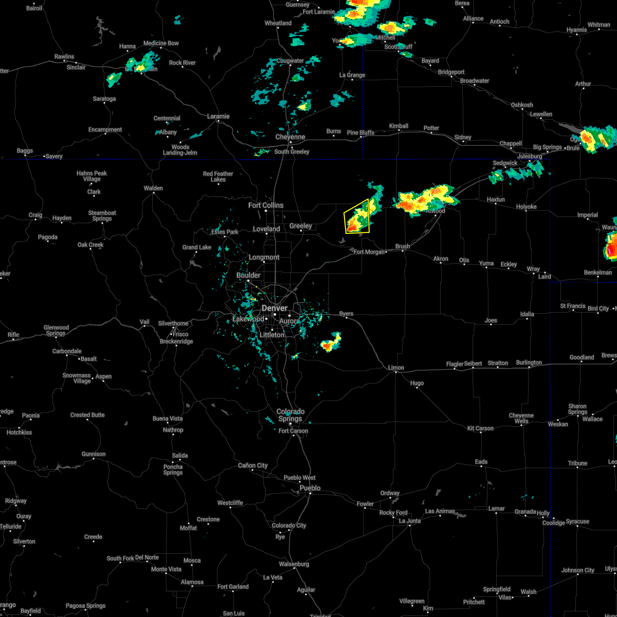 At 406 pm mdt, a severe thunderstorm was located 6 miles northwest of jackson reservoir, or 23 miles northwest of fort morgan, moving northeast at 15 mph (radar indicated). Hazards include 60 mph wind gusts and quarter size hail. Expect damage to roofs, siding, and trees. hail damage to vehicles is expected. This severe thunderstorm will remain over mainly rural areas of central weld and northwestern morgan counties. At 406 pm mdt, a severe thunderstorm was located 6 miles northwest of jackson reservoir, or 23 miles northwest of fort morgan, moving northeast at 15 mph (radar indicated). Hazards include 60 mph wind gusts and quarter size hail. Expect damage to roofs, siding, and trees. hail damage to vehicles is expected. This severe thunderstorm will remain over mainly rural areas of central weld and northwestern morgan counties.
|
| 5/26/2021 3:42 PM MDT |
 At 342 pm mdt, a severe thunderstorm was located 5 miles north of riverside reservoir, or 24 miles east of greeley, moving northeast at 15 mph (radar indicated). Hazards include golf ball size hail and 60 mph wind gusts. Expect damage to roofs, siding, and trees. people and animals outdoors will be injured. Expect hail damage to roofs, siding, windows, and vehicles. At 342 pm mdt, a severe thunderstorm was located 5 miles north of riverside reservoir, or 24 miles east of greeley, moving northeast at 15 mph (radar indicated). Hazards include golf ball size hail and 60 mph wind gusts. Expect damage to roofs, siding, and trees. people and animals outdoors will be injured. Expect hail damage to roofs, siding, windows, and vehicles.
|
| 5/22/2021 4:12 PM MDT |
 At 412 pm mdt, a severe thunderstorm was located 10 miles south of briggsdale, or 25 miles east of greeley, moving north at 35 mph (radar indicated). Hazards include quarter size hail. Damage to vehicles is expected. Locations impacted include, wiggins, orchard, weldona, jackson reservoir, riverside reservoir, briggsdale and goodrich. At 412 pm mdt, a severe thunderstorm was located 10 miles south of briggsdale, or 25 miles east of greeley, moving north at 35 mph (radar indicated). Hazards include quarter size hail. Damage to vehicles is expected. Locations impacted include, wiggins, orchard, weldona, jackson reservoir, riverside reservoir, briggsdale and goodrich.
|
| 5/22/2021 3:53 PM MDT |
 At 353 pm mdt, a severe thunderstorm was located 4 miles west of riverside reservoir, or 22 miles east of greeley, moving north at 35 mph (radar indicated). Hazards include quarter size hail. damage to vehicles is expected At 353 pm mdt, a severe thunderstorm was located 4 miles west of riverside reservoir, or 22 miles east of greeley, moving north at 35 mph (radar indicated). Hazards include quarter size hail. damage to vehicles is expected
|
| 5/14/2021 8:52 PM MDT |
 At 852 pm mdt, a severe thunderstorm was located near wiggins, or 12 miles west of fort morgan, moving southeast at 30 mph (trained weather spotters). Hazards include 60 mph wind gusts and quarter size hail. Expect damage to roofs, siding, and trees. Hail damage to vehicles is expected. At 852 pm mdt, a severe thunderstorm was located near wiggins, or 12 miles west of fort morgan, moving southeast at 30 mph (trained weather spotters). Hazards include 60 mph wind gusts and quarter size hail. Expect damage to roofs, siding, and trees. Hail damage to vehicles is expected.
|
| 5/14/2021 8:38 PM MDT |
 At 838 pm mdt, a severe thunderstorm was located over orchard, or 16 miles west of fort morgan, moving southeast at 40 mph (radar indicated). Hazards include 60 mph wind gusts and quarter size hail. Expect damage to roofs, siding, and trees. hail damage to vehicles is expected. Locations impacted include, jackson reservoir, orchard, riverside reservoir, weldona and goodrich. At 838 pm mdt, a severe thunderstorm was located over orchard, or 16 miles west of fort morgan, moving southeast at 40 mph (radar indicated). Hazards include 60 mph wind gusts and quarter size hail. Expect damage to roofs, siding, and trees. hail damage to vehicles is expected. Locations impacted include, jackson reservoir, orchard, riverside reservoir, weldona and goodrich.
|
| 5/14/2021 8:14 PM MDT |
 At 814 pm mdt, a severe thunderstorm was located 10 miles southeast of briggsdale, or 28 miles northwest of fort morgan, moving southeast at 25 mph (radar indicated). Hazards include 60 mph wind gusts and quarter size hail. Expect damage to roofs, siding, and trees. Hail damage to vehicles is expected. At 814 pm mdt, a severe thunderstorm was located 10 miles southeast of briggsdale, or 28 miles northwest of fort morgan, moving southeast at 25 mph (radar indicated). Hazards include 60 mph wind gusts and quarter size hail. Expect damage to roofs, siding, and trees. Hail damage to vehicles is expected.
|
| 8/5/2020 4:45 PM MDT |
 At 444 pm mdt, a severe thunderstorm was located near log lane village, or 5 miles west of fort morgan, moving northeast at 35 mph (radar indicated). Hazards include 60 mph wind gusts and quarter size hail. Expect damage to roofs, siding, and trees. Hail damage to vehicles is expected. At 444 pm mdt, a severe thunderstorm was located near log lane village, or 5 miles west of fort morgan, moving northeast at 35 mph (radar indicated). Hazards include 60 mph wind gusts and quarter size hail. Expect damage to roofs, siding, and trees. Hail damage to vehicles is expected.
|
| 7/9/2020 9:25 PM MDT |
 The severe thunderstorm warning for central weld and northwestern morgan counties will expire at 930 pm mdt, the storm which prompted the warning has weakened below severe limits, and no longer poses an immediate threat to life or property. therefore, the warning will be allowed to expire. however small hail, heavy rain and gusty winds are still possible with this thunderstorm. The severe thunderstorm warning for central weld and northwestern morgan counties will expire at 930 pm mdt, the storm which prompted the warning has weakened below severe limits, and no longer poses an immediate threat to life or property. therefore, the warning will be allowed to expire. however small hail, heavy rain and gusty winds are still possible with this thunderstorm.
|
| 7/9/2020 9:15 PM MDT |
 At 915 pm mdt, a severe thunderstorm was located 5 miles northeast of riverside reservoir, or 22 miles northwest of fort morgan, moving northeast at 50 mph (radar indicated). Hazards include 60 mph wind gusts and quarter size hail. Expect damage to roofs, siding, and trees. hail damage to vehicles is expected. Locations impacted include, jackson reservoir, riverside reservoir and orchard. At 915 pm mdt, a severe thunderstorm was located 5 miles northeast of riverside reservoir, or 22 miles northwest of fort morgan, moving northeast at 50 mph (radar indicated). Hazards include 60 mph wind gusts and quarter size hail. Expect damage to roofs, siding, and trees. hail damage to vehicles is expected. Locations impacted include, jackson reservoir, riverside reservoir and orchard.
|
| 7/9/2020 8:51 PM MDT |
 At 851 pm mdt, a severe thunderstorm was located 8 miles southeast of kersey, or 16 miles southeast of greeley, moving northeast at 40 mph (radar indicated). Hazards include 60 mph wind gusts and quarter size hail. Expect damage to roofs, siding, and trees. Hail damage to vehicles is expected. At 851 pm mdt, a severe thunderstorm was located 8 miles southeast of kersey, or 16 miles southeast of greeley, moving northeast at 40 mph (radar indicated). Hazards include 60 mph wind gusts and quarter size hail. Expect damage to roofs, siding, and trees. Hail damage to vehicles is expected.
|
| 6/6/2020 4:36 PM MDT |
 At 433 pm mdt, severe thunderstorms were located along a line extending from 4 miles northwest of briggsdale to near bennett, or along a line extending from 25 miles northeast of greeley to 26 miles east of denver, moving northeast at 60 mph (radar indicated). Hazards include 80 mph wind gusts. Expect considerable tree damage. Damage is likely to mobile homes, roofs, and outbuildings. At 433 pm mdt, severe thunderstorms were located along a line extending from 4 miles northwest of briggsdale to near bennett, or along a line extending from 25 miles northeast of greeley to 26 miles east of denver, moving northeast at 60 mph (radar indicated). Hazards include 80 mph wind gusts. Expect considerable tree damage. Damage is likely to mobile homes, roofs, and outbuildings.
|
| 5/3/2020 7:47 PM MDT |
 At 747 pm mdt, a severe thunderstorm was located near jackson reservoir, or 20 miles northwest of fort morgan, moving east at 25 mph (radar indicated). Hazards include quarter size hail. damage to vehicles is expected At 747 pm mdt, a severe thunderstorm was located near jackson reservoir, or 20 miles northwest of fort morgan, moving east at 25 mph (radar indicated). Hazards include quarter size hail. damage to vehicles is expected
|
| 9/11/2019 6:23 PM MDT |
 At 620 pm mdt, a severe thunderstorm was located over new raymer, or 24 miles north of fort morgan, moving east at 50 mph. baseball sized hail was reported at cr jj and cr 14 in morgan county, approximately 18 miles north of fort morgan. this is a very dangerous storm (trained weather spotters). Hazards include baseball size hail. People and animals outdoors will be severely injured. expect shattered windows, extensive damage to roofs, siding, and vehicles. Locations impacted include, sterling, merino, new raymer, keota, antelope springs, stoneham, westplains, atwood, logan corners, north sterling reservoir, pawnee pass and willard. At 620 pm mdt, a severe thunderstorm was located over new raymer, or 24 miles north of fort morgan, moving east at 50 mph. baseball sized hail was reported at cr jj and cr 14 in morgan county, approximately 18 miles north of fort morgan. this is a very dangerous storm (trained weather spotters). Hazards include baseball size hail. People and animals outdoors will be severely injured. expect shattered windows, extensive damage to roofs, siding, and vehicles. Locations impacted include, sterling, merino, new raymer, keota, antelope springs, stoneham, westplains, atwood, logan corners, north sterling reservoir, pawnee pass and willard.
|
| 9/11/2019 6:15 PM MDT |
 At 615 pm mdt, a severe thunderstorm was located 6 miles west of new raymer, or 23 miles north of fort morgan, moving east at 50 mph (radar indicated). Hazards include ping pong ball size hail. People and animals outdoors will be injured. Expect damage to roofs, siding, windows, and vehicles. At 615 pm mdt, a severe thunderstorm was located 6 miles west of new raymer, or 23 miles north of fort morgan, moving east at 50 mph (radar indicated). Hazards include ping pong ball size hail. People and animals outdoors will be injured. Expect damage to roofs, siding, windows, and vehicles.
|
| 9/11/2019 5:44 PM MDT |
 At 544 pm mdt, a severe thunderstorm was located 8 miles east of barnesville, or 22 miles east of greeley, moving northeast at 45 mph (radar indicated). Hazards include ping pong ball size hail and 60 mph wind gusts. Expect damage to roofs, siding, and trees. people and animals outdoors will be injured. Expect hail damage to roofs, siding, windows, and vehicles. At 544 pm mdt, a severe thunderstorm was located 8 miles east of barnesville, or 22 miles east of greeley, moving northeast at 45 mph (radar indicated). Hazards include ping pong ball size hail and 60 mph wind gusts. Expect damage to roofs, siding, and trees. people and animals outdoors will be injured. Expect hail damage to roofs, siding, windows, and vehicles.
|
| 9/8/2019 7:12 PM MDT |
 The severe thunderstorm warning for south central weld, eastern arapahoe, western morgan, southwestern washington and eastern adams counties will expire at 715 pm mdt, the storms which prompted the warning have weakened below severe limits, and no longer pose an immediate threat to life or property. therefore, the warning will be allowed to expire. however gusty winds up to 45 mph are still possible with these thunderstorms. a severe thunderstorm watch remains in effect until 900 pm mdt for northeastern colorado. The severe thunderstorm warning for south central weld, eastern arapahoe, western morgan, southwestern washington and eastern adams counties will expire at 715 pm mdt, the storms which prompted the warning have weakened below severe limits, and no longer pose an immediate threat to life or property. therefore, the warning will be allowed to expire. however gusty winds up to 45 mph are still possible with these thunderstorms. a severe thunderstorm watch remains in effect until 900 pm mdt for northeastern colorado.
|
| 9/8/2019 6:48 PM MDT |
 At 646 pm mdt, severe thunderstorms were located along a line extending from 6 miles east of barnesville to near cottonwood valley, or along a line extending from 20 miles east of greeley to 25 miles north of limon, moving east and northeast at 35 mph (radar indicated). Hazards include 60 mph wind gusts and quarter size hail. Expect damage to roofs, siding, and trees. hail damage to vehicles is expected. Locations impacted include, kersey, wiggins, deer trail, hoyt, shamrock, leader, weldona, twelve-mile corner, jackson reservoir, orchard, adena, prospect valley, cottonwood valley, riverside reservoir, last chance, goodrich and roggen. At 646 pm mdt, severe thunderstorms were located along a line extending from 6 miles east of barnesville to near cottonwood valley, or along a line extending from 20 miles east of greeley to 25 miles north of limon, moving east and northeast at 35 mph (radar indicated). Hazards include 60 mph wind gusts and quarter size hail. Expect damage to roofs, siding, and trees. hail damage to vehicles is expected. Locations impacted include, kersey, wiggins, deer trail, hoyt, shamrock, leader, weldona, twelve-mile corner, jackson reservoir, orchard, adena, prospect valley, cottonwood valley, riverside reservoir, last chance, goodrich and roggen.
|
| 9/8/2019 6:34 PM MDT |
 At 633 pm mdt, severe thunderstorms were located along a line extending from kersey to near deer trail, or along a line extending from 10 miles east of greeley to 29 miles northwest of limon, moving east at 25 mph (radar indicated). Hazards include 60 mph wind gusts and quarter size hail. a brief weak landspout tornado is also possible with these line of storms. Expect damage to roofs, siding, and trees. Hail damage to vehicles is expected. At 633 pm mdt, severe thunderstorms were located along a line extending from kersey to near deer trail, or along a line extending from 10 miles east of greeley to 29 miles northwest of limon, moving east at 25 mph (radar indicated). Hazards include 60 mph wind gusts and quarter size hail. a brief weak landspout tornado is also possible with these line of storms. Expect damage to roofs, siding, and trees. Hail damage to vehicles is expected.
|
| 6/30/2019 8:08 PM MDT |
 The severe thunderstorm warning for central weld and northwestern morgan counties will expire at 815 pm mdt, the storm which prompted the warning has weakened below severe limits, and has exited the warned area. therefore, the warning will be allowed to expire. however, heavy rain is still possible with this thunderstorm. this may cause localized field flooding or standing water on roadways. The severe thunderstorm warning for central weld and northwestern morgan counties will expire at 815 pm mdt, the storm which prompted the warning has weakened below severe limits, and has exited the warned area. therefore, the warning will be allowed to expire. however, heavy rain is still possible with this thunderstorm. this may cause localized field flooding or standing water on roadways.
|
| 6/30/2019 7:28 PM MDT |
 At 727 pm mdt, a severe thunderstorm was located 10 miles southeast of briggsdale, or 27 miles east of greeley, moving north at 15 mph. this is a very dangerous storm (radar indicated). Hazards include 80 mph wind gusts and penny size hail. Flying debris will be dangerous to those caught without shelter. mobile homes will be heavily damaged. expect considerable damage to roofs, windows, and vehicles. Extensive tree damage and power outages are likely. At 727 pm mdt, a severe thunderstorm was located 10 miles southeast of briggsdale, or 27 miles east of greeley, moving north at 15 mph. this is a very dangerous storm (radar indicated). Hazards include 80 mph wind gusts and penny size hail. Flying debris will be dangerous to those caught without shelter. mobile homes will be heavily damaged. expect considerable damage to roofs, windows, and vehicles. Extensive tree damage and power outages are likely.
|
| 6/8/2019 7:25 PM MDT |
 At 700 pm mdt, a severe thunderstorm was located 7 miles east of prospect valley, or 27 miles southwest of fort morgan, moving northeast at 40 mph (radar indicated). Hazards include 60 mph wind gusts and half dollar size hail. Expect damage to roofs, siding, and trees. Hail damage to vehicles is expected. At 700 pm mdt, a severe thunderstorm was located 7 miles east of prospect valley, or 27 miles southwest of fort morgan, moving northeast at 40 mph (radar indicated). Hazards include 60 mph wind gusts and half dollar size hail. Expect damage to roofs, siding, and trees. Hail damage to vehicles is expected.
|
| 6/8/2019 7:00 PM MDT |
 At 700 pm mdt, a severe thunderstorm was located 7 miles east of prospect valley, or 27 miles southwest of fort morgan, moving northeast at 40 mph (radar indicated). Hazards include 60 mph wind gusts and half dollar size hail. Expect damage to roofs, siding, and trees. Hail damage to vehicles is expected. At 700 pm mdt, a severe thunderstorm was located 7 miles east of prospect valley, or 27 miles southwest of fort morgan, moving northeast at 40 mph (radar indicated). Hazards include 60 mph wind gusts and half dollar size hail. Expect damage to roofs, siding, and trees. Hail damage to vehicles is expected.
|
| 5/27/2019 2:41 PM MDT |
 At 241 pm mdt, a severe thunderstorm was located 5 miles northeast of weldona, or 9 miles northwest of fort morgan, moving northeast at 35 mph (radar indicated). Hazards include half dollar size hail. Damage to vehicles is expected. Hail may accumulate on roadways causing hazardous travel. At 241 pm mdt, a severe thunderstorm was located 5 miles northeast of weldona, or 9 miles northwest of fort morgan, moving northeast at 35 mph (radar indicated). Hazards include half dollar size hail. Damage to vehicles is expected. Hail may accumulate on roadways causing hazardous travel.
|
| 5/27/2019 2:22 PM MDT |
 At 222 pm mdt, a severe thunderstorm was located 4 miles southwest of weldona, or 11 miles west of fort morgan, moving northeast at 30 mph (radar indicated). Hazards include 70 mph wind gusts and quarter size hail. Expect considerable tree damage. damage is likely to mobile homes, roofs, and outbuildings. hail damage to vehicles is expected. Locations impacted include, wiggins, jackson reservoir, orchard, weldona and goodrich. At 222 pm mdt, a severe thunderstorm was located 4 miles southwest of weldona, or 11 miles west of fort morgan, moving northeast at 30 mph (radar indicated). Hazards include 70 mph wind gusts and quarter size hail. Expect considerable tree damage. damage is likely to mobile homes, roofs, and outbuildings. hail damage to vehicles is expected. Locations impacted include, wiggins, jackson reservoir, orchard, weldona and goodrich.
|
| 5/27/2019 2:00 PM MDT |
 At 200 pm mdt, a severe thunderstorm was located 5 miles southwest of wiggins, or 18 miles southwest of fort morgan, moving north at 15 mph (radar indicated). Hazards include 70 mph wind gusts and ping pong ball size hail. Expect considerable tree damage. damage is likely to mobile homes, roofs, and outbuildings. people and animals outdoors will be injured. Expect hail damage to roofs, siding, windows, and vehicles. At 200 pm mdt, a severe thunderstorm was located 5 miles southwest of wiggins, or 18 miles southwest of fort morgan, moving north at 15 mph (radar indicated). Hazards include 70 mph wind gusts and ping pong ball size hail. Expect considerable tree damage. damage is likely to mobile homes, roofs, and outbuildings. people and animals outdoors will be injured. Expect hail damage to roofs, siding, windows, and vehicles.
|
| 5/26/2019 4:13 PM MDT |
 At 413 pm mdt, a severe thunderstorm was located 8 miles north of jackson reservoir, or 23 miles northwest of fort morgan, moving north at 40 mph (radar indicated). Hazards include 60 mph wind gusts and quarter size hail. Expect damage to roofs, siding, and trees. Hail damage to vehicles is expected. At 413 pm mdt, a severe thunderstorm was located 8 miles north of jackson reservoir, or 23 miles northwest of fort morgan, moving north at 40 mph (radar indicated). Hazards include 60 mph wind gusts and quarter size hail. Expect damage to roofs, siding, and trees. Hail damage to vehicles is expected.
|
| 5/26/2019 3:57 PM MDT |
 At 357 pm mdt, a severe thunderstorm was located over goodrich, or 16 miles west of fort morgan, moving north at 50 mph (radar indicated). Hazards include 60 mph wind gusts and quarter size hail. Expect damage to roofs, siding, and trees. Hail damage to vehicles is expected. At 357 pm mdt, a severe thunderstorm was located over goodrich, or 16 miles west of fort morgan, moving north at 50 mph (radar indicated). Hazards include 60 mph wind gusts and quarter size hail. Expect damage to roofs, siding, and trees. Hail damage to vehicles is expected.
|
| 5/17/2019 2:55 PM MDT |
 At 254 pm mdt, severe thunderstorms were located along a line extending from 5 miles west of pawnee buttes to 3 miles south of kersey, or along a line extending from 34 miles southwest of kimball to 11 miles southeast of greeley, moving northeast at 25 mph (radar indicated). Hazards include 70 mph wind gusts and quarter size hail. Expect considerable tree damage. damage is likely to mobile homes, roofs, and outbuildings. hail damage to vehicles is expected. Locations impacted include, southeastern greeley, evans, lasalle, kersey, galeton, gill, jackson reservoir, barnesville, keota, orchard, riverside reservoir, milton reservoir, briggsdale, pawnee buttes and roggen. At 254 pm mdt, severe thunderstorms were located along a line extending from 5 miles west of pawnee buttes to 3 miles south of kersey, or along a line extending from 34 miles southwest of kimball to 11 miles southeast of greeley, moving northeast at 25 mph (radar indicated). Hazards include 70 mph wind gusts and quarter size hail. Expect considerable tree damage. damage is likely to mobile homes, roofs, and outbuildings. hail damage to vehicles is expected. Locations impacted include, southeastern greeley, evans, lasalle, kersey, galeton, gill, jackson reservoir, barnesville, keota, orchard, riverside reservoir, milton reservoir, briggsdale, pawnee buttes and roggen.
|
| 5/17/2019 2:41 PM MDT |
 At 240 pm mdt, severe thunderstorms were located along a line extending from 7 miles south of keota to 3 miles north of roggen, or along a line extending from 28 miles northwest of fort morgan to 23 miles southeast of greeley, moving northeast at 35 mph (radar indicated). Hazards include 70 mph wind gusts and quarter size hail. Expect considerable tree damage. damage is likely to mobile homes, roofs, and outbuildings. Hail damage to vehicles is expected. At 240 pm mdt, severe thunderstorms were located along a line extending from 7 miles south of keota to 3 miles north of roggen, or along a line extending from 28 miles northwest of fort morgan to 23 miles southeast of greeley, moving northeast at 35 mph (radar indicated). Hazards include 70 mph wind gusts and quarter size hail. Expect considerable tree damage. damage is likely to mobile homes, roofs, and outbuildings. Hail damage to vehicles is expected.
|
| 8/8/2018 7:53 AM MDT |
 At 753 am mdt, a severe thunderstorm was located 7 miles northeast of jackson reservoir, or 18 miles northwest of fort morgan, moving south at 15 mph (radar indicated). Hazards include quarter size hail. Damage to vehicles is expected. Locations impacted include, weldona, jackson reservoir and goodrich. At 753 am mdt, a severe thunderstorm was located 7 miles northeast of jackson reservoir, or 18 miles northwest of fort morgan, moving south at 15 mph (radar indicated). Hazards include quarter size hail. Damage to vehicles is expected. Locations impacted include, weldona, jackson reservoir and goodrich.
|
| 8/8/2018 7:28 AM MDT |
 At 728 am mdt, a severe thunderstorm was located 8 miles west of new raymer, or 24 miles northwest of fort morgan, moving south at 15 mph (radar indicated). Hazards include half dollar size hail. damage to vehicles is expected At 728 am mdt, a severe thunderstorm was located 8 miles west of new raymer, or 24 miles northwest of fort morgan, moving south at 15 mph (radar indicated). Hazards include half dollar size hail. damage to vehicles is expected
|
| 8/6/2018 5:43 PM MDT |
 At 542 pm mdt, a severe thunderstorm was located near wiggins, or 13 miles west of fort morgan, moving southeast at 20 mph (radar indicated). Hazards include two inch hail and 60 mph wind gusts. one inch hail, 1.00, was reported with this storm 4 miles southeast of orchard at 5:38 pm mdt. Expect damage to roofs, siding, and trees. people and animals outdoors will be injured. expect hail damage to roofs, siding, windows, and vehicles. Locations impacted include, wiggins, jackson reservoir, orchard, riverside reservoir, weldona and goodrich. At 542 pm mdt, a severe thunderstorm was located near wiggins, or 13 miles west of fort morgan, moving southeast at 20 mph (radar indicated). Hazards include two inch hail and 60 mph wind gusts. one inch hail, 1.00, was reported with this storm 4 miles southeast of orchard at 5:38 pm mdt. Expect damage to roofs, siding, and trees. people and animals outdoors will be injured. expect hail damage to roofs, siding, windows, and vehicles. Locations impacted include, wiggins, jackson reservoir, orchard, riverside reservoir, weldona and goodrich.
|
| 8/6/2018 5:12 PM MDT |
 At 512 pm mdt, a severe thunderstorm was located 5 miles west of jackson reservoir, or 21 miles northwest of fort morgan, moving southeast at 20 mph (radar indicated). Hazards include tennis ball size hail and 60 mph wind gusts. Expect damage to roofs, siding, and trees. people and animals outdoors will be injured. Expect hail damage to roofs, siding, windows, and vehicles. At 512 pm mdt, a severe thunderstorm was located 5 miles west of jackson reservoir, or 21 miles northwest of fort morgan, moving southeast at 20 mph (radar indicated). Hazards include tennis ball size hail and 60 mph wind gusts. Expect damage to roofs, siding, and trees. people and animals outdoors will be injured. Expect hail damage to roofs, siding, windows, and vehicles.
|
| 8/6/2018 4:57 PM MDT |
 At 455 pm mdt, a severe thunderstorm was located 10 miles north of riverside reservoir, or 26 miles east of greeley, moving southeast at 20 mph. this is a very dangerous storm (radar indicated). Hazards include baseball size hail and 60 mph wind gusts. there was a report of 2.75 inch hail 5 miles south-southwest of briggsdale in weld county at 4:30 pm with this storm. People and animals outdoors will be severely injured. expect shattered windows, extensive damage to roofs, siding, and vehicles. Locations impacted include, jackson reservoir, orchard, riverside reservoir, weldona, briggsdale and goodrich. At 455 pm mdt, a severe thunderstorm was located 10 miles north of riverside reservoir, or 26 miles east of greeley, moving southeast at 20 mph. this is a very dangerous storm (radar indicated). Hazards include baseball size hail and 60 mph wind gusts. there was a report of 2.75 inch hail 5 miles south-southwest of briggsdale in weld county at 4:30 pm with this storm. People and animals outdoors will be severely injured. expect shattered windows, extensive damage to roofs, siding, and vehicles. Locations impacted include, jackson reservoir, orchard, riverside reservoir, weldona, briggsdale and goodrich.
|
| 8/6/2018 4:40 PM MDT | Golf Ball sized hail reported 14.1 miles ESE of Jackson Lake, CO |
| 8/6/2018 4:27 PM MDT |
 At 426 pm mdt, a severe thunderstorm was located near briggsdale, or 25 miles northeast of greeley, moving southeast at 25 mph (radar indicated). Hazards include two inch hail and 70 mph wind gusts. Expect considerable tree damage. damage is likely to mobile homes, roofs, and outbuildings. people and animals outdoors will be injured. Expect hail damage to roofs, siding, windows, and vehicles. At 426 pm mdt, a severe thunderstorm was located near briggsdale, or 25 miles northeast of greeley, moving southeast at 25 mph (radar indicated). Hazards include two inch hail and 70 mph wind gusts. Expect considerable tree damage. damage is likely to mobile homes, roofs, and outbuildings. people and animals outdoors will be injured. Expect hail damage to roofs, siding, windows, and vehicles.
|
| 7/29/2018 4:58 PM MDT |
 At 457 pm mdt, a severe thunderstorm was located near jackson reservoir, or 16 miles northwest of fort morgan, moving southeast at 50 mph (radar indicated). Hazards include ping pong ball size hail and 60 mph wind gusts. Expect damage to roofs, siding, and trees. people and animals outdoors will be injured. Expect hail damage to roofs, siding, windows, and vehicles. At 457 pm mdt, a severe thunderstorm was located near jackson reservoir, or 16 miles northwest of fort morgan, moving southeast at 50 mph (radar indicated). Hazards include ping pong ball size hail and 60 mph wind gusts. Expect damage to roofs, siding, and trees. people and animals outdoors will be injured. Expect hail damage to roofs, siding, windows, and vehicles.
|
| 7/29/2018 4:26 PM MDT |
 At 426 pm mdt, a severe thunderstorm capable of producing a tornado was located near briggsdale, or 30 miles northeast of greeley, moving southeast at 40 mph (radar indicated rotation). Hazards include tornado and hail up to two inches in diameter. Flying debris will be dangerous to those caught without shelter. mobile homes will be damaged or destroyed. damage to roofs, windows, and vehicles will occur. Tree damage is likely. At 426 pm mdt, a severe thunderstorm capable of producing a tornado was located near briggsdale, or 30 miles northeast of greeley, moving southeast at 40 mph (radar indicated rotation). Hazards include tornado and hail up to two inches in diameter. Flying debris will be dangerous to those caught without shelter. mobile homes will be damaged or destroyed. damage to roofs, windows, and vehicles will occur. Tree damage is likely.
|
| 7/4/2018 8:56 PM MDT |
 The national weather service in denver colorado has issued a * severe thunderstorm warning for. east central weld county in northeastern colorado. northwestern morgan county in northeastern colorado. until 945 pm mdt. At 856 pm mdt, a severe thunderstorm was located 9 miles north of. The national weather service in denver colorado has issued a * severe thunderstorm warning for. east central weld county in northeastern colorado. northwestern morgan county in northeastern colorado. until 945 pm mdt. At 856 pm mdt, a severe thunderstorm was located 9 miles north of.
|
| 7/4/2018 8:31 PM MDT |
 At 831 pm mdt, a severe thunderstorm was located 10 miles southeast of briggsdale, or 27 miles east of greeley, moving east at 15 mph (radar indicated). Hazards include 60 mph wind gusts and quarter size hail. Expect damage to roofs, siding, and trees. hail damage to vehicles is expected. Locations impacted include, jackson reservoir. At 831 pm mdt, a severe thunderstorm was located 10 miles southeast of briggsdale, or 27 miles east of greeley, moving east at 15 mph (radar indicated). Hazards include 60 mph wind gusts and quarter size hail. Expect damage to roofs, siding, and trees. hail damage to vehicles is expected. Locations impacted include, jackson reservoir.
|
| 7/4/2018 8:09 PM MDT |
 At 808 pm mdt, a severe thunderstorm was located 5 miles east of barnesville, or 20 miles east of greeley, moving east at 10 mph (radar indicated). Hazards include 60 mph wind gusts and quarter size hail. Expect damage to roofs, siding, and trees. Hail damage to vehicles is expected. At 808 pm mdt, a severe thunderstorm was located 5 miles east of barnesville, or 20 miles east of greeley, moving east at 10 mph (radar indicated). Hazards include 60 mph wind gusts and quarter size hail. Expect damage to roofs, siding, and trees. Hail damage to vehicles is expected.
|
| 6/19/2018 6:05 PM MDT |
 At 604 pm mdt, a severe thunderstorm was located over jackson reservoir, or 17 miles northwest of fort morgan, moving east at 25 mph (radar indicated). Hazards include 60 mph wind gusts and quarter size hail. Expect damage to roofs, siding, and trees. Hail damage to vehicles is expected. At 604 pm mdt, a severe thunderstorm was located over jackson reservoir, or 17 miles northwest of fort morgan, moving east at 25 mph (radar indicated). Hazards include 60 mph wind gusts and quarter size hail. Expect damage to roofs, siding, and trees. Hail damage to vehicles is expected.
|
| 6/18/2018 10:24 PM MDT |
 At 1023 pm mdt, a severe thunderstorm was located 4 miles northwest of wiggins, or 18 miles west of fort morgan, moving northeast at 30 mph (radar indicated). Hazards include golf ball size hail. People and animals outdoors will be injured. Expect damage to roofs, siding, windows, and vehicles. At 1023 pm mdt, a severe thunderstorm was located 4 miles northwest of wiggins, or 18 miles west of fort morgan, moving northeast at 30 mph (radar indicated). Hazards include golf ball size hail. People and animals outdoors will be injured. Expect damage to roofs, siding, windows, and vehicles.
|
| 6/18/2018 9:59 PM MDT |
 At 959 pm mdt, a severe thunderstorm was located 4 miles southwest of weldona, or 11 miles west of fort morgan, moving east at 30 mph (radar indicated). Hazards include half dollar size hail. damage to vehicles is expected At 959 pm mdt, a severe thunderstorm was located 4 miles southwest of weldona, or 11 miles west of fort morgan, moving east at 30 mph (radar indicated). Hazards include half dollar size hail. damage to vehicles is expected
|
| 6/18/2018 9:49 PM MDT |
 At 948 pm mdt, a severe thunderstorm was located near wiggins, or 17 miles west of fort morgan, moving northeast at 25 mph (trained weather spotters). Hazards include golf ball size hail. People and animals outdoors will be injured. expect damage to roofs, siding, windows, and vehicles. Locations impacted include, wiggins, goodrich and orchard. At 948 pm mdt, a severe thunderstorm was located near wiggins, or 17 miles west of fort morgan, moving northeast at 25 mph (trained weather spotters). Hazards include golf ball size hail. People and animals outdoors will be injured. expect damage to roofs, siding, windows, and vehicles. Locations impacted include, wiggins, goodrich and orchard.
|
| 6/18/2018 9:28 PM MDT |
 At 927 pm mdt, a severe thunderstorm was located 6 miles northeast of roggen, or 24 miles west of fort morgan, moving northeast at 25 mph (trained weather spotters). Hazards include golf ball size hail. People and animals outdoors will be injured. Expect damage to roofs, siding, windows, and vehicles. At 927 pm mdt, a severe thunderstorm was located 6 miles northeast of roggen, or 24 miles west of fort morgan, moving northeast at 25 mph (trained weather spotters). Hazards include golf ball size hail. People and animals outdoors will be injured. Expect damage to roofs, siding, windows, and vehicles.
|
| 6/18/2018 8:56 PM MDT |
 The severe thunderstorm warning for northwestern morgan county will expire at 900 pm mdt, the severe thunderstorm which prompted the warning has weakened. therefore, the warning will be allowed to expire. however small hail up to the size of marbles and frequent lightning will occur with this thunderstorm. a severe thunderstorm watch remains in effect until midnight mdt for northeastern colorado. The severe thunderstorm warning for northwestern morgan county will expire at 900 pm mdt, the severe thunderstorm which prompted the warning has weakened. therefore, the warning will be allowed to expire. however small hail up to the size of marbles and frequent lightning will occur with this thunderstorm. a severe thunderstorm watch remains in effect until midnight mdt for northeastern colorado.
|
| 6/18/2018 8:46 PM MDT |
 At 845 pm mdt, a severe thunderstorm was located near orchard, or 17 miles west of fort morgan, moving east at 20 mph (radar indicated). Hazards include quarter size hail. Damage to vehicles is expected. Locations impacted include, wiggins, jackson reservoir, orchard, weldona and goodrich. At 845 pm mdt, a severe thunderstorm was located near orchard, or 17 miles west of fort morgan, moving east at 20 mph (radar indicated). Hazards include quarter size hail. Damage to vehicles is expected. Locations impacted include, wiggins, jackson reservoir, orchard, weldona and goodrich.
|
| 6/18/2018 8:27 PM MDT |
 At 826 pm mdt, a severe thunderstorm was located near riverside reservoir, or 23 miles west of fort morgan, moving east at 20 mph (radar indicated). Hazards include golf ball size hail. People and animals outdoors will be injured. Expect damage to roofs, siding, windows, and vehicles. At 826 pm mdt, a severe thunderstorm was located near riverside reservoir, or 23 miles west of fort morgan, moving east at 20 mph (radar indicated). Hazards include golf ball size hail. People and animals outdoors will be injured. Expect damage to roofs, siding, windows, and vehicles.
|
| 6/6/2018 5:41 PM MDT |
 At 541 pm mdt, a severe thunderstorm was located near weldona, or 10 miles northwest of fort morgan, moving north at 15 mph (trained weather spotters). Hazards include golf ball size hail and 60 mph wind gusts. Expect damage to roofs, siding, and trees. people and animals outdoors will be injured. Expect hail damage to roofs, siding, windows, and vehicles. At 541 pm mdt, a severe thunderstorm was located near weldona, or 10 miles northwest of fort morgan, moving north at 15 mph (trained weather spotters). Hazards include golf ball size hail and 60 mph wind gusts. Expect damage to roofs, siding, and trees. people and animals outdoors will be injured. Expect hail damage to roofs, siding, windows, and vehicles.
|
| 6/6/2018 5:19 PM MDT |
 At 518 pm mdt, a severe thunderstorm was located 6 miles west of fort morgan, moving northeast at 20 mph. at 516 pm golfball hail was reported 8 miles west of fort morgan. additional thunderstorms are forming across extreme southeast weld county (trained spotter). Hazards include golf ball size hail and 60 mph wind gusts. Expect damage to roofs, siding, and trees. people and animals outdoors will be injured. Expect hail damage to roofs, siding, windows, and vehicles. At 518 pm mdt, a severe thunderstorm was located 6 miles west of fort morgan, moving northeast at 20 mph. at 516 pm golfball hail was reported 8 miles west of fort morgan. additional thunderstorms are forming across extreme southeast weld county (trained spotter). Hazards include golf ball size hail and 60 mph wind gusts. Expect damage to roofs, siding, and trees. people and animals outdoors will be injured. Expect hail damage to roofs, siding, windows, and vehicles.
|
| 5/28/2018 5:11 PM MDT |
 At 511 pm mdt, a severe thunderstorm capable of producing a tornado was located near jackson reservoir, or 16 miles northwest of fort morgan, moving north at 20 mph (radar indicated rotation). Hazards include tornado. Flying debris will be dangerous to those caught without shelter. mobile homes will be damaged or destroyed. damage to roofs, windows, and vehicles will occur. Tree damage is likely. At 511 pm mdt, a severe thunderstorm capable of producing a tornado was located near jackson reservoir, or 16 miles northwest of fort morgan, moving north at 20 mph (radar indicated rotation). Hazards include tornado. Flying debris will be dangerous to those caught without shelter. mobile homes will be damaged or destroyed. damage to roofs, windows, and vehicles will occur. Tree damage is likely.
|
| 5/21/2018 8:14 PM MDT |
 At 814 pm mdt, a severe thunderstorm was located near jackson reservoir, or 19 miles northwest of fort morgan, moving north at 25 mph (radar indicated). Hazards include ping pong ball size hail. People and animals outdoors will be injured. Expect damage to roofs, siding, windows, and vehicles. At 814 pm mdt, a severe thunderstorm was located near jackson reservoir, or 19 miles northwest of fort morgan, moving north at 25 mph (radar indicated). Hazards include ping pong ball size hail. People and animals outdoors will be injured. Expect damage to roofs, siding, windows, and vehicles.
|
| 7/24/2016 5:07 PM MDT |
 At 505 pm mdt, a severe thunderstorm was located 8 miles northwest of hoyt, or 20 miles southwest of fort morgan, moving north at 15 mph. another severe thunderstorm was located near keenseburg and moving east at 20 mph (radar indicated). Hazards include 60 mph wind gusts and quarter size hail. Hail damage to vehicles is expected. Expect wind damage to roofs, siding, and trees. At 505 pm mdt, a severe thunderstorm was located 8 miles northwest of hoyt, or 20 miles southwest of fort morgan, moving north at 15 mph. another severe thunderstorm was located near keenseburg and moving east at 20 mph (radar indicated). Hazards include 60 mph wind gusts and quarter size hail. Hail damage to vehicles is expected. Expect wind damage to roofs, siding, and trees.
|
| 6/30/2016 3:20 PM MDT |
 At 320 pm mdt, a severe thunderstorm was located 6 miles northwest of orchard, or 22 miles northwest of fort morgan, moving southeast at 5 mph (radar indicated). Hazards include quarter size hail. damage to vehicles is expected At 320 pm mdt, a severe thunderstorm was located 6 miles northwest of orchard, or 22 miles northwest of fort morgan, moving southeast at 5 mph (radar indicated). Hazards include quarter size hail. damage to vehicles is expected
|
| 5/7/2016 3:18 PM MDT |
 At 318 pm mdt, a confirmed tornado was located 4 miles northwest of jackson reservoir, or 21 miles northwest of fort morgan, moving north at 35 mph (weather spotters confirmed tornado). Hazards include damaging tornado and golf ball size hail. Flying debris will be dangerous to those caught without shelter. mobile homes will be damaged or destroyed. damage to roofs, windows and vehicles will occur. tree damage is likely. Locations impacted include, goodrich, riverside reservoir, orchard and jackson reservoir. At 318 pm mdt, a confirmed tornado was located 4 miles northwest of jackson reservoir, or 21 miles northwest of fort morgan, moving north at 35 mph (weather spotters confirmed tornado). Hazards include damaging tornado and golf ball size hail. Flying debris will be dangerous to those caught without shelter. mobile homes will be damaged or destroyed. damage to roofs, windows and vehicles will occur. tree damage is likely. Locations impacted include, goodrich, riverside reservoir, orchard and jackson reservoir.
|
| 5/7/2016 3:12 PM MDT |
 At 312 pm mdt, a severe thunderstorm capable of producing a tornado was located near orchard, or 20 miles west of fort morgan, moving north at 30 mph (radar indicated rotation). Hazards include tornado and golf ball size hail. Flying debris will be dangerous to those caught without shelter. mobile homes will be damaged or destroyed. damage to roofs, windows and vehicles will occur. Tree damage is likely. At 312 pm mdt, a severe thunderstorm capable of producing a tornado was located near orchard, or 20 miles west of fort morgan, moving north at 30 mph (radar indicated rotation). Hazards include tornado and golf ball size hail. Flying debris will be dangerous to those caught without shelter. mobile homes will be damaged or destroyed. damage to roofs, windows and vehicles will occur. Tree damage is likely.
|
| 5/7/2016 2:58 PM MDT |
 At 258 pm mdt, a confirmed tornado was located near wiggins, or 19 miles west of fort morgan, moving north at 25 mph (weather spotters confirmed tornado). Hazards include damaging tornado and golf ball size hail. Flying debris will be dangerous to those caught without shelter. mobile homes will be damaged or destroyed. damage to roofs, windows and vehicles will occur. tree damage is likely. Locations impacted include, wiggins, goodrich, riverside reservoir, orchard and jackson reservoir. At 258 pm mdt, a confirmed tornado was located near wiggins, or 19 miles west of fort morgan, moving north at 25 mph (weather spotters confirmed tornado). Hazards include damaging tornado and golf ball size hail. Flying debris will be dangerous to those caught without shelter. mobile homes will be damaged or destroyed. damage to roofs, windows and vehicles will occur. tree damage is likely. Locations impacted include, wiggins, goodrich, riverside reservoir, orchard and jackson reservoir.
|
| 5/7/2016 2:46 PM MDT |
 At 246 pm mdt, a severe thunderstorm capable of producing a tornado was located 5 miles west of wiggins, or 20 miles west of fort morgan, moving north at 35 mph (radar indicated rotation). Hazards include tornado and golf ball size hail. Flying debris will be dangerous to those caught without shelter. mobile homes will be damaged or destroyed. damage to roofs, windows and vehicles will occur. Tree damage is likely. At 246 pm mdt, a severe thunderstorm capable of producing a tornado was located 5 miles west of wiggins, or 20 miles west of fort morgan, moving north at 35 mph (radar indicated rotation). Hazards include tornado and golf ball size hail. Flying debris will be dangerous to those caught without shelter. mobile homes will be damaged or destroyed. damage to roofs, windows and vehicles will occur. Tree damage is likely.
|
| 5/7/2016 2:25 PM MDT |
 At 225 pm mdt, a severe thunderstorm was located 5 miles southwest of orchard, or 20 miles west of fort morgan, moving northeast at 30 mph (radar indicated). Hazards include golf ball size hail and 60 mph wind gusts. People and animals outdoors will be injured. expect hail damage to roofs, siding, windows and vehicles. expect wind damage to roofs, siding and trees. locations impacted include, wiggins, roggen, goodrich, riverside reservoir, orchard and jackson reservoir. A tornado watch remains in effect until 700 pm mdt for northeastern colorado. At 225 pm mdt, a severe thunderstorm was located 5 miles southwest of orchard, or 20 miles west of fort morgan, moving northeast at 30 mph (radar indicated). Hazards include golf ball size hail and 60 mph wind gusts. People and animals outdoors will be injured. expect hail damage to roofs, siding, windows and vehicles. expect wind damage to roofs, siding and trees. locations impacted include, wiggins, roggen, goodrich, riverside reservoir, orchard and jackson reservoir. A tornado watch remains in effect until 700 pm mdt for northeastern colorado.
|
| 5/7/2016 2:14 PM MDT |
 At 214 pm mdt, a severe thunderstorm was located 7 miles east of roggen, or 23 miles west of fort morgan, moving northeast at 30 mph (radar indicated). Hazards include ping pong ball size hail and 60 mph wind gusts. People and animals outdoors will be injured. expect hail damage to roofs, siding, windows and vehicles. Expect wind damage to roofs, siding and trees. At 214 pm mdt, a severe thunderstorm was located 7 miles east of roggen, or 23 miles west of fort morgan, moving northeast at 30 mph (radar indicated). Hazards include ping pong ball size hail and 60 mph wind gusts. People and animals outdoors will be injured. expect hail damage to roofs, siding, windows and vehicles. Expect wind damage to roofs, siding and trees.
|
| 8/7/2015 3:42 PM MDT |
 At 341 pm mdt, a severe thunderstorm was located near jackson reservoir, or 17 miles northwest of fort morgan, moving north at 15 mph (radar indicated). Hazards include golf ball size hail. People and animals outdoors will be injured. Expect damage to roofs, siding, windows and vehicles. At 341 pm mdt, a severe thunderstorm was located near jackson reservoir, or 17 miles northwest of fort morgan, moving north at 15 mph (radar indicated). Hazards include golf ball size hail. People and animals outdoors will be injured. Expect damage to roofs, siding, windows and vehicles.
|
| 8/7/2015 2:54 PM MDT |
 At 254 pm mdt, a severe thunderstorm was located near jackson reservoir, or 20 miles northwest of fort morgan, moving north at 10 mph (radar indicated). Hazards include quarter size hail. damage to vehicles is expected At 254 pm mdt, a severe thunderstorm was located near jackson reservoir, or 20 miles northwest of fort morgan, moving north at 10 mph (radar indicated). Hazards include quarter size hail. damage to vehicles is expected
|
| 7/26/2015 2:42 PM MDT | The severe thunderstorm warning for western morgan county will expire at 245 pm mdt, the storm which prompted the warning has weakened below severe limits, and no longer poses an immediate threat to life or property. therefore the warning will be allowed to expire. however small hail and heavy rain are still possible with this thunderstorm. a severe thunderstorm watch remains in effect until 600 pm mdt for northeastern colorado. a spotter located 6 miles south of wiggins in morgan county reported 1.00 inch hail at 2:08 pm mdt with this storm. |
| 7/26/2015 2:27 PM MDT |
 At 225 pm mdt, a severe thunderstorm was located near wiggins, or 13 miles west of fort morgan, moving north at 25 mph (radar indicated). Hazards include quarter size hail. Damage to vehicles is expected. locations impacted include, fort morgan, wiggins, log lane village, goodrich, adena school, orchard, jackson reservoir, hoyt, weldona and adena. a spotter located 6 miles south of wiggins in morgan county reported 1. 00 inch hail at 2:08 pm mdt with this storm. At 225 pm mdt, a severe thunderstorm was located near wiggins, or 13 miles west of fort morgan, moving north at 25 mph (radar indicated). Hazards include quarter size hail. Damage to vehicles is expected. locations impacted include, fort morgan, wiggins, log lane village, goodrich, adena school, orchard, jackson reservoir, hoyt, weldona and adena. a spotter located 6 miles south of wiggins in morgan county reported 1. 00 inch hail at 2:08 pm mdt with this storm.
|
| 7/26/2015 2:01 PM MDT |
 At 201 pm mdt, a severe thunderstorm was located 7 miles south of wiggins, or 17 miles southwest of fort morgan, moving north at 25 mph (radar indicated). Hazards include 60 mph wind gusts and quarter size hail. Hail damage to vehicles is expected. Expect wind damage to roofs, siding and trees. At 201 pm mdt, a severe thunderstorm was located 7 miles south of wiggins, or 17 miles southwest of fort morgan, moving north at 25 mph (radar indicated). Hazards include 60 mph wind gusts and quarter size hail. Hail damage to vehicles is expected. Expect wind damage to roofs, siding and trees.
|
| 6/25/2015 9:39 PM MDT |
 At 939 pm mdt, a severe thunderstorm was located 9 miles northwest of jackson reservoir, or 25 miles northwest of fort morgan, moving south at 30 mph (radar indicated). Hazards include 60 mph wind gusts and quarter size hail. Hail damage to vehicles is expected. Expect wind damage to roofs, siding and trees. At 939 pm mdt, a severe thunderstorm was located 9 miles northwest of jackson reservoir, or 25 miles northwest of fort morgan, moving south at 30 mph (radar indicated). Hazards include 60 mph wind gusts and quarter size hail. Hail damage to vehicles is expected. Expect wind damage to roofs, siding and trees.
|
| 6/23/2015 7:30 PM MDT |
 At 730 pm mdt, a severe thunderstorm was located near riverside reservoir, or 22 miles west of fort morgan, moving east at 20 mph (radar indicated). Hazards include 60 mph wind gusts and quarter size hail. Hail damage to vehicles is expected. Expect wind damage to roofs, siding and trees. At 730 pm mdt, a severe thunderstorm was located near riverside reservoir, or 22 miles west of fort morgan, moving east at 20 mph (radar indicated). Hazards include 60 mph wind gusts and quarter size hail. Hail damage to vehicles is expected. Expect wind damage to roofs, siding and trees.
|
| 6/16/2015 6:16 PM MDT |
 At 616 pm mdt, a severe thunderstorm was located 4 miles south of wiggins, or 16 miles southwest of fort morgan, moving east at 35 mph (radar indicated). Hazards include 60 mph wind gusts and quarter size hail. Hail damage to vehicles is expected. Expect wind damage to roofs, siding and trees. At 616 pm mdt, a severe thunderstorm was located 4 miles south of wiggins, or 16 miles southwest of fort morgan, moving east at 35 mph (radar indicated). Hazards include 60 mph wind gusts and quarter size hail. Hail damage to vehicles is expected. Expect wind damage to roofs, siding and trees.
|
| 5/15/2015 2:32 PM MDT | At 231 pm mdt, a severe thunderstorm capable of producing a tornado was located 5 miles northeast of weldona, or 12 miles northwest of fort morgan, moving north at 25 mph. spotters to the north of fort morgan have reported funnel clouds with this thunderstorm (weather spotters reported funnel cloud). Hazards include tornado and quarter size hail. Expect damage to mobile homes. Roofs and vehicles. |
| 7/20/2013 5:52 PM MDT | Golf Ball sized hail reported 17.6 miles SSE of Jackson Lake, CO |
| 6/6/2012 4:57 PM MDT | Half Dollar sized hail reported 16.8 miles SSE of Jackson Lake, CO |
Hail Maps for Jackson Lake, CO
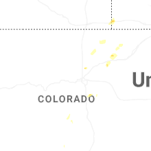
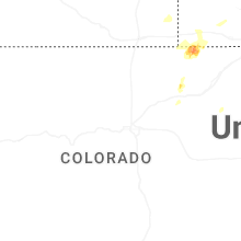
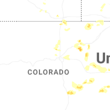
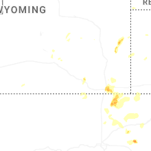
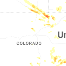
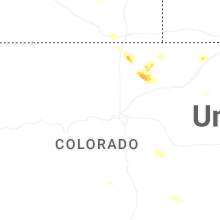
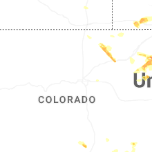

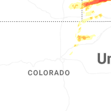
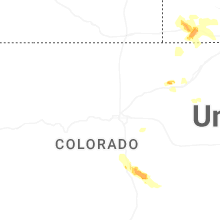
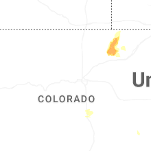
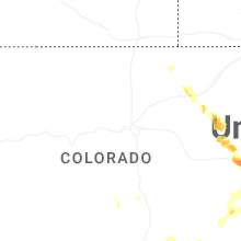
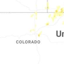


Connect with Interactive Hail Maps