

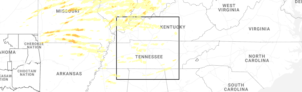
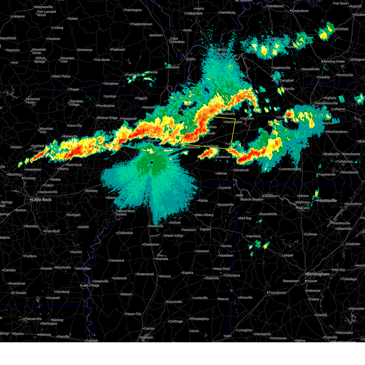
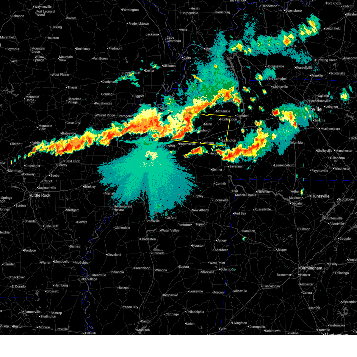
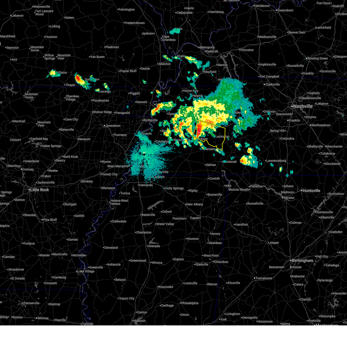
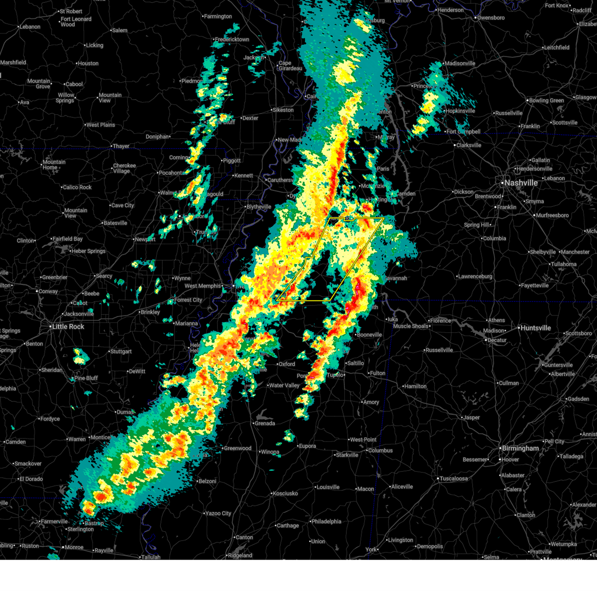
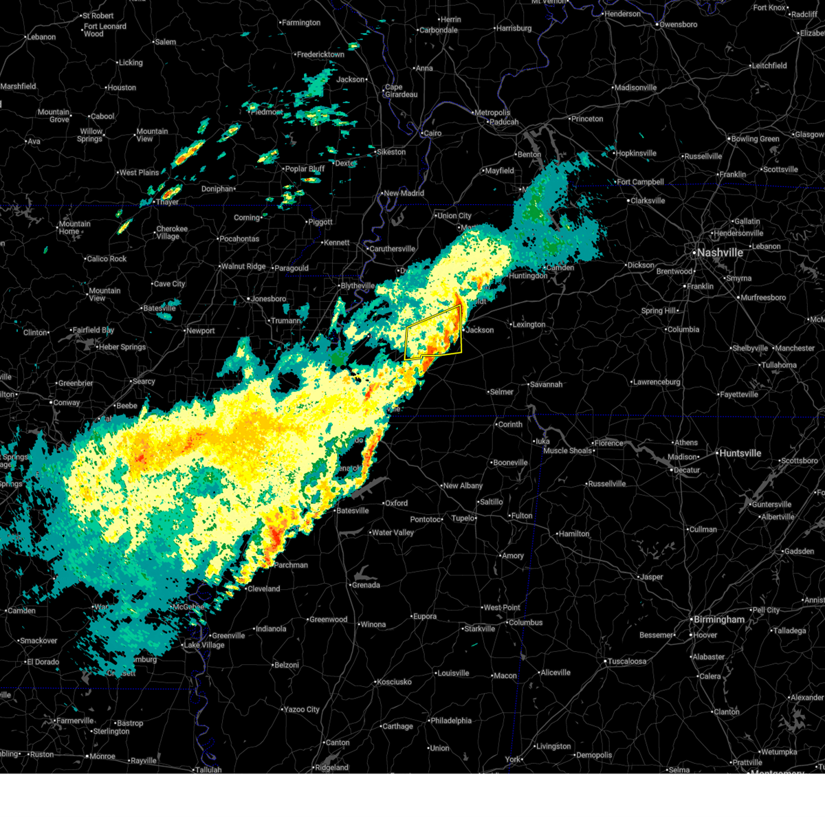
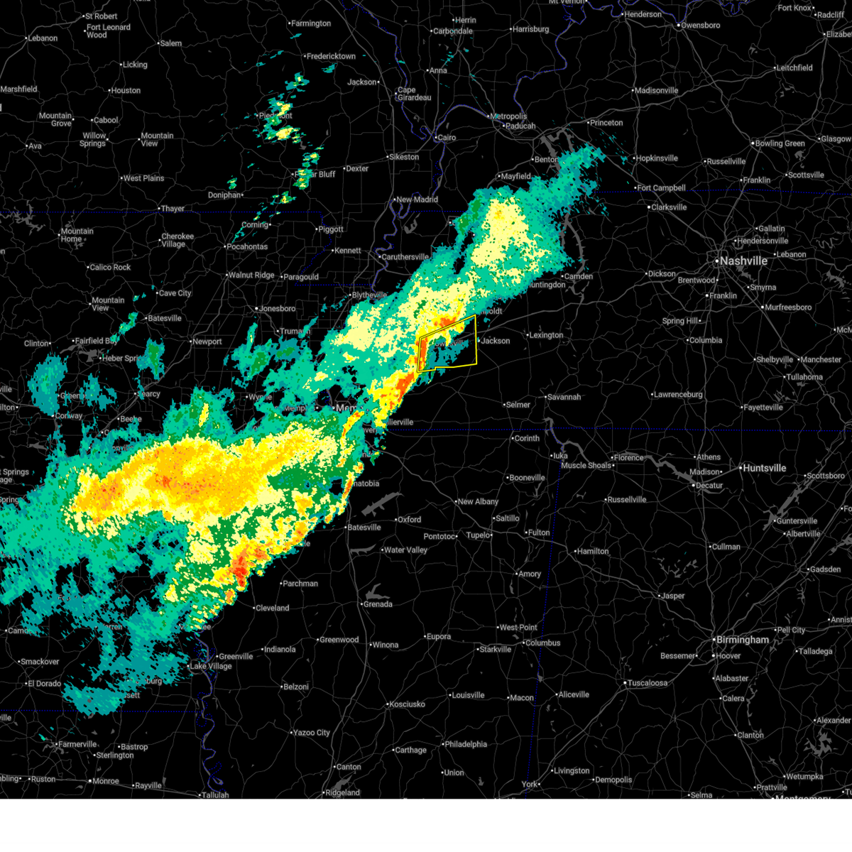
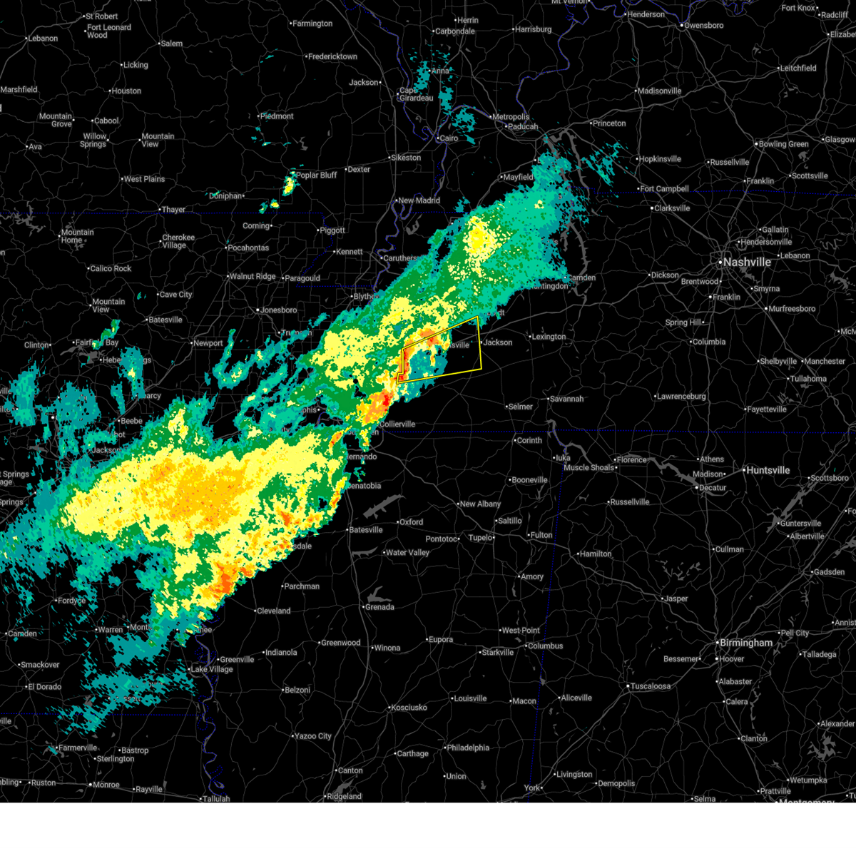
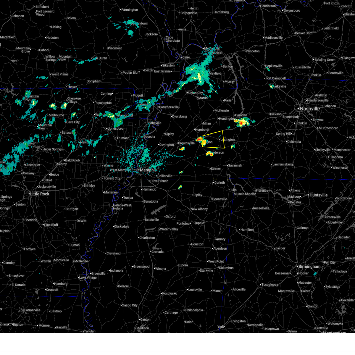
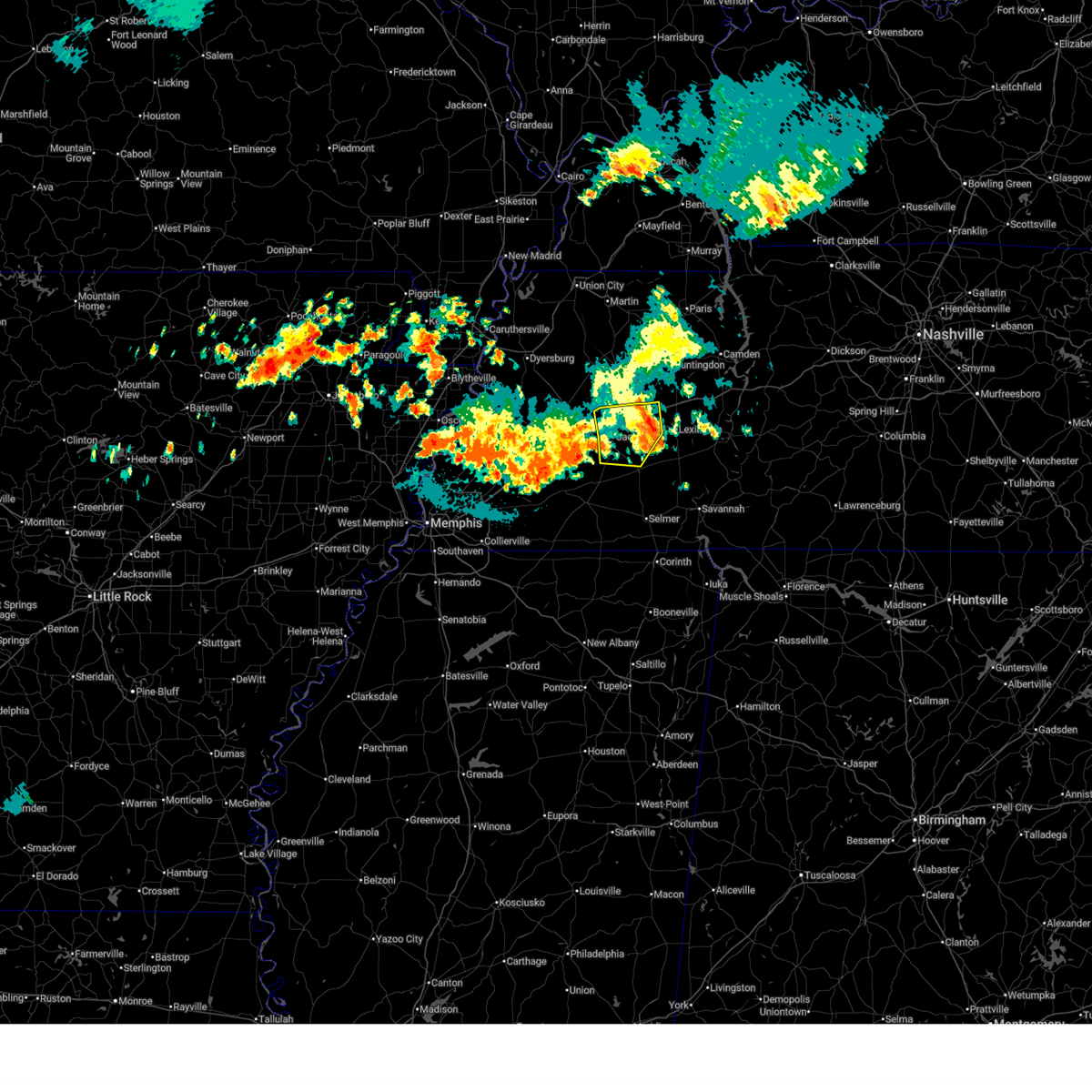
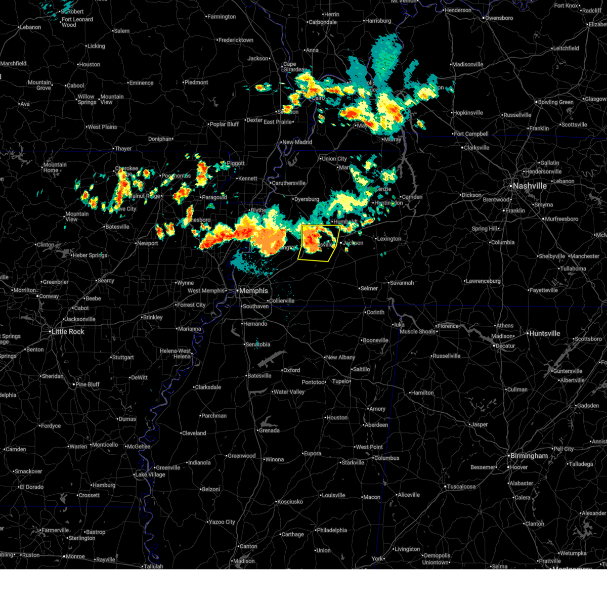
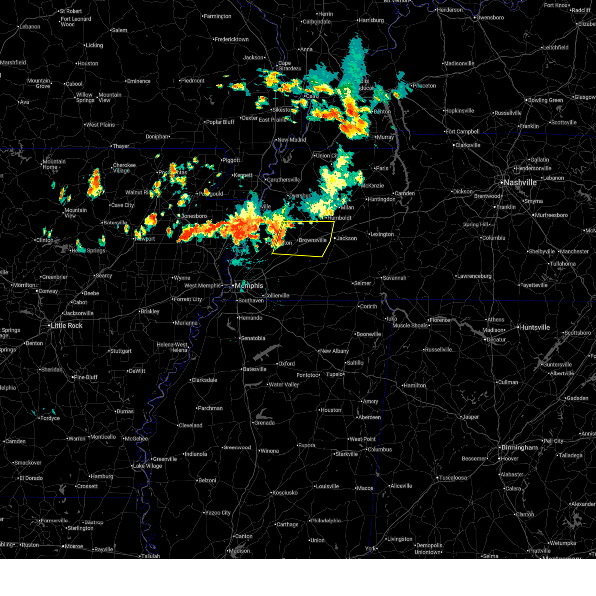
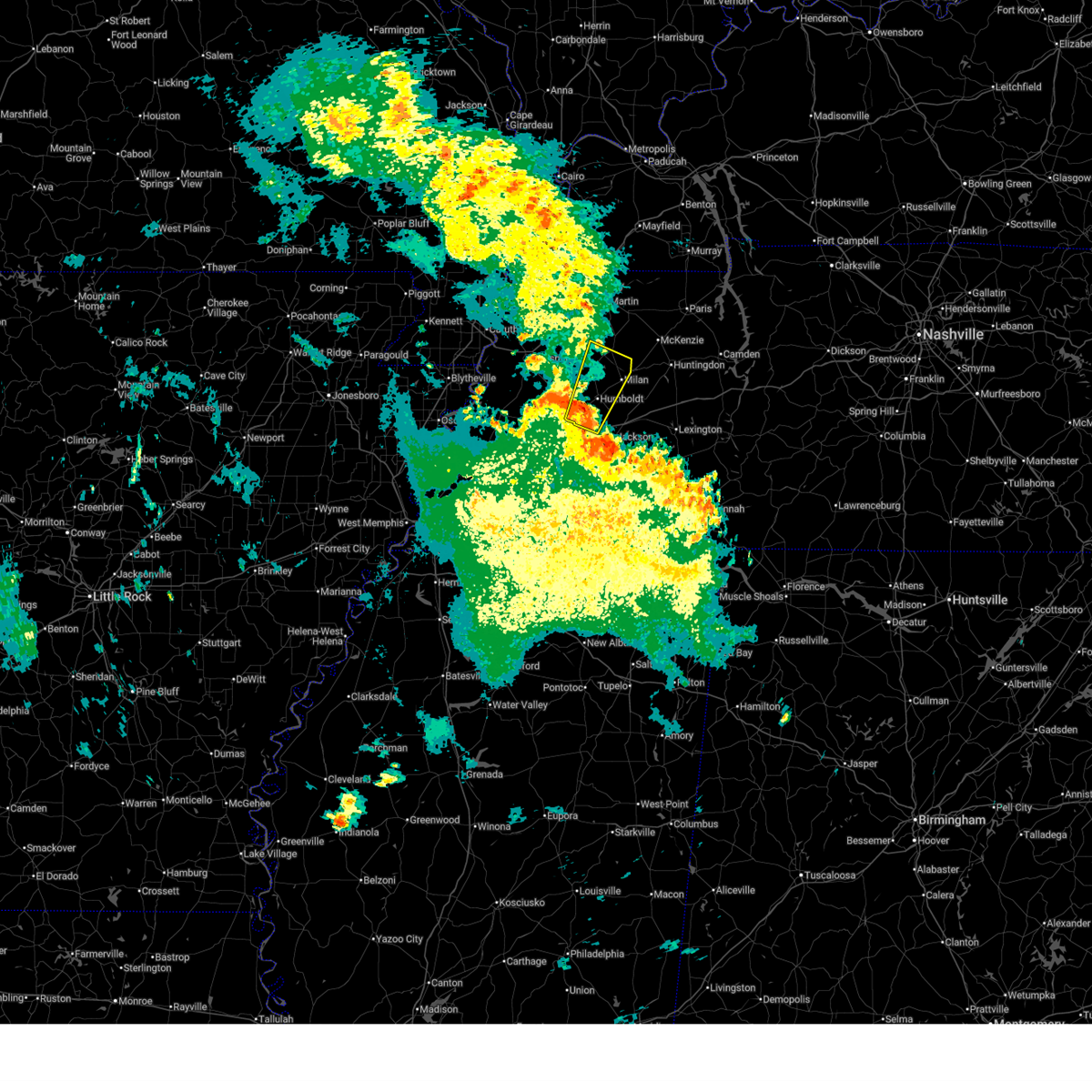
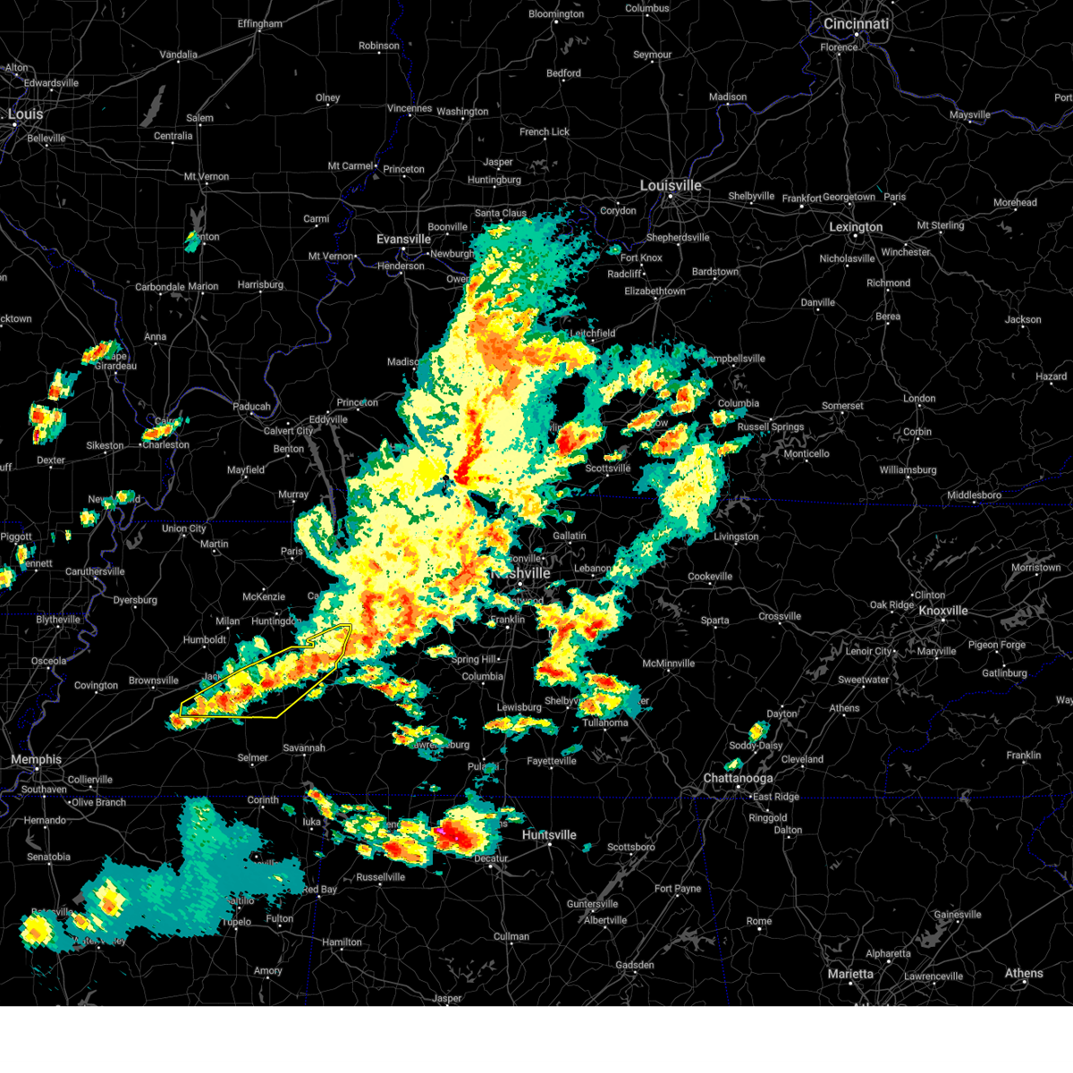
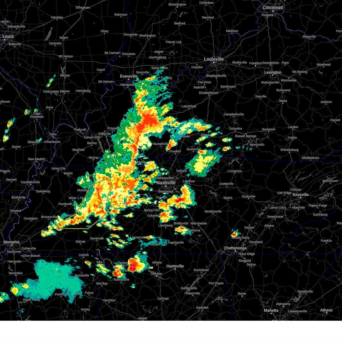
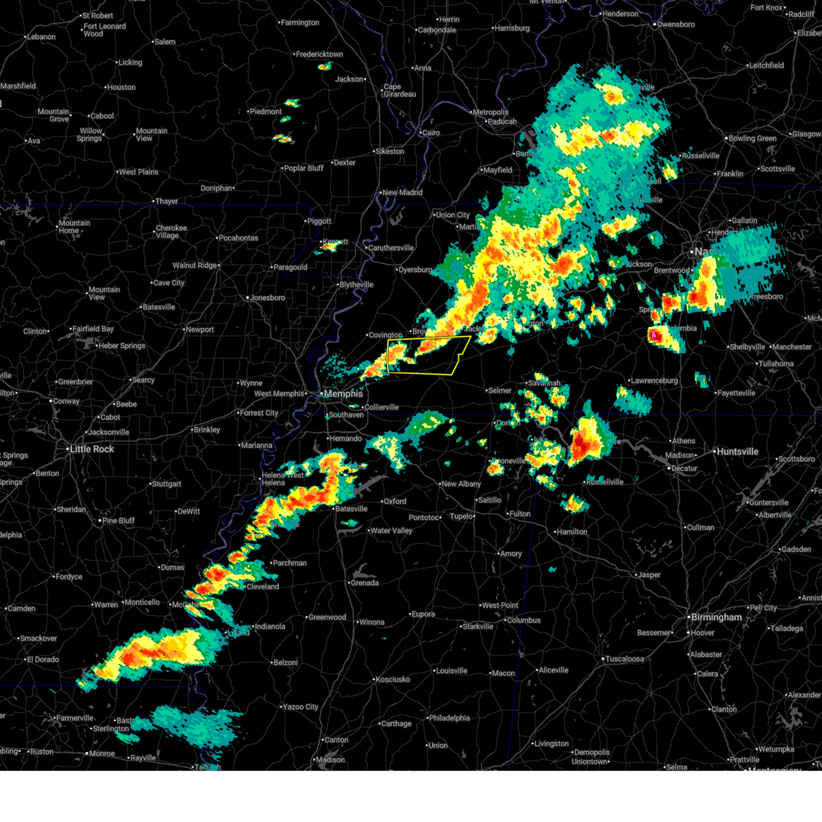
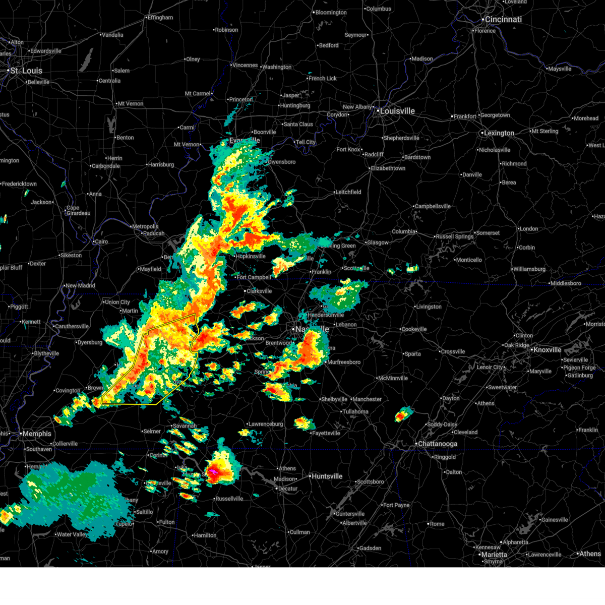
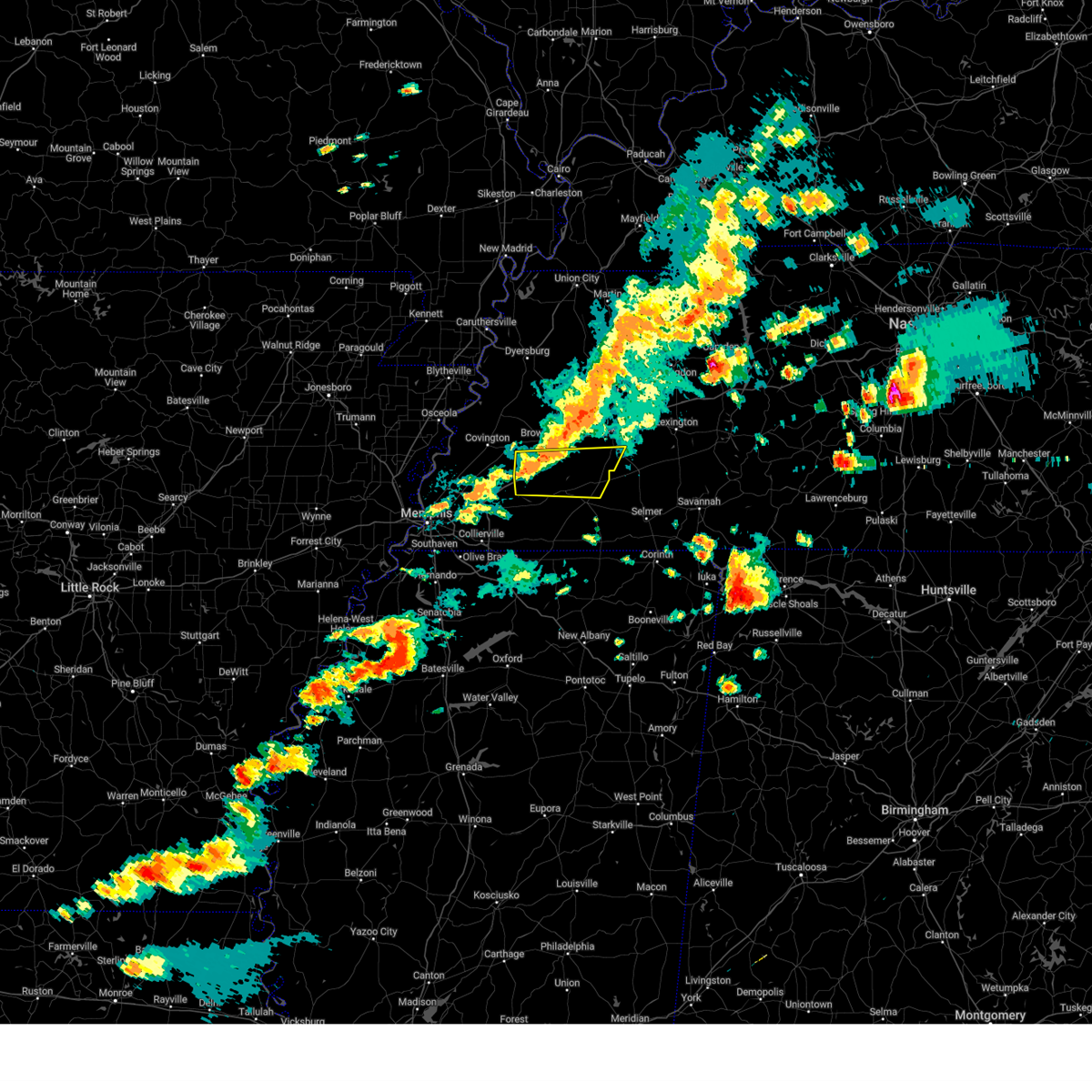
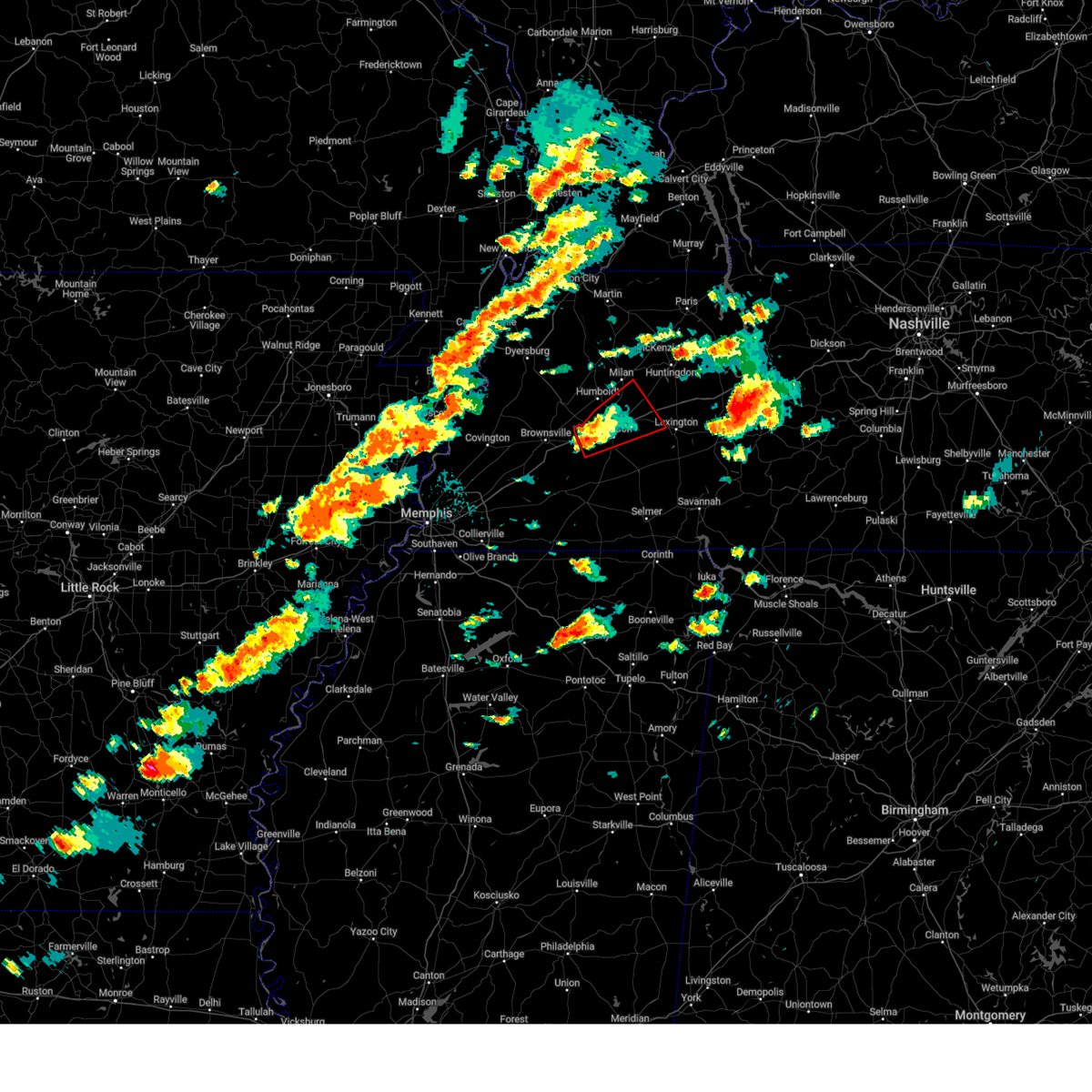
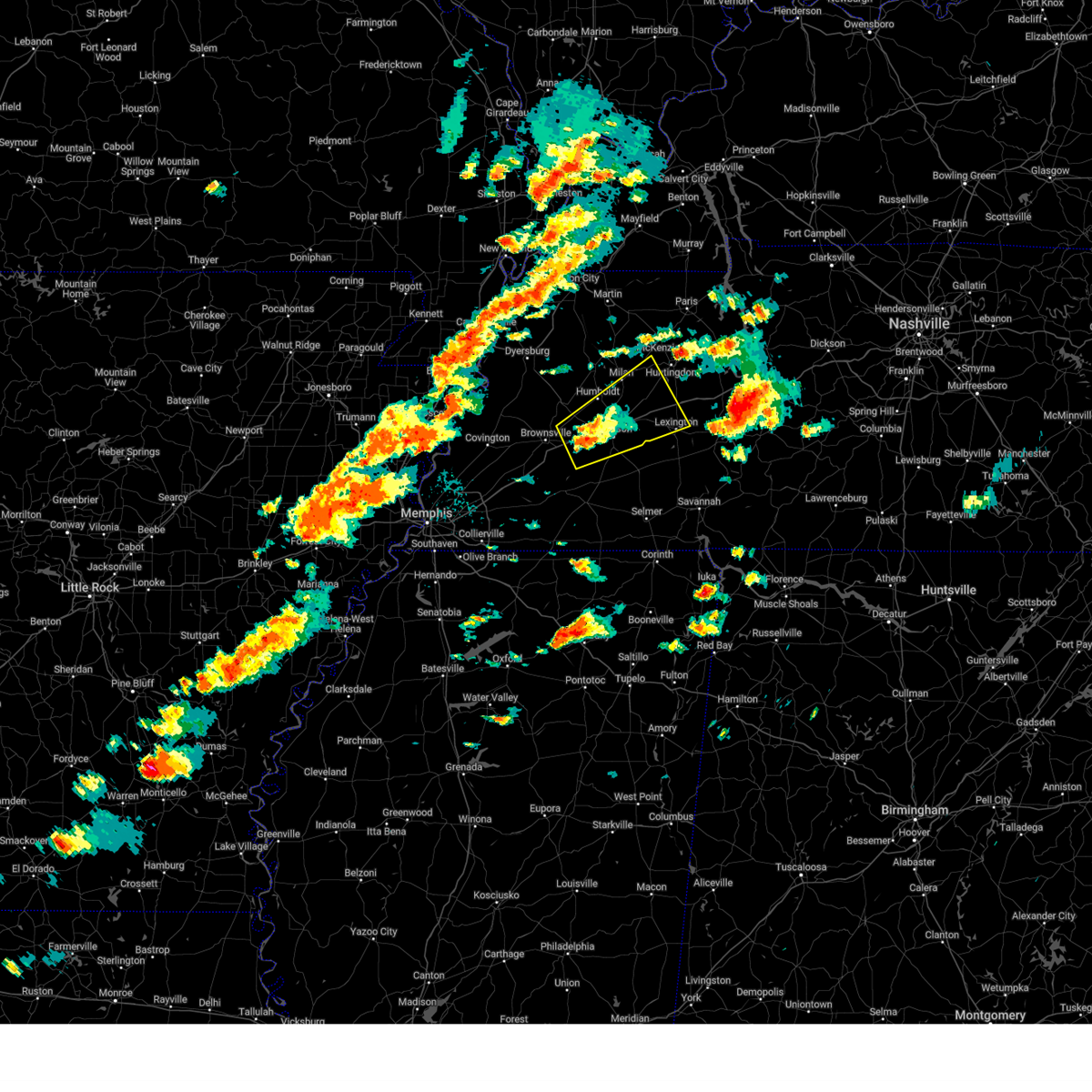
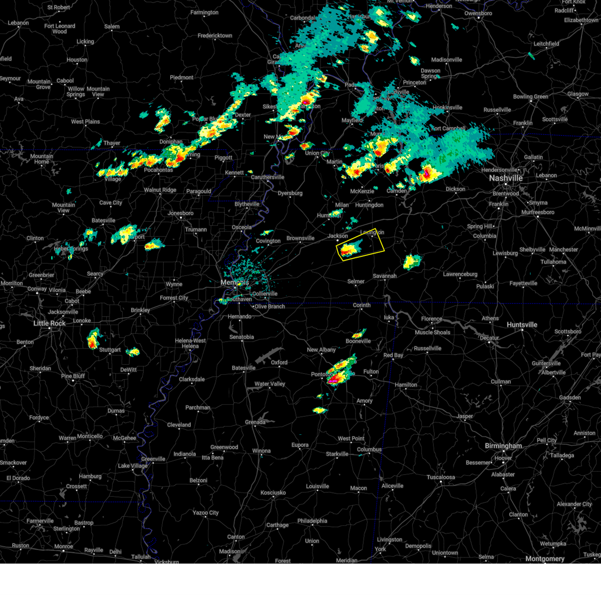
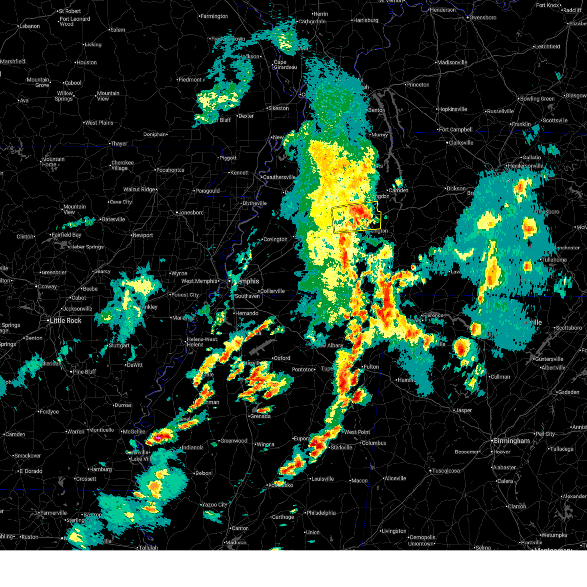
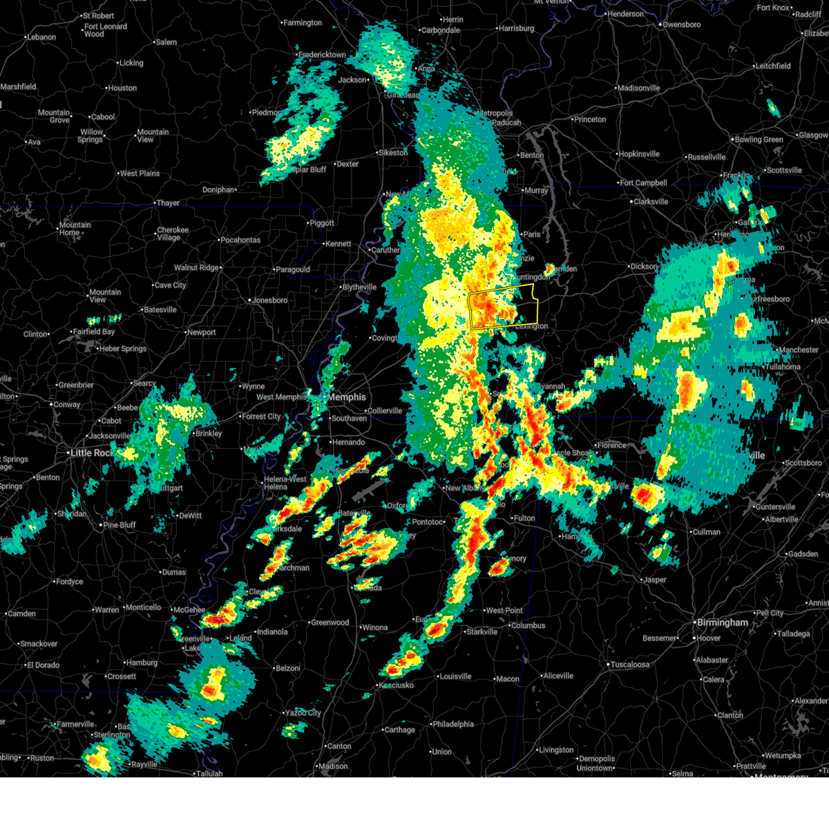
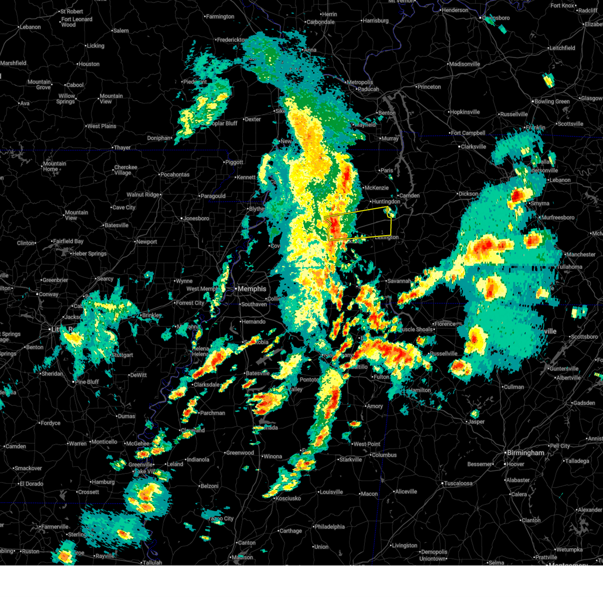
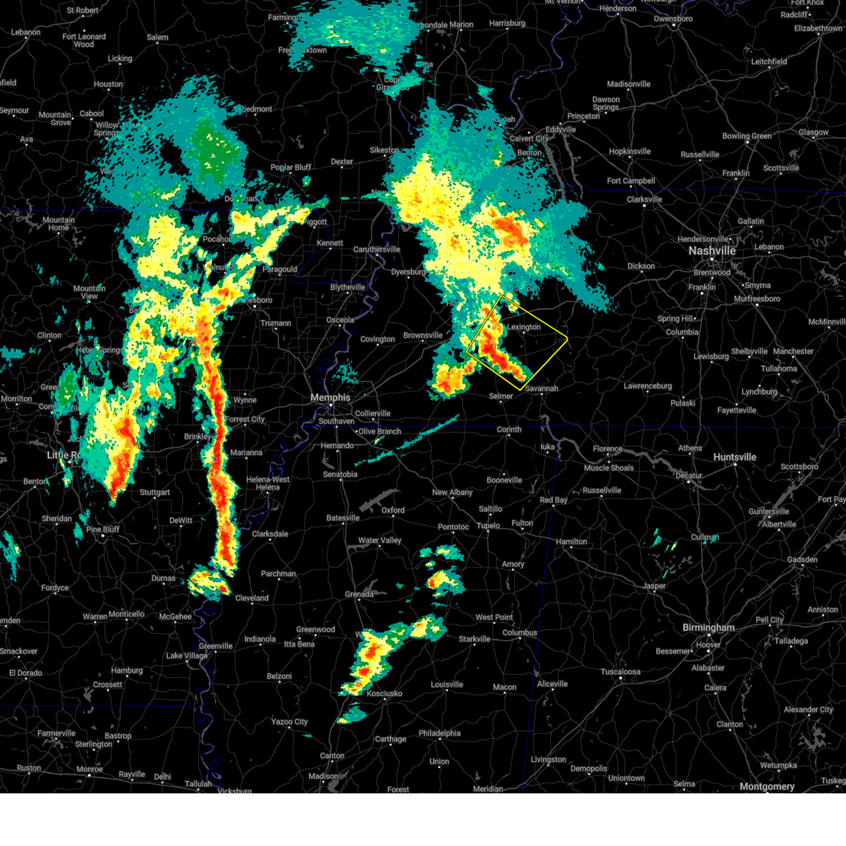
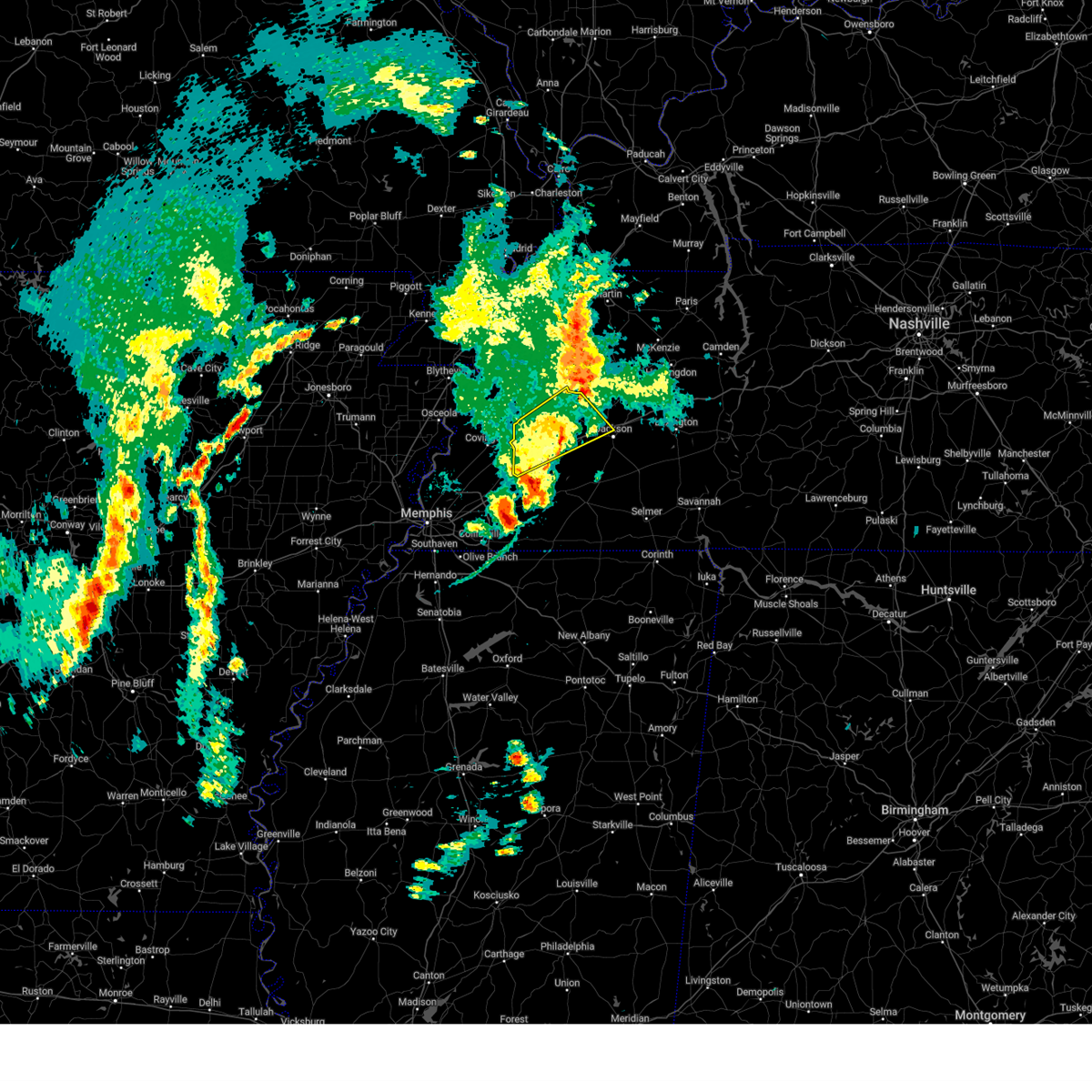
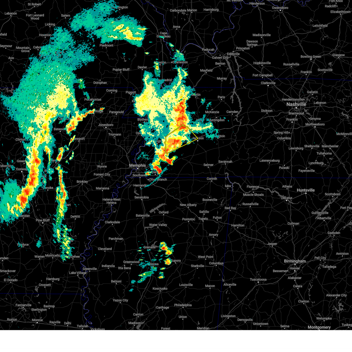
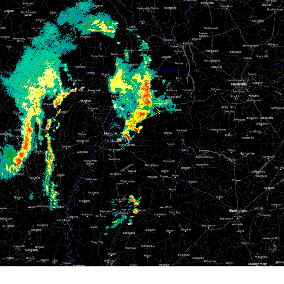
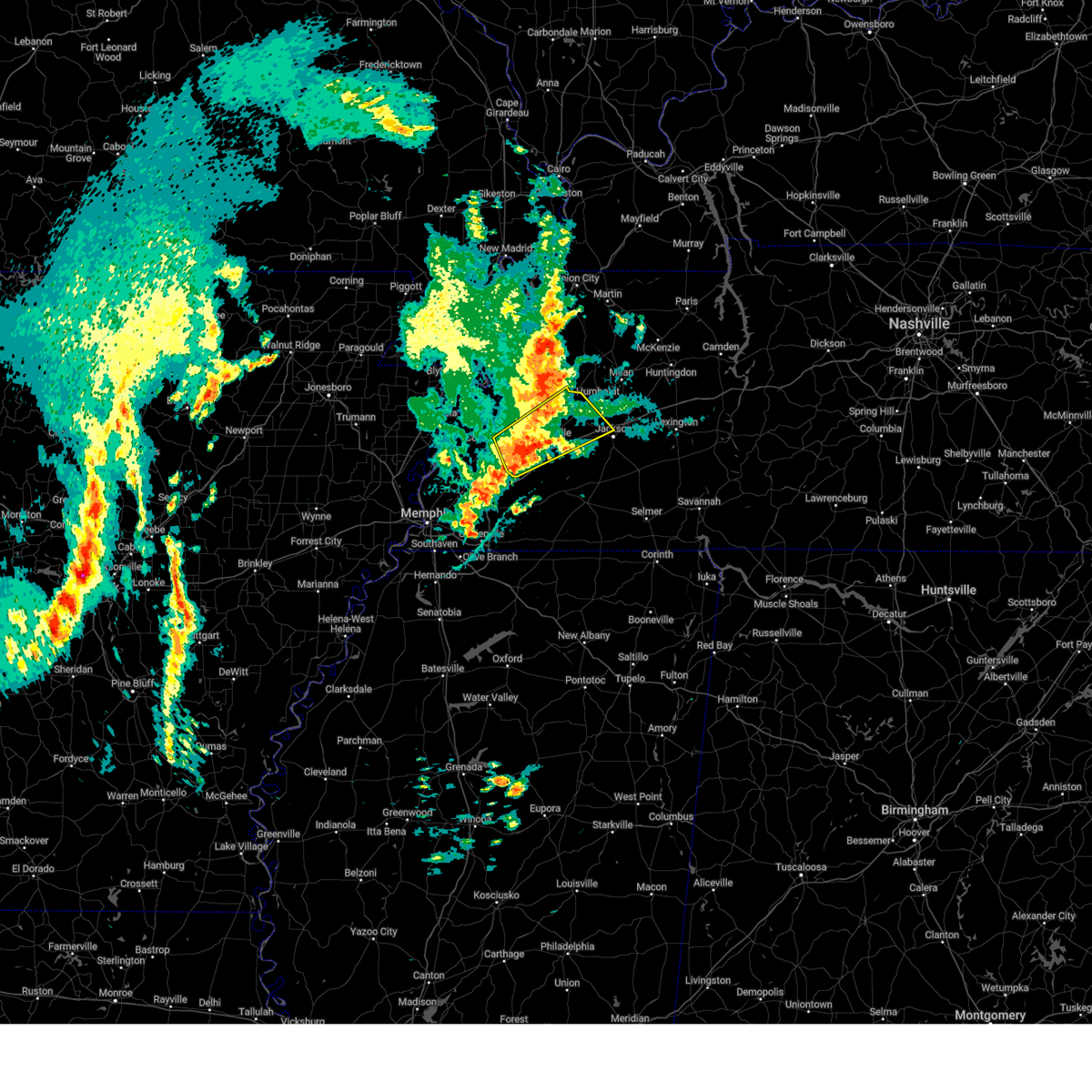
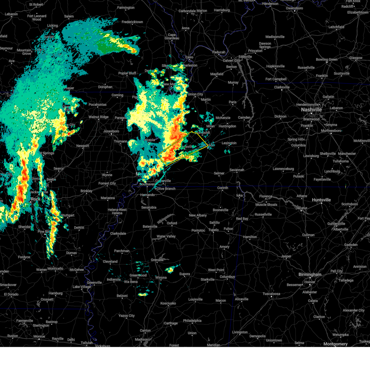
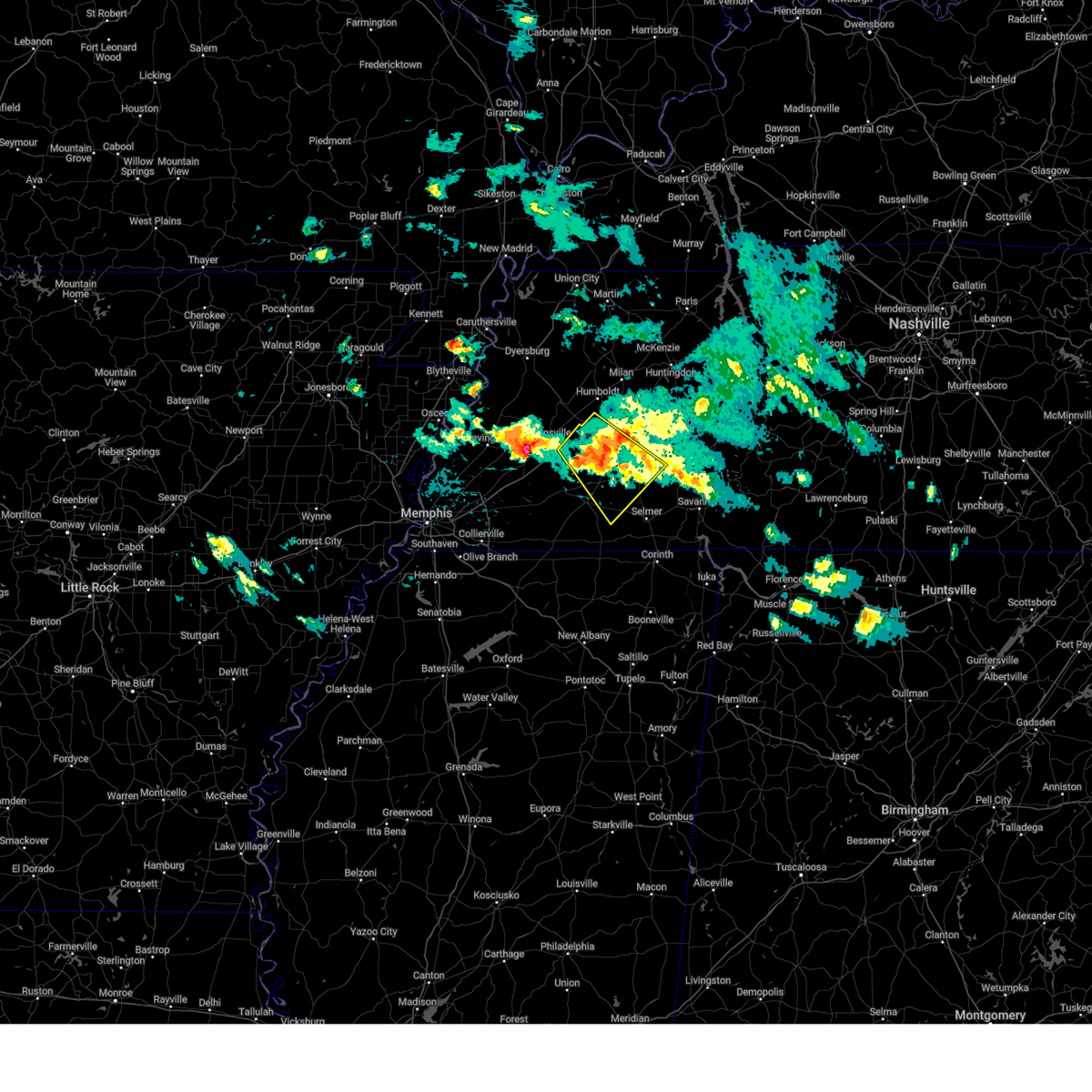
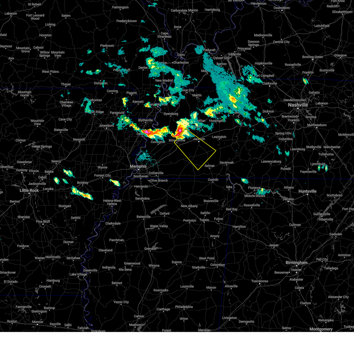
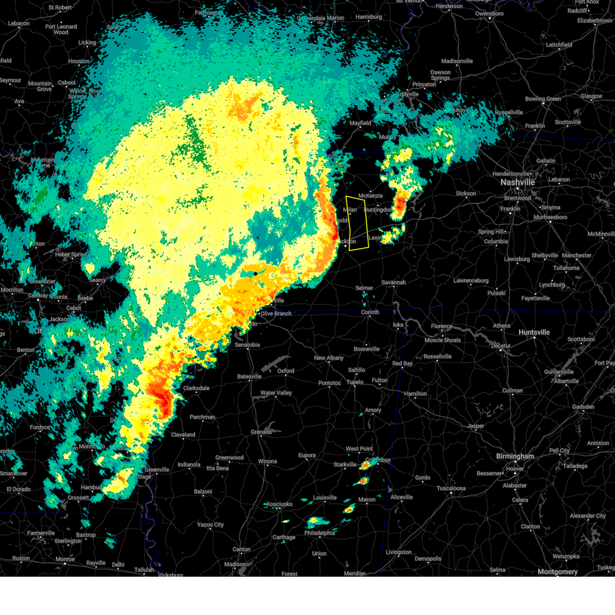
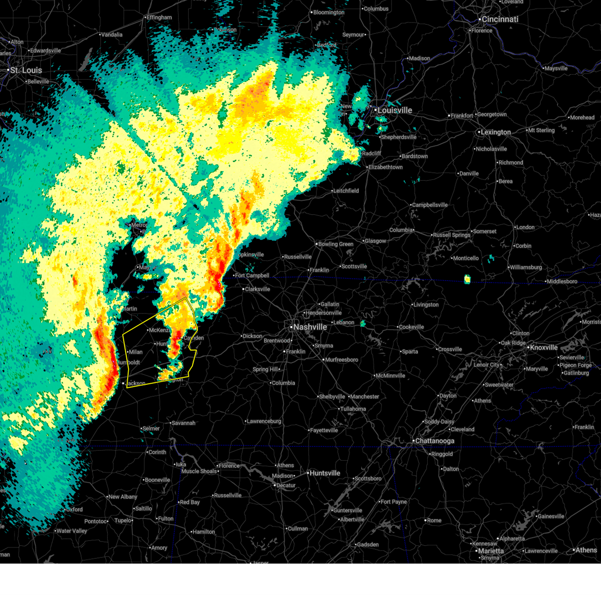
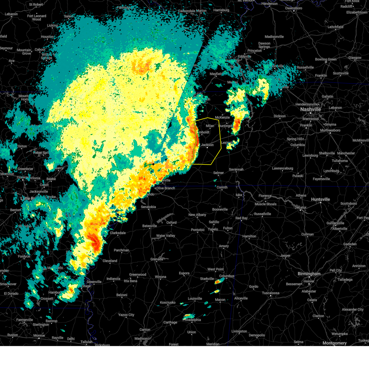
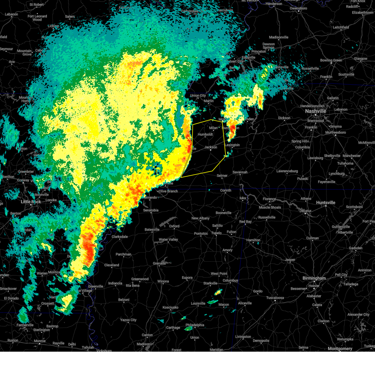
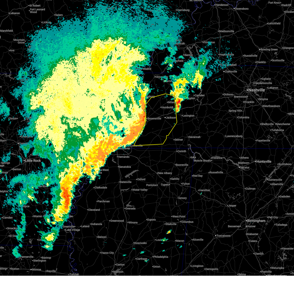
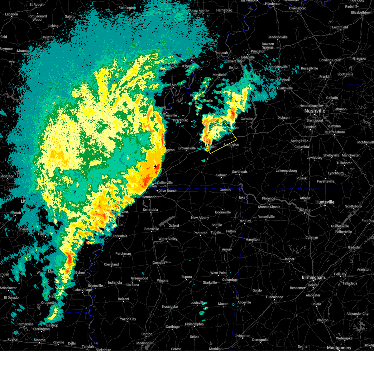
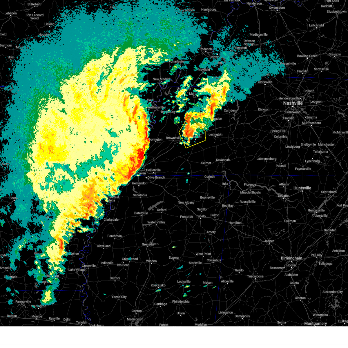
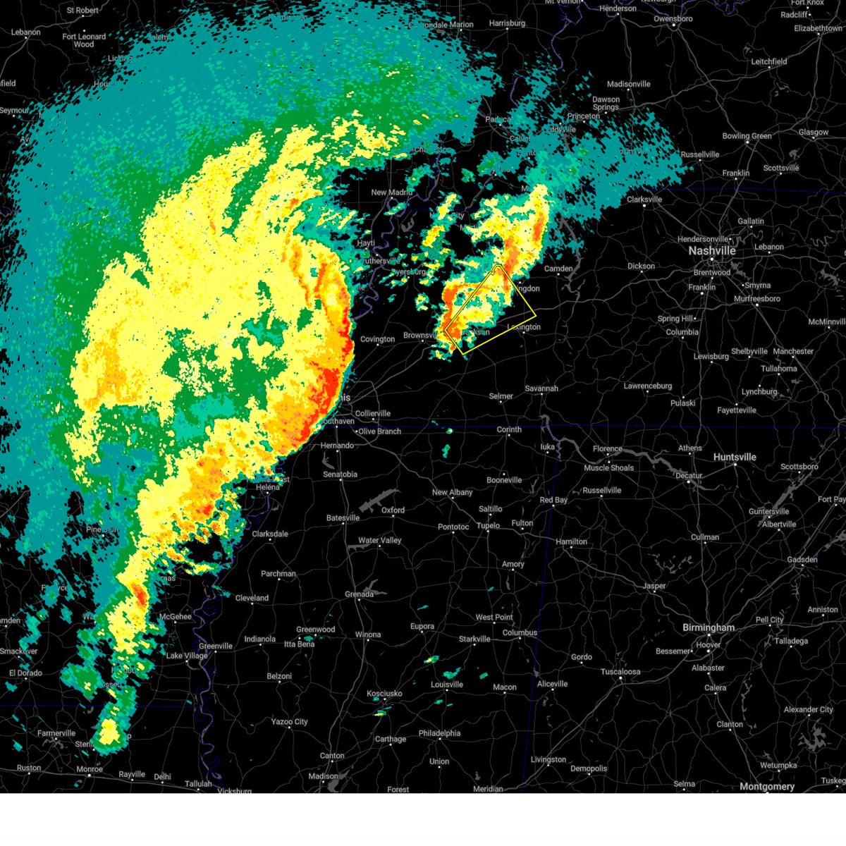
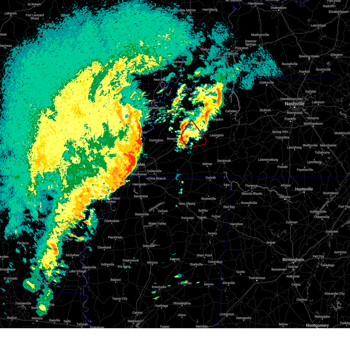
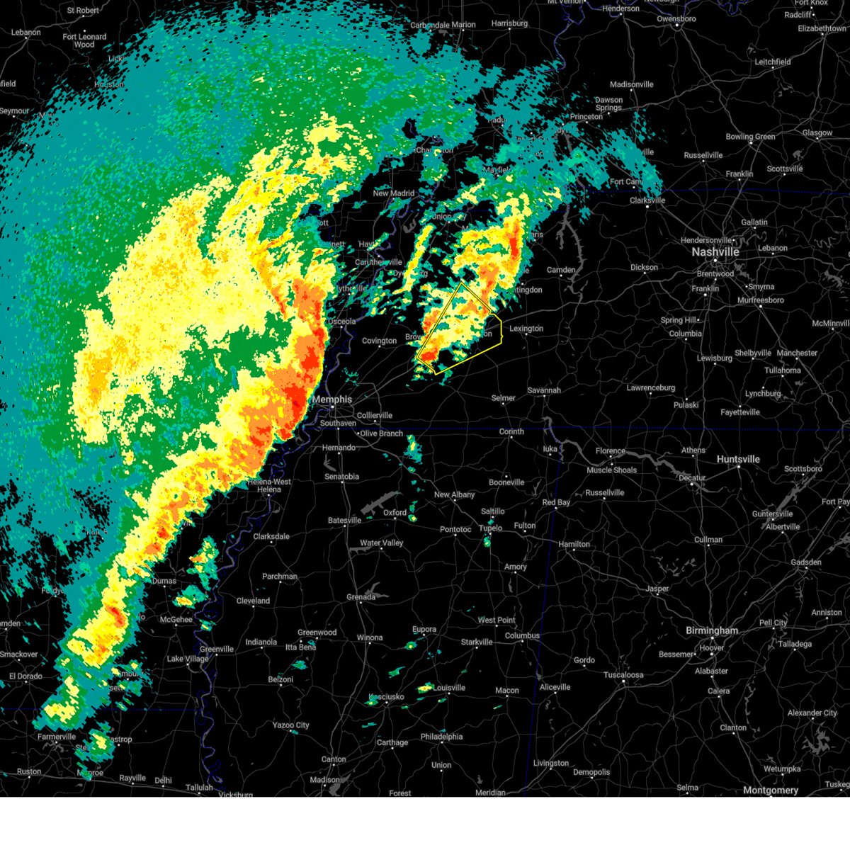
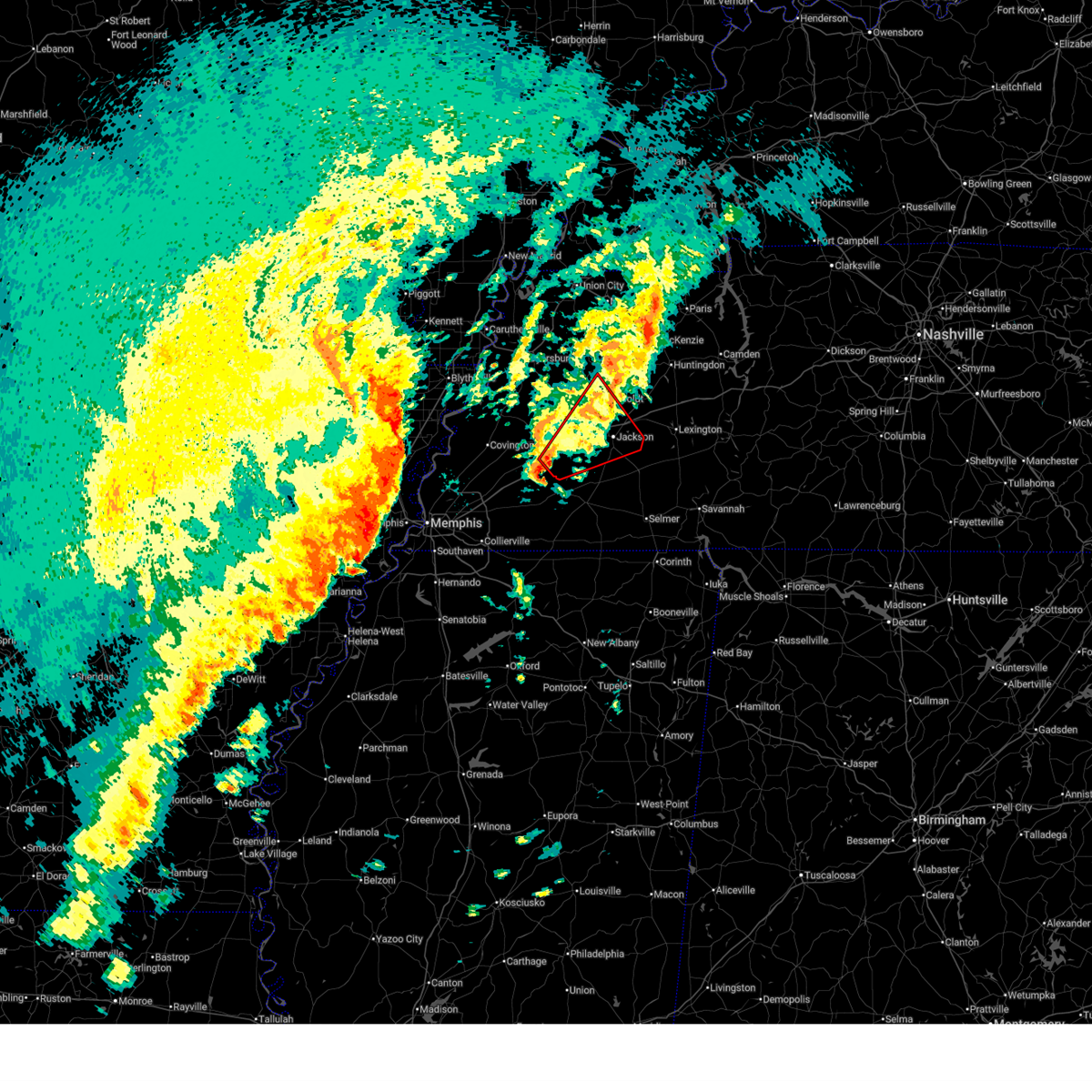
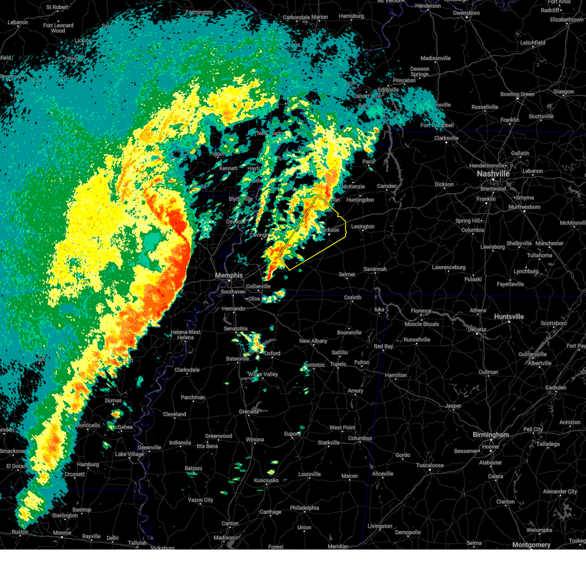
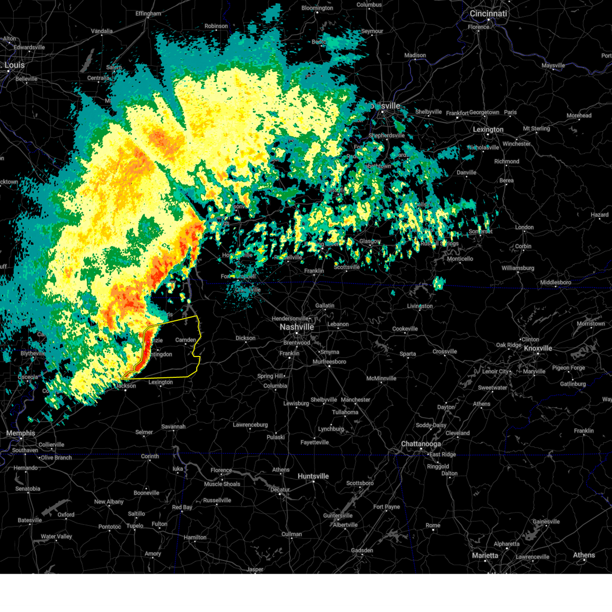
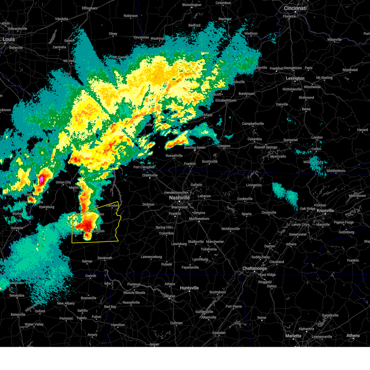
Hail Map for Jackson, TN
The Jackson, TN area has had 48 reports of on-the-ground hail by trained spotters, and has been under severe weather warnings 12 times during the past 12 months. Doppler radar has detected hail at or near Jackson, TN on 94 occasions, including 2 occasions during the past year.
| Name: | Jackson, TN |
| Where Located: | 37 miles SSW of Mc Kenzie, TN |
| Map: | Google Map for Jackson, TN |
| Population: | 65211 |
| Housing Units: | 28052 |
| More Info: | Search Google for Jackson, TN |
0
The Top Recent Hail Date for Jackson, TN is Monday, April 27, 2026 (57th out of 94)
Hail and Wind Damage Spotted near Jackson, TN
| Date / Time | Report Details |
|---|---|
| 4/28/2026 5:52 PM CDT |
 The storm which prompted the warning has weakened below severe limits, and no longer poses an immediate threat to life or property. therefore, the warning will be allowed to expire. a tornado watch remains in effect until 1000 pm cdt for west tennessee. The storm which prompted the warning has weakened below severe limits, and no longer poses an immediate threat to life or property. therefore, the warning will be allowed to expire. a tornado watch remains in effect until 1000 pm cdt for west tennessee.
|
| 4/28/2026 5:40 PM CDT |
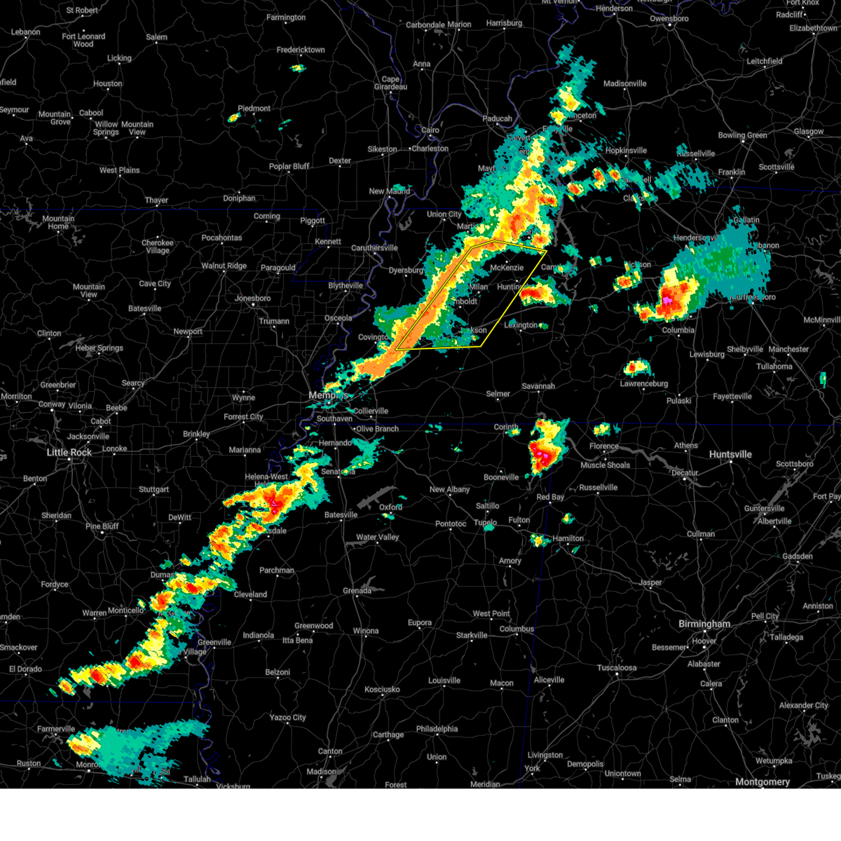
 At 539 pm cdt, a severe thunderstorm was located near fairview, or 7 miles south of milan, moving east at 50 mph (radar indicated). Hazards include 60 mph wind gusts and penny size hail. Expect damage to roofs, siding, and trees. locations impacted include, jackson, humboldt, milan, henderson, trenton, fairview, dyer, greenfield, three way, rutherford, bradford, atwood, blue goose, mifflin, bemis, adair, carroll, medina, trezevant, and gadsden. This includes interstate 40 in tennessee between mile markers 75 and 97. At 539 pm cdt, a severe thunderstorm was located near fairview, or 7 miles south of milan, moving east at 50 mph (radar indicated). Hazards include 60 mph wind gusts and penny size hail. Expect damage to roofs, siding, and trees. locations impacted include, jackson, humboldt, milan, henderson, trenton, fairview, dyer, greenfield, three way, rutherford, bradford, atwood, blue goose, mifflin, bemis, adair, carroll, medina, trezevant, and gadsden. This includes interstate 40 in tennessee between mile markers 75 and 97.
|
| 4/28/2026 5:11 PM CDT |
 Svrmeg the national weather service in memphis has issued a * severe thunderstorm warning for, crockett county in west tennessee, southeastern weakley county in west tennessee, northwestern henderson county in west tennessee, southeastern dyer county in west tennessee, gibson county in west tennessee, northeastern lauderdale county in west tennessee, western carroll county in west tennessee, haywood county in west tennessee, madison county in west tennessee, northwestern chester county in west tennessee, * until 600 pm cdt. * at 511 pm cdt, a severe thunderstorm was located over bells, or 10 miles northeast of brownsville, moving east at 50 mph (radar indicated). Hazards include 60 mph wind gusts and penny size hail. expect damage to roofs, siding, and trees Svrmeg the national weather service in memphis has issued a * severe thunderstorm warning for, crockett county in west tennessee, southeastern weakley county in west tennessee, northwestern henderson county in west tennessee, southeastern dyer county in west tennessee, gibson county in west tennessee, northeastern lauderdale county in west tennessee, western carroll county in west tennessee, haywood county in west tennessee, madison county in west tennessee, northwestern chester county in west tennessee, * until 600 pm cdt. * at 511 pm cdt, a severe thunderstorm was located over bells, or 10 miles northeast of brownsville, moving east at 50 mph (radar indicated). Hazards include 60 mph wind gusts and penny size hail. expect damage to roofs, siding, and trees
|
| 4/28/2026 1:30 AM CDT | Power pole snapped and lines across roadwa in madison county TN, 4.9 miles W of Jackson, TN |
| 4/28/2026 1:17 AM CDT | Large tree down on the union university campu in madison county TN, 1.8 miles SE of Jackson, TN |
| 4/28/2026 1:15 AM CDT |
 At 114 am cdt, a severe thunderstorm was located near milan, moving east at 50 mph (radar indicated). Hazards include 60 mph wind gusts and nickel size hail. Expect damage to roofs, siding, and trees. locations impacted include, jackson, humboldt, milan, lexington, trenton, huntingdon, natchez trace state park, fairview, alamo, bells, three way, bruceton, bradford, atwood, bargerton, blue goose, wildersville, belle eagle, holly grove, and parkers crossroads. This includes interstate 40 in tennessee between mile markers 73 and 115. At 114 am cdt, a severe thunderstorm was located near milan, moving east at 50 mph (radar indicated). Hazards include 60 mph wind gusts and nickel size hail. Expect damage to roofs, siding, and trees. locations impacted include, jackson, humboldt, milan, lexington, trenton, huntingdon, natchez trace state park, fairview, alamo, bells, three way, bruceton, bradford, atwood, bargerton, blue goose, wildersville, belle eagle, holly grove, and parkers crossroads. This includes interstate 40 in tennessee between mile markers 73 and 115.
|
| 4/28/2026 1:00 AM CDT |
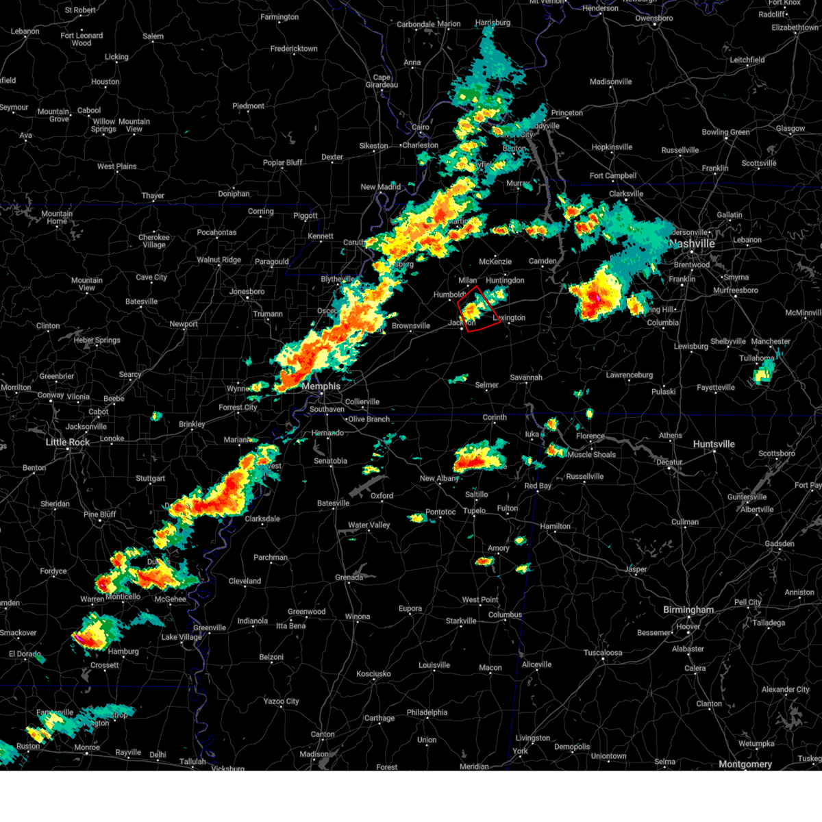
 Svrmeg the national weather service in memphis has issued a * severe thunderstorm warning for, crockett county in west tennessee, northern henderson county in west tennessee, gibson county in west tennessee, carroll county in west tennessee, northeastern haywood county in west tennessee, northern madison county in west tennessee, * until 145 am cdt. * at 100 am cdt, a severe thunderstorm was located near humboldt, moving east at 50 mph (radar indicated). Hazards include 60 mph wind gusts and nickel size hail. expect damage to roofs, siding, and trees Svrmeg the national weather service in memphis has issued a * severe thunderstorm warning for, crockett county in west tennessee, northern henderson county in west tennessee, gibson county in west tennessee, carroll county in west tennessee, northeastern haywood county in west tennessee, northern madison county in west tennessee, * until 145 am cdt. * at 100 am cdt, a severe thunderstorm was located near humboldt, moving east at 50 mph (radar indicated). Hazards include 60 mph wind gusts and nickel size hail. expect damage to roofs, siding, and trees
|
| 4/16/2026 8:50 PM CDT |
 Svrmeg the national weather service in memphis has issued a * severe thunderstorm warning for, henderson county in west tennessee, southeastern gibson county in west tennessee, southwestern carroll county in west tennessee, northeastern madison county in west tennessee, * until 930 pm cdt. * at 850 pm cdt, a severe thunderstorm was located near blue goose, or 8 miles northeast of jackson, moving southeast at 35 mph (radar indicated). Hazards include 60 mph wind gusts and quarter size hail. Hail damage to vehicles is expected. Expect wind damage to roofs, siding, and trees. Svrmeg the national weather service in memphis has issued a * severe thunderstorm warning for, henderson county in west tennessee, southeastern gibson county in west tennessee, southwestern carroll county in west tennessee, northeastern madison county in west tennessee, * until 930 pm cdt. * at 850 pm cdt, a severe thunderstorm was located near blue goose, or 8 miles northeast of jackson, moving southeast at 35 mph (radar indicated). Hazards include 60 mph wind gusts and quarter size hail. Hail damage to vehicles is expected. Expect wind damage to roofs, siding, and trees.
|
| 3/15/2026 8:17 PM CDT |
 Svrmeg the national weather service in memphis has issued a * severe thunderstorm warning for, western henderson county in west tennessee, southeastern gibson county in west tennessee, southeastern fayette county in west tennessee, hardeman county in west tennessee, northwestern mcnairy county in west tennessee, madison county in west tennessee, chester county in west tennessee, * until 900 pm cdt. * at 816 pm cdt, severe thunderstorms were located along a line extending from three way to near slayden, moving east at 55 mph (radar indicated). Hazards include 60 mph wind gusts and nickel size hail. expect damage to roofs, siding, and trees Svrmeg the national weather service in memphis has issued a * severe thunderstorm warning for, western henderson county in west tennessee, southeastern gibson county in west tennessee, southeastern fayette county in west tennessee, hardeman county in west tennessee, northwestern mcnairy county in west tennessee, madison county in west tennessee, chester county in west tennessee, * until 900 pm cdt. * at 816 pm cdt, severe thunderstorms were located along a line extending from three way to near slayden, moving east at 55 mph (radar indicated). Hazards include 60 mph wind gusts and nickel size hail. expect damage to roofs, siding, and trees
|
| 3/11/2026 11:23 AM CDT |
 The storm which prompted the warning has weakened below severe limits, and no longer poses an immediate threat to life or property. therefore, the warning will be allowed to expire. The storm which prompted the warning has weakened below severe limits, and no longer poses an immediate threat to life or property. therefore, the warning will be allowed to expire.
|
| 3/11/2026 11:05 AM CDT |
 the severe thunderstorm warning has been cancelled and is no longer in effect the severe thunderstorm warning has been cancelled and is no longer in effect
|
| 3/11/2026 11:05 AM CDT |
 At 1105 am cdt, a severe thunderstorm was located near brownsville, moving east at 50 mph (radar indicated). Hazards include 60 mph wind gusts and penny size hail. Expect damage to roofs, siding, and trees. locations impacted include, jackson, brownsville, fairview, bells, three way, holly grove, adair, hillville, dancyville, mercer, bemis, medon, neely, allens, huntersville, hickory point, westover, uptonville, jones, and leighton. This includes interstate 40 in tennessee between mile markers 49 and 81. At 1105 am cdt, a severe thunderstorm was located near brownsville, moving east at 50 mph (radar indicated). Hazards include 60 mph wind gusts and penny size hail. Expect damage to roofs, siding, and trees. locations impacted include, jackson, brownsville, fairview, bells, three way, holly grove, adair, hillville, dancyville, mercer, bemis, medon, neely, allens, huntersville, hickory point, westover, uptonville, jones, and leighton. This includes interstate 40 in tennessee between mile markers 49 and 81.
|
| 3/11/2026 10:47 AM CDT |
 Svrmeg the national weather service in memphis has issued a * severe thunderstorm warning for, southeastern crockett county in west tennessee, northeastern fayette county in west tennessee, northwestern hardeman county in west tennessee, haywood county in west tennessee, western madison county in west tennessee, * until 1130 am cdt. * at 1047 am cdt, a severe thunderstorm was located 8 miles northwest of dancyville, or 12 miles southwest of brownsville, moving east at 50 mph (radar indicated). Hazards include 60 mph wind gusts and penny size hail. expect damage to roofs, siding, and trees Svrmeg the national weather service in memphis has issued a * severe thunderstorm warning for, southeastern crockett county in west tennessee, northeastern fayette county in west tennessee, northwestern hardeman county in west tennessee, haywood county in west tennessee, western madison county in west tennessee, * until 1130 am cdt. * at 1047 am cdt, a severe thunderstorm was located 8 miles northwest of dancyville, or 12 miles southwest of brownsville, moving east at 50 mph (radar indicated). Hazards include 60 mph wind gusts and penny size hail. expect damage to roofs, siding, and trees
|
| 9/5/2025 4:25 PM CDT |
 Svrmeg the national weather service in memphis has issued a * severe thunderstorm warning for, central henderson county in west tennessee, northeastern madison county in west tennessee, north central chester county in west tennessee, * until 515 pm cdt. * at 425 pm cdt, a severe thunderstorm was located near blue goose, or 9 miles east of jackson, moving east at 15 mph (radar indicated). Hazards include 60 mph wind gusts and quarter size hail. Hail damage to vehicles is expected. Expect wind damage to roofs, siding, and trees. Svrmeg the national weather service in memphis has issued a * severe thunderstorm warning for, central henderson county in west tennessee, northeastern madison county in west tennessee, north central chester county in west tennessee, * until 515 pm cdt. * at 425 pm cdt, a severe thunderstorm was located near blue goose, or 9 miles east of jackson, moving east at 15 mph (radar indicated). Hazards include 60 mph wind gusts and quarter size hail. Hail damage to vehicles is expected. Expect wind damage to roofs, siding, and trees.
|
| 6/19/2025 1:29 AM CDT |
 The storms which prompted the warning have moved out of the area. therefore, the warning will be allowed to expire. remember, a severe thunderstorm warning still remains in effect for portions of henderson county until 230 am cdt. The storms which prompted the warning have moved out of the area. therefore, the warning will be allowed to expire. remember, a severe thunderstorm warning still remains in effect for portions of henderson county until 230 am cdt.
|
| 6/19/2025 1:14 AM CDT |
 the severe thunderstorm warning has been cancelled and is no longer in effect the severe thunderstorm warning has been cancelled and is no longer in effect
|
| 6/19/2025 1:14 AM CDT |
 At 114 am cdt, severe thunderstorms were located along a line extending from 6 miles east of fairview to 7 miles east of jackson to near bemis, moving east at 45 mph (radar indicated). Hazards include 60 mph wind gusts and quarter size hail. Hail damage to vehicles is expected. expect wind damage to roofs, siding, and trees. Locations impacted include, jackson, henderson, fairview, three way, bemis, blue goose, mifflin, carroll, medon, pinson, cedar grove, beech bluff, westover, madison hall, juno, gilmore, maple grove, east union, claybrook, and malesus. At 114 am cdt, severe thunderstorms were located along a line extending from 6 miles east of fairview to 7 miles east of jackson to near bemis, moving east at 45 mph (radar indicated). Hazards include 60 mph wind gusts and quarter size hail. Hail damage to vehicles is expected. expect wind damage to roofs, siding, and trees. Locations impacted include, jackson, henderson, fairview, three way, bemis, blue goose, mifflin, carroll, medon, pinson, cedar grove, beech bluff, westover, madison hall, juno, gilmore, maple grove, east union, claybrook, and malesus.
|
| 6/19/2025 1:08 AM CDT | Measured on davis weather statio in madison county TN, 3.4 miles SSW of Jackson, TN |
| 6/19/2025 12:57 AM CDT |
 Svrmeg the national weather service in memphis has issued a * severe thunderstorm warning for, southeastern crockett county in west tennessee, northwestern henderson county in west tennessee, madison county in west tennessee, northwestern chester county in west tennessee, * until 130 am cdt. * at 1257 am cdt, severe thunderstorms were located along a line extending from near adair to near bemis to near mercer, moving east at 45 mph (radar indicated). Hazards include 60 mph wind gusts and quarter size hail. Hail damage to vehicles is expected. Expect wind damage to roofs, siding, and trees. Svrmeg the national weather service in memphis has issued a * severe thunderstorm warning for, southeastern crockett county in west tennessee, northwestern henderson county in west tennessee, madison county in west tennessee, northwestern chester county in west tennessee, * until 130 am cdt. * at 1257 am cdt, severe thunderstorms were located along a line extending from near adair to near bemis to near mercer, moving east at 45 mph (radar indicated). Hazards include 60 mph wind gusts and quarter size hail. Hail damage to vehicles is expected. Expect wind damage to roofs, siding, and trees.
|
| 6/19/2025 12:50 AM CDT |
 At 1250 am cdt, severe thunderstorms were located along a line extending from near adair to 7 miles southeast of holly grove to near mercer, moving east at 45 mph (radar indicated). Hazards include 60 mph wind gusts and nickel size hail. Expect damage to roofs, siding, and trees. Locations impacted include, jackson, fairview, bells, three way, adair, holly grove, gadsden, neely, fruitvale, youngs crossing, allens, huntersville, gum flat, westover, roberts, windy city, jones, mason grove, owl city, and denmark. At 1250 am cdt, severe thunderstorms were located along a line extending from near adair to 7 miles southeast of holly grove to near mercer, moving east at 45 mph (radar indicated). Hazards include 60 mph wind gusts and nickel size hail. Expect damage to roofs, siding, and trees. Locations impacted include, jackson, fairview, bells, three way, adair, holly grove, gadsden, neely, fruitvale, youngs crossing, allens, huntersville, gum flat, westover, roberts, windy city, jones, mason grove, owl city, and denmark.
|
| 6/19/2025 12:44 AM CDT |
 At 1243 am cdt, severe thunderstorms were located along a line extending from near bells to near holly grove to near hillville, moving east at 40 mph (radar indicated). Hazards include 60 mph wind gusts and nickel size hail. Expect damage to roofs, siding, and trees. Locations impacted include, jackson, brownsville, fairview, alamo, bells, three way, belle eagle, holly grove, adair, hillville, mercer, gadsden, neely, allens, huntersville, westover, uptonville, jones, mason grove, and leighton. At 1243 am cdt, severe thunderstorms were located along a line extending from near bells to near holly grove to near hillville, moving east at 40 mph (radar indicated). Hazards include 60 mph wind gusts and nickel size hail. Expect damage to roofs, siding, and trees. Locations impacted include, jackson, brownsville, fairview, alamo, bells, three way, belle eagle, holly grove, adair, hillville, mercer, gadsden, neely, allens, huntersville, westover, uptonville, jones, mason grove, and leighton.
|
| 6/19/2025 12:44 AM CDT |
 the severe thunderstorm warning has been cancelled and is no longer in effect the severe thunderstorm warning has been cancelled and is no longer in effect
|
| 6/19/2025 12:20 AM CDT |
 Svrmeg the national weather service in memphis has issued a * severe thunderstorm warning for, southern crockett county in west tennessee, east central tipton county in west tennessee, southeastern lauderdale county in west tennessee, haywood county in west tennessee, western madison county in west tennessee, * until 100 am cdt. * at 1219 am cdt, severe thunderstorms were located along a line extending from nutbush to 8 miles west of brownsville to 10 miles east of covington, moving east at 40 mph (radar indicated). Hazards include 60 mph wind gusts and nickel size hail. expect damage to roofs, siding, and trees Svrmeg the national weather service in memphis has issued a * severe thunderstorm warning for, southern crockett county in west tennessee, east central tipton county in west tennessee, southeastern lauderdale county in west tennessee, haywood county in west tennessee, western madison county in west tennessee, * until 100 am cdt. * at 1219 am cdt, severe thunderstorms were located along a line extending from nutbush to 8 miles west of brownsville to 10 miles east of covington, moving east at 40 mph (radar indicated). Hazards include 60 mph wind gusts and nickel size hail. expect damage to roofs, siding, and trees
|
| 6/12/2025 10:20 PM CDT |
 Svrmeg the national weather service in memphis has issued a * severe thunderstorm warning for, southeastern crockett county in west tennessee, eastern gibson county in west tennessee, northwestern madison county in west tennessee, * until 1100 pm cdt. * at 1020 pm cdt, a severe thunderstorm was located over adair, or 7 miles southwest of humboldt, moving north at 25 mph (radar indicated). Hazards include 60 mph wind gusts and quarter size hail. Hail damage to vehicles is expected. Expect wind damage to roofs, siding, and trees. Svrmeg the national weather service in memphis has issued a * severe thunderstorm warning for, southeastern crockett county in west tennessee, eastern gibson county in west tennessee, northwestern madison county in west tennessee, * until 1100 pm cdt. * at 1020 pm cdt, a severe thunderstorm was located over adair, or 7 miles southwest of humboldt, moving north at 25 mph (radar indicated). Hazards include 60 mph wind gusts and quarter size hail. Hail damage to vehicles is expected. Expect wind damage to roofs, siding, and trees.
|
| 6/6/2025 1:05 PM CDT | Utility poles down along mcclellan road in northwest jackso in madison county TN, 4.4 miles SE of Jackson, TN |
| 5/20/2025 5:34 PM CDT |
 the severe thunderstorm warning has been cancelled and is no longer in effect the severe thunderstorm warning has been cancelled and is no longer in effect
|
| 5/20/2025 5:34 PM CDT |
 At 534 pm cdt, severe thunderstorms were located along a line extending from 9 miles northeast of parsons to near mercer, moving east at 55 mph (radar indicated). Hazards include 60 mph wind gusts and quarter size hail. Hail damage to vehicles is expected. expect wind damage to roofs, siding, and trees. Locations impacted include, neely, pinson, reagan, madison hall, uptonville, lexington, rock hill, holladay, middle fork, blue goose, hinson springs, pinson mounds state archaeological park, huron, warrens bluff, mifflin, natchez trace state park, sand ridge, five points, bargerton, and wildersville. At 534 pm cdt, severe thunderstorms were located along a line extending from 9 miles northeast of parsons to near mercer, moving east at 55 mph (radar indicated). Hazards include 60 mph wind gusts and quarter size hail. Hail damage to vehicles is expected. expect wind damage to roofs, siding, and trees. Locations impacted include, neely, pinson, reagan, madison hall, uptonville, lexington, rock hill, holladay, middle fork, blue goose, hinson springs, pinson mounds state archaeological park, huron, warrens bluff, mifflin, natchez trace state park, sand ridge, five points, bargerton, and wildersville.
|
| 5/20/2025 5:17 PM CDT |
 At 516 pm cdt, severe thunderstorms were located along a line extending from near vale to near natchez trace state park to near henderson, moving east at 40 mph (radar indicated). Hazards include 60 mph wind gusts and quarter size hail. Hail damage to vehicles is expected. expect wind damage to roofs, siding, and trees. Locations impacted include, neely, pinson, dollar, reagan, madison hall, uptonville, lexington, rock hill, bruceton, holladay, leach, middle fork, blue goose, tate, palmer shelter, hinson springs, buena vista, pinson mounds state archaeological park, hollow rock, and camden. At 516 pm cdt, severe thunderstorms were located along a line extending from near vale to near natchez trace state park to near henderson, moving east at 40 mph (radar indicated). Hazards include 60 mph wind gusts and quarter size hail. Hail damage to vehicles is expected. expect wind damage to roofs, siding, and trees. Locations impacted include, neely, pinson, dollar, reagan, madison hall, uptonville, lexington, rock hill, bruceton, holladay, leach, middle fork, blue goose, tate, palmer shelter, hinson springs, buena vista, pinson mounds state archaeological park, hollow rock, and camden.
|
| 5/20/2025 4:55 PM CDT |
 A tornado watch remains in effect until 800 pm cdt for west tennessee. a severe thunderstorm warning still remains in effect for madison county. A tornado watch remains in effect until 800 pm cdt for west tennessee. a severe thunderstorm warning still remains in effect for madison county.
|
| 5/20/2025 4:53 PM CDT |
 Svrmeg the national weather service in memphis has issued a * severe thunderstorm warning for, henderson county in west tennessee, benton county in west tennessee, carroll county in west tennessee, madison county in west tennessee, southern henry county in west tennessee, northern chester county in west tennessee, northern decatur county in west tennessee, * until 545 pm cdt. * at 452 pm cdt, severe thunderstorms were located along a line extending from near mckenzie to near blue goose to near mercer, moving east at 40 mph (radar indicated). Hazards include 70 mph wind gusts and quarter size hail. Hail damage to vehicles is expected. expect considerable tree damage. Wind damage is also likely to mobile homes, roofs, and outbuildings. Svrmeg the national weather service in memphis has issued a * severe thunderstorm warning for, henderson county in west tennessee, benton county in west tennessee, carroll county in west tennessee, madison county in west tennessee, southern henry county in west tennessee, northern chester county in west tennessee, northern decatur county in west tennessee, * until 545 pm cdt. * at 452 pm cdt, severe thunderstorms were located along a line extending from near mckenzie to near blue goose to near mercer, moving east at 40 mph (radar indicated). Hazards include 70 mph wind gusts and quarter size hail. Hail damage to vehicles is expected. expect considerable tree damage. Wind damage is also likely to mobile homes, roofs, and outbuildings.
|
| 5/20/2025 4:47 PM CDT | Asos station kmkl jackso in madison county TN, 6.4 miles NE of Jackson, TN |
| 5/20/2025 4:37 PM CDT |
 At 436 pm cdt, severe thunderstorms were located along a line extending from 8 miles east of bradford to fairview to near mercer, moving east at 55 mph (radar indicated). Hazards include 70 mph wind gusts and quarter size hail. Hail damage to vehicles is expected. expect considerable tree damage. wind damage is also likely to mobile homes, roofs, and outbuildings. Locations impacted include, hickory flat, tuckers corner, neely, bradford, atwood, huntersville, brownsville, humboldt, cades, jackson, westover, ledbetter, madison hall, fairview, medina, leach, mason grove, mckenzie, tate, and palmer shelter. At 436 pm cdt, severe thunderstorms were located along a line extending from 8 miles east of bradford to fairview to near mercer, moving east at 55 mph (radar indicated). Hazards include 70 mph wind gusts and quarter size hail. Hail damage to vehicles is expected. expect considerable tree damage. wind damage is also likely to mobile homes, roofs, and outbuildings. Locations impacted include, hickory flat, tuckers corner, neely, bradford, atwood, huntersville, brownsville, humboldt, cades, jackson, westover, ledbetter, madison hall, fairview, medina, leach, mason grove, mckenzie, tate, and palmer shelter.
|
| 5/20/2025 4:29 PM CDT |
 Svrmeg the national weather service in memphis has issued a * severe thunderstorm warning for, northeastern fayette county in west tennessee, northern hardeman county in west tennessee, southern haywood county in west tennessee, southwestern madison county in west tennessee, * until 500 pm cdt. * at 428 pm cdt, severe thunderstorms were located along a line extending from near brownsville to 8 miles northwest of somerville, moving east at 55 mph (radar indicated). Hazards include 60 mph wind gusts and quarter size hail. Hail damage to vehicles is expected. Expect wind damage to roofs, siding, and trees. Svrmeg the national weather service in memphis has issued a * severe thunderstorm warning for, northeastern fayette county in west tennessee, northern hardeman county in west tennessee, southern haywood county in west tennessee, southwestern madison county in west tennessee, * until 500 pm cdt. * at 428 pm cdt, severe thunderstorms were located along a line extending from near brownsville to 8 miles northwest of somerville, moving east at 55 mph (radar indicated). Hazards include 60 mph wind gusts and quarter size hail. Hail damage to vehicles is expected. Expect wind damage to roofs, siding, and trees.
|
| 5/20/2025 4:16 PM CDT |
 Svrmeg the national weather service in memphis has issued a * severe thunderstorm warning for, southeastern crockett county in west tennessee, southern weakley county in west tennessee, northwestern henderson county in west tennessee, gibson county in west tennessee, carroll county in west tennessee, central haywood county in west tennessee, madison county in west tennessee, southwestern henry county in west tennessee, * until 500 pm cdt. * at 416 pm cdt, severe thunderstorms were located along a line extending from near dresden to near belle eagle, moving east at 40 mph (radar indicated). Hazards include 60 mph wind gusts and quarter size hail. Hail damage to vehicles is expected. Expect wind damage to roofs, siding, and trees. Svrmeg the national weather service in memphis has issued a * severe thunderstorm warning for, southeastern crockett county in west tennessee, southern weakley county in west tennessee, northwestern henderson county in west tennessee, gibson county in west tennessee, carroll county in west tennessee, central haywood county in west tennessee, madison county in west tennessee, southwestern henry county in west tennessee, * until 500 pm cdt. * at 416 pm cdt, severe thunderstorms were located along a line extending from near dresden to near belle eagle, moving east at 40 mph (radar indicated). Hazards include 60 mph wind gusts and quarter size hail. Hail damage to vehicles is expected. Expect wind damage to roofs, siding, and trees.
|
| 5/20/2025 3:39 PM CDT |
 At 339 pm cdt, a confirmed tornado was located 7 miles northeast of jackson, moving northeast at 35 mph (weather spotters confirmed tornado). Hazards include damaging tornado and quarter size hail. Flying debris will be dangerous to those caught without shelter. mobile homes will be damaged or destroyed. damage to roofs, windows, and vehicles will occur. tree damage is likely. Locations impacted include, claybrook, west, cedar grove, juno, lavinia, medina, blue goose, sitka, east union, white fern, goat city, oakfield, and jackson. At 339 pm cdt, a confirmed tornado was located 7 miles northeast of jackson, moving northeast at 35 mph (weather spotters confirmed tornado). Hazards include damaging tornado and quarter size hail. Flying debris will be dangerous to those caught without shelter. mobile homes will be damaged or destroyed. damage to roofs, windows, and vehicles will occur. tree damage is likely. Locations impacted include, claybrook, west, cedar grove, juno, lavinia, medina, blue goose, sitka, east union, white fern, goat city, oakfield, and jackson.
|
| 5/20/2025 3:29 PM CDT |
 At 329 pm cdt, a confirmed tornado was located over jackson, moving northeast at 35 mph (weather spotters confirmed tornado). Hazards include damaging tornado and quarter size hail. Flying debris will be dangerous to those caught without shelter. mobile homes will be damaged or destroyed. damage to roofs, windows, and vehicles will occur. tree damage is likely. Locations impacted include, three way, claybrook, bemis, youngs crossing, west, cedar grove, jackson, westover, juno, fairview, lavinia, carroll, gilmore, medina, blue goose, sitka, east union, white fern, goat city, and oakfield. At 329 pm cdt, a confirmed tornado was located over jackson, moving northeast at 35 mph (weather spotters confirmed tornado). Hazards include damaging tornado and quarter size hail. Flying debris will be dangerous to those caught without shelter. mobile homes will be damaged or destroyed. damage to roofs, windows, and vehicles will occur. tree damage is likely. Locations impacted include, three way, claybrook, bemis, youngs crossing, west, cedar grove, jackson, westover, juno, fairview, lavinia, carroll, gilmore, medina, blue goose, sitka, east union, white fern, goat city, and oakfield.
|
| 5/20/2025 3:26 PM CDT |
 the severe thunderstorm warning has been cancelled and is no longer in effect the severe thunderstorm warning has been cancelled and is no longer in effect
|
| 5/20/2025 3:26 PM CDT |
 At 326 pm cdt, a severe thunderstorm was located near jackson, moving northeast at 40 mph (radar indicated). Hazards include 60 mph wind gusts and quarter size hail. Hail damage to vehicles is expected. expect wind damage to roofs, siding, and trees. Locations impacted include, howley, three way, hickory flat, bemis, cedar grove, beech bluff, jackson, westover, lexington, union cross, juno, fairview, gilmore, medina, maple grove, leach, blue goose, sitka, timberlake, and east union. At 326 pm cdt, a severe thunderstorm was located near jackson, moving northeast at 40 mph (radar indicated). Hazards include 60 mph wind gusts and quarter size hail. Hail damage to vehicles is expected. expect wind damage to roofs, siding, and trees. Locations impacted include, howley, three way, hickory flat, bemis, cedar grove, beech bluff, jackson, westover, lexington, union cross, juno, fairview, gilmore, medina, maple grove, leach, blue goose, sitka, timberlake, and east union.
|
| 5/20/2025 3:24 PM CDT |
 At 323 pm cdt, a confirmed tornado was located over jackson, moving northeast at 35 mph (weather spotters confirmed tornado). Hazards include damaging tornado and quarter size hail. Flying debris will be dangerous to those caught without shelter. mobile homes will be damaged or destroyed. damage to roofs, windows, and vehicles will occur. tree damage is likely. Locations impacted include, three way, neely, bemis, cedar grove, huntersville, jackson, westover, juno, fairview, gilmore, medina, blue goose, sitka, east union, claybrook, adair, youngs crossing, west, windy city, and lavinia. At 323 pm cdt, a confirmed tornado was located over jackson, moving northeast at 35 mph (weather spotters confirmed tornado). Hazards include damaging tornado and quarter size hail. Flying debris will be dangerous to those caught without shelter. mobile homes will be damaged or destroyed. damage to roofs, windows, and vehicles will occur. tree damage is likely. Locations impacted include, three way, neely, bemis, cedar grove, huntersville, jackson, westover, juno, fairview, gilmore, medina, blue goose, sitka, east union, claybrook, adair, youngs crossing, west, windy city, and lavinia.
|
| 5/20/2025 3:17 PM CDT | Roof damage noted to the tbi/tn hwy patrol building and additional damage noted at the kirklands warehouse just west of mkl off smith lane. time is radar estimated. pos in madison county TN, 6.4 miles NE of Jackson, TN |
| 5/20/2025 3:12 PM CDT |
 the severe thunderstorm warning has been cancelled and is no longer in effect the severe thunderstorm warning has been cancelled and is no longer in effect
|
| 5/20/2025 3:12 PM CDT |
 At 311 pm cdt, a severe thunderstorm was located near jackson, moving northeast at 40 mph (radar indicated). Hazards include 60 mph wind gusts and quarter size hail. Hail damage to vehicles is expected. expect wind damage to roofs, siding, and trees. Locations impacted include, hickory flat, neely, atwood, huntersville, humboldt, jackson, westover, ledbetter, madison hall, lexington, fairview, medina, leach, mason grove, blue goose, fruitvale, trezevant, roberts, mclemoresville, and scott hill. At 311 pm cdt, a severe thunderstorm was located near jackson, moving northeast at 40 mph (radar indicated). Hazards include 60 mph wind gusts and quarter size hail. Hail damage to vehicles is expected. expect wind damage to roofs, siding, and trees. Locations impacted include, hickory flat, neely, atwood, huntersville, humboldt, jackson, westover, ledbetter, madison hall, lexington, fairview, medina, leach, mason grove, blue goose, fruitvale, trezevant, roberts, mclemoresville, and scott hill.
|
| 5/20/2025 3:10 PM CDT |
 Tormeg the national weather service in memphis has issued a * tornado warning for, northwestern henderson county in west tennessee, southeastern gibson county in west tennessee, southwestern carroll county in west tennessee, madison county in west tennessee, * until 400 pm cdt. * at 310 pm cdt, a severe thunderstorm capable of producing a tornado was located 7 miles north of mercer, or 10 miles southwest of jackson, moving northeast at 35 mph (radar indicated rotation). Hazards include tornado and quarter size hail. Flying debris will be dangerous to those caught without shelter. mobile homes will be damaged or destroyed. damage to roofs, windows, and vehicles will occur. Tree damage is likely. Tormeg the national weather service in memphis has issued a * tornado warning for, northwestern henderson county in west tennessee, southeastern gibson county in west tennessee, southwestern carroll county in west tennessee, madison county in west tennessee, * until 400 pm cdt. * at 310 pm cdt, a severe thunderstorm capable of producing a tornado was located 7 miles north of mercer, or 10 miles southwest of jackson, moving northeast at 35 mph (radar indicated rotation). Hazards include tornado and quarter size hail. Flying debris will be dangerous to those caught without shelter. mobile homes will be damaged or destroyed. damage to roofs, windows, and vehicles will occur. Tree damage is likely.
|
| 5/20/2025 3:04 PM CDT |
 Svrmeg the national weather service in memphis has issued a * severe thunderstorm warning for, southeastern crockett county in west tennessee, northwestern henderson county in west tennessee, southeastern gibson county in west tennessee, southwestern carroll county in west tennessee, east central haywood county in west tennessee, madison county in west tennessee, * until 345 pm cdt. * at 304 pm cdt, a severe thunderstorm was located 7 miles north of mercer, or 10 miles southwest of jackson, moving northeast at 40 mph (radar indicated). Hazards include 60 mph wind gusts and quarter size hail. Hail damage to vehicles is expected. Expect wind damage to roofs, siding, and trees. Svrmeg the national weather service in memphis has issued a * severe thunderstorm warning for, southeastern crockett county in west tennessee, northwestern henderson county in west tennessee, southeastern gibson county in west tennessee, southwestern carroll county in west tennessee, east central haywood county in west tennessee, madison county in west tennessee, * until 345 pm cdt. * at 304 pm cdt, a severe thunderstorm was located 7 miles north of mercer, or 10 miles southwest of jackson, moving northeast at 40 mph (radar indicated). Hazards include 60 mph wind gusts and quarter size hail. Hail damage to vehicles is expected. Expect wind damage to roofs, siding, and trees.
|
| 5/8/2025 1:54 PM CDT |
 Svrmeg the national weather service in memphis has issued a * severe thunderstorm warning for, central henderson county in west tennessee, southeastern madison county in west tennessee, northern chester county in west tennessee, * until 245 pm cdt. * at 154 pm cdt, a severe thunderstorm was located near henderson, moving east at 30 mph (radar indicated). Hazards include 60 mph wind gusts and quarter size hail. Hail damage to vehicles is expected. Expect wind damage to roofs, siding, and trees. Svrmeg the national weather service in memphis has issued a * severe thunderstorm warning for, central henderson county in west tennessee, southeastern madison county in west tennessee, northern chester county in west tennessee, * until 245 pm cdt. * at 154 pm cdt, a severe thunderstorm was located near henderson, moving east at 30 mph (radar indicated). Hazards include 60 mph wind gusts and quarter size hail. Hail damage to vehicles is expected. Expect wind damage to roofs, siding, and trees.
|
| 5/2/2025 2:05 PM CDT |
 The storm which prompted the warning has weakened below severe limits, and no longer poses an immediate threat to life or property. therefore, the warning will be allowed to expire. a severe thunderstorm watch remains in effect until 500 pm cdt for west tennessee. The storm which prompted the warning has weakened below severe limits, and no longer poses an immediate threat to life or property. therefore, the warning will be allowed to expire. a severe thunderstorm watch remains in effect until 500 pm cdt for west tennessee.
|
| 5/2/2025 1:48 PM CDT |
 At 148 pm cdt, a severe thunderstorm was located near bargerton, or 11 miles northwest of lexington, moving east at 55 mph (radar indicated). Hazards include 60 mph wind gusts. Expect damage to roofs, siding, and trees. Locations impacted include, howley, hickory flat, dollar, cedar grove, lexington, union cross, juno, blue goose, sitka, timberlake, westport, parker's cross roads, clarksburg, claybrook, parkers crossroads, west, jumbo, mount gilead, natchez trace state park, and lavinia. At 148 pm cdt, a severe thunderstorm was located near bargerton, or 11 miles northwest of lexington, moving east at 55 mph (radar indicated). Hazards include 60 mph wind gusts. Expect damage to roofs, siding, and trees. Locations impacted include, howley, hickory flat, dollar, cedar grove, lexington, union cross, juno, blue goose, sitka, timberlake, westport, parker's cross roads, clarksburg, claybrook, parkers crossroads, west, jumbo, mount gilead, natchez trace state park, and lavinia.
|
| 5/2/2025 1:28 PM CDT |
 Svrmeg the national weather service in memphis has issued a * severe thunderstorm warning for, northern henderson county in west tennessee, southeastern gibson county in west tennessee, southern carroll county in west tennessee, northeastern madison county in west tennessee, * until 215 pm cdt. * at 128 pm cdt, a severe thunderstorm was located over fairview, or near humboldt, moving east at 55 mph (radar indicated). Hazards include 60 mph wind gusts. expect damage to roofs, siding, and trees Svrmeg the national weather service in memphis has issued a * severe thunderstorm warning for, northern henderson county in west tennessee, southeastern gibson county in west tennessee, southern carroll county in west tennessee, northeastern madison county in west tennessee, * until 215 pm cdt. * at 128 pm cdt, a severe thunderstorm was located over fairview, or near humboldt, moving east at 55 mph (radar indicated). Hazards include 60 mph wind gusts. expect damage to roofs, siding, and trees
|
| 5/2/2025 10:43 AM CDT |
 At 1043 am cdt, a severe thunderstorm was located over mifflin, or near henderson, moving northeast at 40 mph (radar indicated). Hazards include 60 mph wind gusts and quarter size hail. Hail damage to vehicles is expected. expect wind damage to roofs, siding, and trees. Locations impacted include, hickory flat, pinson, reagan, madison hall, lexington, rock hill, middle fork, blue goose, decaturville, hinson springs, pinson mounds state archaeological park, lick skillet, milledgeville, perryville, huron, warrens bluff, mifflin, sand ridge, five points, and bargerton. At 1043 am cdt, a severe thunderstorm was located over mifflin, or near henderson, moving northeast at 40 mph (radar indicated). Hazards include 60 mph wind gusts and quarter size hail. Hail damage to vehicles is expected. expect wind damage to roofs, siding, and trees. Locations impacted include, hickory flat, pinson, reagan, madison hall, lexington, rock hill, middle fork, blue goose, decaturville, hinson springs, pinson mounds state archaeological park, lick skillet, milledgeville, perryville, huron, warrens bluff, mifflin, sand ridge, five points, and bargerton.
|
| 5/2/2025 10:37 AM CDT |
 Svrmeg the national weather service in memphis has issued a * severe thunderstorm warning for, henderson county in west tennessee, northeastern mcnairy county in west tennessee, southwestern carroll county in west tennessee, northwestern hardin county in west tennessee, eastern madison county in west tennessee, chester county in west tennessee, southern decatur county in west tennessee, * until 1130 am cdt. * at 1037 am cdt, a severe thunderstorm was located over henderson, moving northeast at 40 mph (radar indicated). Hazards include 60 mph wind gusts and quarter size hail. Hail damage to vehicles is expected. Expect wind damage to roofs, siding, and trees. Svrmeg the national weather service in memphis has issued a * severe thunderstorm warning for, henderson county in west tennessee, northeastern mcnairy county in west tennessee, southwestern carroll county in west tennessee, northwestern hardin county in west tennessee, eastern madison county in west tennessee, chester county in west tennessee, southern decatur county in west tennessee, * until 1130 am cdt. * at 1037 am cdt, a severe thunderstorm was located over henderson, moving northeast at 40 mph (radar indicated). Hazards include 60 mph wind gusts and quarter size hail. Hail damage to vehicles is expected. Expect wind damage to roofs, siding, and trees.
|
| 5/2/2025 9:52 AM CDT |
 The storm which prompted the warning has moved out of the area. therefore, the warning will be allowed to expire. The storm which prompted the warning has moved out of the area. therefore, the warning will be allowed to expire.
|
| 5/2/2025 9:45 AM CDT |
 At 944 am cdt, a severe thunderstorm was located over holly grove, or 8 miles northeast of brownsville, moving northeast at 55 mph (radar indicated). Hazards include 60 mph wind gusts and quarter size hail. Hail damage to vehicles is expected. expect wind damage to roofs, siding, and trees. Locations impacted include, asbury, quincy, allens, stanton, huntersville, brownsville, christmasville, nutbush, jackson, jones, belle eagle, shepp, mason grove, turnpike, holly grove, leighton, coxville, meux corner, alamo, and bells. At 944 am cdt, a severe thunderstorm was located over holly grove, or 8 miles northeast of brownsville, moving northeast at 55 mph (radar indicated). Hazards include 60 mph wind gusts and quarter size hail. Hail damage to vehicles is expected. expect wind damage to roofs, siding, and trees. Locations impacted include, asbury, quincy, allens, stanton, huntersville, brownsville, christmasville, nutbush, jackson, jones, belle eagle, shepp, mason grove, turnpike, holly grove, leighton, coxville, meux corner, alamo, and bells.
|
| 5/2/2025 9:45 AM CDT |
 the severe thunderstorm warning has been cancelled and is no longer in effect the severe thunderstorm warning has been cancelled and is no longer in effect
|
| 5/2/2025 9:34 AM CDT |
 the severe thunderstorm warning has been cancelled and is no longer in effect the severe thunderstorm warning has been cancelled and is no longer in effect
|
| 5/2/2025 9:34 AM CDT |
 At 934 am cdt, a severe thunderstorm was located over brownsville, moving northeast at 55 mph (radar indicated). Hazards include 60 mph wind gusts and quarter size hail. Hail damage to vehicles is expected. expect wind damage to roofs, siding, and trees. Locations impacted include, asbury, quincy, allens, stanton, huntersville, brownsville, christmasville, nutbush, jackson, jones, belle eagle, shepp, mason grove, turnpike, holly grove, leighton, coxville, meux corner, alamo, and bells. At 934 am cdt, a severe thunderstorm was located over brownsville, moving northeast at 55 mph (radar indicated). Hazards include 60 mph wind gusts and quarter size hail. Hail damage to vehicles is expected. expect wind damage to roofs, siding, and trees. Locations impacted include, asbury, quincy, allens, stanton, huntersville, brownsville, christmasville, nutbush, jackson, jones, belle eagle, shepp, mason grove, turnpike, holly grove, leighton, coxville, meux corner, alamo, and bells.
|
| 5/2/2025 9:15 AM CDT |
 Svrmeg the national weather service in memphis has issued a * severe thunderstorm warning for, southern crockett county in west tennessee, eastern tipton county in west tennessee, northwestern fayette county in west tennessee, southeastern lauderdale county in west tennessee, haywood county in west tennessee, northwestern madison county in west tennessee, * until 1000 am cdt. * at 915 am cdt, a severe thunderstorm was located 7 miles southeast of covington, moving northeast at 55 mph (radar indicated). Hazards include 60 mph wind gusts and quarter size hail. Hail damage to vehicles is expected. Expect wind damage to roofs, siding, and trees. Svrmeg the national weather service in memphis has issued a * severe thunderstorm warning for, southern crockett county in west tennessee, eastern tipton county in west tennessee, northwestern fayette county in west tennessee, southeastern lauderdale county in west tennessee, haywood county in west tennessee, northwestern madison county in west tennessee, * until 1000 am cdt. * at 915 am cdt, a severe thunderstorm was located 7 miles southeast of covington, moving northeast at 55 mph (radar indicated). Hazards include 60 mph wind gusts and quarter size hail. Hail damage to vehicles is expected. Expect wind damage to roofs, siding, and trees.
|
| 4/10/2025 4:23 PM CDT |
 At 421 pm cdt, a severe thunderstorm was located over chickasaw state park, moving southeast at 50 mph (measured at jackson airport). Hazards include 70 mph wind gusts and quarter size hail. Hail damage to vehicles is expected. expect considerable tree damage. wind damage is also likely to mobile homes, roofs, and outbuildings. Locations impacted include, neely, pinson, bemis, pine top, huntersville, masseyville, jackson, westover, madison hall, chickasaw state forest, uptonville, silerton, hickory corners, teague, maple grove, leighton, east union, pinson mounds state archaeological park, jacks creek, and hornsby. At 421 pm cdt, a severe thunderstorm was located over chickasaw state park, moving southeast at 50 mph (measured at jackson airport). Hazards include 70 mph wind gusts and quarter size hail. Hail damage to vehicles is expected. expect considerable tree damage. wind damage is also likely to mobile homes, roofs, and outbuildings. Locations impacted include, neely, pinson, bemis, pine top, huntersville, masseyville, jackson, westover, madison hall, chickasaw state forest, uptonville, silerton, hickory corners, teague, maple grove, leighton, east union, pinson mounds state archaeological park, jacks creek, and hornsby.
|
| 4/10/2025 4:18 PM CDT | At 417 pm cdt, a severe thunderstorm was located near chickasaw state park, moving southeast at 50 mph (radar indicated). Hazards include 60 mph wind gusts and quarter size hail. Hail damage to vehicles is expected. expect wind damage to roofs, siding, and trees. Locations impacted include, neely, pinson, bemis, pine top, huntersville, masseyville, jackson, westover, madison hall, chickasaw state forest, uptonville, silerton, hickory corners, teague, maple grove, leighton, east union, pinson mounds state archaeological park, jacks creek, and hornsby. |
| 4/10/2025 4:13 PM CDT | the severe thunderstorm warning has been cancelled and is no longer in effect |
| 4/10/2025 4:13 PM CDT | At 412 pm cdt, a severe thunderstorm was located near mercer, or 8 miles northwest of chickasaw state forest, moving southeast at 45 mph (radar indicated). Hazards include 60 mph wind gusts and quarter size hail. Hail damage to vehicles is expected. expect wind damage to roofs, siding, and trees. Locations impacted include, neely, pinson, bemis, pine top, huntersville, masseyville, jackson, westover, madison hall, chickasaw state forest, uptonville, silerton, hickory corners, teague, maple grove, leighton, east union, pinson mounds state archaeological park, jacks creek, and hornsby. |
| 4/10/2025 4:10 PM CDT | Quarter sized hail reported 2.9 miles N of Jackson, TN, up to 1 inch hail observed near airways/hwy45. |
| 4/10/2025 4:07 PM CDT | Asos station kmkl jackso in madison county TN, 6.4 miles NE of Jackson, TN |
| 4/10/2025 3:50 PM CDT |
 Svrmeg the national weather service in memphis has issued a * severe thunderstorm warning for, southeastern crockett county in west tennessee, northeastern hardeman county in west tennessee, northwestern mcnairy county in west tennessee, eastern haywood county in west tennessee, madison county in west tennessee, chester county in west tennessee, * until 430 pm cdt. * at 349 pm cdt, a severe thunderstorm was located over holly grove, or 8 miles northeast of brownsville, moving southeast at 50 mph (public). Hazards include 60 mph wind gusts and half dollar size hail. Hail damage to vehicles is expected. Expect wind damage to roofs, siding, and trees. Svrmeg the national weather service in memphis has issued a * severe thunderstorm warning for, southeastern crockett county in west tennessee, northeastern hardeman county in west tennessee, northwestern mcnairy county in west tennessee, eastern haywood county in west tennessee, madison county in west tennessee, chester county in west tennessee, * until 430 pm cdt. * at 349 pm cdt, a severe thunderstorm was located over holly grove, or 8 miles northeast of brownsville, moving southeast at 50 mph (public). Hazards include 60 mph wind gusts and half dollar size hail. Hail damage to vehicles is expected. Expect wind damage to roofs, siding, and trees.
|
| 4/5/2025 3:09 PM CDT |
 At 309 pm cdt, severe thunderstorms were located along a line extending from 7 miles south of gleason to 6 miles northwest of bargerton to near mifflin, moving east at 60 mph (radar indicated). Hazards include 60 mph wind gusts and quarter size hail. Hail damage to vehicles is expected. expect wind damage to roofs, siding, and trees. Locations impacted include, hickory flat, dollar, bradford, atwood, cades, old springville, ledbetter, lexington, bruceton, holladay, leach, blue goose, porter court, mckenzie, tate, palmer shelter, hinson springs, gann, buena vista, and hollow rock. At 309 pm cdt, severe thunderstorms were located along a line extending from 7 miles south of gleason to 6 miles northwest of bargerton to near mifflin, moving east at 60 mph (radar indicated). Hazards include 60 mph wind gusts and quarter size hail. Hail damage to vehicles is expected. expect wind damage to roofs, siding, and trees. Locations impacted include, hickory flat, dollar, bradford, atwood, cades, old springville, ledbetter, lexington, bruceton, holladay, leach, blue goose, porter court, mckenzie, tate, palmer shelter, hinson springs, gann, buena vista, and hollow rock.
|
| 4/5/2025 3:08 PM CDT | A large tree down across highway 412 near highway 15 in madison county TN, 12.6 miles WSW of Jackson, TN |
| 4/5/2025 3:07 PM CDT |
 At 306 pm cdt, severe thunderstorms were located along a line extending from near atwood to 9 miles northwest of bargerton to near mifflin, moving northeast at 60 mph (radar indicated). Hazards include 60 mph wind gusts and quarter size hail. Hail damage to vehicles is expected. expect wind damage to roofs, siding, and trees. Locations impacted include, hickory flat, claybrook, atwood, west, trezevant, cedar grove, cades, beech bluff, ledbetter, russell crossroads, lavinia, milan, maple grove, blue goose, sitka, holly leaf, whitthorne, gann, east union, and white fern. At 306 pm cdt, severe thunderstorms were located along a line extending from near atwood to 9 miles northwest of bargerton to near mifflin, moving northeast at 60 mph (radar indicated). Hazards include 60 mph wind gusts and quarter size hail. Hail damage to vehicles is expected. expect wind damage to roofs, siding, and trees. Locations impacted include, hickory flat, claybrook, atwood, west, trezevant, cedar grove, cades, beech bluff, ledbetter, russell crossroads, lavinia, milan, maple grove, blue goose, sitka, holly leaf, whitthorne, gann, east union, and white fern.
|
| 4/5/2025 3:07 PM CDT |
 the severe thunderstorm warning has been cancelled and is no longer in effect the severe thunderstorm warning has been cancelled and is no longer in effect
|
| 4/5/2025 3:02 PM CDT |
 Svrmeg the national weather service in memphis has issued a * severe thunderstorm warning for, southeastern weakley county in west tennessee, henderson county in west tennessee, southeastern gibson county in west tennessee, benton county in west tennessee, carroll county in west tennessee, northeastern madison county in west tennessee, southeastern henry county in west tennessee, northern decatur county in west tennessee, * until 400 pm cdt. * at 302 pm cdt, severe thunderstorms were located along a line extending from near bradford to 7 miles northwest of blue goose to 6 miles southeast of bemis, moving east at 60 mph (radar indicated). Hazards include 60 mph wind gusts and quarter size hail. Hail damage to vehicles is expected. Expect wind damage to roofs, siding, and trees. Svrmeg the national weather service in memphis has issued a * severe thunderstorm warning for, southeastern weakley county in west tennessee, henderson county in west tennessee, southeastern gibson county in west tennessee, benton county in west tennessee, carroll county in west tennessee, northeastern madison county in west tennessee, southeastern henry county in west tennessee, northern decatur county in west tennessee, * until 400 pm cdt. * at 302 pm cdt, severe thunderstorms were located along a line extending from near bradford to 7 miles northwest of blue goose to 6 miles southeast of bemis, moving east at 60 mph (radar indicated). Hazards include 60 mph wind gusts and quarter size hail. Hail damage to vehicles is expected. Expect wind damage to roofs, siding, and trees.
|
| 4/5/2025 2:59 PM CDT |
 the severe thunderstorm warning has been cancelled and is no longer in effect the severe thunderstorm warning has been cancelled and is no longer in effect
|
| 4/5/2025 2:59 PM CDT |
 At 259 pm cdt, severe thunderstorms were located along a line extending from near bradford to near jackson to near cloverport, moving east at 50 mph (radar indicated). Hazards include 60 mph wind gusts and quarter size hail. Hail damage to vehicles is expected. expect wind damage to roofs, siding, and trees. Locations impacted include, hickory flat, tuckers corner, neely, pinson, grizzard, bradford, atwood, gibson wells, huntersville, humboldt, cades, jackson, westover, ledbetter, madison hall, uptonville, fairview, medina, mason grove, and blue goose. At 259 pm cdt, severe thunderstorms were located along a line extending from near bradford to near jackson to near cloverport, moving east at 50 mph (radar indicated). Hazards include 60 mph wind gusts and quarter size hail. Hail damage to vehicles is expected. expect wind damage to roofs, siding, and trees. Locations impacted include, hickory flat, tuckers corner, neely, pinson, grizzard, bradford, atwood, gibson wells, huntersville, humboldt, cades, jackson, westover, ledbetter, madison hall, uptonville, fairview, medina, mason grove, and blue goose.
|
| 4/5/2025 2:49 PM CDT |
 At 248 pm cdt, severe thunderstorms were located along a line extending from near dyer to 7 miles west of bemis to 6 miles southwest of whiteville, moving east at 50 mph (radar indicated). Hazards include 60 mph wind gusts and quarter size hail. Hail damage to vehicles is expected. expect wind damage to roofs, siding, and trees. Locations impacted include, tuckers corner, neely, grizzard, bradford, atwood, huntersville, cades, westover, madison hall, uptonville, silerton, gann, georgetown, pinson mounds state archaeological park, laneview, laconia, hillville, trezevant, fruitland, and deanburg. At 248 pm cdt, severe thunderstorms were located along a line extending from near dyer to 7 miles west of bemis to 6 miles southwest of whiteville, moving east at 50 mph (radar indicated). Hazards include 60 mph wind gusts and quarter size hail. Hail damage to vehicles is expected. expect wind damage to roofs, siding, and trees. Locations impacted include, tuckers corner, neely, grizzard, bradford, atwood, huntersville, cades, westover, madison hall, uptonville, silerton, gann, georgetown, pinson mounds state archaeological park, laneview, laconia, hillville, trezevant, fruitland, and deanburg.
|
| 4/5/2025 2:32 PM CDT |
 Svrmeg the national weather service in memphis has issued a * severe thunderstorm warning for, crockett county in west tennessee, northwestern henderson county in west tennessee, gibson county in west tennessee, fayette county in west tennessee, hardeman county in west tennessee, southwestern carroll county in west tennessee, eastern haywood county in west tennessee, madison county in west tennessee, chester county in west tennessee, * until 315 pm cdt. * at 232 pm cdt, severe thunderstorms were located along a line extending from 6 miles east of chestnut bluff to near hillville to 9 miles southwest of somerville, moving east at 45 mph (radar indicated). Hazards include 60 mph wind gusts and quarter size hail. Hail damage to vehicles is expected. Expect wind damage to roofs, siding, and trees. Svrmeg the national weather service in memphis has issued a * severe thunderstorm warning for, crockett county in west tennessee, northwestern henderson county in west tennessee, gibson county in west tennessee, fayette county in west tennessee, hardeman county in west tennessee, southwestern carroll county in west tennessee, eastern haywood county in west tennessee, madison county in west tennessee, chester county in west tennessee, * until 315 pm cdt. * at 232 pm cdt, severe thunderstorms were located along a line extending from 6 miles east of chestnut bluff to near hillville to 9 miles southwest of somerville, moving east at 45 mph (radar indicated). Hazards include 60 mph wind gusts and quarter size hail. Hail damage to vehicles is expected. Expect wind damage to roofs, siding, and trees.
|
| 4/5/2025 2:18 PM CDT |
 the severe thunderstorm warning has been cancelled and is no longer in effect the severe thunderstorm warning has been cancelled and is no longer in effect
|
| 4/5/2025 2:05 PM CDT |
 At 204 pm cdt, a severe thunderstorm was located near fairview, or 7 miles northeast of jackson, moving northeast at 55 mph (radar indicated). Hazards include 60 mph wind gusts and nickel size hail. Expect damage to roofs, siding, and trees. Locations impacted include, howley, three way, hickory flat, atwood, cedar grove, jackson, ledbetter, union cross, juno, fairview, gilmore, medina, leach, blue goose, sitka, tate, east union, wingo, parker's cross roads, and jarrell. At 204 pm cdt, a severe thunderstorm was located near fairview, or 7 miles northeast of jackson, moving northeast at 55 mph (radar indicated). Hazards include 60 mph wind gusts and nickel size hail. Expect damage to roofs, siding, and trees. Locations impacted include, howley, three way, hickory flat, atwood, cedar grove, jackson, ledbetter, union cross, juno, fairview, gilmore, medina, leach, blue goose, sitka, tate, east union, wingo, parker's cross roads, and jarrell.
|
| 4/5/2025 2:05 PM CDT |
 the severe thunderstorm warning has been cancelled and is no longer in effect the severe thunderstorm warning has been cancelled and is no longer in effect
|
| 4/5/2025 1:59 PM CDT |
 the severe thunderstorm warning has been cancelled and is no longer in effect the severe thunderstorm warning has been cancelled and is no longer in effect
|
| 4/5/2025 1:56 PM CDT |
 The tornado threat has diminished and the tornado warning has been cancelled. however, large hail and damaging winds remain likely and a severe thunderstorm warning remains in effect for the area. a tornado watch remains in effect until 700 pm cdt for west tennessee. The tornado threat has diminished and the tornado warning has been cancelled. however, large hail and damaging winds remain likely and a severe thunderstorm warning remains in effect for the area. a tornado watch remains in effect until 700 pm cdt for west tennessee.
|
| 4/5/2025 1:54 PM CDT |
 Svrmeg the national weather service in memphis has issued a * severe thunderstorm warning for, southeastern crockett county in west tennessee, northwestern henderson county in west tennessee, southeastern gibson county in west tennessee, western carroll county in west tennessee, madison county in west tennessee, * until 245 pm cdt. * at 153 pm cdt, a severe thunderstorm was located near jackson, moving northeast at 55 mph (radar indicated). Hazards include 60 mph wind gusts and nickel size hail. expect damage to roofs, siding, and trees Svrmeg the national weather service in memphis has issued a * severe thunderstorm warning for, southeastern crockett county in west tennessee, northwestern henderson county in west tennessee, southeastern gibson county in west tennessee, western carroll county in west tennessee, madison county in west tennessee, * until 245 pm cdt. * at 153 pm cdt, a severe thunderstorm was located near jackson, moving northeast at 55 mph (radar indicated). Hazards include 60 mph wind gusts and nickel size hail. expect damage to roofs, siding, and trees
|
| 4/5/2025 1:50 PM CDT |
 At 149 pm cdt, a severe thunderstorm was located near jackson, moving northeast at 55 mph (radar indicated). Hazards include 60 mph wind gusts and quarter size hail. Hail damage to vehicles is expected. expect wind damage to roofs, siding, and trees. Locations impacted include, three way, neely, quincy, bemis, gibson wells, huntersville, humboldt, new enterprise, beech bluff, jackson, westover, fairview, gilmore, medina, maple grove, mason grove, leighton, east union, coxville, and alamo. At 149 pm cdt, a severe thunderstorm was located near jackson, moving northeast at 55 mph (radar indicated). Hazards include 60 mph wind gusts and quarter size hail. Hail damage to vehicles is expected. expect wind damage to roofs, siding, and trees. Locations impacted include, three way, neely, quincy, bemis, gibson wells, huntersville, humboldt, new enterprise, beech bluff, jackson, westover, fairview, gilmore, medina, maple grove, mason grove, leighton, east union, coxville, and alamo.
|
| 4/5/2025 1:50 PM CDT |
 the severe thunderstorm warning has been cancelled and is no longer in effect the severe thunderstorm warning has been cancelled and is no longer in effect
|
| 4/5/2025 1:47 PM CDT |
 the tornado warning has been cancelled and is no longer in effect the tornado warning has been cancelled and is no longer in effect
|
| 4/5/2025 1:47 PM CDT |
 At 147 pm cdt, a severe thunderstorm capable of producing a tornado was located near adair, or 7 miles west of jackson, moving northeast at 70 mph (radar indicated rotation). Hazards include tornado and quarter size hail. Flying debris will be dangerous to those caught without shelter. mobile homes will be damaged or destroyed. damage to roofs, windows, and vehicles will occur. tree damage is likely. Locations impacted include, three way, neely, bemis, huntersville, humboldt, beech bluff, jackson, westover, madison hall, fairview, gilmore, maple grove, mason grove, leighton, east union, bells, malesus, fruitvale, adair, and youngs crossing. At 147 pm cdt, a severe thunderstorm capable of producing a tornado was located near adair, or 7 miles west of jackson, moving northeast at 70 mph (radar indicated rotation). Hazards include tornado and quarter size hail. Flying debris will be dangerous to those caught without shelter. mobile homes will be damaged or destroyed. damage to roofs, windows, and vehicles will occur. tree damage is likely. Locations impacted include, three way, neely, bemis, huntersville, humboldt, beech bluff, jackson, westover, madison hall, fairview, gilmore, maple grove, mason grove, leighton, east union, bells, malesus, fruitvale, adair, and youngs crossing.
|
| 4/5/2025 1:35 PM CDT |
 the severe thunderstorm warning has been cancelled and is no longer in effect the severe thunderstorm warning has been cancelled and is no longer in effect
|
| 4/5/2025 1:35 PM CDT |
 At 134 pm cdt, a severe thunderstorm was located near hillville, or 9 miles southeast of brownsville, moving northeast at 45 mph (radar indicated). Hazards include 60 mph wind gusts and quarter size hail. Hail damage to vehicles is expected. expect wind damage to roofs, siding, and trees. Locations impacted include, neely, gibson wells, huntersville, humboldt, jackson, westover, madison hall, uptonville, fairview, medina, mason grove, fruitvale, hillville, fruitland, cedar chapel, vildo, roberts, sunnyhill, three way, and bemis. At 134 pm cdt, a severe thunderstorm was located near hillville, or 9 miles southeast of brownsville, moving northeast at 45 mph (radar indicated). Hazards include 60 mph wind gusts and quarter size hail. Hail damage to vehicles is expected. expect wind damage to roofs, siding, and trees. Locations impacted include, neely, gibson wells, huntersville, humboldt, jackson, westover, madison hall, uptonville, fairview, medina, mason grove, fruitvale, hillville, fruitland, cedar chapel, vildo, roberts, sunnyhill, three way, and bemis.
|
| 4/5/2025 1:32 PM CDT |
 the tornado warning has been cancelled and is no longer in effect the tornado warning has been cancelled and is no longer in effect
|
| 4/5/2025 1:32 PM CDT |
 At 131 pm cdt, a severe thunderstorm capable of producing a tornado was located near mercer, or 11 miles east of brownsville, moving northeast at 60 mph (radar indicated rotation). Hazards include tornado and quarter size hail. Flying debris will be dangerous to those caught without shelter. mobile homes will be damaged or destroyed. damage to roofs, windows, and vehicles will occur. tree damage is likely. Locations impacted include, three way, neely, bemis, huntersville, humboldt, beech bluff, jackson, westover, madison hall, uptonville, fairview, jones, gilmore, maple grove, mason grove, holly grove, leighton, east union, bells, and malesus. At 131 pm cdt, a severe thunderstorm capable of producing a tornado was located near mercer, or 11 miles east of brownsville, moving northeast at 60 mph (radar indicated rotation). Hazards include tornado and quarter size hail. Flying debris will be dangerous to those caught without shelter. mobile homes will be damaged or destroyed. damage to roofs, windows, and vehicles will occur. tree damage is likely. Locations impacted include, three way, neely, bemis, huntersville, humboldt, beech bluff, jackson, westover, madison hall, uptonville, fairview, jones, gilmore, maple grove, mason grove, holly grove, leighton, east union, bells, and malesus.
|
| 4/5/2025 1:17 PM CDT |
 Tormeg the national weather service in memphis has issued a * tornado warning for, southeastern crockett county in west tennessee, south central gibson county in west tennessee, northeastern fayette county in west tennessee, northwestern hardeman county in west tennessee, southeastern haywood county in west tennessee, madison county in west tennessee, * until 200 pm cdt. * at 117 pm cdt, a severe thunderstorm capable of producing a tornado was located over dancyville, or 12 miles south of brownsville, moving northeast at 60 mph (radar indicated rotation). Hazards include tornado and quarter size hail. Flying debris will be dangerous to those caught without shelter. mobile homes will be damaged or destroyed. damage to roofs, windows, and vehicles will occur. Tree damage is likely. Tormeg the national weather service in memphis has issued a * tornado warning for, southeastern crockett county in west tennessee, south central gibson county in west tennessee, northeastern fayette county in west tennessee, northwestern hardeman county in west tennessee, southeastern haywood county in west tennessee, madison county in west tennessee, * until 200 pm cdt. * at 117 pm cdt, a severe thunderstorm capable of producing a tornado was located over dancyville, or 12 miles south of brownsville, moving northeast at 60 mph (radar indicated rotation). Hazards include tornado and quarter size hail. Flying debris will be dangerous to those caught without shelter. mobile homes will be damaged or destroyed. damage to roofs, windows, and vehicles will occur. Tree damage is likely.
|
| 4/5/2025 1:12 PM CDT |
 Svrmeg the national weather service in memphis has issued a * severe thunderstorm warning for, southeastern crockett county in west tennessee, southeastern gibson county in west tennessee, northeastern fayette county in west tennessee, northwestern hardeman county in west tennessee, eastern haywood county in west tennessee, madison county in west tennessee, * until 215 pm cdt. * at 111 pm cdt, a severe thunderstorm was located near dancyville, or 17 miles south of brownsville, moving northeast at 60 mph (radar indicated). Hazards include 60 mph wind gusts and nickel size hail. expect damage to roofs, siding, and trees Svrmeg the national weather service in memphis has issued a * severe thunderstorm warning for, southeastern crockett county in west tennessee, southeastern gibson county in west tennessee, northeastern fayette county in west tennessee, northwestern hardeman county in west tennessee, eastern haywood county in west tennessee, madison county in west tennessee, * until 215 pm cdt. * at 111 pm cdt, a severe thunderstorm was located near dancyville, or 17 miles south of brownsville, moving northeast at 60 mph (radar indicated). Hazards include 60 mph wind gusts and nickel size hail. expect damage to roofs, siding, and trees
|
| 4/5/2025 4:49 AM CDT |
 Svrmeg the national weather service in memphis has issued a * severe thunderstorm warning for, southeastern weakley county in west tennessee, northern henderson county in west tennessee, benton county in west tennessee, carroll county in west tennessee, northeastern madison county in west tennessee, southern henry county in west tennessee, northeastern decatur county in west tennessee, * until 530 am cdt. * at 448 am cdt, severe thunderstorms were located along a line extending from mckenzie to 8 miles southeast of atwood to near fairview, moving east at 35 mph (radar indicated). Hazards include 60 mph wind gusts and quarter size hail. Hail damage to vehicles is expected. Expect wind damage to roofs, siding, and trees. Svrmeg the national weather service in memphis has issued a * severe thunderstorm warning for, southeastern weakley county in west tennessee, northern henderson county in west tennessee, benton county in west tennessee, carroll county in west tennessee, northeastern madison county in west tennessee, southern henry county in west tennessee, northeastern decatur county in west tennessee, * until 530 am cdt. * at 448 am cdt, severe thunderstorms were located along a line extending from mckenzie to 8 miles southeast of atwood to near fairview, moving east at 35 mph (radar indicated). Hazards include 60 mph wind gusts and quarter size hail. Hail damage to vehicles is expected. Expect wind damage to roofs, siding, and trees.
|
| 4/3/2025 8:59 PM CDT |
 At 859 pm cdt, a severe thunderstorm was located near parkers crossroads, or 9 miles northwest of natchez trace state park, moving northeast at 75 mph (radar indicated). Hazards include two inch hail and 70 mph wind gusts. People and animals outdoors will be injured. expect hail damage to roofs, siding, windows, and vehicles. expect considerable tree damage. wind damage is also likely to mobile homes, roofs, and outbuildings. Locations impacted include, hickory flat, dollar, atwood, jackson, ledbetter, madison hall, lexington, rock hill, bruceton, holladay, medina, leach, middle fork, blue goose, decaturville, tate, palmer shelter, hinson springs, buena vista, and hollow rock. At 859 pm cdt, a severe thunderstorm was located near parkers crossroads, or 9 miles northwest of natchez trace state park, moving northeast at 75 mph (radar indicated). Hazards include two inch hail and 70 mph wind gusts. People and animals outdoors will be injured. expect hail damage to roofs, siding, windows, and vehicles. expect considerable tree damage. wind damage is also likely to mobile homes, roofs, and outbuildings. Locations impacted include, hickory flat, dollar, atwood, jackson, ledbetter, madison hall, lexington, rock hill, bruceton, holladay, medina, leach, middle fork, blue goose, decaturville, tate, palmer shelter, hinson springs, buena vista, and hollow rock.
|
| 4/3/2025 8:55 PM CDT |
 At 855 pm cdt, a severe thunderstorm was located near parkers crossroads, or 12 miles north of lexington, moving northeast at 75 mph (radar indicated). Hazards include 70 mph wind gusts and ping pong ball size hail. People and animals outdoors will be injured. expect hail damage to roofs, siding, windows, and vehicles. expect considerable tree damage. wind damage is also likely to mobile homes, roofs, and outbuildings. Locations impacted include, hickory flat, dollar, atwood, jackson, westover, ledbetter, madison hall, lexington, rock hill, fairview, bruceton, holladay, medina, leach, middle fork, blue goose, decaturville, tate, palmer shelter, and hinson springs. At 855 pm cdt, a severe thunderstorm was located near parkers crossroads, or 12 miles north of lexington, moving northeast at 75 mph (radar indicated). Hazards include 70 mph wind gusts and ping pong ball size hail. People and animals outdoors will be injured. expect hail damage to roofs, siding, windows, and vehicles. expect considerable tree damage. wind damage is also likely to mobile homes, roofs, and outbuildings. Locations impacted include, hickory flat, dollar, atwood, jackson, westover, ledbetter, madison hall, lexington, rock hill, fairview, bruceton, holladay, medina, leach, middle fork, blue goose, decaturville, tate, palmer shelter, and hinson springs.
|
| 4/3/2025 8:55 PM CDT |
 the severe thunderstorm warning has been cancelled and is no longer in effect the severe thunderstorm warning has been cancelled and is no longer in effect
|
| 4/3/2025 8:49 PM CDT | Golf Ball sized hail reported 11.5 miles SW of Jackson, TN |
| 4/3/2025 8:44 PM CDT |
 At 844 pm cdt, a severe thunderstorm was located 7 miles east of fairview, or 9 miles northeast of jackson, moving northeast at 75 mph (radar indicated). Hazards include two inch hail and 70 mph wind gusts. People and animals outdoors will be injured. expect hail damage to roofs, siding, windows, and vehicles. expect considerable tree damage. wind damage is also likely to mobile homes, roofs, and outbuildings. Locations impacted include, neely, atwood, huntersville, westover, madison hall, rock hill, bruceton, leach, hinson springs, buena vista, hollow rock, camden, clarksburg, perryville, fruitland, warrens bluff, natchez trace state park, mclemoresville, scott hill, and milan. At 844 pm cdt, a severe thunderstorm was located 7 miles east of fairview, or 9 miles northeast of jackson, moving northeast at 75 mph (radar indicated). Hazards include two inch hail and 70 mph wind gusts. People and animals outdoors will be injured. expect hail damage to roofs, siding, windows, and vehicles. expect considerable tree damage. wind damage is also likely to mobile homes, roofs, and outbuildings. Locations impacted include, neely, atwood, huntersville, westover, madison hall, rock hill, bruceton, leach, hinson springs, buena vista, hollow rock, camden, clarksburg, perryville, fruitland, warrens bluff, natchez trace state park, mclemoresville, scott hill, and milan.
|
| 4/3/2025 8:41 PM CDT |
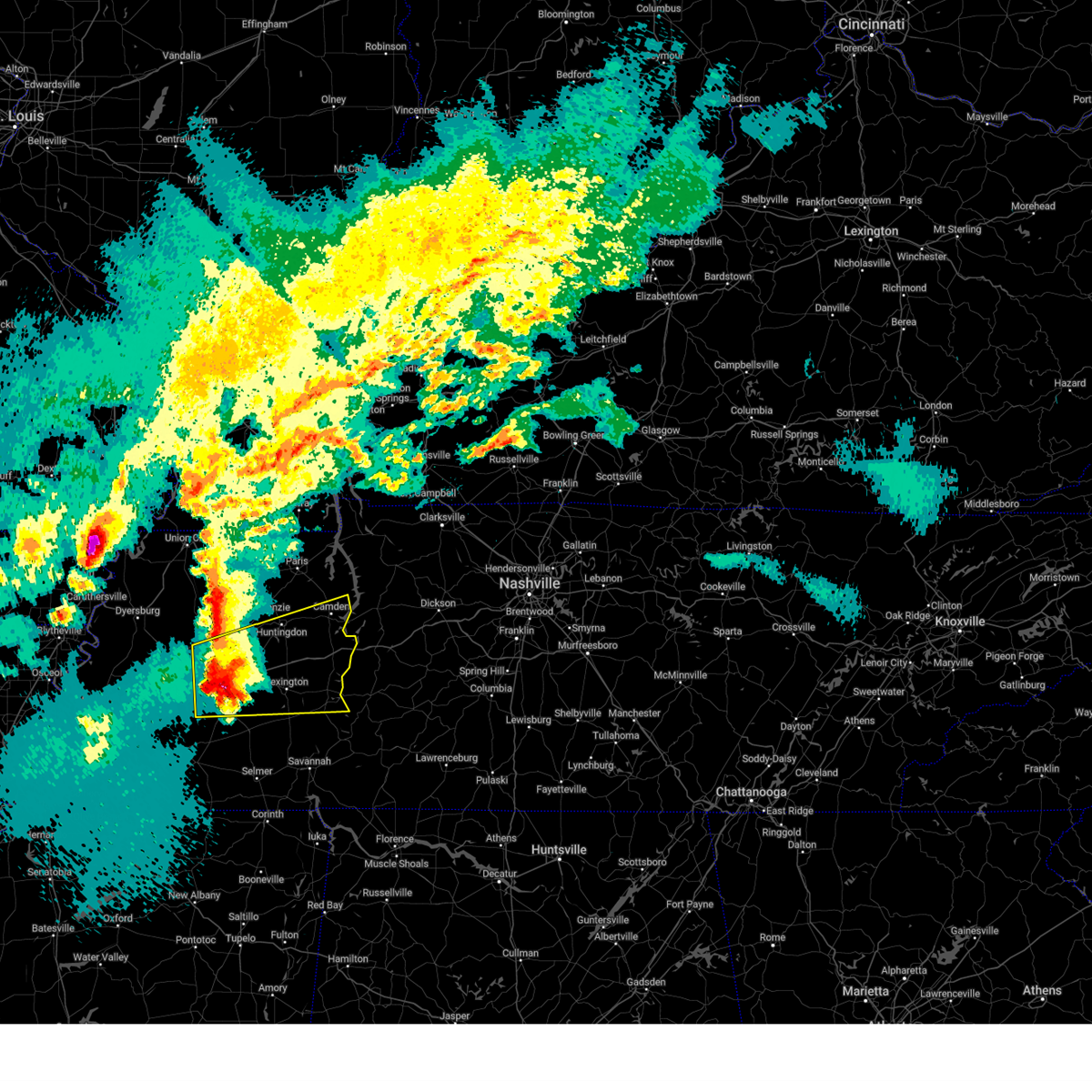 At 841 pm cdt, a severe thunderstorm was located near fairview, or near jackson, moving northeast at 75 mph (radar indicated). Hazards include two inch hail and 60 mph wind gusts. People and animals outdoors will be injured. expect hail damage to roofs, siding, windows, and vehicles. expect wind damage to roofs, siding, and trees. Locations impacted include, neely, atwood, huntersville, westover, madison hall, rock hill, bruceton, leach, hinson springs, buena vista, hollow rock, camden, clarksburg, perryville, fruitland, warrens bluff, natchez trace state park, mclemoresville, scott hill, and milan. At 841 pm cdt, a severe thunderstorm was located near fairview, or near jackson, moving northeast at 75 mph (radar indicated). Hazards include two inch hail and 60 mph wind gusts. People and animals outdoors will be injured. expect hail damage to roofs, siding, windows, and vehicles. expect wind damage to roofs, siding, and trees. Locations impacted include, neely, atwood, huntersville, westover, madison hall, rock hill, bruceton, leach, hinson springs, buena vista, hollow rock, camden, clarksburg, perryville, fruitland, warrens bluff, natchez trace state park, mclemoresville, scott hill, and milan.
|
| 4/3/2025 8:40 PM CDT | Large trees down on riverside d in madison county TN, 5.7 miles N of Jackson, TN |
| 4/3/2025 8:40 PM CDT |
 At 839 pm cdt, a severe thunderstorm was located near adair, or near humboldt, moving northeast at 55 mph (radar indicated). Hazards include ping pong ball size hail and 60 mph wind gusts. People and animals outdoors will be injured. expect hail damage to roofs, siding, windows, and vehicles. expect wind damage to roofs, siding, and trees. Locations impacted include, three way, huntersville, humboldt, new enterprise, fairview, gilmore, medina, mason grove, sitka, vaughns grove, barrons corner, coxville, georgetown, laneview, fruitvale, adair, youngs crossing, west, fruitland, and gum flat. At 839 pm cdt, a severe thunderstorm was located near adair, or near humboldt, moving northeast at 55 mph (radar indicated). Hazards include ping pong ball size hail and 60 mph wind gusts. People and animals outdoors will be injured. expect hail damage to roofs, siding, windows, and vehicles. expect wind damage to roofs, siding, and trees. Locations impacted include, three way, huntersville, humboldt, new enterprise, fairview, gilmore, medina, mason grove, sitka, vaughns grove, barrons corner, coxville, georgetown, laneview, fruitvale, adair, youngs crossing, west, fruitland, and gum flat.
|
| 4/3/2025 8:40 PM CDT |
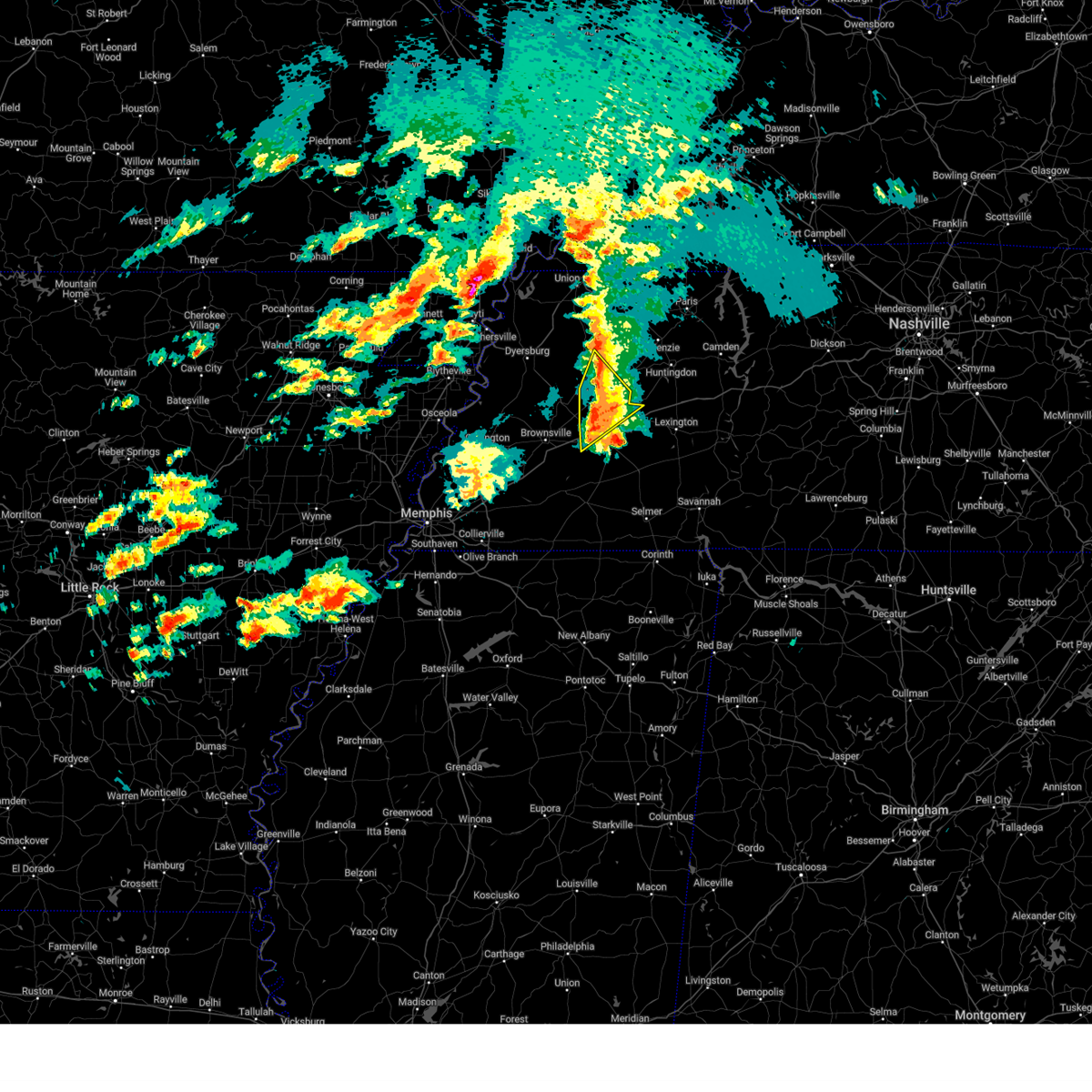 the severe thunderstorm warning has been cancelled and is no longer in effect the severe thunderstorm warning has been cancelled and is no longer in effect
|
| 4/3/2025 8:39 PM CDT |
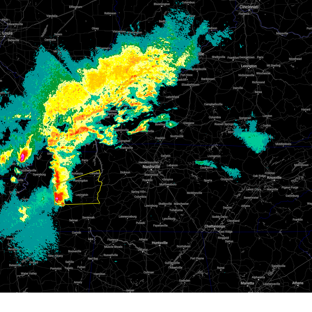 Svrmeg the national weather service in memphis has issued a * severe thunderstorm warning for, southeastern crockett county in west tennessee, henderson county in west tennessee, southeastern gibson county in west tennessee, benton county in west tennessee, carroll county in west tennessee, madison county in west tennessee, north central chester county in west tennessee, decatur county in west tennessee, * until 930 pm cdt. * at 838 pm cdt, a severe thunderstorm was located near fairview, or near jackson, moving northeast at 60 mph (radar indicated). Hazards include ping pong ball size hail and 60 mph wind gusts. People and animals outdoors will be injured. expect hail damage to roofs, siding, windows, and vehicles. Expect wind damage to roofs, siding, and trees. Svrmeg the national weather service in memphis has issued a * severe thunderstorm warning for, southeastern crockett county in west tennessee, henderson county in west tennessee, southeastern gibson county in west tennessee, benton county in west tennessee, carroll county in west tennessee, madison county in west tennessee, north central chester county in west tennessee, decatur county in west tennessee, * until 930 pm cdt. * at 838 pm cdt, a severe thunderstorm was located near fairview, or near jackson, moving northeast at 60 mph (radar indicated). Hazards include ping pong ball size hail and 60 mph wind gusts. People and animals outdoors will be injured. expect hail damage to roofs, siding, windows, and vehicles. Expect wind damage to roofs, siding, and trees.
|
| 4/3/2025 8:28 PM CDT |
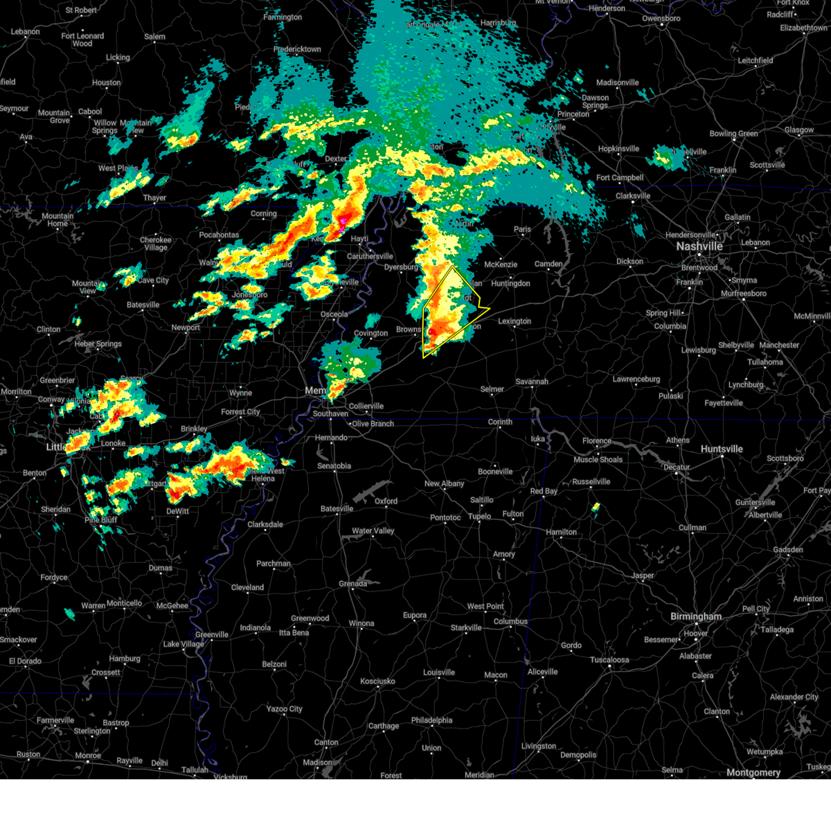 At 828 pm cdt, a severe thunderstorm was located over holly grove, or 10 miles northeast of brownsville, moving northeast at 55 mph (radar indicated). Hazards include 60 mph wind gusts and half dollar size hail. Hail damage to vehicles is expected. expect wind damage to roofs, siding, and trees. Locations impacted include, three way, quincy, gibson wells, allens, huntersville, humboldt, new enterprise, fairview, jones, gilmore, medina, mason grove, holly grove, sitka, brazil, vaughns grove, leighton, barrons corner, coxville, and alamo. At 828 pm cdt, a severe thunderstorm was located over holly grove, or 10 miles northeast of brownsville, moving northeast at 55 mph (radar indicated). Hazards include 60 mph wind gusts and half dollar size hail. Hail damage to vehicles is expected. expect wind damage to roofs, siding, and trees. Locations impacted include, three way, quincy, gibson wells, allens, huntersville, humboldt, new enterprise, fairview, jones, gilmore, medina, mason grove, holly grove, sitka, brazil, vaughns grove, leighton, barrons corner, coxville, and alamo.
|
| 4/3/2025 8:28 PM CDT |
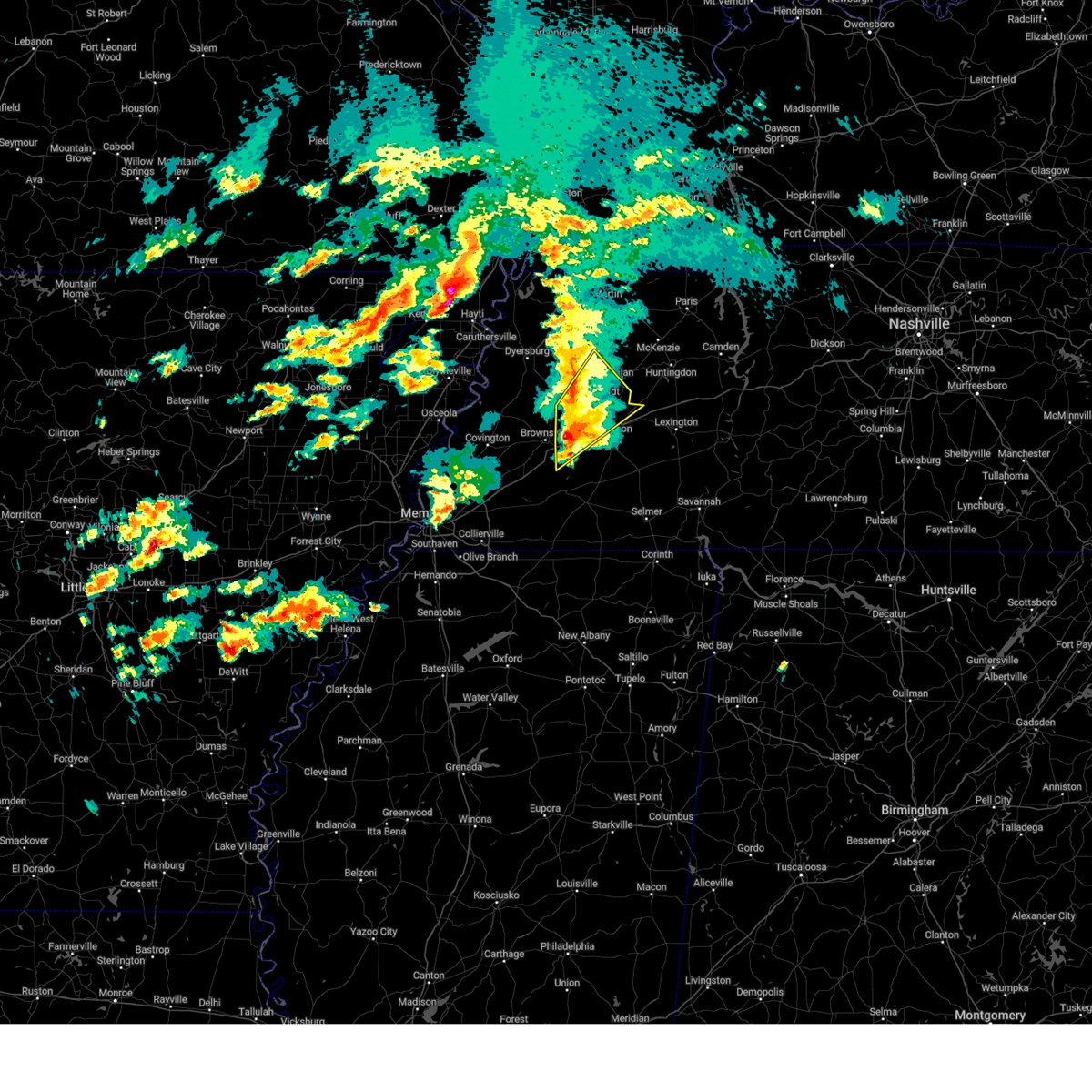 At 828 pm cdt, a severe thunderstorm was located over holly grove, or 10 miles northeast of brownsville, moving northeast at 55 mph (radar indicated). Hazards include golf ball size hail and 60 mph wind gusts. People and animals outdoors will be injured. expect hail damage to roofs, siding, windows, and vehicles. expect wind damage to roofs, siding, and trees. Locations impacted include, three way, quincy, gibson wells, allens, huntersville, humboldt, new enterprise, fairview, jones, gilmore, medina, mason grove, holly grove, sitka, brazil, vaughns grove, leighton, barrons corner, coxville, and alamo. At 828 pm cdt, a severe thunderstorm was located over holly grove, or 10 miles northeast of brownsville, moving northeast at 55 mph (radar indicated). Hazards include golf ball size hail and 60 mph wind gusts. People and animals outdoors will be injured. expect hail damage to roofs, siding, windows, and vehicles. expect wind damage to roofs, siding, and trees. Locations impacted include, three way, quincy, gibson wells, allens, huntersville, humboldt, new enterprise, fairview, jones, gilmore, medina, mason grove, holly grove, sitka, brazil, vaughns grove, leighton, barrons corner, coxville, and alamo.
|
| 4/3/2025 8:25 PM CDT |
 At 825 pm cdt, a severe thunderstorm was located over holly grove, or 7 miles east of brownsville, moving northeast at 55 mph (radar indicated). Hazards include golf ball size hail and 60 mph wind gusts. People and animals outdoors will be injured. expect hail damage to roofs, siding, windows, and vehicles. expect wind damage to roofs, siding, and trees. Locations impacted include, three way, quincy, gibson wells, allens, huntersville, humboldt, new enterprise, fairview, jones, gilmore, medina, mason grove, holly grove, sitka, brazil, vaughns grove, leighton, barrons corner, coxville, and alamo. At 825 pm cdt, a severe thunderstorm was located over holly grove, or 7 miles east of brownsville, moving northeast at 55 mph (radar indicated). Hazards include golf ball size hail and 60 mph wind gusts. People and animals outdoors will be injured. expect hail damage to roofs, siding, windows, and vehicles. expect wind damage to roofs, siding, and trees. Locations impacted include, three way, quincy, gibson wells, allens, huntersville, humboldt, new enterprise, fairview, jones, gilmore, medina, mason grove, holly grove, sitka, brazil, vaughns grove, leighton, barrons corner, coxville, and alamo.
|
| 4/3/2025 8:16 PM CDT |
 At 815 pm cdt, a severe thunderstorm was located near brownsville, moving northeast at 55 mph (radar indicated). Hazards include tennis ball size hail and 60 mph wind gusts. People and animals outdoors will be injured. expect hail damage to roofs, siding, windows, and vehicles. expect wind damage to roofs, siding, and trees. Locations impacted include, gibson wells, huntersville, brownsville, humboldt, fairview, medina, mason grove, brazil, georgetown, laneview, fruitvale, hillville, fruitland, roberts, brims corner, sunnyhill, moores chapel, three way, asbury, and quincy. At 815 pm cdt, a severe thunderstorm was located near brownsville, moving northeast at 55 mph (radar indicated). Hazards include tennis ball size hail and 60 mph wind gusts. People and animals outdoors will be injured. expect hail damage to roofs, siding, windows, and vehicles. expect wind damage to roofs, siding, and trees. Locations impacted include, gibson wells, huntersville, brownsville, humboldt, fairview, medina, mason grove, brazil, georgetown, laneview, fruitvale, hillville, fruitland, roberts, brims corner, sunnyhill, moores chapel, three way, asbury, and quincy.
|
| 4/3/2025 8:15 PM CDT |
 At 815 pm cdt, a severe thunderstorm was located near brownsville, moving northeast at 55 mph (radar indicated). Hazards include ping pong ball size hail and 60 mph wind gusts. People and animals outdoors will be injured. expect hail damage to roofs, siding, windows, and vehicles. expect wind damage to roofs, siding, and trees. Locations impacted include, gibson wells, huntersville, brownsville, humboldt, fairview, medina, mason grove, brazil, georgetown, laneview, fruitvale, hillville, fruitland, roberts, brims corner, sunnyhill, moores chapel, three way, asbury, and quincy. At 815 pm cdt, a severe thunderstorm was located near brownsville, moving northeast at 55 mph (radar indicated). Hazards include ping pong ball size hail and 60 mph wind gusts. People and animals outdoors will be injured. expect hail damage to roofs, siding, windows, and vehicles. expect wind damage to roofs, siding, and trees. Locations impacted include, gibson wells, huntersville, brownsville, humboldt, fairview, medina, mason grove, brazil, georgetown, laneview, fruitvale, hillville, fruitland, roberts, brims corner, sunnyhill, moores chapel, three way, asbury, and quincy.
|
| 4/3/2025 8:13 PM CDT |
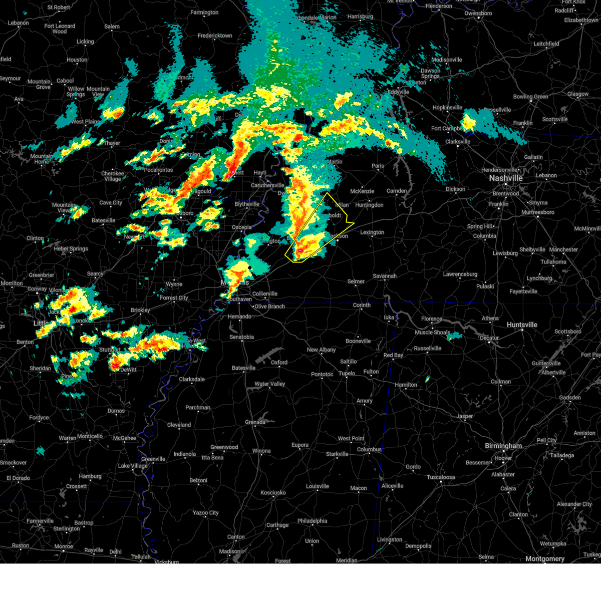 At 813 pm cdt, a severe thunderstorm was located near brownsville, moving northeast at 50 mph (radar indicated). Hazards include ping pong ball size hail and 60 mph wind gusts. People and animals outdoors will be injured. expect hail damage to roofs, siding, windows, and vehicles. expect wind damage to roofs, siding, and trees. Locations impacted include, gibson wells, stanton, huntersville, brownsville, humboldt, fairview, medina, mason grove, brazil, georgetown, laneview, fruitvale, hillville, fruitland, roberts, brims corner, sunnyhill, moores chapel, three way, and asbury. At 813 pm cdt, a severe thunderstorm was located near brownsville, moving northeast at 50 mph (radar indicated). Hazards include ping pong ball size hail and 60 mph wind gusts. People and animals outdoors will be injured. expect hail damage to roofs, siding, windows, and vehicles. expect wind damage to roofs, siding, and trees. Locations impacted include, gibson wells, stanton, huntersville, brownsville, humboldt, fairview, medina, mason grove, brazil, georgetown, laneview, fruitvale, hillville, fruitland, roberts, brims corner, sunnyhill, moores chapel, three way, and asbury.
|
| 4/3/2025 8:13 PM CDT |
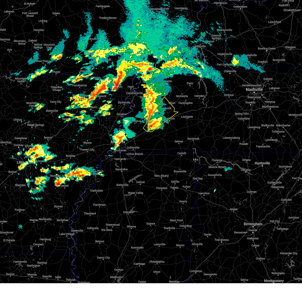 the severe thunderstorm warning has been cancelled and is no longer in effect the severe thunderstorm warning has been cancelled and is no longer in effect
|
| 4/3/2025 8:09 PM CDT |
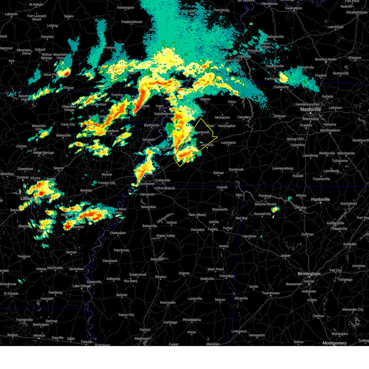 Svrmeg the national weather service in memphis has issued a * severe thunderstorm warning for, southeastern crockett county in west tennessee, southern gibson county in west tennessee, north central fayette county in west tennessee, haywood county in west tennessee, northern madison county in west tennessee, * until 900 pm cdt. * at 809 pm cdt, a severe thunderstorm was located near dancyville, or 7 miles south of brownsville, moving northeast at 55 mph (radar indicated). Hazards include 60 mph wind gusts and quarter size hail. Hail damage to vehicles is expected. Expect wind damage to roofs, siding, and trees. Svrmeg the national weather service in memphis has issued a * severe thunderstorm warning for, southeastern crockett county in west tennessee, southern gibson county in west tennessee, north central fayette county in west tennessee, haywood county in west tennessee, northern madison county in west tennessee, * until 900 pm cdt. * at 809 pm cdt, a severe thunderstorm was located near dancyville, or 7 miles south of brownsville, moving northeast at 55 mph (radar indicated). Hazards include 60 mph wind gusts and quarter size hail. Hail damage to vehicles is expected. Expect wind damage to roofs, siding, and trees.
|
| 4/3/2025 12:10 AM CDT |
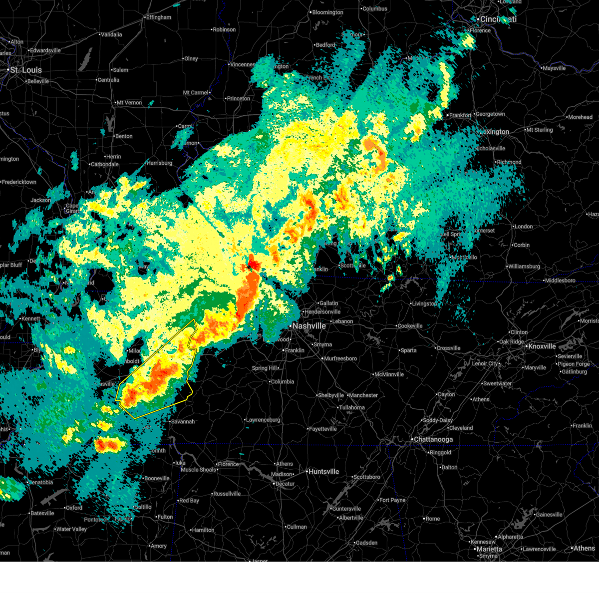 Svrmeg the national weather service in memphis has issued a * severe thunderstorm warning for, henderson county in west tennessee, benton county in west tennessee, northern mcnairy county in west tennessee, southeastern carroll county in west tennessee, northwestern hardin county in west tennessee, southeastern madison county in west tennessee, chester county in west tennessee, decatur county in west tennessee, * until 100 am cdt. * at 1210 am cdt, a severe thunderstorm was located near henderson, moving northeast at 55 mph (radar indicated). Hazards include 60 mph wind gusts and quarter size hail. Hail damage to vehicles is expected. Expect wind damage to roofs, siding, and trees. Svrmeg the national weather service in memphis has issued a * severe thunderstorm warning for, henderson county in west tennessee, benton county in west tennessee, northern mcnairy county in west tennessee, southeastern carroll county in west tennessee, northwestern hardin county in west tennessee, southeastern madison county in west tennessee, chester county in west tennessee, decatur county in west tennessee, * until 100 am cdt. * at 1210 am cdt, a severe thunderstorm was located near henderson, moving northeast at 55 mph (radar indicated). Hazards include 60 mph wind gusts and quarter size hail. Hail damage to vehicles is expected. Expect wind damage to roofs, siding, and trees.
|
| 4/2/2025 11:31 PM CDT |
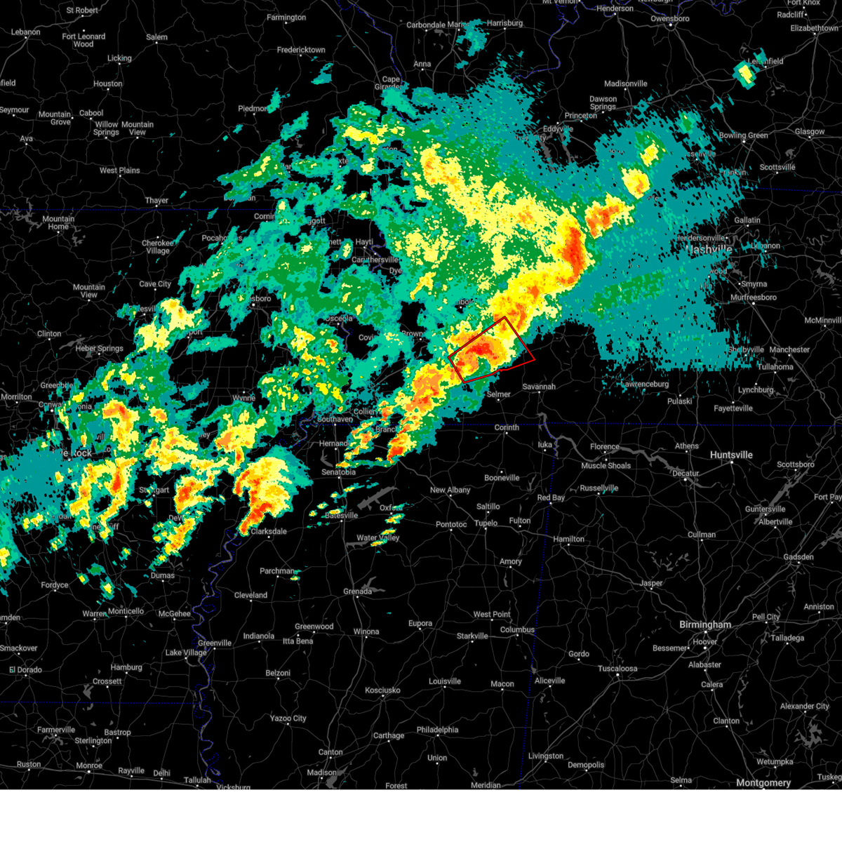 At 1131 pm cdt, a severe thunderstorm capable of producing a tornado was located over chickasaw state park, moving northeast at 45 mph (radar indicated rotation). Hazards include tornado and quarter size hail. Flying debris will be dangerous to those caught without shelter. mobile homes will be damaged or destroyed. damage to roofs, windows, and vehicles will occur. tree damage is likely. Locations impacted include, pinson, cedar grove, beech bluff, reagan, madison hall, chickasaw state forest, uptonville, juno, silerton, roby, teague, maple grove, cabo, middle fork, blue goose, east union, pinson mounds state archaeological park, jacks creek, malesus, and medon. At 1131 pm cdt, a severe thunderstorm capable of producing a tornado was located over chickasaw state park, moving northeast at 45 mph (radar indicated rotation). Hazards include tornado and quarter size hail. Flying debris will be dangerous to those caught without shelter. mobile homes will be damaged or destroyed. damage to roofs, windows, and vehicles will occur. tree damage is likely. Locations impacted include, pinson, cedar grove, beech bluff, reagan, madison hall, chickasaw state forest, uptonville, juno, silerton, roby, teague, maple grove, cabo, middle fork, blue goose, east union, pinson mounds state archaeological park, jacks creek, malesus, and medon.
|
| 4/2/2025 11:21 PM CDT |
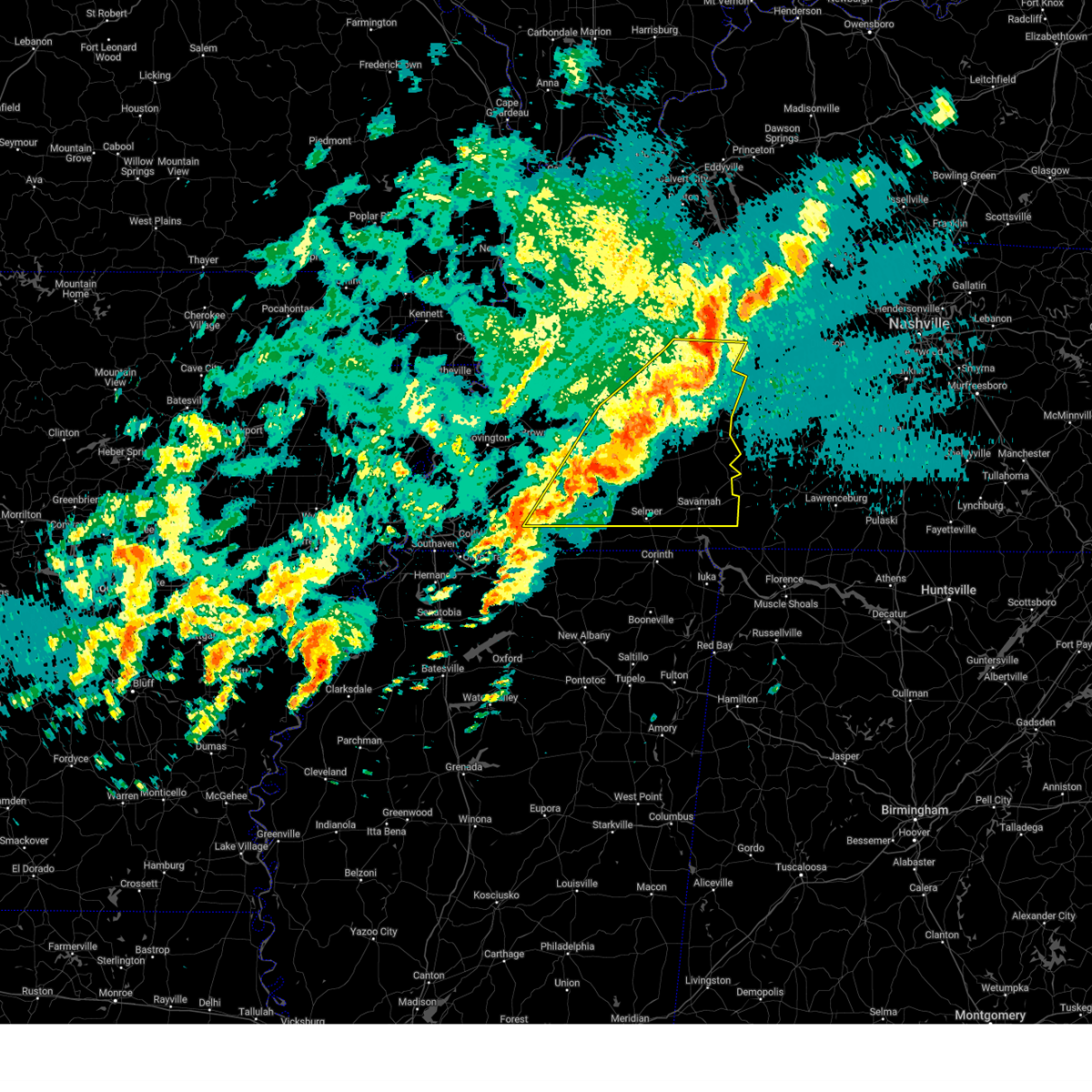 At 1120 pm cdt, a severe thunderstorm was located 7 miles south of bruceton, or 12 miles north of natchez trace state park, moving east at 65 mph (radar indicated). Hazards include 70 mph wind gusts and quarter size hail. Hail damage to vehicles is expected. expect considerable tree damage. wind damage is also likely to mobile homes, roofs, and outbuildings. Locations impacted include, neely, selmer, huntersville, masseyville, reagan, crump, westover, madison hall, uptonville, rock hill, silerton, bruceton, leach, walkertown, hinson springs, cerro gordo, buena vista, pinson mounds state archaeological park, hollow rock, and thurman. At 1120 pm cdt, a severe thunderstorm was located 7 miles south of bruceton, or 12 miles north of natchez trace state park, moving east at 65 mph (radar indicated). Hazards include 70 mph wind gusts and quarter size hail. Hail damage to vehicles is expected. expect considerable tree damage. wind damage is also likely to mobile homes, roofs, and outbuildings. Locations impacted include, neely, selmer, huntersville, masseyville, reagan, crump, westover, madison hall, uptonville, rock hill, silerton, bruceton, leach, walkertown, hinson springs, cerro gordo, buena vista, pinson mounds state archaeological park, hollow rock, and thurman.
|
| 4/2/2025 11:15 PM CDT |
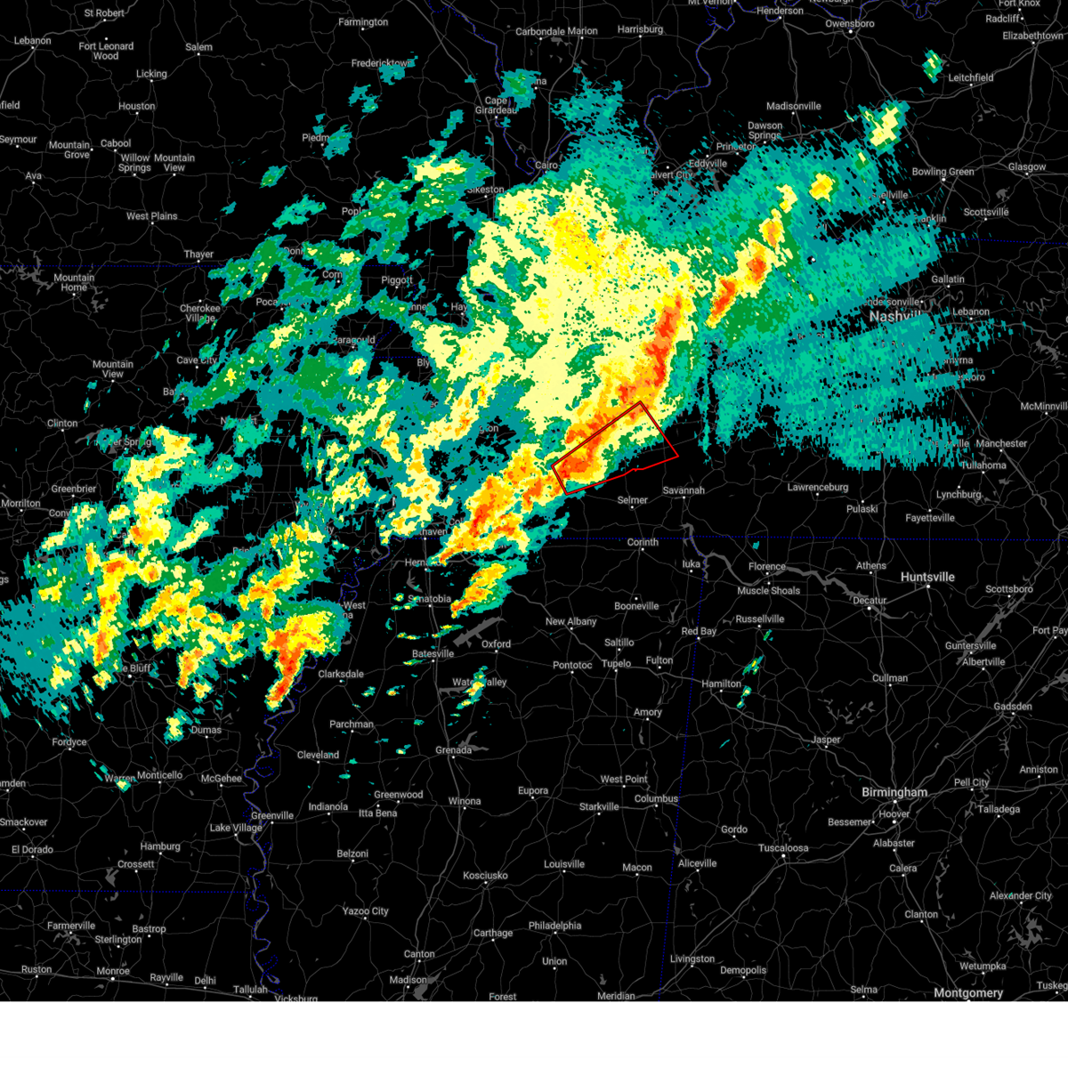 Tormeg the national weather service in memphis has issued a * tornado warning for, southwestern henderson county in west tennessee, northeastern hardeman county in west tennessee, southern madison county in west tennessee, chester county in west tennessee, * until midnight cdt. * at 1115 pm cdt, a severe thunderstorm capable of producing a tornado was located near cloverport, or near bolivar, moving northeast at 45 mph (radar indicated rotation). Hazards include tornado and quarter size hail. Flying debris will be dangerous to those caught without shelter. mobile homes will be damaged or destroyed. damage to roofs, windows, and vehicles will occur. Tree damage is likely. Tormeg the national weather service in memphis has issued a * tornado warning for, southwestern henderson county in west tennessee, northeastern hardeman county in west tennessee, southern madison county in west tennessee, chester county in west tennessee, * until midnight cdt. * at 1115 pm cdt, a severe thunderstorm capable of producing a tornado was located near cloverport, or near bolivar, moving northeast at 45 mph (radar indicated rotation). Hazards include tornado and quarter size hail. Flying debris will be dangerous to those caught without shelter. mobile homes will be damaged or destroyed. damage to roofs, windows, and vehicles will occur. Tree damage is likely.
|
| 4/2/2025 11:06 PM CDT |
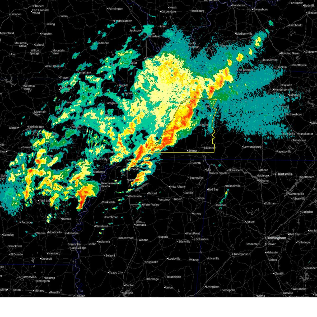 Svrmeg the national weather service in memphis has issued a * severe thunderstorm warning for, henderson county in west tennessee, southeastern gibson county in west tennessee, northeastern fayette county in west tennessee, hardeman county in west tennessee, benton county in west tennessee, mcnairy county in west tennessee, carroll county in west tennessee, hardin county in west tennessee, southeastern haywood county in west tennessee, madison county in west tennessee, chester county in west tennessee, decatur county in west tennessee, * until 1145 pm cdt. * at 1105 pm cdt, a severe thunderstorm was located 7 miles northwest of parkers crossroads, or 11 miles southwest of huntingdon, moving east at 65 mph. this is a destructive storm for humbolt, jackson, and henderson (radar indicated). Hazards include 80 mph wind gusts and quarter size hail. Flying debris will be dangerous to those caught without shelter. mobile homes will be heavily damaged. expect considerable damage to roofs, windows, and vehicles. Extensive tree damage and power outages are likely. Svrmeg the national weather service in memphis has issued a * severe thunderstorm warning for, henderson county in west tennessee, southeastern gibson county in west tennessee, northeastern fayette county in west tennessee, hardeman county in west tennessee, benton county in west tennessee, mcnairy county in west tennessee, carroll county in west tennessee, hardin county in west tennessee, southeastern haywood county in west tennessee, madison county in west tennessee, chester county in west tennessee, decatur county in west tennessee, * until 1145 pm cdt. * at 1105 pm cdt, a severe thunderstorm was located 7 miles northwest of parkers crossroads, or 11 miles southwest of huntingdon, moving east at 65 mph. this is a destructive storm for humbolt, jackson, and henderson (radar indicated). Hazards include 80 mph wind gusts and quarter size hail. Flying debris will be dangerous to those caught without shelter. mobile homes will be heavily damaged. expect considerable damage to roofs, windows, and vehicles. Extensive tree damage and power outages are likely.
|
| 4/2/2025 10:31 PM CDT |
 At 1030 pm cdt, a severe thunderstorm was located near bells, or 10 miles northeast of brownsville, moving northeast at 55 mph. this is a destructive storm for holly grove, mercer, and whiteville (radar indicated). Hazards include 80 mph wind gusts and quarter size hail. Flying debris will be dangerous to those caught without shelter. mobile homes will be heavily damaged. expect considerable damage to roofs, windows, and vehicles. extensive tree damage and power outages are likely. Locations impacted include, tuckers corner, neely, yum yum, selmer, atwood, stanton, huntersville, masseyville, belmont, cades, christmasville, westover, madison hall, uptonville, silerton, maury junction, gann, georgetown, pinson mounds state archaeological park, and laneview. At 1030 pm cdt, a severe thunderstorm was located near bells, or 10 miles northeast of brownsville, moving northeast at 55 mph. this is a destructive storm for holly grove, mercer, and whiteville (radar indicated). Hazards include 80 mph wind gusts and quarter size hail. Flying debris will be dangerous to those caught without shelter. mobile homes will be heavily damaged. expect considerable damage to roofs, windows, and vehicles. extensive tree damage and power outages are likely. Locations impacted include, tuckers corner, neely, yum yum, selmer, atwood, stanton, huntersville, masseyville, belmont, cades, christmasville, westover, madison hall, uptonville, silerton, maury junction, gann, georgetown, pinson mounds state archaeological park, and laneview.
|
| 4/2/2025 10:29 PM CDT |
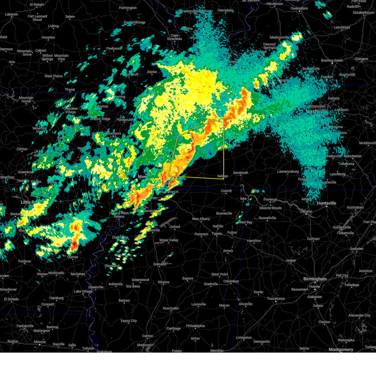 Svrmeg the national weather service in memphis has issued a * severe thunderstorm warning for, crockett county in west tennessee, southeastern tipton county in west tennessee, northwestern henderson county in west tennessee, southern gibson county in west tennessee, northern fayette county in west tennessee, northern hardeman county in west tennessee, northwestern mcnairy county in west tennessee, southeastern lauderdale county in west tennessee, western carroll county in west tennessee, haywood county in west tennessee, madison county in west tennessee, chester county in west tennessee, * until 1115 pm cdt. * at 1027 pm cdt, a severe thunderstorm was located near belle eagle, or 8 miles northeast of brownsville, moving northeast at 55 mph. this is a destructive storm for holly grove, mercer, and whiteville (radar indicated). Hazards include 80 mph wind gusts and quarter size hail. Flying debris will be dangerous to those caught without shelter. mobile homes will be heavily damaged. expect considerable damage to roofs, windows, and vehicles. Extensive tree damage and power outages are likely. Svrmeg the national weather service in memphis has issued a * severe thunderstorm warning for, crockett county in west tennessee, southeastern tipton county in west tennessee, northwestern henderson county in west tennessee, southern gibson county in west tennessee, northern fayette county in west tennessee, northern hardeman county in west tennessee, northwestern mcnairy county in west tennessee, southeastern lauderdale county in west tennessee, western carroll county in west tennessee, haywood county in west tennessee, madison county in west tennessee, chester county in west tennessee, * until 1115 pm cdt. * at 1027 pm cdt, a severe thunderstorm was located near belle eagle, or 8 miles northeast of brownsville, moving northeast at 55 mph. this is a destructive storm for holly grove, mercer, and whiteville (radar indicated). Hazards include 80 mph wind gusts and quarter size hail. Flying debris will be dangerous to those caught without shelter. mobile homes will be heavily damaged. expect considerable damage to roofs, windows, and vehicles. Extensive tree damage and power outages are likely.
|
| 4/2/2025 7:11 PM CDT |
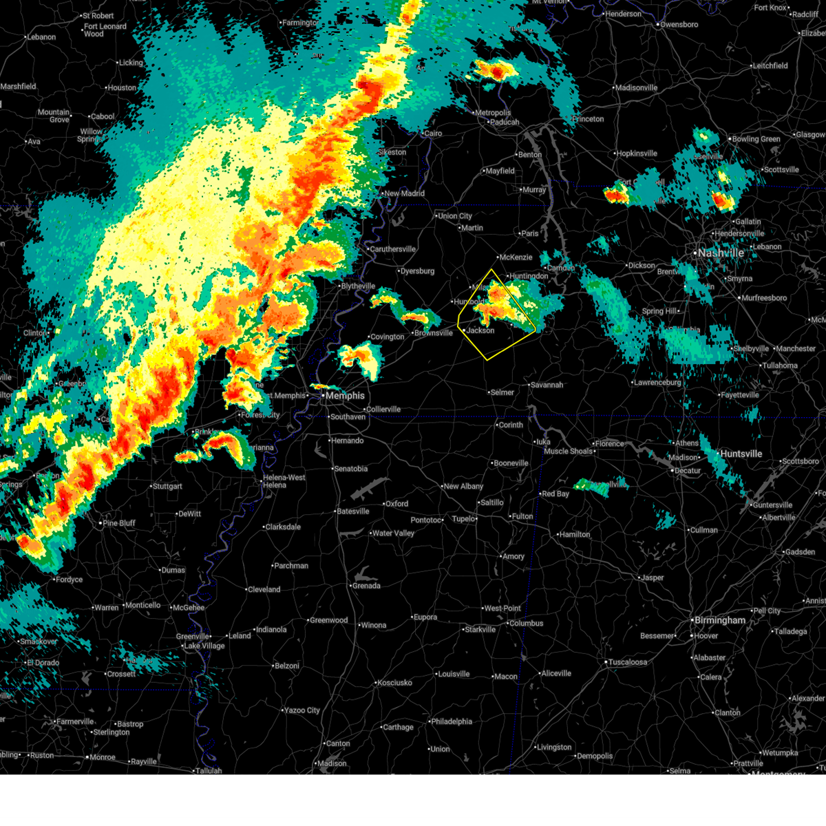 The storm which prompted the warning has weakened below severe limits. therefore, the warning will be allowed to expire. a tornado watch remains in effect until midnight cdt for west tennessee. The storm which prompted the warning has weakened below severe limits. therefore, the warning will be allowed to expire. a tornado watch remains in effect until midnight cdt for west tennessee.
|
| 4/2/2025 7:10 PM CDT |
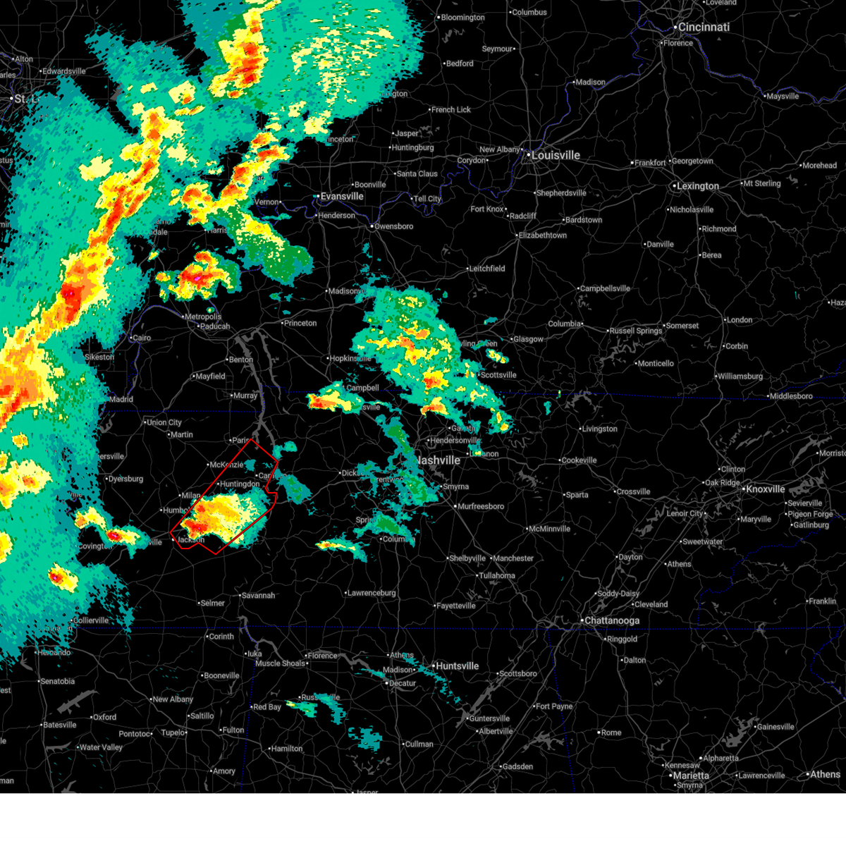 The storm which prompted the warning has weakened below severe limits, and no longer appears capable of producing a tornado. therefore, the warning will be allowed to expire. a tornado watch remains in effect until midnight cdt for west tennessee. The storm which prompted the warning has weakened below severe limits, and no longer appears capable of producing a tornado. therefore, the warning will be allowed to expire. a tornado watch remains in effect until midnight cdt for west tennessee.
|
| 4/2/2025 6:45 PM CDT |
 the tornado warning has been cancelled and is no longer in effect the tornado warning has been cancelled and is no longer in effect
|
| 4/2/2025 6:45 PM CDT |
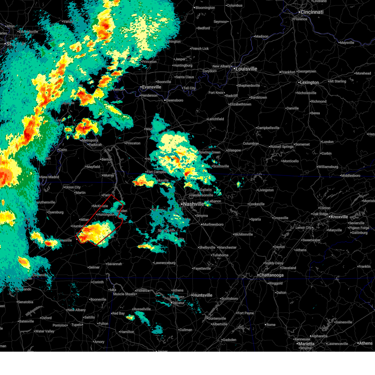 At 645 pm cdt, a severe thunderstorm capable of producing a tornado was located 7 miles northwest of mifflin, or 8 miles east of jackson, moving northeast at 50 mph (radar indicated rotation). Hazards include tornado and quarter size hail. Flying debris will be dangerous to those caught without shelter. mobile homes will be damaged or destroyed. damage to roofs, windows, and vehicles will occur. tree damage is likely. Locations impacted include, hickory flat, dollar, old springville, lexington, rock hill, bruceton, holladay, leach, middle fork, blue goose, tate, palmer shelter, hinson springs, buena vista, hollow rock, camden, haigler ridge, clarksburg, huron, and warrens bluff. At 645 pm cdt, a severe thunderstorm capable of producing a tornado was located 7 miles northwest of mifflin, or 8 miles east of jackson, moving northeast at 50 mph (radar indicated rotation). Hazards include tornado and quarter size hail. Flying debris will be dangerous to those caught without shelter. mobile homes will be damaged or destroyed. damage to roofs, windows, and vehicles will occur. tree damage is likely. Locations impacted include, hickory flat, dollar, old springville, lexington, rock hill, bruceton, holladay, leach, middle fork, blue goose, tate, palmer shelter, hinson springs, buena vista, hollow rock, camden, haigler ridge, clarksburg, huron, and warrens bluff.
|
| 4/2/2025 6:44 PM CDT |
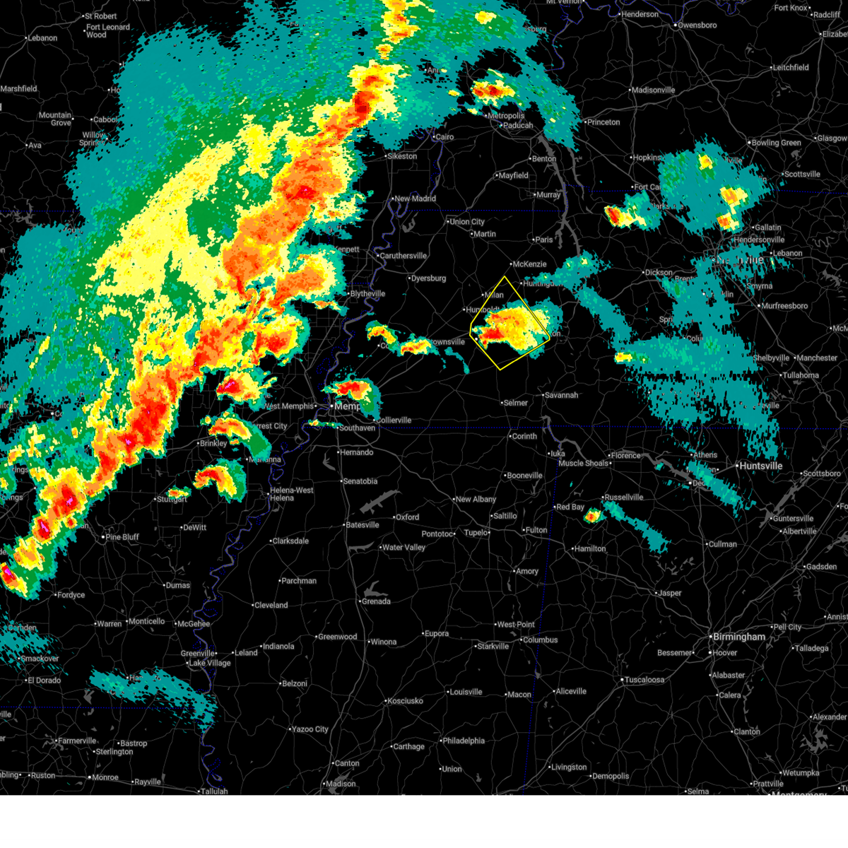 At 643 pm cdt, a severe thunderstorm was located near blue goose, or 8 miles east of jackson, moving northeast at 50 mph (radar indicated). Hazards include 60 mph wind gusts and quarter size hail. Hail damage to vehicles is expected. expect wind damage to roofs, siding, and trees. Locations impacted include, hickory flat, jackson, lexington, rock hill, leach, middle fork, blue goose, hinson springs, pinson mounds state archaeological park, huron, warrens bluff, mifflin, mclemoresville, scott hill, sand ridge, five points, bargerton, wildersville, white fern, and shady hill. At 643 pm cdt, a severe thunderstorm was located near blue goose, or 8 miles east of jackson, moving northeast at 50 mph (radar indicated). Hazards include 60 mph wind gusts and quarter size hail. Hail damage to vehicles is expected. expect wind damage to roofs, siding, and trees. Locations impacted include, hickory flat, jackson, lexington, rock hill, leach, middle fork, blue goose, hinson springs, pinson mounds state archaeological park, huron, warrens bluff, mifflin, mclemoresville, scott hill, sand ridge, five points, bargerton, wildersville, white fern, and shady hill.
|
| 4/2/2025 6:44 PM CDT |
 the severe thunderstorm warning has been cancelled and is no longer in effect the severe thunderstorm warning has been cancelled and is no longer in effect
|
| 4/2/2025 6:28 PM CDT |
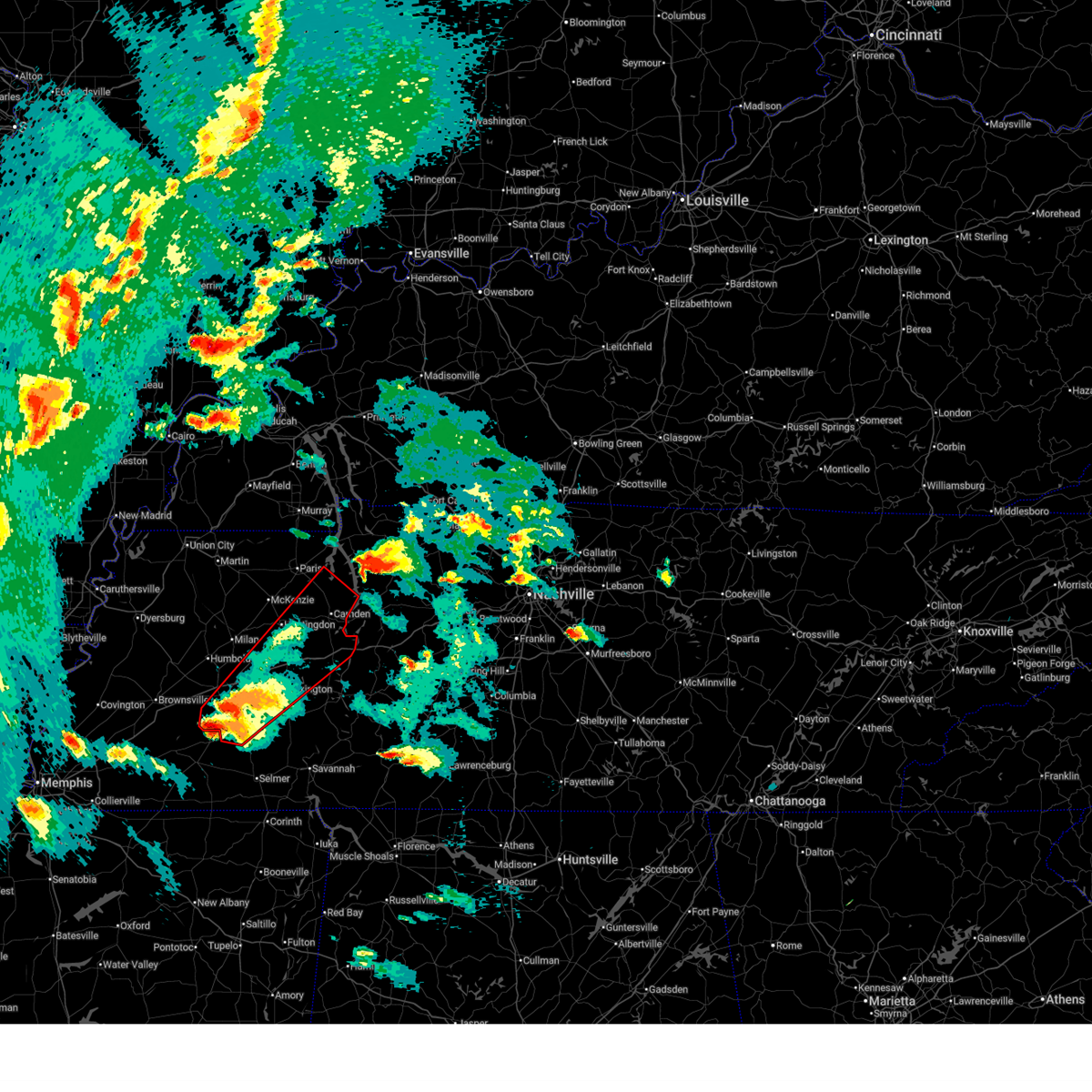 Tormeg the national weather service in memphis has issued a * tornado warning for, henderson county in west tennessee, benton county in west tennessee, carroll county in west tennessee, madison county in west tennessee, southeastern henry county in west tennessee, central chester county in west tennessee, northwestern decatur county in west tennessee, * until 715 pm cdt. * at 628 pm cdt, a severe thunderstorm capable of producing a tornado was located near bemis, or 8 miles northwest of henderson, moving northeast at 55 mph (radar indicated rotation). Hazards include tornado. Flying debris will be dangerous to those caught without shelter. mobile homes will be damaged or destroyed. damage to roofs, windows, and vehicles will occur. Tree damage is likely. Tormeg the national weather service in memphis has issued a * tornado warning for, henderson county in west tennessee, benton county in west tennessee, carroll county in west tennessee, madison county in west tennessee, southeastern henry county in west tennessee, central chester county in west tennessee, northwestern decatur county in west tennessee, * until 715 pm cdt. * at 628 pm cdt, a severe thunderstorm capable of producing a tornado was located near bemis, or 8 miles northwest of henderson, moving northeast at 55 mph (radar indicated rotation). Hazards include tornado. Flying debris will be dangerous to those caught without shelter. mobile homes will be damaged or destroyed. damage to roofs, windows, and vehicles will occur. Tree damage is likely.
|
| 4/2/2025 6:11 PM CDT |
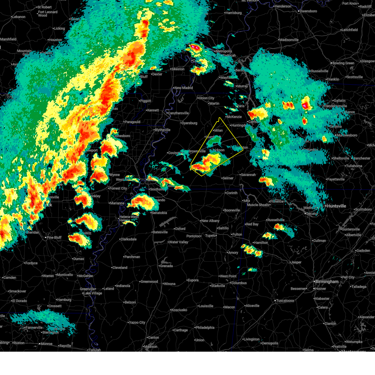 Svrmeg the national weather service in memphis has issued a * severe thunderstorm warning for, henderson county in west tennessee, southeastern gibson county in west tennessee, northern hardeman county in west tennessee, western carroll county in west tennessee, southeastern haywood county in west tennessee, madison county in west tennessee, chester county in west tennessee, * until 715 pm cdt. * at 611 pm cdt, a severe thunderstorm was located near cloverport, or near bolivar, moving northeast at 50 mph (radar indicated). Hazards include 60 mph wind gusts and quarter size hail. Hail damage to vehicles is expected. Expect wind damage to roofs, siding, and trees. Svrmeg the national weather service in memphis has issued a * severe thunderstorm warning for, henderson county in west tennessee, southeastern gibson county in west tennessee, northern hardeman county in west tennessee, western carroll county in west tennessee, southeastern haywood county in west tennessee, madison county in west tennessee, chester county in west tennessee, * until 715 pm cdt. * at 611 pm cdt, a severe thunderstorm was located near cloverport, or near bolivar, moving northeast at 50 mph (radar indicated). Hazards include 60 mph wind gusts and quarter size hail. Hail damage to vehicles is expected. Expect wind damage to roofs, siding, and trees.
|
| 4/2/2025 5:53 PM CDT |
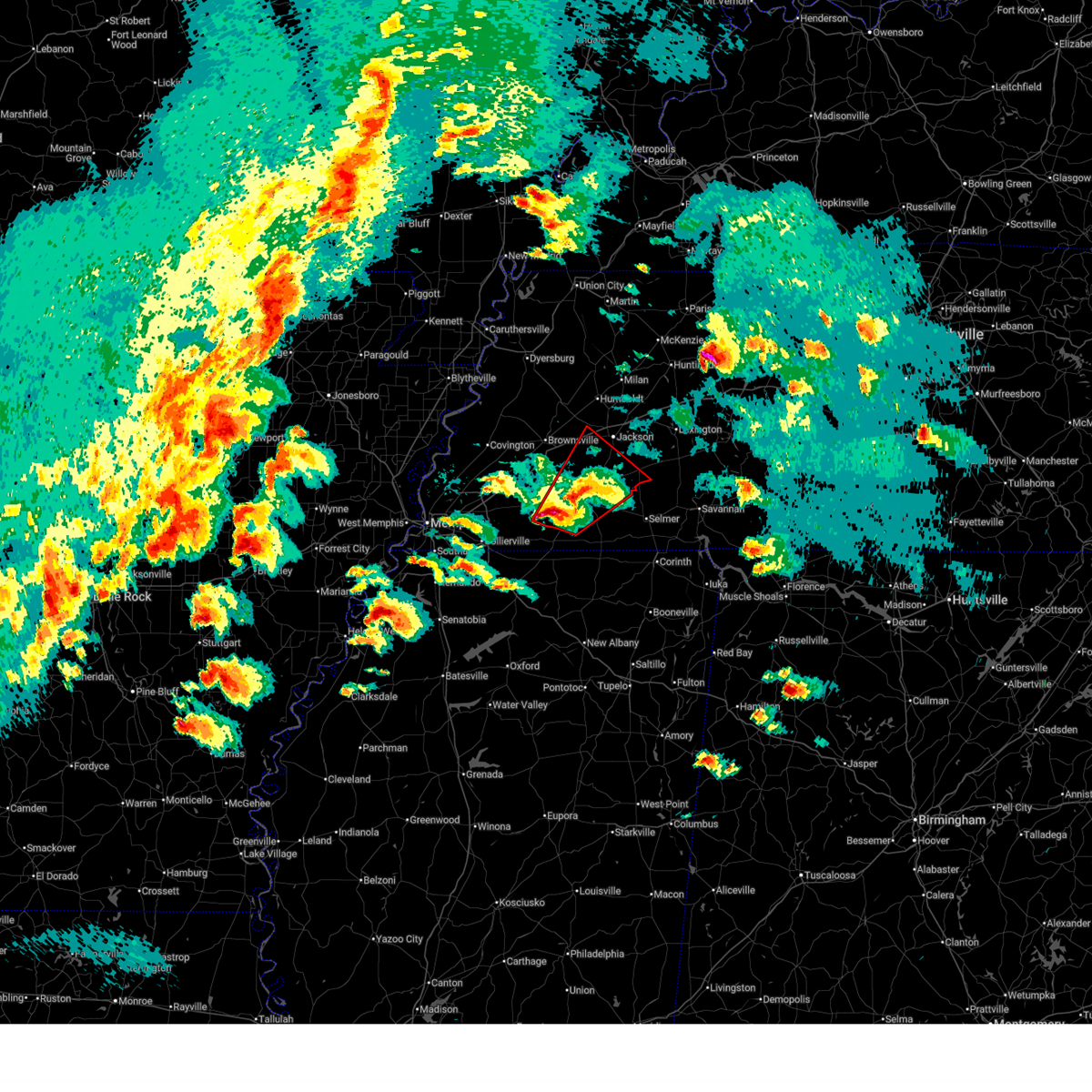 the tornado warning has been cancelled and is no longer in effect the tornado warning has been cancelled and is no longer in effect
|
| 4/2/2025 5:53 PM CDT |
 At 552 pm cdt, a severe thunderstorm capable of producing a tornado was located near bolivar, moving northeast at 45 mph (radar indicated rotation). Hazards include tornado and quarter size hail. Flying debris will be dangerous to those caught without shelter. mobile homes will be damaged or destroyed. damage to roofs, windows, and vehicles will occur. tree damage is likely. Locations impacted include, neely, pine top, huntersville, masseyville, hickory valley, chickasaw state forest, uptonville, silerton, hickory corners, teague, whiteville, bolivar, leighton, van buren, hornsby, laconia, malesus, medon, parkburg, and cedar chapel. At 552 pm cdt, a severe thunderstorm capable of producing a tornado was located near bolivar, moving northeast at 45 mph (radar indicated rotation). Hazards include tornado and quarter size hail. Flying debris will be dangerous to those caught without shelter. mobile homes will be damaged or destroyed. damage to roofs, windows, and vehicles will occur. tree damage is likely. Locations impacted include, neely, pine top, huntersville, masseyville, hickory valley, chickasaw state forest, uptonville, silerton, hickory corners, teague, whiteville, bolivar, leighton, van buren, hornsby, laconia, malesus, medon, parkburg, and cedar chapel.
|
| 4/2/2025 5:20 PM CDT |
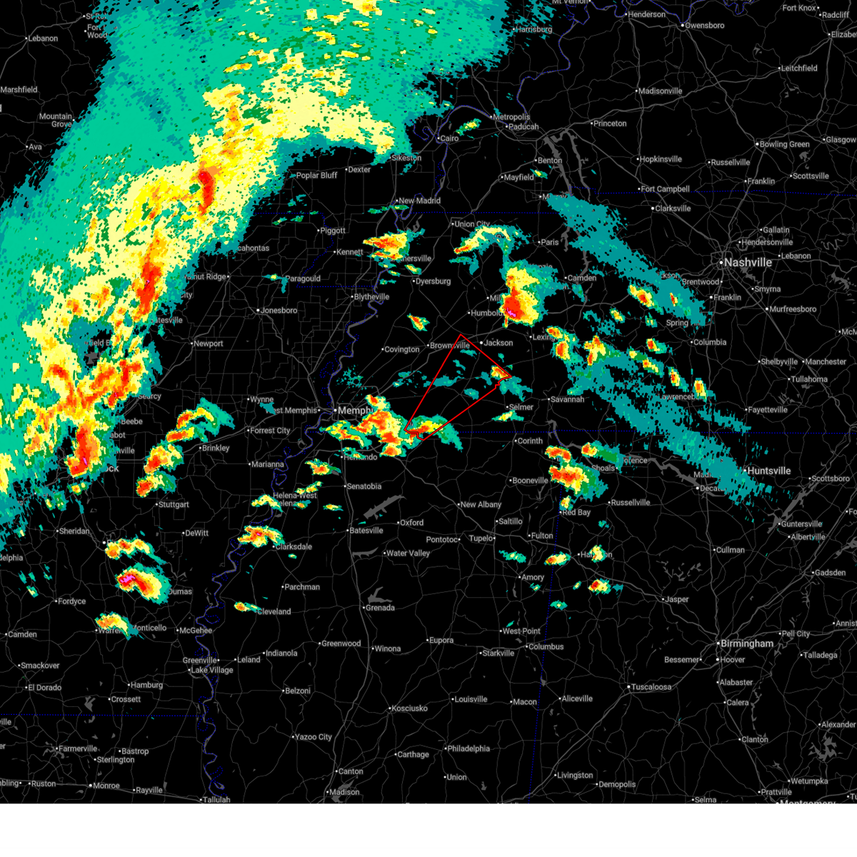 Tormeg the national weather service in memphis has issued a * tornado warning for, northwestern benton county in northeastern mississippi, southeastern fayette county in west tennessee, hardeman county in west tennessee, southeastern haywood county in west tennessee, southwestern madison county in west tennessee, southwestern chester county in west tennessee, * until 615 pm cdt. * at 520 pm cdt, a severe thunderstorm capable of producing a tornado was located near michigan city, or 19 miles north of holly springs, moving northeast at 50 mph (radar indicated rotation). Hazards include tornado and quarter size hail. Flying debris will be dangerous to those caught without shelter. mobile homes will be damaged or destroyed. damage to roofs, windows, and vehicles will occur. Tree damage is likely. Tormeg the national weather service in memphis has issued a * tornado warning for, northwestern benton county in northeastern mississippi, southeastern fayette county in west tennessee, hardeman county in west tennessee, southeastern haywood county in west tennessee, southwestern madison county in west tennessee, southwestern chester county in west tennessee, * until 615 pm cdt. * at 520 pm cdt, a severe thunderstorm capable of producing a tornado was located near michigan city, or 19 miles north of holly springs, moving northeast at 50 mph (radar indicated rotation). Hazards include tornado and quarter size hail. Flying debris will be dangerous to those caught without shelter. mobile homes will be damaged or destroyed. damage to roofs, windows, and vehicles will occur. Tree damage is likely.
|
| 4/2/2025 5:14 PM CDT | Quarter sized hail reported 1.9 miles S of Jackson, TN, report from mping: quarter (1.00 in.). |
| 4/2/2025 5:06 PM CDT |
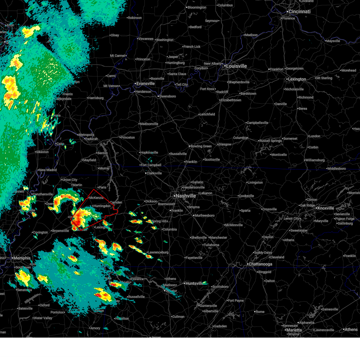 At 506 pm cdt, a severe thunderstorm capable of producing a tornado was located near blue goose, or 11 miles northeast of jackson, moving northeast at 50 mph (radar indicated rotation). Hazards include tornado and ping pong ball size hail. Flying debris will be dangerous to those caught without shelter. mobile homes will be damaged or destroyed. damage to roofs, windows, and vehicles will occur. tree damage is likely. Locations impacted include, hickory flat, dollar, atwood, ledbetter, fairview, bruceton, holladay, medina, leach, blue goose, mckenzie, tate, palmer shelter, buena vista, hollow rock, clarksburg, trezevant, vale, natchez trace state park, and mclemoresville. At 506 pm cdt, a severe thunderstorm capable of producing a tornado was located near blue goose, or 11 miles northeast of jackson, moving northeast at 50 mph (radar indicated rotation). Hazards include tornado and ping pong ball size hail. Flying debris will be dangerous to those caught without shelter. mobile homes will be damaged or destroyed. damage to roofs, windows, and vehicles will occur. tree damage is likely. Locations impacted include, hickory flat, dollar, atwood, ledbetter, fairview, bruceton, holladay, medina, leach, blue goose, mckenzie, tate, palmer shelter, buena vista, hollow rock, clarksburg, trezevant, vale, natchez trace state park, and mclemoresville.
|
| 4/2/2025 4:54 PM CDT |
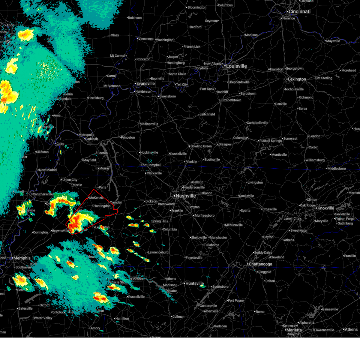 Tormeg the national weather service in memphis has issued a * tornado warning for, northern henderson county in west tennessee, southeastern gibson county in west tennessee, southern benton county in west tennessee, carroll county in west tennessee, northern madison county in west tennessee, southwestern henry county in west tennessee, * until 600 pm cdt. * at 454 pm cdt, a severe thunderstorm capable of producing a tornado was located over jackson, moving northeast at 50 mph (radar indicated rotation). Hazards include tornado and ping pong ball size hail. Flying debris will be dangerous to those caught without shelter. mobile homes will be damaged or destroyed. damage to roofs, windows, and vehicles will occur. Tree damage is likely. Tormeg the national weather service in memphis has issued a * tornado warning for, northern henderson county in west tennessee, southeastern gibson county in west tennessee, southern benton county in west tennessee, carroll county in west tennessee, northern madison county in west tennessee, southwestern henry county in west tennessee, * until 600 pm cdt. * at 454 pm cdt, a severe thunderstorm capable of producing a tornado was located over jackson, moving northeast at 50 mph (radar indicated rotation). Hazards include tornado and ping pong ball size hail. Flying debris will be dangerous to those caught without shelter. mobile homes will be damaged or destroyed. damage to roofs, windows, and vehicles will occur. Tree damage is likely.
|
| 4/2/2025 4:50 PM CDT | Half Dollar sized hail reported 1.9 miles SW of Jackson, TN, half dollar size hail exit 83 n jackson. |
| 4/2/2025 4:50 PM CDT | Half Dollar sized hail reported 2.4 miles E of Jackson, TN, quarter size hail south of i 40 and the 45 bypass. |
| 4/2/2025 4:47 PM CDT |
 At 447 pm cdt, a severe thunderstorm capable of producing a tornado was located near bargerton, or 12 miles southeast of milan, moving northeast at 50 mph (radar indicated rotation). Hazards include tornado and golf ball size hail. Flying debris will be dangerous to those caught without shelter. mobile homes will be damaged or destroyed. damage to roofs, windows, and vehicles will occur. tree damage is likely. Locations impacted include, three way, hickory flat, neely, bemis, cedar grove, huntersville, beech bluff, jackson, westover, ledbetter, madison hall, juno, fairview, gilmore, medina, maple grove, blue goose, sitka, east union, and malesus. At 447 pm cdt, a severe thunderstorm capable of producing a tornado was located near bargerton, or 12 miles southeast of milan, moving northeast at 50 mph (radar indicated rotation). Hazards include tornado and golf ball size hail. Flying debris will be dangerous to those caught without shelter. mobile homes will be damaged or destroyed. damage to roofs, windows, and vehicles will occur. tree damage is likely. Locations impacted include, three way, hickory flat, neely, bemis, cedar grove, huntersville, beech bluff, jackson, westover, ledbetter, madison hall, juno, fairview, gilmore, medina, maple grove, blue goose, sitka, east union, and malesus.
|
| 4/2/2025 4:47 PM CDT |
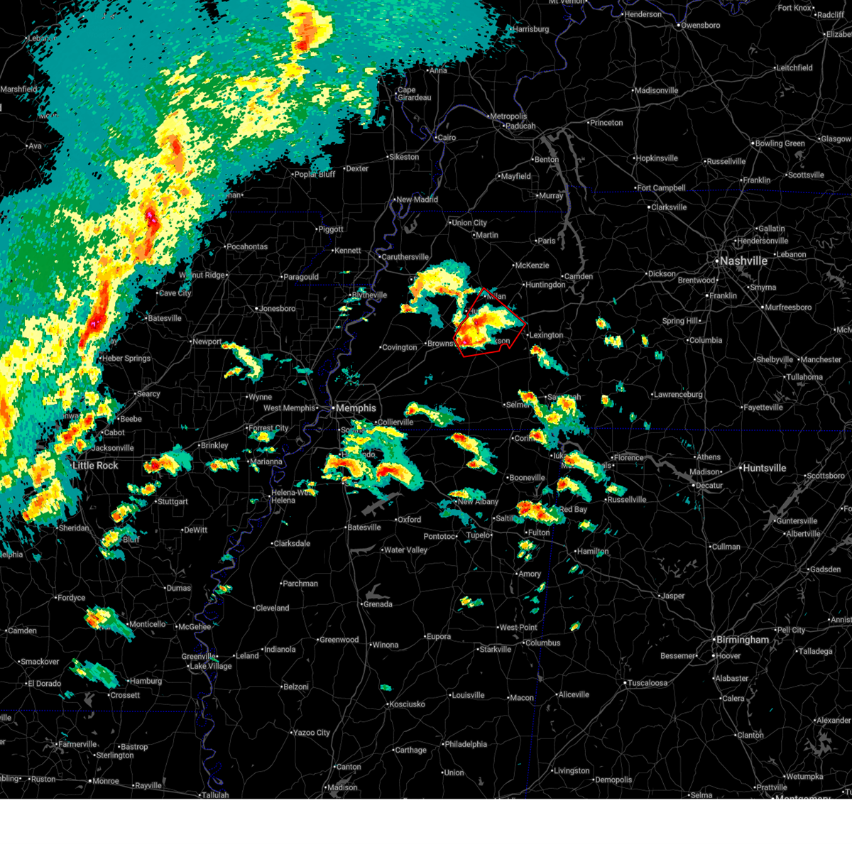 the tornado warning has been cancelled and is no longer in effect the tornado warning has been cancelled and is no longer in effect
|
| 4/2/2025 4:45 PM CDT | Quarter sized hail reported 2.3 miles N of Jackson, TN, quarter size hail at jackson regional airport. |
| 4/2/2025 4:29 PM CDT |
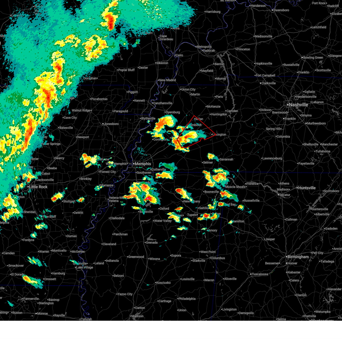 At 429 pm cdt, a severe thunderstorm capable of producing a tornado was located near jackson, moving northeast at 50 mph (radar indicated rotation). Hazards include tornado and golf ball size hail. Flying debris will be dangerous to those caught without shelter. mobile homes will be damaged or destroyed. damage to roofs, windows, and vehicles will occur. tree damage is likely. Locations impacted include, hickory flat, neely, huntersville, humboldt, jackson, westover, ledbetter, madison hall, uptonville, lexington, fairview, medina, mason grove, blue goose, hinson springs, huron, roberts, sand ridge, milan, and bargerton. At 429 pm cdt, a severe thunderstorm capable of producing a tornado was located near jackson, moving northeast at 50 mph (radar indicated rotation). Hazards include tornado and golf ball size hail. Flying debris will be dangerous to those caught without shelter. mobile homes will be damaged or destroyed. damage to roofs, windows, and vehicles will occur. tree damage is likely. Locations impacted include, hickory flat, neely, huntersville, humboldt, jackson, westover, ledbetter, madison hall, uptonville, lexington, fairview, medina, mason grove, blue goose, hinson springs, huron, roberts, sand ridge, milan, and bargerton.
|
| 4/2/2025 4:25 PM CDT |
 At 425 pm cdt, a confirmed tornado was located over bemis, or over jackson, moving northeast at 50 mph (public confirmed tornado). Hazards include damaging tornado and golf ball size hail. Flying debris will be dangerous to those caught without shelter. mobile homes will be damaged or destroyed. damage to roofs, windows, and vehicles will occur. tree damage is likely. Locations impacted include, hickory flat, neely, huntersville, humboldt, jackson, westover, ledbetter, madison hall, uptonville, lexington, fairview, medina, mason grove, blue goose, hinson springs, huron, roberts, sand ridge, milan, and bargerton. At 425 pm cdt, a confirmed tornado was located over bemis, or over jackson, moving northeast at 50 mph (public confirmed tornado). Hazards include damaging tornado and golf ball size hail. Flying debris will be dangerous to those caught without shelter. mobile homes will be damaged or destroyed. damage to roofs, windows, and vehicles will occur. tree damage is likely. Locations impacted include, hickory flat, neely, huntersville, humboldt, jackson, westover, ledbetter, madison hall, uptonville, lexington, fairview, medina, mason grove, blue goose, hinson springs, huron, roberts, sand ridge, milan, and bargerton.
|
| 4/2/2025 4:21 PM CDT |
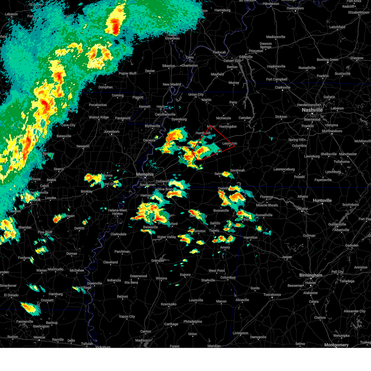 At 421 pm cdt, a confirmed tornado was located over bemis, or near jackson, moving northeast at 50 mph (public confirmed tornado). Hazards include damaging tornado and quarter size hail. Flying debris will be dangerous to those caught without shelter. mobile homes will be damaged or destroyed. damage to roofs, windows, and vehicles will occur. tree damage is likely. Locations impacted include, hickory flat, neely, huntersville, humboldt, jackson, westover, ledbetter, madison hall, uptonville, lexington, fairview, medina, mason grove, blue goose, hinson springs, huron, roberts, sand ridge, milan, and bargerton. At 421 pm cdt, a confirmed tornado was located over bemis, or near jackson, moving northeast at 50 mph (public confirmed tornado). Hazards include damaging tornado and quarter size hail. Flying debris will be dangerous to those caught without shelter. mobile homes will be damaged or destroyed. damage to roofs, windows, and vehicles will occur. tree damage is likely. Locations impacted include, hickory flat, neely, huntersville, humboldt, jackson, westover, ledbetter, madison hall, uptonville, lexington, fairview, medina, mason grove, blue goose, hinson springs, huron, roberts, sand ridge, milan, and bargerton.
|
| 4/2/2025 4:21 PM CDT |
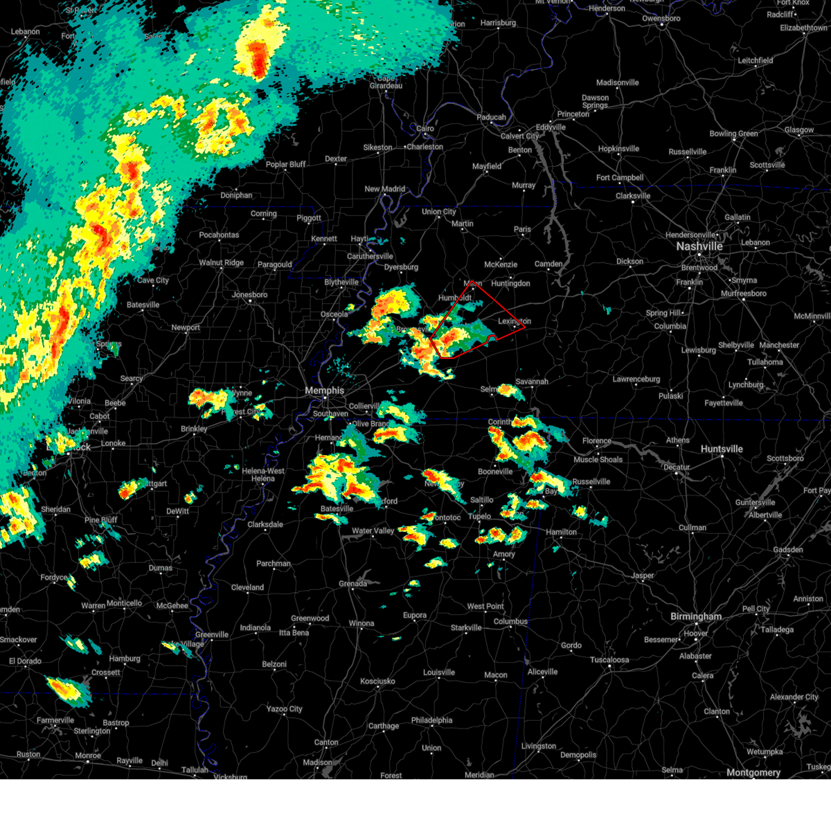 the tornado warning has been cancelled and is no longer in effect the tornado warning has been cancelled and is no longer in effect
|
| 4/2/2025 4:14 PM CDT |
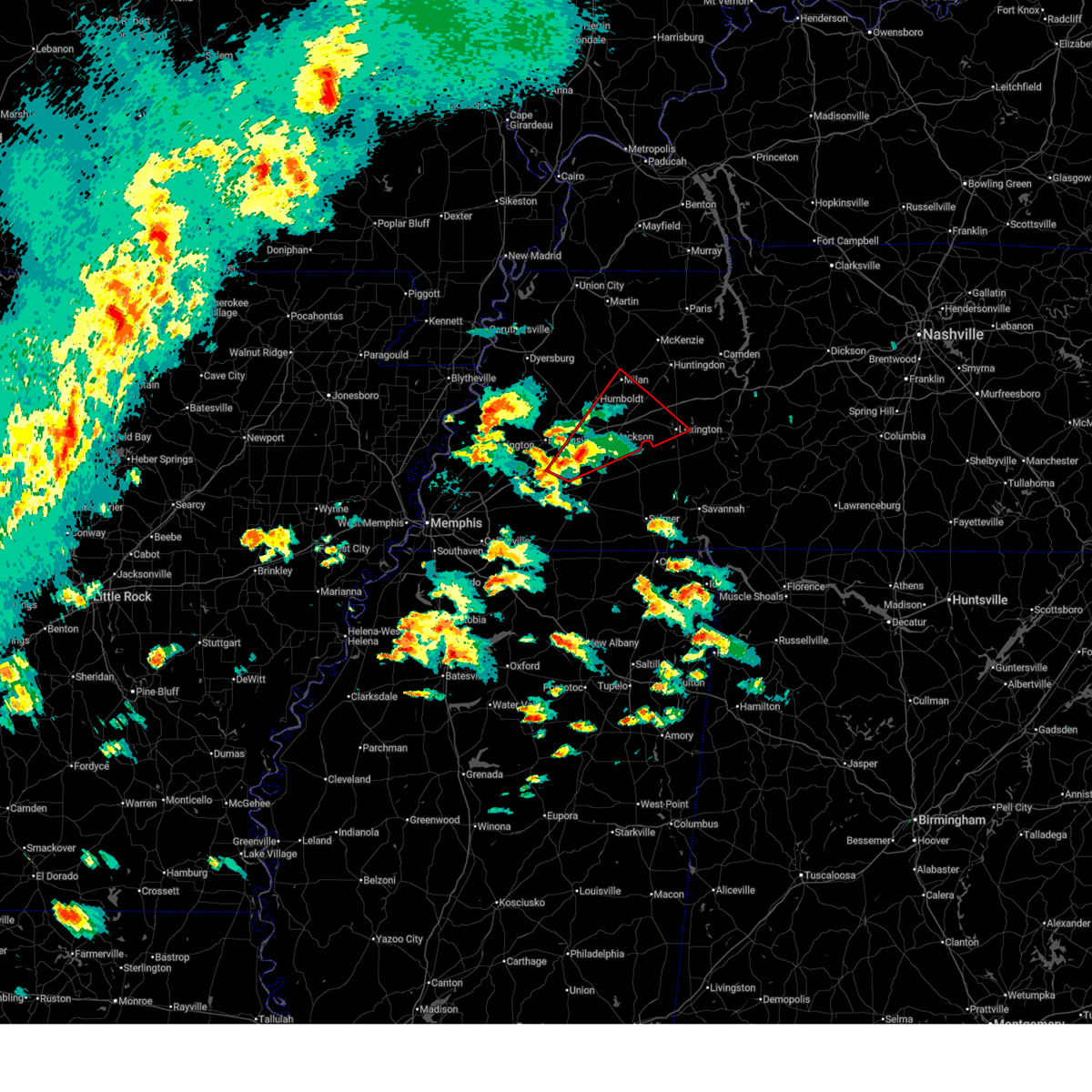 At 413 pm cdt, a severe thunderstorm capable of producing a tornado was located near mercer, or 11 miles northwest of chickasaw state forest, moving northeast at 50 mph (radar indicated rotation). Hazards include tornado and quarter size hail. Flying debris will be dangerous to those caught without shelter. mobile homes will be damaged or destroyed. damage to roofs, windows, and vehicles will occur. tree damage is likely. Locations impacted include, hickory flat, neely, huntersville, humboldt, jackson, westover, ledbetter, madison hall, uptonville, lexington, fairview, medina, mason grove, blue goose, hinson springs, hillville, cedar chapel, vildo, huron, and roberts. At 413 pm cdt, a severe thunderstorm capable of producing a tornado was located near mercer, or 11 miles northwest of chickasaw state forest, moving northeast at 50 mph (radar indicated rotation). Hazards include tornado and quarter size hail. Flying debris will be dangerous to those caught without shelter. mobile homes will be damaged or destroyed. damage to roofs, windows, and vehicles will occur. tree damage is likely. Locations impacted include, hickory flat, neely, huntersville, humboldt, jackson, westover, ledbetter, madison hall, uptonville, lexington, fairview, medina, mason grove, blue goose, hinson springs, hillville, cedar chapel, vildo, huron, and roberts.
|
| 4/2/2025 4:14 PM CDT |
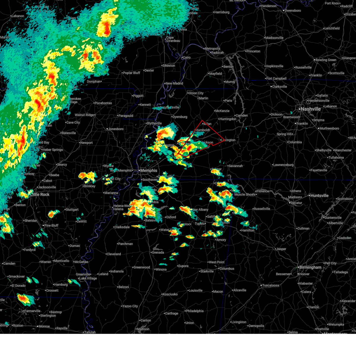 the tornado warning has been cancelled and is no longer in effect the tornado warning has been cancelled and is no longer in effect
|
| 4/2/2025 3:54 PM CDT |
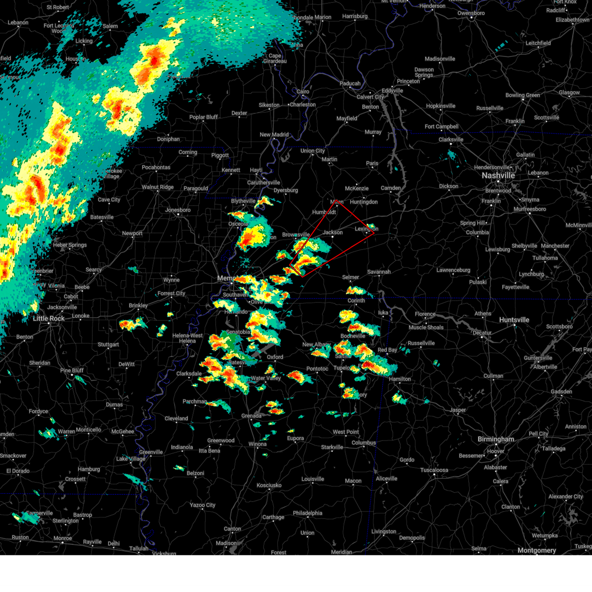 Tormeg the national weather service in memphis has issued a * tornado warning for, southeastern crockett county in west tennessee, northwestern henderson county in west tennessee, southeastern gibson county in west tennessee, northeastern fayette county in west tennessee, northwestern hardeman county in west tennessee, southwestern carroll county in west tennessee, southeastern haywood county in west tennessee, madison county in west tennessee, northwestern chester county in west tennessee, * until 500 pm cdt. * at 354 pm cdt, a severe thunderstorm capable of producing a tornado was located over whiteville, or 11 miles northwest of bolivar, moving northeast at 50 mph (radar indicated rotation). Hazards include tornado and quarter size hail. Flying debris will be dangerous to those caught without shelter. mobile homes will be damaged or destroyed. damage to roofs, windows, and vehicles will occur. Tree damage is likely. Tormeg the national weather service in memphis has issued a * tornado warning for, southeastern crockett county in west tennessee, northwestern henderson county in west tennessee, southeastern gibson county in west tennessee, northeastern fayette county in west tennessee, northwestern hardeman county in west tennessee, southwestern carroll county in west tennessee, southeastern haywood county in west tennessee, madison county in west tennessee, northwestern chester county in west tennessee, * until 500 pm cdt. * at 354 pm cdt, a severe thunderstorm capable of producing a tornado was located over whiteville, or 11 miles northwest of bolivar, moving northeast at 50 mph (radar indicated rotation). Hazards include tornado and quarter size hail. Flying debris will be dangerous to those caught without shelter. mobile homes will be damaged or destroyed. damage to roofs, windows, and vehicles will occur. Tree damage is likely.
|
| 3/30/2025 10:28 PM CDT |
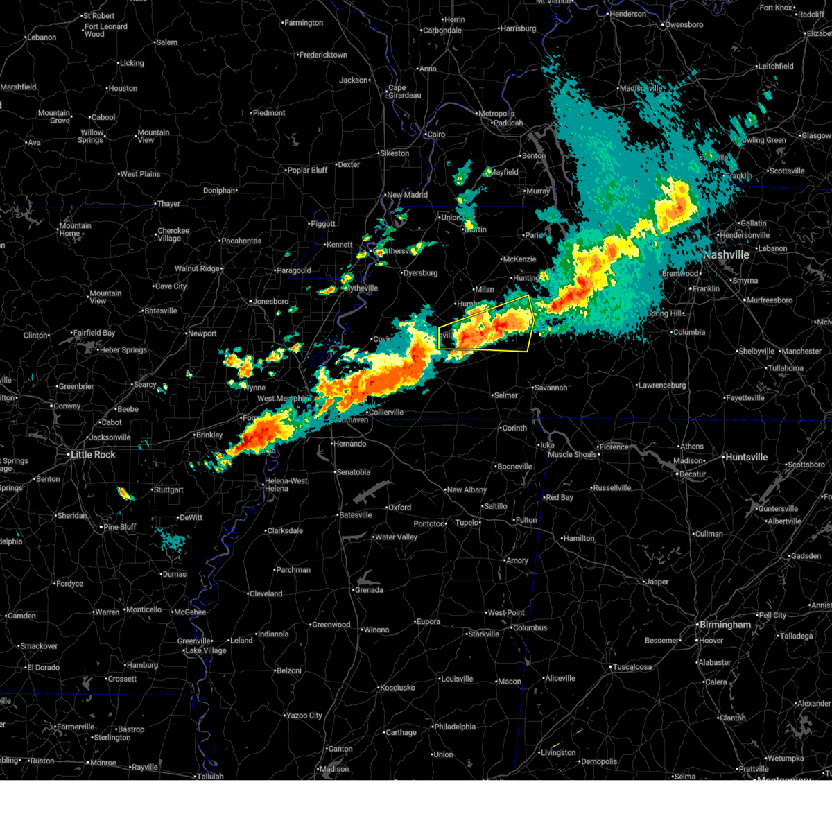 At 1027 pm cdt, a severe thunderstorm was located near lexington, moving east at 35 mph (radar indicated). Hazards include 60 mph wind gusts and quarter size hail. Hail damage to vehicles is expected. expect wind damage to roofs, siding, and trees. Locations impacted include, neely, bemis, cedar grove, huntersville, beech bluff, jackson, reagan, westover, madison hall, lexington, rock hill, union cross, juno, gilmore, maple grove, middle fork, blue goose, timberlake, leighton, and hinson springs. At 1027 pm cdt, a severe thunderstorm was located near lexington, moving east at 35 mph (radar indicated). Hazards include 60 mph wind gusts and quarter size hail. Hail damage to vehicles is expected. expect wind damage to roofs, siding, and trees. Locations impacted include, neely, bemis, cedar grove, huntersville, beech bluff, jackson, reagan, westover, madison hall, lexington, rock hill, union cross, juno, gilmore, maple grove, middle fork, blue goose, timberlake, leighton, and hinson springs.
|
| 3/30/2025 10:28 PM CDT |
 the severe thunderstorm warning has been cancelled and is no longer in effect the severe thunderstorm warning has been cancelled and is no longer in effect
|
| 3/30/2025 10:03 PM CDT | Half Dollar sized hail reported 3.1 miles NW of Jackson, TN, just larger than quarter sized hail in jackson. |
| 3/30/2025 9:57 PM CDT |
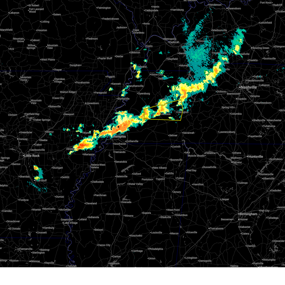 Svrmeg the national weather service in memphis has issued a * severe thunderstorm warning for, southeastern crockett county in west tennessee, henderson county in west tennessee, southern carroll county in west tennessee, east central haywood county in west tennessee, madison county in west tennessee, northeastern chester county in west tennessee, * until 1045 pm cdt. * at 957 pm cdt, a severe thunderstorm was located over jackson, moving east at 40 mph (radar indicated). Hazards include 60 mph wind gusts and quarter size hail. Hail damage to vehicles is expected. Expect wind damage to roofs, siding, and trees. Svrmeg the national weather service in memphis has issued a * severe thunderstorm warning for, southeastern crockett county in west tennessee, henderson county in west tennessee, southern carroll county in west tennessee, east central haywood county in west tennessee, madison county in west tennessee, northeastern chester county in west tennessee, * until 1045 pm cdt. * at 957 pm cdt, a severe thunderstorm was located over jackson, moving east at 40 mph (radar indicated). Hazards include 60 mph wind gusts and quarter size hail. Hail damage to vehicles is expected. Expect wind damage to roofs, siding, and trees.
|
| 3/30/2025 9:54 PM CDT | Half Dollar sized hail reported 1.6 miles WSW of Jackson, TN |
| 3/30/2025 9:49 PM CDT |
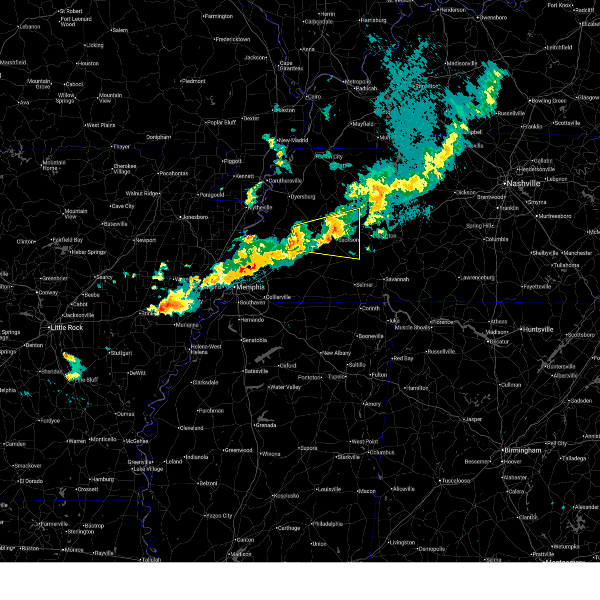 At 948 pm cdt, a severe thunderstorm was located near fairview, or near jackson, moving east at 35 mph (radar indicated. at 235 pm cdt, golf ball sized hail was reported near gadsden). Hazards include ping pong ball size hail and 60 mph wind gusts. People and animals outdoors will be injured. expect hail damage to roofs, siding, windows, and vehicles. expect wind damage to roofs, siding, and trees. Locations impacted include, hickory flat, neely, pinson, huntersville, brownsville, humboldt, christmasville, jackson, westover, madison hall, fairview, medina, mason grove, blue goose, pinson mounds state archaeological park, fruitvale, roberts, sunnyhill, mifflin, and five points. At 948 pm cdt, a severe thunderstorm was located near fairview, or near jackson, moving east at 35 mph (radar indicated. at 235 pm cdt, golf ball sized hail was reported near gadsden). Hazards include ping pong ball size hail and 60 mph wind gusts. People and animals outdoors will be injured. expect hail damage to roofs, siding, windows, and vehicles. expect wind damage to roofs, siding, and trees. Locations impacted include, hickory flat, neely, pinson, huntersville, brownsville, humboldt, christmasville, jackson, westover, madison hall, fairview, medina, mason grove, blue goose, pinson mounds state archaeological park, fruitvale, roberts, sunnyhill, mifflin, and five points.
|
| 3/30/2025 9:24 PM CDT |
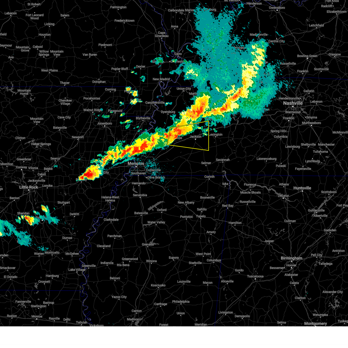 At 924 pm cdt, a severe thunderstorm was located over holly grove, or 8 miles northeast of brownsville, moving east at 45 mph (radar indicated). Hazards include 60 mph wind gusts and quarter size hail. Hail damage to vehicles is expected. expect wind damage to roofs, siding, and trees. Locations impacted include, hickory flat, neely, pinson, huntersville, brownsville, humboldt, christmasville, jackson, westover, madison hall, fairview, medina, mason grove, blue goose, pinson mounds state archaeological park, fruitvale, roberts, brims corner, tibbs, and sunnyhill. At 924 pm cdt, a severe thunderstorm was located over holly grove, or 8 miles northeast of brownsville, moving east at 45 mph (radar indicated). Hazards include 60 mph wind gusts and quarter size hail. Hail damage to vehicles is expected. expect wind damage to roofs, siding, and trees. Locations impacted include, hickory flat, neely, pinson, huntersville, brownsville, humboldt, christmasville, jackson, westover, madison hall, fairview, medina, mason grove, blue goose, pinson mounds state archaeological park, fruitvale, roberts, brims corner, tibbs, and sunnyhill.
|
| 3/30/2025 9:14 PM CDT |
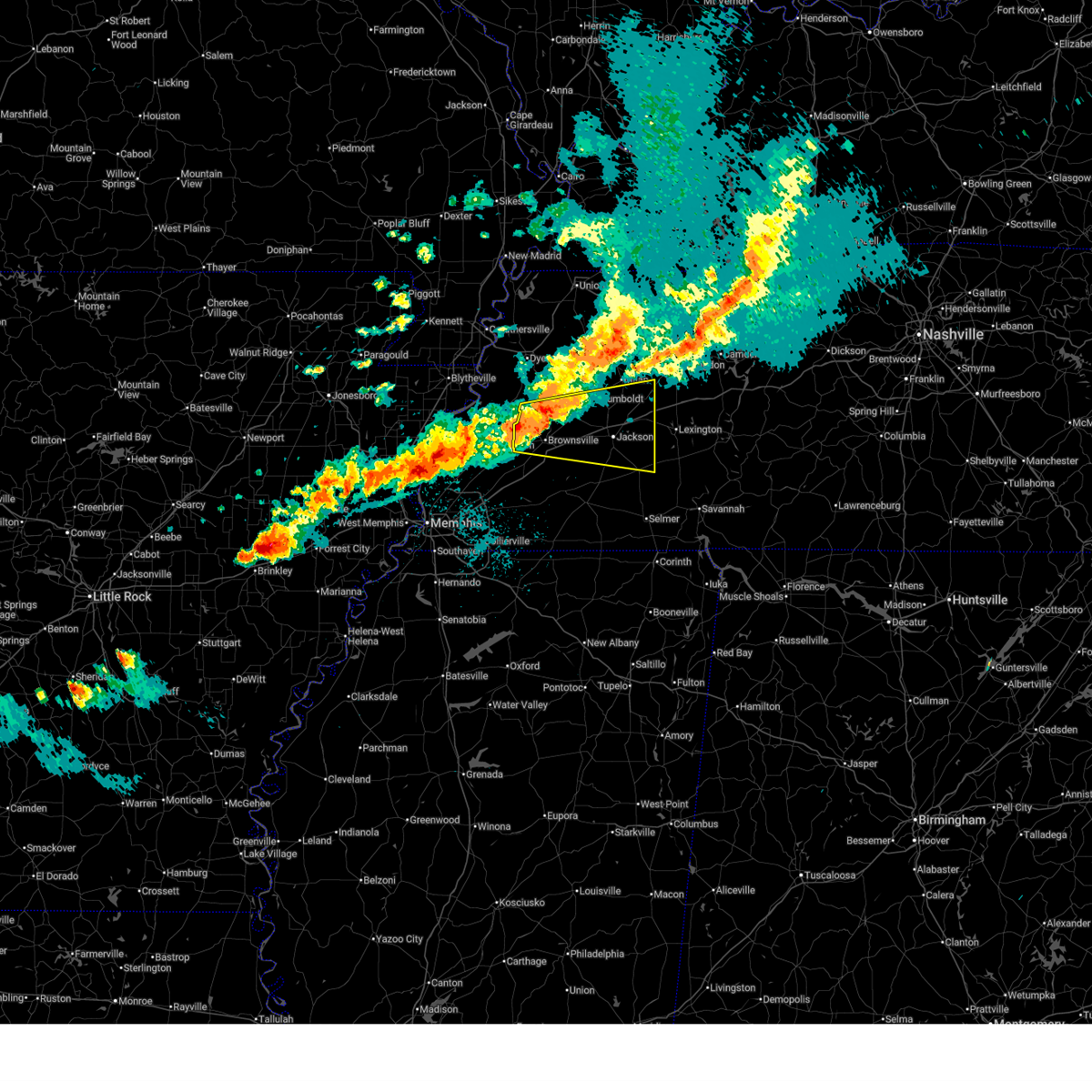 Svrmeg the national weather service in memphis has issued a * severe thunderstorm warning for, crockett county in west tennessee, northwestern henderson county in west tennessee, southeastern gibson county in west tennessee, southwestern carroll county in west tennessee, haywood county in west tennessee, madison county in west tennessee, northwestern chester county in west tennessee, * until 1000 pm cdt. * at 913 pm cdt, a severe thunderstorm was located near belle eagle, or near brownsville, moving east at 55 mph (radar indicated). Hazards include 60 mph wind gusts and quarter size hail. Hail damage to vehicles is expected. Expect wind damage to roofs, siding, and trees. Svrmeg the national weather service in memphis has issued a * severe thunderstorm warning for, crockett county in west tennessee, northwestern henderson county in west tennessee, southeastern gibson county in west tennessee, southwestern carroll county in west tennessee, haywood county in west tennessee, madison county in west tennessee, northwestern chester county in west tennessee, * until 1000 pm cdt. * at 913 pm cdt, a severe thunderstorm was located near belle eagle, or near brownsville, moving east at 55 mph (radar indicated). Hazards include 60 mph wind gusts and quarter size hail. Hail damage to vehicles is expected. Expect wind damage to roofs, siding, and trees.
|
| 3/15/2025 9:20 AM CDT |
 The storm which prompted the warning has weakened below severe limits, and has exited the warned area. therefore, the warning will be allowed to expire. however, small hail and gusty winds are still possible with this thunderstorm. a tornado watch remains in effect until 100 pm cdt for northeastern and northwestern mississippi, and west tennessee. The storm which prompted the warning has weakened below severe limits, and has exited the warned area. therefore, the warning will be allowed to expire. however, small hail and gusty winds are still possible with this thunderstorm. a tornado watch remains in effect until 100 pm cdt for northeastern and northwestern mississippi, and west tennessee.
|
| 3/15/2025 9:02 AM CDT |
 At 902 am cdt, a severe thunderstorm was located near arlington, or 10 miles northeast of bartlett, moving north at 50 mph (radar indicated). Hazards include 60 mph wind gusts and quarter size hail. Hail damage to vehicles is expected. expect wind damage to roofs, siding, and trees. Locations impacted include, ghost river state natural area, burlison, stanton, huntersville, masseyville, westover, covington, silerton, kirk, arlington, elmore park, laconia, lisbon, hudsonville, brims corner, sunnyhill, durhamville, montezuma, clopton, and lightfoot. At 902 am cdt, a severe thunderstorm was located near arlington, or 10 miles northeast of bartlett, moving north at 50 mph (radar indicated). Hazards include 60 mph wind gusts and quarter size hail. Hail damage to vehicles is expected. expect wind damage to roofs, siding, and trees. Locations impacted include, ghost river state natural area, burlison, stanton, huntersville, masseyville, westover, covington, silerton, kirk, arlington, elmore park, laconia, lisbon, hudsonville, brims corner, sunnyhill, durhamville, montezuma, clopton, and lightfoot.
|
| 3/15/2025 8:39 AM CDT |
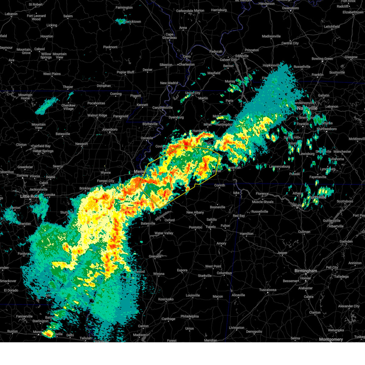 The severe thunderstorm which prompted the warning has moved out of the warned area. therefore, the warning will be allowed to expire. a tornado watch remains in effect until 100 pm cdt for northeastern and northwestern mississippi, and west tennessee. The severe thunderstorm which prompted the warning has moved out of the warned area. therefore, the warning will be allowed to expire. a tornado watch remains in effect until 100 pm cdt for northeastern and northwestern mississippi, and west tennessee.
|
| 3/15/2025 8:38 AM CDT |
 Svrmeg the national weather service in memphis has issued a * severe thunderstorm warning for, northeastern desoto county in northwestern mississippi, northern marshall county in northwestern mississippi, northern benton county in northeastern mississippi, fayette county in west tennessee, hardeman county in west tennessee, eastern lauderdale county in west tennessee, haywood county in west tennessee, madison county in west tennessee, shelby county in west tennessee, chester county in west tennessee, southern crockett county in west tennessee, tipton county in west tennessee, northwestern mcnairy county in west tennessee, * until 930 am cdt. * at 838 am cdt, a severe thunderstorm was located over germantown, moving northeast at 40 mph (radar indicated). Hazards include 60 mph wind gusts and quarter size hail. Hail damage to vehicles is expected. Expect wind damage to roofs, siding, and trees. Svrmeg the national weather service in memphis has issued a * severe thunderstorm warning for, northeastern desoto county in northwestern mississippi, northern marshall county in northwestern mississippi, northern benton county in northeastern mississippi, fayette county in west tennessee, hardeman county in west tennessee, eastern lauderdale county in west tennessee, haywood county in west tennessee, madison county in west tennessee, shelby county in west tennessee, chester county in west tennessee, southern crockett county in west tennessee, tipton county in west tennessee, northwestern mcnairy county in west tennessee, * until 930 am cdt. * at 838 am cdt, a severe thunderstorm was located over germantown, moving northeast at 40 mph (radar indicated). Hazards include 60 mph wind gusts and quarter size hail. Hail damage to vehicles is expected. Expect wind damage to roofs, siding, and trees.
|
| 3/15/2025 8:13 AM CDT |
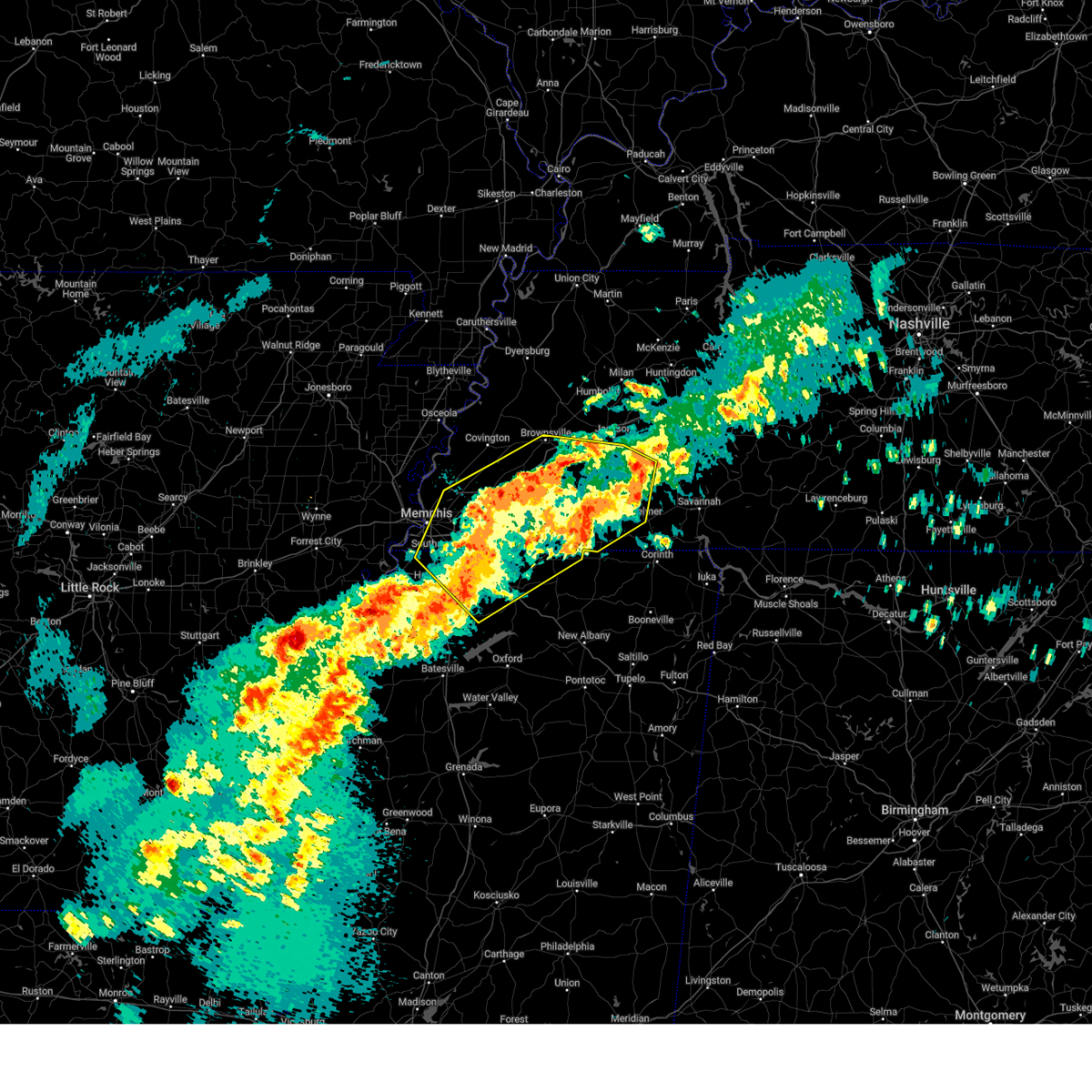 At 813 am cdt, a severe thunderstorm was located near dancyville, or 15 miles south of brownsville, moving northeast at 75 mph (radar indicated). Hazards include 60 mph wind gusts and quarter size hail. Hail damage to vehicles is expected. expect wind damage to roofs, siding, and trees. Locations impacted include, ghost river state natural area, neely, brody, yum yum, selmer, southwest memphis, stanton, horn lake, masseyville, belmont, madison hall, bright, uptonville, chulahoma, silerton, kirk, rossville, arlington, pinson mounds state archaeological park, and rogers springs. At 813 am cdt, a severe thunderstorm was located near dancyville, or 15 miles south of brownsville, moving northeast at 75 mph (radar indicated). Hazards include 60 mph wind gusts and quarter size hail. Hail damage to vehicles is expected. expect wind damage to roofs, siding, and trees. Locations impacted include, ghost river state natural area, neely, brody, yum yum, selmer, southwest memphis, stanton, horn lake, masseyville, belmont, madison hall, bright, uptonville, chulahoma, silerton, kirk, rossville, arlington, pinson mounds state archaeological park, and rogers springs.
|
| 3/15/2025 7:53 AM CDT |
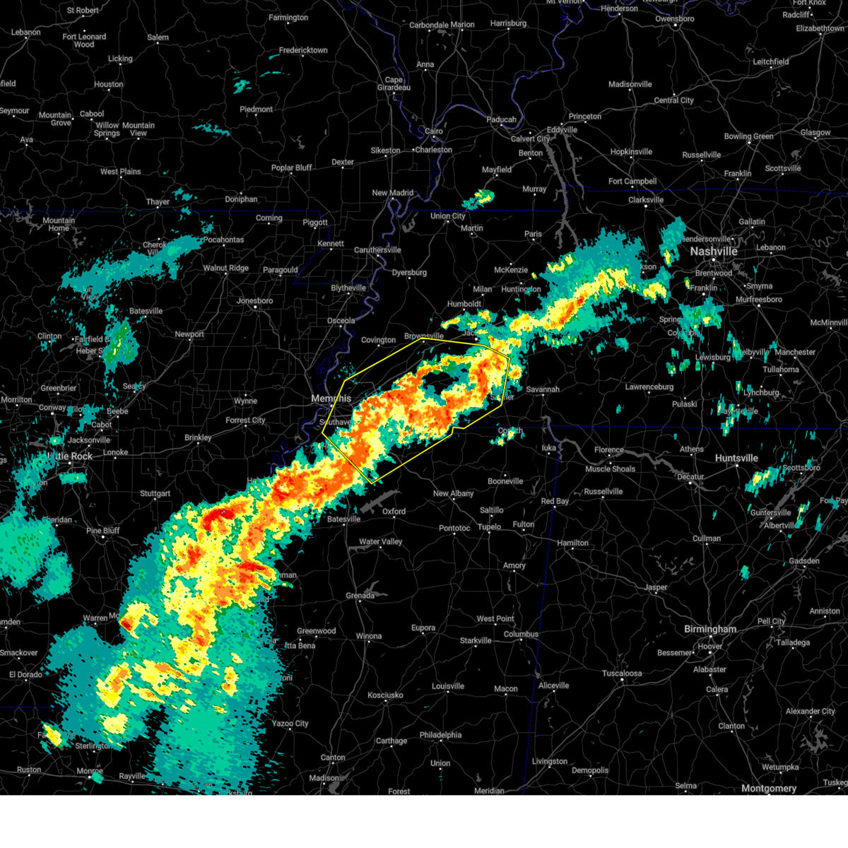 Svrmeg the national weather service in memphis has issued a * severe thunderstorm warning for, northeastern desoto county in northwestern mississippi, marshall county in northwestern mississippi, northeastern tate county in northwestern mississippi, northern benton county in northeastern mississippi, southeastern tipton county in west tennessee, fayette county in west tennessee, hardeman county in west tennessee, northwestern mcnairy county in west tennessee, southern haywood county in west tennessee, southern madison county in west tennessee, shelby county in west tennessee, chester county in west tennessee, * until 845 am cdt. * at 753 am cdt, a severe thunderstorm was located 9 miles west of lagrange, or 17 miles east of collierville, moving northeast at 50 mph (radar indicated). Hazards include 60 mph wind gusts and quarter size hail. Hail damage to vehicles is expected. Expect wind damage to roofs, siding, and trees. Svrmeg the national weather service in memphis has issued a * severe thunderstorm warning for, northeastern desoto county in northwestern mississippi, marshall county in northwestern mississippi, northeastern tate county in northwestern mississippi, northern benton county in northeastern mississippi, southeastern tipton county in west tennessee, fayette county in west tennessee, hardeman county in west tennessee, northwestern mcnairy county in west tennessee, southern haywood county in west tennessee, southern madison county in west tennessee, shelby county in west tennessee, chester county in west tennessee, * until 845 am cdt. * at 753 am cdt, a severe thunderstorm was located 9 miles west of lagrange, or 17 miles east of collierville, moving northeast at 50 mph (radar indicated). Hazards include 60 mph wind gusts and quarter size hail. Hail damage to vehicles is expected. Expect wind damage to roofs, siding, and trees.
|
| 2/15/2025 8:23 PM CST |
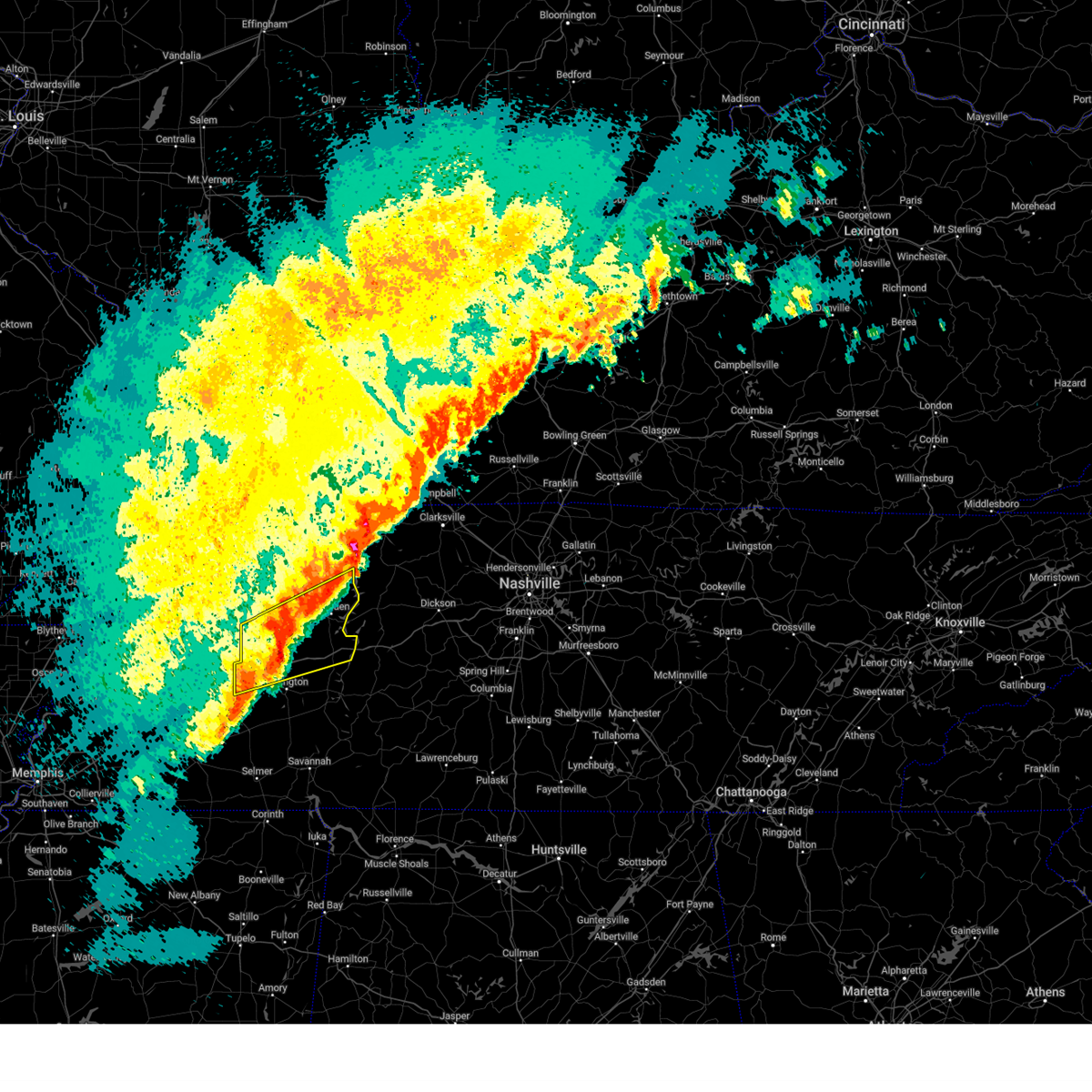 At 822 pm cst, a severe thunderstorm was located near huntingdon, moving northeast at 65 mph (radar indicated). Hazards include 60 mph wind gusts and penny size hail. Expect damage to roofs, siding, and trees. locations impacted include, lexington, huntingdon, camden, natchez trace state park, natchez trace state forest, new johnsonville, bruceton, atwood, blue goose, vale, bargerton, wildersville, parkers crossroads, trezevant, hollow rock, big sandy, clarksburg, mclemoresville, hickory flat, and dollar. This includes interstate 40 in tennessee between mile markers 88 and 135. At 822 pm cst, a severe thunderstorm was located near huntingdon, moving northeast at 65 mph (radar indicated). Hazards include 60 mph wind gusts and penny size hail. Expect damage to roofs, siding, and trees. locations impacted include, lexington, huntingdon, camden, natchez trace state park, natchez trace state forest, new johnsonville, bruceton, atwood, blue goose, vale, bargerton, wildersville, parkers crossroads, trezevant, hollow rock, big sandy, clarksburg, mclemoresville, hickory flat, and dollar. This includes interstate 40 in tennessee between mile markers 88 and 135.
|
| 2/15/2025 8:08 PM CST |
 Svrmeg the national weather service in memphis has issued a * severe thunderstorm warning for, northern henderson county in west tennessee, benton county in west tennessee, carroll county in west tennessee, northeastern madison county in west tennessee, southeastern henry county in west tennessee, northeastern decatur county in west tennessee, * until 900 pm cst. * at 808 pm cst, a severe thunderstorm was located 7 miles northwest of bargerton, or 11 miles southeast of milan, moving northeast at 75 mph (radar indicated). Hazards include ping pong ball size hail and 60 mph wind gusts. People and animals outdoors will be injured. expect hail damage to roofs, siding, windows, and vehicles. Expect wind damage to roofs, siding, and trees. Svrmeg the national weather service in memphis has issued a * severe thunderstorm warning for, northern henderson county in west tennessee, benton county in west tennessee, carroll county in west tennessee, northeastern madison county in west tennessee, southeastern henry county in west tennessee, northeastern decatur county in west tennessee, * until 900 pm cst. * at 808 pm cst, a severe thunderstorm was located 7 miles northwest of bargerton, or 11 miles southeast of milan, moving northeast at 75 mph (radar indicated). Hazards include ping pong ball size hail and 60 mph wind gusts. People and animals outdoors will be injured. expect hail damage to roofs, siding, windows, and vehicles. Expect wind damage to roofs, siding, and trees.
|
| 2/15/2025 7:59 PM CST |
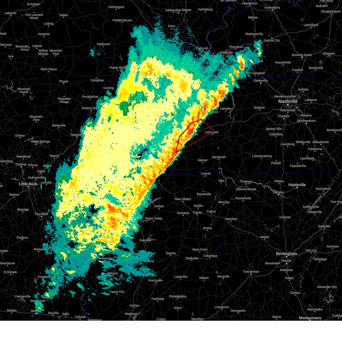 the tornado warning has been cancelled and is no longer in effect the tornado warning has been cancelled and is no longer in effect
|
| 2/15/2025 7:49 PM CST |
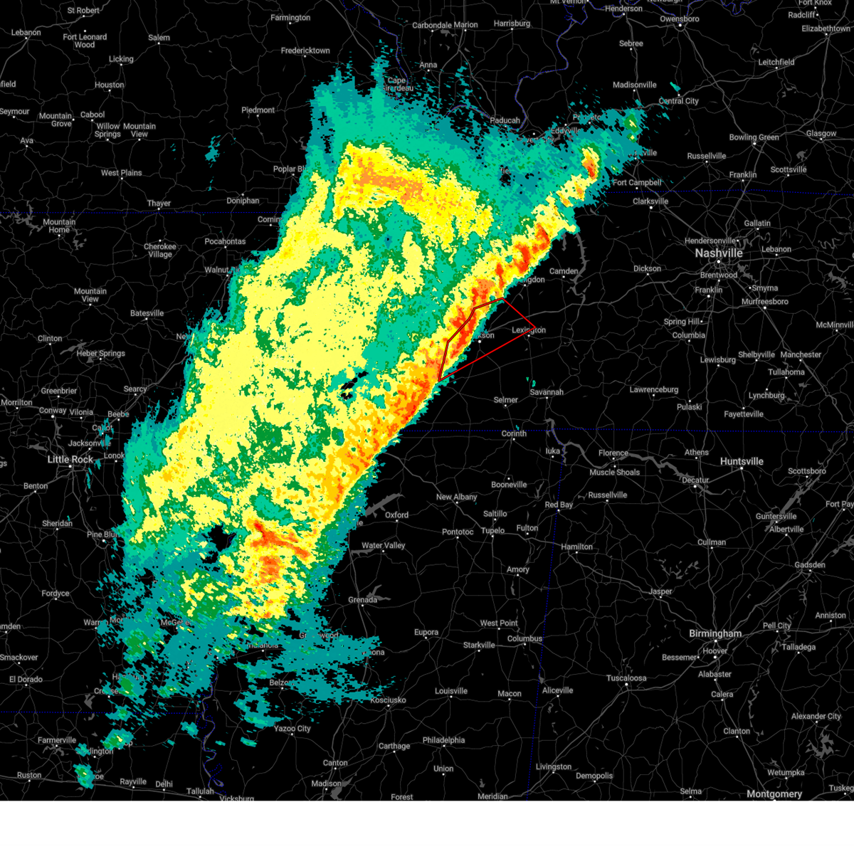 Tormeg the national weather service in memphis has issued a * tornado warning for, northwestern henderson county in west tennessee, southeastern gibson county in west tennessee, northwestern hardeman county in west tennessee, southwestern carroll county in west tennessee, southeastern haywood county in west tennessee, madison county in west tennessee, * until 830 pm cst. * at 749 pm cst, a severe thunderstorm capable of producing a tornado was located near mercer, or 10 miles southwest of jackson, moving northeast at 50 mph (radar indicated rotation). Hazards include tornado and quarter size hail. Flying debris will be dangerous to those caught without shelter. mobile homes will be damaged or destroyed. damage to roofs, windows, and vehicles will occur. Tree damage is likely. Tormeg the national weather service in memphis has issued a * tornado warning for, northwestern henderson county in west tennessee, southeastern gibson county in west tennessee, northwestern hardeman county in west tennessee, southwestern carroll county in west tennessee, southeastern haywood county in west tennessee, madison county in west tennessee, * until 830 pm cst. * at 749 pm cst, a severe thunderstorm capable of producing a tornado was located near mercer, or 10 miles southwest of jackson, moving northeast at 50 mph (radar indicated rotation). Hazards include tornado and quarter size hail. Flying debris will be dangerous to those caught without shelter. mobile homes will be damaged or destroyed. damage to roofs, windows, and vehicles will occur. Tree damage is likely.
|
| 2/15/2025 6:49 PM CST |
 At 649 pm cst, a severe thunderstorm was located near forked deer, or 10 miles east of ripley, moving northeast at 55 mph (trained weather spotters). Hazards include ping pong ball size hail and 60 mph wind gusts. People and animals outdoors will be injured. expect hail damage to roofs, siding, windows, and vehicles. expect wind damage to roofs, siding, and trees. Locations impacted include, brownsville, ripley, alamo, bells, chestnut bluff, nutbush, belle eagle, holly grove, forked deer, adair, eaton, maury city, friendship, gates, gadsden, quincy, gibson wells, allens, christmasville, and jones. At 649 pm cst, a severe thunderstorm was located near forked deer, or 10 miles east of ripley, moving northeast at 55 mph (trained weather spotters). Hazards include ping pong ball size hail and 60 mph wind gusts. People and animals outdoors will be injured. expect hail damage to roofs, siding, windows, and vehicles. expect wind damage to roofs, siding, and trees. Locations impacted include, brownsville, ripley, alamo, bells, chestnut bluff, nutbush, belle eagle, holly grove, forked deer, adair, eaton, maury city, friendship, gates, gadsden, quincy, gibson wells, allens, christmasville, and jones.
|
| 2/15/2025 6:49 PM CST |
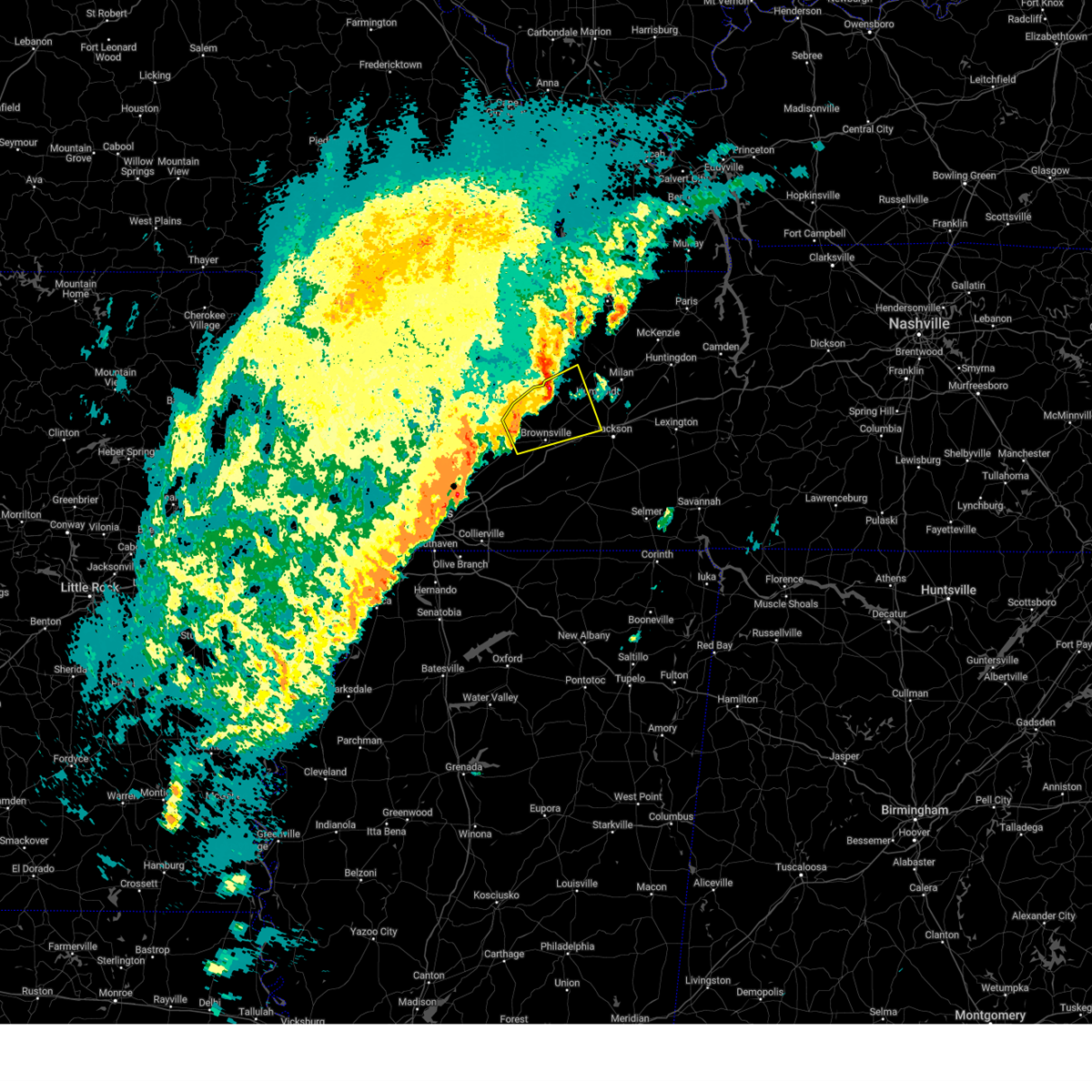 the severe thunderstorm warning has been cancelled and is no longer in effect the severe thunderstorm warning has been cancelled and is no longer in effect
|
| 2/15/2025 6:41 PM CST |
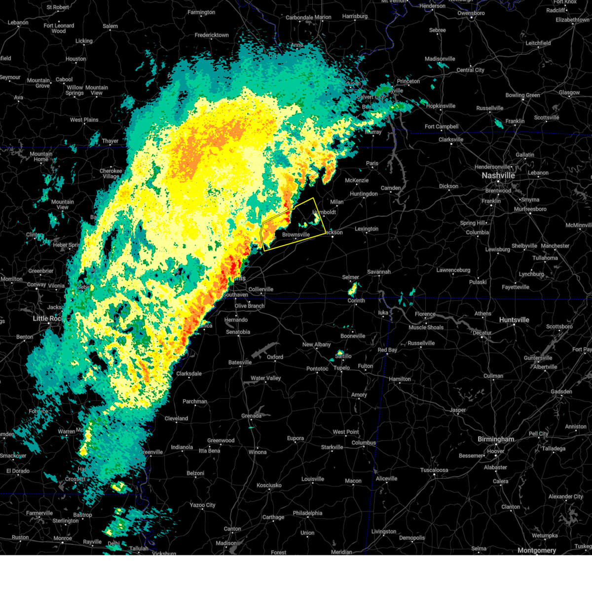 At 641 pm cst, a severe thunderstorm was located near nutbush, or near ripley, moving northeast at 65 mph (trained weather spotters). Hazards include ping pong ball size hail and 60 mph wind gusts. People and animals outdoors will be injured. expect hail damage to roofs, siding, windows, and vehicles. expect wind damage to roofs, siding, and trees. Locations impacted include, brownsville, covington, ripley, alamo, bells, halls, nutbush, forked deer, chestnut bluff, belle eagle, holly grove, adair, eaton, henning, maury city, friendship, gates, gadsden, gibson wells, and christmasville. At 641 pm cst, a severe thunderstorm was located near nutbush, or near ripley, moving northeast at 65 mph (trained weather spotters). Hazards include ping pong ball size hail and 60 mph wind gusts. People and animals outdoors will be injured. expect hail damage to roofs, siding, windows, and vehicles. expect wind damage to roofs, siding, and trees. Locations impacted include, brownsville, covington, ripley, alamo, bells, halls, nutbush, forked deer, chestnut bluff, belle eagle, holly grove, adair, eaton, henning, maury city, friendship, gates, gadsden, gibson wells, and christmasville.
|
| 2/15/2025 6:26 PM CST |
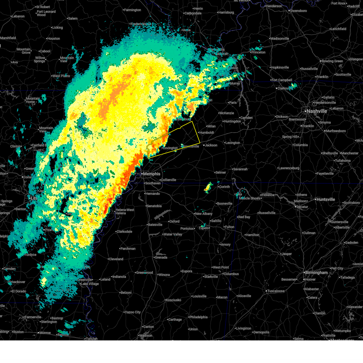 At 626 pm cst, a severe thunderstorm was located near covington, moving northeast at 65 mph (trained weather spotters. at 623 pm...golf ball sized hail was reported at richardson landing). Hazards include ping pong ball size hail and 60 mph wind gusts. People and animals outdoors will be injured. expect hail damage to roofs, siding, windows, and vehicles. expect wind damage to roofs, siding, and trees. Locations impacted include, brownsville, covington, ripley, fort pillow state park, munford, brighton, alamo, bells, halls, nutbush, forked deer, fulton, chestnut bluff, belle eagle, holly grove, adair, ft pillow, eaton, atoka, and henning. At 626 pm cst, a severe thunderstorm was located near covington, moving northeast at 65 mph (trained weather spotters. at 623 pm...golf ball sized hail was reported at richardson landing). Hazards include ping pong ball size hail and 60 mph wind gusts. People and animals outdoors will be injured. expect hail damage to roofs, siding, windows, and vehicles. expect wind damage to roofs, siding, and trees. Locations impacted include, brownsville, covington, ripley, fort pillow state park, munford, brighton, alamo, bells, halls, nutbush, forked deer, fulton, chestnut bluff, belle eagle, holly grove, adair, ft pillow, eaton, atoka, and henning.
|
| 2/15/2025 6:21 PM CST |
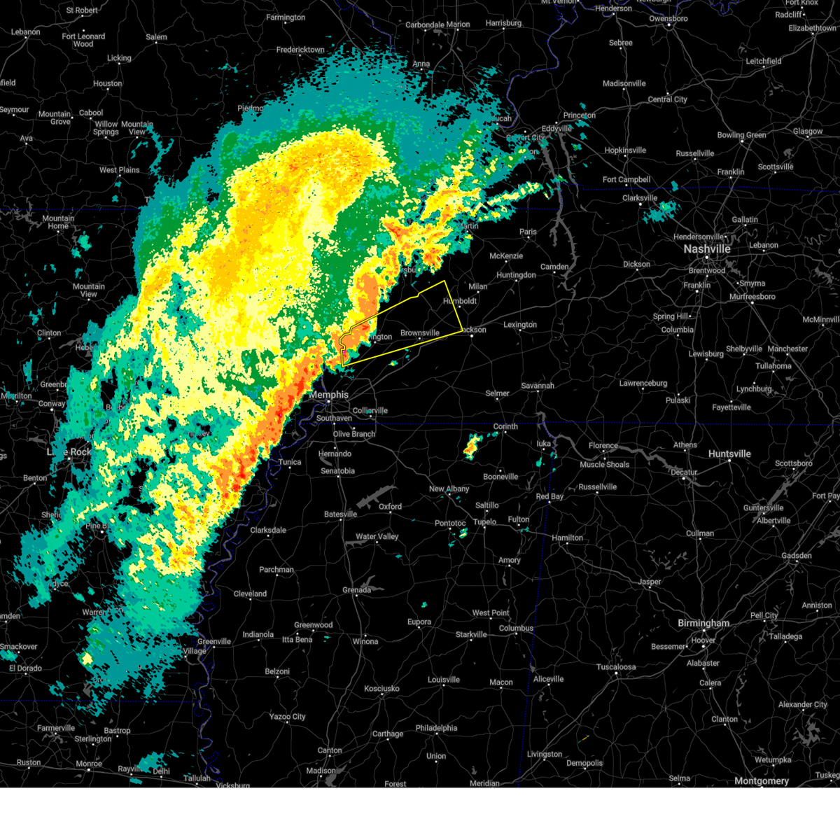 Svrmeg the national weather service in memphis has issued a * severe thunderstorm warning for, crockett county in west tennessee, eastern tipton county in west tennessee, southwestern gibson county in west tennessee, central lauderdale county in west tennessee, central haywood county in west tennessee, northwestern madison county in west tennessee, * until 700 pm cst. * at 621 pm cst, a severe thunderstorm was located near brighton, or 7 miles south of fort pillow state park, moving northeast at 65 mph (radar indicated). Hazards include 60 mph wind gusts and quarter size hail. Hail damage to vehicles is expected. Expect wind damage to roofs, siding, and trees. Svrmeg the national weather service in memphis has issued a * severe thunderstorm warning for, crockett county in west tennessee, eastern tipton county in west tennessee, southwestern gibson county in west tennessee, central lauderdale county in west tennessee, central haywood county in west tennessee, northwestern madison county in west tennessee, * until 700 pm cst. * at 621 pm cst, a severe thunderstorm was located near brighton, or 7 miles south of fort pillow state park, moving northeast at 65 mph (radar indicated). Hazards include 60 mph wind gusts and quarter size hail. Hail damage to vehicles is expected. Expect wind damage to roofs, siding, and trees.
|
| 8/17/2024 4:08 AM CDT |
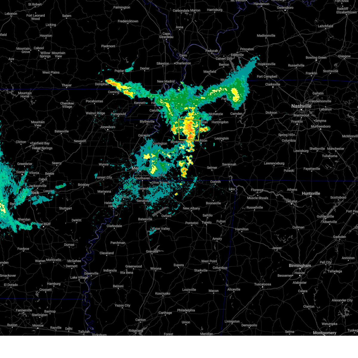 The storm which prompted the warning has weakened below severe limits, and no longer poses an immediate threat to life or property. therefore, the warning will be allowed to expire. The storm which prompted the warning has weakened below severe limits, and no longer poses an immediate threat to life or property. therefore, the warning will be allowed to expire.
|
| 8/17/2024 3:56 AM CDT |
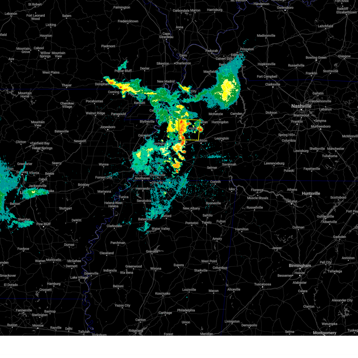 the severe thunderstorm warning has been cancelled and is no longer in effect the severe thunderstorm warning has been cancelled and is no longer in effect
|
| 8/17/2024 3:56 AM CDT |
 At 355 am cdt, a severe thunderstorm was located over alamo, or 11 miles west of humboldt, moving east at 40 mph (radar indicated). Hazards include 60 mph wind gusts and quarter size hail. Hail damage to vehicles is expected. expect wind damage to roofs, siding, and trees. Locations impacted include, jackson, humboldt, trenton, alamo, bells, three way, belle eagle, adair, eaton, maury city, friendship, gadsden, gibson, quincy, gibson wells, new enterprise, central, jones, mason grove, and brazil. At 355 am cdt, a severe thunderstorm was located over alamo, or 11 miles west of humboldt, moving east at 40 mph (radar indicated). Hazards include 60 mph wind gusts and quarter size hail. Hail damage to vehicles is expected. expect wind damage to roofs, siding, and trees. Locations impacted include, jackson, humboldt, trenton, alamo, bells, three way, belle eagle, adair, eaton, maury city, friendship, gadsden, gibson, quincy, gibson wells, new enterprise, central, jones, mason grove, and brazil.
|
| 8/17/2024 3:37 AM CDT |
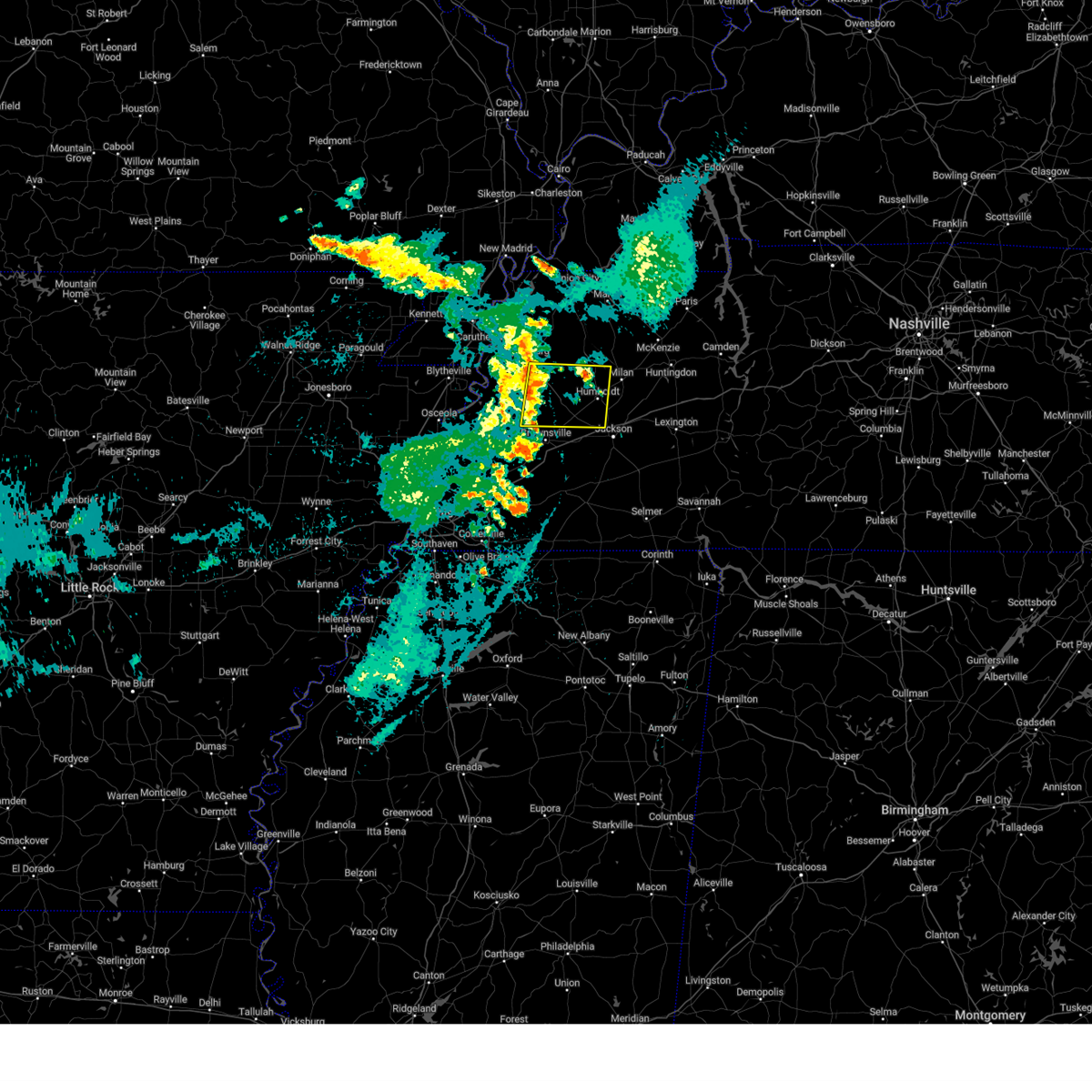 Svrmeg the national weather service in memphis has issued a * severe thunderstorm warning for, crockett county in west tennessee, southeastern dyer county in west tennessee, southwestern gibson county in west tennessee, northeastern lauderdale county in west tennessee, northern haywood county in west tennessee, northwestern madison county in west tennessee, * until 415 am cdt. * at 336 am cdt, a severe thunderstorm was located over chestnut bluff, or 13 miles northeast of ripley, moving east at 40 mph (radar indicated). Hazards include 60 mph wind gusts and quarter size hail. Hail damage to vehicles is expected. Expect wind damage to roofs, siding, and trees. Svrmeg the national weather service in memphis has issued a * severe thunderstorm warning for, crockett county in west tennessee, southeastern dyer county in west tennessee, southwestern gibson county in west tennessee, northeastern lauderdale county in west tennessee, northern haywood county in west tennessee, northwestern madison county in west tennessee, * until 415 am cdt. * at 336 am cdt, a severe thunderstorm was located over chestnut bluff, or 13 miles northeast of ripley, moving east at 40 mph (radar indicated). Hazards include 60 mph wind gusts and quarter size hail. Hail damage to vehicles is expected. Expect wind damage to roofs, siding, and trees.
|
| 7/8/2024 3:16 PM CDT |
 the severe thunderstorm warning has been cancelled and is no longer in effect the severe thunderstorm warning has been cancelled and is no longer in effect
|
| 7/8/2024 2:56 PM CDT |
 Svrmeg the national weather service in memphis has issued a * severe thunderstorm warning for, northwestern henderson county in west tennessee, madison county in west tennessee, * until 330 pm cdt. * at 255 pm cdt, a severe thunderstorm was located near mercer, or 11 miles southwest of jackson, moving northeast at 35 mph (radar indicated). Hazards include 60 mph wind gusts and quarter size hail. Hail damage to vehicles is expected. Expect wind damage to roofs, siding, and trees. Svrmeg the national weather service in memphis has issued a * severe thunderstorm warning for, northwestern henderson county in west tennessee, madison county in west tennessee, * until 330 pm cdt. * at 255 pm cdt, a severe thunderstorm was located near mercer, or 11 miles southwest of jackson, moving northeast at 35 mph (radar indicated). Hazards include 60 mph wind gusts and quarter size hail. Hail damage to vehicles is expected. Expect wind damage to roofs, siding, and trees.
|
| 5/27/2024 1:22 AM CDT |
 At 121 am cdt, a severe thunderstorm was located 7 miles northeast of natchez trace state park, moving east at 60 mph (radar indicated). Hazards include 70 mph wind gusts and nickel size hail. Expect considerable tree damage. damage is likely to mobile homes, roofs, and outbuildings. Locations impacted include, jackson, lexington, huntingdon, camden, natchez trace state park, natchez trace state forest, parsons, new johnsonville, bruceton, decaturville, sardis, reagan, blue goose, vale, mifflin, bargerton, wildersville, parkers crossroads, darden, and montgomery. At 121 am cdt, a severe thunderstorm was located 7 miles northeast of natchez trace state park, moving east at 60 mph (radar indicated). Hazards include 70 mph wind gusts and nickel size hail. Expect considerable tree damage. damage is likely to mobile homes, roofs, and outbuildings. Locations impacted include, jackson, lexington, huntingdon, camden, natchez trace state park, natchez trace state forest, parsons, new johnsonville, bruceton, decaturville, sardis, reagan, blue goose, vale, mifflin, bargerton, wildersville, parkers crossroads, darden, and montgomery.
|
| 5/27/2024 1:22 AM CDT |
 the severe thunderstorm warning has been cancelled and is no longer in effect the severe thunderstorm warning has been cancelled and is no longer in effect
|
| 5/27/2024 1:20 AM CDT |
 At 120 am cdt, a severe thunderstorm capable of producing a tornado was located near jacks creek, or 10 miles southwest of lexington, moving east at 60 mph (radar indicated rotation). Hazards include tornado. Flying debris will be dangerous to those caught without shelter. mobile homes will be damaged or destroyed. damage to roofs, windows, and vehicles will occur. tree damage is likely. Locations impacted include, jackson, lexington, henderson, natchez trace state forest, sardis, reagan, jacks creek, darden, mifflin, scotts hill, saltillo, milledgeville, enville, pinson, beech bluff, madison hall, rock hill, juno, hinkle, and roby. At 120 am cdt, a severe thunderstorm capable of producing a tornado was located near jacks creek, or 10 miles southwest of lexington, moving east at 60 mph (radar indicated rotation). Hazards include tornado. Flying debris will be dangerous to those caught without shelter. mobile homes will be damaged or destroyed. damage to roofs, windows, and vehicles will occur. tree damage is likely. Locations impacted include, jackson, lexington, henderson, natchez trace state forest, sardis, reagan, jacks creek, darden, mifflin, scotts hill, saltillo, milledgeville, enville, pinson, beech bluff, madison hall, rock hill, juno, hinkle, and roby.
|
| 5/27/2024 1:13 AM CDT |
 the severe thunderstorm warning has been cancelled and is no longer in effect the severe thunderstorm warning has been cancelled and is no longer in effect
|
| 5/27/2024 1:13 AM CDT |
 At 113 am cdt, a severe thunderstorm was located near wildersville, or near natchez trace state park, moving east at 60 mph (radar indicated). Hazards include 70 mph wind gusts and nickel size hail. Expect considerable tree damage. damage is likely to mobile homes, roofs, and outbuildings. Locations impacted include, jackson, humboldt, milan, lexington, huntingdon, camden, natchez trace state park, natchez trace state forest, fairview, parsons, new johnsonville, three way, bruceton, atwood, decaturville, sardis, reagan, bargerton, blue goose, and vale. At 113 am cdt, a severe thunderstorm was located near wildersville, or near natchez trace state park, moving east at 60 mph (radar indicated). Hazards include 70 mph wind gusts and nickel size hail. Expect considerable tree damage. damage is likely to mobile homes, roofs, and outbuildings. Locations impacted include, jackson, humboldt, milan, lexington, huntingdon, camden, natchez trace state park, natchez trace state forest, fairview, parsons, new johnsonville, three way, bruceton, atwood, decaturville, sardis, reagan, bargerton, blue goose, and vale.
|
| 5/27/2024 1:11 AM CDT |
 At 110 am cdt, a severe thunderstorm capable of producing a tornado was located near henderson, moving east at 60 mph (radar indicated rotation). Hazards include tornado. Flying debris will be dangerous to those caught without shelter. mobile homes will be damaged or destroyed. damage to roofs, windows, and vehicles will occur. tree damage is likely. Locations impacted include, jackson, lexington, henderson, natchez trace state forest, chickasaw state park, sardis, bemis, reagan, jacks creek, darden, mifflin, scotts hill, saltillo, milledgeville, enville, medon, pinson, beech bluff, westover, and madison hall. At 110 am cdt, a severe thunderstorm capable of producing a tornado was located near henderson, moving east at 60 mph (radar indicated rotation). Hazards include tornado. Flying debris will be dangerous to those caught without shelter. mobile homes will be damaged or destroyed. damage to roofs, windows, and vehicles will occur. tree damage is likely. Locations impacted include, jackson, lexington, henderson, natchez trace state forest, chickasaw state park, sardis, bemis, reagan, jacks creek, darden, mifflin, scotts hill, saltillo, milledgeville, enville, medon, pinson, beech bluff, westover, and madison hall.
|
| 5/27/2024 1:11 AM CDT |
 the tornado warning has been cancelled and is no longer in effect the tornado warning has been cancelled and is no longer in effect
|
| 5/27/2024 12:58 AM CDT |
 Tormeg the national weather service in memphis has issued a * tornado warning for, henderson county in west tennessee, north central hardeman county in west tennessee, northwestern hardin county in west tennessee, southern madison county in west tennessee, chester county in west tennessee, * until 145 am cdt. * at 1258 am cdt, a severe thunderstorm capable of producing a tornado was located near mercer, or 9 miles northwest of chickasaw state park, moving east at 60 mph (radar indicated rotation). Hazards include tornado. Flying debris will be dangerous to those caught without shelter. mobile homes will be damaged or destroyed. damage to roofs, windows, and vehicles will occur. Tree damage is likely. Tormeg the national weather service in memphis has issued a * tornado warning for, henderson county in west tennessee, north central hardeman county in west tennessee, northwestern hardin county in west tennessee, southern madison county in west tennessee, chester county in west tennessee, * until 145 am cdt. * at 1258 am cdt, a severe thunderstorm capable of producing a tornado was located near mercer, or 9 miles northwest of chickasaw state park, moving east at 60 mph (radar indicated rotation). Hazards include tornado. Flying debris will be dangerous to those caught without shelter. mobile homes will be damaged or destroyed. damage to roofs, windows, and vehicles will occur. Tree damage is likely.
|
| 5/27/2024 12:53 AM CDT |
 Svrmeg the national weather service in memphis has issued a * severe thunderstorm warning for, southeastern crockett county in west tennessee, henderson county in west tennessee, southeastern gibson county in west tennessee, benton county in west tennessee, carroll county in west tennessee, east central haywood county in west tennessee, madison county in west tennessee, northeastern chester county in west tennessee, decatur county in west tennessee, * until 145 am cdt. * at 1253 am cdt, a severe thunderstorm was located 8 miles south of milan, moving east at 60 mph (radar indicated). Hazards include 70 mph wind gusts and nickel size hail. Expect considerable tree damage. Damage is likely to mobile homes, roofs, and outbuildings. Svrmeg the national weather service in memphis has issued a * severe thunderstorm warning for, southeastern crockett county in west tennessee, henderson county in west tennessee, southeastern gibson county in west tennessee, benton county in west tennessee, carroll county in west tennessee, east central haywood county in west tennessee, madison county in west tennessee, northeastern chester county in west tennessee, decatur county in west tennessee, * until 145 am cdt. * at 1253 am cdt, a severe thunderstorm was located 8 miles south of milan, moving east at 60 mph (radar indicated). Hazards include 70 mph wind gusts and nickel size hail. Expect considerable tree damage. Damage is likely to mobile homes, roofs, and outbuildings.
|
| 5/22/2024 3:56 PM CDT |
 the severe thunderstorm warning has been cancelled and is no longer in effect the severe thunderstorm warning has been cancelled and is no longer in effect
|
| 5/22/2024 3:34 PM CDT |
 At 332 pm cdt, severe thunderstorms were located along a line extending from near parkers crossroads to near lexington to 7 miles south of silerton, moving east at 55 mph (trained weather spotters. at 330 pm cdt, several downed trees were reported near the intersection of highways 70 and 412 east of jackson). Hazards include 60 mph wind gusts and quarter size hail. Hail damage to vehicles is expected. expect wind damage to roofs, siding, and trees. Locations impacted include, jackson, lexington, savannah, henderson, bolivar, selmer, camden, natchez trace state park, chickasaw state park, natchez trace state forest, chickasaw state forest, parsons, adamsville, decaturville, sardis, silerton, masseyville, reagan, bargerton, and jacks creek. At 332 pm cdt, severe thunderstorms were located along a line extending from near parkers crossroads to near lexington to 7 miles south of silerton, moving east at 55 mph (trained weather spotters. at 330 pm cdt, several downed trees were reported near the intersection of highways 70 and 412 east of jackson). Hazards include 60 mph wind gusts and quarter size hail. Hail damage to vehicles is expected. expect wind damage to roofs, siding, and trees. Locations impacted include, jackson, lexington, savannah, henderson, bolivar, selmer, camden, natchez trace state park, chickasaw state park, natchez trace state forest, chickasaw state forest, parsons, adamsville, decaturville, sardis, silerton, masseyville, reagan, bargerton, and jacks creek.
|
| 5/22/2024 3:23 PM CDT |
 Svrmeg the national weather service in memphis has issued a * severe thunderstorm warning for, henderson county in west tennessee, northern hardeman county in west tennessee, southern benton county in west tennessee, northern mcnairy county in west tennessee, southern carroll county in west tennessee, northwestern hardin county in west tennessee, eastern madison county in west tennessee, chester county in west tennessee, decatur county in west tennessee, * until 415 pm cdt. * at 323 pm cdt, severe thunderstorms were located along a line extending from 6 miles north of bargerton to near mifflin to near bolivar, moving east at 55 mph (radar indicated). Hazards include 60 mph wind gusts and quarter size hail. Hail damage to vehicles is expected. Expect wind damage to roofs, siding, and trees. Svrmeg the national weather service in memphis has issued a * severe thunderstorm warning for, henderson county in west tennessee, northern hardeman county in west tennessee, southern benton county in west tennessee, northern mcnairy county in west tennessee, southern carroll county in west tennessee, northwestern hardin county in west tennessee, eastern madison county in west tennessee, chester county in west tennessee, decatur county in west tennessee, * until 415 pm cdt. * at 323 pm cdt, severe thunderstorms were located along a line extending from 6 miles north of bargerton to near mifflin to near bolivar, moving east at 55 mph (radar indicated). Hazards include 60 mph wind gusts and quarter size hail. Hail damage to vehicles is expected. Expect wind damage to roofs, siding, and trees.
|
| 5/22/2024 3:15 PM CDT |
 At 315 pm cdt, severe thunderstorms were located along a line extending from 6 miles northwest of blue goose to near chickasaw state park to near lagrange, moving east at 30 mph (radar indicated). Hazards include 60 mph wind gusts and quarter size hail. Hail damage to vehicles is expected. expect wind damage to roofs, siding, and trees. Locations impacted include, jackson, henderson, bolivar, chickasaw state forest, chickasaw state park, whiteville, somerville, three way, silerton, blue goose, hillville, bemis, cloverport, mercer, carroll, williston, toone, medon, hickory valley, and hickory flat. At 315 pm cdt, severe thunderstorms were located along a line extending from 6 miles northwest of blue goose to near chickasaw state park to near lagrange, moving east at 30 mph (radar indicated). Hazards include 60 mph wind gusts and quarter size hail. Hail damage to vehicles is expected. expect wind damage to roofs, siding, and trees. Locations impacted include, jackson, henderson, bolivar, chickasaw state forest, chickasaw state park, whiteville, somerville, three way, silerton, blue goose, hillville, bemis, cloverport, mercer, carroll, williston, toone, medon, hickory valley, and hickory flat.
|
| 5/22/2024 3:09 PM CDT | Several trees down along hwy 41 in madison county TN, 5.6 miles WSW of Jackson, TN |
| 5/22/2024 3:09 PM CDT |
 Svrmeg the national weather service in memphis has issued a * severe thunderstorm warning for, eastern crockett county in west tennessee, weakley county in west tennessee, northeastern dyer county in west tennessee, gibson county in west tennessee, eastern obion county in west tennessee, carroll county in west tennessee, north central madison county in west tennessee, southwestern henry county in west tennessee, * until 400 pm cdt. * at 308 pm cdt, severe thunderstorms were located along a line extending from near newbern to near trenton to three way, moving northeast at 45 mph (radar indicated). Hazards include 60 mph wind gusts and penny size hail. expect damage to roofs, siding, and trees Svrmeg the national weather service in memphis has issued a * severe thunderstorm warning for, eastern crockett county in west tennessee, weakley county in west tennessee, northeastern dyer county in west tennessee, gibson county in west tennessee, eastern obion county in west tennessee, carroll county in west tennessee, north central madison county in west tennessee, southwestern henry county in west tennessee, * until 400 pm cdt. * at 308 pm cdt, severe thunderstorms were located along a line extending from near newbern to near trenton to three way, moving northeast at 45 mph (radar indicated). Hazards include 60 mph wind gusts and penny size hail. expect damage to roofs, siding, and trees
|
| 5/22/2024 3:03 PM CDT | A couple of trees and a power pole down on harts bridge road. time is radar estimate in madison county TN, 10.4 miles NW of Jackson, TN |
| 5/22/2024 2:59 PM CDT |
 At 259 pm cdt, severe thunderstorms were located along a line extending from near fairview to near mercer to 8 miles south of somerville, moving northeast at 45 mph (radar indicated). Hazards include 70 mph wind gusts and quarter size hail. Hail damage to vehicles is expected. expect considerable tree damage. wind damage is also likely to mobile homes, roofs, and outbuildings. Locations impacted include, jackson, henderson, bolivar, chickasaw state forest, chickasaw state park, whiteville, somerville, three way, silerton, blue goose, hillville, bemis, lagrange, dancyville, cloverport, mercer, warren, carroll, macon, and oakland. At 259 pm cdt, severe thunderstorms were located along a line extending from near fairview to near mercer to 8 miles south of somerville, moving northeast at 45 mph (radar indicated). Hazards include 70 mph wind gusts and quarter size hail. Hail damage to vehicles is expected. expect considerable tree damage. wind damage is also likely to mobile homes, roofs, and outbuildings. Locations impacted include, jackson, henderson, bolivar, chickasaw state forest, chickasaw state park, whiteville, somerville, three way, silerton, blue goose, hillville, bemis, lagrange, dancyville, cloverport, mercer, warren, carroll, macon, and oakland.
|
| 5/22/2024 2:52 PM CDT |
 the severe thunderstorm warning has been cancelled and is no longer in effect the severe thunderstorm warning has been cancelled and is no longer in effect
|
| 5/22/2024 2:52 PM CDT |
 At 252 pm cdt, severe thunderstorms were located along a line extending from near bells to near whiteville to 8 miles northeast of collierville, moving east at 40 mph (radar indicated). Hazards include 60 mph wind gusts and quarter size hail. Hail damage to vehicles is expected. expect wind damage to roofs, siding, and trees. Locations impacted include, jackson, henderson, bolivar, chickasaw state forest, chickasaw state park, whiteville, somerville, three way, silerton, blue goose, hillville, bemis, lagrange, dancyville, cloverport, mercer, warren, carroll, macon, and oakland. At 252 pm cdt, severe thunderstorms were located along a line extending from near bells to near whiteville to 8 miles northeast of collierville, moving east at 40 mph (radar indicated). Hazards include 60 mph wind gusts and quarter size hail. Hail damage to vehicles is expected. expect wind damage to roofs, siding, and trees. Locations impacted include, jackson, henderson, bolivar, chickasaw state forest, chickasaw state park, whiteville, somerville, three way, silerton, blue goose, hillville, bemis, lagrange, dancyville, cloverport, mercer, warren, carroll, macon, and oakland.
|
| 5/22/2024 2:51 PM CDT |
 At 251 pm cdt, a severe thunderstorm was located near alamo, or 11 miles west of humboldt, moving northeast at 55 mph (radar indicated). Hazards include 60 mph wind gusts and penny size hail. Expect damage to roofs, siding, and trees. Locations impacted include, humboldt, milan, trenton, fairview, alamo, bells, dyer, three way, rutherford, bradford, atwood, chestnut bluff, belle eagle, holly grove, adair, eaton, medina, maury city, friendship, and gadsden. At 251 pm cdt, a severe thunderstorm was located near alamo, or 11 miles west of humboldt, moving northeast at 55 mph (radar indicated). Hazards include 60 mph wind gusts and penny size hail. Expect damage to roofs, siding, and trees. Locations impacted include, humboldt, milan, trenton, fairview, alamo, bells, dyer, three way, rutherford, bradford, atwood, chestnut bluff, belle eagle, holly grove, adair, eaton, medina, maury city, friendship, and gadsden.
|
| 5/22/2024 2:48 PM CDT |
 Svrmeg the national weather service in memphis has issued a * severe thunderstorm warning for, northwestern henderson county in west tennessee, fayette county in west tennessee, northwestern hardeman county in west tennessee, southwestern carroll county in west tennessee, southeastern haywood county in west tennessee, madison county in west tennessee, southeastern shelby county in west tennessee, northwestern chester county in west tennessee, * until 330 pm cdt. * at 248 pm cdt, severe thunderstorms were located along a line extending from holly grove to near dancyville to near collierville, moving east at 30 mph (radar indicated). Hazards include 60 mph wind gusts and quarter size hail. Hail damage to vehicles is expected. Expect wind damage to roofs, siding, and trees. Svrmeg the national weather service in memphis has issued a * severe thunderstorm warning for, northwestern henderson county in west tennessee, fayette county in west tennessee, northwestern hardeman county in west tennessee, southwestern carroll county in west tennessee, southeastern haywood county in west tennessee, madison county in west tennessee, southeastern shelby county in west tennessee, northwestern chester county in west tennessee, * until 330 pm cdt. * at 248 pm cdt, severe thunderstorms were located along a line extending from holly grove to near dancyville to near collierville, moving east at 30 mph (radar indicated). Hazards include 60 mph wind gusts and quarter size hail. Hail damage to vehicles is expected. Expect wind damage to roofs, siding, and trees.
|
| 5/22/2024 2:32 PM CDT |
 Svrmeg the national weather service in memphis has issued a * severe thunderstorm warning for, crockett county in west tennessee, southeastern dyer county in west tennessee, gibson county in west tennessee, southwestern carroll county in west tennessee, central haywood county in west tennessee, northwestern madison county in west tennessee, * until 315 pm cdt. * at 231 pm cdt, a severe thunderstorm was located near belle eagle, or near brownsville, moving northeast at 55 mph (radar indicated). Hazards include 60 mph wind gusts and penny size hail. expect damage to roofs, siding, and trees Svrmeg the national weather service in memphis has issued a * severe thunderstorm warning for, crockett county in west tennessee, southeastern dyer county in west tennessee, gibson county in west tennessee, southwestern carroll county in west tennessee, central haywood county in west tennessee, northwestern madison county in west tennessee, * until 315 pm cdt. * at 231 pm cdt, a severe thunderstorm was located near belle eagle, or near brownsville, moving northeast at 55 mph (radar indicated). Hazards include 60 mph wind gusts and penny size hail. expect damage to roofs, siding, and trees
|
| 5/9/2024 1:00 AM CDT |
 At 1259 am cdt, a severe thunderstorm was located over brownsville, moving east at 50 mph (radar indicated). Hazards include 60 mph wind gusts and quarter size hail. Hail damage to vehicles is expected. expect wind damage to roofs, siding, and trees. Locations impacted include, jackson, brownsville, covington, ripley, bemis, nutbush, belle eagle, holly grove, forked deer, hillville, dancyville, ft pillow, mercer, henning, stanton, asbury, neely, allens, huntersville, and christmasville. At 1259 am cdt, a severe thunderstorm was located over brownsville, moving east at 50 mph (radar indicated). Hazards include 60 mph wind gusts and quarter size hail. Hail damage to vehicles is expected. expect wind damage to roofs, siding, and trees. Locations impacted include, jackson, brownsville, covington, ripley, bemis, nutbush, belle eagle, holly grove, forked deer, hillville, dancyville, ft pillow, mercer, henning, stanton, asbury, neely, allens, huntersville, and christmasville.
|
| 5/9/2024 12:37 AM CDT |
 Svrmeg the national weather service in memphis has issued a * severe thunderstorm warning for, northeastern tipton county in west tennessee, southeastern lauderdale county in west tennessee, haywood county in west tennessee, southwestern madison county in west tennessee, * until 115 am cdt. * at 1236 am cdt, a severe thunderstorm was located near covington, moving east at 60 mph (radar indicated). Hazards include 60 mph wind gusts and quarter size hail. Hail damage to vehicles is expected. Expect wind damage to roofs, siding, and trees. Svrmeg the national weather service in memphis has issued a * severe thunderstorm warning for, northeastern tipton county in west tennessee, southeastern lauderdale county in west tennessee, haywood county in west tennessee, southwestern madison county in west tennessee, * until 115 am cdt. * at 1236 am cdt, a severe thunderstorm was located near covington, moving east at 60 mph (radar indicated). Hazards include 60 mph wind gusts and quarter size hail. Hail damage to vehicles is expected. Expect wind damage to roofs, siding, and trees.
|
| 4/8/2024 5:15 PM CDT |
 At 514 pm cdt, a severe thunderstorm was located near blue goose, or 9 miles east of jackson, moving northeast at 35 mph (radar indicated). Hazards include 60 mph wind gusts and quarter size hail. Hail damage to vehicles is expected. expect wind damage to roofs, siding, and trees. Locations impacted include, jackson, milan, lexington, henderson, natchez trace state park, natchez trace state forest, bemis, blue goose, parkers crossroads, mifflin, bargerton, wildersville, carroll, medina, hickory flat, pinson, cedar grove, beech bluff, ledbetter, and madison hall. At 514 pm cdt, a severe thunderstorm was located near blue goose, or 9 miles east of jackson, moving northeast at 35 mph (radar indicated). Hazards include 60 mph wind gusts and quarter size hail. Hail damage to vehicles is expected. expect wind damage to roofs, siding, and trees. Locations impacted include, jackson, milan, lexington, henderson, natchez trace state park, natchez trace state forest, bemis, blue goose, parkers crossroads, mifflin, bargerton, wildersville, carroll, medina, hickory flat, pinson, cedar grove, beech bluff, ledbetter, and madison hall.
|
| 4/8/2024 5:03 PM CDT | Quarter sized hail reported 8.3 miles NW of Jackson, TN |
| 4/8/2024 5:01 PM CDT | Quarter sized hail reported 8 miles NNW of Jackson, TN |
| 4/8/2024 4:57 PM CDT | Quarter sized hail reported 8.7 miles NNW of Jackson, TN |
| 4/8/2024 4:57 PM CDT |
 the severe thunderstorm warning has been cancelled and is no longer in effect the severe thunderstorm warning has been cancelled and is no longer in effect
|
| 4/8/2024 4:57 PM CDT |
 At 457 pm cdt, a severe thunderstorm was located near bemis, or 7 miles southeast of jackson, moving northeast at 40 mph (radar indicated). Hazards include 60 mph wind gusts and half dollar size hail. Hail damage to vehicles is expected. expect wind damage to roofs, siding, and trees. Locations impacted include, jackson, humboldt, milan, lexington, henderson, natchez trace state park, natchez trace state forest, chickasaw state park, fairview, three way, blue goose, mifflin, bargerton, wildersville, bemis, parkers crossroads, carroll, medina, gibson, and medon. At 457 pm cdt, a severe thunderstorm was located near bemis, or 7 miles southeast of jackson, moving northeast at 40 mph (radar indicated). Hazards include 60 mph wind gusts and half dollar size hail. Hail damage to vehicles is expected. expect wind damage to roofs, siding, and trees. Locations impacted include, jackson, humboldt, milan, lexington, henderson, natchez trace state park, natchez trace state forest, chickasaw state park, fairview, three way, blue goose, mifflin, bargerton, wildersville, bemis, parkers crossroads, carroll, medina, gibson, and medon.
|
| 4/8/2024 4:46 PM CDT |
 Svrmeg the national weather service in memphis has issued a * severe thunderstorm warning for, northern henderson county in west tennessee, southeastern gibson county in west tennessee, northeastern hardeman county in west tennessee, southwestern carroll county in west tennessee, madison county in west tennessee, northwestern chester county in west tennessee, * until 530 pm cdt. * at 445 pm cdt, a severe thunderstorm was located near chickasaw state park, moving northeast at 45 mph (radar indicated). Hazards include 60 mph wind gusts and half dollar size hail. Hail damage to vehicles is expected. Expect wind damage to roofs, siding, and trees. Svrmeg the national weather service in memphis has issued a * severe thunderstorm warning for, northern henderson county in west tennessee, southeastern gibson county in west tennessee, northeastern hardeman county in west tennessee, southwestern carroll county in west tennessee, madison county in west tennessee, northwestern chester county in west tennessee, * until 530 pm cdt. * at 445 pm cdt, a severe thunderstorm was located near chickasaw state park, moving northeast at 45 mph (radar indicated). Hazards include 60 mph wind gusts and half dollar size hail. Hail damage to vehicles is expected. Expect wind damage to roofs, siding, and trees.
|
| 4/2/2024 9:43 AM CDT |
 The severe thunderstorm which prompted the warning will be allowed to expire. remember, a severe thunderstorm warning still remains in effect for mcnairy, chester, henderson, hardin, and decatur counties. The severe thunderstorm which prompted the warning will be allowed to expire. remember, a severe thunderstorm warning still remains in effect for mcnairy, chester, henderson, hardin, and decatur counties.
|
| 4/2/2024 9:24 AM CDT |
 At 924 am cdt, a severe thunderstorm was located near bemis, or 7 miles southeast of jackson, moving east at 50 mph (radar indicated). Hazards include 60 mph wind gusts and nickel size hail. Expect damage to roofs, siding, and trees. Locations impacted include, jackson, lexington, henderson, bemis, reagan, jacks creek, mifflin, cloverport, mercer, parkers crossroads, medon, neely, pinson, beech bluff, madison hall, uptonville, juno, roby, teague, and maple grove. At 924 am cdt, a severe thunderstorm was located near bemis, or 7 miles southeast of jackson, moving east at 50 mph (radar indicated). Hazards include 60 mph wind gusts and nickel size hail. Expect damage to roofs, siding, and trees. Locations impacted include, jackson, lexington, henderson, bemis, reagan, jacks creek, mifflin, cloverport, mercer, parkers crossroads, medon, neely, pinson, beech bluff, madison hall, uptonville, juno, roby, teague, and maple grove.
|
| 4/2/2024 9:24 AM CDT |
 the severe thunderstorm warning has been cancelled and is no longer in effect the severe thunderstorm warning has been cancelled and is no longer in effect
|
| 4/2/2024 9:05 AM CDT |
 Svrmeg the national weather service in memphis has issued a * severe thunderstorm warning for, central henderson county in west tennessee, northwestern hardeman county in west tennessee, southeastern haywood county in west tennessee, southern madison county in west tennessee, northern chester county in west tennessee, * until 945 am cdt. * at 905 am cdt, a severe thunderstorm was located over mercer, or 12 miles northwest of chickasaw state forest, moving east at 50 mph (radar indicated). Hazards include 60 mph wind gusts. expect damage to roofs, siding, and trees Svrmeg the national weather service in memphis has issued a * severe thunderstorm warning for, central henderson county in west tennessee, northwestern hardeman county in west tennessee, southeastern haywood county in west tennessee, southern madison county in west tennessee, northern chester county in west tennessee, * until 945 am cdt. * at 905 am cdt, a severe thunderstorm was located over mercer, or 12 miles northwest of chickasaw state forest, moving east at 50 mph (radar indicated). Hazards include 60 mph wind gusts. expect damage to roofs, siding, and trees
|
| 12/9/2023 2:07 PM CST |
 At 206 pm cst, a severe thunderstorm was located over milan, moving northeast at 50 mph (radar indicated). Hazards include 60 mph wind gusts and quarter size hail. Hail damage to vehicles is expected. expect wind damage to roofs, siding, and trees. locations impacted include, jackson, humboldt, milan, mckenzie, huntingdon, fairview, three way, atwood, carroll, medina, trezevant, gibson, clarksburg, mclemoresville, howley, hickory flat, hillard, dollar, cades, and new enterprise. hail threat, radar indicated max hail size, 1. 00 in wind threat, radar indicated max wind gust, 60 mph. At 206 pm cst, a severe thunderstorm was located over milan, moving northeast at 50 mph (radar indicated). Hazards include 60 mph wind gusts and quarter size hail. Hail damage to vehicles is expected. expect wind damage to roofs, siding, and trees. locations impacted include, jackson, humboldt, milan, mckenzie, huntingdon, fairview, three way, atwood, carroll, medina, trezevant, gibson, clarksburg, mclemoresville, howley, hickory flat, hillard, dollar, cades, and new enterprise. hail threat, radar indicated max hail size, 1. 00 in wind threat, radar indicated max wind gust, 60 mph.
|
| 12/9/2023 1:53 PM CST |
 At 152 pm cst, a severe thunderstorm was located over humboldt, moving northeast at 50 mph (radar indicated). Hazards include 60 mph wind gusts and quarter size hail. Hail damage to vehicles is expected. Expect wind damage to roofs, siding, and trees. At 152 pm cst, a severe thunderstorm was located over humboldt, moving northeast at 50 mph (radar indicated). Hazards include 60 mph wind gusts and quarter size hail. Hail damage to vehicles is expected. Expect wind damage to roofs, siding, and trees.
|
| 12/9/2023 1:53 PM CST |
 The severe thunderstorm warning for crockett, southern gibson, southwestern carroll, northeastern haywood and northwestern madison counties will expire at 200 pm cst, the storm which prompted the warning has moved out of the area. therefore, the warning will be allowed to expire. a tornado watch remains in effect until 700 pm cst for west tennessee. The severe thunderstorm warning for crockett, southern gibson, southwestern carroll, northeastern haywood and northwestern madison counties will expire at 200 pm cst, the storm which prompted the warning has moved out of the area. therefore, the warning will be allowed to expire. a tornado watch remains in effect until 700 pm cst for west tennessee.
|
| 12/9/2023 1:38 PM CST |
 At 138 pm cst, a severe thunderstorm was located over alamo, or 12 miles west of humboldt, moving northeast at 50 mph (radar indicated). Hazards include 60 mph wind gusts and quarter size hail. Hail damage to vehicles is expected. expect wind damage to roofs, siding, and trees. locations impacted include, jackson, humboldt, milan, trenton, fairview, alamo, bells, three way, holly grove, adair, medina, maury city, gadsden, gibson, quincy, gibson wells, allens, new enterprise, jones, and mason grove. hail threat, radar indicated max hail size, 1. 00 in wind threat, radar indicated max wind gust, 60 mph. At 138 pm cst, a severe thunderstorm was located over alamo, or 12 miles west of humboldt, moving northeast at 50 mph (radar indicated). Hazards include 60 mph wind gusts and quarter size hail. Hail damage to vehicles is expected. expect wind damage to roofs, siding, and trees. locations impacted include, jackson, humboldt, milan, trenton, fairview, alamo, bells, three way, holly grove, adair, medina, maury city, gadsden, gibson, quincy, gibson wells, allens, new enterprise, jones, and mason grove. hail threat, radar indicated max hail size, 1. 00 in wind threat, radar indicated max wind gust, 60 mph.
|
| 12/9/2023 1:19 PM CST |
 At 119 pm cst, a severe thunderstorm was located near nutbush, or near brownsville, moving northeast at 50 mph (radar indicated). Hazards include 60 mph wind gusts and quarter size hail. Hail damage to vehicles is expected. Expect wind damage to roofs, siding, and trees. At 119 pm cst, a severe thunderstorm was located near nutbush, or near brownsville, moving northeast at 50 mph (radar indicated). Hazards include 60 mph wind gusts and quarter size hail. Hail damage to vehicles is expected. Expect wind damage to roofs, siding, and trees.
|
| 7/21/2023 3:10 PM CDT |
 At 309 pm cdt, severe thunderstorms were located along a line extending from near bemis to near selmer to near theo, moving east at 50 mph (public). Hazards include 60 mph wind gusts. Expect damage to roofs, siding, and trees. locations impacted include, jackson, corinth, lexington, savannah, henderson, selmer, pickwick landing state park, j p coleman state park, chickasaw state park, chickasaw state forest, big hill pond state park, parsons, adamsville, decaturville, sardis, silerton, pickwick dam, masseyville, reagan and theo. hail threat, radar indicated max hail size, <. 75 in wind threat, radar indicated max wind gust, 60 mph. At 309 pm cdt, severe thunderstorms were located along a line extending from near bemis to near selmer to near theo, moving east at 50 mph (public). Hazards include 60 mph wind gusts. Expect damage to roofs, siding, and trees. locations impacted include, jackson, corinth, lexington, savannah, henderson, selmer, pickwick landing state park, j p coleman state park, chickasaw state park, chickasaw state forest, big hill pond state park, parsons, adamsville, decaturville, sardis, silerton, pickwick dam, masseyville, reagan and theo. hail threat, radar indicated max hail size, <. 75 in wind threat, radar indicated max wind gust, 60 mph.
|
| 7/21/2023 2:54 PM CDT |
 At 253 pm cdt, severe thunderstorms were located along a line extending from 7 miles north of mercer to 8 miles south of masseyville to 7 miles southwest of pocahontas, moving east at 50 mph (public). Hazards include 60 mph wind gusts and penny size hail. expect damage to roofs, siding, and trees At 253 pm cdt, severe thunderstorms were located along a line extending from 7 miles north of mercer to 8 miles south of masseyville to 7 miles southwest of pocahontas, moving east at 50 mph (public). Hazards include 60 mph wind gusts and penny size hail. expect damage to roofs, siding, and trees
|
| 7/21/2023 2:39 PM CDT |
 At 237 pm cdt, severe thunderstorms were located along a line extending from near brownsville to bolivar to near canaan, moving east at 50 mph (public). Hazards include 60 mph wind gusts. Expect damage to roofs, siding, and trees. locations impacted include, jackson, brownsville, henderson, bolivar, selmer, chickasaw state forest, big hill pond state park, chickasaw state park, whiteville, silerton, masseyville, hillville, michigan city, pocahontas, bemis, cloverport, mercer, robertson, mcnairy and bethel springs. hail threat, radar indicated max hail size, <. 75 in wind threat, radar indicated max wind gust, 60 mph. At 237 pm cdt, severe thunderstorms were located along a line extending from near brownsville to bolivar to near canaan, moving east at 50 mph (public). Hazards include 60 mph wind gusts. Expect damage to roofs, siding, and trees. locations impacted include, jackson, brownsville, henderson, bolivar, selmer, chickasaw state forest, big hill pond state park, chickasaw state park, whiteville, silerton, masseyville, hillville, michigan city, pocahontas, bemis, cloverport, mercer, robertson, mcnairy and bethel springs. hail threat, radar indicated max hail size, <. 75 in wind threat, radar indicated max wind gust, 60 mph.
|
| 7/21/2023 2:23 PM CDT |
 At 220 pm cdt, severe thunderstorms were located along a line extending from near nutbush to 6 miles east of somerville to near slayden, moving east at 50 mph (public). Hazards include 60 mph wind gusts. Expect damage to roofs, siding, and trees. locations impacted include, jackson, brownsville, henderson, bolivar, selmer, chickasaw state forest, big hill pond state park, chickasaw state park, whiteville, somerville, silerton, mt pleasant, masseyville, hillville, michigan city, pocahontas, bemis, lagrange, dancyville and cloverport. hail threat, radar indicated max hail size, <. 75 in wind threat, radar indicated max wind gust, 60 mph. At 220 pm cdt, severe thunderstorms were located along a line extending from near nutbush to 6 miles east of somerville to near slayden, moving east at 50 mph (public). Hazards include 60 mph wind gusts. Expect damage to roofs, siding, and trees. locations impacted include, jackson, brownsville, henderson, bolivar, selmer, chickasaw state forest, big hill pond state park, chickasaw state park, whiteville, somerville, silerton, mt pleasant, masseyville, hillville, michigan city, pocahontas, bemis, lagrange, dancyville and cloverport. hail threat, radar indicated max hail size, <. 75 in wind threat, radar indicated max wind gust, 60 mph.
|
| 7/21/2023 2:07 PM CDT |
 At 207 pm cdt, severe thunderstorms were located along a line extending from 6 miles southwest of ripley to near somerville to near mt pleasant, moving east at 65 mph (public). Hazards include 60 mph wind gusts and penny size hail. expect damage to roofs, siding, and trees At 207 pm cdt, severe thunderstorms were located along a line extending from 6 miles southwest of ripley to near somerville to near mt pleasant, moving east at 65 mph (public). Hazards include 60 mph wind gusts and penny size hail. expect damage to roofs, siding, and trees
|
| 7/18/2023 3:02 PM CDT |
 At 301 pm cdt, severe thunderstorms were located along a line extending from 6 miles west of waverly to near parkers crossroads to near fairview, moving southeast at 50 mph (trained weather spotters. at 300 pm cdt, trained spotters reported numerous trees down across carroll county). Hazards include 70 mph wind gusts. Expect considerable tree damage. damage is likely to mobile homes, roofs, and outbuildings. locations impacted include, jackson, humboldt, milan, lexington, henderson, mckenzie, trenton, huntingdon, camden, natchez trace state park, chickasaw state park, natchez trace state forest, fairview, alamo, bells, parsons, new johnsonville, three way, bruceton and bradford. thunderstorm damage threat, considerable hail threat, radar indicated max hail size, <. 75 in wind threat, observed max wind gust, 70 mph. At 301 pm cdt, severe thunderstorms were located along a line extending from 6 miles west of waverly to near parkers crossroads to near fairview, moving southeast at 50 mph (trained weather spotters. at 300 pm cdt, trained spotters reported numerous trees down across carroll county). Hazards include 70 mph wind gusts. Expect considerable tree damage. damage is likely to mobile homes, roofs, and outbuildings. locations impacted include, jackson, humboldt, milan, lexington, henderson, mckenzie, trenton, huntingdon, camden, natchez trace state park, chickasaw state park, natchez trace state forest, fairview, alamo, bells, parsons, new johnsonville, three way, bruceton and bradford. thunderstorm damage threat, considerable hail threat, radar indicated max hail size, <. 75 in wind threat, observed max wind gust, 70 mph.
|
| 7/18/2023 2:52 PM CDT |
 At 252 pm cdt, severe thunderstorms were located along a line extending from near camden to 9 miles southwest of huntingdon to near adair, moving southeast at 50 mph (trained weather spotters). Hazards include 60 mph wind gusts and penny size hail. expect damage to roofs, siding, and trees At 252 pm cdt, severe thunderstorms were located along a line extending from near camden to 9 miles southwest of huntingdon to near adair, moving southeast at 50 mph (trained weather spotters). Hazards include 60 mph wind gusts and penny size hail. expect damage to roofs, siding, and trees
|
| 7/1/2023 5:20 PM CDT |
 The severe thunderstorm warning for northwestern henderson, southeastern gibson, southwestern carroll and northeastern madison counties will expire at 530 pm cdt, the storm which prompted the warning has weakened below severe limits, and no longer poses an immediate threat to life or property. therefore, the warning will be allowed to expire. a severe thunderstorm watch remains in effect until 900 pm cdt for west tennessee. The severe thunderstorm warning for northwestern henderson, southeastern gibson, southwestern carroll and northeastern madison counties will expire at 530 pm cdt, the storm which prompted the warning has weakened below severe limits, and no longer poses an immediate threat to life or property. therefore, the warning will be allowed to expire. a severe thunderstorm watch remains in effect until 900 pm cdt for west tennessee.
|
| 7/1/2023 5:08 PM CDT |
 At 508 pm cdt, a severe thunderstorm was located over fairview, or near jackson, moving northeast at 25 mph (public). Hazards include 60 mph wind gusts and quarter size hail. Hail damage to vehicles is expected. expect wind damage to roofs, siding, and trees. locations impacted include, jackson, humboldt, milan, fairview, three way, carroll, medina, hickory flat, claybrook, youngs crossing, west, cedar grove, mount gilead, windy city, lavinia, gilmore, sitka, whitthorne, goat city and oakfield. hail threat, observed max hail size, 1. 00 in wind threat, radar indicated max wind gust, 60 mph. At 508 pm cdt, a severe thunderstorm was located over fairview, or near jackson, moving northeast at 25 mph (public). Hazards include 60 mph wind gusts and quarter size hail. Hail damage to vehicles is expected. expect wind damage to roofs, siding, and trees. locations impacted include, jackson, humboldt, milan, fairview, three way, carroll, medina, hickory flat, claybrook, youngs crossing, west, cedar grove, mount gilead, windy city, lavinia, gilmore, sitka, whitthorne, goat city and oakfield. hail threat, observed max hail size, 1. 00 in wind threat, radar indicated max wind gust, 60 mph.
|
| 7/1/2023 5:00 PM CDT |
 At 500 pm cdt, a severe thunderstorm was located near fairview, or near jackson, moving northeast at 25 mph (radar indicated). Hazards include ping pong ball size hail and 60 mph wind gusts. People and animals outdoors will be injured. expect hail damage to roofs, siding, windows, and vehicles. expect wind damage to roofs, siding, and trees. locations impacted include, jackson, humboldt, milan, fairview, three way, adair, carroll, medina, hickory flat, claybrook, youngs crossing, west, cedar grove, mount gilead, gum flat, roberts, windy city, lavinia, gilmore and mason grove. hail threat, radar indicated max hail size, 1. 50 in wind threat, radar indicated max wind gust, 60 mph. At 500 pm cdt, a severe thunderstorm was located near fairview, or near jackson, moving northeast at 25 mph (radar indicated). Hazards include ping pong ball size hail and 60 mph wind gusts. People and animals outdoors will be injured. expect hail damage to roofs, siding, windows, and vehicles. expect wind damage to roofs, siding, and trees. locations impacted include, jackson, humboldt, milan, fairview, three way, adair, carroll, medina, hickory flat, claybrook, youngs crossing, west, cedar grove, mount gilead, gum flat, roberts, windy city, lavinia, gilmore and mason grove. hail threat, radar indicated max hail size, 1. 50 in wind threat, radar indicated max wind gust, 60 mph.
|
| 7/1/2023 4:42 PM CDT |
 At 442 pm cdt, a severe thunderstorm was located over adair, or 8 miles west of jackson, moving northeast at 25 mph (radar indicated). Hazards include 60 mph wind gusts and quarter size hail. Hail damage to vehicles is expected. Expect wind damage to roofs, siding, and trees. At 442 pm cdt, a severe thunderstorm was located over adair, or 8 miles west of jackson, moving northeast at 25 mph (radar indicated). Hazards include 60 mph wind gusts and quarter size hail. Hail damage to vehicles is expected. Expect wind damage to roofs, siding, and trees.
|
| 7/1/2023 10:31 AM CDT |
 At 1031 am cdt, a severe thunderstorm was located over fairview, or near humboldt, moving east at 15 mph (radar indicated). Hazards include 60 mph wind gusts and quarter size hail. Hail damage to vehicles is expected. expect wind damage to roofs, siding, and trees. locations impacted include, jackson, humboldt, milan, fairview, three way, atwood, blue goose, carroll, medina, gibson, claybrook, youngs crossing, west, new enterprise, ledbetter, lavinia, gilmore, sitka, goat city and oakfield. hail threat, radar indicated max hail size, 1. 00 in wind threat, radar indicated max wind gust, 60 mph. At 1031 am cdt, a severe thunderstorm was located over fairview, or near humboldt, moving east at 15 mph (radar indicated). Hazards include 60 mph wind gusts and quarter size hail. Hail damage to vehicles is expected. expect wind damage to roofs, siding, and trees. locations impacted include, jackson, humboldt, milan, fairview, three way, atwood, blue goose, carroll, medina, gibson, claybrook, youngs crossing, west, new enterprise, ledbetter, lavinia, gilmore, sitka, goat city and oakfield. hail threat, radar indicated max hail size, 1. 00 in wind threat, radar indicated max wind gust, 60 mph.
|
| 7/1/2023 10:25 AM CDT | Quarter sized hail reported 5.5 miles SSE of Jackson, TN, quarter sized hail reported. |
| 7/1/2023 10:22 AM CDT |
 At 1022 am cdt, a severe thunderstorm was located over fairview, or near humboldt, moving east at 15 mph (radar indicated). Hazards include 60 mph wind gusts and quarter size hail. Hail damage to vehicles is expected. expect wind damage to roofs, siding, and trees. locations impacted include, jackson, humboldt, milan, fairview, three way, atwood, blue goose, carroll, medina, gadsden, gibson, claybrook, youngs crossing, west, new enterprise, ledbetter, windy city, lavinia, gilmore and mason grove. hail threat, radar indicated max hail size, 1. 00 in wind threat, radar indicated max wind gust, 60 mph. At 1022 am cdt, a severe thunderstorm was located over fairview, or near humboldt, moving east at 15 mph (radar indicated). Hazards include 60 mph wind gusts and quarter size hail. Hail damage to vehicles is expected. expect wind damage to roofs, siding, and trees. locations impacted include, jackson, humboldt, milan, fairview, three way, atwood, blue goose, carroll, medina, gadsden, gibson, claybrook, youngs crossing, west, new enterprise, ledbetter, windy city, lavinia, gilmore and mason grove. hail threat, radar indicated max hail size, 1. 00 in wind threat, radar indicated max wind gust, 60 mph.
|
| 7/1/2023 10:12 AM CDT |
 At 1011 am cdt, a severe thunderstorm was located over adair, or near humboldt, moving east at 25 mph (radar indicated). Hazards include 60 mph wind gusts and quarter size hail. Hail damage to vehicles is expected. Expect wind damage to roofs, siding, and trees. At 1011 am cdt, a severe thunderstorm was located over adair, or near humboldt, moving east at 25 mph (radar indicated). Hazards include 60 mph wind gusts and quarter size hail. Hail damage to vehicles is expected. Expect wind damage to roofs, siding, and trees.
|
| 5/15/2023 6:52 PM CDT |
 At 652 pm cdt, a severe thunderstorm was located near jackson, moving southeast at 20 mph (radar indicated). Hazards include 60 mph wind gusts and quarter size hail. Hail damage to vehicles is expected. Expect wind damage to roofs, siding, and trees. At 652 pm cdt, a severe thunderstorm was located near jackson, moving southeast at 20 mph (radar indicated). Hazards include 60 mph wind gusts and quarter size hail. Hail damage to vehicles is expected. Expect wind damage to roofs, siding, and trees.
|
| 5/15/2023 6:48 PM CDT | Quarter sized hail reported 2.3 miles N of Jackson, TN, quarter sized hail reported in jackson... tn. |
| 5/10/2023 3:27 PM CDT |
 At 327 pm cdt, a severe thunderstorm was located near masseyville, or near henderson, moving northwest at 10 mph (radar indicated). Hazards include 60 mph wind gusts and quarter size hail. Hail damage to vehicles is expected. Expect wind damage to roofs, siding, and trees. At 327 pm cdt, a severe thunderstorm was located near masseyville, or near henderson, moving northwest at 10 mph (radar indicated). Hazards include 60 mph wind gusts and quarter size hail. Hail damage to vehicles is expected. Expect wind damage to roofs, siding, and trees.
|
| 3/24/2023 8:58 PM CDT | Reports of trees dow in madison county TN, 13 miles WNW of Jackson, TN |
| 3/24/2023 8:58 PM CDT | Trees down and a fence blown dow in henderson county TN, 13.4 miles W of Jackson, TN |
| 3/24/2023 8:47 PM CDT |
 At 846 pm cdt, severe thunderstorms were located along a line extending from bemis to near chickasaw state park to near silerton, moving east at 50 mph (radar indicated). Hazards include 70 mph wind gusts. Expect considerable tree damage. damage is likely to mobile homes, roofs, and outbuildings. locations impacted include, jackson, henderson, bolivar, chickasaw state forest, chickasaw state park, silerton, bemis, masseyville, blue goose, jacks creek, mifflin, cloverport, mercer, robertson, mcnairy, bethel springs, toone, hornsby, finger and medon. thunderstorm damage threat, considerable hail threat, radar indicated max hail size, <. 75 in wind threat, radar indicated max wind gust, 70 mph. At 846 pm cdt, severe thunderstorms were located along a line extending from bemis to near chickasaw state park to near silerton, moving east at 50 mph (radar indicated). Hazards include 70 mph wind gusts. Expect considerable tree damage. damage is likely to mobile homes, roofs, and outbuildings. locations impacted include, jackson, henderson, bolivar, chickasaw state forest, chickasaw state park, silerton, bemis, masseyville, blue goose, jacks creek, mifflin, cloverport, mercer, robertson, mcnairy, bethel springs, toone, hornsby, finger and medon. thunderstorm damage threat, considerable hail threat, radar indicated max hail size, <. 75 in wind threat, radar indicated max wind gust, 70 mph.
|
| 3/24/2023 8:22 PM CDT |
 At 822 pm cdt, severe thunderstorms were located along a line extending from near brownsville to near hillville to 7 miles southwest of whiteville, moving east at 50 mph (radar indicated). Hazards include 70 mph wind gusts and penny size hail. Expect considerable tree damage. Damage is likely to mobile homes, roofs, and outbuildings. At 822 pm cdt, severe thunderstorms were located along a line extending from near brownsville to near hillville to 7 miles southwest of whiteville, moving east at 50 mph (radar indicated). Hazards include 70 mph wind gusts and penny size hail. Expect considerable tree damage. Damage is likely to mobile homes, roofs, and outbuildings.
|
| 3/3/2023 10:51 AM CST | Report from mping: 3-inch tree limbs broken; power poles broke in madison county TN, 5.9 miles NNW of Jackson, TN |
| 2/16/2023 5:41 AM CST |
 At 541 am cst, a severe thunderstorm capable of producing a tornado was located near three way, or near humboldt, moving east at 45 mph (radar indicated rotation). Hazards include tornado. Flying debris will be dangerous to those caught without shelter. mobile homes will be damaged or destroyed. damage to roofs, windows, and vehicles will occur. Tree damage is likely. At 541 am cst, a severe thunderstorm capable of producing a tornado was located near three way, or near humboldt, moving east at 45 mph (radar indicated rotation). Hazards include tornado. Flying debris will be dangerous to those caught without shelter. mobile homes will be damaged or destroyed. damage to roofs, windows, and vehicles will occur. Tree damage is likely.
|
| 2/15/2023 10:23 PM CST |
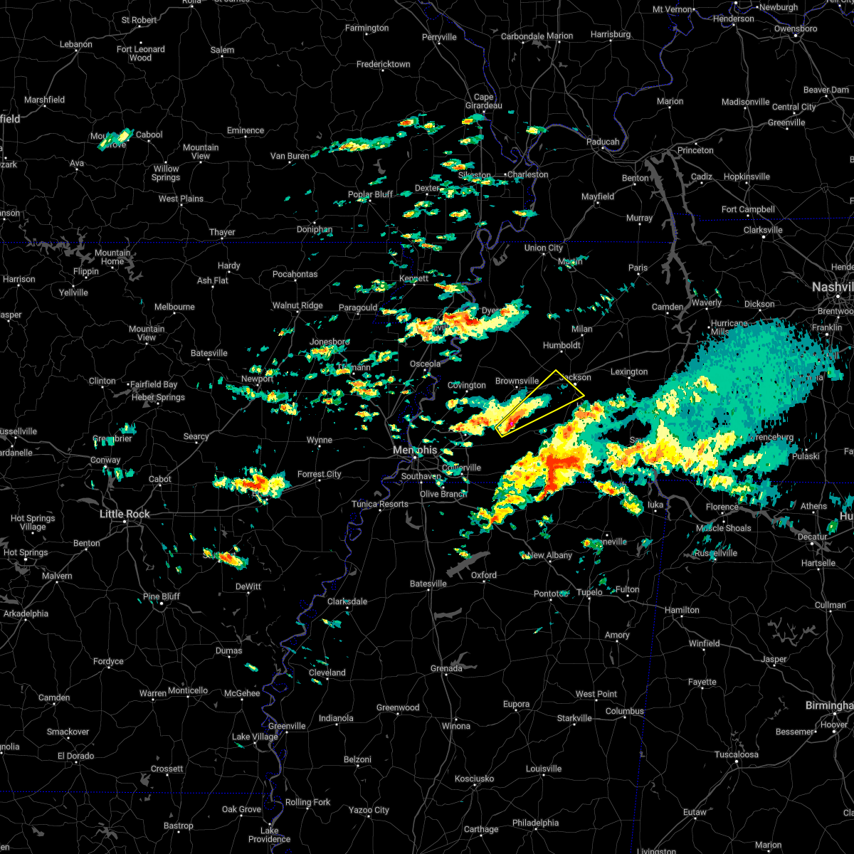 At 1023 pm cst, a severe thunderstorm was located near dancyville, or 16 miles south of brownsville, moving northeast at 40 mph (radar indicated). Hazards include 60 mph wind gusts and quarter size hail. Hail damage to vehicles is expected. Expect wind damage to roofs, siding, and trees. At 1023 pm cst, a severe thunderstorm was located near dancyville, or 16 miles south of brownsville, moving northeast at 40 mph (radar indicated). Hazards include 60 mph wind gusts and quarter size hail. Hail damage to vehicles is expected. Expect wind damage to roofs, siding, and trees.
|
| 11/29/2022 8:23 PM CST |
 The severe thunderstorm warning for southern crockett, east central tipton, south central gibson, northeastern fayette, northwestern hardeman, haywood and madison counties will expire at 830 pm cst, the storm which prompted the warning has weakened below severe limits, and no longer poses an immediate threat to life or property. therefore, the warning will be allowed to expire. however small hail is still possible with this thunderstorm. to report severe weather, contact your nearest law enforcement agency. they will relay your report to the national weather service memphis. The severe thunderstorm warning for southern crockett, east central tipton, south central gibson, northeastern fayette, northwestern hardeman, haywood and madison counties will expire at 830 pm cst, the storm which prompted the warning has weakened below severe limits, and no longer poses an immediate threat to life or property. therefore, the warning will be allowed to expire. however small hail is still possible with this thunderstorm. to report severe weather, contact your nearest law enforcement agency. they will relay your report to the national weather service memphis.
|
| 11/29/2022 8:06 PM CST |
 At 805 pm cst, a severe thunderstorm was located near dancyville, or near brownsville, moving northeast at 60 mph (radar indicated). Hazards include quarter size hail. damage to vehicles is expected At 805 pm cst, a severe thunderstorm was located near dancyville, or near brownsville, moving northeast at 60 mph (radar indicated). Hazards include quarter size hail. damage to vehicles is expected
|
| 6/6/2022 7:38 PM CDT |
 At 738 pm cdt, a confirmed tornado was located near adair, or near humboldt, moving northeast at 25 mph (emergency management confirmed tornado). Hazards include damaging tornado. Flying debris will be dangerous to those caught without shelter. mobile homes will be damaged or destroyed. damage to roofs, windows, and vehicles will occur. Tree damage is likely. At 738 pm cdt, a confirmed tornado was located near adair, or near humboldt, moving northeast at 25 mph (emergency management confirmed tornado). Hazards include damaging tornado. Flying debris will be dangerous to those caught without shelter. mobile homes will be damaged or destroyed. damage to roofs, windows, and vehicles will occur. Tree damage is likely.
|
| 5/13/2022 4:51 PM CDT |
 The severe thunderstorm warning for northern hardeman, southern madison and southwestern chester counties will expire at 500 pm cdt, the storm which prompted the warning has weakened below severe limits, and no longer poses an immediate threat to life or property. therefore, the warning will be allowed to expire. The severe thunderstorm warning for northern hardeman, southern madison and southwestern chester counties will expire at 500 pm cdt, the storm which prompted the warning has weakened below severe limits, and no longer poses an immediate threat to life or property. therefore, the warning will be allowed to expire.
|
| 5/13/2022 4:33 PM CDT | Quarter sized hail reported 2.3 miles N of Jackson, TN, quarter size hail reported in downtown jackson. |
| 5/13/2022 4:31 PM CDT |
 At 431 pm cdt, a severe thunderstorm was located over bemis, or near jackson, moving south at 15 mph (radar indicated). Hazards include 60 mph wind gusts and quarter size hail. Hail damage to vehicles is expected. expect wind damage to roofs, siding, and trees. locations impacted include, jackson, henderson, bolivar, chickasaw state forest, chickasaw state park, silerton, bemis, masseyville, cloverport, mercer, toone, medon, neely, pinson, pine top, westover, madison hall, uptonville, hickory corners and teague. hail threat, radar indicated max hail size, 1. 00 in wind threat, radar indicated max wind gust, 60 mph. At 431 pm cdt, a severe thunderstorm was located over bemis, or near jackson, moving south at 15 mph (radar indicated). Hazards include 60 mph wind gusts and quarter size hail. Hail damage to vehicles is expected. expect wind damage to roofs, siding, and trees. locations impacted include, jackson, henderson, bolivar, chickasaw state forest, chickasaw state park, silerton, bemis, masseyville, cloverport, mercer, toone, medon, neely, pinson, pine top, westover, madison hall, uptonville, hickory corners and teague. hail threat, radar indicated max hail size, 1. 00 in wind threat, radar indicated max wind gust, 60 mph.
|
| 5/13/2022 4:18 PM CDT |
 At 418 pm cdt, a severe thunderstorm was located over bemis, or over jackson, moving south at 20 mph (radar indicated). Hazards include 60 mph wind gusts and quarter size hail. Hail damage to vehicles is expected. Expect wind damage to roofs, siding, and trees. At 418 pm cdt, a severe thunderstorm was located over bemis, or over jackson, moving south at 20 mph (radar indicated). Hazards include 60 mph wind gusts and quarter size hail. Hail damage to vehicles is expected. Expect wind damage to roofs, siding, and trees.
|
| 5/2/2022 5:06 PM CDT |
 At 506 pm cdt, a severe thunderstorm was located near mifflin, or 11 miles north of henderson, moving northeast at 30 mph (radar indicated). Hazards include 60 mph wind gusts and quarter size hail. Hail damage to vehicles is expected. expect wind damage to roofs, siding, and trees. locations impacted include, jackson, lexington, bemis, blue goose, jacks creek, mifflin, bargerton, cedar grove, beech bluff, madison hall, rock hill, juno, gilmore, maple grove, middle fork, timberlake, hinson springs, east union, malesus and claybrook. hail threat, radar indicated max hail size, 1. 00 in wind threat, radar indicated max wind gust, 60 mph. At 506 pm cdt, a severe thunderstorm was located near mifflin, or 11 miles north of henderson, moving northeast at 30 mph (radar indicated). Hazards include 60 mph wind gusts and quarter size hail. Hail damage to vehicles is expected. expect wind damage to roofs, siding, and trees. locations impacted include, jackson, lexington, bemis, blue goose, jacks creek, mifflin, bargerton, cedar grove, beech bluff, madison hall, rock hill, juno, gilmore, maple grove, middle fork, timberlake, hinson springs, east union, malesus and claybrook. hail threat, radar indicated max hail size, 1. 00 in wind threat, radar indicated max wind gust, 60 mph.
|
| 5/2/2022 4:50 PM CDT |
 At 449 pm cdt, a severe thunderstorm was located near henderson, moving northeast at 30 mph (radar indicated). Hazards include 60 mph wind gusts and quarter size hail. Hail damage to vehicles is expected. Expect wind damage to roofs, siding, and trees. At 449 pm cdt, a severe thunderstorm was located near henderson, moving northeast at 30 mph (radar indicated). Hazards include 60 mph wind gusts and quarter size hail. Hail damage to vehicles is expected. Expect wind damage to roofs, siding, and trees.
|
| 4/15/2022 11:13 PM CDT |
 At 1110 pm cdt, a severe thunderstorm was located near henderson, moving east at 65 mph (radar indicated). Hazards include quarter size hail. Damage to vehicles is expected. locations impacted include, jackson, lexington, henderson, bolivar, chickasaw state forest, chickasaw state park, adamsville, silerton, masseyville, mifflin, jacks creek, cloverport, mercer, robertson, mcnairy, bethel springs, toone, hornsby, finger and enville. hail threat, radar indicated max hail size, 1. 00 in wind threat, radar indicated max wind gust, <50 mph. At 1110 pm cdt, a severe thunderstorm was located near henderson, moving east at 65 mph (radar indicated). Hazards include quarter size hail. Damage to vehicles is expected. locations impacted include, jackson, lexington, henderson, bolivar, chickasaw state forest, chickasaw state park, adamsville, silerton, masseyville, mifflin, jacks creek, cloverport, mercer, robertson, mcnairy, bethel springs, toone, hornsby, finger and enville. hail threat, radar indicated max hail size, 1. 00 in wind threat, radar indicated max wind gust, <50 mph.
|
| 4/15/2022 10:42 PM CDT |
 At 1041 pm cdt, a severe thunderstorm was located over whiteville, or 8 miles northwest of bolivar, moving east at 65 mph (radar indicated). Hazards include 60 mph wind gusts and quarter size hail. Hail damage to vehicles is expected. Expect wind damage to roofs, siding, and trees. At 1041 pm cdt, a severe thunderstorm was located over whiteville, or 8 miles northwest of bolivar, moving east at 65 mph (radar indicated). Hazards include 60 mph wind gusts and quarter size hail. Hail damage to vehicles is expected. Expect wind damage to roofs, siding, and trees.
|
| 4/13/2022 5:56 PM CDT |
 At 556 pm cdt, severe thunderstorms were located along a line extending from 8 miles southeast of milan to near chickasaw state park to near lagrange, moving east at 45 mph (radar indicated). Hazards include 60 mph wind gusts. expect damage to roofs, siding, and trees At 556 pm cdt, severe thunderstorms were located along a line extending from 8 miles southeast of milan to near chickasaw state park to near lagrange, moving east at 45 mph (radar indicated). Hazards include 60 mph wind gusts. expect damage to roofs, siding, and trees
|
| 4/13/2022 5:13 PM CDT |
 At 511 pm cdt, a severe thunderstorm was located near dancyville, or 8 miles southwest of brownsville, moving northeast at 45 mph (radar indicated). Hazards include 60 mph wind gusts. expect damage to roofs, siding, and trees At 511 pm cdt, a severe thunderstorm was located near dancyville, or 8 miles southwest of brownsville, moving northeast at 45 mph (radar indicated). Hazards include 60 mph wind gusts. expect damage to roofs, siding, and trees
|
| 4/13/2022 4:53 PM CDT |
 At 452 pm cdt, a severe thunderstorm was located near milan, moving northeast at 60 mph (radar indicated). Hazards include 60 mph wind gusts. Expect damage to roofs, siding, and trees. locations impacted include, jackson, brownsville, humboldt, milan, lexington, mckenzie, trenton, huntingdon, fairview, alamo, bells, three way, bradford, atwood, blue goose, bargerton, bemis, belle eagle, holly grove and adair. hail threat, radar indicated max hail size, <. 75 in wind threat, radar indicated max wind gust, 60 mph. At 452 pm cdt, a severe thunderstorm was located near milan, moving northeast at 60 mph (radar indicated). Hazards include 60 mph wind gusts. Expect damage to roofs, siding, and trees. locations impacted include, jackson, brownsville, humboldt, milan, lexington, mckenzie, trenton, huntingdon, fairview, alamo, bells, three way, bradford, atwood, blue goose, bargerton, bemis, belle eagle, holly grove and adair. hail threat, radar indicated max hail size, <. 75 in wind threat, radar indicated max wind gust, 60 mph.
|
| 4/13/2022 4:24 PM CDT |
 At 423 pm cdt, a severe thunderstorm was located near bells, or 10 miles northeast of brownsville, moving northeast at 60 mph (radar indicated). Hazards include 60 mph wind gusts. expect damage to roofs, siding, and trees At 423 pm cdt, a severe thunderstorm was located near bells, or 10 miles northeast of brownsville, moving northeast at 60 mph (radar indicated). Hazards include 60 mph wind gusts. expect damage to roofs, siding, and trees
|
| 3/30/2022 6:29 PM CDT | Roof ripped off mobile home on rolling acres driv in madison county TN, 3.3 miles S of Jackson, TN |
| 3/30/2022 6:27 PM CDT | Damaged power lines due a fallen tree at campbell street and deaderick s in madison county TN, 3.1 miles NNW of Jackson, TN |
| 3/30/2022 6:26 PM CDT | Damage west and south of jmcgh in jackson. trees on power lines... some roofs gone and trees on house in madison county TN, 2.3 miles N of Jackson, TN |
| 3/30/2022 6:26 PM CDT | Corrects previous tstm wnd dmg report from 1 sse jackson. damaged power lines due a fallen tree at campbell street and deaderick s in madison county TN, 3.1 miles NNW of Jackson, TN |
| 3/30/2022 6:24 PM CDT |
 At 623 pm cdt, a severe thunderstorm was located near bemis, or near jackson, moving northeast at 55 mph (radar indicated). Hazards include 60 mph wind gusts. expect damage to roofs, siding, and trees At 623 pm cdt, a severe thunderstorm was located near bemis, or near jackson, moving northeast at 55 mph (radar indicated). Hazards include 60 mph wind gusts. expect damage to roofs, siding, and trees
|
| 3/30/2022 6:20 PM CDT | Extensive damage to the plant on smith ln near mkl airport. also numerous reports of trees down near the jackson hospita in madison county TN, 1.8 miles NNW of Jackson, TN |
| 3/30/2022 6:20 PM CDT | Corrects previous tstm wnd dmg report from jackson. roof came off at the forrest cove nursing home near the hospital. window blown out at the hospital as well. several in madison county TN, 2.3 miles N of Jackson, TN |
| 3/30/2022 6:20 PM CDT | Madison county sheriffs office with major structural damag in madison county TN, 6.5 miles NE of Jackson, TN |
| 3/30/2022 6:20 PM CDT | Several large trees and power lines down in northern madison county. widespread power outages; hospital on emergency powe in madison county TN, 2.6 miles S of Jackson, TN |
| 3/30/2022 6:16 PM CDT |
 At 616 pm cdt, a severe thunderstorm producing a tornado was located over mercer, or 11 miles west of chickasaw state forest, moving northeast at 45 mph (radar indicated rotation). Hazards include tornado. Flying debris will be dangerous to those caught without shelter. mobile homes will be damaged or destroyed. damage to roofs, windows, and vehicles will occur. tree damage is likely. Locations impacted include, jackson, henderson, chickasaw state park, chickasaw state forest, bemis, adair, cloverport, mercer, gadsden, toone, medon, neely, pinson, huntersville, westover, madison hall, uptonville, teague, leighton and malesus. At 616 pm cdt, a severe thunderstorm producing a tornado was located over mercer, or 11 miles west of chickasaw state forest, moving northeast at 45 mph (radar indicated rotation). Hazards include tornado. Flying debris will be dangerous to those caught without shelter. mobile homes will be damaged or destroyed. damage to roofs, windows, and vehicles will occur. tree damage is likely. Locations impacted include, jackson, henderson, chickasaw state park, chickasaw state forest, bemis, adair, cloverport, mercer, gadsden, toone, medon, neely, pinson, huntersville, westover, madison hall, uptonville, teague, leighton and malesus.
|
| 3/30/2022 6:03 PM CDT |
 At 603 pm cdt, a severe thunderstorm producing a tornado was located near whiteville, or 11 miles northwest of bolivar, moving northeast at 45 mph (radar indicated rotation). Hazards include tornado. Flying debris will be dangerous to those caught without shelter. mobile homes will be damaged or destroyed. damage to roofs, windows, and vehicles will occur. Tree damage is likely. At 603 pm cdt, a severe thunderstorm producing a tornado was located near whiteville, or 11 miles northwest of bolivar, moving northeast at 45 mph (radar indicated rotation). Hazards include tornado. Flying debris will be dangerous to those caught without shelter. mobile homes will be damaged or destroyed. damage to roofs, windows, and vehicles will occur. Tree damage is likely.
|
| 3/30/2022 12:53 PM CDT | 1-inch tree limbs broken; shingles blown of in madison county TN, 12.3 miles WSW of Jackson, TN |
| 2/17/2022 1:27 PM CST |
 At 126 pm cst, a severe thunderstorm was located near brownsville, moving northeast at 80 mph (radar indicated). Hazards include 60 mph wind gusts. expect damage to roofs, siding, and trees At 126 pm cst, a severe thunderstorm was located near brownsville, moving northeast at 80 mph (radar indicated). Hazards include 60 mph wind gusts. expect damage to roofs, siding, and trees
|
| 1/1/2022 11:45 AM CST |
 At 1144 am cst, a severe thunderstorm was located near mifflin, or near henderson, moving east at 60 mph (radar indicated). Hazards include 70 mph wind gusts and nickel size hail. Expect considerable tree damage. Damage is likely to mobile homes, roofs, and outbuildings. At 1144 am cst, a severe thunderstorm was located near mifflin, or near henderson, moving east at 60 mph (radar indicated). Hazards include 70 mph wind gusts and nickel size hail. Expect considerable tree damage. Damage is likely to mobile homes, roofs, and outbuildings.
|
| 10/15/2021 7:04 PM CDT |
 At 704 pm cdt, severe thunderstorms were located along a line extending from near blue goose to 6 miles northwest of chickasaw state park, moving east at 30 mph (radar indicated). Hazards include 60 mph wind gusts. Expect damage to roofs, siding, and trees. locations impacted include, jackson, lexington, henderson, blue goose, parkers crossroads, mifflin, bargerton, medon, hickory flat, pinson, cedar grove, beech bluff, madison hall, union cross, juno, maple grove, east union, parker`s cross roads, malesus and claybrook. hail threat, radar indicated max hail size, <. 75 in wind threat, radar indicated max wind gust, 60 mph. At 704 pm cdt, severe thunderstorms were located along a line extending from near blue goose to 6 miles northwest of chickasaw state park, moving east at 30 mph (radar indicated). Hazards include 60 mph wind gusts. Expect damage to roofs, siding, and trees. locations impacted include, jackson, lexington, henderson, blue goose, parkers crossroads, mifflin, bargerton, medon, hickory flat, pinson, cedar grove, beech bluff, madison hall, union cross, juno, maple grove, east union, parker`s cross roads, malesus and claybrook. hail threat, radar indicated max hail size, <. 75 in wind threat, radar indicated max wind gust, 60 mph.
|
| 10/15/2021 6:43 PM CDT |
 At 643 pm cdt, severe thunderstorms were located along a line extending from near fairview to mercer, moving east at 30 mph (radar indicated). Hazards include 60 mph wind gusts and quarter size hail. Hail damage to vehicles is expected. Expect wind damage to roofs, siding, and trees. At 643 pm cdt, severe thunderstorms were located along a line extending from near fairview to mercer, moving east at 30 mph (radar indicated). Hazards include 60 mph wind gusts and quarter size hail. Hail damage to vehicles is expected. Expect wind damage to roofs, siding, and trees.
|
| 10/15/2021 6:38 PM CDT |
 At 637 pm cdt, a severe thunderstorm was located 7 miles east of fairview, or 10 miles south of milan, moving east at 60 mph (radar indicated). Hazards include 60 mph wind gusts and quarter size hail. Hail damage to vehicles is expected. expect wind damage to roofs, siding, and trees. locations impacted include, jackson, humboldt, milan, fairview, three way, adair, carroll, medina, gadsden, claybrook, youngs crossing, west, huntersville, gum flat, westover, roberts, windy city, gilmore, mason grove and sitka. hail threat, radar indicated max hail size, 1. 00 in wind threat, radar indicated max wind gust, 60 mph. At 637 pm cdt, a severe thunderstorm was located 7 miles east of fairview, or 10 miles south of milan, moving east at 60 mph (radar indicated). Hazards include 60 mph wind gusts and quarter size hail. Hail damage to vehicles is expected. expect wind damage to roofs, siding, and trees. locations impacted include, jackson, humboldt, milan, fairview, three way, adair, carroll, medina, gadsden, claybrook, youngs crossing, west, huntersville, gum flat, westover, roberts, windy city, gilmore, mason grove and sitka. hail threat, radar indicated max hail size, 1. 00 in wind threat, radar indicated max wind gust, 60 mph.
|
| 10/15/2021 6:28 PM CDT |
 At 628 pm cdt, a severe thunderstorm was located near hillville, or 8 miles southeast of brownsville, moving east at 35 mph (radar indicated). Hazards include 60 mph wind gusts and quarter size hail. Hail damage to vehicles is expected. Expect wind damage to roofs, siding, and trees. At 628 pm cdt, a severe thunderstorm was located near hillville, or 8 miles southeast of brownsville, moving east at 35 mph (radar indicated). Hazards include 60 mph wind gusts and quarter size hail. Hail damage to vehicles is expected. Expect wind damage to roofs, siding, and trees.
|
| 10/15/2021 6:16 PM CDT |
 At 616 pm cdt, a severe thunderstorm was located over bells, or 12 miles northeast of brownsville, moving east at 60 mph (radar indicated). Hazards include 60 mph wind gusts and quarter size hail. Hail damage to vehicles is expected. expect wind damage to roofs, siding, and trees. locations impacted include, jackson, brownsville, humboldt, milan, fairview, alamo, bells, three way, belle eagle, holly grove, adair, carroll, medina, gadsden, allens, huntersville, westover, jones, gilmore and mason grove. hail threat, radar indicated max hail size, 1. 00 in wind threat, radar indicated max wind gust, 60 mph. At 616 pm cdt, a severe thunderstorm was located over bells, or 12 miles northeast of brownsville, moving east at 60 mph (radar indicated). Hazards include 60 mph wind gusts and quarter size hail. Hail damage to vehicles is expected. expect wind damage to roofs, siding, and trees. locations impacted include, jackson, brownsville, humboldt, milan, fairview, alamo, bells, three way, belle eagle, holly grove, adair, carroll, medina, gadsden, allens, huntersville, westover, jones, gilmore and mason grove. hail threat, radar indicated max hail size, 1. 00 in wind threat, radar indicated max wind gust, 60 mph.
|
| 10/15/2021 5:56 PM CDT |
 At 556 pm cdt, a severe thunderstorm was located near nutbush, or 8 miles west of brownsville, moving east at 60 mph (radar indicated). Hazards include 60 mph wind gusts and quarter size hail. Hail damage to vehicles is expected. Expect wind damage to roofs, siding, and trees. At 556 pm cdt, a severe thunderstorm was located near nutbush, or 8 miles west of brownsville, moving east at 60 mph (radar indicated). Hazards include 60 mph wind gusts and quarter size hail. Hail damage to vehicles is expected. Expect wind damage to roofs, siding, and trees.
|
| 7/31/2021 10:59 PM CDT |
 At 1059 pm cdt, a severe thunderstorm was located over natchez trace state forest, moving east at 55 mph (radar indicated). Hazards include 70 mph wind gusts. Expect considerable tree damage. damage is likely to mobile homes, roofs, and outbuildings. Locations impacted include, lexington, huntingdon, camden, natchez trace state park, natchez trace state forest, parsons, new johnsonville, bruceton, atwood, decaturville, blue goose, bargerton, wildersville, parkers crossroads, darden, carroll, trezevant, hollow rock, clarksburg and mclemoresville. At 1059 pm cdt, a severe thunderstorm was located over natchez trace state forest, moving east at 55 mph (radar indicated). Hazards include 70 mph wind gusts. Expect considerable tree damage. damage is likely to mobile homes, roofs, and outbuildings. Locations impacted include, lexington, huntingdon, camden, natchez trace state park, natchez trace state forest, parsons, new johnsonville, bruceton, atwood, decaturville, blue goose, bargerton, wildersville, parkers crossroads, darden, carroll, trezevant, hollow rock, clarksburg and mclemoresville.
|
| 7/31/2021 10:45 PM CDT | Tree down across hwy 70 south of spring creek in madison county TN, 11.5 miles SW of Jackson, TN |
| 7/31/2021 10:37 PM CDT |
 At 1037 pm cdt, a severe thunderstorm was located 7 miles southeast of milan, moving east at 55 mph (radar indicated). Hazards include 70 mph wind gusts. Expect considerable tree damage. damage is likely to mobile homes, roofs, and outbuildings. Locations impacted include, jackson, humboldt, milan, lexington, trenton, huntingdon, camden, natchez trace state park, natchez trace state forest, fairview, parsons, new johnsonville, three way, bruceton, atwood, decaturville, blue goose, bargerton, wildersville and parkers crossroads. At 1037 pm cdt, a severe thunderstorm was located 7 miles southeast of milan, moving east at 55 mph (radar indicated). Hazards include 70 mph wind gusts. Expect considerable tree damage. damage is likely to mobile homes, roofs, and outbuildings. Locations impacted include, jackson, humboldt, milan, lexington, trenton, huntingdon, camden, natchez trace state park, natchez trace state forest, fairview, parsons, new johnsonville, three way, bruceton, atwood, decaturville, blue goose, bargerton, wildersville and parkers crossroads.
|
| 7/31/2021 10:31 PM CDT |
 At 1031 pm cdt, a severe thunderstorm was located near milan, moving east at 55 mph (radar indicated). Hazards include 60 mph wind gusts. expect damage to roofs, siding, and trees At 1031 pm cdt, a severe thunderstorm was located near milan, moving east at 55 mph (radar indicated). Hazards include 60 mph wind gusts. expect damage to roofs, siding, and trees
|
| 7/8/2021 11:25 PM CDT |
 At 1124 pm cdt, a severe thunderstorm was located near fairview, or 8 miles north of jackson, moving east at 15 mph (radar indicated). Hazards include 60 mph wind gusts. expect damage to roofs, siding, and trees At 1124 pm cdt, a severe thunderstorm was located near fairview, or 8 miles north of jackson, moving east at 15 mph (radar indicated). Hazards include 60 mph wind gusts. expect damage to roofs, siding, and trees
|
| 5/9/2021 5:50 PM CDT |
 The severe thunderstorm warning for west central henderson, central madison and northwestern chester counties will expire at 600 pm cdt, the storm which prompted the warning has weakened below severe limits, and no longer poses an immediate threat to life or property. therefore, the warning will be allowed to expire. a severe thunderstorm watch remains in effect until 900 pm cdt for western tennessee. The severe thunderstorm warning for west central henderson, central madison and northwestern chester counties will expire at 600 pm cdt, the storm which prompted the warning has weakened below severe limits, and no longer poses an immediate threat to life or property. therefore, the warning will be allowed to expire. a severe thunderstorm watch remains in effect until 900 pm cdt for western tennessee.
|
| 5/9/2021 5:24 PM CDT |
 At 524 pm cdt, a severe thunderstorm was located 7 miles west of bemis, or 7 miles west of jackson, moving east at 35 mph (radar indicated). Hazards include 60 mph wind gusts and quarter size hail. Hail damage to vehicles is expected. Expect wind damage to roofs, siding, and trees. At 524 pm cdt, a severe thunderstorm was located 7 miles west of bemis, or 7 miles west of jackson, moving east at 35 mph (radar indicated). Hazards include 60 mph wind gusts and quarter size hail. Hail damage to vehicles is expected. Expect wind damage to roofs, siding, and trees.
|
| 4/9/2021 6:56 PM CDT |
 The national weather service in memphis has issued a * severe thunderstorm warning for. southeastern crockett county in western tennessee. southeastern gibson county in western tennessee. east central haywood county in western tennessee. Madison county in western tennessee. The national weather service in memphis has issued a * severe thunderstorm warning for. southeastern crockett county in western tennessee. southeastern gibson county in western tennessee. east central haywood county in western tennessee. Madison county in western tennessee.
|
| 4/9/2021 6:55 PM CDT |
 The severe thunderstorm warning for southeastern crockett, southeastern gibson, east central haywood and northern madison counties will expire at 700 pm cdt, the storm which prompted the warning has weakened below severe limits, and no longer poses an immediate threat to life or property. therefore, the warning will be allowed to expire. a severe thunderstorm watch remains in effect until 1100 pm cdt for western tennessee. The severe thunderstorm warning for southeastern crockett, southeastern gibson, east central haywood and northern madison counties will expire at 700 pm cdt, the storm which prompted the warning has weakened below severe limits, and no longer poses an immediate threat to life or property. therefore, the warning will be allowed to expire. a severe thunderstorm watch remains in effect until 1100 pm cdt for western tennessee.
|
| 4/9/2021 6:39 PM CDT |
 At 639 pm cdt, a severe thunderstorm was located over adair, or 8 miles northwest of jackson, moving east at 25 mph (radar indicated). Hazards include 60 mph wind gusts and quarter size hail. Hail damage to vehicles is expected. expect wind damage to roofs, siding, and trees. Locations impacted include, jackson, humboldt, fairview, alamo, bells, three way, holly grove, adair, carroll, medina, gadsden, gibson, quincy, huntersville, new enterprise, jones, gilmore, mason grove, coxville and claybrook. At 639 pm cdt, a severe thunderstorm was located over adair, or 8 miles northwest of jackson, moving east at 25 mph (radar indicated). Hazards include 60 mph wind gusts and quarter size hail. Hail damage to vehicles is expected. expect wind damage to roofs, siding, and trees. Locations impacted include, jackson, humboldt, fairview, alamo, bells, three way, holly grove, adair, carroll, medina, gadsden, gibson, quincy, huntersville, new enterprise, jones, gilmore, mason grove, coxville and claybrook.
|
| 4/9/2021 6:39 PM CDT |
 At 639 pm cdt, a severe thunderstorm was located over cloverport, or 7 miles north of bolivar, moving northeast at 30 mph (radar indicated). Hazards include 60 mph wind gusts and quarter size hail. Hail damage to vehicles is expected. expect wind damage to roofs, siding, and trees. Locations impacted include, jackson, henderson, bolivar, chickasaw state forest, chickasaw state park, whiteville, silerton, bemis, masseyville, cloverport, mercer, robertson, toone, hornsby, medon, neely, pinson, pine top, westover and madison hall. At 639 pm cdt, a severe thunderstorm was located over cloverport, or 7 miles north of bolivar, moving northeast at 30 mph (radar indicated). Hazards include 60 mph wind gusts and quarter size hail. Hail damage to vehicles is expected. expect wind damage to roofs, siding, and trees. Locations impacted include, jackson, henderson, bolivar, chickasaw state forest, chickasaw state park, whiteville, silerton, bemis, masseyville, cloverport, mercer, robertson, toone, hornsby, medon, neely, pinson, pine top, westover and madison hall.
|
| 4/9/2021 6:31 PM CDT |
 At 630 pm cdt, a severe thunderstorm was located near whiteville, or near bolivar, moving northeast at 30 mph (radar indicated). Hazards include 60 mph wind gusts and quarter size hail. Hail damage to vehicles is expected. expect wind damage to roofs, siding, and trees. Locations impacted include, jackson, henderson, bolivar, chickasaw state forest, chickasaw state park, whiteville, silerton, bemis, masseyville, hillville, cloverport, mercer, robertson, toone, hornsby, medon, hickory valley, neely, pinson and pine top. At 630 pm cdt, a severe thunderstorm was located near whiteville, or near bolivar, moving northeast at 30 mph (radar indicated). Hazards include 60 mph wind gusts and quarter size hail. Hail damage to vehicles is expected. expect wind damage to roofs, siding, and trees. Locations impacted include, jackson, henderson, bolivar, chickasaw state forest, chickasaw state park, whiteville, silerton, bemis, masseyville, hillville, cloverport, mercer, robertson, toone, hornsby, medon, hickory valley, neely, pinson and pine top.
|
| 4/9/2021 6:10 PM CDT |
 At 609 pm cdt, a severe thunderstorm was located 8 miles east of somerville, or 12 miles west of bolivar, moving northeast at 30 mph (radar indicated). Hazards include 60 mph wind gusts and quarter size hail. Hail damage to vehicles is expected. Expect wind damage to roofs, siding, and trees. At 609 pm cdt, a severe thunderstorm was located 8 miles east of somerville, or 12 miles west of bolivar, moving northeast at 30 mph (radar indicated). Hazards include 60 mph wind gusts and quarter size hail. Hail damage to vehicles is expected. Expect wind damage to roofs, siding, and trees.
|
| 4/9/2021 6:08 PM CDT |
 At 608 pm cdt, a severe thunderstorm was located over holly grove, or near brownsville, moving northeast at 30 mph (radar indicated). Hazards include ping pong ball size hail and 60 mph wind gusts. People and animals outdoors will be injured. expect hail damage to roofs, siding, windows, and vehicles. Expect wind damage to roofs, siding, and trees. At 608 pm cdt, a severe thunderstorm was located over holly grove, or near brownsville, moving northeast at 30 mph (radar indicated). Hazards include ping pong ball size hail and 60 mph wind gusts. People and animals outdoors will be injured. expect hail damage to roofs, siding, windows, and vehicles. Expect wind damage to roofs, siding, and trees.
|
| 3/27/2021 10:24 PM CDT |
 At 1024 pm cdt, severe thunderstorms were located along a line extending from near vale to bargerton to near chickasaw state park, moving east at 40 mph (radar indicated). Hazards include 70 mph wind gusts. Expect considerable tree damage. damage is likely to mobile homes, roofs, and outbuildings. Locations impacted include, jackson, lexington, henderson, bolivar, huntingdon, natchez trace state park, natchez trace state forest, chickasaw state forest, chickasaw state park, whiteville, bruceton, silerton, blue goose, hillville, mifflin, bargerton, wildersville, bemis, parkers crossroads and cloverport. At 1024 pm cdt, severe thunderstorms were located along a line extending from near vale to bargerton to near chickasaw state park, moving east at 40 mph (radar indicated). Hazards include 70 mph wind gusts. Expect considerable tree damage. damage is likely to mobile homes, roofs, and outbuildings. Locations impacted include, jackson, lexington, henderson, bolivar, huntingdon, natchez trace state park, natchez trace state forest, chickasaw state forest, chickasaw state park, whiteville, bruceton, silerton, blue goose, hillville, mifflin, bargerton, wildersville, bemis, parkers crossroads and cloverport.
|
| 3/27/2021 9:58 PM CDT |
 At 957 pm cdt, severe thunderstorms were located along a line extending from 7 miles north of atwood to near jackson to near whiteville, moving east at 40 mph (radar indicated). Hazards include 60 mph wind gusts. expect damage to roofs, siding, and trees At 957 pm cdt, severe thunderstorms were located along a line extending from 7 miles north of atwood to near jackson to near whiteville, moving east at 40 mph (radar indicated). Hazards include 60 mph wind gusts. expect damage to roofs, siding, and trees
|
| 3/27/2021 9:51 PM CDT |
 At 951 pm cdt, severe thunderstorms were located along a line extending from humboldt to near jackson to near mercer, moving east at 50 mph (radar indicated). Hazards include 60 mph wind gusts. Expect damage to roofs, siding, and trees. Locations impacted include, jackson, brownsville, humboldt, fairview, alamo, bells, three way, bemis, belle eagle, holly grove, adair, carroll, gadsden, neely, allens, huntersville, westover, jones, shepp and gilmore. At 951 pm cdt, severe thunderstorms were located along a line extending from humboldt to near jackson to near mercer, moving east at 50 mph (radar indicated). Hazards include 60 mph wind gusts. Expect damage to roofs, siding, and trees. Locations impacted include, jackson, brownsville, humboldt, fairview, alamo, bells, three way, bemis, belle eagle, holly grove, adair, carroll, gadsden, neely, allens, huntersville, westover, jones, shepp and gilmore.
|
| 3/27/2021 9:35 PM CDT |
 At 935 pm cdt, severe thunderstorms were located along a line extending from alamo to near holly grove to near hillville, moving east at 55 mph (radar indicated). Hazards include 60 mph wind gusts. Expect damage to roofs, siding, and trees. Locations impacted include, jackson, brownsville, humboldt, fairview, alamo, bells, three way, bemis, belle eagle, holly grove, adair, carroll, gadsden, neely, allens, huntersville, christmasville, westover, jones and shepp. At 935 pm cdt, severe thunderstorms were located along a line extending from alamo to near holly grove to near hillville, moving east at 55 mph (radar indicated). Hazards include 60 mph wind gusts. Expect damage to roofs, siding, and trees. Locations impacted include, jackson, brownsville, humboldt, fairview, alamo, bells, three way, bemis, belle eagle, holly grove, adair, carroll, gadsden, neely, allens, huntersville, christmasville, westover, jones and shepp.
|
| 3/27/2021 9:20 PM CDT |
 At 920 pm cdt, a severe thunderstorm was located near brownsville, moving east at 55 mph (radar indicated). Hazards include 60 mph wind gusts. expect damage to roofs, siding, and trees At 920 pm cdt, a severe thunderstorm was located near brownsville, moving east at 55 mph (radar indicated). Hazards include 60 mph wind gusts. expect damage to roofs, siding, and trees
|
| 3/27/2021 8:45 PM CDT | Golf Ball sized hail reported 12.4 miles WNW of Jackson, TN, golfball sized hail. |
| 3/27/2021 8:35 PM CDT | Half Dollar sized hail reported 8.2 miles NNW of Jackson, TN, half dollar and smaller hail. |
| 3/27/2021 8:18 PM CDT |
 At 818 pm cdt, a severe thunderstorm was located near mercer, or 9 miles northwest of chickasaw state park, moving northeast at 40 mph (radar indicated). Hazards include ping pong ball size hail and 60 mph wind gusts. People and animals outdoors will be injured. expect hail damage to roofs, siding, windows, and vehicles. Expect wind damage to roofs, siding, and trees. At 818 pm cdt, a severe thunderstorm was located near mercer, or 9 miles northwest of chickasaw state park, moving northeast at 40 mph (radar indicated). Hazards include ping pong ball size hail and 60 mph wind gusts. People and animals outdoors will be injured. expect hail damage to roofs, siding, windows, and vehicles. Expect wind damage to roofs, siding, and trees.
|
| 3/27/2021 8:13 PM CDT |
 The severe thunderstorm warning for southeastern gibson and northern madison counties will expire at 815 pm cdt, the storm which prompted the warning has weakened below severe limits, and has exited the warned area. therefore, the warning will be allowed to expire. a tornado watch remains in effect until 900 pm cdt for western tennessee. The severe thunderstorm warning for southeastern gibson and northern madison counties will expire at 815 pm cdt, the storm which prompted the warning has weakened below severe limits, and has exited the warned area. therefore, the warning will be allowed to expire. a tornado watch remains in effect until 900 pm cdt for western tennessee.
|
| 3/27/2021 8:07 PM CDT |
 At 806 pm cdt, a severe thunderstorm was located over jackson, moving east at 40 mph (radar indicated). Hazards include 60 mph wind gusts and quarter size hail. Hail damage to vehicles is expected. expect wind damage to roofs, siding, and trees. Locations impacted include, jackson, humboldt, fairview, three way, carroll, medina, youngs crossing, west, huntersville, westover, windy city, gilmore, sitka, goat city and oakfield. At 806 pm cdt, a severe thunderstorm was located over jackson, moving east at 40 mph (radar indicated). Hazards include 60 mph wind gusts and quarter size hail. Hail damage to vehicles is expected. expect wind damage to roofs, siding, and trees. Locations impacted include, jackson, humboldt, fairview, three way, carroll, medina, youngs crossing, west, huntersville, westover, windy city, gilmore, sitka, goat city and oakfield.
|
| 3/27/2021 7:53 PM CDT |
 At 753 pm cdt, a severe thunderstorm was located over adair, or 8 miles west of jackson, moving northeast at 50 mph (radar indicated). Hazards include 60 mph wind gusts and quarter size hail. Hail damage to vehicles is expected. expect wind damage to roofs, siding, and trees. Locations impacted include, jackson, humboldt, fairview, bells, three way, holly grove, adair, carroll, medina, gadsden, gibson, huntersville, westover, gilmore, mason grove, sitka, leighton, coxville, fruitvale and youngs crossing. At 753 pm cdt, a severe thunderstorm was located over adair, or 8 miles west of jackson, moving northeast at 50 mph (radar indicated). Hazards include 60 mph wind gusts and quarter size hail. Hail damage to vehicles is expected. expect wind damage to roofs, siding, and trees. Locations impacted include, jackson, humboldt, fairview, bells, three way, holly grove, adair, carroll, medina, gadsden, gibson, huntersville, westover, gilmore, mason grove, sitka, leighton, coxville, fruitvale and youngs crossing.
|
| 3/27/2021 7:35 PM CDT |
 At 735 pm cdt, a severe thunderstorm was located near brownsville, moving northeast at 45 mph (radar indicated). Hazards include 60 mph wind gusts and quarter size hail. Hail damage to vehicles is expected. Expect wind damage to roofs, siding, and trees. At 735 pm cdt, a severe thunderstorm was located near brownsville, moving northeast at 45 mph (radar indicated). Hazards include 60 mph wind gusts and quarter size hail. Hail damage to vehicles is expected. Expect wind damage to roofs, siding, and trees.
|
| 3/27/2021 4:19 PM CDT |
 At 418 pm cdt, a severe thunderstorm was located near henderson, moving east at 50 mph (radar indicated). Hazards include 60 mph wind gusts and quarter size hail. Hail damage to vehicles is expected. expect wind damage to roofs, siding, and trees. Locations impacted include, jackson, lexington, henderson, natchez trace state forest, sardis, bemis, reagan, blue goose, jacks creek, parkers crossroads, mifflin, bargerton, wildersville, scotts hill, medon, pinson, cedar grove, beech bluff, madison hall and rock hill. At 418 pm cdt, a severe thunderstorm was located near henderson, moving east at 50 mph (radar indicated). Hazards include 60 mph wind gusts and quarter size hail. Hail damage to vehicles is expected. expect wind damage to roofs, siding, and trees. Locations impacted include, jackson, lexington, henderson, natchez trace state forest, sardis, bemis, reagan, blue goose, jacks creek, parkers crossroads, mifflin, bargerton, wildersville, scotts hill, medon, pinson, cedar grove, beech bluff, madison hall and rock hill.
|
| 3/27/2021 4:05 PM CDT |
 At 405 pm cdt, a severe thunderstorm was located near mercer, or 7 miles northwest of chickasaw state forest, moving northeast at 55 mph (radar indicated). Hazards include 60 mph wind gusts and quarter size hail. Hail damage to vehicles is expected. Expect wind damage to roofs, siding, and trees. At 405 pm cdt, a severe thunderstorm was located near mercer, or 7 miles northwest of chickasaw state forest, moving northeast at 55 mph (radar indicated). Hazards include 60 mph wind gusts and quarter size hail. Hail damage to vehicles is expected. Expect wind damage to roofs, siding, and trees.
|
| 3/17/2021 1:58 PM CDT |
 At 158 pm cdt, a severe thunderstorm was located near bemis, or 7 miles south of jackson, moving east at 55 mph (radar indicated). Hazards include 60 mph wind gusts. expect damage to roofs, siding, and trees At 158 pm cdt, a severe thunderstorm was located near bemis, or 7 miles south of jackson, moving east at 55 mph (radar indicated). Hazards include 60 mph wind gusts. expect damage to roofs, siding, and trees
|
| 3/17/2021 1:36 PM CDT |
 At 135 pm cdt, severe thunderstorms were located along a line extending from near brownsville to near whiteville to near somerville, moving east at 55 mph (radar indicated). Hazards include 60 mph wind gusts and penny size hail. Expect damage to roofs, siding, and trees. Locations impacted include, jackson, brownsville, bolivar, chickasaw state forest, chickasaw state park, whiteville, somerville, silerton, hillville, bemis, holly grove, dancyville, cloverport, mercer, warren, carroll, oakland, toone, medon and neely. At 135 pm cdt, severe thunderstorms were located along a line extending from near brownsville to near whiteville to near somerville, moving east at 55 mph (radar indicated). Hazards include 60 mph wind gusts and penny size hail. Expect damage to roofs, siding, and trees. Locations impacted include, jackson, brownsville, bolivar, chickasaw state forest, chickasaw state park, whiteville, somerville, silerton, hillville, bemis, holly grove, dancyville, cloverport, mercer, warren, carroll, oakland, toone, medon and neely.
|
| 3/17/2021 1:18 PM CDT |
 At 118 pm cdt, severe thunderstorms were located along a line extending from 9 miles east of covington to 6 miles northwest of somerville to near eads, moving east at 50 mph (radar indicated). Hazards include 60 mph wind gusts. expect damage to roofs, siding, and trees At 118 pm cdt, severe thunderstorms were located along a line extending from 9 miles east of covington to 6 miles northwest of somerville to near eads, moving east at 50 mph (radar indicated). Hazards include 60 mph wind gusts. expect damage to roofs, siding, and trees
|
| 7/12/2020 8:50 AM CDT | Large tree down on home off of old humboldt roa in madison county TN, 1.3 miles SSW of Jackson, TN |
| 6/30/2020 7:36 PM CDT | Large tree branch down 4 miles west of spring creek on hwy 220 in madison county TN, 11.5 miles SW of Jackson, TN |
| 6/4/2020 5:54 PM CDT |
 The tornado warning for southeastern gibson, southwestern carroll and north central madison counties will expire at 600 pm cdt, the storm which prompted the warning has weakened below severe limits, and no longer appears capable of producing a tornado. therefore, the warning will be allowed to expire. The tornado warning for southeastern gibson, southwestern carroll and north central madison counties will expire at 600 pm cdt, the storm which prompted the warning has weakened below severe limits, and no longer appears capable of producing a tornado. therefore, the warning will be allowed to expire.
|
| 6/4/2020 5:48 PM CDT |
 At 547 pm cdt, doppler radar indicated a severe thunderstorm producing a tornado was located near trenton, moving southeast at 40 mph (radar indicated rotation). Hazards include tornado. Flying debris will be dangerous to those caught without shelter. mobile homes will be damaged or destroyed. damage to roofs, windows, and vehicles will occur. tree damage is likely. Locations impacted include, humboldt, milan, trenton, fairview, three way, carroll, medina, gibson, laneview, west, new enterprise, lavinia, sitka, vaughns grove, goat city, georgetown, moores chapel and tuckers corner. At 547 pm cdt, doppler radar indicated a severe thunderstorm producing a tornado was located near trenton, moving southeast at 40 mph (radar indicated rotation). Hazards include tornado. Flying debris will be dangerous to those caught without shelter. mobile homes will be damaged or destroyed. damage to roofs, windows, and vehicles will occur. tree damage is likely. Locations impacted include, humboldt, milan, trenton, fairview, three way, carroll, medina, gibson, laneview, west, new enterprise, lavinia, sitka, vaughns grove, goat city, georgetown, moores chapel and tuckers corner.
|
| 6/4/2020 5:39 PM CDT |
 At 539 pm cdt, doppler radar indicated a severe thunderstorm producing a tornado was located near trenton, moving southeast at 30 mph (radar indicated rotation). Hazards include tornado. Flying debris will be dangerous to those caught without shelter. mobile homes will be damaged or destroyed. damage to roofs, windows, and vehicles will occur. tree damage is likely. Locations impacted include, humboldt, milan, trenton, fairview, dyer, three way, carroll, medina, gibson, laneview, grizzard, west, fruitland, new enterprise, lavinia, mount orange, sitka, vaughns grove, barrons corner and goat city. At 539 pm cdt, doppler radar indicated a severe thunderstorm producing a tornado was located near trenton, moving southeast at 30 mph (radar indicated rotation). Hazards include tornado. Flying debris will be dangerous to those caught without shelter. mobile homes will be damaged or destroyed. damage to roofs, windows, and vehicles will occur. tree damage is likely. Locations impacted include, humboldt, milan, trenton, fairview, dyer, three way, carroll, medina, gibson, laneview, grizzard, west, fruitland, new enterprise, lavinia, mount orange, sitka, vaughns grove, barrons corner and goat city.
|
| 6/4/2020 5:29 PM CDT |
 At 529 pm cdt, doppler radar indicated a severe thunderstorm producing a tornado was located near dyer, or near trenton, moving southeast at 40 mph (radar indicated rotation). Hazards include tornado. Flying debris will be dangerous to those caught without shelter. mobile homes will be damaged or destroyed. damage to roofs, windows, and vehicles will occur. Tree damage is likely. At 529 pm cdt, doppler radar indicated a severe thunderstorm producing a tornado was located near dyer, or near trenton, moving southeast at 40 mph (radar indicated rotation). Hazards include tornado. Flying debris will be dangerous to those caught without shelter. mobile homes will be damaged or destroyed. damage to roofs, windows, and vehicles will occur. Tree damage is likely.
|
| 5/4/2020 7:27 PM CDT |
 The severe thunderstorm warning for western henderson, southeastern gibson, southwestern carroll and northeastern madison counties will expire at 730 pm cdt, the storm which prompted the warning has moved out of the area. therefore, the warning will be allowed to expire. a severe thunderstorm watch remains in effect until 1000 pm cdt for western tennessee. The severe thunderstorm warning for western henderson, southeastern gibson, southwestern carroll and northeastern madison counties will expire at 730 pm cdt, the storm which prompted the warning has moved out of the area. therefore, the warning will be allowed to expire. a severe thunderstorm watch remains in effect until 1000 pm cdt for western tennessee.
|
| 5/4/2020 7:09 PM CDT |
 At 709 pm cdt, a severe thunderstorm was located near bargerton, or near lexington, moving southeast at 50 mph (radar indicated). Hazards include 60 mph wind gusts and half dollar size hail. Hail damage to vehicles is expected. expect wind damage to roofs, siding, and trees. Locations impacted include, jackson, lexington, blue goose, parkers crossroads, bargerton, wildersville, carroll, medina, clarksburg, howley, hickory flat, cedar grove, beech bluff, union cross, juno, gilmore, maple grove, middle fork, sitka and timberlake. At 709 pm cdt, a severe thunderstorm was located near bargerton, or near lexington, moving southeast at 50 mph (radar indicated). Hazards include 60 mph wind gusts and half dollar size hail. Hail damage to vehicles is expected. expect wind damage to roofs, siding, and trees. Locations impacted include, jackson, lexington, blue goose, parkers crossroads, bargerton, wildersville, carroll, medina, clarksburg, howley, hickory flat, cedar grove, beech bluff, union cross, juno, gilmore, maple grove, middle fork, sitka and timberlake.
|
| 5/4/2020 7:06 PM CDT |
 At 705 pm cdt, a severe thunderstorm was located over bargerton, or 7 miles northwest of lexington, moving southeast at 45 mph (radar indicated). Hazards include 60 mph wind gusts and quarter size hail. Hail damage to vehicles is expected. expect wind damage to roofs, siding, and trees. Locations impacted include, jackson, humboldt, milan, lexington, fairview, three way, blue goose, parkers crossroads, adair, bargerton, wildersville, carroll, medina, clarksburg, howley, hickory flat, cedar grove, beech bluff, ledbetter and union cross. At 705 pm cdt, a severe thunderstorm was located over bargerton, or 7 miles northwest of lexington, moving southeast at 45 mph (radar indicated). Hazards include 60 mph wind gusts and quarter size hail. Hail damage to vehicles is expected. expect wind damage to roofs, siding, and trees. Locations impacted include, jackson, humboldt, milan, lexington, fairview, three way, blue goose, parkers crossroads, adair, bargerton, wildersville, carroll, medina, clarksburg, howley, hickory flat, cedar grove, beech bluff, ledbetter and union cross.
|
| 5/4/2020 6:52 PM CDT |
 The severe thunderstorm warning for crockett, southeastern dyer, southern gibson, northeastern lauderdale, northeastern haywood and madison counties will expire at 700 pm cdt, the storm which prompted the warning has moved out of the area. therefore, the warning will be allowed to expire. a severe thunderstorm watch remains in effect until 1000 pm cdt for western tennessee. remember, a severe thunderstorm warning still remains in effect for crockett, gibson and madison counties. The severe thunderstorm warning for crockett, southeastern dyer, southern gibson, northeastern lauderdale, northeastern haywood and madison counties will expire at 700 pm cdt, the storm which prompted the warning has moved out of the area. therefore, the warning will be allowed to expire. a severe thunderstorm watch remains in effect until 1000 pm cdt for western tennessee. remember, a severe thunderstorm warning still remains in effect for crockett, gibson and madison counties.
|
| 5/4/2020 6:41 PM CDT |
 At 641 pm cdt, a severe thunderstorm was located near humboldt, moving southeast at 60 mph (radar indicated). Hazards include 60 mph wind gusts and quarter size hail. Hail damage to vehicles is expected. Expect wind damage to roofs, siding, and trees. At 641 pm cdt, a severe thunderstorm was located near humboldt, moving southeast at 60 mph (radar indicated). Hazards include 60 mph wind gusts and quarter size hail. Hail damage to vehicles is expected. Expect wind damage to roofs, siding, and trees.
|
| 5/4/2020 6:38 PM CDT |
 At 638 pm cdt, a severe thunderstorm was located near darden, or near natchez trace state forest, moving east at 50 mph (radar indicated). Hazards include golf ball size hail and 60 mph wind gusts. People and animals outdoors will be injured. expect hail damage to roofs, siding, windows, and vehicles. expect wind damage to roofs, siding, and trees. Locations impacted include, jackson, humboldt, milan, lexington, fairview, three way, blue goose, parkers crossroads, bargerton, wildersville, carroll, medina, gibson, hickory flat, cedar grove, rock hill, union cross, juno, gilmore and sitka. At 638 pm cdt, a severe thunderstorm was located near darden, or near natchez trace state forest, moving east at 50 mph (radar indicated). Hazards include golf ball size hail and 60 mph wind gusts. People and animals outdoors will be injured. expect hail damage to roofs, siding, windows, and vehicles. expect wind damage to roofs, siding, and trees. Locations impacted include, jackson, humboldt, milan, lexington, fairview, three way, blue goose, parkers crossroads, bargerton, wildersville, carroll, medina, gibson, hickory flat, cedar grove, rock hill, union cross, juno, gilmore and sitka.
|
| 5/4/2020 6:24 PM CDT |
 At 623 pm cdt, a severe thunderstorm was located near chestnut bluff, or 12 miles southeast of dyersburg, moving southeast at 70 mph (radar indicated). Hazards include 60 mph wind gusts and quarter size hail. Hail damage to vehicles is expected. Expect wind damage to roofs, siding, and trees. At 623 pm cdt, a severe thunderstorm was located near chestnut bluff, or 12 miles southeast of dyersburg, moving southeast at 70 mph (radar indicated). Hazards include 60 mph wind gusts and quarter size hail. Hail damage to vehicles is expected. Expect wind damage to roofs, siding, and trees.
|
| 5/4/2020 6:20 PM CDT | Quarter sized hail reported 11.5 miles SW of Jackson, TN, quarter sized hail in ne madison co. |
| 5/4/2020 6:09 PM CDT |
 At 609 pm cdt, a severe thunderstorm was located near blue goose, or 12 miles southeast of milan, moving east at 50 mph (radar indicated). Hazards include 60 mph wind gusts and quarter size hail. Hail damage to vehicles is expected. expect wind damage to roofs, siding, and trees. Locations impacted include, jackson, humboldt, milan, lexington, fairview, three way, blue goose, parkers crossroads, bargerton, wildersville, carroll, medina, gibson, hickory flat, cedar grove, rock hill, union cross, juno, gilmore and sitka. At 609 pm cdt, a severe thunderstorm was located near blue goose, or 12 miles southeast of milan, moving east at 50 mph (radar indicated). Hazards include 60 mph wind gusts and quarter size hail. Hail damage to vehicles is expected. expect wind damage to roofs, siding, and trees. Locations impacted include, jackson, humboldt, milan, lexington, fairview, three way, blue goose, parkers crossroads, bargerton, wildersville, carroll, medina, gibson, hickory flat, cedar grove, rock hill, union cross, juno, gilmore and sitka.
|
| 5/4/2020 6:06 PM CDT | Quarter sized hail reported 2.3 miles N of Jackson, TN, quarter sized hail christmasville road on madison co line. |
| 5/4/2020 6:00 PM CDT |
 At 600 pm cdt, a severe thunderstorm was located near fairview, or 7 miles southeast of humboldt, moving east at 50 mph (radar indicated). Hazards include 60 mph wind gusts and quarter size hail. Hail damage to vehicles is expected. Expect wind damage to roofs, siding, and trees. At 600 pm cdt, a severe thunderstorm was located near fairview, or 7 miles southeast of humboldt, moving east at 50 mph (radar indicated). Hazards include 60 mph wind gusts and quarter size hail. Hail damage to vehicles is expected. Expect wind damage to roofs, siding, and trees.
|
| 5/3/2020 6:34 PM CDT |
 At 634 pm cdt, a severe thunderstorm was located near blue goose, or 10 miles east of jackson, moving east at 50 mph (radar indicated). Hazards include quarter size hail. damage to vehicles is expected At 634 pm cdt, a severe thunderstorm was located near blue goose, or 10 miles east of jackson, moving east at 50 mph (radar indicated). Hazards include quarter size hail. damage to vehicles is expected
|
| 5/3/2020 6:30 PM CDT | Ping Pong Ball sized hail reported 0.4 miles WNW of Jackson, TN, large hail up to ping pong size in oakfield. |
| 5/3/2020 5:56 PM CDT |
 At 556 pm cdt, a severe thunderstorm was located near alamo, or 13 miles southwest of trenton, moving southeast at 40 mph (radar indicated). Hazards include half dollar size hail. Damage to vehicles is expected. Locations impacted include, humboldt, milan, trenton, fairview, three way, atwood, medina, friendship, gadsden, gibson, hickory flat, bishop, hawkinsville, quincy, gibson wells, cades, new enterprise, bonicord, central and ledbetter. At 556 pm cdt, a severe thunderstorm was located near alamo, or 13 miles southwest of trenton, moving southeast at 40 mph (radar indicated). Hazards include half dollar size hail. Damage to vehicles is expected. Locations impacted include, humboldt, milan, trenton, fairview, three way, atwood, medina, friendship, gadsden, gibson, hickory flat, bishop, hawkinsville, quincy, gibson wells, cades, new enterprise, bonicord, central and ledbetter.
|
| 5/3/2020 5:50 PM CDT | Quarter sized hail reported 4.3 miles N of Jackson, TN, quarter sized hail on perry switch road. started as pea sized hail. |
| 5/3/2020 5:25 PM CDT |
 At 525 pm cdt, a severe thunderstorm was located 7 miles northeast of chestnut bluff, or 10 miles southeast of dyersburg, moving east at 60 mph (radar indicated). Hazards include quarter size hail. damage to vehicles is expected At 525 pm cdt, a severe thunderstorm was located 7 miles northeast of chestnut bluff, or 10 miles southeast of dyersburg, moving east at 60 mph (radar indicated). Hazards include quarter size hail. damage to vehicles is expected
|
| 5/3/2020 3:56 PM CDT |
 The severe thunderstorm warning for southeastern crockett, henderson, southeastern gibson, northern fayette, northern hardeman, southern benton, carroll, southern haywood, madison and chester counties will expire at 400 pm cdt, the storms which prompted the warning have moved out of the area. therefore, the warning will be allowed to expire. however gusty winds and heavy rain are still possible with severe thunderstorms from northeastern hardeman to decatur county. a severe thunderstorm watch remains in effect until 600 pm cdt for western tennessee. The severe thunderstorm warning for southeastern crockett, henderson, southeastern gibson, northern fayette, northern hardeman, southern benton, carroll, southern haywood, madison and chester counties will expire at 400 pm cdt, the storms which prompted the warning have moved out of the area. therefore, the warning will be allowed to expire. however gusty winds and heavy rain are still possible with severe thunderstorms from northeastern hardeman to decatur county. a severe thunderstorm watch remains in effect until 600 pm cdt for western tennessee.
|
| 5/3/2020 3:23 PM CDT |
 At 323 pm cdt, severe thunderstorms were located along a line extending from near huntingdon to 7 miles east of jackson to 6 miles north of somerville, moving east at 55 mph (radar indicated). Hazards include 70 mph wind gusts and nickel size hail. Expect considerable tree damage. damage is likely to mobile homes, roofs, and outbuildings. Locations impacted include, jackson, brownsville, humboldt, milan, lexington, henderson, bolivar, huntingdon, camden, natchez trace state park, chickasaw state park, natchez trace state forest, chickasaw state forest, fairview, whiteville, three way, bruceton, atwood, silerton and masseyville. At 323 pm cdt, severe thunderstorms were located along a line extending from near huntingdon to 7 miles east of jackson to 6 miles north of somerville, moving east at 55 mph (radar indicated). Hazards include 70 mph wind gusts and nickel size hail. Expect considerable tree damage. damage is likely to mobile homes, roofs, and outbuildings. Locations impacted include, jackson, brownsville, humboldt, milan, lexington, henderson, bolivar, huntingdon, camden, natchez trace state park, chickasaw state park, natchez trace state forest, chickasaw state forest, fairview, whiteville, three way, bruceton, atwood, silerton and masseyville.
|
| 5/3/2020 3:20 PM CDT | 60 mph wind gust in madison county TN, 2.3 miles N of Jackson, TN |
| 5/3/2020 3:10 PM CDT |
 At 310 pm cdt, severe thunderstorms were located along a line extending from near huntingdon to near adair to 6 miles northeast of arlington, moving east at 55 mph (radar indicated). Hazards include 70 mph wind gusts and quarter size hail. Hail damage to vehicles is expected. expect considerable tree damage. Wind damage is also likely to mobile homes, roofs, and outbuildings. At 310 pm cdt, severe thunderstorms were located along a line extending from near huntingdon to near adair to 6 miles northeast of arlington, moving east at 55 mph (radar indicated). Hazards include 70 mph wind gusts and quarter size hail. Hail damage to vehicles is expected. expect considerable tree damage. Wind damage is also likely to mobile homes, roofs, and outbuildings.
|
| 3/28/2020 9:14 PM CDT |
 At 913 pm cdt, severe thunderstorms were located along a line extending from near milan to near jackson to chickasaw state park, moving northeast at 55 mph (radar indicated). Hazards include 60 mph wind gusts. Expect damage to roofs, siding, and trees. Locations impacted include, jackson, humboldt, milan, lexington, henderson, huntingdon, fairview, three way, atwood, blue goose, mifflin, bargerton, wildersville, bemis, parkers crossroads, adair, carroll, medina, trezevant and gadsden. At 913 pm cdt, severe thunderstorms were located along a line extending from near milan to near jackson to chickasaw state park, moving northeast at 55 mph (radar indicated). Hazards include 60 mph wind gusts. Expect damage to roofs, siding, and trees. Locations impacted include, jackson, humboldt, milan, lexington, henderson, huntingdon, fairview, three way, atwood, blue goose, mifflin, bargerton, wildersville, bemis, parkers crossroads, adair, carroll, medina, trezevant and gadsden.
|
| 3/28/2020 9:11 PM CDT |
 At 910 pm cdt, a severe thunderstorm was located near adair, or near jackson, moving northeast at 50 mph (radar indicated). Hazards include 60 mph wind gusts. Expect damage to roofs, siding, and trees. Locations impacted include, jackson, bemis, adair, gadsden, medon, neely, malesus, fruitvale, parkburg, huntersville, gum flat, westover, roberts, uptonville and denmark. At 910 pm cdt, a severe thunderstorm was located near adair, or near jackson, moving northeast at 50 mph (radar indicated). Hazards include 60 mph wind gusts. Expect damage to roofs, siding, and trees. Locations impacted include, jackson, bemis, adair, gadsden, medon, neely, malesus, fruitvale, parkburg, huntersville, gum flat, westover, roberts, uptonville and denmark.
|
| 3/28/2020 9:07 PM CDT |
 At 906 pm cdt, severe thunderstorms were located along a line extending from near adair to near cloverport, moving northeast at 55 mph (radar indicated). Hazards include 60 mph wind gusts. expect damage to roofs, siding, and trees At 906 pm cdt, severe thunderstorms were located along a line extending from near adair to near cloverport, moving northeast at 55 mph (radar indicated). Hazards include 60 mph wind gusts. expect damage to roofs, siding, and trees
|
| 3/28/2020 9:01 PM CDT |
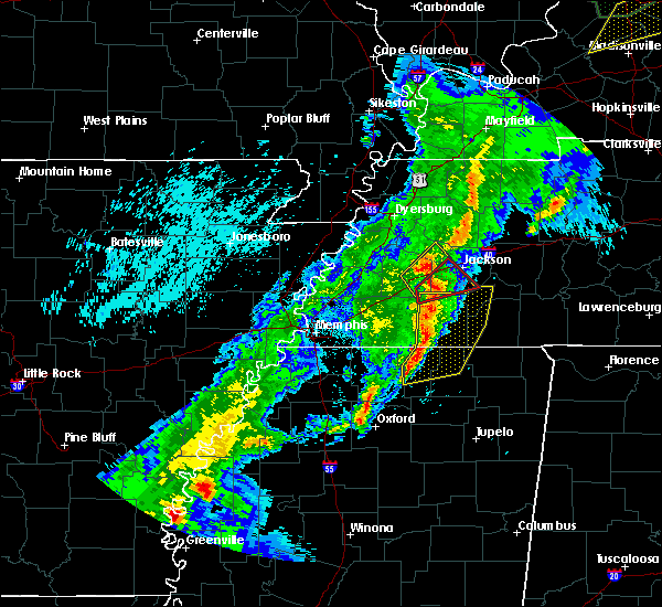 At 901 pm cdt, doppler radar indicated a severe squall line producing both tornadoes and extensive straight line wind damage was located near mercer, or 11 miles northwest of chickasaw state forest, moving northeast at 55 mph (radar indicated rotation). Hazards include tornado. Flying debris will be dangerous to those caught without shelter. mobile homes will be damaged or destroyed. damage to roofs, windows, and vehicles will occur. tree damage is likely. Locations impacted include, jackson, bemis, mercer, neely, malesus, huntersville, denmark, westover, madison hall and uptonville. At 901 pm cdt, doppler radar indicated a severe squall line producing both tornadoes and extensive straight line wind damage was located near mercer, or 11 miles northwest of chickasaw state forest, moving northeast at 55 mph (radar indicated rotation). Hazards include tornado. Flying debris will be dangerous to those caught without shelter. mobile homes will be damaged or destroyed. damage to roofs, windows, and vehicles will occur. tree damage is likely. Locations impacted include, jackson, bemis, mercer, neely, malesus, huntersville, denmark, westover, madison hall and uptonville.
|
| 3/28/2020 8:51 PM CDT |
 At 851 pm cdt, a severe thunderstorm was located near brownsville, moving northeast at 50 mph (radar indicated). Hazards include 60 mph wind gusts. expect damage to roofs, siding, and trees At 851 pm cdt, a severe thunderstorm was located near brownsville, moving northeast at 50 mph (radar indicated). Hazards include 60 mph wind gusts. expect damage to roofs, siding, and trees
|
| 3/28/2020 8:48 PM CDT |
 At 848 pm cdt, doppler radar indicated severe thunderstorms producing both tornadoes and extensive straight line wind damage were located over hillville, or 13 miles south of brownsville, moving northeast at 55 mph (radar indicated rotation). Hazards include tornado. Flying debris will be dangerous to those caught without shelter. mobile homes will be damaged or destroyed. damage to roofs, windows, and vehicles will occur. Tree damage is likely. At 848 pm cdt, doppler radar indicated severe thunderstorms producing both tornadoes and extensive straight line wind damage were located over hillville, or 13 miles south of brownsville, moving northeast at 55 mph (radar indicated rotation). Hazards include tornado. Flying debris will be dangerous to those caught without shelter. mobile homes will be damaged or destroyed. damage to roofs, windows, and vehicles will occur. Tree damage is likely.
|
| 3/3/2020 2:53 AM CST |
 At 253 am cst, a severe thunderstorm was located near adair, or 7 miles west of jackson, moving east at 50 mph (radar indicated). Hazards include 60 mph wind gusts. expect damage to roofs, siding, and trees At 253 am cst, a severe thunderstorm was located near adair, or 7 miles west of jackson, moving east at 50 mph (radar indicated). Hazards include 60 mph wind gusts. expect damage to roofs, siding, and trees
|
| 10/26/2019 12:55 PM CDT |
 At 1255 pm cdt, a severe thunderstorm was located near jacks creek, or near henderson, moving north at 60 mph (radar indicated). Hazards include 70 mph wind gusts. Expect considerable tree damage. Damage is likely to mobile homes, roofs, and outbuildings. At 1255 pm cdt, a severe thunderstorm was located near jacks creek, or near henderson, moving north at 60 mph (radar indicated). Hazards include 70 mph wind gusts. Expect considerable tree damage. Damage is likely to mobile homes, roofs, and outbuildings.
|
| 10/26/2019 12:28 PM CDT |
 At 1227 pm cdt, a severe thunderstorm was located near selmer, moving north at 50 mph (radar indicated). Hazards include 70 mph wind gusts. Expect considerable tree damage. Damage is likely to mobile homes, roofs, and outbuildings. At 1227 pm cdt, a severe thunderstorm was located near selmer, moving north at 50 mph (radar indicated). Hazards include 70 mph wind gusts. Expect considerable tree damage. Damage is likely to mobile homes, roofs, and outbuildings.
|
| 10/21/2019 7:55 AM CDT | Truck blown over on christmasville road and oakfield. winds estimated at 46 mp in madison county TN, 1.9 miles SSW of Jackson, TN |
| 10/21/2019 7:43 AM CDT |
 The severe thunderstorm warning for crockett. western weakley. eastern dyer. gibson. obion. northeastern haywood and north central madison counties will expire at 745 am cdt. the storms which prompted the warning have weakened below severe limits, and no longer pose an immediate threat to life or property. Therefore, the warning will be allowed to expire. The severe thunderstorm warning for crockett. western weakley. eastern dyer. gibson. obion. northeastern haywood and north central madison counties will expire at 745 am cdt. the storms which prompted the warning have weakened below severe limits, and no longer pose an immediate threat to life or property. Therefore, the warning will be allowed to expire.
|
| 10/21/2019 7:36 AM CDT |
 The severe thunderstorm warning for northern marshall, northwestern tippah, benton, eastern fayette, hardeman, southeastern haywood and madison counties will expire at 745 am cdt, the storms which prompted the warning have weakened below severe limits, and no longer pose an immediate threat to life or property. therefore, the warning will be allowed to expire. a tornado watch remains in effect until 1000 am cdt for northeastern and northwestern mississippi, and western tennessee. The severe thunderstorm warning for northern marshall, northwestern tippah, benton, eastern fayette, hardeman, southeastern haywood and madison counties will expire at 745 am cdt, the storms which prompted the warning have weakened below severe limits, and no longer pose an immediate threat to life or property. therefore, the warning will be allowed to expire. a tornado watch remains in effect until 1000 am cdt for northeastern and northwestern mississippi, and western tennessee.
|
| 10/21/2019 7:27 AM CDT |
 At 727 am cdt, severe thunderstorms were located along a line extending from near dancyville to near slayden, moving east at 45 mph (radar indicated). Hazards include 60 mph wind gusts. Expect damage to roofs, siding, and trees. Locations impacted include, jackson, brownsville, holly springs, bolivar, chickasaw state forest, lamar, whiteville, somerville, snow lake shores, mt pleasant, hillville, michigan city, red banks, canaan, bemis, lagrange, holly grove, dancyville, cloverport and slayden. At 727 am cdt, severe thunderstorms were located along a line extending from near dancyville to near slayden, moving east at 45 mph (radar indicated). Hazards include 60 mph wind gusts. Expect damage to roofs, siding, and trees. Locations impacted include, jackson, brownsville, holly springs, bolivar, chickasaw state forest, lamar, whiteville, somerville, snow lake shores, mt pleasant, hillville, michigan city, red banks, canaan, bemis, lagrange, holly grove, dancyville, cloverport and slayden.
|
| 10/21/2019 7:25 AM CDT |
 At 725 am cdt, severe thunderstorms were located along a line extending from near fulgham to near gleason to near fairview, moving east at 110 mph (radar indicated). Hazards include 60 mph wind gusts. Expect damage to roofs, siding, and trees. Locations impacted include, dyersburg, martin, union city, humboldt, milan, trenton, fulton, fairview, newbern, dresden, alamo, bells, south fulton, dyer, greenfield, three way, troy, kenton, rutherford and obion. At 725 am cdt, severe thunderstorms were located along a line extending from near fulgham to near gleason to near fairview, moving east at 110 mph (radar indicated). Hazards include 60 mph wind gusts. Expect damage to roofs, siding, and trees. Locations impacted include, dyersburg, martin, union city, humboldt, milan, trenton, fulton, fairview, newbern, dresden, alamo, bells, south fulton, dyer, greenfield, three way, troy, kenton, rutherford and obion.
|
| 10/21/2019 7:01 AM CDT |
 At 701 am cdt, severe thunderstorms were located along a line extending from 9 miles northeast of arlington to near lewisburg, moving east at 45 mph (radar indicated). Hazards include 60 mph wind gusts. expect damage to roofs, siding, and trees At 701 am cdt, severe thunderstorms were located along a line extending from 9 miles northeast of arlington to near lewisburg, moving east at 45 mph (radar indicated). Hazards include 60 mph wind gusts. expect damage to roofs, siding, and trees
|
| 10/21/2019 7:01 AM CDT |
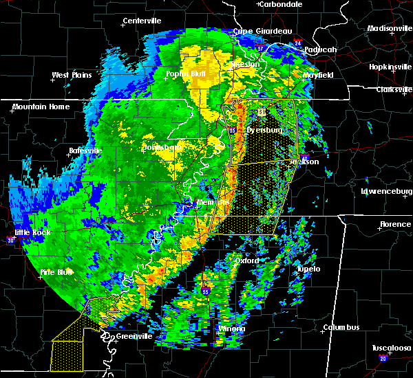 At 701 am cdt, severe thunderstorms were located along a line extending from 9 miles northeast of arlington to near lewisburg, moving east at 45 mph (radar indicated). Hazards include 60 mph wind gusts. expect damage to roofs, siding, and trees At 701 am cdt, severe thunderstorms were located along a line extending from 9 miles northeast of arlington to near lewisburg, moving east at 45 mph (radar indicated). Hazards include 60 mph wind gusts. expect damage to roofs, siding, and trees
|
| 10/21/2019 7:00 AM CDT |
 At 700 am cdt, severe thunderstorms were located along a line extending from near marston to near bradleytown to 6 miles east of covington, moving east at 110 mph (radar indicated). Hazards include 60 mph wind gusts. expect damage to roofs, siding, and trees At 700 am cdt, severe thunderstorms were located along a line extending from near marston to near bradleytown to 6 miles east of covington, moving east at 110 mph (radar indicated). Hazards include 60 mph wind gusts. expect damage to roofs, siding, and trees
|
| 10/6/2019 6:46 PM CDT | Quarter sized hail reported 4.2 miles NNW of Jackson, TN, one inch sized hail in pinson. |
| 7/14/2019 3:36 PM CDT |
 The tornado warning for northwestern henderson, southeastern gibson, southwestern carroll and northeastern madison counties will expire at 345 pm cdt, the storm which prompted the warning has weakened below severe limits, and no longer appears capable of producing a tornado. therefore, the warning will be allowed to expire. The tornado warning for northwestern henderson, southeastern gibson, southwestern carroll and northeastern madison counties will expire at 345 pm cdt, the storm which prompted the warning has weakened below severe limits, and no longer appears capable of producing a tornado. therefore, the warning will be allowed to expire.
|
| 7/14/2019 3:28 PM CDT |
 At 328 pm cdt, doppler radar indicated a severe thunderstorm producing a tornado was located 7 miles west of blue goose, or 9 miles northeast of jackson, moving northwest at 20 mph (radar indicated rotation). Hazards include tornado. Flying debris will be dangerous to those caught without shelter. mobile homes will be damaged or destroyed. damage to roofs, windows, and vehicles will occur. tree damage is likely. Locations impacted include, humboldt, blue goose, medina, hickory flat, claybrook, cedar grove, white fern and goat city. At 328 pm cdt, doppler radar indicated a severe thunderstorm producing a tornado was located 7 miles west of blue goose, or 9 miles northeast of jackson, moving northwest at 20 mph (radar indicated rotation). Hazards include tornado. Flying debris will be dangerous to those caught without shelter. mobile homes will be damaged or destroyed. damage to roofs, windows, and vehicles will occur. tree damage is likely. Locations impacted include, humboldt, blue goose, medina, hickory flat, claybrook, cedar grove, white fern and goat city.
|
| 7/14/2019 3:12 PM CDT |
 The national weather service in memphis has issued a * tornado warning for. northwestern henderson county in western tennessee. southeastern gibson county in western tennessee. southwestern carroll county in western tennessee. Northeastern madison county in western tennessee. The national weather service in memphis has issued a * tornado warning for. northwestern henderson county in western tennessee. southeastern gibson county in western tennessee. southwestern carroll county in western tennessee. Northeastern madison county in western tennessee.
|
| 6/20/2019 1:18 AM CDT |
 At 117 am cdt, severe thunderstorms were located along a line extending from near trenton to near henderson, moving northeast at 50 mph (trained weather spotters). Hazards include 70 mph wind gusts. Expect considerable tree damage. damage is likely to mobile homes, roofs, and outbuildings. Locations impacted include, jackson, henderson, chickasaw state forest, chickasaw state park, bemis, blue goose, jacks creek, mifflin, medon, pinson, beech bluff, westover, madison hall, juno, roby, maple grove, middle fork, east union, malesus and claybrook. At 117 am cdt, severe thunderstorms were located along a line extending from near trenton to near henderson, moving northeast at 50 mph (trained weather spotters). Hazards include 70 mph wind gusts. Expect considerable tree damage. damage is likely to mobile homes, roofs, and outbuildings. Locations impacted include, jackson, henderson, chickasaw state forest, chickasaw state park, bemis, blue goose, jacks creek, mifflin, medon, pinson, beech bluff, westover, madison hall, juno, roby, maple grove, middle fork, east union, malesus and claybrook.
|
| 6/20/2019 1:05 AM CDT |
 At 104 am cdt, severe thunderstorms were located along a line extending from 7 miles north of alamo to chickasaw state forest, moving northeast at 50 mph (trained weather spotters). Hazards include 70 mph wind gusts. Expect considerable tree damage. damage is likely to mobile homes, roofs, and outbuildings. Locations impacted include, jackson, humboldt, henderson, bolivar, chickasaw state forest, chickasaw state park, fairview, bells, three way, blue goose, mifflin, bargerton, bemis, holly grove, jacks creek, adair, cloverport, mercer, carroll and medina. At 104 am cdt, severe thunderstorms were located along a line extending from 7 miles north of alamo to chickasaw state forest, moving northeast at 50 mph (trained weather spotters). Hazards include 70 mph wind gusts. Expect considerable tree damage. damage is likely to mobile homes, roofs, and outbuildings. Locations impacted include, jackson, humboldt, henderson, bolivar, chickasaw state forest, chickasaw state park, fairview, bells, three way, blue goose, mifflin, bargerton, bemis, holly grove, jacks creek, adair, cloverport, mercer, carroll and medina.
|
| 6/20/2019 12:41 AM CDT |
 At 1240 am cdt, severe thunderstorms were located along a line extending from forked deer to near whiteville, moving northeast at 50 mph (trained weather spotters). Hazards include 70 mph wind gusts. Expect considerable tree damage. Damage is likely to mobile homes, roofs, and outbuildings. At 1240 am cdt, severe thunderstorms were located along a line extending from forked deer to near whiteville, moving northeast at 50 mph (trained weather spotters). Hazards include 70 mph wind gusts. Expect considerable tree damage. Damage is likely to mobile homes, roofs, and outbuildings.
|
| 2/23/2019 6:22 PM CST |
 The severe thunderstorm warning for southeastern madison and western chester counties will expire at 630 pm cst, the storm which prompted the warning has moved out of the area. therefore, the warning will be allowed to expire. a tornado watch remains in effect until 800 pm cst for western tennessee. The severe thunderstorm warning for southeastern madison and western chester counties will expire at 630 pm cst, the storm which prompted the warning has moved out of the area. therefore, the warning will be allowed to expire. a tornado watch remains in effect until 800 pm cst for western tennessee.
|
| 2/23/2019 6:10 PM CST |
 At 610 pm cst, a severe thunderstorm was located over mifflin, or 7 miles north of henderson, moving northeast at 55 mph (radar indicated). Hazards include 60 mph wind gusts. Expect damage to roofs, siding, and trees. locations impacted include, jackson, henderson, chickasaw state park, silerton, masseyville, finger, medon, pinson, parkburg, beech bluff, madison hall, hickory corners, deanburg, five points, montezuma, maple grove, malesus and pinson mounds state archaeological park. A tornado watch remains in effect until 800 pm cst for western tennessee. At 610 pm cst, a severe thunderstorm was located over mifflin, or 7 miles north of henderson, moving northeast at 55 mph (radar indicated). Hazards include 60 mph wind gusts. Expect damage to roofs, siding, and trees. locations impacted include, jackson, henderson, chickasaw state park, silerton, masseyville, finger, medon, pinson, parkburg, beech bluff, madison hall, hickory corners, deanburg, five points, montezuma, maple grove, malesus and pinson mounds state archaeological park. A tornado watch remains in effect until 800 pm cst for western tennessee.
|
| 2/23/2019 5:38 PM CST |
 At 538 pm cst, a severe thunderstorm was located near bolivar, moving northeast at 55 mph (radar indicated). Hazards include 60 mph wind gusts. expect damage to roofs, siding, and trees At 538 pm cst, a severe thunderstorm was located near bolivar, moving northeast at 55 mph (radar indicated). Hazards include 60 mph wind gusts. expect damage to roofs, siding, and trees
|
| 10/31/2018 6:56 PM CDT |
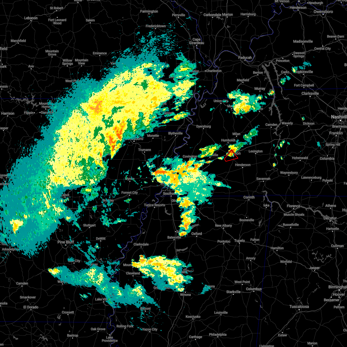 The tornado warning for central madison county will expire at 700 pm cdt, the storm which prompted the warning has weakened below severe limits, and no longer appears capable of producing a tornado. therefore, the warning will be allowed to expire. The tornado warning for central madison county will expire at 700 pm cdt, the storm which prompted the warning has weakened below severe limits, and no longer appears capable of producing a tornado. therefore, the warning will be allowed to expire.
|
| 10/31/2018 6:42 PM CDT |
 At 640 pm cdt, doppler radar indicated a severe thunderstorm producing a tornado located 6 miles southwest of jackson, moving northeast at 30 mph (radar indicated rotation). Hazards include tornado. Flying debris will be dangerous to those caught without shelter. mobile homes will be damaged or destroyed. damage to roofs, windows, and vehicles will occur. tree damage is likely. Locations impacted include, jackson, bemis, neely, westover and east union. At 640 pm cdt, doppler radar indicated a severe thunderstorm producing a tornado located 6 miles southwest of jackson, moving northeast at 30 mph (radar indicated rotation). Hazards include tornado. Flying debris will be dangerous to those caught without shelter. mobile homes will be damaged or destroyed. damage to roofs, windows, and vehicles will occur. tree damage is likely. Locations impacted include, jackson, bemis, neely, westover and east union.
|
| 10/31/2018 6:32 PM CDT |
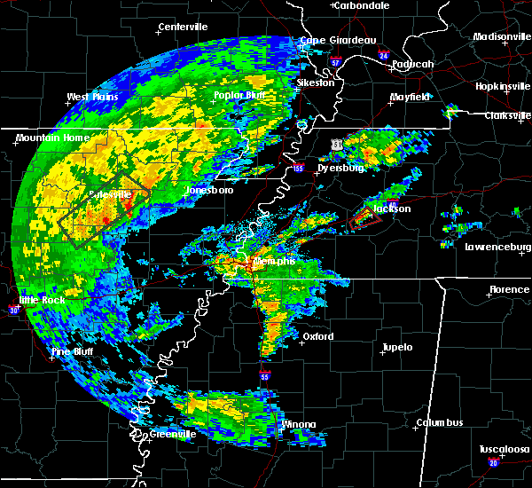 At 632 pm cdt, doppler radar indicated a severe thunderstorm producing a tornado was located near mercer, or 10 miles southwest of jackson, moving northeast at 25 mph (radar indicated rotation). Hazards include tornado. Flying debris will be dangerous to those caught without shelter. mobile homes will be damaged or destroyed. damage to roofs, windows, and vehicles will occur. Tree damage is likely. At 632 pm cdt, doppler radar indicated a severe thunderstorm producing a tornado was located near mercer, or 10 miles southwest of jackson, moving northeast at 25 mph (radar indicated rotation). Hazards include tornado. Flying debris will be dangerous to those caught without shelter. mobile homes will be damaged or destroyed. damage to roofs, windows, and vehicles will occur. Tree damage is likely.
|
| 7/19/2018 10:00 PM CDT | Quarter sized hail reported 9.6 miles ENE of Jackson, TN, quarter sized hail on providence road south of i-40. |
| 7/6/2018 1:45 PM CDT | Tree damage and carport damage near intersection of pleasant plains rd and ashport r in madison county TN, 3.2 miles ESE of Jackson, TN |
| 7/6/2018 1:21 PM CDT |
 At 121 pm cdt, a severe thunderstorm was located over alamo, or 10 miles southwest of humboldt, moving south at 10 mph (radar indicated). Hazards include 60 mph wind gusts. Expect damage to roofs, siding, and trees. Locations impacted include, jackson, humboldt, fairview, alamo, bells, three way, bemis, holly grove, adair, carroll, gadsden, quincy, gibson wells, huntersville, westover, jones, gilmore, mason grove, leighton and east union. At 121 pm cdt, a severe thunderstorm was located over alamo, or 10 miles southwest of humboldt, moving south at 10 mph (radar indicated). Hazards include 60 mph wind gusts. Expect damage to roofs, siding, and trees. Locations impacted include, jackson, humboldt, fairview, alamo, bells, three way, bemis, holly grove, adair, carroll, gadsden, quincy, gibson wells, huntersville, westover, jones, gilmore, mason grove, leighton and east union.
|
| 7/6/2018 1:03 PM CDT |
 At 103 pm cdt, a severe thunderstorm was located over alamo, or 10 miles west of humboldt, moving south at 10 mph (radar indicated). Hazards include 60 mph wind gusts and quarter size hail. Hail damage to vehicles is expected. Expect wind damage to roofs, siding, and trees. At 103 pm cdt, a severe thunderstorm was located over alamo, or 10 miles west of humboldt, moving south at 10 mph (radar indicated). Hazards include 60 mph wind gusts and quarter size hail. Hail damage to vehicles is expected. Expect wind damage to roofs, siding, and trees.
|
| 7/5/2018 9:54 PM CDT |
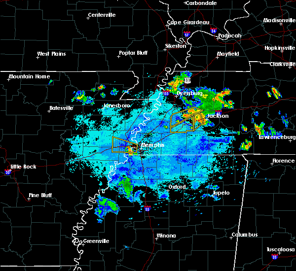 At 953 pm cdt, a severe thunderstorm was located 7 miles south of adair, or 9 miles west of jackson, moving southwest at 30 mph (radar indicated). Hazards include 60 mph wind gusts and quarter size hail. Hail damage to vehicles is expected. expect wind damage to roofs, siding, and trees. Locations impacted include, jackson, bells, adair, mercer, neely, huntersville, denmark, leighton, gum flat and roberts. At 953 pm cdt, a severe thunderstorm was located 7 miles south of adair, or 9 miles west of jackson, moving southwest at 30 mph (radar indicated). Hazards include 60 mph wind gusts and quarter size hail. Hail damage to vehicles is expected. expect wind damage to roofs, siding, and trees. Locations impacted include, jackson, bells, adair, mercer, neely, huntersville, denmark, leighton, gum flat and roberts.
|
| 7/5/2018 9:35 PM CDT | Several trees down along highway 412 east of jackso in madison county TN, 2.3 miles N of Jackson, TN |
| 7/5/2018 9:15 PM CDT |
 At 915 pm cdt, a severe thunderstorm was located near fairview, or near humboldt, moving southwest at 25 mph (radar indicated). Hazards include 60 mph wind gusts and quarter size hail. Hail damage to vehicles is expected. Expect wind damage to roofs, siding, and trees. At 915 pm cdt, a severe thunderstorm was located near fairview, or near humboldt, moving southwest at 25 mph (radar indicated). Hazards include 60 mph wind gusts and quarter size hail. Hail damage to vehicles is expected. Expect wind damage to roofs, siding, and trees.
|
| 6/28/2018 10:50 PM CDT |
 At 1050 pm cdt, severe thunderstorms were located along a line extending from near belle eagle to 9 miles south of decaturville, moving south at 40 mph (trained weather spotters). Hazards include 60 mph wind gusts. Expect damage to roofs, siding, and trees. Locations impacted include, jackson, humboldt, lexington, natchez trace state park, natchez trace state forest, fairview, alamo, bells, parsons, three way, decaturville, sardis, reagan, blue goose, bargerton, wildersville, chestnut bluff, bemis, parkers crossroads and adair. At 1050 pm cdt, severe thunderstorms were located along a line extending from near belle eagle to 9 miles south of decaturville, moving south at 40 mph (trained weather spotters). Hazards include 60 mph wind gusts. Expect damage to roofs, siding, and trees. Locations impacted include, jackson, humboldt, lexington, natchez trace state park, natchez trace state forest, fairview, alamo, bells, parsons, three way, decaturville, sardis, reagan, blue goose, bargerton, wildersville, chestnut bluff, bemis, parkers crossroads and adair.
|
| 6/28/2018 10:49 PM CDT |
 At 1048 pm cdt, severe thunderstorms were located along a line extending from near holly grove to 7 miles north of olive hill, moving south at 45 mph (trained weather spotters). Hazards include 60 mph wind gusts. Expect damage to roofs, siding, and trees. Locations impacted include, jackson, humboldt, lexington, savannah, henderson, bolivar, selmer, pickwick landing state park, natchez trace state park, chickasaw state park, natchez trace state forest, chickasaw state forest, fairview, whiteville, alamo, bells, parsons, adamsville, three way and decaturville. At 1048 pm cdt, severe thunderstorms were located along a line extending from near holly grove to 7 miles north of olive hill, moving south at 45 mph (trained weather spotters). Hazards include 60 mph wind gusts. Expect damage to roofs, siding, and trees. Locations impacted include, jackson, humboldt, lexington, savannah, henderson, bolivar, selmer, pickwick landing state park, natchez trace state park, chickasaw state park, natchez trace state forest, chickasaw state forest, fairview, whiteville, alamo, bells, parsons, adamsville, three way and decaturville.
|
| 6/28/2018 10:40 PM CDT | Several large trees down on providence road near interstate 4 in madison county TN, 13 miles NE of Jackson, TN |
| 6/28/2018 10:27 PM CDT |
 At 1027 pm cdt, severe thunderstorms were located along a line extending from near alamo to decaturville, moving south at 50 mph (public). Hazards include 60 mph wind gusts. expect damage to roofs, siding, and trees At 1027 pm cdt, severe thunderstorms were located along a line extending from near alamo to decaturville, moving south at 50 mph (public). Hazards include 60 mph wind gusts. expect damage to roofs, siding, and trees
|
| 6/28/2018 10:17 PM CDT |
 At 1015 pm cdt, severe thunderstorms were located along a line extending from 11 miles northeast of chestnut bluff to 7 miles northeast of parsons, moving south at 40 mph (public). Hazards include 60 mph wind gusts. Expect damage to roofs, siding, and trees. Locations impacted include, jackson, humboldt, milan, lexington, mckenzie, trenton, huntingdon, camden, natchez trace state park, natchez trace state forest, fairview, alamo, bells, parsons, dyer, new johnsonville, three way, bruceton, kenton and rutherford. At 1015 pm cdt, severe thunderstorms were located along a line extending from 11 miles northeast of chestnut bluff to 7 miles northeast of parsons, moving south at 40 mph (public). Hazards include 60 mph wind gusts. Expect damage to roofs, siding, and trees. Locations impacted include, jackson, humboldt, milan, lexington, mckenzie, trenton, huntingdon, camden, natchez trace state park, natchez trace state forest, fairview, alamo, bells, parsons, dyer, new johnsonville, three way, bruceton, kenton and rutherford.
|
| 6/28/2018 9:55 PM CDT |
 At 954 pm cdt, severe thunderstorms were located along a line extending from 6 miles southwest of kenton to 6 miles south of new johnsonville, moving south at 40 mph (public). Hazards include 60 mph wind gusts. expect damage to roofs, siding, and trees At 954 pm cdt, severe thunderstorms were located along a line extending from 6 miles southwest of kenton to 6 miles south of new johnsonville, moving south at 40 mph (public). Hazards include 60 mph wind gusts. expect damage to roofs, siding, and trees
|
| 6/21/2018 6:03 PM CDT |
 At 603 pm cdt, a severe thunderstorm was located near blue goose, or 10 miles east of jackson, moving east at 40 mph (radar indicated). Hazards include 60 mph wind gusts. expect damage to roofs, siding, and trees At 603 pm cdt, a severe thunderstorm was located near blue goose, or 10 miles east of jackson, moving east at 40 mph (radar indicated). Hazards include 60 mph wind gusts. expect damage to roofs, siding, and trees
|
| 6/21/2018 5:58 PM CDT |
 At 558 pm cdt, a severe thunderstorm was located near bargerton, or 10 miles northwest of lexington, moving east at 55 mph (radar indicated). Hazards include 70 mph wind gusts. Expect considerable tree damage. damage is likely to mobile homes, roofs, and outbuildings. Locations impacted include, jackson, lexington, parkers crossroads, blue goose, bargerton, carroll, clarksburg, hickory flat, parker`s cross roads, claybrook, jumbo, cedar grove, mount gilead, union cross, juno, sand ridge, gilmore, white fern and oakfield. At 558 pm cdt, a severe thunderstorm was located near bargerton, or 10 miles northwest of lexington, moving east at 55 mph (radar indicated). Hazards include 70 mph wind gusts. Expect considerable tree damage. damage is likely to mobile homes, roofs, and outbuildings. Locations impacted include, jackson, lexington, parkers crossroads, blue goose, bargerton, carroll, clarksburg, hickory flat, parker`s cross roads, claybrook, jumbo, cedar grove, mount gilead, union cross, juno, sand ridge, gilmore, white fern and oakfield.
|
| 6/21/2018 5:53 PM CDT | Tree on car on highway 70 east at highway 41 in madison county TN, 3.3 miles W of Jackson, TN |
| 6/21/2018 5:47 PM CDT | Large trees down blocking roadway on christmasville road just north of key senter roa in madison county TN, 6 miles SW of Jackson, TN |
| 6/21/2018 5:44 PM CDT |
 At 543 pm cdt, a severe thunderstorm was located near fairview, or 9 miles east of humboldt, moving east at 55 mph (radar indicated). Hazards include 70 mph wind gusts and quarter size hail. Hail damage to vehicles is expected. expect considerable tree damage. wind damage is also likely to mobile homes, roofs, and outbuildings. Locations impacted include, jackson, humboldt, milan, lexington, huntingdon, fairview, three way, blue goose, parkers crossroads, bargerton, carroll, medina, clarksburg, howley, hickory flat, hillard, cedar grove, union cross, juno and gilmore. At 543 pm cdt, a severe thunderstorm was located near fairview, or 9 miles east of humboldt, moving east at 55 mph (radar indicated). Hazards include 70 mph wind gusts and quarter size hail. Hail damage to vehicles is expected. expect considerable tree damage. wind damage is also likely to mobile homes, roofs, and outbuildings. Locations impacted include, jackson, humboldt, milan, lexington, huntingdon, fairview, three way, blue goose, parkers crossroads, bargerton, carroll, medina, clarksburg, howley, hickory flat, hillard, cedar grove, union cross, juno and gilmore.
|
| 6/21/2018 5:27 PM CDT |
 At 527 pm cdt, a severe thunderstorm was located near adair, or 7 miles southwest of humboldt, moving east at 55 mph (radar indicated). Hazards include 60 mph wind gusts and quarter size hail. Hail damage to vehicles is expected. Expect wind damage to roofs, siding, and trees. At 527 pm cdt, a severe thunderstorm was located near adair, or 7 miles southwest of humboldt, moving east at 55 mph (radar indicated). Hazards include 60 mph wind gusts and quarter size hail. Hail damage to vehicles is expected. Expect wind damage to roofs, siding, and trees.
|
| 6/1/2018 2:34 AM CDT |
 At 234 am cdt, a severe thunderstorm was located near chickasaw state park, moving east at 55 mph (radar indicated). Hazards include 60 mph wind gusts. Expect damage to roofs, siding, and trees. Locations impacted include, jackson, henderson, bolivar, chickasaw state forest, chickasaw state park, whiteville, somerville, silerton, masseyville, bemis, cloverport, mercer, robertson, warren, carroll, macon, oakland, piperton, rossville and moscow. At 234 am cdt, a severe thunderstorm was located near chickasaw state park, moving east at 55 mph (radar indicated). Hazards include 60 mph wind gusts. Expect damage to roofs, siding, and trees. Locations impacted include, jackson, henderson, bolivar, chickasaw state forest, chickasaw state park, whiteville, somerville, silerton, masseyville, bemis, cloverport, mercer, robertson, warren, carroll, macon, oakland, piperton, rossville and moscow.
|
| 6/1/2018 2:27 AM CDT |
 At 227 am cdt, a severe thunderstorm was located near chickasaw state park, moving east at 65 mph (radar indicated). Hazards include 60 mph wind gusts. Expect damage to roofs, siding, and trees. Locations impacted include, jackson, henderson, bolivar, chickasaw state forest, chickasaw state park, fairview, whiteville, somerville, three way, silerton, masseyville, bemis, cloverport, mercer, robertson, warren, carroll, macon, oakland and piperton. At 227 am cdt, a severe thunderstorm was located near chickasaw state park, moving east at 65 mph (radar indicated). Hazards include 60 mph wind gusts. Expect damage to roofs, siding, and trees. Locations impacted include, jackson, henderson, bolivar, chickasaw state forest, chickasaw state park, fairview, whiteville, somerville, three way, silerton, masseyville, bemis, cloverport, mercer, robertson, warren, carroll, macon, oakland and piperton.
|
| 6/1/2018 2:08 AM CDT |
 At 207 am cdt, a severe thunderstorm was located near holly grove, or 7 miles east of brownsville, moving southeast at 60 mph (radar indicated). Hazards include 60 mph wind gusts. expect damage to roofs, siding, and trees At 207 am cdt, a severe thunderstorm was located near holly grove, or 7 miles east of brownsville, moving southeast at 60 mph (radar indicated). Hazards include 60 mph wind gusts. expect damage to roofs, siding, and trees
|
| 6/1/2018 1:50 AM CDT |
 At 150 am cdt, a severe thunderstorm was located near forked deer, or 11 miles north of brownsville, moving east at 50 mph (radar indicated). Hazards include 60 mph wind gusts and quarter size hail. Hail damage to vehicles is expected. expect wind damage to roofs, siding, and trees. Locations impacted include, jackson, dyersburg, brownsville, covington, humboldt, ripley, milan, trenton, fairview, munford, newbern, brighton, alamo, bells, dyer, halls, three way, rutherford, bradford and hillville. At 150 am cdt, a severe thunderstorm was located near forked deer, or 11 miles north of brownsville, moving east at 50 mph (radar indicated). Hazards include 60 mph wind gusts and quarter size hail. Hail damage to vehicles is expected. expect wind damage to roofs, siding, and trees. Locations impacted include, jackson, dyersburg, brownsville, covington, humboldt, ripley, milan, trenton, fairview, munford, newbern, brighton, alamo, bells, dyer, halls, three way, rutherford, bradford and hillville.
|
| 6/1/2018 1:23 AM CDT |
 At 123 am cdt, a severe thunderstorm was located near trenton, moving southeast at 40 mph (radar indicated). Hazards include 60 mph wind gusts and quarter size hail. Hail damage to vehicles is expected. Expect wind damage to roofs, siding, and trees. At 123 am cdt, a severe thunderstorm was located near trenton, moving southeast at 40 mph (radar indicated). Hazards include 60 mph wind gusts and quarter size hail. Hail damage to vehicles is expected. Expect wind damage to roofs, siding, and trees.
|
| 5/20/2018 4:05 PM CDT | Large tree blew over house on malesus heights driv in madison county TN, 2.3 miles N of Jackson, TN |
| 5/20/2018 4:02 PM CDT | Trampoline blew over power lines at home in south jackso in madison county TN, 2.3 miles N of Jackson, TN |
| 5/19/2018 12:53 PM CDT |
 At 1253 pm cdt, a severe thunderstorm was located over bells, or 11 miles northeast of brownsville, moving east at 15 mph (radar indicated). Hazards include 60 mph wind gusts and quarter size hail. Hail damage to vehicles is expected. Expect wind damage to roofs, siding, and trees. At 1253 pm cdt, a severe thunderstorm was located over bells, or 11 miles northeast of brownsville, moving east at 15 mph (radar indicated). Hazards include 60 mph wind gusts and quarter size hail. Hail damage to vehicles is expected. Expect wind damage to roofs, siding, and trees.
|
| 4/3/2018 7:30 PM CDT |
 At 730 pm cdt, a severe thunderstorm was located near chestnut bluff, or 11 miles east of ripley, moving east at 45 mph (radar indicated). Hazards include 60 mph wind gusts and quarter size hail. Hail damage to vehicles is expected. Expect wind damage to roofs, siding, and trees. At 730 pm cdt, a severe thunderstorm was located near chestnut bluff, or 11 miles east of ripley, moving east at 45 mph (radar indicated). Hazards include 60 mph wind gusts and quarter size hail. Hail damage to vehicles is expected. Expect wind damage to roofs, siding, and trees.
|
| 2/24/2018 7:57 PM CST |
 At 757 pm cst, severe thunderstorms were located along a line extending from near nutbush to 8 miles southeast of covington, moving east at 45 mph (radar indicated). Hazards include 60 mph wind gusts. expect damage to roofs, siding, and trees At 757 pm cst, severe thunderstorms were located along a line extending from near nutbush to 8 miles southeast of covington, moving east at 45 mph (radar indicated). Hazards include 60 mph wind gusts. expect damage to roofs, siding, and trees
|
| 2/24/2018 7:39 PM CST |
 At 739 pm cst, a severe thunderstorm producing a tornado was located near bemis, or near jackson, moving northeast at 65 mph (radar indicated rotation). Hazards include tornado. Flying debris will be dangerous to those caught without shelter. mobile homes will be damaged or destroyed. damage to roofs, windows, and vehicles will occur. tree damage is likely. this dangerous storm will be near, blue goose around 750 pm cst. bargerton around 755 pm cst. parkers crossroads and wildersville around 805 pm cst. Other locations impacted by this tornadic thunderstorm include howley, hickory flat, hillard, dollar, cedar grove, madison hall, union cross, juno, maple grove and leach. At 739 pm cst, a severe thunderstorm producing a tornado was located near bemis, or near jackson, moving northeast at 65 mph (radar indicated rotation). Hazards include tornado. Flying debris will be dangerous to those caught without shelter. mobile homes will be damaged or destroyed. damage to roofs, windows, and vehicles will occur. tree damage is likely. this dangerous storm will be near, blue goose around 750 pm cst. bargerton around 755 pm cst. parkers crossroads and wildersville around 805 pm cst. Other locations impacted by this tornadic thunderstorm include howley, hickory flat, hillard, dollar, cedar grove, madison hall, union cross, juno, maple grove and leach.
|
| 2/24/2018 7:27 PM CST |
 At 727 pm cst, severe thunderstorms were located along a line extending from near palmersville to near adair, moving east at 55 mph (radar indicated). Hazards include 60 mph wind gusts. expect damage to roofs, siding, and trees At 727 pm cst, severe thunderstorms were located along a line extending from near palmersville to near adair, moving east at 55 mph (radar indicated). Hazards include 60 mph wind gusts. expect damage to roofs, siding, and trees
|
| 7/5/2017 5:30 AM CDT |
 At 530 am cdt, a severe thunderstorm was located near adair, or near jackson, moving east at 30 mph (radar indicated). Hazards include 50 to 60 mph wind gusts. Expect damage to roofs, siding, and trees. Locations impacted include, jackson, three way, bemis, adair, carroll, neely, malesus, youngs crossing, huntersville, westover, roberts, windy city, gilmore, maple grove, leighton, east union and oakfield. At 530 am cdt, a severe thunderstorm was located near adair, or near jackson, moving east at 30 mph (radar indicated). Hazards include 50 to 60 mph wind gusts. Expect damage to roofs, siding, and trees. Locations impacted include, jackson, three way, bemis, adair, carroll, neely, malesus, youngs crossing, huntersville, westover, roberts, windy city, gilmore, maple grove, leighton, east union and oakfield.
|
| 7/5/2017 5:24 AM CDT |
 At 524 am cdt, a severe thunderstorm was located over adair, or 7 miles northwest of jackson, moving east at 30 mph (radar indicated). Hazards include 60 mph wind gusts. Expect damage to roofs, siding, and trees. Locations impacted include, jackson, bells, three way, bemis, adair, carroll, neely, malesus, youngs crossing, huntersville, gum flat, westover, roberts, windy city, gilmore, maple grove, leighton, east union and oakfield. At 524 am cdt, a severe thunderstorm was located over adair, or 7 miles northwest of jackson, moving east at 30 mph (radar indicated). Hazards include 60 mph wind gusts. Expect damage to roofs, siding, and trees. Locations impacted include, jackson, bells, three way, bemis, adair, carroll, neely, malesus, youngs crossing, huntersville, gum flat, westover, roberts, windy city, gilmore, maple grove, leighton, east union and oakfield.
|
| 7/5/2017 5:09 AM CDT |
 At 509 am cdt, a severe thunderstorm was located near holly grove, or 9 miles east of brownsville, moving east at 30 mph (radar indicated). Hazards include 60 mph wind gusts. expect damage to roofs, siding, and trees At 509 am cdt, a severe thunderstorm was located near holly grove, or 9 miles east of brownsville, moving east at 30 mph (radar indicated). Hazards include 60 mph wind gusts. expect damage to roofs, siding, and trees
|
| 5/27/2017 11:23 PM CDT |
 At 1123 pm cdt, a severe thunderstorm was located over bemis, or near jackson, moving east at 65 mph (radar indicated). Hazards include quarter size hail. damage to vehicles is expected At 1123 pm cdt, a severe thunderstorm was located over bemis, or near jackson, moving east at 65 mph (radar indicated). Hazards include quarter size hail. damage to vehicles is expected
|
| 5/27/2017 11:07 PM CDT |
 At 1106 pm cdt, a severe thunderstorm was located near bolivar, moving southeast at 100 mph (radar indicated). Hazards include 70 mph wind gusts and quarter size hail. Hail damage to vehicles is expected. expect considerable tree damage. wind damage is also likely to mobile homes, roofs, and outbuildings. locations impacted include, jackson, brownsville, humboldt, milan, trenton, fairview, alamo, bells, three way, hillville, bemis, belle eagle, holly grove, adair, mercer, carroll, medina, maury city, gadsden and gibson. A tornado watch remains in effect until 500 am cdt for western tennessee. At 1106 pm cdt, a severe thunderstorm was located near bolivar, moving southeast at 100 mph (radar indicated). Hazards include 70 mph wind gusts and quarter size hail. Hail damage to vehicles is expected. expect considerable tree damage. wind damage is also likely to mobile homes, roofs, and outbuildings. locations impacted include, jackson, brownsville, humboldt, milan, trenton, fairview, alamo, bells, three way, hillville, bemis, belle eagle, holly grove, adair, mercer, carroll, medina, maury city, gadsden and gibson. A tornado watch remains in effect until 500 am cdt for western tennessee.
|
| 5/27/2017 10:44 PM CDT | Several trees down and uproote in madison county TN, 13 miles NE of Jackson, TN |
| 5/27/2017 10:40 PM CDT |
 At 1040 pm cdt, a severe thunderstorm was located near ripley, moving southeast at 100 mph. this is a very dangerous storm (radar indicated). Hazards include 80 mph wind gusts and quarter size hail. Flying debris will be dangerous to those caught without shelter. mobile homes will be heavily damaged. expect considerable damage to roofs, windows, and vehicles. extensive tree damage and power outages are likely. locations impacted include, jackson, dyersburg, brownsville, humboldt, ripley, milan, trenton, fairview, alamo, bells, dyer, halls, three way, bradford, atwood, hillville, chestnut bluff, bradleytown, unionville and mercer. a tornado watch remains in effect until 200 am cdt for eastern arkansas. A tornado watch also remains in effect until 500 am cdt for western tennessee. At 1040 pm cdt, a severe thunderstorm was located near ripley, moving southeast at 100 mph. this is a very dangerous storm (radar indicated). Hazards include 80 mph wind gusts and quarter size hail. Flying debris will be dangerous to those caught without shelter. mobile homes will be heavily damaged. expect considerable damage to roofs, windows, and vehicles. extensive tree damage and power outages are likely. locations impacted include, jackson, dyersburg, brownsville, humboldt, ripley, milan, trenton, fairview, alamo, bells, dyer, halls, three way, bradford, atwood, hillville, chestnut bluff, bradleytown, unionville and mercer. a tornado watch remains in effect until 200 am cdt for eastern arkansas. A tornado watch also remains in effect until 500 am cdt for western tennessee.
|
| 5/27/2017 10:00 PM CDT |
 At 1000 pm cdt, a severe thunderstorm was located near nutbush, or 8 miles northwest of brownsville, moving northeast at 60 mph (radar indicated). Hazards include ping pong ball size hail and 60 mph wind gusts. People and animals outdoors will be injured. expect hail damage to roofs, siding, windows, and vehicles. Expect wind damage to roofs, siding, and trees. At 1000 pm cdt, a severe thunderstorm was located near nutbush, or 8 miles northwest of brownsville, moving northeast at 60 mph (radar indicated). Hazards include ping pong ball size hail and 60 mph wind gusts. People and animals outdoors will be injured. expect hail damage to roofs, siding, windows, and vehicles. Expect wind damage to roofs, siding, and trees.
|
| 5/27/2017 9:14 PM CDT |
 At 914 pm cdt, a severe thunderstorm was located over humboldt, moving east at 45 mph (radar indicated). Hazards include golf ball size hail and 60 mph wind gusts. People and animals outdoors will be injured. expect hail damage to roofs, siding, windows, and vehicles. Expect wind damage to roofs, siding, and trees. At 914 pm cdt, a severe thunderstorm was located over humboldt, moving east at 45 mph (radar indicated). Hazards include golf ball size hail and 60 mph wind gusts. People and animals outdoors will be injured. expect hail damage to roofs, siding, windows, and vehicles. Expect wind damage to roofs, siding, and trees.
|
| 5/27/2017 7:39 PM CDT |
 At 739 pm cdt, a severe thunderstorm was located near newbern, or near dyersburg, moving southeast at 60 mph (radar indicated). Hazards include 70 mph wind gusts and quarter size hail. Hail damage to vehicles is expected. expect considerable tree damage. Wind damage is also likely to mobile homes, roofs, and outbuildings. At 739 pm cdt, a severe thunderstorm was located near newbern, or near dyersburg, moving southeast at 60 mph (radar indicated). Hazards include 70 mph wind gusts and quarter size hail. Hail damage to vehicles is expected. expect considerable tree damage. Wind damage is also likely to mobile homes, roofs, and outbuildings.
|
| 5/19/2017 2:28 PM CDT |
 At 228 pm cdt, a severe thunderstorm was located near fairview, or 9 miles northeast of jackson, moving northeast at 20 mph (radar indicated). Hazards include 60 mph wind gusts and quarter size hail. Hail damage to vehicles is expected. expect wind damage to roofs, siding, and trees. Locations impacted include, jackson, fairview, three way, blue goose, bargerton, carroll, medina, howley, hickory flat, claybrook, west, jumbo, cedar grove, mount gilead, union cross, lavinia, goat city, oakfield and juno. At 228 pm cdt, a severe thunderstorm was located near fairview, or 9 miles northeast of jackson, moving northeast at 20 mph (radar indicated). Hazards include 60 mph wind gusts and quarter size hail. Hail damage to vehicles is expected. expect wind damage to roofs, siding, and trees. Locations impacted include, jackson, fairview, three way, blue goose, bargerton, carroll, medina, howley, hickory flat, claybrook, west, jumbo, cedar grove, mount gilead, union cross, lavinia, goat city, oakfield and juno.
|
| 5/19/2017 2:25 PM CDT | Half Dollar sized hail reported 3.9 miles SSW of Jackson, TN |
| 5/19/2017 2:19 PM CDT |
 At 218 pm cdt, a severe thunderstorm was located near fairview, or near jackson, moving northeast at 20 mph (radar indicated). Hazards include ping pong ball size hail and 60 mph wind gusts. People and animals outdoors will be injured. expect hail damage to roofs, siding, windows, and vehicles. Expect wind damage to roofs, siding, and trees. At 218 pm cdt, a severe thunderstorm was located near fairview, or near jackson, moving northeast at 20 mph (radar indicated). Hazards include ping pong ball size hail and 60 mph wind gusts. People and animals outdoors will be injured. expect hail damage to roofs, siding, windows, and vehicles. Expect wind damage to roofs, siding, and trees.
|
| 4/3/2017 2:39 PM CDT |
 The severe thunderstorm warning for southeastern crockett, south central gibson, southeastern haywood and madison counties will expire at 245 pm cdt, the storm which prompted the warning has weakened below severe limits, and no longer pose an immediate threat to life or property. therefore, the warning will be allowed to expire. The severe thunderstorm warning for southeastern crockett, south central gibson, southeastern haywood and madison counties will expire at 245 pm cdt, the storm which prompted the warning has weakened below severe limits, and no longer pose an immediate threat to life or property. therefore, the warning will be allowed to expire.
|
| 4/3/2017 2:28 PM CDT |
 At 228 pm cdt, a severe thunderstorm was located near brownsville, moving northeast at 40 mph (radar indicated). Hazards include 60 mph wind gusts. Expect damage to roofs, siding, and trees. Locations impacted include, jackson, brownsville, humboldt, fairview, bells, three way, bemis, holly grove, adair, hillville, mercer, carroll, gadsden, gibson, neely, allens, huntersville, hickory point, westover and madison hall. At 228 pm cdt, a severe thunderstorm was located near brownsville, moving northeast at 40 mph (radar indicated). Hazards include 60 mph wind gusts. Expect damage to roofs, siding, and trees. Locations impacted include, jackson, brownsville, humboldt, fairview, bells, three way, bemis, holly grove, adair, hillville, mercer, carroll, gadsden, gibson, neely, allens, huntersville, hickory point, westover and madison hall.
|
| 4/3/2017 2:06 PM CDT |
 At 205 pm cdt, a severe thunderstorm was located near dancyville, or 13 miles southwest of brownsville, moving northeast at 50 mph (radar indicated). Hazards include 60 mph wind gusts. expect damage to roofs, siding, and trees At 205 pm cdt, a severe thunderstorm was located near dancyville, or 13 miles southwest of brownsville, moving northeast at 50 mph (radar indicated). Hazards include 60 mph wind gusts. expect damage to roofs, siding, and trees
|
| 3/27/2017 5:00 PM CDT |
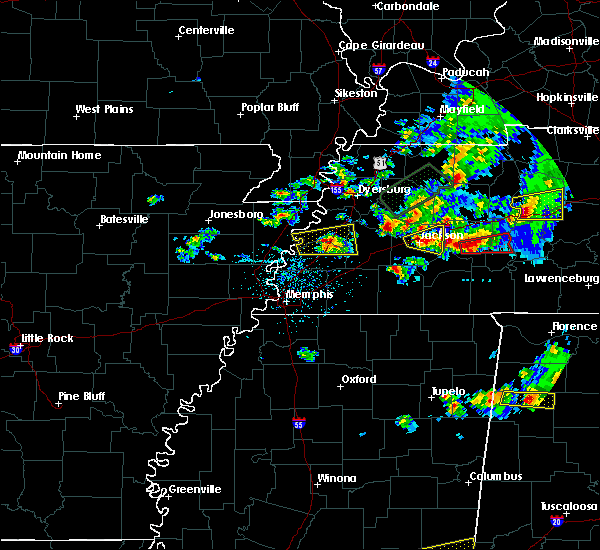 At 500 pm cdt, a severe thunderstorm was located over bemis, or near jackson, moving east at 25 mph (radar indicated). Hazards include 60 mph wind gusts and half dollar size hail. Hail damage to vehicles is expected. expect wind damage to roofs, siding, and trees. Locations impacted include, jackson, bemis, carroll, gilmore, claybrook, maple grove, beech bluff, westover, east union and oakfield. At 500 pm cdt, a severe thunderstorm was located over bemis, or near jackson, moving east at 25 mph (radar indicated). Hazards include 60 mph wind gusts and half dollar size hail. Hail damage to vehicles is expected. expect wind damage to roofs, siding, and trees. Locations impacted include, jackson, bemis, carroll, gilmore, claybrook, maple grove, beech bluff, westover, east union and oakfield.
|
| 3/27/2017 4:55 PM CDT |
 A severe thunderstorm warning remains in effect until 515 pm cdt for northeastern madison county. at 455 pm cdt, a severe thunderstorm was located over jackson, moving northeast at 30 mph. hazard. 60 mph wind gusts and half dollar size hail. source. Radar indicated. A severe thunderstorm warning remains in effect until 515 pm cdt for northeastern madison county. at 455 pm cdt, a severe thunderstorm was located over jackson, moving northeast at 30 mph. hazard. 60 mph wind gusts and half dollar size hail. source. Radar indicated.
|
| 3/27/2017 4:32 PM CDT |
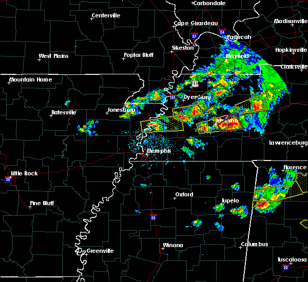 At 432 pm cdt, a severe thunderstorm was located near mercer, or 11 miles east of brownsville, moving east at 25 mph (radar indicated). Hazards include 60 mph wind gusts and half dollar size hail. Hail damage to vehicles is expected. Expect wind damage to roofs, siding, and trees. At 432 pm cdt, a severe thunderstorm was located near mercer, or 11 miles east of brownsville, moving east at 25 mph (radar indicated). Hazards include 60 mph wind gusts and half dollar size hail. Hail damage to vehicles is expected. Expect wind damage to roofs, siding, and trees.
|
| 3/27/2017 4:21 PM CDT | Ping Pong Ball sized hail reported 2.3 miles N of Jackson, TN |
| 3/27/2017 4:21 PM CDT |
 At 420 pm cdt, a confirmed tornado was located 7 miles east of bemis, or 7 miles east of jackson, moving east at 25 mph (law enforcement recently reported a funnel cloud). Hazards include tornado and tennis ball size hail. Flying debris will be dangerous to those caught without shelter. mobile homes will be damaged or destroyed. damage to roofs, windows, and vehicles will occur. tree damage is likely. this tornado will be near, mifflin around 435 pm cdt. blue goose around 445 pm cdt. lexington and bargerton around 500 pm cdt. Other locations impacted by this tornadic thunderstorm include claybrook, cedar grove, mount gilead, beech bluff, huron, russell crossroads, palestine, union cross, juno and sand ridge. At 420 pm cdt, a confirmed tornado was located 7 miles east of bemis, or 7 miles east of jackson, moving east at 25 mph (law enforcement recently reported a funnel cloud). Hazards include tornado and tennis ball size hail. Flying debris will be dangerous to those caught without shelter. mobile homes will be damaged or destroyed. damage to roofs, windows, and vehicles will occur. tree damage is likely. this tornado will be near, mifflin around 435 pm cdt. blue goose around 445 pm cdt. lexington and bargerton around 500 pm cdt. Other locations impacted by this tornadic thunderstorm include claybrook, cedar grove, mount gilead, beech bluff, huron, russell crossroads, palestine, union cross, juno and sand ridge.
|
| 3/27/2017 4:13 PM CDT |
 At 413 pm cdt, a severe thunderstorm producing a tornado was located near bemis, or near jackson, moving northeast at 20 mph (radar indicated rotation). Hazards include tornado and half dollar size hail. Flying debris will be dangerous to those caught without shelter. mobile homes will be damaged or destroyed. damage to roofs, windows, and vehicles will occur. tree damage is likely. this dangerous storm will be near, mifflin around 435 pm cdt. blue goose around 450 pm cdt. lexington and bargerton around 500 pm cdt. Other locations impacted by this tornadic thunderstorm include malesus, claybrook, cedar grove, mount gilead, beech bluff, huron, russell crossroads, madison hall, palestine and union cross. At 413 pm cdt, a severe thunderstorm producing a tornado was located near bemis, or near jackson, moving northeast at 20 mph (radar indicated rotation). Hazards include tornado and half dollar size hail. Flying debris will be dangerous to those caught without shelter. mobile homes will be damaged or destroyed. damage to roofs, windows, and vehicles will occur. tree damage is likely. this dangerous storm will be near, mifflin around 435 pm cdt. blue goose around 450 pm cdt. lexington and bargerton around 500 pm cdt. Other locations impacted by this tornadic thunderstorm include malesus, claybrook, cedar grove, mount gilead, beech bluff, huron, russell crossroads, madison hall, palestine and union cross.
|
| 3/27/2017 4:00 PM CDT | Quarter sized hail reported 2.3 miles N of Jackson, TN |
| 3/27/2017 3:57 PM CDT |
 At 356 pm cdt, a severe thunderstorm was located near jackson, moving east at 30 mph (radar indicated). Hazards include 60 mph wind gusts and half dollar size hail. Hail damage to vehicles is expected. expect wind damage to roofs, siding, and trees. Locations impacted include, jackson, three way, bemis, blue goose, bargerton, carroll, hickory flat, neely, cedar grove, huntersville, beech bluff, westover, juno, gilmore, maple grove, leighton, east union, claybrook, youngs crossing and mount gilead. At 356 pm cdt, a severe thunderstorm was located near jackson, moving east at 30 mph (radar indicated). Hazards include 60 mph wind gusts and half dollar size hail. Hail damage to vehicles is expected. expect wind damage to roofs, siding, and trees. Locations impacted include, jackson, three way, bemis, blue goose, bargerton, carroll, hickory flat, neely, cedar grove, huntersville, beech bluff, westover, juno, gilmore, maple grove, leighton, east union, claybrook, youngs crossing and mount gilead.
|
| 3/27/2017 3:41 PM CDT |
 At 341 pm cdt, a severe thunderstorm was located near holly grove, or 11 miles west of jackson, moving east at 40 mph (radar indicated). Hazards include 60 mph wind gusts. expect damage to roofs, siding, and trees At 341 pm cdt, a severe thunderstorm was located near holly grove, or 11 miles west of jackson, moving east at 40 mph (radar indicated). Hazards include 60 mph wind gusts. expect damage to roofs, siding, and trees
|
| 3/27/2017 1:47 PM CDT |
 At 147 pm cdt, a severe thunderstorm was located near mifflin, or near henderson, moving northeast at 35 mph (radar indicated). Hazards include quarter size hail. Damage to vehicles is expected. Locations impacted include, jackson, henderson, jacks creek, mifflin, pinson, malesus, beech bluff, huron, russell crossroads, madison hall, roby, five points, maple grove, cabo, middle fork and white fern. At 147 pm cdt, a severe thunderstorm was located near mifflin, or near henderson, moving northeast at 35 mph (radar indicated). Hazards include quarter size hail. Damage to vehicles is expected. Locations impacted include, jackson, henderson, jacks creek, mifflin, pinson, malesus, beech bluff, huron, russell crossroads, madison hall, roby, five points, maple grove, cabo, middle fork and white fern.
|
| 3/27/2017 1:44 PM CDT | Quarter sized hail reported 12.2 miles NNW of Jackson, TN, mainly dime size hail with up to quarter sized hail west of pinson. |
| 3/27/2017 1:22 PM CDT |
 At 122 pm cdt, a severe thunderstorm was located near chickasaw state forest, moving northeast at 35 mph (radar indicated). Hazards include quarter size hail. damage to vehicles is expected At 122 pm cdt, a severe thunderstorm was located near chickasaw state forest, moving northeast at 35 mph (radar indicated). Hazards include quarter size hail. damage to vehicles is expected
|
| 3/27/2017 5:07 AM CDT |
 The severe thunderstorm warning for southeastern crockett, southeastern gibson and northwestern madison counties will expire at 515 am cdt, the storm which prompted the warning has weakened below severe limits, and no longer pose an immediate threat to life or property. therefore, the warning will be allowed to expire. however small hail and gusty winds are still possible with this thunderstorm. The severe thunderstorm warning for southeastern crockett, southeastern gibson and northwestern madison counties will expire at 515 am cdt, the storm which prompted the warning has weakened below severe limits, and no longer pose an immediate threat to life or property. therefore, the warning will be allowed to expire. however small hail and gusty winds are still possible with this thunderstorm.
|
| 3/27/2017 4:51 AM CDT |
 At 450 am cdt, a severe thunderstorm was located over adair, or 9 miles southwest of humboldt, moving northeast at 45 mph (radar indicated). Hazards include 60 mph wind gusts and quarter size hail. Hail damage to vehicles is expected. expect wind damage to roofs, siding, and trees. Locations impacted include, jackson, humboldt, milan, trenton, fairview, bells, three way, adair, carroll, medina, gadsden, gibson, huntersville, new enterprise, westover, gilmore, mason grove, sitka, coxville and georgetown. At 450 am cdt, a severe thunderstorm was located over adair, or 9 miles southwest of humboldt, moving northeast at 45 mph (radar indicated). Hazards include 60 mph wind gusts and quarter size hail. Hail damage to vehicles is expected. expect wind damage to roofs, siding, and trees. Locations impacted include, jackson, humboldt, milan, trenton, fairview, bells, three way, adair, carroll, medina, gadsden, gibson, huntersville, new enterprise, westover, gilmore, mason grove, sitka, coxville and georgetown.
|
| 3/27/2017 4:42 AM CDT |
 At 442 am cdt, a severe thunderstorm was located near holly grove, or 11 miles west of jackson, moving northeast at 45 mph (radar indicated). Hazards include 60 mph wind gusts and quarter size hail. Hail damage to vehicles is expected. expect wind damage to roofs, siding, and trees. Locations impacted include, jackson, humboldt, milan, trenton, fairview, alamo, bells, three way, holly grove, adair, carroll, medina, gadsden, gibson, neely, grizzard, gibson wells, huntersville, new enterprise and westover. At 442 am cdt, a severe thunderstorm was located near holly grove, or 11 miles west of jackson, moving northeast at 45 mph (radar indicated). Hazards include 60 mph wind gusts and quarter size hail. Hail damage to vehicles is expected. expect wind damage to roofs, siding, and trees. Locations impacted include, jackson, humboldt, milan, trenton, fairview, alamo, bells, three way, holly grove, adair, carroll, medina, gadsden, gibson, neely, grizzard, gibson wells, huntersville, new enterprise and westover.
|
| 3/27/2017 4:31 AM CDT |
 At 430 am cdt, a severe thunderstorm was located near mercer, or 10 miles southeast of brownsville, moving northeast at 45 mph (radar indicated). Hazards include 60 mph wind gusts and quarter size hail. Hail damage to vehicles is expected. Expect wind damage to roofs, siding, and trees. At 430 am cdt, a severe thunderstorm was located near mercer, or 10 miles southeast of brownsville, moving northeast at 45 mph (radar indicated). Hazards include 60 mph wind gusts and quarter size hail. Hail damage to vehicles is expected. Expect wind damage to roofs, siding, and trees.
|
| 3/9/2017 10:34 PM CST |
 At 1034 pm cst, severe thunderstorms were located along a line extending from near sardis to near henderson to near mercer, moving east at 55 mph (radar indicated). Hazards include 60 mph wind gusts and quarter size hail. Hail damage to vehicles is expected. Expect wind damage to roofs, siding, and trees. At 1034 pm cst, severe thunderstorms were located along a line extending from near sardis to near henderson to near mercer, moving east at 55 mph (radar indicated). Hazards include 60 mph wind gusts and quarter size hail. Hail damage to vehicles is expected. Expect wind damage to roofs, siding, and trees.
|
| 3/9/2017 10:21 PM CST |
 The severe thunderstorm warning for northern henderson, carroll and northeastern madison counties will expire at 1030 pm cst, the storms which prompted the warning have moved out of the area. therefore the warning will be allowed to expire. a severe thunderstorm watch remains in effect until midnight cst for western tennessee. The severe thunderstorm warning for northern henderson, carroll and northeastern madison counties will expire at 1030 pm cst, the storms which prompted the warning have moved out of the area. therefore the warning will be allowed to expire. a severe thunderstorm watch remains in effect until midnight cst for western tennessee.
|
| 3/9/2017 9:55 PM CST |
 At 954 pm cst, severe thunderstorms were located along a line extending from near bruceton to near bargerton to near fairview, moving southeast at 50 mph. brief tornadoes will be possible within the fast moving line of storms (radar indicated). Hazards include 70 mph wind gusts and quarter size hail. Hail damage to vehicles is expected. expect considerable tree damage. wind damage is also likely to mobile homes, roofs, and outbuildings. Locations impacted include, lexington, mckenzie, huntingdon, natchez trace state park, natchez trace state forest, bruceton, blue goose, parkers crossroads, vale, bargerton, wildersville, carroll, hollow rock, clarksburg, mclemoresville, howley, hickory flat, hillard, dollar and cedar grove. At 954 pm cst, severe thunderstorms were located along a line extending from near bruceton to near bargerton to near fairview, moving southeast at 50 mph. brief tornadoes will be possible within the fast moving line of storms (radar indicated). Hazards include 70 mph wind gusts and quarter size hail. Hail damage to vehicles is expected. expect considerable tree damage. wind damage is also likely to mobile homes, roofs, and outbuildings. Locations impacted include, lexington, mckenzie, huntingdon, natchez trace state park, natchez trace state forest, bruceton, blue goose, parkers crossroads, vale, bargerton, wildersville, carroll, hollow rock, clarksburg, mclemoresville, howley, hickory flat, hillard, dollar and cedar grove.
|
| 3/9/2017 9:51 PM CST |
 At 950 pm cst, a severe thunderstorm was located 7 miles northeast of jackson, moving east at 50 mph (radar indicated). Hazards include tennis ball size hail and 60 mph wind gusts. People and animals outdoors will be injured. expect hail damage to roofs, siding, windows, and vehicles. expect wind damage to roofs, siding, and trees. Locations impacted include, jackson, sand ridge, gilmore, huron, white fern, russell crossroads and juno. At 950 pm cst, a severe thunderstorm was located 7 miles northeast of jackson, moving east at 50 mph (radar indicated). Hazards include tennis ball size hail and 60 mph wind gusts. People and animals outdoors will be injured. expect hail damage to roofs, siding, windows, and vehicles. expect wind damage to roofs, siding, and trees. Locations impacted include, jackson, sand ridge, gilmore, huron, white fern, russell crossroads and juno.
|
| 3/9/2017 9:45 PM CST | Tennis Ball sized hail reported 3.3 miles W of Jackson, TN |
| 3/9/2017 9:43 PM CST |
 At 942 pm cst, a severe thunderstorm was located near jackson, moving east at 50 mph (trained weather spotters reported golf ball size hail in north jackson in madison county at 9:35 pm). Hazards include golf ball size hail and 60 mph wind gusts. People and animals outdoors will be injured. expect hail damage to roofs, siding, windows, and vehicles. expect wind damage to roofs, siding, and trees. Locations impacted include, jackson, sand ridge, gilmore, huron, white fern, russell crossroads and juno. At 942 pm cst, a severe thunderstorm was located near jackson, moving east at 50 mph (trained weather spotters reported golf ball size hail in north jackson in madison county at 9:35 pm). Hazards include golf ball size hail and 60 mph wind gusts. People and animals outdoors will be injured. expect hail damage to roofs, siding, windows, and vehicles. expect wind damage to roofs, siding, and trees. Locations impacted include, jackson, sand ridge, gilmore, huron, white fern, russell crossroads and juno.
|
| 3/9/2017 9:40 PM CST | Ping Pong Ball sized hail reported 2.3 miles N of Jackson, TN, 1 1/2 inch hail on old humboldt road 1/2 west of highway 45. |
| 3/9/2017 9:40 PM CST | Golf Ball sized hail reported 1.3 miles SSW of Jackson, TN, fell on ashport road. |
| 3/9/2017 9:39 PM CST | Quarter sized hail reported 2.3 miles N of Jackson, TN, one inch hail in the union university area. |
| 3/9/2017 9:32 PM CST |
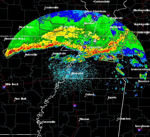 At 932 pm cst, a severe thunderstorm was located over adair, or 8 miles northwest of jackson, moving east at 50 mph (radar indicated). Hazards include 60 mph wind gusts and quarter size hail. Hail damage to vehicles is expected. Expect wind damage to roofs, siding, and trees. At 932 pm cst, a severe thunderstorm was located over adair, or 8 miles northwest of jackson, moving east at 50 mph (radar indicated). Hazards include 60 mph wind gusts and quarter size hail. Hail damage to vehicles is expected. Expect wind damage to roofs, siding, and trees.
|
| 3/9/2017 9:29 PM CST |
 At 928 pm cst, severe thunderstorms were located along a line extending from 6 miles northeast of gleason to near bradford to 9 miles north of alamo, moving southeast at 50 mph. brief tornadoes will be possible within the fast moving line of storms (radar indicated). Hazards include 60 mph wind gusts and quarter size hail. Hail damage to vehicles is expected. Expect wind damage to roofs, siding, and trees. At 928 pm cst, severe thunderstorms were located along a line extending from 6 miles northeast of gleason to near bradford to 9 miles north of alamo, moving southeast at 50 mph. brief tornadoes will be possible within the fast moving line of storms (radar indicated). Hazards include 60 mph wind gusts and quarter size hail. Hail damage to vehicles is expected. Expect wind damage to roofs, siding, and trees.
|
| 3/1/2017 5:07 AM CST |
 At 507 am cst, severe thunderstorms were located along a line extending from near south fulton to near humboldt to 9 miles west of dancyville, moving east at 85 mph (radar indicated). Hazards include 70 mph wind gusts. Expect considerable tree damage. Damage is likely to mobile homes, roofs, and outbuildings. At 507 am cst, severe thunderstorms were located along a line extending from near south fulton to near humboldt to 9 miles west of dancyville, moving east at 85 mph (radar indicated). Hazards include 70 mph wind gusts. Expect considerable tree damage. Damage is likely to mobile homes, roofs, and outbuildings.
|
| 2/7/2017 8:38 AM CST |
 The severe thunderstorm warning for central henderson, southeastern madison and northern chester counties will expire at 845 am cst, the storm which prompted the warning has weakened below severe limits, and no longer pose an immediate threat to life or property. therefore, the warning will be allowed to expire. The severe thunderstorm warning for central henderson, southeastern madison and northern chester counties will expire at 845 am cst, the storm which prompted the warning has weakened below severe limits, and no longer pose an immediate threat to life or property. therefore, the warning will be allowed to expire.
|
| 2/7/2017 8:23 AM CST |
 At 823 am cst, a severe thunderstorm was located near mifflin, or 8 miles southeast of jackson, moving east at 50 mph (radar indicated). Hazards include 60 mph wind gusts. Expect damage to roofs, siding, and trees. Locations impacted include, jackson, lexington, henderson, reagan, jacks creek, mifflin, medon, pinson, beech bluff, madison hall, juno, roby, maple grove, middle fork, timberlake, hinson springs, east union, malesus, parkburg and huron. At 823 am cst, a severe thunderstorm was located near mifflin, or 8 miles southeast of jackson, moving east at 50 mph (radar indicated). Hazards include 60 mph wind gusts. Expect damage to roofs, siding, and trees. Locations impacted include, jackson, lexington, henderson, reagan, jacks creek, mifflin, medon, pinson, beech bluff, madison hall, juno, roby, maple grove, middle fork, timberlake, hinson springs, east union, malesus, parkburg and huron.
|
| 2/7/2017 8:02 AM CST |
 At 801 am cst, a severe thunderstorm was located near mercer, or 13 miles southwest of jackson, moving east at 50 mph (radar indicated). Hazards include 60 mph wind gusts. expect damage to roofs, siding, and trees At 801 am cst, a severe thunderstorm was located near mercer, or 13 miles southwest of jackson, moving east at 50 mph (radar indicated). Hazards include 60 mph wind gusts. expect damage to roofs, siding, and trees
|
| 12/28/2016 3:30 PM CST | Golf Ball sized hail reported 2.3 miles N of Jackson, TN, numerous reports of golfball sized hail in downtown jackson. |
| 12/28/2016 3:25 PM CST |
 At 325 pm cst, a severe thunderstorm was located near jackson, moving east at 60 mph (law enforcement). Hazards include golf ball size hail and 60 mph wind gusts. People and animals outdoors will be injured. expect hail damage to roofs, siding, windows, and vehicles. expect wind damage to roofs, siding, and trees. Locations impacted include, jackson, lexington, natchez trace state forest, natchez trace state park, wildersville, bargerton, parkers crossroads, blue goose, clarksburg, sand ridge, union cross, parker`s cross roads, timberlake, maple grove, gilmore, hinson springs, mount gilead, beech bluff, huron and claybrook. At 325 pm cst, a severe thunderstorm was located near jackson, moving east at 60 mph (law enforcement). Hazards include golf ball size hail and 60 mph wind gusts. People and animals outdoors will be injured. expect hail damage to roofs, siding, windows, and vehicles. expect wind damage to roofs, siding, and trees. Locations impacted include, jackson, lexington, natchez trace state forest, natchez trace state park, wildersville, bargerton, parkers crossroads, blue goose, clarksburg, sand ridge, union cross, parker`s cross roads, timberlake, maple grove, gilmore, hinson springs, mount gilead, beech bluff, huron and claybrook.
|
| 12/28/2016 3:24 PM CST | Golf Ball sized hail reported 2.3 miles N of Jackson, TN, golfball sized hail reported on the east side of jackson. |
| 12/28/2016 3:23 PM CST | Golf Ball sized hail reported 2.3 miles N of Jackson, TN, golfball sized hail reported in jackson. |
| 12/28/2016 3:21 PM CST |
 At 321 pm cst, a severe thunderstorm was located near jackson, moving east at 60 mph (trained weather spotters). Hazards include 60 mph wind gusts and quarter size hail. Hail damage to vehicles is expected. Expect wind damage to roofs, siding, and trees. At 321 pm cst, a severe thunderstorm was located near jackson, moving east at 60 mph (trained weather spotters). Hazards include 60 mph wind gusts and quarter size hail. Hail damage to vehicles is expected. Expect wind damage to roofs, siding, and trees.
|
| 12/28/2016 3:17 PM CST | Quarter sized hail reported 2.3 miles N of Jackson, TN, occasional quarter sized hail falling downtown jackson around chester street. |
| 12/28/2016 3:16 PM CST |
 At 315 pm cst, a severe thunderstorm was located near bemis, or 8 miles southwest of jackson, moving northeast at 55 mph (radar indicated). Hazards include ping pong ball size hail and 60 mph wind gusts. People and animals outdoors will be injured. expect hail damage to roofs, siding, windows, and vehicles. expect wind damage to roofs, siding, and trees. Locations impacted include, jackson, lexington, bargerton, bemis, blue goose, carroll, sand ridge, malesus, claybrook, madison hall, oakfield, juno, maple grove, gilmore, east union, hickory flat, white fern, mount gilead, cedar grove and russell crossroads. At 315 pm cst, a severe thunderstorm was located near bemis, or 8 miles southwest of jackson, moving northeast at 55 mph (radar indicated). Hazards include ping pong ball size hail and 60 mph wind gusts. People and animals outdoors will be injured. expect hail damage to roofs, siding, windows, and vehicles. expect wind damage to roofs, siding, and trees. Locations impacted include, jackson, lexington, bargerton, bemis, blue goose, carroll, sand ridge, malesus, claybrook, madison hall, oakfield, juno, maple grove, gilmore, east union, hickory flat, white fern, mount gilead, cedar grove and russell crossroads.
|
| 12/28/2016 3:06 PM CST |
 At 306 pm cst, a severe thunderstorm was located near mercer, or 12 miles southwest of jackson, moving northeast at 55 mph (radar indicated). Hazards include 60 mph wind gusts and quarter size hail. Hail damage to vehicles is expected. Expect wind damage to roofs, siding, and trees. At 306 pm cst, a severe thunderstorm was located near mercer, or 12 miles southwest of jackson, moving northeast at 55 mph (radar indicated). Hazards include 60 mph wind gusts and quarter size hail. Hail damage to vehicles is expected. Expect wind damage to roofs, siding, and trees.
|
| 12/17/2016 4:37 PM CST |
 At 437 pm cst, a severe thunderstorm was located near bemis, or near chickasaw state park, moving northeast at 60 mph (radar indicated). Hazards include 60 mph wind gusts. expect damage to roofs, siding, and trees At 437 pm cst, a severe thunderstorm was located near bemis, or near chickasaw state park, moving northeast at 60 mph (radar indicated). Hazards include 60 mph wind gusts. expect damage to roofs, siding, and trees
|
| 11/18/2016 6:36 PM CST |
 The severe thunderstorm warning for north central hardeman, southeastern crockett and western madison counties will expire at 645 pm cst, the storms which prompted the warning have weakened below severe limits, and have exited the warned area. therefore, the warning will be allowed to expire. The severe thunderstorm warning for north central hardeman, southeastern crockett and western madison counties will expire at 645 pm cst, the storms which prompted the warning have weakened below severe limits, and have exited the warned area. therefore, the warning will be allowed to expire.
|
| 11/18/2016 6:30 PM CST | Highway 138 in madison county trees fell on house in madison county TN, 2.3 miles N of Jackson, TN |
| 11/18/2016 6:25 PM CST | Fallen limbs and trees dropped power lines around russell and forest avenues in jackso in madison county TN, 2.3 miles N of Jackson, TN |
| 11/18/2016 6:20 PM CST |
 At 618 pm cst, severe thunderstorms were located along a line extending from near bells to 6 miles northeast of mercer to cloverport, moving northeast at 60 mph (radar indicated). Hazards include 50 to 60 mph wind gusts. Expect damage to roofs. siding. and trees. Locations impacted include, jackson, bells, adair, mercer, cloverport, bemis, gadsden, medon, malesus, neely, madison hall, mason grove, roberts, windy city, huntersville, parkburg, uptonville, gum flat, fruitvale and denmark. At 618 pm cst, severe thunderstorms were located along a line extending from near bells to 6 miles northeast of mercer to cloverport, moving northeast at 60 mph (radar indicated). Hazards include 50 to 60 mph wind gusts. Expect damage to roofs. siding. and trees. Locations impacted include, jackson, bells, adair, mercer, cloverport, bemis, gadsden, medon, malesus, neely, madison hall, mason grove, roberts, windy city, huntersville, parkburg, uptonville, gum flat, fruitvale and denmark.
|
| 11/18/2016 5:56 PM CST |
 At 556 pm cst, severe thunderstorms were located along a line extending from 6 miles southwest of brownsville to near dancyville to near somerville, moving east at 50 mph (radar indicated). Hazards include 60 mph wind gusts. Expect damage to roofs. siding. And trees. At 556 pm cst, severe thunderstorms were located along a line extending from 6 miles southwest of brownsville to near dancyville to near somerville, moving east at 50 mph (radar indicated). Hazards include 60 mph wind gusts. Expect damage to roofs. siding. And trees.
|
| 8/2/2016 5:08 PM CDT |
 At 508 pm cdt, a severe thunderstorm was located near henderson, moving southeast at 25 mph (radar indicated). Hazards include quarter size hail. Damage to vehicles is expected. Locations impacted include, jackson, henderson, chickasaw state park, chickasaw state forest, silerton, bemis, medon, malesus, deanburg, neely, hickory corners, madison hall, maple grove, east union, huntersville, montezuma, parkburg, teague, five points and westover. At 508 pm cdt, a severe thunderstorm was located near henderson, moving southeast at 25 mph (radar indicated). Hazards include quarter size hail. Damage to vehicles is expected. Locations impacted include, jackson, henderson, chickasaw state park, chickasaw state forest, silerton, bemis, medon, malesus, deanburg, neely, hickory corners, madison hall, maple grove, east union, huntersville, montezuma, parkburg, teague, five points and westover.
|
| 8/2/2016 4:56 PM CDT |
 At 456 pm cdt, a severe thunderstorm was located near bemis, or 7 miles south of jackson, moving southeast at 25 mph (radar indicated). Hazards include quarter size hail. damage to vehicles is expected At 456 pm cdt, a severe thunderstorm was located near bemis, or 7 miles south of jackson, moving southeast at 25 mph (radar indicated). Hazards include quarter size hail. damage to vehicles is expected
|
| 8/2/2016 4:54 PM CDT |
 The tornado warning for southwestern madison county will expire at 500 pm cdt, the storm which prompted the warning has weakened below severe limits, and is no longer producing a tornado. therefore, the warning will be allowed to expire. The tornado warning for southwestern madison county will expire at 500 pm cdt, the storm which prompted the warning has weakened below severe limits, and is no longer producing a tornado. therefore, the warning will be allowed to expire.
|
| 8/2/2016 4:41 PM CDT |
 At 441 pm cdt, a severe thunderstorm producing a tornado was located near bemis, or 7 miles north of chickasaw state park, moving southeast at 20 mph (radar indicated rotation). Hazards include tornado. Flying debris will be dangerous to those caught without shelter. mobile homes will be damaged or destroyed. damage to roofs, windows, and vehicles will occur. tree damage is likely. Locations impacted include, jackson, bemis, medon, malesus, parkburg, neely, madison hall, westover and pinson. At 441 pm cdt, a severe thunderstorm producing a tornado was located near bemis, or 7 miles north of chickasaw state park, moving southeast at 20 mph (radar indicated rotation). Hazards include tornado. Flying debris will be dangerous to those caught without shelter. mobile homes will be damaged or destroyed. damage to roofs, windows, and vehicles will occur. tree damage is likely. Locations impacted include, jackson, bemis, medon, malesus, parkburg, neely, madison hall, westover and pinson.
|
| 8/2/2016 4:29 PM CDT |
 At 429 pm cdt, a severe thunderstorm producing a tornado was located near bemis, or near jackson, moving southeast at 25 mph (radar indicated rotation). Hazards include tornado. Flying debris will be dangerous to those caught without shelter. mobile homes will be damaged or destroyed. damage to roofs, windows, and vehicles will occur. tree damage is likely. This tornadic thunderstorm will remain over mainly rural areas of southwestern madison county, including the following locations: malesus, parkburg, neely, madison hall, medon, westover and pinson. At 429 pm cdt, a severe thunderstorm producing a tornado was located near bemis, or near jackson, moving southeast at 25 mph (radar indicated rotation). Hazards include tornado. Flying debris will be dangerous to those caught without shelter. mobile homes will be damaged or destroyed. damage to roofs, windows, and vehicles will occur. tree damage is likely. This tornadic thunderstorm will remain over mainly rural areas of southwestern madison county, including the following locations: malesus, parkburg, neely, madison hall, medon, westover and pinson.
|
| 8/2/2016 4:22 PM CDT |
 At 421 pm cdt, a severe thunderstorm was located near bemis, or near jackson, moving southeast at 25 mph (radar indicated). Hazards include 60 mph wind gusts and quarter size hail. Hail damage to vehicles is expected. Expect wind damage to roofs, siding, and trees. At 421 pm cdt, a severe thunderstorm was located near bemis, or near jackson, moving southeast at 25 mph (radar indicated). Hazards include 60 mph wind gusts and quarter size hail. Hail damage to vehicles is expected. Expect wind damage to roofs, siding, and trees.
|
| 5/26/2016 6:54 PM CDT |
 The severe thunderstorm warning for northeastern hardeman, chester, northwestern hardin, northern mcnairy, southern madison and southern henderson counties will expire at 700 pm cdt, the storms which prompted the warning have weakened below severe limits, and no longer pose an immediate threat to life or property. therefore the warning will be allowed to expire. however heavy rain and flash flooding is still possible with these thunderstorms. The severe thunderstorm warning for northeastern hardeman, chester, northwestern hardin, northern mcnairy, southern madison and southern henderson counties will expire at 700 pm cdt, the storms which prompted the warning have weakened below severe limits, and no longer pose an immediate threat to life or property. therefore the warning will be allowed to expire. however heavy rain and flash flooding is still possible with these thunderstorms.
|
| 5/26/2016 6:08 PM CDT |
 At 608 pm cdt, severe thunderstorms were located along a line extending from near chickasaw state park to near sardis, moving southeast at 20 mph (radar indicated). Hazards include 60 mph wind gusts and quarter size hail. Hail damage to vehicles is expected. Expect wind damage to roofs, siding, and trees. At 608 pm cdt, severe thunderstorms were located along a line extending from near chickasaw state park to near sardis, moving southeast at 20 mph (radar indicated). Hazards include 60 mph wind gusts and quarter size hail. Hail damage to vehicles is expected. Expect wind damage to roofs, siding, and trees.
|
| 5/1/2016 3:22 PM CDT |
 At 322 pm cdt, a severe thunderstorm was located over mercer, or 12 miles southwest of jackson, moving east at 20 mph (radar indicated). Hazards include 60 mph wind gusts and quarter size hail. Hail damage to vehicles is expected. expect wind damage to roofs, siding, and trees. Locations impacted include, jackson, chickasaw state forest, mercer, cloverport, medon, neely, huntersville, teague, uptonville, leighton, denmark, westover and hatchie. At 322 pm cdt, a severe thunderstorm was located over mercer, or 12 miles southwest of jackson, moving east at 20 mph (radar indicated). Hazards include 60 mph wind gusts and quarter size hail. Hail damage to vehicles is expected. expect wind damage to roofs, siding, and trees. Locations impacted include, jackson, chickasaw state forest, mercer, cloverport, medon, neely, huntersville, teague, uptonville, leighton, denmark, westover and hatchie.
|
| 5/1/2016 2:58 PM CDT |
 At 258 pm cdt, a severe thunderstorm was located near hillville, or 8 miles southeast of brownsville, moving east at 20 mph (radar indicated). Hazards include 60 mph wind gusts and quarter size hail. Hail damage to vehicles is expected. Expect wind damage to roofs, siding, and trees. At 258 pm cdt, a severe thunderstorm was located near hillville, or 8 miles southeast of brownsville, moving east at 20 mph (radar indicated). Hazards include 60 mph wind gusts and quarter size hail. Hail damage to vehicles is expected. Expect wind damage to roofs, siding, and trees.
|
| 3/31/2016 2:54 PM CDT | Quarter sized hail reported 2.3 miles N of Jackson, TN, quarter sized hail in downtown jackson |
| 3/31/2016 2:48 PM CDT | An estimated wind gust of 60 mph in downtown jackso in madison county TN, 2.3 miles N of Jackson, TN |
| 3/31/2016 2:46 PM CDT |
 At 245 pm cdt, a severe thunderstorm was located near bemis, or 8 miles south of jackson, moving east at 45 mph (radar indicated). Hazards include 70 mph wind gusts and quarter size hail. Hail damage to vehicles is expected. expect considerable tree damage. Wind damage is also likely to mobile homes, roofs, and outbuildings. At 245 pm cdt, a severe thunderstorm was located near bemis, or 8 miles south of jackson, moving east at 45 mph (radar indicated). Hazards include 70 mph wind gusts and quarter size hail. Hail damage to vehicles is expected. expect considerable tree damage. Wind damage is also likely to mobile homes, roofs, and outbuildings.
|
| 3/31/2016 2:35 PM CDT |
 At 235 pm cdt, a severe thunderstorm was located near mercer, or 10 miles southwest of jackson, moving east at 35 mph (radar indicated). Hazards include 70 mph wind gusts and half dollar size hail. Hail damage to vehicles is expected. expect considerable tree damage. wind damage is also likely to mobile homes, roofs, and outbuildings. locations impacted include, jackson, mercer, hillville, bemis, dancyville, cloverport, medon, vildo, gilmore, fayette corners, teague, uptonville, denmark, leighton, westover, malesus, neely, madison hall, oakfield and morton hill. A tornado watch remains in effect until 1000 pm cdt for western tennessee. At 235 pm cdt, a severe thunderstorm was located near mercer, or 10 miles southwest of jackson, moving east at 35 mph (radar indicated). Hazards include 70 mph wind gusts and half dollar size hail. Hail damage to vehicles is expected. expect considerable tree damage. wind damage is also likely to mobile homes, roofs, and outbuildings. locations impacted include, jackson, mercer, hillville, bemis, dancyville, cloverport, medon, vildo, gilmore, fayette corners, teague, uptonville, denmark, leighton, westover, malesus, neely, madison hall, oakfield and morton hill. A tornado watch remains in effect until 1000 pm cdt for western tennessee.
|
| 3/31/2016 2:11 PM CDT |
 At 211 pm cdt, a severe thunderstorm was located near hillville, or near brownsville, moving east at 40 mph (radar indicated). Hazards include two inch hail and 70 mph wind gusts. People and animals outdoors will be injured. expect hail damage to roofs, siding, windows, and vehicles. expect considerable tree damage. Wind damage is also likely to mobile homes, roofs, and outbuildings. At 211 pm cdt, a severe thunderstorm was located near hillville, or near brownsville, moving east at 40 mph (radar indicated). Hazards include two inch hail and 70 mph wind gusts. People and animals outdoors will be injured. expect hail damage to roofs, siding, windows, and vehicles. expect considerable tree damage. Wind damage is also likely to mobile homes, roofs, and outbuildings.
|
| 2/2/2016 1:50 PM CST |
 At 149 pm cst, a severe thunderstorm was located 7 miles northwest of henderson, moving northeast at 65 mph (radar indicated). Hazards include 60 mph wind gusts and quarter size hail. Hail damage to vehicles is expected. Expect wind damage to roofs, siding and trees. At 149 pm cst, a severe thunderstorm was located 7 miles northwest of henderson, moving northeast at 65 mph (radar indicated). Hazards include 60 mph wind gusts and quarter size hail. Hail damage to vehicles is expected. Expect wind damage to roofs, siding and trees.
|
| 12/23/2015 5:09 PM CST | At 507 pm cst, a severe thunderstorm was located 8 miles northwest of bargerton, or 11 miles southeast of milan, moving northeast at 65 mph (radar indicated). Hazards include 60 mph wind gusts and nickel size hail. Expect damage to roofs. siding and trees. this severe thunderstorm will remain over mainly rural areas of southwestern carroll, northwestern henderson, southeastern gibson and madison counties, including the following locations, youngs crossing, sand ridge, union cross, west, timberlake, maple grove, windy city, gilmore, medina and mount gilead. A tornado watch remains in effect until 800 pm cst for western tennessee. |
| 12/23/2015 4:33 PM CST | The national weather service in memphis has issued a * severe thunderstorm warning for. southeastern crockett county in west tennessee. southwestern carroll county in west tennessee. southeastern haywood county in west tennessee. Northwestern henderson county in west tennessee. |
| 8/5/2015 6:07 PM CDT |
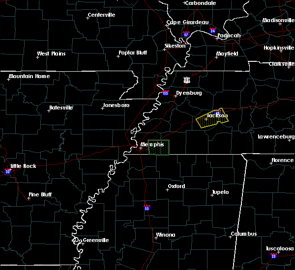 The severe thunderstorm warning for northwestern henderson and central madison counties will expire at 615 pm cdt, the storm which prompted the warning has weakened below severe limits and exited the warned area. therefore the warning will be allowed to expire. a severe thunderstorm watch remains in effect until 700 pm cdt for western tennessee. The severe thunderstorm warning for northwestern henderson and central madison counties will expire at 615 pm cdt, the storm which prompted the warning has weakened below severe limits and exited the warned area. therefore the warning will be allowed to expire. a severe thunderstorm watch remains in effect until 700 pm cdt for western tennessee.
|
| 8/5/2015 5:50 PM CDT | Several trees down around jackso in madison county TN, 2.3 miles N of Jackson, TN |
| 8/5/2015 5:43 PM CDT |
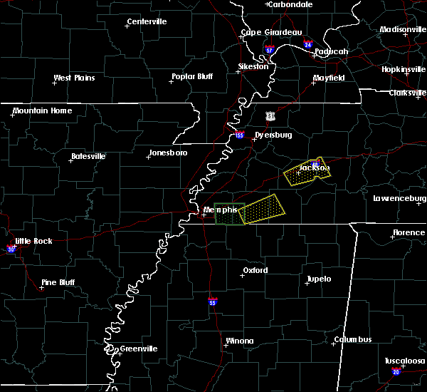 At 543 pm cdt, a severe thunderstorm was located over bemis, or near jackson, moving northeast at 25 mph (radar indicated). Hazards include 60 mph wind gusts. Expect damage to roofs. Siding and trees. At 543 pm cdt, a severe thunderstorm was located over bemis, or near jackson, moving northeast at 25 mph (radar indicated). Hazards include 60 mph wind gusts. Expect damage to roofs. Siding and trees.
|
| 8/5/2015 5:35 PM CDT | 61 mph gust measured at mckellar-sipes airpor in madison county TN, 2.3 miles N of Jackson, TN |
| 7/14/2015 4:58 PM CDT | Tree across hwy 18 and lowery roa in madison county TN, 8.6 miles ENE of Jackson, TN |
| 7/14/2015 4:55 PM CDT | Trees and powerlines down on hwy 223 and womack lan in madison county TN, 8.6 miles ENE of Jackson, TN |
| 7/14/2015 4:48 PM CDT |
 At 448 pm cdt, severe thunderstorms were located along a line extending from near bemis to near silerton to near bolivar, moving southeast at 45 mph (radar indicated). Hazards include 60 mph wind gusts. Expect damage to roofs. Siding and trees. At 448 pm cdt, severe thunderstorms were located along a line extending from near bemis to near silerton to near bolivar, moving southeast at 45 mph (radar indicated). Hazards include 60 mph wind gusts. Expect damage to roofs. Siding and trees.
|
| 6/8/2015 4:54 PM CDT | The severe thunderstorm warning for west central chester and southern madison counties will expire at 500 pm cdt, the storm which prompted the warning has weakened below severe limits, and no longer poses an immediate threat to life or property. therefore the warning will be allowed to expire. however gusty winds are still possible with this thunderstorm. a severe thunderstorm watch remains in effect until 700 pm cdt for western tennessee. |
| 6/8/2015 4:41 PM CDT | At 439 pm cdt, a severe thunderstorm was located near mercer, or 11 miles southwest of jackson, moving east at 10 mph (radar indicated). Hazards include 60 mph wind gusts and nickel size hail. Expect damage to roofs. siding and trees. Locations impacted include, jackson, bemis, medon, east union, malesus, parkburg, neely, madison hall, uptonville, denmark, pinson and maple grove. |
| 6/8/2015 4:20 PM CDT | Several large trees...tree limbs...and power lines down across madison county tennesse in madison county TN, 2.3 miles N of Jackson, TN |
| 6/8/2015 4:18 PM CDT | Several trees down and power lines down around jackso in madison county TN, 2.3 miles N of Jackson, TN |
| 6/8/2015 4:12 PM CDT | At 412 pm cdt, a severe thunderstorm was located near mercer, or 10 miles east of brownsville, moving east at 10 mph (radar indicated). Hazards include 60 mph wind gusts and half dollar size hail. Hail damage to vehicles is expected. Expect wind damage to roofs, siding and trees. |
| 5/30/2015 2:50 PM CDT | At 249 pm cdt, a severe thunderstorm was located near atwood, or 7 miles southwest of mckenzie, moving northeast at 45 mph (radar indicated). Hazards include 60 mph wind gusts and penny size hail. Expect damage to roofs. siding and trees. Locations impacted include, jackson, humboldt, milan, mckenzie, huntingdon, fairview, three way, atwood, bargerton, blue goose, adair, carroll, medina, trezevant, gibson, clarksburg, mclemoresville, youngs crossing, gann and union cross. |
| 5/30/2015 2:25 PM CDT | At 225 pm cdt, a severe thunderstorm was located near humboldt, moving northeast at 45 mph (radar indicated). Hazards include 60 mph wind gusts and penny size hail. Expect damage to roofs. Siding and trees. |
| 5/30/2015 1:31 PM CDT | At 130 pm cdt, a severe thunderstorm was located near alamo, or 7 miles west of humboldt, moving northeast at 60 mph (radar indicated). Hazards include 70 mph wind gusts. Expect considerable tree damage. damage is likely to mobile homes, roofs and outbuildings. Locations impacted include, jackson, humboldt, milan, trenton, fairview, alamo, bells, three way, adair, carroll, medina, maury city, gadsden, gibson, youngs crossing, gann, west, moores chapel, mason grove and maury junction. |
| 5/30/2015 1:13 PM CDT | At 113 pm cdt, a severe thunderstorm was located over belle eagle, or near brownsville, moving northeast at 60 mph (radar indicated). Hazards include 70 mph wind gusts. Expect considerable tree damage. Damage is likely to mobile homes, roofs and outbuildings. |
| 7/14/2014 5:53 PM CDT | Wind gust to 62 mph recorded at jackson airpor in madison county TN, 2.3 miles N of Jackson, TN |
| 7/14/2014 3:41 PM CDT | On airways blvd power lines dow in madison county TN, 2.3 miles N of Jackson, TN |
| 7/14/2014 3:07 PM CDT | Large trees down on power lines on old medina r in madison county TN, 1 miles NNW of Jackson, TN |
| 7/14/2014 2:40 PM CDT | Large trees down on power lines on old medina r in madison county TN, 1 miles NNW of Jackson, TN |
| 7/8/2014 5:50 PM CDT | Quarter sized hail reported 5.7 miles N of Jackson, TN, hail for 10 minutes on jefferson street in bemis. |
| 6/7/2014 7:12 PM CDT | Trees and power lines dow in madison county TN, 2.3 miles N of Jackson, TN |
| 6/7/2014 7:12 PM CDT | Trees and power lines dow in madison county TN, 2.3 miles N of Jackson, TN |
| 6/7/2014 6:42 PM CDT | Trees and powerlines dow in madison county TN, 5.7 miles N of Jackson, TN |
| 6/7/2014 6:30 PM CDT | Trees snapped uprooted with estimated winds of 70 mp in madison county TN, 2.3 miles N of Jackson, TN |
| 6/5/2014 2:44 PM CDT | Asos at kmkl reported in madison county TN, 2.3 miles N of Jackson, TN |
| 4/4/2014 3:58 AM CDT | Quarter sized hail reported 2.3 miles N of Jackson, TN |
| 12/21/2013 7:10 PM CST | Tree fell on a house located on roberts roa in madison county TN, 5.7 miles N of Jackson, TN |
| 12/21/2013 7:05 PM CST | A tree fell on a house and caused considerable damage on roberts street in bemi in madison county TN, 5.7 miles N of Jackson, TN |
| 12/21/2013 7:03 PM CST | Storm damage reported in madison county TN, 5.9 miles NE of Jackson, TN |
| 5/30/2013 7:15 PM CDT | Quarter sized hail reported 2.3 miles N of Jackson, TN, quarter size hail...trees uprooted by the wind |
| 5/30/2013 7:00 PM CDT | Quarter sized hail reported 2.3 miles N of Jackson, TN, quarter size hail...trees down |
| 5/30/2013 7:00 PM CDT | 65-70 mph estimated... trees down... power outages in madison county TN, 2.3 miles N of Jackson, TN |
| 5/30/2013 7:00 PM CDT | Twisted trees...a barn completely destroye in madison county TN, 2.3 miles N of Jackson, TN |
| 5/30/2013 6:50 PM CDT | Trees down across the city...dime size hail...power outages in madison county TN, 2.3 miles N of Jackson, TN |
| 5/30/2013 6:45 PM CDT | Large tree down across highway 18...both lanes of traffic blocked...power lines also dow in madison county TN, 7.1 miles N of Jackson, TN |
| 9/5/2012 7:00 PM CDT | A 24 inch in diameter tree fell down in jackso in madison county TN, 2.3 miles N of Jackson, TN |
| 6/11/2012 3:55 PM CDT | Trees down in jackson in madison county TN, 2.3 miles N of Jackson, TN |
| 6/11/2012 3:55 PM CDT | Trees down in fox ridge subdivision in madison county TN, 3.9 miles NW of Jackson, TN |
| 6/11/2012 3:45 PM CDT | 58 mph gust measured at jackson mckeller airpor in madison county TN, 2.3 miles N of Jackson, TN |
| 6/3/2012 10:15 PM CDT | A few powerlines and trees down in western madison count in madison county TN, 2.3 miles N of Jackson, TN |
| 6/3/2012 9:48 PM CDT | A few powerlines and trees down in western madison count in madison county TN, 6.7 miles ENE of Jackson, TN |
| 4/26/2012 6:15 PM CDT | Golf Ball sized hail reported 9.9 miles NNW of Jackson, TN |
| 4/26/2012 5:56 PM CDT | Half Dollar sized hail reported 5.7 miles N of Jackson, TN |
| 4/26/2012 5:45 PM CDT | Quarter sized hail reported 5.7 miles N of Jackson, TN |
| 4/26/2012 4:53 PM CDT | Quarter sized hail reported 4.4 miles SE of Jackson, TN, lasted about 7 mins. |
| 3/2/2012 3:03 PM CST | Quarter sized hail reported 9.8 miles NW of Jackson, TN, deep enough to cause fog in the valleys |
| 3/2/2012 2:03 PM CST | Quarter sized hail reported 9.8 miles NW of Jackson, TN, deep enough to cause fog in the valleys |
| 1/1/0001 12:00 AM | Trees down county wid in madison county TN, 2.3 miles N of Jackson, TN |
| 1/1/0001 12:00 AM | Trees down countywid in madison county TN, 7.8 miles ENE of Jackson, TN |
| 1/1/0001 12:00 AM | Quarter sized hail reported 5.7 miles N of Jackson, TN, nickel to quarter size hail reported near bemis. |
| 1/1/0001 12:00 AM | Quarter sized hail reported 5.7 miles N of Jackson, TN, mostly dime size hail...however some pieces are up to quarter size. |
| 1/1/0001 12:00 AM | Storm damage reported in madison county TN, 6.8 miles NNW of Jackson, TN |
| 1/1/0001 12:00 AM | Storm damage reported in madison county TN, 6.4 miles NNE of Jackson, TN |
| 1/1/0001 12:00 AM | Storm damage reported in madison county TN, 6.4 miles NNE of Jackson, TN |
| 1/1/0001 12:00 AM | Quarter sized hail reported 1 miles NNW of Jackson, TN, majority of the hail falling was pea size...however a few quarter size stones were mixed in. reported just north of i-40. |
| 1/1/0001 12:00 AM | Storm damage reported in madison county TN, 3.3 miles W of Jackson, TN |
| 1/1/0001 12:00 AM | Trees were down. a fence door was also broken at the hing in madison county TN, 2.3 miles N of Jackson, TN |
| 1/1/0001 12:00 AM | Estimated wind speed. large trees and power lines down on n. highland ave near northside high school. trees and power lines also down at the intersection of east forest in madison county TN, 2.3 miles N of Jackson, TN |
| 1/1/0001 12:00 AM | A nursing home in jackson sustained damage with trees down on building. evacuations in progres in madison county TN, 2.3 miles N of Jackson, TN |
| 1/1/0001 12:00 AM | Trees down on a house on southern street. person is missin in madison county TN, 2.3 miles N of Jackson, TN |
| 1/1/0001 12:00 AM | Trees down at the hwy 45 bypass and highland avenue near porter cabl in madison county TN, 4.7 miles S of Jackson, TN |
| 1/1/0001 12:00 AM | Storm damage reported in madison county TN, 2.3 miles N of Jackson, TN |
| 1/1/0001 12:00 AM | Power pole snapped in half and many trees down between bells and jackso in madison county TN, 9.2 miles E of Jackson, TN |
| 1/1/0001 12:00 AM | Storm damage reported in madison county TN, 6.5 miles NNE of Jackson, TN |
| 1/1/0001 12:00 AM | Winds at least 80 mph. a large oak tree fell on a carport and portion of a house. carport is a total loss as well as the car inside. slight roof and siding damage susta in madison county TN, 2.3 miles N of Jackson, TN |
| 1/1/0001 12:00 AM | Winds at least 80 mph. a large oak tree fell on a carport and portion of a house. carport is a total loss as well as the car inside. slight roof and siding damage susta in madison county TN, 2.3 miles N of Jackson, TN |
| 1/1/0001 12:00 AM | Storm damage reported in madison county TN, 2.3 miles N of Jackson, TN |
Hail Maps for Jackson, TN
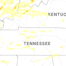
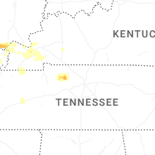
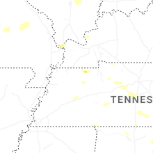


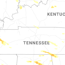


Connect with Interactive Hail Maps