

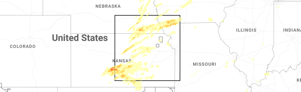
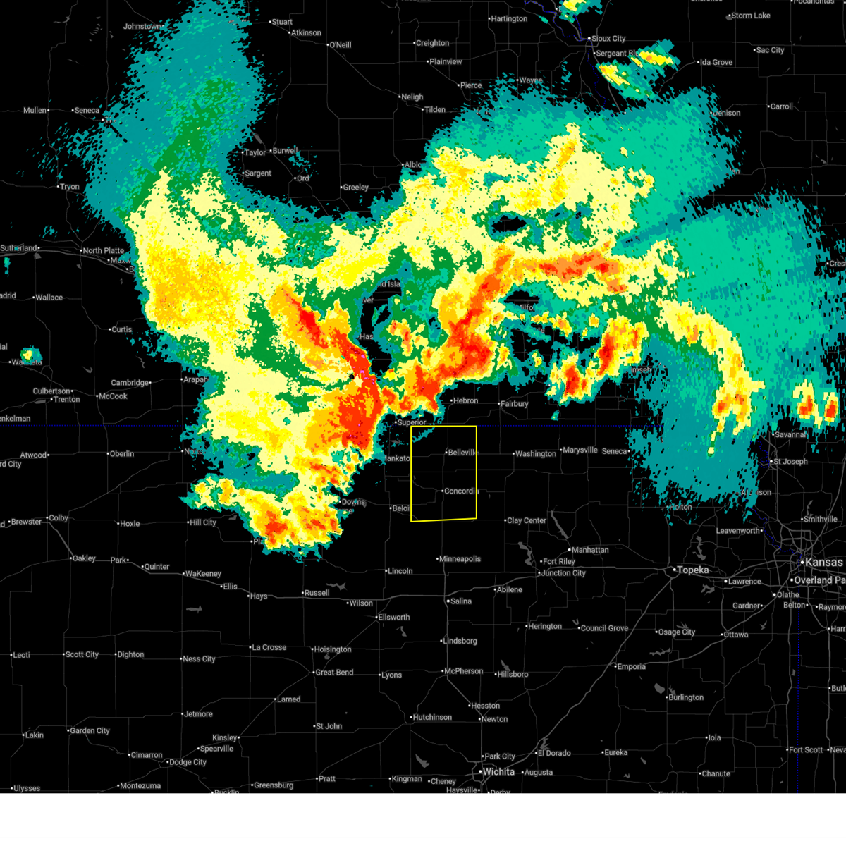
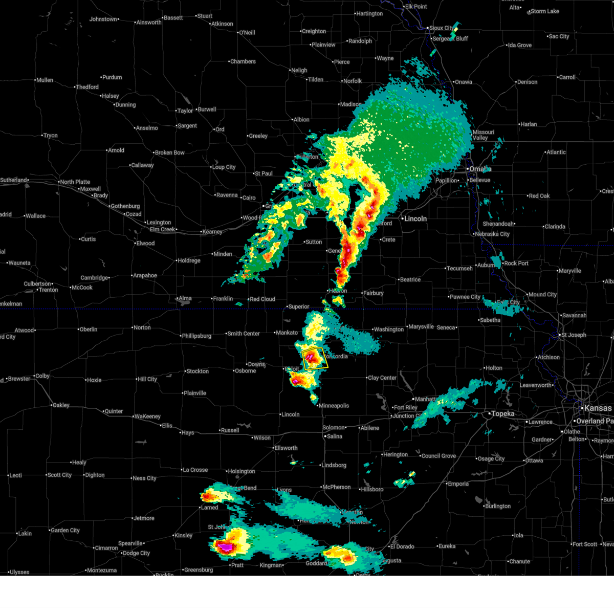
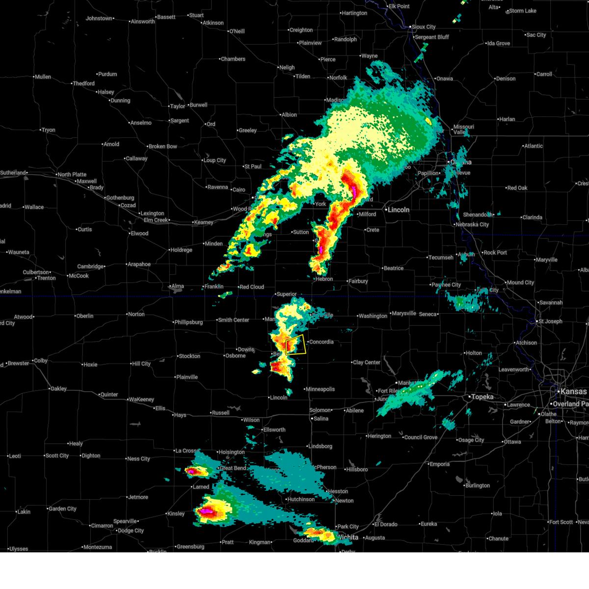
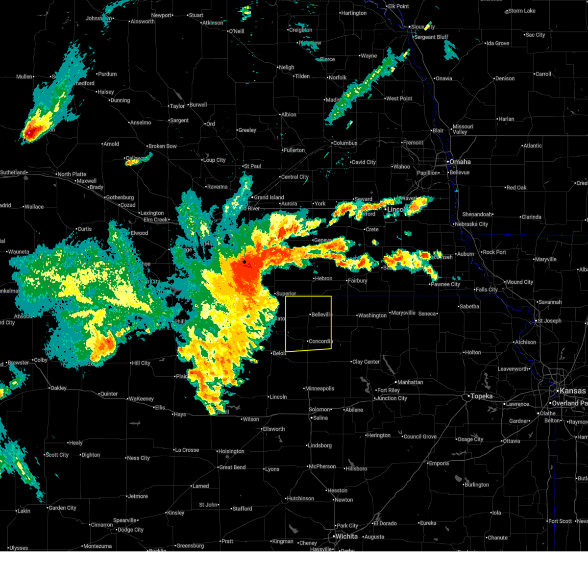
Hail Map for Jamestown, KS
The Jamestown, KS area has had 11 reports of on-the-ground hail by trained spotters, and has been under severe weather warnings 12 times during the past 12 months. Doppler radar has detected hail at or near Jamestown, KS on 116 occasions, including 9 occasions during the past year.
| Name: | Jamestown, KS |
| Where Located: | 75.4 miles WNW of Manhattan, KS |
| Map: | Google Map for Jamestown, KS |
| Population: | 286 |
| Housing Units: | 148 |
| More Info: | Search Google for Jamestown, KS |
1
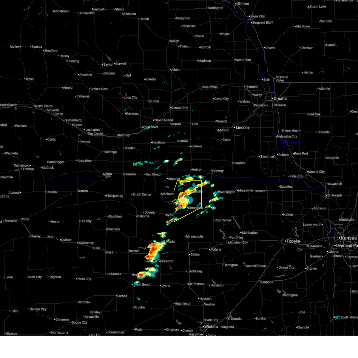
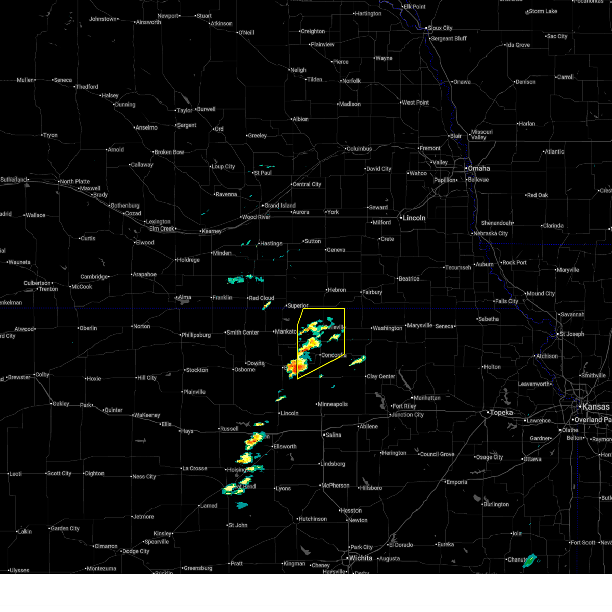
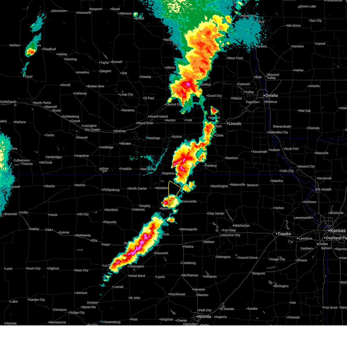
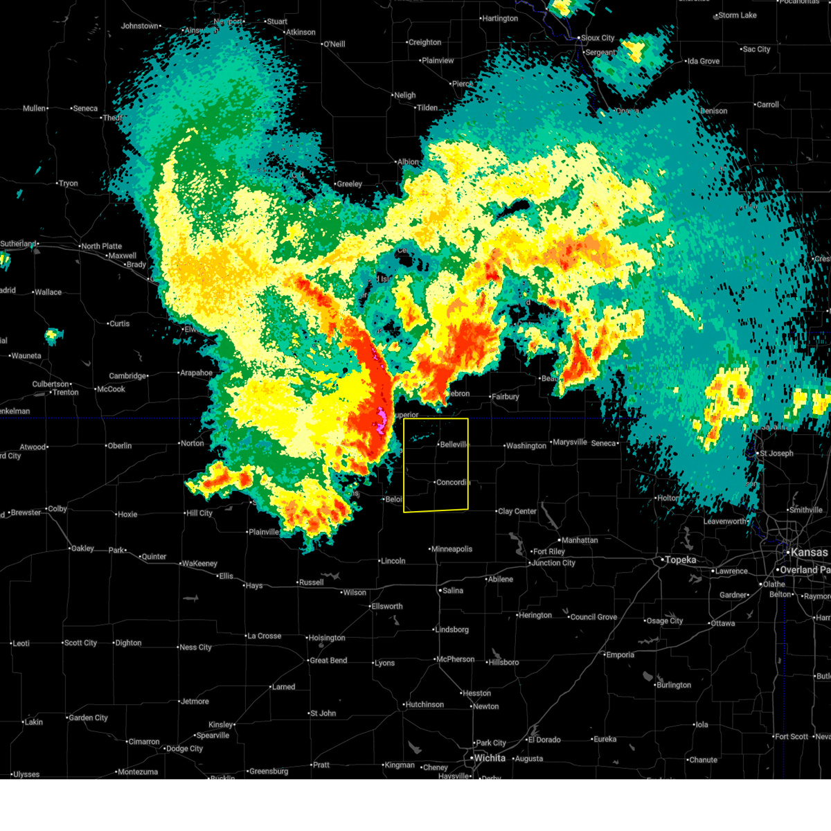
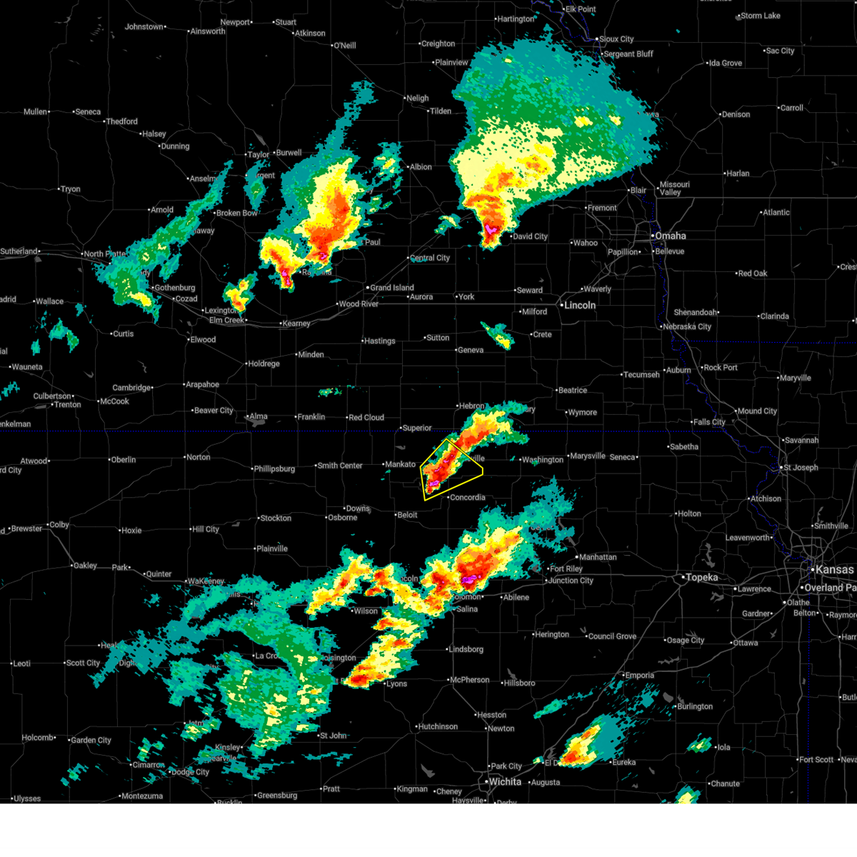
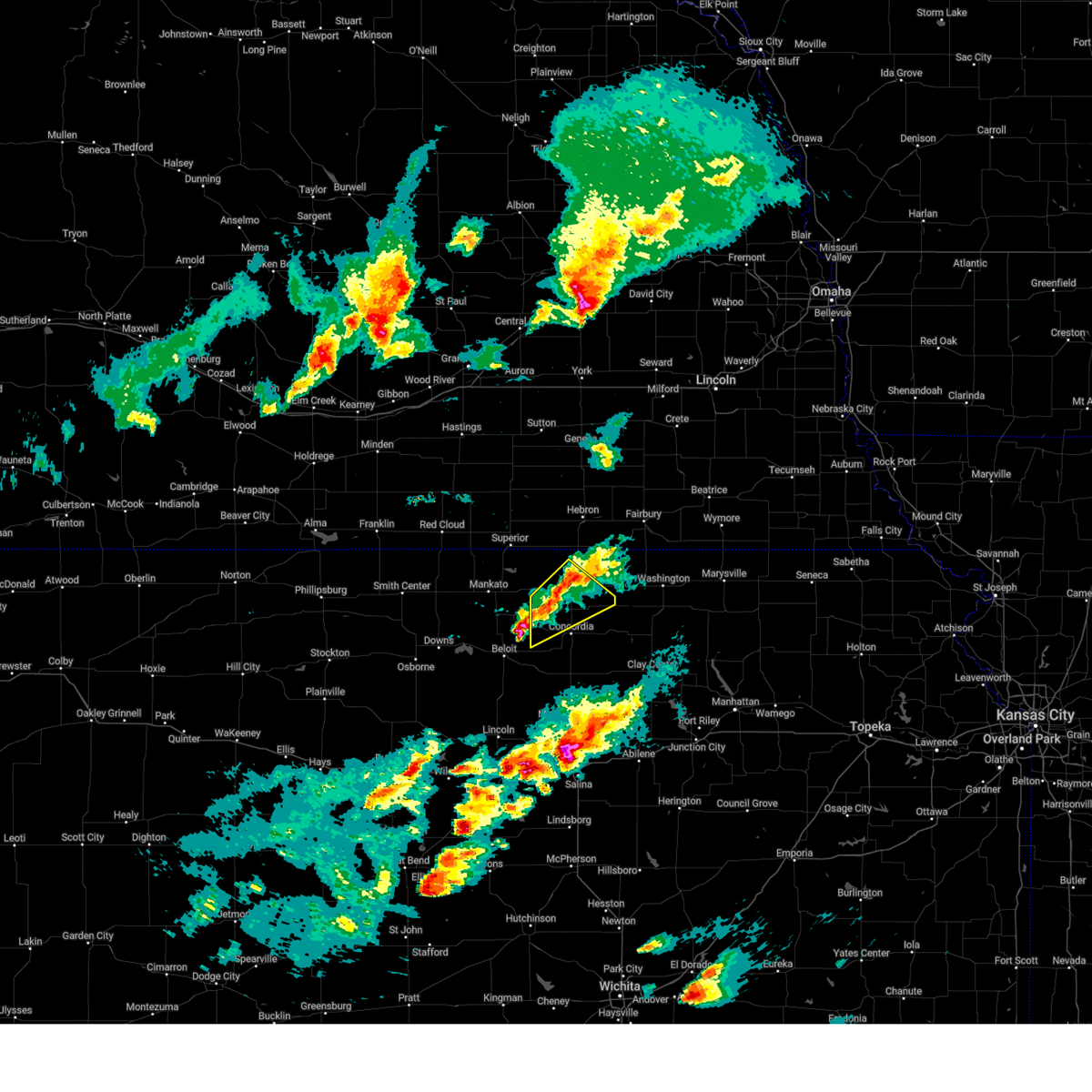
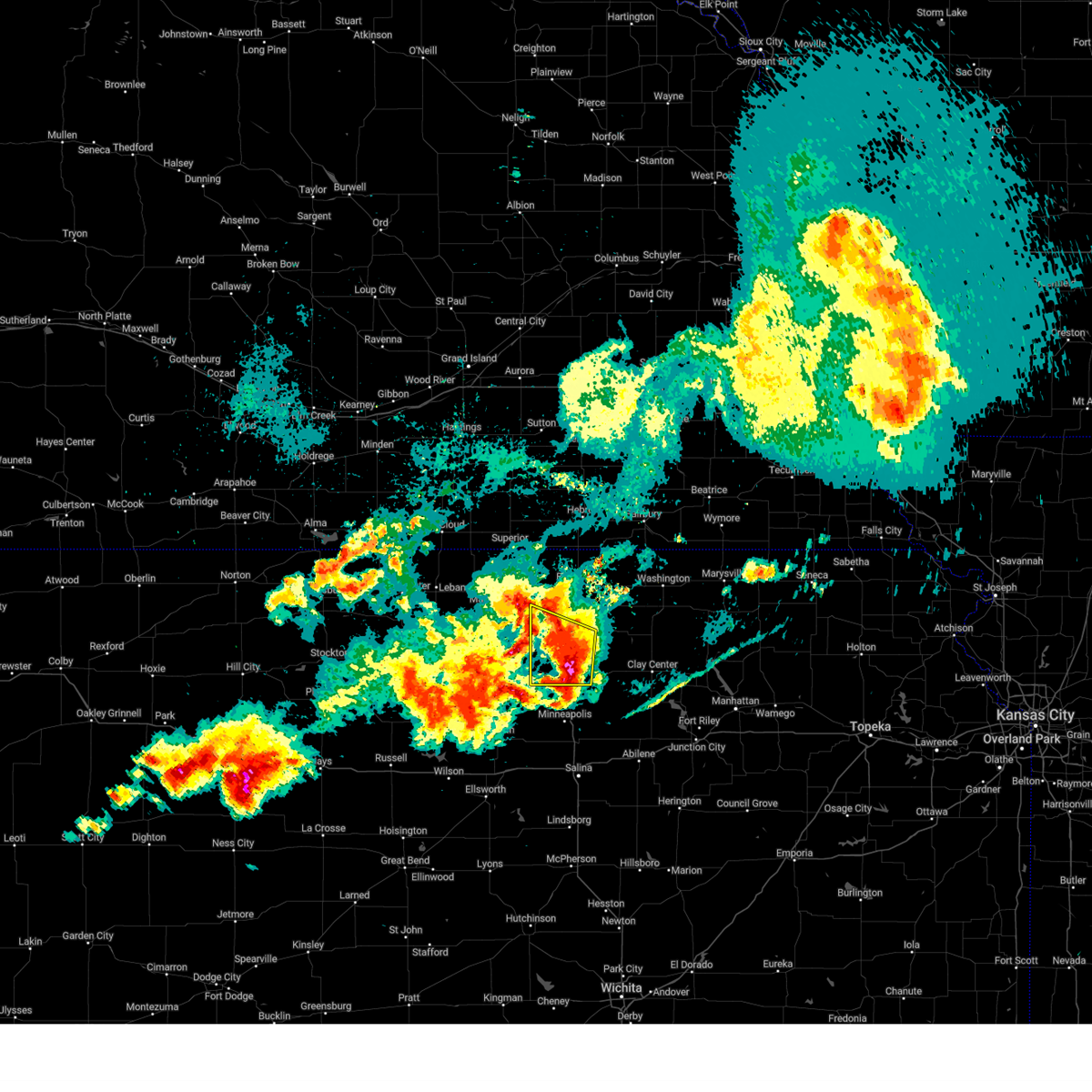
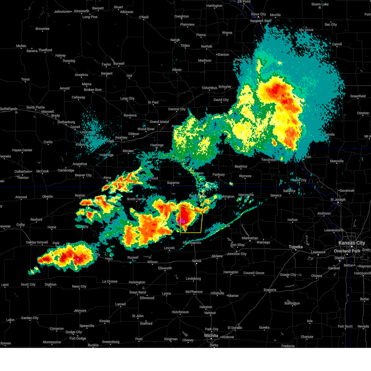
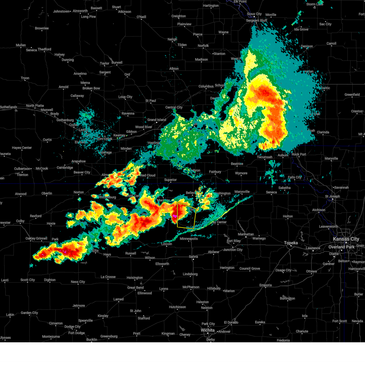
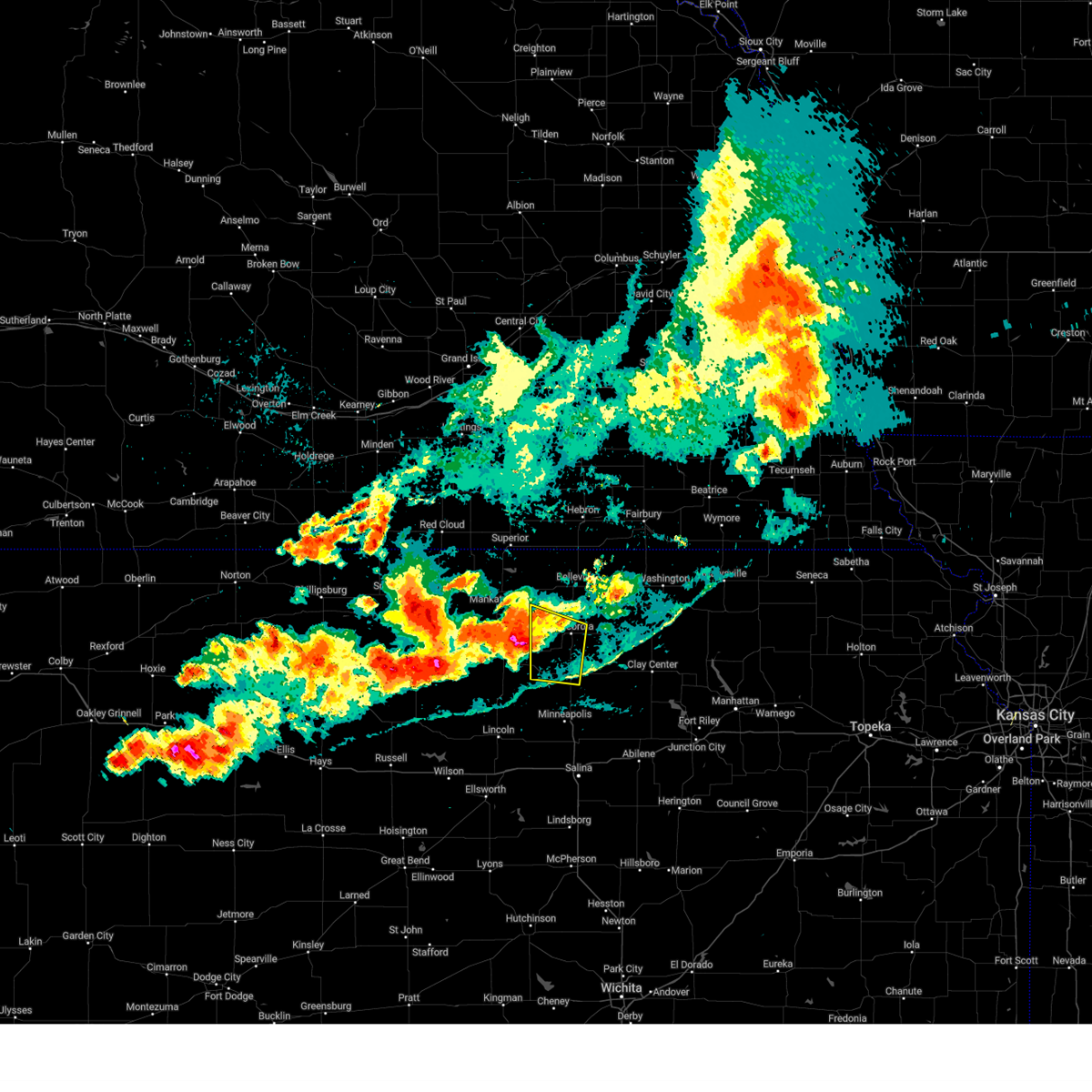
The Top Recent Hail Date for Jamestown, KS is Monday, May 18, 2026 (19th out of 116)
Hail and Wind Damage Spotted near Jamestown, KS
| Date / Time | Report Details |
|---|---|
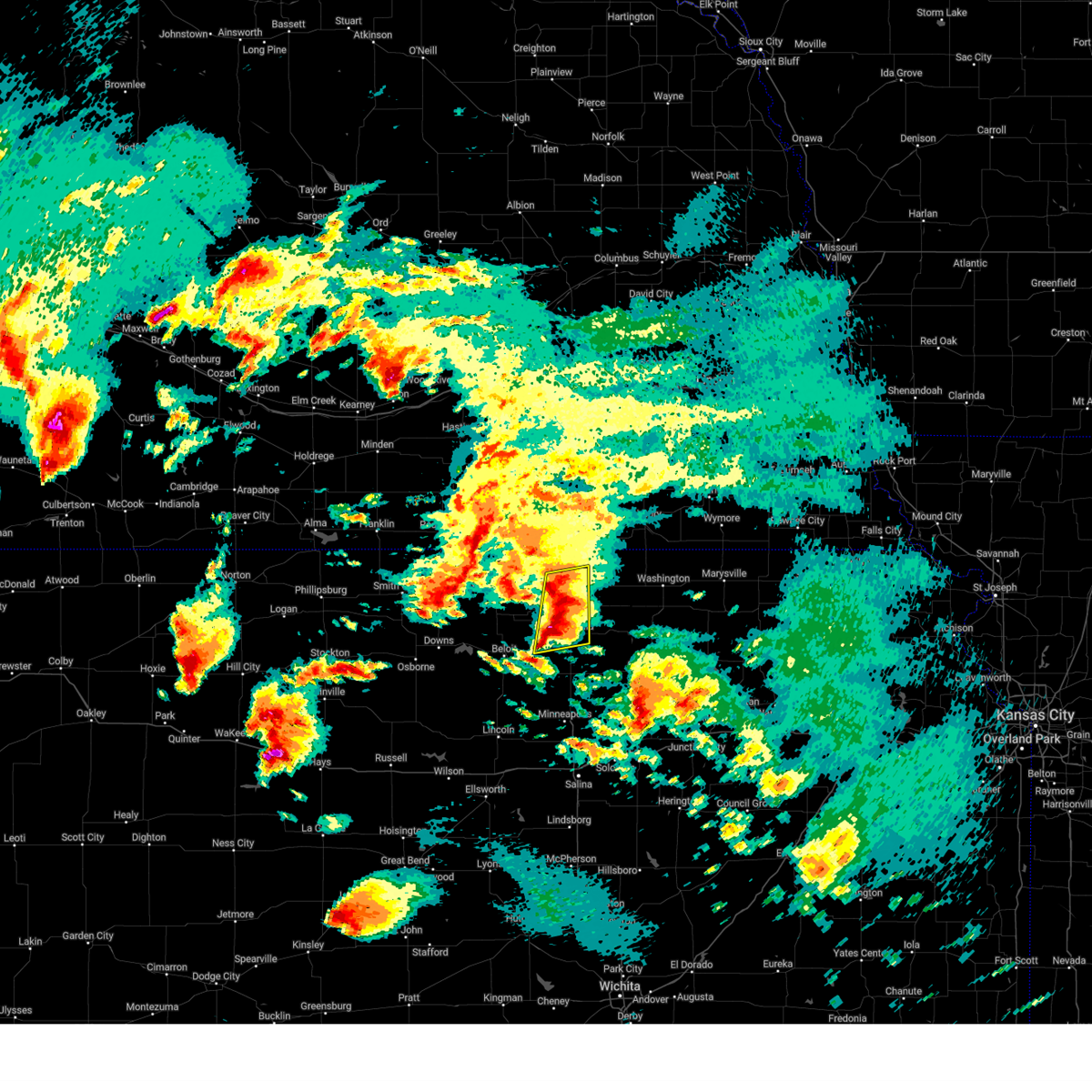
| 5/18/2026 2:02 PM CDT |
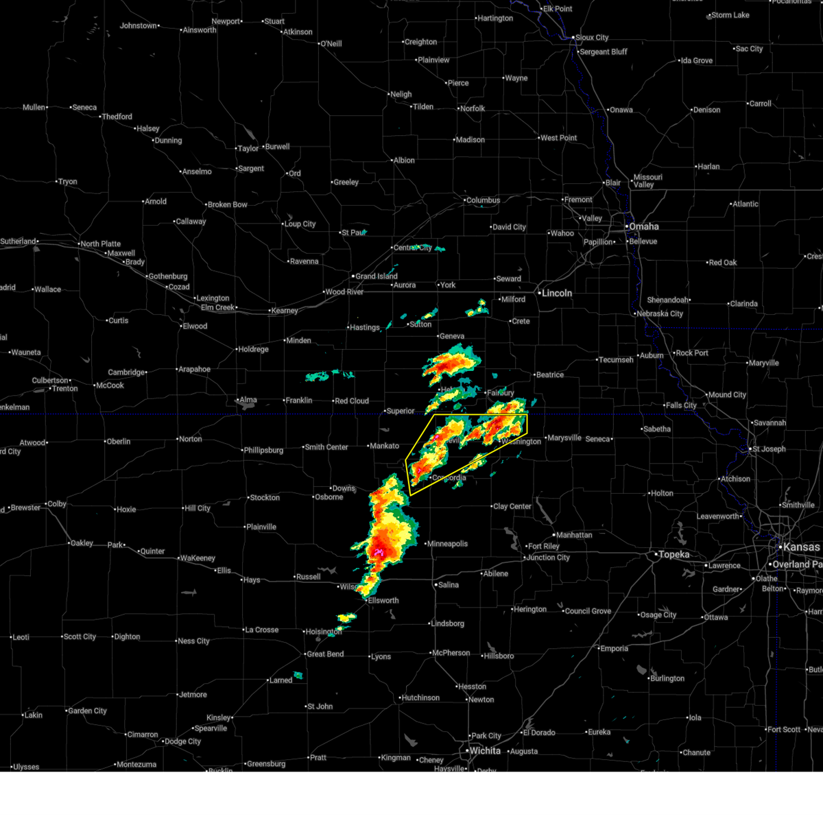 Svrtop the national weather service in topeka has issued a * severe thunderstorm warning for, republic county in north central kansas, northern washington county in north central kansas, northern cloud county in north central kansas, * until 300 pm cdt. * at 202 pm cdt, a severe thunderstorm was located 4 miles southeast of jamestown, moving northeast at 35 mph (radar indicated). Hazards include ping pong ball size hail and 60 mph wind gusts. People and animals outdoors will be injured. expect hail damage to roofs, siding, windows, and vehicles. Expect wind damage to roofs, siding, and trees. Svrtop the national weather service in topeka has issued a * severe thunderstorm warning for, republic county in north central kansas, northern washington county in north central kansas, northern cloud county in north central kansas, * until 300 pm cdt. * at 202 pm cdt, a severe thunderstorm was located 4 miles southeast of jamestown, moving northeast at 35 mph (radar indicated). Hazards include ping pong ball size hail and 60 mph wind gusts. People and animals outdoors will be injured. expect hail damage to roofs, siding, windows, and vehicles. Expect wind damage to roofs, siding, and trees.
|
| 5/18/2026 1:52 PM CDT |
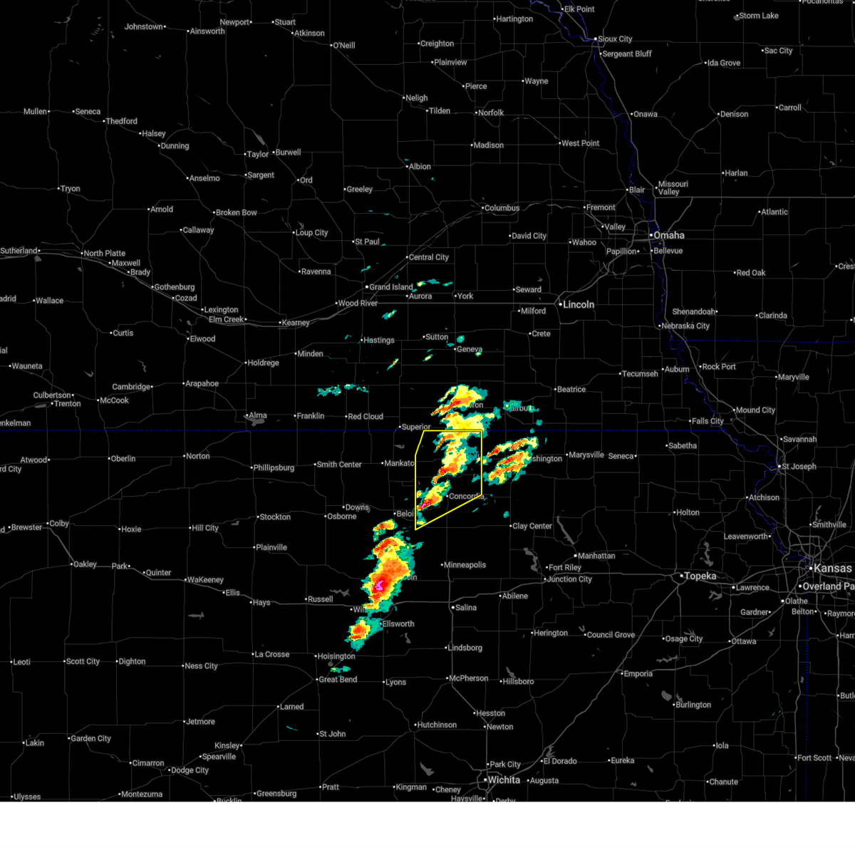 At 151 pm cdt, a severe thunderstorm was located 5 miles south of jamestown, moving northeast at 50 mph (trained weather spotters. at 1:51 pm, quarter size hail was reported 6 miles southwest of jamestown). Hazards include ping pong ball size hail and 60 mph wind gusts. People and animals outdoors will be injured. expect hail damage to roofs, siding, windows, and vehicles. expect wind damage to roofs, siding, and trees. Locations impacted include, concordia, belleville, clyde, scandia, jamestown, courtland, cuba, norway, republic, munden, narka, and agenda. At 151 pm cdt, a severe thunderstorm was located 5 miles south of jamestown, moving northeast at 50 mph (trained weather spotters. at 1:51 pm, quarter size hail was reported 6 miles southwest of jamestown). Hazards include ping pong ball size hail and 60 mph wind gusts. People and animals outdoors will be injured. expect hail damage to roofs, siding, windows, and vehicles. expect wind damage to roofs, siding, and trees. Locations impacted include, concordia, belleville, clyde, scandia, jamestown, courtland, cuba, norway, republic, munden, narka, and agenda.
|
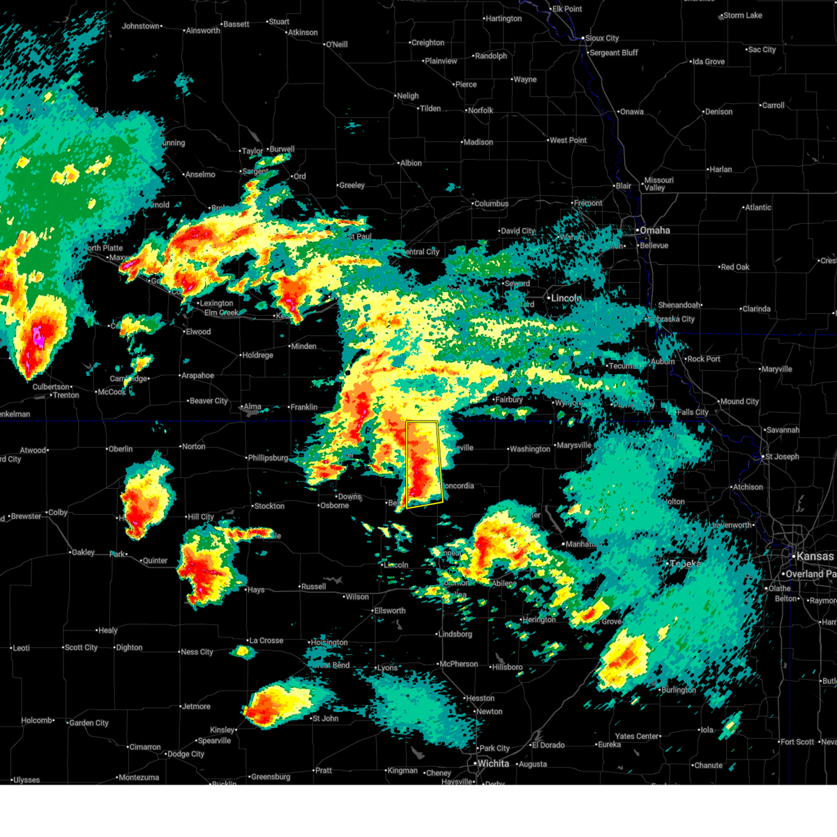
| 5/18/2026 1:51 PM CDT | Quarter sized hail reported 3.4 miles N of Jamestown, KS |
| 5/18/2026 1:43 PM CDT |
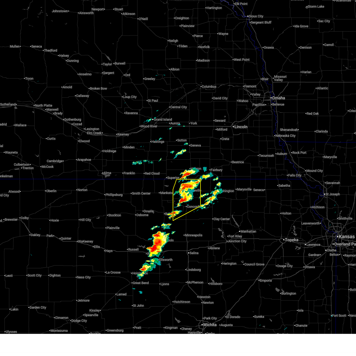 At 143 pm cdt, a severe thunderstorm was located near norway, moving northeast at 45 mph (radar indicated). Hazards include ping pong ball size hail and 60 mph wind gusts. People and animals outdoors will be injured. expect hail damage to roofs, siding, windows, and vehicles. expect wind damage to roofs, siding, and trees. Locations impacted include, concordia, belleville, clyde, scandia, jamestown, courtland, cuba, norway, republic, munden, narka, and agenda. At 143 pm cdt, a severe thunderstorm was located near norway, moving northeast at 45 mph (radar indicated). Hazards include ping pong ball size hail and 60 mph wind gusts. People and animals outdoors will be injured. expect hail damage to roofs, siding, windows, and vehicles. expect wind damage to roofs, siding, and trees. Locations impacted include, concordia, belleville, clyde, scandia, jamestown, courtland, cuba, norway, republic, munden, narka, and agenda.
|
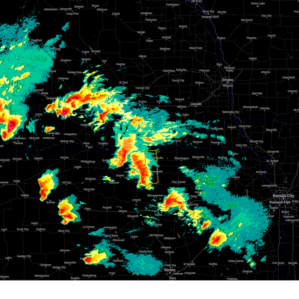
| 5/18/2026 1:28 PM CDT |
 At 127 pm cdt, a severe thunderstorm was located near jamestown, moving northeast at 40 mph (radar indicated). Hazards include ping pong ball size hail and 60 mph wind gusts. People and animals outdoors will be injured. expect hail damage to roofs, siding, windows, and vehicles. expect wind damage to roofs, siding, and trees. Locations impacted include, concordia, belleville, clyde, scandia, jamestown, courtland, cuba, norway, republic, munden, narka, and agenda. At 127 pm cdt, a severe thunderstorm was located near jamestown, moving northeast at 40 mph (radar indicated). Hazards include ping pong ball size hail and 60 mph wind gusts. People and animals outdoors will be injured. expect hail damage to roofs, siding, windows, and vehicles. expect wind damage to roofs, siding, and trees. Locations impacted include, concordia, belleville, clyde, scandia, jamestown, courtland, cuba, norway, republic, munden, narka, and agenda.
|
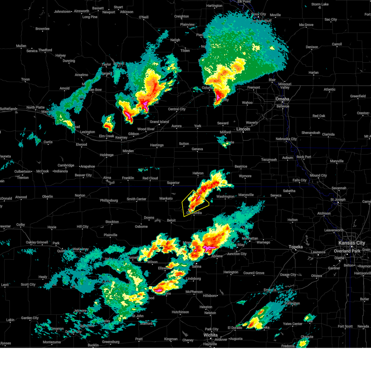
| 5/18/2026 1:08 PM CDT |
 Svrtop the national weather service in topeka has issued a * severe thunderstorm warning for, republic county in north central kansas, northern cloud county in north central kansas, * until 215 pm cdt. * at 108 pm cdt, a severe thunderstorm was located near asherville, moving northeast at 40 mph (radar indicated). Hazards include ping pong ball size hail and 60 mph wind gusts. People and animals outdoors will be injured. expect hail damage to roofs, siding, windows, and vehicles. Expect wind damage to roofs, siding, and trees. Svrtop the national weather service in topeka has issued a * severe thunderstorm warning for, republic county in north central kansas, northern cloud county in north central kansas, * until 215 pm cdt. * at 108 pm cdt, a severe thunderstorm was located near asherville, moving northeast at 40 mph (radar indicated). Hazards include ping pong ball size hail and 60 mph wind gusts. People and animals outdoors will be injured. expect hail damage to roofs, siding, windows, and vehicles. Expect wind damage to roofs, siding, and trees.
|
| 5/17/2026 6:50 PM CDT |
 Svrtop the national weather service in topeka has issued a * severe thunderstorm warning for, southwestern republic county in north central kansas, northwestern cloud county in north central kansas, * until 730 pm cdt. * at 650 pm cdt, a severe thunderstorm was located near scottsville, moving northeast at 40 mph (radar indicated). Hazards include 60 mph wind gusts and half dollar size hail. Hail damage to vehicles is expected. Expect wind damage to roofs, siding, and trees. Svrtop the national weather service in topeka has issued a * severe thunderstorm warning for, southwestern republic county in north central kansas, northwestern cloud county in north central kansas, * until 730 pm cdt. * at 650 pm cdt, a severe thunderstorm was located near scottsville, moving northeast at 40 mph (radar indicated). Hazards include 60 mph wind gusts and half dollar size hail. Hail damage to vehicles is expected. Expect wind damage to roofs, siding, and trees.
|
| 5/16/2026 11:18 PM CDT | Mping report of substantial roof damag in cloud county KS, 0 miles W of Jamestown, KS |
| 5/16/2026 11:05 PM CDT | Personal weather station reporte in cloud county KS, 2.1 miles SSW of Jamestown, KS |
| 5/16/2026 10:56 PM CDT |
 At 1056 pm cdt, severe thunderstorms were located along a line extending from hardy to near courtland to near asherville, moving east at 50 mph (radar indicated). Hazards include 70 mph wind gusts and quarter size hail. Hail damage to vehicles is expected. expect considerable tree damage. wind damage is also likely to mobile homes, roofs, and outbuildings. Locations impacted include, concordia, belleville, clyde, scandia, jamestown, courtland, cuba, norway, republic, munden, narka, agenda, and aurora. At 1056 pm cdt, severe thunderstorms were located along a line extending from hardy to near courtland to near asherville, moving east at 50 mph (radar indicated). Hazards include 70 mph wind gusts and quarter size hail. Hail damage to vehicles is expected. expect considerable tree damage. wind damage is also likely to mobile homes, roofs, and outbuildings. Locations impacted include, concordia, belleville, clyde, scandia, jamestown, courtland, cuba, norway, republic, munden, narka, agenda, and aurora.
|
| 5/16/2026 10:46 PM CDT |
 Svrtop the national weather service in topeka has issued a * severe thunderstorm warning for, republic county in north central kansas, cloud county in north central kansas, * until 1130 pm cdt. * at 1045 pm cdt, severe thunderstorms were located along a line extending from near bostwick to near montrose to 5 miles west of beloit, moving east at 45 mph (radar indicated). Hazards include 60 mph wind gusts and quarter size hail. Hail damage to vehicles is expected. Expect wind damage to roofs, siding, and trees. Svrtop the national weather service in topeka has issued a * severe thunderstorm warning for, republic county in north central kansas, cloud county in north central kansas, * until 1130 pm cdt. * at 1045 pm cdt, severe thunderstorms were located along a line extending from near bostwick to near montrose to 5 miles west of beloit, moving east at 45 mph (radar indicated). Hazards include 60 mph wind gusts and quarter size hail. Hail damage to vehicles is expected. Expect wind damage to roofs, siding, and trees.
|
| 4/25/2026 6:21 PM CDT |
 At 621 pm cdt, a severe thunderstorm was located 5 miles west of concordia, moving east at 20 mph (radar indicated). Hazards include 60 mph wind gusts and quarter size hail. Hail damage to vehicles is expected. expect wind damage to roofs, siding, and trees. Locations impacted include, jamestown. At 621 pm cdt, a severe thunderstorm was located 5 miles west of concordia, moving east at 20 mph (radar indicated). Hazards include 60 mph wind gusts and quarter size hail. Hail damage to vehicles is expected. expect wind damage to roofs, siding, and trees. Locations impacted include, jamestown.
|
| 4/25/2026 6:20 PM CDT |
 Svrtop the national weather service in topeka has issued a * severe thunderstorm warning for, northwestern cloud county in north central kansas, * until 645 pm cdt. * at 620 pm cdt, a severe thunderstorm was located 6 miles southeast of jamestown, moving east at 20 mph (radar indicated). Hazards include ping pong ball size hail and 60 mph wind gusts. People and animals outdoors will be injured. expect hail damage to roofs, siding, windows, and vehicles. Expect wind damage to roofs, siding, and trees. Svrtop the national weather service in topeka has issued a * severe thunderstorm warning for, northwestern cloud county in north central kansas, * until 645 pm cdt. * at 620 pm cdt, a severe thunderstorm was located 6 miles southeast of jamestown, moving east at 20 mph (radar indicated). Hazards include ping pong ball size hail and 60 mph wind gusts. People and animals outdoors will be injured. expect hail damage to roofs, siding, windows, and vehicles. Expect wind damage to roofs, siding, and trees.
|
| 4/25/2026 6:06 PM CDT | Also hail up to nickel size nearly covered the groun in cloud county KS, 5.5 miles N of Jamestown, KS |
| 4/25/2026 6:04 PM CDT |
 Svrtop the national weather service in topeka has issued a * severe thunderstorm warning for, northwestern cloud county in north central kansas, * until 630 pm cdt. * at 603 pm cdt, a severe thunderstorm was located 4 miles east of scottsville, moving east at 20 mph (radar indicated). Hazards include 60 mph wind gusts and quarter size hail. Hail damage to vehicles is expected. Expect wind damage to roofs, siding, and trees. Svrtop the national weather service in topeka has issued a * severe thunderstorm warning for, northwestern cloud county in north central kansas, * until 630 pm cdt. * at 603 pm cdt, a severe thunderstorm was located 4 miles east of scottsville, moving east at 20 mph (radar indicated). Hazards include 60 mph wind gusts and quarter size hail. Hail damage to vehicles is expected. Expect wind damage to roofs, siding, and trees.
|
| 8/10/2025 12:36 AM CDT |
 Svrtop the national weather service in topeka has issued a * severe thunderstorm warning for, republic county in north central kansas, northern cloud county in north central kansas, * until 115 am cdt. * at 1236 am cdt, a severe thunderstorm was located near republic, moving east at 40 mph (radar indicated). Hazards include 70 mph wind gusts. Expect considerable tree damage. Damage is likely to mobile homes, roofs, and outbuildings. Svrtop the national weather service in topeka has issued a * severe thunderstorm warning for, republic county in north central kansas, northern cloud county in north central kansas, * until 115 am cdt. * at 1236 am cdt, a severe thunderstorm was located near republic, moving east at 40 mph (radar indicated). Hazards include 70 mph wind gusts. Expect considerable tree damage. Damage is likely to mobile homes, roofs, and outbuildings.
|
| 5/18/2025 8:03 PM CDT |
 At 802 pm cdt, a severe thunderstorm was located 5 miles southeast of norway, moving northeast at 30 mph (radar indicated hail threat. concordia airport observed a 63 mph wind gust at 755 pm). Hazards include golf ball size hail and 60 mph wind gusts. People and animals outdoors will be injured. expect hail damage to roofs, siding, windows, and vehicles. expect wind damage to roofs, siding, and trees. Locations impacted include, concordia, belleville, scandia, jamestown, and norway. At 802 pm cdt, a severe thunderstorm was located 5 miles southeast of norway, moving northeast at 30 mph (radar indicated hail threat. concordia airport observed a 63 mph wind gust at 755 pm). Hazards include golf ball size hail and 60 mph wind gusts. People and animals outdoors will be injured. expect hail damage to roofs, siding, windows, and vehicles. expect wind damage to roofs, siding, and trees. Locations impacted include, concordia, belleville, scandia, jamestown, and norway.
|
| 5/18/2025 7:54 PM CDT |
 Svrtop the national weather service in topeka has issued a * severe thunderstorm warning for, southwestern republic county in north central kansas, northwestern cloud county in north central kansas, * until 830 pm cdt. * at 754 pm cdt, a severe thunderstorm was located 4 miles east of jamestown, moving northeast at 25 mph (radar indicated). Hazards include golf ball size hail and 60 mph wind gusts. People and animals outdoors will be injured. expect hail damage to roofs, siding, windows, and vehicles. Expect wind damage to roofs, siding, and trees. Svrtop the national weather service in topeka has issued a * severe thunderstorm warning for, southwestern republic county in north central kansas, northwestern cloud county in north central kansas, * until 830 pm cdt. * at 754 pm cdt, a severe thunderstorm was located 4 miles east of jamestown, moving northeast at 25 mph (radar indicated). Hazards include golf ball size hail and 60 mph wind gusts. People and animals outdoors will be injured. expect hail damage to roofs, siding, windows, and vehicles. Expect wind damage to roofs, siding, and trees.
|
| 5/18/2025 7:45 PM CDT |
 At 745 pm cdt, a severe thunderstorm was located 4 miles south of jamestown, moving northeast at 25 mph (radar indicated). Hazards include ping pong ball size hail and 60 mph wind gusts. People and animals outdoors will be injured. expect hail damage to roofs, siding, windows, and vehicles. expect wind damage to roofs, siding, and trees. Locations impacted include, concordia, belleville, scandia, jamestown, courtland, norway, and republic. At 745 pm cdt, a severe thunderstorm was located 4 miles south of jamestown, moving northeast at 25 mph (radar indicated). Hazards include ping pong ball size hail and 60 mph wind gusts. People and animals outdoors will be injured. expect hail damage to roofs, siding, windows, and vehicles. expect wind damage to roofs, siding, and trees. Locations impacted include, concordia, belleville, scandia, jamestown, courtland, norway, and republic.
|
| 5/18/2025 7:26 PM CDT |
 Svrtop the national weather service in topeka has issued a * severe thunderstorm warning for, western republic county in north central kansas, western cloud county in north central kansas, * until 800 pm cdt. * at 725 pm cdt, a severe thunderstorm was located over scottsville, moving northeast at 40 mph (radar indicated). Hazards include 60 mph wind gusts and half dollar size hail. Hail damage to vehicles is expected. Expect wind damage to roofs, siding, and trees. Svrtop the national weather service in topeka has issued a * severe thunderstorm warning for, western republic county in north central kansas, western cloud county in north central kansas, * until 800 pm cdt. * at 725 pm cdt, a severe thunderstorm was located over scottsville, moving northeast at 40 mph (radar indicated). Hazards include 60 mph wind gusts and half dollar size hail. Hail damage to vehicles is expected. Expect wind damage to roofs, siding, and trees.
|
| 4/1/2025 9:14 PM CDT |
 The severe thunderstorm which prompted the warning has. moved out of the warned area. therefore, the warning will be allowed to expire. a severe thunderstorm watch remains in effect until 300 am cdt for north central kansas. remember, a severe thunderstorm warning still remains in effect for eastern portions of republic county and far northeastern cloud county. The severe thunderstorm which prompted the warning has. moved out of the warned area. therefore, the warning will be allowed to expire. a severe thunderstorm watch remains in effect until 300 am cdt for north central kansas. remember, a severe thunderstorm warning still remains in effect for eastern portions of republic county and far northeastern cloud county.
|
| 4/1/2025 9:06 PM CDT |
 At 905 pm cdt, a severe thunderstorm was located 4 miles southeast of scandia, moving northeast at 50 mph (public). Hazards include 70 mph wind gusts and ping pong ball size hail. at 9 pm, a the public reported 1 inch hail in jamestown. People and animals outdoors will be injured. expect hail damage to roofs, siding, windows, and vehicles. expect considerable tree damage. wind damage is also likely to mobile homes, roofs, and outbuildings. Locations impacted include, belleville, scandia, cuba, agenda, jamestown, and norway. At 905 pm cdt, a severe thunderstorm was located 4 miles southeast of scandia, moving northeast at 50 mph (public). Hazards include 70 mph wind gusts and ping pong ball size hail. at 9 pm, a the public reported 1 inch hail in jamestown. People and animals outdoors will be injured. expect hail damage to roofs, siding, windows, and vehicles. expect considerable tree damage. wind damage is also likely to mobile homes, roofs, and outbuildings. Locations impacted include, belleville, scandia, cuba, agenda, jamestown, and norway.
|
| 4/1/2025 9:00 PM CDT | Quarter sized hail reported 0 miles W of Jamestown, KS, report from mping: quarter (1.00 in.). |
| 4/1/2025 8:49 PM CDT |
 Svrtop the national weather service in topeka has issued a * severe thunderstorm warning for, republic county in north central kansas, northwestern cloud county in north central kansas, * until 915 pm cdt. * at 849 pm cdt, a severe thunderstorm was located 4 miles west of jamestown, moving northeast at 50 mph (radar indicated). Hazards include 70 mph wind gusts and ping pong ball size hail. People and animals outdoors will be injured. expect hail damage to roofs, siding, windows, and vehicles. expect considerable tree damage. Wind damage is also likely to mobile homes, roofs, and outbuildings. Svrtop the national weather service in topeka has issued a * severe thunderstorm warning for, republic county in north central kansas, northwestern cloud county in north central kansas, * until 915 pm cdt. * at 849 pm cdt, a severe thunderstorm was located 4 miles west of jamestown, moving northeast at 50 mph (radar indicated). Hazards include 70 mph wind gusts and ping pong ball size hail. People and animals outdoors will be injured. expect hail damage to roofs, siding, windows, and vehicles. expect considerable tree damage. Wind damage is also likely to mobile homes, roofs, and outbuildings.
|
| 7/31/2024 6:35 PM CDT |
 At 628 pm cdt, a severe thunderstorm was located 6 miles southwest of aurora, moving east at 30 mph (trained weather spotters. at 6:16 pm, trained spotters reported 60 mph winds and half dollar sized hail 6 miles north northwest of glasco). Hazards include 60 mph wind gusts and half dollar size hail. Hail damage to vehicles is expected. expect wind damage to roofs, siding, and trees. Locations impacted include, concordia, glasco, jamestown, and aurora. At 628 pm cdt, a severe thunderstorm was located 6 miles southwest of aurora, moving east at 30 mph (trained weather spotters. at 6:16 pm, trained spotters reported 60 mph winds and half dollar sized hail 6 miles north northwest of glasco). Hazards include 60 mph wind gusts and half dollar size hail. Hail damage to vehicles is expected. expect wind damage to roofs, siding, and trees. Locations impacted include, concordia, glasco, jamestown, and aurora.
|
| 7/31/2024 6:10 PM CDT |
 Svrtop the national weather service in topeka has issued a * severe thunderstorm warning for, southwestern republic county in north central kansas, cloud county in north central kansas, * until 645 pm cdt. * at 609 pm cdt, a severe thunderstorm was located 5 miles north of glasco, moving east at 30 mph (radar indicated). Hazards include tennis ball size hail and 70 mph wind gusts. People and animals outdoors will be injured. expect hail damage to roofs, siding, windows, and vehicles. expect considerable tree damage. Wind damage is also likely to mobile homes, roofs, and outbuildings. Svrtop the national weather service in topeka has issued a * severe thunderstorm warning for, southwestern republic county in north central kansas, cloud county in north central kansas, * until 645 pm cdt. * at 609 pm cdt, a severe thunderstorm was located 5 miles north of glasco, moving east at 30 mph (radar indicated). Hazards include tennis ball size hail and 70 mph wind gusts. People and animals outdoors will be injured. expect hail damage to roofs, siding, windows, and vehicles. expect considerable tree damage. Wind damage is also likely to mobile homes, roofs, and outbuildings.
|
| 7/31/2024 5:56 PM CDT |
 At 553 pm cdt, a severe thunderstorm was located 6 miles southeast of scottsville, moving east at 30 mph (law enforcement). Hazards include golf ball size hail and 60 mph wind gusts. at 545 pm, golf ball sized hail was reported 3 miles east northeast of beloit. People and animals outdoors will be injured. expect hail damage to roofs, siding, windows, and vehicles. expect wind damage to roofs, siding, and trees. Locations impacted include, concordia, glasco, and jamestown. At 553 pm cdt, a severe thunderstorm was located 6 miles southeast of scottsville, moving east at 30 mph (law enforcement). Hazards include golf ball size hail and 60 mph wind gusts. at 545 pm, golf ball sized hail was reported 3 miles east northeast of beloit. People and animals outdoors will be injured. expect hail damage to roofs, siding, windows, and vehicles. expect wind damage to roofs, siding, and trees. Locations impacted include, concordia, glasco, and jamestown.
|
| 7/31/2024 5:45 PM CDT |
 Svrtop the national weather service in topeka has issued a * severe thunderstorm warning for, southwestern republic county in north central kansas, western cloud county in north central kansas, * until 615 pm cdt. * at 544 pm cdt, a severe thunderstorm was located near scottsville, moving east at 30 mph (radar indicated). Hazards include golf ball size hail and 60 mph wind gusts. People and animals outdoors will be injured. expect hail damage to roofs, siding, windows, and vehicles. Expect wind damage to roofs, siding, and trees. Svrtop the national weather service in topeka has issued a * severe thunderstorm warning for, southwestern republic county in north central kansas, western cloud county in north central kansas, * until 615 pm cdt. * at 544 pm cdt, a severe thunderstorm was located near scottsville, moving east at 30 mph (radar indicated). Hazards include golf ball size hail and 60 mph wind gusts. People and animals outdoors will be injured. expect hail damage to roofs, siding, windows, and vehicles. Expect wind damage to roofs, siding, and trees.
|
| 6/26/2024 2:19 AM CDT |
 At 218 am cdt, severe thunderstorms were located along a line extending from 6 miles northeast of bern to 7 miles northeast of glasco, moving southeast at 40 mph (radar indicated). Hazards include 60 mph wind gusts and nickel size hail. Expect damage to roofs, siding, and trees. Locations impacted include, concordia, marysville, washington, blue rapids, frankfort, clyde, hanover, waterville, clifton, linn, axtell, greenleaf, jamestown, beattie, barnes, summerfield, cuba, morrowville, norway, and vermillion. At 218 am cdt, severe thunderstorms were located along a line extending from 6 miles northeast of bern to 7 miles northeast of glasco, moving southeast at 40 mph (radar indicated). Hazards include 60 mph wind gusts and nickel size hail. Expect damage to roofs, siding, and trees. Locations impacted include, concordia, marysville, washington, blue rapids, frankfort, clyde, hanover, waterville, clifton, linn, axtell, greenleaf, jamestown, beattie, barnes, summerfield, cuba, morrowville, norway, and vermillion.
|
| 6/26/2024 1:48 AM CDT |
 Svrtop the national weather service in topeka has issued a * severe thunderstorm warning for, republic county in north central kansas, washington county in north central kansas, northern cloud county in north central kansas, marshall county in northeastern kansas, * until 230 am cdt. * at 148 am cdt, severe thunderstorms were located along a line extending from near johnson to near courtland, moving southeast at 35 mph (radar indicated). Hazards include 60 mph wind gusts and nickel size hail. expect damage to roofs, siding, and trees Svrtop the national weather service in topeka has issued a * severe thunderstorm warning for, republic county in north central kansas, washington county in north central kansas, northern cloud county in north central kansas, marshall county in northeastern kansas, * until 230 am cdt. * at 148 am cdt, severe thunderstorms were located along a line extending from near johnson to near courtland, moving southeast at 35 mph (radar indicated). Hazards include 60 mph wind gusts and nickel size hail. expect damage to roofs, siding, and trees
|
| 6/18/2024 7:05 PM CDT |
 At 705 pm cdt, severe thunderstorms were located along a line extending from 3 miles northeast of byron to jamestown, moving east at 30 mph (radar indicated). Hazards include 60 mph wind gusts and penny size hail. Expect damage to roofs, siding, and trees. Locations impacted include, belleville, scandia, jamestown, norway, and republic. At 705 pm cdt, severe thunderstorms were located along a line extending from 3 miles northeast of byron to jamestown, moving east at 30 mph (radar indicated). Hazards include 60 mph wind gusts and penny size hail. Expect damage to roofs, siding, and trees. Locations impacted include, belleville, scandia, jamestown, norway, and republic.
|
| 6/18/2024 6:45 PM CDT |
 Svrtop the national weather service in topeka has issued a * severe thunderstorm warning for, republic county in north central kansas, northwestern cloud county in north central kansas, * until 715 pm cdt. * at 645 pm cdt, severe thunderstorms were located along a line extending from 3 miles east of hardy to 3 miles northwest of scottsville, moving northeast at 40 mph (radar indicated). Hazards include 60 mph wind gusts and penny size hail. expect damage to roofs, siding, and trees Svrtop the national weather service in topeka has issued a * severe thunderstorm warning for, republic county in north central kansas, northwestern cloud county in north central kansas, * until 715 pm cdt. * at 645 pm cdt, severe thunderstorms were located along a line extending from 3 miles east of hardy to 3 miles northwest of scottsville, moving northeast at 40 mph (radar indicated). Hazards include 60 mph wind gusts and penny size hail. expect damage to roofs, siding, and trees
|
| 6/7/2024 11:14 PM CDT |
 The storm which prompted the warning has weakened below severe limits, and no longer poses an immediate threat to life or property. therefore, the warning will be allowed to expire. however, gusty winds are still possible with this thunderstorm. a severe thunderstorm watch remains in effect until 100 am cdt for north central kansas. remember, a severe thunderstorm warning still remains in effect for northeastern cloud county until 1145 pm cdt. The storm which prompted the warning has weakened below severe limits, and no longer poses an immediate threat to life or property. therefore, the warning will be allowed to expire. however, gusty winds are still possible with this thunderstorm. a severe thunderstorm watch remains in effect until 100 am cdt for north central kansas. remember, a severe thunderstorm warning still remains in effect for northeastern cloud county until 1145 pm cdt.
|
| 6/7/2024 10:46 PM CDT |
 Svrtop the national weather service in topeka has issued a * severe thunderstorm warning for, southwestern republic county in north central kansas, northwestern cloud county in north central kansas, * until 1115 pm cdt. * at 1045 pm cdt, a severe thunderstorm was located 4 miles north of randall, moving southeast at 40 mph (radar indicated). Hazards include 60 mph wind gusts and quarter size hail. Hail damage to vehicles is expected. Expect wind damage to roofs, siding, and trees. Svrtop the national weather service in topeka has issued a * severe thunderstorm warning for, southwestern republic county in north central kansas, northwestern cloud county in north central kansas, * until 1115 pm cdt. * at 1045 pm cdt, a severe thunderstorm was located 4 miles north of randall, moving southeast at 40 mph (radar indicated). Hazards include 60 mph wind gusts and quarter size hail. Hail damage to vehicles is expected. Expect wind damage to roofs, siding, and trees.
|
| 5/25/2024 9:45 PM CDT |
 the severe thunderstorm warning has been cancelled and is no longer in effect the severe thunderstorm warning has been cancelled and is no longer in effect
|
| 5/25/2024 9:37 PM CDT |
 At 936 pm cdt, a severe thunderstorm was located 5 miles west of concordia, moving east at 35 mph (radar indicated). Hazards include 60 mph wind gusts and quarter size hail. Hail damage to vehicles is expected. expect wind damage to roofs, siding, and trees. Locations impacted include, concordia, clyde, jamestown, and agenda. At 936 pm cdt, a severe thunderstorm was located 5 miles west of concordia, moving east at 35 mph (radar indicated). Hazards include 60 mph wind gusts and quarter size hail. Hail damage to vehicles is expected. expect wind damage to roofs, siding, and trees. Locations impacted include, concordia, clyde, jamestown, and agenda.
|
| 5/25/2024 9:13 PM CDT |
 Svrtop the national weather service in topeka has issued a * severe thunderstorm warning for, southern republic county in north central kansas, cloud county in north central kansas, * until 1000 pm cdt. * at 912 pm cdt, a severe thunderstorm was located 4 miles west of scottsville, moving east at 40 mph (radar indicated). Hazards include ping pong ball size hail and 60 mph wind gusts. People and animals outdoors will be injured. expect hail damage to roofs, siding, windows, and vehicles. Expect wind damage to roofs, siding, and trees. Svrtop the national weather service in topeka has issued a * severe thunderstorm warning for, southern republic county in north central kansas, cloud county in north central kansas, * until 1000 pm cdt. * at 912 pm cdt, a severe thunderstorm was located 4 miles west of scottsville, moving east at 40 mph (radar indicated). Hazards include ping pong ball size hail and 60 mph wind gusts. People and animals outdoors will be injured. expect hail damage to roofs, siding, windows, and vehicles. Expect wind damage to roofs, siding, and trees.
|
| 5/25/2024 8:49 PM CDT |
 At 849 pm cdt, a severe thunderstorm was located 5 miles west of concordia, moving east at 35 mph (radar indicated). Hazards include ping pong ball size hail and 60 mph wind gusts. People and animals outdoors will be injured. expect hail damage to roofs, siding, windows, and vehicles. expect wind damage to roofs, siding, and trees. Locations impacted include, concordia and jamestown. At 849 pm cdt, a severe thunderstorm was located 5 miles west of concordia, moving east at 35 mph (radar indicated). Hazards include ping pong ball size hail and 60 mph wind gusts. People and animals outdoors will be injured. expect hail damage to roofs, siding, windows, and vehicles. expect wind damage to roofs, siding, and trees. Locations impacted include, concordia and jamestown.
|
| 5/25/2024 8:34 PM CDT |
 At 834 pm cdt, a severe thunderstorm was located 4 miles south of jamestown, moving east at 30 mph (radar indicated). Hazards include 60 mph wind gusts and half dollar size hail. Hail damage to vehicles is expected. expect wind damage to roofs, siding, and trees. Locations impacted include, concordia and jamestown. At 834 pm cdt, a severe thunderstorm was located 4 miles south of jamestown, moving east at 30 mph (radar indicated). Hazards include 60 mph wind gusts and half dollar size hail. Hail damage to vehicles is expected. expect wind damage to roofs, siding, and trees. Locations impacted include, concordia and jamestown.
|
| 5/25/2024 8:26 PM CDT |
 At 825 pm cdt, a severe thunderstorm was located over scottsville, moving east at 40 mph (radar indicated). Hazards include ping pong ball size hail and 60 mph wind gusts. People and animals outdoors will be injured. expect hail damage to roofs, siding, windows, and vehicles. expect wind damage to roofs, siding, and trees. Locations impacted include, concordia and jamestown. At 825 pm cdt, a severe thunderstorm was located over scottsville, moving east at 40 mph (radar indicated). Hazards include ping pong ball size hail and 60 mph wind gusts. People and animals outdoors will be injured. expect hail damage to roofs, siding, windows, and vehicles. expect wind damage to roofs, siding, and trees. Locations impacted include, concordia and jamestown.
|
| 5/25/2024 8:13 PM CDT |
 Svrtop the national weather service in topeka has issued a * severe thunderstorm warning for, northwestern cloud county in north central kansas, * until 915 pm cdt. * at 813 pm cdt, a severe thunderstorm was located over beloit, moving east at 30 mph (radar indicated). Hazards include golf ball size hail and 60 mph wind gusts. People and animals outdoors will be injured. expect hail damage to roofs, siding, windows, and vehicles. expect wind damage to roofs, siding, and trees. this severe thunderstorm will be near, jamestown around 835 pm cdt. Concordia around 850 pm cdt. Svrtop the national weather service in topeka has issued a * severe thunderstorm warning for, northwestern cloud county in north central kansas, * until 915 pm cdt. * at 813 pm cdt, a severe thunderstorm was located over beloit, moving east at 30 mph (radar indicated). Hazards include golf ball size hail and 60 mph wind gusts. People and animals outdoors will be injured. expect hail damage to roofs, siding, windows, and vehicles. expect wind damage to roofs, siding, and trees. this severe thunderstorm will be near, jamestown around 835 pm cdt. Concordia around 850 pm cdt.
|
| 5/2/2024 1:32 AM CDT |
 At 132 am cdt, severe thunderstorms were located along a line extending from 3 miles northeast of deshler to jamestown, moving east at 45 mph (radar indicated). Hazards include 60 mph wind gusts and penny size hail. Expect damage to roofs, siding, and trees. Locations impacted include, concordia, belleville, scandia, jamestown, courtland, norway, republic, and munden. At 132 am cdt, severe thunderstorms were located along a line extending from 3 miles northeast of deshler to jamestown, moving east at 45 mph (radar indicated). Hazards include 60 mph wind gusts and penny size hail. Expect damage to roofs, siding, and trees. Locations impacted include, concordia, belleville, scandia, jamestown, courtland, norway, republic, and munden.
|
| 5/2/2024 1:21 AM CDT |
 At 118 am cdt, severe thunderstorms were located along a line extending from near ruskin to 4 miles west of scottsville, moving east at 45 mph (trained weather spotters. at 102 am cdt a kansas mesonet site 3 miles west of jewell in jewell county recorded a wind gust to 61 mph). Hazards include 70 mph wind gusts and penny size hail. Expect considerable tree damage. damage is likely to mobile homes, roofs, and outbuildings. Locations impacted include, concordia, belleville, scandia, jamestown, courtland, norway, republic, and munden. At 118 am cdt, severe thunderstorms were located along a line extending from near ruskin to 4 miles west of scottsville, moving east at 45 mph (trained weather spotters. at 102 am cdt a kansas mesonet site 3 miles west of jewell in jewell county recorded a wind gust to 61 mph). Hazards include 70 mph wind gusts and penny size hail. Expect considerable tree damage. damage is likely to mobile homes, roofs, and outbuildings. Locations impacted include, concordia, belleville, scandia, jamestown, courtland, norway, republic, and munden.
|
| 5/2/2024 1:01 AM CDT |
 Svrtop the national weather service in topeka has issued a * severe thunderstorm warning for, republic county in north central kansas, northwestern cloud county in north central kansas, * until 145 am cdt. * at 101 am cdt, severe thunderstorms were located along a line extending from 3 miles north of superior to 4 miles east of glen elder, moving east at 45 mph (radar indicated). Hazards include 70 mph wind gusts and penny size hail. Expect considerable tree damage. Damage is likely to mobile homes, roofs, and outbuildings. Svrtop the national weather service in topeka has issued a * severe thunderstorm warning for, republic county in north central kansas, northwestern cloud county in north central kansas, * until 145 am cdt. * at 101 am cdt, severe thunderstorms were located along a line extending from 3 miles north of superior to 4 miles east of glen elder, moving east at 45 mph (radar indicated). Hazards include 70 mph wind gusts and penny size hail. Expect considerable tree damage. Damage is likely to mobile homes, roofs, and outbuildings.
|
| 4/25/2024 8:26 AM CDT |
 The storm which prompted the warning has moved out of the area. therefore, the warning will be allowed to expire. remember, a severe thunderstorm warning still remains in effect for northern cloud county until 900 am. The storm which prompted the warning has moved out of the area. therefore, the warning will be allowed to expire. remember, a severe thunderstorm warning still remains in effect for northern cloud county until 900 am.
|
| 4/25/2024 8:09 AM CDT |
 At 809 am cdt, a severe thunderstorm was located near jamestown, moving east at 25 mph (radar indicated). Hazards include ping pong ball size hail and 60 mph wind gusts. People and animals outdoors will be injured. expect hail damage to roofs, siding, windows, and vehicles. expect wind damage to roofs, siding, and trees. Locations impacted include, jamestown. At 809 am cdt, a severe thunderstorm was located near jamestown, moving east at 25 mph (radar indicated). Hazards include ping pong ball size hail and 60 mph wind gusts. People and animals outdoors will be injured. expect hail damage to roofs, siding, windows, and vehicles. expect wind damage to roofs, siding, and trees. Locations impacted include, jamestown.
|
| 4/25/2024 7:45 AM CDT |
 Svrtop the national weather service in topeka has issued a * severe thunderstorm warning for, northwestern cloud county in north central kansas, * until 830 am cdt. * at 744 am cdt, a severe thunderstorm was located 5 miles northeast of beloit, moving east at 20 mph (radar indicated). Hazards include ping pong ball size hail and 60 mph wind gusts. People and animals outdoors will be injured. expect hail damage to roofs, siding, windows, and vehicles. Expect wind damage to roofs, siding, and trees. Svrtop the national weather service in topeka has issued a * severe thunderstorm warning for, northwestern cloud county in north central kansas, * until 830 am cdt. * at 744 am cdt, a severe thunderstorm was located 5 miles northeast of beloit, moving east at 20 mph (radar indicated). Hazards include ping pong ball size hail and 60 mph wind gusts. People and animals outdoors will be injured. expect hail damage to roofs, siding, windows, and vehicles. Expect wind damage to roofs, siding, and trees.
|
| 4/6/2024 4:41 PM CDT |
 Svrtop the national weather service in topeka has issued a * severe thunderstorm warning for, northwestern dickinson county in central kansas, ottawa county in north central kansas, republic county in north central kansas, southwestern washington county in north central kansas, western clay county in north central kansas, cloud county in north central kansas, * until 515 pm cdt. * at 440 pm cdt, severe thunderstorms were located along a line extending from byron to near miltonvale to 4 miles southeast of lindsborg, moving north at 55 mph (radar indicated). Hazards include 70 mph wind gusts and nickel size hail. Expect considerable tree damage. Damage is likely to mobile homes, roofs, and outbuildings. Svrtop the national weather service in topeka has issued a * severe thunderstorm warning for, northwestern dickinson county in central kansas, ottawa county in north central kansas, republic county in north central kansas, southwestern washington county in north central kansas, western clay county in north central kansas, cloud county in north central kansas, * until 515 pm cdt. * at 440 pm cdt, severe thunderstorms were located along a line extending from byron to near miltonvale to 4 miles southeast of lindsborg, moving north at 55 mph (radar indicated). Hazards include 70 mph wind gusts and nickel size hail. Expect considerable tree damage. Damage is likely to mobile homes, roofs, and outbuildings.
|
| 4/6/2024 4:26 PM CDT |
 At 425 pm cdt, severe thunderstorms were located along a line extending from near courtland to 6 miles northeast of delphos to 3 miles northwest of mcpherson, moving northeast at 55 mph (radar indicated). Hazards include 70 mph wind gusts and quarter size hail. Hail damage to vehicles is expected. expect considerable tree damage. wind damage is also likely to mobile homes, roofs, and outbuildings. Locations impacted include, concordia, minneapolis, belleville, clyde, bennington, miltonvale, glasco, scandia, delphos, jamestown, courtland, cuba, norway, culver, wells, republic, munden, narka, agenda, and aurora. At 425 pm cdt, severe thunderstorms were located along a line extending from near courtland to 6 miles northeast of delphos to 3 miles northwest of mcpherson, moving northeast at 55 mph (radar indicated). Hazards include 70 mph wind gusts and quarter size hail. Hail damage to vehicles is expected. expect considerable tree damage. wind damage is also likely to mobile homes, roofs, and outbuildings. Locations impacted include, concordia, minneapolis, belleville, clyde, bennington, miltonvale, glasco, scandia, delphos, jamestown, courtland, cuba, norway, culver, wells, republic, munden, narka, agenda, and aurora.
|
| 4/6/2024 4:14 PM CDT |
 Svrtop the national weather service in topeka has issued a * severe thunderstorm warning for, ottawa county in north central kansas, republic county in north central kansas, cloud county in north central kansas, * until 445 pm cdt. * at 413 pm cdt, severe thunderstorms were located along a line extending from 4 miles east of randall to 4 miles south of delphos to near inman, moving northeast at 55 mph (radar indicated). Hazards include 70 mph wind gusts. Expect considerable tree damage. Damage is likely to mobile homes, roofs, and outbuildings. Svrtop the national weather service in topeka has issued a * severe thunderstorm warning for, ottawa county in north central kansas, republic county in north central kansas, cloud county in north central kansas, * until 445 pm cdt. * at 413 pm cdt, severe thunderstorms were located along a line extending from 4 miles east of randall to 4 miles south of delphos to near inman, moving northeast at 55 mph (radar indicated). Hazards include 70 mph wind gusts. Expect considerable tree damage. Damage is likely to mobile homes, roofs, and outbuildings.
|
| 9/22/2023 12:42 AM CDT |
 The severe thunderstorm warning for republic and northwestern cloud counties will expire at 1245 am cdt, the storms which prompted the warning have weakened below severe limits, and no longer pose an immediate threat to life or property. therefore, the warning will be allowed to expire. however gusty winds to around 50 mph and heavy rain are still possible with these thunderstorms. The severe thunderstorm warning for republic and northwestern cloud counties will expire at 1245 am cdt, the storms which prompted the warning have weakened below severe limits, and no longer pose an immediate threat to life or property. therefore, the warning will be allowed to expire. however gusty winds to around 50 mph and heavy rain are still possible with these thunderstorms.
|
| 9/22/2023 12:30 AM CDT |
 At 1230 am cdt, severe thunderstorms were located along a line extending from 3 miles south of carleton to near scandia to near scottsville, moving east at 35 mph (radar indicated). Hazards include 60 mph wind gusts. Expect damage to roofs, siding, and trees. locations impacted include, belleville, scandia, jamestown, courtland, norway, republic and munden. hail threat, radar indicated max hail size, <. 75 in wind threat, radar indicated max wind gust, 60 mph. At 1230 am cdt, severe thunderstorms were located along a line extending from 3 miles south of carleton to near scandia to near scottsville, moving east at 35 mph (radar indicated). Hazards include 60 mph wind gusts. Expect damage to roofs, siding, and trees. locations impacted include, belleville, scandia, jamestown, courtland, norway, republic and munden. hail threat, radar indicated max hail size, <. 75 in wind threat, radar indicated max wind gust, 60 mph.
|
| 9/22/2023 12:15 AM CDT |
 At 1215 am cdt, severe thunderstorms were located along a line extending from near oak to near courtland to 4 miles northwest of beloit, moving east at 40 mph (radar indicated). Hazards include 60 mph wind gusts. expect damage to roofs, siding, and trees At 1215 am cdt, severe thunderstorms were located along a line extending from near oak to near courtland to 4 miles northwest of beloit, moving east at 40 mph (radar indicated). Hazards include 60 mph wind gusts. expect damage to roofs, siding, and trees
|
| 7/28/2023 6:21 PM CDT |
 At 619 pm cdt, severe thunderstorms were located along a line extending from 3 miles northeast of agenda to 4 miles north of concordia to 3 miles south of scottsville, moving east at 25 mph (trained weather spotters. at 616 pm, trained spotter reported 69 mph wind gust 1 mile north of clyde). Hazards include 70 mph wind gusts and half dollar size hail. Hail damage to vehicles is expected. expect considerable tree damage. wind damage is also likely to mobile homes, roofs, and outbuildings. locations impacted include, concordia, clyde, clifton, jamestown, cuba, norway, palmer, agenda and vining. thunderstorm damage threat, considerable hail threat, radar indicated max hail size, 1. 25 in wind threat, observed max wind gust, 70 mph. At 619 pm cdt, severe thunderstorms were located along a line extending from 3 miles northeast of agenda to 4 miles north of concordia to 3 miles south of scottsville, moving east at 25 mph (trained weather spotters. at 616 pm, trained spotter reported 69 mph wind gust 1 mile north of clyde). Hazards include 70 mph wind gusts and half dollar size hail. Hail damage to vehicles is expected. expect considerable tree damage. wind damage is also likely to mobile homes, roofs, and outbuildings. locations impacted include, concordia, clyde, clifton, jamestown, cuba, norway, palmer, agenda and vining. thunderstorm damage threat, considerable hail threat, radar indicated max hail size, 1. 25 in wind threat, observed max wind gust, 70 mph.
|
| 7/28/2023 6:14 PM CDT |
 At 614 pm cdt, severe thunderstorms were located along a line extending from near agenda to 3 miles north of concordia to 3 miles south of scottsville, moving east at 25 mph (radar indicated). Hazards include 70 mph wind gusts and half dollar size hail. Hail damage to vehicles is expected. expect considerable tree damage. Wind damage is also likely to mobile homes, roofs, and outbuildings. At 614 pm cdt, severe thunderstorms were located along a line extending from near agenda to 3 miles north of concordia to 3 miles south of scottsville, moving east at 25 mph (radar indicated). Hazards include 70 mph wind gusts and half dollar size hail. Hail damage to vehicles is expected. expect considerable tree damage. Wind damage is also likely to mobile homes, roofs, and outbuildings.
|
| 7/28/2023 6:09 PM CDT |
 At 557 pm cdt, a severe thunderstorm was located near jamestown, moving southeast at 15 mph (storm spotter. at 603 pm, a storm reporter reported quarter-sized hail and telephone poles snapping). Hazards include 60 mph wind gusts and quarter size hail. Hail damage to vehicles is expected. expect wind damage to roofs, siding, and trees. locations impacted include, jamestown. hail threat, radar indicated max hail size, 1. 00 in wind threat, radar indicated max wind gust, 60 mph. At 557 pm cdt, a severe thunderstorm was located near jamestown, moving southeast at 15 mph (storm spotter. at 603 pm, a storm reporter reported quarter-sized hail and telephone poles snapping). Hazards include 60 mph wind gusts and quarter size hail. Hail damage to vehicles is expected. expect wind damage to roofs, siding, and trees. locations impacted include, jamestown. hail threat, radar indicated max hail size, 1. 00 in wind threat, radar indicated max wind gust, 60 mph.
|
| 7/28/2023 6:02 PM CDT | Power poles snappe in cloud county KS, 2.1 miles N of Jamestown, KS |
| 7/28/2023 6:02 PM CDT | Quarter sized hail reported 2.1 miles N of Jamestown, KS |
| 7/28/2023 5:58 PM CDT |
 At 557 pm cdt, a severe thunderstorm was located near jamestown, moving southeast at 15 mph (radar indicated). Hazards include 60 mph wind gusts and quarter size hail. Hail damage to vehicles is expected. expect wind damage to roofs, siding, and trees. locations impacted include, jamestown. hail threat, radar indicated max hail size, 1. 00 in wind threat, radar indicated max wind gust, 60 mph. At 557 pm cdt, a severe thunderstorm was located near jamestown, moving southeast at 15 mph (radar indicated). Hazards include 60 mph wind gusts and quarter size hail. Hail damage to vehicles is expected. expect wind damage to roofs, siding, and trees. locations impacted include, jamestown. hail threat, radar indicated max hail size, 1. 00 in wind threat, radar indicated max wind gust, 60 mph.
|
| 7/28/2023 5:43 PM CDT | Pictures of a large tree snapped at the base of the trun in cloud county KS, 0 miles W of Jamestown, KS |
| 7/28/2023 5:43 PM CDT |
 At 541 pm cdt, a severe thunderstorm was located near jamestown, moving southeast at 15 mph (radar indicated). Hazards include 60 mph wind gusts and half dollar size hail. Hail damage to vehicles is expected. Expect wind damage to roofs, siding, and trees. At 541 pm cdt, a severe thunderstorm was located near jamestown, moving southeast at 15 mph (radar indicated). Hazards include 60 mph wind gusts and half dollar size hail. Hail damage to vehicles is expected. Expect wind damage to roofs, siding, and trees.
|
| 6/29/2023 5:39 AM CDT |
 At 538 am cdt, a severe thunderstorm was located near courtland, moving east at 50 mph (radar indicated). Hazards include golf ball size hail and 70 mph wind gusts. People and animals outdoors will be injured. expect hail damage to roofs, siding, windows, and vehicles. expect considerable tree damage. wind damage is also likely to mobile homes, roofs, and outbuildings. locations impacted include, belleville, clyde, scandia, jamestown, courtland, cuba, norway, republic, munden, narka and agenda. thunderstorm damage threat, considerable hail threat, radar indicated max hail size, 1. 75 in wind threat, radar indicated max wind gust, 70 mph. At 538 am cdt, a severe thunderstorm was located near courtland, moving east at 50 mph (radar indicated). Hazards include golf ball size hail and 70 mph wind gusts. People and animals outdoors will be injured. expect hail damage to roofs, siding, windows, and vehicles. expect considerable tree damage. wind damage is also likely to mobile homes, roofs, and outbuildings. locations impacted include, belleville, clyde, scandia, jamestown, courtland, cuba, norway, republic, munden, narka and agenda. thunderstorm damage threat, considerable hail threat, radar indicated max hail size, 1. 75 in wind threat, radar indicated max wind gust, 70 mph.
|
| 6/29/2023 5:26 AM CDT |
 At 526 am cdt, a severe thunderstorm was located near montrose, moving east at 50 mph (radar indicated). Hazards include golf ball size hail and 60 mph wind gusts. People and animals outdoors will be injured. expect hail damage to roofs, siding, windows, and vehicles. Expect wind damage to roofs, siding, and trees. At 526 am cdt, a severe thunderstorm was located near montrose, moving east at 50 mph (radar indicated). Hazards include golf ball size hail and 60 mph wind gusts. People and animals outdoors will be injured. expect hail damage to roofs, siding, windows, and vehicles. Expect wind damage to roofs, siding, and trees.
|
| 6/9/2023 9:05 PM CDT |
 At 904 pm cdt, severe thunderstorms were located along a line extending from jamestown to near simpson, moving northeast at 20 mph (radar indicated). Hazards include 60 mph wind gusts and quarter size hail. Hail damage to vehicles is expected. Expect wind damage to roofs, siding, and trees. At 904 pm cdt, severe thunderstorms were located along a line extending from jamestown to near simpson, moving northeast at 20 mph (radar indicated). Hazards include 60 mph wind gusts and quarter size hail. Hail damage to vehicles is expected. Expect wind damage to roofs, siding, and trees.
|
| 5/9/2023 12:52 PM CDT |
 At 1252 pm cdt, severe thunderstorms were located along a line extending from belleville to 4 miles northeast of minneapolis, moving east at 35 mph (trained weather spotters). Hazards include two inch hail and 70 mph wind gusts. People and animals outdoors will be injured. expect hail damage to roofs, siding, windows, and vehicles. expect considerable tree damage. wind damage is also likely to mobile homes, roofs, and outbuildings. locations impacted include, concordia, minneapolis, belleville, clyde, miltonvale, glasco, scandia, delphos, jamestown, courtland, cuba, norway, wells, munden, agenda, aurora and ada. thunderstorm damage threat, considerable hail threat, radar indicated max hail size, 2. 00 in wind threat, radar indicated max wind gust, 70 mph. At 1252 pm cdt, severe thunderstorms were located along a line extending from belleville to 4 miles northeast of minneapolis, moving east at 35 mph (trained weather spotters). Hazards include two inch hail and 70 mph wind gusts. People and animals outdoors will be injured. expect hail damage to roofs, siding, windows, and vehicles. expect considerable tree damage. wind damage is also likely to mobile homes, roofs, and outbuildings. locations impacted include, concordia, minneapolis, belleville, clyde, miltonvale, glasco, scandia, delphos, jamestown, courtland, cuba, norway, wells, munden, agenda, aurora and ada. thunderstorm damage threat, considerable hail threat, radar indicated max hail size, 2. 00 in wind threat, radar indicated max wind gust, 70 mph.
|
| 5/9/2023 12:40 PM CDT |
 At 1240 pm cdt, severe thunderstorms were located along a line extending from near cuba to 4 miles northwest of minneapolis, moving east at 45 mph (trained weather spotters). Hazards include tennis ball size hail and 70 mph wind gusts. People and animals outdoors will be injured. expect hail damage to roofs, siding, windows, and vehicles. expect considerable tree damage. wind damage is also likely to mobile homes, roofs, and outbuildings. locations impacted include, concordia, minneapolis, belleville, clyde, miltonvale, glasco, scandia, delphos, jamestown, courtland, cuba, norway, wells, munden, agenda, aurora and ada. thunderstorm damage threat, considerable hail threat, radar indicated max hail size, 2. 50 in wind threat, radar indicated max wind gust, 70 mph. At 1240 pm cdt, severe thunderstorms were located along a line extending from near cuba to 4 miles northwest of minneapolis, moving east at 45 mph (trained weather spotters). Hazards include tennis ball size hail and 70 mph wind gusts. People and animals outdoors will be injured. expect hail damage to roofs, siding, windows, and vehicles. expect considerable tree damage. wind damage is also likely to mobile homes, roofs, and outbuildings. locations impacted include, concordia, minneapolis, belleville, clyde, miltonvale, glasco, scandia, delphos, jamestown, courtland, cuba, norway, wells, munden, agenda, aurora and ada. thunderstorm damage threat, considerable hail threat, radar indicated max hail size, 2. 50 in wind threat, radar indicated max wind gust, 70 mph.
|
| 5/9/2023 12:28 PM CDT |
 At 1228 pm cdt, severe thunderstorms were located along a line extending from belleville to near ada, moving east at 50 mph (radar indicated). Hazards include two inch hail and 70 mph wind gusts. People and animals outdoors will be injured. expect hail damage to roofs, siding, windows, and vehicles. expect considerable tree damage. Wind damage is also likely to mobile homes, roofs, and outbuildings. At 1228 pm cdt, severe thunderstorms were located along a line extending from belleville to near ada, moving east at 50 mph (radar indicated). Hazards include two inch hail and 70 mph wind gusts. People and animals outdoors will be injured. expect hail damage to roofs, siding, windows, and vehicles. expect considerable tree damage. Wind damage is also likely to mobile homes, roofs, and outbuildings.
|
| 5/9/2023 12:06 PM CDT |
 At 1206 pm cdt, severe thunderstorms were located along a line extending from 6 miles east of randall to 5 miles east of victor, moving east at 40 mph (radar indicated). Hazards include golf ball size hail and 70 mph wind gusts. People and animals outdoors will be injured. expect hail damage to roofs, siding, windows, and vehicles. expect considerable tree damage. Wind damage is also likely to mobile homes, roofs, and outbuildings. At 1206 pm cdt, severe thunderstorms were located along a line extending from 6 miles east of randall to 5 miles east of victor, moving east at 40 mph (radar indicated). Hazards include golf ball size hail and 70 mph wind gusts. People and animals outdoors will be injured. expect hail damage to roofs, siding, windows, and vehicles. expect considerable tree damage. Wind damage is also likely to mobile homes, roofs, and outbuildings.
|
| 5/7/2023 9:23 PM CDT |
 At 922 pm cdt, severe thunderstorms were located along a line extending from munden to 3 miles north of aurora, moving east at 50 mph (trained weather spotters). Hazards include 60 mph wind gusts and quarter size hail. Hail damage to vehicles is expected. Expect wind damage to roofs, siding, and trees. At 922 pm cdt, severe thunderstorms were located along a line extending from munden to 3 miles north of aurora, moving east at 50 mph (trained weather spotters). Hazards include 60 mph wind gusts and quarter size hail. Hail damage to vehicles is expected. Expect wind damage to roofs, siding, and trees.
|
| 4/20/2023 1:56 AM CDT |
 At 155 am cdt, severe thunderstorms were located along a line extending from 4 miles northwest of clyde to 4 miles west of talmage, moving northeast at 60 mph (trained weather spotters reported 65 mph winds and quarter size hail in glasco). Hazards include 60 mph wind gusts and quarter size hail. Hail damage to vehicles is expected. Expect wind damage to roofs, siding, and trees. At 155 am cdt, severe thunderstorms were located along a line extending from 4 miles northwest of clyde to 4 miles west of talmage, moving northeast at 60 mph (trained weather spotters reported 65 mph winds and quarter size hail in glasco). Hazards include 60 mph wind gusts and quarter size hail. Hail damage to vehicles is expected. Expect wind damage to roofs, siding, and trees.
|
| 4/20/2023 1:40 AM CDT |
 At 140 am cdt, severe thunderstorms were located along a line extending from 5 miles southwest of chester to 5 miles south of clyde, moving east at 50 mph (trained weather spotters). Hazards include 60 mph wind gusts and quarter size hail. Hail damage to vehicles is expected. expect wind damage to roofs, siding, and trees. locations impacted include, concordia, belleville, clyde, scandia, jamestown, courtland, cuba, norway, republic, munden, narka, agenda and aurora. hail threat, radar indicated max hail size, 1. 00 in wind threat, radar indicated max wind gust, 60 mph. At 140 am cdt, severe thunderstorms were located along a line extending from 5 miles southwest of chester to 5 miles south of clyde, moving east at 50 mph (trained weather spotters). Hazards include 60 mph wind gusts and quarter size hail. Hail damage to vehicles is expected. expect wind damage to roofs, siding, and trees. locations impacted include, concordia, belleville, clyde, scandia, jamestown, courtland, cuba, norway, republic, munden, narka, agenda and aurora. hail threat, radar indicated max hail size, 1. 00 in wind threat, radar indicated max wind gust, 60 mph.
|
| 4/20/2023 1:28 AM CDT |
 At 128 am cdt, severe thunderstorms were located along a line extending from near republic to 4 miles northwest of aurora, moving east at 50 mph (radar indicated). Hazards include 60 mph wind gusts and quarter size hail. Hail damage to vehicles is expected. Expect wind damage to roofs, siding, and trees. At 128 am cdt, severe thunderstorms were located along a line extending from near republic to 4 miles northwest of aurora, moving east at 50 mph (radar indicated). Hazards include 60 mph wind gusts and quarter size hail. Hail damage to vehicles is expected. Expect wind damage to roofs, siding, and trees.
|
| 6/7/2022 10:45 PM CDT |
 At 1042 pm cdt, severe thunderstorms were located along a line extending from 4 miles west of greenleaf to aurora to 4 miles north of glasco, moving southeast at 45 mph (radar indicated. at 1031 pm a 73 mph wind gust was measured at the concordia airport). Hazards include 70 mph wind gusts and half dollar size hail. Hail damage to vehicles is expected. expect considerable tree damage. wind damage is also likely to mobile homes, roofs, and outbuildings. locations impacted include, concordia, clyde, clifton, miltonvale, glasco, linn, delphos, greenleaf, jamestown, morganville, cuba, morrowville, palmer, haddam, agenda, aurora, vining and idana. thunderstorm damage threat, considerable hail threat, radar indicated max hail size, 1. 25 in wind threat, observed max wind gust, 70 mph. At 1042 pm cdt, severe thunderstorms were located along a line extending from 4 miles west of greenleaf to aurora to 4 miles north of glasco, moving southeast at 45 mph (radar indicated. at 1031 pm a 73 mph wind gust was measured at the concordia airport). Hazards include 70 mph wind gusts and half dollar size hail. Hail damage to vehicles is expected. expect considerable tree damage. wind damage is also likely to mobile homes, roofs, and outbuildings. locations impacted include, concordia, clyde, clifton, miltonvale, glasco, linn, delphos, greenleaf, jamestown, morganville, cuba, morrowville, palmer, haddam, agenda, aurora, vining and idana. thunderstorm damage threat, considerable hail threat, radar indicated max hail size, 1. 25 in wind threat, observed max wind gust, 70 mph.
|
| 6/7/2022 10:32 PM CDT |
 At 1031 pm cdt, severe thunderstorms were located along a line extending from near morrowville to 3 miles east of concordia to near scottsville, moving southeast at 50 mph (radar indicated). Hazards include 70 mph wind gusts and half dollar size hail. Hail damage to vehicles is expected. expect considerable tree damage. wind damage is also likely to mobile homes, roofs, and outbuildings. locations impacted include, concordia, clyde, clifton, miltonvale, glasco, linn, delphos, greenleaf, jamestown, morganville, cuba, morrowville, palmer, haddam, agenda, aurora, vining and idana. thunderstorm damage threat, considerable hail threat, radar indicated max hail size, 1. 25 in wind threat, radar indicated max wind gust, 70 mph. At 1031 pm cdt, severe thunderstorms were located along a line extending from near morrowville to 3 miles east of concordia to near scottsville, moving southeast at 50 mph (radar indicated). Hazards include 70 mph wind gusts and half dollar size hail. Hail damage to vehicles is expected. expect considerable tree damage. wind damage is also likely to mobile homes, roofs, and outbuildings. locations impacted include, concordia, clyde, clifton, miltonvale, glasco, linn, delphos, greenleaf, jamestown, morganville, cuba, morrowville, palmer, haddam, agenda, aurora, vining and idana. thunderstorm damage threat, considerable hail threat, radar indicated max hail size, 1. 25 in wind threat, radar indicated max wind gust, 70 mph.
|
| 6/7/2022 10:15 PM CDT |
 At 1015 pm cdt, severe thunderstorms were located along a line extending from 3 miles east of mahaska to 3 miles northeast of norway to near randall, moving southeast at 45 mph (radar indicated). Hazards include 70 mph wind gusts and half dollar size hail. Hail damage to vehicles is expected. expect considerable tree damage. Wind damage is also likely to mobile homes, roofs, and outbuildings. At 1015 pm cdt, severe thunderstorms were located along a line extending from 3 miles east of mahaska to 3 miles northeast of norway to near randall, moving southeast at 45 mph (radar indicated). Hazards include 70 mph wind gusts and half dollar size hail. Hail damage to vehicles is expected. expect considerable tree damage. Wind damage is also likely to mobile homes, roofs, and outbuildings.
|
| 6/7/2022 9:56 PM CDT |
 At 956 pm cdt, severe thunderstorms were located along a line extending from 4 miles west of gilead to near republic to near mankato, moving southeast at 45 mph (radar indicated). Hazards include 70 mph wind gusts and quarter size hail. Hail damage to vehicles is expected. expect considerable tree damage. wind damage is also likely to mobile homes, roofs, and outbuildings. locations impacted include, belleville, scandia, jamestown, courtland, cuba, norway, republic, munden and narka. thunderstorm damage threat, considerable hail threat, radar indicated max hail size, 1. 00 in wind threat, radar indicated max wind gust, 70 mph. At 956 pm cdt, severe thunderstorms were located along a line extending from 4 miles west of gilead to near republic to near mankato, moving southeast at 45 mph (radar indicated). Hazards include 70 mph wind gusts and quarter size hail. Hail damage to vehicles is expected. expect considerable tree damage. wind damage is also likely to mobile homes, roofs, and outbuildings. locations impacted include, belleville, scandia, jamestown, courtland, cuba, norway, republic, munden and narka. thunderstorm damage threat, considerable hail threat, radar indicated max hail size, 1. 00 in wind threat, radar indicated max wind gust, 70 mph.
|
| 6/7/2022 9:40 PM CDT |
 At 939 pm cdt, severe thunderstorms were located along a line extending from bruning to 4 miles north of hardy to 6 miles north of lebanon, moving southeast at 45 mph (radar indicated). Hazards include ping pong ball size hail and 60 mph wind gusts. People and animals outdoors will be injured. expect hail damage to roofs, siding, windows, and vehicles. Expect wind damage to roofs, siding, and trees. At 939 pm cdt, severe thunderstorms were located along a line extending from bruning to 4 miles north of hardy to 6 miles north of lebanon, moving southeast at 45 mph (radar indicated). Hazards include ping pong ball size hail and 60 mph wind gusts. People and animals outdoors will be injured. expect hail damage to roofs, siding, windows, and vehicles. Expect wind damage to roofs, siding, and trees.
|
| 12/15/2021 2:35 PM CST |
 At 233 pm cst, severe thunderstorms were located along a line extending from 5 miles north of chester to 3 miles northwest of munden to near bennington, moving east at 55 mph. these are destructive storms! (trained weather spotters. spotters reported 84 mph wind gusts as well as damage near courtland at 228 pm). Hazards include 80 mph wind gusts. Flying debris will be dangerous to those caught without shelter. mobile homes will be heavily damaged. expect considerable damage to roofs, windows, and vehicles. extensive tree damage and power outages are likely. locations impacted include, concordia, minneapolis, belleville, clyde, bennington, miltonvale, glasco, scandia, delphos, tescott, jamestown, cuba, norway, culver, wells, republic, munden, narka, agenda and aurora. thunderstorm damage threat, destructive hail threat, radar indicated max hail size, <. 75 in wind threat, radar indicated max wind gust, 80 mph. At 233 pm cst, severe thunderstorms were located along a line extending from 5 miles north of chester to 3 miles northwest of munden to near bennington, moving east at 55 mph. these are destructive storms! (trained weather spotters. spotters reported 84 mph wind gusts as well as damage near courtland at 228 pm). Hazards include 80 mph wind gusts. Flying debris will be dangerous to those caught without shelter. mobile homes will be heavily damaged. expect considerable damage to roofs, windows, and vehicles. extensive tree damage and power outages are likely. locations impacted include, concordia, minneapolis, belleville, clyde, bennington, miltonvale, glasco, scandia, delphos, tescott, jamestown, cuba, norway, culver, wells, republic, munden, narka, agenda and aurora. thunderstorm damage threat, destructive hail threat, radar indicated max hail size, <. 75 in wind threat, radar indicated max wind gust, 80 mph.
|
| 12/15/2021 2:22 PM CST |
 At 221 pm cst, severe thunderstorms were located along a line extending from 3 miles northwest of byron to near republic to culver, moving east at 55 mph (radar indicated). Hazards include 70 mph wind gusts. Expect considerable tree damage. damage is likely to mobile homes, roofs, and outbuildings. locations impacted include, concordia, minneapolis, belleville, clyde, bennington, miltonvale, glasco, scandia, delphos, tescott, jamestown, courtland, cuba, norway, culver, wells, republic, munden, narka and agenda. thunderstorm damage threat, considerable hail threat, radar indicated max hail size, <. 75 in wind threat, radar indicated max wind gust, 70 mph. At 221 pm cst, severe thunderstorms were located along a line extending from 3 miles northwest of byron to near republic to culver, moving east at 55 mph (radar indicated). Hazards include 70 mph wind gusts. Expect considerable tree damage. damage is likely to mobile homes, roofs, and outbuildings. locations impacted include, concordia, minneapolis, belleville, clyde, bennington, miltonvale, glasco, scandia, delphos, tescott, jamestown, courtland, cuba, norway, culver, wells, republic, munden, narka and agenda. thunderstorm damage threat, considerable hail threat, radar indicated max hail size, <. 75 in wind threat, radar indicated max wind gust, 70 mph.
|
| 12/15/2021 1:57 PM CST |
 At 154 pm cst, severe thunderstorms were located along a line extending from 3 miles southwest of lawrence to near mankato to 9 miles south of lincoln, moving east at 55 mph. these are destructive storms! (radar indicated). Hazards include 80 mph wind gusts. Flying debris will be dangerous to those caught without shelter. mobile homes will be heavily damaged. expect considerable damage to roofs, windows, and vehicles. Extensive tree damage and power outages are likely. At 154 pm cst, severe thunderstorms were located along a line extending from 3 miles southwest of lawrence to near mankato to 9 miles south of lincoln, moving east at 55 mph. these are destructive storms! (radar indicated). Hazards include 80 mph wind gusts. Flying debris will be dangerous to those caught without shelter. mobile homes will be heavily damaged. expect considerable damage to roofs, windows, and vehicles. Extensive tree damage and power outages are likely.
|
| 8/10/2021 9:03 PM CDT | Quarter sized hail reported 5.5 miles N of Jamestown, KS, estimated 50 mph winds also. |
| 8/10/2021 9:03 PM CDT |
 At 902 pm cdt, a severe thunderstorm was located 5 miles southeast of scottsville, moving northeast at 35 mph (trained weather spotters. at 850 pm cdt trained spotters reported baseball size hail 4 miles north of asherville). Hazards include two inch hail and 60 mph wind gusts. People and animals outdoors will be injured. expect hail damage to roofs, siding, windows, and vehicles. expect wind damage to roofs, siding, and trees. locations impacted include, concordia, glasco, delphos, jamestown and aurora. thunderstorm damage threat, considerable hail threat, observed max hail size, 2. 00 in wind threat, radar indicated max wind gust, 60 mph. At 902 pm cdt, a severe thunderstorm was located 5 miles southeast of scottsville, moving northeast at 35 mph (trained weather spotters. at 850 pm cdt trained spotters reported baseball size hail 4 miles north of asherville). Hazards include two inch hail and 60 mph wind gusts. People and animals outdoors will be injured. expect hail damage to roofs, siding, windows, and vehicles. expect wind damage to roofs, siding, and trees. locations impacted include, concordia, glasco, delphos, jamestown and aurora. thunderstorm damage threat, considerable hail threat, observed max hail size, 2. 00 in wind threat, radar indicated max wind gust, 60 mph.
|
| 8/10/2021 8:49 PM CDT |
 At 847 pm cdt, a severe thunderstorm was located over simpson, moving northeast at 40 mph (trained weather spotters. at 844 pm cdt trained spotters reported ping pong ball size hail 3 miles south of beloit). Hazards include ping pong ball size hail and 60 mph wind gusts. People and animals outdoors will be injured. expect hail damage to roofs, siding, windows, and vehicles. expect wind damage to roofs, siding, and trees. locations impacted include, concordia, glasco, delphos, jamestown and aurora. hail threat, observed max hail size, 1. 50 in wind threat, radar indicated max wind gust, 60 mph. At 847 pm cdt, a severe thunderstorm was located over simpson, moving northeast at 40 mph (trained weather spotters. at 844 pm cdt trained spotters reported ping pong ball size hail 3 miles south of beloit). Hazards include ping pong ball size hail and 60 mph wind gusts. People and animals outdoors will be injured. expect hail damage to roofs, siding, windows, and vehicles. expect wind damage to roofs, siding, and trees. locations impacted include, concordia, glasco, delphos, jamestown and aurora. hail threat, observed max hail size, 1. 50 in wind threat, radar indicated max wind gust, 60 mph.
|
| 8/10/2021 8:41 PM CDT |
 At 840 pm cdt, a severe thunderstorm was located 5 miles southwest of asherville, moving northeast at 40 mph (radar indicated). Hazards include 60 mph wind gusts and quarter size hail. Hail damage to vehicles is expected. Expect wind damage to roofs, siding, and trees. At 840 pm cdt, a severe thunderstorm was located 5 miles southwest of asherville, moving northeast at 40 mph (radar indicated). Hazards include 60 mph wind gusts and quarter size hail. Hail damage to vehicles is expected. Expect wind damage to roofs, siding, and trees.
|
| 8/7/2021 8:36 PM CDT |
 At 835 pm cdt, a severe thunderstorm was located over scandia, moving northeast at 45 mph (radar indicated). Hazards include 60 mph wind gusts. Expect damage to roofs, siding, and trees. locations impacted include, concordia, belleville, clyde, scandia, jamestown, courtland, cuba, norway, republic, munden, narka and agenda. hail threat, radar indicated max hail size, <. 75 in wind threat, radar indicated max wind gust, 60 mph. At 835 pm cdt, a severe thunderstorm was located over scandia, moving northeast at 45 mph (radar indicated). Hazards include 60 mph wind gusts. Expect damage to roofs, siding, and trees. locations impacted include, concordia, belleville, clyde, scandia, jamestown, courtland, cuba, norway, republic, munden, narka and agenda. hail threat, radar indicated max hail size, <. 75 in wind threat, radar indicated max wind gust, 60 mph.
|
| 8/7/2021 8:19 PM CDT |
 At 819 pm cdt, a severe thunderstorm was located 4 miles northeast of randall, moving northeast at 45 mph (radar indicated). Hazards include 60 mph wind gusts and quarter size hail. Hail damage to vehicles is expected. Expect wind damage to roofs, siding, and trees. At 819 pm cdt, a severe thunderstorm was located 4 miles northeast of randall, moving northeast at 45 mph (radar indicated). Hazards include 60 mph wind gusts and quarter size hail. Hail damage to vehicles is expected. Expect wind damage to roofs, siding, and trees.
|
| 7/10/2021 4:25 AM CDT |
 At 419 am cdt, a severe thunderstorm was located near randall, moving east at 40 mph (radar indicated). Hazards include 60 mph wind gusts and nickel size hail. expect damage to roofs, siding, and trees At 419 am cdt, a severe thunderstorm was located near randall, moving east at 40 mph (radar indicated). Hazards include 60 mph wind gusts and nickel size hail. expect damage to roofs, siding, and trees
|
| 7/10/2021 12:22 AM CDT |
 At 1222 am cdt, severe thunderstorms were located along a line extending from 5 miles northwest of clyde to 8 miles northeast of glasco, moving southeast at 60 mph (radar indicated). Hazards include 70 mph wind gusts and penny size hail. Expect considerable tree damage. damage is likely to mobile homes, roofs, and outbuildings. Locations impacted include, concordia, clyde, jamestown and aurora. At 1222 am cdt, severe thunderstorms were located along a line extending from 5 miles northwest of clyde to 8 miles northeast of glasco, moving southeast at 60 mph (radar indicated). Hazards include 70 mph wind gusts and penny size hail. Expect considerable tree damage. damage is likely to mobile homes, roofs, and outbuildings. Locations impacted include, concordia, clyde, jamestown and aurora.
|
| 7/10/2021 12:00 AM CDT |
 At 1200 am cdt, severe thunderstorms were located along a line extending from near scandia to 3 miles northeast of cawker city, moving east at 55 mph (radar indicated). Hazards include 60 mph wind gusts and penny size hail. expect damage to roofs, siding, and trees At 1200 am cdt, severe thunderstorms were located along a line extending from near scandia to 3 miles northeast of cawker city, moving east at 55 mph (radar indicated). Hazards include 60 mph wind gusts and penny size hail. expect damage to roofs, siding, and trees
|
| 6/25/2021 11:51 PM CDT |
 The severe thunderstorm warning for northwestern ottawa and cloud counties will expire at midnight cdt, the storms which prompted the warning have weakened below severe limits, and no longer pose an immediate threat to life or property. therefore, the warning will be allowed to expire. however small hail, gusty winds and heavy rain are still possible with these thunderstorms. The severe thunderstorm warning for northwestern ottawa and cloud counties will expire at midnight cdt, the storms which prompted the warning have weakened below severe limits, and no longer pose an immediate threat to life or property. therefore, the warning will be allowed to expire. however small hail, gusty winds and heavy rain are still possible with these thunderstorms.
|
| 6/25/2021 11:48 PM CDT |
 At 1148 pm cdt, severe thunderstorms were located along a line extending from near concordia to 3 miles west of delphos, moving east at 25 mph (radar indicated). Hazards include 60 mph wind gusts and penny size hail. Expect damage to roofs, siding, and trees. Locations impacted include, concordia, glasco, delphos, jamestown and aurora. At 1148 pm cdt, severe thunderstorms were located along a line extending from near concordia to 3 miles west of delphos, moving east at 25 mph (radar indicated). Hazards include 60 mph wind gusts and penny size hail. Expect damage to roofs, siding, and trees. Locations impacted include, concordia, glasco, delphos, jamestown and aurora.
|
| 6/25/2021 11:41 PM CDT |
 At 1141 pm cdt, severe thunderstorms were located along a line extending from near concordia to 6 miles southwest of glasco, moving east at 25 mph (radar indicated). Hazards include 60 mph wind gusts and quarter size hail. Hail damage to vehicles is expected. expect wind damage to roofs, siding, and trees. Locations impacted include, concordia, minneapolis, glasco, delphos, jamestown, aurora and ada. At 1141 pm cdt, severe thunderstorms were located along a line extending from near concordia to 6 miles southwest of glasco, moving east at 25 mph (radar indicated). Hazards include 60 mph wind gusts and quarter size hail. Hail damage to vehicles is expected. expect wind damage to roofs, siding, and trees. Locations impacted include, concordia, minneapolis, glasco, delphos, jamestown, aurora and ada.
|
| 6/25/2021 11:34 PM CDT |
 At 1133 pm cdt, severe thunderstorms were located along a line extending from 6 miles southwest of concordia to near ada, moving east at 30 mph (radar indicated). Hazards include 60 mph wind gusts and quarter size hail. Hail damage to vehicles is expected. expect wind damage to roofs, siding, and trees. Locations impacted include, concordia, minneapolis, glasco, delphos, jamestown, aurora and ada. At 1133 pm cdt, severe thunderstorms were located along a line extending from 6 miles southwest of concordia to near ada, moving east at 30 mph (radar indicated). Hazards include 60 mph wind gusts and quarter size hail. Hail damage to vehicles is expected. expect wind damage to roofs, siding, and trees. Locations impacted include, concordia, minneapolis, glasco, delphos, jamestown, aurora and ada.
|
| 6/25/2021 11:26 PM CDT |
 At 1125 pm cdt, severe thunderstorms were located along a line extending from 5 miles southeast of jamestown to 4 miles west of ada, moving east at 30 mph (radar indicated). Hazards include 60 mph wind gusts and quarter size hail. Hail damage to vehicles is expected. Expect wind damage to roofs, siding, and trees. At 1125 pm cdt, severe thunderstorms were located along a line extending from 5 miles southeast of jamestown to 4 miles west of ada, moving east at 30 mph (radar indicated). Hazards include 60 mph wind gusts and quarter size hail. Hail damage to vehicles is expected. Expect wind damage to roofs, siding, and trees.
|
| 6/19/2021 11:52 PM CDT |
 At 1151 pm cdt, severe thunderstorms were located along a line extending from 3 miles southeast of byron to 8 miles south of concordia, moving east at 35 mph (radar indicated). Hazards include 60 mph wind gusts. Expect damage to roofs, siding, and trees. Locations impacted include, concordia, belleville, clyde, scandia, jamestown, cuba, norway, republic, munden, narka, agenda and aurora. At 1151 pm cdt, severe thunderstorms were located along a line extending from 3 miles southeast of byron to 8 miles south of concordia, moving east at 35 mph (radar indicated). Hazards include 60 mph wind gusts. Expect damage to roofs, siding, and trees. Locations impacted include, concordia, belleville, clyde, scandia, jamestown, cuba, norway, republic, munden, narka, agenda and aurora.
|
| 6/19/2021 11:36 PM CDT |
 At 1135 pm cdt, severe thunderstorms were located along a line extending from 3 miles west of deshler to near delphos, moving east at 55 mph (trained weather spotters). Hazards include 70 mph wind gusts. Expect considerable tree damage. damage is likely to mobile homes, roofs, and outbuildings. Locations impacted include, concordia, belleville, clyde, miltonvale, glasco, scandia, jamestown, cuba, norway, republic, munden, narka, agenda and aurora. At 1135 pm cdt, severe thunderstorms were located along a line extending from 3 miles west of deshler to near delphos, moving east at 55 mph (trained weather spotters). Hazards include 70 mph wind gusts. Expect considerable tree damage. damage is likely to mobile homes, roofs, and outbuildings. Locations impacted include, concordia, belleville, clyde, miltonvale, glasco, scandia, jamestown, cuba, norway, republic, munden, narka, agenda and aurora.
|
| 6/19/2021 11:14 PM CDT |
 At 1113 pm cdt, severe thunderstorms were located along a line extending from 3 miles northwest of superior to 4 miles northwest of barnard, moving northeast at 45 mph. these are very dangerous storms (trained weather spotters). Hazards include 80 mph wind gusts. Flying debris will be dangerous to those caught without shelter. mobile homes will be heavily damaged. expect considerable damage to roofs, windows, and vehicles. Extensive tree damage and power outages are likely. At 1113 pm cdt, severe thunderstorms were located along a line extending from 3 miles northwest of superior to 4 miles northwest of barnard, moving northeast at 45 mph. these are very dangerous storms (trained weather spotters). Hazards include 80 mph wind gusts. Flying debris will be dangerous to those caught without shelter. mobile homes will be heavily damaged. expect considerable damage to roofs, windows, and vehicles. Extensive tree damage and power outages are likely.
|
| 5/27/2021 1:12 AM CDT |
 At 112 am cdt, severe thunderstorms were located along a line extending from near courtland to near scottsville to near beloit, moving east at 35 mph (radar indicated). Hazards include 60 mph wind gusts and nickel size hail. Expect damage to roofs, siding, and trees. severe thunderstorms will be near, jamestown around 115 am cdt. scandia around 120 am cdt. norway around 125 am cdt. Other locations in the path of these severe thunderstorms include concordia and glasco. At 112 am cdt, severe thunderstorms were located along a line extending from near courtland to near scottsville to near beloit, moving east at 35 mph (radar indicated). Hazards include 60 mph wind gusts and nickel size hail. Expect damage to roofs, siding, and trees. severe thunderstorms will be near, jamestown around 115 am cdt. scandia around 120 am cdt. norway around 125 am cdt. Other locations in the path of these severe thunderstorms include concordia and glasco.
|
| 5/27/2021 12:42 AM CDT |
 At 1242 am cdt, a severe thunderstorm was located over jamestown, moving east at 35 mph (radar indicated). Hazards include 60 mph wind gusts and quarter size hail. Hail damage to vehicles is expected. expect wind damage to roofs, siding, and trees. This severe thunderstorm will be near, concordia and norway around 1255 am cdt. At 1242 am cdt, a severe thunderstorm was located over jamestown, moving east at 35 mph (radar indicated). Hazards include 60 mph wind gusts and quarter size hail. Hail damage to vehicles is expected. expect wind damage to roofs, siding, and trees. This severe thunderstorm will be near, concordia and norway around 1255 am cdt.
|
| 5/27/2021 12:15 AM CDT |
 At 1214 am cdt, a severe thunderstorm was located near randall, moving east at 40 mph (radar indicated). Hazards include 60 mph wind gusts and quarter size hail. Hail damage to vehicles is expected. expect wind damage to roofs, siding, and trees. this severe thunderstorm will be near, jamestown around 1225 am cdt. norway around 1230 am cdt. Other locations in the path of this severe thunderstorm include concordia. At 1214 am cdt, a severe thunderstorm was located near randall, moving east at 40 mph (radar indicated). Hazards include 60 mph wind gusts and quarter size hail. Hail damage to vehicles is expected. expect wind damage to roofs, siding, and trees. this severe thunderstorm will be near, jamestown around 1225 am cdt. norway around 1230 am cdt. Other locations in the path of this severe thunderstorm include concordia.
|
| 5/5/2021 5:57 PM CDT |
 A severe thunderstorm warning remains in effect until 615 pm cdt for northwestern cloud county. at 556 pm cdt, a severe thunderstorm was located 4 miles southeast of jamestown, moving southeast at 25 mph. hazard. quarter size hail. source. Radar indicated. A severe thunderstorm warning remains in effect until 615 pm cdt for northwestern cloud county. at 556 pm cdt, a severe thunderstorm was located 4 miles southeast of jamestown, moving southeast at 25 mph. hazard. quarter size hail. source. Radar indicated.
|
| 5/5/2021 5:39 PM CDT |
 At 538 pm cdt, a severe thunderstorm was located 4 miles north of jamestown, moving southeast at 25 mph (radar indicated). Hazards include quarter size hail. damage to vehicles is expected At 538 pm cdt, a severe thunderstorm was located 4 miles north of jamestown, moving southeast at 25 mph (radar indicated). Hazards include quarter size hail. damage to vehicles is expected
|
| 10/11/2020 9:34 PM CDT |
 At 933 pm cdt, severe thunderstorms were located along a line extending from near hebron to near jamestown, moving east at 45 mph (radar indicated). Hazards include 60 mph wind gusts. expect damage to roofs, siding, and trees At 933 pm cdt, severe thunderstorms were located along a line extending from near hebron to near jamestown, moving east at 45 mph (radar indicated). Hazards include 60 mph wind gusts. expect damage to roofs, siding, and trees
|
| 8/16/2020 8:07 PM CDT |
 At 807 pm cdt, severe thunderstorms were located along a line extending from 4 miles southwest of hanover to near munden to near byron, moving south at 50 mph (radar indicated). Hazards include 60 mph wind gusts and quarter size hail. Hail damage to vehicles is expected. expect wind damage to roofs, siding, and trees. Locations impacted include, concordia, belleville, washington, clyde, clifton, linn, scandia, greenleaf, jamestown, courtland, cuba, morrowville, norway, republic, palmer, haddam, munden, narka, mahaska and agenda. At 807 pm cdt, severe thunderstorms were located along a line extending from 4 miles southwest of hanover to near munden to near byron, moving south at 50 mph (radar indicated). Hazards include 60 mph wind gusts and quarter size hail. Hail damage to vehicles is expected. expect wind damage to roofs, siding, and trees. Locations impacted include, concordia, belleville, washington, clyde, clifton, linn, scandia, greenleaf, jamestown, courtland, cuba, morrowville, norway, republic, palmer, haddam, munden, narka, mahaska and agenda.
|
| 8/16/2020 7:50 PM CDT |
 At 749 pm cdt, severe thunderstorms were located along a line extending from 6 miles northeast of fairbury to 3 miles southeast of hebron to 5 miles south of edgar, moving south at 50 mph (radar indicated). Hazards include 60 mph wind gusts and half dollar size hail. Hail damage to vehicles is expected. Expect wind damage to roofs, siding, and trees. At 749 pm cdt, severe thunderstorms were located along a line extending from 6 miles northeast of fairbury to 3 miles southeast of hebron to 5 miles south of edgar, moving south at 50 mph (radar indicated). Hazards include 60 mph wind gusts and half dollar size hail. Hail damage to vehicles is expected. Expect wind damage to roofs, siding, and trees.
|
| 7/9/2020 12:20 AM CDT |
 At 1220 am cdt, severe thunderstorms were located along a line extending from near chester to 6 miles south of belleville to 3 miles south of jamestown, moving southeast at 50 mph (radar indicated). Hazards include 70 mph wind gusts and penny size hail. Expect considerable tree damage. damage is likely to mobile homes, roofs, and outbuildings. Locations impacted include, belleville, scandia, jamestown, courtland, norway and republic. At 1220 am cdt, severe thunderstorms were located along a line extending from near chester to 6 miles south of belleville to 3 miles south of jamestown, moving southeast at 50 mph (radar indicated). Hazards include 70 mph wind gusts and penny size hail. Expect considerable tree damage. damage is likely to mobile homes, roofs, and outbuildings. Locations impacted include, belleville, scandia, jamestown, courtland, norway and republic.
|
| 7/8/2020 11:58 PM CDT |
 At 1138 pm cdt, severe thunderstorms were located along a line extending from near lawrence, nebraska to 3 miles south of burr oak, nebraska to 3 miles south of portis, nebraska, moving southeast at 45 mph (radar indicated). Hazards include 70 mph wind gusts and penny size hail. Expect considerable tree damage. Damage is likely to mobile homes, roofs, and outbuildings. At 1138 pm cdt, severe thunderstorms were located along a line extending from near lawrence, nebraska to 3 miles south of burr oak, nebraska to 3 miles south of portis, nebraska, moving southeast at 45 mph (radar indicated). Hazards include 70 mph wind gusts and penny size hail. Expect considerable tree damage. Damage is likely to mobile homes, roofs, and outbuildings.
|
| 7/8/2020 11:38 PM CDT |
 At 1138 pm cdt, severe thunderstorms were located along a line extending from near lawrence, nebraska to 3 miles south of burr oak, nebraska to 3 miles south of portis, nebraska, moving southeast at 45 mph (radar indicated). Hazards include 70 mph wind gusts and penny size hail. Expect considerable tree damage. Damage is likely to mobile homes, roofs, and outbuildings. At 1138 pm cdt, severe thunderstorms were located along a line extending from near lawrence, nebraska to 3 miles south of burr oak, nebraska to 3 miles south of portis, nebraska, moving southeast at 45 mph (radar indicated). Hazards include 70 mph wind gusts and penny size hail. Expect considerable tree damage. Damage is likely to mobile homes, roofs, and outbuildings.
|
| 7/2/2020 11:12 PM CDT |
 At 1112 pm cdt, severe thunderstorms were located along a line extending from 4 miles northeast of byron to near aurora to near salina, moving east at 35 mph (radar indicated). Hazards include 60 mph wind gusts. Expect damage to roofs, siding, and trees. Locations impacted include, concordia, minneapolis, bennington, miltonvale, glasco, delphos, tescott, jamestown, culver, wells, aurora and ada. At 1112 pm cdt, severe thunderstorms were located along a line extending from 4 miles northeast of byron to near aurora to near salina, moving east at 35 mph (radar indicated). Hazards include 60 mph wind gusts. Expect damage to roofs, siding, and trees. Locations impacted include, concordia, minneapolis, bennington, miltonvale, glasco, delphos, tescott, jamestown, culver, wells, aurora and ada.
|
| 7/2/2020 11:02 PM CDT |
 At 1101 pm cdt, severe thunderstorms were located along a line extending from 3 miles northwest of byron to 4 miles west of aurora to 4 miles northwest of smolan, moving east at 25 mph (trained weather spotters estimated 60 mph wind gusts at 1049 pm in culver). Hazards include 60 mph wind gusts and penny size hail. Expect damage to roofs, siding, and trees. Locations impacted include, concordia, minneapolis, bennington, miltonvale, glasco, delphos, tescott, jamestown, culver, wells, aurora and ada. At 1101 pm cdt, severe thunderstorms were located along a line extending from 3 miles northwest of byron to 4 miles west of aurora to 4 miles northwest of smolan, moving east at 25 mph (trained weather spotters estimated 60 mph wind gusts at 1049 pm in culver). Hazards include 60 mph wind gusts and penny size hail. Expect damage to roofs, siding, and trees. Locations impacted include, concordia, minneapolis, bennington, miltonvale, glasco, delphos, tescott, jamestown, culver, wells, aurora and ada.
|
| 7/2/2020 10:42 PM CDT |
 At 1042 pm cdt, severe thunderstorms were located along a line extending from near jamestown to 8 miles southwest of concordia to near brookville, moving east at 35 mph (radar indicated). Hazards include 60 mph wind gusts and penny size hail. expect damage to roofs, siding, and trees At 1042 pm cdt, severe thunderstorms were located along a line extending from near jamestown to 8 miles southwest of concordia to near brookville, moving east at 35 mph (radar indicated). Hazards include 60 mph wind gusts and penny size hail. expect damage to roofs, siding, and trees
|
| 6/18/2020 6:43 PM CDT |
 At 643 pm cdt, a severe thunderstorm was located near jamestown, moving northeast at 25 mph (radar indicated). Hazards include ping pong ball size hail and 60 mph wind gusts. People and animals outdoors will be injured. expect hail damage to roofs, siding, windows, and vehicles. expect wind damage to roofs, siding, and trees. Locations impacted include, concordia, jamestown and norway. At 643 pm cdt, a severe thunderstorm was located near jamestown, moving northeast at 25 mph (radar indicated). Hazards include ping pong ball size hail and 60 mph wind gusts. People and animals outdoors will be injured. expect hail damage to roofs, siding, windows, and vehicles. expect wind damage to roofs, siding, and trees. Locations impacted include, concordia, jamestown and norway.
|
| 6/18/2020 6:35 PM CDT |
 At 633 pm cdt, a severe thunderstorm was located 4 miles south of jamestown, moving northeast at 25 mph (trained weather spotters). Hazards include ping pong ball size hail and 60 mph wind gusts. trained spotters reported quarter size hail covering the ground 6 miles south of jamestown at 633 pm. this corrects the report time on the previous warning update. People and animals outdoors will be injured. expect hail damage to roofs, siding, windows, and vehicles. expect wind damage to roofs, siding, and trees. Locations impacted include, concordia, jamestown and norway. At 633 pm cdt, a severe thunderstorm was located 4 miles south of jamestown, moving northeast at 25 mph (trained weather spotters). Hazards include ping pong ball size hail and 60 mph wind gusts. trained spotters reported quarter size hail covering the ground 6 miles south of jamestown at 633 pm. this corrects the report time on the previous warning update. People and animals outdoors will be injured. expect hail damage to roofs, siding, windows, and vehicles. expect wind damage to roofs, siding, and trees. Locations impacted include, concordia, jamestown and norway.
|
| 6/18/2020 6:33 PM CDT |
 At 632 pm cdt, a severe thunderstorm was located 4 miles south of jamestown, moving northeast at 25 mph. at 623 pm a trained spotter 6 miles south of jamestown reported quarter size hail covering the ground (trained weather spotters). Hazards include ping pong ball size hail and 60 mph wind gusts. People and animals outdoors will be injured. expect hail damage to roofs, siding, windows, and vehicles. expect wind damage to roofs, siding, and trees. Locations impacted include, concordia, jamestown and norway. At 632 pm cdt, a severe thunderstorm was located 4 miles south of jamestown, moving northeast at 25 mph. at 623 pm a trained spotter 6 miles south of jamestown reported quarter size hail covering the ground (trained weather spotters). Hazards include ping pong ball size hail and 60 mph wind gusts. People and animals outdoors will be injured. expect hail damage to roofs, siding, windows, and vehicles. expect wind damage to roofs, siding, and trees. Locations impacted include, concordia, jamestown and norway.
|
| 6/18/2020 6:32 PM CDT | Quarter sized hail reported 5.5 miles N of Jamestown, KS, nickel to quarter size hail covering the ground. |
| 6/18/2020 6:28 PM CDT |
 At 627 pm cdt, a severe thunderstorm was located 5 miles southeast of scottsville, moving northeast at 25 mph (radar indicated). Hazards include ping pong ball size hail and 60 mph wind gusts. People and animals outdoors will be injured. expect hail damage to roofs, siding, windows, and vehicles. Expect wind damage to roofs, siding, and trees. At 627 pm cdt, a severe thunderstorm was located 5 miles southeast of scottsville, moving northeast at 25 mph (radar indicated). Hazards include ping pong ball size hail and 60 mph wind gusts. People and animals outdoors will be injured. expect hail damage to roofs, siding, windows, and vehicles. Expect wind damage to roofs, siding, and trees.
|
| 6/3/2020 11:32 PM CDT |
 At 1131 pm cdt, severe thunderstorms were located along a line extending from 5 miles northwest of fairbury to 5 miles southwest of agenda to 3 miles east of glasco, moving east at 35 mph (emergency management). Hazards include 70 mph wind gusts and quarter size hail. Hail damage to vehicles is expected. expect considerable tree damage. wind damage is also likely to mobile homes, roofs, and outbuildings. Locations impacted include, concordia, belleville, glasco, jamestown, cuba, norway, munden, narka and agenda. At 1131 pm cdt, severe thunderstorms were located along a line extending from 5 miles northwest of fairbury to 5 miles southwest of agenda to 3 miles east of glasco, moving east at 35 mph (emergency management). Hazards include 70 mph wind gusts and quarter size hail. Hail damage to vehicles is expected. expect considerable tree damage. wind damage is also likely to mobile homes, roofs, and outbuildings. Locations impacted include, concordia, belleville, glasco, jamestown, cuba, norway, munden, narka and agenda.
|
| 6/3/2020 11:11 PM CDT |
 At 1111 pm cdt, severe thunderstorms were located along a line extending from 3 miles west of alexandria to 4 miles southeast of norway to near asherville, moving east at 35 mph (emergency management reported 60 mph wind gusts in deshler, nebraska at 1103 pm cdt). Hazards include 70 mph wind gusts and quarter size hail. Hail damage to vehicles is expected. expect considerable tree damage. wind damage is also likely to mobile homes, roofs, and outbuildings. Locations impacted include, concordia, belleville, glasco, scandia, jamestown, courtland, cuba, norway, republic, munden, narka and agenda. At 1111 pm cdt, severe thunderstorms were located along a line extending from 3 miles west of alexandria to 4 miles southeast of norway to near asherville, moving east at 35 mph (emergency management reported 60 mph wind gusts in deshler, nebraska at 1103 pm cdt). Hazards include 70 mph wind gusts and quarter size hail. Hail damage to vehicles is expected. expect considerable tree damage. wind damage is also likely to mobile homes, roofs, and outbuildings. Locations impacted include, concordia, belleville, glasco, scandia, jamestown, courtland, cuba, norway, republic, munden, narka and agenda.
|
| 6/3/2020 11:07 PM CDT |
 At 1105 pm cdt, severe thunderstorms were located along a line extending from 4 miles southeast of belvidere to 3 miles southeast of norway to 3 miles southwest of asherville, moving southeast at 45 mph (emergency management reported 60 mph wind gusts in deshler, nebraska at 1103 pm cdt). Hazards include 60 mph wind gusts and quarter size hail. Hail damage to vehicles is expected. expect wind damage to roofs, siding, and trees. Locations impacted include, concordia, belleville, glasco, scandia, jamestown, courtland, cuba, norway, republic, munden, narka and agenda. At 1105 pm cdt, severe thunderstorms were located along a line extending from 4 miles southeast of belvidere to 3 miles southeast of norway to 3 miles southwest of asherville, moving southeast at 45 mph (emergency management reported 60 mph wind gusts in deshler, nebraska at 1103 pm cdt). Hazards include 60 mph wind gusts and quarter size hail. Hail damage to vehicles is expected. expect wind damage to roofs, siding, and trees. Locations impacted include, concordia, belleville, glasco, scandia, jamestown, courtland, cuba, norway, republic, munden, narka and agenda.
|
| 6/3/2020 10:41 PM CDT |
 At 1041 pm cdt, severe thunderstorms were located along a line extending from 4 miles southeast of edgar to near montrose to near cawker city, moving east at 35 mph (radar indicated). Hazards include 60 mph wind gusts and quarter size hail. Hail damage to vehicles is expected. Expect wind damage to roofs, siding, and trees. At 1041 pm cdt, severe thunderstorms were located along a line extending from 4 miles southeast of edgar to near montrose to near cawker city, moving east at 35 mph (radar indicated). Hazards include 60 mph wind gusts and quarter size hail. Hail damage to vehicles is expected. Expect wind damage to roofs, siding, and trees.
|
| 9/21/2019 9:08 PM CDT |
 At 908 pm cdt, severe thunderstorms were located along a line extending from 3 miles southwest of cuba to 4 miles north of aurora to 5 miles north of lincoln, moving east at 40 mph (radar indicated). Hazards include 60 mph wind gusts and penny size hail. expect damage to roofs, siding, and trees At 908 pm cdt, severe thunderstorms were located along a line extending from 3 miles southwest of cuba to 4 miles north of aurora to 5 miles north of lincoln, moving east at 40 mph (radar indicated). Hazards include 60 mph wind gusts and penny size hail. expect damage to roofs, siding, and trees
|
| 8/29/2019 10:00 PM CDT |
 At 959 pm cdt, severe thunderstorms were located along a line extending from near belleville to 8 miles northeast of glasco to 5 miles southwest of asherville, moving southeast at 40 mph (radar indicated. a 60 mph wind gust was recently reported in jewell). Hazards include 60 mph wind gusts. expect damage to roofs, siding, and trees At 959 pm cdt, severe thunderstorms were located along a line extending from near belleville to 8 miles northeast of glasco to 5 miles southwest of asherville, moving southeast at 40 mph (radar indicated. a 60 mph wind gust was recently reported in jewell). Hazards include 60 mph wind gusts. expect damage to roofs, siding, and trees
|
| 8/29/2019 9:47 PM CDT |
 At 946 pm cdt, severe thunderstorms were located along a line extending from near scandia to near norway to near scottsville, moving southeast at 35 mph (radar indicated and automated observations. a 60 mph wind gust was recently reported in jewell). Hazards include 60 mph wind gusts and quarter size hail. Hail damage to vehicles is expected. expect wind damage to roofs, siding, and trees. Locations impacted include, concordia, belleville, scandia, jamestown, courtland, norway and republic. At 946 pm cdt, severe thunderstorms were located along a line extending from near scandia to near norway to near scottsville, moving southeast at 35 mph (radar indicated and automated observations. a 60 mph wind gust was recently reported in jewell). Hazards include 60 mph wind gusts and quarter size hail. Hail damage to vehicles is expected. expect wind damage to roofs, siding, and trees. Locations impacted include, concordia, belleville, scandia, jamestown, courtland, norway and republic.
|
| 8/29/2019 9:12 PM CDT |
 At 911 pm cdt, severe thunderstorms were located along a line extending from 5 miles southeast of bostwick to 5 miles southwest of lovewell state park to 3 miles northeast of ionia, moving southeast at 35 mph (trained weather spotters. a wind gust of 65 mph was recently reported in burr oak). Hazards include 60 mph wind gusts and quarter size hail. Hail damage to vehicles is expected. Expect wind damage to roofs, siding, and trees. At 911 pm cdt, severe thunderstorms were located along a line extending from 5 miles southeast of bostwick to 5 miles southwest of lovewell state park to 3 miles northeast of ionia, moving southeast at 35 mph (trained weather spotters. a wind gust of 65 mph was recently reported in burr oak). Hazards include 60 mph wind gusts and quarter size hail. Hail damage to vehicles is expected. Expect wind damage to roofs, siding, and trees.
|
| 8/12/2019 1:03 AM CDT |
 At 103 am cdt, severe thunderstorms were located along a line extending from near byron to 6 miles southwest of simpson, moving east at 40 mph (radar indicated). Hazards include 60 mph wind gusts. expect damage to roofs, siding, and trees At 103 am cdt, severe thunderstorms were located along a line extending from near byron to 6 miles southwest of simpson, moving east at 40 mph (radar indicated). Hazards include 60 mph wind gusts. expect damage to roofs, siding, and trees
|
| 8/7/2019 4:10 AM CDT |
 At 409 am cdt, severe thunderstorms were located along a line extending from near chester to 4 miles northwest of belleville to near courtland, moving southeast at 55 mph (radar indicated). Hazards include 60 mph wind gusts. Expect damage to roofs, siding, and trees. Locations impacted include, belleville, clyde, scandia, jamestown, courtland, cuba, norway, republic, haddam, munden, narka, mahaska and agenda. At 409 am cdt, severe thunderstorms were located along a line extending from near chester to 4 miles northwest of belleville to near courtland, moving southeast at 55 mph (radar indicated). Hazards include 60 mph wind gusts. Expect damage to roofs, siding, and trees. Locations impacted include, belleville, clyde, scandia, jamestown, courtland, cuba, norway, republic, haddam, munden, narka, mahaska and agenda.
|
| 8/7/2019 4:02 AM CDT |
 At 401 am cdt, severe thunderstorms were located along a line extending from near hebron to 3 miles southeast of byron to 5 miles east of lovewell state park, moving southeast at 60 mph (radar indicated). Hazards include 70 mph wind gusts and penny size hail. Expect considerable tree damage. damage is likely to mobile homes, roofs, and outbuildings. Locations impacted include, belleville, clyde, scandia, jamestown, courtland, cuba, norway, republic, haddam, munden, narka, mahaska and agenda. At 401 am cdt, severe thunderstorms were located along a line extending from near hebron to 3 miles southeast of byron to 5 miles east of lovewell state park, moving southeast at 60 mph (radar indicated). Hazards include 70 mph wind gusts and penny size hail. Expect considerable tree damage. damage is likely to mobile homes, roofs, and outbuildings. Locations impacted include, belleville, clyde, scandia, jamestown, courtland, cuba, norway, republic, haddam, munden, narka, mahaska and agenda.
|
| 8/7/2019 3:51 AM CDT |
 At 350 am cdt, severe thunderstorms were located along a line extending from near carleton to 4 miles southeast of ruskin to near superior, moving southeast at 60 mph (radar indicated). Hazards include 70 mph wind gusts and quarter size hail. Hail damage to vehicles is expected. expect considerable tree damage. Wind damage is also likely to mobile homes, roofs, and outbuildings. At 350 am cdt, severe thunderstorms were located along a line extending from near carleton to 4 miles southeast of ruskin to near superior, moving southeast at 60 mph (radar indicated). Hazards include 70 mph wind gusts and quarter size hail. Hail damage to vehicles is expected. expect considerable tree damage. Wind damage is also likely to mobile homes, roofs, and outbuildings.
|
| 7/10/2019 6:01 AM CDT |
 At 600 am cdt, severe thunderstorms were located along a line extending from 5 miles northeast of washington to 3 miles east of palmer to 4 miles north of oak hill, moving east at 45 mph (trained weather spotters. at 551 am cdt...trained spotters reported a 6 inch tree limb down with estimated 60 mph wind gusts, 5 miles south of clyde). Hazards include 60 mph wind gusts and quarter size hail. Hail damage to vehicles is expected. expect wind damage to roofs, siding, and trees. Locations impacted include, concordia, clay center, marysville, belleville, washington, blue rapids, wakefield, riley, clyde, hanover, waterville, clifton, miltonvale, milford, leonardville, linn, scandia, greenleaf, jamestown and olsburg. At 600 am cdt, severe thunderstorms were located along a line extending from 5 miles northeast of washington to 3 miles east of palmer to 4 miles north of oak hill, moving east at 45 mph (trained weather spotters. at 551 am cdt...trained spotters reported a 6 inch tree limb down with estimated 60 mph wind gusts, 5 miles south of clyde). Hazards include 60 mph wind gusts and quarter size hail. Hail damage to vehicles is expected. expect wind damage to roofs, siding, and trees. Locations impacted include, concordia, clay center, marysville, belleville, washington, blue rapids, wakefield, riley, clyde, hanover, waterville, clifton, miltonvale, milford, leonardville, linn, scandia, greenleaf, jamestown and olsburg.
|
| 7/10/2019 5:53 AM CDT |
 At 552 am cdt, severe thunderstorms were located along a line extending from 6 miles north of washington to near palmer to near miltonvale, moving east at 45 mph (radar indicated). Hazards include 60 mph wind gusts and quarter size hail. Hail damage to vehicles is expected. Expect wind damage to roofs, siding, and trees. At 552 am cdt, severe thunderstorms were located along a line extending from 6 miles north of washington to near palmer to near miltonvale, moving east at 45 mph (radar indicated). Hazards include 60 mph wind gusts and quarter size hail. Hail damage to vehicles is expected. Expect wind damage to roofs, siding, and trees.
|
| 7/10/2019 5:37 AM CDT |
 At 537 am cdt, severe thunderstorms were located along a line extending from near mahaska to agenda to 5 miles west of aurora, moving east at 45 mph (law enforcement. at 535 am cdt...law enforcement in belleville were estimating 60 mph wind gusts). Hazards include 60 mph wind gusts and half dollar size hail. Hail damage to vehicles is expected. expect wind damage to roofs, siding, and trees. Locations impacted include, concordia, belleville, washington, clyde, scandia, jamestown, cuba, morrowville, norway, haddam, munden, narka, mahaska, agenda, aurora and hollenberg. At 537 am cdt, severe thunderstorms were located along a line extending from near mahaska to agenda to 5 miles west of aurora, moving east at 45 mph (law enforcement. at 535 am cdt...law enforcement in belleville were estimating 60 mph wind gusts). Hazards include 60 mph wind gusts and half dollar size hail. Hail damage to vehicles is expected. expect wind damage to roofs, siding, and trees. Locations impacted include, concordia, belleville, washington, clyde, scandia, jamestown, cuba, morrowville, norway, haddam, munden, narka, mahaska, agenda, aurora and hollenberg.
|
| 7/10/2019 5:32 AM CDT |
 At 532 am cdt, severe thunderstorms were located along a line extending from near narka to 3 miles west of agenda to 6 miles south of concordia, moving east at 45 mph (radar indicated). Hazards include 60 mph wind gusts and half dollar size hail. Hail damage to vehicles is expected. expect wind damage to roofs, siding, and trees. Locations impacted include, concordia, belleville, washington, clyde, scandia, jamestown, cuba, morrowville, norway, haddam, munden, narka, mahaska, agenda, aurora and hollenberg. At 532 am cdt, severe thunderstorms were located along a line extending from near narka to 3 miles west of agenda to 6 miles south of concordia, moving east at 45 mph (radar indicated). Hazards include 60 mph wind gusts and half dollar size hail. Hail damage to vehicles is expected. expect wind damage to roofs, siding, and trees. Locations impacted include, concordia, belleville, washington, clyde, scandia, jamestown, cuba, morrowville, norway, haddam, munden, narka, mahaska, agenda, aurora and hollenberg.
|
| 7/10/2019 5:11 AM CDT |
 At 510 am cdt, severe thunderstorms were located along a line extending from near hubbell to near scandia to 4 miles south of randall, moving east at 45 mph (trained weather spotters). Hazards include 60 mph wind gusts and half dollar size hail. Hail damage to vehicles is expected. Expect wind damage to roofs, siding, and trees. At 510 am cdt, severe thunderstorms were located along a line extending from near hubbell to near scandia to 4 miles south of randall, moving east at 45 mph (trained weather spotters). Hazards include 60 mph wind gusts and half dollar size hail. Hail damage to vehicles is expected. Expect wind damage to roofs, siding, and trees.
|
| 6/25/2019 9:03 PM CDT |
 At 902 pm cdt, severe thunderstorms were located along a line extending from 5 miles north of green to near idana to 4 miles southwest of delphos, moving southeast at 35 mph (trained weather spotters. half-dollar size hail was reported 6 miles south of jamestown and 60 mph wind gusts were reported near clyde). Hazards include 60 mph wind gusts and half dollar size hail. Hail damage to vehicles is expected. expect wind damage to roofs, siding, and trees. Locations impacted include, concordia, clay center, clyde, clifton, miltonvale, glasco, delphos, jamestown, morganville, green, palmer, aurora, vining, oak hill, idana and ada. At 902 pm cdt, severe thunderstorms were located along a line extending from 5 miles north of green to near idana to 4 miles southwest of delphos, moving southeast at 35 mph (trained weather spotters. half-dollar size hail was reported 6 miles south of jamestown and 60 mph wind gusts were reported near clyde). Hazards include 60 mph wind gusts and half dollar size hail. Hail damage to vehicles is expected. expect wind damage to roofs, siding, and trees. Locations impacted include, concordia, clay center, clyde, clifton, miltonvale, glasco, delphos, jamestown, morganville, green, palmer, aurora, vining, oak hill, idana and ada.
|
| 6/25/2019 8:53 PM CDT | Half Dollar sized hail reported 5.5 miles N of Jamestown, KS |
| 6/25/2019 8:49 PM CDT |
 At 848 pm cdt, severe thunderstorms were located along a line extending from near palmer to 6 miles northeast of miltonvale to 3 miles southeast of glasco, moving southeast at 35 mph (trained weather spotters. at 840 pm 60 mph wind gusts were reported near clyde). Hazards include 60 mph wind gusts and half dollar size hail. Hail damage to vehicles is expected. expect wind damage to roofs, siding, and trees. Locations impacted include, concordia, clay center, clyde, clifton, miltonvale, glasco, delphos, jamestown, morganville, green, palmer, agenda, aurora, vining, oak hill, idana and ada. At 848 pm cdt, severe thunderstorms were located along a line extending from near palmer to 6 miles northeast of miltonvale to 3 miles southeast of glasco, moving southeast at 35 mph (trained weather spotters. at 840 pm 60 mph wind gusts were reported near clyde). Hazards include 60 mph wind gusts and half dollar size hail. Hail damage to vehicles is expected. expect wind damage to roofs, siding, and trees. Locations impacted include, concordia, clay center, clyde, clifton, miltonvale, glasco, delphos, jamestown, morganville, green, palmer, agenda, aurora, vining, oak hill, idana and ada.
|
| 6/25/2019 8:29 PM CDT |
 At 829 pm cdt, severe thunderstorms were located along a line extending from 6 miles northeast of agenda to 6 miles west of clyde to 4 miles northeast of asherville, moving southeast at 35 mph (radar indicated). Hazards include 60 mph wind gusts and half dollar size hail. Hail damage to vehicles is expected. Expect wind damage to roofs, siding, and trees. At 829 pm cdt, severe thunderstorms were located along a line extending from 6 miles northeast of agenda to 6 miles west of clyde to 4 miles northeast of asherville, moving southeast at 35 mph (radar indicated). Hazards include 60 mph wind gusts and half dollar size hail. Hail damage to vehicles is expected. Expect wind damage to roofs, siding, and trees.
|
| 6/25/2019 8:16 PM CDT |
 At 814 pm cdt, a severe thunderstorm was located 4 miles southwest of norway, moving southeast at 25 mph (trained weather spotters. at 750 pm, 60 mph wind gusts were reported near courtland). Hazards include golf ball size hail and 60 mph wind gusts. People and animals outdoors will be injured. expect hail damage to roofs, siding, windows, and vehicles. expect wind damage to roofs, siding, and trees. Locations impacted include, concordia, scandia, jamestown, courtland and norway. At 814 pm cdt, a severe thunderstorm was located 4 miles southwest of norway, moving southeast at 25 mph (trained weather spotters. at 750 pm, 60 mph wind gusts were reported near courtland). Hazards include golf ball size hail and 60 mph wind gusts. People and animals outdoors will be injured. expect hail damage to roofs, siding, windows, and vehicles. expect wind damage to roofs, siding, and trees. Locations impacted include, concordia, scandia, jamestown, courtland and norway.
|
| 6/25/2019 7:43 PM CDT |
 At 743 pm cdt, a severe thunderstorm was located 4 miles northwest of courtland, moving southeast at 25 mph (radar indicated). Hazards include two inch hail and 60 mph wind gusts. People and animals outdoors will be injured. expect hail damage to roofs, siding, windows, and vehicles. Expect wind damage to roofs, siding, and trees. At 743 pm cdt, a severe thunderstorm was located 4 miles northwest of courtland, moving southeast at 25 mph (radar indicated). Hazards include two inch hail and 60 mph wind gusts. People and animals outdoors will be injured. expect hail damage to roofs, siding, windows, and vehicles. Expect wind damage to roofs, siding, and trees.
|
| 6/21/2019 6:18 AM CDT |
 At 617 am cdt, severe thunderstorms were located along a line extending from 4 miles southwest of friend to 3 miles south of republic to 4 miles north of glen elder, moving east at 45 mph (at 614 am a 65 mph wind gust was measured 1 mile northwest of cortland). Hazards include 70 mph wind gusts. Expect considerable tree damage. damage is likely to mobile homes, roofs, and outbuildings. Locations impacted include, belleville, scandia, jamestown, courtland, norway, republic, munden and narka. At 617 am cdt, severe thunderstorms were located along a line extending from 4 miles southwest of friend to 3 miles south of republic to 4 miles north of glen elder, moving east at 45 mph (at 614 am a 65 mph wind gust was measured 1 mile northwest of cortland). Hazards include 70 mph wind gusts. Expect considerable tree damage. damage is likely to mobile homes, roofs, and outbuildings. Locations impacted include, belleville, scandia, jamestown, courtland, norway, republic, munden and narka.
|
| 6/21/2019 6:13 AM CDT |
 At 610 am cdt, severe thunderstorms were located along a line extending from near exeter to 3 miles southwest of republic to 5 miles northeast of cawker city, moving east at 45 mph (at 559 am a 62 mph wind gust was measured 3 miles southwest of hardy, nebraska). Hazards include 60 mph wind gusts. Expect damage to roofs, siding, and trees. Locations impacted include, belleville, scandia, jamestown, courtland, norway, republic, munden and narka. At 610 am cdt, severe thunderstorms were located along a line extending from near exeter to 3 miles southwest of republic to 5 miles northeast of cawker city, moving east at 45 mph (at 559 am a 62 mph wind gust was measured 3 miles southwest of hardy, nebraska). Hazards include 60 mph wind gusts. Expect damage to roofs, siding, and trees. Locations impacted include, belleville, scandia, jamestown, courtland, norway, republic, munden and narka.
|
| 6/21/2019 6:04 AM CDT |
 At 603 am cdt, severe thunderstorms were located along a line extending from 3 miles west of exeter to 4 miles east of lovewell state park to 6 miles north of cawker city, moving east at 45 mph (radar indicated). Hazards include 60 mph wind gusts. Expect damage to roofs, siding, and trees. Locations impacted include, belleville, scandia, jamestown, courtland, norway, republic, munden and narka. At 603 am cdt, severe thunderstorms were located along a line extending from 3 miles west of exeter to 4 miles east of lovewell state park to 6 miles north of cawker city, moving east at 45 mph (radar indicated). Hazards include 60 mph wind gusts. Expect damage to roofs, siding, and trees. Locations impacted include, belleville, scandia, jamestown, courtland, norway, republic, munden and narka.
|
| 6/21/2019 5:45 AM CDT |
 At 543 am cdt, severe thunderstorms were located along a line extending from near lushton to 4 miles southwest of bostwick to 5 miles north of harlan, moving east at 45 mph (radar indicated). Hazards include 60 mph wind gusts. expect damage to roofs, siding, and trees At 543 am cdt, severe thunderstorms were located along a line extending from near lushton to 4 miles southwest of bostwick to 5 miles north of harlan, moving east at 45 mph (radar indicated). Hazards include 60 mph wind gusts. expect damage to roofs, siding, and trees
|
| 5/28/2019 7:00 PM CDT |
 At 659 pm cdt, a severe thunderstorm was located 4 miles southwest of asherville, moving northeast at 45 mph (radar indicated). Hazards include ping pong ball size hail and 60 mph wind gusts. People and animals outdoors will be injured. expect hail damage to roofs, siding, windows, and vehicles. Expect wind damage to roofs, siding, and trees. At 659 pm cdt, a severe thunderstorm was located 4 miles southwest of asherville, moving northeast at 45 mph (radar indicated). Hazards include ping pong ball size hail and 60 mph wind gusts. People and animals outdoors will be injured. expect hail damage to roofs, siding, windows, and vehicles. Expect wind damage to roofs, siding, and trees.
|
| 5/27/2019 1:54 AM CDT |
 At 154 am cdt, severe thunderstorms were located along a line extending from 5 miles east of jamestown to near longford to 4 miles west of durham, moving northeast at 60 mph (radar indicated). Hazards include 70 mph wind gusts and nickel size hail. Expect considerable tree damage. damage is likely to mobile homes, roofs, and outbuildings. these severe storms will be near, concordia, longford and oak hill around 200 am cdt. idana around 205 am cdt. This includes interstate 70 between mile markers 267 and 280. At 154 am cdt, severe thunderstorms were located along a line extending from 5 miles east of jamestown to near longford to 4 miles west of durham, moving northeast at 60 mph (radar indicated). Hazards include 70 mph wind gusts and nickel size hail. Expect considerable tree damage. damage is likely to mobile homes, roofs, and outbuildings. these severe storms will be near, concordia, longford and oak hill around 200 am cdt. idana around 205 am cdt. This includes interstate 70 between mile markers 267 and 280.
|
| 5/27/2019 1:44 AM CDT |
 At 144 am cdt, severe thunderstorms were located along a line extending from 3 miles southeast of scottsville to 5 miles southeast of wells to canton, moving northeast at 55 mph. these are very dangerous storms (radar indicated. these storms have the history of producing 70 to 80 mph winds). Hazards include 80 mph wind gusts and nickel size hail. Flying debris will be dangerous to those caught without shelter. mobile homes will be heavily damaged. expect considerable damage to roofs, windows, and vehicles. extensive tree damage and power outages are likely. these severe storms will be near, jamestown and manchester around 150 am cdt. concordia and longford around 155 am cdt. oak hill around 200 am cdt. idana around 205 am cdt. This includes interstate 70 between mile markers 267 and 280. At 144 am cdt, severe thunderstorms were located along a line extending from 3 miles southeast of scottsville to 5 miles southeast of wells to canton, moving northeast at 55 mph. these are very dangerous storms (radar indicated. these storms have the history of producing 70 to 80 mph winds). Hazards include 80 mph wind gusts and nickel size hail. Flying debris will be dangerous to those caught without shelter. mobile homes will be heavily damaged. expect considerable damage to roofs, windows, and vehicles. extensive tree damage and power outages are likely. these severe storms will be near, jamestown and manchester around 150 am cdt. concordia and longford around 155 am cdt. oak hill around 200 am cdt. idana around 205 am cdt. This includes interstate 70 between mile markers 267 and 280.
|
| 5/27/2019 1:35 AM CDT |
 At 135 am cdt, severe thunderstorms were located along a line extending from 6 miles southwest of simpson to 4 miles southwest of bennington to 5 miles south of mcpherson, moving northeast at 60 mph. these are very dangerous storms (76 mph winds were measured in salina at 132 am). Hazards include 80 mph wind gusts and nickel size hail. Flying debris will be dangerous to those caught without shelter. mobile homes will be heavily damaged. expect considerable damage to roofs, windows, and vehicles. extensive tree damage and power outages are likely. locations impacted include, abilene, concordia, solomon, enterprise, clyde, miltonvale, glasco, jamestown, wells, manchester, longford, aurora, carlton, oak hill, talmage and idana. This includes interstate 70 between mile markers 267 and 280. At 135 am cdt, severe thunderstorms were located along a line extending from 6 miles southwest of simpson to 4 miles southwest of bennington to 5 miles south of mcpherson, moving northeast at 60 mph. these are very dangerous storms (76 mph winds were measured in salina at 132 am). Hazards include 80 mph wind gusts and nickel size hail. Flying debris will be dangerous to those caught without shelter. mobile homes will be heavily damaged. expect considerable damage to roofs, windows, and vehicles. extensive tree damage and power outages are likely. locations impacted include, abilene, concordia, solomon, enterprise, clyde, miltonvale, glasco, jamestown, wells, manchester, longford, aurora, carlton, oak hill, talmage and idana. This includes interstate 70 between mile markers 267 and 280.
|
| 5/27/2019 1:28 AM CDT |
 At 127 am cdt, severe thunderstorms were located along a line extending from 5 miles northwest of barnard to near culver to near inman, moving northeast at 60 mph (trained weather spotters reported 70 mph winds in culver at 127 am). Hazards include 70 mph wind gusts and nickel size hail. Expect considerable tree damage. damage is likely to mobile homes, roofs, and outbuildings. locations impacted include, abilene, concordia, solomon, enterprise, clyde, miltonvale, glasco, jamestown, wells, manchester, longford, aurora, carlton, oak hill, talmage and idana. This includes interstate 70 between mile markers 267 and 280. At 127 am cdt, severe thunderstorms were located along a line extending from 5 miles northwest of barnard to near culver to near inman, moving northeast at 60 mph (trained weather spotters reported 70 mph winds in culver at 127 am). Hazards include 70 mph wind gusts and nickel size hail. Expect considerable tree damage. damage is likely to mobile homes, roofs, and outbuildings. locations impacted include, abilene, concordia, solomon, enterprise, clyde, miltonvale, glasco, jamestown, wells, manchester, longford, aurora, carlton, oak hill, talmage and idana. This includes interstate 70 between mile markers 267 and 280.
|
| 5/27/2019 1:22 AM CDT |
 At 121 am cdt, severe thunderstorms were located along a line extending from 6 miles west of barnard to 5 miles southwest of culver to 3 miles south of inman, moving northeast at 60 mph (radar indicated). Hazards include 70 mph wind gusts and nickel size hail. Expect considerable tree damage. Damage is likely to mobile homes, roofs, and outbuildings. At 121 am cdt, severe thunderstorms were located along a line extending from 6 miles west of barnard to 5 miles southwest of culver to 3 miles south of inman, moving northeast at 60 mph (radar indicated). Hazards include 70 mph wind gusts and nickel size hail. Expect considerable tree damage. Damage is likely to mobile homes, roofs, and outbuildings.
|
| 5/24/2019 2:37 AM CDT |
 At 236 am cdt, severe thunderstorms were located along a line extending from near norway to near ada to 8 miles northwest of brookville, moving northeast at 55 mph (radar indicated). Hazards include 60 mph wind gusts and half dollar size hail. Hail damage to vehicles is expected. expect wind damage to roofs, siding, and trees. Locations impacted include, concordia, minneapolis, clyde, bennington, miltonvale, glasco, delphos, tescott, jamestown, cuba, norway, culver, wells, agenda, aurora, niles and ada. At 236 am cdt, severe thunderstorms were located along a line extending from near norway to near ada to 8 miles northwest of brookville, moving northeast at 55 mph (radar indicated). Hazards include 60 mph wind gusts and half dollar size hail. Hail damage to vehicles is expected. expect wind damage to roofs, siding, and trees. Locations impacted include, concordia, minneapolis, clyde, bennington, miltonvale, glasco, delphos, tescott, jamestown, cuba, norway, culver, wells, agenda, aurora, niles and ada.
|
| 5/24/2019 2:17 AM CDT |
 At 215 am cdt, severe thunderstorms were located along a line extending from 4 miles north of beloit to near lincoln to near ellsworth, moving northeast at 50 mph (radar indicated). Hazards include 60 mph wind gusts and quarter size hail. Hail damage to vehicles is expected. Expect wind damage to roofs, siding, and trees. At 215 am cdt, severe thunderstorms were located along a line extending from 4 miles north of beloit to near lincoln to near ellsworth, moving northeast at 50 mph (radar indicated). Hazards include 60 mph wind gusts and quarter size hail. Hail damage to vehicles is expected. Expect wind damage to roofs, siding, and trees.
|
| 5/17/2019 11:29 PM CDT |
 At 1107 pm cdt, severe thunderstorms were located along a line extending from near jewell to near scottsville to near simpson to 3 miles east of barnard, moving northeast at 60 mph (radar indicated). Hazards include 70 mph wind gusts and nickel size hail. Expect considerable tree damage. damage is likely to mobile homes, roofs, and outbuildings. Locations impacted include, concordia, minneapolis, belleville, miltonvale, glasco, scandia, delphos, jamestown, courtland, norway, republic, munden, aurora and ada. At 1107 pm cdt, severe thunderstorms were located along a line extending from near jewell to near scottsville to near simpson to 3 miles east of barnard, moving northeast at 60 mph (radar indicated). Hazards include 70 mph wind gusts and nickel size hail. Expect considerable tree damage. damage is likely to mobile homes, roofs, and outbuildings. Locations impacted include, concordia, minneapolis, belleville, miltonvale, glasco, scandia, delphos, jamestown, courtland, norway, republic, munden, aurora and ada.
|
| 5/17/2019 11:18 PM CDT |
 At 1117 pm cdt, severe thunderstorms were located along a line extending from near formoso to near norway to 3 miles southwest of concordia to 3 miles north of delphos, moving northeast at 65 mph (radar indicated). Hazards include 60 mph wind gusts and nickel size hail. Expect damage to roofs, siding, and trees. Locations impacted include, concordia, belleville, miltonvale, glasco, scandia, delphos, jamestown, courtland, norway, republic, munden, aurora and ada. At 1117 pm cdt, severe thunderstorms were located along a line extending from near formoso to near norway to 3 miles southwest of concordia to 3 miles north of delphos, moving northeast at 65 mph (radar indicated). Hazards include 60 mph wind gusts and nickel size hail. Expect damage to roofs, siding, and trees. Locations impacted include, concordia, belleville, miltonvale, glasco, scandia, delphos, jamestown, courtland, norway, republic, munden, aurora and ada.
|
| 5/17/2019 11:07 PM CDT |
 A severe thunderstorm warning remains in effect until 1145 pm cdt for northern ottawa. republic and cloud counties. at 1107 pm cdt, severe thunderstorms were located along a line extending from near jewell to near scottsville to near simpson to 3 miles east of barnard, moving northeast at 60 mph. hazard. 70 mph wind gusts and nickel size hail. A severe thunderstorm warning remains in effect until 1145 pm cdt for northern ottawa. republic and cloud counties. at 1107 pm cdt, severe thunderstorms were located along a line extending from near jewell to near scottsville to near simpson to 3 miles east of barnard, moving northeast at 60 mph. hazard. 70 mph wind gusts and nickel size hail.
|
| 5/17/2019 10:54 PM CDT |
 At 1054 pm cdt, severe thunderstorms were located along a line extending from near glen elder to 4 miles southwest of beloit to 6 miles northwest of barnard to 6 miles northwest of lincoln, moving northeast at 60 mph (radar indicated). Hazards include 70 mph wind gusts and nickel size hail. Expect considerable tree damage. damage is likely to mobile homes, roofs, and outbuildings. Locations impacted include, concordia, minneapolis, belleville, miltonvale, glasco, scandia, delphos, jamestown, courtland, norway, republic, munden, aurora and ada. At 1054 pm cdt, severe thunderstorms were located along a line extending from near glen elder to 4 miles southwest of beloit to 6 miles northwest of barnard to 6 miles northwest of lincoln, moving northeast at 60 mph (radar indicated). Hazards include 70 mph wind gusts and nickel size hail. Expect considerable tree damage. damage is likely to mobile homes, roofs, and outbuildings. Locations impacted include, concordia, minneapolis, belleville, miltonvale, glasco, scandia, delphos, jamestown, courtland, norway, republic, munden, aurora and ada.
|
| 5/17/2019 10:53 PM CDT |
 At 1052 pm cdt, severe thunderstorms were located along a line extending from 3 miles northeast of glen elder to 4 miles southwest of beloit to 6 miles northwest of barnard to 6 miles northwest of lincoln, moving northeast at 70 mph (radar indicated). Hazards include 70 mph wind gusts and nickel size hail. Expect considerable tree damage. Damage is likely to mobile homes, roofs, and outbuildings. At 1052 pm cdt, severe thunderstorms were located along a line extending from 3 miles northeast of glen elder to 4 miles southwest of beloit to 6 miles northwest of barnard to 6 miles northwest of lincoln, moving northeast at 70 mph (radar indicated). Hazards include 70 mph wind gusts and nickel size hail. Expect considerable tree damage. Damage is likely to mobile homes, roofs, and outbuildings.
|
| 5/6/2019 3:28 PM CDT |
 At 327 pm cdt, severe thunderstorms were located along a line extending from 3 miles southeast of deshler to 3 miles west of belleville to near scottsville, moving east at 35 mph (trained weather spotters. at 321 pm, quarter-size hail was reported in courtland). Hazards include golf ball size hail. People and animals outdoors will be injured. expect damage to roofs, siding, windows, and vehicles. Locations impacted include, concordia, belleville, scandia, jamestown, courtland, cuba, norway, republic, munden, narka and agenda. At 327 pm cdt, severe thunderstorms were located along a line extending from 3 miles southeast of deshler to 3 miles west of belleville to near scottsville, moving east at 35 mph (trained weather spotters. at 321 pm, quarter-size hail was reported in courtland). Hazards include golf ball size hail. People and animals outdoors will be injured. expect damage to roofs, siding, windows, and vehicles. Locations impacted include, concordia, belleville, scandia, jamestown, courtland, cuba, norway, republic, munden, narka and agenda.
|
| 5/6/2019 3:23 PM CDT |
 At 322 pm cdt, severe thunderstorms were located along a line extending from near deshler to 3 miles west of belleville to 3 miles north of scottsville, moving east at 45 mph (trained weather spotters. at 321 pm quarter-size hail was reported in courtland). Hazards include half dollar size hail. Damage to vehicles is expected. Locations impacted include, concordia, belleville, scandia, jamestown, courtland, cuba, norway, republic, munden, narka and agenda. At 322 pm cdt, severe thunderstorms were located along a line extending from near deshler to 3 miles west of belleville to 3 miles north of scottsville, moving east at 45 mph (trained weather spotters. at 321 pm quarter-size hail was reported in courtland). Hazards include half dollar size hail. Damage to vehicles is expected. Locations impacted include, concordia, belleville, scandia, jamestown, courtland, cuba, norway, republic, munden, narka and agenda.
|
| 5/6/2019 3:12 PM CDT |
 At 311 pm cdt, severe thunderstorms were located along a line extending from 3 miles east of ruskin to 3 miles northwest of scandia to 3 miles south of randall, moving east at 40 mph (radar indicated). Hazards include half dollar size hail. damage to vehicles is expected At 311 pm cdt, severe thunderstorms were located along a line extending from 3 miles east of ruskin to 3 miles northwest of scandia to 3 miles south of randall, moving east at 40 mph (radar indicated). Hazards include half dollar size hail. damage to vehicles is expected
|
| 5/5/2019 9:14 PM CDT |
 At 914 pm cdt, a severe thunderstorm was located near scottsville, moving south at 10 mph (radar indicated). Hazards include ping pong ball size hail and 60 mph wind gusts. People and animals outdoors will be injured. expect hail damage to roofs, siding, windows, and vehicles. expect wind damage to roofs, siding, and trees. Locations impacted include, jamestown. At 914 pm cdt, a severe thunderstorm was located near scottsville, moving south at 10 mph (radar indicated). Hazards include ping pong ball size hail and 60 mph wind gusts. People and animals outdoors will be injured. expect hail damage to roofs, siding, windows, and vehicles. expect wind damage to roofs, siding, and trees. Locations impacted include, jamestown.
|
| 5/5/2019 9:04 PM CDT |
 At 903 pm cdt, a severe thunderstorm was located near scottsville, moving southeast at 15 mph (radar indicated). Hazards include ping pong ball size hail and 60 mph wind gusts. People and animals outdoors will be injured. expect hail damage to roofs, siding, windows, and vehicles. expect wind damage to roofs, siding, and trees. Locations impacted include, jamestown. At 903 pm cdt, a severe thunderstorm was located near scottsville, moving southeast at 15 mph (radar indicated). Hazards include ping pong ball size hail and 60 mph wind gusts. People and animals outdoors will be injured. expect hail damage to roofs, siding, windows, and vehicles. expect wind damage to roofs, siding, and trees. Locations impacted include, jamestown.
|
| 5/5/2019 8:51 PM CDT |
 At 841 pm cdt, a severe thunderstorm was located 4 miles southeast of randall, moving east at 15 mph (radar indicated). Hazards include ping pong ball size hail and 60 mph wind gusts. People and animals outdoors will be injured. expect hail damage to roofs, siding, windows, and vehicles. expect wind damage to roofs, siding, and trees. Locations impacted include, jamestown. At 841 pm cdt, a severe thunderstorm was located 4 miles southeast of randall, moving east at 15 mph (radar indicated). Hazards include ping pong ball size hail and 60 mph wind gusts. People and animals outdoors will be injured. expect hail damage to roofs, siding, windows, and vehicles. expect wind damage to roofs, siding, and trees. Locations impacted include, jamestown.
|
| 5/5/2019 8:41 PM CDT |
 At 841 pm cdt, a severe thunderstorm was located 4 miles southeast of randall, moving east at 15 mph (radar indicated). Hazards include ping pong ball size hail and 60 mph wind gusts. People and animals outdoors will be injured. expect hail damage to roofs, siding, windows, and vehicles. expect wind damage to roofs, siding, and trees. Locations impacted include, jamestown. At 841 pm cdt, a severe thunderstorm was located 4 miles southeast of randall, moving east at 15 mph (radar indicated). Hazards include ping pong ball size hail and 60 mph wind gusts. People and animals outdoors will be injured. expect hail damage to roofs, siding, windows, and vehicles. expect wind damage to roofs, siding, and trees. Locations impacted include, jamestown.
|
| 5/5/2019 8:37 PM CDT |
 At 837 pm cdt, a severe thunderstorm was located near randall, moving east at 15 mph (radar indicated). Hazards include 60 mph wind gusts and half dollar size hail. Hail damage to vehicles is expected. Expect wind damage to roofs, siding, and trees. At 837 pm cdt, a severe thunderstorm was located near randall, moving east at 15 mph (radar indicated). Hazards include 60 mph wind gusts and half dollar size hail. Hail damage to vehicles is expected. Expect wind damage to roofs, siding, and trees.
|
| 4/10/2019 7:57 PM CDT |
 The severe thunderstorm warning for northwestern cloud county will expire at 800 pm cdt. the storm which prompted the warning has moved out of the area. therefore, the warning will be allowed to expire. A severe thunderstorm watch remains in effect until 100 am cdt for north central kansas. The severe thunderstorm warning for northwestern cloud county will expire at 800 pm cdt. the storm which prompted the warning has moved out of the area. therefore, the warning will be allowed to expire. A severe thunderstorm watch remains in effect until 100 am cdt for north central kansas.
|
| 4/10/2019 7:46 PM CDT |
 At 745 pm cdt, a severe thunderstorm was located 6 miles south of jamestown, moving northeast at 40 mph (trained weather spotters. ping pong ball sized hail was reported northwest of glasco earlier with this storm). Hazards include golf ball size hail. People and animals outdoors will be injured. expect damage to roofs, siding, windows, and vehicles. This severe storm will be near, concordia around 800 pm cdt. At 745 pm cdt, a severe thunderstorm was located 6 miles south of jamestown, moving northeast at 40 mph (trained weather spotters. ping pong ball sized hail was reported northwest of glasco earlier with this storm). Hazards include golf ball size hail. People and animals outdoors will be injured. expect damage to roofs, siding, windows, and vehicles. This severe storm will be near, concordia around 800 pm cdt.
|
| 4/10/2019 7:32 PM CDT |
 At 732 pm cdt, a severe thunderstorm was located over asherville, moving northeast at 40 mph (trained weather spotters in asherville reported golfball sized hail at 7:30pm). Hazards include two inch hail. People and animals outdoors will be injured. expect damage to roofs, siding, windows, and vehicles. this severe storm will be near, jamestown around 750 pm cdt. Concordia around 800 pm cdt. At 732 pm cdt, a severe thunderstorm was located over asherville, moving northeast at 40 mph (trained weather spotters in asherville reported golfball sized hail at 7:30pm). Hazards include two inch hail. People and animals outdoors will be injured. expect damage to roofs, siding, windows, and vehicles. this severe storm will be near, jamestown around 750 pm cdt. Concordia around 800 pm cdt.
|
| 4/10/2019 7:18 PM CDT |
 At 718 pm cdt, a severe thunderstorm was located 7 miles southwest of asherville, moving northeast at 40 mph (radar indicated). Hazards include golf ball size hail. People and animals outdoors will be injured. expect damage to roofs, siding, windows, and vehicles. this severe thunderstorm will be near, jamestown around 750 pm cdt. Concordia around 800 pm cdt. At 718 pm cdt, a severe thunderstorm was located 7 miles southwest of asherville, moving northeast at 40 mph (radar indicated). Hazards include golf ball size hail. People and animals outdoors will be injured. expect damage to roofs, siding, windows, and vehicles. this severe thunderstorm will be near, jamestown around 750 pm cdt. Concordia around 800 pm cdt.
|
| 9/20/2018 7:12 PM CDT |
 At 711 pm cdt, severe thunderstorms were located along a line extending from 3 miles southwest of munden to near glasco, moving east at 40 mph (public reported tree damage resulting from these storms in the town of republic). Hazards include 60 mph wind gusts and penny size hail. Expect damage to roofs, siding, and trees. Locations impacted include, concordia, belleville, glasco, scandia, jamestown, courtland, cuba, norway, republic, munden and narka. At 711 pm cdt, severe thunderstorms were located along a line extending from 3 miles southwest of munden to near glasco, moving east at 40 mph (public reported tree damage resulting from these storms in the town of republic). Hazards include 60 mph wind gusts and penny size hail. Expect damage to roofs, siding, and trees. Locations impacted include, concordia, belleville, glasco, scandia, jamestown, courtland, cuba, norway, republic, munden and narka.
|
| 9/20/2018 6:45 PM CDT | Storm damage reported in cloud county KS, 0 miles W of Jamestown, KS |
| 9/20/2018 6:28 PM CDT |
 At 628 pm cdt, severe thunderstorms were located along a line extending from near webber to 4 miles south of glen elder, moving east at 40 mph (radar indicated). Hazards include 60 mph wind gusts and penny size hail. expect damage to roofs, siding, and trees At 628 pm cdt, severe thunderstorms were located along a line extending from near webber to 4 miles south of glen elder, moving east at 40 mph (radar indicated). Hazards include 60 mph wind gusts and penny size hail. expect damage to roofs, siding, and trees
|
| 9/1/2018 7:34 PM CDT |
 At 734 pm cdt, a severe thunderstorm was located 4 miles south of belleville, moving east at 30 mph (radar indicated). Hazards include 70 mph wind gusts and quarter size hail. Hail damage to vehicles is expected. expect considerable tree damage. wind damage is also likely to mobile homes, roofs, and outbuildings. Locations impacted include, belleville, scandia, jamestown, courtland, cuba, norway, republic, munden and narka. At 734 pm cdt, a severe thunderstorm was located 4 miles south of belleville, moving east at 30 mph (radar indicated). Hazards include 70 mph wind gusts and quarter size hail. Hail damage to vehicles is expected. expect considerable tree damage. wind damage is also likely to mobile homes, roofs, and outbuildings. Locations impacted include, belleville, scandia, jamestown, courtland, cuba, norway, republic, munden and narka.
|
| 9/1/2018 7:26 PM CDT |
 At 725 pm cdt, a severe thunderstorm was located 5 miles northeast of norway, moving northeast at 40 mph (trained weather spotters reported power pole snapped 6 miles south of scandia). Hazards include 70 mph wind gusts and quarter size hail. Hail damage to vehicles is expected. expect considerable tree damage. wind damage is also likely to mobile homes, roofs, and outbuildings. Locations impacted include, belleville, scandia, jamestown, courtland, cuba, norway, republic, munden and narka. At 725 pm cdt, a severe thunderstorm was located 5 miles northeast of norway, moving northeast at 40 mph (trained weather spotters reported power pole snapped 6 miles south of scandia). Hazards include 70 mph wind gusts and quarter size hail. Hail damage to vehicles is expected. expect considerable tree damage. wind damage is also likely to mobile homes, roofs, and outbuildings. Locations impacted include, belleville, scandia, jamestown, courtland, cuba, norway, republic, munden and narka.
|
| 9/1/2018 7:20 PM CDT |
 At 718 pm cdt, a severe thunderstorm was located 4 miles southwest of concordia, moving northeast at 40 mph (trained weather spotter reported power poles snapped 6 miles south of scandia). Hazards include 70 mph wind gusts and quarter size hail. Hail damage to vehicles is expected. expect considerable tree damage. wind damage is also likely to mobile homes, roofs, and outbuildings. Locations impacted include, concordia, jamestown and aurora. At 718 pm cdt, a severe thunderstorm was located 4 miles southwest of concordia, moving northeast at 40 mph (trained weather spotter reported power poles snapped 6 miles south of scandia). Hazards include 70 mph wind gusts and quarter size hail. Hail damage to vehicles is expected. expect considerable tree damage. wind damage is also likely to mobile homes, roofs, and outbuildings. Locations impacted include, concordia, jamestown and aurora.
|
| 9/1/2018 7:12 PM CDT |
 At 711 pm cdt, a severe thunderstorm was located near scandia, moving northeast at 30 mph. a second severe thunderstorm was located 10 miles west of norway, moving northeast at 30 mph (radar indicated). Hazards include 60 mph wind gusts and quarter size hail. Hail damage to vehicles is expected. Expect wind damage to roofs, siding, and trees. At 711 pm cdt, a severe thunderstorm was located near scandia, moving northeast at 30 mph. a second severe thunderstorm was located 10 miles west of norway, moving northeast at 30 mph (radar indicated). Hazards include 60 mph wind gusts and quarter size hail. Hail damage to vehicles is expected. Expect wind damage to roofs, siding, and trees.
|
| 9/1/2018 7:02 PM CDT | Power pole snapped at ground leve in cloud county KS, 6.2 miles N of Jamestown, KS |
| 9/1/2018 7:01 PM CDT |
 At 700 pm cdt, a severe thunderstorm was located near scottsville, moving northeast at 45 mph (radar indicated). Hazards include 60 mph wind gusts and quarter size hail. Hail damage to vehicles is expected. Expect wind damage to roofs, siding, and trees. At 700 pm cdt, a severe thunderstorm was located near scottsville, moving northeast at 45 mph (radar indicated). Hazards include 60 mph wind gusts and quarter size hail. Hail damage to vehicles is expected. Expect wind damage to roofs, siding, and trees.
|
| 9/1/2018 6:50 PM CDT |
 At 648 pm cdt, a severe thunderstorm was located 7 miles southwest of courtland, moving northeast at 30 mph. a second severe thunderstorm was located 10 miles southwest of republic, moving northeast at 30 mph (radar indicated). Hazards include 60 mph wind gusts and half dollar size hail. Hail damage to vehicles is expected. expect wind damage to roofs, siding, and trees. Locations impacted include, belleville, scandia, jamestown, courtland, norway and republic. At 648 pm cdt, a severe thunderstorm was located 7 miles southwest of courtland, moving northeast at 30 mph. a second severe thunderstorm was located 10 miles southwest of republic, moving northeast at 30 mph (radar indicated). Hazards include 60 mph wind gusts and half dollar size hail. Hail damage to vehicles is expected. expect wind damage to roofs, siding, and trees. Locations impacted include, belleville, scandia, jamestown, courtland, norway and republic.
|
| 9/1/2018 6:31 PM CDT |
 At 630 pm cdt, a severe thunderstorm was located 4 miles north of randall, moving northeast at 30 mph (radar indicated). Hazards include 60 mph wind gusts and half dollar size hail. Hail damage to vehicles is expected. Expect wind damage to roofs, siding, and trees. At 630 pm cdt, a severe thunderstorm was located 4 miles north of randall, moving northeast at 30 mph (radar indicated). Hazards include 60 mph wind gusts and half dollar size hail. Hail damage to vehicles is expected. Expect wind damage to roofs, siding, and trees.
|
| 7/25/2018 2:42 PM CDT |
 At 241 pm cdt, severe thunderstorms were located along a line extending from near scandia to 3 miles southeast of norway to near simpson, moving east at 40 mph (radar indicated). Hazards include 60 mph wind gusts. Expect damage to roofs, siding, and trees. Locations impacted include, concordia, minneapolis, belleville, clyde, miltonvale, glasco, scandia, delphos, jamestown, courtland, cuba, norway, wells, agenda and aurora. At 241 pm cdt, severe thunderstorms were located along a line extending from near scandia to 3 miles southeast of norway to near simpson, moving east at 40 mph (radar indicated). Hazards include 60 mph wind gusts. Expect damage to roofs, siding, and trees. Locations impacted include, concordia, minneapolis, belleville, clyde, miltonvale, glasco, scandia, delphos, jamestown, courtland, cuba, norway, wells, agenda and aurora.
|
| 7/25/2018 2:33 PM CDT |
 At 233 pm cdt, severe thunderstorms were located along a line extending from scandia to near norway to near asherville, moving east at 45 mph (radar indicated). Hazards include 60 mph wind gusts. Expect damage to roofs, siding, and trees. Locations impacted include, concordia, minneapolis, belleville, clyde, miltonvale, glasco, scandia, delphos, jamestown, courtland, cuba, norway, wells, republic, agenda and aurora. At 233 pm cdt, severe thunderstorms were located along a line extending from scandia to near norway to near asherville, moving east at 45 mph (radar indicated). Hazards include 60 mph wind gusts. Expect damage to roofs, siding, and trees. Locations impacted include, concordia, minneapolis, belleville, clyde, miltonvale, glasco, scandia, delphos, jamestown, courtland, cuba, norway, wells, republic, agenda and aurora.
|
| 7/25/2018 2:21 PM CDT |
 At 220 pm cdt, severe thunderstorms were located along a line extending from 4 miles northeast of formoso to 5 miles southwest of courtland to 3 miles west of beloit, moving east at 45 mph (radar indicated). Hazards include 60 mph wind gusts and penny size hail. Expect damage to roofs, siding, and trees. Locations impacted include, concordia, minneapolis, belleville, clyde, miltonvale, glasco, scandia, delphos, jamestown, courtland, cuba, norway, wells, republic, agenda and aurora. At 220 pm cdt, severe thunderstorms were located along a line extending from 4 miles northeast of formoso to 5 miles southwest of courtland to 3 miles west of beloit, moving east at 45 mph (radar indicated). Hazards include 60 mph wind gusts and penny size hail. Expect damage to roofs, siding, and trees. Locations impacted include, concordia, minneapolis, belleville, clyde, miltonvale, glasco, scandia, delphos, jamestown, courtland, cuba, norway, wells, republic, agenda and aurora.
|
| 7/25/2018 2:06 PM CDT |
 At 206 pm cdt, severe thunderstorms were located along a line extending from 3 miles west of webber to near montrose to 6 miles southwest of jewell, moving east at 45 mph (radar indicated). Hazards include 60 mph wind gusts and penny size hail. expect damage to roofs, siding, and trees At 206 pm cdt, severe thunderstorms were located along a line extending from 3 miles west of webber to near montrose to 6 miles southwest of jewell, moving east at 45 mph (radar indicated). Hazards include 60 mph wind gusts and penny size hail. expect damage to roofs, siding, and trees
|
| 6/30/2018 11:40 PM CDT |
 At 1139 pm cdt, severe thunderstorms were located along a line extending from near ruskin to 3 miles northeast of formoso to 8 miles north of victor, moving east at 25 mph (radar indicated). Hazards include 60 mph wind gusts. expect damage to roofs, siding, and trees At 1139 pm cdt, severe thunderstorms were located along a line extending from near ruskin to 3 miles northeast of formoso to 8 miles north of victor, moving east at 25 mph (radar indicated). Hazards include 60 mph wind gusts. expect damage to roofs, siding, and trees
|
| 6/19/2018 8:56 PM CDT |
 The severe thunderstorm warning for southern republic and cloud counties will expire at 900 pm cdt, the storms which prompted the warning have weakened below severe limits, and no longer pose an immediate threat to life or property. therefore, the warning will be allowed to expire. however gusty winds and heavy rain are still possible with these thunderstorms. a severe thunderstorm watch remains in effect until 1100 pm cdt for north central kansas. The severe thunderstorm warning for southern republic and cloud counties will expire at 900 pm cdt, the storms which prompted the warning have weakened below severe limits, and no longer pose an immediate threat to life or property. therefore, the warning will be allowed to expire. however gusty winds and heavy rain are still possible with these thunderstorms. a severe thunderstorm watch remains in effect until 1100 pm cdt for north central kansas.
|
| 6/19/2018 8:44 PM CDT |
 At 844 pm cdt, severe thunderstorms were located along a line extending from 3 miles southeast of agenda to near simpson, moving south at 15 mph (radar indicated). Hazards include 60 mph wind gusts and penny size hail. Expect damage to roofs, siding, and trees. Locations impacted include, concordia, clyde, jamestown, norway, agenda and aurora. At 844 pm cdt, severe thunderstorms were located along a line extending from 3 miles southeast of agenda to near simpson, moving south at 15 mph (radar indicated). Hazards include 60 mph wind gusts and penny size hail. Expect damage to roofs, siding, and trees. Locations impacted include, concordia, clyde, jamestown, norway, agenda and aurora.
|
| 6/19/2018 8:38 PM CDT |
 At 838 pm cdt, severe thunderstorms were located along a line extending from 3 miles southeast of agenda to 5 miles northeast of simpson, moving southeast at 20 mph (radar indicated). Hazards include 60 mph wind gusts and penny size hail. Expect damage to roofs, siding, and trees. Locations impacted include, concordia, clyde, jamestown, norway, agenda and aurora. At 838 pm cdt, severe thunderstorms were located along a line extending from 3 miles southeast of agenda to 5 miles northeast of simpson, moving southeast at 20 mph (radar indicated). Hazards include 60 mph wind gusts and penny size hail. Expect damage to roofs, siding, and trees. Locations impacted include, concordia, clyde, jamestown, norway, agenda and aurora.
|
| 6/19/2018 8:14 PM CDT |
 At 814 pm cdt, severe thunderstorms were located along a line extending from 3 miles northeast of agenda to 3 miles east of jamestown to 3 miles southeast of scottsville, moving southeast at 15 mph (radar indicated). Hazards include 60 mph wind gusts and nickel size hail. Expect damage to roofs, siding, and trees. Locations impacted include, concordia, clyde, jamestown, norway, agenda and aurora. At 814 pm cdt, severe thunderstorms were located along a line extending from 3 miles northeast of agenda to 3 miles east of jamestown to 3 miles southeast of scottsville, moving southeast at 15 mph (radar indicated). Hazards include 60 mph wind gusts and nickel size hail. Expect damage to roofs, siding, and trees. Locations impacted include, concordia, clyde, jamestown, norway, agenda and aurora.
|
| 6/19/2018 8:04 PM CDT |
 At 804 pm cdt, severe thunderstorms were located along a line extending from near agenda to 3 miles southwest of norway to near scottsville, moving southeast at 10 mph (radar indicated). Hazards include 60 mph wind gusts. expect damage to roofs, siding, and trees At 804 pm cdt, severe thunderstorms were located along a line extending from near agenda to 3 miles southwest of norway to near scottsville, moving southeast at 10 mph (radar indicated). Hazards include 60 mph wind gusts. expect damage to roofs, siding, and trees
|
| 10/6/2017 6:54 PM CDT |
 At 654 pm cdt, a severe thunderstorm was located 6 miles northeast of victor, moving east at 25 mph (radar indicated). Hazards include ping pong ball size hail and 60 mph wind gusts. People and animals outdoors will be injured. expect hail damage to roofs, siding, windows, and vehicles. Expect wind damage to roofs, siding, and trees. At 654 pm cdt, a severe thunderstorm was located 6 miles northeast of victor, moving east at 25 mph (radar indicated). Hazards include ping pong ball size hail and 60 mph wind gusts. People and animals outdoors will be injured. expect hail damage to roofs, siding, windows, and vehicles. Expect wind damage to roofs, siding, and trees.
|
| 8/16/2017 4:37 AM CDT |
 The national weather service in topeka has issued a * severe thunderstorm warning for. western republic county in north central kansas. western cloud county in north central kansas. Until 515 am cdt * at 437 am cdt, severe thunderstorms were located along a line. The national weather service in topeka has issued a * severe thunderstorm warning for. western republic county in north central kansas. western cloud county in north central kansas. Until 515 am cdt * at 437 am cdt, severe thunderstorms were located along a line.
|
| 6/28/2017 4:52 PM CDT |
 At 951 pm cdt, severe thunderstorms were located along a line extending from 3 miles west of beloit to 7 miles north of concordia, moving northeast at 25 mph (radar indicated). Hazards include 60 mph wind gusts and quarter size hail. Hail damage to vehicles is expected. expect wind damage to roofs, siding, and trees. Locations impacted include, scandia, jamestown, courtland and norway. At 951 pm cdt, severe thunderstorms were located along a line extending from 3 miles west of beloit to 7 miles north of concordia, moving northeast at 25 mph (radar indicated). Hazards include 60 mph wind gusts and quarter size hail. Hail damage to vehicles is expected. expect wind damage to roofs, siding, and trees. Locations impacted include, scandia, jamestown, courtland and norway.
|
| 6/28/2017 4:37 PM CDT |
 The national weather service in topeka has issued a * severe thunderstorm warning for. southwestern republic county in north central kansas. northwestern cloud county in north central kansas. Until 1030 pm cdt * at 937 pm cdt, a severe thunderstorm was located 5 miles west of. The national weather service in topeka has issued a * severe thunderstorm warning for. southwestern republic county in north central kansas. northwestern cloud county in north central kansas. Until 1030 pm cdt * at 937 pm cdt, a severe thunderstorm was located 5 miles west of.
|
| 5/31/2017 10:50 PM CDT | Quarter sized hail reported 6.2 miles N of Jamestown, KS, mostly nickel size stones but a few quarter size stones. |
| 4/19/2017 5:40 PM CDT |
 At 540 pm cdt, a severe thunderstorm was located 5 miles east of scottsville, moving east at 40 mph (radar indicated). Hazards include 60 mph wind gusts and quarter size hail. Hail damage to vehicles is expected. expect wind damage to roofs, siding, and trees. Locations impacted include, concordia, glasco and jamestown. At 540 pm cdt, a severe thunderstorm was located 5 miles east of scottsville, moving east at 40 mph (radar indicated). Hazards include 60 mph wind gusts and quarter size hail. Hail damage to vehicles is expected. expect wind damage to roofs, siding, and trees. Locations impacted include, concordia, glasco and jamestown.
|
| 4/19/2017 5:35 PM CDT | Quarter sized hail reported 0 miles W of Jamestown, KS |
| 4/19/2017 5:32 PM CDT |
 At 531 pm cdt, a severe thunderstorm was located 4 miles east of beloit, moving northeast at 40 mph (radar indicated). Hazards include 60 mph wind gusts and quarter size hail. Hail damage to vehicles is expected. Expect wind damage to roofs, siding, and trees. At 531 pm cdt, a severe thunderstorm was located 4 miles east of beloit, moving northeast at 40 mph (radar indicated). Hazards include 60 mph wind gusts and quarter size hail. Hail damage to vehicles is expected. Expect wind damage to roofs, siding, and trees.
|
| 7/28/2016 6:56 PM CDT |
 The severe thunderstorm warning for clay, cloud, ottawa and northwestern dickinson counties will expire at 700 pm cdt, the storms which prompted the warning have weakened below severe limits, and no longer pose an immediate threat to life or property. therefore the warning will be allowed to expire. however gusty winds and heavy rain are still possible with these thunderstorms. a severe thunderstorm watch remains in effect until 1100 pm cdt for north central and central kansas. The severe thunderstorm warning for clay, cloud, ottawa and northwestern dickinson counties will expire at 700 pm cdt, the storms which prompted the warning have weakened below severe limits, and no longer pose an immediate threat to life or property. therefore the warning will be allowed to expire. however gusty winds and heavy rain are still possible with these thunderstorms. a severe thunderstorm watch remains in effect until 1100 pm cdt for north central and central kansas.
|
| 7/28/2016 6:44 PM CDT |
 At 642 pm cdt, severe thunderstorms were located along a line extending from vining to near oak hill to 5 miles north of niles, moving east at 45 mph (radar indicated). Hazards include 60 mph wind gusts and penny size hail. Expect damage to roofs. siding. and trees. Locations impacted include, concordia, clay center, minneapolis, wakefield, bennington, clifton, miltonvale, glasco, delphos, jamestown, morganville, green, wells, manchester, longford, aurora, vining, oak hill, ada and moonlight. At 642 pm cdt, severe thunderstorms were located along a line extending from vining to near oak hill to 5 miles north of niles, moving east at 45 mph (radar indicated). Hazards include 60 mph wind gusts and penny size hail. Expect damage to roofs. siding. and trees. Locations impacted include, concordia, clay center, minneapolis, wakefield, bennington, clifton, miltonvale, glasco, delphos, jamestown, morganville, green, wells, manchester, longford, aurora, vining, oak hill, ada and moonlight.
|
| 7/28/2016 6:33 PM CDT |
 At 632 pm cdt, severe thunderstorms were located along a line extending from clyde to oak hill to near niles, moving east at 55 mph (radar indicated). Hazards include 70 mph wind gusts and penny size hail. Expect considerable tree damage. damage is likely to mobile homes, roofs, and outbuildings. Locations impacted include, concordia, clay center, minneapolis, wakefield, bennington, clifton, miltonvale, glasco, delphos, jamestown, morganville, green, wells, manchester, longford, aurora, vining, oak hill, ada and moonlight. At 632 pm cdt, severe thunderstorms were located along a line extending from clyde to oak hill to near niles, moving east at 55 mph (radar indicated). Hazards include 70 mph wind gusts and penny size hail. Expect considerable tree damage. damage is likely to mobile homes, roofs, and outbuildings. Locations impacted include, concordia, clay center, minneapolis, wakefield, bennington, clifton, miltonvale, glasco, delphos, jamestown, morganville, green, wells, manchester, longford, aurora, vining, oak hill, ada and moonlight.
|
| 7/28/2016 6:19 PM CDT |
 At 617 pm cdt, severe thunderstorms were located along a line extending from near concordia to 7 miles southwest of aurora to near minneapolis, moving east at 60 mph (trained weather spotters. at 612 pm cdt a spotter estimated a 70 mph wind gust 4 miles northeast of delphos). Hazards include 70 mph wind gusts and penny size hail. Expect considerable tree damage. damage is likely to mobile homes, roofs, and outbuildings. Locations impacted include, concordia, clay center, minneapolis, wakefield, bennington, clifton, miltonvale, glasco, delphos, jamestown, morganville, green, wells, manchester, longford, aurora, vining, oak hill, ada and moonlight. At 617 pm cdt, severe thunderstorms were located along a line extending from near concordia to 7 miles southwest of aurora to near minneapolis, moving east at 60 mph (trained weather spotters. at 612 pm cdt a spotter estimated a 70 mph wind gust 4 miles northeast of delphos). Hazards include 70 mph wind gusts and penny size hail. Expect considerable tree damage. damage is likely to mobile homes, roofs, and outbuildings. Locations impacted include, concordia, clay center, minneapolis, wakefield, bennington, clifton, miltonvale, glasco, delphos, jamestown, morganville, green, wells, manchester, longford, aurora, vining, oak hill, ada and moonlight.
|
| 7/28/2016 6:12 PM CDT |
 At 610 pm cdt, severe thunderstorms were located along a line extending from norway to 6 miles east of glasco to near ada, moving east at 60 mph (trained weather spotter reported 70 mph wind gust 6 miles north of glasco). Hazards include 70 mph wind gusts and penny size hail. Expect considerable tree damage. Damage is likely to mobile homes, roofs, and outbuildings. At 610 pm cdt, severe thunderstorms were located along a line extending from norway to 6 miles east of glasco to near ada, moving east at 60 mph (trained weather spotter reported 70 mph wind gust 6 miles north of glasco). Hazards include 70 mph wind gusts and penny size hail. Expect considerable tree damage. Damage is likely to mobile homes, roofs, and outbuildings.
|
| 7/28/2016 6:05 PM CDT |
 At 604 pm cdt, severe thunderstorms were located along a line extending from formoso to 5 miles southeast of scottsville to 6 miles southwest of glasco, moving east at 50 mph (radar indicated). Hazards include 70 mph wind gusts and penny size hail. Expect considerable tree damage. damage is likely to mobile homes, roofs, and outbuildings. Locations impacted include, concordia, glasco, delphos and jamestown. At 604 pm cdt, severe thunderstorms were located along a line extending from formoso to 5 miles southeast of scottsville to 6 miles southwest of glasco, moving east at 50 mph (radar indicated). Hazards include 70 mph wind gusts and penny size hail. Expect considerable tree damage. damage is likely to mobile homes, roofs, and outbuildings. Locations impacted include, concordia, glasco, delphos and jamestown.
|
| 7/28/2016 5:55 PM CDT |
 At 554 pm cdt, severe thunderstorms were located along a line extending from near burr oak to near scottsville to 6 miles north of barnard, moving east at 45 mph (radar indicated). Hazards include 60 mph wind gusts and penny size hail. Expect damage to roofs. siding. and trees. Locations impacted include, concordia, belleville, glasco, scandia, delphos, jamestown, courtland, norway, republic and aurora. At 554 pm cdt, severe thunderstorms were located along a line extending from near burr oak to near scottsville to 6 miles north of barnard, moving east at 45 mph (radar indicated). Hazards include 60 mph wind gusts and penny size hail. Expect damage to roofs. siding. and trees. Locations impacted include, concordia, belleville, glasco, scandia, delphos, jamestown, courtland, norway, republic and aurora.
|
| 7/28/2016 5:47 PM CDT |
 At 546 pm cdt, severe thunderstorms were located along a line extending from near burr oak to 6 miles southwest of randall to 8 miles northwest of barnard, moving east at 50 mph (radar indicated). Hazards include 70 mph wind gusts and penny size hail. Expect considerable tree damage. damage is likely to mobile homes, roofs, and outbuildings. Locations impacted include, concordia, belleville, glasco, scandia, delphos, jamestown, courtland, norway, republic and aurora. At 546 pm cdt, severe thunderstorms were located along a line extending from near burr oak to 6 miles southwest of randall to 8 miles northwest of barnard, moving east at 50 mph (radar indicated). Hazards include 70 mph wind gusts and penny size hail. Expect considerable tree damage. damage is likely to mobile homes, roofs, and outbuildings. Locations impacted include, concordia, belleville, glasco, scandia, delphos, jamestown, courtland, norway, republic and aurora.
|
| 7/28/2016 5:34 PM CDT |
 At 531 pm cdt, severe thunderstorms were located along a line extending from 9 miles north of lebanon to near ionia to near tipton, moving east at 50 mph (radar indicated). Hazards include 70 mph wind gusts and penny size hail. Expect considerable tree damage. Damage is likely to mobile homes, roofs, and outbuildings. At 531 pm cdt, severe thunderstorms were located along a line extending from 9 miles north of lebanon to near ionia to near tipton, moving east at 50 mph (radar indicated). Hazards include 70 mph wind gusts and penny size hail. Expect considerable tree damage. Damage is likely to mobile homes, roofs, and outbuildings.
|
| 7/13/2016 7:32 AM CDT | At 732 am cdt, severe thunderstorms were located along a line extending from 6 miles north of concordia to near niles to 6 miles southeast of lindsborg, moving east at 50 mph (radar indicated). Hazards include 60 mph wind gusts and penny size hail. Expect damage to roofs. siding. and trees. Locations impacted include, concordia, minneapolis, clyde, bennington, miltonvale, glasco, delphos, tescott, jamestown, culver, wells, aurora, ada and niles. |
| 7/13/2016 7:13 AM CDT |
 At 712 am cdt, severe thunderstorms were located along a line extending from near jamestown to 7 miles south of beverly to 7 miles east of geneseo, moving east at 45 mph (radar indicated). Hazards include 60 mph wind gusts and penny size hail. Expect damage to roofs. siding. and trees. Locations impacted include, concordia, minneapolis, clyde, bennington, miltonvale, glasco, delphos, tescott, jamestown, culver, wells, aurora, ada and niles. At 712 am cdt, severe thunderstorms were located along a line extending from near jamestown to 7 miles south of beverly to 7 miles east of geneseo, moving east at 45 mph (radar indicated). Hazards include 60 mph wind gusts and penny size hail. Expect damage to roofs. siding. and trees. Locations impacted include, concordia, minneapolis, clyde, bennington, miltonvale, glasco, delphos, tescott, jamestown, culver, wells, aurora, ada and niles.
|
| 7/13/2016 7:01 AM CDT |
 At 659 am cdt, severe thunderstorms were located along a line extending from 6 miles south of jewell to 10 miles north of ellsworth to near chase, moving east at 40 mph (radar indicated). Hazards include 60 mph wind gusts and penny size hail. Expect damage to roofs. siding. And trees. At 659 am cdt, severe thunderstorms were located along a line extending from 6 miles south of jewell to 10 miles north of ellsworth to near chase, moving east at 40 mph (radar indicated). Hazards include 60 mph wind gusts and penny size hail. Expect damage to roofs. siding. And trees.
|
| 5/11/2016 3:01 AM CDT |
 At 301 am cdt, a severe thunderstorm was located near aurora, moving northeast at 40 mph (radar indicated). Hazards include half dollar size hail. Damage to vehicles is expected. Locations impacted include, concordia, clay center, clyde, clifton, miltonvale, glasco, delphos, jamestown, morganville, norway, palmer, aurora, vining, oak hill and idana. At 301 am cdt, a severe thunderstorm was located near aurora, moving northeast at 40 mph (radar indicated). Hazards include half dollar size hail. Damage to vehicles is expected. Locations impacted include, concordia, clay center, clyde, clifton, miltonvale, glasco, delphos, jamestown, morganville, norway, palmer, aurora, vining, oak hill and idana.
|
| 5/11/2016 2:47 AM CDT |
 At 246 am cdt, a severe thunderstorm was located near miltonvale, moving northeast at 40 mph (radar indicated). Hazards include half dollar size hail. damage to vehicles is expected At 246 am cdt, a severe thunderstorm was located near miltonvale, moving northeast at 40 mph (radar indicated). Hazards include half dollar size hail. damage to vehicles is expected
|
| 5/9/2016 6:18 PM CDT |
 At 617 pm cdt, a severe thunderstorm was located 6 miles west of aurora, moving north at 15 mph (radar indicated). Hazards include half dollar size hail. Damage to vehicles is expected. Locations impacted include, concordia. At 617 pm cdt, a severe thunderstorm was located 6 miles west of aurora, moving north at 15 mph (radar indicated). Hazards include half dollar size hail. Damage to vehicles is expected. Locations impacted include, concordia.
|
| 5/9/2016 5:58 PM CDT |
 At 558 pm cdt, a severe thunderstorm was located near concordia, moving north at 25 mph (radar indicated). Hazards include half dollar size hail. Damage to vehicles is expected. Locations impacted include, concordia and norway. At 558 pm cdt, a severe thunderstorm was located near concordia, moving north at 25 mph (radar indicated). Hazards include half dollar size hail. Damage to vehicles is expected. Locations impacted include, concordia and norway.
|
| 5/9/2016 5:41 PM CDT |
 At 541 pm cdt, a severe thunderstorm was located 8 miles southwest of concordia, moving north at 30 mph (radar indicated). Hazards include ping pong ball size hail. People and animals outdoors will be injured. Expect damage to roofs, siding, windows, and vehicles. At 541 pm cdt, a severe thunderstorm was located 8 miles southwest of concordia, moving north at 30 mph (radar indicated). Hazards include ping pong ball size hail. People and animals outdoors will be injured. Expect damage to roofs, siding, windows, and vehicles.
|
| 5/9/2016 1:56 AM CDT | At 155 am cdt, a severe thunderstorm was located over jamestown, moving northeast at 40 mph (radar indicated). Hazards include 60 mph wind gusts and quarter size hail. Hail damage to vehicles is expected. expect wind damage to roofs, siding, and trees. Locations impacted include, jamestown and norway. |
| 5/9/2016 1:40 AM CDT | At 139 am cdt, a severe thunderstorm was located near scottsville, moving northeast at 35 mph (radar indicated). Hazards include quarter size hail. damage to vehicles is expected |
| 9/10/2015 7:24 PM CDT |
 At 724 pm cdt, a severe thunderstorm was located 6 miles southeast of jamestown, moving southeast at 45 mph (radar indicated). Hazards include golf ball size hail and 60 mph wind gusts. People and animals outdoors will be injured. expect hail damage to roofs, siding, windows and vehicles. expect wind damage to roofs, siding and trees. Locations impacted include, concordia, jamestown, courtland, norway and aurora. At 724 pm cdt, a severe thunderstorm was located 6 miles southeast of jamestown, moving southeast at 45 mph (radar indicated). Hazards include golf ball size hail and 60 mph wind gusts. People and animals outdoors will be injured. expect hail damage to roofs, siding, windows and vehicles. expect wind damage to roofs, siding and trees. Locations impacted include, concordia, jamestown, courtland, norway and aurora.
|
| 9/10/2015 7:23 PM CDT | Ping Pong Ball sized hail reported 5.5 miles N of Jamestown, KS, lots of ping pong size hail with 40-45mph wind gusts. |
| 9/10/2015 7:12 PM CDT |
 At 712 pm cdt, a severe thunderstorm was located near jamestown, moving southeast at 45 mph (radar indicated). Hazards include golf ball size hail and 60 mph wind gusts. People and animals outdoors will be injured. expect hail damage to roofs, siding, windows and vehicles. Expect wind damage to roofs, siding and trees. At 712 pm cdt, a severe thunderstorm was located near jamestown, moving southeast at 45 mph (radar indicated). Hazards include golf ball size hail and 60 mph wind gusts. People and animals outdoors will be injured. expect hail damage to roofs, siding, windows and vehicles. Expect wind damage to roofs, siding and trees.
|
| 7/15/2015 8:58 PM CDT |
 At 857 pm cdt, a severe thunderstorm was located near norway, moving northeast at 40 mph (law enforcement. trees were reported down in jamestown at 853 pm). Hazards include 70 mph wind gusts and ping pong ball size hail. People and animals outdoors will be injured. expect hail damage to roofs, siding, windows and vehicles. expect considerable tree damage. wind damage is also likely to mobile homes, roofs and outbuildings. locations impacted include, belleville, scandia, jamestown, courtland, norway and republic. A tornado watch remains in effect until midnight cdt for north central kansas. At 857 pm cdt, a severe thunderstorm was located near norway, moving northeast at 40 mph (law enforcement. trees were reported down in jamestown at 853 pm). Hazards include 70 mph wind gusts and ping pong ball size hail. People and animals outdoors will be injured. expect hail damage to roofs, siding, windows and vehicles. expect considerable tree damage. wind damage is also likely to mobile homes, roofs and outbuildings. locations impacted include, belleville, scandia, jamestown, courtland, norway and republic. A tornado watch remains in effect until midnight cdt for north central kansas.
|
| 7/15/2015 8:53 PM CDT | Numerous trees down in jamestow in cloud county KS, 0 miles W of Jamestown, KS |
| 7/15/2015 8:36 PM CDT |
 At 835 pm cdt, a severe thunderstorm was located over scottsville, moving northeast at 45 mph (trained weather spotters. winds over 70 mph were reported near beloit). Hazards include 70 mph wind gusts and ping pong ball size hail. People and animals outdoors will be injured. expect hail damage to roofs, siding, windows and vehicles. expect considerable tree damage. Wind damage is also likely to mobile homes, roofs and outbuildings. At 835 pm cdt, a severe thunderstorm was located over scottsville, moving northeast at 45 mph (trained weather spotters. winds over 70 mph were reported near beloit). Hazards include 70 mph wind gusts and ping pong ball size hail. People and animals outdoors will be injured. expect hail damage to roofs, siding, windows and vehicles. expect considerable tree damage. Wind damage is also likely to mobile homes, roofs and outbuildings.
|
| 6/5/2015 12:51 AM CDT | At 1247 am cdt, severe thunderstorms were located along a line extending from jamestown to 6 miles southwest of miltonvale to wakefield, and moving south-southwest at 20 mph (trained weather spotters. in miltonvale). Hazards include 60 mph wind gusts and penny size hail. Expect damage to roofs. Siding and trees. |
| 6/4/2015 7:57 AM CDT | The severe thunderstorm warning for northern cloud and south central republic counties will expire at 800 am cdt, the storm which prompted the warning has weakened and moved out of the warned area. |
| 6/4/2015 7:13 AM CDT | At 709 am cdt, a severe thunderstorm was located near scottsville, and moving east at 25 mph (radar indicated). Hazards include quarter size hail. damage to vehicles is expected |
| 5/6/2015 7:23 PM CDT | At 719 pm cdt, a severe thunderstorm was located near jamestown, and moving northeast at 35 mph (radar indicated). Hazards include ping pong ball size hail and 60 mph wind gusts. People and animals outdoors will be injured. expect hail damage to roofs, siding, windows and vehicles. Expect wind damage to roofs, siding and trees. |
| 4/12/2015 8:42 PM CDT | A severe thunderstorm warning remains in effect for northwestern cloud and southwestern republic counties until 900 pm cdt. at 840 pm cdt. a severe thunderstorm was located near jamestown. and moving southeast at 25 mph. hazard. 60 mph wind gusts and quarter size hail. source. Radar indicated. |
| 4/12/2015 8:27 PM CDT | A severe thunderstorm warning remains in effect for northwestern cloud and southwestern republic counties until 900 pm cdt. at 824 pm cdt. a severe thunderstorm was located near courtland. and moving east at 25 mph. hazard. 60 mph wind gusts and half dollar size hail. source. Radar indicated. |
| 4/12/2015 8:13 PM CDT | The national weather service in topeka has issued a * severe thunderstorm warning for. northwestern cloud county in north central kansas. southwestern republic county in north central kansas. until 900 pm cdt * at 810 pm cdt. A severe thunderstorm was located near formoso. |
| 6/15/2014 12:40 AM CDT | Reported tree limbs dow in cloud county KS, 0 miles W of Jamestown, KS |
| 5/7/2014 9:15 PM CDT | Quarter sized hail reported 6.2 miles N of Jamestown, KS, mostly nickel size with a few quarters mixed in. |
| 6/25/2013 2:25 AM CDT | Delayed report. report from social media. estimated winds of up to 75 mph. several large tree limbs dow in cloud county KS, 0 miles W of Jamestown, KS |
| 5/19/2013 7:56 PM CDT | Also dime sized hai in cloud county KS, 2.8 miles WNW of Jamestown, KS |
| 4/7/2013 7:15 PM CDT | Quarter sized hail reported 2.8 miles WNW of Jamestown, KS, ranged from pea to quarter size hail |
| 1/1/0001 12:00 AM | Possible tornado...2 large trees uprooted...tin wrapped around trees...10x40 metal building destroyed...cars damaged by flying debris...partial barn roof damaged...dela in cloud county KS, 3.8 miles SE of Jamestown, KS |
| 1/1/0001 12:00 AM | Possible tornado...six trees tops sheared off...uprooted tree...limbs across the road in cloud county KS, 5.1 miles SE of Jamestown, KS |
| 1/1/0001 12:00 AM | Storm damage reported in cloud county KS, 2.8 miles WNW of Jamestown, KS |
Hail Maps for Jamestown, KS

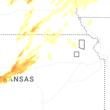

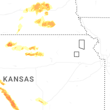
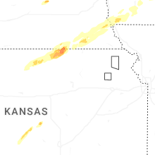
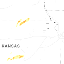
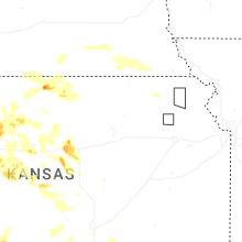
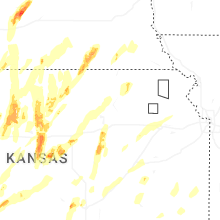


Connect with Interactive Hail Maps