

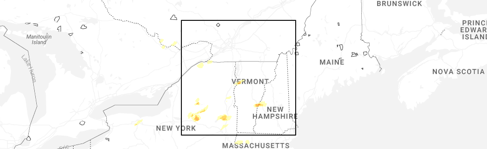
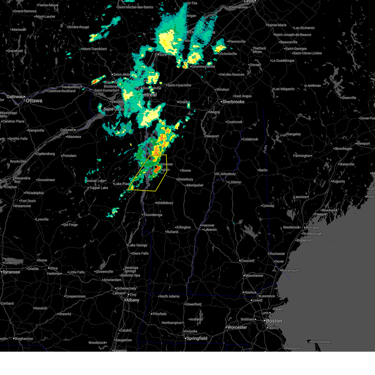
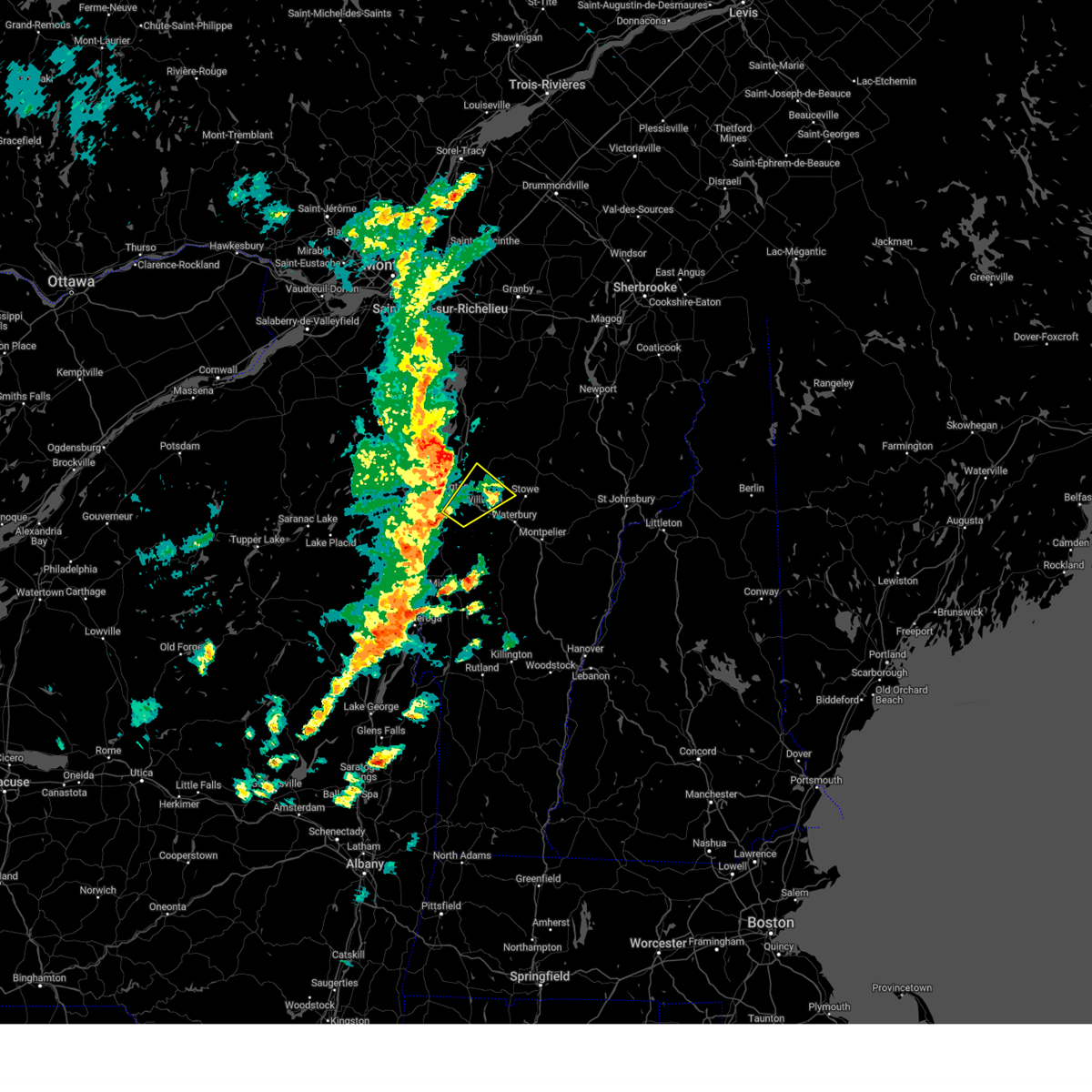
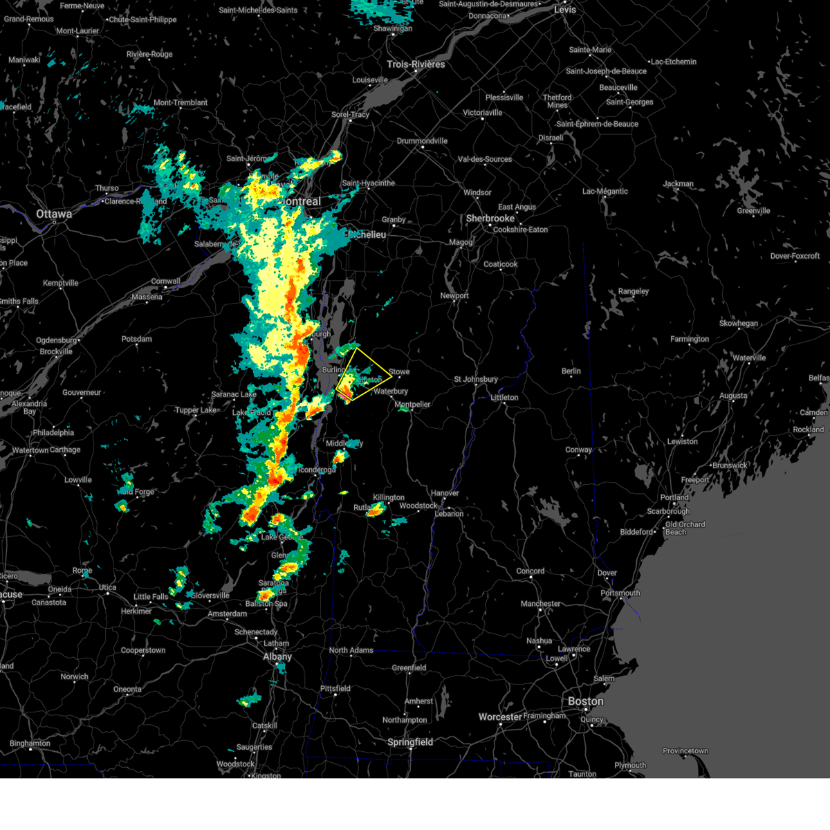
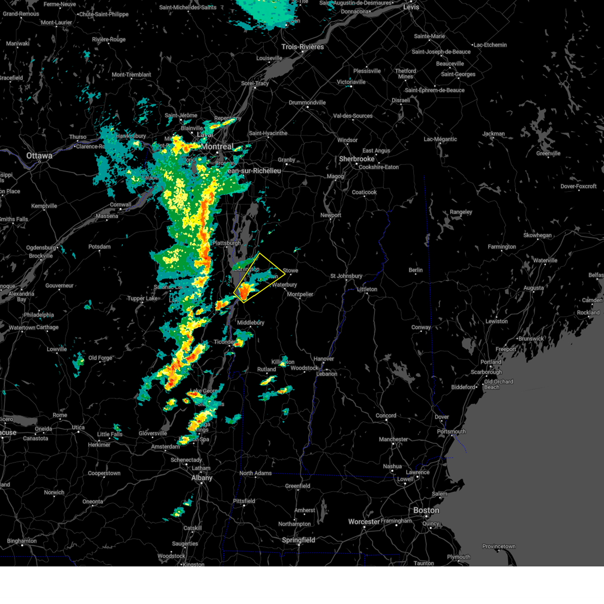
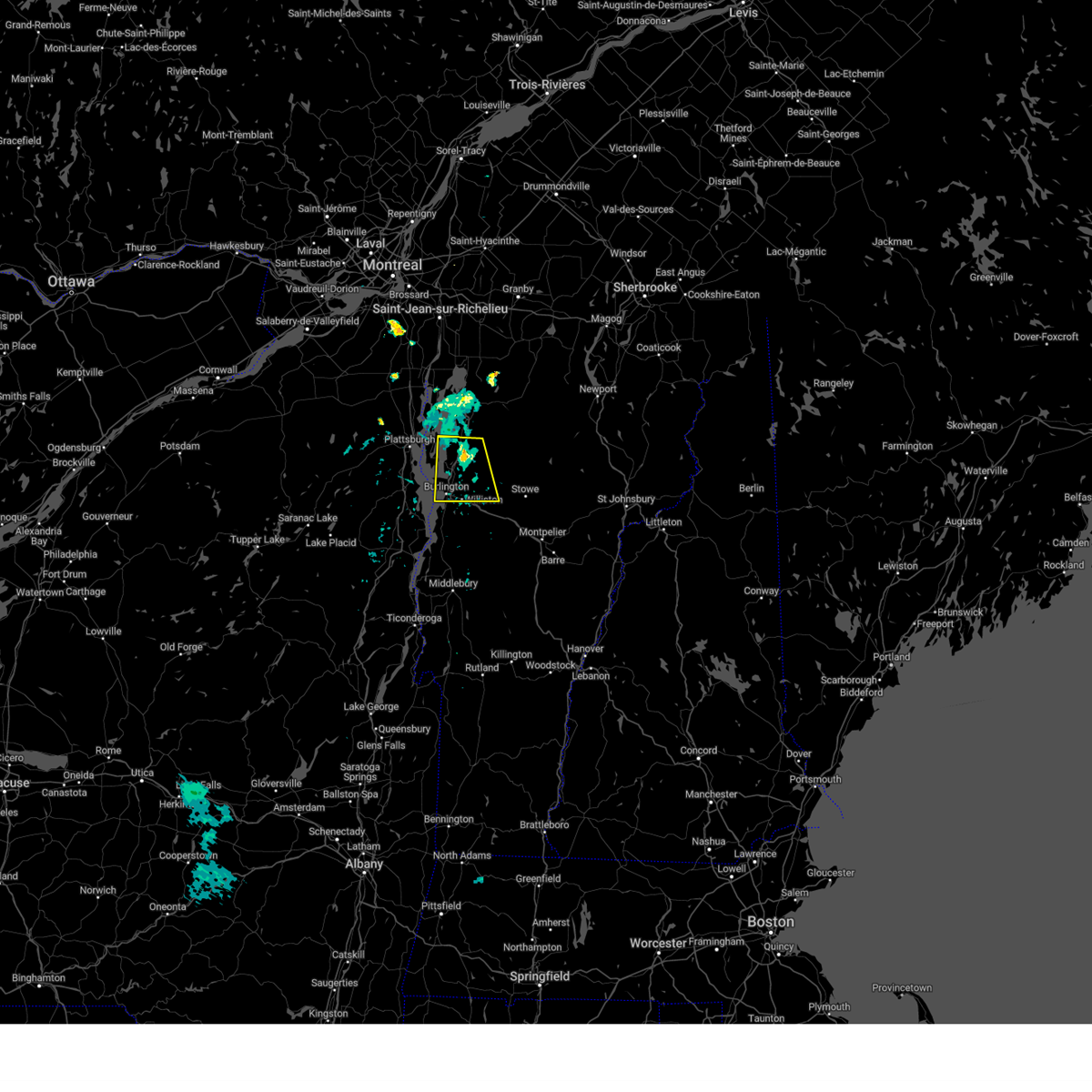
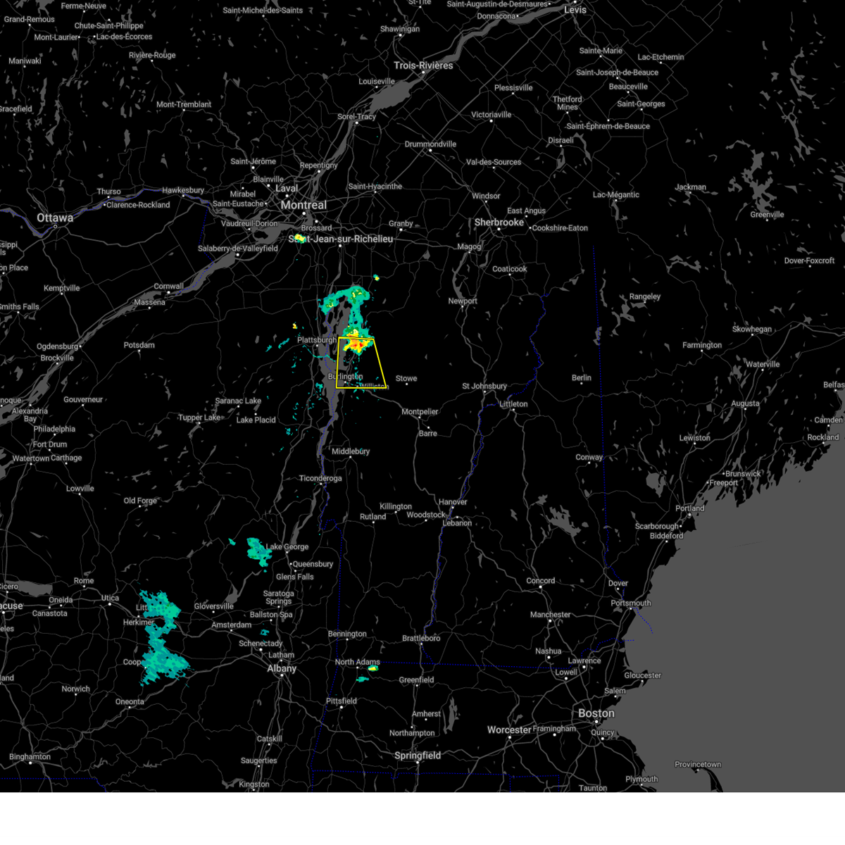
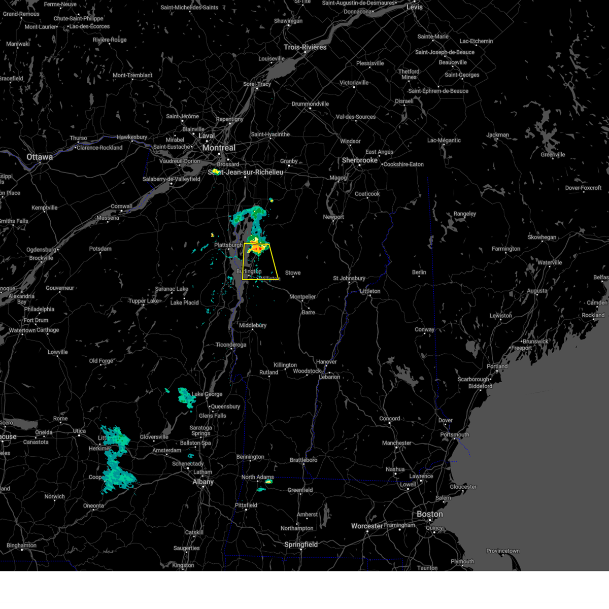
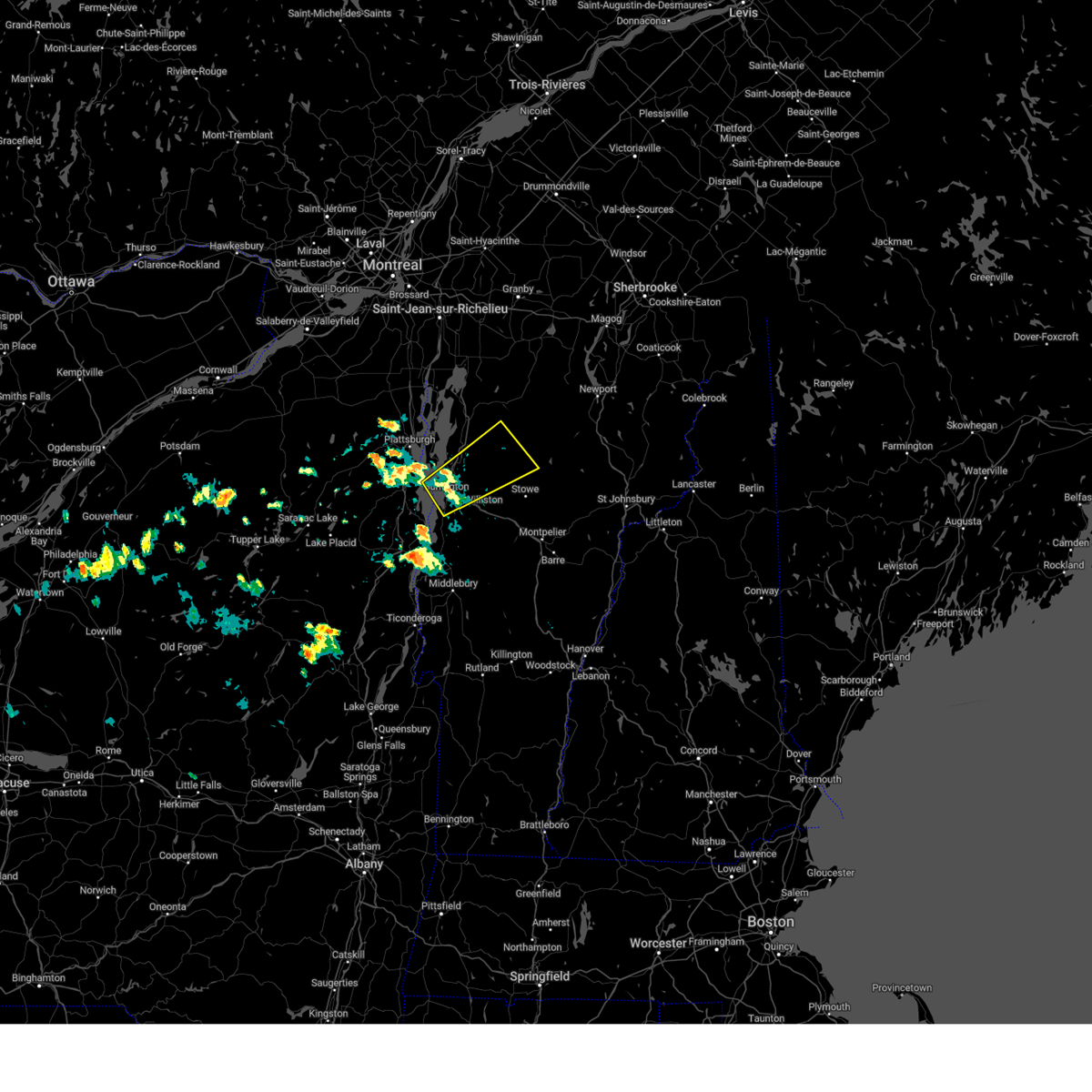
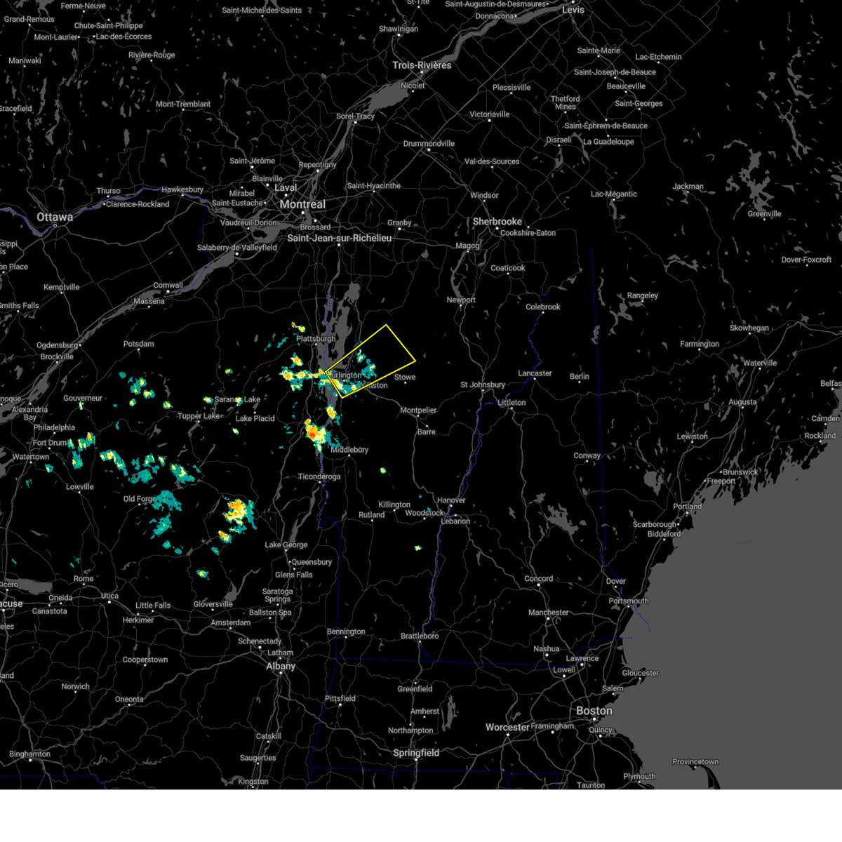
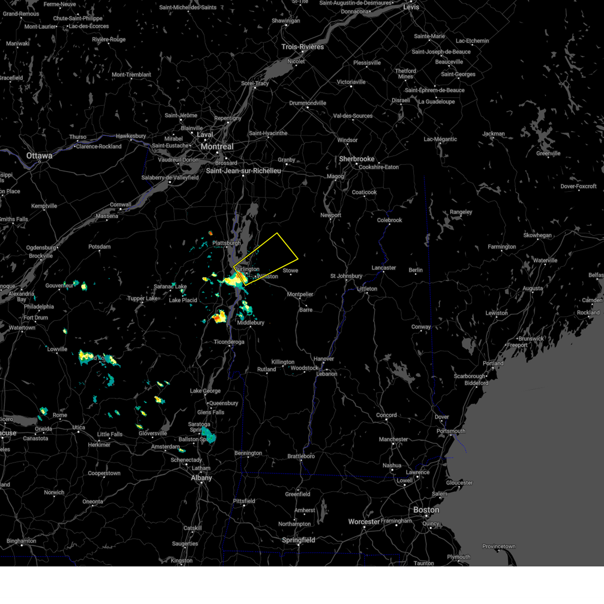
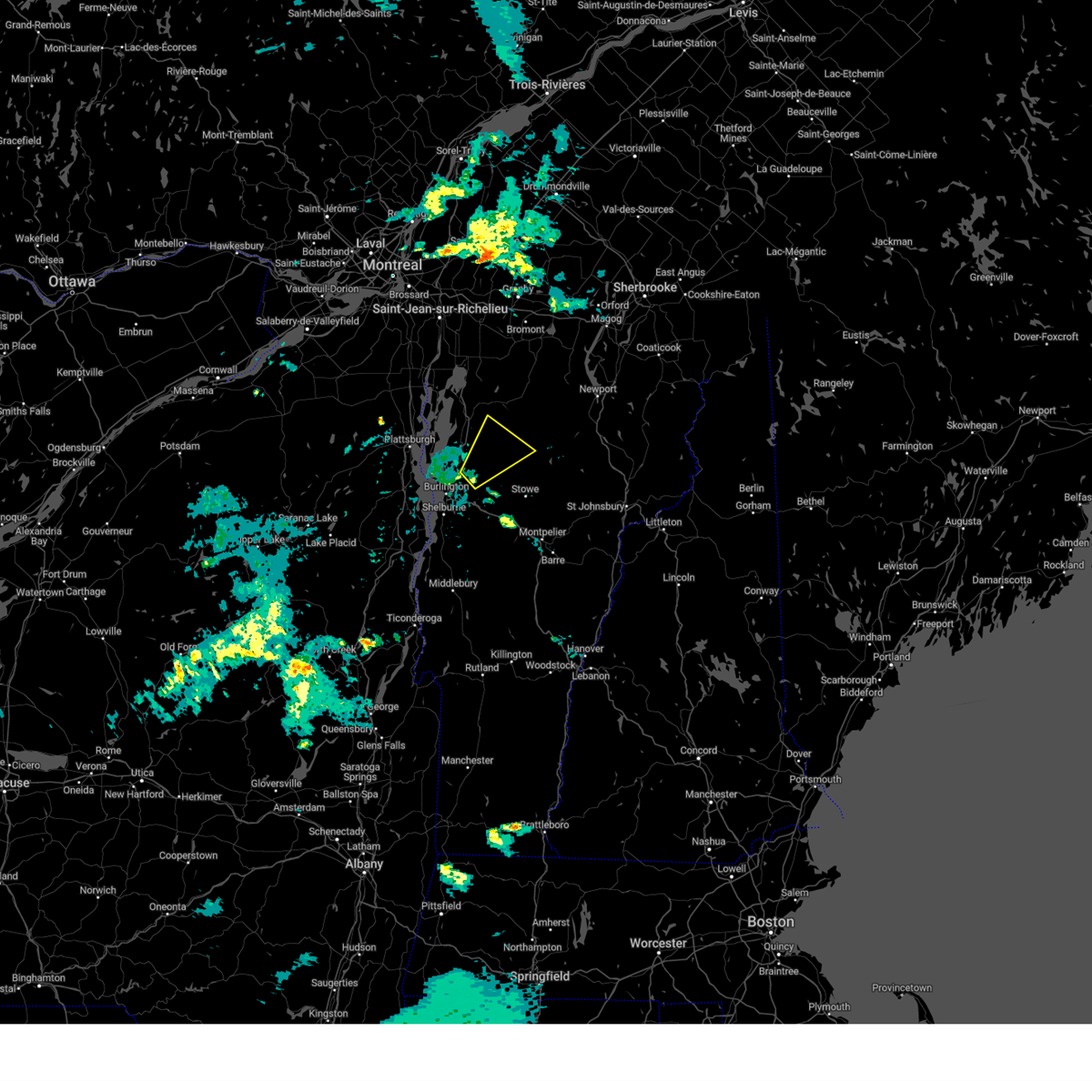
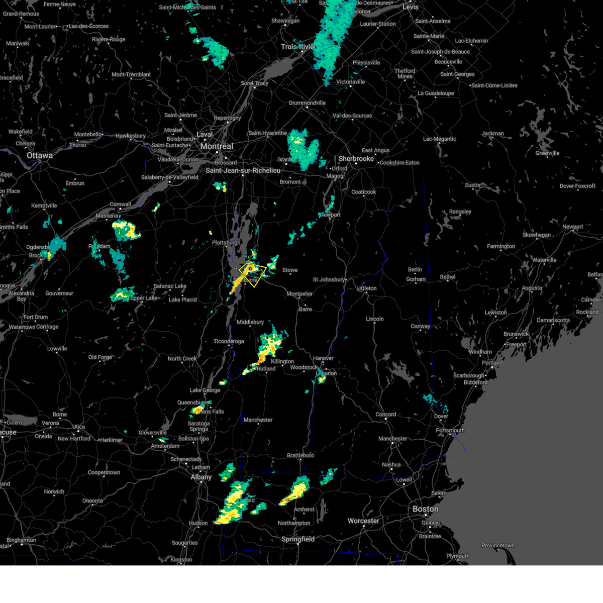
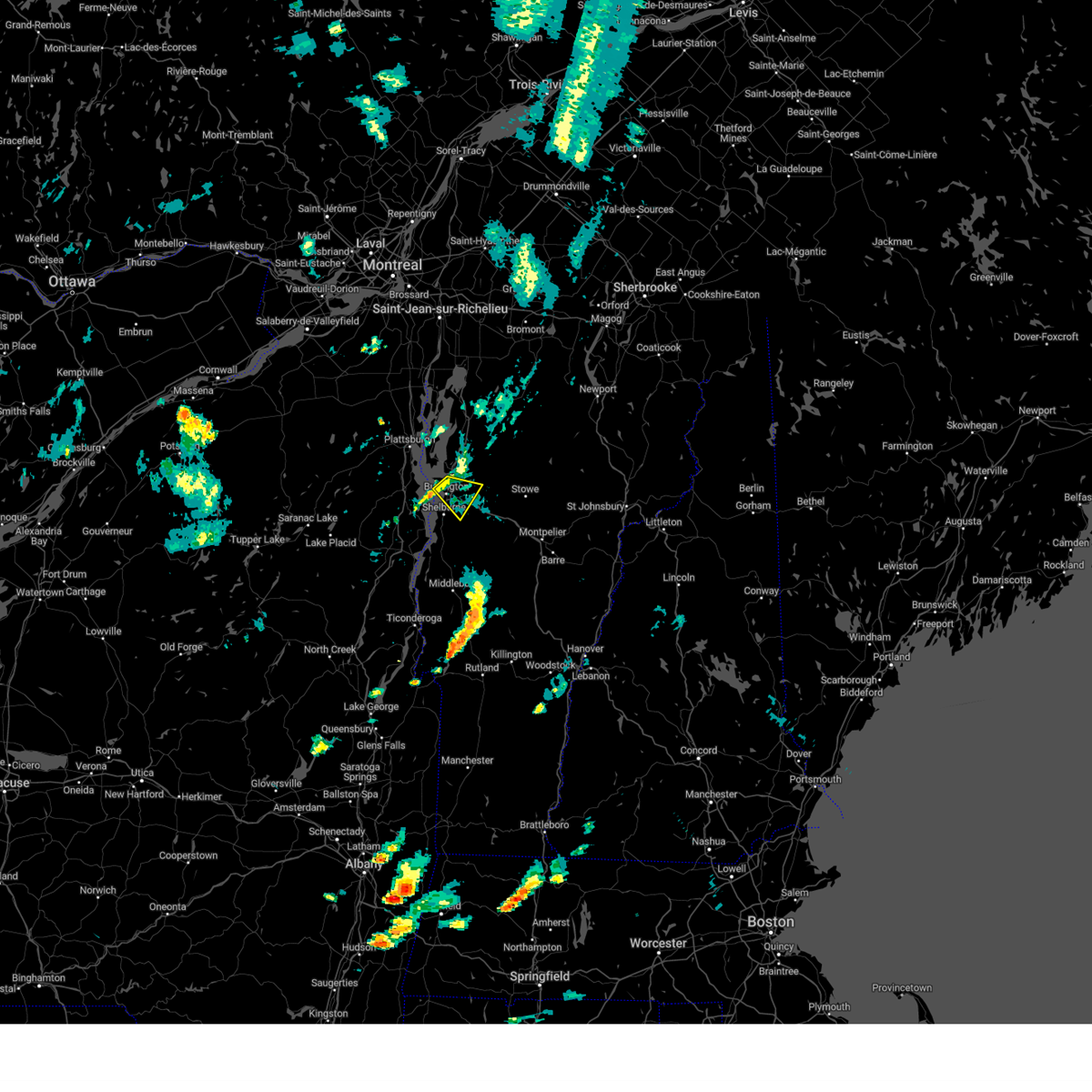
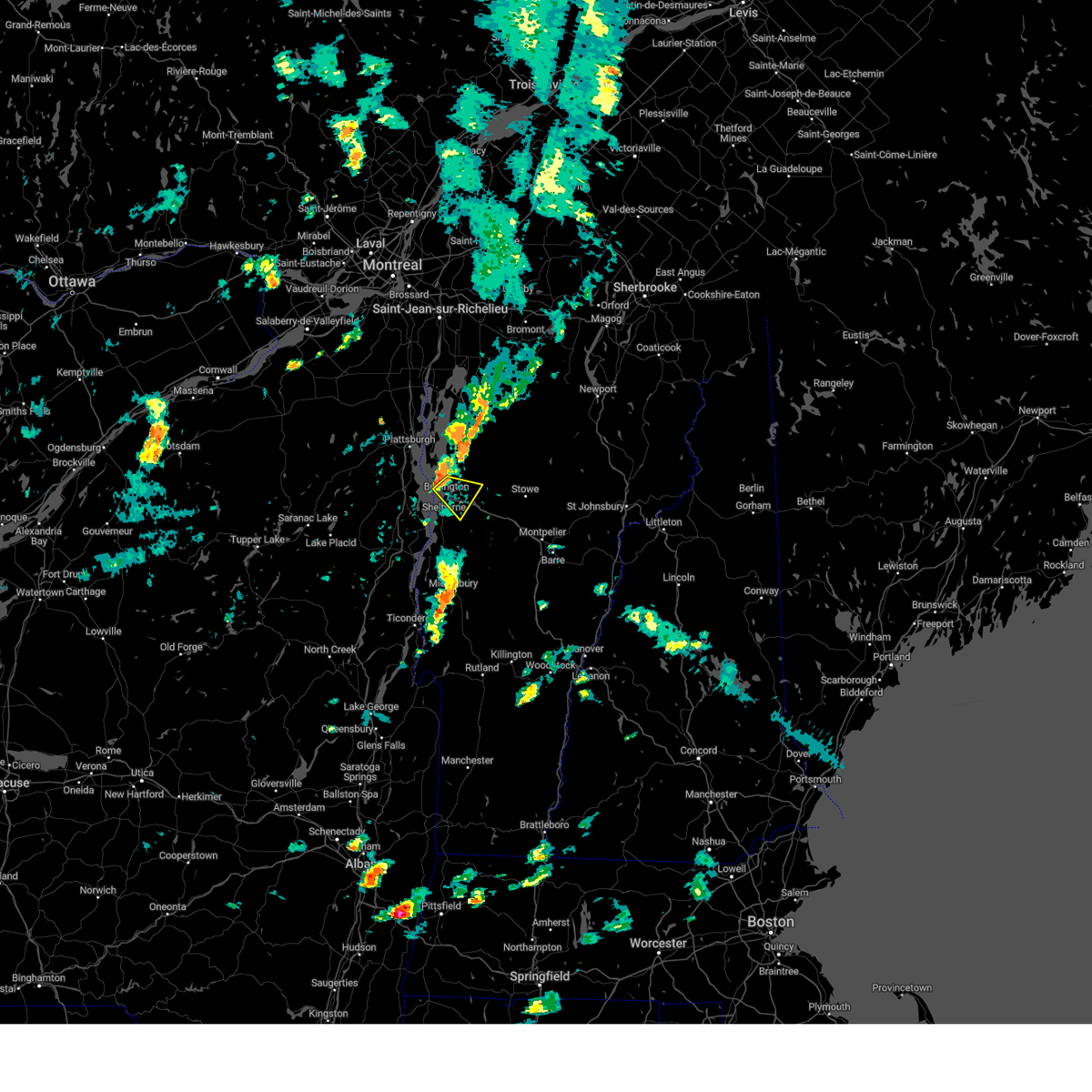
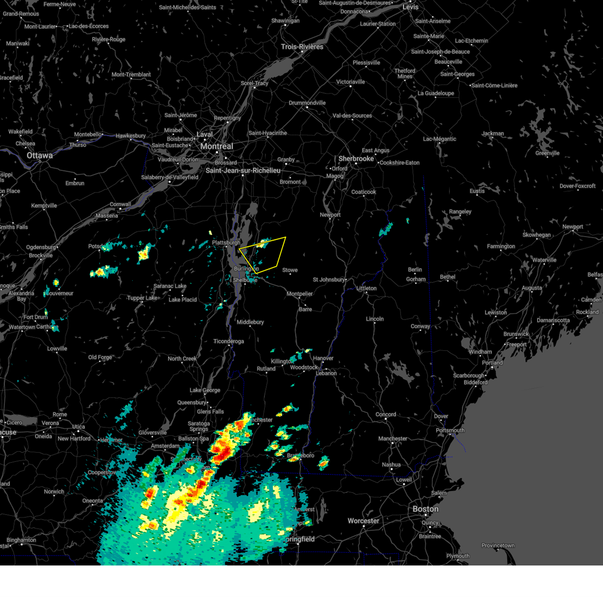
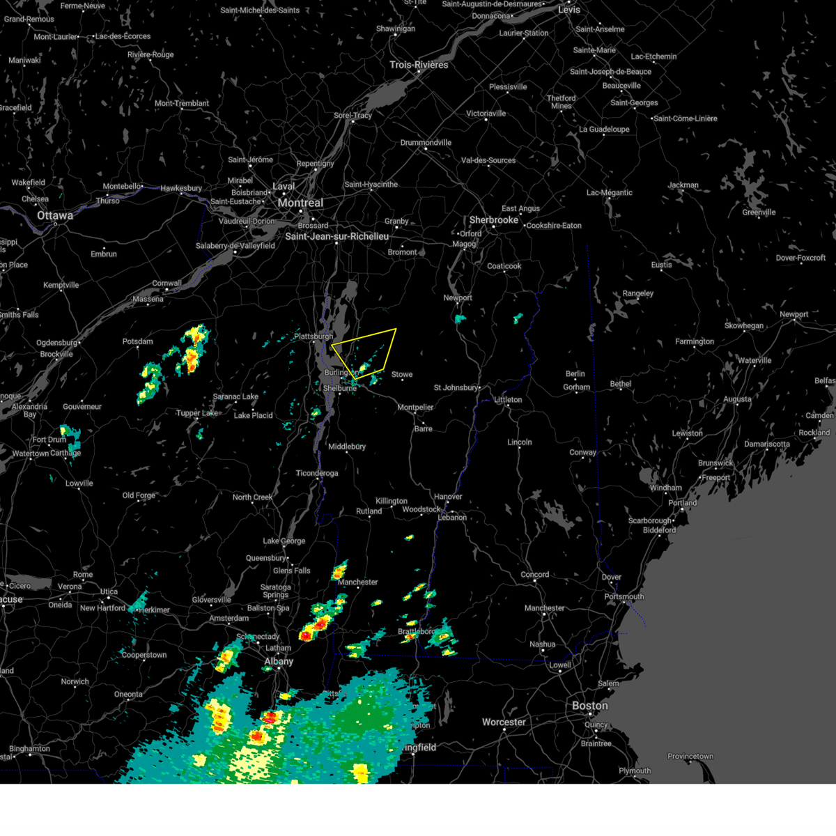
Hail Map for Jericho, VT
The Jericho, VT area has had 3 reports of on-the-ground hail by trained spotters, and has been under severe weather warnings 7 times during the past 12 months. Doppler radar has detected hail at or near Jericho, VT on 18 occasions.
| Name: | Jericho, VT |
| Where Located: | 11.3 miles E of Burlington, VT |
| Map: | Google Map for Jericho, VT |
| Population: | 1329 |
| Housing Units: | 532 |
| More Info: | Search Google for Jericho, VT |
0
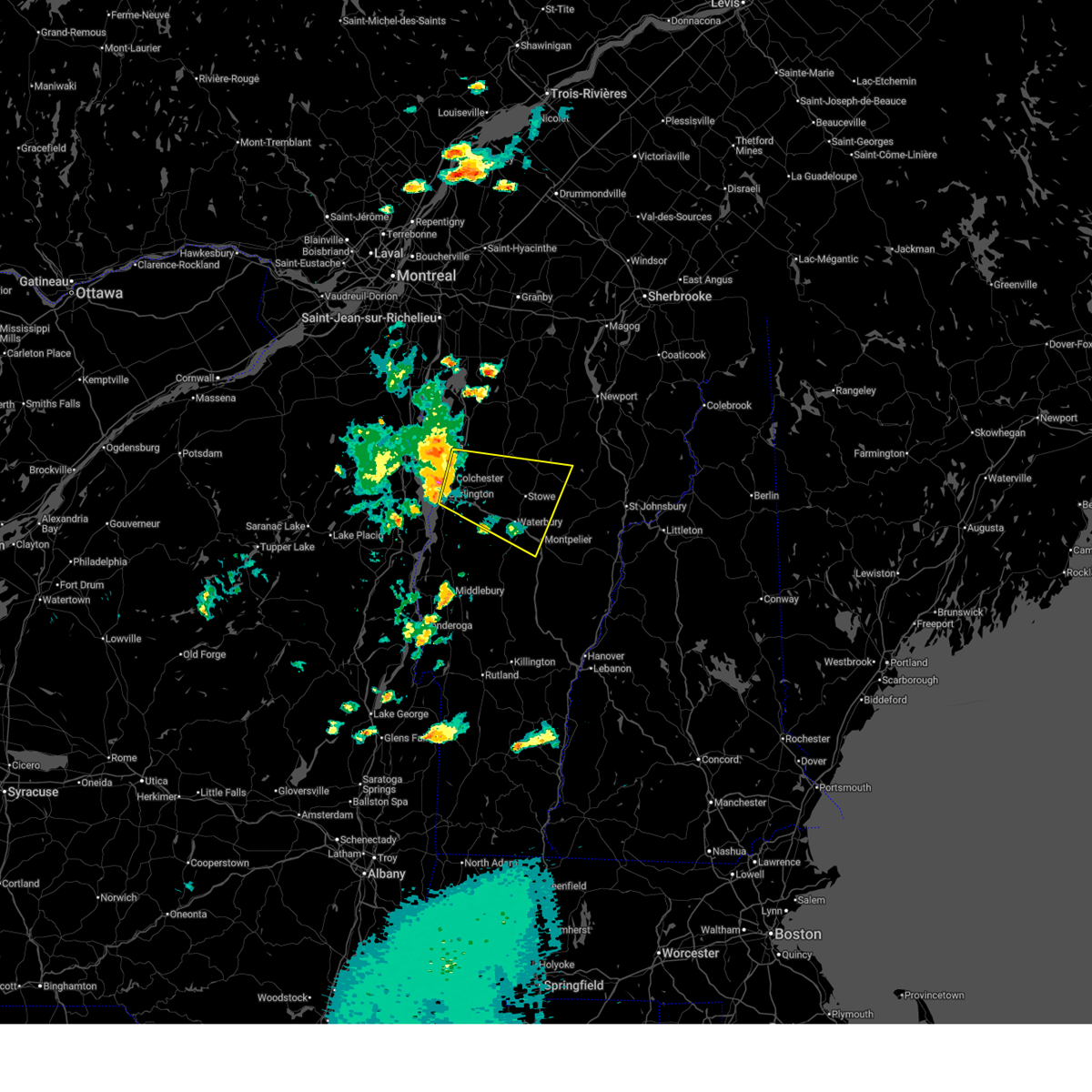
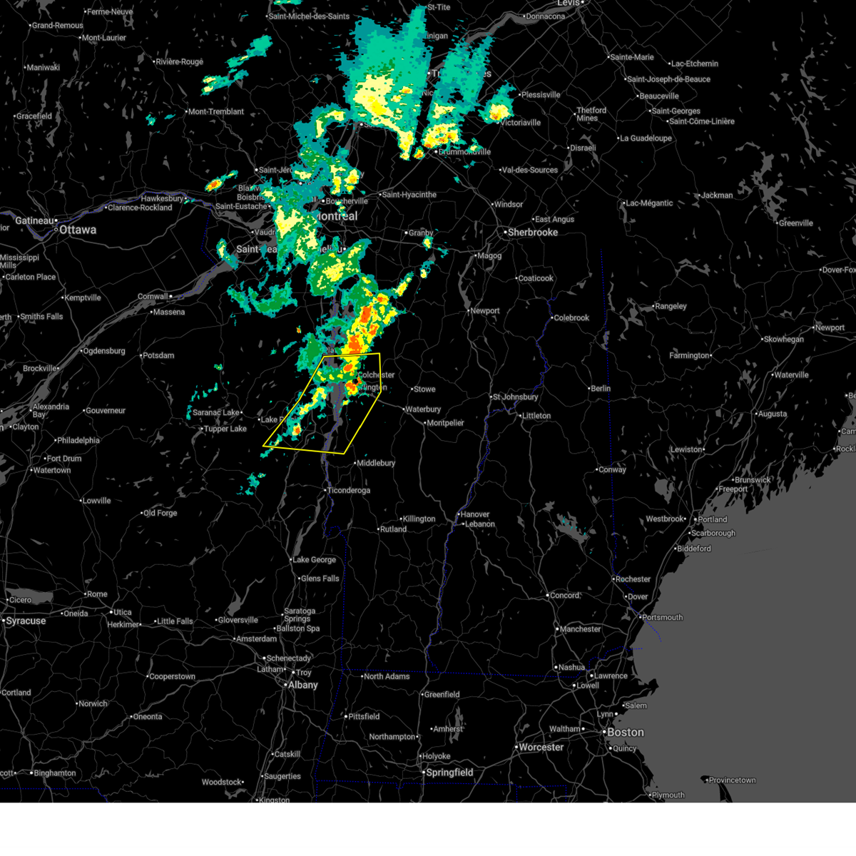
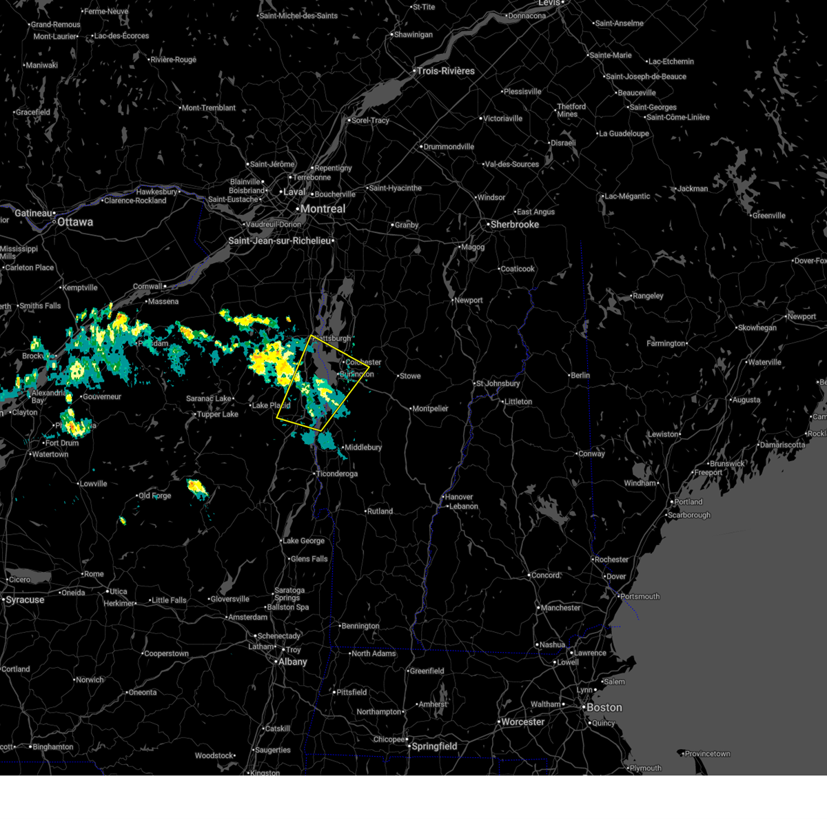
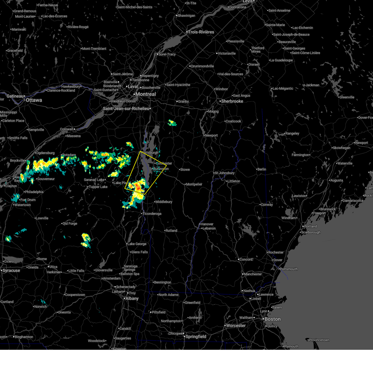
The Top Recent Hail Date for Jericho, VT is Saturday, May 17, 2025 (18th out of 18)
Hail and Wind Damage Spotted near Jericho, VT
| Date / Time | Report Details |
|---|---|
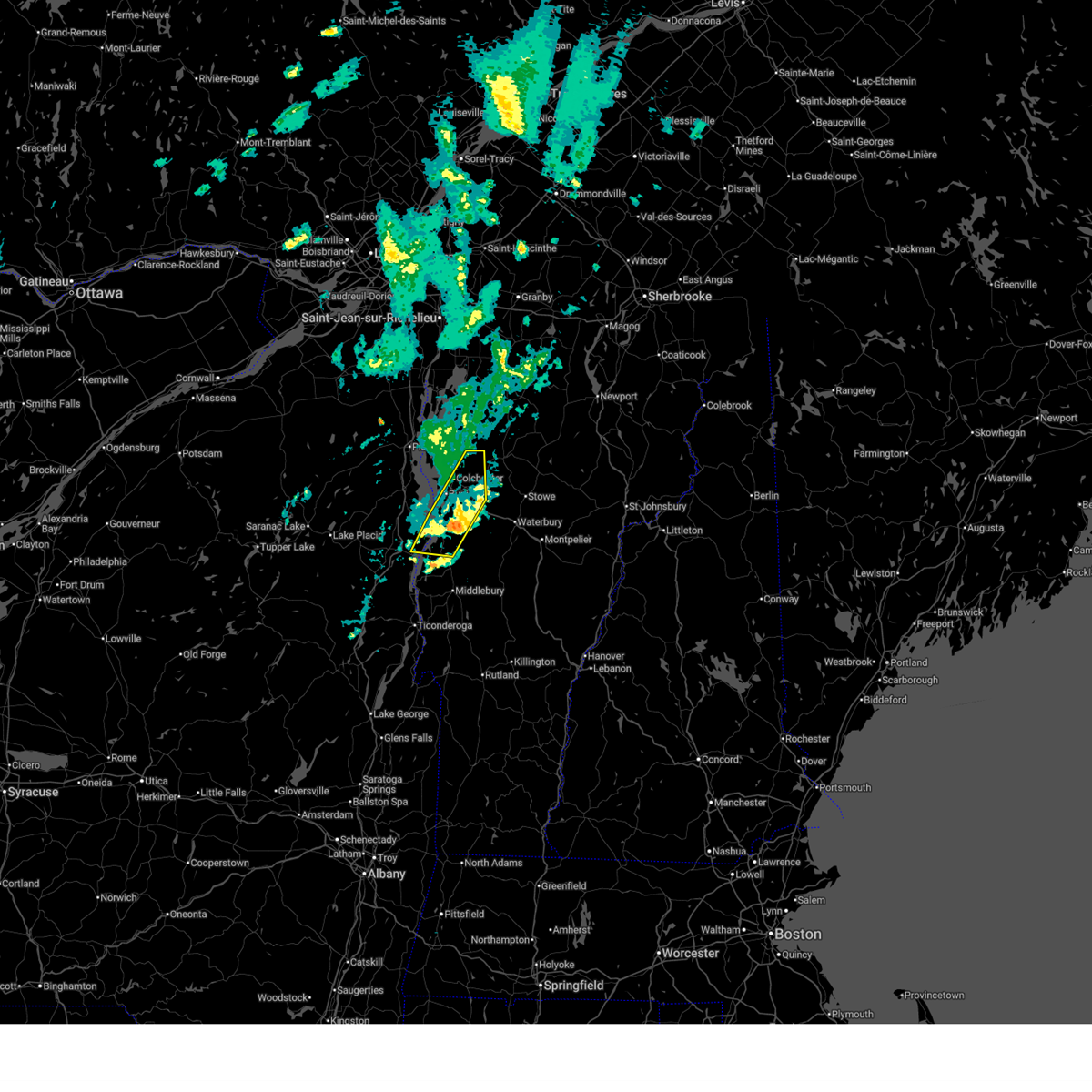
| 7/3/2025 6:24 PM EDT |
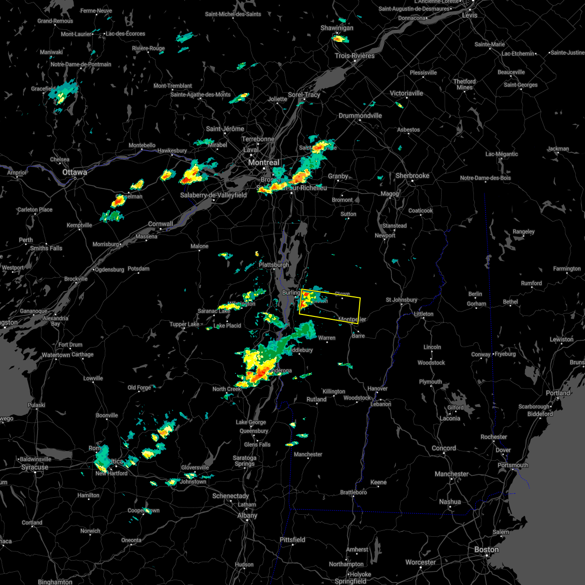
 Svrbtv the national weather service in burlington has issued a * severe thunderstorm warning for, lamoille county in northwestern vermont, western caledonia county in northeastern vermont, southwestern orleans county in northeastern vermont, chittenden county in northwestern vermont, northwestern washington county in central vermont, south central franklin county in northwestern vermont, * until 715 pm edt. * at 624 pm edt, a severe thunderstorm was located over essex junction village, moving east at 40 mph (radar indicated). Hazards include 60 mph wind gusts and quarter size hail. Minor hail damage to vehicles is possible. Expect wind damage to trees and powerlines. Svrbtv the national weather service in burlington has issued a * severe thunderstorm warning for, lamoille county in northwestern vermont, western caledonia county in northeastern vermont, southwestern orleans county in northeastern vermont, chittenden county in northwestern vermont, northwestern washington county in central vermont, south central franklin county in northwestern vermont, * until 715 pm edt. * at 624 pm edt, a severe thunderstorm was located over essex junction village, moving east at 40 mph (radar indicated). Hazards include 60 mph wind gusts and quarter size hail. Minor hail damage to vehicles is possible. Expect wind damage to trees and powerlines.
|
| 7/3/2025 1:09 PM EDT |
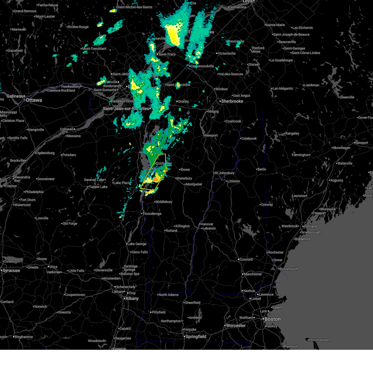 At 108 pm edt, severe thunderstorms were located along a line extending from cambridge junction to jericho center to near monkton ridge, moving east at 35 mph (radar indicated). Hazards include 60 mph wind gusts and quarter size hail. Minor hail damage to vehicles is possible. expect wind damage to trees and powerlines. locations impacted include, essex junction, south burlington, burlington international airport, burlington, ferrisburg, charlotte, winooski, monkton ridge, monkton, westford, monkton boro, essex junction village, williston, mt. philo state park, jericho, hinesburg, st. George, kingsland bay state park, essex, and jericho village. At 108 pm edt, severe thunderstorms were located along a line extending from cambridge junction to jericho center to near monkton ridge, moving east at 35 mph (radar indicated). Hazards include 60 mph wind gusts and quarter size hail. Minor hail damage to vehicles is possible. expect wind damage to trees and powerlines. locations impacted include, essex junction, south burlington, burlington international airport, burlington, ferrisburg, charlotte, winooski, monkton ridge, monkton, westford, monkton boro, essex junction village, williston, mt. philo state park, jericho, hinesburg, st. George, kingsland bay state park, essex, and jericho village.
|
| 7/3/2025 1:09 PM EDT |
 the severe thunderstorm warning has been cancelled and is no longer in effect the severe thunderstorm warning has been cancelled and is no longer in effect
|
| 7/3/2025 12:51 PM EDT |
 At 1251 pm edt, severe thunderstorms were located along a line extending from westford to burlington international airport to louis clearing bay, moving east at 40 mph (radar indicated). Hazards include 60 mph wind gusts and quarter size hail. Minor hail damage to vehicles is possible. expect wind damage to trees and powerlines. locations impacted include, essex junction, south burlington, burlington international airport, burlington, willsboro, winooski, monkton ridge, monkton, westford, monkton boro, colchester, essex junction village, williston, chesterfield, hinesburg, st. George, milton, shelburne, ferrisburg, and charlotte. At 1251 pm edt, severe thunderstorms were located along a line extending from westford to burlington international airport to louis clearing bay, moving east at 40 mph (radar indicated). Hazards include 60 mph wind gusts and quarter size hail. Minor hail damage to vehicles is possible. expect wind damage to trees and powerlines. locations impacted include, essex junction, south burlington, burlington international airport, burlington, willsboro, winooski, monkton ridge, monkton, westford, monkton boro, colchester, essex junction village, williston, chesterfield, hinesburg, st. George, milton, shelburne, ferrisburg, and charlotte.
|
| 7/3/2025 12:40 PM EDT |
 At 1239 pm edt, severe thunderstorms were located along a line extending from sand bar state park to brown point to near elizabethtown, moving east at 15 mph (radar indicated). Hazards include 60 mph wind gusts and quarter size hail. Minor hail damage to vehicles is possible. expect wind damage to trees and powerlines. Locations impacted include, essex junction, westport village, burlington international airport, south burlington, burlington, keeseville, vergennes, westford, colchester, essex junction village, milton, shelburne, charlotte, ausable, waltham, essex, elizabethtown, ferrisburgh, willsboro, and winooski. At 1239 pm edt, severe thunderstorms were located along a line extending from sand bar state park to brown point to near elizabethtown, moving east at 15 mph (radar indicated). Hazards include 60 mph wind gusts and quarter size hail. Minor hail damage to vehicles is possible. expect wind damage to trees and powerlines. Locations impacted include, essex junction, westport village, burlington international airport, south burlington, burlington, keeseville, vergennes, westford, colchester, essex junction village, milton, shelburne, charlotte, ausable, waltham, essex, elizabethtown, ferrisburgh, willsboro, and winooski.
|
| 7/3/2025 12:40 PM EDT |
 the severe thunderstorm warning has been cancelled and is no longer in effect the severe thunderstorm warning has been cancelled and is no longer in effect
|
| 7/3/2025 12:09 PM EDT |
 Svrbtv the national weather service in burlington has issued a * severe thunderstorm warning for, southeastern clinton county in northern new york, southeastern franklin county in northern new york, northern essex county in northern new york, northwestern addison county in central vermont, southern grand isle county in northwestern vermont, chittenden county in northwestern vermont, south central franklin county in northwestern vermont, * until 130 pm edt. * at 1208 pm edt, severe thunderstorms were located along a line extending from near schuyler falls to near jay in essex county to 6 miles north of tahawus, moving east at 35 mph (radar indicated). Hazards include 60 mph wind gusts and quarter size hail. Minor hail damage to vehicles is possible. Expect wind damage to trees and powerlines. Svrbtv the national weather service in burlington has issued a * severe thunderstorm warning for, southeastern clinton county in northern new york, southeastern franklin county in northern new york, northern essex county in northern new york, northwestern addison county in central vermont, southern grand isle county in northwestern vermont, chittenden county in northwestern vermont, south central franklin county in northwestern vermont, * until 130 pm edt. * at 1208 pm edt, severe thunderstorms were located along a line extending from near schuyler falls to near jay in essex county to 6 miles north of tahawus, moving east at 35 mph (radar indicated). Hazards include 60 mph wind gusts and quarter size hail. Minor hail damage to vehicles is possible. Expect wind damage to trees and powerlines.
|
| 5/17/2025 3:40 PM EDT |
 The storm which prompted the warning has moved out of the area. therefore, the warning will be allowed to expire. however, heavy rain is still possible with this thunderstorm. a severe thunderstorm watch remains in effect until 800 pm edt for central and northwestern vermont. The storm which prompted the warning has moved out of the area. therefore, the warning will be allowed to expire. however, heavy rain is still possible with this thunderstorm. a severe thunderstorm watch remains in effect until 800 pm edt for central and northwestern vermont.
|
| 5/17/2025 3:23 PM EDT |
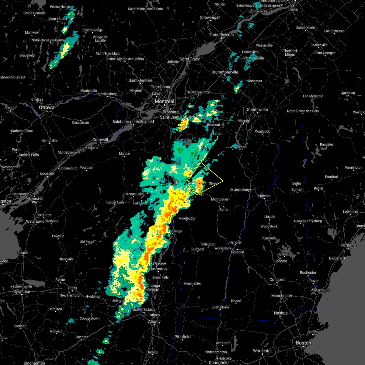
 At 323 pm edt, multiple severe thunderstorms were located over north williston, moving northeast at 25 mph (trained weather spotters). Hazards include 60 mph wind gusts and half dollar size hail. Minor hail damage to vehicles is possible. expect wind damage to trees and powerlines. locations impacted include, westford, jericho village, underhill, jericho, north williston, hinesburg, essex junction village, st. George, essex junction, nashville, west bolton, williston, jericho center, burlington international airport, underhill center, essex, essex center, richmond, shelburne, and bolton. At 323 pm edt, multiple severe thunderstorms were located over north williston, moving northeast at 25 mph (trained weather spotters). Hazards include 60 mph wind gusts and half dollar size hail. Minor hail damage to vehicles is possible. expect wind damage to trees and powerlines. locations impacted include, westford, jericho village, underhill, jericho, north williston, hinesburg, essex junction village, st. George, essex junction, nashville, west bolton, williston, jericho center, burlington international airport, underhill center, essex, essex center, richmond, shelburne, and bolton.
|
| 5/17/2025 3:01 PM EDT |
 At 259 pm edt, a severe thunderstorm was located over st. george, moving northeast at 25 mph (radar indicated. at 2:45, golf ball size hail was reported in charlotte). Hazards include golf ball size hail and 60 mph wind gusts. People and animals outdoors will be injured. expect hail damage to roofs, siding, windows, and vehicles. expect wind damage to trees and powerlines. locations impacted include, underhill, jericho, north williston, hinesburg, st. George, jericho center, burlington international airport, underhill center, essex, westford, jericho village, essex junction village, essex junction, nashville, west bolton, williston, essex center, richmond, shelburne, and bolton. At 259 pm edt, a severe thunderstorm was located over st. george, moving northeast at 25 mph (radar indicated. at 2:45, golf ball size hail was reported in charlotte). Hazards include golf ball size hail and 60 mph wind gusts. People and animals outdoors will be injured. expect hail damage to roofs, siding, windows, and vehicles. expect wind damage to trees and powerlines. locations impacted include, underhill, jericho, north williston, hinesburg, st. George, jericho center, burlington international airport, underhill center, essex, westford, jericho village, essex junction village, essex junction, nashville, west bolton, williston, essex center, richmond, shelburne, and bolton.
|
| 5/17/2025 3:01 PM EDT |
 the severe thunderstorm warning has been cancelled and is no longer in effect the severe thunderstorm warning has been cancelled and is no longer in effect
|
| 5/17/2025 2:41 PM EDT |
 Svrbtv the national weather service in burlington has issued a * severe thunderstorm warning for, northeastern essex county in northern new york, southwestern lamoille county in northwestern vermont, north central addison county in central vermont, chittenden county in northwestern vermont, northwestern washington county in central vermont, * until 345 pm edt. * at 241 pm edt, a severe thunderstorm was located over charlotte, moving northeast at 25 mph (radar indicated). Hazards include 60 mph wind gusts and quarter size hail. Minor hail damage to vehicles is possible. Expect wind damage to trees and powerlines. Svrbtv the national weather service in burlington has issued a * severe thunderstorm warning for, northeastern essex county in northern new york, southwestern lamoille county in northwestern vermont, north central addison county in central vermont, chittenden county in northwestern vermont, northwestern washington county in central vermont, * until 345 pm edt. * at 241 pm edt, a severe thunderstorm was located over charlotte, moving northeast at 25 mph (radar indicated). Hazards include 60 mph wind gusts and quarter size hail. Minor hail damage to vehicles is possible. Expect wind damage to trees and powerlines.
|
| 8/14/2024 8:05 PM EDT |
 The storms which prompted the warning have weakened below severe limits, and no longer pose an immediate threat to life or property. therefore, the warning will be allowed to expire. The storms which prompted the warning have weakened below severe limits, and no longer pose an immediate threat to life or property. therefore, the warning will be allowed to expire.
|
| 8/14/2024 7:36 PM EDT |
 the severe thunderstorm warning has been cancelled and is no longer in effect the severe thunderstorm warning has been cancelled and is no longer in effect
|
| 8/14/2024 7:36 PM EDT |
 At 736 pm edt, severe thunderstorms were located along a line extending from west georgia to near east georgia, moving south at 15 mph (radar indicated). Hazards include 60 mph wind gusts and quarter size hail. Minor hail damage to vehicles is possible. expect wind damage to trees and powerlines. Locations impacted include, essex junction, south burlington, burlington international airport, burlington, winooski, westford, colchester, essex junction village, fairfax, georgia, jericho, essex, jericho village, georgia center, milton, williston, underhill, grand isle, south hero, and bolton. At 736 pm edt, severe thunderstorms were located along a line extending from west georgia to near east georgia, moving south at 15 mph (radar indicated). Hazards include 60 mph wind gusts and quarter size hail. Minor hail damage to vehicles is possible. expect wind damage to trees and powerlines. Locations impacted include, essex junction, south burlington, burlington international airport, burlington, winooski, westford, colchester, essex junction village, fairfax, georgia, jericho, essex, jericho village, georgia center, milton, williston, underhill, grand isle, south hero, and bolton.
|
| 8/14/2024 7:07 PM EDT |
 Svrbtv the national weather service in burlington has issued a * severe thunderstorm warning for, northeastern essex county in northern new york, southeastern grand isle county in northwestern vermont, northern chittenden county in northwestern vermont, southwestern franklin county in northwestern vermont, * until 815 pm edt. * at 707 pm edt, severe thunderstorms were located along a line extending from kill kare state park to north fairfax, moving south at 15 mph (radar indicated). Hazards include 60 mph wind gusts and quarter size hail. Minor hail damage to vehicles is possible. Expect wind damage to trees and powerlines. Svrbtv the national weather service in burlington has issued a * severe thunderstorm warning for, northeastern essex county in northern new york, southeastern grand isle county in northwestern vermont, northern chittenden county in northwestern vermont, southwestern franklin county in northwestern vermont, * until 815 pm edt. * at 707 pm edt, severe thunderstorms were located along a line extending from kill kare state park to north fairfax, moving south at 15 mph (radar indicated). Hazards include 60 mph wind gusts and quarter size hail. Minor hail damage to vehicles is possible. Expect wind damage to trees and powerlines.
|
| 7/30/2024 6:53 PM EDT |
 The storms which prompted the warning have weakened below severe limits, and no longer pose an immediate threat to life or property. therefore, the warning will be allowed to expire. The storms which prompted the warning have weakened below severe limits, and no longer pose an immediate threat to life or property. therefore, the warning will be allowed to expire.
|
| 7/30/2024 6:14 PM EDT |
 Svrbtv the national weather service in burlington has issued a * severe thunderstorm warning for, southeastern clinton county in northern new york, northeastern essex county in northern new york, northwestern addison county in central vermont, southwestern grand isle county in northwestern vermont, western chittenden county in northwestern vermont, * until 700 pm edt. * at 614 pm edt, severe thunderstorms were located along a line extending from reber to whallonsburg, moving northeast at 35 mph (radar indicated). Hazards include 60 mph wind gusts and penny size hail. expect damage to trees and powerlines Svrbtv the national weather service in burlington has issued a * severe thunderstorm warning for, southeastern clinton county in northern new york, northeastern essex county in northern new york, northwestern addison county in central vermont, southwestern grand isle county in northwestern vermont, western chittenden county in northwestern vermont, * until 700 pm edt. * at 614 pm edt, severe thunderstorms were located along a line extending from reber to whallonsburg, moving northeast at 35 mph (radar indicated). Hazards include 60 mph wind gusts and penny size hail. expect damage to trees and powerlines
|
| 7/30/2024 4:55 PM EDT |
 The storm which prompted the warning has moved out of the area. therefore, the warning will be allowed to expire. The storm which prompted the warning has moved out of the area. therefore, the warning will be allowed to expire.
|
| 7/30/2024 4:32 PM EDT |
 At 431 pm edt, a severe thunderstorm was located over cloverdale, moving northeast at 30 mph (public reported power outages likely due to wind damage). Hazards include 60 mph wind gusts and penny size hail. Expect damage to trees and powerlines. Locations impacted include, essex junction, south burlington, burlington international airport, burlington, johnson village, cambridge, winooski, cambridge village, westford, jeffersonville village, colchester, essex junction village, fairfax, williston, waterville, underhill, jericho, essex, jericho village, and johnson. At 431 pm edt, a severe thunderstorm was located over cloverdale, moving northeast at 30 mph (public reported power outages likely due to wind damage). Hazards include 60 mph wind gusts and penny size hail. Expect damage to trees and powerlines. Locations impacted include, essex junction, south burlington, burlington international airport, burlington, johnson village, cambridge, winooski, cambridge village, westford, jeffersonville village, colchester, essex junction village, fairfax, williston, waterville, underhill, jericho, essex, jericho village, and johnson.
|
| 7/30/2024 4:00 PM EDT |
 Svrbtv the national weather service in burlington has issued a * severe thunderstorm warning for, southeastern clinton county in northern new york, northeastern essex county in northern new york, northwestern lamoille county in northwestern vermont, northern chittenden county in northwestern vermont, south central franklin county in northwestern vermont, * until 500 pm edt. * at 400 pm edt, a severe thunderstorm was located over burlington, moving northeast at 30 mph (radar indicated). Hazards include 60 mph wind gusts and penny size hail. expect damage to trees and powerlines Svrbtv the national weather service in burlington has issued a * severe thunderstorm warning for, southeastern clinton county in northern new york, northeastern essex county in northern new york, northwestern lamoille county in northwestern vermont, northern chittenden county in northwestern vermont, south central franklin county in northwestern vermont, * until 500 pm edt. * at 400 pm edt, a severe thunderstorm was located over burlington, moving northeast at 30 mph (radar indicated). Hazards include 60 mph wind gusts and penny size hail. expect damage to trees and powerlines
|
| 7/10/2024 4:51 PM EDT |
 Svrbtv the national weather service in burlington has issued a * severe thunderstorm warning for, central lamoille county in northwestern vermont, north central addison county in central vermont, central chittenden county in northwestern vermont, northern washington county in central vermont, * until 545 pm edt. * at 451 pm edt, a severe thunderstorm was located over button bay, moving northeast at 30 mph (radar indicated). Hazards include 60 mph wind gusts. expect damage to trees and powerlines Svrbtv the national weather service in burlington has issued a * severe thunderstorm warning for, central lamoille county in northwestern vermont, north central addison county in central vermont, central chittenden county in northwestern vermont, northern washington county in central vermont, * until 545 pm edt. * at 451 pm edt, a severe thunderstorm was located over button bay, moving northeast at 30 mph (radar indicated). Hazards include 60 mph wind gusts. expect damage to trees and powerlines
|
| 6/23/2024 4:12 PM EDT |
 Svrbtv the national weather service in burlington has issued a * severe thunderstorm warning for, central lamoille county in northwestern vermont, southwestern orleans county in northeastern vermont, central chittenden county in northwestern vermont, northern washington county in central vermont, * until 500 pm edt. * at 412 pm edt, a severe thunderstorm was located over jericho village, moving east at 25 mph (radar indicated). Hazards include 60 mph wind gusts and penny size hail. expect damage to trees and powerlines Svrbtv the national weather service in burlington has issued a * severe thunderstorm warning for, central lamoille county in northwestern vermont, southwestern orleans county in northeastern vermont, central chittenden county in northwestern vermont, northern washington county in central vermont, * until 500 pm edt. * at 412 pm edt, a severe thunderstorm was located over jericho village, moving east at 25 mph (radar indicated). Hazards include 60 mph wind gusts and penny size hail. expect damage to trees and powerlines
|
| 6/20/2024 3:12 PM EDT | Trees down along with some powerlines in chittenden county VT, 3.8 miles S of Jericho, VT |
| 9/7/2023 4:36 PM EDT |
 The severe thunderstorm warning for northeastern clinton, lamoille, northern addison, grand isle, chittenden, western washington and franklin counties will expire at 445 pm edt, the storms which prompted the warning have moved out of the warned area. therefore, the warning will be allowed to expire. The severe thunderstorm warning for northeastern clinton, lamoille, northern addison, grand isle, chittenden, western washington and franklin counties will expire at 445 pm edt, the storms which prompted the warning have moved out of the warned area. therefore, the warning will be allowed to expire.
|
| 9/7/2023 3:40 PM EDT | At 340 pm edt, severe thunderstorms were located along a line extending from near shad island to jericho village to near weybridge, moving east at 25 mph (radar indicated). Hazards include 60 mph wind gusts and quarter size hail. Minor hail damage to vehicles is possible. Expect wind damage to trees and powerlines. |
| 9/7/2023 3:40 PM EDT | At 340 pm edt, severe thunderstorms were located along a line extending from near shad island to jericho village to near weybridge, moving east at 25 mph (radar indicated). Hazards include 60 mph wind gusts and quarter size hail. Minor hail damage to vehicles is possible. Expect wind damage to trees and powerlines. |
| 9/7/2023 3:30 PM EDT |
 At 329 pm edt, severe thunderstorms were located along a line extending from grand isle to south burlington to weybridge, moving east at 25 mph (radar indicated). Hazards include 60 mph wind gusts and quarter size hail. Minor hail damage to vehicles is possible. expect wind damage to trees and powerlines. locations impacted include, essex junction, south burlington, burlington international airport, burlington, vergennes, middlebury, weybridge, winooski, monkton ridge, monkton, westford, monkton boro, colchester, essex junction village, fairfax, williston, new haven, georgia, hinesburg, and st. george. hail threat, radar indicated max hail size, 1. 00 in wind threat, radar indicated max wind gust, 60 mph. At 329 pm edt, severe thunderstorms were located along a line extending from grand isle to south burlington to weybridge, moving east at 25 mph (radar indicated). Hazards include 60 mph wind gusts and quarter size hail. Minor hail damage to vehicles is possible. expect wind damage to trees and powerlines. locations impacted include, essex junction, south burlington, burlington international airport, burlington, vergennes, middlebury, weybridge, winooski, monkton ridge, monkton, westford, monkton boro, colchester, essex junction village, fairfax, williston, new haven, georgia, hinesburg, and st. george. hail threat, radar indicated max hail size, 1. 00 in wind threat, radar indicated max wind gust, 60 mph.
|
| 9/7/2023 2:48 PM EDT |
 At 248 pm edt, severe thunderstorms were located along a line extending from morrisonville to near willsboro bay to moriah, moving east at 25 mph (radar indicated). Hazards include 60 mph wind gusts and quarter size hail. Minor hail damage to vehicles is possible. Expect wind damage to trees and powerlines. At 248 pm edt, severe thunderstorms were located along a line extending from morrisonville to near willsboro bay to moriah, moving east at 25 mph (radar indicated). Hazards include 60 mph wind gusts and quarter size hail. Minor hail damage to vehicles is possible. Expect wind damage to trees and powerlines.
|
| 9/7/2023 2:35 PM EDT |
 The severe thunderstorm warning for northeastern essex, central chittenden and southwestern franklin counties will expire at 245 pm edt, the storm which prompted the warning has weakened below severe limits, and no longer poses an immediate threat to life or property. therefore, the warning will be allowed to expire. to report severe weather, contact your nearest law enforcement agency. they will relay your report to the national weather service burlington. The severe thunderstorm warning for northeastern essex, central chittenden and southwestern franklin counties will expire at 245 pm edt, the storm which prompted the warning has weakened below severe limits, and no longer poses an immediate threat to life or property. therefore, the warning will be allowed to expire. to report severe weather, contact your nearest law enforcement agency. they will relay your report to the national weather service burlington.
|
| 9/7/2023 2:13 PM EDT |
 At 212 pm edt, a severe thunderstorm was located over winooski, moving northeast at 10 mph (radar indicated). Hazards include 60 mph wind gusts and quarter size hail. Minor hail damage to vehicles is possible. expect wind damage to trees and powerlines. locations impacted include, essex junction, south burlington, burlington international airport, burlington, jericho, st. george, winooski, essex, jericho village, colchester, essex junction village, williston, shelburne, richmond, westford, milton, bolton, charlotte, hinesburg, and georgia. hail threat, radar indicated max hail size, 1. 00 in wind threat, radar indicated max wind gust, 60 mph. At 212 pm edt, a severe thunderstorm was located over winooski, moving northeast at 10 mph (radar indicated). Hazards include 60 mph wind gusts and quarter size hail. Minor hail damage to vehicles is possible. expect wind damage to trees and powerlines. locations impacted include, essex junction, south burlington, burlington international airport, burlington, jericho, st. george, winooski, essex, jericho village, colchester, essex junction village, williston, shelburne, richmond, westford, milton, bolton, charlotte, hinesburg, and georgia. hail threat, radar indicated max hail size, 1. 00 in wind threat, radar indicated max wind gust, 60 mph.
|
| 9/7/2023 1:43 PM EDT |
 At 143 pm edt, a severe thunderstorm was located over burlington bay, moving northeast at 10 mph (radar indicated). Hazards include 60 mph wind gusts and quarter size hail. Minor hail damage to vehicles is possible. Expect wind damage to trees and powerlines. At 143 pm edt, a severe thunderstorm was located over burlington bay, moving northeast at 10 mph (radar indicated). Hazards include 60 mph wind gusts and quarter size hail. Minor hail damage to vehicles is possible. Expect wind damage to trees and powerlines.
|
| 8/12/2023 9:08 PM EDT |
 At 908 pm edt, a severe thunderstorm was located over westford, moving northeast at 15 mph (radar indicated). Hazards include 60 mph wind gusts. expect damage to trees and powerlines At 908 pm edt, a severe thunderstorm was located over westford, moving northeast at 15 mph (radar indicated). Hazards include 60 mph wind gusts. expect damage to trees and powerlines
|
| 7/21/2023 6:36 PM EDT |
 The severe thunderstorm warning for central chittenden county will expire at 645 pm edt, the storm which prompted the warning has weakened below severe limits, and no longer poses an immediate threat to life or property. therefore, the warning will be allowed to expire. however gusty winds and heavy rain are still possible with this thunderstorm. The severe thunderstorm warning for central chittenden county will expire at 645 pm edt, the storm which prompted the warning has weakened below severe limits, and no longer poses an immediate threat to life or property. therefore, the warning will be allowed to expire. however gusty winds and heavy rain are still possible with this thunderstorm.
|
| 7/21/2023 6:10 PM EDT |
 At 609 pm edt, a severe thunderstorm was located over appletree bay, moving southeast at 15 mph (radar indicated). Hazards include 60 mph wind gusts. Expect damage to trees and powerlines. locations impacted include, essex junction, south burlington, burlington international airport, burlington, jericho village, essex junction village, st. george, winooski, williston, essex, colchester, jericho, hinesburg, shelburne, lone rock point, north williston, appletree point, red rock point, burlington bay, and essex center. hail threat, radar indicated max hail size, <. 75 in wind threat, radar indicated max wind gust, 60 mph. At 609 pm edt, a severe thunderstorm was located over appletree bay, moving southeast at 15 mph (radar indicated). Hazards include 60 mph wind gusts. Expect damage to trees and powerlines. locations impacted include, essex junction, south burlington, burlington international airport, burlington, jericho village, essex junction village, st. george, winooski, williston, essex, colchester, jericho, hinesburg, shelburne, lone rock point, north williston, appletree point, red rock point, burlington bay, and essex center. hail threat, radar indicated max hail size, <. 75 in wind threat, radar indicated max wind gust, 60 mph.
|
| 7/21/2023 5:39 PM EDT |
 At 538 pm edt, a severe thunderstorm was located over winooski, moving southeast at 10 mph (radar indicated). Hazards include 60 mph wind gusts. expect damage to trees and powerlines At 538 pm edt, a severe thunderstorm was located over winooski, moving southeast at 10 mph (radar indicated). Hazards include 60 mph wind gusts. expect damage to trees and powerlines
|
| 7/13/2023 6:22 PM EDT |
 At 618 pm edt, a severe thunderstorm was located over bolton, moving northeast at 45 mph (public reported trees down near williston with this storm). Hazards include 60 mph wind gusts and quarter size hail. Minor hail damage to vehicles is possible. expect wind damage to trees and powerlines. locations impacted include, vergennes, montpelier, morrisville, johnson village, calais, cambridge, monkton ridge, waterbury village, monkton, westford, monkton boro, williston, worcester, middlesex, hinesburg, st. george, morrisville village, woodbury, moretown, and starksboro. hail threat, radar indicated max hail size, 1. 00 in wind threat, radar indicated max wind gust, 60 mph. At 618 pm edt, a severe thunderstorm was located over bolton, moving northeast at 45 mph (public reported trees down near williston with this storm). Hazards include 60 mph wind gusts and quarter size hail. Minor hail damage to vehicles is possible. expect wind damage to trees and powerlines. locations impacted include, vergennes, montpelier, morrisville, johnson village, calais, cambridge, monkton ridge, waterbury village, monkton, westford, monkton boro, williston, worcester, middlesex, hinesburg, st. george, morrisville village, woodbury, moretown, and starksboro. hail threat, radar indicated max hail size, 1. 00 in wind threat, radar indicated max wind gust, 60 mph.
|
| 7/13/2023 5:55 PM EDT |
 At 555 pm edt, a severe thunderstorm was located over hinesburg, moving northeast at 45 mph (radar indicated). Hazards include 60 mph wind gusts and quarter size hail. Minor hail damage to vehicles is possible. Expect wind damage to trees and powerlines. At 555 pm edt, a severe thunderstorm was located over hinesburg, moving northeast at 45 mph (radar indicated). Hazards include 60 mph wind gusts and quarter size hail. Minor hail damage to vehicles is possible. Expect wind damage to trees and powerlines.
|
| 7/9/2023 3:12 PM EDT |
 The severe thunderstorm warning for northwestern lamoille, southeastern grand isle, northeastern chittenden and southwestern franklin counties will expire at 315 pm edt, the storm which prompted the warning has weakened below severe limits, and no longer poses an immediate threat to life or property. therefore, the warning will be allowed to expire. however gusty winds and heavy rain are still possible with this thunderstorm. The severe thunderstorm warning for northwestern lamoille, southeastern grand isle, northeastern chittenden and southwestern franklin counties will expire at 315 pm edt, the storm which prompted the warning has weakened below severe limits, and no longer poses an immediate threat to life or property. therefore, the warning will be allowed to expire. however gusty winds and heavy rain are still possible with this thunderstorm.
|
| 7/9/2023 2:23 PM EDT |
 At 223 pm edt, a severe thunderstorm was located over essex, moving north at 10 mph (radar indicated). Hazards include 60 mph wind gusts and penny size hail. expect damage to trees and powerlines At 223 pm edt, a severe thunderstorm was located over essex, moving north at 10 mph (radar indicated). Hazards include 60 mph wind gusts and penny size hail. expect damage to trees and powerlines
|
| 6/2/2023 5:53 PM EDT | Tree down and power outage from thunderstorm downburs in chittenden county VT, 2.7 miles NNE of Jericho, VT |
| 8/30/2022 5:01 PM EDT |
 At 500 pm edt, a severe thunderstorm was located over winooski, moving northeast at 40 mph (radar indicated). Hazards include 70 mph wind gusts and nickel size hail. Expect considerable tree damage. Damage is likely to mobile homes, roofs, and outbuildings. At 500 pm edt, a severe thunderstorm was located over winooski, moving northeast at 40 mph (radar indicated). Hazards include 70 mph wind gusts and nickel size hail. Expect considerable tree damage. Damage is likely to mobile homes, roofs, and outbuildings.
|
| 8/30/2022 4:55 PM EDT |
 At 455 pm edt, a severe thunderstorm was located over shelburne, moving northeast at 35 mph (public). Hazards include 70 mph wind gusts and ping pong ball size hail. People and animals outdoors will be injured. expect hail damage to roofs, siding, windows, and vehicles. expect considerable tree damage. wind damage is also likely to mobile homes, roofs, and outbuildings. locations impacted include, essex junction, south burlington, burlington international airport, burlington, winooski, colchester, essex junction village, williston, south hero, port kent, richmond, jericho, st. george, essex, shelburne, hinesburg, jericho village, bolton, charlotte and shelburne falls. thunderstorm damage threat, considerable hail threat, radar indicated max hail size, 1. 50 in wind threat, observed max wind gust, 70 mph. At 455 pm edt, a severe thunderstorm was located over shelburne, moving northeast at 35 mph (public). Hazards include 70 mph wind gusts and ping pong ball size hail. People and animals outdoors will be injured. expect hail damage to roofs, siding, windows, and vehicles. expect considerable tree damage. wind damage is also likely to mobile homes, roofs, and outbuildings. locations impacted include, essex junction, south burlington, burlington international airport, burlington, winooski, colchester, essex junction village, williston, south hero, port kent, richmond, jericho, st. george, essex, shelburne, hinesburg, jericho village, bolton, charlotte and shelburne falls. thunderstorm damage threat, considerable hail threat, radar indicated max hail size, 1. 50 in wind threat, observed max wind gust, 70 mph.
|
| 8/30/2022 4:44 PM EDT |
 At 444 pm edt, a severe thunderstorm was located over sloop island, moving northeast at 35 mph (public). Hazards include 70 mph wind gusts and ping pong ball size hail. People and animals outdoors will be injured. expect hail damage to roofs, siding, windows, and vehicles. expect considerable tree damage. wind damage is also likely to mobile homes, roofs, and outbuildings. locations impacted include, essex junction, south burlington, burlington international airport, burlington, vergennes, willsboro, winooski, monkton ridge, monkton, monkton boro, colchester, essex junction village, williston, hinesburg, st. george, shelburne, ferrisburg, charlotte, waltham and south hero. thunderstorm damage threat, considerable hail threat, radar indicated max hail size, 1. 50 in wind threat, observed max wind gust, 70 mph. At 444 pm edt, a severe thunderstorm was located over sloop island, moving northeast at 35 mph (public). Hazards include 70 mph wind gusts and ping pong ball size hail. People and animals outdoors will be injured. expect hail damage to roofs, siding, windows, and vehicles. expect considerable tree damage. wind damage is also likely to mobile homes, roofs, and outbuildings. locations impacted include, essex junction, south burlington, burlington international airport, burlington, vergennes, willsboro, winooski, monkton ridge, monkton, monkton boro, colchester, essex junction village, williston, hinesburg, st. george, shelburne, ferrisburg, charlotte, waltham and south hero. thunderstorm damage threat, considerable hail threat, radar indicated max hail size, 1. 50 in wind threat, observed max wind gust, 70 mph.
|
| 8/30/2022 4:36 PM EDT |
 At 436 pm edt, a severe thunderstorm was located over grog harbor, moving northeast at 35 mph (public). Hazards include 70 mph wind gusts and ping pong ball size hail. People and animals outdoors will be injured. expect hail damage to roofs, siding, windows, and vehicles. expect considerable tree damage. Wind damage is also likely to mobile homes, roofs, and outbuildings. At 436 pm edt, a severe thunderstorm was located over grog harbor, moving northeast at 35 mph (public). Hazards include 70 mph wind gusts and ping pong ball size hail. People and animals outdoors will be injured. expect hail damage to roofs, siding, windows, and vehicles. expect considerable tree damage. Wind damage is also likely to mobile homes, roofs, and outbuildings.
|
| 8/26/2022 4:23 PM EDT | The severe thunderstorm warning for southwestern lamoille, northeastern addison, central chittenden and northwestern washington counties will expire at 430 pm edt, the storm which prompted the warning has weakened below severe limits, and no longer poses an immediate threat to life or property. therefore, the warning will be allowed to expire. however heavy rain is still possible with this thunderstorm. |
| 8/26/2022 4:01 PM EDT | At 400 pm edt, a severe thunderstorm was located over williston, moving east at 20 mph (radar indicated). Hazards include 60 mph wind gusts and quarter size hail. Minor hail damage to vehicles is possible. expect wind damage to trees and powerlines. locations impacted include, essex junction, south burlington, jericho, hinesburg, st. george, huntington, stowe, duxbury, essex, waterbury village, moretown, jericho village, waterbury, essex junction village, underhill state park, williston, bolton, richmond, underhill and charlotte. hail threat, radar indicated max hail size, 1. 00 in wind threat, radar indicated max wind gust, 60 mph. |
| 8/26/2022 3:45 PM EDT | At 345 pm edt, a severe thunderstorm was located over burlington international airport, moving east at 20 mph (radar indicated). Hazards include 60 mph wind gusts and quarter size hail. Minor hail damage to vehicles is possible. Expect wind damage to trees and powerlines. |
| 7/21/2022 4:16 PM EDT |
 At 416 pm edt, a severe thunderstorm was located over underhill, moving northeast at 55 mph (radar indicated). Hazards include 60 mph wind gusts and penny size hail. expect damage to trees and powerlines At 416 pm edt, a severe thunderstorm was located over underhill, moving northeast at 55 mph (radar indicated). Hazards include 60 mph wind gusts and penny size hail. expect damage to trees and powerlines
|
| 7/21/2022 3:54 PM EDT |
 At 354 pm edt, a severe thunderstorm was located over st. george, moving northeast at 40 mph (radar indicated). Hazards include 60 mph wind gusts and penny size hail. Expect damage to trees and powerlines. locations impacted include, essex junction, burlington international airport, south burlington, cambridge, cambridge village, stowe, jeffersonville village, essex junction village, williston, bolton, richmond, underhill, jericho, hinesburg, st. george, essex, jericho village, underhill state park, shelburne and waterville. hail threat, radar indicated max hail size, 0. 75 in wind threat, radar indicated max wind gust, 60 mph. At 354 pm edt, a severe thunderstorm was located over st. george, moving northeast at 40 mph (radar indicated). Hazards include 60 mph wind gusts and penny size hail. Expect damage to trees and powerlines. locations impacted include, essex junction, burlington international airport, south burlington, cambridge, cambridge village, stowe, jeffersonville village, essex junction village, williston, bolton, richmond, underhill, jericho, hinesburg, st. george, essex, jericho village, underhill state park, shelburne and waterville. hail threat, radar indicated max hail size, 0. 75 in wind threat, radar indicated max wind gust, 60 mph.
|
| 7/21/2022 3:42 PM EDT |
 At 342 pm edt, a severe thunderstorm was located over hill point, moving northeast at 40 mph (radar indicated). Hazards include 60 mph wind gusts and penny size hail. expect damage to trees and powerlines At 342 pm edt, a severe thunderstorm was located over hill point, moving northeast at 40 mph (radar indicated). Hazards include 60 mph wind gusts and penny size hail. expect damage to trees and powerlines
|
| 5/21/2022 6:26 PM EDT |
 The severe thunderstorm warning for southwestern lamoille, east central chittenden and northwestern washington counties will expire at 630 pm edt, the storm which prompted the warning has moved out of the area. therefore, the warning will be allowed to expire. a severe thunderstorm watch remains in effect until 1100 pm edt for central and northwestern vermont. remember, a severe thunderstorm warning still remains in effect across southern lamoille and northern washington counties. The severe thunderstorm warning for southwestern lamoille, east central chittenden and northwestern washington counties will expire at 630 pm edt, the storm which prompted the warning has moved out of the area. therefore, the warning will be allowed to expire. a severe thunderstorm watch remains in effect until 1100 pm edt for central and northwestern vermont. remember, a severe thunderstorm warning still remains in effect across southern lamoille and northern washington counties.
|
| 5/21/2022 6:00 PM EDT |
 At 559 pm edt, a severe thunderstorm was located over williston, moving east at 35 mph (radar indicated). Hazards include 60 mph wind gusts and quarter size hail. Minor hail damage to vehicles is possible. expect wind damage to trees and powerlines. locations impacted include, essex junction, south burlington, jericho, hinesburg, st. george, stowe, waterbury, essex junction village, williston, bolton, richmond, jericho village, waterbury village, essex, huntington, underhill, duxbury, shelburne, waterbury center and north williston. hail threat, radar indicated max hail size, 1. 00 in wind threat, radar indicated max wind gust, 60 mph. At 559 pm edt, a severe thunderstorm was located over williston, moving east at 35 mph (radar indicated). Hazards include 60 mph wind gusts and quarter size hail. Minor hail damage to vehicles is possible. expect wind damage to trees and powerlines. locations impacted include, essex junction, south burlington, jericho, hinesburg, st. george, stowe, waterbury, essex junction village, williston, bolton, richmond, jericho village, waterbury village, essex, huntington, underhill, duxbury, shelburne, waterbury center and north williston. hail threat, radar indicated max hail size, 1. 00 in wind threat, radar indicated max wind gust, 60 mph.
|
| 5/21/2022 5:41 PM EDT |
 At 540 pm edt, a severe thunderstorm was located over collymer point, moving east at 45 mph (radar indicated). Hazards include 60 mph wind gusts and quarter size hail. Minor hail damage to vehicles is possible. expect wind damage to trees and powerlines. locations impacted include, essex junction, south burlington, burlington international airport, burlington, essex, willsboro, charlotte, stowe, essex junction village, williston, bolton, richmond, jericho, hinesburg, st. george, waterbury, shelburne, jericho village, winooski and waterbury village. hail threat, radar indicated max hail size, 1. 00 in wind threat, radar indicated max wind gust, 60 mph. At 540 pm edt, a severe thunderstorm was located over collymer point, moving east at 45 mph (radar indicated). Hazards include 60 mph wind gusts and quarter size hail. Minor hail damage to vehicles is possible. expect wind damage to trees and powerlines. locations impacted include, essex junction, south burlington, burlington international airport, burlington, essex, willsboro, charlotte, stowe, essex junction village, williston, bolton, richmond, jericho, hinesburg, st. george, waterbury, shelburne, jericho village, winooski and waterbury village. hail threat, radar indicated max hail size, 1. 00 in wind threat, radar indicated max wind gust, 60 mph.
|
| 5/21/2022 5:24 PM EDT |
 At 523 pm edt, a severe thunderstorm was located near willsboro, moving east at 30 mph (radar indicated). Hazards include 60 mph wind gusts and quarter size hail. Minor hail damage to vehicles is possible. Expect wind damage to trees and powerlines. At 523 pm edt, a severe thunderstorm was located near willsboro, moving east at 30 mph (radar indicated). Hazards include 60 mph wind gusts and quarter size hail. Minor hail damage to vehicles is possible. Expect wind damage to trees and powerlines.
|
| 10/16/2021 3:03 PM EDT |
 At 302 pm edt, severe thunderstorms were located along a line extending from williston to near cornwall to shoreham, moving east at 45 mph. multiple reports of trees down have been reported with these storms (emergency management). Hazards include 60 mph wind gusts. Expect damage to trees and powerlines. Locations impacted include, essex junction, middlebury, vergennes, montpelier, south burlington, morrisville, johnson village, cornwall, braintree hill, weybridge, cambridge, salisbury, monkton ridge, waterbury village, lincoln, orwell, monkton, westford, monkton boro and hyde park. At 302 pm edt, severe thunderstorms were located along a line extending from williston to near cornwall to shoreham, moving east at 45 mph. multiple reports of trees down have been reported with these storms (emergency management). Hazards include 60 mph wind gusts. Expect damage to trees and powerlines. Locations impacted include, essex junction, middlebury, vergennes, montpelier, south burlington, morrisville, johnson village, cornwall, braintree hill, weybridge, cambridge, salisbury, monkton ridge, waterbury village, lincoln, orwell, monkton, westford, monkton boro and hyde park.
|
| 10/16/2021 2:40 PM EDT |
 At 239 pm edt, severe thunderstorms were located along a line extending from boquet river point to ironville to near pharoah mountain, moving east at 45 mph. there have been reports of downed trees near schroon lake in association with these storms (emergency management). Hazards include 60 mph wind gusts. expect damage to trees and powerlines At 239 pm edt, severe thunderstorms were located along a line extending from boquet river point to ironville to near pharoah mountain, moving east at 45 mph. there have been reports of downed trees near schroon lake in association with these storms (emergency management). Hazards include 60 mph wind gusts. expect damage to trees and powerlines
|
| 9/8/2021 6:21 PM EDT |
 The severe thunderstorm warning for southwestern lamoille, northeastern chittenden, northwestern washington and south central franklin counties will expire at 630 pm edt, the storm which prompted the warning has weakened below severe limits, and no longer poses an immediate threat to life or property. therefore, the warning will be allowed to expire. The severe thunderstorm warning for southwestern lamoille, northeastern chittenden, northwestern washington and south central franklin counties will expire at 630 pm edt, the storm which prompted the warning has weakened below severe limits, and no longer poses an immediate threat to life or property. therefore, the warning will be allowed to expire.
|
| 9/8/2021 6:10 PM EDT |
 At 609 pm edt, a severe thunderstorm was located over north underhill, moving northeast at 40 mph (radar indicated). Hazards include 60 mph wind gusts and penny size hail. Expect damage to trees and powerlines. locations impacted include, essex junction, morrisville, cambridge, cambridge village, stowe, westford, jeffersonville village, fairfax, bolton, richmond, underhill, jericho, morrisville village, essex, jericho village, underhill state park, morristown, fletcher, essex junction village and johnson village. hail threat, radar indicated max hail size, 0. 75 in wind threat, radar indicated max wind gust, 60 mph. At 609 pm edt, a severe thunderstorm was located over north underhill, moving northeast at 40 mph (radar indicated). Hazards include 60 mph wind gusts and penny size hail. Expect damage to trees and powerlines. locations impacted include, essex junction, morrisville, cambridge, cambridge village, stowe, westford, jeffersonville village, fairfax, bolton, richmond, underhill, jericho, morrisville village, essex, jericho village, underhill state park, morristown, fletcher, essex junction village and johnson village. hail threat, radar indicated max hail size, 0. 75 in wind threat, radar indicated max wind gust, 60 mph.
|
| 9/8/2021 5:49 PM EDT |
 At 548 pm edt, a severe thunderstorm was located over red rock point, moving northeast at 40 mph (radar indicated). Hazards include 60 mph wind gusts. expect damage to trees and powerlines At 548 pm edt, a severe thunderstorm was located over red rock point, moving northeast at 40 mph (radar indicated). Hazards include 60 mph wind gusts. expect damage to trees and powerlines
|
| 7/20/2021 8:11 PM EDT |
 At 808 pm edt, a line of severe thunderstorms over northern and central vermont was located along a line extending from near east richford to near wolcott to ainsworth state park to near pittsfield, moving east at 30 mph (radar indicated). Hazards include 60 mph wind gusts and quarter size hail. Expect wind damage to trees and powerlines. minor hail damage to vehicles is possible. these storms have a history of producing wind damage and power outages. locations impacted include, barre, montpelier, island pond, lyndon, st. Johnsbury, middlebury, newport city, vergennes, crown point, morrisville, enosburg falls, orleans, derby center, charleston, braintree hill, glover, waterbury village, montgomery center, websterville and orwell. At 808 pm edt, a line of severe thunderstorms over northern and central vermont was located along a line extending from near east richford to near wolcott to ainsworth state park to near pittsfield, moving east at 30 mph (radar indicated). Hazards include 60 mph wind gusts and quarter size hail. Expect wind damage to trees and powerlines. minor hail damage to vehicles is possible. these storms have a history of producing wind damage and power outages. locations impacted include, barre, montpelier, island pond, lyndon, st. Johnsbury, middlebury, newport city, vergennes, crown point, morrisville, enosburg falls, orleans, derby center, charleston, braintree hill, glover, waterbury village, montgomery center, websterville and orwell.
|
| 7/20/2021 7:32 PM EDT |
 At 730 pm edt, a line of severe thunderstorms over western vermont was located along a line extending from near east franklin to stowe to east warren to mossy point, moving east at 40 mph (radar indicated). Hazards include 60 mph wind gusts and quarter size hail. Expect wind damage to trees and powerlines. minor hail damage to vehicles is possible. This line of storms has a history of producing wind damage and power outages. At 730 pm edt, a line of severe thunderstorms over western vermont was located along a line extending from near east franklin to stowe to east warren to mossy point, moving east at 40 mph (radar indicated). Hazards include 60 mph wind gusts and quarter size hail. Expect wind damage to trees and powerlines. minor hail damage to vehicles is possible. This line of storms has a history of producing wind damage and power outages.
|
| 7/20/2021 7:30 PM EDT | Trees and wires down on poker hill r in chittenden county VT, 3.4 miles SW of Jericho, VT |
| 7/20/2021 7:06 PM EDT |
 At 704 pm edt, a line of severe thunderstorms over northwest vermont and essex county new york was located along a line extending from shad island to south burlington to near chilson, new york moving east at 35 mph (radar indicated). Hazards include 60 mph wind gusts and quarter size hail. Expect wind damage to trees and powerlines. minor hail damage to vehicles is possible. Locations impacted include, essex junction, plattsburgh international airport, burlington, burlington international airport, plattsburgh, middlebury, south burlington, vergennes, peru, beekmantown, moriah, chazy, willsboro, crown point, morrisville, enosburg falls, westport, elizabethtown, champlain and waterbury village. At 704 pm edt, a line of severe thunderstorms over northwest vermont and essex county new york was located along a line extending from shad island to south burlington to near chilson, new york moving east at 35 mph (radar indicated). Hazards include 60 mph wind gusts and quarter size hail. Expect wind damage to trees and powerlines. minor hail damage to vehicles is possible. Locations impacted include, essex junction, plattsburgh international airport, burlington, burlington international airport, plattsburgh, middlebury, south burlington, vergennes, peru, beekmantown, moriah, chazy, willsboro, crown point, morrisville, enosburg falls, westport, elizabethtown, champlain and waterbury village.
|
| 7/20/2021 6:31 PM EDT |
 At 630 pm edt, a line of severe thunderstorms over northeast new york was located along a line extending from near perry mills to near harkness to 9 miles west of schroon falls, moving east at 40 mph (radar indicated). Hazards include 60 mph wind gusts and quarter size hail. Expect wind damage to trees and powerlines. Minor hail damage to vehicles is possible. At 630 pm edt, a line of severe thunderstorms over northeast new york was located along a line extending from near perry mills to near harkness to 9 miles west of schroon falls, moving east at 40 mph (radar indicated). Hazards include 60 mph wind gusts and quarter size hail. Expect wind damage to trees and powerlines. Minor hail damage to vehicles is possible.
|
| 6/30/2021 1:15 PM EDT |
 At 114 pm edt, a severe thunderstorm was located over st. george, moving east at 30 mph (radar indicated). Hazards include 60 mph wind gusts and quarter size hail. Minor hail damage to vehicles is possible. Expect wind damage to trees and powerlines. At 114 pm edt, a severe thunderstorm was located over st. george, moving east at 30 mph (radar indicated). Hazards include 60 mph wind gusts and quarter size hail. Minor hail damage to vehicles is possible. Expect wind damage to trees and powerlines.
|
| 6/21/2021 5:17 PM EDT |
 At 516 pm edt, severe thunderstorms were located along a line extending from underhill center to south starksboro, moving east at 40 mph (radar indicated). Hazards include 60 mph wind gusts and quarter size hail. Minor hail damage to vehicles is possible. Expect wind damage to trees and powerlines. At 516 pm edt, severe thunderstorms were located along a line extending from underhill center to south starksboro, moving east at 40 mph (radar indicated). Hazards include 60 mph wind gusts and quarter size hail. Minor hail damage to vehicles is possible. Expect wind damage to trees and powerlines.
|
| 3/26/2021 1:58 PM EDT |
 The severe thunderstorm warning for eastern essex, southwestern lamoille, northwestern orange, addison, northern rutland, chittenden, northwestern windsor and western washington counties will expire at 200 pm edt, the storms which prompted the warning have moved east of the area and are now covered by another warning. therefore, the original warning will be allowed to expire. a severe thunderstorm watch remains in effect until 400 pm edt for northern new york, and central, southern and northwestern vermont. The severe thunderstorm warning for eastern essex, southwestern lamoille, northwestern orange, addison, northern rutland, chittenden, northwestern windsor and western washington counties will expire at 200 pm edt, the storms which prompted the warning have moved east of the area and are now covered by another warning. therefore, the original warning will be allowed to expire. a severe thunderstorm watch remains in effect until 400 pm edt for northern new york, and central, southern and northwestern vermont.
|
| 3/26/2021 1:37 PM EDT |
 At 137 pm edt, severe thunderstorms were located along a line extending from near st. george to east middlebury to hortonia, moving east at 50 mph (radar indicated). Hazards include 60 mph wind gusts. Expect damage to trees and powerlines. Locations impacted include, essex junction, burlington international airport, middlebury, south burlington, burlington, vergennes, rutland, braintree hill, killington, salisbury, waterbury village, orwell, essex junction village, middlesex, addison, shoreham, ripton, shelburne, charlotte and waltham. At 137 pm edt, severe thunderstorms were located along a line extending from near st. george to east middlebury to hortonia, moving east at 50 mph (radar indicated). Hazards include 60 mph wind gusts. Expect damage to trees and powerlines. Locations impacted include, essex junction, burlington international airport, middlebury, south burlington, burlington, vergennes, rutland, braintree hill, killington, salisbury, waterbury village, orwell, essex junction village, middlesex, addison, shoreham, ripton, shelburne, charlotte and waltham.
|
| 3/26/2021 1:11 PM EDT |
 At 110 pm edt, severe thunderstorms were located along a line extending from deerhead to near ironville to near pharoah mountain, moving east at 50 mph (radar indicated). Hazards include 60 mph wind gusts. expect damage to trees and powerlines At 110 pm edt, severe thunderstorms were located along a line extending from deerhead to near ironville to near pharoah mountain, moving east at 50 mph (radar indicated). Hazards include 60 mph wind gusts. expect damage to trees and powerlines
|
| 10/10/2020 6:11 PM EDT |
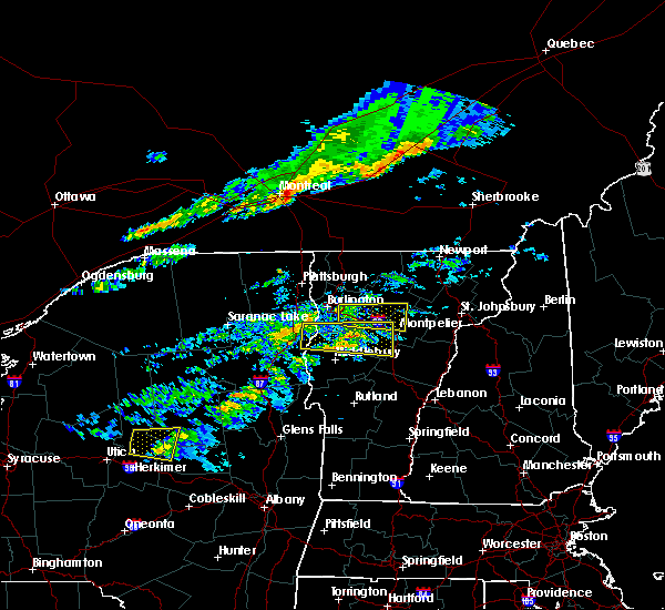 The severe thunderstorm warning for southern lamoille, east central chittenden and northwestern washington counties will expire at 615 pm edt, the storm which prompted the warning has weakened below severe limits, and no longer poses an immediate threat to life or property. therefore, the warning will be allowed to expire. a severe thunderstorm watch remains in effect until 900 pm edt for central and northwestern vermont. remember, a severe thunderstorm warning still remains in effect for portions of southern chittenden and washington counties in vermont. The severe thunderstorm warning for southern lamoille, east central chittenden and northwestern washington counties will expire at 615 pm edt, the storm which prompted the warning has weakened below severe limits, and no longer poses an immediate threat to life or property. therefore, the warning will be allowed to expire. a severe thunderstorm watch remains in effect until 900 pm edt for central and northwestern vermont. remember, a severe thunderstorm warning still remains in effect for portions of southern chittenden and washington counties in vermont.
|
| 10/10/2020 5:46 PM EDT |
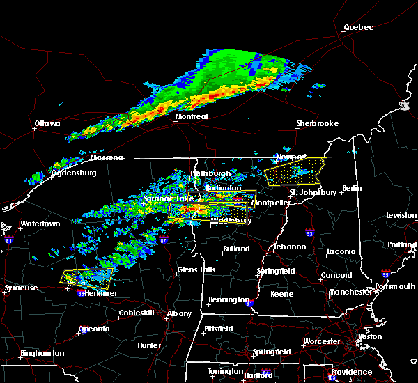 At 545 pm edt, a severe thunderstorm was located over north williston, moving east at 45 mph (radar indicated). Hazards include 60 mph wind gusts. Expect damage to trees and powerlines. locations impacted include, essex junction, montpelier, jericho, stowe, duxbury, waterbury village, jericho village, waterbury, williston, worcester, middlesex, bolton, elmore, richmond, east montpelier, st. George, essex junction village, essex, huntington and hinesburg. At 545 pm edt, a severe thunderstorm was located over north williston, moving east at 45 mph (radar indicated). Hazards include 60 mph wind gusts. Expect damage to trees and powerlines. locations impacted include, essex junction, montpelier, jericho, stowe, duxbury, waterbury village, jericho village, waterbury, williston, worcester, middlesex, bolton, elmore, richmond, east montpelier, st. George, essex junction village, essex, huntington and hinesburg.
|
| 10/10/2020 5:21 PM EDT |
 At 521 pm edt, a severe thunderstorm was located over hatch point, moving east at 45 mph (radar indicated). Hazards include 60 mph wind gusts. expect damage to trees and powerlines At 521 pm edt, a severe thunderstorm was located over hatch point, moving east at 45 mph (radar indicated). Hazards include 60 mph wind gusts. expect damage to trees and powerlines
|
| 10/7/2020 5:14 PM EDT |
 At 514 pm edt, a severe thunderstorm was located over starksboro, moving southeast at 60 mph (radar indicated). Hazards include 60 mph wind gusts and nickel size hail. Expect damage to trees and powerlines. locations impacted include, essex junction, south burlington, burlington international airport, burlington, charlotte, jericho, hinesburg, st. george, essex, jericho village, essex junction village, williston, bolton, shelburne, richmond, mt. Philo state park, huntington, shelburne falls, north williston and meach island. At 514 pm edt, a severe thunderstorm was located over starksboro, moving southeast at 60 mph (radar indicated). Hazards include 60 mph wind gusts and nickel size hail. Expect damage to trees and powerlines. locations impacted include, essex junction, south burlington, burlington international airport, burlington, charlotte, jericho, hinesburg, st. george, essex, jericho village, essex junction village, williston, bolton, shelburne, richmond, mt. Philo state park, huntington, shelburne falls, north williston and meach island.
|
| 10/7/2020 5:03 PM EDT |
 At 503 pm edt, a severe thunderstorm was located over starksboro, moving southeast at 60 mph (radar indicated). Hazards include 60 mph wind gusts and nickel size hail. Expect damage to trees and powerlines. locations impacted include, essex junction, south burlington, burlington international airport, burlington, charlotte, winooski, colchester, essex junction village, williston, bolton, richmond, mt. philo state park, jericho, hinesburg, st. George, essex, jericho village, shelburne, milton and huntington. At 503 pm edt, a severe thunderstorm was located over starksboro, moving southeast at 60 mph (radar indicated). Hazards include 60 mph wind gusts and nickel size hail. Expect damage to trees and powerlines. locations impacted include, essex junction, south burlington, burlington international airport, burlington, charlotte, winooski, colchester, essex junction village, williston, bolton, richmond, mt. philo state park, jericho, hinesburg, st. George, essex, jericho village, shelburne, milton and huntington.
|
| 10/7/2020 4:44 PM EDT |
 At 443 pm edt, a severe thunderstorm was located over winooski, or over burlington, moving southeast at 60 mph (radar indicated). Hazards include 60 mph wind gusts. expect damage to roofs, siding, and trees At 443 pm edt, a severe thunderstorm was located over winooski, or over burlington, moving southeast at 60 mph (radar indicated). Hazards include 60 mph wind gusts. expect damage to roofs, siding, and trees
|
| 8/11/2020 8:55 PM EDT |
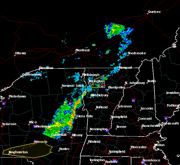 The severe thunderstorm warning for western lamoille, northeastern chittenden, northwestern washington and south central franklin counties will expire at 900 pm edt, the storm which prompted the warning has weakened below severe limits, and has exited the warned area. therefore, the warning will be allowed to expire. however gusty winds and heavy rain are still possible with this thunderstorm. The severe thunderstorm warning for western lamoille, northeastern chittenden, northwestern washington and south central franklin counties will expire at 900 pm edt, the storm which prompted the warning has weakened below severe limits, and has exited the warned area. therefore, the warning will be allowed to expire. however gusty winds and heavy rain are still possible with this thunderstorm.
|
| 8/11/2020 8:40 PM EDT |
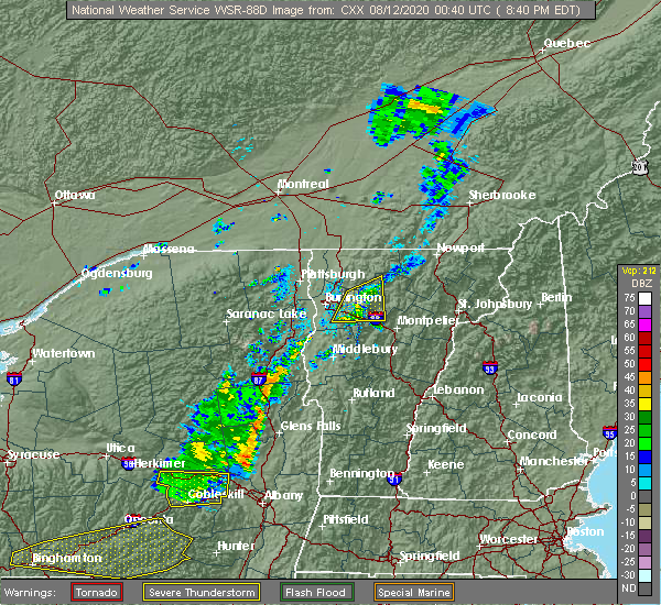 At 835 pm edt, a severe thunderstorm was located over smugglers notch, moving northeast at 25 mph (trained weather spotters reported a small tree was blow into a house in burlington at 8:03 pm and 12 inch diameter tree blown down in winooski at 8:05 pm. in addition, power outages are reported in the burlington, south burlington, and winooski areas from this severe thunderstorm this evening). Hazards include 60 mph wind gusts. Expect damage to trees and powerlines. locations impacted include, waterville, underhill, jericho, st. George, cambridge, cambridge village, stowe, essex, westford, jericho village, jeffersonville village, waterbury, underhill state park, williston, bolton, richmond, johnson, waterbury village, johnson village and belvidere. At 835 pm edt, a severe thunderstorm was located over smugglers notch, moving northeast at 25 mph (trained weather spotters reported a small tree was blow into a house in burlington at 8:03 pm and 12 inch diameter tree blown down in winooski at 8:05 pm. in addition, power outages are reported in the burlington, south burlington, and winooski areas from this severe thunderstorm this evening). Hazards include 60 mph wind gusts. Expect damage to trees and powerlines. locations impacted include, waterville, underhill, jericho, st. George, cambridge, cambridge village, stowe, essex, westford, jericho village, jeffersonville village, waterbury, underhill state park, williston, bolton, richmond, johnson, waterbury village, johnson village and belvidere.
|
| 8/11/2020 8:14 PM EDT |
 At 813 pm edt, a severe thunderstorm was located over north williston, moving east at 25 mph (radar indicated). Hazards include 60 mph wind gusts. Expect damage to trees and powerlines. locations impacted include, essex junction, burlington international airport, south burlington, burlington, cambridge, winooski, cambridge village, stowe, westford, jeffersonville village, essex junction village, williston, bolton, richmond, waterville, underhill, jericho, st. George, essex and jericho village. At 813 pm edt, a severe thunderstorm was located over north williston, moving east at 25 mph (radar indicated). Hazards include 60 mph wind gusts. Expect damage to trees and powerlines. locations impacted include, essex junction, burlington international airport, south burlington, burlington, cambridge, winooski, cambridge village, stowe, westford, jeffersonville village, essex junction village, williston, bolton, richmond, waterville, underhill, jericho, st. George, essex and jericho village.
|
| 8/11/2020 8:00 PM EDT |
 At 759 pm edt, a severe thunderstorm was located over south burlington, moving northeast at 25 mph (radar indicated). Hazards include 60 mph wind gusts and penny size hail. expect damage to trees and powerlines At 759 pm edt, a severe thunderstorm was located over south burlington, moving northeast at 25 mph (radar indicated). Hazards include 60 mph wind gusts and penny size hail. expect damage to trees and powerlines
|
| 7/8/2020 5:27 PM EDT |
 The severe thunderstorm warning for east central clinton, northeastern essex, southwestern lamoille, southern grand isle, northern chittenden and southwestern franklin counties will expire at 530 pm edt, the storm which prompted the warning has moved out of the area. therefore, the warning will be allowed to expire. however gusty winds and heavy rain are still possible with this thunderstorm. a severe thunderstorm watch remains in effect until 1000 pm edt for northwestern vermont. to report severe weather, contact your nearest law enforcement agency. they will relay your report to the national weather service burlington. The severe thunderstorm warning for east central clinton, northeastern essex, southwestern lamoille, southern grand isle, northern chittenden and southwestern franklin counties will expire at 530 pm edt, the storm which prompted the warning has moved out of the area. therefore, the warning will be allowed to expire. however gusty winds and heavy rain are still possible with this thunderstorm. a severe thunderstorm watch remains in effect until 1000 pm edt for northwestern vermont. to report severe weather, contact your nearest law enforcement agency. they will relay your report to the national weather service burlington.
|
| 7/8/2020 5:22 PM EDT | Trees down along skunk hollow rd... barber farm rd... and browns trace r in chittenden county VT, 0.4 miles NNE of Jericho, VT |
| 7/8/2020 5:18 PM EDT |
 At 518 pm edt, a severe thunderstorm was located over north duxbury, moving southeast at 45 mph (radar indicated). Hazards include 60 mph wind gusts and quarter size hail. Minor hail damage to vehicles is possible. Expect wind damage to trees and powerlines. At 518 pm edt, a severe thunderstorm was located over north duxbury, moving southeast at 45 mph (radar indicated). Hazards include 60 mph wind gusts and quarter size hail. Minor hail damage to vehicles is possible. Expect wind damage to trees and powerlines.
|
| 7/8/2020 4:43 PM EDT |
 At 443 pm edt, a severe thunderstorm was located over milton, moving southeast at 20 mph (radar indicated). Hazards include 70 mph wind gusts and quarter size hail. Minor hail damage to vehicles is possible. expect considerable tree damage. Wind damage is also likely to mobile homes, roofs, and outbuildings. At 443 pm edt, a severe thunderstorm was located over milton, moving southeast at 20 mph (radar indicated). Hazards include 70 mph wind gusts and quarter size hail. Minor hail damage to vehicles is possible. expect considerable tree damage. Wind damage is also likely to mobile homes, roofs, and outbuildings.
|
| 5/29/2020 7:39 PM EDT |
 At 739 pm edt, a severe thunderstorm was located over derway island, moving northeast at 50 mph (radar indicated). Hazards include 60 mph wind gusts and quarter size hail. Minor hail damage to vehicles is possible. Expect wind damage to trees and powerlines. At 739 pm edt, a severe thunderstorm was located over derway island, moving northeast at 50 mph (radar indicated). Hazards include 60 mph wind gusts and quarter size hail. Minor hail damage to vehicles is possible. Expect wind damage to trees and powerlines.
|
| 5/29/2020 3:56 PM EDT |
 At 356 pm edt, a severe thunderstorm was located over winooski, moving east at 40 mph (radar indicated). Hazards include 60 mph wind gusts and nickel size hail. Expect damage to trees and powerlines. This storm has a history of wind damage. At 356 pm edt, a severe thunderstorm was located over winooski, moving east at 40 mph (radar indicated). Hazards include 60 mph wind gusts and nickel size hail. Expect damage to trees and powerlines. This storm has a history of wind damage.
|
| 3/20/2020 3:43 PM EDT |
 At 343 pm edt, severe thunderstorms were located along a line extending from bluff point to mount marcy, moving east at 65 mph (radar indicated). Hazards include 60 mph wind gusts. expect damage to trees and powerlines At 343 pm edt, severe thunderstorms were located along a line extending from bluff point to mount marcy, moving east at 65 mph (radar indicated). Hazards include 60 mph wind gusts. expect damage to trees and powerlines
|
| 7/30/2019 4:25 PM EDT |
 The severe thunderstorm warning for northern chittenden and southwestern franklin counties will expire at 430 pm edt, the storm which prompted the warning has moved out of the area. therefore, the warning will be allowed to expire. however gusty winds are still possible with this thunderstorm as additional warning remains in effect. a severe thunderstorm watch remains in effect until 900 pm edt for northwestern vermont. The severe thunderstorm warning for northern chittenden and southwestern franklin counties will expire at 430 pm edt, the storm which prompted the warning has moved out of the area. therefore, the warning will be allowed to expire. however gusty winds are still possible with this thunderstorm as additional warning remains in effect. a severe thunderstorm watch remains in effect until 900 pm edt for northwestern vermont.
|
| 7/30/2019 3:57 PM EDT |
 At 357 pm edt, a severe thunderstorm was located over colchester, moving northeast at 30 mph (nws employee reports trees down on power out on north end of burlington). Hazards include 60 mph wind gusts and penny size hail. Expect damage to trees and powerlines. Locations impacted include, essex junction, south burlington, burlington international airport, burlington, winooski, essex, westford, jericho village, colchester, essex junction village, fairfax, milton, underhill, georgia, jericho, williston, mallets bay state park, west milton, malletts bay and coates island. At 357 pm edt, a severe thunderstorm was located over colchester, moving northeast at 30 mph (nws employee reports trees down on power out on north end of burlington). Hazards include 60 mph wind gusts and penny size hail. Expect damage to trees and powerlines. Locations impacted include, essex junction, south burlington, burlington international airport, burlington, winooski, essex, westford, jericho village, colchester, essex junction village, fairfax, milton, underhill, georgia, jericho, williston, mallets bay state park, west milton, malletts bay and coates island.
|
| 7/30/2019 3:28 PM EDT |
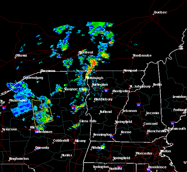 At 327 pm edt, a severe thunderstorm was located over frisbies point, moving northeast at 30 mph (radar indicated). Hazards include 60 mph wind gusts and penny size hail. expect damage to trees and powerlines At 327 pm edt, a severe thunderstorm was located over frisbies point, moving northeast at 30 mph (radar indicated). Hazards include 60 mph wind gusts and penny size hail. expect damage to trees and powerlines
|
| 7/28/2019 2:43 PM EDT |
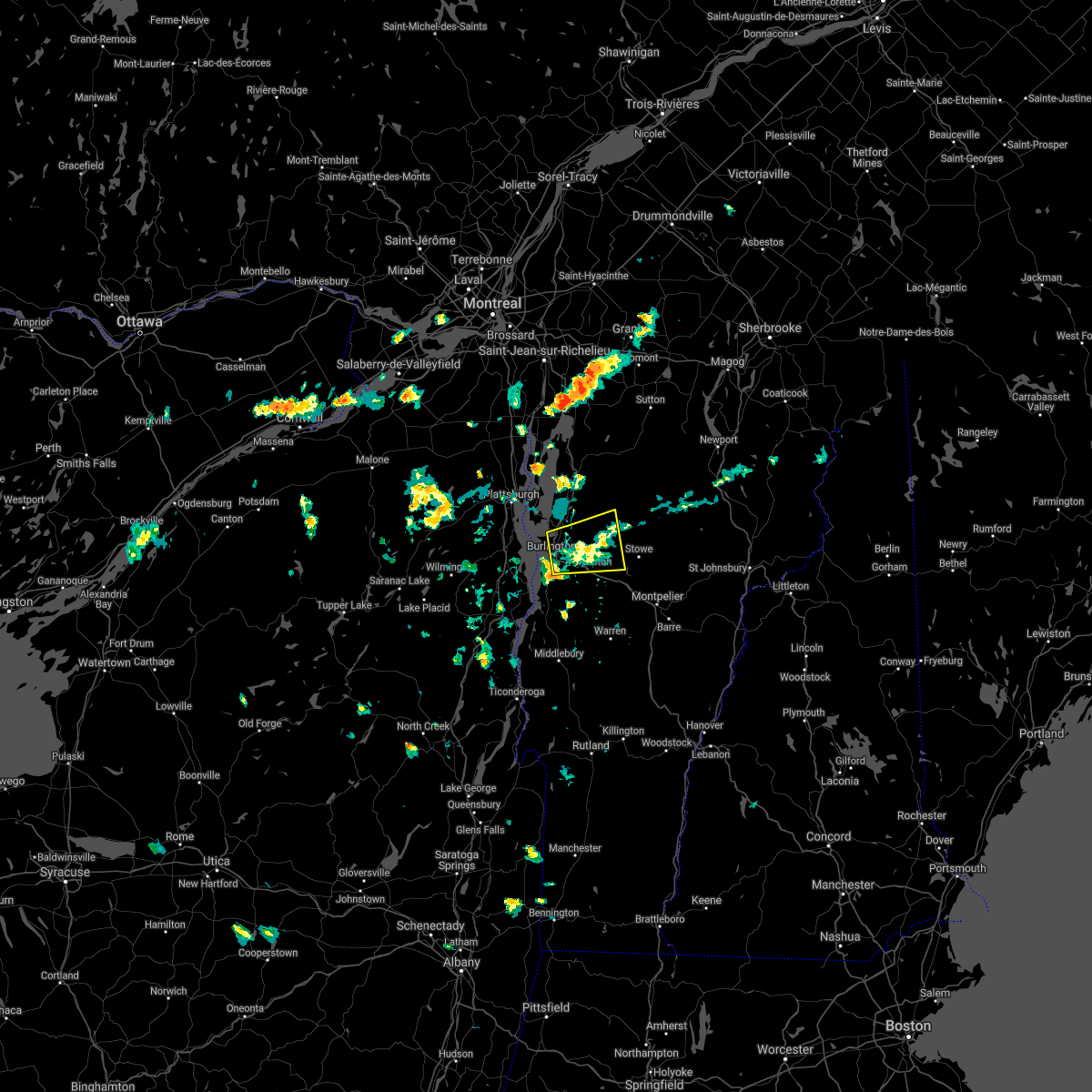 The severe thunderstorm warning for southwestern lamoille, central chittenden, northwestern washington and southern franklin counties will expire at 245 pm edt, the storm which prompted the warning has weakened below severe limits, and has exited the warned area. therefore, the warning will be allowed to expire. The severe thunderstorm warning for southwestern lamoille, central chittenden, northwestern washington and southern franklin counties will expire at 245 pm edt, the storm which prompted the warning has weakened below severe limits, and has exited the warned area. therefore, the warning will be allowed to expire.
|
| 7/28/2019 2:26 PM EDT |
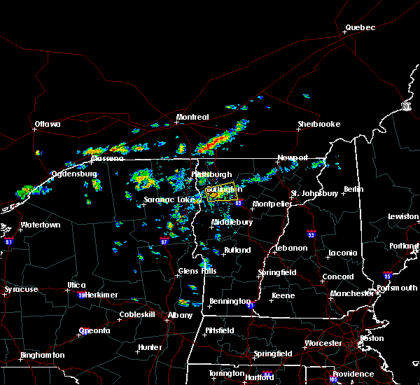 At 226 pm edt, a severe thunderstorm was located over essex junction village, moving east at 15 mph (radar indicated). Hazards include 60 mph wind gusts and penny size hail. Expect damage to trees and powerlines. locations impacted include, essex junction, burlington international airport, south burlington, burlington, underhill, jericho, winooski, cambridge village, essex, westford, jericho village, jeffersonville village, colchester, essex junction village, underhill state park, williston, cambridge, bolton, richmond and st. George. At 226 pm edt, a severe thunderstorm was located over essex junction village, moving east at 15 mph (radar indicated). Hazards include 60 mph wind gusts and penny size hail. Expect damage to trees and powerlines. locations impacted include, essex junction, burlington international airport, south burlington, burlington, underhill, jericho, winooski, cambridge village, essex, westford, jericho village, jeffersonville village, colchester, essex junction village, underhill state park, williston, cambridge, bolton, richmond and st. George.
|
| 7/28/2019 2:06 PM EDT |
 At 206 pm edt, a severe thunderstorm was located over burlington, moving east at 25 mph (radar indicated). Hazards include 60 mph wind gusts and penny size hail. expect damage to trees and powerlines At 206 pm edt, a severe thunderstorm was located over burlington, moving east at 25 mph (radar indicated). Hazards include 60 mph wind gusts and penny size hail. expect damage to trees and powerlines
|
| 6/29/2019 7:46 PM EDT |
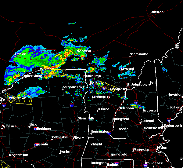 At 745 pm edt, a severe thunderstorm was located over smugglers notch and north underhill, moving southeast at 30 mph (radar indicated). Hazards include 60 mph wind gusts and quarter size hail. Minor hail damage to vehicles is possible. expect wind damage to trees and powerlines. Locations impacted include, calais, underhill, stowe, jericho village, underhill state park, worcester, marshfield village, jericho, waterbury, east montpelier, middlesex, marshfield, woodbury, cabot, plainfield, elmore, morristown, essex, bolton and cambridge. At 745 pm edt, a severe thunderstorm was located over smugglers notch and north underhill, moving southeast at 30 mph (radar indicated). Hazards include 60 mph wind gusts and quarter size hail. Minor hail damage to vehicles is possible. expect wind damage to trees and powerlines. Locations impacted include, calais, underhill, stowe, jericho village, underhill state park, worcester, marshfield village, jericho, waterbury, east montpelier, middlesex, marshfield, woodbury, cabot, plainfield, elmore, morristown, essex, bolton and cambridge.
|
| 6/29/2019 7:27 PM EDT |
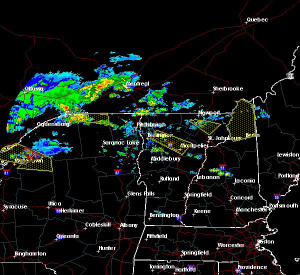 At 726 pm edt, a severe thunderstorm was located over essex, moving southeast at 30 mph (radar indicated). Hazards include 60 mph wind gusts and quarter size hail. Minor hail damage to vehicles is possible. Expect wind damage to trees and powerlines. At 726 pm edt, a severe thunderstorm was located over essex, moving southeast at 30 mph (radar indicated). Hazards include 60 mph wind gusts and quarter size hail. Minor hail damage to vehicles is possible. Expect wind damage to trees and powerlines.
|
| 6/26/2019 5:46 PM EDT |
 At 544 pm edt, severe thunderstorms were located along a line extending from cambridge junction to underhill to near jericho center, moving east at 45 mph (multiple sources. line of storms has knocked a tree onto vehicle in downtown burlington. additionally, a 62mph gust was measures at a ny state mesonet in essex, ny. reports from emergency management of power poles snapped and trees down in willisboro along the tree down along i-87 near lewiston). Hazards include 60 mph wind gusts and penny size hail. Expect damage to trees and powerlines. locations impacted include, essex junction, south burlington, burlington international airport, burlington, morrisville, johnson village, cambridge, winooski, monkton ridge, waterbury village, westford, monkton boro, hyde park, essex junction village, williston, worcester, middlesex, hinesburg, st. George and morrisville village. At 544 pm edt, severe thunderstorms were located along a line extending from cambridge junction to underhill to near jericho center, moving east at 45 mph (multiple sources. line of storms has knocked a tree onto vehicle in downtown burlington. additionally, a 62mph gust was measures at a ny state mesonet in essex, ny. reports from emergency management of power poles snapped and trees down in willisboro along the tree down along i-87 near lewiston). Hazards include 60 mph wind gusts and penny size hail. Expect damage to trees and powerlines. locations impacted include, essex junction, south burlington, burlington international airport, burlington, morrisville, johnson village, cambridge, winooski, monkton ridge, waterbury village, westford, monkton boro, hyde park, essex junction village, williston, worcester, middlesex, hinesburg, st. George and morrisville village.
|
| 6/26/2019 5:32 PM EDT |
 At 530 pm edt, severe thunderstorms were located along a line extending from near westford to essex to near st. george, moving east at 45 mph (new york state mesonet in essex, ny reported wind gusts of 54 knots. additionally, social media reports tree branch downed on vehicle in downtown burlington). Hazards include 60 mph wind gusts and penny size hail. Expect damage to trees and powerlines. Locations impacted include, essex junction, south burlington, burlington international airport, burlington, willsboro, morrisville, johnson village, cambridge, winooski, monkton ridge, waterbury village, westford, monkton boro, hyde park, colchester, essex junction village, williston, worcester, middlesex and belvidere center. At 530 pm edt, severe thunderstorms were located along a line extending from near westford to essex to near st. george, moving east at 45 mph (new york state mesonet in essex, ny reported wind gusts of 54 knots. additionally, social media reports tree branch downed on vehicle in downtown burlington). Hazards include 60 mph wind gusts and penny size hail. Expect damage to trees and powerlines. Locations impacted include, essex junction, south burlington, burlington international airport, burlington, willsboro, morrisville, johnson village, cambridge, winooski, monkton ridge, waterbury village, westford, monkton boro, hyde park, colchester, essex junction village, williston, worcester, middlesex and belvidere center.
|
| 6/26/2019 5:08 PM EDT |
 At 508 pm edt, severe thunderstorms were located along a line extending from allen point to near the four brothers to near reber, moving east at 45 mph (radar indicated). Hazards include 60 mph wind gusts and penny size hail. expect damage to trees and powerlines At 508 pm edt, severe thunderstorms were located along a line extending from allen point to near the four brothers to near reber, moving east at 45 mph (radar indicated). Hazards include 60 mph wind gusts and penny size hail. expect damage to trees and powerlines
|
| 6/18/2018 2:58 PM EDT |
 At 258 pm edt, a severe thunderstorm was located over little river state park, moving east at 35 mph (radar indicated). Hazards include 60 mph wind gusts and penny size hail. Expect damage to trees and powerlines. locations impacted include, essex junction, south burlington, burlington international airport, burlington, morrisville, winooski, stowe, waterbury village, westford, essex junction village, williston, worcester, middlesex, bolton, richmond, underhill, jericho, hinesburg, st. George and huntington. At 258 pm edt, a severe thunderstorm was located over little river state park, moving east at 35 mph (radar indicated). Hazards include 60 mph wind gusts and penny size hail. Expect damage to trees and powerlines. locations impacted include, essex junction, south burlington, burlington international airport, burlington, morrisville, winooski, stowe, waterbury village, westford, essex junction village, williston, worcester, middlesex, bolton, richmond, underhill, jericho, hinesburg, st. George and huntington.
|
| 6/18/2018 2:43 PM EDT |
 At 242 pm edt, a severe thunderstorm was located over jericho center, moving east at 35 mph (radar indicated). Hazards include 60 mph wind gusts and penny size hail. Expect damage to trees and powerlines. locations impacted include, essex junction, south burlington, burlington international airport, burlington, morrisville, winooski, waterbury village, westford, colchester, essex junction village, williston, worcester, middlesex, hinesburg, st. George, morrisville village, moretown, keeseville, underhill state park and shelburne. At 242 pm edt, a severe thunderstorm was located over jericho center, moving east at 35 mph (radar indicated). Hazards include 60 mph wind gusts and penny size hail. Expect damage to trees and powerlines. locations impacted include, essex junction, south burlington, burlington international airport, burlington, morrisville, winooski, waterbury village, westford, colchester, essex junction village, williston, worcester, middlesex, hinesburg, st. George, morrisville village, moretown, keeseville, underhill state park and shelburne.
|
| 6/18/2018 2:23 PM EDT |
 At 223 pm edt, a severe thunderstorm was located over halfmoon cove, moving east at 35 mph (radar indicated). Hazards include 60 mph wind gusts and penny size hail. expect damage to trees and powerlines At 223 pm edt, a severe thunderstorm was located over halfmoon cove, moving east at 35 mph (radar indicated). Hazards include 60 mph wind gusts and penny size hail. expect damage to trees and powerlines
|
| 5/4/2018 8:17 PM EDT |
 At 815 pm edt, severe thunderstorms were located along a line extending from near hinesburg to bristol to near brooksville, moving northeast at 50 mph (public reported 1" hail 5 miles southeast of essex junction at 735 pm and multiple trees down in shelburne). Hazards include 60 mph wind gusts and quarter size hail. Minor hail damage to vehicles is possible. expect wind damage to trees and powerlines. locations impacted include, essex junction, barre, burlington international airport, montpelier, middlebury, south burlington, burlington, morrisville, calais, weybridge, orange, monkton ridge, waterbury village, websterville, lincoln, monkton, monkton boro, essex junction village, williston and new haven. A tornado watch remains in effect until 1000 pm edt for central, northeastern and northwestern vermont. At 815 pm edt, severe thunderstorms were located along a line extending from near hinesburg to bristol to near brooksville, moving northeast at 50 mph (public reported 1" hail 5 miles southeast of essex junction at 735 pm and multiple trees down in shelburne). Hazards include 60 mph wind gusts and quarter size hail. Minor hail damage to vehicles is possible. expect wind damage to trees and powerlines. locations impacted include, essex junction, barre, burlington international airport, montpelier, middlebury, south burlington, burlington, morrisville, calais, weybridge, orange, monkton ridge, waterbury village, websterville, lincoln, monkton, monkton boro, essex junction village, williston and new haven. A tornado watch remains in effect until 1000 pm edt for central, northeastern and northwestern vermont.
|
| 5/4/2018 7:47 PM EDT |
 At 744 pm edt, severe thunderstorms were located along a line extending from jericho to richmond to mineville, moving east at 40 mph (public reported 1" hail 5 miles southeast of essex junction at 735 pm and multiple trees down in shelburne). Hazards include 60 mph wind gusts and quarter size hail. Minor hail damage to vehicles is possible. expect wind damage to trees and powerlines. locations impacted include, essex junction, barre, burlington international airport, montpelier, south burlington, burlington, vergennes, middlebury, essex, moriah, willsboro, morrisville, westport, elizabethtown, waterbury village, websterville, essex junction village, worcester, middlesex and marshfield. A tornado watch remains in effect until 1000 pm edt for northern new york, and central, northeastern and northwestern vermont. At 744 pm edt, severe thunderstorms were located along a line extending from jericho to richmond to mineville, moving east at 40 mph (public reported 1" hail 5 miles southeast of essex junction at 735 pm and multiple trees down in shelburne). Hazards include 60 mph wind gusts and quarter size hail. Minor hail damage to vehicles is possible. expect wind damage to trees and powerlines. locations impacted include, essex junction, barre, burlington international airport, montpelier, south burlington, burlington, vergennes, middlebury, essex, moriah, willsboro, morrisville, westport, elizabethtown, waterbury village, websterville, essex junction village, worcester, middlesex and marshfield. A tornado watch remains in effect until 1000 pm edt for northern new york, and central, northeastern and northwestern vermont.
|
| 5/4/2018 7:29 PM EDT |
 At 729 pm edt, a severe thunderstorm was located over shelburne falls, moving east at 40 mph (radar indicated). Hazards include 60 mph wind gusts and quarter size hail. Minor hail damage to vehicles is possible. Expect wind damage to trees and powerlines. At 729 pm edt, a severe thunderstorm was located over shelburne falls, moving east at 40 mph (radar indicated). Hazards include 60 mph wind gusts and quarter size hail. Minor hail damage to vehicles is possible. Expect wind damage to trees and powerlines.
|
| 5/4/2018 7:22 PM EDT | Trees down in road in chittenden county VT, 0.4 miles NNE of Jericho, VT |
| 5/4/2018 7:12 PM EDT |
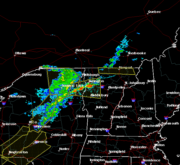 At 711 pm edt, a severe thunderstorm was located over colchester, moving east at 40 mph (radar indicated). Hazards include 60 mph wind gusts and quarter size hail. Minor hail damage to vehicles is possible. Expect wind damage to trees and powerlines. At 711 pm edt, a severe thunderstorm was located over colchester, moving east at 40 mph (radar indicated). Hazards include 60 mph wind gusts and quarter size hail. Minor hail damage to vehicles is possible. Expect wind damage to trees and powerlines.
|
| 5/4/2018 6:44 PM EDT |
 At 643 pm edt, a severe thunderstorm was located over barney point, moving east at 60 mph. this is a very dangerous storm (radar indicated). Hazards include 80 mph wind gusts and ping pong ball size hail. Flying debris will be dangerous to those caught without shelter. mobile homes will be heavily damaged. expect considerable damage to roofs, windows, and vehicles. extensive tree damage and power outages are likely. locations impacted include, essex junction, burlington international airport, south burlington, burlington, vergennes, middlebury, willsboro, westport, elizabethtown, keene, westford, colchester, essex junction village, au sable forks, addison, jay in essex county, shelburne, charlotte, waltham and cambridge village. A tornado watch remains in effect until 1000 pm edt for northern new york, and central and northwestern vermont. At 643 pm edt, a severe thunderstorm was located over barney point, moving east at 60 mph. this is a very dangerous storm (radar indicated). Hazards include 80 mph wind gusts and ping pong ball size hail. Flying debris will be dangerous to those caught without shelter. mobile homes will be heavily damaged. expect considerable damage to roofs, windows, and vehicles. extensive tree damage and power outages are likely. locations impacted include, essex junction, burlington international airport, south burlington, burlington, vergennes, middlebury, willsboro, westport, elizabethtown, keene, westford, colchester, essex junction village, au sable forks, addison, jay in essex county, shelburne, charlotte, waltham and cambridge village. A tornado watch remains in effect until 1000 pm edt for northern new york, and central and northwestern vermont.
|
| 5/4/2018 6:24 PM EDT |
 At 623 pm edt, a severe thunderstorm was located near keene, moving east at 50 mph (radar indicated). Hazards include 60 mph wind gusts and quarter size hail. Minor hail damage to vehicles is possible. Expect wind damage to trees and powerlines. At 623 pm edt, a severe thunderstorm was located near keene, moving east at 50 mph (radar indicated). Hazards include 60 mph wind gusts and quarter size hail. Minor hail damage to vehicles is possible. Expect wind damage to trees and powerlines.
|
| 8/22/2017 6:28 PM EDT |
 At 628 pm edt, severe thunderstorms were located along a line extending from south cambridge to near northfield to east hubbardton, moving east at 50 mph (radar indicated). Hazards include 70 mph wind gusts and penny size hail. Expect considerable tree damage. Damage is likely to mobile homes, roofs, and outbuildings. At 628 pm edt, severe thunderstorms were located along a line extending from south cambridge to near northfield to east hubbardton, moving east at 50 mph (radar indicated). Hazards include 70 mph wind gusts and penny size hail. Expect considerable tree damage. Damage is likely to mobile homes, roofs, and outbuildings.
|
| 8/22/2017 6:00 PM EDT |
 At 600 pm edt, severe thunderstorms were located along a line extending from near appletree point to twilight bay to waltham, moving northeast at 35 mph (radar indicated). Hazards include 60 mph wind gusts. expect damage to trees and powerlines At 600 pm edt, severe thunderstorms were located along a line extending from near appletree point to twilight bay to waltham, moving northeast at 35 mph (radar indicated). Hazards include 60 mph wind gusts. expect damage to trees and powerlines
|
| 8/12/2017 6:30 PM EDT | Trees down on lee river rd in chittenden county VT, 1.1 miles NNW of Jericho, VT |
| 8/12/2017 6:00 PM EDT |
 The national weather service in burlington has issued a * severe thunderstorm warning for. southwestern lamoille county in northwestern vermont. northwestern addison county in central vermont. chittenden county in northwestern vermont. Western washington county in central vermont. The national weather service in burlington has issued a * severe thunderstorm warning for. southwestern lamoille county in northwestern vermont. northwestern addison county in central vermont. chittenden county in northwestern vermont. Western washington county in central vermont.
|
| 8/5/2017 6:31 PM EDT | Tree snapped landing on wires and causing power outage in chittenden county VT, 0.4 miles SSE of Jericho, VT |
| 6/18/2017 11:27 PM EDT |
 At 1126 pm edt, a severe thunderstorm was located over cloverdale, moving northeast at 45 mph (radar indicated). Hazards include 60 mph wind gusts. expect damage to trees and powerlines At 1126 pm edt, a severe thunderstorm was located over cloverdale, moving northeast at 45 mph (radar indicated). Hazards include 60 mph wind gusts. expect damage to trees and powerlines
|
| 5/31/2017 2:55 PM EDT |
 At 254 pm edt, a severe thunderstorm was located over colchester, moving east at 30 mph (radar indicated). Hazards include 60 mph wind gusts and penny size hail. Expect damage to trees and powerlines. locations impacted include, essex junction, south burlington, burlington international airport, burlington, winooski, westford, colchester, essex junction village, williston, bolton, richmond, underhill, jericho, st. George, essex, jericho village, underhill state park, shelburne, south hero and milton. At 254 pm edt, a severe thunderstorm was located over colchester, moving east at 30 mph (radar indicated). Hazards include 60 mph wind gusts and penny size hail. Expect damage to trees and powerlines. locations impacted include, essex junction, south burlington, burlington international airport, burlington, winooski, westford, colchester, essex junction village, williston, bolton, richmond, underhill, jericho, st. George, essex, jericho village, underhill state park, shelburne, south hero and milton.
|
| 5/31/2017 2:30 PM EDT |
 At 230 pm edt, a severe thunderstorm was located over ferris rock, moving east at 35 mph (radar indicated). Hazards include 60 mph wind gusts and penny size hail. expect damage to trees and powerlines At 230 pm edt, a severe thunderstorm was located over ferris rock, moving east at 35 mph (radar indicated). Hazards include 60 mph wind gusts and penny size hail. expect damage to trees and powerlines
|
| 5/18/2017 5:29 PM EDT |
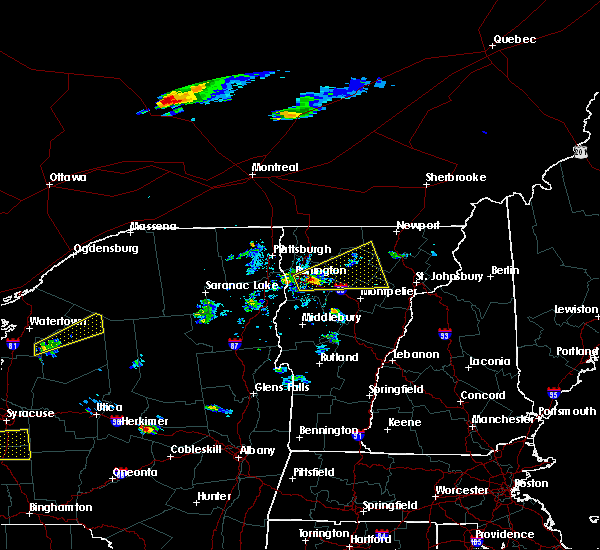 At 528 pm edt, a severe thunderstorm was located over north williston, moving east at 40 mph (radar indicated). Hazards include 60 mph wind gusts and quarter size hail. Minor hail damage to vehicles is possible. Expect wind damage to trees and powerlines. At 528 pm edt, a severe thunderstorm was located over north williston, moving east at 40 mph (radar indicated). Hazards include 60 mph wind gusts and quarter size hail. Minor hail damage to vehicles is possible. Expect wind damage to trees and powerlines.
|
| 7/23/2016 3:38 PM EDT |
 At 338 pm edt, a severe thunderstorm was located over essex center, moving southeast at 40 mph (radar indicated). Hazards include 60 mph wind gusts and quarter size hail. Hail damage to vehicles is expected. expect wind damage to roofs, siding, and trees. locations impacted include, south burlington, colchester, essex junction, plattsburgh international airport, burlington international airport, williston, winooski, grand isle, jericho, hinesburg, fairfax, richmond, underhill, westford, huntington, south hero, bolton, st. George, underhill state park and georgia center. At 338 pm edt, a severe thunderstorm was located over essex center, moving southeast at 40 mph (radar indicated). Hazards include 60 mph wind gusts and quarter size hail. Hail damage to vehicles is expected. expect wind damage to roofs, siding, and trees. locations impacted include, south burlington, colchester, essex junction, plattsburgh international airport, burlington international airport, williston, winooski, grand isle, jericho, hinesburg, fairfax, richmond, underhill, westford, huntington, south hero, bolton, st. George, underhill state park and georgia center.
|
| 7/23/2016 3:38 PM EDT |
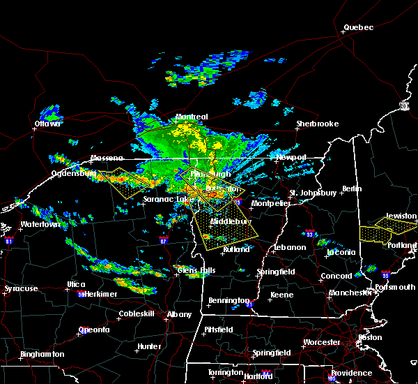 At 338 pm edt, a severe thunderstorm was located over essex center, moving southeast at 40 mph (radar indicated). Hazards include 60 mph wind gusts and quarter size hail. Hail damage to vehicles is expected. expect wind damage to roofs, siding, and trees. locations impacted include, south burlington, colchester, essex junction, plattsburgh international airport, burlington international airport, williston, winooski, grand isle, jericho, hinesburg, fairfax, richmond, underhill, westford, huntington, south hero, bolton, st. George, underhill state park and georgia center. At 338 pm edt, a severe thunderstorm was located over essex center, moving southeast at 40 mph (radar indicated). Hazards include 60 mph wind gusts and quarter size hail. Hail damage to vehicles is expected. expect wind damage to roofs, siding, and trees. locations impacted include, south burlington, colchester, essex junction, plattsburgh international airport, burlington international airport, williston, winooski, grand isle, jericho, hinesburg, fairfax, richmond, underhill, westford, huntington, south hero, bolton, st. George, underhill state park and georgia center.
|
| 7/23/2016 3:35 PM EDT |
 At 335 pm edt, a severe thunderstorm was located over east charlotte, moving south at 40 mph (radar indicated). Hazards include 60 mph wind gusts and quarter size hail. Hail damage to vehicles is expected. Expect wind damage to roofs, siding, and trees. At 335 pm edt, a severe thunderstorm was located over east charlotte, moving south at 40 mph (radar indicated). Hazards include 60 mph wind gusts and quarter size hail. Hail damage to vehicles is expected. Expect wind damage to roofs, siding, and trees.
|
| 7/23/2016 3:01 PM EDT |
 At 300 pm edt, a severe thunderstorm was located over treadwell bay, moving southeast at 40 mph (radar indicated). Hazards include 60 mph wind gusts and quarter size hail. Hail damage to vehicles is expected. Expect wind damage to roofs, siding, and trees. At 300 pm edt, a severe thunderstorm was located over treadwell bay, moving southeast at 40 mph (radar indicated). Hazards include 60 mph wind gusts and quarter size hail. Hail damage to vehicles is expected. Expect wind damage to roofs, siding, and trees.
|
| 7/22/2016 10:56 PM EDT |
 At 1054 pm edt, severe thunderstorms were located along a line extending from burlington to near lake placid, moving east at 40 mph. other isolated severe thunderstorms are ahead of this line across central vermont also moving east at 40 mph (radar indicated). Hazards include 60 mph wind gusts and quarter size hail. Hail damage to vehicles is expected. Expect wind damage to roofs, siding, and trees. At 1054 pm edt, severe thunderstorms were located along a line extending from burlington to near lake placid, moving east at 40 mph. other isolated severe thunderstorms are ahead of this line across central vermont also moving east at 40 mph (radar indicated). Hazards include 60 mph wind gusts and quarter size hail. Hail damage to vehicles is expected. Expect wind damage to roofs, siding, and trees.
|
| 7/22/2016 10:43 PM EDT |
 At 1041 pm edt, severe thunderstorms were located along a line extending from alburg vermont to burlington vermont, moving east at 35 to 40 mph. other strong to severe thunderstorms were located over northeast vermont moving east at 35 mph (radar indicated). Hazards include 60 mph wind gusts and quarter size hail. Hail damage to vehicles is expected. Expect wind damage to roofs, siding, and trees. At 1041 pm edt, severe thunderstorms were located along a line extending from alburg vermont to burlington vermont, moving east at 35 to 40 mph. other strong to severe thunderstorms were located over northeast vermont moving east at 35 mph (radar indicated). Hazards include 60 mph wind gusts and quarter size hail. Hail damage to vehicles is expected. Expect wind damage to roofs, siding, and trees.
|
| 7/22/2016 10:09 PM EDT |
 At 1008 pm edt, an area of strong to severe thunderstorms was located from east fletcher vermont westward to cumberland head new york, moving east at 30 mph (radar indicated). Hazards include 60 mph wind gusts and quarter size hail. Hail damage to vehicles is expected. expect wind damage to roofs, siding, and trees. Locations impacted include, colchester, essex junction, plattsburgh international airport, grand isle, beekmantown, jericho, fairfax, chazy, underhill, westford, south hero, johnson, fletcher, north hero, waterville, isle la motte, cambridge, underhill state park, georgia center and schuyler falls. At 1008 pm edt, an area of strong to severe thunderstorms was located from east fletcher vermont westward to cumberland head new york, moving east at 30 mph (radar indicated). Hazards include 60 mph wind gusts and quarter size hail. Hail damage to vehicles is expected. expect wind damage to roofs, siding, and trees. Locations impacted include, colchester, essex junction, plattsburgh international airport, grand isle, beekmantown, jericho, fairfax, chazy, underhill, westford, south hero, johnson, fletcher, north hero, waterville, isle la motte, cambridge, underhill state park, georgia center and schuyler falls.
|
| 7/22/2016 10:09 PM EDT |
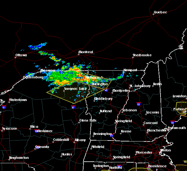 At 1008 pm edt, an area of strong to severe thunderstorms was located from east fletcher vermont westward to cumberland head new york, moving east at 30 mph (radar indicated). Hazards include 60 mph wind gusts and quarter size hail. Hail damage to vehicles is expected. expect wind damage to roofs, siding, and trees. Locations impacted include, colchester, essex junction, plattsburgh international airport, grand isle, beekmantown, jericho, fairfax, chazy, underhill, westford, south hero, johnson, fletcher, north hero, waterville, isle la motte, cambridge, underhill state park, georgia center and schuyler falls. At 1008 pm edt, an area of strong to severe thunderstorms was located from east fletcher vermont westward to cumberland head new york, moving east at 30 mph (radar indicated). Hazards include 60 mph wind gusts and quarter size hail. Hail damage to vehicles is expected. expect wind damage to roofs, siding, and trees. Locations impacted include, colchester, essex junction, plattsburgh international airport, grand isle, beekmantown, jericho, fairfax, chazy, underhill, westford, south hero, johnson, fletcher, north hero, waterville, isle la motte, cambridge, underhill state park, georgia center and schuyler falls.
|
| 7/22/2016 9:42 PM EDT |
 At 941 pm edt, a severe thunderstorm was located over allens bay in clinton county, moving east at 35 mph (radar indicated). Hazards include 60 mph wind gusts and quarter size hail. Hail damage to vehicles is expected. Expect wind damage to roofs, siding, and trees. At 941 pm edt, a severe thunderstorm was located over allens bay in clinton county, moving east at 35 mph (radar indicated). Hazards include 60 mph wind gusts and quarter size hail. Hail damage to vehicles is expected. Expect wind damage to roofs, siding, and trees.
|
| 7/18/2016 1:53 PM EDT |
 The severe thunderstorm warning for southeastern clinton, northeastern essex, lamoille, southern grand isle, northern chittenden and southwestern franklin counties will expire at 200 pm edt, the storm which prompted the warning has moved out of the area. therefore the warning will be allowed to expire. however gusty winds and heavy rain are still possible with this thunderstorm. a severe thunderstorm watch remains in effect until 800 pm edt for northern new york, and northeastern, central and northwestern vermont. The severe thunderstorm warning for southeastern clinton, northeastern essex, lamoille, southern grand isle, northern chittenden and southwestern franklin counties will expire at 200 pm edt, the storm which prompted the warning has moved out of the area. therefore the warning will be allowed to expire. however gusty winds and heavy rain are still possible with this thunderstorm. a severe thunderstorm watch remains in effect until 800 pm edt for northern new york, and northeastern, central and northwestern vermont.
|
| 7/18/2016 1:53 PM EDT |
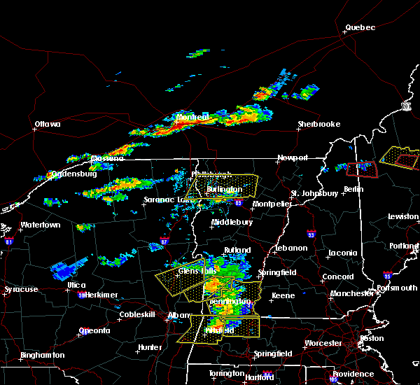 The severe thunderstorm warning for southeastern clinton, northeastern essex, lamoille, southern grand isle, northern chittenden and southwestern franklin counties will expire at 200 pm edt, the storm which prompted the warning has moved out of the area. therefore the warning will be allowed to expire. however gusty winds and heavy rain are still possible with this thunderstorm. a severe thunderstorm watch remains in effect until 800 pm edt for northern new york, and northeastern, central and northwestern vermont. The severe thunderstorm warning for southeastern clinton, northeastern essex, lamoille, southern grand isle, northern chittenden and southwestern franklin counties will expire at 200 pm edt, the storm which prompted the warning has moved out of the area. therefore the warning will be allowed to expire. however gusty winds and heavy rain are still possible with this thunderstorm. a severe thunderstorm watch remains in effect until 800 pm edt for northern new york, and northeastern, central and northwestern vermont.
|
| 7/18/2016 1:19 PM EDT |
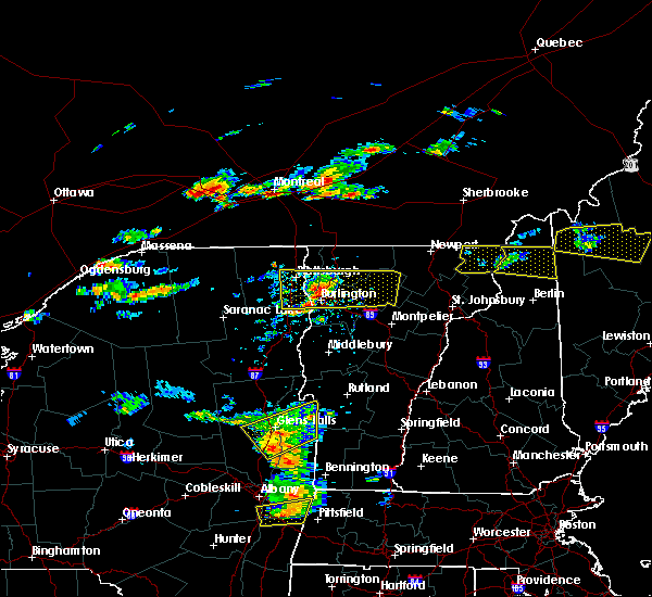 At 118 pm edt, a severe thunderstorm was located near colchester point, moving east at 55 mph (trained weather spotters reported trees downed in peru). Hazards include 60 mph wind gusts and quarter size hail. Hail damage to vehicles is expected. expect wind damage to roofs, siding, and trees. locations impacted include, south burlington, colchester, essex junction, burlington international airport, williston, winooski, grand isle, jericho, stowe, fairfax, underhill, westford, morrisville, south hero, johnson, eden, fletcher, waterville, hyde park and cambridge. At 118 pm edt, a severe thunderstorm was located near colchester point, moving east at 55 mph (trained weather spotters reported trees downed in peru). Hazards include 60 mph wind gusts and quarter size hail. Hail damage to vehicles is expected. expect wind damage to roofs, siding, and trees. locations impacted include, south burlington, colchester, essex junction, burlington international airport, williston, winooski, grand isle, jericho, stowe, fairfax, underhill, westford, morrisville, south hero, johnson, eden, fletcher, waterville, hyde park and cambridge.
|
| 7/18/2016 1:00 PM EDT |
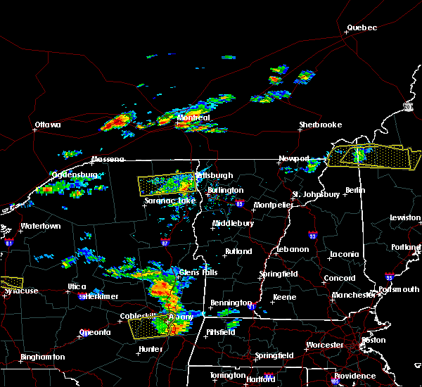 At 1259 pm edt, a severe thunderstorm was located over ausable point, moving east at 55 mph (radar indicated). Hazards include 60 mph wind gusts. Expect damage to roofs. siding. And trees. At 1259 pm edt, a severe thunderstorm was located over ausable point, moving east at 55 mph (radar indicated). Hazards include 60 mph wind gusts. Expect damage to roofs. siding. And trees.
|
| 7/7/2016 2:40 PM EDT | Trees down on poker hill road... meadow lane... fox run... and sugar hill in chittenden county VT, 2.5 miles SW of Jericho, VT |
| 7/7/2016 2:38 PM EDT |
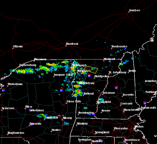 At 238 pm edt, a severe thunderstorm was located over underhill, moving east at 25 mph (radar indicated). Hazards include 60 mph wind gusts and quarter size hail. Hail damage to vehicles is expected. Expect wind damage to roofs, siding, and trees. At 238 pm edt, a severe thunderstorm was located over underhill, moving east at 25 mph (radar indicated). Hazards include 60 mph wind gusts and quarter size hail. Hail damage to vehicles is expected. Expect wind damage to roofs, siding, and trees.
|
| 6/21/2016 12:14 AM EDT |
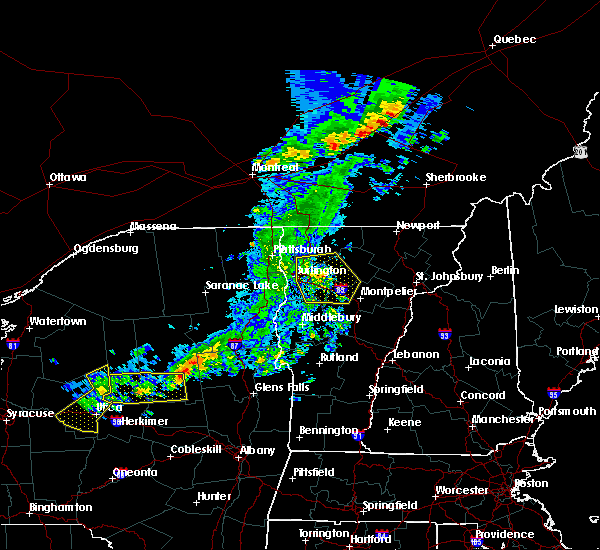 At 1213 am edt, severe thunderstorms were located along a line extending from near cambridge to stowe to near montpelier, moving east at 60 mph (radar indicated). Hazards include 60 mph wind gusts. Expect damage to roofs. siding. and trees. locations impacted include, south burlington, colchester, essex junction, burlington international airport, williston, winooski, jericho, hinesburg, stowe, fairfax, richmond, underhill, westford, huntington, middlesex, moretown, fletcher, bolton, st. george and waterville. At 1213 am edt, severe thunderstorms were located along a line extending from near cambridge to stowe to near montpelier, moving east at 60 mph (radar indicated). Hazards include 60 mph wind gusts. Expect damage to roofs. siding. and trees. locations impacted include, south burlington, colchester, essex junction, burlington international airport, williston, winooski, jericho, hinesburg, stowe, fairfax, richmond, underhill, westford, huntington, middlesex, moretown, fletcher, bolton, st. george and waterville.
|
| 6/20/2016 11:52 PM EDT |
 At 1152 pm edt, severe thunderstorms were located along a line extending from plattsburgh international airport to 6 miles northeast of willsboro to panton, moving east at 40 mph (radar indicated). Hazards include 60 mph wind gusts. Expect damage to roofs. siding. And trees. At 1152 pm edt, severe thunderstorms were located along a line extending from plattsburgh international airport to 6 miles northeast of willsboro to panton, moving east at 40 mph (radar indicated). Hazards include 60 mph wind gusts. Expect damage to roofs. siding. And trees.
|
| 8/3/2015 2:29 PM EDT |
 At 229 pm edt, doppler radar indicated a severe thunderstorm capable of producing quarter size hail and damaging winds in excess of 60 mph. this storm was located over huntington, or 10 miles southeast of essex junction, moving northeast at 30 mph. this severe storm will be near, bolton around 235 pm edt. jericho around 245 pm edt. underhill around 250 pm edt. other locations impacted by this severe thunderstorm include waterbury center, jericho center, hanksville, north moretown, camels hump state park, west bolton, huntington center, east monkton, south hinesburg and north williston. At 229 pm edt, doppler radar indicated a severe thunderstorm capable of producing quarter size hail and damaging winds in excess of 60 mph. this storm was located over huntington, or 10 miles southeast of essex junction, moving northeast at 30 mph. this severe storm will be near, bolton around 235 pm edt. jericho around 245 pm edt. underhill around 250 pm edt. other locations impacted by this severe thunderstorm include waterbury center, jericho center, hanksville, north moretown, camels hump state park, west bolton, huntington center, east monkton, south hinesburg and north williston.
|
| 8/3/2015 2:15 PM EDT |
 At 215 pm edt, doppler radar indicated a severe thunderstorm capable of producing quarter size hail and damaging winds in excess of 60 mph. this storm was located near monkton ridge, or 9 miles north of bristol, and moving northeast at 25 mph. * this severe thunderstorm will be near, st. george around 225 pm edt. huntington around 230 pm edt. williston, richmond and bolton around 240 pm edt. jericho around 250 pm edt. underhill around 300 pm edt. other locations impacted by this severe thunderstorm include waterbury center, jericho center, hanksville, north moretown, camels hump state park, west bolton, huntington center, east monkton, south hinesburg and north williston. At 215 pm edt, doppler radar indicated a severe thunderstorm capable of producing quarter size hail and damaging winds in excess of 60 mph. this storm was located near monkton ridge, or 9 miles north of bristol, and moving northeast at 25 mph. * this severe thunderstorm will be near, st. george around 225 pm edt. huntington around 230 pm edt. williston, richmond and bolton around 240 pm edt. jericho around 250 pm edt. underhill around 300 pm edt. other locations impacted by this severe thunderstorm include waterbury center, jericho center, hanksville, north moretown, camels hump state park, west bolton, huntington center, east monkton, south hinesburg and north williston.
|
| 7/21/2015 1:46 PM EDT |
 At 145 pm edt, doppler radar indicated a line of severe thunderstorms capable of producing quarter size hail and destructive winds in excess of 70 mph. these storms were located along a line extending from near colchester to near essex to near elizabethtown, moving east at 30 mph. locations impacted include, south burlington, colchester, essex junction, bristol, burlington international airport, essex, addison, williston, winooski, shelburne, jericho, hinesburg, fairfax, richmond, charlotte, underhill, ferrisburgh, westford, willsboro and monkton. At 145 pm edt, doppler radar indicated a line of severe thunderstorms capable of producing quarter size hail and destructive winds in excess of 70 mph. these storms were located along a line extending from near colchester to near essex to near elizabethtown, moving east at 30 mph. locations impacted include, south burlington, colchester, essex junction, bristol, burlington international airport, essex, addison, williston, winooski, shelburne, jericho, hinesburg, fairfax, richmond, charlotte, underhill, ferrisburgh, westford, willsboro and monkton.
|
| 7/21/2015 1:17 PM EDT |
 At 116 pm edt, doppler radar indicated a line of severe thunderstorms capable of producing quarter size hail and damaging winds in excess of 60 mph. these storms were located along a line extending from peru to near jay in essex county to near mount marcy, and moving east at 30 mph. * locations to be impacted include, south burlington, colchester, essex junction, bristol, plattsburgh international airport, burlington international airport, essex, addison, williston, winooski, shelburne, peru, jericho, hinesburg, fairfax, richmond, charlotte, underhill, ferrisburgh and westford. At 116 pm edt, doppler radar indicated a line of severe thunderstorms capable of producing quarter size hail and damaging winds in excess of 60 mph. these storms were located along a line extending from peru to near jay in essex county to near mount marcy, and moving east at 30 mph. * locations to be impacted include, south burlington, colchester, essex junction, bristol, plattsburgh international airport, burlington international airport, essex, addison, williston, winooski, shelburne, peru, jericho, hinesburg, fairfax, richmond, charlotte, underhill, ferrisburgh and westford.
|
| 5/27/2015 2:09 PM EDT | The severe thunderstorm warning for northern lamoille, southern grand isle, northern chittenden, southwestern orleans and franklin counties will expire at 215 pm edt, the storm which prompted the warning has weakened below severe limits, and no longer poses an immediate threat to life or property. therefore the warning will be allowed to expire. however gusty winds and heavy rain are still possible with this thunderstorm. |
| 5/27/2015 1:57 PM EDT | At 156 pm edt, doppler radar indicated a severe thunderstorm capable of producing quarter size hail and damaging winds in excess of 60 mph. this storm was located over georgia center, moving northeast at 40 mph. locations impacted include, south burlington, colchester, essex junction, burlington international airport, winooski, fairfax, underhill, richford, sheldon, westford, fairfield, berkshire, south hero, johnson, enosburg falls, eden, bakersfield, fletcher, montgomery and lowell. |
| 5/27/2015 1:43 PM EDT | At 141 pm edt, doppler radar indicated a severe thunderstorm capable of producing quarter size hail and damaging winds in excess of 60 mph. this storm was located over south hero, moving northeast at 35 mph. locations impacted include, south burlington, colchester, essex junction, burlington international airport, winooski, peru, fairfax, underhill, richford, sheldon, westford, fairfield, berkshire, south hero, johnson, enosburg falls, eden, bakersfield, fletcher and montgomery. |
| 5/27/2015 1:43 PM EDT | At 141 pm edt, doppler radar indicated a severe thunderstorm capable of producing quarter size hail and damaging winds in excess of 60 mph. this storm was located over south hero, moving northeast at 35 mph. locations impacted include, south burlington, colchester, essex junction, burlington international airport, winooski, peru, fairfax, underhill, richford, sheldon, westford, fairfield, berkshire, south hero, johnson, enosburg falls, eden, bakersfield, fletcher and montgomery. |
| 5/27/2015 1:21 PM EDT | At 121 pm edt, doppler radar indicated a severe thunderstorm capable of producing quarter size hail and damaging winds in excess of 60 mph. this storm was located near peru, and moving northeast at 40 mph. * locations to be impacted include, south burlington, colchester, essex junction, burlington international airport, winooski, peru, jericho, fairfax, underhill, richford, sheldon, westford, fairfield, berkshire, south hero, johnson, enosburg falls, eden, bakersfield and fletcher. |
| 5/27/2015 1:21 PM EDT | At 121 pm edt, doppler radar indicated a severe thunderstorm capable of producing quarter size hail and damaging winds in excess of 60 mph. this storm was located near peru, and moving northeast at 40 mph. * locations to be impacted include, south burlington, colchester, essex junction, burlington international airport, winooski, peru, jericho, fairfax, underhill, richford, sheldon, westford, fairfield, berkshire, south hero, johnson, enosburg falls, eden, bakersfield and fletcher. |
| 7/8/2014 9:40 PM EDT | Tree down on weed road in chittenden county VT, 1.6 miles ESE of Jericho, VT |
| 7/19/2013 7:30 PM EDT | Trees down in chittenden county VT, 2.5 miles SW of Jericho, VT |
| 5/22/2013 6:21 PM EDT | Powerlines down in chittenden county VT, 0.7 miles ENE of Jericho, VT |
| 5/21/2013 8:42 PM EDT | Multiple broadcast media reports of a power line down on skunk hollow road in jericho resulting in road closure. time estimated from rada in chittenden county VT, 0.7 miles ENE of Jericho, VT |
| 7/23/2012 7:10 PM EDT | Large tree down on residential backyard in chittenden county VT, 2.5 miles SW of Jericho, VT |
| 6/8/2012 6:05 PM EDT | Quarter sized hail reported 4.7 miles NW of Jericho, VT, public |
| 1/1/0001 12:00 AM | Ping Pong Ball sized hail reported 7.4 miles W of Jericho, VT, traveling on upper pleasant valley road near underhill state park |
| 1/1/0001 12:00 AM | Quarter sized hail reported 2.5 miles SW of Jericho, VT, located on dean and corbertt roads in underhill |
Hail Maps for Jericho, VT


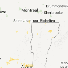


Connect with Interactive Hail Maps