

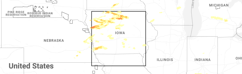
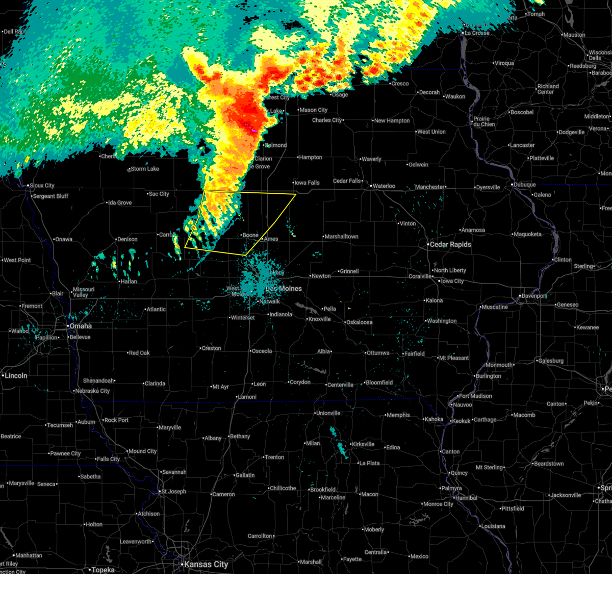
Hail Map for Jewell Junction, IA
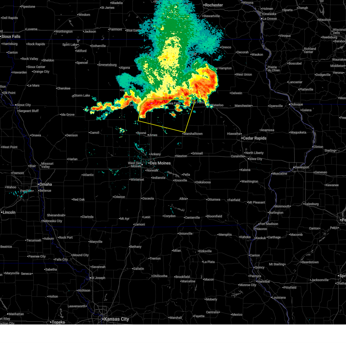
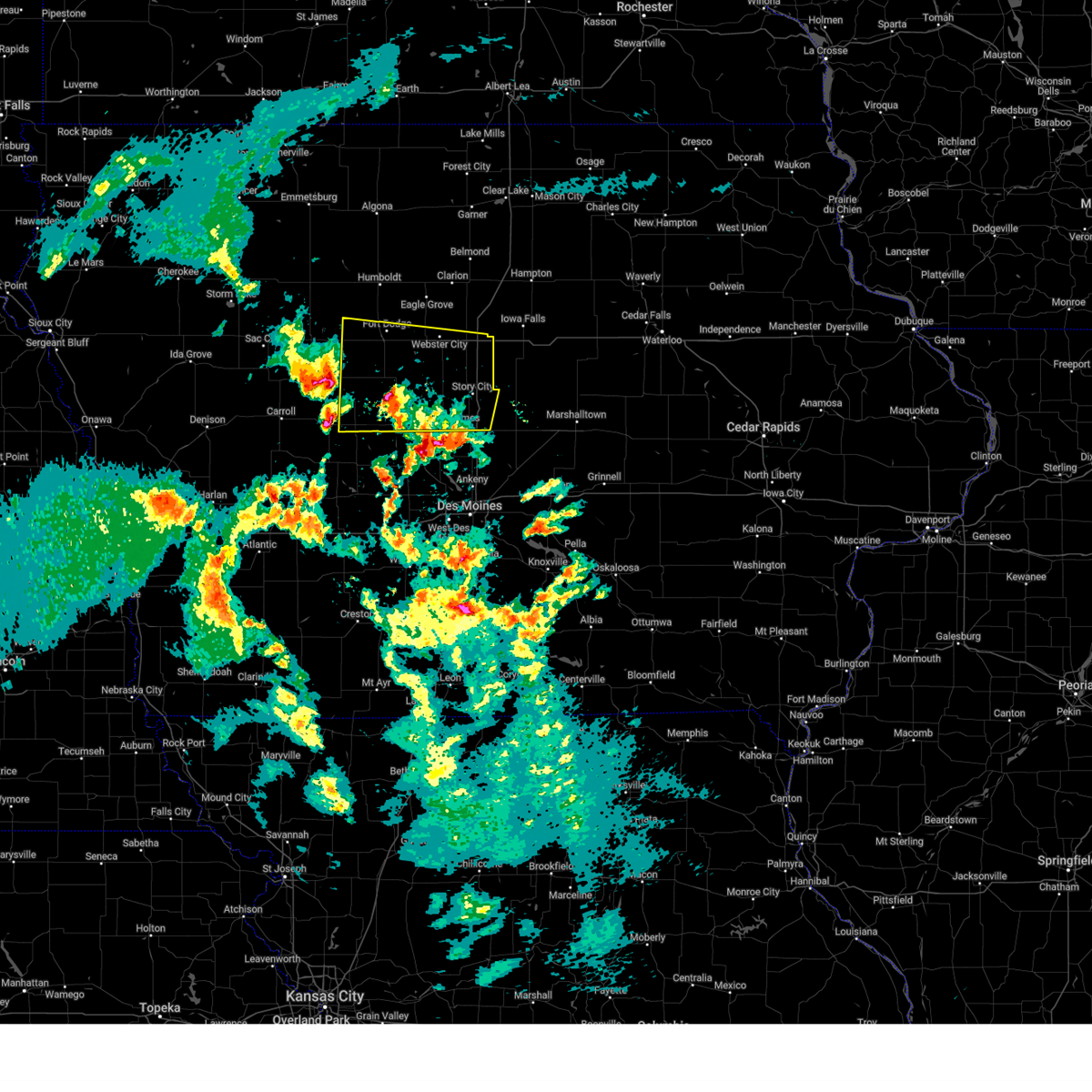
The Jewell Junction, IA area has had 3 reports of on-the-ground hail by trained spotters, and has been under severe weather warnings 24 times during the past 12 months. Doppler radar has detected hail at or near Jewell Junction, IA on 61 occasions, including 5 occasions during the past year.
| Name: | Jewell Junction, IA |
| Where Located: | 49.9 miles N of Des Moines, IA |
| Map: | Google Map for Jewell Junction, IA |
| Population: | 1215 |
| Housing Units: | 517 |
| More Info: | Search Google for Jewell Junction, IA |
1
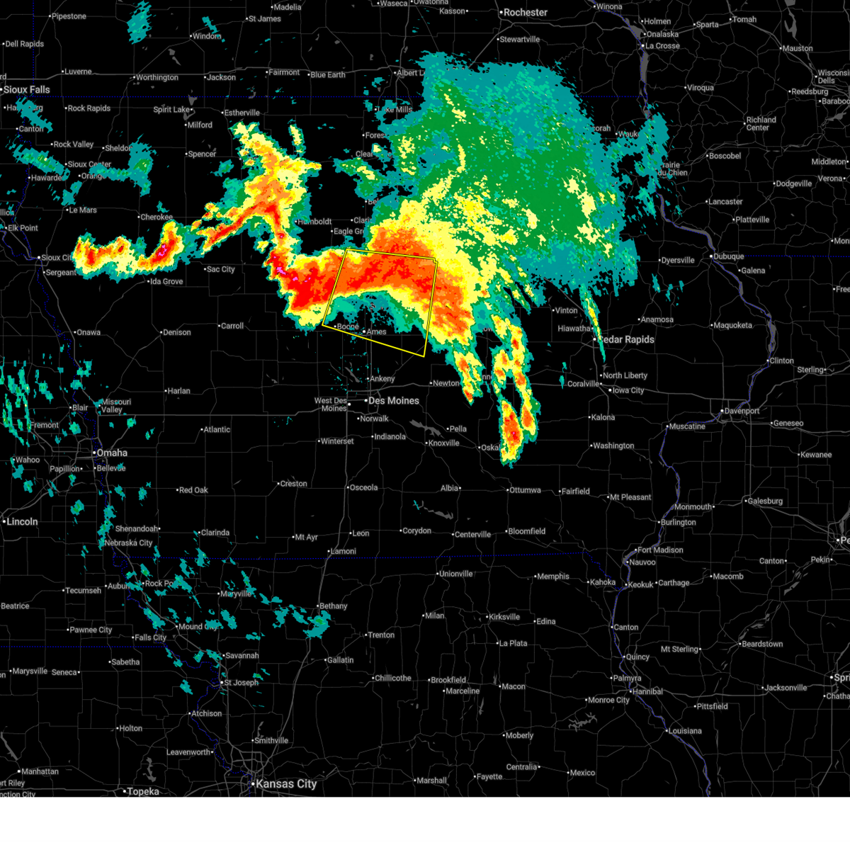
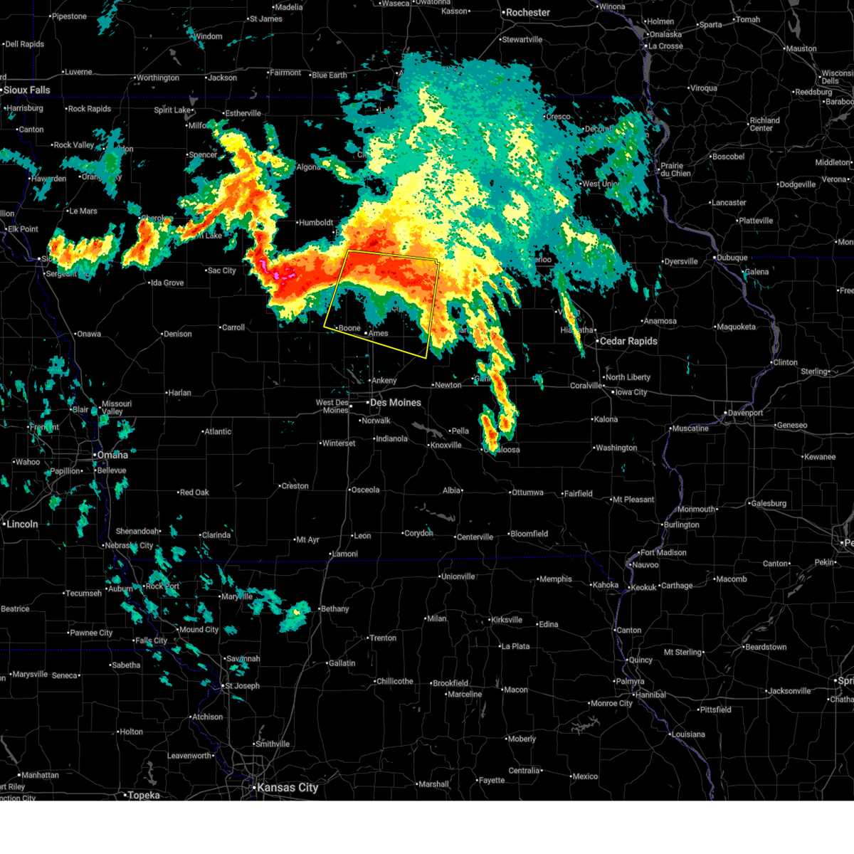
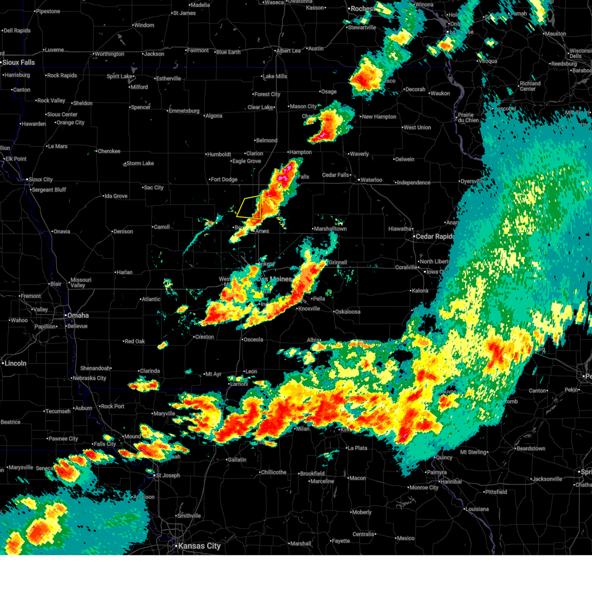
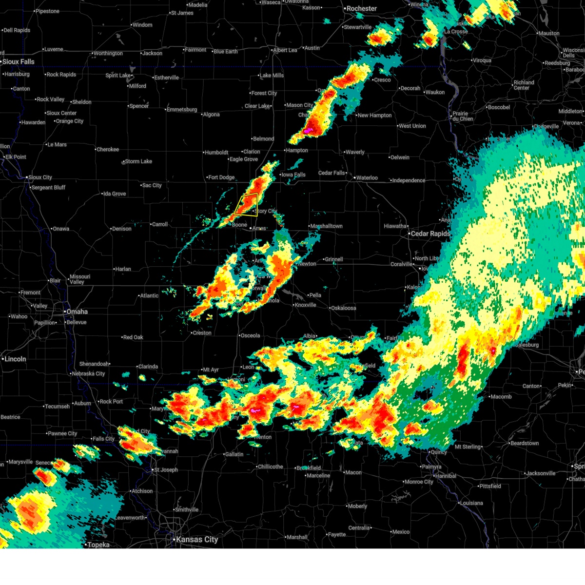
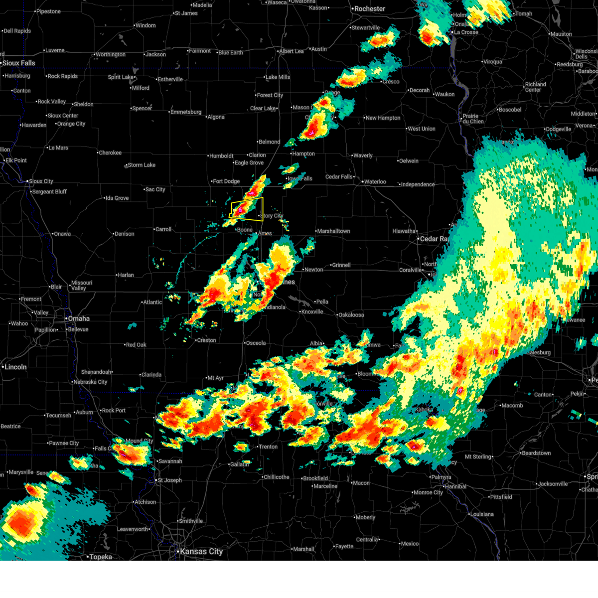
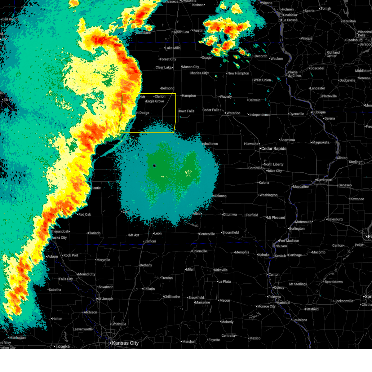
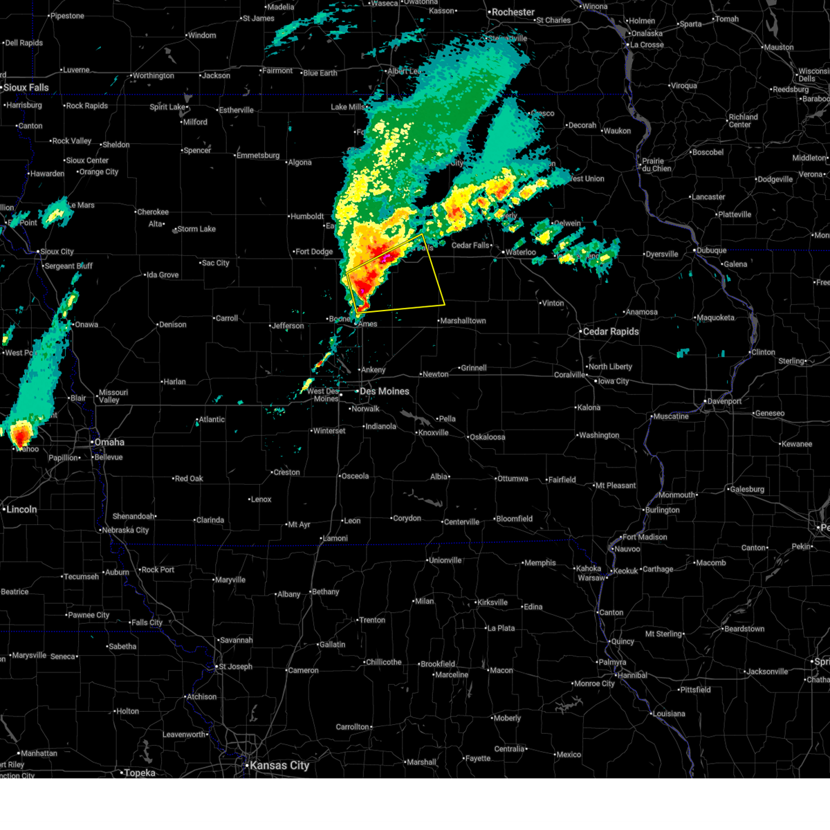
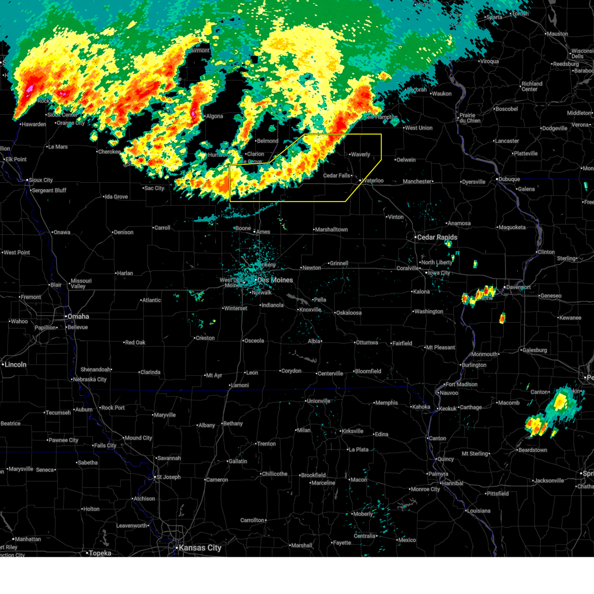
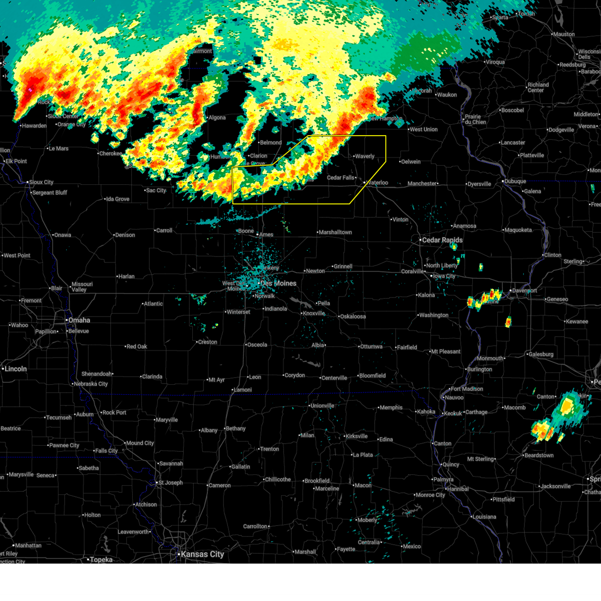
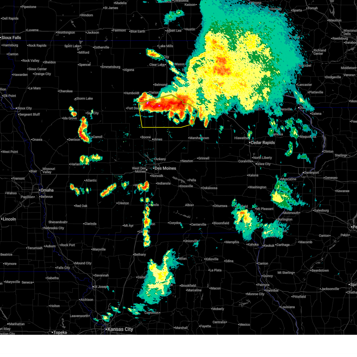
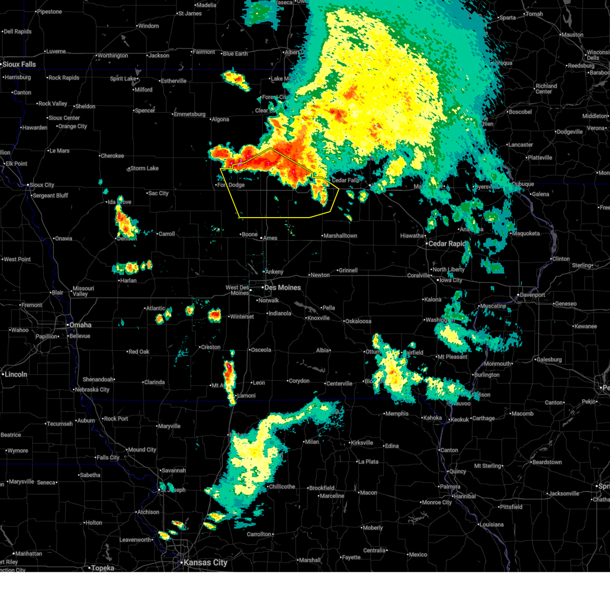
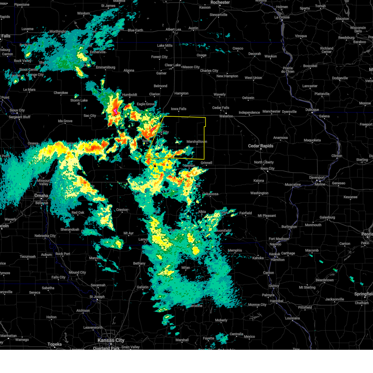
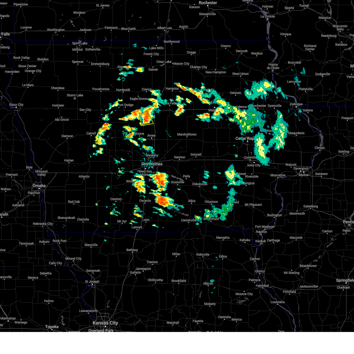
The Top Recent Hail Date for Jewell Junction, IA is Friday, May 15, 2026 (3rd out of 61)
Hail and Wind Damage Spotted near Jewell Junction, IA
| Date / Time | Report Details |
|---|---|
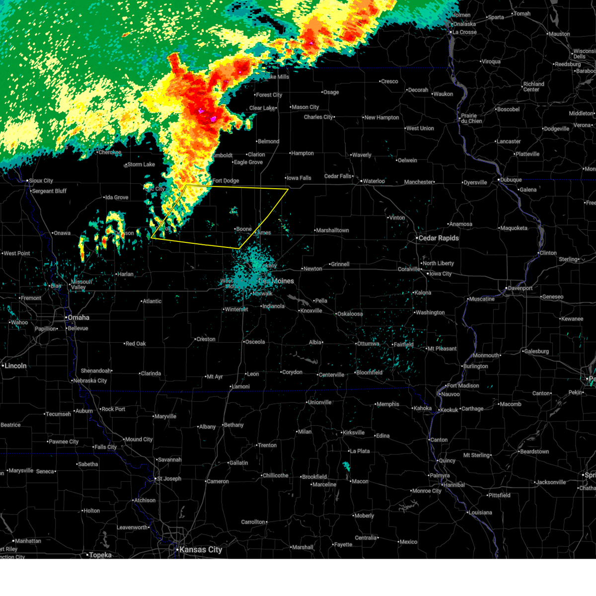
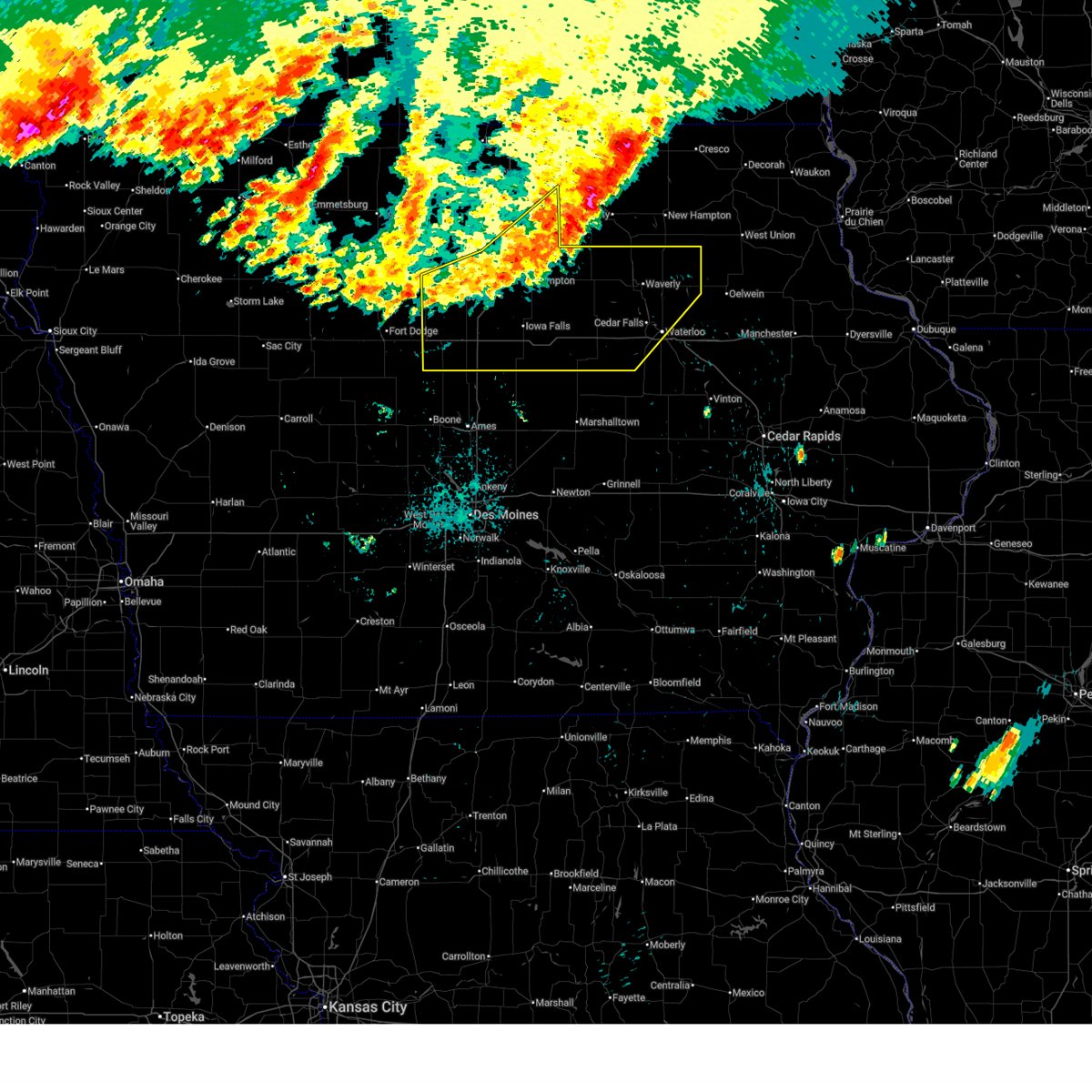
| 6/17/2026 5:03 AM CDT |
 At 503 am cdt, a severe thunderstorm was located near stanhope, or 14 miles northeast of boone, moving east at 60 mph (the webster city airport recorded 76 mph wind). Hazards include 70 mph wind gusts and quarter size hail. Hail damage to vehicles is expected. expect considerable tree damage. wind damage is also likely to mobile homes, roofs, and outbuildings. locations impacted include, ames, boone, webster city, nevada, iowa falls, eldora, story city, state center, roland, jewell junction, gilbert, iowa state center, colo, hubbard, melbourne, alden, zearing, radcliffe, ellsworth, and stanhope. This includes interstate 35 between mile markers 110 and 148. At 503 am cdt, a severe thunderstorm was located near stanhope, or 14 miles northeast of boone, moving east at 60 mph (the webster city airport recorded 76 mph wind). Hazards include 70 mph wind gusts and quarter size hail. Hail damage to vehicles is expected. expect considerable tree damage. wind damage is also likely to mobile homes, roofs, and outbuildings. locations impacted include, ames, boone, webster city, nevada, iowa falls, eldora, story city, state center, roland, jewell junction, gilbert, iowa state center, colo, hubbard, melbourne, alden, zearing, radcliffe, ellsworth, and stanhope. This includes interstate 35 between mile markers 110 and 148.
|
| 6/17/2026 4:52 AM CDT |
 Svrdmx the national weather service in des moines has issued a * severe thunderstorm warning for, story county in central iowa, hardin county in central iowa, western marshall county in central iowa, hamilton county in central iowa, northeastern boone county in central iowa, * until 545 am cdt. * at 452 am cdt, a severe thunderstorm was located near stratford, or 13 miles southwest of webster city, moving southeast at 65 mph (radar indicated). Hazards include 70 mph wind gusts and quarter size hail. Hail damage to vehicles is expected. expect considerable tree damage. Wind damage is also likely to mobile homes, roofs, and outbuildings. Svrdmx the national weather service in des moines has issued a * severe thunderstorm warning for, story county in central iowa, hardin county in central iowa, western marshall county in central iowa, hamilton county in central iowa, northeastern boone county in central iowa, * until 545 am cdt. * at 452 am cdt, a severe thunderstorm was located near stratford, or 13 miles southwest of webster city, moving southeast at 65 mph (radar indicated). Hazards include 70 mph wind gusts and quarter size hail. Hail damage to vehicles is expected. expect considerable tree damage. Wind damage is also likely to mobile homes, roofs, and outbuildings.
|
| 6/10/2026 7:39 PM CDT |
 The storm which prompted the warning has weakened below severe limits, and no longer poses an immediate threat to life or property. therefore, the warning will be allowed to expire. The storm which prompted the warning has weakened below severe limits, and no longer poses an immediate threat to life or property. therefore, the warning will be allowed to expire.
|
| 6/10/2026 7:17 PM CDT |
 At 716 pm cdt, a severe thunderstorm was located 5 miles southeast of stanhope, or 14 miles northeast of boone, moving east at 30 mph (radar indicated). Hazards include 60 mph wind gusts and quarter size hail. Hail damage to vehicles is expected. expect wind damage to roofs, siding, and trees. locations impacted include, story city, jewell junction, ellsworth, and randall. This includes interstate 35 between mile markers 122 and 135. At 716 pm cdt, a severe thunderstorm was located 5 miles southeast of stanhope, or 14 miles northeast of boone, moving east at 30 mph (radar indicated). Hazards include 60 mph wind gusts and quarter size hail. Hail damage to vehicles is expected. expect wind damage to roofs, siding, and trees. locations impacted include, story city, jewell junction, ellsworth, and randall. This includes interstate 35 between mile markers 122 and 135.
|
| 6/10/2026 7:03 PM CDT |
 Svrdmx the national weather service in des moines has issued a * severe thunderstorm warning for, northwestern story county in central iowa, southern hamilton county in central iowa, northeastern boone county in central iowa, * until 745 pm cdt. * at 703 pm cdt, a severe thunderstorm was located near stratford, or 11 miles north of boone, moving east at 25 mph (radar indicated). Hazards include 60 mph wind gusts and quarter size hail. Hail damage to vehicles is expected. Expect wind damage to roofs, siding, and trees. Svrdmx the national weather service in des moines has issued a * severe thunderstorm warning for, northwestern story county in central iowa, southern hamilton county in central iowa, northeastern boone county in central iowa, * until 745 pm cdt. * at 703 pm cdt, a severe thunderstorm was located near stratford, or 11 miles north of boone, moving east at 25 mph (radar indicated). Hazards include 60 mph wind gusts and quarter size hail. Hail damage to vehicles is expected. Expect wind damage to roofs, siding, and trees.
|
| 5/17/2026 10:11 PM CDT |
 At 1011 pm cdt, a severe thunderstorm capable of producing a tornado was located over blairsburg, or 11 miles east of webster city, moving east at 45 mph (radar indicated rotation). Hazards include tornado. Flying debris will be dangerous to those caught without shelter. mobile homes will be damaged or destroyed. damage to roofs, windows, and vehicles will occur. tree damage is likely. this dangerous storm will be near, williams around 1015 pm cdt. alden and buckeye around 1020 pm cdt. other locations impacted by this tornadic thunderstorm include ellsworth, buckeye, blairsburg, williams, alden, radcliffe, kamrar, and drake airport. This includes interstate 35 between mile markers 131 and 147. At 1011 pm cdt, a severe thunderstorm capable of producing a tornado was located over blairsburg, or 11 miles east of webster city, moving east at 45 mph (radar indicated rotation). Hazards include tornado. Flying debris will be dangerous to those caught without shelter. mobile homes will be damaged or destroyed. damage to roofs, windows, and vehicles will occur. tree damage is likely. this dangerous storm will be near, williams around 1015 pm cdt. alden and buckeye around 1020 pm cdt. other locations impacted by this tornadic thunderstorm include ellsworth, buckeye, blairsburg, williams, alden, radcliffe, kamrar, and drake airport. This includes interstate 35 between mile markers 131 and 147.
|
| 5/17/2026 9:56 PM CDT |
 Tordmx the national weather service in des moines has issued a * tornado warning for, western hardin county in central iowa, east central webster county in central iowa, hamilton county in central iowa, * until 1045 pm cdt. * at 956 pm cdt, severe thunderstorms capable of producing both tornadoes and extensive straight line wind damage were located over webster city, moving east at 45 mph (radar indicated rotation). Hazards include tornado. Flying debris will be dangerous to those caught without shelter. mobile homes will be damaged or destroyed. damage to roofs, windows, and vehicles will occur. tree damage is likely. these dangerous storms will be near, webster city and kamrar around 1000 pm cdt. blairsburg around 1005 pm cdt. williams around 1010 pm cdt. alden and buckeye around 1020 pm cdt. other locations impacted by this tornadic thunderstorm include ellsworth, buckeye, blairsburg, williams, alden, radcliffe, brushy creek st recreation area, webster city municipal airport, kamrar, and drake airport. This includes interstate 35 between mile markers 131 and 147. Tordmx the national weather service in des moines has issued a * tornado warning for, western hardin county in central iowa, east central webster county in central iowa, hamilton county in central iowa, * until 1045 pm cdt. * at 956 pm cdt, severe thunderstorms capable of producing both tornadoes and extensive straight line wind damage were located over webster city, moving east at 45 mph (radar indicated rotation). Hazards include tornado. Flying debris will be dangerous to those caught without shelter. mobile homes will be damaged or destroyed. damage to roofs, windows, and vehicles will occur. tree damage is likely. these dangerous storms will be near, webster city and kamrar around 1000 pm cdt. blairsburg around 1005 pm cdt. williams around 1010 pm cdt. alden and buckeye around 1020 pm cdt. other locations impacted by this tornadic thunderstorm include ellsworth, buckeye, blairsburg, williams, alden, radcliffe, brushy creek st recreation area, webster city municipal airport, kamrar, and drake airport. This includes interstate 35 between mile markers 131 and 147.
|
| 5/17/2026 9:42 PM CDT |
 Svrdmx the national weather service in des moines has issued a * severe thunderstorm warning for, western hardin county in central iowa, webster county in central iowa, wright county in north central iowa, southwestern franklin county in north central iowa, southeastern calhoun county in west central iowa, southern humboldt county in north central iowa, hamilton county in central iowa, * until 1045 pm cdt. * at 942 pm cdt, severe thunderstorms were located along a line extending from near hardy to near fort dodge to near paton, moving east at 45 mph (radar indicated). Hazards include 60 mph wind gusts. expect damage to roofs, siding, and trees Svrdmx the national weather service in des moines has issued a * severe thunderstorm warning for, western hardin county in central iowa, webster county in central iowa, wright county in north central iowa, southwestern franklin county in north central iowa, southeastern calhoun county in west central iowa, southern humboldt county in north central iowa, hamilton county in central iowa, * until 1045 pm cdt. * at 942 pm cdt, severe thunderstorms were located along a line extending from near hardy to near fort dodge to near paton, moving east at 45 mph (radar indicated). Hazards include 60 mph wind gusts. expect damage to roofs, siding, and trees
|
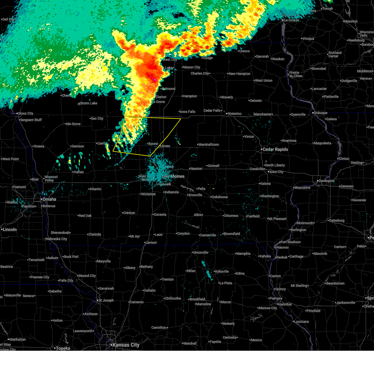
| 5/15/2026 11:17 PM CDT |
 Svrdmx the national weather service in des moines has issued a * severe thunderstorm warning for, western hardin county in central iowa, southern hamilton county in central iowa, * until midnight cdt. * at 1117 pm cdt, a severe thunderstorm was located over stanhope, or 12 miles south of webster city, moving east at 40 mph (radar indicated). Hazards include half dollar size hail. damage to vehicles is expected Svrdmx the national weather service in des moines has issued a * severe thunderstorm warning for, western hardin county in central iowa, southern hamilton county in central iowa, * until midnight cdt. * at 1117 pm cdt, a severe thunderstorm was located over stanhope, or 12 miles south of webster city, moving east at 40 mph (radar indicated). Hazards include half dollar size hail. damage to vehicles is expected
|
| 4/23/2026 7:55 PM CDT |
 Svrdmx the national weather service in des moines has issued a * severe thunderstorm warning for, story county in central iowa, hardin county in central iowa, western marshall county in central iowa, western grundy county in central iowa, southeastern hamilton county in central iowa, southeastern boone county in central iowa, * until 845 pm cdt. * at 754 pm cdt, severe thunderstorms were located along a line extending from 4 miles southeast of buckeye to near zearing to near cambridge, moving east at 30 mph (radar indicated). Hazards include 60 mph wind gusts and penny size hail. expect damage to roofs, siding, and trees Svrdmx the national weather service in des moines has issued a * severe thunderstorm warning for, story county in central iowa, hardin county in central iowa, western marshall county in central iowa, western grundy county in central iowa, southeastern hamilton county in central iowa, southeastern boone county in central iowa, * until 845 pm cdt. * at 754 pm cdt, severe thunderstorms were located along a line extending from 4 miles southeast of buckeye to near zearing to near cambridge, moving east at 30 mph (radar indicated). Hazards include 60 mph wind gusts and penny size hail. expect damage to roofs, siding, and trees
|
| 4/23/2026 6:58 PM CDT |
 Svrdmx the national weather service in des moines has issued a * severe thunderstorm warning for, southeastern greene county in west central iowa, story county in central iowa, western hardin county in central iowa, southeastern webster county in central iowa, hamilton county in central iowa, boone county in central iowa, * until 800 pm cdt. * at 658 pm cdt, severe thunderstorms were located along a line extending from near webster city to 6 miles south of stanhope to bouton, moving east at 35 mph (radar indicated). Hazards include 60 mph wind gusts and quarter size hail. Hail damage to vehicles is expected. Expect wind damage to roofs, siding, and trees. Svrdmx the national weather service in des moines has issued a * severe thunderstorm warning for, southeastern greene county in west central iowa, story county in central iowa, western hardin county in central iowa, southeastern webster county in central iowa, hamilton county in central iowa, boone county in central iowa, * until 800 pm cdt. * at 658 pm cdt, severe thunderstorms were located along a line extending from near webster city to 6 miles south of stanhope to bouton, moving east at 35 mph (radar indicated). Hazards include 60 mph wind gusts and quarter size hail. Hail damage to vehicles is expected. Expect wind damage to roofs, siding, and trees.
|
| 4/15/2026 2:06 PM CDT |
 Svrdmx the national weather service in des moines has issued a * severe thunderstorm warning for, northern story county in central iowa, hardin county in central iowa, northwestern marshall county in central iowa, southeastern franklin county in north central iowa, southwestern grundy county in central iowa, southeastern hamilton county in central iowa, * until 245 pm cdt. * at 206 pm cdt, a severe thunderstorm was located over randall, or 15 miles north of ames, moving east at 50 mph (law enforcement). Hazards include 60 mph wind gusts and quarter size hail. Hail damage to vehicles is expected. Expect wind damage to roofs, siding, and trees. Svrdmx the national weather service in des moines has issued a * severe thunderstorm warning for, northern story county in central iowa, hardin county in central iowa, northwestern marshall county in central iowa, southeastern franklin county in north central iowa, southwestern grundy county in central iowa, southeastern hamilton county in central iowa, * until 245 pm cdt. * at 206 pm cdt, a severe thunderstorm was located over randall, or 15 miles north of ames, moving east at 50 mph (law enforcement). Hazards include 60 mph wind gusts and quarter size hail. Hail damage to vehicles is expected. Expect wind damage to roofs, siding, and trees.
|
| 9/22/2025 9:02 PM CDT | Svrdmx the national weather service in des moines has issued a * severe thunderstorm warning for, story county in central iowa, southwestern hardin county in central iowa, southwestern marshall county in central iowa, southern hamilton county in central iowa, eastern boone county in central iowa, * until 945 pm cdt. * at 901 pm cdt, a severe thunderstorm was located over story city, or 11 miles north of ames, moving south at 30 mph (radar indicated). Hazards include 60 mph wind gusts and quarter size hail. Hail damage to vehicles is expected. Expect wind damage to roofs, siding, and trees. |
| 8/15/2025 3:36 PM CDT |
 Svrdmx the national weather service in des moines has issued a * severe thunderstorm warning for, northeastern story county in central iowa, northern marshall county in central iowa, hardin county in central iowa, southeastern wright county in north central iowa, southern franklin county in north central iowa, grundy county in central iowa, southwestern butler county in north central iowa, hamilton county in central iowa, * until 415 pm cdt. * at 336 pm cdt, severe thunderstorms were located along a line extending from alden to near blairsburg to stanhope, moving east at 50 mph (radar indicated). Hazards include 60 mph wind gusts and quarter size hail. Hail damage to vehicles is expected. Expect wind damage to roofs, siding, and trees. Svrdmx the national weather service in des moines has issued a * severe thunderstorm warning for, northeastern story county in central iowa, northern marshall county in central iowa, hardin county in central iowa, southeastern wright county in north central iowa, southern franklin county in north central iowa, grundy county in central iowa, southwestern butler county in north central iowa, hamilton county in central iowa, * until 415 pm cdt. * at 336 pm cdt, severe thunderstorms were located along a line extending from alden to near blairsburg to stanhope, moving east at 50 mph (radar indicated). Hazards include 60 mph wind gusts and quarter size hail. Hail damage to vehicles is expected. Expect wind damage to roofs, siding, and trees.
|
| 7/29/2025 12:29 AM CDT |
 The storms which prompted the warning have weakened below severe limits, and have exited the warned area. therefore, the warning will be allowed to expire. a severe thunderstorm watch remains in effect until 400 am cdt for central iowa. The storms which prompted the warning have weakened below severe limits, and have exited the warned area. therefore, the warning will be allowed to expire. a severe thunderstorm watch remains in effect until 400 am cdt for central iowa.
|
| 7/29/2025 12:18 AM CDT |
 the severe thunderstorm warning has been cancelled and is no longer in effect the severe thunderstorm warning has been cancelled and is no longer in effect
|
| 7/29/2025 12:18 AM CDT |
 At 1217 am cdt, severe thunderstorms were located along a line extending from 5 miles east of kamrar to near story city to near woodward, moving east at 50 mph (radar indicated). Hazards include 60 mph wind gusts. Expect damage to roofs, siding, and trees. locations impacted include, ames, boone, webster city, story city, ogden, roland, jewell junction, gilbert, boone speedway, stratford, radcliffe, ellsworth, stanhope, kamrar, pilot mound, randall, buckeye, fraser, garden city, and beaver. This includes interstate 35 between mile markers 120 and 141. At 1217 am cdt, severe thunderstorms were located along a line extending from 5 miles east of kamrar to near story city to near woodward, moving east at 50 mph (radar indicated). Hazards include 60 mph wind gusts. Expect damage to roofs, siding, and trees. locations impacted include, ames, boone, webster city, story city, ogden, roland, jewell junction, gilbert, boone speedway, stratford, radcliffe, ellsworth, stanhope, kamrar, pilot mound, randall, buckeye, fraser, garden city, and beaver. This includes interstate 35 between mile markers 120 and 141.
|
| 7/29/2025 12:01 AM CDT |
 At 1200 am cdt, severe thunderstorms were located along a line extending from webster city municipal airport to 4 miles southeast of stratford to near dawson, moving east at 50 mph (radar indicated). Hazards include 60 mph wind gusts. Expect damage to roofs, siding, and trees. locations impacted include, ames, boone, webster city, jefferson, story city, ogden, roland, jewell junction, gilbert, gowrie, boone speedway, dayton, grand junction, stratford, coalville, radcliffe, otho, ellsworth, stanhope, and lehigh. This includes interstate 35 between mile markers 120 and 141. At 1200 am cdt, severe thunderstorms were located along a line extending from webster city municipal airport to 4 miles southeast of stratford to near dawson, moving east at 50 mph (radar indicated). Hazards include 60 mph wind gusts. Expect damage to roofs, siding, and trees. locations impacted include, ames, boone, webster city, jefferson, story city, ogden, roland, jewell junction, gilbert, gowrie, boone speedway, dayton, grand junction, stratford, coalville, radcliffe, otho, ellsworth, stanhope, and lehigh. This includes interstate 35 between mile markers 120 and 141.
|
| 7/29/2025 12:01 AM CDT |
 the severe thunderstorm warning has been cancelled and is no longer in effect the severe thunderstorm warning has been cancelled and is no longer in effect
|
| 7/28/2025 11:32 PM CDT |
 Svrdmx the national weather service in des moines has issued a * severe thunderstorm warning for, northwestern story county in central iowa, greene county in west central iowa, southwestern hardin county in central iowa, southern webster county in central iowa, southeastern calhoun county in west central iowa, hamilton county in central iowa, northeastern carroll county in west central iowa, boone county in central iowa, * until 1230 am cdt. * at 1131 pm cdt, severe thunderstorms were located along a line extending from fort dodge to near gowrie to 4 miles southwest of ralston, moving east at 50 mph (radar indicated). Hazards include 60 mph wind gusts. expect damage to roofs, siding, and trees Svrdmx the national weather service in des moines has issued a * severe thunderstorm warning for, northwestern story county in central iowa, greene county in west central iowa, southwestern hardin county in central iowa, southern webster county in central iowa, southeastern calhoun county in west central iowa, hamilton county in central iowa, northeastern carroll county in west central iowa, boone county in central iowa, * until 1230 am cdt. * at 1131 pm cdt, severe thunderstorms were located along a line extending from fort dodge to near gowrie to 4 miles southwest of ralston, moving east at 50 mph (radar indicated). Hazards include 60 mph wind gusts. expect damage to roofs, siding, and trees
|
| 7/28/2025 12:54 AM CDT |
 The storms which prompted the warning have weakened below severe limits, and no longer pose an immediate threat to life or property. therefore, the warning will be allowed to expire. however, gusty winds are still possible with these thunderstorms. The storms which prompted the warning have weakened below severe limits, and no longer pose an immediate threat to life or property. therefore, the warning will be allowed to expire. however, gusty winds are still possible with these thunderstorms.
|
| 7/28/2025 12:39 AM CDT |
 At 1238 am cdt, severe thunderstorms were located along a line extending from waverly to near steamboat rock to 5 miles south of blairsburg, moving southeast at 45 mph (radar indicated). Hazards include 60 mph wind gusts. Expect damage to roofs, siding, and trees. locations impacted include, waterloo, cedar falls, waverly, webster city, iowa falls, hampton, eldora, grundy center, allison, hudson, sumner, parkersburg, denver, reinbeck, ackley, clarksville, tripoli, shell rock, jewell junction, and dike. This includes interstate 35 between mile markers 133 and 158. At 1238 am cdt, severe thunderstorms were located along a line extending from waverly to near steamboat rock to 5 miles south of blairsburg, moving southeast at 45 mph (radar indicated). Hazards include 60 mph wind gusts. Expect damage to roofs, siding, and trees. locations impacted include, waterloo, cedar falls, waverly, webster city, iowa falls, hampton, eldora, grundy center, allison, hudson, sumner, parkersburg, denver, reinbeck, ackley, clarksville, tripoli, shell rock, jewell junction, and dike. This includes interstate 35 between mile markers 133 and 158.
|
| 7/28/2025 12:39 AM CDT |
 the severe thunderstorm warning has been cancelled and is no longer in effect the severe thunderstorm warning has been cancelled and is no longer in effect
|
| 7/28/2025 12:13 AM CDT |
 Svrdmx the national weather service in des moines has issued a * severe thunderstorm warning for, hardin county in central iowa, western black hawk county in northeastern iowa, bremer county in northeastern iowa, wright county in north central iowa, franklin county in north central iowa, grundy county in central iowa, butler county in north central iowa, hamilton county in central iowa, southern cerro gordo county in north central iowa, * until 100 am cdt. * at 1212 am cdt, severe thunderstorms were located along a line extending from 4 miles south of greene to alden to 4 miles northeast of duncombe, moving southeast at 45 mph (radar indicated). Hazards include 60 mph wind gusts. expect damage to roofs, siding, and trees Svrdmx the national weather service in des moines has issued a * severe thunderstorm warning for, hardin county in central iowa, western black hawk county in northeastern iowa, bremer county in northeastern iowa, wright county in north central iowa, franklin county in north central iowa, grundy county in central iowa, butler county in north central iowa, hamilton county in central iowa, southern cerro gordo county in north central iowa, * until 100 am cdt. * at 1212 am cdt, severe thunderstorms were located along a line extending from 4 miles south of greene to alden to 4 miles northeast of duncombe, moving southeast at 45 mph (radar indicated). Hazards include 60 mph wind gusts. expect damage to roofs, siding, and trees
|
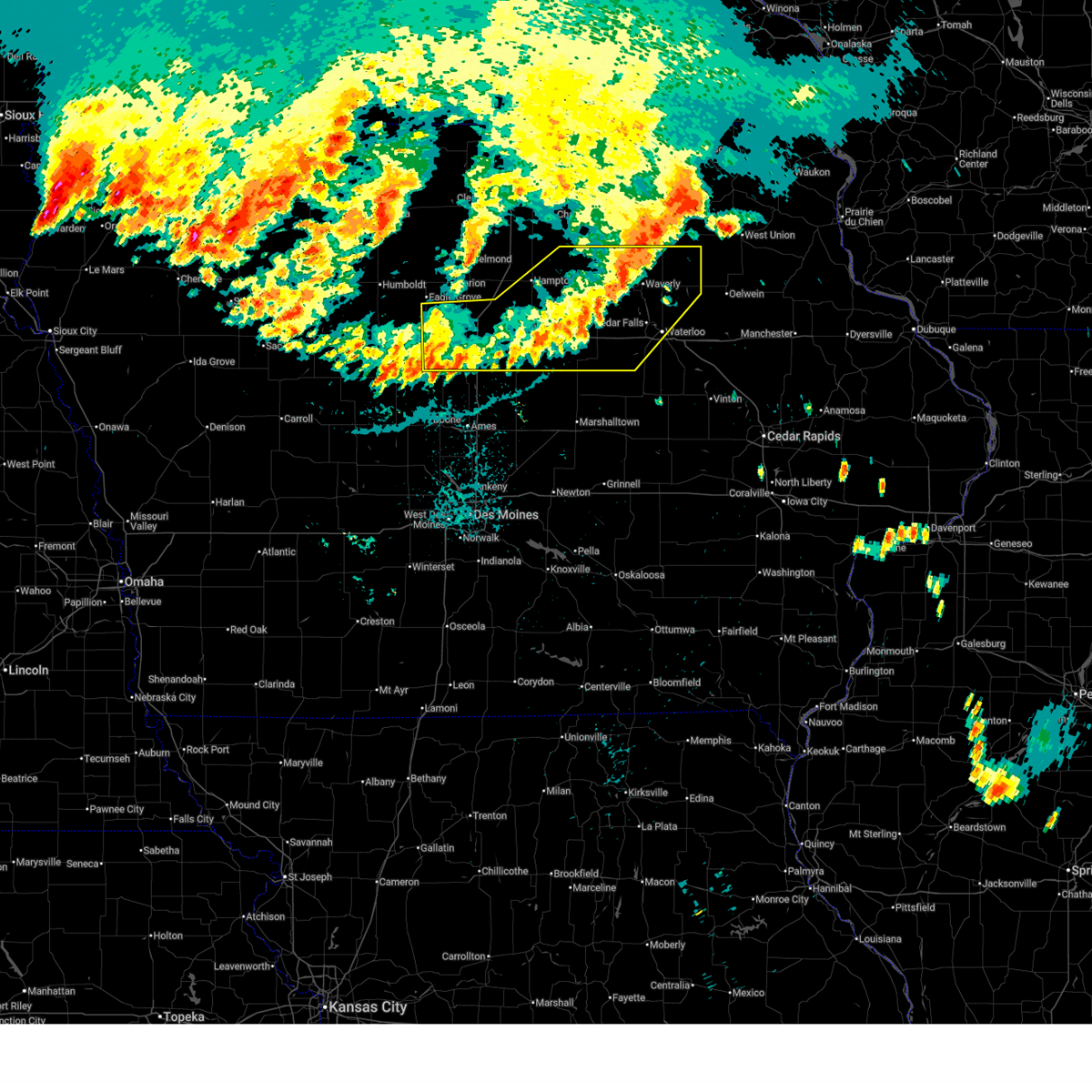
| 6/20/2025 5:19 AM CDT |
 Svrdmx the national weather service in des moines has issued a * severe thunderstorm warning for, story county in central iowa, marshall county in central iowa, hardin county in central iowa, southwestern black hawk county in northeastern iowa, tama county in central iowa, grundy county in central iowa, southeastern hamilton county in central iowa, * until 615 am cdt. * at 517 am cdt, severe thunderstorms were located along a line extending from near holland to near whitten to near jewell junction, moving southeast at 40 mph (personal weather stations reported wind gusts between 50 and 70 mph). Hazards include 60 mph wind gusts and penny size hail. expect damage to roofs, siding, and trees Svrdmx the national weather service in des moines has issued a * severe thunderstorm warning for, story county in central iowa, marshall county in central iowa, hardin county in central iowa, southwestern black hawk county in northeastern iowa, tama county in central iowa, grundy county in central iowa, southeastern hamilton county in central iowa, * until 615 am cdt. * at 517 am cdt, severe thunderstorms were located along a line extending from near holland to near whitten to near jewell junction, moving southeast at 40 mph (personal weather stations reported wind gusts between 50 and 70 mph). Hazards include 60 mph wind gusts and penny size hail. expect damage to roofs, siding, and trees
|
| 6/20/2025 5:02 AM CDT |
 At 502 am cdt, severe thunderstorms were located along a line extending from near ackley municipal airport to near steamboat rock to buckeye to 4 miles east of kamrar, moving southeast at 50 mph (radar indicated). Hazards include 60 mph wind gusts and penny size hail. Expect damage to roofs, siding, and trees. locations impacted include, webster city, iowa falls, eldora, grundy center, ackley, jewell junction, big wall lake, hubbard, alden, wellsburg, radcliffe, ellsworth, stanhope, union, williams, steamboat rock, holland, new providence, blairsburg, and kamrar. This includes interstate 35 between mile markers 127 and 158. At 502 am cdt, severe thunderstorms were located along a line extending from near ackley municipal airport to near steamboat rock to buckeye to 4 miles east of kamrar, moving southeast at 50 mph (radar indicated). Hazards include 60 mph wind gusts and penny size hail. Expect damage to roofs, siding, and trees. locations impacted include, webster city, iowa falls, eldora, grundy center, ackley, jewell junction, big wall lake, hubbard, alden, wellsburg, radcliffe, ellsworth, stanhope, union, williams, steamboat rock, holland, new providence, blairsburg, and kamrar. This includes interstate 35 between mile markers 127 and 158.
|
| 6/20/2025 5:02 AM CDT |
 the severe thunderstorm warning has been cancelled and is no longer in effect the severe thunderstorm warning has been cancelled and is no longer in effect
|
| 6/20/2025 4:29 AM CDT |
 Svrdmx the national weather service in des moines has issued a * severe thunderstorm warning for, hardin county in central iowa, northeastern webster county in central iowa, southern wright county in north central iowa, southern franklin county in north central iowa, western grundy county in central iowa, hamilton county in central iowa, * until 530 am cdt. * at 428 am cdt, severe thunderstorms were located along a line extending from coulter to near dows to near big wall lake to vincent, moving southeast at 45 mph (radar indicated). Hazards include 60 mph wind gusts and penny size hail. expect damage to roofs, siding, and trees Svrdmx the national weather service in des moines has issued a * severe thunderstorm warning for, hardin county in central iowa, northeastern webster county in central iowa, southern wright county in north central iowa, southern franklin county in north central iowa, western grundy county in central iowa, hamilton county in central iowa, * until 530 am cdt. * at 428 am cdt, severe thunderstorms were located along a line extending from coulter to near dows to near big wall lake to vincent, moving southeast at 45 mph (radar indicated). Hazards include 60 mph wind gusts and penny size hail. expect damage to roofs, siding, and trees
|
| 3/14/2025 6:30 PM CDT |
 At 629 pm cdt, severe thunderstorms were located along a line extending from gilbert to colo to ferguson, moving north at 40 mph (radar indicated). Hazards include 60 mph wind gusts and quarter size hail. Hail damage to vehicles is expected. expect wind damage to roofs, siding, and trees. locations impacted include, state center, steamboat rock, le grand, ferguson, rhodes, radcliffe, gilbert, green mountain, iowa state center, wellsburg, union, melbourne, ellsworth, buckeye, gilman, conrad, st. anthony, mccallsburg, drake airport, and eldora. This includes interstate 35 between mile markers 111 and 140. At 629 pm cdt, severe thunderstorms were located along a line extending from gilbert to colo to ferguson, moving north at 40 mph (radar indicated). Hazards include 60 mph wind gusts and quarter size hail. Hail damage to vehicles is expected. expect wind damage to roofs, siding, and trees. locations impacted include, state center, steamboat rock, le grand, ferguson, rhodes, radcliffe, gilbert, green mountain, iowa state center, wellsburg, union, melbourne, ellsworth, buckeye, gilman, conrad, st. anthony, mccallsburg, drake airport, and eldora. This includes interstate 35 between mile markers 111 and 140.
|
| 3/14/2025 6:30 PM CDT |
 the severe thunderstorm warning has been cancelled and is no longer in effect the severe thunderstorm warning has been cancelled and is no longer in effect
|
| 3/14/2025 6:18 PM CDT |
 At 617 pm cdt, severe thunderstorms were located along a line extending from near iowa state center to collins to near laurel, moving north at 50 mph (trained weather spotters. several automated weather stations have gusted from 55 to 65 mph). Hazards include 70 mph wind gusts and quarter size hail. Hail damage to vehicles is expected. expect considerable tree damage. wind damage is also likely to mobile homes, roofs, and outbuildings. locations impacted include, steamboat rock, ferguson, radcliffe, green mountain, maxwell, wellsburg, cambridge, melbourne, buckeye, kelley, st. anthony, luther, drake airport, sheldahl, eldora, laurel, haverhill, clemons, story city, and colo. This includes interstate 35 between mile markers 101 and 140. At 617 pm cdt, severe thunderstorms were located along a line extending from near iowa state center to collins to near laurel, moving north at 50 mph (trained weather spotters. several automated weather stations have gusted from 55 to 65 mph). Hazards include 70 mph wind gusts and quarter size hail. Hail damage to vehicles is expected. expect considerable tree damage. wind damage is also likely to mobile homes, roofs, and outbuildings. locations impacted include, steamboat rock, ferguson, radcliffe, green mountain, maxwell, wellsburg, cambridge, melbourne, buckeye, kelley, st. anthony, luther, drake airport, sheldahl, eldora, laurel, haverhill, clemons, story city, and colo. This includes interstate 35 between mile markers 101 and 140.
|
| 3/14/2025 6:03 PM CDT |
 At 603 pm cdt, severe thunderstorms were located along a line extending from 6 miles northeast of varina to pioneer to near fort dodge regional airport to 6 miles north of ellsworth, moving north at 55 mph (radar indicated). Hazards include 60 mph wind gusts and quarter size hail. Hail damage to vehicles is expected. expect wind damage to roofs, siding, and trees. locations impacted include, ayrshire, curlew, corwith, whittemore, pomeroy, rinard, bradgate, brushy creek st recreation area, belmond, rolfe, havelock, galt, goodell, rutland, frank a gotch state park, eagle grove municipal airport, varina, coalville, laurens, and emmetsburg. This includes interstate 35 between mile markers 131 and 154. At 603 pm cdt, severe thunderstorms were located along a line extending from 6 miles northeast of varina to pioneer to near fort dodge regional airport to 6 miles north of ellsworth, moving north at 55 mph (radar indicated). Hazards include 60 mph wind gusts and quarter size hail. Hail damage to vehicles is expected. expect wind damage to roofs, siding, and trees. locations impacted include, ayrshire, curlew, corwith, whittemore, pomeroy, rinard, bradgate, brushy creek st recreation area, belmond, rolfe, havelock, galt, goodell, rutland, frank a gotch state park, eagle grove municipal airport, varina, coalville, laurens, and emmetsburg. This includes interstate 35 between mile markers 131 and 154.
|
| 3/14/2025 5:54 PM CDT |
 Svrdmx the national weather service in des moines has issued a * severe thunderstorm warning for, northern polk county in central iowa, story county in central iowa, hardin county in central iowa, marshall county in central iowa, southwestern grundy county in central iowa, northern jasper county in central iowa, southeastern hamilton county in central iowa, southeastern boone county in central iowa, * until 700 pm cdt. * at 554 pm cdt, severe thunderstorms were located along a line extending from near woodward to 4 miles southwest of maxwell to 6 miles southwest of laurel, moving north at 40 mph (radar indicated). Hazards include 70 mph wind gusts and quarter size hail. Hail damage to vehicles is expected. expect considerable tree damage. Wind damage is also likely to mobile homes, roofs, and outbuildings. Svrdmx the national weather service in des moines has issued a * severe thunderstorm warning for, northern polk county in central iowa, story county in central iowa, hardin county in central iowa, marshall county in central iowa, southwestern grundy county in central iowa, northern jasper county in central iowa, southeastern hamilton county in central iowa, southeastern boone county in central iowa, * until 700 pm cdt. * at 554 pm cdt, severe thunderstorms were located along a line extending from near woodward to 4 miles southwest of maxwell to 6 miles southwest of laurel, moving north at 40 mph (radar indicated). Hazards include 70 mph wind gusts and quarter size hail. Hail damage to vehicles is expected. expect considerable tree damage. Wind damage is also likely to mobile homes, roofs, and outbuildings.
|
| 3/14/2025 5:49 PM CDT |
 Svrdmx the national weather service in des moines has issued a * severe thunderstorm warning for, webster county in central iowa, pocahontas county in northwestern iowa, wright county in north central iowa, southern kossuth county in north central iowa, calhoun county in west central iowa, humboldt county in north central iowa, southern hancock county in north central iowa, hamilton county in central iowa, palo alto county in northwestern iowa, * until 645 pm cdt. * at 549 pm cdt, severe thunderstorms were located along a line extending from fonda to near knierim to near otho to randall, moving north at 55 mph (radar indicated). Hazards include 60 mph wind gusts and quarter size hail. Hail damage to vehicles is expected. Expect wind damage to roofs, siding, and trees. Svrdmx the national weather service in des moines has issued a * severe thunderstorm warning for, webster county in central iowa, pocahontas county in northwestern iowa, wright county in north central iowa, southern kossuth county in north central iowa, calhoun county in west central iowa, humboldt county in north central iowa, southern hancock county in north central iowa, hamilton county in central iowa, palo alto county in northwestern iowa, * until 645 pm cdt. * at 549 pm cdt, severe thunderstorms were located along a line extending from fonda to near knierim to near otho to randall, moving north at 55 mph (radar indicated). Hazards include 60 mph wind gusts and quarter size hail. Hail damage to vehicles is expected. Expect wind damage to roofs, siding, and trees.
|
| 3/14/2025 5:28 PM CDT |
 Svrdmx the national weather service in des moines has issued a * severe thunderstorm warning for, northwestern story county in central iowa, northeastern greene county in west central iowa, webster county in central iowa, eastern calhoun county in west central iowa, hamilton county in central iowa, northern boone county in central iowa, * until 615 pm cdt. * at 527 pm cdt, severe thunderstorms were located along a line extending from near scranton to grand junction to kelley, moving north at 50 mph (radar indicated). Hazards include 60 mph wind gusts and quarter size hail. Hail damage to vehicles is expected. Expect wind damage to roofs, siding, and trees. Svrdmx the national weather service in des moines has issued a * severe thunderstorm warning for, northwestern story county in central iowa, northeastern greene county in west central iowa, webster county in central iowa, eastern calhoun county in west central iowa, hamilton county in central iowa, northern boone county in central iowa, * until 615 pm cdt. * at 527 pm cdt, severe thunderstorms were located along a line extending from near scranton to grand junction to kelley, moving north at 50 mph (radar indicated). Hazards include 60 mph wind gusts and quarter size hail. Hail damage to vehicles is expected. Expect wind damage to roofs, siding, and trees.
|
| 7/6/2024 8:54 PM CDT |
 The storm which prompted the warning has weakened below severe limits, and no longer poses an immediate threat to life or property. therefore, the warning will be allowed to expire. however, small hail and gusty winds are still possible with this thunderstorm. The storm which prompted the warning has weakened below severe limits, and no longer poses an immediate threat to life or property. therefore, the warning will be allowed to expire. however, small hail and gusty winds are still possible with this thunderstorm.
|
| 7/6/2024 8:45 PM CDT |
 At 845 pm cdt, a severe thunderstorm was located near ellsworth, or 13 miles southeast of webster city, moving east at 25 mph (radar indicated). Hazards include 60 mph wind gusts and quarter size hail. Hail damage to vehicles is expected. expect wind damage to roofs, siding, and trees. locations impacted include, story city, roland, jewell junction, radcliffe, ellsworth, randall, buckeye, garden city, and drake airport. This includes interstate 35 between mile markers 121 and 144. At 845 pm cdt, a severe thunderstorm was located near ellsworth, or 13 miles southeast of webster city, moving east at 25 mph (radar indicated). Hazards include 60 mph wind gusts and quarter size hail. Hail damage to vehicles is expected. expect wind damage to roofs, siding, and trees. locations impacted include, story city, roland, jewell junction, radcliffe, ellsworth, randall, buckeye, garden city, and drake airport. This includes interstate 35 between mile markers 121 and 144.
|
| 7/6/2024 8:34 PM CDT |
 At 833 pm cdt, a severe thunderstorm was located over radcliffe, or 17 miles southwest of iowa falls, moving southeast at 30 mph (radar indicated). Hazards include 60 mph wind gusts and half dollar size hail. Hail damage to vehicles is expected. expect wind damage to roofs, siding, and trees. locations impacted include, story city, roland, jewell junction, radcliffe, ellsworth, blairsburg, kamrar, randall, buckeye, garden city, and drake airport. This includes interstate 35 between mile markers 122 and 144. At 833 pm cdt, a severe thunderstorm was located over radcliffe, or 17 miles southwest of iowa falls, moving southeast at 30 mph (radar indicated). Hazards include 60 mph wind gusts and half dollar size hail. Hail damage to vehicles is expected. expect wind damage to roofs, siding, and trees. locations impacted include, story city, roland, jewell junction, radcliffe, ellsworth, blairsburg, kamrar, randall, buckeye, garden city, and drake airport. This includes interstate 35 between mile markers 122 and 144.
|
| 7/6/2024 8:29 PM CDT |
 At 828 pm cdt, a severe thunderstorm was located over kamrar, or 8 miles southeast of webster city, moving southeast at 15 mph (radar indicated). Hazards include 60 mph wind gusts and quarter size hail. Hail damage to vehicles is expected. expect wind damage to roofs, siding, and trees. locations impacted include, story city, roland, jewell junction, radcliffe, ellsworth, blairsburg, kamrar, randall, buckeye, garden city, and drake airport. This includes interstate 35 between mile markers 122 and 144. At 828 pm cdt, a severe thunderstorm was located over kamrar, or 8 miles southeast of webster city, moving southeast at 15 mph (radar indicated). Hazards include 60 mph wind gusts and quarter size hail. Hail damage to vehicles is expected. expect wind damage to roofs, siding, and trees. locations impacted include, story city, roland, jewell junction, radcliffe, ellsworth, blairsburg, kamrar, randall, buckeye, garden city, and drake airport. This includes interstate 35 between mile markers 122 and 144.
|
| 7/6/2024 8:12 PM CDT |
 Svrdmx the national weather service in des moines has issued a * severe thunderstorm warning for, north central story county in central iowa, southwestern hardin county in central iowa, hamilton county in central iowa, * until 900 pm cdt. * at 812 pm cdt, a severe thunderstorm was located over webster city, moving southeast at 30 mph (radar indicated). Hazards include 60 mph wind gusts and quarter size hail. Hail damage to vehicles is expected. Expect wind damage to roofs, siding, and trees. Svrdmx the national weather service in des moines has issued a * severe thunderstorm warning for, north central story county in central iowa, southwestern hardin county in central iowa, hamilton county in central iowa, * until 900 pm cdt. * at 812 pm cdt, a severe thunderstorm was located over webster city, moving southeast at 30 mph (radar indicated). Hazards include 60 mph wind gusts and quarter size hail. Hail damage to vehicles is expected. Expect wind damage to roofs, siding, and trees.
|
| 7/6/2024 8:05 PM CDT |
 At 805 pm cdt, a severe thunderstorm was located over kamrar, or 7 miles southeast of webster city, moving northeast at 20 mph (radar indicated). Hazards include 60 mph wind gusts and quarter size hail. Hail damage to vehicles is expected. expect wind damage to roofs, siding, and trees. locations impacted include, webster city, roland, jewell junction, hubbard, radcliffe, ellsworth, blairsburg, kamrar, randall, garden city, and drake airport. This includes interstate 35 between mile markers 127 and 144. At 805 pm cdt, a severe thunderstorm was located over kamrar, or 7 miles southeast of webster city, moving northeast at 20 mph (radar indicated). Hazards include 60 mph wind gusts and quarter size hail. Hail damage to vehicles is expected. expect wind damage to roofs, siding, and trees. locations impacted include, webster city, roland, jewell junction, hubbard, radcliffe, ellsworth, blairsburg, kamrar, randall, garden city, and drake airport. This includes interstate 35 between mile markers 127 and 144.
|
| 7/6/2024 8:05 PM CDT |
 the severe thunderstorm warning has been cancelled and is no longer in effect the severe thunderstorm warning has been cancelled and is no longer in effect
|
| 7/6/2024 7:38 PM CDT |
 At 737 pm cdt, a severe thunderstorm was located over blairsburg, or 7 miles east of webster city, moving southeast at 25 mph (radar indicated). Hazards include 60 mph wind gusts and quarter size hail. Hail damage to vehicles is expected. expect wind damage to roofs, siding, and trees. locations impacted include, webster city, roland, jewell junction, hubbard, radcliffe, ellsworth, williams, blairsburg, kamrar, randall, buckeye, garden city, and drake airport. This includes interstate 35 between mile markers 127 and 149. At 737 pm cdt, a severe thunderstorm was located over blairsburg, or 7 miles east of webster city, moving southeast at 25 mph (radar indicated). Hazards include 60 mph wind gusts and quarter size hail. Hail damage to vehicles is expected. expect wind damage to roofs, siding, and trees. locations impacted include, webster city, roland, jewell junction, hubbard, radcliffe, ellsworth, williams, blairsburg, kamrar, randall, buckeye, garden city, and drake airport. This includes interstate 35 between mile markers 127 and 149.
|
| 7/6/2024 7:27 PM CDT |
 Svrdmx the national weather service in des moines has issued a * severe thunderstorm warning for, north central story county in central iowa, southwestern hardin county in central iowa, south central wright county in north central iowa, eastern hamilton county in central iowa, * until 815 pm cdt. * at 727 pm cdt, a severe thunderstorm was located over blairsburg, or 6 miles east of webster city, moving southeast at 30 mph (trained weather spotters reported ping pong ball sized hail in eagle grove). Hazards include golf ball size hail and 60 mph wind gusts. People and animals outdoors will be injured. expect hail damage to roofs, siding, windows, and vehicles. Expect wind damage to roofs, siding, and trees. Svrdmx the national weather service in des moines has issued a * severe thunderstorm warning for, north central story county in central iowa, southwestern hardin county in central iowa, south central wright county in north central iowa, eastern hamilton county in central iowa, * until 815 pm cdt. * at 727 pm cdt, a severe thunderstorm was located over blairsburg, or 6 miles east of webster city, moving southeast at 30 mph (trained weather spotters reported ping pong ball sized hail in eagle grove). Hazards include golf ball size hail and 60 mph wind gusts. People and animals outdoors will be injured. expect hail damage to roofs, siding, windows, and vehicles. Expect wind damage to roofs, siding, and trees.
|
| 5/24/2024 5:18 AM CDT |
 Svrdmx the national weather service in des moines has issued a * severe thunderstorm warning for, northwestern poweshiek county in central iowa, eastern polk county in central iowa, story county in central iowa, marshall county in central iowa, hardin county in central iowa, western tama county in central iowa, wright county in north central iowa, franklin county in north central iowa, grundy county in central iowa, western butler county in north central iowa, northern jasper county in central iowa, hamilton county in central iowa, * until 615 am cdt. * at 517 am cdt, severe thunderstorms were located along a line extending from 4 miles northwest of big wall lake to near mccallsburg to near mingo, moving east at 45 mph (radar indicated). Hazards include 60 mph wind gusts and quarter size hail. Hail damage to vehicles is expected. Expect wind damage to roofs, siding, and trees. Svrdmx the national weather service in des moines has issued a * severe thunderstorm warning for, northwestern poweshiek county in central iowa, eastern polk county in central iowa, story county in central iowa, marshall county in central iowa, hardin county in central iowa, western tama county in central iowa, wright county in north central iowa, franklin county in north central iowa, grundy county in central iowa, western butler county in north central iowa, northern jasper county in central iowa, hamilton county in central iowa, * until 615 am cdt. * at 517 am cdt, severe thunderstorms were located along a line extending from 4 miles northwest of big wall lake to near mccallsburg to near mingo, moving east at 45 mph (radar indicated). Hazards include 60 mph wind gusts and quarter size hail. Hail damage to vehicles is expected. Expect wind damage to roofs, siding, and trees.
|
| 5/24/2024 5:06 AM CDT |
 the severe thunderstorm warning has been cancelled and is no longer in effect the severe thunderstorm warning has been cancelled and is no longer in effect
|
| 5/24/2024 5:06 AM CDT |
 At 506 am cdt, severe thunderstorms were located along a line extending from near woolstock to 4 miles east of gilbert to adventureland amusement park, moving east at 55 mph (trained weather spotters). Hazards include 60 mph wind gusts and penny size hail. Expect damage to roofs, siding, and trees. locations impacted include, des moines, ames, west des moines, ankeny, urbandale, fort dodge, johnston, clive, altoona, waukee, boone, norwalk, pleasant hill, grimes, webster city, nevada, clarion, windsor heights, carlisle, and bondurant. this includes the following highways, interstate 35 between mile markers 66 and 72, and between mile markers 87 and 152. interstate 80 between mile markers 117 and 156. Interstate 235 between mile markers 1 and 14. At 506 am cdt, severe thunderstorms were located along a line extending from near woolstock to 4 miles east of gilbert to adventureland amusement park, moving east at 55 mph (trained weather spotters). Hazards include 60 mph wind gusts and penny size hail. Expect damage to roofs, siding, and trees. locations impacted include, des moines, ames, west des moines, ankeny, urbandale, fort dodge, johnston, clive, altoona, waukee, boone, norwalk, pleasant hill, grimes, webster city, nevada, clarion, windsor heights, carlisle, and bondurant. this includes the following highways, interstate 35 between mile markers 66 and 72, and between mile markers 87 and 152. interstate 80 between mile markers 117 and 156. Interstate 235 between mile markers 1 and 14.
|
| 5/24/2024 4:40 AM CDT |
 Svrdmx the national weather service in des moines has issued a * severe thunderstorm warning for, polk county in central iowa, story county in central iowa, northern madison county in south central iowa, webster county in central iowa, southern wright county in north central iowa, western jasper county in central iowa, boone county in central iowa, hamilton county in central iowa, northern warren county in south central iowa, eastern greene county in west central iowa, southwestern hardin county in central iowa, northeastern calhoun county in west central iowa, southeastern humboldt county in north central iowa, dallas county in central iowa, * until 530 am cdt. * at 439 am cdt, severe thunderstorms were located along a line extending from lizard creek state recreation area to near ogden to near waukee, moving east at 55 mph (trained weather spotters). Hazards include 60 mph wind gusts and penny size hail. expect damage to roofs, siding, and trees Svrdmx the national weather service in des moines has issued a * severe thunderstorm warning for, polk county in central iowa, story county in central iowa, northern madison county in south central iowa, webster county in central iowa, southern wright county in north central iowa, western jasper county in central iowa, boone county in central iowa, hamilton county in central iowa, northern warren county in south central iowa, eastern greene county in west central iowa, southwestern hardin county in central iowa, northeastern calhoun county in west central iowa, southeastern humboldt county in north central iowa, dallas county in central iowa, * until 530 am cdt. * at 439 am cdt, severe thunderstorms were located along a line extending from lizard creek state recreation area to near ogden to near waukee, moving east at 55 mph (trained weather spotters). Hazards include 60 mph wind gusts and penny size hail. expect damage to roofs, siding, and trees
|
| 5/21/2024 4:25 PM CDT |
 Svrdmx the national weather service in des moines has issued a * severe thunderstorm warning for, northern story county in central iowa, northwestern marshall county in central iowa, hardin county in central iowa, southeastern wright county in north central iowa, southern franklin county in north central iowa, southwestern grundy county in central iowa, northeastern boone county in central iowa, hamilton county in central iowa, * until 515 pm cdt. * at 425 pm cdt, a severe thunderstorm was located near big wall lake, or 11 miles southeast of clarion, moving northeast at 60 mph (radar indicated). Hazards include 60 mph wind gusts and quarter size hail. Hail damage to vehicles is expected. Expect wind damage to roofs, siding, and trees. Svrdmx the national weather service in des moines has issued a * severe thunderstorm warning for, northern story county in central iowa, northwestern marshall county in central iowa, hardin county in central iowa, southeastern wright county in north central iowa, southern franklin county in north central iowa, southwestern grundy county in central iowa, northeastern boone county in central iowa, hamilton county in central iowa, * until 515 pm cdt. * at 425 pm cdt, a severe thunderstorm was located near big wall lake, or 11 miles southeast of clarion, moving northeast at 60 mph (radar indicated). Hazards include 60 mph wind gusts and quarter size hail. Hail damage to vehicles is expected. Expect wind damage to roofs, siding, and trees.
|
| 5/21/2024 4:21 PM CDT |
 the tornado warning has been cancelled and is no longer in effect the tornado warning has been cancelled and is no longer in effect
|
| 5/21/2024 4:21 PM CDT |
 At 421 pm cdt, a severe thunderstorm capable of producing a tornado was located over stanhope, or 14 miles south of webster city, moving northeast at 35 mph (radar indicated rotation). Hazards include tornado and quarter size hail. Flying debris will be dangerous to those caught without shelter. mobile homes will be damaged or destroyed. damage to roofs, windows, and vehicles will occur. tree damage is likely. this dangerous storm will be near, jewell junction around 425 pm cdt. ellsworth around 430 pm cdt. other locations impacted by this tornadic thunderstorm include ellsworth, kamrar, and stanhope. This includes interstate 35 between mile markers 133 and 137. At 421 pm cdt, a severe thunderstorm capable of producing a tornado was located over stanhope, or 14 miles south of webster city, moving northeast at 35 mph (radar indicated rotation). Hazards include tornado and quarter size hail. Flying debris will be dangerous to those caught without shelter. mobile homes will be damaged or destroyed. damage to roofs, windows, and vehicles will occur. tree damage is likely. this dangerous storm will be near, jewell junction around 425 pm cdt. ellsworth around 430 pm cdt. other locations impacted by this tornadic thunderstorm include ellsworth, kamrar, and stanhope. This includes interstate 35 between mile markers 133 and 137.
|
| 5/21/2024 4:03 PM CDT |
 Tordmx the national weather service in des moines has issued a * tornado warning for, southeastern webster county in central iowa, northwestern boone county in central iowa, southwestern hamilton county in central iowa, * until 445 pm cdt. * at 403 pm cdt, a severe thunderstorm capable of producing a tornado was located over pilot mound, or 8 miles northwest of boone, moving northeast at 30 mph (radar indicated rotation). Hazards include tornado and quarter size hail. Flying debris will be dangerous to those caught without shelter. mobile homes will be damaged or destroyed. damage to roofs, windows, and vehicles will occur. tree damage is likely. this dangerous storm will be near, stratford around 410 pm cdt. stanhope around 420 pm cdt. kamrar around 435 pm cdt. other locations impacted by this tornadic thunderstorm include ellsworth, stanhope, webster city municipal airport, pilot mound, stratford, kamrar, and fraser. This includes interstate 35 between mile markers 133 and 137. Tordmx the national weather service in des moines has issued a * tornado warning for, southeastern webster county in central iowa, northwestern boone county in central iowa, southwestern hamilton county in central iowa, * until 445 pm cdt. * at 403 pm cdt, a severe thunderstorm capable of producing a tornado was located over pilot mound, or 8 miles northwest of boone, moving northeast at 30 mph (radar indicated rotation). Hazards include tornado and quarter size hail. Flying debris will be dangerous to those caught without shelter. mobile homes will be damaged or destroyed. damage to roofs, windows, and vehicles will occur. tree damage is likely. this dangerous storm will be near, stratford around 410 pm cdt. stanhope around 420 pm cdt. kamrar around 435 pm cdt. other locations impacted by this tornadic thunderstorm include ellsworth, stanhope, webster city municipal airport, pilot mound, stratford, kamrar, and fraser. This includes interstate 35 between mile markers 133 and 137.
|
| 5/8/2024 7:36 PM CDT |
 Svrdmx the national weather service in des moines has issued a * severe thunderstorm warning for, story county in central iowa, hardin county in central iowa, northeastern boone county in central iowa, southeastern hamilton county in central iowa, * until 830 pm cdt. * at 736 pm cdt, a severe thunderstorm was located near gilbert, or 5 miles northwest of ames, moving northeast at 25 mph (radar indicated). Hazards include 60 mph wind gusts and quarter size hail. Hail damage to vehicles is expected. Expect wind damage to roofs, siding, and trees. Svrdmx the national weather service in des moines has issued a * severe thunderstorm warning for, story county in central iowa, hardin county in central iowa, northeastern boone county in central iowa, southeastern hamilton county in central iowa, * until 830 pm cdt. * at 736 pm cdt, a severe thunderstorm was located near gilbert, or 5 miles northwest of ames, moving northeast at 25 mph (radar indicated). Hazards include 60 mph wind gusts and quarter size hail. Hail damage to vehicles is expected. Expect wind damage to roofs, siding, and trees.
|
| 5/8/2024 7:01 PM CDT |
 The storm which prompted the warning has moved out of the western portion of the warned area. therefore, the warning will be allowed to expire. remember, a severe thunderstorm warning still remains in effect for eastern boone and southern hamilton counties. The storm which prompted the warning has moved out of the western portion of the warned area. therefore, the warning will be allowed to expire. remember, a severe thunderstorm warning still remains in effect for eastern boone and southern hamilton counties.
|
| 5/8/2024 6:55 PM CDT |
 Svrdmx the national weather service in des moines has issued a * severe thunderstorm warning for, northwestern story county in central iowa, southwestern hardin county in central iowa, northeastern boone county in central iowa, southeastern hamilton county in central iowa, * until 745 pm cdt. * at 655 pm cdt, a severe thunderstorm was located near gilbert, or 8 miles north of ames, moving northeast at 30 mph (radar indicated). Hazards include 60 mph wind gusts and quarter size hail. Hail damage to vehicles is expected. Expect wind damage to roofs, siding, and trees. Svrdmx the national weather service in des moines has issued a * severe thunderstorm warning for, northwestern story county in central iowa, southwestern hardin county in central iowa, northeastern boone county in central iowa, southeastern hamilton county in central iowa, * until 745 pm cdt. * at 655 pm cdt, a severe thunderstorm was located near gilbert, or 8 miles north of ames, moving northeast at 30 mph (radar indicated). Hazards include 60 mph wind gusts and quarter size hail. Hail damage to vehicles is expected. Expect wind damage to roofs, siding, and trees.
|
| 5/8/2024 6:50 PM CDT |
 At 649 pm cdt, a severe thunderstorm was located near jewell junction, or 10 miles southeast of webster city, moving northeast at 40 mph (law enforcement). Hazards include 60 mph wind gusts and quarter size hail. Hail damage to vehicles is expected. expect wind damage to roofs, siding, and trees. locations impacted include, webster city, jewell junction, dayton, stratford, ellsworth, stanhope, lehigh, duncombe, kamrar, randall, brushy creek st recreation area, and webster city municipal airport. This includes interstate 35 between mile markers 129 and 134. At 649 pm cdt, a severe thunderstorm was located near jewell junction, or 10 miles southeast of webster city, moving northeast at 40 mph (law enforcement). Hazards include 60 mph wind gusts and quarter size hail. Hail damage to vehicles is expected. expect wind damage to roofs, siding, and trees. locations impacted include, webster city, jewell junction, dayton, stratford, ellsworth, stanhope, lehigh, duncombe, kamrar, randall, brushy creek st recreation area, and webster city municipal airport. This includes interstate 35 between mile markers 129 and 134.
|
| 5/8/2024 6:33 PM CDT |
 At 633 pm cdt, a severe thunderstorm was located 5 miles south of stanhope, or 11 miles north of boone, moving northeast at 40 mph (law enforcement). Hazards include 60 mph wind gusts and quarter size hail. Hail damage to vehicles is expected. expect wind damage to roofs, siding, and trees. locations impacted include, boone, webster city, jewell junction, boone speedway, dayton, stratford, ellsworth, stanhope, lehigh, duncombe, kamrar, boxholm, pilot mound, randall, fraser, boone municipal airport, brushy creek st recreation area, and webster city municipal airport. This includes interstate 35 between mile markers 129 and 134. At 633 pm cdt, a severe thunderstorm was located 5 miles south of stanhope, or 11 miles north of boone, moving northeast at 40 mph (law enforcement). Hazards include 60 mph wind gusts and quarter size hail. Hail damage to vehicles is expected. expect wind damage to roofs, siding, and trees. locations impacted include, boone, webster city, jewell junction, boone speedway, dayton, stratford, ellsworth, stanhope, lehigh, duncombe, kamrar, boxholm, pilot mound, randall, fraser, boone municipal airport, brushy creek st recreation area, and webster city municipal airport. This includes interstate 35 between mile markers 129 and 134.
|
| 5/8/2024 6:33 PM CDT |
 the severe thunderstorm warning has been cancelled and is no longer in effect the severe thunderstorm warning has been cancelled and is no longer in effect
|
| 5/8/2024 6:18 PM CDT |
 At 617 pm cdt, a severe thunderstorm was located over fraser, or 5 miles northwest of boone, moving northeast at 40 mph (law enforcement). Hazards include 60 mph wind gusts and quarter size hail. Hail damage to vehicles is expected. expect wind damage to roofs, siding, and trees. locations impacted include, boone, webster city, ogden, jewell junction, boone speedway, dayton, grand junction, stratford, ellsworth, stanhope, lehigh, duncombe, harcourt, paton, kamrar, boxholm, pilot mound, randall, fraser, and dana. This includes interstate 35 between mile markers 129 and 134. At 617 pm cdt, a severe thunderstorm was located over fraser, or 5 miles northwest of boone, moving northeast at 40 mph (law enforcement). Hazards include 60 mph wind gusts and quarter size hail. Hail damage to vehicles is expected. expect wind damage to roofs, siding, and trees. locations impacted include, boone, webster city, ogden, jewell junction, boone speedway, dayton, grand junction, stratford, ellsworth, stanhope, lehigh, duncombe, harcourt, paton, kamrar, boxholm, pilot mound, randall, fraser, and dana. This includes interstate 35 between mile markers 129 and 134.
|
| 5/8/2024 6:13 PM CDT |
 Svrdmx the national weather service in des moines has issued a * severe thunderstorm warning for, northeastern greene county in west central iowa, southeastern webster county in central iowa, boone county in central iowa, southwestern hamilton county in central iowa, * until 700 pm cdt. * at 612 pm cdt, a severe thunderstorm was located over ogden, or 6 miles west of boone, moving northeast at 40 mph (radar indicated). Hazards include 60 mph wind gusts and penny size hail. expect damage to roofs, siding, and trees Svrdmx the national weather service in des moines has issued a * severe thunderstorm warning for, northeastern greene county in west central iowa, southeastern webster county in central iowa, boone county in central iowa, southwestern hamilton county in central iowa, * until 700 pm cdt. * at 612 pm cdt, a severe thunderstorm was located over ogden, or 6 miles west of boone, moving northeast at 40 mph (radar indicated). Hazards include 60 mph wind gusts and penny size hail. expect damage to roofs, siding, and trees
|
| 4/16/2024 12:19 PM CDT |
 the severe thunderstorm warning has been cancelled and is no longer in effect the severe thunderstorm warning has been cancelled and is no longer in effect
|
| 4/16/2024 12:19 PM CDT |
 At 1218 pm cdt, severe thunderstorms were located along a line extending from 5 miles west of kanawha to 4 miles southeast of big wall lake to near drake airport to near zearing, moving northeast at 50 mph (radar indicated). Hazards include 60 mph wind gusts. Expect damage to roofs, siding, and trees. locations impacted include, ames, webster city, nevada, iowa falls, clarion, eldora, eagle grove, story city, huxley, belmond, roland, jewell junction, gilbert, elm lake, iowa state center, big wall lake, maxwell, colo, hubbard, and cambridge. This includes interstate 35 between mile markers 98 and 171. At 1218 pm cdt, severe thunderstorms were located along a line extending from 5 miles west of kanawha to 4 miles southeast of big wall lake to near drake airport to near zearing, moving northeast at 50 mph (radar indicated). Hazards include 60 mph wind gusts. Expect damage to roofs, siding, and trees. locations impacted include, ames, webster city, nevada, iowa falls, clarion, eldora, eagle grove, story city, huxley, belmond, roland, jewell junction, gilbert, elm lake, iowa state center, big wall lake, maxwell, colo, hubbard, and cambridge. This includes interstate 35 between mile markers 98 and 171.
|
| 4/16/2024 12:04 PM CDT |
 At 1203 pm cdt, severe thunderstorms were located along a line extending from near hardy to near kamrar to near roland to near nevada, moving northeast at 50 mph (radar indicated). Hazards include 60 mph wind gusts. Expect damage to roofs, siding, and trees. locations impacted include, ames, ankeny, fort dodge, johnston, boone, webster city, nevada, iowa falls, clarion, eldora, eagle grove, story city, polk city, huxley, belmond, slater, roland, jewell junction, gilbert, and elm lake. This includes interstate 35 between mile markers 98 and 171. At 1203 pm cdt, severe thunderstorms were located along a line extending from near hardy to near kamrar to near roland to near nevada, moving northeast at 50 mph (radar indicated). Hazards include 60 mph wind gusts. Expect damage to roofs, siding, and trees. locations impacted include, ames, ankeny, fort dodge, johnston, boone, webster city, nevada, iowa falls, clarion, eldora, eagle grove, story city, polk city, huxley, belmond, slater, roland, jewell junction, gilbert, and elm lake. This includes interstate 35 between mile markers 98 and 171.
|
| 4/16/2024 11:41 AM CDT |
 Svrdmx the national weather service in des moines has issued a * severe thunderstorm warning for, northwestern polk county in central iowa, story county in central iowa, northwestern marshall county in central iowa, hardin county in central iowa, eastern webster county in central iowa, wright county in north central iowa, western franklin county in north central iowa, eastern humboldt county in north central iowa, northeastern boone county in central iowa, hamilton county in central iowa, * until 1245 pm cdt. * at 1140 am cdt, severe thunderstorms were located along a line extending from near lehigh to 6 miles northeast of fraser to near kelley to alleman, moving northeast at 50 mph (radar indicated). Hazards include 60 mph wind gusts with brief tornadoes possible. expect damage to roofs, siding, and trees Svrdmx the national weather service in des moines has issued a * severe thunderstorm warning for, northwestern polk county in central iowa, story county in central iowa, northwestern marshall county in central iowa, hardin county in central iowa, eastern webster county in central iowa, wright county in north central iowa, western franklin county in north central iowa, eastern humboldt county in north central iowa, northeastern boone county in central iowa, hamilton county in central iowa, * until 1245 pm cdt. * at 1140 am cdt, severe thunderstorms were located along a line extending from near lehigh to 6 miles northeast of fraser to near kelley to alleman, moving northeast at 50 mph (radar indicated). Hazards include 60 mph wind gusts with brief tornadoes possible. expect damage to roofs, siding, and trees
|
| 6/24/2023 1:52 PM CDT |
 At 150 pm cdt, a severe thunderstorm was located over stanhope, or 11 miles south of webster city, moving northeast at 50 mph (radar indicated). Hazards include 60 mph wind gusts and quarter size hail. Hail damage to vehicles is expected. expect wind damage to roofs, siding, and trees. this severe storm will be near, jewell junction around 155 pm cdt. hail threat, radar indicated max hail size, 1. 00 in wind threat, radar indicated max wind gust, 60 mph. At 150 pm cdt, a severe thunderstorm was located over stanhope, or 11 miles south of webster city, moving northeast at 50 mph (radar indicated). Hazards include 60 mph wind gusts and quarter size hail. Hail damage to vehicles is expected. expect wind damage to roofs, siding, and trees. this severe storm will be near, jewell junction around 155 pm cdt. hail threat, radar indicated max hail size, 1. 00 in wind threat, radar indicated max wind gust, 60 mph.
|
| 6/24/2023 1:39 PM CDT |
 At 139 pm cdt, a severe thunderstorm was located near stanhope, or 11 miles south of webster city, moving northeast at 35 mph (radar indicated). Hazards include 60 mph wind gusts and quarter size hail. Hail damage to vehicles is expected. expect wind damage to roofs, siding, and trees. this severe storm will be near, stanhope around 145 pm cdt. other locations in the path of this severe thunderstorm include kamrar and jewell junction. hail threat, radar indicated max hail size, 1. 00 in wind threat, radar indicated max wind gust, 60 mph. At 139 pm cdt, a severe thunderstorm was located near stanhope, or 11 miles south of webster city, moving northeast at 35 mph (radar indicated). Hazards include 60 mph wind gusts and quarter size hail. Hail damage to vehicles is expected. expect wind damage to roofs, siding, and trees. this severe storm will be near, stanhope around 145 pm cdt. other locations in the path of this severe thunderstorm include kamrar and jewell junction. hail threat, radar indicated max hail size, 1. 00 in wind threat, radar indicated max wind gust, 60 mph.
|
| 6/24/2023 1:25 PM CDT |
 At 124 pm cdt, a severe thunderstorm was located over dayton, or 15 miles northwest of boone, moving northeast at 30 mph (radar indicated). Hazards include 60 mph wind gusts and quarter size hail. Hail damage to vehicles is expected. expect wind damage to roofs, siding, and trees. this severe storm will be near, stratford around 135 pm cdt. other locations in the path of this severe thunderstorm include stanhope, webster city municipal airport, webster city, jewell junction and kamrar. this includes interstate 35 between mile markers 125 and 128. hail threat, radar indicated max hail size, 1. 00 in wind threat, radar indicated max wind gust, 60 mph. At 124 pm cdt, a severe thunderstorm was located over dayton, or 15 miles northwest of boone, moving northeast at 30 mph (radar indicated). Hazards include 60 mph wind gusts and quarter size hail. Hail damage to vehicles is expected. expect wind damage to roofs, siding, and trees. this severe storm will be near, stratford around 135 pm cdt. other locations in the path of this severe thunderstorm include stanhope, webster city municipal airport, webster city, jewell junction and kamrar. this includes interstate 35 between mile markers 125 and 128. hail threat, radar indicated max hail size, 1. 00 in wind threat, radar indicated max wind gust, 60 mph.
|
| 6/24/2023 1:15 PM CDT |
 At 114 pm cdt, a severe thunderstorm was located over boxholm, or 14 miles northwest of boone, moving northeast at 35 mph (radar indicated). Hazards include 60 mph wind gusts and quarter size hail. Hail damage to vehicles is expected. expect wind damage to roofs, siding, and trees. this severe thunderstorm will be near, stratford around 130 pm cdt. other locations in the path of this severe thunderstorm include stanhope, jewell junction, kamrar and randall. this includes interstate 35 between mile markers 125 and 128. hail threat, radar indicated max hail size, 1. 00 in wind threat, radar indicated max wind gust, 60 mph. At 114 pm cdt, a severe thunderstorm was located over boxholm, or 14 miles northwest of boone, moving northeast at 35 mph (radar indicated). Hazards include 60 mph wind gusts and quarter size hail. Hail damage to vehicles is expected. expect wind damage to roofs, siding, and trees. this severe thunderstorm will be near, stratford around 130 pm cdt. other locations in the path of this severe thunderstorm include stanhope, jewell junction, kamrar and randall. this includes interstate 35 between mile markers 125 and 128. hail threat, radar indicated max hail size, 1. 00 in wind threat, radar indicated max wind gust, 60 mph.
|
| 8/2/2022 12:40 AM CDT |
 At 1240 am cdt, a severe thunderstorm was located 10 miles west of jewell junction, or 14 miles south of webster city, moving east at 20 mph (radar indicated). Hazards include 60 mph wind gusts and quarter size hail. Hail damage to vehicles is expected. expect wind damage to roofs, siding, and trees. locations impacted include, jewell junction, dayton, stratford, otho, stanhope, lehigh, brushy creek st recreation area and dolliver memorial state park. hail threat, radar indicated max hail size, 1. 00 in wind threat, radar indicated max wind gust, 60 mph. At 1240 am cdt, a severe thunderstorm was located 10 miles west of jewell junction, or 14 miles south of webster city, moving east at 20 mph (radar indicated). Hazards include 60 mph wind gusts and quarter size hail. Hail damage to vehicles is expected. expect wind damage to roofs, siding, and trees. locations impacted include, jewell junction, dayton, stratford, otho, stanhope, lehigh, brushy creek st recreation area and dolliver memorial state park. hail threat, radar indicated max hail size, 1. 00 in wind threat, radar indicated max wind gust, 60 mph.
|
| 8/2/2022 12:16 AM CDT |
 At 1216 am cdt, a severe thunderstorm was located 13 miles southwest of webster city, moving east at 25 mph (radar indicated). Hazards include 60 mph wind gusts and half dollar size hail. Hail damage to vehicles is expected. Expect wind damage to roofs, siding, and trees. At 1216 am cdt, a severe thunderstorm was located 13 miles southwest of webster city, moving east at 25 mph (radar indicated). Hazards include 60 mph wind gusts and half dollar size hail. Hail damage to vehicles is expected. Expect wind damage to roofs, siding, and trees.
|
| 7/23/2022 10:35 PM CDT |
 At 1035 pm cdt, a severe thunderstorm was located over roland, or 11 miles northeast of ames, moving east at 60 mph (radar indicated). Hazards include 60 mph wind gusts. Expect damage to roofs, siding, and trees. locations impacted include, story city, roland, jewell junction, gilbert, dayton, stratford, ellsworth, stanhope, pilot mound, randall and fraser. hail threat, radar indicated max hail size, <. 75 in wind threat, radar indicated max wind gust, 60 mph. At 1035 pm cdt, a severe thunderstorm was located over roland, or 11 miles northeast of ames, moving east at 60 mph (radar indicated). Hazards include 60 mph wind gusts. Expect damage to roofs, siding, and trees. locations impacted include, story city, roland, jewell junction, gilbert, dayton, stratford, ellsworth, stanhope, pilot mound, randall and fraser. hail threat, radar indicated max hail size, <. 75 in wind threat, radar indicated max wind gust, 60 mph.
|
| 7/23/2022 10:23 PM CDT |
 At 1023 pm cdt, a severe thunderstorm was located 10 miles southwest of jewell junction, or 12 miles north of boone, moving east at 55 mph (radar indicated). Hazards include 60 mph wind gusts and penny size hail. Expect damage to roofs, siding, and trees. locations impacted include, story city, roland, jewell junction, gilbert, dayton, stratford, ellsworth, stanhope, pilot mound, randall and fraser. hail threat, radar indicated max hail size, 0. 75 in wind threat, radar indicated max wind gust, 60 mph. At 1023 pm cdt, a severe thunderstorm was located 10 miles southwest of jewell junction, or 12 miles north of boone, moving east at 55 mph (radar indicated). Hazards include 60 mph wind gusts and penny size hail. Expect damage to roofs, siding, and trees. locations impacted include, story city, roland, jewell junction, gilbert, dayton, stratford, ellsworth, stanhope, pilot mound, randall and fraser. hail threat, radar indicated max hail size, 0. 75 in wind threat, radar indicated max wind gust, 60 mph.
|
| 7/23/2022 10:07 PM CDT |
 At 1007 pm cdt, a severe thunderstorm was located 11 miles north of ogden, or 14 miles northwest of boone, moving east at 55 mph (radar indicated). Hazards include 60 mph wind gusts and penny size hail. expect damage to roofs, siding, and trees At 1007 pm cdt, a severe thunderstorm was located 11 miles north of ogden, or 14 miles northwest of boone, moving east at 55 mph (radar indicated). Hazards include 60 mph wind gusts and penny size hail. expect damage to roofs, siding, and trees
|
| 7/11/2022 5:15 AM CDT |
 At 513 am cdt, severe thunderstorms were located along a line extending from near story city to near nevada to 7 miles southeast of huxley, moving east at 50 mph (broadcast media. at 508 am cdt a local tv station reported large tree branches down in ames, with 58 mph winds at the airport). Hazards include 60 mph wind gusts and nickel size hail. Expect damage to roofs, siding, and trees. locations impacted include, ames, boone, nevada, story city, huxley, madrid, ogden, slater, roland, jewell junction, gilbert, woodward, iowa state center, boone speedway, maxwell, colo, cambridge, stratford, zearing and ellsworth. hail threat, radar indicated max hail size, 0. 88 in wind threat, observed max wind gust, 60 mph. At 513 am cdt, severe thunderstorms were located along a line extending from near story city to near nevada to 7 miles southeast of huxley, moving east at 50 mph (broadcast media. at 508 am cdt a local tv station reported large tree branches down in ames, with 58 mph winds at the airport). Hazards include 60 mph wind gusts and nickel size hail. Expect damage to roofs, siding, and trees. locations impacted include, ames, boone, nevada, story city, huxley, madrid, ogden, slater, roland, jewell junction, gilbert, woodward, iowa state center, boone speedway, maxwell, colo, cambridge, stratford, zearing and ellsworth. hail threat, radar indicated max hail size, 0. 88 in wind threat, observed max wind gust, 60 mph.
|
| 7/11/2022 4:44 AM CDT |
 At 443 am cdt, severe thunderstorms were located along a line extending from 6 miles southeast of gowrie to near boone to near woodward, moving east at 50 mph (radar indicated). Hazards include 60 mph wind gusts and nickel size hail. expect damage to roofs, siding, and trees At 443 am cdt, severe thunderstorms were located along a line extending from 6 miles southeast of gowrie to near boone to near woodward, moving east at 50 mph (radar indicated). Hazards include 60 mph wind gusts and nickel size hail. expect damage to roofs, siding, and trees
|
| 7/5/2022 7:35 PM CDT |
 At 734 pm cdt, severe thunderstorms were located along a line extending from near hampton to iowa falls to near jewell junction to near boone, moving east at 45 mph (radar indicated). Hazards include 60 mph wind gusts. Expect damage to roofs, siding, and trees. locations impacted include, webster city, iowa falls, hampton, clarion, eldora, belmond, ackley, jewell junction, sheffield, rockwell, elm lake, big wall lake, hubbard, alden, stratford, radcliffe, dows, ellsworth, latimer and klemme. hail threat, radar indicated max hail size, <. 75 in wind threat, radar indicated max wind gust, 60 mph. At 734 pm cdt, severe thunderstorms were located along a line extending from near hampton to iowa falls to near jewell junction to near boone, moving east at 45 mph (radar indicated). Hazards include 60 mph wind gusts. Expect damage to roofs, siding, and trees. locations impacted include, webster city, iowa falls, hampton, clarion, eldora, belmond, ackley, jewell junction, sheffield, rockwell, elm lake, big wall lake, hubbard, alden, stratford, radcliffe, dows, ellsworth, latimer and klemme. hail threat, radar indicated max hail size, <. 75 in wind threat, radar indicated max wind gust, 60 mph.
|
| 7/5/2022 6:56 PM CDT |
 At 656 pm cdt, severe thunderstorms were located along a line extending from near belmond to 7 miles west of big wall lake to 11 miles southeast of fort dodge to near gowrie, moving east at 45 mph (radar indicated). Hazards include 60 mph wind gusts. expect damage to roofs, siding, and trees At 656 pm cdt, severe thunderstorms were located along a line extending from near belmond to 7 miles west of big wall lake to 11 miles southeast of fort dodge to near gowrie, moving east at 45 mph (radar indicated). Hazards include 60 mph wind gusts. expect damage to roofs, siding, and trees
|
| 7/5/2022 6:08 PM CDT |
 At 607 pm cdt, severe thunderstorms were located along a line extending from 8 miles west of algona to near pocahontas to 6 miles north of north twin lake to 7 miles east of sac city, moving southeast at 45 mph (radar indicated). Hazards include 60 mph wind gusts. expect damage to roofs, siding, and trees At 607 pm cdt, severe thunderstorms were located along a line extending from 8 miles west of algona to near pocahontas to 6 miles north of north twin lake to 7 miles east of sac city, moving southeast at 45 mph (radar indicated). Hazards include 60 mph wind gusts. expect damage to roofs, siding, and trees
|
| 12/15/2021 6:34 PM CST |
 At 634 pm cst, severe thunderstorms were located along a line extending from near alden to near grundy center, moving east at 85 mph (radar indicated). Hazards include 70 mph wind gusts. Expect considerable tree damage. damage is likely to mobile homes, roofs, and outbuildings. these severe thunderstorms will remain over mainly rural areas of story, marshall, hardin, eastern wright, western franklin, northeastern kossuth, hancock, southeastern boone, eastern hamilton and winnebago counties, including the following locations, wesley, steamboat rock, ferguson, forest city municipal airport, radcliffe, bradford, maxwell, cambridge, melbourne and buffalo center. thunderstorm damage threat, considerable hail threat, radar indicated max hail size, <. 75 in wind threat, radar indicated max wind gust, 70 mph. At 634 pm cst, severe thunderstorms were located along a line extending from near alden to near grundy center, moving east at 85 mph (radar indicated). Hazards include 70 mph wind gusts. Expect considerable tree damage. damage is likely to mobile homes, roofs, and outbuildings. these severe thunderstorms will remain over mainly rural areas of story, marshall, hardin, eastern wright, western franklin, northeastern kossuth, hancock, southeastern boone, eastern hamilton and winnebago counties, including the following locations, wesley, steamboat rock, ferguson, forest city municipal airport, radcliffe, bradford, maxwell, cambridge, melbourne and buffalo center. thunderstorm damage threat, considerable hail threat, radar indicated max hail size, <. 75 in wind threat, radar indicated max wind gust, 70 mph.
|
| 12/15/2021 5:52 PM CST |
 At 552 pm cst, severe thunderstorms were located along a line extending from near swan lake to near slater, moving northeast at 85 mph. these are destructive storms for portions of central and northern iowa (radar indicated). Hazards include 80 mph wind gusts. Flying debris will be dangerous to those caught without shelter. mobile homes will be heavily damaged. expect considerable damage to roofs, windows, and vehicles. extensive tree damage and power outages are likely. severe thunderstorms will be near, slater and iowa state center around 555 pm cst. ames, nevada and huxley around 600 pm cst. other locations in the path of these severe thunderstorms include state center. this includes interstate 35 between mile markers 102 and 178. thunderstorm damage threat, destructive hail threat, radar indicated max hail size, <. 75 in wind threat, radar indicated max wind gust, 80 mph. At 552 pm cst, severe thunderstorms were located along a line extending from near swan lake to near slater, moving northeast at 85 mph. these are destructive storms for portions of central and northern iowa (radar indicated). Hazards include 80 mph wind gusts. Flying debris will be dangerous to those caught without shelter. mobile homes will be heavily damaged. expect considerable damage to roofs, windows, and vehicles. extensive tree damage and power outages are likely. severe thunderstorms will be near, slater and iowa state center around 555 pm cst. ames, nevada and huxley around 600 pm cst. other locations in the path of these severe thunderstorms include state center. this includes interstate 35 between mile markers 102 and 178. thunderstorm damage threat, destructive hail threat, radar indicated max hail size, <. 75 in wind threat, radar indicated max wind gust, 80 mph.
|
| 8/24/2021 3:28 PM CDT |
 At 328 pm cdt, a severe thunderstorm was located 9 miles east of jewell junction, or 15 miles southwest of iowa falls, moving east at 45 mph (radar indicated). Hazards include 60 mph wind gusts and quarter size hail. Hail damage to vehicles is expected. Expect wind damage to roofs, siding, and trees. At 328 pm cdt, a severe thunderstorm was located 9 miles east of jewell junction, or 15 miles southwest of iowa falls, moving east at 45 mph (radar indicated). Hazards include 60 mph wind gusts and quarter size hail. Hail damage to vehicles is expected. Expect wind damage to roofs, siding, and trees.
|
| 7/14/2021 4:37 PM CDT |
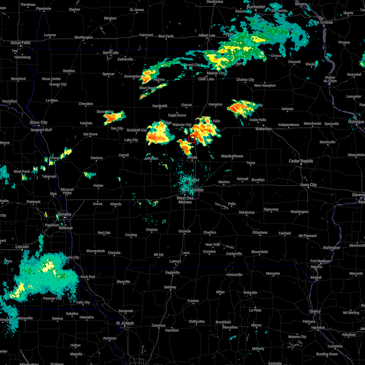 At 437 pm cdt, a confirmed tornado was located over jewell junction, or 13 miles southeast of webster city, moving east at 30 mph (weather spotters confirmed tornado). Hazards include damaging tornado. Flying debris will be dangerous to those caught without shelter. mobile homes will be damaged or destroyed. damage to roofs, windows, and vehicles will occur. tree damage is likely. Locations impacted include, jewell junction and ellsworth. At 437 pm cdt, a confirmed tornado was located over jewell junction, or 13 miles southeast of webster city, moving east at 30 mph (weather spotters confirmed tornado). Hazards include damaging tornado. Flying debris will be dangerous to those caught without shelter. mobile homes will be damaged or destroyed. damage to roofs, windows, and vehicles will occur. tree damage is likely. Locations impacted include, jewell junction and ellsworth.
|
| 7/14/2021 4:29 PM CDT |
 At 429 pm cdt, a confirmed tornado was located near jewell junction, or 16 miles southeast of webster city, moving northeast at 35 mph (weather spotters confirmed tornado). Hazards include damaging tornado. Flying debris will be dangerous to those caught without shelter. mobile homes will be damaged or destroyed. damage to roofs, windows, and vehicles will occur. tree damage is likely. this tornadic thunderstorm will remain over mainly rural areas of southwestern hardin and southeastern hamilton counties, including the following locations, ellsworth, buckeye, radcliffe, garden city, hubbard, drake airport and randall. This includes interstate 35 between mile markers 127 and 138. At 429 pm cdt, a confirmed tornado was located near jewell junction, or 16 miles southeast of webster city, moving northeast at 35 mph (weather spotters confirmed tornado). Hazards include damaging tornado. Flying debris will be dangerous to those caught without shelter. mobile homes will be damaged or destroyed. damage to roofs, windows, and vehicles will occur. tree damage is likely. this tornadic thunderstorm will remain over mainly rural areas of southwestern hardin and southeastern hamilton counties, including the following locations, ellsworth, buckeye, radcliffe, garden city, hubbard, drake airport and randall. This includes interstate 35 between mile markers 127 and 138.
|
| 7/14/2021 4:25 PM CDT |
 At 425 pm cdt, a confirmed tornado was located near jewell junction, or 11 miles southeast of webster city, moving east at 30 mph (weather spotters confirmed tornado). Hazards include damaging tornado. Flying debris will be dangerous to those caught without shelter. mobile homes will be damaged or destroyed. damage to roofs, windows, and vehicles will occur. tree damage is likely. Locations impacted include, story city, jewell junction, ellsworth, stanhope and randall. At 425 pm cdt, a confirmed tornado was located near jewell junction, or 11 miles southeast of webster city, moving east at 30 mph (weather spotters confirmed tornado). Hazards include damaging tornado. Flying debris will be dangerous to those caught without shelter. mobile homes will be damaged or destroyed. damage to roofs, windows, and vehicles will occur. tree damage is likely. Locations impacted include, story city, jewell junction, ellsworth, stanhope and randall.
|
| 7/14/2021 4:10 PM CDT |
 At 409 pm cdt, a confirmed tornado was located 12 miles south of webster city, moving east at 25 mph (weather spotters confirmed tornado. trained spotters reported a tornado near stratford at 409pm). Hazards include damaging tornado. Flying debris will be dangerous to those caught without shelter. mobile homes will be damaged or destroyed. damage to roofs, windows, and vehicles will occur. tree damage is likely. Locations impacted include, story city, jewell junction, stratford, ellsworth, stanhope and randall. At 409 pm cdt, a confirmed tornado was located 12 miles south of webster city, moving east at 25 mph (weather spotters confirmed tornado. trained spotters reported a tornado near stratford at 409pm). Hazards include damaging tornado. Flying debris will be dangerous to those caught without shelter. mobile homes will be damaged or destroyed. damage to roofs, windows, and vehicles will occur. tree damage is likely. Locations impacted include, story city, jewell junction, stratford, ellsworth, stanhope and randall.
|
| 7/14/2021 4:04 PM CDT |
 At 404 pm cdt, a severe thunderstorm capable of producing a tornado was located 14 miles west of jewell junction, or 14 miles south of webster city, moving east at 30 mph (radar indicated rotation). Hazards include tornado. Flying debris will be dangerous to those caught without shelter. mobile homes will be damaged or destroyed. damage to roofs, windows, and vehicles will occur. Tree damage is likely. At 404 pm cdt, a severe thunderstorm capable of producing a tornado was located 14 miles west of jewell junction, or 14 miles south of webster city, moving east at 30 mph (radar indicated rotation). Hazards include tornado. Flying debris will be dangerous to those caught without shelter. mobile homes will be damaged or destroyed. damage to roofs, windows, and vehicles will occur. Tree damage is likely.
|
| 8/10/2020 11:32 AM CDT |
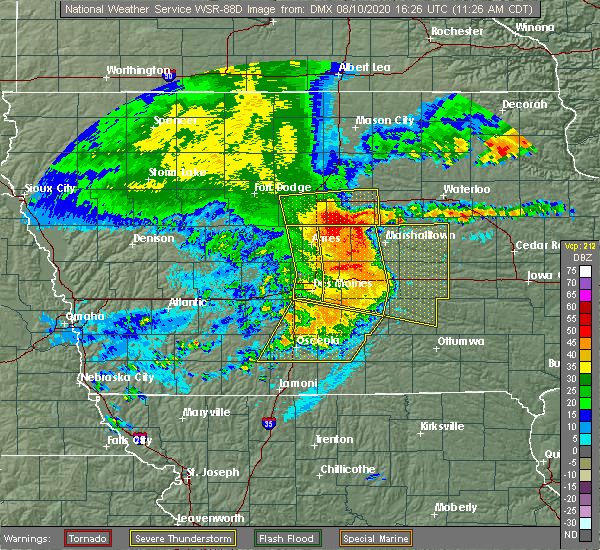 At 1132 am cdt, a severe thunderstorm was located 10 miles northeast of roland, or 14 miles southwest of eldora, moving east at 50 mph (radar indicated). Hazards include 60 mph wind gusts and half dollar size hail. Hail damage to vehicles is expected. expect wind damage to roofs, siding, and trees. locations impacted include, iowa falls, eldora, ackley, jewell junction, hubbard, alden, radcliffe, ellsworth, union, williams, steamboat rock, new providence, randall, whitten, buckeye, garden city, owasa, pine lake state park, iowa falls municipal airport and eldora municipal airport. This includes interstate 35 between mile markers 127 and 148. At 1132 am cdt, a severe thunderstorm was located 10 miles northeast of roland, or 14 miles southwest of eldora, moving east at 50 mph (radar indicated). Hazards include 60 mph wind gusts and half dollar size hail. Hail damage to vehicles is expected. expect wind damage to roofs, siding, and trees. locations impacted include, iowa falls, eldora, ackley, jewell junction, hubbard, alden, radcliffe, ellsworth, union, williams, steamboat rock, new providence, randall, whitten, buckeye, garden city, owasa, pine lake state park, iowa falls municipal airport and eldora municipal airport. This includes interstate 35 between mile markers 127 and 148.
|
| 8/10/2020 11:10 AM CDT |
 At 1110 am cdt, a severe thunderstorm was located near jewell junction, or 16 miles southeast of webster city, moving east at 55 mph (radar indicated). Hazards include 60 mph wind gusts. expect damage to roofs, siding, and trees At 1110 am cdt, a severe thunderstorm was located near jewell junction, or 16 miles southeast of webster city, moving east at 55 mph (radar indicated). Hazards include 60 mph wind gusts. expect damage to roofs, siding, and trees
|
| 8/10/2020 10:54 AM CDT |
 At 1053 am cdt, a severe thunderstorm was located 8 miles west of jewell junction, or 11 miles south of webster city, moving east at 55 mph (radar indicated). Hazards include 60 mph wind gusts and nickel size hail. Expect damage to roofs, siding, and trees. locations impacted include, webster city, jewell junction, gowrie, dayton, stratford, coalville, otho, ellsworth, stanhope, lehigh, duncombe, callender, williams, harcourt, blairsburg, kamrar, randall, moorland, woodman hollow state park and dolliver memorial state park. This includes interstate 35 between mile markers 127 and 150. At 1053 am cdt, a severe thunderstorm was located 8 miles west of jewell junction, or 11 miles south of webster city, moving east at 55 mph (radar indicated). Hazards include 60 mph wind gusts and nickel size hail. Expect damage to roofs, siding, and trees. locations impacted include, webster city, jewell junction, gowrie, dayton, stratford, coalville, otho, ellsworth, stanhope, lehigh, duncombe, callender, williams, harcourt, blairsburg, kamrar, randall, moorland, woodman hollow state park and dolliver memorial state park. This includes interstate 35 between mile markers 127 and 150.
|
| 8/10/2020 10:35 AM CDT |
 At 1034 am cdt, a severe thunderstorm was located near gowrie, or 17 miles south of fort dodge, moving east at 55 mph (radar indicated). Hazards include 60 mph wind gusts and nickel size hail. expect damage to roofs, siding, and trees At 1034 am cdt, a severe thunderstorm was located near gowrie, or 17 miles south of fort dodge, moving east at 55 mph (radar indicated). Hazards include 60 mph wind gusts and nickel size hail. expect damage to roofs, siding, and trees
|
| 7/14/2020 6:33 PM CDT |
 At 632 pm cdt, a severe thunderstorm was located near story city, or 14 miles north of ames, moving northeast at 20 mph (radar indicated). Hazards include 60 mph wind gusts and half dollar size hail. Hail damage to vehicles is expected. Expect wind damage to roofs, siding, and trees. At 632 pm cdt, a severe thunderstorm was located near story city, or 14 miles north of ames, moving northeast at 20 mph (radar indicated). Hazards include 60 mph wind gusts and half dollar size hail. Hail damage to vehicles is expected. Expect wind damage to roofs, siding, and trees.
|
| 7/11/2020 5:01 PM CDT |
 At 501 pm cdt, a severe thunderstorm was located near jewell junction, or 17 miles north of ames, moving southeast at 40 mph (radar indicated). Hazards include ping pong ball size hail and 60 mph wind gusts. People and animals outdoors will be injured. expect hail damage to roofs, siding, windows, and vehicles. Expect wind damage to roofs, siding, and trees. At 501 pm cdt, a severe thunderstorm was located near jewell junction, or 17 miles north of ames, moving southeast at 40 mph (radar indicated). Hazards include ping pong ball size hail and 60 mph wind gusts. People and animals outdoors will be injured. expect hail damage to roofs, siding, windows, and vehicles. Expect wind damage to roofs, siding, and trees.
|
| 7/11/2020 2:56 PM CDT |
 At 256 pm cdt, a severe thunderstorm was located 10 miles southwest of webster city, moving southeast at 35 mph (radar indicated). Hazards include ping pong ball size hail and 60 mph wind gusts. People and animals outdoors will be injured. expect hail damage to roofs, siding, windows, and vehicles. Expect wind damage to roofs, siding, and trees. At 256 pm cdt, a severe thunderstorm was located 10 miles southwest of webster city, moving southeast at 35 mph (radar indicated). Hazards include ping pong ball size hail and 60 mph wind gusts. People and animals outdoors will be injured. expect hail damage to roofs, siding, windows, and vehicles. Expect wind damage to roofs, siding, and trees.
|
| 6/4/2020 8:42 PM CDT |
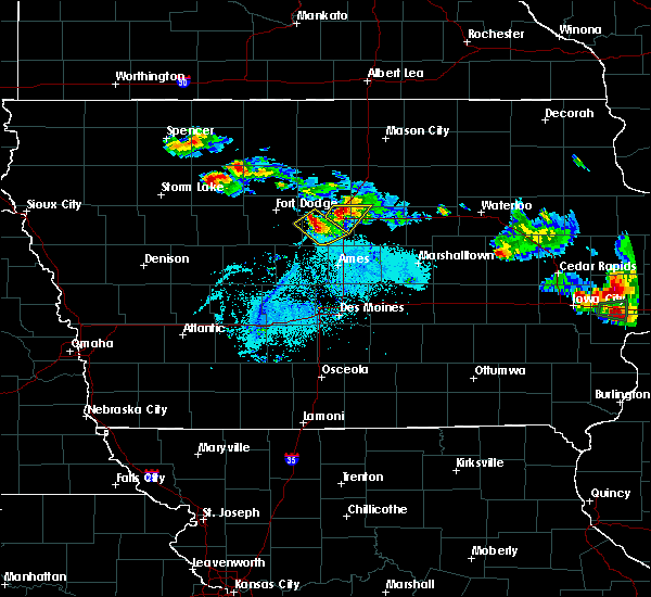 At 842 pm cdt, a severe thunderstorm was located near webster city, moving east at 20 mph (radar indicated). Hazards include 60 mph wind gusts. Expect damage to roofs, siding, and trees. locations impacted include, webster city, jewell junction, ellsworth, stanhope, kamrar and webster city municipal airport. This includes interstate 35 between mile markers 132 and 135. At 842 pm cdt, a severe thunderstorm was located near webster city, moving east at 20 mph (radar indicated). Hazards include 60 mph wind gusts. Expect damage to roofs, siding, and trees. locations impacted include, webster city, jewell junction, ellsworth, stanhope, kamrar and webster city municipal airport. This includes interstate 35 between mile markers 132 and 135.
|
| 6/4/2020 8:34 PM CDT |
 At 833 pm cdt, a severe thunderstorm was located near webster city, moving southeast at 25 mph (radar indicated). Hazards include 60 mph wind gusts and penny size hail. expect damage to roofs, siding, and trees At 833 pm cdt, a severe thunderstorm was located near webster city, moving southeast at 25 mph (radar indicated). Hazards include 60 mph wind gusts and penny size hail. expect damage to roofs, siding, and trees
|
| 9/24/2019 9:35 PM CDT |
 The severe thunderstorm warning for southeastern webster, southern wright and hamilton counties will expire at 945 pm cdt, the storm which prompted the warning has weakened below severe limits, and no longer poses an immediate threat to life or property. therefore, the warning will be allowed to expire. however gusty winds to 50 mph are still possible with this thunderstorm. a tornado watch remains in effect until midnight cdt for central and north central iowa. The severe thunderstorm warning for southeastern webster, southern wright and hamilton counties will expire at 945 pm cdt, the storm which prompted the warning has weakened below severe limits, and no longer poses an immediate threat to life or property. therefore, the warning will be allowed to expire. however gusty winds to 50 mph are still possible with this thunderstorm. a tornado watch remains in effect until midnight cdt for central and north central iowa.
|
| 9/24/2019 9:19 PM CDT |
 At 918 pm cdt, a severe thunderstorm was located near webster city, moving east at 45 mph (radar indicated). Hazards include 60 mph wind gusts and penny size hail. Expect damage to roofs, siding, and trees. locations impacted include, fort dodge, webster city, jewell junction, dayton, stratford, coalville, otho, stanhope, lehigh, duncombe, callender, williams, blairsburg, kamrar, vincent, moorland, woolstock, woodman hollow state park, dolliver memorial state park and brushy creek st recreation area. This includes interstate 35 between mile markers 143 and 154. At 918 pm cdt, a severe thunderstorm was located near webster city, moving east at 45 mph (radar indicated). Hazards include 60 mph wind gusts and penny size hail. Expect damage to roofs, siding, and trees. locations impacted include, fort dodge, webster city, jewell junction, dayton, stratford, coalville, otho, stanhope, lehigh, duncombe, callender, williams, blairsburg, kamrar, vincent, moorland, woolstock, woodman hollow state park, dolliver memorial state park and brushy creek st recreation area. This includes interstate 35 between mile markers 143 and 154.
|
| 9/24/2019 9:01 PM CDT |
 At 901 pm cdt, a severe thunderstorm was located over fort dodge, moving east at 45 mph (radar indicated). Hazards include 60 mph wind gusts and penny size hail. expect damage to roofs, siding, and trees At 901 pm cdt, a severe thunderstorm was located over fort dodge, moving east at 45 mph (radar indicated). Hazards include 60 mph wind gusts and penny size hail. expect damage to roofs, siding, and trees
|
| 9/14/2019 5:00 PM CDT |
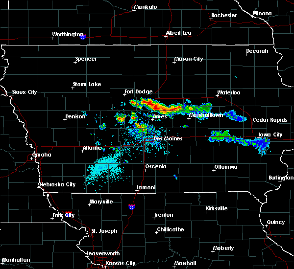 At 500 pm cdt, a severe thunderstorm was located near jewell junction, or 7 miles southeast of webster city, moving east at 35 mph (radar indicated). Hazards include quarter size hail. Damage to vehicles is expected. locations impacted include, webster city, jewell junction, ellsworth, stanhope, williams, blairsburg, kamrar, randall and webster city municipal airport. This includes interstate 35 between mile markers 127 and 145. At 500 pm cdt, a severe thunderstorm was located near jewell junction, or 7 miles southeast of webster city, moving east at 35 mph (radar indicated). Hazards include quarter size hail. Damage to vehicles is expected. locations impacted include, webster city, jewell junction, ellsworth, stanhope, williams, blairsburg, kamrar, randall and webster city municipal airport. This includes interstate 35 between mile markers 127 and 145.
|
| 9/14/2019 4:44 PM CDT |
 The national weather service in des moines has issued a * severe thunderstorm warning for. east central webster county in central iowa. hamilton county in central iowa. until 530 pm cdt. At 443 pm cdt, a severe thunderstorm was located 7 miles southwest. The national weather service in des moines has issued a * severe thunderstorm warning for. east central webster county in central iowa. hamilton county in central iowa. until 530 pm cdt. At 443 pm cdt, a severe thunderstorm was located 7 miles southwest.
|
| 9/14/2019 3:56 PM CDT |
 The severe thunderstorm warning for east central hamilton county will expire at 400 pm cdt, the storm which prompted the warning has weakened below severe limits, and no longer poses an immediate threat to life or property. therefore, the warning will be allowed to expire. The severe thunderstorm warning for east central hamilton county will expire at 400 pm cdt, the storm which prompted the warning has weakened below severe limits, and no longer poses an immediate threat to life or property. therefore, the warning will be allowed to expire.
|
| 9/14/2019 3:39 PM CDT |
 At 338 pm cdt, a severe thunderstorm was located near jewell junction, or 8 miles southeast of webster city, moving east at 30 mph (public reported quarter size hail near kamrar at 3:33pm). Hazards include quarter size hail. Damage to vehicles is expected. locations impacted include, kamrar. This includes interstate 35 between mile markers 135 and 144. At 338 pm cdt, a severe thunderstorm was located near jewell junction, or 8 miles southeast of webster city, moving east at 30 mph (public reported quarter size hail near kamrar at 3:33pm). Hazards include quarter size hail. Damage to vehicles is expected. locations impacted include, kamrar. This includes interstate 35 between mile markers 135 and 144.
|
| 9/14/2019 3:23 PM CDT |
 A severe thunderstorm warning remains in effect until 400 pm cdt for central hamilton county. at 323 pm cdt, a severe thunderstorm was located near webster city, moving east at 30 mph. hazard. quarter size hail. source. Radar indicated. A severe thunderstorm warning remains in effect until 400 pm cdt for central hamilton county. at 323 pm cdt, a severe thunderstorm was located near webster city, moving east at 30 mph. hazard. quarter size hail. source. Radar indicated.
|
| 9/14/2019 3:16 PM CDT |
 At 316 pm cdt, a severe thunderstorm was located near webster city, moving east at 30 mph (trained spotter). Hazards include quarter size hail. damage to vehicles is expected At 316 pm cdt, a severe thunderstorm was located near webster city, moving east at 30 mph (trained spotter). Hazards include quarter size hail. damage to vehicles is expected
|
| 9/9/2019 5:39 PM CDT |
 At 539 pm cdt, severe thunderstorms were located along a line extending from 8 miles south of big wall lake to 8 miles southwest of eldora to state center, moving northeast at 55 mph (radar indicated). Hazards include 60 mph wind gusts and penny size hail. Expect damage to roofs, siding, and trees. locations impacted include, nevada, iowa falls, eldora, ackley, state center, roland, jewell junction, colo, hubbard, alden, zearing, radcliffe, ellsworth, collins, union, williams, mccallsburg, steamboat rock, liscomb and new providence. This includes interstate 35 between mile markers 130 and 148. At 539 pm cdt, severe thunderstorms were located along a line extending from 8 miles south of big wall lake to 8 miles southwest of eldora to state center, moving northeast at 55 mph (radar indicated). Hazards include 60 mph wind gusts and penny size hail. Expect damage to roofs, siding, and trees. locations impacted include, nevada, iowa falls, eldora, ackley, state center, roland, jewell junction, colo, hubbard, alden, zearing, radcliffe, ellsworth, collins, union, williams, mccallsburg, steamboat rock, liscomb and new providence. This includes interstate 35 between mile markers 130 and 148.
|
| 9/9/2019 5:20 PM CDT |
 At 519 pm cdt, severe thunderstorms were located along a line extending from 8 miles west of jewell junction to near roland to 10 miles west of baxter, moving northeast at 55 mph (radar indicated). Hazards include 60 mph wind gusts and penny size hail. expect damage to roofs, siding, and trees At 519 pm cdt, severe thunderstorms were located along a line extending from 8 miles west of jewell junction to near roland to 10 miles west of baxter, moving northeast at 55 mph (radar indicated). Hazards include 60 mph wind gusts and penny size hail. expect damage to roofs, siding, and trees
|
| 8/5/2019 9:24 PM CDT |
 The severe thunderstorm warning for western hardin and hamilton counties will expire at 930 pm cdt, the storms which prompted the warning have weakened below severe limits, and no longer pose an immediate threat to life or property. therefore, the warning will be allowed to expire. however gusty winds are still possible with these thunderstorms. a severe thunderstorm watch remains in effect until 1100 pm cdt for central and north central iowa. The severe thunderstorm warning for western hardin and hamilton counties will expire at 930 pm cdt, the storms which prompted the warning have weakened below severe limits, and no longer pose an immediate threat to life or property. therefore, the warning will be allowed to expire. however gusty winds are still possible with these thunderstorms. a severe thunderstorm watch remains in effect until 1100 pm cdt for central and north central iowa.
|
| 8/5/2019 9:10 PM CDT |
 At 910 pm cdt, severe thunderstorms were located along a line extending from 8 miles southwest of iowa falls to 7 miles south of webster city, moving south at 45 mph (radar indicated). Hazards include 60 mph wind gusts. Expect damage to roofs, siding, and trees. locations impacted include, webster city, jewell junction, hubbard, alden, stratford, radcliffe, ellsworth, stanhope, williams, blairsburg, kamrar, randall, buckeye, webster city municipal airport and drake airport. This includes interstate 35 between mile markers 129 and 150. At 910 pm cdt, severe thunderstorms were located along a line extending from 8 miles southwest of iowa falls to 7 miles south of webster city, moving south at 45 mph (radar indicated). Hazards include 60 mph wind gusts. Expect damage to roofs, siding, and trees. locations impacted include, webster city, jewell junction, hubbard, alden, stratford, radcliffe, ellsworth, stanhope, williams, blairsburg, kamrar, randall, buckeye, webster city municipal airport and drake airport. This includes interstate 35 between mile markers 129 and 150.
|
| 8/5/2019 8:58 PM CDT |
 At 857 pm cdt, severe thunderstorms were located along a line extending from 9 miles east of big wall lake to near webster city, moving south at 45 mph (trained weather spotters. at 8:55pm, a trained weather spotter 5 miles southwest of woolstock reported a 60 mph wind gust). Hazards include 60 mph wind gusts. expect damage to roofs, siding, and trees At 857 pm cdt, severe thunderstorms were located along a line extending from 9 miles east of big wall lake to near webster city, moving south at 45 mph (trained weather spotters. at 8:55pm, a trained weather spotter 5 miles southwest of woolstock reported a 60 mph wind gust). Hazards include 60 mph wind gusts. expect damage to roofs, siding, and trees
|
| 7/20/2019 11:35 AM CDT |
 At 1131 am cdt, the leading edge of severe winds associated with northern iowa thunderstorms was along a line extending from sheffield to 10 miles south of webster city, moving east at 60 mph (radar indicated. at 1115am 60 mph winds were reported at the clarion airport). Hazards include 60 mph wind gusts. Expect damage to roofs, siding, and trees. severe thunderstorms will be near, sheffield around 1135 am cdt. jewell junction around 1145 am cdt. greene around 1150 am cdt. clarksville around 1200 pm cdt. eldora around 1210 pm cdt. other locations impacted by these severe thunderstorms include steamboat rock, blairsburg, radcliffe, bradford, iowa falls municipal airport, kamrar, wellsburg, geneva, hansell and union. This includes interstate 35 between mile markers 127 and 150, and between mile markers 155 and 172. At 1131 am cdt, the leading edge of severe winds associated with northern iowa thunderstorms was along a line extending from sheffield to 10 miles south of webster city, moving east at 60 mph (radar indicated. at 1115am 60 mph winds were reported at the clarion airport). Hazards include 60 mph wind gusts. Expect damage to roofs, siding, and trees. severe thunderstorms will be near, sheffield around 1135 am cdt. jewell junction around 1145 am cdt. greene around 1150 am cdt. clarksville around 1200 pm cdt. eldora around 1210 pm cdt. other locations impacted by these severe thunderstorms include steamboat rock, blairsburg, radcliffe, bradford, iowa falls municipal airport, kamrar, wellsburg, geneva, hansell and union. This includes interstate 35 between mile markers 127 and 150, and between mile markers 155 and 172.
|
| 7/17/2019 10:28 AM CDT |
 At 1026 am cdt, severe thunderstorms were located along a line extending from near big wall lake to near webster city to 12 miles north of boone, moving east at 45 mph (radar indicated. recorded gusts to 40 to 45 mph from automated stations). Hazards include 60 mph wind gusts remain possible. Expect damage to roofs, siding, and trees. locations impacted include, webster city, iowa falls, eldora, ackley, jewell junction, big wall lake, hubbard, alden, stratford, radcliffe, dows, ellsworth, stanhope, williams, steamboat rock, new providence, blairsburg, kamrar, randall and woolstock. This includes interstate 35 between mile markers 127 and 158. At 1026 am cdt, severe thunderstorms were located along a line extending from near big wall lake to near webster city to 12 miles north of boone, moving east at 45 mph (radar indicated. recorded gusts to 40 to 45 mph from automated stations). Hazards include 60 mph wind gusts remain possible. Expect damage to roofs, siding, and trees. locations impacted include, webster city, iowa falls, eldora, ackley, jewell junction, big wall lake, hubbard, alden, stratford, radcliffe, dows, ellsworth, stanhope, williams, steamboat rock, new providence, blairsburg, kamrar, randall and woolstock. This includes interstate 35 between mile markers 127 and 158.
|
| 7/17/2019 10:16 AM CDT |
 At 1015 am cdt, severe thunderstorms were located along a line extending from near eagle grove to near webster city to 11 miles east of gowrie, moving east at 45 mph (radar indicated, and automated weather stations). Hazards include 60 mph wind gusts and penny size hail. expect damage to roofs, siding, and trees At 1015 am cdt, severe thunderstorms were located along a line extending from near eagle grove to near webster city to 11 miles east of gowrie, moving east at 45 mph (radar indicated, and automated weather stations). Hazards include 60 mph wind gusts and penny size hail. expect damage to roofs, siding, and trees
|
| 6/15/2019 3:46 PM CDT |
 At 346 pm cdt, a severe thunderstorm was located 9 miles northeast of jewell junction, or 13 miles east of webster city, moving east at 25 mph (radar indicated). Hazards include 60 mph wind gusts and nickel size hail. Expect damage to roofs, siding, and trees. locations impacted include, webster city, jewell junction, big wall lake, alden, ellsworth, stanhope, williams, blairsburg, kamrar, popejoy and webster city municipal airport. This includes interstate 35 between mile markers 136 and 155. At 346 pm cdt, a severe thunderstorm was located 9 miles northeast of jewell junction, or 13 miles east of webster city, moving east at 25 mph (radar indicated). Hazards include 60 mph wind gusts and nickel size hail. Expect damage to roofs, siding, and trees. locations impacted include, webster city, jewell junction, big wall lake, alden, ellsworth, stanhope, williams, blairsburg, kamrar, popejoy and webster city municipal airport. This includes interstate 35 between mile markers 136 and 155.
|
| 6/15/2019 3:19 PM CDT |
 The national weather service in des moines has issued a * severe thunderstorm warning for. northwestern hardin county in central iowa. east central webster county in central iowa. southeastern wright county in north central iowa. Southwestern franklin county in north central iowa. The national weather service in des moines has issued a * severe thunderstorm warning for. northwestern hardin county in central iowa. east central webster county in central iowa. southeastern wright county in north central iowa. Southwestern franklin county in north central iowa.
|
| 8/28/2018 2:02 PM CDT |
 At 202 pm cdt, severe thunderstorms were located along a line extending from 8 miles southeast of big wall lake to near jewell junction, moving east at 50 mph (radar indicated). Hazards include 60 mph wind gusts and quarter size hail. Hail damage to vehicles is expected. expect wind damage to roofs, siding, and trees. locations impacted include, jewell junction, alden, radcliffe, ellsworth, williams, blairsburg, kamrar, buckeye, garden city, popejoy and drake airport. This includes interstate 35 between mile markers 129 and 155. At 202 pm cdt, severe thunderstorms were located along a line extending from 8 miles southeast of big wall lake to near jewell junction, moving east at 50 mph (radar indicated). Hazards include 60 mph wind gusts and quarter size hail. Hail damage to vehicles is expected. expect wind damage to roofs, siding, and trees. locations impacted include, jewell junction, alden, radcliffe, ellsworth, williams, blairsburg, kamrar, buckeye, garden city, popejoy and drake airport. This includes interstate 35 between mile markers 129 and 155.
|
| 8/28/2018 1:49 PM CDT |
 At 149 pm cdt, severe thunderstorms were located along a line extending from 6 miles south of big wall lake to 12 miles west of jewell junction, moving northeast at 45 mph (radar indicated). Hazards include 60 mph wind gusts and quarter size hail. Hail damage to vehicles is expected. expect wind damage to roofs, siding, and trees. locations impacted include, webster city, jewell junction, alden, stratford, radcliffe, ellsworth, stanhope, williams, blairsburg, kamrar, randall, buckeye, garden city, popejoy, webster city municipal airport and drake airport. This includes interstate 35 between mile markers 128 and 155. At 149 pm cdt, severe thunderstorms were located along a line extending from 6 miles south of big wall lake to 12 miles west of jewell junction, moving northeast at 45 mph (radar indicated). Hazards include 60 mph wind gusts and quarter size hail. Hail damage to vehicles is expected. expect wind damage to roofs, siding, and trees. locations impacted include, webster city, jewell junction, alden, stratford, radcliffe, ellsworth, stanhope, williams, blairsburg, kamrar, randall, buckeye, garden city, popejoy, webster city municipal airport and drake airport. This includes interstate 35 between mile markers 128 and 155.
|
| 8/28/2018 1:38 PM CDT |
 At 138 pm cdt, severe thunderstorms were located along a line extending from near webster city to 8 miles north of ogden, moving east at 40 mph (radar indicated). Hazards include 60 mph wind gusts and quarter size hail. Hail damage to vehicles is expected. Expect wind damage to roofs, siding, and trees. At 138 pm cdt, severe thunderstorms were located along a line extending from near webster city to 8 miles north of ogden, moving east at 40 mph (radar indicated). Hazards include 60 mph wind gusts and quarter size hail. Hail damage to vehicles is expected. Expect wind damage to roofs, siding, and trees.
|
| 8/5/2018 10:40 PM CDT |
 At 1040 pm cdt, a severe thunderstorm was located 10 miles north of jewell junction, or 11 miles east of webster city, moving east at 40 mph (radar indicated). Hazards include 60 mph wind gusts. expect damage to roofs, siding, and trees At 1040 pm cdt, a severe thunderstorm was located 10 miles north of jewell junction, or 11 miles east of webster city, moving east at 40 mph (radar indicated). Hazards include 60 mph wind gusts. expect damage to roofs, siding, and trees
|
| 8/5/2018 5:20 AM CDT |
 At 511 am cdt, severe thunderstorms were located along a line extending from 8 miles south of britt to near big wall lake to 14 miles east of gowrie, moving east at 50 mph (radar indicated). Hazards include 60 mph wind gusts. Expect damage to roofs, siding, and trees. locations impacted include, webster city, garner, clarion, eagle grove, belmond, jewell junction, gowrie, big wall lake, elm lake, dayton, stratford, kanawha, goldfield, coalville, otho, dows, ellsworth, klemme, stanhope and lehigh. This includes interstate 35 between mile markers 127 and 154. At 511 am cdt, severe thunderstorms were located along a line extending from 8 miles south of britt to near big wall lake to 14 miles east of gowrie, moving east at 50 mph (radar indicated). Hazards include 60 mph wind gusts. Expect damage to roofs, siding, and trees. locations impacted include, webster city, garner, clarion, eagle grove, belmond, jewell junction, gowrie, big wall lake, elm lake, dayton, stratford, kanawha, goldfield, coalville, otho, dows, ellsworth, klemme, stanhope and lehigh. This includes interstate 35 between mile markers 127 and 154.
|
| 8/5/2018 5:12 AM CDT |
 At 511 am cdt, severe thunderstorms were located along a line extending from 8 miles south of britt to near big wall lake to 14 miles east of gowrie, moving east at 50 mph (radar indicated). Hazards include 60 mph wind gusts. Expect damage to roofs, siding, and trees. locations impacted include, webster city, garner, clarion, eagle grove, belmond, jewell junction, gowrie, big wall lake, elm lake, dayton, stratford, kanawha, goldfield, coalville, otho, dows, ellsworth, klemme, stanhope and lehigh. This includes interstate 35 between mile markers 127 and 154. At 511 am cdt, severe thunderstorms were located along a line extending from 8 miles south of britt to near big wall lake to 14 miles east of gowrie, moving east at 50 mph (radar indicated). Hazards include 60 mph wind gusts. Expect damage to roofs, siding, and trees. locations impacted include, webster city, garner, clarion, eagle grove, belmond, jewell junction, gowrie, big wall lake, elm lake, dayton, stratford, kanawha, goldfield, coalville, otho, dows, ellsworth, klemme, stanhope and lehigh. This includes interstate 35 between mile markers 127 and 154.
|
| 8/5/2018 4:58 AM CDT |
 At 457 am cdt, severe thunderstorms were located along a line extending from 11 miles east of algona to near eagle grove to 9 miles northeast of gowrie, moving east at 60 mph (radar indicated). Hazards include 60 mph wind gusts. Expect damage to roofs, siding, and trees. locations impacted include, fort dodge, webster city, algona, garner, clarion, dakota city, humboldt, eagle grove, belmond, britt, jewell junction, gowrie, elm lake, fort dodge regional airport, big wall lake, eagle lake, dayton, stratford, kanawha and goldfield. This includes interstate 35 between mile markers 127 and 154. At 457 am cdt, severe thunderstorms were located along a line extending from 11 miles east of algona to near eagle grove to 9 miles northeast of gowrie, moving east at 60 mph (radar indicated). Hazards include 60 mph wind gusts. Expect damage to roofs, siding, and trees. locations impacted include, fort dodge, webster city, algona, garner, clarion, dakota city, humboldt, eagle grove, belmond, britt, jewell junction, gowrie, elm lake, fort dodge regional airport, big wall lake, eagle lake, dayton, stratford, kanawha and goldfield. This includes interstate 35 between mile markers 127 and 154.
|
| 8/5/2018 4:41 AM CDT |
 At 441 am cdt, severe thunderstorms were located along a line extending from near algona to near dakota city to 10 miles east of rockwell city, moving east at 60 mph (radar indicated). Hazards include 70 mph wind gusts. Expect considerable tree damage. damage is likely to mobile homes, roofs, and outbuildings. locations impacted include, fort dodge, webster city, algona, garner, clarion, dakota city, humboldt, eagle grove, belmond, britt, jewell junction, gowrie, elm lake, fort dodge regional airport, big wall lake, eagle lake, dayton, west bend, stratford and kanawha. This includes interstate 35 between mile markers 127 and 154. At 441 am cdt, severe thunderstorms were located along a line extending from near algona to near dakota city to 10 miles east of rockwell city, moving east at 60 mph (radar indicated). Hazards include 70 mph wind gusts. Expect considerable tree damage. damage is likely to mobile homes, roofs, and outbuildings. locations impacted include, fort dodge, webster city, algona, garner, clarion, dakota city, humboldt, eagle grove, belmond, britt, jewell junction, gowrie, elm lake, fort dodge regional airport, big wall lake, eagle lake, dayton, west bend, stratford and kanawha. This includes interstate 35 between mile markers 127 and 154.
|
| 8/5/2018 4:24 AM CDT |
 At 423 am cdt, severe thunderstorms were located along a line extending from five island lake to near pocahontas to near north twin lake, moving east at 60 mph. these are very dangerous storms (radar indicated). Hazards include 80 mph wind gusts and nickel size hail. Flying debris will be dangerous to those caught without shelter. mobile homes will be heavily damaged. expect considerable damage to roofs, windows, and vehicles. Extensive tree damage and power outages are likely. At 423 am cdt, severe thunderstorms were located along a line extending from five island lake to near pocahontas to near north twin lake, moving east at 60 mph. these are very dangerous storms (radar indicated). Hazards include 80 mph wind gusts and nickel size hail. Flying debris will be dangerous to those caught without shelter. mobile homes will be heavily damaged. expect considerable damage to roofs, windows, and vehicles. Extensive tree damage and power outages are likely.
|
| 8/1/2018 7:17 PM CDT |
 At 717 pm cdt, a severe thunderstorm was located near jewell junction, or 15 miles north of ames, moving southeast at 25 mph (radar indicated). Hazards include 60 mph wind gusts and quarter size hail. Hail damage to vehicles is expected. expect wind damage to roofs, siding, and trees. locations impacted include, ames, story city, jewell junction, gilbert, ellsworth, stanhope and randall. This includes interstate 35 between mile markers 124 and 133. At 717 pm cdt, a severe thunderstorm was located near jewell junction, or 15 miles north of ames, moving southeast at 25 mph (radar indicated). Hazards include 60 mph wind gusts and quarter size hail. Hail damage to vehicles is expected. expect wind damage to roofs, siding, and trees. locations impacted include, ames, story city, jewell junction, gilbert, ellsworth, stanhope and randall. This includes interstate 35 between mile markers 124 and 133.
|
| 8/1/2018 6:53 PM CDT |
 At 652 pm cdt, a severe thunderstorm was located 7 miles west of jewell junction, or 9 miles south of webster city, moving southeast at 25 mph (radar indicated). Hazards include 60 mph wind gusts and quarter size hail. Hail damage to vehicles is expected. Expect wind damage to roofs, siding, and trees. At 652 pm cdt, a severe thunderstorm was located 7 miles west of jewell junction, or 9 miles south of webster city, moving southeast at 25 mph (radar indicated). Hazards include 60 mph wind gusts and quarter size hail. Hail damage to vehicles is expected. Expect wind damage to roofs, siding, and trees.
|
| 7/25/2018 8:50 PM CDT |
 At 849 pm cdt, a severe thunderstorm was located over jewell junction, or 12 miles southeast of webster city, moving southeast at 30 mph (radar indicated). Hazards include 60 mph wind gusts and penny size hail. Expect damage to roofs, siding, and trees. locations impacted include, jewell junction, ellsworth and kamrar. This includes interstate 35 between mile markers 132 and 142. At 849 pm cdt, a severe thunderstorm was located over jewell junction, or 12 miles southeast of webster city, moving southeast at 30 mph (radar indicated). Hazards include 60 mph wind gusts and penny size hail. Expect damage to roofs, siding, and trees. locations impacted include, jewell junction, ellsworth and kamrar. This includes interstate 35 between mile markers 132 and 142.
|
| 7/25/2018 8:42 PM CDT |
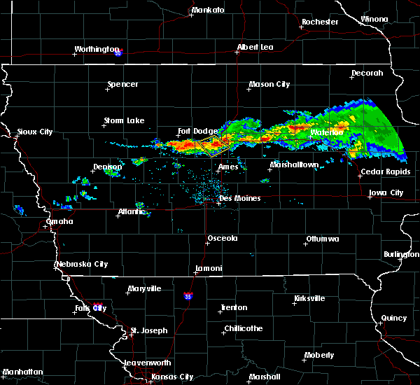 At 842 pm cdt, a severe thunderstorm was located near jewell junction, or 8 miles southeast of webster city, moving southeast at 30 mph (radar indicated). Hazards include 60 mph wind gusts and quarter size hail. Hail damage to vehicles is expected. expect wind damage to roofs, siding, and trees. locations impacted include, webster city, jewell junction, ellsworth, blairsburg, kamrar and webster city municipal airport. This includes interstate 35 between mile markers 132 and 142. At 842 pm cdt, a severe thunderstorm was located near jewell junction, or 8 miles southeast of webster city, moving southeast at 30 mph (radar indicated). Hazards include 60 mph wind gusts and quarter size hail. Hail damage to vehicles is expected. expect wind damage to roofs, siding, and trees. locations impacted include, webster city, jewell junction, ellsworth, blairsburg, kamrar and webster city municipal airport. This includes interstate 35 between mile markers 132 and 142.
|
| 7/25/2018 8:34 PM CDT |
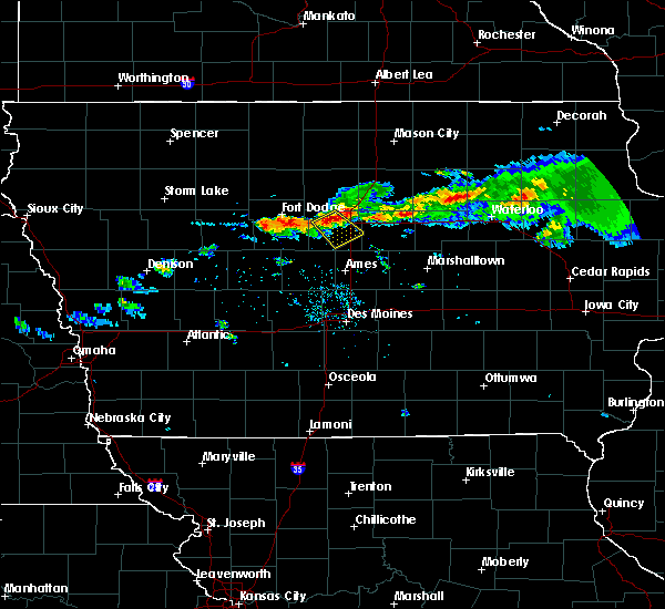 At 833 pm cdt, a severe thunderstorm was located near webster city, moving southeast at 30 mph (radar indicated). Hazards include 60 mph wind gusts and quarter size hail. Hail damage to vehicles is expected. Expect wind damage to roofs, siding, and trees. At 833 pm cdt, a severe thunderstorm was located near webster city, moving southeast at 30 mph (radar indicated). Hazards include 60 mph wind gusts and quarter size hail. Hail damage to vehicles is expected. Expect wind damage to roofs, siding, and trees.
|
| 6/6/2018 5:00 PM CDT |
 At 457 pm cdt, a severe thunderstorm was located near jewell junction, or 9 miles southeast of webster city, moving east at 15 mph. this thunderstorm warning replaces the previous warning for much of the same area (radar indicated). Hazards include 60 mph wind gusts and quarter size hail. Hail damage to vehicles is expected. Expect wind damage to roofs, siding, and trees. At 457 pm cdt, a severe thunderstorm was located near jewell junction, or 9 miles southeast of webster city, moving east at 15 mph. this thunderstorm warning replaces the previous warning for much of the same area (radar indicated). Hazards include 60 mph wind gusts and quarter size hail. Hail damage to vehicles is expected. Expect wind damage to roofs, siding, and trees.
|
| 6/6/2018 4:45 PM CDT | Golf Ball sized hail reported 0.2 miles NE of Jewell Junction, IA |
| 6/6/2018 4:44 PM CDT |
 At 443 pm cdt, a severe thunderstorm was located near roland, or 16 miles north of nevada, moving east at 15 mph (trained weather spotters reported golf ball sized hail at 438 pm 3 miles east of stanhope). Hazards include golf ball size hail and 60 mph wind gusts. People and animals outdoors will be injured. expect hail damage to roofs, siding, windows, and vehicles. expect wind damage to roofs, siding, and trees. locations impacted include, webster city, story city, roland, jewell junction, stratford, ellsworth, stanhope, williams, blairsburg, kamrar, randall and webster city municipal airport. This includes interstate 35 between mile markers 119 and 145. At 443 pm cdt, a severe thunderstorm was located near roland, or 16 miles north of nevada, moving east at 15 mph (trained weather spotters reported golf ball sized hail at 438 pm 3 miles east of stanhope). Hazards include golf ball size hail and 60 mph wind gusts. People and animals outdoors will be injured. expect hail damage to roofs, siding, windows, and vehicles. expect wind damage to roofs, siding, and trees. locations impacted include, webster city, story city, roland, jewell junction, stratford, ellsworth, stanhope, williams, blairsburg, kamrar, randall and webster city municipal airport. This includes interstate 35 between mile markers 119 and 145.
|
| 6/6/2018 4:29 PM CDT |
 At 428 pm cdt, a severe thunderstorm was located near jewell junction, or 16 miles north of ames, moving east at 15 mph (trained weather spotters reported ping-pong sized hail just east of stanhope at 427 pm cdt). Hazards include ping pong ball size hail and 60 mph wind gusts. People and animals outdoors will be injured. expect hail damage to roofs, siding, windows, and vehicles. expect wind damage to roofs, siding, and trees. locations impacted include, webster city, story city, roland, jewell junction, stratford, ellsworth, stanhope, williams, blairsburg, kamrar, randall and webster city municipal airport. This includes interstate 35 between mile markers 119 and 145. At 428 pm cdt, a severe thunderstorm was located near jewell junction, or 16 miles north of ames, moving east at 15 mph (trained weather spotters reported ping-pong sized hail just east of stanhope at 427 pm cdt). Hazards include ping pong ball size hail and 60 mph wind gusts. People and animals outdoors will be injured. expect hail damage to roofs, siding, windows, and vehicles. expect wind damage to roofs, siding, and trees. locations impacted include, webster city, story city, roland, jewell junction, stratford, ellsworth, stanhope, williams, blairsburg, kamrar, randall and webster city municipal airport. This includes interstate 35 between mile markers 119 and 145.
|
| 6/6/2018 4:27 PM CDT |
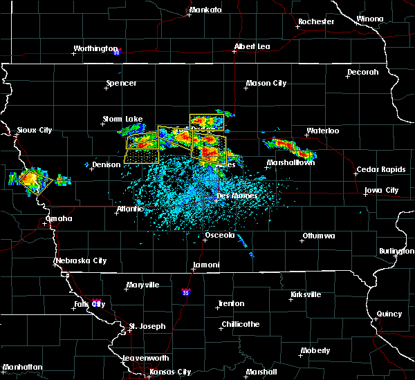 At 427 pm cdt, a severe thunderstorm was located near jewell junction, or 16 miles north of ames, moving east at 15 mph (trained weather spotters reported quarter sized hail in stanhope at 4:35 pm cdt). Hazards include 60 mph wind gusts and half dollar size hail. Hail damage to vehicles is expected. expect wind damage to roofs, siding, and trees. locations impacted include, webster city, story city, roland, jewell junction, stratford, ellsworth, stanhope, williams, blairsburg, kamrar, randall and webster city municipal airport. This includes interstate 35 between mile markers 119 and 145. At 427 pm cdt, a severe thunderstorm was located near jewell junction, or 16 miles north of ames, moving east at 15 mph (trained weather spotters reported quarter sized hail in stanhope at 4:35 pm cdt). Hazards include 60 mph wind gusts and half dollar size hail. Hail damage to vehicles is expected. expect wind damage to roofs, siding, and trees. locations impacted include, webster city, story city, roland, jewell junction, stratford, ellsworth, stanhope, williams, blairsburg, kamrar, randall and webster city municipal airport. This includes interstate 35 between mile markers 119 and 145.
|
| 6/6/2018 4:15 PM CDT |
 At 415 pm cdt, a severe thunderstorm was located over jewell junction, or 16 miles southeast of webster city, moving east at 15 mph (radar indicated). Hazards include 60 mph wind gusts and half dollar size hail. Hail damage to vehicles is expected. Expect wind damage to roofs, siding, and trees. At 415 pm cdt, a severe thunderstorm was located over jewell junction, or 16 miles southeast of webster city, moving east at 15 mph (radar indicated). Hazards include 60 mph wind gusts and half dollar size hail. Hail damage to vehicles is expected. Expect wind damage to roofs, siding, and trees.
|
| 4/13/2018 7:40 PM CDT |
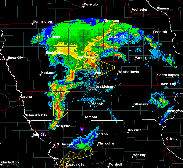 At 740 pm cdt, a severe thunderstorm was located near big wall lake, or 12 miles southeast of clarion, moving northeast at 35 mph (radar indicated). Hazards include 60 mph wind gusts. Expect damage to roofs, siding, and trees. locations impacted include, webster city, jewell junction, big wall lake, ellsworth, stanhope, williams, blairsburg, kamrar and webster city municipal airport. This includes interstate 35 between mile markers 135 and 154. At 740 pm cdt, a severe thunderstorm was located near big wall lake, or 12 miles southeast of clarion, moving northeast at 35 mph (radar indicated). Hazards include 60 mph wind gusts. Expect damage to roofs, siding, and trees. locations impacted include, webster city, jewell junction, big wall lake, ellsworth, stanhope, williams, blairsburg, kamrar and webster city municipal airport. This includes interstate 35 between mile markers 135 and 154.
|
| 4/13/2018 7:33 PM CDT |
 At 733 pm cdt, severe thunderstorms were located along a line extending from near jewell junction to story city to near nevada, moving northeast at 55 mph (radar indicated). Hazards include 60 mph wind gusts and penny size hail. Expect damage to roofs, siding, and trees. locations impacted include, ames, nevada, story city, roland, jewell junction, gilbert, iowa state center, hubbard, zearing, radcliffe, ellsworth, stanhope, union, mccallsburg, kelley, new providence, randall, whitten, buckeye and st. anthony. This includes interstate 35 between mile markers 109 and 140. At 733 pm cdt, severe thunderstorms were located along a line extending from near jewell junction to story city to near nevada, moving northeast at 55 mph (radar indicated). Hazards include 60 mph wind gusts and penny size hail. Expect damage to roofs, siding, and trees. locations impacted include, ames, nevada, story city, roland, jewell junction, gilbert, iowa state center, hubbard, zearing, radcliffe, ellsworth, stanhope, union, mccallsburg, kelley, new providence, randall, whitten, buckeye and st. anthony. This includes interstate 35 between mile markers 109 and 140.
|
| 4/13/2018 7:29 PM CDT |
 At 728 pm cdt, a severe thunderstorm was located 8 miles east of webster city, moving northeast at 35 mph (radar indicated). Hazards include 60 mph wind gusts. Expect damage to roofs, siding, and trees. locations impacted include, webster city, jewell junction, big wall lake, stratford, ellsworth, stanhope, williams, blairsburg, kamrar, webster city municipal airport and brushy creek st recreation area. This includes interstate 35 between mile markers 134 and 154. At 728 pm cdt, a severe thunderstorm was located 8 miles east of webster city, moving northeast at 35 mph (radar indicated). Hazards include 60 mph wind gusts. Expect damage to roofs, siding, and trees. locations impacted include, webster city, jewell junction, big wall lake, stratford, ellsworth, stanhope, williams, blairsburg, kamrar, webster city municipal airport and brushy creek st recreation area. This includes interstate 35 between mile markers 134 and 154.
|
| 4/13/2018 7:23 PM CDT |
 At 723 pm cdt, a severe thunderstorm was located near gilbert, or near ames, moving northeast at 50 mph (radar indicated). Hazards include 60 mph wind gusts and penny size hail. expect damage to roofs, siding, and trees At 723 pm cdt, a severe thunderstorm was located near gilbert, or near ames, moving northeast at 50 mph (radar indicated). Hazards include 60 mph wind gusts and penny size hail. expect damage to roofs, siding, and trees
|
| 4/13/2018 7:06 PM CDT |
 At 706 pm cdt, a severe thunderstorm was located 7 miles south of webster city, moving northeast at 30 mph (radar indicated). Hazards include 60 mph wind gusts. Expect damage to roofs, siding, and trees. locations impacted include, webster city, jewell junction, big wall lake, stratford, ellsworth, stanhope, williams, blairsburg, kamrar, webster city municipal airport and brushy creek st recreation area. This includes interstate 35 between mile markers 134 and 154. At 706 pm cdt, a severe thunderstorm was located 7 miles south of webster city, moving northeast at 30 mph (radar indicated). Hazards include 60 mph wind gusts. Expect damage to roofs, siding, and trees. locations impacted include, webster city, jewell junction, big wall lake, stratford, ellsworth, stanhope, williams, blairsburg, kamrar, webster city municipal airport and brushy creek st recreation area. This includes interstate 35 between mile markers 134 and 154.
|
| 4/13/2018 6:57 PM CDT |
 At 657 pm cdt, a severe thunderstorm was located 11 miles southwest of webster city, moving northeast at 35 mph (radar indicated. these storms have a history of producing wind gusts in excess of 60 mph). Hazards include 60 mph wind gusts and penny size hail. expect damage to roofs, siding, and trees At 657 pm cdt, a severe thunderstorm was located 11 miles southwest of webster city, moving northeast at 35 mph (radar indicated. these storms have a history of producing wind gusts in excess of 60 mph). Hazards include 60 mph wind gusts and penny size hail. expect damage to roofs, siding, and trees
|
| 6/29/2017 3:54 PM CDT |
 At 854 pm cdt, severe thunderstorms were located along a line extending from 7 miles northwest of iowa falls to 13 miles northeast of story city to 6 miles southwest of jewell junction, moving east at 40 mph (radar indicated). Hazards include 60 mph wind gusts. expect damage to roofs, siding, and trees At 854 pm cdt, severe thunderstorms were located along a line extending from 7 miles northwest of iowa falls to 13 miles northeast of story city to 6 miles southwest of jewell junction, moving east at 40 mph (radar indicated). Hazards include 60 mph wind gusts. expect damage to roofs, siding, and trees
|
| 6/16/2017 9:13 PM CDT |
 The severe thunderstorm warning for southern hamilton county will expire at 915 pm cdt, the storm which prompted the warning has weakened below severe limits, and has exited the warned area. therefore, the warning will be allowed to expire. however small hail and gusty winds are still possible with this thunderstorm. a severe thunderstorm watch remains in effect until 1000 pm cdt for central iowa. The severe thunderstorm warning for southern hamilton county will expire at 915 pm cdt, the storm which prompted the warning has weakened below severe limits, and has exited the warned area. therefore, the warning will be allowed to expire. however small hail and gusty winds are still possible with this thunderstorm. a severe thunderstorm watch remains in effect until 1000 pm cdt for central iowa.
|
| 6/16/2017 8:53 PM CDT |
 At 853 pm cdt, a severe thunderstorm was located 9 miles west of jewell junction, or 12 miles south of webster city, moving southeast at 35 mph (radar indicated). Hazards include 60 mph wind gusts and quarter size hail. Hail damage to vehicles is expected. expect wind damage to roofs, siding, and trees. locations impacted include, jewell junction, stratford, ellsworth, stanhope and kamrar. This includes interstate 35 near mile marker 136. At 853 pm cdt, a severe thunderstorm was located 9 miles west of jewell junction, or 12 miles south of webster city, moving southeast at 35 mph (radar indicated). Hazards include 60 mph wind gusts and quarter size hail. Hail damage to vehicles is expected. expect wind damage to roofs, siding, and trees. locations impacted include, jewell junction, stratford, ellsworth, stanhope and kamrar. This includes interstate 35 near mile marker 136.
|
| 6/16/2017 8:39 PM CDT |
 At 839 pm cdt, a severe thunderstorm was located 11 miles southwest of webster city, moving southeast at 35 mph (radar indicated). Hazards include ping pong ball size hail and 60 mph wind gusts. People and animals outdoors will be injured. expect hail damage to roofs, siding, windows, and vehicles. expect wind damage to roofs, siding, and trees. locations impacted include, jewell junction, stratford, ellsworth, stanhope, lehigh, kamrar and brushy creek st recreation area. This includes interstate 35 near mile marker 136. At 839 pm cdt, a severe thunderstorm was located 11 miles southwest of webster city, moving southeast at 35 mph (radar indicated). Hazards include ping pong ball size hail and 60 mph wind gusts. People and animals outdoors will be injured. expect hail damage to roofs, siding, windows, and vehicles. expect wind damage to roofs, siding, and trees. locations impacted include, jewell junction, stratford, ellsworth, stanhope, lehigh, kamrar and brushy creek st recreation area. This includes interstate 35 near mile marker 136.
|
| 6/16/2017 8:31 PM CDT |
 At 830 pm cdt, a severe thunderstorm was located 12 miles southeast of fort dodge, moving southeast at 30 mph (radar indicated). Hazards include 60 mph wind gusts and quarter size hail. Hail damage to vehicles is expected. Expect wind damage to roofs, siding, and trees. At 830 pm cdt, a severe thunderstorm was located 12 miles southeast of fort dodge, moving southeast at 30 mph (radar indicated). Hazards include 60 mph wind gusts and quarter size hail. Hail damage to vehicles is expected. Expect wind damage to roofs, siding, and trees.
|
| 5/17/2017 5:20 PM CDT |
 At 518 pm cdt, severe thunderstorms were located along a line extending from near big wall lake to 6 miles northwest of conrad to near meskwaki casino, moving northeast at 55 mph (trained weather spotters. at 512pm...69 mph winds were reported at the marshalltown airport. numerous trees were also reported down with some structural damage). Hazards include 70 mph wind gusts. Expect considerable tree damage. damage is likely to mobile homes, roofs, and outbuildings. locations impacted include, marshalltown, webster city, iowa falls, eldora, grundy center, toledo, story city, tama, traer, reinbeck, ackley, state center, dysart, roland, jewell junction, dike, conrad, meskwaki casino, gladbrook and le grand. this includes interstate 35 between mile markers 125 and 150. A tornado watch remains in effect until 700 pm cdt for central, north central and northeastern iowa. At 518 pm cdt, severe thunderstorms were located along a line extending from near big wall lake to 6 miles northwest of conrad to near meskwaki casino, moving northeast at 55 mph (trained weather spotters. at 512pm...69 mph winds were reported at the marshalltown airport. numerous trees were also reported down with some structural damage). Hazards include 70 mph wind gusts. Expect considerable tree damage. damage is likely to mobile homes, roofs, and outbuildings. locations impacted include, marshalltown, webster city, iowa falls, eldora, grundy center, toledo, story city, tama, traer, reinbeck, ackley, state center, dysart, roland, jewell junction, dike, conrad, meskwaki casino, gladbrook and le grand. this includes interstate 35 between mile markers 125 and 150. A tornado watch remains in effect until 700 pm cdt for central, north central and northeastern iowa.
|
| 5/17/2017 5:06 PM CDT |
 At 505 pm cdt, severe thunderstorms were located along a line extending from near webster city to 9 miles southwest of eldora to 10 miles northwest of rock creek lake, moving northeast at 60 mph (trained weather spotters. numerous reports of 60 to 70 mph winds have been reported with these storms with trees and powerlines down). Hazards include 70 mph wind gusts. Expect considerable tree damage. damage is likely to mobile homes, roofs, and outbuildings. locations impacted include, marshalltown, newton, webster city, nevada, iowa falls, eldora, grundy center, toledo, story city, tama, traer, reinbeck, ackley, state center, dysart, roland, jewell junction, dike, conrad and baxter. this includes the following highways, interstate 35 between mile markers 118 and 150. interstate 80 between mile markers 164 and 165. A tornado watch remains in effect until 700 pm cdt for central, north central and northeastern iowa. At 505 pm cdt, severe thunderstorms were located along a line extending from near webster city to 9 miles southwest of eldora to 10 miles northwest of rock creek lake, moving northeast at 60 mph (trained weather spotters. numerous reports of 60 to 70 mph winds have been reported with these storms with trees and powerlines down). Hazards include 70 mph wind gusts. Expect considerable tree damage. damage is likely to mobile homes, roofs, and outbuildings. locations impacted include, marshalltown, newton, webster city, nevada, iowa falls, eldora, grundy center, toledo, story city, tama, traer, reinbeck, ackley, state center, dysart, roland, jewell junction, dike, conrad and baxter. this includes the following highways, interstate 35 between mile markers 118 and 150. interstate 80 between mile markers 164 and 165. A tornado watch remains in effect until 700 pm cdt for central, north central and northeastern iowa.
|
| 5/17/2017 4:53 PM CDT |
 At 452 pm cdt, severe thunderstorms were located along a line extending from 15 miles north of boone to 6 miles east of roland to newton, moving northeast at 60 mph (trained weather spotters. numerous reports of 60 to 70 mph winds with trees and powerlines downed). Hazards include 70 mph wind gusts. Expect considerable tree damage. Damage is likely to mobile homes, roofs, and outbuildings. At 452 pm cdt, severe thunderstorms were located along a line extending from 15 miles north of boone to 6 miles east of roland to newton, moving northeast at 60 mph (trained weather spotters. numerous reports of 60 to 70 mph winds with trees and powerlines downed). Hazards include 70 mph wind gusts. Expect considerable tree damage. Damage is likely to mobile homes, roofs, and outbuildings.
|
| 5/16/2017 9:42 PM CDT |
 At 942 pm cdt, a severe thunderstorm was located over iowa state center, or over ames, moving east at 50 mph (emergency management). Hazards include 60 mph wind gusts and nickel size hail two miles north of luther at 937 pm. expect damage to roofs, siding, and trees At 942 pm cdt, a severe thunderstorm was located over iowa state center, or over ames, moving east at 50 mph (emergency management). Hazards include 60 mph wind gusts and nickel size hail two miles north of luther at 937 pm. expect damage to roofs, siding, and trees
|
| 5/16/2017 8:48 PM CDT |
 At 847 pm cdt, a severe thunderstorm was located near gowrie, or 11 miles southwest of fort dodge, moving northeast at 55 mph (70 mph wind gusts have been measured at several locations). Hazards include 70 mph wind gusts and quarter size hail. Hail damage to vehicles is expected. expect considerable tree damage. Wind damage is also likely to mobile homes, roofs, and outbuildings. At 847 pm cdt, a severe thunderstorm was located near gowrie, or 11 miles southwest of fort dodge, moving northeast at 55 mph (70 mph wind gusts have been measured at several locations). Hazards include 70 mph wind gusts and quarter size hail. Hail damage to vehicles is expected. expect considerable tree damage. Wind damage is also likely to mobile homes, roofs, and outbuildings.
|
| 5/15/2017 1:42 PM CDT | Ping Pong Ball sized hail reported 0.9 miles N of Jewell Junction, IA, hail covering ground over west jewell. time estimated by radar. |
| 3/6/2017 6:00 PM CST |
 At 600 pm cst, severe thunderstorms were located along a line extending from 6 miles north of belmond to near big wall lake to 11 miles southwest of jewell junction, moving northeast at 60 mph (radar indicated). Hazards include 60 mph wind gusts and quarter size hail. Hail damage to vehicles is expected. expect wind damage to roofs, siding, and trees. locations impacted include, webster city, clarion, eagle grove, belmond, jewell junction, gowrie, big wall lake, elm lake, dayton, stratford, goldfield, coalville, otho, dows, ellsworth, stanhope, lehigh, duncombe, williams and harcourt. this includes interstate 35 between mile markers 127 and 163. A tornado watch remains in effect until 1000 pm cst for central and north central iowa. At 600 pm cst, severe thunderstorms were located along a line extending from 6 miles north of belmond to near big wall lake to 11 miles southwest of jewell junction, moving northeast at 60 mph (radar indicated). Hazards include 60 mph wind gusts and quarter size hail. Hail damage to vehicles is expected. expect wind damage to roofs, siding, and trees. locations impacted include, webster city, clarion, eagle grove, belmond, jewell junction, gowrie, big wall lake, elm lake, dayton, stratford, goldfield, coalville, otho, dows, ellsworth, stanhope, lehigh, duncombe, williams and harcourt. this includes interstate 35 between mile markers 127 and 163. A tornado watch remains in effect until 1000 pm cst for central and north central iowa.
|
| 3/6/2017 5:37 PM CST |
 At 537 pm cst, severe thunderstorms were located along a line extending from 14 miles north of eagle grove to 8 miles west of webster city to 9 miles southeast of gowrie, moving east at 45 mph (radar indicated). Hazards include golf ball size hail and 60 mph wind gusts. People and animals outdoors will be injured. expect hail damage to roofs, siding, windows, and vehicles. Expect wind damage to roofs, siding, and trees. At 537 pm cst, severe thunderstorms were located along a line extending from 14 miles north of eagle grove to 8 miles west of webster city to 9 miles southeast of gowrie, moving east at 45 mph (radar indicated). Hazards include golf ball size hail and 60 mph wind gusts. People and animals outdoors will be injured. expect hail damage to roofs, siding, windows, and vehicles. Expect wind damage to roofs, siding, and trees.
|
| 3/6/2017 5:29 PM CST |
 At 529 pm cst, a severe thunderstorm capable of producing a tornado was located 10 miles east of gowrie, or 15 miles south of fort dodge, moving northeast at 65 mph (radar indicated rotation). Hazards include tornado and golf ball size hail. Flying debris will be dangerous to those caught without shelter. mobile homes will be damaged or destroyed. damage to roofs, windows, and vehicles will occur. tree damage is likely. this dangerous storm will be near, webster city around 550 pm cst. Other locations impacted by this tornadic thunderstorm include harcourt, stanhope, webster city municipal airport, brushy creek st recreation area, stratford, dolliver memorial state park, kamrar, lehigh and dayton. At 529 pm cst, a severe thunderstorm capable of producing a tornado was located 10 miles east of gowrie, or 15 miles south of fort dodge, moving northeast at 65 mph (radar indicated rotation). Hazards include tornado and golf ball size hail. Flying debris will be dangerous to those caught without shelter. mobile homes will be damaged or destroyed. damage to roofs, windows, and vehicles will occur. tree damage is likely. this dangerous storm will be near, webster city around 550 pm cst. Other locations impacted by this tornadic thunderstorm include harcourt, stanhope, webster city municipal airport, brushy creek st recreation area, stratford, dolliver memorial state park, kamrar, lehigh and dayton.
|
| 9/9/2016 3:06 PM CDT |
 At 306 pm cdt, severe thunderstorms were located along a line extending from near jewell junction to near story city to near gilbert, moving east at 35 mph (radar indicated). Hazards include 60 mph wind gusts. Expect damage to roofs. siding. and trees. locations impacted include, story city, jewell junction, gilbert, ellsworth, stanhope, kamrar and randall. This includes interstate 35 between mile markers 118 and 140. At 306 pm cdt, severe thunderstorms were located along a line extending from near jewell junction to near story city to near gilbert, moving east at 35 mph (radar indicated). Hazards include 60 mph wind gusts. Expect damage to roofs. siding. and trees. locations impacted include, story city, jewell junction, gilbert, ellsworth, stanhope, kamrar and randall. This includes interstate 35 between mile markers 118 and 140.
|
| 9/9/2016 2:49 PM CDT |
 At 248 pm cdt, severe thunderstorms were located along a line extending from 10 miles southwest of webster city to near boone, moving east at 50 mph (radar indicated). Hazards include 60 mph wind gusts. Expect damage to roofs. siding. and trees. these severe storms will be near, jewell junction around 305 pm cdt. ames, story city and gilbert around 310 pm cdt. other locations impacted by these severe thunderstorms include ellsworth, randall, kamrar, pilot mound, stanhope, dayton, fraser, stratford, boxholm and brushy creek st recreation area. This includes interstate 35 between mile markers 116 and 140. At 248 pm cdt, severe thunderstorms were located along a line extending from 10 miles southwest of webster city to near boone, moving east at 50 mph (radar indicated). Hazards include 60 mph wind gusts. Expect damage to roofs. siding. and trees. these severe storms will be near, jewell junction around 305 pm cdt. ames, story city and gilbert around 310 pm cdt. other locations impacted by these severe thunderstorms include ellsworth, randall, kamrar, pilot mound, stanhope, dayton, fraser, stratford, boxholm and brushy creek st recreation area. This includes interstate 35 between mile markers 116 and 140.
|
| 9/9/2016 2:33 PM CDT |
 At 233 pm cdt, a severe thunderstorm was located near gowrie, or 16 miles northeast of jefferson, moving east at 45 mph (radar indicated). Hazards include 60 mph wind gusts. Expect damage to roofs. siding. And trees. At 233 pm cdt, a severe thunderstorm was located near gowrie, or 16 miles northeast of jefferson, moving east at 45 mph (radar indicated). Hazards include 60 mph wind gusts. Expect damage to roofs. siding. And trees.
|
| 7/17/2016 4:03 AM CDT |
 At 402 am cdt, severe thunderstorms were located along a line extending from near parkersburg to 8 miles west of grundy center to near iowa state center, moving east at 65 mph (radar indicated). Hazards include 60 mph wind gusts. Expect damage to roofs. siding. and trees. Locations impacted include, ames, boone, nevada, iowa falls, eldora, story city, huxley, ogden, ackley, roland, jewell junction, gilbert, iowa state center, boone speedway, hubbard, zearing, radcliffe, ellsworth, union and mccallsburg. At 402 am cdt, severe thunderstorms were located along a line extending from near parkersburg to 8 miles west of grundy center to near iowa state center, moving east at 65 mph (radar indicated). Hazards include 60 mph wind gusts. Expect damage to roofs. siding. and trees. Locations impacted include, ames, boone, nevada, iowa falls, eldora, story city, huxley, ogden, ackley, roland, jewell junction, gilbert, iowa state center, boone speedway, hubbard, zearing, radcliffe, ellsworth, union and mccallsburg.
|
| 7/17/2016 3:49 AM CDT |
 At 349 am cdt, severe thunderstorms were located along a line extending from 9 miles north of ackley to 6 miles northwest of eldora to near ogden, moving east at 55 mph (radar indicated). Hazards include 60 mph wind gusts. Expect damage to roofs. siding. and trees. Locations impacted include, ames, boone, nevada, iowa falls, hampton, eldora, story city, huxley, ogden, ackley, roland, jewell junction, gilbert, iowa state center, boone speedway, hubbard, dayton, grand junction, alden and stratford. At 349 am cdt, severe thunderstorms were located along a line extending from 9 miles north of ackley to 6 miles northwest of eldora to near ogden, moving east at 55 mph (radar indicated). Hazards include 60 mph wind gusts. Expect damage to roofs. siding. and trees. Locations impacted include, ames, boone, nevada, iowa falls, hampton, eldora, story city, huxley, ogden, ackley, roland, jewell junction, gilbert, iowa state center, boone speedway, hubbard, dayton, grand junction, alden and stratford.
|
| 7/17/2016 3:20 AM CDT |
 At 320 am cdt, severe thunderstorms were located along a line extending from 6 miles east of belmond to near big wall lake to 9 miles southwest of gowrie, moving east at 65 mph (radar indicated). Hazards include 60 mph wind gusts. Expect damage to roofs. siding. And trees. At 320 am cdt, severe thunderstorms were located along a line extending from 6 miles east of belmond to near big wall lake to 9 miles southwest of gowrie, moving east at 65 mph (radar indicated). Hazards include 60 mph wind gusts. Expect damage to roofs. siding. And trees.
|
| 7/6/2016 12:50 AM CDT |
 The severe thunderstorm warning for story, southwestern hardin, southern hamilton and eastern boone counties will expire at 100 am cdt, the storms which prompted the warning have weakened below severe limits, and have exited the warned area. therefore the warning will be allowed to expire. a severe thunderstorm watch remains in effect until 600 am cdt for central iowa. The severe thunderstorm warning for story, southwestern hardin, southern hamilton and eastern boone counties will expire at 100 am cdt, the storms which prompted the warning have weakened below severe limits, and have exited the warned area. therefore the warning will be allowed to expire. a severe thunderstorm watch remains in effect until 600 am cdt for central iowa.
|
| 7/6/2016 12:46 AM CDT |
 At 1245 am cdt, severe thunderstorms were located along a line extending from 7 miles northeast of jewell junction to near huxley, moving east at 45 mph (radar indicated). Hazards include 60 mph wind gusts. Expect damage to roofs. siding. and trees. Locations impacted include, ames, boone, nevada, story city, roland, jewell junction, gilbert, iowa state center, boone speedway, hubbard, radcliffe, ellsworth, stanhope, mccallsburg, kelley, randall, luther, garden city, ledges state park and boone municipal airport. At 1245 am cdt, severe thunderstorms were located along a line extending from 7 miles northeast of jewell junction to near huxley, moving east at 45 mph (radar indicated). Hazards include 60 mph wind gusts. Expect damage to roofs. siding. and trees. Locations impacted include, ames, boone, nevada, story city, roland, jewell junction, gilbert, iowa state center, boone speedway, hubbard, radcliffe, ellsworth, stanhope, mccallsburg, kelley, randall, luther, garden city, ledges state park and boone municipal airport.
|
| 7/6/2016 12:31 AM CDT |
 At 1230 am cdt, severe thunderstorms were located along a line extending from webster city to madrid, moving east at 50 mph (radar indicated). Hazards include 60 mph wind gusts. Expect damage to roofs. siding. and trees. Locations impacted include, ames, boone, webster city, perry, nevada, iowa falls, story city, huxley, madrid, slater, roland, jewell junction, gilbert, woodward, iowa state center, boone speedway, maxwell, colo, hubbard and cambridge. At 1230 am cdt, severe thunderstorms were located along a line extending from webster city to madrid, moving east at 50 mph (radar indicated). Hazards include 60 mph wind gusts. Expect damage to roofs. siding. and trees. Locations impacted include, ames, boone, webster city, perry, nevada, iowa falls, story city, huxley, madrid, slater, roland, jewell junction, gilbert, woodward, iowa state center, boone speedway, maxwell, colo, hubbard and cambridge.
|
| 7/6/2016 12:14 AM CDT |
 At 1213 am cdt, severe thunderstorms were located along a line extending from 7 miles southeast of fort dodge to near perry, moving east at 50 mph (radar indicated). Hazards include 70 mph wind gusts and quarter size hail. Hail damage to vehicles is expected. expect considerable tree damage. Wind damage is also likely to mobile homes, roofs, and outbuildings. At 1213 am cdt, severe thunderstorms were located along a line extending from 7 miles southeast of fort dodge to near perry, moving east at 50 mph (radar indicated). Hazards include 70 mph wind gusts and quarter size hail. Hail damage to vehicles is expected. expect considerable tree damage. Wind damage is also likely to mobile homes, roofs, and outbuildings.
|
| 6/22/2016 3:35 AM CDT |
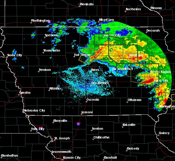 At 333 am cdt, severe thunderstorms were located along a line extending from 8 miles southwest of hampton to 6 miles west of jewell junction, moving east at 45 mph (law enforcement. at 300 am cdt... law enforcement reported a tree branch downed onto a law enforcement vehicle in fort dodge). Hazards include 60 mph wind gusts. Expect damage to roofs. siding. and trees. Locations impacted include, jewell junction, williams, blairsburg and kamrar. At 333 am cdt, severe thunderstorms were located along a line extending from 8 miles southwest of hampton to 6 miles west of jewell junction, moving east at 45 mph (law enforcement. at 300 am cdt... law enforcement reported a tree branch downed onto a law enforcement vehicle in fort dodge). Hazards include 60 mph wind gusts. Expect damage to roofs. siding. and trees. Locations impacted include, jewell junction, williams, blairsburg and kamrar.
|
| 6/22/2016 3:18 AM CDT |
 At 316 am cdt, severe thunderstorms were located along a line extending from clarion to 6 miles southwest of webster city, moving southeast at 60 mph (law enforcement. at 300 am cdt... law enforcement in fort dodge reported a tree branch downed onto a law enforcement vehicle). Hazards include 60 mph wind gusts. Expect damage to roofs. siding. and trees. Locations impacted include, webster city, clarion, eagle grove, jewell junction, elm lake, big wall lake, dows, duncombe, williams, blairsburg, kamrar, woolstock, rowan, popejoy, galt, clarion municipal airport, webster city municipal airport and brushy creek st recreation area. At 316 am cdt, severe thunderstorms were located along a line extending from clarion to 6 miles southwest of webster city, moving southeast at 60 mph (law enforcement. at 300 am cdt... law enforcement in fort dodge reported a tree branch downed onto a law enforcement vehicle). Hazards include 60 mph wind gusts. Expect damage to roofs. siding. and trees. Locations impacted include, webster city, clarion, eagle grove, jewell junction, elm lake, big wall lake, dows, duncombe, williams, blairsburg, kamrar, woolstock, rowan, popejoy, galt, clarion municipal airport, webster city municipal airport and brushy creek st recreation area.
|
| 6/22/2016 2:57 AM CDT |
 At 257 am cdt, severe thunderstorms were located along a line extending from 14 miles northwest of clarion to near fort dodge regional airport, moving southeast at 50 mph (radar indicated). Hazards include 60 mph wind gusts. Expect damage to roofs. siding. And trees. At 257 am cdt, severe thunderstorms were located along a line extending from 14 miles northwest of clarion to near fort dodge regional airport, moving southeast at 50 mph (radar indicated). Hazards include 60 mph wind gusts. Expect damage to roofs. siding. And trees.
|
| 5/30/2016 5:12 PM CDT |
 At 512 pm cdt, a severe thunderstorm was located 5 miles northeast of jewell junction, or 13 miles southeast of webster city, moving northeast at 20 mph (radar indicated). Hazards include quarter size hail. Damage to vehicles is expected. locations impacted include, jewell junction, ellsworth and blairsburg. This includes interstate 35 between mile markers 131 and 143. At 512 pm cdt, a severe thunderstorm was located 5 miles northeast of jewell junction, or 13 miles southeast of webster city, moving northeast at 20 mph (radar indicated). Hazards include quarter size hail. Damage to vehicles is expected. locations impacted include, jewell junction, ellsworth and blairsburg. This includes interstate 35 between mile markers 131 and 143.
|
| 5/30/2016 4:57 PM CDT |
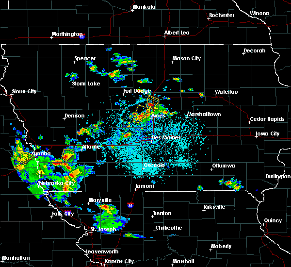 At 457 pm cdt, a severe thunderstorm was located over jewell junction, or 14 miles southeast of webster city, moving northeast at 20 mph (radar indicated). Hazards include quarter size hail. damage to vehicles is expected At 457 pm cdt, a severe thunderstorm was located over jewell junction, or 14 miles southeast of webster city, moving northeast at 20 mph (radar indicated). Hazards include quarter size hail. damage to vehicles is expected
|
| 11/11/2015 4:19 PM CST |
 At 419 pm cst, severe thunderstorms were located along a line extending from 4 miles southwest of big wall lake to 11 miles east of roland to 8 miles south of marshalltown, moving northeast at 45 mph (radar indicated). Hazards include 60 mph wind gusts. Expect damage to roofs. siding and trees. locations impacted include, newton, webster city, iowa falls, state center, roland, jewell junction, baxter, colo, hubbard, melbourne, alden, kellogg, zearing, radcliffe, ellsworth, williams, mccallsburg, rhodes, new providence and blairsburg. this includes the following highways, interstate 35 between mile markers 132 and 150. interstate 80 between mile markers 168 and 174. A tornado watch remains in effect until 600 pm cst for central iowa. At 419 pm cst, severe thunderstorms were located along a line extending from 4 miles southwest of big wall lake to 11 miles east of roland to 8 miles south of marshalltown, moving northeast at 45 mph (radar indicated). Hazards include 60 mph wind gusts. Expect damage to roofs. siding and trees. locations impacted include, newton, webster city, iowa falls, state center, roland, jewell junction, baxter, colo, hubbard, melbourne, alden, kellogg, zearing, radcliffe, ellsworth, williams, mccallsburg, rhodes, new providence and blairsburg. this includes the following highways, interstate 35 between mile markers 132 and 150. interstate 80 between mile markers 168 and 174. A tornado watch remains in effect until 600 pm cst for central iowa.
|
| 11/11/2015 3:52 PM CST |
 At 351 pm cst, severe thunderstorms were located along a line extending from 9 miles south of webster city to 5 miles south of nevada to 5 miles west of newton, moving northeast at 60 mph (radar indicated). Hazards include 60 mph wind gusts. Expect damage to roofs. Siding and trees. At 351 pm cst, severe thunderstorms were located along a line extending from 9 miles south of webster city to 5 miles south of nevada to 5 miles west of newton, moving northeast at 60 mph (radar indicated). Hazards include 60 mph wind gusts. Expect damage to roofs. Siding and trees.
|
| 6/22/2015 7:54 AM CDT |
 At 753 am cdt, severe thunderstorms were located along a line extending from 5 miles southwest of nashua to 3 miles south of aplington to 4 miles southwest of jewell junction, moving east at 75 mph (radar indicated). Hazards include 60 mph wind gusts and penny size hail. Expect damage to roofs. Siding and trees. At 753 am cdt, severe thunderstorms were located along a line extending from 5 miles southwest of nashua to 3 miles south of aplington to 4 miles southwest of jewell junction, moving east at 75 mph (radar indicated). Hazards include 60 mph wind gusts and penny size hail. Expect damage to roofs. Siding and trees.
|
| 6/22/2015 7:40 AM CDT |
 At 740 am cdt, severe thunderstorms were located along a line extending from 7 miles west of greene to 3 miles northeast of iowa falls to 7 miles west of jewell junction, moving east at 70 mph (radar indicated). Hazards include 60 mph wind gusts and penny size hail. Expect damage to roofs. siding and trees. locations impacted include, webster city, iowa falls, hampton, clarion, eldora, allison, eagle grove, belmond, parkersburg, ackley, clarksville, jewell junction, sheffield, greene, aplington, elm lake, big wall lake, hubbard, alden and wellsburg. This includes interstate 35 between mile markers 129 and 178. At 740 am cdt, severe thunderstorms were located along a line extending from 7 miles west of greene to 3 miles northeast of iowa falls to 7 miles west of jewell junction, moving east at 70 mph (radar indicated). Hazards include 60 mph wind gusts and penny size hail. Expect damage to roofs. siding and trees. locations impacted include, webster city, iowa falls, hampton, clarion, eldora, allison, eagle grove, belmond, parkersburg, ackley, clarksville, jewell junction, sheffield, greene, aplington, elm lake, big wall lake, hubbard, alden and wellsburg. This includes interstate 35 between mile markers 129 and 178.
|
| 6/22/2015 7:16 AM CDT |
 At 716 am cdt, severe thunderstorms were located along a line extending from 10 miles northeast of belmond to 4 miles west of big wall lake to 7 miles north of gowrie, moving east at 70 mph (radar indicated). Hazards include 60 mph wind gusts and penny size hail. Expect damage to roofs. Siding and trees. At 716 am cdt, severe thunderstorms were located along a line extending from 10 miles northeast of belmond to 4 miles west of big wall lake to 7 miles north of gowrie, moving east at 70 mph (radar indicated). Hazards include 60 mph wind gusts and penny size hail. Expect damage to roofs. Siding and trees.
|
| 8/31/2014 6:00 PM CDT | Large trees and power pole snapped tstm wnd dmg duration 5 minute in hamilton county IA, 3.6 miles SSW of Jewell Junction, IA |
| 7/25/2012 9:12 PM CDT | Reported by kcci-tv schoolne in hamilton county IA, 0.2 miles NE of Jewell Junction, IA |
| 1/1/0001 12:00 AM | Large tree limb down in town. time estimated from rada in hamilton county IA, 0.2 miles NE of Jewell Junction, IA |
| 1/1/0001 12:00 AM | Large tree blocking a road off of highway 69. time estimated from rada in hamilton county IA, 1.9 miles S of Jewell Junction, IA |
| 1/1/0001 12:00 AM | Quarter sized hail reported 0.2 miles NE of Jewell Junction, IA, officer estimated quarter size hail... |
Hail Maps for Jewell Junction, IA

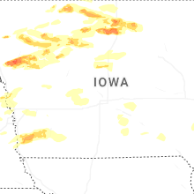


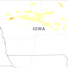
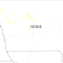


Connect with Interactive Hail Maps