

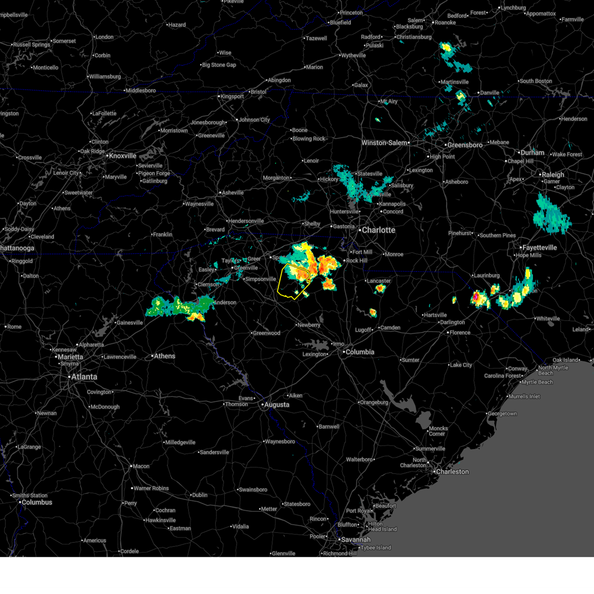
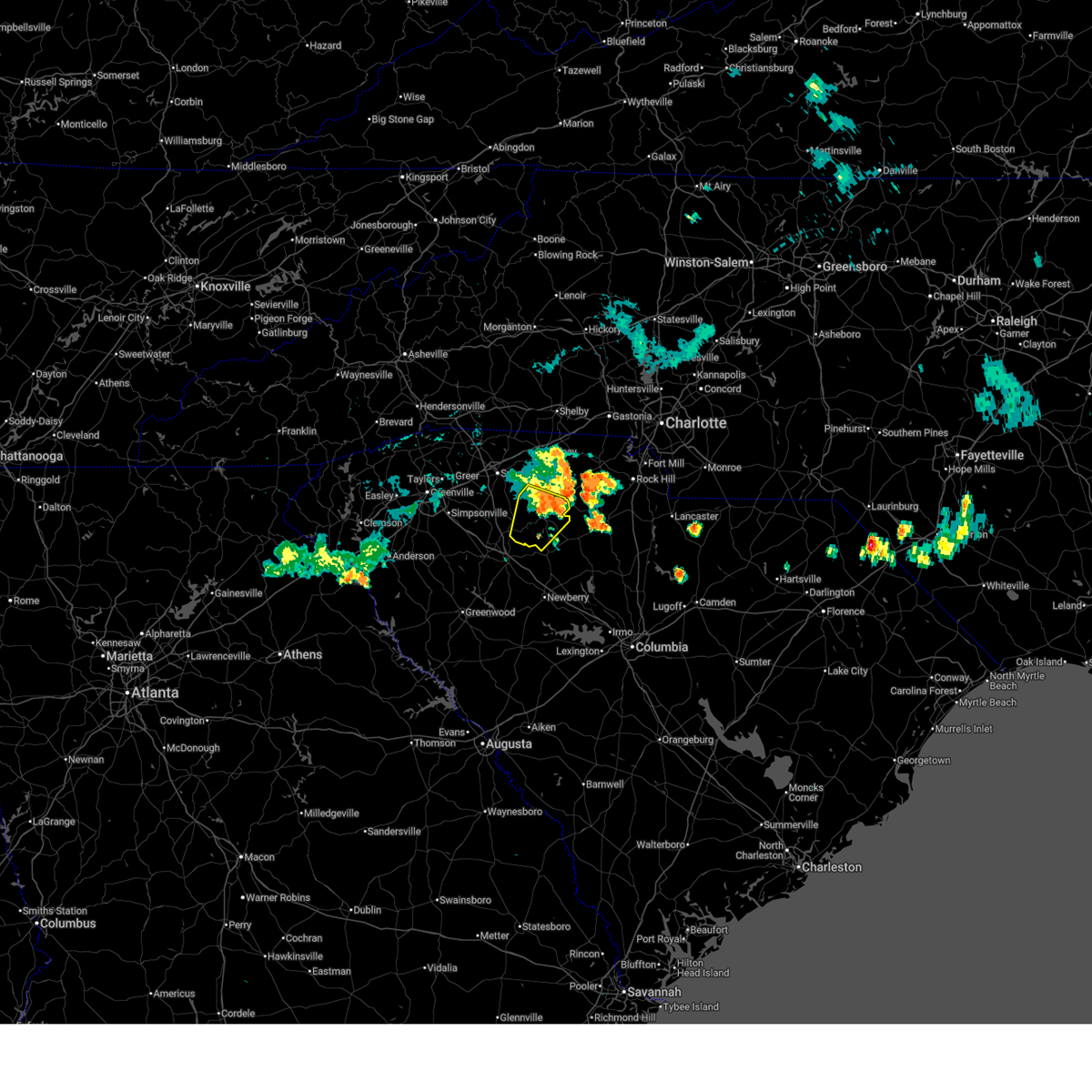
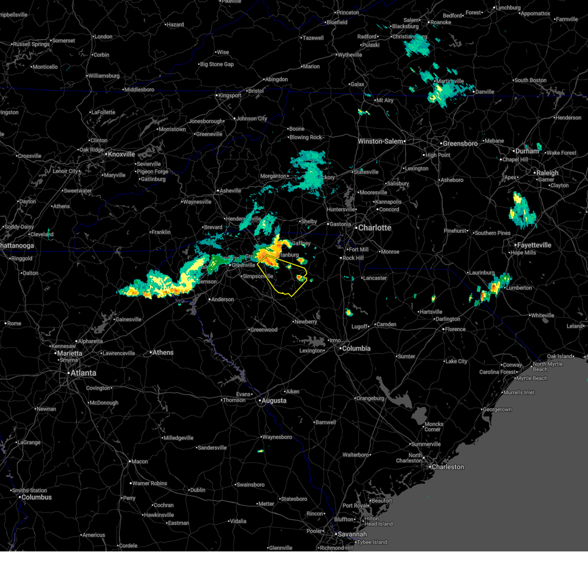
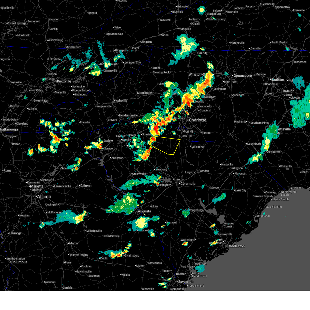
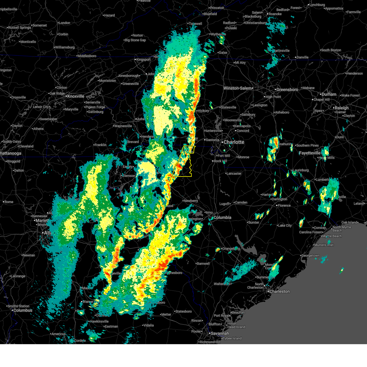
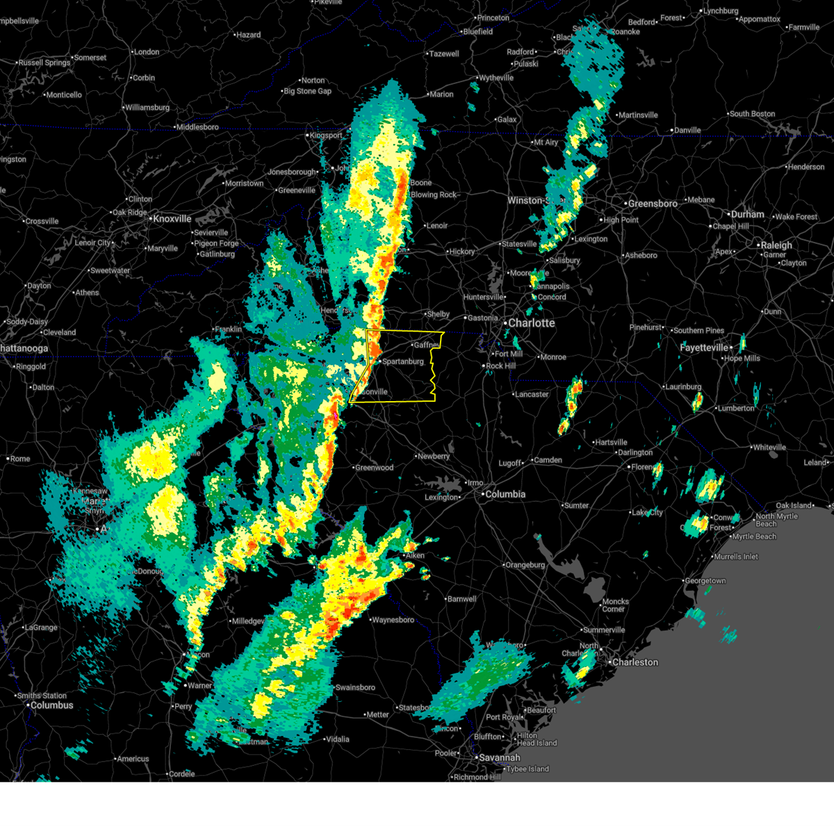
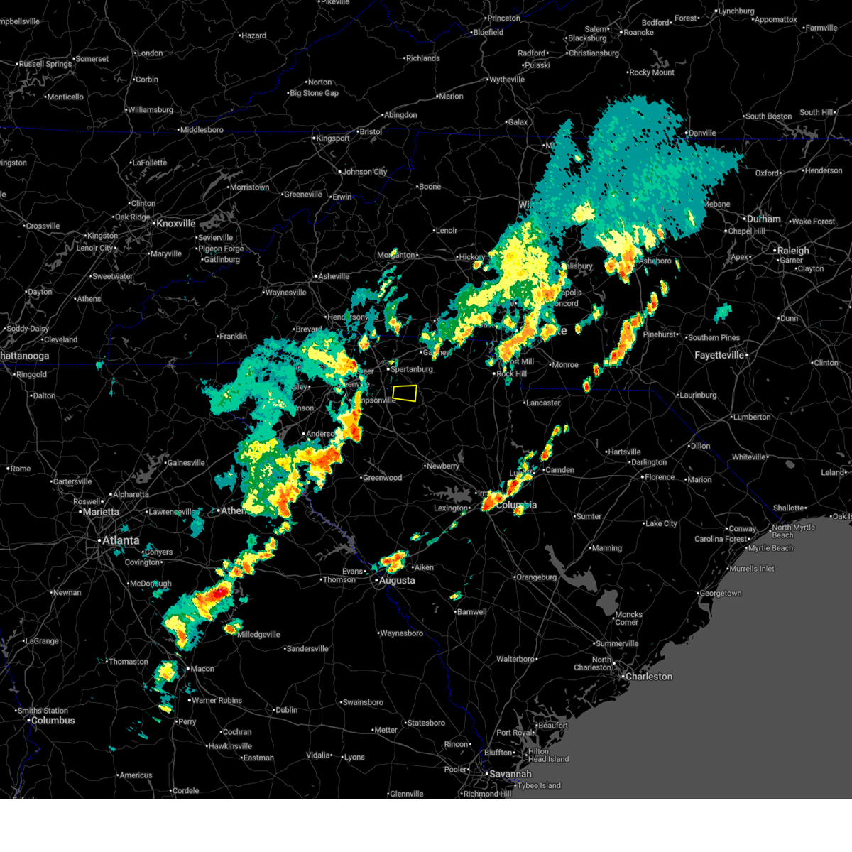
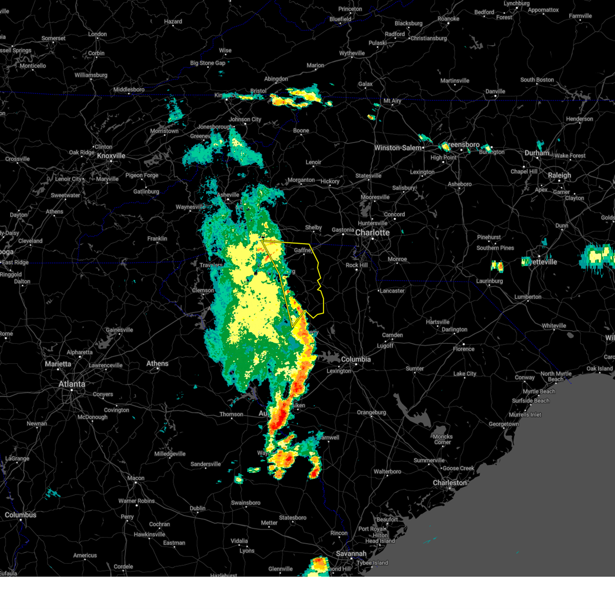
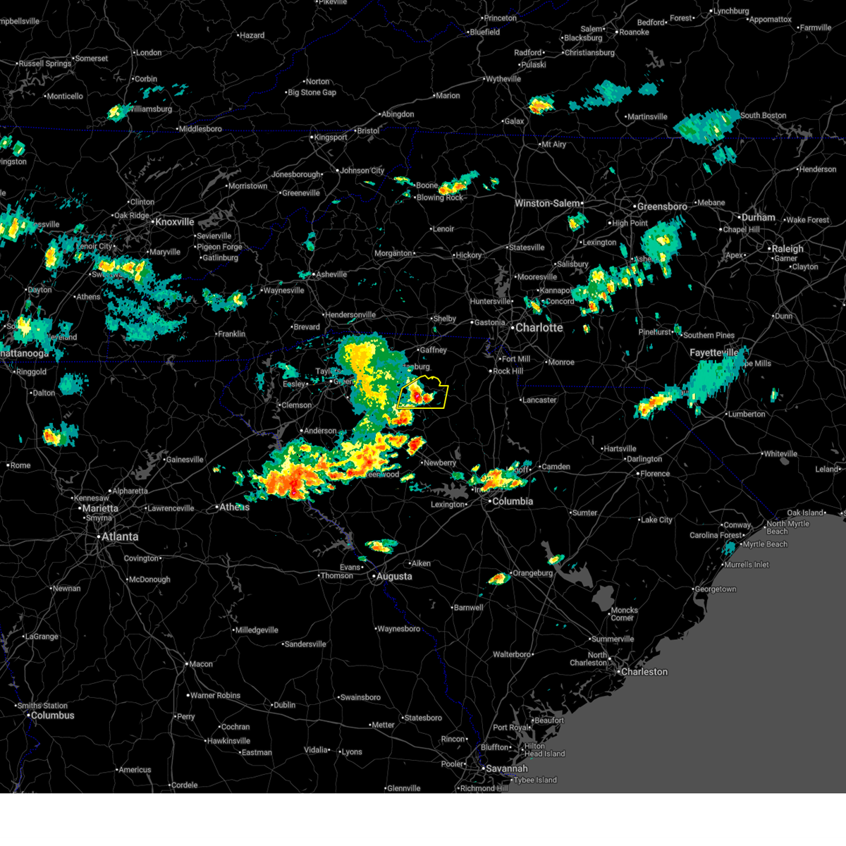
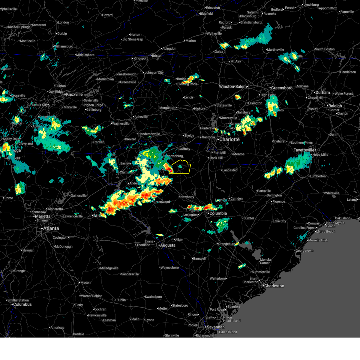
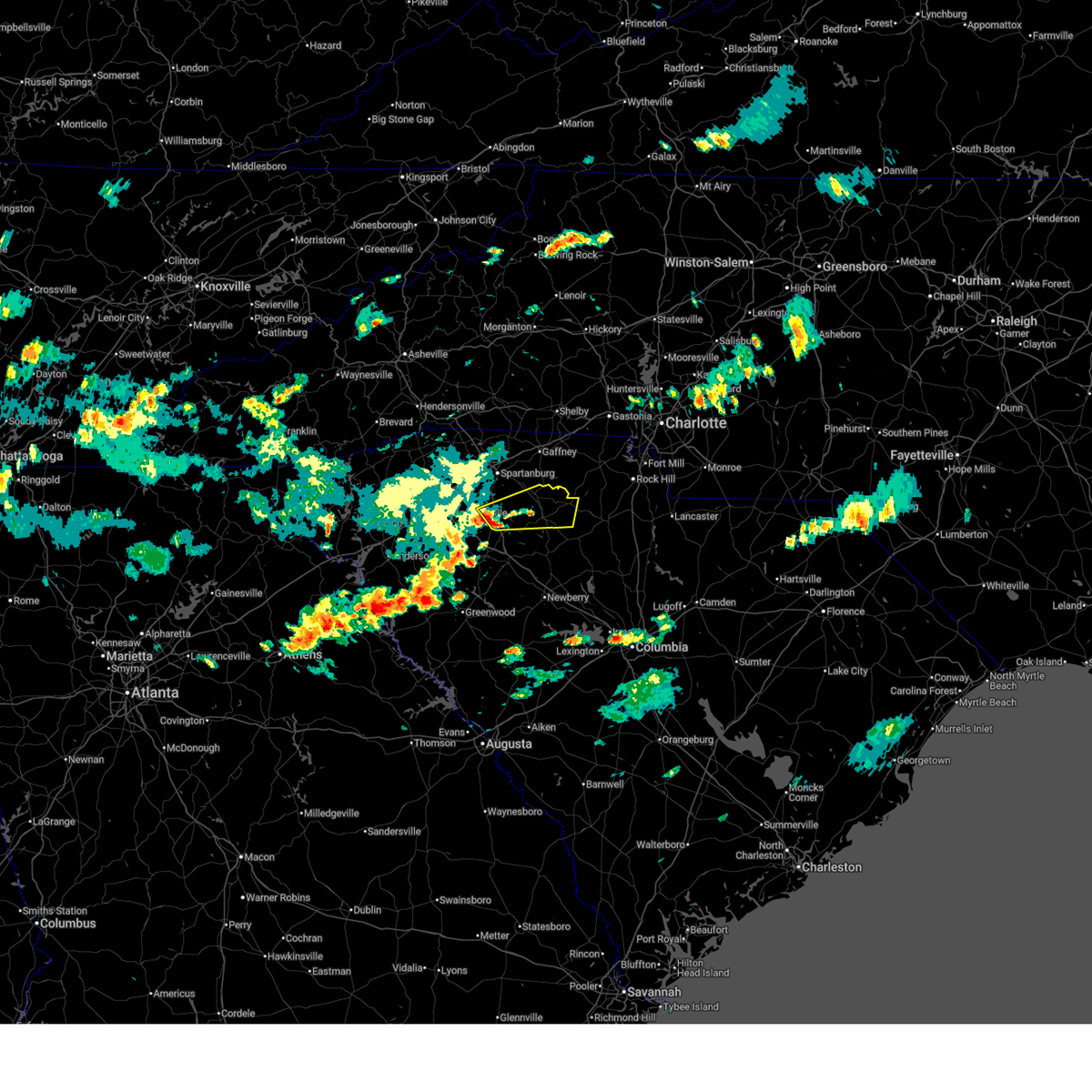
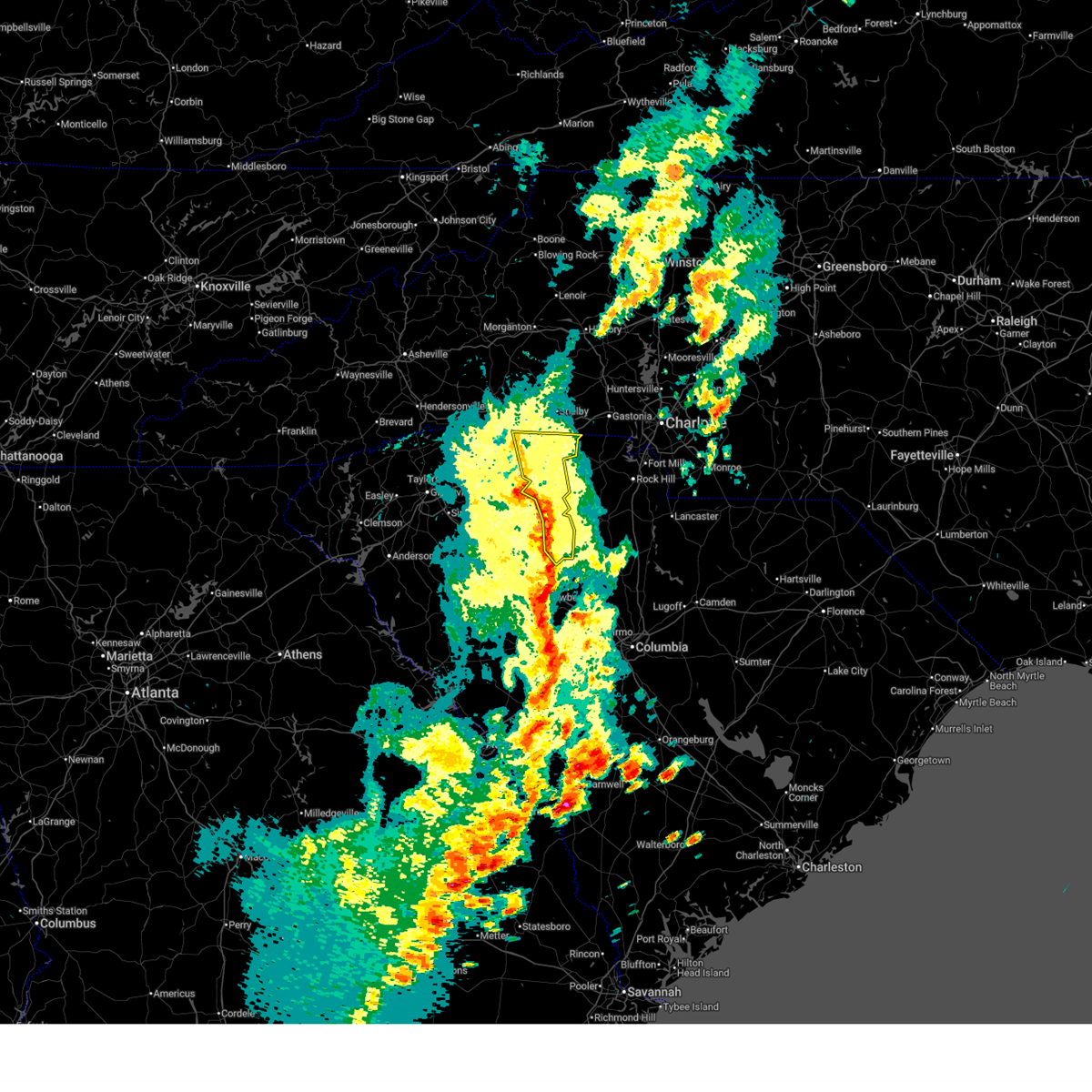
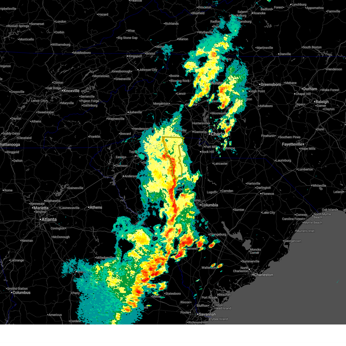
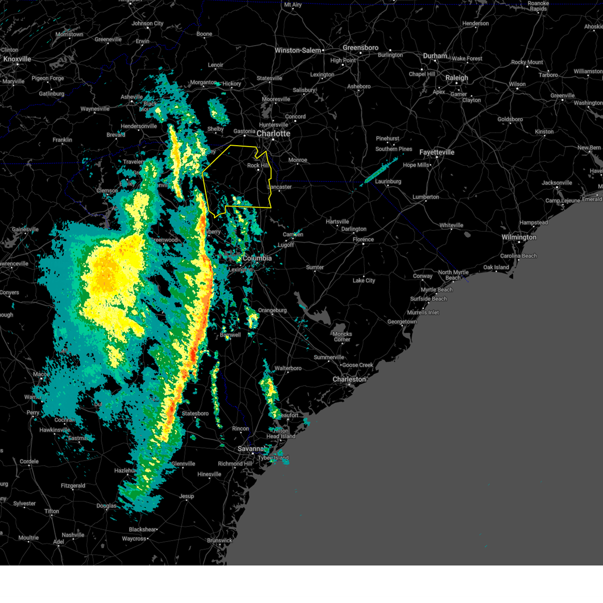
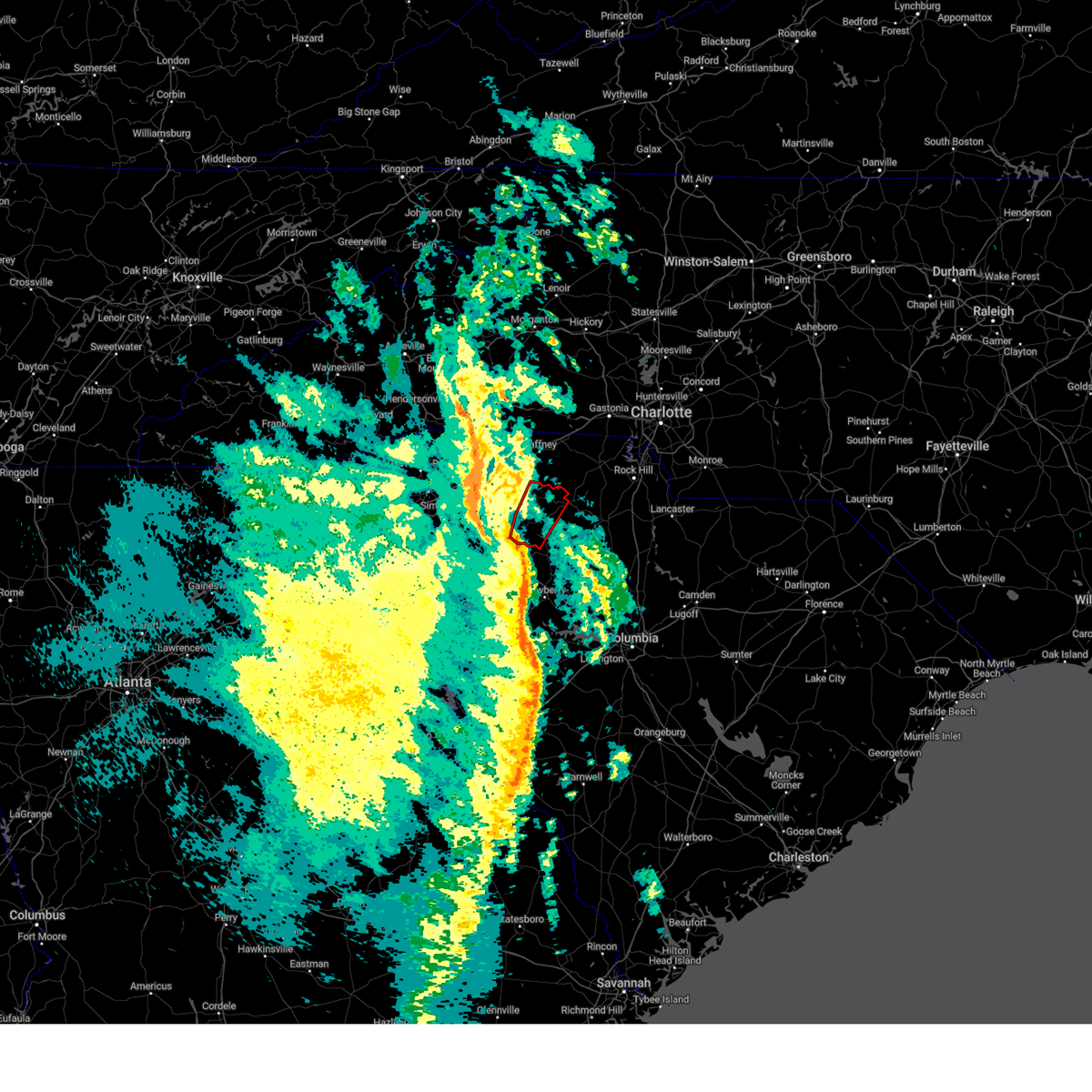
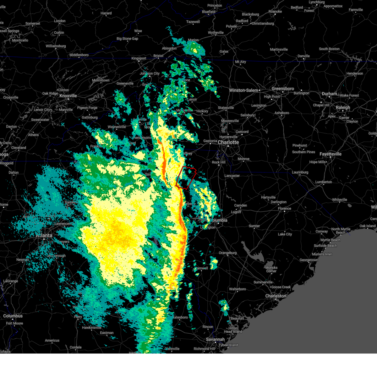
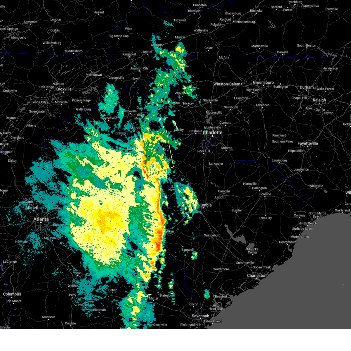
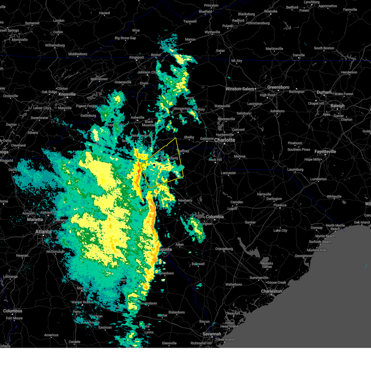
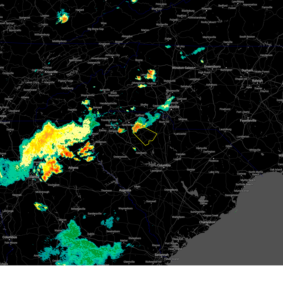
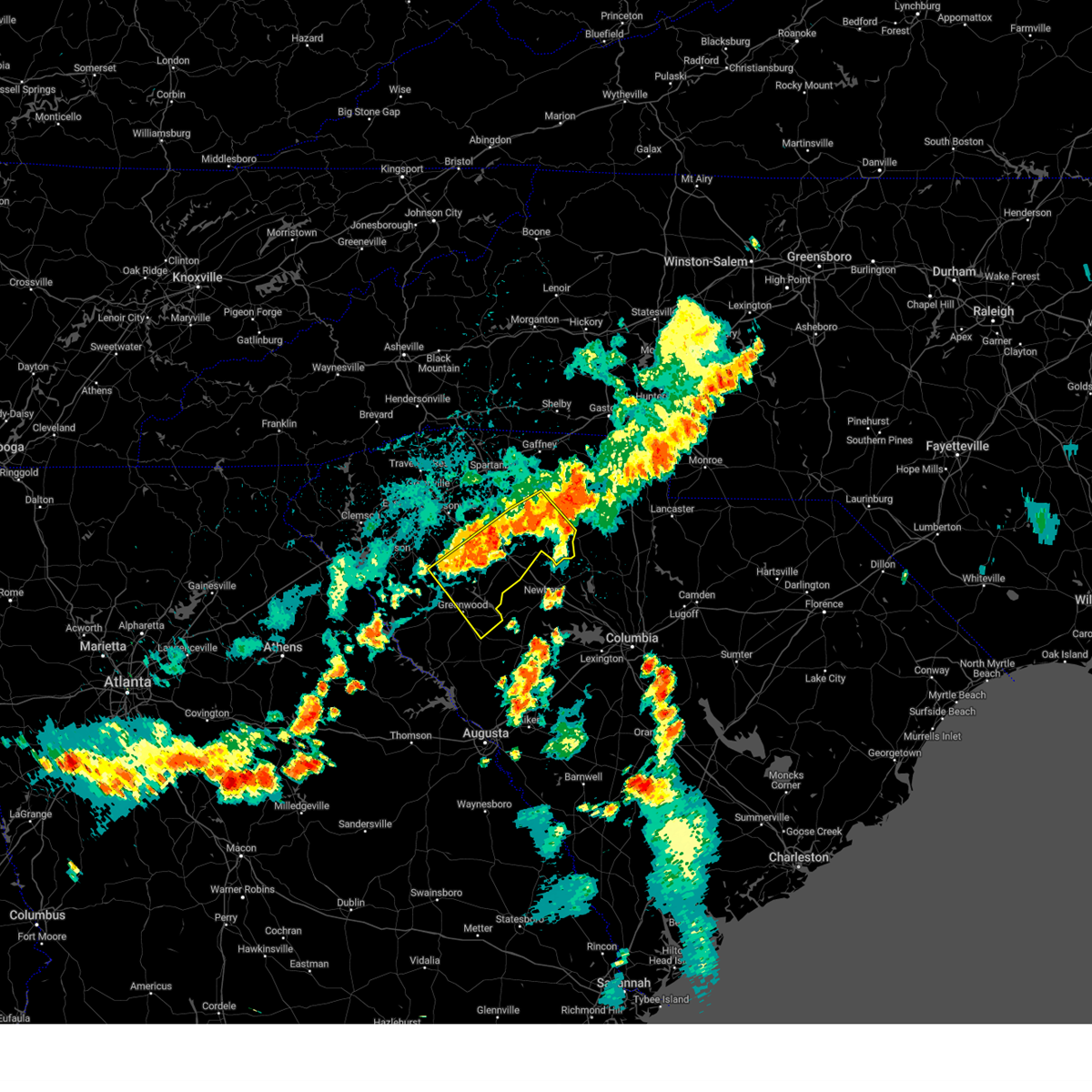
Hail Map for Jonesville, SC
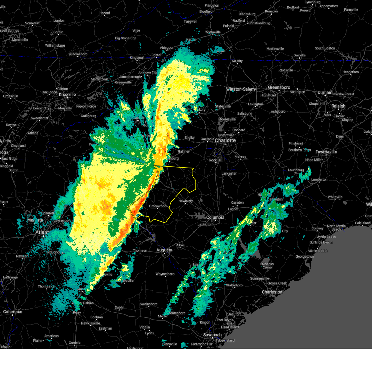
The Jonesville, SC area has had 0 reports of on-the-ground hail by trained spotters, and has been under severe weather warnings 18 times during the past 12 months. Doppler radar has detected hail at or near Jonesville, SC on 37 occasions.
| Name: | Jonesville, SC |
| Where Located: | 52.2 miles E of Greenville, SC |
| Map: | Google Map for Jonesville, SC |
| Population: | 911 |
| Housing Units: | 512 |
| More Info: | Search Google for Jonesville, SC |
1
The Top Recent Hail Date for Jonesville, SC is Saturday, August 17, 2024 (12th out of 37)

Hail and Wind Damage Spotted near Jonesville, SC
| Date / Time | Report Details |
|---|---|
| 6/28/2026 3:21 PM EDT |
 The storm which prompted the warning has moved out of the area. therefore, the warning will be allowed to expire. to report severe weather to the national weather service greenville-spartanburg, call toll free, 1, 800, 2 6 7, 8 1 0 1, or post on our facebook page, or post it to x using hashtag nwsgsp. your message should describe the event and the specific location where it occurred. The storm which prompted the warning has moved out of the area. therefore, the warning will be allowed to expire. to report severe weather to the national weather service greenville-spartanburg, call toll free, 1, 800, 2 6 7, 8 1 0 1, or post on our facebook page, or post it to x using hashtag nwsgsp. your message should describe the event and the specific location where it occurred.
|
| 6/28/2026 3:08 PM EDT |
 At 308 pm edt, a severe thunderstorm was located 5 miles southeast of union, or 4 miles south of monarch mill, moving southeast at 40 mph (radar indicated). Hazards include 60 mph wind gusts. Expect damage to trees and power lines. Locations impacted include, union, monarch mill, buffalo, jonesville, rose hill state park, cross keys, sedalia, adamsburg, santuc, and lockhart. At 308 pm edt, a severe thunderstorm was located 5 miles southeast of union, or 4 miles south of monarch mill, moving southeast at 40 mph (radar indicated). Hazards include 60 mph wind gusts. Expect damage to trees and power lines. Locations impacted include, union, monarch mill, buffalo, jonesville, rose hill state park, cross keys, sedalia, adamsburg, santuc, and lockhart.
|
| 6/28/2026 2:37 PM EDT |
 Svrgsp the national weather service in greenville-spartanburg has issued a * severe thunderstorm warning for, southeastern spartanburg county in upstate south carolina, union county in upstate south carolina, * until 330 pm edt. * at 236 pm edt, a severe thunderstorm was located 8 miles south of spartanburg, or near croft state park, moving southeast at 40 mph (radar indicated). Hazards include 60 mph wind gusts. expect damage to trees and power lines Svrgsp the national weather service in greenville-spartanburg has issued a * severe thunderstorm warning for, southeastern spartanburg county in upstate south carolina, union county in upstate south carolina, * until 330 pm edt. * at 236 pm edt, a severe thunderstorm was located 8 miles south of spartanburg, or near croft state park, moving southeast at 40 mph (radar indicated). Hazards include 60 mph wind gusts. expect damage to trees and power lines
|
| 6/27/2026 4:42 PM EDT |
 Svrgsp the national weather service in greenville-spartanburg has issued a * severe thunderstorm warning for, western chester county in upstate south carolina, southwestern york county in upstate south carolina, south central cherokee county in upstate south carolina, northeastern union county in upstate south carolina, * until 545 pm edt. * at 442 pm edt, a severe thunderstorm was located 7 miles northeast of union, or 6 miles west of lockhart, moving east at 35 mph (radar indicated). Hazards include 60 mph wind gusts and quarter size hail. Minor hail damage to vehicles is expected. Expect wind damage to trees and power lines. Svrgsp the national weather service in greenville-spartanburg has issued a * severe thunderstorm warning for, western chester county in upstate south carolina, southwestern york county in upstate south carolina, south central cherokee county in upstate south carolina, northeastern union county in upstate south carolina, * until 545 pm edt. * at 442 pm edt, a severe thunderstorm was located 7 miles northeast of union, or 6 miles west of lockhart, moving east at 35 mph (radar indicated). Hazards include 60 mph wind gusts and quarter size hail. Minor hail damage to vehicles is expected. Expect wind damage to trees and power lines.
|
| 3/16/2026 8:52 AM EDT |
 At 852 am edt, severe thunderstorms were located along a line extending from 5 miles south of shelby to 9 miles southeast of gaffney to near union, moving east at 50 mph (radar indicated). Hazards include 60 mph wind gusts. Expect damage to trees and power lines. Locations impacted include, union, monarch mill, blacksburg, buffalo, jonesville, cherokee falls, draytonville, saratt, kings creek, and adamsburg. At 852 am edt, severe thunderstorms were located along a line extending from 5 miles south of shelby to 9 miles southeast of gaffney to near union, moving east at 50 mph (radar indicated). Hazards include 60 mph wind gusts. Expect damage to trees and power lines. Locations impacted include, union, monarch mill, blacksburg, buffalo, jonesville, cherokee falls, draytonville, saratt, kings creek, and adamsburg.
|
| 3/16/2026 8:52 AM EDT |
 the severe thunderstorm warning has been cancelled and is no longer in effect the severe thunderstorm warning has been cancelled and is no longer in effect
|
| 3/16/2026 8:49 AM EDT |
 the tornado warning has been cancelled and is no longer in effect the tornado warning has been cancelled and is no longer in effect
|
| 3/16/2026 8:29 AM EDT |
 the tornado warning has been cancelled and is no longer in effect the tornado warning has been cancelled and is no longer in effect
|
| 3/16/2026 8:29 AM EDT |
 At 829 am edt, a severe thunderstorm capable of producing a tornado was located 8 miles north of gaffney, or 4 miles southwest of boiling springs nc, moving east at 45 mph (radar indicated rotation). Hazards include tornado. Flying debris will be dangerous to those caught without shelter. mobile homes will be damaged or destroyed. damage to roofs, windows, and vehicles will occur. tree damage is likely. this dangerous storm will be near, patterson springs and earl around 840 am edt. Other locations impacted by this tornadic thunderstorm include cherokee falls, draytonville, thicketty, saratt, and kings creek. At 829 am edt, a severe thunderstorm capable of producing a tornado was located 8 miles north of gaffney, or 4 miles southwest of boiling springs nc, moving east at 45 mph (radar indicated rotation). Hazards include tornado. Flying debris will be dangerous to those caught without shelter. mobile homes will be damaged or destroyed. damage to roofs, windows, and vehicles will occur. tree damage is likely. this dangerous storm will be near, patterson springs and earl around 840 am edt. Other locations impacted by this tornadic thunderstorm include cherokee falls, draytonville, thicketty, saratt, and kings creek.
|
| 3/16/2026 8:23 AM EDT |
 At 823 am edt, a severe thunderstorm capable of producing a tornado was located 10 miles northwest of gaffney, or near cowpens national battlefield, moving east at 45 mph (radar indicated rotation). Hazards include tornado. Flying debris will be dangerous to those caught without shelter. mobile homes will be damaged or destroyed. damage to roofs, windows, and vehicles will occur. tree damage is likely. this dangerous storm will be near, patterson springs and earl around 840 am edt. Other locations impacted by this tornadic thunderstorm include cliffside, cherokee falls, draytonville, thicketty, and saratt. At 823 am edt, a severe thunderstorm capable of producing a tornado was located 10 miles northwest of gaffney, or near cowpens national battlefield, moving east at 45 mph (radar indicated rotation). Hazards include tornado. Flying debris will be dangerous to those caught without shelter. mobile homes will be damaged or destroyed. damage to roofs, windows, and vehicles will occur. tree damage is likely. this dangerous storm will be near, patterson springs and earl around 840 am edt. Other locations impacted by this tornadic thunderstorm include cliffside, cherokee falls, draytonville, thicketty, and saratt.
|
| 3/16/2026 8:16 AM EDT |
 Torgsp the national weather service in greenville-spartanburg has issued a * tornado warning for, southeastern rutherford county in western north carolina, southwestern cleveland county in the piedmont of north carolina, northeastern spartanburg county in upstate south carolina, cherokee county in upstate south carolina, northwestern union county in upstate south carolina, * until 900 am edt. * at 816 am edt, a severe thunderstorm capable of producing a tornado was located 13 miles south of forest city, or near chesnee, moving east at 45 mph (radar indicated rotation). Hazards include tornado. Flying debris will be dangerous to those caught without shelter. mobile homes will be damaged or destroyed. damage to roofs, windows, and vehicles will occur. tree damage is likely. this dangerous storm will be near, chesnee and cowpens national battlefield around 820 am edt. patterson springs and earl around 840 am edt. Other locations impacted by this dangerous thunderstorm include cliffside, cherokee falls, draytonville, thicketty, and saratt. Torgsp the national weather service in greenville-spartanburg has issued a * tornado warning for, southeastern rutherford county in western north carolina, southwestern cleveland county in the piedmont of north carolina, northeastern spartanburg county in upstate south carolina, cherokee county in upstate south carolina, northwestern union county in upstate south carolina, * until 900 am edt. * at 816 am edt, a severe thunderstorm capable of producing a tornado was located 13 miles south of forest city, or near chesnee, moving east at 45 mph (radar indicated rotation). Hazards include tornado. Flying debris will be dangerous to those caught without shelter. mobile homes will be damaged or destroyed. damage to roofs, windows, and vehicles will occur. tree damage is likely. this dangerous storm will be near, chesnee and cowpens national battlefield around 820 am edt. patterson springs and earl around 840 am edt. Other locations impacted by this dangerous thunderstorm include cliffside, cherokee falls, draytonville, thicketty, and saratt.
|
| 3/16/2026 8:14 AM EDT |
 Svrgsp the national weather service in greenville-spartanburg has issued a * severe thunderstorm warning for, northwestern laurens county in upstate south carolina, spartanburg county in upstate south carolina, cherokee county in upstate south carolina, northern union county in upstate south carolina, * until 915 am edt. * at 813 am edt, severe thunderstorms were located along a line extending from 11 miles southeast of columbus to 7 miles west of spartanburg to 15 miles northwest of laurens, moving east at 50 mph (radar indicated). Hazards include 60 mph wind gusts. expect damage to trees and power lines Svrgsp the national weather service in greenville-spartanburg has issued a * severe thunderstorm warning for, northwestern laurens county in upstate south carolina, spartanburg county in upstate south carolina, cherokee county in upstate south carolina, northern union county in upstate south carolina, * until 915 am edt. * at 813 am edt, severe thunderstorms were located along a line extending from 11 miles southeast of columbus to 7 miles west of spartanburg to 15 miles northwest of laurens, moving east at 50 mph (radar indicated). Hazards include 60 mph wind gusts. expect damage to trees and power lines
|
| 3/12/2026 8:45 AM EDT |
 the severe thunderstorm warning has been cancelled and is no longer in effect the severe thunderstorm warning has been cancelled and is no longer in effect
|
| 3/12/2026 8:45 AM EDT |
 At 845 am edt, a severe thunderstorm was located near union, or over monarch mill, moving northeast at 60 mph (radar indicated). Hazards include 60 mph wind gusts. Expect damage to trees and power lines. Locations impacted include, union, monarch mill, buffalo, lockhart, rose hill state park, sedalia, adamsburg, santuc, and cross keys. At 845 am edt, a severe thunderstorm was located near union, or over monarch mill, moving northeast at 60 mph (radar indicated). Hazards include 60 mph wind gusts. Expect damage to trees and power lines. Locations impacted include, union, monarch mill, buffalo, lockhart, rose hill state park, sedalia, adamsburg, santuc, and cross keys.
|
| 3/12/2026 8:30 AM EDT |
 Svrgsp the national weather service in greenville-spartanburg has issued a * severe thunderstorm warning for, east central laurens county in upstate south carolina, northwestern chester county in upstate south carolina, southeastern spartanburg county in upstate south carolina, union county in upstate south carolina, * until 930 am edt. * at 830 am edt, a severe thunderstorm was located 14 miles east of laurens, or 7 miles northeast of clinton, moving northeast at 60 mph (radar indicated). Hazards include 60 mph wind gusts. expect damage to trees and power lines Svrgsp the national weather service in greenville-spartanburg has issued a * severe thunderstorm warning for, east central laurens county in upstate south carolina, northwestern chester county in upstate south carolina, southeastern spartanburg county in upstate south carolina, union county in upstate south carolina, * until 930 am edt. * at 830 am edt, a severe thunderstorm was located 14 miles east of laurens, or 7 miles northeast of clinton, moving northeast at 60 mph (radar indicated). Hazards include 60 mph wind gusts. expect damage to trees and power lines
|
| 9/6/2025 6:57 PM EDT |
 At 657 pm edt, a severe thunderstorm was located near union, moving east at 25 mph (radar indicated). Hazards include 60 mph wind gusts. Expect damage to trees and power lines. Locations impacted include, jonesville, adamsburg, and union. At 657 pm edt, a severe thunderstorm was located near union, moving east at 25 mph (radar indicated). Hazards include 60 mph wind gusts. Expect damage to trees and power lines. Locations impacted include, jonesville, adamsburg, and union.
|
| 9/6/2025 6:45 PM EDT |
 Svrgsp the national weather service in greenville-spartanburg has issued a * severe thunderstorm warning for, northern union county in upstate south carolina, * until 730 pm edt. * at 645 pm edt, a severe thunderstorm was located 5 miles northwest of union, or near buffalo, moving east at 25 mph (radar indicated). Hazards include 60 mph wind gusts. expect damage to trees and power lines Svrgsp the national weather service in greenville-spartanburg has issued a * severe thunderstorm warning for, northern union county in upstate south carolina, * until 730 pm edt. * at 645 pm edt, a severe thunderstorm was located 5 miles northwest of union, or near buffalo, moving east at 25 mph (radar indicated). Hazards include 60 mph wind gusts. expect damage to trees and power lines
|
| 9/6/2025 6:31 PM EDT |
 At 631 pm edt, a severe thunderstorm was located 11 miles southeast of spartanburg, or 5 miles south of croft state park, moving east at 25 mph (radar indicated). Hazards include 60 mph wind gusts. Expect damage to trees and power lines. Locations impacted include, pauline and buffalo. At 631 pm edt, a severe thunderstorm was located 11 miles southeast of spartanburg, or 5 miles south of croft state park, moving east at 25 mph (radar indicated). Hazards include 60 mph wind gusts. Expect damage to trees and power lines. Locations impacted include, pauline and buffalo.
|
| 6/25/2025 6:04 PM EDT |
 At 604 pm edt, severe thunderstorms were located along a line extending from near gaffney to 7 miles northwest of spartanburg, moving south at 5 mph (radar indicated). Hazards include ping pong ball size hail and 60 mph wind gusts. People and animals outdoors will be injured. expect hail damage to roofs, siding, windows, and vehicles. expect wind damage to trees and power lines. Locations impacted include, spartanburg, gaffney, boiling springs sc, lyman, pacolet, cowpens, wellford, inman, mayo, and roebuck. At 604 pm edt, severe thunderstorms were located along a line extending from near gaffney to 7 miles northwest of spartanburg, moving south at 5 mph (radar indicated). Hazards include ping pong ball size hail and 60 mph wind gusts. People and animals outdoors will be injured. expect hail damage to roofs, siding, windows, and vehicles. expect wind damage to trees and power lines. Locations impacted include, spartanburg, gaffney, boiling springs sc, lyman, pacolet, cowpens, wellford, inman, mayo, and roebuck.
|
| 6/25/2025 6:04 PM EDT |
 the severe thunderstorm warning has been cancelled and is no longer in effect the severe thunderstorm warning has been cancelled and is no longer in effect
|
| 6/25/2025 5:27 PM EDT |
 Svrgsp the national weather service in greenville-spartanburg has issued a * severe thunderstorm warning for, south central rutherford county in western north carolina, southwestern cleveland county in the piedmont of north carolina, spartanburg county in upstate south carolina, cherokee county in upstate south carolina, northern union county in upstate south carolina, * until 645 pm edt. * at 527 pm edt, a severe thunderstorm was located 4 miles south of forest city, moving south at 15 mph (radar indicated). Hazards include 60 mph wind gusts and quarter size hail. Minor hail damage to vehicles is expected. Expect wind damage to trees and power lines. Svrgsp the national weather service in greenville-spartanburg has issued a * severe thunderstorm warning for, south central rutherford county in western north carolina, southwestern cleveland county in the piedmont of north carolina, spartanburg county in upstate south carolina, cherokee county in upstate south carolina, northern union county in upstate south carolina, * until 645 pm edt. * at 527 pm edt, a severe thunderstorm was located 4 miles south of forest city, moving south at 15 mph (radar indicated). Hazards include 60 mph wind gusts and quarter size hail. Minor hail damage to vehicles is expected. Expect wind damage to trees and power lines.
|
| 6/17/2025 10:18 PM EDT |
 At 1018 pm edt, severe thunderstorms were located along a line extending from 4 miles southeast of morganton to 9 miles northwest of lincolnton to 9 miles northwest of york to 5 miles west of chester, moving east at 50 mph (radar indicated). Hazards include 60 mph wind gusts. Expect damage to trees and power lines. Locations impacted include, gastonia, rock hill, hickory, shelby, morganton, newton, gaffney, lincolnton, union, and york. At 1018 pm edt, severe thunderstorms were located along a line extending from 4 miles southeast of morganton to 9 miles northwest of lincolnton to 9 miles northwest of york to 5 miles west of chester, moving east at 50 mph (radar indicated). Hazards include 60 mph wind gusts. Expect damage to trees and power lines. Locations impacted include, gastonia, rock hill, hickory, shelby, morganton, newton, gaffney, lincolnton, union, and york.
|
| 6/17/2025 10:02 PM EDT |
 the severe thunderstorm warning has been cancelled and is no longer in effect the severe thunderstorm warning has been cancelled and is no longer in effect
|
| 6/17/2025 10:02 PM EDT |
 At 1002 pm edt, severe thunderstorms were located along a line extending from 9 miles southwest of morganton to 14 miles north of shelby to 11 miles east of gaffney to 11 miles southeast of union, moving east at 50 mph (radar indicated). Hazards include 60 mph wind gusts. Expect damage to trees and power lines. Locations impacted include, gastonia, rock hill, hickory, shelby, morganton, newton, gaffney, lincolnton, union, and york. At 1002 pm edt, severe thunderstorms were located along a line extending from 9 miles southwest of morganton to 14 miles north of shelby to 11 miles east of gaffney to 11 miles southeast of union, moving east at 50 mph (radar indicated). Hazards include 60 mph wind gusts. Expect damage to trees and power lines. Locations impacted include, gastonia, rock hill, hickory, shelby, morganton, newton, gaffney, lincolnton, union, and york.
|
| 6/17/2025 9:43 PM EDT |
 Svrgsp the national weather service in greenville-spartanburg has issued a * severe thunderstorm warning for, catawba county in the piedmont of north carolina, rutherford county in western north carolina, lincoln county in the piedmont of north carolina, gaston county in the piedmont of north carolina, southeastern mcdowell county in western north carolina, cleveland county in the piedmont of north carolina, southern burke county in western north carolina, southeastern laurens county in upstate south carolina, union county in upstate south carolina, chester county in upstate south carolina, york county in upstate south carolina, eastern spartanburg county in upstate south carolina, cherokee county in upstate south carolina, * until 1045 pm edt. * at 943 pm edt, severe thunderstorms were located along a line extending from 10 miles north of rutherfordton to 10 miles east of forest city to 9 miles south of gaffney to 13 miles south of union, moving northeast at 50 mph (radar indicated). Hazards include 60 mph wind gusts. expect damage to trees and power lines Svrgsp the national weather service in greenville-spartanburg has issued a * severe thunderstorm warning for, catawba county in the piedmont of north carolina, rutherford county in western north carolina, lincoln county in the piedmont of north carolina, gaston county in the piedmont of north carolina, southeastern mcdowell county in western north carolina, cleveland county in the piedmont of north carolina, southern burke county in western north carolina, southeastern laurens county in upstate south carolina, union county in upstate south carolina, chester county in upstate south carolina, york county in upstate south carolina, eastern spartanburg county in upstate south carolina, cherokee county in upstate south carolina, * until 1045 pm edt. * at 943 pm edt, severe thunderstorms were located along a line extending from 10 miles north of rutherfordton to 10 miles east of forest city to 9 miles south of gaffney to 13 miles south of union, moving northeast at 50 mph (radar indicated). Hazards include 60 mph wind gusts. expect damage to trees and power lines
|
| 6/17/2025 9:34 PM EDT |
 At 933 pm edt, severe thunderstorms were located along a line extending from 3 miles northwest of rutherfordton to 4 miles south of forest city to 5 miles northeast of spartanburg to 13 miles east of laurens, moving east at 50 mph (radar indicated). Hazards include 60 mph wind gusts. Expect damage to trees and power lines. Locations impacted include, spartanburg, shelby, gaffney, union, forest city, rutherfordton, clinton, boiling springs sc, woodruff, and spindale. At 933 pm edt, severe thunderstorms were located along a line extending from 3 miles northwest of rutherfordton to 4 miles south of forest city to 5 miles northeast of spartanburg to 13 miles east of laurens, moving east at 50 mph (radar indicated). Hazards include 60 mph wind gusts. Expect damage to trees and power lines. Locations impacted include, spartanburg, shelby, gaffney, union, forest city, rutherfordton, clinton, boiling springs sc, woodruff, and spindale.
|
| 6/17/2025 9:34 PM EDT |
 the severe thunderstorm warning has been cancelled and is no longer in effect the severe thunderstorm warning has been cancelled and is no longer in effect
|
| 6/17/2025 9:19 PM EDT |
 At 918 pm edt, severe thunderstorms were located along a line extending from 4 miles north of columbus to 13 miles south of rutherfordton to 5 miles southwest of spartanburg to near laurens, moving east at 50 mph (radar indicated). Hazards include 60 mph wind gusts. Expect damage to trees and power lines. Locations impacted include, spartanburg, shelby, gaffney, laurens, union, forest city, rutherfordton, columbus, greer, and clinton. At 918 pm edt, severe thunderstorms were located along a line extending from 4 miles north of columbus to 13 miles south of rutherfordton to 5 miles southwest of spartanburg to near laurens, moving east at 50 mph (radar indicated). Hazards include 60 mph wind gusts. Expect damage to trees and power lines. Locations impacted include, spartanburg, shelby, gaffney, laurens, union, forest city, rutherfordton, columbus, greer, and clinton.
|
| 6/17/2025 9:19 PM EDT |
 the severe thunderstorm warning has been cancelled and is no longer in effect the severe thunderstorm warning has been cancelled and is no longer in effect
|
| 6/17/2025 8:50 PM EDT |
 Svrgsp the national weather service in greenville-spartanburg has issued a * severe thunderstorm warning for, rutherford county in western north carolina, southeastern henderson county in western north carolina, polk county in western north carolina, cleveland county in the piedmont of north carolina, laurens county in upstate south carolina, northeastern pickens county in upstate south carolina, union county in upstate south carolina, greenville county in upstate south carolina, spartanburg county in upstate south carolina, eastern anderson county in upstate south carolina, cherokee county in upstate south carolina, northeastern abbeville county in upstate south carolina, northwestern greenwood county in upstate south carolina, * until 945 pm edt. * at 849 pm edt, severe thunderstorms were located along a line extending from 12 miles south of hendersonville to 18 miles southwest of columbus to 7 miles south of greenville downtown to 11 miles north of abbeville, moving northeast at 50 mph (radar indicated). Hazards include 60 mph wind gusts. expect damage to trees and power lines Svrgsp the national weather service in greenville-spartanburg has issued a * severe thunderstorm warning for, rutherford county in western north carolina, southeastern henderson county in western north carolina, polk county in western north carolina, cleveland county in the piedmont of north carolina, laurens county in upstate south carolina, northeastern pickens county in upstate south carolina, union county in upstate south carolina, greenville county in upstate south carolina, spartanburg county in upstate south carolina, eastern anderson county in upstate south carolina, cherokee county in upstate south carolina, northeastern abbeville county in upstate south carolina, northwestern greenwood county in upstate south carolina, * until 945 pm edt. * at 849 pm edt, severe thunderstorms were located along a line extending from 12 miles south of hendersonville to 18 miles southwest of columbus to 7 miles south of greenville downtown to 11 miles north of abbeville, moving northeast at 50 mph (radar indicated). Hazards include 60 mph wind gusts. expect damage to trees and power lines
|
| 6/7/2025 8:52 PM EDT |
 The storms which prompted the warning have weakened below severe limits, and no longer pose an immediate threat to life or property. therefore, the warning will be allowed to expire. however, gusty winds are still possible with these thunderstorms. a severe thunderstorm watch remains in effect until 1100 pm edt for upstate south carolina. to report severe weather to the national weather service greenville-spartanburg, call toll free, 1, 800, 2 6 7, 8 1 0 1, or post on our facebook page, or tweet it using hashtag nwsgsp. your message should describe the event and the specific location where it occurred. The storms which prompted the warning have weakened below severe limits, and no longer pose an immediate threat to life or property. therefore, the warning will be allowed to expire. however, gusty winds are still possible with these thunderstorms. a severe thunderstorm watch remains in effect until 1100 pm edt for upstate south carolina. to report severe weather to the national weather service greenville-spartanburg, call toll free, 1, 800, 2 6 7, 8 1 0 1, or post on our facebook page, or tweet it using hashtag nwsgsp. your message should describe the event and the specific location where it occurred.
|
| 6/7/2025 8:44 PM EDT |
 At 844 pm edt, severe thunderstorms were located along a line extending from 9 miles east of columbus to 6 miles east of spartanburg to 8 miles north of newberry, moving northeast at 40 mph (radar indicated). Hazards include 60 mph wind gusts. Expect damage to trees and power lines. Locations impacted include, spartanburg, gaffney, union, boiling springs sc, pacolet, cowpens, monarch mill, mayo, buffalo, and chesnee. At 844 pm edt, severe thunderstorms were located along a line extending from 9 miles east of columbus to 6 miles east of spartanburg to 8 miles north of newberry, moving northeast at 40 mph (radar indicated). Hazards include 60 mph wind gusts. Expect damage to trees and power lines. Locations impacted include, spartanburg, gaffney, union, boiling springs sc, pacolet, cowpens, monarch mill, mayo, buffalo, and chesnee.
|
| 6/7/2025 8:18 PM EDT |
 Svrgsp the national weather service in greenville-spartanburg has issued a * severe thunderstorm warning for, central laurens county in upstate south carolina, spartanburg county in upstate south carolina, cherokee county in upstate south carolina, union county in upstate south carolina, * until 900 pm edt. * at 818 pm edt, severe thunderstorms were located along a line extending from 11 miles southwest of columbus to 11 miles southwest of spartanburg to 15 miles southeast of laurens, moving northeast at 40 mph (radar indicated). Hazards include 60 mph wind gusts. expect damage to trees and power lines Svrgsp the national weather service in greenville-spartanburg has issued a * severe thunderstorm warning for, central laurens county in upstate south carolina, spartanburg county in upstate south carolina, cherokee county in upstate south carolina, union county in upstate south carolina, * until 900 pm edt. * at 818 pm edt, severe thunderstorms were located along a line extending from 11 miles southwest of columbus to 11 miles southwest of spartanburg to 15 miles southeast of laurens, moving northeast at 40 mph (radar indicated). Hazards include 60 mph wind gusts. expect damage to trees and power lines
|
| 5/3/2025 3:35 PM EDT |
 At 335 pm edt, a severe thunderstorm was located 4 miles north of union, moving northeast at 40 mph (radar indicated). Hazards include 60 mph wind gusts and quarter size hail. Minor hail damage to vehicles is expected. expect wind damage to trees and power lines. Locations impacted include, adamsburg, jonesville, bullock creek, saratt, lockhart, and union. At 335 pm edt, a severe thunderstorm was located 4 miles north of union, moving northeast at 40 mph (radar indicated). Hazards include 60 mph wind gusts and quarter size hail. Minor hail damage to vehicles is expected. expect wind damage to trees and power lines. Locations impacted include, adamsburg, jonesville, bullock creek, saratt, lockhart, and union.
|
| 5/3/2025 3:21 PM EDT |
 Svrgsp the national weather service in greenville-spartanburg has issued a * severe thunderstorm warning for, southwestern york county in upstate south carolina, southeastern cherokee county in upstate south carolina, northern union county in upstate south carolina, * until 415 pm edt. * at 321 pm edt, a severe thunderstorm was located 6 miles west of union, or near buffalo, moving northeast at 40 mph (radar indicated). Hazards include 60 mph wind gusts and quarter size hail. Minor hail damage to vehicles is expected. Expect wind damage to trees and power lines. Svrgsp the national weather service in greenville-spartanburg has issued a * severe thunderstorm warning for, southwestern york county in upstate south carolina, southeastern cherokee county in upstate south carolina, northern union county in upstate south carolina, * until 415 pm edt. * at 321 pm edt, a severe thunderstorm was located 6 miles west of union, or near buffalo, moving northeast at 40 mph (radar indicated). Hazards include 60 mph wind gusts and quarter size hail. Minor hail damage to vehicles is expected. Expect wind damage to trees and power lines.
|
| 5/2/2025 4:39 PM EDT |
 The storm which prompted the warning has weakened below severe limits, and no longer poses an immediate threat to life or property. therefore, the warning will be allowed to expire. The storm which prompted the warning has weakened below severe limits, and no longer poses an immediate threat to life or property. therefore, the warning will be allowed to expire.
|
| 5/2/2025 4:15 PM EDT |
 At 415 pm edt, a severe thunderstorm was located 11 miles west of union, or 7 miles west of buffalo, moving east at 25 mph (radar indicated). Hazards include 60 mph wind gusts and quarter size hail. Minor hail damage to vehicles is expected. expect wind damage to trees and power lines. Locations impacted include, adamsburg, monarch mill, jonesville, buffalo, union, and lockhart. At 415 pm edt, a severe thunderstorm was located 11 miles west of union, or 7 miles west of buffalo, moving east at 25 mph (radar indicated). Hazards include 60 mph wind gusts and quarter size hail. Minor hail damage to vehicles is expected. expect wind damage to trees and power lines. Locations impacted include, adamsburg, monarch mill, jonesville, buffalo, union, and lockhart.
|
| 5/2/2025 4:15 PM EDT |
 the severe thunderstorm warning has been cancelled and is no longer in effect the severe thunderstorm warning has been cancelled and is no longer in effect
|
| 5/2/2025 3:54 PM EDT |
 Svrgsp the national weather service in greenville-spartanburg has issued a * severe thunderstorm warning for, northwestern chester county in upstate south carolina, southeastern spartanburg county in upstate south carolina, northern union county in upstate south carolina, * until 445 pm edt. * at 354 pm edt, a severe thunderstorm was located 14 miles north of laurens, or 4 miles southeast of woodruff, moving east at 25 mph (radar indicated). Hazards include 60 mph wind gusts and quarter size hail. Minor hail damage to vehicles is expected. Expect wind damage to trees and power lines. Svrgsp the national weather service in greenville-spartanburg has issued a * severe thunderstorm warning for, northwestern chester county in upstate south carolina, southeastern spartanburg county in upstate south carolina, northern union county in upstate south carolina, * until 445 pm edt. * at 354 pm edt, a severe thunderstorm was located 14 miles north of laurens, or 4 miles southeast of woodruff, moving east at 25 mph (radar indicated). Hazards include 60 mph wind gusts and quarter size hail. Minor hail damage to vehicles is expected. Expect wind damage to trees and power lines.
|
| 3/31/2025 4:19 PM EDT |
 the severe thunderstorm warning has been cancelled and is no longer in effect the severe thunderstorm warning has been cancelled and is no longer in effect
|
| 3/31/2025 4:19 PM EDT |
 At 418 pm edt, severe thunderstorms were located along a line extending from 11 miles southeast of forest city to 3 miles west of gaffney to 13 miles east of spartanburg to 5 miles northeast of union to 15 miles north of newberry, moving northeast at 45 mph (radar indicated). Hazards include 60 mph wind gusts. Expect damage to trees and power lines. Locations impacted include, gaffney, carlisle, tuckertown, santuc, union, cherokee falls, draytonville, thicketty, jonesville, and saratt. At 418 pm edt, severe thunderstorms were located along a line extending from 11 miles southeast of forest city to 3 miles west of gaffney to 13 miles east of spartanburg to 5 miles northeast of union to 15 miles north of newberry, moving northeast at 45 mph (radar indicated). Hazards include 60 mph wind gusts. Expect damage to trees and power lines. Locations impacted include, gaffney, carlisle, tuckertown, santuc, union, cherokee falls, draytonville, thicketty, jonesville, and saratt.
|
| 3/31/2025 4:03 PM EDT |
 At 403 pm edt, severe thunderstorms were located along a line extending from 8 miles south of forest city to 10 miles west of gaffney to 8 miles south of spartanburg to 10 miles west of union to 12 miles northwest of newberry, moving northeast at 50 mph (radar indicated). Hazards include 60 mph wind gusts. Expect damage to trees and power lines. Locations impacted include, cowpens national battlefield, roebuck, chesnee, gaffney, cowpens, pacolet mills, carlisle, tuckertown, union, and thicketty. At 403 pm edt, severe thunderstorms were located along a line extending from 8 miles south of forest city to 10 miles west of gaffney to 8 miles south of spartanburg to 10 miles west of union to 12 miles northwest of newberry, moving northeast at 50 mph (radar indicated). Hazards include 60 mph wind gusts. Expect damage to trees and power lines. Locations impacted include, cowpens national battlefield, roebuck, chesnee, gaffney, cowpens, pacolet mills, carlisle, tuckertown, union, and thicketty.
|
| 3/31/2025 3:41 PM EDT |
 Svrgsp the national weather service in greenville-spartanburg has issued a * severe thunderstorm warning for, northeastern laurens county in upstate south carolina, spartanburg county in upstate south carolina, cherokee county in upstate south carolina, union county in upstate south carolina, * until 515 pm edt. * at 341 pm edt, severe thunderstorms were located along a line extending from 11 miles south of columbus to 12 miles west of spartanburg to 14 miles southeast of greenville downtown to 7 miles northwest of laurens to 9 miles northeast of greenwood, moving northeast at 45 mph (radar indicated). Hazards include 60 mph wind gusts. expect damage to trees and power lines Svrgsp the national weather service in greenville-spartanburg has issued a * severe thunderstorm warning for, northeastern laurens county in upstate south carolina, spartanburg county in upstate south carolina, cherokee county in upstate south carolina, union county in upstate south carolina, * until 515 pm edt. * at 341 pm edt, severe thunderstorms were located along a line extending from 11 miles south of columbus to 12 miles west of spartanburg to 14 miles southeast of greenville downtown to 7 miles northwest of laurens to 9 miles northeast of greenwood, moving northeast at 45 mph (radar indicated). Hazards include 60 mph wind gusts. expect damage to trees and power lines
|
| 2/16/2025 6:28 AM EST |
 Svrgsp the national weather service in greenville-spartanburg has issued a * severe thunderstorm warning for, laurens county in upstate south carolina, western chester county in upstate south carolina, york county in upstate south carolina, southeastern spartanburg county in upstate south carolina, cherokee county in upstate south carolina, southeastern abbeville county in upstate south carolina, union county in upstate south carolina, greenwood county in upstate south carolina, * until 700 am est. * at 628 am est, severe thunderstorms were located along a line extending from near gaffney to 14 miles southeast of abbeville, moving east at 80 mph (radar indicated). Hazards include 60 mph wind gusts. expect damage to trees and power lines Svrgsp the national weather service in greenville-spartanburg has issued a * severe thunderstorm warning for, laurens county in upstate south carolina, western chester county in upstate south carolina, york county in upstate south carolina, southeastern spartanburg county in upstate south carolina, cherokee county in upstate south carolina, southeastern abbeville county in upstate south carolina, union county in upstate south carolina, greenwood county in upstate south carolina, * until 700 am est. * at 628 am est, severe thunderstorms were located along a line extending from near gaffney to 14 miles southeast of abbeville, moving east at 80 mph (radar indicated). Hazards include 60 mph wind gusts. expect damage to trees and power lines
|
| 2/16/2025 6:15 AM EST |
 the severe thunderstorm warning has been cancelled and is no longer in effect the severe thunderstorm warning has been cancelled and is no longer in effect
|
| 2/16/2025 6:15 AM EST |
 At 615 am est, severe thunderstorms were located along a line extending from 7 miles southwest of spartanburg to 9 miles northwest of laurens to 10 miles southwest of abbeville, moving east at 75 mph (radar indicated). Hazards include 60 mph wind gusts. Expect damage to trees and power lines. Locations impacted include, greenwood, laurens, union, abbeville, clinton, woodruff, ware shoals, calhoun falls, monarch mill, and ninety six. At 615 am est, severe thunderstorms were located along a line extending from 7 miles southwest of spartanburg to 9 miles northwest of laurens to 10 miles southwest of abbeville, moving east at 75 mph (radar indicated). Hazards include 60 mph wind gusts. Expect damage to trees and power lines. Locations impacted include, greenwood, laurens, union, abbeville, clinton, woodruff, ware shoals, calhoun falls, monarch mill, and ninety six.
|
| 2/16/2025 5:58 AM EST |
 Svrgsp the national weather service in greenville-spartanburg has issued a * severe thunderstorm warning for, eastern elbert county in northeastern georgia, laurens county in upstate south carolina, southeastern greenville county in upstate south carolina, southern spartanburg county in upstate south carolina, eastern anderson county in upstate south carolina, abbeville county in upstate south carolina, union county in upstate south carolina, greenwood county in upstate south carolina, * until 630 am est. * at 558 am est, severe thunderstorms were located along a line extending from near greenville downtown to 11 miles east of anderson to 7 miles east of elberton, moving east at 105 mph (radar indicated). Hazards include 60 mph wind gusts. expect damage to trees and power lines Svrgsp the national weather service in greenville-spartanburg has issued a * severe thunderstorm warning for, eastern elbert county in northeastern georgia, laurens county in upstate south carolina, southeastern greenville county in upstate south carolina, southern spartanburg county in upstate south carolina, eastern anderson county in upstate south carolina, abbeville county in upstate south carolina, union county in upstate south carolina, greenwood county in upstate south carolina, * until 630 am est. * at 558 am est, severe thunderstorms were located along a line extending from near greenville downtown to 11 miles east of anderson to 7 miles east of elberton, moving east at 105 mph (radar indicated). Hazards include 60 mph wind gusts. expect damage to trees and power lines
|
| 12/29/2024 8:38 AM EST |
 At 838 am est, a severe thunderstorm capable of producing a tornado was located 8 miles north of union, or 4 miles east of jonesville, moving northeast at 55 mph (radar indicated rotation). Hazards include tornado. Flying debris will be dangerous to those caught without shelter. mobile homes will be damaged or destroyed. damage to roofs, windows, and vehicles will occur. tree damage is likely. Locations impacted include, jonesville, adamsburg, and lockhart. At 838 am est, a severe thunderstorm capable of producing a tornado was located 8 miles north of union, or 4 miles east of jonesville, moving northeast at 55 mph (radar indicated rotation). Hazards include tornado. Flying debris will be dangerous to those caught without shelter. mobile homes will be damaged or destroyed. damage to roofs, windows, and vehicles will occur. tree damage is likely. Locations impacted include, jonesville, adamsburg, and lockhart.
|
| 12/29/2024 8:29 AM EST |
 At 829 am est, severe thunderstorms were located along a line extending from 7 miles south of forest city to 8 miles southwest of union, moving east at 45 mph (radar indicated). Hazards include 60 mph wind gusts. Expect damage to trees and power lines. Locations impacted include, pacolet, cowpens, mayo, buffalo, chesnee, pacolet mills, cowpens national battlefield, croft state park, henrietta, and harris. At 829 am est, severe thunderstorms were located along a line extending from 7 miles south of forest city to 8 miles southwest of union, moving east at 45 mph (radar indicated). Hazards include 60 mph wind gusts. Expect damage to trees and power lines. Locations impacted include, pacolet, cowpens, mayo, buffalo, chesnee, pacolet mills, cowpens national battlefield, croft state park, henrietta, and harris.
|
| 12/29/2024 8:26 AM EST |
 At 826 am est, a severe thunderstorm capable of producing a tornado was located near union, moving northeast at 55 mph (radar indicated rotation). Hazards include tornado. Flying debris will be dangerous to those caught without shelter. mobile homes will be damaged or destroyed. damage to roofs, windows, and vehicles will occur. tree damage is likely. This tornadic thunderstorm will remain over mainly rural areas of northern union county, including the following locations, adamsburg. At 826 am est, a severe thunderstorm capable of producing a tornado was located near union, moving northeast at 55 mph (radar indicated rotation). Hazards include tornado. Flying debris will be dangerous to those caught without shelter. mobile homes will be damaged or destroyed. damage to roofs, windows, and vehicles will occur. tree damage is likely. This tornadic thunderstorm will remain over mainly rural areas of northern union county, including the following locations, adamsburg.
|
| 12/29/2024 8:18 AM EST |
 the severe thunderstorm warning has been cancelled and is no longer in effect the severe thunderstorm warning has been cancelled and is no longer in effect
|
| 12/29/2024 8:18 AM EST |
 At 818 am est, severe thunderstorms were located along a line extending from 11 miles southwest of forest city to 11 miles northeast of laurens, moving east at 45 mph (radar indicated). Hazards include 60 mph wind gusts. Expect damage to trees and power lines. Locations impacted include, spartanburg, boiling springs sc, pacolet, cowpens, mayo, roebuck, buffalo, chesnee, pacolet mills, and cowpens national battlefield. At 818 am est, severe thunderstorms were located along a line extending from 11 miles southwest of forest city to 11 miles northeast of laurens, moving east at 45 mph (radar indicated). Hazards include 60 mph wind gusts. Expect damage to trees and power lines. Locations impacted include, spartanburg, boiling springs sc, pacolet, cowpens, mayo, roebuck, buffalo, chesnee, pacolet mills, and cowpens national battlefield.
|
| 12/29/2024 8:17 AM EST |
 Svrgsp the national weather service in greenville-spartanburg has issued a * severe thunderstorm warning for, chester county in upstate south carolina, york county in upstate south carolina, southeastern cherokee county in upstate south carolina, union county in upstate south carolina, * until 930 am est. * at 817 am est, severe thunderstorms were located along a line extending from 16 miles southeast of spartanburg to 6 miles south of union to near newberry, moving northeast at 60 mph (radar indicated). Hazards include 60 mph wind gusts. expect damage to trees and power lines Svrgsp the national weather service in greenville-spartanburg has issued a * severe thunderstorm warning for, chester county in upstate south carolina, york county in upstate south carolina, southeastern cherokee county in upstate south carolina, union county in upstate south carolina, * until 930 am est. * at 817 am est, severe thunderstorms were located along a line extending from 16 miles southeast of spartanburg to 6 miles south of union to near newberry, moving northeast at 60 mph (radar indicated). Hazards include 60 mph wind gusts. expect damage to trees and power lines
|
| 12/29/2024 8:14 AM EST |
 At 814 am est, a severe thunderstorm capable of producing a tornado was located 9 miles southwest of union, or 4 miles west of rose hill state park, moving northeast at 55 mph (radar indicated rotation). Hazards include tornado. Flying debris will be dangerous to those caught without shelter. mobile homes will be damaged or destroyed. damage to roofs, windows, and vehicles will occur. tree damage is likely. this dangerous storm will be near, union and buffalo around 820 am est. Other locations impacted by this tornadic thunderstorm include cross keys, sedalia, and adamsburg. At 814 am est, a severe thunderstorm capable of producing a tornado was located 9 miles southwest of union, or 4 miles west of rose hill state park, moving northeast at 55 mph (radar indicated rotation). Hazards include tornado. Flying debris will be dangerous to those caught without shelter. mobile homes will be damaged or destroyed. damage to roofs, windows, and vehicles will occur. tree damage is likely. this dangerous storm will be near, union and buffalo around 820 am est. Other locations impacted by this tornadic thunderstorm include cross keys, sedalia, and adamsburg.
|
| 12/29/2024 8:14 AM EST |
 the tornado warning has been cancelled and is no longer in effect the tornado warning has been cancelled and is no longer in effect
|
| 12/29/2024 8:11 AM EST |
 Torgsp the national weather service in greenville-spartanburg has issued a * tornado warning for, east central laurens county in upstate south carolina, union county in upstate south carolina, * until 845 am est. * at 811 am est, a severe thunderstorm capable of producing a tornado was located 12 miles southwest of union, or 5 miles west of rose hill state park, moving northeast at 55 mph (radar indicated rotation). Hazards include tornado. Flying debris will be dangerous to those caught without shelter. mobile homes will be damaged or destroyed. damage to roofs, windows, and vehicles will occur. tree damage is likely. this dangerous storm will be near, union and buffalo around 820 am est. Other locations impacted by this dangerous thunderstorm include cross keys, sedalia, and adamsburg. Torgsp the national weather service in greenville-spartanburg has issued a * tornado warning for, east central laurens county in upstate south carolina, union county in upstate south carolina, * until 845 am est. * at 811 am est, a severe thunderstorm capable of producing a tornado was located 12 miles southwest of union, or 5 miles west of rose hill state park, moving northeast at 55 mph (radar indicated rotation). Hazards include tornado. Flying debris will be dangerous to those caught without shelter. mobile homes will be damaged or destroyed. damage to roofs, windows, and vehicles will occur. tree damage is likely. this dangerous storm will be near, union and buffalo around 820 am est. Other locations impacted by this dangerous thunderstorm include cross keys, sedalia, and adamsburg.
|
| 12/29/2024 8:00 AM EST |
 At 800 am est, severe thunderstorms were located along a line extending from 9 miles south of columbus to 4 miles northwest of laurens, moving northeast at 50 mph (radar indicated). Hazards include 60 mph wind gusts. Expect damage to trees and power lines. Locations impacted include, spartanburg, greer, five forks, fountain inn, boiling springs sc, woodruff, duncan, lyman, pacolet, and cowpens. At 800 am est, severe thunderstorms were located along a line extending from 9 miles south of columbus to 4 miles northwest of laurens, moving northeast at 50 mph (radar indicated). Hazards include 60 mph wind gusts. Expect damage to trees and power lines. Locations impacted include, spartanburg, greer, five forks, fountain inn, boiling springs sc, woodruff, duncan, lyman, pacolet, and cowpens.
|
| 12/29/2024 7:32 AM EST |
 Svrgsp the national weather service in greenville-spartanburg has issued a * severe thunderstorm warning for, southeastern rutherford county in western north carolina, northwestern laurens county in upstate south carolina, southeastern greenville county in upstate south carolina, spartanburg county in upstate south carolina, western cherokee county in upstate south carolina, northwestern union county in upstate south carolina, * until 845 am est. * at 732 am est, severe thunderstorms were located along a line extending from 10 miles north of greenville downtown to 6 miles northwest of abbeville, moving east at 45 mph (radar indicated). Hazards include 60 mph wind gusts. expect damage to trees and power lines Svrgsp the national weather service in greenville-spartanburg has issued a * severe thunderstorm warning for, southeastern rutherford county in western north carolina, northwestern laurens county in upstate south carolina, southeastern greenville county in upstate south carolina, spartanburg county in upstate south carolina, western cherokee county in upstate south carolina, northwestern union county in upstate south carolina, * until 845 am est. * at 732 am est, severe thunderstorms were located along a line extending from 10 miles north of greenville downtown to 6 miles northwest of abbeville, moving east at 45 mph (radar indicated). Hazards include 60 mph wind gusts. expect damage to trees and power lines
|
| 8/17/2024 7:10 PM EDT |
 Svrgsp the national weather service in greenville-spartanburg has issued a * severe thunderstorm warning for, western chester county in upstate south carolina, union county in upstate south carolina, * until 815 pm edt. * at 710 pm edt, a severe thunderstorm was located 7 miles northwest of union, or near jonesville, moving southeast at 25 mph (radar indicated. this storm has a history of producing wind damage in spartanburg county). Hazards include 60 mph wind gusts and penny size hail. expect damage to trees and power lines Svrgsp the national weather service in greenville-spartanburg has issued a * severe thunderstorm warning for, western chester county in upstate south carolina, union county in upstate south carolina, * until 815 pm edt. * at 710 pm edt, a severe thunderstorm was located 7 miles northwest of union, or near jonesville, moving southeast at 25 mph (radar indicated. this storm has a history of producing wind damage in spartanburg county). Hazards include 60 mph wind gusts and penny size hail. expect damage to trees and power lines
|
| 7/30/2024 9:42 PM EDT |
 At 941 pm edt, severe thunderstorms were located along a line extending from 7 miles east of union to 9 miles north of greenwood, moving southeast at 30 mph (radar indicated). Hazards include 60 mph wind gusts and penny size hail. Expect damage to trees and power lines. Locations impacted include, greenwood, laurens, union, clinton, ware shoals, monarch mill, ninety six, joanna, buffalo, and jonesville. At 941 pm edt, severe thunderstorms were located along a line extending from 7 miles east of union to 9 miles north of greenwood, moving southeast at 30 mph (radar indicated). Hazards include 60 mph wind gusts and penny size hail. Expect damage to trees and power lines. Locations impacted include, greenwood, laurens, union, clinton, ware shoals, monarch mill, ninety six, joanna, buffalo, and jonesville.
|
| 7/30/2024 9:42 PM EDT |
 the severe thunderstorm warning has been cancelled and is no longer in effect the severe thunderstorm warning has been cancelled and is no longer in effect
|
| 7/30/2024 9:14 PM EDT |
 Svrgsp the national weather service in greenville-spartanburg has issued a * severe thunderstorm warning for, laurens county in upstate south carolina, southeastern greenville county in upstate south carolina, southern spartanburg county in upstate south carolina, east central anderson county in upstate south carolina, northeastern abbeville county in upstate south carolina, union county in upstate south carolina, central greenwood county in upstate south carolina, * until 1015 pm edt. * at 914 pm edt, severe thunderstorms were located along a line extending from 9 miles north of union to 17 miles east of anderson, moving southeast at 30 mph (radar indicated). Hazards include 60 mph wind gusts. expect damage to trees and power lines Svrgsp the national weather service in greenville-spartanburg has issued a * severe thunderstorm warning for, laurens county in upstate south carolina, southeastern greenville county in upstate south carolina, southern spartanburg county in upstate south carolina, east central anderson county in upstate south carolina, northeastern abbeville county in upstate south carolina, union county in upstate south carolina, central greenwood county in upstate south carolina, * until 1015 pm edt. * at 914 pm edt, severe thunderstorms were located along a line extending from 9 miles north of union to 17 miles east of anderson, moving southeast at 30 mph (radar indicated). Hazards include 60 mph wind gusts. expect damage to trees and power lines
|
| 5/8/2024 4:16 PM EDT |
 At 416 pm edt, severe thunderstorms were located along a line extending from 5 miles southeast of york to 13 miles northwest of chester to 7 miles north of union, moving southeast at 30 mph (radar indicated). Hazards include 60 mph wind gusts and quarter size hail. Minor hail damage to vehicles is expected. expect wind damage to trees and power lines. Locations impacted include, rock hill, york, chester, newport, lesslie, lockhart, sharon, hickory grove, mcconnells, and richburg. At 416 pm edt, severe thunderstorms were located along a line extending from 5 miles southeast of york to 13 miles northwest of chester to 7 miles north of union, moving southeast at 30 mph (radar indicated). Hazards include 60 mph wind gusts and quarter size hail. Minor hail damage to vehicles is expected. expect wind damage to trees and power lines. Locations impacted include, rock hill, york, chester, newport, lesslie, lockhart, sharon, hickory grove, mcconnells, and richburg.
|
| 5/8/2024 4:16 PM EDT |
 the severe thunderstorm warning has been cancelled and is no longer in effect the severe thunderstorm warning has been cancelled and is no longer in effect
|
| 5/8/2024 3:56 PM EDT |
 Svrgsp the national weather service in greenville-spartanburg has issued a * severe thunderstorm warning for, northern chester county in upstate south carolina, york county in upstate south carolina, east central spartanburg county in upstate south carolina, cherokee county in upstate south carolina, northeastern union county in upstate south carolina, * until 500 pm edt. * at 356 pm edt, severe thunderstorms were located along a line extending from 3 miles northwest of york to 13 miles southeast of gaffney to 8 miles east of spartanburg, moving southeast at 30 mph (radar indicated). Hazards include 60 mph wind gusts and quarter size hail. Minor hail damage to vehicles is expected. Expect wind damage to trees and power lines. Svrgsp the national weather service in greenville-spartanburg has issued a * severe thunderstorm warning for, northern chester county in upstate south carolina, york county in upstate south carolina, east central spartanburg county in upstate south carolina, cherokee county in upstate south carolina, northeastern union county in upstate south carolina, * until 500 pm edt. * at 356 pm edt, severe thunderstorms were located along a line extending from 3 miles northwest of york to 13 miles southeast of gaffney to 8 miles east of spartanburg, moving southeast at 30 mph (radar indicated). Hazards include 60 mph wind gusts and quarter size hail. Minor hail damage to vehicles is expected. Expect wind damage to trees and power lines.
|
| 4/19/2024 5:55 PM EDT |
 the severe thunderstorm warning has been cancelled and is no longer in effect the severe thunderstorm warning has been cancelled and is no longer in effect
|
| 4/19/2024 5:55 PM EDT |
 At 554 pm edt, a severe thunderstorm was located 7 miles west of union, or 4 miles northwest of buffalo, moving southeast at 30 mph (radar indicated). Hazards include 60 mph wind gusts and quarter size hail. Minor hail damage to vehicles is expected. expect wind damage to trees and power lines. Locations impacted include, buffalo, union, and jonesville. At 554 pm edt, a severe thunderstorm was located 7 miles west of union, or 4 miles northwest of buffalo, moving southeast at 30 mph (radar indicated). Hazards include 60 mph wind gusts and quarter size hail. Minor hail damage to vehicles is expected. expect wind damage to trees and power lines. Locations impacted include, buffalo, union, and jonesville.
|
| 4/19/2024 5:33 PM EDT |
 At 532 pm edt, a severe thunderstorm was located 7 miles southeast of spartanburg, or near croft state park, moving southeast at 25 mph (radar indicated). Hazards include 60 mph wind gusts and half dollar size hail. Minor hail damage to vehicles is expected. expect wind damage to trees and power lines. Locations impacted include, pacolet, buffalo, jonesville, croft state park, cedar springs, pauline, and union. At 532 pm edt, a severe thunderstorm was located 7 miles southeast of spartanburg, or near croft state park, moving southeast at 25 mph (radar indicated). Hazards include 60 mph wind gusts and half dollar size hail. Minor hail damage to vehicles is expected. expect wind damage to trees and power lines. Locations impacted include, pacolet, buffalo, jonesville, croft state park, cedar springs, pauline, and union.
|
| 4/19/2024 5:21 PM EDT |
 Svrgsp the national weather service in greenville-spartanburg has issued a * severe thunderstorm warning for, southeastern spartanburg county in upstate south carolina, northwestern union county in upstate south carolina, * until 615 pm edt. * at 520 pm edt, a severe thunderstorm was located near spartanburg, moving southeast at 25 mph (radar indicated). Hazards include 60 mph wind gusts and quarter size hail. Minor hail damage to vehicles is expected. Expect wind damage to trees and power lines. Svrgsp the national weather service in greenville-spartanburg has issued a * severe thunderstorm warning for, southeastern spartanburg county in upstate south carolina, northwestern union county in upstate south carolina, * until 615 pm edt. * at 520 pm edt, a severe thunderstorm was located near spartanburg, moving southeast at 25 mph (radar indicated). Hazards include 60 mph wind gusts and quarter size hail. Minor hail damage to vehicles is expected. Expect wind damage to trees and power lines.
|
| 2/28/2024 4:23 PM EST |
 At 423 pm est, a severe thunderstorm was located 12 miles southwest of york, or 5 miles northeast of lockhart, moving east at 50 mph (radar indicated). Hazards include 60 mph wind gusts. Expect damage to trees and power lines. Locations impacted include, pacolet, jonesville, pacolet mills, lockhart, sharon, mcconnells, lowrys, croft state park, cedar springs, and pauline. At 423 pm est, a severe thunderstorm was located 12 miles southwest of york, or 5 miles northeast of lockhart, moving east at 50 mph (radar indicated). Hazards include 60 mph wind gusts. Expect damage to trees and power lines. Locations impacted include, pacolet, jonesville, pacolet mills, lockhart, sharon, mcconnells, lowrys, croft state park, cedar springs, and pauline.
|
| 2/28/2024 4:15 PM EST | Tree down on forest stree in union county SC, 0.5 miles SSW of Jonesville, SC |
| 2/28/2024 4:15 PM EST | Downed power lines caused a fire on proctor r in union county SC, 2.5 miles NNE of Jonesville, SC |
| 2/28/2024 4:05 PM EST | Tree in roadway on gaffney hw in union county SC, 2 miles SSW of Jonesville, SC |
| 2/28/2024 3:56 PM EST |
 Svrgsp the national weather service in greenville-spartanburg has issued a * severe thunderstorm warning for, northwestern chester county in upstate south carolina, southwestern york county in upstate south carolina, east central spartanburg county in upstate south carolina, southeastern cherokee county in upstate south carolina, northern union county in upstate south carolina, * until 430 pm est. * at 356 pm est, a severe thunderstorm was located 8 miles southeast of spartanburg, or near croft state park, moving east at 50 mph (radar indicated). Hazards include 60 mph wind gusts. expect damage to trees and power lines Svrgsp the national weather service in greenville-spartanburg has issued a * severe thunderstorm warning for, northwestern chester county in upstate south carolina, southwestern york county in upstate south carolina, east central spartanburg county in upstate south carolina, southeastern cherokee county in upstate south carolina, northern union county in upstate south carolina, * until 430 pm est. * at 356 pm est, a severe thunderstorm was located 8 miles southeast of spartanburg, or near croft state park, moving east at 50 mph (radar indicated). Hazards include 60 mph wind gusts. expect damage to trees and power lines
|
| 1/9/2024 12:21 PM EST |
 At 1220 pm est, severe thunderstorms were located along a line extending from 6 miles east of gaffney to 6 miles southwest of union, moving northeast at 40 mph (radar indicated). Hazards include 60 mph wind gusts. Expect damage to trees and power lines. locations impacted include, union, monarch mill, buffalo, jonesville, lockhart, sharon, hickory grove, smyrna, kings mountain state park, and bullock creek. hail threat, radar indicated max hail size, <. 75 in wind threat, radar indicated max wind gust, 60 mph. At 1220 pm est, severe thunderstorms were located along a line extending from 6 miles east of gaffney to 6 miles southwest of union, moving northeast at 40 mph (radar indicated). Hazards include 60 mph wind gusts. Expect damage to trees and power lines. locations impacted include, union, monarch mill, buffalo, jonesville, lockhart, sharon, hickory grove, smyrna, kings mountain state park, and bullock creek. hail threat, radar indicated max hail size, <. 75 in wind threat, radar indicated max wind gust, 60 mph.
|
| 1/9/2024 12:11 PM EST | Trees down on power lines/utility equipment in the jonesville are in union county SC, 0.5 miles SSW of Jonesville, SC |
| 1/9/2024 11:55 AM EST |
 At 1155 am est, severe thunderstorms were located along a line extending from 9 miles east of spartanburg to 12 miles west of union, moving northeast at 45 mph (radar indicated). Hazards include 60 mph wind gusts. expect damage to trees and power lines At 1155 am est, severe thunderstorms were located along a line extending from 9 miles east of spartanburg to 12 miles west of union, moving northeast at 45 mph (radar indicated). Hazards include 60 mph wind gusts. expect damage to trees and power lines
|
| 10/20/2023 4:51 PM EDT |
 The severe thunderstorm warning for west central york, southern cherokee and northern union counties will expire at 500 pm edt, the storms which prompted the warning have moved out of the area. therefore, the warning will be allowed to expire. The severe thunderstorm warning for west central york, southern cherokee and northern union counties will expire at 500 pm edt, the storms which prompted the warning have moved out of the area. therefore, the warning will be allowed to expire.
|
| 10/20/2023 4:30 PM EDT |
 At 430 pm edt, severe thunderstorms were located along a line extending from 7 miles south of gaffney to 9 miles southeast of spartanburg, moving east at 30 mph (radar indicated). Hazards include 60 mph wind gusts and quarter size hail. Minor hail damage to vehicles is expected. expect wind damage to trees and power lines. locations impacted include, union, monarch mill, buffalo, jonesville, sharon, hickory grove, thicketty, saratt, adamsburg, and york. hail threat, radar indicated max hail size, 1. 00 in wind threat, radar indicated max wind gust, 60 mph. At 430 pm edt, severe thunderstorms were located along a line extending from 7 miles south of gaffney to 9 miles southeast of spartanburg, moving east at 30 mph (radar indicated). Hazards include 60 mph wind gusts and quarter size hail. Minor hail damage to vehicles is expected. expect wind damage to trees and power lines. locations impacted include, union, monarch mill, buffalo, jonesville, sharon, hickory grove, thicketty, saratt, adamsburg, and york. hail threat, radar indicated max hail size, 1. 00 in wind threat, radar indicated max wind gust, 60 mph.
|
| 10/20/2023 4:16 PM EDT |
 At 416 pm edt, severe thunderstorms were located along a line extending from 8 miles southwest of gaffney to 7 miles south of spartanburg, moving east at 30 mph (radar indicated). Hazards include 60 mph wind gusts and quarter size hail. Minor hail damage to vehicles is expected. Expect wind damage to trees and power lines. At 416 pm edt, severe thunderstorms were located along a line extending from 8 miles southwest of gaffney to 7 miles south of spartanburg, moving east at 30 mph (radar indicated). Hazards include 60 mph wind gusts and quarter size hail. Minor hail damage to vehicles is expected. Expect wind damage to trees and power lines.
|
| 8/15/2023 3:46 PM EDT |
 At 346 pm edt, severe thunderstorms were located along a line extending from 6 miles southeast of gaffney to 11 miles north of union, moving east at 45 mph (radar indicated). Hazards include 60 mph wind gusts and quarter size hail. Minor hail damage to vehicles is expected. expect wind damage to trees and power lines. locations impacted include, jonesville, hickory grove, smyrna, thicketty, saratt, adamsburg, draytonville, kings creek and cherokee falls. hail threat, radar indicated max hail size, 1. 00 in wind threat, radar indicated max wind gust, 60 mph. At 346 pm edt, severe thunderstorms were located along a line extending from 6 miles southeast of gaffney to 11 miles north of union, moving east at 45 mph (radar indicated). Hazards include 60 mph wind gusts and quarter size hail. Minor hail damage to vehicles is expected. expect wind damage to trees and power lines. locations impacted include, jonesville, hickory grove, smyrna, thicketty, saratt, adamsburg, draytonville, kings creek and cherokee falls. hail threat, radar indicated max hail size, 1. 00 in wind threat, radar indicated max wind gust, 60 mph.
|
| 8/15/2023 3:19 PM EDT |
 At 319 pm edt, severe thunderstorms were located along a line extending from near spartanburg to 21 miles north of laurens, moving east at 45 mph (radar indicated). Hazards include 60 mph wind gusts and quarter size hail. Minor hail damage to vehicles is expected. Expect wind damage to trees and power lines. At 319 pm edt, severe thunderstorms were located along a line extending from near spartanburg to 21 miles north of laurens, moving east at 45 mph (radar indicated). Hazards include 60 mph wind gusts and quarter size hail. Minor hail damage to vehicles is expected. Expect wind damage to trees and power lines.
|
| 8/12/2023 7:06 PM EDT |
 The severe thunderstorm warning for southeastern rutherford, southern cleveland, south central gaston, laurens, western york, central spartanburg, cherokee, east central abbeville, union and central greenwood counties will expire at 715 pm edt, the storms which prompted the warning have weakened below severe limits, and no longer pose an immediate threat to life or property. therefore, the warning will be allowed to expire. a severe thunderstorm watch remains in effect until 800 pm edt for western and the piedmont of north carolina, and upstate south carolina. The severe thunderstorm warning for southeastern rutherford, southern cleveland, south central gaston, laurens, western york, central spartanburg, cherokee, east central abbeville, union and central greenwood counties will expire at 715 pm edt, the storms which prompted the warning have weakened below severe limits, and no longer pose an immediate threat to life or property. therefore, the warning will be allowed to expire. a severe thunderstorm watch remains in effect until 800 pm edt for western and the piedmont of north carolina, and upstate south carolina.
|
| 8/12/2023 6:26 PM EDT |
 At 625 pm edt, severe thunderstorms were located along a line extending from 10 miles south of forest city to 13 miles southwest of laurens, moving east at 30 mph (radar indicated). Hazards include 60 mph wind gusts. expect damage to trees and power lines At 625 pm edt, severe thunderstorms were located along a line extending from 10 miles south of forest city to 13 miles southwest of laurens, moving east at 30 mph (radar indicated). Hazards include 60 mph wind gusts. expect damage to trees and power lines
|
| 8/10/2023 8:39 AM EDT |
 At 838 am edt, severe thunderstorms were located along a line extending from 10 miles south of gaffney to 13 miles southwest of union, moving east at 60 mph (radar indicated). Hazards include 60 mph wind gusts. Expect damage to trees and power lines. locations impacted include, union, monarch mill, buffalo, jonesville, carlisle, rose hill state park, cross keys, saratt, sedalia and adamsburg. hail threat, radar indicated max hail size, <. 75 in wind threat, radar indicated max wind gust, 60 mph. At 838 am edt, severe thunderstorms were located along a line extending from 10 miles south of gaffney to 13 miles southwest of union, moving east at 60 mph (radar indicated). Hazards include 60 mph wind gusts. Expect damage to trees and power lines. locations impacted include, union, monarch mill, buffalo, jonesville, carlisle, rose hill state park, cross keys, saratt, sedalia and adamsburg. hail threat, radar indicated max hail size, <. 75 in wind threat, radar indicated max wind gust, 60 mph.
|
| 8/10/2023 8:21 AM EDT |
 At 819 am edt, severe thunderstorms were located along a line extending from 8 miles southwest of spartanburg to 7 miles west of laurens, moving east at 55 mph (radar indicated). Hazards include 60 mph wind gusts. Expect damage to trees and power lines. Locations impacted include, spartanburg, union, woodruff, pacolet, monarch mill, roebuck, buffalo, gray court, jonesville and pacolet mills. At 819 am edt, severe thunderstorms were located along a line extending from 8 miles southwest of spartanburg to 7 miles west of laurens, moving east at 55 mph (radar indicated). Hazards include 60 mph wind gusts. Expect damage to trees and power lines. Locations impacted include, spartanburg, union, woodruff, pacolet, monarch mill, roebuck, buffalo, gray court, jonesville and pacolet mills.
|
| 8/10/2023 8:12 AM EDT |
 At 811 am edt, severe thunderstorms were located along a line extending from 13 miles east of greenville downtown to 14 miles west of laurens, moving east at 55 mph (radar indicated). Hazards include 60 mph wind gusts and penny size hail. expect damage to trees and power lines At 811 am edt, severe thunderstorms were located along a line extending from 13 miles east of greenville downtown to 14 miles west of laurens, moving east at 55 mph (radar indicated). Hazards include 60 mph wind gusts and penny size hail. expect damage to trees and power lines
|
| 8/7/2023 5:25 PM EDT | 911 call center reports trees down on roadway near goldmine r in union county SC, 6.7 miles ENE of Jonesville, SC |
| 8/7/2023 5:13 PM EDT |
 At 513 pm edt, severe thunderstorms were located along a line extending from 8 miles south of gaffney to 11 miles west of union to 13 miles north of laurens, moving east at 65 mph (radar indicated). Hazards include 70 mph wind gusts and quarter size hail. Minor hail damage to vehicles is expected. expect considerable tree damage. Wind damage is also likely to mobile homes, roofs, and outbuildings. At 513 pm edt, severe thunderstorms were located along a line extending from 8 miles south of gaffney to 11 miles west of union to 13 miles north of laurens, moving east at 65 mph (radar indicated). Hazards include 70 mph wind gusts and quarter size hail. Minor hail damage to vehicles is expected. expect considerable tree damage. Wind damage is also likely to mobile homes, roofs, and outbuildings.
|
| 8/7/2023 5:02 PM EDT |
 At 502 pm edt, severe thunderstorms were located along a line extending from 8 miles west of gaffney to 5 miles south of spartanburg, moving east at 55 mph (radar indicated). Hazards include 70 mph wind gusts and quarter size hail. Minor hail damage to vehicles is expected. expect considerable tree damage. wind damage is also likely to mobile homes, roofs, and outbuildings. locations impacted include, spartanburg, gaffney, greer, taylors, duncan, pacolet, cowpens, roebuck, jonesville and pacolet mills. thunderstorm damage threat, considerable hail threat, radar indicated max hail size, 1. 00 in wind threat, radar indicated max wind gust, 70 mph. At 502 pm edt, severe thunderstorms were located along a line extending from 8 miles west of gaffney to 5 miles south of spartanburg, moving east at 55 mph (radar indicated). Hazards include 70 mph wind gusts and quarter size hail. Minor hail damage to vehicles is expected. expect considerable tree damage. wind damage is also likely to mobile homes, roofs, and outbuildings. locations impacted include, spartanburg, gaffney, greer, taylors, duncan, pacolet, cowpens, roebuck, jonesville and pacolet mills. thunderstorm damage threat, considerable hail threat, radar indicated max hail size, 1. 00 in wind threat, radar indicated max wind gust, 70 mph.
|
| 8/7/2023 4:42 PM EDT |
 At 442 pm edt, severe thunderstorms were located along a line extending from 15 miles southeast of columbus to 10 miles west of spartanburg to 8 miles east of greenville downtown, moving east at 55 mph (radar indicated). Hazards include 70 mph wind gusts and quarter size hail. Minor hail damage to vehicles is expected. expect considerable tree damage. Wind damage is also likely to mobile homes, roofs, and outbuildings. At 442 pm edt, severe thunderstorms were located along a line extending from 15 miles southeast of columbus to 10 miles west of spartanburg to 8 miles east of greenville downtown, moving east at 55 mph (radar indicated). Hazards include 70 mph wind gusts and quarter size hail. Minor hail damage to vehicles is expected. expect considerable tree damage. Wind damage is also likely to mobile homes, roofs, and outbuildings.
|
| 8/6/2023 4:26 PM EDT |
 The severe thunderstorm warning for east central laurens, southeastern spartanburg, southeastern cherokee and union counties will expire at 430 pm edt, the storms which prompted the warning have weakened below severe limits, and have exited the warned area. therefore, the warning will be allowed to expire. The severe thunderstorm warning for east central laurens, southeastern spartanburg, southeastern cherokee and union counties will expire at 430 pm edt, the storms which prompted the warning have weakened below severe limits, and have exited the warned area. therefore, the warning will be allowed to expire.
|
| 8/6/2023 3:56 PM EDT |
 At 356 pm edt, severe thunderstorms were located along a line extending from 10 miles northwest of union to 6 miles southeast of laurens, moving east at 35 mph (radar indicated). Hazards include 60 mph wind gusts and penny size hail. Expect damage to trees and power lines. locations impacted include, union, clinton, pacolet, monarch mill, buffalo, jonesville, pacolet mills, croft state park, rose hill state park and pauline. hail threat, radar indicated max hail size, 0. 75 in wind threat, radar indicated max wind gust, 60 mph. At 356 pm edt, severe thunderstorms were located along a line extending from 10 miles northwest of union to 6 miles southeast of laurens, moving east at 35 mph (radar indicated). Hazards include 60 mph wind gusts and penny size hail. Expect damage to trees and power lines. locations impacted include, union, clinton, pacolet, monarch mill, buffalo, jonesville, pacolet mills, croft state park, rose hill state park and pauline. hail threat, radar indicated max hail size, 0. 75 in wind threat, radar indicated max wind gust, 60 mph.
|
| 8/6/2023 3:39 PM EDT |
 At 339 pm edt, severe thunderstorms were located along a line extending from 6 miles southeast of spartanburg to 3 miles southwest of laurens, moving east at 35 mph (radar indicated). Hazards include 60 mph wind gusts and penny size hail. expect damage to trees and power lines At 339 pm edt, severe thunderstorms were located along a line extending from 6 miles southeast of spartanburg to 3 miles southwest of laurens, moving east at 35 mph (radar indicated). Hazards include 60 mph wind gusts and penny size hail. expect damage to trees and power lines
|
| 7/29/2023 7:47 PM EDT |
 At 746 pm edt, severe thunderstorms were located along a line extending from 7 miles southeast of forest city to 8 miles north of spartanburg, moving southeast at 30 mph (radar indicated). Hazards include 60 mph wind gusts. expect damage to trees and power lines At 746 pm edt, severe thunderstorms were located along a line extending from 7 miles southeast of forest city to 8 miles north of spartanburg, moving southeast at 30 mph (radar indicated). Hazards include 60 mph wind gusts. expect damage to trees and power lines
|
| 7/3/2023 7:22 PM EDT |
 At 722 pm edt, a severe thunderstorm was located 4 miles northeast of spartanburg, moving east at 20 mph (radar indicated). Hazards include 60 mph wind gusts and quarter size hail. Minor hail damage to vehicles is expected. Expect wind damage to trees and power lines. At 722 pm edt, a severe thunderstorm was located 4 miles northeast of spartanburg, moving east at 20 mph (radar indicated). Hazards include 60 mph wind gusts and quarter size hail. Minor hail damage to vehicles is expected. Expect wind damage to trees and power lines.
|
| 3/27/2023 12:12 AM EDT |
 At 1212 am edt, a severe thunderstorm was located 12 miles northeast of union, or near lockhart, moving northeast at 45 mph (radar indicated). Hazards include 60 mph wind gusts and penny size hail. Expect damage to trees and power lines. locations impacted include, lockhart, sharon, hickory grove, mcconnells, lowrys, saratt, adamsburg, bullock creek, jonesville and monarch mill. hail threat, radar indicated max hail size, 0. 75 in wind threat, radar indicated max wind gust, 60 mph. At 1212 am edt, a severe thunderstorm was located 12 miles northeast of union, or near lockhart, moving northeast at 45 mph (radar indicated). Hazards include 60 mph wind gusts and penny size hail. Expect damage to trees and power lines. locations impacted include, lockhart, sharon, hickory grove, mcconnells, lowrys, saratt, adamsburg, bullock creek, jonesville and monarch mill. hail threat, radar indicated max hail size, 0. 75 in wind threat, radar indicated max wind gust, 60 mph.
|
| 3/27/2023 12:00 AM EDT |
 At 1200 am edt, a severe thunderstorm was located near union, or near monarch mill, moving northeast at 45 mph (radar indicated). Hazards include 60 mph wind gusts and penny size hail. Expect damage to trees and power lines. locations impacted include, union, monarch mill, buffalo, lockhart, sharon, hickory grove, mcconnells, lowrys, bullock creek and santuc. hail threat, radar indicated max hail size, 0. 75 in wind threat, radar indicated max wind gust, 60 mph. At 1200 am edt, a severe thunderstorm was located near union, or near monarch mill, moving northeast at 45 mph (radar indicated). Hazards include 60 mph wind gusts and penny size hail. Expect damage to trees and power lines. locations impacted include, union, monarch mill, buffalo, lockhart, sharon, hickory grove, mcconnells, lowrys, bullock creek and santuc. hail threat, radar indicated max hail size, 0. 75 in wind threat, radar indicated max wind gust, 60 mph.
|
| 3/26/2023 11:48 PM EDT |
 At 1148 pm edt, a severe thunderstorm was located 5 miles southwest of union, or 4 miles northwest of rose hill state park, moving northeast at 45 mph (radar indicated). Hazards include 60 mph wind gusts and penny size hail. expect damage to trees and power lines At 1148 pm edt, a severe thunderstorm was located 5 miles southwest of union, or 4 miles northwest of rose hill state park, moving northeast at 45 mph (radar indicated). Hazards include 60 mph wind gusts and penny size hail. expect damage to trees and power lines
|
| 3/3/2023 7:51 PM EST |
 At 751 pm est, severe thunderstorms were located along a line extending from 12 miles south of gaffney to 5 miles southwest of union to 6 miles east of laurens, moving east at 55 mph (radar indicated). Hazards include 60 mph wind gusts. Expect damage to trees and power lines. Locations impacted include, rock hill, union, york, chester, fort mill, clinton, tega cay, newport, lesslie and great falls. At 751 pm est, severe thunderstorms were located along a line extending from 12 miles south of gaffney to 5 miles southwest of union to 6 miles east of laurens, moving east at 55 mph (radar indicated). Hazards include 60 mph wind gusts. Expect damage to trees and power lines. Locations impacted include, rock hill, union, york, chester, fort mill, clinton, tega cay, newport, lesslie and great falls.
|
| 3/3/2023 7:44 PM EST |
 At 744 pm est, severe thunderstorms were located along a line extending from 8 miles southeast of spartanburg to 16 miles west of union to 3 miles west of laurens, moving east at 55 mph (radar indicated). Hazards include 60 mph wind gusts. expect damage to trees and power lines At 744 pm est, severe thunderstorms were located along a line extending from 8 miles southeast of spartanburg to 16 miles west of union to 3 miles west of laurens, moving east at 55 mph (radar indicated). Hazards include 60 mph wind gusts. expect damage to trees and power lines
|
| 3/3/2023 7:34 PM EST |
 At 733 pm est, severe thunderstorms were located along a line extending from 10 miles south of spartanburg to 20 miles west of union to 8 miles west of laurens, moving east at 55 mph (radar indicated). Hazards include 60 mph wind gusts. Expect damage to trees and power lines. Locations impacted include, laurens, jonesville, cross keys, pauline, cross anchor, enoree, ora, croft state park, saratt and buffalo. At 733 pm est, severe thunderstorms were located along a line extending from 10 miles south of spartanburg to 20 miles west of union to 8 miles west of laurens, moving east at 55 mph (radar indicated). Hazards include 60 mph wind gusts. Expect damage to trees and power lines. Locations impacted include, laurens, jonesville, cross keys, pauline, cross anchor, enoree, ora, croft state park, saratt and buffalo.
|
| 3/3/2023 7:21 PM EST |
 At 721 pm est, a severe thunderstorm was located 5 miles east of spartanburg, or near cedar springs, moving east at 45 mph (radar indicated). Hazards include 60 mph wind gusts. expect damage to trees and power lines At 721 pm est, a severe thunderstorm was located 5 miles east of spartanburg, or near cedar springs, moving east at 45 mph (radar indicated). Hazards include 60 mph wind gusts. expect damage to trees and power lines
|
| 3/3/2023 7:07 PM EST |
 At 707 pm est, severe thunderstorms were located along a line extending from 14 miles southwest of spartanburg to 12 miles east of anderson, moving east at 55 mph (radar indicated). Hazards include 60 mph wind gusts. Expect damage to trees and power lines. Locations impacted include, laurens, fountain inn, woodruff, honea path, gray court, jonesville, moore, fork shoals, princeton and pauline. At 707 pm est, severe thunderstorms were located along a line extending from 14 miles southwest of spartanburg to 12 miles east of anderson, moving east at 55 mph (radar indicated). Hazards include 60 mph wind gusts. Expect damage to trees and power lines. Locations impacted include, laurens, fountain inn, woodruff, honea path, gray court, jonesville, moore, fork shoals, princeton and pauline.
|
| 3/3/2023 6:40 PM EST |
 At 640 pm est, severe thunderstorms were located along a line extending from 7 miles south of easley to 5 miles northeast of hartwell, moving east at 50 mph (radar indicated). Hazards include 60 mph wind gusts. expect damage to trees and power lines At 640 pm est, severe thunderstorms were located along a line extending from 7 miles south of easley to 5 miles northeast of hartwell, moving east at 50 mph (radar indicated). Hazards include 60 mph wind gusts. expect damage to trees and power lines
|
| 1/12/2023 6:04 PM EST |
 At 604 pm est, severe thunderstorms were located along a line extending from 12 miles east of gaffney to 14 miles northeast of laurens, moving east at 50 mph (radar indicated). Hazards include 60 mph wind gusts. Expect damage to trees and power lines. locations impacted include, union, york, clover, pacolet, monarch mill, buffalo, jonesville, pacolet mills, lockhart and sharon. hail threat, radar indicated max hail size, <. 75 in wind threat, radar indicated max wind gust, 60 mph. At 604 pm est, severe thunderstorms were located along a line extending from 12 miles east of gaffney to 14 miles northeast of laurens, moving east at 50 mph (radar indicated). Hazards include 60 mph wind gusts. Expect damage to trees and power lines. locations impacted include, union, york, clover, pacolet, monarch mill, buffalo, jonesville, pacolet mills, lockhart and sharon. hail threat, radar indicated max hail size, <. 75 in wind threat, radar indicated max wind gust, 60 mph.
|
| 1/12/2023 5:42 PM EST |
 At 542 pm est, severe thunderstorms were located along a line extending from 5 miles southwest of gaffney to 11 miles northwest of laurens, moving east at 50 mph (radar indicated). Hazards include 60 mph wind gusts. expect damage to trees and power lines At 542 pm est, severe thunderstorms were located along a line extending from 5 miles southwest of gaffney to 11 miles northwest of laurens, moving east at 50 mph (radar indicated). Hazards include 60 mph wind gusts. expect damage to trees and power lines
|
| 8/28/2022 6:37 PM EDT | The severe thunderstorm warning for south central cherokee and northeastern union counties will expire at 645 pm edt, the storm which prompted the warning has weakened below severe limits, and no longer poses an immediate threat to life or property. therefore, the warning will be allowed to expire. however, gusty winds and heavy rain are still possible with this thunderstorm. |
| 8/28/2022 6:11 PM EDT | At 611 pm edt, a severe thunderstorm was located 6 miles north of union, or 5 miles east of jonesville, moving west at 10 mph (radar indicated). Hazards include 60 mph wind gusts and quarter size hail. Minor hail damage to vehicles is expected. expect wind damage to trees and power lines. locations impacted include, union, monarch mill, buffalo, jonesville, lockhart, saratt and adamsburg. hail threat, radar indicated max hail size, 1. 00 in wind threat, radar indicated max wind gust, 60 mph. |
| 8/28/2022 5:54 PM EDT | At 554 pm edt, a severe thunderstorm was located 10 miles northeast of union, or near lockhart, moving west at 10 mph (radar indicated). Hazards include 60 mph wind gusts and quarter size hail. Minor hail damage to vehicles is expected. Expect wind damage to trees and power lines. |
| 8/4/2022 6:10 PM EDT |
 The severe thunderstorm warning for northeastern spartanburg, southwestern cherokee and northwestern union counties will expire at 615 pm edt, the storm which prompted the warning has weakened below severe limits, and no longer poses an immediate threat to life or property. therefore, the warning will be allowed to expire. however gusty winds are still possible with this thunderstorm. The severe thunderstorm warning for northeastern spartanburg, southwestern cherokee and northwestern union counties will expire at 615 pm edt, the storm which prompted the warning has weakened below severe limits, and no longer poses an immediate threat to life or property. therefore, the warning will be allowed to expire. however gusty winds are still possible with this thunderstorm.
|
| 8/4/2022 5:52 PM EDT |
 At 552 pm edt, a severe thunderstorm was located 8 miles southeast of spartanburg, or near croft state park, moving north at 5 mph (radar indicated). Hazards include 60 mph wind gusts and penny size hail. Expect damage to trees and power lines. locations impacted include, pacolet, cowpens, jonesville, pacolet mills, croft state park, cedar springs, thicketty, pauline, mayo and spartanburg. hail threat, radar indicated max hail size, 0. 75 in wind threat, radar indicated max wind gust, 60 mph. At 552 pm edt, a severe thunderstorm was located 8 miles southeast of spartanburg, or near croft state park, moving north at 5 mph (radar indicated). Hazards include 60 mph wind gusts and penny size hail. Expect damage to trees and power lines. locations impacted include, pacolet, cowpens, jonesville, pacolet mills, croft state park, cedar springs, thicketty, pauline, mayo and spartanburg. hail threat, radar indicated max hail size, 0. 75 in wind threat, radar indicated max wind gust, 60 mph.
|
| 8/4/2022 5:30 PM EDT |
 At 530 pm edt, a severe thunderstorm was located 9 miles southeast of spartanburg, or near croft state park, moving north at 10 mph (radar indicated). Hazards include 60 mph wind gusts and penny size hail. expect damage to trees and power lines At 530 pm edt, a severe thunderstorm was located 9 miles southeast of spartanburg, or near croft state park, moving north at 10 mph (radar indicated). Hazards include 60 mph wind gusts and penny size hail. expect damage to trees and power lines
|
| 7/19/2022 7:10 PM EDT | Trees reported down north of jonesvill in union county SC, 3.2 miles S of Jonesville, SC |
| 7/19/2022 6:48 PM EDT |
 At 648 pm edt, severe thunderstorms were located along a line extending from near gaffney to 4 miles east of spartanburg, moving east at 15 mph (radar indicated). Hazards include 60 mph wind gusts and quarter size hail. Minor hail damage to vehicles is expected. expect wind damage to trees and power lines. locations impacted include, spartanburg, gaffney, pacolet, cowpens, blacksburg, jonesville, pacolet mills, cedar springs, cherokee falls and draytonville. hail threat, radar indicated max hail size, 1. 00 in wind threat, radar indicated max wind gust, 60 mph. At 648 pm edt, severe thunderstorms were located along a line extending from near gaffney to 4 miles east of spartanburg, moving east at 15 mph (radar indicated). Hazards include 60 mph wind gusts and quarter size hail. Minor hail damage to vehicles is expected. expect wind damage to trees and power lines. locations impacted include, spartanburg, gaffney, pacolet, cowpens, blacksburg, jonesville, pacolet mills, cedar springs, cherokee falls and draytonville. hail threat, radar indicated max hail size, 1. 00 in wind threat, radar indicated max wind gust, 60 mph.
|
| 7/19/2022 6:29 PM EDT |
 At 629 pm edt, severe thunderstorms were located along a line extending from 3 miles west of gaffney to 3 miles northeast of spartanburg, moving southeast at 30 mph (radar indicated). Hazards include 60 mph wind gusts and quarter size hail. Minor hail damage to vehicles is expected. Expect wind damage to trees and power lines. At 629 pm edt, severe thunderstorms were located along a line extending from 3 miles west of gaffney to 3 miles northeast of spartanburg, moving southeast at 30 mph (radar indicated). Hazards include 60 mph wind gusts and quarter size hail. Minor hail damage to vehicles is expected. Expect wind damage to trees and power lines.
|
| 7/6/2022 5:53 PM EDT |
 At 553 pm edt, a severe thunderstorm was located 10 miles east of spartanburg, or over pacolet mills, moving southeast at 5 mph (radar indicated). Hazards include 60 mph wind gusts and nickel size hail. expect damage to trees and power lines At 553 pm edt, a severe thunderstorm was located 10 miles east of spartanburg, or over pacolet mills, moving southeast at 5 mph (radar indicated). Hazards include 60 mph wind gusts and nickel size hail. expect damage to trees and power lines
|
| 6/27/2022 7:35 PM EDT |
 The severe thunderstorm warning for northeastern spartanburg, southwestern cherokee and northwestern union counties will expire at 745 pm edt, the storm which prompted the warning has weakened below severe limits, and no longer poses an immediate threat to life or property. therefore, the warning will be allowed to expire. to report severe weather to the national weather service greenville-spartanburg, call toll free, 1, 800, 2 6 7, 8 1 0 1, or post on our facebook page, or tweet it using hashtag nwsgsp. your message should describe the event and the specific location where it occurred. The severe thunderstorm warning for northeastern spartanburg, southwestern cherokee and northwestern union counties will expire at 745 pm edt, the storm which prompted the warning has weakened below severe limits, and no longer poses an immediate threat to life or property. therefore, the warning will be allowed to expire. to report severe weather to the national weather service greenville-spartanburg, call toll free, 1, 800, 2 6 7, 8 1 0 1, or post on our facebook page, or tweet it using hashtag nwsgsp. your message should describe the event and the specific location where it occurred.
|
| 6/27/2022 7:03 PM EDT |
 At 703 pm edt, a severe thunderstorm was located 8 miles west of gaffney, or over cowpens, moving south at 20 mph (radar indicated). Hazards include 60 mph wind gusts and quarter size hail. Minor hail damage to vehicles is expected. Expect wind damage to trees and power lines. At 703 pm edt, a severe thunderstorm was located 8 miles west of gaffney, or over cowpens, moving south at 20 mph (radar indicated). Hazards include 60 mph wind gusts and quarter size hail. Minor hail damage to vehicles is expected. Expect wind damage to trees and power lines.
|
| 6/17/2022 5:32 PM EDT |
 At 532 pm edt, severe thunderstorms were located along a line extending from 8 miles northwest of union to 16 miles north of newberry, moving southeast at 20 mph (radar indicated). Hazards include 60 mph wind gusts and penny size hail. expect damage to trees and power lines At 532 pm edt, severe thunderstorms were located along a line extending from 8 miles northwest of union to 16 miles north of newberry, moving southeast at 20 mph (radar indicated). Hazards include 60 mph wind gusts and penny size hail. expect damage to trees and power lines
|
| 6/17/2022 5:00 PM EDT | Trees dow in union county SC, 0.3 miles NNW of Jonesville, SC |
| 6/17/2022 4:51 PM EDT |
 At 450 pm edt, a severe thunderstorm was located 10 miles northwest of union, or 4 miles west of jonesville, moving southeast at 15 mph (radar indicated). Hazards include 60 mph wind gusts and quarter size hail. Minor hail damage to vehicles is expected. Expect wind damage to trees and power lines. At 450 pm edt, a severe thunderstorm was located 10 miles northwest of union, or 4 miles west of jonesville, moving southeast at 15 mph (radar indicated). Hazards include 60 mph wind gusts and quarter size hail. Minor hail damage to vehicles is expected. Expect wind damage to trees and power lines.
|
| 6/16/2022 4:03 PM EDT | Trees down in jonesvill in union county SC, 0.5 miles SSW of Jonesville, SC |
| 6/16/2022 3:55 PM EDT |
 At 355 pm edt, severe thunderstorms were located along a line extending from 8 miles north of gaffney to 11 miles southeast of spartanburg, moving southeast at 20 mph (radar indicated). Hazards include 60 mph wind gusts and nickel size hail. expect damage to trees and power lines At 355 pm edt, severe thunderstorms were located along a line extending from 8 miles north of gaffney to 11 miles southeast of spartanburg, moving southeast at 20 mph (radar indicated). Hazards include 60 mph wind gusts and nickel size hail. expect damage to trees and power lines
|
| 6/3/2022 3:37 PM EDT |
 At 337 pm edt, a severe thunderstorm was located 6 miles northwest of union, or near jonesville, moving east at 20 mph (radar indicated). Hazards include 60 mph wind gusts and quarter size hail. Minor hail damage to vehicles is expected. expect wind damage to trees and power lines. locations impacted include, union, monarch mill, buffalo, jonesville, adamsburg, santuc and lockhart. hail threat, radar indicated max hail size, 1. 00 in wind threat, radar indicated max wind gust, 60 mph. At 337 pm edt, a severe thunderstorm was located 6 miles northwest of union, or near jonesville, moving east at 20 mph (radar indicated). Hazards include 60 mph wind gusts and quarter size hail. Minor hail damage to vehicles is expected. expect wind damage to trees and power lines. locations impacted include, union, monarch mill, buffalo, jonesville, adamsburg, santuc and lockhart. hail threat, radar indicated max hail size, 1. 00 in wind threat, radar indicated max wind gust, 60 mph.
|
| 6/3/2022 3:16 PM EDT |
 At 316 pm edt, a severe thunderstorm was located 10 miles southeast of spartanburg, or 4 miles south of croft state park, moving east at 20 mph (radar indicated). Hazards include 60 mph wind gusts and half dollar size hail. Minor hail damage to vehicles is expected. Expect wind damage to trees and power lines. At 316 pm edt, a severe thunderstorm was located 10 miles southeast of spartanburg, or 4 miles south of croft state park, moving east at 20 mph (radar indicated). Hazards include 60 mph wind gusts and half dollar size hail. Minor hail damage to vehicles is expected. Expect wind damage to trees and power lines.
|
| 5/23/2022 11:27 AM EDT |
 At 1126 am edt, a severe thunderstorm was located 8 miles west of union, or 5 miles west of buffalo, moving northeast at 45 mph (radar indicated). Hazards include 60 mph wind gusts. Expect damage to trees and power lines. locations impacted include, gaffney, union, pacolet, blacksburg, buffalo, jonesville, pacolet mills, hickory grove, smyrna and croft state park. hail threat, radar indicated max hail size, <. 75 in wind threat, radar indicated max wind gust, 60 mph. At 1126 am edt, a severe thunderstorm was located 8 miles west of union, or 5 miles west of buffalo, moving northeast at 45 mph (radar indicated). Hazards include 60 mph wind gusts. Expect damage to trees and power lines. locations impacted include, gaffney, union, pacolet, blacksburg, buffalo, jonesville, pacolet mills, hickory grove, smyrna and croft state park. hail threat, radar indicated max hail size, <. 75 in wind threat, radar indicated max wind gust, 60 mph.
|
| 5/23/2022 11:16 AM EDT |
 At 1116 am edt, a severe thunderstorm was located 12 miles northeast of laurens, or 8 miles north of clinton, moving northeast at 45 mph (radar indicated). Hazards include 60 mph wind gusts. expect damage to trees and power lines At 1116 am edt, a severe thunderstorm was located 12 miles northeast of laurens, or 8 miles north of clinton, moving northeast at 45 mph (radar indicated). Hazards include 60 mph wind gusts. expect damage to trees and power lines
|
| 5/6/2022 5:52 PM EDT |
 The severe thunderstorm warning for northwestern chester, southwestern york, southeastern cherokee and northeastern union counties will expire at 600 pm edt, the storm which prompted the warning has moved out of the area. therefore, the warning will be allowed to expire. however small hail and gusty winds are still possible with this thunderstorm. a tornado watch remains in effect until 800 pm edt for upstate south carolina. to report severe weather to the national weather service greenville-spartanburg, call toll free, 1, 800, 2 6 7, 8 1 0 1, or post on our facebook page, or tweet it using hashtag nwsgsp. your message should describe the event and the specific location where it occurred. remember, a severe thunderstorm warning still remains in effect for northern chester and all of york counties until 630 pm edt. The severe thunderstorm warning for northwestern chester, southwestern york, southeastern cherokee and northeastern union counties will expire at 600 pm edt, the storm which prompted the warning has moved out of the area. therefore, the warning will be allowed to expire. however small hail and gusty winds are still possible with this thunderstorm. a tornado watch remains in effect until 800 pm edt for upstate south carolina. to report severe weather to the national weather service greenville-spartanburg, call toll free, 1, 800, 2 6 7, 8 1 0 1, or post on our facebook page, or tweet it using hashtag nwsgsp. your message should describe the event and the specific location where it occurred. remember, a severe thunderstorm warning still remains in effect for northern chester and all of york counties until 630 pm edt.
|
| 5/6/2022 5:30 PM EDT |
 At 530 pm edt, a severe thunderstorm was located near union, moving east at 45 mph (radar indicated). Hazards include 60 mph wind gusts and quarter size hail. Minor hail damage to vehicles is expected. expect wind damage to trees and power lines. locations impacted include, union, monarch mill, buffalo, jonesville, lockhart, saratt, adamsburg and bullock creek. hail threat, radar indicated max hail size, 1. 00 in wind threat, radar indicated max wind gust, 60 mph. At 530 pm edt, a severe thunderstorm was located near union, moving east at 45 mph (radar indicated). Hazards include 60 mph wind gusts and quarter size hail. Minor hail damage to vehicles is expected. expect wind damage to trees and power lines. locations impacted include, union, monarch mill, buffalo, jonesville, lockhart, saratt, adamsburg and bullock creek. hail threat, radar indicated max hail size, 1. 00 in wind threat, radar indicated max wind gust, 60 mph.
|
| 5/6/2022 5:13 PM EDT |
 At 512 pm edt, a severe thunderstorm was located 13 miles west of union, or 10 miles west of buffalo, moving northeast at 35 mph (radar indicated). Hazards include 60 mph wind gusts and quarter size hail. Minor hail damage to vehicles is expected. Expect wind damage to trees and power lines. At 512 pm edt, a severe thunderstorm was located 13 miles west of union, or 10 miles west of buffalo, moving northeast at 35 mph (radar indicated). Hazards include 60 mph wind gusts and quarter size hail. Minor hail damage to vehicles is expected. Expect wind damage to trees and power lines.
|
| 5/4/2022 4:56 PM EDT |
 At 456 pm edt, a severe thunderstorm was located 8 miles west of union, or 5 miles northwest of buffalo, moving southeast at 20 mph (radar indicated). Hazards include 60 mph wind gusts and quarter size hail. Minor hail damage to vehicles is expected. expect wind damage to trees and power lines. locations impacted include, union, monarch mill, buffalo, jonesville, cross keys, cross anchor, sedalia, adamsburg and pacolet. hail threat, radar indicated max hail size, 1. 00 in wind threat, radar indicated max wind gust, 60 mph. At 456 pm edt, a severe thunderstorm was located 8 miles west of union, or 5 miles northwest of buffalo, moving southeast at 20 mph (radar indicated). Hazards include 60 mph wind gusts and quarter size hail. Minor hail damage to vehicles is expected. expect wind damage to trees and power lines. locations impacted include, union, monarch mill, buffalo, jonesville, cross keys, cross anchor, sedalia, adamsburg and pacolet. hail threat, radar indicated max hail size, 1. 00 in wind threat, radar indicated max wind gust, 60 mph.
|
| 5/4/2022 4:34 PM EDT |
 At 433 pm edt, a severe thunderstorm was located 6 miles south of spartanburg, or near croft state park, moving southeast at 20 mph (radar indicated). Hazards include 60 mph wind gusts and quarter size hail. Minor hail damage to vehicles is expected. Expect wind damage to trees and power lines. At 433 pm edt, a severe thunderstorm was located 6 miles south of spartanburg, or near croft state park, moving southeast at 20 mph (radar indicated). Hazards include 60 mph wind gusts and quarter size hail. Minor hail damage to vehicles is expected. Expect wind damage to trees and power lines.
|
| 5/1/2022 3:37 PM EDT |
 At 336 pm edt, a severe thunderstorm was located 7 miles northwest of union, or near jonesville, moving east at 25 mph (radar indicated). Hazards include 60 mph wind gusts and quarter size hail. Minor hail damage to vehicles is expected. expect wind damage to trees and power lines. locations impacted include, union, buffalo, jonesville, saratt, adamsburg, monarch mill and lockhart. hail threat, radar indicated max hail size, 1. 00 in wind threat, radar indicated max wind gust, 60 mph. At 336 pm edt, a severe thunderstorm was located 7 miles northwest of union, or near jonesville, moving east at 25 mph (radar indicated). Hazards include 60 mph wind gusts and quarter size hail. Minor hail damage to vehicles is expected. expect wind damage to trees and power lines. locations impacted include, union, buffalo, jonesville, saratt, adamsburg, monarch mill and lockhart. hail threat, radar indicated max hail size, 1. 00 in wind threat, radar indicated max wind gust, 60 mph.
|
| 5/1/2022 3:21 PM EDT |
 At 321 pm edt, a severe thunderstorm was located 11 miles west of union, or 6 miles south of croft state park, moving east at 25 mph (radar indicated). Hazards include 60 mph wind gusts and quarter size hail. Minor hail damage to vehicles is expected. Expect wind damage to trees and power lines. At 321 pm edt, a severe thunderstorm was located 11 miles west of union, or 6 miles south of croft state park, moving east at 25 mph (radar indicated). Hazards include 60 mph wind gusts and quarter size hail. Minor hail damage to vehicles is expected. Expect wind damage to trees and power lines.
|
| 8/31/2021 4:40 PM EDT |
 At 438 pm edt, severe thunderstorms were located along a line extending from 4 miles north of spartanburg to 6 miles south of gaffney to 5 miles northeast of union, moving north at 45 mph (radar indicated. wind damage has been reported with the passage of this line of storms across laurens county). Hazards include 60 mph wind gusts. Expect damage to trees and power lines. locations impacted include, spartanburg, gaffney, boiling springs sc, pacolet, cowpens, monarch mill, blacksburg, mayo, chesnee and pacolet mills. hail threat, radar indicated max hail size, <. 75 in wind threat, radar indicated max wind gust, 60 mph. At 438 pm edt, severe thunderstorms were located along a line extending from 4 miles north of spartanburg to 6 miles south of gaffney to 5 miles northeast of union, moving north at 45 mph (radar indicated. wind damage has been reported with the passage of this line of storms across laurens county). Hazards include 60 mph wind gusts. Expect damage to trees and power lines. locations impacted include, spartanburg, gaffney, boiling springs sc, pacolet, cowpens, monarch mill, blacksburg, mayo, chesnee and pacolet mills. hail threat, radar indicated max hail size, <. 75 in wind threat, radar indicated max wind gust, 60 mph.
|
| 8/31/2021 4:23 PM EDT |
 At 423 pm edt, severe thunderstorms were located along a line extending from 5 miles south of spartanburg to 15 miles south of gaffney to 5 miles southeast of union, moving north at 50 mph (radar indicated). Hazards include 60 mph wind gusts. expect damage to trees and power lines At 423 pm edt, severe thunderstorms were located along a line extending from 5 miles south of spartanburg to 15 miles south of gaffney to 5 miles southeast of union, moving north at 50 mph (radar indicated). Hazards include 60 mph wind gusts. expect damage to trees and power lines
|
| 8/21/2021 8:09 PM EDT |
 At 808 pm edt, a severe thunderstorm was located 7 miles north of union, or 4 miles east of jonesville, moving southeast at 15 mph (radar indicated). Hazards include 60 mph wind gusts and quarter size hail. Minor hail damage to vehicles is expected. Expect wind damage to trees and power lines. At 808 pm edt, a severe thunderstorm was located 7 miles north of union, or 4 miles east of jonesville, moving southeast at 15 mph (radar indicated). Hazards include 60 mph wind gusts and quarter size hail. Minor hail damage to vehicles is expected. Expect wind damage to trees and power lines.
|
| 8/17/2021 8:17 PM EDT |
 At 817 pm edt, a severe thunderstorm capable of producing a tornado was located 11 miles north of union, or 4 miles northeast of jonesville, moving northeast at 35 mph (radar indicated rotation). Hazards include tornado. Flying debris will be dangerous to those caught without shelter. mobile homes will be damaged or destroyed. damage to roofs, windows, and vehicles will occur. tree damage is likely. this dangerous storm will be near, smyrna and hickory grove around 840 pm edt. blacksburg around 850 pm edt. Other locations impacted by this tornadic thunderstorm include cherokee falls, draytonville, saratt and kings creek. At 817 pm edt, a severe thunderstorm capable of producing a tornado was located 11 miles north of union, or 4 miles northeast of jonesville, moving northeast at 35 mph (radar indicated rotation). Hazards include tornado. Flying debris will be dangerous to those caught without shelter. mobile homes will be damaged or destroyed. damage to roofs, windows, and vehicles will occur. tree damage is likely. this dangerous storm will be near, smyrna and hickory grove around 840 pm edt. blacksburg around 850 pm edt. Other locations impacted by this tornadic thunderstorm include cherokee falls, draytonville, saratt and kings creek.
|
| 8/17/2021 8:00 PM EDT |
 At 759 pm edt, a severe thunderstorm capable of producing a tornado was located 7 miles west of union, or 4 miles northwest of buffalo, moving northeast at 35 mph (radar indicated rotation). Hazards include tornado. Flying debris will be dangerous to those caught without shelter. mobile homes will be damaged or destroyed. damage to roofs, windows, and vehicles will occur. tree damage is likely. this dangerous storm will be near, buffalo around 800 pm edt. union and jonesville around 810 pm edt. pacolet and pacolet mills around 820 pm edt. blacksburg, smyrna and hickory grove around 840 pm edt. Other locations impacted by this dangerous thunderstorm include cherokee falls, draytonville, saratt and kings creek. At 759 pm edt, a severe thunderstorm capable of producing a tornado was located 7 miles west of union, or 4 miles northwest of buffalo, moving northeast at 35 mph (radar indicated rotation). Hazards include tornado. Flying debris will be dangerous to those caught without shelter. mobile homes will be damaged or destroyed. damage to roofs, windows, and vehicles will occur. tree damage is likely. this dangerous storm will be near, buffalo around 800 pm edt. union and jonesville around 810 pm edt. pacolet and pacolet mills around 820 pm edt. blacksburg, smyrna and hickory grove around 840 pm edt. Other locations impacted by this dangerous thunderstorm include cherokee falls, draytonville, saratt and kings creek.
|
| 8/14/2021 2:36 PM EDT |
 At 236 pm edt, a severe thunderstorm was located 8 miles northwest of union, or 5 miles southwest of jonesville, moving south at 10 mph (radar indicated). Hazards include 60 mph wind gusts and quarter size hail. Minor hail damage to vehicles is expected. expect wind damage to trees and power lines. locations impacted include, union, buffalo, jonesville, rose hill state park, cross keys, cross anchor, sedalia, pacolet and croft state park. hail threat, radar indicated max hail size, 1. 00 in wind threat, radar indicated max wind gust, 60 mph. At 236 pm edt, a severe thunderstorm was located 8 miles northwest of union, or 5 miles southwest of jonesville, moving south at 10 mph (radar indicated). Hazards include 60 mph wind gusts and quarter size hail. Minor hail damage to vehicles is expected. expect wind damage to trees and power lines. locations impacted include, union, buffalo, jonesville, rose hill state park, cross keys, cross anchor, sedalia, pacolet and croft state park. hail threat, radar indicated max hail size, 1. 00 in wind threat, radar indicated max wind gust, 60 mph.
|
| 8/14/2021 2:13 PM EDT |
 At 213 pm edt, a severe thunderstorm was located 8 miles northwest of union, or near jonesville, moving south at 10 mph (radar indicated). Hazards include 60 mph wind gusts and quarter size hail. Minor hail damage to vehicles is expected. Expect wind damage to trees and power lines. At 213 pm edt, a severe thunderstorm was located 8 miles northwest of union, or near jonesville, moving south at 10 mph (radar indicated). Hazards include 60 mph wind gusts and quarter size hail. Minor hail damage to vehicles is expected. Expect wind damage to trees and power lines.
|
| 8/10/2021 7:37 PM EDT |
 At 737 pm edt, a severe thunderstorm was located 8 miles west of union, or 4 miles west of buffalo, moving southeast at 30 mph (radar indicated). Hazards include 60 mph wind gusts and quarter size hail. Minor hail damage to vehicles is expected. Expect wind damage to trees and power lines. At 737 pm edt, a severe thunderstorm was located 8 miles west of union, or 4 miles west of buffalo, moving southeast at 30 mph (radar indicated). Hazards include 60 mph wind gusts and quarter size hail. Minor hail damage to vehicles is expected. Expect wind damage to trees and power lines.
|
| 8/10/2021 7:08 PM EDT | 911 call center reported trees down in union county... s in union county SC, 3.9 miles SSE of Jonesville, SC |
| 6/11/2021 7:36 PM EDT |
 At 735 pm edt, severe thunderstorms were located along a line extending from 5 miles southeast of gaffney to 12 miles east of spartanburg to 5 miles east of greenville downtown to 5 miles north of easley, moving southeast at 20 mph (radar indicated). Hazards include 60 mph wind gusts and penny size hail. Expect damage to trees and power lines. Locations impacted include, greenville downtown, spartanburg, easley, gaffney, greenville eastside, west greenville, greer, mauldin, taylors and simpsonville. At 735 pm edt, severe thunderstorms were located along a line extending from 5 miles southeast of gaffney to 12 miles east of spartanburg to 5 miles east of greenville downtown to 5 miles north of easley, moving southeast at 20 mph (radar indicated). Hazards include 60 mph wind gusts and penny size hail. Expect damage to trees and power lines. Locations impacted include, greenville downtown, spartanburg, easley, gaffney, greenville eastside, west greenville, greer, mauldin, taylors and simpsonville.
|
| 6/11/2021 7:19 PM EDT |
 At 719 pm edt, severe thunderstorms were located along a line extending from near gaffney to 5 miles east of spartanburg to 3 miles northeast of greenville downtown to 6 miles northeast of pickens, moving southeast at 25 mph (radar indicated). Hazards include 60 mph wind gusts and penny size hail. Expect damage to trees and power lines. Locations impacted include, greenville downtown, spartanburg, easley, gaffney, greenville eastside, west greenville, greer, mauldin, taylors and simpsonville. At 719 pm edt, severe thunderstorms were located along a line extending from near gaffney to 5 miles east of spartanburg to 3 miles northeast of greenville downtown to 6 miles northeast of pickens, moving southeast at 25 mph (radar indicated). Hazards include 60 mph wind gusts and penny size hail. Expect damage to trees and power lines. Locations impacted include, greenville downtown, spartanburg, easley, gaffney, greenville eastside, west greenville, greer, mauldin, taylors and simpsonville.
|
| 6/11/2021 6:59 PM EDT |
 At 658 pm edt, severe thunderstorms were located along a line extending from 7 miles west of gaffney to 8 miles north of greenville downtown to 10 miles north of pickens, moving southeast at 20 mph (radar indicated). Hazards include 60 mph wind gusts and penny size hail. expect damage to trees and power lines At 658 pm edt, severe thunderstorms were located along a line extending from 7 miles west of gaffney to 8 miles north of greenville downtown to 10 miles north of pickens, moving southeast at 20 mph (radar indicated). Hazards include 60 mph wind gusts and penny size hail. expect damage to trees and power lines
|
| 6/7/2021 2:58 PM EDT |
 At 257 pm edt, a severe thunderstorm was located 11 miles north of union, or 4 miles northeast of jonesville, moving northeast at 20 mph (radar indicated). Hazards include 60 mph wind gusts and nickel size hail. expect damage to trees and power lines At 257 pm edt, a severe thunderstorm was located 11 miles north of union, or 4 miles northeast of jonesville, moving northeast at 20 mph (radar indicated). Hazards include 60 mph wind gusts and nickel size hail. expect damage to trees and power lines
|
| 3/18/2021 3:36 PM EDT |
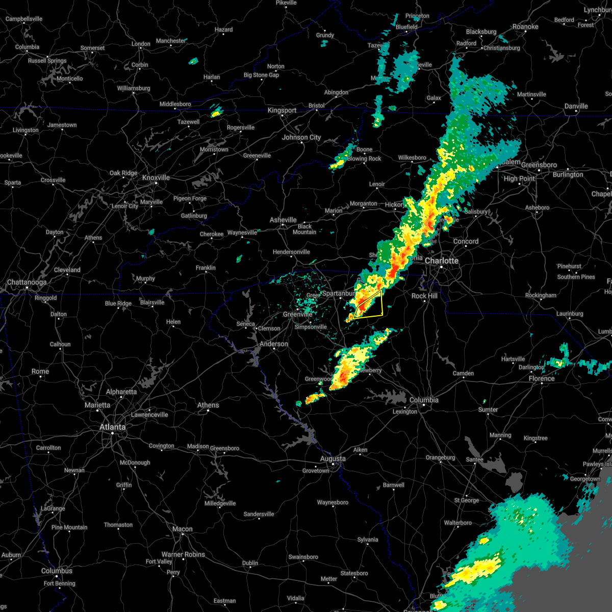 At 336 pm edt, a severe thunderstorm was located 9 miles north of union, or near jonesville, moving northeast at 45 mph (radar indicated). Hazards include 60 mph wind gusts. Expect damage to trees and power lines. Locations impacted include, jonesville, saratt and adamsburg. At 336 pm edt, a severe thunderstorm was located 9 miles north of union, or near jonesville, moving northeast at 45 mph (radar indicated). Hazards include 60 mph wind gusts. Expect damage to trees and power lines. Locations impacted include, jonesville, saratt and adamsburg.
|
| 3/18/2021 3:17 PM EDT |
 At 316 pm edt, a severe thunderstorm was located 11 miles south of spartanburg, or 6 miles south of croft state park, moving east at 35 mph (radar indicated). Hazards include 60 mph wind gusts and quarter size hail. Minor hail damage to vehicles is expected. Expect wind damage to trees and power lines. At 316 pm edt, a severe thunderstorm was located 11 miles south of spartanburg, or 6 miles south of croft state park, moving east at 35 mph (radar indicated). Hazards include 60 mph wind gusts and quarter size hail. Minor hail damage to vehicles is expected. Expect wind damage to trees and power lines.
|
| 10/11/2020 7:37 AM EDT |
 The tornado warning for south central cherokee and northern union counties will expire at 745 am edt, the storm which prompted the warning has weakened below severe limits, and no longer appears capable of producing a tornado. therefore, the warning will be allowed to expire at 745 am edt. however, gusty winds and heavy rain are still possible with this thunderstorm. The tornado warning for south central cherokee and northern union counties will expire at 745 am edt, the storm which prompted the warning has weakened below severe limits, and no longer appears capable of producing a tornado. therefore, the warning will be allowed to expire at 745 am edt. however, gusty winds and heavy rain are still possible with this thunderstorm.
|
| 10/11/2020 7:31 AM EDT |
 At 729 am edt, a severe thunderstorm capable of producing a tornado was located 4 miles west of union, or near buffalo, moving northeast at 25 mph (radar indicated rotation). Hazards include tornado. Flying debris will be dangerous to those caught without shelter. mobile homes will be damaged or destroyed. damage to roofs, windows, and vehicles will occur. tree damage is likely. this dangerous storm will be near, union, buffalo and monarch mill around 740 am edt. jonesville around 750 am edt. lockhart around 800 am edt. Other locations impacted by this dangerous storm include adamsburg and saratt. At 729 am edt, a severe thunderstorm capable of producing a tornado was located 4 miles west of union, or near buffalo, moving northeast at 25 mph (radar indicated rotation). Hazards include tornado. Flying debris will be dangerous to those caught without shelter. mobile homes will be damaged or destroyed. damage to roofs, windows, and vehicles will occur. tree damage is likely. this dangerous storm will be near, union, buffalo and monarch mill around 740 am edt. jonesville around 750 am edt. lockhart around 800 am edt. Other locations impacted by this dangerous storm include adamsburg and saratt.
|
| 10/11/2020 7:16 AM EDT |
 At 715 am edt, a severe thunderstorm capable of producing a tornado was located 11 miles southwest of union, or 8 miles west of rose hill state park, moving northeast at 25 mph (radar indicated rotation). Hazards include tornado. Flying debris will be dangerous to those caught without shelter. mobile homes will be damaged or destroyed. damage to roofs, windows, and vehicles will occur. tree damage is likely. this dangerous storm will be near, buffalo around 740 am edt. union, jonesville and monarch mill around 750 am edt. Other locations impacted by this dangerous storm include cross keys, sedalia, adamsburg, saratt and cross anchor. At 715 am edt, a severe thunderstorm capable of producing a tornado was located 11 miles southwest of union, or 8 miles west of rose hill state park, moving northeast at 25 mph (radar indicated rotation). Hazards include tornado. Flying debris will be dangerous to those caught without shelter. mobile homes will be damaged or destroyed. damage to roofs, windows, and vehicles will occur. tree damage is likely. this dangerous storm will be near, buffalo around 740 am edt. union, jonesville and monarch mill around 750 am edt. Other locations impacted by this dangerous storm include cross keys, sedalia, adamsburg, saratt and cross anchor.
|
| 10/11/2020 6:54 AM EDT |
 At 653 am edt, a severe thunderstorm capable of producing a tornado was located 8 miles northeast of laurens, or 6 miles north of clinton, moving northeast at 25 mph (radar indicated rotation). Hazards include tornado. Flying debris will be dangerous to those caught without shelter. mobile homes will be damaged or destroyed. damage to roofs, windows, and vehicles will occur. tree damage is likely. this dangerous storm will be near, buffalo around 730 am edt. union, jonesville and monarch mill around 740 am edt. Other locations impacted by this dangerous thunderstorm include cross keys, saratt, pauline, cross anchor and sedalia. At 653 am edt, a severe thunderstorm capable of producing a tornado was located 8 miles northeast of laurens, or 6 miles north of clinton, moving northeast at 25 mph (radar indicated rotation). Hazards include tornado. Flying debris will be dangerous to those caught without shelter. mobile homes will be damaged or destroyed. damage to roofs, windows, and vehicles will occur. tree damage is likely. this dangerous storm will be near, buffalo around 730 am edt. union, jonesville and monarch mill around 740 am edt. Other locations impacted by this dangerous thunderstorm include cross keys, saratt, pauline, cross anchor and sedalia.
|
| 8/9/2020 5:56 PM EDT |
 The severe thunderstorm warning for northern union county will expire at 600 pm edt, the storm which prompted the warning has weakened below severe limits, and no longer poses an immediate threat to life or property. therefore the warning will be allowed to expire. however gusty winds and heavy rain are still possible with this thunderstorm. if you observed large hail or wind damage, please report it to the national weather service greenville-spartanburg by calling toll free, 1, 800, 2 6 7, 8 1 0 1, or by posting on our facebook page, or tweet it using hashtag nwsgsp. your message should describe the event and the specific location where it occurred. The severe thunderstorm warning for northern union county will expire at 600 pm edt, the storm which prompted the warning has weakened below severe limits, and no longer poses an immediate threat to life or property. therefore the warning will be allowed to expire. however gusty winds and heavy rain are still possible with this thunderstorm. if you observed large hail or wind damage, please report it to the national weather service greenville-spartanburg by calling toll free, 1, 800, 2 6 7, 8 1 0 1, or by posting on our facebook page, or tweet it using hashtag nwsgsp. your message should describe the event and the specific location where it occurred.
|
| 8/9/2020 5:38 PM EDT |
 At 537 pm edt, a severe thunderstorm was located 6 miles northwest of union, or near jonesville, moving east at 15 mph (radar indicated). Hazards include 60 mph wind gusts. Expect damage to trees and power lines. Locations impacted include, union, monarch mill, buffalo, jonesville, lockhart, adamsburg and santuc. At 537 pm edt, a severe thunderstorm was located 6 miles northwest of union, or near jonesville, moving east at 15 mph (radar indicated). Hazards include 60 mph wind gusts. Expect damage to trees and power lines. Locations impacted include, union, monarch mill, buffalo, jonesville, lockhart, adamsburg and santuc.
|
| 8/9/2020 5:21 PM EDT |
 At 521 pm edt, a severe thunderstorm was located 9 miles northwest of union, or 5 miles southwest of jonesville, moving southeast at 15 mph (radar indicated). Hazards include 60 mph wind gusts and penny size hail. expect damage to trees and power lines At 521 pm edt, a severe thunderstorm was located 9 miles northwest of union, or 5 miles southwest of jonesville, moving southeast at 15 mph (radar indicated). Hazards include 60 mph wind gusts and penny size hail. expect damage to trees and power lines
|
| 7/18/2020 5:39 PM EDT |
 The severe thunderstorm warning for northwestern chester, southwestern york, southeastern cherokee and northeastern union counties will expire at 545 pm edt, the storm which prompted the warning has weakened below severe limits, and no longer poses an immediate threat to life or property. therefore the warning will be allowed to expire. however gusty winds and heavy rain are still possible with this thunderstorm. The severe thunderstorm warning for northwestern chester, southwestern york, southeastern cherokee and northeastern union counties will expire at 545 pm edt, the storm which prompted the warning has weakened below severe limits, and no longer poses an immediate threat to life or property. therefore the warning will be allowed to expire. however gusty winds and heavy rain are still possible with this thunderstorm.
|
| 7/18/2020 5:20 PM EDT |
 The severe thunderstorm warning for northeastern spartanburg, southwestern cherokee and northwestern union counties will expire at 530 pm edt, the storm which prompted the warning has moved out of the area. therefore the warning will be allowed to expire. however gusty winds and heavy rain are still possible with this thunderstorm. The severe thunderstorm warning for northeastern spartanburg, southwestern cherokee and northwestern union counties will expire at 530 pm edt, the storm which prompted the warning has moved out of the area. therefore the warning will be allowed to expire. however gusty winds and heavy rain are still possible with this thunderstorm.
|
| 7/18/2020 4:55 PM EDT |
 At 455 pm edt, a severe thunderstorm was located 11 miles southeast of gaffney, or 4 miles west of hickory grove, moving east at 10 mph (radar indicated). Hazards include 60 mph wind gusts and quarter size hail. Minor hail damage to vehicles is expected. Expect wind damage to trees and power lines. At 455 pm edt, a severe thunderstorm was located 11 miles southeast of gaffney, or 4 miles west of hickory grove, moving east at 10 mph (radar indicated). Hazards include 60 mph wind gusts and quarter size hail. Minor hail damage to vehicles is expected. Expect wind damage to trees and power lines.
|
| 7/18/2020 4:39 PM EDT |
 At 438 pm edt, a severe thunderstorm was located 5 miles southeast of spartanburg, or near cedar springs, and is nearly stationary (radar indicated). Hazards include 60 mph wind gusts and quarter size hail. Minor hail damage to vehicles is expected. Expect wind damage to trees and power lines. At 438 pm edt, a severe thunderstorm was located 5 miles southeast of spartanburg, or near cedar springs, and is nearly stationary (radar indicated). Hazards include 60 mph wind gusts and quarter size hail. Minor hail damage to vehicles is expected. Expect wind damage to trees and power lines.
|
| 6/28/2020 6:39 PM EDT |
 At 638 pm edt, severe thunderstorms were located along a line extending from 8 miles southeast of spartanburg to 11 miles northeast of laurens, moving east at 30 mph (radar indicated). Hazards include 60 mph wind gusts and quarter size hail. Minor hail damage to vehicles is expected. Expect wind damage to trees and power lines. At 638 pm edt, severe thunderstorms were located along a line extending from 8 miles southeast of spartanburg to 11 miles northeast of laurens, moving east at 30 mph (radar indicated). Hazards include 60 mph wind gusts and quarter size hail. Minor hail damage to vehicles is expected. Expect wind damage to trees and power lines.
|
| 6/28/2020 6:31 PM EDT |
 At 630 pm edt, severe thunderstorms were located along a line extending from 4 miles south of spartanburg to 11 miles north of laurens to 12 miles north of abbeville, moving east at 45 mph (radar indicated). Hazards include 60 mph wind gusts and penny size hail. Expect damage to trees and power lines. Locations impacted include, spartanburg, laurens, clinton, pacolet, ware shoals, roebuck, buffalo, jonesville, waterloo and croft state park. At 630 pm edt, severe thunderstorms were located along a line extending from 4 miles south of spartanburg to 11 miles north of laurens to 12 miles north of abbeville, moving east at 45 mph (radar indicated). Hazards include 60 mph wind gusts and penny size hail. Expect damage to trees and power lines. Locations impacted include, spartanburg, laurens, clinton, pacolet, ware shoals, roebuck, buffalo, jonesville, waterloo and croft state park.
|
| 6/28/2020 6:14 PM EDT |
 At 613 pm edt, severe thunderstorms were located along a line extending from 12 miles west of spartanburg to 11 miles northwest of laurens to 14 miles north of abbeville, moving southeast at 40 mph (radar indicated). Hazards include 60 mph wind gusts and penny size hail. Expect damage to trees and power lines. Locations impacted include, spartanburg, laurens, clinton, fountain inn, woodruff, duncan, lyman, pacolet, ware shoals and wellford. At 613 pm edt, severe thunderstorms were located along a line extending from 12 miles west of spartanburg to 11 miles northwest of laurens to 14 miles north of abbeville, moving southeast at 40 mph (radar indicated). Hazards include 60 mph wind gusts and penny size hail. Expect damage to trees and power lines. Locations impacted include, spartanburg, laurens, clinton, fountain inn, woodruff, duncan, lyman, pacolet, ware shoals and wellford.
|
| 6/28/2020 5:54 PM EDT |
 At 554 pm edt, severe thunderstorms were located along a line extending from 17 miles south of columbus to 11 miles south of greenville downtown to 5 miles southeast of anderson, moving east at 40 mph (radar indicated). Hazards include 60 mph wind gusts and penny size hail. expect damage to trees and power lines At 554 pm edt, severe thunderstorms were located along a line extending from 17 miles south of columbus to 11 miles south of greenville downtown to 5 miles southeast of anderson, moving east at 40 mph (radar indicated). Hazards include 60 mph wind gusts and penny size hail. expect damage to trees and power lines
|
| 5/28/2020 9:31 PM EDT |
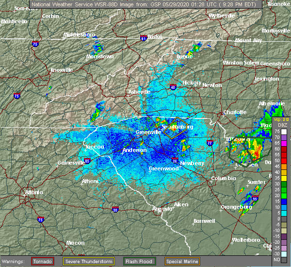 At 931 pm edt, a severe thunderstorm was located 8 miles south of gaffney, or near pacolet mills, moving northeast at 25 mph (radar indicated). Hazards include 60 mph wind gusts and quarter size hail. Minor hail damage to vehicles is expected. expect wind damage to trees and power lines. Locations impacted include, gaffney, cherokee falls, draytonville and thicketty. At 931 pm edt, a severe thunderstorm was located 8 miles south of gaffney, or near pacolet mills, moving northeast at 25 mph (radar indicated). Hazards include 60 mph wind gusts and quarter size hail. Minor hail damage to vehicles is expected. expect wind damage to trees and power lines. Locations impacted include, gaffney, cherokee falls, draytonville and thicketty.
|
| 5/28/2020 9:19 PM EDT |
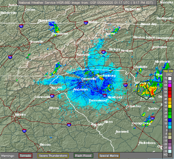 At 919 pm edt, a severe thunderstorm was located 9 miles east of spartanburg, or near pacolet mills, moving northeast at 25 mph (radar indicated). Hazards include 60 mph wind gusts and quarter size hail. Minor hail damage to vehicles is expected. Expect wind damage to trees and power lines. At 919 pm edt, a severe thunderstorm was located 9 miles east of spartanburg, or near pacolet mills, moving northeast at 25 mph (radar indicated). Hazards include 60 mph wind gusts and quarter size hail. Minor hail damage to vehicles is expected. Expect wind damage to trees and power lines.
|
| 5/22/2020 3:40 PM EDT |
 The severe thunderstorm warning for southeastern rutherford, southeastern polk, southern cleveland, northwestern laurens, spartanburg, cherokee and central union counties will expire at 345 pm edt, the storms which prompted the warning have moved out of the area. therefore the warning will be allowed to expire. however small hail, gusty winds and heavy rain are still possible with these thunderstorms. a severe thunderstorm watch remains in effect until 800 pm edt for western and the piedmont of north carolina, and upstate south carolina. remember, a severe thunderstorm warning still remains in effect for cherokee county until 4:00 pm. The severe thunderstorm warning for southeastern rutherford, southeastern polk, southern cleveland, northwestern laurens, spartanburg, cherokee and central union counties will expire at 345 pm edt, the storms which prompted the warning have moved out of the area. therefore the warning will be allowed to expire. however small hail, gusty winds and heavy rain are still possible with these thunderstorms. a severe thunderstorm watch remains in effect until 800 pm edt for western and the piedmont of north carolina, and upstate south carolina. remember, a severe thunderstorm warning still remains in effect for cherokee county until 4:00 pm.
|
| 5/22/2020 2:58 PM EDT |
 At 258 pm edt, severe thunderstorms were located along a line extending from 7 miles south of rutherfordton to 15 miles northwest of laurens, moving east at 40 mph (radar indicated). Hazards include 60 mph wind gusts and quarter size hail. Minor hail damage to vehicles is expected. Expect wind damage to trees and power lines. At 258 pm edt, severe thunderstorms were located along a line extending from 7 miles south of rutherfordton to 15 miles northwest of laurens, moving east at 40 mph (radar indicated). Hazards include 60 mph wind gusts and quarter size hail. Minor hail damage to vehicles is expected. Expect wind damage to trees and power lines.
|
| 5/5/2020 7:50 PM EDT |
 At 749 pm edt, severe thunderstorms were located along a line extending from 10 miles southeast of gaffney to 5 miles northwest of union to 10 miles northeast of laurens, moving east at 45 mph (radar indicated). Hazards include 60 mph wind gusts and penny size hail. expect damage to trees and power lines At 749 pm edt, severe thunderstorms were located along a line extending from 10 miles southeast of gaffney to 5 miles northwest of union to 10 miles northeast of laurens, moving east at 45 mph (radar indicated). Hazards include 60 mph wind gusts and penny size hail. expect damage to trees and power lines
|
| 5/5/2020 7:19 PM EDT |
 At 719 pm edt, a severe thunderstorm was located 11 miles south of gaffney, or near pacolet mills, moving east at 45 mph (radar indicated). Hazards include ping pong ball size hail and 60 mph wind gusts. People and animals outdoors will be injured. expect hail damage to roofs, siding, windows, and vehicles. expect wind damage to trees and power lines. Locations impacted include, pacolet, jonesville, pacolet mills, croft state park, cedar springs, pauline, thicketty, cowpens and spartanburg. At 719 pm edt, a severe thunderstorm was located 11 miles south of gaffney, or near pacolet mills, moving east at 45 mph (radar indicated). Hazards include ping pong ball size hail and 60 mph wind gusts. People and animals outdoors will be injured. expect hail damage to roofs, siding, windows, and vehicles. expect wind damage to trees and power lines. Locations impacted include, pacolet, jonesville, pacolet mills, croft state park, cedar springs, pauline, thicketty, cowpens and spartanburg.
|
| 5/5/2020 6:55 PM EDT |
 At 654 pm edt, a severe thunderstorm was located 7 miles west of spartanburg, or near wellford, moving east at 40 mph (radar indicated). Hazards include 60 mph wind gusts and quarter size hail. Minor hail damage to vehicles is expected. Expect wind damage to trees and power lines. At 654 pm edt, a severe thunderstorm was located 7 miles west of spartanburg, or near wellford, moving east at 40 mph (radar indicated). Hazards include 60 mph wind gusts and quarter size hail. Minor hail damage to vehicles is expected. Expect wind damage to trees and power lines.
|
| 5/5/2020 6:15 PM EDT |
 At 614 pm edt, a severe thunderstorm was located 12 miles north of union, or 8 miles northwest of lockhart, moving east at 55 mph (radar indicated). Hazards include 60 mph wind gusts and quarter size hail. Minor hail damage to vehicles is expected. expect wind damage to trees and power lines. Locations impacted include, jonesville, adamsburg, saratt, lockhart, monarch mill and union. At 614 pm edt, a severe thunderstorm was located 12 miles north of union, or 8 miles northwest of lockhart, moving east at 55 mph (radar indicated). Hazards include 60 mph wind gusts and quarter size hail. Minor hail damage to vehicles is expected. expect wind damage to trees and power lines. Locations impacted include, jonesville, adamsburg, saratt, lockhart, monarch mill and union.
|
| 5/5/2020 5:51 PM EDT |
 At 550 pm edt, a severe thunderstorm was located 4 miles south of spartanburg, or over roebuck, moving east at 55 mph (radar indicated and public reports). Hazards include golf ball size hail and 70 mph wind gusts. People and animals outdoors will be injured. expect hail damage to roofs, siding, windows, and vehicles. expect considerable tree damage. wind damage is also likely to mobile homes, roofs, and outbuildings. Locations impacted include, spartanburg, pacolet, roebuck, jonesville, pacolet mills, croft state park, moore, cedar springs, pauline and saratt. At 550 pm edt, a severe thunderstorm was located 4 miles south of spartanburg, or over roebuck, moving east at 55 mph (radar indicated and public reports). Hazards include golf ball size hail and 70 mph wind gusts. People and animals outdoors will be injured. expect hail damage to roofs, siding, windows, and vehicles. expect considerable tree damage. wind damage is also likely to mobile homes, roofs, and outbuildings. Locations impacted include, spartanburg, pacolet, roebuck, jonesville, pacolet mills, croft state park, moore, cedar springs, pauline and saratt.
|
| 5/5/2020 5:39 PM EDT |
 At 539 pm edt, a severe thunderstorm was located 13 miles southwest of spartanburg, or near reidville, moving east at 55 mph (radar indicated). Hazards include 70 mph wind gusts and quarter size hail. Minor hail damage to vehicles is expected. expect considerable tree damage. Wind damage is also likely to mobile homes, roofs, and outbuildings. At 539 pm edt, a severe thunderstorm was located 13 miles southwest of spartanburg, or near reidville, moving east at 55 mph (radar indicated). Hazards include 70 mph wind gusts and quarter size hail. Minor hail damage to vehicles is expected. expect considerable tree damage. Wind damage is also likely to mobile homes, roofs, and outbuildings.
|
| 5/5/2020 3:49 AM EDT |
 At 348 am edt, severe thunderstorms were located along a line extending from 11 miles northwest of york to 9 miles northwest of chester to 16 miles northwest of vc summer nuclear station, moving east at 55 mph (radar indicated). Hazards include 60 mph wind gusts and quarter size hail. Minor hail damage to vehicles is expected. expect wind damage to trees and power lines. Locations impacted include, spartanburg, gaffney, union, york, chester, clinton, clover, boiling springs sc, pacolet and cowpens. At 348 am edt, severe thunderstorms were located along a line extending from 11 miles northwest of york to 9 miles northwest of chester to 16 miles northwest of vc summer nuclear station, moving east at 55 mph (radar indicated). Hazards include 60 mph wind gusts and quarter size hail. Minor hail damage to vehicles is expected. expect wind damage to trees and power lines. Locations impacted include, spartanburg, gaffney, union, york, chester, clinton, clover, boiling springs sc, pacolet and cowpens.
|
| 5/5/2020 3:22 AM EDT |
 At 321 am edt, severe thunderstorms were located along a line extending from 7 miles northeast of spartanburg to 5 miles west of union to 10 miles southeast of laurens, moving east at 55 mph (radar indicated). Hazards include 60 mph wind gusts and quarter size hail. Minor hail damage to vehicles is expected. Expect wind damage to trees and power lines. At 321 am edt, severe thunderstorms were located along a line extending from 7 miles northeast of spartanburg to 5 miles west of union to 10 miles southeast of laurens, moving east at 55 mph (radar indicated). Hazards include 60 mph wind gusts and quarter size hail. Minor hail damage to vehicles is expected. Expect wind damage to trees and power lines.
|
| 5/5/2020 3:15 AM EDT |
 At 314 am edt, severe thunderstorms were located along a line extending from 5 miles west of spartanburg to 15 miles northwest of union to 9 miles southwest of laurens, moving east at 55 mph (radar indicated). Hazards include 70 mph wind gusts and quarter size hail. Minor hail damage to vehicles is expected. expect considerable tree damage. wind damage is also likely to mobile homes, roofs, and outbuildings. Locations impacted include, greenville downtown, spartanburg, greenwood, laurens, union, greenville eastside, greer, mauldin, taylors and clinton. At 314 am edt, severe thunderstorms were located along a line extending from 5 miles west of spartanburg to 15 miles northwest of union to 9 miles southwest of laurens, moving east at 55 mph (radar indicated). Hazards include 70 mph wind gusts and quarter size hail. Minor hail damage to vehicles is expected. expect considerable tree damage. wind damage is also likely to mobile homes, roofs, and outbuildings. Locations impacted include, greenville downtown, spartanburg, greenwood, laurens, union, greenville eastside, greer, mauldin, taylors and clinton.
|
| 5/5/2020 3:00 AM EDT |
 At 258 am edt, severe thunderstorms were located along a line extending from 9 miles northeast of greenville downtown to 14 miles southwest of spartanburg to 7 miles north of laurens to 13 miles north of abbeville, moving east at 60 mph (radar indicated). Hazards include 70 mph wind gusts and quarter size hail. Minor hail damage to vehicles is expected. expect considerable tree damage. wind damage is also likely to mobile homes, roofs, and outbuildings. Locations impacted include, greenville downtown, spartanburg, greenwood, laurens, union, abbeville, greenville eastside, west greenville, greer and mauldin. At 258 am edt, severe thunderstorms were located along a line extending from 9 miles northeast of greenville downtown to 14 miles southwest of spartanburg to 7 miles north of laurens to 13 miles north of abbeville, moving east at 60 mph (radar indicated). Hazards include 70 mph wind gusts and quarter size hail. Minor hail damage to vehicles is expected. expect considerable tree damage. wind damage is also likely to mobile homes, roofs, and outbuildings. Locations impacted include, greenville downtown, spartanburg, greenwood, laurens, union, abbeville, greenville eastside, west greenville, greer and mauldin.
|
| 5/5/2020 2:40 AM EDT |
 At 239 am edt, severe thunderstorms were located along a line extending from 10 miles northeast of easley to 7 miles southeast of greenville downtown to 9 miles northwest of abbeville, moving east at 65 mph (radar indicated). Hazards include 70 mph wind gusts and quarter size hail. Minor hail damage to vehicles is expected. expect considerable tree damage. Wind damage is also likely to mobile homes, roofs, and outbuildings. At 239 am edt, severe thunderstorms were located along a line extending from 10 miles northeast of easley to 7 miles southeast of greenville downtown to 9 miles northwest of abbeville, moving east at 65 mph (radar indicated). Hazards include 70 mph wind gusts and quarter size hail. Minor hail damage to vehicles is expected. expect considerable tree damage. Wind damage is also likely to mobile homes, roofs, and outbuildings.
|
| 4/13/2020 4:13 AM EDT |
 At 413 am edt, severe thunderstorms were located along a line extending from 10 miles southeast of shelby to 13 miles west of newberry, moving northeast at 30 mph (radar indicated). Hazards include 60 mph wind gusts. expect damage to trees and power lines At 413 am edt, severe thunderstorms were located along a line extending from 10 miles southeast of shelby to 13 miles west of newberry, moving northeast at 30 mph (radar indicated). Hazards include 60 mph wind gusts. expect damage to trees and power lines
|
| 4/8/2020 6:31 PM EDT |
 At 631 pm edt, a severe thunderstorm was located 11 miles south of gaffney, or 4 miles east of pacolet, moving southeast at 30 mph (radar indicated). Hazards include 60 mph wind gusts and quarter size hail. Minor hail damage to vehicles is expected. Expect wind damage to trees and power lines. At 631 pm edt, a severe thunderstorm was located 11 miles south of gaffney, or 4 miles east of pacolet, moving southeast at 30 mph (radar indicated). Hazards include 60 mph wind gusts and quarter size hail. Minor hail damage to vehicles is expected. Expect wind damage to trees and power lines.
|
| 1/11/2020 9:21 PM EST |
 At 920 pm est, severe thunderstorms were located along a line extending from 7 miles north of gaffney to 14 miles south of union, moving east at 45 mph (radar indicated). Hazards include 60 mph wind gusts. expect damage to trees and power lines At 920 pm est, severe thunderstorms were located along a line extending from 7 miles north of gaffney to 14 miles south of union, moving east at 45 mph (radar indicated). Hazards include 60 mph wind gusts. expect damage to trees and power lines
|
| 1/11/2020 9:12 PM EST |
 At 911 pm est, severe thunderstorms were located along a line extending from 13 miles west of union to 9 miles east of laurens to 15 miles west of newberry, moving northeast at 70 mph (radar indicated). Hazards include 60 mph wind gusts. Expect damage to trees and power lines. locations impacted include, laurens, union, clinton, joanna, buffalo, jonesville, cross hill, rose hill state park, mountville and kinards. A tornado watch remains in effect until midnight est for upstate south carolina. At 911 pm est, severe thunderstorms were located along a line extending from 13 miles west of union to 9 miles east of laurens to 15 miles west of newberry, moving northeast at 70 mph (radar indicated). Hazards include 60 mph wind gusts. Expect damage to trees and power lines. locations impacted include, laurens, union, clinton, joanna, buffalo, jonesville, cross hill, rose hill state park, mountville and kinards. A tornado watch remains in effect until midnight est for upstate south carolina.
|
| 1/11/2020 8:59 PM EST |
 At 859 pm est, severe thunderstorms were located along a line extending from 10 miles south of forest city to 5 miles south of spartanburg to 11 miles northwest of laurens, moving northeast at 50 mph (radar indicated). Hazards include 60 mph wind gusts. expect damage to trees and power lines At 859 pm est, severe thunderstorms were located along a line extending from 10 miles south of forest city to 5 miles south of spartanburg to 11 miles northwest of laurens, moving northeast at 50 mph (radar indicated). Hazards include 60 mph wind gusts. expect damage to trees and power lines
|
| 1/11/2020 8:56 PM EST |
 At 855 pm est, severe thunderstorms were located along a line extending from 9 miles north of laurens to 10 miles northeast of greenwood to 19 miles southeast of abbeville, moving northeast at 65 mph (radar indicated). Hazards include 60 mph wind gusts. expect damage to trees and power lines At 855 pm est, severe thunderstorms were located along a line extending from 9 miles north of laurens to 10 miles northeast of greenwood to 19 miles southeast of abbeville, moving northeast at 65 mph (radar indicated). Hazards include 60 mph wind gusts. expect damage to trees and power lines
|
| 10/31/2019 4:50 PM EDT |
 At 450 pm edt, severe thunderstorms were located along a line extending from 3 miles southeast of lincolnton to 3 miles south of gastonia to 9 miles northeast of union, moving northeast at 50 mph (radar indicated). Hazards include 60 mph wind gusts. Expect damage to trees and power lines. locations impacted include, gastonia, union, york, kings mountain, mt holly, belmont, cherryville, bessemer city, south gastonia and clover. A tornado watch remains in effect until 1100 pm edt for the piedmont of north carolina, and upstate south carolina. At 450 pm edt, severe thunderstorms were located along a line extending from 3 miles southeast of lincolnton to 3 miles south of gastonia to 9 miles northeast of union, moving northeast at 50 mph (radar indicated). Hazards include 60 mph wind gusts. Expect damage to trees and power lines. locations impacted include, gastonia, union, york, kings mountain, mt holly, belmont, cherryville, bessemer city, south gastonia and clover. A tornado watch remains in effect until 1100 pm edt for the piedmont of north carolina, and upstate south carolina.
|
| 10/31/2019 4:30 PM EDT |
 At 430 pm edt, severe thunderstorms were located along a line extending from 3 miles southeast of shelby to 12 miles southeast of gaffney to 12 miles northeast of laurens, moving northeast at 40 mph (radar indicated). Hazards include 60 mph wind gusts. expect damage to trees and power lines At 430 pm edt, severe thunderstorms were located along a line extending from 3 miles southeast of shelby to 12 miles southeast of gaffney to 12 miles northeast of laurens, moving northeast at 40 mph (radar indicated). Hazards include 60 mph wind gusts. expect damage to trees and power lines
|
| 10/31/2019 4:17 PM EDT |
 At 416 pm edt, severe thunderstorms were located along a line extending from 10 miles north of union to 13 miles northeast of laurens, moving northeast at 60 mph (radar indicated). Hazards include 60 mph wind gusts. Expect damage to trees and power lines. locations impacted include, gaffney, laurens, union, clinton, woodruff, pacolet, buffalo, gray court, jonesville and pacolet mills. A tornado watch remains in effect until 1100 pm edt for upstate south carolina. At 416 pm edt, severe thunderstorms were located along a line extending from 10 miles north of union to 13 miles northeast of laurens, moving northeast at 60 mph (radar indicated). Hazards include 60 mph wind gusts. Expect damage to trees and power lines. locations impacted include, gaffney, laurens, union, clinton, woodruff, pacolet, buffalo, gray court, jonesville and pacolet mills. A tornado watch remains in effect until 1100 pm edt for upstate south carolina.
|
| 10/31/2019 3:46 PM EDT |
 At 346 pm edt, severe thunderstorms were located along a line extending from 7 miles northwest of laurens to 12 miles north of abbeville, moving northeast at 60 mph (radar indicated). Hazards include 60 mph wind gusts. expect damage to trees and power lines At 346 pm edt, severe thunderstorms were located along a line extending from 7 miles northwest of laurens to 12 miles north of abbeville, moving northeast at 60 mph (radar indicated). Hazards include 60 mph wind gusts. expect damage to trees and power lines
|
| 8/14/2019 1:27 AM EDT |
 The severe thunderstorm warning for central spartanburg, southwestern cherokee and northern union counties will expire at 130 am edt, the storm which prompted the warning has weakened below severe limits, and no longer poses an immediate threat to life or property. therefore, the warning will be allowed to expire. however, gusty winds are still possible with this thunderstorm. The severe thunderstorm warning for central spartanburg, southwestern cherokee and northern union counties will expire at 130 am edt, the storm which prompted the warning has weakened below severe limits, and no longer poses an immediate threat to life or property. therefore, the warning will be allowed to expire. however, gusty winds are still possible with this thunderstorm.
|
| 8/14/2019 12:58 AM EDT |
 At 1258 am edt, a severe thunderstorm was located 7 miles southeast of spartanburg, or near croft state park, moving east at 25 mph (radar indicated). Hazards include 60 mph wind gusts and penny size hail. Expect damage to trees and power lines. Locations impacted include, spartanburg, union, woodruff, pacolet, monarch mill, roebuck, buffalo, jonesville, pacolet mills and croft state park. At 1258 am edt, a severe thunderstorm was located 7 miles southeast of spartanburg, or near croft state park, moving east at 25 mph (radar indicated). Hazards include 60 mph wind gusts and penny size hail. Expect damage to trees and power lines. Locations impacted include, spartanburg, union, woodruff, pacolet, monarch mill, roebuck, buffalo, jonesville, pacolet mills and croft state park.
|
| 8/14/2019 12:40 AM EDT |
 At 1240 am edt, a severe thunderstorm was located 12 miles southwest of spartanburg, or near moore, moving east at 35 mph (radar indicated). Hazards include 60 mph wind gusts and penny size hail. expect damage to trees and power lines At 1240 am edt, a severe thunderstorm was located 12 miles southwest of spartanburg, or near moore, moving east at 35 mph (radar indicated). Hazards include 60 mph wind gusts and penny size hail. expect damage to trees and power lines
|
| 8/13/2019 4:50 PM EDT |
 At 450 pm edt, a severe thunderstorm was located near union, or near buffalo, moving southeast at 20 mph (radar indicated). Hazards include 60 mph wind gusts and nickel size hail. expect damage to trees and power lines At 450 pm edt, a severe thunderstorm was located near union, or near buffalo, moving southeast at 20 mph (radar indicated). Hazards include 60 mph wind gusts and nickel size hail. expect damage to trees and power lines
|
| 7/18/2019 4:24 PM EDT |
 At 424 pm edt, a severe thunderstorm was located 9 miles northwest of union, or 4 miles southwest of jonesville, moving southeast at 10 mph (radar indicated). Hazards include 60 mph wind gusts and penny size hail. expect damage to trees and power lines At 424 pm edt, a severe thunderstorm was located 9 miles northwest of union, or 4 miles southwest of jonesville, moving southeast at 10 mph (radar indicated). Hazards include 60 mph wind gusts and penny size hail. expect damage to trees and power lines
|
| 7/13/2019 4:11 PM EDT |
 At 411 pm edt, a severe thunderstorm was located 6 miles northeast of union, or 5 miles west of lockhart, moving east at 15 mph (radar indicated). Hazards include 60 mph wind gusts and quarter size hail. Minor hail damage to vehicles is expected. Expect wind damage to trees and power lines. At 411 pm edt, a severe thunderstorm was located 6 miles northeast of union, or 5 miles west of lockhart, moving east at 15 mph (radar indicated). Hazards include 60 mph wind gusts and quarter size hail. Minor hail damage to vehicles is expected. Expect wind damage to trees and power lines.
|
| 7/13/2019 3:48 PM EDT |
 At 347 pm edt, a severe thunderstorm was located 10 miles southeast of spartanburg, or 4 miles south of croft state park, moving southeast at 20 mph (radar indicated). Hazards include 60 mph wind gusts and penny size hail. Expect damage to trees and power lines. Locations impacted include, spartanburg, pacolet, roebuck, jonesville, pacolet mills, moore, croft state park, cedar springs and pauline. At 347 pm edt, a severe thunderstorm was located 10 miles southeast of spartanburg, or 4 miles south of croft state park, moving southeast at 20 mph (radar indicated). Hazards include 60 mph wind gusts and penny size hail. Expect damage to trees and power lines. Locations impacted include, spartanburg, pacolet, roebuck, jonesville, pacolet mills, moore, croft state park, cedar springs and pauline.
|
| 7/13/2019 3:46 PM EDT | Report of tree blown down on cedar grove rd. time estimated from rada in union county SC, 3.3 miles E of Jonesville, SC |
| 7/13/2019 3:29 PM EDT |
 At 328 pm edt, a severe thunderstorm was located 5 miles south of spartanburg, or over roebuck, moving southeast at 10 mph (radar indicated). Hazards include 60 mph wind gusts and quarter size hail. Minor hail damage to vehicles is expected. Expect wind damage to trees and power lines. At 328 pm edt, a severe thunderstorm was located 5 miles south of spartanburg, or over roebuck, moving southeast at 10 mph (radar indicated). Hazards include 60 mph wind gusts and quarter size hail. Minor hail damage to vehicles is expected. Expect wind damage to trees and power lines.
|
| 7/11/2019 7:01 PM EDT |
 At 701 pm edt, a severe thunderstorm was located 10 miles south of gaffney, or near pacolet mills, moving east at 20 mph (radar indicated). Hazards include 60 mph wind gusts. Expect damage to trees and power lines. Locations impacted include, pacolet, jonesville, pacolet mills, croft state park, draytonville, thicketty, pauline and cowpens. At 701 pm edt, a severe thunderstorm was located 10 miles south of gaffney, or near pacolet mills, moving east at 20 mph (radar indicated). Hazards include 60 mph wind gusts. Expect damage to trees and power lines. Locations impacted include, pacolet, jonesville, pacolet mills, croft state park, draytonville, thicketty, pauline and cowpens.
|
| 7/11/2019 6:45 PM EDT |
 The national weather service in greenville-spartanburg has issued a * severe thunderstorm warning for. east central spartanburg county in upstate south carolina. central cherokee county in upstate south carolina. northwestern union county in upstate south carolina. Until 715 pm edt. The national weather service in greenville-spartanburg has issued a * severe thunderstorm warning for. east central spartanburg county in upstate south carolina. central cherokee county in upstate south carolina. northwestern union county in upstate south carolina. Until 715 pm edt.
|
| 6/24/2019 9:05 PM EDT |
 At 904 pm edt, severe thunderstorms were located along a line extending from 8 miles southeast of taylorsville to 11 miles east of newton to 9 miles southeast of lincolnton to 7 miles southeast of gastonia to 5 miles west of york to 13 miles southeast of union, moving east at 35 mph (radar indicated). Hazards include 60 mph wind gusts. Expect damage to trees and power lines. locations impacted include, gastonia, hickory, newton, lincolnton, union, york, mt holly, st. Stephens, belmont and clinton. At 904 pm edt, severe thunderstorms were located along a line extending from 8 miles southeast of taylorsville to 11 miles east of newton to 9 miles southeast of lincolnton to 7 miles southeast of gastonia to 5 miles west of york to 13 miles southeast of union, moving east at 35 mph (radar indicated). Hazards include 60 mph wind gusts. Expect damage to trees and power lines. locations impacted include, gastonia, hickory, newton, lincolnton, union, york, mt holly, st. Stephens, belmont and clinton.
|
| 6/24/2019 8:45 PM EDT |
 At 845 pm edt, severe thunderstorms were located along a line extending from 5 miles northeast of hickory to 5 miles northeast of lincolnton to 8 miles west of gastonia to 7 miles north of york to 13 miles northeast of union to 16 miles north of newberry, moving east at 60 mph (radar indicated). Hazards include 60 mph wind gusts. Expect damage to trees and power lines. Locations impacted include, gastonia, hickory, shelby, newton, gaffney, lincolnton, union, york, kings mountain and mt holly. At 845 pm edt, severe thunderstorms were located along a line extending from 5 miles northeast of hickory to 5 miles northeast of lincolnton to 8 miles west of gastonia to 7 miles north of york to 13 miles northeast of union to 16 miles north of newberry, moving east at 60 mph (radar indicated). Hazards include 60 mph wind gusts. Expect damage to trees and power lines. Locations impacted include, gastonia, hickory, shelby, newton, gaffney, lincolnton, union, york, kings mountain and mt holly.
|
| 6/24/2019 8:26 PM EDT |
 At 826 pm edt, severe thunderstorms were located along a line extending from 8 miles southwest of hickory to 7 miles southeast of shelby to 11 miles north of union to 7 miles southeast of laurens, moving northeast at 35 mph (radar indicated). Hazards include 60 mph wind gusts. expect damage to trees and power lines At 826 pm edt, severe thunderstorms were located along a line extending from 8 miles southwest of hickory to 7 miles southeast of shelby to 11 miles north of union to 7 miles southeast of laurens, moving northeast at 35 mph (radar indicated). Hazards include 60 mph wind gusts. expect damage to trees and power lines
|
| 6/24/2019 8:20 PM EDT |
 At 819 pm edt, severe thunderstorms were located along a line extending from 6 miles north of shelby to 7 miles south of gaffney to 8 miles southeast of laurens, moving east at 40 mph (radar indicated). Hazards include 70 mph wind gusts. Expect considerable tree damage. damage is likely to mobile homes, roofs, and outbuildings. Locations impacted include, spartanburg, shelby, gaffney, laurens, union, kings mountain, clinton, woodruff, boiling springs nc and pacolet. At 819 pm edt, severe thunderstorms were located along a line extending from 6 miles north of shelby to 7 miles south of gaffney to 8 miles southeast of laurens, moving east at 40 mph (radar indicated). Hazards include 70 mph wind gusts. Expect considerable tree damage. damage is likely to mobile homes, roofs, and outbuildings. Locations impacted include, spartanburg, shelby, gaffney, laurens, union, kings mountain, clinton, woodruff, boiling springs nc and pacolet.
|
| 6/24/2019 8:06 PM EDT |
 At 805 pm edt, severe thunderstorms were located along a line extending from 8 miles northwest of shelby to 9 miles southwest of gaffney to 8 miles southwest of laurens, moving east at 40 mph (radar indicated). Hazards include 70 mph wind gusts. Expect considerable tree damage. damage is likely to mobile homes, roofs, and outbuildings. Locations impacted include, spartanburg, shelby, gaffney, laurens, union, forest city, kings mountain, clinton, boiling springs sc and woodruff. At 805 pm edt, severe thunderstorms were located along a line extending from 8 miles northwest of shelby to 9 miles southwest of gaffney to 8 miles southwest of laurens, moving east at 40 mph (radar indicated). Hazards include 70 mph wind gusts. Expect considerable tree damage. damage is likely to mobile homes, roofs, and outbuildings. Locations impacted include, spartanburg, shelby, gaffney, laurens, union, forest city, kings mountain, clinton, boiling springs sc and woodruff.
|
| 6/24/2019 7:53 PM EDT |
 At 753 pm edt, severe thunderstorms were located along a line extending from 5 miles northeast of forest city to near spartanburg to 14 miles southwest of laurens, moving east at 40 mph (radar indicated). Hazards include 70 mph wind gusts. Expect considerable tree damage. Damage is likely to mobile homes, roofs, and outbuildings. At 753 pm edt, severe thunderstorms were located along a line extending from 5 miles northeast of forest city to near spartanburg to 14 miles southwest of laurens, moving east at 40 mph (radar indicated). Hazards include 70 mph wind gusts. Expect considerable tree damage. Damage is likely to mobile homes, roofs, and outbuildings.
|
| 6/22/2019 4:22 PM EDT |
 The severe thunderstorm warning for northwestern chester, york, east central spartanburg, southeastern cherokee and northern union counties will expire at 430 pm edt, the storms which prompted the warning have weakened below severe limits, and no longer pose an immediate threat to life or property. therefore the warning will be allowed to expire. however gusty winds and heavy rain are still possible with these thunderstorms. a severe thunderstorm watch remains in effect until 900 pm edt for the piedmont of north carolina, and upstate south carolina. if you observed large hail or wind damage, please report it to the national weather service greenville-spartanburg by calling toll free, 1, 800, 2 6 7, 8 1 0 1, or by posting on our facebook page, or tweet it using hashtag nwsgsp. your message should describe the event and the specific location where it occurred. The severe thunderstorm warning for northwestern chester, york, east central spartanburg, southeastern cherokee and northern union counties will expire at 430 pm edt, the storms which prompted the warning have weakened below severe limits, and no longer pose an immediate threat to life or property. therefore the warning will be allowed to expire. however gusty winds and heavy rain are still possible with these thunderstorms. a severe thunderstorm watch remains in effect until 900 pm edt for the piedmont of north carolina, and upstate south carolina. if you observed large hail or wind damage, please report it to the national weather service greenville-spartanburg by calling toll free, 1, 800, 2 6 7, 8 1 0 1, or by posting on our facebook page, or tweet it using hashtag nwsgsp. your message should describe the event and the specific location where it occurred.
|
| 6/22/2019 4:02 PM EDT |
 At 402 pm edt, severe thunderstorms were located along a line extending from 8 miles north of york to 9 miles north of union to 9 miles south of spartanburg, moving east at 30 mph (radar indicated). Hazards include 60 mph wind gusts and penny size hail. Expect damage to trees and power lines. Locations impacted include, rock hill, union, york, fort mill, tega cay, clover, newport, town of lake wylie, monarch mill and jonesville. At 402 pm edt, severe thunderstorms were located along a line extending from 8 miles north of york to 9 miles north of union to 9 miles south of spartanburg, moving east at 30 mph (radar indicated). Hazards include 60 mph wind gusts and penny size hail. Expect damage to trees and power lines. Locations impacted include, rock hill, union, york, fort mill, tega cay, clover, newport, town of lake wylie, monarch mill and jonesville.
|
| 6/22/2019 3:42 PM EDT |
 At 342 pm edt, severe thunderstorms were located along a line extending from 8 miles south of shelby to 6 miles southwest of spartanburg, moving east at 60 mph (radar indicated). Hazards include 60 mph wind gusts and penny size hail. expect damage to trees and power lines At 342 pm edt, severe thunderstorms were located along a line extending from 8 miles south of shelby to 6 miles southwest of spartanburg, moving east at 60 mph (radar indicated). Hazards include 60 mph wind gusts and penny size hail. expect damage to trees and power lines
|
| 4/8/2019 4:44 PM EDT |
 At 443 pm edt, a severe thunderstorm was located 4 miles northwest of union, or near buffalo, moving northeast at 45 mph (radar indicated). Hazards include 60 mph wind gusts and penny size hail. Expect damage to trees and power lines. Locations impacted include, union, monarch mill, buffalo, jonesville, carlisle, rose hill state park, cross keys, sedalia, adamsburg and tuckertown. At 443 pm edt, a severe thunderstorm was located 4 miles northwest of union, or near buffalo, moving northeast at 45 mph (radar indicated). Hazards include 60 mph wind gusts and penny size hail. Expect damage to trees and power lines. Locations impacted include, union, monarch mill, buffalo, jonesville, carlisle, rose hill state park, cross keys, sedalia, adamsburg and tuckertown.
|
| 4/8/2019 4:17 PM EDT |
 At 417 pm edt, a severe thunderstorm was located 8 miles north of laurens, or 6 miles east of gray court, moving northeast at 40 mph (radar indicated). Hazards include 60 mph wind gusts and penny size hail. expect damage to trees and power lines At 417 pm edt, a severe thunderstorm was located 8 miles north of laurens, or 6 miles east of gray court, moving northeast at 40 mph (radar indicated). Hazards include 60 mph wind gusts and penny size hail. expect damage to trees and power lines
|
| 9/27/2018 7:51 PM EDT |
 At 749 pm edt, severe thunderstorms were located along a line extending from 12 miles southwest of columbus to near inman to spartanburg to near pauline, moving northeast at 55 mph (law enforcement). Hazards include 60 mph wind gusts and penny size hail. expect damage to trees and power lines At 749 pm edt, severe thunderstorms were located along a line extending from 12 miles southwest of columbus to near inman to spartanburg to near pauline, moving northeast at 55 mph (law enforcement). Hazards include 60 mph wind gusts and penny size hail. expect damage to trees and power lines
|
| 8/6/2018 5:38 PM EDT |
 At 538 pm edt, a severe thunderstorm was located 9 miles southeast of spartanburg, or near croft state park, moving southeast at 15 mph (radar indicated). Hazards include 60 mph wind gusts and quarter size hail. Minor hail damage to vehicles is expected. expect wind damage to trees and power lines. Locations impacted include, union, pacolet, monarch mill, roebuck, buffalo, jonesville, pacolet mills, croft state park, cedar springs and pauline. At 538 pm edt, a severe thunderstorm was located 9 miles southeast of spartanburg, or near croft state park, moving southeast at 15 mph (radar indicated). Hazards include 60 mph wind gusts and quarter size hail. Minor hail damage to vehicles is expected. expect wind damage to trees and power lines. Locations impacted include, union, pacolet, monarch mill, roebuck, buffalo, jonesville, pacolet mills, croft state park, cedar springs and pauline.
|
| 8/6/2018 5:17 PM EDT |
 At 517 pm edt, a severe thunderstorm was located 6 miles southeast of spartanburg, or near croft state park, moving southeast at 15 mph (radar indicated). Hazards include 60 mph wind gusts and quarter size hail. Minor hail damage to vehicles is expected. Expect wind damage to trees and power lines. At 517 pm edt, a severe thunderstorm was located 6 miles southeast of spartanburg, or near croft state park, moving southeast at 15 mph (radar indicated). Hazards include 60 mph wind gusts and quarter size hail. Minor hail damage to vehicles is expected. Expect wind damage to trees and power lines.
|
| 7/21/2018 8:22 PM EDT |
 At 822 pm edt, a severe thunderstorm was located 11 miles northwest of union, or near pacolet, moving east at 20 mph (numerous reports from members of the public as the storm went through spartanburg). Hazards include 60 mph wind gusts and half dollar size hail. Minor hail damage to vehicles is expected. Expect wind damage to trees and power lines. At 822 pm edt, a severe thunderstorm was located 11 miles northwest of union, or near pacolet, moving east at 20 mph (numerous reports from members of the public as the storm went through spartanburg). Hazards include 60 mph wind gusts and half dollar size hail. Minor hail damage to vehicles is expected. Expect wind damage to trees and power lines.
|
| 7/21/2018 8:11 PM EDT |
 At 810 pm edt, severe thunderstorms were located along a line extending from 6 miles east of gaffney to 4 miles southeast of spartanburg, moving east at 15 mph (hail reported by a member of the public. winds indicated by radar). Hazards include 60 mph wind gusts and quarter size hail. Minor hail damage to vehicles is expected. expect wind damage to trees and power lines. Locations impacted include, pacolet, roebuck, jonesville, pacolet mills, smyrna, croft state park, cedar springs, pauline, cherokee falls and draytonville. At 810 pm edt, severe thunderstorms were located along a line extending from 6 miles east of gaffney to 4 miles southeast of spartanburg, moving east at 15 mph (hail reported by a member of the public. winds indicated by radar). Hazards include 60 mph wind gusts and quarter size hail. Minor hail damage to vehicles is expected. expect wind damage to trees and power lines. Locations impacted include, pacolet, roebuck, jonesville, pacolet mills, smyrna, croft state park, cedar springs, pauline, cherokee falls and draytonville.
|
| 7/21/2018 7:45 PM EDT |
 At 745 pm edt, severe thunderstorms were located along a line extending from near gaffney to 5 miles west of spartanburg, moving east at 20 mph (radar indicated). Hazards include 60 mph wind gusts and quarter size hail. Minor hail damage to vehicles is expected. Expect wind damage to trees and power lines. At 745 pm edt, severe thunderstorms were located along a line extending from near gaffney to 5 miles west of spartanburg, moving east at 20 mph (radar indicated). Hazards include 60 mph wind gusts and quarter size hail. Minor hail damage to vehicles is expected. Expect wind damage to trees and power lines.
|
| 6/27/2018 5:38 PM EDT |
 At 538 pm edt, severe thunderstorms were located along a line extending from 14 miles southwest of york to 13 miles west of chester to 8 miles south of union, moving east at 40 mph (radar indicated). Hazards include 60 mph wind gusts and quarter size hail. Minor hail damage to vehicles is expected. expect wind damage to trees and power lines. Locations impacted include, laurens, union, clinton, pacolet, monarch mill, buffalo, jonesville, pacolet mills, lockhart and carlisle. At 538 pm edt, severe thunderstorms were located along a line extending from 14 miles southwest of york to 13 miles west of chester to 8 miles south of union, moving east at 40 mph (radar indicated). Hazards include 60 mph wind gusts and quarter size hail. Minor hail damage to vehicles is expected. expect wind damage to trees and power lines. Locations impacted include, laurens, union, clinton, pacolet, monarch mill, buffalo, jonesville, pacolet mills, lockhart and carlisle.
|
| 6/27/2018 5:18 PM EDT |
 At 518 pm edt, severe thunderstorms were located along a line extending from 7 miles south of gaffney to 9 miles west of union, moving east at 35 mph (radar indicated). Hazards include 60 mph wind gusts and quarter size hail. Minor hail damage to vehicles is expected. Expect wind damage to trees and power lines. At 518 pm edt, severe thunderstorms were located along a line extending from 7 miles south of gaffney to 9 miles west of union, moving east at 35 mph (radar indicated). Hazards include 60 mph wind gusts and quarter size hail. Minor hail damage to vehicles is expected. Expect wind damage to trees and power lines.
|
| 6/27/2018 5:05 PM EDT |
 At 449 pm edt, severe thunderstorms were located along a line extending from 4 miles northwest of spartanburg to 19 miles north of laurens to 13 miles southeast of greenville downtown, moving east at 35 mph (radar indicated). Hazards include 60 mph wind gusts and quarter size hail. Minor hail damage to vehicles is expected. Expect wind damage to trees and power lines. At 449 pm edt, severe thunderstorms were located along a line extending from 4 miles northwest of spartanburg to 19 miles north of laurens to 13 miles southeast of greenville downtown, moving east at 35 mph (radar indicated). Hazards include 60 mph wind gusts and quarter size hail. Minor hail damage to vehicles is expected. Expect wind damage to trees and power lines.
|
| 6/27/2018 4:49 PM EDT |
 At 449 pm edt, severe thunderstorms were located along a line extending from 4 miles northwest of spartanburg to 19 miles north of laurens to 13 miles southeast of greenville downtown, moving east at 35 mph (radar indicated). Hazards include 60 mph wind gusts and quarter size hail. Minor hail damage to vehicles is expected. Expect wind damage to trees and power lines. At 449 pm edt, severe thunderstorms were located along a line extending from 4 miles northwest of spartanburg to 19 miles north of laurens to 13 miles southeast of greenville downtown, moving east at 35 mph (radar indicated). Hazards include 60 mph wind gusts and quarter size hail. Minor hail damage to vehicles is expected. Expect wind damage to trees and power lines.
|
| 6/26/2018 5:40 PM EDT | 911 call center reported a tree down in jonesville. time estimated from rada in union county SC, 0.5 miles SSW of Jonesville, SC |
| 6/26/2018 5:15 PM EDT |
 At 515 pm edt, a severe thunderstorm was located 9 miles southeast of spartanburg, or near croft state park, moving southeast at 20 mph (radar indicated). Hazards include 60 mph wind gusts and quarter size hail. Minor hail damage to vehicles is expected. expect wind damage to trees and power lines. Locations impacted include, spartanburg, pacolet, roebuck, jonesville, pacolet mills, moore, croft state park, cedar springs, pauline and buffalo. At 515 pm edt, a severe thunderstorm was located 9 miles southeast of spartanburg, or near croft state park, moving southeast at 20 mph (radar indicated). Hazards include 60 mph wind gusts and quarter size hail. Minor hail damage to vehicles is expected. expect wind damage to trees and power lines. Locations impacted include, spartanburg, pacolet, roebuck, jonesville, pacolet mills, moore, croft state park, cedar springs, pauline and buffalo.
|
| 6/26/2018 4:54 PM EDT |
 At 454 pm edt, a severe thunderstorm was located 5 miles southwest of spartanburg, or over roebuck, moving east at 20 mph (radar indicated). Hazards include 60 mph wind gusts and quarter size hail. Minor hail damage to vehicles is expected. Expect wind damage to trees and power lines. At 454 pm edt, a severe thunderstorm was located 5 miles southwest of spartanburg, or over roebuck, moving east at 20 mph (radar indicated). Hazards include 60 mph wind gusts and quarter size hail. Minor hail damage to vehicles is expected. Expect wind damage to trees and power lines.
|
| 6/25/2018 7:35 PM EDT |
 At 734 pm edt, severe thunderstorms were located along a line extending from 4 miles northwest of rock hill to 19 miles southeast of greenwood, moving east at 45 mph (radar indicated). Hazards include 60 mph wind gusts and quarter size hail. Minor hail damage to vehicles is expected. expect wind damage to trees and power lines. Locations impacted include, rock hill, greenwood, union, chester, clinton, lesslie, great falls, monarch mill, ninety six and joanna. At 734 pm edt, severe thunderstorms were located along a line extending from 4 miles northwest of rock hill to 19 miles southeast of greenwood, moving east at 45 mph (radar indicated). Hazards include 60 mph wind gusts and quarter size hail. Minor hail damage to vehicles is expected. expect wind damage to trees and power lines. Locations impacted include, rock hill, greenwood, union, chester, clinton, lesslie, great falls, monarch mill, ninety six and joanna.
|
| 6/25/2018 7:24 PM EDT |
 At 723 pm edt, severe thunderstorms were located along a line extending from near york to 12 miles southeast of greenwood, moving east at 45 mph (radar indicated). Hazards include 60 mph wind gusts and quarter size hail. Minor hail damage to vehicles is expected. expect wind damage to trees and power lines. Locations impacted include, rock hill, greenwood, laurens, union, york, chester, abbeville, clinton, newport and pacolet. At 723 pm edt, severe thunderstorms were located along a line extending from near york to 12 miles southeast of greenwood, moving east at 45 mph (radar indicated). Hazards include 60 mph wind gusts and quarter size hail. Minor hail damage to vehicles is expected. expect wind damage to trees and power lines. Locations impacted include, rock hill, greenwood, laurens, union, york, chester, abbeville, clinton, newport and pacolet.
|
| 6/25/2018 7:07 PM EDT |
 The severe thunderstorm warning for elbert, laurens, southeastern greenville, southern spartanburg, southeastern anderson, abbeville, northwestern union and northwestern greenwood counties will expire at 715 pm edt, the storms which prompted the warning have moved out of the area. therefore the warning will be allowed to expire. however gusty winds are still possible with these thunderstorms. a severe thunderstorm watch remains in effect until 1000 pm edt for northeastern georgia, and upstate south carolina. The severe thunderstorm warning for elbert, laurens, southeastern greenville, southern spartanburg, southeastern anderson, abbeville, northwestern union and northwestern greenwood counties will expire at 715 pm edt, the storms which prompted the warning have moved out of the area. therefore the warning will be allowed to expire. however gusty winds are still possible with these thunderstorms. a severe thunderstorm watch remains in effect until 1000 pm edt for northeastern georgia, and upstate south carolina.
|
| 6/25/2018 7:07 PM EDT |
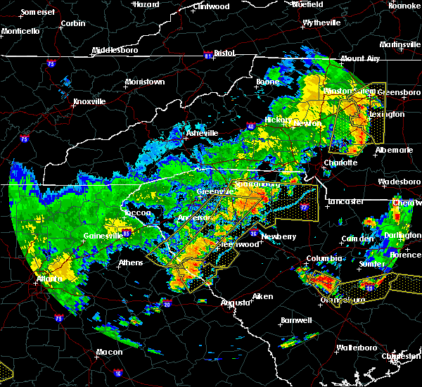 The severe thunderstorm warning for elbert, laurens, southeastern greenville, southern spartanburg, southeastern anderson, abbeville, northwestern union and northwestern greenwood counties will expire at 715 pm edt, the storms which prompted the warning have moved out of the area. therefore the warning will be allowed to expire. however gusty winds are still possible with these thunderstorms. a severe thunderstorm watch remains in effect until 1000 pm edt for northeastern georgia, and upstate south carolina. The severe thunderstorm warning for elbert, laurens, southeastern greenville, southern spartanburg, southeastern anderson, abbeville, northwestern union and northwestern greenwood counties will expire at 715 pm edt, the storms which prompted the warning have moved out of the area. therefore the warning will be allowed to expire. however gusty winds are still possible with these thunderstorms. a severe thunderstorm watch remains in effect until 1000 pm edt for northeastern georgia, and upstate south carolina.
|
| 6/25/2018 6:58 PM EDT |
 The national weather service in greenville-spartanburg has issued a * severe thunderstorm warning for. southeastern elbert county in northeastern georgia. laurens county in upstate south carolina. chester county in upstate south carolina. Southern york county in upstate south carolina. The national weather service in greenville-spartanburg has issued a * severe thunderstorm warning for. southeastern elbert county in northeastern georgia. laurens county in upstate south carolina. chester county in upstate south carolina. Southern york county in upstate south carolina.
|
| 6/25/2018 6:58 PM EDT |
 At 658 pm edt, severe thunderstorms were located along a line extending from 10 miles southeast of gaffney to 10 miles southeast of abbeville, moving east at 45 mph (radar indicated). Hazards include 60 mph wind gusts and quarter size hail. Minor hail damage to vehicles is expected. Expect wind damage to trees and power lines. At 658 pm edt, severe thunderstorms were located along a line extending from 10 miles southeast of gaffney to 10 miles southeast of abbeville, moving east at 45 mph (radar indicated). Hazards include 60 mph wind gusts and quarter size hail. Minor hail damage to vehicles is expected. Expect wind damage to trees and power lines.
|
| 6/25/2018 6:50 PM EDT | Large tree limbs down. winds estimated at 60 mp in union county SC, 1.4 miles NE of Jonesville, SC |
| 6/25/2018 6:30 PM EDT |
 At 630 pm edt, severe thunderstorms were located along a line extending from 5 miles south of spartanburg to 14 miles north of abbeville to 7 miles south of elberton, moving southeast at 40 mph (radar indicated). Hazards include 60 mph wind gusts and quarter size hail. Minor hail damage to vehicles is expected. Expect wind damage to trees and power lines. At 630 pm edt, severe thunderstorms were located along a line extending from 5 miles south of spartanburg to 14 miles north of abbeville to 7 miles south of elberton, moving southeast at 40 mph (radar indicated). Hazards include 60 mph wind gusts and quarter size hail. Minor hail damage to vehicles is expected. Expect wind damage to trees and power lines.
|
| 6/25/2018 2:47 PM EDT |
 At 247 pm edt, a severe thunderstorm was located 11 miles southwest of york, or 4 miles southwest of sharon, moving east at 20 mph (radar indicated). Hazards include 60 mph wind gusts and quarter size hail. Minor hail damage to vehicles is expected. Expect wind damage to trees and power lines. At 247 pm edt, a severe thunderstorm was located 11 miles southwest of york, or 4 miles southwest of sharon, moving east at 20 mph (radar indicated). Hazards include 60 mph wind gusts and quarter size hail. Minor hail damage to vehicles is expected. Expect wind damage to trees and power lines.
|
| 6/24/2018 6:17 PM EDT |
 At 616 pm edt, a severe thunderstorm was located 6 miles north of union, or near jonesville, moving southeast at 25 mph (radar indicated). Hazards include 60 mph wind gusts and quarter size hail. Minor hail damage to vehicles is expected. expect wind damage to trees and power lines. Locations impacted include, union, monarch mill, jonesville, adamsburg, buffalo, lockhart and santuc. At 616 pm edt, a severe thunderstorm was located 6 miles north of union, or near jonesville, moving southeast at 25 mph (radar indicated). Hazards include 60 mph wind gusts and quarter size hail. Minor hail damage to vehicles is expected. expect wind damage to trees and power lines. Locations impacted include, union, monarch mill, jonesville, adamsburg, buffalo, lockhart and santuc.
|
| 6/24/2018 6:07 PM EDT |
 At 607 pm edt, a severe thunderstorm was located 10 miles north of union, or near jonesville, moving east at 15 mph (radar indicated). Hazards include 60 mph wind gusts and quarter size hail. Minor hail damage to vehicles is expected. expect wind damage to trees and power lines. Locations impacted include, union, pacolet, monarch mill, jonesville, pacolet mills, saratt, adamsburg, lockhart, buffalo and santuc. At 607 pm edt, a severe thunderstorm was located 10 miles north of union, or near jonesville, moving east at 15 mph (radar indicated). Hazards include 60 mph wind gusts and quarter size hail. Minor hail damage to vehicles is expected. expect wind damage to trees and power lines. Locations impacted include, union, pacolet, monarch mill, jonesville, pacolet mills, saratt, adamsburg, lockhart, buffalo and santuc.
|
| 6/24/2018 5:53 PM EDT |
 At 552 pm edt, a severe thunderstorm was located 11 miles southeast of spartanburg, or near pacolet, moving southeast at 15 mph (radar indicated). Hazards include 60 mph wind gusts and quarter size hail. Minor hail damage to vehicles is expected. Expect wind damage to trees and power lines. At 552 pm edt, a severe thunderstorm was located 11 miles southeast of spartanburg, or near pacolet, moving southeast at 15 mph (radar indicated). Hazards include 60 mph wind gusts and quarter size hail. Minor hail damage to vehicles is expected. Expect wind damage to trees and power lines.
|
| 6/22/2018 9:02 PM EDT |
 At 901 pm edt, severe thunderstorms were located along a line extending from 9 miles southeast of spartanburg to 3 miles northwest of union to 22 miles north of newberry, moving east at 45 mph (radar indicated). Hazards include 60 mph wind gusts. expect damage to trees and power lines At 901 pm edt, severe thunderstorms were located along a line extending from 9 miles southeast of spartanburg to 3 miles northwest of union to 22 miles north of newberry, moving east at 45 mph (radar indicated). Hazards include 60 mph wind gusts. expect damage to trees and power lines
|
| 6/2/2018 4:10 PM EDT |
 At 409 pm edt, a severe thunderstorm was located 5 miles west of union, or near buffalo, moving southeast at 10 mph. another severe thunderstorm was located between pauline and jonesville, also moving southeast at 10 mph (radar indicated). Hazards include 60 mph wind gusts and quarter size hail. Minor hail damage to vehicles is expected. expect wind damage to trees and power lines. Locations impacted include, union, monarch mill, buffalo, jonesville, rose hill state park, cross keys, sedalia and croft state park. At 409 pm edt, a severe thunderstorm was located 5 miles west of union, or near buffalo, moving southeast at 10 mph. another severe thunderstorm was located between pauline and jonesville, also moving southeast at 10 mph (radar indicated). Hazards include 60 mph wind gusts and quarter size hail. Minor hail damage to vehicles is expected. expect wind damage to trees and power lines. Locations impacted include, union, monarch mill, buffalo, jonesville, rose hill state park, cross keys, sedalia and croft state park.
|
| 6/2/2018 3:45 PM EDT |
 At 345 pm edt, a severe thunderstorm was located 7 miles west of union, or 4 miles northwest of buffalo, moving southeast at 10 mph (radar indicated). Hazards include 60 mph wind gusts and quarter size hail. Minor hail damage to vehicles is expected. Expect wind damage to trees and power lines. At 345 pm edt, a severe thunderstorm was located 7 miles west of union, or 4 miles northwest of buffalo, moving southeast at 10 mph (radar indicated). Hazards include 60 mph wind gusts and quarter size hail. Minor hail damage to vehicles is expected. Expect wind damage to trees and power lines.
|
| 6/1/2018 7:45 PM EDT |
 At 744 pm edt, a severe thunderstorm was located 5 miles southeast of york, or 4 miles northeast of mcconnells, moving east at 25 mph (radar indicated). Hazards include 60 mph wind gusts and quarter size hail. Minor hail damage to vehicles is expected. expect wind damage to trees and power lines. Locations impacted include, rock hill, union, york, tega cay, clover, newport, town of lake wylie, lesslie, monarch mill and blacksburg. At 744 pm edt, a severe thunderstorm was located 5 miles southeast of york, or 4 miles northeast of mcconnells, moving east at 25 mph (radar indicated). Hazards include 60 mph wind gusts and quarter size hail. Minor hail damage to vehicles is expected. expect wind damage to trees and power lines. Locations impacted include, rock hill, union, york, tega cay, clover, newport, town of lake wylie, lesslie, monarch mill and blacksburg.
|
| 6/1/2018 7:20 PM EDT |
 At 719 pm edt, a severe thunderstorm was located 11 miles southwest of york, or near hickory grove, moving east at 20 mph. other severe thunderstorms were located just southeast of york and near clover. additional severe thunderstorms are likely in the warned area (radar indicated). Hazards include 60 mph wind gusts and quarter size hail. Minor hail damage to vehicles is expected. Expect wind damage to trees and power lines. At 719 pm edt, a severe thunderstorm was located 11 miles southwest of york, or near hickory grove, moving east at 20 mph. other severe thunderstorms were located just southeast of york and near clover. additional severe thunderstorms are likely in the warned area (radar indicated). Hazards include 60 mph wind gusts and quarter size hail. Minor hail damage to vehicles is expected. Expect wind damage to trees and power lines.
|
| 4/15/2018 1:17 PM EDT |
 At 117 pm edt, a severe thunderstorm was located 9 miles southwest of gaffney, or near pacolet mills, moving northeast at 55 mph (radar indicated). Hazards include 60 mph wind gusts and quarter size hail. Minor hail damage to vehicles is expected. Expect wind damage to trees and power lines. At 117 pm edt, a severe thunderstorm was located 9 miles southwest of gaffney, or near pacolet mills, moving northeast at 55 mph (radar indicated). Hazards include 60 mph wind gusts and quarter size hail. Minor hail damage to vehicles is expected. Expect wind damage to trees and power lines.
|
| 4/15/2018 1:02 PM EDT |
 At 102 pm edt, a severe thunderstorm was located 8 miles northwest of union, or 5 miles northwest of buffalo, moving northeast at 55 mph (radar indicated). Hazards include 60 mph wind gusts and quarter size hail. Minor hail damage to vehicles is expected. expect wind damage to trees and power lines. locations impacted include, pacolet, jonesville, croft state park, pauline, cross anchor, enoree and pacolet mills. A tornado watch remains in effect until 700 pm edt for upstate south carolina. At 102 pm edt, a severe thunderstorm was located 8 miles northwest of union, or 5 miles northwest of buffalo, moving northeast at 55 mph (radar indicated). Hazards include 60 mph wind gusts and quarter size hail. Minor hail damage to vehicles is expected. expect wind damage to trees and power lines. locations impacted include, pacolet, jonesville, croft state park, pauline, cross anchor, enoree and pacolet mills. A tornado watch remains in effect until 700 pm edt for upstate south carolina.
|
| 4/15/2018 12:38 PM EDT |
 At 1238 pm edt, a severe thunderstorm was located near laurens, moving northeast at 55 mph (radar indicated). Hazards include 60 mph wind gusts and quarter size hail. Minor hail damage to vehicles is expected. Expect wind damage to trees and power lines. At 1238 pm edt, a severe thunderstorm was located near laurens, moving northeast at 55 mph (radar indicated). Hazards include 60 mph wind gusts and quarter size hail. Minor hail damage to vehicles is expected. Expect wind damage to trees and power lines.
|
| 10/23/2017 2:53 PM EDT |
 At 253 pm edt, a severe thunderstorm was located 13 miles southwest of spartanburg, or near woodruff, moving northeast at 35 mph (radar indicated). Hazards include 60 mph wind gusts. expect damage to trees and power lines At 253 pm edt, a severe thunderstorm was located 13 miles southwest of spartanburg, or near woodruff, moving northeast at 35 mph (radar indicated). Hazards include 60 mph wind gusts. expect damage to trees and power lines
|
| 10/8/2017 6:00 PM EDT |
 At 600 pm edt, a severe thunderstorm capable of producing a tornado was located 12 miles south of gaffney, or near pacolet, moving north at 30 mph (radar indicated rotation). Hazards include tornado. Flying debris will be dangerous to those caught without shelter. mobile homes will be damaged or destroyed. damage to roofs, windows, and vehicles will occur. tree damage is likely. this dangerous storm will be near, gaffney around 630 pm edt. blacksburg around 640 pm edt. Other locations impacted by this dangerous thunderstorm include cherokee falls, draytonville and thicketty. At 600 pm edt, a severe thunderstorm capable of producing a tornado was located 12 miles south of gaffney, or near pacolet, moving north at 30 mph (radar indicated rotation). Hazards include tornado. Flying debris will be dangerous to those caught without shelter. mobile homes will be damaged or destroyed. damage to roofs, windows, and vehicles will occur. tree damage is likely. this dangerous storm will be near, gaffney around 630 pm edt. blacksburg around 640 pm edt. Other locations impacted by this dangerous thunderstorm include cherokee falls, draytonville and thicketty.
|
| 10/8/2017 5:36 PM EDT |
 At 536 pm edt, a confirmed tornado was located 7 miles west of union, or near buffalo, moving north at 30 mph (law enforcement confirmed tornado). Hazards include damaging tornado. Flying debris will be dangerous to those caught without shelter. mobile homes will be damaged or destroyed. damage to roofs, windows, and vehicles will occur. tree damage is likely. This tornado will be near, jonesville, pacolet and pacolet mills around 600 pm edt. At 536 pm edt, a confirmed tornado was located 7 miles west of union, or near buffalo, moving north at 30 mph (law enforcement confirmed tornado). Hazards include damaging tornado. Flying debris will be dangerous to those caught without shelter. mobile homes will be damaged or destroyed. damage to roofs, windows, and vehicles will occur. tree damage is likely. This tornado will be near, jonesville, pacolet and pacolet mills around 600 pm edt.
|
| 10/8/2017 5:14 PM EDT |
 At 514 pm edt, a confirmed tornado was located 12 miles southwest of union, or 7 miles west of rose hill state park, moving north at 30 mph (law enforcement confirmed tornado). Hazards include damaging tornado. Flying debris will be dangerous to those caught without shelter. mobile homes will be damaged or destroyed. damage to roofs, windows, and vehicles will occur. tree damage is likely. the tornado will be near, union and buffalo around 540 pm edt. jonesville around 550 pm edt. pacolet and pacolet mills around 600 pm edt. Other locations impacted by this dangerous thunderstorm include cross keys and sedalia. At 514 pm edt, a confirmed tornado was located 12 miles southwest of union, or 7 miles west of rose hill state park, moving north at 30 mph (law enforcement confirmed tornado). Hazards include damaging tornado. Flying debris will be dangerous to those caught without shelter. mobile homes will be damaged or destroyed. damage to roofs, windows, and vehicles will occur. tree damage is likely. the tornado will be near, union and buffalo around 540 pm edt. jonesville around 550 pm edt. pacolet and pacolet mills around 600 pm edt. Other locations impacted by this dangerous thunderstorm include cross keys and sedalia.
|
| 7/28/2017 4:04 PM EDT |
 At 404 pm edt, severe thunderstorms were located along a line extending from 4 miles north of lincolnton to 10 miles west of gastonia to 9 miles east of chester, moving east at 15 mph (radar indicated). Hazards include 60 mph wind gusts. Expect damage to trees and power lines. Locations impacted include, gastonia, rock hill, shelby, gaffney, lincolnton, york, chester, kings mountain, mt holly and fort mill. At 404 pm edt, severe thunderstorms were located along a line extending from 4 miles north of lincolnton to 10 miles west of gastonia to 9 miles east of chester, moving east at 15 mph (radar indicated). Hazards include 60 mph wind gusts. Expect damage to trees and power lines. Locations impacted include, gastonia, rock hill, shelby, gaffney, lincolnton, york, chester, kings mountain, mt holly and fort mill.
|
| 7/28/2017 3:55 PM EDT |
 At 355 pm edt, severe thunderstorms were located along a line extending from 3 miles north of lincolnton to 9 miles southeast of shelby to 8 miles southeast of chester, moving northeast at 15 mph (radar indicated). Hazards include 60 mph wind gusts. expect damage to trees and power lines At 355 pm edt, severe thunderstorms were located along a line extending from 3 miles north of lincolnton to 9 miles southeast of shelby to 8 miles southeast of chester, moving northeast at 15 mph (radar indicated). Hazards include 60 mph wind gusts. expect damage to trees and power lines
|
| 7/28/2017 3:41 PM EDT |
 At 341 pm edt, severe thunderstorms were located along a line extending from 12 miles southeast of columbus to 7 miles east of spartanburg to 14 miles north of newberry, moving northeast at 25 mph (radar indicated). Hazards include 60 mph wind gusts. Expect damage to trees and power lines. Locations impacted include, spartanburg, gaffney, union, boiling springs sc, pacolet, cowpens, wellford, inman, monarch mill and blacksburg. At 341 pm edt, severe thunderstorms were located along a line extending from 12 miles southeast of columbus to 7 miles east of spartanburg to 14 miles north of newberry, moving northeast at 25 mph (radar indicated). Hazards include 60 mph wind gusts. Expect damage to trees and power lines. Locations impacted include, spartanburg, gaffney, union, boiling springs sc, pacolet, cowpens, wellford, inman, monarch mill and blacksburg.
|
| 7/28/2017 3:20 PM EDT |
 At 320 pm edt, severe thunderstorms were located along a line extending from 8 miles south of columbus to 10 miles west of union to 12 miles southwest of newberry, moving northeast at 30 mph (radar indicated). Hazards include 60 mph wind gusts. expect damage to trees and power lines At 320 pm edt, severe thunderstorms were located along a line extending from 8 miles south of columbus to 10 miles west of union to 12 miles southwest of newberry, moving northeast at 30 mph (radar indicated). Hazards include 60 mph wind gusts. expect damage to trees and power lines
|
| 7/23/2017 4:24 PM EDT |
 At 424 pm edt, a group of strong to severe thunderstorms was located 10 miles southwest of spartanburg, or near reidville, moving east at 15 mph (radar indicated). Hazards include 60 mph wind gusts and penny size hail. Expect damage to trees and power lines. Locations impacted include, roebuck, jonesville, reidville, moore, croft state park, cross keys, pauline, cross anchor, woodruff and buffalo. At 424 pm edt, a group of strong to severe thunderstorms was located 10 miles southwest of spartanburg, or near reidville, moving east at 15 mph (radar indicated). Hazards include 60 mph wind gusts and penny size hail. Expect damage to trees and power lines. Locations impacted include, roebuck, jonesville, reidville, moore, croft state park, cross keys, pauline, cross anchor, woodruff and buffalo.
|
| 7/23/2017 3:58 PM EDT |
 At 358 pm edt, a severe thunderstorm was located 9 miles west of spartanburg, or near reidville, moving southeast at 25 mph (radar indicated). Hazards include 60 mph wind gusts and nickel size hail. expect damage to trees and power lines At 358 pm edt, a severe thunderstorm was located 9 miles west of spartanburg, or near reidville, moving southeast at 25 mph (radar indicated). Hazards include 60 mph wind gusts and nickel size hail. expect damage to trees and power lines
|
| 7/4/2017 3:41 PM EDT |
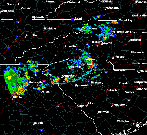 At 340 pm edt, a severe thunderstorm was located 12 miles north of union, or 7 miles northeast of jonesville, moving east at 15 mph (radar indicated). Hazards include 60 mph wind gusts and quarter size hail. Minor hail damage to vehicles is expected. expect wind damage to trees and power lines. Locations impacted include, lockhart, bullock creek, saratt, hickory grove, jonesville and adamsburg. At 340 pm edt, a severe thunderstorm was located 12 miles north of union, or 7 miles northeast of jonesville, moving east at 15 mph (radar indicated). Hazards include 60 mph wind gusts and quarter size hail. Minor hail damage to vehicles is expected. expect wind damage to trees and power lines. Locations impacted include, lockhart, bullock creek, saratt, hickory grove, jonesville and adamsburg.
|
| 7/4/2017 3:25 PM EDT |
 At 325 pm edt, a severe thunderstorm was located 11 miles south of gaffney, or 4 miles north of jonesville, moving east at 20 mph (radar indicated). Hazards include 60 mph wind gusts and quarter size hail. Minor hail damage to vehicles is expected. Expect wind damage to trees and power lines. At 325 pm edt, a severe thunderstorm was located 11 miles south of gaffney, or 4 miles north of jonesville, moving east at 20 mph (radar indicated). Hazards include 60 mph wind gusts and quarter size hail. Minor hail damage to vehicles is expected. Expect wind damage to trees and power lines.
|
| 4/6/2017 1:20 AM EDT |
 At 119 am edt, severe thunderstorms were located along a line extending from 10 miles east of gaffney to 9 miles northeast of union to 17 miles north of newberry, moving east at 65 mph (radar indicated). Hazards include 60 mph wind gusts and quarter size hail. Hail damage to vehicles is expected. expect wind damage to roofs, siding, and trees. Locations impacted include, gaffney, union, york, chester, clover, monarch mill, blacksburg, buffalo, jonesville and lockhart. At 119 am edt, severe thunderstorms were located along a line extending from 10 miles east of gaffney to 9 miles northeast of union to 17 miles north of newberry, moving east at 65 mph (radar indicated). Hazards include 60 mph wind gusts and quarter size hail. Hail damage to vehicles is expected. expect wind damage to roofs, siding, and trees. Locations impacted include, gaffney, union, york, chester, clover, monarch mill, blacksburg, buffalo, jonesville and lockhart.
|
| 4/6/2017 1:00 AM EDT |
 At 1259 am edt, severe thunderstorms were located along a line extending from 11 miles south of columbus to 15 miles southeast of greenville downtown to 14 miles west of laurens, moving east at 55 mph (radar indicated). Hazards include 60 mph wind gusts and quarter size hail. Hail damage to vehicles is expected. Expect wind damage to roofs, siding, and trees. At 1259 am edt, severe thunderstorms were located along a line extending from 11 miles south of columbus to 15 miles southeast of greenville downtown to 14 miles west of laurens, moving east at 55 mph (radar indicated). Hazards include 60 mph wind gusts and quarter size hail. Hail damage to vehicles is expected. Expect wind damage to roofs, siding, and trees.
|
| 4/3/2017 3:19 PM EDT |
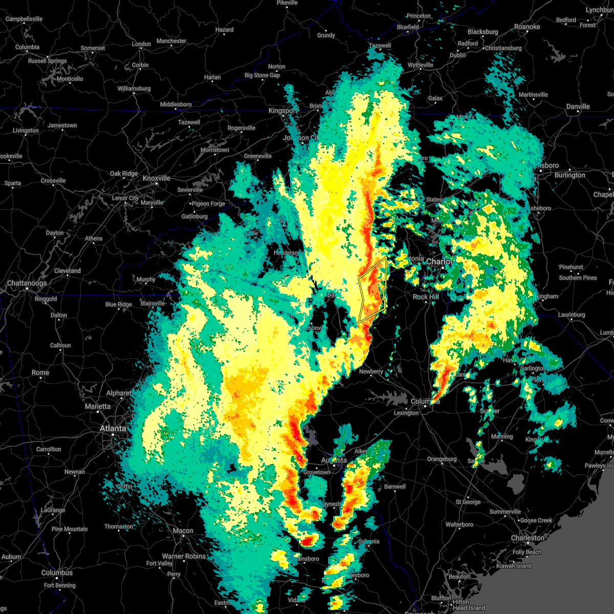 At 319 pm edt, severe thunderstorms were located along a line extending from 7 miles north of gaffney to 19 miles west of york to 7 miles north of union, moving northeast at 60 mph (radar indicated). Hazards include 60 mph wind gusts. Expect damage to trees and minor damage to roofs and siding. locations impacted include, gaffney, blacksburg, jonesville, patterson springs, earl, cherokee falls, draytonville, saratt, grover and thicketty. A tornado watch remains in effect until 900 pm edt for upstate south carolina. At 319 pm edt, severe thunderstorms were located along a line extending from 7 miles north of gaffney to 19 miles west of york to 7 miles north of union, moving northeast at 60 mph (radar indicated). Hazards include 60 mph wind gusts. Expect damage to trees and minor damage to roofs and siding. locations impacted include, gaffney, blacksburg, jonesville, patterson springs, earl, cherokee falls, draytonville, saratt, grover and thicketty. A tornado watch remains in effect until 900 pm edt for upstate south carolina.
|
| 4/3/2017 3:02 PM EDT |
 At 302 pm edt, severe thunderstorms were located along a line extending from 8 miles northeast of spartanburg to 13 miles northwest of union, moving northeast at 60 mph (radar indicated). Hazards include 60 mph wind gusts. expect damage to trees and minor damage to roofs and siding At 302 pm edt, severe thunderstorms were located along a line extending from 8 miles northeast of spartanburg to 13 miles northwest of union, moving northeast at 60 mph (radar indicated). Hazards include 60 mph wind gusts. expect damage to trees and minor damage to roofs and siding
|
| 3/1/2017 7:41 PM EST |
 At 741 pm est, severe thunderstorms were located along a line extending from 10 miles east of gaffney to 8 miles northeast of union to 18 miles southwest of chester, moving east at 65 mph (radar indicated). Hazards include golf ball size hail and 70 mph wind gusts. People and animals outdoors will be injured. expect hail damage to roofs, siding, windows and vehicles. expect considerable tree damage. wind damage is also likely to mobile homes, roofs and outbuildings. Locations impacted include, union, monarch mill, buffalo, jonesville, carlisle, cherokee falls, draytonville, saratt, kings creek and adamsburg. At 741 pm est, severe thunderstorms were located along a line extending from 10 miles east of gaffney to 8 miles northeast of union to 18 miles southwest of chester, moving east at 65 mph (radar indicated). Hazards include golf ball size hail and 70 mph wind gusts. People and animals outdoors will be injured. expect hail damage to roofs, siding, windows and vehicles. expect considerable tree damage. wind damage is also likely to mobile homes, roofs and outbuildings. Locations impacted include, union, monarch mill, buffalo, jonesville, carlisle, cherokee falls, draytonville, saratt, kings creek and adamsburg.
|
| 3/1/2017 7:26 PM EST |
 At 726 pm est, severe thunderstorms were located along a line extending from 6 miles northeast of gaffney to 10 miles southeast of spartanburg to 15 miles northwest of newberry, moving east at 60 mph (radar indicated). Hazards include golf ball size hail and 70 mph wind gusts. People and animals outdoors will be injured. expect hail damage to roofs, siding, windows and vehicles. expect considerable tree damage. wind damage is also likely to mobile homes, roofs and outbuildings. Locations impacted include, spartanburg, gaffney, union, woodruff, pacolet, cowpens, monarch mill, blacksburg, mayo and roebuck. At 726 pm est, severe thunderstorms were located along a line extending from 6 miles northeast of gaffney to 10 miles southeast of spartanburg to 15 miles northwest of newberry, moving east at 60 mph (radar indicated). Hazards include golf ball size hail and 70 mph wind gusts. People and animals outdoors will be injured. expect hail damage to roofs, siding, windows and vehicles. expect considerable tree damage. wind damage is also likely to mobile homes, roofs and outbuildings. Locations impacted include, spartanburg, gaffney, union, woodruff, pacolet, cowpens, monarch mill, blacksburg, mayo and roebuck.
|
| 3/1/2017 7:10 PM EST |
 At 709 pm est, severe thunderstorms were located along a line extending from 7 miles northeast of spartanburg to 16 miles east of greenville downtown to 4 miles southeast of laurens, moving east at 55 mph (radar indicated). Hazards include golf ball size hail and 70 mph wind gusts. People and animals outdoors will be injured. expect hail damage to roofs, siding, windows and vehicles. expect considerable tree damage. Wind damage is also likely to mobile homes, roofs and outbuildings. At 709 pm est, severe thunderstorms were located along a line extending from 7 miles northeast of spartanburg to 16 miles east of greenville downtown to 4 miles southeast of laurens, moving east at 55 mph (radar indicated). Hazards include golf ball size hail and 70 mph wind gusts. People and animals outdoors will be injured. expect hail damage to roofs, siding, windows and vehicles. expect considerable tree damage. Wind damage is also likely to mobile homes, roofs and outbuildings.
|
| 11/30/2016 5:42 PM EST |
 At 542 pm est, severe thunderstorms were located along a line extending from 11 miles southwest of yadkinville to 8 miles southwest of newton to 3 miles northwest of shelby to 10 miles east of union to 6 miles north of newberry, moving northeast at 55 mph (radar indicated). Hazards include 60 mph wind gusts. Expect damage to roofs. siding and trees. Locations impacted include, gastonia, rock hill, hickory, statesville, shelby, newton, gaffney, lincolnton, union and york. At 542 pm est, severe thunderstorms were located along a line extending from 11 miles southwest of yadkinville to 8 miles southwest of newton to 3 miles northwest of shelby to 10 miles east of union to 6 miles north of newberry, moving northeast at 55 mph (radar indicated). Hazards include 60 mph wind gusts. Expect damage to roofs. siding and trees. Locations impacted include, gastonia, rock hill, hickory, statesville, shelby, newton, gaffney, lincolnton, union and york.
|
| 11/30/2016 5:26 PM EST |
 At 526 pm est, severe thunderstorms were located along a line extending from 8 miles east of taylorsville to 14 miles north of shelby to 8 miles southeast of forest city to 5 miles south of union to 8 miles west of newberry, moving northeast at 55 mph (radar indicated). Hazards include 60 mph wind gusts. Expect damage to roofs. Siding and trees. At 526 pm est, severe thunderstorms were located along a line extending from 8 miles east of taylorsville to 14 miles north of shelby to 8 miles southeast of forest city to 5 miles south of union to 8 miles west of newberry, moving northeast at 55 mph (radar indicated). Hazards include 60 mph wind gusts. Expect damage to roofs. Siding and trees.
|
| 11/30/2016 5:17 PM EST |
 At 517 pm est, severe thunderstorms were located along a line extending from 13 miles southeast of morganton to 4 miles northeast of spartanburg to 13 miles northwest of union to 12 miles southeast of laurens to 9 miles east of greenwood, moving east at 55 mph (radar indicated). Hazards include 60 mph wind gusts. Expect damage to roofs. siding and trees. Locations impacted include, spartanburg, greenwood, shelby, gaffney, laurens, union, forest city, rutherfordton, clinton and boiling springs sc. At 517 pm est, severe thunderstorms were located along a line extending from 13 miles southeast of morganton to 4 miles northeast of spartanburg to 13 miles northwest of union to 12 miles southeast of laurens to 9 miles east of greenwood, moving east at 55 mph (radar indicated). Hazards include 60 mph wind gusts. Expect damage to roofs. siding and trees. Locations impacted include, spartanburg, greenwood, shelby, gaffney, laurens, union, forest city, rutherfordton, clinton and boiling springs sc.
|
| 11/30/2016 4:41 PM EST |
 At 441 pm est, severe thunderstorms were located along a line extending from 7 miles west of rutherfordton to near greenville downtown to 18 miles southeast of easley to 5 miles northeast of abbeville to 21 miles northeast of washington, moving east at 55 mph (radar indicated). Hazards include 60 mph wind gusts. Expect damage to roofs. Siding and trees. At 441 pm est, severe thunderstorms were located along a line extending from 7 miles west of rutherfordton to near greenville downtown to 18 miles southeast of easley to 5 miles northeast of abbeville to 21 miles northeast of washington, moving east at 55 mph (radar indicated). Hazards include 60 mph wind gusts. Expect damage to roofs. Siding and trees.
|
| 9/27/2016 5:04 PM EDT |
 At 504 pm edt, a severe thunderstorm was located 9 miles south of gaffney, or 4 miles east of pacolet mills, moving east at 20 mph (radar indicated). Hazards include 60 mph wind gusts and quarter size hail. Hail damage to vehicles is expected. expect wind damage to roofs, siding and trees. Locations impacted include, pacolet, pacolet mills, thicketty, saratt, draytonville and gaffney. At 504 pm edt, a severe thunderstorm was located 9 miles south of gaffney, or 4 miles east of pacolet mills, moving east at 20 mph (radar indicated). Hazards include 60 mph wind gusts and quarter size hail. Hail damage to vehicles is expected. expect wind damage to roofs, siding and trees. Locations impacted include, pacolet, pacolet mills, thicketty, saratt, draytonville and gaffney.
|
| 9/27/2016 4:50 PM EDT |
 At 450 pm edt, a severe thunderstorm was located 9 miles southwest of gaffney, or near pacolet mills, moving east at 20 mph (radar indicated). Hazards include ping pong ball size hail and 60 mph wind gusts. People and animals outdoors will be injured. expect hail damage to roofs, siding, windows and vehicles. expect wind damage to roofs, siding and trees. Locations impacted include, pacolet, cowpens, pacolet mills, thicketty, saratt, croft state park, draytonville, jonesville and gaffney. At 450 pm edt, a severe thunderstorm was located 9 miles southwest of gaffney, or near pacolet mills, moving east at 20 mph (radar indicated). Hazards include ping pong ball size hail and 60 mph wind gusts. People and animals outdoors will be injured. expect hail damage to roofs, siding, windows and vehicles. expect wind damage to roofs, siding and trees. Locations impacted include, pacolet, cowpens, pacolet mills, thicketty, saratt, croft state park, draytonville, jonesville and gaffney.
|
| 9/27/2016 4:44 PM EDT |
 At 443 pm edt, a severe thunderstorm was located 9 miles east of spartanburg, or near pacolet mills, moving east at 20 mph. this storm has a history of producing damaging winds and quarter size hail (radar indicated). Hazards include 60 mph wind gusts and quarter size hail. Hail damage to vehicles is expected. Expect wind damage to roofs, siding and trees. At 443 pm edt, a severe thunderstorm was located 9 miles east of spartanburg, or near pacolet mills, moving east at 20 mph. this storm has a history of producing damaging winds and quarter size hail (radar indicated). Hazards include 60 mph wind gusts and quarter size hail. Hail damage to vehicles is expected. Expect wind damage to roofs, siding and trees.
|
| 7/11/2016 3:48 PM EDT |
 At 348 pm edt, a severe thunderstorm was located 15 miles north of laurens, or 6 miles southeast of woodruff, moving northeast at 20 mph (radar indicated). Hazards include 60 mph wind gusts and quarter size hail. Hail damage to vehicles is expected. Expect wind damage to roofs, siding and trees. At 348 pm edt, a severe thunderstorm was located 15 miles north of laurens, or 6 miles southeast of woodruff, moving northeast at 20 mph (radar indicated). Hazards include 60 mph wind gusts and quarter size hail. Hail damage to vehicles is expected. Expect wind damage to roofs, siding and trees.
|
| 7/7/2016 6:43 PM EDT |
 At 640 pm edt, a severe thunderstorm was located 10 miles north of union, or 4 miles northeast of jonesville, moving southeast at 15 mph (radar indicated). Hazards include tennis ball size hail and 60 mph wind gusts. People and animals outdoors will be injured. expect hail damage to roofs, siding, windows and vehicles. Expect wind damage to roofs, siding and trees. At 640 pm edt, a severe thunderstorm was located 10 miles north of union, or 4 miles northeast of jonesville, moving southeast at 15 mph (radar indicated). Hazards include tennis ball size hail and 60 mph wind gusts. People and animals outdoors will be injured. expect hail damage to roofs, siding, windows and vehicles. Expect wind damage to roofs, siding and trees.
|
| 7/7/2016 6:32 PM EDT |
 At 631 pm edt, severe thunderstorms were located along a line extending from 11 miles southwest of york to 11 miles north of union, moving southeast at 15 mph (radar indicated). Hazards include golf ball size hail and 60 mph wind gusts. People and animals outdoors will be injured. expect hail damage to roofs, siding, windows and vehicles. expect wind damage to roofs, siding and trees. Locations impacted include, monarch mill, jonesville, lockhart, mcconnells, lowrys, adamsburg, saratt, bullock creek, union and sharon. At 631 pm edt, severe thunderstorms were located along a line extending from 11 miles southwest of york to 11 miles north of union, moving southeast at 15 mph (radar indicated). Hazards include golf ball size hail and 60 mph wind gusts. People and animals outdoors will be injured. expect hail damage to roofs, siding, windows and vehicles. expect wind damage to roofs, siding and trees. Locations impacted include, monarch mill, jonesville, lockhart, mcconnells, lowrys, adamsburg, saratt, bullock creek, union and sharon.
|
| 7/7/2016 6:06 PM EDT |
 At 606 pm edt, severe thunderstorms were located along a line extending from 15 miles west of york to 9 miles southwest of gaffney, moving southeast at 40 mph (radar indicated). Hazards include 60 mph wind gusts and quarter size hail. Hail damage to vehicles is expected. Expect wind damage to roofs, siding and trees. At 606 pm edt, severe thunderstorms were located along a line extending from 15 miles west of york to 9 miles southwest of gaffney, moving southeast at 40 mph (radar indicated). Hazards include 60 mph wind gusts and quarter size hail. Hail damage to vehicles is expected. Expect wind damage to roofs, siding and trees.
|
| 7/7/2016 3:39 PM EDT | The severe thunderstorm warning for northeastern union. southwestern york. southeastern cherokee and northwestern chester counties will expire at 345 pm edt. the storm which prompted the warning has weakened below severe limits. and no longer poses an immediate threat to life or property. therefore the warning will be allowed to expire. However gusty winds. |
| 7/7/2016 3:12 PM EDT |
 At 311 pm edt, a severe thunderstorm was located 11 miles south of gaffney, or 6 miles northeast of jonesville, moving east at 45 mph (radar indicated). Hazards include 60 mph wind gusts and half dollar size hail. Hail damage to vehicles is expected. expect wind damage to roofs, siding and trees. Locations impacted include, jonesville, sharon, bullock creek, saratt, lockhart and adamsburg. At 311 pm edt, a severe thunderstorm was located 11 miles south of gaffney, or 6 miles northeast of jonesville, moving east at 45 mph (radar indicated). Hazards include 60 mph wind gusts and half dollar size hail. Hail damage to vehicles is expected. expect wind damage to roofs, siding and trees. Locations impacted include, jonesville, sharon, bullock creek, saratt, lockhart and adamsburg.
|
| 7/7/2016 3:03 PM EDT |
 At 302 pm edt, a severe thunderstorm was located 11 miles southeast of spartanburg, or near pacolet, moving east at 40 mph (radar indicated). Hazards include 60 mph wind gusts and penny size hail. Expect damage to roofs. Siding and trees. At 302 pm edt, a severe thunderstorm was located 11 miles southeast of spartanburg, or near pacolet, moving east at 40 mph (radar indicated). Hazards include 60 mph wind gusts and penny size hail. Expect damage to roofs. Siding and trees.
|
| 3/14/2016 7:18 PM EDT | At 717 pm edt, doppler radar indicated a severe thunderstorm capable of producing quarter size hail and damaging winds in excess of 60 mph. this storm was located 11 miles north of union, or 4 miles northeast of jonesville, moving east at 30 mph. locations impacted include, jonesville, saratt, adamsburg and lockhart. |
| 3/14/2016 6:55 PM EDT |
 At 654 pm edt, doppler radar indicated a severe thunderstorm capable of producing large damaging hail up to golf ball size and damaging winds in excess of 60 mph. this storm was located 6 miles southeast of spartanburg, or near croft state park, and moving east at 30 mph. * locations in the warning include, spartanburg, pacolet, jonesville, pacolet mills, croft state park, cedar springs, pauline, adamsburg, saratt and lockhart. At 654 pm edt, doppler radar indicated a severe thunderstorm capable of producing large damaging hail up to golf ball size and damaging winds in excess of 60 mph. this storm was located 6 miles southeast of spartanburg, or near croft state park, and moving east at 30 mph. * locations in the warning include, spartanburg, pacolet, jonesville, pacolet mills, croft state park, cedar springs, pauline, adamsburg, saratt and lockhart.
|
| 3/14/2016 6:43 PM EDT |
 At 643 pm edt, doppler radar indicated a severe thunderstorm capable of producing large damaging hail up to golf ball size and damaging winds in excess of 60 mph. this storm was located near spartanburg, or near roebuck, moving east at 30 mph. locations impacted include, spartanburg, pacolet, roebuck, jonesville, pacolet mills, croft state park, cedar springs, moore, pauline and thicketty. At 643 pm edt, doppler radar indicated a severe thunderstorm capable of producing large damaging hail up to golf ball size and damaging winds in excess of 60 mph. this storm was located near spartanburg, or near roebuck, moving east at 30 mph. locations impacted include, spartanburg, pacolet, roebuck, jonesville, pacolet mills, croft state park, cedar springs, moore, pauline and thicketty.
|
| 3/14/2016 6:22 PM EDT |
 At 622 pm edt, doppler radar indicated a severe thunderstorm capable of producing large hail up to ping pong ball size and damaging winds in excess of 60 mph. this storm was located 9 miles west of spartanburg, or near duncan, and moving east at 40 mph. * locations in the warning include, spartanburg, gaffney, duncan, lyman, pacolet, cowpens, wellford, roebuck, jonesville and pacolet mills. At 622 pm edt, doppler radar indicated a severe thunderstorm capable of producing large hail up to ping pong ball size and damaging winds in excess of 60 mph. this storm was located 9 miles west of spartanburg, or near duncan, and moving east at 40 mph. * locations in the warning include, spartanburg, gaffney, duncan, lyman, pacolet, cowpens, wellford, roebuck, jonesville and pacolet mills.
|
| 8/6/2015 5:12 PM EDT | The severe thunderstorm warning for central union, west central york and eastern cherokee counties will expire at 515 pm edt, the line of storms which prompted the warning have moved out of the area. therefore the warning will be allowed to expire. however gusty winds and heavy rain are still possible through 530 pm. |
| 8/6/2015 4:53 PM EDT |
 At 453 pm edt, doppler radar indicated a line of severe thunderstorms capable of producing quarter size hail and damaging winds in excess of 60 mph. these storms were located along a line extending from 8 miles east of gaffney to 15 miles southwest of york to 7 miles south of union, moving east at 20 mph. locations impacted include, union, monarch mill, blacksburg, buffalo, rose hill state park, kings creek, draytonville, saratt, cherokee falls and cross keys. At 453 pm edt, doppler radar indicated a line of severe thunderstorms capable of producing quarter size hail and damaging winds in excess of 60 mph. these storms were located along a line extending from 8 miles east of gaffney to 15 miles southwest of york to 7 miles south of union, moving east at 20 mph. locations impacted include, union, monarch mill, blacksburg, buffalo, rose hill state park, kings creek, draytonville, saratt, cherokee falls and cross keys.
|
| 8/6/2015 4:30 PM EDT |
 At 430 pm edt, doppler radar indicated a line of severe thunderstorms capable of producing quarter size hail and damaging winds in excess of 60 mph. these storms were located along a line extending from 3 miles east of gaffney to 17 miles west of york to 6 miles southwest of union, moving east at 40 mph. locations impacted include, gaffney, union, monarch mill, blacksburg, buffalo, jonesville, cowpens national battlefield, rose hill state park, kings creek and draytonville. At 430 pm edt, doppler radar indicated a line of severe thunderstorms capable of producing quarter size hail and damaging winds in excess of 60 mph. these storms were located along a line extending from 3 miles east of gaffney to 17 miles west of york to 6 miles southwest of union, moving east at 40 mph. locations impacted include, gaffney, union, monarch mill, blacksburg, buffalo, jonesville, cowpens national battlefield, rose hill state park, kings creek and draytonville.
|
| 8/6/2015 4:20 PM EDT | A tree and power line dow in union county SC, 0.5 miles SSW of Jonesville, SC |
| 8/6/2015 4:15 PM EDT |
 At 415 pm edt, doppler radar indicated a line of severe thunderstorms capable of producing quarter size hail and damaging winds in excess of 60 mph. these storms were located along a line extending from 6 miles west of gaffney to 12 miles east of spartanburg to 14 miles northeast of laurens, moving east at 55 mph. locations impacted include, spartanburg, gaffney, union, pacolet, cowpens, monarch mill, blacksburg, mayo, buffalo and chesnee. At 415 pm edt, doppler radar indicated a line of severe thunderstorms capable of producing quarter size hail and damaging winds in excess of 60 mph. these storms were located along a line extending from 6 miles west of gaffney to 12 miles east of spartanburg to 14 miles northeast of laurens, moving east at 55 mph. locations impacted include, spartanburg, gaffney, union, pacolet, cowpens, monarch mill, blacksburg, mayo, buffalo and chesnee.
|
| 8/6/2015 4:01 PM EDT |
 At 401 pm edt, doppler radar indicated a line of severe thunderstorms capable of producing damaging winds in excess of 60 mph. these storms were located along a line extending from 14 miles west of gaffney to 5 miles south of spartanburg to 7 miles north of laurens, and moving east at 40 mph. * locations in the warning include, spartanburg, gaffney, union, pacolet, cowpens, monarch mill, blacksburg, mayo, buffalo and chesnee. At 401 pm edt, doppler radar indicated a line of severe thunderstorms capable of producing damaging winds in excess of 60 mph. these storms were located along a line extending from 14 miles west of gaffney to 5 miles south of spartanburg to 7 miles north of laurens, and moving east at 40 mph. * locations in the warning include, spartanburg, gaffney, union, pacolet, cowpens, monarch mill, blacksburg, mayo, buffalo and chesnee.
|
| 8/5/2015 10:01 PM EDT |
 At 1001 pm edt, doppler radar indicated a line of severe thunderstorms capable of producing damaging winds in excess of 60 mph. these storms were located along a line extending from 16 miles south of gaffney to 9 miles south of union, moving east at 20 mph. locations impacted include, union, monarch mill, buffalo, jonesville, lockhart, carlisle, rose hill state park, santuc, adamsburg and cross keys. At 1001 pm edt, doppler radar indicated a line of severe thunderstorms capable of producing damaging winds in excess of 60 mph. these storms were located along a line extending from 16 miles south of gaffney to 9 miles south of union, moving east at 20 mph. locations impacted include, union, monarch mill, buffalo, jonesville, lockhart, carlisle, rose hill state park, santuc, adamsburg and cross keys.
|
| 8/5/2015 9:24 PM EDT |
 At 924 pm edt, doppler radar indicated a severe thunderstorm capable of producing damaging winds in excess of 60 mph. this storm was located 11 miles west of union, or 8 miles west of buffalo, and moving east at 25 mph. * locations in the warning include, union, monarch mill, buffalo, jonesville, lockhart, carlisle, rose hill state park, santuc, adamsburg and cross keys. At 924 pm edt, doppler radar indicated a severe thunderstorm capable of producing damaging winds in excess of 60 mph. this storm was located 11 miles west of union, or 8 miles west of buffalo, and moving east at 25 mph. * locations in the warning include, union, monarch mill, buffalo, jonesville, lockhart, carlisle, rose hill state park, santuc, adamsburg and cross keys.
|
| 7/13/2015 9:08 PM EDT |
 At 907 pm edt, doppler radar indicated a line of severe thunderstorms capable of producing quarter size hail and damaging winds in excess of 60 mph. these storms were located along a line extending from 11 miles east of gaffney to 8 miles northwest of union to 10 miles southwest of spartanburg, moving south at 15 mph. locations impacted include, spartanburg, gaffney, union, woodruff, pacolet, blacksburg, roebuck, buffalo, jonesville and pacolet mills. At 907 pm edt, doppler radar indicated a line of severe thunderstorms capable of producing quarter size hail and damaging winds in excess of 60 mph. these storms were located along a line extending from 11 miles east of gaffney to 8 miles northwest of union to 10 miles southwest of spartanburg, moving south at 15 mph. locations impacted include, spartanburg, gaffney, union, woodruff, pacolet, blacksburg, roebuck, buffalo, jonesville and pacolet mills.
|
| 7/13/2015 8:44 PM EDT |
 At 844 pm edt, doppler radar indicated a line of severe thunderstorms capable of producing damaging winds in excess of 60 mph. these storms were located along a line extending from 9 miles northeast of gaffney to 10 miles southeast of spartanburg to 16 miles east of greenville downtown, and moving south at 15 mph. penny size hail may also accompany the damaging winds. At 844 pm edt, doppler radar indicated a line of severe thunderstorms capable of producing damaging winds in excess of 60 mph. these storms were located along a line extending from 9 miles northeast of gaffney to 10 miles southeast of spartanburg to 16 miles east of greenville downtown, and moving south at 15 mph. penny size hail may also accompany the damaging winds.
|
| 7/13/2015 7:58 PM EDT |
 At 758 pm edt, doppler radar indicated a severe thunderstorm capable of producing quarter size hail and damaging winds in excess of 60 mph. this storm was located 8 miles southeast of spartanburg, or near croft state park, moving southeast at 10 mph. locations impacted include, pacolet, jonesville, pacolet mills, croft state park, cedar springs, pauline and spartanburg. At 758 pm edt, doppler radar indicated a severe thunderstorm capable of producing quarter size hail and damaging winds in excess of 60 mph. this storm was located 8 miles southeast of spartanburg, or near croft state park, moving southeast at 10 mph. locations impacted include, pacolet, jonesville, pacolet mills, croft state park, cedar springs, pauline and spartanburg.
|
| 7/13/2015 7:32 PM EDT |
 At 731 pm edt, doppler radar indicated a severe thunderstorm capable of producing quarter size hail and damaging winds in excess of 60 mph. this storm was located 4 miles southeast of spartanburg, or near croft state park, and moving southeast at 15 mph. At 731 pm edt, doppler radar indicated a severe thunderstorm capable of producing quarter size hail and damaging winds in excess of 60 mph. this storm was located 4 miles southeast of spartanburg, or near croft state park, and moving southeast at 15 mph.
|
| 4/20/2015 5:39 PM EDT | At 538 pm edt, national weather service doppler radar indicated a severe thunderstorm capable of producing quarter size hail, and destructive winds in excess of 70 mph. this storm was located near lockhart, or 9 miles east of union, and moving east at 45 mph. * the severe thunderstorm will be near, lowrys, mcconnells and 6 miles north of chester by 555 pm edt, 8 miles north of richburg by 610 pm edt, 8 miles south of rock hill by 615 pm edt, catawba by 620 pm edt,. |
| 4/20/2015 5:01 PM EDT | At 500 pm edt, national weather service doppler radar indicated a severe thunderstorm capable of producing golf ball size hail, and destructive winds in excess of 70 mph. this storm was located 8 miles northwest of cross keys, or 15 miles northeast of laurens, and moving east at 55 mph. * the severe thunderstorm will be near, buffalo and 8 miles south of jonesville by 510 pm edt, union by 515 pm edt, lockhart by 525 pm edt, lowrys and chester by 540 pm edt,. |
| 4/7/2015 6:28 PM EDT | Highway patrol reported a tree in the road near the intersection of morris farm road and whitlock lake roa in union county SC, 2.2 miles E of Jonesville, SC |
| 4/7/2015 6:28 PM EDT | A few large limbs down at a residence along west springs highway. he also had pea sized hai in union county SC, 1.4 miles NE of Jonesville, SC |
| 4/7/2015 6:24 PM EDT | A severe thunderstorm warning remains in effect until 645 pm edt for northern union and south central cherokee counties. at 623 pm edt. doppler radar indicated a severe thunderstorm capable of producing quarter size hail and damaging winds in excess of 60 mph. this storm was located 8 miles northwest of union. or over jonesville. Moving east at 30 mph. |
| 4/7/2015 6:02 PM EDT | The national weather service in greenville-spartanburg has issued a * severe thunderstorm warning for. northern union county in upstate south carolina. east central spartanburg county in upstate south carolina. south central cherokee county in upstate south carolina. Until 645 pm edt. |
| 6/18/2014 4:50 PM EDT | County reports one tree down on jonesville industrial roa in union county SC, 0.5 miles SSW of Jonesville, SC |
| 5/9/2014 4:35 PM EDT | Public report of numerous small limbs down with estimated 50 mph gus in union county SC, 0.5 miles SSW of Jonesville, SC |
| 5/9/2014 4:25 PM EDT | Limbs up to 6 inches in diameter blown off the tops of several tree in union county SC, 0.5 miles SSW of Jonesville, SC |
| 7/20/2012 3:09 PM EDT | One tree blew over onto a powerline near the intersection of tinsley road and jerusalem road. this caused some power outages mainly on tinsley roa in union county SC, 4 miles S of Jonesville, SC |
| 1/1/0001 12:00 AM | A tree fell on a vehicle and also powerlines down on pacolet street. powerlines on vehicl in union county SC, 0.5 miles SSW of Jonesville, SC |
| 1/1/0001 12:00 AM | One large limb...approximately 12 inches in diameter...snapped off near the intersection of n main street and knitting mill stree in union county SC, 0.5 miles SSW of Jonesville, SC |
| 1/1/0001 12:00 AM | Utility pole snapped and powerlines down across the highway at 850 gaffney highwa in union county SC, 2 miles SSW of Jonesville, SC |
| 1/1/0001 12:00 AM | Spotter reports large limbs down on phone lines on forest s in union county SC, 0.5 miles SSW of Jonesville, SC |
Hail Maps for Jonesville, SC


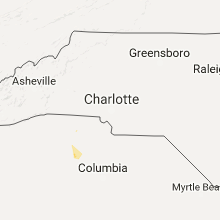


Connect with Interactive Hail Maps