

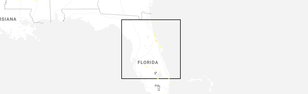
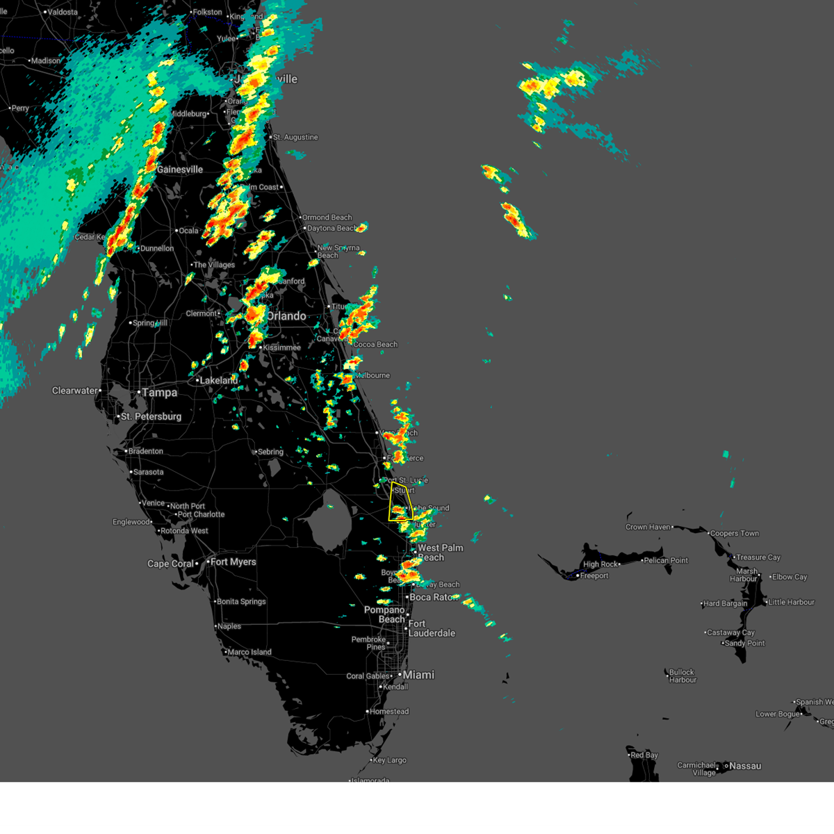
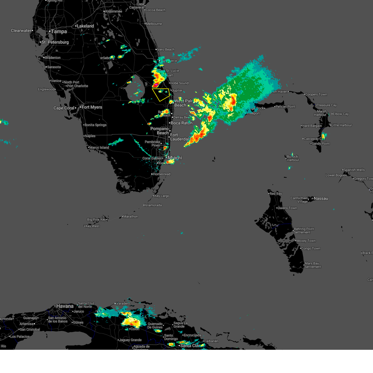
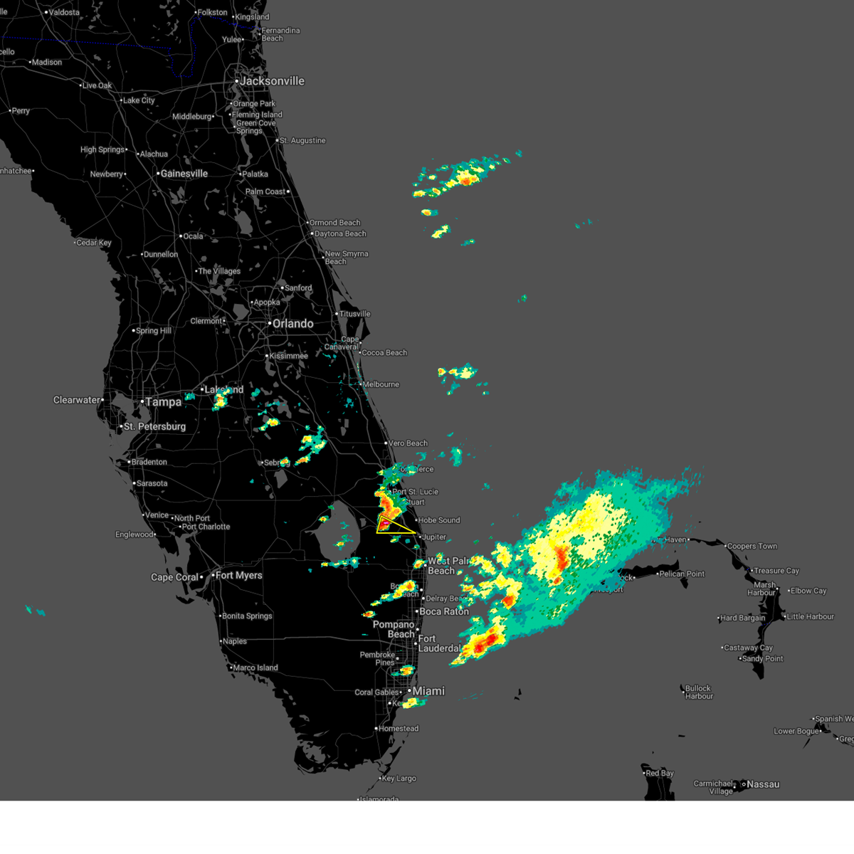
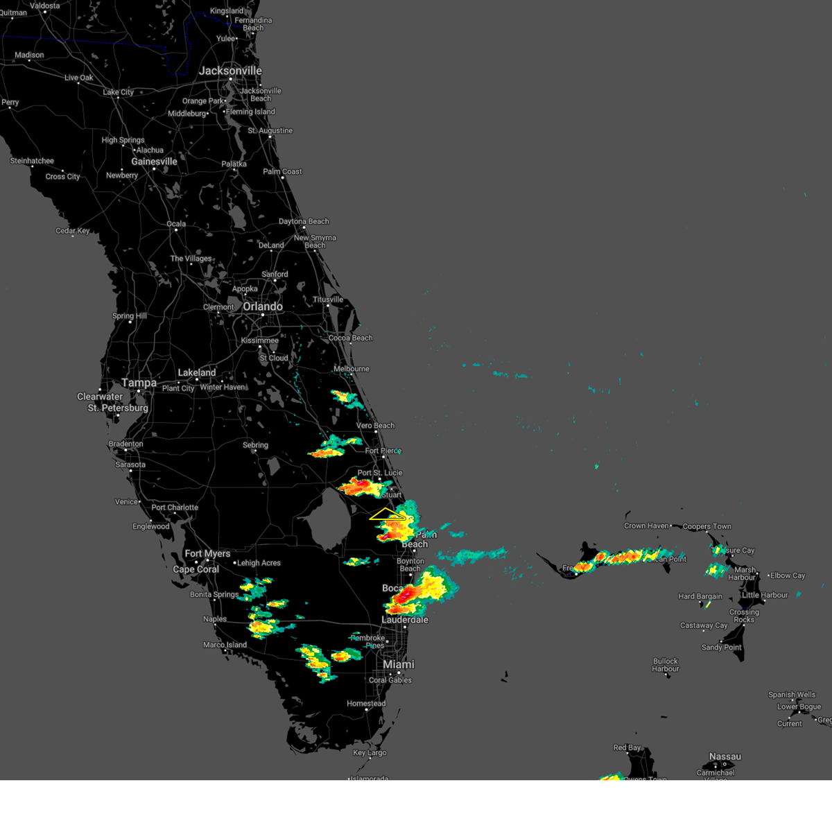
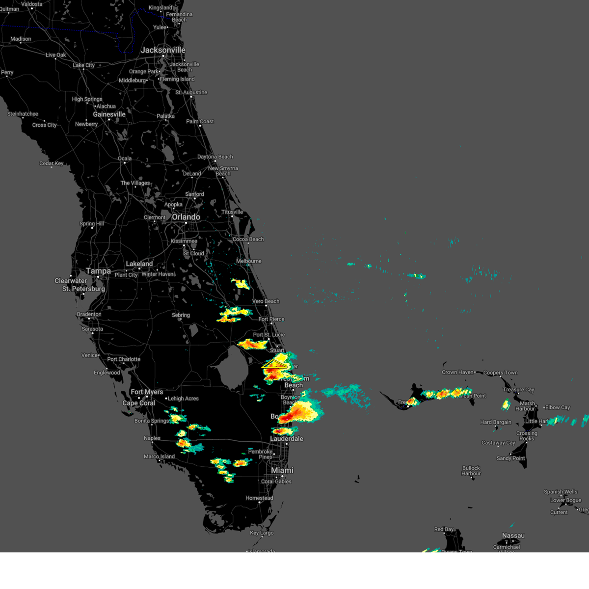
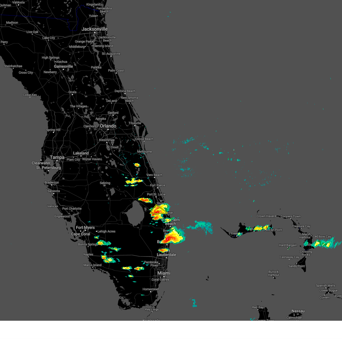
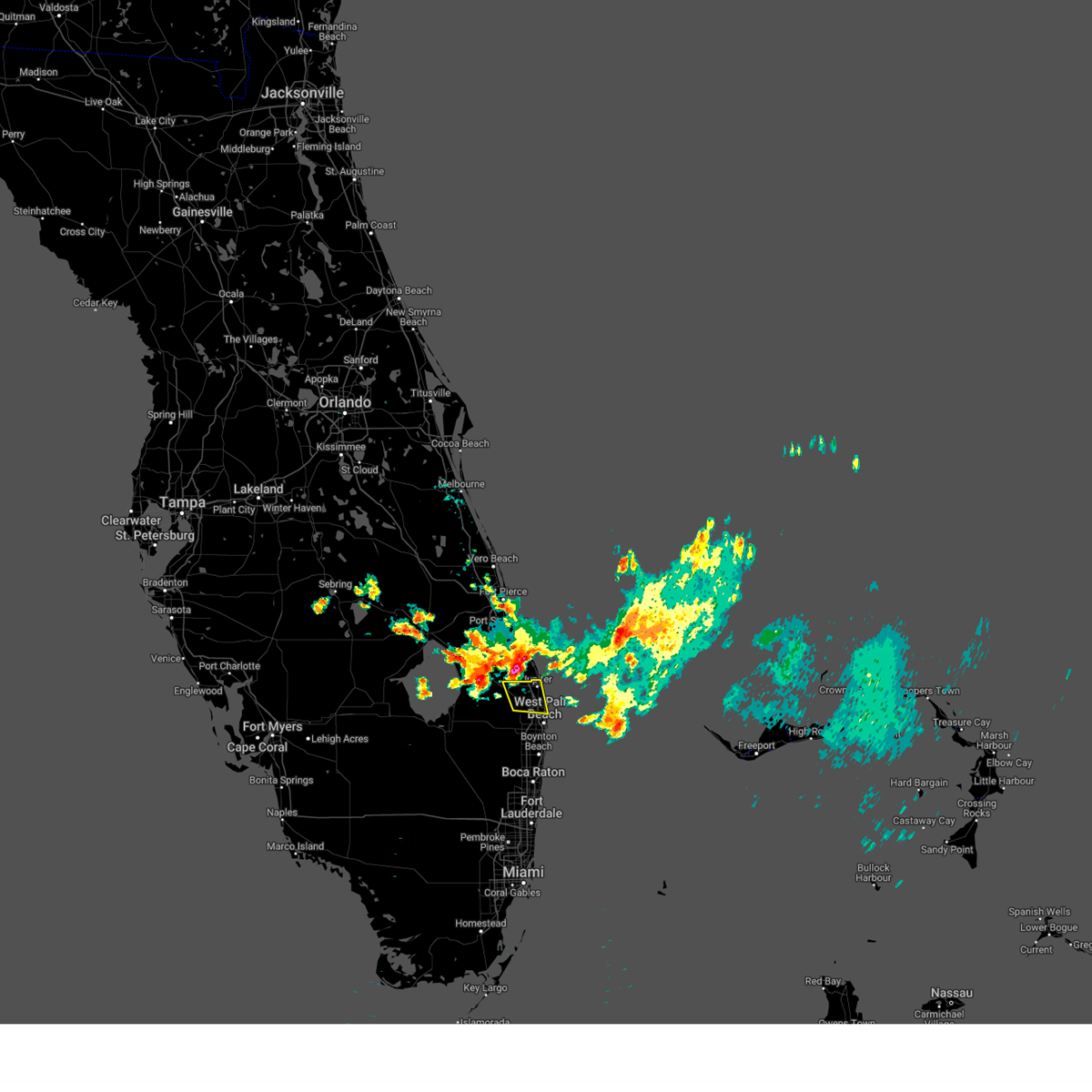
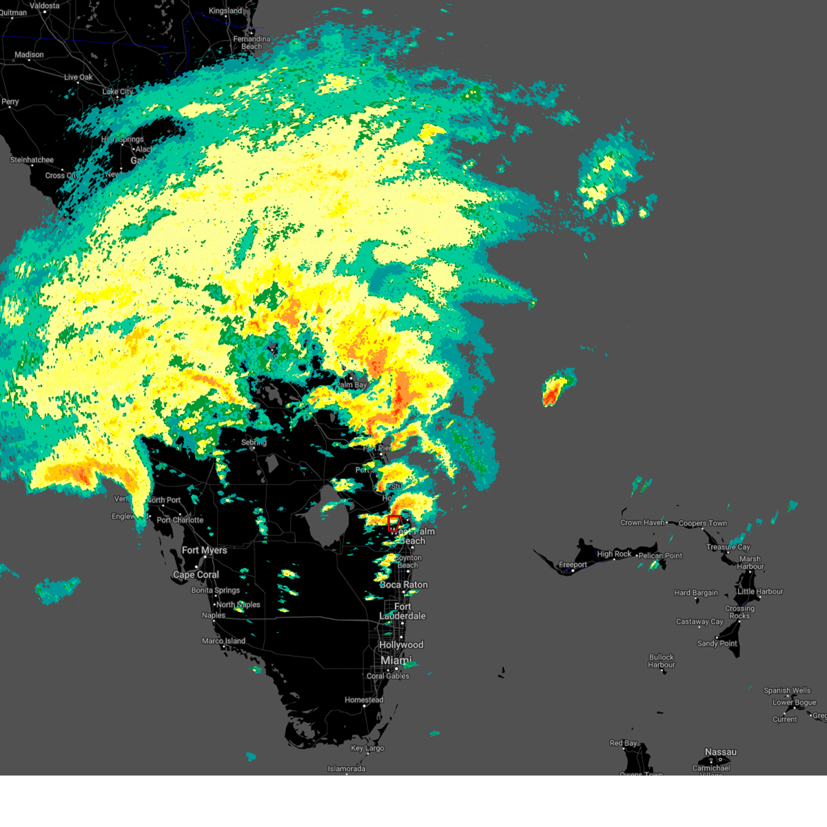
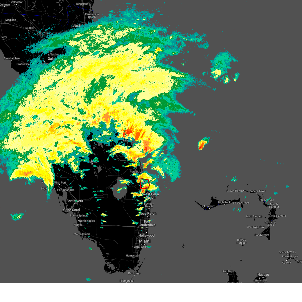
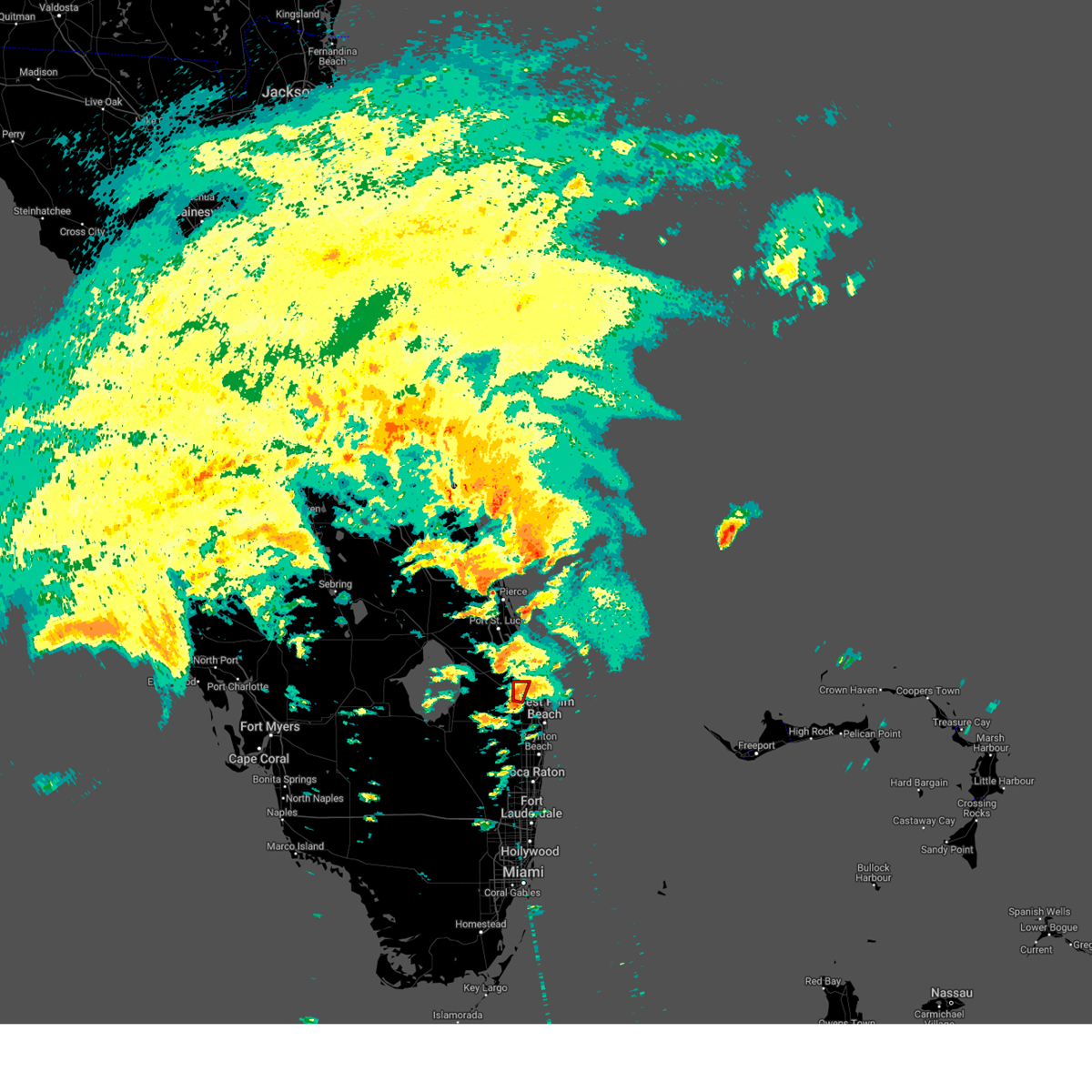
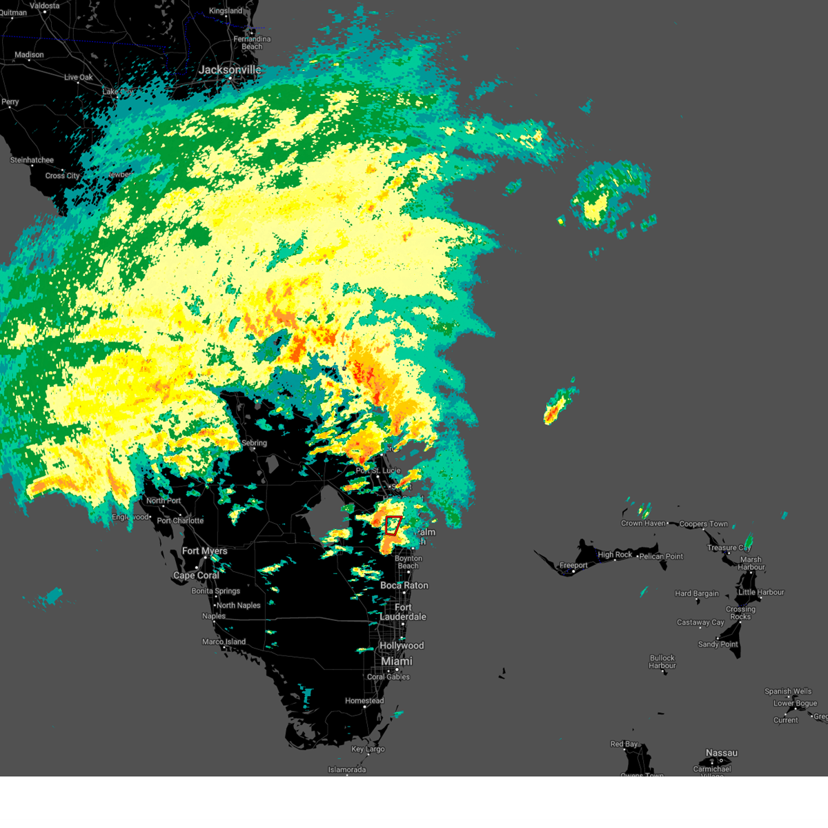
Hail Map for Jupiter, FL
The Jupiter, FL area has had 8 reports of on-the-ground hail by trained spotters, and has been under severe weather warnings 9 times during the past 12 months. Doppler radar has detected hail at or near Jupiter, FL on 55 occasions, including 3 occasions during the past year.
| Name: | Jupiter, FL |
| Where Located: | 27.9 miles SSE of Port Saint Lucie, FL |
| Map: | Google Map for Jupiter, FL |
| Population: | 55156 |
| Housing Units: | 29825 |
| More Info: | Search Google for Jupiter, FL |
0
The Top Recent Hail Date for Jupiter, FL is Tuesday, June 2, 2026 (49th out of 55)
Hail and Wind Damage Spotted near Jupiter, FL
| Date / Time | Report Details |
|---|---|
| 4/8/2026 5:36 PM EDT |
 The storms which prompted the warning have weakened below severe limits, and no longer pose an immediate threat to life or property. therefore, the warning will be allowed to expire. however, gusty winds are still possible with these thunderstorms. The storms which prompted the warning have weakened below severe limits, and no longer pose an immediate threat to life or property. therefore, the warning will be allowed to expire. however, gusty winds are still possible with these thunderstorms.
|
| 4/8/2026 4:59 PM EDT |
 Svrmfl the national weather service in miami has issued a * severe thunderstorm warning for, eastern palm beach county in southeastern florida, * until 545 pm edt. * at 459 pm edt, severe thunderstorms were located along a line extending from near juno ridge to near ocean ridge, moving southwest at 20 mph (radar indicated). Hazards include 60 mph wind gusts. expect damage to roofs, siding, and trees Svrmfl the national weather service in miami has issued a * severe thunderstorm warning for, eastern palm beach county in southeastern florida, * until 545 pm edt. * at 459 pm edt, severe thunderstorms were located along a line extending from near juno ridge to near ocean ridge, moving southwest at 20 mph (radar indicated). Hazards include 60 mph wind gusts. expect damage to roofs, siding, and trees
|
| 3/16/2026 3:39 PM EDT |
 Svrmfl the national weather service in miami has issued a * severe thunderstorm warning for, northeastern palm beach county in southeastern florida, * until 415 pm edt. * at 339 pm edt, a severe thunderstorm was located over west palm beach, moving northeast at 25 mph (radar indicated). Hazards include 60 mph wind gusts and quarter size hail. Hail damage to vehicles is expected. Expect wind damage to roofs, siding, and trees. Svrmfl the national weather service in miami has issued a * severe thunderstorm warning for, northeastern palm beach county in southeastern florida, * until 415 pm edt. * at 339 pm edt, a severe thunderstorm was located over west palm beach, moving northeast at 25 mph (radar indicated). Hazards include 60 mph wind gusts and quarter size hail. Hail damage to vehicles is expected. Expect wind damage to roofs, siding, and trees.
|
| 3/16/2026 2:05 PM EDT |
 Svrmlb the national weather service in melbourne has issued a * severe thunderstorm warning for, eastern martin county in east central florida, * until 245 pm edt. * at 205 pm edt, a severe thunderstorm was located near jonathan dickinson state park, or near tequesta, moving north at 25 mph (radar indicated). Hazards include 60 mph wind gusts and penny size hail. expect damage to roofs, siding, and trees Svrmlb the national weather service in melbourne has issued a * severe thunderstorm warning for, eastern martin county in east central florida, * until 245 pm edt. * at 205 pm edt, a severe thunderstorm was located near jonathan dickinson state park, or near tequesta, moving north at 25 mph (radar indicated). Hazards include 60 mph wind gusts and penny size hail. expect damage to roofs, siding, and trees
|
| 3/16/2026 2:02 PM EDT |
 At 202 pm edt, a severe thunderstorm was located over the acreage, or 7 miles west of palm beach gardens, moving north at 30 mph (radar indicated). Hazards include 60 mph wind gusts and penny size hail. Expect damage to roofs, siding, and trees. Locations impacted include, jupiter, palm beach gardens, north county airport, jupiter farms, philo farms, and limestone creek. At 202 pm edt, a severe thunderstorm was located over the acreage, or 7 miles west of palm beach gardens, moving north at 30 mph (radar indicated). Hazards include 60 mph wind gusts and penny size hail. Expect damage to roofs, siding, and trees. Locations impacted include, jupiter, palm beach gardens, north county airport, jupiter farms, philo farms, and limestone creek.
|
| 3/16/2026 1:49 PM EDT |
 Svrmfl the national weather service in miami has issued a * severe thunderstorm warning for, northeastern palm beach county in southeastern florida, * until 215 pm edt. * at 149 pm edt, a severe thunderstorm was located over loxahatchee groves, or near wellington, moving north at 30 mph (radar indicated). Hazards include 60 mph wind gusts. expect damage to roofs, siding, and trees Svrmfl the national weather service in miami has issued a * severe thunderstorm warning for, northeastern palm beach county in southeastern florida, * until 215 pm edt. * at 149 pm edt, a severe thunderstorm was located over loxahatchee groves, or near wellington, moving north at 30 mph (radar indicated). Hazards include 60 mph wind gusts. expect damage to roofs, siding, and trees
|
| 3/14/2026 3:09 PM EDT |
 Svrmfl the national weather service in miami has issued a * severe thunderstorm warning for, northeastern palm beach county in southeastern florida, * until 345 pm edt. * at 309 pm edt, a severe thunderstorm was located near north county airport, or 8 miles west of palm beach gardens, moving east at 25 mph (radar indicated). Hazards include 60 mph wind gusts and quarter size hail. Hail damage to vehicles is expected. Expect wind damage to roofs, siding, and trees. Svrmfl the national weather service in miami has issued a * severe thunderstorm warning for, northeastern palm beach county in southeastern florida, * until 345 pm edt. * at 309 pm edt, a severe thunderstorm was located near north county airport, or 8 miles west of palm beach gardens, moving east at 25 mph (radar indicated). Hazards include 60 mph wind gusts and quarter size hail. Hail damage to vehicles is expected. Expect wind damage to roofs, siding, and trees.
|
| 2/28/2026 5:47 PM EST |
 Svrmfl the national weather service in miami has issued a * severe thunderstorm warning for, northeastern palm beach county in southeastern florida, * until 615 pm est. * at 547 pm est, a severe thunderstorm was located 8 miles southeast of indiantown, moving southeast at 35 mph (radar indicated). Hazards include 60 mph wind gusts and quarter size hail. Hail damage to vehicles is expected. Expect wind damage to roofs, siding, and trees. Svrmfl the national weather service in miami has issued a * severe thunderstorm warning for, northeastern palm beach county in southeastern florida, * until 615 pm est. * at 547 pm est, a severe thunderstorm was located 8 miles southeast of indiantown, moving southeast at 35 mph (radar indicated). Hazards include 60 mph wind gusts and quarter size hail. Hail damage to vehicles is expected. Expect wind damage to roofs, siding, and trees.
|
| 2/28/2026 5:44 PM EST |
 Svrmlb the national weather service in melbourne has issued a * severe thunderstorm warning for, south central martin county in east central florida, * until 615 pm est. * at 543 pm est, a severe thunderstorm was located near indiantown, moving southeast at 30 mph (radar indicated). Hazards include 60 mph wind gusts and quarter size hail. Hail damage to vehicles is expected. Expect wind damage to roofs, siding, and trees. Svrmlb the national weather service in melbourne has issued a * severe thunderstorm warning for, south central martin county in east central florida, * until 615 pm est. * at 543 pm est, a severe thunderstorm was located near indiantown, moving southeast at 30 mph (radar indicated). Hazards include 60 mph wind gusts and quarter size hail. Hail damage to vehicles is expected. Expect wind damage to roofs, siding, and trees.
|
| 5/23/2025 3:59 PM EDT |
 The severe thunderstorm which prompted the warning has moved out of the warned area. therefore, the warning will be allowed to expire. The severe thunderstorm which prompted the warning has moved out of the warned area. therefore, the warning will be allowed to expire.
|
| 5/23/2025 3:42 PM EDT |
 At 342 pm edt, a severe thunderstorm was located 7 miles northwest of north county airport, or 10 miles northwest of palm beach gardens, moving southeast at 25 mph (radar indicated). Hazards include two inch hail and 60 mph wind gusts. People and animals outdoors will be injured. expect hail damage to roofs, siding, windows, and vehicles. expect wind damage to roofs, siding, and trees. This severe thunderstorm will remain over mainly rural areas of south central martin county. At 342 pm edt, a severe thunderstorm was located 7 miles northwest of north county airport, or 10 miles northwest of palm beach gardens, moving southeast at 25 mph (radar indicated). Hazards include two inch hail and 60 mph wind gusts. People and animals outdoors will be injured. expect hail damage to roofs, siding, windows, and vehicles. expect wind damage to roofs, siding, and trees. This severe thunderstorm will remain over mainly rural areas of south central martin county.
|
| 5/23/2025 3:29 PM EDT |
 Svrmlb the national weather service in melbourne has issued a * severe thunderstorm warning for, southeastern martin county in east central florida, * until 400 pm edt. * at 329 pm edt, a severe thunderstorm was located 7 miles southeast of indiantown, moving southeast at 25 mph (radar indicated). Hazards include two inch hail and 60 mph wind gusts. People and animals outdoors will be injured. expect hail damage to roofs, siding, windows, and vehicles. expect wind damage to roofs, siding, and trees. This severe thunderstorm will remain over mainly rural areas of southeastern martin county. Svrmlb the national weather service in melbourne has issued a * severe thunderstorm warning for, southeastern martin county in east central florida, * until 400 pm edt. * at 329 pm edt, a severe thunderstorm was located 7 miles southeast of indiantown, moving southeast at 25 mph (radar indicated). Hazards include two inch hail and 60 mph wind gusts. People and animals outdoors will be injured. expect hail damage to roofs, siding, windows, and vehicles. expect wind damage to roofs, siding, and trees. This severe thunderstorm will remain over mainly rural areas of southeastern martin county.
|
| 3/25/2025 8:36 PM EDT |
 The storms which prompted the warning have weakened below severe limits, and no longer pose an immediate threat to life or property. therefore, the warning will be allowed to expire. The storms which prompted the warning have weakened below severe limits, and no longer pose an immediate threat to life or property. therefore, the warning will be allowed to expire.
|
| 3/25/2025 8:22 PM EDT |
 The storm which prompted the warning has moved out of the area. therefore, the warning will be allowed to expire. however small hail and gusty winds are still possible with this thunderstorm. The storm which prompted the warning has moved out of the area. therefore, the warning will be allowed to expire. however small hail and gusty winds are still possible with this thunderstorm.
|
| 3/25/2025 8:16 PM EDT |
 At 816 pm edt, a severe thunderstorm was located near tequesta, moving southeast at 25 mph (radar indicated). Hazards include 60 mph wind gusts and quarter size hail. Hail damage to vehicles is expected. expect wind damage to roofs, siding, and trees. Locations impacted include, jupiter island, hobe sound beach, jonathan dickinson state park, tequesta, and hobe sound. At 816 pm edt, a severe thunderstorm was located near tequesta, moving southeast at 25 mph (radar indicated). Hazards include 60 mph wind gusts and quarter size hail. Hail damage to vehicles is expected. expect wind damage to roofs, siding, and trees. Locations impacted include, jupiter island, hobe sound beach, jonathan dickinson state park, tequesta, and hobe sound.
|
| 3/25/2025 8:06 PM EDT |
 At 806 pm edt, a severe thunderstorm was located near jonathan dickinson state park, or near jupiter island, moving southeast at 20 mph (radar indicated). Hazards include 60 mph wind gusts and quarter size hail. Hail damage to vehicles is expected. expect wind damage to roofs, siding, and trees. Locations impacted include, jupiter island, jonathan dickinson state park, hobe sound beach, hobe sound, and tequesta. At 806 pm edt, a severe thunderstorm was located near jonathan dickinson state park, or near jupiter island, moving southeast at 20 mph (radar indicated). Hazards include 60 mph wind gusts and quarter size hail. Hail damage to vehicles is expected. expect wind damage to roofs, siding, and trees. Locations impacted include, jupiter island, jonathan dickinson state park, hobe sound beach, hobe sound, and tequesta.
|
| 3/25/2025 7:57 PM EDT |
 Svrmfl the national weather service in miami has issued a * severe thunderstorm warning for, northeastern palm beach county in southeastern florida, * until 845 pm edt. * at 757 pm edt, severe thunderstorms were located along a line extending from hobe sound to 8 miles north of north county airport, moving southeast at 20 mph (radar indicated). Hazards include 60 mph wind gusts and penny size hail. expect damage to roofs, siding, and trees Svrmfl the national weather service in miami has issued a * severe thunderstorm warning for, northeastern palm beach county in southeastern florida, * until 845 pm edt. * at 757 pm edt, severe thunderstorms were located along a line extending from hobe sound to 8 miles north of north county airport, moving southeast at 20 mph (radar indicated). Hazards include 60 mph wind gusts and penny size hail. expect damage to roofs, siding, and trees
|
| 3/25/2025 7:52 PM EDT |
 Svrmlb the national weather service in melbourne has issued a * severe thunderstorm warning for, southeastern martin county in east central florida, * until 830 pm edt. * at 752 pm edt, a severe thunderstorm was located near hobe sound, moving southeast at 15 mph (radar indicated). Hazards include 60 mph wind gusts and quarter size hail. Hail damage to vehicles is expected. Expect wind damage to roofs, siding, and trees. Svrmlb the national weather service in melbourne has issued a * severe thunderstorm warning for, southeastern martin county in east central florida, * until 830 pm edt. * at 752 pm edt, a severe thunderstorm was located near hobe sound, moving southeast at 15 mph (radar indicated). Hazards include 60 mph wind gusts and quarter size hail. Hail damage to vehicles is expected. Expect wind damage to roofs, siding, and trees.
|
| 10/9/2024 5:26 PM EDT |
 The storm which prompted the warning has moved out of the area. therefore, the warning will be allowed to expire. a tornado watch remains in effect until 900 pm edt for southeastern florida. remember, a tornado warning remains in effect for southeastern martin county near jupiter where there is a confirmed large and dangerous tornado ongoing!!!. The storm which prompted the warning has moved out of the area. therefore, the warning will be allowed to expire. a tornado watch remains in effect until 900 pm edt for southeastern florida. remember, a tornado warning remains in effect for southeastern martin county near jupiter where there is a confirmed large and dangerous tornado ongoing!!!.
|
| 10/9/2024 5:20 PM EDT |
 At 519 pm edt, a confirmed tornado was located near north county airport, or near jupiter, moving north at 40 mph (radar confirmed tornado). Hazards include damaging tornado. Flying debris will be dangerous to those caught without shelter. mobile homes will be damaged or destroyed. damage to roofs, windows, and vehicles will occur. tree damage is likely. this tornado will be near, jupiter around 520 pm edt. jupiter island, port salerno, and hobe sound around 530 pm edt. stuart around 540 pm edt. Other locations impacted by this tornadic thunderstorm include hobe sound wildlife refuge. At 519 pm edt, a confirmed tornado was located near north county airport, or near jupiter, moving north at 40 mph (radar confirmed tornado). Hazards include damaging tornado. Flying debris will be dangerous to those caught without shelter. mobile homes will be damaged or destroyed. damage to roofs, windows, and vehicles will occur. tree damage is likely. this tornado will be near, jupiter around 520 pm edt. jupiter island, port salerno, and hobe sound around 530 pm edt. stuart around 540 pm edt. Other locations impacted by this tornadic thunderstorm include hobe sound wildlife refuge.
|
| 10/9/2024 5:16 PM EDT |
 At 515 pm edt, a confirmed large and extremely dangerous tornado was located over north county airport, or near palm beach gardens, moving north at 40 mph. this is a particularly dangerous situation. take cover now! (emergency management confirmed tornado). Hazards include damaging tornado. You are in a life-threatening situation. flying debris may be deadly to those caught without shelter. mobile homes will be destroyed. considerable damage to homes, businesses, and vehicles is likely and complete destruction is possible. Locations impacted include, jupiter, palm beach gardens, north county airport, jupiter farms, philo farms, and caloosa. At 515 pm edt, a confirmed large and extremely dangerous tornado was located over north county airport, or near palm beach gardens, moving north at 40 mph. this is a particularly dangerous situation. take cover now! (emergency management confirmed tornado). Hazards include damaging tornado. You are in a life-threatening situation. flying debris may be deadly to those caught without shelter. mobile homes will be destroyed. considerable damage to homes, businesses, and vehicles is likely and complete destruction is possible. Locations impacted include, jupiter, palm beach gardens, north county airport, jupiter farms, philo farms, and caloosa.
|
| 10/9/2024 5:16 PM EDT |
 Tormlb the national weather service in melbourne has issued a * tornado warning for, southeastern martin county in east central florida, * until 545 pm edt. * at 515 pm edt, a severe thunderstorm capable of producing a tornado was located over north county airport, or near palm beach gardens, moving north at 40 mph (radar indicated rotation). Hazards include tornado. Flying debris will be dangerous to those caught without shelter. mobile homes will be damaged or destroyed. damage to roofs, windows, and vehicles will occur. tree damage is likely. this dangerous storm will be near, jupiter around 520 pm edt. jupiter island, port salerno, and hobe sound around 530 pm edt. stuart around 540 pm edt. Other locations impacted by this tornadic thunderstorm include hobe sound wildlife refuge. Tormlb the national weather service in melbourne has issued a * tornado warning for, southeastern martin county in east central florida, * until 545 pm edt. * at 515 pm edt, a severe thunderstorm capable of producing a tornado was located over north county airport, or near palm beach gardens, moving north at 40 mph (radar indicated rotation). Hazards include tornado. Flying debris will be dangerous to those caught without shelter. mobile homes will be damaged or destroyed. damage to roofs, windows, and vehicles will occur. tree damage is likely. this dangerous storm will be near, jupiter around 520 pm edt. jupiter island, port salerno, and hobe sound around 530 pm edt. stuart around 540 pm edt. Other locations impacted by this tornadic thunderstorm include hobe sound wildlife refuge.
|
| 10/9/2024 5:07 PM EDT |
 Tormfl the national weather service in miami has issued a * tornado warning for, northeastern palm beach county in southeastern florida, * until 530 pm edt. * at 507 pm edt, a reported large and extremely dangerous tornado was located over the acreage, or near palm beach gardens, moving north at 40 mph. this is a particularly dangerous situation. take cover now! (emergency management reported tornado). Hazards include damaging tornado. You are in a life-threatening situation. flying debris may be deadly to those caught without shelter. mobile homes will be destroyed. Considerable damage to homes, businesses, and vehicles is likely and complete destruction is possible. Tormfl the national weather service in miami has issued a * tornado warning for, northeastern palm beach county in southeastern florida, * until 530 pm edt. * at 507 pm edt, a reported large and extremely dangerous tornado was located over the acreage, or near palm beach gardens, moving north at 40 mph. this is a particularly dangerous situation. take cover now! (emergency management reported tornado). Hazards include damaging tornado. You are in a life-threatening situation. flying debris may be deadly to those caught without shelter. mobile homes will be destroyed. Considerable damage to homes, businesses, and vehicles is likely and complete destruction is possible.
|
| 8/3/2024 10:57 PM EDT | Svrmfl the national weather service in miami has issued a * severe thunderstorm warning for, northeastern palm beach county in southeastern florida, * until 1115 pm edt. * at 1057 pm edt, a severe thunderstorm was located near north county airport, or 7 miles west of palm beach gardens, moving north at 35 mph (radar indicated). Hazards include 60 mph wind gusts. expect damage to roofs, siding, and trees |
| 6/12/2024 10:50 AM EDT |
 the tornado warning has been cancelled and is no longer in effect the tornado warning has been cancelled and is no longer in effect
|
| 6/12/2024 10:44 AM EDT |
 At 1044 am edt, a severe thunderstorm capable of producing a tornado was located over hobe sound beach, or near hobe sound, moving northeast at 15 mph (radar indicated rotation). Hazards include tornado. Flying debris will be dangerous to those caught without shelter. mobile homes will be damaged or destroyed. damage to roofs, windows, and vehicles will occur. tree damage is likely. This tornadic thunderstorm will remain over mainly rural areas of southeastern martin county, including the following locations, hobe sound wildlife refuge. At 1044 am edt, a severe thunderstorm capable of producing a tornado was located over hobe sound beach, or near hobe sound, moving northeast at 15 mph (radar indicated rotation). Hazards include tornado. Flying debris will be dangerous to those caught without shelter. mobile homes will be damaged or destroyed. damage to roofs, windows, and vehicles will occur. tree damage is likely. This tornadic thunderstorm will remain over mainly rural areas of southeastern martin county, including the following locations, hobe sound wildlife refuge.
|
| 6/12/2024 10:32 AM EDT |
 Tormlb the national weather service in melbourne has issued a * tornado warning for, southeastern martin county in east central florida, * until 1100 am edt. * at 1032 am edt, a severe thunderstorm capable of producing a tornado was located over hobe sound, moving northeast at 15 mph (radar indicated rotation). Hazards include tornado. Flying debris will be dangerous to those caught without shelter. mobile homes will be damaged or destroyed. damage to roofs, windows, and vehicles will occur. tree damage is likely. this dangerous storm will be near, jupiter island, hobe sound, and hobe sound beach around 1040 am edt. Other locations impacted by this tornadic thunderstorm include hobe sound wildlife refuge. Tormlb the national weather service in melbourne has issued a * tornado warning for, southeastern martin county in east central florida, * until 1100 am edt. * at 1032 am edt, a severe thunderstorm capable of producing a tornado was located over hobe sound, moving northeast at 15 mph (radar indicated rotation). Hazards include tornado. Flying debris will be dangerous to those caught without shelter. mobile homes will be damaged or destroyed. damage to roofs, windows, and vehicles will occur. tree damage is likely. this dangerous storm will be near, jupiter island, hobe sound, and hobe sound beach around 1040 am edt. Other locations impacted by this tornadic thunderstorm include hobe sound wildlife refuge.
|
| 5/28/2024 6:30 PM EDT |
 At 630 pm edt, a severe thunderstorm was located near north county airport, or 7 miles northwest of palm beach gardens, moving south at 15 mph (radar indicated). Hazards include 60 mph wind gusts and quarter size hail. Hail damage to vehicles is expected. expect wind damage to roofs, siding, and trees. Locations impacted include, west palm beach, jupiter, palm beach gardens, riviera beach, tequesta, royal palm beach, haverhill, schall circle, golden lakes, north county airport, the acreage, loxahatchee groves, lakeside green, philo farms, plantation mobile home park, limestone creek, caloosa, stacey street, jupiter farms, and century village. At 630 pm edt, a severe thunderstorm was located near north county airport, or 7 miles northwest of palm beach gardens, moving south at 15 mph (radar indicated). Hazards include 60 mph wind gusts and quarter size hail. Hail damage to vehicles is expected. expect wind damage to roofs, siding, and trees. Locations impacted include, west palm beach, jupiter, palm beach gardens, riviera beach, tequesta, royal palm beach, haverhill, schall circle, golden lakes, north county airport, the acreage, loxahatchee groves, lakeside green, philo farms, plantation mobile home park, limestone creek, caloosa, stacey street, jupiter farms, and century village.
|
| 5/28/2024 6:13 PM EDT |
 Svrmfl the national weather service in miami has issued a * severe thunderstorm warning for, northeastern palm beach county in southeastern florida, * until 645 pm edt. * at 613 pm edt, a severe thunderstorm was located 9 miles northwest of north county airport, or 11 miles southeast of indiantown, moving south at 15 mph (radar indicated). Hazards include 60 mph wind gusts and quarter size hail. Hail damage to vehicles is expected. Expect wind damage to roofs, siding, and trees. Svrmfl the national weather service in miami has issued a * severe thunderstorm warning for, northeastern palm beach county in southeastern florida, * until 645 pm edt. * at 613 pm edt, a severe thunderstorm was located 9 miles northwest of north county airport, or 11 miles southeast of indiantown, moving south at 15 mph (radar indicated). Hazards include 60 mph wind gusts and quarter size hail. Hail damage to vehicles is expected. Expect wind damage to roofs, siding, and trees.
|
| 5/19/2024 6:20 PM EDT |
 At 620 pm edt, a severe thunderstorm was located near indiantown, moving northeast at 15 mph (radar indicated). Hazards include 70 mph wind gusts and ping pong ball size hail. People and animals outdoors will be injured. expect hail damage to roofs, siding, windows, and vehicles. expect considerable tree damage. wind damage is also likely to mobile homes, roofs, and outbuildings. Locations impacted include, indiantown. At 620 pm edt, a severe thunderstorm was located near indiantown, moving northeast at 15 mph (radar indicated). Hazards include 70 mph wind gusts and ping pong ball size hail. People and animals outdoors will be injured. expect hail damage to roofs, siding, windows, and vehicles. expect considerable tree damage. wind damage is also likely to mobile homes, roofs, and outbuildings. Locations impacted include, indiantown.
|
| 5/19/2024 6:12 PM EDT |
 At 611 pm edt, a severe thunderstorm was located near indiantown, moving northeast at 20 mph (radar indicated). Hazards include ping pong ball size hail and 60 mph wind gusts. People and animals outdoors will be injured. expect hail damage to roofs, siding, windows, and vehicles. expect wind damage to roofs, siding, and trees. Locations impacted include, indiantown. At 611 pm edt, a severe thunderstorm was located near indiantown, moving northeast at 20 mph (radar indicated). Hazards include ping pong ball size hail and 60 mph wind gusts. People and animals outdoors will be injured. expect hail damage to roofs, siding, windows, and vehicles. expect wind damage to roofs, siding, and trees. Locations impacted include, indiantown.
|
| 5/19/2024 5:59 PM EDT |
 Svrmlb the national weather service in melbourne has issued a * severe thunderstorm warning for, southeastern martin county in east central florida, * until 645 pm edt. * at 559 pm edt, a severe thunderstorm was located 7 miles south of indiantown, moving northeast at 15 mph (radar indicated). Hazards include 60 mph wind gusts and quarter size hail. Hail damage to vehicles is expected. Expect wind damage to roofs, siding, and trees. Svrmlb the national weather service in melbourne has issued a * severe thunderstorm warning for, southeastern martin county in east central florida, * until 645 pm edt. * at 559 pm edt, a severe thunderstorm was located 7 miles south of indiantown, moving northeast at 15 mph (radar indicated). Hazards include 60 mph wind gusts and quarter size hail. Hail damage to vehicles is expected. Expect wind damage to roofs, siding, and trees.
|
| 5/19/2024 4:16 PM EDT |
 At 416 pm edt, a severe thunderstorm was located over north county airport, or over palm beach gardens, moving east at 10 mph (radar indicated). Hazards include ping pong ball size hail and 60 mph wind gusts. People and animals outdoors will be injured. expect hail damage to roofs, siding, windows, and vehicles. expect wind damage to roofs, siding, and trees. Locations impacted include, west palm beach, jupiter, palm beach gardens, riviera beach, palm beach, tequesta, juno beach, north palm beach, lake park, port of palm beach, north county airport, juno ridge, the acreage, mangonia park, lakeside green, fau north campus, philo farms, limestone creek, jupiter farms, and cypress lakes. At 416 pm edt, a severe thunderstorm was located over north county airport, or over palm beach gardens, moving east at 10 mph (radar indicated). Hazards include ping pong ball size hail and 60 mph wind gusts. People and animals outdoors will be injured. expect hail damage to roofs, siding, windows, and vehicles. expect wind damage to roofs, siding, and trees. Locations impacted include, west palm beach, jupiter, palm beach gardens, riviera beach, palm beach, tequesta, juno beach, north palm beach, lake park, port of palm beach, north county airport, juno ridge, the acreage, mangonia park, lakeside green, fau north campus, philo farms, limestone creek, jupiter farms, and cypress lakes.
|
| 5/19/2024 3:57 PM EDT |
 Svrmfl the national weather service in miami has issued a * severe thunderstorm warning for, northeastern palm beach county in southeastern florida, * until 430 pm edt. * at 356 pm edt, a severe thunderstorm was located over north county airport, or near palm beach gardens, moving east at 10 mph (radar indicated). Hazards include golf ball size hail and 60 mph wind gusts. People and animals outdoors will be injured. expect hail damage to roofs, siding, windows, and vehicles. Expect wind damage to roofs, siding, and trees. Svrmfl the national weather service in miami has issued a * severe thunderstorm warning for, northeastern palm beach county in southeastern florida, * until 430 pm edt. * at 356 pm edt, a severe thunderstorm was located over north county airport, or near palm beach gardens, moving east at 10 mph (radar indicated). Hazards include golf ball size hail and 60 mph wind gusts. People and animals outdoors will be injured. expect hail damage to roofs, siding, windows, and vehicles. Expect wind damage to roofs, siding, and trees.
|
| 5/19/2024 3:50 PM EDT |
 At 350 pm edt, a severe thunderstorm was located near north county airport, or 8 miles west of palm beach gardens, moving northeast at 20 mph (radar indicated). Hazards include golf ball size hail and 60 mph wind gusts. People and animals outdoors will be injured. expect hail damage to roofs, siding, windows, and vehicles. Locations impacted include, west palm beach, jupiter, palm beach gardens, tequesta, juno beach, north county airport, juno ridge, the acreage, fau north campus, philo farms, limestone creek, caloosa, and jupiter farms. At 350 pm edt, a severe thunderstorm was located near north county airport, or 8 miles west of palm beach gardens, moving northeast at 20 mph (radar indicated). Hazards include golf ball size hail and 60 mph wind gusts. People and animals outdoors will be injured. expect hail damage to roofs, siding, windows, and vehicles. Locations impacted include, west palm beach, jupiter, palm beach gardens, tequesta, juno beach, north county airport, juno ridge, the acreage, fau north campus, philo farms, limestone creek, caloosa, and jupiter farms.
|
| 5/19/2024 3:36 PM EDT |
 Svrmfl the national weather service in miami has issued a * severe thunderstorm warning for, northeastern palm beach county in southeastern florida, * until 400 pm edt. * at 335 pm edt, a severe thunderstorm was located 8 miles northwest of the acreage, or 12 miles west of palm beach gardens, moving northeast at 20 mph (radar indicated). Hazards include 60 mph wind gusts and penny size hail. expect damage to roofs, siding, and trees Svrmfl the national weather service in miami has issued a * severe thunderstorm warning for, northeastern palm beach county in southeastern florida, * until 400 pm edt. * at 335 pm edt, a severe thunderstorm was located 8 miles northwest of the acreage, or 12 miles west of palm beach gardens, moving northeast at 20 mph (radar indicated). Hazards include 60 mph wind gusts and penny size hail. expect damage to roofs, siding, and trees
|
| 8/17/2023 4:51 PM EDT |
 The severe thunderstorm warning for northeastern palm beach county will expire at 500 pm edt, the storm which prompted the warning has moved out of the area. therefore, the warning will be allowed to expire. The severe thunderstorm warning for northeastern palm beach county will expire at 500 pm edt, the storm which prompted the warning has moved out of the area. therefore, the warning will be allowed to expire.
|
| 8/17/2023 4:14 PM EDT |
 At 414 pm edt, a severe thunderstorm was located over schall circle, or near west palm beach, moving north at 20 mph (radar indicated). Hazards include 60 mph wind gusts and quarter size hail. Hail damage to vehicles is expected. Expect wind damage to roofs, siding, and trees. At 414 pm edt, a severe thunderstorm was located over schall circle, or near west palm beach, moving north at 20 mph (radar indicated). Hazards include 60 mph wind gusts and quarter size hail. Hail damage to vehicles is expected. Expect wind damage to roofs, siding, and trees.
|
| 7/16/2023 5:05 PM EDT |
 At 504 pm edt, a severe thunderstorm was located over tequesta, moving east at 15 mph (radar indicated). Hazards include 60 mph wind gusts. Expect damage to roofs, siding, and trees. locations impacted include, tequesta, jupiter island, hobe sound, port salerno and hobe sound beach. hail threat, radar indicated max hail size, <. 75 in wind threat, radar indicated max wind gust, 60 mph. At 504 pm edt, a severe thunderstorm was located over tequesta, moving east at 15 mph (radar indicated). Hazards include 60 mph wind gusts. Expect damage to roofs, siding, and trees. locations impacted include, tequesta, jupiter island, hobe sound, port salerno and hobe sound beach. hail threat, radar indicated max hail size, <. 75 in wind threat, radar indicated max wind gust, 60 mph.
|
| 7/16/2023 4:46 PM EDT |
 At 446 pm edt, a severe thunderstorm was located over jonathan dickinson state park, or near jupiter island, moving east at 10 mph (radar indicated). Hazards include 60 mph wind gusts. expect damage to roofs, siding, and trees At 446 pm edt, a severe thunderstorm was located over jonathan dickinson state park, or near jupiter island, moving east at 10 mph (radar indicated). Hazards include 60 mph wind gusts. expect damage to roofs, siding, and trees
|
| 6/20/2023 4:03 PM EDT |
 At 403 pm edt, a severe thunderstorm was located over north county airport, or near palm beach gardens, moving northeast at 30 mph (radar indicated). Hazards include 60 mph wind gusts and penny size hail. expect damage to roofs, siding, and trees At 403 pm edt, a severe thunderstorm was located over north county airport, or near palm beach gardens, moving northeast at 30 mph (radar indicated). Hazards include 60 mph wind gusts and penny size hail. expect damage to roofs, siding, and trees
|
| 6/17/2023 4:52 PM EDT |
 At 451 pm edt, a severe thunderstorm was located over loxahatchee groves, or near wellington, moving east at 5 mph (radar indicated). Hazards include 60 mph wind gusts and quarter size hail. Hail damage to vehicles is expected. Expect wind damage to roofs, siding, and trees. At 451 pm edt, a severe thunderstorm was located over loxahatchee groves, or near wellington, moving east at 5 mph (radar indicated). Hazards include 60 mph wind gusts and quarter size hail. Hail damage to vehicles is expected. Expect wind damage to roofs, siding, and trees.
|
| 6/13/2023 3:57 PM EDT |
 At 357 pm edt, a severe thunderstorm was located near jonathan dickinson state park, or 7 miles west of tequesta, and is nearly stationary (radar indicated). Hazards include 60 mph wind gusts and quarter size hail. Hail damage to vehicles is expected. Expect wind damage to roofs, siding, and trees. At 357 pm edt, a severe thunderstorm was located near jonathan dickinson state park, or 7 miles west of tequesta, and is nearly stationary (radar indicated). Hazards include 60 mph wind gusts and quarter size hail. Hail damage to vehicles is expected. Expect wind damage to roofs, siding, and trees.
|
| 6/11/2023 5:42 PM EDT |
 The severe thunderstorm warning for southeastern martin county will expire at 545 pm edt, the storm which prompted the warning has weakened below severe limits, and no longer poses an immediate threat to life or property. therefore, the warning will be allowed to expire. however gusty winds, heavy rain, and a funnel cloud, are still possible with this thunderstorm. The severe thunderstorm warning for southeastern martin county will expire at 545 pm edt, the storm which prompted the warning has weakened below severe limits, and no longer poses an immediate threat to life or property. therefore, the warning will be allowed to expire. however gusty winds, heavy rain, and a funnel cloud, are still possible with this thunderstorm.
|
| 6/11/2023 5:28 PM EDT |
 At 528 pm edt, a severe thunderstorm was located over tequesta, moving east at 10 mph (radar indicated). Hazards include 60 mph wind gusts and quarter size hail. Hail damage to vehicles is expected. expect wind damage to roofs, siding, and trees. Locations impacted include, tequesta, jupiter island, hobe sound and jonathan dickinson state park. At 528 pm edt, a severe thunderstorm was located over tequesta, moving east at 10 mph (radar indicated). Hazards include 60 mph wind gusts and quarter size hail. Hail damage to vehicles is expected. expect wind damage to roofs, siding, and trees. Locations impacted include, tequesta, jupiter island, hobe sound and jonathan dickinson state park.
|
| 6/11/2023 5:10 PM EDT |
 At 510 pm edt, a severe thunderstorm was located over jonathan dickinson state park, or over jupiter island, moving northeast at 5 mph (radar indicated). Hazards include 60 mph wind gusts and quarter size hail. Hail damage to vehicles is expected. Expect wind damage to roofs, siding, and trees. At 510 pm edt, a severe thunderstorm was located over jonathan dickinson state park, or over jupiter island, moving northeast at 5 mph (radar indicated). Hazards include 60 mph wind gusts and quarter size hail. Hail damage to vehicles is expected. Expect wind damage to roofs, siding, and trees.
|
| 6/1/2023 4:08 PM EDT |
 The severe thunderstorm warning for southeastern martin county will expire at 415 pm edt, the storm which prompted the warning is moving offshore. therefore, the warning will be allowed to expire. however heavy rain is still possible with this thunderstorm. to report severe weather, contact your nearest law enforcement agency. they will relay your report to the national weather service melbourne. The severe thunderstorm warning for southeastern martin county will expire at 415 pm edt, the storm which prompted the warning is moving offshore. therefore, the warning will be allowed to expire. however heavy rain is still possible with this thunderstorm. to report severe weather, contact your nearest law enforcement agency. they will relay your report to the national weather service melbourne.
|
| 6/1/2023 4:04 PM EDT |
 At 403 pm edt, a severe thunderstorm was located over tequesta, moving east at 20 mph (radar indicated). Hazards include 60 mph wind gusts. Expect damage to roofs, siding, and trees. locations impacted include, tequesta, jupiter island, hobe sound, hobe sound beach and jonathan dickinson state park. hail threat, radar indicated max hail size, <. 75 in wind threat, radar indicated max wind gust, 60 mph. At 403 pm edt, a severe thunderstorm was located over tequesta, moving east at 20 mph (radar indicated). Hazards include 60 mph wind gusts. Expect damage to roofs, siding, and trees. locations impacted include, tequesta, jupiter island, hobe sound, hobe sound beach and jonathan dickinson state park. hail threat, radar indicated max hail size, <. 75 in wind threat, radar indicated max wind gust, 60 mph.
|
| 6/1/2023 3:54 PM EDT |
 At 354 pm edt, a severe thunderstorm was located over jonathan dickinson state park, or near jupiter island, moving east at 15 mph (radar indicated). Hazards include 60 mph wind gusts. expect damage to roofs, siding, and trees At 354 pm edt, a severe thunderstorm was located over jonathan dickinson state park, or near jupiter island, moving east at 15 mph (radar indicated). Hazards include 60 mph wind gusts. expect damage to roofs, siding, and trees
|
| 5/25/2023 4:19 PM EDT |
 At 419 pm edt, a severe thunderstorm was located over golden lakes, or near west palm beach, moving northeast at 10 mph (radar indicated). Hazards include 60 mph wind gusts and nickel size hail. expect damage to roofs, siding, and trees At 419 pm edt, a severe thunderstorm was located over golden lakes, or near west palm beach, moving northeast at 10 mph (radar indicated). Hazards include 60 mph wind gusts and nickel size hail. expect damage to roofs, siding, and trees
|
| 5/24/2023 2:26 PM EDT |
 The severe thunderstorm warning for northeastern palm beach county will expire at 230 pm edt, the storm which prompted the warning has weakened below severe limits, and has exited the warned area. therefore, the warning will be allowed to expire. however gusty winds are still possible with this thunderstorm. The severe thunderstorm warning for northeastern palm beach county will expire at 230 pm edt, the storm which prompted the warning has weakened below severe limits, and has exited the warned area. therefore, the warning will be allowed to expire. however gusty winds are still possible with this thunderstorm.
|
| 5/24/2023 2:17 PM EDT |
 At 217 pm edt, a severe thunderstorm was located over juno beach, moving east at 5 mph (radar indicated). Hazards include 60 mph wind gusts and quarter size hail. Hail damage to vehicles is expected. expect wind damage to roofs, siding, and trees. locations impacted include, jupiter, palm beach gardens, tequesta, juno beach and north palm beach. hail threat, radar indicated max hail size, 1. 00 in wind threat, radar indicated max wind gust, 60 mph. At 217 pm edt, a severe thunderstorm was located over juno beach, moving east at 5 mph (radar indicated). Hazards include 60 mph wind gusts and quarter size hail. Hail damage to vehicles is expected. expect wind damage to roofs, siding, and trees. locations impacted include, jupiter, palm beach gardens, tequesta, juno beach and north palm beach. hail threat, radar indicated max hail size, 1. 00 in wind threat, radar indicated max wind gust, 60 mph.
|
| 5/24/2023 2:13 PM EDT | A wind gust of 58 mph or 50 kt was recorded at the juno beach pier mesone in amz650 county FL, 4.3 miles WNW of Jupiter, FL |
| 5/24/2023 2:03 PM EDT |
 At 203 pm edt, a severe thunderstorm was located over jupiter, moving east at 5 mph (radar indicated). Hazards include 60 mph wind gusts and quarter size hail. Hail damage to vehicles is expected. Expect wind damage to roofs, siding, and trees. At 203 pm edt, a severe thunderstorm was located over jupiter, moving east at 5 mph (radar indicated). Hazards include 60 mph wind gusts and quarter size hail. Hail damage to vehicles is expected. Expect wind damage to roofs, siding, and trees.
|
| 5/18/2023 6:55 PM EDT |
 The severe thunderstorm warning for northeastern palm beach county will expire at 700 pm edt, the storms which prompted the warning have weakened below severe limits, and no longer pose an immediate threat to life or property. therefore, the warning will be allowed to expire. however gusty winds and heavy rain are still possible with these thunderstorms. to report severe weather, contact your nearest law enforcement agency. they will relay your report to the national weather service miami. you can also share your report with nws miami on facebook and twitter. The severe thunderstorm warning for northeastern palm beach county will expire at 700 pm edt, the storms which prompted the warning have weakened below severe limits, and no longer pose an immediate threat to life or property. therefore, the warning will be allowed to expire. however gusty winds and heavy rain are still possible with these thunderstorms. to report severe weather, contact your nearest law enforcement agency. they will relay your report to the national weather service miami. you can also share your report with nws miami on facebook and twitter.
|
| 5/18/2023 6:47 PM EDT |
 At 646 pm edt, severe thunderstorms were located along a line extending from palm beach gardens to atlantis, moving northeast at 15 mph (radar indicated). Hazards include 60 mph wind gusts and penny size hail. Expect damage to roofs, siding, and trees. Locations impacted include, west palm beach, boynton beach, wellington, jupiter and palm beach gardens. At 646 pm edt, severe thunderstorms were located along a line extending from palm beach gardens to atlantis, moving northeast at 15 mph (radar indicated). Hazards include 60 mph wind gusts and penny size hail. Expect damage to roofs, siding, and trees. Locations impacted include, west palm beach, boynton beach, wellington, jupiter and palm beach gardens.
|
| 5/18/2023 6:35 PM EDT |
 At 635 pm edt, severe thunderstorms were located along a line extending from near north county airport to near west palm beach to near greenacres, moving northeast at 10 mph (radar indicated). Hazards include 60 mph wind gusts and penny size hail. Expect damage to roofs, siding, and trees. Locations impacted include, west palm beach, boynton beach, wellington, jupiter and palm beach gardens. At 635 pm edt, severe thunderstorms were located along a line extending from near north county airport to near west palm beach to near greenacres, moving northeast at 10 mph (radar indicated). Hazards include 60 mph wind gusts and penny size hail. Expect damage to roofs, siding, and trees. Locations impacted include, west palm beach, boynton beach, wellington, jupiter and palm beach gardens.
|
| 5/18/2023 6:25 PM EDT |
 At 624 pm edt, severe thunderstorms were located along a line extending from near north county airport to near royal palm beach to near wellington to boca pointe, moving east at 20 mph (radar indicated). Hazards include 60 mph wind gusts and penny size hail. Expect damage to roofs, siding, and trees. Locations impacted include, coral springs, west palm beach, pompano beach, boca raton and deerfield beach. At 624 pm edt, severe thunderstorms were located along a line extending from near north county airport to near royal palm beach to near wellington to boca pointe, moving east at 20 mph (radar indicated). Hazards include 60 mph wind gusts and penny size hail. Expect damage to roofs, siding, and trees. Locations impacted include, coral springs, west palm beach, pompano beach, boca raton and deerfield beach.
|
| 5/18/2023 6:09 PM EDT |
 At 608 pm edt, severe thunderstorms were located along a line extending from near the acreage to near loxahatchee nwr to parkland, moving east at 15 mph (radar indicated). Hazards include 60 mph wind gusts and quarter size hail. Hail damage to vehicles is expected. Expect wind damage to roofs, siding, and trees. At 608 pm edt, severe thunderstorms were located along a line extending from near the acreage to near loxahatchee nwr to parkland, moving east at 15 mph (radar indicated). Hazards include 60 mph wind gusts and quarter size hail. Hail damage to vehicles is expected. Expect wind damage to roofs, siding, and trees.
|
| 5/17/2023 5:35 PM EDT |
 The severe thunderstorm warning for northeastern palm beach county will expire at 545 pm edt, the storm which prompted the warning has moved out of the area. therefore, the warning will be allowed to expire. however gusty winds and heavy rain are still possible with this thunderstorm. to report severe weather, contact your nearest law enforcement agency. they will relay your report to the national weather service miami. you can also share your report with nws miami on facebook and twitter. The severe thunderstorm warning for northeastern palm beach county will expire at 545 pm edt, the storm which prompted the warning has moved out of the area. therefore, the warning will be allowed to expire. however gusty winds and heavy rain are still possible with this thunderstorm. to report severe weather, contact your nearest law enforcement agency. they will relay your report to the national weather service miami. you can also share your report with nws miami on facebook and twitter.
|
| 5/17/2023 5:23 PM EDT |
 At 523 pm edt, a severe thunderstorm was located near tequesta, moving northeast at 20 mph (radar indicated). Hazards include 60 mph wind gusts and quarter size hail. Hail damage to vehicles is expected. expect wind damage to roofs, siding, and trees. Locations impacted include, jupiter, palm beach gardens, tequesta, juno beach and north palm beach. At 523 pm edt, a severe thunderstorm was located near tequesta, moving northeast at 20 mph (radar indicated). Hazards include 60 mph wind gusts and quarter size hail. Hail damage to vehicles is expected. expect wind damage to roofs, siding, and trees. Locations impacted include, jupiter, palm beach gardens, tequesta, juno beach and north palm beach.
|
| 5/17/2023 5:15 PM EDT |
 At 515 pm edt, a severe thunderstorm was located over jupiter, moving northeast at 25 mph (radar indicated). Hazards include 60 mph wind gusts and quarter size hail. Hail damage to vehicles is expected. Expect wind damage to roofs, siding, and trees. At 515 pm edt, a severe thunderstorm was located over jupiter, moving northeast at 25 mph (radar indicated). Hazards include 60 mph wind gusts and quarter size hail. Hail damage to vehicles is expected. Expect wind damage to roofs, siding, and trees.
|
| 4/30/2023 9:34 AM EDT |
 At 934 am edt, a severe thunderstorm was located over lion country safari park, or 9 miles west of wellington, moving northeast at 45 mph (radar indicated). Hazards include 60 mph wind gusts and penny size hail. Expect damage to roofs, siding, and trees. Locations impacted include, west palm beach, boynton beach, wellington, jupiter and palm beach gardens. At 934 am edt, a severe thunderstorm was located over lion country safari park, or 9 miles west of wellington, moving northeast at 45 mph (radar indicated). Hazards include 60 mph wind gusts and penny size hail. Expect damage to roofs, siding, and trees. Locations impacted include, west palm beach, boynton beach, wellington, jupiter and palm beach gardens.
|
| 4/30/2023 9:31 AM EDT |
 At 931 am edt, a severe thunderstorm capable of producing a tornado was located near wellington, moving northeast at 35 mph (radar indicated rotation). Hazards include tornado. Flying debris will be dangerous to those caught without shelter. mobile homes will be damaged or destroyed. damage to roofs, windows, and vehicles will occur. Tree damage is likely. At 931 am edt, a severe thunderstorm capable of producing a tornado was located near wellington, moving northeast at 35 mph (radar indicated rotation). Hazards include tornado. Flying debris will be dangerous to those caught without shelter. mobile homes will be damaged or destroyed. damage to roofs, windows, and vehicles will occur. Tree damage is likely.
|
| 4/30/2023 9:11 AM EDT |
 At 910 am edt, a severe thunderstorm was located near okeelanta, or 9 miles south of belle glade, moving northeast at 45 mph (radar indicated). Hazards include 60 mph wind gusts and penny size hail. expect damage to roofs, siding, and trees At 910 am edt, a severe thunderstorm was located near okeelanta, or 9 miles south of belle glade, moving northeast at 45 mph (radar indicated). Hazards include 60 mph wind gusts and penny size hail. expect damage to roofs, siding, and trees
|
| 4/29/2023 5:26 PM EDT |
 The tornado warning for eastern palm beach county will expire at 530 pm edt, the storm which prompted the warning has moved out of the area. therefore, the warning will be allowed to expire. however small hail and gusty winds are still possible with this thunderstorm. The tornado warning for eastern palm beach county will expire at 530 pm edt, the storm which prompted the warning has moved out of the area. therefore, the warning will be allowed to expire. however small hail and gusty winds are still possible with this thunderstorm.
|
| 4/29/2023 5:12 PM EDT |
 At 512 pm edt, a severe thunderstorm capable of producing a tornado was located over juno ridge, or near juno beach, moving northeast at 20 mph (radar indicated rotation). Hazards include tornado and half dollar size hail. Flying debris will be dangerous to those caught without shelter. mobile homes will be damaged or destroyed. damage to roofs, windows, and vehicles will occur. Tree damage is likely. At 512 pm edt, a severe thunderstorm capable of producing a tornado was located over juno ridge, or near juno beach, moving northeast at 20 mph (radar indicated rotation). Hazards include tornado and half dollar size hail. Flying debris will be dangerous to those caught without shelter. mobile homes will be damaged or destroyed. damage to roofs, windows, and vehicles will occur. Tree damage is likely.
|
| 4/29/2023 4:59 PM EDT |
 At 458 pm edt, a severe thunderstorm was located over jupiter, moving northeast at 30 mph (trained weather spotters). Hazards include 60 mph wind gusts and half dollar size hail. Hail damage to vehicles is expected. Expect wind damage to roofs, siding, and trees. At 458 pm edt, a severe thunderstorm was located over jupiter, moving northeast at 30 mph (trained weather spotters). Hazards include 60 mph wind gusts and half dollar size hail. Hail damage to vehicles is expected. Expect wind damage to roofs, siding, and trees.
|
| 4/29/2023 4:55 PM EDT | Golf Ball sized hail reported 4.4 miles E of Jupiter, FL, numerous public spotter reports of golf ball sized hail in jupiter farms. |
| 4/29/2023 4:52 PM EDT |
 At 452 pm edt, a severe thunderstorm was located near jonathan dickinson state park, or near tequesta, moving northeast at 30 mph (trained weather spotters). Hazards include 60 mph wind gusts and quarter size hail. Hail damage to vehicles is expected. expect wind damage to roofs, siding, and trees. Locations impacted include, jupiter, palm beach gardens, tequesta, jupiter farms and philo farms. At 452 pm edt, a severe thunderstorm was located near jonathan dickinson state park, or near tequesta, moving northeast at 30 mph (trained weather spotters). Hazards include 60 mph wind gusts and quarter size hail. Hail damage to vehicles is expected. expect wind damage to roofs, siding, and trees. Locations impacted include, jupiter, palm beach gardens, tequesta, jupiter farms and philo farms.
|
| 4/29/2023 4:48 PM EDT |
 At 448 pm edt, a severe thunderstorm was located near jupiter, moving northeast at 30 mph (radar indicated). Hazards include 60 mph wind gusts and quarter size hail. Hail damage to vehicles is expected. Expect wind damage to roofs, siding, and trees. At 448 pm edt, a severe thunderstorm was located near jupiter, moving northeast at 30 mph (radar indicated). Hazards include 60 mph wind gusts and quarter size hail. Hail damage to vehicles is expected. Expect wind damage to roofs, siding, and trees.
|
| 4/29/2023 4:45 PM EDT | Quarter sized hail reported 4.3 miles E of Jupiter, FL, trained spotter reported quarter size hail and heavy rain. |
| 4/29/2023 4:40 PM EDT |
 At 440 pm edt, a severe thunderstorm was located near north county airport, or near palm beach gardens, moving northeast at 30 mph (radar indicated). Hazards include 60 mph wind gusts and quarter size hail. Hail damage to vehicles is expected. Expect wind damage to roofs, siding, and trees. At 440 pm edt, a severe thunderstorm was located near north county airport, or near palm beach gardens, moving northeast at 30 mph (radar indicated). Hazards include 60 mph wind gusts and quarter size hail. Hail damage to vehicles is expected. Expect wind damage to roofs, siding, and trees.
|
| 4/28/2023 7:53 PM EDT |
 The severe thunderstorm warning for eastern martin county will expire at 800 pm edt, the storm which prompted the warning has weakened below severe limits, and has exited the warned area. therefore, the warning will be allowed to expire. however gusty winds and heavy rain are still possible with this thunderstorm. The severe thunderstorm warning for eastern martin county will expire at 800 pm edt, the storm which prompted the warning has weakened below severe limits, and has exited the warned area. therefore, the warning will be allowed to expire. however gusty winds and heavy rain are still possible with this thunderstorm.
|
| 4/28/2023 7:39 PM EDT |
 At 739 pm edt, a severe thunderstorm was located near port salerno, moving east at 35 mph (radar indicated). Hazards include 60 mph wind gusts and quarter size hail. Hail damage to vehicles is expected. Expect wind damage to roofs, siding, and trees. At 739 pm edt, a severe thunderstorm was located near port salerno, moving east at 35 mph (radar indicated). Hazards include 60 mph wind gusts and quarter size hail. Hail damage to vehicles is expected. Expect wind damage to roofs, siding, and trees.
|
| 4/26/2023 5:38 PM EDT |
 At 537 pm edt, a severe thunderstorm was located over sewall`s point, or near stuart, moving southeast at 30 mph (radar indicated). Hazards include 60 mph wind gusts and quarter size hail. Hail damage to vehicles is expected. Expect wind damage to roofs, siding, and trees. At 537 pm edt, a severe thunderstorm was located over sewall`s point, or near stuart, moving southeast at 30 mph (radar indicated). Hazards include 60 mph wind gusts and quarter size hail. Hail damage to vehicles is expected. Expect wind damage to roofs, siding, and trees.
|
| 4/26/2023 4:27 PM EDT |
 The severe thunderstorm warning for northeastern palm beach county will expire at 430 pm edt, the storm which prompted the warning has weakened below severe limits, and no longer poses an immediate threat to life or property. therefore, the warning will be allowed to expire. however small hail and gusty winds are still possible with this thunderstorm. a severe thunderstorm watch remains in effect until 900 pm edt for southeastern florida. The severe thunderstorm warning for northeastern palm beach county will expire at 430 pm edt, the storm which prompted the warning has weakened below severe limits, and no longer poses an immediate threat to life or property. therefore, the warning will be allowed to expire. however small hail and gusty winds are still possible with this thunderstorm. a severe thunderstorm watch remains in effect until 900 pm edt for southeastern florida.
|
| 4/26/2023 4:15 PM EDT |
 At 414 pm edt, a severe thunderstorm was located over juno ridge, or over juno beach, moving southeast at 15 mph (public. at 4:08pm edt, hail the size of a half-dollar (1.25 inches) was reported at jupiter, florida). Hazards include 60 mph wind gusts and quarter size hail. Hail damage to vehicles is expected. expect wind damage to roofs, siding, and trees. locations impacted include, west palm beach, jupiter, palm beach gardens, riviera beach and palm beach. hail threat, observed max hail size, 1. 00 in wind threat, radar indicated max wind gust, 60 mph. At 414 pm edt, a severe thunderstorm was located over juno ridge, or over juno beach, moving southeast at 15 mph (public. at 4:08pm edt, hail the size of a half-dollar (1.25 inches) was reported at jupiter, florida). Hazards include 60 mph wind gusts and quarter size hail. Hail damage to vehicles is expected. expect wind damage to roofs, siding, and trees. locations impacted include, west palm beach, jupiter, palm beach gardens, riviera beach and palm beach. hail threat, observed max hail size, 1. 00 in wind threat, radar indicated max wind gust, 60 mph.
|
| 4/26/2023 4:12 PM EDT | Half Dollar sized hail reported 2.3 miles NNE of Jupiter, FL, report from mping: half dollar (1.25 in.). |
| 4/26/2023 3:59 PM EDT |
 At 358 pm edt, a severe thunderstorm was located over jupiter, moving southeast at 15 mph (radar indicated). Hazards include 60 mph wind gusts and quarter size hail. Hail damage to vehicles is expected. Expect wind damage to roofs, siding, and trees. At 358 pm edt, a severe thunderstorm was located over jupiter, moving southeast at 15 mph (radar indicated). Hazards include 60 mph wind gusts and quarter size hail. Hail damage to vehicles is expected. Expect wind damage to roofs, siding, and trees.
|
| 4/26/2023 3:51 PM EDT |
 At 350 pm edt, a severe thunderstorm was located over jupiter, moving east at 10 mph (at 3:45pm edt, hail the size of pennies (0.75 inch) was reported at jupiter farms and palm beach gardens). Hazards include 60 mph wind gusts and quarter size hail. Hail damage to vehicles is expected. expect wind damage to roofs, siding, and trees. locations impacted include, west palm beach, jupiter, palm beach gardens, riviera beach and palm beach. hail threat, observed max hail size, 1. 00 in wind threat, radar indicated max wind gust, 60 mph. At 350 pm edt, a severe thunderstorm was located over jupiter, moving east at 10 mph (at 3:45pm edt, hail the size of pennies (0.75 inch) was reported at jupiter farms and palm beach gardens). Hazards include 60 mph wind gusts and quarter size hail. Hail damage to vehicles is expected. expect wind damage to roofs, siding, and trees. locations impacted include, west palm beach, jupiter, palm beach gardens, riviera beach and palm beach. hail threat, observed max hail size, 1. 00 in wind threat, radar indicated max wind gust, 60 mph.
|
| 4/26/2023 3:40 PM EDT | Ping Pong Ball sized hail reported 1.2 miles W of Jupiter, FL, social media post with hail covering entire yard. varying hail size 0.5-1.5". |
| 4/26/2023 3:33 PM EDT |
 At 332 pm edt, a severe thunderstorm was located near jupiter, moving east at 10 mph (radar indicated). Hazards include 60 mph wind gusts and quarter size hail. Hail damage to vehicles is expected. Expect wind damage to roofs, siding, and trees. At 332 pm edt, a severe thunderstorm was located near jupiter, moving east at 10 mph (radar indicated). Hazards include 60 mph wind gusts and quarter size hail. Hail damage to vehicles is expected. Expect wind damage to roofs, siding, and trees.
|
| 4/17/2023 1:53 PM EDT |
 The tornado warning for east central palm beach county will expire at 200 pm edt, the storm which prompted the warning has weakened below severe limits, and has exited the warned area. therefore, the warning will be allowed to expire. however small hail, gusty winds and heavy rain are still possible with this thunderstorm. to report severe weather, contact your nearest law enforcement agency. they will relay your report to the national weather service miami. you can also share your report with nws miami on facebook and twitter. The tornado warning for east central palm beach county will expire at 200 pm edt, the storm which prompted the warning has weakened below severe limits, and has exited the warned area. therefore, the warning will be allowed to expire. however small hail, gusty winds and heavy rain are still possible with this thunderstorm. to report severe weather, contact your nearest law enforcement agency. they will relay your report to the national weather service miami. you can also share your report with nws miami on facebook and twitter.
|
| 4/17/2023 1:23 PM EDT |
 At 123 pm edt, a severe thunderstorm capable of producing a tornado was located over riviera beach, moving northeast at 25 mph (radar indicated rotation). Hazards include tornado. Flying debris will be dangerous to those caught without shelter. mobile homes will be damaged or destroyed. damage to roofs, windows, and vehicles will occur. Tree damage is likely. At 123 pm edt, a severe thunderstorm capable of producing a tornado was located over riviera beach, moving northeast at 25 mph (radar indicated rotation). Hazards include tornado. Flying debris will be dangerous to those caught without shelter. mobile homes will be damaged or destroyed. damage to roofs, windows, and vehicles will occur. Tree damage is likely.
|
| 9/28/2022 3:04 AM EDT |
 At 304 am edt, a severe thunderstorm capable of producing a tornado was located over juno ridge, or near juno beach, moving north at 35 mph (radar indicated rotation). Hazards include tornado. Flying debris will be dangerous to those caught without shelter. mobile homes will be damaged or destroyed. damage to roofs, windows, and vehicles will occur. Tree damage is likely. At 304 am edt, a severe thunderstorm capable of producing a tornado was located over juno ridge, or near juno beach, moving north at 35 mph (radar indicated rotation). Hazards include tornado. Flying debris will be dangerous to those caught without shelter. mobile homes will be damaged or destroyed. damage to roofs, windows, and vehicles will occur. Tree damage is likely.
|
| 9/28/2022 3:00 AM EDT |
 At 300 am edt, a severe thunderstorm capable of producing a tornado was located over port of palm beach, or over riviera beach, moving northwest at 20 mph (radar indicated rotation). Hazards include tornado. Expect damage to mobile homes, roofs, and vehicles. tree damage is likely. Locations impacted include, west palm beach, jupiter, palm beach gardens, riviera beach and juno beach. At 300 am edt, a severe thunderstorm capable of producing a tornado was located over port of palm beach, or over riviera beach, moving northwest at 20 mph (radar indicated rotation). Hazards include tornado. Expect damage to mobile homes, roofs, and vehicles. tree damage is likely. Locations impacted include, west palm beach, jupiter, palm beach gardens, riviera beach and juno beach.
|
| 9/28/2022 2:53 AM EDT |
 At 252 am edt, a severe thunderstorm capable of producing a tornado was located over downtown west palm beach, or over palm beach, moving northwest at 20 mph (radar indicated rotation). Hazards include tornado. Expect damage to mobile homes, roofs, and vehicles. Tree damage is likely. At 252 am edt, a severe thunderstorm capable of producing a tornado was located over downtown west palm beach, or over palm beach, moving northwest at 20 mph (radar indicated rotation). Hazards include tornado. Expect damage to mobile homes, roofs, and vehicles. Tree damage is likely.
|
| 9/27/2022 10:57 PM EDT |
 The tornado warning for southeastern martin county will expire at 1100 pm edt, the storm which prompted the warning has weakened below severe limits, and no longer appears capable of producing a tornado. therefore, the warning will be allowed to expire. however heavy rain will continue with these thunderstorms. a tornado watch remains in effect until 500 am edt for east central florida. The tornado warning for southeastern martin county will expire at 1100 pm edt, the storm which prompted the warning has weakened below severe limits, and no longer appears capable of producing a tornado. therefore, the warning will be allowed to expire. however heavy rain will continue with these thunderstorms. a tornado watch remains in effect until 500 am edt for east central florida.
|
| 9/27/2022 10:42 PM EDT |
 The tornado warning for northeastern palm beach county will expire at 1045 pm edt, the storm which prompted the warning has moved out of the area. therefore, the warning will be allowed to expire. a tornado watch remains in effect until 500 am edt for southeastern florida. The tornado warning for northeastern palm beach county will expire at 1045 pm edt, the storm which prompted the warning has moved out of the area. therefore, the warning will be allowed to expire. a tornado watch remains in effect until 500 am edt for southeastern florida.
|
| 9/27/2022 10:31 PM EDT |
 At 1031 pm edt, a severe thunderstorm capable of producing a tornado was located over tequesta, moving northwest at 25 mph (radar indicated rotation). Hazards include tornado. Flying debris will be dangerous to those caught without shelter. mobile homes will be damaged or destroyed. damage to roofs, windows, and vehicles will occur. Tree damage is likely. At 1031 pm edt, a severe thunderstorm capable of producing a tornado was located over tequesta, moving northwest at 25 mph (radar indicated rotation). Hazards include tornado. Flying debris will be dangerous to those caught without shelter. mobile homes will be damaged or destroyed. damage to roofs, windows, and vehicles will occur. Tree damage is likely.
|
| 9/27/2022 10:24 PM EDT |
 At 1024 pm edt, a severe thunderstorm capable of producing a tornado was located over jupiter, moving northwest at 30 mph (radar indicated rotation). Hazards include tornado. Flying debris will be dangerous to those caught without shelter. mobile homes will be damaged or destroyed. damage to roofs, windows, and vehicles will occur. tree damage is likely. This dangerous storm will be near, jonathan dickinson state park around 1030 pm edt. At 1024 pm edt, a severe thunderstorm capable of producing a tornado was located over jupiter, moving northwest at 30 mph (radar indicated rotation). Hazards include tornado. Flying debris will be dangerous to those caught without shelter. mobile homes will be damaged or destroyed. damage to roofs, windows, and vehicles will occur. tree damage is likely. This dangerous storm will be near, jonathan dickinson state park around 1030 pm edt.
|
| 9/27/2022 10:21 PM EDT |
 At 1021 pm edt, a severe thunderstorm capable of producing a tornado was located over juno beach, moving west at 15 mph (radar indicated rotation). Hazards include tornado. Flying debris will be dangerous to those caught without shelter. mobile homes will be damaged or destroyed. damage to roofs, windows, and vehicles will occur. Tree damage is likely. At 1021 pm edt, a severe thunderstorm capable of producing a tornado was located over juno beach, moving west at 15 mph (radar indicated rotation). Hazards include tornado. Flying debris will be dangerous to those caught without shelter. mobile homes will be damaged or destroyed. damage to roofs, windows, and vehicles will occur. Tree damage is likely.
|
| 5/20/2022 2:20 PM EDT |
 At 219 pm edt, a severe thunderstorm was located over palm city, moving northeast at 30 mph (radar indicated). Hazards include 60 mph wind gusts and quarter size hail. Hail damage to vehicles is expected. expect wind damage to roofs, siding, and trees. locations impacted include, port saint lucie, stuart, tequesta, jupiter island and palm city. hail threat, radar indicated max hail size, 1. 00 in wind threat, radar indicated max wind gust, 60 mph. At 219 pm edt, a severe thunderstorm was located over palm city, moving northeast at 30 mph (radar indicated). Hazards include 60 mph wind gusts and quarter size hail. Hail damage to vehicles is expected. expect wind damage to roofs, siding, and trees. locations impacted include, port saint lucie, stuart, tequesta, jupiter island and palm city. hail threat, radar indicated max hail size, 1. 00 in wind threat, radar indicated max wind gust, 60 mph.
|
| 5/20/2022 2:05 PM EDT |
 At 205 pm edt, a severe thunderstorm was located 8 miles east of indiantown, moving northeast at 20 mph (radar indicated). Hazards include 60 mph wind gusts and quarter size hail. Hail damage to vehicles is expected. Expect wind damage to roofs, siding, and trees. At 205 pm edt, a severe thunderstorm was located 8 miles east of indiantown, moving northeast at 20 mph (radar indicated). Hazards include 60 mph wind gusts and quarter size hail. Hail damage to vehicles is expected. Expect wind damage to roofs, siding, and trees.
|
| 5/20/2022 1:46 PM EDT |
 At 146 pm edt, a severe thunderstorm was located 8 miles southeast of canal point, moving north at 15 mph (radar indicated). Hazards include 60 mph wind gusts and quarter size hail. Hail damage to vehicles is expected. expect wind damage to roofs, siding, and trees. locations impacted include, west palm beach, palm beach gardens, north county airport, the acreage and caloosa. hail threat, radar indicated max hail size, 1. 00 in wind threat, radar indicated max wind gust, 60 mph. At 146 pm edt, a severe thunderstorm was located 8 miles southeast of canal point, moving north at 15 mph (radar indicated). Hazards include 60 mph wind gusts and quarter size hail. Hail damage to vehicles is expected. expect wind damage to roofs, siding, and trees. locations impacted include, west palm beach, palm beach gardens, north county airport, the acreage and caloosa. hail threat, radar indicated max hail size, 1. 00 in wind threat, radar indicated max wind gust, 60 mph.
|
| 5/13/2022 5:35 PM EDT | Quarter sized hail reported 5 miles E of Jupiter, FL, at 5:35pm a member of the public reported quarter size hail falling near indiantown road and 103rd terrace. |
| 5/13/2022 5:20 PM EDT |
 At 520 pm edt, a severe thunderstorm was located over north county airport, or near palm beach gardens, moving north at 25 mph (radar indicated). Hazards include 60 mph wind gusts and quarter size hail. Hail damage to vehicles is expected. Expect wind damage to roofs, siding, and trees. At 520 pm edt, a severe thunderstorm was located over north county airport, or near palm beach gardens, moving north at 25 mph (radar indicated). Hazards include 60 mph wind gusts and quarter size hail. Hail damage to vehicles is expected. Expect wind damage to roofs, siding, and trees.
|
| 4/6/2022 5:29 PM EDT |
 At 529 pm edt, a severe thunderstorm was located over juno ridge, or near juno beach, moving northeast at 10 mph (radar indicated). Hazards include 60 mph wind gusts and quarter size hail. Hail damage to vehicles is expected. Expect wind damage to roofs, siding, and trees. At 529 pm edt, a severe thunderstorm was located over juno ridge, or near juno beach, moving northeast at 10 mph (radar indicated). Hazards include 60 mph wind gusts and quarter size hail. Hail damage to vehicles is expected. Expect wind damage to roofs, siding, and trees.
|
| 4/6/2022 4:57 PM EDT |
 At 457 pm edt, a severe thunderstorm capable of producing a tornado was located over palm beach gardens, moving southeast at 15 mph (radar indicated rotation). Hazards include tornado and quarter size hail. Flying debris will be dangerous to those caught without shelter. mobile homes will be damaged or destroyed. damage to roofs, windows, and vehicles will occur. Tree damage is likely. At 457 pm edt, a severe thunderstorm capable of producing a tornado was located over palm beach gardens, moving southeast at 15 mph (radar indicated rotation). Hazards include tornado and quarter size hail. Flying debris will be dangerous to those caught without shelter. mobile homes will be damaged or destroyed. damage to roofs, windows, and vehicles will occur. Tree damage is likely.
|
| 4/6/2022 4:55 PM EDT |
 At 455 pm edt, a severe thunderstorm was located over juno ridge, or over juno beach, moving southeast at 15 mph (radar indicated). Hazards include 60 mph wind gusts and quarter size hail. Hail damage to vehicles is expected. expect wind damage to roofs, siding, and trees. Locations impacted include, west palm beach, wellington, jupiter, palm beach gardens and riviera beach. At 455 pm edt, a severe thunderstorm was located over juno ridge, or over juno beach, moving southeast at 15 mph (radar indicated). Hazards include 60 mph wind gusts and quarter size hail. Hail damage to vehicles is expected. expect wind damage to roofs, siding, and trees. Locations impacted include, west palm beach, wellington, jupiter, palm beach gardens and riviera beach.
|
| 4/6/2022 4:50 PM EDT |
 At 450 pm edt, a severe thunderstorm was located over juno ridge, or over juno beach, moving southeast at 15 mph (radar indicated). Hazards include 60 mph wind gusts and quarter size hail. Hail damage to vehicles is expected. Expect wind damage to roofs, siding, and trees. At 450 pm edt, a severe thunderstorm was located over juno ridge, or over juno beach, moving southeast at 15 mph (radar indicated). Hazards include 60 mph wind gusts and quarter size hail. Hail damage to vehicles is expected. Expect wind damage to roofs, siding, and trees.
|
| 4/2/2022 5:57 PM EDT |
 The severe thunderstorm warning for northeastern palm beach county will expire at 600 pm edt, the storm which prompted the warning has moved out of the area. therefore, the warning will be allowed to expire. however gusty winds are still possible with this thunderstorm. The severe thunderstorm warning for northeastern palm beach county will expire at 600 pm edt, the storm which prompted the warning has moved out of the area. therefore, the warning will be allowed to expire. however gusty winds are still possible with this thunderstorm.
|
| 4/2/2022 5:25 PM EDT |
 At 525 pm edt, a severe thunderstorm was located over loxahatchee groves, or over wellington, moving northeast at 30 mph (radar indicated). Hazards include 60 mph wind gusts. expect damage to roofs, siding, and trees At 525 pm edt, a severe thunderstorm was located over loxahatchee groves, or over wellington, moving northeast at 30 mph (radar indicated). Hazards include 60 mph wind gusts. expect damage to roofs, siding, and trees
|
| 3/16/2022 5:06 PM EDT |
 The tornado warning for eastern palm beach county will expire at 515 pm edt, the storm which prompted the warning has moved out of the area. therefore, the warning will be allowed to expire. however small hail and heavy rain are still possible with this thunderstorm. remember, a tornado warning still remains in effect for northeast palm beach county until 5:15 pm edt. The tornado warning for eastern palm beach county will expire at 515 pm edt, the storm which prompted the warning has moved out of the area. therefore, the warning will be allowed to expire. however small hail and heavy rain are still possible with this thunderstorm. remember, a tornado warning still remains in effect for northeast palm beach county until 5:15 pm edt.
|
| 3/16/2022 4:55 PM EDT |
 At 453 pm edt, a severe thunderstorm capable of producing a tornado was located over juno ridge, or over juno beach, moving northeast at 15 mph (weather spotters reported a funnel cloud near i-95 and blue haven blvd at 4:46 pm edt with this severe thunderstorm). Hazards include tornado and quarter size hail. Flying debris will be dangerous to those caught without shelter. mobile homes will be damaged or destroyed. damage to roofs, windows, and vehicles will occur. tree damage is likely. Locations impacted include, jupiter, palm beach gardens, riviera beach, juno beach and north palm beach. At 453 pm edt, a severe thunderstorm capable of producing a tornado was located over juno ridge, or over juno beach, moving northeast at 15 mph (weather spotters reported a funnel cloud near i-95 and blue haven blvd at 4:46 pm edt with this severe thunderstorm). Hazards include tornado and quarter size hail. Flying debris will be dangerous to those caught without shelter. mobile homes will be damaged or destroyed. damage to roofs, windows, and vehicles will occur. tree damage is likely. Locations impacted include, jupiter, palm beach gardens, riviera beach, juno beach and north palm beach.
|
| 3/16/2022 4:45 PM EDT |
 At 445 pm edt, a severe thunderstorm capable of producing a tornado was located over north palm beach, or near riviera beach, moving northeast at 15 mph (radar indicated rotation). Hazards include tornado and ping pong ball size hail. Flying debris will be dangerous to those caught without shelter. mobile homes will be damaged or destroyed. damage to roofs, windows, and vehicles will occur. Tree damage is likely. At 445 pm edt, a severe thunderstorm capable of producing a tornado was located over north palm beach, or near riviera beach, moving northeast at 15 mph (radar indicated rotation). Hazards include tornado and ping pong ball size hail. Flying debris will be dangerous to those caught without shelter. mobile homes will be damaged or destroyed. damage to roofs, windows, and vehicles will occur. Tree damage is likely.
|
| 3/16/2022 4:27 PM EDT |
 At 427 pm edt, a severe thunderstorm was located over palm beach gardens, moving northeast at 15 mph (radar indicated). Hazards include 60 mph wind gusts and quarter size hail. Hail damage to vehicles is expected. expect wind damage to roofs, siding, and trees. Locations impacted include, west palm beach, jupiter, palm beach gardens, riviera beach and palm beach. At 427 pm edt, a severe thunderstorm was located over palm beach gardens, moving northeast at 15 mph (radar indicated). Hazards include 60 mph wind gusts and quarter size hail. Hail damage to vehicles is expected. expect wind damage to roofs, siding, and trees. Locations impacted include, west palm beach, jupiter, palm beach gardens, riviera beach and palm beach.
|
| 3/16/2022 4:16 PM EDT |
 At 415 pm edt, a severe thunderstorm was located near north county airport, or near palm beach gardens, moving northeast at 15 mph (radar indicated). Hazards include 60 mph wind gusts and quarter size hail. Hail damage to vehicles is expected. Expect wind damage to roofs, siding, and trees. At 415 pm edt, a severe thunderstorm was located near north county airport, or near palm beach gardens, moving northeast at 15 mph (radar indicated). Hazards include 60 mph wind gusts and quarter size hail. Hail damage to vehicles is expected. Expect wind damage to roofs, siding, and trees.
|
| 3/16/2022 3:55 PM EDT |
 The severe thunderstorm warning for eastern martin county will expire at 400 pm edt, the storm which prompted the warning has weakened below severe limits, and no longer poses an immediate threat to life or property. therefore, the warning will be allowed to expire. however gusty winds are still possible with this thunderstorm. a severe thunderstorm watch remains in effect until 800 pm edt for east central florida. The severe thunderstorm warning for eastern martin county will expire at 400 pm edt, the storm which prompted the warning has weakened below severe limits, and no longer poses an immediate threat to life or property. therefore, the warning will be allowed to expire. however gusty winds are still possible with this thunderstorm. a severe thunderstorm watch remains in effect until 800 pm edt for east central florida.
|
| 3/16/2022 3:34 PM EDT |
 At 334 pm edt, a severe thunderstorm was located near palm city, moving northeast at 35 mph (radar indicated). Hazards include 60 mph wind gusts and quarter size hail. Hail damage to vehicles is expected. expect wind damage to roofs, siding, and trees. locations impacted include, stuart, tequesta, jupiter island, palm city and hobe sound. hail threat, radar indicated max hail size, 1. 00 in wind threat, radar indicated max wind gust, 60 mph. At 334 pm edt, a severe thunderstorm was located near palm city, moving northeast at 35 mph (radar indicated). Hazards include 60 mph wind gusts and quarter size hail. Hail damage to vehicles is expected. expect wind damage to roofs, siding, and trees. locations impacted include, stuart, tequesta, jupiter island, palm city and hobe sound. hail threat, radar indicated max hail size, 1. 00 in wind threat, radar indicated max wind gust, 60 mph.
|
| 3/16/2022 3:16 PM EDT |
 At 315 pm edt, a severe thunderstorm was located 8 miles southeast of indiantown, moving northeast at 35 mph (radar indicated). Hazards include 60 mph wind gusts and quarter size hail. Hail damage to vehicles is expected. Expect wind damage to roofs, siding, and trees. At 315 pm edt, a severe thunderstorm was located 8 miles southeast of indiantown, moving northeast at 35 mph (radar indicated). Hazards include 60 mph wind gusts and quarter size hail. Hail damage to vehicles is expected. Expect wind damage to roofs, siding, and trees.
|
| 10/9/2021 3:31 PM EDT |
 At 330 pm edt, severe thunderstorms were located along a line extending from near jupiter to near palm beach, moving east at 40 mph (radar indicated). Hazards include 70 mph wind gusts. Expect considerable tree damage. damage is likely to mobile homes, roofs, and outbuildings. Locations impacted include, west palm beach, wellington, jupiter, palm beach gardens and lake worth. At 330 pm edt, severe thunderstorms were located along a line extending from near jupiter to near palm beach, moving east at 40 mph (radar indicated). Hazards include 70 mph wind gusts. Expect considerable tree damage. damage is likely to mobile homes, roofs, and outbuildings. Locations impacted include, west palm beach, wellington, jupiter, palm beach gardens and lake worth.
|
| 10/9/2021 3:12 PM EDT |
 At 312 pm edt, severe thunderstorms were located along a line extending from near north county airport to golden lakes, moving east at 40 mph (radar indicated). Hazards include 60 mph wind gusts. expect damage to roofs, siding, and trees At 312 pm edt, severe thunderstorms were located along a line extending from near north county airport to golden lakes, moving east at 40 mph (radar indicated). Hazards include 60 mph wind gusts. expect damage to roofs, siding, and trees
|
| 8/25/2021 9:36 PM EDT |
 The severe thunderstorm warning for northern broward and eastern palm beach counties will expire at 945 pm edt, the storms which prompted the warning have weakened below severe limits, and no longer pose an immediate threat to life or property. therefore, the warning will be allowed to expire. however gusty winds are still possible with these thunderstorms. The severe thunderstorm warning for northern broward and eastern palm beach counties will expire at 945 pm edt, the storms which prompted the warning have weakened below severe limits, and no longer pose an immediate threat to life or property. therefore, the warning will be allowed to expire. however gusty winds are still possible with these thunderstorms.
|
| 8/25/2021 9:04 PM EDT |
 At 903 pm edt, severe thunderstorms were located along a line extending from 11 miles northeast of juno beach to 10 miles southeast of hillsboro beach, moving west at 40 to 45 mph (radar indicated). Hazards include 60 mph wind gusts. expect damage to roofs, siding, and trees At 903 pm edt, severe thunderstorms were located along a line extending from 11 miles northeast of juno beach to 10 miles southeast of hillsboro beach, moving west at 40 to 45 mph (radar indicated). Hazards include 60 mph wind gusts. expect damage to roofs, siding, and trees
|
| 8/3/2021 7:06 PM EDT |
 At 706 pm edt, severe thunderstorms were located along a line extending from near palm beach gardens to near mission bay, moving northeast at 25 mph (radar indicated). Hazards include 60 mph wind gusts and penny size hail. expect damage to roofs, siding, and trees At 706 pm edt, severe thunderstorms were located along a line extending from near palm beach gardens to near mission bay, moving northeast at 25 mph (radar indicated). Hazards include 60 mph wind gusts and penny size hail. expect damage to roofs, siding, and trees
|
| 7/12/2021 3:36 PM EDT |
 At 336 pm edt, a severe thunderstorm was located over north county airport, or near palm beach gardens, moving northwest at 25 mph (radar indicated). Hazards include 60 mph wind gusts. expect damage to roofs, siding, and trees At 336 pm edt, a severe thunderstorm was located over north county airport, or near palm beach gardens, moving northwest at 25 mph (radar indicated). Hazards include 60 mph wind gusts. expect damage to roofs, siding, and trees
|
| 5/6/2021 6:57 PM EDT |
 At 607 pm edt, a severe thunderstorm was located near jonathan dickinson state park, or near tequesta, moving east at 20 mph (radar indicated). Hazards include 60 mph wind gusts and quarter size hail. Hail damage to vehicles is expected. Expect wind damage to roofs, siding, and trees. At 607 pm edt, a severe thunderstorm was located near jonathan dickinson state park, or near tequesta, moving east at 20 mph (radar indicated). Hazards include 60 mph wind gusts and quarter size hail. Hail damage to vehicles is expected. Expect wind damage to roofs, siding, and trees.
|
| 5/6/2021 6:26 PM EDT | Mesonet station xoak at oakes substation reported a 61 mph wind gust at 6:26 pm ed in palm beach county FL, 3.4 miles WNW of Jupiter, FL |
| 5/6/2021 6:08 PM EDT |
 At 607 pm edt, a severe thunderstorm was located near jonathan dickinson state park, or near tequesta, moving east at 20 mph (radar indicated). Hazards include 60 mph wind gusts and quarter size hail. Hail damage to vehicles is expected. Expect wind damage to roofs, siding, and trees. At 607 pm edt, a severe thunderstorm was located near jonathan dickinson state park, or near tequesta, moving east at 20 mph (radar indicated). Hazards include 60 mph wind gusts and quarter size hail. Hail damage to vehicles is expected. Expect wind damage to roofs, siding, and trees.
|
| 4/11/2021 3:22 PM EDT |
 At 322 pm edt, severe thunderstorms were located along a line extending from near juno beach to near wellington, moving east at 35 mph (radar indicated). Hazards include 70 mph wind gusts and quarter size hail. Hail damage to vehicles is expected. expect considerable tree damage. wind damage is also likely to mobile homes, roofs, and outbuildings. Locations impacted include, west palm beach, boynton beach, delray beach, wellington and jupiter. At 322 pm edt, severe thunderstorms were located along a line extending from near juno beach to near wellington, moving east at 35 mph (radar indicated). Hazards include 70 mph wind gusts and quarter size hail. Hail damage to vehicles is expected. expect considerable tree damage. wind damage is also likely to mobile homes, roofs, and outbuildings. Locations impacted include, west palm beach, boynton beach, delray beach, wellington and jupiter.
|
| 4/11/2021 3:19 PM EDT |
 At 239 pm edt, severe thunderstorms were located along a line extending from jensen beach to 6 miles west of pahokee, moving southeast at 30 mph (radar indicated). Hazards include 70 mph wind gusts and quarter size hail. Hail damage to vehicles is expected. expect considerable tree damage. Wind damage is also likely to mobile homes, roofs, and outbuildings. At 239 pm edt, severe thunderstorms were located along a line extending from jensen beach to 6 miles west of pahokee, moving southeast at 30 mph (radar indicated). Hazards include 70 mph wind gusts and quarter size hail. Hail damage to vehicles is expected. expect considerable tree damage. Wind damage is also likely to mobile homes, roofs, and outbuildings.
|
| 4/11/2021 3:10 PM EDT |
 The severe thunderstorm warning for st. lucie, southeastern okeechobee and martin counties will expire at 315 pm edt, the storm which prompted the warning has moved out of the area. therefore, the warning will be allowed to expire. however gusty winds over 40 mph are still occurring with this thunderstorm. a severe thunderstorm watch remains in effect until 400 pm edt for east central florida. to report severe weather, contact your nearest law enforcement agency. they will relay your report to the national weather service melbourne. The severe thunderstorm warning for st. lucie, southeastern okeechobee and martin counties will expire at 315 pm edt, the storm which prompted the warning has moved out of the area. therefore, the warning will be allowed to expire. however gusty winds over 40 mph are still occurring with this thunderstorm. a severe thunderstorm watch remains in effect until 400 pm edt for east central florida. to report severe weather, contact your nearest law enforcement agency. they will relay your report to the national weather service melbourne.
|
| 4/11/2021 2:56 PM EDT |
 At 256 pm edt, a severe thunderstorm was located near palm city, moving southeast at 45 mph (radar indicated). Hazards include 70 mph wind gusts and quarter size hail. Hail damage to vehicles is expected. expect considerable tree damage. wind damage is also likely to mobile homes, roofs, and outbuildings. Locations impacted include, port saint lucie, jupiter, walton, fort pierce and stuart. At 256 pm edt, a severe thunderstorm was located near palm city, moving southeast at 45 mph (radar indicated). Hazards include 70 mph wind gusts and quarter size hail. Hail damage to vehicles is expected. expect considerable tree damage. wind damage is also likely to mobile homes, roofs, and outbuildings. Locations impacted include, port saint lucie, jupiter, walton, fort pierce and stuart.
|
| 4/11/2021 2:56 PM EDT |
 At 256 pm edt, severe thunderstorms were located along a line extending from jonathan dickinson state park to belle glade camp, moving southeast at 35 mph (radar indicated). Hazards include 70 mph wind gusts and quarter size hail. Hail damage to vehicles is expected. expect considerable tree damage. Wind damage is also likely to mobile homes, roofs, and outbuildings. At 256 pm edt, severe thunderstorms were located along a line extending from jonathan dickinson state park to belle glade camp, moving southeast at 35 mph (radar indicated). Hazards include 70 mph wind gusts and quarter size hail. Hail damage to vehicles is expected. expect considerable tree damage. Wind damage is also likely to mobile homes, roofs, and outbuildings.
|
| 4/11/2021 2:39 PM EDT |
 At 239 pm edt, severe thunderstorms were located along a line extending from jensen beach to 6 miles west of pahokee, moving southeast at 30 mph (radar indicated). Hazards include 70 mph wind gusts and quarter size hail. Hail damage to vehicles is expected. expect considerable tree damage. Wind damage is also likely to mobile homes, roofs, and outbuildings. At 239 pm edt, severe thunderstorms were located along a line extending from jensen beach to 6 miles west of pahokee, moving southeast at 30 mph (radar indicated). Hazards include 70 mph wind gusts and quarter size hail. Hail damage to vehicles is expected. expect considerable tree damage. Wind damage is also likely to mobile homes, roofs, and outbuildings.
|
| 4/11/2021 2:17 PM EDT |
 At 217 pm edt, a severe thunderstorm was located 10 miles west of treasure coast airport, or 11 miles southwest of indrio, moving southeast at 45 mph (radar indicated). Hazards include 70 mph wind gusts. Expect considerable tree damage. Damage is likely to mobile homes, roofs, and outbuildings. At 217 pm edt, a severe thunderstorm was located 10 miles west of treasure coast airport, or 11 miles southwest of indrio, moving southeast at 45 mph (radar indicated). Hazards include 70 mph wind gusts. Expect considerable tree damage. Damage is likely to mobile homes, roofs, and outbuildings.
|
| 4/10/2021 8:12 PM EDT |
 At 812 pm edt, a severe thunderstorm was located over loxahatchee groves, or near wellington, moving northeast at 25 mph (radar indicated). Hazards include 60 mph wind gusts. expect damage to roofs, siding, and trees At 812 pm edt, a severe thunderstorm was located over loxahatchee groves, or near wellington, moving northeast at 25 mph (radar indicated). Hazards include 60 mph wind gusts. expect damage to roofs, siding, and trees
|
| 8/17/2020 5:02 PM EDT |
 At 451 pm edt, severe thunderstorms were located along a line extending from 8 miles northwest of north county airport to 11 miles southwest of lion country safari park, moving east at 5 mph (radar indicated). Hazards include 60 mph wind gusts and quarter size hail. Hail damage to vehicles is expected. Expect wind damage to roofs, siding, and trees. At 451 pm edt, severe thunderstorms were located along a line extending from 8 miles northwest of north county airport to 11 miles southwest of lion country safari park, moving east at 5 mph (radar indicated). Hazards include 60 mph wind gusts and quarter size hail. Hail damage to vehicles is expected. Expect wind damage to roofs, siding, and trees.
|
| 8/17/2020 4:51 PM EDT |
 At 451 pm edt, severe thunderstorms were located along a line extending from 8 miles northwest of north county airport to 11 miles southwest of lion country safari park, moving east at 5 mph (radar indicated). Hazards include 60 mph wind gusts and quarter size hail. Hail damage to vehicles is expected. Expect wind damage to roofs, siding, and trees. At 451 pm edt, severe thunderstorms were located along a line extending from 8 miles northwest of north county airport to 11 miles southwest of lion country safari park, moving east at 5 mph (radar indicated). Hazards include 60 mph wind gusts and quarter size hail. Hail damage to vehicles is expected. Expect wind damage to roofs, siding, and trees.
|
| 7/14/2020 7:10 PM EDT |
 At 710 pm edt, a severe thunderstorm was located over schall circle, or near west palm beach, moving east at 15 mph (radar indicated). Hazards include 60 mph wind gusts. expect damage to roofs, siding, and trees At 710 pm edt, a severe thunderstorm was located over schall circle, or near west palm beach, moving east at 15 mph (radar indicated). Hazards include 60 mph wind gusts. expect damage to roofs, siding, and trees
|
| 7/4/2020 7:53 PM EDT |
 The severe thunderstorm warning for eastern st. lucie and eastern martin counties will expire at 800 pm edt, the storm which prompted the warning has weakened below severe limits, and no longer poses an immediate threat to life or property. therefore, the warning will be allowed to expire. however gusty winds and heavy rain are still possible with this thunderstorm. The severe thunderstorm warning for eastern st. lucie and eastern martin counties will expire at 800 pm edt, the storm which prompted the warning has weakened below severe limits, and no longer poses an immediate threat to life or property. therefore, the warning will be allowed to expire. however gusty winds and heavy rain are still possible with this thunderstorm.
|
| 7/4/2020 7:25 PM EDT |
 At 724 pm edt, a severe thunderstorm was located over north river shores, or over jensen beach, moving east at 15 mph (radar indicated). Hazards include 60 mph wind gusts. expect damage to roofs, siding, and trees At 724 pm edt, a severe thunderstorm was located over north river shores, or over jensen beach, moving east at 15 mph (radar indicated). Hazards include 60 mph wind gusts. expect damage to roofs, siding, and trees
|
| 7/4/2020 7:04 PM EDT |
 At 704 pm edt, severe thunderstorms were located along a line extending from 7 miles north of north county airport to palm beach gardens, moving north at 20 mph (radar indicated). Hazards include 60 mph wind gusts and quarter size hail. Hail damage to vehicles is expected. Expect wind damage to roofs, siding, and trees. At 704 pm edt, severe thunderstorms were located along a line extending from 7 miles north of north county airport to palm beach gardens, moving north at 20 mph (radar indicated). Hazards include 60 mph wind gusts and quarter size hail. Hail damage to vehicles is expected. Expect wind damage to roofs, siding, and trees.
|
| 5/27/2020 3:55 PM EDT |
 At 355 pm edt, severe thunderstorms were located along a line extending from tequesta to near juno beach to near port of palm beach, moving northeast at 20 mph (radar indicated). Hazards include 60 mph wind gusts and penny size hail. Expect damage to roofs, siding, and trees. Locations impacted include, jupiter, palm beach gardens, tequesta, juno beach and juno ridge. At 355 pm edt, severe thunderstorms were located along a line extending from tequesta to near juno beach to near port of palm beach, moving northeast at 20 mph (radar indicated). Hazards include 60 mph wind gusts and penny size hail. Expect damage to roofs, siding, and trees. Locations impacted include, jupiter, palm beach gardens, tequesta, juno beach and juno ridge.
|
| 5/27/2020 3:50 PM EDT |
 At 349 pm edt, severe thunderstorms were located along a line extending from near jonathan dickinson state park to juno beach to port of palm beach, moving northeast at 35 mph (radar indicated). Hazards include 60 mph wind gusts and penny size hail. Expect damage to roofs, siding, and trees. Locations impacted include, west palm beach, jupiter, palm beach gardens, riviera beach and palm beach. At 349 pm edt, severe thunderstorms were located along a line extending from near jonathan dickinson state park to juno beach to port of palm beach, moving northeast at 35 mph (radar indicated). Hazards include 60 mph wind gusts and penny size hail. Expect damage to roofs, siding, and trees. Locations impacted include, west palm beach, jupiter, palm beach gardens, riviera beach and palm beach.
|
| 5/27/2020 3:41 PM EDT |
 At 341 pm edt, severe thunderstorms were located along a line extending from 7 miles southwest of jonathan dickinson state park to palm beach gardens to near cloud lake, moving northeast at 30 mph (radar indicated). Hazards include 60 mph wind gusts and penny size hail. Expect damage to roofs, siding, and trees. Locations impacted include, west palm beach, wellington, jupiter, palm beach gardens and lake worth. At 341 pm edt, severe thunderstorms were located along a line extending from 7 miles southwest of jonathan dickinson state park to palm beach gardens to near cloud lake, moving northeast at 30 mph (radar indicated). Hazards include 60 mph wind gusts and penny size hail. Expect damage to roofs, siding, and trees. Locations impacted include, west palm beach, wellington, jupiter, palm beach gardens and lake worth.
|
| 5/27/2020 3:10 PM EDT |
 At 310 pm edt, severe thunderstorms were located along a line extending from 7 miles northwest of north county airport to near wellington to kings point, moving northeast at 20 mph (radar indicated). Hazards include 60 mph wind gusts and penny size hail. expect damage to roofs, siding, and trees At 310 pm edt, severe thunderstorms were located along a line extending from 7 miles northwest of north county airport to near wellington to kings point, moving northeast at 20 mph (radar indicated). Hazards include 60 mph wind gusts and penny size hail. expect damage to roofs, siding, and trees
|
| 5/21/2020 3:09 PM EDT |
 At 309 pm edt, a severe thunderstorm was located 9 miles east of indiantown, moving north at 10 mph (radar indicated). Hazards include 60 mph wind gusts and quarter size hail. Hail damage to vehicles is expected. Expect wind damage to roofs, siding, and trees. At 309 pm edt, a severe thunderstorm was located 9 miles east of indiantown, moving north at 10 mph (radar indicated). Hazards include 60 mph wind gusts and quarter size hail. Hail damage to vehicles is expected. Expect wind damage to roofs, siding, and trees.
|
| 5/17/2020 7:20 PM EDT |
 At 719 pm edt, a severe thunderstorm was located over jupiter, moving northeast at 30 mph (radar indicated). Hazards include 60 mph wind gusts and quarter size hail. Hail damage to vehicles is expected. expect wind damage to roofs, siding, and trees. Locations impacted include, west palm beach, jupiter, palm beach gardens, riviera beach and tequesta. At 719 pm edt, a severe thunderstorm was located over jupiter, moving northeast at 30 mph (radar indicated). Hazards include 60 mph wind gusts and quarter size hail. Hail damage to vehicles is expected. expect wind damage to roofs, siding, and trees. Locations impacted include, west palm beach, jupiter, palm beach gardens, riviera beach and tequesta.
|
| 5/17/2020 6:35 PM EDT |
 At 635 pm edt, severe thunderstorms were located along a line extending from 8 miles northwest of lion country safari park to near wellington, moving northeast at 15 mph (radar indicated). Hazards include 60 mph wind gusts and quarter size hail. Hail damage to vehicles is expected. expect wind damage to roofs, siding, and trees. Locations impacted include, west palm beach, boynton beach, wellington, jupiter and palm beach gardens. At 635 pm edt, severe thunderstorms were located along a line extending from 8 miles northwest of lion country safari park to near wellington, moving northeast at 15 mph (radar indicated). Hazards include 60 mph wind gusts and quarter size hail. Hail damage to vehicles is expected. expect wind damage to roofs, siding, and trees. Locations impacted include, west palm beach, boynton beach, wellington, jupiter and palm beach gardens.
|
| 5/17/2020 6:11 PM EDT |
 At 611 pm edt, severe thunderstorms were located along a line extending from 10 miles east of fremd village-padgett island to near lion country safari park, moving east at 20 mph (radar indicated). Hazards include 60 mph wind gusts and quarter size hail. Hail damage to vehicles is expected. Expect wind damage to roofs, siding, and trees. At 611 pm edt, severe thunderstorms were located along a line extending from 10 miles east of fremd village-padgett island to near lion country safari park, moving east at 20 mph (radar indicated). Hazards include 60 mph wind gusts and quarter size hail. Hail damage to vehicles is expected. Expect wind damage to roofs, siding, and trees.
|
| 4/26/2020 1:15 PM EDT |
 At 115 pm edt, a severe thunderstorm was located over the acreage, or 8 miles west of palm beach gardens, moving east at 25 mph (radar indicated). Hazards include 70 mph wind gusts and quarter size hail. Hail damage to vehicles is expected. expect considerable tree damage. wind damage is also likely to mobile homes, roofs, and outbuildings. Locations impacted include, west palm beach, jupiter, palm beach gardens, lake worth and riviera beach. At 115 pm edt, a severe thunderstorm was located over the acreage, or 8 miles west of palm beach gardens, moving east at 25 mph (radar indicated). Hazards include 70 mph wind gusts and quarter size hail. Hail damage to vehicles is expected. expect considerable tree damage. wind damage is also likely to mobile homes, roofs, and outbuildings. Locations impacted include, west palm beach, jupiter, palm beach gardens, lake worth and riviera beach.
|
| 4/26/2020 1:05 PM EDT |
 At 105 pm edt, a severe thunderstorm was located near the acreage, or 10 miles north of wellington, and is nearly stationary (radar indicated). Hazards include 70 mph wind gusts and quarter size hail. Hail damage to vehicles is expected. expect considerable tree damage. wind damage is also likely to mobile homes, roofs, and outbuildings. Locations impacted include, west palm beach, boynton beach, wellington, jupiter and palm beach gardens. At 105 pm edt, a severe thunderstorm was located near the acreage, or 10 miles north of wellington, and is nearly stationary (radar indicated). Hazards include 70 mph wind gusts and quarter size hail. Hail damage to vehicles is expected. expect considerable tree damage. wind damage is also likely to mobile homes, roofs, and outbuildings. Locations impacted include, west palm beach, boynton beach, wellington, jupiter and palm beach gardens.
|
| 4/26/2020 12:43 PM EDT |
 At 1243 pm edt, a severe thunderstorm was located 9 miles northwest of lion country safari park, or 11 miles east of canal point, moving east at 25 mph (radar indicated). Hazards include 70 mph wind gusts and quarter size hail. Hail damage to vehicles is expected. expect considerable tree damage. wind damage is also likely to mobile homes, roofs, and outbuildings. Locations impacted include, west palm beach, boynton beach, wellington, jupiter and palm beach gardens. At 1243 pm edt, a severe thunderstorm was located 9 miles northwest of lion country safari park, or 11 miles east of canal point, moving east at 25 mph (radar indicated). Hazards include 70 mph wind gusts and quarter size hail. Hail damage to vehicles is expected. expect considerable tree damage. wind damage is also likely to mobile homes, roofs, and outbuildings. Locations impacted include, west palm beach, boynton beach, wellington, jupiter and palm beach gardens.
|
| 4/26/2020 12:29 PM EDT |
 At 1228 pm edt, a severe thunderstorm was located near canal point, moving east at 25 mph (radar indicated). Hazards include 60 mph wind gusts and quarter size hail. Hail damage to vehicles is expected. Expect wind damage to roofs, siding, and trees. At 1228 pm edt, a severe thunderstorm was located near canal point, moving east at 25 mph (radar indicated). Hazards include 60 mph wind gusts and quarter size hail. Hail damage to vehicles is expected. Expect wind damage to roofs, siding, and trees.
|
| 10/20/2019 12:51 AM EDT |
 At 1251 am edt, a severe thunderstorm was located over hobe sound beach, or over hobe sound, moving northeast at 45 mph (radar indicated). Hazards include 60 mph wind gusts. Expect damage to roofs, siding, and trees. Locations impacted include, jupiter, caloosa, jupiter farms, philo farms and limestone creek. At 1251 am edt, a severe thunderstorm was located over hobe sound beach, or over hobe sound, moving northeast at 45 mph (radar indicated). Hazards include 60 mph wind gusts. Expect damage to roofs, siding, and trees. Locations impacted include, jupiter, caloosa, jupiter farms, philo farms and limestone creek.
|
| 10/20/2019 12:44 AM EDT |
 At 1243 am edt, a severe thunderstorm was located near jonathan dickinson state park, or near hobe sound, moving northeast at 45 mph (radar indicated). Hazards include 60 mph wind gusts. Expect damage to roofs, siding, and trees. Locations impacted include, jupiter, palm beach gardens, tequesta, north county airport and the acreage. At 1243 am edt, a severe thunderstorm was located near jonathan dickinson state park, or near hobe sound, moving northeast at 45 mph (radar indicated). Hazards include 60 mph wind gusts. Expect damage to roofs, siding, and trees. Locations impacted include, jupiter, palm beach gardens, tequesta, north county airport and the acreage.
|
| 10/20/2019 12:13 AM EDT |
 At 1213 am edt, a severe thunderstorm was located 10 miles east of canal point, moving northeast at 45 mph (radar indicated). Hazards include 60 mph wind gusts. expect damage to roofs, siding, and trees At 1213 am edt, a severe thunderstorm was located 10 miles east of canal point, moving northeast at 45 mph (radar indicated). Hazards include 60 mph wind gusts. expect damage to roofs, siding, and trees
|
| 10/19/2019 5:50 PM EDT |
 At 549 pm edt, a severe thunderstorm was located west of jonathan dickinson state park, or 8 miles southwest of hobe sound, moving northeast at 25 mph (radar indicated). Hazards include 60 mph wind gusts. expect damage to roofs, siding, and trees At 549 pm edt, a severe thunderstorm was located west of jonathan dickinson state park, or 8 miles southwest of hobe sound, moving northeast at 25 mph (radar indicated). Hazards include 60 mph wind gusts. expect damage to roofs, siding, and trees
|
| 10/19/2019 5:42 PM EDT |
 At 542 pm edt, a severe thunderstorm was located near north county airport, or 13 miles southeast of indiantown, moving northeast at 30 mph (radar indicated). Hazards include 60 mph wind gusts. expect damage to roofs, siding, and trees At 542 pm edt, a severe thunderstorm was located near north county airport, or 13 miles southeast of indiantown, moving northeast at 30 mph (radar indicated). Hazards include 60 mph wind gusts. expect damage to roofs, siding, and trees
|
| 8/8/2019 6:51 PM EDT |
 The severe thunderstorm warning for northeastern palm beach county will expire at 700 pm edt, the storm which prompted the warning has weakened below severe limits, and has exited the warned area. therefore, the warning will be allowed to expire. The severe thunderstorm warning for northeastern palm beach county will expire at 700 pm edt, the storm which prompted the warning has weakened below severe limits, and has exited the warned area. therefore, the warning will be allowed to expire.
|
| 8/8/2019 6:35 PM EDT |
 At 635 pm edt, a severe thunderstorm was located near jupiter, moving northeast at 15 mph (radar indicated). Hazards include 60 mph wind gusts. expect damage to roofs, siding, and trees At 635 pm edt, a severe thunderstorm was located near jupiter, moving northeast at 15 mph (radar indicated). Hazards include 60 mph wind gusts. expect damage to roofs, siding, and trees
|
| 8/6/2019 3:53 PM EDT |
 At 353 pm edt, severe thunderstorms were located along a line extending from near riviera beach to lantana to mission bay, moving east at 15 mph (radar indicated). Hazards include 60 mph wind gusts. Expect damage to roofs, siding, and trees. Locations impacted include, west palm beach, boca raton, deerfield beach, boynton beach and delray beach. At 353 pm edt, severe thunderstorms were located along a line extending from near riviera beach to lantana to mission bay, moving east at 15 mph (radar indicated). Hazards include 60 mph wind gusts. Expect damage to roofs, siding, and trees. Locations impacted include, west palm beach, boca raton, deerfield beach, boynton beach and delray beach.
|
| 8/6/2019 3:38 PM EDT |
 At 338 pm edt, severe thunderstorms were located along a line extending from north palm beach to atlantis to near mission bay, moving east at 10 mph (radar indicated). Hazards include 60 mph wind gusts. expect damage to roofs, siding, and trees At 338 pm edt, severe thunderstorms were located along a line extending from north palm beach to atlantis to near mission bay, moving east at 10 mph (radar indicated). Hazards include 60 mph wind gusts. expect damage to roofs, siding, and trees
|
| 7/25/2019 4:08 PM EDT |
 The severe thunderstorm warning for east central palm beach county will expire at 415 pm edt, the storms which prompted the warning have weakened below severe limits, and no longer pose an immediate threat to life or property. therefore, the warning will be allowed to expire. however gusty winds and heavy rain are still possible with these thunderstorms. The severe thunderstorm warning for east central palm beach county will expire at 415 pm edt, the storms which prompted the warning have weakened below severe limits, and no longer pose an immediate threat to life or property. therefore, the warning will be allowed to expire. however gusty winds and heavy rain are still possible with these thunderstorms.
|
| 7/25/2019 4:00 PM EDT |
 At 358 pm edt, severe thunderstorms were located along a line extending from riviera beach to downtown west palm beach, moving east at 10 mph. a tornado warning remains in effect until 415pm for a small portion of palm beach county near haverhill (radar indicated). Hazards include 60 mph wind gusts and quarter size hail. Hail damage to vehicles is expected. expect wind damage to roofs, siding, and trees. Locations impacted include, west palm beach, palm beach gardens, lake worth, riviera beach and palm beach. At 358 pm edt, severe thunderstorms were located along a line extending from riviera beach to downtown west palm beach, moving east at 10 mph. a tornado warning remains in effect until 415pm for a small portion of palm beach county near haverhill (radar indicated). Hazards include 60 mph wind gusts and quarter size hail. Hail damage to vehicles is expected. expect wind damage to roofs, siding, and trees. Locations impacted include, west palm beach, palm beach gardens, lake worth, riviera beach and palm beach.
|
| 7/25/2019 3:46 PM EDT |
 At 346 pm edt, severe thunderstorms were located along a line extending from lake park to palm beach international airport, moving east at 10 mph (radar indicated). Hazards include 60 mph wind gusts and quarter size hail. Hail damage to vehicles is expected. Expect wind damage to roofs, siding, and trees. At 346 pm edt, severe thunderstorms were located along a line extending from lake park to palm beach international airport, moving east at 10 mph (radar indicated). Hazards include 60 mph wind gusts and quarter size hail. Hail damage to vehicles is expected. Expect wind damage to roofs, siding, and trees.
|
| 6/28/2019 5:01 PM EDT |
 At 501 pm edt, severe thunderstorms were located along a line extending from 6 miles northeast of palm beach to near lion country safari park, moving west at 25 mph (radar indicated). Hazards include 60 mph wind gusts and penny size hail. expect damage to roofs, siding, and trees At 501 pm edt, severe thunderstorms were located along a line extending from 6 miles northeast of palm beach to near lion country safari park, moving west at 25 mph (radar indicated). Hazards include 60 mph wind gusts and penny size hail. expect damage to roofs, siding, and trees
|
| 6/12/2019 5:54 PM EDT |
 The severe thunderstorm warning for eastern palm beach county will expire at 600 pm edt, the storm which prompted the warning has weakened below severe limits, and no longer poses an immediate threat to life or property. therefore, the warning will be allowed to expire. however small hail and gusty winds are still possible with this thunderstorm and a significant weather advisory has been issued. to report severe weather, contact your nearest law enforcement agency. they will relay your report to the national weather service miami. The severe thunderstorm warning for eastern palm beach county will expire at 600 pm edt, the storm which prompted the warning has weakened below severe limits, and no longer poses an immediate threat to life or property. therefore, the warning will be allowed to expire. however small hail and gusty winds are still possible with this thunderstorm and a significant weather advisory has been issued. to report severe weather, contact your nearest law enforcement agency. they will relay your report to the national weather service miami.
|
| 6/12/2019 5:31 PM EDT |
 The national weather service in melbourne has issued a * severe thunderstorm warning for. southeastern martin county in east central florida. until 615 pm edt. At 531 pm edt, a severe thunderstorm was located near hobe sound, moving northeast at 30 mph. The national weather service in melbourne has issued a * severe thunderstorm warning for. southeastern martin county in east central florida. until 615 pm edt. At 531 pm edt, a severe thunderstorm was located near hobe sound, moving northeast at 30 mph.
|
| 6/12/2019 5:25 PM EDT |
 At 524 pm edt, a severe thunderstorm was located 7 miles south of lion country safari park, or 9 miles southwest of wellington, moving northeast at 15 mph (radar indicated). Hazards include 60 mph wind gusts and quarter size hail. Hail damage to vehicles is expected. Expect wind damage to roofs, siding, and trees. At 524 pm edt, a severe thunderstorm was located 7 miles south of lion country safari park, or 9 miles southwest of wellington, moving northeast at 15 mph (radar indicated). Hazards include 60 mph wind gusts and quarter size hail. Hail damage to vehicles is expected. Expect wind damage to roofs, siding, and trees.
|
| 5/13/2019 4:40 PM EDT |
 The severe thunderstorm warning for southeastern martin county will expire at 445 pm edt, the storm which prompted the warning has moved out of the area. therefore, the warning will be allowed to expire. to report severe weather, contact your nearest law enforcement agency. they will relay your report to the national weather service melbourne. The severe thunderstorm warning for southeastern martin county will expire at 445 pm edt, the storm which prompted the warning has moved out of the area. therefore, the warning will be allowed to expire. to report severe weather, contact your nearest law enforcement agency. they will relay your report to the national weather service melbourne.
|
| 5/13/2019 4:32 PM EDT |
 At 432 pm edt, a severe thunderstorm was located over jupiter island, moving northeast at 25 mph (radar indicated). Hazards include 60 mph wind gusts. Expect damage to roofs, siding, and trees. Locations impacted include, tequesta, jupiter island, hobe sound, hobe sound beach and jonathan dickinson state park. At 432 pm edt, a severe thunderstorm was located over jupiter island, moving northeast at 25 mph (radar indicated). Hazards include 60 mph wind gusts. Expect damage to roofs, siding, and trees. Locations impacted include, tequesta, jupiter island, hobe sound, hobe sound beach and jonathan dickinson state park.
|
| 5/13/2019 4:28 PM EDT | Park ranger at jonathan dickinson state park reported a tree down along with several large branches on park road near the north fork loxahatchee river. time estimated f in martin county FL, 5.3 miles S of Jupiter, FL |
| 5/13/2019 4:27 PM EDT |
 At 427 pm edt, a severe thunderstorm was located over jupiter island, moving northeast at 30 mph (radar indicated). Hazards include 60 mph wind gusts. expect damage to roofs, siding, and trees At 427 pm edt, a severe thunderstorm was located over jupiter island, moving northeast at 30 mph (radar indicated). Hazards include 60 mph wind gusts. expect damage to roofs, siding, and trees
|
| 5/13/2019 2:03 PM EDT |
 At 203 pm edt, a severe thunderstorm was located over palm beach gardens, moving northeast at 25 mph (radar indicated). Hazards include 60 mph wind gusts and nickel size hail. Expect damage to roofs, siding, and trees. Locations impacted include, west palm beach, jupiter, palm beach gardens, riviera beach and juno beach. At 203 pm edt, a severe thunderstorm was located over palm beach gardens, moving northeast at 25 mph (radar indicated). Hazards include 60 mph wind gusts and nickel size hail. Expect damage to roofs, siding, and trees. Locations impacted include, west palm beach, jupiter, palm beach gardens, riviera beach and juno beach.
|
| 5/13/2019 1:56 PM EDT |
 At 156 pm edt, a severe thunderstorm was located over palm beach gardens, moving northeast at 25 mph (radar indicated). Hazards include 60 mph wind gusts. expect damage to roofs, siding, and trees At 156 pm edt, a severe thunderstorm was located over palm beach gardens, moving northeast at 25 mph (radar indicated). Hazards include 60 mph wind gusts. expect damage to roofs, siding, and trees
|
| 4/2/2019 3:49 PM EDT |
 At 348 pm edt, a severe thunderstorm was located over jupiter, moving east at 35 mph (radar indicated). Hazards include 60 mph wind gusts and quarter size hail. Hail damage to vehicles is possible. expect wind damage to roofs, siding, and trees. Locations impacted include, west palm beach, jupiter, palm beach gardens, riviera beach and palm beach. At 348 pm edt, a severe thunderstorm was located over jupiter, moving east at 35 mph (radar indicated). Hazards include 60 mph wind gusts and quarter size hail. Hail damage to vehicles is possible. expect wind damage to roofs, siding, and trees. Locations impacted include, west palm beach, jupiter, palm beach gardens, riviera beach and palm beach.
|
| 4/2/2019 3:38 PM EDT |
 At 338 pm edt, a severe thunderstorm was located near north county airport, or near jupiter, moving east at 35 mph (radar indicated). Hazards include 60 mph wind gusts and quarter size hail. Hail damage to vehicles is possible. Expect wind damage to roofs, siding, and trees. At 338 pm edt, a severe thunderstorm was located near north county airport, or near jupiter, moving east at 35 mph (radar indicated). Hazards include 60 mph wind gusts and quarter size hail. Hail damage to vehicles is possible. Expect wind damage to roofs, siding, and trees.
|
| 4/27/2018 4:08 PM EDT |
 The national weather service in miami has issued a * severe thunderstorm warning for. northeastern palm beach county in southeastern florida. until 445 pm edt. At 408 pm edt, a severe thunderstorm was located over loxahatchee groves, or near wellington, moving northeast at 10 mph. The national weather service in miami has issued a * severe thunderstorm warning for. northeastern palm beach county in southeastern florida. until 445 pm edt. At 408 pm edt, a severe thunderstorm was located over loxahatchee groves, or near wellington, moving northeast at 10 mph.
|
| 4/24/2018 3:21 PM EDT |
 At 240 pm edt, a severe thunderstorm was located 7 miles west of jonathan dickinson state park, or 7 miles southwest of hobe sound, moving east to northeast at 15 mph (radar indicated). Hazards include 60 mph wind gusts and quarter size hail. Hail damage to vehicles is expected. Expect wind damage to roofs, siding, and trees. At 240 pm edt, a severe thunderstorm was located 7 miles west of jonathan dickinson state park, or 7 miles southwest of hobe sound, moving east to northeast at 15 mph (radar indicated). Hazards include 60 mph wind gusts and quarter size hail. Hail damage to vehicles is expected. Expect wind damage to roofs, siding, and trees.
|
| 4/24/2018 3:10 PM EDT | Golf Ball sized hail reported 3.3 miles S of Jupiter, FL, public reported golf ball sized hail at the river ridge community in tequesta off county line road. |
| 4/24/2018 2:40 PM EDT |
 At 240 pm edt, a severe thunderstorm was located 7 miles west of jonathan dickinson state park, or 7 miles southwest of hobe sound, moving east to northeast at 15 mph (radar indicated). Hazards include 60 mph wind gusts and quarter size hail. Hail damage to vehicles is expected. Expect wind damage to roofs, siding, and trees. At 240 pm edt, a severe thunderstorm was located 7 miles west of jonathan dickinson state park, or 7 miles southwest of hobe sound, moving east to northeast at 15 mph (radar indicated). Hazards include 60 mph wind gusts and quarter size hail. Hail damage to vehicles is expected. Expect wind damage to roofs, siding, and trees.
|
| 4/24/2018 2:20 PM EDT |
 At 219 pm edt, a severe thunderstorm was located over hobe sound beach, or over hobe sound, moving northeast at 25 mph (radar indicated). Hazards include 60 mph wind gusts and half dollar size hail. Hail damage to vehicles is expected. expect wind damage to roofs, siding, and trees. Locations impacted include, tequesta, jupiter island, hobe sound, port salerno and hobe sound beach. At 219 pm edt, a severe thunderstorm was located over hobe sound beach, or over hobe sound, moving northeast at 25 mph (radar indicated). Hazards include 60 mph wind gusts and half dollar size hail. Hail damage to vehicles is expected. expect wind damage to roofs, siding, and trees. Locations impacted include, tequesta, jupiter island, hobe sound, port salerno and hobe sound beach.
|
| 4/24/2018 2:07 PM EDT |
 At 206 pm edt, a severe thunderstorm was located near jonathan dickinson state park, or near hobe sound, moving northeast at 20 mph (radar indicated). Hazards include 60 mph wind gusts and quarter size hail. Hail damage to vehicles is expected. expect wind damage to roofs, siding, and trees. Locations impacted include, tequesta, jupiter island, hobe sound, port salerno and hobe sound beach. At 206 pm edt, a severe thunderstorm was located near jonathan dickinson state park, or near hobe sound, moving northeast at 20 mph (radar indicated). Hazards include 60 mph wind gusts and quarter size hail. Hail damage to vehicles is expected. expect wind damage to roofs, siding, and trees. Locations impacted include, tequesta, jupiter island, hobe sound, port salerno and hobe sound beach.
|
| 4/24/2018 1:55 PM EDT |
 At 154 pm edt, a severe thunderstorm was located 8 miles north of north county airport, or 10 miles southwest of hobe sound, moving northeast at 20 mph (radar indicated). Hazards include 60 mph wind gusts and nickel size hail. expect damage to roofs, siding, and trees At 154 pm edt, a severe thunderstorm was located 8 miles north of north county airport, or 10 miles southwest of hobe sound, moving northeast at 20 mph (radar indicated). Hazards include 60 mph wind gusts and nickel size hail. expect damage to roofs, siding, and trees
|
| 4/23/2018 3:43 PM EDT |
 At 343 pm edt, a severe thunderstorm was located over lion country safari park, or 9 miles west of wellington, moving northeast at 35 mph (radar indicated). Hazards include 60 mph wind gusts and penny size hail. expect damage to roofs, siding, and trees At 343 pm edt, a severe thunderstorm was located over lion country safari park, or 9 miles west of wellington, moving northeast at 35 mph (radar indicated). Hazards include 60 mph wind gusts and penny size hail. expect damage to roofs, siding, and trees
|
| 4/15/2018 8:27 PM EDT |
 The severe thunderstorm warning for east central palm beach county will expire at 830 pm edt, the storm which prompted the warning has moved out of the area. therefore, the warning will be allowed to expire. The severe thunderstorm warning for east central palm beach county will expire at 830 pm edt, the storm which prompted the warning has moved out of the area. therefore, the warning will be allowed to expire.
|
| 4/15/2018 8:13 PM EDT |
 At 813 pm edt, a severe thunderstorm was located over the acreage, or near wellington, moving northeast at 25 mph (radar indicated). Hazards include 60 mph wind gusts. Expect damage to roofs, siding, and trees. Locations impacted include, west palm beach, wellington, jupiter, palm beach gardens and riviera beach. At 813 pm edt, a severe thunderstorm was located over the acreage, or near wellington, moving northeast at 25 mph (radar indicated). Hazards include 60 mph wind gusts. Expect damage to roofs, siding, and trees. Locations impacted include, west palm beach, wellington, jupiter, palm beach gardens and riviera beach.
|
| 4/15/2018 7:55 PM EDT |
 At 755 pm edt, a severe thunderstorm was located over wellington, moving northeast at 55 mph (radar indicated). Hazards include 70 mph wind gusts. Expect considerable tree damage. Damage is likely to mobile homes, roofs, and outbuildings. At 755 pm edt, a severe thunderstorm was located over wellington, moving northeast at 55 mph (radar indicated). Hazards include 70 mph wind gusts. Expect considerable tree damage. Damage is likely to mobile homes, roofs, and outbuildings.
|
| 3/20/2018 8:13 PM EDT |
 At 813 pm edt, a severe thunderstorm was located 7 miles west of jonathan dickinson state park, or 7 miles southwest of hobe sound, moving east at 55 mph (radar indicated). Hazards include 60 mph wind gusts and quarter size hail. Hail damage to vehicles is expected. Expect wind damage to roofs, siding, and trees. At 813 pm edt, a severe thunderstorm was located 7 miles west of jonathan dickinson state park, or 7 miles southwest of hobe sound, moving east at 55 mph (radar indicated). Hazards include 60 mph wind gusts and quarter size hail. Hail damage to vehicles is expected. Expect wind damage to roofs, siding, and trees.
|
| 9/10/2017 1:45 PM EDT |
 At 145 pm edt, a severe thunderstorm capable of producing a tornado was located over port salerno, moving northwest at 60 mph (radar indicated rotation). Hazards include tornado. Flying debris will be dangerous to those caught without shelter. mobile homes will be damaged or destroyed. damage to roofs, windows, and vehicles will occur. tree damage is likely. Locations impacted include, port saint lucie, fort pierce, stuart, jupiter island and palm city. At 145 pm edt, a severe thunderstorm capable of producing a tornado was located over port salerno, moving northwest at 60 mph (radar indicated rotation). Hazards include tornado. Flying debris will be dangerous to those caught without shelter. mobile homes will be damaged or destroyed. damage to roofs, windows, and vehicles will occur. tree damage is likely. Locations impacted include, port saint lucie, fort pierce, stuart, jupiter island and palm city.
|
| 9/10/2017 1:42 PM EDT |
 At 142 pm edt, a severe thunderstorm capable of producing a tornado was located over port saint lucie, moving northwest at 50 mph (radar indicated rotation). Hazards include tornado. Flying debris will be dangerous to those caught without shelter. mobile homes will be damaged or destroyed. damage to roofs, windows, and vehicles will occur. tree damage is likely. this tornadic thunderstorm will remain over mainly rural areas of central st. Lucie and eastern martin counties, including the following locations: rio. At 142 pm edt, a severe thunderstorm capable of producing a tornado was located over port saint lucie, moving northwest at 50 mph (radar indicated rotation). Hazards include tornado. Flying debris will be dangerous to those caught without shelter. mobile homes will be damaged or destroyed. damage to roofs, windows, and vehicles will occur. tree damage is likely. this tornadic thunderstorm will remain over mainly rural areas of central st. Lucie and eastern martin counties, including the following locations: rio.
|
| 9/10/2017 9:55 AM EDT |
 The tornado warning for northeastern palm beach county will expire at 1000 am edt, the storm which prompted the warning has weakened below severe limits, and no longer appears capable of producing a tornado. therefore the warning will be allowed to expire. a tornado watch remains in effect until noon edt for southeastern florida. The tornado warning for northeastern palm beach county will expire at 1000 am edt, the storm which prompted the warning has weakened below severe limits, and no longer appears capable of producing a tornado. therefore the warning will be allowed to expire. a tornado watch remains in effect until noon edt for southeastern florida.
|
| 9/10/2017 9:42 AM EDT |
 At 942 am edt, a severe thunderstorm capable of producing a tornado was located over port of palm beach, or near riviera beach, moving northwest at 65 mph (radar indicated rotation). Hazards include tornado. Flying debris will be dangerous to those caught without shelter. mobile homes will be damaged or destroyed. damage to roofs, windows, and vehicles will occur. tree damage is likely. this dangerous storm will be near, riviera beach, north palm beach, lake park, schall circle and golden lakes around 945 am edt. juno beach and juno ridge around 950 am edt. west palm beach, jupiter, palm beach gardens, north county airport and the acreage around 955 am edt. Other locations impacted by this tornadic thunderstorm include lakeside green, fau north campus, philo farms, glen ridge, plantation mobile home park, limestone creek, caloosa, mangonia park, stacey street and jupiter farms. At 942 am edt, a severe thunderstorm capable of producing a tornado was located over port of palm beach, or near riviera beach, moving northwest at 65 mph (radar indicated rotation). Hazards include tornado. Flying debris will be dangerous to those caught without shelter. mobile homes will be damaged or destroyed. damage to roofs, windows, and vehicles will occur. tree damage is likely. this dangerous storm will be near, riviera beach, north palm beach, lake park, schall circle and golden lakes around 945 am edt. juno beach and juno ridge around 950 am edt. west palm beach, jupiter, palm beach gardens, north county airport and the acreage around 955 am edt. Other locations impacted by this tornadic thunderstorm include lakeside green, fau north campus, philo farms, glen ridge, plantation mobile home park, limestone creek, caloosa, mangonia park, stacey street and jupiter farms.
|
| 9/10/2017 7:35 AM EDT |
 At 735 am edt, a severe thunderstorm capable of producing a tornado was located over juno beach, moving northwest at 50 mph (radar indicated rotation). Hazards include tornado. Flying debris will be dangerous to those caught without shelter. mobile homes will be damaged or destroyed. damage to roofs, windows, and vehicles will occur. tree damage is likely. this dangerous storm will be near, tequesta around 745 am edt. Other locations impacted by this tornadic thunderstorm include philo farms, limestone creek and jupiter farms. At 735 am edt, a severe thunderstorm capable of producing a tornado was located over juno beach, moving northwest at 50 mph (radar indicated rotation). Hazards include tornado. Flying debris will be dangerous to those caught without shelter. mobile homes will be damaged or destroyed. damage to roofs, windows, and vehicles will occur. tree damage is likely. this dangerous storm will be near, tequesta around 745 am edt. Other locations impacted by this tornadic thunderstorm include philo farms, limestone creek and jupiter farms.
|
| 7/21/2017 1:44 PM EDT |
 At 144 pm edt, a severe thunderstorm was located over palm beach gardens, moving north at 10 mph (radar indicated). Hazards include 60 mph wind gusts and penny size hail. Expect damage to roofs, siding, and trees. Locations impacted include, west palm beach, jupiter, palm beach gardens, riviera beach and palm beach. At 144 pm edt, a severe thunderstorm was located over palm beach gardens, moving north at 10 mph (radar indicated). Hazards include 60 mph wind gusts and penny size hail. Expect damage to roofs, siding, and trees. Locations impacted include, west palm beach, jupiter, palm beach gardens, riviera beach and palm beach.
|
| 7/21/2017 1:32 PM EDT |
 At 132 pm edt, a severe thunderstorm was located near port of palm beach, or near palm beach gardens, moving northeast at 10 mph (radar indicated). Hazards include 60 mph wind gusts and penny size hail. expect damage to roofs, siding, and trees At 132 pm edt, a severe thunderstorm was located near port of palm beach, or near palm beach gardens, moving northeast at 10 mph (radar indicated). Hazards include 60 mph wind gusts and penny size hail. expect damage to roofs, siding, and trees
|
| 5/2/2017 6:03 PM EDT |
 At 603 pm edt, severe thunderstorms were located along a line extending from 7 miles west of north county airport to 8 miles southwest of lion country safari park, moving east at 30 mph (radar indicated). Hazards include 60 mph wind gusts and quarter size hail. Hail damage to vehicles is expected. expect wind damage to roofs, siding, and trees. Locations impacted include, west palm beach, wellington, jupiter, palm beach gardens and riviera beach. At 603 pm edt, severe thunderstorms were located along a line extending from 7 miles west of north county airport to 8 miles southwest of lion country safari park, moving east at 30 mph (radar indicated). Hazards include 60 mph wind gusts and quarter size hail. Hail damage to vehicles is expected. expect wind damage to roofs, siding, and trees. Locations impacted include, west palm beach, wellington, jupiter, palm beach gardens and riviera beach.
|
| 5/2/2017 5:40 PM EDT |
 At 540 pm edt, severe thunderstorms were located along a line extending from 6 miles southeast of indiantown to near belle glade, moving east at 35 mph (radar indicated). Hazards include 60 mph wind gusts and quarter size hail. Hail damage to vehicles is expected. Expect wind damage to roofs, siding, and trees. At 540 pm edt, severe thunderstorms were located along a line extending from 6 miles southeast of indiantown to near belle glade, moving east at 35 mph (radar indicated). Hazards include 60 mph wind gusts and quarter size hail. Hail damage to vehicles is expected. Expect wind damage to roofs, siding, and trees.
|
| 1/23/2017 1:41 AM EST |
 At 141 am est, a severe thunderstorm capable of producing a tornado was located over palm beach gardens, moving northeast at 45 mph (radar indicated rotation). Hazards include tornado. Flying debris will be dangerous to those caught without shelter. mobile homes will be damaged or destroyed. damage to roofs, windows, and vehicles will occur. tree damage is likely. this dangerous storm will be near, jupiter, juno beach and juno ridge around 145 am est. tequesta around 150 am est. Other locations impacted by this tornadic thunderstorm include fau north campus and limestone creek. At 141 am est, a severe thunderstorm capable of producing a tornado was located over palm beach gardens, moving northeast at 45 mph (radar indicated rotation). Hazards include tornado. Flying debris will be dangerous to those caught without shelter. mobile homes will be damaged or destroyed. damage to roofs, windows, and vehicles will occur. tree damage is likely. this dangerous storm will be near, jupiter, juno beach and juno ridge around 145 am est. tequesta around 150 am est. Other locations impacted by this tornadic thunderstorm include fau north campus and limestone creek.
|
| 1/23/2017 1:33 AM EST |
 At 133 am est, a severe thunderstorm capable of producing a tornado was located over north county airport, or near palm beach gardens, moving northeast at 45 mph (radar indicated rotation). Hazards include tornado. Flying debris will be dangerous to those caught without shelter. mobile homes will be damaged or destroyed. damage to roofs, windows, and vehicles will occur. tree damage is likely. this dangerous storm will be near, west palm beach and palm beach gardens around 140 am est. jupiter, riviera beach, tequesta, juno beach, north palm beach, lake park and juno ridge around 145 am est. Other locations impacted by this tornadic thunderstorm include fau north campus. At 133 am est, a severe thunderstorm capable of producing a tornado was located over north county airport, or near palm beach gardens, moving northeast at 45 mph (radar indicated rotation). Hazards include tornado. Flying debris will be dangerous to those caught without shelter. mobile homes will be damaged or destroyed. damage to roofs, windows, and vehicles will occur. tree damage is likely. this dangerous storm will be near, west palm beach and palm beach gardens around 140 am est. jupiter, riviera beach, tequesta, juno beach, north palm beach, lake park and juno ridge around 145 am est. Other locations impacted by this tornadic thunderstorm include fau north campus.
|
| 1/23/2017 1:17 AM EST |
 At 117 am est, a severe thunderstorm capable of producing a tornado was located near lion country safari park, or 11 miles northwest of wellington, moving east at 45 mph (radar indicated rotation). Hazards include tornado. Flying debris will be dangerous to those caught without shelter. mobile homes will be damaged or destroyed. damage to roofs, windows, and vehicles will occur. tree damage is likely. this dangerous storm will be near, palm beach gardens, royal palm beach and loxahatchee groves around 130 am est. west palm beach, the acreage and north county airport around 135 am est. jupiter, riviera beach, tequesta, juno beach, north palm beach, lake park, juno ridge and port of palm beach around 145 am est. Other locations impacted by this tornadic thunderstorm include lakeside green, mangonia park, fau north campus, cypress lakes and century village. At 117 am est, a severe thunderstorm capable of producing a tornado was located near lion country safari park, or 11 miles northwest of wellington, moving east at 45 mph (radar indicated rotation). Hazards include tornado. Flying debris will be dangerous to those caught without shelter. mobile homes will be damaged or destroyed. damage to roofs, windows, and vehicles will occur. tree damage is likely. this dangerous storm will be near, palm beach gardens, royal palm beach and loxahatchee groves around 130 am est. west palm beach, the acreage and north county airport around 135 am est. jupiter, riviera beach, tequesta, juno beach, north palm beach, lake park, juno ridge and port of palm beach around 145 am est. Other locations impacted by this tornadic thunderstorm include lakeside green, mangonia park, fau north campus, cypress lakes and century village.
|
| 1/7/2017 12:05 PM EST |
 The severe thunderstorm warning for northeastern palm beach county will expire at 1215 pm est, the storm which prompted the warning has moved out of the area. therefore the warning will be allowed to expire. however gusty winds are still possible with this thunderstorm. The severe thunderstorm warning for northeastern palm beach county will expire at 1215 pm est, the storm which prompted the warning has moved out of the area. therefore the warning will be allowed to expire. however gusty winds are still possible with this thunderstorm.
|
| 1/7/2017 11:48 AM EST |
 At 1148 am est, a severe thunderstorm was located near lake park, or near palm beach gardens, moving east at 15 mph (radar indicated). Hazards include 60 mph wind gusts and quarter size hail. Hail damage to vehicles is expected. expect wind damage to roofs, siding, and trees. Locations impacted include, west palm beach, jupiter, palm beach gardens, riviera beach and palm beach. At 1148 am est, a severe thunderstorm was located near lake park, or near palm beach gardens, moving east at 15 mph (radar indicated). Hazards include 60 mph wind gusts and quarter size hail. Hail damage to vehicles is expected. expect wind damage to roofs, siding, and trees. Locations impacted include, west palm beach, jupiter, palm beach gardens, riviera beach and palm beach.
|
| 1/7/2017 11:38 AM EST |
 At 1137 am est, a severe thunderstorm was located near schall circle, or near palm beach gardens, moving east at 15 mph (radar indicated). Hazards include 60 mph wind gusts and quarter size hail. Hail damage to vehicles is expected. Expect wind damage to roofs, siding, and trees. At 1137 am est, a severe thunderstorm was located near schall circle, or near palm beach gardens, moving east at 15 mph (radar indicated). Hazards include 60 mph wind gusts and quarter size hail. Hail damage to vehicles is expected. Expect wind damage to roofs, siding, and trees.
|
| 4/15/2016 5:27 PM EDT | The severe thunderstorm warning for northeastern palm beach county will expire at 530 pm edt, the storm which prompted the warning has moved out of the area. therefore the warning will be allowed to expire. a severe thunderstorm watch remains in effect until 1000 pm edt for southeastern florida. remember, a severe thunderstorm warning still remains in effect for east central palm beach county. |
| 4/15/2016 5:15 PM EDT |
 At 514 pm edt, a severe thunderstorm was located near jupiter, moving southeast at 15 mph (radar indicated). Hazards include 60 mph wind gusts and half dollar size hail. Hail damage to vehicles is expected. expect wind damage to roofs, siding, and trees. Locations impacted include, jupiter, tequesta and juno beach. At 514 pm edt, a severe thunderstorm was located near jupiter, moving southeast at 15 mph (radar indicated). Hazards include 60 mph wind gusts and half dollar size hail. Hail damage to vehicles is expected. expect wind damage to roofs, siding, and trees. Locations impacted include, jupiter, tequesta and juno beach.
|
| 4/15/2016 5:01 PM EDT |
 At 501 pm edt, a severe thunderstorm was located near tequesta, moving southeast at 15 mph (radar indicated). Hazards include 60 mph wind gusts and half dollar size hail. Hail damage to vehicles is expected. Expect wind damage to roofs, siding, and trees. At 501 pm edt, a severe thunderstorm was located near tequesta, moving southeast at 15 mph (radar indicated). Hazards include 60 mph wind gusts and half dollar size hail. Hail damage to vehicles is expected. Expect wind damage to roofs, siding, and trees.
|
| 4/15/2016 5:00 PM EDT | Ping Pong Ball sized hail reported 3.3 miles S of Jupiter, FL |
| 4/15/2016 4:55 PM EDT |
 At 454 pm edt, a severe thunderstorm was located over jupiter island, moving east at 10 mph (radar indicated). Hazards include 60 mph wind gusts and quarter size hail. Hail damage to vehicles is expected. Expect wind damage to roofs, siding, and trees. At 454 pm edt, a severe thunderstorm was located over jupiter island, moving east at 10 mph (radar indicated). Hazards include 60 mph wind gusts and quarter size hail. Hail damage to vehicles is expected. Expect wind damage to roofs, siding, and trees.
|
| 3/19/2016 1:53 PM EDT | Measured at weather bug site at jupiter middle school of technology in palm beach county FL, 2.5 miles NNW of Jupiter, FL |
| 3/19/2016 1:13 PM EDT | The severe thunderstorm warning for northeastern palm beach county will expire at 115 pm edt, the storm which prompted the warning has weakened below severe limits, and no longer pose an immediate threat to life or property. therefore the warning will be allowed to expire. however gusty winds are still possible with this thunderstorm. |
| 3/19/2016 12:50 PM EDT |
 At 1250 pm edt, a severe thunderstorm was located 8 miles south of indiantown, moving east at 25 mph (radar indicated). Hazards include 60 mph wind gusts. Expect damage to roofs. siding. And trees. At 1250 pm edt, a severe thunderstorm was located 8 miles south of indiantown, moving east at 25 mph (radar indicated). Hazards include 60 mph wind gusts. Expect damage to roofs. siding. And trees.
|
| 1/17/2016 7:11 AM EST |
 At 711 am est, severe thunderstorms were located along a line extending from 6 miles northeast of north county airport to 10 miles northwest of coral springs, moving east at 45 mph (radar indicated). Hazards include 60 mph wind gusts. Expect damage to roofs. Siding and trees. At 711 am est, severe thunderstorms were located along a line extending from 6 miles northeast of north county airport to 10 miles northwest of coral springs, moving east at 45 mph (radar indicated). Hazards include 60 mph wind gusts. Expect damage to roofs. Siding and trees.
|
| 1/17/2016 7:03 AM EST |
 At 703 am est, a severe thunderstorm capable of producing a tornado was located 10 miles east of indiantown, moving east at 55 mph (radar indicated rotation). Hazards include tornado. Flying debris will be dangerous to those caught without shelter. mobile homes will be damaged or destroyed. damage to roofs, windows and vehicles will occur. tree damage is likely. This dangerous storm will be near, jupiter island and jonathan dickinson state park around 720 am est. At 703 am est, a severe thunderstorm capable of producing a tornado was located 10 miles east of indiantown, moving east at 55 mph (radar indicated rotation). Hazards include tornado. Flying debris will be dangerous to those caught without shelter. mobile homes will be damaged or destroyed. damage to roofs, windows and vehicles will occur. tree damage is likely. This dangerous storm will be near, jupiter island and jonathan dickinson state park around 720 am est.
|
| 1/15/2016 1:22 PM EST |
 A tornado warning remains in effect until 145 pm est for northeastern palm beach county. at 122 pm est. a severe thunderstorm capable of producing a tornado was located over lion country safari park. or 8 miles west of wellington. moving east at 30 mph. hazard. Tornado. A tornado warning remains in effect until 145 pm est for northeastern palm beach county. at 122 pm est. a severe thunderstorm capable of producing a tornado was located over lion country safari park. or 8 miles west of wellington. moving east at 30 mph. hazard. Tornado.
|
| 1/15/2016 1:11 PM EST |
 At 110 pm est, severe thunderstorms capable of producing both tornadoes and extensive straight line wind damage were located near lion country safari park, or 13 miles southeast of canal point, moving northeast at 40 mph (radar indicated rotation). Hazards include tornado. Flying debris will be dangerous to those caught without shelter. mobile homes will be damaged or destroyed. damage to roofs, windows and vehicles will occur. Tree damage is likely. At 110 pm est, severe thunderstorms capable of producing both tornadoes and extensive straight line wind damage were located near lion country safari park, or 13 miles southeast of canal point, moving northeast at 40 mph (radar indicated rotation). Hazards include tornado. Flying debris will be dangerous to those caught without shelter. mobile homes will be damaged or destroyed. damage to roofs, windows and vehicles will occur. Tree damage is likely.
|
| 8/3/2015 4:35 PM EDT | Gas station canopy blown off at intersection of highway 1 and juno ocean wal in palm beach county FL, 4.7 miles NW of Jupiter, FL |
| 7/31/2015 5:21 PM EDT |
 The severe thunderstorm warning for northeastern palm beach county will expire at 530 pm edt, the storm which prompted the warning has weakened below severe limits, and no longer poses an immediate threat to life or property. therefore the warning will be allowed to expire. however heavy rain is still possible with this thunderstorm. The severe thunderstorm warning for northeastern palm beach county will expire at 530 pm edt, the storm which prompted the warning has weakened below severe limits, and no longer poses an immediate threat to life or property. therefore the warning will be allowed to expire. however heavy rain is still possible with this thunderstorm.
|
| 7/31/2015 5:14 PM EDT | Powerlines down at us1 and beach road. report relayed via broadcast medi in palm beach county FL, 2.2 miles WSW of Jupiter, FL |
| 7/31/2015 5:01 PM EDT |
 At 458 pm edt, doppler radar indicated a severe thunderstorm capable of producing damaging winds to near 60 mph. this storm was located over jupiter, or over tequesta, moving northeast at 10 mph. while the strongest winds have moved into the adjacent atlantic waters, winds to near 60 mph are still possible in isolated strong thunderstorms. locations impacted include, west palm beach, jupiter, palm beach gardens, riviera beach and palm beach. At 458 pm edt, doppler radar indicated a severe thunderstorm capable of producing damaging winds to near 60 mph. this storm was located over jupiter, or over tequesta, moving northeast at 10 mph. while the strongest winds have moved into the adjacent atlantic waters, winds to near 60 mph are still possible in isolated strong thunderstorms. locations impacted include, west palm beach, jupiter, palm beach gardens, riviera beach and palm beach.
|
| 7/31/2015 4:45 PM EDT |
 At 445 pm edt, doppler radar indicated a severe thunderstorm capable of producing damaging winds in excess of 60 mph. this storm was located over palm beach gardens, and moving northeast at 10 mph. At 445 pm edt, doppler radar indicated a severe thunderstorm capable of producing damaging winds in excess of 60 mph. this storm was located over palm beach gardens, and moving northeast at 10 mph.
|
| 6/10/2015 8:35 PM EDT |
 At 834 pm edt, doppler radar indicated a severe thunderstorm capable of producing damaging winds in excess of 60 mph. this storm was located over royal palm beach, or near wellington, moving north at 20 mph. locations impacted include, west palm beach, boca raton, boynton beach, delray beach and wellington. At 834 pm edt, doppler radar indicated a severe thunderstorm capable of producing damaging winds in excess of 60 mph. this storm was located over royal palm beach, or near wellington, moving north at 20 mph. locations impacted include, west palm beach, boca raton, boynton beach, delray beach and wellington.
|
| 6/10/2015 8:12 PM EDT |
 At 812 pm edt, doppler radar indicated a severe thunderstorm capable of producing damaging winds in excess of 60 mph. this storm was located near loxahatchee nwr, or 7 miles south of wellington, and moving north at 15 mph. At 812 pm edt, doppler radar indicated a severe thunderstorm capable of producing damaging winds in excess of 60 mph. this storm was located near loxahatchee nwr, or 7 miles south of wellington, and moving north at 15 mph.
|
| 6/10/2015 4:58 PM EDT | The tornado warning for southeastern martin county will expire at 500 pm edt, the storm which prompted the warning has moved offshore. therefore the warning will be allowed to expire. |
| 6/10/2015 4:39 PM EDT |
 At 439 pm edt, doppler radar indicated a severe thunderstorm capable of producing a tornado. this dangerous storm was located over tequesta, and moving northeast at 15 mph. At 439 pm edt, doppler radar indicated a severe thunderstorm capable of producing a tornado. this dangerous storm was located over tequesta, and moving northeast at 15 mph.
|
| 6/10/2015 4:06 PM EDT |
 At 405 pm edt, doppler radar indicated a severe thunderstorm capable of producing damaging winds in excess of 60 mph. this storm was located over royal palm beach, or near wellington, moving northeast at 25 mph. penny size hail may also accompany the damaging winds. locations impacted include, west palm beach, wellington, jupiter, palm beach gardens and riviera beach. At 405 pm edt, doppler radar indicated a severe thunderstorm capable of producing damaging winds in excess of 60 mph. this storm was located over royal palm beach, or near wellington, moving northeast at 25 mph. penny size hail may also accompany the damaging winds. locations impacted include, west palm beach, wellington, jupiter, palm beach gardens and riviera beach.
|
| 6/10/2015 3:36 PM EDT |
 At 336 pm edt, doppler radar indicated a severe thunderstorm capable of producing damaging winds in excess of 60 mph. this storm was located near wellington, and moving northeast at 25 mph. penny size hail may also accompany the damaging winds. At 336 pm edt, doppler radar indicated a severe thunderstorm capable of producing damaging winds in excess of 60 mph. this storm was located near wellington, and moving northeast at 25 mph. penny size hail may also accompany the damaging winds.
|
| 4/28/2015 1:55 PM EDT | At 155 pm edt, doppler radar indicated a severe thunderstorm capable of producing damaging winds in excess of 60 mph. this storm was located over jupiter, moving east at 15 mph. locations impacted include, jupiter, palm beach gardens, tequesta, juno beach and north county airport. |
| 4/28/2015 1:42 PM EDT | The tornado warning for southeastern martin county will expire at 145 pm edt, the storms which prompted the tornado warning and previous severe thunderstorm warning have moved offshore of martin and saint lucie counties. therefore related warnings will be allowed to expire. however gusty winds are still possible and a special marine warning remains in effect for the nearshore coastal waters of these two counties until 215 pm. |
| 4/28/2015 1:36 PM EDT | At 136 pm edt, doppler radar indicated a severe thunderstorm capable of producing damaging winds in excess of 60 mph. this storm was located near jupiter, moving east at 20 mph. locations impacted include, jupiter, palm beach gardens, pahokee, tequesta and juno beach. |
| 4/28/2015 1:27 PM EDT | At 125 pm edt, doppler radar indicated severe thunderstorms still capable of producing tornadoes. these dangerous storms were located very near jonathan dickinson state park, and near jupiter island, moving east at 30 mph. remain covered inside safe shelter! locations impacted include, tequesta, jupiter island, hobe sound, port salerno and jonathan dickinson state park. |
| 4/28/2015 1:22 PM EDT | At 121 pm edt, doppler radar indicated a severe thunderstorm capable of producing damaging winds in excess of 60 mph. this storm was located near north county airport, or 11 miles west of tequesta, moving east at 20 mph. locations impacted include, jupiter, palm beach gardens, pahokee, tequesta and juno beach. |
| 4/28/2015 1:08 PM EDT | At 107 pm edt, doppler radar indicated a severe thunderstorm capable of producing damaging winds in excess of 60 mph. this storm was located near canal point, and moving northeast at 25 mph. |
| 4/28/2015 1:03 PM EDT | At 103 pm edt, doppler radar indicated a severe thunderstorm capable of producing a tornado. this dangerous storm was located 8 miles east of indiantown, and moving east at 30 mph. |
| 4/28/2015 12:59 PM EDT | At 1256 pm edt, doppler radar indicated severe thunderstorms capable of producing damaging winds in excess of 60 mph. these storms were just east of indiantown and near palm city. these storms were moving east at 35 to 40 mph toward the coast. locations impacted include, port saint lucie, walton, stuart, indiantown, hobe sound, and tequesta. |
| 4/28/2015 12:43 PM EDT | At 1240 pm edt, doppler radar indicated severe thunderstorms capable of producing damaging winds in excess of 60 mph. these storms were located near j and s fish camp, and just west of port saint lucie, moving east at 40 mph. |
| 4/27/2015 6:36 PM EDT | At 636 pm edt, doppler radar indicated a severe thunderstorm capable of producing quarter size hail and damaging winds in excess of 60 mph. this storm was located near indiantown, and moving southeast at 35 mph. |
| 4/27/2015 6:15 PM EDT | At 613 pm edt, doppler radar indicated a severe thunderstorm capable of producing quarter size hail and damaging winds in excess of 60 mph. this storm was located 15 miles north of indiantown, moving east at 50 mph. an additional severe storm was near j and s fish camp moving east at 50 mph. locations impacted include, port saint lucie, stuart, jensen beach and port salerno. |
| 4/27/2015 5:27 PM EDT | At 526 pm edt, doppler radar indicated a severe thunderstorm capable of producing damaging winds in excess of 58 mph. this storm was located over okeechobee, and moving east at 50 mph. penny size hail may also accompany the damaging winds. |
| 3/27/2015 5:42 PM EDT | A severe thunderstorm warning remains in effect until 615 pm edt for northeastern broward and eastern palm beach counties. at 541 pm edt. doppler radar indicated a line of severe thunderstorms capable of producing destructive winds in excess of 70 mph. these storms were located along a line extending from near north county airport to 7 miles northwest of parkland. Moving east at 45. |
| 3/27/2015 5:10 PM EDT | The national weather service in miami has issued a * severe thunderstorm warning for. northwestern broward county in southeastern florida. palm beach county in southeastern florida. until 615 pm edt * at 510 pm edt. Doppler radar indicated a line of severe. |
| 4/15/2013 5:15 PM EDT | Pool screen damage to one top panel due to thunderstorm wind in palm beach county FL, 2.9 miles WNW of Jupiter, FL |
| 4/15/2013 4:55 PM EDT | A member of the media reported damage to a tennis court in the tailwind airpark subdivision located west of interstate 95 at 455pm local. wind gusts were estimated to b in martin county FL, 6 miles SE of Jupiter, FL |
| 5/8/2012 2:45 PM EDT | Media reported several tree branches were snapped and two light poles were bent/knocked down...near the intersection of indian creek parkway and maplewood drive. damage in palm beach county FL, 1.2 miles W of Jupiter, FL |
| 1/1/0001 12:00 AM | Quarter sized hail reported 6.2 miles E of Jupiter, FL, quarter size hail on bee line rd south of 706/indian town rd |
Hail Maps for Jupiter, FL
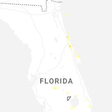
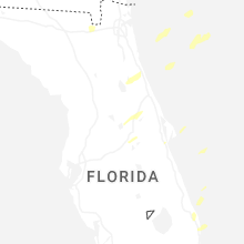
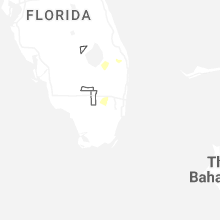
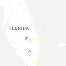


Connect with Interactive Hail Maps