

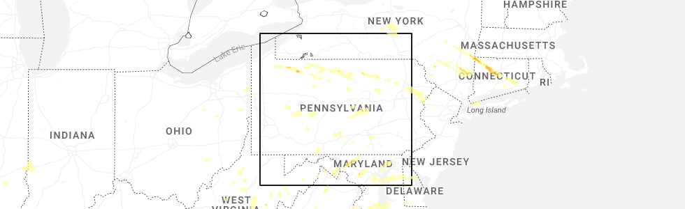
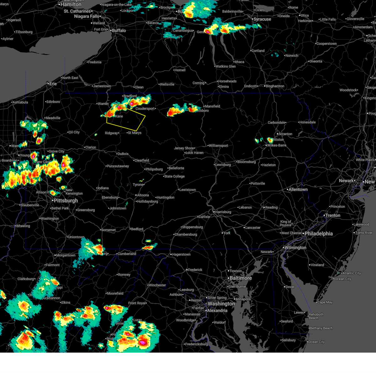
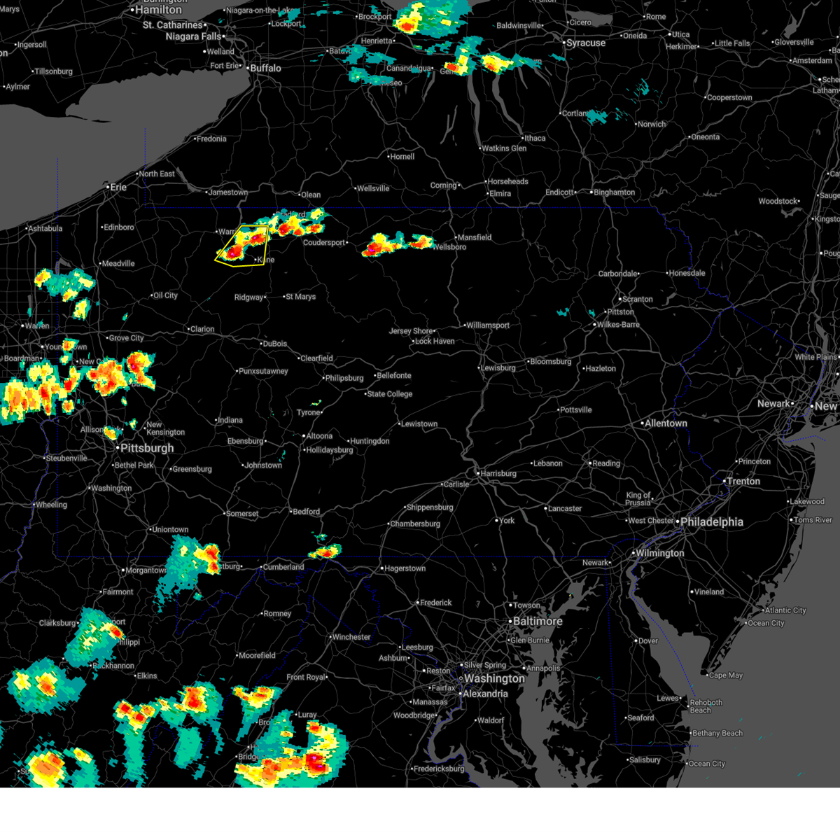
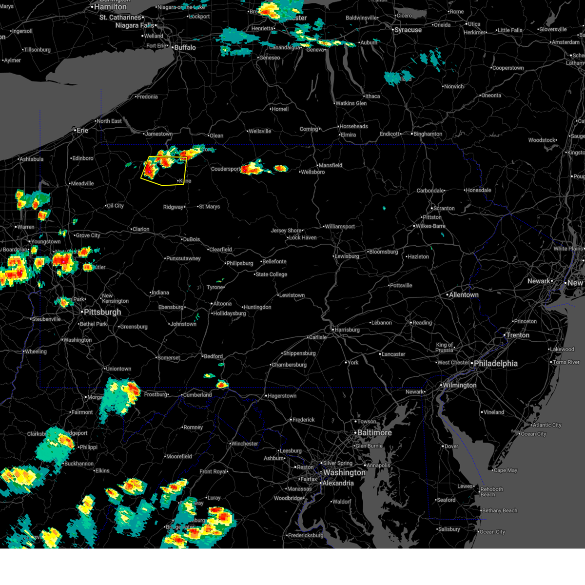
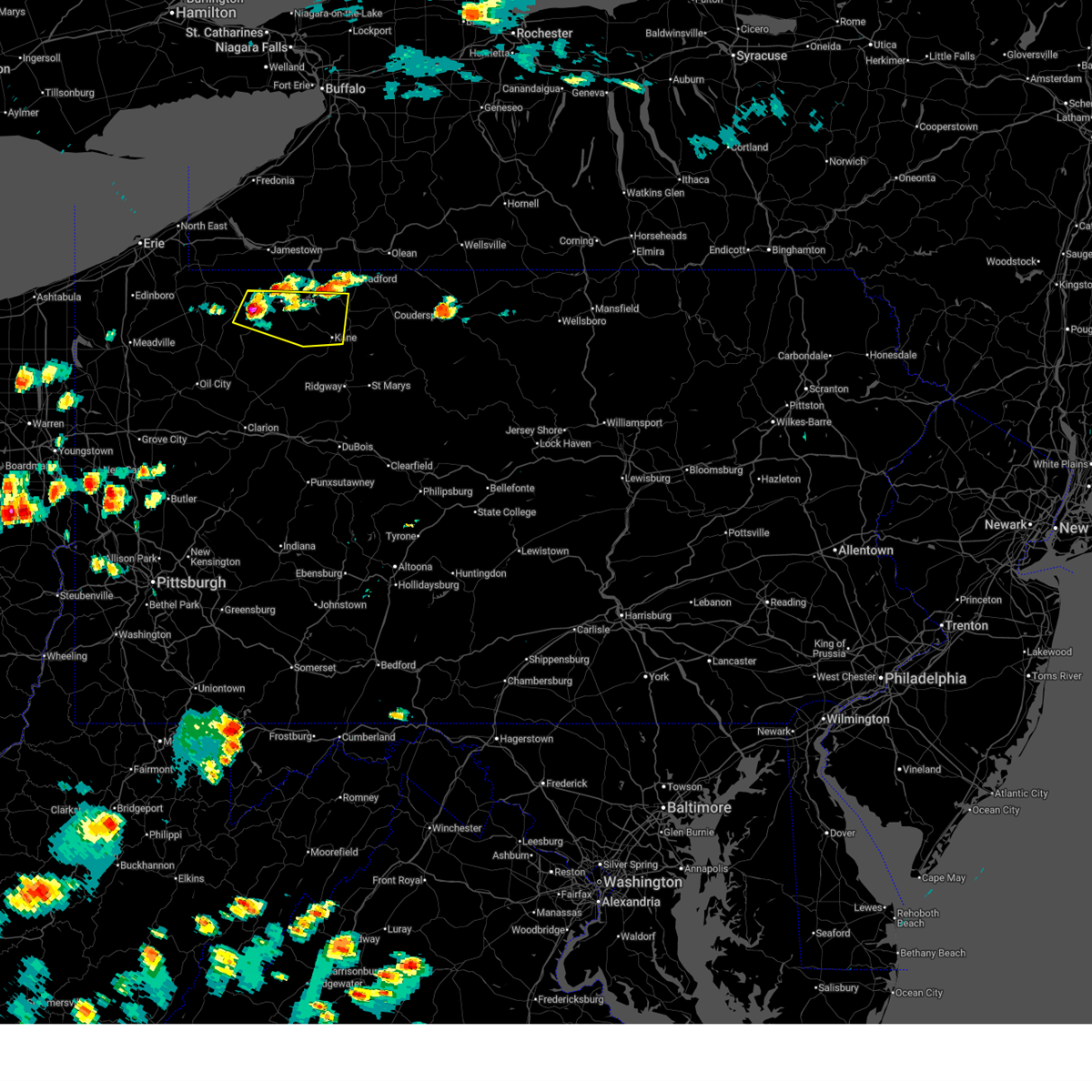
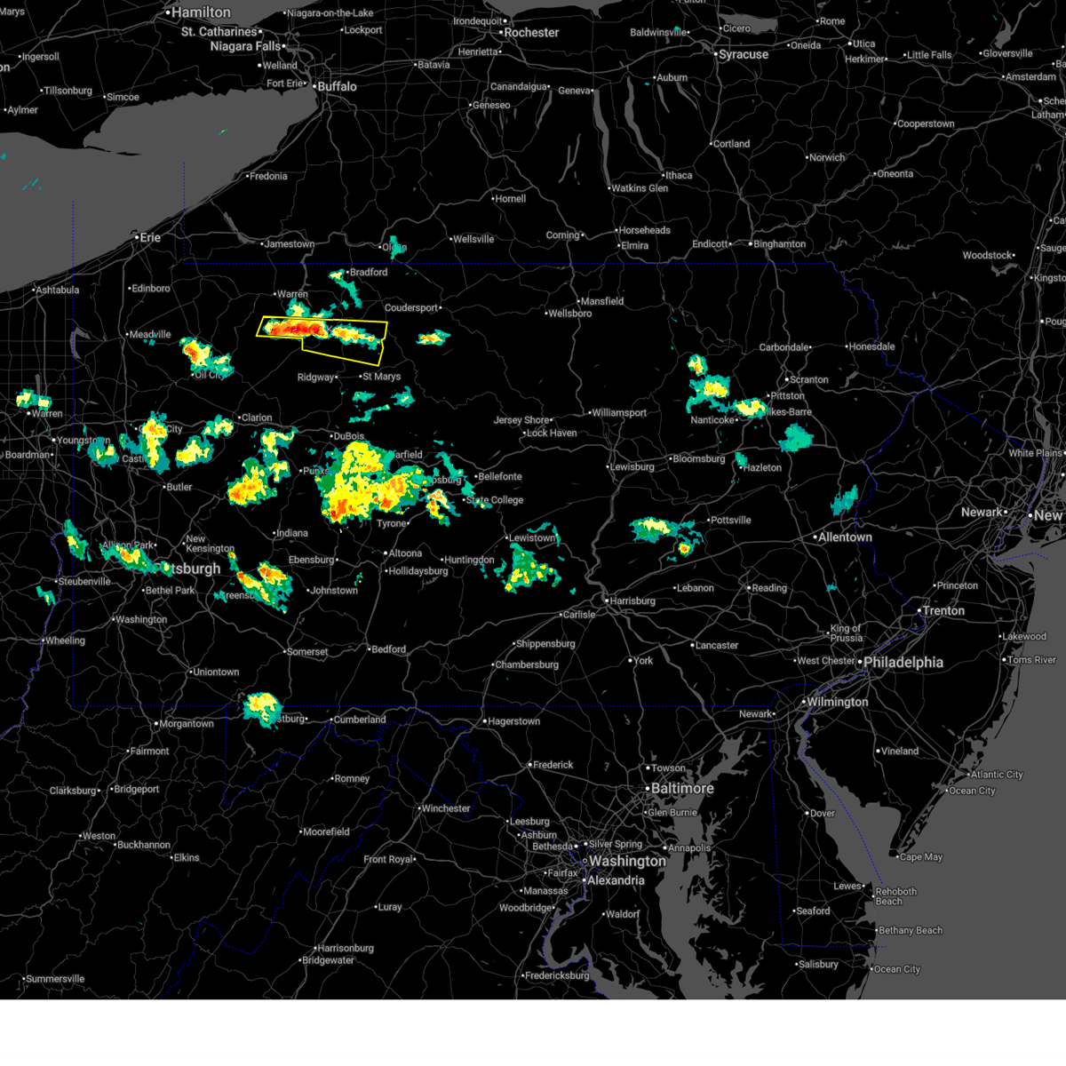
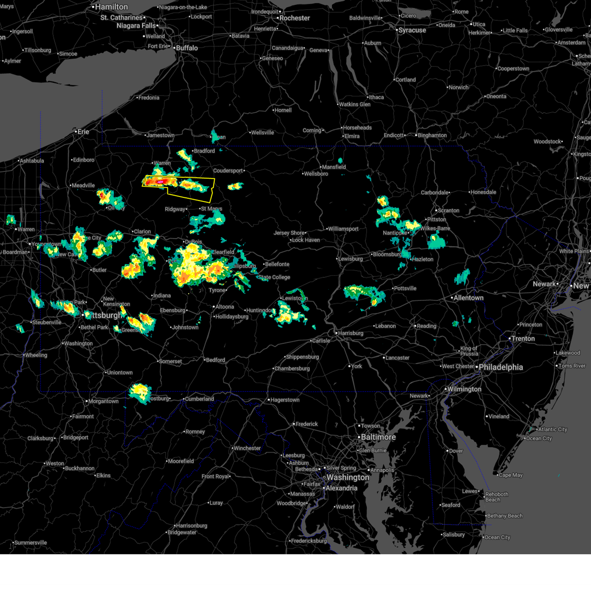
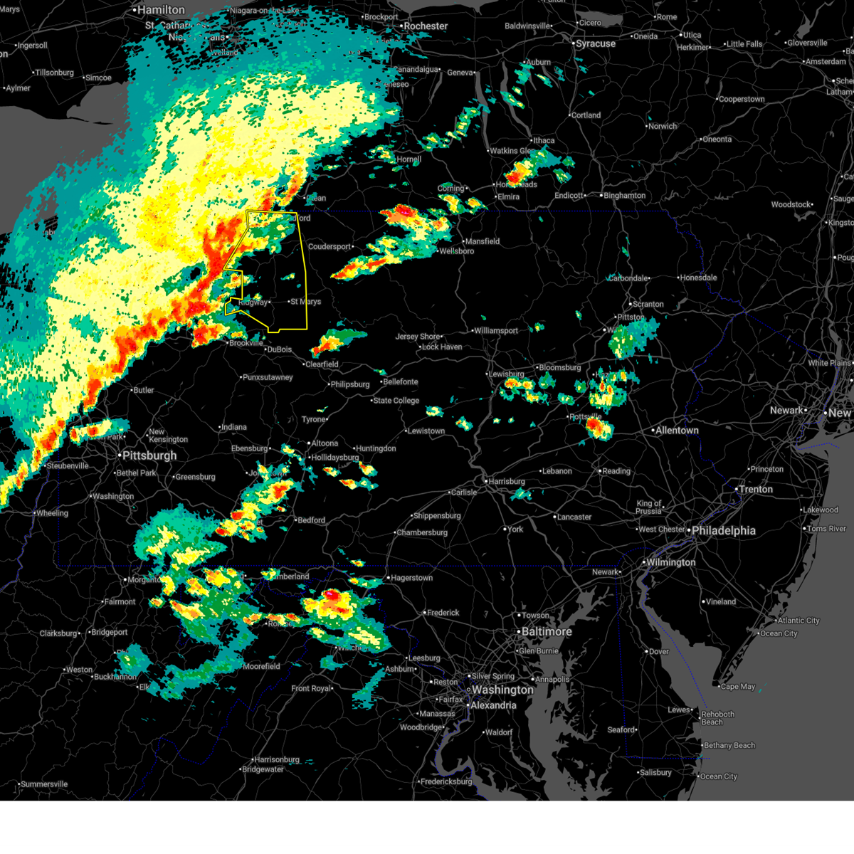
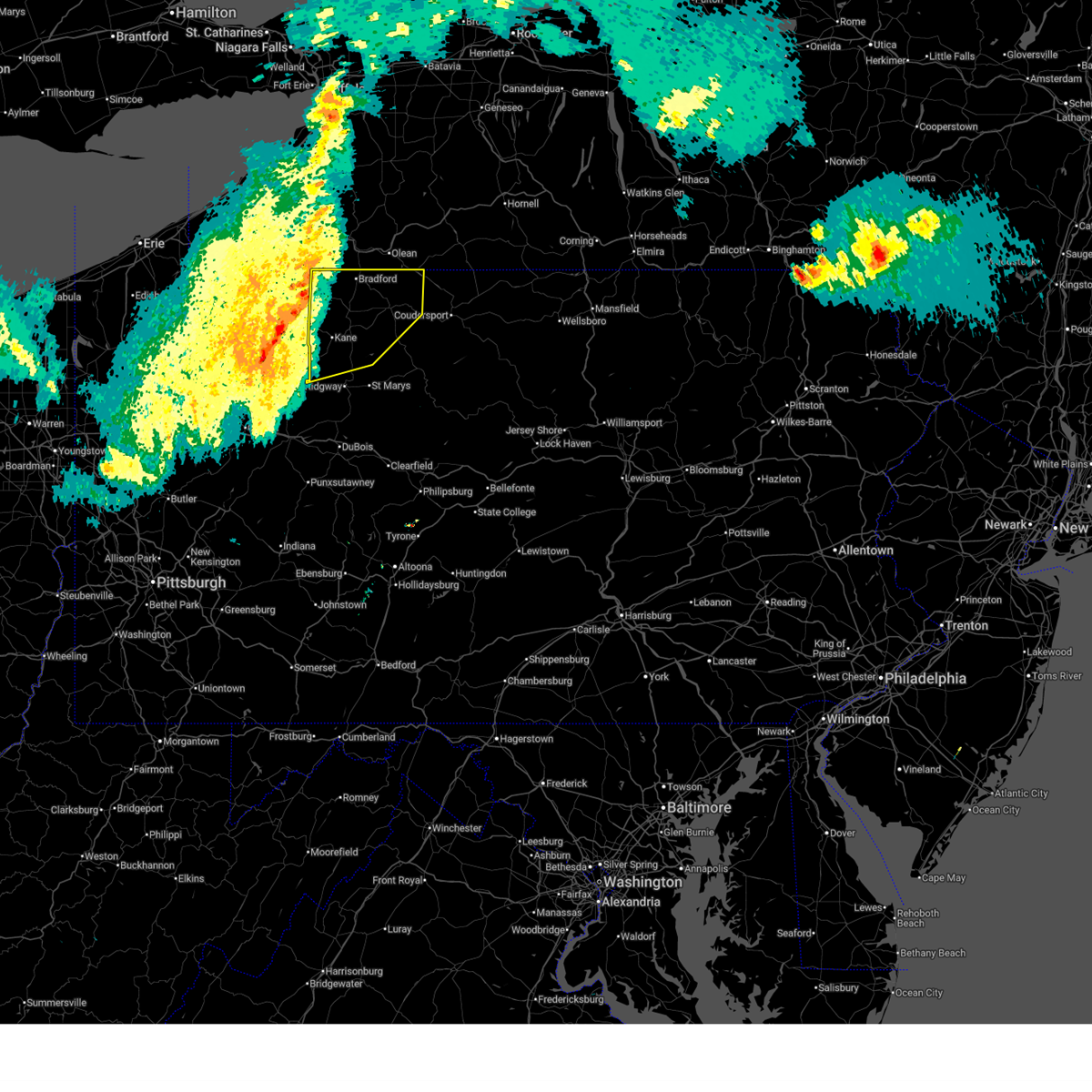
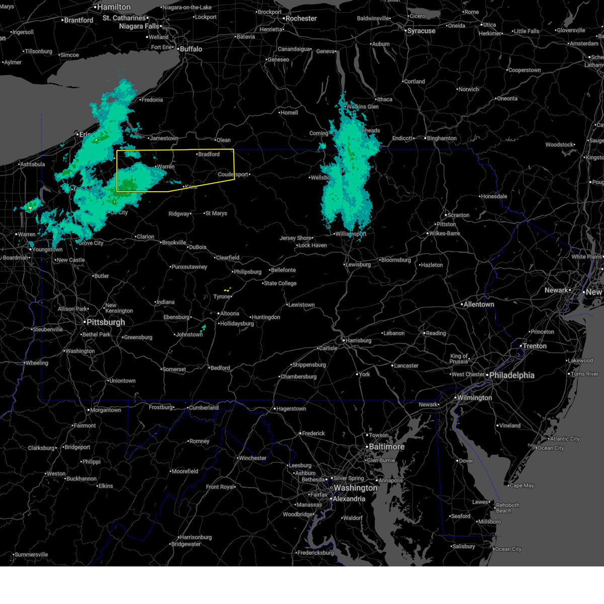
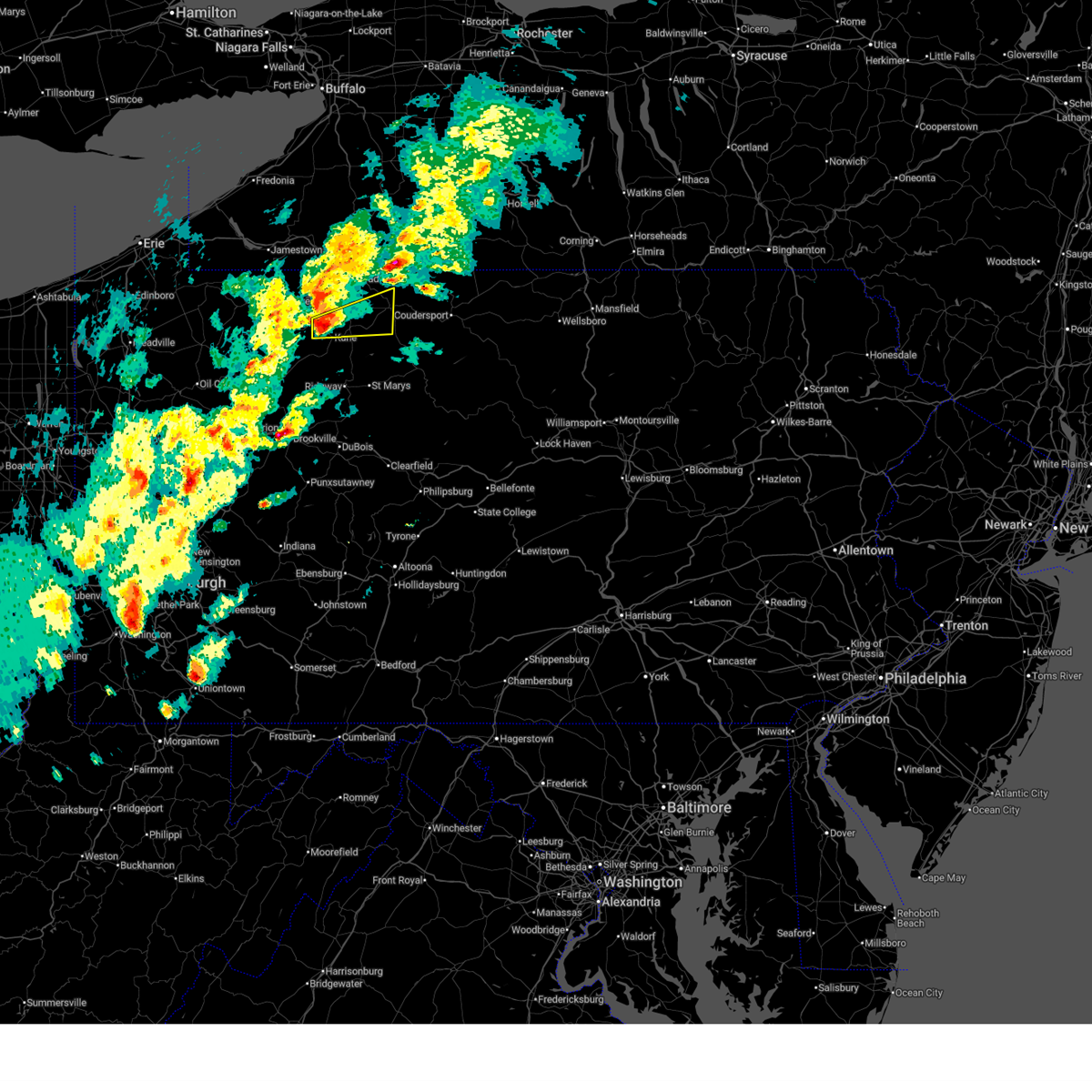
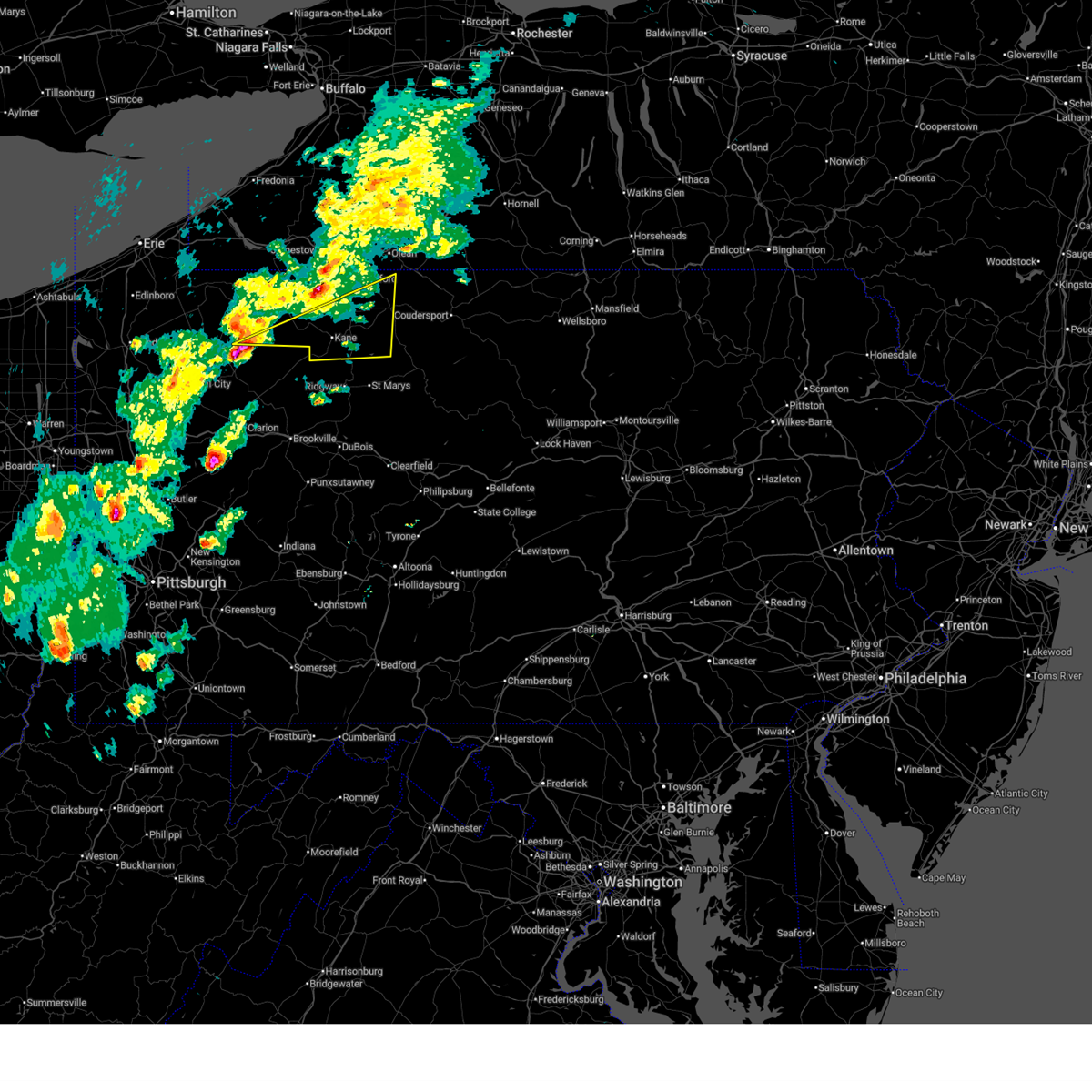
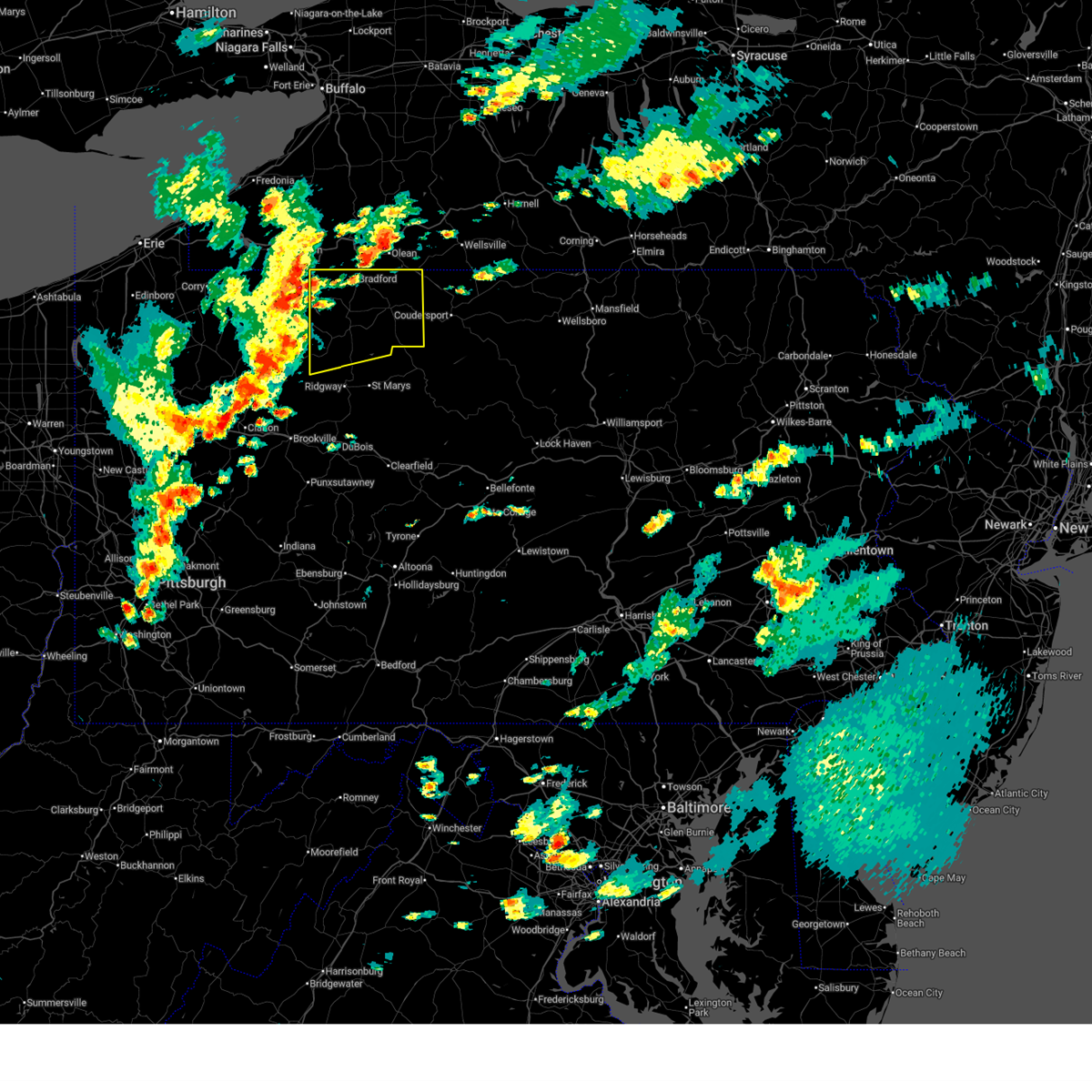
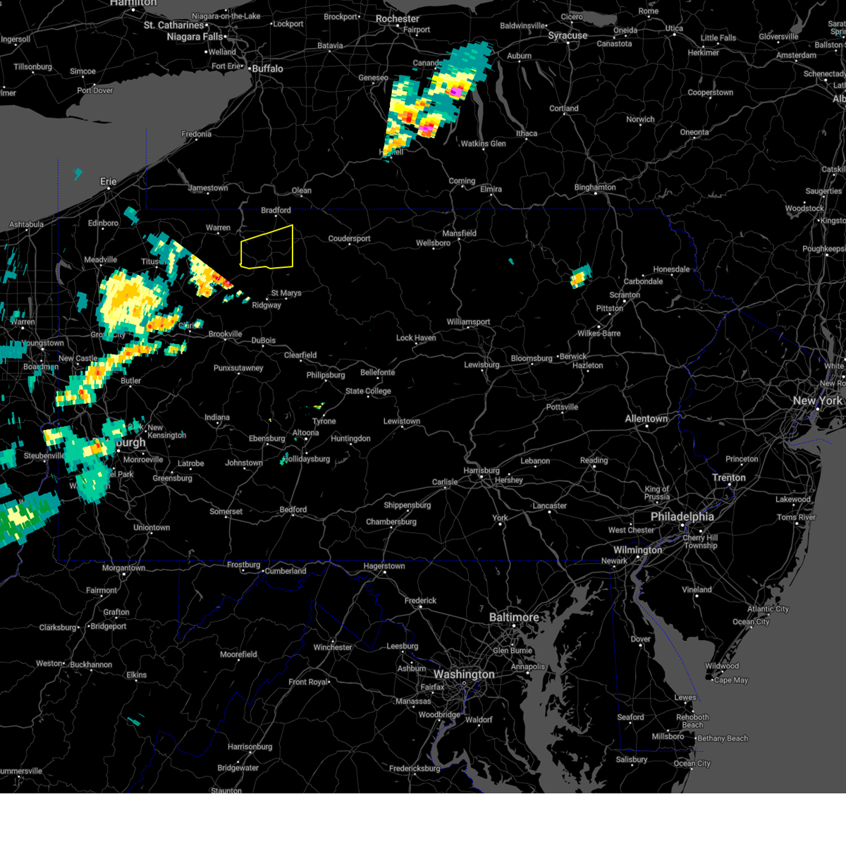
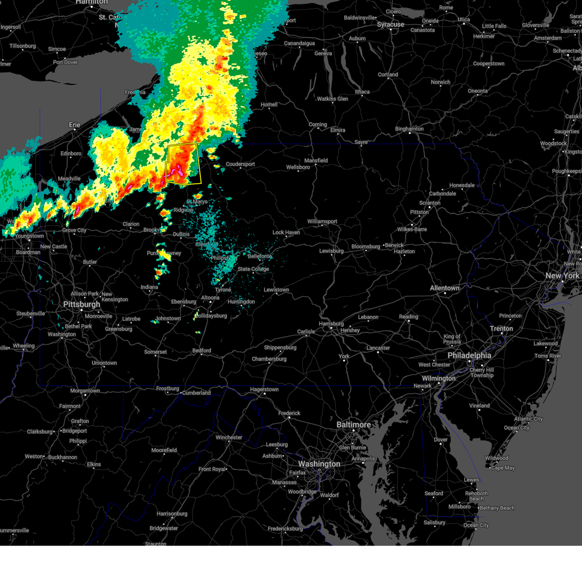
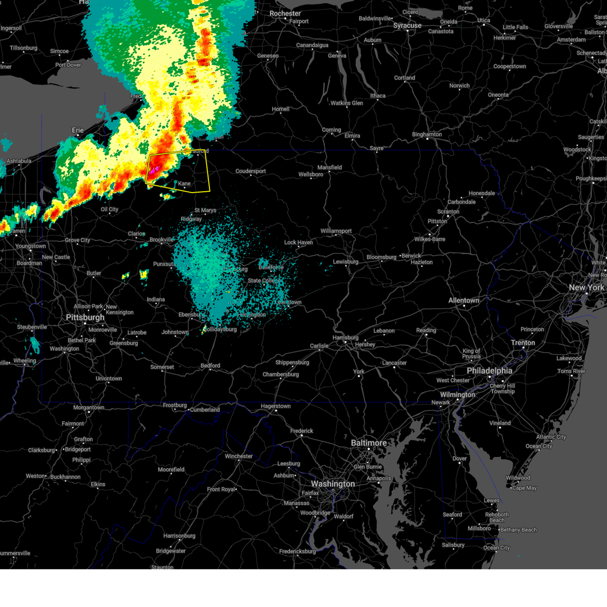
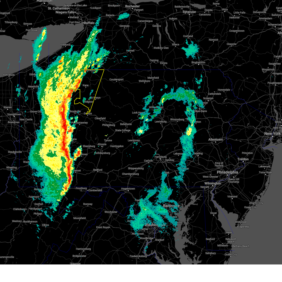
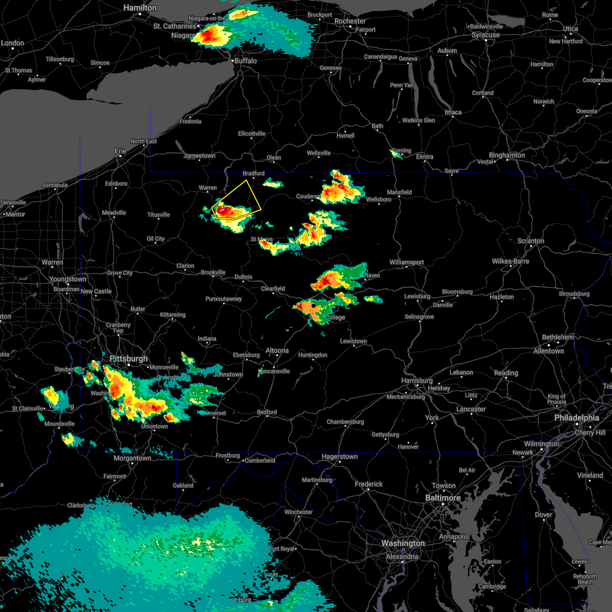
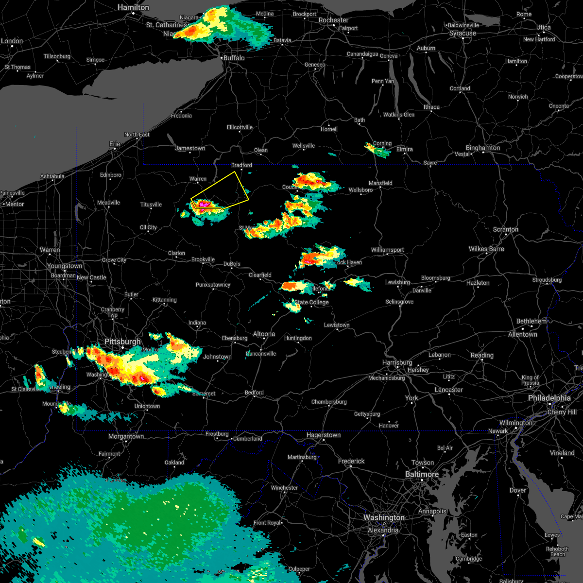
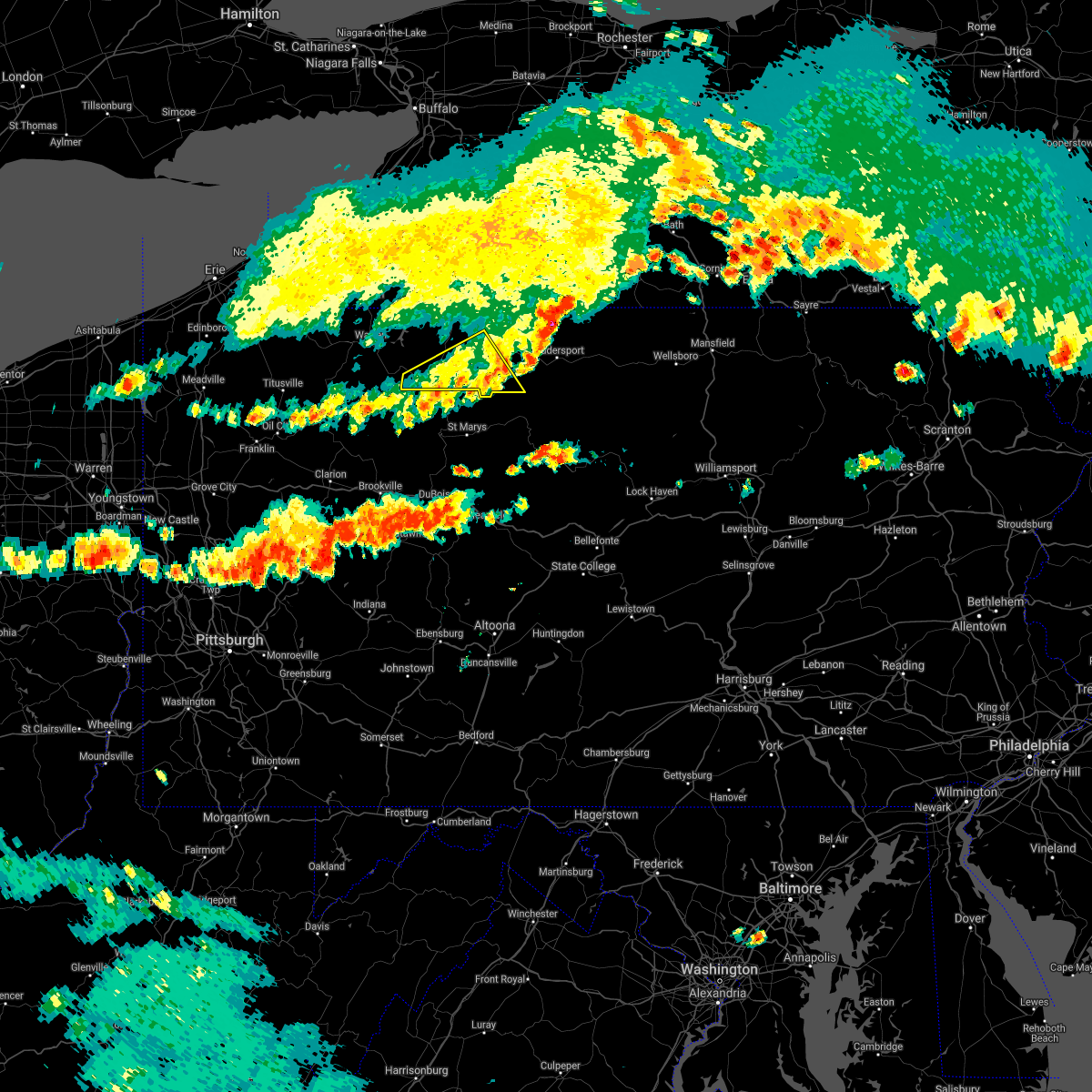
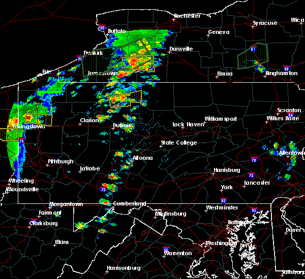
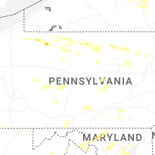
Hail Map for Kane, PA
The Kane, PA area has had 3 reports of on-the-ground hail by trained spotters, and has been under severe weather warnings 15 times during the past 12 months. Doppler radar has detected hail at or near Kane, PA on 19 occasions, including 1 occasion during the past year.
| Name: | Kane, PA |
| Where Located: | 77.7 miles NW of State College, PA |
| Map: | Google Map for Kane, PA |
| Population: | 3730 |
| Housing Units: | 1906 |
| More Info: | Search Google for Kane, PA |
0
The Top Recent Hail Date for Kane, PA is Saturday, July 4, 2026 (11th out of 19)
Hail and Wind Damage Spotted near Kane, PA
| Date / Time | Report Details |
|---|---|
| 7/18/2026 6:00 PM EDT |
 At 559 pm edt, severe thunderstorms were located along a line extending from keating summit to tionesta, moving southeast at 40 mph (radar indicated). Hazards include 60 mph wind gusts and penny size hail. Expect damage to roofs, siding, and trees. locations impacted include, st. Marys, ridgway, kane, johnsonburg, cameron, wharton, coudersport, port allegany, sheffield, emporium, smethport, and wetmore. At 559 pm edt, severe thunderstorms were located along a line extending from keating summit to tionesta, moving southeast at 40 mph (radar indicated). Hazards include 60 mph wind gusts and penny size hail. Expect damage to roofs, siding, and trees. locations impacted include, st. Marys, ridgway, kane, johnsonburg, cameron, wharton, coudersport, port allegany, sheffield, emporium, smethport, and wetmore.
|
| 7/18/2026 5:28 PM EDT |
 Svrctp the national weather service in state college pa has issued a * severe thunderstorm warning for, cameron county in north central pennsylvania, elk county in north central pennsylvania, mckean county in north central pennsylvania, potter county in north central pennsylvania, southern warren county in north central pennsylvania, * until 630 pm edt. * at 528 pm edt, severe thunderstorms were located along a line extending from smethport to titusville, moving southeast at 40 mph (radar indicated). Hazards include 60 mph wind gusts and penny size hail. expect damage to roofs, siding, and trees Svrctp the national weather service in state college pa has issued a * severe thunderstorm warning for, cameron county in north central pennsylvania, elk county in north central pennsylvania, mckean county in north central pennsylvania, potter county in north central pennsylvania, southern warren county in north central pennsylvania, * until 630 pm edt. * at 528 pm edt, severe thunderstorms were located along a line extending from smethport to titusville, moving southeast at 40 mph (radar indicated). Hazards include 60 mph wind gusts and penny size hail. expect damage to roofs, siding, and trees
|
| 7/18/2026 12:26 PM EDT | Tree down on mead run road blocking roadway. time estimated by rada in mckean county PA, 6.6 miles SW of Kane, PA |
| 7/4/2026 3:48 PM EDT |
 At 348 pm edt, a severe thunderstorm was located over wilcox, moving east at 40 mph (radar indicated). Hazards include 60 mph wind gusts and quarter size hail. Hail damage to vehicles is expected. expect wind damage to roofs, siding, and trees. Locations impacted include, kane, betula, truman, east branch dam, elk river, kinzua bridge state park, mount jewett, and bradford airport. At 348 pm edt, a severe thunderstorm was located over wilcox, moving east at 40 mph (radar indicated). Hazards include 60 mph wind gusts and quarter size hail. Hail damage to vehicles is expected. expect wind damage to roofs, siding, and trees. Locations impacted include, kane, betula, truman, east branch dam, elk river, kinzua bridge state park, mount jewett, and bradford airport.
|
| 7/4/2026 3:28 PM EDT |
 Svrctp the national weather service in state college pa has issued a * severe thunderstorm warning for, northwestern cameron county in north central pennsylvania, northeastern elk county in north central pennsylvania, southern mckean county in north central pennsylvania, * until 415 pm edt. * at 328 pm edt, a severe thunderstorm was located over wetmore, moving east at 30 mph (radar indicated). Hazards include 60 mph wind gusts and quarter size hail. Hail damage to vehicles is expected. Expect wind damage to roofs, siding, and trees. Svrctp the national weather service in state college pa has issued a * severe thunderstorm warning for, northwestern cameron county in north central pennsylvania, northeastern elk county in north central pennsylvania, southern mckean county in north central pennsylvania, * until 415 pm edt. * at 328 pm edt, a severe thunderstorm was located over wetmore, moving east at 30 mph (radar indicated). Hazards include 60 mph wind gusts and quarter size hail. Hail damage to vehicles is expected. Expect wind damage to roofs, siding, and trees.
|
| 7/4/2026 3:19 PM EDT |
 At 319 pm edt, a severe thunderstorm was located over ludlow, moving east at 35 mph (law enforcement). Hazards include 60 mph wind gusts and quarter size hail. Hail damage to vehicles is expected. expect wind damage to roofs, siding, and trees. Locations impacted include, kane, sheffield, wetmore, ludlow, marshburg, and westline. At 319 pm edt, a severe thunderstorm was located over ludlow, moving east at 35 mph (law enforcement). Hazards include 60 mph wind gusts and quarter size hail. Hail damage to vehicles is expected. expect wind damage to roofs, siding, and trees. Locations impacted include, kane, sheffield, wetmore, ludlow, marshburg, and westline.
|
| 7/4/2026 3:03 PM EDT |
 At 303 pm edt, a severe thunderstorm was located over chapman state park, moving east at 35 mph (law enforcement). Hazards include 60 mph wind gusts and quarter size hail. Hail damage to vehicles is expected. expect wind damage to roofs, siding, and trees. Locations impacted include, warren, kane, sheffield, wetmore, ludlow, warren south, marshburg, kinzua dam, westline, chapman state park, and clarendon. At 303 pm edt, a severe thunderstorm was located over chapman state park, moving east at 35 mph (law enforcement). Hazards include 60 mph wind gusts and quarter size hail. Hail damage to vehicles is expected. expect wind damage to roofs, siding, and trees. Locations impacted include, warren, kane, sheffield, wetmore, ludlow, warren south, marshburg, kinzua dam, westline, chapman state park, and clarendon.
|
| 7/4/2026 2:43 PM EDT |
 Svrctp the national weather service in state college pa has issued a * severe thunderstorm warning for, southwestern mckean county in north central pennsylvania, central warren county in north central pennsylvania, * until 330 pm edt. * at 243 pm edt, a severe thunderstorm was located over youngsville, moving east at 35 mph (radar indicated). Hazards include 60 mph wind gusts and quarter size hail. Hail damage to vehicles is expected. Expect wind damage to roofs, siding, and trees. Svrctp the national weather service in state college pa has issued a * severe thunderstorm warning for, southwestern mckean county in north central pennsylvania, central warren county in north central pennsylvania, * until 330 pm edt. * at 243 pm edt, a severe thunderstorm was located over youngsville, moving east at 35 mph (radar indicated). Hazards include 60 mph wind gusts and quarter size hail. Hail damage to vehicles is expected. Expect wind damage to roofs, siding, and trees.
|
| 6/20/2026 5:22 PM EDT |
 At 521 pm edt, a severe thunderstorm was located over kane, moving east at 40 mph (radar indicated). Hazards include 60 mph wind gusts and quarter size hail. Hail damage to vehicles is expected. expect wind damage to roofs, siding, and trees. Locations impacted include, kane, sheffield, wetmore, betula, wilcox, james city, and east branch dam. At 521 pm edt, a severe thunderstorm was located over kane, moving east at 40 mph (radar indicated). Hazards include 60 mph wind gusts and quarter size hail. Hail damage to vehicles is expected. expect wind damage to roofs, siding, and trees. Locations impacted include, kane, sheffield, wetmore, betula, wilcox, james city, and east branch dam.
|
| 6/20/2026 5:08 PM EDT |
 Svrctp the national weather service in state college pa has issued a * severe thunderstorm warning for, northeastern elk county in north central pennsylvania, southwestern mckean county in north central pennsylvania, southeastern warren county in north central pennsylvania, * until 545 pm edt. * at 507 pm edt, a severe thunderstorm was located over sheffield, moving southeast at 40 mph (radar indicated). Hazards include 60 mph wind gusts and quarter size hail. Hail damage to vehicles is expected. Expect wind damage to roofs, siding, and trees. Svrctp the national weather service in state college pa has issued a * severe thunderstorm warning for, northeastern elk county in north central pennsylvania, southwestern mckean county in north central pennsylvania, southeastern warren county in north central pennsylvania, * until 545 pm edt. * at 507 pm edt, a severe thunderstorm was located over sheffield, moving southeast at 40 mph (radar indicated). Hazards include 60 mph wind gusts and quarter size hail. Hail damage to vehicles is expected. Expect wind damage to roofs, siding, and trees.
|
| 6/14/2026 6:24 PM EDT | Tree down near us route 21 in mckean county PA, 7.1 miles WSW of Kane, PA |
| 6/14/2026 6:16 PM EDT | Trees down on chestnut stree in mckean county PA, 0.1 miles N of Kane, PA |
| 6/14/2026 6:15 PM EDT | Tree down near sedgwick street and state route 32 in mckean county PA, 0.6 miles S of Kane, PA |
| 6/14/2026 5:51 PM EDT |
 Svrctp the national weather service in state college pa has issued a * severe thunderstorm warning for, elk county in north central pennsylvania, mckean county in north central pennsylvania, southeastern warren county in north central pennsylvania, * until 645 pm edt. * at 550 pm edt, severe thunderstorms were located along a line extending from warren south to sheffield to 10 miles north of marienville to near brookville, moving east at 45 mph (radar indicated). Hazards include 70 mph wind gusts and quarter size hail. Hail damage to vehicles is expected. expect considerable tree damage. Wind damage is also likely to mobile homes, roofs, and outbuildings. Svrctp the national weather service in state college pa has issued a * severe thunderstorm warning for, elk county in north central pennsylvania, mckean county in north central pennsylvania, southeastern warren county in north central pennsylvania, * until 645 pm edt. * at 550 pm edt, severe thunderstorms were located along a line extending from warren south to sheffield to 10 miles north of marienville to near brookville, moving east at 45 mph (radar indicated). Hazards include 70 mph wind gusts and quarter size hail. Hail damage to vehicles is expected. expect considerable tree damage. Wind damage is also likely to mobile homes, roofs, and outbuildings.
|
| 6/6/2026 2:41 PM EDT | Corrects previous tstm wnd dmg report from james city. trees down in northern highland township. time estimated by rada in elk county PA, 3.1 miles NNE of Kane, PA |
| 6/6/2026 2:06 PM EDT | Trees down in northern highland township. time estimated by rada in elk county PA, 3.1 miles NNE of Kane, PA |
| 6/6/2026 1:41 PM EDT | Trees down in northern highland township. time estimated by rada in elk county PA, 3.1 miles NNE of Kane, PA |
| 3/31/2026 7:52 PM EDT |
 Svrctp the national weather service in state college pa has issued a * severe thunderstorm warning for, northwestern elk county in north central pennsylvania, mckean county in north central pennsylvania, eastern warren county in north central pennsylvania, * until 845 pm edt. * at 752 pm edt, severe thunderstorms were located along a line extending from near scandia to near sheffield, moving east at 55 mph (emergency management). Hazards include 60 mph wind gusts. Expect damage to roofs, siding, and trees. severe thunderstorms will be near, allegany state park, bradford, and wetmore around 800 pm edt. kane, cyclone, and rew around 810 pm edt. coryville, smethport, and kinzua bridge state park around 820 pm edt. port allegany, crosby, and shinglehouse around 830 pm edt. Other locations impacted by these severe thunderstorms include ceres, eldred, mount jewett, lewis run, and university of pittsburgh bradford. Svrctp the national weather service in state college pa has issued a * severe thunderstorm warning for, northwestern elk county in north central pennsylvania, mckean county in north central pennsylvania, eastern warren county in north central pennsylvania, * until 845 pm edt. * at 752 pm edt, severe thunderstorms were located along a line extending from near scandia to near sheffield, moving east at 55 mph (emergency management). Hazards include 60 mph wind gusts. Expect damage to roofs, siding, and trees. severe thunderstorms will be near, allegany state park, bradford, and wetmore around 800 pm edt. kane, cyclone, and rew around 810 pm edt. coryville, smethport, and kinzua bridge state park around 820 pm edt. port allegany, crosby, and shinglehouse around 830 pm edt. Other locations impacted by these severe thunderstorms include ceres, eldred, mount jewett, lewis run, and university of pittsburgh bradford.
|
| 3/13/2026 4:17 PM EDT |
 Svrctp the national weather service in state college pa has issued a * severe thunderstorm warning for, mckean county in north central pennsylvania, warren county in north central pennsylvania, * until 445 pm edt. * at 415 pm edt, severe thunderstorms were located along a line extending from near dunkirk to near findley lake to cambridge springs, moving east at 60 mph (radar indicated). Hazards include 60 mph wind gusts. expect damage to roofs, siding, and trees Svrctp the national weather service in state college pa has issued a * severe thunderstorm warning for, mckean county in north central pennsylvania, warren county in north central pennsylvania, * until 445 pm edt. * at 415 pm edt, severe thunderstorms were located along a line extending from near dunkirk to near findley lake to cambridge springs, moving east at 60 mph (radar indicated). Hazards include 60 mph wind gusts. expect damage to roofs, siding, and trees
|
| 3/7/2026 4:08 PM EST |
 the severe thunderstorm warning has been cancelled and is no longer in effect the severe thunderstorm warning has been cancelled and is no longer in effect
|
| 3/7/2026 4:08 PM EST |
 At 407 pm est, a severe thunderstorm was located over wetmore, moving east at 55 mph (radar indicated). Hazards include 60 mph wind gusts and quarter size hail. Hail damage to vehicles is expected. expect wind damage to roofs, siding, and trees. Locations impacted include, kane, smethport, wetmore, cyclone, westline, kinzua bridge state park, ludlow, mount jewett, and bradford airport. At 407 pm est, a severe thunderstorm was located over wetmore, moving east at 55 mph (radar indicated). Hazards include 60 mph wind gusts and quarter size hail. Hail damage to vehicles is expected. expect wind damage to roofs, siding, and trees. Locations impacted include, kane, smethport, wetmore, cyclone, westline, kinzua bridge state park, ludlow, mount jewett, and bradford airport.
|
| 3/7/2026 3:36 PM EST |
 Svrctp the national weather service in state college pa has issued a * severe thunderstorm warning for, northwestern elk county in north central pennsylvania, central mckean county in north central pennsylvania, southeastern warren county in north central pennsylvania, * until 430 pm est. * at 335 pm est, a severe thunderstorm was located near tionesta, moving east at 55 mph (radar indicated). Hazards include 60 mph wind gusts and quarter size hail. Hail damage to vehicles is expected. Expect wind damage to roofs, siding, and trees. Svrctp the national weather service in state college pa has issued a * severe thunderstorm warning for, northwestern elk county in north central pennsylvania, central mckean county in north central pennsylvania, southeastern warren county in north central pennsylvania, * until 430 pm est. * at 335 pm est, a severe thunderstorm was located near tionesta, moving east at 55 mph (radar indicated). Hazards include 60 mph wind gusts and quarter size hail. Hail damage to vehicles is expected. Expect wind damage to roofs, siding, and trees.
|
| 6/18/2025 6:10 PM EDT | Trees down on wire in elk county PA, 7.3 miles NNE of Kane, PA |
| 6/18/2025 5:39 PM EDT |
 Svrctp the national weather service in state college pa has issued a * severe thunderstorm warning for, northwestern elk county in north central pennsylvania, mckean county in north central pennsylvania, eastern warren county in north central pennsylvania, * until 645 pm edt. * at 539 pm edt, severe thunderstorms were located along a line extending from near allegany state park to near james city, moving northeast at 35 mph (radar indicated). Hazards include 60 mph wind gusts. expect damage to roofs, siding, and trees Svrctp the national weather service in state college pa has issued a * severe thunderstorm warning for, northwestern elk county in north central pennsylvania, mckean county in north central pennsylvania, eastern warren county in north central pennsylvania, * until 645 pm edt. * at 539 pm edt, severe thunderstorms were located along a line extending from near allegany state park to near james city, moving northeast at 35 mph (radar indicated). Hazards include 60 mph wind gusts. expect damage to roofs, siding, and trees
|
| 6/5/2025 4:51 PM EDT | Tree down blocking both lanes of route 321 approximately a quarter of a mile south of the intersection of bliss hill roa in mckean county PA, 5 miles SSE of Kane, PA |
| 6/5/2025 4:47 PM EDT | Tree down onto a roadway on bliss hill road and gibbs hill tower roa in mckean county PA, 7.4 miles SE of Kane, PA |
| 6/5/2025 4:43 PM EDT |
 Svrctp the national weather service in state college pa has issued a * severe thunderstorm warning for, southwestern mckean county in north central pennsylvania, * until 530 pm edt. * at 442 pm edt, a severe thunderstorm was located over wetmore, moving east at 30 mph (radar indicated). Hazards include 60 mph wind gusts and quarter size hail. Hail damage to vehicles is expected. Expect wind damage to roofs, siding, and trees. Svrctp the national weather service in state college pa has issued a * severe thunderstorm warning for, southwestern mckean county in north central pennsylvania, * until 530 pm edt. * at 442 pm edt, a severe thunderstorm was located over wetmore, moving east at 30 mph (radar indicated). Hazards include 60 mph wind gusts and quarter size hail. Hail damage to vehicles is expected. Expect wind damage to roofs, siding, and trees.
|
| 5/16/2025 6:12 AM EDT |
 the severe thunderstorm warning has been cancelled and is no longer in effect the severe thunderstorm warning has been cancelled and is no longer in effect
|
| 5/16/2025 6:12 AM EDT |
 At 611 am edt, a severe thunderstorm was located over westline, moving east at 40 mph (radar indicated). Hazards include 60 mph wind gusts and quarter size hail. Hail damage to vehicles is expected. expect wind damage to roofs, siding, and trees. Locations impacted include, bradford, kane, wetmore, cyclone, ludlow, marshburg, westline, kinzua bridge state park, mount jewett, lewis run, bradford airport, and university of pittsburgh - bradford. At 611 am edt, a severe thunderstorm was located over westline, moving east at 40 mph (radar indicated). Hazards include 60 mph wind gusts and quarter size hail. Hail damage to vehicles is expected. expect wind damage to roofs, siding, and trees. Locations impacted include, bradford, kane, wetmore, cyclone, ludlow, marshburg, westline, kinzua bridge state park, mount jewett, lewis run, bradford airport, and university of pittsburgh - bradford.
|
| 5/16/2025 5:44 AM EDT |
 Svrctp the national weather service in state college pa has issued a * severe thunderstorm warning for, western mckean county in north central pennsylvania, eastern warren county in north central pennsylvania, * until 630 am edt. * at 544 am edt, a severe thunderstorm was located over warren, moving east at 45 mph (radar indicated). Hazards include 60 mph wind gusts and quarter size hail. Hail damage to vehicles is expected. Expect wind damage to roofs, siding, and trees. Svrctp the national weather service in state college pa has issued a * severe thunderstorm warning for, western mckean county in north central pennsylvania, eastern warren county in north central pennsylvania, * until 630 am edt. * at 544 am edt, a severe thunderstorm was located over warren, moving east at 45 mph (radar indicated). Hazards include 60 mph wind gusts and quarter size hail. Hail damage to vehicles is expected. Expect wind damage to roofs, siding, and trees.
|
| 3/16/2025 1:27 PM EDT |
 Svrctp the national weather service in state college pa has issued a * severe thunderstorm warning for, northwestern clearfield county in central pennsylvania, western elk county in north central pennsylvania, mckean county in north central pennsylvania, eastern warren county in north central pennsylvania, * until 230 pm edt. * at 127 pm edt, severe thunderstorms were located along a line extending from marshburg to marienville to new bethlehem, moving northeast at 55 mph (radar indicated). Hazards include 60 mph wind gusts. expect damage to roofs, siding, and trees Svrctp the national weather service in state college pa has issued a * severe thunderstorm warning for, northwestern clearfield county in central pennsylvania, western elk county in north central pennsylvania, mckean county in north central pennsylvania, eastern warren county in north central pennsylvania, * until 230 pm edt. * at 127 pm edt, severe thunderstorms were located along a line extending from marshburg to marienville to new bethlehem, moving northeast at 55 mph (radar indicated). Hazards include 60 mph wind gusts. expect damage to roofs, siding, and trees
|
| 6/26/2024 3:30 PM EDT | Tree down blocking the roadway - halsey rd near the intersection with rt 21 in mckean county PA, 6.8 miles W of Kane, PA |
| 4/14/2024 5:11 PM EDT |
 Svrctp the national weather service in state college pa has issued a * severe thunderstorm warning for, cameron county in north central pennsylvania, northwestern clinton county in north central pennsylvania, northeastern elk county in north central pennsylvania, southeastern mckean county in north central pennsylvania, southwestern potter county in north central pennsylvania, * until 600 pm edt. * at 510 pm edt, a severe thunderstorm was located near wilcox, moving east at 60 mph (radar indicated). Hazards include 60 mph wind gusts and quarter size hail. Hail damage to vehicles is expected. Expect wind damage to roofs, siding, and trees. Svrctp the national weather service in state college pa has issued a * severe thunderstorm warning for, cameron county in north central pennsylvania, northwestern clinton county in north central pennsylvania, northeastern elk county in north central pennsylvania, southeastern mckean county in north central pennsylvania, southwestern potter county in north central pennsylvania, * until 600 pm edt. * at 510 pm edt, a severe thunderstorm was located near wilcox, moving east at 60 mph (radar indicated). Hazards include 60 mph wind gusts and quarter size hail. Hail damage to vehicles is expected. Expect wind damage to roofs, siding, and trees.
|
| 8/25/2023 1:05 AM EDT |
 At 104 am edt, severe thunderstorms were located along a line extending from near bradford to portland mills, moving east at 55 mph (radar indicated). Hazards include 60 mph wind gusts and nickel size hail. Expect damage to roofs, siding, and trees. locations impacted include, st. marys, bradford, ridgway, kane, johnsonburg, port allegany, emporium, smethport, wetmore, shinglehouse, betula and wilcox. hail threat, radar indicated max hail size, 0. 88 in wind threat, radar indicated max wind gust, 60 mph. At 104 am edt, severe thunderstorms were located along a line extending from near bradford to portland mills, moving east at 55 mph (radar indicated). Hazards include 60 mph wind gusts and nickel size hail. Expect damage to roofs, siding, and trees. locations impacted include, st. marys, bradford, ridgway, kane, johnsonburg, port allegany, emporium, smethport, wetmore, shinglehouse, betula and wilcox. hail threat, radar indicated max hail size, 0. 88 in wind threat, radar indicated max wind gust, 60 mph.
|
| 8/25/2023 12:46 AM EDT |
 At 1246 am edt, severe thunderstorms were located along a line extending from near allegany state park to near brookville, moving east at 55 mph (radar indicated). Hazards include 60 mph wind gusts and nickel size hail. expect damage to roofs, siding, and trees At 1246 am edt, severe thunderstorms were located along a line extending from near allegany state park to near brookville, moving east at 55 mph (radar indicated). Hazards include 60 mph wind gusts and nickel size hail. expect damage to roofs, siding, and trees
|
| 8/12/2023 2:24 PM EDT |
 At 222 pm edt, a severe thunderstorm was located over ludlow, moving east southeast at 35 mph (radar indicated). Hazards include 60 mph wind gusts and nickel size hail. expect damage to roofs, siding, and trees At 222 pm edt, a severe thunderstorm was located over ludlow, moving east southeast at 35 mph (radar indicated). Hazards include 60 mph wind gusts and nickel size hail. expect damage to roofs, siding, and trees
|
| 7/20/2023 8:29 PM EDT |
 At 829 pm edt, severe thunderstorms were located along a line extending from rew to east branch dam to johnsonburg, moving east at 45 mph (radar indicated). Hazards include 70 mph wind gusts and penny size hail. Expect considerable tree damage. damage is likely to mobile homes, roofs, and outbuildings. locations impacted include, st. Marys, bradford, ridgway, kane, johnsonburg, port allegany, smethport, wetmore, shinglehouse, betula, wilcox and james city. At 829 pm edt, severe thunderstorms were located along a line extending from rew to east branch dam to johnsonburg, moving east at 45 mph (radar indicated). Hazards include 70 mph wind gusts and penny size hail. Expect considerable tree damage. damage is likely to mobile homes, roofs, and outbuildings. locations impacted include, st. Marys, bradford, ridgway, kane, johnsonburg, port allegany, smethport, wetmore, shinglehouse, betula, wilcox and james city.
|
| 7/20/2023 7:58 PM EDT |
 At 758 pm edt, severe thunderstorms were located along a line extending from scandia to sheffield to near marienville, moving east at 50 mph (radar indicated). Hazards include 70 mph wind gusts and penny size hail. Expect considerable tree damage. Damage is likely to mobile homes, roofs, and outbuildings. At 758 pm edt, severe thunderstorms were located along a line extending from scandia to sheffield to near marienville, moving east at 50 mph (radar indicated). Hazards include 70 mph wind gusts and penny size hail. Expect considerable tree damage. Damage is likely to mobile homes, roofs, and outbuildings.
|
| 4/1/2023 2:35 PM EDT | Tree down across 6 in mckean county PA, 1.5 miles N of Kane, PA |
| 4/1/2023 2:18 PM EDT |
 At 217 pm edt, severe thunderstorms were located along a line extending from kinzua dam to near indiana, moving east at 55 mph (automatic observing system. wind gust to 68 mph at allegheny county airport). Hazards include 70 mph wind gusts. Expect considerable tree damage. Damage is likely to mobile homes, roofs, and outbuildings. At 217 pm edt, severe thunderstorms were located along a line extending from kinzua dam to near indiana, moving east at 55 mph (automatic observing system. wind gust to 68 mph at allegheny county airport). Hazards include 70 mph wind gusts. Expect considerable tree damage. Damage is likely to mobile homes, roofs, and outbuildings.
|
| 7/24/2022 2:15 PM EDT |
 At 214 pm edt, a severe thunderstorm was located over wilcox, moving east at 35 mph. this storm was part of a band of storms that has formed to the west (radar indicated). Hazards include 60 mph wind gusts and quarter size hail. Hail damage to vehicles is expected. expect wind damage to roofs, siding, and trees. Locations impacted include, kane, betula, wilcox, james city, east branch dam, elk river and mount jewett. At 214 pm edt, a severe thunderstorm was located over wilcox, moving east at 35 mph. this storm was part of a band of storms that has formed to the west (radar indicated). Hazards include 60 mph wind gusts and quarter size hail. Hail damage to vehicles is expected. expect wind damage to roofs, siding, and trees. Locations impacted include, kane, betula, wilcox, james city, east branch dam, elk river and mount jewett.
|
| 7/24/2022 2:11 PM EDT | Tree on power line in mckean county PA, 3.5 miles SSE of Kane, PA |
| 7/24/2022 1:59 PM EDT |
 At 158 pm edt, a severe thunderstorm was located over kane, moving east at 35 mph (radar indicated). Hazards include 60 mph wind gusts and quarter size hail. Hail damage to vehicles is expected. Expect wind damage to roofs, siding, and trees. At 158 pm edt, a severe thunderstorm was located over kane, moving east at 35 mph (radar indicated). Hazards include 60 mph wind gusts and quarter size hail. Hail damage to vehicles is expected. Expect wind damage to roofs, siding, and trees.
|
| 7/24/2022 1:56 PM EDT | Tree on structure with minor damag in mckean county PA, 0.6 miles S of Kane, PA |
| 7/24/2022 1:56 PM EDT | Tree in power line in mckean county PA, 0.5 miles WNW of Kane, PA |
| 7/24/2022 1:55 PM EDT | Tree on structure with utility line in mckean county PA, 0.1 miles N of Kane, PA |
| 7/24/2022 1:55 PM EDT | Tree down on power line in mckean county PA, 0.6 miles S of Kane, PA |
| 7/24/2022 1:55 PM EDT | Two trees on structure with minor damag in mckean county PA, 0.5 miles ENE of Kane, PA |
| 7/24/2022 1:45 PM EDT | Over 30 reports of trees on wires... trees into house... trees in cars... and trees across road in mckean county PA, 0.1 miles N of Kane, PA |
| 7/13/2021 5:45 PM EDT | Multiple trees blocking roadway along route in mckean county PA, 7 miles SE of Kane, PA |
| 7/13/2021 5:23 PM EDT |
 At 523 pm edt, severe thunderstorms were located along a line extending from near russell to near warren south to near chapman state park to 9 miles west of sheffield to near marienville, moving northeast at 45 mph (radar indicated). Hazards include 60 mph wind gusts and penny size hail. Expect damage to roofs, siding, and trees. severe thunderstorms will be near, warren and russell around 530 pm edt. kane, james city, kinzua dam, ludlow, scandia, wetmore and wilcox around 540 pm edt. marshburg and westline around 550 pm edt. bradford, cyclone, rew and kinzua bridge state park around 600 pm edt. Other locations impacted by these severe thunderstorms include starbrick, eldred, mount jewett, lewis run, clarendon, bradford airport and university of pittsburgh - bradford. At 523 pm edt, severe thunderstorms were located along a line extending from near russell to near warren south to near chapman state park to 9 miles west of sheffield to near marienville, moving northeast at 45 mph (radar indicated). Hazards include 60 mph wind gusts and penny size hail. Expect damage to roofs, siding, and trees. severe thunderstorms will be near, warren and russell around 530 pm edt. kane, james city, kinzua dam, ludlow, scandia, wetmore and wilcox around 540 pm edt. marshburg and westline around 550 pm edt. bradford, cyclone, rew and kinzua bridge state park around 600 pm edt. Other locations impacted by these severe thunderstorms include starbrick, eldred, mount jewett, lewis run, clarendon, bradford airport and university of pittsburgh - bradford.
|
| 6/29/2021 9:39 PM EDT |
 At 939 pm edt, a severe thunderstorm was located near westline, moving east at 25 mph (radar indicated). Hazards include 60 mph wind gusts and quarter size hail. Hail damage to vehicles is expected. expect wind damage to roofs, siding, and trees. Locations impacted include, kane, port allegany, smethport, betula, james city, coryville, crosby, cyclone, westline, kinzua bridge state park, mount jewett and bradford airport. At 939 pm edt, a severe thunderstorm was located near westline, moving east at 25 mph (radar indicated). Hazards include 60 mph wind gusts and quarter size hail. Hail damage to vehicles is expected. expect wind damage to roofs, siding, and trees. Locations impacted include, kane, port allegany, smethport, betula, james city, coryville, crosby, cyclone, westline, kinzua bridge state park, mount jewett and bradford airport.
|
| 6/29/2021 9:16 PM EDT |
 At 916 pm edt, a severe thunderstorm was located over wetmore, moving east at 25 mph (radar indicated). Hazards include 60 mph wind gusts and quarter size hail. Hail damage to vehicles is expected. Expect wind damage to roofs, siding, and trees. At 916 pm edt, a severe thunderstorm was located over wetmore, moving east at 25 mph (radar indicated). Hazards include 60 mph wind gusts and quarter size hail. Hail damage to vehicles is expected. Expect wind damage to roofs, siding, and trees.
|
| 6/21/2021 3:59 PM EDT | Downed tree on pa route 6 in elk county PA, 6.7 miles NNE of Kane, PA |
| 6/21/2021 3:36 PM EDT |
 At 335 pm edt, severe thunderstorms were located along a line extending from near wetmore to near kane to near james city, moving east at 45 mph (radar indicated). Hazards include 60 mph wind gusts and quarter size hail. Hail damage to vehicles is expected. expect wind damage to roofs, siding, and trees. Locations impacted include, kane, port allegany, smethport, wetmore, betula, wilcox, james city, crosby, ludlow, east branch dam, kinzua bridge state park, westline, mount jewett and bradford airport. At 335 pm edt, severe thunderstorms were located along a line extending from near wetmore to near kane to near james city, moving east at 45 mph (radar indicated). Hazards include 60 mph wind gusts and quarter size hail. Hail damage to vehicles is expected. expect wind damage to roofs, siding, and trees. Locations impacted include, kane, port allegany, smethport, wetmore, betula, wilcox, james city, crosby, ludlow, east branch dam, kinzua bridge state park, westline, mount jewett and bradford airport.
|
| 6/21/2021 3:26 PM EDT |
 At 325 pm edt, severe thunderstorms were located along a line extending from wetmore to james city to 10 miles southwest of kane, moving east at 45 mph (radar indicated). Hazards include 60 mph wind gusts and quarter size hail. Hail damage to vehicles is expected. Expect wind damage to roofs, siding, and trees. At 325 pm edt, severe thunderstorms were located along a line extending from wetmore to james city to 10 miles southwest of kane, moving east at 45 mph (radar indicated). Hazards include 60 mph wind gusts and quarter size hail. Hail damage to vehicles is expected. Expect wind damage to roofs, siding, and trees.
|
| 6/13/2021 7:26 PM EDT |
 At 725 pm edt, a severe thunderstorm was located over ludlow, moving east at 20 mph (emergency management, which reported golf-ball sized hail in sheffield in southeastern warren county). Hazards include golf ball size hail and 60 mph wind gusts. People and animals outdoors will be injured. expect hail damage to roofs, siding, windows, and vehicles. expect wind damage to roofs, siding, and trees. this severe thunderstorm will be near, wetmore and james city around 730 pm edt. kane around 740 pm edt. westline around 750 pm edt. marshburg around 800 pm edt. Other locations impacted by this severe thunderstorm include mount jewett, lewis run and bradford airport. At 725 pm edt, a severe thunderstorm was located over ludlow, moving east at 20 mph (emergency management, which reported golf-ball sized hail in sheffield in southeastern warren county). Hazards include golf ball size hail and 60 mph wind gusts. People and animals outdoors will be injured. expect hail damage to roofs, siding, windows, and vehicles. expect wind damage to roofs, siding, and trees. this severe thunderstorm will be near, wetmore and james city around 730 pm edt. kane around 740 pm edt. westline around 750 pm edt. marshburg around 800 pm edt. Other locations impacted by this severe thunderstorm include mount jewett, lewis run and bradford airport.
|
| 6/13/2021 7:17 PM EDT |
 At 717 pm edt, a severe thunderstorm was located over ludlow, moving northeast at 25 mph (radar indicated). Hazards include 60 mph wind gusts and half dollar size hail. one inch hail has already been reported in this storm. Hail damage to vehicles is expected. expect wind damage to roofs, siding, and trees. this severe storm will be near, wetmore around 720 pm edt. kane around 730 pm edt. westline and marshburg around 740 pm edt. other locations impacted by this severe thunderstorm include mount jewett and bradford airport. this includes the following highways, route 6 from north of sheffield to east of mount jewett. route 219 from lantz corners to near the bradford regional airport. state road 59 from west of marshburg to the bradford regional airport. State road 66 from near james city to kane. At 717 pm edt, a severe thunderstorm was located over ludlow, moving northeast at 25 mph (radar indicated). Hazards include 60 mph wind gusts and half dollar size hail. one inch hail has already been reported in this storm. Hail damage to vehicles is expected. expect wind damage to roofs, siding, and trees. this severe storm will be near, wetmore around 720 pm edt. kane around 730 pm edt. westline and marshburg around 740 pm edt. other locations impacted by this severe thunderstorm include mount jewett and bradford airport. this includes the following highways, route 6 from north of sheffield to east of mount jewett. route 219 from lantz corners to near the bradford regional airport. state road 59 from west of marshburg to the bradford regional airport. State road 66 from near james city to kane.
|
| 6/13/2021 6:58 PM EDT |
 At 658 pm edt, a severe thunderstorm was located near sheffield, moving northeast at 25 mph (radar indicated). Hazards include 60 mph wind gusts and half dollar size hail. Hail damage to vehicles is expected. expect wind damage to roofs, siding, and trees. this severe thunderstorm will be near, sheffield around 700 pm edt. ludlow around 710 pm edt. kane and wetmore around 720 pm edt. westline and marshburg around 730 pm edt. Other locations impacted by this severe thunderstorm include mount jewett and bradford airport. At 658 pm edt, a severe thunderstorm was located near sheffield, moving northeast at 25 mph (radar indicated). Hazards include 60 mph wind gusts and half dollar size hail. Hail damage to vehicles is expected. expect wind damage to roofs, siding, and trees. this severe thunderstorm will be near, sheffield around 700 pm edt. ludlow around 710 pm edt. kane and wetmore around 720 pm edt. westline and marshburg around 730 pm edt. Other locations impacted by this severe thunderstorm include mount jewett and bradford airport.
|
| 11/15/2020 3:55 PM EST | Metal building on wires in kane boroug in mckean county PA, 0.1 miles N of Kane, PA |
| 11/15/2020 3:30 PM EST |
 At 329 pm est, severe thunderstorms were located along a line extending from 6 miles southwest of sheffield to 8 miles south of new bethlehem, moving northeast at 70 mph (radar indicated). Hazards include 60 mph wind gusts. expect damage to trees, roofs, and siding At 329 pm est, severe thunderstorms were located along a line extending from 6 miles southwest of sheffield to 8 miles south of new bethlehem, moving northeast at 70 mph (radar indicated). Hazards include 60 mph wind gusts. expect damage to trees, roofs, and siding
|
| 8/27/2020 5:40 PM EDT | Trees dow in elk county PA, 3.1 miles NNE of Kane, PA |
| 8/27/2020 5:37 PM EDT |
 At 536 pm edt, severe thunderstorms were located along a line extending from near smethport to 6 miles west of james city, moving southeast at 50 mph (emergency management). Hazards include 60 mph wind gusts. Expect damage to trees, roofs, and siding. Locations impacted include, kane, smethport, wetmore, betula, crosby, cyclone, kinzua bridge state park, westline, mount jewett and bradford airport. At 536 pm edt, severe thunderstorms were located along a line extending from near smethport to 6 miles west of james city, moving southeast at 50 mph (emergency management). Hazards include 60 mph wind gusts. Expect damage to trees, roofs, and siding. Locations impacted include, kane, smethport, wetmore, betula, crosby, cyclone, kinzua bridge state park, westline, mount jewett and bradford airport.
|
| 8/27/2020 5:00 PM EDT |
 At 459 pm edt, a severe thunderstorm was located near scandia, moving southeast at 40 mph (radar indicated). Hazards include 60 mph wind gusts. expect damage to trees, roofs, and siding At 459 pm edt, a severe thunderstorm was located near scandia, moving southeast at 40 mph (radar indicated). Hazards include 60 mph wind gusts. expect damage to trees, roofs, and siding
|
| 8/18/2019 12:55 PM EDT | Tree on wires along highland roa in mckean county PA, 1.3 miles NW of Kane, PA |
| 8/18/2019 12:49 PM EDT | Multiple trees down on pa 66 south of james cit in elk county PA, 3.7 miles NNE of Kane, PA |
| 8/18/2019 12:44 PM EDT |
 At 1244 pm edt, a severe thunderstorm was located over james city, moving east at 25 mph (radar indicated). Hazards include 60 mph wind gusts and quarter size hail. Hail damage to vehicles is expected. Expect wind damage to trees, roofs, and siding. At 1244 pm edt, a severe thunderstorm was located over james city, moving east at 25 mph (radar indicated). Hazards include 60 mph wind gusts and quarter size hail. Hail damage to vehicles is expected. Expect wind damage to trees, roofs, and siding.
|
| 8/15/2019 8:23 PM EDT | Quarter sized hail reported 0.1 miles N of Kane, PA |
| 7/19/2019 6:06 PM EDT |
 At 605 pm edt, severe thunderstorms were located along a line extending from warren county to mckean county, moving east at 30 mph (radar indicated). Hazards include 60 mph wind gusts. Expect damage to trees, roofs, and siding. Locations impacted include, warren, kane, port allegany, sheffield, columbus, youngsville, smethport, wetmore, betula, james city, spring creek, crosby, ludlow, marshburg, kinzua bridge state park, lottsville, coryville, cyclone, grand valley and westline. At 605 pm edt, severe thunderstorms were located along a line extending from warren county to mckean county, moving east at 30 mph (radar indicated). Hazards include 60 mph wind gusts. Expect damage to trees, roofs, and siding. Locations impacted include, warren, kane, port allegany, sheffield, columbus, youngsville, smethport, wetmore, betula, james city, spring creek, crosby, ludlow, marshburg, kinzua bridge state park, lottsville, coryville, cyclone, grand valley and westline.
|
| 7/19/2019 5:10 PM EDT |
 At 509 pm edt, severe thunderstorms were located along a line extending from northern warren county to northern mckean county, moving east at 30 mph (radar indicated). Hazards include 60 mph wind gusts. expect damage to trees, roofs, and siding At 509 pm edt, severe thunderstorms were located along a line extending from northern warren county to northern mckean county, moving east at 30 mph (radar indicated). Hazards include 60 mph wind gusts. expect damage to trees, roofs, and siding
|
| 5/29/2019 12:58 PM EDT | Trees and wires down in mckean county PA, 0.1 miles N of Kane, PA |
| 5/29/2019 12:57 PM EDT |
 At 1256 pm edt, a severe thunderstorm was located over kane, moving east at 40 mph (radar indicated). Hazards include 60 mph wind gusts and penny size hail. expect damage to trees, roofs, and siding At 1256 pm edt, a severe thunderstorm was located over kane, moving east at 40 mph (radar indicated). Hazards include 60 mph wind gusts and penny size hail. expect damage to trees, roofs, and siding
|
| 4/14/2019 9:38 PM EDT | Trees and wires down on poplar stree in mckean county PA, 0.1 miles N of Kane, PA |
| 4/14/2019 9:11 PM EDT |
 At 909 pm edt, severe thunderstorms were located along a line extending from near allegany to near brookville, moving northeast at 50 mph (radar indicated). Hazards include 60 mph wind gusts and penny size hail. Expect damage to roofs, siding, and trees. locations impacted include, bradford, ridgway, kane, johnsonburg, smethport, wetmore, wilcox, james city, rew, coryville, cyclone, brandy camp, ludlow, marshburg, east branch dam, westline, kinzua bridge state park, brockport, portland mills and mount jewett. A tornado watch remains in effect until 300 am edt for north central pennsylvania. At 909 pm edt, severe thunderstorms were located along a line extending from near allegany to near brookville, moving northeast at 50 mph (radar indicated). Hazards include 60 mph wind gusts and penny size hail. Expect damage to roofs, siding, and trees. locations impacted include, bradford, ridgway, kane, johnsonburg, smethport, wetmore, wilcox, james city, rew, coryville, cyclone, brandy camp, ludlow, marshburg, east branch dam, westline, kinzua bridge state park, brockport, portland mills and mount jewett. A tornado watch remains in effect until 300 am edt for north central pennsylvania.
|
| 4/14/2019 8:41 PM EDT |
 At 841 pm edt, severe thunderstorms were located along a line extending from near scandia to near new bethlehem, moving northeast at 50 mph (radar indicated). Hazards include 60 mph wind gusts and penny size hail. expect damage to roofs, siding, and trees At 841 pm edt, severe thunderstorms were located along a line extending from near scandia to near new bethlehem, moving northeast at 50 mph (radar indicated). Hazards include 60 mph wind gusts and penny size hail. expect damage to roofs, siding, and trees
|
| 9/21/2018 7:37 PM EDT |
 The national weather service in state college pa has issued a * severe thunderstorm warning for. northern elk county in north central pennsylvania. mckean county in north central pennsylvania. potter county in north central pennsylvania. Northern cameron county in north central pennsylvania. The national weather service in state college pa has issued a * severe thunderstorm warning for. northern elk county in north central pennsylvania. mckean county in north central pennsylvania. potter county in north central pennsylvania. Northern cameron county in north central pennsylvania.
|
| 9/21/2018 6:30 PM EDT |
 The national weather service in state college pa has issued a * severe thunderstorm warning for. elk county in north central pennsylvania. warren county in north central pennsylvania. north central clearfield county in central pennsylvania. Mckean county in north central pennsylvania. The national weather service in state college pa has issued a * severe thunderstorm warning for. elk county in north central pennsylvania. warren county in north central pennsylvania. north central clearfield county in central pennsylvania. Mckean county in north central pennsylvania.
|
| 8/29/2018 6:52 PM EDT |
 At 651 pm edt, a severe thunderstorm was located over kane, moving east at 40 mph (radar indicated). Hazards include 60 mph wind gusts. Expect damage to roofs, siding, and trees. this severe thunderstorm will be near, kinzua bridge state park around 710 pm edt. crosby, betula and smethport around 720 pm edt. port allegany around 730 pm edt. Other locations impacted by this severe thunderstorm include mount jewett. At 651 pm edt, a severe thunderstorm was located over kane, moving east at 40 mph (radar indicated). Hazards include 60 mph wind gusts. Expect damage to roofs, siding, and trees. this severe thunderstorm will be near, kinzua bridge state park around 710 pm edt. crosby, betula and smethport around 720 pm edt. port allegany around 730 pm edt. Other locations impacted by this severe thunderstorm include mount jewett.
|
| 7/2/2018 4:41 PM EDT |
 At 437 pm edt, severe thunderstorms were located along a line extending from 8 miles southwest of allegany state park to kinzua dam to near chapman state park to 9 miles southwest of warren south to 10 miles northeast of tionesta, moving east at 25 mph (radar indicated). Hazards include 60 mph wind gusts and penny size hail. Expect damage to roofs, siding, and trees. these severe storms will be near, kinzua dam and scandia around 440 pm edt. sheffield and wetmore around 500 pm edt. bradford, kane, ludlow, marshburg, westline and rew around 510 pm edt. Other locations impacted by these severe thunderstorms include tidioute, starbrick, lewis run, clarendon, university of pittsburgh - bradford and bradford airport. At 437 pm edt, severe thunderstorms were located along a line extending from 8 miles southwest of allegany state park to kinzua dam to near chapman state park to 9 miles southwest of warren south to 10 miles northeast of tionesta, moving east at 25 mph (radar indicated). Hazards include 60 mph wind gusts and penny size hail. Expect damage to roofs, siding, and trees. these severe storms will be near, kinzua dam and scandia around 440 pm edt. sheffield and wetmore around 500 pm edt. bradford, kane, ludlow, marshburg, westline and rew around 510 pm edt. Other locations impacted by these severe thunderstorms include tidioute, starbrick, lewis run, clarendon, university of pittsburgh - bradford and bradford airport.
|
| 7/2/2018 4:07 PM EDT |
 At 405 pm edt, severe thunderstorms were located along a line extending from near russell to near youngsville to near garland to near enterprise, moving east at 25 mph (radar indicated). Hazards include 60 mph wind gusts and penny size hail. Expect damage to roofs, siding, and trees. severe thunderstorms will be near, russell around 410 pm edt. warren and warren south around 420 pm edt. chapman state park and scandia around 430 pm edt. kinzua dam around 440 pm edt bradford and marshburg around 455 pm edt. Other locations impacted by these severe thunderstorms include tidioute, starbrick, lewis run, clarendon, university of pittsburgh - bradford and bradford airport. At 405 pm edt, severe thunderstorms were located along a line extending from near russell to near youngsville to near garland to near enterprise, moving east at 25 mph (radar indicated). Hazards include 60 mph wind gusts and penny size hail. Expect damage to roofs, siding, and trees. severe thunderstorms will be near, russell around 410 pm edt. warren and warren south around 420 pm edt. chapman state park and scandia around 430 pm edt. kinzua dam around 440 pm edt bradford and marshburg around 455 pm edt. Other locations impacted by these severe thunderstorms include tidioute, starbrick, lewis run, clarendon, university of pittsburgh - bradford and bradford airport.
|
| 6/18/2018 7:51 PM EDT |
 At 748 pm edt, severe thunderstorms were located along a line extending from near ashford to 6 miles north of scandia to near cambridge springs, moving southeast at 40 mph (radar indicated). Hazards include 60 mph wind gusts. downed trees or tree limbs are expected in some spots At 748 pm edt, severe thunderstorms were located along a line extending from near ashford to 6 miles north of scandia to near cambridge springs, moving southeast at 40 mph (radar indicated). Hazards include 60 mph wind gusts. downed trees or tree limbs are expected in some spots
|
| 5/15/2018 12:00 PM EDT |
 At 1159 am edt, severe thunderstorms were located along a line extending from 10 miles northeast of tionesta to 10 miles southwest of marienville to 6 miles south of clarion, moving east at 45 mph (radar indicated). Hazards include 60 mph wind gusts and nickel size hail. expect damage to trees and power lines At 1159 am edt, severe thunderstorms were located along a line extending from 10 miles northeast of tionesta to 10 miles southwest of marienville to 6 miles south of clarion, moving east at 45 mph (radar indicated). Hazards include 60 mph wind gusts and nickel size hail. expect damage to trees and power lines
|
| 5/4/2018 5:23 PM EDT |
 At 429 pm edt, severe thunderstorms were located along a line extending from 7 miles southwest of allegany state park to near wetmore to 7 miles southeast of tionesta, moving east at 60 mph (radar indicated). Hazards include 70 mph wind gusts. Expect considerable tree damage. Damage is likely to mobile homes, roofs, and outbuildings. At 429 pm edt, severe thunderstorms were located along a line extending from 7 miles southwest of allegany state park to near wetmore to 7 miles southeast of tionesta, moving east at 60 mph (radar indicated). Hazards include 70 mph wind gusts. Expect considerable tree damage. Damage is likely to mobile homes, roofs, and outbuildings.
|
| 5/4/2018 5:00 PM EDT | Tree down blocking bliss hill road in mckean county PA, 7.5 miles SSE of Kane, PA |
| 5/4/2018 4:31 PM EDT |
 At 429 pm edt, severe thunderstorms were located along a line extending from 7 miles southwest of allegany state park to near wetmore to 7 miles southeast of tionesta, moving east at 60 mph (radar indicated). Hazards include 70 mph wind gusts. Expect considerable tree damage. Damage is likely to mobile homes, roofs, and outbuildings. At 429 pm edt, severe thunderstorms were located along a line extending from 7 miles southwest of allegany state park to near wetmore to 7 miles southeast of tionesta, moving east at 60 mph (radar indicated). Hazards include 70 mph wind gusts. Expect considerable tree damage. Damage is likely to mobile homes, roofs, and outbuildings.
|
| 11/5/2017 8:37 PM EST |
 At 834 pm est, severe thunderstorms were located along a line extending from 6 miles north of bradford to near westline to 6 miles northwest of portland mills, moving east at 60 mph. there is an area of rotation indicated by radar just south of james city near route 948. while not immediately likely, storms which have rotation can produce a tornado (radar indicated). Hazards include 60 mph wind gusts. Expect damage to trees and power lines. locations impacted include, bradford, ridgway, kane, st. Marys, johnsonburg, allegany state park, crosby, rew, ludlow and marshburg. At 834 pm est, severe thunderstorms were located along a line extending from 6 miles north of bradford to near westline to 6 miles northwest of portland mills, moving east at 60 mph. there is an area of rotation indicated by radar just south of james city near route 948. while not immediately likely, storms which have rotation can produce a tornado (radar indicated). Hazards include 60 mph wind gusts. Expect damage to trees and power lines. locations impacted include, bradford, ridgway, kane, st. Marys, johnsonburg, allegany state park, crosby, rew, ludlow and marshburg.
|
| 11/5/2017 8:10 PM EST |
 At 809 pm est, severe thunderstorms were located along a line extending from 8 miles northeast of scandia to near ludlow to 7 miles southwest of marienville, moving east at 55 mph (radar indicated). Hazards include 60 mph wind gusts. expect damage to trees and power lines At 809 pm est, severe thunderstorms were located along a line extending from 8 miles northeast of scandia to near ludlow to 7 miles southwest of marienville, moving east at 55 mph (radar indicated). Hazards include 60 mph wind gusts. expect damage to trees and power lines
|
| 10/15/2017 5:55 PM EDT |
 At 554 pm edt, severe thunderstorms were located along a line extending from near shinglehouse to near wilcox, moving east at 40 mph (radar indicated). Hazards include 60 mph wind gusts. expect damage to trees and power lines At 554 pm edt, severe thunderstorms were located along a line extending from near shinglehouse to near wilcox, moving east at 40 mph (radar indicated). Hazards include 60 mph wind gusts. expect damage to trees and power lines
|
| 10/15/2017 5:49 PM EDT |
 At 544 pm edt, severe thunderstorms were located along a line extending from 6 miles south of weston mills to near cyclone to near westline to near james city, moving east at 55 mph (radar indicated). Hazards include 70 mph wind gusts. Expect considerable tree damage. damage is likely to mobile homes, roofs, and outbuildings. these severe storms will be near, smethport and coryville around 550 pm edt. crosby, betula and port allegany around 600 pm edt. Other locations impacted by these severe thunderstorms include eldred, mount jewett, bradford airport and lewis run. At 544 pm edt, severe thunderstorms were located along a line extending from 6 miles south of weston mills to near cyclone to near westline to near james city, moving east at 55 mph (radar indicated). Hazards include 70 mph wind gusts. Expect considerable tree damage. damage is likely to mobile homes, roofs, and outbuildings. these severe storms will be near, smethport and coryville around 550 pm edt. crosby, betula and port allegany around 600 pm edt. Other locations impacted by these severe thunderstorms include eldred, mount jewett, bradford airport and lewis run.
|
| 10/15/2017 5:24 PM EDT |
 At 520 pm edt, severe thunderstorms were located along a line extending from near allegany state park to near kinzua dam to near sheffield to 11 miles northeast of tionesta, moving east at 50 mph (radar indicated). Hazards include 70 mph wind gusts. Expect considerable tree damage. damage is likely to mobile homes, roofs, and outbuildings. these severe storms will be near, bradford and marshburg around 530 pm edt. cyclone and westline around 540 pm edt. kane, coryville, kinzua bridge state park, smethport and rew around 550 pm edt. crosby, port allegany, shinglehouse and betula around 600 pm edt. Other locations impacted by these severe thunderstorms include eldred, lewis run, mount jewett, clarendon, university of pittsburgh - bradford and bradford airport. At 520 pm edt, severe thunderstorms were located along a line extending from near allegany state park to near kinzua dam to near sheffield to 11 miles northeast of tionesta, moving east at 50 mph (radar indicated). Hazards include 70 mph wind gusts. Expect considerable tree damage. damage is likely to mobile homes, roofs, and outbuildings. these severe storms will be near, bradford and marshburg around 530 pm edt. cyclone and westline around 540 pm edt. kane, coryville, kinzua bridge state park, smethport and rew around 550 pm edt. crosby, port allegany, shinglehouse and betula around 600 pm edt. Other locations impacted by these severe thunderstorms include eldred, lewis run, mount jewett, clarendon, university of pittsburgh - bradford and bradford airport.
|
| 10/15/2017 4:46 PM EDT |
 At 446 pm edt, severe thunderstorms were located along a line extending from near frewsburg to garland to 8 miles northwest of oil city, moving east at 40 mph (radar indicated). Hazards include 60 mph wind gusts. Expect damage to trees and power lines. severe thunderstorms will be near, garland and lottsville around 450 pm edt. youngsville around 500 pm edt. warren, warren south, chapman state park and russell around 510 pm edt. kinzua dam, scandia and sheffield around 520 pm edt. Other locations impacted by these severe thunderstorms include tidioute, ceres, starbrick, sugar grove, eldred, lewis run, mount jewett, clarendon, bradford airport and university of pittsburgh - bradford. At 446 pm edt, severe thunderstorms were located along a line extending from near frewsburg to garland to 8 miles northwest of oil city, moving east at 40 mph (radar indicated). Hazards include 60 mph wind gusts. Expect damage to trees and power lines. severe thunderstorms will be near, garland and lottsville around 450 pm edt. youngsville around 500 pm edt. warren, warren south, chapman state park and russell around 510 pm edt. kinzua dam, scandia and sheffield around 520 pm edt. Other locations impacted by these severe thunderstorms include tidioute, ceres, starbrick, sugar grove, eldred, lewis run, mount jewett, clarendon, bradford airport and university of pittsburgh - bradford.
|
| 8/22/2017 2:39 PM EDT |
 At 235 pm edt, severe thunderstorms were located along a line extending from 6 miles southwest of kinzua bridge state park to johnsonburg to near brockport, moving east at 50 mph. these are very dangerous storms (radar indicated). Hazards include 80 mph wind gusts near johnsonburg and ridgway. these very strong winds will be impacting east branch dam, elk river and emporium between 240 pm and 3 pm. Flying debris will be dangerous to those caught without shelter. mobile homes will be heavily damaged. expect considerable damage to roofs, windows, and vehicles. extensive tree damage and power outages are likely. locations impacted include, ridgway, kane, dubois, st. marys, johnsonburg, force, crosby, ludlow, east branch dam and hicks run. A tornado watch remains in effect until 900 pm edt for north central pennsylvania. At 235 pm edt, severe thunderstorms were located along a line extending from 6 miles southwest of kinzua bridge state park to johnsonburg to near brockport, moving east at 50 mph. these are very dangerous storms (radar indicated). Hazards include 80 mph wind gusts near johnsonburg and ridgway. these very strong winds will be impacting east branch dam, elk river and emporium between 240 pm and 3 pm. Flying debris will be dangerous to those caught without shelter. mobile homes will be heavily damaged. expect considerable damage to roofs, windows, and vehicles. extensive tree damage and power outages are likely. locations impacted include, ridgway, kane, dubois, st. marys, johnsonburg, force, crosby, ludlow, east branch dam and hicks run. A tornado watch remains in effect until 900 pm edt for north central pennsylvania.
|
| 8/22/2017 2:09 PM EDT |
 At 208 pm edt, severe thunderstorms were located along a line extending from near sheffield to near marienville to near brookville, moving east at 30 mph (radar indicated). Hazards include 60 mph wind gusts. expect damage to trees and power lines At 208 pm edt, severe thunderstorms were located along a line extending from near sheffield to near marienville to near brookville, moving east at 30 mph (radar indicated). Hazards include 60 mph wind gusts. expect damage to trees and power lines
|
| 6/18/2017 4:50 PM EDT |
 At 448 pm edt, a line of severe thunderstorms were moving through the city of bradford to the east at 50 mph (law enforcement). Hazards include 60 mph wind gusts and penny size hail. Expect damage to trees and power lines. Locations impacted include, bradford, kane, rew, smethport, cyclone, ludlow, marshburg, westline, kinzua bridge state park and wetmore. At 448 pm edt, a line of severe thunderstorms were moving through the city of bradford to the east at 50 mph (law enforcement). Hazards include 60 mph wind gusts and penny size hail. Expect damage to trees and power lines. Locations impacted include, bradford, kane, rew, smethport, cyclone, ludlow, marshburg, westline, kinzua bridge state park and wetmore.
|
| 6/18/2017 4:24 PM EDT |
 At 423 pm edt, severe thunderstorms were located along a line extending from near scandia to kinzua dam to near sheffield, moving east at 45 mph (law enforcement and media sources). Hazards include 60 mph wind gusts and penny size hail. expect damage to trees and power lines At 423 pm edt, severe thunderstorms were located along a line extending from near scandia to kinzua dam to near sheffield, moving east at 45 mph (law enforcement and media sources). Hazards include 60 mph wind gusts and penny size hail. expect damage to trees and power lines
|
| 5/1/2017 4:06 PM EDT |
 At 406 pm edt, a severe thunderstorm capable of producing a tornado was located over wilcox, moving northeast at 55 mph (radar indicated rotation). Hazards include tornado. Flying debris will be dangerous to those caught without shelter. mobile homes will be damaged or destroyed. damage to roofs, windows, and vehicles will occur. tree damage is likely. this dangerous storm will be near, kinzua bridge state park and betula around 420 pm edt. crosby and smethport around 430 pm edt. port allegany around 440 pm edt. Other locations impacted by this tornadic thunderstorm include mount jewett. At 406 pm edt, a severe thunderstorm capable of producing a tornado was located over wilcox, moving northeast at 55 mph (radar indicated rotation). Hazards include tornado. Flying debris will be dangerous to those caught without shelter. mobile homes will be damaged or destroyed. damage to roofs, windows, and vehicles will occur. tree damage is likely. this dangerous storm will be near, kinzua bridge state park and betula around 420 pm edt. crosby and smethport around 430 pm edt. port allegany around 440 pm edt. Other locations impacted by this tornadic thunderstorm include mount jewett.
|
| 5/1/2017 4:03 PM EDT | Quarter sized hail reported 0.1 miles N of Kane, PA, quarter size hail in kane |
| 5/1/2017 4:00 PM EDT | Widespread trees down along route 66 in elk county PA, 5.2 miles NNE of Kane, PA |
| 5/1/2017 3:33 PM EDT |
 At 333 pm edt, severe thunderstorms were located along a line extending from near frewsburg to near new bethlehem, moving east at 40 mph (radar indicated). Hazards include 60 mph wind gusts. expect damage to roofs, siding, and trees At 333 pm edt, severe thunderstorms were located along a line extending from near frewsburg to near new bethlehem, moving east at 40 mph (radar indicated). Hazards include 60 mph wind gusts. expect damage to roofs, siding, and trees
|
| 8/13/2016 7:50 PM EDT |
 At 749 pm edt, severe thunderstorms were located along a line extending from near marshburg to james city to near clarion, moving east at 40 mph (radar indicated). Hazards include 60 mph wind gusts. Expect damage to roofs. siding. and trees. locations impacted include, johnsonburg, kane, bradford, ridgway, st. Marys, portland mills, smethport, east branch dam, crosby, betula, marshburg, cyclone, brandy camp, kinzua bridge state park, wilcox, coryville, rew, james city, westline and lewis run. At 749 pm edt, severe thunderstorms were located along a line extending from near marshburg to james city to near clarion, moving east at 40 mph (radar indicated). Hazards include 60 mph wind gusts. Expect damage to roofs. siding. and trees. locations impacted include, johnsonburg, kane, bradford, ridgway, st. Marys, portland mills, smethport, east branch dam, crosby, betula, marshburg, cyclone, brandy camp, kinzua bridge state park, wilcox, coryville, rew, james city, westline and lewis run.
|
| 8/13/2016 7:30 PM EDT |
 At 729 pm edt, severe thunderstorms were located along a line extending from near ludlow to near marienville to near clarion, moving east at 40 mph (radar indicated). Hazards include 60 mph wind gusts. Expect damage to roofs. siding. And trees. At 729 pm edt, severe thunderstorms were located along a line extending from near ludlow to near marienville to near clarion, moving east at 40 mph (radar indicated). Hazards include 60 mph wind gusts. Expect damage to roofs. siding. And trees.
|
| 6/5/2016 5:36 PM EDT |
 At 533 pm edt, severe thunderstorms were located along a line extending from bradford to marshburg to sheffield, moving east at 55 mph (law enforcement). Hazards include 70 mph wind gusts. Expect considerable tree damage. damage is likely to mobile homes, roofs, and outbuildings. these severe storms will be near, bradford, rew and cyclone around 540 pm edt. kane, wetmore, james city and coryville around 550 pm edt. shinglehouse, westline and kinzua bridge state park around 600 pm edt. Other locations impacted by these severe thunderstorms include lewis run, eldred, mount jewett, university of pittsburgh - bradford and bradford airport. At 533 pm edt, severe thunderstorms were located along a line extending from bradford to marshburg to sheffield, moving east at 55 mph (law enforcement). Hazards include 70 mph wind gusts. Expect considerable tree damage. damage is likely to mobile homes, roofs, and outbuildings. these severe storms will be near, bradford, rew and cyclone around 540 pm edt. kane, wetmore, james city and coryville around 550 pm edt. shinglehouse, westline and kinzua bridge state park around 600 pm edt. Other locations impacted by these severe thunderstorms include lewis run, eldred, mount jewett, university of pittsburgh - bradford and bradford airport.
|
| 6/5/2016 5:18 PM EDT |
 At 517 pm edt, severe thunderstorms were located along a line extending from allegany state park to kinzua dam to tionesta, moving east at 55 mph (trained weather spotters). Hazards include 70 mph wind gusts. Expect considerable tree damage. damage is likely to mobile homes, roofs, and outbuildings. these severe storms will be near, kinzua dam around 520 pm edt. allegany state park and marshburg around 530 pm edt. bradford, rew, sheffield, ludlow and cyclone around 540 pm edt. kane, wetmore, james city and coryville around 550 pm edt. Other locations impacted by these severe thunderstorms include lewis run, eldred, ceres, clarendon, mount jewett, tidioute, bradford airport and university of pittsburgh - bradford. At 517 pm edt, severe thunderstorms were located along a line extending from allegany state park to kinzua dam to tionesta, moving east at 55 mph (trained weather spotters). Hazards include 70 mph wind gusts. Expect considerable tree damage. damage is likely to mobile homes, roofs, and outbuildings. these severe storms will be near, kinzua dam around 520 pm edt. allegany state park and marshburg around 530 pm edt. bradford, rew, sheffield, ludlow and cyclone around 540 pm edt. kane, wetmore, james city and coryville around 550 pm edt. Other locations impacted by these severe thunderstorms include lewis run, eldred, ceres, clarendon, mount jewett, tidioute, bradford airport and university of pittsburgh - bradford.
|
| 6/5/2016 4:54 PM EDT |
 At 453 pm edt, severe thunderstorms were located along a line extending from near jamestown to youngsville to oil city, moving east at 55 mph (radar indicated). Hazards include 60 to 70 mph wind gusts. Expect considerable tree damage. Damage is likely to mobile homes, roofs, and outbuildings. At 453 pm edt, severe thunderstorms were located along a line extending from near jamestown to youngsville to oil city, moving east at 55 mph (radar indicated). Hazards include 60 to 70 mph wind gusts. Expect considerable tree damage. Damage is likely to mobile homes, roofs, and outbuildings.
|
| 8/3/2015 7:50 PM EDT |
 At 750 pm edt, doppler radar indicated a severe thunderstorm capable of producing half dollar size hail and damaging winds in excess of 60 mph. this storm was located over johnsonburg, moving northeast at 35 mph. locations impacted include, johnsonburg, kane, ridgway, st. marys, east branch dam, james city, wetmore, wilcox and mount jewett. At 750 pm edt, doppler radar indicated a severe thunderstorm capable of producing half dollar size hail and damaging winds in excess of 60 mph. this storm was located over johnsonburg, moving northeast at 35 mph. locations impacted include, johnsonburg, kane, ridgway, st. marys, east branch dam, james city, wetmore, wilcox and mount jewett.
|
| 8/3/2015 7:16 PM EDT |
 At 715 pm edt, doppler radar indicated a severe thunderstorm capable of producing half dollar size hail and damaging winds around 60 mph. this storm was located near marienville, and moving northeast at 35 mph. At 715 pm edt, doppler radar indicated a severe thunderstorm capable of producing half dollar size hail and damaging winds around 60 mph. this storm was located near marienville, and moving northeast at 35 mph.
|
| 7/14/2015 3:37 PM EDT |
 At 337 pm edt, doppler radar indicated a severe thunderstorm capable of producing quarter size hail and damaging winds of 60 to 70 mph. this storm was located near kane, and moving east at 20 mph. At 337 pm edt, doppler radar indicated a severe thunderstorm capable of producing quarter size hail and damaging winds of 60 to 70 mph. this storm was located near kane, and moving east at 20 mph.
|
| 7/14/2015 3:30 PM EDT | Trees down near kane in mckean county PA, 0.1 miles N of Kane, PA |
| 7/14/2015 2:50 PM EDT | Multiple trees down sr 321 south of bliss hill in mckean county PA, 4.1 miles SSE of Kane, PA |
| 7/7/2015 5:30 PM EDT |
 At 529 pm edt, doppler radar indicated a severe thunderstorm capable of producing damaging winds in excess of 60 mph. this storm was located near westline, moving northeast at 45 mph. locations impacted include, bradford, kane, cyclone, kinzua bridge state park, smethport, westline, lewis run, mount jewett and bradford airport. At 529 pm edt, doppler radar indicated a severe thunderstorm capable of producing damaging winds in excess of 60 mph. this storm was located near westline, moving northeast at 45 mph. locations impacted include, bradford, kane, cyclone, kinzua bridge state park, smethport, westline, lewis run, mount jewett and bradford airport.
|
| 7/7/2015 5:15 PM EDT |
 At 515 pm edt, doppler radar indicated a severe thunderstorm capable of producing damaging winds around 60 mph. this storm was located over wetmore, and moving northeast at 45 mph. At 515 pm edt, doppler radar indicated a severe thunderstorm capable of producing damaging winds around 60 mph. this storm was located over wetmore, and moving northeast at 45 mph.
|
| 7/7/2015 5:12 PM EDT | Trees down in mckean county PA, 3.1 miles E of Kane, PA |
| 7/7/2015 5:10 PM EDT | Trees down in mckean county PA, 3.1 miles E of Kane, PA |
| 7/7/2015 5:03 PM EDT |
 At 503 pm edt, doppler radar indicated a severe thunderstorm capable of producing damaging winds in excess of 60 mph. this storm was located near coryville, moving northeast at 45 mph. locations impacted include, kane, james city, ludlow, sheffield and wetmore. At 503 pm edt, doppler radar indicated a severe thunderstorm capable of producing damaging winds in excess of 60 mph. this storm was located near coryville, moving northeast at 45 mph. locations impacted include, kane, james city, ludlow, sheffield and wetmore.
|
| 7/7/2015 4:36 PM EDT |
 At 435 pm edt, doppler radar indicated a severe thunderstorm capable of producing damaging winds around 60 mph. this storm was located near marienville, and moving northeast at 45 mph. At 435 pm edt, doppler radar indicated a severe thunderstorm capable of producing damaging winds around 60 mph. this storm was located near marienville, and moving northeast at 45 mph.
|
| 6/23/2015 6:13 AM EDT |
 At 611 am edt, doppler radar indicated a line of severe thunderstorms capable of producing destructive winds in excess of 70 mph. these storms were located along a line extending from near weston mills to near smethport to near james city, moving east at 60 mph. these severe storms will be near, port allegany, roulette and shinglehouse around 620 am edt. coudersport around 630 am edt. denton hill state park, elk river, emporium, genesee, lyman run state park, sizerville and truman around 640 am edt. other locations impacted by these severe thunderstorms include austin, eldred, lewis run, mount jewett, oswayo, sweden valley, ulysses, bradford airport, ski denton ski area and university of pittsburgh - bradford. At 611 am edt, doppler radar indicated a line of severe thunderstorms capable of producing destructive winds in excess of 70 mph. these storms were located along a line extending from near weston mills to near smethport to near james city, moving east at 60 mph. these severe storms will be near, port allegany, roulette and shinglehouse around 620 am edt. coudersport around 630 am edt. denton hill state park, elk river, emporium, genesee, lyman run state park, sizerville and truman around 640 am edt. other locations impacted by these severe thunderstorms include austin, eldred, lewis run, mount jewett, oswayo, sweden valley, ulysses, bradford airport, ski denton ski area and university of pittsburgh - bradford.
|
| 6/23/2015 5:50 AM EDT |
 At 549 am edt, doppler radar indicated a line of severe thunderstorms capable of producing damaging winds of 60 to 70 mph. these storms were located along a line extending from near allegany park to near marshburg to near kellettville, and moving east at 60 mph. * severe thunderstorms will be near, marshburg and westline around 550 am edt. bradford, cyclone, kinzua bridge state park and rew around 600 am edt. kane, coryville, crosby, james city and smethport around 610 am edt. johnsonburg, east branch dam, port allegany, roulette, shinglehouse and wilcox around 620 am edt. other locations impacted by these severe thunderstorms include austin, clarendon, eldred, lewis run, mount jewett, oswayo, starbrick, sugar grove, sweden valley and tidioute. At 549 am edt, doppler radar indicated a line of severe thunderstorms capable of producing damaging winds of 60 to 70 mph. these storms were located along a line extending from near allegany park to near marshburg to near kellettville, and moving east at 60 mph. * severe thunderstorms will be near, marshburg and westline around 550 am edt. bradford, cyclone, kinzua bridge state park and rew around 600 am edt. kane, coryville, crosby, james city and smethport around 610 am edt. johnsonburg, east branch dam, port allegany, roulette, shinglehouse and wilcox around 620 am edt. other locations impacted by these severe thunderstorms include austin, clarendon, eldred, lewis run, mount jewett, oswayo, starbrick, sugar grove, sweden valley and tidioute.
|
| 6/12/2015 5:50 PM EDT | 911 center reported trees and wires down in several locations throughout sw mckean county in mckean county PA, 0.1 miles N of Kane, PA |
| 6/12/2015 5:36 PM EDT |
 At 534 pm edt, doppler radar indicated a line of severe thunderstorms capable of producing quarter size hail and destructive winds greater than 70 mph. these storms were located along a line extending from near ludlow to near wetmore to near cook forest state park, and moving east at 45 mph. At 534 pm edt, doppler radar indicated a line of severe thunderstorms capable of producing quarter size hail and destructive winds greater than 70 mph. these storms were located along a line extending from near ludlow to near wetmore to near cook forest state park, and moving east at 45 mph.
|
| 1/1/0001 12:00 AM | Quarter sized hail reported 3.2 miles SE of Kane, PA, covering the ground. spotter driving west from kane to ludlow. |
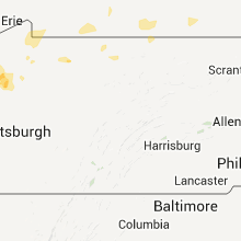
Hail Maps for Kane, PA


Connect with Interactive Hail Maps