

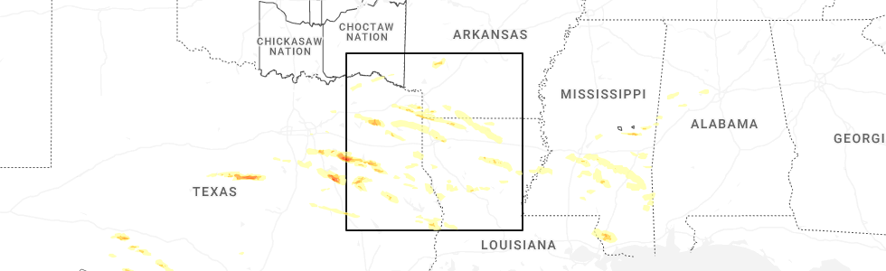
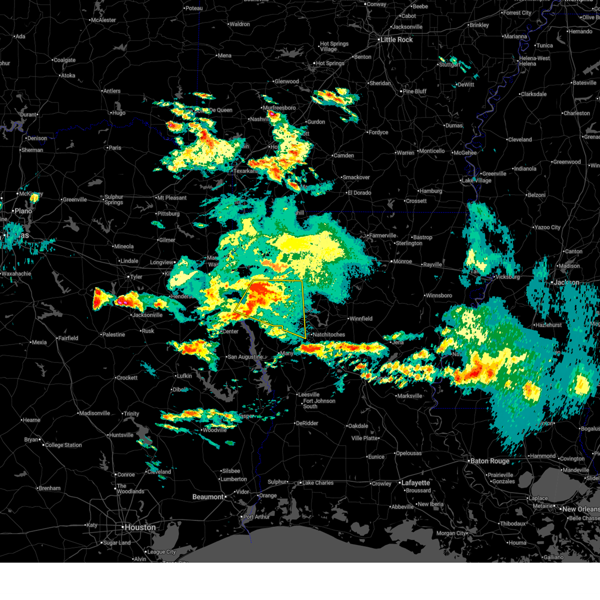
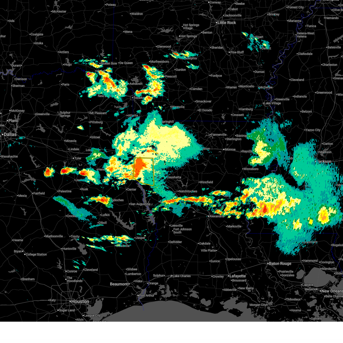
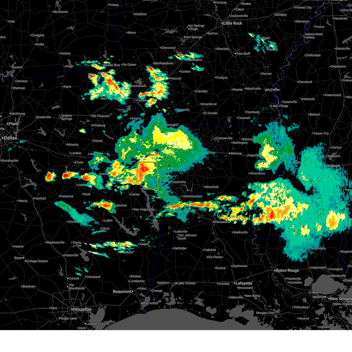
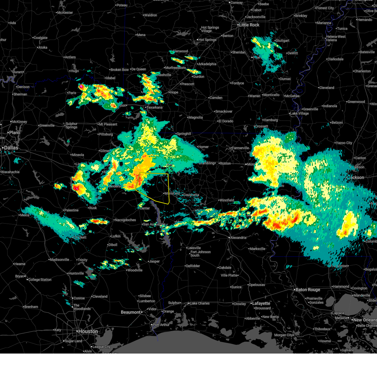
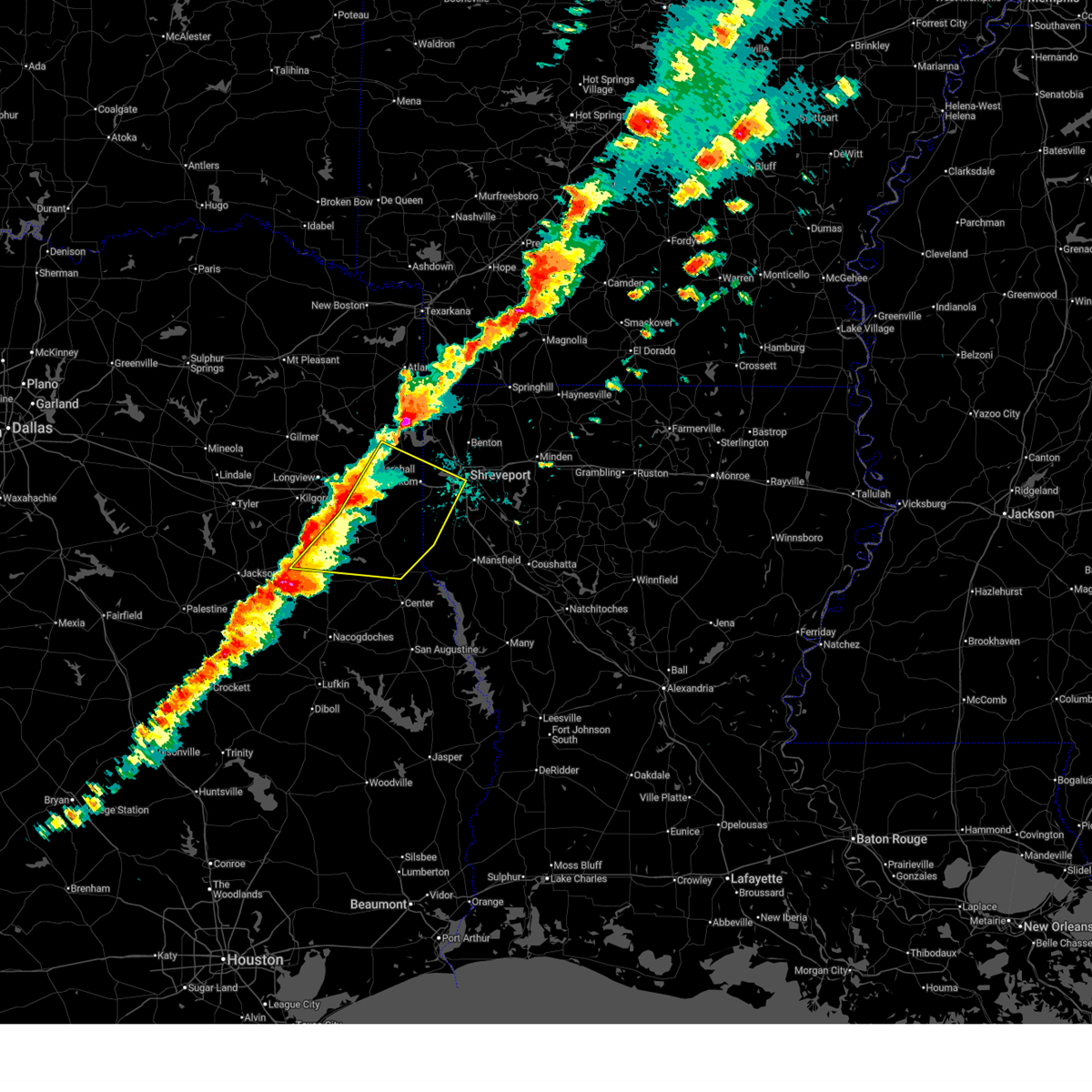
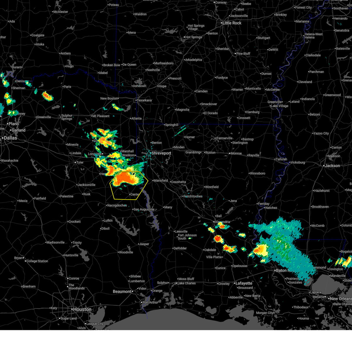
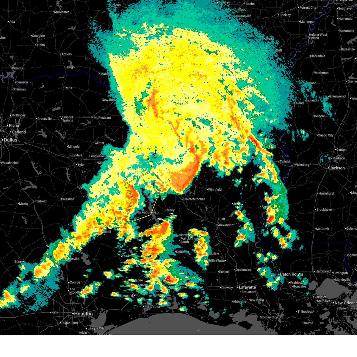
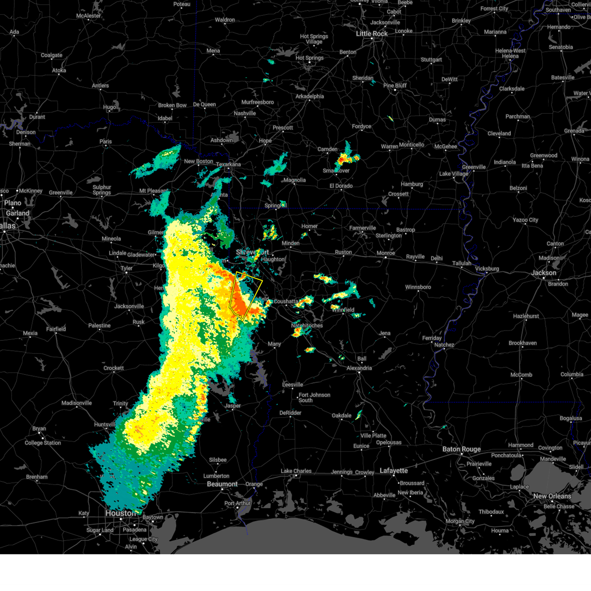
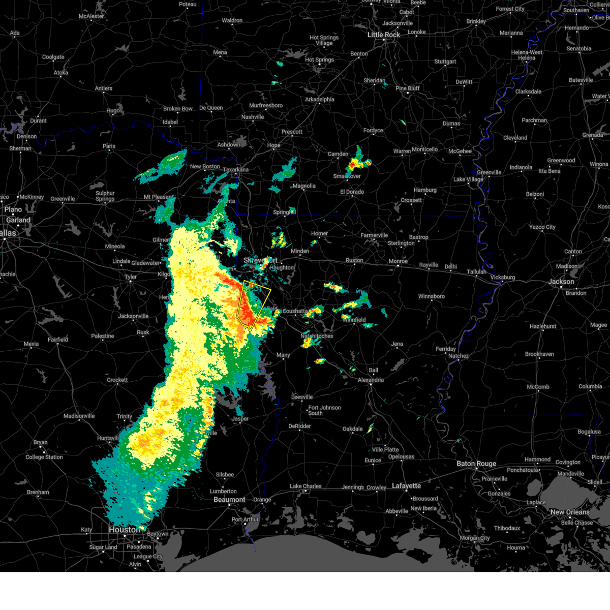
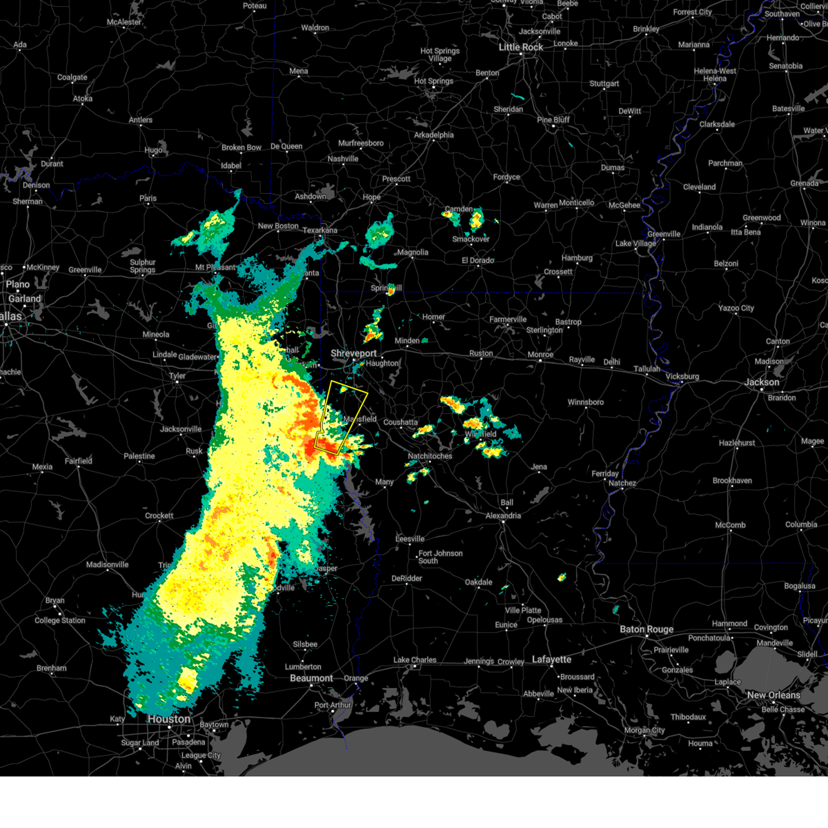
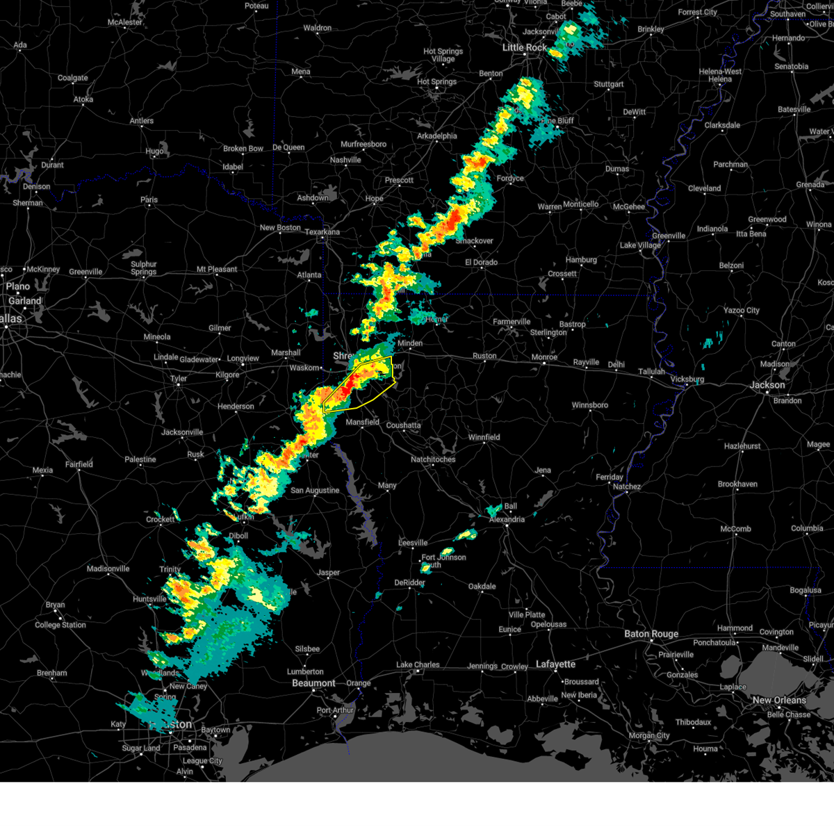
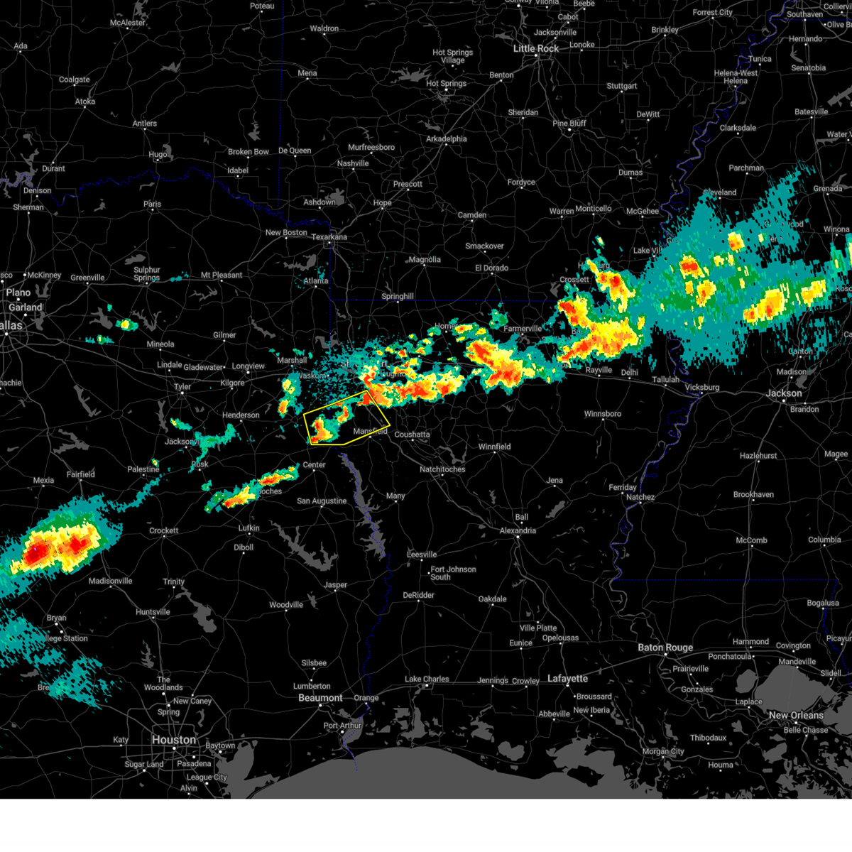
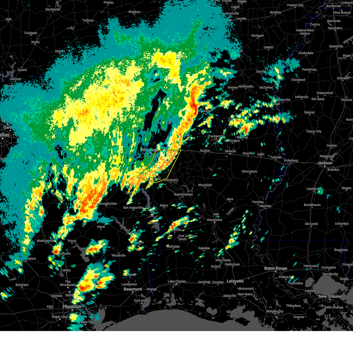
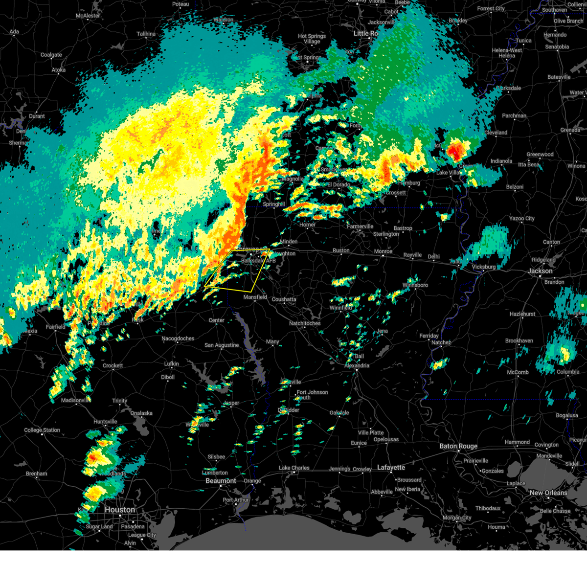
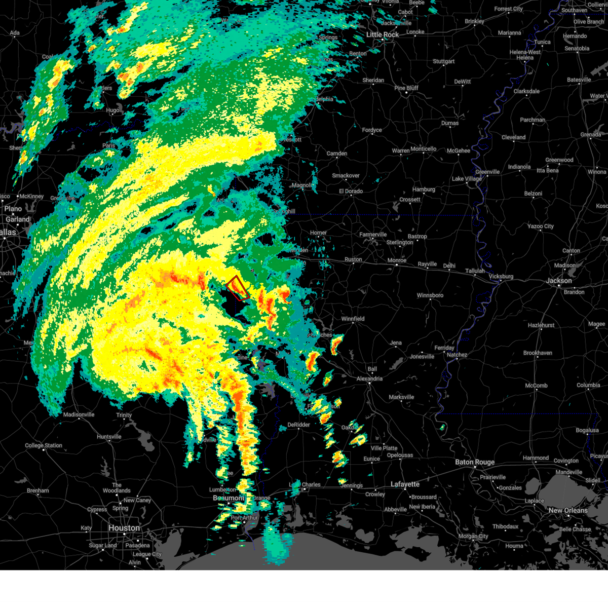
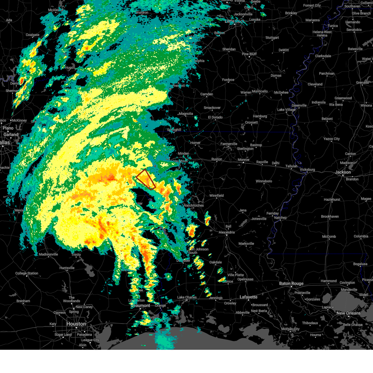
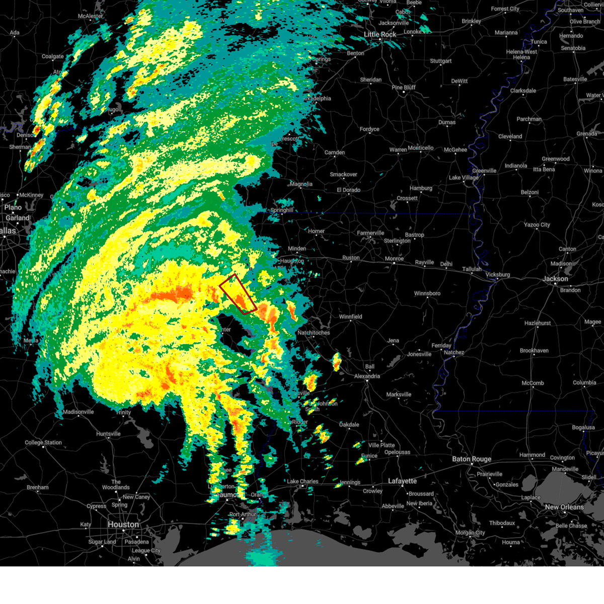
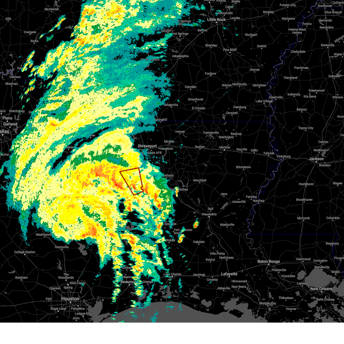
Hail Map for Keachi, LA
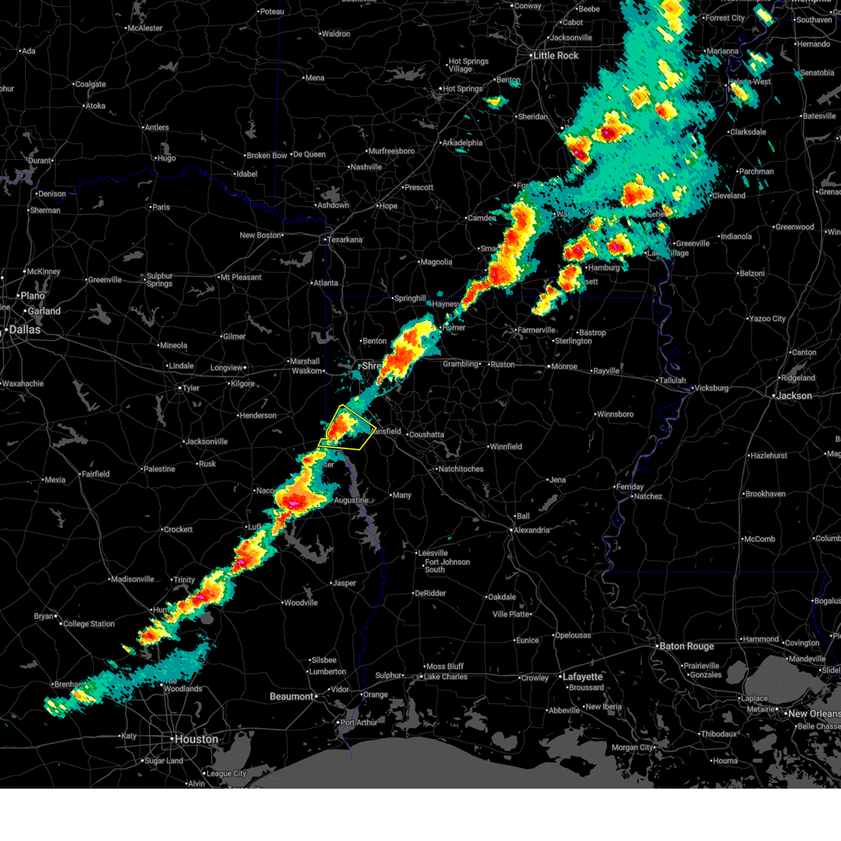
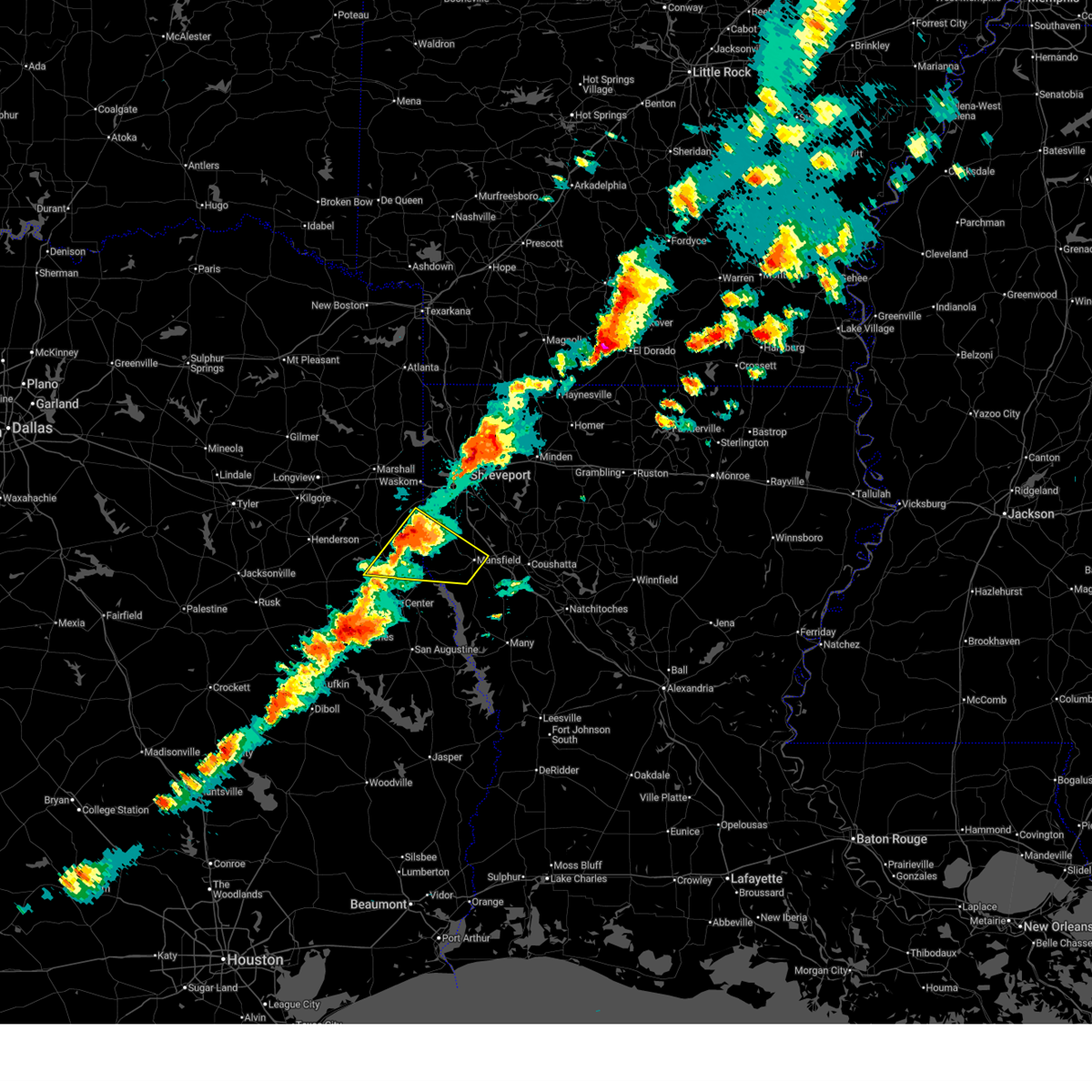
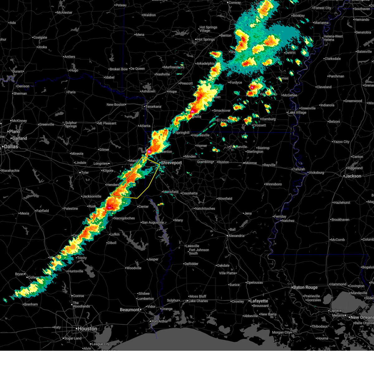
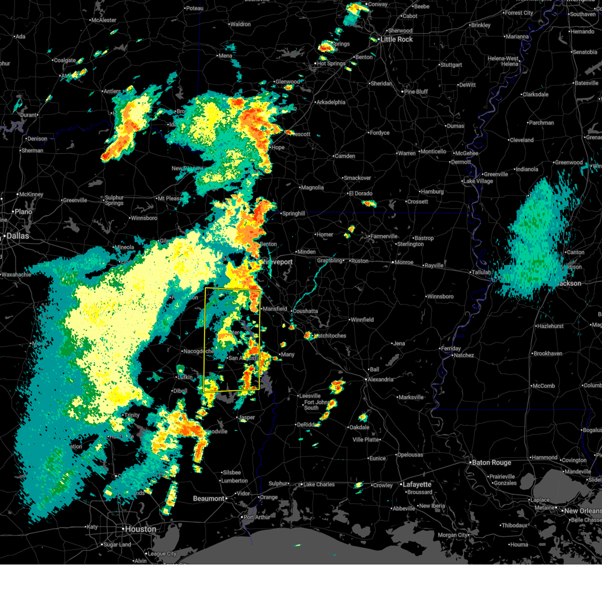
The Keachi, LA area has had 0 reports of on-the-ground hail by trained spotters, and has been under severe weather warnings 14 times during the past 12 months. Doppler radar has detected hail at or near Keachi, LA on 53 occasions, including 3 occasions during the past year.
| Name: | Keachi, LA |
| Where Located: | 25.4 miles SSW of Shreveport, LA |
| Map: | Google Map for Keachi, LA |
| Population: | 295 |
| Housing Units: | 146 |
| More Info: | Search Google for Keachi, LA |
0
The Top Recent Hail Date for Keachi, LA is Wednesday, April 29, 2026 (18th out of 53)
Hail and Wind Damage Spotted near Keachi, LA
| Date / Time | Report Details |
|---|---|
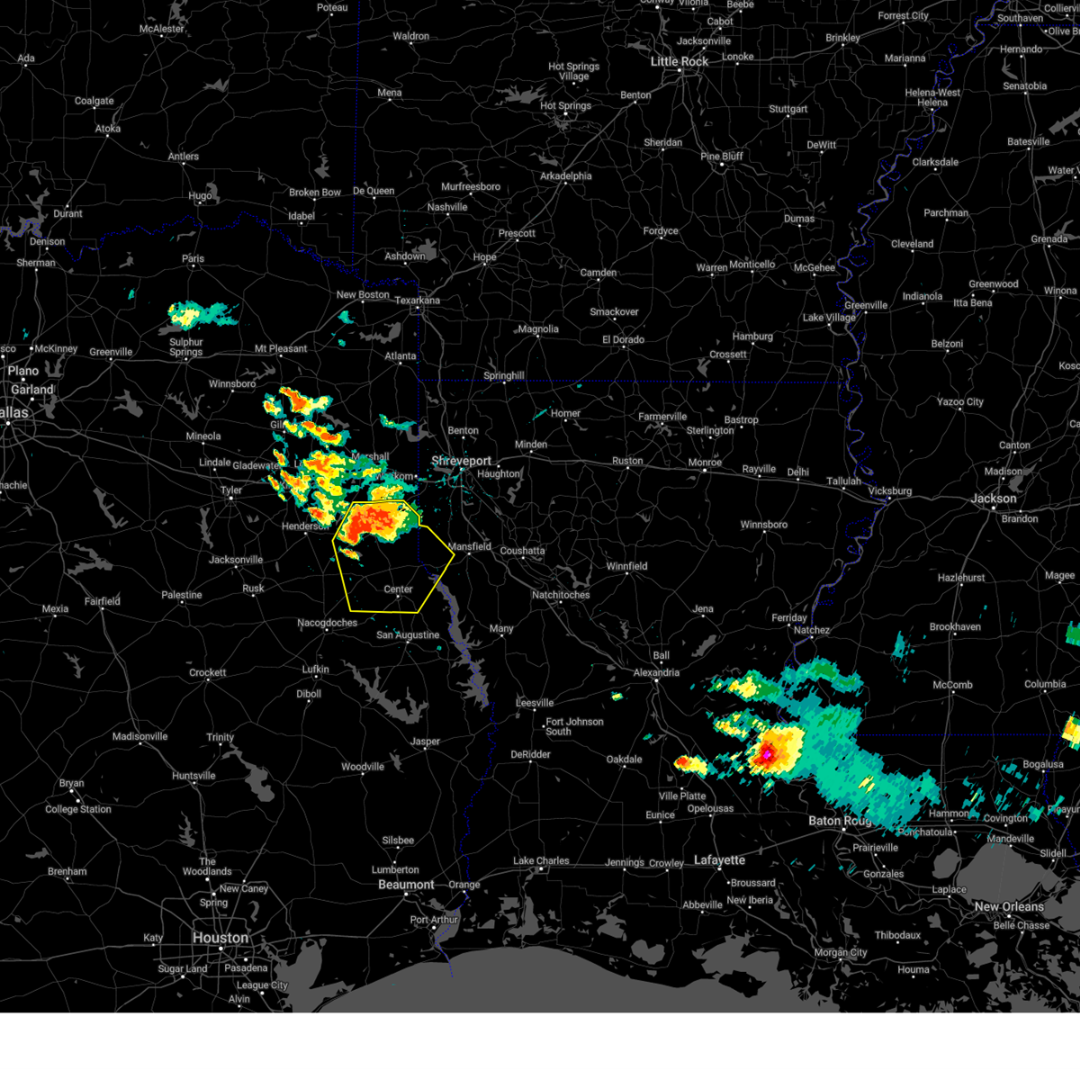
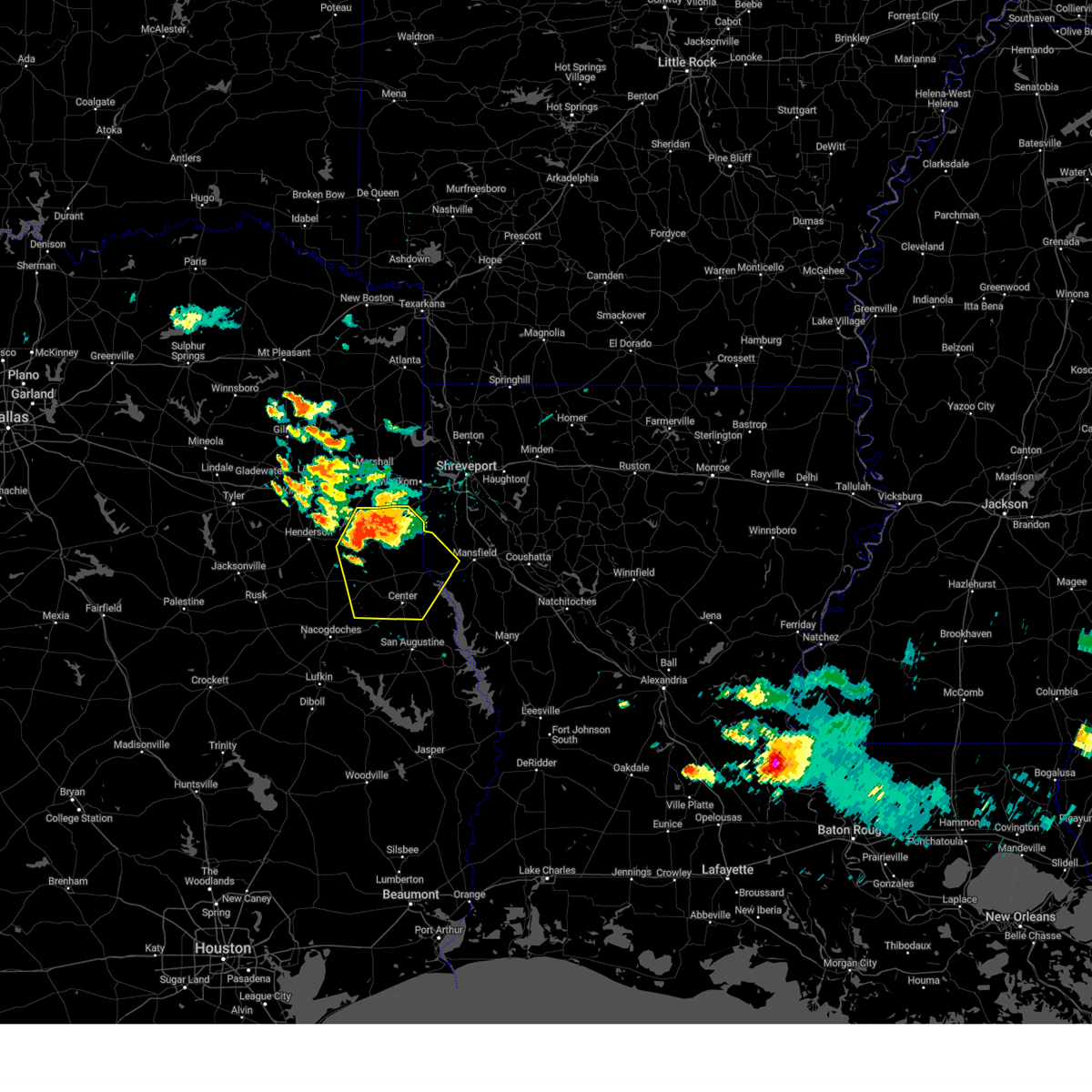
| 4/29/2026 5:28 PM CDT |
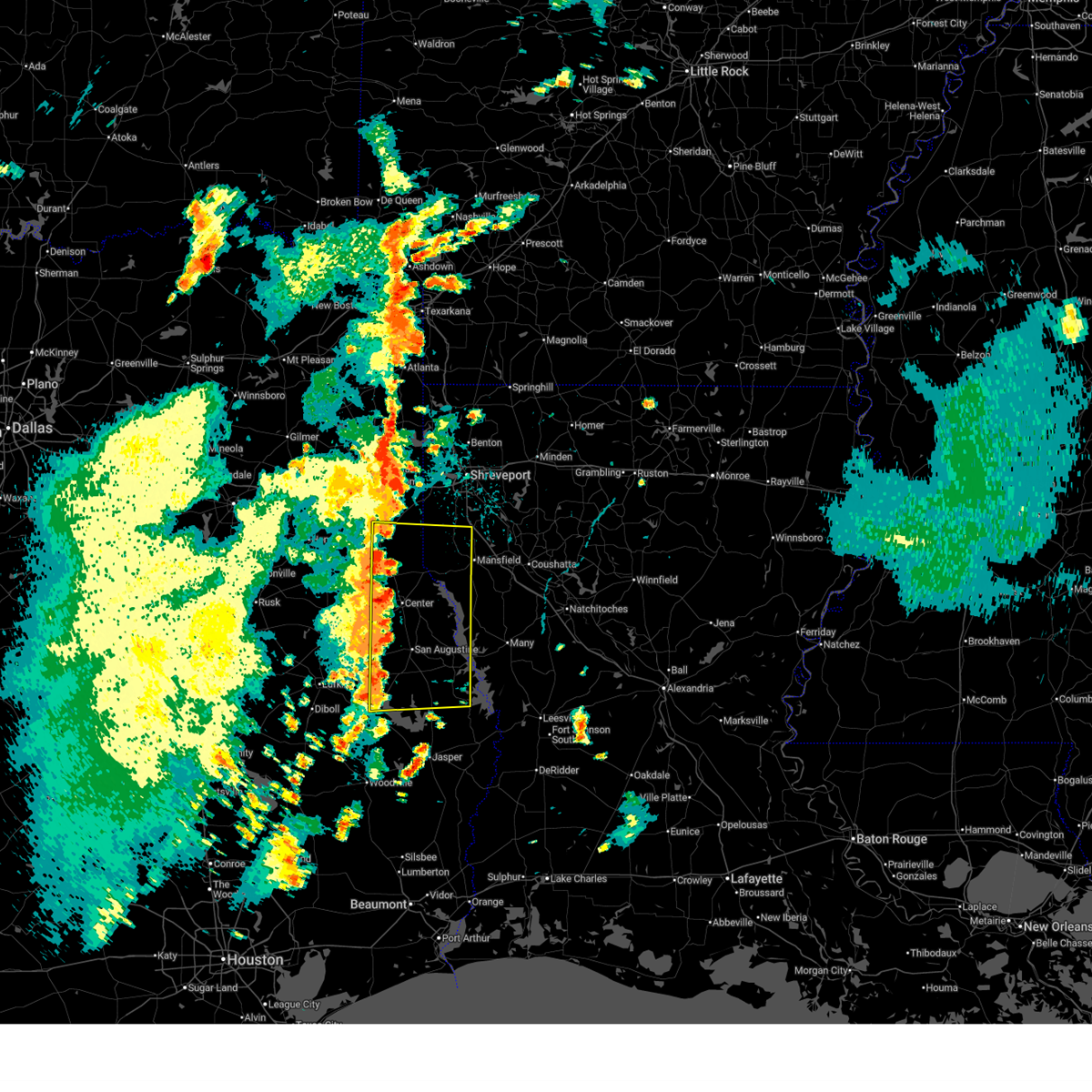
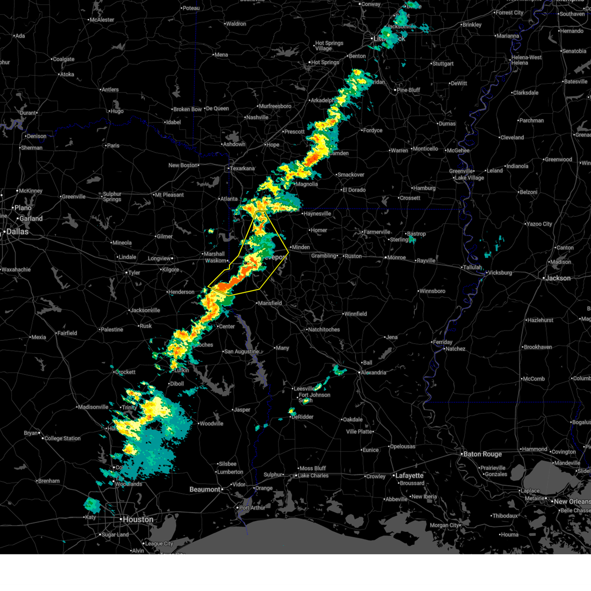
 Svrshv the national weather service in shreveport has issued a * severe thunderstorm warning for, southwestern bienville parish in northwestern louisiana, southern bossier parish in northwestern louisiana, southeastern caddo parish in northwestern louisiana, de soto parish in northwestern louisiana, west central natchitoches parish in northwestern louisiana, red river parish in northwestern louisiana, * until 630 pm cdt. * at 528 pm cdt, a severe thunderstorm was located 8 miles northwest of mansfield, moving east at 35 mph (radar indicated). Hazards include 60 mph wind gusts and quarter size hail. Hail damage to vehicles is expected. Expect wind damage to roofs, siding, and trees. Svrshv the national weather service in shreveport has issued a * severe thunderstorm warning for, southwestern bienville parish in northwestern louisiana, southern bossier parish in northwestern louisiana, southeastern caddo parish in northwestern louisiana, de soto parish in northwestern louisiana, west central natchitoches parish in northwestern louisiana, red river parish in northwestern louisiana, * until 630 pm cdt. * at 528 pm cdt, a severe thunderstorm was located 8 miles northwest of mansfield, moving east at 35 mph (radar indicated). Hazards include 60 mph wind gusts and quarter size hail. Hail damage to vehicles is expected. Expect wind damage to roofs, siding, and trees.
|
| 4/29/2026 5:17 PM CDT |
 the severe thunderstorm warning has been cancelled and is no longer in effect the severe thunderstorm warning has been cancelled and is no longer in effect
|
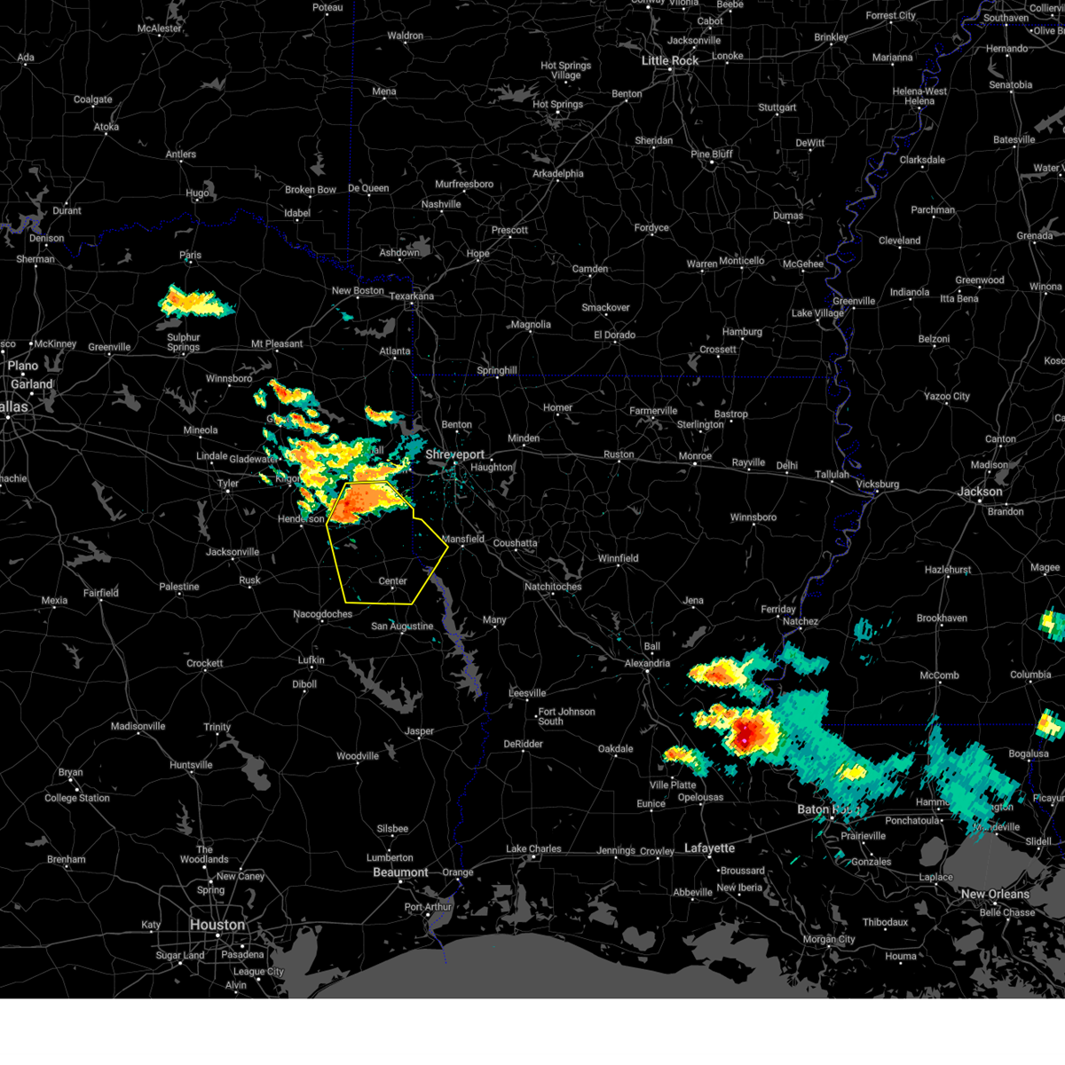
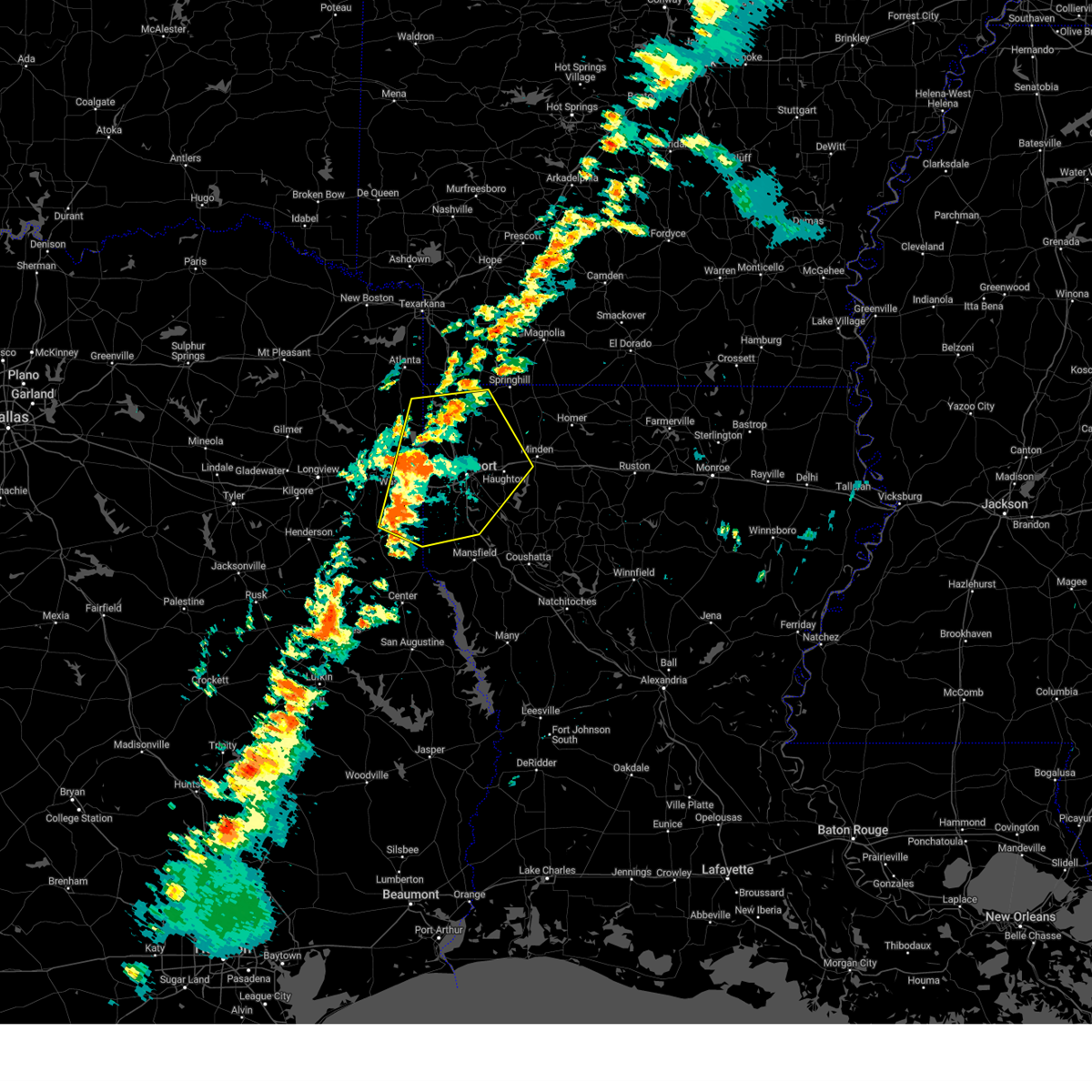
| 4/29/2026 5:17 PM CDT |
 At 517 pm cdt, a severe thunderstorm was located 9 miles northwest of mansfield, moving southeast at 40 mph (radar indicated). Hazards include 60 mph wind gusts and quarter size hail. Hail damage to vehicles is expected. expect wind damage to roofs, siding, and trees. Locations impacted include, mansfield, stonewall, logansport, south mansfield, keachi, grand cane, longstreet, stanley, reeds store, gloster, kickapoo, kingston, keat chie, frierson, carmel, keithville and spring ridge. At 517 pm cdt, a severe thunderstorm was located 9 miles northwest of mansfield, moving southeast at 40 mph (radar indicated). Hazards include 60 mph wind gusts and quarter size hail. Hail damage to vehicles is expected. expect wind damage to roofs, siding, and trees. Locations impacted include, mansfield, stonewall, logansport, south mansfield, keachi, grand cane, longstreet, stanley, reeds store, gloster, kickapoo, kingston, keat chie, frierson, carmel, keithville and spring ridge.
|
| 4/29/2026 4:50 PM CDT |
 Svrshv the national weather service in shreveport has issued a * severe thunderstorm warning for, southwestern caddo parish in northwestern louisiana, de soto parish in northwestern louisiana, eastern panola county in northeastern texas, * until 530 pm cdt. * at 450 pm cdt, a severe thunderstorm was located 8 miles southeast of deberry, or 14 miles east of carthage, moving southeast at 45 mph (radar indicated). Hazards include 60 mph wind gusts and half dollar size hail. Hail damage to vehicles is expected. Expect wind damage to roofs, siding, and trees. Svrshv the national weather service in shreveport has issued a * severe thunderstorm warning for, southwestern caddo parish in northwestern louisiana, de soto parish in northwestern louisiana, eastern panola county in northeastern texas, * until 530 pm cdt. * at 450 pm cdt, a severe thunderstorm was located 8 miles southeast of deberry, or 14 miles east of carthage, moving southeast at 45 mph (radar indicated). Hazards include 60 mph wind gusts and half dollar size hail. Hail damage to vehicles is expected. Expect wind damage to roofs, siding, and trees.
|
| 3/15/2026 6:49 PM CDT |
 the severe thunderstorm warning has been cancelled and is no longer in effect the severe thunderstorm warning has been cancelled and is no longer in effect
|
| 3/15/2026 6:49 PM CDT |
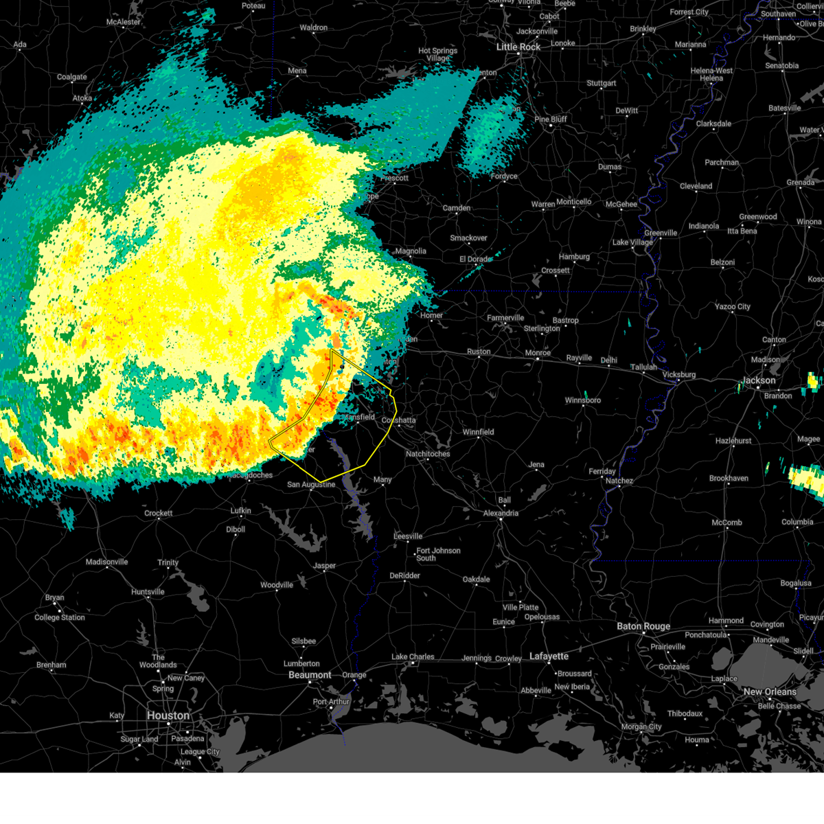
 At 649 pm cdt, severe thunderstorms were located along a line from 8 miles south of stonewall to near logansport, or along a line from 10 miles northwest of mansfield to 14 miles northeast of center, moving east at 30 mph (radar indicated). Hazards include 60 mph wind gusts and quarter size hail. Hail damage to vehicles is expected. expect wind damage to roofs, siding, and trees. Locations impacted include, mansfield, logansport, joaquin, south mansfield, keachi, grand cane, longstreet, stanley, reeds store, gloster, keat chie and kickapoo. At 649 pm cdt, severe thunderstorms were located along a line from 8 miles south of stonewall to near logansport, or along a line from 10 miles northwest of mansfield to 14 miles northeast of center, moving east at 30 mph (radar indicated). Hazards include 60 mph wind gusts and quarter size hail. Hail damage to vehicles is expected. expect wind damage to roofs, siding, and trees. Locations impacted include, mansfield, logansport, joaquin, south mansfield, keachi, grand cane, longstreet, stanley, reeds store, gloster, keat chie and kickapoo.
|
| 3/15/2026 6:23 PM CDT |
 Svrshv the national weather service in shreveport has issued a * severe thunderstorm warning for, southwestern caddo parish in northwestern louisiana, southwestern de soto parish in northwestern louisiana, north central shelby county in eastern texas, southeastern panola county in northeastern texas, * until 730 pm cdt. * at 623 pm cdt, severe thunderstorms were located along a line from 11 miles south of greenwood to over tenaha, or along a line from 17 miles southwest of shreveport to 12 miles northwest of center, moving east at 30 mph (radar indicated). Hazards include 60 mph wind gusts and quarter size hail. Hail damage to vehicles is expected. Expect wind damage to roofs, siding, and trees. Svrshv the national weather service in shreveport has issued a * severe thunderstorm warning for, southwestern caddo parish in northwestern louisiana, southwestern de soto parish in northwestern louisiana, north central shelby county in eastern texas, southeastern panola county in northeastern texas, * until 730 pm cdt. * at 623 pm cdt, severe thunderstorms were located along a line from 11 miles south of greenwood to over tenaha, or along a line from 17 miles southwest of shreveport to 12 miles northwest of center, moving east at 30 mph (radar indicated). Hazards include 60 mph wind gusts and quarter size hail. Hail damage to vehicles is expected. Expect wind damage to roofs, siding, and trees.
|
| 3/15/2026 6:04 PM CDT |
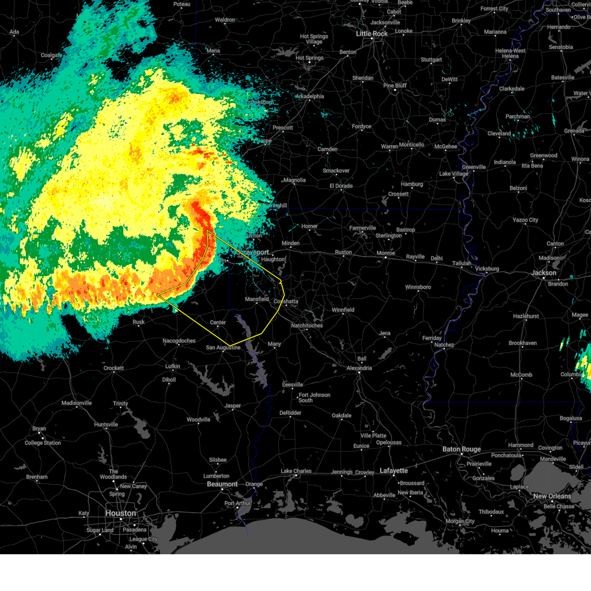
 At 604 pm cdt, severe thunderstorms were located along a line from 6 miles southwest of blanchard to 7 miles north of garrison, or along a line from 11 miles northwest of shreveport to 19 miles southwest of carthage, moving east at 35 mph (radar indicated). Hazards include 60 mph wind gusts and quarter size hail. Hail damage to vehicles is expected. expect wind damage to roofs, siding, and trees. Locations impacted include, shreveport, carthage, greenwood, waskom, tenaha, deberry, elysian fields, gary city, midyett, front, deadwood, woods, spring ridge, paxton, jonesville, bethany, cross lake and dotson. At 604 pm cdt, severe thunderstorms were located along a line from 6 miles southwest of blanchard to 7 miles north of garrison, or along a line from 11 miles northwest of shreveport to 19 miles southwest of carthage, moving east at 35 mph (radar indicated). Hazards include 60 mph wind gusts and quarter size hail. Hail damage to vehicles is expected. expect wind damage to roofs, siding, and trees. Locations impacted include, shreveport, carthage, greenwood, waskom, tenaha, deberry, elysian fields, gary city, midyett, front, deadwood, woods, spring ridge, paxton, jonesville, bethany, cross lake and dotson.
|
| 3/15/2026 5:37 PM CDT |
 Svrshv the national weather service in shreveport has issued a * severe thunderstorm warning for, southwestern caddo parish in northwestern louisiana, west central de soto parish in northwestern louisiana, northwestern shelby county in eastern texas, eastern harrison county in northeastern texas, panola county in northeastern texas, central rusk county in northeastern texas, * until 630 pm cdt. * at 537 pm cdt, severe thunderstorms were located along a line from over marshall to near minden, or along a line from over marshall to 13 miles south of henderson, moving east at 35 mph (radar indicated). Hazards include 60 mph wind gusts and quarter size hail. Hail damage to vehicles is expected. Expect wind damage to roofs, siding, and trees. Svrshv the national weather service in shreveport has issued a * severe thunderstorm warning for, southwestern caddo parish in northwestern louisiana, west central de soto parish in northwestern louisiana, northwestern shelby county in eastern texas, eastern harrison county in northeastern texas, panola county in northeastern texas, central rusk county in northeastern texas, * until 630 pm cdt. * at 537 pm cdt, severe thunderstorms were located along a line from over marshall to near minden, or along a line from over marshall to 13 miles south of henderson, moving east at 35 mph (radar indicated). Hazards include 60 mph wind gusts and quarter size hail. Hail damage to vehicles is expected. Expect wind damage to roofs, siding, and trees.
|
| 8/20/2025 5:07 PM CDT |
 The storm which prompted the warning has moved out of the area. therefore, the warning has been allowed to expire. however, gusty winds are still possible with this thunderstorm. The storm which prompted the warning has moved out of the area. therefore, the warning has been allowed to expire. however, gusty winds are still possible with this thunderstorm.
|
| 8/20/2025 4:15 PM CDT |
 Svrshv the national weather service in shreveport has issued a * severe thunderstorm warning for, central de soto parish in northwestern louisiana, * until 500 pm cdt. * at 415 pm cdt, a severe thunderstorm was located 7 miles northeast of mansfield, moving north at 5 mph (radar indicated). Hazards include 60 mph wind gusts and quarter size hail. Hail damage to vehicles is expected. Expect wind damage to roofs, siding, and trees. Svrshv the national weather service in shreveport has issued a * severe thunderstorm warning for, central de soto parish in northwestern louisiana, * until 500 pm cdt. * at 415 pm cdt, a severe thunderstorm was located 7 miles northeast of mansfield, moving north at 5 mph (radar indicated). Hazards include 60 mph wind gusts and quarter size hail. Hail damage to vehicles is expected. Expect wind damage to roofs, siding, and trees.
|
| 7/26/2025 12:05 PM CDT |
 Svrshv the national weather service in shreveport has issued a * severe thunderstorm warning for, northwestern de soto parish in northwestern louisiana, southwestern caddo parish in northwestern louisiana, * until 1245 pm cdt. * at 1204 pm cdt, a severe thunderstorm was located 8 miles northwest of mansfield, moving northwest at 20 mph (radar indicated). Hazards include 60 mph wind gusts. expect damage to roofs, siding, and trees Svrshv the national weather service in shreveport has issued a * severe thunderstorm warning for, northwestern de soto parish in northwestern louisiana, southwestern caddo parish in northwestern louisiana, * until 1245 pm cdt. * at 1204 pm cdt, a severe thunderstorm was located 8 miles northwest of mansfield, moving northwest at 20 mph (radar indicated). Hazards include 60 mph wind gusts. expect damage to roofs, siding, and trees
|
| 7/13/2025 6:50 PM CDT |
 The storms which prompted the warning have weakened below severe limits, and have exited the warned area. therefore, the warning will be allowed to expire. The storms which prompted the warning have weakened below severe limits, and have exited the warned area. therefore, the warning will be allowed to expire.
|
| 7/13/2025 5:53 PM CDT |
 Svrshv the national weather service in shreveport has issued a * severe thunderstorm warning for, southwestern de soto parish in northwestern louisiana, southwestern caddo parish in northwestern louisiana, northwestern sabine parish in northwestern louisiana, southeastern panola county in northeastern texas, southeastern nacogdoches county in eastern texas, shelby county in eastern texas, east central angelina county in eastern texas, san augustine county in eastern texas, sabine county in eastern texas, * until 700 pm cdt. * at 553 pm cdt, severe thunderstorms were located along a line extending from 6 miles southwest of deberry to 13 miles northwest of ebenezer, moving east at 30 mph (radar indicated). Hazards include 60 mph wind gusts and penny size hail. expect damage to roofs, siding, and trees Svrshv the national weather service in shreveport has issued a * severe thunderstorm warning for, southwestern de soto parish in northwestern louisiana, southwestern caddo parish in northwestern louisiana, northwestern sabine parish in northwestern louisiana, southeastern panola county in northeastern texas, southeastern nacogdoches county in eastern texas, shelby county in eastern texas, east central angelina county in eastern texas, san augustine county in eastern texas, sabine county in eastern texas, * until 700 pm cdt. * at 553 pm cdt, severe thunderstorms were located along a line extending from 6 miles southwest of deberry to 13 miles northwest of ebenezer, moving east at 30 mph (radar indicated). Hazards include 60 mph wind gusts and penny size hail. expect damage to roofs, siding, and trees
|
| 6/9/2025 1:34 AM CDT |
 the severe thunderstorm warning has been cancelled and is no longer in effect the severe thunderstorm warning has been cancelled and is no longer in effect
|
| 6/9/2025 1:34 AM CDT |
 At 133 am cdt, severe thunderstorms were located along a line extending from near shreveport to 11 miles southwest of fosters to near stonewall to joaquin to near tenaha, moving east at 40 mph (radar indicated). Hazards include 60 mph wind gusts and quarter size hail. Hail damage to vehicles is expected. expect wind damage to roofs, siding, and trees. Locations impacted include, shreveport, center, mansfield, greenwood, stonewall, logansport, tenaha, timpson, joaquin, converse, shelbyville, patroon, neuville, oak grove, huxley, south mansfield, keachi, grand cane, longstreet, and stanley. At 133 am cdt, severe thunderstorms were located along a line extending from near shreveport to 11 miles southwest of fosters to near stonewall to joaquin to near tenaha, moving east at 40 mph (radar indicated). Hazards include 60 mph wind gusts and quarter size hail. Hail damage to vehicles is expected. expect wind damage to roofs, siding, and trees. Locations impacted include, shreveport, center, mansfield, greenwood, stonewall, logansport, tenaha, timpson, joaquin, converse, shelbyville, patroon, neuville, oak grove, huxley, south mansfield, keachi, grand cane, longstreet, and stanley.
|
| 6/9/2025 12:51 AM CDT |
 Svrshv the national weather service in shreveport has issued a * severe thunderstorm warning for, de soto parish in northwestern louisiana, northwestern red river parish in northwestern louisiana, southern caddo parish in northwestern louisiana, south central bossier parish in northwestern louisiana, northwestern sabine parish in northwestern louisiana, south central marion county in northeastern texas, eastern harrison county in northeastern texas, panola county in northeastern texas, central rusk county in northeastern texas, shelby county in eastern texas, * until 200 am cdt. * at 1250 am cdt, severe thunderstorms were located along a line extending from near karnack to 9 miles southeast of woodlawn to 6 miles northwest of elysian fields to near beckville to near minden, moving southeast at 40 mph (radar indicated). Hazards include 70 mph wind gusts and quarter size hail. Hail damage to vehicles is expected. expect considerable tree damage. Wind damage is also likely to mobile homes, roofs, and outbuildings. Svrshv the national weather service in shreveport has issued a * severe thunderstorm warning for, de soto parish in northwestern louisiana, northwestern red river parish in northwestern louisiana, southern caddo parish in northwestern louisiana, south central bossier parish in northwestern louisiana, northwestern sabine parish in northwestern louisiana, south central marion county in northeastern texas, eastern harrison county in northeastern texas, panola county in northeastern texas, central rusk county in northeastern texas, shelby county in eastern texas, * until 200 am cdt. * at 1250 am cdt, severe thunderstorms were located along a line extending from near karnack to 9 miles southeast of woodlawn to 6 miles northwest of elysian fields to near beckville to near minden, moving southeast at 40 mph (radar indicated). Hazards include 70 mph wind gusts and quarter size hail. Hail damage to vehicles is expected. expect considerable tree damage. Wind damage is also likely to mobile homes, roofs, and outbuildings.
|
| 6/8/2025 5:10 PM CDT |
 At 510 pm cdt, a severe thunderstorm was located near tenaha, or 9 miles south of carthage, moving southeast at 30 mph (radar indicated). Hazards include golf ball size hail and 70 mph wind gusts. People and animals outdoors will be injured. expect hail damage to roofs, siding, windows, and vehicles. expect considerable tree damage. wind damage is also likely to mobile homes, roofs, and outbuildings. Locations impacted include, carthage, center, logansport, tenaha, timpson, garrison, joaquin, shelbyville, gary city, keachi, longstreet, stanley, james, front, stockman, arcadia, deadwood, dotson, woods, and paxton. At 510 pm cdt, a severe thunderstorm was located near tenaha, or 9 miles south of carthage, moving southeast at 30 mph (radar indicated). Hazards include golf ball size hail and 70 mph wind gusts. People and animals outdoors will be injured. expect hail damage to roofs, siding, windows, and vehicles. expect considerable tree damage. wind damage is also likely to mobile homes, roofs, and outbuildings. Locations impacted include, carthage, center, logansport, tenaha, timpson, garrison, joaquin, shelbyville, gary city, keachi, longstreet, stanley, james, front, stockman, arcadia, deadwood, dotson, woods, and paxton.
|
| 6/8/2025 4:47 PM CDT |
 At 447 pm cdt, a severe thunderstorm was located near carthage, moving southeast at 30 mph (radar indicated). Hazards include two inch hail and 70 mph wind gusts. People and animals outdoors will be injured. expect hail damage to roofs, siding, windows, and vehicles. expect considerable tree damage. wind damage is also likely to mobile homes, roofs, and outbuildings. Locations impacted include, carthage, center, logansport, tenaha, timpson, garrison, beckville, joaquin, deberry, pinehill, shelbyville, gary city, keachi, longstreet, stanley, front, stockman, fairplay, midyett, and deadwood. At 447 pm cdt, a severe thunderstorm was located near carthage, moving southeast at 30 mph (radar indicated). Hazards include two inch hail and 70 mph wind gusts. People and animals outdoors will be injured. expect hail damage to roofs, siding, windows, and vehicles. expect considerable tree damage. wind damage is also likely to mobile homes, roofs, and outbuildings. Locations impacted include, carthage, center, logansport, tenaha, timpson, garrison, beckville, joaquin, deberry, pinehill, shelbyville, gary city, keachi, longstreet, stanley, front, stockman, fairplay, midyett, and deadwood.
|
| 6/8/2025 4:47 PM CDT |
 the severe thunderstorm warning has been cancelled and is no longer in effect the severe thunderstorm warning has been cancelled and is no longer in effect
|
| 6/8/2025 4:32 PM CDT |
 Svrshv the national weather service in shreveport has issued a * severe thunderstorm warning for, southwestern de soto parish in northwestern louisiana, south central harrison county in northeastern texas, panola county in northeastern texas, eastern rusk county in northeastern texas, northeastern nacogdoches county in eastern texas, shelby county in eastern texas, * until 530 pm cdt. * at 432 pm cdt, a severe thunderstorm was located over beckville, or 9 miles northwest of carthage, moving southeast at 30 mph (radar indicated). Hazards include 60 mph wind gusts and half dollar size hail. Hail damage to vehicles is expected. Expect wind damage to roofs, siding, and trees. Svrshv the national weather service in shreveport has issued a * severe thunderstorm warning for, southwestern de soto parish in northwestern louisiana, south central harrison county in northeastern texas, panola county in northeastern texas, eastern rusk county in northeastern texas, northeastern nacogdoches county in eastern texas, shelby county in eastern texas, * until 530 pm cdt. * at 432 pm cdt, a severe thunderstorm was located over beckville, or 9 miles northwest of carthage, moving southeast at 30 mph (radar indicated). Hazards include 60 mph wind gusts and half dollar size hail. Hail damage to vehicles is expected. Expect wind damage to roofs, siding, and trees.
|
| 5/26/2025 6:28 AM CDT |
 Svrshv the national weather service in shreveport has issued a * severe thunderstorm warning for, northwestern de soto parish in northwestern louisiana, southwestern caddo parish in northwestern louisiana, southeastern smith county in northeastern texas, harrison county in northeastern texas, panola county in northeastern texas, rusk county in northeastern texas, northwestern nacogdoches county in eastern texas, northwestern shelby county in eastern texas, cherokee county in northeastern texas, * until 730 am cdt. * at 627 am cdt, severe thunderstorms were located along a line extending from near marshall to near tatum to henderson to 8 miles north of ponta to near reese, moving east at 55 mph (radar indicated). Hazards include 60 mph wind gusts and quarter size hail. Hail damage to vehicles is expected. Expect wind damage to roofs, siding, and trees. Svrshv the national weather service in shreveport has issued a * severe thunderstorm warning for, northwestern de soto parish in northwestern louisiana, southwestern caddo parish in northwestern louisiana, southeastern smith county in northeastern texas, harrison county in northeastern texas, panola county in northeastern texas, rusk county in northeastern texas, northwestern nacogdoches county in eastern texas, northwestern shelby county in eastern texas, cherokee county in northeastern texas, * until 730 am cdt. * at 627 am cdt, severe thunderstorms were located along a line extending from near marshall to near tatum to henderson to 8 miles north of ponta to near reese, moving east at 55 mph (radar indicated). Hazards include 60 mph wind gusts and quarter size hail. Hail damage to vehicles is expected. Expect wind damage to roofs, siding, and trees.
|
| 5/6/2025 4:42 PM CDT |
 Svrshv the national weather service in shreveport has issued a * severe thunderstorm warning for, de soto parish in northwestern louisiana, northwestern sabine parish in northwestern louisiana, southeastern panola county in northeastern texas, shelby county in eastern texas, northern san augustine county in eastern texas, northwestern sabine county in eastern texas, * until 515 pm cdt. * at 442 pm cdt, severe thunderstorms were located along a line extending from 6 miles northeast of tenaha to 6 miles south of joaquin to near macune, moving northeast at 60 mph (radar indicated). Hazards include 60 mph wind gusts and quarter size hail. Hail damage to vehicles is expected. Expect wind damage to roofs, siding, and trees. Svrshv the national weather service in shreveport has issued a * severe thunderstorm warning for, de soto parish in northwestern louisiana, northwestern sabine parish in northwestern louisiana, southeastern panola county in northeastern texas, shelby county in eastern texas, northern san augustine county in eastern texas, northwestern sabine county in eastern texas, * until 515 pm cdt. * at 442 pm cdt, severe thunderstorms were located along a line extending from 6 miles northeast of tenaha to 6 miles south of joaquin to near macune, moving northeast at 60 mph (radar indicated). Hazards include 60 mph wind gusts and quarter size hail. Hail damage to vehicles is expected. Expect wind damage to roofs, siding, and trees.
|
| 5/6/2025 3:44 PM CDT |
 Svrshv the national weather service in shreveport has issued a * severe thunderstorm warning for, de soto parish in northwestern louisiana, red river parish in northwestern louisiana, northwestern natchitoches parish in northwestern louisiana, southeastern caddo parish in northwestern louisiana, bienville parish in northwestern louisiana, southeastern bossier parish in northwestern louisiana, southwestern lincoln parish in north central louisiana, northwestern winn parish in north central louisiana, northeastern shelby county in eastern texas, * until 445 pm cdt. * at 344 pm cdt, severe thunderstorms were located along a line extending from 8 miles northeast of stonewall to near mansfield, moving east at 65 mph (radar indicated). Hazards include 60 mph wind gusts and penny size hail. expect damage to roofs, siding, and trees Svrshv the national weather service in shreveport has issued a * severe thunderstorm warning for, de soto parish in northwestern louisiana, red river parish in northwestern louisiana, northwestern natchitoches parish in northwestern louisiana, southeastern caddo parish in northwestern louisiana, bienville parish in northwestern louisiana, southeastern bossier parish in northwestern louisiana, southwestern lincoln parish in north central louisiana, northwestern winn parish in north central louisiana, northeastern shelby county in eastern texas, * until 445 pm cdt. * at 344 pm cdt, severe thunderstorms were located along a line extending from 8 miles northeast of stonewall to near mansfield, moving east at 65 mph (radar indicated). Hazards include 60 mph wind gusts and penny size hail. expect damage to roofs, siding, and trees
|
| 5/6/2025 3:23 PM CDT | Report of tree down on sr 172 near blueberry trai in de soto county LA, 3.1 miles E of Keachi, LA |
| 5/6/2025 3:03 PM CDT |
 Svrshv the national weather service in shreveport has issued a * severe thunderstorm warning for, northwestern de soto parish in northwestern louisiana, southwestern caddo parish in northwestern louisiana, southeastern panola county in northeastern texas, north central nacogdoches county in eastern texas, northwestern shelby county in eastern texas, * until 345 pm cdt. * at 303 pm cdt, severe thunderstorms were located along a line extending from near carthage to near timpson, moving east at 60 mph (radar indicated). Hazards include 70 mph wind gusts and penny size hail. Expect considerable tree damage. Damage is likely to mobile homes, roofs, and outbuildings. Svrshv the national weather service in shreveport has issued a * severe thunderstorm warning for, northwestern de soto parish in northwestern louisiana, southwestern caddo parish in northwestern louisiana, southeastern panola county in northeastern texas, north central nacogdoches county in eastern texas, northwestern shelby county in eastern texas, * until 345 pm cdt. * at 303 pm cdt, severe thunderstorms were located along a line extending from near carthage to near timpson, moving east at 60 mph (radar indicated). Hazards include 70 mph wind gusts and penny size hail. Expect considerable tree damage. Damage is likely to mobile homes, roofs, and outbuildings.
|
| 4/24/2025 8:19 PM CDT |
 At 818 pm cdt, a severe thunderstorm was located near grand cane, or 11 miles southwest of stonewall, moving north at 30 mph (radar indicated). Hazards include 60 mph wind gusts and nickel size hail. Expect damage to roofs, siding, and trees. Locations impacted include, gloster, keat chie, frierson, kickapoo, keachi, spring ridge, grand cane, stonewall, kingston, longstreet, and reeds store. At 818 pm cdt, a severe thunderstorm was located near grand cane, or 11 miles southwest of stonewall, moving north at 30 mph (radar indicated). Hazards include 60 mph wind gusts and nickel size hail. Expect damage to roofs, siding, and trees. Locations impacted include, gloster, keat chie, frierson, kickapoo, keachi, spring ridge, grand cane, stonewall, kingston, longstreet, and reeds store.
|
| 4/24/2025 8:02 PM CDT |
 the severe thunderstorm warning has been cancelled and is no longer in effect the severe thunderstorm warning has been cancelled and is no longer in effect
|
| 4/24/2025 8:02 PM CDT |
 At 801 pm cdt, a severe thunderstorm was located near stanley, or 12 miles west of mansfield, moving north at 30 mph (radar indicated). Hazards include 60 mph wind gusts and nickel size hail. Expect damage to roofs, siding, and trees. Locations impacted include, gloster, keat chie, frierson, keachi, spring ridge, stonewall, kingston, longstreet, logansport, kickapoo, stanley, grand cane, and reeds store. At 801 pm cdt, a severe thunderstorm was located near stanley, or 12 miles west of mansfield, moving north at 30 mph (radar indicated). Hazards include 60 mph wind gusts and nickel size hail. Expect damage to roofs, siding, and trees. Locations impacted include, gloster, keat chie, frierson, keachi, spring ridge, stonewall, kingston, longstreet, logansport, kickapoo, stanley, grand cane, and reeds store.
|
| 4/24/2025 7:50 PM CDT |
 Svrshv the national weather service in shreveport has issued a * severe thunderstorm warning for, western de soto parish in northwestern louisiana, southwestern caddo parish in northwestern louisiana, northeastern shelby county in eastern texas, * until 845 pm cdt. * at 750 pm cdt, a severe thunderstorm was located near logansport, or 15 miles northeast of center, moving north at 30 mph (radar indicated). Hazards include 60 mph wind gusts and nickel size hail. expect damage to roofs, siding, and trees Svrshv the national weather service in shreveport has issued a * severe thunderstorm warning for, western de soto parish in northwestern louisiana, southwestern caddo parish in northwestern louisiana, northeastern shelby county in eastern texas, * until 845 pm cdt. * at 750 pm cdt, a severe thunderstorm was located near logansport, or 15 miles northeast of center, moving north at 30 mph (radar indicated). Hazards include 60 mph wind gusts and nickel size hail. expect damage to roofs, siding, and trees
|
| 4/20/2025 8:09 PM CDT |
 Svrshv the national weather service in shreveport has issued a * severe thunderstorm warning for, northwestern de soto parish in northwestern louisiana, southern caddo parish in northwestern louisiana, southeastern bossier parish in northwestern louisiana, * until 915 pm cdt. * at 809 pm cdt, severe thunderstorms were located along a line extending from near shreveport to 11 miles southwest of stonewall, moving east at 10 mph (radar indicated). Hazards include 60 mph wind gusts and quarter size hail. Hail damage to vehicles is expected. Expect wind damage to roofs, siding, and trees. Svrshv the national weather service in shreveport has issued a * severe thunderstorm warning for, northwestern de soto parish in northwestern louisiana, southern caddo parish in northwestern louisiana, southeastern bossier parish in northwestern louisiana, * until 915 pm cdt. * at 809 pm cdt, severe thunderstorms were located along a line extending from near shreveport to 11 miles southwest of stonewall, moving east at 10 mph (radar indicated). Hazards include 60 mph wind gusts and quarter size hail. Hail damage to vehicles is expected. Expect wind damage to roofs, siding, and trees.
|
| 4/20/2025 7:51 PM CDT |
 the severe thunderstorm warning has been cancelled and is no longer in effect the severe thunderstorm warning has been cancelled and is no longer in effect
|
| 4/20/2025 7:51 PM CDT |
 At 751 pm cdt, a severe thunderstorm was located near bradley, or 9 miles northwest of springhill, moving northeast at 40 mph (radar indicated). Hazards include 60 mph wind gusts and quarter size hail. Hail damage to vehicles is expected. expect wind damage to roofs, siding, and trees. Locations impacted include, deberry, keat chie, alden bridge, haughton, ferguson, curtis, front, spring ridge, stonewall, fillmore, cross lake, bodcau, kingston, koran, eastwood, doyline, shreveport, midyett, kickapoo, and keithville. At 751 pm cdt, a severe thunderstorm was located near bradley, or 9 miles northwest of springhill, moving northeast at 40 mph (radar indicated). Hazards include 60 mph wind gusts and quarter size hail. Hail damage to vehicles is expected. expect wind damage to roofs, siding, and trees. Locations impacted include, deberry, keat chie, alden bridge, haughton, ferguson, curtis, front, spring ridge, stonewall, fillmore, cross lake, bodcau, kingston, koran, eastwood, doyline, shreveport, midyett, kickapoo, and keithville.
|
| 4/20/2025 6:58 PM CDT |
 Svrshv the national weather service in shreveport has issued a * severe thunderstorm warning for, southwestern webster parish in northwestern louisiana, northwestern de soto parish in northwestern louisiana, caddo parish in northwestern louisiana, bossier parish in northwestern louisiana, eastern marion county in northeastern texas, southeastern cass county in northeastern texas, eastern harrison county in northeastern texas, northeastern panola county in northeastern texas, * until 800 pm cdt. * at 658 pm cdt, a severe thunderstorm was located near mooringsport, or 14 miles northwest of shreveport, moving northeast at 40 mph (radar indicated). Hazards include 60 mph wind gusts and quarter size hail. Hail damage to vehicles is expected. Expect wind damage to roofs, siding, and trees. Svrshv the national weather service in shreveport has issued a * severe thunderstorm warning for, southwestern webster parish in northwestern louisiana, northwestern de soto parish in northwestern louisiana, caddo parish in northwestern louisiana, bossier parish in northwestern louisiana, eastern marion county in northeastern texas, southeastern cass county in northeastern texas, eastern harrison county in northeastern texas, northeastern panola county in northeastern texas, * until 800 pm cdt. * at 658 pm cdt, a severe thunderstorm was located near mooringsport, or 14 miles northwest of shreveport, moving northeast at 40 mph (radar indicated). Hazards include 60 mph wind gusts and quarter size hail. Hail damage to vehicles is expected. Expect wind damage to roofs, siding, and trees.
|
| 4/2/2025 4:34 PM CDT |
 Svrshv the national weather service in shreveport has issued a * severe thunderstorm warning for, northwestern de soto parish in northwestern louisiana, southeastern caddo parish in northwestern louisiana, southwestern bossier parish in northwestern louisiana, * until 515 pm cdt. * at 434 pm cdt, a severe thunderstorm was located 7 miles southwest of stonewall, or 15 miles northwest of mansfield, moving northeast at 40 mph (radar indicated). Hazards include 60 mph wind gusts and quarter size hail. Hail damage to vehicles is expected. Expect wind damage to roofs, siding, and trees. Svrshv the national weather service in shreveport has issued a * severe thunderstorm warning for, northwestern de soto parish in northwestern louisiana, southeastern caddo parish in northwestern louisiana, southwestern bossier parish in northwestern louisiana, * until 515 pm cdt. * at 434 pm cdt, a severe thunderstorm was located 7 miles southwest of stonewall, or 15 miles northwest of mansfield, moving northeast at 40 mph (radar indicated). Hazards include 60 mph wind gusts and quarter size hail. Hail damage to vehicles is expected. Expect wind damage to roofs, siding, and trees.
|
| 3/23/2025 10:58 PM CDT |
 At 1058 pm cdt, a severe thunderstorm was located 6 miles southwest of stonewall, or 17 miles northwest of mansfield, moving east at 30 mph (radar indicated). Hazards include 60 mph wind gusts and quarter size hail. Hail damage to vehicles is expected. expect wind damage to roofs, siding, and trees. Locations impacted include, shreveport, stonewall, logansport, keachi, grand cane, longstreet, gloster, reeds store, kickapoo, keat chie, kingston, frierson and keithville. At 1058 pm cdt, a severe thunderstorm was located 6 miles southwest of stonewall, or 17 miles northwest of mansfield, moving east at 30 mph (radar indicated). Hazards include 60 mph wind gusts and quarter size hail. Hail damage to vehicles is expected. expect wind damage to roofs, siding, and trees. Locations impacted include, shreveport, stonewall, logansport, keachi, grand cane, longstreet, gloster, reeds store, kickapoo, keat chie, kingston, frierson and keithville.
|
| 3/23/2025 10:58 PM CDT |
 the severe thunderstorm warning has been cancelled and is no longer in effect the severe thunderstorm warning has been cancelled and is no longer in effect
|
| 3/23/2025 10:39 PM CDT |
 At 1039 pm cdt, a severe thunderstorm was located 12 miles southeast of deberry, or 17 miles east of carthage, moving east at 30 mph (radar indicated). Hazards include 60 mph wind gusts and quarter size hail. Hail damage to vehicles is expected. expect wind damage to roofs, siding, and trees. Locations impacted include, shreveport, stonewall, logansport, keachi, grand cane, longstreet, keat chie, kickapoo, gloster, reeds store, keithville, kingston, deadwood, front, midyett and frierson. At 1039 pm cdt, a severe thunderstorm was located 12 miles southeast of deberry, or 17 miles east of carthage, moving east at 30 mph (radar indicated). Hazards include 60 mph wind gusts and quarter size hail. Hail damage to vehicles is expected. expect wind damage to roofs, siding, and trees. Locations impacted include, shreveport, stonewall, logansport, keachi, grand cane, longstreet, keat chie, kickapoo, gloster, reeds store, keithville, kingston, deadwood, front, midyett and frierson.
|
| 3/23/2025 10:15 PM CDT |
 Svrshv the national weather service in shreveport has issued a * severe thunderstorm warning for, southwestern caddo parish in northwestern louisiana, northwestern de soto parish in northwestern louisiana, southeastern panola county in northeastern texas, * until 1115 pm cdt. * at 1015 pm cdt, a severe thunderstorm was located 7 miles southeast of carthage, moving east at 30 mph (radar indicated). Hazards include ping pong ball size hail and 60 mph wind gusts. People and animals outdoors will be injured. expect hail damage to roofs, siding, windows, and vehicles. Expect wind damage to roofs, siding, and trees. Svrshv the national weather service in shreveport has issued a * severe thunderstorm warning for, southwestern caddo parish in northwestern louisiana, northwestern de soto parish in northwestern louisiana, southeastern panola county in northeastern texas, * until 1115 pm cdt. * at 1015 pm cdt, a severe thunderstorm was located 7 miles southeast of carthage, moving east at 30 mph (radar indicated). Hazards include ping pong ball size hail and 60 mph wind gusts. People and animals outdoors will be injured. expect hail damage to roofs, siding, windows, and vehicles. Expect wind damage to roofs, siding, and trees.
|
| 3/15/2025 6:01 AM CDT |
 Svrshv the national weather service in shreveport has issued a * severe thunderstorm warning for, southwestern caddo parish in northwestern louisiana, northwestern de soto parish in northwestern louisiana, southeastern harrison county in northeastern texas, panola county in northeastern texas, * until 645 am cdt. * at 601 am cdt, severe thunderstorms were located along a line from over beckville to 7 miles southeast of carthage, or along a line from 8 miles northwest of carthage to 7 miles southeast of carthage, moving northeast at 50 mph (radar indicated). Hazards include 70 mph wind gusts and ping pong ball size hail. People and animals outdoors will be injured. expect hail damage to roofs, siding, windows, and vehicles. expect considerable tree damage. Wind damage is also likely to mobile homes, roofs, and outbuildings. Svrshv the national weather service in shreveport has issued a * severe thunderstorm warning for, southwestern caddo parish in northwestern louisiana, northwestern de soto parish in northwestern louisiana, southeastern harrison county in northeastern texas, panola county in northeastern texas, * until 645 am cdt. * at 601 am cdt, severe thunderstorms were located along a line from over beckville to 7 miles southeast of carthage, or along a line from 8 miles northwest of carthage to 7 miles southeast of carthage, moving northeast at 50 mph (radar indicated). Hazards include 70 mph wind gusts and ping pong ball size hail. People and animals outdoors will be injured. expect hail damage to roofs, siding, windows, and vehicles. expect considerable tree damage. Wind damage is also likely to mobile homes, roofs, and outbuildings.
|
| 3/4/2025 9:40 AM CST |
 Svrshv the national weather service in shreveport has issued a * severe thunderstorm warning for, southeastern bienville parish in northwestern louisiana, de soto parish in northwestern louisiana, northwestern natchitoches parish in northwestern louisiana, red river parish in northwestern louisiana, sabine parish in northwestern louisiana, southeastern angelina county in eastern texas, southeastern nacogdoches county in eastern texas, sabine county in eastern texas, san augustine county in eastern texas, shelby county in eastern texas, southeastern panola county in northeastern texas, * until 1045 am cst. * at 940 am cst, severe thunderstorms were located along a line from 6 miles southeast of stonewall to 15 miles south of huntington, or along a line from 13 miles north of mansfield to 17 miles southeast of diboll, moving east at 40 mph (radar indicated). Hazards include 60 mph wind gusts and small hail. expect damage to roofs, siding, and trees Svrshv the national weather service in shreveport has issued a * severe thunderstorm warning for, southeastern bienville parish in northwestern louisiana, de soto parish in northwestern louisiana, northwestern natchitoches parish in northwestern louisiana, red river parish in northwestern louisiana, sabine parish in northwestern louisiana, southeastern angelina county in eastern texas, southeastern nacogdoches county in eastern texas, sabine county in eastern texas, san augustine county in eastern texas, shelby county in eastern texas, southeastern panola county in northeastern texas, * until 1045 am cst. * at 940 am cst, severe thunderstorms were located along a line from 6 miles southeast of stonewall to 15 miles south of huntington, or along a line from 13 miles north of mansfield to 17 miles southeast of diboll, moving east at 40 mph (radar indicated). Hazards include 60 mph wind gusts and small hail. expect damage to roofs, siding, and trees
|
| 3/4/2025 8:45 AM CST |
 Svrshv the national weather service in shreveport has issued a * severe thunderstorm warning for, southwestern caddo parish in northwestern louisiana, western de soto parish in northwestern louisiana, angelina county in eastern texas, nacogdoches county in eastern texas, northwestern san augustine county in eastern texas, shelby county in eastern texas, southeastern cherokee county in northeastern texas, southern panola county in northeastern texas, southeastern rusk county in northeastern texas, * until 945 am cst. * at 845 am cst, severe thunderstorms were located along a line from 7 miles east of new salem to 5 miles southwest of wells, or along a line from 16 miles south of henderson to 18 miles northwest of lufkin, moving east at 40 mph (radar indicated). Hazards include 60 mph wind gusts and small hail. expect damage to roofs, siding, and trees Svrshv the national weather service in shreveport has issued a * severe thunderstorm warning for, southwestern caddo parish in northwestern louisiana, western de soto parish in northwestern louisiana, angelina county in eastern texas, nacogdoches county in eastern texas, northwestern san augustine county in eastern texas, shelby county in eastern texas, southeastern cherokee county in northeastern texas, southern panola county in northeastern texas, southeastern rusk county in northeastern texas, * until 945 am cst. * at 845 am cst, severe thunderstorms were located along a line from 7 miles east of new salem to 5 miles southwest of wells, or along a line from 16 miles south of henderson to 18 miles northwest of lufkin, moving east at 40 mph (radar indicated). Hazards include 60 mph wind gusts and small hail. expect damage to roofs, siding, and trees
|
| 12/28/2024 12:37 PM CST |
 the severe thunderstorm warning has been cancelled and is no longer in effect the severe thunderstorm warning has been cancelled and is no longer in effect
|
| 12/28/2024 12:03 PM CST |
 The storms which prompted the warning have moved out of the area. therefore, the warning has been allowed to expire. however, small hail is still possible with these thunderstorms. a severe thunderstorm warning still remains in effect for portions of de soto parish until 1245 pm cst. The storms which prompted the warning have moved out of the area. therefore, the warning has been allowed to expire. however, small hail is still possible with these thunderstorms. a severe thunderstorm warning still remains in effect for portions of de soto parish until 1245 pm cst.
|
| 12/28/2024 11:51 AM CST |
 Svrshv the national weather service in shreveport has issued a * severe thunderstorm warning for, northwestern bienville parish in northwestern louisiana, southeastern bossier parish in northwestern louisiana, southeastern caddo parish in northwestern louisiana, central de soto parish in northwestern louisiana, northwestern red river parish in northwestern louisiana, southern webster parish in northwestern louisiana, * until 1245 pm cst. * at 1151 am cst, severe thunderstorms were located along a line from over eastwood to 11 miles northeast of logansport, or along a line from 8 miles east of bossier city to 11 miles northwest of mansfield, moving southeast at 25 mph (radar indicated). Hazards include 60 mph wind gusts and small hail. expect damage to roofs, siding, and trees Svrshv the national weather service in shreveport has issued a * severe thunderstorm warning for, northwestern bienville parish in northwestern louisiana, southeastern bossier parish in northwestern louisiana, southeastern caddo parish in northwestern louisiana, central de soto parish in northwestern louisiana, northwestern red river parish in northwestern louisiana, southern webster parish in northwestern louisiana, * until 1245 pm cst. * at 1151 am cst, severe thunderstorms were located along a line from over eastwood to 11 miles northeast of logansport, or along a line from 8 miles east of bossier city to 11 miles northwest of mansfield, moving southeast at 25 mph (radar indicated). Hazards include 60 mph wind gusts and small hail. expect damage to roofs, siding, and trees
|
| 12/28/2024 11:38 AM CST |
 At 1138 am cst, severe thunderstorms were located along a line from 6 miles west of stonewall to near shreveport, or along a line from 17 miles southwest of shreveport to near shreveport, moving east at 25 mph (radar indicated). Hazards include 60 mph wind gusts and small hail. Expect damage to roofs, siding, and trees. Locations impacted include, shreveport, bossier city, greenwood, stonewall, fosters, eastwood, keachi, keithville, forbing, spring ridge, cross lake, kickapoo, frierson, robson, gloster, reeds store, keat chie, barksdale air force base, ferguson and bodcau. At 1138 am cst, severe thunderstorms were located along a line from 6 miles west of stonewall to near shreveport, or along a line from 17 miles southwest of shreveport to near shreveport, moving east at 25 mph (radar indicated). Hazards include 60 mph wind gusts and small hail. Expect damage to roofs, siding, and trees. Locations impacted include, shreveport, bossier city, greenwood, stonewall, fosters, eastwood, keachi, keithville, forbing, spring ridge, cross lake, kickapoo, frierson, robson, gloster, reeds store, keat chie, barksdale air force base, ferguson and bodcau.
|
| 12/28/2024 11:38 AM CST |
 the severe thunderstorm warning has been cancelled and is no longer in effect the severe thunderstorm warning has been cancelled and is no longer in effect
|
| 12/28/2024 11:07 AM CST |
 Svrshv the national weather service in shreveport has issued a * severe thunderstorm warning for, southwestern bossier parish in northwestern louisiana, southwestern caddo parish in northwestern louisiana, northwestern de soto parish in northwestern louisiana, southeastern harrison county in northeastern texas, northeastern panola county in northeastern texas, * until noon cst. * at 1107 am cst, severe thunderstorms were located along a line from near deberry to near greenwood, or along a line from 14 miles northeast of carthage to 10 miles west of shreveport, moving east at 25 mph (radar indicated). Hazards include 60 mph wind gusts and small hail. expect damage to roofs, siding, and trees Svrshv the national weather service in shreveport has issued a * severe thunderstorm warning for, southwestern bossier parish in northwestern louisiana, southwestern caddo parish in northwestern louisiana, northwestern de soto parish in northwestern louisiana, southeastern harrison county in northeastern texas, northeastern panola county in northeastern texas, * until noon cst. * at 1107 am cst, severe thunderstorms were located along a line from near deberry to near greenwood, or along a line from 14 miles northeast of carthage to 10 miles west of shreveport, moving east at 25 mph (radar indicated). Hazards include 60 mph wind gusts and small hail. expect damage to roofs, siding, and trees
|
| 12/28/2024 8:30 AM CST |
 The storm which prompted the warning has weakened below severe limits, and no longer poses an immediate threat to life or property. therefore, the warning has been allowed to expire. however, small hail and gusty winds are still possible with this thunderstorm. a tornado watch remains in effect until 300 pm cst saturday for a portion of northwest louisiana. The storm which prompted the warning has weakened below severe limits, and no longer poses an immediate threat to life or property. therefore, the warning has been allowed to expire. however, small hail and gusty winds are still possible with this thunderstorm. a tornado watch remains in effect until 300 pm cst saturday for a portion of northwest louisiana.
|
| 12/28/2024 8:18 AM CST |
 the severe thunderstorm warning has been cancelled and is no longer in effect the severe thunderstorm warning has been cancelled and is no longer in effect
|
| 12/28/2024 8:18 AM CST |
 At 818 am cst, a severe thunderstorm was located 7 miles southwest of shreveport, moving north at 40 mph (radar indicated). Hazards include 60 mph wind gusts and quarter size hail. Hail damage to vehicles is expected. expect wind damage to roofs, siding, and trees. Locations impacted include, shreveport, bossier city, greenwood, stonewall, keachi, longstreet, keithville, spring ridge, kickapoo, gloster, keat chie, forbing, cross lake and barksdale air force base. At 818 am cst, a severe thunderstorm was located 7 miles southwest of shreveport, moving north at 40 mph (radar indicated). Hazards include 60 mph wind gusts and quarter size hail. Hail damage to vehicles is expected. expect wind damage to roofs, siding, and trees. Locations impacted include, shreveport, bossier city, greenwood, stonewall, keachi, longstreet, keithville, spring ridge, kickapoo, gloster, keat chie, forbing, cross lake and barksdale air force base.
|
| 12/28/2024 7:41 AM CST |
 Svrshv the national weather service in shreveport has issued a * severe thunderstorm warning for, southwestern bossier parish in northwestern louisiana, southwestern caddo parish in northwestern louisiana, northwestern de soto parish in northwestern louisiana, southeastern panola county in northeastern texas, * until 830 am cst. * at 741 am cst, a severe thunderstorm was located near logansport, or 19 miles west of mansfield, moving north at 40 mph (radar indicated). Hazards include 60 mph wind gusts and quarter size hail. Hail damage to vehicles is expected. Expect wind damage to roofs, siding, and trees. Svrshv the national weather service in shreveport has issued a * severe thunderstorm warning for, southwestern bossier parish in northwestern louisiana, southwestern caddo parish in northwestern louisiana, northwestern de soto parish in northwestern louisiana, southeastern panola county in northeastern texas, * until 830 am cst. * at 741 am cst, a severe thunderstorm was located near logansport, or 19 miles west of mansfield, moving north at 40 mph (radar indicated). Hazards include 60 mph wind gusts and quarter size hail. Hail damage to vehicles is expected. Expect wind damage to roofs, siding, and trees.
|
| 7/8/2024 2:42 PM CDT |
 the tornado warning has been cancelled and is no longer in effect the tornado warning has been cancelled and is no longer in effect
|
| 7/8/2024 2:26 PM CDT |
 Torshv the national weather service in shreveport has issued a * tornado warning for, northern de soto parish in northwestern louisiana, northwestern red river parish in northwestern louisiana, southwestern caddo parish in northwestern louisiana, * until 315 pm cdt. * at 225 pm cdt, a severe thunderstorm capable of producing a tornado was located near stonewall, or 12 miles northwest of mansfield, moving northwest at 30 mph (radar indicated rotation). Hazards include tornado. Flying debris will be dangerous to those caught without shelter. mobile homes will be damaged or destroyed. damage to roofs, windows, and vehicles will occur. tree damage is likely. this dangerous storm will be near, stonewall around 230 pm cdt. Other locations impacted by this tornadic thunderstorm include gloster, carmel, frierson, kickapoo, keithville, spring ridge, kingston, and reeds store. Torshv the national weather service in shreveport has issued a * tornado warning for, northern de soto parish in northwestern louisiana, northwestern red river parish in northwestern louisiana, southwestern caddo parish in northwestern louisiana, * until 315 pm cdt. * at 225 pm cdt, a severe thunderstorm capable of producing a tornado was located near stonewall, or 12 miles northwest of mansfield, moving northwest at 30 mph (radar indicated rotation). Hazards include tornado. Flying debris will be dangerous to those caught without shelter. mobile homes will be damaged or destroyed. damage to roofs, windows, and vehicles will occur. tree damage is likely. this dangerous storm will be near, stonewall around 230 pm cdt. Other locations impacted by this tornadic thunderstorm include gloster, carmel, frierson, kickapoo, keithville, spring ridge, kingston, and reeds store.
|
| 7/8/2024 2:06 PM CDT |
 At 206 pm cdt, a confirmed large and extremely dangerous tornado was located 9 miles west of stonewall, or 19 miles southwest of shreveport, moving northwest at 35 mph. this is a particularly dangerous situation. take cover now! (radar confirmed tornado). Hazards include damaging tornado. You are in a life-threatening situation. flying debris may be deadly to those caught without shelter. mobile homes will be destroyed. considerable damage to homes, businesses, and vehicles is likely and complete destruction is possible. Locations impacted include, keachi and keat chie. At 206 pm cdt, a confirmed large and extremely dangerous tornado was located 9 miles west of stonewall, or 19 miles southwest of shreveport, moving northwest at 35 mph. this is a particularly dangerous situation. take cover now! (radar confirmed tornado). Hazards include damaging tornado. You are in a life-threatening situation. flying debris may be deadly to those caught without shelter. mobile homes will be destroyed. considerable damage to homes, businesses, and vehicles is likely and complete destruction is possible. Locations impacted include, keachi and keat chie.
|
| 7/8/2024 1:54 PM CDT |
 At 154 pm cdt, a confirmed large and extremely dangerous tornado was located 11 miles north of logansport, or 14 miles northwest of mansfield, moving northwest at 40 mph. this is a particularly dangerous situation. take cover now! (radar confirmed tornado). Hazards include damaging tornado. You are in a life-threatening situation. flying debris may be deadly to those caught without shelter. mobile homes will be destroyed. considerable damage to homes, businesses, and vehicles is likely and complete destruction is possible. Locations impacted include, deberry, keachi, longstreet, keat chie, and midyett. At 154 pm cdt, a confirmed large and extremely dangerous tornado was located 11 miles north of logansport, or 14 miles northwest of mansfield, moving northwest at 40 mph. this is a particularly dangerous situation. take cover now! (radar confirmed tornado). Hazards include damaging tornado. You are in a life-threatening situation. flying debris may be deadly to those caught without shelter. mobile homes will be destroyed. considerable damage to homes, businesses, and vehicles is likely and complete destruction is possible. Locations impacted include, deberry, keachi, longstreet, keat chie, and midyett.
|
| 7/8/2024 1:51 PM CDT |
 At 151 pm cdt, a confirmed tornado was located 10 miles northeast of logansport, or 12 miles west of mansfield, moving northwest at 35 mph (radar confirmed tornado). Hazards include damaging tornado. Flying debris will be dangerous to those caught without shelter. mobile homes will be damaged or destroyed. damage to roofs, windows, and vehicles will occur. tree damage is likely. Locations impacted include, deberry, keachi, longstreet, keat chie, and midyett. At 151 pm cdt, a confirmed tornado was located 10 miles northeast of logansport, or 12 miles west of mansfield, moving northwest at 35 mph (radar confirmed tornado). Hazards include damaging tornado. Flying debris will be dangerous to those caught without shelter. mobile homes will be damaged or destroyed. damage to roofs, windows, and vehicles will occur. tree damage is likely. Locations impacted include, deberry, keachi, longstreet, keat chie, and midyett.
|
| 7/8/2024 1:45 PM CDT |
 Torshv the national weather service in shreveport has issued a * tornado warning for, west central de soto parish in northwestern louisiana, southwestern caddo parish in northwestern louisiana, northeastern panola county in northeastern texas, * until 230 pm cdt. * at 145 pm cdt, a severe thunderstorm capable of producing a tornado was located 8 miles northeast of logansport, or 11 miles west of mansfield, moving northwest at 40 mph (radar indicated rotation). Hazards include tornado. Flying debris will be dangerous to those caught without shelter. mobile homes will be damaged or destroyed. damage to roofs, windows, and vehicles will occur. tree damage is likely. This tornadic thunderstorm will remain over mainly rural areas of west central de soto, southwestern caddo parishes in northwestern louisiana and northeastern panola counties, including the following locations, keat chie, midyett, keachi, longstreet, and grand cane. Torshv the national weather service in shreveport has issued a * tornado warning for, west central de soto parish in northwestern louisiana, southwestern caddo parish in northwestern louisiana, northeastern panola county in northeastern texas, * until 230 pm cdt. * at 145 pm cdt, a severe thunderstorm capable of producing a tornado was located 8 miles northeast of logansport, or 11 miles west of mansfield, moving northwest at 40 mph (radar indicated rotation). Hazards include tornado. Flying debris will be dangerous to those caught without shelter. mobile homes will be damaged or destroyed. damage to roofs, windows, and vehicles will occur. tree damage is likely. This tornadic thunderstorm will remain over mainly rural areas of west central de soto, southwestern caddo parishes in northwestern louisiana and northeastern panola counties, including the following locations, keat chie, midyett, keachi, longstreet, and grand cane.
|
| 7/8/2024 1:09 PM CDT |
 Torshv the national weather service in shreveport has issued a * tornado warning for, southwestern de soto parish in northwestern louisiana, southeastern panola county in northeastern texas, northeastern shelby county in eastern texas, * until 145 pm cdt. * at 109 pm cdt, a severe thunderstorm capable of producing a tornado was located 7 miles northeast of shelbyville, or 12 miles east of center, moving north at 50 mph (radar indicated rotation). Hazards include tornado. Flying debris will be dangerous to those caught without shelter. mobile homes will be damaged or destroyed. damage to roofs, windows, and vehicles will occur. tree damage is likely. this dangerous storm will be near, logansport and joaquin around 115 pm cdt. Other locations impacted by this tornadic thunderstorm include huxley, stanley, james, deadwood, woods, longstreet, paxton, and keachi. Torshv the national weather service in shreveport has issued a * tornado warning for, southwestern de soto parish in northwestern louisiana, southeastern panola county in northeastern texas, northeastern shelby county in eastern texas, * until 145 pm cdt. * at 109 pm cdt, a severe thunderstorm capable of producing a tornado was located 7 miles northeast of shelbyville, or 12 miles east of center, moving north at 50 mph (radar indicated rotation). Hazards include tornado. Flying debris will be dangerous to those caught without shelter. mobile homes will be damaged or destroyed. damage to roofs, windows, and vehicles will occur. tree damage is likely. this dangerous storm will be near, logansport and joaquin around 115 pm cdt. Other locations impacted by this tornadic thunderstorm include huxley, stanley, james, deadwood, woods, longstreet, paxton, and keachi.
|
| 6/26/2024 1:27 PM CDT |
 Svrshv the national weather service in shreveport has issued a * severe thunderstorm warning for, de soto parish in northwestern louisiana, red river parish in northwestern louisiana, northwestern natchitoches parish in northwestern louisiana, southeastern caddo parish in northwestern louisiana, southwestern bienville parish in northwestern louisiana, southeastern bossier parish in northwestern louisiana, northwestern sabine parish in northwestern louisiana, southeastern panola county in northeastern texas, shelby county in eastern texas, * until 230 pm cdt. * at 127 pm cdt, severe thunderstorms were located along a line extending from near doyline to near stonewall to near beckville, moving southeast at 50 mph (radar indicated). Hazards include 60 mph wind gusts. expect damage to roofs, siding, and trees Svrshv the national weather service in shreveport has issued a * severe thunderstorm warning for, de soto parish in northwestern louisiana, red river parish in northwestern louisiana, northwestern natchitoches parish in northwestern louisiana, southeastern caddo parish in northwestern louisiana, southwestern bienville parish in northwestern louisiana, southeastern bossier parish in northwestern louisiana, northwestern sabine parish in northwestern louisiana, southeastern panola county in northeastern texas, shelby county in eastern texas, * until 230 pm cdt. * at 127 pm cdt, severe thunderstorms were located along a line extending from near doyline to near stonewall to near beckville, moving southeast at 50 mph (radar indicated). Hazards include 60 mph wind gusts. expect damage to roofs, siding, and trees
|
| 6/3/2024 10:13 PM CDT |
 At 1013 pm cdt, severe thunderstorms were located along a line extending from 7 miles southeast of bossier city to 8 miles southeast of stonewall to near mansfield to near shelbyville, moving east at 50 mph (radar indicated. numerous trees and power lines have been downed throughout panola county from these storms). Hazards include 70 mph wind gusts. Expect considerable tree damage. damage is likely to mobile homes, roofs, and outbuildings. Locations impacted include, shreveport, bossier city, center, mansfield, haughton, stonewall, logansport, ringgold, joaquin, converse, heflin, fosters, shelbyville, oak grove, pleasant hill, huxley, south mansfield, hall summit, keachi, and noble. At 1013 pm cdt, severe thunderstorms were located along a line extending from 7 miles southeast of bossier city to 8 miles southeast of stonewall to near mansfield to near shelbyville, moving east at 50 mph (radar indicated. numerous trees and power lines have been downed throughout panola county from these storms). Hazards include 70 mph wind gusts. Expect considerable tree damage. damage is likely to mobile homes, roofs, and outbuildings. Locations impacted include, shreveport, bossier city, center, mansfield, haughton, stonewall, logansport, ringgold, joaquin, converse, heflin, fosters, shelbyville, oak grove, pleasant hill, huxley, south mansfield, hall summit, keachi, and noble.
|
| 6/3/2024 10:13 PM CDT |
 the severe thunderstorm warning has been cancelled and is no longer in effect the severe thunderstorm warning has been cancelled and is no longer in effect
|
| 6/3/2024 9:39 PM CDT |
 Svrshv the national weather service in shreveport has issued a * severe thunderstorm warning for, south central webster parish in northwestern louisiana, de soto parish in northwestern louisiana, northwestern red river parish in northwestern louisiana, southern caddo parish in northwestern louisiana, southwestern bienville parish in northwestern louisiana, southern bossier parish in northwestern louisiana, northwestern sabine parish in northwestern louisiana, southeastern harrison county in northeastern texas, eastern panola county in northeastern texas, northern shelby county in eastern texas, * until 1045 pm cdt. * at 939 pm cdt, severe thunderstorms were located along a line extending from near waskom to near deberry to 6 miles north of joaquin to near timpson, moving east at 50 mph (radar indicated. numerous trees and power lines have been downed from these storms across rusk and panola counties). Hazards include 70 mph wind gusts. Expect considerable tree damage. Damage is likely to mobile homes, roofs, and outbuildings. Svrshv the national weather service in shreveport has issued a * severe thunderstorm warning for, south central webster parish in northwestern louisiana, de soto parish in northwestern louisiana, northwestern red river parish in northwestern louisiana, southern caddo parish in northwestern louisiana, southwestern bienville parish in northwestern louisiana, southern bossier parish in northwestern louisiana, northwestern sabine parish in northwestern louisiana, southeastern harrison county in northeastern texas, eastern panola county in northeastern texas, northern shelby county in eastern texas, * until 1045 pm cdt. * at 939 pm cdt, severe thunderstorms were located along a line extending from near waskom to near deberry to 6 miles north of joaquin to near timpson, moving east at 50 mph (radar indicated. numerous trees and power lines have been downed from these storms across rusk and panola counties). Hazards include 70 mph wind gusts. Expect considerable tree damage. Damage is likely to mobile homes, roofs, and outbuildings.
|
| 6/3/2024 7:20 PM CDT |
 At 720 pm cdt, severe thunderstorms were located along a line extending from near tatum to near deberry to near shreveport to near dubberly, moving south at 15 mph (radar indicated). Hazards include 60 mph wind gusts and penny size hail. Expect damage to roofs, siding, and trees. Locations impacted include, shreveport, bossier city, marshall, minden, carthage, hallsville, haughton, greenwood, blanchard, waskom, stonewall, tatum, sibley, beckville, doyline, dixie inn, dubberly, heflin, deberry, and elysian fields. At 720 pm cdt, severe thunderstorms were located along a line extending from near tatum to near deberry to near shreveport to near dubberly, moving south at 15 mph (radar indicated). Hazards include 60 mph wind gusts and penny size hail. Expect damage to roofs, siding, and trees. Locations impacted include, shreveport, bossier city, marshall, minden, carthage, hallsville, haughton, greenwood, blanchard, waskom, stonewall, tatum, sibley, beckville, doyline, dixie inn, dubberly, heflin, deberry, and elysian fields.
|
| 6/3/2024 7:20 PM CDT |
 the severe thunderstorm warning has been cancelled and is no longer in effect the severe thunderstorm warning has been cancelled and is no longer in effect
|
| 6/3/2024 6:26 PM CDT |
 Svrshv the national weather service in shreveport has issued a * severe thunderstorm warning for, webster parish in northwestern louisiana, northwestern de soto parish in northwestern louisiana, caddo parish in northwestern louisiana, bossier parish in northwestern louisiana, southeastern marion county in northeastern texas, harrison county in northeastern texas, panola county in northeastern texas, northeastern rusk county in northeastern texas, * until 730 pm cdt. * at 626 pm cdt, severe thunderstorms were located along a line extending from near harleton to 7 miles west of blanchard to near sarepta, moving south at 30 mph (radar indicated. numerous trees and power lines have been downed with these storms across northeast texas and southwest arkansas). Hazards include 60 mph wind gusts and quarter size hail. Hail damage to vehicles is expected. Expect wind damage to roofs, siding, and trees. Svrshv the national weather service in shreveport has issued a * severe thunderstorm warning for, webster parish in northwestern louisiana, northwestern de soto parish in northwestern louisiana, caddo parish in northwestern louisiana, bossier parish in northwestern louisiana, southeastern marion county in northeastern texas, harrison county in northeastern texas, panola county in northeastern texas, northeastern rusk county in northeastern texas, * until 730 pm cdt. * at 626 pm cdt, severe thunderstorms were located along a line extending from near harleton to 7 miles west of blanchard to near sarepta, moving south at 30 mph (radar indicated. numerous trees and power lines have been downed with these storms across northeast texas and southwest arkansas). Hazards include 60 mph wind gusts and quarter size hail. Hail damage to vehicles is expected. Expect wind damage to roofs, siding, and trees.
|
| 6/2/2024 9:34 PM CDT |
 At 933 pm cdt, severe thunderstorms were located along a line extending from 9 miles southeast of stonewall to 7 miles southwest of mansfield to near joaquin, moving east at 60 mph (radar indicated). Hazards include 60 mph wind gusts. Expect damage to roofs, siding, and trees. Locations impacted include, center, mansfield, stonewall, logansport, tenaha, timpson, joaquin, huxley, south mansfield, keachi, grand cane, longstreet, stanley, gloster, keat chie, carmel, james, kingston, kickapoo, and deadwood. At 933 pm cdt, severe thunderstorms were located along a line extending from 9 miles southeast of stonewall to 7 miles southwest of mansfield to near joaquin, moving east at 60 mph (radar indicated). Hazards include 60 mph wind gusts. Expect damage to roofs, siding, and trees. Locations impacted include, center, mansfield, stonewall, logansport, tenaha, timpson, joaquin, huxley, south mansfield, keachi, grand cane, longstreet, stanley, gloster, keat chie, carmel, james, kingston, kickapoo, and deadwood.
|
| 6/2/2024 9:34 PM CDT |
 the severe thunderstorm warning has been cancelled and is no longer in effect the severe thunderstorm warning has been cancelled and is no longer in effect
|
| 6/2/2024 9:30 PM CDT |
 Svrshv the national weather service in shreveport has issued a * severe thunderstorm warning for, webster parish in northwestern louisiana, de soto parish in northwestern louisiana, red river parish in northwestern louisiana, southern caddo parish in northwestern louisiana, claiborne parish in northwestern louisiana, bienville parish in northwestern louisiana, bossier parish in northwestern louisiana, * until 1030 pm cdt. * at 929 pm cdt, severe thunderstorms were located along a line extending from near cullen to eastwood to 7 miles south of shreveport to near stonewall to near mansfield, moving east at 35 mph (radar indicated). Hazards include 60 mph wind gusts. expect damage to roofs, siding, and trees Svrshv the national weather service in shreveport has issued a * severe thunderstorm warning for, webster parish in northwestern louisiana, de soto parish in northwestern louisiana, red river parish in northwestern louisiana, southern caddo parish in northwestern louisiana, claiborne parish in northwestern louisiana, bienville parish in northwestern louisiana, bossier parish in northwestern louisiana, * until 1030 pm cdt. * at 929 pm cdt, severe thunderstorms were located along a line extending from near cullen to eastwood to 7 miles south of shreveport to near stonewall to near mansfield, moving east at 35 mph (radar indicated). Hazards include 60 mph wind gusts. expect damage to roofs, siding, and trees
|
| 6/2/2024 8:55 PM CDT |
 Svrshv the national weather service in shreveport has issued a * severe thunderstorm warning for, de soto parish in northwestern louisiana, west central red river parish in northwestern louisiana, southwestern caddo parish in northwestern louisiana, south central harrison county in northeastern texas, panola county in northeastern texas, central rusk county in northeastern texas, northern shelby county in eastern texas, * until 1000 pm cdt. * at 855 pm cdt, severe thunderstorms were located along a line extending from 9 miles east of tatum to near beckville to near minden, moving east at 50 mph (radar indicated. multiple trees and power lines have been downed across east texas with these storms). Hazards include 60 mph wind gusts and penny size hail. expect damage to roofs, siding, and trees Svrshv the national weather service in shreveport has issued a * severe thunderstorm warning for, de soto parish in northwestern louisiana, west central red river parish in northwestern louisiana, southwestern caddo parish in northwestern louisiana, south central harrison county in northeastern texas, panola county in northeastern texas, central rusk county in northeastern texas, northern shelby county in eastern texas, * until 1000 pm cdt. * at 855 pm cdt, severe thunderstorms were located along a line extending from 9 miles east of tatum to near beckville to near minden, moving east at 50 mph (radar indicated. multiple trees and power lines have been downed across east texas with these storms). Hazards include 60 mph wind gusts and penny size hail. expect damage to roofs, siding, and trees
|
| 6/1/2024 6:02 PM CDT | Trees down across the road near the intersection of keithville-keatchie road and hunsicker lane east of the four forks communit in caddo county LA, 4.4 miles SE of Keachi, LA |
| 6/1/2024 5:56 PM CDT |
 Svrshv the national weather service in shreveport has issued a * severe thunderstorm warning for, northwestern de soto parish in northwestern louisiana, southwestern caddo parish in northwestern louisiana, eastern panola county in northeastern texas, * until 645 pm cdt. * at 555 pm cdt, severe thunderstorms were located along a line extending from 6 miles southwest of greenwood to 8 miles east of deberry to 13 miles north of logansport to 8 miles northwest of joaquin, moving east at 35 mph (radar indicated). Hazards include 60 mph wind gusts and quarter size hail. Hail damage to vehicles is expected. Expect wind damage to roofs, siding, and trees. Svrshv the national weather service in shreveport has issued a * severe thunderstorm warning for, northwestern de soto parish in northwestern louisiana, southwestern caddo parish in northwestern louisiana, eastern panola county in northeastern texas, * until 645 pm cdt. * at 555 pm cdt, severe thunderstorms were located along a line extending from 6 miles southwest of greenwood to 8 miles east of deberry to 13 miles north of logansport to 8 miles northwest of joaquin, moving east at 35 mph (radar indicated). Hazards include 60 mph wind gusts and quarter size hail. Hail damage to vehicles is expected. Expect wind damage to roofs, siding, and trees.
|
| 5/30/2024 8:13 PM CDT |
 Svrshv the national weather service in shreveport has issued a * severe thunderstorm warning for, northwestern de soto parish in northwestern louisiana, southern caddo parish in northwestern louisiana, west central bienville parish in northwestern louisiana, southeastern bossier parish in northwestern louisiana, * until 900 pm cdt. * at 812 pm cdt, severe thunderstorms were located along a line extending from 6 miles northwest of stonewall to 15 miles southeast of shreveport, moving northeast at 30 mph (radar indicated). Hazards include 60 mph wind gusts. expect damage to roofs, siding, and trees Svrshv the national weather service in shreveport has issued a * severe thunderstorm warning for, northwestern de soto parish in northwestern louisiana, southern caddo parish in northwestern louisiana, west central bienville parish in northwestern louisiana, southeastern bossier parish in northwestern louisiana, * until 900 pm cdt. * at 812 pm cdt, severe thunderstorms were located along a line extending from 6 miles northwest of stonewall to 15 miles southeast of shreveport, moving northeast at 30 mph (radar indicated). Hazards include 60 mph wind gusts. expect damage to roofs, siding, and trees
|
| 5/30/2024 7:23 PM CDT |
 Svrshv the national weather service in shreveport has issued a * severe thunderstorm warning for, northwestern de soto parish in northwestern louisiana, southwestern caddo parish in northwestern louisiana, southwestern bossier parish in northwestern louisiana, southeastern harrison county in northeastern texas, eastern panola county in northeastern texas, * until 815 pm cdt. * at 723 pm cdt, severe thunderstorms were located along a line extending from 7 miles north of elysian fields to 11 miles southeast of deberry to logansport, moving east at 35 mph (radar indicated). Hazards include 60 mph wind gusts and penny size hail. expect damage to roofs, siding, and trees Svrshv the national weather service in shreveport has issued a * severe thunderstorm warning for, northwestern de soto parish in northwestern louisiana, southwestern caddo parish in northwestern louisiana, southwestern bossier parish in northwestern louisiana, southeastern harrison county in northeastern texas, eastern panola county in northeastern texas, * until 815 pm cdt. * at 723 pm cdt, severe thunderstorms were located along a line extending from 7 miles north of elysian fields to 11 miles southeast of deberry to logansport, moving east at 35 mph (radar indicated). Hazards include 60 mph wind gusts and penny size hail. expect damage to roofs, siding, and trees
|
| 5/30/2024 7:11 PM CDT |
 At 711 pm cdt, a severe thunderstorm capable of producing a tornado was located 10 miles southeast of deberry, or 19 miles east of carthage, moving east at 30 mph (radar indicated rotation). Hazards include tornado. Flying debris will be dangerous to those caught without shelter. mobile homes will be damaged or destroyed. damage to roofs, windows, and vehicles will occur. tree damage is likely. Locations impacted include, keachi. At 711 pm cdt, a severe thunderstorm capable of producing a tornado was located 10 miles southeast of deberry, or 19 miles east of carthage, moving east at 30 mph (radar indicated rotation). Hazards include tornado. Flying debris will be dangerous to those caught without shelter. mobile homes will be damaged or destroyed. damage to roofs, windows, and vehicles will occur. tree damage is likely. Locations impacted include, keachi.
|
| 5/30/2024 7:03 PM CDT |
 At 703 pm cdt, severe thunderstorms were located along a line extending from waskom to 11 miles north of joaquin to near center, moving east at 45 mph (radar indicated). Hazards include 70 mph wind gusts and penny size hail. Expect considerable tree damage. damage is likely to mobile homes, roofs, and outbuildings. Locations impacted include, shreveport, marshall, carthage, center, greenwood, waskom, logansport, tenaha, timpson, garrison, beckville, joaquin, deberry, elysian fields, shelbyville, scottsville, gary city, keachi, longstreet, and stanley. At 703 pm cdt, severe thunderstorms were located along a line extending from waskom to 11 miles north of joaquin to near center, moving east at 45 mph (radar indicated). Hazards include 70 mph wind gusts and penny size hail. Expect considerable tree damage. damage is likely to mobile homes, roofs, and outbuildings. Locations impacted include, shreveport, marshall, carthage, center, greenwood, waskom, logansport, tenaha, timpson, garrison, beckville, joaquin, deberry, elysian fields, shelbyville, scottsville, gary city, keachi, longstreet, and stanley.
|
| 5/30/2024 6:59 PM CDT |
 Torshv the national weather service in shreveport has issued a * tornado warning for, west central de soto parish in northwestern louisiana, southwestern caddo parish in northwestern louisiana, east central panola county in northeastern texas, * until 730 pm cdt. * at 659 pm cdt, a severe thunderstorm capable of producing a tornado was located near deberry, or 12 miles northeast of carthage, moving east at 25 mph (radar indicated rotation). Hazards include tornado. Flying debris will be dangerous to those caught without shelter. mobile homes will be damaged or destroyed. damage to roofs, windows, and vehicles will occur. tree damage is likely. This tornadic thunderstorm will remain over mainly rural areas of west central de soto, southwestern caddo parishes in northwestern louisiana and east central panola counties, including the following locations, front, midyett, and keachi. Torshv the national weather service in shreveport has issued a * tornado warning for, west central de soto parish in northwestern louisiana, southwestern caddo parish in northwestern louisiana, east central panola county in northeastern texas, * until 730 pm cdt. * at 659 pm cdt, a severe thunderstorm capable of producing a tornado was located near deberry, or 12 miles northeast of carthage, moving east at 25 mph (radar indicated rotation). Hazards include tornado. Flying debris will be dangerous to those caught without shelter. mobile homes will be damaged or destroyed. damage to roofs, windows, and vehicles will occur. tree damage is likely. This tornadic thunderstorm will remain over mainly rural areas of west central de soto, southwestern caddo parishes in northwestern louisiana and east central panola counties, including the following locations, front, midyett, and keachi.
|
| 5/30/2024 6:37 PM CDT |
 Svrshv the national weather service in shreveport has issued a * severe thunderstorm warning for, western de soto parish in northwestern louisiana, southwestern caddo parish in northwestern louisiana, southeastern harrison county in northeastern texas, panola county in northeastern texas, southeastern rusk county in northeastern texas, northeastern nacogdoches county in eastern texas, shelby county in eastern texas, * until 730 pm cdt. * at 637 pm cdt, severe thunderstorms were located along a line extending from marshall to near carthage to near garrison, moving east at 45 mph (radar indicated). Hazards include 60 mph wind gusts and penny size hail. expect damage to roofs, siding, and trees Svrshv the national weather service in shreveport has issued a * severe thunderstorm warning for, western de soto parish in northwestern louisiana, southwestern caddo parish in northwestern louisiana, southeastern harrison county in northeastern texas, panola county in northeastern texas, southeastern rusk county in northeastern texas, northeastern nacogdoches county in eastern texas, shelby county in eastern texas, * until 730 pm cdt. * at 637 pm cdt, severe thunderstorms were located along a line extending from marshall to near carthage to near garrison, moving east at 45 mph (radar indicated). Hazards include 60 mph wind gusts and penny size hail. expect damage to roofs, siding, and trees
|
| 5/22/2024 8:10 PM CDT |
 the severe thunderstorm warning has been cancelled and is no longer in effect the severe thunderstorm warning has been cancelled and is no longer in effect
|
| 5/22/2024 8:10 PM CDT |
 At 810 pm cdt, a severe thunderstorm was located 8 miles west of stonewall, or 17 miles southwest of shreveport, moving northeast at 25 mph (radar indicated). Hazards include 60 mph wind gusts and half dollar size hail. Hail damage to vehicles is expected. expect wind damage to roofs, siding, and trees. Locations impacted include, shreveport, stonewall, keachi, keat chie, frierson, kickapoo, keithville, and spring ridge. At 810 pm cdt, a severe thunderstorm was located 8 miles west of stonewall, or 17 miles southwest of shreveport, moving northeast at 25 mph (radar indicated). Hazards include 60 mph wind gusts and half dollar size hail. Hail damage to vehicles is expected. expect wind damage to roofs, siding, and trees. Locations impacted include, shreveport, stonewall, keachi, keat chie, frierson, kickapoo, keithville, and spring ridge.
|
| 5/22/2024 7:47 PM CDT |
 Svrshv the national weather service in shreveport has issued a * severe thunderstorm warning for, northwestern de soto parish in northwestern louisiana, southwestern caddo parish in northwestern louisiana, east central panola county in northeastern texas, * until 845 pm cdt. * at 747 pm cdt, a severe thunderstorm was located 8 miles southeast of deberry, or 14 miles east of carthage, moving northeast at 25 mph (radar indicated). Hazards include 60 mph wind gusts and half dollar size hail. Hail damage to vehicles is expected. Expect wind damage to roofs, siding, and trees. Svrshv the national weather service in shreveport has issued a * severe thunderstorm warning for, northwestern de soto parish in northwestern louisiana, southwestern caddo parish in northwestern louisiana, east central panola county in northeastern texas, * until 845 pm cdt. * at 747 pm cdt, a severe thunderstorm was located 8 miles southeast of deberry, or 14 miles east of carthage, moving northeast at 25 mph (radar indicated). Hazards include 60 mph wind gusts and half dollar size hail. Hail damage to vehicles is expected. Expect wind damage to roofs, siding, and trees.
|
| 5/13/2024 5:21 PM CDT |
 Svrshv the national weather service in shreveport has issued a * severe thunderstorm warning for, central de soto parish in northwestern louisiana, northwestern red river parish in northwestern louisiana, southern caddo parish in northwestern louisiana, * until 600 pm cdt. * at 520 pm cdt, a severe thunderstorm was located 10 miles northeast of logansport, or 13 miles northwest of mansfield, moving east at 30 mph (radar indicated). Hazards include 60 mph wind gusts and quarter size hail. Hail damage to vehicles is expected. Expect wind damage to roofs, siding, and trees. Svrshv the national weather service in shreveport has issued a * severe thunderstorm warning for, central de soto parish in northwestern louisiana, northwestern red river parish in northwestern louisiana, southern caddo parish in northwestern louisiana, * until 600 pm cdt. * at 520 pm cdt, a severe thunderstorm was located 10 miles northeast of logansport, or 13 miles northwest of mansfield, moving east at 30 mph (radar indicated). Hazards include 60 mph wind gusts and quarter size hail. Hail damage to vehicles is expected. Expect wind damage to roofs, siding, and trees.
|
| 4/28/2024 8:26 PM CDT |
 Svrshv the national weather service in shreveport has issued a * severe thunderstorm warning for, northwestern de soto parish in northwestern louisiana, southwestern caddo parish in northwestern louisiana, southeastern harrison county in northeastern texas, panola county in northeastern texas, * until 915 pm cdt. * at 825 pm cdt, a severe thunderstorm was located 7 miles south of deberry, or 8 miles northeast of carthage, moving northeast at 35 mph (radar indicated). Hazards include 60 mph wind gusts and quarter size hail. Hail damage to vehicles is expected. Expect wind damage to roofs, siding, and trees. Svrshv the national weather service in shreveport has issued a * severe thunderstorm warning for, northwestern de soto parish in northwestern louisiana, southwestern caddo parish in northwestern louisiana, southeastern harrison county in northeastern texas, panola county in northeastern texas, * until 915 pm cdt. * at 825 pm cdt, a severe thunderstorm was located 7 miles south of deberry, or 8 miles northeast of carthage, moving northeast at 35 mph (radar indicated). Hazards include 60 mph wind gusts and quarter size hail. Hail damage to vehicles is expected. Expect wind damage to roofs, siding, and trees.
|
| 4/28/2024 6:03 PM CDT |
 Svrshv the national weather service in shreveport has issued a * severe thunderstorm warning for, northwestern de soto parish in northwestern louisiana, southwestern caddo parish in northwestern louisiana, southern harrison county in northeastern texas, panola county in northeastern texas, northeastern rusk county in northeastern texas, northwestern shelby county in eastern texas, southeastern gregg county in northeastern texas, * until 645 pm cdt. * at 602 pm cdt, a severe thunderstorm was located 9 miles southwest of henderson, moving northeast at 45 mph (radar indicated). Hazards include 70 mph wind gusts and quarter size hail. Hail damage to vehicles is expected. expect considerable tree damage. Wind damage is also likely to mobile homes, roofs, and outbuildings. Svrshv the national weather service in shreveport has issued a * severe thunderstorm warning for, northwestern de soto parish in northwestern louisiana, southwestern caddo parish in northwestern louisiana, southern harrison county in northeastern texas, panola county in northeastern texas, northeastern rusk county in northeastern texas, northwestern shelby county in eastern texas, southeastern gregg county in northeastern texas, * until 645 pm cdt. * at 602 pm cdt, a severe thunderstorm was located 9 miles southwest of henderson, moving northeast at 45 mph (radar indicated). Hazards include 70 mph wind gusts and quarter size hail. Hail damage to vehicles is expected. expect considerable tree damage. Wind damage is also likely to mobile homes, roofs, and outbuildings.
|
| 4/9/2024 4:14 PM CDT |
 At 413 pm cdt, severe thunderstorms were located along a line extending from near shreveport to 10 miles east of stonewall to 19 miles northwest of coushatta to mansfield, moving northeast at 50 mph (radar indicated). Hazards include 60 mph wind gusts and penny size hail. Expect damage to roofs, siding, and trees. Locations impacted include, shreveport, bossier city, mansfield, haughton, greenwood, coushatta, stonewall, ringgold, doyline, eastwood, fosters, south mansfield, hall summit, keachi, grand cane, edgefield, stanley, ferguson, curtis, and grand bayou. At 413 pm cdt, severe thunderstorms were located along a line extending from near shreveport to 10 miles east of stonewall to 19 miles northwest of coushatta to mansfield, moving northeast at 50 mph (radar indicated). Hazards include 60 mph wind gusts and penny size hail. Expect damage to roofs, siding, and trees. Locations impacted include, shreveport, bossier city, mansfield, haughton, greenwood, coushatta, stonewall, ringgold, doyline, eastwood, fosters, south mansfield, hall summit, keachi, grand cane, edgefield, stanley, ferguson, curtis, and grand bayou.
|
| 4/9/2024 4:14 PM CDT |
 the severe thunderstorm warning has been cancelled and is no longer in effect the severe thunderstorm warning has been cancelled and is no longer in effect
|
| 4/9/2024 3:52 PM CDT |
 Svrshv the national weather service in shreveport has issued a * severe thunderstorm warning for, southwestern webster parish in northwestern louisiana, de soto parish in northwestern louisiana, northwestern red river parish in northwestern louisiana, southern caddo parish in northwestern louisiana, southwestern bienville parish in northwestern louisiana, southern bossier parish in northwestern louisiana, southeastern harrison county in northeastern texas, northeastern panola county in northeastern texas, northeastern shelby county in eastern texas, * until 430 pm cdt. * at 351 pm cdt, severe thunderstorms were located along a line extending from near deberry to 7 miles southwest of stonewall to 11 miles northwest of mansfield to near logansport, moving east at 50 mph (radar indicated). Hazards include 60 mph wind gusts and penny size hail. expect damage to roofs, siding, and trees Svrshv the national weather service in shreveport has issued a * severe thunderstorm warning for, southwestern webster parish in northwestern louisiana, de soto parish in northwestern louisiana, northwestern red river parish in northwestern louisiana, southern caddo parish in northwestern louisiana, southwestern bienville parish in northwestern louisiana, southern bossier parish in northwestern louisiana, southeastern harrison county in northeastern texas, northeastern panola county in northeastern texas, northeastern shelby county in eastern texas, * until 430 pm cdt. * at 351 pm cdt, severe thunderstorms were located along a line extending from near deberry to 7 miles southwest of stonewall to 11 miles northwest of mansfield to near logansport, moving east at 50 mph (radar indicated). Hazards include 60 mph wind gusts and penny size hail. expect damage to roofs, siding, and trees
|
| 4/9/2024 3:25 PM CDT |
 At 324 pm cdt, severe thunderstorms were located along a line extending from near beckville to near carthage to near tenaha, moving northeast at 50 mph (radar indicated). Hazards include 60 mph wind gusts and penny size hail. Expect damage to roofs, siding, and trees. Locations impacted include, carthage, stonewall, logansport, tenaha, beckville, joaquin, deberry, gary city, keachi, grand cane, longstreet, stanley, gloster, keat chie, front, spring ridge, midyett, kickapoo, deadwood, and woods. At 324 pm cdt, severe thunderstorms were located along a line extending from near beckville to near carthage to near tenaha, moving northeast at 50 mph (radar indicated). Hazards include 60 mph wind gusts and penny size hail. Expect damage to roofs, siding, and trees. Locations impacted include, carthage, stonewall, logansport, tenaha, beckville, joaquin, deberry, gary city, keachi, grand cane, longstreet, stanley, gloster, keat chie, front, spring ridge, midyett, kickapoo, deadwood, and woods.
|
| 4/9/2024 3:25 PM CDT |
 the severe thunderstorm warning has been cancelled and is no longer in effect the severe thunderstorm warning has been cancelled and is no longer in effect
|
| 4/9/2024 3:11 PM CDT |
 Svrshv the national weather service in shreveport has issued a * severe thunderstorm warning for, western de soto parish in northwestern louisiana, southwestern caddo parish in northwestern louisiana, panola county in northeastern texas, southeastern rusk county in northeastern texas, north central nacogdoches county in eastern texas, northern shelby county in eastern texas, * until 400 pm cdt. * at 311 pm cdt, severe thunderstorms were located along a line extending from near pinehill to 8 miles southwest of carthage to near garrison, moving northeast at 50 mph (radar indicated). Hazards include 60 mph wind gusts and penny size hail. expect damage to roofs, siding, and trees Svrshv the national weather service in shreveport has issued a * severe thunderstorm warning for, western de soto parish in northwestern louisiana, southwestern caddo parish in northwestern louisiana, panola county in northeastern texas, southeastern rusk county in northeastern texas, north central nacogdoches county in eastern texas, northern shelby county in eastern texas, * until 400 pm cdt. * at 311 pm cdt, severe thunderstorms were located along a line extending from near pinehill to 8 miles southwest of carthage to near garrison, moving northeast at 50 mph (radar indicated). Hazards include 60 mph wind gusts and penny size hail. expect damage to roofs, siding, and trees
|
| 9/25/2023 12:24 AM CDT |
 At 1224 am cdt, a severe thunderstorm was located near shreveport, moving southeast at 30 mph (radar indicated). Hazards include 60 mph wind gusts. Expect damage to roofs, siding, and trees. locations impacted include, shreveport, stonewall, keachi, frierson, kickapoo, keithville, taylortown, robson, and forbing. hail threat, radar indicated max hail size, <. 75 in wind threat, radar indicated max wind gust, 60 mph. At 1224 am cdt, a severe thunderstorm was located near shreveport, moving southeast at 30 mph (radar indicated). Hazards include 60 mph wind gusts. Expect damage to roofs, siding, and trees. locations impacted include, shreveport, stonewall, keachi, frierson, kickapoo, keithville, taylortown, robson, and forbing. hail threat, radar indicated max hail size, <. 75 in wind threat, radar indicated max wind gust, 60 mph.
|
| 9/25/2023 12:13 AM CDT |
 At 1213 am cdt, a severe thunderstorm was located near shreveport, moving southeast at 30 mph (radar indicated). Hazards include 60 mph wind gusts. expect damage to roofs, siding, and trees At 1213 am cdt, a severe thunderstorm was located near shreveport, moving southeast at 30 mph (radar indicated). Hazards include 60 mph wind gusts. expect damage to roofs, siding, and trees
|
| 9/24/2023 7:23 AM CDT |
 At 722 am cdt, a severe thunderstorm was located near greenwood, or near shreveport, moving southeast at 40 mph (radar indicated). Hazards include 60 mph wind gusts and penny size hail. expect damage to roofs, siding, and trees At 722 am cdt, a severe thunderstorm was located near greenwood, or near shreveport, moving southeast at 40 mph (radar indicated). Hazards include 60 mph wind gusts and penny size hail. expect damage to roofs, siding, and trees
|
| 6/26/2023 7:32 AM CDT |
 At 731 am cdt, severe thunderstorms were located along a line extending from 16 miles south of gibsland to near stonewall, moving southeast at 60 mph (radar indicated). Hazards include 70 mph wind gusts and nickel size hail. Expect considerable tree damage. Damage is likely to mobile homes, roofs, and outbuildings. At 731 am cdt, severe thunderstorms were located along a line extending from 16 miles south of gibsland to near stonewall, moving southeast at 60 mph (radar indicated). Hazards include 70 mph wind gusts and nickel size hail. Expect considerable tree damage. Damage is likely to mobile homes, roofs, and outbuildings.
|
| 6/16/2023 1:43 AM CDT |
 At 141 am cdt, severe thunderstorms were located along a line extending from near bossier city to near logansport, moving east at 50 mph. these are destructive storms for portions of northeastern louisiana (radar indicated). Hazards include 80 mph wind gusts and ping pong ball size hail. Flying debris will be dangerous to those caught without shelter. mobile homes will be heavily damaged. expect considerable damage to roofs, windows, and vehicles. Extensive tree damage and power outages are likely. At 141 am cdt, severe thunderstorms were located along a line extending from near bossier city to near logansport, moving east at 50 mph. these are destructive storms for portions of northeastern louisiana (radar indicated). Hazards include 80 mph wind gusts and ping pong ball size hail. Flying debris will be dangerous to those caught without shelter. mobile homes will be heavily damaged. expect considerable damage to roofs, windows, and vehicles. Extensive tree damage and power outages are likely.
|
| 6/16/2023 1:34 AM CDT |
 At 134 am cdt, a severe thunderstorm capable of producing a tornado was located 9 miles south of stonewall, or 12 miles northwest of mansfield, moving southeast at 55 mph (radar indicated rotation). Hazards include tornado and ping pong ball size hail. Flying debris will be dangerous to those caught without shelter. mobile homes will be damaged or destroyed. damage to roofs, windows, and vehicles will occur. tree damage is likely. Locations impacted include, mansfield, south mansfield, keachi, grand cane, gloster, keat chie, carmel, kickapoo, kingston and reeds store. At 134 am cdt, a severe thunderstorm capable of producing a tornado was located 9 miles south of stonewall, or 12 miles northwest of mansfield, moving southeast at 55 mph (radar indicated rotation). Hazards include tornado and ping pong ball size hail. Flying debris will be dangerous to those caught without shelter. mobile homes will be damaged or destroyed. damage to roofs, windows, and vehicles will occur. tree damage is likely. Locations impacted include, mansfield, south mansfield, keachi, grand cane, gloster, keat chie, carmel, kickapoo, kingston and reeds store.
|
| 6/16/2023 1:27 AM CDT |
 At 127 am cdt, a severe thunderstorm capable of producing a tornado was located 9 miles southwest of stonewall, or 19 miles northwest of mansfield, moving southeast at 50 mph (radar indicated rotation). Hazards include tornado and ping pong ball size hail. Flying debris will be dangerous to those caught without shelter. mobile homes will be damaged or destroyed. damage to roofs, windows, and vehicles will occur. Tree damage is likely. At 127 am cdt, a severe thunderstorm capable of producing a tornado was located 9 miles southwest of stonewall, or 19 miles northwest of mansfield, moving southeast at 50 mph (radar indicated rotation). Hazards include tornado and ping pong ball size hail. Flying debris will be dangerous to those caught without shelter. mobile homes will be damaged or destroyed. damage to roofs, windows, and vehicles will occur. Tree damage is likely.
|
| 6/16/2023 1:09 AM CDT |
 At 108 am cdt, severe thunderstorms were located along a line extending from deberry to 9 miles south of elysian fields to carthage, moving east at 60 mph (radar indicated). Hazards include 70 mph wind gusts and quarter size hail. Hail damage to vehicles is expected. expect considerable tree damage. wind damage is also likely to mobile homes, roofs, and outbuildings. locations impacted include, carthage, mansfield, stonewall, logansport, beckville, deberry, south mansfield, keachi, grand cane, longstreet, stanley, gloster, keat chie, carmel, front, kingston, midyett, kickapoo, deadwood and reeds store. thunderstorm damage threat, considerable hail threat, radar indicated max hail size, 1. 00 in wind threat, radar indicated max wind gust, 70 mph. At 108 am cdt, severe thunderstorms were located along a line extending from deberry to 9 miles south of elysian fields to carthage, moving east at 60 mph (radar indicated). Hazards include 70 mph wind gusts and quarter size hail. Hail damage to vehicles is expected. expect considerable tree damage. wind damage is also likely to mobile homes, roofs, and outbuildings. locations impacted include, carthage, mansfield, stonewall, logansport, beckville, deberry, south mansfield, keachi, grand cane, longstreet, stanley, gloster, keat chie, carmel, front, kingston, midyett, kickapoo, deadwood and reeds store. thunderstorm damage threat, considerable hail threat, radar indicated max hail size, 1. 00 in wind threat, radar indicated max wind gust, 70 mph.
|
| 6/16/2023 12:59 AM CDT |
 At 1258 am cdt, severe thunderstorms were located along a line extending from 8 miles west of elysian fields to 7 miles east of tatum to beckville, moving east at 60 mph (radar indicated). Hazards include 60 mph wind gusts and quarter size hail. Hail damage to vehicles is expected. Expect wind damage to roofs, siding, and trees. At 1258 am cdt, severe thunderstorms were located along a line extending from 8 miles west of elysian fields to 7 miles east of tatum to beckville, moving east at 60 mph (radar indicated). Hazards include 60 mph wind gusts and quarter size hail. Hail damage to vehicles is expected. Expect wind damage to roofs, siding, and trees.
|
| 6/10/2023 2:26 PM CDT |
 At 225 pm cdt, severe thunderstorms were located along a line extending from 10 miles west of ringgold to 9 miles northeast of logansport to near timpson, moving southeast at 25 mph (radar indicated). Hazards include 60 mph wind gusts and quarter size hail. Hail damage to vehicles is expected. Expect wind damage to roofs, siding, and trees. At 225 pm cdt, severe thunderstorms were located along a line extending from 10 miles west of ringgold to 9 miles northeast of logansport to near timpson, moving southeast at 25 mph (radar indicated). Hazards include 60 mph wind gusts and quarter size hail. Hail damage to vehicles is expected. Expect wind damage to roofs, siding, and trees.
|
| 6/10/2023 2:18 PM CDT |
 At 217 pm cdt, severe thunderstorms were located along a line extending from 7 miles southeast of carthage to 11 miles southeast of deberry to 8 miles southeast of shreveport, moving southeast at 30 mph (radar indicated). Hazards include 60 mph wind gusts and quarter size hail. Hail damage to vehicles is expected. expect wind damage to roofs, siding, and trees. locations impacted include, shreveport, bossier city, carthage, haughton, stonewall, eastwood, gary city, keachi, keat chie, front, spring ridge, bodcau, midyett, kickapoo, keithville, deadwood, robson, forbing, sligo and red chute. hail threat, radar indicated max hail size, 1. 00 in wind threat, radar indicated max wind gust, 60 mph. At 217 pm cdt, severe thunderstorms were located along a line extending from 7 miles southeast of carthage to 11 miles southeast of deberry to 8 miles southeast of shreveport, moving southeast at 30 mph (radar indicated). Hazards include 60 mph wind gusts and quarter size hail. Hail damage to vehicles is expected. expect wind damage to roofs, siding, and trees. locations impacted include, shreveport, bossier city, carthage, haughton, stonewall, eastwood, gary city, keachi, keat chie, front, spring ridge, bodcau, midyett, kickapoo, keithville, deadwood, robson, forbing, sligo and red chute. hail threat, radar indicated max hail size, 1. 00 in wind threat, radar indicated max wind gust, 60 mph.
|
| 6/10/2023 1:28 PM CDT |
 At 127 pm cdt, severe thunderstorms were located along a line extending from tatum to 7 miles west of elysian fields to 7 miles north of waskom, moving southeast at 30 mph (radar indicated). Hazards include 60 mph wind gusts and quarter size hail. Hail damage to vehicles is expected. Expect wind damage to roofs, siding, and trees. At 127 pm cdt, severe thunderstorms were located along a line extending from tatum to 7 miles west of elysian fields to 7 miles north of waskom, moving southeast at 30 mph (radar indicated). Hazards include 60 mph wind gusts and quarter size hail. Hail damage to vehicles is expected. Expect wind damage to roofs, siding, and trees.
|
| 6/3/2023 5:48 PM CDT |
 At 548 pm cdt, a severe thunderstorm was located near mansfield, moving south at 30 mph (radar indicated). Hazards include 60 mph wind gusts and penny size hail. expect damage to roofs, siding, and trees At 548 pm cdt, a severe thunderstorm was located near mansfield, moving south at 30 mph (radar indicated). Hazards include 60 mph wind gusts and penny size hail. expect damage to roofs, siding, and trees
|
| 4/2/2023 7:44 PM CDT |
 At 743 pm cdt, severe thunderstorms were located along a line extending from near oil city to near blanchard to near greenwood to near deberry, moving east at 50 mph. the largest hail is associated with the southwest flank of the storm along the harrison and panola county line, and will affect mainly rural areas in southwest caddo parish and northern desoto parish (radar indicated). Hazards include two inch hail and 60 mph wind gusts. People and animals outdoors will be injured. expect hail damage to roofs, siding, windows, and vehicles. Expect wind damage to roofs, siding, and trees. At 743 pm cdt, severe thunderstorms were located along a line extending from near oil city to near blanchard to near greenwood to near deberry, moving east at 50 mph. the largest hail is associated with the southwest flank of the storm along the harrison and panola county line, and will affect mainly rural areas in southwest caddo parish and northern desoto parish (radar indicated). Hazards include two inch hail and 60 mph wind gusts. People and animals outdoors will be injured. expect hail damage to roofs, siding, windows, and vehicles. Expect wind damage to roofs, siding, and trees.
|
| 3/2/2023 11:41 PM CST |
 At 1140 pm cst, severe thunderstorms were located along a line extending from deberry to near etoile, moving east at 40 mph (radar indicated). Hazards include 60 mph wind gusts and quarter size hail. Hail damage to vehicles is expected. Expect wind damage to roofs, siding, and trees. At 1140 pm cst, severe thunderstorms were located along a line extending from deberry to near etoile, moving east at 40 mph (radar indicated). Hazards include 60 mph wind gusts and quarter size hail. Hail damage to vehicles is expected. Expect wind damage to roofs, siding, and trees.
|
| 1/3/2023 3:52 AM CST |
 At 351 am cst, severe thunderstorms were located along a line extending from greenwood to 8 miles west of stonewall to 12 miles north of logansport, moving northeast at 40 mph (radar indicated). Hazards include 60 mph wind gusts and quarter size hail. Hail damage to vehicles is expected. Expect wind damage to roofs, siding, and trees. At 351 am cst, severe thunderstorms were located along a line extending from greenwood to 8 miles west of stonewall to 12 miles north of logansport, moving northeast at 40 mph (radar indicated). Hazards include 60 mph wind gusts and quarter size hail. Hail damage to vehicles is expected. Expect wind damage to roofs, siding, and trees.
|
| 1/3/2023 3:44 AM CST |
 At 343 am cst, a severe thunderstorm was located near greenwood, or 10 miles southwest of shreveport, moving northeast at 50 mph (radar indicated). Hazards include 60 mph wind gusts and quarter size hail. Hail damage to vehicles is expected. expect wind damage to roofs, siding, and trees. locations impacted include, shreveport, greenwood, waskom, stonewall, keachi, keithville, spring ridge and cross lake. hail threat, radar indicated max hail size, 1. 00 in wind threat, radar indicated max wind gust, 60 mph. At 343 am cst, a severe thunderstorm was located near greenwood, or 10 miles southwest of shreveport, moving northeast at 50 mph (radar indicated). Hazards include 60 mph wind gusts and quarter size hail. Hail damage to vehicles is expected. expect wind damage to roofs, siding, and trees. locations impacted include, shreveport, greenwood, waskom, stonewall, keachi, keithville, spring ridge and cross lake. hail threat, radar indicated max hail size, 1. 00 in wind threat, radar indicated max wind gust, 60 mph.
|
| 1/3/2023 3:10 AM CST |
 At 310 am cst, a severe thunderstorm was located over carthage, moving northeast at 50 mph (radar indicated). Hazards include 60 mph wind gusts and quarter size hail. Hail damage to vehicles is expected. Expect wind damage to roofs, siding, and trees. At 310 am cst, a severe thunderstorm was located over carthage, moving northeast at 50 mph (radar indicated). Hazards include 60 mph wind gusts and quarter size hail. Hail damage to vehicles is expected. Expect wind damage to roofs, siding, and trees.
|
| 12/13/2022 4:36 PM CST |
 At 436 pm cst, a severe thunderstorm capable of producing a tornado was located 11 miles southeast of deberry, or 19 miles east of carthage, moving northeast at 35 mph (radar indicated rotation). Hazards include tornado. Flying debris will be dangerous to those caught without shelter. mobile homes will be damaged or destroyed. damage to roofs, windows, and vehicles will occur. tree damage is likely. this dangerous storm will be near, stonewall around 455 pm cst. Other locations impacted by this tornadic thunderstorm include keat chie, kickapoo, keachi and spring ridge. At 436 pm cst, a severe thunderstorm capable of producing a tornado was located 11 miles southeast of deberry, or 19 miles east of carthage, moving northeast at 35 mph (radar indicated rotation). Hazards include tornado. Flying debris will be dangerous to those caught without shelter. mobile homes will be damaged or destroyed. damage to roofs, windows, and vehicles will occur. tree damage is likely. this dangerous storm will be near, stonewall around 455 pm cst. Other locations impacted by this tornadic thunderstorm include keat chie, kickapoo, keachi and spring ridge.
|
| 12/13/2022 4:22 PM CST |
 At 422 pm cst, a severe thunderstorm capable of producing a tornado was located 11 miles north of joaquin, or 12 miles east of carthage, moving northeast at 40 mph (radar indicated rotation). Hazards include tornado. Flying debris will be dangerous to those caught without shelter. mobile homes will be damaged or destroyed. damage to roofs, windows, and vehicles will occur. tree damage is likely. this dangerous storm will be near, stonewall around 455 pm cst. Other locations impacted by this tornadic thunderstorm include gloster, keat chie, kickapoo, keachi, deadwood, front, spring ridge, reeds store and longstreet. At 422 pm cst, a severe thunderstorm capable of producing a tornado was located 11 miles north of joaquin, or 12 miles east of carthage, moving northeast at 40 mph (radar indicated rotation). Hazards include tornado. Flying debris will be dangerous to those caught without shelter. mobile homes will be damaged or destroyed. damage to roofs, windows, and vehicles will occur. tree damage is likely. this dangerous storm will be near, stonewall around 455 pm cst. Other locations impacted by this tornadic thunderstorm include gloster, keat chie, kickapoo, keachi, deadwood, front, spring ridge, reeds store and longstreet.
|
| 12/13/2022 4:10 PM CST |
 At 410 pm cst, a severe thunderstorm capable of producing a tornado was located 7 miles north of tenaha, or 9 miles southeast of carthage, moving northeast at 40 mph (radar indicated rotation). Hazards include tornado. Flying debris will be dangerous to those caught without shelter. mobile homes will be damaged or destroyed. damage to roofs, windows, and vehicles will occur. tree damage is likely. this dangerous storm will be near, stonewall around 455 pm cst. Other locations impacted by this tornadic thunderstorm include gloster, keat chie, kickapoo, keachi, deadwood, front, spring ridge, woods, reeds store and longstreet. At 410 pm cst, a severe thunderstorm capable of producing a tornado was located 7 miles north of tenaha, or 9 miles southeast of carthage, moving northeast at 40 mph (radar indicated rotation). Hazards include tornado. Flying debris will be dangerous to those caught without shelter. mobile homes will be damaged or destroyed. damage to roofs, windows, and vehicles will occur. tree damage is likely. this dangerous storm will be near, stonewall around 455 pm cst. Other locations impacted by this tornadic thunderstorm include gloster, keat chie, kickapoo, keachi, deadwood, front, spring ridge, woods, reeds store and longstreet.
|
| 11/4/2022 10:12 PM CDT |
 At 1012 pm cdt, severe thunderstorms were located along a line extending from near shreveport to near joaquin, moving east at 10 mph (radar indicated). Hazards include 60 mph wind gusts. expect damage to roofs, siding, and trees At 1012 pm cdt, severe thunderstorms were located along a line extending from near shreveport to near joaquin, moving east at 10 mph (radar indicated). Hazards include 60 mph wind gusts. expect damage to roofs, siding, and trees
|
| 10/25/2022 1:42 AM CDT |
 At 141 am cdt, severe thunderstorms were located along a line extending from near benton to near shreveport to 10 miles southwest of stonewall, moving northeast at 45 mph (radar indicated). Hazards include 60 mph wind gusts. Expect damage to roofs, siding, and trees. locations impacted include, shreveport, bossier city, haughton, benton, stonewall, eastwood, fosters, keachi, grand cane, alden bridge, ferguson, fillmore, bodcau, kingston, kickapoo, keithville, ivan, mc dade, reeds store and gloster. hail threat, radar indicated max hail size, <. 75 in wind threat, radar indicated max wind gust, 60 mph. At 141 am cdt, severe thunderstorms were located along a line extending from near benton to near shreveport to 10 miles southwest of stonewall, moving northeast at 45 mph (radar indicated). Hazards include 60 mph wind gusts. Expect damage to roofs, siding, and trees. locations impacted include, shreveport, bossier city, haughton, benton, stonewall, eastwood, fosters, keachi, grand cane, alden bridge, ferguson, fillmore, bodcau, kingston, kickapoo, keithville, ivan, mc dade, reeds store and gloster. hail threat, radar indicated max hail size, <. 75 in wind threat, radar indicated max wind gust, 60 mph.
|
| 10/25/2022 1:28 AM CDT |
 At 127 am cdt, severe thunderstorms were located along a line extending from near mooringsport to near greenwood to 7 miles north of logansport, moving northeast at 45 mph (radar indicated). Hazards include 60 mph wind gusts. Expect damage to roofs, siding, and trees. locations impacted include, shreveport, bossier city, haughton, greenwood, blanchard, benton, stonewall, belcher, eastwood, fosters, keachi, grand cane, longstreet, keat chie, alden bridge, ferguson, spring ridge, fillmore, cross lake and bodcau. hail threat, radar indicated max hail size, <. 75 in wind threat, radar indicated max wind gust, 60 mph. At 127 am cdt, severe thunderstorms were located along a line extending from near mooringsport to near greenwood to 7 miles north of logansport, moving northeast at 45 mph (radar indicated). Hazards include 60 mph wind gusts. Expect damage to roofs, siding, and trees. locations impacted include, shreveport, bossier city, haughton, greenwood, blanchard, benton, stonewall, belcher, eastwood, fosters, keachi, grand cane, longstreet, keat chie, alden bridge, ferguson, spring ridge, fillmore, cross lake and bodcau. hail threat, radar indicated max hail size, <. 75 in wind threat, radar indicated max wind gust, 60 mph.
|
| 10/25/2022 1:01 AM CDT |
 At 101 am cdt, severe thunderstorms were located along a line extending from 7 miles south of karnack to near deberry to near tenaha, moving northeast at 45 mph (radar indicated). Hazards include 60 mph wind gusts. expect damage to roofs, siding, and trees At 101 am cdt, severe thunderstorms were located along a line extending from 7 miles south of karnack to near deberry to near tenaha, moving northeast at 45 mph (radar indicated). Hazards include 60 mph wind gusts. expect damage to roofs, siding, and trees
|
| 8/17/2022 1:55 PM CDT |
 At 154 pm cdt, a severe thunderstorm was located 10 miles north of logansport, or 14 miles west of mansfield, moving southeast at 15 mph (radar indicated). Hazards include 60 mph wind gusts. expect damage to roofs, siding, and trees At 154 pm cdt, a severe thunderstorm was located 10 miles north of logansport, or 14 miles west of mansfield, moving southeast at 15 mph (radar indicated). Hazards include 60 mph wind gusts. expect damage to roofs, siding, and trees
|
| 7/30/2022 8:52 PM CDT |
 The severe thunderstorm warning for northwestern de soto, southwestern caddo parishes in northwestern louisiana and east central panola counties will expire at 900 pm cdt, the storm which prompted the warning has weakened below severe limits, and no longer poses an immediate threat to life or property. therefore, the warning will be allowed to expire. however heavy rain is still possible with this thunderstorm. The severe thunderstorm warning for northwestern de soto, southwestern caddo parishes in northwestern louisiana and east central panola counties will expire at 900 pm cdt, the storm which prompted the warning has weakened below severe limits, and no longer poses an immediate threat to life or property. therefore, the warning will be allowed to expire. however heavy rain is still possible with this thunderstorm.
|
| 7/30/2022 8:41 PM CDT |
 At 841 pm cdt, a severe thunderstorm was located 10 miles southeast of deberry, or 19 miles east of carthage, moving southeast at 10 mph. this storm has begun to weaken, but still may be capable of producing damaging winds (radar indicated). Hazards include 60 mph wind gusts. Expect damage to roofs, siding, and trees. locations impacted include, stonewall, keachi, longstreet, keat chie and kickapoo. hail threat, radar indicated max hail size, <. 75 in wind threat, radar indicated max wind gust, 60 mph. At 841 pm cdt, a severe thunderstorm was located 10 miles southeast of deberry, or 19 miles east of carthage, moving southeast at 10 mph. this storm has begun to weaken, but still may be capable of producing damaging winds (radar indicated). Hazards include 60 mph wind gusts. Expect damage to roofs, siding, and trees. locations impacted include, stonewall, keachi, longstreet, keat chie and kickapoo. hail threat, radar indicated max hail size, <. 75 in wind threat, radar indicated max wind gust, 60 mph.
|
| 7/30/2022 8:17 PM CDT |
 At 817 pm cdt, a severe thunderstorm was located 7 miles southeast of deberry, or 17 miles east of carthage, moving southeast at 15 mph (radar indicated). Hazards include 60 mph wind gusts and quarter size hail. Hail damage to vehicles is expected. Expect wind damage to roofs, siding, and trees. At 817 pm cdt, a severe thunderstorm was located 7 miles southeast of deberry, or 17 miles east of carthage, moving southeast at 15 mph (radar indicated). Hazards include 60 mph wind gusts and quarter size hail. Hail damage to vehicles is expected. Expect wind damage to roofs, siding, and trees.
|
| 4/12/2022 9:54 PM CDT |
 At 953 pm cdt, severe thunderstorms were located along a line extending from near greenwood to melrose, moving east at 40 mph (radar indicated). Hazards include 60 mph wind gusts and penny size hail. Expect damage to roofs, siding, and trees. Locations impacted include, shreveport, bossier city, mansfield, greenwood, stonewall, logansport, joaquin, south mansfield, keachi, grand cane, longstreet, stanley, keat chie, spring ridge, kingston, kickapoo, keithville, reeds store, gloster and frierson. At 953 pm cdt, severe thunderstorms were located along a line extending from near greenwood to melrose, moving east at 40 mph (radar indicated). Hazards include 60 mph wind gusts and penny size hail. Expect damage to roofs, siding, and trees. Locations impacted include, shreveport, bossier city, mansfield, greenwood, stonewall, logansport, joaquin, south mansfield, keachi, grand cane, longstreet, stanley, keat chie, spring ridge, kingston, kickapoo, keithville, reeds store, gloster and frierson.
|
| 4/12/2022 9:25 PM CDT |
 At 925 pm cdt, severe thunderstorms were located along a line extending from 6 miles west of elysian fields to near nacogdoches, moving east at 40 mph (radar indicated). Hazards include 60 mph wind gusts and penny size hail. expect damage to roofs, siding, and trees At 925 pm cdt, severe thunderstorms were located along a line extending from 6 miles west of elysian fields to near nacogdoches, moving east at 40 mph (radar indicated). Hazards include 60 mph wind gusts and penny size hail. expect damage to roofs, siding, and trees
|
| 4/12/2022 9:02 PM CDT |
 At 902 pm cdt, a severe thunderstorm capable of producing a tornado was located near beckville, or 10 miles west of carthage, moving east at 50 mph (radar indicated rotation). Hazards include tornado. Flying debris will be dangerous to those caught without shelter. mobile homes will be damaged or destroyed. damage to roofs, windows, and vehicles will occur. tree damage is likely. this dangerous storm will be near, beckville around 905 pm cdt. carthage around 915 pm cdt. deberry around 925 pm cdt. Other locations impacted by this tornadic thunderstorm include midyett, deadwood, fairplay, front, spring ridge and keachi. At 902 pm cdt, a severe thunderstorm capable of producing a tornado was located near beckville, or 10 miles west of carthage, moving east at 50 mph (radar indicated rotation). Hazards include tornado. Flying debris will be dangerous to those caught without shelter. mobile homes will be damaged or destroyed. damage to roofs, windows, and vehicles will occur. tree damage is likely. this dangerous storm will be near, beckville around 905 pm cdt. carthage around 915 pm cdt. deberry around 925 pm cdt. Other locations impacted by this tornadic thunderstorm include midyett, deadwood, fairplay, front, spring ridge and keachi.
|
| 4/5/2022 3:16 AM CDT |
 At 315 am cdt, severe thunderstorms were located along a line extending from 9 miles southeast of bossier city to 7 miles west of mansfield, moving east at 50 mph (radar indicated). Hazards include 60 mph wind gusts and quarter size hail. Hail damage to vehicles is expected. expect wind damage to roofs, siding, and trees. Locations impacted include, shreveport, mansfield, stonewall, logansport, ringgold, south mansfield, keachi, grand cane, longstreet, keat chie, carmel, grand bayou, kingston, loggy bayou, ninock, crichton, kickapoo, keithville, mc dade and reeds store. At 315 am cdt, severe thunderstorms were located along a line extending from 9 miles southeast of bossier city to 7 miles west of mansfield, moving east at 50 mph (radar indicated). Hazards include 60 mph wind gusts and quarter size hail. Hail damage to vehicles is expected. expect wind damage to roofs, siding, and trees. Locations impacted include, shreveport, mansfield, stonewall, logansport, ringgold, south mansfield, keachi, grand cane, longstreet, keat chie, carmel, grand bayou, kingston, loggy bayou, ninock, crichton, kickapoo, keithville, mc dade and reeds store.
|
| 4/5/2022 2:37 AM CDT |
 At 237 am cdt, severe thunderstorms were located along a line extending from near elysian fields to 8 miles south of carthage, moving east at 50 mph (radar indicated). Hazards include 60 mph wind gusts and quarter size hail. Hail damage to vehicles is expected. Expect wind damage to roofs, siding, and trees. At 237 am cdt, severe thunderstorms were located along a line extending from near elysian fields to 8 miles south of carthage, moving east at 50 mph (radar indicated). Hazards include 60 mph wind gusts and quarter size hail. Hail damage to vehicles is expected. Expect wind damage to roofs, siding, and trees.
|
| 3/30/2022 10:13 AM CDT |
 At 1012 am cdt, severe thunderstorms were located along a line extending from 11 miles east of carthage to near tenaha to near center to near martinsville to 7 miles east of melrose to etoile, moving east at 55 mph (radar indicated). Hazards include 60 mph wind gusts. expect damage to roofs, siding, and trees At 1012 am cdt, severe thunderstorms were located along a line extending from 11 miles east of carthage to near tenaha to near center to near martinsville to 7 miles east of melrose to etoile, moving east at 55 mph (radar indicated). Hazards include 60 mph wind gusts. expect damage to roofs, siding, and trees
|
| 10/27/2021 11:06 AM CDT |
 At 1105 am cdt, severe thunderstorms were located along a line extending from 7 miles south of greenwood to near logansport to near patroon, moving east at 30 mph (radar indicated). Hazards include 60 mph wind gusts. expect damage to roofs, siding, and trees At 1105 am cdt, severe thunderstorms were located along a line extending from 7 miles south of greenwood to near logansport to near patroon, moving east at 30 mph (radar indicated). Hazards include 60 mph wind gusts. expect damage to roofs, siding, and trees
|
| 6/8/2021 12:17 PM CDT |
 At 1217 pm cdt, severe thunderstorms were located along a line extending from near greenwood to near stonewall to 8 miles east of logansport, moving east at 50 mph (radar indicated). Hazards include 60 mph wind gusts. expect damage to roofs, siding, and trees At 1217 pm cdt, severe thunderstorms were located along a line extending from near greenwood to near stonewall to 8 miles east of logansport, moving east at 50 mph (radar indicated). Hazards include 60 mph wind gusts. expect damage to roofs, siding, and trees
|
| 6/8/2021 11:43 AM CDT |
 At 1143 am cdt, severe thunderstorms were located along a line extending from 6 miles northwest of elysian fields to 7 miles west of center, moving northeast at 40 mph (radar indicated). Hazards include 60 mph wind gusts. expect damage to roofs, siding, and trees At 1143 am cdt, severe thunderstorms were located along a line extending from 6 miles northwest of elysian fields to 7 miles west of center, moving northeast at 40 mph (radar indicated). Hazards include 60 mph wind gusts. expect damage to roofs, siding, and trees
|
| 5/28/2021 3:04 AM CDT |
 At 303 am cdt, severe thunderstorms were located along a line extending from near homer to 7 miles east of deberry, moving southeast at 40 mph (radar indicated). Hazards include 60 mph wind gusts and penny size hail. Expect damage to roofs, siding, and trees. Locations impacted include, shreveport, bossier city, minden, homer, haughton, greenwood, arcadia, stonewall, sibley, gibsland, doyline, dixie inn, dubberly, heflin, deberry, eastwood, fosters, evergreen, keachi and athens. At 303 am cdt, severe thunderstorms were located along a line extending from near homer to 7 miles east of deberry, moving southeast at 40 mph (radar indicated). Hazards include 60 mph wind gusts and penny size hail. Expect damage to roofs, siding, and trees. Locations impacted include, shreveport, bossier city, minden, homer, haughton, greenwood, arcadia, stonewall, sibley, gibsland, doyline, dixie inn, dubberly, heflin, deberry, eastwood, fosters, evergreen, keachi and athens.
|
| 5/28/2021 2:34 AM CDT |
 At 233 am cdt, severe thunderstorms were located along a line extending from near shongaloo to 6 miles west of elysian fields, moving southeast at 40 mph (radar indicated). Hazards include 60 mph wind gusts and penny size hail. expect damage to roofs, siding, and trees At 233 am cdt, severe thunderstorms were located along a line extending from near shongaloo to 6 miles west of elysian fields, moving southeast at 40 mph (radar indicated). Hazards include 60 mph wind gusts and penny size hail. expect damage to roofs, siding, and trees
|
| 5/4/2021 11:07 AM CDT |
 At 1106 am cdt, a severe thunderstorm was located near tenaha, or 13 miles southeast of carthage, moving east at 35 mph (radar indicated). Hazards include 60 mph wind gusts and quarter size hail. Hail damage to vehicles is expected. Expect wind damage to roofs, siding, and trees. At 1106 am cdt, a severe thunderstorm was located near tenaha, or 13 miles southeast of carthage, moving east at 35 mph (radar indicated). Hazards include 60 mph wind gusts and quarter size hail. Hail damage to vehicles is expected. Expect wind damage to roofs, siding, and trees.
|
| 4/9/2021 6:18 PM CDT |
 At 617 pm cdt, a severe thunderstorm was located near mansfield, moving northeast at 40 mph (radar indicated). Hazards include 60 mph wind gusts and quarter size hail. Hail damage to vehicles is expected. expect wind damage to roofs, siding, and trees. Locations impacted include, mansfield, stonewall, logansport, south mansfield, keachi, grand cane, longstreet, stanley, gloster, keat chie, carmel, frierson, kingston, kickapoo and reeds store. At 617 pm cdt, a severe thunderstorm was located near mansfield, moving northeast at 40 mph (radar indicated). Hazards include 60 mph wind gusts and quarter size hail. Hail damage to vehicles is expected. expect wind damage to roofs, siding, and trees. Locations impacted include, mansfield, stonewall, logansport, south mansfield, keachi, grand cane, longstreet, stanley, gloster, keat chie, carmel, frierson, kingston, kickapoo and reeds store.
|
| 4/9/2021 5:49 PM CDT |
 At 549 pm cdt, a severe thunderstorm was located near joaquin, or 8 miles northeast of center, moving northeast at 45 mph (radar indicated). Hazards include 60 mph wind gusts and half dollar size hail. Hail damage to vehicles is expected. Expect wind damage to roofs, siding, and trees. At 549 pm cdt, a severe thunderstorm was located near joaquin, or 8 miles northeast of center, moving northeast at 45 mph (radar indicated). Hazards include 60 mph wind gusts and half dollar size hail. Hail damage to vehicles is expected. Expect wind damage to roofs, siding, and trees.
|
| 3/27/2021 8:11 PM CDT |
 At 810 pm cdt, a severe thunderstorm capable of producing a tornado was located 10 miles southeast of deberry, or 18 miles east of carthage, moving northeast at 30 mph (radar indicated rotation). Hazards include tornado and quarter size hail. Flying debris will be dangerous to those caught without shelter. mobile homes will be damaged or destroyed. damage to roofs, windows, and vehicles will occur. Tree damage is likely. At 810 pm cdt, a severe thunderstorm capable of producing a tornado was located 10 miles southeast of deberry, or 18 miles east of carthage, moving northeast at 30 mph (radar indicated rotation). Hazards include tornado and quarter size hail. Flying debris will be dangerous to those caught without shelter. mobile homes will be damaged or destroyed. damage to roofs, windows, and vehicles will occur. Tree damage is likely.
|
| 3/17/2021 10:12 AM CDT |
 At 1011 am cdt, severe thunderstorms were located along a line extending from 8 miles southwest of stonewall to near logansport to near neuville, moving east at 40 mph (radar indicated). Hazards include 60 mph wind gusts and penny size hail. Expect damage to roofs, siding, and trees. Locations impacted include, center, logansport, joaquin, shelbyville, huxley, keachi, longstreet, stanley, james and jericho. At 1011 am cdt, severe thunderstorms were located along a line extending from 8 miles southwest of stonewall to near logansport to near neuville, moving east at 40 mph (radar indicated). Hazards include 60 mph wind gusts and penny size hail. Expect damage to roofs, siding, and trees. Locations impacted include, center, logansport, joaquin, shelbyville, huxley, keachi, longstreet, stanley, james and jericho.
|
| 3/17/2021 9:45 AM CDT |
 At 944 am cdt, severe thunderstorms were located along a line extending from 8 miles northwest of joaquin to near center to martinsville, moving northeast at 40 mph (radar indicated). Hazards include 60 mph wind gusts and quarter size hail. Hail damage to vehicles is expected. expect wind damage to roofs, siding, and trees. Locations impacted include, center, logansport, tenaha, timpson, joaquin, shelbyville, martinsville, huxley, keachi, longstreet, stanley, james, jericho, stockman, arcadia, woods and paxton. At 944 am cdt, severe thunderstorms were located along a line extending from 8 miles northwest of joaquin to near center to martinsville, moving northeast at 40 mph (radar indicated). Hazards include 60 mph wind gusts and quarter size hail. Hail damage to vehicles is expected. expect wind damage to roofs, siding, and trees. Locations impacted include, center, logansport, tenaha, timpson, joaquin, shelbyville, martinsville, huxley, keachi, longstreet, stanley, james, jericho, stockman, arcadia, woods and paxton.
|
| 3/17/2021 9:29 AM CDT |
 At 929 am cdt, a severe thunderstorm was located near garrison, or 12 miles northeast of nacogdoches, moving east at 40 mph (radar indicated). Hazards include 60 mph wind gusts and quarter size hail. Hail damage to vehicles is expected. Expect wind damage to roofs, siding, and trees. At 929 am cdt, a severe thunderstorm was located near garrison, or 12 miles northeast of nacogdoches, moving east at 40 mph (radar indicated). Hazards include 60 mph wind gusts and quarter size hail. Hail damage to vehicles is expected. Expect wind damage to roofs, siding, and trees.
|
| 5/25/2020 5:52 PM CDT |
 At 552 pm cdt, severe thunderstorms were located along a line extending from near waskom to near greenwood to 6 miles west of stonewall to 10 miles northeast of logansport, moving northeast at 25 mph (radar indicated). Hazards include 60 mph wind gusts and penny size hail. expect damage to roofs, siding, and trees At 552 pm cdt, severe thunderstorms were located along a line extending from near waskom to near greenwood to 6 miles west of stonewall to 10 miles northeast of logansport, moving northeast at 25 mph (radar indicated). Hazards include 60 mph wind gusts and penny size hail. expect damage to roofs, siding, and trees
|
| 5/24/2020 4:10 PM CDT |
 At 410 pm cdt, severe thunderstorms were located along a line extending from 6 miles southwest of coushatta to 13 miles southeast of stonewall to 6 miles north of mansfield to 8 miles east of logansport, moving north at 40 mph (radar indicated). Hazards include 60 mph wind gusts. expect damage to roofs, siding, and trees At 410 pm cdt, severe thunderstorms were located along a line extending from 6 miles southwest of coushatta to 13 miles southeast of stonewall to 6 miles north of mansfield to 8 miles east of logansport, moving north at 40 mph (radar indicated). Hazards include 60 mph wind gusts. expect damage to roofs, siding, and trees
|
| 4/29/2020 1:34 AM CDT |
 At 134 am cdt, severe thunderstorms were located along a line extending from near ruston to 9 miles southwest of grambling to 7 miles east of ringgold to 16 miles northeast of mansfield to 10 miles southwest of stonewall, moving southeast at 60 mph (radar indicated). Hazards include 60 mph wind gusts and quarter size hail. Hail damage to vehicles is expected. Expect wind damage to roofs, siding, and trees. At 134 am cdt, severe thunderstorms were located along a line extending from near ruston to 9 miles southwest of grambling to 7 miles east of ringgold to 16 miles northeast of mansfield to 10 miles southwest of stonewall, moving southeast at 60 mph (radar indicated). Hazards include 60 mph wind gusts and quarter size hail. Hail damage to vehicles is expected. Expect wind damage to roofs, siding, and trees.
|
| 4/29/2020 1:30 AM CDT |
 At 129 am cdt, severe thunderstorms were located along a line extending from ruston to 8 miles southeast of heflin to 8 miles east of stonewall, moving southeast at 50 mph (radar indicated). Hazards include 60 mph wind gusts and quarter size hail. Hail damage to vehicles is expected. expect wind damage to roofs, siding, and trees. Locations impacted include, shreveport, bossier city, ruston, minden, grambling, haughton, greenwood, arcadia, stonewall, ringgold, sibley, gibsland, doyline, dixie inn, dubberly, heflin, eastwood, fosters, simsboro and vienna. At 129 am cdt, severe thunderstorms were located along a line extending from ruston to 8 miles southeast of heflin to 8 miles east of stonewall, moving southeast at 50 mph (radar indicated). Hazards include 60 mph wind gusts and quarter size hail. Hail damage to vehicles is expected. expect wind damage to roofs, siding, and trees. Locations impacted include, shreveport, bossier city, ruston, minden, grambling, haughton, greenwood, arcadia, stonewall, ringgold, sibley, gibsland, doyline, dixie inn, dubberly, heflin, eastwood, fosters, simsboro and vienna.
|
| 4/29/2020 12:46 AM CDT |
 At 1245 am cdt, severe thunderstorms were located along a line extending from 6 miles southeast of atlanta to near cotton valley to near oil city, moving southeast at 50 mph (radar indicated). Hazards include 60 mph wind gusts and quarter size hail. Hail damage to vehicles is expected. Expect wind damage to roofs, siding, and trees. At 1245 am cdt, severe thunderstorms were located along a line extending from 6 miles southeast of atlanta to near cotton valley to near oil city, moving southeast at 50 mph (radar indicated). Hazards include 60 mph wind gusts and quarter size hail. Hail damage to vehicles is expected. Expect wind damage to roofs, siding, and trees.
|
| 4/28/2020 9:59 AM CDT |
 At 959 am cdt, severe thunderstorms were located along a line extending from 10 miles southeast of greenwood to near stonewall to near logansport, moving east at 55 mph (radar indicated). Hazards include 60 mph wind gusts and quarter size hail. Hail damage to vehicles is expected. expect wind damage to roofs, siding, and trees. Locations impacted include, mansfield, stonewall, logansport, south mansfield, keachi, grand cane, longstreet, gloster, keat chie, carmel, frierson, kingston, kickapoo and reeds store. At 959 am cdt, severe thunderstorms were located along a line extending from 10 miles southeast of greenwood to near stonewall to near logansport, moving east at 55 mph (radar indicated). Hazards include 60 mph wind gusts and quarter size hail. Hail damage to vehicles is expected. expect wind damage to roofs, siding, and trees. Locations impacted include, mansfield, stonewall, logansport, south mansfield, keachi, grand cane, longstreet, gloster, keat chie, carmel, frierson, kingston, kickapoo and reeds store.
|
| 4/28/2020 9:54 AM CDT |
 At 954 am cdt, severe thunderstorms were located along a line extending from 9 miles south of greenwood to near stonewall to near joaquin, moving east at 55 mph (radar indicated). Hazards include 60 mph wind gusts and quarter size hail. Hail damage to vehicles is expected. expect wind damage to roofs, siding, and trees. Locations impacted include, mansfield, stonewall, logansport, south mansfield, keachi, grand cane, longstreet, gloster, keat chie, carmel, frierson, caspiana, spring ridge, kingston, kickapoo, keithville and reeds store. At 954 am cdt, severe thunderstorms were located along a line extending from 9 miles south of greenwood to near stonewall to near joaquin, moving east at 55 mph (radar indicated). Hazards include 60 mph wind gusts and quarter size hail. Hail damage to vehicles is expected. expect wind damage to roofs, siding, and trees. Locations impacted include, mansfield, stonewall, logansport, south mansfield, keachi, grand cane, longstreet, gloster, keat chie, carmel, frierson, caspiana, spring ridge, kingston, kickapoo, keithville and reeds store.
|
| 4/28/2020 9:26 AM CDT |
 At 926 am cdt, severe thunderstorms were located along a line extending from 7 miles northeast of beckville to near carthage to 6 miles north of timpson, moving east at 55 mph (radar indicated). Hazards include 60 mph wind gusts and quarter size hail. Hail damage to vehicles is expected. Expect wind damage to roofs, siding, and trees. At 926 am cdt, severe thunderstorms were located along a line extending from 7 miles northeast of beckville to near carthage to 6 miles north of timpson, moving east at 55 mph (radar indicated). Hazards include 60 mph wind gusts and quarter size hail. Hail damage to vehicles is expected. Expect wind damage to roofs, siding, and trees.
|
| 4/24/2020 10:11 PM CDT |
 At 1011 pm cdt, severe thunderstorms were located along a line extending from near belcher to 6 miles southwest of deberry, moving east at 45 mph (radar indicated). Hazards include 60 mph wind gusts and half dollar size hail. Hail damage to vehicles is expected. Expect wind damage to roofs, siding, and trees. At 1011 pm cdt, severe thunderstorms were located along a line extending from near belcher to 6 miles southwest of deberry, moving east at 45 mph (radar indicated). Hazards include 60 mph wind gusts and half dollar size hail. Hail damage to vehicles is expected. Expect wind damage to roofs, siding, and trees.
|
| 4/24/2020 9:22 PM CDT |
 The severe thunderstorm warning for west central de soto and southwestern caddo parishes, southeastern harrison and northeastern panola counties will expire at 930 pm cdt, the storm which prompted the warning has moved out of the area. therefore, the warning will be allowed to expire. a tornado watch remains in effect until midnight cdt for northwestern louisiana, and northeastern texas. The severe thunderstorm warning for west central de soto and southwestern caddo parishes, southeastern harrison and northeastern panola counties will expire at 930 pm cdt, the storm which prompted the warning has moved out of the area. therefore, the warning will be allowed to expire. a tornado watch remains in effect until midnight cdt for northwestern louisiana, and northeastern texas.
|
| 4/24/2020 9:17 PM CDT |
 At 917 pm cdt, a severe thunderstorm was located 9 miles southwest of stonewall, or 13 miles northwest of mansfield, moving east at 50 mph (radar indicated). Hazards include 70 mph wind gusts and half dollar size hail. Hail damage to vehicles is expected. expect considerable tree damage. Wind damage is also likely to mobile homes, roofs, and outbuildings. At 917 pm cdt, a severe thunderstorm was located 9 miles southwest of stonewall, or 13 miles northwest of mansfield, moving east at 50 mph (radar indicated). Hazards include 70 mph wind gusts and half dollar size hail. Hail damage to vehicles is expected. expect considerable tree damage. Wind damage is also likely to mobile homes, roofs, and outbuildings.
|
| 4/24/2020 9:02 PM CDT |
 At 902 pm cdt, a severe thunderstorm was located over deberry, or 15 miles northeast of carthage, moving east at 35 mph (radar indicated). Hazards include 60 mph wind gusts and quarter size hail. Hail damage to vehicles is expected. expect wind damage to roofs, siding, and trees. Locations impacted include, deberry, elysian fields, keachi, longstreet, keat chie, midyett, deadwood, front and spring ridge. At 902 pm cdt, a severe thunderstorm was located over deberry, or 15 miles northeast of carthage, moving east at 35 mph (radar indicated). Hazards include 60 mph wind gusts and quarter size hail. Hail damage to vehicles is expected. expect wind damage to roofs, siding, and trees. Locations impacted include, deberry, elysian fields, keachi, longstreet, keat chie, midyett, deadwood, front and spring ridge.
|
| 4/24/2020 8:40 PM CDT |
 At 839 pm cdt, a severe thunderstorm was located near beckville, or 9 miles north of carthage, moving east at 35 mph (radar indicated). Hazards include 60 mph wind gusts and quarter size hail. Hail damage to vehicles is expected. Expect wind damage to roofs, siding, and trees. At 839 pm cdt, a severe thunderstorm was located near beckville, or 9 miles north of carthage, moving east at 35 mph (radar indicated). Hazards include 60 mph wind gusts and quarter size hail. Hail damage to vehicles is expected. Expect wind damage to roofs, siding, and trees.
|
| 4/19/2020 11:58 AM CDT | Trees and power lines down on hwy 172 in keatchi in de soto county LA, 1.1 miles SSW of Keachi, LA |
| 4/19/2020 11:26 AM CDT |
 The severe thunderstorm warning for northwestern de soto, southeastern caddo and southeastern bossier parishes will expire at 1130 am cdt, the storm which prompted the warning has weakened below severe limits, and no longer poses an immediate threat to life or property. therefore, the warning will be allowed to expire. a tornado watch remains in effect until 300 pm cdt for northwestern louisiana. The severe thunderstorm warning for northwestern de soto, southeastern caddo and southeastern bossier parishes will expire at 1130 am cdt, the storm which prompted the warning has weakened below severe limits, and no longer poses an immediate threat to life or property. therefore, the warning will be allowed to expire. a tornado watch remains in effect until 300 pm cdt for northwestern louisiana.
|
| 4/19/2020 11:17 AM CDT |
 At 1116 am cdt, a severe thunderstorm was located 12 miles east of stonewall, or 13 miles south of bossier city, moving northeast at 55 mph (radar indicated). Hazards include 60 mph wind gusts and half dollar size hail. Hail damage to vehicles is expected. expect wind damage to roofs, siding, and trees. Locations impacted include, shreveport, bossier city, stonewall, eastwood, keachi, gloster, keat chie, frierson, caspiana, taylortown, elm grove, bodcau, kingston, koran, kickapoo, keithville, robson, mc dade, forbing and sligo. At 1116 am cdt, a severe thunderstorm was located 12 miles east of stonewall, or 13 miles south of bossier city, moving northeast at 55 mph (radar indicated). Hazards include 60 mph wind gusts and half dollar size hail. Hail damage to vehicles is expected. expect wind damage to roofs, siding, and trees. Locations impacted include, shreveport, bossier city, stonewall, eastwood, keachi, gloster, keat chie, frierson, caspiana, taylortown, elm grove, bodcau, kingston, koran, kickapoo, keithville, robson, mc dade, forbing and sligo.
|
| 4/19/2020 11:01 AM CDT |
 At 1100 am cdt, a severe thunderstorm was located near stonewall, or 13 miles northwest of mansfield, moving northeast at 55 mph (radar indicated). Hazards include 60 mph wind gusts and half dollar size hail. Hail damage to vehicles is expected. expect wind damage to roofs, siding, and trees. Locations impacted include, shreveport, bossier city, stonewall, logansport, fosters, eastwood, keachi, longstreet, keat chie, ferguson, front, spring ridge, bodcau, kingston, koran, midyett, kickapoo, keithville, deadwood and mc dade. At 1100 am cdt, a severe thunderstorm was located near stonewall, or 13 miles northwest of mansfield, moving northeast at 55 mph (radar indicated). Hazards include 60 mph wind gusts and half dollar size hail. Hail damage to vehicles is expected. expect wind damage to roofs, siding, and trees. Locations impacted include, shreveport, bossier city, stonewall, logansport, fosters, eastwood, keachi, longstreet, keat chie, ferguson, front, spring ridge, bodcau, kingston, koran, midyett, kickapoo, keithville, deadwood and mc dade.
|
| 4/19/2020 10:55 AM CDT | Tree down on hwy 17 in de soto county LA, 1.1 miles S of Keachi, LA |
| 4/19/2020 10:47 AM CDT |
 At 1046 am cdt, a severe thunderstorm was located near joaquin, or 17 miles southeast of carthage, moving northeast at 55 mph (radar indicated). Hazards include 60 mph wind gusts and half dollar size hail. Hail damage to vehicles is expected. Expect wind damage to roofs, siding, and trees. At 1046 am cdt, a severe thunderstorm was located near joaquin, or 17 miles southeast of carthage, moving northeast at 55 mph (radar indicated). Hazards include 60 mph wind gusts and half dollar size hail. Hail damage to vehicles is expected. Expect wind damage to roofs, siding, and trees.
|
| 4/12/2020 7:59 PM CDT |
 At 758 pm cdt, a severe gust front was located along a line extending from near mooringsport to near greenwood to 6 miles east of deberry to near carthage to minden, moving east at 65 mph. severe winds will arrive before any thunderstorms (radar indicated). Hazards include 60 mph wind gusts. Expect damage to roofs, siding, and trees. Locations impacted include, shreveport, bossier city, carthage, haughton, greenwood, blanchard, waskom, benton, stonewall, logansport, tenaha, timpson, joaquin, mooringsport, deberry, elysian fields, eastwood, woodlawn, karnack and fosters. At 758 pm cdt, a severe gust front was located along a line extending from near mooringsport to near greenwood to 6 miles east of deberry to near carthage to minden, moving east at 65 mph. severe winds will arrive before any thunderstorms (radar indicated). Hazards include 60 mph wind gusts. Expect damage to roofs, siding, and trees. Locations impacted include, shreveport, bossier city, carthage, haughton, greenwood, blanchard, waskom, benton, stonewall, logansport, tenaha, timpson, joaquin, mooringsport, deberry, elysian fields, eastwood, woodlawn, karnack and fosters.
|
| 4/12/2020 7:50 PM CDT |
 At 749 pm cdt, a severe gust front was located along a line extending from near karnack to waskom to deberry to near carthage to minden, moving east at 60 mph. severe winds will arrive well before any thunderstorms (radar indicated). Hazards include 60 mph wind gusts. Expect damage to roofs, siding, and trees. Locations impacted include, shreveport, bossier city, marshall, carthage, haughton, greenwood, blanchard, waskom, jefferson, benton, stonewall, logansport, tenaha, timpson, oil city, beckville, joaquin, mooringsport, belcher and deberry. At 749 pm cdt, a severe gust front was located along a line extending from near karnack to waskom to deberry to near carthage to minden, moving east at 60 mph. severe winds will arrive well before any thunderstorms (radar indicated). Hazards include 60 mph wind gusts. Expect damage to roofs, siding, and trees. Locations impacted include, shreveport, bossier city, marshall, carthage, haughton, greenwood, blanchard, waskom, jefferson, benton, stonewall, logansport, tenaha, timpson, oil city, beckville, joaquin, mooringsport, belcher and deberry.
|
| 4/12/2020 7:29 PM CDT |
 At 728 pm cdt, a severe gust front was located along a line extending from 7 miles north of berea to woodlawn to 8 miles southwest of marshall to 7 miles southwest of tatum to near turnertown, moving east at 60 mph. these severe winds are arriving well ahead of the thunderstorms (radar indicated). Hazards include 60 mph wind gusts. expect damage to roofs, siding, and trees At 728 pm cdt, a severe gust front was located along a line extending from 7 miles north of berea to woodlawn to 8 miles southwest of marshall to 7 miles southwest of tatum to near turnertown, moving east at 60 mph. these severe winds are arriving well ahead of the thunderstorms (radar indicated). Hazards include 60 mph wind gusts. expect damage to roofs, siding, and trees
|
| 4/12/2020 12:40 PM CDT |
 At 1240 pm cdt, a severe thunderstorm was located 8 miles west of stonewall, or 18 miles southwest of shreveport, moving northeast at 65 mph (radar indicated). Hazards include 60 mph wind gusts and quarter size hail. Hail damage to vehicles is expected. expect wind damage to roofs, siding, and trees. Locations impacted include, shreveport, stonewall, keachi, longstreet, gloster, keat chie, frierson, caspiana, front, spring ridge, taylortown, kingston, midyett, kickapoo, keithville, robson, forbing and reeds store. At 1240 pm cdt, a severe thunderstorm was located 8 miles west of stonewall, or 18 miles southwest of shreveport, moving northeast at 65 mph (radar indicated). Hazards include 60 mph wind gusts and quarter size hail. Hail damage to vehicles is expected. expect wind damage to roofs, siding, and trees. Locations impacted include, shreveport, stonewall, keachi, longstreet, gloster, keat chie, frierson, caspiana, front, spring ridge, taylortown, kingston, midyett, kickapoo, keithville, robson, forbing and reeds store.
|
| 4/12/2020 12:16 PM CDT |
 At 1216 pm cdt, a severe thunderstorm was located 7 miles northwest of tenaha, or 9 miles south of carthage, moving northeast at 65 mph (radar indicated). Hazards include 60 mph wind gusts and quarter size hail. Hail damage to vehicles is expected. Expect wind damage to roofs, siding, and trees. At 1216 pm cdt, a severe thunderstorm was located 7 miles northwest of tenaha, or 9 miles south of carthage, moving northeast at 65 mph (radar indicated). Hazards include 60 mph wind gusts and quarter size hail. Hail damage to vehicles is expected. Expect wind damage to roofs, siding, and trees.
|
| 4/12/2020 9:37 AM CDT |
 At 937 am cdt, a confirmed tornado was located 9 miles northeast of logansport, or 12 miles west of mansfield, moving northeast at 50 mph (radar confirmed tornado). Hazards include damaging tornado and quarter size hail. Flying debris will be dangerous to those caught without shelter. mobile homes will be damaged or destroyed. damage to roofs, windows, and vehicles will occur. tree damage is likely. Locations impacted include, mansfield, keachi, grand cane, longstreet, gloster, carmel, frierson, kickapoo, kingston and reeds store. At 937 am cdt, a confirmed tornado was located 9 miles northeast of logansport, or 12 miles west of mansfield, moving northeast at 50 mph (radar confirmed tornado). Hazards include damaging tornado and quarter size hail. Flying debris will be dangerous to those caught without shelter. mobile homes will be damaged or destroyed. damage to roofs, windows, and vehicles will occur. tree damage is likely. Locations impacted include, mansfield, keachi, grand cane, longstreet, gloster, carmel, frierson, kickapoo, kingston and reeds store.
|
| 4/12/2020 9:35 AM CDT |
 At 934 am cdt, severe thunderstorms were located along a line extending from near greenwood to 12 miles southeast of waskom to 7 miles southwest of stonewall to 7 miles north of logansport, moving east at 60 mph. these are very dangerous storms (radar indicated). Hazards include 80 mph wind gusts and quarter size hail. Flying debris will be dangerous to those caught without shelter. mobile homes will be heavily damaged. expect considerable damage to roofs, windows, and vehicles. extensive tree damage and power outages are likely. Locations impacted include, shreveport, bossier city, mansfield, haughton, greenwood, stonewall, ringgold, doyline, hall summit, keachi, grand cane, edgefield, longstreet, keat chie, carmel, curtis, spring ridge, grand bayou, kingston and plum orchard landing. At 934 am cdt, severe thunderstorms were located along a line extending from near greenwood to 12 miles southeast of waskom to 7 miles southwest of stonewall to 7 miles north of logansport, moving east at 60 mph. these are very dangerous storms (radar indicated). Hazards include 80 mph wind gusts and quarter size hail. Flying debris will be dangerous to those caught without shelter. mobile homes will be heavily damaged. expect considerable damage to roofs, windows, and vehicles. extensive tree damage and power outages are likely. Locations impacted include, shreveport, bossier city, mansfield, haughton, greenwood, stonewall, ringgold, doyline, hall summit, keachi, grand cane, edgefield, longstreet, keat chie, carmel, curtis, spring ridge, grand bayou, kingston and plum orchard landing.
|
| 4/12/2020 9:30 AM CDT |
 At 929 am cdt, a severe thunderstorm capable of producing a tornado was located near logansport, or 17 miles west of mansfield, moving northeast at 55 mph (radar indicated rotation). Hazards include tornado and quarter size hail. Flying debris will be dangerous to those caught without shelter. mobile homes will be damaged or destroyed. damage to roofs, windows, and vehicles will occur. tree damage is likely. this dangerous storm will be near, mansfield around 950 am cdt. Other locations impacted by this tornadic thunderstorm include gloster, carmel, frierson, kickapoo, grand cane, kingston, longstreet, reeds store, south mansfield and keachi. At 929 am cdt, a severe thunderstorm capable of producing a tornado was located near logansport, or 17 miles west of mansfield, moving northeast at 55 mph (radar indicated rotation). Hazards include tornado and quarter size hail. Flying debris will be dangerous to those caught without shelter. mobile homes will be damaged or destroyed. damage to roofs, windows, and vehicles will occur. tree damage is likely. this dangerous storm will be near, mansfield around 950 am cdt. Other locations impacted by this tornadic thunderstorm include gloster, carmel, frierson, kickapoo, grand cane, kingston, longstreet, reeds store, south mansfield and keachi.
|
| 4/12/2020 9:15 AM CDT |
 At 914 am cdt, severe thunderstorms were located along a line extending from deberry to 10 miles south of elysian fields to 7 miles east of carthage to 6 miles north of tenaha, moving east at 60 mph. these are very dangerous storms (radar indicated). Hazards include 80 mph wind gusts and quarter size hail. Flying debris will be dangerous to those caught without shelter. mobile homes will be heavily damaged. expect considerable damage to roofs, windows, and vehicles. Extensive tree damage and power outages are likely. At 914 am cdt, severe thunderstorms were located along a line extending from deberry to 10 miles south of elysian fields to 7 miles east of carthage to 6 miles north of tenaha, moving east at 60 mph. these are very dangerous storms (radar indicated). Hazards include 80 mph wind gusts and quarter size hail. Flying debris will be dangerous to those caught without shelter. mobile homes will be heavily damaged. expect considerable damage to roofs, windows, and vehicles. Extensive tree damage and power outages are likely.
|
| 3/4/2020 8:16 AM CST |
 At 816 am cst, a severe thunderstorm was located near deberry, or 13 miles northeast of carthage, moving northeast at 45 mph (radar indicated). Hazards include 60 mph wind gusts and penny size hail. Expect damage to roofs, siding, and trees. Locations impacted include, shreveport, greenwood, blanchard, waskom, stonewall, deberry, elysian fields, scottsville, keachi, longstreet, gloster, keat chie, front, spring ridge, cross lake, kingston, jonesville, midyett, kickapoo and keithville. At 816 am cst, a severe thunderstorm was located near deberry, or 13 miles northeast of carthage, moving northeast at 45 mph (radar indicated). Hazards include 60 mph wind gusts and penny size hail. Expect damage to roofs, siding, and trees. Locations impacted include, shreveport, greenwood, blanchard, waskom, stonewall, deberry, elysian fields, scottsville, keachi, longstreet, gloster, keat chie, front, spring ridge, cross lake, kingston, jonesville, midyett, kickapoo and keithville.
|
| 3/4/2020 8:04 AM CST |
 At 804 am cst, a severe thunderstorm was located 9 miles northeast of stonewall, or 12 miles southeast of shreveport, moving northeast at 40 mph (radar indicated). Hazards include 60 mph wind gusts and quarter size hail. Hail damage to vehicles is expected. expect wind damage to roofs, siding, and trees. Locations impacted include, shreveport, greenwood, stonewall, keachi, longstreet, gloster, keat chie, frierson, caspiana, spring ridge, kickapoo, keithville, robson, forbing and reeds store. At 804 am cst, a severe thunderstorm was located 9 miles northeast of stonewall, or 12 miles southeast of shreveport, moving northeast at 40 mph (radar indicated). Hazards include 60 mph wind gusts and quarter size hail. Hail damage to vehicles is expected. expect wind damage to roofs, siding, and trees. Locations impacted include, shreveport, greenwood, stonewall, keachi, longstreet, gloster, keat chie, frierson, caspiana, spring ridge, kickapoo, keithville, robson, forbing and reeds store.
|
| 3/4/2020 7:52 AM CST |
 At 751 am cst, a severe thunderstorm was located near carthage, moving east at 45 mph (radar indicated). Hazards include 70 mph wind gusts and half dollar size hail. Hail damage to vehicles is expected. expect considerable tree damage. Wind damage is also likely to mobile homes, roofs, and outbuildings. At 751 am cst, a severe thunderstorm was located near carthage, moving east at 45 mph (radar indicated). Hazards include 70 mph wind gusts and half dollar size hail. Hail damage to vehicles is expected. expect considerable tree damage. Wind damage is also likely to mobile homes, roofs, and outbuildings.
|
| 3/4/2020 7:44 AM CST |
 At 744 am cst, a severe thunderstorm was located near stonewall, or 15 miles southwest of shreveport, moving northeast at 45 mph (radar indicated). Hazards include 60 mph wind gusts and quarter size hail. Hail damage to vehicles is expected. expect wind damage to roofs, siding, and trees. Locations impacted include, shreveport, greenwood, blanchard, stonewall, keachi, longstreet, gloster, keat chie, frierson, caspiana, spring ridge, cross lake, kickapoo, keithville, robson, forbing and reeds store. At 744 am cst, a severe thunderstorm was located near stonewall, or 15 miles southwest of shreveport, moving northeast at 45 mph (radar indicated). Hazards include 60 mph wind gusts and quarter size hail. Hail damage to vehicles is expected. expect wind damage to roofs, siding, and trees. Locations impacted include, shreveport, greenwood, blanchard, stonewall, keachi, longstreet, gloster, keat chie, frierson, caspiana, spring ridge, cross lake, kickapoo, keithville, robson, forbing and reeds store.
|
| 3/4/2020 7:26 AM CST |
 At 726 am cst, a severe thunderstorm was located 11 miles north of joaquin, or 15 miles east of carthage, moving northeast at 45 mph (radar indicated). Hazards include 60 mph wind gusts and quarter size hail. Hail damage to vehicles is expected. Expect wind damage to roofs, siding, and trees. At 726 am cst, a severe thunderstorm was located 11 miles north of joaquin, or 15 miles east of carthage, moving northeast at 45 mph (radar indicated). Hazards include 60 mph wind gusts and quarter size hail. Hail damage to vehicles is expected. Expect wind damage to roofs, siding, and trees.
|
| 1/11/2020 1:11 AM CST |
 At 110 am cst, severe thunderstorms were located along a line extending from bradley to 6 miles north of eastwood to 8 miles northwest of mansfield, moving northeast at 40 mph (radar indicated). Hazards include 60 mph wind gusts. Expect damage to roofs, siding, and trees. Locations impacted include, shreveport, bossier city, stamps, lewisville, haughton, blanchard, benton, stonewall, plain dealing, bradley, hosston, belcher, gilliam, eastwood, canfield, fosters, keachi, grand cane, ferguson and gin city. At 110 am cst, severe thunderstorms were located along a line extending from bradley to 6 miles north of eastwood to 8 miles northwest of mansfield, moving northeast at 40 mph (radar indicated). Hazards include 60 mph wind gusts. Expect damage to roofs, siding, and trees. Locations impacted include, shreveport, bossier city, stamps, lewisville, haughton, blanchard, benton, stonewall, plain dealing, bradley, hosston, belcher, gilliam, eastwood, canfield, fosters, keachi, grand cane, ferguson and gin city.
|
| 1/11/2020 12:40 AM CST |
 At 1240 am cst, severe thunderstorms were located along a line extending from near ravanna to 6 miles west of waskom to near tenaha, moving northeast at 55 mph (radar indicated. trees have been blown down with these storms across portions of east texas). Hazards include 60 mph wind gusts. expect damage to roofs, siding, and trees At 1240 am cst, severe thunderstorms were located along a line extending from near ravanna to 6 miles west of waskom to near tenaha, moving northeast at 55 mph (radar indicated. trees have been blown down with these storms across portions of east texas). Hazards include 60 mph wind gusts. expect damage to roofs, siding, and trees
|
| 10/21/2019 5:15 AM CDT |
 At 515 am cdt, a severe thunderstorm was located 7 miles southwest of stonewall, or 13 miles northwest of mansfield, moving east at 55 mph (radar indicated). Hazards include 60 mph wind gusts. Expect damage to roofs, siding, and trees. Locations impacted include, shreveport, mansfield, stonewall, south mansfield, keachi, grand cane, longstreet, gloster, keat chie, kingston, kickapoo, keithville, reeds store and frierson. At 515 am cdt, a severe thunderstorm was located 7 miles southwest of stonewall, or 13 miles northwest of mansfield, moving east at 55 mph (radar indicated). Hazards include 60 mph wind gusts. Expect damage to roofs, siding, and trees. Locations impacted include, shreveport, mansfield, stonewall, south mansfield, keachi, grand cane, longstreet, gloster, keat chie, kingston, kickapoo, keithville, reeds store and frierson.
|
| 10/21/2019 4:49 AM CDT |
 At 448 am cdt, a severe thunderstorm was located over carthage, moving east at 55 mph (radar indicated). Hazards include 60 mph wind gusts. expect damage to roofs, siding, and trees At 448 am cdt, a severe thunderstorm was located over carthage, moving east at 55 mph (radar indicated). Hazards include 60 mph wind gusts. expect damage to roofs, siding, and trees
|
| 9/9/2019 4:48 PM CDT |
 At 448 pm cdt, a severe thunderstorm was located over logansport, or 16 miles northeast of center, moving north at 20 mph (radar indicated). Hazards include 60 mph wind gusts. Expect damage to roofs, siding, and trees. Locations impacted include, logansport, joaquin, keachi, longstreet, stanley and deadwood. At 448 pm cdt, a severe thunderstorm was located over logansport, or 16 miles northeast of center, moving north at 20 mph (radar indicated). Hazards include 60 mph wind gusts. Expect damage to roofs, siding, and trees. Locations impacted include, logansport, joaquin, keachi, longstreet, stanley and deadwood.
|
| 9/9/2019 4:37 PM CDT |
 At 436 pm cdt, a severe thunderstorm was located near logansport, or 14 miles northeast of center, moving north at 20 mph (radar indicated). Hazards include 60 mph wind gusts. expect damage to roofs, siding, and trees At 436 pm cdt, a severe thunderstorm was located near logansport, or 14 miles northeast of center, moving north at 20 mph (radar indicated). Hazards include 60 mph wind gusts. expect damage to roofs, siding, and trees
|
| 6/23/2019 5:31 PM CDT |
 At 530 pm cdt, severe thunderstorms were located along a line extending from near karnack to 8 miles southeast of stonewall, moving northeast at 35 mph (radar indicated). Hazards include 60 mph wind gusts. Expect damage to roofs, siding, and trees. Locations impacted include, shreveport, greenwood, blanchard, waskom, stonewall, oil city, mooringsport, karnack, keachi, keat chie, spring ridge, cross lake, kingston, leigh, kickapoo, keithville, reeds store, gloster, caddo lake and frierson. At 530 pm cdt, severe thunderstorms were located along a line extending from near karnack to 8 miles southeast of stonewall, moving northeast at 35 mph (radar indicated). Hazards include 60 mph wind gusts. Expect damage to roofs, siding, and trees. Locations impacted include, shreveport, greenwood, blanchard, waskom, stonewall, oil city, mooringsport, karnack, keachi, keat chie, spring ridge, cross lake, kingston, leigh, kickapoo, keithville, reeds store, gloster, caddo lake and frierson.
|
| 6/23/2019 5:10 PM CDT |
 At 510 pm cdt, severe thunderstorms were located along a line extending from near marshall to 10 miles northeast of logansport, moving northeast at 30 mph (radar indicated). Hazards include 60 mph wind gusts. expect damage to roofs, siding, and trees At 510 pm cdt, severe thunderstorms were located along a line extending from near marshall to 10 miles northeast of logansport, moving northeast at 30 mph (radar indicated). Hazards include 60 mph wind gusts. expect damage to roofs, siding, and trees
|
| 5/18/2019 11:37 PM CDT |
 The national weather service in shreveport has issued a * severe thunderstorm warning for. de soto parish in northwestern louisiana. southwestern caddo parish in northwestern louisiana. northwestern sabine parish in northwestern louisiana. Eastern panola county in northeastern texas. The national weather service in shreveport has issued a * severe thunderstorm warning for. de soto parish in northwestern louisiana. southwestern caddo parish in northwestern louisiana. northwestern sabine parish in northwestern louisiana. Eastern panola county in northeastern texas.
|
| 5/18/2019 11:37 PM CDT |
 At 1136 pm cdt, severe thunderstorms were located along a line extending from near deberry to 12 miles east of carthage to near joaquin to 7 miles west of neuville to 6 miles north of lufkin, moving east at 35 mph (radar indicated). Hazards include 60 mph wind gusts and quarter size hail. Hail damage to vehicles is expected. Expect wind damage to roofs, siding, and trees. At 1136 pm cdt, severe thunderstorms were located along a line extending from near deberry to 12 miles east of carthage to near joaquin to 7 miles west of neuville to 6 miles north of lufkin, moving east at 35 mph (radar indicated). Hazards include 60 mph wind gusts and quarter size hail. Hail damage to vehicles is expected. Expect wind damage to roofs, siding, and trees.
|
| 5/18/2019 10:28 PM CDT |
 At 1028 pm cdt, severe thunderstorms were located along a line extending from 9 miles southwest of stonewall to 10 miles west of mansfield to 7 miles southeast of logansport to near shelbyville, moving northeast at 30 mph (radar indicated). Hazards include 60 mph wind gusts and quarter size hail. Hail damage to vehicles is expected. Expect wind damage to roofs, siding, and trees. At 1028 pm cdt, severe thunderstorms were located along a line extending from 9 miles southwest of stonewall to 10 miles west of mansfield to 7 miles southeast of logansport to near shelbyville, moving northeast at 30 mph (radar indicated). Hazards include 60 mph wind gusts and quarter size hail. Hail damage to vehicles is expected. Expect wind damage to roofs, siding, and trees.
|
| 5/8/2019 3:37 PM CDT |
 At 337 pm cdt, severe thunderstorms were located along a line extending from near willisville to taylor to 7 miles west of cotton valley to 7 miles southeast of shreveport to near stonewall, moving northeast at 55 mph (radar indicated). Hazards include 60 mph wind gusts and penny size hail. Expect damage to roofs, siding, and trees. Locations impacted include, shreveport, bossier city, minden, magnolia, springhill, mansfield, stamps, waldo, lewisville, haughton, greenwood, blanchard, coushatta, benton, stonewall, logansport, ringgold, sibley, cullen and plain dealing. At 337 pm cdt, severe thunderstorms were located along a line extending from near willisville to taylor to 7 miles west of cotton valley to 7 miles southeast of shreveport to near stonewall, moving northeast at 55 mph (radar indicated). Hazards include 60 mph wind gusts and penny size hail. Expect damage to roofs, siding, and trees. Locations impacted include, shreveport, bossier city, minden, magnolia, springhill, mansfield, stamps, waldo, lewisville, haughton, greenwood, blanchard, coushatta, benton, stonewall, logansport, ringgold, sibley, cullen and plain dealing.
|
| 5/8/2019 3:35 PM CDT |
 At 326 pm cdt, a severe thunderstorm capable of producing a tornado was located 12 miles southeast of deberry, or 18 miles east of carthage, moving northeast at 35 mph (radar indicated rotation). Hazards include tornado. Flying debris will be dangerous to those caught without shelter. mobile homes will be damaged or destroyed. damage to roofs, windows, and vehicles will occur. tree damage is likely. this dangerous storm will be near, stonewall around 350 pm cdt. Other locations impacted by this tornadic thunderstorm include gloster, keat chie, frierson, keachi, caspiana, spring ridge, taylortown, kingston, longstreet and kickapoo. At 326 pm cdt, a severe thunderstorm capable of producing a tornado was located 12 miles southeast of deberry, or 18 miles east of carthage, moving northeast at 35 mph (radar indicated rotation). Hazards include tornado. Flying debris will be dangerous to those caught without shelter. mobile homes will be damaged or destroyed. damage to roofs, windows, and vehicles will occur. tree damage is likely. this dangerous storm will be near, stonewall around 350 pm cdt. Other locations impacted by this tornadic thunderstorm include gloster, keat chie, frierson, keachi, caspiana, spring ridge, taylortown, kingston, longstreet and kickapoo.
|
| 5/8/2019 3:30 PM CDT |
 The national weather service in shreveport has issued a * severe thunderstorm warning for. southern miller county in southwestern arkansas. lafayette county in southwestern arkansas. western columbia county in southwestern arkansas. Webster parish in northwestern louisiana. The national weather service in shreveport has issued a * severe thunderstorm warning for. southern miller county in southwestern arkansas. lafayette county in southwestern arkansas. western columbia county in southwestern arkansas. Webster parish in northwestern louisiana.
|
| 5/8/2019 3:30 PM CDT |
 At 330 pm cdt, severe thunderstorms were located along a line extending from near stamps to 7 miles southeast of bradley to benton to near stonewall to 10 miles north of logansport, moving northeast at 115 mph (radar indicated). Hazards include 60 mph wind gusts and penny size hail. expect damage to roofs, siding, and trees At 330 pm cdt, severe thunderstorms were located along a line extending from near stamps to 7 miles southeast of bradley to benton to near stonewall to 10 miles north of logansport, moving northeast at 115 mph (radar indicated). Hazards include 60 mph wind gusts and penny size hail. expect damage to roofs, siding, and trees
|
| 5/8/2019 3:27 PM CDT |
 At 326 pm cdt, a severe thunderstorm capable of producing a tornado was located 12 miles southeast of deberry, or 18 miles east of carthage, moving northeast at 35 mph (radar indicated rotation). Hazards include tornado. Flying debris will be dangerous to those caught without shelter. mobile homes will be damaged or destroyed. damage to roofs, windows, and vehicles will occur. tree damage is likely. this dangerous storm will be near, stonewall around 350 pm cdt. Other locations impacted by this tornadic thunderstorm include gloster, keat chie, frierson, keachi, caspiana, spring ridge, taylortown, kingston, longstreet and kickapoo. At 326 pm cdt, a severe thunderstorm capable of producing a tornado was located 12 miles southeast of deberry, or 18 miles east of carthage, moving northeast at 35 mph (radar indicated rotation). Hazards include tornado. Flying debris will be dangerous to those caught without shelter. mobile homes will be damaged or destroyed. damage to roofs, windows, and vehicles will occur. tree damage is likely. this dangerous storm will be near, stonewall around 350 pm cdt. Other locations impacted by this tornadic thunderstorm include gloster, keat chie, frierson, keachi, caspiana, spring ridge, taylortown, kingston, longstreet and kickapoo.
|
| 5/8/2019 2:50 PM CDT |
 The national weather service in shreveport has issued a * severe thunderstorm warning for. de soto parish in northwestern louisiana. northwestern red river parish in northwestern louisiana. caddo parish in northwestern louisiana. Bossier parish in northwestern louisiana. The national weather service in shreveport has issued a * severe thunderstorm warning for. de soto parish in northwestern louisiana. northwestern red river parish in northwestern louisiana. caddo parish in northwestern louisiana. Bossier parish in northwestern louisiana.
|
| 5/8/2019 2:50 PM CDT |
 At 249 pm cdt, severe thunderstorms were located along a line extending from kildare to near woodlawn to 7 miles northwest of elysian fields to near carthage to 9 miles north of timpson, moving east at 55 mph (radar indicated). Hazards include 60 mph wind gusts and penny size hail. expect damage to roofs, siding, and trees At 249 pm cdt, severe thunderstorms were located along a line extending from kildare to near woodlawn to 7 miles northwest of elysian fields to near carthage to 9 miles north of timpson, moving east at 55 mph (radar indicated). Hazards include 60 mph wind gusts and penny size hail. expect damage to roofs, siding, and trees
|
| 5/2/2019 6:32 AM CDT |
 At 632 am cdt, a severe thunderstorm was located over greenwood, or 8 miles west of shreveport, moving northeast at 30 mph (radar indicated). Hazards include 60 mph wind gusts. Expect damage to roofs, siding, and trees. Locations impacted include, shreveport, greenwood, stonewall, keachi, keat chie, keithville, spring ridge, cross lake, bethany and kickapoo. At 632 am cdt, a severe thunderstorm was located over greenwood, or 8 miles west of shreveport, moving northeast at 30 mph (radar indicated). Hazards include 60 mph wind gusts. Expect damage to roofs, siding, and trees. Locations impacted include, shreveport, greenwood, stonewall, keachi, keat chie, keithville, spring ridge, cross lake, bethany and kickapoo.
|
| 5/2/2019 6:13 AM CDT |
 At 613 am cdt, severe thunderstorms were located along a line extending from near tenaha to near shelbyville to near patroon to near browndell, moving east at 70 mph (radar indicated). Hazards include 60 mph wind gusts. expect damage to roofs, siding, and trees At 613 am cdt, severe thunderstorms were located along a line extending from near tenaha to near shelbyville to near patroon to near browndell, moving east at 70 mph (radar indicated). Hazards include 60 mph wind gusts. expect damage to roofs, siding, and trees
|
| 5/2/2019 5:41 AM CDT |
 At 540 am cdt, a severe thunderstorm was located near carthage, moving northeast at 30 mph (radar indicated). Hazards include 60 mph wind gusts. expect damage to roofs, siding, and trees At 540 am cdt, a severe thunderstorm was located near carthage, moving northeast at 30 mph (radar indicated). Hazards include 60 mph wind gusts. expect damage to roofs, siding, and trees
|
| 4/18/2019 5:08 AM CDT |
 At 507 am cdt, severe thunderstorms were located along a line extending from 7 miles southwest of mooringsport to 6 miles south of greenwood to 11 miles southwest of stonewall to near logansport, moving northeast at 40 mph (radar indicated). Hazards include 60 mph wind gusts and penny size hail. Expect damage to roofs, siding, and trees. Locations impacted include, shreveport, bossier city, mansfield, greenwood, blanchard, benton, stonewall, fosters, south mansfield, keachi, grand cane, longstreet, keat chie, alden bridge, carmel, ferguson, spring ridge, cross lake, kingston and kickapoo. At 507 am cdt, severe thunderstorms were located along a line extending from 7 miles southwest of mooringsport to 6 miles south of greenwood to 11 miles southwest of stonewall to near logansport, moving northeast at 40 mph (radar indicated). Hazards include 60 mph wind gusts and penny size hail. Expect damage to roofs, siding, and trees. Locations impacted include, shreveport, bossier city, mansfield, greenwood, blanchard, benton, stonewall, fosters, south mansfield, keachi, grand cane, longstreet, keat chie, alden bridge, carmel, ferguson, spring ridge, cross lake, kingston and kickapoo.
|
| 4/18/2019 4:51 AM CDT |
 At 451 am cdt, severe thunderstorms were located along a line extending from near marshall to near deberry to 8 miles northwest of logansport to near joaquin, moving east at 35 mph (radar indicated). Hazards include 60 mph wind gusts and penny size hail. Expect damage to roofs, siding, and trees. Locations impacted include, shreveport, bossier city, marshall, mansfield, greenwood, blanchard, waskom, benton, stonewall, logansport, joaquin, mooringsport, deberry, elysian fields, fosters, scottsville, south mansfield, keachi, grand cane and longstreet. At 451 am cdt, severe thunderstorms were located along a line extending from near marshall to near deberry to 8 miles northwest of logansport to near joaquin, moving east at 35 mph (radar indicated). Hazards include 60 mph wind gusts and penny size hail. Expect damage to roofs, siding, and trees. Locations impacted include, shreveport, bossier city, marshall, mansfield, greenwood, blanchard, waskom, benton, stonewall, logansport, joaquin, mooringsport, deberry, elysian fields, fosters, scottsville, south mansfield, keachi, grand cane and longstreet.
|
| 4/18/2019 4:23 AM CDT |
 At 422 am cdt, severe thunderstorms were located along a line extending from near hallsville to near carthage to 6 miles west of tenaha to near timpson, moving east at 40 mph (radar indicated). Hazards include 70 mph wind gusts and penny size hail. Expect considerable tree damage. Damage is likely to mobile homes, roofs, and outbuildings. At 422 am cdt, severe thunderstorms were located along a line extending from near hallsville to near carthage to 6 miles west of tenaha to near timpson, moving east at 40 mph (radar indicated). Hazards include 70 mph wind gusts and penny size hail. Expect considerable tree damage. Damage is likely to mobile homes, roofs, and outbuildings.
|
| 4/13/2019 3:34 PM CDT |
 At 334 pm cdt, severe thunderstorms were located along a line extending from near mooringsport to near shreveport to near stonewall to 7 miles south of mansfield, moving east at 50 mph (radar indicated). Hazards include 60 mph wind gusts. Expect damage to roofs, siding, and trees. Locations impacted include, shreveport, bossier city, mansfield, greenwood, blanchard, benton, stonewall, oil city, mooringsport, belcher, eastwood, fosters, south mansfield, keachi, grand cane, keat chie, alden bridge, carmel, ferguson and spring ridge. At 334 pm cdt, severe thunderstorms were located along a line extending from near mooringsport to near shreveport to near stonewall to 7 miles south of mansfield, moving east at 50 mph (radar indicated). Hazards include 60 mph wind gusts. Expect damage to roofs, siding, and trees. Locations impacted include, shreveport, bossier city, mansfield, greenwood, blanchard, benton, stonewall, oil city, mooringsport, belcher, eastwood, fosters, south mansfield, keachi, grand cane, keat chie, alden bridge, carmel, ferguson and spring ridge.
|
| 4/13/2019 3:13 PM CDT |
 At 313 pm cdt, severe thunderstorms were located along a line extending from near woodlawn to 6 miles south of joaquin, moving east at 35 mph (radar indicated). Hazards include 70 mph wind gusts. Expect considerable tree damage. Damage is likely to mobile homes, roofs, and outbuildings. At 313 pm cdt, severe thunderstorms were located along a line extending from near woodlawn to 6 miles south of joaquin, moving east at 35 mph (radar indicated). Hazards include 70 mph wind gusts. Expect considerable tree damage. Damage is likely to mobile homes, roofs, and outbuildings.
|
| 4/13/2019 10:48 AM CDT |
 At 1048 am cdt, a severe thunderstorm was located near deberry, or 17 miles northeast of carthage, moving north at 45 mph (radar indicated). Hazards include 60 mph wind gusts and quarter size hail. Hail damage to vehicles is expected. expect wind damage to roofs, siding, and trees. Locations impacted include, shreveport, greenwood, keachi, longstreet, cross lake and spring ridge. At 1048 am cdt, a severe thunderstorm was located near deberry, or 17 miles northeast of carthage, moving north at 45 mph (radar indicated). Hazards include 60 mph wind gusts and quarter size hail. Hail damage to vehicles is expected. expect wind damage to roofs, siding, and trees. Locations impacted include, shreveport, greenwood, keachi, longstreet, cross lake and spring ridge.
|
| 4/13/2019 10:29 AM CDT |
 At 1029 am cdt, a severe thunderstorm was located 9 miles northwest of joaquin, or 13 miles east of carthage, moving north at 45 mph (radar indicated). Hazards include quarter size hail. damage to vehicles is expected At 1029 am cdt, a severe thunderstorm was located 9 miles northwest of joaquin, or 13 miles east of carthage, moving north at 45 mph (radar indicated). Hazards include quarter size hail. damage to vehicles is expected
|
| 4/13/2019 10:02 AM CDT |
 At 1002 am cdt, a severe thunderstorm was located over logansport, or 16 miles northeast of center, moving north at 55 mph (radar indicated). Hazards include 60 mph wind gusts and quarter size hail. Hail damage to vehicles is expected. expect wind damage to roofs, siding, and trees. Locations impacted include, stonewall, logansport, joaquin, keachi, grand cane, longstreet, stanley, gloster, keat chie, frierson, spring ridge, kickapoo and reeds store. At 1002 am cdt, a severe thunderstorm was located over logansport, or 16 miles northeast of center, moving north at 55 mph (radar indicated). Hazards include 60 mph wind gusts and quarter size hail. Hail damage to vehicles is expected. expect wind damage to roofs, siding, and trees. Locations impacted include, stonewall, logansport, joaquin, keachi, grand cane, longstreet, stanley, gloster, keat chie, frierson, spring ridge, kickapoo and reeds store.
|
| 4/13/2019 9:53 AM CDT |
 At 952 am cdt, a severe thunderstorm was located 7 miles north of shelbyville, or 8 miles northeast of center, moving north at 55 mph (radar indicated). Hazards include 60 mph wind gusts and half dollar size hail. Hail damage to vehicles is expected. Expect wind damage to roofs, siding, and trees. At 952 am cdt, a severe thunderstorm was located 7 miles north of shelbyville, or 8 miles northeast of center, moving north at 55 mph (radar indicated). Hazards include 60 mph wind gusts and half dollar size hail. Hail damage to vehicles is expected. Expect wind damage to roofs, siding, and trees.
|
| 4/7/2019 4:35 PM CDT |
 At 435 pm cdt, severe thunderstorms were located along a line extending from 9 miles northeast of minden to 8 miles northeast of stonewall, moving northwest at 40 mph (radar indicated). Hazards include 60 mph wind gusts and penny size hail. Expect damage to roofs, siding, and trees. Locations impacted include, shreveport, bossier city, minden, haughton, greenwood, blanchard, benton, stonewall, sibley, cotton valley, gibsland, doyline, dixie inn, dubberly, heflin, eastwood, fosters, evergreen, keachi and mount lebanon. At 435 pm cdt, severe thunderstorms were located along a line extending from 9 miles northeast of minden to 8 miles northeast of stonewall, moving northwest at 40 mph (radar indicated). Hazards include 60 mph wind gusts and penny size hail. Expect damage to roofs, siding, and trees. Locations impacted include, shreveport, bossier city, minden, haughton, greenwood, blanchard, benton, stonewall, sibley, cotton valley, gibsland, doyline, dixie inn, dubberly, heflin, eastwood, fosters, evergreen, keachi and mount lebanon.
|
| 4/7/2019 3:57 PM CDT |
 At 357 pm cdt, severe thunderstorms were located along a line extending from 12 miles south of arcadia to 10 miles west of coushatta, moving northwest at 40 mph (radar indicated). Hazards include 60 mph wind gusts and quarter size hail. Hail damage to vehicles is expected. Expect wind damage to roofs, siding, and trees. At 357 pm cdt, severe thunderstorms were located along a line extending from 12 miles south of arcadia to 10 miles west of coushatta, moving northwest at 40 mph (radar indicated). Hazards include 60 mph wind gusts and quarter size hail. Hail damage to vehicles is expected. Expect wind damage to roofs, siding, and trees.
|
| 3/14/2019 4:45 AM CDT |
 At 444 am cdt, severe thunderstorms were located along a line extending from 7 miles southeast of shreveport to 6 miles southeast of timpson, moving east at 40 mph (radar indicated). Hazards include 60 mph wind gusts. Expect damage to roofs, siding, and trees. Locations impacted include, shreveport, stonewall, tenaha, timpson, joaquin, keachi, longstreet, keat chie, front, spring ridge, midyett, kickapoo, keithville, deadwood, woods, forbing and paxton. At 444 am cdt, severe thunderstorms were located along a line extending from 7 miles southeast of shreveport to 6 miles southeast of timpson, moving east at 40 mph (radar indicated). Hazards include 60 mph wind gusts. Expect damage to roofs, siding, and trees. Locations impacted include, shreveport, stonewall, tenaha, timpson, joaquin, keachi, longstreet, keat chie, front, spring ridge, midyett, kickapoo, keithville, deadwood, woods, forbing and paxton.
|
| 3/14/2019 4:11 AM CDT |
 At 411 am cdt, severe thunderstorms were located along a line extending from near elysian fields to near trawick, moving east at 40 mph (radar indicated). Hazards include 60 mph wind gusts. expect damage to roofs, siding, and trees At 411 am cdt, severe thunderstorms were located along a line extending from near elysian fields to near trawick, moving east at 40 mph (radar indicated). Hazards include 60 mph wind gusts. expect damage to roofs, siding, and trees
|
| 3/9/2019 11:42 AM CST |
 At 1140 am cst, severe thunderstorms were located along a line extending from 6 miles south of benton to pinehill, moving east at 35 mph (radar indicated). Hazards include 60 mph wind gusts. Expect damage to roofs, siding, and trees. Locations impacted include, shreveport, bossier city, henderson, carthage, haughton, greenwood, blanchard, waskom, stonewall, tatum, beckville, deberry, elysian fields, eastwood, pinehill, fosters, scottsville, keachi, grand cane and longstreet. At 1140 am cst, severe thunderstorms were located along a line extending from 6 miles south of benton to pinehill, moving east at 35 mph (radar indicated). Hazards include 60 mph wind gusts. Expect damage to roofs, siding, and trees. Locations impacted include, shreveport, bossier city, henderson, carthage, haughton, greenwood, blanchard, waskom, stonewall, tatum, beckville, deberry, elysian fields, eastwood, pinehill, fosters, scottsville, keachi, grand cane and longstreet.
|
| 3/9/2019 11:17 AM CST |
 At 1116 am cst, severe thunderstorms were located along a line extending from 6 miles southwest of mooringsport to near minden, moving southeast at 40 mph (radar indicated). Hazards include 60 mph wind gusts. expect damage to roofs, siding, and trees At 1116 am cst, severe thunderstorms were located along a line extending from 6 miles southwest of mooringsport to near minden, moving southeast at 40 mph (radar indicated). Hazards include 60 mph wind gusts. expect damage to roofs, siding, and trees
|
| 10/31/2018 8:29 PM CDT |
 At 829 pm cdt, severe thunderstorms were located along a line extending from stonewall to 18 miles northeast of logansport to near mansfield to san augustine, moving east at 50 mph (radar indicated. shortly before 8 pm, numerous trees have been downed across southern and eastern panola county texas). Hazards include 60 mph wind gusts. Expect damage to roofs, siding, and trees. locations impacted include, mansfield, san augustine, stonewall, converse, patroon, shelbyville, bland lake, neuville, huxley, south mansfield, keachi, grand cane, stanley, gloster, keat chie, hurstown, frierson, sexton, calgary and kingston. A tornado watch remains in effect until 1000 pm cdt for northwestern louisiana, and eastern texas. At 829 pm cdt, severe thunderstorms were located along a line extending from stonewall to 18 miles northeast of logansport to near mansfield to san augustine, moving east at 50 mph (radar indicated. shortly before 8 pm, numerous trees have been downed across southern and eastern panola county texas). Hazards include 60 mph wind gusts. Expect damage to roofs, siding, and trees. locations impacted include, mansfield, san augustine, stonewall, converse, patroon, shelbyville, bland lake, neuville, huxley, south mansfield, keachi, grand cane, stanley, gloster, keat chie, hurstown, frierson, sexton, calgary and kingston. A tornado watch remains in effect until 1000 pm cdt for northwestern louisiana, and eastern texas.
|
| 10/31/2018 7:43 PM CDT |
 At 743 pm cdt, severe thunderstorms were located along a line extending from near carthage to 7 miles north of tenaha to near center to near woden, moving east at 35 mph (radar indicated). Hazards include 60 mph wind gusts. expect damage to roofs, siding, and trees At 743 pm cdt, severe thunderstorms were located along a line extending from near carthage to 7 miles north of tenaha to near center to near woden, moving east at 35 mph (radar indicated). Hazards include 60 mph wind gusts. expect damage to roofs, siding, and trees
|
| 8/12/2018 5:13 PM CDT |
 At 512 pm cdt, severe thunderstorms were located along a line extending from near elysian fields to 8 miles south of greenwood to near stonewall, moving northeast at 50 mph (radar indicated). Hazards include 60 mph wind gusts. Expect damage to roofs, siding, and trees. Locations impacted include, shreveport, bossier city, haughton, greenwood, blanchard, waskom, stonewall, deberry, elysian fields, eastwood, fosters, keachi, keat chie, ferguson, curtis, front, spring ridge, cross lake, bodcau and koran. At 512 pm cdt, severe thunderstorms were located along a line extending from near elysian fields to 8 miles south of greenwood to near stonewall, moving northeast at 50 mph (radar indicated). Hazards include 60 mph wind gusts. Expect damage to roofs, siding, and trees. Locations impacted include, shreveport, bossier city, haughton, greenwood, blanchard, waskom, stonewall, deberry, elysian fields, eastwood, fosters, keachi, keat chie, ferguson, curtis, front, spring ridge, cross lake, bodcau and koran.
|
| 8/12/2018 4:48 PM CDT |
 At 446 pm cdt, severe thunderstorms were located along a line extending from near carthage to 11 miles northwest of joaquin to 6 miles north of logansport, moving northeast at 40 mph (radar indicated). Hazards include 60 mph wind gusts. expect damage to roofs, siding, and trees At 446 pm cdt, severe thunderstorms were located along a line extending from near carthage to 11 miles northwest of joaquin to 6 miles north of logansport, moving northeast at 40 mph (radar indicated). Hazards include 60 mph wind gusts. expect damage to roofs, siding, and trees
|
| 7/29/2018 3:06 PM CDT |
 At 305 pm cdt, severe thunderstorms were located along a line extending from 8 miles northeast of logansport to near coushatta, moving south at 25 mph (radar indicated). Hazards include 60 mph wind gusts. expect damage to roofs, siding, and trees At 305 pm cdt, severe thunderstorms were located along a line extending from 8 miles northeast of logansport to near coushatta, moving south at 25 mph (radar indicated). Hazards include 60 mph wind gusts. expect damage to roofs, siding, and trees
|
| 7/29/2018 2:48 PM CDT |
 At 246 pm cdt, a severe thunderstorm was located directly over shreveport, moving south at 25 mph (radar indicated). Hazards include 60 mph wind gusts and penny size hail. Expect damage to roofs, siding, and trees. Locations impacted include, shreveport, bossier city, greenwood, blanchard, stonewall, oil city, mooringsport, keachi, grand cane, longstreet, keat chie, spring ridge, cross lake, kingston, kickapoo, keithville, mc dade, reeds store, dixie and gloster. At 246 pm cdt, a severe thunderstorm was located directly over shreveport, moving south at 25 mph (radar indicated). Hazards include 60 mph wind gusts and penny size hail. Expect damage to roofs, siding, and trees. Locations impacted include, shreveport, bossier city, greenwood, blanchard, stonewall, oil city, mooringsport, keachi, grand cane, longstreet, keat chie, spring ridge, cross lake, kingston, kickapoo, keithville, mc dade, reeds store, dixie and gloster.
|
| 7/29/2018 2:21 PM CDT |
 At 221 pm cdt, a severe thunderstorm was located near shreveport, moving south at 35 mph (radar indicated). Hazards include 60 mph wind gusts and penny size hail. expect damage to roofs, siding, and trees At 221 pm cdt, a severe thunderstorm was located near shreveport, moving south at 35 mph (radar indicated). Hazards include 60 mph wind gusts and penny size hail. expect damage to roofs, siding, and trees
|
| 4/14/2018 12:41 AM CDT |
 At 1240 am cdt, severe thunderstorms were located along a line extending from welcome to near cotton valley to 8 miles north of converse, moving east at 50 mph (radar indicated). Hazards include 60 mph wind gusts and penny size hail. Expect damage to roofs, siding, and trees. locations impacted include, shreveport, bossier city, minden, springhill, mansfield, stamps, waldo, lewisville, haughton, coushatta, benton, stonewall, ringgold, sibley, cullen, plain dealing, cotton valley, sarepta, doyline and bradley. A tornado watch remains in effect until 600 am cdt for southwestern arkansas, and northwestern louisiana. At 1240 am cdt, severe thunderstorms were located along a line extending from welcome to near cotton valley to 8 miles north of converse, moving east at 50 mph (radar indicated). Hazards include 60 mph wind gusts and penny size hail. Expect damage to roofs, siding, and trees. locations impacted include, shreveport, bossier city, minden, springhill, mansfield, stamps, waldo, lewisville, haughton, coushatta, benton, stonewall, ringgold, sibley, cullen, plain dealing, cotton valley, sarepta, doyline and bradley. A tornado watch remains in effect until 600 am cdt for southwestern arkansas, and northwestern louisiana.
|
| 4/14/2018 12:41 AM CDT |
 At 1214 am cdt, severe thunderstorms were located along a line extending from 8 miles southeast of fouke to near plain dealing to near logansport, moving southeast at 50 mph (radar indicated). Hazards include 60 mph wind gusts and penny size hail. expect damage to roofs, siding, and trees At 1214 am cdt, severe thunderstorms were located along a line extending from 8 miles southeast of fouke to near plain dealing to near logansport, moving southeast at 50 mph (radar indicated). Hazards include 60 mph wind gusts and penny size hail. expect damage to roofs, siding, and trees
|
| 4/14/2018 12:15 AM CDT |
 At 1214 am cdt, severe thunderstorms were located along a line extending from 8 miles southeast of fouke to near plain dealing to near logansport, moving southeast at 50 mph (radar indicated). Hazards include 60 mph wind gusts and penny size hail. expect damage to roofs, siding, and trees At 1214 am cdt, severe thunderstorms were located along a line extending from 8 miles southeast of fouke to near plain dealing to near logansport, moving southeast at 50 mph (radar indicated). Hazards include 60 mph wind gusts and penny size hail. expect damage to roofs, siding, and trees
|
| 4/6/2018 7:59 PM CDT |
 At 759 pm cdt, a severe thunderstorm was located 7 miles north of logansport, or 18 miles east of carthage, moving southeast at 40 mph (radar indicated). Hazards include ping pong ball size hail and 60 mph wind gusts. People and animals outdoors will be injured. expect hail damage to roofs, siding, windows, and vehicles. Expect wind damage to roofs, siding, and trees. At 759 pm cdt, a severe thunderstorm was located 7 miles north of logansport, or 18 miles east of carthage, moving southeast at 40 mph (radar indicated). Hazards include ping pong ball size hail and 60 mph wind gusts. People and animals outdoors will be injured. expect hail damage to roofs, siding, windows, and vehicles. Expect wind damage to roofs, siding, and trees.
|
| 4/6/2018 7:41 PM CDT |
 At 741 pm cdt, a severe thunderstorm was located near deberry, or 8 miles northeast of carthage, moving east at 35 mph (radar indicated). Hazards include 60 mph wind gusts and half dollar size hail. Hail damage to vehicles is expected. expect wind damage to roofs, siding, and trees. locations impacted include, shreveport, carthage, greenwood, stonewall, beckville, deberry, elysian fields, keachi, grand cane, longstreet, gloster, keat chie, front, spring ridge, midyett, kickapoo, keithville, deadwood and reeds store. A tornado watch remains in effect until 1100 pm cdt for northwestern louisiana, and northeastern texas. At 741 pm cdt, a severe thunderstorm was located near deberry, or 8 miles northeast of carthage, moving east at 35 mph (radar indicated). Hazards include 60 mph wind gusts and half dollar size hail. Hail damage to vehicles is expected. expect wind damage to roofs, siding, and trees. locations impacted include, shreveport, carthage, greenwood, stonewall, beckville, deberry, elysian fields, keachi, grand cane, longstreet, gloster, keat chie, front, spring ridge, midyett, kickapoo, keithville, deadwood and reeds store. A tornado watch remains in effect until 1100 pm cdt for northwestern louisiana, and northeastern texas.
|
| 4/6/2018 7:30 PM CDT |
 At 730 pm cdt, a severe thunderstorm was located near mansfield, moving southeast at 60 mph (radar indicated). Hazards include 60 mph wind gusts and quarter size hail. Hail damage to vehicles is expected. Expect wind damage to roofs, siding, and trees. At 730 pm cdt, a severe thunderstorm was located near mansfield, moving southeast at 60 mph (radar indicated). Hazards include 60 mph wind gusts and quarter size hail. Hail damage to vehicles is expected. Expect wind damage to roofs, siding, and trees.
|
| 4/6/2018 7:24 PM CDT |
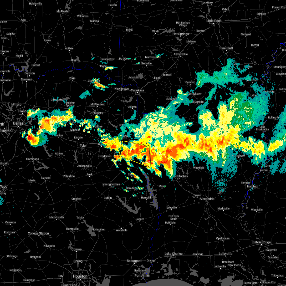 At 723 pm cdt, a severe thunderstorm was located over deberry, or 13 miles northeast of carthage, moving east at 25 mph (radar indicated). Hazards include 60 mph wind gusts and quarter size hail. Hail damage to vehicles is expected. Expect wind damage to roofs, siding, and trees. At 723 pm cdt, a severe thunderstorm was located over deberry, or 13 miles northeast of carthage, moving east at 25 mph (radar indicated). Hazards include 60 mph wind gusts and quarter size hail. Hail damage to vehicles is expected. Expect wind damage to roofs, siding, and trees.
|
| 4/6/2018 6:40 PM CDT |
 At 639 pm cdt, a severe thunderstorm was located near mansfield, moving east at 35 mph (radar indicated). Hazards include 60 mph wind gusts and quarter size hail. Hail damage to vehicles is expected. Expect wind damage to roofs, siding, and trees. At 639 pm cdt, a severe thunderstorm was located near mansfield, moving east at 35 mph (radar indicated). Hazards include 60 mph wind gusts and quarter size hail. Hail damage to vehicles is expected. Expect wind damage to roofs, siding, and trees.
|
| 4/6/2018 6:24 PM CDT |
 At 623 pm cdt, a severe thunderstorm was located over elysian fields, or 15 miles northeast of carthage, moving east at 45 mph (radar indicated). Hazards include 60 mph wind gusts and quarter size hail. Hail damage to vehicles is expected. Expect wind damage to roofs, siding, and trees. At 623 pm cdt, a severe thunderstorm was located over elysian fields, or 15 miles northeast of carthage, moving east at 45 mph (radar indicated). Hazards include 60 mph wind gusts and quarter size hail. Hail damage to vehicles is expected. Expect wind damage to roofs, siding, and trees.
|
| 4/6/2018 6:07 PM CDT |
 At 607 pm cdt, a severe thunderstorm was located near joaquin, or 17 miles southeast of carthage, moving east at 40 mph (radar indicated). Hazards include 60 mph wind gusts and quarter size hail. Hail damage to vehicles is expected. Expect wind damage to roofs, siding, and trees. At 607 pm cdt, a severe thunderstorm was located near joaquin, or 17 miles southeast of carthage, moving east at 40 mph (radar indicated). Hazards include 60 mph wind gusts and quarter size hail. Hail damage to vehicles is expected. Expect wind damage to roofs, siding, and trees.
|
| 4/6/2018 6:07 PM CDT |
 The national weather service in shreveport has issued a * severe thunderstorm warning for. northwestern de soto parish in northwestern louisiana. southern caddo parish in northwestern louisiana. southeastern panola county in northeastern texas. Until 645 pm cdt. The national weather service in shreveport has issued a * severe thunderstorm warning for. northwestern de soto parish in northwestern louisiana. southern caddo parish in northwestern louisiana. southeastern panola county in northeastern texas. Until 645 pm cdt.
|
| 4/3/2018 5:00 PM CDT |
 At 459 pm cdt, severe thunderstorms were located along a line extending from 16 miles northeast of mansfield to near converse, moving east at 25 mph (radar indicated). Hazards include 60 mph wind gusts and quarter size hail. Hail damage to vehicles is expected. Expect wind damage to roofs, siding, and trees. At 459 pm cdt, severe thunderstorms were located along a line extending from 16 miles northeast of mansfield to near converse, moving east at 25 mph (radar indicated). Hazards include 60 mph wind gusts and quarter size hail. Hail damage to vehicles is expected. Expect wind damage to roofs, siding, and trees.
|
| 4/3/2018 4:32 PM CDT |
 At 431 pm cdt, a severe thunderstorm was located near mansfield, moving east at 50 mph (radar indicated). Hazards include 60 mph wind gusts and quarter size hail. Hail damage to vehicles is expected. expect wind damage to roofs, siding, and trees. Locations impacted include, carthage, center, mansfield, logansport, tenaha, timpson, joaquin, converse, shelbyville, oak grove, pleasant hill, huxley, south mansfield, gary city, keachi, grand cane, longstreet, stanley, keat chie and carmel. At 431 pm cdt, a severe thunderstorm was located near mansfield, moving east at 50 mph (radar indicated). Hazards include 60 mph wind gusts and quarter size hail. Hail damage to vehicles is expected. expect wind damage to roofs, siding, and trees. Locations impacted include, carthage, center, mansfield, logansport, tenaha, timpson, joaquin, converse, shelbyville, oak grove, pleasant hill, huxley, south mansfield, gary city, keachi, grand cane, longstreet, stanley, keat chie and carmel.
|
| 4/3/2018 4:31 PM CDT |
 At 430 pm cdt, severe thunderstorms were located along a line extending from near cullen to near minden to 14 miles east of stonewall, moving east northeast at 40 mph (radar indicated. at 400 pm, quarter size hail was reported in south shreveport. trees have also been blown down near the louisiana line with these storms). Hazards include 70 mph wind gusts and quarter size hail. Hail damage to vehicles is expected. expect considerable tree damage. Wind damage is also likely to mobile homes, roofs, and outbuildings. At 430 pm cdt, severe thunderstorms were located along a line extending from near cullen to near minden to 14 miles east of stonewall, moving east northeast at 40 mph (radar indicated. at 400 pm, quarter size hail was reported in south shreveport. trees have also been blown down near the louisiana line with these storms). Hazards include 70 mph wind gusts and quarter size hail. Hail damage to vehicles is expected. expect considerable tree damage. Wind damage is also likely to mobile homes, roofs, and outbuildings.
|
| 4/3/2018 4:15 PM CDT |
 At 415 pm cdt, severe thunderstorms were located along a line extending from 7 miles west of cotton valley to 6 miles north of eastwood to near haughton to near stonewall, moving east at 40 mph (radar indicated). Hazards include 70 mph wind gusts and quarter size hail. Hail damage to vehicles is expected. expect considerable tree damage. wind damage is also likely to mobile homes, roofs, and outbuildings. Locations impacted include, shreveport, bossier city, minden, springhill, homer, haughton, greenwood, blanchard, benton, stonewall, ringgold, sibley, cullen, cotton valley, gibsland, sarepta, doyline, dixie inn, dubberly and heflin. At 415 pm cdt, severe thunderstorms were located along a line extending from 7 miles west of cotton valley to 6 miles north of eastwood to near haughton to near stonewall, moving east at 40 mph (radar indicated). Hazards include 70 mph wind gusts and quarter size hail. Hail damage to vehicles is expected. expect considerable tree damage. wind damage is also likely to mobile homes, roofs, and outbuildings. Locations impacted include, shreveport, bossier city, minden, springhill, homer, haughton, greenwood, blanchard, benton, stonewall, ringgold, sibley, cullen, cotton valley, gibsland, sarepta, doyline, dixie inn, dubberly and heflin.
|
| 4/3/2018 4:02 PM CDT |
 At 401 pm cdt, a severe thunderstorm was located near tenaha, or 11 miles south of carthage, moving east at 40 mph (radar indicated). Hazards include 60 mph wind gusts and quarter size hail. Hail damage to vehicles is expected. Expect wind damage to roofs, siding, and trees. At 401 pm cdt, a severe thunderstorm was located near tenaha, or 11 miles south of carthage, moving east at 40 mph (radar indicated). Hazards include 60 mph wind gusts and quarter size hail. Hail damage to vehicles is expected. Expect wind damage to roofs, siding, and trees.
|
| 4/3/2018 3:48 PM CDT |
 At 347 pm cdt, a severe thunderstorm was located over greenwood, or 9 miles west of shreveport, moving east at 50 mph (radar indicated). Hazards include 70 mph wind gusts and quarter size hail. Hail damage to vehicles is expected. expect considerable tree damage. Wind damage is also likely to mobile homes, roofs, and outbuildings. At 347 pm cdt, a severe thunderstorm was located over greenwood, or 9 miles west of shreveport, moving east at 50 mph (radar indicated). Hazards include 70 mph wind gusts and quarter size hail. Hail damage to vehicles is expected. expect considerable tree damage. Wind damage is also likely to mobile homes, roofs, and outbuildings.
|
| 4/3/2018 3:21 PM CDT |
 At 320 pm cdt, a severe thunderstorm was located over deberry, or 14 miles northeast of carthage, moving northeast at 55 mph (radar indicated). Hazards include 60 mph wind gusts and quarter size hail. Hail damage to vehicles is expected. Expect wind damage to roofs, siding, and trees. At 320 pm cdt, a severe thunderstorm was located over deberry, or 14 miles northeast of carthage, moving northeast at 55 mph (radar indicated). Hazards include 60 mph wind gusts and quarter size hail. Hail damage to vehicles is expected. Expect wind damage to roofs, siding, and trees.
|
| 4/3/2018 3:21 PM CDT |
 The national weather service in shreveport has issued a * severe thunderstorm warning for. northwestern de soto parish in northwestern louisiana. southwestern caddo parish in northwestern louisiana. harrison county in northeastern texas. Panola county in northeastern texas. The national weather service in shreveport has issued a * severe thunderstorm warning for. northwestern de soto parish in northwestern louisiana. southwestern caddo parish in northwestern louisiana. harrison county in northeastern texas. Panola county in northeastern texas.
|
| 3/18/2018 8:44 PM CDT |
 At 844 pm cdt, a severe thunderstorm was located near joaquin, or 11 miles northeast of center, moving northeast at 25 mph (radar indicated). Hazards include 60 mph wind gusts and quarter size hail. Hail damage to vehicles is expected. Expect wind damage to roofs, siding, and trees. At 844 pm cdt, a severe thunderstorm was located near joaquin, or 11 miles northeast of center, moving northeast at 25 mph (radar indicated). Hazards include 60 mph wind gusts and quarter size hail. Hail damage to vehicles is expected. Expect wind damage to roofs, siding, and trees.
|
| 3/11/2018 2:12 AM CDT |
 At 112 am cst, a severe thunderstorm was located near elysian fields, or 19 miles northeast of carthage, moving southeast at 35 mph (radar indicated). Hazards include 70 mph wind gusts and half dollar size hail. Hail damage to vehicles is expected. expect considerable tree damage. Wind damage is also likely to mobile homes, roofs, and outbuildings. At 112 am cst, a severe thunderstorm was located near elysian fields, or 19 miles northeast of carthage, moving southeast at 35 mph (radar indicated). Hazards include 70 mph wind gusts and half dollar size hail. Hail damage to vehicles is expected. expect considerable tree damage. Wind damage is also likely to mobile homes, roofs, and outbuildings.
|
| 7/6/2017 6:00 PM CDT |
 At 559 pm cdt, a severe thunderstorm was located 7 miles northeast of logansport, or 12 miles west of mansfield, and is nearly stationary (radar indicated). Hazards include 60 mph wind gusts. expect damage to roofs, siding, and trees At 559 pm cdt, a severe thunderstorm was located 7 miles northeast of logansport, or 12 miles west of mansfield, and is nearly stationary (radar indicated). Hazards include 60 mph wind gusts. expect damage to roofs, siding, and trees
|
| 7/6/2017 5:20 PM CDT |
 At 520 pm cdt, a severe thunderstorm was located near stonewall, or 10 miles southwest of shreveport, moving east at 25 mph (radar indicated). Hazards include 60 mph wind gusts and nickel size hail. expect damage to roofs, siding, and trees At 520 pm cdt, a severe thunderstorm was located near stonewall, or 10 miles southwest of shreveport, moving east at 25 mph (radar indicated). Hazards include 60 mph wind gusts and nickel size hail. expect damage to roofs, siding, and trees
|
| 5/28/2017 6:22 PM CDT |
 At 622 pm cdt, severe thunderstorms were located along a line extending from 6 miles southeast of shreveport to near logansport, moving east at 40 mph (radar indicated). Hazards include 60 mph wind gusts and quarter size hail. Hail damage to vehicles is expected. Expect wind damage to roofs, siding, and trees. At 622 pm cdt, severe thunderstorms were located along a line extending from 6 miles southeast of shreveport to near logansport, moving east at 40 mph (radar indicated). Hazards include 60 mph wind gusts and quarter size hail. Hail damage to vehicles is expected. Expect wind damage to roofs, siding, and trees.
|
| 5/28/2017 6:22 PM CDT |
 The national weather service in shreveport has issued a * severe thunderstorm warning for. southwestern webster parish in northwestern louisiana. de soto parish in northwestern louisiana. northwestern red river parish in northwestern louisiana. Southeastern caddo parish in northwestern louisiana. The national weather service in shreveport has issued a * severe thunderstorm warning for. southwestern webster parish in northwestern louisiana. de soto parish in northwestern louisiana. northwestern red river parish in northwestern louisiana. Southeastern caddo parish in northwestern louisiana.
|
| 5/28/2017 5:52 PM CDT |
 At 551 pm cdt, a severe thunderstorm was located over deberry, or 13 miles northeast of carthage, moving southeast at 35 mph (radar indicated). Hazards include 60 mph wind gusts and quarter size hail. Hail damage to vehicles is expected. Expect wind damage to roofs, siding, and trees. At 551 pm cdt, a severe thunderstorm was located over deberry, or 13 miles northeast of carthage, moving southeast at 35 mph (radar indicated). Hazards include 60 mph wind gusts and quarter size hail. Hail damage to vehicles is expected. Expect wind damage to roofs, siding, and trees.
|
| 5/3/2017 4:42 PM CDT |
 At 441 pm cdt, severe thunderstorms were located along a line extending from near waskom to joaquin, moving east at 65 mph (radar indicated). Hazards include 70 mph wind gusts and quarter size hail. Hail damage to vehicles is expected. expect considerable tree damage. Wind damage is also likely to mobile homes, roofs, and outbuildings. At 441 pm cdt, severe thunderstorms were located along a line extending from near waskom to joaquin, moving east at 65 mph (radar indicated). Hazards include 70 mph wind gusts and quarter size hail. Hail damage to vehicles is expected. expect considerable tree damage. Wind damage is also likely to mobile homes, roofs, and outbuildings.
|
| 4/2/2017 2:38 PM CDT |
 At 238 pm cdt, severe thunderstorms were located along a line extending from fosters to near mansfield to milam, moving northeast at 50 mph (radar indicated). Hazards include 60 mph wind gusts and quarter size hail. Hail damage to vehicles is expected. expect wind damage to roofs, siding, and trees. locations impacted include, mansfield, milam, san augustine, stonewall, zwolle, logansport, hemphill, pineland, converse, patroon, bland lake, rosevine, macune, oak grove, huxley, south mansfield, keachi, noble, grand cane and longstreet. a tornado watch remains in effect until 600 pm cdt for northwestern louisiana. A tornado watch also remains in effect until 900 pm cdt for northwestern louisiana, and eastern texas. At 238 pm cdt, severe thunderstorms were located along a line extending from fosters to near mansfield to milam, moving northeast at 50 mph (radar indicated). Hazards include 60 mph wind gusts and quarter size hail. Hail damage to vehicles is expected. expect wind damage to roofs, siding, and trees. locations impacted include, mansfield, milam, san augustine, stonewall, zwolle, logansport, hemphill, pineland, converse, patroon, bland lake, rosevine, macune, oak grove, huxley, south mansfield, keachi, noble, grand cane and longstreet. a tornado watch remains in effect until 600 pm cdt for northwestern louisiana. A tornado watch also remains in effect until 900 pm cdt for northwestern louisiana, and eastern texas.
|
| 4/2/2017 1:52 PM CDT |
 At 152 pm cdt, severe thunderstorms were located along a line extending from 7 miles south of deberry to near neuville to 8 miles northeast of rockland, moving northeast at 50 mph (radar indicated). Hazards include 60 mph wind gusts and quarter size hail. Hail damage to vehicles is expected. Expect wind damage to roofs, siding, and trees. At 152 pm cdt, severe thunderstorms were located along a line extending from 7 miles south of deberry to near neuville to 8 miles northeast of rockland, moving northeast at 50 mph (radar indicated). Hazards include 60 mph wind gusts and quarter size hail. Hail damage to vehicles is expected. Expect wind damage to roofs, siding, and trees.
|
| 4/2/2017 1:27 PM CDT |
 At 127 pm cdt, a severe thunderstorm capable of producing a tornado was located near deberry, or 19 miles southwest of shreveport, moving northeast at 50 mph (radar indicated rotation). Hazards include tornado. Flying debris will be dangerous to those caught without shelter. mobile homes will be damaged or destroyed. damage to roofs, windows, and vehicles will occur. tree damage is likely. this dangerous storm will be near, greenwood around 140 pm cdt. Other locations impacted by this tornadic thunderstorm include midyett, keithville, front, spring ridge, cross lake, forbing and keachi. At 127 pm cdt, a severe thunderstorm capable of producing a tornado was located near deberry, or 19 miles southwest of shreveport, moving northeast at 50 mph (radar indicated rotation). Hazards include tornado. Flying debris will be dangerous to those caught without shelter. mobile homes will be damaged or destroyed. damage to roofs, windows, and vehicles will occur. tree damage is likely. this dangerous storm will be near, greenwood around 140 pm cdt. Other locations impacted by this tornadic thunderstorm include midyett, keithville, front, spring ridge, cross lake, forbing and keachi.
|
| 4/2/2017 1:02 PM CDT |
 At 102 pm cdt, a severe thunderstorm capable of producing a tornado was located near carthage, moving northeast at 50 mph (radar indicated rotation). Hazards include tornado. Flying debris will be dangerous to those caught without shelter. mobile homes will be damaged or destroyed. damage to roofs, windows, and vehicles will occur. tree damage is likely. this dangerous storm will be near, deberry around 120 pm cdt. greenwood around 140 pm cdt. Other locations impacted by this tornadic thunderstorm include midyett, keithville, deadwood, front, spring ridge, woods, cross lake, gary city, forbing and keachi. At 102 pm cdt, a severe thunderstorm capable of producing a tornado was located near carthage, moving northeast at 50 mph (radar indicated rotation). Hazards include tornado. Flying debris will be dangerous to those caught without shelter. mobile homes will be damaged or destroyed. damage to roofs, windows, and vehicles will occur. tree damage is likely. this dangerous storm will be near, deberry around 120 pm cdt. greenwood around 140 pm cdt. Other locations impacted by this tornadic thunderstorm include midyett, keithville, deadwood, front, spring ridge, woods, cross lake, gary city, forbing and keachi.
|
| 4/2/2017 12:37 PM CDT |
 The tornado warning for northwestern de soto parish will expire at 1245 pm cdt, the storm which prompted the warning has weakened below severe limits, and no longer appears capable of producing a tornado. therefore the warning will be allowed to expire. a tornado watch remains in effect until 600 pm cdt for northwestern louisiana. remember, a severe thunderstorm warning still remains in effect for northern de soto parish. The tornado warning for northwestern de soto parish will expire at 1245 pm cdt, the storm which prompted the warning has weakened below severe limits, and no longer appears capable of producing a tornado. therefore the warning will be allowed to expire. a tornado watch remains in effect until 600 pm cdt for northwestern louisiana. remember, a severe thunderstorm warning still remains in effect for northern de soto parish.
|
| 4/2/2017 12:29 PM CDT |
 At 1229 pm cdt, a severe thunderstorm was located near stonewall, or 16 miles northwest of mansfield, moving northeast at 50 mph (radar indicated). Hazards include 70 mph wind gusts and quarter size hail. Hail damage to vehicles is expected. expect considerable tree damage. Wind damage is also likely to mobile homes, roofs, and outbuildings. At 1229 pm cdt, a severe thunderstorm was located near stonewall, or 16 miles northwest of mansfield, moving northeast at 50 mph (radar indicated). Hazards include 70 mph wind gusts and quarter size hail. Hail damage to vehicles is expected. expect considerable tree damage. Wind damage is also likely to mobile homes, roofs, and outbuildings.
|
| 4/2/2017 12:20 PM CDT |
 At 1220 pm cdt, severe thunderstorms were located along a line extending from near waskom to near stonewall to 8 miles west of mansfield, moving northeast at 45 mph (radar indicated). Hazards include 70 mph wind gusts and quarter size hail. Hail damage to vehicles is expected. expect considerable tree damage. wind damage is also likely to mobile homes, roofs, and outbuildings. locations impacted include, shreveport, mansfield, greenwood, blanchard, waskom, stonewall, logansport, south mansfield, keachi, grand cane, longstreet, stanley, gloster, keat chie, carmel, frierson, spring ridge, cross lake, kingston and kickapoo. A tornado watch remains in effect until 600 pm cdt for northwestern louisiana, and eastern and northeastern texas. At 1220 pm cdt, severe thunderstorms were located along a line extending from near waskom to near stonewall to 8 miles west of mansfield, moving northeast at 45 mph (radar indicated). Hazards include 70 mph wind gusts and quarter size hail. Hail damage to vehicles is expected. expect considerable tree damage. wind damage is also likely to mobile homes, roofs, and outbuildings. locations impacted include, shreveport, mansfield, greenwood, blanchard, waskom, stonewall, logansport, south mansfield, keachi, grand cane, longstreet, stanley, gloster, keat chie, carmel, frierson, spring ridge, cross lake, kingston and kickapoo. A tornado watch remains in effect until 600 pm cdt for northwestern louisiana, and eastern and northeastern texas.
|
| 4/2/2017 12:18 PM CDT |
 At 1217 pm cdt, a severe thunderstorm capable of producing a tornado was located near logansport, or 14 miles west of mansfield, moving northeast at 40 mph (radar indicated rotation). Hazards include tornado and quarter size hail. Flying debris will be dangerous to those caught without shelter. mobile homes will be damaged or destroyed. damage to roofs, windows, and vehicles will occur. tree damage is likely. this dangerous storm will be near, stonewall around 1245 pm cdt. Other locations impacted by this tornadic thunderstorm include gloster, keat chie, carmel, kickapoo, keachi, grand cane, longstreet, reeds store and stanley. At 1217 pm cdt, a severe thunderstorm capable of producing a tornado was located near logansport, or 14 miles west of mansfield, moving northeast at 40 mph (radar indicated rotation). Hazards include tornado and quarter size hail. Flying debris will be dangerous to those caught without shelter. mobile homes will be damaged or destroyed. damage to roofs, windows, and vehicles will occur. tree damage is likely. this dangerous storm will be near, stonewall around 1245 pm cdt. Other locations impacted by this tornadic thunderstorm include gloster, keat chie, carmel, kickapoo, keachi, grand cane, longstreet, reeds store and stanley.
|
| 4/2/2017 12:07 PM CDT |
 At 1206 pm cdt, severe thunderstorms were located along a line extending from near waskom to 12 miles southeast of deberry to near logansport, moving northeast at 45 mph (radar indicated). Hazards include 70 mph wind gusts and quarter size hail. Hail damage to vehicles is expected. expect considerable tree damage. wind damage is also likely to mobile homes, roofs, and outbuildings. locations impacted include, shreveport, mansfield, greenwood, blanchard, waskom, stonewall, logansport, joaquin, deberry, elysian fields, south mansfield, keachi, grand cane, longstreet, stanley, keat chie, carmel, front, spring ridge and cross lake. A tornado watch remains in effect until 600 pm cdt for northwestern louisiana, and eastern and northeastern texas. At 1206 pm cdt, severe thunderstorms were located along a line extending from near waskom to 12 miles southeast of deberry to near logansport, moving northeast at 45 mph (radar indicated). Hazards include 70 mph wind gusts and quarter size hail. Hail damage to vehicles is expected. expect considerable tree damage. wind damage is also likely to mobile homes, roofs, and outbuildings. locations impacted include, shreveport, mansfield, greenwood, blanchard, waskom, stonewall, logansport, joaquin, deberry, elysian fields, south mansfield, keachi, grand cane, longstreet, stanley, keat chie, carmel, front, spring ridge and cross lake. A tornado watch remains in effect until 600 pm cdt for northwestern louisiana, and eastern and northeastern texas.
|
| 4/2/2017 12:03 PM CDT |
 At 1203 pm cdt, a severe thunderstorm capable of producing a tornado was located over joaquin, or 11 miles northeast of center, moving northeast at 40 mph (radar indicated rotation). Hazards include tornado and quarter size hail. Flying debris will be dangerous to those caught without shelter. mobile homes will be damaged or destroyed. damage to roofs, windows, and vehicles will occur. tree damage is likely. this dangerous storm will be near, logansport around 1210 pm cdt. stonewall around 1245 pm cdt. Other locations impacted by this tornadic thunderstorm include gloster, keat chie, carmel, kickapoo, stanley, james, keachi, grand cane, south mansfield and kingston. At 1203 pm cdt, a severe thunderstorm capable of producing a tornado was located over joaquin, or 11 miles northeast of center, moving northeast at 40 mph (radar indicated rotation). Hazards include tornado and quarter size hail. Flying debris will be dangerous to those caught without shelter. mobile homes will be damaged or destroyed. damage to roofs, windows, and vehicles will occur. tree damage is likely. this dangerous storm will be near, logansport around 1210 pm cdt. stonewall around 1245 pm cdt. Other locations impacted by this tornadic thunderstorm include gloster, keat chie, carmel, kickapoo, stanley, james, keachi, grand cane, south mansfield and kingston.
|
| 4/2/2017 11:56 AM CDT |
 At 1156 am cdt, a tornado producing storm was located near joaquin, or 8 miles northeast of center, moving northeast at 40 mph (radar confirmed tornado). Hazards include damaging tornado and quarter size hail. Flying debris will be dangerous to those caught without shelter. mobile homes will be damaged or destroyed. damage to roofs, windows, and vehicles will occur. tree damage is likely. this tornadic storm will be near, joaquin around 1205 pm cdt. logansport around 1210 pm cdt. stonewall around 1245 pm cdt. Other locations impacted by this tornadic thunderstorm include gloster, keat chie, carmel, kickapoo, stanley, james, keachi, grand cane, south mansfield and kingston. At 1156 am cdt, a tornado producing storm was located near joaquin, or 8 miles northeast of center, moving northeast at 40 mph (radar confirmed tornado). Hazards include damaging tornado and quarter size hail. Flying debris will be dangerous to those caught without shelter. mobile homes will be damaged or destroyed. damage to roofs, windows, and vehicles will occur. tree damage is likely. this tornadic storm will be near, joaquin around 1205 pm cdt. logansport around 1210 pm cdt. stonewall around 1245 pm cdt. Other locations impacted by this tornadic thunderstorm include gloster, keat chie, carmel, kickapoo, stanley, james, keachi, grand cane, south mansfield and kingston.
|
| 4/2/2017 11:34 AM CDT | At 1133 am cdt, severe thunderstorms were located along a line extending from near carthage to near tenaha to near neuville, moving northeast at 45 mph (radar indicated). Hazards include 70 mph wind gusts and quarter size hail. Hail damage to vehicles is expected. expect considerable tree damage. Wind damage is also likely to mobile homes, roofs, and outbuildings. |
| 4/2/2017 11:34 AM CDT | At 1133 am cdt, severe thunderstorms were located along a line extending from near carthage to near tenaha to near neuville, moving northeast at 45 mph (radar indicated). Hazards include 70 mph wind gusts and quarter size hail. Hail damage to vehicles is expected. expect considerable tree damage. Wind damage is also likely to mobile homes, roofs, and outbuildings. |
| 3/24/2017 9:38 PM CDT |
 At 938 pm cdt, a severe thunderstorm was located near patroon, or 12 miles southeast of center, moving northeast at 50 mph (radar indicated). Hazards include 60 mph wind gusts. expect damage to roofs, siding, and trees At 938 pm cdt, a severe thunderstorm was located near patroon, or 12 miles southeast of center, moving northeast at 50 mph (radar indicated). Hazards include 60 mph wind gusts. expect damage to roofs, siding, and trees
|
| 8/16/2016 3:56 PM CDT |
 At 355 pm cdt, severe thunderstorms were located along a line extending from 6 miles southeast of carthage to 10 miles southeast of deberry to 6 miles south of stonewall, moving north at 25 mph (radar indicated). Hazards include 60 mph wind gusts. Expect damage to roofs. siding. And trees. At 355 pm cdt, severe thunderstorms were located along a line extending from 6 miles southeast of carthage to 10 miles southeast of deberry to 6 miles south of stonewall, moving north at 25 mph (radar indicated). Hazards include 60 mph wind gusts. Expect damage to roofs. siding. And trees.
|
| 6/18/2016 2:29 PM CDT |
 At 229 pm cdt, severe thunderstorms were located along a line extending from near mooringsport to 9 miles west of stonewall to 8 miles southeast of logansport, moving west at 20 mph (radar indicated). Hazards include 60 mph wind gusts. Expect damage to roofs. siding. and trees. Locations impacted include, shreveport, bossier city, greenwood, blanchard, benton, stonewall, logansport, mooringsport, fosters, south mansfield, keachi, grand cane, longstreet, stanley, bethany, dixie, ferguson, keat chie, kickapoo and gloster. At 229 pm cdt, severe thunderstorms were located along a line extending from near mooringsport to 9 miles west of stonewall to 8 miles southeast of logansport, moving west at 20 mph (radar indicated). Hazards include 60 mph wind gusts. Expect damage to roofs. siding. and trees. Locations impacted include, shreveport, bossier city, greenwood, blanchard, benton, stonewall, logansport, mooringsport, fosters, south mansfield, keachi, grand cane, longstreet, stanley, bethany, dixie, ferguson, keat chie, kickapoo and gloster.
|
| 6/18/2016 1:42 PM CDT |
 At 142 pm cdt, severe thunderstorms were located along a line extending from near fosters to 9 miles east of stonewall to 10 miles southwest of coushatta, moving west at 10 mph (radar indicated). Hazards include 60 mph wind gusts. Expect damage to roofs. siding. And trees. At 142 pm cdt, severe thunderstorms were located along a line extending from near fosters to 9 miles east of stonewall to 10 miles southwest of coushatta, moving west at 10 mph (radar indicated). Hazards include 60 mph wind gusts. Expect damage to roofs. siding. And trees.
|
| 5/1/2016 9:17 PM CDT |
 At 916 pm cdt, a severe thunderstorm was located 8 miles east of logansport, or near stanley, moving northeast at 20 mph (radar indicated). Hazards include 60 mph wind gusts and quarter size hail. Hail damage to vehicles is expected. expect wind damage to roofs, siding, and trees. Locations impacted include, mansfield, south mansfield, keachi, grand cane, longstreet, stanley, gloster, reeds store, keat chie and kickapoo. At 916 pm cdt, a severe thunderstorm was located 8 miles east of logansport, or near stanley, moving northeast at 20 mph (radar indicated). Hazards include 60 mph wind gusts and quarter size hail. Hail damage to vehicles is expected. expect wind damage to roofs, siding, and trees. Locations impacted include, mansfield, south mansfield, keachi, grand cane, longstreet, stanley, gloster, reeds store, keat chie and kickapoo.
|
| 5/1/2016 9:03 PM CDT |
 At 903 pm cdt, a severe thunderstorm was located near logansport, or 4 miles southwest of stanley, moving northeast at 20 mph (radar indicated). Hazards include 60 mph wind gusts and half dollar size hail. Hail damage to vehicles is expected. Expect wind damage to roofs, siding, and trees. At 903 pm cdt, a severe thunderstorm was located near logansport, or 4 miles southwest of stanley, moving northeast at 20 mph (radar indicated). Hazards include 60 mph wind gusts and half dollar size hail. Hail damage to vehicles is expected. Expect wind damage to roofs, siding, and trees.
|
| 1/8/2016 7:46 PM CST |
 At 746 pm cst, a severe thunderstorm was located 7 miles south of stonewall, or 9 miles northwest of mansfield, moving northeast at 30 mph. quarter size hail was reported 3 miles northwest of grand cane around 735 pm. another strong thunderstorm was indicated over northeast shelby county about 7 miles northeast of center, and will move into southwest desoto parish in the next few minutes. this storm may also become severe, and produce large hail (radar indicated). Hazards include golf ball size hail. People and animals outdoors will be injured. expect damage to roofs, siding, windows, and vehicles. Locations impacted include, mansfield, stonewall, logansport, south mansfield, keachi, grand cane, longstreet, stanley, gloster, reeds store, keat chie, frierson, kingston and kickapoo. At 746 pm cst, a severe thunderstorm was located 7 miles south of stonewall, or 9 miles northwest of mansfield, moving northeast at 30 mph. quarter size hail was reported 3 miles northwest of grand cane around 735 pm. another strong thunderstorm was indicated over northeast shelby county about 7 miles northeast of center, and will move into southwest desoto parish in the next few minutes. this storm may also become severe, and produce large hail (radar indicated). Hazards include golf ball size hail. People and animals outdoors will be injured. expect damage to roofs, siding, windows, and vehicles. Locations impacted include, mansfield, stonewall, logansport, south mansfield, keachi, grand cane, longstreet, stanley, gloster, reeds store, keat chie, frierson, kingston and kickapoo.
|
| 1/8/2016 7:15 PM CST |
 At 715 pm cst, a severe thunderstorm was located between logansport and stanley, or 12 miles west of mansfield, moving northeast at 30 mph (radar indicated). Hazards include half dollar size hail. damage to vehicles is expected At 715 pm cst, a severe thunderstorm was located between logansport and stanley, or 12 miles west of mansfield, moving northeast at 30 mph (radar indicated). Hazards include half dollar size hail. damage to vehicles is expected
|
| 6/29/2015 4:22 PM CDT |
 At 422 pm cdt, a severe thunderstorm was located 7 miles south of stonewall, or 11 miles northwest of mansfield, moving southeast at 15 mph (radar indicated). Hazards include 60 mph wind gusts. Expect damage to roofs. Siding and trees. At 422 pm cdt, a severe thunderstorm was located 7 miles south of stonewall, or 11 miles northwest of mansfield, moving southeast at 15 mph (radar indicated). Hazards include 60 mph wind gusts. Expect damage to roofs. Siding and trees.
|
| 5/30/2015 10:46 AM CDT | At 1043 am cdt, a severe thunderstorm was located over shreveport, moving northeast at 45 mph (radar indicated). Hazards include 60 mph wind gusts. Expect damage to roofs. siding and trees. Locations impacted include, shreveport, bossier city, haughton, greenwood, blanchard, waskom, benton, stonewall, elysian fields, fosters, eastwood, deberry, keachi, front, mc dade, robson, ferguson, keat chie, ninock and bellevue. |
| 5/30/2015 10:46 AM CDT | At 1043 am cdt, a severe thunderstorm was located over shreveport, moving northeast at 45 mph (radar indicated). Hazards include 60 mph wind gusts. Expect damage to roofs. siding and trees. Locations impacted include, shreveport, bossier city, haughton, greenwood, blanchard, waskom, benton, stonewall, elysian fields, fosters, eastwood, deberry, keachi, front, mc dade, robson, ferguson, keat chie, ninock and bellevue. |
| 5/30/2015 10:25 AM CDT | At 1023 am cdt, a severe thunderstorm was located near greenwood louisiana and just south of waskom texas, or 15 miles west of shreveport, moving northeast at 40 mph (radar indicated). Hazards include 60 mph wind gusts. Expect damage to roofs. Siding and trees. |
| 5/30/2015 10:25 AM CDT | At 1023 am cdt, a severe thunderstorm was located near greenwood louisiana and just south of waskom texas, or 15 miles west of shreveport, moving northeast at 40 mph (radar indicated). Hazards include 60 mph wind gusts. Expect damage to roofs. Siding and trees. |
| 5/25/2015 8:15 PM CDT | At 814 pm cdt, severe thunderstorms were located along a line extending from 6 miles northeast of plain dealing to 8 miles west of cotton valley to 6 miles southeast of shreveport to 11 miles west of converse to 9 miles south of macune, moving east at 65 mph (radar indicated). Hazards include 70 mph wind gusts and quarter size hail. Hail damage to vehicles is expected. expect considerable tree damage. wind damage is also likely to mobile homes, roofs and outbuildings. locations impacted include, shreveport, bossier city, center, mansfield, milam, haughton, greenwood, blanchard, huntington, san augustine, benton, stonewall, zwolle, logansport, hemphill, plain dealing, pineland, mooringsport, converse and hosston. a tornado watch remains in effect until 1000 pm cdt for eastern texas. A tornado watch also remains in effect until 200 am cdt for northwestern louisiana and eastern texas. |
| 5/25/2015 8:15 PM CDT | At 814 pm cdt, severe thunderstorms were located along a line extending from 6 miles northeast of plain dealing to 8 miles west of cotton valley to 6 miles southeast of shreveport to 11 miles west of converse to 9 miles south of macune, moving east at 65 mph (radar indicated). Hazards include 70 mph wind gusts and quarter size hail. Hail damage to vehicles is expected. expect considerable tree damage. wind damage is also likely to mobile homes, roofs and outbuildings. locations impacted include, shreveport, bossier city, center, mansfield, milam, haughton, greenwood, blanchard, huntington, san augustine, benton, stonewall, zwolle, logansport, hemphill, plain dealing, pineland, mooringsport, converse and hosston. a tornado watch remains in effect until 1000 pm cdt for eastern texas. A tornado watch also remains in effect until 200 am cdt for northwestern louisiana and eastern texas. |
| 5/25/2015 7:52 PM CDT | At 751 pm cdt, severe thunderstorms were located along a line extending from near hosston to near belcher to 7 miles east of deberry to center to near huntington, moving east at 65 mph (radar indicated). Hazards include 70 mph wind gusts and quarter size hail. Hail damage to vehicles is expected. expect considerable tree damage. wind damage is also likely to mobile homes, roofs and outbuildings. locations impacted include, shreveport, bossier city, lufkin, marshall, carthage, center, mansfield, milam, vivian, haughton, greenwood, blanchard, waskom, huntington, san augustine, benton, stonewall, zwolle, logansport and hemphill. a tornado watch remains in effect until 1000 pm cdt for northeastern texas. A tornado watch also remains in effect until 200 am cdt for northwestern louisiana and eastern texas. |
| 5/25/2015 7:52 PM CDT | At 751 pm cdt, severe thunderstorms were located along a line extending from near hosston to near belcher to 7 miles east of deberry to center to near huntington, moving east at 65 mph (radar indicated). Hazards include 70 mph wind gusts and quarter size hail. Hail damage to vehicles is expected. expect considerable tree damage. wind damage is also likely to mobile homes, roofs and outbuildings. locations impacted include, shreveport, bossier city, lufkin, marshall, carthage, center, mansfield, milam, vivian, haughton, greenwood, blanchard, waskom, huntington, san augustine, benton, stonewall, zwolle, logansport and hemphill. a tornado watch remains in effect until 1000 pm cdt for northeastern texas. A tornado watch also remains in effect until 200 am cdt for northwestern louisiana and eastern texas. |
| 5/25/2015 7:36 PM CDT | At 735 pm cdt, a severe thunderstorm capable of producing a tornado was located near deberry, or 11 miles north of carthage, moving east northeast at 40 mph (radar indicated rotation). Hazards include tornado. Flying debris will be dangerous to those caught without shelter. mobile homes will be damaged or destroyed. damage to roofs, windows and vehicles will occur. tree damage is likely. this dangerous storm will be near, deberry around 740 pm cdt. elysian fields around 745 pm cdt. waskom around 755 pm cdt. greenwood around 800 pm cdt. shreveport and bossier city and stonewall around 815 pm cdt. Other locations impacted by this tornadic thunderstorm include front, gloster, keachi, reeds store, forbing, midyett, keithville, keat chie, deadwood and frierson. |
| 5/25/2015 7:36 PM CDT | At 735 pm cdt, a severe thunderstorm capable of producing a tornado was located near deberry, or 11 miles north of carthage, moving east northeast at 40 mph (radar indicated rotation). Hazards include tornado. Flying debris will be dangerous to those caught without shelter. mobile homes will be damaged or destroyed. damage to roofs, windows and vehicles will occur. tree damage is likely. this dangerous storm will be near, deberry around 740 pm cdt. elysian fields around 745 pm cdt. waskom around 755 pm cdt. greenwood around 800 pm cdt. shreveport and bossier city and stonewall around 815 pm cdt. Other locations impacted by this tornadic thunderstorm include front, gloster, keachi, reeds store, forbing, midyett, keithville, keat chie, deadwood and frierson. |
| 5/25/2015 7:27 PM CDT | At 726 pm cdt, severe thunderstorms were located along a line extending from berea to near woodlawn to 8 miles northeast of beckville to near garrison to diboll, moving east at 65 mph (radar indicated). Hazards include 70 mph wind gusts and quarter size hail. Hail damage to vehicles is expected. expect considerable tree damage. Wind damage is also likely to mobile homes, roofs and outbuildings. |
| 5/25/2015 7:27 PM CDT | At 726 pm cdt, severe thunderstorms were located along a line extending from berea to near woodlawn to 8 miles northeast of beckville to near garrison to diboll, moving east at 65 mph (radar indicated). Hazards include 70 mph wind gusts and quarter size hail. Hail damage to vehicles is expected. expect considerable tree damage. Wind damage is also likely to mobile homes, roofs and outbuildings. |
| 5/11/2015 4:11 AM CDT | At 411 am cdt, strong to severe thunderstorms were located along a line extending from near belcher to 8 miles southeast of deberry to near garrison, moving east at 25 mph. these storms have shown a weakening trend over the last few minutes as they move into caddo and desoto parishes (radar indicated). Hazards include 60 mph wind gusts. Expect damage to roofs. siding and trees. these severe storms will be near, blanchard, mooringsport and belcher around 415 am cdt. shreveport around 420 am cdt. bossier city around 430 am cdt. other locations impacted by these severe thunderstorms include bethany, dixie, front, woods, keat chie, paxton, gary city, dotson, stanley and mount enterprise. a tornado watch remains in effect until 500 am cdt for northwestern louisiana and northeastern texas. 75in. |
| 5/11/2015 4:11 AM CDT | At 411 am cdt, strong to severe thunderstorms were located along a line extending from near belcher to 8 miles southeast of deberry to near garrison, moving east at 25 mph. these storms have shown a weakening trend over the last few minutes as they move into caddo and desoto parishes (radar indicated). Hazards include 60 mph wind gusts. Expect damage to roofs. siding and trees. these severe storms will be near, blanchard, mooringsport and belcher around 415 am cdt. shreveport around 420 am cdt. bossier city around 430 am cdt. other locations impacted by these severe thunderstorms include bethany, dixie, front, woods, keat chie, paxton, gary city, dotson, stanley and mount enterprise. a tornado watch remains in effect until 500 am cdt for northwestern louisiana and northeastern texas. 75in. |
| 5/11/2015 3:31 AM CDT | At 331 am cdt, severe thunderstorms were located along a line extending from near hallsville to near beckville to 8 miles south of minden, moving east at 45 mph (radar indicated. winds in excess of 60 mph...and trees have been blown down across rusk county). Hazards include 60 mph wind gusts. Expect damage to roofs. siding and trees. severe thunderstorms will be near, carthage around 335 am cdt. marshall, garrison and deberry around 345 am cdt. timpson and elysian fields around 350 am cdt. waskom around 400 am cdt. greenwood and tenaha around 405 am cdt. stonewall and mooringsport around 415 am cdt. blanchard around 420 am cdt. shreveport, logansport and joaquin around 425 am cdt. other locations impacted by these severe thunderstorms include bethany, dixie, front, woods, keat chie, cushing, lilbert, looneyville, paxton and gary city. a tornado watch remains in effect until 500 am cdt for northwestern louisiana and northeastern texas. 75in. |
| 5/11/2015 3:31 AM CDT | At 331 am cdt, severe thunderstorms were located along a line extending from near hallsville to near beckville to 8 miles south of minden, moving east at 45 mph (radar indicated. winds in excess of 60 mph...and trees have been blown down across rusk county). Hazards include 60 mph wind gusts. Expect damage to roofs. siding and trees. severe thunderstorms will be near, carthage around 335 am cdt. marshall, garrison and deberry around 345 am cdt. timpson and elysian fields around 350 am cdt. waskom around 400 am cdt. greenwood and tenaha around 405 am cdt. stonewall and mooringsport around 415 am cdt. blanchard around 420 am cdt. shreveport, logansport and joaquin around 425 am cdt. other locations impacted by these severe thunderstorms include bethany, dixie, front, woods, keat chie, cushing, lilbert, looneyville, paxton and gary city. a tornado watch remains in effect until 500 am cdt for northwestern louisiana and northeastern texas. 75in. |
| 4/24/2015 11:02 PM CDT | At 1101 pm cdt, severe thunderstorms were located along a line extending from 6 miles west of marshall to 6 miles east of tatum to near beckville to near pinehill to 6 miles northwest of trawick, moving east at 55 mph (radar indicated). Hazards include 70 mph wind gusts and quarter size hail. Hail damage to vehicles is expected. expect considerable tree damage. wind damage is also likely to mobile homes, roofs and outbuildings. severe thunderstorms will be near, beckville around 1105 pm cdt. marshall and carthage around 1110 pm cdt. garrison, deberry and elysian fields around 1120 pm cdt. waskom and tenaha around 1125 pm cdt. greenwood, logansport and joaquin around 1135 pm cdt. stonewall around 1145 pm cdt. mansfield around 1155 pm cdt. other locations impacted by these severe thunderstorms include front, jericho, woods, keat chie, paxton, gary city, dotson, stanley, mount enterprise and oak ridge. a tornado watch remains in effect until 400 am cdt for northwestern louisiana and northeastern texas. Possible. |
| 4/24/2015 11:02 PM CDT | At 1101 pm cdt, severe thunderstorms were located along a line extending from 6 miles west of marshall to 6 miles east of tatum to near beckville to near pinehill to 6 miles northwest of trawick, moving east at 55 mph (radar indicated). Hazards include 70 mph wind gusts and quarter size hail. Hail damage to vehicles is expected. expect considerable tree damage. wind damage is also likely to mobile homes, roofs and outbuildings. severe thunderstorms will be near, beckville around 1105 pm cdt. marshall and carthage around 1110 pm cdt. garrison, deberry and elysian fields around 1120 pm cdt. waskom and tenaha around 1125 pm cdt. greenwood, logansport and joaquin around 1135 pm cdt. stonewall around 1145 pm cdt. mansfield around 1155 pm cdt. other locations impacted by these severe thunderstorms include front, jericho, woods, keat chie, paxton, gary city, dotson, stanley, mount enterprise and oak ridge. a tornado watch remains in effect until 400 am cdt for northwestern louisiana and northeastern texas. Possible. |
| 4/24/2015 10:32 PM CDT | At 1032 pm cdt, a severe thunderstorm was located near haughton, or 10 miles southeast of bossier city, moving east at 50 mph (radar indicated). Hazards include 60 mph wind gusts. Expect damage to roofs. Siding and trees. |
| 4/24/2015 10:32 PM CDT | At 1032 pm cdt, a severe thunderstorm was located near haughton, or 10 miles southeast of bossier city, moving east at 50 mph (radar indicated). Hazards include 60 mph wind gusts. Expect damage to roofs. Siding and trees. |
| 4/24/2015 10:26 PM CDT | At 1024 pm cdt, a severe thunderstorm was located over bossier city , or 5 miles southeast of carthage, moving east at 50 mph (radar indicated). Hazards include 60 mph wind gusts and quarter size hail. Hail damage to vehicles is expected. expect wind damage to roofs, siding and trees. locations impacted include, shreveport, bossier city, henderson, carthage, greenwood, blanchard, stonewall, beckville, fosters, eastwood, minden, deberry, pinehill, mount enterprise, gary city, keachi, longstreet, front, robson and ferguson. a tornado watch remains in effect until 400 am cdt for northwestern louisiana and northeastern texas. 1. 00in. |
| 4/24/2015 10:26 PM CDT | At 1024 pm cdt, a severe thunderstorm was located over bossier city , or 5 miles southeast of carthage, moving east at 50 mph (radar indicated). Hazards include 60 mph wind gusts and quarter size hail. Hail damage to vehicles is expected. expect wind damage to roofs, siding and trees. locations impacted include, shreveport, bossier city, henderson, carthage, greenwood, blanchard, stonewall, beckville, fosters, eastwood, minden, deberry, pinehill, mount enterprise, gary city, keachi, longstreet, front, robson and ferguson. a tornado watch remains in effect until 400 am cdt for northwestern louisiana and northeastern texas. 1. 00in. |
| 4/24/2015 9:57 PM CDT | At 957 pm cdt, a severe thunderstorm was located near blanchard, or 12 miles northwest of shreveport, moving east at 65 mph (radar indicated). Hazards include 60 mph wind gusts and quarter size hail. Hail damage to vehicles is expected. Expect wind damage to roofs, siding and trees. |
| 4/24/2015 9:57 PM CDT | At 957 pm cdt, a severe thunderstorm was located near blanchard, or 12 miles northwest of shreveport, moving east at 65 mph (radar indicated). Hazards include 60 mph wind gusts and quarter size hail. Hail damage to vehicles is expected. Expect wind damage to roofs, siding and trees. |
| 10/6/2014 7:24 AM CDT | Numerous trees down in de soto county LA, 0.4 miles SSE of Keachi, LA |
| 1/1/0001 12:00 AM | Desoto fd reports trees down near four fork in de soto county LA, 1.3 miles SE of Keachi, LA |
| 1/1/0001 12:00 AM | Tree down on hwy in de soto county LA, 0.4 miles SSE of Keachi, LA |
Hail Maps for Keachi, LA
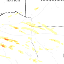

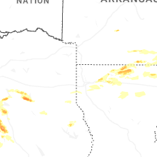
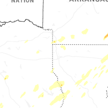


Connect with Interactive Hail Maps