

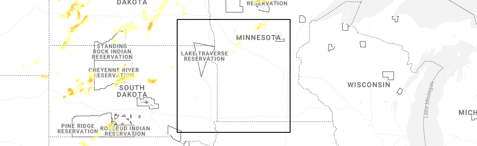
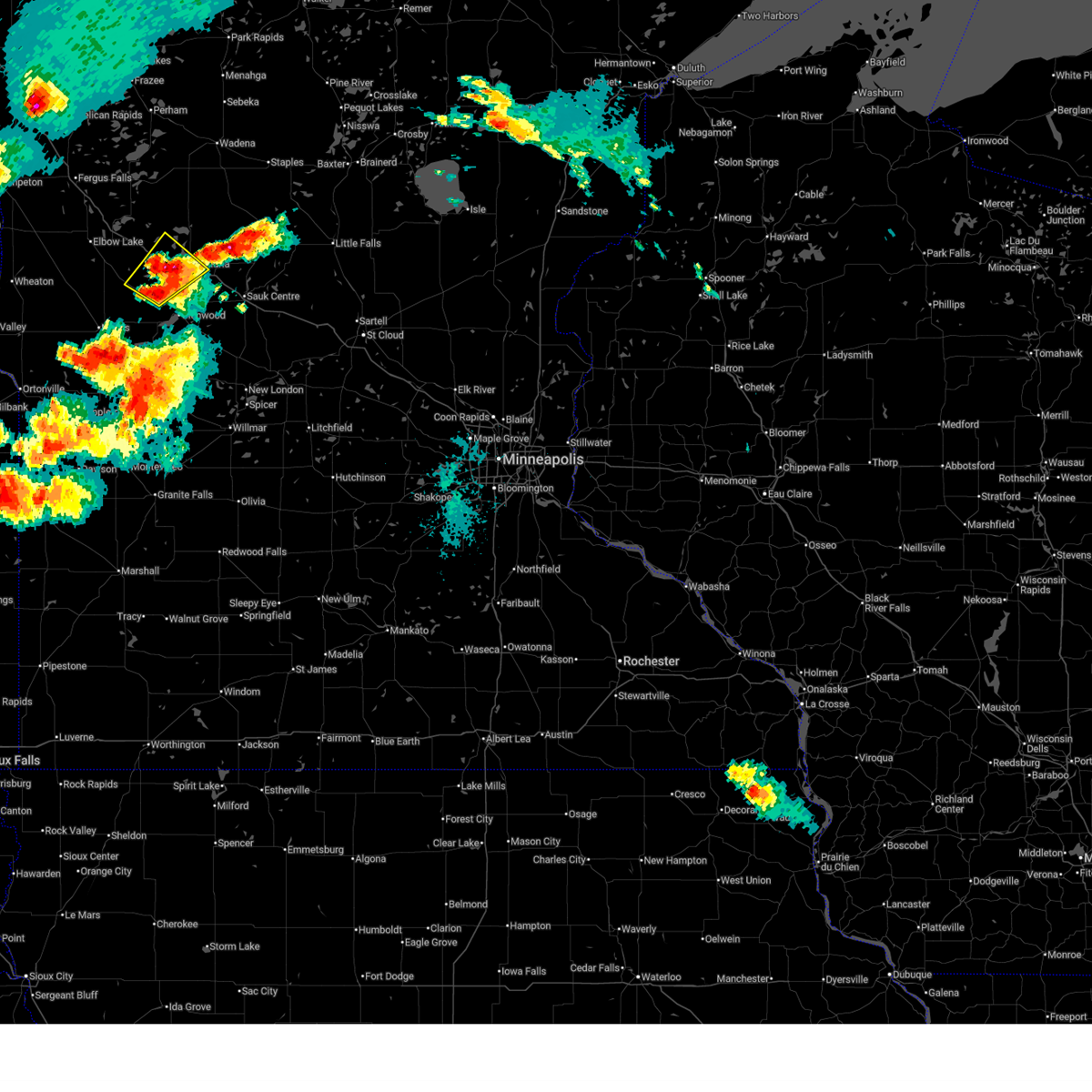
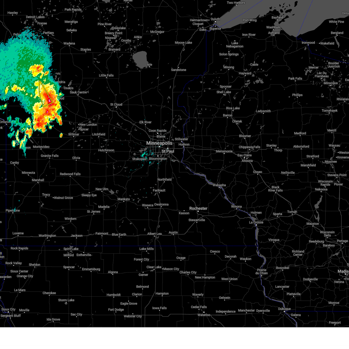
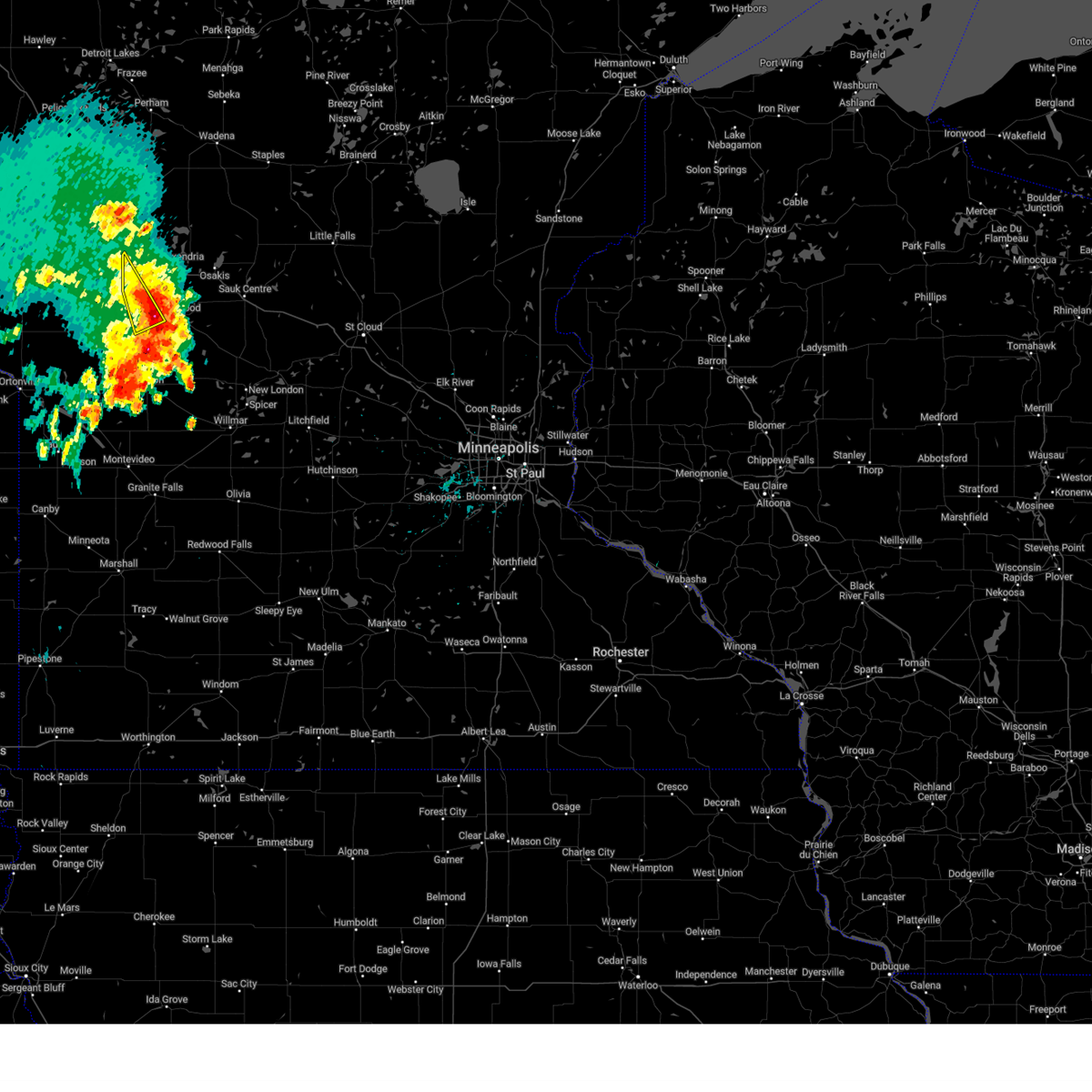
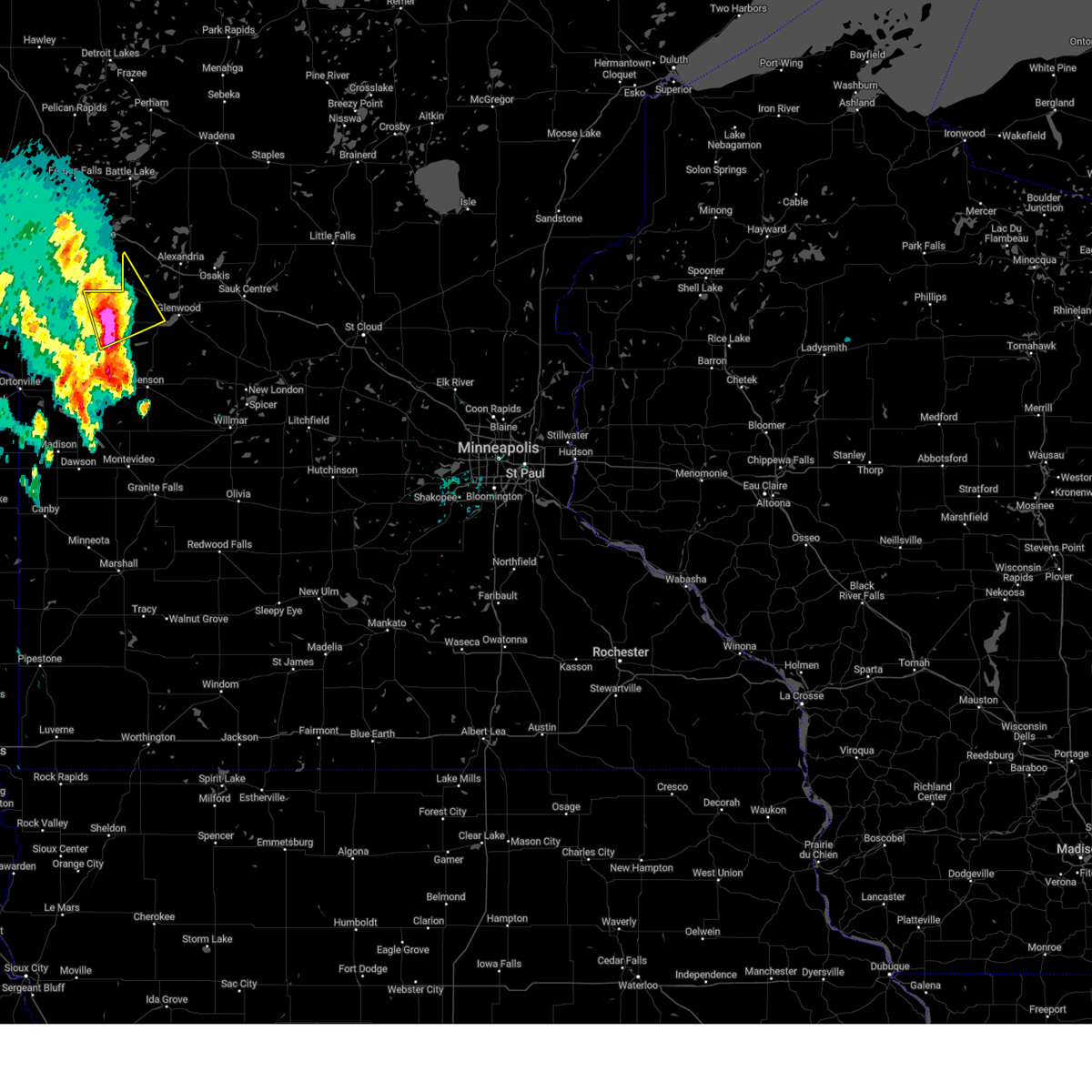
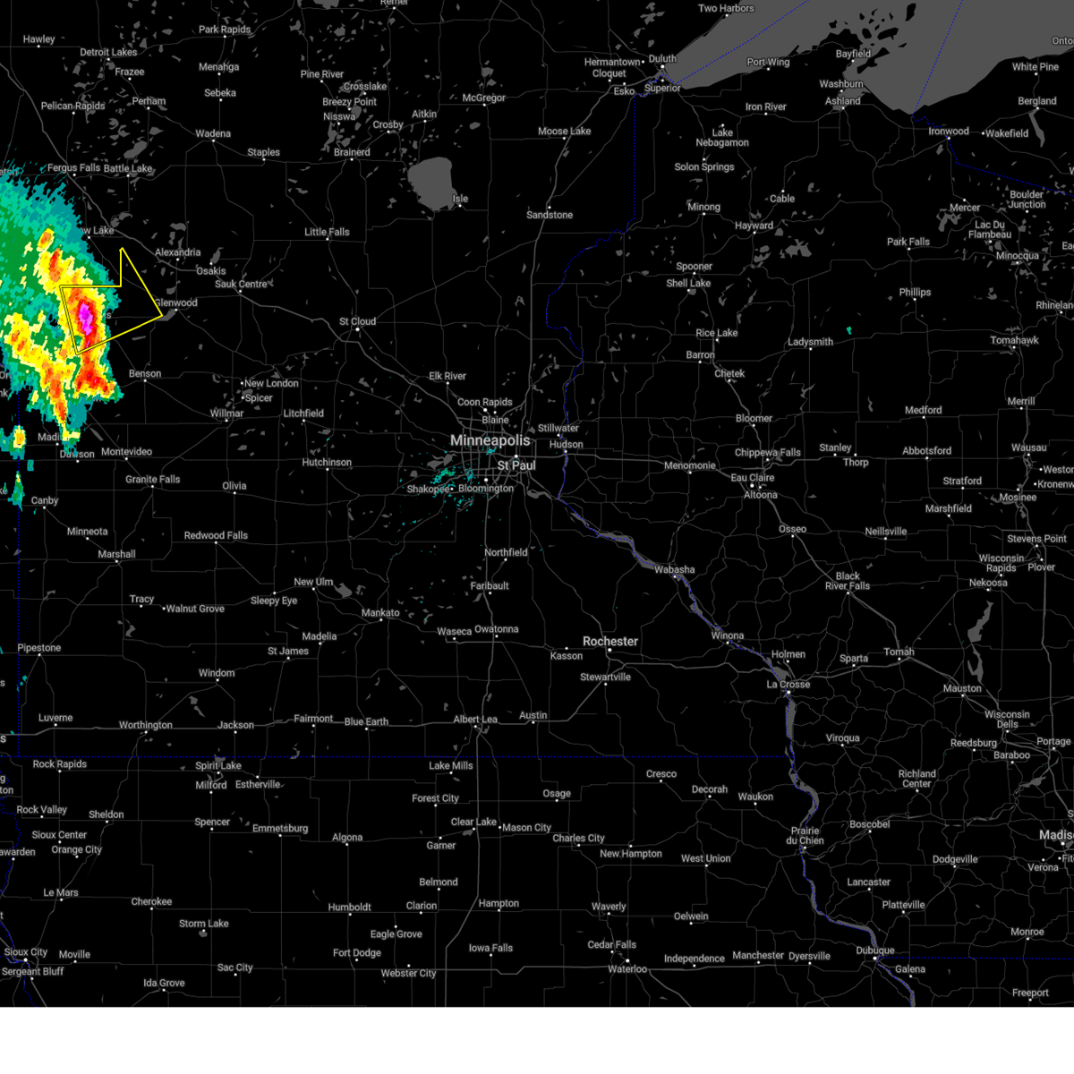
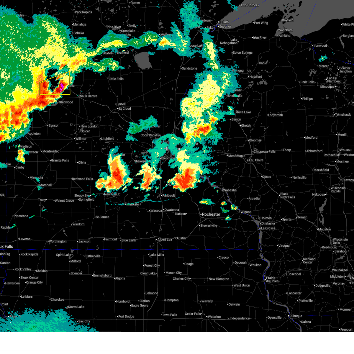
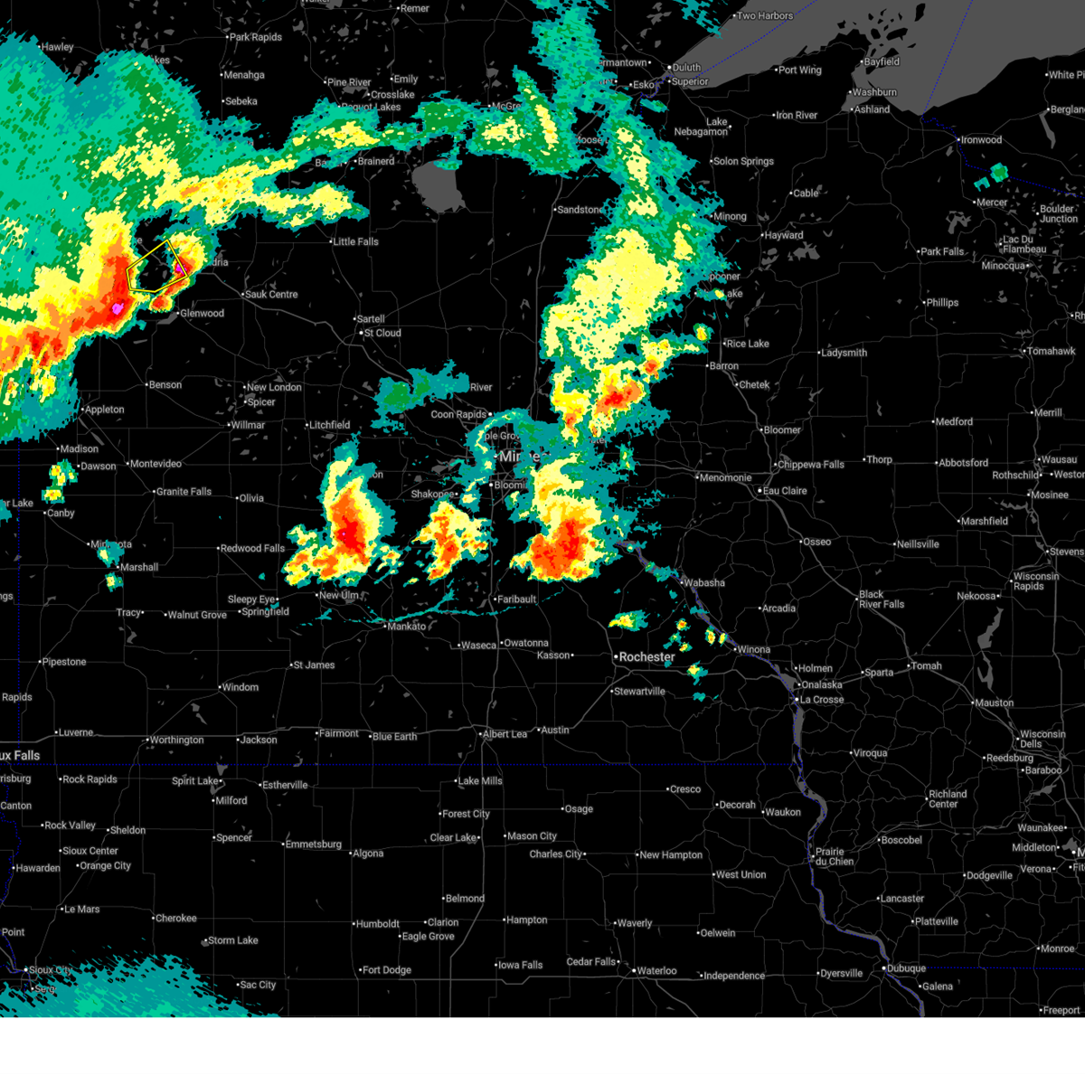
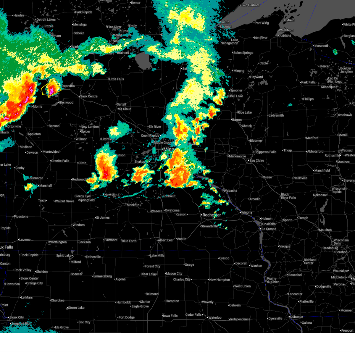
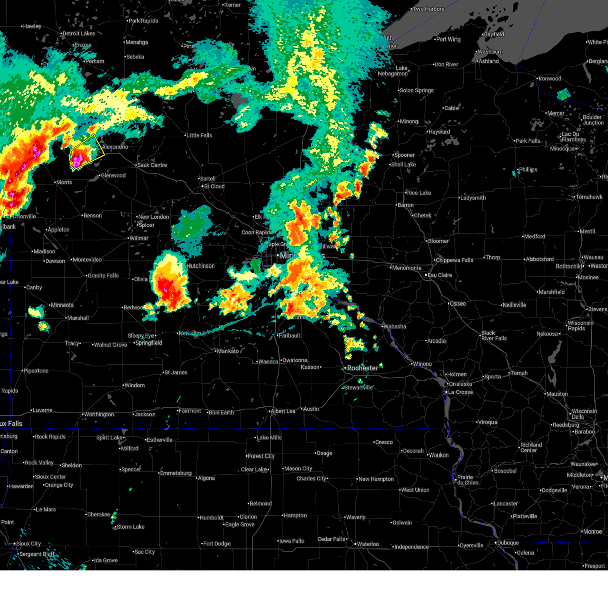
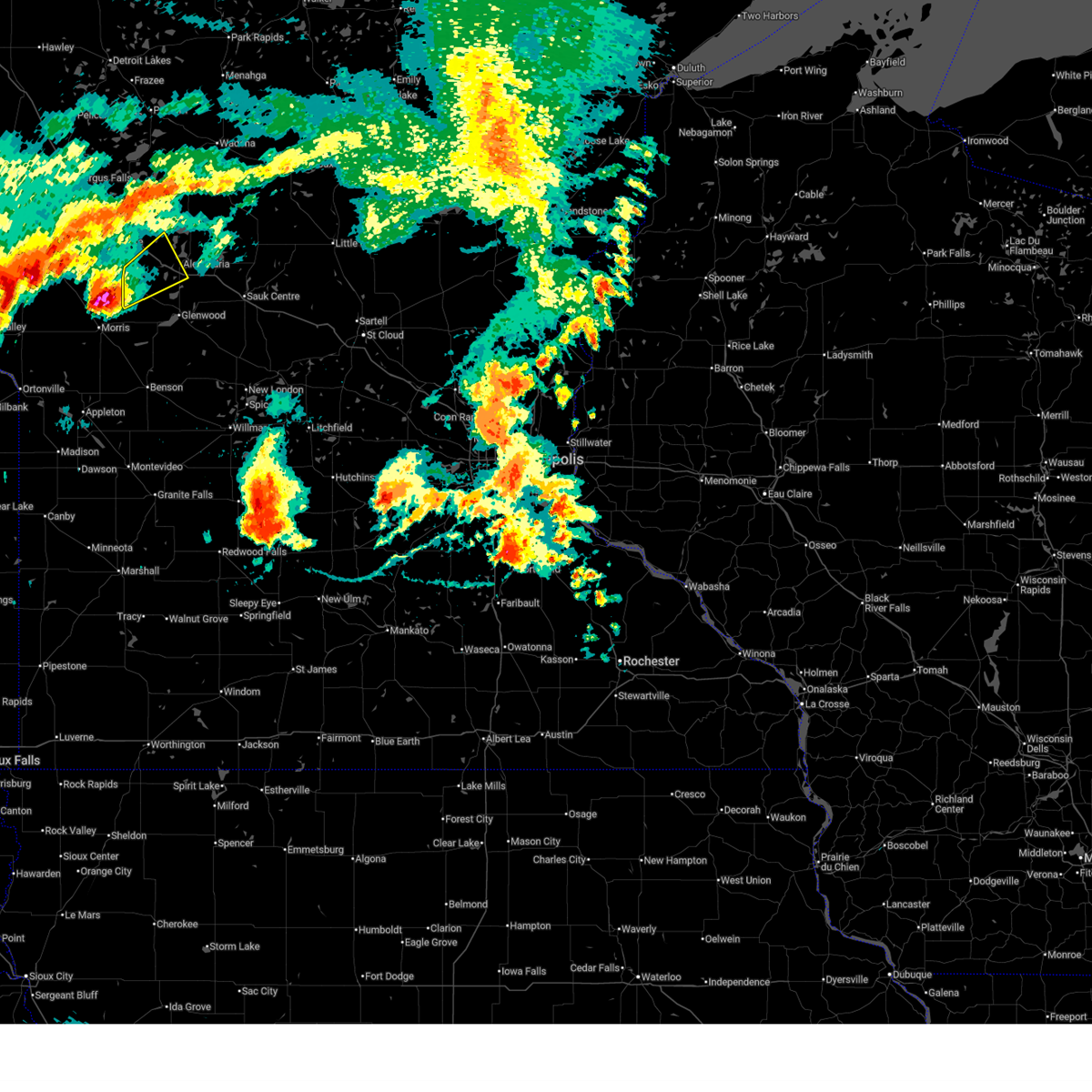
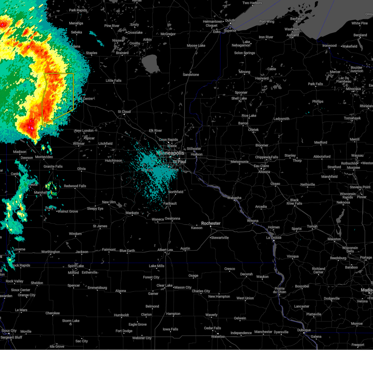
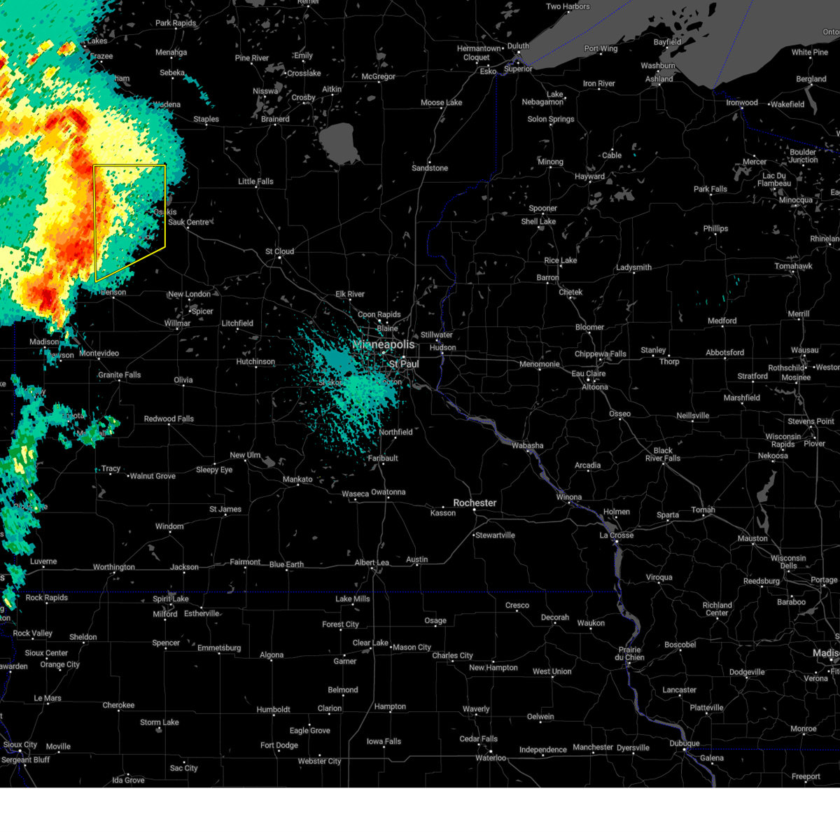
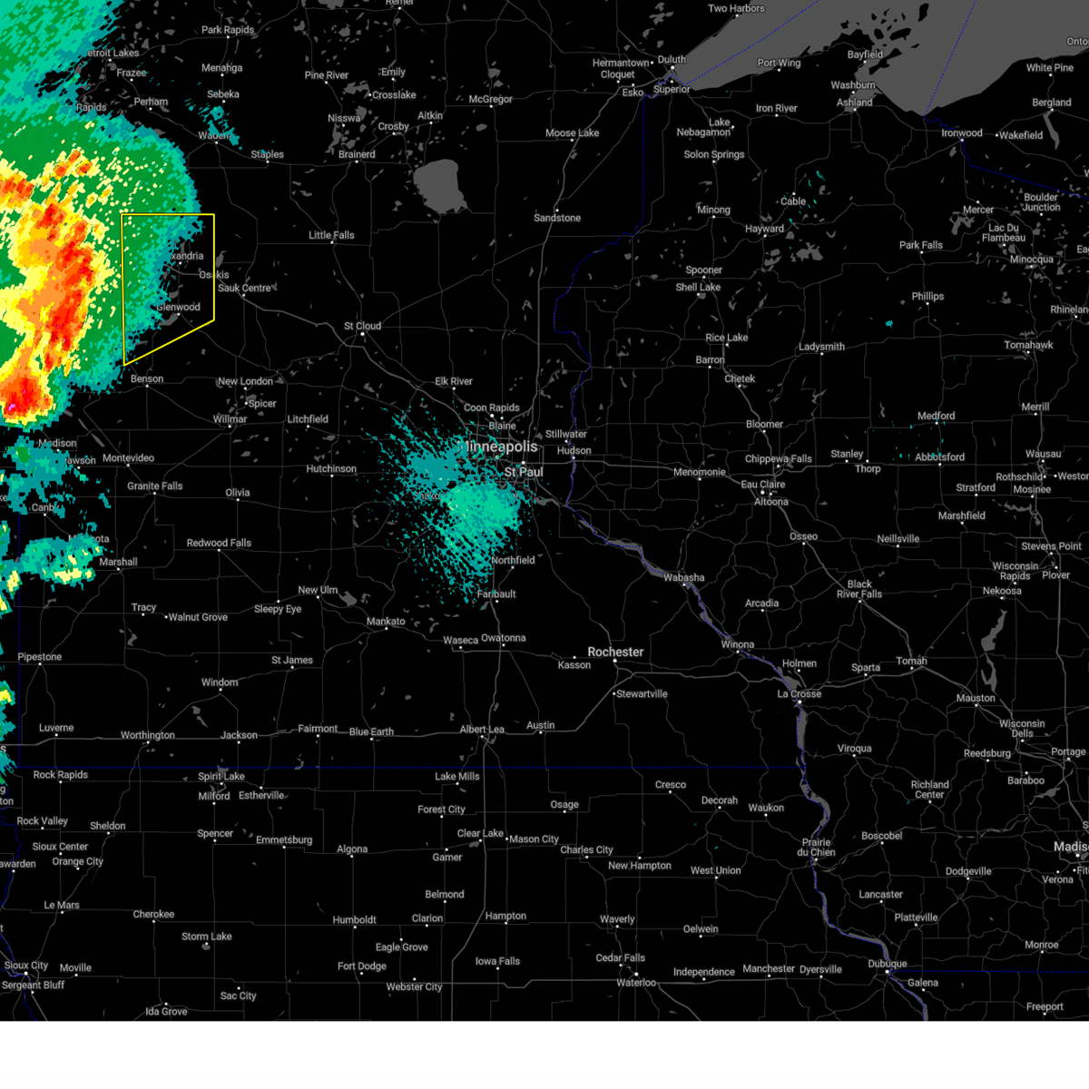
Hail Map for Kensington, MN
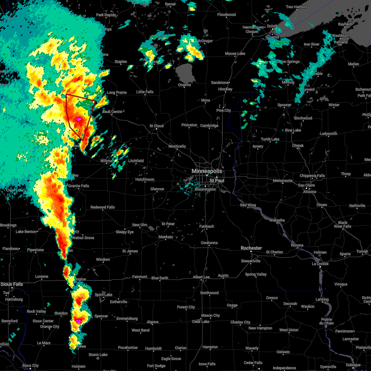
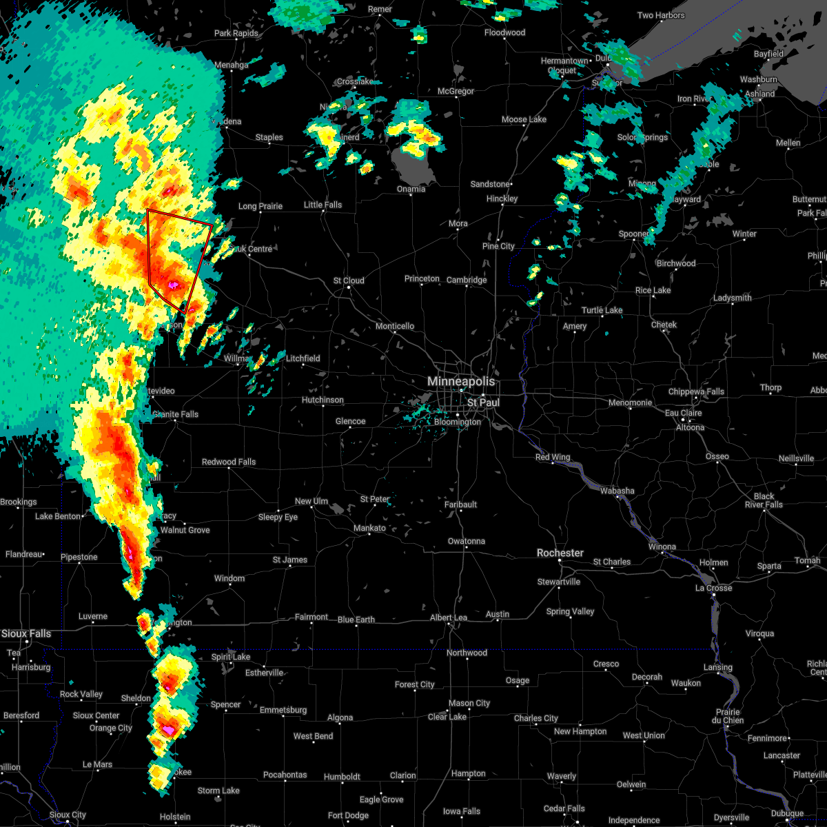
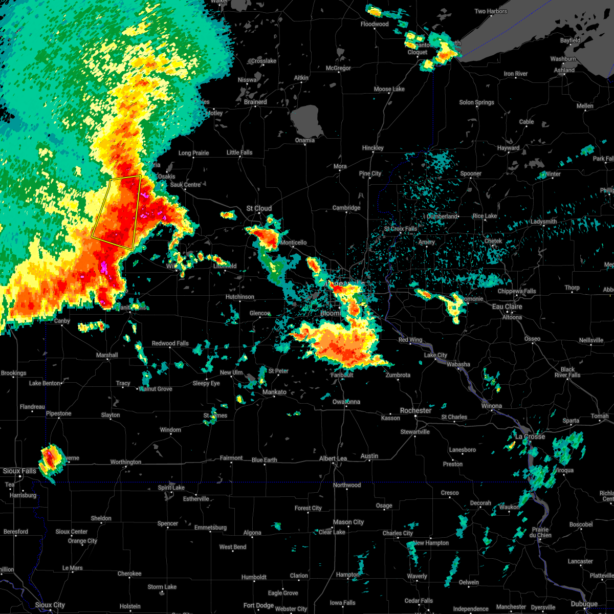
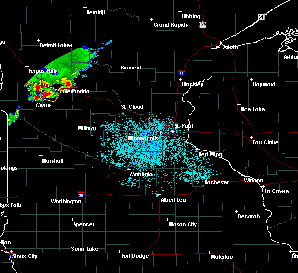
The Kensington, MN area has had 1 report of on-the-ground hail by trained spotters, and has been under severe weather warnings 2 times during the past 12 months. Doppler radar has detected hail at or near Kensington, MN on 67 occasions, including 5 occasions during the past year.
| Name: | Kensington, MN |
| Where Located: | 57.1 miles N of Montevideo, MN |
| Map: | Google Map for Kensington, MN |
| Population: | 292 |
| Housing Units: | 147 |
| More Info: | Search Google for Kensington, MN |
2
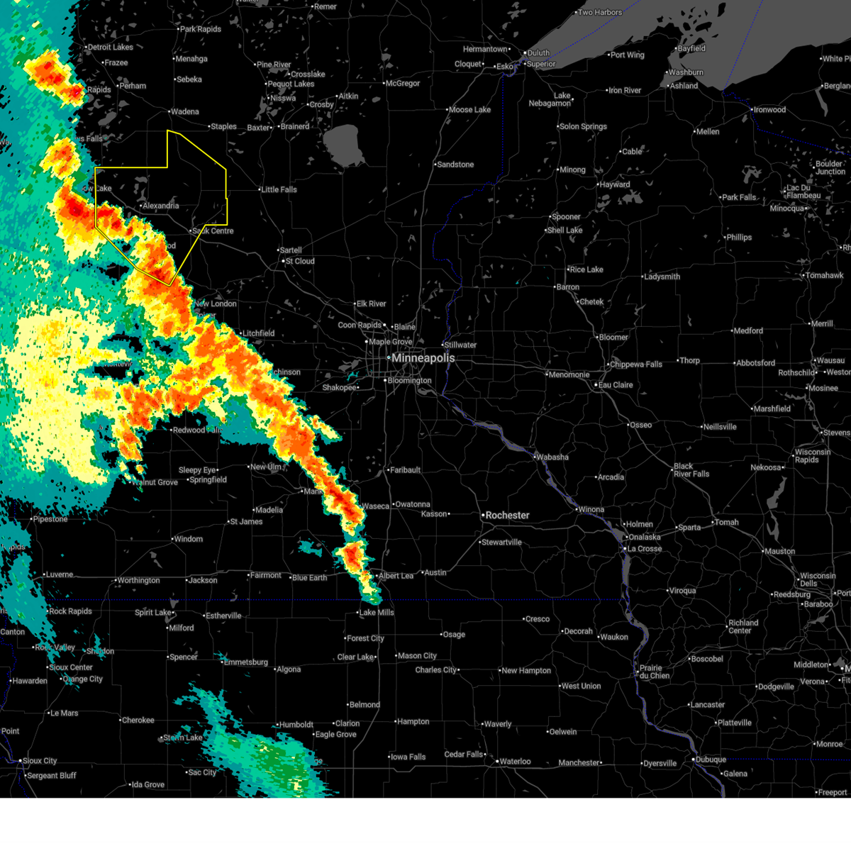
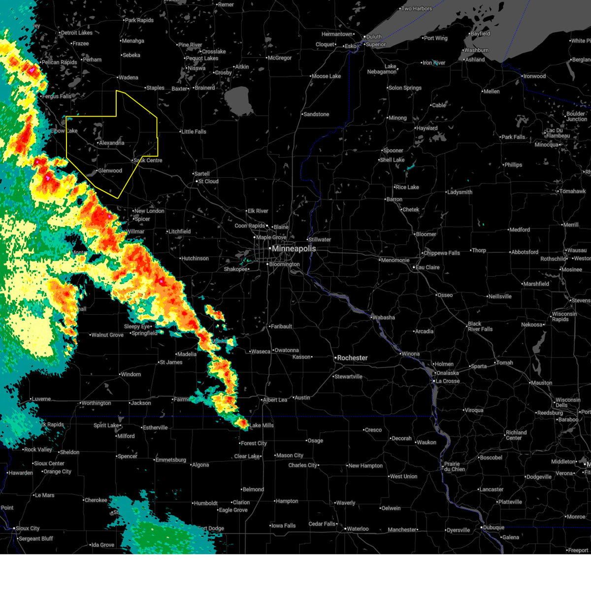
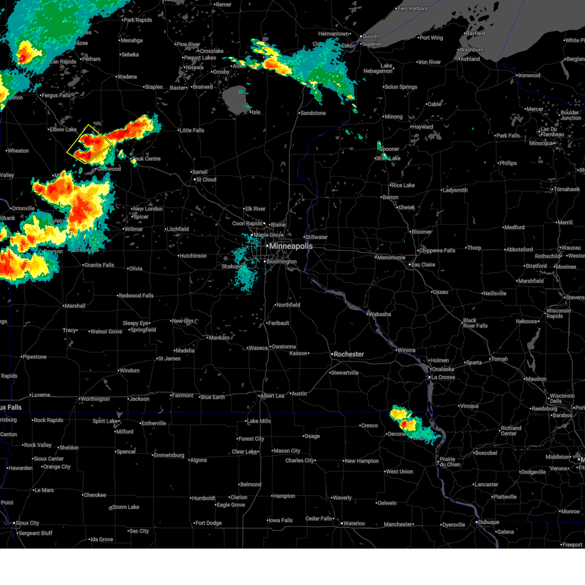
The Top Recent Hail Date for Kensington, MN is Saturday, July 26, 2025 (13th out of 67)
Hail and Wind Damage Spotted near Kensington, MN
| Date / Time | Report Details |
|---|---|
| 6/10/2026 2:15 AM CDT |
 At 215 am cdt, severe thunderstorms were located along a line from over evansville to 5 miles west of sauk centre, or along a line from 17 miles northwest of alexandria to 19 miles southeast of alexandria, moving northeast at 70 mph (weather station reported). Hazards include 70 mph wind gusts and small hail. Expect considerable tree damage. damage is likely to mobile homes, roofs, and outbuildings. Locations impacted include, starbuck, lowry, glenwood, kensington, brooten, alexandria, brandon, evansville, carlos, sauk centre, lake osakis, little sauk, grey eagle, long prairie, eagle bend, swanville, clarissa, browerville, bertha and hewitt. At 215 am cdt, severe thunderstorms were located along a line from over evansville to 5 miles west of sauk centre, or along a line from 17 miles northwest of alexandria to 19 miles southeast of alexandria, moving northeast at 70 mph (weather station reported). Hazards include 70 mph wind gusts and small hail. Expect considerable tree damage. damage is likely to mobile homes, roofs, and outbuildings. Locations impacted include, starbuck, lowry, glenwood, kensington, brooten, alexandria, brandon, evansville, carlos, sauk centre, lake osakis, little sauk, grey eagle, long prairie, eagle bend, swanville, clarissa, browerville, bertha and hewitt.
|
| 6/10/2026 1:58 AM CDT |
 Svrmpx the national weather service in the twin cities has issued a * severe thunderstorm warning for, northwestern stearns county in central minnesota, todd county in central minnesota, douglas county in west central minnesota, northeastern pope county in west central minnesota, * until 245 am cdt. * at 158 am cdt, severe thunderstorms were located along a line from 7 miles northeast of donnelly to 7 miles west of brooten, or along a line from 11 miles north of morris to 26 miles northwest of willmar, moving northeast at 70 mph (radar indicated). Hazards include 70 mph wind gusts and small hail. Expect considerable tree damage. Damage is likely to mobile homes, roofs, and outbuildings. Svrmpx the national weather service in the twin cities has issued a * severe thunderstorm warning for, northwestern stearns county in central minnesota, todd county in central minnesota, douglas county in west central minnesota, northeastern pope county in west central minnesota, * until 245 am cdt. * at 158 am cdt, severe thunderstorms were located along a line from 7 miles northeast of donnelly to 7 miles west of brooten, or along a line from 11 miles north of morris to 26 miles northwest of willmar, moving northeast at 70 mph (radar indicated). Hazards include 70 mph wind gusts and small hail. Expect considerable tree damage. Damage is likely to mobile homes, roofs, and outbuildings.
|
| 6/28/2025 8:14 PM CDT |
 The storm which prompted the warning has weakened below severe limits, and no longer poses an immediate threat to life or property. therefore, the warning will be allowed to expire. however, small hail and gusty winds are still possible with this thunderstorm. a tornado watch remains in effect until 100 am cdt for a portion of west central minnesota. The storm which prompted the warning has weakened below severe limits, and no longer poses an immediate threat to life or property. therefore, the warning will be allowed to expire. however, small hail and gusty winds are still possible with this thunderstorm. a tornado watch remains in effect until 100 am cdt for a portion of west central minnesota.
|
| 6/28/2025 8:08 PM CDT |
 At 808 pm cdt, a severe thunderstorm was located over alexandria, moving northeast at 25 mph (radar indicated). Hazards include 60 mph wind gusts and quarter size hail. Hail damage to vehicles is expected. expect wind damage to roofs, siding, and trees. Locations impacted include, alexandria, lowry, kensington, holmes city, garfield, nelson, forada, farwell and alexandria airport. At 808 pm cdt, a severe thunderstorm was located over alexandria, moving northeast at 25 mph (radar indicated). Hazards include 60 mph wind gusts and quarter size hail. Hail damage to vehicles is expected. expect wind damage to roofs, siding, and trees. Locations impacted include, alexandria, lowry, kensington, holmes city, garfield, nelson, forada, farwell and alexandria airport.
|
| 6/28/2025 7:58 PM CDT |
 At 758 pm cdt, a severe thunderstorm was located 7 miles southwest of alexandria, moving northeast at 25 mph (radar indicated). Hazards include 60 mph wind gusts and quarter size hail. Hail damage to vehicles is expected. expect wind damage to roofs, siding, and trees. Locations impacted include, alexandria, brandon, lowry, kensington, holmes city, garfield, nelson, forada, farwell and alexandria airport. At 758 pm cdt, a severe thunderstorm was located 7 miles southwest of alexandria, moving northeast at 25 mph (radar indicated). Hazards include 60 mph wind gusts and quarter size hail. Hail damage to vehicles is expected. expect wind damage to roofs, siding, and trees. Locations impacted include, alexandria, brandon, lowry, kensington, holmes city, garfield, nelson, forada, farwell and alexandria airport.
|
| 6/28/2025 7:44 PM CDT |
 Svrmpx the national weather service in the twin cities has issued a * severe thunderstorm warning for, southwestern douglas county in west central minnesota, north central pope county in west central minnesota, * until 815 pm cdt. * at 744 pm cdt, a severe thunderstorm was located near kensington, or 14 miles southwest of alexandria, moving northeast at 25 mph (radar indicated). Hazards include 60 mph wind gusts and quarter size hail. Hail damage to vehicles is expected. Expect wind damage to roofs, siding, and trees. Svrmpx the national weather service in the twin cities has issued a * severe thunderstorm warning for, southwestern douglas county in west central minnesota, north central pope county in west central minnesota, * until 815 pm cdt. * at 744 pm cdt, a severe thunderstorm was located near kensington, or 14 miles southwest of alexandria, moving northeast at 25 mph (radar indicated). Hazards include 60 mph wind gusts and quarter size hail. Hail damage to vehicles is expected. Expect wind damage to roofs, siding, and trees.
|
| 6/2/2025 2:27 PM CDT |
 The storm which prompted the warning has moved out of the area. therefore, the warning will be allowed to expire. The storm which prompted the warning has moved out of the area. therefore, the warning will be allowed to expire.
|
| 6/2/2025 2:20 PM CDT |
 the severe thunderstorm warning has been cancelled and is no longer in effect the severe thunderstorm warning has been cancelled and is no longer in effect
|
| 6/2/2025 2:20 PM CDT |
 At 220 pm cdt, a severe thunderstorm was located over lowry, or 13 miles southwest of alexandria, moving northeast at 45 mph (radar indicated). Hazards include 60 mph wind gusts and small hail. Expect damage to roofs, siding, and trees. Locations impacted include, starbuck, kensington and farwell. At 220 pm cdt, a severe thunderstorm was located over lowry, or 13 miles southwest of alexandria, moving northeast at 45 mph (radar indicated). Hazards include 60 mph wind gusts and small hail. Expect damage to roofs, siding, and trees. Locations impacted include, starbuck, kensington and farwell.
|
| 6/2/2025 2:01 PM CDT |
 At 201 pm cdt, a severe thunderstorm was located over cyrus, or 7 miles northeast of morris, moving northeast at 40 mph (radar indicated). Hazards include 60 mph wind gusts and quarter size hail. Hail damage to vehicles is expected. expect wind damage to roofs, siding, and trees. Locations impacted include, morris, starbuck, kensington, cyrus, donnelly and farwell. At 201 pm cdt, a severe thunderstorm was located over cyrus, or 7 miles northeast of morris, moving northeast at 40 mph (radar indicated). Hazards include 60 mph wind gusts and quarter size hail. Hail damage to vehicles is expected. expect wind damage to roofs, siding, and trees. Locations impacted include, morris, starbuck, kensington, cyrus, donnelly and farwell.
|
| 6/2/2025 1:49 PM CDT |
 Svrmpx the national weather service in the twin cities has issued a * severe thunderstorm warning for, southwestern douglas county in west central minnesota, northwestern pope county in west central minnesota, central stevens county in west central minnesota, * until 230 pm cdt. * at 149 pm cdt, a severe thunderstorm was located near morris, moving northeast at 40 mph (radar indicated). Hazards include 60 mph wind gusts and quarter size hail. Hail damage to vehicles is expected. Expect wind damage to roofs, siding, and trees. Svrmpx the national weather service in the twin cities has issued a * severe thunderstorm warning for, southwestern douglas county in west central minnesota, northwestern pope county in west central minnesota, central stevens county in west central minnesota, * until 230 pm cdt. * at 149 pm cdt, a severe thunderstorm was located near morris, moving northeast at 40 mph (radar indicated). Hazards include 60 mph wind gusts and quarter size hail. Hail damage to vehicles is expected. Expect wind damage to roofs, siding, and trees.
|
| 7/31/2024 6:37 PM CDT |
 At 636 pm cdt, severe thunderstorms were located along a line extending from near carlos to 6 miles northeast of lowry, moving east at 25 mph (trained weather spotters). Hazards include 60 mph wind gusts and quarter size hail. Hail damage to vehicles is expected. expect wind damage to roofs, siding, and trees. Locations impacted include, alexandria, carlos, brandon, kensington, holmes city, miltona, garfield, belle river, nelson, forada, alexandria airport, and lake carlos state park. At 636 pm cdt, severe thunderstorms were located along a line extending from near carlos to 6 miles northeast of lowry, moving east at 25 mph (trained weather spotters). Hazards include 60 mph wind gusts and quarter size hail. Hail damage to vehicles is expected. expect wind damage to roofs, siding, and trees. Locations impacted include, alexandria, carlos, brandon, kensington, holmes city, miltona, garfield, belle river, nelson, forada, alexandria airport, and lake carlos state park.
|
| 7/31/2024 6:31 PM CDT |
 The storm which prompted the warning has moved out of the area. therefore, the warning has been allowed to expire. a severe thunderstorm watch remains in effect until 700 pm cdt for west central minnesota. remember, a severe thunderstorm warning still remains in effect for douglas county. The storm which prompted the warning has moved out of the area. therefore, the warning has been allowed to expire. a severe thunderstorm watch remains in effect until 700 pm cdt for west central minnesota. remember, a severe thunderstorm warning still remains in effect for douglas county.
|
| 7/31/2024 6:25 PM CDT |
 Svrmpx the national weather service in the twin cities has issued a * severe thunderstorm warning for, douglas county in west central minnesota, * until 730 pm cdt. * at 625 pm cdt, severe thunderstorms were located along a line extending from 5 miles southwest of evansville to near kensington, moving east at 30 mph (radar indicated). Hazards include 60 mph wind gusts and quarter size hail. Hail damage to vehicles is expected. Expect wind damage to roofs, siding, and trees. Svrmpx the national weather service in the twin cities has issued a * severe thunderstorm warning for, douglas county in west central minnesota, * until 730 pm cdt. * at 625 pm cdt, severe thunderstorms were located along a line extending from 5 miles southwest of evansville to near kensington, moving east at 30 mph (radar indicated). Hazards include 60 mph wind gusts and quarter size hail. Hail damage to vehicles is expected. Expect wind damage to roofs, siding, and trees.
|
| 7/31/2024 6:08 PM CDT |
 the severe thunderstorm warning has been cancelled and is no longer in effect the severe thunderstorm warning has been cancelled and is no longer in effect
|
| 7/31/2024 6:08 PM CDT |
 At 608 pm cdt, a severe thunderstorm was located 7 miles north of lowry, or 9 miles southwest of alexandria, moving northeast at 25 mph (radar indicated). Hazards include ping pong ball size hail. People and animals outdoors will be injured. expect damage to roofs, siding, windows, and vehicles. Locations impacted include, alexandria, kensington, holmes city, garfield, farwell, and alexandria airport. At 608 pm cdt, a severe thunderstorm was located 7 miles north of lowry, or 9 miles southwest of alexandria, moving northeast at 25 mph (radar indicated). Hazards include ping pong ball size hail. People and animals outdoors will be injured. expect damage to roofs, siding, windows, and vehicles. Locations impacted include, alexandria, kensington, holmes city, garfield, farwell, and alexandria airport.
|
| 7/31/2024 5:59 PM CDT |
 At 559 pm cdt, a severe thunderstorm was located near kensington, or 14 miles southwest of alexandria, moving east at 25 mph (radar indicated). Hazards include half dollar size hail. Damage to vehicles is expected. Locations impacted include, alexandria, kensington, holmes city, garfield, farwell, and alexandria airport. At 559 pm cdt, a severe thunderstorm was located near kensington, or 14 miles southwest of alexandria, moving east at 25 mph (radar indicated). Hazards include half dollar size hail. Damage to vehicles is expected. Locations impacted include, alexandria, kensington, holmes city, garfield, farwell, and alexandria airport.
|
| 7/31/2024 5:34 PM CDT |
 Svrmpx the national weather service in the twin cities has issued a * severe thunderstorm warning for, southwestern douglas county in west central minnesota, northwestern pope county in west central minnesota, * until 630 pm cdt. * at 533 pm cdt, a severe thunderstorm was located 7 miles southwest of hoffman, or 10 miles north of morris, moving northeast at 25 mph (radar indicated). Hazards include golf ball size hail. People and animals outdoors will be injured. Expect damage to roofs, siding, windows, and vehicles. Svrmpx the national weather service in the twin cities has issued a * severe thunderstorm warning for, southwestern douglas county in west central minnesota, northwestern pope county in west central minnesota, * until 630 pm cdt. * at 533 pm cdt, a severe thunderstorm was located 7 miles southwest of hoffman, or 10 miles north of morris, moving northeast at 25 mph (radar indicated). Hazards include golf ball size hail. People and animals outdoors will be injured. Expect damage to roofs, siding, windows, and vehicles.
|
| 7/31/2024 2:00 PM CDT |
 At 159 pm cdt, severe thunderstorms were located along a line extending from near henning to carlos to 7 miles north of lake hassel, moving east at 60 mph (radar indicated). Hazards include 60 mph wind gusts. Expect damage to roofs, siding, and trees. these severe storms will be near, glenwood around 205 pm cdt. Other locations impacted by these severe thunderstorms include alexandria airport, glenwood airport, westport, nelson, lake carlos state park, garfield, grove lake, villard, miltona, and rose city. At 159 pm cdt, severe thunderstorms were located along a line extending from near henning to carlos to 7 miles north of lake hassel, moving east at 60 mph (radar indicated). Hazards include 60 mph wind gusts. Expect damage to roofs, siding, and trees. these severe storms will be near, glenwood around 205 pm cdt. Other locations impacted by these severe thunderstorms include alexandria airport, glenwood airport, westport, nelson, lake carlos state park, garfield, grove lake, villard, miltona, and rose city.
|
| 7/31/2024 1:41 PM CDT |
 At 141 pm cdt, severe thunderstorms were located along a line extending from 7 miles northeast of ashby to 5 miles south of brandon to hancock, moving east at 45 mph (radar indicated). Hazards include 60 mph wind gusts. Expect damage to roofs, siding, and trees. these severe storms will be near, alexandria, starbuck, brandon, and lowry around 145 pm cdt. glenwood and carlos around 155 pm cdt. Other locations impacted by these severe thunderstorms include alexandria airport, glenwood airport, westport, nelson, lake carlos state park, garfield, grove lake, melby, villard, and miltona. At 141 pm cdt, severe thunderstorms were located along a line extending from 7 miles northeast of ashby to 5 miles south of brandon to hancock, moving east at 45 mph (radar indicated). Hazards include 60 mph wind gusts. Expect damage to roofs, siding, and trees. these severe storms will be near, alexandria, starbuck, brandon, and lowry around 145 pm cdt. glenwood and carlos around 155 pm cdt. Other locations impacted by these severe thunderstorms include alexandria airport, glenwood airport, westport, nelson, lake carlos state park, garfield, grove lake, melby, villard, and miltona.
|
| 7/31/2024 1:21 PM CDT |
 Svrmpx the national weather service in the twin cities has issued a * severe thunderstorm warning for, douglas county in west central minnesota, pope county in west central minnesota, * until 215 pm cdt. * at 120 pm cdt, severe thunderstorms were located along a line extending from 6 miles west of dalton to near hoffman to near lake hattie, moving east at 60 mph (radar indicated). Hazards include 60 mph wind gusts. Expect damage to roofs, siding, and trees. severe thunderstorms will be near, kensington around 125 pm cdt. evansville, brandon, and cyrus around 130 pm cdt. alexandria, starbuck, and lowry around 140 pm cdt. glenwood and carlos around 145 pm cdt. Other locations impacted by these severe thunderstorms include alexandria airport, glenwood airport, westport, nelson, lake carlos state park, garfield, grove lake, melby, villard, and miltona. Svrmpx the national weather service in the twin cities has issued a * severe thunderstorm warning for, douglas county in west central minnesota, pope county in west central minnesota, * until 215 pm cdt. * at 120 pm cdt, severe thunderstorms were located along a line extending from 6 miles west of dalton to near hoffman to near lake hattie, moving east at 60 mph (radar indicated). Hazards include 60 mph wind gusts. Expect damage to roofs, siding, and trees. severe thunderstorms will be near, kensington around 125 pm cdt. evansville, brandon, and cyrus around 130 pm cdt. alexandria, starbuck, and lowry around 140 pm cdt. glenwood and carlos around 145 pm cdt. Other locations impacted by these severe thunderstorms include alexandria airport, glenwood airport, westport, nelson, lake carlos state park, garfield, grove lake, melby, villard, and miltona.
|
| 7/13/2024 11:17 PM CDT |
 At 1117 pm cdt, severe thunderstorms were located along a line extending from near grey eagle to near lowry, moving east at 45 mph (radar indicated). Hazards include 60 mph wind gusts and quarter size hail. Hail damage to vehicles is expected. expect wind damage to roofs, siding, and trees. Locations impacted include, alexandria, sauk centre, melrose, glenwood, starbuck, brooten, freeport, lowry, kensington, cyrus, holmes city, and new munich. At 1117 pm cdt, severe thunderstorms were located along a line extending from near grey eagle to near lowry, moving east at 45 mph (radar indicated). Hazards include 60 mph wind gusts and quarter size hail. Hail damage to vehicles is expected. expect wind damage to roofs, siding, and trees. Locations impacted include, alexandria, sauk centre, melrose, glenwood, starbuck, brooten, freeport, lowry, kensington, cyrus, holmes city, and new munich.
|
| 7/13/2024 11:02 PM CDT |
 Svrmpx the national weather service in the twin cities has issued a * severe thunderstorm warning for, southern douglas county in west central minnesota, pope county in west central minnesota, southern todd county in central minnesota, northwestern stearns county in central minnesota, * until 1145 pm cdt. * at 1102 pm cdt, severe thunderstorms were located along a line extending from 5 miles south of long prairie to near kensington, moving east at 45 mph (radar indicated). Hazards include 60 mph wind gusts and quarter size hail. Hail damage to vehicles is expected. Expect wind damage to roofs, siding, and trees. Svrmpx the national weather service in the twin cities has issued a * severe thunderstorm warning for, southern douglas county in west central minnesota, pope county in west central minnesota, southern todd county in central minnesota, northwestern stearns county in central minnesota, * until 1145 pm cdt. * at 1102 pm cdt, severe thunderstorms were located along a line extending from 5 miles south of long prairie to near kensington, moving east at 45 mph (radar indicated). Hazards include 60 mph wind gusts and quarter size hail. Hail damage to vehicles is expected. Expect wind damage to roofs, siding, and trees.
|
| 5/30/2022 4:17 PM CDT |
 At 417 pm cdt, a confirmed tornado was located over starbuck, or 19 miles east of morris, moving north at 60 mph (weather spotters confirmed tornado). Hazards include damaging tornado and two inch hail. Flying debris will be dangerous to those caught without shelter. mobile homes will be damaged or destroyed. damage to roofs, windows, and vehicles will occur. tree damage is likely. this tornado will be near, glenwood and lowry around 420 pm cdt. alexandria around 435 pm cdt. Other locations impacted by this tornadic thunderstorm include alexandria airport, nelson, forada, garfield, long beach, holmes city, farwell and lake minnewaska. At 417 pm cdt, a confirmed tornado was located over starbuck, or 19 miles east of morris, moving north at 60 mph (weather spotters confirmed tornado). Hazards include damaging tornado and two inch hail. Flying debris will be dangerous to those caught without shelter. mobile homes will be damaged or destroyed. damage to roofs, windows, and vehicles will occur. tree damage is likely. this tornado will be near, glenwood and lowry around 420 pm cdt. alexandria around 435 pm cdt. Other locations impacted by this tornadic thunderstorm include alexandria airport, nelson, forada, garfield, long beach, holmes city, farwell and lake minnewaska.
|
| 5/30/2022 4:11 PM CDT |
 At 411 pm cdt, severe thunderstorms capable of producing tornadoes were located along a line extending from near cyrus to 7 miles south of starbuck, moving north at 60 mph (radar indicated rotation). Hazards include tornado and ping pong ball size hail. Flying debris will be dangerous to those caught without shelter. mobile homes will be damaged or destroyed. damage to roofs, windows, and vehicles will occur. tree damage is likely. these dangerous storms will be near, starbuck around 420 pm cdt. glenwood, lowry and kensington around 425 pm cdt. alexandria around 440 pm cdt. Other locations impacted by these tornadic storms include alexandria airport, nelson, forada, lake emily, garfield, long beach, holmes city, farwell and lake minnewaska. At 411 pm cdt, severe thunderstorms capable of producing tornadoes were located along a line extending from near cyrus to 7 miles south of starbuck, moving north at 60 mph (radar indicated rotation). Hazards include tornado and ping pong ball size hail. Flying debris will be dangerous to those caught without shelter. mobile homes will be damaged or destroyed. damage to roofs, windows, and vehicles will occur. tree damage is likely. these dangerous storms will be near, starbuck around 420 pm cdt. glenwood, lowry and kensington around 425 pm cdt. alexandria around 440 pm cdt. Other locations impacted by these tornadic storms include alexandria airport, nelson, forada, lake emily, garfield, long beach, holmes city, farwell and lake minnewaska.
|
| 5/30/2022 4:05 PM CDT |
 At 405 pm cdt, severe thunderstorms capable of producing a tornado were located along a line extending from 5 miles southeast of cyrus to near lake hassel, moving north at 60 mph (radar indicated rotation). Hazards include tornado and half dollar size hail. Flying debris will be dangerous to those caught without shelter. mobile homes will be damaged or destroyed. damage to roofs, windows, and vehicles will occur. tree damage is likely. these dangerous storms will be near, cyrus around 410 pm cdt. glenwood, starbuck and kensington around 420 pm cdt. lowry around 425 pm cdt. alexandria around 440 pm cdt. Other locations impacted by these tornadic storms include alexandria airport, nelson, forada, lake emily, garfield, long beach, holmes city, farwell and lake minnewaska. At 405 pm cdt, severe thunderstorms capable of producing a tornado were located along a line extending from 5 miles southeast of cyrus to near lake hassel, moving north at 60 mph (radar indicated rotation). Hazards include tornado and half dollar size hail. Flying debris will be dangerous to those caught without shelter. mobile homes will be damaged or destroyed. damage to roofs, windows, and vehicles will occur. tree damage is likely. these dangerous storms will be near, cyrus around 410 pm cdt. glenwood, starbuck and kensington around 420 pm cdt. lowry around 425 pm cdt. alexandria around 440 pm cdt. Other locations impacted by these tornadic storms include alexandria airport, nelson, forada, lake emily, garfield, long beach, holmes city, farwell and lake minnewaska.
|
| 5/12/2022 7:27 PM CDT |
 At 726 pm cdt, severe thunderstorms were located along a line extending from 6 miles southwest of dalton to 6 miles northwest of carlos to 7 miles east of lake osakis to 7 miles southeast of paynesville, moving northeast at 85 mph (radar indicated). Hazards include 70 mph wind gusts. Expect considerable tree damage. damage is likely to mobile homes, roofs, and outbuildings. these severe thunderstorms will remain over mainly rural areas of douglas, eastern pope and kandiyohi counties, including the following locations, glenwood airport, garfield, willmar airport, villard, blomkest, miltona, holmes city, lake lillian, forada and green lake. thunderstorm damage threat, considerable hail threat, radar indicated max hail size, <. 75 in wind threat, radar indicated max wind gust, 70 mph. At 726 pm cdt, severe thunderstorms were located along a line extending from 6 miles southwest of dalton to 6 miles northwest of carlos to 7 miles east of lake osakis to 7 miles southeast of paynesville, moving northeast at 85 mph (radar indicated). Hazards include 70 mph wind gusts. Expect considerable tree damage. damage is likely to mobile homes, roofs, and outbuildings. these severe thunderstorms will remain over mainly rural areas of douglas, eastern pope and kandiyohi counties, including the following locations, glenwood airport, garfield, willmar airport, villard, blomkest, miltona, holmes city, lake lillian, forada and green lake. thunderstorm damage threat, considerable hail threat, radar indicated max hail size, <. 75 in wind threat, radar indicated max wind gust, 70 mph.
|
| 5/12/2022 7:09 PM CDT |
 At 708 pm cdt, a severe thunderstorm capable of producing a tornado was located near kensington, or 14 miles west of alexandria, moving north at 75 mph (radar indicated rotation). Hazards include tornado. Flying debris will be dangerous to those caught without shelter. mobile homes will be damaged or destroyed. damage to roofs, windows, and vehicles will occur. tree damage is likely. This dangerous storm will be near, evansville and brandon around 715 pm cdt. At 708 pm cdt, a severe thunderstorm capable of producing a tornado was located near kensington, or 14 miles west of alexandria, moving north at 75 mph (radar indicated rotation). Hazards include tornado. Flying debris will be dangerous to those caught without shelter. mobile homes will be damaged or destroyed. damage to roofs, windows, and vehicles will occur. tree damage is likely. This dangerous storm will be near, evansville and brandon around 715 pm cdt.
|
| 5/12/2022 7:00 PM CDT |
 At 659 pm cdt, severe thunderstorms were located along a line extending from 6 miles west of herman to near kensington to near glenwood to near cosmos, moving northeast at 70 mph. these are destructive storms for alexandria and willmar (radar indicated). Hazards include 80 mph wind gusts. Flying debris will be dangerous to those caught without shelter. mobile homes will be heavily damaged. expect considerable damage to roofs, windows, and vehicles. extensive tree damage and power outages are likely. severe thunderstorms will be near, glenwood and kensington around 705 pm cdt. alexandria around 710 pm cdt. evansville and brandon around 715 pm cdt. other locations impacted by these severe thunderstorms include glenwood airport, swift falls, alberta, garfield, willmar airport, villard, blomkest, fish lake, miltona and holmes city. thunderstorm damage threat, destructive hail threat, radar indicated max hail size, <. 75 in wind threat, radar indicated max wind gust, 80 mph. At 659 pm cdt, severe thunderstorms were located along a line extending from 6 miles west of herman to near kensington to near glenwood to near cosmos, moving northeast at 70 mph. these are destructive storms for alexandria and willmar (radar indicated). Hazards include 80 mph wind gusts. Flying debris will be dangerous to those caught without shelter. mobile homes will be heavily damaged. expect considerable damage to roofs, windows, and vehicles. extensive tree damage and power outages are likely. severe thunderstorms will be near, glenwood and kensington around 705 pm cdt. alexandria around 710 pm cdt. evansville and brandon around 715 pm cdt. other locations impacted by these severe thunderstorms include glenwood airport, swift falls, alberta, garfield, willmar airport, villard, blomkest, fish lake, miltona and holmes city. thunderstorm damage threat, destructive hail threat, radar indicated max hail size, <. 75 in wind threat, radar indicated max wind gust, 80 mph.
|
| 10/9/2021 8:55 PM CDT |
 The severe thunderstorm warning for douglas and pope counties will expire at 900 pm cdt, the storm which prompted the warning has weakened below severe limits, and no longer poses an immediate threat to life or property. therefore, the warning will be allowed to expire. however gusty winds and heavy rain are still possible with this thunderstorm. a severe thunderstorm watch remains in effect until 200 am cdt for central and west central minnesota. The severe thunderstorm warning for douglas and pope counties will expire at 900 pm cdt, the storm which prompted the warning has weakened below severe limits, and no longer poses an immediate threat to life or property. therefore, the warning will be allowed to expire. however gusty winds and heavy rain are still possible with this thunderstorm. a severe thunderstorm watch remains in effect until 200 am cdt for central and west central minnesota.
|
| 10/9/2021 8:15 PM CDT |
 At 814 pm cdt, a severe thunderstorm was located near evansville, or 16 miles west of alexandria, moving northeast at 55 mph (radar indicated). Hazards include 60 mph wind gusts and nickel size hail. Expect damage to roofs, siding, and trees. this severe thunderstorm will be near, brandon around 820 pm cdt. hail threat, radar indicated max hail size, 0. 88 in wind threat, radar indicated max wind gust, 60 mph. At 814 pm cdt, a severe thunderstorm was located near evansville, or 16 miles west of alexandria, moving northeast at 55 mph (radar indicated). Hazards include 60 mph wind gusts and nickel size hail. Expect damage to roofs, siding, and trees. this severe thunderstorm will be near, brandon around 820 pm cdt. hail threat, radar indicated max hail size, 0. 88 in wind threat, radar indicated max wind gust, 60 mph.
|
| 8/28/2021 10:12 AM CDT |
 At 1012 am cdt, a severe thunderstorm was located near kensington, or 12 miles southwest of alexandria, moving east at 40 mph (radar indicated). Hazards include 60 mph wind gusts and half dollar size hail. Hail damage to vehicles is expected. expect wind damage to roofs, siding, and trees. this severe storm will be near, alexandria around 1030 am cdt. other locations impacted by this severe thunderstorm include westport, nelson, forada, garfield, villard, holmes city, farwell and long beach. hail threat, radar indicated max hail size, 1. 25 in wind threat, radar indicated max wind gust, 60 mph. At 1012 am cdt, a severe thunderstorm was located near kensington, or 12 miles southwest of alexandria, moving east at 40 mph (radar indicated). Hazards include 60 mph wind gusts and half dollar size hail. Hail damage to vehicles is expected. expect wind damage to roofs, siding, and trees. this severe storm will be near, alexandria around 1030 am cdt. other locations impacted by this severe thunderstorm include westport, nelson, forada, garfield, villard, holmes city, farwell and long beach. hail threat, radar indicated max hail size, 1. 25 in wind threat, radar indicated max wind gust, 60 mph.
|
| 8/28/2021 9:49 AM CDT |
 At 949 am cdt, a severe thunderstorm was located 7 miles northeast of donnelly, or 12 miles north of morris, moving east at 40 mph (radar indicated). Hazards include 60 mph wind gusts and half dollar size hail. Hail damage to vehicles is expected. expect wind damage to roofs, siding, and trees. this severe thunderstorm will be near, kensington around 1005 am cdt. other locations in the path of this severe thunderstorm include lowry and alexandria. hail threat, radar indicated max hail size, 1. 25 in wind threat, radar indicated max wind gust, 60 mph. At 949 am cdt, a severe thunderstorm was located 7 miles northeast of donnelly, or 12 miles north of morris, moving east at 40 mph (radar indicated). Hazards include 60 mph wind gusts and half dollar size hail. Hail damage to vehicles is expected. expect wind damage to roofs, siding, and trees. this severe thunderstorm will be near, kensington around 1005 am cdt. other locations in the path of this severe thunderstorm include lowry and alexandria. hail threat, radar indicated max hail size, 1. 25 in wind threat, radar indicated max wind gust, 60 mph.
|
| 8/24/2021 4:10 AM CDT |
 At 409 am cdt, a severe thunderstorm was located over lowry, or 12 miles southwest of alexandria, moving east at 45 mph (radar indicated). Hazards include 60 mph wind gusts and half dollar size hail. Hail damage to vehicles is expected. expect wind damage to roofs, siding, and trees. this severe thunderstorm will remain over mainly rural areas of southwestern douglas, western pope, southeastern stevens and north central swift counties, including the following locations, benson airport, lake emily, clontarf and farwell. hail threat, radar indicated max hail size, 1. 25 in wind threat, radar indicated max wind gust, 60 mph. At 409 am cdt, a severe thunderstorm was located over lowry, or 12 miles southwest of alexandria, moving east at 45 mph (radar indicated). Hazards include 60 mph wind gusts and half dollar size hail. Hail damage to vehicles is expected. expect wind damage to roofs, siding, and trees. this severe thunderstorm will remain over mainly rural areas of southwestern douglas, western pope, southeastern stevens and north central swift counties, including the following locations, benson airport, lake emily, clontarf and farwell. hail threat, radar indicated max hail size, 1. 25 in wind threat, radar indicated max wind gust, 60 mph.
|
| 8/24/2021 3:32 AM CDT |
 At 331 am cdt, a severe thunderstorm was located near chokio, or 8 miles west of morris, moving east at 45 mph (radar indicated). Hazards include 60 mph wind gusts and half dollar size hail. Hail damage to vehicles is expected. expect wind damage to roofs, siding, and trees. this severe thunderstorm will be near, donnelly around 335 am cdt. morris around 345 am cdt. cyrus around 350 am cdt. other locations in the path of this severe thunderstorm include kensington, starbuck and lowry. hail threat, radar indicated max hail size, 1. 25 in wind threat, radar indicated max wind gust, 60 mph. At 331 am cdt, a severe thunderstorm was located near chokio, or 8 miles west of morris, moving east at 45 mph (radar indicated). Hazards include 60 mph wind gusts and half dollar size hail. Hail damage to vehicles is expected. expect wind damage to roofs, siding, and trees. this severe thunderstorm will be near, donnelly around 335 am cdt. morris around 345 am cdt. cyrus around 350 am cdt. other locations in the path of this severe thunderstorm include kensington, starbuck and lowry. hail threat, radar indicated max hail size, 1. 25 in wind threat, radar indicated max wind gust, 60 mph.
|
| 6/11/2021 6:09 AM CDT |
 At 608 am cdt, severe thunderstorms were located along a line extending from near ashby to near barrett to 5 miles north of donnelly, moving east at 40 mph (radar indicated). Hazards include 60 mph wind gusts. Expect damage to roofs, siding, and trees. severe thunderstorms will be near, evansville around 625 am cdt. Other locations in the path of these severe thunderstorms include brandon, kensington, lowry, carlos and alexandria. At 608 am cdt, severe thunderstorms were located along a line extending from near ashby to near barrett to 5 miles north of donnelly, moving east at 40 mph (radar indicated). Hazards include 60 mph wind gusts. Expect damage to roofs, siding, and trees. severe thunderstorms will be near, evansville around 625 am cdt. Other locations in the path of these severe thunderstorms include brandon, kensington, lowry, carlos and alexandria.
|
| 10/11/2020 7:09 PM CDT |
 At 708 pm cdt, severe thunderstorms were located along a line extending from near evansville to 5 miles northeast of cyrus to near lake hassel, moving northeast at 50 mph (radar indicated). Hazards include 60 mph wind gusts. Expect damage to roofs, siding, and trees. these severe storms will be near, evansville around 715 pm cdt. starbuck around 725 pm cdt. brandon around 730 pm cdt. glenwood around 735 pm cdt. alexandria around 750 pm cdt. Other locations impacted by these severe thunderstorms include alexandria airport, forada, lake emily, garfield, long beach, leaf valley, holmes city, farwell, millerville and lake minnewaska. At 708 pm cdt, severe thunderstorms were located along a line extending from near evansville to 5 miles northeast of cyrus to near lake hassel, moving northeast at 50 mph (radar indicated). Hazards include 60 mph wind gusts. Expect damage to roofs, siding, and trees. these severe storms will be near, evansville around 715 pm cdt. starbuck around 725 pm cdt. brandon around 730 pm cdt. glenwood around 735 pm cdt. alexandria around 750 pm cdt. Other locations impacted by these severe thunderstorms include alexandria airport, forada, lake emily, garfield, long beach, leaf valley, holmes city, farwell, millerville and lake minnewaska.
|
| 10/11/2020 6:55 PM CDT |
 At 655 pm cdt, severe thunderstorms were located along a line extending from near kensington to near cyrus to near hancock to 9 miles west of benson, moving northeast at 45 mph (trained weather spotters. a wind gust of 57 mph was reported near cyrus). Hazards include 60 mph wind gusts. Expect damage to roofs, siding, and trees. severe thunderstorms will be near, cyrus around 700 pm cdt. kensington around 710 pm cdt. evansville and brandon around 715 pm cdt. starbuck around 725 pm cdt. lowry around 730 pm cdt. Alexandria around 745 pm cdt. At 655 pm cdt, severe thunderstorms were located along a line extending from near kensington to near cyrus to near hancock to 9 miles west of benson, moving northeast at 45 mph (trained weather spotters. a wind gust of 57 mph was reported near cyrus). Hazards include 60 mph wind gusts. Expect damage to roofs, siding, and trees. severe thunderstorms will be near, cyrus around 700 pm cdt. kensington around 710 pm cdt. evansville and brandon around 715 pm cdt. starbuck around 725 pm cdt. lowry around 730 pm cdt. Alexandria around 745 pm cdt.
|
| 8/14/2020 4:14 PM CDT |
 At 413 pm cdt, a severe thunderstorm was located near alexandria, moving northeast at 40 mph (radar indicated). Hazards include 60 mph wind gusts and quarter size hail. Hail damage to vehicles is expected. expect wind damage to roofs, siding, and trees. this severe thunderstorm will be near, carlos around 425 pm cdt. Other locations impacted by this severe thunderstorm include alexandria airport, nelson, forada, garfield, miltona, rose city, holmes city, belle river and farwell. At 413 pm cdt, a severe thunderstorm was located near alexandria, moving northeast at 40 mph (radar indicated). Hazards include 60 mph wind gusts and quarter size hail. Hail damage to vehicles is expected. expect wind damage to roofs, siding, and trees. this severe thunderstorm will be near, carlos around 425 pm cdt. Other locations impacted by this severe thunderstorm include alexandria airport, nelson, forada, garfield, miltona, rose city, holmes city, belle river and farwell.
|
| 7/17/2020 11:13 PM CDT |
 At 1113 pm cdt, severe thunderstorms were located along a line extending from 7 miles east of lake osakis to lowry to near cyrus to johnson, moving southeast at 35 mph (radar indicated). Hazards include 60 mph wind gusts. Expect damage to roofs, siding, and trees. these severe storms will be near, lowry around 1120 pm cdt. glenwood and starbuck around 1130 pm cdt. hancock around 1150 pm cdt. Other locations impacted by these severe thunderstorms include alexandria airport, glenwood airport, westport, nelson, alberta, grove lake, villard, fish lake, holmes city and lake minnewaska. At 1113 pm cdt, severe thunderstorms were located along a line extending from 7 miles east of lake osakis to lowry to near cyrus to johnson, moving southeast at 35 mph (radar indicated). Hazards include 60 mph wind gusts. Expect damage to roofs, siding, and trees. these severe storms will be near, lowry around 1120 pm cdt. glenwood and starbuck around 1130 pm cdt. hancock around 1150 pm cdt. Other locations impacted by these severe thunderstorms include alexandria airport, glenwood airport, westport, nelson, alberta, grove lake, villard, fish lake, holmes city and lake minnewaska.
|
| 7/17/2020 10:54 PM CDT |
 At 1054 pm cdt, severe thunderstorms were located along a line extending from near lake osakis to kensington to near donnelly to collis, moving southeast at 45 mph (radar indicated). Hazards include 60 mph wind gusts. Expect damage to roofs, siding, and trees. severe thunderstorms will be near, kensington around 1100 pm cdt. lowry and cyrus around 1110 pm cdt. chokio around 1115 pm cdt. glenwood, starbuck and lake hattie around 1120 pm cdt. Other locations impacted by these severe thunderstorms include alexandria airport, glenwood airport, westport, nelson, alberta, grove lake, villard, fish lake, holmes city and lake minnewaska. At 1054 pm cdt, severe thunderstorms were located along a line extending from near lake osakis to kensington to near donnelly to collis, moving southeast at 45 mph (radar indicated). Hazards include 60 mph wind gusts. Expect damage to roofs, siding, and trees. severe thunderstorms will be near, kensington around 1100 pm cdt. lowry and cyrus around 1110 pm cdt. chokio around 1115 pm cdt. glenwood, starbuck and lake hattie around 1120 pm cdt. Other locations impacted by these severe thunderstorms include alexandria airport, glenwood airport, westport, nelson, alberta, grove lake, villard, fish lake, holmes city and lake minnewaska.
|
| 7/17/2020 10:37 PM CDT |
 At 1037 pm cdt, a severe thunderstorm was located near brandon, or 8 miles northwest of alexandria, moving southeast at 35 mph (radar indicated). Hazards include 60 mph wind gusts and quarter size hail. Hail damage to vehicles is expected. expect wind damage to roofs, siding, and trees. this severe storm will be near, carlos around 1050 pm cdt. alexandria around 1055 pm cdt. Other locations impacted by this severe thunderstorm include alexandria airport, nelson, forada, garfield, leaf valley, miltona, rose city, holmes city, belle river and millerville. At 1037 pm cdt, a severe thunderstorm was located near brandon, or 8 miles northwest of alexandria, moving southeast at 35 mph (radar indicated). Hazards include 60 mph wind gusts and quarter size hail. Hail damage to vehicles is expected. expect wind damage to roofs, siding, and trees. this severe storm will be near, carlos around 1050 pm cdt. alexandria around 1055 pm cdt. Other locations impacted by this severe thunderstorm include alexandria airport, nelson, forada, garfield, leaf valley, miltona, rose city, holmes city, belle river and millerville.
|
| 7/17/2020 10:20 PM CDT |
 At 1019 pm cdt, a severe thunderstorm was located near evansville, or 17 miles northwest of alexandria, moving east at 35 mph (radar indicated). Hazards include 60 mph wind gusts and quarter size hail. Hail damage to vehicles is expected. expect wind damage to roofs, siding, and trees. this severe thunderstorm will be near, brandon around 1030 pm cdt. carlos around 1055 pm cdt. Other locations impacted by this severe thunderstorm include alexandria airport, nelson, forada, garfield, melby, leaf valley, miltona, rose city, holmes city and belle river. At 1019 pm cdt, a severe thunderstorm was located near evansville, or 17 miles northwest of alexandria, moving east at 35 mph (radar indicated). Hazards include 60 mph wind gusts and quarter size hail. Hail damage to vehicles is expected. expect wind damage to roofs, siding, and trees. this severe thunderstorm will be near, brandon around 1030 pm cdt. carlos around 1055 pm cdt. Other locations impacted by this severe thunderstorm include alexandria airport, nelson, forada, garfield, melby, leaf valley, miltona, rose city, holmes city and belle river.
|
| 9/2/2019 7:53 PM CDT |
 At 752 pm cdt, severe thunderstorms were located along a line extending from near brandon to near morris to near graceville, moving east at 55 mph (radar indicated). Hazards include 70 mph wind gusts and penny size hail. Expect considerable tree damage. damage is likely to mobile homes, roofs, and outbuildings. Locations impacted include, alexandria, morris, glenwood, starbuck, hancock, evansville, brandon, chokio, lowry, kensington, cyrus and donnelly. At 752 pm cdt, severe thunderstorms were located along a line extending from near brandon to near morris to near graceville, moving east at 55 mph (radar indicated). Hazards include 70 mph wind gusts and penny size hail. Expect considerable tree damage. damage is likely to mobile homes, roofs, and outbuildings. Locations impacted include, alexandria, morris, glenwood, starbuck, hancock, evansville, brandon, chokio, lowry, kensington, cyrus and donnelly.
|
| 9/2/2019 7:37 PM CDT |
 At 737 pm cdt, severe thunderstorms were located along a line extending from near evansville to near donnelly to near beardsley, moving east at 55 mph (radar indicated). Hazards include 70 mph wind gusts and penny size hail. Expect considerable tree damage. Damage is likely to mobile homes, roofs, and outbuildings. At 737 pm cdt, severe thunderstorms were located along a line extending from near evansville to near donnelly to near beardsley, moving east at 55 mph (radar indicated). Hazards include 70 mph wind gusts and penny size hail. Expect considerable tree damage. Damage is likely to mobile homes, roofs, and outbuildings.
|
| 7/19/2019 12:27 PM CDT |
 At 1227 pm cdt, a severe thunderstorm was located near lowry, or 12 miles southwest of alexandria, moving east at 45 mph (radar indicated). Hazards include golf ball size hail and 60 mph wind gusts. People and animals outdoors will be injured. expect hail damage to roofs, siding, windows, and vehicles. Expect wind damage to roofs, siding, and trees. At 1227 pm cdt, a severe thunderstorm was located near lowry, or 12 miles southwest of alexandria, moving east at 45 mph (radar indicated). Hazards include golf ball size hail and 60 mph wind gusts. People and animals outdoors will be injured. expect hail damage to roofs, siding, windows, and vehicles. Expect wind damage to roofs, siding, and trees.
|
| 7/19/2019 12:15 PM CDT |
 At 1215 pm cdt, a severe thunderstorm was located near kensington, or 15 miles northeast of morris, moving east at 45 mph (emergency management reported golf ball size hail in donnelly at 1156 am cdt). Hazards include two inch hail and 60 mph wind gusts. People and animals outdoors will be injured. expect hail damage to roofs, siding, windows, and vehicles. expect wind damage to roofs, siding, and trees. Locations impacted include, starbuck, lowry, kensington, cyrus, holmes city, farwell, lake minnewaska and long beach. At 1215 pm cdt, a severe thunderstorm was located near kensington, or 15 miles northeast of morris, moving east at 45 mph (emergency management reported golf ball size hail in donnelly at 1156 am cdt). Hazards include two inch hail and 60 mph wind gusts. People and animals outdoors will be injured. expect hail damage to roofs, siding, windows, and vehicles. expect wind damage to roofs, siding, and trees. Locations impacted include, starbuck, lowry, kensington, cyrus, holmes city, farwell, lake minnewaska and long beach.
|
| 7/19/2019 12:10 PM CDT | Half Dollar sized hail reported 4.6 miles E of Kensington, MN, hail was much larger than quarter sized. |
| 7/19/2019 12:06 PM CDT |
 At 1205 pm cdt, a severe thunderstorm was located near kensington, or 10 miles northeast of morris, moving east at 45 mph (emergency management reported golf ball size hail in donnelly at 1156 am cdt). Hazards include two inch hail and 60 mph wind gusts. People and animals outdoors will be injured. expect hail damage to roofs, siding, windows, and vehicles. expect wind damage to roofs, siding, and trees. Locations impacted include, starbuck, lowry, kensington, cyrus, donnelly, holmes city, farwell, lake minnewaska and long beach. At 1205 pm cdt, a severe thunderstorm was located near kensington, or 10 miles northeast of morris, moving east at 45 mph (emergency management reported golf ball size hail in donnelly at 1156 am cdt). Hazards include two inch hail and 60 mph wind gusts. People and animals outdoors will be injured. expect hail damage to roofs, siding, windows, and vehicles. expect wind damage to roofs, siding, and trees. Locations impacted include, starbuck, lowry, kensington, cyrus, donnelly, holmes city, farwell, lake minnewaska and long beach.
|
| 7/19/2019 11:54 AM CDT |
 At 1153 am cdt, a severe thunderstorm was located over donnelly, or 7 miles northwest of morris, moving east at 40 mph (emergency management reported golf ball size hail 8 miles north of chokio at 1145 am cdt). Hazards include two inch hail and 60 mph wind gusts. People and animals outdoors will be injured. expect hail damage to roofs, siding, windows, and vehicles. Expect wind damage to roofs, siding, and trees. At 1153 am cdt, a severe thunderstorm was located over donnelly, or 7 miles northwest of morris, moving east at 40 mph (emergency management reported golf ball size hail 8 miles north of chokio at 1145 am cdt). Hazards include two inch hail and 60 mph wind gusts. People and animals outdoors will be injured. expect hail damage to roofs, siding, windows, and vehicles. Expect wind damage to roofs, siding, and trees.
|
| 6/4/2019 12:01 PM CDT |
 At 1200 pm cdt, a severe thunderstorm was located near cyrus, or 12 miles northeast of morris, moving east at 35 mph (radar indicated). Hazards include quarter size hail. damage to vehicles is expected At 1200 pm cdt, a severe thunderstorm was located near cyrus, or 12 miles northeast of morris, moving east at 35 mph (radar indicated). Hazards include quarter size hail. damage to vehicles is expected
|
| 6/30/2018 12:05 AM CDT |
 At 1205 am cdt, severe thunderstorms were located along a line extending from near garfield to near holmes city to near cyrus, moving east at 25 mph (radar indicated). Hazards include ping pong ball size hail and 60 mph wind gusts. People and animals outdoors will be injured. expect hail damage to roofs, siding, windows, and vehicles. Expect wind damage to roofs, siding, and trees. At 1205 am cdt, severe thunderstorms were located along a line extending from near garfield to near holmes city to near cyrus, moving east at 25 mph (radar indicated). Hazards include ping pong ball size hail and 60 mph wind gusts. People and animals outdoors will be injured. expect hail damage to roofs, siding, windows, and vehicles. Expect wind damage to roofs, siding, and trees.
|
| 6/6/2018 2:57 AM CDT |
 The severe thunderstorm warning for douglas and todd counties will expire at 300 am cdt, the storms which prompted the warning have weakened below severe limits, and no longer pose an immediate threat to life or property. therefore the warning will be allowed to expire. however wind gusts to 45 mph are still possible with these thunderstorms. a severe thunderstorm watch remains in effect until 600 am cdt for central and west central minnesota. The severe thunderstorm warning for douglas and todd counties will expire at 300 am cdt, the storms which prompted the warning have weakened below severe limits, and no longer pose an immediate threat to life or property. therefore the warning will be allowed to expire. however wind gusts to 45 mph are still possible with these thunderstorms. a severe thunderstorm watch remains in effect until 600 am cdt for central and west central minnesota.
|
| 6/6/2018 2:28 AM CDT |
 At 228 am cdt, severe thunderstorms were located along a line extending from near bertha to near carlos to 6 miles southwest of hoffman, moving east at 45 mph (radar indicated). Hazards include 60 mph wind gusts. Expect damage to roofs, siding, and trees. these severe storms will be near, carlos around 235 am cdt. staples around 240 am cdt. lake osakis around 250 am cdt. long prairie around 300 am cdt. Other locations impacted by these severe thunderstorms include nelson, garfield, melby, miltona, rose city, holmes city, clotho, philbrook and forada. At 228 am cdt, severe thunderstorms were located along a line extending from near bertha to near carlos to 6 miles southwest of hoffman, moving east at 45 mph (radar indicated). Hazards include 60 mph wind gusts. Expect damage to roofs, siding, and trees. these severe storms will be near, carlos around 235 am cdt. staples around 240 am cdt. lake osakis around 250 am cdt. long prairie around 300 am cdt. Other locations impacted by these severe thunderstorms include nelson, garfield, melby, miltona, rose city, holmes city, clotho, philbrook and forada.
|
| 6/6/2018 2:09 AM CDT |
 At 209 am cdt, severe thunderstorms were located along a line extending from near deer creek to near evansville to near herman, moving east at 45 mph (radar indicated). Hazards include 60 mph wind gusts. Expect damage to roofs, siding, and trees. severe thunderstorms will be near, hewitt around 220 am cdt. bertha around 225 am cdt. staples, carlos, and kensington around 235 am cdt. lake osakis around 245 am cdt. long prairie around 300 am cdt. other locations impacted by these severe thunderstorms include alexandria airport, nelson, garfield, melby, miltona, rose city, holmes city, clotho, philbrook and forada. this includes the following highways, interstate 94 in minnesota between mile markers 81 and 119. u. s. highway 10 in minnesota between mile markers 103 and 114, between mile markers 117 and 118, and between mile markers 123 and 125. u. s. Highway 71 between mile markers 185 and 219. At 209 am cdt, severe thunderstorms were located along a line extending from near deer creek to near evansville to near herman, moving east at 45 mph (radar indicated). Hazards include 60 mph wind gusts. Expect damage to roofs, siding, and trees. severe thunderstorms will be near, hewitt around 220 am cdt. bertha around 225 am cdt. staples, carlos, and kensington around 235 am cdt. lake osakis around 245 am cdt. long prairie around 300 am cdt. other locations impacted by these severe thunderstorms include alexandria airport, nelson, garfield, melby, miltona, rose city, holmes city, clotho, philbrook and forada. this includes the following highways, interstate 94 in minnesota between mile markers 81 and 119. u. s. highway 10 in minnesota between mile markers 103 and 114, between mile markers 117 and 118, and between mile markers 123 and 125. u. s. Highway 71 between mile markers 185 and 219.
|
| 9/20/2017 12:17 AM CDT |
 At 1217 am cdt, severe thunderstorms were located along a line extending from evansville to near holmes city to near lake emily, moving northeast at 70 mph (radar indicated). Hazards include 60 mph wind gusts and quarter size hail. Hail damage to vehicles is expected. expect wind damage to roofs, siding, and trees. these severe storms will be near, evansville and brandon around 1220 am cdt. starbuck around 1225 am cdt. carlos around 1230 am cdt. glenwood and lowry around 1235 am cdt. alexandria around 1245 am cdt. Other locations impacted by these severe thunderstorms include westport, nelson, garfield, grove lake, melby, villard, miltona and rose city. At 1217 am cdt, severe thunderstorms were located along a line extending from evansville to near holmes city to near lake emily, moving northeast at 70 mph (radar indicated). Hazards include 60 mph wind gusts and quarter size hail. Hail damage to vehicles is expected. expect wind damage to roofs, siding, and trees. these severe storms will be near, evansville and brandon around 1220 am cdt. starbuck around 1225 am cdt. carlos around 1230 am cdt. glenwood and lowry around 1235 am cdt. alexandria around 1245 am cdt. Other locations impacted by these severe thunderstorms include westport, nelson, garfield, grove lake, melby, villard, miltona and rose city.
|
| 9/19/2017 11:50 PM CDT |
 At 1149 pm cdt, severe thunderstorms were located along a line extending from near ashby to 6 miles southwest of kensington to 6 miles east of lake oliver, moving northeast at 60 mph (radar indicated). Hazards include 60 mph wind gusts and penny size hail. Expect damage to roofs, siding, and trees. severe thunderstorms will be near, kensington around 1155 pm cdt. cyrus around 1205 am cdt. brandon around 1210 am cdt. starbuck around 1215 am cdt. lowry around 1220 am cdt. alexandria around 1230 am cdt. carlos around 1240 am cdt. Other locations impacted by these severe thunderstorms include westport, nelson, garfield, grove lake, melby, villard, miltona and rose city. At 1149 pm cdt, severe thunderstorms were located along a line extending from near ashby to 6 miles southwest of kensington to 6 miles east of lake oliver, moving northeast at 60 mph (radar indicated). Hazards include 60 mph wind gusts and penny size hail. Expect damage to roofs, siding, and trees. severe thunderstorms will be near, kensington around 1155 pm cdt. cyrus around 1205 am cdt. brandon around 1210 am cdt. starbuck around 1215 am cdt. lowry around 1220 am cdt. alexandria around 1230 am cdt. carlos around 1240 am cdt. Other locations impacted by these severe thunderstorms include westport, nelson, garfield, grove lake, melby, villard, miltona and rose city.
|
| 7/12/2017 12:12 AM CDT |
 At 1212 am cdt, severe thunderstorms were located along a line extending from near little sauk to near alexandria airport to near farwell, moving east at 30 mph (radar indicated). Hazards include 60 mph wind gusts and quarter size hail. Hail damage to vehicles is expected. expect wind damage to roofs, siding, and trees. these severe storms will be near, long prairie around 1225 am cdt. lake osakis around 1240 am cdt. sauk centre and glenwood around 1245 am cdt. Other locations impacted by these severe thunderstorms include alexandria airport, glenwood airport, westport, nelson, round prairie, grove lake, villard, holmes city, forada and long prairie airport. At 1212 am cdt, severe thunderstorms were located along a line extending from near little sauk to near alexandria airport to near farwell, moving east at 30 mph (radar indicated). Hazards include 60 mph wind gusts and quarter size hail. Hail damage to vehicles is expected. expect wind damage to roofs, siding, and trees. these severe storms will be near, long prairie around 1225 am cdt. lake osakis around 1240 am cdt. sauk centre and glenwood around 1245 am cdt. Other locations impacted by these severe thunderstorms include alexandria airport, glenwood airport, westport, nelson, round prairie, grove lake, villard, holmes city, forada and long prairie airport.
|
| 7/11/2017 11:59 PM CDT |
 At 1157 pm cdt, severe thunderstorms were located along a line extending from garfield to near farwell, moving east at 40 mph (law enforcement). Hazards include 70 mph wind gusts and quarter size hail. Hail damage to vehicles is expected. expect considerable tree damage. wind damage is also likely to mobile homes, roofs, and outbuildings. severe thunderstorms will be near, alexandria and carlos around 1210 am cdt. lake osakis around 1220 am cdt. long prairie around 1240 am cdt. sauk centre around 1245 am cdt. this includes the following highways, interstate 94 in minnesota between mile markers 91 and 125. u. s. Highway 71 between mile markers 172 and 185. At 1157 pm cdt, severe thunderstorms were located along a line extending from garfield to near farwell, moving east at 40 mph (law enforcement). Hazards include 70 mph wind gusts and quarter size hail. Hail damage to vehicles is expected. expect considerable tree damage. wind damage is also likely to mobile homes, roofs, and outbuildings. severe thunderstorms will be near, alexandria and carlos around 1210 am cdt. lake osakis around 1220 am cdt. long prairie around 1240 am cdt. sauk centre around 1245 am cdt. this includes the following highways, interstate 94 in minnesota between mile markers 91 and 125. u. s. Highway 71 between mile markers 172 and 185.
|
| 6/13/2017 9:15 PM CDT |
 At 915 pm cdt, a severe thunderstorm was located near brandon, or 14 miles west of alexandria, moving northeast at 50 mph (radar indicated). Hazards include 60 mph wind gusts. Expect damage to roofs, siding, and trees. this severe storm will be near, evansville and brandon around 920 pm cdt. other locations impacted by this severe thunderstorm include holmes city, garfield, millerville and leaf valley. A tornado watch remains in effect until 200 am cdt for west central minnesota. At 915 pm cdt, a severe thunderstorm was located near brandon, or 14 miles west of alexandria, moving northeast at 50 mph (radar indicated). Hazards include 60 mph wind gusts. Expect damage to roofs, siding, and trees. this severe storm will be near, evansville and brandon around 920 pm cdt. other locations impacted by this severe thunderstorm include holmes city, garfield, millerville and leaf valley. A tornado watch remains in effect until 200 am cdt for west central minnesota.
|
| 6/13/2017 8:58 PM CDT |
 At 858 pm cdt, a severe thunderstorm was located near holmes city, or 11 miles west of alexandria, moving north at 55 mph (radar indicated). Hazards include ping pong ball size hail and 60 mph wind gusts. People and animals outdoors will be injured. expect hail damage to roofs, siding, windows, and vehicles. expect wind damage to roofs, siding, and trees. this severe storm will be near, evansville around 905 pm cdt. other locations impacted by this severe thunderstorm include holmes city, garfield, millerville and leaf valley. A tornado watch remains in effect until 200 am cdt for west central minnesota. At 858 pm cdt, a severe thunderstorm was located near holmes city, or 11 miles west of alexandria, moving north at 55 mph (radar indicated). Hazards include ping pong ball size hail and 60 mph wind gusts. People and animals outdoors will be injured. expect hail damage to roofs, siding, windows, and vehicles. expect wind damage to roofs, siding, and trees. this severe storm will be near, evansville around 905 pm cdt. other locations impacted by this severe thunderstorm include holmes city, garfield, millerville and leaf valley. A tornado watch remains in effect until 200 am cdt for west central minnesota.
|
| 6/13/2017 8:49 PM CDT |
 At 849 pm cdt, a severe thunderstorm was located over farwell, or 16 miles southwest of alexandria, moving north at 55 mph (radar indicated). Hazards include ping pong ball size hail and 60 mph wind gusts. People and animals outdoors will be injured. expect hail damage to roofs, siding, windows, and vehicles. expect wind damage to roofs, siding, and trees. this severe thunderstorm will be near, evansville and brandon around 905 pm cdt. other locations impacted by this severe thunderstorm include holmes city, garfield, farwell, millerville and leaf valley. this includes interstate 94 in minnesota between mile markers 84 and 100. A tornado watch remains in effect until 200 am cdt for west central minnesota. At 849 pm cdt, a severe thunderstorm was located over farwell, or 16 miles southwest of alexandria, moving north at 55 mph (radar indicated). Hazards include ping pong ball size hail and 60 mph wind gusts. People and animals outdoors will be injured. expect hail damage to roofs, siding, windows, and vehicles. expect wind damage to roofs, siding, and trees. this severe thunderstorm will be near, evansville and brandon around 905 pm cdt. other locations impacted by this severe thunderstorm include holmes city, garfield, farwell, millerville and leaf valley. this includes interstate 94 in minnesota between mile markers 84 and 100. A tornado watch remains in effect until 200 am cdt for west central minnesota.
|
| 6/13/2017 7:24 PM CDT |
 At 724 pm cdt, a severe thunderstorm capable of producing a tornado was located near kensington, or 13 miles northeast of morris, moving north at 30 mph (radar indicated rotation). Hazards include tornado and quarter size hail. Flying debris will be dangerous to those caught without shelter. mobile homes will be damaged or destroyed. damage to roofs, windows, and vehicles will occur. tree damage is likely. This tornadic thunderstorm will remain over mainly rural areas of southwestern douglas, northwestern pope and northeastern stevens counties. At 724 pm cdt, a severe thunderstorm capable of producing a tornado was located near kensington, or 13 miles northeast of morris, moving north at 30 mph (radar indicated rotation). Hazards include tornado and quarter size hail. Flying debris will be dangerous to those caught without shelter. mobile homes will be damaged or destroyed. damage to roofs, windows, and vehicles will occur. tree damage is likely. This tornadic thunderstorm will remain over mainly rural areas of southwestern douglas, northwestern pope and northeastern stevens counties.
|
| 6/13/2017 7:16 PM CDT |
 At 715 pm cdt, a severe thunderstorm capable of producing a tornado was located near cyrus, or 9 miles northeast of morris, moving north at 30 mph (radar indicated rotation. tornadoes have been reported with this storm earlier). Hazards include tornado and two inch hail. Flying debris will be dangerous to those caught without shelter. mobile homes will be damaged or destroyed. damage to roofs, windows, and vehicles will occur. tree damage is likely. this dangerous storm will be near, kensington around 730 pm cdt. Other locations impacted by this tornadic thunderstorm include farwell and holmes city. At 715 pm cdt, a severe thunderstorm capable of producing a tornado was located near cyrus, or 9 miles northeast of morris, moving north at 30 mph (radar indicated rotation. tornadoes have been reported with this storm earlier). Hazards include tornado and two inch hail. Flying debris will be dangerous to those caught without shelter. mobile homes will be damaged or destroyed. damage to roofs, windows, and vehicles will occur. tree damage is likely. this dangerous storm will be near, kensington around 730 pm cdt. Other locations impacted by this tornadic thunderstorm include farwell and holmes city.
|
| 6/13/2017 6:59 PM CDT |
 At 659 pm cdt, a confirmed tornado was located near cyrus, or near morris, moving north at 35 mph (weather spotters confirmed tornado). Hazards include damaging tornado and hail up to two inches in diameter. Flying debris will be dangerous to those caught without shelter. mobile homes will be damaged or destroyed. damage to roofs, windows, and vehicles will occur. tree damage is likely. the tornado will be near, kensington around 725 pm cdt. other locations impacted by this tornadic thunderstorm include farwell and holmes city. this includes the following highways, interstate 94 in minnesota near mile marker 97. u. s. Highway 59 between mile markers 165 and 177. At 659 pm cdt, a confirmed tornado was located near cyrus, or near morris, moving north at 35 mph (weather spotters confirmed tornado). Hazards include damaging tornado and hail up to two inches in diameter. Flying debris will be dangerous to those caught without shelter. mobile homes will be damaged or destroyed. damage to roofs, windows, and vehicles will occur. tree damage is likely. the tornado will be near, kensington around 725 pm cdt. other locations impacted by this tornadic thunderstorm include farwell and holmes city. this includes the following highways, interstate 94 in minnesota near mile marker 97. u. s. Highway 59 between mile markers 165 and 177.
|
| 6/13/2017 7:55 AM CDT |
 At 754 am cdt, severe thunderstorms were located along a line extending from near urbank to near swift falls, moving east at 35 mph (radar indicated). Hazards include 60 mph wind gusts and quarter size hail. Hail damage to vehicles is expected. expect wind damage to roofs, siding, and trees. Locations impacted include, alexandria, glenwood, starbuck, brandon, lowry, kensington, cyrus, holmes city, leaf valley, garfield, forada and millerville. At 754 am cdt, severe thunderstorms were located along a line extending from near urbank to near swift falls, moving east at 35 mph (radar indicated). Hazards include 60 mph wind gusts and quarter size hail. Hail damage to vehicles is expected. expect wind damage to roofs, siding, and trees. Locations impacted include, alexandria, glenwood, starbuck, brandon, lowry, kensington, cyrus, holmes city, leaf valley, garfield, forada and millerville.
|
| 6/13/2017 7:15 AM CDT |
 At 714 am cdt, severe thunderstorms were located along a line extending from near ashby to 7 miles northeast of lake oliver, moving east at 35 mph (radar indicated). Hazards include 60 mph wind gusts and quarter size hail. Hail damage to vehicles is expected. expect wind damage to roofs, siding, and trees. these severe thunderstorms will remain over mainly rural areas of douglas, pope and eastern stevens counties, including the following locations: alexandria airport, forada, lake emily, garfield, long beach, melby, leaf valley, holmes city, farwell and millerville. this includes the following highways, interstate 94 in minnesota between mile markers 81 and 105. u. s. Highway 59 between mile markers 154 and 177. At 714 am cdt, severe thunderstorms were located along a line extending from near ashby to 7 miles northeast of lake oliver, moving east at 35 mph (radar indicated). Hazards include 60 mph wind gusts and quarter size hail. Hail damage to vehicles is expected. expect wind damage to roofs, siding, and trees. these severe thunderstorms will remain over mainly rural areas of douglas, pope and eastern stevens counties, including the following locations: alexandria airport, forada, lake emily, garfield, long beach, melby, leaf valley, holmes city, farwell and millerville. this includes the following highways, interstate 94 in minnesota between mile markers 81 and 105. u. s. Highway 59 between mile markers 154 and 177.
|
| 8/10/2016 4:47 AM CDT |
 At 447 am cdt, severe thunderstorms were located along a line extending from near rose city to near nelson to lake emily, moving east at 55 mph (radar indicated). Hazards include 60 mph wind gusts and nickel size hail. Expect damage to roofs. siding. And trees. At 447 am cdt, severe thunderstorms were located along a line extending from near rose city to near nelson to lake emily, moving east at 55 mph (radar indicated). Hazards include 60 mph wind gusts and nickel size hail. Expect damage to roofs. siding. And trees.
|
| 8/10/2016 4:30 AM CDT |
 At 430 am cdt, severe thunderstorms were located along a line extending from millerville to near brandon to near cyrus, moving east at 50 mph (radar indicated). Hazards include 60 mph wind gusts and quarter size hail. Hail damage to vehicles is expected. expect wind damage to roofs, siding, and trees. Locations impacted include, alexandria, glenwood, starbuck, evansville, carlos, brandon, lowry, kensington, cyrus, holmes city, leaf valley and miltona. At 430 am cdt, severe thunderstorms were located along a line extending from millerville to near brandon to near cyrus, moving east at 50 mph (radar indicated). Hazards include 60 mph wind gusts and quarter size hail. Hail damage to vehicles is expected. expect wind damage to roofs, siding, and trees. Locations impacted include, alexandria, glenwood, starbuck, evansville, carlos, brandon, lowry, kensington, cyrus, holmes city, leaf valley and miltona.
|
| 8/10/2016 4:06 AM CDT |
 At 406 am cdt, a severe thunderstorm was located over barrett, or 22 miles north of morris, moving east at 55 mph (radar indicated). Hazards include 70 mph wind gusts and quarter size hail. Hail damage to vehicles is expected. expect considerable tree damage. Wind damage is also likely to mobile homes, roofs, and outbuildings. At 406 am cdt, a severe thunderstorm was located over barrett, or 22 miles north of morris, moving east at 55 mph (radar indicated). Hazards include 70 mph wind gusts and quarter size hail. Hail damage to vehicles is expected. expect considerable tree damage. Wind damage is also likely to mobile homes, roofs, and outbuildings.
|
| 7/21/2016 2:27 AM CDT |
 The severe thunderstorm warning for todd, douglas and northwestern morrison counties will expire at 230 am cdt, the storms which prompted the warning have weakened below severe limits, and no longer pose an immediate threat to life or property. therefore the warning will be allowed to expire. however gusty winds are still possible with these thunderstorms. a severe thunderstorm watch remains in effect until 700 am cdt for central minnesota. The severe thunderstorm warning for todd, douglas and northwestern morrison counties will expire at 230 am cdt, the storms which prompted the warning have weakened below severe limits, and no longer pose an immediate threat to life or property. therefore the warning will be allowed to expire. however gusty winds are still possible with these thunderstorms. a severe thunderstorm watch remains in effect until 700 am cdt for central minnesota.
|
| 7/21/2016 1:51 AM CDT |
 At 151 am cdt, severe thunderstorms were located along a line extending from near motley to near rose city to near campbell, moving southeast at 50 mph (radar indicated). Hazards include 60 mph wind gusts. Expect damage to roofs. siding. and trees. severe thunderstorms will be near, motley and eagle bend around 155 am cdt. clarissa around 200 am cdt. crow wing state park and long prairie around 210 am cdt. randall around 215 am cdt. camp ripley around 220 am cdt. other locations impacted by these severe thunderstorms include garfield, round prairie, nelson, clotho, alexandria airport, rose city, leaf valley, melby, miltona and holmes city. this includes the following highways, interstate 94 in minnesota between mile markers 81 and 117. u. s. highway 10 in minnesota between mile markers 104 and 138. u. s. Highway 71 between mile markers 181 and 219. At 151 am cdt, severe thunderstorms were located along a line extending from near motley to near rose city to near campbell, moving southeast at 50 mph (radar indicated). Hazards include 60 mph wind gusts. Expect damage to roofs. siding. and trees. severe thunderstorms will be near, motley and eagle bend around 155 am cdt. clarissa around 200 am cdt. crow wing state park and long prairie around 210 am cdt. randall around 215 am cdt. camp ripley around 220 am cdt. other locations impacted by these severe thunderstorms include garfield, round prairie, nelson, clotho, alexandria airport, rose city, leaf valley, melby, miltona and holmes city. this includes the following highways, interstate 94 in minnesota between mile markers 81 and 117. u. s. highway 10 in minnesota between mile markers 104 and 138. u. s. Highway 71 between mile markers 181 and 219.
|
| 7/10/2016 1:33 AM CDT |
 At 133 am cdt, severe thunderstorms were located along a line extending from near leaf valley to holmes city to 6 miles south of hoffman, moving southeast at 30 mph (radar indicated). Hazards include 60 mph wind gusts and quarter size hail. Hail damage to vehicles is expected. expect wind damage to roofs, siding, and trees. severe thunderstorms will be near, alexandria around 140 am cdt. carlos and lowry around 145 am cdt. glenwood around 200 am cdt. starbuck and lake osakis around 205 am cdt. other locations impacted by these severe thunderstorms include glenwood airport, west union, nelson, clotho, alexandria airport, rose city, farwell, long beach, grove lake and westport. this includes the following highways, interstate 94 in minnesota between mile markers 97 and 121. u. s. Highway 59 between mile markers 167 and 177. At 133 am cdt, severe thunderstorms were located along a line extending from near leaf valley to holmes city to 6 miles south of hoffman, moving southeast at 30 mph (radar indicated). Hazards include 60 mph wind gusts and quarter size hail. Hail damage to vehicles is expected. expect wind damage to roofs, siding, and trees. severe thunderstorms will be near, alexandria around 140 am cdt. carlos and lowry around 145 am cdt. glenwood around 200 am cdt. starbuck and lake osakis around 205 am cdt. other locations impacted by these severe thunderstorms include glenwood airport, west union, nelson, clotho, alexandria airport, rose city, farwell, long beach, grove lake and westport. this includes the following highways, interstate 94 in minnesota between mile markers 97 and 121. u. s. Highway 59 between mile markers 167 and 177.
|
| 6/19/2016 6:15 PM CDT |
 At 615 pm cdt, severe thunderstorms were located along a line extending from near farwell to morris, moving east at 45 mph (radar indicated). Hazards include 60 mph wind gusts and half dollar size hail. Hail damage to vehicles is expected. expect wind damage to roofs, siding, and trees. these severe storms will be near, kensington around 620 pm cdt. lowry around 625 pm cdt. starbuck around 640 pm cdt. glenwood around 645 pm cdt. Other locations impacted by these severe thunderstorms include glenwood airport, farwell, long beach, holmes city and garfield. At 615 pm cdt, severe thunderstorms were located along a line extending from near farwell to morris, moving east at 45 mph (radar indicated). Hazards include 60 mph wind gusts and half dollar size hail. Hail damage to vehicles is expected. expect wind damage to roofs, siding, and trees. these severe storms will be near, kensington around 620 pm cdt. lowry around 625 pm cdt. starbuck around 640 pm cdt. glenwood around 645 pm cdt. Other locations impacted by these severe thunderstorms include glenwood airport, farwell, long beach, holmes city and garfield.
|
| 6/19/2016 5:57 PM CDT |
 At 557 pm cdt, a severe thunderstorm was located near donnelly, or near morris, moving east at 35 mph (radar indicated). Hazards include 60 mph wind gusts and half dollar size hail. Hail damage to vehicles is expected. expect wind damage to roofs, siding, and trees. this severe thunderstorm will be near, cyrus around 615 pm cdt. kensington around 625 pm cdt. lowry around 635 pm cdt. other locations impacted by this severe thunderstorm include glenwood airport, farwell, long beach, holmes city and garfield. this includes the following highways, interstate 94 in minnesota between mile markers 88 and 100. u. s. Highway 59 between mile markers 167 and 177. At 557 pm cdt, a severe thunderstorm was located near donnelly, or near morris, moving east at 35 mph (radar indicated). Hazards include 60 mph wind gusts and half dollar size hail. Hail damage to vehicles is expected. expect wind damage to roofs, siding, and trees. this severe thunderstorm will be near, cyrus around 615 pm cdt. kensington around 625 pm cdt. lowry around 635 pm cdt. other locations impacted by this severe thunderstorm include glenwood airport, farwell, long beach, holmes city and garfield. this includes the following highways, interstate 94 in minnesota between mile markers 88 and 100. u. s. Highway 59 between mile markers 167 and 177.
|
| 6/12/2016 4:52 PM CDT |
 At 452 pm cdt, severe thunderstorms were located along a line extending from near rose city to near alexandria to near cyrus, moving east at 20 mph (radar indicated). Hazards include 60 mph wind gusts and penny size hail. Expect damage to roofs. siding. and trees. these severe storms will be near, alexandria around 505 pm cdt. lowry around 520 pm cdt. glenwood around 530 pm cdt. Other locations impacted by these severe thunderstorms include villard, garfield, nelson, forada, rose city, millerville, farwell, leaf valley and belle river. At 452 pm cdt, severe thunderstorms were located along a line extending from near rose city to near alexandria to near cyrus, moving east at 20 mph (radar indicated). Hazards include 60 mph wind gusts and penny size hail. Expect damage to roofs. siding. and trees. these severe storms will be near, alexandria around 505 pm cdt. lowry around 520 pm cdt. glenwood around 530 pm cdt. Other locations impacted by these severe thunderstorms include villard, garfield, nelson, forada, rose city, millerville, farwell, leaf valley and belle river.
|
| 6/12/2016 4:29 PM CDT |
 At 428 pm cdt, severe thunderstorms were located along a line extending from urbank to near kensington to near morris, moving east at 25 mph (radar indicated). Hazards include 60 mph wind gusts and penny size hail. Expect damage to roofs. siding. and trees. severe thunderstorms will be near, alexandria around 505 pm cdt. lowry around 510 pm cdt. carlos around 520 pm cdt. glenwood around 525 pm cdt. other locations impacted by these severe thunderstorms include garfield, nelson, rose city, farwell, leaf valley, melby, miltona, westport and holmes city. This includes interstate 94 in minnesota between mile markers 81 and 115. At 428 pm cdt, severe thunderstorms were located along a line extending from urbank to near kensington to near morris, moving east at 25 mph (radar indicated). Hazards include 60 mph wind gusts and penny size hail. Expect damage to roofs. siding. and trees. severe thunderstorms will be near, alexandria around 505 pm cdt. lowry around 510 pm cdt. carlos around 520 pm cdt. glenwood around 525 pm cdt. other locations impacted by these severe thunderstorms include garfield, nelson, rose city, farwell, leaf valley, melby, miltona, westport and holmes city. This includes interstate 94 in minnesota between mile markers 81 and 115.
|
| 6/12/2016 4:19 PM CDT |
 At 418 pm cdt, severe thunderstorms were located along a line extending from 6 miles south of clitherall to near kensington to near morris, moving northeast at 30 mph (radar indicated). Hazards include 60 mph wind gusts and penny size hail. Expect damage to roofs. siding. and trees. these severe storms will be near, brandon around 430 pm cdt. Other locations impacted by these severe thunderstorms include farwell, millerville, leaf valley, garfield, melby and holmes city. At 418 pm cdt, severe thunderstorms were located along a line extending from 6 miles south of clitherall to near kensington to near morris, moving northeast at 30 mph (radar indicated). Hazards include 60 mph wind gusts and penny size hail. Expect damage to roofs. siding. and trees. these severe storms will be near, brandon around 430 pm cdt. Other locations impacted by these severe thunderstorms include farwell, millerville, leaf valley, garfield, melby and holmes city.
|
| 6/12/2016 3:48 PM CDT |
 At 347 pm cdt, severe thunderstorms were located along a line extending from near dalton to barrett to donnelly, moving east at 30 mph (radar indicated). Hazards include 60 mph wind gusts and penny size hail. Expect damage to roofs. siding. and trees. severe thunderstorms will be near, evansville around 415 pm cdt. brandon and kensington around 420 pm cdt. other locations impacted by these severe thunderstorms include farwell, millerville, leaf valley, garfield, melby and holmes city. This includes interstate 94 in minnesota between mile markers 81 and 97. At 347 pm cdt, severe thunderstorms were located along a line extending from near dalton to barrett to donnelly, moving east at 30 mph (radar indicated). Hazards include 60 mph wind gusts and penny size hail. Expect damage to roofs. siding. and trees. severe thunderstorms will be near, evansville around 415 pm cdt. brandon and kensington around 420 pm cdt. other locations impacted by these severe thunderstorms include farwell, millerville, leaf valley, garfield, melby and holmes city. This includes interstate 94 in minnesota between mile markers 81 and 97.
|
| 7/12/2015 7:39 PM CDT |
 At 738 pm cdt, a severe thunderstorm capable of producing a tornado was located near farwell, or 14 miles southwest of alexandria, moving east at 40 mph (radar indicated rotation). Hazards include tornado and golf ball size hail. Flying debris will be dangerous to those caught without shelter. mobile homes will be damaged or destroyed. damage to roofs, windows and vehicles will occur. tree damage is likely. this dangerous storm will be near, alexandria around 800 pm cdt. carlos around 805 pm cdt. other locations impacted by this tornadic thunderstorm include garfield, nelson, alexandria airport, holmes city, forada and farwell. This includes interstate 94 in minnesota between mile markers 93 and 109. At 738 pm cdt, a severe thunderstorm capable of producing a tornado was located near farwell, or 14 miles southwest of alexandria, moving east at 40 mph (radar indicated rotation). Hazards include tornado and golf ball size hail. Flying debris will be dangerous to those caught without shelter. mobile homes will be damaged or destroyed. damage to roofs, windows and vehicles will occur. tree damage is likely. this dangerous storm will be near, alexandria around 800 pm cdt. carlos around 805 pm cdt. other locations impacted by this tornadic thunderstorm include garfield, nelson, alexandria airport, holmes city, forada and farwell. This includes interstate 94 in minnesota between mile markers 93 and 109.
|
| 7/12/2015 7:33 PM CDT |
 At 733 pm cdt, a severe thunderstorm capable of producing a tornado was located over farwell, or 16 miles southwest of alexandria, moving east at 35 mph (radar indicated rotation). Hazards include tornado and two inch hail. Flying debris will be dangerous to those caught without shelter. mobile homes will be damaged or destroyed. damage to roofs, windows and vehicles will occur. tree damage is likely. this tornadic thunderstorm will remain over mainly rural areas of southern douglas county, including the following locations, garfield, nelson, alexandria airport, holmes city and forada. This includes interstate 94 in minnesota between mile markers 89 and 109. At 733 pm cdt, a severe thunderstorm capable of producing a tornado was located over farwell, or 16 miles southwest of alexandria, moving east at 35 mph (radar indicated rotation). Hazards include tornado and two inch hail. Flying debris will be dangerous to those caught without shelter. mobile homes will be damaged or destroyed. damage to roofs, windows and vehicles will occur. tree damage is likely. this tornadic thunderstorm will remain over mainly rural areas of southern douglas county, including the following locations, garfield, nelson, alexandria airport, holmes city and forada. This includes interstate 94 in minnesota between mile markers 89 and 109.
|
| 7/12/2015 7:17 PM CDT |
 At 716 pm cdt, a severe thunderstorm capable of producing a tornado was located near garfield, or 9 miles west of alexandria, moving east at 20 mph (radar indicated rotation. at !**enter time...enter 80 mph winds were estimated near brandon). Hazards include tornado and two inch hail. Flying debris will be dangerous to those caught without shelter. mobile homes will be damaged or destroyed. damage to roofs, windows and vehicles will occur. tree damage is likely. this dangerous storm will be near, alexandria around 745 pm cdt. other locations impacted by this tornadic thunderstorm include garfield, nelson, alexandria airport, holmes city and forada. This includes interstate 94 in minnesota between mile markers 88 and 109. At 716 pm cdt, a severe thunderstorm capable of producing a tornado was located near garfield, or 9 miles west of alexandria, moving east at 20 mph (radar indicated rotation. at !**enter time...enter 80 mph winds were estimated near brandon). Hazards include tornado and two inch hail. Flying debris will be dangerous to those caught without shelter. mobile homes will be damaged or destroyed. damage to roofs, windows and vehicles will occur. tree damage is likely. this dangerous storm will be near, alexandria around 745 pm cdt. other locations impacted by this tornadic thunderstorm include garfield, nelson, alexandria airport, holmes city and forada. This includes interstate 94 in minnesota between mile markers 88 and 109.
|
| 7/12/2015 6:58 PM CDT |
 At 657 pm cdt, a severe thunderstorm capable of producing a tornado was located near evansville, or 16 miles west of alexandria, moving east at 20 mph (radar indicated rotation). Hazards include tornado and hail up to two inches in diameter. Flying debris will be dangerous to those caught without shelter. mobile homes will be damaged or destroyed. damage to roofs, windows and vehicles will occur. tree damage is likely. this dangerous storm will be near, brandon around 710 pm cdt. alexandria around 745 pm cdt. other locations impacted by this tornadic thunderstorm include garfield, nelson, holmes city, alexandria airport, forada and melby. This includes interstate 94 in minnesota between mile markers 81 and 109. At 657 pm cdt, a severe thunderstorm capable of producing a tornado was located near evansville, or 16 miles west of alexandria, moving east at 20 mph (radar indicated rotation). Hazards include tornado and hail up to two inches in diameter. Flying debris will be dangerous to those caught without shelter. mobile homes will be damaged or destroyed. damage to roofs, windows and vehicles will occur. tree damage is likely. this dangerous storm will be near, brandon around 710 pm cdt. alexandria around 745 pm cdt. other locations impacted by this tornadic thunderstorm include garfield, nelson, holmes city, alexandria airport, forada and melby. This includes interstate 94 in minnesota between mile markers 81 and 109.
|
| 7/12/2015 6:42 PM CDT |
 At 642 pm cdt, a severe thunderstorm capable of producing a tornado was located near barrett, or 20 miles west of alexandria, moving east at 35 mph (radar indicated rotation). Hazards include tornado and ping pong ball size hail. Flying debris will be dangerous to those caught without shelter. mobile homes will be damaged or destroyed. damage to roofs, windows and vehicles will occur. tree damage is likely. this dangerous storm will be near, evansville around 650 pm cdt. brandon around 700 pm cdt. other locations impacted by this tornadic thunderstorm include garfield, nelson, alexandria airport, forada, millerville, leaf valley, melby, miltona and holmes city. This includes interstate 94 in minnesota between mile markers 81 and 109. At 642 pm cdt, a severe thunderstorm capable of producing a tornado was located near barrett, or 20 miles west of alexandria, moving east at 35 mph (radar indicated rotation). Hazards include tornado and ping pong ball size hail. Flying debris will be dangerous to those caught without shelter. mobile homes will be damaged or destroyed. damage to roofs, windows and vehicles will occur. tree damage is likely. this dangerous storm will be near, evansville around 650 pm cdt. brandon around 700 pm cdt. other locations impacted by this tornadic thunderstorm include garfield, nelson, alexandria airport, forada, millerville, leaf valley, melby, miltona and holmes city. This includes interstate 94 in minnesota between mile markers 81 and 109.
|
| 7/12/2015 6:13 PM CDT |
 At 612 pm cdt, a severe thunderstorm capable of producing a tornado was located near elbow lake, or 23 miles north of morris, moving northeast at 45 mph (radar indicated rotation). Hazards include tornado and half dollar size hail. Flying debris will be dangerous to those caught without shelter. mobile homes will be damaged or destroyed. damage to roofs, windows and vehicles will occur. tree damage is likely. this dangerous storm will be near, evansville around 635 pm cdt. brandon around 640 pm cdt. other locations impacted by this tornadic thunderstorm include garfield, nelson, alexandria airport, forada, millerville, leaf valley, melby, miltona and holmes city. This includes interstate 94 in minnesota between mile markers 81 and 109. At 612 pm cdt, a severe thunderstorm capable of producing a tornado was located near elbow lake, or 23 miles north of morris, moving northeast at 45 mph (radar indicated rotation). Hazards include tornado and half dollar size hail. Flying debris will be dangerous to those caught without shelter. mobile homes will be damaged or destroyed. damage to roofs, windows and vehicles will occur. tree damage is likely. this dangerous storm will be near, evansville around 635 pm cdt. brandon around 640 pm cdt. other locations impacted by this tornadic thunderstorm include garfield, nelson, alexandria airport, forada, millerville, leaf valley, melby, miltona and holmes city. This includes interstate 94 in minnesota between mile markers 81 and 109.
|
| 6/27/2015 9:47 PM CDT |
 At 947 pm cdt, a severe thunderstorm was located near kensington, or 15 miles west of alexandria, moving southeast at 35 mph (radar indicated). Hazards include 60 mph wind gusts and quarter size hail. Hail damage to vehicles is expected. expect wind damage to roofs, siding and trees. this severe storm will be near, kensington around 955 pm cdt. other locations impacted by this severe thunderstorm include holmes city. This includes interstate 94 in minnesota between mile markers 83 and 84, and between mile markers 90 and 99. At 947 pm cdt, a severe thunderstorm was located near kensington, or 15 miles west of alexandria, moving southeast at 35 mph (radar indicated). Hazards include 60 mph wind gusts and quarter size hail. Hail damage to vehicles is expected. expect wind damage to roofs, siding and trees. this severe storm will be near, kensington around 955 pm cdt. other locations impacted by this severe thunderstorm include holmes city. This includes interstate 94 in minnesota between mile markers 83 and 84, and between mile markers 90 and 99.
|
| 6/27/2015 9:22 PM CDT |
 At 921 pm cdt, a severe thunderstorm was located over erdahl, or 20 miles southeast of fergus falls, moving southeast at 35 mph (radar indicated). Hazards include 60 mph wind gusts and half dollar size hail. Hail damage to vehicles is expected. expect wind damage to roofs, siding and trees. this severe thunderstorm will be near, evansville around 935 pm cdt. brandon around 940 pm cdt. kensington around 950 pm cdt. other locations impacted by this severe thunderstorm include garfield, melby, holmes city, alexandria airport and forada. This includes interstate 94 in minnesota between mile markers 81 and 110. At 921 pm cdt, a severe thunderstorm was located over erdahl, or 20 miles southeast of fergus falls, moving southeast at 35 mph (radar indicated). Hazards include 60 mph wind gusts and half dollar size hail. Hail damage to vehicles is expected. expect wind damage to roofs, siding and trees. this severe thunderstorm will be near, evansville around 935 pm cdt. brandon around 940 pm cdt. kensington around 950 pm cdt. other locations impacted by this severe thunderstorm include garfield, melby, holmes city, alexandria airport and forada. This includes interstate 94 in minnesota between mile markers 81 and 110.
|
Hail Maps for Kensington, MN
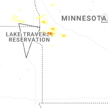
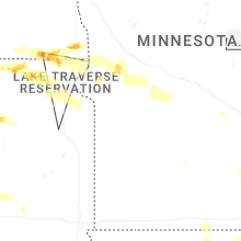

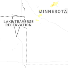
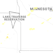


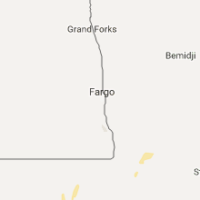


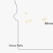


Connect with Interactive Hail Maps