

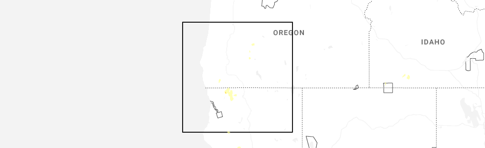
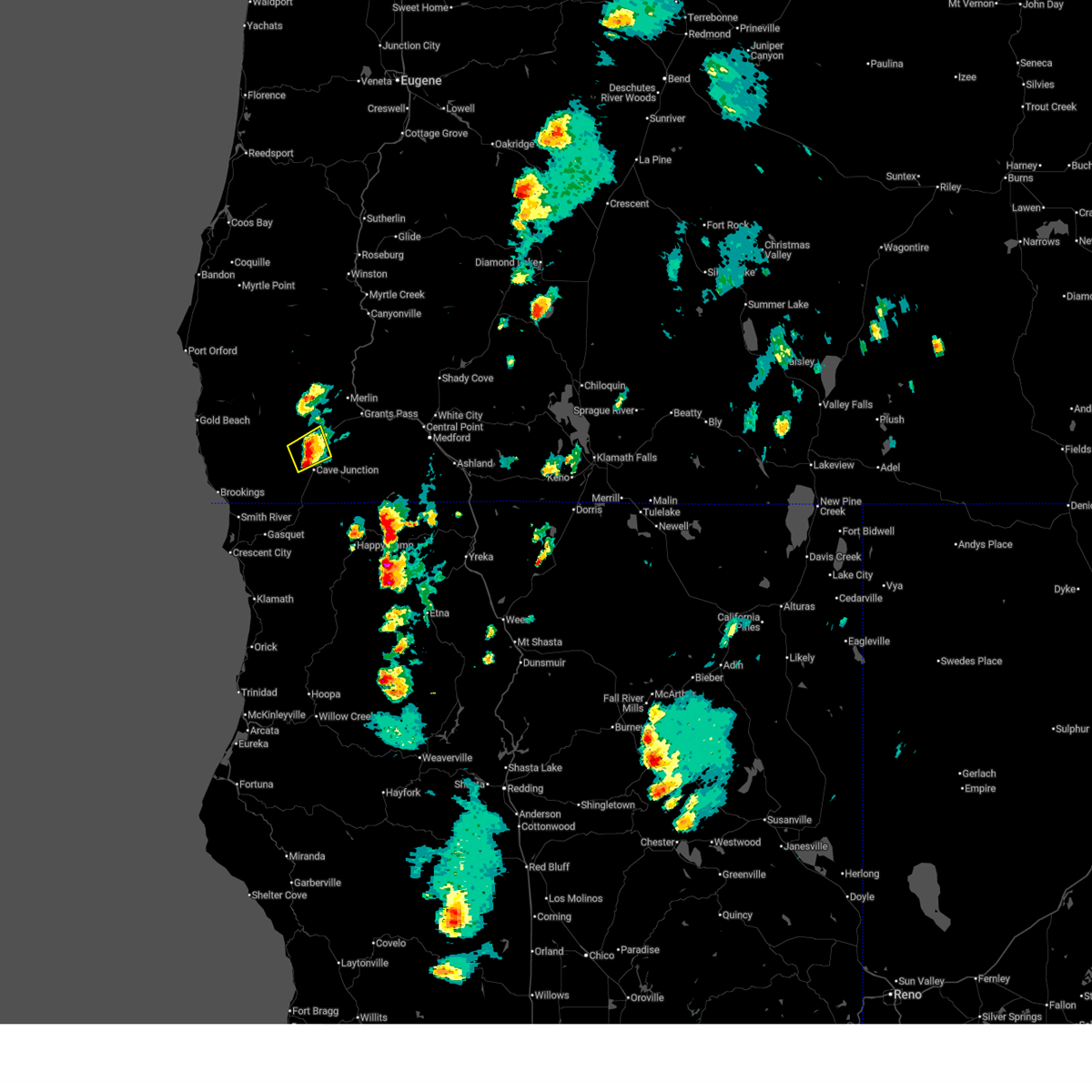
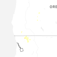
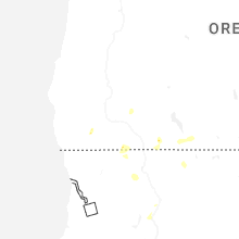
Hail Map for Kerby, OR
The Kerby, OR area has had 0 reports of on-the-ground hail by trained spotters, and has been under severe weather warnings 6 times during the past 12 months. Doppler radar has detected hail at or near Kerby, OR on 2 occasions, including 2 occasions during the past year.
| Name: | Kerby, OR |
| Where Located: | 40.6 miles WSW of Medford, OR |
| Map: | Google Map for Kerby, OR |
| Population: | 595 |
| Housing Units: | 270 |
| More Info: | Search Google for Kerby, OR |
5
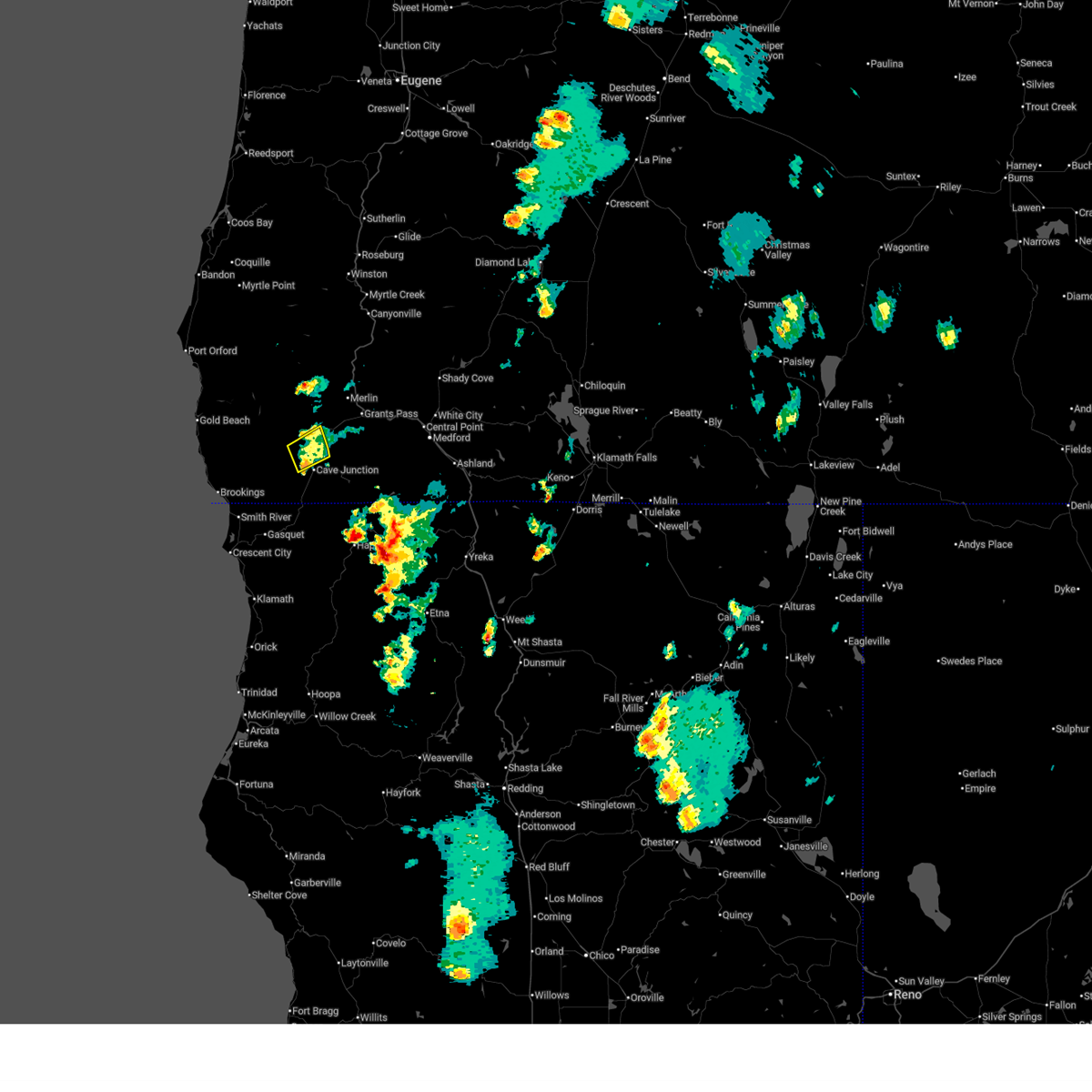
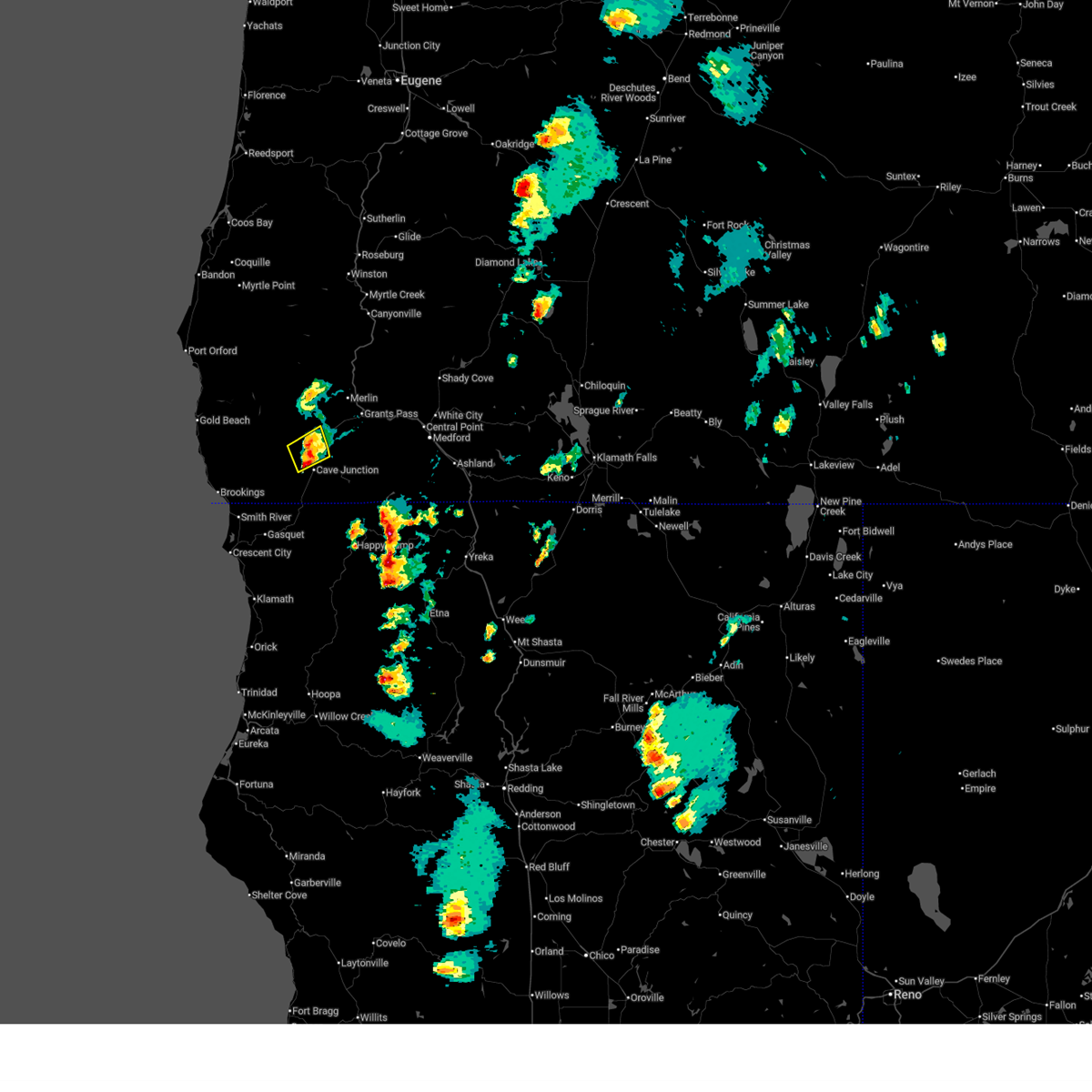
The Top Recent Hail Date for Kerby, OR is Friday, August 1, 2025 (1st out of 2)
Hail and Wind Damage Spotted near Kerby, OR
| Date / Time | Report Details |
|---|---|
| 8/1/2025 5:37 PM PDT |
 The storm which prompted the warning has weakened below severe limits, and no longer poses an immediate threat to life or property. therefore, the warning will be allowed to expire. however small hail and gusty winds are still possible with this thunderstorm. The storm which prompted the warning has weakened below severe limits, and no longer poses an immediate threat to life or property. therefore, the warning will be allowed to expire. however small hail and gusty winds are still possible with this thunderstorm.
|
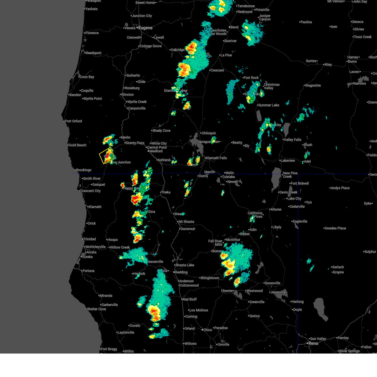
| 8/1/2025 5:31 PM PDT |
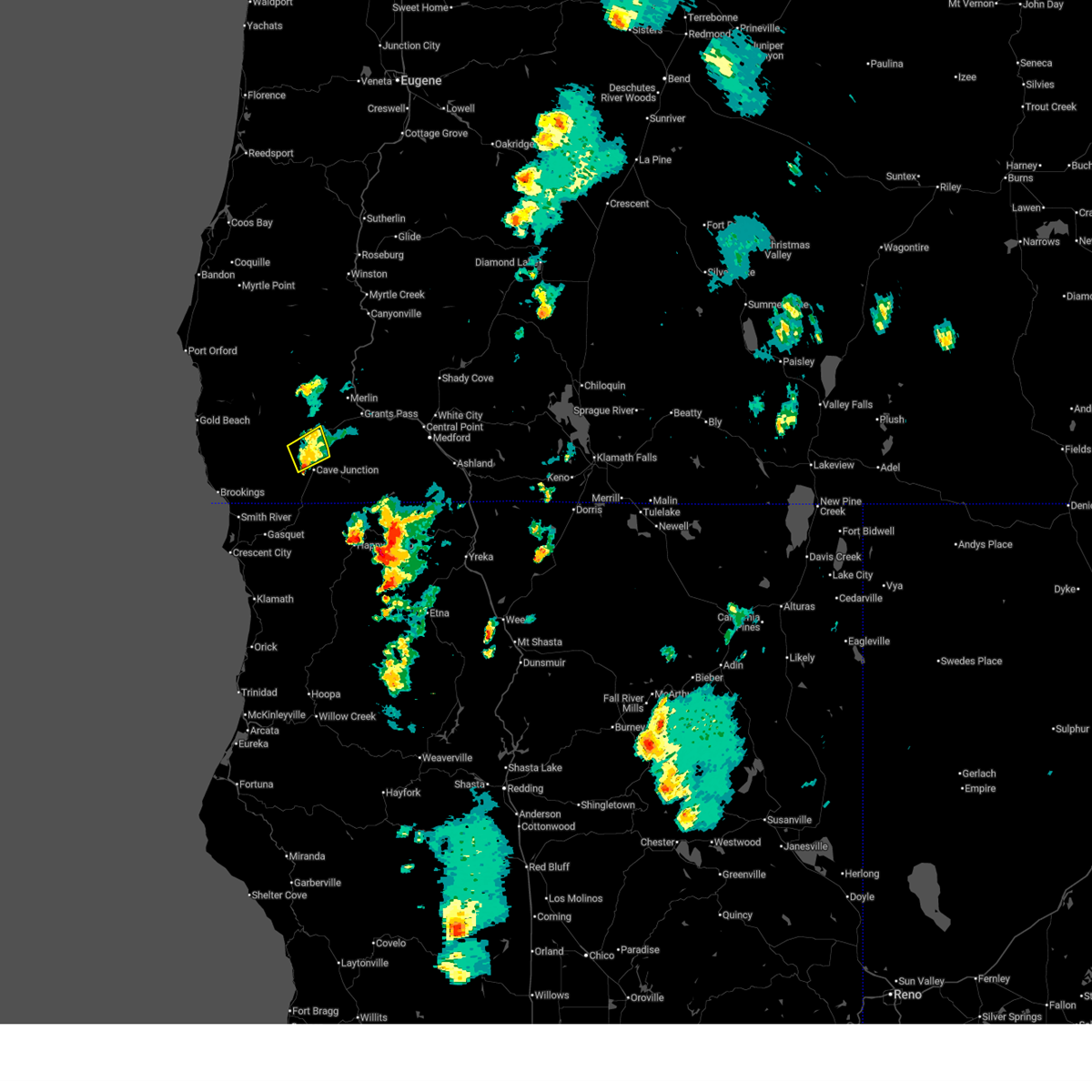 At 531 pm pdt, a severe thunderstorm was located near selma, or 7 miles north of cave junction, and is nearly stationary (radar indicated). Hazards include quarter size hail. winds up to 50 mph. Damage to vehicles is expected. Locations impacted include, highway 199 hayes hill summit, lake selmac park, selma, and kerby. At 531 pm pdt, a severe thunderstorm was located near selma, or 7 miles north of cave junction, and is nearly stationary (radar indicated). Hazards include quarter size hail. winds up to 50 mph. Damage to vehicles is expected. Locations impacted include, highway 199 hayes hill summit, lake selmac park, selma, and kerby.
|
| 8/1/2025 5:19 PM PDT |
 At 519 pm pdt, a severe thunderstorm was located near selma, or 7 miles north of cave junction, and is nearly stationary (radar indicated). Hazards include 60 mph wind gusts and quarter size hail. Hail damage to vehicles is expected. expect wind damage to roofs, siding, and trees. Locations impacted include, highway 199 hayes hill summit, lake selmac park, selma, and kerby. At 519 pm pdt, a severe thunderstorm was located near selma, or 7 miles north of cave junction, and is nearly stationary (radar indicated). Hazards include 60 mph wind gusts and quarter size hail. Hail damage to vehicles is expected. expect wind damage to roofs, siding, and trees. Locations impacted include, highway 199 hayes hill summit, lake selmac park, selma, and kerby.
|
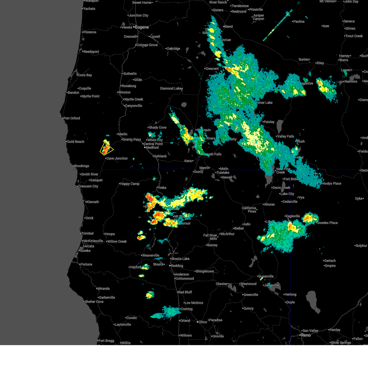
| 8/1/2025 5:09 PM PDT |
 At 509 pm pdt, a severe thunderstorm was located near selma, or near cave junction, and is nearly stationary (radar indicated). Hazards include 60 mph wind gusts and quarter size hail. Hail damage to vehicles is expected. expect wind damage to roofs, siding, and trees. Locations impacted include, highway 199 hayes hill summit, lake selmac park, selma, and kerby. At 509 pm pdt, a severe thunderstorm was located near selma, or near cave junction, and is nearly stationary (radar indicated). Hazards include 60 mph wind gusts and quarter size hail. Hail damage to vehicles is expected. expect wind damage to roofs, siding, and trees. Locations impacted include, highway 199 hayes hill summit, lake selmac park, selma, and kerby.
|
| 8/1/2025 4:57 PM PDT |
 Svrmfr the national weather service in medford has issued a * severe thunderstorm warning for, southeastern curry county in southwestern oregon, south central josephine county in southwestern oregon, * until 545 pm pdt. * at 457 pm pdt, a severe thunderstorm was located near kerby, or near cave junction, and is nearly stationary (radar indicated). Hazards include 60 mph wind gusts and quarter size hail. Hail damage to vehicles is expected. Expect wind damage to roofs, siding, and trees. Svrmfr the national weather service in medford has issued a * severe thunderstorm warning for, southeastern curry county in southwestern oregon, south central josephine county in southwestern oregon, * until 545 pm pdt. * at 457 pm pdt, a severe thunderstorm was located near kerby, or near cave junction, and is nearly stationary (radar indicated). Hazards include 60 mph wind gusts and quarter size hail. Hail damage to vehicles is expected. Expect wind damage to roofs, siding, and trees.
|
| 7/31/2025 5:59 PM PDT |
 Svrmfr the national weather service in medford has issued a * severe thunderstorm warning for, central josephine county in southwestern oregon, * until 630 pm pdt. * at 559 pm pdt, a severe thunderstorm was located over selma, or 8 miles north of cave junction, moving northeast at 10 mph (radar indicated). Hazards include 60 mph wind gusts and quarter size hail. Hail damage to vehicles is expected. Expect wind damage to roofs, siding, and trees. Svrmfr the national weather service in medford has issued a * severe thunderstorm warning for, central josephine county in southwestern oregon, * until 630 pm pdt. * at 559 pm pdt, a severe thunderstorm was located over selma, or 8 miles north of cave junction, moving northeast at 10 mph (radar indicated). Hazards include 60 mph wind gusts and quarter size hail. Hail damage to vehicles is expected. Expect wind damage to roofs, siding, and trees.
|
Hail Maps for Kerby, OR
Connect with Interactive Hail Maps